9 ETAPPEN | 131 KM


9 ETAPPEN | 131 KM








„Reisen heißt, an ein Ziel kommen. Wandern heißt, unterwegs sein …“
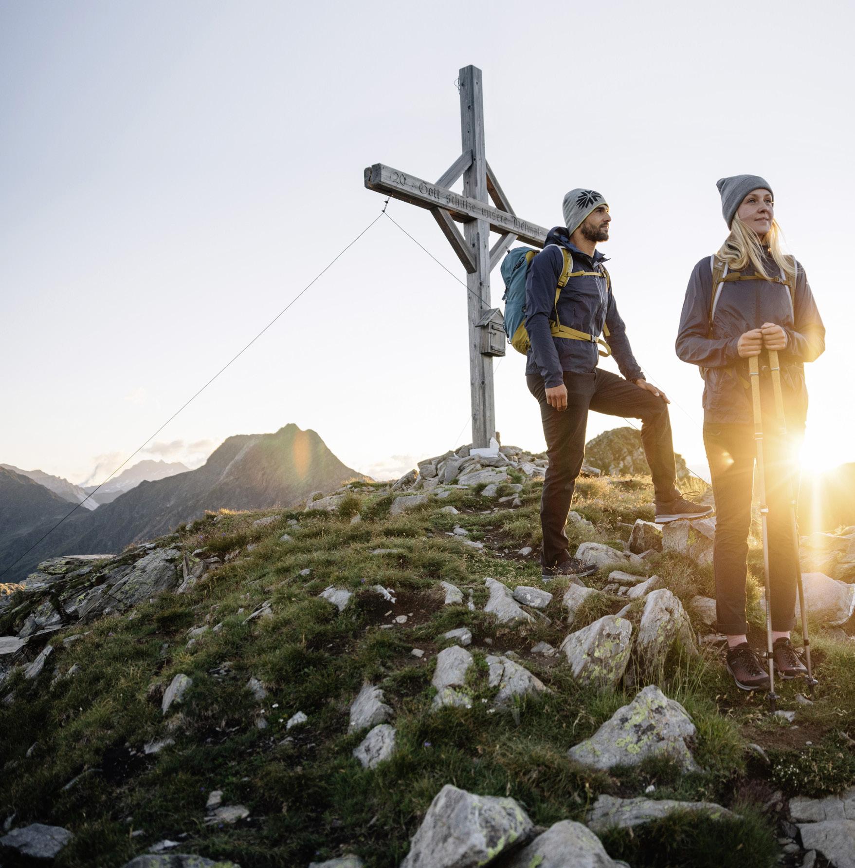
Auf dem Paznauner Höhenweg zu wandern und die Natur jeden Tag aufs Neue genießen, gehört auf jeden Fall auf die To-Do-Liste aller Bergsportler, Naturliebhaber und Wanderer. Selten zeigt sich das Landschaftsgesicht des Paznaun auf so vielfältige Weise wie auf dem Höhenweg.
Wege unterschiedlichster Charakteristik und faszinierende Panoramablicke begleiten den Wanderer. Die saftigen Almwiesen und romantischen Lärchenwälder des Untertales zu Beginn des Weges lässt man ebenso hinter sich wie steile und steinige Wegpassagen in hochalpinem Gelände, die einen an schroffen Gipfeln und Felsformationen vorbeiführen und schlussendlich wieder ins Tal hinunterführen. Wie die Landschaften sind auch die Orte voller Kontraste.
Der Höhenweg startet in See und verläuft taleinwärts in alpinem Gelände hoch über die Ortschaften Kappl und Ischgl bis nach Galtür – danach führt der Weg auf der anderen Talseite wieder retour zum Ausgangspunkt in See. Der Höhenweg kann in beide Richtungen und etappenweise erkundet werden. Von jeder Hütte gibt es Abstiegsmöglichkeiten ins Tal und ebenso Aufstiegsmöglichkeiten vom Tal.
Die gesamte Tour erfordert neun Tage und ist für durchschnittlich konditionierte Bergwanderer ausgelegt. Die Hütten entlang des Weges dienen als Stützpunkte. Auf der gesamten Strecke gibt es fünf Hüttenübernachtungen und vier Übernachtungen in den Ortschaften im Tal.
Entlang des Paznauner Höhenweges finden sich Almhütten & Bergrestaurants mit ausgezeichneten traditionellen sowie modernen Gerichten. Somit ist für jeden Geschmack etwas dabei. Die Hüttenwirte sorgen aber nicht nur für Speis und Trank, sondern sind auch bei der Tourenplanung behilflich. Die Verfügbarkeiten & Öffnungszeiten der Hütten findest du online.
Auf dem Paznauner Höhenweg passierst du auf jeder Etappe unterschiedliche Vegetationszonen, Wälder und Gesteine. Hier findest du alle interessanten Infos zu der beeindruckenden Natur, in der du dich bewegst:

Wandern wird belohnt
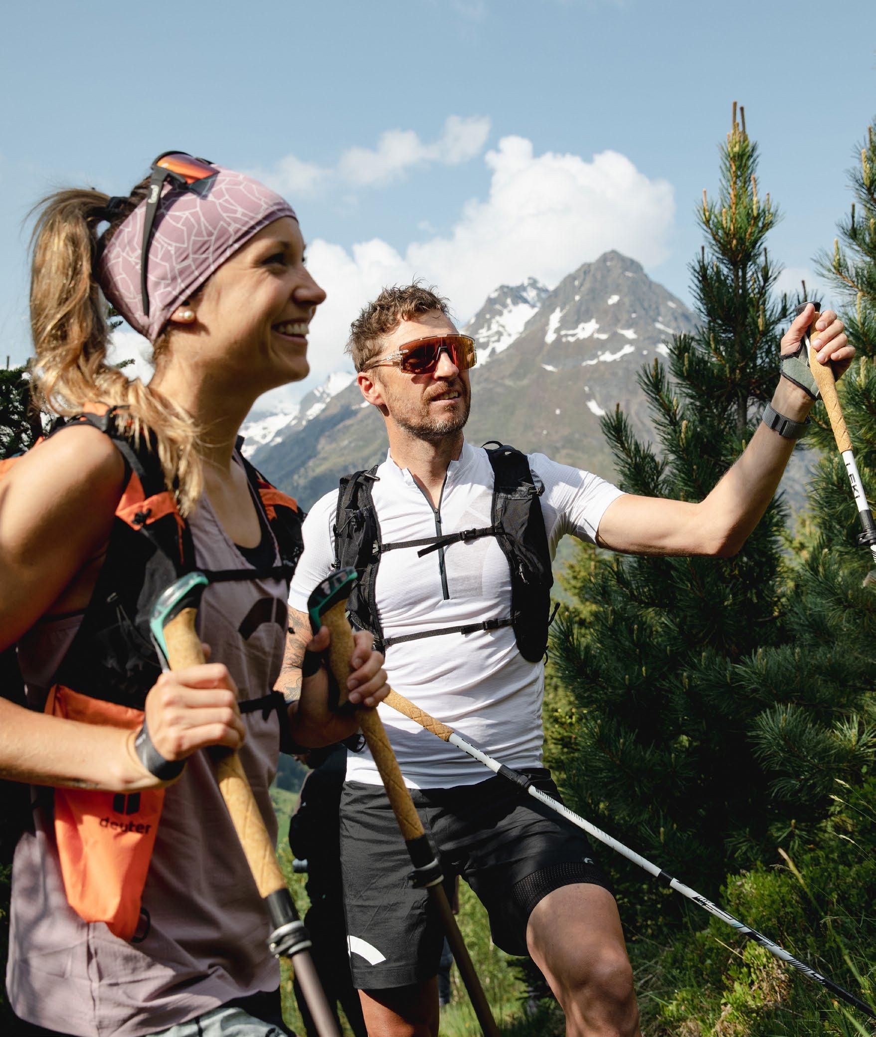
Wer den gesamten Höhenweg bewältigt und alle Stempel der Hütten im Guide sammelt (Seite 51), hat sich dafür auch eine Belohnung verdient! Wenn alle Stempel gesammelt sind, erhält man in den Infobüros des Tourismusverbands ein exklusives Goodie von LEKI.
“Travelling is about reaching a destination, hiking is about being on a journey …”
Hiking along the Paznaun High Route and enjoying nature every day should be at the top of the to-do list of any mountain enthusiast, nature lover and avid hiker. The High Route is one of the best places to experience the wide variety of landscapes the Paznaun valley has to offer.
Hikers are met with different types of terrain and fascinating panoramic views. At the start, the route runs across lush Alpine meadows and through the romantic larch forests of the Untertal. Later on, you hike along high-alpine terrain, featuring steep and stony sections, rugged peaks and rock formations, eventually leading you back down to the valley. The villages along the way are just as varied as the trail’s terrain.
The High Route starts in See and takes you further into the valley along the alpine terrain high above the villages of Kappl and Ischgl. Once you have reached Galtür, the trail loops back to See along the other side of the valley. The High Route can be done in both directions and in separate sections. At every mountain lodge, there is an access route from and to the valley.
The entire tour takes nine days and is suitable for hikers with an average fitness. The mountain lodges along the way make for great base camps. In total, there are five overnight stays at mountain lodges, and four overnight stays down in the valley’s villages.
To fuel up during your hike, numerous mountain lodges and restaurants along the way offer traditional and modern delicacies. In addition to tasty food and drinks, the inn keepers will also be happy to supply you with useful tips for your tour planning. You can find all mountain lodges opening times and vacancies online.
Along the Paznaun High Route, you pass through several vegetation zones, forests and rock landscapes. Find out more about the awe-inspiring nature you will hike through:

A hiker‘s reward
If you have completed the entire High Route and collected all stamps at the mountain lodges listed in the guide (page 51), you have earned a reward! If you show your stamps at the local Tourist Information, you will receive an exclusive goodie by LEKI.


Aufstieg: 9.733 Höhenmeter
Abstieg: 8.723 Höhenmeter
Stunden: ca. 60 Stunden
Länge: 131,1 Kilometer
Ascent: 9,733 vertical metres
Descent: 8,723 vertical metres
Duration: approx. 60h
Distance: 131.1 km
Gut vorbereitet ist halb gewandert…
10 Tipps:
» Nur fit in die Berge und nicht erst „fit durch die Berge“.
» Keine Bergwanderung ohne sorgfältige Tourenplanung (Wetter, Gelände, Erfahrung, Trittsicherheit & Schwindelfreiheit beachten).
» Für die geplante Tour die richtige Ausrüstung mitnehmen (Bergschuhe, Funktionskleidung, Stöcke, Hüttenübernachtung).
» Informationen über die Tour und die Wetterverhältnisse einholen.
» Alle zwei Stunden eine zehnminütige Rast einlegen.
» Während der Tour ausgiebig trinken und essen.
» Niemals den markierten Weg verlassen!
» Bei Gefahr oder Wetterverschlechterung die Tour rechtzeitig abbrechen.
» Eine Notfallausrüstung (Erste-Hilfe-Box, Biwaksack, Taschenlampe, Handy) gehört in jeden Rucksack.
Der Höhenweg verläuft in hochalpinem Gelände, wo das Wetter sehr schnell umschlagen kann und man mitunter auch im Sommer mit tiefen Temperaturen und Schnee rechnen muss. Informiere dich vorab über die vorherrschende Wettersituation und plane dementsprechend.
Die angegebenen Gehzeiten sind Durchschnittswerte, längere Pausen sind nicht eingerechnet worden. Widrige Wetterbedingungen können die Gehzeit und Schwierigkeit der Etappen erheblich erhöhen.
Beschilderung des Paznauner Höhenwegs
Der Paznauner Höhenweg verfügt über eine durchgängige Wanderwegbeschilderung und ist durch das folgende Symbol gekennzeichnet:

10 tips:
» Hiking makes you fit – but you should already have a certain level of fitness before your hike.
» Always take the time to plan your route in advance (check the weather forecast, terrain descriptions, reviews, required skill levels etc.).
» Pack appropriate equipment for your selected route (hiking boots, functional clothing, poles, necessities for sleeping at a mountain lodge).
» Prepare for your hike by reading up on route details and checking the weather forecast.
» Take a ten-minute break every two hours during your hike.
» Make sure to eat and drink sufficiently during your tour.
» Do not leave the marked trails!
» In case of imminent danger or deteriorating weather, discontinue your hike.
» Carry equipment (first-aid box, bivvy sack, torch, mobile phone) in your backpack.
The High Route runs through high-alpine terrain, where the weather can change quickly and where there can be low temperatures and snow even in summer. Read up on the weather situation before your tour and plan accordingly.
Please note that all indicated walking times are average values. They do not include longer breaks. Also keep in mind that adverse weather can significantly increase walking times as well as the difficulty of certain sections.
Signposting of the Paznaun High Route
The Paznaun High Route has a continuous hiking path signposting and is marked by the following symbol:
Verhalten bei Unfällen
Im Notfall ruhig bleiben und die Bergrettung verständigen (ALPINER NOTRUF 140).
» Verletzten vor Steinschlag, Absturz, Lawine etc. sichern.
» Erste Hilfe (Atmung, Kreislauf, Blutstillung, Schienung etc.) leisten.
» Verletzten vor Wettereinflüssen (Wind, Regen, Sonne etc.) schützen.
» Verletzten niemals allein lassen. Dauernder Zuspruch und Halt sind überlebensnotwendig.
In regelmäßigen Abständen sechs Mal in der Minute ein optisches oder akustisches Zeichen – hierauf eine Minute Pause – wiederholen, bis Antwort festzustellen ist.
Wenn Hilfealarmierung von der Unfallstelle aus nicht möglich ist:
» Melder steigt ab um Hilfe zu holen.
» Wenn möglich, Verletzten aber nicht allein lassen.
» Wenn möglich, nicht allein absteigen.
» Folgende Daten schriftlich mitgeben: Genauer Unfallort, Art der Verletzung, Anzahl der (un-)verletzten Gruppenmitglieder.
» Warme Kleidung, Regenschutz und Verpflegung beim Verletzten zurücklassen.


In case of emergency, stay calm and contact mountain rescue services (ALPINE EMERGENCY NUMBER 140)!
» Protect the injured person from rockfall, falls, avalanches, etc.
» Provide first aid (check breathing and circulation, staunch bleedings, apply splints).
» Protect the injured person from the elements (wind, rain, sunshine).
» Don’t leave the injured person on their own! It’s vital to provide constant support.
Alpine distress signal:
An audible or visible signal given six times per minute, followed by a pause of one minute. Repeat until you receive an answer.
If it is not possible to call for help from the emergency site, proceed as follows:
» One person climbs down to get help.
» If possible, the injured person should not be left on their own.
» If possible, don’t climb down on your own.
» As soon as you can ask for assistance, give the following information: exact location, type of injury, number of injured and uninjured persons.
» Leave warm clothing, rain protection and provisions with the injured person.


Etappenstart: See
Etappenziel: Ascher Hütte
SEE | FRÖDENEGG | GIGGL | GIGGLER ALM | ASCHER HÜTTE
Der Paznauner Höhenweg beginnt in See bei der Pfarrkirche auf 1.056 m und folgt dem asphaltierten Weg bis zum östlichsten Weiler Oberfrödenegg. Weiter geht es auf dem unschwierigen Steig durch das sogenannte „Giggler Tobel“, wo um 1809 die Giggler-TobelSchlacht stattgefunden hat, vorbei an dem unbewirtschafteten Almstüberl, bis zur Fahrweggabelung in Giggl. Dem Wegweiser Richtung Ascher Hütte kurz abwärts folgen bis zur neuerlichen Fahrweggabelung, den oberen Fahrweg nehmen, bis bei der Üblikapelle der eigentliche Höhenweg beginnt. Von dort erreicht man die unbewirtschaftete, aber wunderschön gelegene Giggler Alm auf 1.845 m, die inmitten der lieblichen Almenlandschaft zum Verweilen einlädt.
Ab der Giggler Alm wandert man taleinwärts durch romantische Lärchenwälder, quert den Gigglbach und muss ein ziemliches Steilstück überwinden, bevor man am Ausblick Unterpaznaun einen Traumplatz erreicht, der seinesgleichen sucht. Aus kaum einem anderen Platz kann das gesamte Unterpaznaun besser eingesehen werden. Hier etwas zu verweilen und die Bergwelt zu genießen ist fast Pflicht.
Ab hier wandert man genussvoll über immer markierte Steige zum ersten Etappenziel, der Ascher Hütte auf 2.256 m.

Start of stage: See
End of stage: Ascher Hütte lodge
SEE | FRÖDENEGG | GIGGL | GIGGLER ALM | ASCHER HÜTTE
The Paznaun High Route starts at the parish church of See at 1,056 metres above sea level and follows the asphalt path to the eastern hamlet of Oberfrödenegg. The route continues along an easy trail through the “Giggler Tobel”, where the battle of the Giggler-Tobel took place in 1809. Passing by the unmanaged “Almstüberl” lodge, continue towards the fork in the path at Giggl. From there, follow the signpost to Ascher Hütte lodge for a short downhill section until you reach another fork. Take the upper trail there and follow it until the actual High Route starts at Üblikapelle chapel. From there, continue towards the picturesque, unmanaged Giggler Alm at 1,845 metres above sea level, which is surrounded by gorgeous Alpine meadows.
From Giggler Alm, the trail takes you further into the valley, through romantic larch forests, across Gigglbach creek and a steeper section until you reach the scenic Unterpaznaun lookout point, one of the best spots to enjoy views of the entire lower Paznaun valley and an extended break.
From there, continue along easy, signposted trails towards the finish of the first stage, Ascher Hütte at 2,256 metres above sea level.

m
Üblikapelle
Giggler Alm 1.843 m
Ausblick Unterpaznaun


INTERAKTIVE KARTE

Aufstieg: 1.285 hm
Ascent: 1,285 vm
Abstieg: 92 hm
Descent: 92 vm
Highlights
Blick auf die Verwallgruppe
Üblikapelle
Giggler Alm
Stunden: 6-7 h
Duration: 6-7 h
Länge: 13,1 km
Distance: 13.1 km
Highlights
Views of the Verwall mountains
Üblikapelle chapel
Giggler Alm
Ausblick Unterpaznaun Unterpaznaun lookout point



Etappenstart: Ascher Hütte
Etappenziel: Kappl
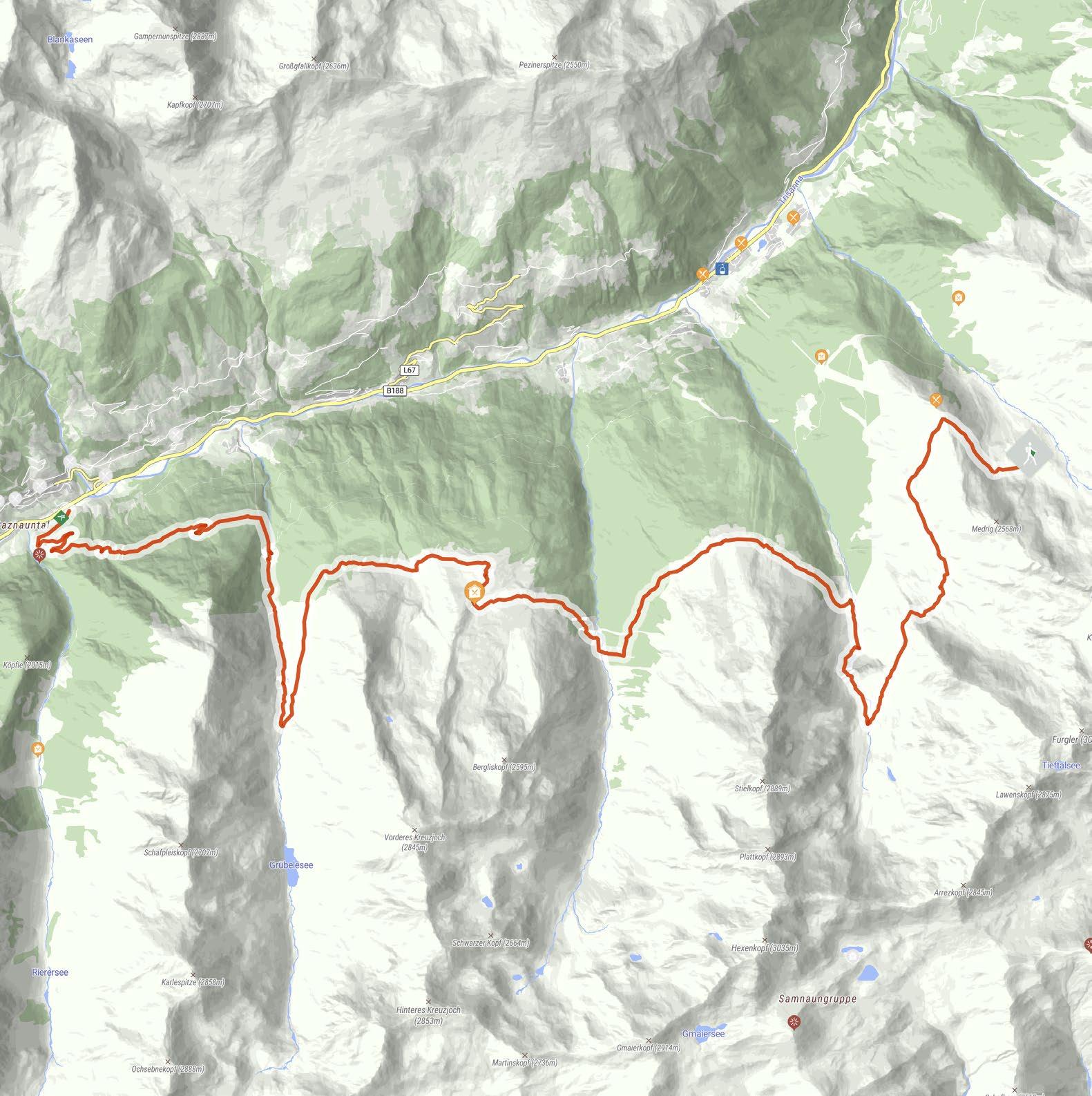
ASCHER HÜTTE | MEDRIG | FURGLERTAL | BERGLI | STIELALPE | FLATH | ALPE GAMPERTHUN | GRÜBELE SEE | ROTWEGKAPELLE | KAPPL
Von der Ascher Hütte geht es weiter auf dem Hüttenweg über die Medrig bis zum Gratli. Ab hier beginnt der markierte Fußweg, bei der nächsten Weggabelung nimmt man den unteren Weg. Von hier aus hat man einen wunderschönen Weitblick ins Istalanztal und die Berglialpe. Der Steig führt weiter ins Furglertal bis zum Wegkreuz, bei dem man sich an den Wegweiser Richtung Masnerjoch hält. Der folgende Steig führt oberhalb der BerglisWand, auch Schwarze Wand genannt, hinein ins Bergli und ist relativ ausgesetzt. Ab dem Wegkreuz im Bergli geht es wieder talabwärts bis zur Kreuzung, ab der es wieder bergauf zur einsamen, aber prächtigen Stielalpe auf 2.050 m geht.
Entlang der Flanke geht es über den Stielwald weiter ins Flathtal, wo schon der letzte Aufstieg des Tages bis zur Alpe Gamperthun auf 2.070 m wartet. Die Alm ist bewirtschaftet und lädt zu einer wohlverdienten Rast ein. Der Weg führt weiter zur exponiert gelegenen Kapelle und entlang des Almweges hinein ins Grübeletal bis zur „außeren“ Almhütte. Alternativ kann man noch ein kurzes Stück weiter bis zum idyllischen Grübelesee gehen. Nach der außeren Almhütte zweigt nach ca. 500 m der Fußsteig ins Tal ab, ein Holzsteg führt über den Grübelebach.
Es geht talabwärts bis zum Forstweg und weiter Richtung Panoramaweg. Über eine Abzweigung gelangt man wieder auf den Forstweg, der vorbei an der Rotwegkapelle nach Kappl führt.

Etappenstart: Ascher Hütte lodge
Etappenziel: Kappl
ASCHER HÜTTE | MEDRIG | FURGLERTAL | BERGLI | STIELALPE | FLATH | ALPE GAMPERTHUN | GRÜBELE SEE | ROTWEGKAPELLE | KAPPL
From Ascher Hütte lodge, follow the mountain lodge trail via Medrig to Gratli, where the marked footpath starts. At the next fork in the trail, continue along the lower trail, which grants you breathtaking views as far as the Istalanz valley and Berglialpe. Follow the trail through the Furgler valley until you reach a wayside cross. From there, continue towards Masnerjoch. The trail now runs above Berglis Wall (also known as the Black Wall) into the Bergli, and is relatively exposed. From the wayside cross at Bergli, the trail continues downhill until you reach a fork. Follow the uphill trail until you reach the remote but magnificent Stielalpe at 2,050 metres above sea level.
From there, continue along the mountainside further into the Flath valley, where the last ascent of the day up to Alpe Gamperthun at 2,070 metres above sea level is waiting for you. The mountain lodge there is open for business and a perfect spot for a well-deserved break. Afterwards, follow the trail to the exposed chapel, further into Grübele valley and up towards the “outer” mountain lodge. Alternatively, continue a little longer until you reach picturesque Lake Grübelesee. About 500 metres after the outer mountain hut, the footpath branches off down to the valley, with a wooden bridge leading across Grübelebach creek.
From there, continue your way down into the valley along the forest road and towards the Panoramic Trail. Via a fork in the trail, you get back to the forest trail that takes you past Rotwegkapelle chapel and back to Kappl.
Großgfallkopf (2636m)
Kapfkopf (2707m)
Kappl 1.258 m
Panoramaweg
Rotwegkapelle
Köpfle (2015m)
Alpe Gamperthun 2.070 m

Pezinerspitze (2550m)
Start 2.256 m
Weitblick Instalanztal
Stielalpe
Kapelle
Bergliskopf (2595m)
Grübelesee
Vorderes Kreuzjoch (2845m)
Schafpleiskopf (2707m)
Karlespitze (2858m)
Hinteres Kreuzjoch (2853m)
Martinskopf (2736m)
Gmaierkopf (2914m)
Stielkopf (2889m)
Berglis-Wand
Plattkopf (2893m)
Hexenkopf (3035m)


INTERAKTIVE KARTE


Aufstieg: 642 hm
Ascent: 642 vm
Abstieg: 1.718 hm
Descent: 1,718 vm
Highlights
Alpe Gamperthun 2.070 m
Kappl 1.258 m
Stunden: 8 h
Duration: 8 h
Länge: 22,6 km
Distance: 22.6 km
Highlights
Blick ins Istalanztal & Berglialpe views across the Istalanz valley & Berglialpe
Bergliswand, Stielalpe Berglis Wall, Stielalpe
Kapelle bei Alpe Gamperthun chapel at Alpe Gamperthun
Grübelesee
Panoramaweg, Rotwegkapelle

Lake Grübelesee
Panoramic Trail, Rotwegkapelle chapel


Etappenstart: Kappl
Etappenziel: Ischgl
KAPPL | ROTWEGKAPELLE | VISNITZ ALPE | UNTERE ZOLLHÜTTE | OBERE ZOLLHÜTTE | ÖSTLICHES
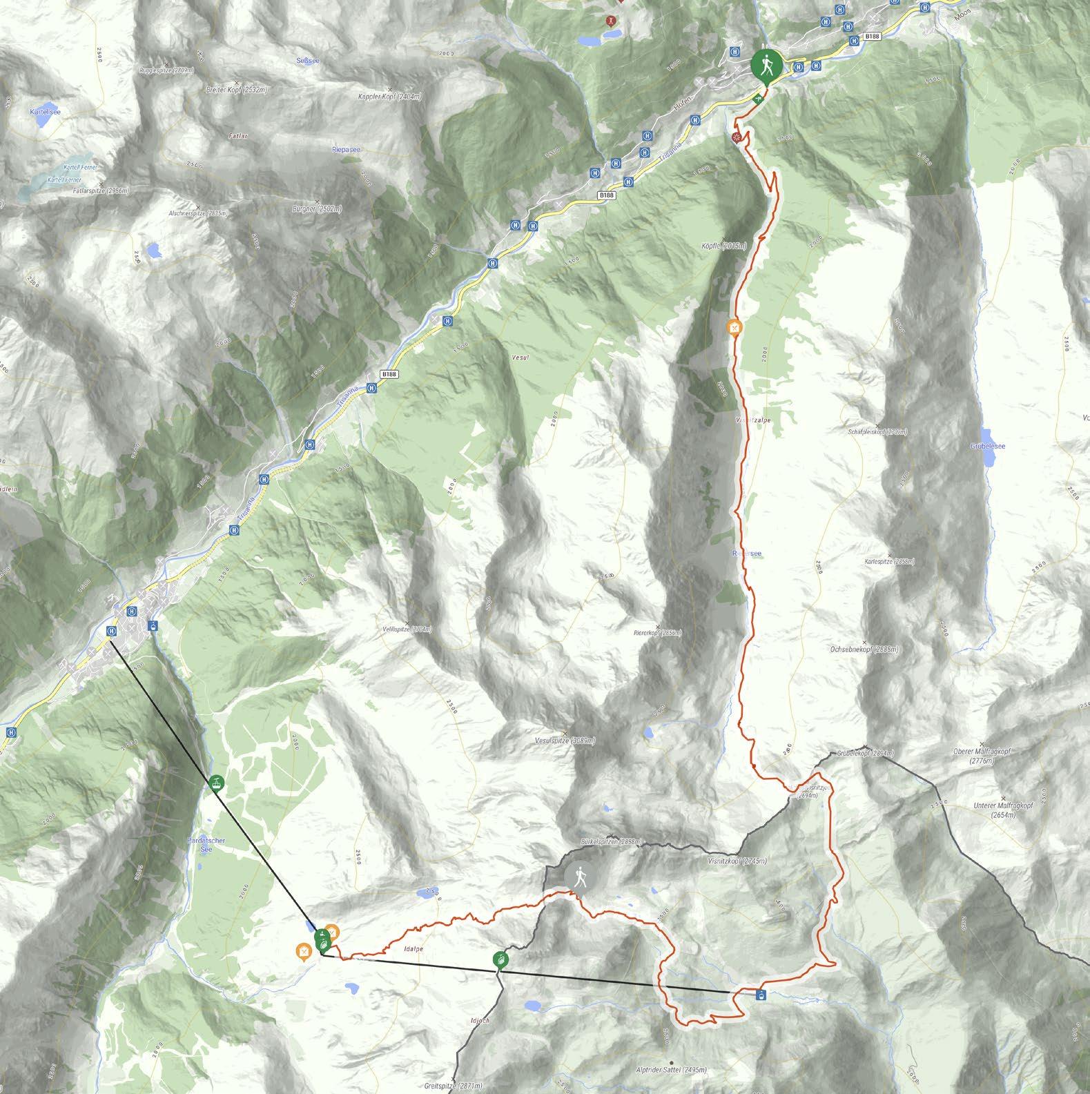
Von der Talstation der Diasbahn aus dem Wegweiser Richtung Samnaun folgen, vorbei an der Rotwegkapelle und durch den dichten Wald weiter bergauf. Über einige Abkürzungen und Almwege gelangt man auf die Visnitz Alpe auf 1.825 m. Weiter im Tal zweigt der Fußsteig ab und die eigentliche „Schmugglerroute“ beginnt. Auf Wegen wie diesem wurden früher hochwertige Güter vom benachbarten Samnaun (CH) ins Paznaun geschmuggelt. Ziemlich am Ende des Visnitztals befindet sich die untere Zollhütte und kurz danach die obere Zollhütte. Von dort führt ein sehr schmaler und steiler Pfad zum östlichen Visnitzjoch auf 2.694 m.
Vom östlichen Visnitzjoch steigt man in die Schweiz ab und gelangt oberhalb der Alp Bella auf 2.380 m auf einen Steig, der rund um den Mullersattel, vorbei an den Seen und danach bergab auf die Alp Trida führt. Von der Alp Trida führen die Sessellifte N1 Flimsattelbahn, B2 Flimjochbahn und die Gondeln A1 Silvrettabahn oder A3 Fimbabahn ins Tal nach Ischgl.
Variante ohne Lifte: Rund um den Mullersattel führen die Wegweiser Richtung Flimjoch auf 2.757 m. Ab dem Flimjoch geht es bergab, über die obere Velillalpe auf 2.061 m führen markierte Wege, Fahrwege und Pistenabschnitte hinunter ins Tal nach Ischgl.
Etappenstart: Kappl
Etappenziel: Ischgl
| ROTWEGKAPELLE | VISNITZ ALPE | UNTERE
From the valley station of Diasbahn cable car, follow the signpost towards Samnaun, passing by Rotwegkapelle chapel and continuing on the uphill trail through the dense forest. Via several shortcuts and smaller trails you get to Visnitz Alpe at 1,825 metres above sea level. Further down the valley, the footpath branches off, and the actual “Smugglers’ Circuit” begins. Back in the days, trails like these were used to smuggle valuable goods from the neighbouring Samnaun (Switzerland) to the Paznaun valley. Towards the end of Visnitz valley, you can find the Untere Zollhütte and, a little further still, the Obere Zollhütte. From there, a very narrow and steep trail runs to the eastern Visnitzjoch at 2,694 metres above sea level.
From the eastern Visnitzjoch, the trail leads down to Switzerland, and you continue along a path that runs above Alp Bella at 2,380 metres above sea level, taking you around Mullersattel, past the Lakes and down to Alp Trida. From Alp Trida, you can use the chairlifts N1 Flimsattelbahn and B2 Flimjochbahn, and the cable cars A1 Silvrettabahn or A3 Fimbabahn to get back down to the valley to Ischgl.
Alternative route without cable cars and lifts: Follow the signposts around Mullersattel towards Flimjoch at 2,757 metres above sea level. From Flimjoch, the trail runs downhill, taking you past Obere Velillalpe at 2,061 metres above sea level down to Ischgl on marked trails, forest roads and slope sections.
Fatlarspitze (2986m)
Kappl
Start 1.258 m
Rotwegkapelle
Köpfle (2025m)
Visnitz Alpe 1.825 m
Schafpleiskopf (2707m)
Karlespitze (2858m)
Ischgl
Ischgl 1.337 m
Velillspitze (2704m)
Idalp (2320m)
Vider Alp (2300m)
Vesulspitze (3089m)
Riererkopf (2856m) Ochsebenekopf (2888m)
Altes Zollhaus 2.694 m
östliches Visnitzjoch
Grübelekopf (2894m)
Bürkelspitzen (2888m) Bürkelkopf (3033m) Flimjoch 2.757m
Seen am Mullersattel
Visnitzkopf (2745m)
Alp Trida (2250m)
Greitspitze (2871m)


INTERAKTIVE KARTE


Aufstieg: 1.565 hm
Ascent: 1,565 vm
Abstieg: 477 hm
Descent: 477 vm
Highlights
Visnitz Alpe
Stunden: 9 h
Duration: 9 h
Länge: 12,8 km
Distance: 12.8 km
Visnitz Alpe
östliches Visnitzjoch eastern Visnitzjoch
Seen am Mullersattel Lakes at Mullersattel


Etappenstart: Ischgl
Etappenziel: Galtür
ISCHGL | TSCHAMATSCHKOPF | RAUHER KOPF | AUSSERBERGLI | INNERBERGLI | LAREIN ALPE | STAFALI | GALTÜR
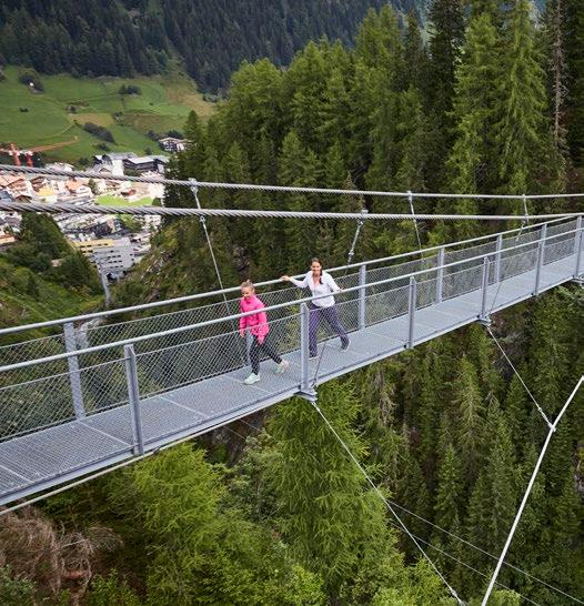
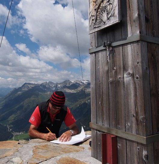
Der Weg geht weiter bei der Talstation der Pardatschgratbahn und führt zur Hängebrücke Kitzloch. Nach Querung des Fimbabachs gelangt man bald zum Fußsteig und folgt dem Wegweiser Rauher Kopf. Bevor man den Gipfel erreicht, muss ein anstrengendes Steilstück durch den Wald bewältigt werden, bis zur Jagdhütte am Tschamatschkopf auf 2.145 m. Von dort aus hat man einen weiten Blick über das sommerliche Skigebiet Silvretta Arena. Über einen hügeligen Steig gelangt man über die weite Hochebene auf den Rauher Kopf auf 2.478 m. Der imposante Ausblick auf das gesamte Paznauntal lädt zum Verweilen ein.
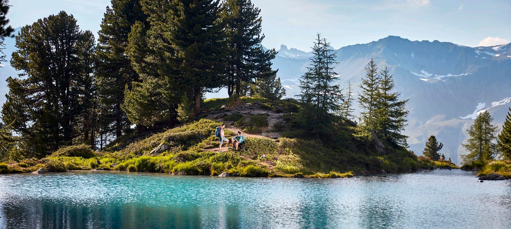
Weiter vom Gipfel aus führt der markierte Weg taleinwärts dem Grat entlang, von dem aus man bald zum Außerbergli auf 2.080 m absteigt. Entlang der Flanke erreicht man das Innerbergli auf 2.066 m. Vom Innerbergli kann man einen Abstecher zum türkisblauen Berglisee machen, den man nach kurzer Wegstrecke erreichen kann.
Vom Innerbergli erreicht man nach einem ausgedehnten Abstieg die bewirtschaftete Larein Alpe auf 1.860 m, auf der es eine Varietät aus hausgemachten und heimischen Köstlichkeiten zum Schlemmen gibt.
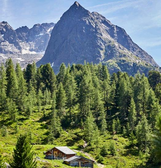
Von dort gelangt man nach einem weiteren Abstieg zum Stafali Weiher und begeht zum Ausklang den Galtürer Höhenweg.

Start of stage: Ischgl
End of stage: Galtür
ISCHGL | TSCHAMATSCHKOPF | RAUHER KOPF | AUSSERBERGLI | INNERBERGLI | LAREIN ALPE | STAFALI | GALTÜR
The next stage of the trail continues from the valley station of Pardatschgratbahn cable car and runs to the Kitzloch suspension bridge. After crossing Fimbabach river, you get to a footpath. Follow the signpost to Rauher Kopf. Before reaching the summit, there’s a steep, exhausting section that runs through the forest and up to Tschamatschkopf at 2,145 metres above sea level. From there, you can enjoy stunning views of the summerly Silvretta Arena ski area. Continue along the hilly trail towards the vast plateau and the Rauher Kopf at 2,478 metres above sea level. Once again, this is an excellent spot to enjoy scenic views of the entire Paznaun valley.
From the summit, the marked trail runs further into the valley, along the ridge that takes you down to Außerbergli at 2,080 metres above sea level. Continue along the mountainside until you reach Innerbergli at 2,066 metres above sea level. From there, you can make a short detour to turquoise Lake Berglisee.
From Innerbergli, a longer downhill section takes you to Larein Alpe mountain lodge at 1,860 metres above sea level, where you can enjoy a large variety of home-made, traditional delicacies.
From there, continue downhill towards Stafali Weiher pond and the Galtür High Route. 4
Grauer Kopf (2793m)
Vertinespleiskopf (2706m)
Vertineskopf (2683m)

Innerbergli 2.066 m
Stafali Weiher
Galtür
Galtür 1.584 m
Larein Alpe 1.862 m
Predigberg (2645m)
Berglisee
Rauher Kopf 2.478 m
Start 1.337 m
Ischgl
Hängebrücke Kitzloch Tschamatschkopf
Mittagskopf (2729m)
Berglerkopf (2903m)
Blauer Kopf (2891m)
Zirmli (2903m)
Dreiköpfl (2962m)


INTERAKTIVE KARTE


Aufstieg: 1.352 hm
Ascent: 1,352 vm
Abstieg: 1.124 hm
Descent: 1,124 vm
Highlights
Hängebrücke Kitzloch
Stunden: 7-8 h
Duration: 7-8 h
Länge: 16,7 km
Distance: 16.7 km
Highlights
Kitzloch suspension bridge
Tschamatschkopf Tschamatschkopf
Rauher Kopf
Berglisee
Stafali Weiher
Rauher Kopf
Lake Berglisee
Stafali Weiher pond

Etappenstart: Galtür
Etappenziel: Friedrichshafener Hütte
Mit 3,5 Stunden Gehzeit ist Etappe 5 die gemütlichste unter den 9 Etappen. Dennoch gilt es 850 Höhenmeter zu überwinden, bevor man das Etappenziel, die Friedrichshafener Hütte, erreicht.
Vom Dorfzentrum Galtür geht es Richtung Ortsteil Außertschafein auf 1.560 m und von hier folgt man der Beschilderung Richtung Friedrichshafener Hütte. Recht anspruchsvoll wurde dieser Weg vom Amt der Tiroler Wildbach- und Lawinenverbauung angelegt.
An zwei Stationen sind Informationstafeln angebracht, welche über Vegetation, Forstwirtschaft sowie Verbauungsmaßnahmen informieren. Ab diesem Abschnitt befindet man sich in dem Gebirge der Verwallgruppe, von der man einen Panoramablick auf die schon begangene Samnaungruppe auf der gegenüberliegenden Talseite genießen kann.
Nachdem man den Grat des Adamsbergs auf ca. 2.330 m passiert hat, führt der Weg leicht bergab über die Flanke der Hohen Köpfe bis zur Friedrichshafener Hütte, die auf 2.138 m liegt.

Start of stage: Galtür
End of stage: Friedrichshafener Hütte lodge
GALTÜR | FRIEDRICHSHAFENER HÜTTE
With a walking time of 3.5 hours, stage 5 of the trail is the most relaxed of the nine stages. Nevertheless, you have to cover 850 vertical metres to get to the end of the stage at Friedrichshafener Hütte lodge.
The stage starts at the centre of Galtür and runs via Außertschafein up to 1,560 metres above sea level. From there, follow the signposts towards Friedrichshafener Hütte. The Torrent and Avalanche Control Services of Tyrol have taken great care in developing this trail, establishing two stops with information boards about the local vegetation, forestry management and torrent control.
At this point, you enter the Verwall mountains, which offer you great panoramic views of the Samnaun mountains at the opposite side of the valley.
After passing the ridge of Adamsberg at about 2,330 metres above sea level, the trail takes you back down across the mountainside of the Hohe Köpfe to Friedrichshafener Hütte at 2,138 metres above sea level.
Vertinespleiskopf (2706m)
Vertinesberg (2852m)
Vertineskopf (2683m)
Glatter Berg (2866m)
Gaisspitze (2779m)
Panoramablick
Grieskopf (2754m)

Start 1.584 m Galtür
Informationstafeln
Friedrichshafener Hütte 2.138 m

INTERAKTIVE


Aufstieg: 853 hm
Ascent: 853 vm
Abstieg: 285 hm
Descent: 285 vm
Highlights
Friedrichshafener
Stunden: 3-4 h
Duration: 3-4 h
Länge: 7,1 km Distance: 7.1 km
Highlights
Informationstafeln über die Umgebung info boards about the surrounding nature Panoramablick auf die Samnaungruppe panoramic views of the Samnaun mountains


Etappenstart: Friedrichshafener Hütte
Etappenziel: Darmstädter Hütte
FRIEDRICHSHAFENER HÜTTE | SCHAFBICHLJOCH | FALSULTAL | KUCHENJÖCHLI | DARMSTÄDTER HÜTTE
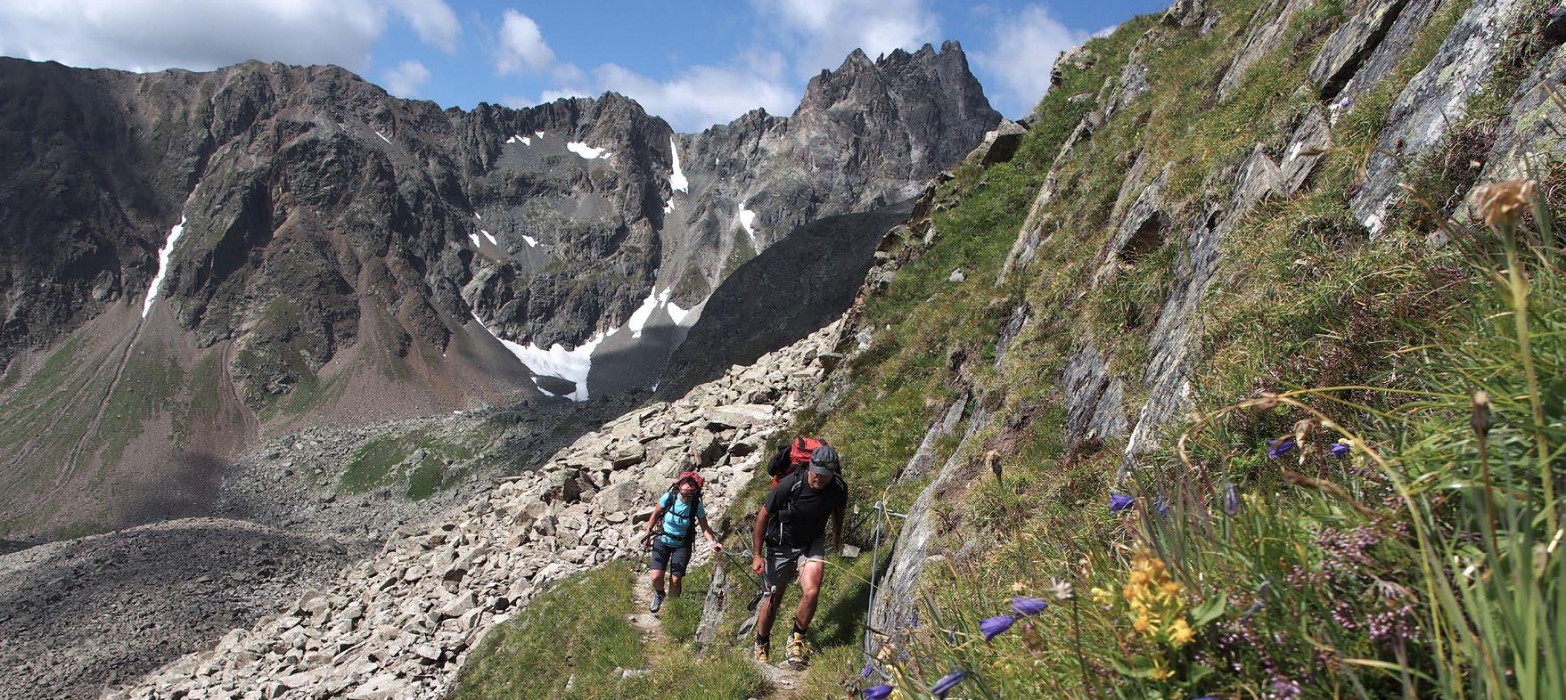
Diese Etappe führt gleich zu Beginn von der Friedrichshafener Hütte auf das Schafbichljoch auf 2.636 m. Vorbei am hochgelegenen Schottensee erfolgt der Abstieg ins Fasultal. Entlang des Fasulbaches geht es weiter talauswärts bis zur unbewirtschafteten Fasulhütte, wo der Bach über eine Holzbrücke überquert wird. Kurz darauf steht man “Beim Kugelten Stein“ zwischen den Hängen der mächtigen Gipfel des Patteriols (3.056 m) zur Linken, der Kuchenspitze (3.151 m) und der Küchlspitze (3.147 m) zur Rechten. Kurz vor der Konstanzer Hütte wird der Bach nochmals überquert und der Weg führt die Hänge hinauf zum Kuchenjöchli auf 2.730 m. Von dort beginnt der Abstieg über den Apothekerweg zum Etappenziel Darmstädter Hütte.
Alpine Variante: Der anspruchsvolle „Ludwig-Dürr-Weg“: Über die Muttenalpe und die Lumpaschadseele zum Dürrschartli auf 2.666 m. 3,7 km weiter über den hochalpinen Steig über Geröll und Schneefelder. Über den Schönpleispass zum Zwischengrat auf 2.770 m. Es folgen Schneefelder und steile Passagen bis zum Rautejoch auf 2.752 m. Abstieg zur Darmstädter Hütte.

Start of stage: Friedrichshafener Hütte lodge
End of stage: Darmstädter Hütte lodge
FRIEDRICHSHAFENER HÜTTE | SCHAFBICHLJOCH | FALSULTAL | KUCHENJÖCHLI | DARMSTÄDTER HÜTTE
Right at the start, this stage leads from the Friedrichshafener Hütte lodge to the Schafbichljoch at 2,636 metres. Passing the high-altitude Schottensee lake, you descend into the Fasultal valley. Continue along the Fasulbach stream out of the valley to the uncatered Fasulhütte hut, where you cross the stream over a wooden bridge. Shortly afterwards, you will find yourself
“Beim Kugelten Stein“ (at the rolled stone) between the hillsides of the mighty peaks of the Patteriol (3,056 m) on the left, the Kuchenspitze (3,151 m) and the Küchlspitze (3,147 m) on the right. Shortly before the Konstanzer Hütte, the stream is crossed again and the trail leads up the mountainside to the Kuchenjöchli at 2,730 metres. From there, the descent leads along the Apothekerweg to the destination Darmstädter Hütte lodge.
Alpine variant: The challenging „Ludwig Dürr Trail“: via the Muttenalpe and the Lumpaschadseele to the Dürrschartli at 2,666 metres. Continue for 3.7 km along the high alpine trail over scree and snowfields. Over the Schönpleispass to the Zwischengrat at 2,770 metres. This is followed by snow fields and steep passages to the Rautejoch at 2,752 m. Descent to the Darmstädter Hütte.

„Beim Kugelten Stein“
Patteriol (3056m)
Horn (3003m)
Talliger (2845m)
Fasulzwillinge (2878m)
Kuchenjöchli
Darmstädter
Kuchenspitze (3151m)
Küchelferner
Kuchlspitze (3147m)
Nordlicher Schönpleiskopf (2920m)
Südlicher Schönpleiskopf (2920m)
Karkopf (2946m)
Grauer Kopf (2793m)
Schottensee
Schafbichljoch
Vertinespleiskopf (2706m)
Vertinesberg (2852m)
Vertineskopf (2683m)
Glatter Berg (2866m)
Start 2.138 m


INTERAKTIVE KARTE

Madleinkopf (2907m)
Schottensee
Aufstieg: 1.481 hm
Ascent: 1,481 vm
Abstieg: 1.227 hm
Descent: 1,227 vm
Highlights
Schafbichljoch
Schottensee
Stunden: 8 h
Duration: 8 h
Länge: 15 km
Distance: 15 km
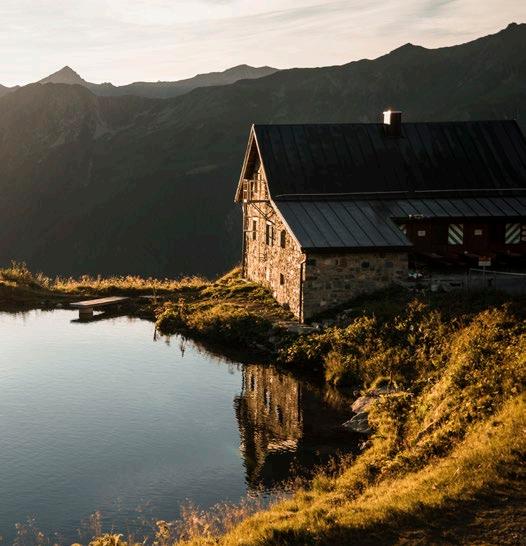
HÜTTEN | MOUNTAIN LODGES FRIEDRICHSHAFENER HÜTTE DARMSTÄDTER HÜTTE
Highlights
Schafbichljoch
Schottensee lake
„Beim Kugelten Stein“ „Beim Kugelten Stein“ Kuchenjöchli Kuchenjöchli


Etappenstart: Darmstädter Hütte
Etappenziel: Niederelbehütte
DARMSTÄDTER HÜTTE | KARTELLSPEICHER | SESSLADJÖCHLI | NIEDERELBEHÜTTE
Von der Darmstädter Hütte beginnt der Wanderweg hinab ins Moostal. Nach kurzer Wegstrecke wird man mit eindrucksvollen Ausblicken auf den Kartellspeicher beim Abstieg belohnt. Am blau schimmernden Speichersee angekommen, führt der Weg am Ufer entlang weiter in Richtung Kartellhütte. Kurz nach der Überquerung des Kartellbaches zweigt der Sepp Jöchler Weg ab. Dieser führt über das Saum die Berghänge hinauf zum Seßladjöchli auf 2.749 m. Zwischen den schroffen Gipfeln der Seßladspitze mit 2.906 m und des Ruggelkopfes mit 2.864 m überquert man das Joch und beginnt den Abstieg zum Etappenziel. Der erste Teil des Abstiegs auf dem Sepp Jöchler Weg ist steil und mit großer Querneigung. Danach geht es über Geröll und einige kleine Schneefelder hinunter zur Hütte. Ab den ersten grünen Bergwiesen wird der Weg leichter. Der letzte Höhepunkt dieser Etappe ist die Umrundung des malerischen Seßsees, von wo aus es nur noch ein kurzes Stück bis zum Etappenziel Niederelbehütte ist.
Alpine Variante: Von der Darmstädter Hütte über den Advokatenweg zum Schneidjöchli auf 2.841 m. Weiter auf dem Hoppe-Seyler-Weg ins Vergrößkar, über einen schmalen Steig Richtung Fatlarspitze zur Kieler Wetterhütte auf 2.800 m. Von der Hütte führt ein anspruchsvoller, markierter Abstieg zur Niederelbehütte.

Start of stage: Darmstädter Hütte lodge
End of stage: Niederelbehütte lodge
DARMSTÄDTER HÜTTE | KARTELLSPEICHER | SESSLADJÖCHLI | NIEDERELBEHÜTTE
Starting from the Darmstädter Hütte lodge, the hiking trail descends into the Moostal valley. After a short walk, you are rewarded with impressive views of the Kartell reservoir on the descent. Once you reach the shimmering blue reservoir, the trail continues along the shore in the direction of the Kartellhütte. Shortly after crossing the Kartellbach stream, the Sepp Jöchler Trail branches off. This leads over the Saum up the mountain side to the Seßladjöchli at 2,749 metres. Between the rugged peaks of the Seßladspitze at 2,906 m and the Ruggelkopf at 2,864 m, you cross the ridge and begin the descent to the stage finish. The first part of the descent on the Sepp Jöchler Trail is steep and has a great incline. You then continue over scree and a few small snow fields down to the mountain lodge. From the first green mountain meadows, the path becomes easier. The final highlight of this stage is the circuit around the picturesque Seßsee lake, from where it is only a short distance to the finish at Niederelbehütte lodge.
Alpine variant: From the Darmstädter lodge via the Advokatenweg to Schneidjöchli at 2,841 metres. Continue on the Hoppe-Seyler Trail into the Vergrößkar, via a narrow path in the direction of Fatlarspitze to the Kieler Wetterhütte at 2,800 metres. From the hut, a challenging, marked path leads down to the Niederelbehütte.
Faselfadspitze (2993m)

Kartellspeicher
Start 2.384 m
Kreuzjochspitze (2919m)
Madaunspitze (2961m)
Seßladspitze (2906m)
Seßladjöchli Saum
Seßsee
Rugglespitze (2809m)
Niederelbehütte 2.310 m
Breiter Kopf (2532m)
Fatlarspitze (2986m)
Saumspitze (3039m)
Seeköpfe (3057m)


Alschnerspitze (2835m)
Burgner (2502m)
Aufstieg: 721 hm
Ascent: 721 vm
Abstieg: 801 hm
Descent: 801 vm
Stunden: 4-5 h
Duration: 4-5 h
Länge: 7,9 km
Distance: 7.9 km
Seßladjöchli
Seßsee
Seßladjöchli
Seßsee lake


Etappenstart: Niederelbehütte
Etappenziel: Edmund-Graf-Hütte
NIEDERELBEHÜTTE | DIASALPE | SCHMALZGRUBENSCHARTE | SCHMALZGRUBENSEEN | EDMUND-GRAF-HÜTTE
Von der Niederelbehütte führt der Weg zur Oberen Seßladalpe und danach genussvoll talauswärts entlang dem wunderschön angelegten „Kieler Weg“. Der Kieler Weg führt quer durch das Skigebiet Kappl und über die Diasalpe, von der aus man einen wunderschönen Blick genießen kann.
Nachdem man die Flanke der Alblittköpfe und dem Lattejoch hinter sich gebracht hat, folgt wiederum ein sehr steiler und anstrengender Aufstieg. Das Ziel ist die Schmalzgrubenscharte auf 2.697 m. Über die Scharte geht es auf den Nordhang der Gebirgskette. Der Abstieg führt zu den romantischen Schmalzgrubenseen, deren Ufer zu einer kurzen Rast und zum Krafttanken einladen.
Ab den Seen folgt man dem „Rifflerweg“ weiter bergab Richtung Etappenziel. Die EdmundGraf-Hütte auf 2.375 m und ihr kleiner See liegen angeschmiegt an den Felsen der Ausläufer des Hohen Rifflers.
Tipp: Wenn es Zeit, Kondition und Wetter ermöglichen, kann von der Edmund-Graf-Hütte aus der Hohe Riffler auf 3.168 m bestiegen werden (Gehzeit ca. 2,5 h von der Hütte zum Gipfel). Der weite Ausblick reicht hier vom Paznauntal über das Stanzertal bis ins Oberinntal.

Start of stage: Niederelbehütte lodge
End of stage: Edmund-Graf-Hütte lodge
NIEDERELBEHÜTTE | DIASALPE | SCHMALZGRUBENSCHARTE | SCHMALZGRUBENSEEN | EDMUND-GRAF-HÜTTE
From Niederelbehütte lodge, the trail runs to Obere Seßladalpe and further downhill along the picturesque Kieler Trail. It leads you through Kappl ski area and across Diasalpe, which offers splendid views.
Passing by the Alblittköpfe and Lattejoch mountainsides, a very steep and demanding ascent takes you up to Schmalzgrubenscharte at 2,697 metres above sea level. From there, continue towards the northern slope of the mountain range. A downhill trail leads you to the romantic Schmalzgruben lakes, where you can take a well-deserved break right by the lakeshore.
After the lakes, continue downhill along „Riffler Trail” to get to the end of the stage. EdmundGraf-Hütte lodge and the pertaining small lake are located at 2,375 metres above sea level, perched against the spurs of Hoher Riffler mountain.
Our tip: Time and weather permitting, you can climb up to Hoher Riffler at 3,168 metres above sea level from Edmund-Graf-Hütte (walking time: approx. 2.5 h from hut to summit). From the top, you enjoy stunning views of the Paznaun valley, Stanzer valley and the Oberinntal.
Gamskarspitze (2621m)
Hochkarkopf (2772m)
Hochkarspitze (2836m)
Edmund-Graf-Hütte 2.375 m
Scharkopf (2465m)
Hintere Rendlspitze (2741m)
Schmalzgrubensee
Schmalzgrubenscharte
Hoche Spitze (2796m) Spitze (2796m)
Riffelspitze (2936m)
Kreutjochspitze (2919m) Rote Wand (2808m)
Madaunspitze (2961m)
Seßladspitze (2906m)
Diasalpe Kieler Weg
Start 2.310 m
Rugglespitze (2809m)


INTERAKTIVE KARTE


Blankahorn (3129m)
Schmalzgrubenscharte 2.697 m
EdmundGraf-Hütte 2.375 m
2500m
2400m 2700m
2300m
2200m
2100m 0km 2km 5km 7km
Aufstieg: 531 hm
Ascent: 531 vm
Abstieg: 460 hm
Descent: 460 vm
Highlights
Kieler Weg
Diasalpe
Schmalzgrubenscharte
Schmalzgrubenseen
Hoher Riffler

Stunden: 4-5 h
Duration: 4-5 h
Länge: 8,7 km
Distance: 8.7 km
Highlights
Kieler Trail
Diasalpe
Schmalzgrubenscharte
Schmalzgruben lakes
Hoher Riffler


Etappenstart: Edmund-Graf-Hütte
Etappenziel: See
EDMUND-GRAF-HÜTTE | KAPPLER JOCH | BLANKASEEN | DURRICHALPE | SPIDUR ALPE | NIEDERJÖCHL | PEZINERSPITZE | KLEINGFALLALPE | FALGENAIR | SEE
Von der Edmund-Graf-Hütte führt der erste Anstieg der Etappe auf das Kappler Joch auf 2.672 m. Hier beginnt sich langsam der Kreis des Höhenwegs zu schließen – auf der gegenüberliegenden Talseite erscheinen die ersten Etappen im Blickfeld. Der weitere Abstieg führt zu den malerischen Blankaseen und zur Durrichalpe, landschaftlich einer der schönsten Plätze im Paznaun.
Der folgende beschwerliche Aufstieg über den Almweg auf die Spidur Alpe auf 2.120 m kann durch eine kurze Rast auf der Alm belohnt werden. Von der Alm führt der Weg auf das Niederjöchl auf 2.346 m, von dem man einem wunderschönen Grat entlang auf die Pezinerspitze auf 2.550 m folgt.
Die Pezinerspitze ist als letzter Gipfel ein grandioser Aussichtsberg in alle Himmelsrichtungen. Man kann genussvoll auf einige zurückgelegte Etappen hinüberblicken.
Der Abstieg führt über die Nordseite mit Blick Richtung Strengen im Stanzertal, vorbei an der Kleingfallalpe nach Falgenair. Dort dreht der Weg wieder Richtung Paznauntal und nach den ersten Weilern von See gelangt man über die Straße zum letzten Etappenziel ins Dorf See.

Start of stage: Edmund-Graf-Hütte lodge
End of stage: See
EDMUND-GRAF-HÜTTE | KAPPLER JOCH | BLANKASEEN | DURRICHALPE | SPIDUR ALPE | NIEDERJÖCHL | PEZINERSPITZE | KLEINGFALLALPE | FALGENAIR | SEE
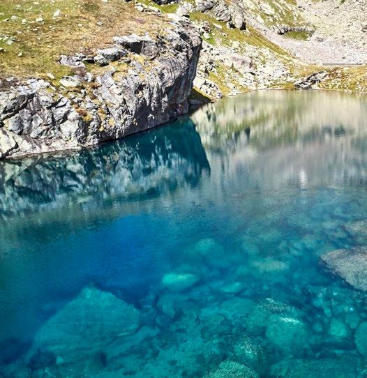
From Edmund-Graf-Hütte lodge, the first ascent of the stage takes you up to Kappler Joch at 2,672 metres above sea level. From there, you can see the first stages of the High Route on the opposite side of the valley. Continue upwards until you reach the picturesque Blankaseen lakes and Durrichalpe, one of the most beautiful spots of the Paznaun valley.
After the following exhausting ascent along the footpath to Spidur Alpe lodge at 2,120 metres above sea level, it’s time for a well-deserved break. From Spidur Alpe, the trail runs up to Niederjöchl at 2,346 metres above sea level. From there, a gorgeous ridge runs towards Pezinerspitze at 2,550 metres above sea level.
Pezinerspitze is the last summit of this stage, and it offers you amazing views in all directions, including some of the completed stages.
From there, continue downhill along the north face, looking towards Strengen in the Stanzer valley, past Kleingfallalpe towards Falgenair, where the trail loops back to the Paznaun valley. Passing through the first hamlets of See, continue along the road to the end of the final stage in See.

Gampernunspitze (2887m)
Kappler Joch Blankaseen
Kappler-JochSpitze (2843m)
Großgfallkopf (2636m)
Kapfkopf
Niederjöchl
Kleingfallalpe
Kappl
Durrichalpe See


INTERAKTIVE KARTE


Kappler Joch
Aufstieg: 1.325 hm
Ascent: 1,325 vm
Abstieg: 2.663 hm
Descent: 2,663 vm
Highlights
Kappler Joch
Blankaseen
Durrichalpe, Spidur Alpe
Niederjöchl, Pezinerspitze
Kleingfallalpe
Alpe
Stunden: 9-10 h
Duration: 9-10 h
Länge: 22,3 km Distance: 22.3 km
HÜTTEN | MOUNTAIN LODGES EDMUND-GRAF-HÜTTE SPIDUR ALPE
Highlights
Kappler Joch
Blankaseen lakes
Durrichalpe, Spidur Alpe
Niederjöchl, Pezinerspitze
Kleingfallalpe


SPORTBEKLEIDUNG FÜR ALLE, DIE IMMER IHR BESTES GEBEN MÖCHTEN!

Ascher Hütte Alpe Gamperthun Visnitz Alpe
Alpenhaus
Larein Alpe
Friedrichshafener Hütte
Darmstädter Hütte Niederelbehütte Edmund-Graf-Hütte
Spidur Alpe


