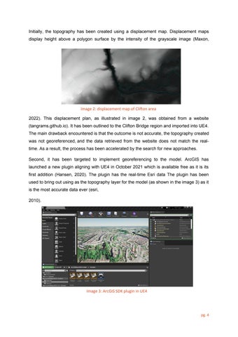
Initially, the topography has been created using a displacement map. Displacement maps display height above a polygon surface by the intensity of the grayscale image (Maxon,
Image 2: displacement map of Clifton area 2022). This displacement plan, as illustrated in image 2, was obtained from a website (tangrams.github.io). It has been outlined to the Clifton Bridge region and imported into UE4. The main drawback encountered is that the outcome is not accurate, the topography created was not georeferenced, and the data retrieved from the website does not match the realtime. As a result, the process has been accelerated by the search for new approaches. Second, it has been targeted to implement georeferencing to the model. ArcGIS has launched a new plugin aligning with UE4 in October 2021 which is available free as it is its first addition (Hansen, 2020). The plugin has the real-time Esri data The plugin has been used to bring out using as the topography layer for the model (as shown in the image 3) as it is the most accurate data ever (esri, 2010).
Image 3: ArcGIS SDK plugin in UE4
pg. 4


