DRAFT APRIL 2025
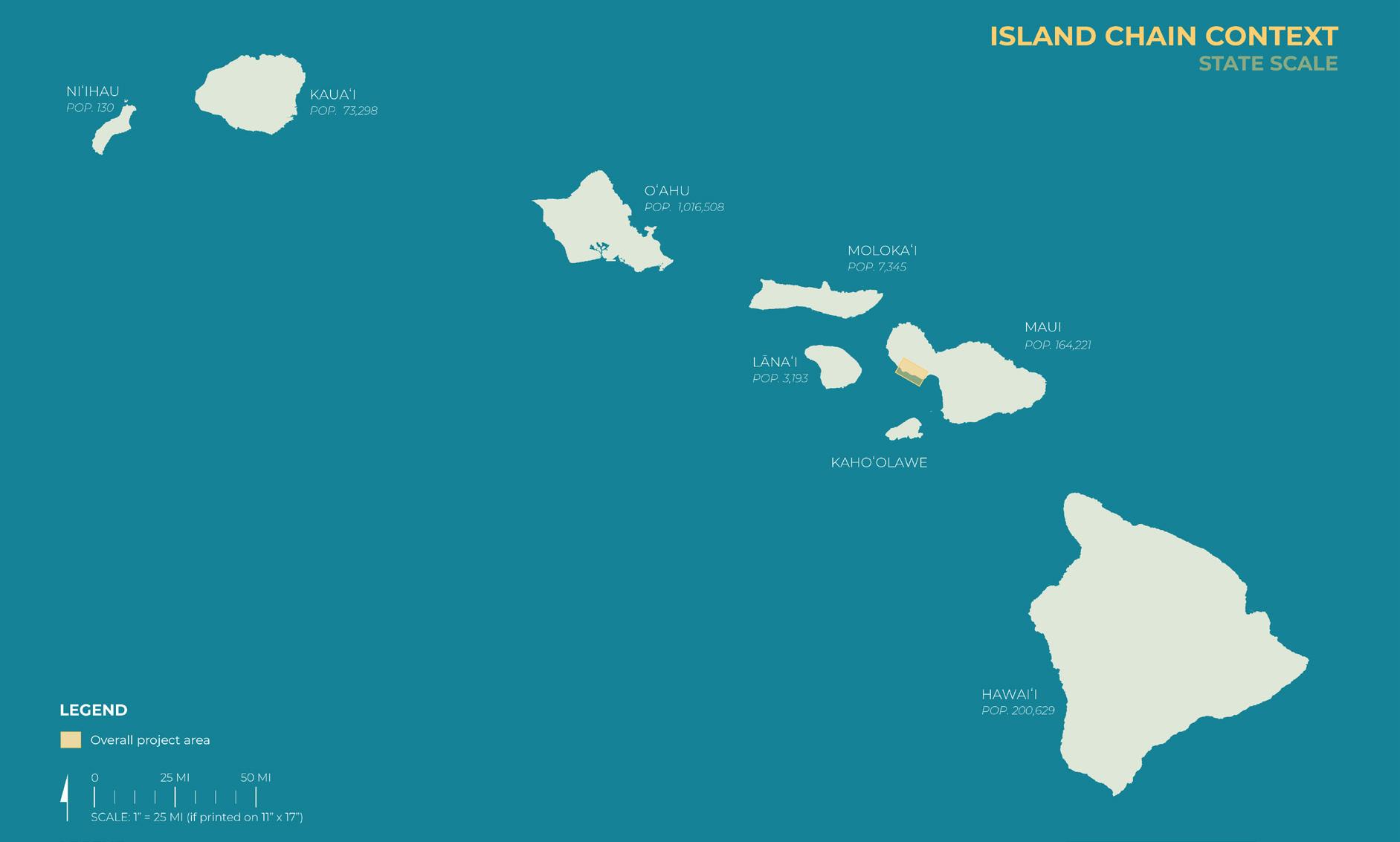
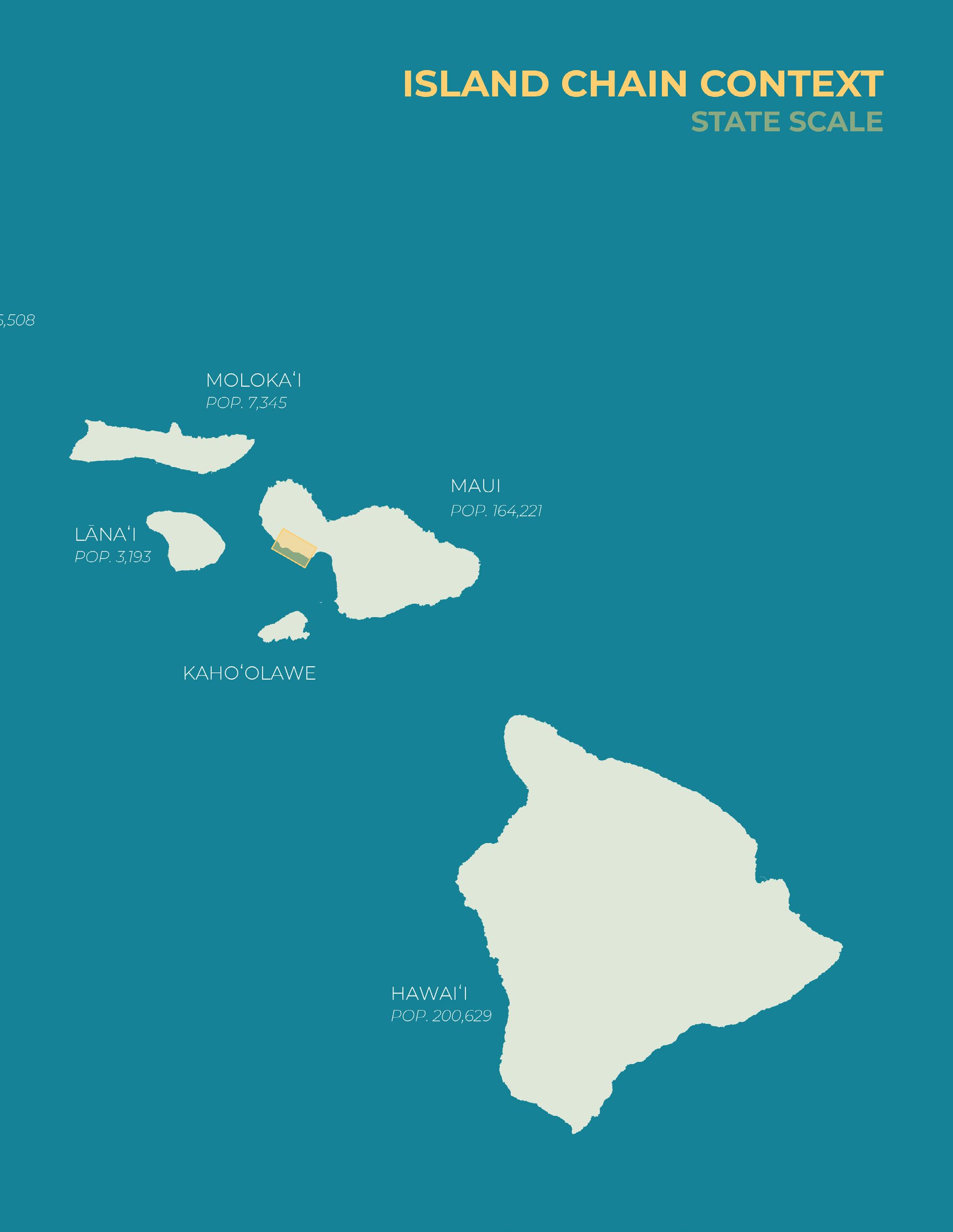
Project location in state context and island population according to US Census data (2024)
The report chapter spatially identifies, records, and assesses the project area’s existing natural and built environment conditions. The process of site inventory and analysis contributes to the identification of opportunities and constraints in the project area.
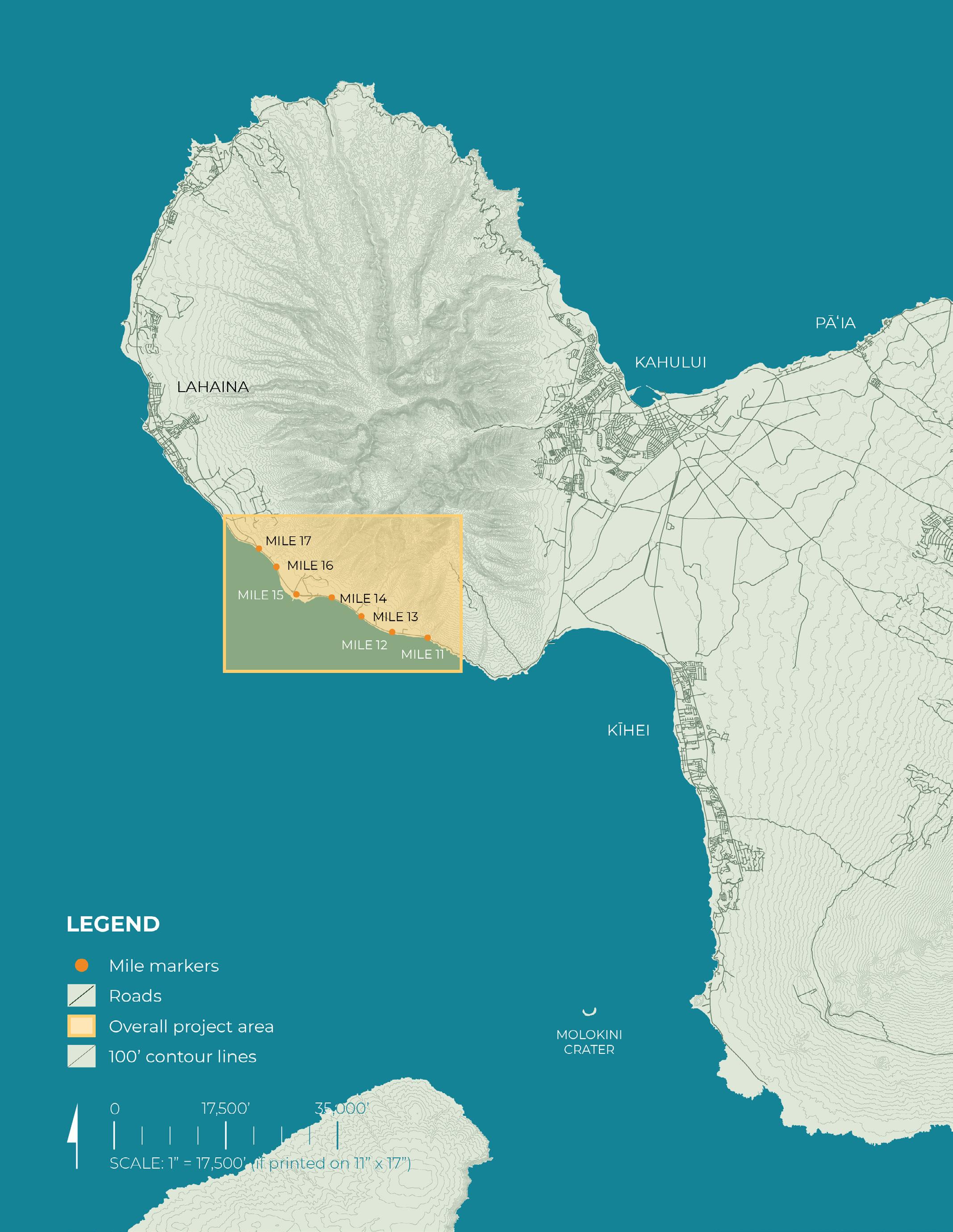
While the project is focused on the immediate coastal area stretching approximately 6 miles from Ukumehame to Launiupoko, through research-based design must investigate a site and its systems through a multi-scalar lens.
The maps and data summarized in this chapter inform the development of a long-term vision. By identifying patterns in land ownership, ecological sensitivity, infrastructure, and cultural landmarks, this inventory provides the spatial framework for imagining future scenarios.
The maps included in this chapter are organized by scale: State Scale, Maui Nui Scale, Maui Island Scale, West Maui Scale, Ahupua’a Scale, Project Area Scale
By aligning contemporary datasets with Native Hawaiian land divisions and place names (moku, ahupuaʻa, and wahi pana), the analysis centers a Traditional Ecological Knowledge-based understanding of place.
Map scales included in this section: State Scale
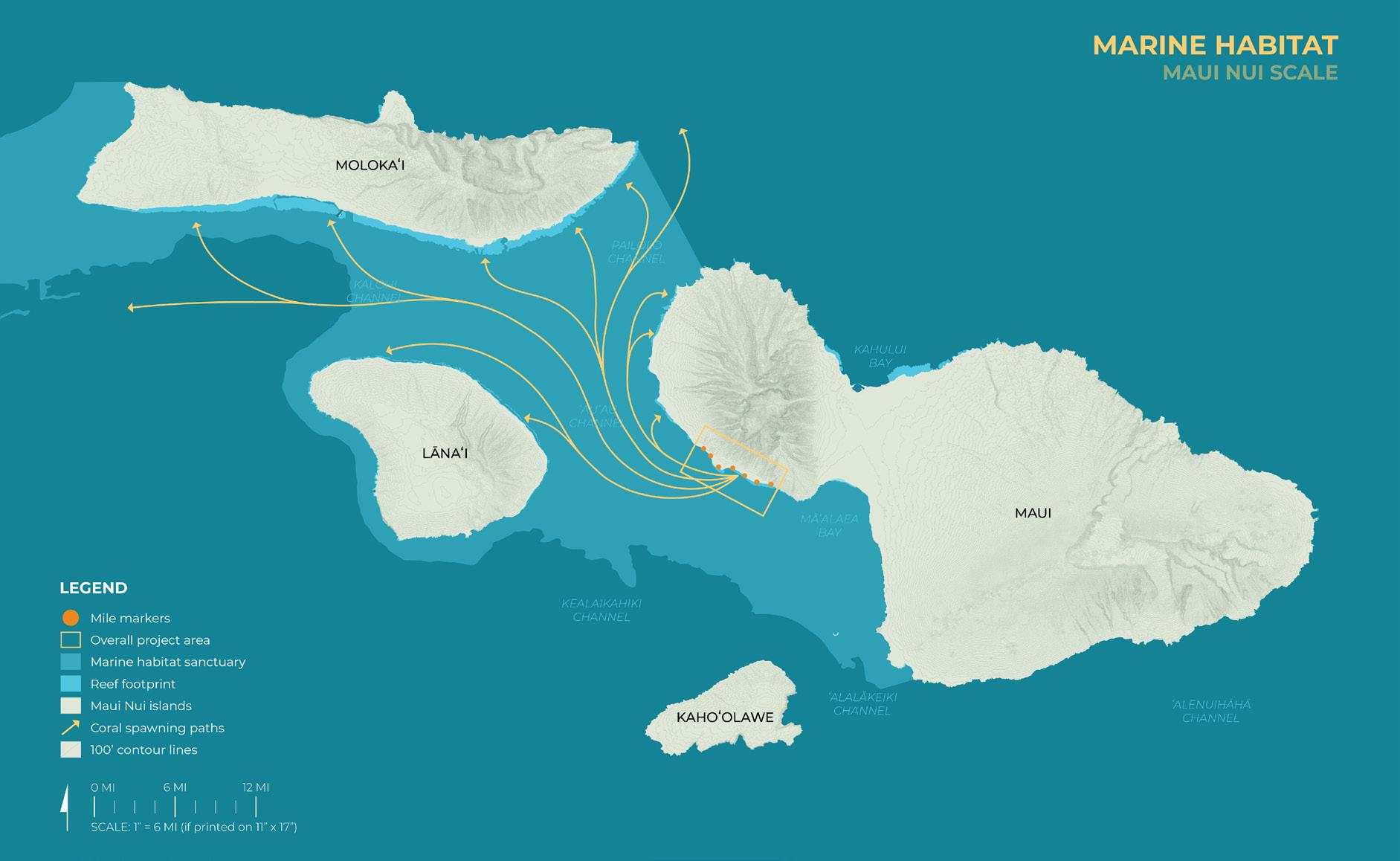
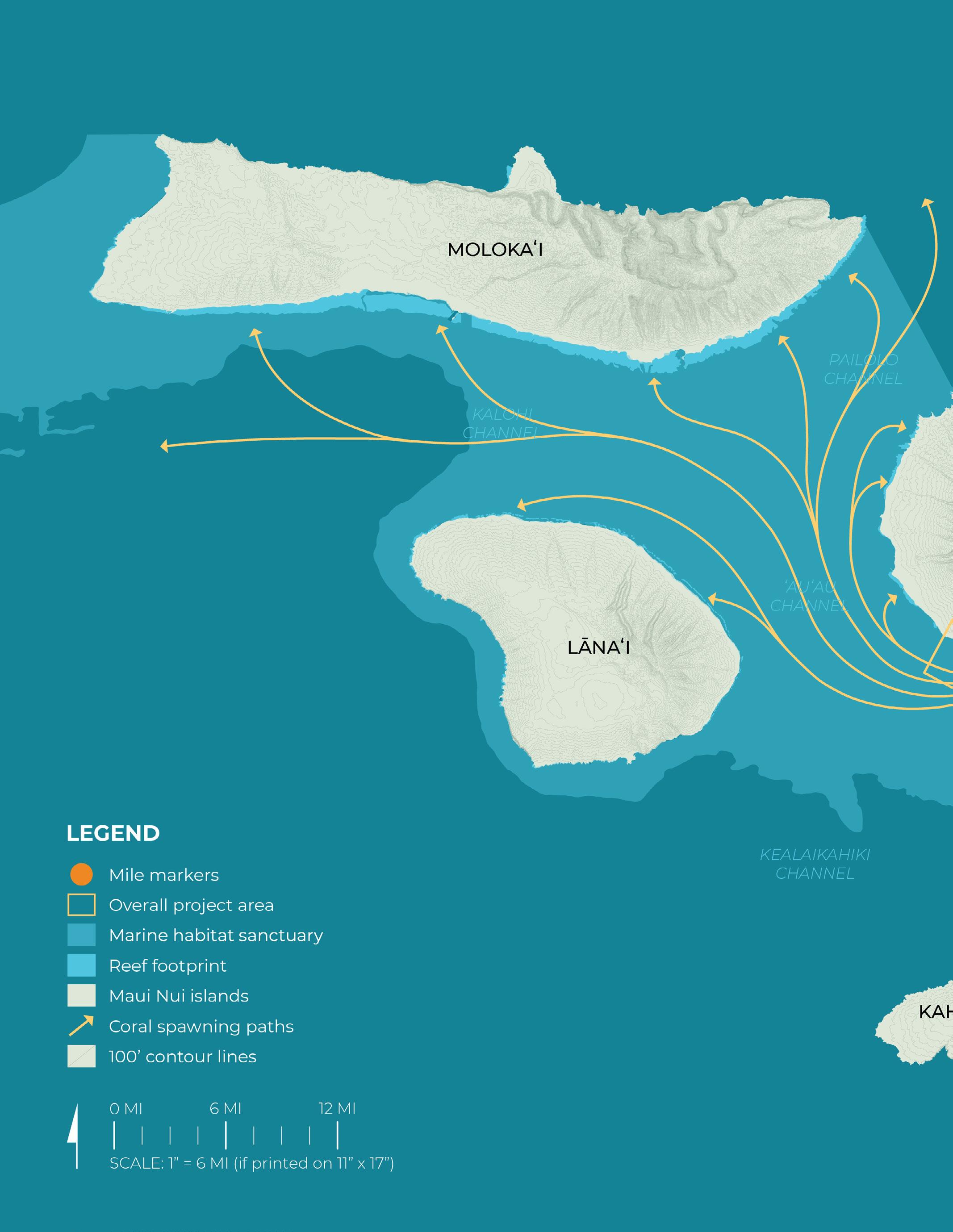
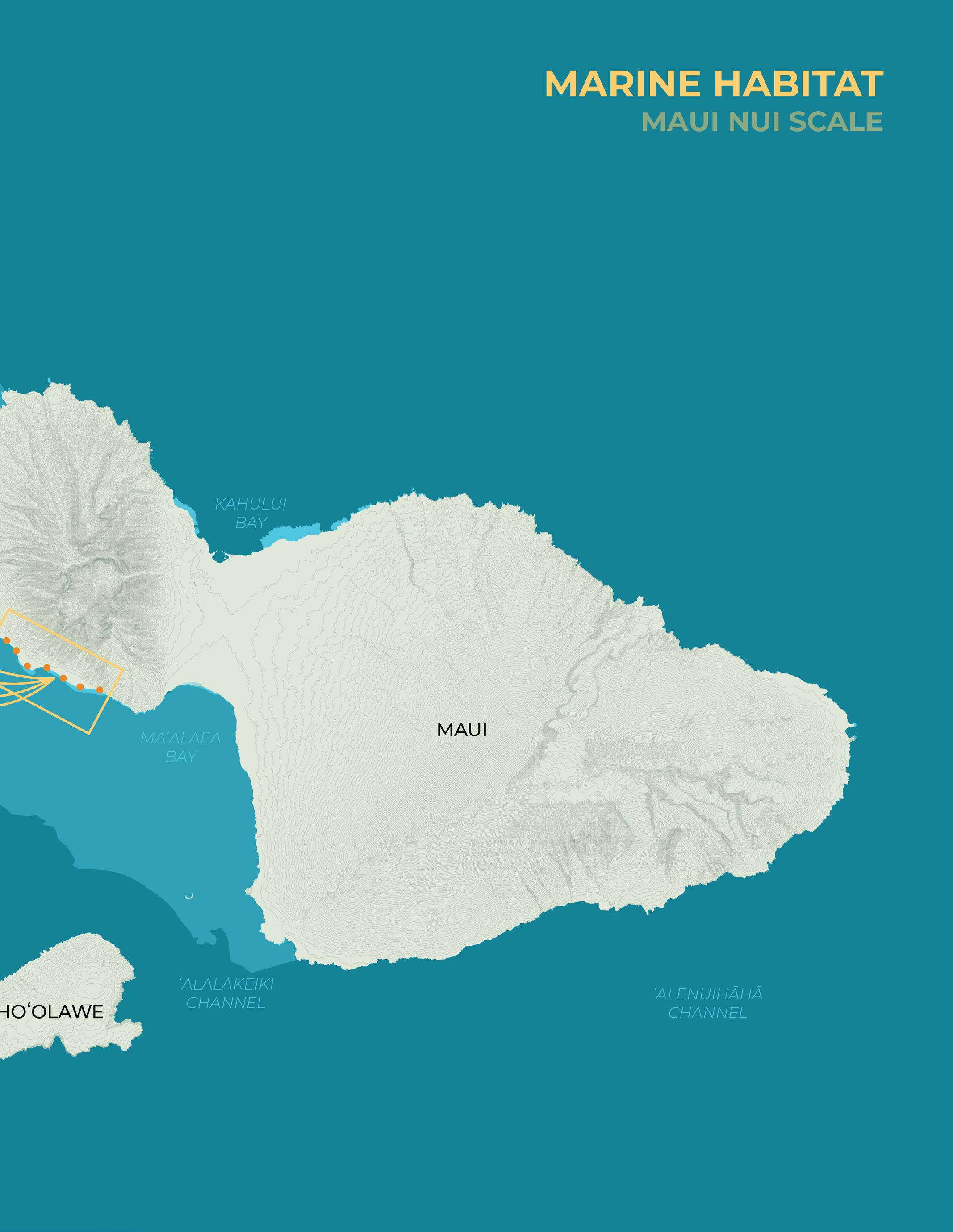
Maui Nui Scale
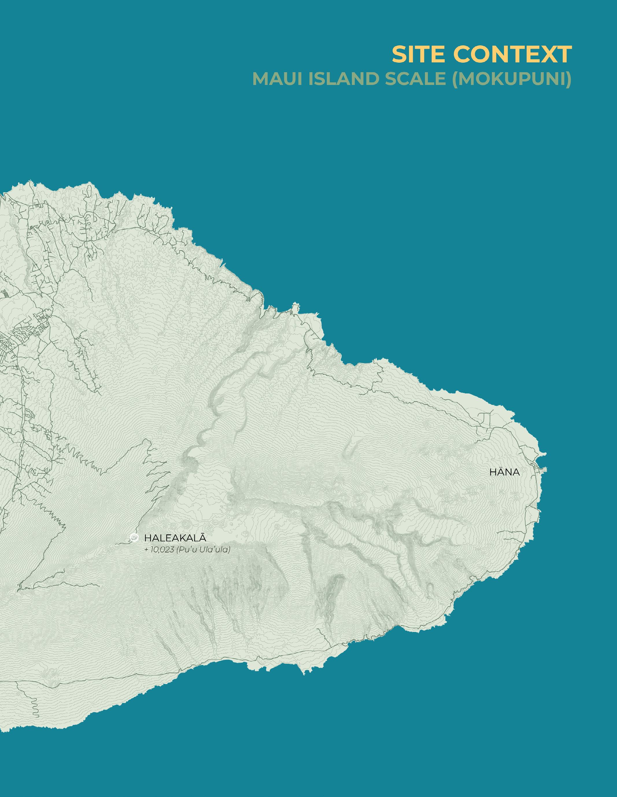
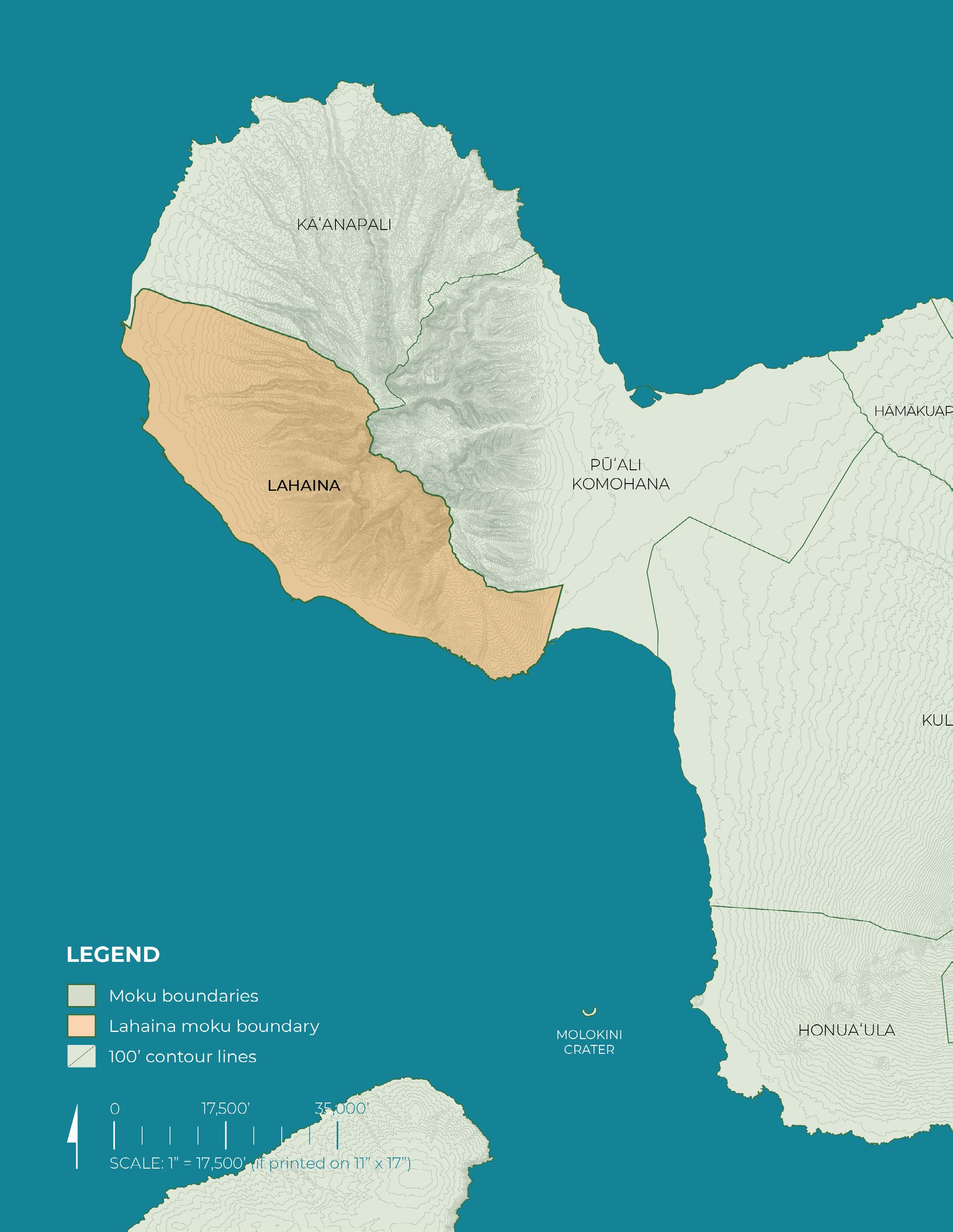
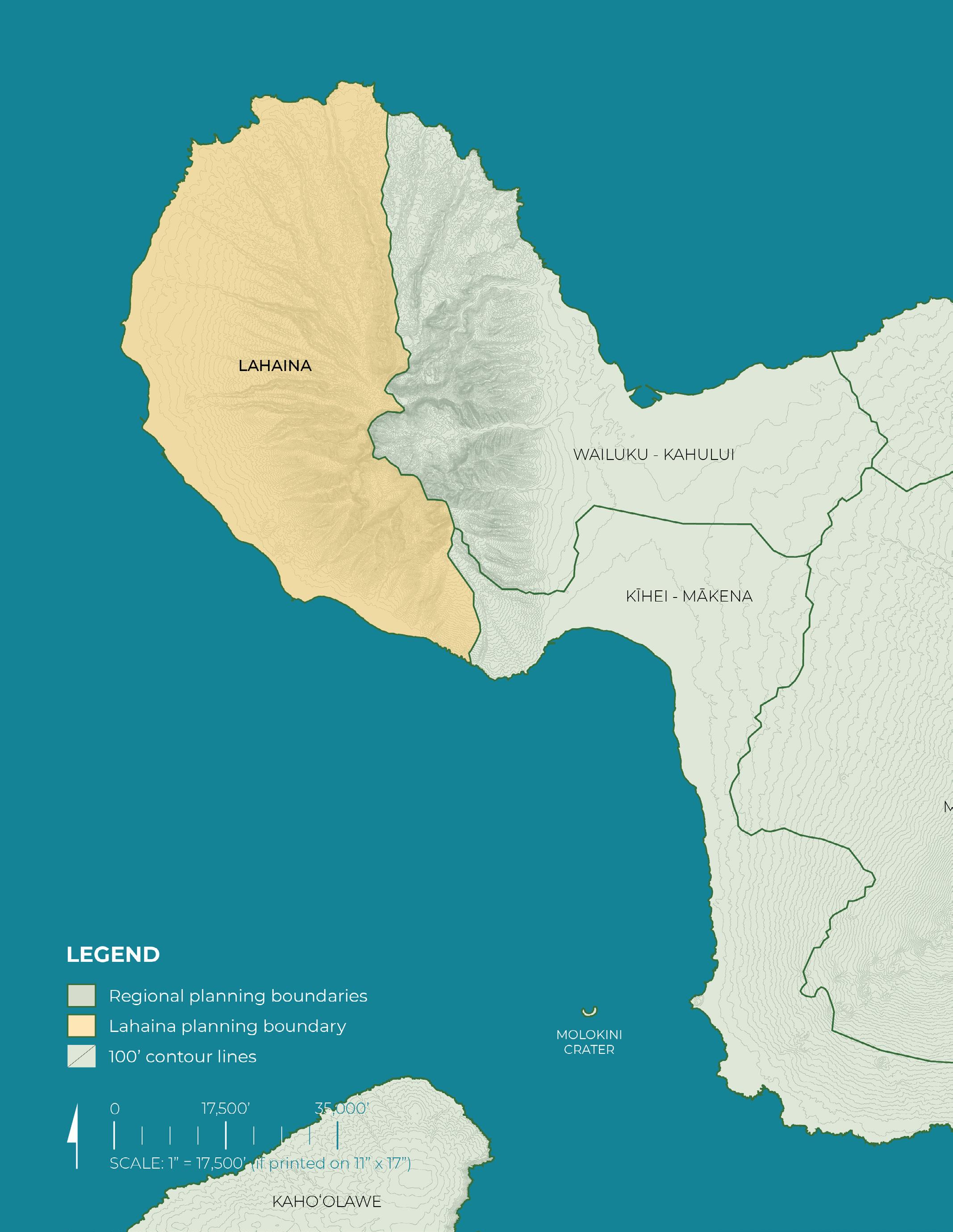
Maui Island Scale
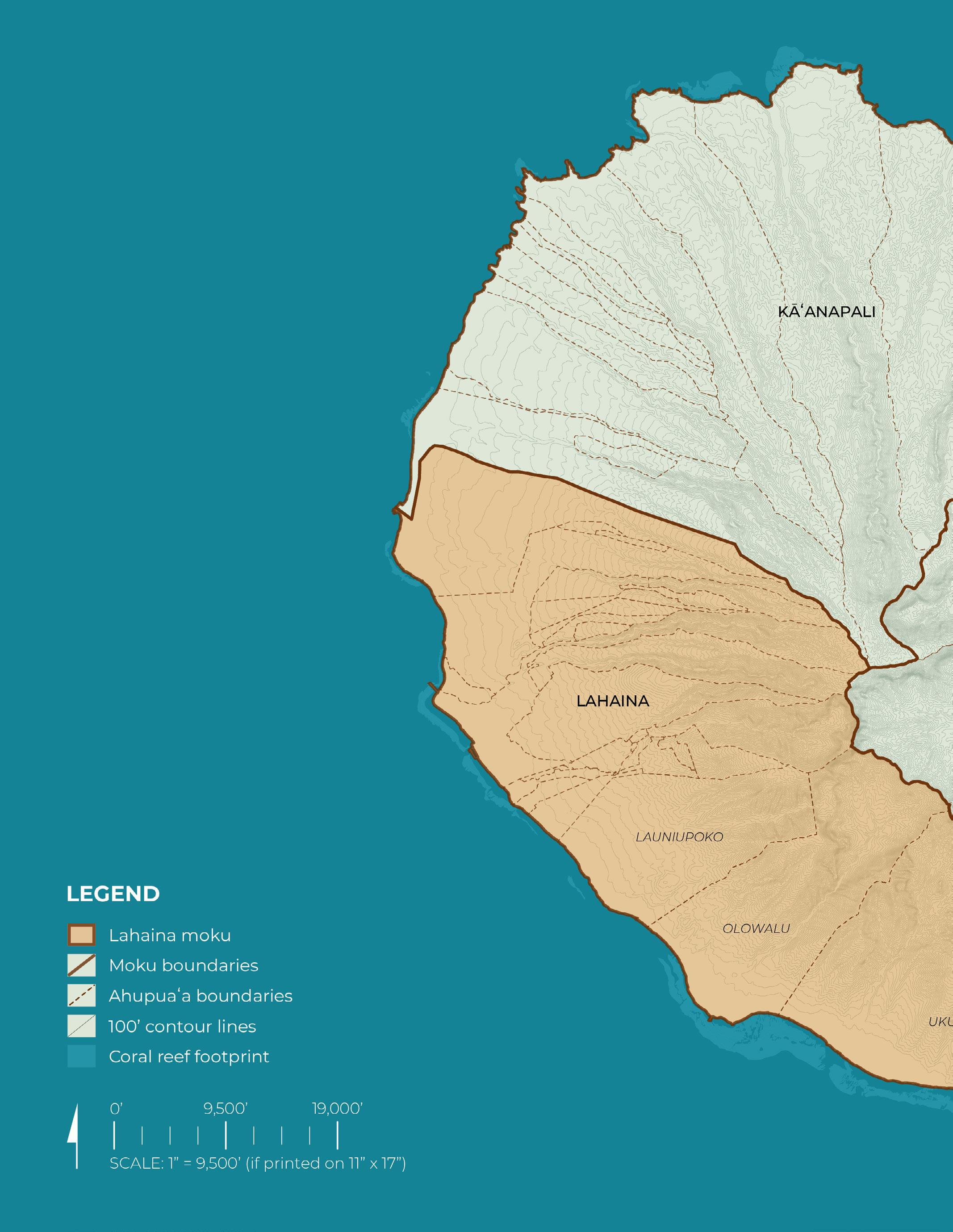
West Maui Scale
Ahupuaʻa Scale
Project Area Scale
The list included below provides an overview of the range of map scales and content
State Scale: Island Chain Context
Maui Nui Scale: Marine Habitat
Maui Island Scale: Site Context
Historic Land Division (Moku)
Maui County Regional Planning Areas
West Maui Scale:
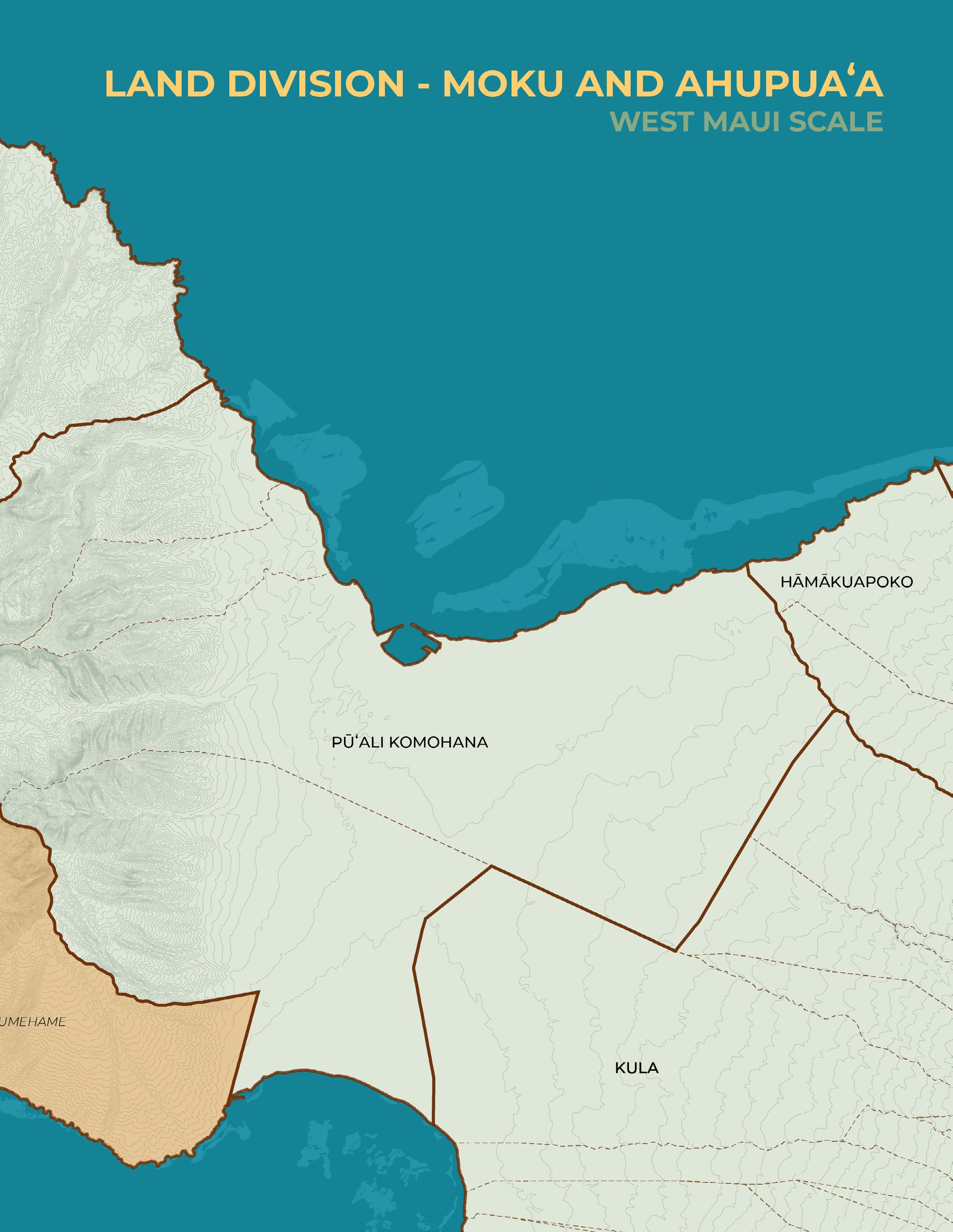
Historic Land Division (Moku & Ahupuaʻa)
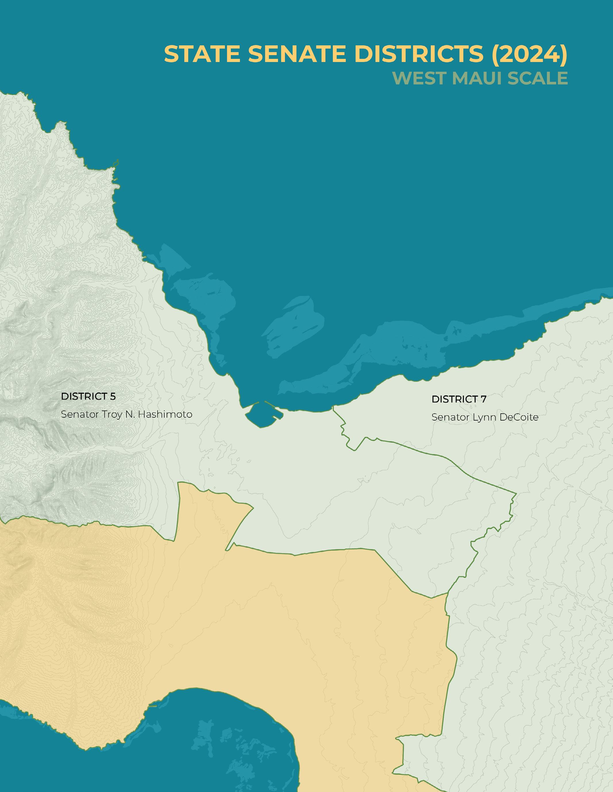
State Senate Districts (2024)
State House Districts (2024)
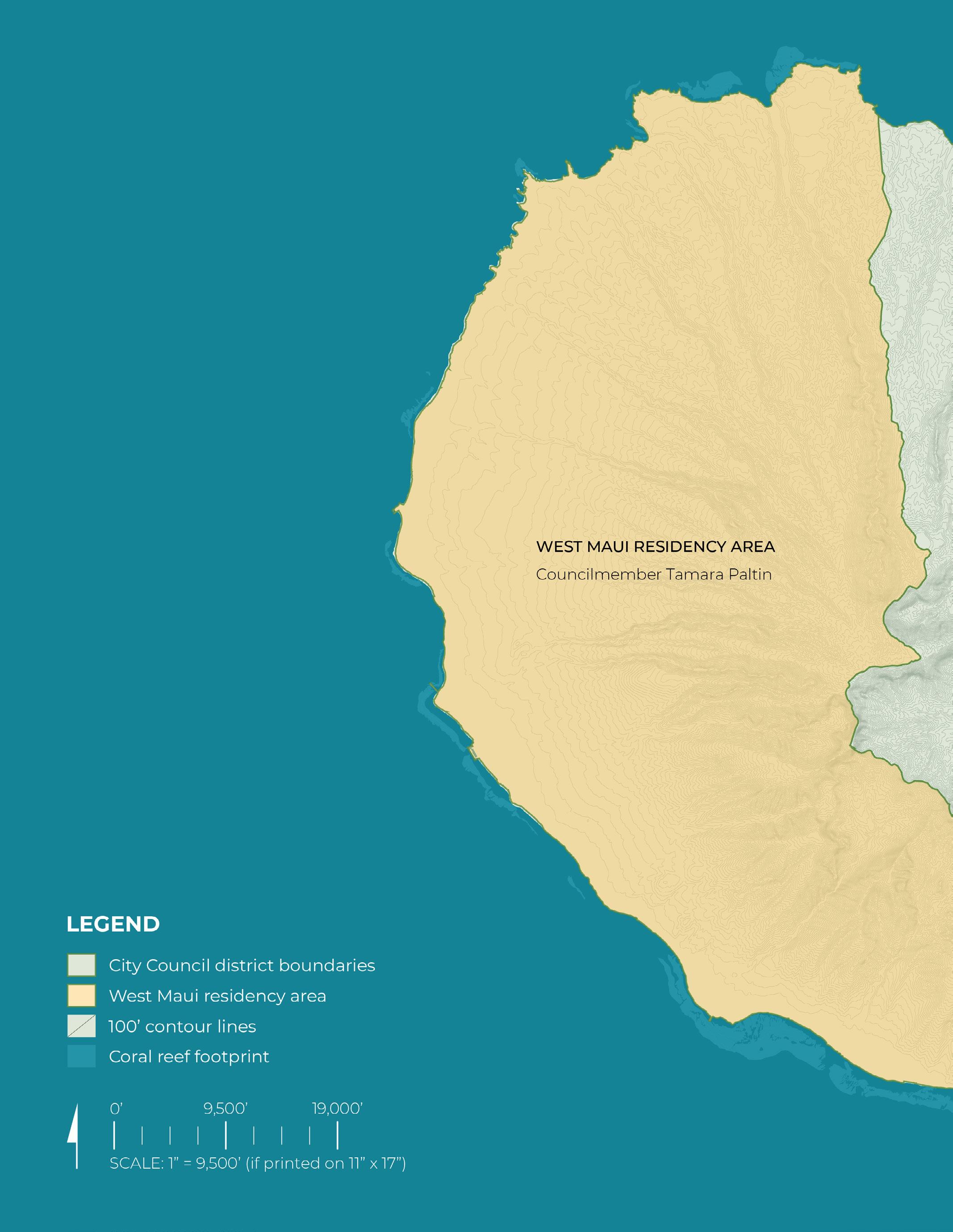
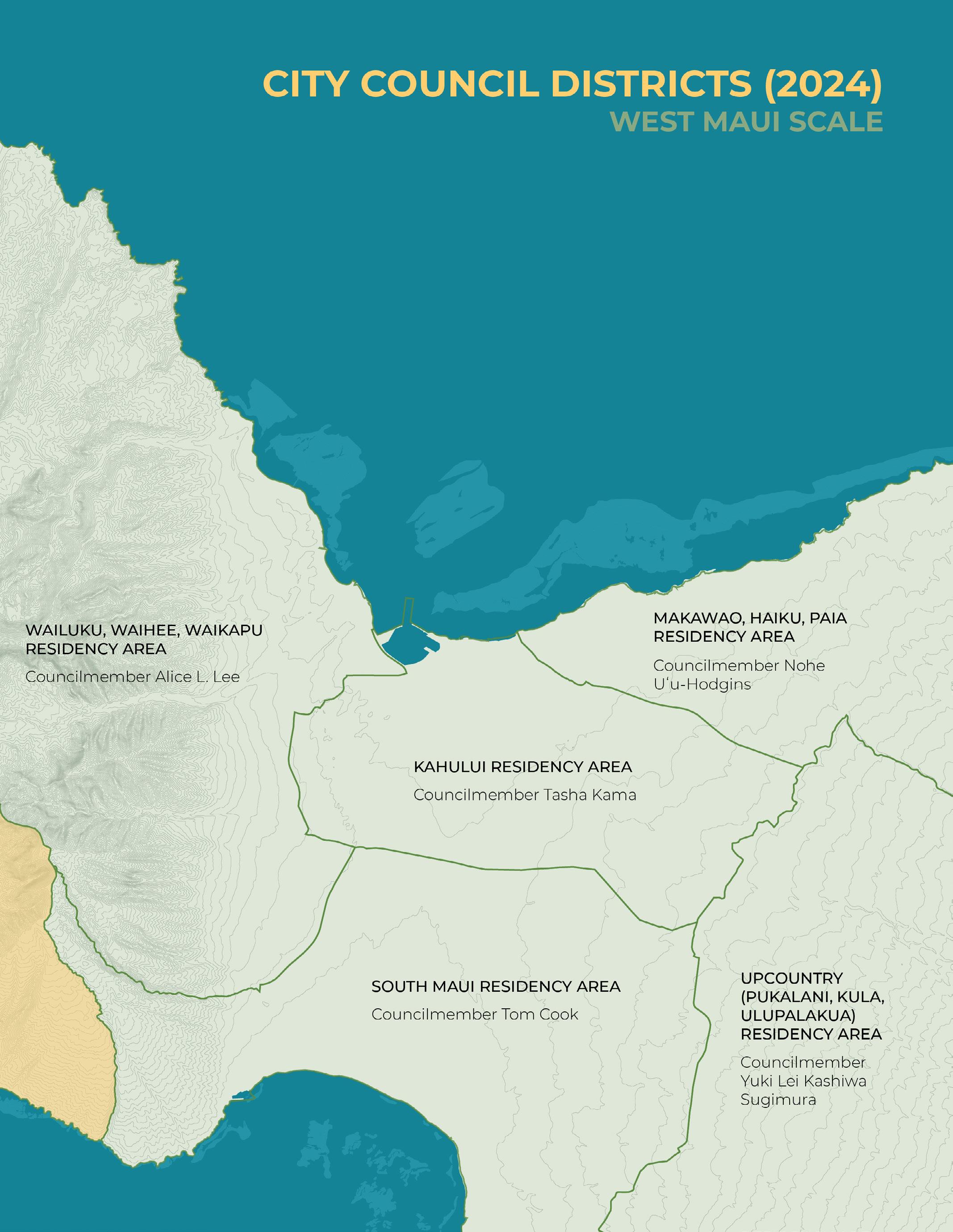
City Council Districts (2024)
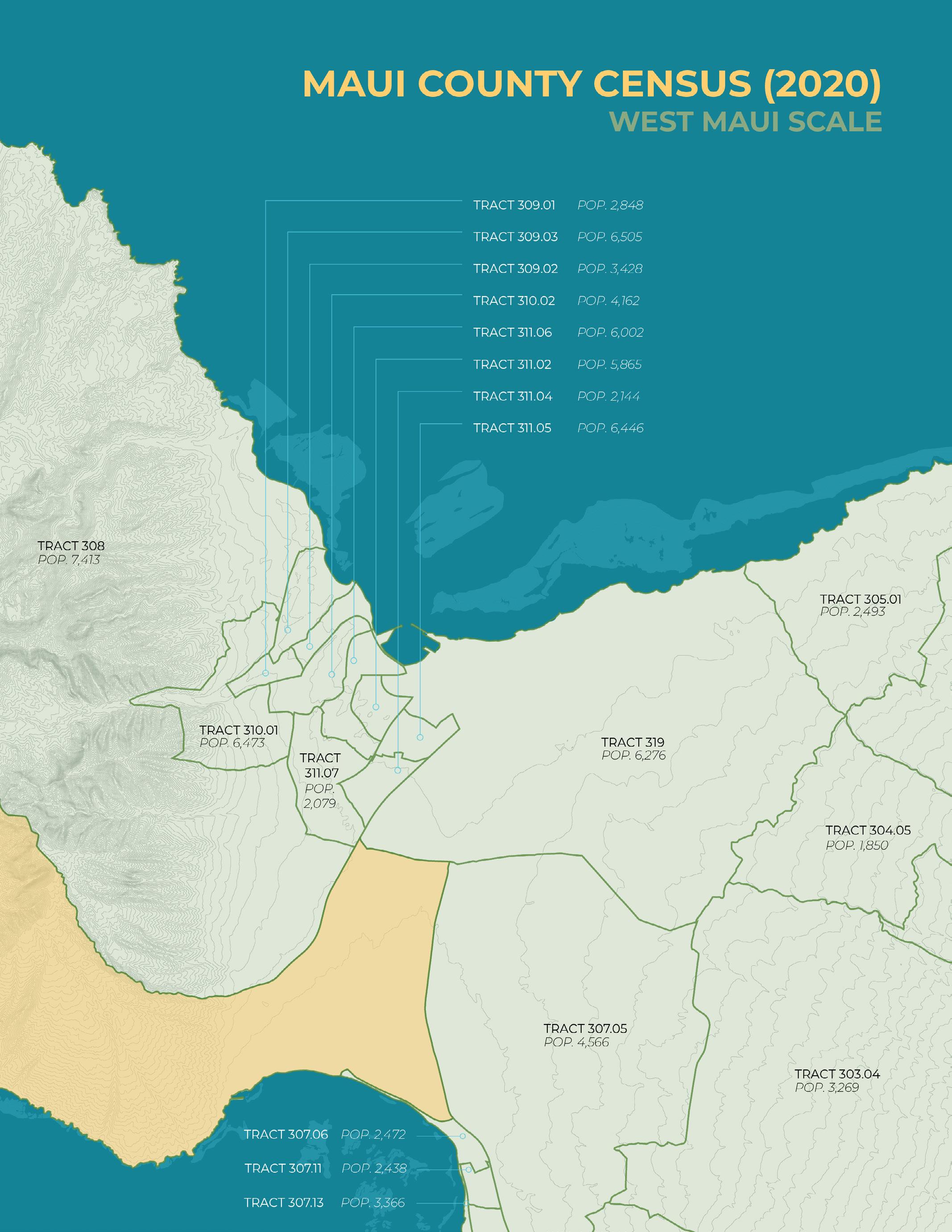
Maui County Census (2020)
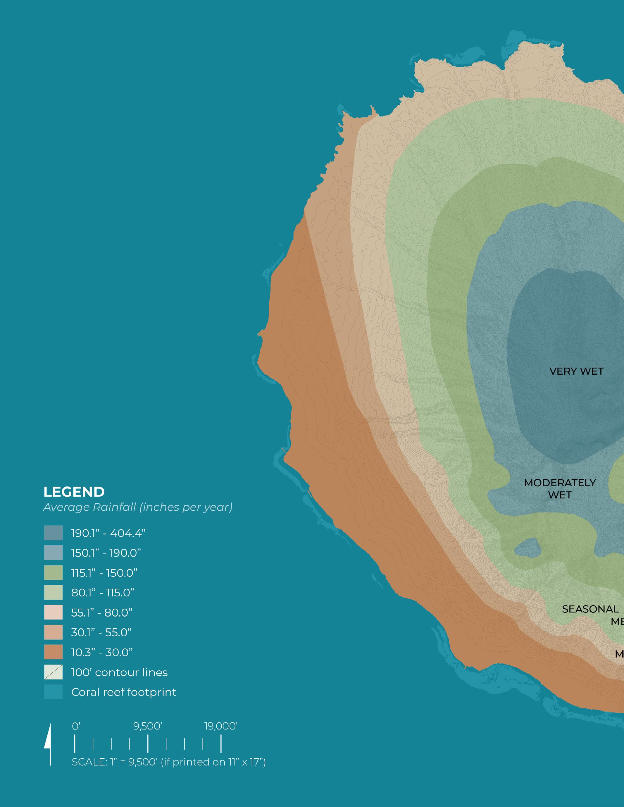
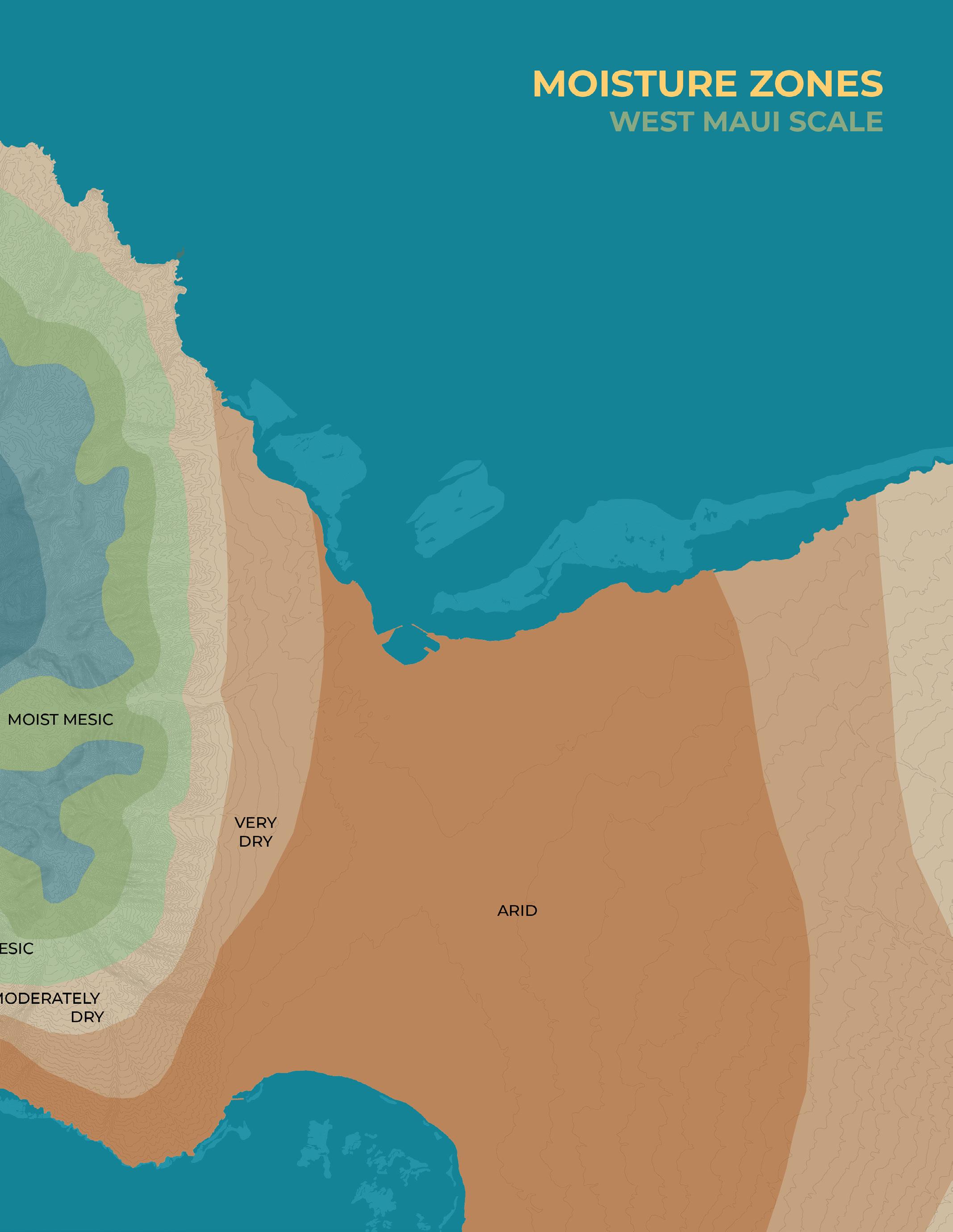
Moisture Zones
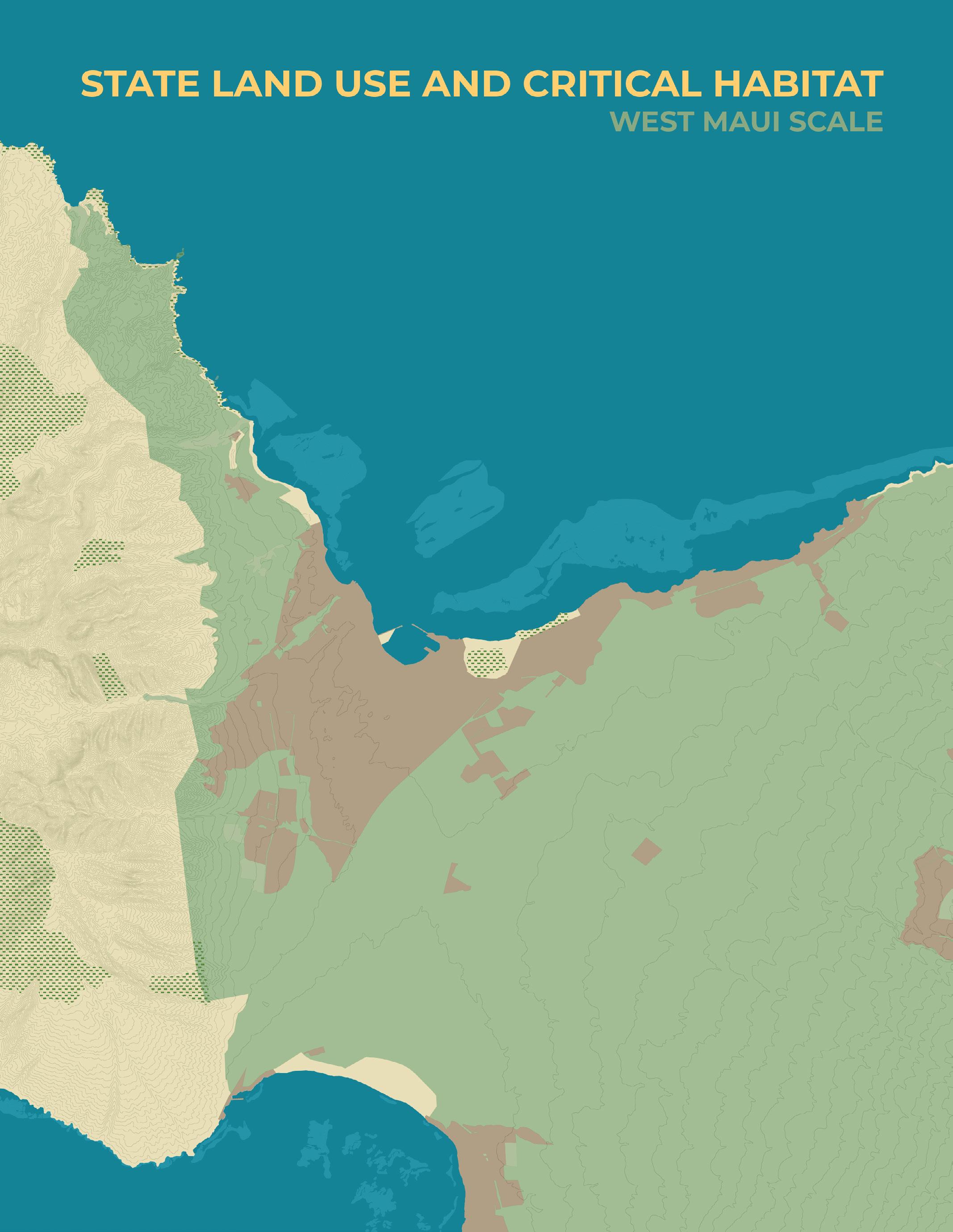
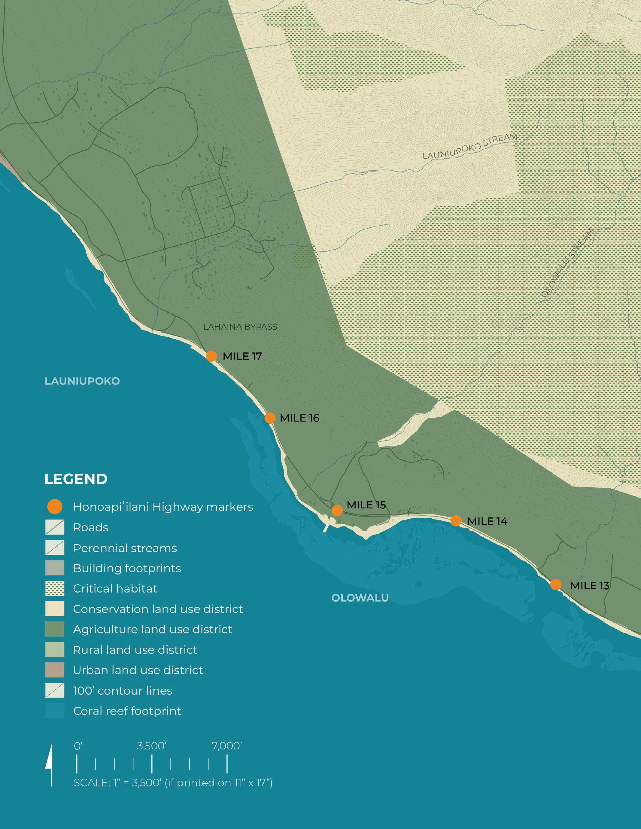
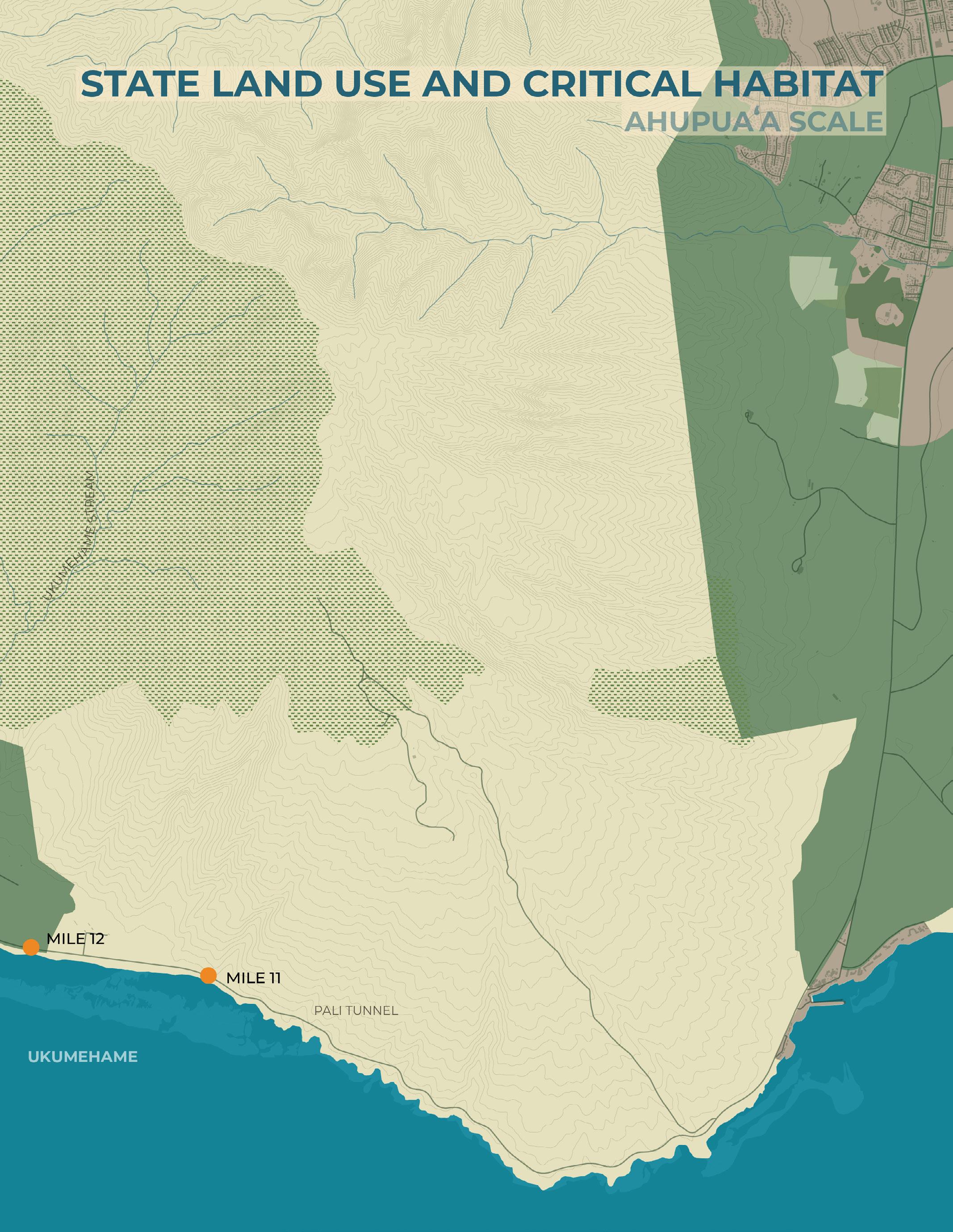
State Land Use and Critical Habitat
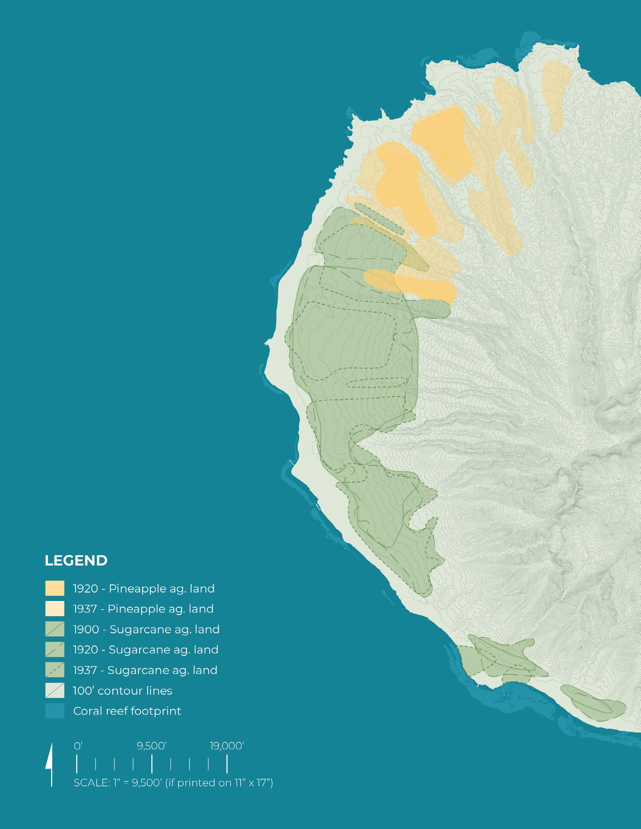
Historic Agriculture
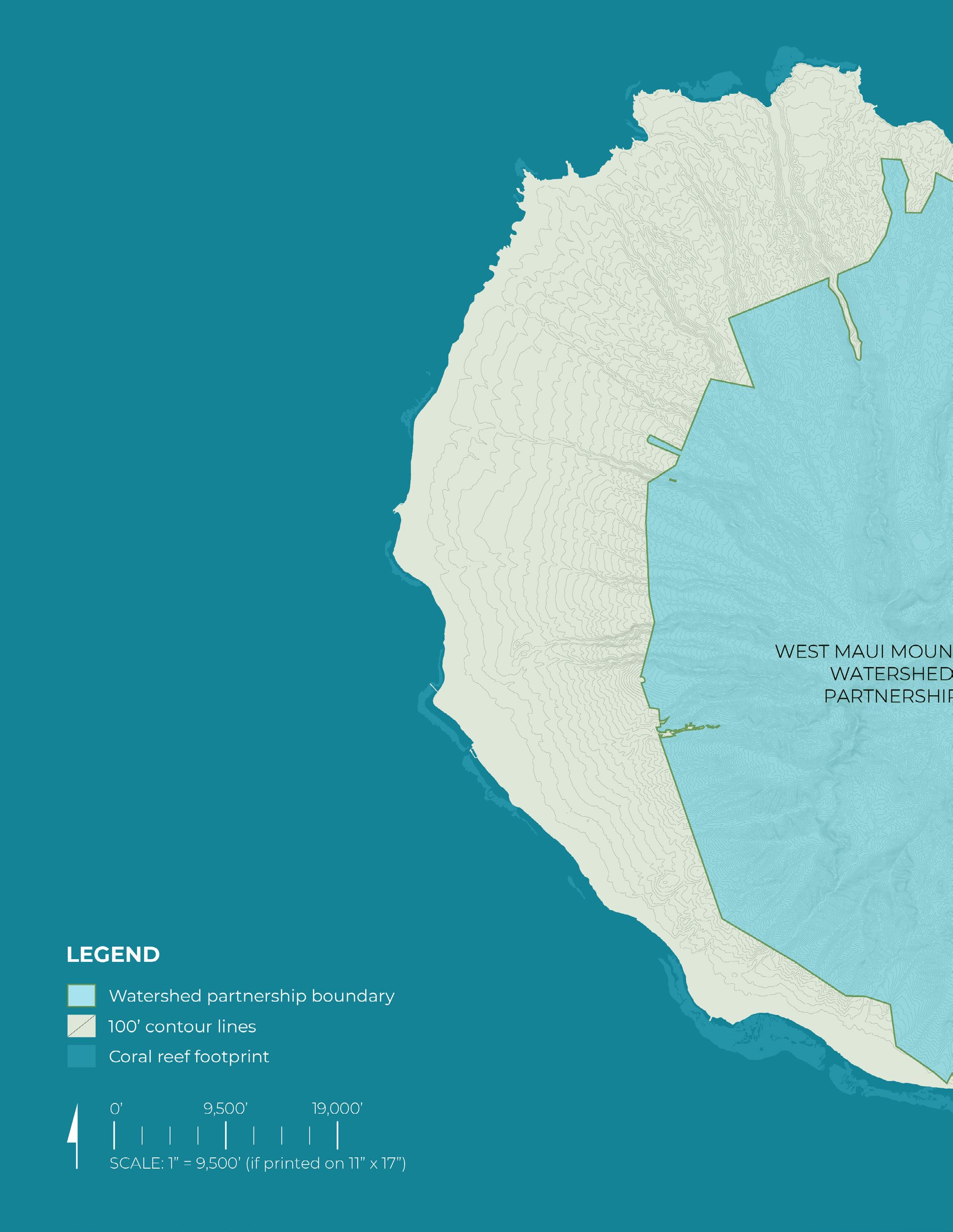
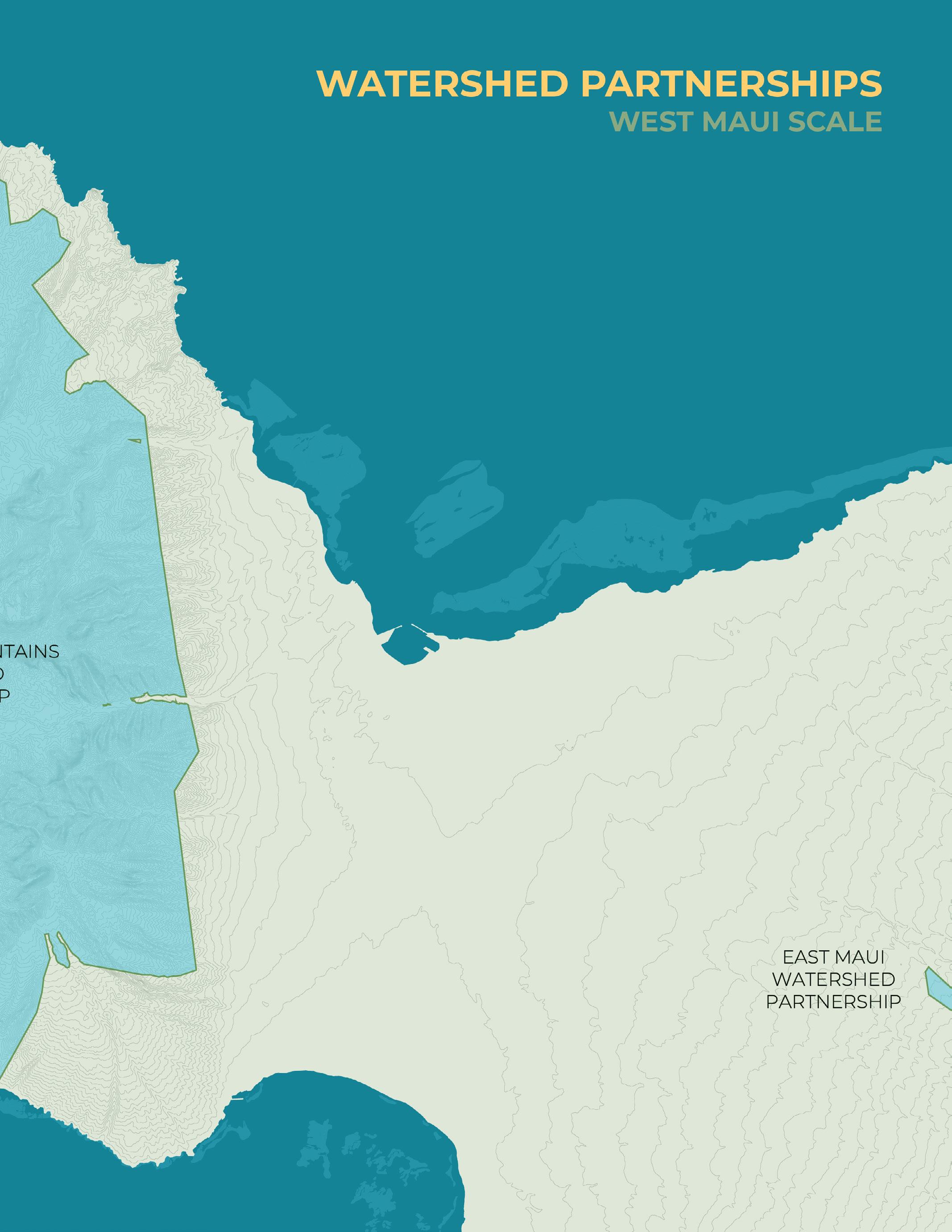
Watershed Partnerships
Ahupua’a Scale:
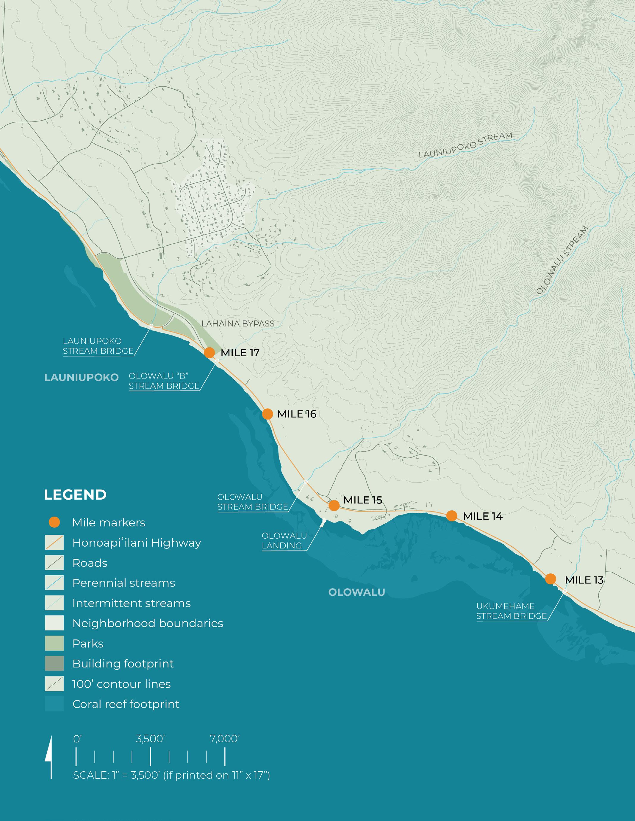
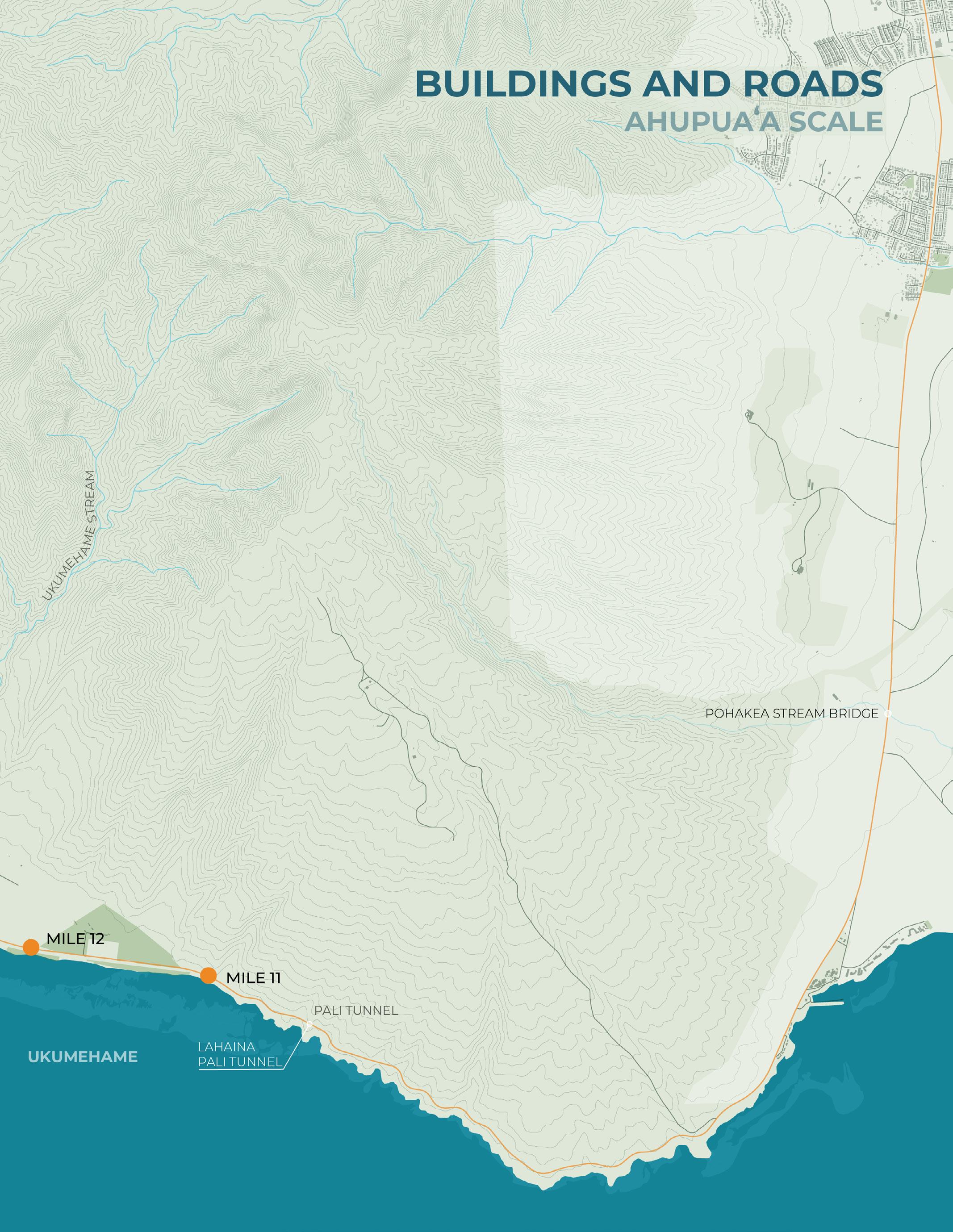
Buildings and Roads
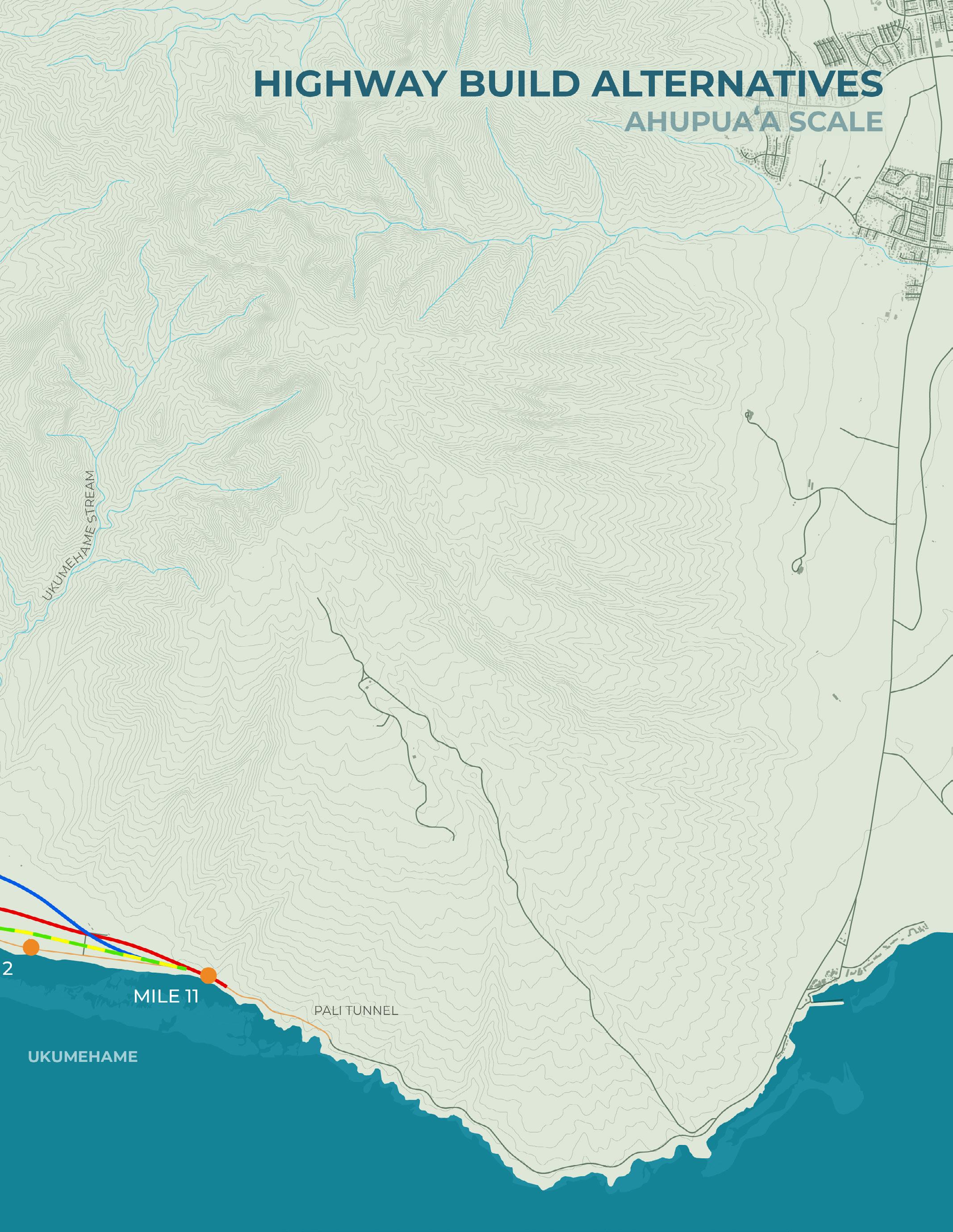
Highway Build Alternatives
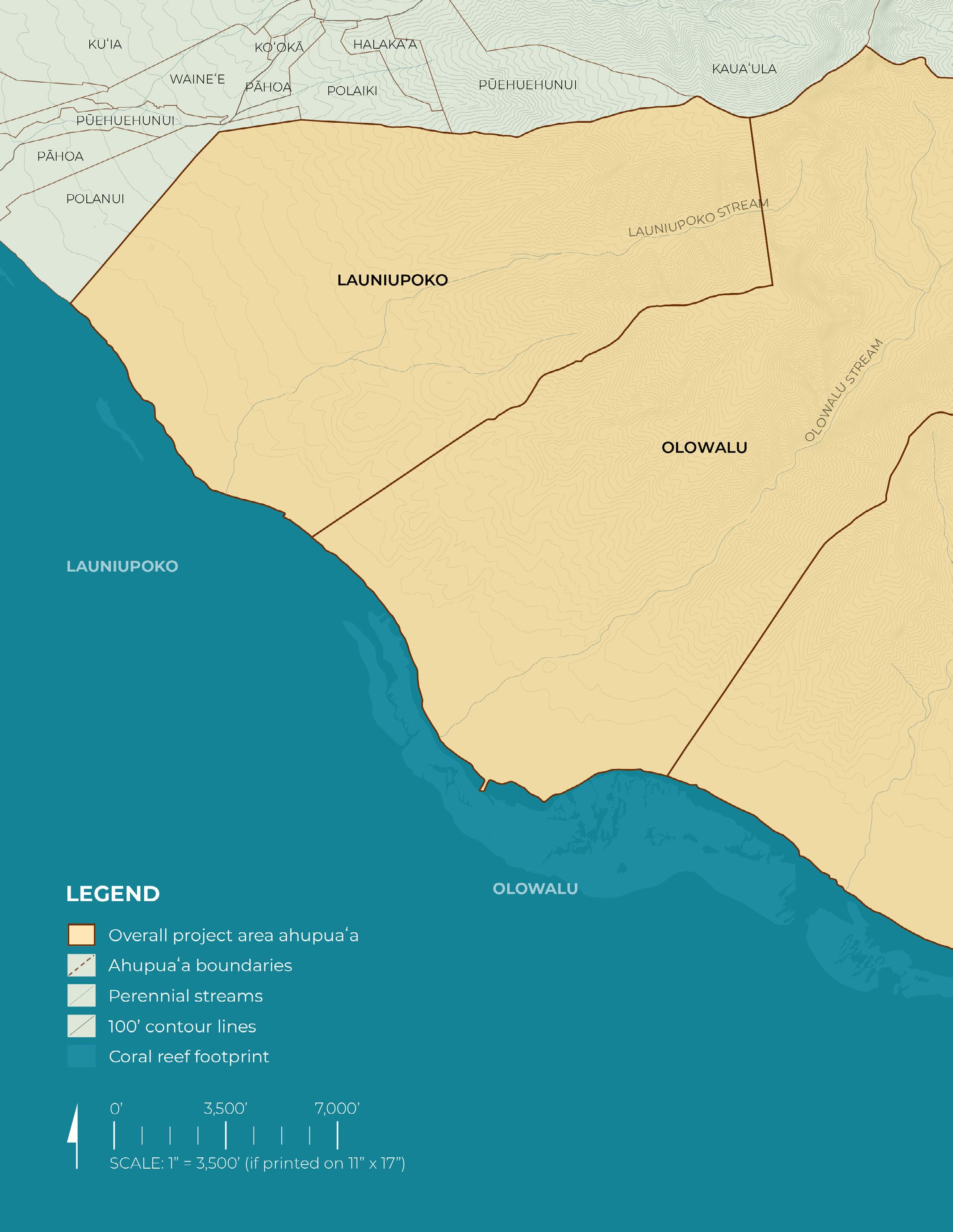
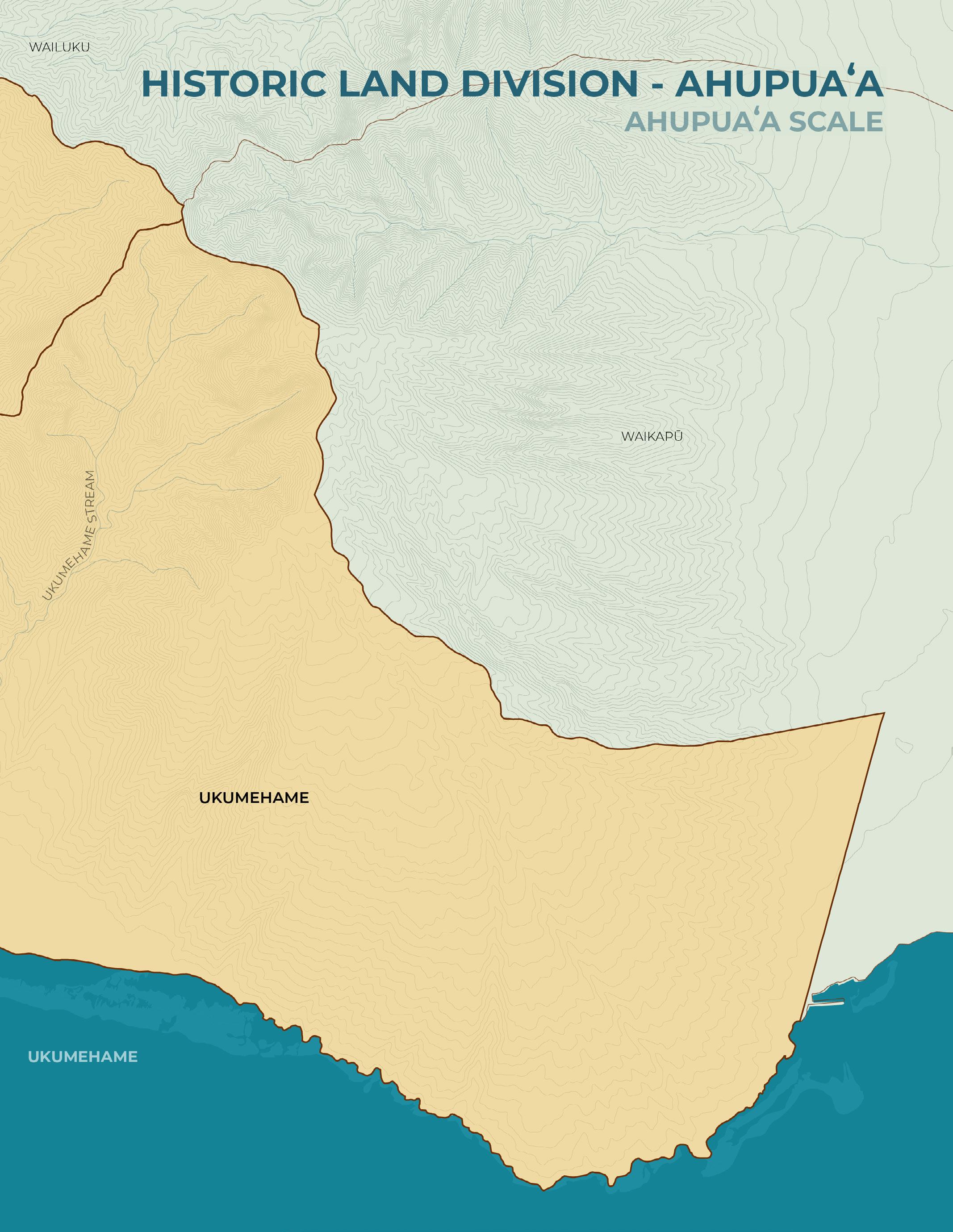
Historic Land Division (Ahupuaʻa)
Hawaiian Placenames
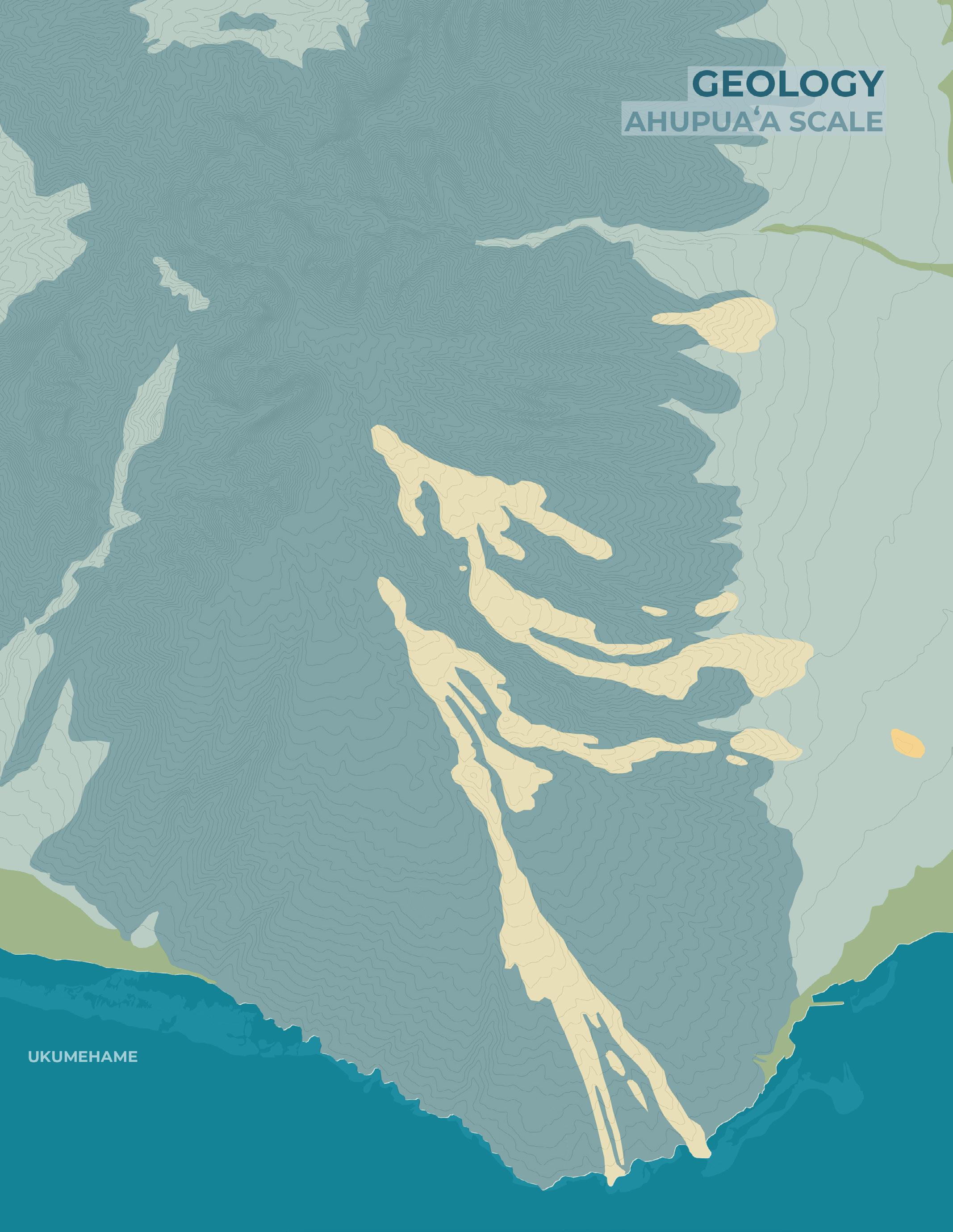
Geology
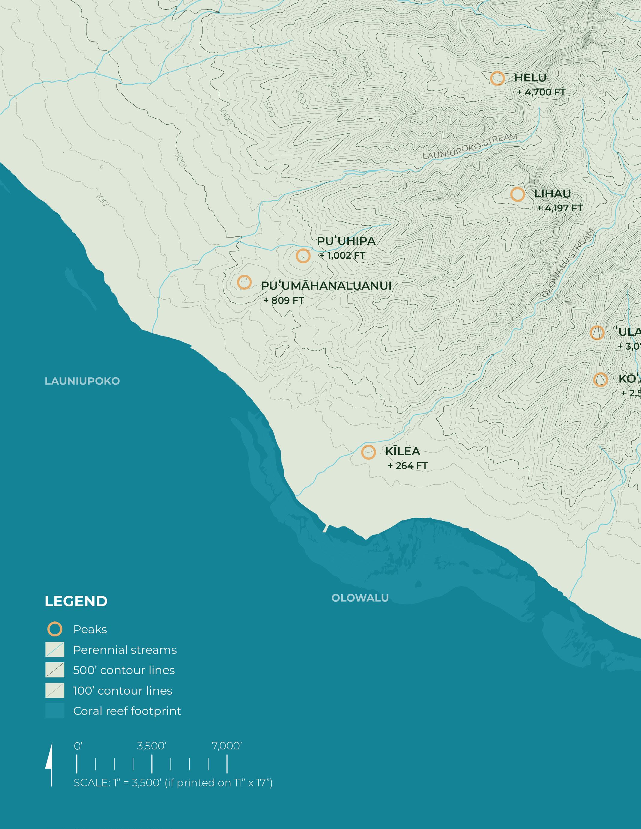
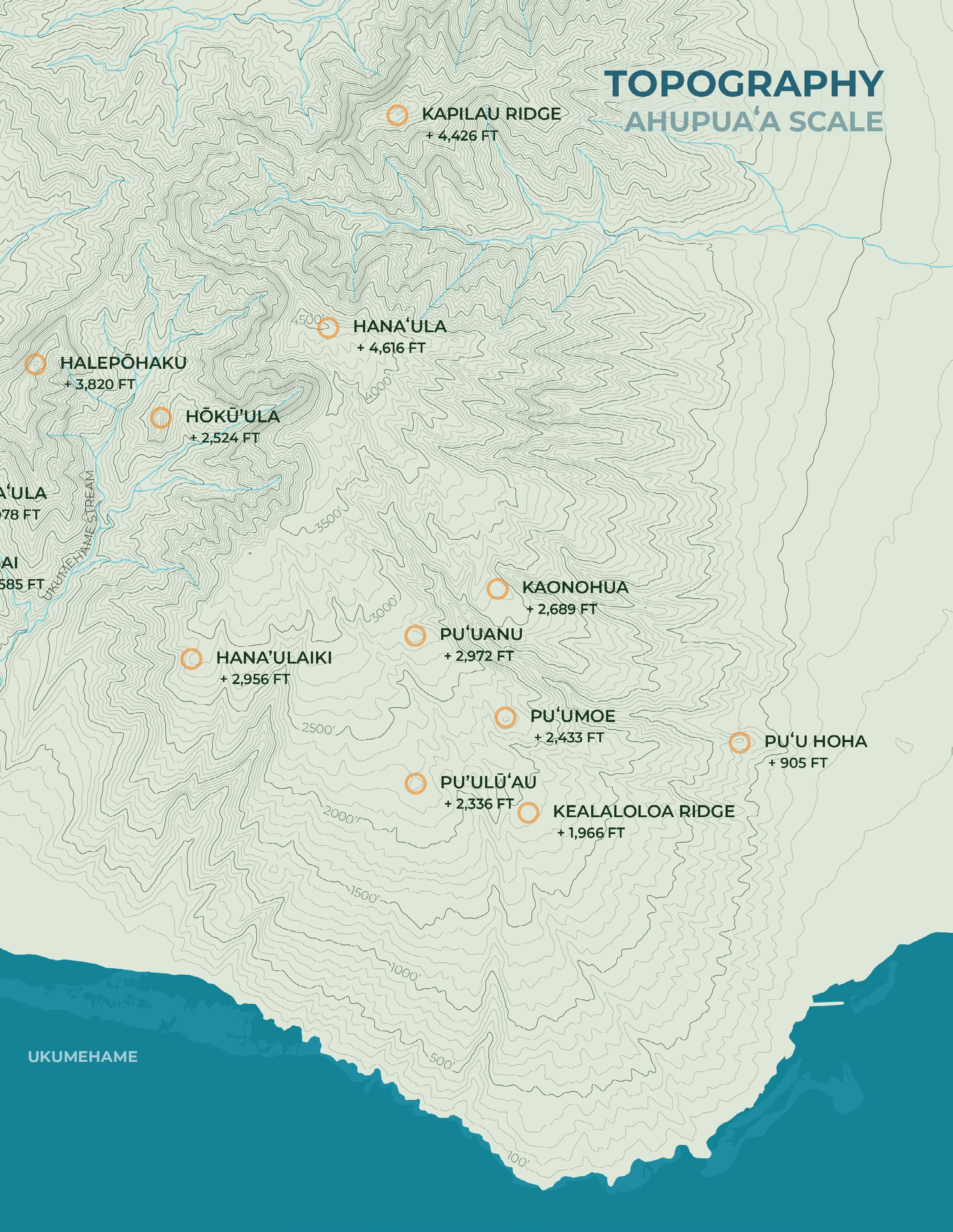
Topography
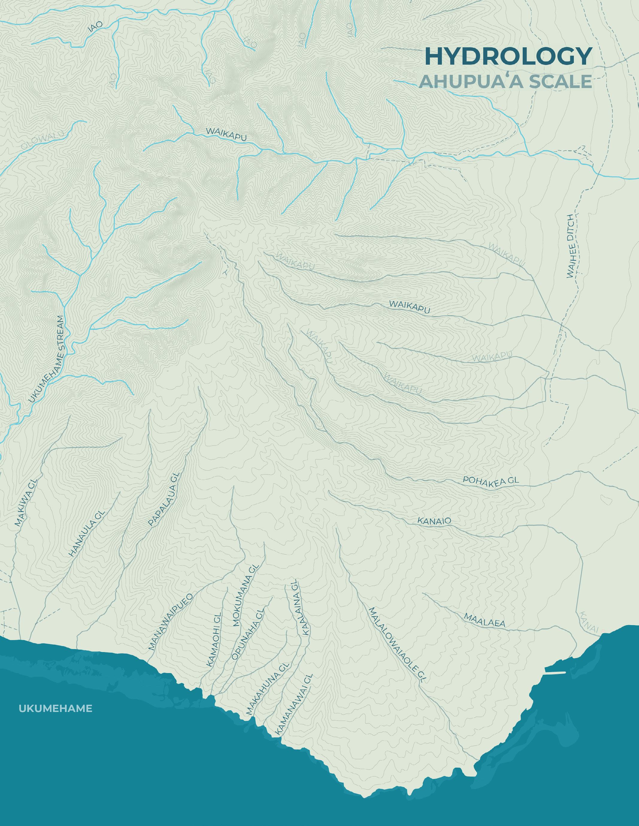
Hydrology
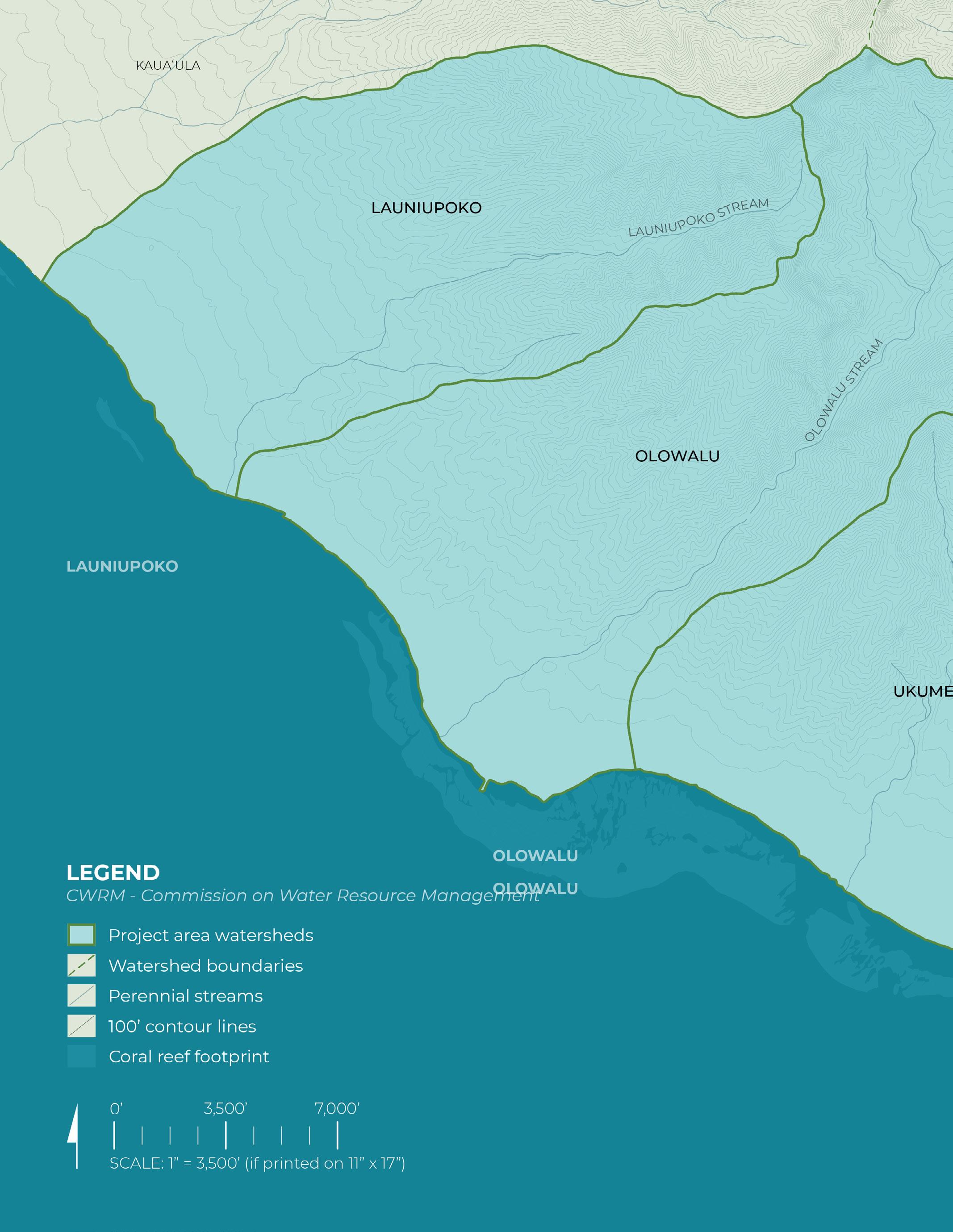
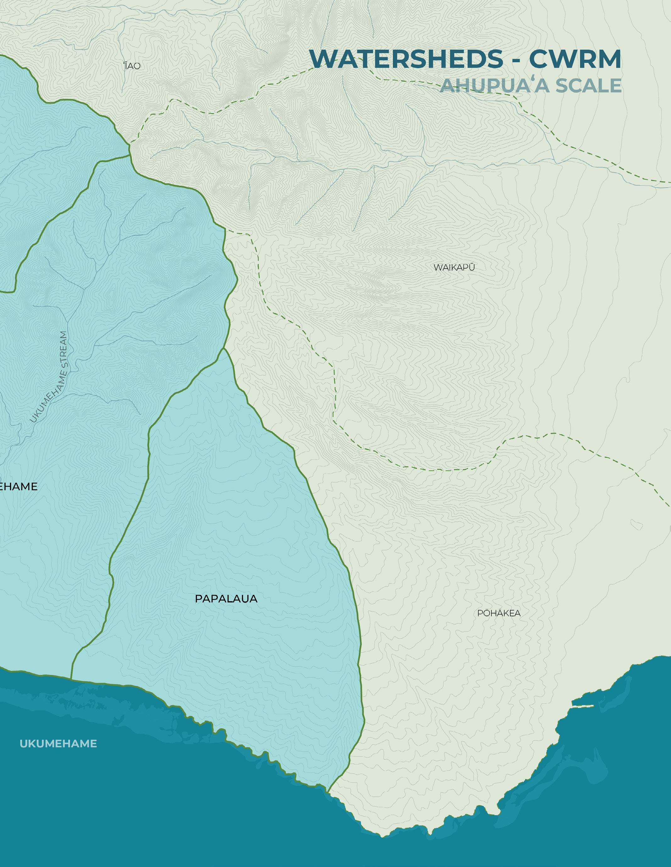
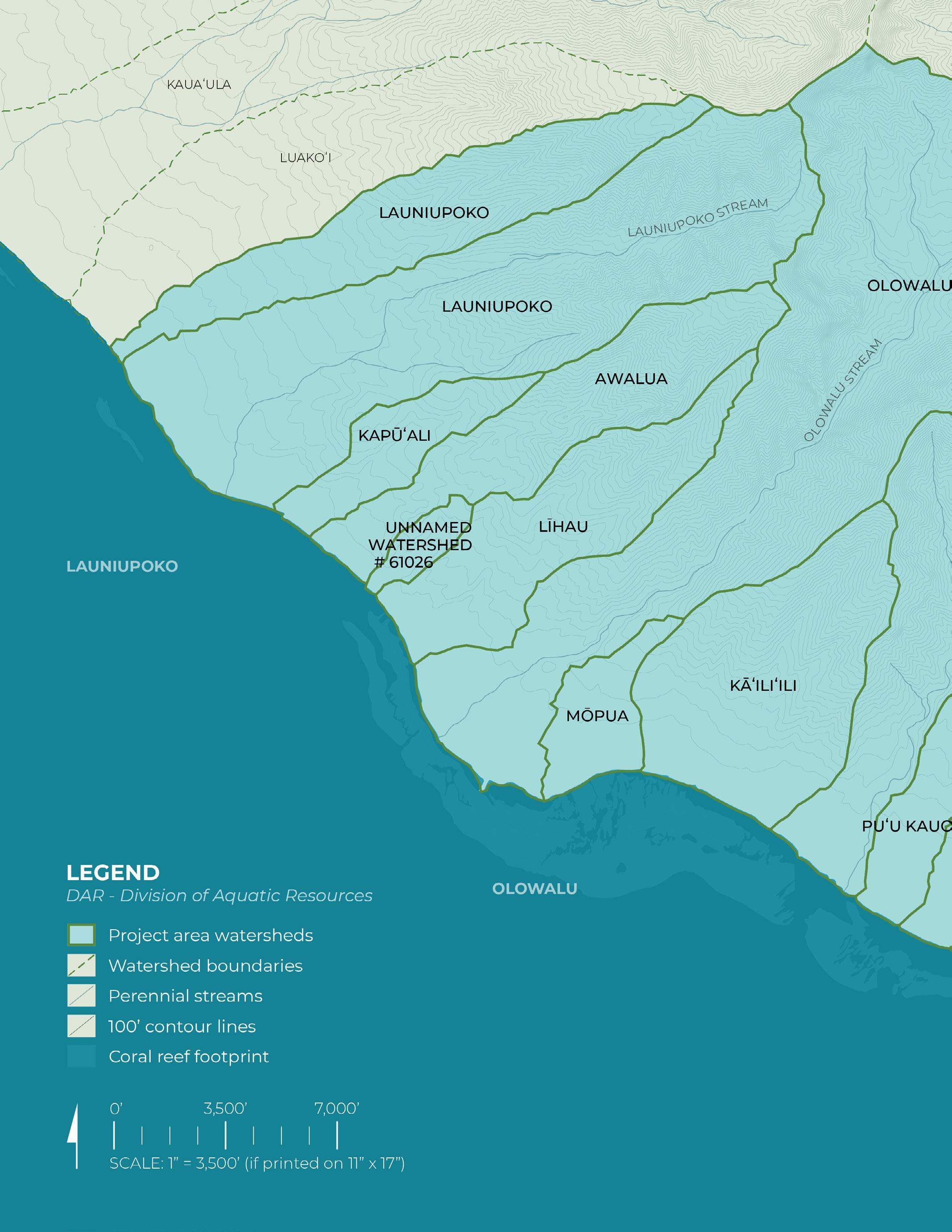
Watersheds (CWRM)
Ahupua’a Scale (continued):
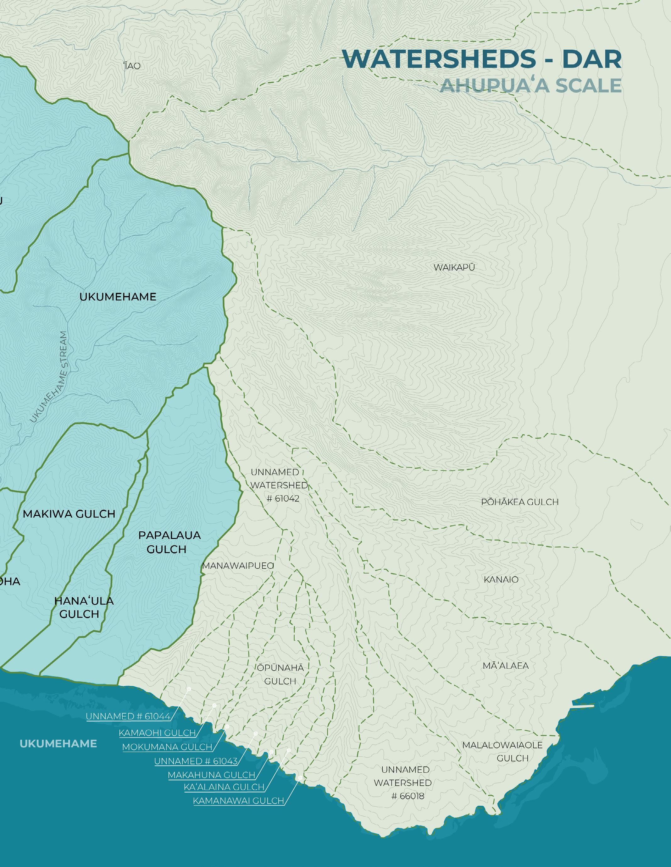
Watersheds (DAR)
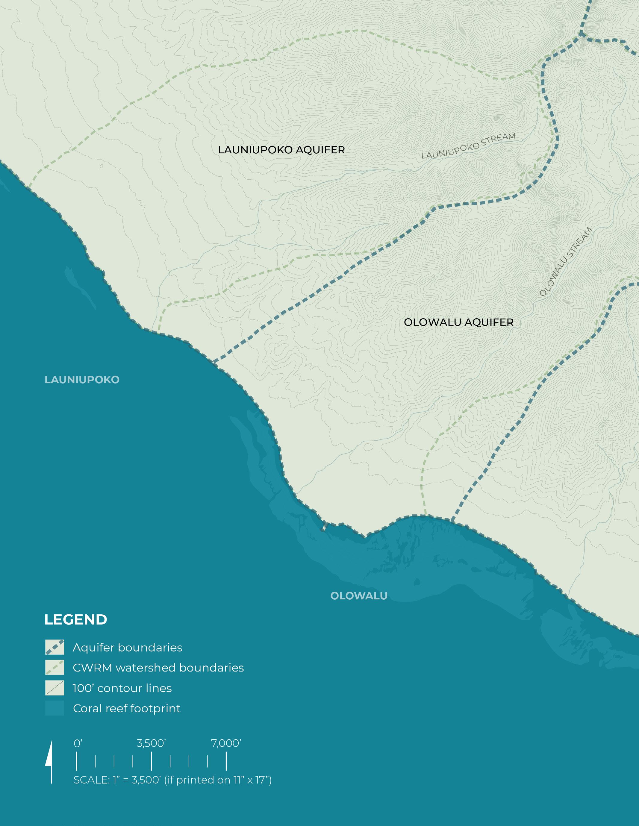
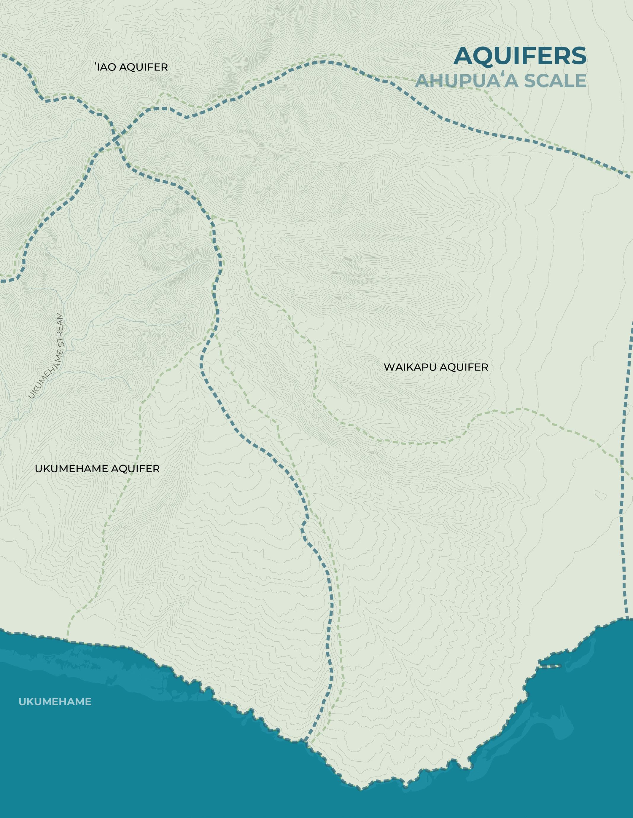
Aquifers
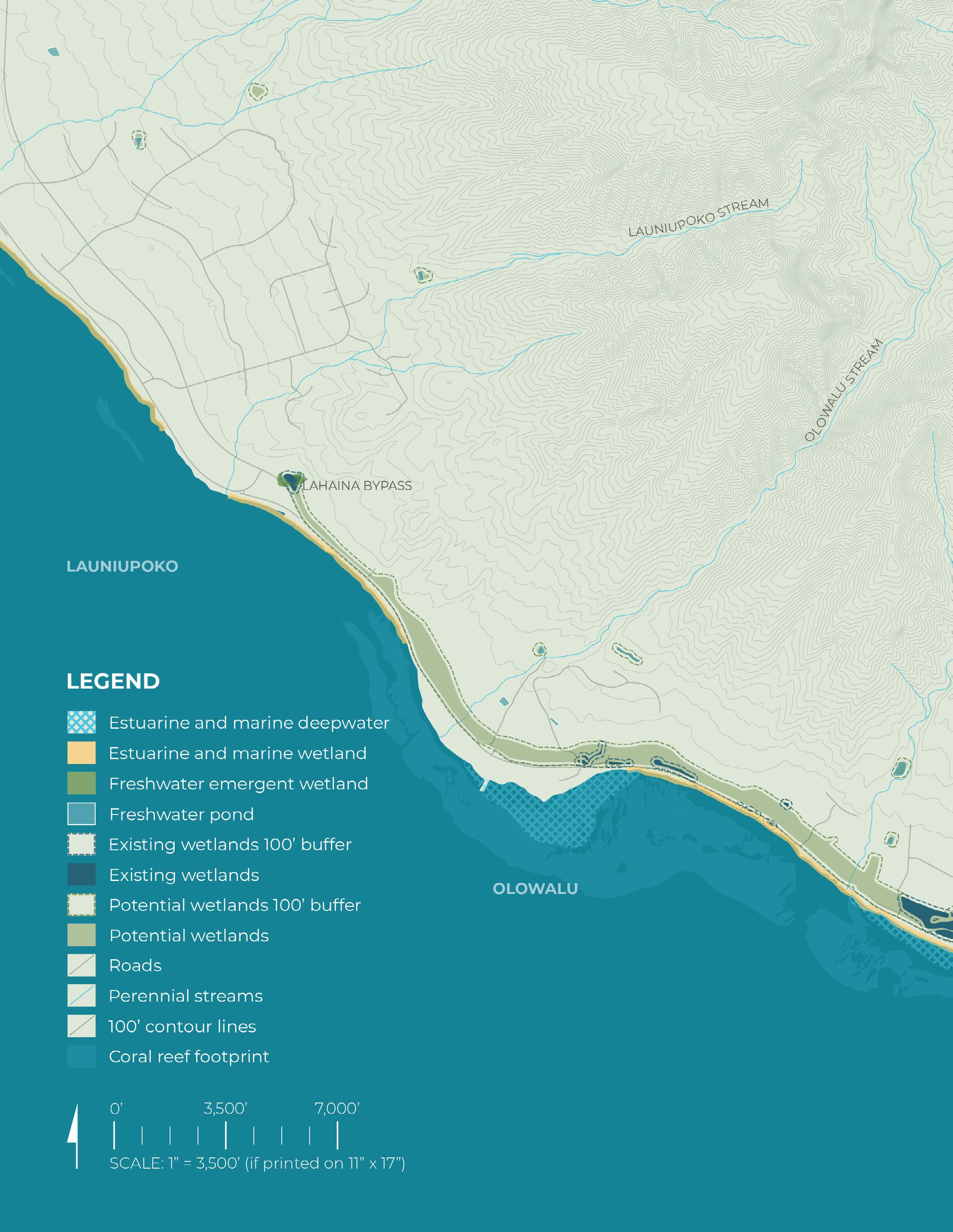
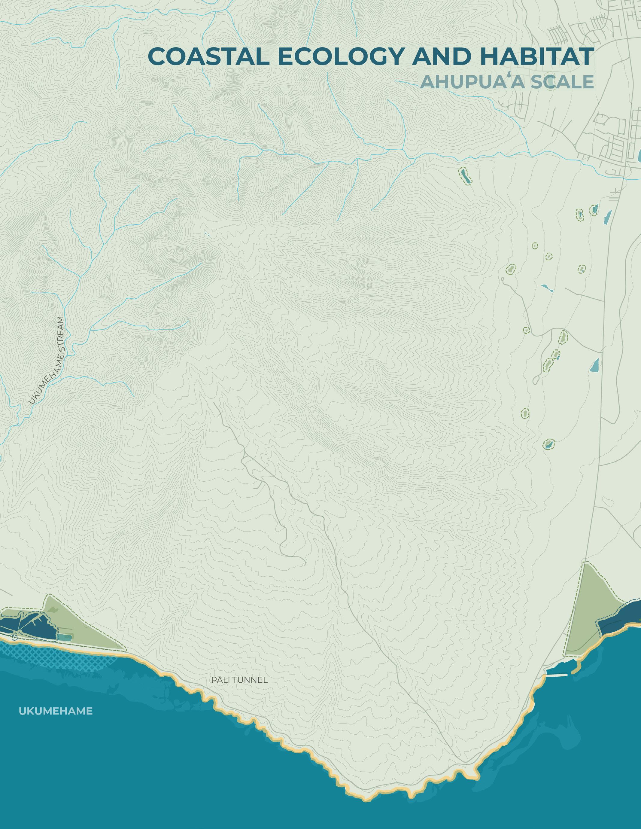
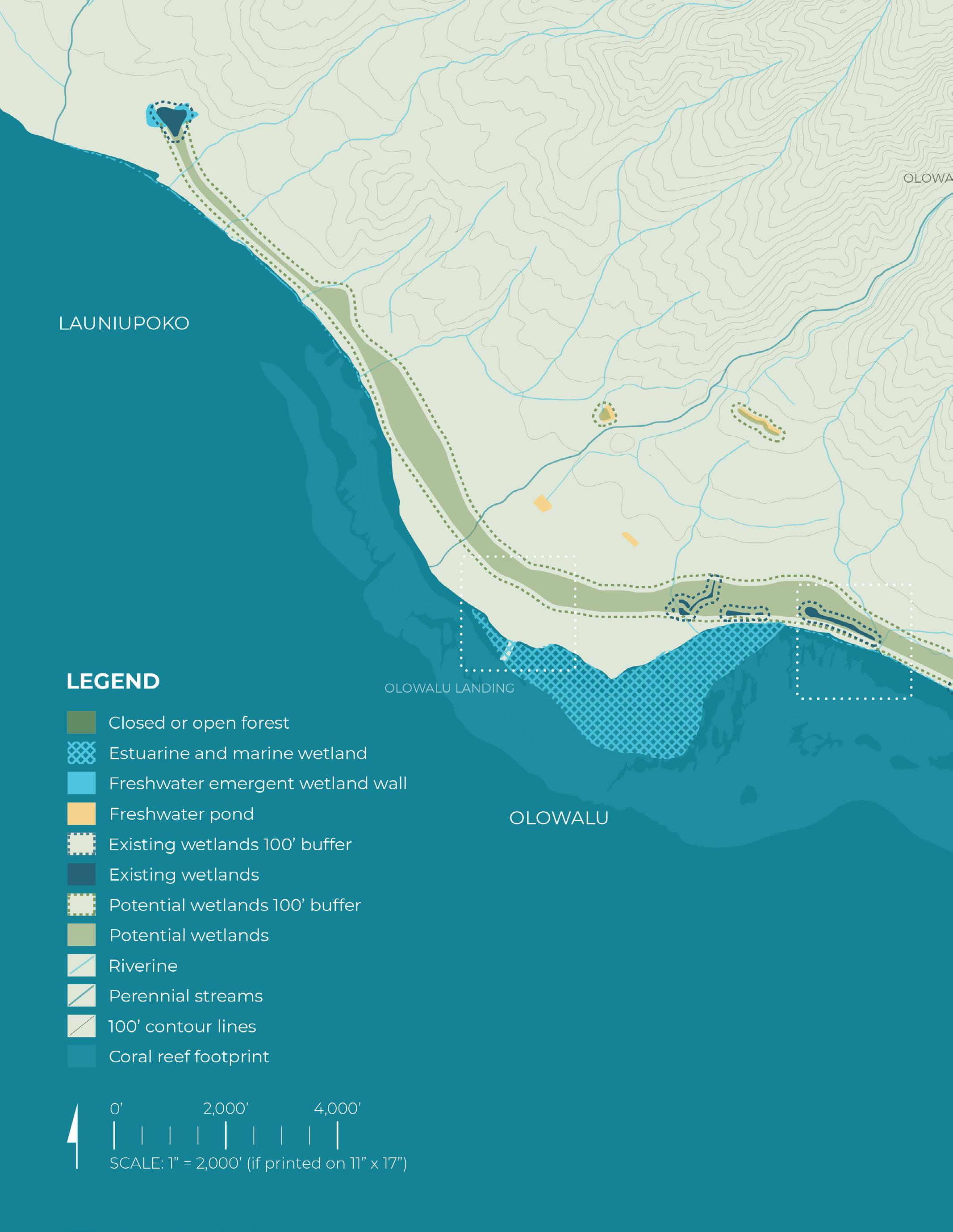
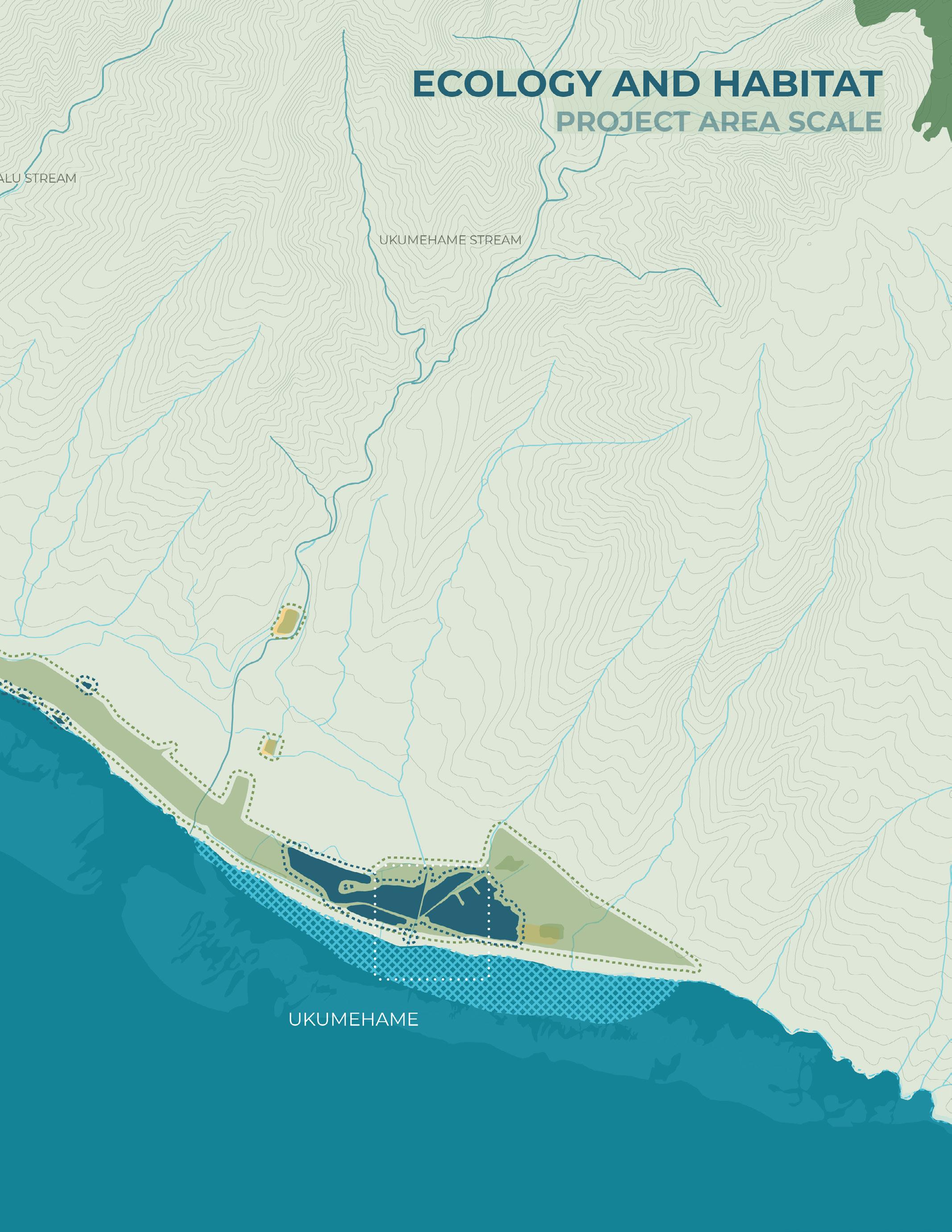
Ecology and Habitat
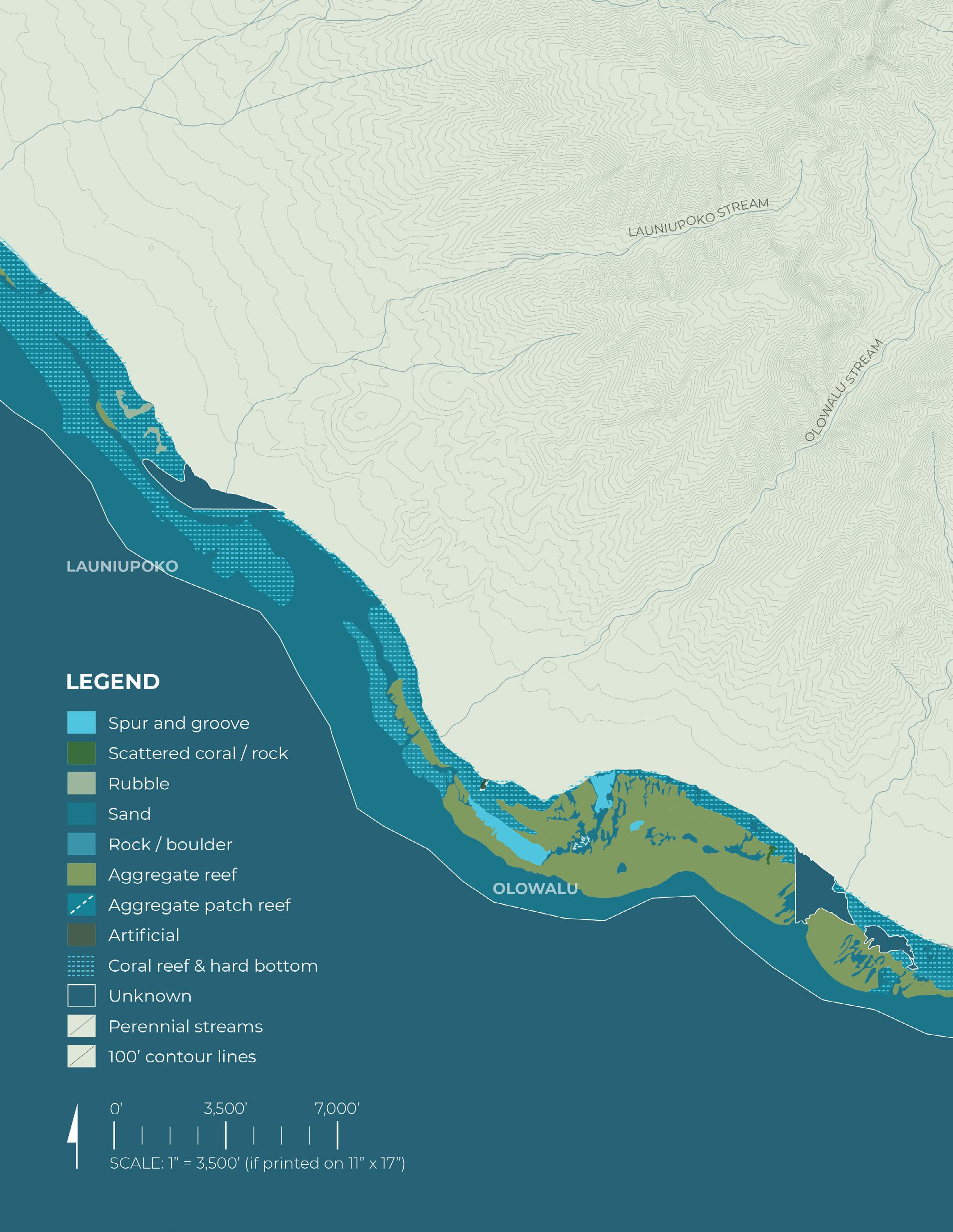
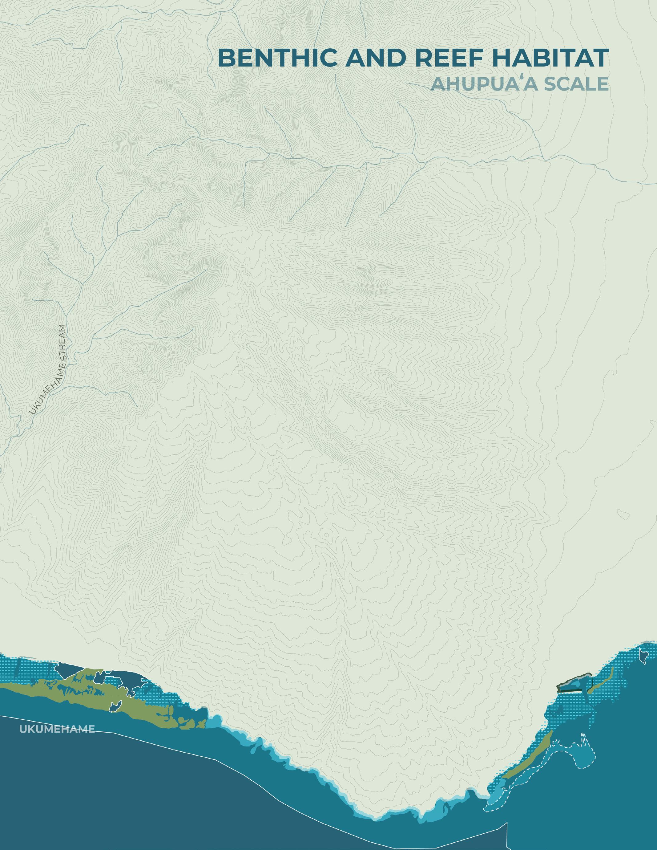
Benthic and Reef Habitat
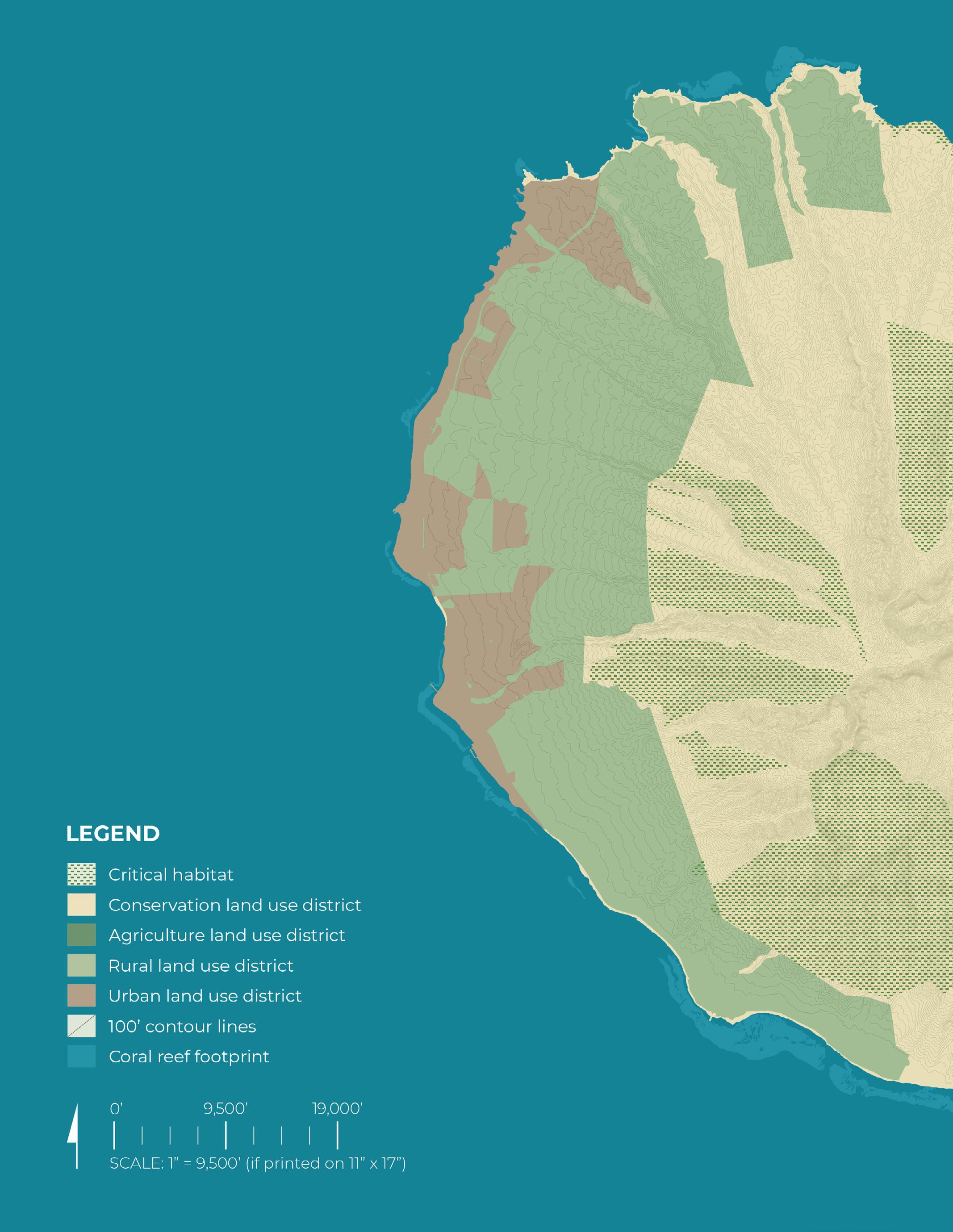
State Land Use and Critical Habitat
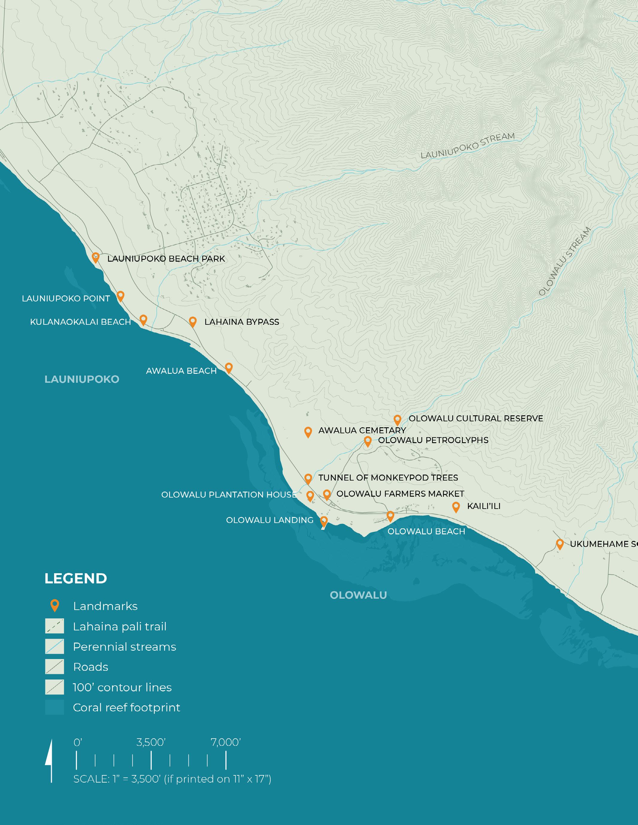
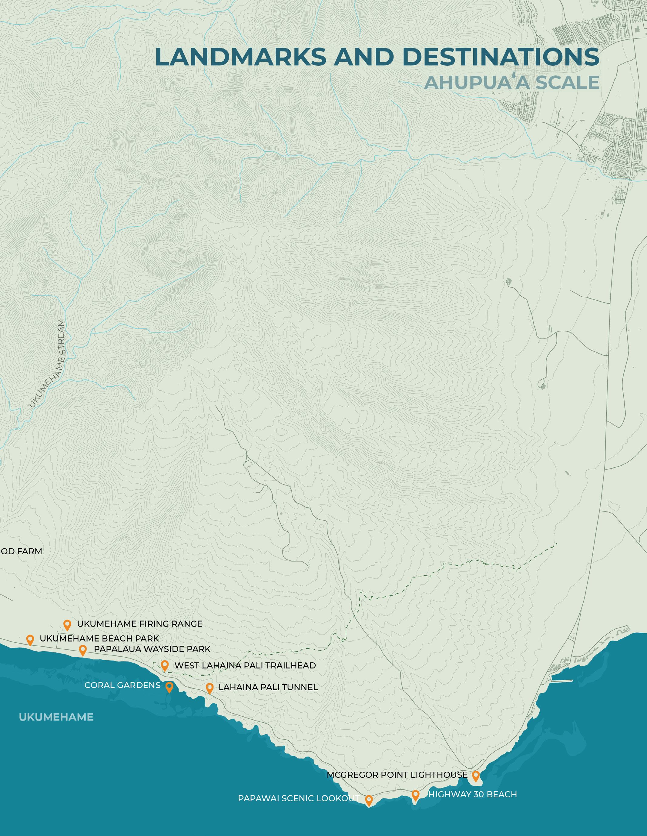
Landmarks and Destinations
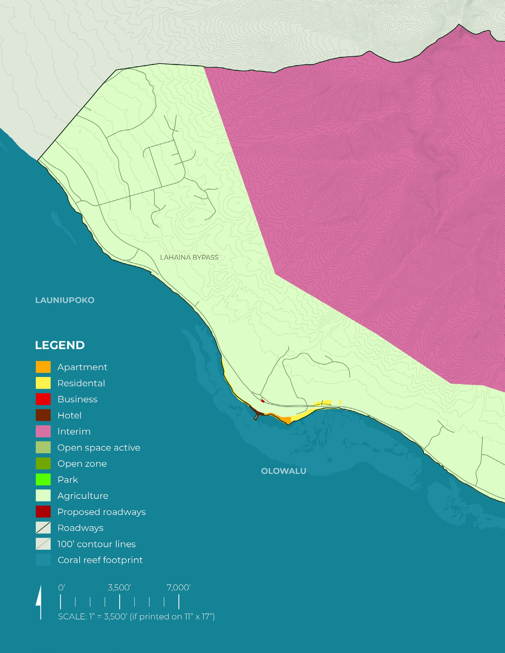
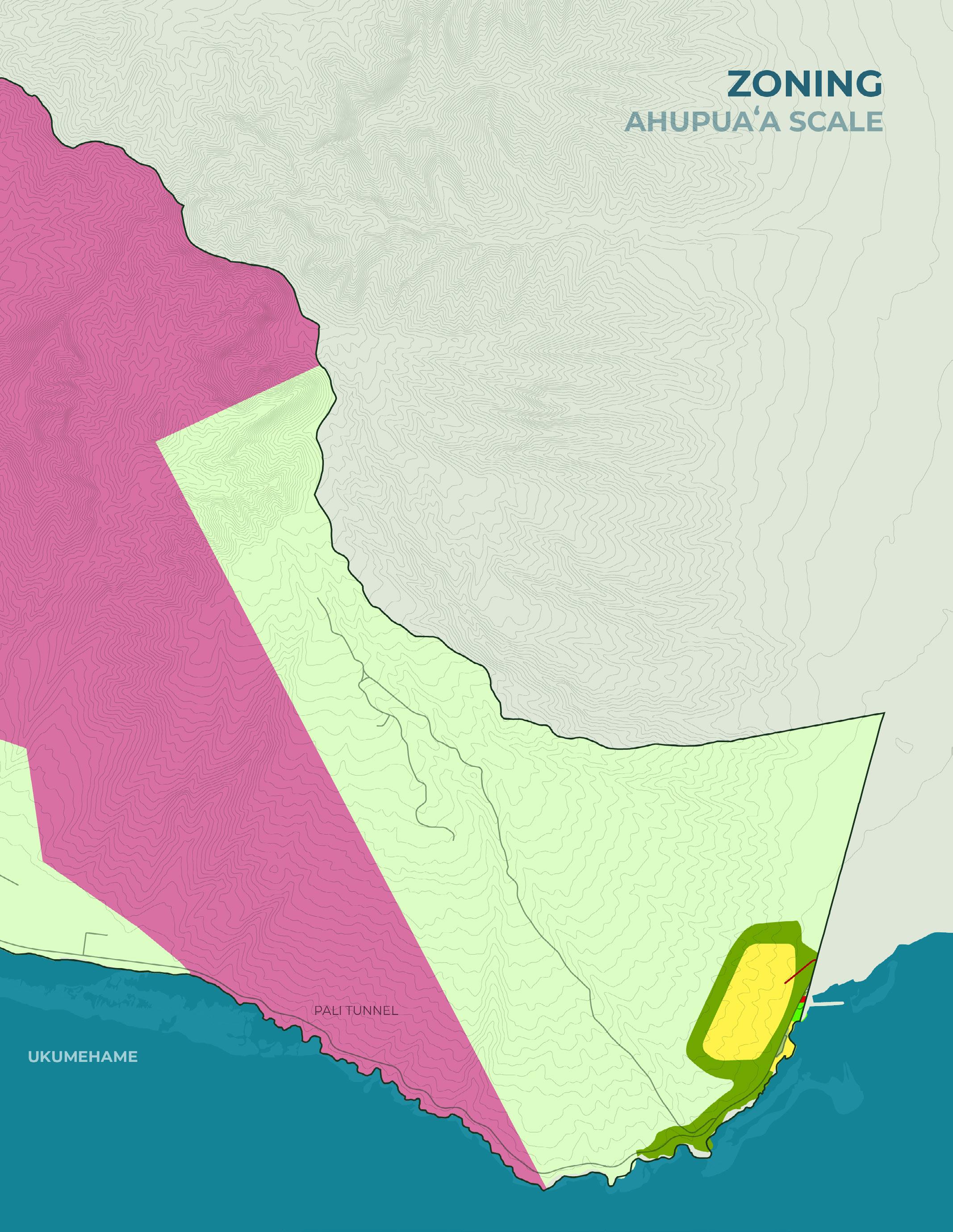
Zoning
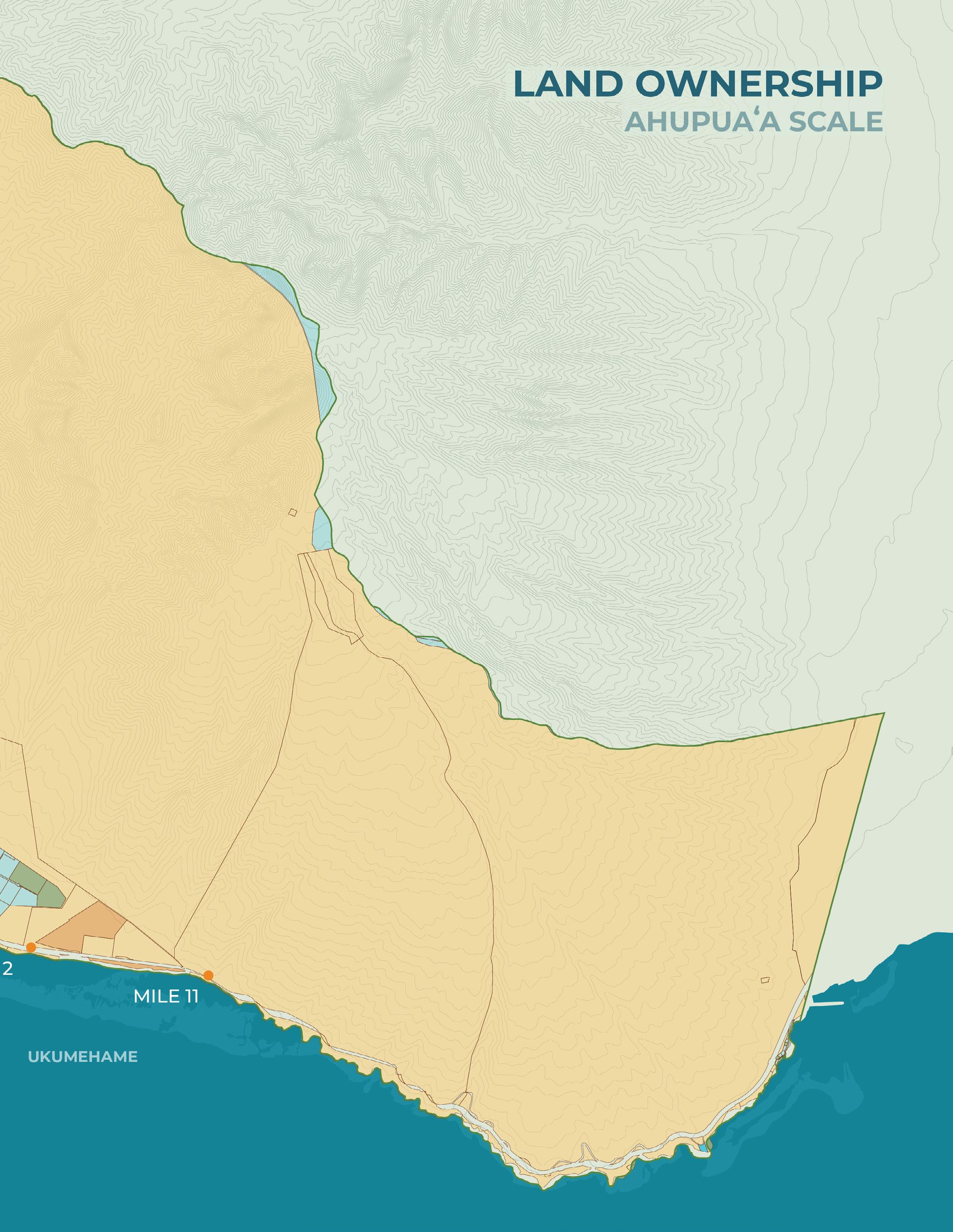
Land Ownership
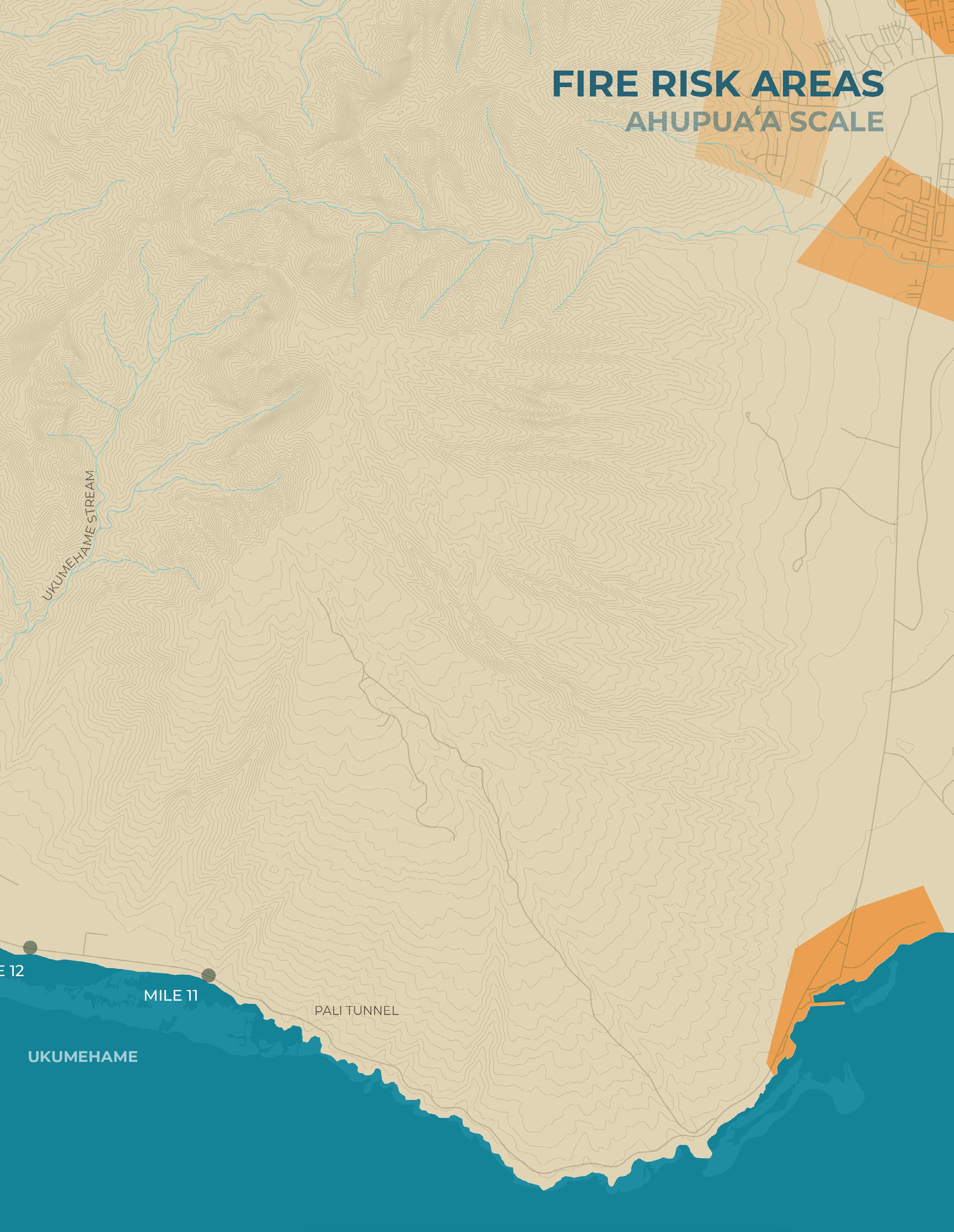
Fire Risk Areas
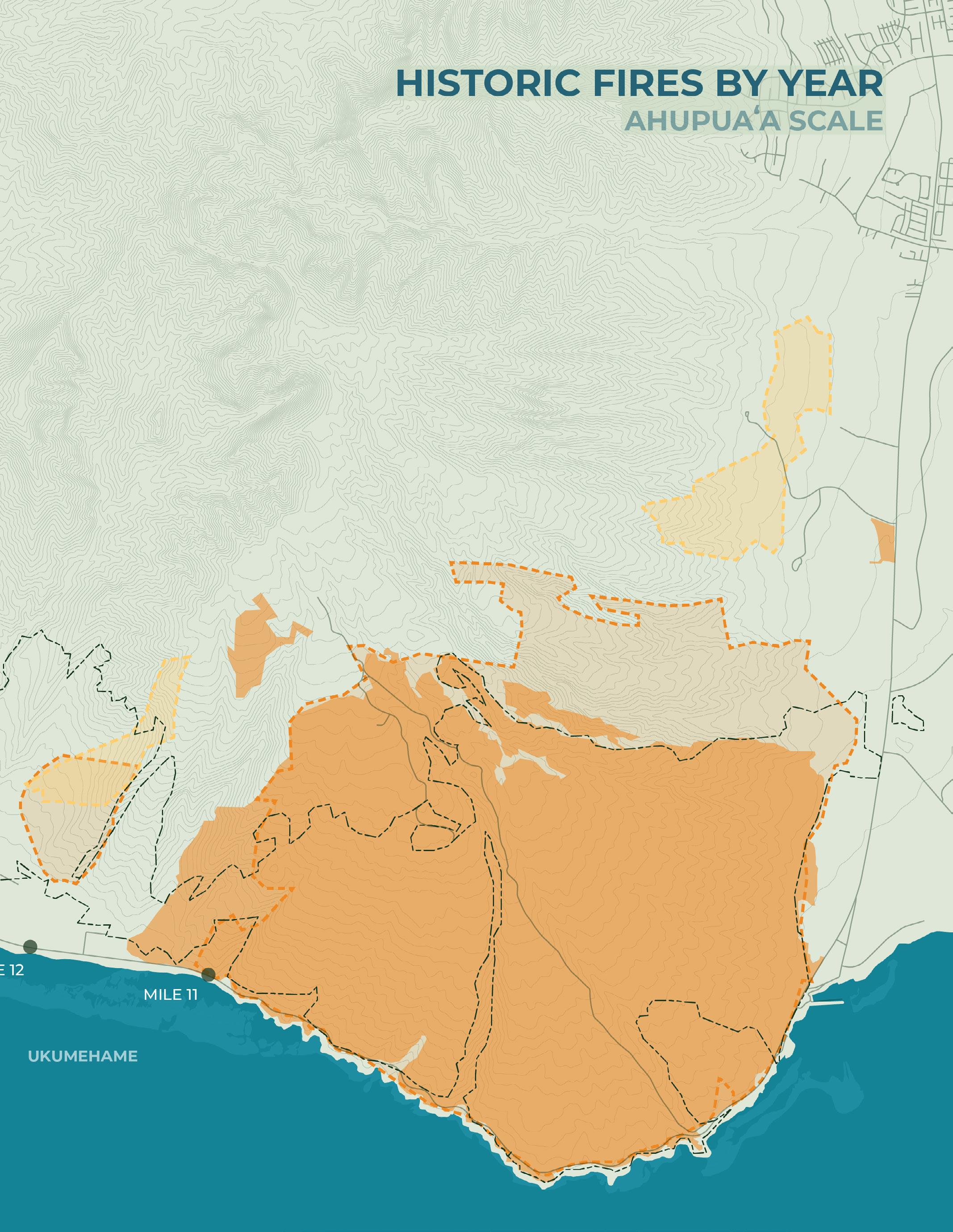
Historic Fires By Year
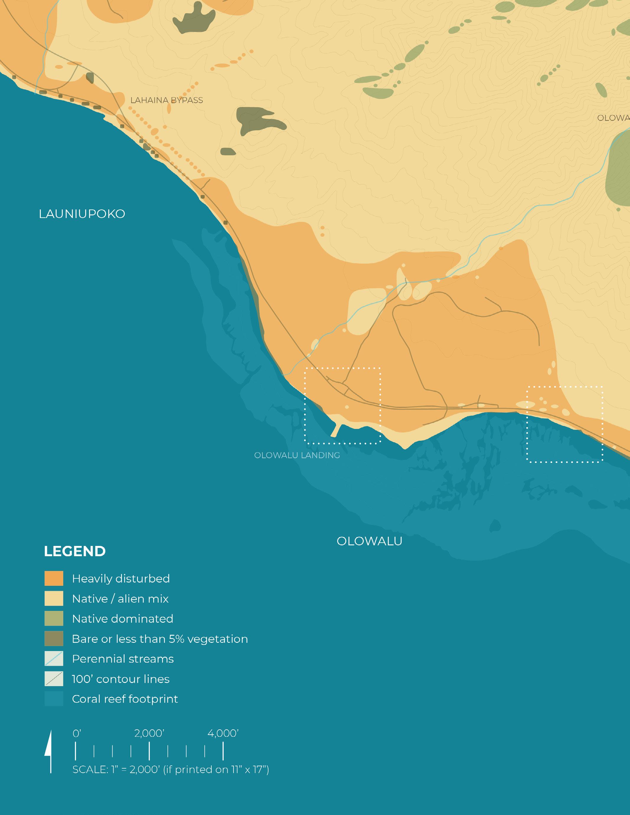
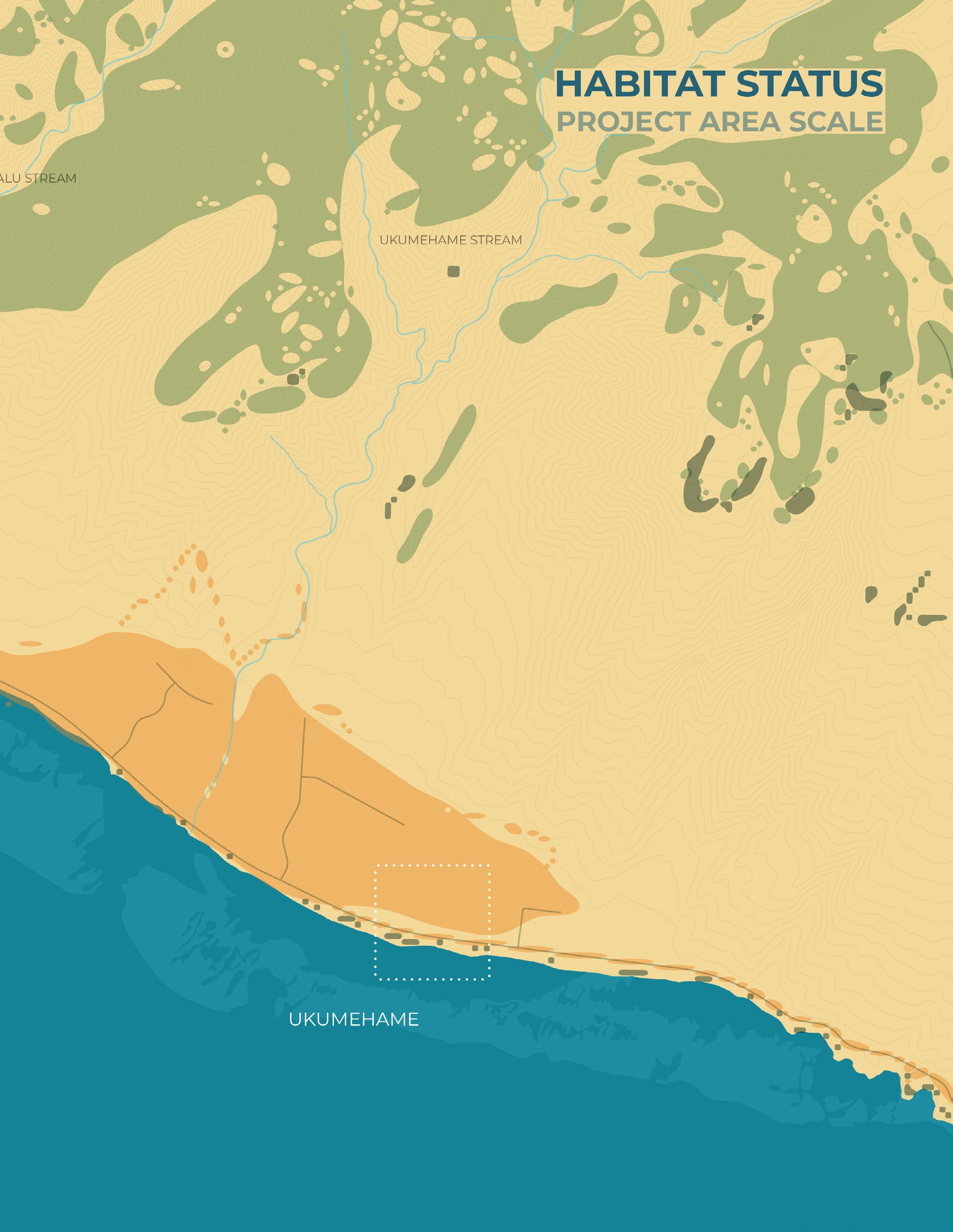
Project Area Scale:
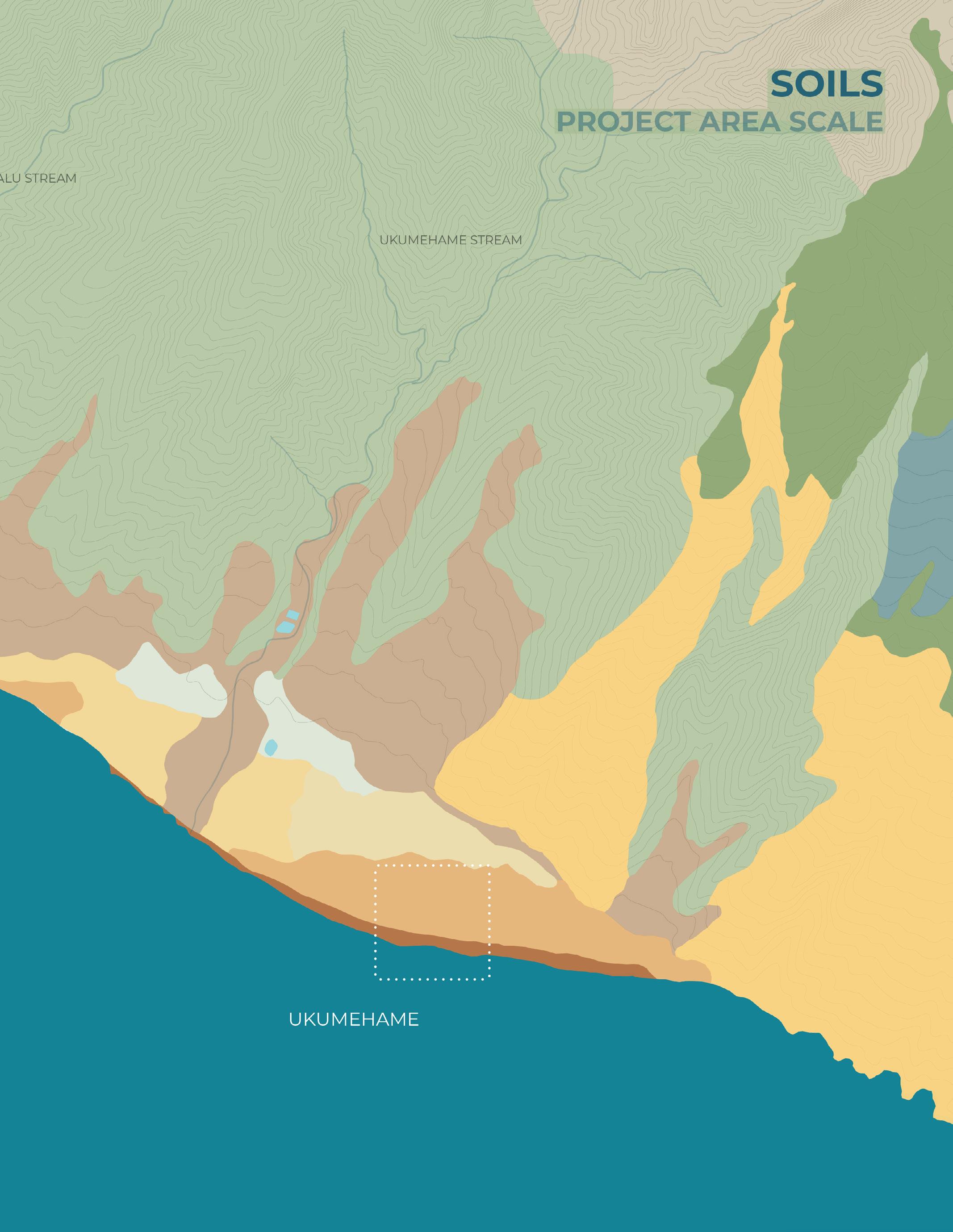
Soils
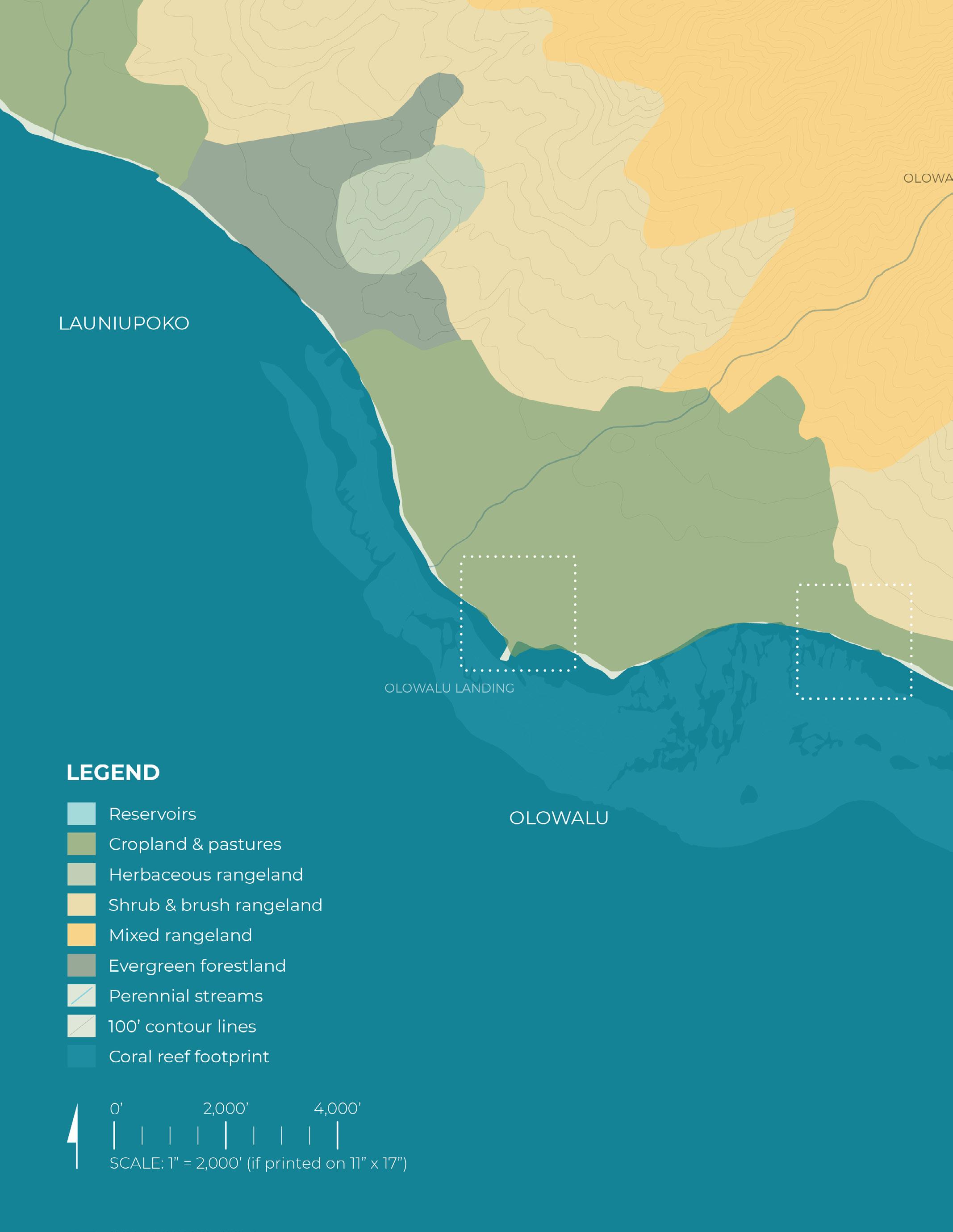
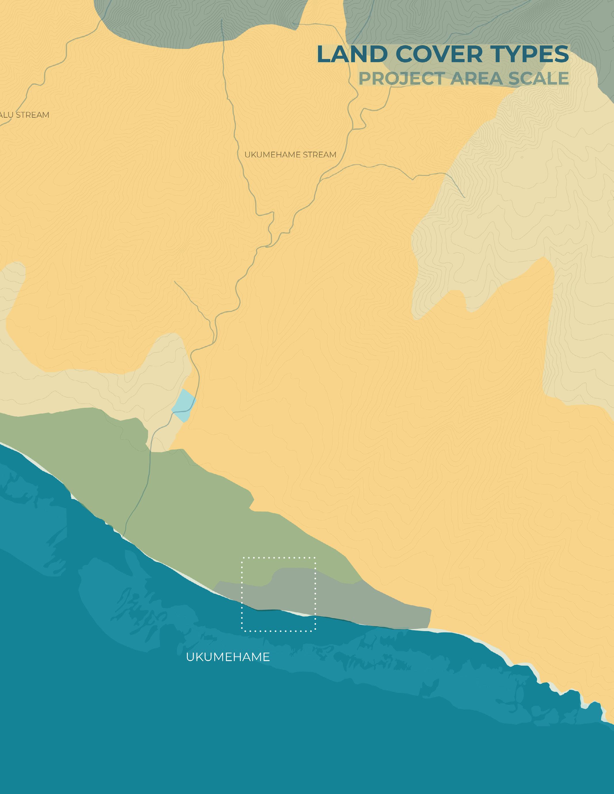
Land Cover Types
Habitat Status
Ecology and Habitat
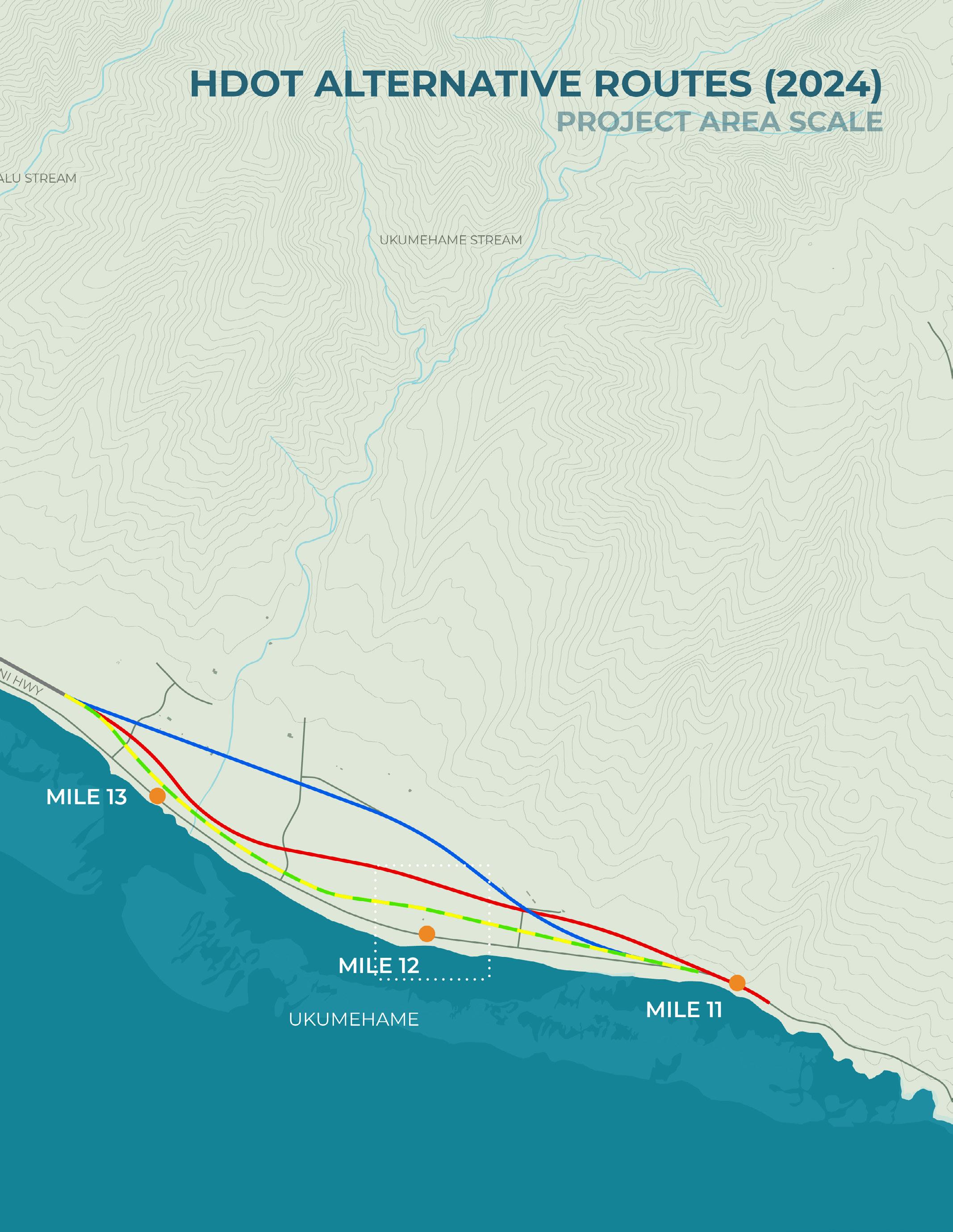
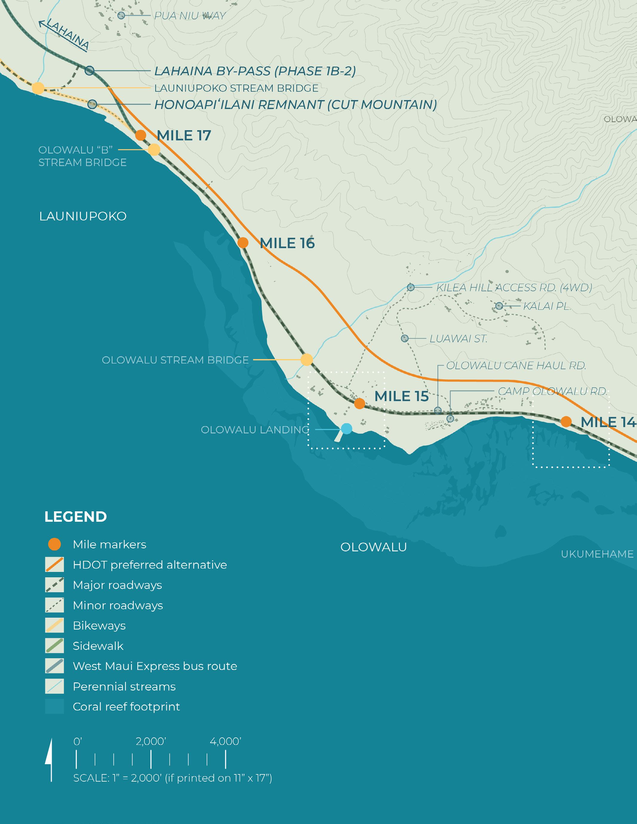
HDOT Alternative Routes
Transportation and Circulation
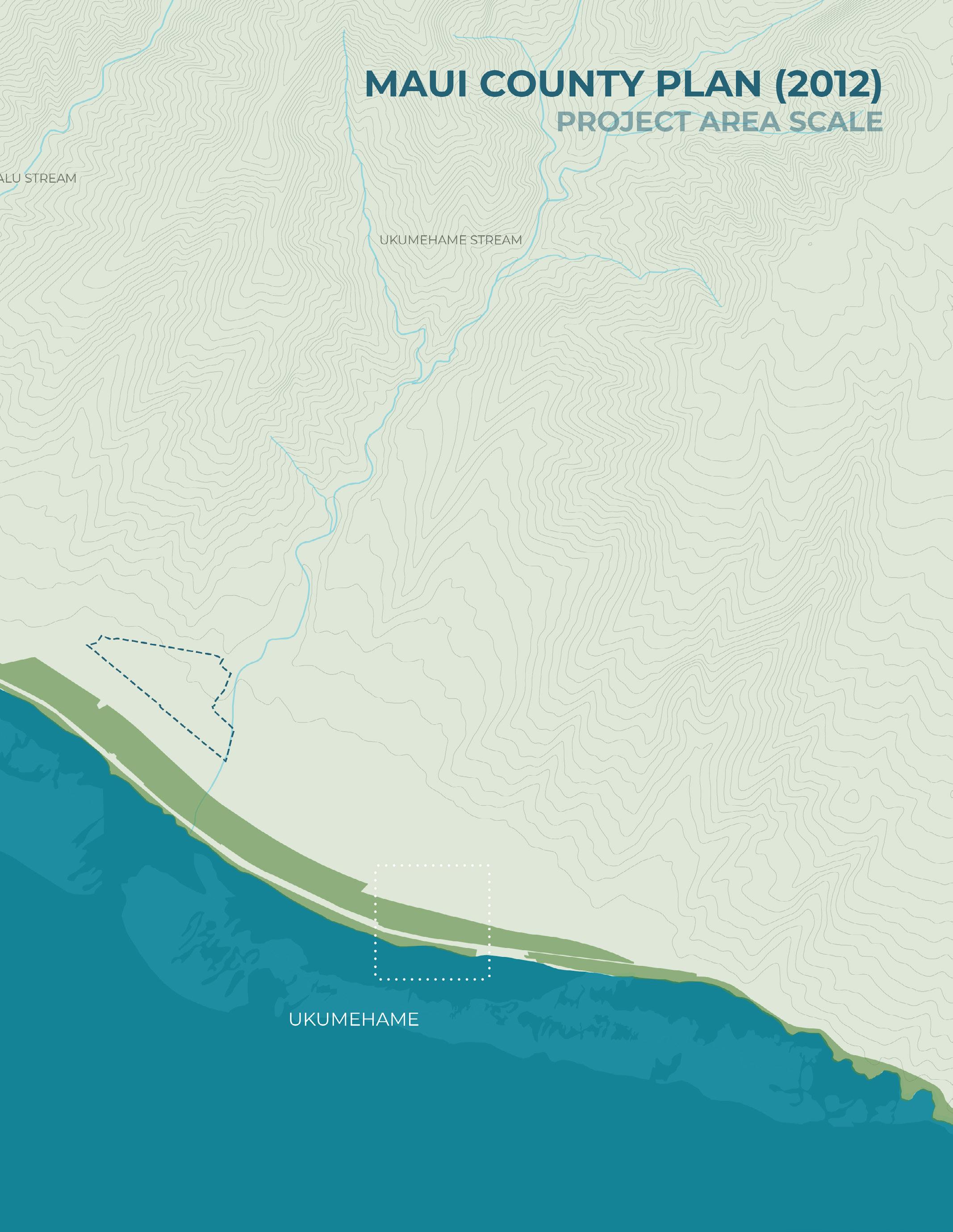
Maui County Plan (2012)
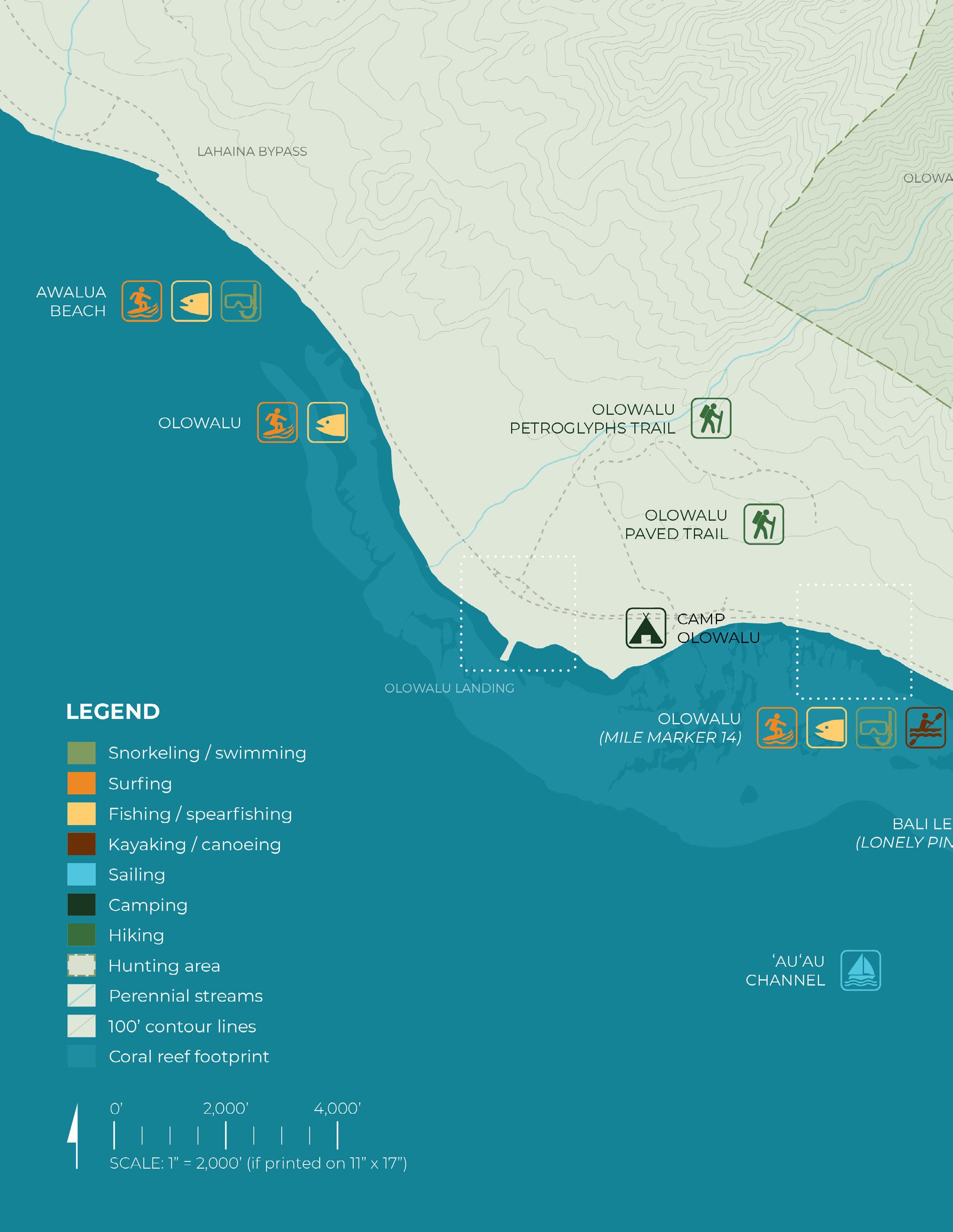
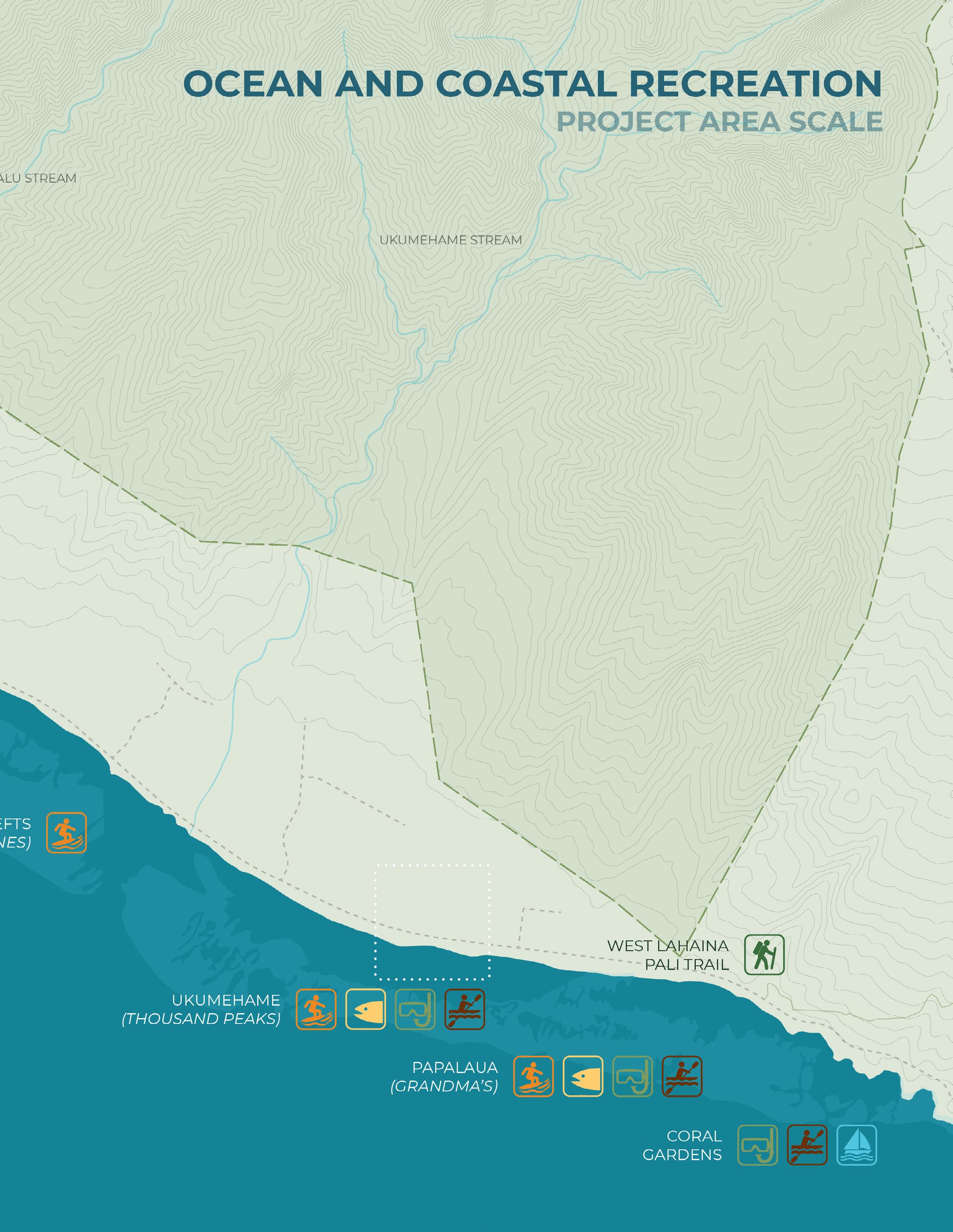
Ocean and Coastal Recreation
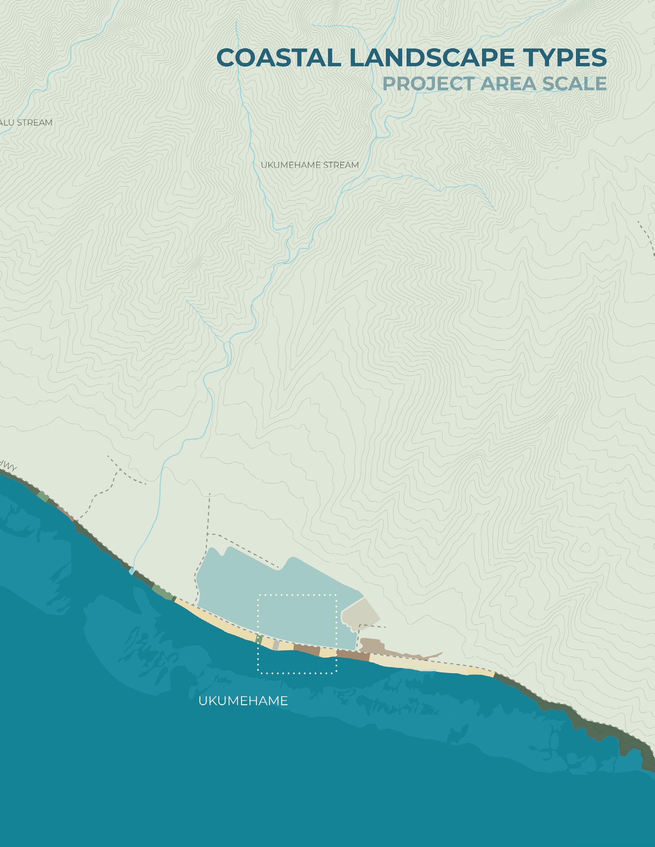
Coastal Landscape Types
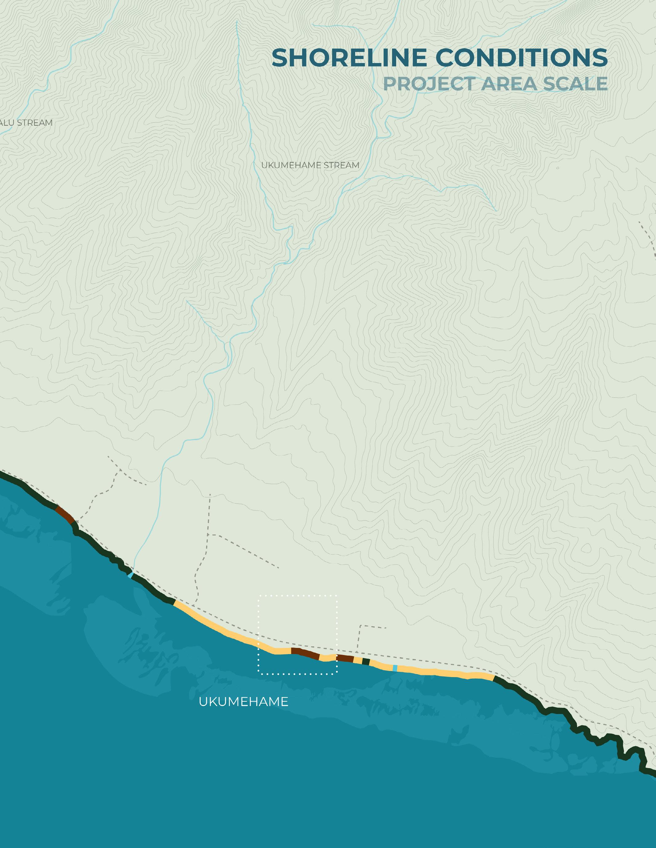
Shoreline Conditions
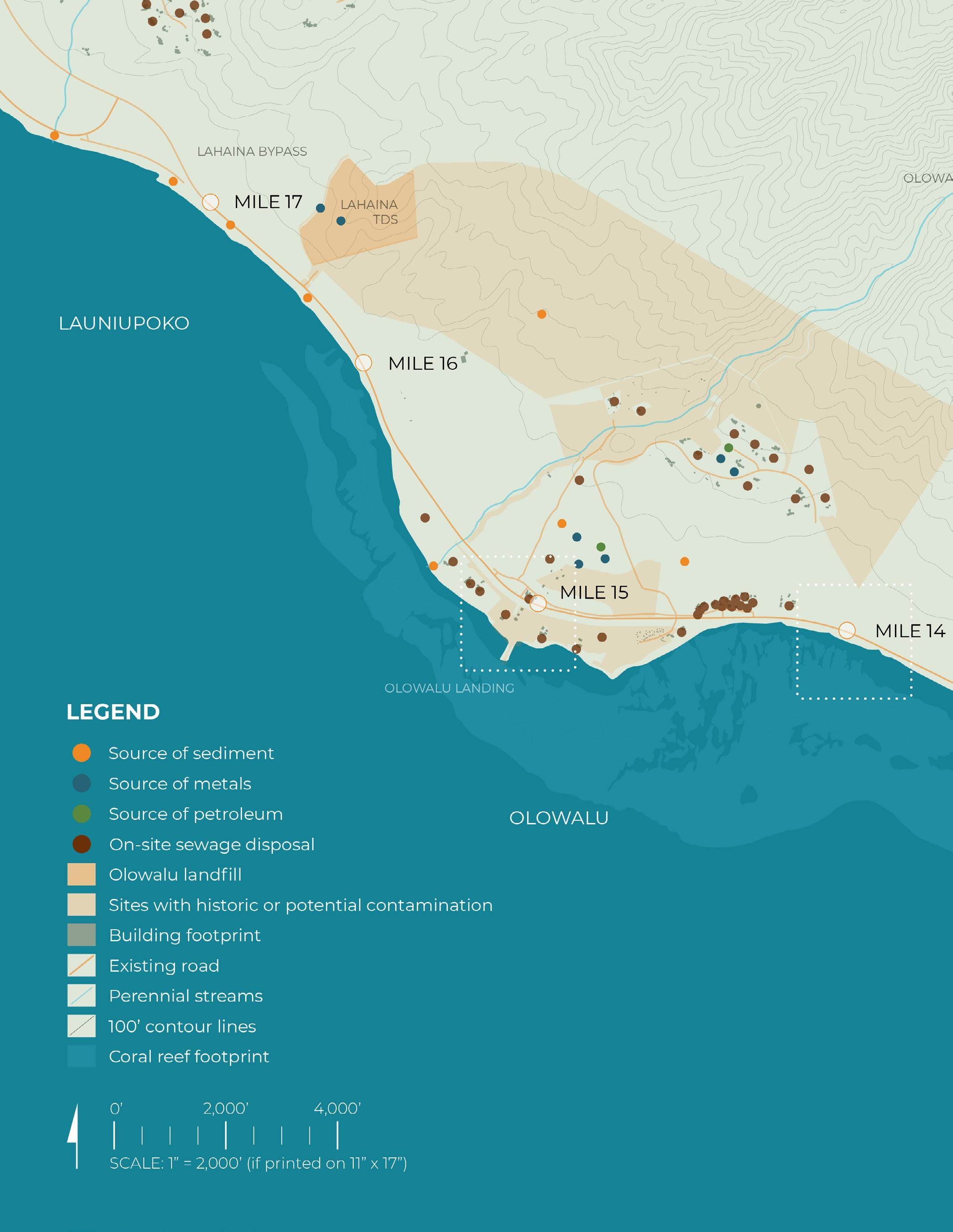
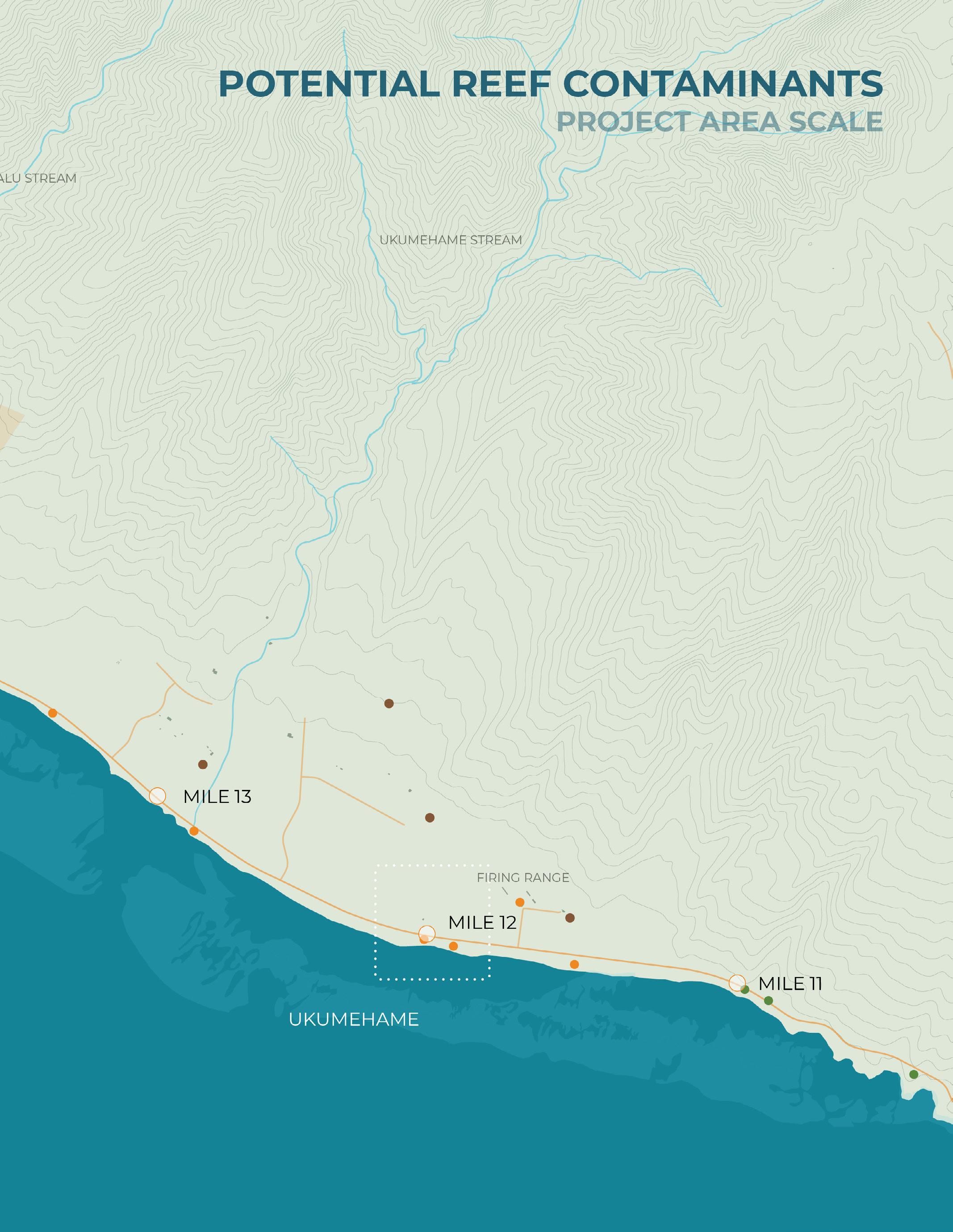
Contaminants
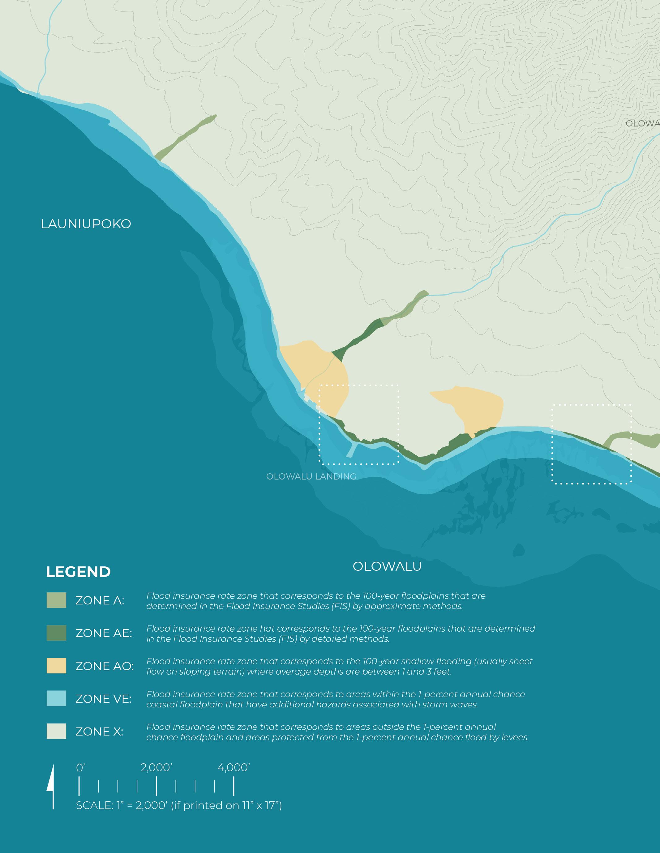
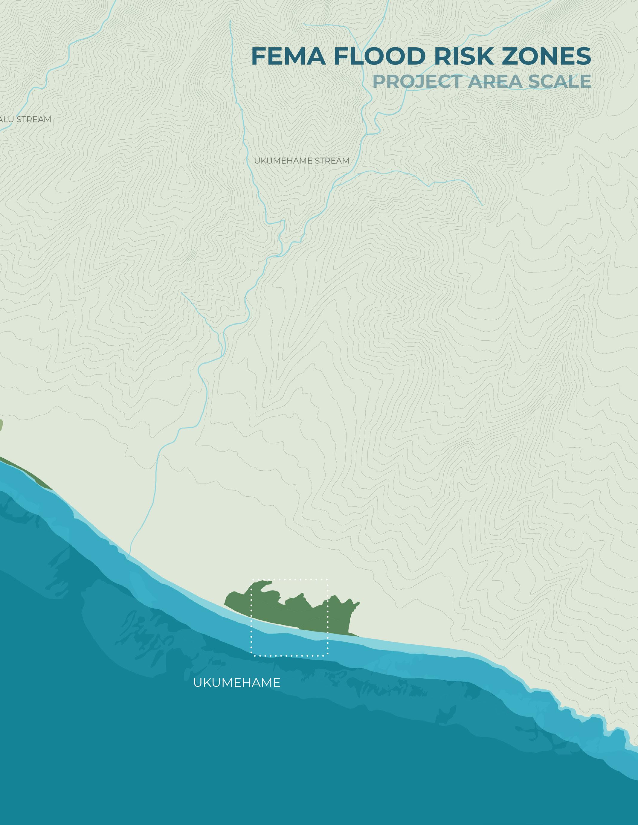
Fema Flood Risk Zones
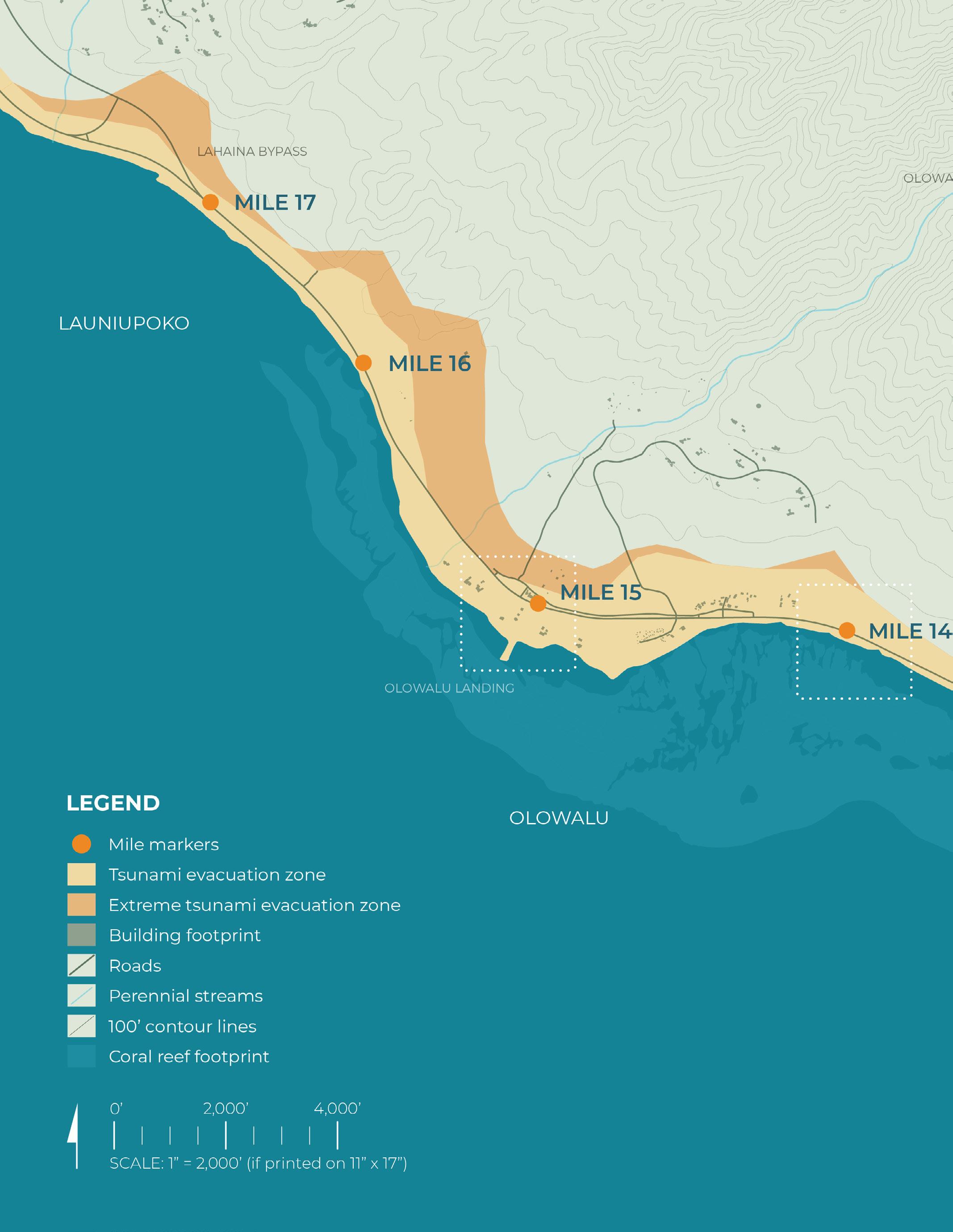
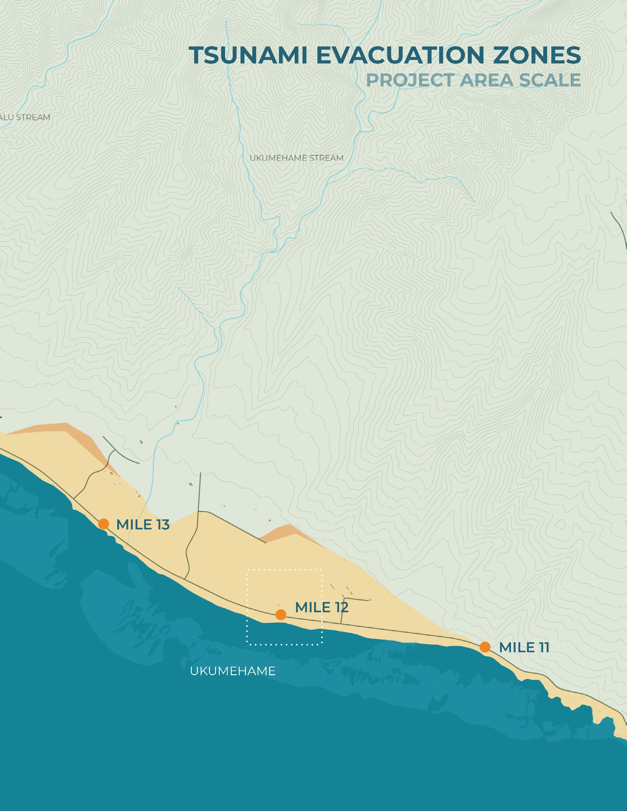
Tsunami Evacuation Zones
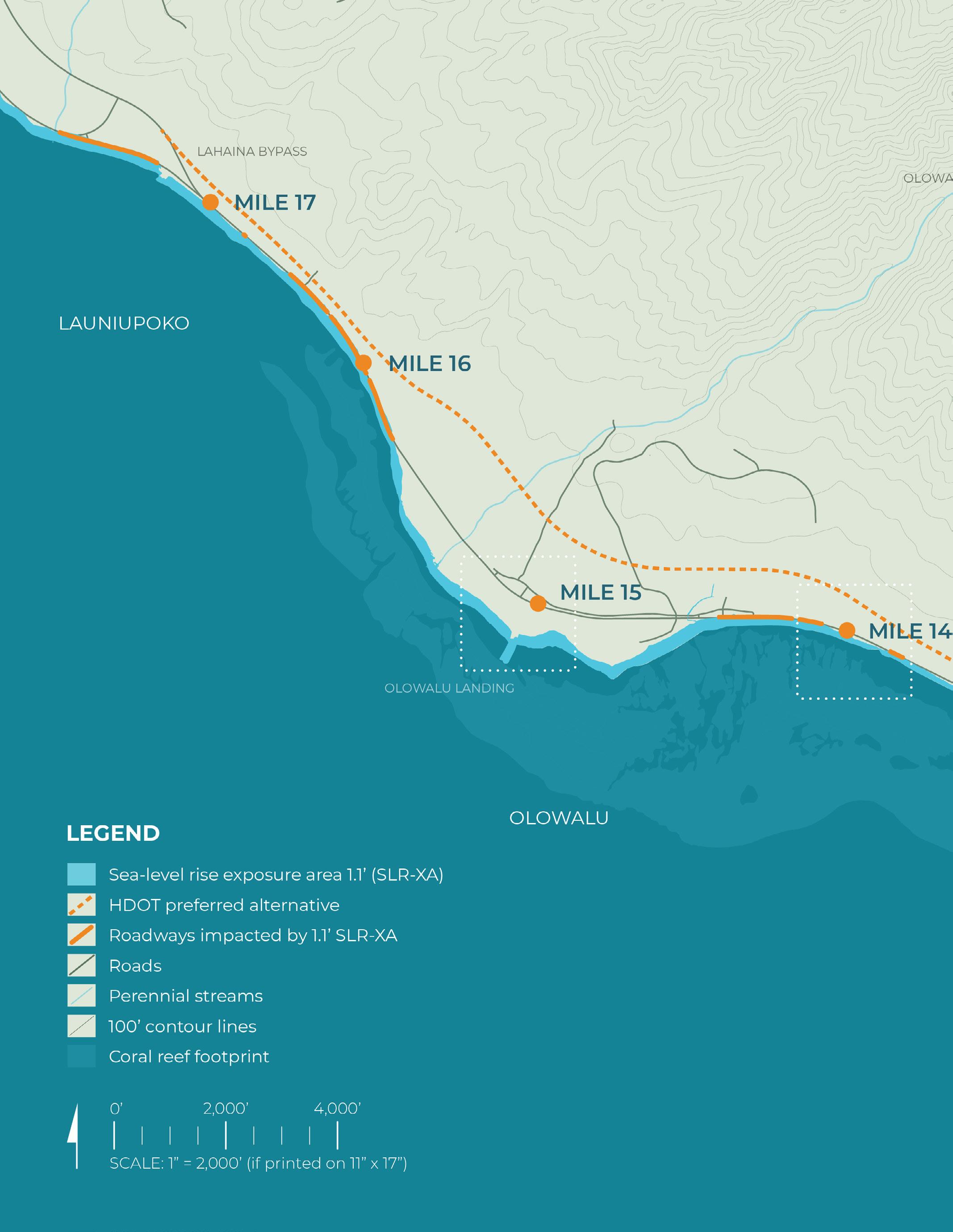
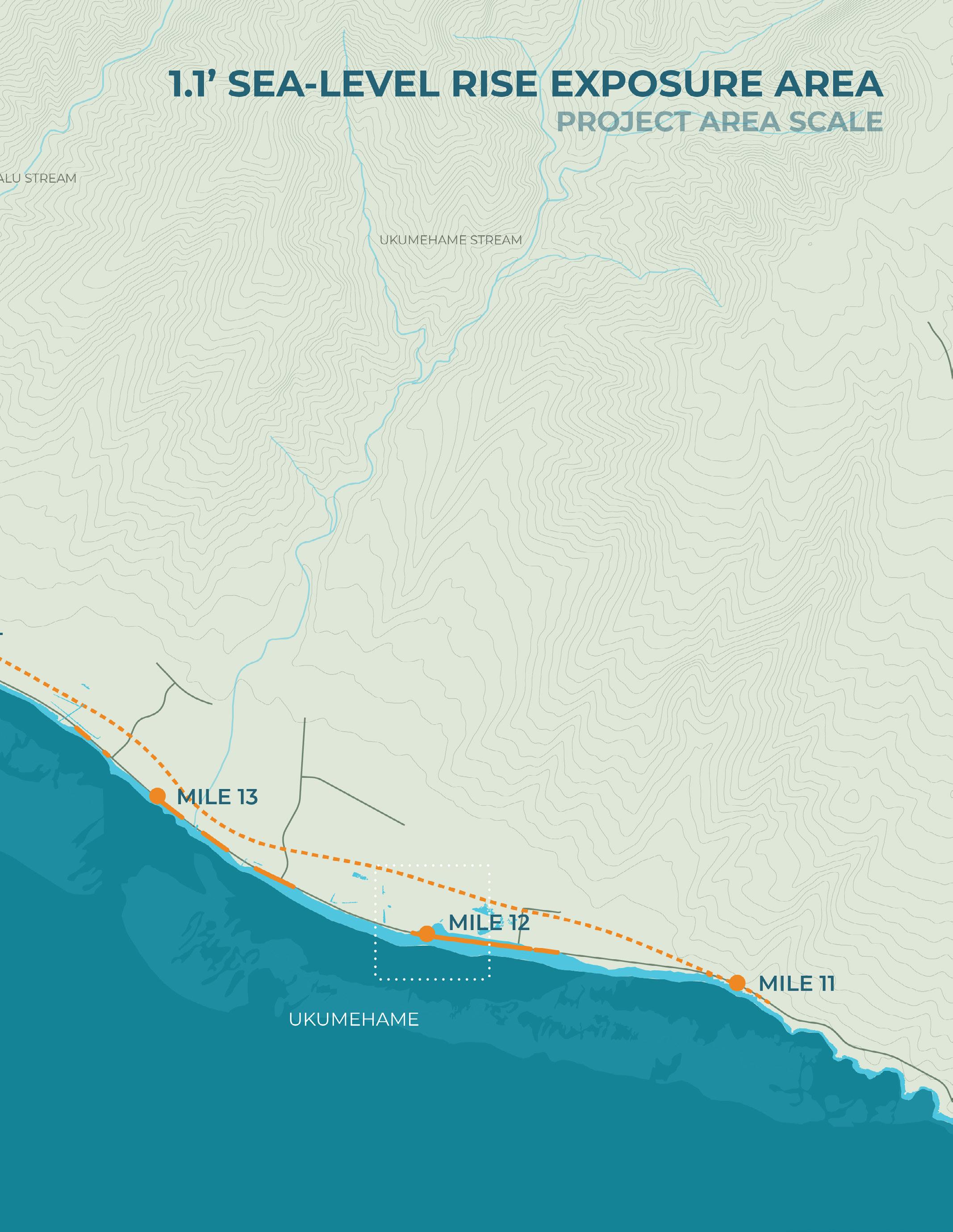
1.1’ Sea-Level Rise Exposure Area
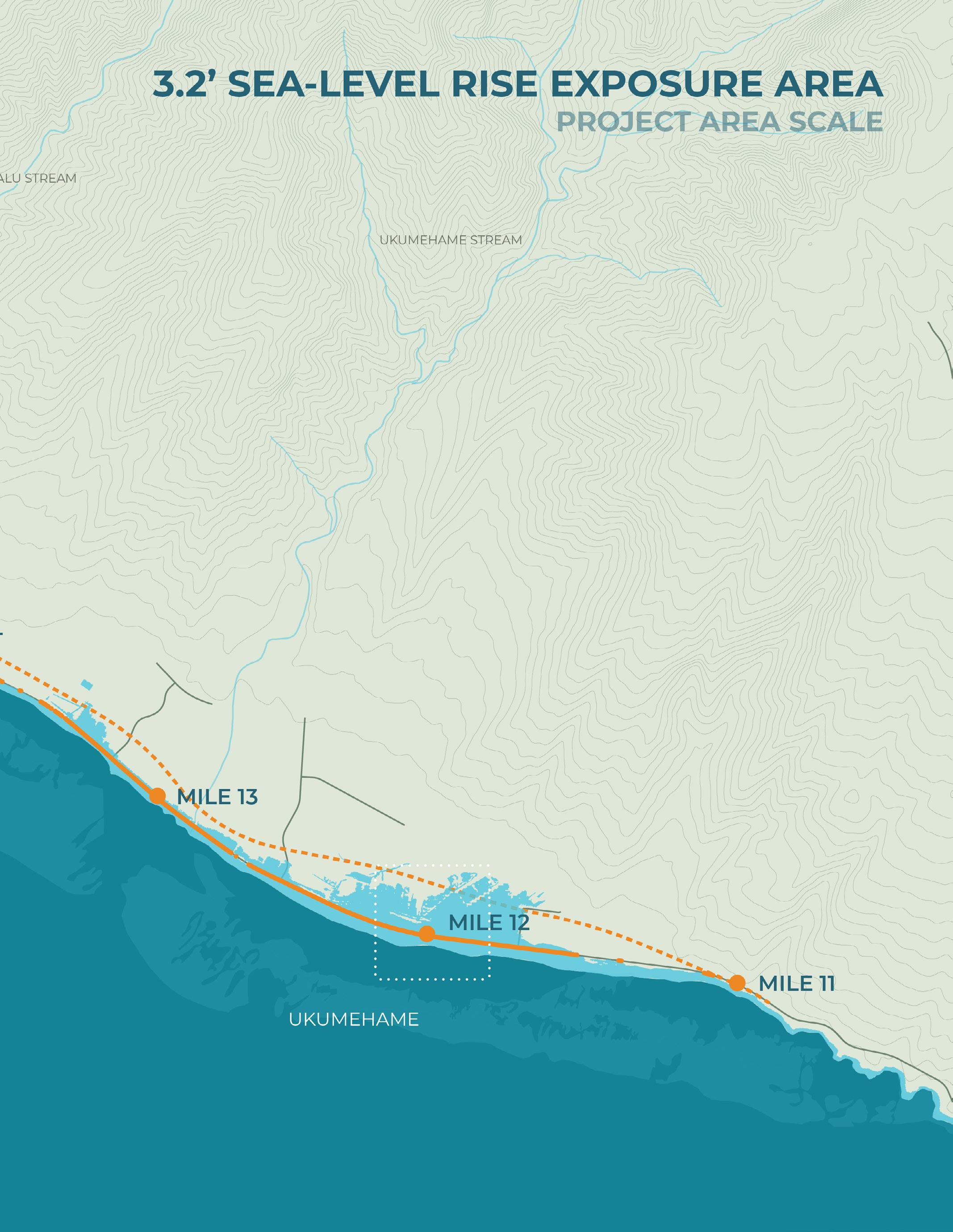
3.2’ Sea-Level Rise Exposure Area
6’ Passive Sea-Level Rise (NOAA)
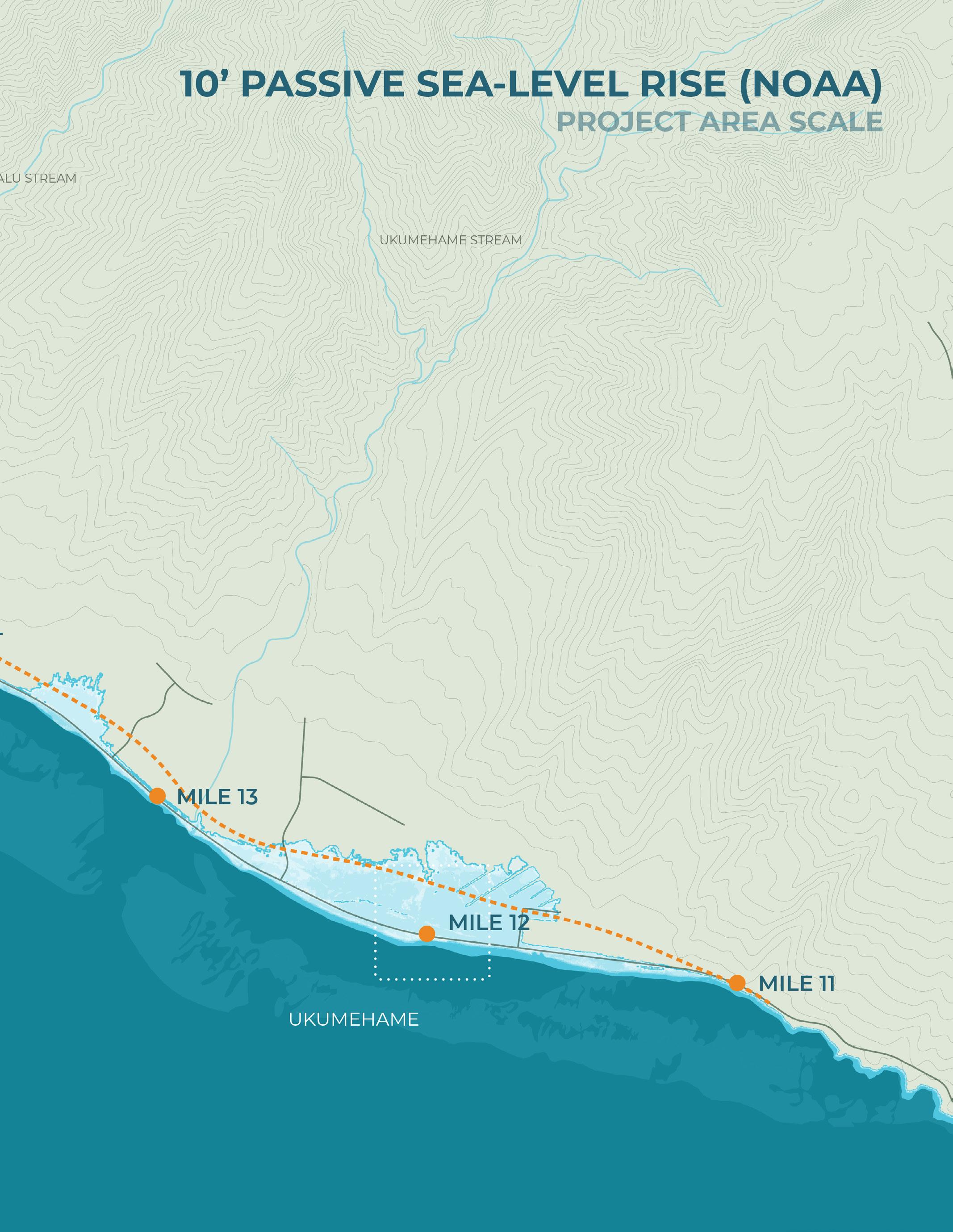
10’ Passive Sea-Level Rise (NOAA)
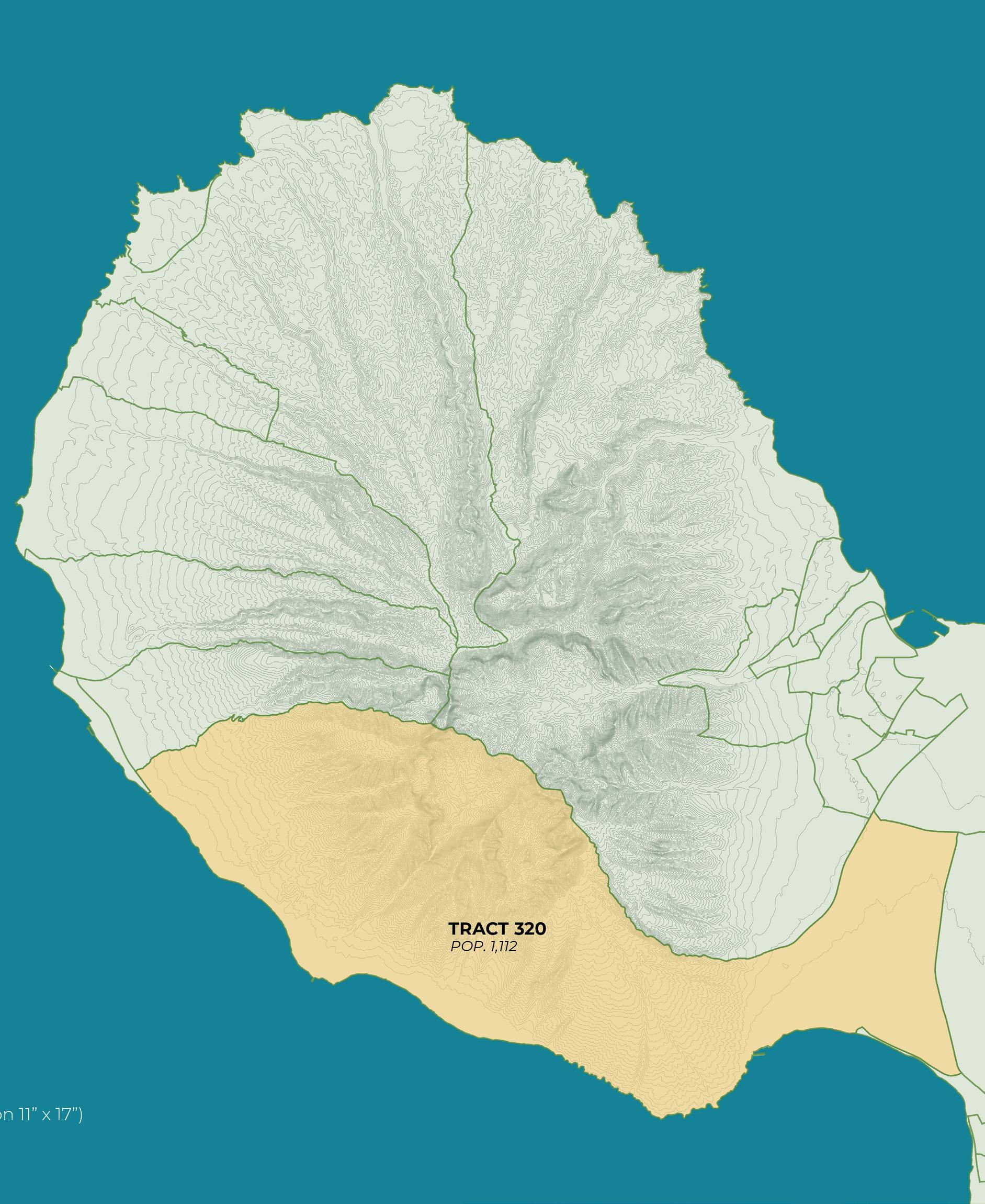
Population data source: US Census data (2024)


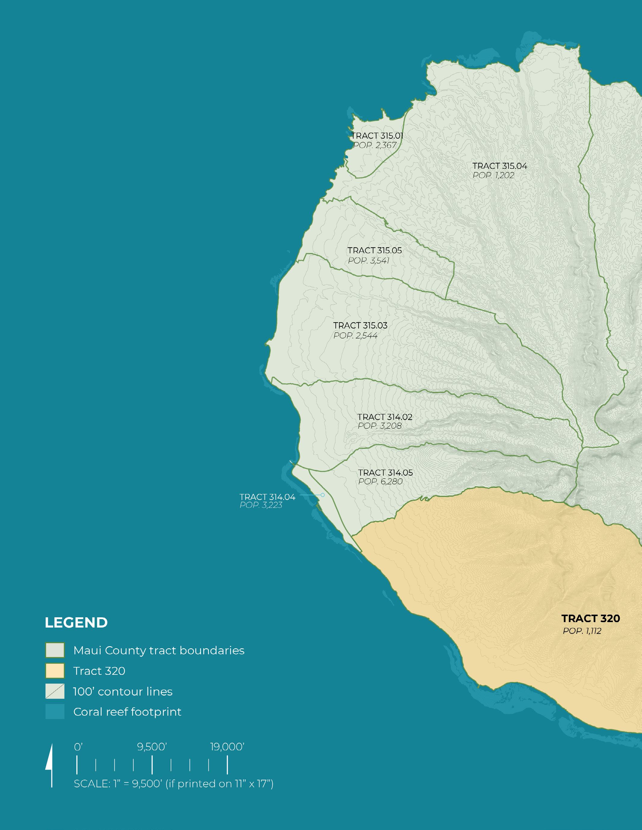
Data source: US Census data (2024)

Population
American Indian and Alaska Native
Asian
Black or african american
Hispanic or Latino
Native Hawaiian and Other Pacific Islander
Not Hispanic or Latino
Other
Two or More
White
Employment Commuting (avg. time in minutes)
Employment and Labor Force Status
Education (Bachelors degree or higher)
School Enrollment
Median Household Income
Poverty
Average Family Size
Housing Units
Occupied Housing Units
Home Ownership Rate
Language Spoken at Home (Other than English)
Older Population
Data source: Hawaii Statewide GIS Program data (2024)
Data source: Hawaii Statewide GIS Program data (2024)
Data source: Hawaii Statewide GIS Program data (2024)

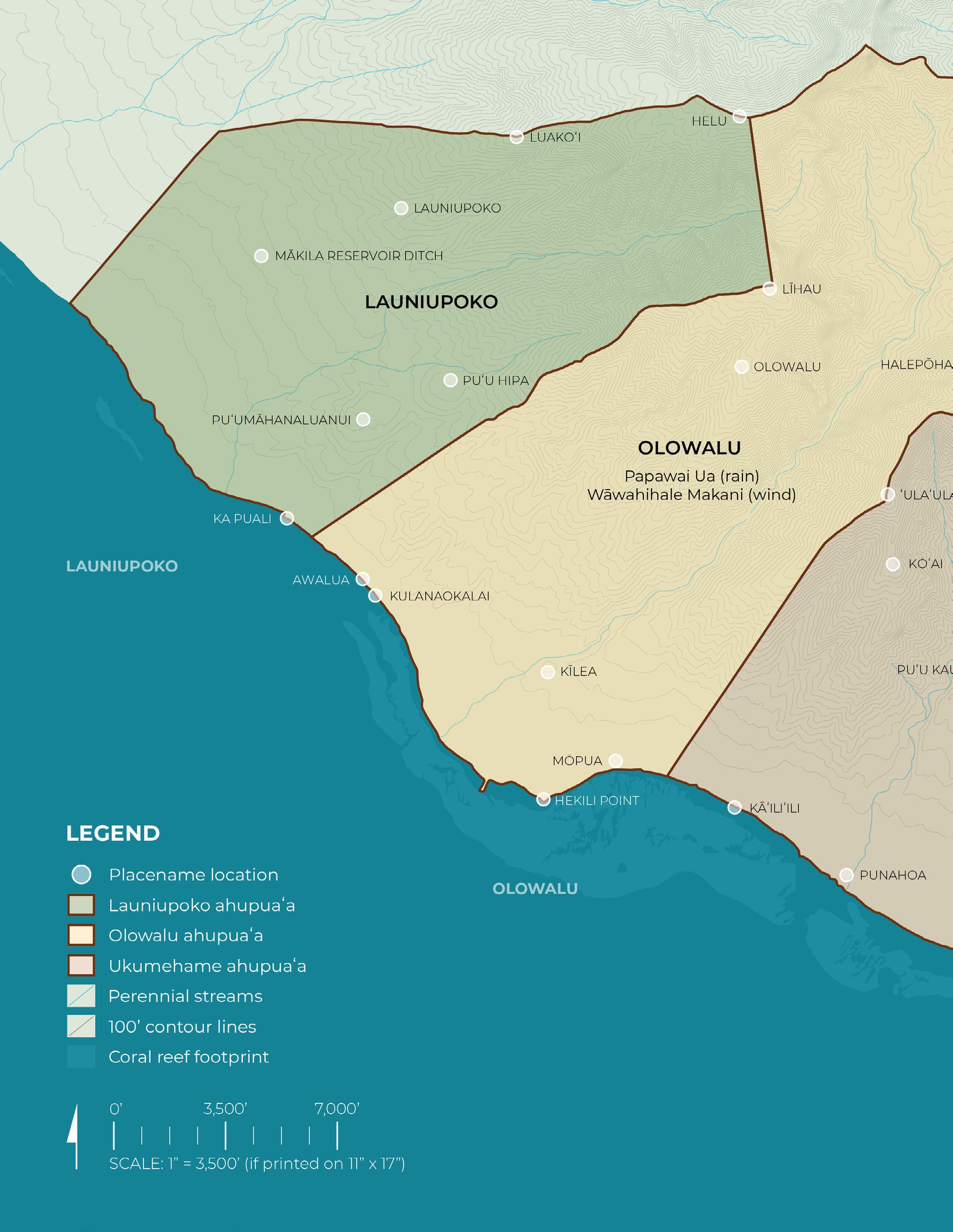
Data source: GNIS (Geographic Names), Hawaiʻi State GIS Program (February, 2024)
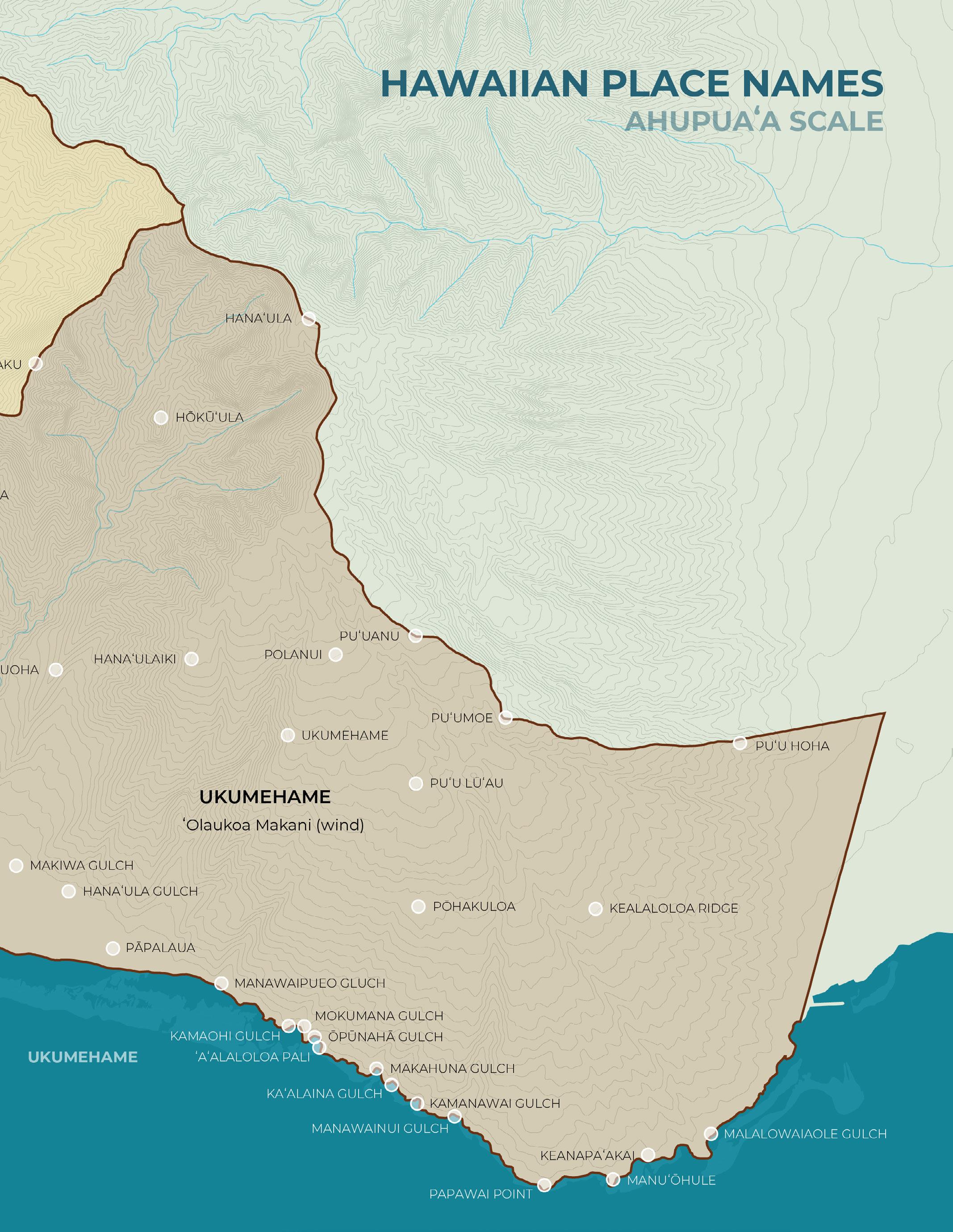
Variants and descriptions transcribed from: Kapueola‘ākeanui Pata, Cody. ʻOhuʻohu Nā Mauna O ʻeʻeka: Place Names of Maui Komohana. North Beach-West Maui Benefit Fund Inc, 2022.
PLACE NAMES VARIANTS
Aalaloloa Pali
Awalua
Halepōhaku
ʻAʻalaloloa ʻAʻala-loloa
DESCRIPTION
Literally, very fragrant; Ridge, cliff, and trail that joins the windward and leeward sides of the ahupuaʻa of Ukumehame, ʻAʻala Loloa n. - wind name
Literally double harbor; Shoreline region in the ahupuaʻa of Launiupoko
Literally stone house; Mountain peak (3786 ft) between the valleys of Olowalu and Ukumehame
Hana’ula Hanaula Lit. red bay; However, judging by the attributes of this peak, well detached from the sea, another interpretation of the name could be: Hanaʻ ula - red notch. [note one of the many bays in Maui komohana, none begin with the title Hana-. ]; Peak (4,616 ft.) between the valleys of Ukumehame and Waikapū; New also, the name of a gulch in the ahupuaʻa of Ukumehame found between the gulches of Makaiwa and Pāpalaua
Hana’ulaiki
Hawaiikekee
Hekili
Helu
Hanaula
Hawaiiʻkekeʻe
Hawaiʻi-kekeʻe
Hekili point
L. Hekili
Lae o Hekili
Literally, lesser Hanaʻula (hanaʻula-Red notch)
Peak (2,956 ft) in the ahupuaʻa of Ukumehame above Hanaʻula gulch
Meaning undetermined, perhaps distorted Hawaiʻi; ʻIli in the ahupuaʻa of Olowalu
Literally thunder
Shoreline point in the ahupuaʻa of Olowalu
Literally scratch or count
Peak (4,685 ft) between the valleys of kauaʻula & launiopoko, Moku of Lāhainā
Hōkūʻula Hokuula N. a star, perhaps Mars, but see Auhaele Lit. red star
ʻAʻalaloloa Pali
ʻŌhi’a ʻŌhiʻanui; ʻŌhiʻaiki
Large conspicuous hill (2,524 ft.) in the valley of Ukumehame
Literally very fragrant
Ridge, cliff, and trail that joins the windward and leeward sides of the ahupuaʻa of Ukumehame N. wind name
Two kinds of trees: ʻŌhiʻa ai, and ʻŌhiʻa lehua; a variety of taro; a red birthmark; vs. Tabooed, as food patches during famine, so-called because people did not eat from their taro patches, but from upland ʻōhiʻa ʻai, ti, and sweet potatoes; and ʻili in the ahupuaʻa of Ukumehame
ʻUlaʻula puʻu ulaula Ulaula Literally red hill
Point (3,058 ft) along Kaluakoʻi Ridge found along the boundary of the ahupuaʻa of Launiupoko and the ahupuaʻa of Kauaʻula in the kalana of Lāhainā
Ka Loko Kapaiki
Ka Puali
Kaʻalaina Gulch Kāʻalaʻino
Kāʻiliʻili Kaliili
Kaluaaha
Kaluakanaka
Kamanawai Gulch
Kamani
Kamaohi Gulch
Kapaiki
Kaunukukahi
Kaluaaho Kaluaana
Kaluaha
Kāluakanaka
A warrior soldier, so called because hawaiian fighters tied (pūʻali) their malos at the waist so that no flap would dangle for a foe to seize; army, host, multitude
To gird tightly about the waist, as of malo clad warriors, or as corsetted women; compressed, constricted in the middle; grooved, notched; irregularly shaped, as taro; notch; tight belt… Irregularly shaped ravine
A vague term for an adopted man or boy who had no servants Shoreline area between Kūlanaokalaiʻi and Nālimawai in the ahupuaʻa of Launiupoko
Pronunciation and meaning undetermined, perhaps kāʻala ʻino - spoiled limpet; Gulch between the gulches of Makahuna and Kamanawai in the ahupuaʻa of Ukumehame
Literally the pebble
Shoreline area along Mōpua, ahupuaʻa of Olowalu
In definining another region of the same name, Ka-ula-ʻaha... Lit. gathering pit; ʻIli in the ahupuaʻa of Olowalu
Pronunciation and meaning undetermined, perhaps: Kālua kanaka - to bake a human; or ka lua kanaka the human grave; ʻIli in the ahupuaʻa of Olowalu
Literally, stream branch; Gulch, stream, and small bay just northwest of Manawainui Gulch in the ahupuaʻa of Ukumehame
A large tree (Calophyllum inophyllum); vt. Smooth, shiny, polished, as of Kamani wood. ʻili (Kamani 1-3) in the ahupuaʻa of Olowalu
Literally, young child
Gulch, stream, and small cove in the ahupua’a of Ukumehame
Kaunukūahi
Literally, the altar that stands alone; ʻili in the ahupuaʻa of Olowalu
Kawai’āloa Kaiwaloa, Kawaialoa, Kawailoa, Wailoa, Kawaialoa Heiau
Kealaloloa Ridge Aalaloloa Keaalaloloa
Keanapaʻakai Keanapaʻakai
Kihau
Kīlea Puʻu Kilea, Puukilea, Kilea
Kōʻai
Kuekue Kuʻekuʻe; Kūʻēkūʻē
Kulanaokalai
DESCRIPTION
Literally, the waters of Loa Heiau in the ahupuaa of Olowalu Perhaps related to the ‘ili in Olowalu called Wailoa
Literally, the very long path; The name found on modern maps for the prominent ridge that forms on the east side of the Manawainui Gulch, ahupuaʻa of Ukumehame
Literally, the salt cove; Cove, which historically served as a point along the shoreline below ʻAʻalaloloa Ridge, jsut to the west of ʻĀnehenehe in the ahupuaʻa of Ukumehame. (McGregorʻs Landing)
Literally small but conspicuous hill Famed hill in the ahupua’a of Olowalu, just north of Kawaialoa heiau. The north side of the hill features impressive panels of pre-contact and contemporary petroglyphs. On the northwest side can be found the Olowalu Bluff Shelter (Bishop Museum site m-4). Graves have also been recorded on the summit of this hill
Verb. to stir with a circular motion of the hand; to wind around, creep around, as vine; to gird around, as a pāʻū sarong; to brace with a paddle Peak (2,585 ft) in the ahupuaʻa of Ukumehame found on a ridge that is shaded on the north by ʻUlaʻula peak (3,078 ft)
Pronunciation and meaning undetermined: perhaps kuekue - sound of tapping, kuʻe kuʻe - elbow, wristbone, joint, knuckle; Kūʻē Kūʻēdissagreement, dissention, oppostion, quarrel, bickering, animosity; ʻIli in the ahupuaʻa of Olowalu
Literally site of serenity
Shoreline area in the ahupuaʻa of Launiupoko
Lāhaina Lahaina; Lāhainā Name of one of three moku of Maui Komohana. Lahaina is also the name of the kalana found in the moku of Lahaina. From 1820 to 1845, Lahaina was the captial of the Hawaiian Kingdom.; perhaps lahaiana - a variety of sugarcane, a variety of sweet potato, poising, leasing; Lā hainā - merciless sun
Launiupoko Olauniupoko Short fronded coconut (trees)
Ahupuaʻa, valley, and stream in the moku of Lahaina. The valley is found beneath the peaks of Keʻekeʻehia on the north and Lihau on the south
Līhau Lihau
Luakoʻi
Gentle cool rain that was considered lucky for fisherman (UL 241); moist and fresh, as plants in the dew or rain; fresh, dew-laden air
A variety of sweet potato
Literally adze quarry/pit
primitive rock quarry that was used by the ancient Hawaiians to both obtain basalt and make various stone tools (NPS)
Ridge and peak (3,000 ft) between the valleys of launiupoko and kauaʻula
Maʻomaʻo
Makahuna Gulch
Maomao Green, greenness, to paint green or to make green n. green tapa, as of māmaki bark an ili in the ahupuaʻa of Ukumehame
Lit. hidden point or hidden eyes; Shoreline area between Ōpūnahā and Kāʻalaʻino in the ahupuaʻa of Ukumehame
Mākila Maui name for mānai, needle; to string, as leis Ahupuaʻa in the kalana of Lahaina. Also a reservoir, and a ditch, and a shoreline point now known as “Puamana Beach”
Makiwa Gulch
Makaiwa N. mother of pearl eyes, as in an image, especially of the god Lono Nine guiding stars Shoreline area below Keawāwa in the kalana of Lahaina Also, the gulch of the east of Puʻu Kauoha, in the ahupuaʻa of Ukumehame, along with the shoreline region below it
Malalowaiaole Gulch
Manawainui Gulch Manowainui
Manawaipueo Gulch
Manuʻōhule Wash Rock
McGregor Point Anehenehe
Mokumana Gulch Moku-mana
Mōpua Mopua
Perhaps: ma lalo wai a ʻOle - under waters of ʻOle; Gulch to the west of Kealaloa Ridge, which opens to the east of ʻĀnehenehe in the ahupuaʻa of Ukumehame
Literally, large stream branch; Largest gulch along the cliffs of ʻAʻalaloloa on the southern side of the ahupuaʻa of Ukumehame
Literally owl stream branch Gulch at the western base of “the pali”, ahupua’a of ukumehame. Also, the western end of the ‘A’alaloloa trail
Probably lit., bird [of the] meeting point of receding and incoming waves; Shoreline point and area found between the points of Papawai and ʻĀnehenehe, in the ahupuaʻa of Ukumehame; dive site, Lahaina Pali, Maui
Superimposed name of foreign origin for the point if ʻĀnehenehe, in the ahupuaʻa of Ukumehame. The historic landing was found in the cove of Keanapaʻakai.
Literally, stream branch severance/break Gulch that ends in the same cove as Ōpūnahā, in the ahupuaʻa of Ukumehame
Literally melodious (said to be the name of a legendary character). ʻIli along the shoreline in the ahupuaʻa of Olowalu Olowalu “Olo walu.” Joint action; simultaneous sounds; din of many voices, sounds, as of horns or roosters; to rush or attack in concert; as groups, as of hills (olowalu pu’u)
Store house, as for chief’s property. Rare. Valley, stream, peninsula, ahupua’a, and sugar plantation in the moku of lahaina, situated between the ahupuaa of ukumehame & launiupoko. The site of the former Olowalu Mill & Olowalu company & the Olowalu landing
Ōpūnahā Gulch Ōpūnahā; ʻŌpūnaha
Pa’apa
Pronunciation and meaning undetermined, perhaps: ōpū-nahā-”Lit. broken cluster or ʻōpū nahā-split belly ; Gulch that ends in the same cove as Mokumana in the ahupuaʻa of Ukumehame
Pakala Pākala
Pākalā
Pāpalaua Papalau
Papalaau
Papawai Point
Paumaumau
Pōhakuloa
Polanui
Paumauma
Paʻūmaumau
Paʻumaumau
Pu’u Anu Puʻuanu Puuanu
Pu’u Lūʻau
Pu’u Moe
Puʻu Hipa
Puʻu Hoha Puʻu Hona
Puʻu Kauoha
Puʻu Māhanaluanui
Punahoa
Ukumehame
Pronunciation and meaning undetermined perhaps: “pa.kala. I. n. Young of the ala, a fish. 2. vs. Rough, as skin of kala, a fish” /HD/ “pã kala a releasing enclosure. Land section, Lahaina, Maui.” /Parker/ pā kala—parcel of kala sweet potatoes or rough fence or pa ka lā—the sun shines.
Literally rainy fog ‘Ili in the ahupua’a of Ukumehame
The beach park along the shoreline is also known by the superimposed name of of foreign origin “Old lady’s”
Lit. water stratum; Point along the coast in the ahupuaʻa of Ukumehame. Location of the Papawai Scenic Lookout; Dive site
Pronunciation and meaning undetermined, perhaps: pau maumau - forever done; paʻu maumau continued tedium; or paʻūmaumaucontinuously damp; ʻIli in the ahupuaʻa of Olowalu
Literally long stone
An upland place to the west of Manawainui Gulch, in;and of Kāʻalaʻino and Kamanawai in the ahupuaʻa of Ukumehame
Literally, Greater pola; Flap, as of a loincloth or sarong; tail of a kite…; Platform or high seat between the canoes of a double canoe; Blossoms and sheath of a banana Rare variant of Kākala, spines of a fish
Literally, cool hill; Prominent hill (3,041 ft) in the ahupuaʻa of Ukumehame, situated just within the shared border between the moku of Lahaina and the Moku of Wailuku
Literally taro topped hill
Prominent upland hill (2,336 ft) found on the westside of Manawainui Gulch, ahupua’a of Ukumehame
Lit. sleeping hill or prostrate hill
Prominent upland hill (2,433 ft) found at the east of Manawainui gulch, higher up on the ridge above puʻu Hona, in the ahupuaʻa of Ukumehame
Hipa hill: “Hipa is said to have been a mythological character.”perhaps related to: Hipakāne (Aries)
Literally Hona Hill; Hill in the ahupuaʻa of Ukumehame, found in the “Wailuku” side of the trailhead for the Lāhainā Pali Trail
Literally decree hill
Hill (1100 ft) in the ahupuaʻa of Ukumehame, situated in the valley between Ukumehame and the gulch of Makaiwa
Literally large twin hills
Literally, companion spring
Shoreline and spring near the mouth of Olowalu spring in the ahupua’a of Olowalu
To pay with mehame wood
In size, the largest ahupuaʻa in the moku of Lahaina
Wailoa
Name of a star near the Pleiades, said to be a member of the group called Kaulua. it is also said to be the name of an ancient chief; Lit. Long stream; ʻIli in the ahupuaʻa of Olowalu; perhaps related to Kawaialoa

data source:
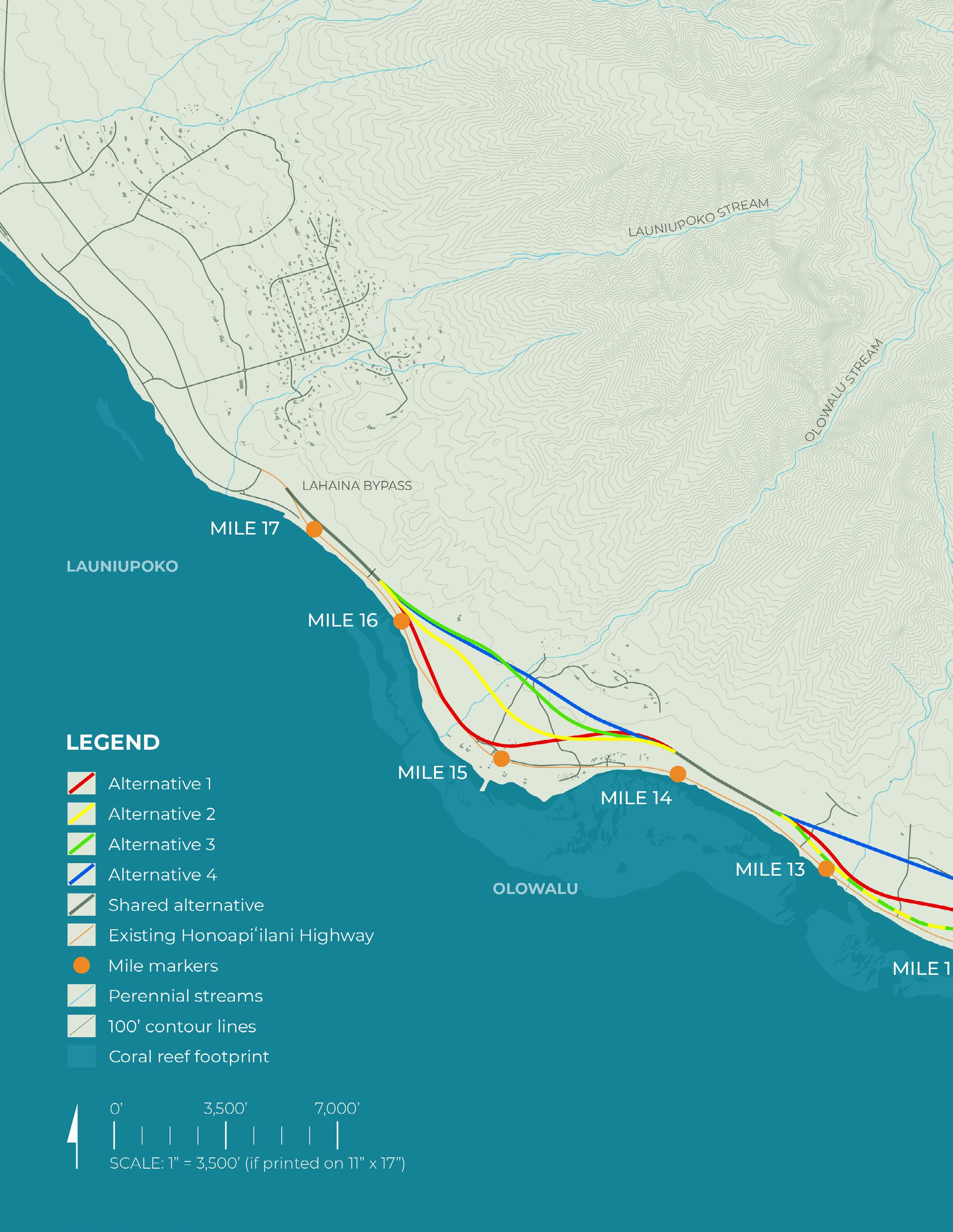
Data source: HDOT build alternatives (October, 2024)
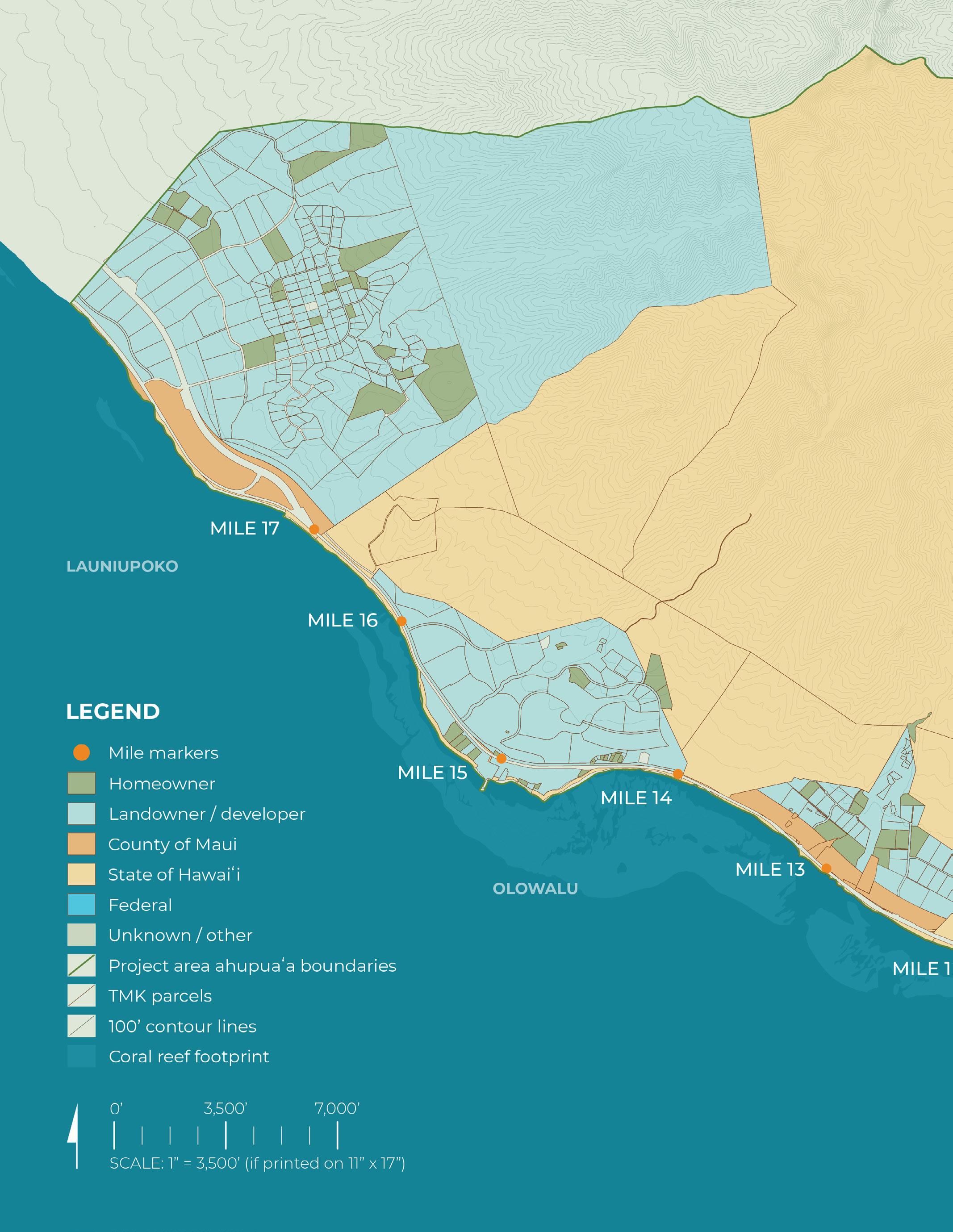
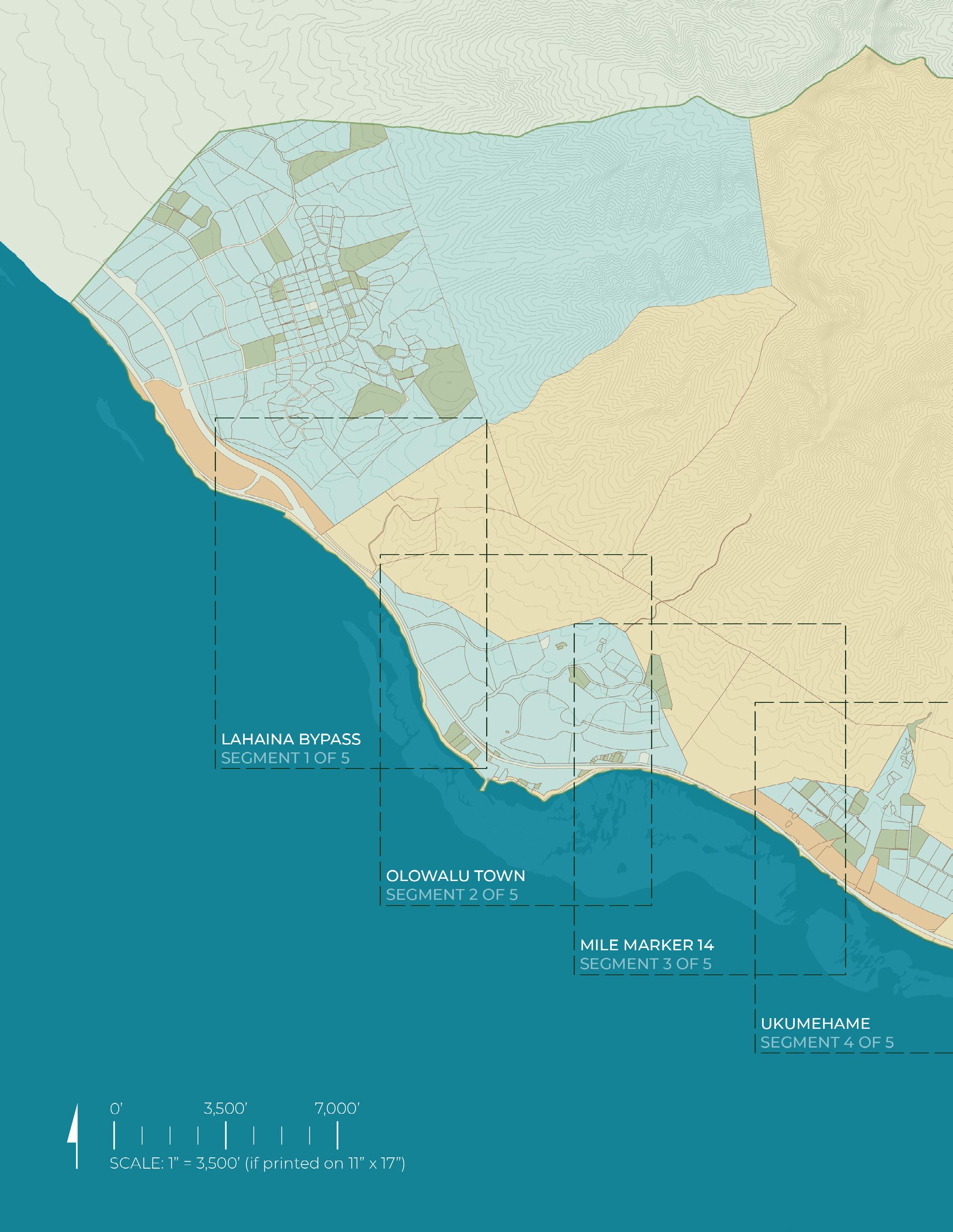
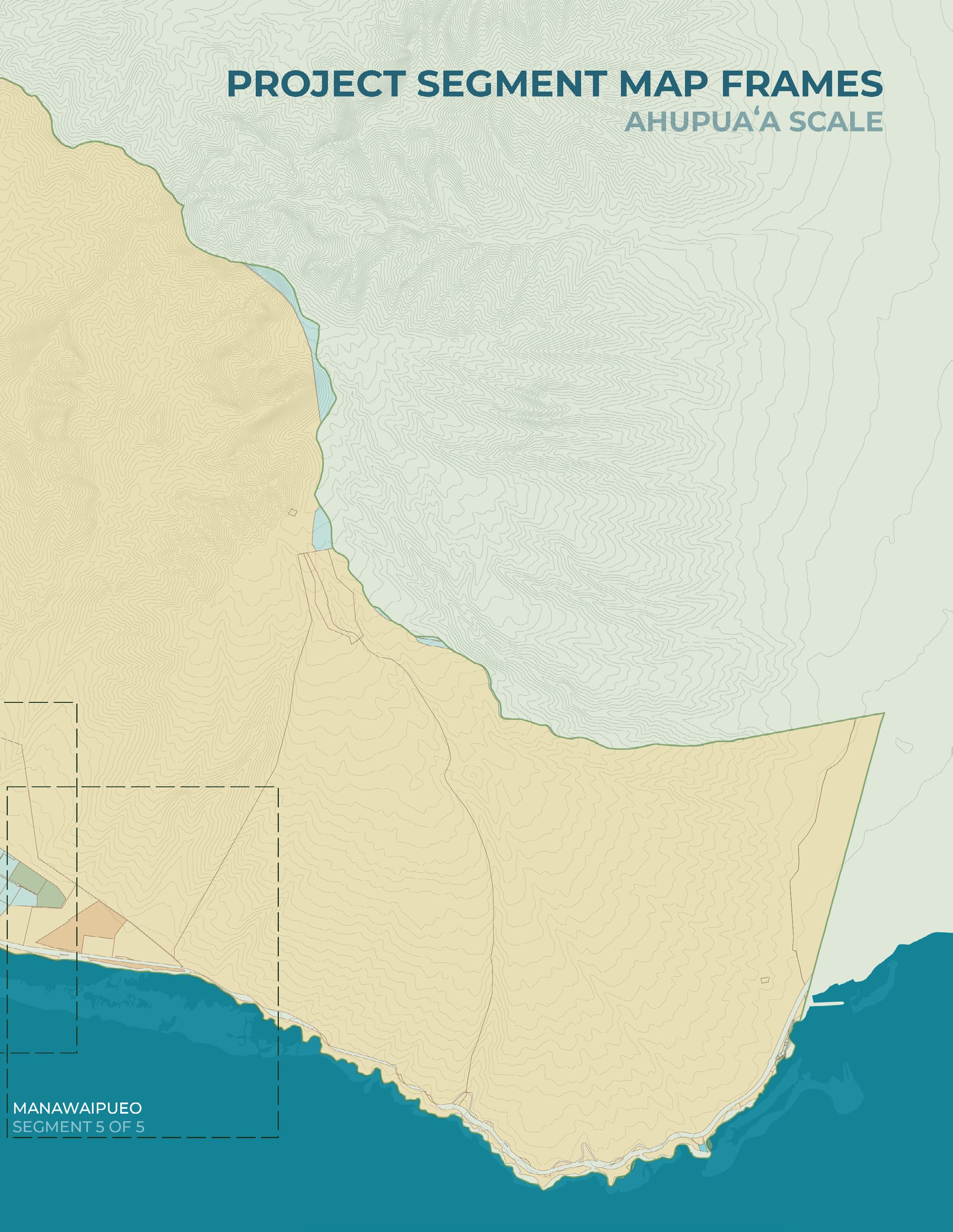
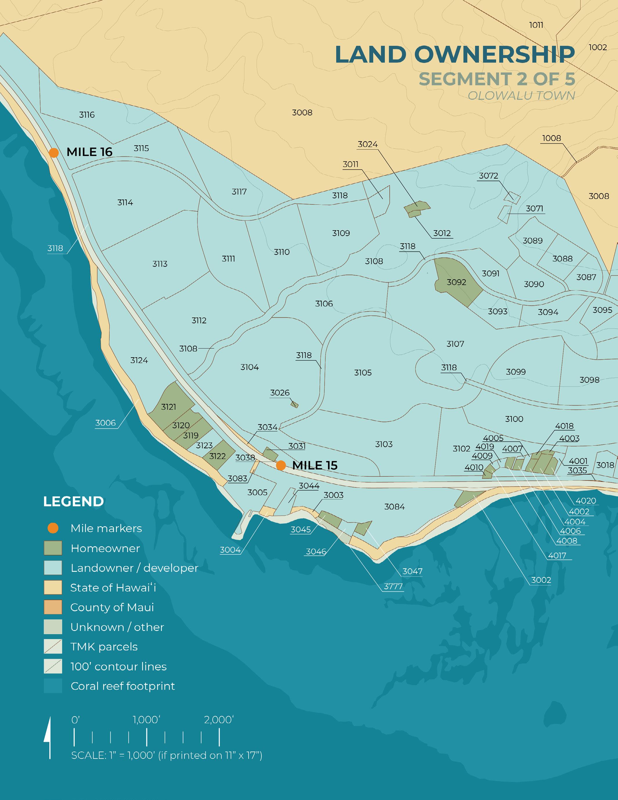
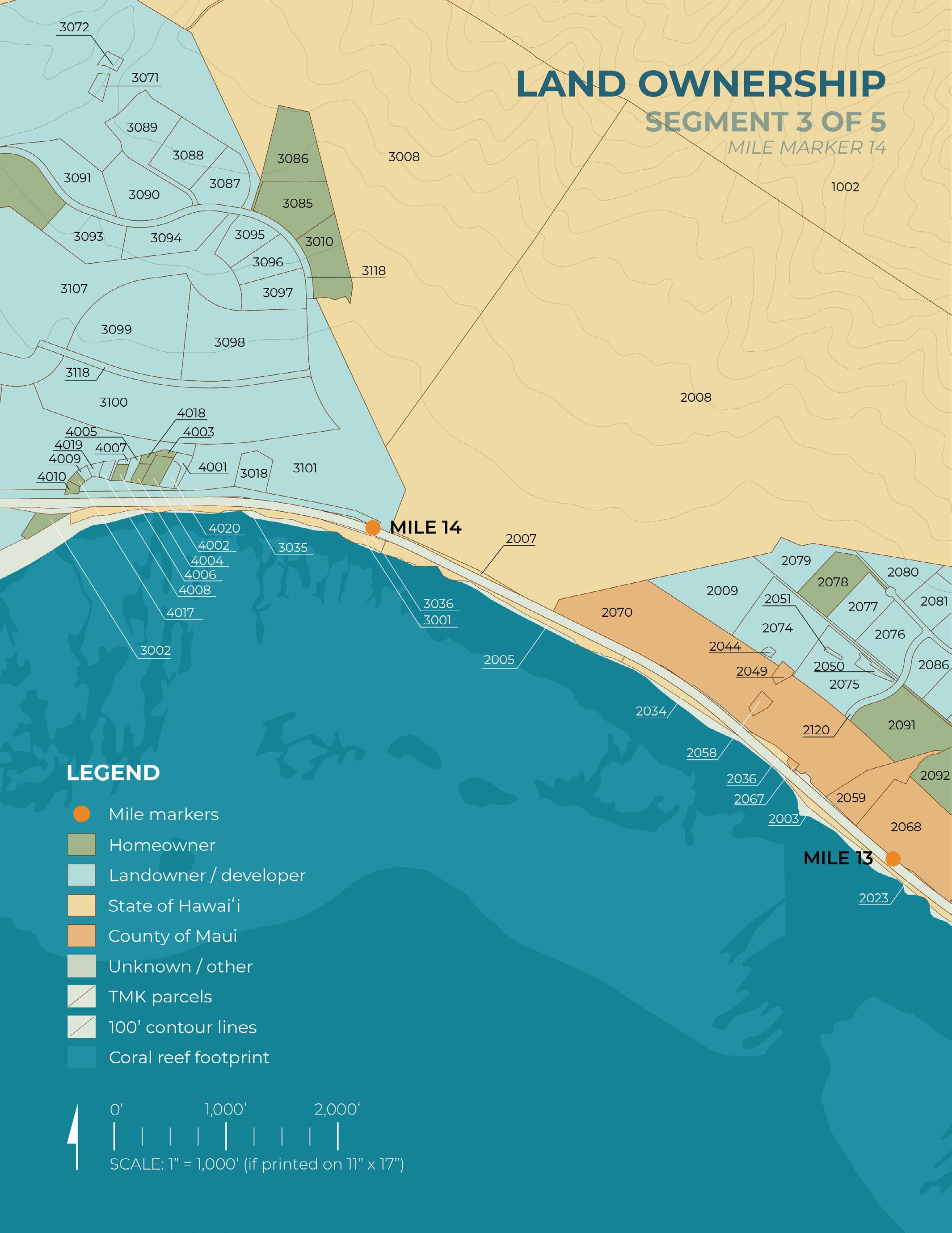
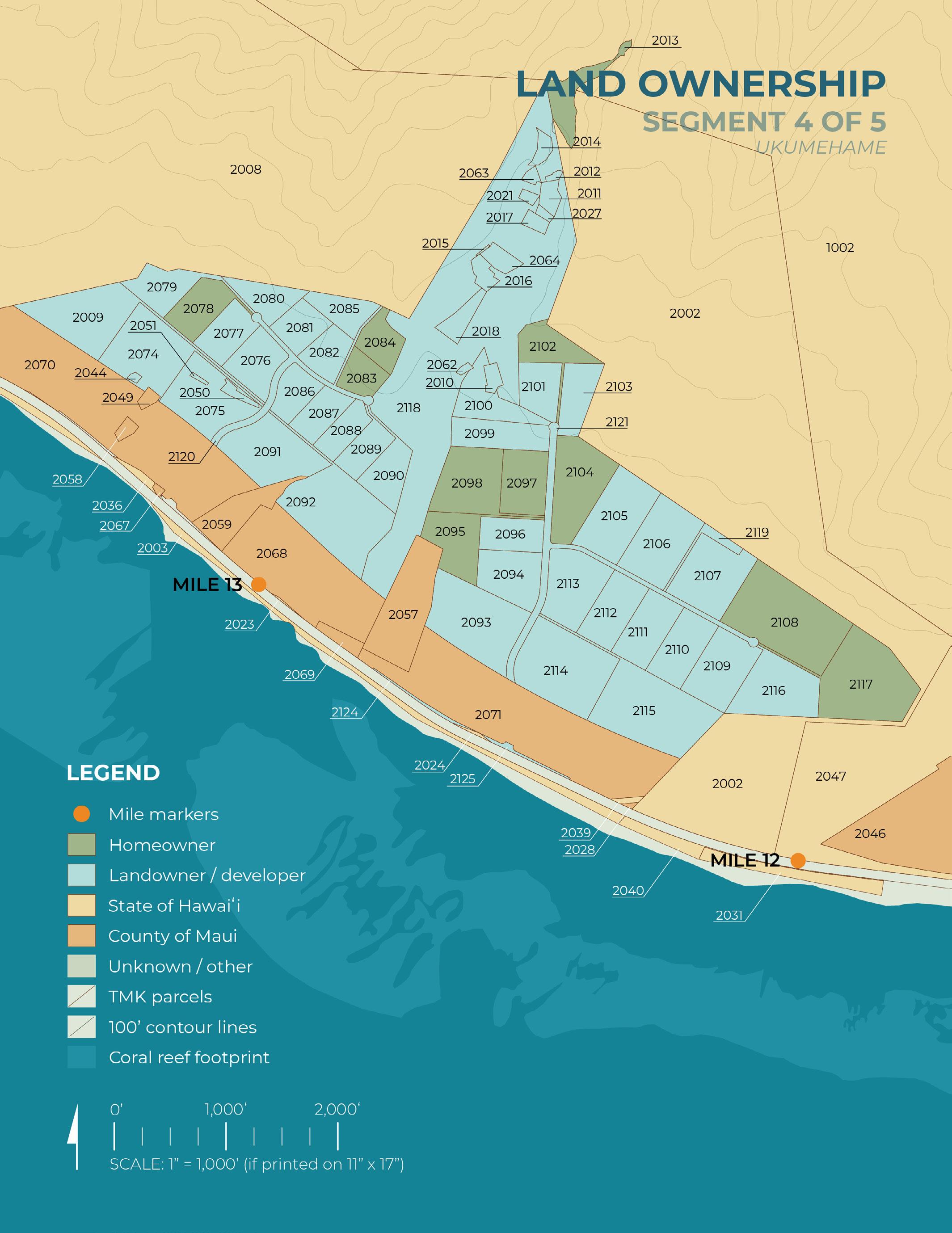
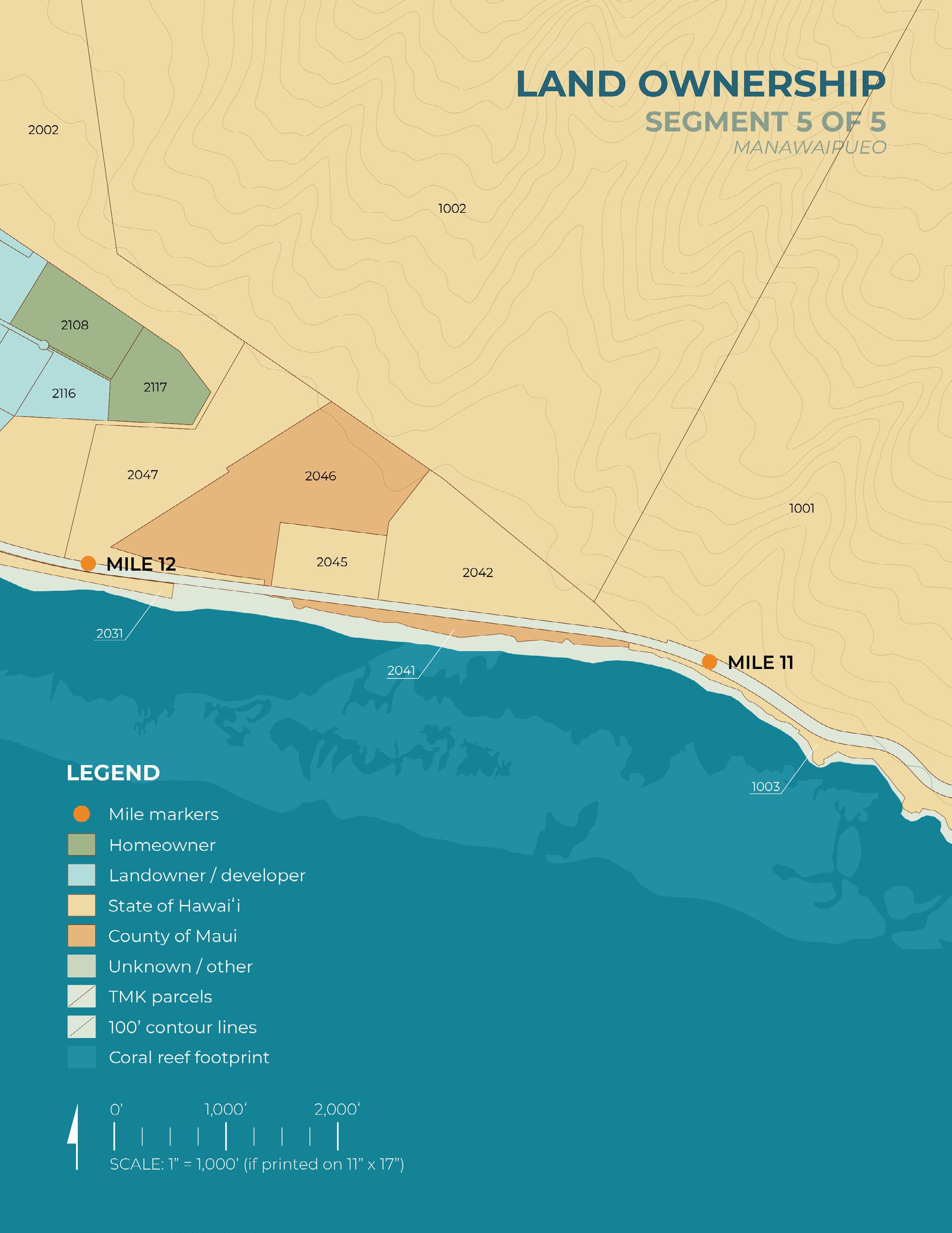
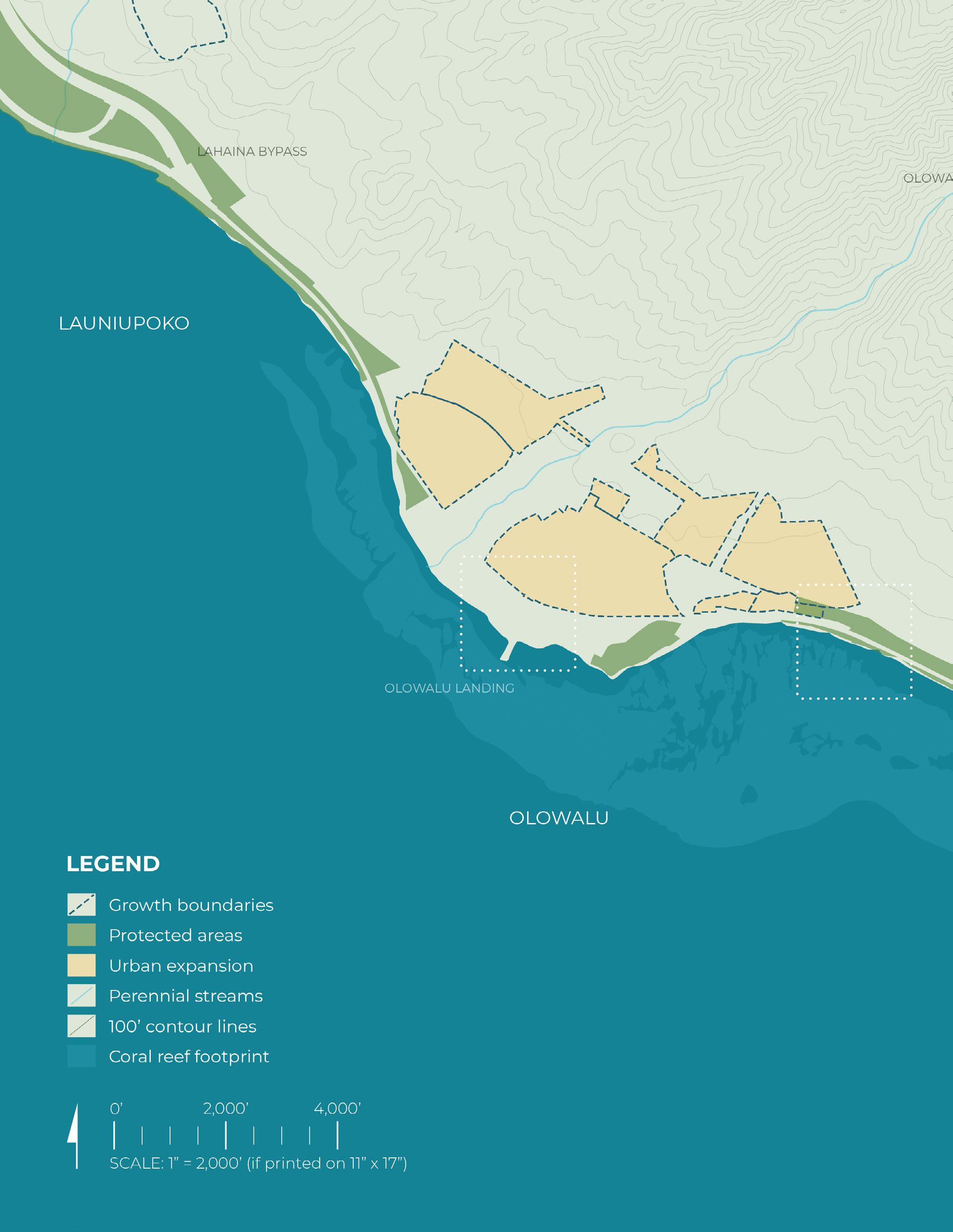
The following five land ownership maps zoom in to the segments marked above. The maps are arranged from west (Lahaina Bypass area) to east (Maunawaipueo area)
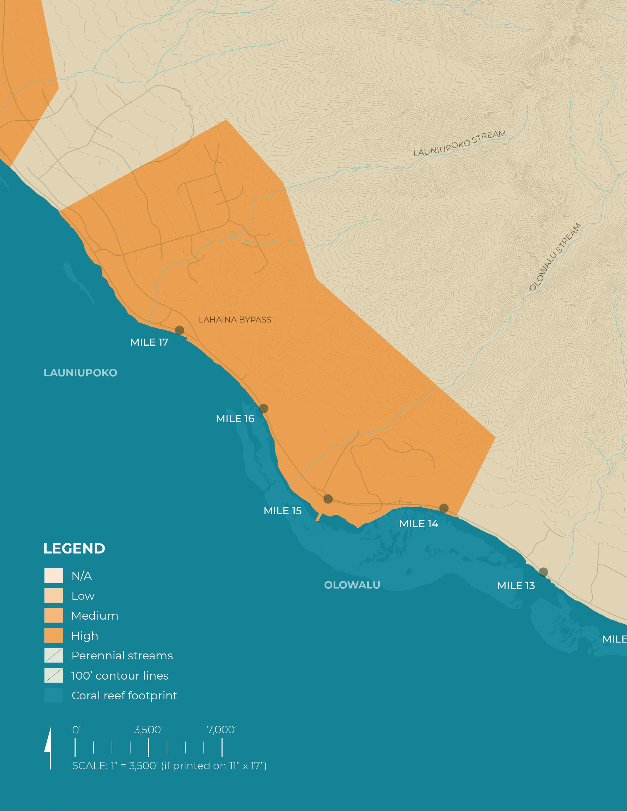
Fire risk data source: Hawaiʻi Statewide GIS Program (Ocotber, 2024)
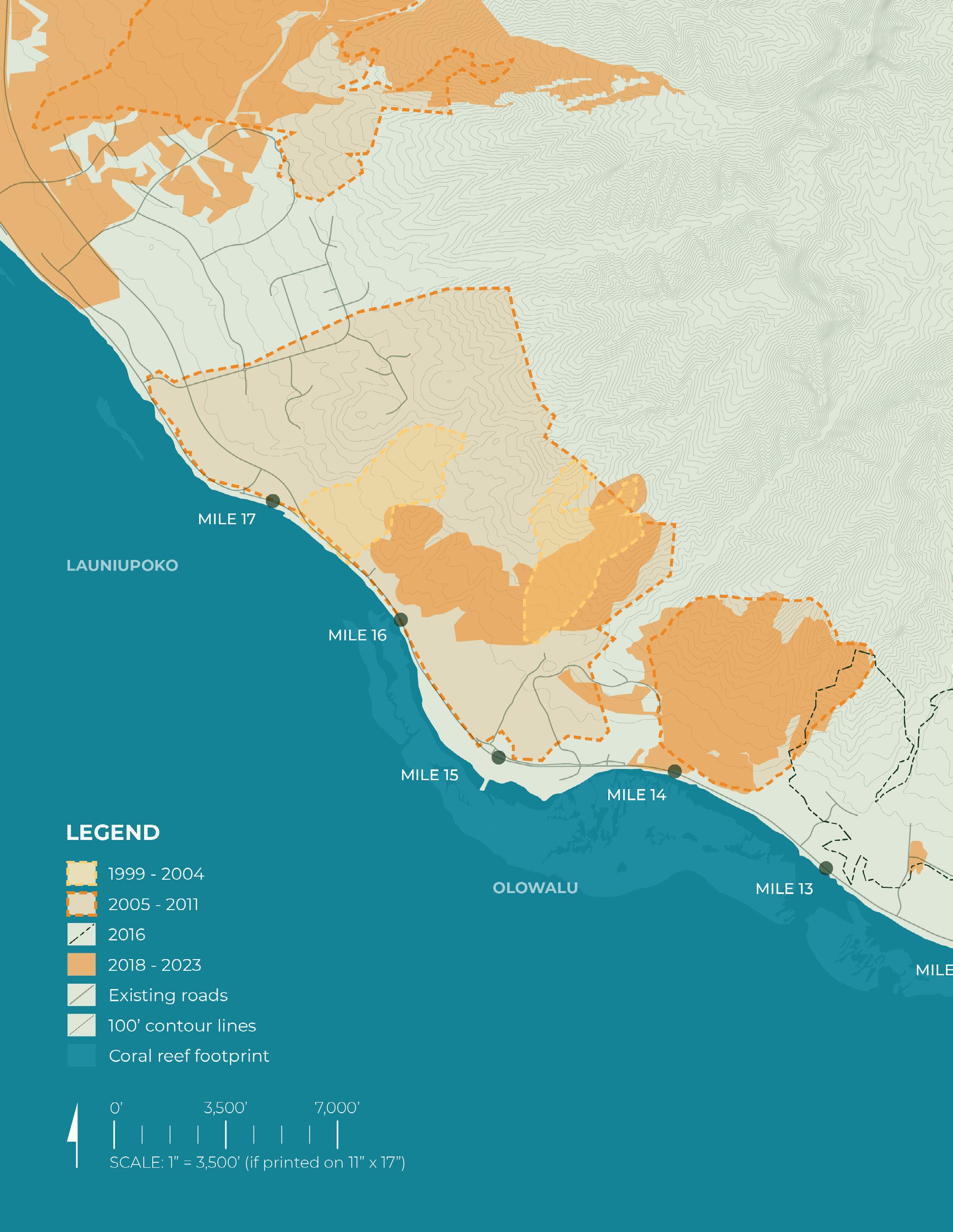
Data source: Large Fire Perimeter Data for Hawai’i (1999 - current), Pacific Fire Exchange
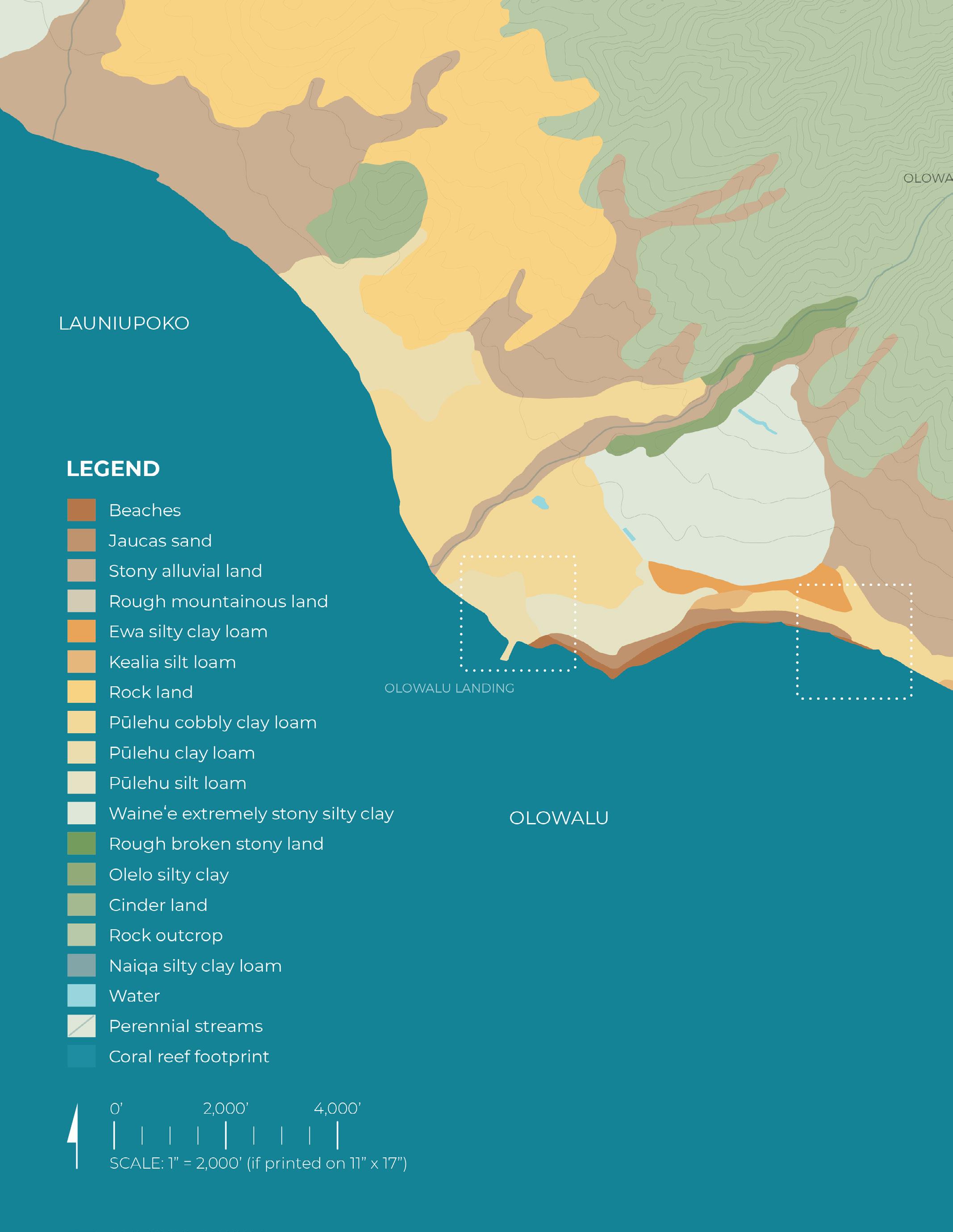
Data source: USDA, Natural Resources Conservation Service, Web soil survey (October, 2024)

Data source: HDOT build alternatives (October, 2024)

Data source: Maui Island Plan (December, 2012)


Data source: Pacific Islands Ocean Observinc System (PacIOOS) sea-level rise data (September, 2024)

Data source: Pacific Islands Ocean Observinc System (PacIOOS) sea-level rise data (September, 2024)

Data source: National Oceanic and Atmospheric Administration sea-level rise data (September, 2024)


Data source: National Oceanic and Atmospheric Administration sea-level rise data (September, 2024)