


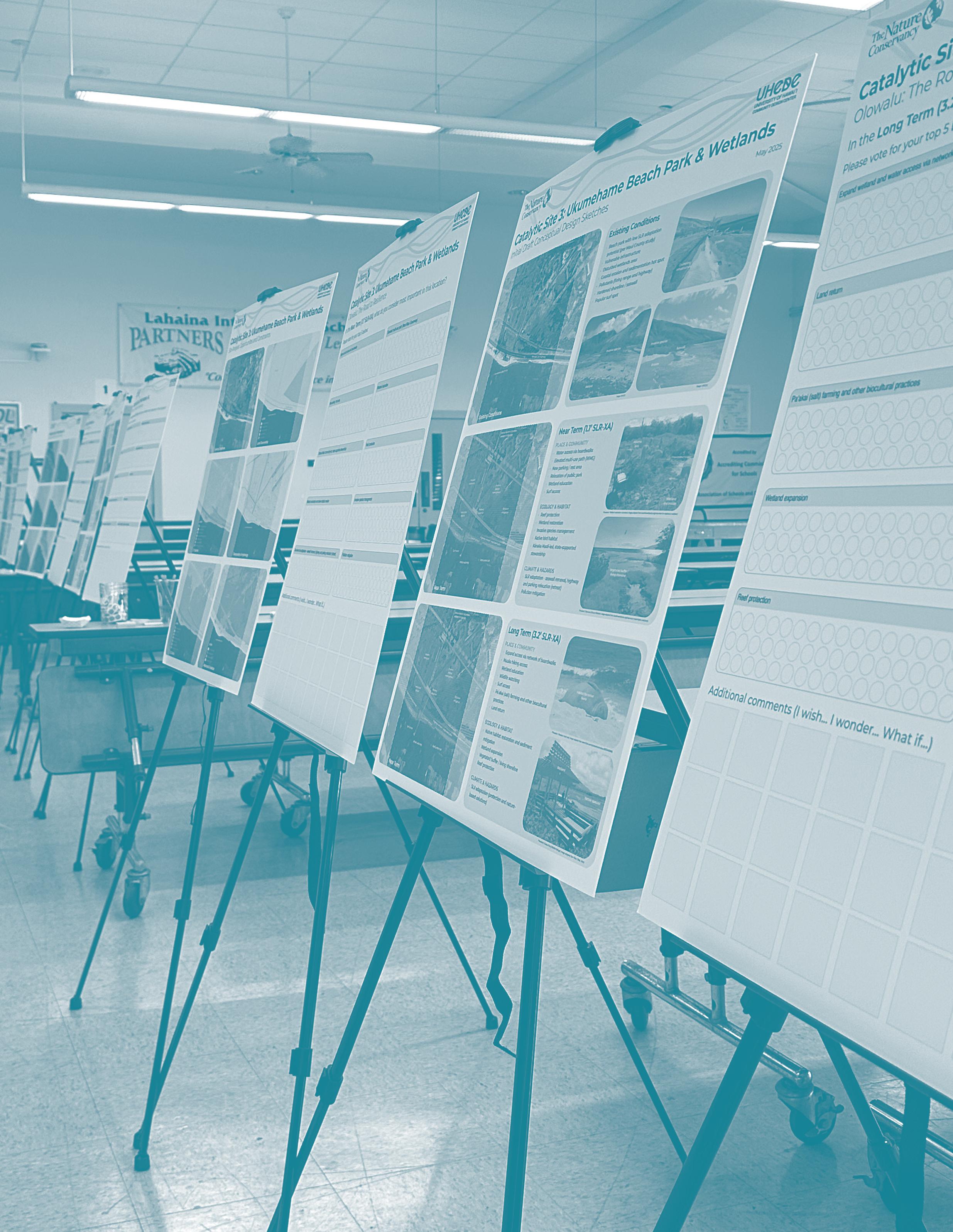


In May and June 2025, the University of Hawaiʻi Community Design Center (UHCDC) and The Nature Conservancy (TNC) convened the second round of community engagement sessions. These meetings built directly on the priorities and insights gathered during the initial February events. Structured as co-design meetings, the second round of community and stakeholder engagement included both in-person and virtual formats, allowing participants to review and respond to draft conceptual design ideas developed from site research, inventory and analysis mapping, and community input.
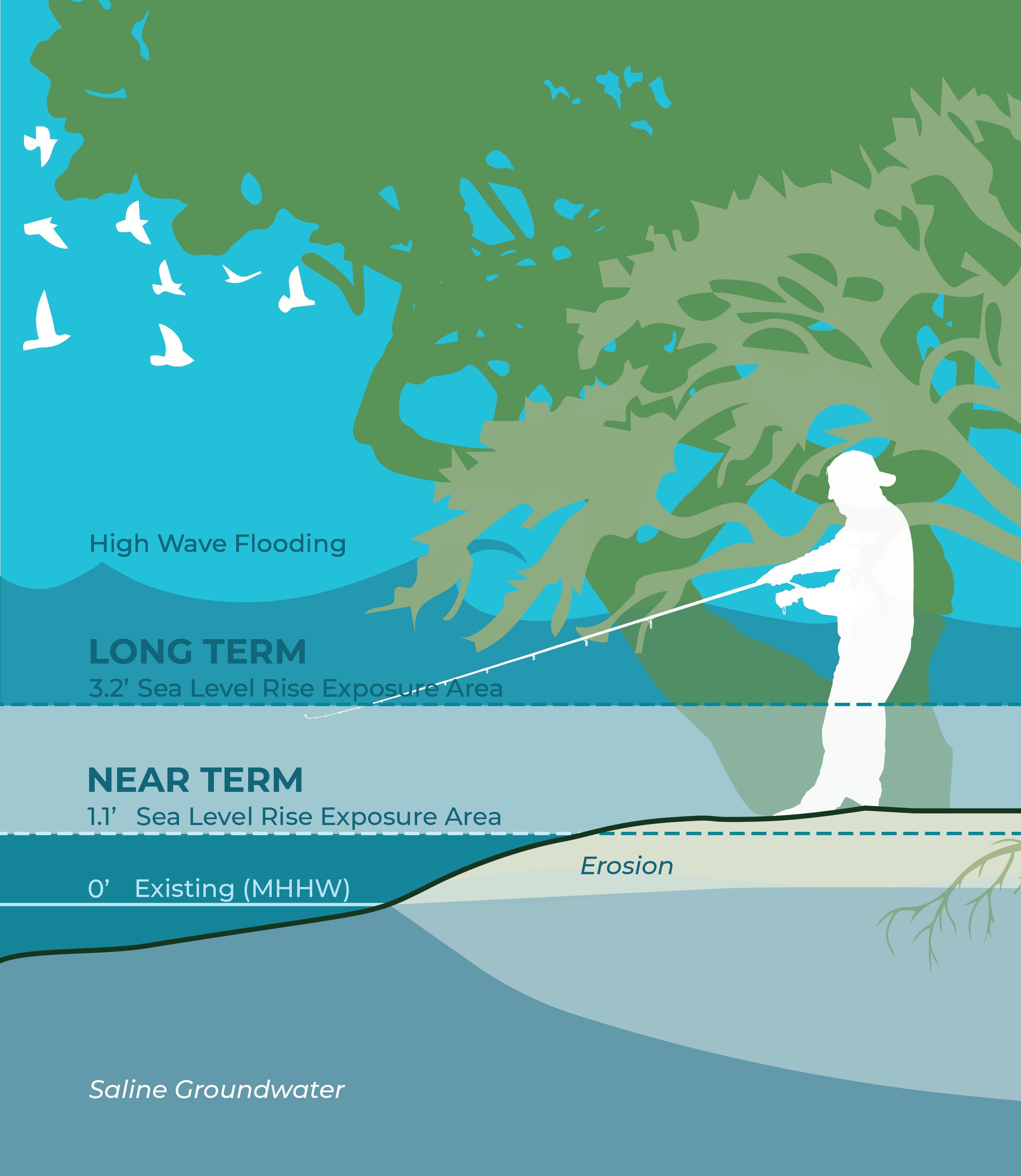
During the introductory presentation, the project team summarized overarching goals and timeline considerations. The first phase addresses near-term conditions, using the 1.1-foot sea level rise exposure area (SLR-XA), anticipated around 2045. The second design phase addresses long-term considerations based on a 3.2-foot SLR-XA scenario, approximately 2075.
The events consisted of an overview presentation followed by a series of four interactive exercises:
• Overall Project Area
• Catalytic Site 1: Olowalu Town
• Catalytic Site 2: Mile Marker 14
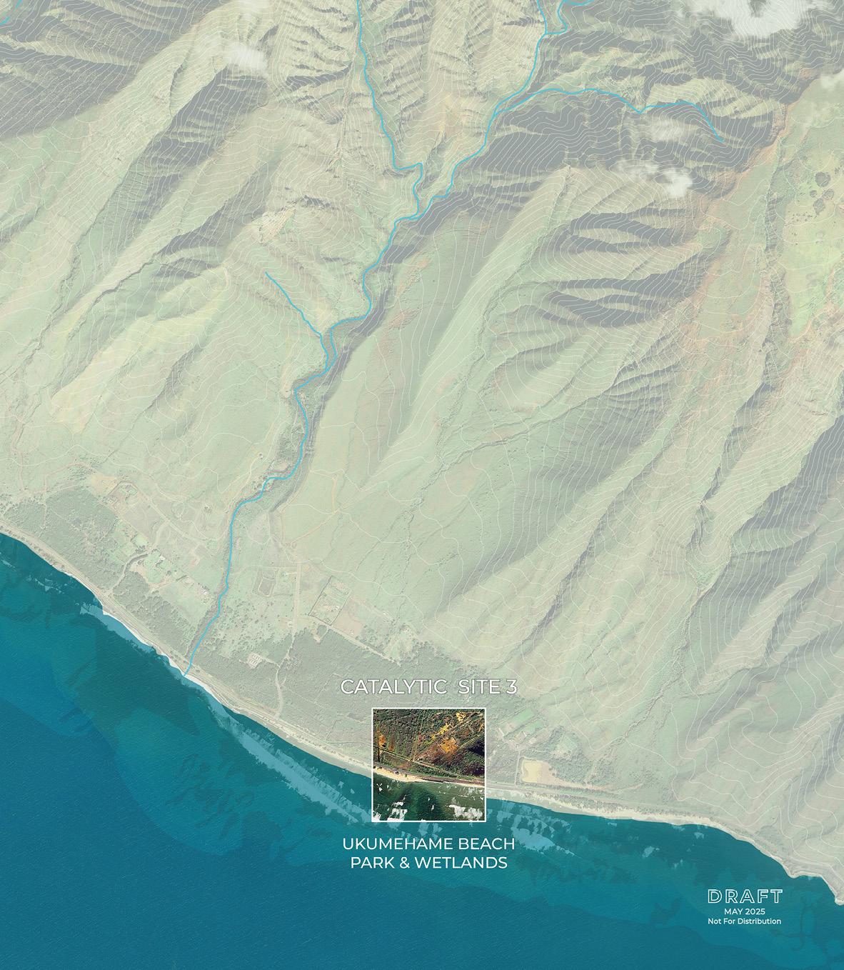
• Catalytic Site 3: Ukumehame Beach Park & Wetlands
The insights gathered from this first co-design phase will inform subsequent design iterations for the overall project area and the three catalytic sites.
Event dates:
May 29, 2025, 5:30 - 7:30 PM (Lahaina Intermediate School) - 36 participants
June 3, 2025, 12:00 - 1:30 PM (Zoom) - 21 participants
June 5, 2025, 4:30 - 6:00 PM (Zoom) - 4 participants
Engagement activities/materials included in this chapter:
Activity 1: Project Area Conceptual Design Sketch
Activity 2: Catalytic Site 1 - Olowalu Town
Activity 3: Catalytic Site 2 - Mile Marker 14
Activity 4: Catalytic Site 3 - Ukumehame Beach Park and Wetlands
The upcoming Honoapiʻilani Highway realignment provides a unique opportunity for your input on the future of the Olowalu and Ukumehame coastal corridor that reflects ʻike kupuna, nature-based solutions, and community priorities.
Please join us to give your feedback on the first draft of a conceptual design based on prior community input and potential solutions addressing environmental threats and hazards.
Thursday May 29, 2025 5:30 - 7:30 PM LAHAINA INTERMEDIATE CAFETERIA 871 Lahainaluna Rd, Lahaina, HI 96761
RSVP LINK: https://forms.gle/9NYMGwLMfx2c8mJU6
1
Tuesday June 3, 2025 12 - 1:30 PM ZOOM REGISTRATION

https://tnc.zoom.us/meeting/register/ RfynS8L9Sjys6yixS7-hxA#/registration
Thursday June 5, 2025 4:30 - 6 PM ZOOM REGISTRATION

https://tnc.zoom.us/meeting/register/ uHYN0qanQhuYFo9LyvXdxQ#/registration
Each meeting will cover the same content: brief project overview, summary of initial community engagement, participatory design, and talk story. At the in-person event, light dinner and beverages will be served. In the fall, there will be one additional round of co-design meetings.
LEARN MORE
For additional project and meeting info, please scan the QR code.
https://arcg.is/9qzyn1

Contact: t.farnsworth@tnc.org UHCDC.olowalu@gmail.com

Project Goal Icons

PLACE & COMMUNITY

ECOLOGY & HABITAT

Design Approach
PROJECT GOALS
PLACE & COMMUNITY
• Public and private landowners
• Ocean recreation
• Parcels / TMK
• Roads and circulation
• Wahi Pana / Hawaiian place names
• Wetlands & potential wetlands
• Hydrology (streams and ditches)
• Forest reserves
• Benthic habitat and reef footprint
• Sea walls
CLIMATE & HAZARDS
• Sea-level rise exposure area (3.2’ SLRXA)
• FEMA flood zones
• Historic fires
• On-site sewage disposal systems
• Talk story map results
• Ridge-to-reef model results
• Coastal interventions: resilient future results

Design Timescale - Definition of “Near Term” and “Long Term”



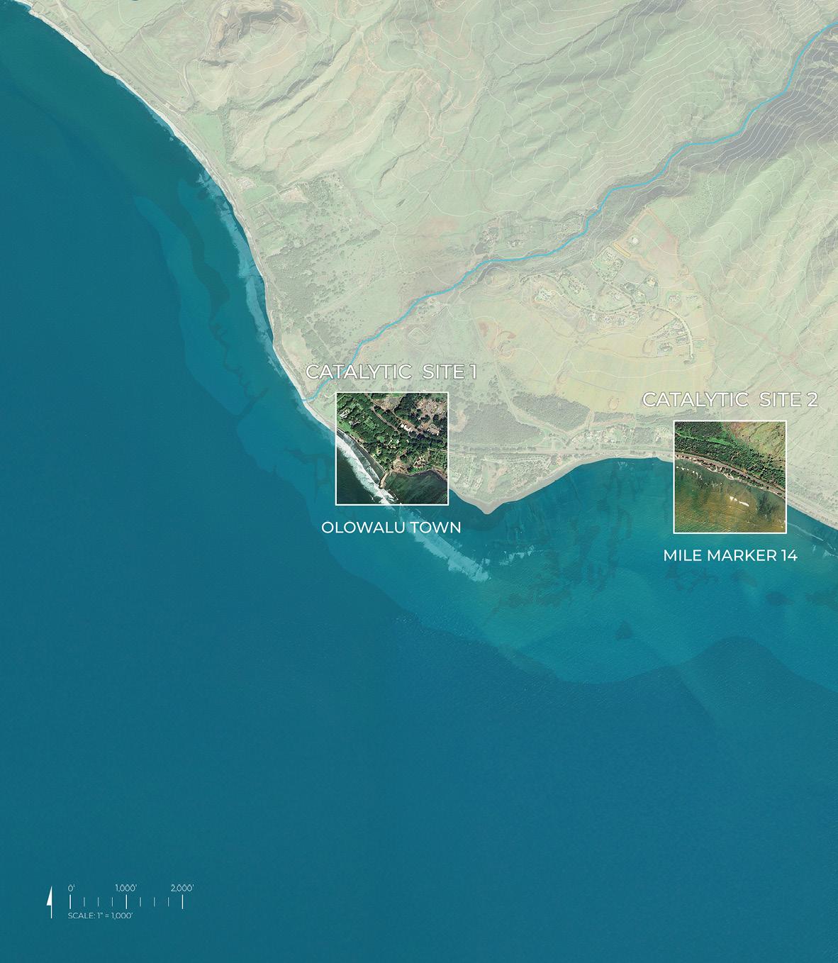
The first co-design engagement activity focused on the overall project area, which spans the Olowalu–Ukumehame coastal corridor. The project team invited participants to reflect on largescale strategies and interventions for resilience across this dynamic landscape.
Initial draft sketches for near-term (1.1’ SLR-XA) and long-term (3.2’ SLR-XA) sea-level rise adaptation scenarios presented concepts that began to re-imagine the existing Honoapiʻilani Highway and adjacent coastal areas. These preliminary visions for the near term and long term illustrated potential future circulation routes, programmatic opportunities, and areas for possible highway removal.
Participants reviewed proposals organized under the project’s three core goals: Place & Community Ecology & Habitat Climate & Hazards
Community members were asked to provide input using sticky notes in response to the prompts: “I wish…,” “I wonder…,” and “What if…”.
Community input and feedback received during the events helped identify shared priorities and will guide the ongoing refinement of an integrated overall project area vision that supports biocultural resilience and long-term climate adaptation.
Materials included in this section:
Engagement Event Activity Photos
Conceptual Design Sketch Boards - Near / Long Term (Materials Provided to Participants)
Conceptual Design Sketch Boards - Near / Long Term (In-Person and Virtual Results)
Summary and Analysis
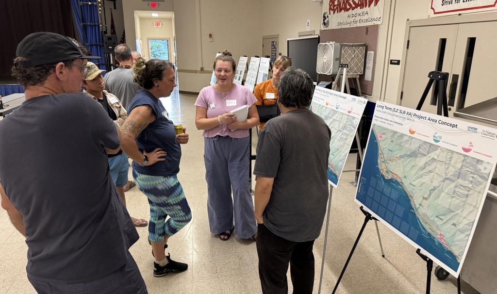
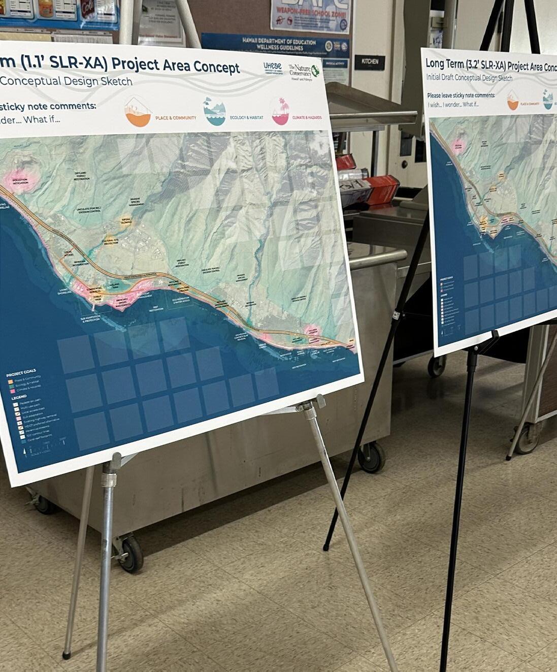
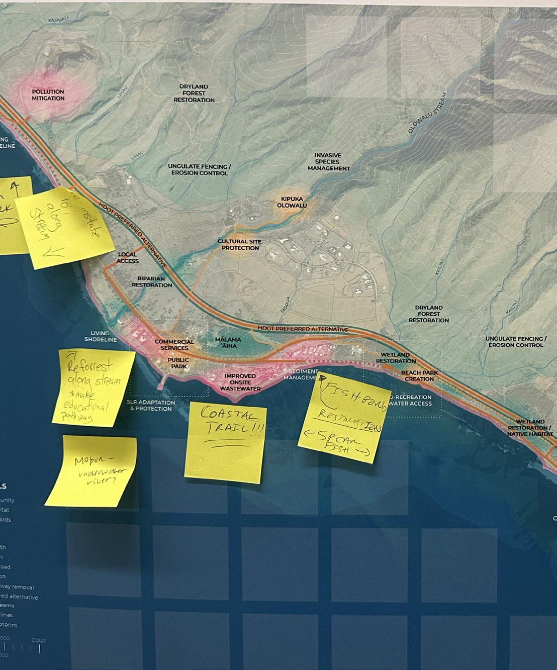
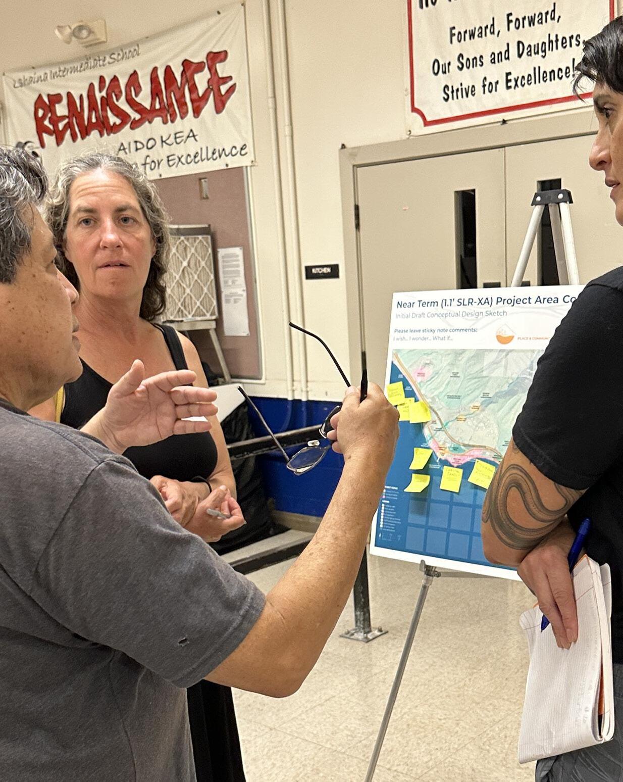
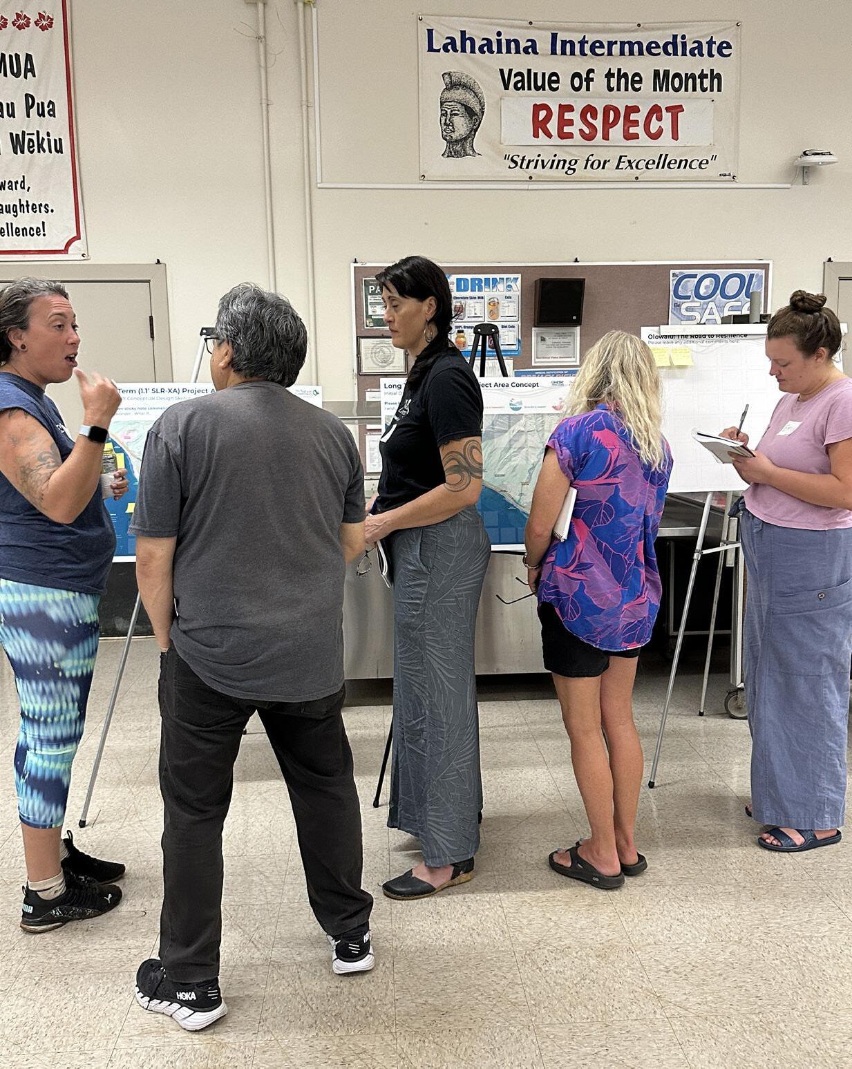
Workshop participants interacting with the Project Area Scale boards (Images: UHCDC)
Initial Draft Conceptual Design Sketch
Please leave sticky note comments: I wish... I wonder... What if...

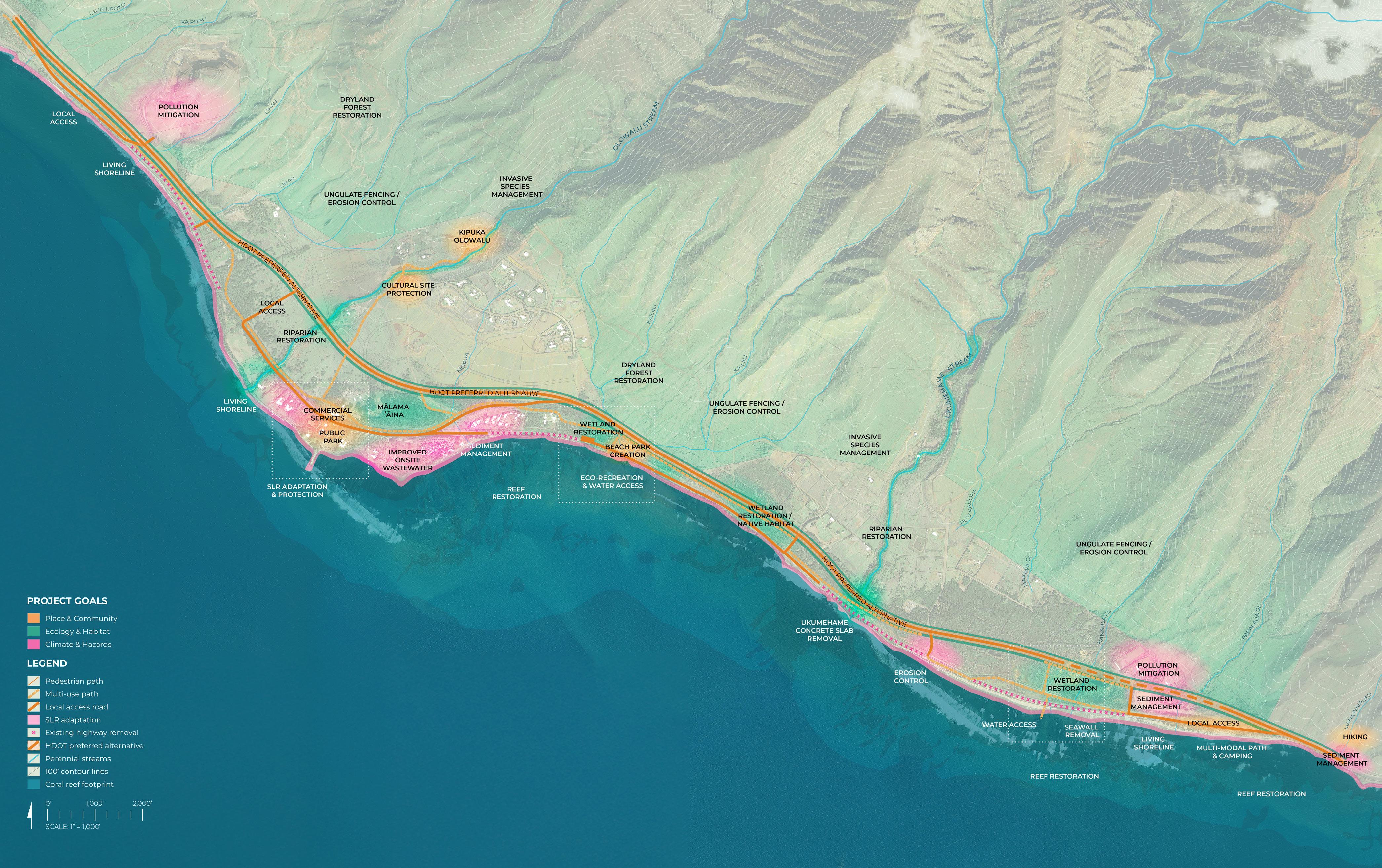


The initial draft conceptual sketch for the near term (approx. 2045) highlights the following proposed design elements:
• Hawaiʻi Department of Transportation (HDOT) identified preferred highway realignment alternative
• Vehicular local access roads
• Pedestrian and multi-modal paths
• Locations where the existing highway is suggested to be removed due to anticipated sea level rise impacts and erosion
• Other proposed programming color coded by project goal
Results, Summary and Analysis
Please leave sticky note comments: I wish... I wonder... What if...


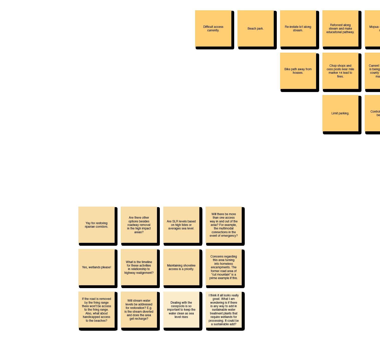


For transcribed post-it comments, refer to the end of this chapter.

Place & Community
Ecology & Habitat
Climate & Hazards
PLACE AND COMMUNITY
• Improve access to beaches, trails, and facilities (including ADA and emergency routes)
• Provide more amenities like restrooms, showers, shade, and windbreaks
Manage parking and address concerns about encampments and safety
ECOLOGY AND HABITAT
• Restore streams, wetlands, loʻi, and fishponds using biocultural practices
Protect native ecosystems and support traditional fishing methods
• Use restoration projects as opportunities for education and stewardship
CLIMATE AND HAZARDS
• Address cesspools, flooding, fires, and pollution risks
• Plan for sea level rise with better modeling and infrastructure adaptation
• Clarify roles, responsibilities, and timelines for hazardrelated projects
Please leave sticky note comments: I wish... I wonder... What if...


The initial draft conceptual design sketch highlights the following proposed design elements: Hawaiʻi Department of Transportation (HDOT) identified preferred highway realignment alternative
• Vehicular local access roads
• Pedestrian and multi-modal paths
• Locations where the existing highway is suggested to be removed due to anticipated sea level rise impacts and erosion
• Other proposed programming color coded by project goal
Results, Summary and Analysis


Long Term Initial Draft Conceptual Design Sketch (original presentation board size: 24” x 30”, reduced in scale for summary report)


Place & Community
Ecology & Habitat
7 24
Climate & Hazards 10
PLACE AND COMMUNITY
• Protect and improve access to beaches, campsites, and trails
• Add facilities and amenities like showers, shade, and drop-off zones
Support local land use and educate visitors and site users on respectful practices
ECOLOGY AND HABITAT
• Restore and protect native habitat and manage invasive species
Support traditional biocultural practices and empower local stewardship
• Clarify land ownership and management/maintenance responsibilities for ecological priority areas
CLIMATE AND HAZARDS
• Address environmental threats like overfishing, pollution, and wind impacts
• Plan for sea level rise and long-term infrastructure adaptation and relocation
• Establish responsibility for land care, roadway maintenance and hazard mitigation
The second activity focused on Catalytic Site 1: Olowalu Town, a location shaped by its commercial activity and layered cultural history. The project team provided participants with large-format boards (24”x30”) featuring maps and diagrams that outlined existing conditions, challenges, and opportunities for the area.
The site was introduced through a series of analysis maps highlighting:
• Existing conditions
• Land ownership
• Topography and hydrology
• Wetlands and habitat
• 1.1’ sea-level rise exposure area impacts
• 3.2’ sea-level rise exposure area impacts
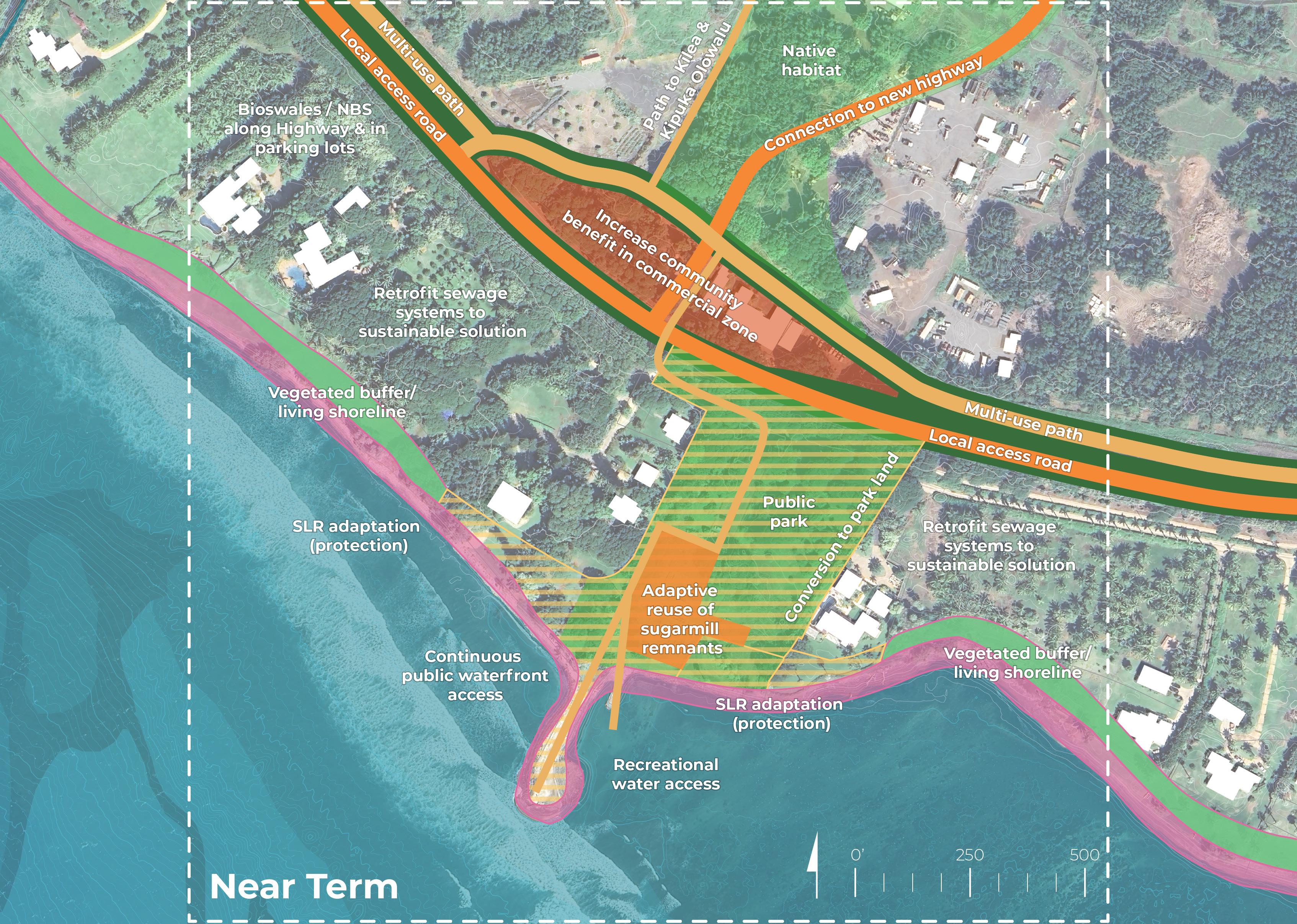
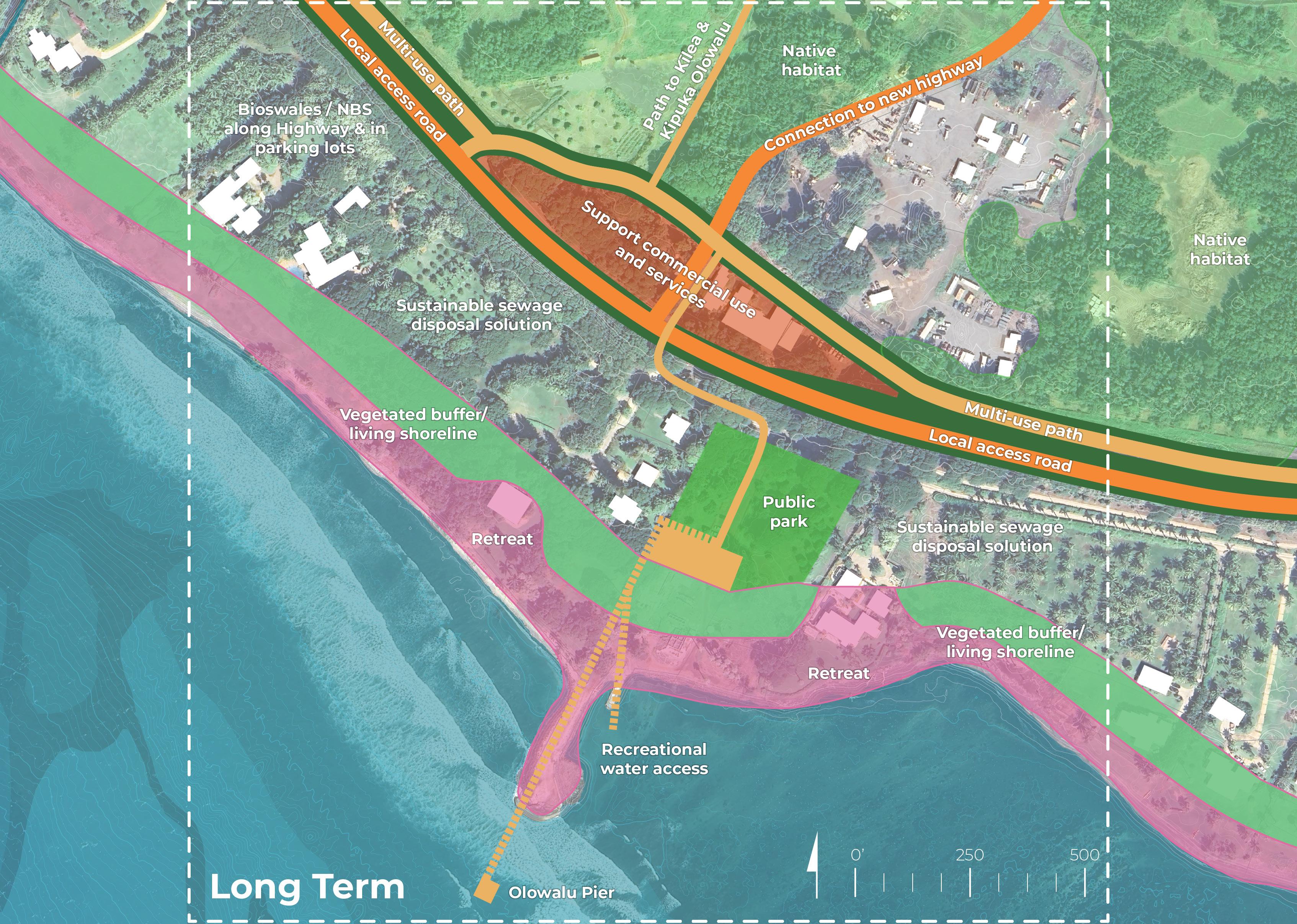
Community members were encouraged to evaluate and respond to proposed design interventions for both near-term (1.1’ SLR-XA, anticipated around 2045) and long-term (3.2’ SLR-XA, approximately 2075) sea-level rise scenarios. Participants voted on their top five potential programs or interventions using colored dots for the near and long-term visions. Additionally, they left input and suggestions via open-ended comments and questions to further inform the design process.
The results and feedback gathered during this activity will inform subsequent, more refined design iterations for the catalytic site.
Materials included in this section:
Engagement Event Activity Photos
Site Analysis: Opportunities and Constraints Board (Materials Provided to Participants)
Initial Draft Conceptual Design Sketches - Near and Long Term (Materials Provided to Participants)
Near Term Initial Draft Conceptual Design Sketch (In-Person & Virtual Results)
Long Term Initial Draft Conceptual Design Sketch (In-Person & Virtual Results) Summary and Analysis

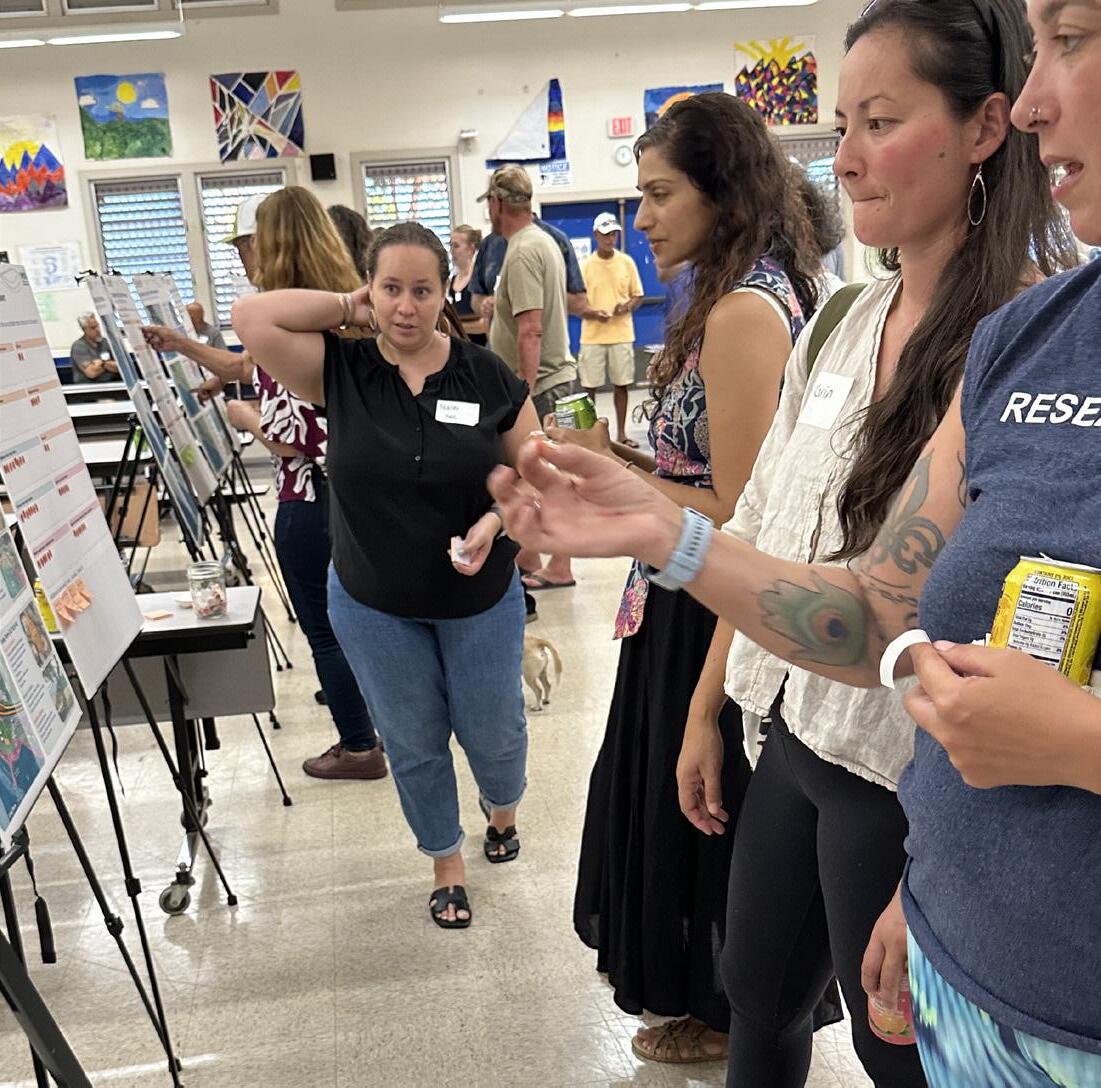
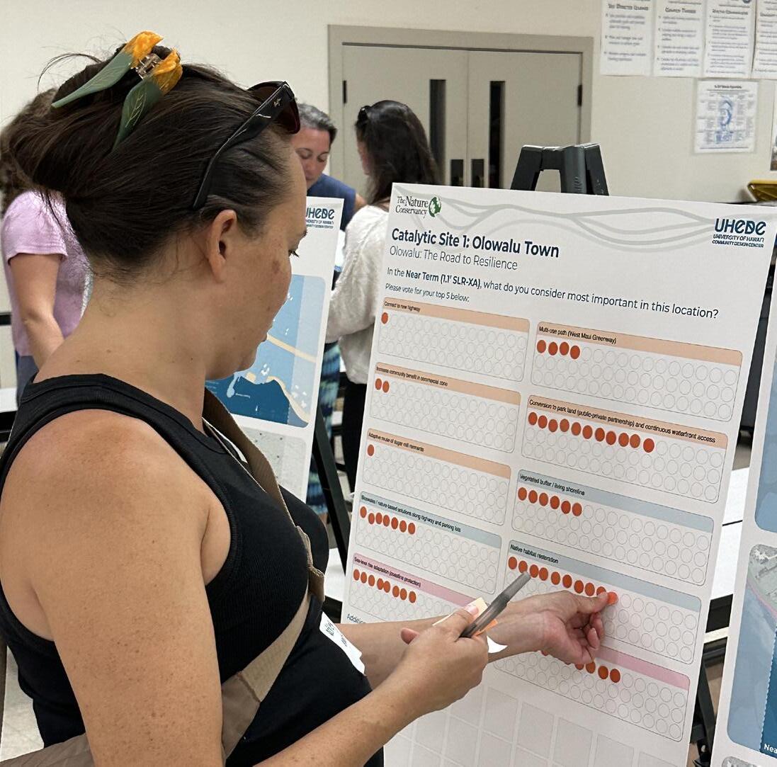
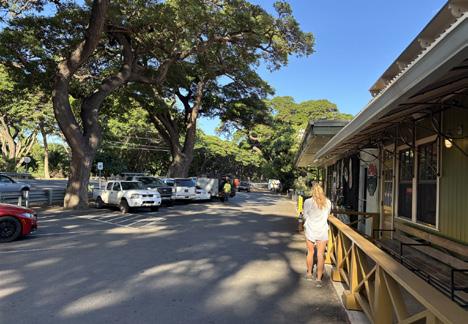
Workshop participants interacting with the Catalytic Site 1 boards (Images: UHCDC)
CATALYTIC SITE 1
Provided Materials
Site Analysis: Opportunities and Constraints
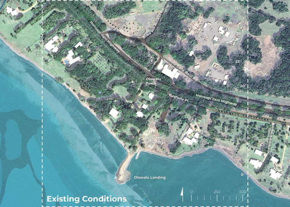


Site Analysis board (original presentation board size: 24” x 30”, reduced in scale for summary report)

Initial Draft Conceptual Design Sketches May 2025


Existing Conditions
• Commercial uses and services
Large impervious surfaces
Lack of public access along coastline
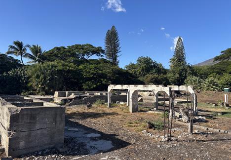
Sugar mill remnants
Invasive species
Recreational water access
Privately owned land
On-site sewage disposal (cesspools)


Near Term (1.1’ SLR-XA)
PLACE & COMMUNITY
Connect to new highway
Multi-use path (West Maui Greenway)
Increase community benefit in commercial zone
Conversion to park land (public-private partnership)
Continuous waterfront access
Adaptive reuse of sugar mill remnants
ECOLOGY & HABITAT
Vegetated buffer / living shoreline
Bioswales / nature-based solutions along highway and parking lots
Native habitat restoration
CLIMATE & HAZARDS
SLR adaptation (coastline protection)
Retrofit sewage disposal to sustainable solution
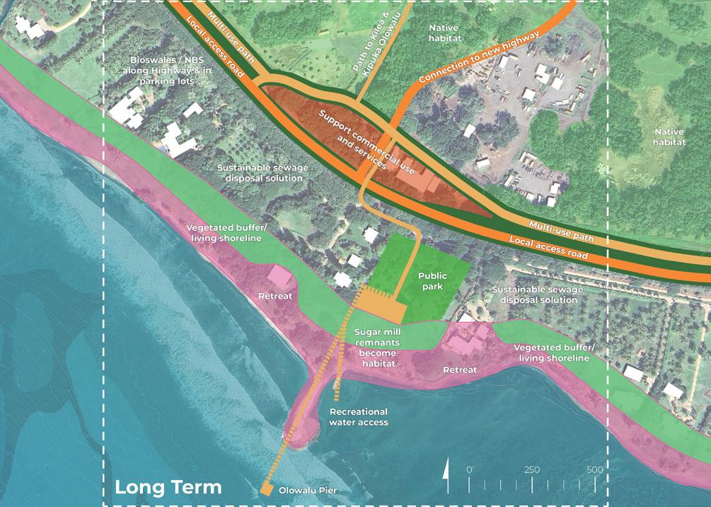
Long Term (3.2’ SLR-XA)
PLACE & COMMUNITY
Multi-use path (West Maui Greenway)
Continue to support commercial use, services, and community resources
Create resilience hub
Public park
Recreational water access
Olowalu Pier
ECOLOGY & HABITAT
Vegetated buffer / living shoreline
Clean sugar mill remnants become habitat
Continued native habitat restoration
CLIMATE & HAZARDS
SLR adaptation (retreat)
Sustainable sewage disposal solution
Bioswales / nature-based solutions along highway & parking lots





Provided Materials

In the Near Term (1.1’ SLR-XA), what do you consider most important in this location?
Please vote for your top 5 below:
Connect to new highway
Increase community benefit in commercial zone
Adaptive reuse of sugar mill remnants
Bioswales / nature-based solutions along highway and parking lots
path (West Maui Greenway)
Conversion to park land (public-private partnership) and continuous waterfront access
Vegetated buffer / living shoreline
Sea-level rise adaptation (coastline protection)
Additional comments (I wish... I wonder... What if...)
Native habitat restoration
Retrofit sewage disposal to sustainable solution
Near Term Dot Voting board (original presentation board size: 24” x 30”, reduced in scale for summary report)

In the Long Term (3.2’ SLR-XA), what do you consider most important in this location?
Please vote for your top 5 below:
Continue to support commercial use and services
Water transportation (taxi / ferry)
Multi-use path (West Maui Greenway)
Vegetated buffer / living shoreline
Continued native habitat restoration
sewage disposal to sustainable solution
Additional comments (I like... I wish... I wonder...)
Recreational water access via pier
Sea-level rise adaptation (retreat)
Bioswales / nature-based solutions along highway and in parking lots
Long Term Dot Voting board (original presentation board size: 24” x 30”, reduced in scale for summary report)
CATALYTIC SITE 1
In-Person Event Results (5/29/25)
The graphic below visually represents community and stakeholder feedback received during the in-person event. For transcribed post-it comments, refer to the end of this chapter.
Olowalu: The Road to Resilience
Participants were asked: In the Near Term (1.1’ SLR-XA), what do you consider most important in this location?
In the Near Term (1.1’ SLR-XA), what do you consider most important in this location?

1 2 14 13 2 9 6 12 9 14
The graphic below visually represents community and stakeholder feedback received during the in-person event. For transcribed post-it comments, refer to the end of this chapter.
Participants were asked: In the Long Term (3.2’ SLR-XA), what do you consider most important in this location?
In the Long Term (3.2’ SLR-XA), what do you consider most important in this location?
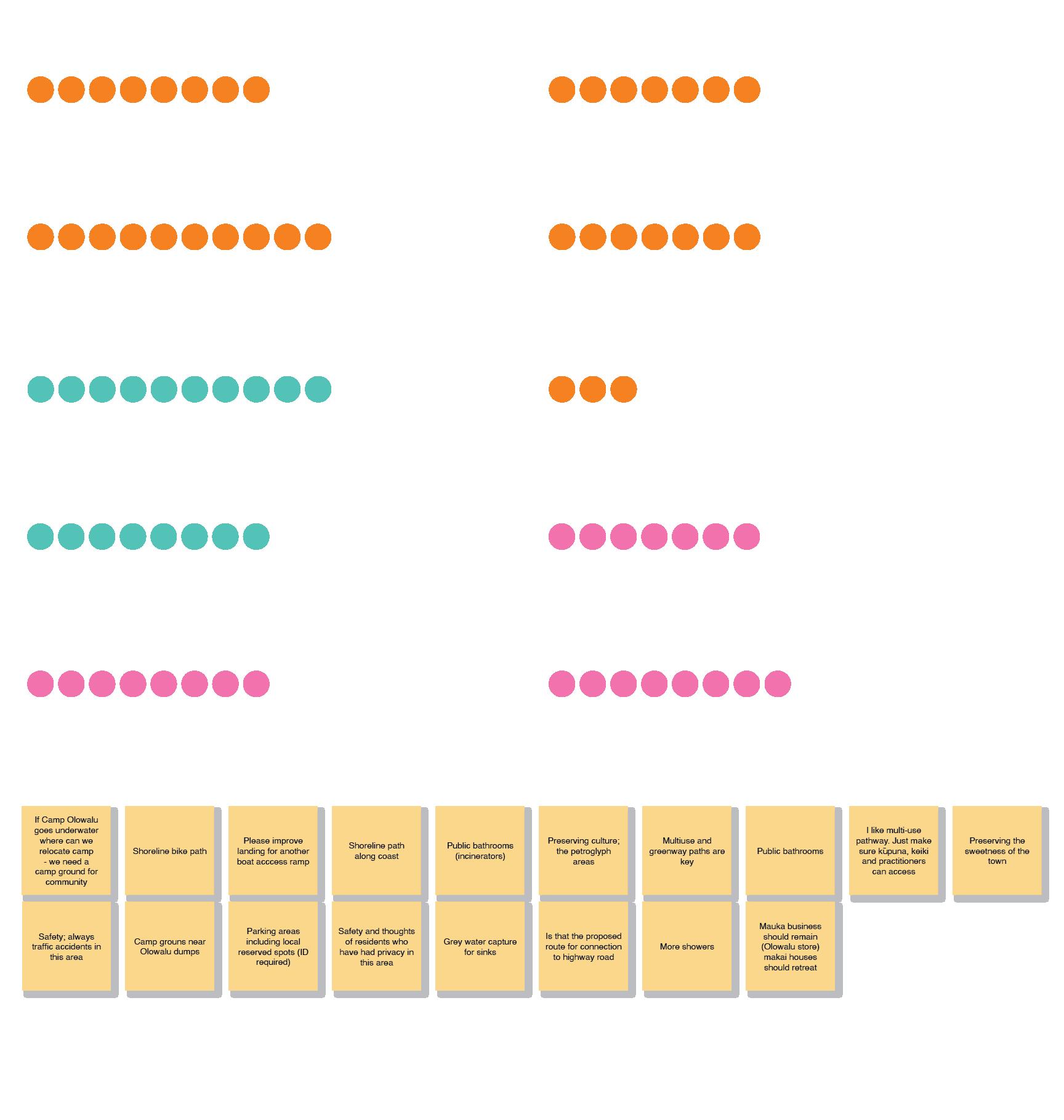
8 10 7 7 10 8 3 7 8 8
Term Dot Voting board results (original presentation board size: 24” x 30”, reduced in scale for summary report)
Virtual Event Results (6/3/25 , 6/5/25 )
Voting categories were verbatim to in-person event
Connect to new highway
Increase community benefit in commercial zone
Multi-use path (West Maui Greenway)
Adaptive reuse of sugar mill remnants
Possible conversion to park land (publicprivate partnership) and continuous waterfront access
Bioswales / nature-based solutions along highway and parking lots
Vegetated buffer / living shoreline
Sea-level rise adaptation (coastal protection)
Native habitat restoration
Retrofit sewage systems to sustainable solution
SITE 1
Virtual Event Results (6/3/25, 6/5/25)
Participants were asked to provide any additional feedback or comments
I wish we could walk from Hekili Point to Awakea Beach
Plant more monkeypods! love that part of the road.
Would love to see the ruins cleaned up!
Love the historic aspect of incorporating old cane equipment. (1/2)
This era of Hawaii’s broughthistory a lot of our populationlocalto Hawaii (2/2)
Education of beach users on malama ʻāina.
Sugar mill was the reason for decline of Olowalu, please be careful with “remnant reuse or resolution”
Fresh water showers for beach users
Bike path!
Bettershorelinepublic access!
Good place for a Resilience Hub
Participants were asked to provide any additional feedback or comments
Love the pier!
I love the idea of a walking path along the stream and bringingrestoration about moreconnectionahupua’a
Make sure public has access and that residents are prioritized
Needs long term funding for continued management and maintenance
Concerns with ocean users accessing reef from shorelinewalking/standing on reef. (1/2)
Overfishing. Speer fishers have removed so much fish from reef. (2/2)
Traffic concerns. and “smart” merges to avoid road rage (think Bypass going from Lahaina towards...
...the Pali) cars driving along the shoulder to go around cars merging. No policing in this area
My parents got married at Olowalu Plantation 50 years ago. Special spot.
Incorporate the sugar mill ruins please?
Include public/private partnerships for long term restoration,... (1/2)
integrating...agroforestry,native Hawaiian orgs and practices. (2/2)
Is there planning for managed retreat?
Outreach to landowners in the affected area?
I wish we could act short term, but do a better job thinking long term. It’s nice to have parks
and commercial zones, but if we destroy ʻāina and the planet, a park won’t have much use.
Wastewater and power infrastructure
Access to ocean and including the Greenway or multi modal access will be complimentary. (1/2)
Who’s responsible for maintaining the restoration areas long term? Is it TNC? Community? Government? It seems too far into the future. Can we work on the near term?
Including nature based solutions with a Greenway could help accomplish many goals.(2/2)
Near-Term Design Synthesis (5/29/25 , 6/3/25 , 6/5/25
)
Retrofit sewage systems to sustainable solution
Possible conversion to park land (public-private partnership) and continuous waterfront access
Native habitat restoration
Vegetated buffer / living shoreline
Multi-use path (West Maui Greenway)
Sea-level rise adaptation (coastal protection)
Bioswales / NBS along highway and parking lots
Increase community benefit in commercial zone
Connect to new highway
33 26 25 24 23 20 19 9 6 5
Adaptive reuse of sugar mill remnants
• Public Access and Stewardship:
Interest in developing Olowalu as a resilience hub, emphasizing its potential for integrated community services, education, and emergency preparedness Listed
Support for increased public land ownership and improved shoreline access, including walkable routes (e.g., from Hekili Point to Awakea Beach), bike paths, and freshwater showers; paired with education on mālama ʻāina to promote responsible land use and visitor behavior
• Cultural and Historical Sensitivity:
Recognition of the sugar cane era’s historical remnants, with caution to acknowledge the industry’s impact on Olowalu; recommendations for thoughtful adaptive reuse, including preservation or cleanup of the sugar mill ruins
• Environmental Restoration:
Calls to remove invasive species and prioritize planting native or valued trees; monkeypods were highlighted as important to maintaining Olowalu’s distinctive character
• Resilience and Community Infrastructure:
Design Synthesis (5/29/25 , 6/3/25 , 6/5/25
Recreational water access
Vegetated buffer / living shoreline
Sea-level rise adaptation (coastline protection)
Continued native habitat restoration Continue to support commercial use, services, and community resources
Retrofit sewage systems to sustainable solution Public park Bioswale / NBS along highway parking lots
Listed in a Non-Ranked Order
• Access, Connectivity and Infrastructure
Strong support for shoreline access through multi-use paths; calls for public bathrooms, showers, parking (with local preference), boat ramps, and improved road safety and design
• Community Land and Access Preservation
Desire to relocate Camp Olowalu if needed and create new community campgrounds; preserve Olowalu’s historic character; protect and prioritize local privacy and access; maintain mauka businesses and manage makai retreat
• Cultural and Ecological Stewardship
Preserve petroglyphs, sugar mill ruins, and cultural sites; educate the public on reef protection; reduce ocean exploitation through better stewardship and community engagement
• Climate Resilience and Sustainability
Integrate sea level rise and retreat planning; support nature-based infrastructure, grey water reuse, and sustainable utilities; address short and long-term priorities with urgency
• Governance and Partnerships
Clarify who manages, funds, and maintains restoration efforts; ensure collaboration with Native Hawaiian organizations and landowners for long term care and access
Catalytic Site 1 Feedback Synthesis
Per Project Goal (Near and Long Term)
The bullet points below represent a high-level summary of workshop participants’ overall priorities organized by project goal.
• Improve coastal access for beaches, trails, campsites, and recreation
• Improve and implement public infrastructure, including restrooms, showers, bike paths, and parking
• Preserve local identity by protecting cultural and historical sites and supporting local businesses
• Ensure safety with better traffic management and thoughtful land use
• Increase community benefit through public land ownership and sustainable design (e.g., resilience hubs)
• Restore native ecosystems and culturally significant areas like streams, reefs, and petroglyphs
• Remove invasive species and promote native plantings
• Support biocultural practices and community-led stewardship
• Educate visitors and site users to encourage respectful practices and mālama ʻāina
• Prepare for climate impacts including sea level rise, flooding, high winds, and fire
• Address infrastructure risks (e.g., wastewater, greywater, erosion)
• Establish clear roles of accountability, funding, and long-term maintenance plans
• Approach redevelopment carefully to avoid repeating past environmental harms
69 total votes
68
total votes

53
total votes

NEAR-TERM DESIGN
Participant voting on design goals equally emphasized place & community and ecology & habitat
LONG-TERM DESIGN
In their voting, participants prioritized the place & community design goal, followed by ecology & habitat and climate & resilience identified as secondary priorities.
2045 2075
93 total votes

46 total votes

57 total votes

The third activity focused on Catalytic Site 2: Mile Marker 14, an area heavily used for snorkeling and coastal recreation. The project team provided participants with large-format boards (24”x30”) featuring maps and diagrams that outlined existing conditions, challenges, and opportunities for the area.
The site was introduced through a series of analysis maps highlighting:
• Existing conditions
• Land ownership
• Topography and hydrology
• Wetlands and habitat
• 1.1’ sea-level rise exposure area impacts
• 3.2’ sea-level rise exposure area impacts
Community members were encouraged to evaluate and respond to proposed design interventions for both near-term (1.1’ SLR-XA, anticipated around 2045) and long-term (3.2’ SLR-XA, approximately 2075) sea-level rise scenarios. Participants voted on their top five potential programs or interventions using colored dots for the near and long-term visions. Additionally, they left input and suggestions via open-ended comments and questions to further inform the design process.
The results and feedback gathered during this activity will inform subsequent, more refined design iterations for the catalytic site.
Materials included in this section:
Engagement Event Activity Photos
Site Analysis: Opportunities and Constraints Board (Materials Provided to Participants)
Initial Draft Conceptual Design Sketches - Near and Long Term (Materials Provided to Participants)
Near Term Initial Draft Conceptual Design Sketch (In-Person & Virtual Results)
Long Term Initial Draft Conceptual Design Sketch (In-Person & Virtual Results) Summary and Analysis
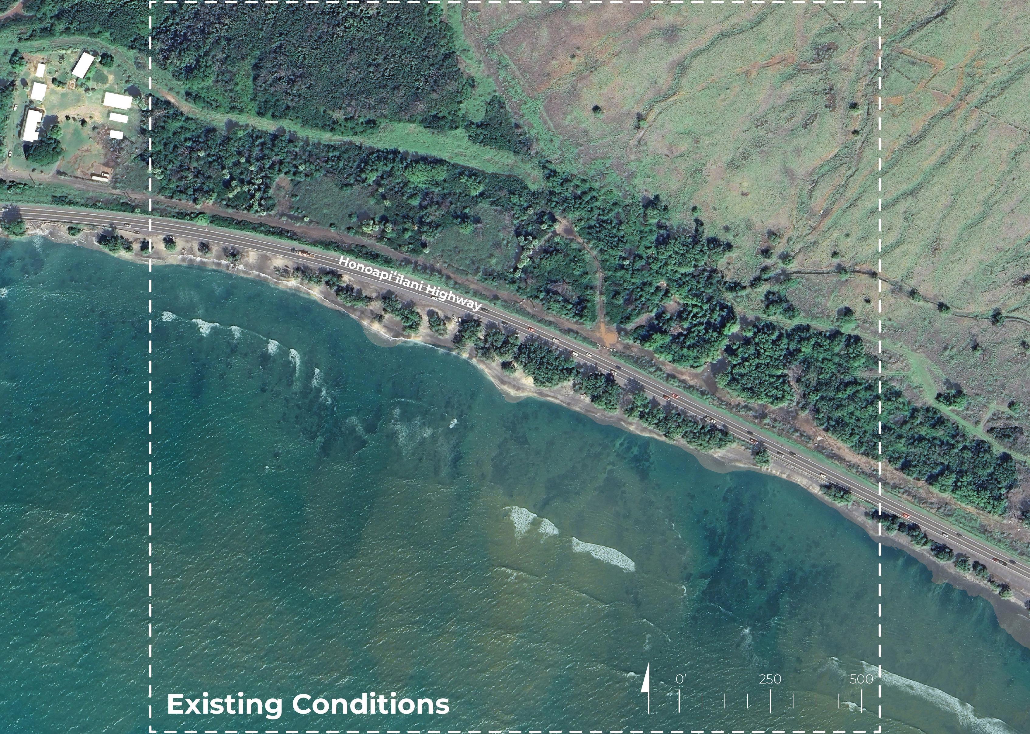


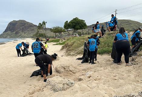
Workshop participants interacting with the Catalytic Site 2 boards (Images: UHCDC)
CATALYTIC SITE 2
Provided Materials
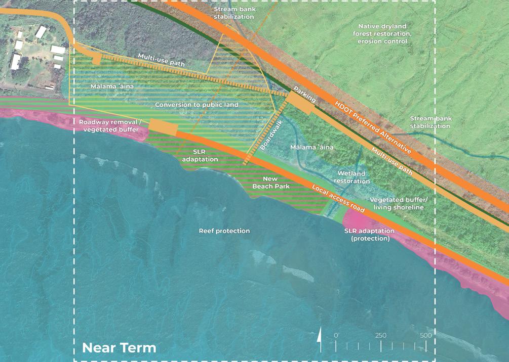
Site Analysis: Opportunities and Constraints
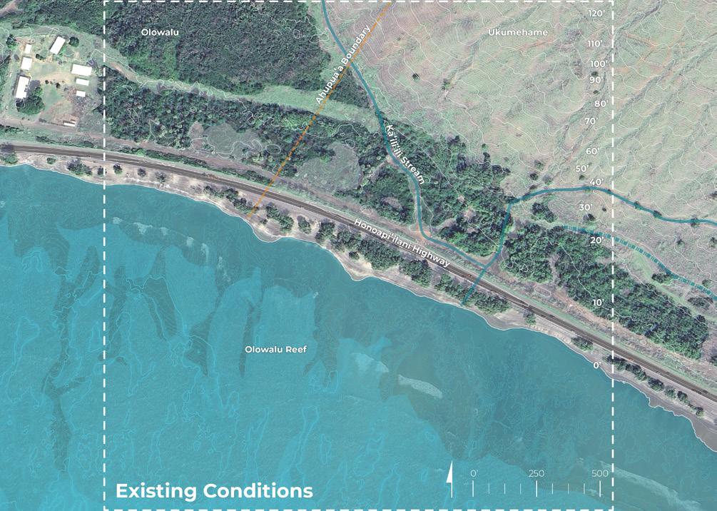
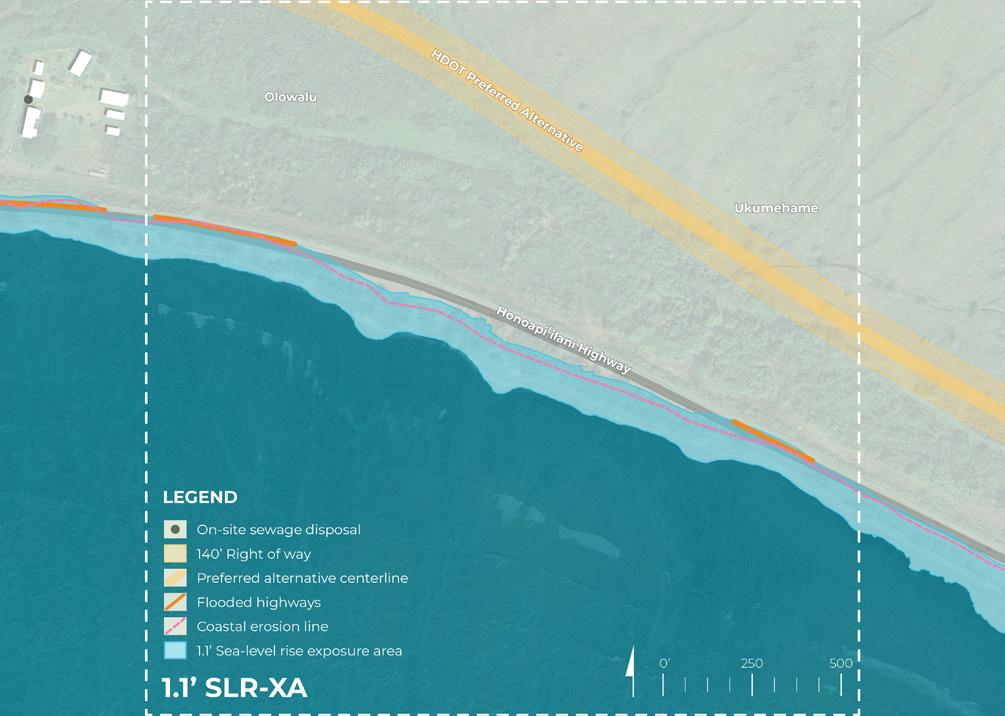


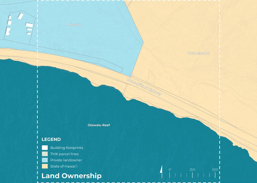

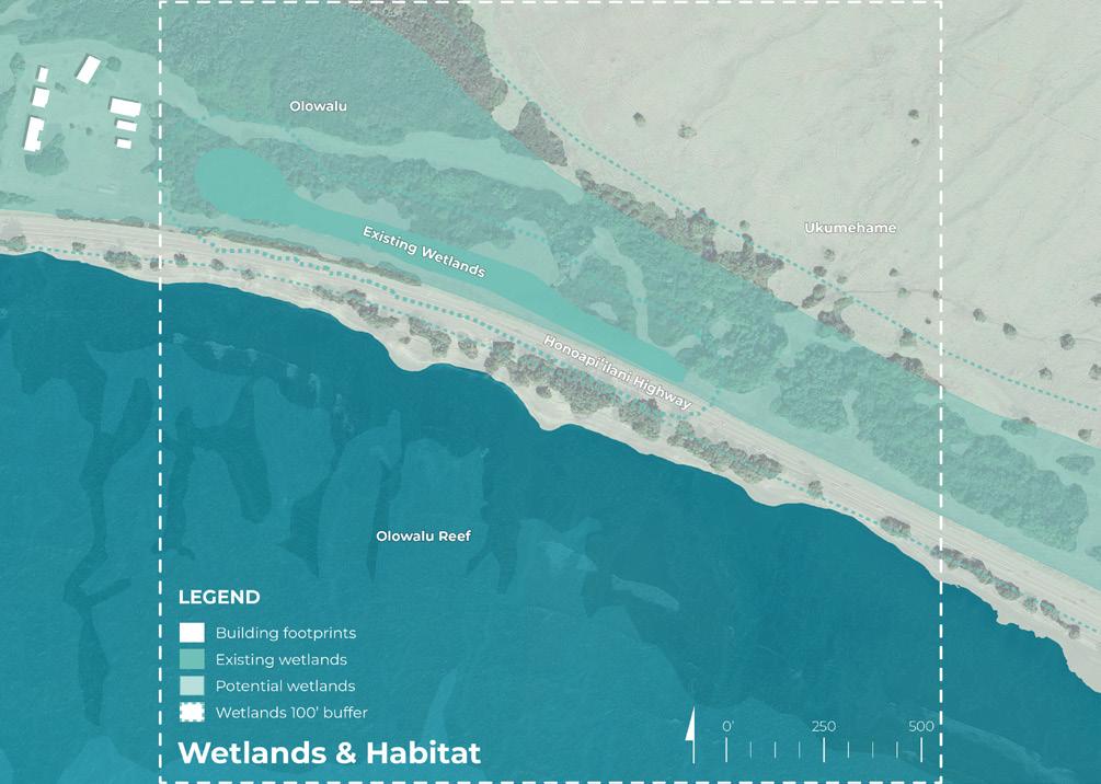
Site Analysis board (original presentation board size: 24” x 30”, reduced in scale for summary report)



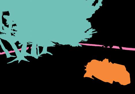
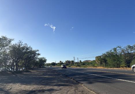
• Popular snorkeling spot
Illegal dumping and long-term houseless
population
Coastal erosion and sedimentation
Impacts of parking and tourism on shoreline and reef
Invasive species
Severe roadway erosion
Coastal erosion hotspot


Near Term (1.1’ SLR-XA)
PLACE & COMMUNITY
Local access road (protect existing highway)
• Multi-use path (West Maui Greenway)
Conversion to public land
Potential new public beach park
Beach park parking
Boardwalk access
ECOLOGY & HABITAT
Reef restoration
• Mālama ʻāina (clean illegal dumping, etc.)
Native dryland forest and stream restoration, erosion control
Wetland restoration
CLIMATE & HAZARDS
SLR adaptation (existing roadway protection)
• Partial roadway removal (and/or other adaptation solution with vegetated buffer)
Long Term (3.2’ SLR-XA)
PLACE & COMMUNITY
Multi-use path (West Maui Greenway)
Boardwalk access to beach park
Reef education
Biocultural practices (loʻi kalo)
Ahupuaʻa boundary marker
ECOLOGY & HABITAT
Reef protection
Maintain native dryland forest and streams (erosion control)
Wetland expansion
Vegetated buffer / living shoreline
CLIMATE & HAZARDS
SLR adaptation - beach park (adapt in place)
SLR adaptation - roadway removal (retreat)



Provided Materials

In the Near Term (1.1’ SLR-XA), what do you consider most important in this location?
Please vote for your top 5 below:
Local access road (protect existing highway)
Conversion to public land
dryland forest & stream restoration, erosion control
Additional comments (I wish... I wonder... What if...)
Near Term Dot Voting board (original presentation board size: 24” x 30”, reduced in scale for summary report)

In the Long Term (3.2’ SLR-XA), what do you consider most important in this location?
Please vote for your top 5 below:
native dryland forest and streams (erosion control)
Additional comments (I wish... I wonder... What if...)
Long Term Dot Voting board (original presentation board size: 24” x 30”, reduced in scale for summary report)
In-Person Event Results (5/29/25)
The graphic below visually represents community and stakeholder feedback received during the in-person event. For transcribed post-it comments, refer to the end of this chapter.
Olowalu: The Road to Resilience
Participants were asked: In the Near Term (1.1’ SLR-XA), what do you consider most important in this location?
In the Near Term (1.1’ SLR-XA), what do you consider most important in this location?

2 5 11 8 9 14 19 11 9 8
The graphic below visually represents community and stakeholder feedback received during the in-person event. For transcribed post-it comments, refer to the end of this chapter.
Olowalu: The Road to Resilience
Participants were asked: In the Long Term (3.2’ SLR-XA), what do you consider most important in this location?
In the Long Term (3.2’ SLR-XA), what do you consider most important in this location?

16 5 3 13 3 12 14 9 3 11
Virtual Event Results (6/3/25 , 6/5/25 )
Voting categories were verbatim to in-person event
Local access road (protect existing highway)
Multi-use path (West Maui Greenway)
Conversion to public land
New public beach park & parking
Reef restoration
Native dryland forest & stream restoration, erosion control
Mālama ʻāina (clean illegal dumping, etc.)
Sea-level rise adaptation (existing roadway protection)
roadway removal (and/or other adaptation solution with vegetated buffer)
Voting categories were verbatim to in-person event
Multi-use path (West Maui Greenway)
Boardwalk access to beach park
Reef education
Ahupuaʻa boundary marker
Biocultural practices (lo’i kalo)
Maintain native dryland forest and streams (erosion control)
Reef protection
Wetland expansion
Sea-level rise adaptation - beach park (adapt in place)
Sea-level rise adaptation - roadway removal (retreat)
Virtual Event Results (6/3/25, 6/5/25)
Participants were asked to provide any additional feedback or comments
What is means for private to public land conversion?
Open space fund, legacy lands, eminent domain?
The boardwalks over the wetland would be so fun! Great way of accessing the new beach park.
Stop cars from driving right up on the sand... provide adequate parking. And find ways to keep cars from staying there for days/weeks on end
museum
Is there any consideration of the permitted housing in your plans?
We need that road as emergency access, or another solution
I wish for what ever changes are made that they are made with aloha ʻāina in mind. (1/2
If we do that kuleana first, anything else is nice, but our first priority should be malama ʻāina. (2/2)
Parking far away enough to prevent long term camping and homeless
A sugar andmuseummill educationwetlandcenter would be cool.
Keeping access through the area with multi modal will help with emergency access, (1/2)
I feel restorationreefshould be afterprioritized the land based activities have concluded.
How would the formal creation of a beach park work? Is Maui County open to the idea?
Mile Marker 14 was our favorite camping area before anyone knew about it. No place else.
Would there be bathrooms, maybe in the parking area by the new highway?
Can do some loading zones for cars with keiki closer to shore, then actual parking lot further from shore
and it should include opportunities for native plantings, agroforestry or bioswales, etc. (2/2)
We need plant some native species! And shade in some way
Cut down the trees, they are part of erosion problem.
We need to address the homeless issues so locals will feel safe to take their children back to Cut-Mountain and other spots to fish or dive.
I take issue with the comments about overfishing; people go here because it’s easy access and beach friendly for the keiki.
Clean up the cars and dumpingillegal all through that area
Love the boardwalk concept
Trash/ refuse is important
The parking is just too far away, esp for local families with lots of keiki, beach toys, lunch, etc. (1/2)
Need to find something accessiblemore for this area. (2/2)
While wetlands have potential here - maintaining wetlands requires so maintenance?much Who would do that?
Creative drop offs for beach and aquatic access
Participants were asked to provide any additional feedback or comments
Native vegetation
Great idea to have loʻi kalo near the intermittent stream. Can we find room for more?
Comfort stations using natural materials
Greenway could also facilitate restoration and stewardship activities, providing access for people to get to locations
People living and working together with the land
Want to see this benefit the public and day users. Do not want to see it Maui’sbecome next homeless camp.
Coconut grove!
Will there be farm stands?
Fresh water showers for beach users
Buy was niu (coconut)
Re-evaluate the old stream way of Olowalu Stream
Public camping
And more opportunities for loʻi! Buy and ulu too
Is planning for wildfire outside of the scope of this?
No ventures,commercial kayaks take up all the space
Great to see attention to native plants
I think access from the HDOT preferred alternative needs to be better studied. Don’t need too much development. I like open spaces that people can connect to nature.
Loʻi needs to be designed with either descendants and/ a native Hawaiian organization. (1/2)
Love the proposal of loʻi kalo between the stream and wetland. Can we have more?
It could be opportunityeducationalan as well (2/2)
Legit camping area?
More fruit trees, canoe plants
What is the effect of reduced rainfall in the uplands and impact on groundwater and wetlands?
What about Uala, instead of loʻi kalo?
Respectfully, it seems too far future!
Monkeypods along the new highway
People living and working together with the land
Mālama ‘āina (clean illegal dumping, etc.)
Native dryland forest & stream restoration, erosion control
Reef restoration
New public beach park & parking

Listed in a Non-Ranked Order
• Public Access and Amenities
Strong support for improved beach access, boardwalks, parking, bathrooms, and trash services to improve public use and comfort
• Community Safety and Cultural Integrity
Desire for safe, clean spaces free of unmanaged houselessness and dumping; strong emphasis on protecting cultural sites and aligning planning with aloha ʻāina values
• Ecological Restoration and Habitat Protection
Calls to restore native forests and wetlands, remove invasive species, and safeguard reef, seabird, and wetland ecosystems using nature-based solutions
• Climate Resilience and Infrastructure Planning
Support for fire and erosion mitigation through native planting, road relocation planning, and low-impact infrastructure that balances access with ecological sensitivity
• Governance and Long-Term Stewardship
Emphasis on transparent planning, public benefit, and long-term maintenance strategies, especially for wetlands and restored areas, with clear responsibility and funding
Long-Term Design Synthesis (5/29/25 , 6/3/25 , 6/5/25
Biocultural practices (loʻi kalo)
Maintain native dryland forest and streams (erosion control)
Reef protection
Multi-use path (West Maui Greenway)
Sea-level rise adaptation - roadway removal (retreat)
Reef education
Wetland expansion
Boardwalk access to beach park
Sea-level rise adaptation - beach park (adapt in place)
Ahupuaʻa boundary marker

• Access and Amenities
Concerns about rainfall decline, water availability, fire risk, and long-term wetland health; some urge immediate action rather than distant or abstract plans Listed
Interest in public bathrooms, showers, and camping—with concern about managing houselessness; emphasis on evaluating access routes carefully to ensure functionality and equity
• Community-Centered Design and Land Use
Desire for minimal development that preserves open space and natural character; support for uses like farm stands, greenways, and coconut groves that encourage gathering and stewardship over commercialization
• Cultural Stewardship and Public Engagement
Calls for public participation in planning and restoration, led by Native Hawaiian values and leadership; projects like loʻi and stream paths are seen as cultural connectors and educational opportunities
• Ecological Restoration and Agroecology
Strong support for invasive species removal, native planting, and habitat protection; loʻi kalo, ʻuala, ʻulu, and canoe plants are favored for their ecological and cultural significance
• Climate Resilience and Urgency
Catalytic Site 2 Feedback Synthesis
Per Project Goal (Near and Long Term)
The bullet points below represent a high-level summary of workshop participants’ overall priorities organized by project goal.
• Improve beach access, bathrooms, showers, trash services, and creative parking solutions
• Preserve and maintain camping areas, while staying concerned with preventing houselessness and over-commercialization
• Protect cultural sites and restore pre-highway conditions
• Create clean open spaces that serve local families and day users
• Promote public participation, especially Native Hawaiian leadership, in planning and stewardship
• Integrate farm stands, coconut groves, and gathering spaces
• Native reforestation, wetland restoration, and canoe crop plantings
• Protect reef, seabird, and wetland habitats
• Remove invasive species (e.g., kiawe, rodents, and ungulates)
• Integrate loʻi kalo, ʻuala, and ʻulu as part of food and ecological resilience
• Ensure restoration efforts are grounded in education and culture
• Use native vegetation to reduce fire and drought risk
• Relocate roads inland and avoid shoreline hardening
• Respond to reduced rainfall, groundwater access, and wetland health
• Manage runoff and pollution to protect reef
• Address erosion, flooding, and other near-term threats
81
total votes

106
total votes

30 total votes

NEAR-TERM DESIGN
Participant voting on design goals emphasized ecology & habitat design goal, followed by place & community.
In their voting, participants prioritized the place & community design goal followed by ecology & habitat and climate & hazards.
87 total votes

72 total votes

33 total votes

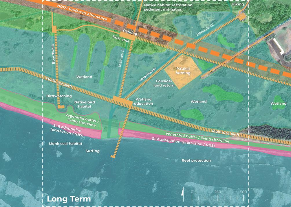
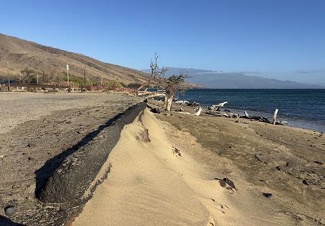
The fourth activity focused on Catalytic Site 3: Ukumehame Beach Park and Wetlands, an area that already experiences the impacts of sea-level rise. Participants were provided with large-format boards (24”x30”) featuring maps and diagrams that outlined existing conditions, challenges, and opportunities for the area.
The site was introduced through a series of analysis maps highlighting:
• Existing conditions
• Land ownership
• Topography and hydrology
• Wetlands and habitat
• 1.1’ sea-level rise exposure area
• 3.2’ sea-level rise exposure area
The project team encouraged community members to evaluate and respond to proposed design actions for both near-term (1.1’ SLR-XA, anticipated around 2045) and long-term (3.2’ SLR-XA, approximately 2075) sea-level rise scenarios. Participants were asked to vote on their top five potential programs or interventions using colored dots for the near and long-term visions. Additionally, they left input and suggestions via open-ended comments and questions to further inform the design process.
The results and feedback gathered during this activity will inform subsequent, more refined design iterations for the catalytic site.
Materials included in this section:
Engagement Event Activity Photos
Site Analysis: Opportunities and Constraints Board (Materials Provided to Participants)
Initial Draft Conceptual Design Sketches - Near and Long Term (Materials Provided to Participants)
Near Term Initial Draft Conceptual Design Sketch (In-Person & Virtual Results)
Long Term Initial Draft Conceptual Design Sketch (In-Person & Virtual Results) Summary and Analysis
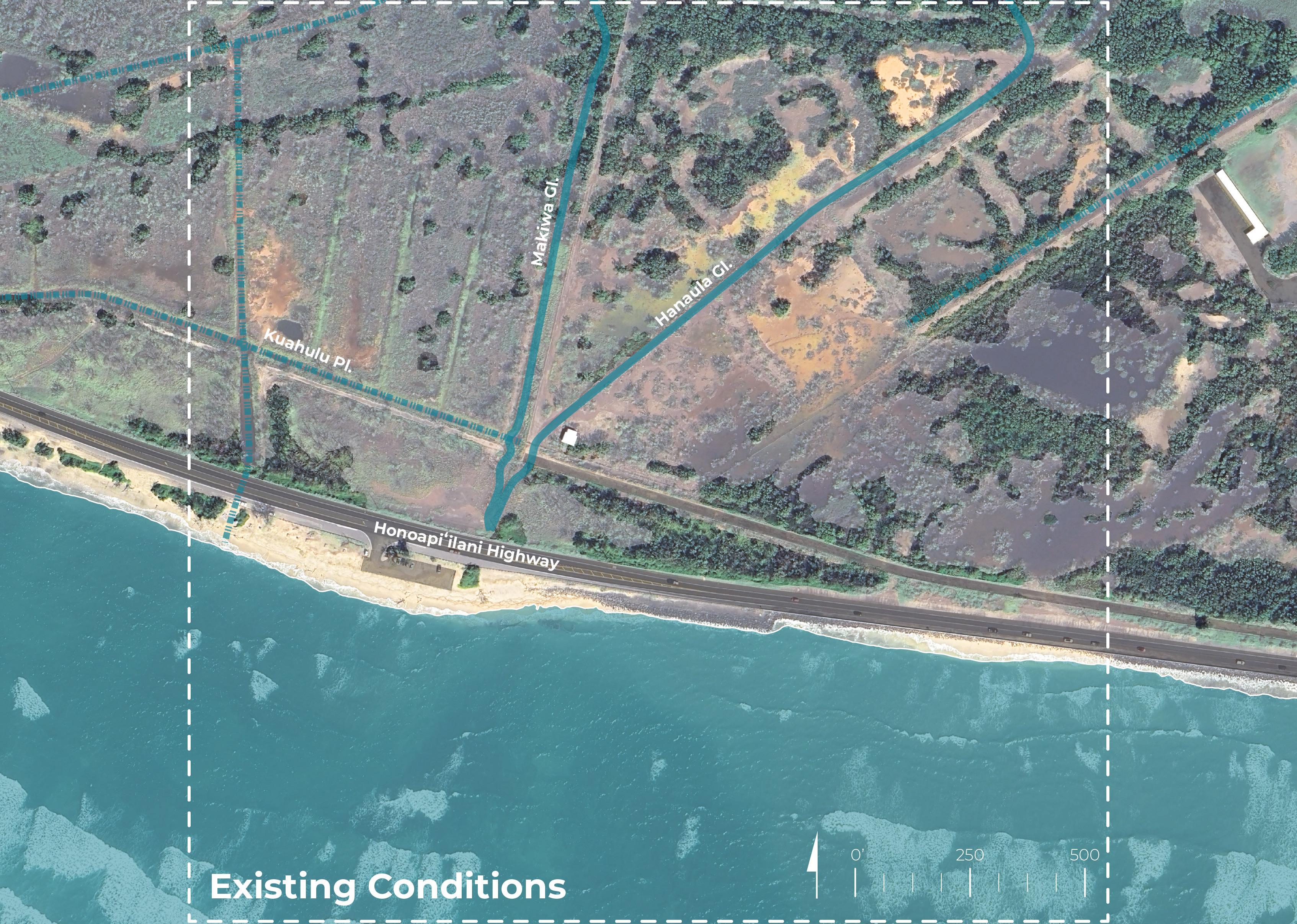
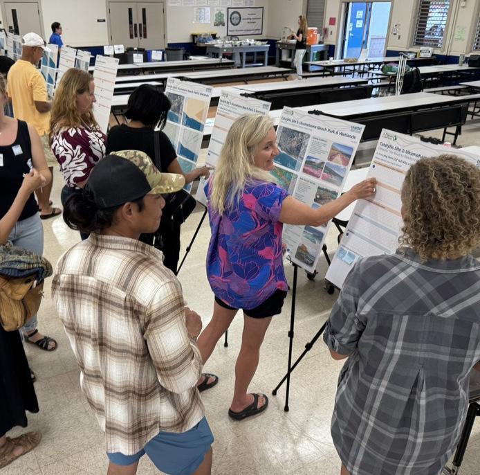
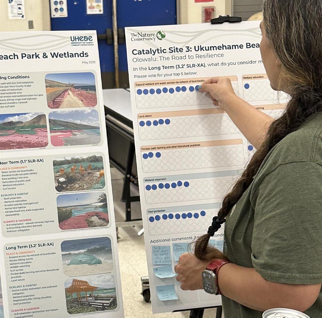
Workshop participants interacting with the Catalytic Site 3 boards (Images: UHCDC)
Materials

Site Analysis: Opportunities and Constraints
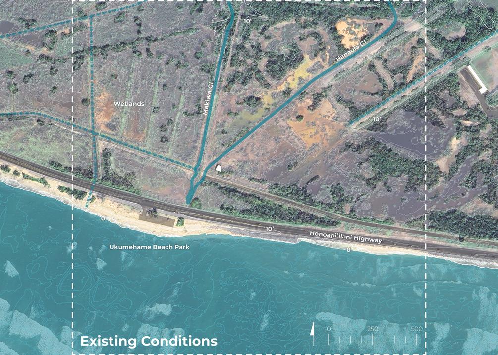


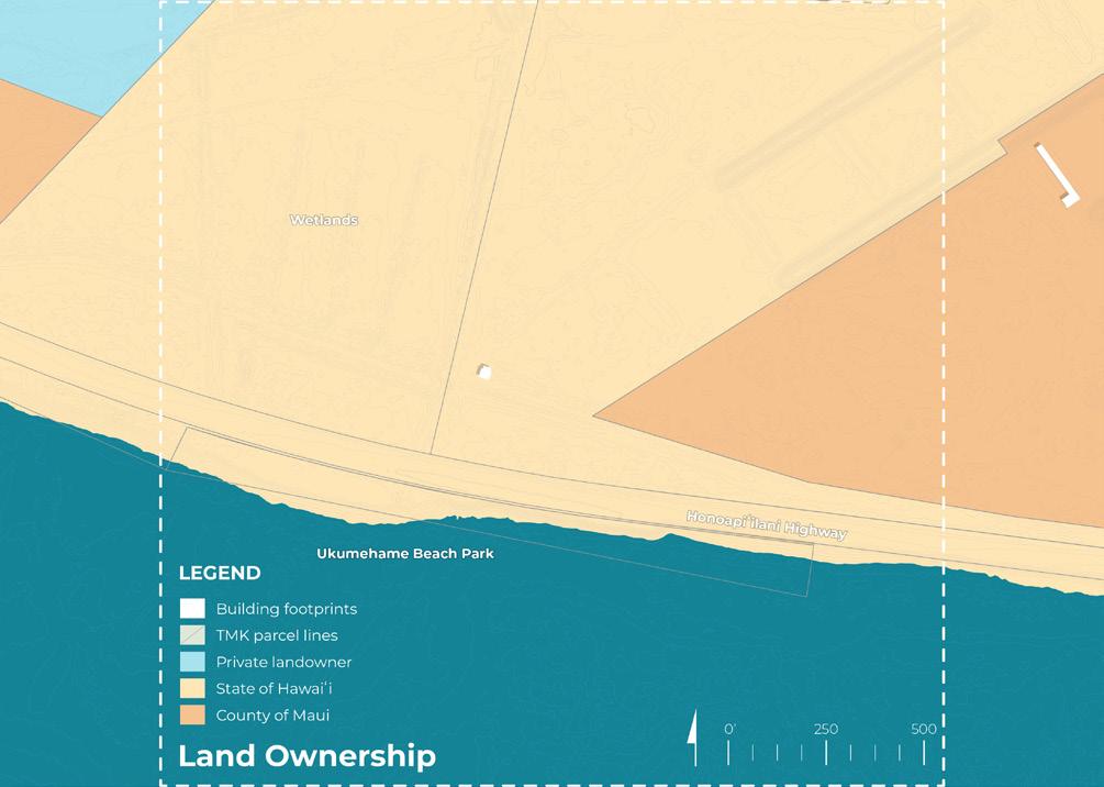
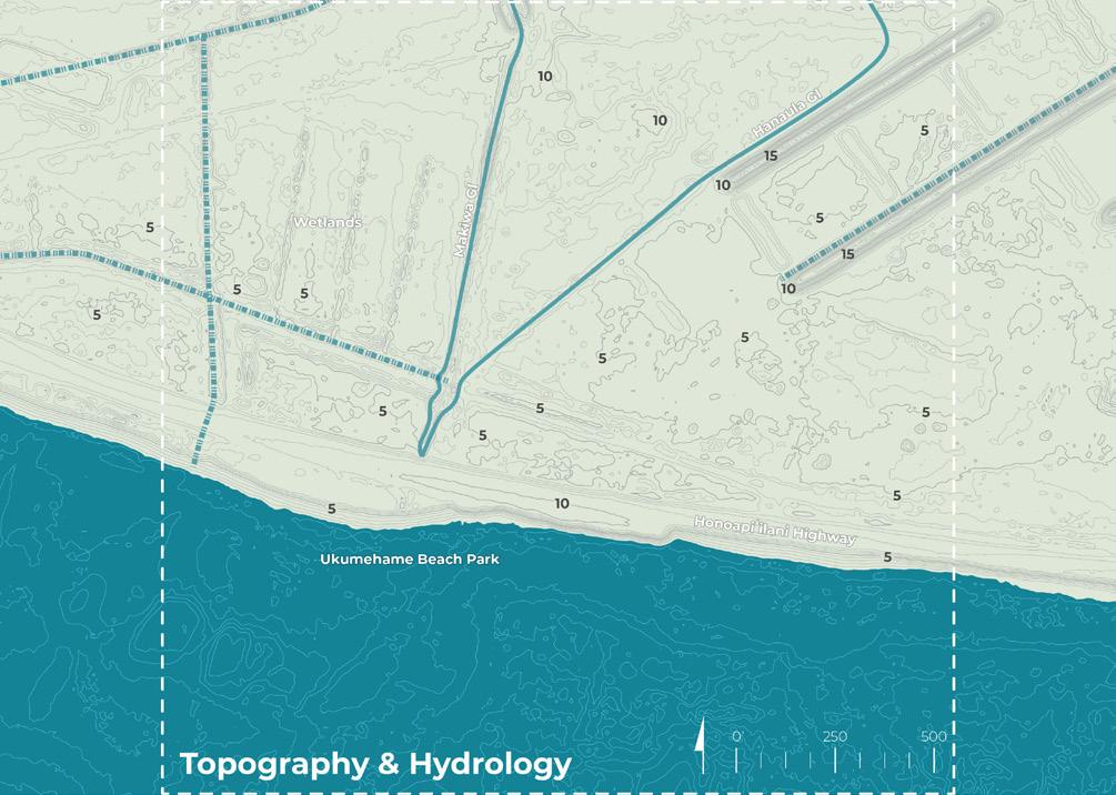

Site Analysis board (original presentation board size: 24” x 30”, reduced in scale for summary report)


• Beach park with low SLR adaptation
potential (per Maui County study)
Roadway erosion
Disturbed wetlands area
Coastal erosion and sedimentation hot spot
Pollutants (firing range and highway)
Hardened shoreline / seawall
Popular surf spot
May 2025


Near Term (1.1’ SLR-XA)
PLACE & COMMUNITY
Water access via boardwalks
Elevated multi-use path (WMG)
New parking / rest area
Relocation of public park
Wetland education
Surfing
ECOLOGY & HABITAT
Reef protection
Wetland restoration
Invasive species management
Native bird habitat
Potential Kānaka Maoli-led, state-supported stewardship
CLIMATE & HAZARDS
SLR adaptation - consider seawall, highway and parking options or retreat
• Address potential pollutants
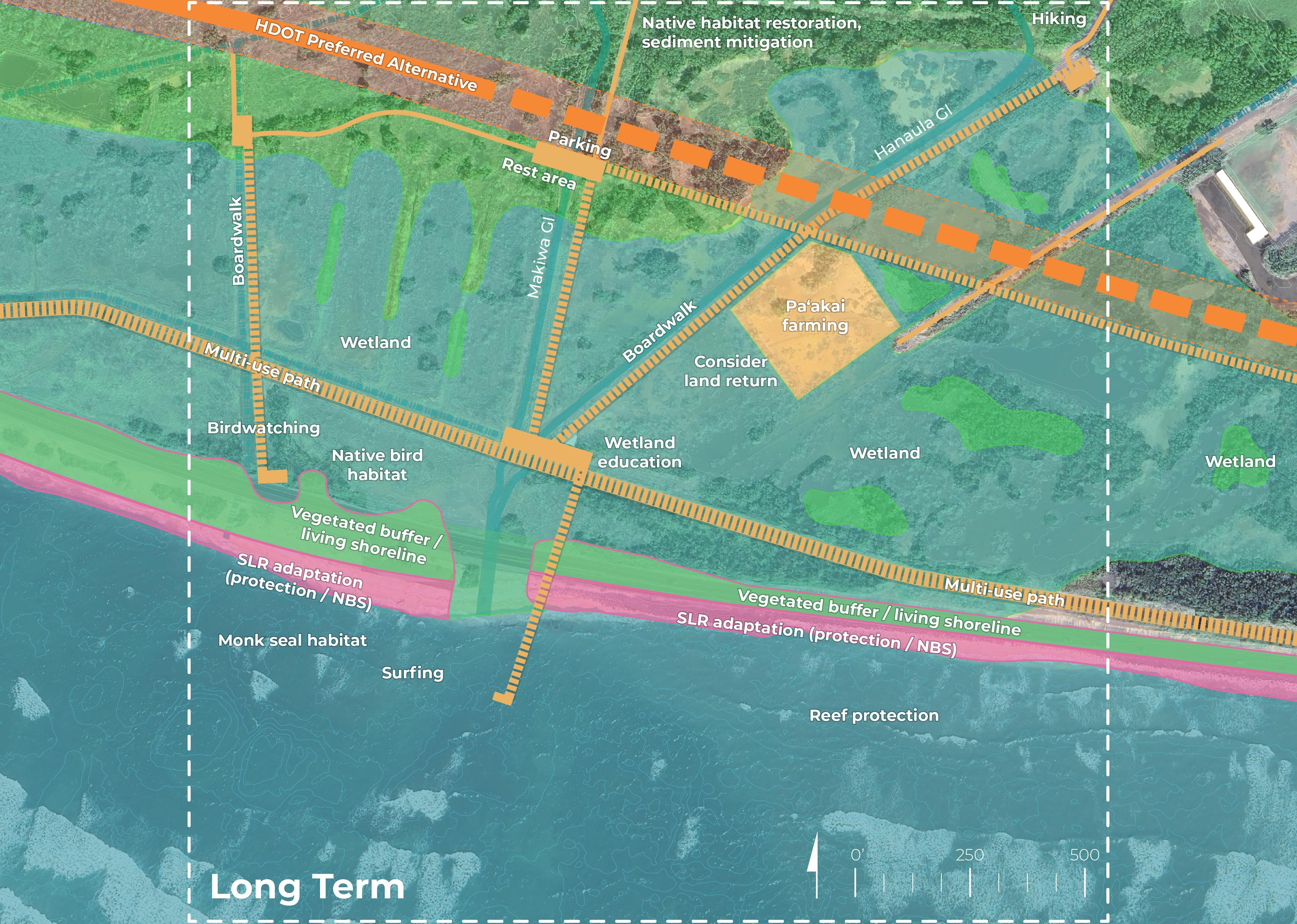
Long Term (3.2’ SLR-XA)
PLACE & COMMUNITY
Expand access via network of boardwalks
Mauka hiking access
Wetland education
Wildlife watching
Surfing
Paʻakai (salt) farming and other biocultural
practices
Consider land return
ECOLOGY & HABITAT
Native habitat restoration and sediment
mitigation
Wetland expansion
Vegetated buffer / living shoreline
Reef protection
CLIMATE & HAZARDS
SLR adaptation (protection and naturebased solutions)


CATALYTIC SITE 3
Provided Materials

In the Near Term (1.1’ SLR-XA), what do you consider most important in this location? Please vote for your top 5 below:
Additional comments (I wish... I wonder... What if...)
Near Term Dot Voting board (original presentation board size: 24” x 30”, reduced in scale for summary report)
The Road

In the Long Term (3.2’ SLR-XA), what do you consider most important in this location?
Please vote for your top 5 below:
Expand wetland and water access via network of boardwalks
education
Land return
(salt) farming and other biocultural practices
watching
Native habitat restoration and sediment mitigation
Additional comments (I wish... I wonder... What if...)
Vegetated buffer / living shoreline
Sea-level rise adaptation (protection and nature based solutions)
Term Dot Voting board (original presentation board size: 24” x 30”, reduced in scale for summary report)
In-Person Event Results (5/29/25)
The graphic below visually represents community and stakeholder feedback received during the in-person event. For transcribed post-it comments, refer to the end of this chapter.
Olowalu: The Road to Resilience
Participants were asked: In the Near Term (1.1’ SLR-XA), what do you consider most important in this location?
In the Near Term (1.1’ SLR-XA), what do you consider most important in this location?

8 3 17 2 8 10 11 8 10 10
Term Dot Voting board results (original presentation board size: 24” x 30”, reduced in scale for summary report)
The graphic below visually represents community and stakeholder feedback received during the in-person event. For transcribed post-it comments, refer to the end of this chapter.
Olowalu: The Road to
Participants were asked: In the Long Term (3.2’ SLR-XA), what do you consider most important in this location?
In the Long Term (3.2’ SLR-XA), what do you consider most important in this location?

13 5 1 1 5 7 14 7 10 12
board results (original presentation board size: 24” x 30”, reduced in scale for summary report)
Voting categories were verbatim to in-person event
Potential Kānaka Maoli community-led, state-supported stewardship
Elevated multi-use path (West Maui Greenway)
Invasive species management
SITE 3
Participants were asked to provide any additional feedback or comments Virtual Event Results (6/3/25, 6/5/25)
Love the idea of malama ʻāina efforts led by lineal descendants and supported by the state.
Will there be a beach left at all?
Is the new HWY elevated in this area? It looks like it’s projected to be in the water soon.
Bird habitat!! Love wetland birds
Who will manage all of this?
If kānaka maoli are involved in restoration and stewardship, have Lo’i and loko i’a been considered here?
40-60kt winds in this area..
Many of the comments were geared towards surfing, when I used to dive in Ukumehame, no surfers (1/2)
were around, only divers. The reef was beautiful and alive. This area used to be known for fishing and diving, not surfing. (2/2)
Fresh water for showers
Maybe a fishpond?
Ahupua’a frameworkconceptualmust revisited.
This is a popular park area and surf spot. Need adequate parking and would be good to be fairly close to shore.
Highway will be very heavily affected early on in this area.
Given how much the salt water will claim the land, we need to be realistic about what we can actually do here. (1/2)
Think about how salty the wetlands will be as the sea level rises
It’s important to think about how to retreat from the beach park first
Parking is not for camper vans
“This is one of our last remaining easy access areas, and while I applaud all your work to restore the wildlife, birds, wetlands,vegetation, etc. (1/2)
You can use the spot to get into the ocean, feelsdevelopmentbut (2/2)unrealistic
If indeed bioag then how do we address contaminationpollution/ in areas like the gun range
Do away with the firing range – get the land back!
Please keep in mind the other endangered species, the local family. (2/2)
Address mauka pollution, ways to address
Plant a coconut grove
I do not like boardwalks, have you seen the one in Ma’alaea? I can’t take my dog on it, there aren’t enough spots to access the beach,(1/2)
that means the keiki have to walk even farther to reach the tidal pools and the parking lot to access the boardwalk is ridiculously small. Not pono. (2/2)
When I used to dive in Ukumehame, no surfers were around, only divers. The reef was beautiful and alive. This area used to be known for fishing and diving, not surfing.
Loko i’a may be a good option (fishpond)
Participants were asked to provide any additional feedback or comments
Move the road, and create beach park space with showers.
Public signage that tells the public what trees or fruits etc are present
Protect the reef by minimizing runoff and pollution from cars
Has an EIS been conducted? It would be helpful to locate sensitive sites prior to creating a site plan
I’d love to see wildfire mitigation and management built into the planning process (1/2)
The surf break may be very different in 50 years - will attempts be made to raise the reef?
The network of educational boardwalks over future salt marshes is great. (1/2)
Make the entire area an ecological priority zone please. With surf access. (2/2)
houseless(includingfire risks and native ecosystem management) (2/2)
Remove the invasive Kiawe and plant coconut groves.
Wetland restoration and formal protections for this area
Greenspace for people to enjoy and experience
It’s not only surfers that use this area, think of the others too. Fisherman, divers, families. (1/2)
Including ahupuaʻa restoration will be important if land back is an option.
Create more beaches everyonewhere can easily please.access (2/2)
There will be limited access from the new road. How will that be addressed?
Ensure it does not become Maui’s next homeless camp...
There are a lot of permitted lots in this area.
Consultation with kānaka maoli is important to understand best practices for this area. (1/2)
There may be other priorities that are not listed. (2/2)
Get a handle on the over-fishing in this area.
Beach parking is too far, would be difficult for people with mobility issues
Was this where an old fishpond existed?
There’s no mention of ‘iwi... so much of this is likely burial grounds
The theextendingpierinto surf break doesn’tfeasibleseem
Trash / refuse
Addressing Kiawe trees and as mentioned, the homeless/ dump issue.
This location provides an opportunity to promote biodiversity. (1/2)
Return it to “nature” and have humans touch the ground lightly/hover above habitat. (2/2)
Remember that the wetlands have a job.
Active management of the land is needed and people need to have kuleana to the land (1/2)
Addressing Kiawe trees and as mentioned, the homeless/ dump issue.
and taking care of it if they want to use it. not only as tax payers but as stewards of the place. (2/2)
“Whale watching” here sounds like a tourist trap?
Will sand come back? Put it back how it was.
Protect snorkeler access and other non-consumptive uses
Near-Term Design Synthesis (5/29/25 , 6/3/25 , 6/5/25
Elevated multi-use path (West Maui Greenway)
Wetland restoration and native habitat creation
Reef protection
SLR adaptation - consider seawall, highway and parking options or retreat
Potential Kānaka Maoli community-led, state-supported stewardship
Invasive species management
Water and surf access via boardwalks
Address potential pollutants
Wetland education
New parking/rest area

Listed in a Non-Ranked Order
• Access and Beach Amenities
Support for low-impact infrastructure such as bathrooms, showers, and surf access improvements; emphasis on introducing shoreline parking for families, and limiting vehicle (e.g., camper vans) access on beaches
• Cultural Leadership and Traditional Practices
Strong backing for Kānaka Maoli and lineal descendant leadership; interest in restoring traditional land systems like lo‘i, loko i‘a, and ahupuaʻa-based planning
• Ecological Protection and Habitat Restoration
High value placed on protecting wetlands, bird habitats, and restoring native vegetation; priority to remove invasive species and encourage shade-providing native trees
• Water Quality and Pollution Management
Concern about runoff, sediment, and contamination; emphasis on a watershed-based approach to promote reef health and pollution control
• Climate and Hazard Resilience
Recognition that existing infrastructure is unsustainable due to erosion and sea-level rise; calls for retreat planning and consideration of alternative inland routes (e.g., cane haul road)
Long-Term Design Synthesis (5/29/25 , 6/3/25 , 6/5/25 Combined Activity
Native habitat restoration and sediment mitigation
Expand wetland and water access via network of board
Reef protection
Sea-level rise adaptation (protection and NBS)
Vegetated buffer / living shoreline
Paʻakai (salt) farming and other biocultural practices
Consider land return
Wetland expansion
Wildlife watching
Wetland education
• Access and Low-Impact Infrastructure
Support for shoreline and beach improvements: inclusive but managed coastal access, off-beach amenities like bathrooms, showers, shaded areas, and educational signage; strong opposition to beach parking to prevent erosion and pollution
• Ecological Restoration and Native Planting
Calls to begin native planting immediately (e.g., milo, ʻulu, hala, coconut); support for restoring and protecting wetlands, reefs, and bird habitats
• Cultural Stewardship and Traditional Systems
Strong support for Kānaka Maoli leadership, protecting iwi and historic sites, and restoring ahupuaʻa systems that promote stewardship and cultural connection
• Climate Adaptation and Resilience
Broad agreement to move roads inland and avoid shoreline hardening; preference for nature-based solutions that plan for salt marshes, sea-level rise, and fire risks
• Long-Term Management and Public Engagement
Need for active stewardship to address trash, wildfire, houselessness, and overfishing; support for public and visitor education, interpretive signage, and linking access with kuleana (responsibility)
Per Project Goal (Near and Long Term)
The bullet points below represent a high-level summary of workshop participants’ overall priorities organized by project goal.
• Low-impact amenities (e.g., bathrooms, showers, shade, and educational signage)
• Access should serve all users (e.g., surfers, families, divers) while avoiding beach parking and campervan use
• Inclusive, managed public access with minimal environmental footprint
• Incorporate Native Hawaiian leadership, especially lineal descendants, in future planning and land stewardship
• Restore loʻi, loko i‘a, and ahupuaʻa systems, reinforcing kuleana and cultural connection
• Public engagement through education, signage, and stewardship
• Restore native habitats with immediate planting of species like milo, ʻulu, and hala
• Protect wetlands, reef systems, and bird habitats
• Remove invasive species including kiawe and rodents
• Create an ecological zone with elevated walkways and minimal disturbance
• Intertwine ecosystem protection with cultural practices and public education
• Roads inland and avoid shoreline hardening
• Address erosion, sea-level rise, saltwater intrusion, and fire risk
• Prioritize nature-based solutions
• Manage runoff, watershed pollution, and legacy contamination
• Explore alternative routes for future access (e.g., cane haul road)
• Long-term land management to address trash, overfishing, and houselessness
67 total votes

87 total votes

37 total votes

In their voting, participants prioritized the ecology & habitat design goal, followed by place & community as a secondary priority.
Participant voting on design goals emphasized ecology & habitat design goal followed by place & community. 2045 2075
60 total votes

87 total votes

22 total votes

Overall Event Synthesis
Percentages based on both dot voting and written comments

Participant responses suggested that the overall project area design interventions should expand on the place & community project goal.
Participant responses suggested that the focus of the Olowalu Town catalytic site should prioritize enhancing placemaking and community services

Participant responses suggested that the focus of the Mile Marker 14 catalytic site should prioritize both ecology & habitat and place & community.
Participant responses suggested that the focus of the Ukumehame catalytic site should prioritize the ecology & habitat project goal
All Overall Project Area Written Comments Transcribed and Combined
Comment Date
Difficult access currently 05/29
Beach Park 05/29
Coastal trail!!! 05/29
Bike path away from houses 05/29
Control parking on beaches 05/29
Ukumehame beach park - want better access to the beach and parking 05/29
Currently no access to olowalu stream - park at the landing and walk along the coastline 05/29
Hekili point as Cape Hekili, or Ka Lae Hekili 05/29
Showers and other restroom facilities at beach parks (Ukumehame) 05/29
Limit parking 05/29
Windbreaks needed in ukumehame - port a potties blow over 05/29
Shade trees! along coastline and bike path 05/29
I like the idea of a stream side pathway for everyone to be able to walk on that would show ahupua‘a connectivity 05/29
The traditional name of Ukumehame Beach Park is Pāko‘a 05/29
Parking far away and having to walk will not work for local people. We take the strollers, tents, coolers, grill, baby bags, boogie boards, swim rings, clothes, etc. Beach day is an outing, we are not tourists who bring a towel and some sunscreen. This is just not practical to lug all that gear and your keiki that far.
Maybe a round-about with drop off for your gear and 'ohana, then one person go back and park the car. How can Grandma walk that far to get to the ocean lugging her own chair? Naska (Kanahā) might be a good example, but it also has an extremely large homeless population.
06/03
Concerns regarding this area turning into homeless encampments. The former road area of "cut mountain" is a prime example if this.
Will there be more than one access way in and out of the area? For example, the multi modal connections in the event of emergency?"
If the road is removed by the firing range there won’t be access to the firing range. Also, what about handicapped access to the beaches?
I also take issue with "non-consumptive areas"; we already have preserves for that in Makena and Kapalua. We fish and dive not to sell, but to provide for our 'ohana the way our parents and grandparents did. There is no better gift to give a kupuna than a fish you caught yourself.
06/03
06/03
06/03
06/03
06/03
Maintaining shoreline access is a priority 06/03
Re-instate lo‘i along stream 05/29
Reforest along stream and make educational pathway 05/29
Mopua - underwater river? 05/29
Fishpond restoration 05/29
Spear fish 05/29
Kailiili - if there's no rain there's no stream 05/29
Mopua - ditch in the area floods and needs to be dredged 05/29
Me and my family believe that if we are to save the coral reef, “We have to control use of the beach because it is at capacity.” 05/29
Yay for restoring riparian corridors. 06/03
What do I like? The preservation of our land. Have you seen the 8 mile ocean front path on Kaua'i? It traversed the coast, with picnic tables and some access to reach the water. It is beautiful and could be a good model for Maui 06/03
Yes, wetlands please! 06/03
Will stream water levels be addressed for restoration? Eg is the stream diverted and does the area get recharge? 06/03
Chop shops and cess pools near mile marker 14 lead to fires 05/29
Current land clearing is being done by the county around mile marker 14 05/29
Control use of beaches - overfishing is a concern 05/29
Grandmas has a brown water problem 05/29
Kalo along stream 05/29
OSDS systems in the SLR-XA seems very important! 06/03
Are there other options besides roadway removal in the high impact areas? 06/03
If overfishing is a concern, then we need to stop blocking off access points with boulders along the pali and along Olowalu.
06/03
Are SLR levels based on high tides or averages sea level 06/03
What is the timeline for these activities in relationship to highway realignment? 06/03
Dealing with the cesspools is so important to keep the water clean as sea level rises 06/05
I think it all looks really great. What I am wondering is if there is any way to add in sustainable water treatment plants that require wetlands for processing. It could be a sustainable add?
06/05
All Overall Project Area Written Comments Transcribed and Combined
Comment Date
Camping at Olowalu Dumps * 05/29
More camping (Camp Olowalu) 05/29
Beach park / camp at Olowalu 05/29
Tourism ignorance - education 05/29
Service projects and service learning (volunteer) 05/29
Facilities near Ukumehame 05/29
Local business - Maui Surfer Girls teaches surfing at Ukumehame 05/29
Bike path by residential houses should follow closer to the road, give private residences more space all the way to Olowalu town 05/29
More shade along coastline 05/29
Preserve camping near camp olowalu 05/29
Not a fan of parking lots, but will there be any on the Makai side of the new HWY to keep people from parking on the shoulder and crossing the HWY? 06/03
Will there be fresh water showers for beach users? 06/03
How are Kuleana lands impacted ? 06/03
Can mauka to makai access can be under the new HWY instead of an at-grade crossing? 06/03
Who will be responsible for the restoration components? How can community and malama ‘āina orgs be involved and have the resources to do the work? Can this be considered (even in proof of concept)? 06/03
Definitely need access, cut mountain is important but access without having to deal with homeless encampments would be ideal. This is historically a very popular fishing ground for locals. 06/03
How will people access beaches? With equipment, for example, surf boards, was, etc 06/03
Consider creative ways to allow drop off for beach access concerns 06/03
Comment
Date
Will the main bike/pedestrian path be accessible/ drivable for emergency access, maintenance, evacuation? 06/05
Mauka seabird habitat - Eliminate invasive animals and plants 05/29
Protection of coastal habitat for nesting birds 05/29
Love the idea of agroforestry and other biocultural practices.
Who owns the fishpond land, same as wetlands area?
Learning from past biocultural practices to inform the future is fantastic!
Has the reef been modeled with projected sea level rise - will it grow to keep up or will it no longer shield the shore?
06/03
06/03
06/03
06/03
Currently there is zero enforcement of junk cars, oil and chemical barrels off Ehehene Street. Last count over 150 cars. 05/29
Wind breaks
05/29
If the highway is moved, what prevents the area from becoming a hazmat zone of trash and cars? 05/29
Windbreaks
Concerns with Overnight camper vans "squatting" in this area
05/29
06/03
This raises the question who will be responsible for the actual roadway demolition and removal. For the state/county to decide? 06/03
Overfishing concerns and community trashing this area (Think covid times). 06/03
Need adequate trash collection areas. Strong offshore winds blow this from shore 06/03
The disposal site is supposed to have been emptied and closed by this time? 06/05
* Olowalu Dumps refers to beach near Cut Mountain
All Catalytic Site 1 Written Comments Transcribed and Combined
Comment Date
Convert private lands to public ownership 05/29
Plant more monkeypods! Love that part of the road. 06/03
Fresh water showers for beach users 06/03
Bike path! 06/03
Love the historic aspect of incorporating old cane equipment. This era of Hawaii's history brought a lot of our local population to Hawaii 06/03
I wish we could walk from Hekili Point to Awakea Beach 06/03
Better public shoreline access! 06/03
Good place for a Resilience Hub 06/03
Eliminate invasive plants and animals 05/29
Education of beach users on malama ‘āina. 06/03
Sugar mill was the reason for decline of Olowalu, please be careful with "remnant reuse or resolution" 05/29
Would love to see the ruins cleaned up! 06/03 CATALYTIC SITE 1
Comment Date
If Camp Olowalu goes underwater where can we relocate camp - we need a camp ground for community 05/29
Shoreline path along coast 05/29
Please improve landing for another boat access ramp 05/29
Shoreline bike path 05/29
Public bathrooms (incinerators) 05/29
Preserving culture; the petroglyph areas 05/29
Multi use and greenway paths are key 05/29
Public bathrooms 05/29
I like multi-use pathway. Just make sure kūpuna, keiki and practitioners can access 05/29
Preserving the sweetness of the town 05/29
Camp grounds near Olowalu dumps 05/29
Parking areas including local reserved spots (ID required) 05/29
Is that the proposed route for connection to highway road 05/29
More showers 05/29
Mauka business should remain (Olowalu store) makai houses should retreat 05/29
Love the pier! 06/03
My parents got married at Olowalu Plantation 50 years ago. Special spot. 06/03
Access to the ocean and including the Greenway or multi modal access will be complimentary. Including nature based solutions with a Greenway could help accomplish many goals 06/03
Incorporate the sugar mill ruins please? 06/03
Comment Date
I love the idea of a walking path along the stream and restoration bringing about more ahupua'a connection 06/03
Include public/private partnerships for long term restoration, agroforestry, integrating native Hawaiian orgs and practices 06/03
Concerns with ocean users accessing reef from shoreline - walking/standing on reef. Overfishing. Speer fishers have removed so much fish from reef 06/03
Who’s responsible for maintaining the restoration areas long term? Is it TNC? Community? Government? 06/03
Outreach to landowners in the affected area? 06/05
Make sure public has access and that residents are prioritized 06/05
Safety; always traffic accidents in this area 05/29
Safety and thoughts of residents who have had privacy in this area 05/29
Grey water capture for sinks 05/29
It seems too far into the future. Can we work on the near term? 06/03
Needs long term funding for continued management and maintenance 06/03
Is there planning for managed retreat? 06/03
Traffic concerns. and "smart" merges to avoid road rage (think Bypass going from Lahaina towards the Pali) cars driving along the shoulder to go around cars merging. No policing in this area 06/03
Wastewater and power infrastructure 06/03
I wish we could act short term, but do a better job thinking long term. It’s nice to have parks and commercial zones, but if we destroy ‘āina and the planet, a park won’t have much use.
06/03
All Catalytic Site 2 Written Comments Transcribed and Combined
Comment Date
Public bathrooms 05/29
Maintaining any part of Olowalu for public not homeless / fire prone 05/29
Make a turn down closer to Pali to Olowalu 05/29
What happens when burials are found? 05/29
Preserving cultural significant areas 05/29
Clear houseless population 05/29
Coastal trail and access with interpretive signage 05/29
Mile marker 14 was our favorite camping area before anyone knew about it. No place else. 05/29
The boardwalks over the wetland would be so fun! Great way of accessing the new beach park. 06/03
Is there any consideration of the permitted housing in your plans? 06/03
Shade! 06/03
Sugar museum 06/03
Keeping access through the area with multi modal will help with emergency access, and it should include opportunities for native plantings, agroforestry or bioswales, etc. 06/03
Can do some loading zones for cars with keiki closer to shore, then actual parking lot further from shore 06/03
Homeless 06/03
Love the boardwalk concept 06/03
Would there be bathrooms, maybe in the parking area by the new highway? 06/03
Clean up the cars and illegal dumping all through that area 06/03
A sugar mill museum and wetland education center would be cool. 06/03
Comment
Date
The parking is just too far away, esp for local families with lots of keiki, beach toys, lunch, etc. Need to find something more accessible for this area. 06/03
Parking far away enough to prevent long term camping and homeless 06/03
Creative drop offs for beach and aquatic access 06/03
How would the formal creation of a beach park work? Is Maui County open to the idea?
What is means for private to public land conversion? Open space fund, legacy lands, eminent domain?
We need to address the homeless issues so locals will feel safe to take their children back to Cut-Mountain and other spots to fish or dive.
I take issue with the comments about overfishing; people go here because it's easy access and beach friendly for the keiki.
06/05
06/05
06/03
06/03
When it rains, the water browns bad, therefore re-forestry is important to save the reef! 05/29
Preserving the wetlands to cool and recharge the aquifer 05/29
Don’t remove all trees (fish and people need shade) 05/29
Invasive plant removal and control 05/29
Invasive plant and animal eradication 05/29
Rid kiawe trees on coast and replace with kukui, kou, and milo 05/29
Make it the way it was before. Before highway was raised. 05/29
Restoring dry land foresting for fire buffer and mitigation 05/29
Try to protect the reef and ocean from the runoff 05/29
Reforest the dry land plants is better than invasive brown grass anyday 05/29
Water bird habitat 05/29
Seabird breeding habitat 05/29
Invasive ungulate and rodent control 05/29
I feel reef restoration should be prioritized after the land based activities have concluded. 06/03
We need plant some native species! And shade in some way 06/03
More trees! 06/03
I wish for what ever changes are made that they are made with aloha ‘āina in mind. If we do that kuleana first, anything else is nice, but our first priority should be malama ‘āina.
06/03
While wetlands have potential here - maintaining wetlands requires so much maintenance? Who would do that? 06/03
Shoreline stabilization (natural, no walls) 05/29
Keeping area clean and taken care of, as opposed to homeless camps 05/29
What is the least impactful, does the whole area need to move road inland? 05/29
Consistency, so trash and cars don't get abandoned here 05/29
What is the impact on road moving inward, what cultural sites will be lost 05/29
Cut down the trees, they are part of the erosion problem. 05/29
Stop cars from driving right up on the sand... Provide adequate parking. And find ways to keep cars from staying there for days/weeks on end 06/03
Trash/ refuse is important 06/03
We need that road as emergency access, or another solution 06/03
All Catalytic Site 2 Written Comments Transcribed and Combined
Comment Date
Get rid of old road, back to how it was before 05/29
Public bathrooms 05/29
Lo‘i needs to be designed with either descendants and/ a native Hawaiian organization. It could be an educational opportunity as well 06/03
People living and working together with the land 06/03
Fresh water showers for beach users 06/03
I think access from the HDOT preferred alternative needs to be better studied. 06/03
More fruit trees, canoe plants 06/03
Will there be farm stands? 06/03
Legit camping area? 06/03
Respectfully, it seems too far future! 06/03
Public camping 06/03
Comfort stations using natural materials 06/03
Greenway could also facilitate restoration and stewardship activities, providing access for people to get to locations 06/03
Want to see this benefit the public and day users. Do not want to see it become Maui’s next homeless camp. 06/03
Coconut grove! 06/03
Monkeypods along the new highway 06/03
And more opportunities for lo’i! Buy and ulu too 06/03
No commercial ventures, kayaks take up all the space 06/03
Invasive plant and animal eradication 05/29
Waterbird and seabird habitat 05/29
Community engagement with wildlife and reef management 05/29
Comment
Date
Don’t need too much development. I like open spaces that people can connect to nature. 06/03
Buy was niu (coconut)* 06/03
Great to see attention to native plants 06/03
Native vegetation 06/03
Great idea to have lo’i kalo near the intermittent stream. Can we find room for more? 06/03
What about Uala, instead of lo’i kalo? 06/03
Reevaluate the old stream way of Olowalu Stream 06/03
Love the proposal of lo’i kalo between the stream and wetland. Can we have more? 06/05
What is the effect of reduced rainfall in the uplands and impact on groundwater and wetlands? 06/05
Lo'i needs wai 06/05
Is planning for wildfire outside of the scope of this? 06/03
* “By was niu” (coconut) comment maybe is supposed to be “before was niu”
CATALYTIC SITE 3 All Catalytic Site 3 Written Comments Transcribed and Combined
Comment Date
Public bathrooms (low impact) 05/29
Can we use the cane haul road? 05/29
Can we modify the road in the near term 05/29
Can we plant things now 05/29
No WMG - it's too hot and there are no proposed trees for shade 05/29
SSFM is contracted to do EIS for WMG. 15.1 million grant has not been tapped 05/29
Restrict vehicle access to beaches and shoreline. Prohibit it. 05/29
Replace Kānaka Maoli Stewardship with lineal descendants 05/29
Boardwalk for surf access would be great if protecting nature is the goal. 05/29
What is the Kānaka Maoli were gathered to be more engaged and opinions heard? 05/29
Can we have facilities? Bathrooms? 05/29
What to do with parking? 05/29
Pākoa (or Pāko‘a) is the place name of Ukumehame Beach Park 05/29
Do away with the firing range – get the land back! 05/29
Love the idea of malama ‘āina efforts led by lineal descendants and supported by the state. 06/03
Maybe a fishpond? 06/03
Who will manage all of this? 06/03
Given how much the salt water will claim the land, we need to be realistic about what we can actually do here. You can use the spot to get into the ocean, but development feels unrealistic
06/03
Ahupua’a conceptual framework must revisited. 06/03
Again, homeless issues
Fresh water for showers
06/03
06/03
Comment
If kānaka maoli are involved in restoration and stewardship, have Lo‘i and loko i'a been considered here?
This is a popular park area and surf spot. Need adequate parking and would be good to be fairly close to shore.
Loko i'a may be a good option (fishpond)
Parking is not for campervans
Many of the comments were geared towards surfing, when I used to dive in Ukumehame, no surfers were around, only divers. The reef was beautiful and alive. This area used to be known for fishing and diving, not surfing.
I do not like boardwalks, have you seen the one in Ma'alaea? I can't take my dog on it, there aren't enough spots to access the beach, that means the keiki have to walk even farther to reach the tidal pools and the parking lot to access the boardwalk is ridiculously small. Not pono.
When I used to dive in Ukumehame, no surfers were around, only divers. The reef was beautiful and alive. This area used to be known for fishing and diving, not surfing.
Boardwalks!
Date
06/03
06/03
06/03
06/03
06/03
06/03
06/03
06/05
Provide for wetland birds and habitats 05/29
Eradicate invasive plants and animals 05/29
Bird habitat!! Love wetland birds 06/03
40-60kt winds in this area.. 06/03
Think about how salty the wetlands will be as the sea level rises 06/03
Saltmarshes 06/03
Plant a coconut grove 06/03
This is one of our last remaining easy access areas, and while I applaud all your work to restore the wildlife, birds, vegetation, wetlands, etc. Please keep in mind the other endangered species, the local families 06/03
Already a safety issue? 05/29
We need to protect road now 05/29
Can have hardening to protect road 05/29
T-groin? 05/29
Worry about all that is leaching into reef now (sediment) 05/29
Is the new HWY elevated in this area? It looks like it's projected to be in the water soon. 06/03
Highway will be very heavily affected early on in this area. 06/03
Will there be a beach left at all? 06/03
If indeed bioag then how do we address pollution/contamination in areas like the gun range 06/03
It’s important to think about how to retreat from the beach park first 06/03
Address mauka pollution, ways to address 06/03
All Catalytic Site 3 Written Comments Transcribed and Combined
Comment Date
Surfers will have to schlep their gear quite a ways 05/29
Maui Surfer Girls - CORA permit? When inundated 05/29
Will my 25 year business be able to survive these changes - how can we steward this area? 05/29
Boardwalk in ocean makes no sense 05/29
Need shade and access 05/29
"Land return" is a strange phrase here 05/29
No parking on beach because of erosion 05/29
Restricted vehicle use on beach / shoreline. 05/29
Public bathrooms at parking lot 05/29
Beach parking is too far, would be difficult for people with mobility issues. 05/29
The pier extending into the surf break doesn’t seem feasible 06/03
The surf break may be very different in 50 years - will attempts be made to raise the reef? 06/03
Move the road, and create beach park space with showers. 06/03
Consultation with kānaka maoli is important to understand best practices for this area. There may be other priorities that are not listed. 06/03
Ensure it does not become Maui’s next homeless camp... 06/03
Was this where an old fishpond existed? 06/03
Protect snorkeler access and other nonconsumptive uses 06/03
Public signage that tells the public what trees or fruits etc are present 06/03
Greenspace for people to enjoy and experience 06/03
The network of educational boardwalks over future salt marshes is great. Make the entire area an ecological priority zone please. With surf access. 06/03
Comment
Date
There are a lot of permitted lots in this area. 06/03
"Whale watching" here sounds like a tourist trap? 06/03
There's no mention of 'iwi... So much of this is likely burial grounds 06/03
It’s not only surfers that use this area, think of the others too. Fisherman, divers, families. Create more beaches where everyone can easily access please. 06/03
Active management of the land is needed and people need to have kuleana to the land and taking care of it if they want to use it. Not only as tax payers but as stewards of the place.
06/03
There will be limited access from the new road. How will that be addressed? 06/03
Get a handle on the over-fishing in this area. 06/03
Including ahupuaa restoration will be important if land back is an option. 06/03
Eradicate invasive plants and animals 05/29
Ohia forest 05/29
Milo instead of kiawe 05/29
Plant ulu and hala at the coast 05/29
Can we plant now? Milo? 05/29
Elevated viaduct and waterbird habitat can be compatible 05/29
Remember that the wetlands have a job. 05/29
Will sand come back? Put it back how it was. 05/29
Remove the invasive kiawe and plant coconut groves.
06/03
Wetland restoration and formal protections for this area 06/03
Protect the reef by minimizing runoff and pollution from cars 06/03
Has an EIS been conducted? It would be helpful to locate sensitive sites prior to creating a site plan 06/03
I’d love to see wildfire mitigation and management built into the planning process (including houseless fire risks and native ecosystem management)
This location provides an opportunity to promote biodiversity. Return it to “nature” and have humans touch the ground lightly/hover above habitat.
Return the place to nature
06/03
06/03
06/05
If the road starts to go, what should we do? 05/29
If existing roadway fails, move inland - no hardening shoreline. 05/29
Can we elevate? Connect? 05/29
The least impactful solution for the long term 05/29
We need to protect it for now 05/29
Trash / refuse 06/03
Addressing kiawe trees and as mentioned, the homeless/dump issue. 06/03