University of Hawai‘i at Manoa School of Architecture
ARCH 743 Architecture Studio IV – Urban Design [6 cr]
Instructor: Judith Stilgenbauer, Professor
Spring 2023, Mon & Wed 1:30 – 6:00 pm
Class Booklet


University of Hawai‘i at Manoa School of Architecture
ARCH 743 Architecture Studio IV – Urban Design [6 cr]
Instructor: Judith Stilgenbauer, Professor
Spring 2023, Mon & Wed 1:30 – 6:00 pm
Class Booklet

2410 Campus Road Room 212
Honolulu, HI 96822
http://uhcdc.manoa.hawaii.edu
http://www.arch.hawaii.edu

Course Instructor & UHCDC Principal Investigator: Judith Stilgenbauer, Professor
Spring 2023 ARCH 743-002 and ARCH 743-302 Students:
Doctor of Architecture Candidates - Jannah Dela Cruz, Tyler Dinnocenti, Riza Lara, Hana Matsunaga, Beau Nakamori, Joshua Ramos, Maleah Reynolds, Melissa Yoo
Master of Architecture Candidates - Nicole Gdula, Janice Sonson, Hannah Valencia
Master of Landscape Architecture Candidates - Kiana Dai, German Failano, Alzira Fernandes, Lynn Mayekawa, Christina McWhorter
Instructor: Judith Stilgenbauer
Our spring 2023 University of Hawai‘i at Manoa School of Architecture graduate-level urban design studio developed research- and analysis-based bold, forward-looking visions and innovative ecological design proposals that explored the role of landscape as infrastructure and driver of resilient urban form in the Waikīkī Special District.

Five graduate student teams, comprised of Master of Landscape Architecture, Master of Architecture, and Doctor of Architecture candidates, have developed speculative urban design frameworks and concepts for future mixed-use that embrace open-ended, indeterminant, and dynamic environmental conditions, such as coastal flooding, rather than preventing them—all while promoting ecologically performative and culturally-appropriate “soft” adaptation solutions and learning from traditional native Hawaiian biocultural land-water practices.
The conceptual, multidisciplinary student work developed in this design studio intends to stimulate discourse and contribute to a long-term vision for a resilient and adaptive Waikīkī that merges the seemingly conflicting goals of economic development, climate and sea level rise adaptation, ecological performance, social and environmental justice, and urban placemaking into mutually beneficial, sustainable relationships.
Course Catalog Description
Urban design focused on Asia-Pacific cities investigating ecological, hydrological, social, cultural, political, and technological factors; study of historical precedents, block and/or open space typology, circulation, infrastructure, and context response. ARCH and LAND majors only. A-F only. Prerequisites: 733 and 742, or 761.
Course Format
ARCH 743 meets twice a week, in SOA Room 312 on Mondays and Wednesdays from 1:30 until 6:00 pm. Due to the ongoing COVID-19 pandemic, some ARCH 743 class meetings might be conducted online via Zoom during this semester. Individual or group critiques, pin ups, student presentations, and individual work time comprise the majority of studio sessions. Occasional lectures, guest presentations, workshops, field trips, in-class exercises, discussions, and readings supplement these course activities. Review of student work occurs throughout the semester. Each main studio phase concludes in a presentation, with a clear emphasis on the mid-term review and final review.
Goals and Objectives
Ignis am, inctur autem ius. Hentionseque con pore dolorep elecerferuv
UHCDC Studio Context
Ignis am, inctur autem ius. Hentionseque con pore dolorep elecerferuv
This graduate-level, interdisciplinary urban design studio—through initial research, precedent studies, a sequence of analytical and mapping exercises, and conceptual, speculative design phases—explores urban scales, systems, and the role of landscape as infrastructure and driver of resilient urban form across a variety of spatial and temporal scales. The course stresses the importance of site analysis and locale-appropriate ecological urban concepts and sustainable design strategies. Focused on nature-based solutions, the course explores how to apply climate- and seal level rise-adaptation design principles to ecologically and socially resilient urban-scale built environment interventions and mixed-use development in Hawaiʻi. The goal is to understand and apply contemporary concepts of ecological urbanism, adaptation to climate change and sea level rise (SLR), water-sensitive low-impact development (LID), large-scale nature-based blue-green infrastructure, local food and resource systems, carbon neutrality, energy efficiency, social and environmental justice, cultural appropriateness, decolonization, urban placemaking, livability, connectivity, walkability, and transit-oriented development (TOD).
In 2016, the School of Architecture launched a public interest-driven community design center that engages needs of the state in all areas related to the quality and performance of built environments. The mission of the University of Hawai‘i Community Design Center (UHCDC) is to extend and augment academic research and instruction through faculty-supervised design, planning, placemaking, visioning, and outreach services of measurable benefit to the public. As a hybrid program of education and teaching practice, UHCDC offers Hawai’i a platform for faculty, professionals, and students to collaborate on interdisciplinary research and design projects that serve the public interest. This ARCH 743 studio offers students an opportunity to explore concepts related to a UHCDC design research project that contributes to an effort towards the development of a Sea Level Adaptation & Resilience Plan for the Waikīkī District. Class participants’ creative work serves as a unique academic asset, stimulates discourse, and thus supports the ongoing state-led Waikīkī resilience goals. The research and creative work generated in ARCH 743 precedes a UHCDC project team’s subsequent efforts. In turn, students registered in the course will gain invaluable real-world public-interest design and service experience.
Ignis am, inctur autem ius. Hentionseque con pore dolorep elecerferuv
Instructor: Judith Stilgenbauer
Ignis am, inctur autem ius. Hentionseque con pore dolorep elecerferuv
Following initial research, precedent studies, urban-design-scale analysis, mapping, and planning phases, this speculative urban design studio will investigate the near- and long-term [re]introduction of nature-based blue-green infrastructure for climate and sea level rise adaptation in Waikīkī (commonly translated as “spouting fresh waters”).
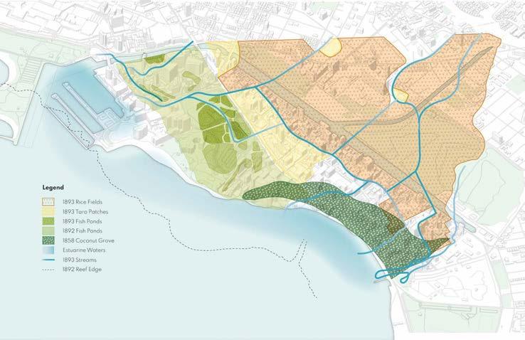
Pre-development, the project area (see page 3 above) was part of a drainage basin characterized by springs, streams (such as Pi’inaio Stream and its delta), and marsh land. Pre-Western contact, the ‘Ewa end of Waikīkī included the Hawaiian community of Kalia. It was characterized by numerous traditional fishponds (loko i’a), including the large Ka’ihkapu pond and residences owned by native Hawaiian royalty. In addition to the fishponds, the marshy area of present-day Waikīkī was filled with wetland taro farms (lo‘i kalo) and rice fields. In 1908, the U.S. military acquired, occupied, drained, and filled a large parcel of land for the subsequent construction of Fort DeRussy.
The class’s goal is to advocate for the anticipation of climate-crisis challenges in Waikīkī through blue-green infrastructure framework development and urban ecological design that embraces open-ended, dynamic conditions, such as coastal flooding, rather than preventing them—all while promoting nature-based, ecologically performative “soft” solutions and learning from traditional native Hawaiian biocultural land-water practices. The studio intends to contribute to a long-term vision for a resilient Waikīkī that merges the seemingly conflicting goals of economic development, climate and sea level rise adaptation, ecological performance, social and environmental justice, and urban placemaking into mutually beneficial, resilient, and sustainable relationships.
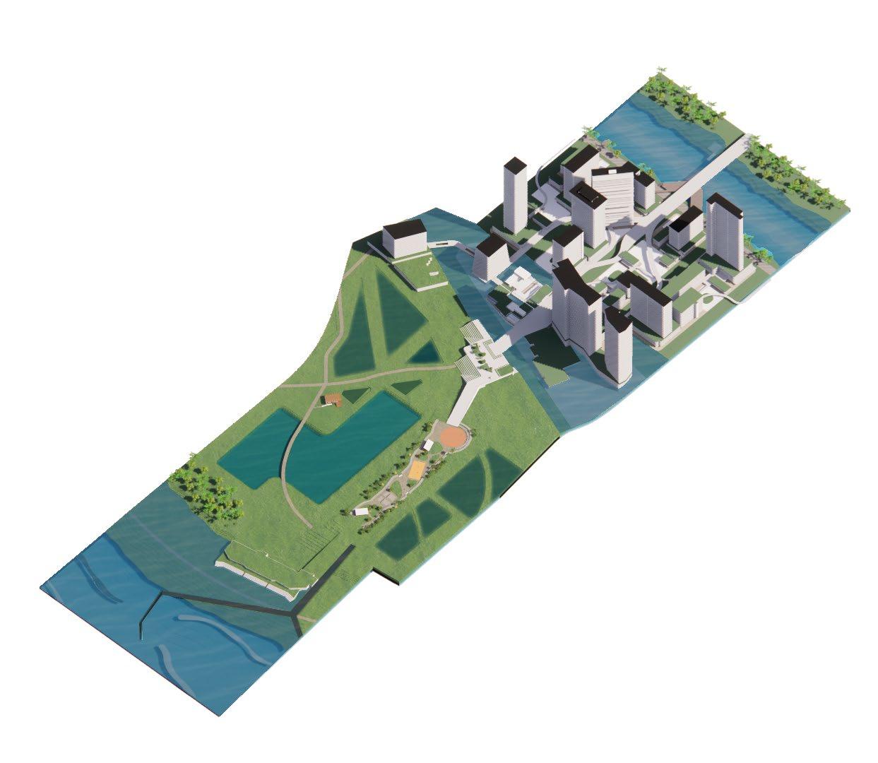
Comprised of graduate students in architecture and landscape architecture, the class developed analyses, ideation, and overall long-term (6-ft SLR, anticipated ca. 2100 for the speculative purposes of this studio) visions and frameworks for sea level rise accommodation options in flood-prone areas of Waikīkī that decrease waterfront vulnerabilities by responding to inescapable shoreline changes, flooding, storm and groundwater inundation, as well as issues related to transportation and Honolulu’s aging conventional infrastructure.
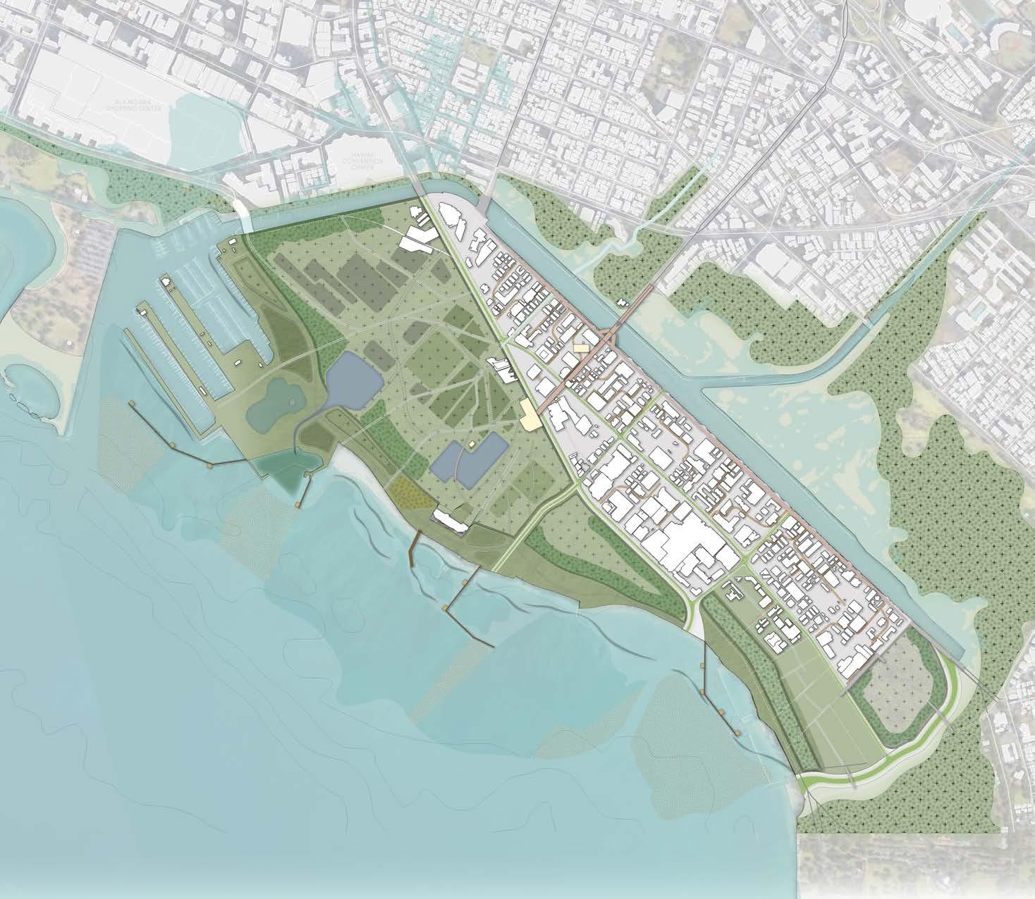
Student concepts explored locale-appropriate, nature-based climate adaptation practices and opportunities for amphibious, blue-green infrastructure in both near-term (3-ft SLR, anticipated ca. 2050 for the purposes of this studio) and long-term (see above) visionary and bold illustrative urban design proposals. The essential drivers of urban form in these forward-looking, speculative visions will be multi-modal, non-automobile connectivity, multi-purpose coastal infrastructure systems, linked public hybrid open spaces, networks of ecological priority zones, and locale-specific, layered living shoreline systems as “nature-based” defense mechanisms against sea level rise and flooding, allowing for indeterminacy, increased biodiversity, improved ecosystem services, and, at the same time, education, decolonization, cultural restoration, and the creation of accessible urban waterfront amenities for all people.
Initial ARCH 743 Research Topics:
1. State of Hawaiʻi Office of Planning Hawaiʻi 2050 Sustainability Plan and Hawaiʻi 2050 Sustainability Plan Measurement Update
2. Summary overview of the U.S. Global Change Research Program’s The 4th National Climate Assessment (NCA)
3. Summary overview of the State of Hawaiʻi’s key climate goals and initiatives; difference between Mitigation and Adaptation and State of Hawaiʻi 2045 carbon-neutral goals (HB 2182, Act 15, Greenhouse Gas Sequestration Task Force, etc.) and State Greenhouse Gas Inventory report (2019)
4. City and County of Honolulu Climate Change Commission guidance document “Climate Change Brief” (2021) and City and County of Honolulu Climate Change Commission guidance document “Climate Change and Financial Risk” (2020)
5. City and County of Honolulu One Climate, One Oahu Climate Action Plan 2020-2025
6. NOAA 2022 Sea Level Rise Technical Report “Global and Regional Sea Level Rise Scenarios for the United States” and “Application Guide” for the 2022 Sea Level Rise Technical Report
7. Hawaiʻi Sea Level Rise Vulnerability and Adaptation Report (2017), The Hawaii Climate Change Mitigation and Adaptation Commission
8. State of Hawaiʻi, Climate Ready Hawaii; “Guidance for Addressing Sea Level Rise in Community Planning in Hawaiʻi” (2020) and State of Hawaiʻi, Climate Ready Hawaiʻi, “Guidance for Using the Sea Level Rise Exposure Area in Local Planning and Permitting Decisions” (2020)
9. City and County of Honolulu Climate Change Commission guidance document “Sea Level Rise Guidance” (2018)
10. Summary of State of Hawaii Coastal Zone Management Program (CZM) and The Hawai‘i Ocean Resources Management Plan (ORMP) (2020)
11. State of Hawaii, Climate Ready Hawaii Working Paper “Nature-Based Resilience and Adaptation to Climate Change in Hawaii” (2021)
12. City and County of Honolulu Climate Change Commission guidance document “One Water for Climate Resilience” (2020)
13. Climate Adaptation Design Principles for Urban Honolulu; City and County of Honolulu Department of Planning & Permitting, Office of Climate Change, Sustainability & Resiliency, (2020)
14. Transit Oriented Development (TOD) overview of concept, goals and summary of TOD efforts and key principles in Honolulu
Instructor: Judith Stilgenbauer
Precedent Project Studies:
1. Chicago River Walk project, Chicago, Illinois; Ross Barney Architects, Sasaki, et al.
2. Detroit East Riverfront Framework Plan; Skidmore, Owings & Merrill, Michel Desvigne Paysagiste, Detroit, Michigan
3. Mississippi River Flood Resiliency Plan, Davenport, Iowa; Sasaki, et al.
4. Fayetteville 2030: Food City Scenario Plan, Fayetteville, North Carolina; University of Arkansas Community Design Center
5. Conway Urban Watershed Framework Plan (Sponge City), City of Conway, Arkansas; University of Arkansas Community Design Center
6. Gowanus Canal Sponge Park Masterplan and Gowanus Canal Sponge Park Pilot, Brooklyn, New York, Dlandstudio
7. Oyster-tecture, Brooklyn, New York, part of the MoMA’s 2009 Rising Currents exhibition and Living Breakwaters project, part of the Rebuild by Design initiative, Staten Island, New York, Kate Orff, SCAPE, et al.
8. Big U, part of the Rebuild by Design initiative, Manhattan, New York, Bjarke Ingels Group et al., and progress on implementation: LMCR, ESCR, BPCR projects, etc.
9. F.R.E.D. proposal, For a Resilient Rockaway competition, Leading Innovation in Resilient Waterfront Design Award, Ennead Lab / Ennead Architects.
10. Islais Hyper-Creek, entry to Resilient by Design, Bay Area; BIG et al.
Main studio schedule components:
Phase 1:
Initial Research (January 9 – January 18, 2023)
What are urban design and landscape urbanism? Climate crisis, SLR, native Hawaiian land-water concepts. Readings, research, exercises, discussions, and presentations
Phase 2:
Precedent Studies (January 18 – January 25, 2023)
Precedent research on urban climate-adaptation design, living shorelines/nature-based solutions, and carbon-neutral urban design; research, discussions, and presentations
Phase 3:
Site Mapping, Analysis, and Synthesis (January 25 - February 13, 2023)
Site visit and research, inventory, mapping, and analysis; ideation
Phase 4:
Urban Framework Concepts (February 13 - March 8, 2023: mid-term review).
Waikīkī-scale concepts and programs; development over time; urban framework plans
Phase 5:
Urban Design for Focus Areas (March 20 - April 12, 2023)
Schematic urban design proposals for selected focus areas and disciplinary areas of expertise
Phase 6:
Presentation Material Development (April 17 – May 3, 2023: final review)
Refinement of plans, concepts, and programs; preparation of digital presentations for final
Phase 7:
Documentation (May 3 – May 10, 2023)
Compilation of digital portfolio/ class booklet pages
Pages 16 to 109 of this booklet feature selected excerpts of the five student teams’ final, specualtive urban design projects (phases 4 & 5). For additional course and/or project information, please email the instructor, Professor Judith Stilgenbauer, at jstilg@hawaii.edu.
Instructor: Judith Stilgenbauer
Site analysis excerpt; image: Alzira Fernandes, Beau Nakamori, Maleah Reynolds, Mel Yoo
Site analysis excerpt; image: Jannah Dela Cruz, Hana Matsunaga, Christina McWhorter
Ignis am, inctur autem ius. Hentionseque con pore dolorep elecerferuv
Site analysis excerpt; image: Jannah Dela Cruz, Hana Matsunaga, Christina McWhorter
Site analysis excerpt; image: Lynn Mayekawa, Joshua Ramos, Janice Sonson
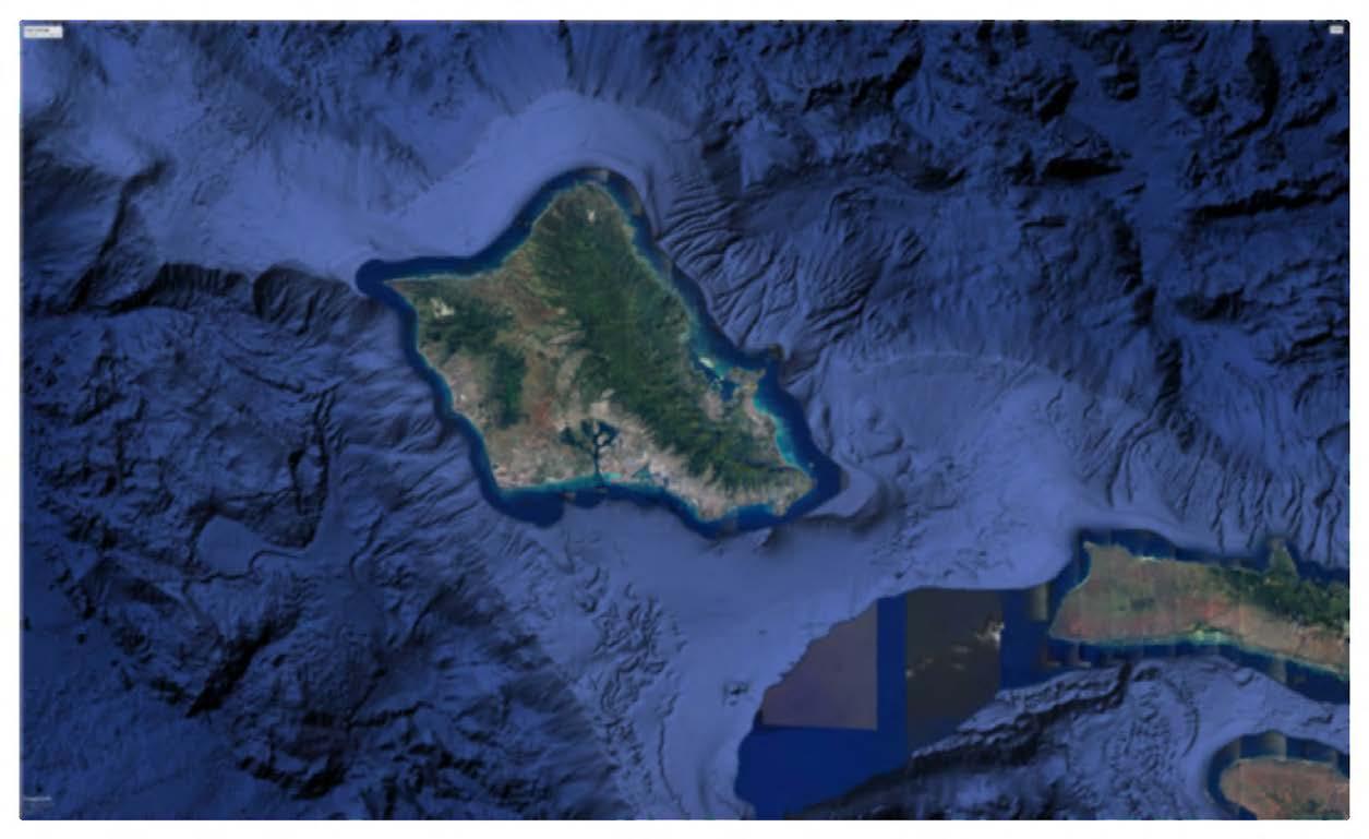
Ignis am, inctur autem ius. Hentionseque con pore dolorep elecerferuv
Instructor: Judith Stilgenbauer
Ignis am, inctur autem ius. Hentionseque con pore dolorep elecerferuv
As mentioned above, the class focused on the Waikīkī Special District and its immediate urban context. Pre-development, the studio project area (also see page 3 above) was part of a drainage basin characterized by springs, streams, such as Pi’inaio Stream, and swamp land. Pre-Western contact, the ‘Ewa end of Waikīkī was part of the Hawaiian community of Kalia. It was characterized by numerous traditional fishponds (loko i’a) and residences owned by native Hawaiian royalty In addition to the fishponds, the marshy area in the vicinity of present-day Waikīkī was charachterized by wetland taro farms (lo‘i kalo) and rice fields. In 1908 the U.S. military acquired, drained, and filled a large parcel of land for the subsequent construction of Fort DeRussy.
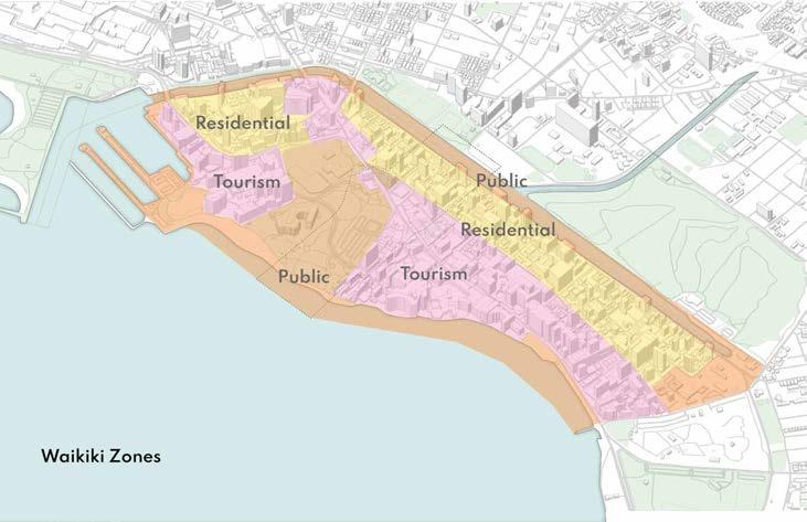
The studio project area included the entirety of the Waikīkī Special District, bordered by the Pacific Ocean and Waikīkī Beach to the southwest and the Ala Wai Canal to the northeast. Waikīkī connects to the rest of Honolulu through a series of bridges that reach over the Ala Wai Canal and a land-based connection to the south, where it meets the Honolulu Zoo and Kapi‘olani Park. Waikīkī is comprised of a considerable tourism-based hotel area, which spans most of the makai side along the ocean. The mauka side of Waikīkī has residential units, commercial shops, and one of the main automotive thoroughfares, Ala Wai Boulevard.
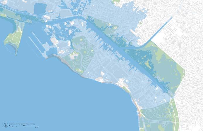
In the long run, the entire Waikīkī Special District, and much of its context, will be heavily affected by sea level rise.

General project goals and land use parameters to explore include, but are not limited to:
Climate-crisis and SLR anticipation and preparedness
Enhancing coastal resilience through adaptive, urban ecological design and nature-based solutions
Adaptation strategies for existing urban infrastructure (transportation, sewer, water, energy facilities/utilities, etc.)
Large-scale coastal blue-green infrastructure/ living shorelines and open space networks
Water-sensitive low-impact development
Ecosystem performance, water quality, habitat, biodiversity
Adaptive multi-purpose infrastructural systems
Climate-positive design, carbon neutrality, clean energy
Mixed use development, including affordable housing
Waterfront amenities, public access
Recreational and water-based activities
Pedestrian, transit, water, and bicycle connectivity; walkability
Alternate, clean forms of transportation connecting to rail
Transit-oriented development
Urban placemaking, livability
Productive landscape elements; urban agriculture; resource management
Modern interpretations of traditional Hawaiian bio-cultural land-water practices
Cultural sensitivity and history of place; decolonization
Green jobs and eco tourism
Public works initiatives
Environmental and social equity and justice; jobs; social services
Etc.
Flooding and inundation vulnerabilities of coastal area to consider:
Saltwater inundation (SLR, increased wave overtopping, hurricane/ storm surges, tsunami)
Salt intrusion/ potable water contamination (freshwater lens changes/ saltwater intrusion/ water table rise, effect on low-lying agriculture and aquatic ecosystems)
Erosion of shorelines and beaches
Habitat shifts (coral reefs, wetlands, etc.)
Ground water inundation resulting from SLR
Stormwater management (storm sewers and structures), increased flooding in low-lying areas inlands, nuisance flooding, drainage problems, streets becoming impassable, etc.
Ecological impacts
Release and leaching of pollutants at contaminated sites, landfills, etc.
Sewers, cesspools, storm sewers, energy facilities, transportation systems, and other utilities and critical urban infrastructure
Existing building stock and critical building systems
Public access to shoreline and non-automobile connectivity
Vulnerable populations, public health impacts
Instructor: Judith Stilgenbauer
Near-term, 2050 assumptions (for the purposes of this studio) include, but are not limited to:
• 3-foot SLR plus human-made and natural coastal hazards (groundwater inundation, erosion, hurricane/storm surge, flooding, tsunami, etc.); increased ocean temperatures; other anticipated climate-crisis effects. How does your project site/ Waikīkī begin adapt in innovative and resilient ways?
• Proposed new climate-resilient programs and uses will produce net-zero emissions and be carbon neutral.
• No more individual, fossil-fuel/combustion engine vehicles permitted in Waikīki; , only shared, autonomous zero-emission vehicles and future electric, automated public transit, water-based transportation, connections to rail; multi-use paths, walkability and bikes; public waterfront access.
• Waikīki’s land and water begin to adapt and perform ecologically, provide ecosystem services (water, soil, air, etc.), and promote habitat, biodiversity, and cultural practices.
• More residents live, work, and recreate at or near the site; focus on public health and human-centric urban places (placemaking).
Long-term, 2100 assumptions (for the purposes of this studio) include, but are not limited to:
• 6-foot SLR plus human-made and natural coastal hazards (groundwater inundation, erosion, hurricane/storm surge, flooding, tsunami, etc.); increased ocean temperatures; other anticipated climate-crisis effects. How does your site in Waikīkī adapt in a resilient way?
• Honolulu, Waikīki, and your proposed climate-resilient mixed-use neighborhood/focus area will be climate-positive and self-sufficient/ off-grid where possible (decentralized energy, water, sewage, utility, waste, food systems); high-performacne buildings and infrastructure
• No individual automobiles will be allowed in Waikīkī, only shared, autonomous zero-emission vehicles and future electric, automated public transit, water-based transportation, etc.; consider connections to mauka neighborhoods and rail; multi-use paths, walkability and bikes; public waterfront access.
• The proposed neighborhood’s open spaces, shorelines, and water systems will perform ecologically, provide ecosystem services (water, soil, air, etc.), and promote ecological resilience, habitat, biodiversity, food security, and cultural practices
• Social equity; jobs; social services; many residents live, work, recreate within walking distance; focus on public health and human-centric urban places (placemaking).
Design Strategies for SLR and coastal flooding to explore in urban design proposals:
LINEAR BARRIERS
• Hard, engineered infrastructure systems that armor and stabilize the existing shoreline
• Examples: impermeable structures, levees, dikes, seawalls, riprap, dams, flood gates, storm surge barriers, etc.
LIVING SHORELINES
• Soft, nature-based green infrastructure solutions
• Examples: wetlands, tidal marshes, and other vegetated/living coastal buffers that rely on ecosystem services and increase the distance between water and development, retain and absorb inundation, attenuate waves, slow erosion, and provide habitat; etc.
ADAPTATION
• Elevated development
• Examples: raising the height of land, infrastructure, and built structures, using fill or pilings that allow flood water to flow underneath, etc.
• Floodable development
• Examples: structures and landscapes designed to withstand occasional inundation; habitable space and critical infrastructure on upper levels
• Floating development
• Examples: floating buildings, transportation elements, and infrastructure; elements are designed with fluctuating water levels in mind
MANAGED RETREAT
• Withdrawal of development from the shoreline over time through managed abandonment of areas subject to frequent inundation
• Examples: structures designed for disassembly; conversion of abandoned areas into floodable, living shoreline elements, etc.
COMBINATIONS of these strategies
Instructor: Judith Stilgenbauer
Ignis am, inctur autem ius. Hentionseque con pore dolorep elecerferuv
Ignis am, inctur autem ius. Hentionseque con pore dolorep elecerferuv
Ignis am, inctur autem ius. Hentionseque con pore dolorep elecerferuv
Instructor: Judith Stilgenbauer
Ignis am, inctur autem ius. Hentionseque con pore dolorep elecerferuv
Student Team:
Lynn Mayekawa, Master of Landscape Architecture Candidate
Joshua Ramos, Doctor of Architecture Candidate
Janice Sonson, Master of Architecture Candidate
Project Title: The Waikīkī Experience
The Waikīkī Experience is about altering the currently marketed paradise that does not place importance on the region’s historical significance or biocultural past and, arguably, even the physical realities. Facing catastrophic change, we have the opportunity to construct a new identity that strives for a more grounded and connected experience for people living here and visitors alike.
Waikīkī has a past of ‘āina momona, of being a source of great agricultural abundance. We currently identify the ahupua‘a of Waikīkī as one division of land and the watershed of Ala Wai as another division—overlapping but having different boundaries. Historic maps show the productivity of the land. Here is a speculation of how the ahupua‘a system could have been practiced in this area, highlighting the importance of understanding not just the coast but the entire experience mauka to makai.

Student team: Lynn Mayekawa, Joshua Ramos, Janice Sonson
Instructor: Judith Stilgenbauer





Land use and stewardship across the Hawaiian islands has gone through many phases. Along the south coast of O‘ahu, in Waikīkī, Hawaiians took advantage of the marshy conditions and ample waterways. They devised systems of lo‘i, floodable agriculture, and loko pu‘uone, inland fishponds. These systems were manipulated further into extensive rice paddies and duck ponds. Waikīkī’s default condition of wetlands served as a pause for water coming down from mauka along the Pālolo, Mānoa, and Makiki streams, as well as fresh water from the Mo‘ili‘ili karsts and water surfacing from a shallow water table. By the early 20th century, the focus on Waikīkī for its productive agricultural landscape was overshadowed by the potential of tourism. To facilitate this shift, the Ala Wai Canal diverted the major streams feeding Waikīkī, and the land was filled to address the shallow water table, setting the scene for a marketable paradise. With the indeterminacy of sea level rise, we have a new opportunity to create performative, nature-based interventions that allow a new cultural and social framework. The principles guiding our design aim to:






Understanding Waikīkī: Hydrology
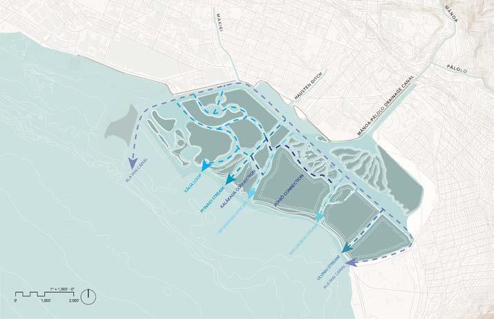
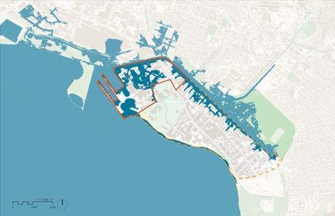
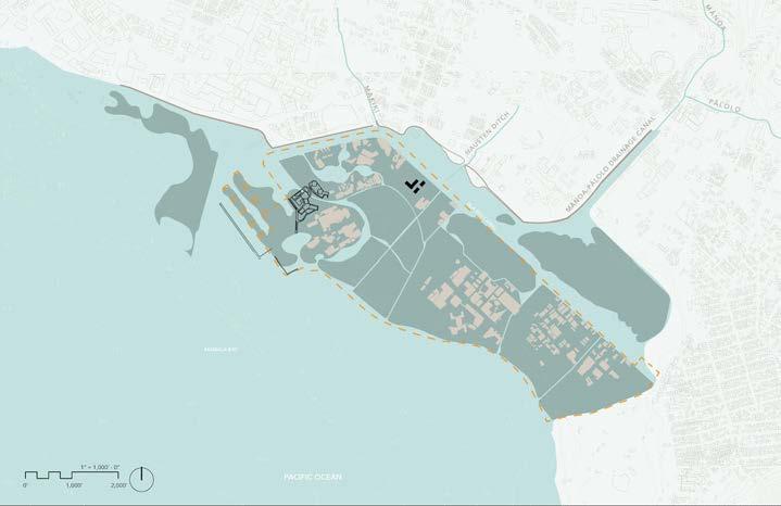
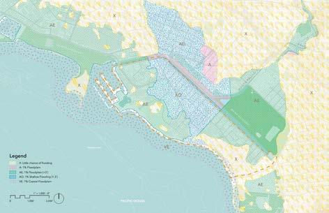
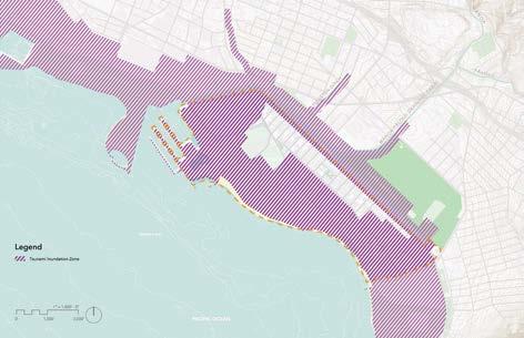
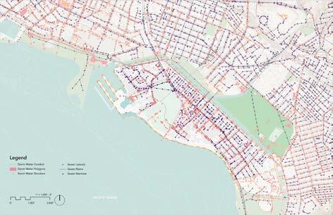
Research and site conditions direct the design process. As a coastal site, understanding hydrology is acutely important. Considering the projections for sea level rise, areas that flood, and the potential for tsunami inundation, we developed a design that allows water to move freely across the site, leaving space to highlight the biocultural and historical identities of Waikīkī.
Student team: Lynn Mayekawa, Joshua Ramos, Janice Sonson
Instructor: Judith Stilgenbauer
Proposed Final Landform Based on 6’SLR
Understanding Waikīkī: Constructed + Land Elements

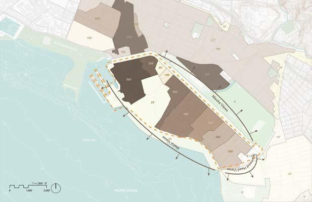
Existing Maximum Building Heights
Proposed Maximum Building Heights
Existing FAR
Proposed FAR
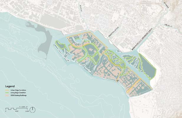
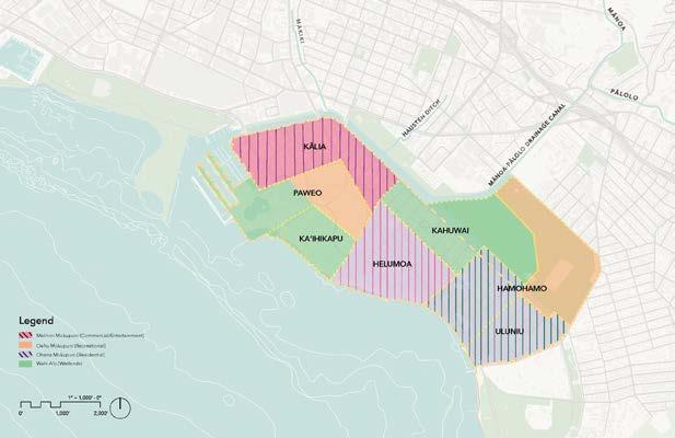
Mokupuni Redistricting
Edge Conditions
Student team: Lynn Mayekawa, Joshua Ramos, Janice Sonson
Instructor: Judith Stilgenbauer
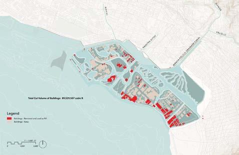
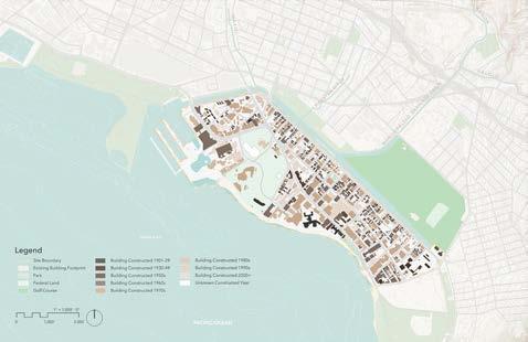
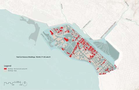
Reclaimed Concrete: 44,764,753 ft3
(Generated in Phase 3)
Reclaimed Concrete: 49,222,585 ft3 (Generated in Phase 2)
Total Volume for Fill Generated Onsite: 102,785,772 ft3
Volume Required for Fill: 83, 239, 784 ft3
Volume Dredged: 8,798,432 ft3
Making way for hydrological variability means the land comprising the new Waikīkī will be altered. Careful consideration has been placed on increasing density, scheduling buildings for use as fill at the end of their life cycle, and appropriately treating the zone where water meets land.
Hiki
Mass transit connection into and through the site, providing access and connection to the island. Elevated thoroughfares for localized mass transit options, pedestrian and human-powered locomotion, or other individual autonomous devices.
Water vessels are the ideal solution for hydrological variability. Ferries would connect to the whole island, and more individual taxis or personal boats.
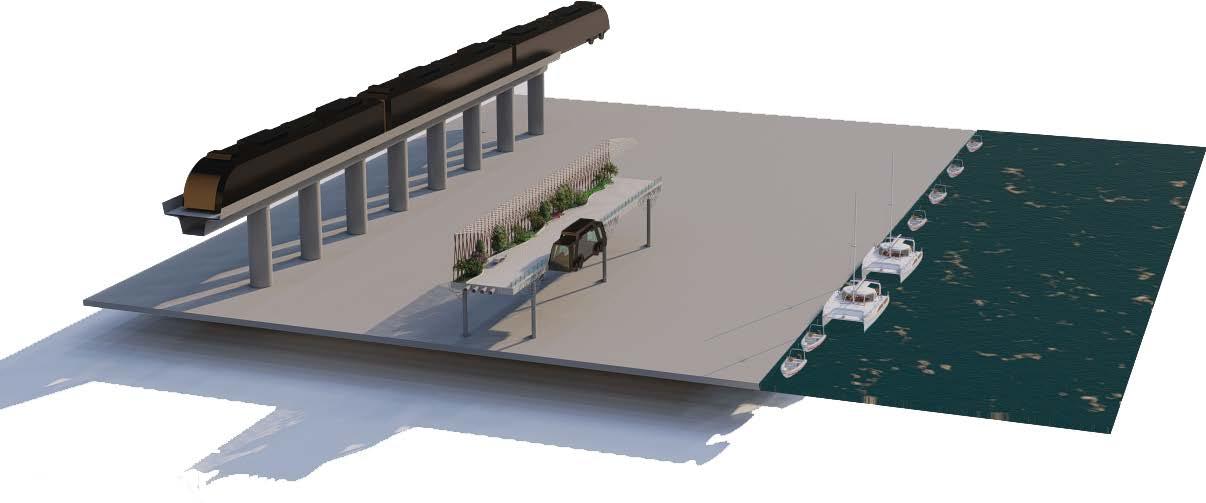
Circulation is layered in The Waikīkī Experience and endeavors to reach all points across the mokupuni. Circulation methods will include self-powered modes of transportation, including walking or cycling; mass transit options, including autonomous rail or bus lines; and water-based vehicles, such as ferries, water taxis, and personal water crafts.
Student team: Lynn Mayekawa, Joshua Ramos, Janice Sonson
Instructor: Judith Stilgenbauer

• ELEVATOR ACCESS
• INTEGRATED WATER CATCHMENT + DESALINATION STATION

• CULTURAL DISTRICT MARKER
Hiki kū refers to the portion of the sky just above the horizon. As water inundates most of Waikīkī, we will need to retreat back or rise up from the horizon to a new plane. The horizon is the place where the sea meets the sky, the position that, arguably, is where Waikīkī sits. Hiki Kū thoroughfares elevate most transactional activities associated with Waikīkī above the horizon, leaving the earth below available for a refreshed identity. In The Waikīkī Experience, the ‘āina below is a concentration of recreational, ecological, and biocultural activities.
CIRCUITOUS TRANSITION FROM HIKI KŪ TO THE ‘ĀINA ALLOWS FOR REFLECTION AND RECREATION ARCH 743
An autonomous bus system supports people moving and can include emergency vehicles or supplement services such as waste collection.
Existing Conditions - Map represents dense building placement and linear road system.
Phase 2 Near-Term Proposal (3’ SLR) - Removal of roads to discourage vehicular circulation and promote more walkability.
ALA WAI CANAL (REMEDIATED)
FURTHER APPLICATION OF BOATING DOCK AND BOARDWALK

NEWLY PROPOSED URBAN EDGE CONDITION
INTRODUCE FILL FROM 2-6’
ALLOWING FOR WATER INNUNDATION ON SITE FOR ISLAND SEPERATION AND STREAM CONVERSION
Phase 3 Far-Term Proposal (6’ SLR) - Removal of all roads and city block conditions promotes ecological growth of native species and biodiversity in the area. A new circulation path (Hiki Ku) and a boating dock for water taxis are also introduced.
Student team: Lynn Mayekawa, Joshua Ramos, Janice Sonson
Instructor: Judith Stilgenbauer
Bedroom Condo
5TH - 18TH FLOOR (14 Floor Tower)
3RD - 14TH FLOOR
2 Bedrooms 3 Bedrooms
2ND FLOOR (Street Level)
2ND FLOOR (Street Level)
Partially Covered Parking
1ST FLOOR (Basement Level)
•Address: 419 Keoniana St.
1ST FLOOR (Basement Level)
Covered Parking
4TH - 14TH FLOOR (Residential Space)
4TH - 14TH FLOOR (Residential Space)
2 Bedroom Units 3 Bedroom Units
3RD FLOOR (New Ground Level)
3RD FLOOR (New Ground Level)
Food/Retail Services Grocery Store
2ND FLOOR (Street Level)
2ND FLOOR (Street Level)
Building energy and remediation floor Water storage Generators
1ST FLOOR (Basement Level)
1ST FLOOR (Basement Level)
Elevated Foundation for roman recipe retrofit
3RD - 14TH FLOOR
CENTRAL ELEVATOR
2 Bedrooms
3 Bedrooms
allows for roof top access to the 16th
roof top and the 18th floor rooftop.
2ND FLOOR (Street Level)
Partially Covered Parking
5TH - 18TH FLOOR (14 Floor Tower) 2ND FLOOR (Street Level)
KEONI ANA BUILDING
1ST FLOOR (Basement Level)
•Address: 430 Keoniana St.
Covered Parking
• Sub-Property Type: Condo
•Land Tenure: Fee Simple
•Land Square Feet: 32,500
•Year Built: 1977
OAHU SURFT II
•# of Units: 183
•Type: 1 & 2 Bedrooms
•Address: 439 Keoniana St.
•Stories: 18
• Sub-Property Type: Condo
•Land Tenure: Fee Simple
•Land Square Feet: 14,000
•Year Built: 1971
•# of Units: 58
•Type: 2 & 3 Bedrooms
•Stories: 14
•Elevators: 2
Roof PV Panels
Roof PV panels connect to 2nd floor energy unit and generator to provide needed energy to power the buildings needs.
South Facade PV Panels
ROOF PV PANELS
TOP PV PANELS (Tower 118th floor)
South Facade PV panels only for the Oahu Surf 2 to provide needed energy tio power the building.
Private Elevated Walkway
Elevated walkways at 22’ high will play as the main connection points between the Oahu Surf 1, Oahu Surf 2, and the Keoni Ana.
PARKING STRUCTURE (Street Level - 4th floor)
Roof PV panels on 18th floor rooftop connect to 2nd floor energy unit and generator to provide needed energy to power the buildings needs.
PV
PV PANELS (Southern Facade)
South Facade PV panels only for the Oahu Surf 2 to provide needed energy tio power the building.
1ST FLOOR (Basement Level) 5TH - 18TH FLOOR (14 Floor Tower)
Roof PV panels on 16th floor rooftop connect to 2nd floor energy unit and generator to provide needed energy to power the buildings needs.
5TH - 16TH FLOOR (12 Floor Tower)
Condo
ROOF TOP PV PANELS (Tower 2 - 16th floor) 1 Assigned Parking Stall Per Unit
5TH - 18TH FLOOR (14 Floor Tower)
FORMER PARKING STRUCTURE
Semi public space
Food/Retail Services
Energy/ Remediation Conversion
Student team: Lynn Mayekawa, Joshua Ramos, Janice Sonson
Instructor: Judith Stilgenbauer
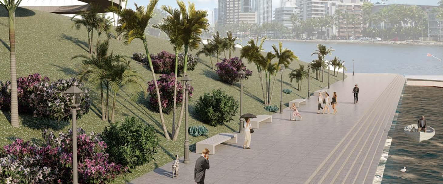

Existing conditions
Student team: Lynn Mayekawa, Joshua Ramos, Janice Sonson
Instructor: Judith Stilgenbauer


Student team: Lynn Mayekawa, Joshua Ramos, Janice Sonson
Instructor: Judith Stilgenbauer
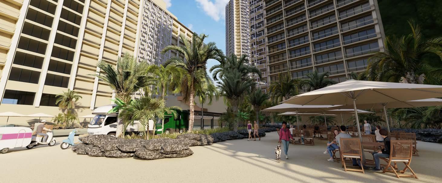
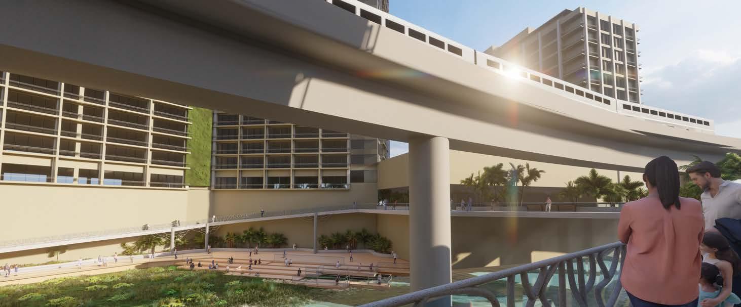
Phase 3: 6’ SLR
HIKI KŪ OBSERVATORIES
• Ramps lead from Hiki Kū throughfares to ground-level attractions
• Variably include water catchment systems, freez-based desalination system feeding adjacent loko, PV, elevator
• Offers moment of contemplation as you descend or ascend
• Capitalizes on views
ALA WAI BOAT HARBOR + SALT MARSH
• Confluence of multi-modal transportation is ideal location for cultural hub
• All watercraft utilize renewable energy or are wind-powered
SALT MARSH
• Hiki Kū thoroughfares support air-to-ground autonomous trams, pedestrians and individual transportation devices such as bikes
• Rail extension through Waikīkī
• City infrastructure embedded into thoroughfares
AGRICULTURAL WETLANDS ESTABLISHED
• Loʻi kalo is established, test production of other agricultural prodcuts
• Desalination through freezing can be implemented, value-added product harvesting paʻa kai
ILIKAI URBAN BEACHFRONT KAHANAMOKU
KEYSTONE
• Foundations for thriving marine ecology will lead to flourishing keystone species once abundant
• Thriving coral habitat and limu will attract and sustain fish in the loko
• Loss of Ala Wai Community Park means loss of a vital urban recreational resource
• Oʻahu Mokupuni integrate community open space and these integral features
• Canoe Halau are now spread throughout the side with easier water access
Phase 3 far-term proposal (6’ SLR)
USED AS AN EDUCATIONAL, ECOLOGICAL AND CULTURAL SITE
KANAKAʻOLE WETLAND AMPHITHEATER
• Floodable multi-use space for festivals or hula competitions through farmerʻs markets or graduations
Existing conditions
Phase 2 near-term proposal (3’ SLR)
Student team: Lynn Mayekawa, Joshua Ramos, Janice Sonson
Instructor: Judith Stilgenbauer
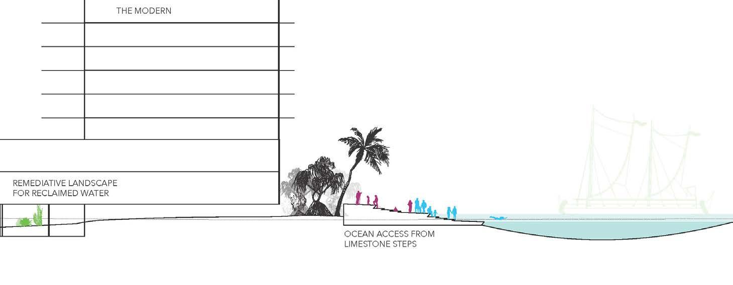
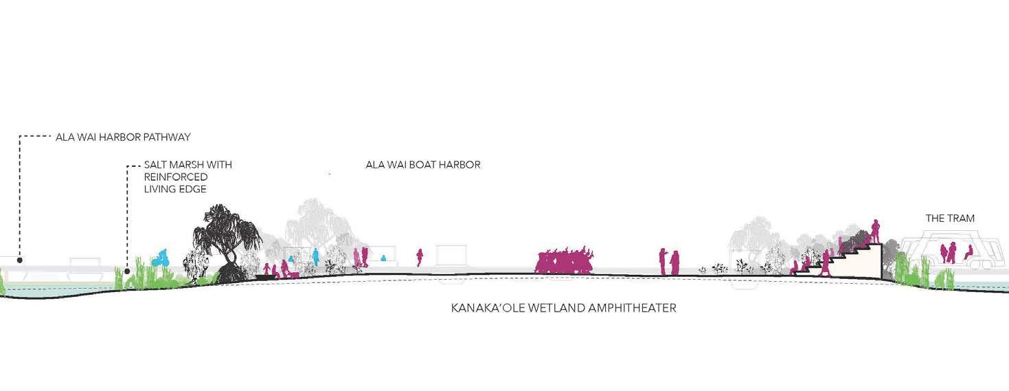
Student team: Lynn Mayekawa, Joshua Ramos, Janice Sonson
Instructor: Judith Stilgenbauer
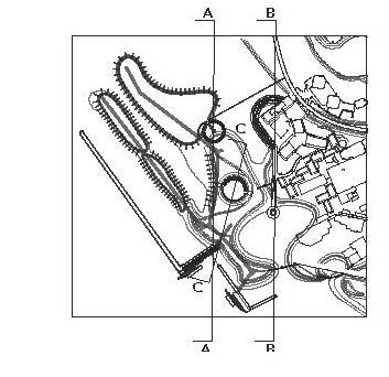
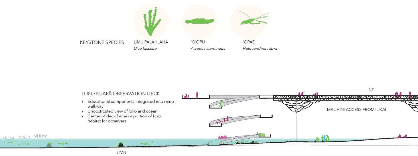
Ignis am, inctur autem ius. Hentionseque con pore dolorep elecerferuv
Ignis am, inctur autem ius. Hentionseque con pore dolorep elecerferuv
Ignis am, inctur autem ius. Hentionseque con pore dolorep elecerferuv
Instructor: Judith Stilgenbauer
Ignis am, inctur autem ius. Hentionseque con pore dolorep elecerferuv
Student Team:
Jannah Dela Cruz, Doctor of Architecture Candidate
Hana Matsunaga, Doctor of Architecture Candidate
Christina McWhorter, Master of Landscape Architecture Candidate
Project Title:
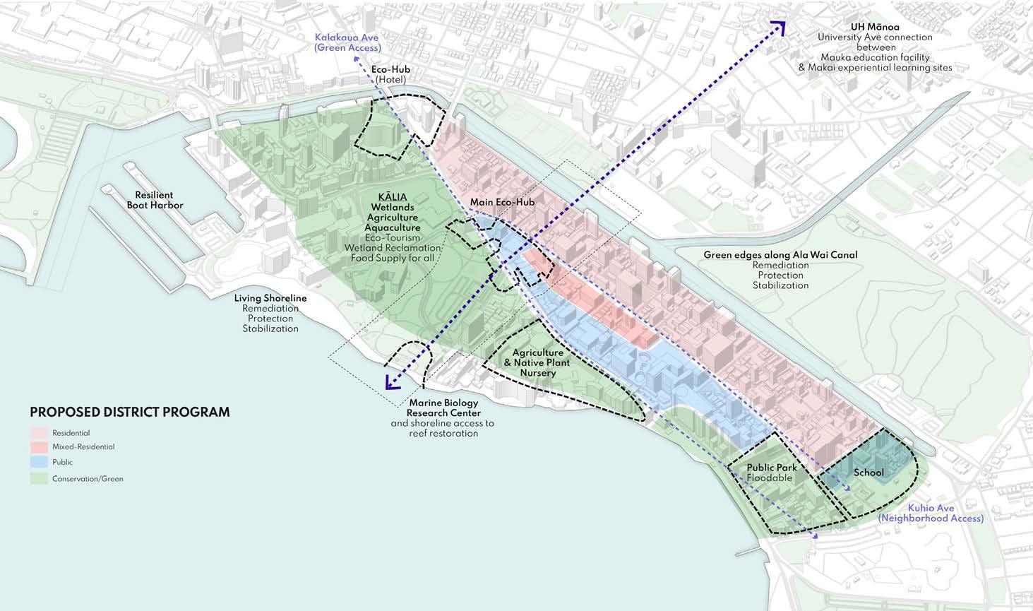
Envisaging a New Waikīkī
Student team: Jannah Dela Cruz, Hana Matsunaga, Christina McWhorter
Instructor: Judith Stilgenbauer


Student team: Jannah Dela Cruz, Hana Matsunaga, Christina McWhorter
Instructor: Judith Stilgenbauer

Aquaculture/ agriculture
Farm to table restaurant
Agroforest
Outdoor classroom
Oyster breakwaters
Transect of long-term sea level rise design
Retrofitted existing buildings
Urban greenspaces
Elevated pathways
Eco-tel
Bioshield Floating wetlands
Eco-hub
Green slope from hub to park
Elevated park
Floodable plaza
Soft edges
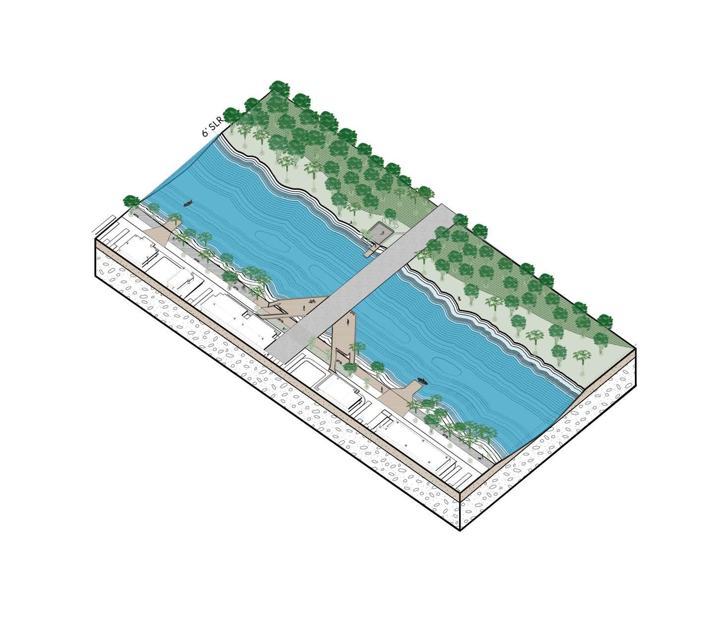
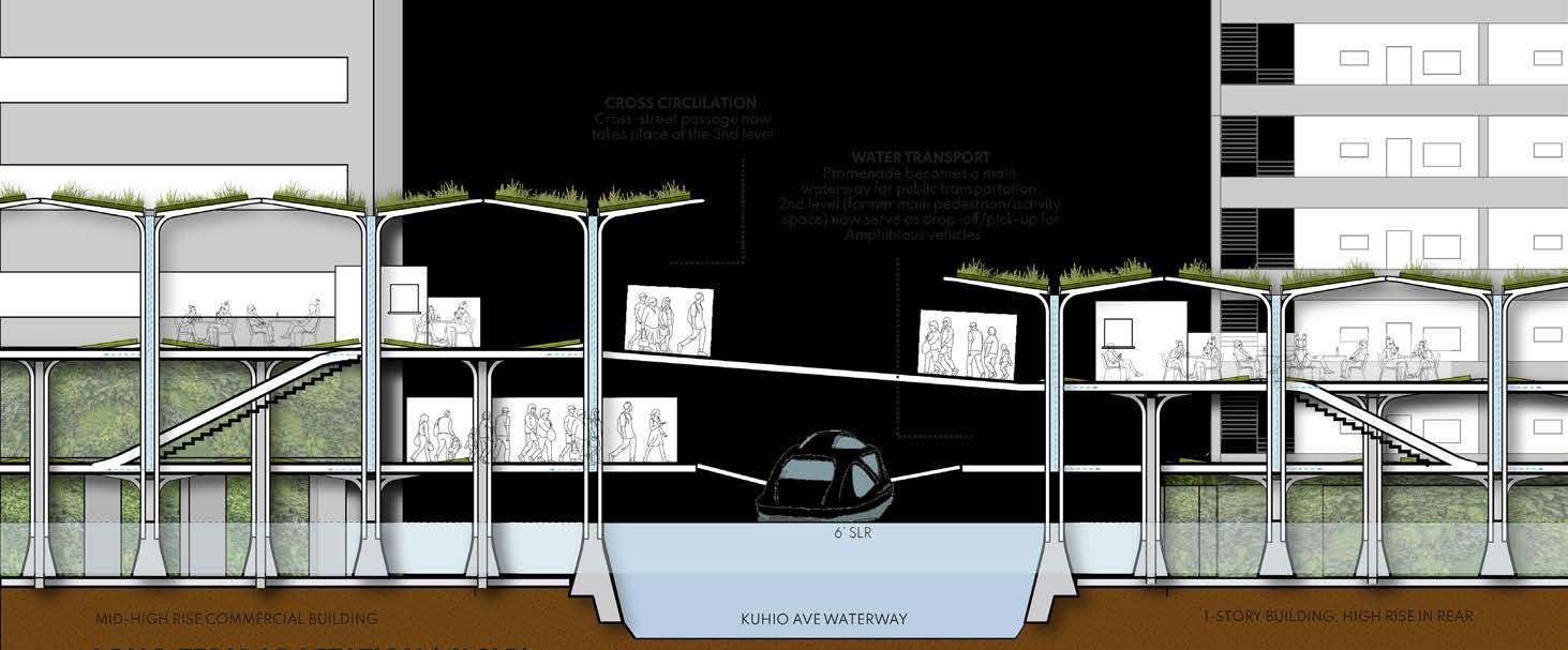
The newly introduced water transportation in the form of water taxis provides visitors and residents with a new way to move along the canal.
Floodable Plaza with permeable surface floor allows for plaza to flood during storm surge and slowly permeate down while allowing residents to utilize during dry periods.
Planting based on the tree’s or plant’s physical qualities to mitigate flooding, reduce erosion, and trap sediment.
The proposed deck allows for pop-up restaurants, outdoor markets, cultural events, community engagement, and connection to the elevated residential paths.
Through the incorporation of living shorelines and floodable basins, the Ala Wai Canal can flood and not harm infrastructure, while plants trap sediment and enable absorption.
Beginning from the Mauka side: Ala Wai Canal Edge Isometric
Student team: Jannah Dela Cruz, Hana Matsunaga, Christina McWhorter
Instructor: Judith Stilgenbauer
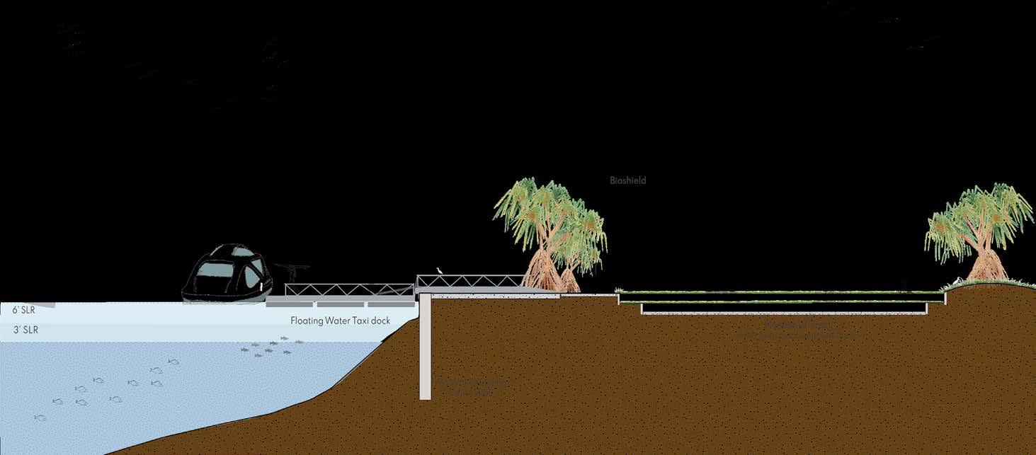
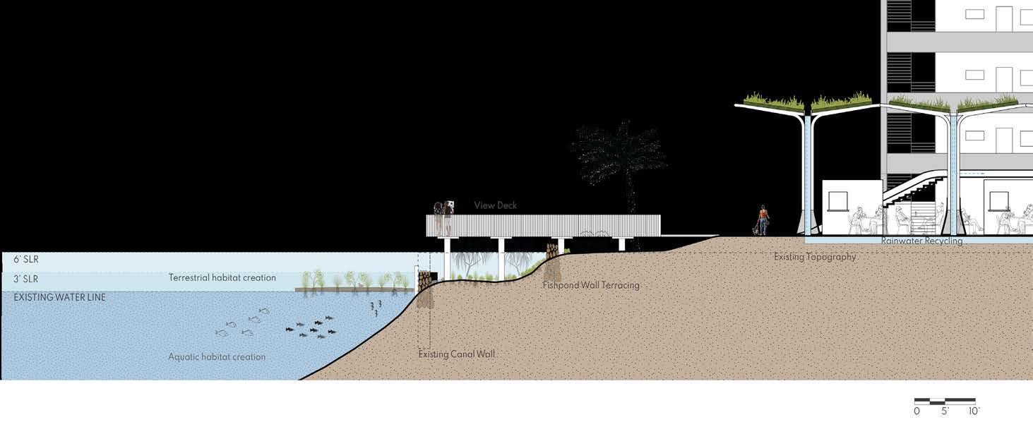
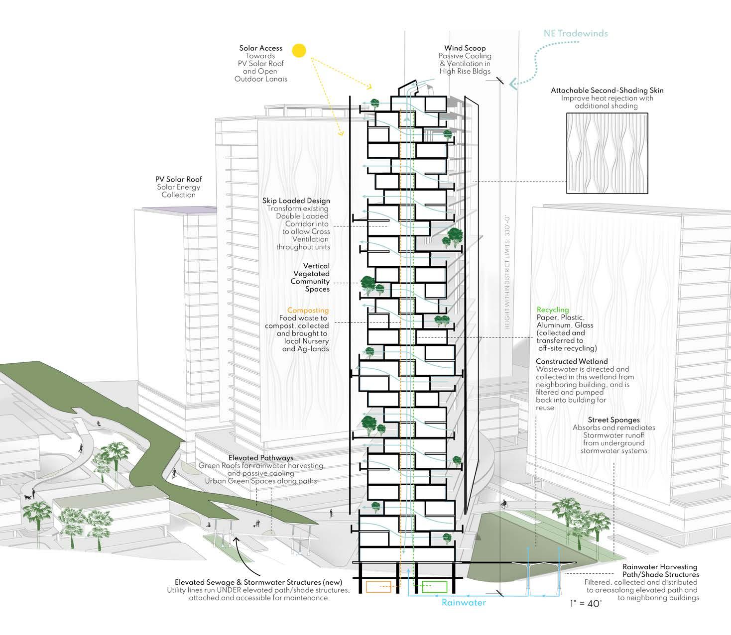
Forests, gardens, constructed wetlands, plazas, green roofs offer a green, biophilic experience at the human scale. Street sponges are first introduced, permeating the hardscape as a way to direct and filter stormwater run-off and mitigate impacts from SLR.
Connectivity & Natural Rainwater Harvesting is organized through modular pedestrian structures that meander in and around buildings from mauka to makai. Parking in existing buildings is converted into semi-enclosed spaces for displaced offices, retail, dining, and commercial activity from retreat areas.
Energy and waste is sustainably collected and managed through a set of building strategies, systems and lifestyle practices maintained between the user and architecture. This includes PV Solar, wastewater, food waste/compost, recycling, and more.
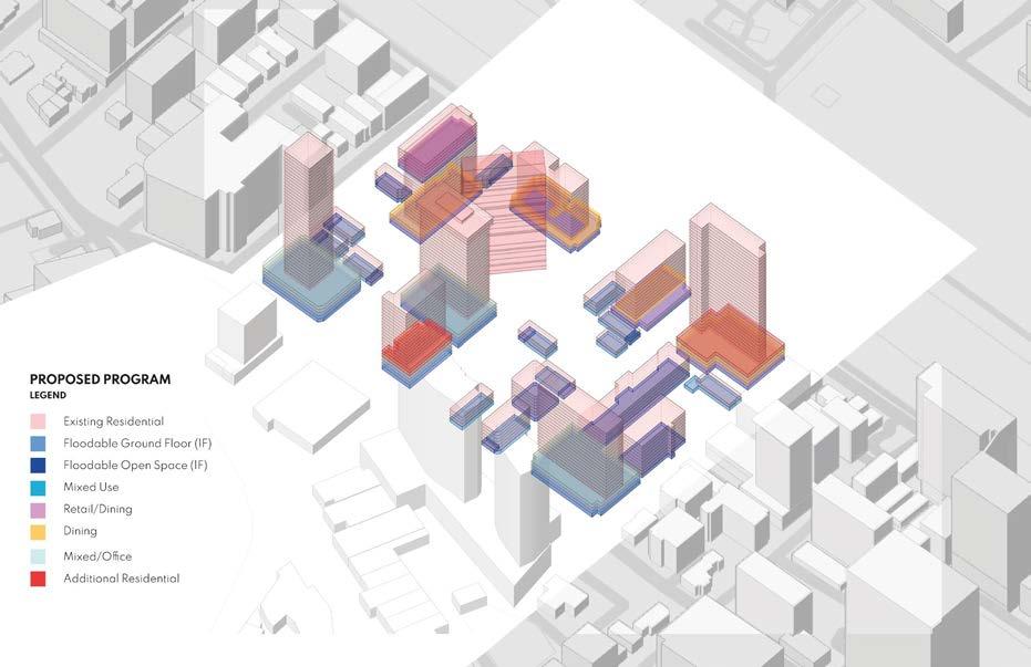
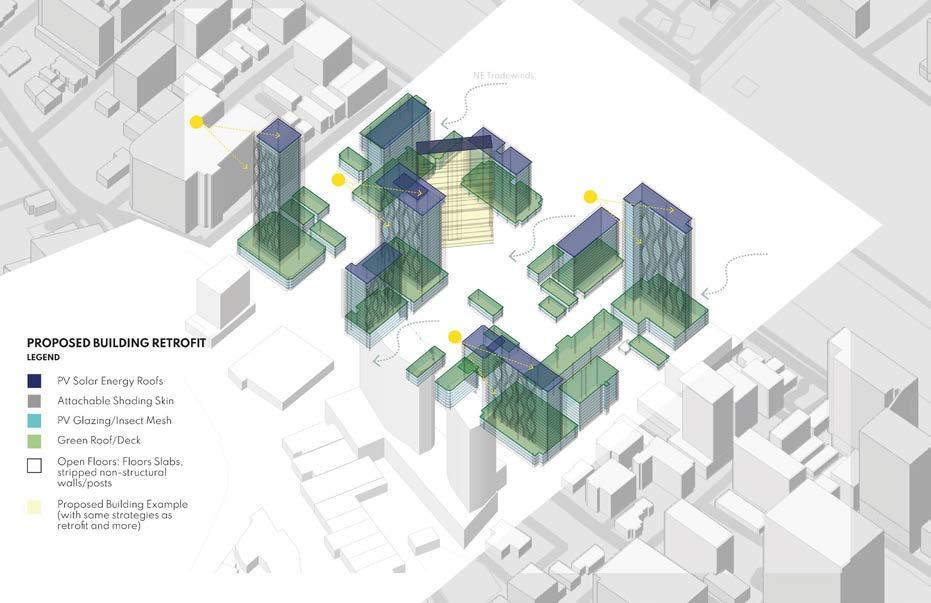
Existing buildings with potential remain while others retreat (turning rubble into reusable fill). The remaining buildings are retrofitted for resiliency and sustainability with recommended design strategies and floodable or floodproof ground floors.
New construction for residences is offered in urban voids, increasing density and walkability, following the same building strategies with advancements.
Residential Neighborhood Isometric

Student team: Jannah Dela Cruz, Hana Matsunaga, Christina McWhorter
Instructor: Judith Stilgenbauer
Student team: Jannah Dela Cruz, Hana Matsunaga, Christina McWhorter
Instructor: Judith Stilgenbauer

Eco-tel (Hotel), Commercial, Education
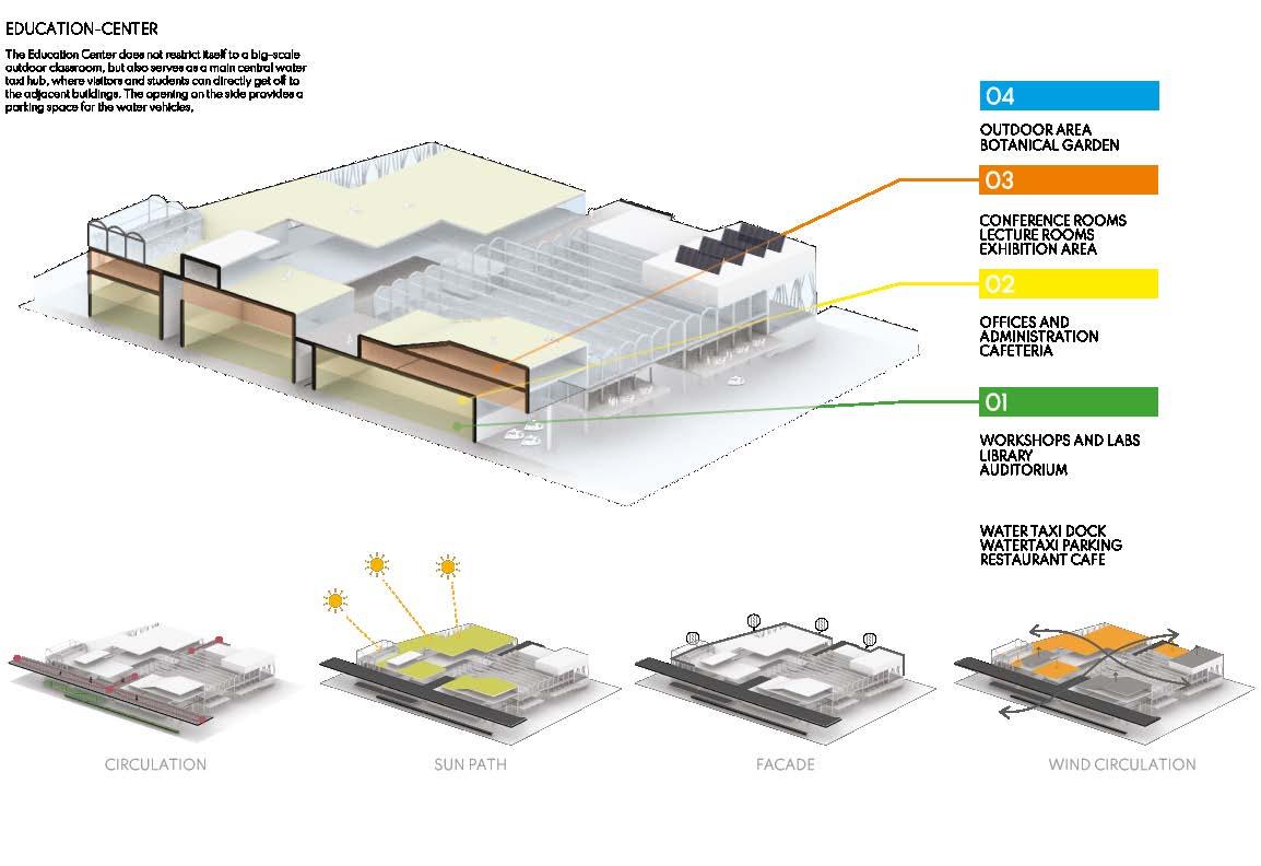
This area is divided into three types of spaces, while the Education Center and the Farmer’s Market Eco Center serve as a central hub connecting each building.
Eco-Center
Directly connected to the University Avenue bridge is a 2-story building topped with a green space area that also provides space for local markets and shops that open up during the weekend. Visitors and students can purchase groceries and local productions directly served from the ponds and fields.
Education Center & Water Taxi Access
This area contains office and lecture rooms and a water taxi dock covered by a glass house-looking construction, letting people into and out of the hub area.
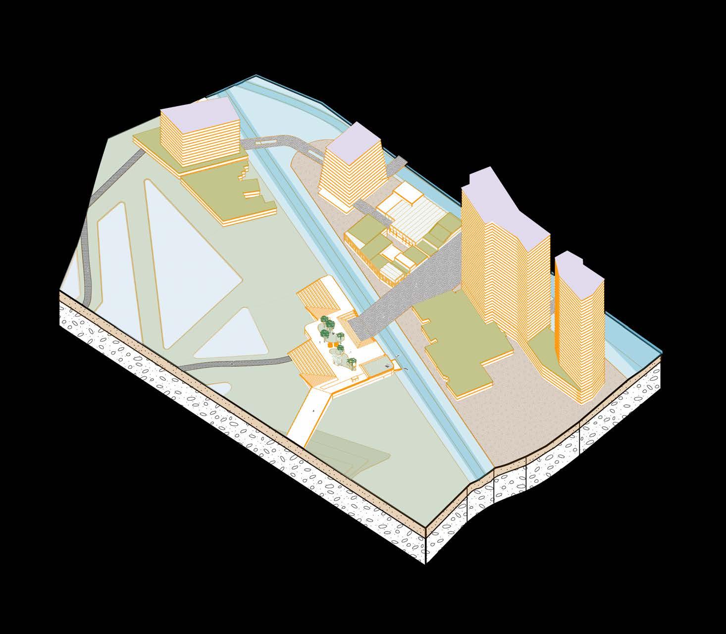
Isometric of proposed Eco-Hub
Student team: Jannah Dela Cruz, Hana Matsunaga, Christina McWhorter
Instructor: Judith Stilgenbauer
Existing buildings to be repurposed into residential units
Agriculture and Aquaculture
Fish ponds, rice, and loʻi fields are organized by the UH Mānoa Research Center to serve as a food resource and as a local experience for the people to tend and care for.
A Farm-To-Table restaurant is located in the heart of Kalia, proposing a new style of self-sufficient food cycle, working with local growers and fishers, utilizing seasonal ingredients while avoiding waste, and striving for a lower environmental impact.
Elevated Park
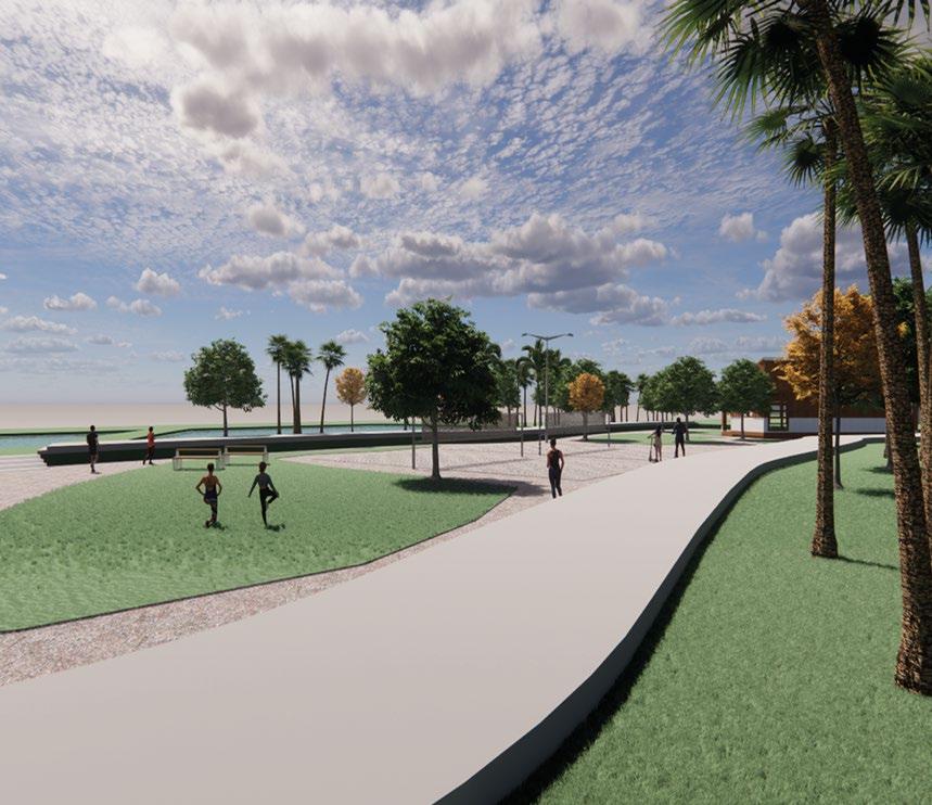
The proposed park creates a physical connection between the Farmer’s Market, Eco Center, and the repurposed Battery Randolph building while providing recreational areas and sports facilities that visitors and the UH sports team use. The amphitheater at the entrance can serve as a meeting point, and small kiosks and cafes are also there to take a small break.
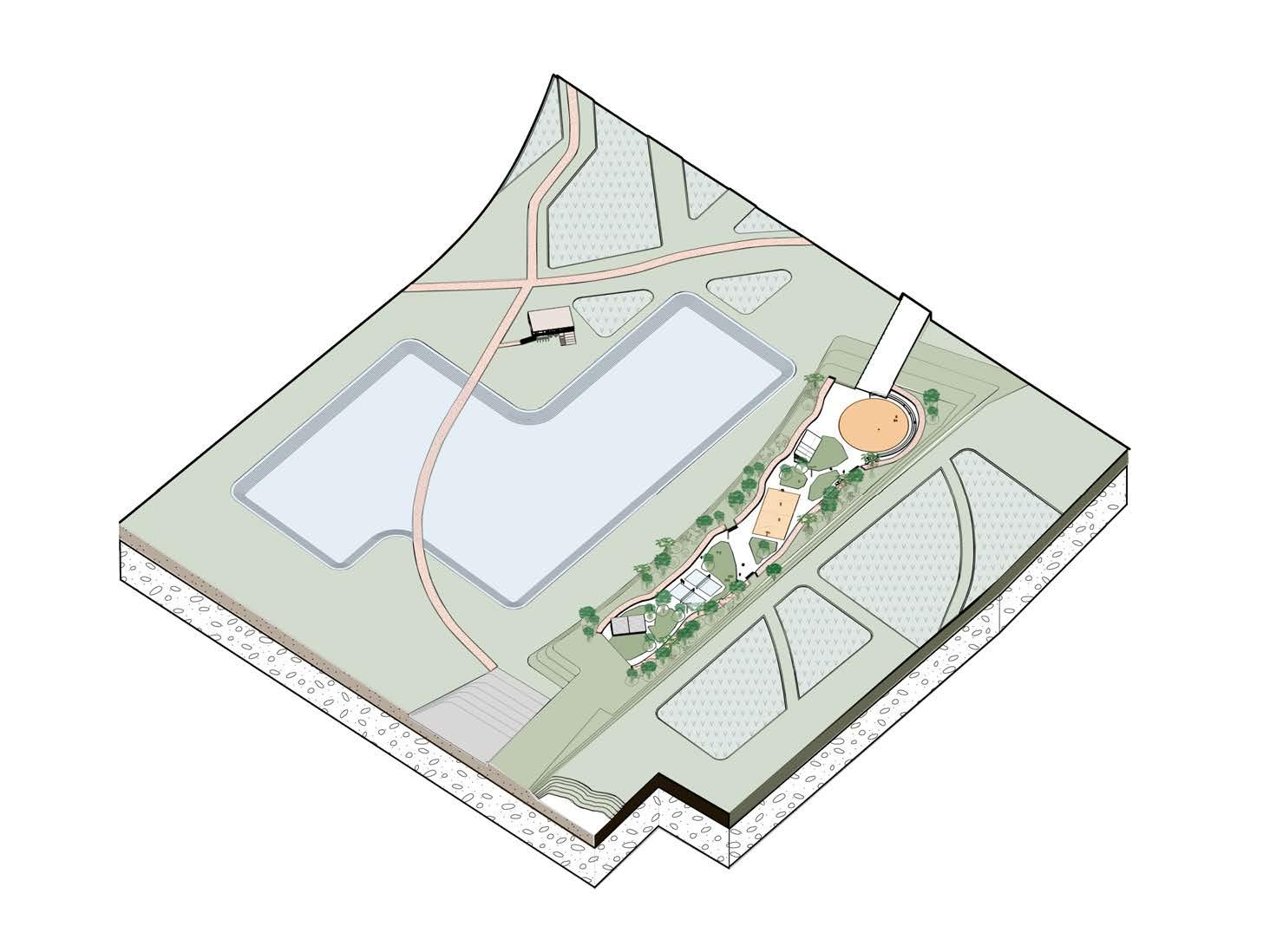
Isometric of Kalia wetlands, agriculture, and aquaculture
Student team: Jannah Dela Cruz, Hana Matsunaga, Christina McWhorter
Instructor: Judith Stilgenbauer
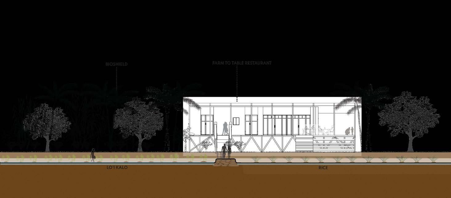
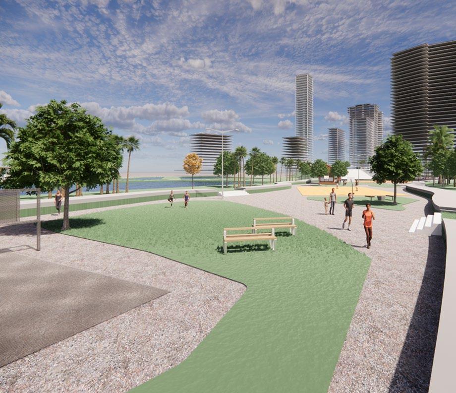
Agroforests sequester carbon, enhance landscape resiliency, increase food security, improve water quality, and reduce sedimentation from entering the ocean.
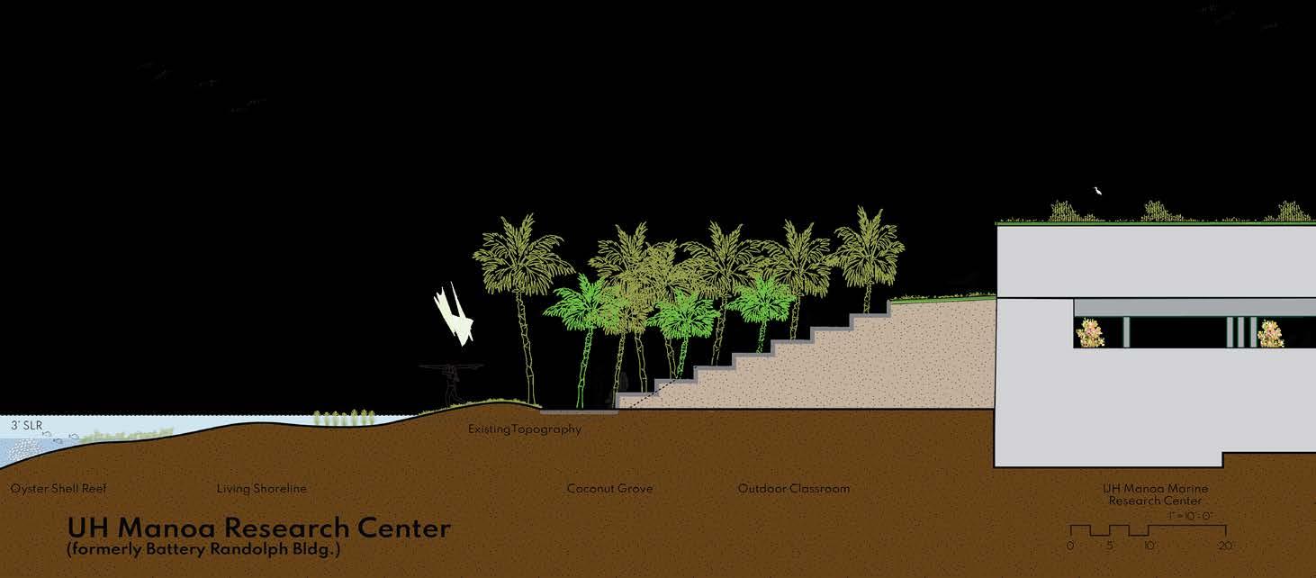
By adding oyster breakwaters, the living barriers absorb wave force, prevent erosion, create habitat for marine life, and reduce waste by working with local restaurants to donate shells.
By repurposing the Battery Randolph building to create a connection to UH Manoa and creating an outdoor classroom for students, residents, and tourists to learn or experience the ‘new’ water’s edge
Isometric rendering of proposed living shoreline (makai)

Student team: Jannah Dela Cruz, Hana Matsunaga, Christina McWhorter
Instructor: Judith Stilgenbauer

Ignis am, inctur autem ius. Hentionseque con pore dolorep elecerferuv
Ignis am, inctur autem ius. Hentionseque con pore dolorep elecerferuv
Ignis am, inctur autem ius. Hentionseque con pore dolorep elecerferuv
Instructor: Judith Stilgenbauer
Ignis am, inctur autem ius. Hentionseque con pore dolorep elecerferuv
Student Team:
Alzira Fernandes, Master of Landscape Architecture Candidate
Beau Nakamori, Doctor of Architecture Candidate
Maleah Reynolds, Doctor of Architecture Candidate
Melissa Yoo, Doctor of Architecture Candidate
Project Title:
Waikīkī Resilience & Sea Level Rise Adaptation
WAIKIKI RESILIENCE & SEA LEVEL RISE ADAPTATION
Diagram of design principles
Waikīkī-scale parti diagram


Student team: Alzira Fernandes, Beau Nakamori, Maleah Reynolds, Mel Yoo
Instructor: Judith Stilgenbauer
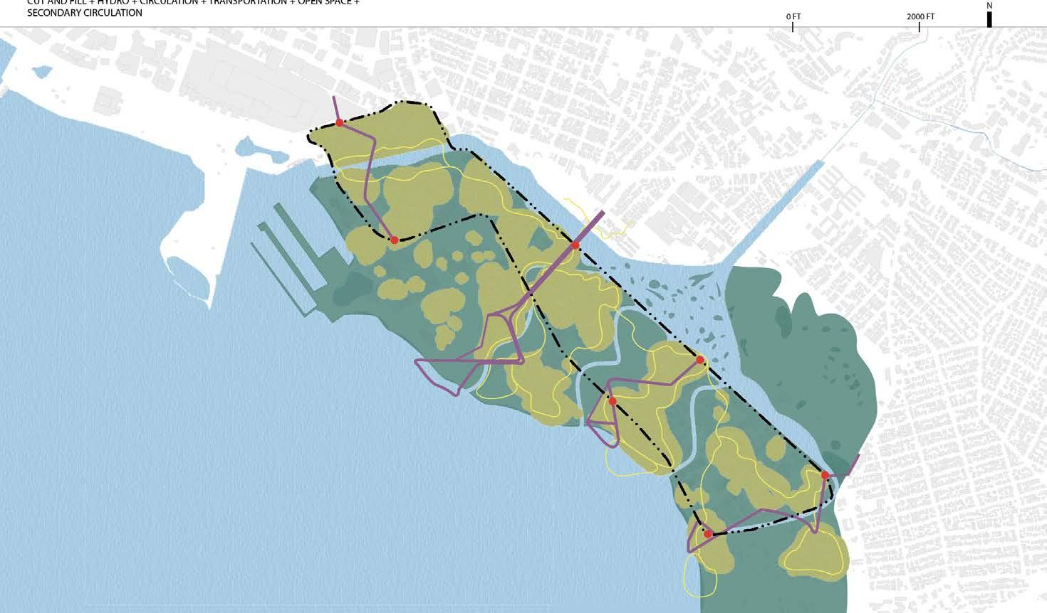
Exisitng isometric (0’ sea level rise)
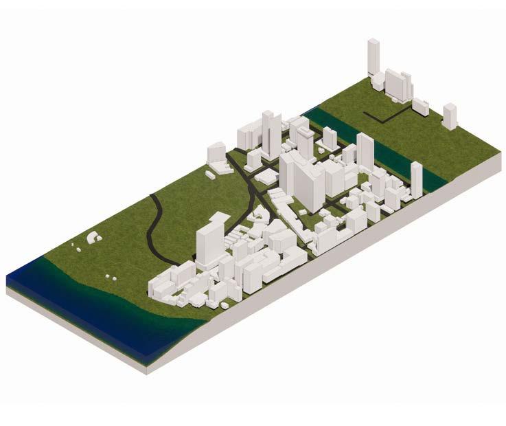
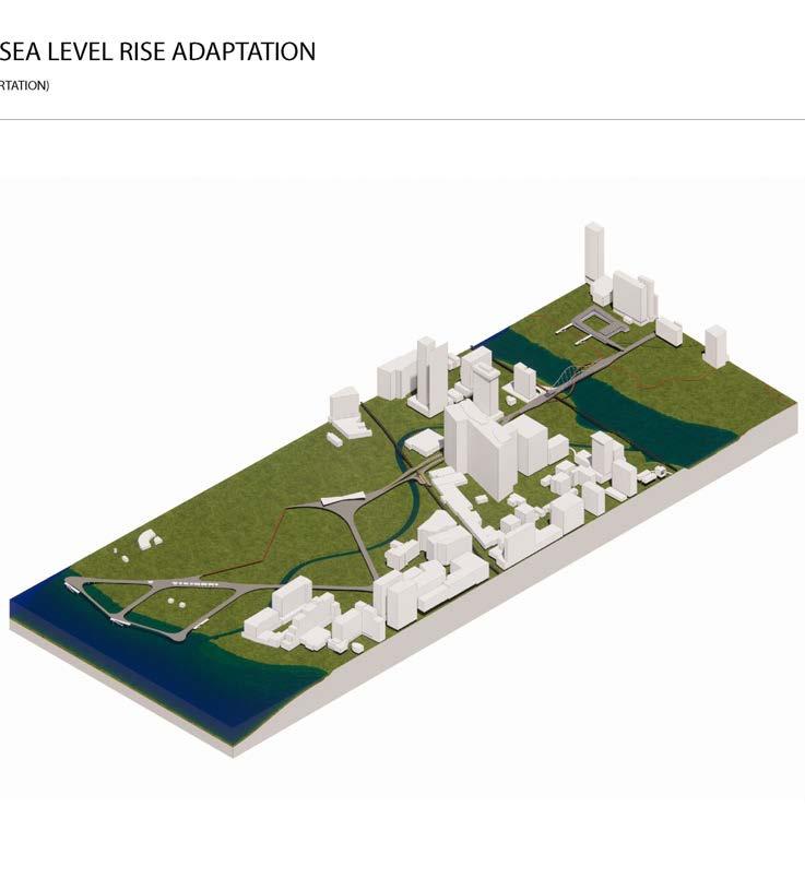
Student team: Alzira Fernandes, Beau Nakamori, Maleah Reynolds, Mel Yoo
Instructor: Judith Stilgenbauer
Long-term isometric rendering of master plan (6’ sea level rise)

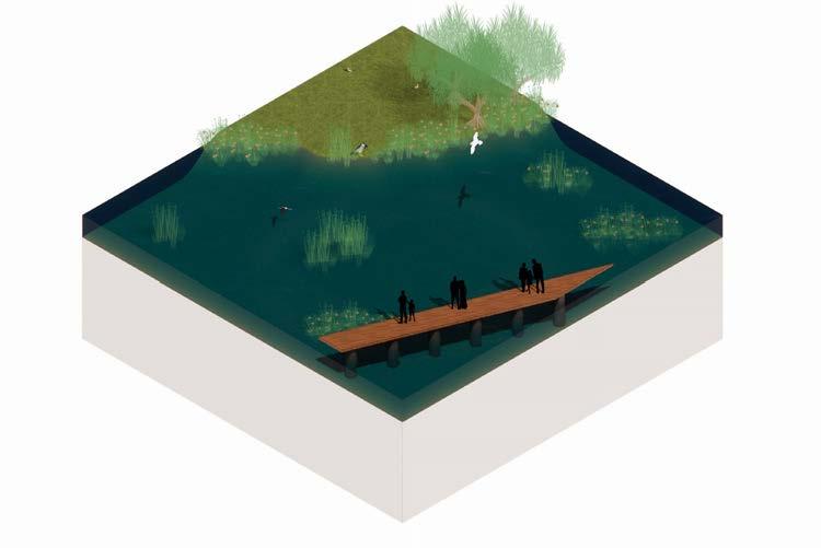
WETLAND BIRD HABITAT
N
PLANTED ISLANDS
HIGH POINTS GIVE DRY SPACE TO WETLAND BIRDS WHO MAY NEED IT, E.G. KŌLEA, ʻAUKUʻU
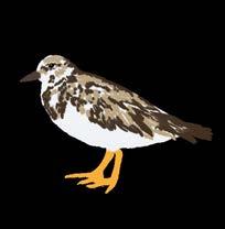
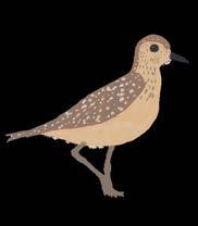
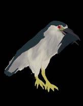
ELEVATED VIEWING PATHWAYS
SECONDARY CIRCULATION TO THE HI-LINE ALLOWS PASSIVE ENJOYMENT OF THE WETLAND HABITAT, WITHOUT DISTURBANCE
Isometric of proposed wetland bird habitat


Student team: Alzira Fernandes, Beau Nakamori, Maleah Reynolds, Mel Yoo
Instructor: Judith Stilgenbauer

SUBMERGED PLANTED AREAS
AS SEA LEVEL RISES, PLANTED AREAS WILL BE PARTIALLY TO FULLY SUBMERGED. PLANTS WILL ASSIST WITH EROSION CONTROL AND WATER FILTRATION AS THIS OCCURS.
WAIKIKI RESILIENCE & SEA LEVEL RISE ADAPTATION
WETLAND BIRD HABITAT
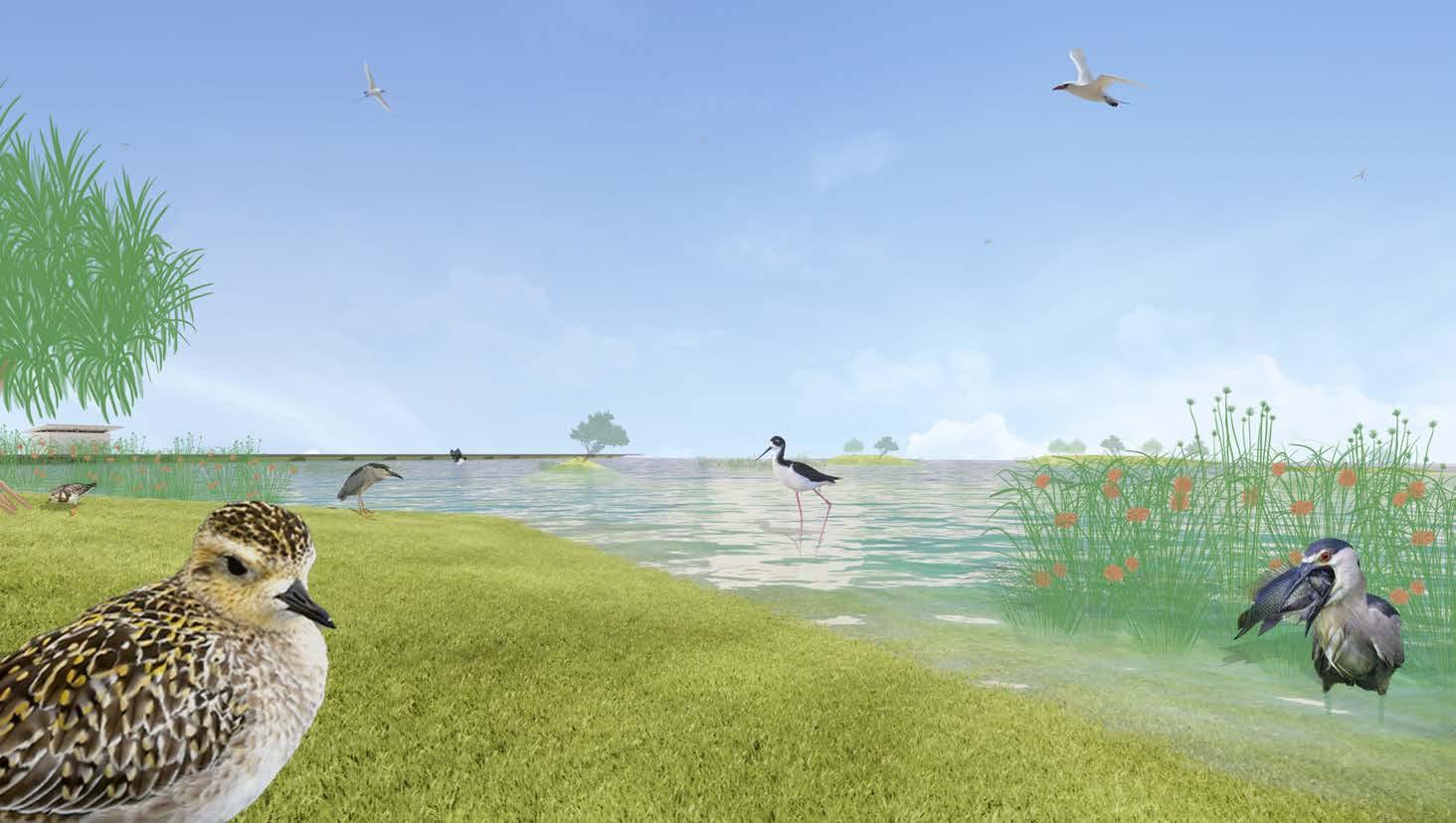
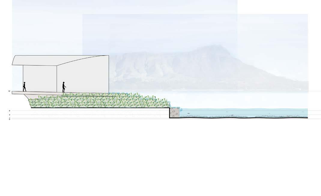
Section illustrating fishpond and lo

i kalo

WAIKIKI RESILIENCE & SEA LEVEL RISE ADAPTATION

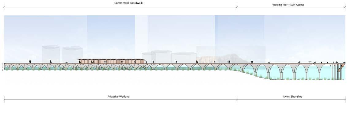
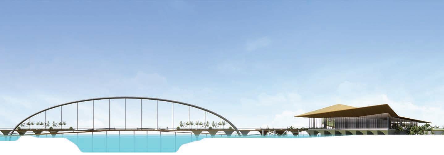
Section illustrating pier transition
Student team: Alzira Fernandes, Beau Nakamori, Maleah Reynolds, Mel Yoo
Instructor: Judith Stilgenbauer


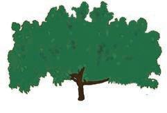
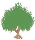


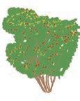
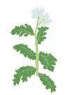
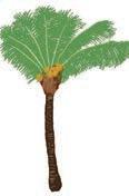
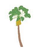
Proposed plant palette for re-envisioned Waikīkī







Student team: Alzira Fernandes, Beau Nakamori, Maleah Reynolds, Mel Yoo
Instructor: Judith Stilgenbauer
Student team: Alzira Fernandes, Beau Nakamori, Maleah Reynolds, Mel Yoo
Instructor: Judith Stilgenbauer
ECO-LEARNING
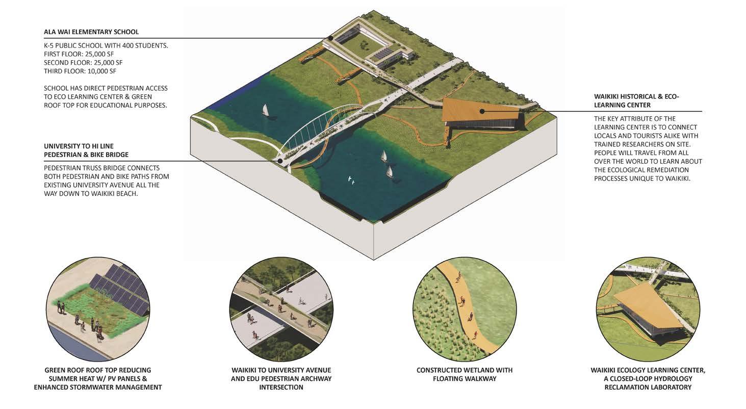
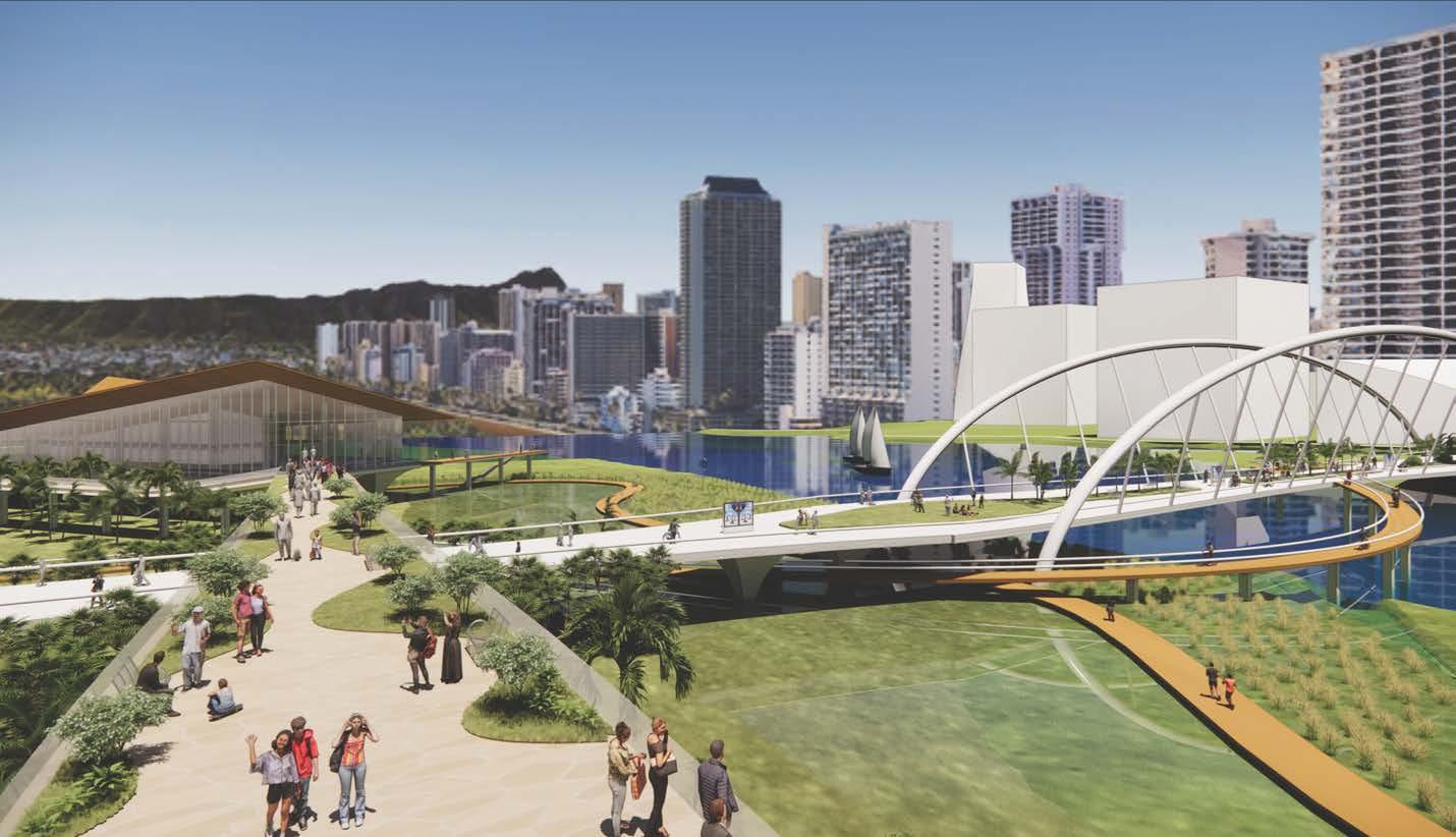
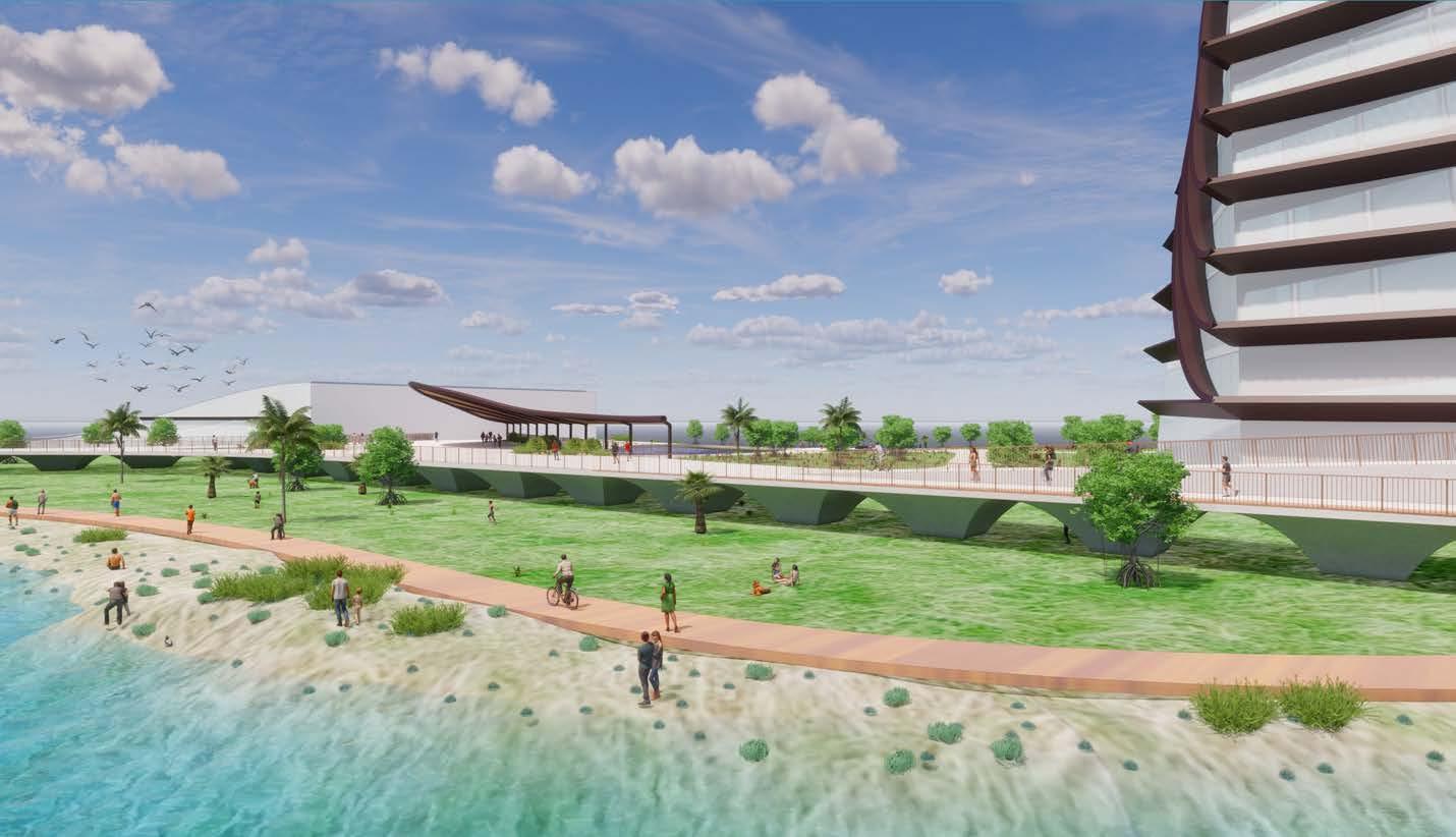
Isometric of HI Line experience

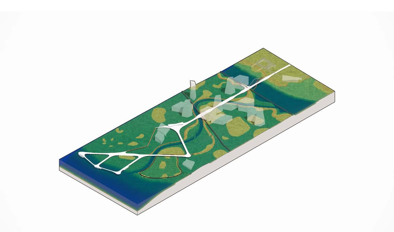
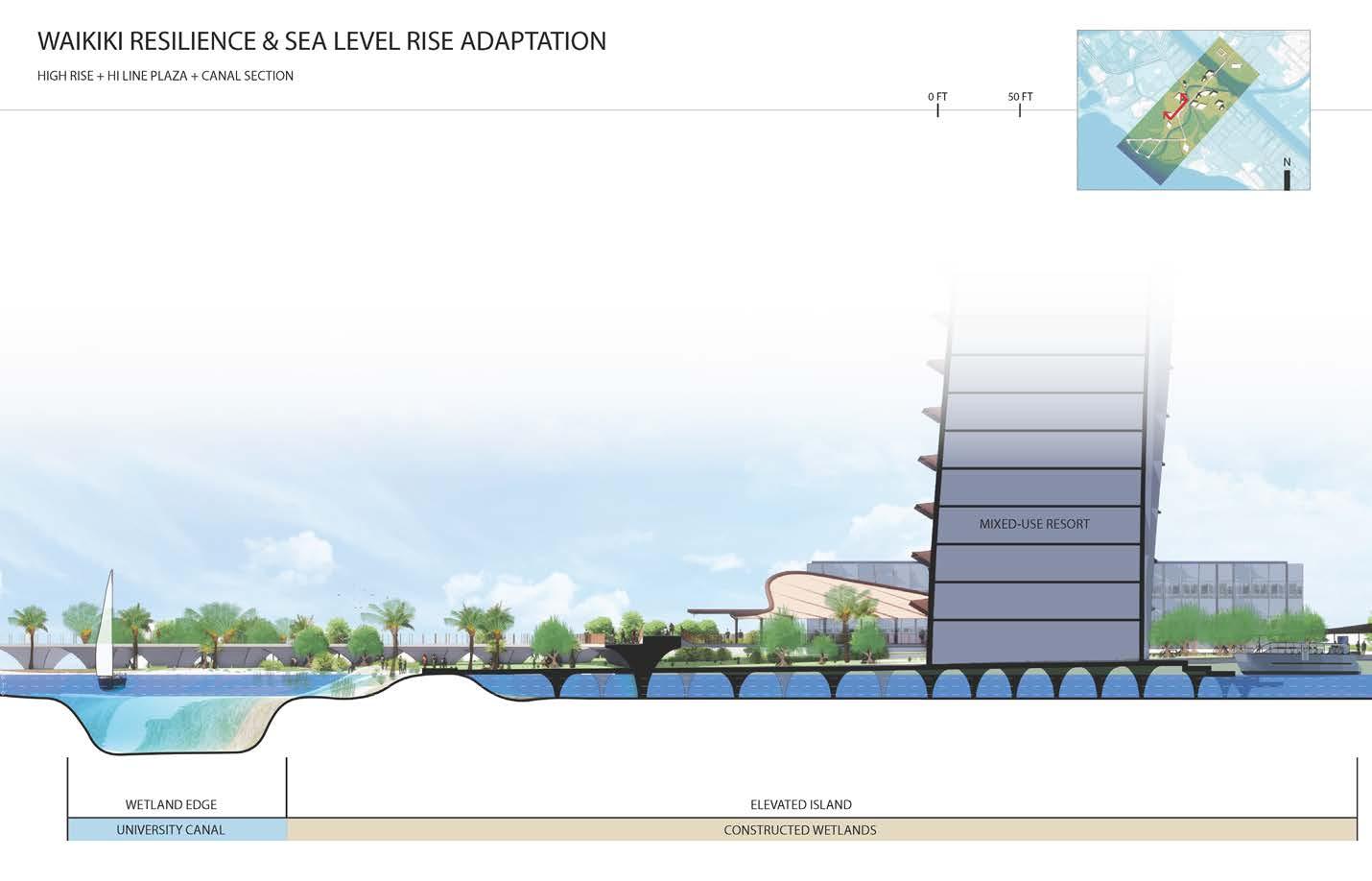
Isometric of building cluster and HI Line plaza

Student team: Alzira Fernandes, Beau Nakamori, Maleah Reynolds, Mel Yoo
Instructor: Judith Stilgenbauer
Student team: Alzira Fernandes, Beau Nakamori, Maleah Reynolds, Mel Yoo
Instructor: Judith Stilgenbauer
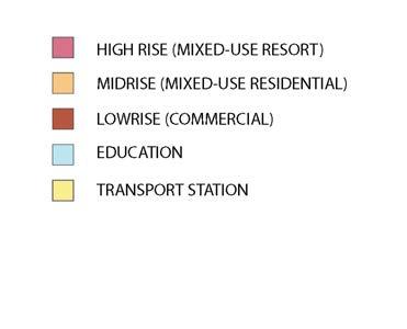
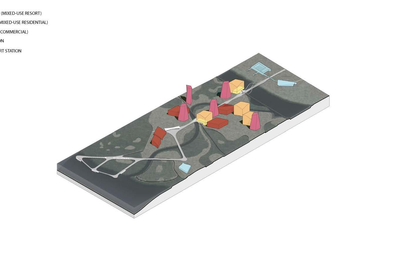
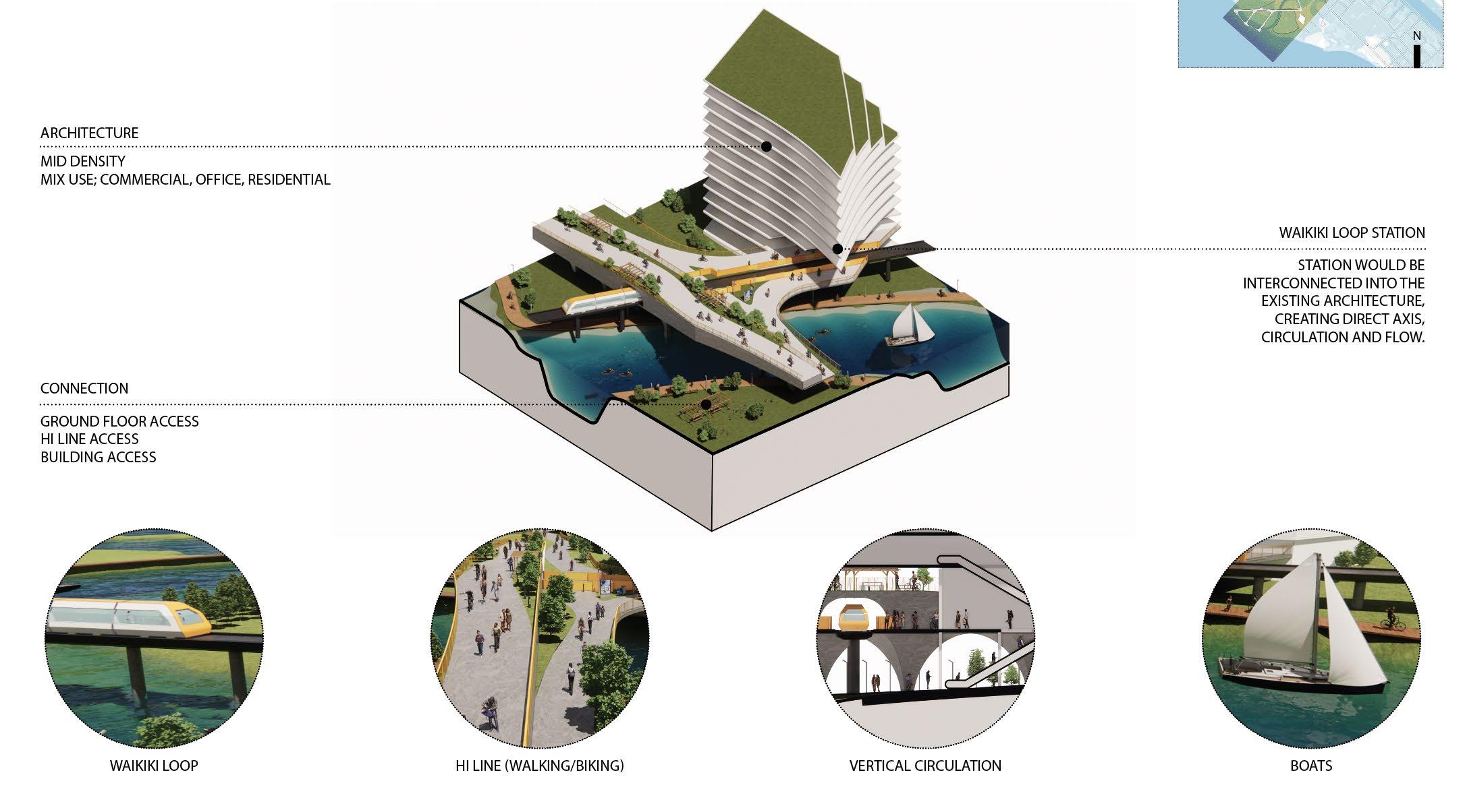
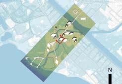
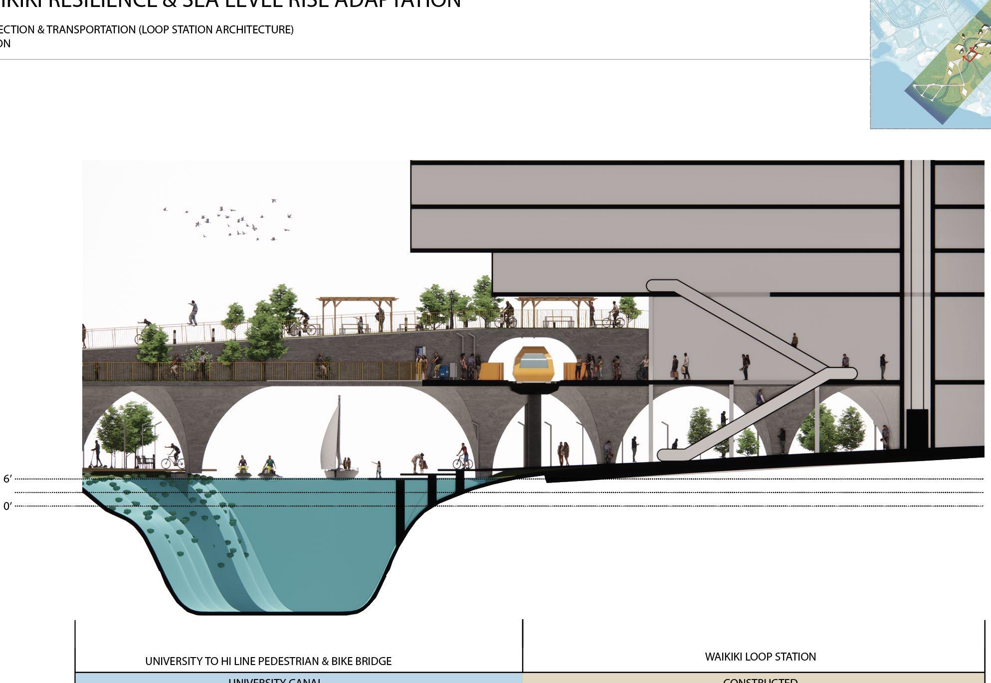
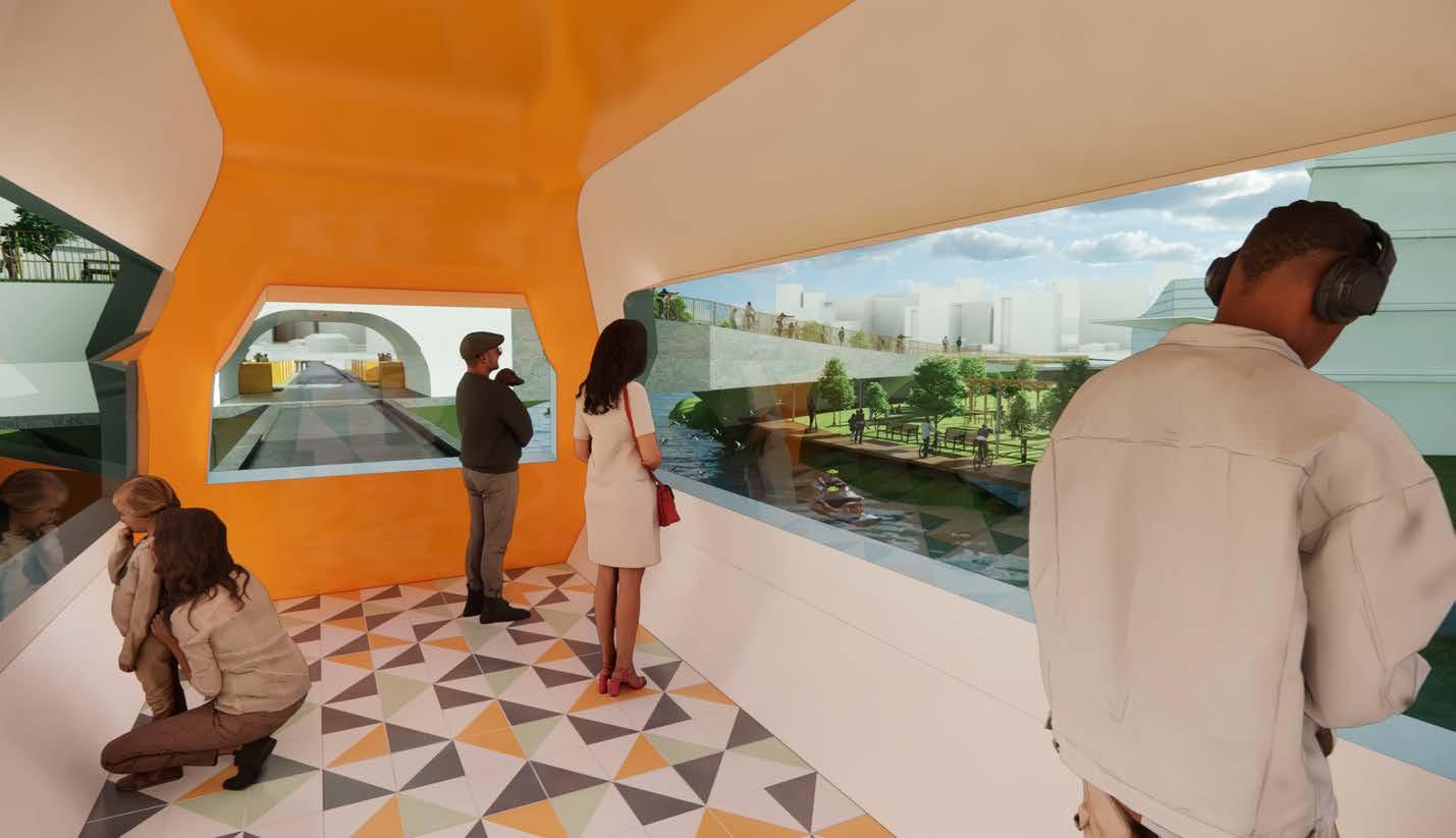
Isometric of connection and transportation components of proposed concept.

Student team: Alzira Fernandes, Beau Nakamori, Maleah Reynolds, Mel Yoo
Instructor: Judith Stilgenbauer
Student team: Alzira Fernandes, Beau Nakamori, Maleah Reynolds, Mel Yoo
Instructor: Judith Stilgenbauer
Ignis am, inctur autem ius. Hentionseque con pore dolorep elecerferuv
Ignis am, inctur autem ius. Hentionseque con pore dolorep elecerferuv
Ignis am, inctur autem ius. Hentionseque con pore dolorep elecerferuv
Instructor: Judith Stilgenbauer
Ignis am, inctur autem ius. Hentionseque con pore dolorep elecerferuv
Student Team:
Kiana Dai, Master of Landscape Architecture Candidate
Tyler Dinnocenti, Doctor of Architecture Candidate
Riza Lara, Doctor of Architecture Candidate
Project Title:
Island Central
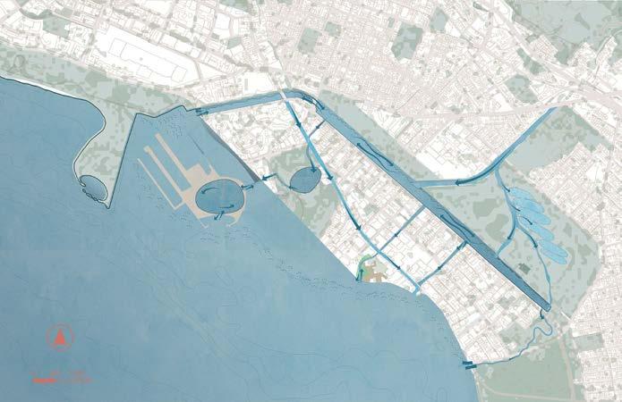
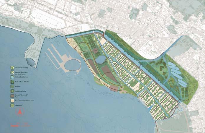
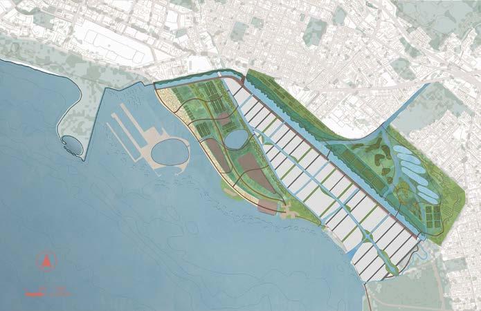
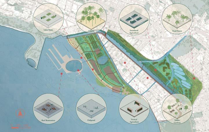
The current Waikīkī experience is only possible with massive imports of goods and materials.
Waikīkī can potentially be a catalyst for other communities that are tourism-dependent. These communities can be sustainably reimagined to improve user and resident experience.
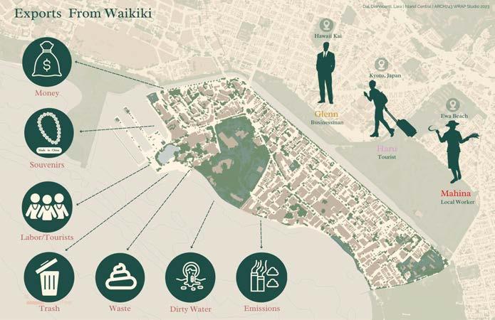
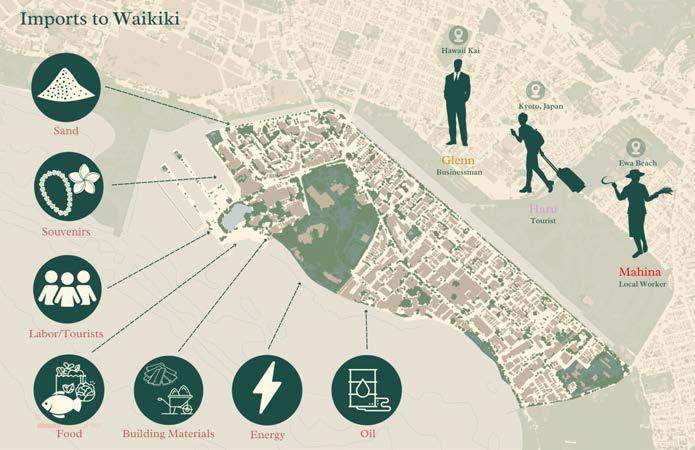
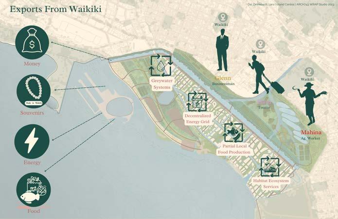
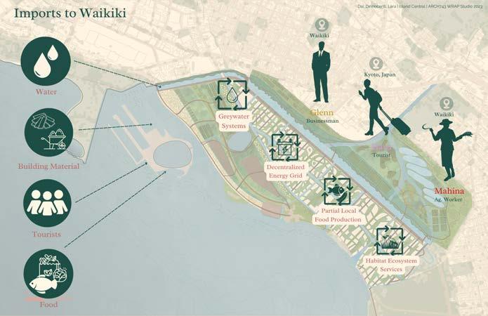
Through an analysis of imports and exports, Waikīkī can be re-envisioned with more sustainable commerce emphasizing closed-loop systems
While Waikīkī could likely never be a self-sustaining and closed-loop neighborhood, the proposed design envisions a future that emphasizes beneficial exports.
Student team: Kiana Dai, Tyler Dinnocenti, Riza Lara
Instructor: Judith Stilgenbauer
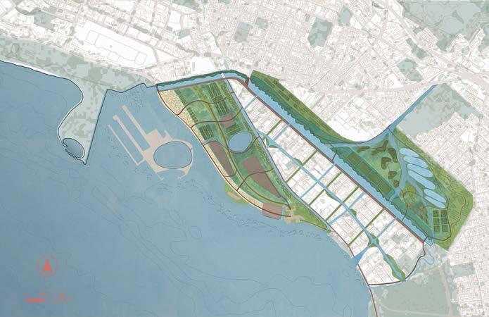
Throughout our design, the proposal investigates ways to keep Hawai’i’s isolation in mind and the state’s dependency on global imports and exports.



Student team: Kiana Dai, Tyler Dinnocenti, Riza Lara
Instructor: Judith Stilgenbauer




Student team: Kiana Dai, Tyler Dinnocenti, Riza Lara
Instructor: Judith Stilgenbauer
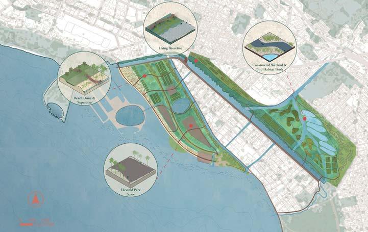
Overall Waikīkī Long-term masterplan

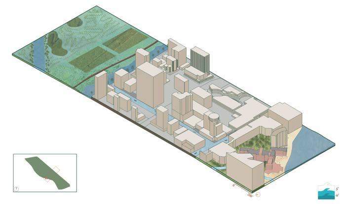
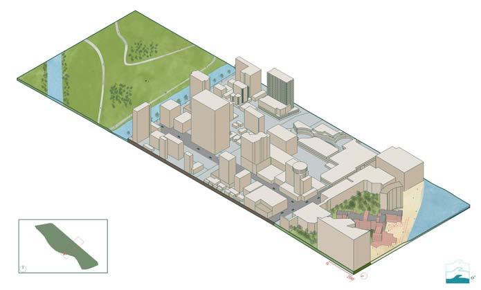
Student team: Kiana Dai, Tyler Dinnocenti, Riza Lara
Instructor: Judith Stilgenbauer


Landscape green infrastructure interventions on Ala Wai (mauka) side, previously Ala Wai Golf Course
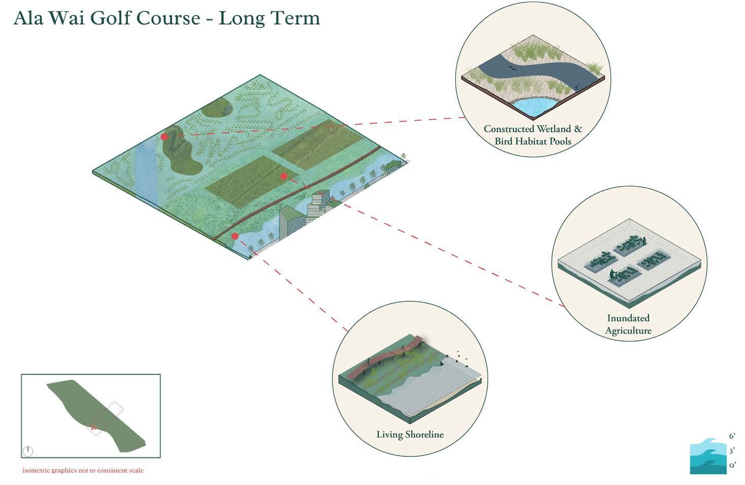
Student team: Kiana Dai, Tyler Dinnocenti, Riza Lara
Instructor: Judith Stilgenbauer

Landscape green infrastructure interventions on Royal Hawaiian (makai) side, with 6’ SLR

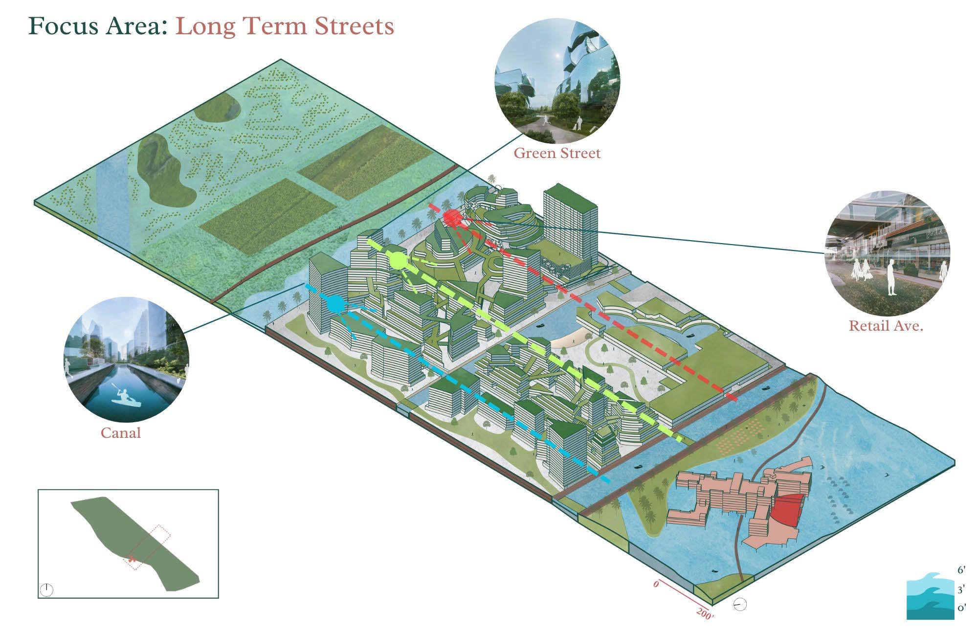
Student team: Kiana Dai, Tyler Dinnocenti, Riza Lara
Instructor: Judith Stilgenbauer
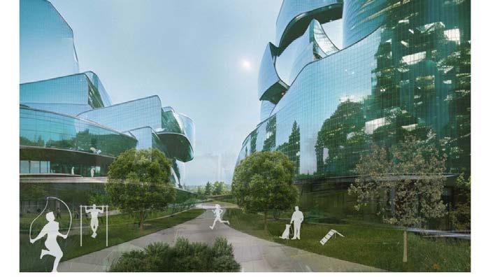
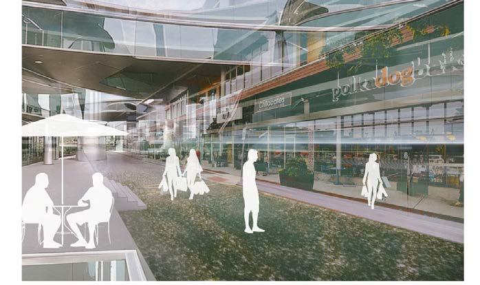


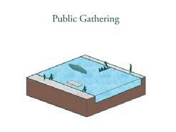




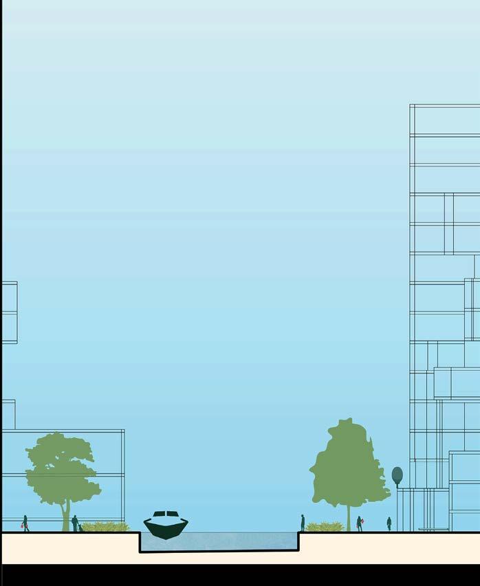
Student team: Kiana Dai, Tyler Dinnocenti, Riza Lara
Instructor: Judith Stilgenbauer
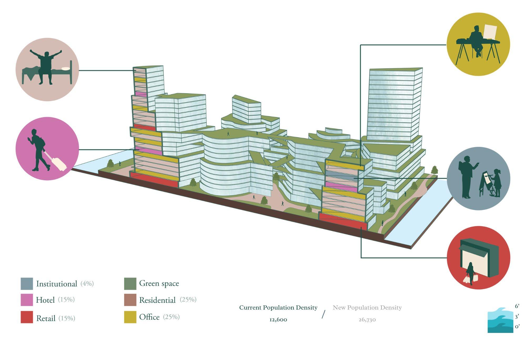

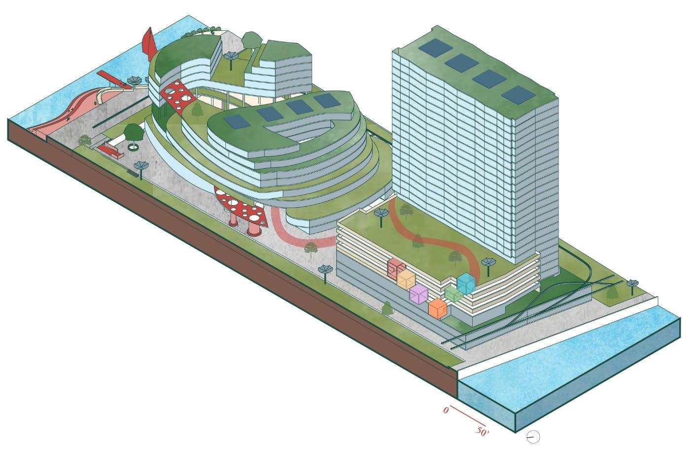
Isometric rendering of existing transect
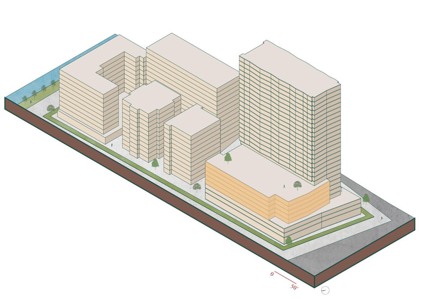

Isometric rendering of long-term proposed transect
Student team: Kiana Dai, Tyler Dinnocenti, Riza Lara
Instructor: Judith Stilgenbauer
Cultivation compontents of long-term proposal
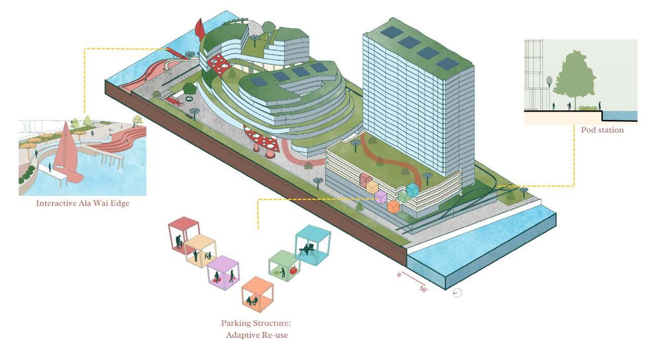
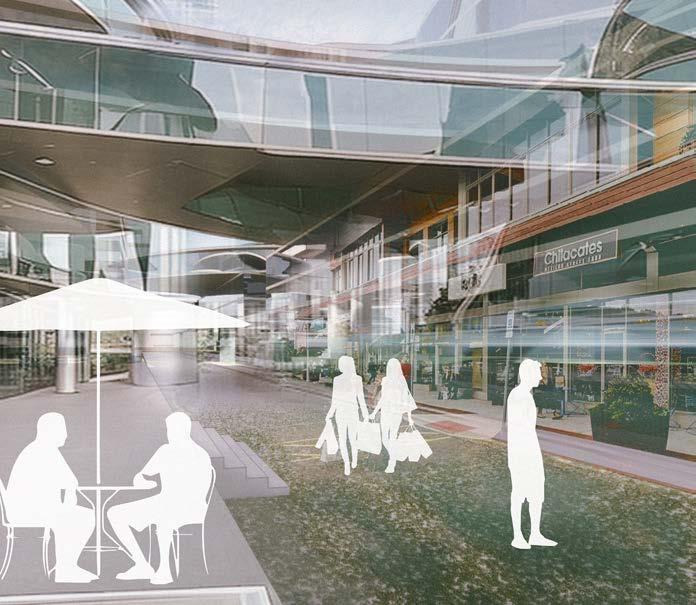
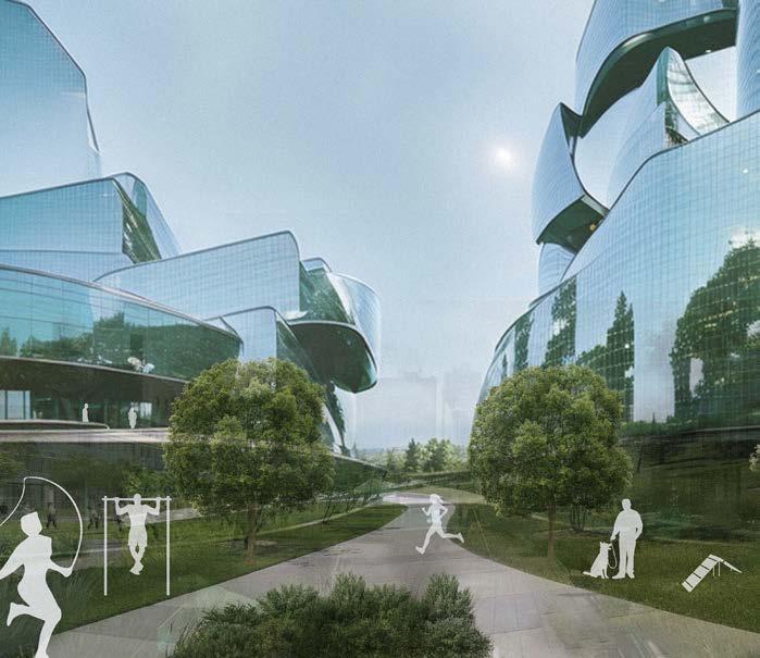
Connectivity compontents of long-term proposal

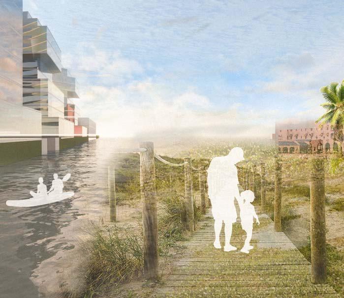
Student team: Kiana Dai, Tyler Dinnocenti, Riza Lara
Instructor: Judith Stilgenbauer
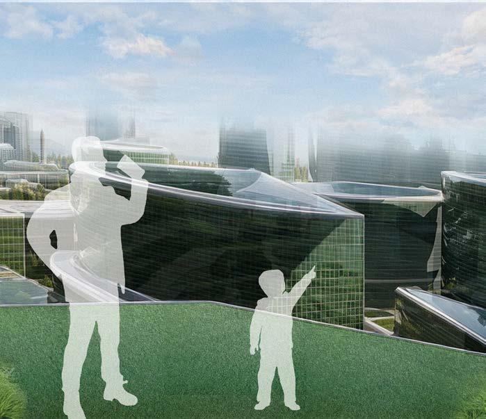
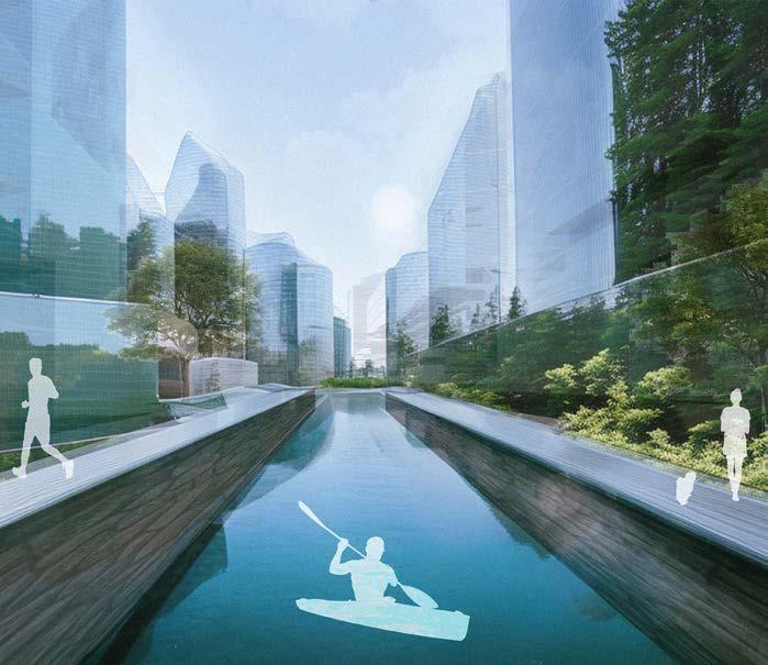
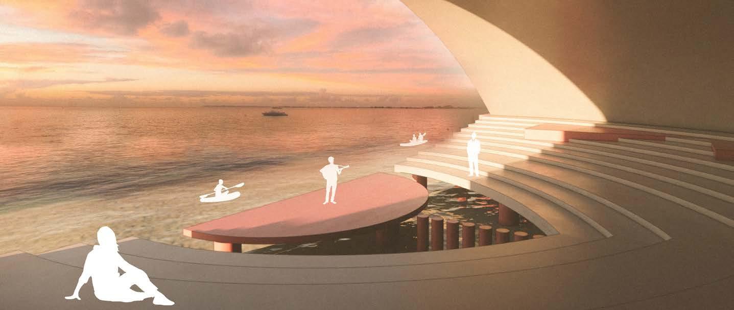
Student team: Kiana Dai, Tyler Dinnocenti, Riza Lara
Instructor: Judith Stilgenbauer

Ignis am, inctur autem ius. Hentionseque con pore dolorep elecerferuv
Ignis am, inctur autem ius. Hentionseque con pore dolorep elecerferuv
Ignis am, inctur autem ius. Hentionseque con pore dolorep elecerferuv
Instructor: Judith Stilgenbauer
Ignis am, inctur autem ius. Hentionseque con pore dolorep elecerferuv
Student Team:
German Failano, Master of Landscape Architecture Candidate
Nicole Gdula, Master of Architecture Candidate
Hannah Valencia, Master of Architecture Candidate
Project Title:
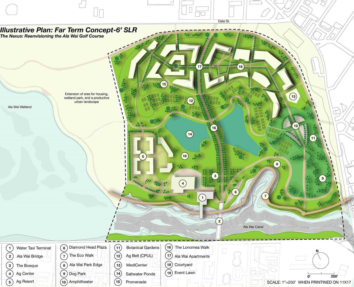
The Nexus
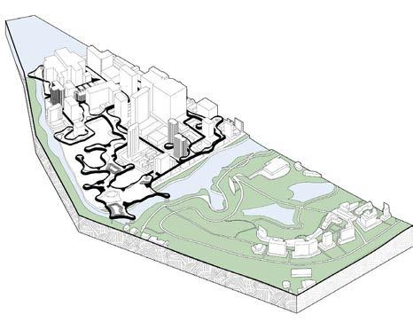
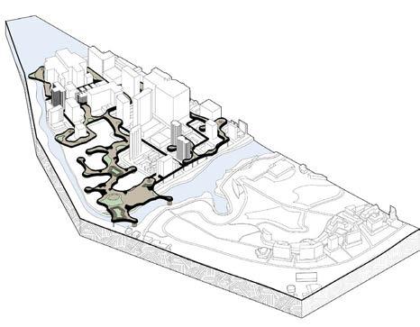
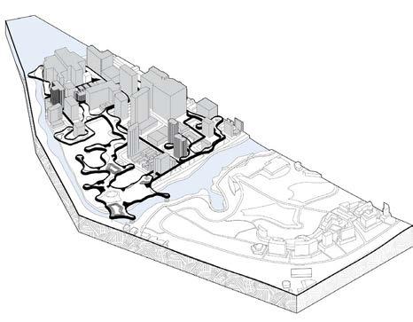


Student team: Gerry Failano, Nicole Gdula, Hannah Valencia
Instructor: Judith Stilgenbauer
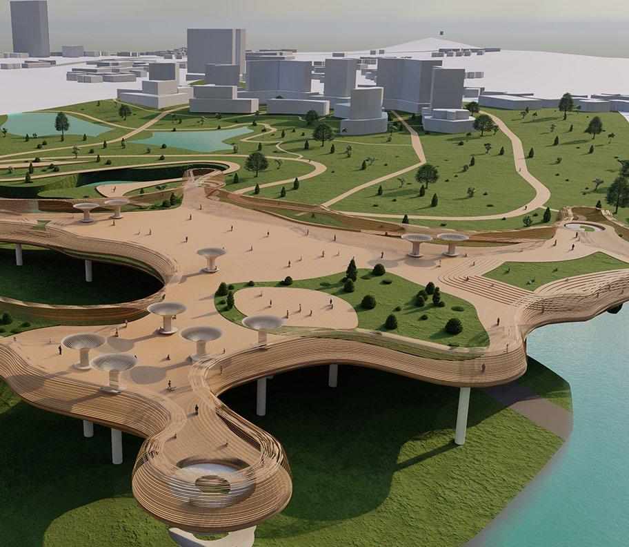


Student team: Gerry Failano, Nicole Gdula, Hannah Valencia
Instructor: Judith Stilgenbauer

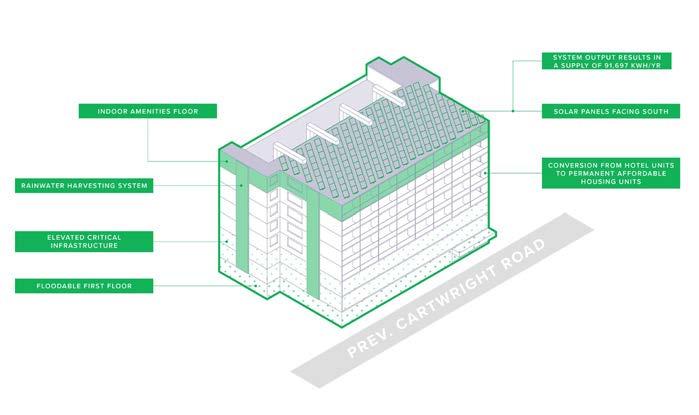
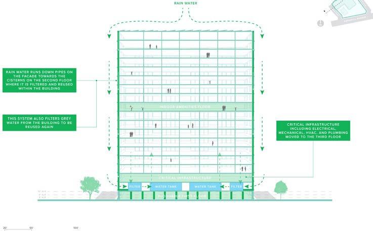
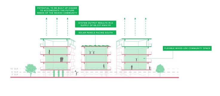
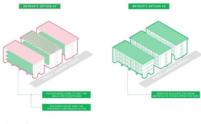
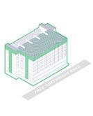
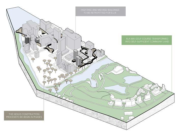
HIGH-RISE RETROFIT CASE STUDY: Queen Kapiʻolani Hotel
HIGH-RISE RETROFIT CASE STUDY: Queen Kapiʻolani Hotel
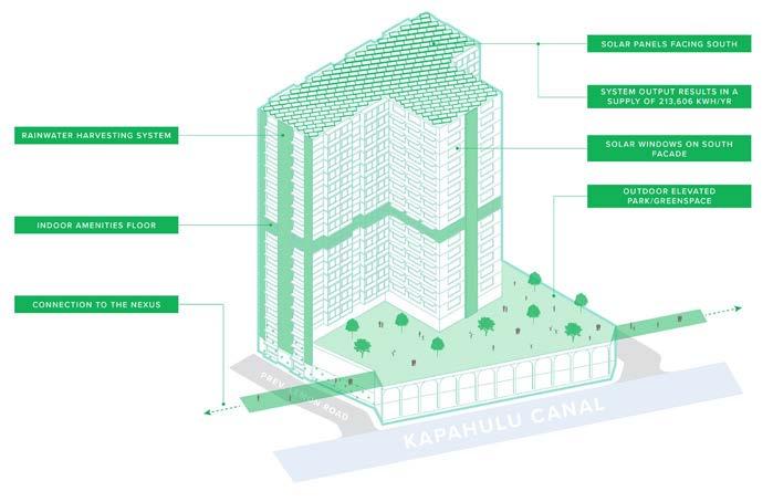
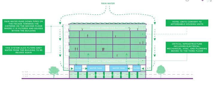
MID-RISE RETROFIT CASE STUDY: Ewa Waikīkī Hotel
MID-RISE RETROFIT CASE STUDY: Ewa Waikīkī Hotel
Student team: Gerry Failano, Nicole Gdula, Hannah Valencia
Instructor: Judith Stilgenbauer
LOW-RISE RETROFIT CASE STUDY: Waikīkī Beachside Hostel

HIGH-RISE RETROFIT CASE STUDY: Waikīkī Beachside Hostel
PROPOSED BUILDING DESIGN: School (multi-purpose building)
PROPOSED BUILDING DESIGN: School (multi-purpose building)
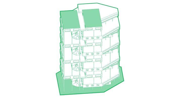
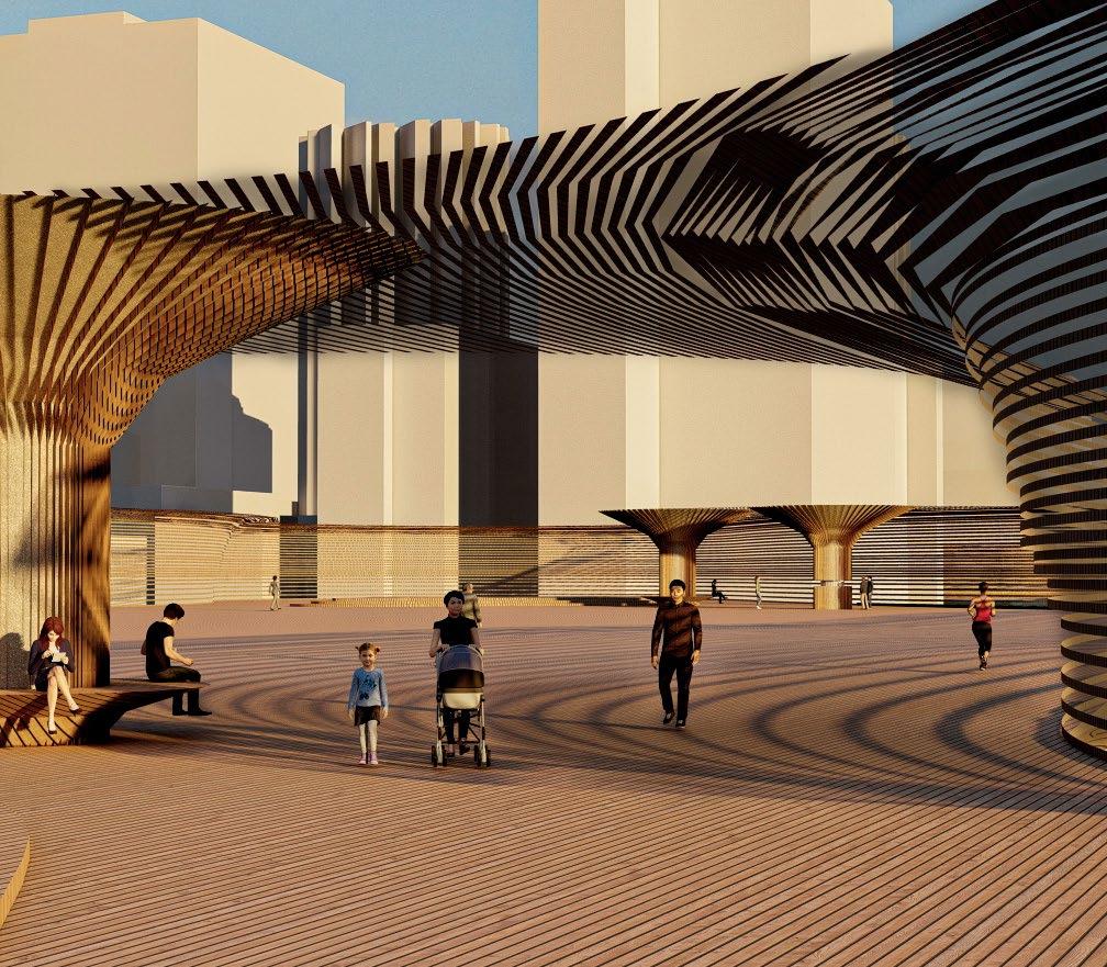
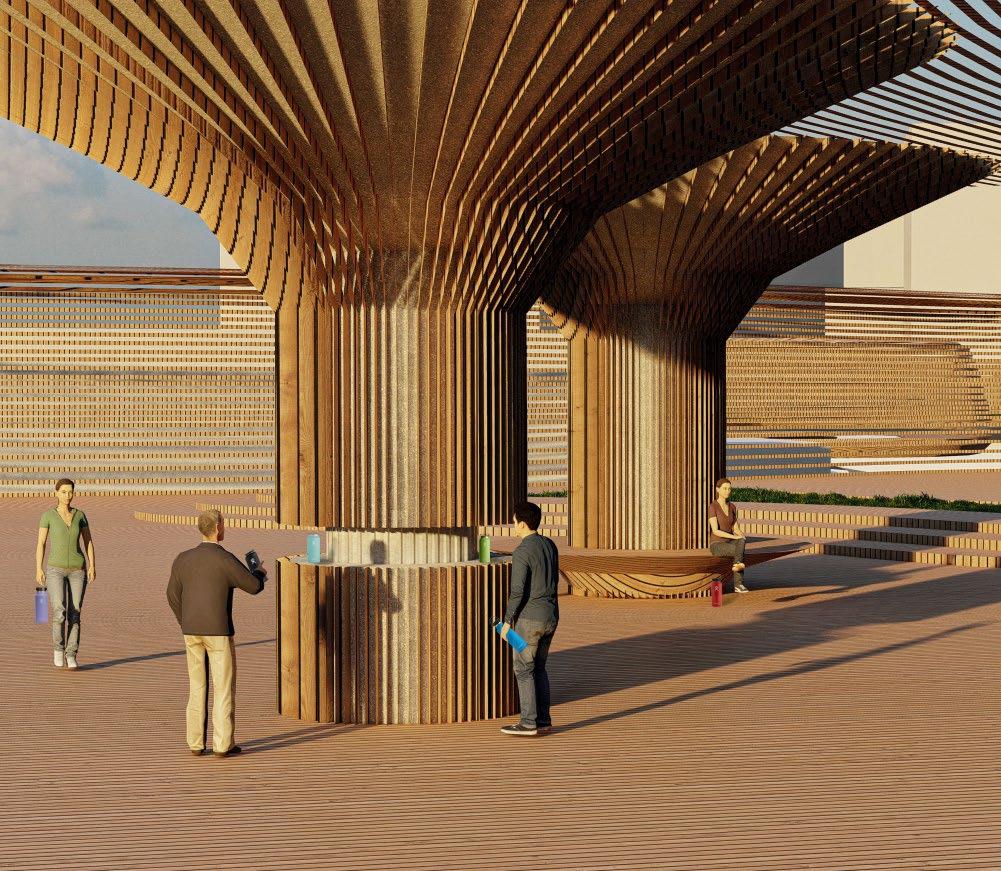
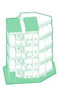
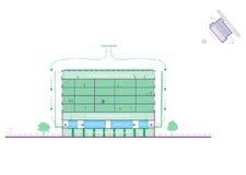
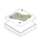
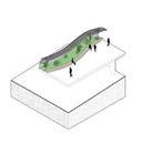
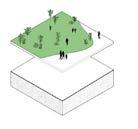
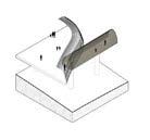
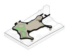
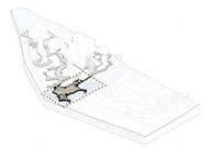
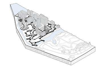
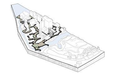
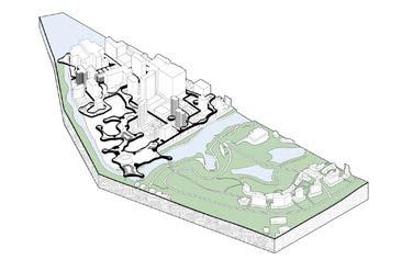
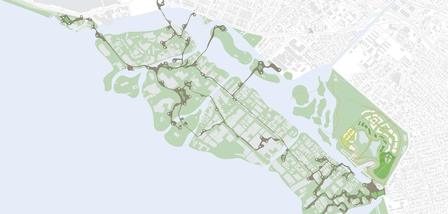
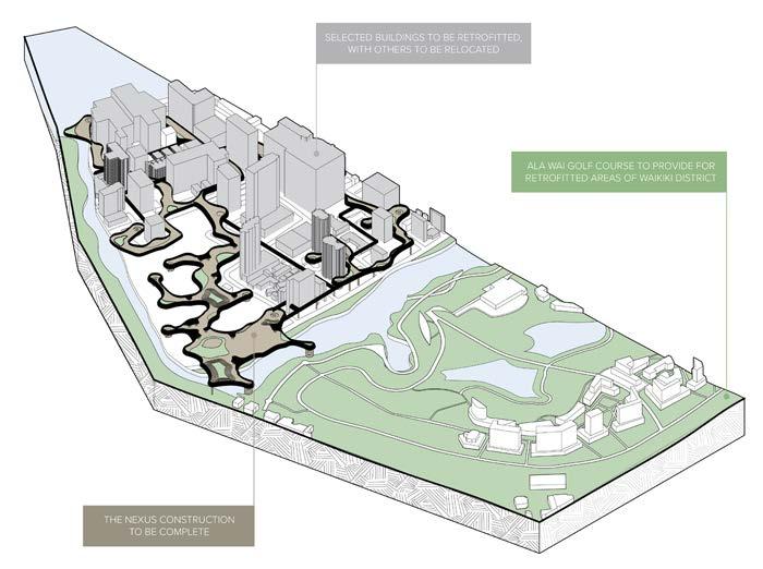
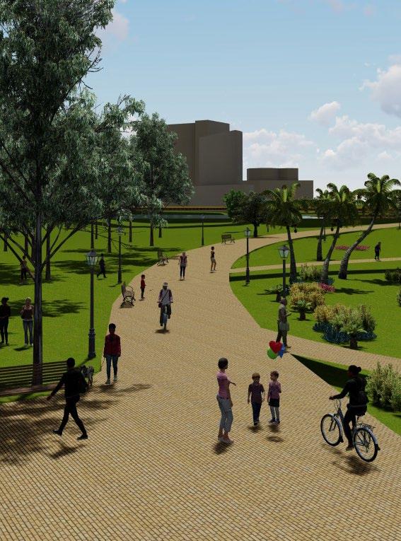
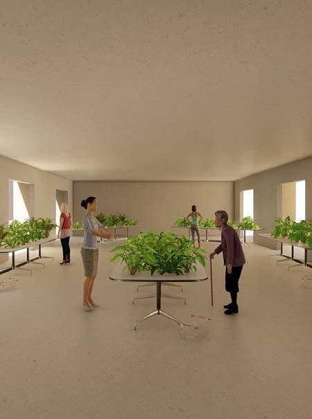
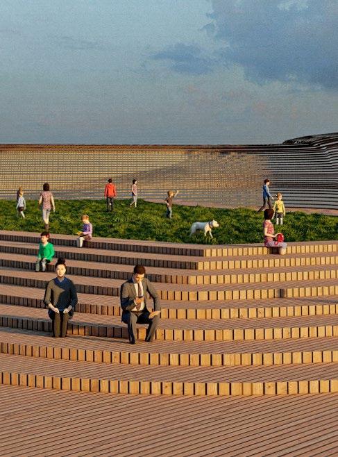
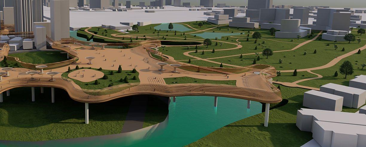
Highlighted isometric of the main activity are on the Nexus Isometric renderings of the Nexus components

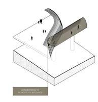

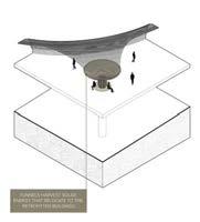
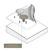
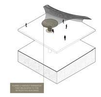
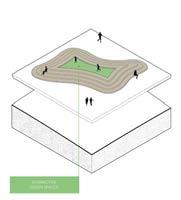
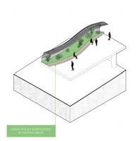
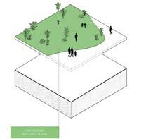
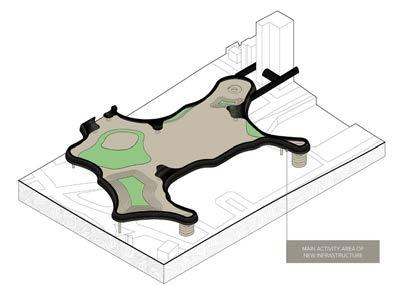
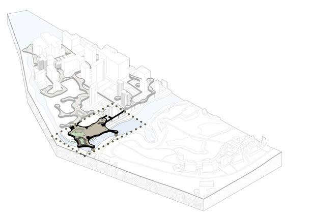
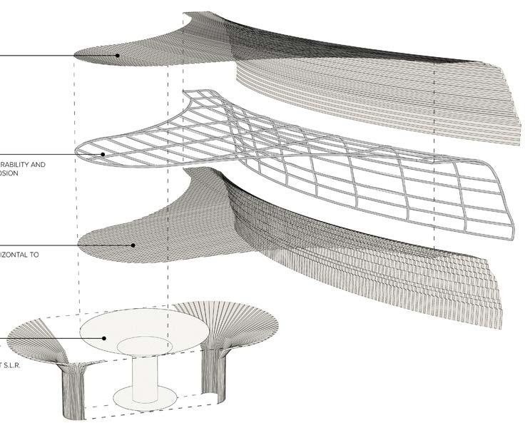
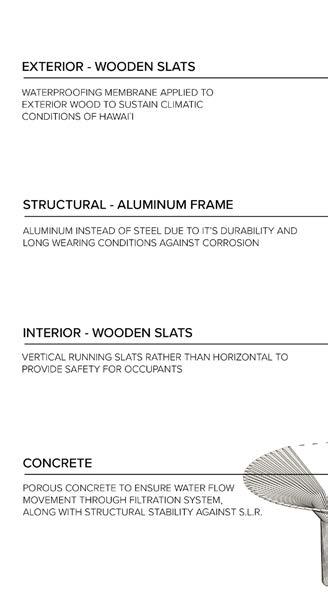
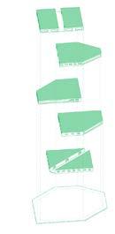
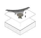
Diagram of the structural assembly of the Nexus

Student team: Gerry Failano, Nicole Gdula, Hannah Valencia
Instructor: Judith Stilgenbauer




ARCH 743 WRAP STUDIO | SPRING 2023


Gerry Failano, Nicole Gdula, Hannah Angelika Valencia
NEXUS INFRASTRUCTURE

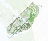
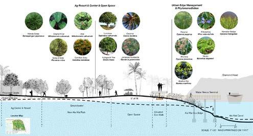
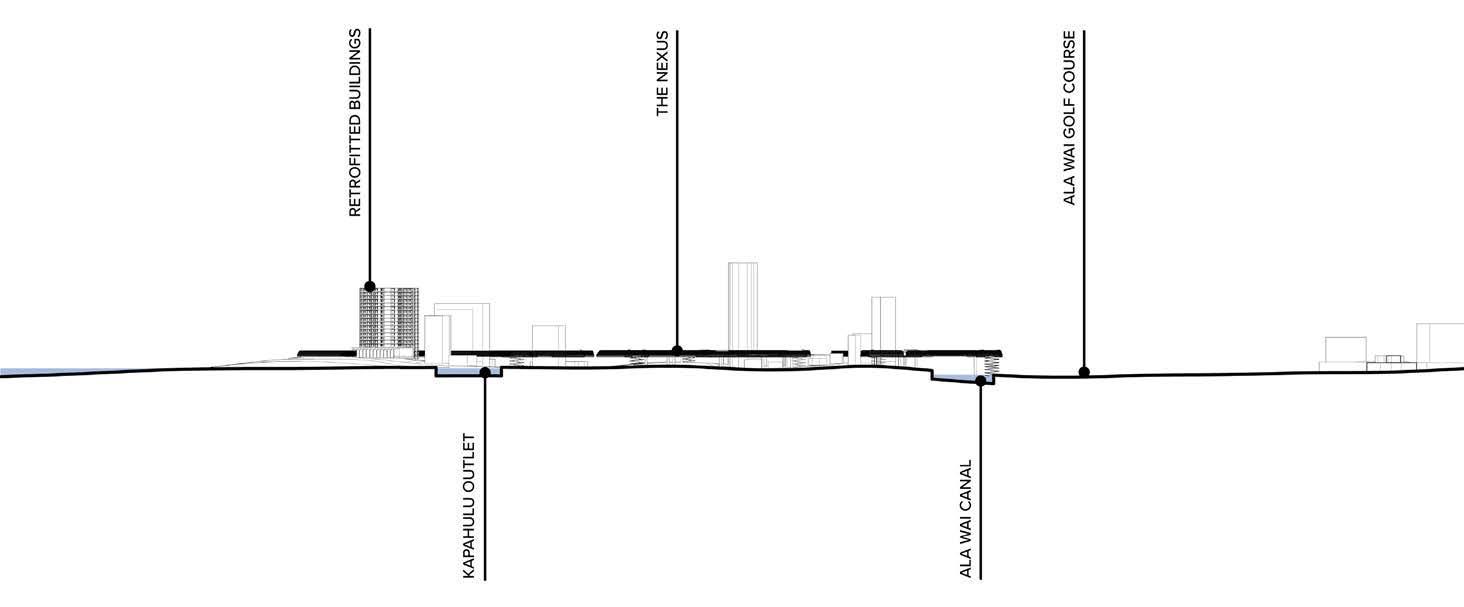
Section cut through propsed site




Student team: Gerry Failano, Nicole Gdula, Hannah Valencia
Instructor: Judith Stilgenbauer
Ignis am, inctur autem ius. Hentionseque con pore dolorep elecerferuv
Ignis am, inctur autem ius. Hentionseque con pore dolorep elecerferuv
Ignis am, inctur autem ius. Hentionseque con pore dolorep elecerferuv
Instructor: Judith Stilgenbauer
Ignis am, inctur autem ius. Hentionseque con pore dolorep elecerferuv