Join the Global Geospatial & Surveying Community in Australia
To help with your planning, there will be a dedicated tourism booth at the conference registration area. The team will be ready to assist you in organising and booking experiences that turn your trip into an unforgettable adventure.
• 1,800+ International & National Delegates
• 5-Day Conference with 70+ sessions
• 90+ Countries Represented
• Extensive Exhibition
Why attend? Find out more here www. g.net/ g2025/
• Dedicated Networking Opportunities
Vibrant City Life – Enjoy Brisbane’s riverfront dining, thriving arts scene, and must-visit cultural precincts like South Bank. Perfect Autumn Weather –Warm days and cool evenings, ideal for exploring.
Plan your visit. Connect with the global community. Explore Australia. A Gateway to Iconic Destinations –Gold Coast beaches, Sunshine Coast hinterland, and the Great Barrier Reef.
EO, city experts partner for urban heat study
“As cities grow and temperatures continue to rise around the world, so do the challenges of extreme heat.”
Yana
Gevorgyan, GEO
The Group on Earth Observations has announced that it has partnered with C40 Cities in a new urban heat study collaboration within the IBM Sustainability Accelerator program.
The aim is to address UN Sustainable Development Goal 11 by developing “a data-driven, AI-powered solution to help cities analyse potential risks that may arise as a result of extreme heat and the urban heat island effect”.
Those risks include stressed energy resources, increases in mortality rates, and socioeconomic disparities.
“As cities grow and temperatures continue to rise around the world, so do the challenges of extreme heat and its impact on urban populations,” said Yana Gevorgyan, Group on Earth Observations (GEO) Secretariat Director.
“At the Group on Earth Observations, we are committed to turning Earth Intelligence into action by equipping communities with
the data they need to build resilience.
“Through our collaboration with C40 and IBM as part of the IBM Sustainability Accelerator, we will test initial ideas from GEO’s Global Heat Resilience Service to demonstrate how AI-powered insights and geospatial data can help cities mitigate heat risks and protect vulnerable communities.”
C40 Cities is a network of nearly 100 mayors of some of the world’s major cities, including Melbourne, Sydney and Auckland.
The partners will collaborate over two years and in two phases on the urban heat project, receiving up to US$3 million in cash and inkind donations of technology and services.
The first phase will use IBM Garage, described as a “program governance platform that helps … prioritise, align and transparently track” initiatives.
That will be followed by a development and implementation phase, which will leverage IBM resources and technology and support pilot deployments in communities. n
Upcoming Events
22–25 April: Geospatial World Forum 2025, Madrid
27–29 April: WGIC Horizons 2025, Denver
2–4 May: ISV Wangaratta Regional Conference
13–15 May: International Association of Geodesy, Commission 4 Symposium, China
27–28 May: Australian Space Summit & Exhibition 2025, Sydney
23–27 June: ESA Living Planet Symposium 2025, Vienna
11 July: GCA 2025 NSW Geospatial Conference, Sydney
29 Sep–3 Oct: 76th International Astronautical Congress, Sydney
7–9 October: INTERGEO 2025, Frankfurt
15–17 October: 9th International Conference on Engineering Surveying, Czech Republic
17–23 November: FOSS4G 2025, Auckland
For more details about these and dozens of other events, go to www.spatialsource.
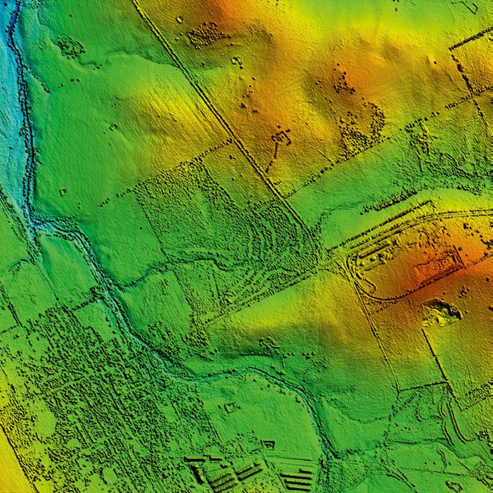
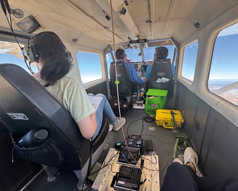
The first round of data collection for the IGNIS Project involved 50 flying hours covering 10,000 km.
MAPPING for predicting lightning strikes and fires
Edith Cowan University’s collaborative lightning strike study with NASA, the IGNIS Project, has completed its first round of aerial data collection.
The effort used infrared cameras to analyse the terrain in Western Australia’s south-east region to select areas for a lighting mapping network.
“The airborne part of this study has just completed 10 flying days, that’s more than 50 flying hours, covering 10,000 kilometres — which is the equivalent to one million hectares or 2.2 million acres,” said IGNIS Project Lead and ECU Executive Dean, Professor Paulo de Souza.
“We now have the task of analysing 50,000 images to locate areas where lightning could strike and spark a potentially catastrophic fire.
“Our team will be busy crunching all data giving our students an opportunity to learn advanced aerospace techniques.”
Aboard the aircraft was a Klau Geomatics PPK system and two Fuji GFX100 cameras that had been modified for aerial work, with one of the cameras operating in the near infrared. The mounting system had been specially engineered and approved for aviation use.
Klau Geomatics set up the equipment, while specialist aviation firm 61Aero did the capture and data processing.
“We’ve had that system for more than a decade now and it’s very robust, triggering the cameras by distance and producing highly accurate camera centre coordinates,” said Rob Klau of Klau Geomatics.
“We used TerraStar-C Pro PPP for positioning, so we got 3 to 5 cm accuracy on the camera centre coordinates, which
means the photogrammetry piece processes much faster.”
“Compare that to how many ground control points you’d need over such a large area and how many months it would take,” by doing it on the ground instead of the air, he added.
The result is what Klau calls a “foundational dataset” that the Project can use to inform the next phases of the work.
The IGNIS Project is a multi-agency collaboration between NASA, The University of New South Wales (UNSW) in Canberra, The University of Adelaide, University of Technology Sydney (UTS) and The University of Newcastle.
The Project is being supported by 10 to 14 lightning ground stations deployed across eastern Australia.
The ground network will be operated in collaboration with NASA’s Marshall Space Flight Centre and the SWIRLL (Severe Weather Institute Radar and Lightning Laboratories) of the University of Alabama, in Huntsville.
Later this year, the network will be complemented by a lightning sensor installed on an aircraft. These flight campaigns will also be supported by a thermal sensor developed by NASA’s Goddard Space Flight Centre.
The next stage of IGNIS will involve the launch of a 12U satellite to map and track thermal and lightning patterns from lowEarth orbit.
“This project could take several years to complete but could change the way lightning is studied well into the future and could potentially change the way fires are fought not only in Australia, but around the world,” Professor de Souza said. n
The ECU IGNIS flight team.
The first round of data collection for the IGNIS Project involved 50 flying hours covering 10,000 kilometres.
An infrared image captured during the IGNIS data-collection flights. All images courtesy ECU.
Geospatial: Making the world a better place
As I write this, the combined FIG Working Week 2025 and Locate25 conferences are just a few weeks away. It promises to be a wonderful occasion, and I can’t wait to catch up with colleagues old and new from around Australia and meet the many delegates who will arrive from around the world. If you’re one of those visitors to our shores, welcome, and we hope you enjoy this issue of Position magazine. Please also check out our online presence, www.SpatialSource.com.au, for daily updates on geospatial happenings in our region, and stay in touch by subscribing to our weekly e-newsletter.
In this issue, we look at a wide range of applications for geospatial data and technologies throughout the Australasian region: from efforts to predict lightning strikes that cause devastating bushfires, to mapping forest plantations in better detail than ever before, to protecting vulnerable coral reefs — of which Australia has quite a few, of course. It’s great to see that our sector is tackling many of the bigger issues facing the planet.
On that topic, we were very pleased to speak with Australia’s very own Dr Zaffar Sadiq Mohamed-Ghouse, an internationally recognised and respected geospatial expert. He has a lot to say about current trends and activities in the geospatial sector, and what it can and should be doing to make the world a better place for everyone, not just the lucky few.
We’re also proud to continue our annual support of International Women’s Day — which was celebrated as usual on 8 March — and DEI initiatives in general. In this issue, we profile three outstanding individuals who have chosen three very different career trajectories within the geospatial sector. Indeed, it can be said that one of the strengths of our sector is the wide variety of career choices it offers — hopefully, it’s this kind of vocational diversity that can be used to attract an increasingly diverse workforce… which, let’s face it, is desperately needed for all sorts of very well-known reasons.
Jonathan Nally Editor
June/July 2025 — Issue 137
Infrastructure: The space and spatial sectors are intricately linked. Our mid-year issue will focus on the use of GNSS, PNT, remote sensing, defence, sovereign capabilities, as well as how geospatial is used in disaster response.
For article proposals, contact our Editor, Jonathan Nally at jnally@intermedia.com.au
For marketing, contact our Advertising Manager, Anna Muldrock at amuldrock@intermedia.com.au
Advertising booking date: 8 May 2025
Advertising material date: 13 May 2025
Publication date: 4 June 2025
Position magazine acknowledges the traditional custodians of country across Australia, and we pay our respects to Aboriginal and Torres Strait Islander cultures and to their elders, past, present and emerging.
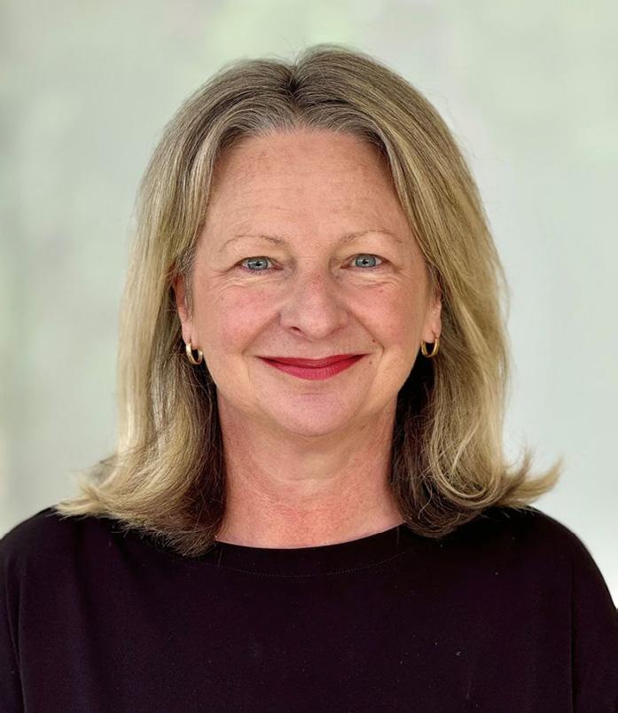
Melissa Harris to head Geoscience Australia
Melissa Harris has been appointed the new CEO of Geoscience Australia, replacing the current CEO, Dr James Johnson, who last year announced his plans to retire after eight years in the role. Harris, who is currently Chief Executive and Registrar of Titles at Land Use Victoria, will take up the position on 24 February.
Dr Johnson congratulated Harris on her appointment.
“Geoscience Australia has been my home for almost 20 years. It is full of passionate and dedicated people bringing world-leading science to the forefront of the Australian public,” he said. “I know Ms Harris will bring her wealth of experience to the organisation, and I am confident Geoscience Australia will reach new heights under her leadership.”
Writing on LinkedIn, Harris said that she is “beyond thrilled and honoured to be building on the incredible legacy of James Johnson and his exceptionally talented leadership team in my appointment as the new Chief Executive Officer at Geoscience Australia, following James’ upcoming retirement.”
“GA is a world-leading science organisation providing crucial information to government, industry and the community to support the economy, safety and sustainability of Australia,” Harris wrote. “I’m looking forward to working with everyone in GA and all of our stakeholders in this next exciting chapter.”
In announcing the appointment, Acting Minister for Resources, Amanda Rishworth, noted Harris has more than 30 years of experience in geospatial, planning and land administration in Victoria, for which she was awarded a Public Service Medal in 2023.
“In her new role, Ms Harris will oversee the Government’s record $3.4 billion investment through Resourcing Australia’s Prosperity, which will help find those economy-making discoveries that will support future generations of Australians,” Minister Rishworth said.
“Importantly, she will also drive Australia’s engagement with the United States-led Landsat Next satellite program, building on more than 50 years of collaboration with the United States on Earth observation and data.”
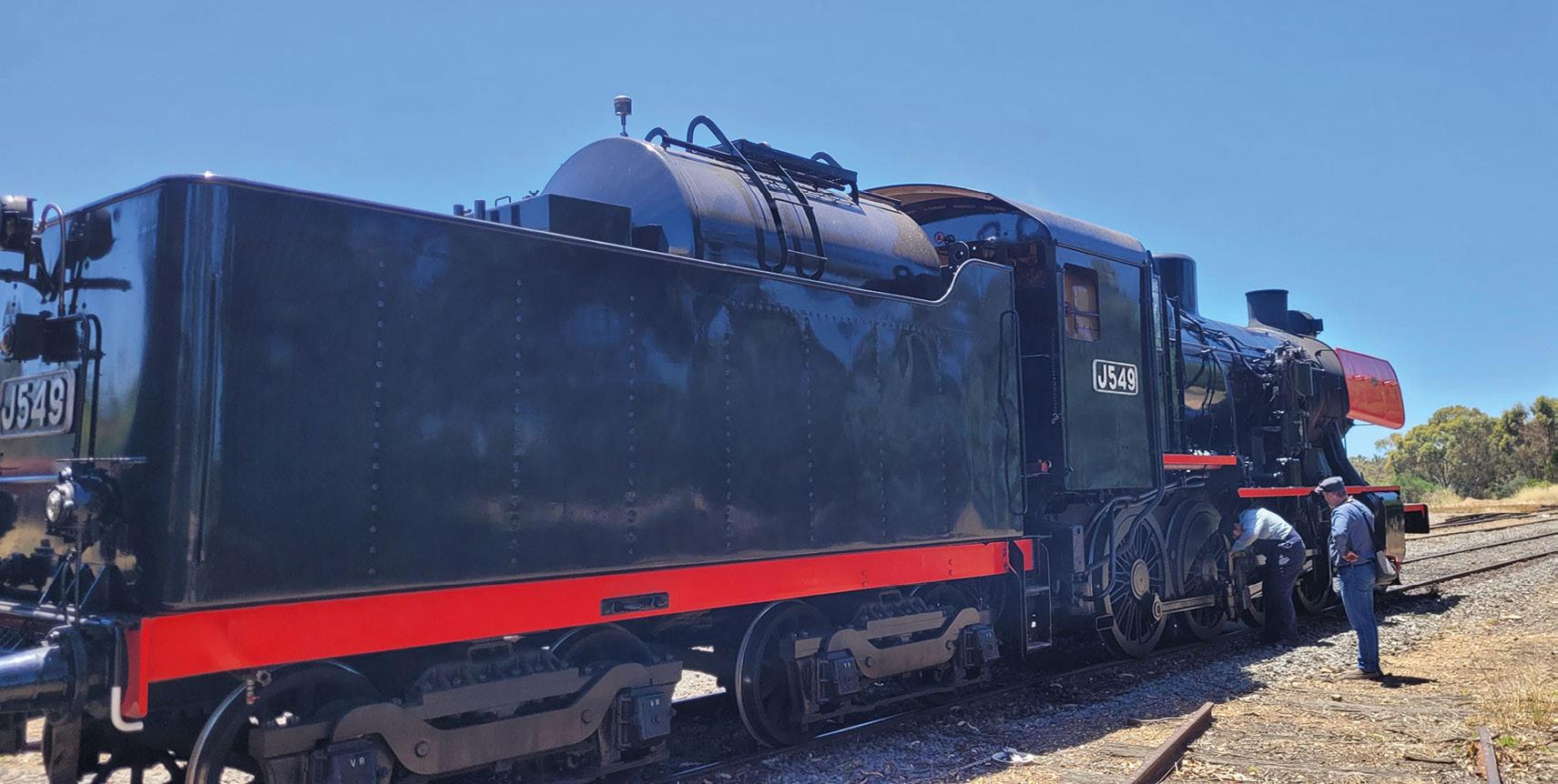
FrontierSI launches PNT Labs
FrontierSI has announced the launch of what it calls Australia’s first positioning, navigation and timing (PNT) Labs, being a network of facilities for testing and analysing the performance and resilience of PNT technologies.
The first such lab will be established at the Victorian Goldfields Railway (VGR) in Central Victoria and will provide a “controlled and consistent real-world environment for PNT testing”.
The VGR Lab will use a software-defined radio to introduce controlled radio frequency interference disruptions in order to see how different GNSS hardware and positioning algorithms handle them.
In December 2024, FrontierSI conducted a preliminary trial to assess the suitability of the VGR for the PNT Lab. The trial involved measuring the track to 1cm accuracy using four high-precision GNSS receivers mounted on two separate rail vehicles. This known trajectory will serve as the reference benchmark for future tests, enabling rigorous evaluation of GNSS receivers and INS.
PNT Labs aims to collaborate with industry and research partners to assess both current and emerging satellite navigation systems.
In related news, FrontierSI and Pentagram Advisory are inviting expressions of interest from critical infrastructure operators across Australia to participate in a PNT Security Risk Assessment pilot project.
Minister Rishworth also thanked Dr Johnson “for his leadership and dedication to the organisation”.
“Dr Johnson’s term as CEO will be remembered for his strong commitment to scientific excellence, his leadership in the application of scientific data for decision makers in government and industry and for building enduring links with stakeholders across the nation and world,” the Minister said. “I wish him well in his retirement.”
The aim of the project — which is expected to run for 12 and 14 weeks between March and May 2025 — is to help organisations assess PNT vulnerabilities and strengthen resilience against potential disruptions and provide a structured approach to evaluating and mitigating PNT-related risks.
FrontierSI and Pentagram Advisory are seeking a participant classified as a critical infrastructure asset under the SOCI Act, operating within Australia, and significantly reliant on PNT services.
Further details of the PNT Labs and Risk Assessment pilot can be obtained by emailing pnt@frontiersi.com.au.
Melissa Harris
A locomotive at the Victorian Goldfields Railway
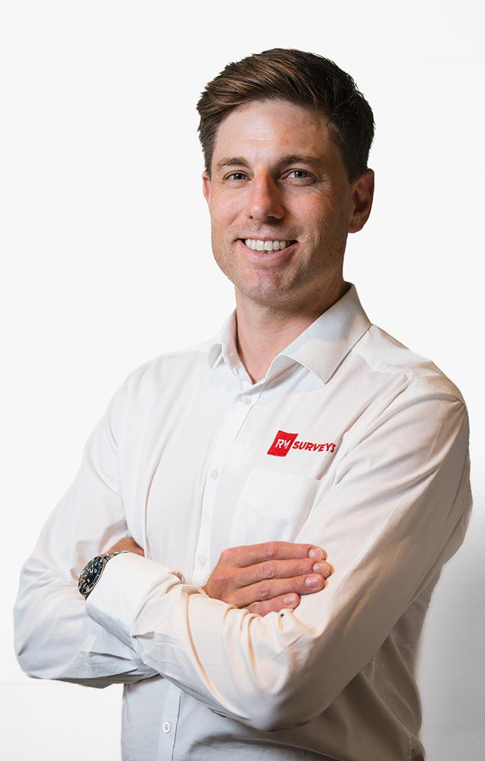
Marcello appointed CEO of RM Surveys
Perth-based surveying company, RM Surveys, has announced that Peter Marcello has been appointed CEO as the company’s founding director, Geoff Robb, prepares for his future retirement.
Marcello was actually appointed to the role in July last year, and for the past several months has worked alongside Robb to ensure a smooth leadership transition.
Robb had led the company since its establishment in 1995, shaping it into a “company of spatial experts”.
Under his leadership, RM Surveys continually expanded its services and embraced new technologies.
“RM Surveys is experiencing an exciting phase of growth, and I look forward to building on this momentum,” said Marcello. “With the support of a highly competent general management and departmental management team, we will continue to strengthen our workforce, invest in cuttingedge technology, and uphold the high standards of service our clients expect.
“We are committed to unlocking potential for both our people and clients as we continue to reveal the bigger picture in every project.”
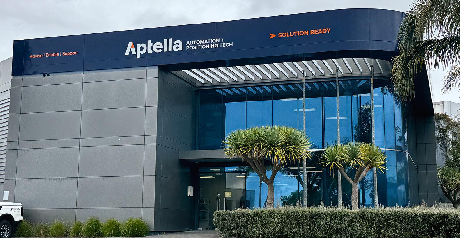
New NZ offices for Aptella
Aptella has opened a new flagship office in Auckland and relocated its Wellington branch, with each location to offer sales, calibrations and support services. The move comes after Aptella acquired Synergy Group’s positioning, rental and equipment business unit in New Zealand in 2024.
“Our new flagship Auckland office brings together colleagues from Aptella’s original New Zealand business and former Synergy employees to streamline support for customers,” said Martin Nix, CEO at Aptella.
Aptella says its Auckland office, which has an enhanced service centre, a showroom and large warehouse facilities, will meet the growing demand for solutions in the civil construction, building, mining and geospatial sectors.
“The launch of these new offices is about our continued commitment to delivering world class technology and support to the New Zealand market, which we value greatly,” said Joel Smith, Regional Manager for New Zealand at Aptella.
“We’re excited to offer a more comprehensive and streamlined experience at our new branches, where customers will find the tools and services they need to drive efficiency and success in their projects.”
The new Auckland office is located at 46 Apollo Drive, Rosedale, while the Wellington office is at Unit 1B, 2 Centennial Highway, Ngauranga. The company also has branches in Christchurch and Hamilton.
Veris acquires Spatial Vision
Veris has announced that it has entered into an agreement to acquire 100% of Spatial Vision, in a cash and scrip deal valued at up to $3 million.
“We are thrilled to welcome the Spatial Vision team into the Veris family,” said Michael Shirley, MD and CEO of Veris. “This acquisition is a strategic step forward in our strategy to provide unparalleled digital solutions, consulting and advisory services.
In a statement released to the ASX, Veris said the acquisition “provides the opportunity for Veris to realise significant synergies, particularly in the realm of digital solutions,” given that each company has “robust GIS service offerings that, when integrated, will enhance the overall service portfolio”.
The company added that the “operational and financial synergies of this acquisition are expected to be significant”.
The parties expected the transaction to be completed by early March 2025.
“The acquisition aligns perfectly with our digital strategy,” said Shirley, adding that “Spatial Vision’s established relationships with local, state and federal government agencies will open new avenues for collaboration and growth”.
Melbourne-based Spatial Vision was founded in 1999 and has grown to have around 40 staff and annual revenue of more than $9 million. It provides spatial, GIS and application development services to private- and public-sector clients within fields such as agriculture, fisheries, natural resources management and climate change.
Peter Marcello
Aptella’s new office in Auckland
Movements at the top
Hexagon has appointed Anders Svensson as the company’s new President and CEO, succeeding Norbert Hanke. Svensson, who will take up the new role by 20 July 2025, joins Hexagon from Konecranes, where he has been President and CEO since October 2022.
“I am very pleased to announce the appointment of Anders Svensson as the new President and CEO of Hexagon,” said Ola Rollén, Chairman of the Board of Hexagon. “He has a strong track record, in terms of leadership experience, enhancing company culture, driving customer-centricity and delivering strong growth and improved profitability.
“Under Anders’ leadership, Hexagon will be well placed to capture the exciting opportunities that lie ahead, and deliver on our existing financial targets.”
Meanwhile, Woolpert has promoted Neil Churman to CEO, succeeding Scott Cattran, who has led the company since 2015. Churman had served as Woolpert’s president since early 2024, and previously as the company’s first chief corporate development officer. He led the company through five strategic acquisitions, adding more than 800 employees and expanding the company’s capabilities across the US, Europe and Australia.
IGNSS, AIN announce merger
“I am honoured to take on this role and am humbled by the responsibility to carry forward our legacy of over 100 years of supporting critical programs for our clients,” said Churman. “I’m also committed to strengthening our culture and ensuring we create a great place to work for all our global employees.”
Closer to home, Emesent has appointed mining industry executive Christofer Catania to its board. A finalist in the 2024 Executive of the Year Awards in the Mining and Energy category, Catania, currently CEO of mining consultancy firm MEC, brings extensive experience from corporate administration and diverse sectors within mining.
“As a technology start-up, it made sense to back Emesent with expertise in building a business from the ground up, to help the leadership team navigate those early years of investment, deal with rapid growth and guide corporate governance,” said Emesent board chairman Mike Zimmerman.
“As Emesent matures, however, it is crucial to inject specialist customer and industry-centric experience into the mix, and I’m confident our recent appointment of Christofer Catania will do just that.”
The Australia-based International Global Navigation Satellite Systems (IGNSS) Association and the Australian Institute of Navigation (AIN) have announced plans to merge.
The AIN has been around for 76 years and is a part of the International Institutes of Navigation (including the US Institute of Navigation and the Royal Institute of Navigation), which have taken a leading role in PNT research, developments and practice.
The IGNSS has long run a series of conferences focusing on positioning, navigation and timing (PNT) technologies and satellite navigation systems, attracting hundreds of delegates from around the world.
The most recent IGNSS conference, held in Sydney in February 2024, attracted a global line-up of speakers who presented on a wide range of topics including PNT in space, geodesy, PPP and RTK and GNSS reflectometry. The PNT2026 conference will be held in Sydney from 4 to 6 February 2026.
With the merger of the two bodies, a new PNT SubCommittee has been set up within AIN, to be led by Prof. Andrew Dempster, A/Prof. Craig Roberts and Prof. Allison Kealy.
“This merger marks a new chapter for the community, including the transformation of the internationally renowned IGNSS Conference into PNT2026, which will now be conducted as an official AIN event,” said Prof. Kealy. “This partnership strengthens our ability to advance PNT research, innovation, and collaboration across Australia and globally.”
Legacy Landonline to be switched off
Surveyors who have been using New Zealand’s legacy Landonline service have been reminded that the final switchover to the New Landonline system will soon take place.
According to Toitū Te Whenua Land Information New Zealand (LINZ), surveyors have been using New Landonline exclusively to complete their capture work since November 2022, and Sign and Submit since October 2024. Meanwhile, plan generation has recently been released to Pilot Users and is scheduled to become available for all surveyors by late March.
Once a surveyor has set up access to the New Landonline’s plan generation application, they can use it to draft new plans or continue drafting plans already begun in legacy Landonline.
Legacy Landonline will be gradually switched off for Survey firms from late April 2025.
LINZ recently surveyed users of the New Landonline service and found that 91% of respondents are just as, or more, productive using it compared to the legacy system; and 14% of respondents reported “a large increase in productivity” when completing tasks in New Landonline compared to the legacy system.
Anders Svensson
Neil Churman Christofer Catania
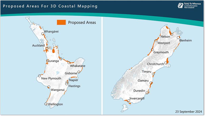
3D mapping of New Zealand’s coastline
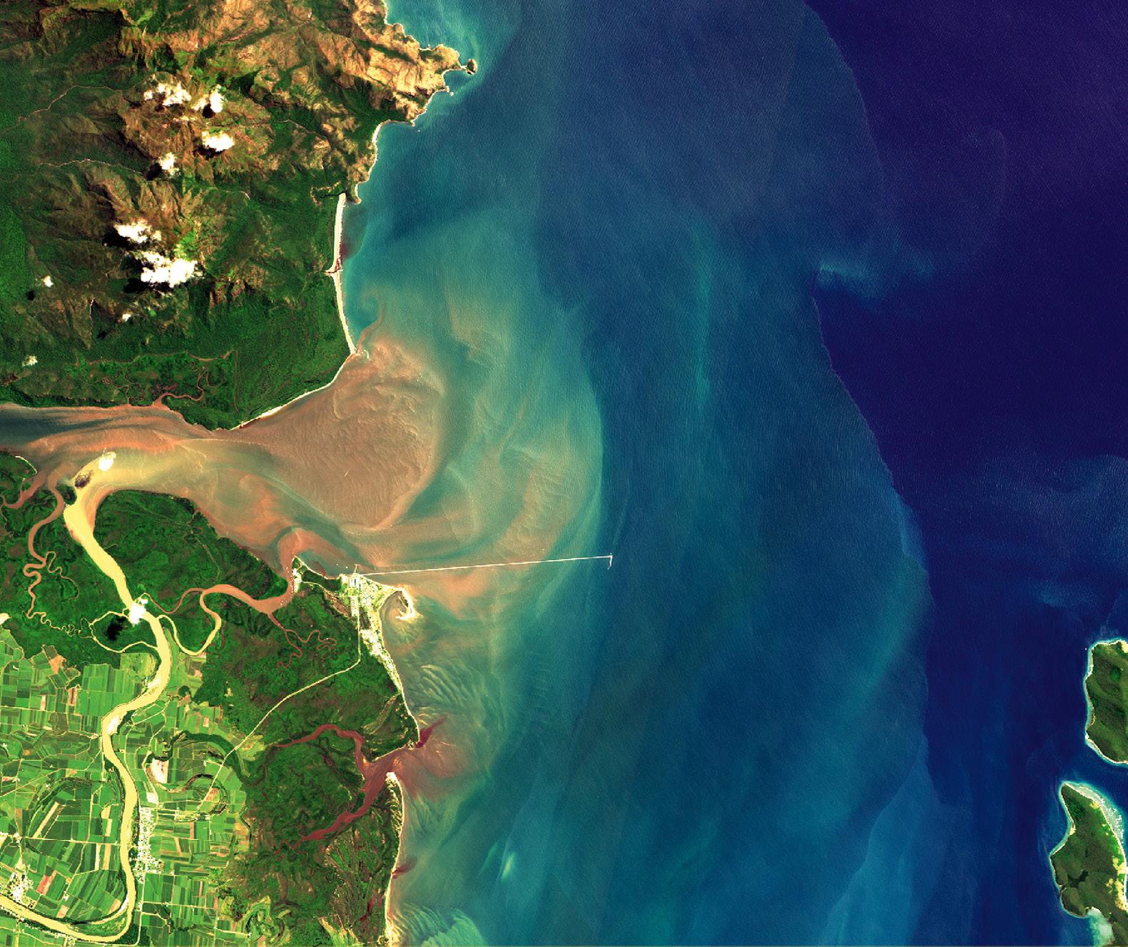
Toitū Te Whenua Land Information New Zealand (LINZ) is in the process of 3D LiDAR mapping large stretches of New Zealand’s coastline. The high-definition 3D Coastal Mapping program will be particularly useful for understanding parts of the nation’s coastline that are vulnerable to the effects of climate change.
“As a small island nation New Zealanders living and working near the coast are exposed to climate events and natural hazards like tsunami, and these will impact valuable infrastructure, environmental and cultural assets close to the sea, as well as coastal biodiversity,” said Stuart Caie, 3D Coastal Mapping Programme Lead at LINZ.
Two companies have been contracted to collect the aerial LiDAR data: Woolpert NZ for the North Island and NV5 Geospatial for the South Island. The aircraft will fly at an altitude of about 500 metres.
“Coastal mapping data is used by scientists and environmental planners to better understand how the country may be impacted and help keep communities and infrastructure safe, as well as protect ocean biodiversity through improved habitat mapping,” said Caie.
The project will produce baseline data for up to 40% of the nation’s coastline over the next three years. Once processed, the data will be made freely available on the LINZ Data Service website and the LINZ Basemaps service.
SouthPAN boost for NZ firms
Businesses located in and around the southern New Zealand’s port city of Timaru are being encouraged to consider the economic benefits available thanks to the new SouthPAN positioning service.
Venture Timaru and Toitū Te Whenua Land Information New Zealand are working together to persuade local firms to take advantage of the free service, which can improve GPS accuracy from 5 to 10 metres to less than a metre, and in some cases as little as 10 cm.
Proposed areas of coverage of the 3D mapping program.
“As we’ve seen with other LiDAR data on land, the coastal data can be used to assess changes to the coast through erosion or subsidence, build-up of dirt and debris from cyclones or weather events, and land uplifting from earthquakes,” said Caie.
“We know scientists are excited about this data and the modelling that it can enable, especially as storm surges are likely to become more frequent as sea-level rises in the future.Courtesy LINZ.
“This new and enhanced positioning technology will benefit us all, whether in our personal or working lives,” said Nigel Davenport, Venture Timaru Chief Executive. “It will provide significant benefits for a range of industries, from agriculture through to forestry, maritime, aviation, and emergency services, by improving productivity and reducing costs.
Davenport says he sees SouthPAN, and the benefits it will bring being, as being an integral part of the district’s long-term vision to grow the economy and community.
“This technology will be a pivotal resource in enabling faster, more precise and efficient operations, helping us all drive cost reductions and productivity improvements,” he said.
Timaru’s local Richard Pearse Airport is supporting the initiative, with its Chief Executive, Andrew Dixon, saying the airport is eager to utilise SouthPAN, which will have a number of benefits to the aviation industry once safety of life certification is achieved by 2028.
“SouthPAN will provide a significant safety and usability upgrade for pilots using the airport, as it offers them a greater level of positioning data than was ever available before,” said Dixon.
The airport is one of five locations across New Zealand where new reference stations will be installed later this year as part of a new dedicated network, replacing infrastructure that is delivering SouthPAN’s freely available services today.
Two new SouthPAN uplink dishes were installed last year at Awarua on New Zealand’s South Island.
Sentinel-2A given a life extension
The European Copernicus Earth observation office has announced an “exceptional and temporary” extension of the availability of the data from the Sentinel-2A satellite mission for one year.
In September 2024, the third Copernicus Sentinel-2 satellite (Sentinel2C) was successfully launched from the European Spaceport in French Guiana. Sentinel-2C was intended to gradually take over the tasks of Sentinel-2A as the latter approached the end of its nominal operational lifetime.
However, while Sentinel-2C has now successfully completed its commissioning phase and has been handed over to the European Commission by the European Space Agency (ESA), the decision to keep Sentinel-2A operational “reflects a commitment to maximising the capabilities of the flagship Earth Observation (EO) component of the EU Space Programme”.
This decision was driven by requests from the user community to continue having access to Sentinel-2A data, as the satellite remains in good health.
“Sentinel-2A will not retire yet,” said Christoph Kautz, Director for Satellite Navigation and Earth Observation at DG DEFIS.
With Sentinel-2A, 2B, and 2C in orbit, users will benefit from improved data availability, bolstering applications in many areas including environmental monitoring, emergency response, and other key areas.
Sentinel-2A has been manoeuvred into a new orbital position, shifting 36 degrees away from Sentinel-2B. This new configuration is designed to improve the availability of Sentinel-2 data, ensuring that Sentinel-2A continues systematic observations over Europe every 10 days, as with Sentinel-2B and Sentinel-2C, while providing an additional 20-day global cycle.
Survey audit focus for 2025
The latest Queensland lands surveying alert sets out the official survey compliance auditing focus for the coming year. The Department of Natural Resources and Mines, Manufacturing, and Regional and Rural Development, says the survey audit selection process enables it to “focus on aspects important to the quality of surveys and includes a random component”.
According to the Department, some aspects of that focus are continuing from before because of low compliance rates, while one new aspect has been selected for 2025:
• Surveyors with lower audit compliance rates in the past (continuing),
• Surveyors who operate from locations outside Queensland (continuing), and
• Surveys that include a physical feature boundary (new).
The Department says that due to “improvement in compliance rates for
identification surveys, focus for audits of identification surveys has reduced for this year,” although all surveys submitted are still eligible for audit.
In data released in November last year, the Department reported that “aspects with the lowest compliance rates are surveys carried out by surveyors who operate from locations outside Queensland (34% compliant), surveys with ambulatory boundaries (43% compliant), and surveys carried out by surveyors with poor past performance (58% compliant)”.
Since auditing was implemented in mid-2023, the Department has conducted around 140 desk audits per quarter. The results show that compliance has increased from 46% at the start of the period to 74% during the July to September 2024 quarter.
Some of the errors that continue to be seen include a failure to search for corner or reference marks, and inaccurate or incomplete dimensions.
Phil Delaney takes helm at Outline Global
Australian geospatial data capture company, Outline Global, has announced that Phil Delaney will succeed Ross Lewin as CEO next month.
“Outline’s strong foundation in data capture sets us apart in a rapidly evolving market,” said Delaney. “I look forward to working with our customers to harness the full potential of our data, while driving forward with AIpowered products that will deliver even more value.”
Lewin, who founded Outline Global 15 years ago, will remain with the company in a board-only role. Under his leadership, the firm developed its Gtech geospatial data capture platform.
According to Lewin, the company has its sights set expanding its focus on AI-driven geospatial products and Earth observation analytics, while maintaining its core of high-quality data capture.
The company’s successes including a fire ant mapping solution for the Queensland Government and disturbance mapping solutions for mining clients.
“Leading Outline Global from its inception has been an incredibly rewarding journey,” said Lewin. “I am confident that Phil will lead the company into an exciting new era of innovation and guide our product and platform lead growth strategy, to positively impact our customers.”
Delaney left his role as CEO of Australian geospatial data analytics startup, MapAI, in February, with FrontierSI’s CEO, Graeme Kernich, stepping in to serve as MapAI’s interim CEO.
“We thank Phil for his contributions to the development of MapAI over the past 18 months, including his tenure as inaugural MapAI CEO,” Gillian Sparkes, FrontierSI’s Chair, said at the time.
MapAI began as part of collaboration with the UNSW City Futures Research Centre and FrontierSI, before being spun off as its own entity last year.
“The MapAI product development is tracking well with an excellent technical team and operational capabilities,” said Kernich. “We are well-placed to build on the foundation and successes of 2024.”
Phil Delaney
A Sentinel 2 image. Credit: European Union.
Map of protected coastal land
A new online map shows 15,000 hectares of NSW coastal lands that have been acquired and protected over the past 52 years. The map enables the user to zoom in and out for detailed or wider views of the NSW coast, as well as providing options for selecting various features.
For instance, coastal features are split into five categories that can be displayed all at once or one at a time: Headlands and sea cliffs, forest and vegetation, beach access and vegetation, wetlands, and parks, campgrounds and recreation areas.
Under the Coastal Lands Protection Scheme, which began in 1973, land is bought by the NSW Government and managed by the local council or the NSW National Parks and Wildlife Service.
The Scheme has purchased and protected 87% of coastal lands originally identified as ‘Red Lands’ on a NSW Government map, and covers the entire NSW coastal zone with the exception of the Greater Sydney area (from Broken Bay on the Central Coast to Minnamurra River south of Shellharbour).
An extra 277 hectares at Nabiac and 78 hectares at Hat Head on the Mid-North Coast will soon be added.
Land acquired under the scheme must meet three criteria: it must have public access, have scenic quality, and be of ecological value. A budget of $3 million is available each year to acquire more land.
“This new map is an informative guide to the vital work of this scheme in safeguarding some of the most picturesque parts of the state for the community,” said Steve Hartley, Executive Director, Environment and Infrastructure Planning and Resilient Places. “I encourage people to take a look to see how these important parcels are being protected and opened up to the public.”
UN-GGCE funding extended
Germany has agreed to extend its funding of the United Nations Global Geodetic Centre of Excellence (UN-GGCE) until 2030.
The UN-GGCE, which is headed up by Nick Brown from Australia, was established with the aim of assisting “Member States and geodetic organisations to coordinate and collaborate to sustain, enhance, access and utilise an accurate, accessible and sustainable GGRF to support science, society and global development” by implementing UN General Assembly resolution 69/266.
That resolution calls for the development of a global geodetic reference frame.
“Germany is committed to ensuring the world has a strong foundation for satellite-based positioning, navigation and timing services,” said Dr Paul Becker, President, Federal Agency for Cartography and Geodesy, Germany, Bundesamt für Kartographie und Geodäsie (BKG). “We were pleased to have established the Centre in 2023 and we are very proud to see it succeeding.”
The UN-GGCE was inaugurated on 29 March 2023 at the UN Campus in Bonn Bundesstadt Bonn after the signing of an agreement between UN Department of Economic and Social Affairs and the Bundesministerium des Innern, the German Federal Ministry of the Interior and Community.
“My team and I greatly appreciate the ongoing support from Germany, along with our other 25 partners,” said Nick Brown. “Geodesy cannot be done by one country on its own. Under the banner of the United Nations, I look forward to collaborating with people from all countries to develop capacity and help them maximise the social, environmental and economic benefits geodesy enables every day.”
Woolpert appoints Henderson to growth role
Woolpert has appointed Susie Henderson as Head of Strategic Growth for its Asia-Pacific region business.
Henderson has held senior executive positions in the USA, Australia, Canada and the UK, and has experience in mergers, acquisitions and strategic partnerships. In 2023, she was recognised was named one of Houston’s Top 50 Most Influential Women Leaders.
“The opportunity to enhance the connectivity of our global offerings, combined with a strong drive for growth, will create outstanding results for our clients and employees,”
Henderson said.
“Building on an already exceptional foundation to achieve greater success is truly exciting. Engaging projects, continuous learning, and collaborating with top-tier talent make for a winning formula.”
Henderson will split her time between Woolpert’s Brisbane and Houston offices.
NSW coastal land protected under the Coastal Lands Protection Scheme.
Susie Henderson
UN-GGCE Head, Nick Brown
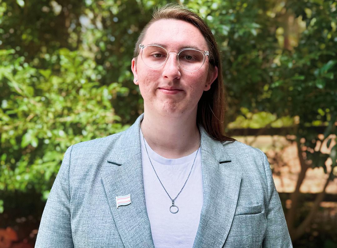
Diversity and women in surveying
The Queensland Women in Surveying Forum aims to create a more supportive, diverse and inclusive industry.
In Queensland, only 3% of registrants with the Surveyors Board of Queensland are female. While registrants are predominantly surveyors working in cadastral surveying, this figure is estimated to be a representation of the broader surveying industry. Yet research shows that diversity and inclusion improves creativity, productivity and profits, so diversity is a good thing.
As different people cope and respond to challenges and opportunities in various ways, connecting with similar people can create a safe space to allow people to wholeheartedly be themselves and be heard. That’s why just over 12 months ago the Queensland Women in Surveying Forum was established as an environment where women can share experiences, and support, encourage and inspire one another. The Forum currently has 42 members and is growing, with five meetings having been held since its inception.
For many women in surveying, the Forum is an opportunity to be supported, understood and validated in a nonjudgemental way. While the Forum is only in its infancy, women are already benefitting from it and we are excited to progress it.
With a critical shortage of surveyors, we want to encourage everyone to join and remain within our industry. There are many common barriers that are relevant for women in male-dominated industries, including gender stereotypes, unconscious bias, lack of role models, workplace
culture, and not having appropriate policies and processes that support women and diversity.
Women in our Forum cite similar barriers, including the lack of women in leadership roles, lack of flexible work arrangements, social norms and cultural practices, lack of support and mentoring, workplace discrimination and inequity, and safety when working in the field (especially alone). Do you have many women in your organisation? Have you considered whether these barriers exist in your workplace?
The lack of male awareness of the challenges facing women in surveying has also been raised. Many people are unaware of how, or if, unconscious bias may exist in themselves or their organisation. It is easy for directors and managers to act on instinct rather than examining the implications of decisions. Unconscious bias training can certainly raise awareness and help prevent this from happening.
There are many small ways organisations can create an inclusive and supportive culture. For example, ensuring uniforms and PPE are available in both men’s and women’s styles, as body shapes are different and clothes need to fit and be comfortable. Also, ensuring clean amenities are available (at the workplace and on worksites) with running water, soap, bins and suitable menstrual disposal units. These may seem like small things, but they are important to ensuring women feel comfortable and supported.
JEMMA PICCO
Gender is just one element of diversity. Creating an inclusive work environment is about making every person feel accepted and respected regardless of gender, ethnicity, religion, age or sexual orientation.
Flexible work arrangements are another key element to an inclusive work environment. Flexible work comes in many forms whether it be part-time, flexible start and finish times, compressed hours (more hours over fewer days), working from home, rostered days off, time off in lieu etc. Flexible work arrangements are of benefit to all employees, not just women. Does your workplace encourage flexible work arrangements? Does your workplace encourage open communication and look for solutions that may suit both the individual and the business needs?
The Queensland Women in Surveying Forum has been discussing many of these topics and how we can create a more supportive, diverse and inclusive industry. Diversity brings different thought processes, creates innovation, improves decision making, attracts and retains talent, improves productivity and increases the bottom line. Diversity is good for the workplace and leadership plays an important role in communication, inclusion and cultural change. n
Jemma Picco is Chair of the Queensland Women in Surveying Forum. If you’d like to learn more about the Forum, contact Jemma Picco on LinkedIn or via email at jemma.picco@resources.qld.gov.au.
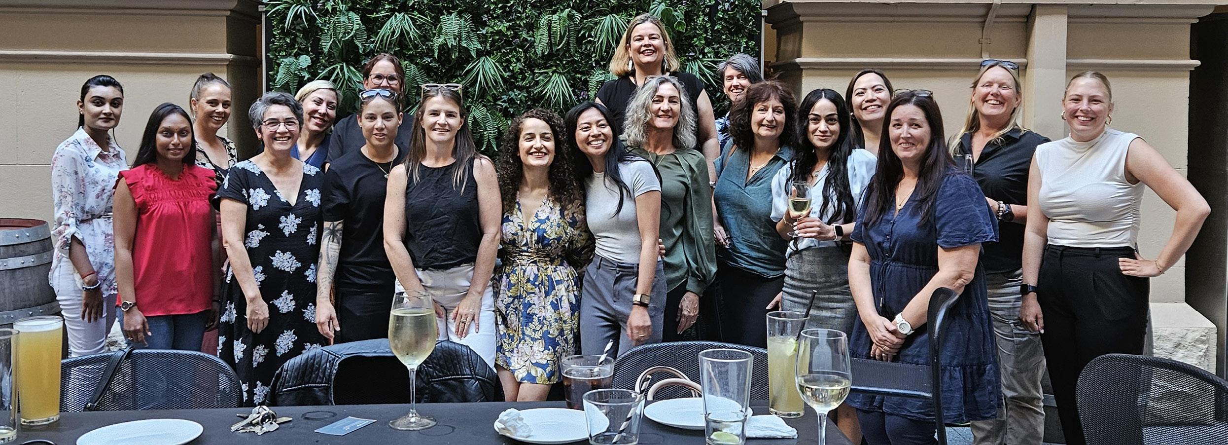
The first Queensland Women in Surveying Forum meeting was held in Brisbane on International Women’s Day in 2024.
The reality capture partner feature
REVOLUTION
How Aptella’s solutions are transforming spatial data across industries.
From sprawling mine sites to intricate architectural details, the digital transformation of our physical world through reality capture technology is transforming how spatial professionals collect, analyse, and utilise environmental data. Aptella stands at the forefront of this digital revolution, offering an extensive spectrum of reality capture solutions tailored to diverse applications across multiple industries.
Bridging
the physical and digital realms
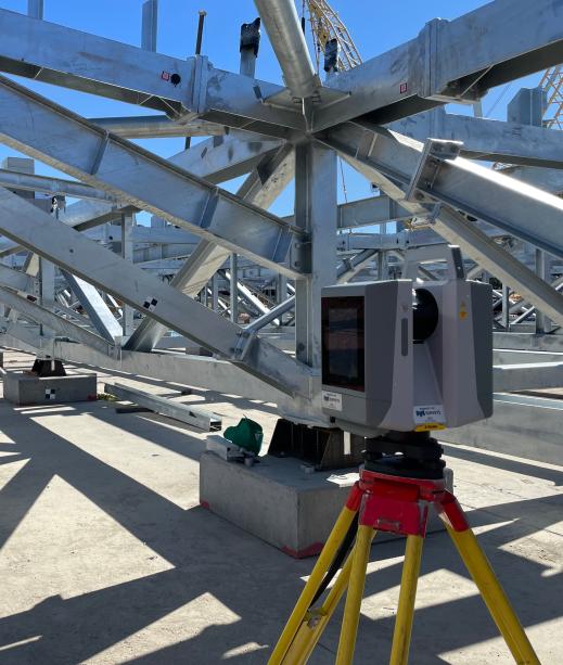
Reality capture — the process of scanning physical environments to create digital twins — has evolved dramatically in recent years. What was once a specialised, expensive technology has become increasingly accessible, precise and versatile. Aptella’s comprehensive suite of solutions reflects this ever-changing industry, providing options that range from lightweight mobile scanning systems to advanced aerial platforms.
“We’re seeing unprecedented demand across sectors, from traditional surveying applications to cutting-edge visualisation projects,” says Geoff Preece, Market Development Manager with Aptella. “The common thread is the need for accurate, reliable data capture that can be efficiently transformed into actionable insights for our customers.”
The applications are remarkably diverse. For a 10km highway redesign, an RPAS solution like the Trinity Pro from Quantum Systems might be ideal. For reconfiguring an industrial factory’s interior layout, terrestrial scanning systems such as the MLX or VLX from NavVis would be the
method of choice. Of course, complex projects often require combining both approaches — capturing a factory’s exterior and surrounding land with RPAS, while documenting interior spaces with precision scanners for the very best results, first time.
Aptella’s cutting-edge reality capture arsenal
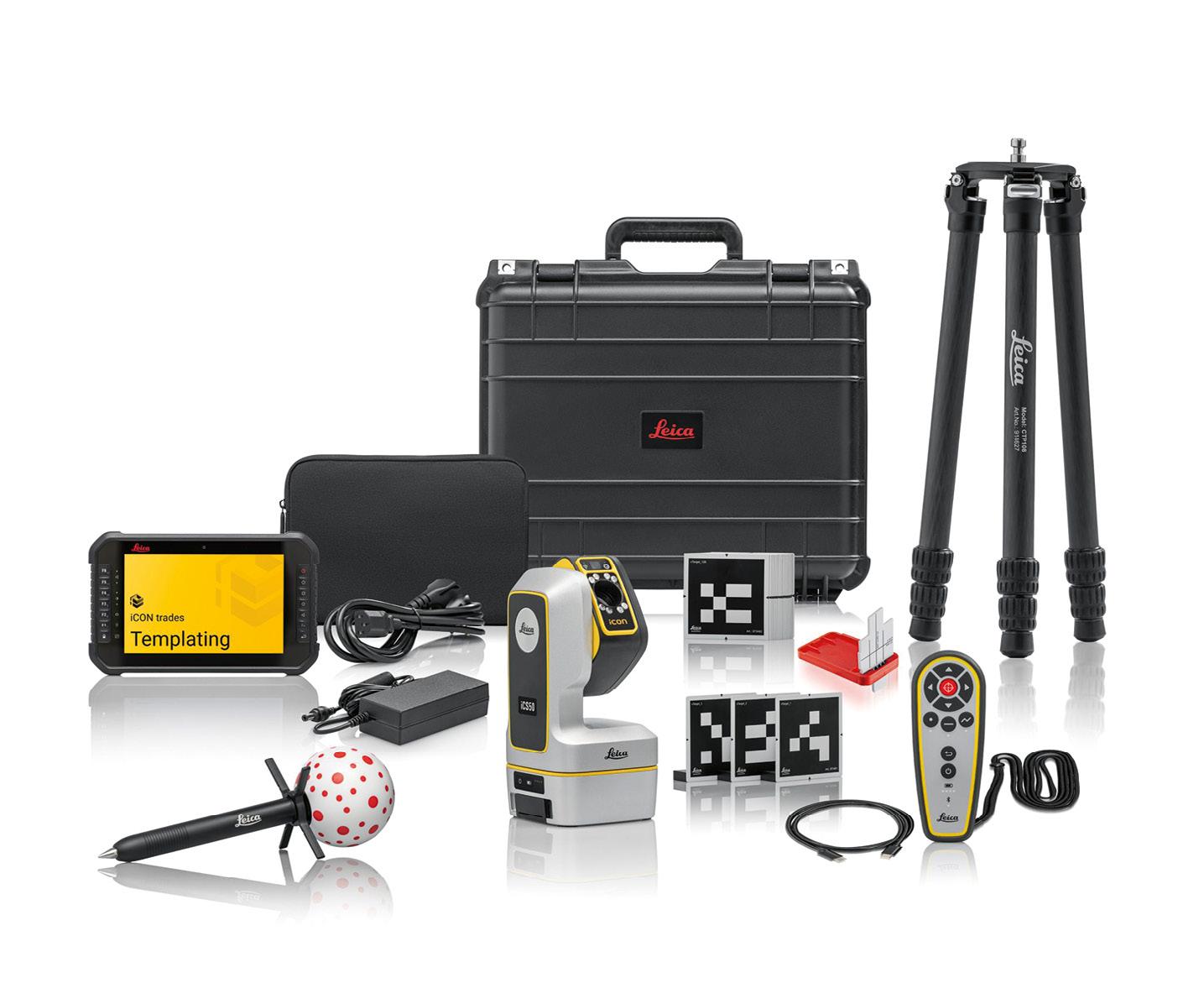
Aptella offers a comprehensive suite of reality capture technologies, including exclusive and complementary solutions:
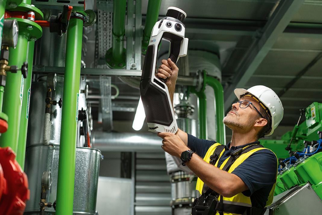
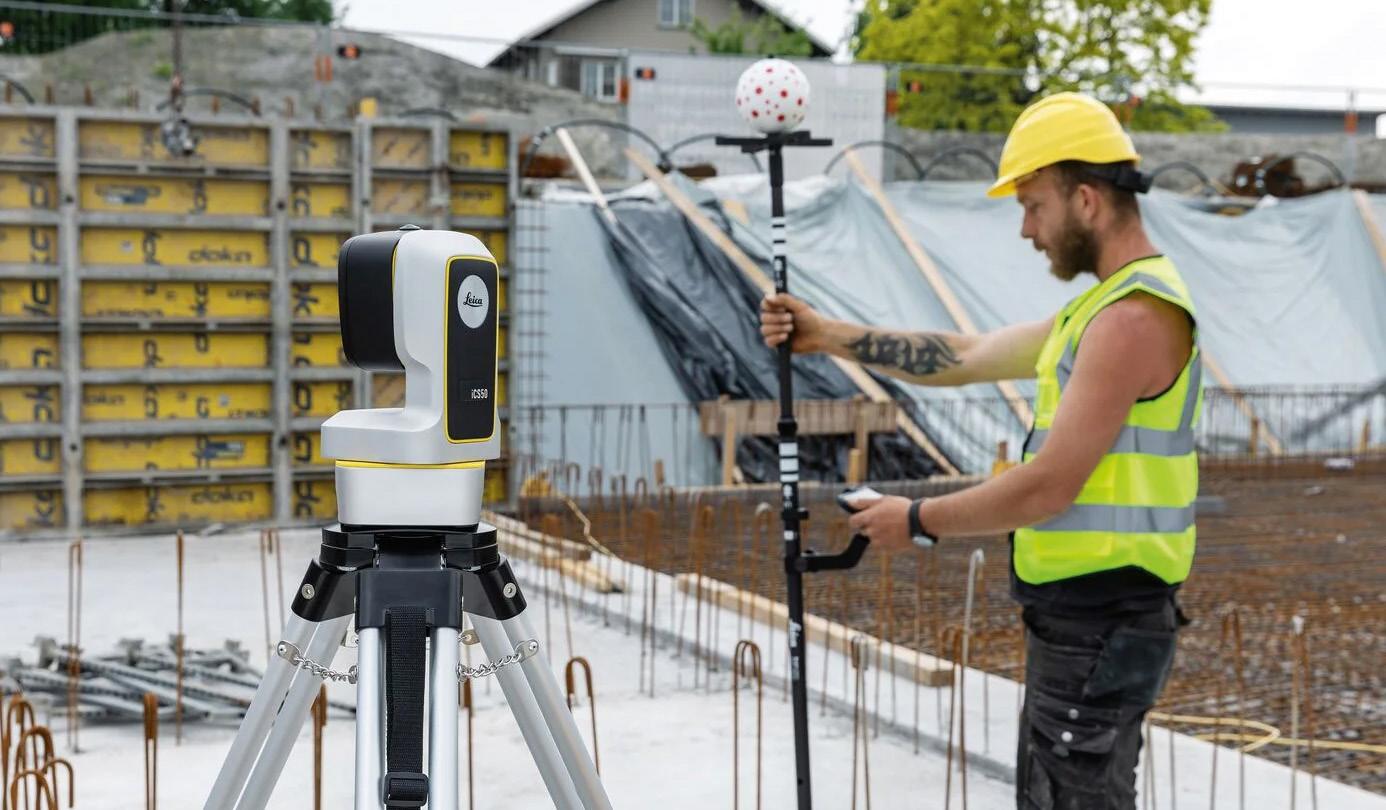
• MLX (NavVis): A cutting-edge handheld scanning solution launched in October last year.
• VLX (NavVis): Advanced mobile mapping technology.
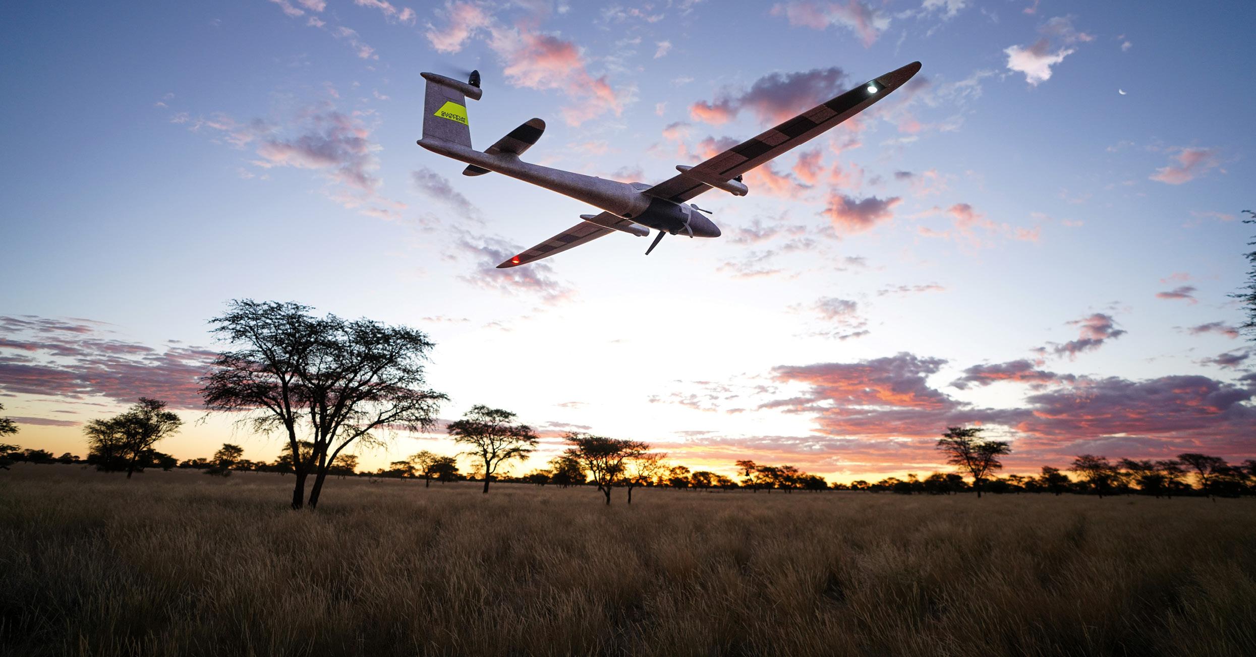
• Trinity Pro (Quantum Systems): Sophisticated RPAS platform.
• HubX: Integrated data management solution.
• XGrids: An exciting new scanning technology.
• Enterprise survey-grade DJI drone platforms.
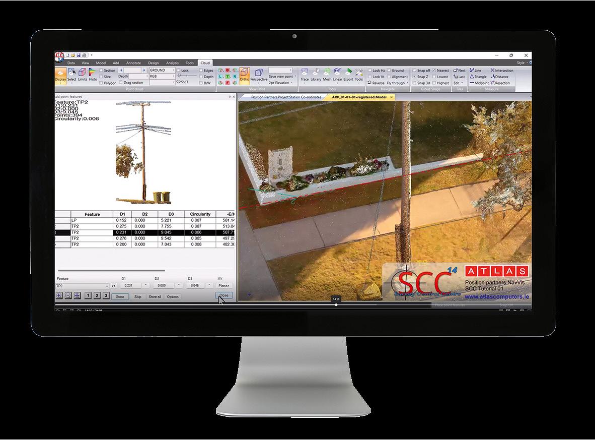
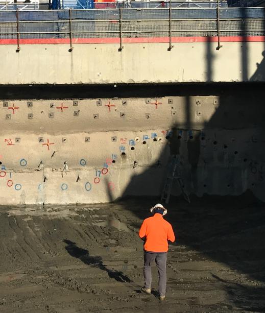
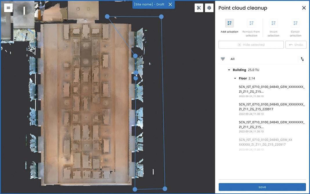
Aptella’s reality capture portfolio addresses the full spectrum of industry needs, with particularly transformative impacts in cadastral surveying. For these professionals, the integration of point clouds with traditional survey control has revolutionised workflows in profound ways. By combining high-density LiDAR scanning with precise GNSS positioning and inertial measurement, these systems create georeferenced point clouds that complement traditional survey methods rather than replacing them.
This hybrid approach dramatically reduces time spent in the field while simultaneously enhancing deliverables
with rich contextual data that traditional methods alone cannot provide. The result is a more efficient process that maintains the exacting standards required for cadastral work while introducing new dimensions of spatial information.
Driving AEC adoption of MLX NavVis and VLX
A growing trend in the AEC industry sees architects, engineers and consultants investing in MLX NavVis to capture their own spatial data. This shift allows professionals to have greater control over their projects, eliminating complete reliance on external surveyors.
“A couple of architects on the Sunshine Coast of Queensland have vertically integrated their business by investing in NavVis VLX and NavVis Ivion technology to capture their own data rather than outsourcing. This gives them the advantage of controlling data from collection to model, streamlining their workflow and reducing project delays,” says Preece.
The newly refined Ivion Go app is revolutionising how users interact with NavVis data. “Once you use an MLX NavVis to digitise a site — say, a train station — any rail employee with the free app can walk through, take photos of defects, add notes, and upload the data instantly. Because the app spatially locates the user, stakeholders can immediately see the issue, exactly where it is, and act on it,” says Preece.
The Ivion Go app, released in the past six months, is a powerful tool for asset management and facility maintenance, providing service providers with a valuable resource for their clients.
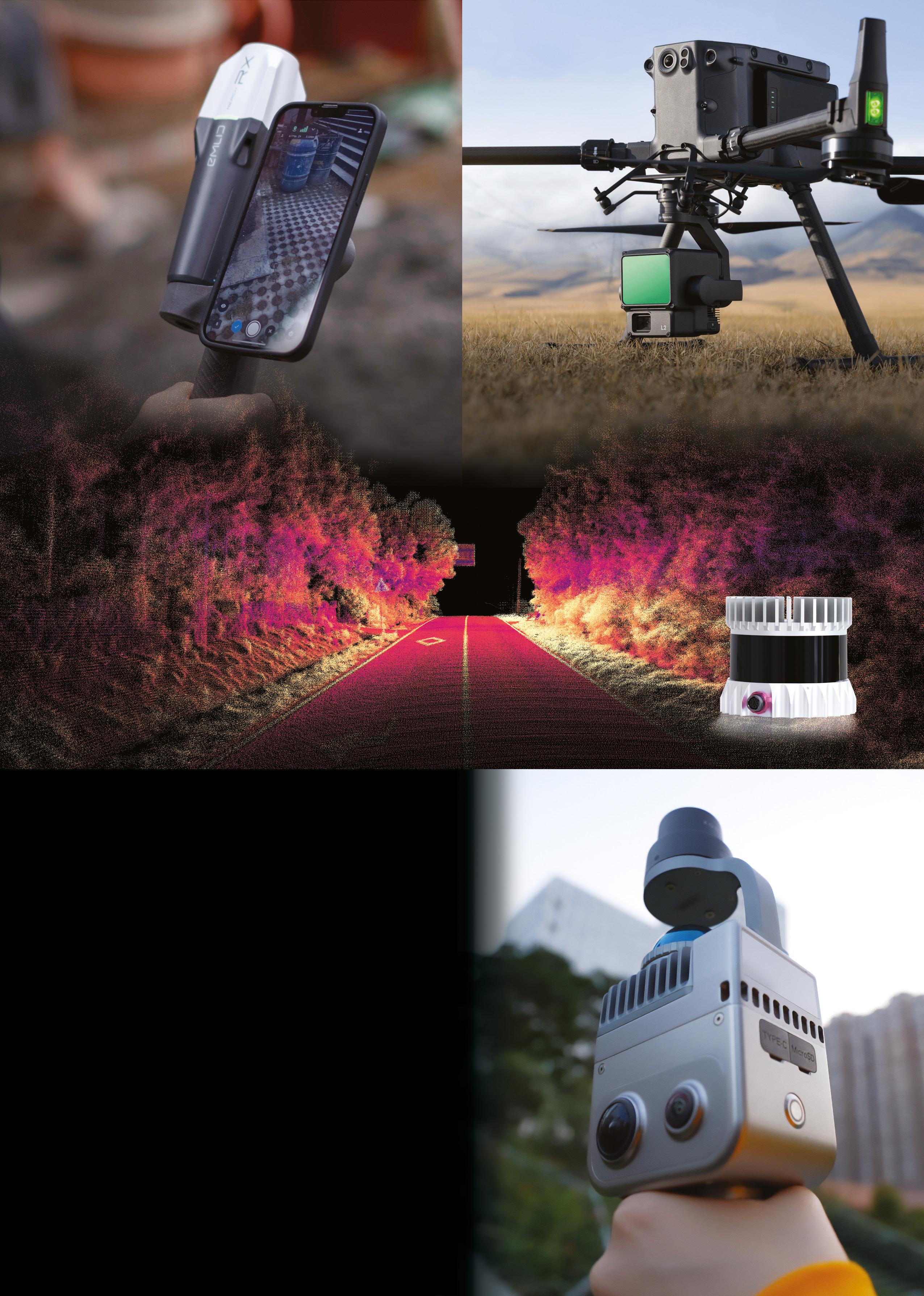
The QS Trinity Pro long-range VTOL mapping drone.
The latest technology edge
While point clouds remain the foundational data type for many applications, advanced rendering technologies are expanding the utility of reality capture data. One particularly promising development is Gaussian Splatting, an innovative algorithm that represents 3D scenes as a collection of 3D Gaussian distributions.
Unlike traditional point cloud or mesh-based approaches, Gaussian Splatting offers significant advantages in rendering efficiency and visual quality. The algorithm excels at representing complex scenes with varying levels of detail, making it ideal for visualising complex infrastructure or natural environments captured by Aptella’s systems.
“We’re very excited about the potential of XGRIDS Gaussian Splatting to transform how our clients interact with reality capture data,” says Preece. “The algorithm’s ability to render complex scenes in real time on standard hardware opens new possibilities for field-based decision making and client engagement.”
Transforming mining and quarry operations
In mining and quarry operations, where material movement represents direct financial impact, Aptella’s drone-based solutions provide unprecedented efficiency. The Trinity Pro RPAS platform from Quantum Systems, equipped
with specialised sensors, enables rapid capture of vast areas.
These systems collect hundreds of thousands of data points per second, creating comprehensive digital terrain models that allow precise volume calculations. The speed and safety advantages are significant — areas that would require days of ground-based surveying can be captured in hours, without exposing personnel to potentially hazardous environments.
Digital twins for the built environment
For commercial buildings and utilities, comprehensive documentation of as-built conditions provides the foundation for effective facilities management. Aptella’s SLAM laser scanning solutions, including the NavVis MLX and VLX, create detailed point clouds of both exterior and interior spaces.
These point clouds serve as the basis for building
information models (BIM) that incorporate both visible features and hidden infrastructure. Facility managers gain access to comprehensive digital twins that can be used for space planning, maintenance scheduling, and retrofit design.
The Aptella advantage
What differentiates Aptella’s approach to reality capture is comprehensive integration and expert guidance. From initial data collection through processing and final deliverables, Aptella provides cohesive workflows that maximise efficiency and data utility.
“We’ve positioned ourselves as the subject matter experts in the reality capture space,” says Adam Burke, the Executive Manager of Geospatial and Building at Aptella. “When a customer approaches us with a project requirement, they’re not just purchasing hardware — they’re gaining access to our
accumulated knowledge and experience.”
“There’s a real satisfaction in presenting a cutting-edge piece of technology to a customer,” agrees Preece.
“When you’re confident that it’s reliable, stable, and performs seamlessly, and then you receive immediate feedback like, ‘This isn’t just impressive technology; it’s actually capable of driving our business forward and boosting our bottom line,’ it’s incredibly rewarding,” he says.
“Being part of that transformation, knowing that the technology not only meets but exceeds expectations, is truly exhilarating.”
Looking forward:
The evolving reality capture landscape
As sensors become more compact and processing algorithms more sophisticated, reality capture will continue its evolution toward greater accessibility and application breadth. Aptella remains committed to staying at the cutting edge of these developments, evaluating emerging technologies and integrating those that provide tangible client benefits.
For professionals across surveying, construction, property development, and infrastructure management, this convergence creates new opportunities to enhance efficiency, improve decision-making and deliver superior outcomes. n
For more information about Aptella’s comprehensive range of reality capture solutions, visit aptella.com.
The NavVis MLX handheld scanning solution.
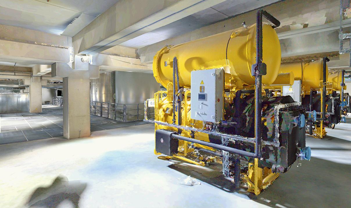
A NavVis MLX-generated point cloud of industrial plant.
The power of point cloud capture.
Q&A
with Zaffar Sadiq Mohamed-Ghouse
Combatting climate change, saving lives and building better societies have been top of mind for Dr Zaffar Sadiq Mohamed-Ghouse as he represents Australia on the world stage.
Dr Zaffar Sadiq Mohamed-Ghouse wears lots of hats. For a start, he is a Vice President with geospatial company Woolpert, and director of its Advisory and Innovation team, which advises governments in Australia and overseas on the strategic planning of resources and infrastructure.
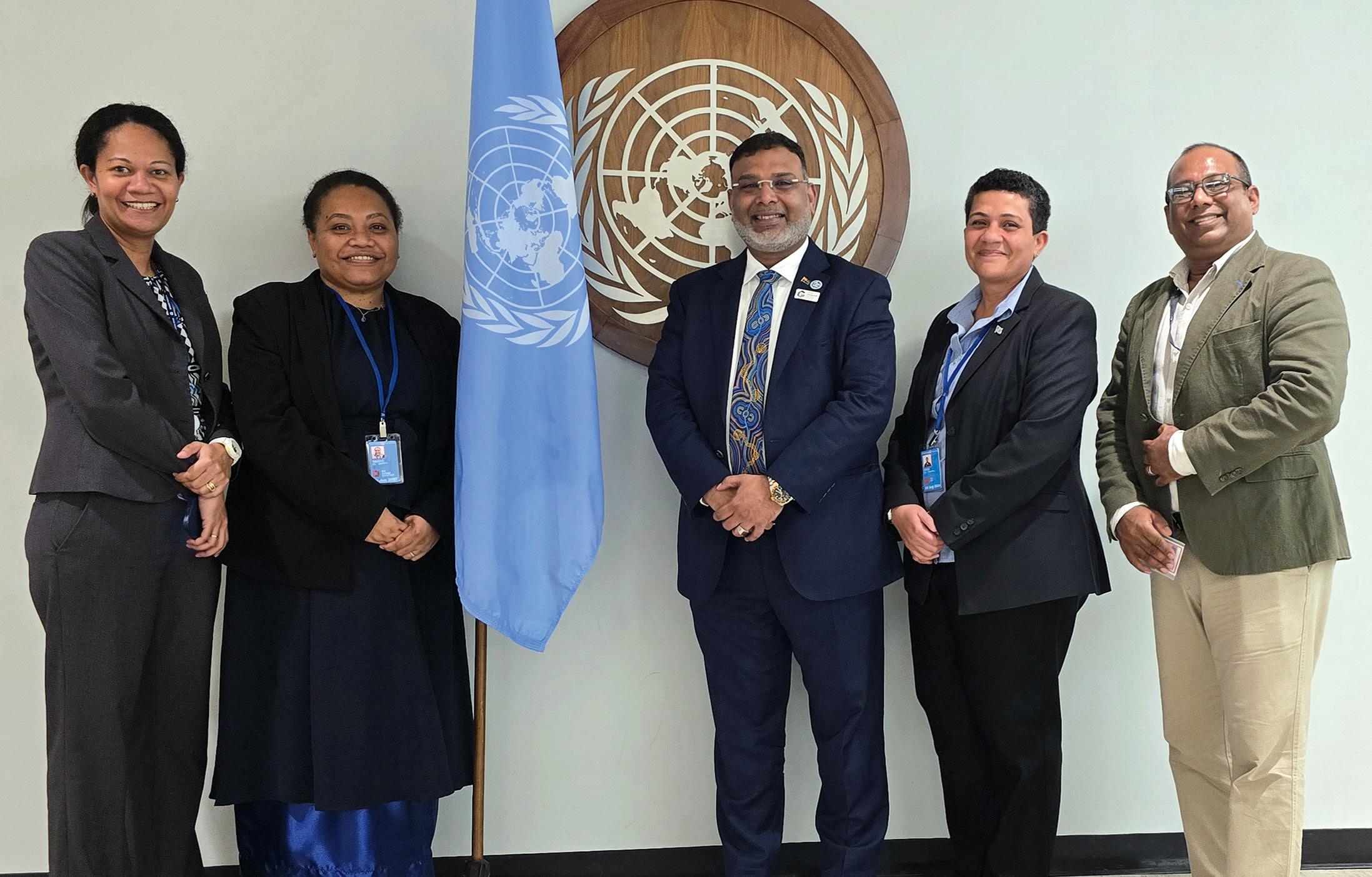
He is also chair of the United Nations Committee of Experts on Global Geospatial Information Management’s (UN-GGIM) private sector network, and deputy chair of the UN-GGIM Geospatial Societies representing the International Society of Digital Earth. On top of that, he is a board director with the Open Geospatial Consortium (OGC), Program Board Member of the Group on Earth Observation, and Vice President of the International Society of Digital Earth. Over the past several months, Mohamed-Ghouse has attended a range of important international meetings that have discussed matters of great significance for all disciplines within the geospatial sector and in all corners of the globe. In this wideranging interview, we caught up with him to seek out his views on some of the latest trends and topics being deliberated in the worldwide community.
Please tell us about the UN-GGIM meeting in Mexico.
The UN-GGIM holds a World Geospatial Information Congress once every four years, and midway in between is the High-Level Forum. The High-Level Forum in Mexico, which had climate change as its central theme, attracted government ministers from a range of countries — including the Prime Minister of one of the Pacific Island countries — to talk about the importance of geospatial data and its role in climate change.
I led a panel on the concept of the geospatial ecosystem beyond spatial data infrastructure. This session was hosted by the Kingdom of Saudi Arabia and the Chair of the UN-GGIM Arab states, along with a Minister from South Africa. The session covered the need of the geospatial ecosystems to move beyond the UN Sustainable Development Initiatives (SDI) in order to be inclusive by having shared infrastructure for developing countries, so that they can participate and have a high level of maturity in making decisions through the ecosystem approach.
The UN-GGIM has taken a very serious view about the future of the geospatial information ecosystem because it presents an opportunity for all countries
to participate and make quick decisions without having to set up the whole geospatial life cycle process.
I’m one of the contributors of a paper on the geospatial ecosystem beyond SDIs. We met for 52 sessions, each three hours, during COVID, and all these authors came to the meeting with great passion to talk about the paper. Because the SDIs have matured, we need to look beyond them, and that’s what has evolved into this concept.
This concept has been implemented in the Kingdom of Saudi Arabia. It is called the Saudi Arabian National Geospatial Ecosystem, and the OGC has been heavily involved. And in fact, the Kingdom of Saudi Arabia has put a proposal to the United Nations to establish a Geospatial Information Ecosystem Centre of Excellence.
So, you see how the transformation is happening and how the community is embracing it. I’m very proud to be an advocate for this concept of the geospatial ecosystem.
All of this proposed change needs the right people, of course.
Yes, and another concept discussed at the High-Level Forum was the next generation
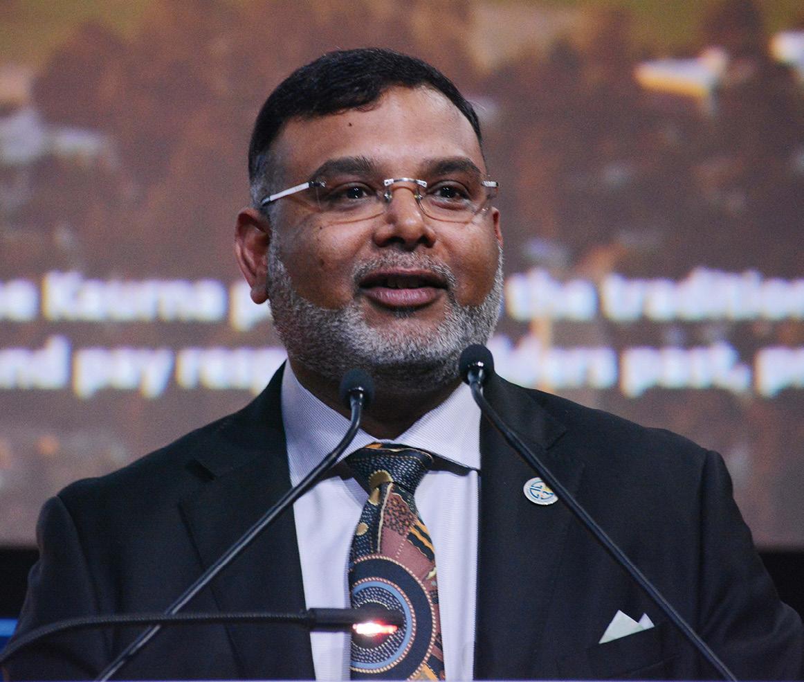
Dr Zaffar Sadiq Mohamed-Ghouse
of leadership and how we attract them to the profession. Young scientists from different parts of the world came along to talk about their role in developing the geospatial ecosystem.
Another important topic at the HighLevel Forum was the empowerment of women, and indeed the Forum was led by Paloma Merodio Gómez, a [now former] co-chair of the UN-GGIM. There was a women-only panel at the start of the Forum which brought in academia, the private sector and government to talk about how we can work together to strengthen the UN-GGIM global agenda.
You mentioned the Pacific Islands and climate change. This is life or death for them, isn’t it? Exactly, and this is where evidence-based geospatial information is very critical in order to plan and prepare for sea level rise, floods etc. Sea level rise is real, and it is impacting lives now. I recall a comment from Viliami Folou, the geospatial leader from Tonga and a person very active in the UN-GGIM special community. He mentioned in the closing of the Forum that storms and floods are not new to Pacific
Island countries, but the frequency and the intensity is. It is so frequent that, by the time you mitigate one, the next one arrives. It pains to lose loved ones in these scenarios.
We really need critical, accurate, high-quality geospatial information for policymakers to make important decisions around how we can sustain this planet. We all have an obligation to really look at how to save lives. Everyone comes in to contribute when there are disasters, but people do not have the same proactive attention span when it comes to how to manage disasters pre-event.
There was a heavy participation of Pacific Island countries at the Forum, including a delegation of young professionals from Tonga, and from Fiji as well. The island countries were very well represented at the forum in New Delhi, too.
Tell us about that UN-GGIM Asia Pacific meeting in New Delhi. I chaired several panels, and one of them was about capacity building in land administration through the support of private sector — what’s the role of private sector in order to develop the modernisation of cadastre, especially
capacity building? That session really attracted a lot of attention from the member states.
We also spoke about implementation of the UN Integrated Geospatial Information Framework (UN-IGIF), which brings in a common operating model or a framework of how countries should develop their country level action plans for geospatial. I had the opportunity to lead that panel discussion with academia, the private sector and government around the specific roles that they can play in strengthening the IGIF implementation. It was very good session.
Information means data. Is data being made available equitably? The sharing of data is very important, but there are still barriers we need to break — intergovernmental, inter-ministerial, and also across overseas governments. It brings great value to have a proactive nature of sharing data. Where data is not shared — and we totally understand when it’s for security purposes — it becomes a barrier because time is of the essence, especially when saving lives. You don’t have time to do the data conflation — we often have to depend on poor-quality data.
We really need critical, accurate, high-quality geospatial information for policymakers to make important decisions.
So this is why the nature of open data and the ability to share data which is not sensitive, is really, really necessary. We have to make a provision for ‘sensitive’ and ‘non-sensitive’ data; currently there is no clarity, it’s subject to interpretation. There are certain mechanisms, but we don’t have a global mechanism in order to derive that.
I think that’s one outcome that we can look forward to; making sure that highquality data is made available and it’s proactive so that we can plan. In Australia, when summer comes, we plan for fire events — the governments reinforce to citizens that a hot day is going to come, so please practise all the safety measures. This happens very well in Western countries, but not in the developing or underdeveloped countries; that’s where it’s very, very difficult.
But I should say that the Earth observation community — all the satellite providers, irrespective of private or government — in the event of a disaster, will point at that particular place in order to provide data to first responders. But satellite data alone is not enough; we need other data to save lives.
Do digital twins have a role to play here?
This is a very important topic. People think a digital twin is a 3D representation of the Earth, but it’s not just about geospatial. The
power comes when you add the attributes, the real time information. It’s a good mechanism for governing urban areas, but also now we have digital twins on farms where robots are trained to go and pick fruit. It’s about managing assets, and geospatial is only one component of the digital twin.
The power of a digital twin is to utilise it as a platform for making decisions. In order to make that happen we need to integrate the digital twin with real time sensors, with demographic information, with asset information. This will make it a powerful decision-making tool in order to govern cities, deal with climate change, heat waves and so on.
What about the importance of open data?
I had the opportunity to attend the 30th anniversary celebration of the OGC in Washington, DC, and it was great to see the co-founder, David Schell, recognised with the Lifetime Achievement Award. I had the opportunity to ask him where he thinks the OGC has come over the last 30 years. He replied that interoperability was one of the agendas of the OGC when it started, and which attracted private sector, government and academia as contributors. But the OGC has evolved into a community of practise that brings in professionals to not only talk about the data and standards, but to talk
Evidence-based geospatial information is very critical in order to plan and prepare for sea level rise.
about issues that are common, and which can be resolved collectively — it’s not just any one person’s problem anymore.
The way this has been articulated through the 30 years of its existence is a testament to how the OGC has great listening skills and tries to collaborate with the community to find answers. And whatever answers are found, are transmitted globally.
Do you see any other important global trends?
I think the pace of the integration of space and geospatial is exponential. There are more and more Earth observation data captured through different platforms and means, such as cube satellites. And more venture capitalist investing in start-ups, and more sensor integration, which you can see coming from entrepreneurs from all over the world. One example is satellite on-board data processing of geospatial information before it is transmitted back to Earth.
Security is another thing that concerns us. We all are dedicating ourselves to create the veracity of geospatial data from Earth observation, but we do not concentrate on cyber security threats.
Another topic is PNT as critical infrastructure. In my view, we still have a lot of work to do to make governments understand that geospatial is just
as critical roads, railways, electricity, water pipelines and so on.
Finally, you must be excited that the combined FIG/Locate event is about to kick off in Brisbane? Yes, definitely. When I was the president of the SSSI (now GCA), I led the bid for this Brisbane FIG Working Week event. It’s good to see that this conference is coming again to our shores so that we can re-engage. I strongly believe in bringing partnership events, international events, to Australia. By having these sorts of collaborations, the world can come to Australia and see the work we have done — very pioneering work, be it the Digital Earth Australia initiative, the modernisation of cadastre, or digital twins. Because of our remoteness, we aren’t able to travel to a lot of these conferences. Yet while we have very small community, we work very significantly and contribute to the global agenda.
These sorts of international partnerships and events are also ways of communicating to the next generation of emerging geospatial leaders and professionals about how Australia links itself to the global community. n
Specialising in providing survey services to major infrastructure and mining projects across Queensland & Northern NSW. We have the team, latest equipment and knowledge required to meet project needs.
Civil Infrastructure
Rail
Mining
Tunnelling
Design Interrogation
Satellite
data alone is not enough; we need other data to save lives.
Survey Control Networks
Monitoring Services
BIM
Aerial Surveys
Laser Scanning / Point Cloud
All site personnel are supplied with the latest surveying equipment and technology, including꞉
Trimble X9 Scanner
Trimble X12 Scanner
Three drone configurations
GEDO Rail trolley Survey Services provided for꞉
Sentinel-2A
ELEVATING geospatial to the next level
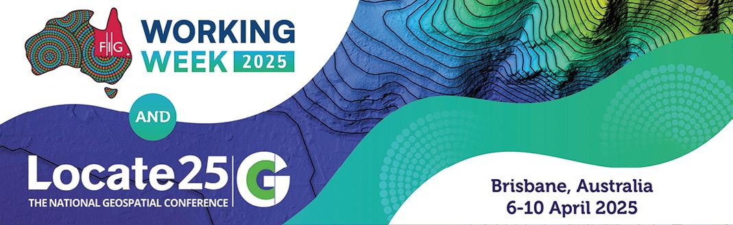
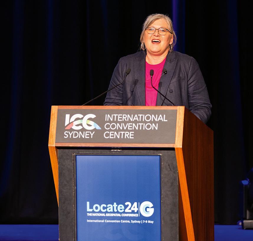
Australian geospatial expertise will be on show during the combined Locate25/ FIG Working Week 2025 conferences in April.
The biggest geospatial event to be held in Australia in more than a decade is now just days away, as approximately 1,500 people from around the nation and across the globe prepare to descend upon Brisbane for the combined Locate25 and FIG Working Week 2025 conferences.
Locate is well known to Australasian audiences as the annual conference for the geospatial community, but the FIG Working Week might not be as familiar. It is an annual conference that brings together the world’s
FIG Working Week 2025 / Locate25 at a glance
When: Conference: 7 to 9 April
FIG General Assembly: 6 and 10 April
Pre-events/tours: 4 to 5 April
Where: Brisbane Convention & Exhibition Centre
Who: Almost 2,000 attendees from 80-plus countries
Web: fig.net/fig2025
Register: fig.net/fig2025/registration.htm
surveying community to discuss issues and set the agenda for progressing the field.
In our February issue, we spoke with the combined conferences’ program chair, Peter James, to get his views on why the upcoming event falls into the ‘do not miss’ category. Now, on these pages, we hear from the events’ convenor, Steve Jacoby, whose day job is Executive Director, Spatial Information | Georesources, in the Queensland Department of Natural Resources and Mines, Manufacturing and Regional and Rural Development.
We asked Jacoby about why Australian and international geospatial professionals should attend the joint conference, and what he personally hopes to learn from the experience.
Why is it important for Australia to be hosting the FIG Working Week?
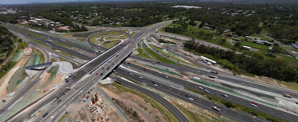
In Australia’s bid to host FIG’s Working Week we stressed it was not just about holding another conference — it’s about seeking to leverage our country’s unique strengths to drive global advancements in surveying and spatial sciences. By hosting the event, Australia (and Brisbane in particular) will present a ‘living lab’ environment where innovative, transdisciplinary approaches are showcased through major infrastructure projects, cuttingedge digital initiatives, and a strong local industry network.
JONATHAN NALLY
What sort of synergies will the combined events bring to the field?
I was fortunate to attend FIG Sydney in 2010, only the second time FIG has been held in Australia, and it was fascinating to see firsthand the different perspectives and approaches that different geospatial professionals from around the world bring to bear on a diverse range of challenges and problems. Whilst Locate has delivered an outstanding national conference for many years now, I think the combined FIG/Locate conference will elevate the experience for delegates to the next level.
Which program topics stand out to you?
Natural disasters, particularly flooding, presents as a major challenge for much of Australia and especially Queensland (as we’ve seen again this storm season). I’m particularly interested in seeing how new developments in data and technologies such as LiDAR and radar can be applied to better plan, respond and recovery from natural disasters.
We are also just seven years out from the Olympic and ParaOlympic Games being hosted in Brisbane and South-East Queensland, so it’s great to see such a continued interest in the development and growth of digital twin technologies, notably to support better infrastructure planning and
Steve Jacoby, Convenor of FIG Working Week and Locate25.
“I think the combined FIG/Locate conference will elevate the experience for delegates to the next level.”
Steve Jacoby, Convenor
execution. Of course, while the Games are a focus for our State, we also live in the fastest growing region in Australia and the application of geospatial data and digital twins will be critical to manage these ongoing pressures.
What do you think Australian geospatial professionals will be able to learn from their international counterparts?
Too often I think we tend to take a blank sheet of paper and start afresh when tackling challenges. I’m reminded that Australia is responsible for only 3 to 4% of global research — which has us punching well above our weight given we have only 0.3% of the world’s population — but that also means that up to 97% of global research happens elsewhere.
FIG Working Week brings together global leaders in our profession from over 100 countries in a very collaborative and accessible
format that provides numerous opportunities for local professionals to take a step back and see how others have tackled similar issues and try and learn from these international experiences. Come to the conference with a curious mind and look for how others have tackled similar issues to those you are currently faced with or working on, and I think you’ll get a lot out of this extraordinary event.
Similarly, what will our overseas colleagues will be able to learn from Australia?
That will be a great exit poll question for our FIG delegates — we’ll ask them and report back! What I think they’ll find from their visit to Australia, apart from a renewed appreciation of distance and vast landscapes, is that Australian geospatial professionals are highly skilled, versatile problem solvers, keen to learn and share their knowledge and experiences.
Our international colleagues are also likely to learn some new Australian words!
What are you most looking forward to?
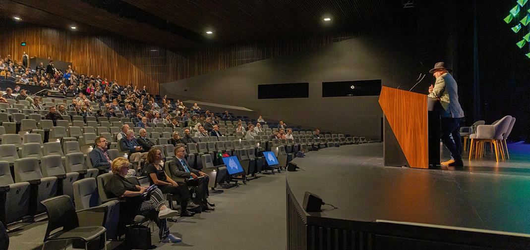
I am very much looking forward to meeting our FIG colleagues face-to-face, many of whom we have been working with over many years and months in the lead up to Brisbane FIG. I have been privy to the development of an extraordinary program with a wealth of great plenary speakers and more than 500 papers and abstracts submitted. I can’t wait to see how it all comes together in what is no doubt going to be a fantastic technical program in particular.
Are there any Brisbanespecific aspects for attendees to look forward to?
It’s a given that all the plenaries will be ‘must attend’ sessions and the technical sessions will be of a very high calibre, requiring some difficult choices to be made by delegates on which ones to attend. But I think it’s worth highlighting the conference venue (the Brisbane Convention and Entertainment Centre), which is one of the best in the country and which will enable delegates to conveniently jump between parallel sessions to get the most out the program for them.
But it will also be the first time that many visitors get to
experience the recently opened Queens Wharf development (on the city side of the river opposite Southbank and the convention centre). This now provides direct pedestrian access and great connectivity between our venues. For those who haven’t been to Brisbane for a year or two, I think they’ll be amazed at the transformation. And the local organising committee is keen to help showcase the city with conference events, social dinners and technical tours taking place in key locations, all now just a short walk from the Convention Centre.
Give us your strongest sales pitch — why should people attend the event? A world class conference destination, a once in a generation opportunity to attend the FIG Working Week plus Locate 25 on home shores, an unparalleled opportunity for knowledge exchange and learning whilst showcasing Australia’s expertise and capabilities to the world — where else would you want to be?
Is there anything else you’d like to add?
I’ve had many questions about the weather in Brisbane during April. The local organising committee can formally report that it will be beautiful one day, perfect the next. I’m very much looking forward to welcoming delegates to Brisbane for this very special event. n
CHAMPIONING geospatial’s digital generation
The FIG Working Week 2025 / Locate25 event is here, and the focus is on the future.
The combined FIG Working Week 2025 and Locate25 conference is about to begin, bringing with it a program of presentations and activities of a scope not seen in Australia for more than a decade. The event’s theme — Collaboration, innovation and resilience: Championing a digital generation — will be underlined by a sub-theme of the challenge of climate change, and ways in which the geospatial community can assist the wider global community to meet that challenge.
The event could not be more timely. According to the President of FIG, Diane Dumashie, “In recent years, several transformative forces have converged, compelling our profession to redefine how we create, deliver, and communicate value within the context of sustainability”.
“Awareness of trends and megatrends fosters preparedness and is the first step towards resilience; however, the next and immediate step in this decade demands action,” she added. “The digital age will propel us forward, underscoring the urgency to act now.”
“But for surveyors to remain relevant and maintain our international impact
Reference Frame in Practise Seminar
while providing services not only to our members but also our global partners, we will need to be collaborative, innovative, and our actions be sustainable in the face of the climate imperative,” she said.
High-level plenaries
Collaboration and innovation will be highlighted during the plenary sessions, which will be held on the mornings of Monday the 7th, Tuesday the 8th and Wednesday the 9th of April. Bringing together top-level professionals from across the globe, these sessions will set the tone for the entire conference by focusing in on the event’s climate and digital themes.
The Monday plenary will encompass the physical features of the Earth and its atmosphere, as well as human activity and resources. To be chaired FIG Vice President Qin Yan, from China, the first presentation, on the topic of Geography and the Geospatial Ecosystem: Enabling Opportunities for a Digital Generation, will be led by Australia’s Greg Scott with contributions from Naa Dedei Tagoe (Ghana), Dr Li Pengde (China), Head of the UN-GGKIC, and Linda Foster (USA).
A number of important meetings will be held of the sidelines of the main conference, including the Reference Frame in Practise Seminar, which will take place on Saturday, 5 April, and Sunday, 6 April. Bringing together some of the world’s leading geodesists and geodetic surveyors, the seminar will focus on the need for modern reference frames. In particular, the meeting will address reference frames as they apply to the needs of UN initiatives and regional requirements.
Specific topics to be covered included dynamic datums, deformation models, geoids and CORS, and there’ll be special sessions focusing on developments in the AsiaPacific… with a particular emphasis on the Pacific Islands and Papua New Guinea. More details: fig.net/fig2025/rfip.htm
This will be followed by the Ignite Presentation, presented by Lisa Bush from Geoscience Australia. Her plenary will address the topic of From silos to synergy: Building Australia’s first national geospatial information ecosystem with the Digital Atlas of Australia. Tuesday’s plenary will have a climate focus and will challenge participants to rethink core assumptions and established norms, and consider how to future-proof practices and standards. Chaired by FIG Vice President Winnie Shiu (USA), it will feature four presenters:
• Siobhan McDonnell (University of Canberra): Rethinking gender and climate change: implications for land use planning and resettlement
• Viliami Folau (Director of Surveying, Tonga): Resilience through Land Management: Linking Land, Climate and People
• Michael Manikas (General Manager, DLG SHAPE, Australia)
• Geoff Smith (Australian Spatial Analytics): Unlocking enormous potential: the neurodiverse geospatial workforce revolution
The third and final plenary session will deal with the professional standards, competencies, training and skills that will keep the geospatial sector relevant in a world of transformation and ever-changing technologies. Chaired by FIG Vice President Michalis Kalogiannakis (Greece), the session will feature:
• Stamatis Kotouzas (World Bank)
• Professor Matt King (Australian Centre for Excellence in Antarctic Science): Ice Sheets and Future Shorelines: The Necessary Geodetic Revolution
• Melissa Harris (Geoscience Australia)
• Allison Craddock (Geodynamics and Space Geodesy Group, JPL): Where am I? Unlocking the Power of Geodesy with International Collaborations
• Professor Anthony Yeh (The University of Hong Kong, HKSAR China): Big Data and Smart Cities
• Andrew Dowding (Winyama): Digital Mapping for Cultural Knowledge: Building Indigenous Data Sovereignty
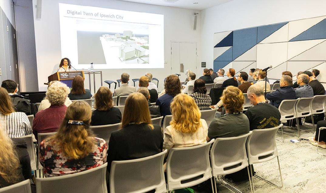
Getting technical
Following each day’s plenary sessions, the technical program will begin. Broken into 8 to 10 separate subject streams, the topics to be covered will include:
• Professional standards and practice
• Professional education
• Spatial information management
• Hydrography
• Positioning and measurement
• Engineering surveys
• Cadastre and land management
• Spatial planning and development
• Valuation and the management of real estate
• Construction economics and management
All up there will be eight technical sessions spread across three days from Monday to Wednesday.
Several technical tours have been arranged to give locals and international visitors alike the chance to see first-hand how Australian geospatial professionals are operating at the cutting edge of emerging technologies and research. One such tour will be an expert-led walking tour through the Brisbane CBD to see how the city is preparing its infrastructure for the upcoming 2032 Olympic Games.
Another tour, presented by senior Queensland Government geospatial experts, will provide participants with a detailed look at aspects of surveying, spatial and land administration matters in the state, including policy and legislation, native title, and Queensland’s groundbreaking Queensland Globe.
Tours will also be available through the state’s remarkable Museum of Lands Mapping And Surveying, which houses an incredible collection of surveying artefacts and maps that stretch back more than a century and a half.
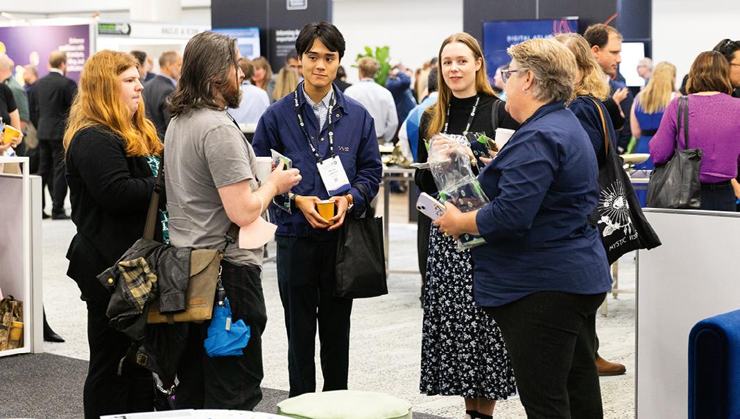
For those who like getting out on the water, short forays will be provided aboard the QG Norfolk, a 19-metre-long hydrographic survey vessel that is equipped with state-of-the-art echo sounding technology. There’ll be four, 30-minute tours per day across Tuesday, Wednesday and Thursday.
Finally, for those who like to get their hands on the latest and greatest geospatial technologies, the exhibition hall will be packed with stands representing Australian and overseas companies and organisations.
FIG Working Week 2025 and Locate25 promises to be a not-to-be-missed event. It’s not too late to register — head to fig.net/fig2025/registration.htm for full details. n
FIG Young Surveyors Conference
The 9th FIG Young Surveyors Conference will run across two days, Saturday, 5 April and Sunday, 6 April, and will be held in The Cube at the Queensland University of Technology campus just across the river from the main conference venue. The Cube is one of the world’s largest digital interactive learning and display spaces.
In keeping with the digital theme of the wider conference, many of the sessions and presentations within the Young Surveyors Conference will focus on how young professionals can and should be empowered to shape the ‘digitally enabled future’ of the geospatial sector.
Presented by the FIG Young Surveyors Network and GCA Young and Emerging Professionals, it will feature presenters from Australia and around the world, including representatives from academia and private industry, with plenty of time set aside for mingling and networking… including a Meet an Expert ‘speed dating’ session where young professionals will get the chance to sit and chat with senior geospatial professionals.
The Leica iCON Trades field solution makes taking the jump into the world of digital construction easy and efficient.
The fast-moving world of digital construction layout, interior finishing and digital templating is revolutionising manufacturing, infrastructure and building sites around the world. Digital processes and technologies make for faster, more accurate results, saving time and money and reducing costly errors.
The cutting edge of digital construction technology is the Leica iCON Trades field solution, which enables the user to readily complete highly accurate measuring tasks for interior fit out and templating applications whilst also providing the ability to convert any layout plans, utilising commonly used file formats, so they can be accurately marked out on the ground.
The Leica iCON Trades field solution from C.R. Kennedy comprises groundbreaking hardware such as the Leica iCON iCS20 Motorised Construction Sensor and the Leica iCON iCS50 Robotic Construction Sensor, along with industry specific field software that is simple to use and suitable for any task on site.
“Once design data is loaded onto the tablet, the process of laying out or measuring points can begin right away with only one operator, thus reducing the effort required and keeping the risk of mistakes to a minimum, while simultaneously increasing accuracy and efficiency,” says Bernie Edmonds, C.R. Kennedy’s Segment Manager – Building Construction.
Designed specifically for the building construction sector, the Leica iCON Trades field solution is tailored to industry-specific workflows. Not only does it feature revolutionary measuring hardware, the iCS20 and iCS50, but also accessories such as the groundbreaking vPole and vPen for extremely accurate and reliable measuring.
The Leica iCON Trades field solution hardware is so compact that it can be carried to the construction site in one go. The small but powerful layout sensor (iCS50 or iCS20 including accessories) can be carried and operated by one person. Automated processes ensure that everything is ready for use quickly and reliably.
The specially developed ‘quick mount release’ allows the iCS device to be snapped to the tripod without needing to screw it on. Automated processes such as ‘auto levelling’ and ‘auto set-up’ ensure that the device is correctly set up and quickly ready for use, ensuring a high level of efficiency.
Depending on the application, the user has the option to work only with the laser or with the Leica vPole or vPen. The Leica vPole and vPen always stay reliably connected to the device, thanks to a visual image-based connection that recognises the red dots on the sphere of the vPole or vPen. In addition, there’s no longer any need to hold the tilted Leica
vPole or vPen exactly plumb, which saves a lot of time and increases accuracy.
With the visually based and automated relocation process, the user can quickly and easily relocate the iCS20 or iCS50. After relocation, the unit automatically finds and measures the vTargets, which means the user can continue the layout or measuring process straight away.
The Leica vTargets bring new levels of accuracy and convenience to the job site by automatically locating control points and locking onto them with precision. Each target has a unique pattern, enabling the Leica iCON iCS system to instantly differentiate between reference points, without risk of overlap, ensuring every measurement is accurate and unique. With a 360° search range of up to 25 metres and a 40-metre aiming range, Leica vTargets simplify even the most complex data collection and layout processes.
Fast and accurate layout
The Leica field software iCON Trades for Layout is designed specifically for construction surveyors and layout specialists. It supports all layout tasks carried out in the building construction industry, with its standout features being:
• One-person operation, which reduces staff resources and increases productivity;
• Quickly ready for use thanks to the ‘autosetup’ process;
• Easy relocation with ‘auto-relocation’ and Leica vTarget;
• No time-consuming data preparation in the office, as all popular data formats can be used directly;
• Always up-to-date data available via connection to common construction cloud services;
• Statistics and reports to track layout progress and quality; and
• BIM support
The Leica iCON iCS50 provides robotic versatility for complex construction projects and is purposebuilt for construction and finishing. By combining robotic precision with Leica’s vPole technology, its tilt compensation and auto-height adjustment features offer unparalleled accuracy and control, making it an excellent choice for high-stakes tasks requiring flexibility and range.
The ‘Layout’ software module is designed to streamline layout and marking tasks — it accommodates both straightforward projects using data from PDF plans as well as more complex layouts based on 2D and 3D CAD plans or BIM models, significantly reducing the need for extensive data preparation in the office.
In fact, data preparation is simple and fast — the user simply imports the data received from the architecture, planning or surveying office into the Leica iCON trades software. All common file types are accepted: PDF, CSV, TXT, DXF, DWG and IFC. Data can be accessed either via USB, e-mail or common construction cloud services such as Bricsys 24/7, Autodesk Construction Cloud, Procore, Bluebeam, Allplan BIMPLUS, Google Drive, Dropbox and OneDrive. Having the most recent data always at hand enables the user to react quickly to last-minute change requests with minimal time and effort.
A new approach to digital templating and interior finishing
The field software Leica iCON Trades for Templating is particularly suitable for the creation of digital templates and covers the specific needs of stonemasons, glaziers, bathroom fitters and marine interior professionals. This software enables the creation of digital templates quickly and accurately. You can finish the data directly on site and forward it to the CNC machine for production.
Some advantages:
• Achieve accuracies better than 1mm (up to 10m) and measure to ‘hidden’ points;
• Quickly ready for use due to the ‘auto-setup’ process;
• Easy repositioning with ‘auto-relocation’ and Leica vTarget;
• Fast and efficient data capturing, fully compatible with the unique, wireless Leica vPen;
• Finalisation of drawings on site with powerful CAD tools; and
• Export of production-ready DXF files to programme CNC machinery.
The Leica iCON iCS20 or iCS50, combined with the powerful interior finishing field software, brings motorised and/or robotic precision for interior projects. By using the unique handheld vPen — the world’s first non-tethered remote measuring pen to offer millimetre accuracies — or by simply using the red laser dot, templating or interior fit out requirements can continually be achieved across multiple setups, maintaining precision and reliability wherever it’s needed.
“The Leica iCON Trades solution is an unmatched product that will revolutionise measurement processes in many different industries… it is one product for all building construction needs,” says Sandeep Arora, National Product Manager – CI products at C.R. Kennedy.
In summary, Leica iCON Trades is a unique combination of simplicity and power — the software guides the user through every step of the process, including data import and preparation, device positioning and layout, resulting in faster and more accurate measurements and layouts accomplished with ease.
“The iCON Trades solution, from Leica Geosystems, represents a revolutionary and groundbreaking leap into the future of measurement technology,” adds Edmonds. “With the incredible iCS20 and iCS50 sensors along with innovative accessories such as the vPole, vPen and vTargets and controlled by industry specific field software, there is nothing on the market that compares to ease of use and overall convenience and accuracy of iCON Trades.” n
For more information on the Leica iCON Trades field solution, visit survey. crkennedy.com.au/ building-construction/ construction-layout.
GIS, AI to the rescue for coral reefs
Australian researchers have called for a global real-time monitoring system to help save the world’s coral reefs.
Australian researchers are designing a global real-time monitoring system using GIS and AI technologies to help save the world’s coral reefs from further decline, primarily due to bleaching caused by global warming.
Coral reefs worldwide are dying at an alarming rate, with 75% of reefs experiencing bleaching-level heat stress in the past two years.
The World Heritage-listed Great Barrier Reef has been decimated by severe bleaching events since 2016, exacerbated by ongoing crown-of-thorns starfish outbreaks and coastal development.
A collaborative project led by the University of South Australia (UniSA), with input from Queensland and Victorian researchers, is integrating remote sensing technologies with machine learning, AI and GIS to monitor and hopefully stall the damage to the world’s most fragile marine ecosystems.
A multimodal platform will distil all research data relating to coral reefs, including underwater videos and photographs, satellite images, text files and time-sensor readings, onto a central dashboard for real-time global monitoring.
UniSA data analyst and lead researcher Dr Abdullahi Chowdhury says that a single centralised model will integrate all factors affecting coral reefs and provide environmental scientists with real-time predictions.
“At the moment we have separate models that analyse substantial data on reef health — including bleaching levels, disease incidence, juvenile coral density and reef fish abundance — but these data sets are not integrated, and they exist in silos,” Dr Chowdhury says.
“Consequently, it is challenging to see
the ‘big picture’ of reef health or to conduct large scale, real-time analyses.”
The researchers say an integrated system will track bleaching severity and trends over time; monitor crown-of-thorns starfish populations and predation risks; detect disease outbreaks and juvenile coral levels; and assess reef fish abundance, diversity, length, and biomass.
“By centralising all this data in real time, we can generate predictive models that will help conservation efforts, enabling earlier intervention,” according to Central Queensland University PhD candidate Musfera Jahan.
The technology will bring together datasets from organisations such as the National Oceanic and Atmospheric Administration, the Monterey Bay Aquarium Research Institute, the Hawaii Undersea Research Laboratory and the CSIRO.
The researchers contend that the future of coral reef conservation lies at the intersection of technology and collaboration, and they hope that their research provides a roadmap for harnessing these technologies to ensure the survival of coral reefs for generations to come.
The research has been published as a paper entitled ‘Coral Reef Surveillance with Machine Learning: A Review of Datasets, Techniques, and Challenges’ in the journal, Electronics (https://www.mdpi.com/20799292/13/24/5027).
In the paper, the researchers write that their review “establishes a comprehensive framework for leveraging AI-driven solutions in marine environmental research and conservation”.
“Our analysis reveals significant advancements in using ML methods for coral reef monitoring, particularly through
convolutional neural networks (CNN), support vector machines (SVM), and random forests (RF). These technologies have demonstrated remarkable capabilities in habitat mapping, biodiversity assessment, and climate impact predictions.
“The integration of multiple data sources through GIS platforms has enabled more accurate and efficient environmental monitoring systems, crucial for informed decision-making in marine conservation. Our future work will investigate the experimental validation of existing techniques to make a fair comparison.”
Challenges that remain to be overcome include ensuring data quality and availability, data standardisation, spatial and temporal resolution, integration of realtime monitoring, algorithm development and enhancing ‘generalisability’ across different regions of the globe.
Other aspects to consider include automating the annotation of coral datasets, incorporation of 3D mapping and validation and ground truthing.
Nonetheless, the researchers point out “several key directions for advancing this field”.
“A primary focus should be on developing standardised data collection protocols and creating unified global databases for coral reef information, including automated data harmonisation tools and consistent metadata frameworks across research institutions,” they write.
“Additionally, there is a pressing need to develop advanced ML algorithms specifically for coral reef environments, incorporating adaptive transfer learning techniques and multi-sensor fusion capabilities designed to handle the unique challenges of underwater environments and varying ecological conditions.” n
Celebrating DIVERSITY in the geospatial sector
We profile three outstanding professionals who are excelling in different segments of the geospatial field.
IJONATHAN NALLY
nternational Women’s Day, celebrated every year on 8 March, is something that Position magazine (and it’s online presence, www.SpatialSource.com.au) likes to get behind, as study after study has shown that increasing diversity in the workforce is of benefit to everyone — individuals, organisations and society as a whole.
As in previous years, this year in the lead up to IWD we published profiles online of several outstanding professionals, each of whom has chosen a different, fascinating career path within the overall geospatial sector. Shortened versions of those interviews are presented below, but we encourage you to read the full profiles by going to www.SpatialSource.com.au and searching for IWD 2025.
“Addressing retention will mean more women staying in the profession, and more women visible to others.”
Kate Fairlie, LEI
Kate Fairlie
Land Administration Specialist and Project Director with Land Equity International.
Please tell us about your current role and responsibilities.
We’re a consulting firm that works exclusively in the international development space on all things land. At the moment, I’m working on projects such as affordable land and housing in Vanuatu; digitalising (and decentralising) Nepal’s land registration and valuation data and services; and identifying the role for surveyors in improving women’s access to land.
How did you get into this field and what attracted you to it?
I started out wanting to map Mars and went through my degree as perhaps the only student who actually wanted to be a geodesist — or maybe that’s an ‘areodist’ (thanks Google). But I became distracted by travelling… going on exchange to Sweden during university, then taking an internship with Shell in the Netherlands and a graduate position in Scotland. Then from around 2006, I became involved with the International Federation of Surveyors which ultimately led me to the UN and then back to Wollongong with Land Equity International! So perhaps what attracted me most to surveying was the versatility — it’s a career that could take me to North Sea oil rigs; to the United Nations in Nairobi; and back to Wollongong, where one day I’m researching the legal framework for carbon rights and the next day maybe mortgage finance options for female seasonal workers.
Are there any personal qualities or attributes that are helpful to have in this field?
Look, we always talk about maths, but really surveyors should be great communicators. Hear me out. In my work I like to think of myself as a technical translator — we need to understand how the laws and administrative systems to manage land work, but fundamentally these systems only work if people use them. A ‘culture of land registration,’ like we have in Australia, isn’t created overnight, and it isn’t (solely) created by developing a whizz-bang digital twin. People, landowners and customers, have to understand why they should register and what will happen if they don’t, and they have to trust the government (or other entity) they are registering with.
We need more women in the geospatial sector. Do you have any ideas?
Number one, every surveying firm can ‘adopt’ a pre-school, primary or high school and commit to an annual visit. Shout out to Woolpert, who sent a young professional along with me to visit my son’s kindy class. We talked to around 25,
five-to-six-year-olds about why we measure, how lasers work and how we can have maps for different purposes. Woolpert had some great balsawood planes that the kids made, and then used the total station to measure how far we could fly them. Maths in Surveying days are great but can only reach so many kids.
Number two, metrics. There have been a lot of initiatives to get women into surveying, but I’m not so sure we’ve spent the effort evaluating the success of these initiatives. We all know the value of good data! Let’s collect it and target our efforts where we can best see success.
Number three, retention! I think we can all recognise some leaky pipeline issues in the profession. Addressing retention will mean more women staying in the profession, and more women visible to others. There are so many facets to retention though, and DEI has unfortunately lost a bit of international backing recently thanks to a certain leader whose name rhymes with ‘chump’. There’s a whole other discussion to have around that (retention, that is).
In saying that, women remain the minority in the surveying profession. We’re burdened enough in just proving ourselves day by day and ‘representing women’ in so many ways. So the burden of ‘increasing the number of women surveyors’ shouldn’t fall exclusively to us. Number four, then, is, everyone takes responsibility.
Is there anything else you would like to add?
It’s great to have all the breakfasts and luncheons and inspiring speakers during International Women’s Day, but we need all those in privileged positions to step up and do more to achieve equality. This means men stepping up for women. (And white women stepping up for indigenous women, and so on and so forth.) Feminism is like land — it’s fundamentally about power. And it’s everyone’s responsibility to think about how power and bias play into their positions and their work.
For example, there are huge linkages between intimate partner violence and land ownership — so what training should surveyors receive to play a role in identifying and supporting victims? And hold the ‘that’s not my role’ thought — let’s recognise this as a problem and see what steps we can take to address it.
Supporting women, and other possible minority groups, in the field and on site is another. No longer should the challenges of in-the-field periods or on-site menopause be a women’s domain only. We all have mothers! It’s time to educate yourself and those around you and actively create inclusive spaces; not wait for women to ask.
Kate Fairlie
Aurora Foo
Senior Geospatial Analyst in Geoscience Australia’s National Location Information Branch.
Please tell us about your current role and responsibilities.
I specialise in spatial data manipulation and transformation using FME. I work in partnership with the Australian GeospatialIntelligence Organisation to contribute to the development of national foundation spatial datasets, and to identify and transform civilian spatial data for defence use. I have also been involved in the National Bushfire Intelligence Capability, having led the technical development of the National Bushfire Boundaries data service Geoscience Australia produces, which brings together bushfire mapping undertaken by the states and territories into a suite of nationally consistent datasets.
How did you get into this field and what attracted you to it?
After finishing high school in Sydney, I went to uni in Canberra. Initially I wanted to be a political journalist. In the very Canberra way, my casual job to get me through uni was with the government. More specifically, I worked in what was then the Australian Government’s Crisis Coordination Centre (CCC) — the 24/7 monitoring and reporting function of the then Emergency Management Australia (now the National Emergency Management Agency’s National Situation Room).
My ‘Ahah!’ moment came in mid-2020. There was flooding in NSW at the time, and I saw some of Geoscience Australia’s amazing spatial people embedded with us in the CCC take Copernicus satellite imagery of these floods and run it through the Australian Exposure Information Platform. It blew my mind. To someone who at the time was non-spatial, the fact that this was possible was astonishing and inspiring.
What makes you most proud about your role and achievements?
The nationally significant, life-saving work that the National Bushfire Intelligence Capability does is inspiring, and seeing how the Bushfire Boundaries data service is being integrated into so many important functions across governments and the private sector is incredible.
However, I am most proud of being able to advocate for trans people like myself. Representing Geoscience Australia on an interdepartmental panel for IDAHOBIT day (International Day Against Homophobia, Biphobia and Transphobia) was a real honour. Likewise when I gave an acceptance speech for the Bushfire Boundaries work’s win at APS Data Awards, being able to use that platform to advocate for trans people in a room full of senior government leaders, and having people come up to me throughout the night — parents with trans kids, fellow trans people, or even random strangers — and thank me for my words, and for being a visible trans woman. That makes me proud.
Have you had any struggles during your career? Conversely, have you had support?
As a transgender woman I have had tremendous support from my colleagues and the niche of the geospatial community I work in. Coming out as an adult was a terrifying experience, which could have had incredibly profound negative consequences if it went wrong. However, I have received nothing but support and encouragement from my colleagues, unlike so many fellow trans women.
“If
you gave me the typical pitch for a geospatial career in high school,
I would’ve been scared away.”
Aurora Foo, GA
I am lucky that there are a lot of incredible women around where I work. My managers and teammates — for many of whom I am the first trans person they’ve met — have gone out of their way to learn and understand the best practices for working with and managing trans colleagues, which makes me feel welcomed and a valued member of the team.
We need more women in the geospatial sector. Do you have any ideas?
People have been saying that the geospatial sector needs better marketing for years now, so I won’t labour that point. However, I do believe that the geospatial field needs to be humanised. We need more diverse people telling impactful, human stories about the power of spatial. If you gave me the typical pitch for a geospatial career in high school, I would’ve been scared away. It is only through directly seeing how powerful spatial capabilities are in action that I was inspired to pursue a spatial career.
Is there anything else you would like to add?
I believe that it is important for employers and leaders in the sector to demonstrate their commitment to inclusion and valuing diversity, especially in this political moment. People are at their best when they can bring their whole, authentic self to work. We are living in a time when the words ‘transgender’ and ‘queer’ are being systematically erased, research grants that contain the word ‘women’ are being defunded, and life-saving gender affirming healthcare is being banned. People need to know that they can feel safe at work, and that their sector values who they truly are.
A recent industry-wide survey has shown that 15% of Australia’s geospatial community are LGBTQIA+. Now more than ever it is important that this 15% feel safe, secure and welcome at work in our geospatial community. As a sector, we need to show that we support women, LGBTQIA+ people — especially trans and gender diverse people, or anyone from a diverse background, by raising our voices and making clear that we are an inclusive and welcoming community.
Aurora Foo
Emily Tidey
Senior Lecturer, Te Kura Kairūri | the School of Surveying at Ōtāko Whakaihu Waka | the University of Otago.
Please tell us about your current role and responsibilities.
I teach hydrographic surveying and land surveying methods to undergraduate students taking our Bachelor of Surveying and Bachelor of Science in Survey Measurement degrees. I also undertake research in hydrography, looking at the integration of hydrographic data with other users, as well as the use of specialist measurement systems such as low-cost GNSS and multi-frequency multibeam systems.
Prior to working at the University, I was an offshore hydrographic surveyor involved in all sorts of mapping, positioning and engineering projects on various boats around the world.
How did you get into this field, and what attracted you to it?
I grew up near the sea and in a family that sailed the east coast of the North Island of New Zealand as much as possible. My interest in the sea and navigation led me to consider avenues such as joining the Navy or studying teaching or engineering. And at high school I was interested in geography, graphics (technical drawing), engineering, maths, physics and English.
Then I found out about surveying and decided that the mixture of practical work, mathematics and mapping was just right for me. I graduated from the University of Otago and worked as an offshore hydrographic surveyor for Fugro based out of New Plymouth in New Zealand, but luckily I got to work for Fugro operating companies all over the world including in Australia, the USA, Germany and Brazil.
After working on boats offshore for several years I went to the University of Plymouth in the UK to study on their internationally recognised (ICA/IHO/FIG) Cat A Masters course, and from there came back to New Zealand and joined the academic staff at Otago.
What do you enjoy most about your job?
I love being at sea! As a hydrographer I enjoy the challenge of getting all the equipment to work together, exploring and making maps of areas that sometimes have never been seen before, the travel, and working with the variety of people you find offshore.
(And the sunrises!)
As a lecturer I enjoy introducing students to this exciting career path and sharing my enthusiasm. It is fantastic to help young people learn new skills and to see them develop professionally during their time with us at university. I love hearing about their careers and catching up with them in later years too.
Have you had any struggles during your career?
Conversely, have you had support?
Several times I have found that my male colleagues are spoken to or approached by clients or others before me, despite me being more senior or the party chief/surveyor in charge on a project. In these cases I’ve found it’s important to introduce myself and my role as soon as possible. It is also very noticeable to me that my ideas are often repeated or taken on by male colleagues who then are given recognition for this. I try my best to point this out respectfully, and to support other female colleagues when I see this happen to them.
At times it has been hard to juggle parenting and work; I am lucky to be very well supported by my awesome husband and to be able to work slightly less than full-time in my current position.
“We need to keep working to showcase amazing women who are out there doing all sorts of awesome surveying and spatial jobs.”
Emily Tidey, UO
Recently, I was supported by the IHO Empowering Women in Hydrography initiative to attend an intersessional meeting of the IBSC, an international board that certifies hydrographic surveying and nautical cartography courses. It was a fantastic opportunity to see how this group runs and be part of working on the results of a survey they have recently undertaken, as well as to meet fellow women in hydrography from Peru, Chile and the USA.
We need more women in the geospatial sector. Do you have any ideas?
“If you can see it, you can be it.” We need to keep working to showcase amazing women who are out there doing all sorts of awesome surveying and spatial jobs. And not just in a painfully obvious and staged occasional photoshoot.
I think the whole geospatial sector needs to work much more closely with schools, teachers and the community — how come people know what a civil engineer or architect does, but not a surveyor or spatial professional?
What would you say to young women who are considering a career in geospatial?
Practically, consider approaching companies and training institutions near where you live; most are very happy to show you around and give you a taste of what they do. But really, go for it! There are so many opportunities, you can sculpt your career in so many ways as the opportunities are endless. n
Emily Tidey
AI, LiDAR for remote
forestry management
AI and 3D airborne LiDAR have been used to map radiata pine forests for most of New Zealand’s North Island.
Australian and New Zealand researchers have used AI and 3D airborne laser scanning data to accurately map planted radiata pine forests for most of New Zealand’s North Island.
The technique has enabled them to distinguish between planted large estates, small woodlots and newly established stands as young as three years old, demonstrating a new way of using remote sensing with other technology to reveal forest growth and update growth information.
This approach is just as relevant for Australia, where radiata pine is also widely grown, says Dr Grant Pearse, Senior Lecturer in Remote Sensing and Geographic Information Systems at Flinders University.
“In New Zealand, where radiata pine plantations dominate the forestry sector, the current national forest description lacks spatially explicit information and struggles to capture data on small-scale forests,” says Dr Pearse. “We combined deep learning-based forest mapping using high-resolution aerial imagery with regional airborne laser scanning data to map all planted forest and estimate key attributes.”
The spatially explicit forest description provides wall-to-wall information on forest extent, age and volume for all sizes of forest, facilitating stratification by key variables for wood supply forecasting, harvest planning and infrastructure investment decisions — applications equally valuable for other forestry industries.
The AI-derived forest map can be viewed at forestinsights.nz.
The research, conducted with New Zealand timber industry researchers from Scion and Indufor Asia Pacific, was carried out on planted forests in the Gisborne region, which has publicly available aerial imagery and airborne laser scanning data.
This region is particularly significant as it was severely impacted by Cyclone Gabrielle in early 2023, which caused widespread landslides and forest debris flows.
For such vulnerable terrain, knowing exactly where forests are located in the landscape, their age and condition is key to managing the risks of harvesting operations on the region’s steep slopes.
“We propose satellite-based harvest detection and digital photogrammetry to continuously update the initial forest description,” the researchers write in their paper, ‘Developing a forest description from remote sensing: Insights from New Zealand’ (sciencedirect.com/science/article/pii/ S2666017224000671).
In addition to the economic importance of New Zealand’s 1.8 million hectares of radiata pine forestry for export timber and fibre, the planted forests are a key part of the country’s emission trading scheme and are expected to play a significant role in achieving the government’s target of net-zero emissions by 2050.
Scale model
The deep learning model was developed inhouse through a collaborative effort that Dr Pearse initially led while at Scion Research.
“After transitioning to my current role at
Dr Grant Pearse
Flinders, I maintained a partnership with the Scion team and we continued to develop the current version of the model,” he says. “One of the more challenging (and rewarding) parts was getting the architecture in place to run the model at scale and produce useable geospatial outputs in the form of clean vector boundaries.”
“We realised quite early on that with the scale of what we were targeting (many terabytes of imagery covering most of the North Island) we couldn’t afford to have lots of cleaning and inspection work on the other end.”
According to Dr Pearse, the focus switched to developing the best possible model to keep the cleaning work to a minimum.
“That boiled down to lots of dataset development by Melanie Palmer at Scion, who led the curation and validation effort, supported by several students and staff,” he says. “The aerial imagery and basemaps we rely on are generously hosted for free by Amazon Web Services (AWS) and Land Information New Zealand (LINZ), so it made sense to build the model training and inference pipelines on the same cloud platform and avoid data storage and egress fees.”
Keeping it going
For continuous updates, Dr Pearse says the team is exploring several options. Project partner Indufor has developed
“Open data doesn’t just serve public good; it helps create a larger and more diverse market for geospatial data.”
Dr Grant Pearse, Flinders University
an automated harvest detection system that can ‘subtract’ forest from the layer after harvesting. “Since we’re typically dealing with large blocks of harvested forest, the lower resolution of satellite imagery isn’t a significant limitation for this aspect,” says Dr Pearse.
“Replanting detection is more challenging. The key question is: at what age can we confidently detect and map both newly planted and replanted areas?” he adds. “The unique pattern of planted seedlings is quite distinctive in aerial imagery, but then we’re dependent on local government capture cycles which can be anywhere up to five years apart, sometimes longer.”
Dr Pearse says the team is looking to evaluate alternatives such as Sentinel-2 or commercial satellite imagery providers to bridge these gaps in aerial capture programs. “I think we have a clear pathway forward for monitoring stocked forest area,” he says.
“The real challenge lies in estimating forest height going forward,” he adds. “This is important to us because height is the key to estimating timber volume, forest age, carbon content, and future wood flows and their value. New Zealand’s national elevation programme has captured LiDAR for nearly 80% of the country — it’s an incredible resource for forestry and many other fields. Given the costs involved, it’s unlikely to be repeated though, so we’re not counting on new LiDAR data for future estimates.”
However, he adds, having that initial LiDAR-derived digital elevation model opens up several possibilities.
“We’ve already demonstrated successful height estimation using stereo-satellite imagery in these forest types,” he says (see ‘Comparison of high-density LiDAR and satellite photogrammetry for forest inventory,’ doi.org/10.1016/j.isprsjprs.2018.06.006), adding that the technology has advanced significantly since then. “Both Maxar and Airbus now offer 3D products from their new constellations, and there are promising scientific missions coming from NASA/ISRO and ESA.”
“We’re also investigating approaches used in other countries where they’ve transitioned to digital aerial photogrammetry for forest height estimation after initial LiDAR scanning. While we’d need to validate these methods for our intensive plantation forests on steep terrain, the technology has evolved considerably, giving us multiple options to explore.”
Next steps
Dr Pearse says the next step is to fill the research gaps — building and validating the process to map harvested and replanted areas in those years between aerial imagery captures.
“The system that provides data on New Zealand’s forests (the National Exotic Forest Description) is run by the Ministry for Primary Industries (MPI)
and we know they are looking for options to create a spatial version of this,” he says. “We’ve engaged with their consulting team about our remote sensing approach, which we feel is the way forward for this. Remote sensing offers a way to capture this information systematically without relying on individual forest owners to provide data or respond to surveys.”
“I think the best model would be a partnership approach between the Ministry, the forest growers, and our research team which already includes public and private entities, i.e. Flinders (University), Scion (Crown Research Institute) and Indufor Asia Pacific (Private Forestry and Remote Sensing consultants,” he adds.
“Individually, it can be hard for private forest growers to see the benefits of something like this, but at a national level the benefits are clear — a spatial forest description is very useful if you’re a processor or investor trying to forecast
future supply and demand within a region. The same is true for government agencies trying to understand where to focus infrastructure investments.”
What about for species other than radiata? Can the technique be applied to other trees, terrains and environments?
“Although it isn’t mentioned in the paper, we do have a model that can map multiple planted species from the same imagery,” says Dr Pearse. “It’s a little bit more challenging because radiata accounts for such a large proportion of New Zealand’s forests (>90%), so gathering training examples of other planted species is more difficult. However, the results so far look very promising, and the Scion team are continuing to develop this capability.”
According to Dr Pearse, this type of multi-species mapping will become increasingly important as New Zealand looks to diversify its forest species mix. “We expect to see more small-scale plantings of
secondary species like coast redwood, and our approach is well suited to identifying and mapping these fragmented parcels of forest from a relatively young age,” he says.
Open data advantages
Dr Pearse highlights how important open data policies are for this kind of work, noting that New Zealand Government policy states that when the Crown (including local government entities) pays for imagery or LiDAR capture, that data should be made publicly available. LINZ has been instrumental in implementing this, he says, managing the collection and republishing of data online under a permissive licence.
“This approach has paid significant dividends,” says Dr Pearse. “Our project is just one of many where researchers, local councils, geospatial consulting firms and others have leveraged this resource in innovative ways.”
“What I’ve observed is that the open data actually drives commercial demand. As more users discover applications for aerial imagery by experimenting with the open data, it creates new use cases and markets.
“Those who need more frequent or specialised captures then turn to commercial providers, effectively growing the overall market for geospatial data,” he adds.
“The councils and agencies need it more often too as they have more and more proven applications for it. It’s a model that public entities should consider carefully — open data doesn’t just serve public good; it helps create a larger and more diverse market for geospatial data.” n
Those interested in learning more about this work can reach out to Dr Pearse at grant. pearse@flinders.edu.au.
A screenshot of the Forest Insights website, showing areas of radiata pine mapped on New Zealand’s North Island.
Examples of labelled imagery showing the two foreground classes ‘juvenile’ and ‘radiata’ that were merged prior to model training.
Map showing the location of the labelled image tiles used to develop the deep learning model. The darker grey area represents both the extent of the Gisborne imagery and airborne laser scanning datasets used, as well as the overall study area.
Long-range aerial LiDAR surveying
Wingcopter has announced that it will expand its offering beyond cargo drones to include the sale of long-range BVLOS LiDAR surveying solutions. For this, the company’s flagship Wingcopter 198 aircraft will be equipped with laser scanning and camera systems, enabling the efficient and rapid collection of high-quality data. The aim is to give customers the opportunity to survey up to 60 km of linear infrastructure in one mission, carrying a 4.5kg sensor system. The planned system will enable the collection of up to 570 pts/m2 with a sensor accuracy of 10 mm and a precision of 5 mm. Customers will be able to scan up to 10.3 square kilometres in a single 42-minute BVLOS mission.
Satellite-derived bathymetry
TCarta has introduced a new line of Satellite Reconnaissance Charts to supplement official marine navigation maps in shallow waters. Derived from recently acquired satellite imagery, the digital charts adhere to IHO S-57 and S-100 data model standards with the same appearance and symbology as official navigation aids. However, they do not replace official nautical map products. Offered at off-the-shelf 1:20,000 scale and custom 1:4,000 scale, the products are delivered in file formats ready to load into popular marine navigation software as well as common GIS software. The charts can be produced for nearly any shallow-water area in the world and are available off the shelf for several regions, including many Pacific Islands.
Ground control kit
Wingtra has launched WingtraGROUND, described as a “revolutionary ground control kit [that] completes a true end-to-end solution, combining drone, field setup and processing into a single, fluid toolchain”. Wingtra says the portable kit solution provides planning guidance and receiver placement confirmation via live syncing with the end-to-end Wingtra workflow, featuring receivers (powered by Emlid technology) that are integrated into the Wingtra ecosystem. Users are prompted step-by-step through the set-up process as the software reads the location of the receivers, which serve as base station and rover, and prompts actions until everything is in place for accurate readings. The company claims WingtraGROUND is four times faster to set up than traditional equipment.
Point cloud clean-up
NavVis has announced that point cloud clean-up now comes standard at no extra cost in Release 11.5.0 of its IVION software. The company says that with the new tool, users can more efficiently remove noise and unwanted data from point clouds directly within IVION, eliminating the need to use third-party tools and streamlining reality capture workflows. The software enables the user to inspect point clouds visually and remove unwanted objects, reflections and noise. The point clouds stay linked with panoramic imagery, enhancing contextual accuracy, and, with restorable edits, IVION does not delete points but hides them so that users can restore data as needed.
News and views from the Geospatial Council of Australia
CEO’s Column
GCA Board Members
Kate Lundy President/Chair
Kate Ramsay Deputy Chair
Alistair Byrom Deputy Chair
Noel Davidson Director
Alex Leith Director
Stewart Dunne Director
Mary-Ellen Feeney Director
Darren Mottolini Director
Roshni Sharma Director
SHAPING THE FUTURE of geospatial
Welcome to FIG Working Week 2025 + Locate25
As we gather in Brisbane for FIG Working Week 2025 + Locate25, I want to extend a warm welcome to our local and international guests. This event is more than just a conference — it is a defining moment for Australia’s geospatial industry, bringing together the best minds from across the globe to discuss, innovate and shape the future of our profession.
For the first time, FIG Working Week and Locate have joined forces to deliver a truly world-class event. This unique collaboration provides an unparalleled opportunity to engage with experts, connect with international networks, and explore the latest advancements. With ten FIG Commissions shaping the program, attendees will experience a rich variety of technical sessions, panel discussions and interactive workshops. Whether you are here to share research, gain insights, forge new partnerships, or explore Brisbane, one of Australia’s most vibrant cities, this week will be rich with opportunities.
World-class plenary speakers
FIG Working Week 2025 + Locate25 will feature an exceptional lineup of plenary speakers from across the globe, bringing their expertise and vision to the stage. These thought leaders will explore the critical challenges and opportunities shaping the future of geospatial sciences, including
sustainability, resilience and emerging technologies.
Among them will be Geoff Smith, CEO of Australian Spatial Analytics and 2025 Queensland Australian of the Year, who will highlight how neurodivergent talent is revolutionising the geospatial sector, creating meaningful careers and addressing critical skill shortages. We’ll also hear from Melissa Haris, the incoming CEO at Geoscience Australia and immediate past chair of ANZLIC, along with Greg Scott on the SDG Land Alliance, and Andrew Dowding, Managing Director of Winyama, who will explore Indigenous data sovereignty, demonstrating how digital mapping can empower communities to protect and manage cultural knowledge.
International speakers include Linda Foster Director of Land Records/Cadastre ESRI Inc., Naa Dedei Tago, Surveyor/ Climate advisor to the President of Ghana, and Professor Anthony Yeh, a land use planning expert from Hong Kong. These plenary sessions will challenge perspectives, inspire action, and shape the future of our industry long after the conference ends.
Technical and industry insights
With a diverse program spanning ten FIG Commissions, alongside Locate25’s national focus, attendees will have access
to a rich variety of sessions. From land administration to hydrography, positioning technologies, and geospatial education, and climate resilience solutions, the program will cater to a broad spectrum of interests and expertise.
Workshops, technical sessions and panel discussions will provide practical insights and innovative solutions to industry challenges. Whether you are a seasoned professional, a researcher, or an emerging leader in the sector, there will be ample opportunities to expand your knowledge and contribute to the discourse.
Unmissable technical tours
One of the standout features of FIG Working Week 2025 + Locate25 is the range of technical tours available. These tours offer a behind-the-scenes look at some of Brisbane’s most exciting geospatial projects, from advanced surveying operations to smart city initiatives.
Attendees will have the chance to visit cutting-edge facilities and witness geospatial technology in action, whether in
infrastructure development, environmental monitoring or urban planning. It’s a rare opportunity to see real-world applications up close and engage with professionals who are making a tangible impact.
Experience Brisbane at its best
Beyond the conference sessions and technical tours, Brisbane itself offers a fantastic backdrop for networking and exploration. As one of Australia’s most dynamic cities, it boasts a thriving cultural scene, world-class dining and stunning natural attractions. The city’s South Bank precinct, with its riverfront parklands, restaurants and galleries, provides the perfect setting for informal networking and social events. For those looking to explore further, Brisbane’s proximity to stunning destinations such as the Gold Coast and Sunshine Coast means that adventure is never far away.
Whether it’s a morning walk along the Brisbane River, an evening at one of the city’s top restaurants, or a day trip to nearby
Vale Michelle Grose
6 May 1968 — 27 January 2025
It is with great sadness that we share the news of the passing of Michelle Grose, a valued member of the Geospatial Council of Australia and a dedicated contributor to our National Engineering Certification Committee. Michelle passed away in hospital after an illness.
Michelle’s career was truly remarkable, spanning over three decades in the surveying and engineering sectors. She worked on some of Australia’s most iconic infrastructure projects, including the Adelaide Oval redevelopment, the Heysen Tunnels, and the Regency to Pym Project as part of the North-South Corridor. Her expertise and leadership in surveying earned her a well-deserved reputation as a highly respected professional in her field.
Throughout her career, Michelle held key roles at organisations such as ESO Surveyors, McConnell Dowell and Laing O’Rourke. Her knowledge, skill and passion for her work were evident in every project she undertook, from major infrastructure developments to challenging tunnel and mine surveying projects.
Michelle’s contributions to the geospatial industry extended beyond her technical excellence. As a member of our National Engineering Certification Committee, she played a vital role in shaping the standards and processes that underpin professional recognition in our sector.
Michelle will be remembered for her professionalism, generous spirit and commitment to the geospatial industry. She was a mentor, a colleague and a friend to many, and her loss will be deeply felt across our community.
On behalf of the Geospatial Council of Australia, we extend our heartfelt condolences to Michelle’s family, friends and colleagues. Her legacy will live on through the many lives she touched and the projects she helped bring to life.
Tony Wheeler
attractions, there’s no shortage of ways to make the most of your time in this beautiful city. To help with your planning, we’ll have a dedicated tourism booth at the conference registration area. The team will be ready to assist you in organising and booking experiences that turn your trip into an unforgettable adventure.
Australia’s geospatial sector is at the forefront of technological evolution, and this event is a powerful platform to showcase our expertise on the global stage. I encourage you to take full advantage of what this event has to offer. Engage in discussions, challenge ideas, and immerse yourself in the diverse program. Let’s use this opportunity to drive meaningful collaboration, inspire future leaders, and reinforce the essential role of geospatial in tackling global challenges.
Thank you for being part of this historic event. I look forward to the conversations, connections, and breakthroughs that will emerge over the coming days.
Tony
Wheeler
CEO,
Geospatial Council of Australia
State and Territory Chairs and Co-Chairs
NSW Chair
Brittany Baker
NSW Vice-Chair
Hanno Klahn
ACT Chair
Mike Stapleton
Queensland Chair
Koray Ozdogu
South Australia Chair
Graham Walker
South Australia Vice-Chair
Jennifer Brindle
Tasmania Chair
Anthony O’Flaherty
Victoria Chair
Nicole Kiely
Western Australia Chair
Laren Collen
Areas of Practice Chairs
GDARS Chair
Dr Jagannath Aryal
Surveying Chair
Mike Stapleton
Hydrography Chair
Neil Hewitt
Young and Emerging Professionals Chair
James Sadler
Powering Australia’s future with space and geospatial technologies
Significant productivity gains and innovation opportunities can be realised through increased adoption of space and geospatial technologies across all sectors of the Australian economy.
The intertwined space and geospatial ecosystem underpins modern technology, including telecommunications, weather forecasting, mapping and location services. It drives Australia’s technological infrastructure, incorporating digital twins, resilient position, navigation and timing (PNT), quantum computing, artificial intelligence and machine learning. Collectively, this ecosystem is shaping Australia’s future.
A recent study on the Economic Impact of Geospatial Services in Australia
(tinyurl.com/5c96ur6p) indicates that prudent government investment and policy settings for these sectors have the potential to achieve significant economic and productivity outcomes, while securing access to critical data streams essential to Australia’s future.
This article, developed by the 2030 Space and Spatial Industry Growth Roadmap Working Group, sets out the objectives, accompanying actions, and policy settings necessary to maximise the contribution of these two industries working together in the national interest, unlocking innovation and productivity benefits for Australia. Extensive industry consultation has shaped these recommendations.
Economic impact
In October 2024, the Geospatial Council of Australia commissioned a report assessing geospatial information’s economic value. It highlights the sector’s critical role in national productivity and its direct economic impact through case studies.
The report presents a current economic baseline and two future scenarios: a business-as-usual approach and an optimal policy environment — see Table 1.
The report notes that, under favourable conditions, the future contribution of space and geospatial in Australia will depend on several factors, including:
• Improved digital and data frameworks for geospatial data sharing.
• Strengthening links between geospatial information, digital engineering and critical infrastructure.
• Securing access to space-based systems such as Earth observations, PNT and satellite communications.
• Supporting research and innovation for economic and social impact.
• Expanding workforce capacity through education and training.
Where to next?
The 2030 Space and Spatial Industry Growth Roadmap (tinyurl.com/bdcnre6z) was published in 2023. Based on extensive industry consultation, it outlines critical objectives to maximise economic benefits for Australia. If implemented, these objectives (listed below) will increase uptake, reliability, productivity and economic growth.
1. Establish a national blueprint. The industry blueprint will define critical sovereign capabilities and key actions to ensure the space and geospatial industries meet Australia’s sovereign needs. It must be all-encompassing, covering civil and defence, private and public sectors. A new national governance mechanism is needed to coordinate and align strategies and planning across these areas.
2. Drive Australian industry capacity. Prioritising local supply chains and Australian content, particularly in government and defence procurement, will grow Australian providers. A first step is to understand the current composition, capability and structure of Australia’s space and geospatial sectors.
3. Coordinate research. Align publicly funded R&D with high-impact opportunities for industry. National and international space missions are crucial for accelerating growth. This includes refocusing the SmartSat CRC,
as it transitions to an enduring entity outside of the CRC program, with nationally beneficial priorities in mining, agriculture, environment and climate management.
4. Increase capability. Developing space and geospatial industry capacity and competencies by nurturing local SMEs, particularly through Government procurement (including Defence procurement) to meet sovereign needs, will create more high-tech employment opportunities. Investment in skills development is also needed with accelerated education and training programs, and a focus on increasing high-tech employment opportunities through targeted workforce initiatives, and skilled migration programs.
5. Develop spatial digital twins. Australia needs to coordinate and further grow its investment in SDT, acknowledging that these virtual representations are a critical national capability with significant economic, environmental and social benefits.
6. Upgrade PNT. Planned PNT enhancements are critical for future technologies. Australia must invest and manage resilience in this key capability.
7. Enhance sovereign capability. With growing dependence on these capabilities, Australia must secure assured access to critical space assets and the associated geospatial services by supporting local companies and capabilities.
8. Grow support for defence. Peak space and geospatial industry bodies should lead a strategy — developed collaboratively with Defence and the Australian Space gency — that aligns Defence priorities with civil space national priorities to build domestic space and geospatial industry capabilities.
9. Enhance national mapping base and foundation spatial data. Australia’s current map base, upon which all mapbased data relies, from land ownership to vehicle navigation, is in need of
fundamental improvement to meet the future needs of government and industry. Government, as a key custodian of much of this foundational data, needs to continue to invest in these resources.
A golden opportunity
Australia’s prosperity and security rely on greater utilisation of space and geospatial industries. Productivity gains and national challenges, including climate change and security, depend on geospatialdriven solutions. By embracing these industries, Australia can better position itself for the future, ensuring long-term economic and strategic benefits.
Recommendations for the Australian Government
The 2030 Space and Spatial Industry Growth Roadmap Working Group believes the Australian Government should consider the following recommendations:
• Develop a nationally coordinated space and geospatial industry blueprint;
• Support industry development through local investment;
• Enhance research coordination and align it with industry growth;
• Expand capability building initiatives and training programs;
• Invest in spatial digital twins as a critical national asset;
• Strengthen PNT infrastructure for national resilience;
• Improve sovereign capability by prioritising local providers;
• Support Defence collaboration to meet national security needs; and
• Upgrade national mapping and spatial data infrastructure.
Australia has a golden opportunity to harness the power of space and geospatial industries. By taking decisive action now, the nation can secure its economic future, enhance sovereign capability, and drive innovation across critical sectors. Building Australia’s space and geospatial capabilities is mission-critical to national success. n
Mixing mapping AND MUSIC
Martin Brabec is proof that technical precision and artistic expression can go hand in hand.
For most people, geospatial science and music might seem worlds apart. But for Martin Brabec, they are two sides of the same creative coin. By day, he works at Dira GeoSystems. By night, he creates melodies, performs on stage, and keeps his passion for music alive.
While music and mapping may seem unrelated, Martin sees strong parallels between them — both require precision, creativity and a deep understanding of patterns. Navigating complex data structures is not so different from composing a song, where each note plays a crucial role in the final harmony.
Martin helps develop geospatial software and has played a key role in shaping and expanding ProSuite QA, a quality assurance tool developed with Switzerland’s national mapping agency, swisstopo. The software is now used across Europe by national mapping agencies, councils and the private sector.
“Having worked in education, I learned to break down complex concepts — an essential skill when engaging with clients and stakeholders in GIS,” he says.
Martin is particularly excited about automation in geospatial workflows, AI-driven spatial analysis and real-time data integration. “The ability to access and analyse spatial data seamlessly across organisations is transforming decision-making, especially in disaster response, infrastructure management, and environmental monitoring,” he says.
While geospatial technology is his profession, music has been a lifelong passion. “I started playing music at 14 in Switzerland and founded a band called Complete Write-Off, a name we pulled straight from a dictionary. Over the years, I played in punk, rock, and pop bands, but the one that defined me the most musically and friendship-wise was Flink.”
After stepping away from music for several years following the birth of his daughter, he rediscovered his passion and now enjoys writing and releasing music on his own terms. “Music used to be a much bigger part of my life, with regular weekend gigs and the pressures that came with being in a band,” he says. “Now, it’s a creative outlet, free from expectations or labels, just something I genuinely love doing and something that charges my batteries.”
Martin currently juggles three musical projects: Maybe I Like The Misery, The Kind Hills, and Oceans in Between.
“Maybe I Like The Misery began during COVID when Nick and I finally decided to explore a pop-inspired sound with an electronic approach. As a duo, we occasionally play gigs and release songs whenever it feels right — there’s no pressure, just creativity.”
His project The Kind Hills is truly global, with members spanning LA, London, Hong Kong, Lucerne, Perth and Brisbane. “Instead of jamming in person, we send ideas back and forth, recording our parts separately,” he says.
At FIG Working Week + Locate25, Martin will have the rare chance to merge his two passions. His band will take the stage at
the Welcome Reception on Sunday night, 6 April, delivering a set packed with pop favourites and a few surprises.
“I’m super excited to combine GIS and music at this event,” Martin says. “And I can’t wait to play the official Locate25 song, ‘We’re Gonna Shine,’ which I wrote specifically for the conference!”
Performing alongside Nick from Maybe I Like The Misery, Martin is switching things up for this special occasion. “We’re making it more dynamic and organic, bringing in Laura on drums instead of our usual electronic beats,” he says. “With these changes, we might even rename our lineup for the night - maybe The Locate25 Whereabouts?”
Attendees can expect a setlist featuring Australian classics from bands like AC/DC, Powderfinger and Crowded House, along with some originals. “But beyond that… well, some surprises are best left as surprises,” says Martin.
Having lived and worked across multiple countries, Martin has developed a broad perspective both personally and professionally. On a personal level, experiencing different cultures has made him more adaptable and open-minded, giving him a deep appreciation for diversity and the way people approach life and work.
“I’ve learned to be self-reliant and resourceful, especially when living abroad and navigating unfamiliar environments,” he says. “Living in various places has helped me build a network of connections across different industries and geographies, which has been invaluable in my current role. It’s also enhanced my ability to collaborate across cultures and approach problems from diverse angles.”
When he’s not working or making music, Martin enjoys travelling, spending time with his family, and staying active. “I love going to the beach, cycling, and starting my day with a 5:30am fitness class,” he says. “It sets a positive tone for everything that follows. I haven’t been snowboarding in a while though — it’s tough to find snow in Brisbane!”
With a mix of geospatial expertise and musical flair, Martin is proof that technical precision and artistic expression can go hand in hand. Whether he’s refining geospatial software or belting out tunes, one thing is clear, he always finds his rhythm. n
Co-host of FIG Working Week + Locate25
GCA is the peak body representing the interests of organisations and individuals, including new and emerging professionals working in the vast range of occupations for surveying, space and spatial in the digital world. Who are we?
BECOME A MEMBER
We o er a variety of memberships, including free student memberships, professional individual memberships, overseas (a liate) memberships, and organisational memberships.
GET CERTIFIED
Enhance your career with GCA certi cations, benchmarking your expertise and advancing your professional journey.
GCA EVENTS
Discover our upcoming events and webinars where you can earn CPD points, connect, learn, and collaborate with industry leaders.
SKILLS MIGRATION ASSESSMENT FOR SURVEYORS
GCA is the trusted assessing authority for Surveyor ANZSCO 232212 quali cations, ensuring a smooth transition to Australia's geospatial sector.
Connect with
Groundbreaking performance and productivity
• Improve layout productivity up to ten times compared to traditional chalk-line layout.
• Autonomous printing with obstacle avoidance.
• Printed on-slab text helps deliver executions as per plan.
Accurate
layouts
• Precise printing to complete every project accurately.
• Complex layouts spot-on, laying out intricate arcs and circumferences.
• Raise the bar of predictability, minimizing redos and with great rigour.
One easy solution to do it all
• Simple layout management with cloud-based tools.
• Easily print on most surfaces thanks to HP inks expertise.
• Compact design that fits in a portable case for effortless transport.