Call us t o g et your complete work flow s olution today ! Efficiency and versatility that will accelerate productivity comes part of a workflow solution that includes the FC-6000 field controller, Magnet software, a HiPer VR receiver and the GT-1200/GT-600 single-operator robotic system. The power of longrange reflectorless measurements comes in your choice of 1”, 2” or 3” GT-1200 models or 2”, 3” or 5” GT -600 models.
The F lorida Surveyor is the official publication of the Florida Surveying and Mapping Society, also known as FSMS. It is published monthly for the purpose of communicating with the professional surveying community and related professions who are members of FSMS. Our award winning publication informs members eleven months out of the year about national, state, and district events and accomplishments, as well as articles relevant to the surveying profession. In addition, continuing educational courses are also available.
PRESIDENT’S Message
September 2025
Members,
I want to thank the student chapter at the University of Florida for inviting me to speak. Going to Gainesville always feels like coming home. It was a great turnout, with the North Central Florida Chapter in attendance as well. A lot of good questions were asked, and with the help of some of my fellow board members, we were able to answer them. Local chapter meetings are the heart and soul of our society. Fellowship with local surveyors, gaining new insights, and working toward the strengthening of our profession are what these meetings are all about. If you haven’t been to one in a while, I encourage you to attend—and bring a friend who might make a great new member. I look forward to participating in more of these gatherings this year. This month, I plan to attend the Tampa Bay Chapter meeting.
Scholarships
While at the University of Florida, I was asked about scholarship opportunities the society offers for Geomatics students. Funny you should ask: the society maintains a scholarship fund for students pursuing a degree in Geomatics. The catch is that you have to apply. I can recall several board meetings where no one applied for this free money. In addition, many local chapters have scholarship funds as well. Requirements vary from chapter to chapter, but they’re available if you ask. My local chapter requires you to be a member, and the cost of membership is free. Click Here for Scholarship Opportunities: https://www.fsms.org/scholarship-opportunities
Certified Floodplain Surveyor
I was recently sent a survey to gauge interest in a Certified Fl oodplain
PRESIDENT’S Message
Surveyor program. This program expands a surveyor’s knowledge of Flood Insurance Rate Maps, Letters of Map Change (LOMA, LOMR-F, LOMR), NoRise Certifications, and the Flood Elevation Certificate. I am a strong advocate of education, and specialized knowledge of anything we do in our day-to-day operations is an asset to our profession.
Legislative Matters
Committee assignments have been set, the conference is behind us, and the real work of the society begins. We already know there will be another challenge to our profession this session. The First Step Florida Surveyors and Mappers Credentialing and Licensure protocol as an alternative pathway to temporary licensure, is expected to be re-submitted. As it was last year, this remains a bad bill. It is extremely important to support our Legal and Legislative Committee in any way we can. The best way to do that is to make a donation to the PAC. Big donations are great, but small ones matter too. Please know that every contribution makes a difference. Cli ck Here for donations and to find out more about FSMPAC: https://www.fsms.org/fsmpolitical-action-committee
Final Thoughts
I recently stumbled upon a book I’m finding very informative: The Swamp Peddlers by Jason Vuic. It explores the development of Florida shortly after World War II and the role of developers like Gulf America and the General Development Corporation (GDC). Developments Like Port Charlote and Deltona were discussed, and Living on the Treasure Coast, I see the results of their work in communities like Port St. Lucie and the Sebastian Highlands.
As I mentioned in last month’s message, this is your society. Your opinion matters, and I would like to hear from you regarding any comments or suggestions you may have. Please email me at president.fsms@gmail.com .
Respectfully submitted,
Robert N. “ Bob ” Johnson, PSM, CFM
2025-26 Districts and
Directors
District 1 - Northwest
Bay, Calhoun, Escambia, Franklin, Gadsden, Gulf, Holmes, Jackson, Jefferson, Leon, Liberty, Madison, Okaloosa, Santa Rosa, Taylor, Wakulla, Walton, Washington
Chad Thurner (850) 200-2441 chad.thurner@sam.biz
Angela Bailey (850) 559-5039 bailey.angelakay@gmail. com
District 2 - Northeast
Alachua, Baker, Bradford, Clay, Columbia, Dixie, Duval, Gilchrist, Hamilton, Lafayette, Levy, Marion, Nassau, Putnam, Suwannee, St. Johns, Union
Pablo Ferrari (904) 219-4054 pferrari@drmp.com
Nick Digruttolo (352) 374-2249 ndigrutt@gmail. com
District 3 - East Central
Brevard, Flagler, Indian River, Lake, Okeechobee, Orange, Osceola, Seminole, Martin, St. Lucie, Volusia
Howard Ehmke (772) 206-4650 hehmke@carterassoc.com
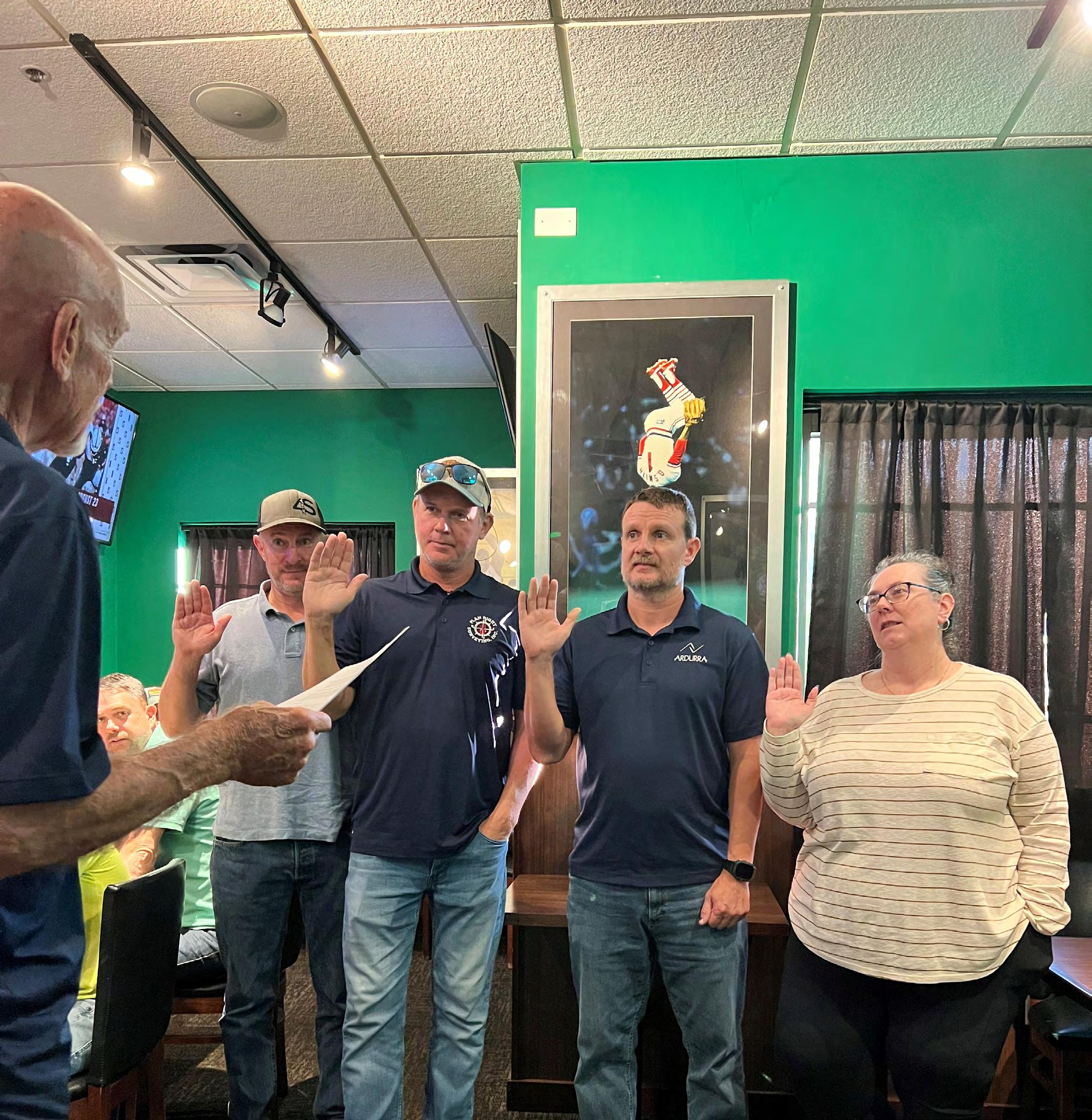
Collier-Lee Chapter — From District 5 Director Stephen Shawles
Previous District 5 Director Don Stouten P.S.M., swears in newly elected officers during their July chapter meeting.
From left to right, Vice President Scott Urquhart, P.S.M., Jeff Stouten P.S.M. as Secretary, President Cameron Harmon P.S.M., and lastly, but most importantly, Jennifer Shepard as Treasurer, who has dedicated her time to the chapter for more years than we can remember. She is the driving force behind the scenes and we all owe her our gratitude.
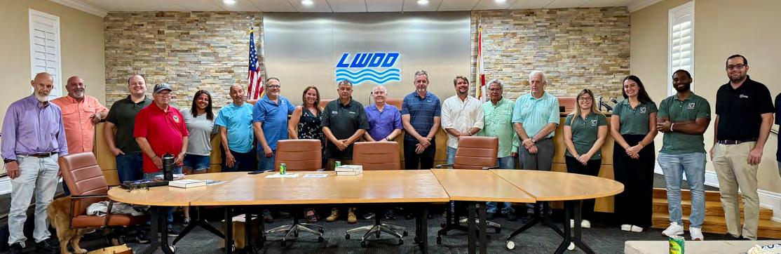
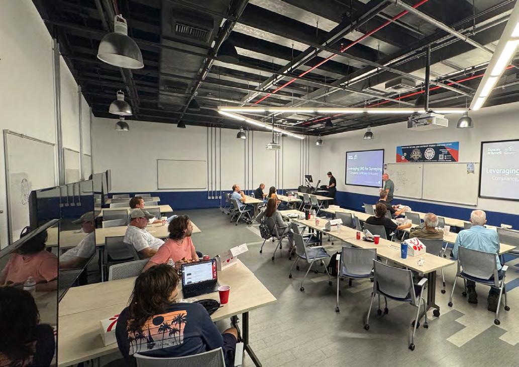
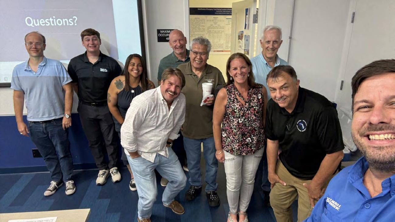
July 24th Palm Beach Chapter Meeting Recap — From Andrew Beckwith, CST
We had a fantastic turnout at the Lake Worth Drainage District Headquarters for our July meeting!
A special thank you to Ron Hanson, PSM CPM, Geodetic Services Supervisor at Florida Department of Transportation, for delivering an insightful 1-hour CEC class on FDOT FPRN Best Practices. The session was packed with valuable knowledge and practical takeaways for our surveying and mapping professionals utilizing the Florida Permanent Reference Network and its valuable tools.
We’re also excited to announce that Tom Whidden of WHIDDEN SURVEYING & MAPPING, INC. has graciously volunteered to serve as our incoming chapter President-elect. Thank you, Tom, for stepping up to lead our chapter into the future!
Thank you to everyone who attended and contributed to a successful evening of learning and collaboration. Stay tuned for updates on our next meeting, August 28th, 2025 here: fsms-pbc.org
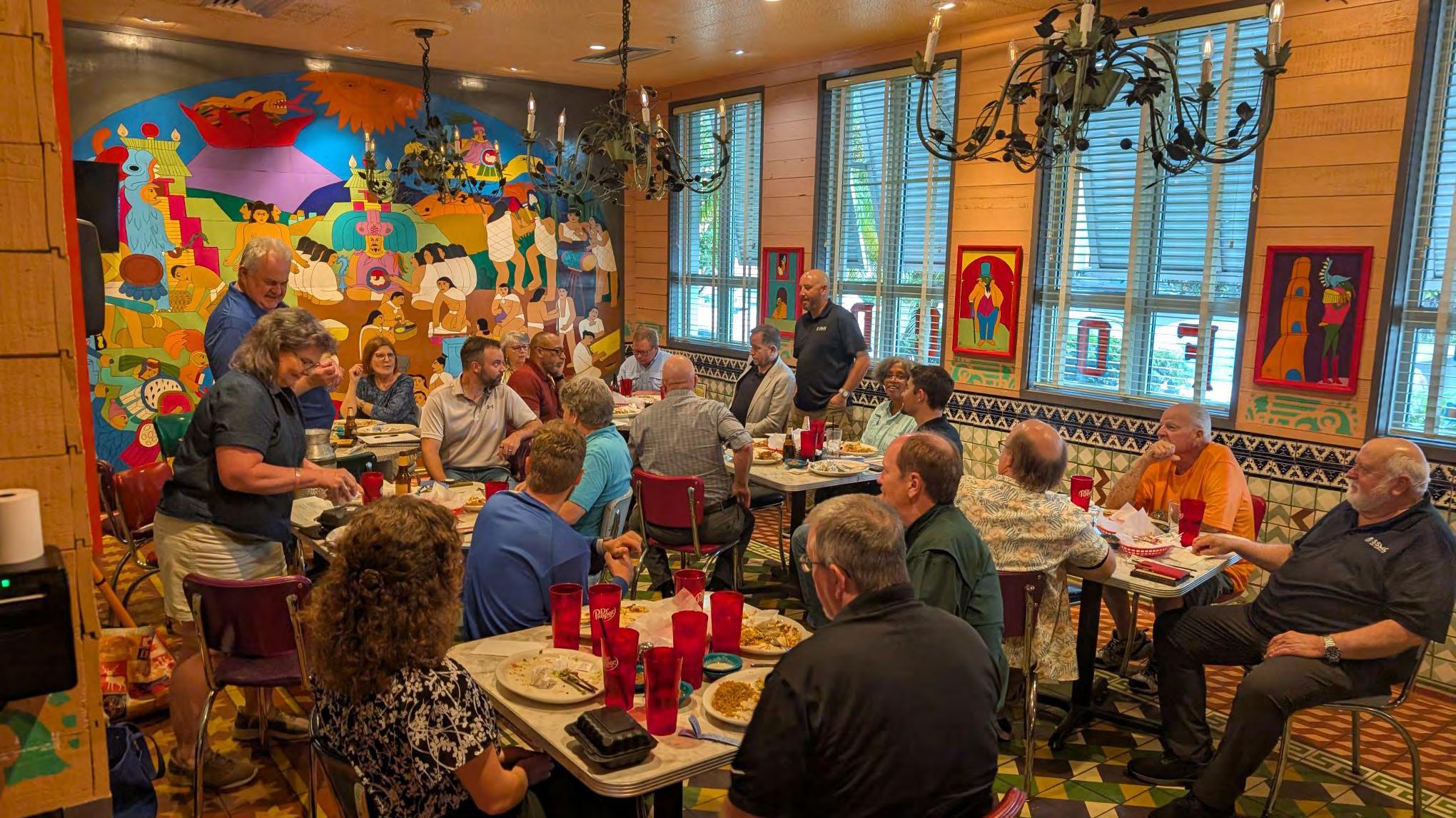
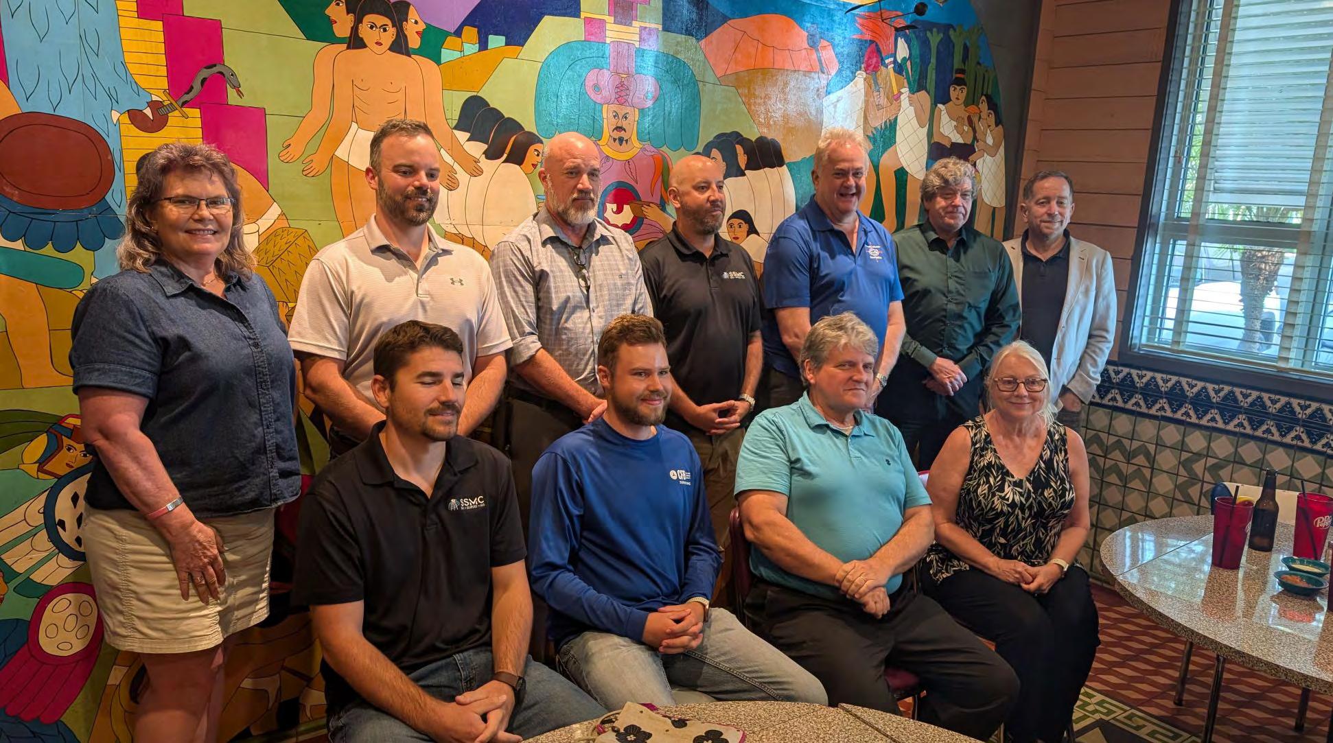
Central Florida Chapter — From Chapter President
Raymond Phillips, PSM
We had nearly 40 attendees for the swearing in of the new officer s of the Central Florida Chapter of the Florida Surveying and Mapping Society. It was an honor to serve as President of the Chapter for a year and I know I am leaving it the good hands of Eddie Munoz. Remember we are the Great Central Florida Chapter.
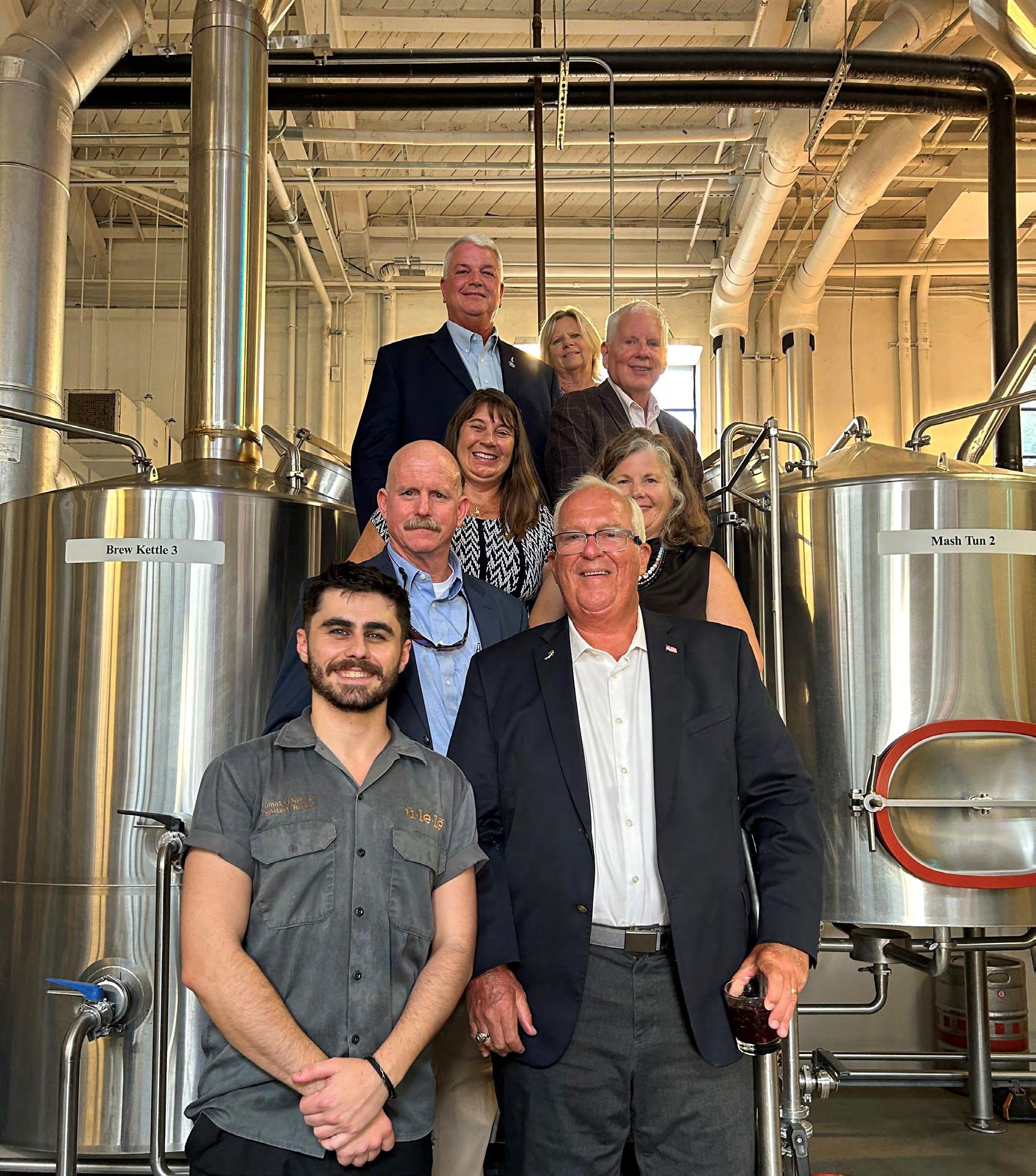
From Bottom L to R: Thomas O’Neill, Jr (Assistant Brewer) Gave them a tour of the brewery. Past President Jack Breed, Director of UF/IFAS Terrell T. "Red" Baker, Dr. Kay Kelsey (Scott Angle’s wife and UF professor), Pam Hyatt, Dr. Scott Angle, FSMS NSPS Dir. Russell Hyatt, and Sandra Breed.
The Clyatts and Hyatts continued to praise the program for the graduates it produces.
I read the recent accreditation report on my way down (I wasn’t driving!). It states: “The program boasts exceptional collaboration with industry and government, fostering robust support that has led to direct funding from the State Legislature.”
I saw the words. But I understood them more deeply after an evening with some of the people who are doing the collaborating, fostering and supporting – the Breeds, Clyatts and Hyatts.
I already have the 2026 annual meeting on my calendar and hope to meet more of you.
At the dinner, Jack Breed raised a glass and announced to the group that he and FSMS had the backs of UF/IFAS, and he hoped that we have yours. You do.
J. Scott Angle is the University of Florida’s Senior Vice President for Agriculture and Natural Resources and leader of the UF Institute of Food and Agricultural Sciences (UF/IFAS).
By J. Scott Angle jangle@ufl.edu
I recently had the pleasure of sharing a table with stalwarts of both FSMS and the University of Florida’s geomatics program.
Jack and Sandy Breed, John and Ghia Clyatt, and Russ and Pam Hyatt met me in Tampa for dinner.
Driving down to meet them was the least I could do. Jack still commutes to Gainesville weekly to teach. I was gratified to hear directly from him about his continuing devotion to students.
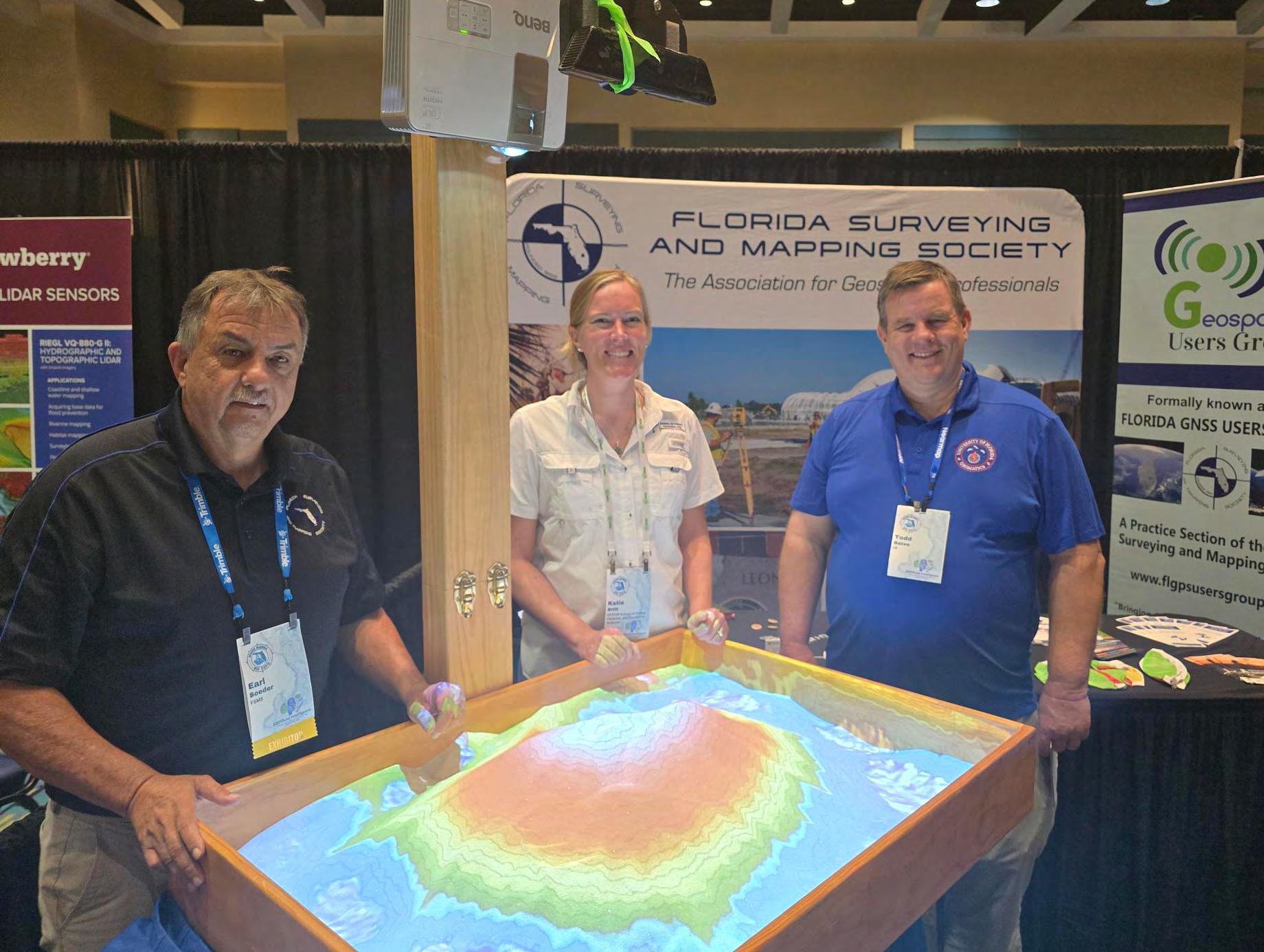
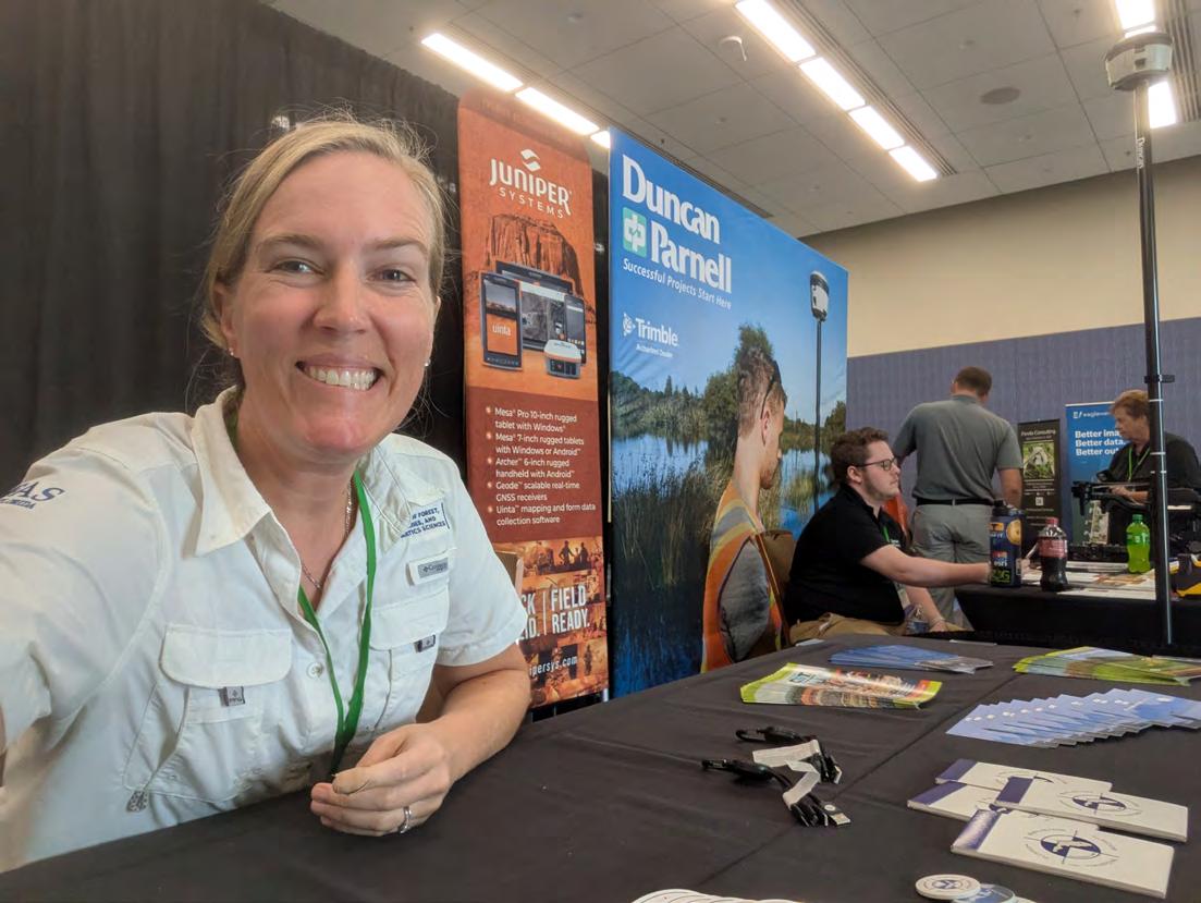
Below - FSMS representation at South Florida and Central Florida GIS Expo Workshops
From Left to Right: District 4 Director
Earl Soeder, UF Assistant Director for Geomatics Extension Workforce Education and Training Katie Britt, and UF Geomatics Specialist at Fort Lauderdale Research and Education Center Todd Bates.
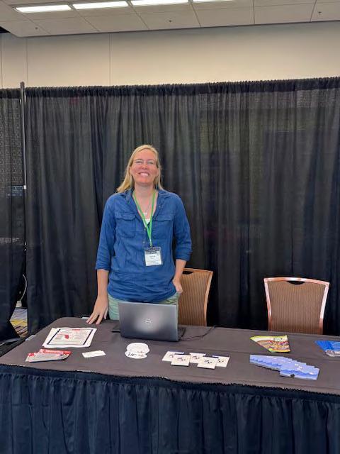
Katie Britt , UF Assistant Director for Geomatics Extension Workforce Education and Training.
From Dr. Youssef Omar
Kaddoura
- UF Academic Program Specialist
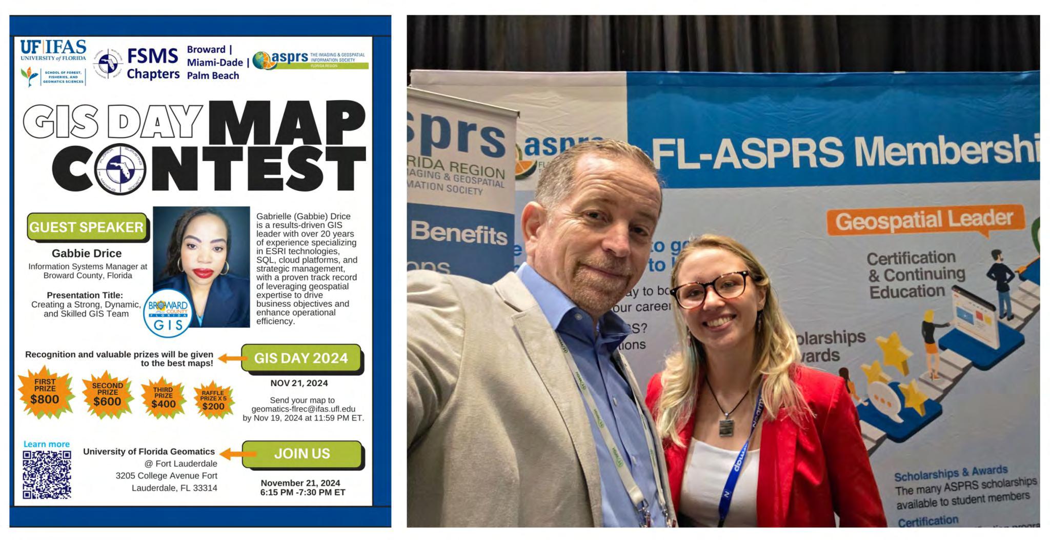
Took this selfie with Diana Phillips, a standout student/professional. Thank you, Diana Phillips for sharing with us how the GIS Day - Map Contest 2024 literally changed your career. After her presentation, someone in the crowd saw her work and opened the door to her dream job. So proud to see how showcasing skills on a map can open real doors!
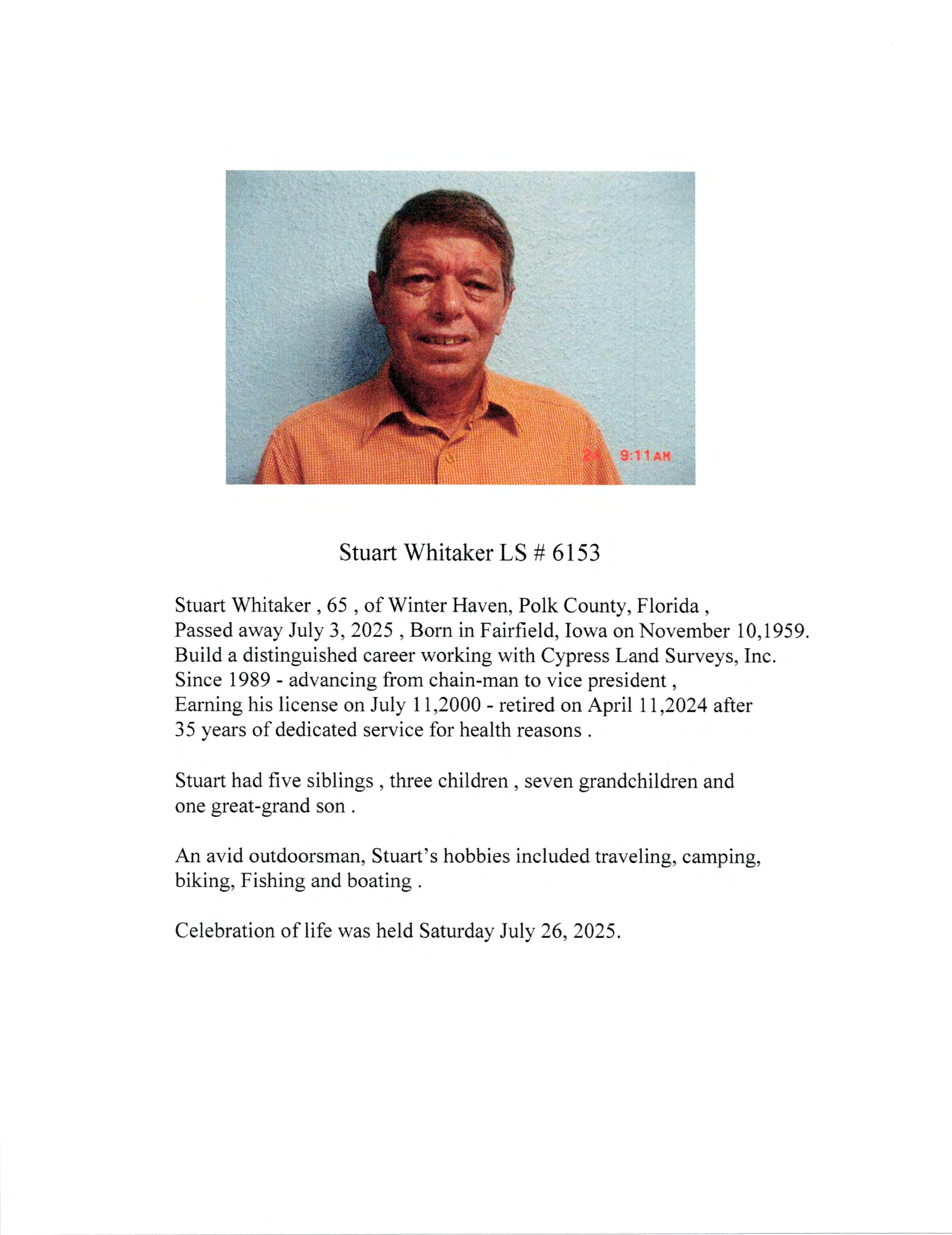
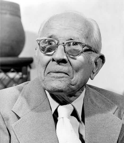
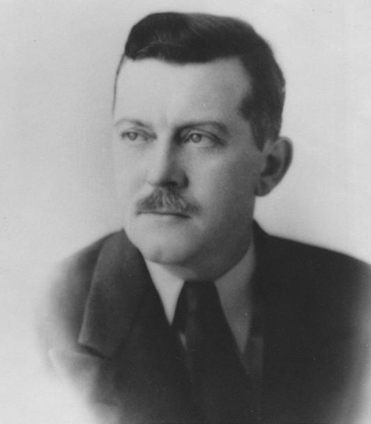
George Comstock Bolton
December 7 th , 1931 – July 11 th , 2025
It is with deep sadness that we share the news of George C. Bolton’s passing on July 11, 2025, in Palm Beach County, Florida, at the age of 93. George was born in his grandparents' home in Coconut Grove, Florida on December 7th, 1931, to the late Alex B. Bolton, Sr. and his beloved mother Mary E. “Molly” Harvey Bolton Burrell. In addition to his parents, George was preceded in death by his stepfather, Troy E. Burrell, Sr., his brothers Alex B. Bolton, Jr. and Howard W. Bolton, and his sister, Camille Bolton Wood Young.
George leaves behind the love of his life, Mary E. Burns Bolton, his daughters Glenda Jolene Bolton-Wiltsie and Melissa Diane Bolton Calabrese along with his Son-in-law Raymond J. Calabrese, his grandsons Patrick Bolton Calabrese
and Michael Raymond Calabrese, his granddaughters Jade Elizabeth Wiltsie and Emma Jean Wiltsie. George grew up in Hialeah, attending Hialeah Elementary School and Hialeah Junior High School (where he met the love of his life, Mary). Following that, he attended Miami-Jackson High School.
In 1949, 75 years ago, George, at the age of 17, joined Biscayne Engineering Company, where his grandfather had worked some years before. George would travel by bicycle from his family home in Hialeah to the office in downtown Miami where he worked as a rodman on a field crew. During this time, George and Mary were dating. Before long, in 1950, George and Mary were married. He proudly celebrated his 75th wedding anniversary this past January, making sure to tell everyone he met that this was his wife, and they have been married for 75 years!
In 1952, during the Korean War conflict, George was drafted into the Army and following his tour of duty, returned to Biscayne Engineering Company where he worked for several years. In 1957, George continued surveying at another respected surveying firm, SchwebkeShiskin and Associates in Miami, working his way up from party chief to partner in the firm.
In 1976, George returned and purchased Biscayne Engineering and then spent the next decades of his life building up the company that had given him his start. During this time, he selflessly passed on his wisdom in surveying and business to other professionals, many of whom went on to start their own successful businesses. The love of his life, Mary, was his partner in business as well as at home for the entire duration.
George was a passionate surveyor and set an example to others of how to be a good surveyor, gathering the evidence needed to support sound decisions. Even after he had retired, George would regularly come into the office on weekends and take a group of surveyors to a randomly selected block in the city, to teach them the art and science of field surveying, the way he had been taught. And for those more advanced in their careers, George would inspire and guide them in obtaining professional licensure.
Not only did George show others the way in terms of surveying and business, but he also set a powerful example of what it meant to be a husband, a father, a brother, and a grandfather. George spent his entire life head over heels in love with his wife Mary, the girl he had met in junior high school. And he was a devoted family man, helping to raise their two daughters while running the company.
And there are no words to express what an important role George played in the 126-year history of Biscayne Engineering Company. He lit the way, and although he cannot remain, the light from his torch will continue to guide all those he touched.
To George’s family, friends and colleagues, his passing will leave a hole that cannot be filled. But in this time of mourning, comfort can be taken in the fact that he led a happy and purposeful life, and in so doing, changed the lives of so many people.
To send flowers to the family or plant a tree in memory of George, click here for his obituary and final resting place: https://www.weemsandsonsfh.com/obituaries/George-ComstockBolton?obId=43570829
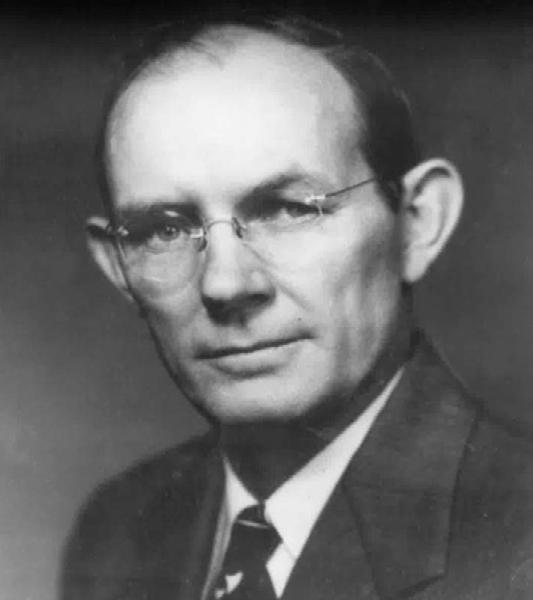
William "Bill" Taylor Butler
June 28 th , 1954 – July 19 th , 2025
It is with deep sorrow and love that we announce the passing of William Taylor Butler, who entered eternal rest on July 19, 2025, surrounded by the love of his family. Bill was a devoted husband, father, grandfather, brother, and friend. He is survived by his loving wife of 25 years, Vickie Butler; his sons, Michael (Christina) Reynolds and Evan Butler; and his grandchildren, Megan Reynolds and Justin Reynolds. He is also survived by his stepmother, Betty Ann Butler; his brother, David (Mary) Butler, and their daughter Whitney (Michael) Kirk; his sister, Dixie (Stan) Cox, and their son Chance Cox; several greatgrandchildren; and numerous nieces, nephews, and extended family members who were deeply important to him.
Obituary:
He was preceded in death by his father, Omer Cecil “OC” Butler, and his mother, Virginia Lent Chance.
He leaves behind his beloved cat, Bentley, who was always by his side and brought him great comfort.
A proud Pensacola native, Bill began his academic journey at Pensacola Junior College (now PSC), where he earned his Associate of Arts in Chemistry. He went on to study pre-med sciences including chemistry, mathematics, and psychology at the University of Tennessee-Knoxville before ultimately transferring to the University of Florida to pursue his true passion: surveying and geomatics. He earned his Bachelor of Science in Land Surveying in 1980 and remained a proud Florida Gator all his life.
After graduation, Bill gained valuable experience in coal exploration surveying in Mississippi and in control and real estate surveying across South Florida. In 1981, he returned home to Pensacola and, in 1983, where he served as president and Professional Surveyor and Mapper (PSM) for over 42 years at Butler & Associates, Inc. His leadership, expertise, and mentorship shaped a thriving business that earned deep respect in the industry. His work ethic and vision continue to live on through the dedicated team he built.
Bill’s life was a reflection of generosity, strength, and compassion. He was known for his kind heart and selfless nature; he was always ready to lend a hand, offer advice, or simply be there for those he loved. He was a member of Olive Baptist Church and an active participant in the Eagle Wings Motorcycle Association (EWMA), where he found great joy and camaraderie.
Bill also gave his time to causes close to his heart. He served on the Board of Directors for Flying High with Autism, the Advisory Board for Project Search, and briefly as Interim Escambia County Surveyor in 2017, reflecting his ongoing commitment to community development and supporting individuals with unique challenges.
The family would like to extend a heartfelt thank you to Tim Connolly (best
friend) for his unwavering support during this time; to the loving Durant family for their many years of support and care; and to the incredible staff at Ascension Sacred Heart Hospital for their compassionate care during Bill’s final days.
A special thanks also goes to the dedicated employees of Butler & Associates, who have been part of his journey and will continue to carry on his legacy.
Bill Butler lived a life marked by love, faith, and ft. He was our rock, our protector, and our encourager. Though our hearts are heavy, we are comforted by the countless memories and the legacy he leaves behind. His light will continue to shine through all those who knew and loved him.
In lieu of flowers, donations may be made to the family via the following link: https://gofund.me/51f512f2
We provide precision mapping and surveying services for design, planning, and construction projects utilizing advanced aerial, mobile, static lidar sensors, and metric cameras.
Learn more about what we do by scanning this QR code with your device’s camera:
Richard Joel Jenkins
September 11 th , 1953 – August 7 th , 2025
Richard J. Jenkins, age 71, after an extended illness, passed away peacefully on Thursday August 7, 2025, at his home surrounded by his family in Glen St. Mary, FL. He was born on September 11, 1953, to Arrie Lee (Blankinship) and Hiram M. “Buster” Jenkins in Lake City, FL where he was raised. He was a lifelong member of Lantern Park Baptist Church in Lake City, FL. He graduated from Columbia County High School in 1971 and attended Florida Gateway College, formerly Lake City Community College, and pursued a career in Land Surveying and Mapping. In 1987 he became a Licensed Professional Land Surveyor. He has been a Partner at LD Bradley Land Surveyors for the last 30 years.
Ricky was preceded in death by his parents, and brother Billy Jenkins. Survivors include his beloved wife of 43 years, Cindy; son, Jeremy Jenkins (Ashley) of Glen St. Mary; daughter Jessica Jenkins (Erika) of Macclenny, FL., sister Rita Cox (Gordon) of Lake City, FL; grandchildren Abby Craig, Kelsey Holtom (Pacey), Macey Jenkins; several nieces, great nieces and nephews, and many other dear family and friends.
Ricky was a devoted Husband, Father, Papa and a true friend to so many. He loved spending time outdoors; hunting, fishing, boating, or just riding in the woods looking for arrowheads. His favorite time however was spent with his family. Click here if you would like to access his obituary: https://www.gatewayforestlawn.com/obituary/Richard-Jenkins
H.O. Peters Surveyor of the Year Award
Rick Pryce
Jim Bennett Board Member of the Year Award
Earl Soeder
Life Member Recipient
Russell Hyatt
Fellow Member Recipients
Dodie Keith-Lazowick & Nick DiGruttolo
Committee Chair of the Year Award
Allen Nobles
Young Surveyor of the Year Award
Joe Samberg
Professional Excellence Award
Earl Soeder
Perry C. McGriff Outstanding Civic Contribution Award
Scott Woolam
Steven Woods Exceptional Service Award
John Liptak
Chapter President of the Year Award
Brion D. Yancy
Small Chapter of the Year Award
Indian River
Large Chapter of the Year Award
Manasota
UF Geomatics Extension Program to coordinate Florida Trig-Star Math Competition
By Stephanie Castellano
The University of Florida’s Geomatics Extension Program is excited to announce that the Trig-Star Competition , sponsored by the National Society of Professional Surveyors, is returning to Florida for the 2025-2026 school year. This competition tests students’ mathematics and trigonometry skills while introducing them to careers in the surveying and mapping industry; teaching practical, everyday applications of math. Surveyors work outdoors, indoors, on land, in the air, and at sea, using the latest technologies, including UAVs (drones), computer mapping equipment, and GPS.
The program offers cash prizes for statewide winning students and teachers. State winners are invited to participate in the National Trig-Star Competition. Students who compete and go on to pursue a degree in a surveying related field are eligible to apply for the annual Trig-Star Scholarship.
To participate, the Geomatics Extension Program will connect schools with local surveyors to provide a classroom presentation about the career, practical applications of trigonometry, and the competition. Our Extension Program will also coordinate with surveyors to proctor the exam for each school.
Trig-Star for Teachers : Teachers who are interested in having their students compete can reach out to geo-extension@ifas.ufl.edu for more information.
Trig-Star for Industry Professionals : If you are interested in promoting careers in the industry to a future generation of surveyors, there are plenty of ways to get involved. If you have connections with math teachers or administrators in your local school, please share information about the competition. If you would like to work directly with a school, you can present about Trig-Star and surveying applications in schools, and proctor the exam to a local school. Opportunities are also available for local FSMS chapters and firms to sponsor prizes for state winners. For more information about how you can help make the statewide competition successful, please reach out to geo-extension@ifas.ufl.edu .
Florida’s Geology A Brief Geologic History of Florida
Have you ever wondered where the sand on the beaches in Florida originates? Why are there rolling hills between Tampa and Orlando? What is the reason shark teeth occurring in rocks far from coastlines? Florida’s geological history provides answers. Our history is one of changing sea levels, and the shape and size of the land mass currently above sea level that we recognize as Florida has been very different in the past.
Plate Tectonics: Forming Florida’s Basement Rocks
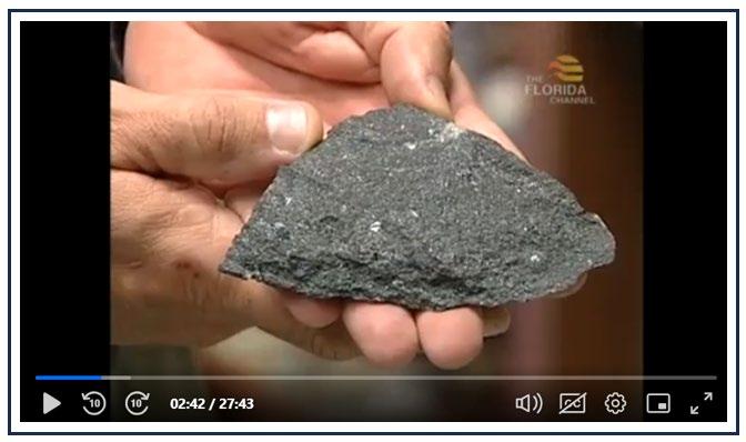
The land that we identify as Florida originated as the result of plate tectonics. Deep below Florida’s current land surface we find igneous and metamorphic basement rocks upon which more recent sedimentary rocks were later deposited. We learn about these basement rocks by studying cores drilled to depths of more than 10,000 feet below land surface. These basement rocks formed hundreds of millions of years ago. They were once located on what was to become the African and South American continental plates, which were then part the Laurentian continent. Around 475 million years ago, when trilobites ruled the oceans and early vertebrates were evolving, this Laurentian continent collided with other landmasses to begin to form the supercontinent of Pangea. As a result of this tectonic collision, mountain belts formed, including the Appalachian Mountains. There were likely several collisions lasting until about 250 million years ago, with
Florida’s Geology
Florida’s basement rocks located in the interior of the supercontinent of Pangea, far from any coastlines. At this time Earth was experiencing the Permian-Triassic extinction, which killed about 90% of all species on the planet. It was after this extinction that dinosaurs flourished.
Figure 1. Florida’s basement rocks, accessed by drilling deep cores, can be viewed at the FGS’s Florida Geologic Sample Collections Facility. Click the image above to watch “Rocks, Water, Life: Florida’s Geology.”
Carbonate Platform: Evidence of the Ocean
Pangea then began to rift apart, leaving Florida’s basement rocks, originally part of protoAfrica and South America, sutured onto the North American continent. These rifts resulted in the peninsular shape of Florida, as well as the formation of the surrounding ocean basins. As these oceans developed, they bathed the basement rocks in warm, tropical water. Carbonates, including limestone, were deposited under these waters, on top of the basement rocks. Thousands of feet of layered carbonate sediments settled over the basement rocks to form a carbonate platform, with the weight of the successive layers causing the platform to subside, or sink. These carbonates often contain shells, teeth, bones and other fossils that provide a record of the organisms that lived in those oceans. Fossil shark teeth, deposited during the time that the carbonates were forming, remain in the limestone as evidence that the land currently exposed was once under the ocean.
Florida’s Geology
The oldest rocks now exposed on the surface of Florida belong to the Avon Park Formation. This carbonate formation was deposited beneath a shallow sea around 40 million years ago, long after the Cretaceous/Paleogene extinction event, which killed off all dinosaurs except birds. Because dinosaurs went extinct before the Avon Park Formation was deposited, dinosaur fossils are not present in Florida’s shallow carbonate rocks.
Shifting Sands: Stories of Change
Over millions of years, sea levels rose and fell for a variety of reasons, including tectonics, changes in global ice volume, changes in ocean temperature and limestone dissolution. Sediments were deposited in successive layers in a variety of environments, including coral reefs, lagoons, beaches, deltas and barrier islands. Carbonate sediments form in warm, clear water, usually marine. Quartz-rich sediment, including pebbles, sand, silt and clay, were carried by streams and currents from upslope, originating in rocks of the Appalachian Mountains. For millions of years a current flowing across northern Florida and southern Georgia, called the Suwannee Current, prevented most siliciclastic sediment from reaching the peninsula. This current lessened about 30 million years ago allowing sediment derived from the Appalachian Mountains to be deposited over Florida’s carbonate platform. Parts of Florida were above sea level. During these last 30 million years, terrestrial animals roamed exposed parts of Florida, leaving fossil
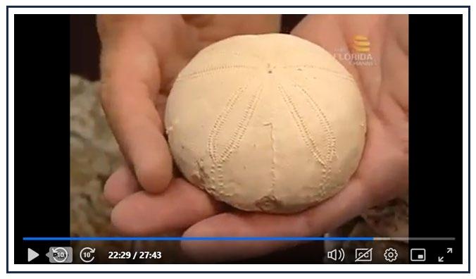
Figure 2. Sea biscuit fossils, commonly found in Florida limestone, provide evidence of Florida’s marine history.
Florida’s Geology
remains that now provide one of the world’s richest records of Cenozoic mammalian evolution. Some of the animals preserved include horses, saber-toothed cats, elephants, rhinoceroses, deer and giant sloths.
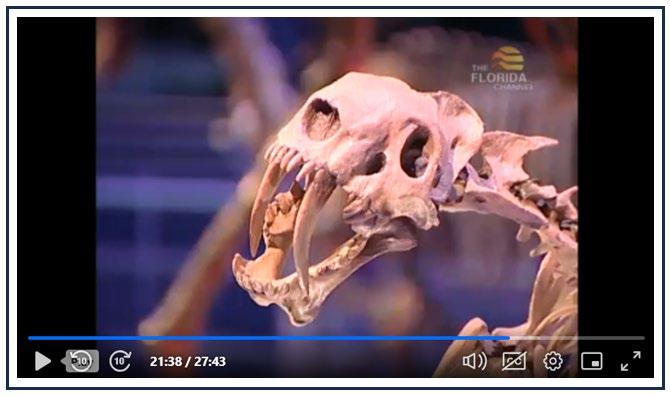
3. Terrestrial mammal fossils, such as the saber-toothed cat above, attest to the timing of Florida’s emergence from the ocean.
Florida’s Geomorphology: Karst Development and Beach Building
Carbonate rocks like limestone, once exposed to the atmosphere, are readily dissolved by rainwater, which is naturally slightly acidic. Dissolution, occurring over millions of years, resulted in the karst features apparent in Florida today, including caves, sinkholes, springs and swallets. Our thick platform of porous limestone is geologically young. Because of the combination of abundant rainwater and thick, young limestone, Florida has one of the highest concentrations of springs in the U.S. and one of the most productive aquifer systems in the world.
Siliciclastic sediment carried by streams and currents was deposited over the limestone, sometimes to be topped again by more limestone when sea levels once again rose. Evidence of these changes can be found in Florida’s geologic record, chronicled in the layers of sediment we can observe and drill down through.
Figure
Florida’s Geology
Sand that currently makes up Florida’s beaches can be derived from carbonate material, as it is in the Florida Keys, or can be predominantly quartz sand weathered from the Southern Appalachian Mountains. White quartz sand beaches are a distinctive feature of Florida’s current Gulf Coast barrier islands, like St. George Island and Perdido Key. Once the quartz sand is deposited by water on or near these beaches, it is often picked up and carried by wind. Wind-formed, or aeolian, dunes are a characteristic feature of these beach environments. Similar dunes formed between Tampa and Orlando at times of higher sea levels. By studying processes of formation currently happening, we can learn how past geologic deposits and features could have formed.
Rocks, Water, Life: Florida’s Geology
Explore the geologic history of Florida further in this Florida Crossroads video “Rocks, Water, Life: Florida’s Geology.” In this video, you can hear our former and current State Geologists describe Florida’s geologic history. You will see Florida’s basement rocks, housed at our Florida Geologic Sample Collections Facility. The video also highlights important outcrops as our former Assistant State Geologist visits notable geologic features around the state. Watch closely for a preview of our next State Geological Site!
Additional Resources
Bryan, J.R., Scott, T.M., and Means, G.H., 2008, Roadside Geology of Florida: Missoula, Mountain Press, 376 p.
Hatchett, L., 2000, Geologic History of Florida: Florida Geological Survey Poster 7, Color, 25” x 37”, https://doi.org/10.35256/P07
Hine, A.C., 2013, Geologic History of Florida: Major Events That Formed the Sunshine State: Gainesville, University Press of Florida, 229 p.
Lane, E., ed., 1994, Florida's Geological History and Geological Resources: Florida Geological Survey Special Publication 35, 76 p., https://doi.org/10.35256/SP35
Scott, T.M., 1992, A Geological Overview of Florida: Florida Geological Survey Open-File Report 50, 78 p., https://doi.org/10.35256/OFR50
Contact: Mabry Gaboardi Calhoun, Ph.D.
Suggested Citation
Gaboardi Calhoun, M.M., 2025, A Brief Geologic History of Florida: FGS News and Research July 2025 edition. https://content.govdelivery.com/accounts/FLDEP/bulletins/3e38887#link_5
Surveyors in Government
September 2025
Greetings All,
I love Florida, but from the months of August and a good part of September it is just hot. I feel for all of our field staff. Make sure your staff has had heat stress training, I am sure there are plenty of videos on Youtube that will go over proper hydration and signs of dehydration and heat stroke. We go through classes for that at the City and recommend it for everyone as it can sneak up on you quickly.
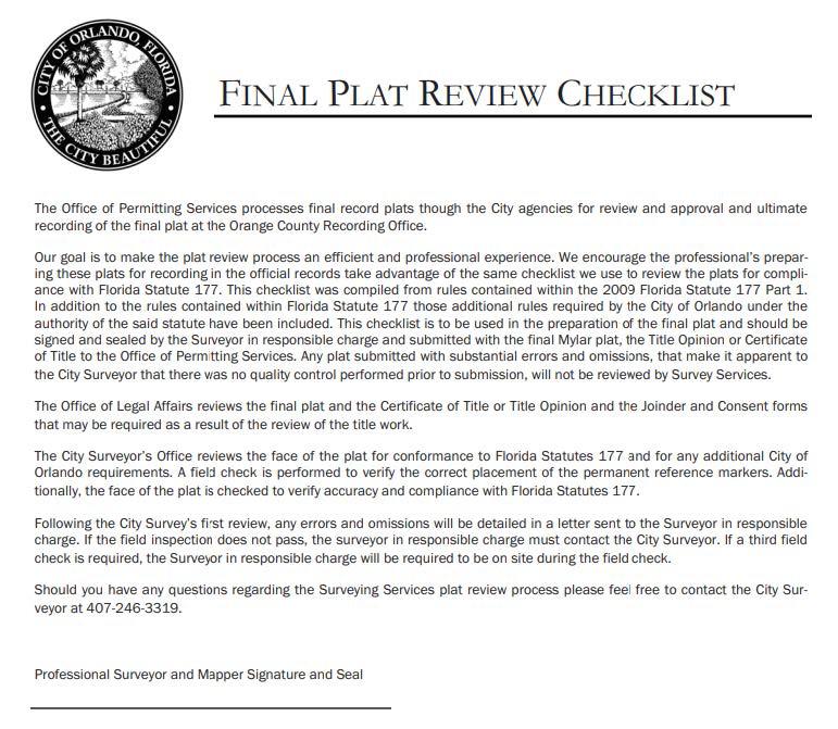
This month I am going to be covering document submittals for regulatory review, whether it is for platting, lot splits, as-built surveys, or even boundary and topographic surveys for regulatory review. In the case of the City of Orlando and most agencies, this takes place for purposes of planning and for permitting. The planning is used for reconfiguring a property for the anticipated development that requires a survey to make sure the limits of the property co-incide with the proposed development. This is done with re-zoning, master plans, planned development, and other planning processes to regulate the configuration. This brings about the current configuration and whether the property needs to be platted or if the lot or parcel needs to be split if the use intends for higher density.
This is the start of the platting process, which is a planning process in most agencies. For each part of the planning phases the deliverables of survey products can vary from very outdate surveys or sometimes lacking a survey to be provided. Not all planning cases require a survey, but many do require it, and a current one to ensure the development coincides with what exists on the property. As you begin the platting process, so begins making sure the plat submittals meet the requirements of Florida Statutes Chapter 177.091 and the entirety of the requirements of Part 1 of the Chapter and the additional jurisdictional requirements that are more stringent than F.S. 177. This will become even more important starting in a few days when the new regulatory process takes effect on July 1st, 2025 and will require a sufficiency review within a specified period of time to see if everything is needed for a plat review is included. It must be accepted or rejected within that sufficiency period.
The challenge lies in that you may have all of the documents and it still not be sufficient for a proper plat review. Most probably think that the local jurisdictions are just glancing over a plat and then sitting on it for a long while. The issue is that more
Surveyors in
Government
than one plat comes in a month that is new, then you have plats that are in for their second, third, fourth, and in many cases fifth round reviews. All of the submittals and resubmittals require review in a timely manner for our organization and most agencies in general. Now for first round submittals do we see a finished plat that is sufficient for recording, NO! There are some that are very well put together, but there are others that seem to be thrown together as quickly as possible with no QA/QC and submitted. They include information for another part of the state, have notes that conflict with other notes on the plat, have notes that have no purpose being on the plat.
Surveyors in Government
With that plat you receive a boundary and for our City a topographic survey, which at times will be of the property many years before the time of this plat or replat. There are several companies where the same comments are made with each and every plat. We provide a plat checklist that everyone is required to sign, but I do not see how everyone is signing that and submitting what they do. We also will find that a proper property information report or attorney’s title opinion may be missing or is deficient in showing encumbrances affecting the property in for platting or replatting. The reviewers need everything at time of review to make sure they catch the deficiencies on the plat, boundary, topographic survey, property information report/attorney’s title opinion, joinder and consent if there is a mortgage, and a plat closure/lot closure report. As part of our process, we have a field monumentation inspection to make sure the PRM’s have been set prior to passing a review.
Our review process is done through Project Dox, which is a web based review system. This is good for documentation, but there are limitations in how the applicant can see the review comments directly on the face of the plat or other plat submitting documents. This becomes difficult for the surveyor to see if they are not the applicant for the process. This is where the agency has to be available to relay the comments on the face of the plat or the plat supporting documents. We are meeting in-person or via Microsoft Teams when we run into this issue.
I must preface many are trying to do a good job, and are doing the best they can with their workloads, but there are many that are just doing a half-assed job and really are not putting forth their best effort. We find many firms have the same comments each and every time. Fix your bearing notes, they say one thing in the notes but then another in the certification. Make sure your information supports itself is a big issue. This is an issue with several different surveying companies where you will hear other agencies with the same issue, we call it professional hand-holding. You will hear the on-going discussion that were are performing their initial QA/QC process.
If you remember earlier in the article I speak about regulatory review and not just platting. So you do see this occurs in every aspect of submittals, including boundary surveys for permits and plats, topographic surveys for permits, as-built surveys for closing out a commercial or multifamily residental permit. We are seeing what appears to be submittals that have not been reviewed in a QA/QC process. I get it sometimes that we are all on tight deadlines that create a struggle to sufficiently review the document. You will not hear me complain when a few simple mistakes are
Surveyors in Government
made periodically, these are routine comments that you will see with each and every submittal. How do we look to combat this issue? I have reviewers saving a case file or repeating firms, when there is a large breadth of information in that folder, we will be getting with the firm to discuss the issue and seeing what their plan is to rectify the issue or if it needs to be escalated to the regulatory review board for further investigation. Now in this instance, you have just a couple of firms in this realm, and I am sure they know who they are from the comments they receive from staff. As we discuss this issue, it is primarily with platting.
I can tell you as well, we have seen an uptick in boundary disputes and the two surveys provided by the adjacent landowners both look deficient. I had to send one of our plans examiners a statement to send to each landowner that I did not see sufficient boundary retracement on either survey to say if one surveyor or another had provided sufficient information to say one properly tied down the plat. Both had very limited retracement efforts on the block in which they were surveying. The lots were adjacent, front to rear, and neither had any common corners.
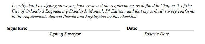
I hear that with technology we should be getting better as surveyors, especially when you compare the effort of surveyors early in the development of this land, but the truth appears to be some surveyors are getting worse, relying solely on technology instead of doing sufficient retracement, or sufficient review of their survey products. I believe we are in such a great profession and must remember we are hear to protect the public with their biggest investment, to make sure we put forth our best effort to provide them with a survey product that meets their needs while standing on their own merits that it is a good product. I know many surveyors do try to do this, and I am not singling everyone out, you have a few that just appear to desire money over putting out a great survey. We have checklists for as-built surveys as well to aid in the process to make sure the requirements are being reviewed, at least the surveyor signs that they do even if for some reason they fail to do so.
Surveyors in Government
For those who try day in and day out to QA/QC your work and make sure you are providing your clients with a good survey, my hats off to you. I know it can be challenging, especially as busy as we all get. Juggling everything, working to find staff, managing existing staff, keeping up with day-to-day operations, while satisfying clients, finding new ones, and all of the other trials and tribulations of running a survey company can be a challenge, and one that I deal with in other manners, so I try to remember that as well. We all must remember our first duty is to protect the public, and some are failing to do so.
Until next time my friends, I bid you adieux. Thank you for taking the time to read this article!
Sincerely,
Richard Allen, City Surveyor for Orlando
FSMS Surveyors in Government Liaison
President of the Geospatial Users Group
ASPRS Florida Region Director
407.246.2788 (O)
Richard.Allen@orlando.gov
Forts, Ports, Canals, Wars
An Uncommon History of Tallahassee & Surrounding Areas by
Dr. Joe Knetsch
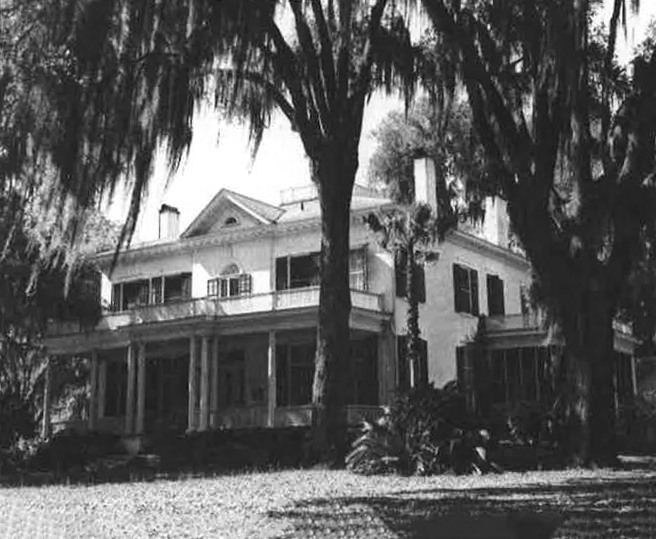
Hardy Bryan Croom settled in Gadsden County before building Tallahassee's iconic Goodwood Plantation in the 1830s
(State Library and Archives of Florida)
Some Early Settlers of Gadsden and Leon Counties
It is too often assumed that the settlement of early “Middle Florida” begins with the founding of the city of Tallahassee, in 1824. Bertram H. Groene, in his Ante-Bellum Tallahassee implies that the area was nearly a total wilderness at the time of the capital’s founding and that there were only a “few plantation owners” in the area of Little River nearby. The author did note that two of the men, Jonathan Robinson and Sherrod McCall were contracted to build the new log capitol in Tallahassee. What Groene did not realize at the time of his writing his history, that the Gadsden area, especially that centered on Rocky Comfort Creek and Little River, was already a thriving settlement, known to many in southeastern Georgia and as far away as New Bern, North Carolina. Indeed, by the time John Lee Williams and Dr. Simmons met in the area to locate the new capitol, the area near Robinson’s was already being farmed by a number of men and women, including the families of John Carnochan, John Collins, John Lines, David Ochiltree, and others. They were soon joined by other families including the Harvey, Croom, Hawks, and Blue contingencies. The Rocky Comfort settlement was a thriving community shipping both cotton and sugar, something pioneered in Georgia by Thomas Spaulding and John Carnochan’s older brother, William. Many who began the Rocky Comfort settlement, later referred to as “Crossroads” began their Florida residence even before the territory was officially American. They joined John Carnochan in his attempts to farm along the Apalachicola River, not far from Fort Gadsden.
John Carnochan was not your typical frontier farmer/settler. He was a well-known businessman and shipper living first in Darien where he was briefly the teller in the Union Bank (not a low position as it is perceived today), and later in Savannah, Georgia. Like his brothers, William and Richard, both successful businessmen, John was reared in Kirkcudbright, Scotland, and migrated to the United States and into Charleston, South Carolina. He soon left Charleston and headed to Nassau, the Bahamas where he set up shop as a merchant (possibly in connection with his older brother, William). He returned to Charleston in 1804 and soon was on the
Forts, Ports, Canals, and Wars
move again, this time to Savannah. John worked in the import/export business, shipping mostly materials from England (Liverpool) into the United States as shown in the local newspapers of the day. Brother William, who had been involved in sugar growing and distilling became an important ally of Thomas Spaulding and was, by 1811 experimenting with sugar growing on the sea islands of Georgia. By 1816, he was building up his sugar works at his plantation, known as “The Thicket”, five miles from Darien. He was soon shipping sugar and rum to his brother in Savannah and establishing one of the more successful sawmills on the Altamaha River. Both brothers made many friends in Darien and McIntosh County and some of these even tually joined John in Gadsden County. William’s fortune and luck ran out when the area of Darien was devastated by the hurricane of 1824, in which his mills were destroyed and one of his slaves drowned. John, meanwhile, had formed a notable partnership with Peter Mitchel, another Savannah merchant with world wide connections. Peter Mitchel and his family were to play important parts in the early history of Florida. Both Peter and his brother, Octavius, served in the first Territorial Legislative Council, Peter representing St. Augustine and Octavius, representing Pensacola. The firm of Camochan and Mitchel was soon to be the purchaser of the lands encompassing the Forbes Purchase, probably at the behest of Peter’s younger brother, Colin. John was soon on the frontier of Florida settling along the Apalachicola River and beginning the farming of sugar and cotton.
John brought with him most of his slaves and his overseer, John Collins, who also took up a separate residence along the river. Joining this pairing was William Heaton Ellis, who seems to have sold his holdings in Georgia prior to immigrating to Florida in the spring of 1820. Henry Yonge, another McIntosh County resident, also came to the area of the Apalachicola in 1821. He may have also brought his son, Henry A. Yonge, into Florida since the son was soon farming corn on the western side of the river across from his father’s home. William S. Pope and John Tanner also joined this little settlement and began their family’s long history in Florida. A permanent settlement was planned for the area near the old fort and a town, named Colinton (for Colin Mitchel), was laid out but never developed (another long Florida tradition). The Darien Gazette for February 17, 1821, noted the growth of the area: “In the course of the present week, a vessel has cleared our custom house for Florida, with a cargo of Sugar Cane Plants, Cotton
Dr. Joe Knetsch
Seed, and Agricultural Utensils, &c. which, we learn, are intended for the use of the settlement now forming, on what is called the Forbes Purchase, on the Apalachicola River.” After giving the settlement some very positive publicity, the article concluded by stating: “This land is also well adapted to the cultivation of Sugar Cane; which, taking into view the depressed situation of the cotton trade, offers to the planter additional inducements to go thither, provided the Floridas are ceded to this country, of which there scarcely remains any doubt.” Notices such as this were sent to other newspapers along the Atlantic Coast enticing more settlers to come.
Trouble with the Indians, who were not fully supportive of further white immigration to Florida, especially that of Americans, soon led to the abandonment of the Apalachicola settlement (although not all left nor was the property abandoned in the legal sense), and most of the settlers moved eastward toward the Ocklockney River. It was here that John Carnochan constructed the “Laurel Grove Plantation” near the confluence of Rocky Comfort Creek and Little River. In 1824, he commissioned Daniel McNeil to survey the area that has become known as “The Little River Survey.” John Lines joined the community and was already known to many as the friend of Judge Robinson. Lines soon married Robinson’s daughter Sarah to begin a long line of prominent Gadsden countians. John Lines also constructed a much needed mill on the creek running through his property. Next to Lines’s settlement was that of Sherrod McCall. Sherrod McCall was a prominent land owner and cotton grower in southern Georgia, owning land in at least six Georgia counties prior to coming to Florida. Unlike many of the first settlers, both Robinson and McCall hailed from Bullock County, whereas many of the earliest settlers came from the four counties of McIntosh, Glynn, Camden, and Chatham. McCall was unique among the early planters in Gadsden in that he came to “retire” from the usual heavy load of plantation ownership, at least according to family legend. He not only had his hogs and cattle ranging on his lands in the Rocky Comfort area, but also logged his lands along the Apalachicola River at Aspalaga Landing and raised silk worms on his property that was noted for its high quality. (Whether the Marquis de Lafayette or his agent knew of McCall’s success in silk culture is unknown at present.)
The Reverend David L. White (who served in many capacities in early
Forts, Ports, Canals, and Wars
Gadsden County) also joined the group, but on the outside of the Forbes Purchase line, as it was then known. He arrived in the Territory and settled near the Little River in 1822. He later served as county judge for twenty one years, from 1824 1845. His journal is one of the more important documents relating the history of our area. Another neighbor of the day was Jonathon Thomas, a North Carolinian, who lived briefly at Rocky Comfort until his dearh in 1827. His daughter, Elizabeth, married Jesse McCall, the son of Sherrod. Another of Jonathon Thomas’s daughters, Mary (more commonly known as Polly) married Lewis Gregory. This adventurous couple were married in Duplin County, North Carolina and then migrated to Florida. Most of these immigrants to Florida were recruited by John Carnochan, acting as the resident agent for the defunct Carnochan and Mitchel firm, which became, after many shiftings of ownerships, the Apalachicola Land Company in 1835, the year the Supreme Court of the United States ruled in favor of Colin Mitchel in the lawsuit, Colin Mitchel, etal. V. The United States.
By 1827, the settlement at Rocky Comfort had grown so large as to demand its own post office, which was obtained in that year with David Ochiltree, of North Carolina, as its first post master. (The post office was bonded by Bryan Croom and Robert Forbes, not a direct relative of John or Thomas Forbes of the firm.) Ochiltree and his wife, Lucy Winslow, migrated to Gadsden County in either 1826 or early 1827. They prob ably brought with them David’s widowed sister, Betsy Ochiltree McLean and her children. One of Betsy’s sons, Hugh, erved as a witness to John Carnochan’s will. Hugh McLean’s daughter, Euphenia (or Effie) married Benjamin Hawks, brotherin-law to Bryan Croom. Benjamin Hawks was a capable attorney but suffered poor health most of his life. Both Benjamin and his sister, Evelina Singleton Hawks Croom, who died of complications from child birth, died at the settlement and are buried on the old Benjamin Hawks property (I have visited their brick vaulted graves). A school, the Gadsden Academy, was established in 1837 at the “Crossroads” settlement. An earlier school, run by one Amizi A. Beach (who advertised his school in the 1831 Florida Courier ) had men such as John Lines, Jonathan Robinson, Sherrod McCall, and Henry Gee (Later Grand Master of the Masonic Lodge in Florida) to vouch for his credentials as a graduate of Princeton College opened an English and Classical Boarding School. When the Gadsden Academy opened its doors, it had for Trustees; Jonathan Robinson, David L. White, Joseph King, Daniel L. Kenan, Calvin
Blake, and John T. Burney. All of these men were associated with the Rocky Comfort/Little River area.
The name of Croom is always associated with Tallahassee because of the fame and beauty of Goodwood Plantation. However, Tallahassee was not the first area of settlement for this prominent New Bern, North Carolina family. The Croom brothers, Hardy Bryan and Bryan Hardy Croom were established in Gadsden County early in its history. Bryan Croom built his plantation in Section 23 of the Little River Survey. Hardy Croom owned land and a plantation on the Apalachicola River just north of John Carno chan’s land. The land had been inspected by the Croom brother’s father, William, but the elder Croom decided against moving himself while recommending the area to his sons. William took out a contract for sale with Henry Yonge and William appears to have actually had his own slaves clear some of this land. In the years that followed the brothers tried to negotiate a final settlement for the property using John Carnochan as the go-between. Bryan’s plantation was called “Rocky Comfort Plantation” in honor of the creek running near the land and the settlement of the same name. As most everyone knows, the family of Hardy Croom lost their lives in the wreck of the Home , and even though Bryan finished the construction of Goodwood Plantation, the final title was many years in litigation.
A final word about John Carnochan. His role has been largely ignored in the story of early Gadsden County, and only Miles Womack’s history has taken any significant notice of him. As noted earlier, he came to America in 1800 and finally settled in Savannah. He married Harriet Francis Putnam, the daughter of Israel Henry Putnam and his first wife, Susannah Fraser, the daughter of a Major James Fraser of the British army. Six children were known to have been produced by this marriage, but three never made it to adultood. The only son was named John Murray Carnochan, who became one of the most gifted surgeons in America during his lifetime. During his time in Savannah, John held many positions of public trust and honor. In 1812, he was elected to the board of the Planter’s Bank and served with William Gaston, John Bolton, and John P. Williamson, among others in this capacity. In 1817, he was put on the board for the Bank of the United States, Savannah Branch where he served with two of the famed Haber sham family and John McNish, a wellrespected merchant, among others. He also served on the Savannah Poor
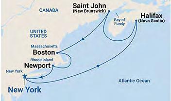
Seminars at Sea 2026 Seminars at Sea 2026
The Cruise
• Princess Cruise Line - Majestic Princess
• 7 Nights
• Leaving out of New York Harbor
• Newport, Rhode Island
• Boston, Massachusetts
• A morning of “Learning” at Sea
• Saint John (for the Bay of Fundy), Canada
• Halifax (Nova Scotia), Canada
• A morning of “Learning” at Sea
• Return to New York Harbor
The Learning
• Two - 6 hour live morning classes while onboard during two days at sea from 7 am to Noon.
• History of Swamp and Overflowed Lands and Island Surveys in Florida (6 CECs) Course# 11097
• The Great Halifax Explosion of 1917: The Roles of the Surveyors & Planners (6 CECs) Course# 11096
• 12 hours CE Credit via your choice of Correspondence Courses.
• Registering for the Learning will be at an additional cost of $500 per seminar attendee above the cost of the Cruise. Click Here to Register for The Learning Provider No. CE11.
The Instructor
Dr. Joe Knetsch will be our live onboard instructor for the 2026 Seminars at Sea. Dr. Knetsch received his Ph. D. in history from Florida State University (1990), an MA in history from Florida Atlantic University (1974) and a B.S. from Western Michigan University with a major in History and Economics. He was the historian for the Florida Department of Environmental Protection (formerly Department of Natural Resources), Division of State Lands from 1987 to August of 2014.
The Details
• Book early to secure your cabin - FSMS currently has Deluxe Mini-Suites and Deluxe Balconies on hold until May 2026 at the below rates. Click Here to Check out the Cabins and their Availability
• Category MB - Mini-Suite $2066 per person based on double occupancy.
• Category DB - Balcony $1846 per person based on double occupancy.
• Please note at the time of booking with Princess any promotions which could include reduced fares or deposits will be applied to your booking. If there is another category of cabin you would like to book, our Travel Advisor Gail Oliver will work with you on finding the best cabin for the best rate to suit your needs. It is important to book with Gail to be considered a part of the FSMS group to receive the group benefits. Contact Gail Oliver at Tesoro Travel via email at gail@tesorotravel.com or phone at 904-687-5655.
The Sponsorship
$3000
• Verbal Recognition during Event
• T-shirts with your company logo
• “Thank You” on FSMS website and social media posts
• Listed in all Seminars at Sea Communication
• Featured Full-page ad in The Florida Surveyor Magazine
House and Hospital board and other posts. He developed a close relationship, both personally and fiscally, with John P. Williamson and this explains, in part, why this dynamic family made its appearance in Florida. It is from the heirs of this man that the State purchased some of the survey notes and letters of the Apalachicola Land Company. John Carnochan was not just a speculator in the woods of Florida, he was a recognized man of means and talent when he arrived as the head of the first Gadsden settlers. [Note: One of his two surviving daughters, Mary Dorothea, married George K. Walker, the son of David Walker and brother of David Shelby Walker. One of the cousins of the Walker clan was Richard Keith Call, which helps explain the political alliances in the Territorial period.]
Following the selection of the site of the new capitol in 1823, the first log capitol building was constructed. Territorial officials, mostly appointed, came in from around the nation. The first civilian governor of Florida, William Pope Duval came into the capital and assumed office quickly, making the selection of a home site a priority. He settled on the hill overlooking the cascades that became known later as Houston Hill, which is now in the area of Myers Park. He allegedly constructed his first home within the confines of the ruins of an old Spanish fort, unnamed and unknown to historians of the era. The property was prime for development and contained a natural spring which provided the fresh water for his family and servants. Duval was a natural storyteller and almost always in demand at local parties. According to Groene, he was not considered very capable by most of the Washington establishment, but was considered highly competent by Achille Murat and other pioneers of the day. Duval had many contacts in his native Virginia and in his adopted state of Kentucky. He later solidified these connections when his daughter, Laura, married Dr. Arthur M. Randolph of the famed Virginia family. This lovely couple purchased the San Luis Mission site in 1841 and developed one of the most progressive plantations in the area, being one of the first with a steam cotton gin. A. M. Randolph was also one of the most capable Deputy Surveyors in Florida. [His brother was the beloved Dr. James Randolph. Although both men were trained physicians, Arthur practiced sparingly over the years since he loved surveying, and there was not enough business in Tallahassee to support both brothers in the medical field.] Although some may have considered Duval inept at governing, his ability to effectively negotiate cannot be denied. It was as governor and Indian Agent Dr. Joe Knetsch
Forts, Ports, Canals, and Wars
that Duval arranged for the removal of the Seminoles/Miccosukees from the Tallahassee area and helped to arrange the talks that led to the Treaty of Moultrie Creek where the Seminoles agreed to move further south in the Peninsula and eventually remove out west. This would not be out of character for Duval, who, before serving one term in Congress during the War of 1812, served as captain of mounted rangers in Kentucky. He had a much more difficult time with Neamathla, the local leader of the Indians in and around Tallahassee. In the end, this difficult leader of the resistance to removal was given land near the headwaters of Rocky Comfort Creek, but the old headman refused to live there, removing himself to his clan’s village in Alabama. Duval was a stern but fair negotiator who took his job of agent to the Indians seriously. One of his most important moves as governor/ Indian Agent was to change the boundary of the Moultrie Creek reservation lands further to the north to include more usable land and preclude the very unproductive lands in the sand hills. When he left office in 1834, he was truly tired of the constant travel, negotiating, and pressures from Wash ington. He was replaced by Jackson favorite, John Eaton.
Of all the pioneer settlers of Tallahassee, few excelled Colonel Robert Butler in importance. Butler was the official and legal ward of Andrew Jackson and grew up in the Hermitage. He later married a niece of Rachel Jackson, a Donelson, and had a long and successful career in the U. S. Military, rising to the rank of Colonel and acting as Adjutant to General Jackson. Butler had been with Jackson during the “First Seminole War” in 1817-18 and had filed the reports on the invasion of Spanish Florida. These reports were detailed and precise, showing the troop movements, the order of march and battle, the number of cattle and slaves “recovered” from the Seminoles and their black allies. He was a large man in size and heart and his home north of Lake Jackson became the social center for the famed “May Day” celebrations that included the ring joust described by Lizzie Brown. When Tallahassee was founded and the land office established, Butler was given the job of Surveyor General for Florida. He was in charge of all of the very first official U. S. surveys of land beginning at the Prime Meridian marker (set down by Acting Governor George Walton). His position required him to hire the first Deputy Surveyors, among whom were many of the earliest settlers of Tallahassee. [On the census for 1825, one will find the names of Romeo Lewis, Paul McCormick, David Thomas, Henry
Dr. Joe Knetsch
Washington, and Benjamin Tenniel. Also on the list is Isham Searcy, the clerk in the officeand an important member of the local hierarchy.] He hired many of his surveyors from recommendations of Andrew Jackson and General John Coffee, who served as Surveyor General for the lands in modern Mississippi and Alabama. Many of those recommended by these two important men were highly capable, especially Henry Washington and Benjamin Clements. Almost all of his early hires had military training and were officers in either the regular army or state troops. Benjamin Tenniel was charged with laying out the City ofTallahassee and his survey was limited to one 160 acre tract, the Southeast Quarter of Township I North, Range I West. Opposite the newly laid out town was the township donated to the Marquis de Lafayetteby a grateful Congress and President Monroe. The Township was selected by former Alabama Congressman John McKee who was very familiar with frontier land speculations. That the men selected by Butler were generally of high caliber is attested to by nearly every surveyor who has had to follow their original lines in the field. Butler was the ultimate in loyal Jackson men. Few men ever knew the General as well as he did, and it showed in his personal loyalties. He was highly partisan to the point of nearly destroying the career of Henry Washington, who the historians for the Bureau of Land Management still consider one of the best to ever serve the United States. Starting from scratch, he set about having the lands of Florida surveyed for settlement and did, overall, a very remarkable job. His plantation, which he visited often, was centered at the Lake Jackson Mounds State Historic Site. Robert Butler and his family are buried on a portion of the property across the street from the State Historic Site just off of Crowder Road.
Richard Keith Call, it goes without saying, was one of the most important men to grace the pages of Tallahassee’s history. As a young soldier in the army of Andrew Jackson, he fought in the decisive Battle of Horseshoe Bend and when his troops deserted en masse, he decided to stay and fight in the ranks, which won him Jackson’s personal loyalty. He attained the rank of Captain and entered Florida with Jackson in 181718. He followed Jackson to Pensacola when the General was appointed Territorial Governor and stayed behind to make his name. He soon began to practice law in Pensacola and rise in standing in that community. In 1823, he was appointed brigadier general of the militia of West Florida and was appointed delegate to the Territorial Legislative Council. In 1823, he was elected as Delegate to Congress for the
Forts, Ports, Canals, and Wars
Territory of Florida when the incumbent, General Joseph Hernandez, and two others split the vote in East Florida. With Jackson’s assistance, he was able to procure for the new Territory appropriations for the creation of the Pensacola Naval Yard. In 1824, he married Mary Letitia Kirkman at the Hermitage and soon returned to Washington. In 1825, however, he was defeated by Joseph M. White and he moved to Tallahassee to begin anew. He was soon appointed receiver of public lands for Middle Florida and began to practice law once more. Call soon began purchasing lands near Lake Jackson, including most of the land around Orchard Pond. His thirst for land speculations did not die with this purchase, and he continued to promote Florida and land speculation throughout most of his life. At the outbreak of the Seminole War, General Call took the field and became involved in a controversy that lasted most of the rest of his life. It was the sad affair dubbed the Battle of the Withlacoochee and it did not go well for the American troops or the Florida militia. Caught in a well planned attack, the militia could not cross the Withlacoochee River in time to help withdraw the U. S. regular troops. Both sides accused each other of cowardice, and the result was distrust between the volunteer and regulars for the remainder of the Second Seminole War (1835-1842). Call was soon appointed governor of the Territory (by Jackson), much to the chagrin of his political enemies. The Seminole War brought further enmity between the Territory and Washington with the result, in a nutshell, that Call left the ranks of the Democratic Party and opposed the reelection of Martin Van Buren. In 1841, as a reward for his service in the election of William Henry Harrison, he was reappointed governor in 1841, this time as a Whig. His last stint as governor dealt with the end of the Indian War and the struggle over the banks. Call’s last campaign in politics was for the governorship in 1845, but he was defeated by William Moseley, the Democratic candidate. [In the Congressional campaign for the first seats in Congress, Benjamin A. Putnam was defeated by David Levy Yulee. Putnam was the brotherinlaw of Peter Mitchel.]
The Gamble family of Virginia also served as early pioneers of the Tallahassee area. The Gambles arrived in Tallahassee on Christmas Eve of 1823, and were the direct descendants of Captain Robert Gamble, the Revolutionary hero who led the charge at Stony Point on the Hudson that openened the way for American control of the river. This Robert Gamble was a personal friend of General Washington and noted as the leader of the “Forlorn Hope” regiment. His sons, John Grattan and Robert Gamble,
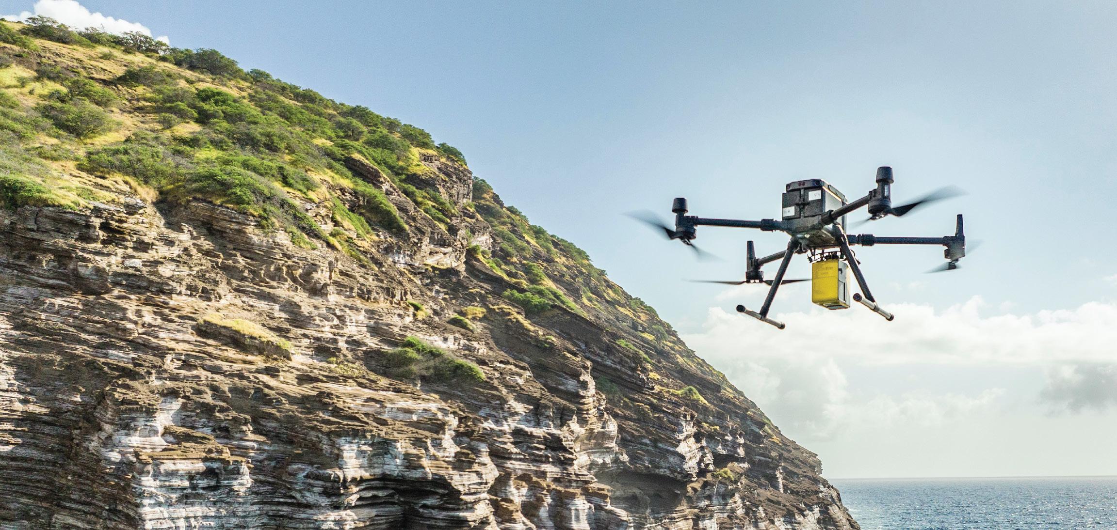
PRECISION BEYOND BOUNDS
FRONTIER PRECISION UNMANNED SOLUTIONS
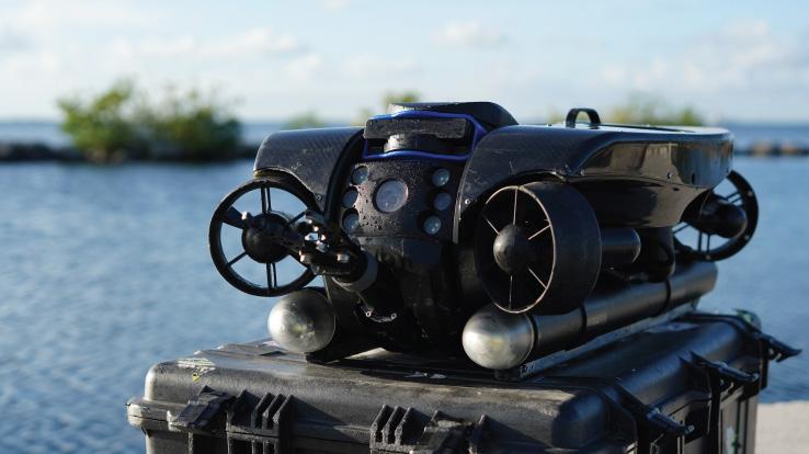
Frontier Precision has been leading the way in delivering innovative solutions – on land, air and underwater with our Unmanned technology. Now, every place on earth is reachable – with our UAS/ Drones, ROV’s, and LiDAR solutions. We help you with the latest technology to get your job done efficiently while keeping your business profitable.
UAS / DRONE DOCKS
The latest innovations in drones and docks to deliver the right product for the right UAS application.
LIDAR / SENSORS
LiDAR/Sensor solutions designed for precision data collection.
UNDERWATER ROVS
Deep Trekker’s underwater ROVs showcase proven durable and innovative solutions.
FRONTIER PRECISION | JACKSONVILLE, FL
Jordan Baranowksi | 904.855.9827 [Office] or jordanb@frontierprecision.com
FIND OUT MORE AT: www.frontierprecision.com/unmanned
Forts, Ports, Canals, and Wars
both came to Florida with John Grattan. With money earned from work on the James River Canal, they bought adjoining plantations in Jefferson and Leon Counties, Waukeenah and Weelaunee. John Grattan married Nancy Peyton Greenup, the daughter of one of the first governors of Kentucky. Robert married Letitia Breckenridge, another of the distinguished families of Virginia. Both men engaged in cotton growing and shipping. Robert’s son, James, was also a merchant in Tallahassee and was in partnership with Samuel Reid for a number of years. [Sam Reid was later a U. S. Deputy Surveyor and developer of Port Leon on the St. Marks River. He married into the Alston family, and was the brother-in-law of Michael Ledwith and the other Alston members.] The Gambles are deeply intertwined with the infamous Union Bank and John Grattan suffered loss of prestige and money in this venture. His son, Robert, was the founder of the famed sugar growing plantation on the Manatee River that is today a State Historic Site. The Gambles married well in terms of political clout and fame. Robert, the son of John Grattan, married Laura Wirt Randall, daughter of Judge Thomas Randall and granddaughter of William Wirt, U. S. Attorney General and the man who attempted to build a colony in Jefferson County with German immigrants. Robert Howard Gamble married Martha Chaires, grandaughter of the wealthy planter investor, Benjamin Chaires, often noted as the wealthiest man in Territorial Florida. After Martha’s passing, he married a second time his cousin, Angelica Wirt Robinson of Baltimore, Maryland. The Gambles brought wealth, prestige and enormous energy to Tallahassee and we have all benefited in one way or another from their enterprise.
Finally, a word about another governor of the Territorial Period, Thomas Brown. Born in Westmoreland County, Virginia, in 1785, this energetic man had an interesting life that is often neglected for the narrow view of his short term in office. He was educated in Charles Town, now Charleston, West Virginia, and later in Alexandria at McLean’s Private Academy. When the latter shut its doors, he was offered a midshipman’s warrant to join the Navy. This was refused and he took up residence with A. C. Cazinova, a French merchant whose abilities and acumen attracted the likes of Jerome Bonaparte. Brown not only learned the business lessons, but also became a French scholar. He studied law briefly in Westmoreland County, but had no interest in making it his profession. He served briefly under the command of Colonel Alexander Parker, acting as his clerk and aide. Brown was given a position in the post
office in Richmond toward the end of the War of 1812. It was there that he reputedly invented the Post Office Box. He married the niece of Colonel Parker, Elizabeth Simpson, in 1809, but he was plagued by poor health. He was put up as a Congressional candidate in 1820, but he was defeated by Thomas Marshall, the son of Chief Justice John Marshall. Brown was close to James Monroe and was honored with a visit by the Marquis de Lafayette in 1824. It may have been this visit that first interested Brown to migrate to Florida, but no matter, he left Virginia to scout out a new home. He arrived for the final time with family in tow and 144 slaves in early 1828. He soon had his slaves busy constructing a home on Lake Jackson while he began to build his business with the City Hotel. He was briefly the teller in the Union Bank (not a low position as it is perceived today), and then went to Cuba for his health. He was accompanied on this voyage by A. M. Randolph and his daughter Elizabeth. Upon returning he became very active in politics and soon held a number of posts including Territorial auditor, in the Territorial Legislature, and a delegate to the Constitutional Convention in St. Joseph. He was elected to serve in the State Legislature at its first meeting in 1845. From 1849-1853 he served the State as governor, the only Whig to be so elected. He was the first to recommend the creation of a “Board of Internal Improvements,” which was created in 1850, and to suggest an investigation into the costs of draining the Everglades. He was a man ahead of his time in these proposals but his legacy lived on in the person of Governor Napoleon Bonaparte Broward. We could say that Broward completed Brown’s “Florida French Connection.”
ж
Dr. Joe Knetsch is the author of over two hundred articles and sixteen books, most of them concerning the state of Florida’s historty. Three of these books involve the Seminole Wars and their impact on Florida’s development. He is also a frequent reviewer of books on military history for the Journal of America's Military Past and authored regular articles for Professional Surveyor Magazine for over a decade. For twentyeight years he served as the historian for the Division of State Lands in the Florida Department of Environmental Protection. Dr. Knetsch lives in Tallahassee with his wife Linda and is now retired. Dr. Joe Knetsch
YOUR FLORIDA GEOSPATIAL PARTNER
Duncan-Parnell, along with our valued partners, including Trimble and other top brands, are proud supporters of the Florida Surveying & Mapping Society. From solutions including GNSS, scanning, GPR, drones, and more to services including support, rentals, training, and repair, we are pleased to be your one-stop shop for geospatial professionals throughout the Sunshine State.
Jacksonville, FL (904) 620 - 0500
Orlando, FL (407) 601 - 5816
www.duncan-parnell.com
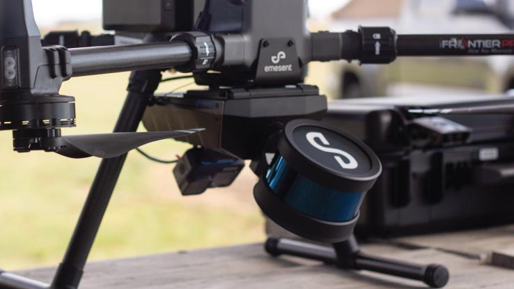
The Story of My First Drone Photogrammetry Project
ARCHIVES FROM THE
SCENES IN A SURVEYOR’S LIFE ; OR
A
RECORD OF HARDSHIPS AND DANGERS ENCOUNTERED. AND AMUSING SCENES WHICH OCCURRED, IN
THE
Operations of a Party of Surveyors IN SOUTH FLORIDA .
By W. L. PERRY.
JACKSONVILLE:
C. DREW'S BOOK AND JOB PRINTING OFFICE 1859.
CHAPTER XXI
A fter an eight days trip through a rough country, and the last four with a heavy load, and a team already jaded down and half eaten by flies and mosquetoes, it may very easily be inferred that I was in a pretty badly used-up condition when I reached the camp; so much so, indeed, that on the morning after my arrival the ponies were scarcely able to move.
This, however, so far as the progress of the work was concerned, was no very serious difficulty, as we could do again what we had often done before when the team was absent—each man serve as his own pack horse, for the transportation of provisions from one point to another, for his own consumption.
This we designed to do until our ponies should have time to recuperate, but a circumstance took place which, as the printer would say, knocked us all into pi, and caused us to abandon the work and seek protection from the now hostile Seminoles, either by flight or otherwise.
While quietly pursuing our work, with the buoyant hope of its speedy completion, one afternoon, not many days after my return from Tampa, we were no less surprised than gratified to discover a man on horseback, coming towards us, following the old Indian trail I had traveled to Tampa. Just at that time we had stopped to set a mile post, mark the bearing trees, &c. The stranger, not noticing our surveying implements, and not quite certain that we were surveyors, when within about a hundred yards reined up his horse as if in doubt what to make of us. Observing this, the Captain shouted to him to “ come ahead—that we were white men when washed clean, and he shouldn ’ t be hurt. ” Thus assured the stranger approached without hesitancy, and on coming up
the Captain recognized a Mr. Turner, an old acquaintance, whom he had not seen for some years.
After the usual greetings had been passed, the Captain asked:
“ Well, Turner, what in the world brought you here; are you lost? ”
“ Not lost, ” answered Turner, "but the bearer of important news. ”
“ What is that? ” inquired the Captain.
“I am come on an express,” replied Turner, “by order of the Commandant at Tampa, to inform you that the Indians have broken out, and warn you to leave at once for some place of safety, as, unless you do, you will probably be attacked within the next twenty-four hours.The Indians are now scouring the country in every direction, threatening death to all who may fall into their hands, and, if you are not prepared to fall into a good fight, I would advise you to leave without a moment’s delay.”
Of course we were thunderstruck at the intelligence, and for a moment some of us not a little frightened.
In the present broken down condition of our team, it was impossible to leave without throwing away all our plunder, which not one of us felt inclined to do.
After some further conversation with Turner, we learned that, a day or two before, Lieut. Hartsuff and his command were attacked near Fort Simon Drum, (some twenty-five miles from where we were,) four of his men killed and himself wounded, besides the destruction of thirteen mules and several wagons. The circumstances of the attack were briefly as follows:
This gentleman was sent, with a small command, to survey a road across a certain swamp lying within the Indian boundary, for the purpose of establishing a communication between one military post and another. Billy Bowlegs (the chief) hearing of it, repaired to the spot and ordered him to desist, telling him that he was making a survey in his territory, which he would not allow, and that if he progressed with it beyond a certain point he would be fired upon. Acting under the order of a superior, Lieut. Hartsuff bravely continued his work, and the threat of Billy was put into execution, with the result already detailed.
The first blow thus struck, and knowing the character of the Seminoles, and their deepseated hatred of the whites, it was not difficult for us to divine that we were in imminent danger, and that something must be done at once, as they well knew our location, and would probably attack us next.
Turner soon left us, to hunt up and bear the same news he had brought to us to other parties of surveyors then in the woods; first informing us—when we told him the condition of our team—that if we could tough it out for six or eight days, at the end of that time there would be some government teams passing that way, en route to Fort Capron, and that we might put our things on board of them, and go with them to that place.
“ But, ” continued Turner, “ if you remain here, remember it is not with my advice to do so. I merely make this suggestion, that, with all the facts before you, you may be able to come to whatever conclusion you may think best. ” With this he bade us good-bye, and mounting his horse, was soon out of sight.
After a long and earnest consultation, the Captain concluded it would be best to risk the consequences, and wait for the Government teams—all hands expressing a preference for this course. We, therefore, immediately repaired to our camp, about a mile distant, near the banks of the Kissimmee river, and began to make vigorous preparations for a vigorous defence in case we should be attacked.
The first thing done was to move our effects from the edge of the thick woods some two hundred yards out into the open prairie, where we could see all around, and thus prevent a surprise by the Indians, who might spring suddenly upon us from the neighboring bushes and overpower us before we could have time to use our arms, and then went immediately to work with the view of building some sort of breastwork, behind which we might fight to advantage.
Good heavy poles were cut and carried on our shoulders from the woods to the spot selected in the prairie for the battle-ground, out of which we constructed a pen about ten feet square, and about as high as a man ’ s shoulder, notching them down carefully, until they rested snugly one upon another, all the way along from corner to corner. This done, we dug a ditch on every side, throwing the dirt against the walls to fill
up the small cracks, and strengthen them as much as possible.
All this work was performed in an incredibly short time, as at dark it was completed, and we were all inside of the novel garrison awaiting whatever event might take place.
“ Now, my hearties, ” said the Captain, as we sat down for a moment ’ s rest after the excessive labor of the afternoon, “ you must remember, should we be attacked by the Indians, that there is no place to run to; that the lives of us all depend, to some extent, on the bravery of each and every one, and there must be no backing out. With this kind of feeling, and with the advantages we possess, we can beat off three times our number of the redskins. ”
Every man expressed a willingness to bear an equal part when it came to fighting, and I verily believe there were those in that little log pen who would have been gratified with a certainty that the Indians would fall upon us, provided they would take daylight for it.
Our ardor was very much cooled, however, when, on examination, we found there but nine percussion caps in the camp, and our guns (three in number) were all arranged for shooting with caps. As it was evident we could not shoot many times, the axes, the jacob's staff, a number of sticks of hard wood keenly pointed to be used as spears, and several murdeous looking clubs, were conveniently placed in the enclosure, to be used in case of emergency.
Next, three guards, consisting of two men each, were appointed to relieve each other, and keep a strict watch for the enemy while the rest slept.
The night passed off quietly, without any noise or other signs to induce us to believe that there were Indians prowling about in the neighborhood.
The next day, our thoughts having nothing else to operate upon while cooped up in the narrow confines of our little fort—if it may be dignified with that name—they very naturally, under the circumstances, ran upon the subject of the Indians, their history, their character, habits of life, &c. &c. One of the party related the following brief history of them in Florida, which is inserted here with the belief that it may not be without some interest to the reader:
“ The word Seminole is from the Creek, signifying refugee . If we are to credit tradition, the Cherokee tribe, or a portion of it, declared war against a neighboring tribe, while another portion, not thinking, perhaps, the cause for war sufficient or justifiable, refused to take up the war club against their neighbors. Thus arose two parties, one opposed to, and the other in favor of a war. Those opposed to the war being in the minority, were subjected to much annoyance and many indignities from the more powerful party, to elude which they fled for protection to the swamps of Florida; hence the origin of the tribe and of their name— Seminole, or refugee .
“ At what precise period, or what number fled to the 'Land of Flowers,' I have never been able to correctly ascertain. Their number has never been accurately known at any time, but at the commencement of their war against the whites in 1835-6, it was supposed there were several thousand warriors.
“ The war upon the whites, beginning about the above date, lasted for several years, resulting in the loss of many lives, a vast amount of property to the citizens of the State, and several millions of dollars to the general government. After this a peace was concluded, and many of the Indians induced to take up their abode west of the Mississippi. This treaty of peace, by which the territory in which they now live was assigned them, certain privileges granted, &c., remained inviolate until the Summer of 1849, when a small party, consisiting of four, made an attack upon two or three families living at old Fort Capron, on Indian River, which resulted in the death of Mr. Barker, and the loss of an arm to Maj. William Russell, their families escaping to the opposite side of the river, after incredible suffering for the want of water and food, and exposure to the inclemencies of the weather, and ultimately to the settlements above. A demand was immediately sent to the chief of the tribe for those concerned in the outbreak, which was readily complied with, and three of them (the fourth being killed in his resistance to those who went to take them) were delivered up to be dealt with according to the dictates of the authorities. They were put in prison to await trial, but soon after committed suicide.
“From that time no difficulty of consequence occurred, if we may except a few harmless quarrels between them and the frontier settlers, growing out of the cattle-thieving propensities which were indulged in,
until now Hartsuff and his men are attacked, and several of them are killed.
“ The number of the Seminole Indians at present is supposed not to exceed four hundred and fifty, and variously estimated by different persons even at a less figure. The question is frequently and gravely asked, why are they not at once eradicated from the country, and its citizens freed from the ceaseless annoyances to which they are ever subject from them. This, we admit, is a perfectly natural question from one who knows nothing of the country they occupy, nor of their habits of living. But if such person could take a trip, commencing at Charlotte ’ s Harbor, or a little south of that point, eastward along the south side of the Lake Okeechobee to Fort Jupiter inlet, the mystery would be at once explained. Who has not heard of the Everglades, a mighty swamp, stretching from Gulf to Atlantic, from Lake Okeechobee almost to Key West, embracing an area of about forty-five hundred miles, and by the side of which the celebrated Okeefanokee would stand like a mole-hill beside a mountain? This is the home of the Seminole. He knows every foot of it; the white man knows nothing. This large territory is constantly covered with water, but interspersed with islands, containing from five to several hundred, or even thousand acres of fertile land. From one of these islands to another the Seminole meanders his little log canoe, made for the purpose, and upon them has his banana, pine-apple, corn and pumpkin patches, far out of reach of the white man ’ s rifle.
“ It will be seen, by a moment ’ s reflection, that, under such circumstances, it is next to impossible to capture these Indians, unless they are caught out on some of their marauding expeditions, which is rendered an extremely uncertain business, from the fact that long chains of swamp and hammock stretch out from this large swamp into the settlements, which usually furnish them cover for a sure retreat after committing a murder. It may be asked how these savages support themselves in this dismal swamp. And in its answer we discover one of the greatest advantages of the red man over the white. The Indians subsist entirely upon the co-ontee and bamboo roots, which they pound up and convert into bread, and upon deer, bear, turkeys, and fish, with all of which the swamp abounds. The utter impossibility of transporting provisions for an army through such a swamp, and the equal impossibility of an army subsisting upon such articles as above enumerated, is the grand reason why the Indians have not long since been driven out.
“ It has long been hoped that they might ultimately be induced to join their brethren in the West, who have gone before them, without the employment of ‘ Sharp ’ s rifle ’ for that purpose, but this hope is now pretty generally given up. Even the kind hearted government has at last concluded that Bibles, tracts, and the olive oil branch, have lost their efficacy, and is now willing to try what virtue there is in powder and ball.
“ Erratic in their dispositions, they wander from place to place, never remaining at one spot more than a few days at a time. When night comes, they stretch themselves upon the green grass, around a pine-knot fire, with the broad heavens for a covering in clear weather. If it rains, they erect low shelters of pine bark to protect their bodies from the beating element. They are idle, sulky, and doggish in their dispositions; never showing a spark of sociability with the whites in times of peace. Their dress consists of a hunting-shirt, reaching about midway of the thighs, fastened about the waist by means of a belt, a pair of buckskin leggings, and moccasins of the same material. Billy Bowlegs, the present chief, is now about forty-five years of age, and consequently in the prime of life. He possesses any amount of shrewd cunning, and is eminently qualified to carry on an Indian warfare. ”
On the following night, during the watch of Sile and myself, about the hour of midnight, Bull (our dog) began to sniffle the air, and exhibit signs of uneasiness, as if he smelt something he didn ’ t much admire. Supposing it might be some animal prowling around trying to make out what we were, I did not at once think it necessary to disturb the slumbers of the Captain; but Bull becoming more and more excited, raising his bristles and alternately growling and whining, I concluded it would be prudent to have all hands awake and on the alert. I, therefore, noiselessly awoke the Captain, and all the others at the time asleep, who, with myself, thought the redskins must be about, and making ready for an onslaught. Each man immediately armed himself with a gun, club, stick, or whatever could be got hold of, and stood ready to repel invasion from any source whatsoever. Although we stood peering into the pitchy darkness, expecting every moment to see the dusky form of a savage creeping up to our breastwork to scale it, and be down upon us with tomahawk and butcher-knife, we had the satisfaction of seeing daylight approach without an attack.
To bore the reader with a rehearsal of the monotonous scenes
which transpired during our sojourn on the banks of the Kissimmee would be superfluous, if not unkind, and I will therefore pass them over. Suffice it to say, that we were fortunate enough to escape an attack from the Indians, and that at the end of eleven days a government team arrived on its way to Fort Capron, under an escort. As this team, contrary to our expectations, had already nearly a full load, it was impossible to get one-fifth of our things into it, and we had, at last, to leave many valuable articles in the woods to the mercy of the savages.
Among the valuables left, because there was no way for carrying them, were elaborate notes of “ Scenes in a Surveyor ’ s Life, ” which, doubtless, Billy Bowlegs afterwards perused with much pleasure. They were a loss to me, and a loss to those who have honored these scribblings with a perusal.
In addition to what of our plunder we could get into Uncle Sam ’ s wagon, we packed as much on the ponies ’ backs as they could carry, which was a very small quantity, each of us also shouldering what we could carry, and started for Fort Capron.
The reader has already been informed that most of the distance between our work and Fort Capron lay through a low flat country, which now, by a succession of recent heavy rains, was almost entirely inundated. More than two-thirds of it was in this condition, and we were forced to wade for hours together in water from knee to waist deep. On this account several of the men were obliged to throw away their packs, as the muscles of their legs became almost paralyzed by the excessive labor of wading, and they were only able to carry themselves by frequent tarrying to rest.
At the end of four days of such fatigue and suffering as I hope it may never be my lot to experience again, we reached Fort Capron, where we remained several days recuperating. Here the company was disbanded. One or two remaining to engage in business which offered, the balance of us seeking the first opportunity for sailing up Indian River, on the way to our respective homes, which, in due course of time, we reached, rejoicing to be once more among our friends, after an absence of months in the wild woods of South Florida.
By degrees we again became accustomed to the pleasures of civilized society.
The curtain now drops; the “ Scenes ” are closed. Nothing now remains but to “ tip our beaver, ” accompanied with as polite a bow as one of our profession is capable of making, to those who have kindly followed us through, wishing them a hearty God speed in the paths of virtue and usefulness through life.
If we have been the humble means of enabling any to pass pleasantly a few leisure hours, or to take a real side-splitting laugh, our object has been fully accomplished.
Till we meet again,
HALEYWARD.COM
LOCATIONS IN Fort Myers, Stuart, Port St. Lucie & Melbourne SERVICES
• Engineering
• Surveying
• Environmental
• BIM
• Planning
• Interior Design
• Architecture
SUPPORT FSMPAC TODAY!
Your contribution can make a monumental difference in ensuring that our profession thrives and our voices are heard where it matters most.
Join FSMPAC and become a driving force for the future of Surveying & Mapping in Florida.
FSMPAC, the Florida Surveying & Mapping Political Action Committee, is your ticket to shaping the future of our profession. Our mission thrives on the generosity of dedicated Surveyors and Mappers who want to champion and safeguard our profession.
Your contributions go toward researching, identifying,and supporting candidates who champion our concerns.
Le arn More & Donate Here
Past Presidents
Hugh A. Binyon
H.O. Peters
Harry C. Schwebke
John P. Goggin
R.H. Jones
Past Presidents
Broward P. Davis
William C. Hart
Frank R. Shilling, Jr.
William V. Keith
James M. King
Past Presidents
Past Presidents
Past Presidents
Robert
Jackson, Jr.
Dan Ferrans
Jeremiah Slaymaker
David
Schryver
Past Presidents
Lou Campanile, Jr.
Robert Strayer, Jr.
Dianne Collins
Don Elder
Richard Pryce
Hal Peters
Lou Campanile, Jr.
Howard Ehmke
Dale Bradshaw
The Florida Surveying and Mapping Society has an eLearning Platform that is linked to your FSMS membership account .
When accessing the eLearning platform, use your FSMS membership username and password to log in. (Not Available for Sustaining Firm Memberships)
As always, Correspondence Courses are available by mail or email.
Updated Correspondence & eLearning Courses:
• Writing Boundary Descriptions
• Basics of Real Property
• Map Projections and Coordinate Datums
• Elevation Certificates and the Community Rating System
• Datums (eLearning Video Course)
• FL Surveying and Mapping Laws
Please email communications@fsms.org to notify us of
Advertise With Us!
All advertisements contained within the publication are published as a service to readers. Publication of the advertisements does not imply or express any endorsement or recommendation by FSMS.
Benefits: Full color; hyperlinks added to your webpages as well as email addresses.
Requirements: Contracts for one year (11 issues) receive 10% discount if paid in advance; 15% for Sustaining Firms. (Ads should be in jpeg, pdf, or png format)
New ads and/or changes are due by the 25th of each month.
Questions? Call our office at (850) 942-1900 or email at communications@fsms.org