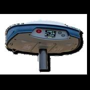
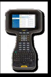
Call us t o g et your complete work flow s olution today ! Efficiency and versatility that will accelerate productivity comes part of a workflow solution that includes the FC-6000 field controller, Magnet software, a HiPer VR receiver and the GT-1200/GT-600 single-operator robotic system. The power of longrange reflectorless measurements comes in your choice of 1”, 2” or 3” GT-1200 models or 2”, 3” or 5” GT -600 models.
The F lorida Surveyor is the official publication of the Florida Surveying and Mapping Society, also known as FSMS. It is published monthly for the purpose of communicating with the professional surveying community and related professions who are members of FSMS. Our award winning publication informs members eleven months out of the year about national, state, and district events and accomplishments, as well as articles relevant to the surveying profession. In addition, continuing educational courses are also available.
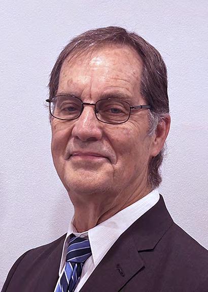
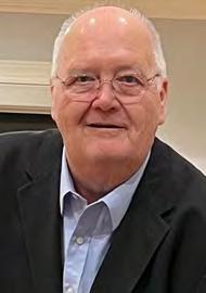
PRESIDENT’S Message
June 2025
Members,
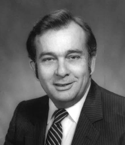
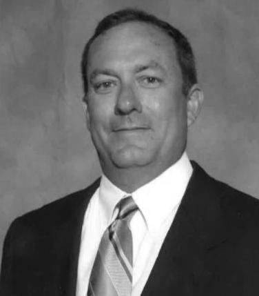
2025 is turning out to be a huge year of change for me and I am truly thankful for the blessings, prayers, and well-wishes I have received from my friends, peers, and my family for some health issues I have faced in the last three months. Thankfully, those issues are now almost behind me, and I am looking forward to continuing participating in this great profession for many more years to come. I am so looking forward to our conference at the end of July and seeing all of those friends and fellow professionals that make this profession great to be part of. Looking back over the last 10 months, I have these reflections:
I had been asked on a couple of occasions in the past several years to run for President of FSMS and I kept putting it off because I didn’t feel I could give it the time, energy and commitment that I felt this very important position deserved. When I finally decided to retire in the last couple of years, this was number 1 on my “Bucket List” of something I was now wanting to do and ready for and could devote all my time and energy on giving back to the Profession that has been my life for 53 years now.
In August 2024, it happened, and I couldn’t have been prouder t o stand up in front of the membership and take the oath of office and commit myself and my time to our Society and Profession. It all started relatively calmly and eventually got heated with more deregulation issues and potential threats to our profession. We met with our Lobbyist and committees in meetings, phone calls, emails, and online discussions and worked through them as a team. Because it’s not the individual that takes this position as president that is the deciding factor on whether our Society succeeds or not, you are just the
PRESIDENT’S Message
coach. It’s a group effort from those individuals who volunteer to represent you the members, the State officers, the State directors, the Cha pter presidents and their officers, the FSMS staff working behind the s cenes to keep things running smoothly, and the multitude of individual members who participate.
A successful professional society is a team that loves what they do and looks out for what’s in the best interest of the profession. They are not paid for their efforts in monetary funds but volunteer to organize, provi de background experience and knowledge, give up their time and energy to give back to something that made them successful, and look out for the things that may be detrimental to the profession. They also look to the future through the education of the next generation, and to the past for the foundation of what built the profession into what it is today. FSMS is your society, we are only as good as the members who are part of it and participate in it. I became a member in 1981 and do not regret a single day being part of it. It truly gives back more than it takes and the lifelong friendships it fosters and promotes is something you can’t get anywhere else.
Each surveyor out there has a story(s) that resonates inside them and permeates the world around them as they go about their work. These hidden stories are what make them special and drive them onward in their quest for knowledge of how to meld the past with the present in every survey they perform. How do we take historical data and blend it with modern Lidar and robotics and make them into a coherent and accurate representation of a property that was patented back when Florida was a territory or when it became a State.
A surveyor is really a unique profession that has past, present, and future aspects in everything they do. It’s really up to all of us to k eep it relevant, and being part of a Society is a step in the right direction.
I’ll leave you with one last thought on this unique profession.
With the new state plane coordinate projections coming out in 2026, where we have taken the spherical geography of the earth and projected it to grid, does that mean that we are supporting the Flat Earth Society movement?
Ponder on it.
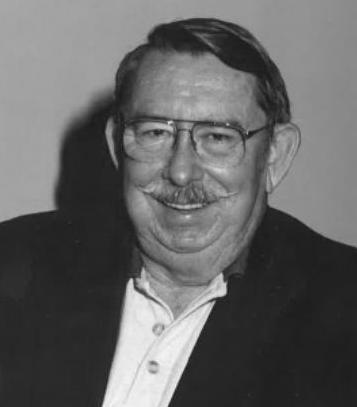
Respectfully submitted,
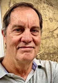
Richard D. Pryce, RLS/PSM
“
”
2025 Cornhole Tournament
The Cornholios Defend Their Title Once Again!
Eddie Munoz and Alex Jenkins III aka "The Cornholios," have been our Cornhole Tournament Champions the past four years and have signed their names all over the cornhole boards after winning each year. If The Cornholios win again they will be five time consecutive champions, making them winners of the Official FSMS Cornhole Boards. We invite ALL challengers to unseat these champions and allow FSMS to keep their cornhole boards for future conferences.
Sponsored By:
Eddie Munoz 4X Champion (2021, 2022, 2023, 2024)
Alex Jenkins III 4X Champion (2021, 2022, 2023, 2024)
2024-25 Districts and
Directors
District 1 - Northwest
Bay, Calhoun, Escambia, Franklin, Gadsden, Gulf, Holmes, Jackson, Jefferson, Leon, Liberty, Madison, Okaloosa, Santa Rosa, Taylor, Wakulla, Walton, Washington
Professional Practice Committee Lou Campanile, Jr.
Workforce Development Committee Lou Campanile, Jr.
Liaisons
CST Program Alex Jenkins
FDACS BPSM Don Elder
Surveyors in Government
Richard Allen
Academic Advisory Justin Thomas UF / Earl Soeder FAU
FES
Lou Campanile, Jr.
Practice Sections
Geospatial Users Group
Young Surveyors Network
Richard Allen
Joseph Samberg
round the State A
From Jeremiah Slaymaker, Northwest Chapter President
BIG THANK YOU to Ron Hanson!
Had a great time at our monthly Northwest Florida FSMS Chapter meeting. Ron has been with the FDOT Central Office for 13 years and currently serves as the Geodetic Services Supervisor. He provided an insightful presentation on the FPRN and there was great discussion/ debates afterwards!
I strongly recommend you reach out to Ron and get him on your Chapter's calendar for later this year to do the same, you won't be disappointed. Here's the bonus, you're scoring some continuing ed's too!
No way this meeting happens without Samantha Hobbs, QAS! Thank you for all you do behind the scenes!
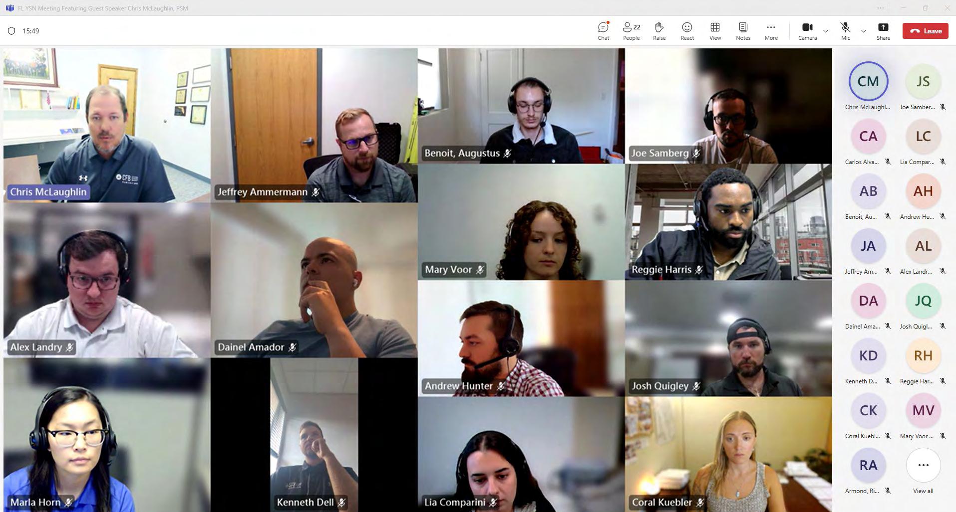
Florida Young Surveyors Network
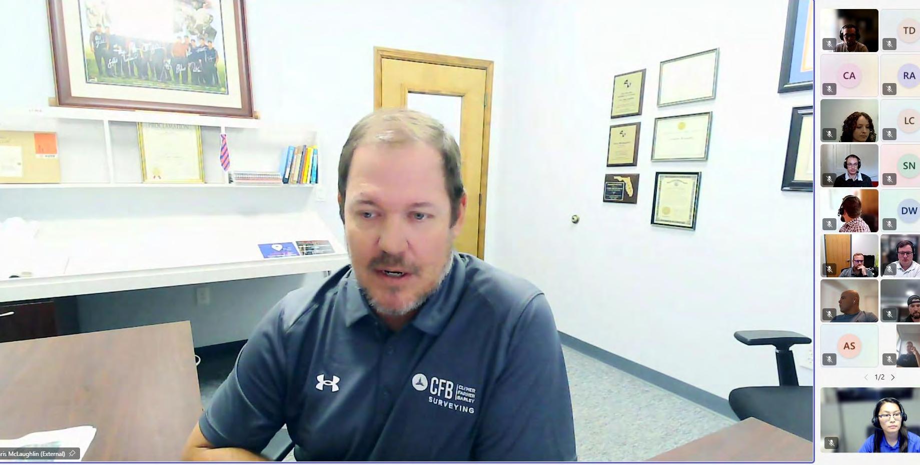
We had an amazing meeting this past week for the month of June, joined by past Florida Department of Agriculture and Consumer Services Board of Professional Surveyors and Mappers member, Chris McLaughlin, PSM, CUC!
During the meeting we discussed the board's structure, application process, and its role in the surveying industry as a whole. Chris also briefly touched on the importance of self-marketing as a young surveying professional through his own experiences and how the board works towards a better industry.
We'd like to extend a big thanks to Chris for speaking at our June meeting, as well as to all of you who attended (numbers are continuing to grow each meeting). Let's keep it going!
NGS has implemented the new International Terrestrial Reference Frame 2020(ITRF2020) and IGS20 realizations in the U.S. Nationa l Spatial Reference System (NSRS)in order to maintain consistency with the International Earth Rotation and ReferenceSystem Servi ce (IERS) and the International GNSS Service (IGS) reference frame s. Thisresults in updated North American Datum 1983 (NAD 83) coordinates for stations in theNOAA CORS Network (NCN), kept at epoch 2010.0. This update is called the Multi-YearCORS Solution 3 (MYCS3) and it follows NGS’s MYCS2 effort from 2018.
What’s New?
This update to the NSRS has been implemented.
• New coordinate functions for NOAA CORS Network (NCN) stations consistent with ITRF2020
• Datasheets will display new NAD 83 coordinates transformed from ITRF2020 coordinate functions. The new NAD 83 coordinates will remain at reference epoch2010.0
• Position and Velocity (P&V) files will display coordinates/veloc ities in both NAD 83 and ITRF2020
• The NGS Online Positioning Users Service (OPUS) will begin processing data with NCN control that is consistent with ITRF20 20 at the time of measurement; results will still be transformed to NAD83 at epoch 2010.0.
Background:
On October 2, 2022, the International Earth Rotation and Refere nce System Service (IERS) released a new realization of the Interna tional Terrestrial Reference Frame called ITRF2020 . The new frame supersedes the previous version called ITRF2014. The ITRF2020
release was followed shortly by the release of a new frame realization by the International GNSS Service (IGS) called IGS20 which is c losely related to ITRF2020.
Learn more in the Multi-Year CORS Solution v3 (MYCS3) webinar.
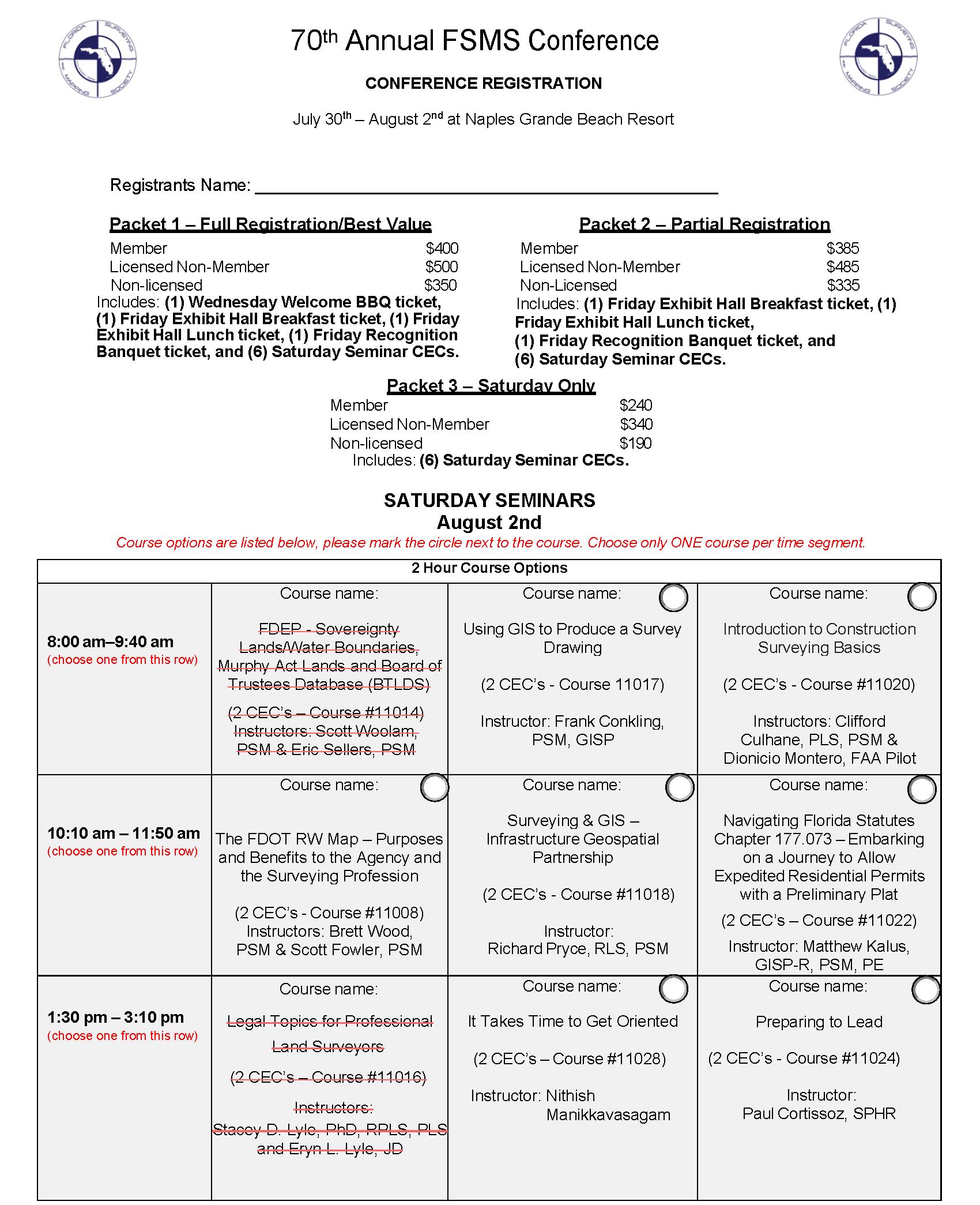
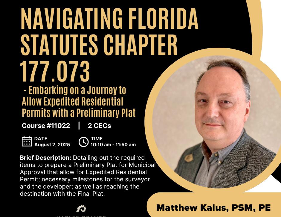
Navigating Florida Statutes Chapter 177.073Embarking On A Journey to Allow Expedited Residential Permits With A Preliminary Plat Course #11022 - 2 CEC Hours
Instructors: Matthew Kalus, PSM, PE
11:50am - 1:20pm Lunch (On your own)
1:20pm - 1:30pm Seminar Sign-In
1:30pm - 3:10pm Afternoon Segments
Legal Topics for Professional Land Surveyors Course #11016 - 2 CEC Hours
Instructors: Stacey D. Lyle, PhD, RPLS, PLS
Eryn Lyle, JD
It Takes Time to Get Oriented Course #11028 - 2 CEC Hours
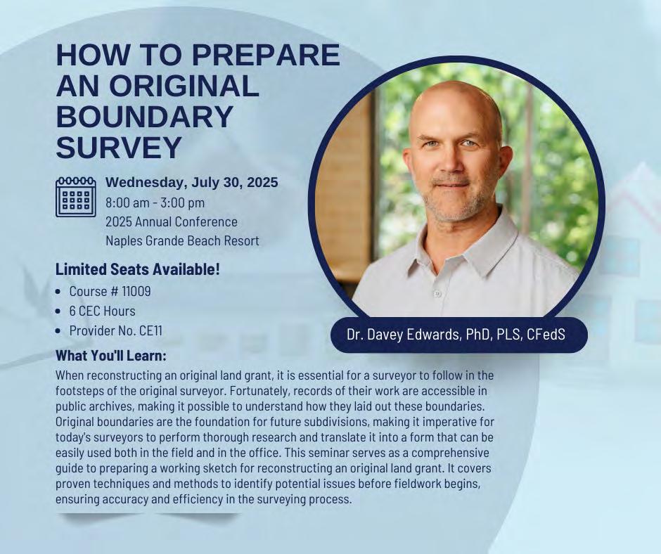
When reconstructing an original land grant, it is essential for a surveyor to follow in the footsteps of the original surveyo r. Fortunately, records of their work are accessible in public archives, making it possible to understand how they laid out these boundaries. Original boundaries are the foundation for future subdivisions, making it imperative for today's surveyors to perform thorough research and translate it into a form that can be easily used both in the field and in the office. This course serves as a comprehensive guide to preparing a working sketch for reconstructing an original land grant. It covers proven techniques and methods to identify potential issues before fieldwork begins, ensuring accuracy and efficiency in the surveying process. This course is an interactive course which will require the attendee to bring the following materials: Scale, Allen Scale (optional), Pencil (color optional), Calculator
Dr. Davey Edwards, PLS LSLS CFedS is a licensed professional surveyor in Texas and Oklahoma, a Texas licensed state land surveyor, and a US certified Federal land surveyor. He has his master's degree in Geospatial surveying Engineering and Doctorate in geosciences. His expertise is in original land grant reconstruction and riparian boundaries. He is the current past president of the National Society of Professional Surveyors, past president of the Texas Society of Professional Surveyors, past member of the Texas Board of Professional Land Surveyors, and current emeritus member of the Texas Board of Professional Engineers and Land Surveyors. He serves as the US delegate for Commission 2 (Professional Education) for the International Federation of Surveyors and various committees in the National Council of Examiners for Engineers and Surveyors. He is the past director of the Texas Spatial Reference Center. He currently works for Dunaway in Fort Worth, Texas, and is an adjunct professor in the Geomatics program at New Mexico State University.
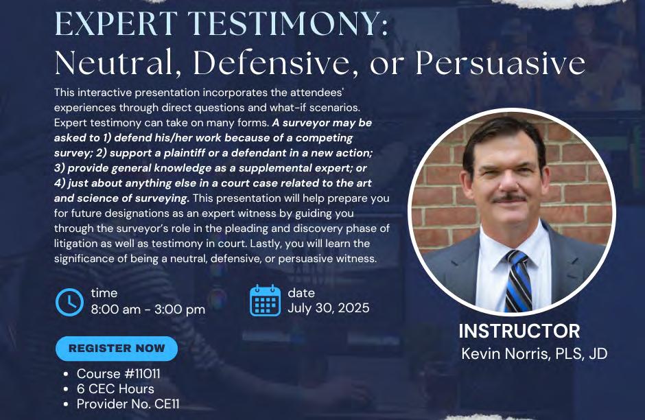
Expert Testimony: Neutral, Defensive, or Persuasive (6 CEC – #11011) Instructor: Kevin S. Norris, Esq.
This interactive presentation incorporates the attendees' experiences through direct questions and what -if scenarios. Expert testimony can take on many forms. A surveyor may be asked to 1) defend his/her work because of a competing survey; 2) support a plaintiff or a defendant in a new action; 3) provide general knowledge as a supplemental expert; or 4) just about anything else in a court case related to the art and science of surveying. This presentation will help prepare you for future designations as an expert witness by guiding you through the surveyor’s role in the pleading and discovery phase of litigation as well as testimony in court. Lastly, you will learn the significance of being a neutral, defensive, or persuasive witness.
Kevin S. Norris, Esq. has thirty-seven years of experience in land surveying, minor engineering, and land development. He is a licensed professional land surveyor in the state of Maryland, having received his license in 2002. His experience ranges from everyday survey-oriented tasks to managing every aspect of a surveying company. His expertise centers on boundary retracement; control surveys; resolution of title issues, statutory and zoning applications; general land planning; and land development. Mr. Norris is a licensed attorney barred in Maryland, Texas, the United States District Court District of Maryland, and the United States District Court Eastern District of Texas. He has represented clients in Maryland before the District Court, the Circuit Court, the Appellate Court of Maryland, and the Orphan’s Court. His areas of practice are land disputes, land development, the resolution of title matters, zoning issues, estate planning, and estate administration. Mr. Norris has been named as an expert witness in land surveying and in areas related to title for numerous cases in Maryland including the Federal District Court for the District of Maryland. He has testified many times regarding boundary issues and has litigated land-related cases. Mr. Norris is a frequent presenter at the Maryland Society of Surveyor’s Conference, has been a presenter at the Maryland State Bar Association Conference, and has spoken at many local surveying and bar events. Mr. Norris is currently the President -Elect of the Maryland Society of Surveyors.
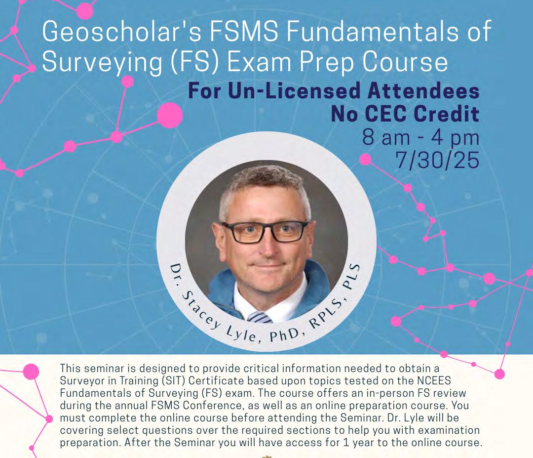
Geoscholar's Florida Surveying and Mapping Society Fundamentals of Surveying (FS) Exam Prep Course
Un-Licensed Attendees - No CEC Credit - Dr. Stacey Lyle, PhD, RPLS, PLS
Geoscholar's Florida Surveying and Mapping Society Fundamentals of Surveying (FS) Exam Prep Course is designed to provide critical information needed to obtain a Surveyor in Training (SIT) Certificate based upon topics tested on the NCEES Fundamentals of Surveying (FS) exam. The course offers an in -person FS review during the annual Florida Surveying and Mapping Society Conference, as well as an online preparation course.
You must complete the online course before attending the Seminar. Dr. Lyle will be covering select questions over the required sections to help you with examination preparation. After the Seminar you will have access for 1 year to the online course.
Dr. Stacey Lyle, PhD, RPLS, PLS is an Associate Professor of Practice at Texas A&M University’s Zachry Department of Civil and Environmental Engineering and Department of Geography. He has served as an expert witness on land boundary court cases. He is active in the industry with over 35 years of surveying experience including civil engineering, land surveying, cadastral land records databases, GIS/CAD/BIM Fusion, geodesy, hydrography, photogrammetry, and cartography.
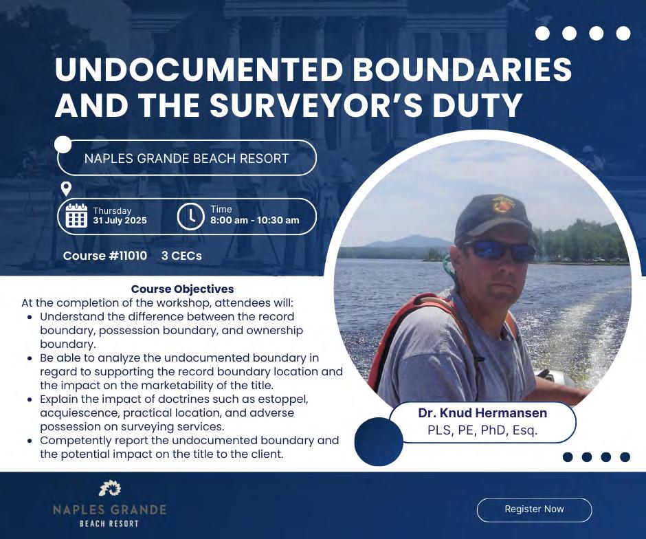
Practitioners often encounter situations where the client’s possession (undocumented) boundary does not coincide with the record boundaries. Depending upon the circumstances, the undocumented boundary may become the ownership boundary. In other cases, acts of the party(ies) and surrounding circumstances may locate the boundary that the record alone fails to fix with clarity. The workshop will explain and discuss estoppel, acquiescence, practical location, agreement, adverse possession, and dedication. In addition to a basic understanding of these doctrines, the practitioner will learn what their role and responsibilities are in these cases.
Course Objectives At the completion of the workshop, attendees will: Understand the difference between the record boundary, possession boundary, and ownership boundary; be able to analyze the undocumented boundary in regard to supporting the record boundary location and the impact on the marketability of the title; explain the impact of doctrines such as estoppel, acquiescence, practical location, and adverse possession on surveying services; competently report the undocumented boundary and the potential impact on the title to the client.
Knud E. Hermansen, PSM, PE, Ph.D., Esq is an attorney, professional engineer, and professional land surveyor licensed in several states. His education includes a Ph.D. in Civil Engineering from the Pennsylvania State University and a J.D. (Doctorate in Law) from West Virginia University. Knud is a professor emeritus at the University of Maine and operates a consulting firm offering surveying, engineering, and legal services. Professional membership includes the National Society of Professional Surveyors, National Society of Professional Engineers, American Society of Civil Engineers, and several state survey societies. He is an author or co -author of several books and articles.
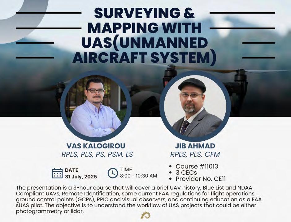
Surveying and Mapping with UAS
(3 CEC – #11013) Instructors: Jib Ahmad, RPLS, PLS, CFM & Vas Kalogirou, RPLS, PLS, PS, PSM, LS
This presentation will cover a brief UAV history, Blue List and NDAA Compliant UAVs, Remote Identification, some current FAA regulations for flight operations, ground control points (GCPs), RPIC and visual observers, and continuing education as a FAA sUAS pilot. The objective is to understand the workflow of UAS projects that could be either photogrammetry or lidar.
Jib Ahmad, RPLS, PLS, CFM started his surveying career in Oregon and Washington in 1994 and instantly loved looking for property corners. He is a licensed Land Surveyor in Texas, North Dakota, South Dakota, and Kentucky, is a Certified Floodplain Manager, a FAA Part 107 UAS Pilot, and has been a Professional SCUBA Divemaster for nearly 30 years. His diverse range of projects in land, aerial, hydrographic, seismic and pipeline surveying has given him the opportunity to work in 8 states. His experience includes large boundary surveys in Texas and in the U.S. Public Land system, large scale GPS control network design and processing, watershed mapping, coastal mapping for surface and underwater sites, riverine mapping, forensic surveys, hydrology and hydraulics studies, and archaeological surveys. Jib is a graduate of the University of Houston and is an active member of NSPS, TSPS, ASPRS, AUVSI, ASCE, TFMA, and the Archaeological Institute of America.
Vasileios "Vas" Kalogirou, RPLS, PLS, PS, PSM, LS started his surveying career in Greece 30+ years ago through his surveying family business and is a third generation Surveyor. While working in the surveying industry he received a 5-year Bachelor’s Degree in Land Surveying Engineering from the Aristotle University of Thessalonica, Greece in 2001. At the end of the same year he received his license as a Professional Land Surveyor in Greece and then moved to the United Kingdom where he received his Master Degree in GIS in 2003. At the end of 2003 he served in the Greek Artillery where he continued working as a surveyor for various expeditions. Vas moved to Dallas, Texas in 2005 and started working for Halff, which is where he is still employed today as the VP, Survey Practice Leader. Throughout his career, Vas managed DOT Projects in TX and OK, ALTA Surveys, FEMA, USACE, Energy and Geospatial projects in multiple states. Vas is a Licensed Surveyor in seven (7) states, including the state of Florida. Since 2007 he has been coordinating the nationwide NCEES FS Exam study groups and is also an adjunct professor teaching the courses of GIS and Geodetic Surveying & Mapping at Dallas County College since 2015. Vas also serves as a Chairman of Surveying Advisory Committee member on behalf of the Texas Board of Professional Engineers and Land Surveyors and an Advisor of the Curriculum Survey Program of the Aristotle University of Thessaloniki (AUTH) in Greece, but most importantly, he is a devoted family man who really enjoys Surveying.
8:00 am9:40am
8:00 am9:40 am
8:00 am9:40am
Saturday - August 2
FDEP - Sovereignty Lands/Water Boundaries, Murphy Act Lands and Board of Trustees Database (BTLDS) (2 CEC – Course #11014) Instructors: Scott Woolam, PSM & Eric Sellers, PSM
This discussion will focus on what is considered sovereignty lands, brief discussion on riparian lines and training on how to navigate with the State Lands Database (BTLDs). The goal is to educate on state lands interest and water boundaries and how they impact the private surveyor.
Scott Woolam, PSM is the Chief of the Bureau of Survey and Mapping with the Department of Environmental Protection. After 10 plus years surveying in the private sector in the Pensacola area, he went to the Bureau of Survey and Mapping in 1991 where he is now in his 35th year of tenure. Scott graduated from the Surveying and Mapping Program (Geomatics) at the University of Florida. He is a member of Tau Beta Pi Engineering Honor Society and the Florida Survey and Mapping Society. He also wrestled in high school.
Eric Sellers, PSM is a Professional Land Surveyor and Mapper with the Bureau of Survey and Mapping with the Department of Environmental Protection. After 10 years surveying in the private sector in Georgia and North Florida, he went to the Bureau of Survey and Mapping in 2012. Eric graduated from Georgia Southern University. He is a member of the Florida Survey and Mapping Society.
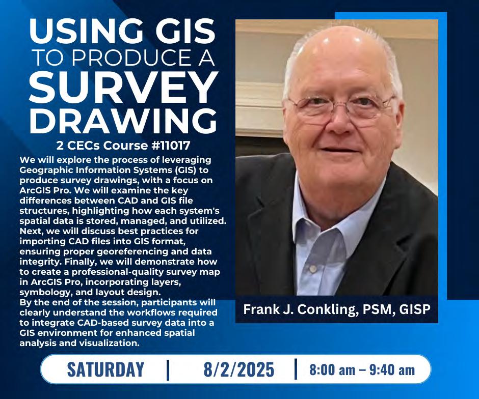
Using GIS to Produce a Survey Drawing (2 CEC- #11017) Instructor: Frank J. Conkling, PSM, GISP
This presentation will explore the process of leveraging Geographic Information Systems (GIS) to produce survey drawings, with a focus on ArcGIS Pro. We will examine the key differences between CAD and GIS file structures, highlighting how each system's spatial data is stored, managed, and utilized. Next, we will discuss best practices for importing CAD files into GIS format, ensuring proper georeferencing and data integrity. Finally, we will demonstrate how to create a professionalquality survey map in ArcGIS Pro, incorporating layers, symbology, and layout design. By the end of the session, participants will clearly understand the workflows required to integrate CAD -based survey data into a GIS environment for enhanced spatial analysis and visualization.
Frank J. Conkling, PSM, GISP owns Panda Consulting, an LB-licensed Professional Surveying and Mapping business offering GIS Professional Services since 1998. Frank is a recognized authority on GIS and Surveying and Mapping technology, including mapping various types of ownership interest in land. Frank has been involved in GIS and Parcel Mapping since 1974 and has enjoyed studying and guiding the creation, implementation, and maintenance of some of the country's most effective GIS systems and most accurate land ownership databases. Frank is a licensed Professional Surveyor and Mapper in Florida and a licensed GIS Surveyor in South Carolina. He is a Past President of the Florida Association of Cadastral Mappers, an organization focused on cadastral mapping throughout the state of Florida, and a Member Emeritus of the Florida Board of Professional Surveyors.
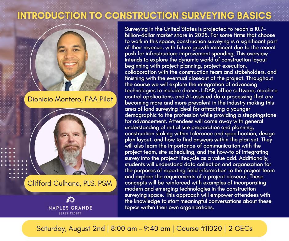
Introduction to Construction Surveying Basics
(2 CEC - #11020) Instructors: Clifford Culhane, PLS, PSM & Dionicio Montero, FAA Pilot Surveying in the United States is projected to reach a 10.7 -billion-dollar market share in 2025. This overview intends to explore the dynamic world of construction layout beginning with project planning, project execution, collaboration with the construction team and stakeholders, and finishing with the eventual closeout of the project. Attendees will come away with a general understanding of initial site preparation and planning, construction staking within tolerance and specification, design plan layout, and how to find answers within the plan set. They will also learn the importance of communication with the project team, site scheduling, and the how-to of integrating survey into the project life cycle.
Clifford Culhane, PLS, PSM is a Professional Land Surveyor with near 40 years of widely varied experience. Clifford manages a group of surveyors engaged in heavy civil infrastructure projects from highways, bridges, dams, and rail, to water plants, power generation, and other specialized unique projects. Clifford is interested in two things, primarily; training people to take his job and attracting curious and driven people to our profession by whatever means necessary.
Dionicio Montero, FAA Pilot, is a Survey Manager in the Southeast District of Kiewit Infrastructure. His passion for new and emerging technologies has led him to become the ‘go to’ integrator and subject matter expert for survey related tech in the Southeast District. From Drones, LiDar, terrestrial scanning to GPS networking Dionicio has had his hands in just about every project started in the Southeast for the last 5 years. Dionicio’s expertise is attributed to his education, hands on experience, and drive to find the most cost effective, practical solution to locally unique problems. Dionicio is currentl y working toward obtaining his Survey License in Florida.
Saturday - August 2
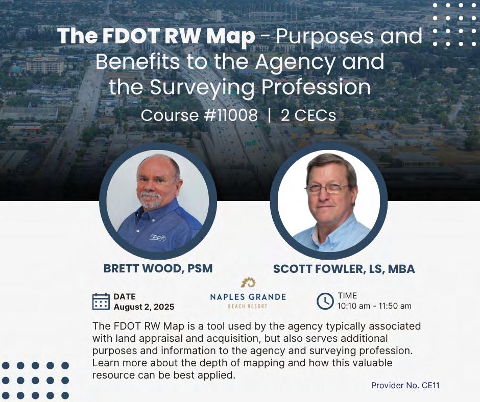
The FDOT RW Map – Purposes and Benefits to the Agency and the Surveying Profession (2 CEC - #11008) Instructors: Brett C. Wood, PSM & Christopher (Scott) Fowler, LS, MBA
The FDOT RW Map is a tool used by the agency typically associated with land appraisal and acquisition but also serves additional purposes and information to the agency and surveying profession. Learn more about the depth of the mapping and how this valuable resource can be best applied.
Brett C. Wood, PSM is the State Surveyor for the Florida Department of Transportation, Brett manages the Central Surveying and Mapping Office (CSMO) in Tallahassee and the Department’s Statewide Surveying and Mapping Program. CSMO operates and maintains the Department’s statewide continuous operating GNSS reference network, the Florida Permanent Reference Network (FPRN). Brett has over 40 years of experience in surveying and mapping and became a Florida Licensed Surveyor and Mapper in 1997. Brett came to the Department in 2009 from the private sector, specializing in geodetic and remote sensing technologies.
Christopher (Scott) Fowler, LS, MBA began land surveying in South Florida in 1989. His range of work experience includes land development, engineering support, construction layout, and roadway construction. He joined FDOT District Five in 2017 as Surveyor II in their Right of Way Mapping Section and is currently a Survey and Mapping Supervisor I in that same Section. He is a graduate of Miami Dade College, University of Minnesota, and Chancellor University. Mr. Fowler is a Licensed Surveyor in the State of Florida.
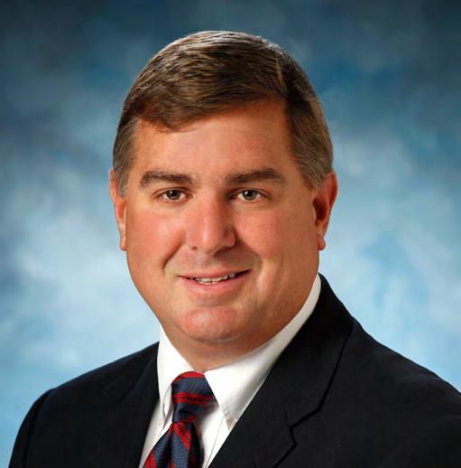
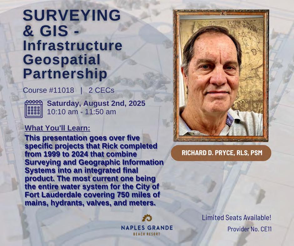
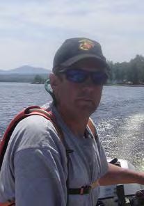
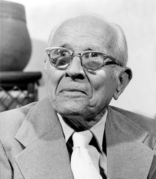
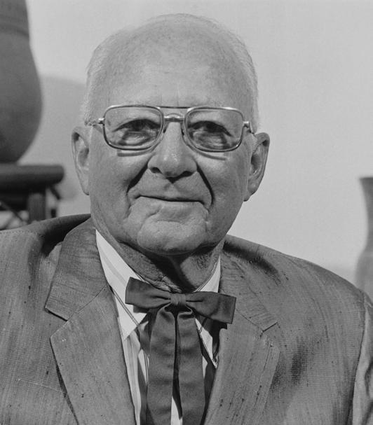
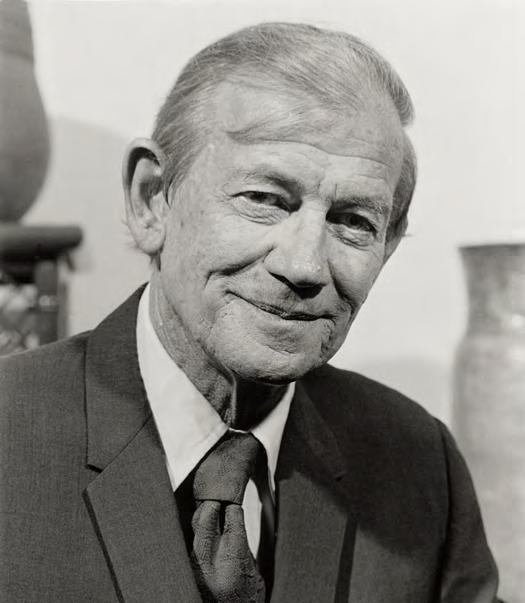
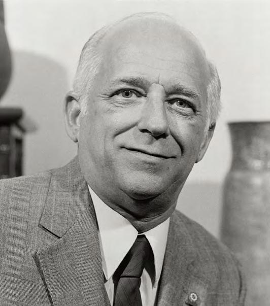
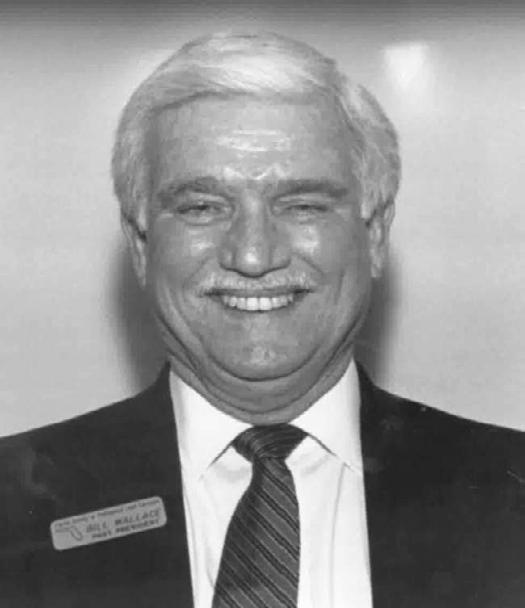
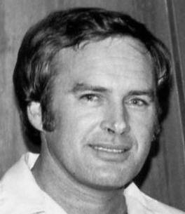
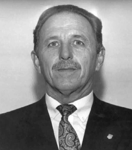
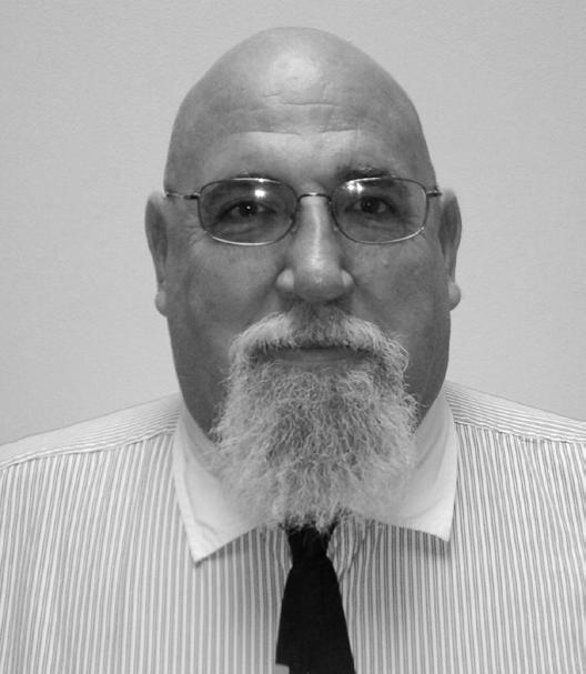
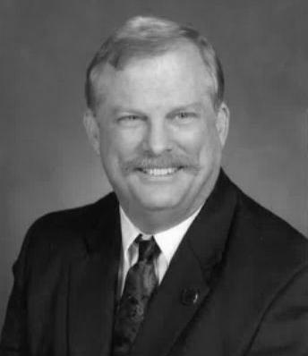
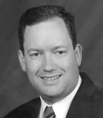
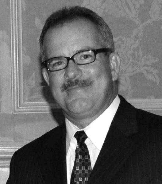
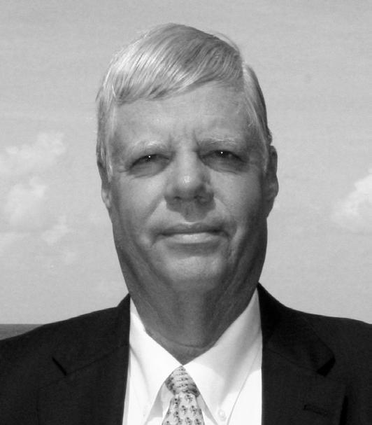
(2 CEC – #11018) Instructor: Richard Pryce, RLS, PSM
This presentation goes over five specific projects that he completed from 1999 to 2024 that combine Surveying and Geographic Information Systems into an integrated final product. The most current one being the entire water system for the City of Fort Lauderdale covering 750 miles of mains, hydrants, valves, and meters.
10:10 am11:50 am
Richard Pryce, RLS/PSM is the current President of FSMS; former Director and President of Broward Chapter FSMS. Rick has been surveying since 1972 and was licensed in 1983. He has performed surveys in 42 counties within Florida and was an early adopter of Geographic Information Systems using ESRI software since 1990. He has successfully integrated and completed multiple Survey, Engineering, and GIS multi-million-dollar projects over the past three decades and has provided numerous presentations and general talks on them to a diverse group of Engineers, Surveyors, and GIS Professionals. His interest, knowledge, and expertise in remote sensing started in 1996 when he worked directly with a remote sensing firm while surveying, to assist in developing precision agriculture applications. He has expanded his knowledge and expertise to include all forms of LiDAR, (terrestrial, mobile and aerial) since then, and has also included forensic work on disaster site s. He developed multiple ways to do QA/QC LiDAR work and check both horizontal and vertical accuracies to improve upon the final product. Most recently he has been using his background with LiDAR and remote sensing to assess properties for Monroe County Land Authorities in determining how much of their properties are affected by Mean High Water Line.
Navigating Florida Statutes Chapter 177.073 – Embarking on a Journey to Allow Expedited Residential Permits with a Preliminary Plat (2 CEC - #11022) Instructor: Matthew Kalus, GISP-R, PSM, PE
This presentation details out the required items to prepare a Preliminary Plat for Municipal Approval that allow for Expedited Residential Permit; necessary milestones for the surveyor and the developer; and, reaching the destination with the Final Plat.
Matthew Kalus, GISP-R, PSM, PE holds a Bachelor of Science in Civil Engineering degree from the University of Central Florida, and has over 30 years of experience in drafting, civil and structural engineering, aviation planning, right -of-way mapping & acquisition, GIS parcel mapping, surveying, and platting. Matthew has worked for several private engineering consulting firms, as well as being employed as a public servant at Lake County Public Works, Lake County GIS, Orange County Property Appraisers Office, and for that last 11 years, at Orange County Public Works, Development Engineering Division. Mr. Kalus’ background and coordination with both the Lake County and Orange County Surveyors in right -of-way acquisition and parcel mapping, and as part of the Orange County Property Appraiser parcel re -engineering team, Matthew was involved in remapping over 340,000 parcels, several thousand plats, and nearly a hundred right -of-way maps for the 1,003 square mile county. This experience provided the foundational elements to transition to the Platting Coordinator at Development Engineering beginning in 2014 where the team processed, on average, a plat a week for recording over his entire tenure. Now in the role of Senior Project Manager for Orange County Public Works Department - Development Engineering Division, under the guidance of the division manager, Matthew oversees a staff of 50 engineers, surveyors, technicians, and inspectors comprised of six Sections: Platting, two Development Engineering Plan review teams, Permitting, Construction Inspection, and the Development Review Committee review team. These teams review all aspects of both residential and commercial development within unincorporated Orange County from Land Use plan review, subdivision and development plan review, site construction plan review, platting, and construction inspection.
70th Annual FSMS Conference
SIT ($300) / Wed. Seminars ($240) / Thurs. Seminars ($120)
Seminar I: How to Prepare an Original Boundary Survey
(6 CECs - Course #11009)
Instructor: Dr. Davey Edwards, PhD, PLS, CFedS
Seminar II:
Expert Testimony: Neutral, Defensive, or Persuasive
(6 CECs - Course #11011)
Instructor: Kevin Norris, PLS, JD
SIT Prep Course (Un-Licensed Attendees, No CEC Credit)
July 30
8:00 am – 4:00 pm
Geoscholar's Florida Surveying and Mapping Society Fundamentals of Surveying (FS) Exam/Surveyor in Training (SIT) Certificate Prep Course
You must complete the online course before attending the Seminar. Dr. Lyle will be covering select questions over the required sections to help you with examination preparation. After the Seminar you will have access for 1 year to the online course.
• Vendor Spotlight: 30 Minute Priva te Room Speaking Opportunity (Limited Spaces Available, N o CECs)
EXHIBITORS
PLATINUM
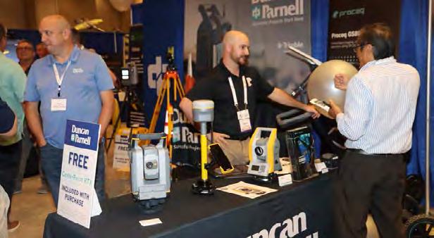
Duncan-Parnell
Duncan-Parnell is an Authorized Trimble Dealer for land survey, mapping/GIS, and construction instruments — and has been the leading provider of survey & mapping solutions in Florida for over 25 years. Our product offerings include GNSS receivers, drones/UAVs solutions, robotic and manual total stations, software for workflow integration, digital and automatic levels, 3D laser scanners, mobile mapping and monitoring solutions, construction lasers, as well as a full range of field supplies and accessories. Duncan-Parnell is your full field-to-finish provider. Our Geospatial team has decades of industry experience, certified service centers, and experienced trainers on staff. We’re ready to be a trusted partner and assist with your sales, rental, or maintenance needs. Contact us today!
YOUR FLORIDA GEOSPATIAL PARTNER
Duncan-Parnell, along with our valued partners, including Trimble and other top brands, are proud supporters of the Florida Surveying & Mapping Society. From solutions including GNSS, scanning, GPR, drones, and more to services including support, rentals, training, and repair, we are pleased to be your one-stop shop for geospatial professionals throughout the Sunshine State.
Jacksonville, FL (904) 620 - 0500
Orlando, FL (407) 601 - 5816
www.duncan-parnell.com
EXHIBITORS GOLD
Drone As A Service
Drone as a Service or DaaS makes it easy for businesses to benefit from the speed, precision, and rich data of AI drones for a host of business applications. Similar to Software as a Service (SaaS), we offer drone technology solutions on a subscription or pay-per-use basis with no need to purchase specialized hardware or software, find a drone pilot, or manage maintenance and regulatory permits. Business and government customers can conveniently utilize drones scaled to their needs for land surveying, inspections, security, maintenance of powerlines or wind turbines, inventory management, precision agriculture and more powered by ZenaDrone’s multifunction AI drones.
loo q
Looq AI is a high-growth technology platform company dedicated to advancing critical infrastructure digitization and diagnosis. The company has developed a fundamental new camera technology that makes survey-grade 3D capture cost-effective at scale. The Looq Platform is hand-held capture from the ground—a one-stop for creation, visualization, analysis, collaboration, and integration to digitize the built-world. Users work more efficiently and get accurate results for topographic mapping and modeling of transmission & distribution assets.
Exhibitor Opportunities
SILVER EXHIBITOR
$2,300
• Company Bio and Logo in the Conference Program Book
• 1 month free half-page ad in The Florida Surveyor W: 8.5 in. x H: 5.5 in.
(Sustaining Firms will receive an additional free month )
• Recognition in the Conference Edition of The Florida Surveyor
• Logo with hyperlink to website displayed on FSMS.org
• Third priority when choosing booth(s)
• 2 Day Complimentary Self Parking
• Welcome-Bag Flyer Insert (Vend er Provided)
• 2 Welcome BBQ tickets
CONFERENCE EXHIBITOR
$1,800
• Company Bio and Logo in the Conference Program Book
• 1 month free half-page ad in The Florida Surveyor W: 8.5 in. x H: 5.5 in.
(Sustaining Firms will receive an additional free month )
• Recognition in the Conference Edition of The Florida Surveyor
• Last priority when choosing booth(s)
• Logo with hyperlink to website displayed on FSMS.org
ALL EXHIBITORS WILL R E CEIVE:
8’ x 10’ draped booth with 10’ backdrop and 36” side rails
7” x 44” booth identification sign
6’ draped table, 2 chairs and waste basket
4 name tags for booth personnel per booth
2 Exhibitor breakfast tickets per booth
2 Exhibitor lunch tickets per booth
Attendee List (By Request)
(Additional Booths can be Purchased for $950 per Booth)
EXHIBITORS GOLD
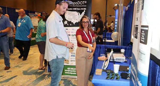
TopoDOT
TopoDOT is a point cloud processing software application offering a comprehensive feature extraction tool suite with the right balance between automation and quality assurance. TopoDOT offers a well-documented process to extract Digital Twin deliverables such as topographies, assets, 3D models, measurements, analyses, and reports meeting the highest quality-controlled standards. Our TopoShare product provides a comprehensive process to organize, store and share your data across operations at the lowest possible cost. TopoDOT LLC is headquartered in Winter Garden, Florida.
EXHIBITORS
SILVER
American Government Services Corporation
American Government Services (AGS) is a full-service title company that specializes in providing real estate services to government agencies. AGS has been providing title and closing services in the State of Florida since 1979. American Government Services is a 100% women-owned business, certified as a DBE/MBE firm with the State of Florida and registered as a real estate broker corporation with the Florida Department of Business and Professional Regulation. AGS hopes to meet and exceed all of your Title service needs.
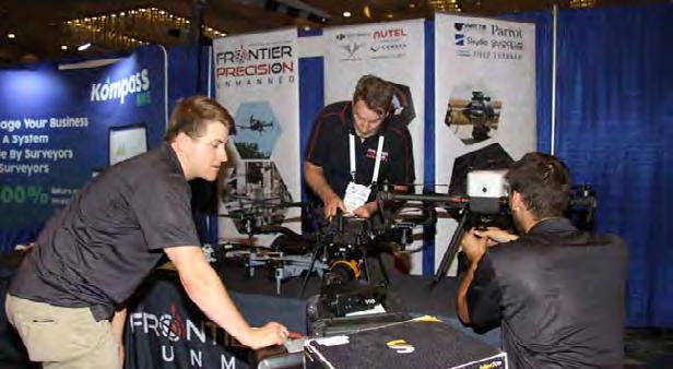
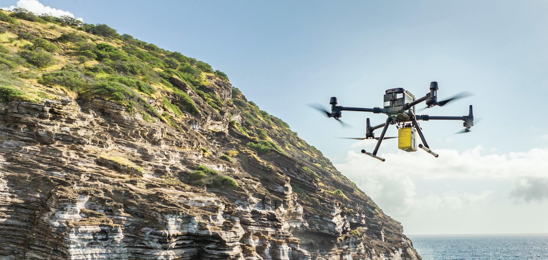
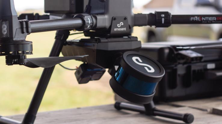
Frontier Precision Unmanned
Frontier Precision Unmanned has the latest innovations in drone aircraft and sensors to fit your job or application. We offer industry-leading products and software from Ascent Aerosystems, Autel, Censys Technologies, DJI Enterprise/DJI Agriculture, Freefly Systems, Flybotix, Hylio, Inspired Flight, Parrot, Quantum-Systems, Skydio, Watts Innovations, YellowScan, Emesent, AgEagle, Phase One, Sentera, FLIR, Pix4D, and many others to make sure you get the right product for the right UAS application. UAS applications include geospatial surveying & mapping, agriculture, construction, energy, forestry, infrastructure, mining, mosquito & vector control, oil & gas, and public safety.
EXHIBITORS
SILVER
Navigation Electronics, Inc. (NEI)
NEI is a premier distributor of Trimble products since 1990 with an exceptional track record in leveraging cutting-edge technologies, with Geocue, Microdrones, DJI & Wingtra. With a focus on customer service, NEI boasts a team of professionals with expertise in Surveying, Mapping and UAS Technologies. Our staff includes three licensed land surveyors, two GIS professionals, and four Part 107 pilots. NEI operates from a state of the art facility in Lafayette, LA, equipped with the latest technology. Our commitment to innovation ensures that we stay at the forefront of the industry, providing top-notch solutions. Headquartered in Lafayette, NEI extends its reach with a training center and sales office in Duluth, Georgia, and maintains satellite offices in Florida, Mississippi, Alabama, and Arkansas, allowing us to serve clients across the region. With over 100 years of service experience, NEI brings knowledge and stability to every project. NEI takes pride in being a woman-owned small business.
EXHIBITORS
SmartTIX
YellowScan
At YellowScan we design, develop, and produce UAV Mapping solutions for professional applications. Fully integrated, ultra-light and easy to use, these highly automated data collection tools are used by customers around the world in fields such as surveying, forestry, environmental research, archeology, corridor mapping, civil engineering, and mining. With more than 13 years of field experience, YellowScan is committed to delivering the highest level of performance, reliability, and robustness for its solutions. Our platforms are field tested all over the world in multiple environments (tropical forests, bare soils, mountains, rivers, coast lines, open-pit mines, power lines). For more information please go to www.yellowscan.com .
EXHIBITORS
STANDARD
Actalent
Actalent is a global leader in engineering and sciences services and talent solutions. We help visionary companies advance their engineering and science initiatives through access to specialized experts who drive scale, innovation, and speed to market. With a network of almost 30,000 consultants and more than 4,500 clients across the U.S., Canada, Asia, and Europe, Actalent serves many of the Fortune 500.
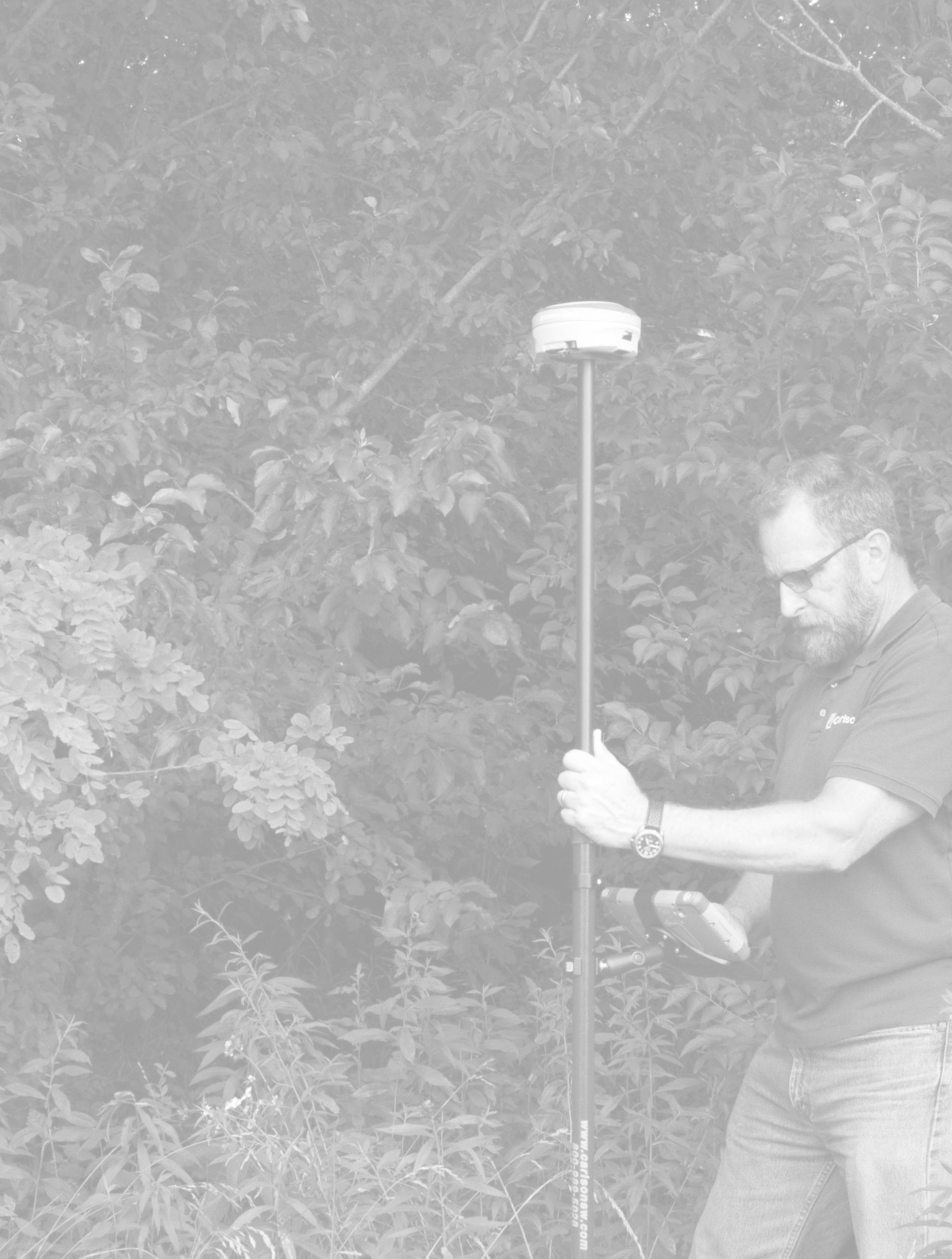
CARLSON
Carlson Preferred Solutions is the exclusive Carlson Software Authorized Dealer for the state of Florida. Specializing in Carlson centric GNSS RTK base and rover solutions, total stations, RTK drones, data collection hardware & software, and CAD software to the Land Surveyor, Civil Engineer, and Construction professional.
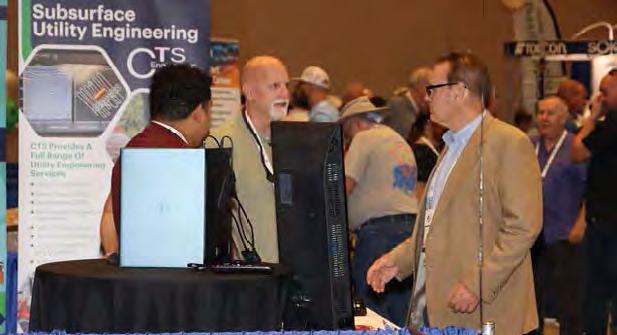
CTS Engineering
CTS Engineering, Inc is a well-known and respected leader in providing Professional Engineering services throughout the State of Florida for over 12 years. We offer a wide array of services to our clients including transportation planning, traffic engineering, public transit support, roadway design, policy planning, data collection, statistical analysis, PD&E studies, multimodal improvements and surveying and mapping services. Our team of Professional Surveyors & SUE experts have provided high quality deliverables for Surveying & Mapping assignments to our clients including utility coordination to many FDOT Districts, Counties and Cities. CTS is a certified DBE firm with offices throughout the state to support all your Surveying, SUE & Utility Coordination needs. CTS will provide a turnkey package of all these services.
EXHIBITORS
STANDARD
Data Activation Center
Data Activation Center- The new standard in IoT connectivity, service, and support.
At Data Activation Center, we SIMplify business wireless— offering tailored, responsive service that keeps teams connected and productive.
We provide customer-first solutions that make wireless service easy to understand and even easier to manage. From activating new lines and managing data plans to realtime support and usage insights, we take the hassle out of staying connected. Our team works closely with clients across a range of industries—especially surveying and field-based services—to ensure they have the right plans, the right tools, and the flexibility to scale. We’re known for our personal touch, fast response times, and commitment to keeping things simple and stress-free.
Whether you’re a long-time customer or just getting started, we’re here to keep you up and running—no stress, no surprises.
DESERT CREATIVE GROUP
Unlock the full potential of geospatial technology and your business with Desert Creative Group. As the North American distributor for Tersus smart GNSS solutions, we bring reliable high accuracy performance to integrated visual positioning, real-time correction technology, and land or aerial mobile mapping systems. Explore our full lineup of GNSS receivers, intuitive software, and autonomous surface vessels for bathymetric surveys— backed by industry expertise. Seeking growth? We’re looking for distribution partners in select U.S. and Canadian regions. Alongside cutting-edge GNSS solutions, we offer strategic business development and marketing services— designed to accelerate your success. Let’s build something great together.
EXHIBITORS
STANDARD
DIGITAL E. CONSULTING
Based in Miami, FL, Digital E Consulting LLC delivers aerial drone services and geospatial solutions across Florida. Our expert team leverages cutting-edge drone and 3D modeling technologies to provide precise, high-quality data capture and processing. Land surveyors trust us to handle their drone operations, saving time, cutting costs, and tapping into our specialized expertise in data collection, photogrammetry, and LiDAR processing, customized to fit any project.
DUKE ENERGY
Duke Energy is a Fortune 150 company headquartered in Charlotte, N.C., is one of America’s largest energy holding companies. The company’s electric utilities serve 8.4 million customers in North Carolina, South Carolina, Florida, Indiana, Ohio and Kentucky, and collectively own approximately 54,800 megawatts of energy capacity. Its natural gas utilities serve 1.7 million customers in North Carolina, South Carolina, Tennessee, Ohio and Kentucky.
Duke Energy is executing an ambitious clean energy transition to achieve its goals of net-zero methane emissions from its natural gas business by 2030 and net-zero carbon emissions from electricity generation by 2050. The company is investing in major electric grid upgrades and cleaner generation, including expanded energy storage, renewables, natural gas and nuclear.
EXHIBITORS
STANDARD
eGPS Solutions
At eGPS Solutions, we are a full-service survey equipment and supplies distributor. We sell top-quality equipment from GeoMax, CHC, DJI, and LiDARUSA at the best prices to create unique solutions to fit your surveying needs. We also provide comprehensive services to fully support our customers, including supplies, M2M data plans, certified repairs, technical support, and UAV-LiDAR training, all just a phone call away. So look no further than us for all your surveying needs because, at eGPS Solutions, we will not let you fail.
Florida Aerial Survey Technologies (FAST)
Florida Aerial Survey Technologies (FAST) excels in swiftly delivering high-quality aerial survey and mapping data through advanced methods including LiDAR and photogrammetry. Our team’s extensive experience in drone-related software development has led to the creation of proprietary survey software and systems. These innovations significantly reduce project timelines while maintaining data integrity, establishing FAST as the aerial surveying market leader in Florida.
Florida Level & Transit Co.
Florida Level & Transit Co. is a full-line dealer for Leica Geosystems (optical, GPS, HDS scanning, & lasers), Topcon Positioning (optical & lasers), Spectra Precision (optical, data collectors, & lasers), Carlson Software, Septentrio, and many more. Our home office is in Ft. Lauderdale, with a full-service office in Tampa.
EXHIBITORS STANDARD
GeoNetworking
Geo Networking is a Topcon/Sokkia distributor located in central Florida. The company focuses on end-to-end sales through a consultive sales strategy. In this process, Geo Networking is able to match the right product to meet your team’s goals for your deliverables. Geo Networking is proud to offer the Quantum Systems line of drones that include the Trinity Pro and a powerful line of sensors with LiDAR options. We are also excited to welcome FARO to our lineup of terrestrial scanners. The all new Orbis is a handheld SLAM scanner that is really making waves in the mass data capture arena. These products matched with the very well known products from Topcon/Sokkia make any job a slam dunk.
GPI
For fifty years, GPI Geospatial, Inc., a subsidiary of GreenmanPedersen, Inc., has delivered advanced geospatial services in both public and private sectors throughout the eastern United States. Our comprehensive offering of professional surveying and mapping services caters to engineers, architects, land developers, planners, and a wide range of both public and private markets, such as energy, transportation, and private development. GPI Geospatial provides the most accurate remote sensing and survey data by utilizing specialized aircraft, vehicles, and personnel outfitted with cutting-edge equipment and software. Our unwavering commitment to precision, innovation, and client satisfaction has earned GPI Geospatial an unparalleled reputation, making them the preferred firm of choice for those seeking unrivaled geospatial solutions tailored to their needs. Our team is comprised of dedicated subject matter experts and support staff, many of whom are licensed Land Surveyors, ASPRS Certified Photogrammetrists and Mapping Scientists, GIS Professionals, FAA Licensed Pilots, and Project Management Professionals.
EXHIBITORS
STANDARD
Green Equipment Company
Green Equipment Company is your source for “DAMAGE PREVENTION” tools and products that lead the industry in Innovation and Quality. We offer “Value” through exceptional customer service and competitive pricing. Our highly trained, experienced sales team covers eight states and represents world-leading manufacturers. We are problem solvers, dedicated to meeting our customer’s needs. With Green Equipment Company, you receive continual service after the sale.
Guideline Geo
Guideline Geo guides users to map the subsurface through none-destructive geophysical methods. Primarily focusing on groundwater management, ground investigations, and the utility locating sector. With a history dating back to 1923, we develop, manufacture, and market instruments, software, and services, offering unique field-to-finish workflows for our two market-leading brands – ABEM and MALA. Guideline Geo reaches over 80 countries through a network of partners and local offices. One local office headquartered in Charleston, SC and a strong distributor network in Florida name Power-Tel Utility Products.
HALEY WARD
Haley Ward is a 100% employee-owned technical consulting firm offering a wide range of engineering, architectural, planning, environmental, BIM and surveying services focused upon delivering client-based solutions. Our team of 300 employees value accountability and collaboration and serve land development, municipal, energy, industrial, and institutional clients. Haley Ward is headquartered in Bangor with locations throughout Maine, New England, and Florida.
EXHIBITORS
STANDARD
HAYES INSTRUMENT CO.
Hayes Instrument Co., a Topcon dealer in Tennessee, is the leading supplier of top-of-the-line construction and surveying instruments and supplies, has been serving the Surveying, Engineering, and Construction industry for over 40 years. Hayes is a factory authorized dealer for Topcon and Sokkia, as well as several top vendors of surveying supplies and accessories. In addition to our top-of-the-line equipment and supplies, we have our complete factoryauthorized Repair and Service Center. Another aspect of Hayes Instrument is our live Tech Support on all equipment. We dedicate ourselves to providing the best customer service and pride ourselves on serving our customers every day.
IGage
Igage is a nationwide survey and GIS equipment sales team. We provide GPS, robotic total stations, bathymetric boats, machine control and slam scanners. We pride ourselves on the support we are able to provide our clients. We have offices in 11 states and have multiple licensed land surveyors selling and supporting all of the equipment that we offer. We not only sell the equipment but we use it in our everyday practices. This gives us a better understanding of how the equipment works and a real empathy for the customers. For more information or to get a demonstration of any of the above items please feel free to contact us at matt@igage.com or by phone at 270-980-2583. iGage
EXHIBITORS
STANDARD
JAVAD
JAVAD GNSS designs and manufactures high-precision GNSS and communication solutions for demanding applications. Founded by recognized pioneer of GNSS technology, Dr. Javad Ashjaee, we maintain his legacy of prioritizing performance and innovation. Our solutions are manufactured in-house, in San Jose, California, USA. We are committed to connecting the world through precision. We always will be.
Kucera International, Inc.
Kucera International, Inc. is a leading provider of aerial remote sensing, lidar processing/classification, photogrammetric mapping, orthoimaging, CAD and GIS conversion and support, and related services for surveying/engineering, government, industrial/commercial, and educational/ research applications. Kucera’s in-house staff of over 60 experienced geomatic professionals working at offices in Florida, Ohio, and Pennsylvania includes licensed/certified photogrammetrists, surveyors, engineers, GIS/CAD specialists, project managers, pilots, and aircraft mechanics. For aerial data acquisition, Kucera maintains a fleet of high-performance, multi-port manned aircraft outfitted with latest generation aerial lidar, digital aerial imaging, and multispectral sensing systems integrated with advanced airborne GPS/IMU georeferencing technologies. For data processing, mapping, conversion, and support, Kucera uses a variety of robust, proven remote sensing, photogrammetric, imaging, and GIS and CAD technologies/software. Kucera regularly works throughout Florida, the Caribbean region, and other areas of the U.S. Kucera is a long-standing Florida professional surveying and mapping firm and a sustaining member of ASPRS.
EXHIBITORS
STANDARD
Leica Geosystems
With more than 200 years of history, Leica Geosystems, part of Hexagon, is the trusted supplier of premium sensors, software and services. Delivering value every day to professionals in surveying, construction, infrastructure, mining, mapping and other geospatial content-dependent industries, Leica Geosystems leads the industry with innovative solutions to empower our autonomous future.
LENGEMANN
Established in 1962, Lengemann Corporation is celebrating 60 years of meeting customer needs. Lengemann Corporation is one of the leading Topcon and Sokkia full line surveying instrument dealers in the United States. We sell/rent/finance GPS, Robotics, Total Stations, Drones, Machine Control, and supplies. Lengemann Corporation is the only authorized Topcon and Sokkia master repair facility in the state of Florida. We also operate one of the largest, privately owned GPS networks in the U.S. called L-Net. Our new onsite training facility is equipped for all your survey and machine control needs.
EXHIBITORS
MEASUTRONICS
STANDARD
Measutronics, a Division of Duncan-Parnell, is a Trimble Advanced Marine Partner delivering marine positioning, guidance, and underwater 3D mapping & 2D imaging solutions. For nearly 30 years, our hands-on approach to sonar system sales, installation, and operator training has earned us a reputation as a leading provider of survey technology for bathymetric and hydrographic applications. Well-versed in U.S. Army Corps of Engineers (USACE) and National Oceanic and Atmospheric Administration (NOAA) procedures and requirements, our sales engineers and technicians are experts at configuring sonar systems to meet specific agency or project needs, providing operator training, and supporting project startup. Whether you're performing hydrographic surveys, conducting pre- and post-dredge assessments, or verifying as-built conditions, we offer an extensive selection of equipment for sale or rental. Measutronics – start here, finish on target.
NavVis
BUILD BETTER REALITY — Bridge the gap between the physical and digital worlds through reality capture technology that provides the digital foundation for the world you want to live in. We supply fast, reliable spatial data to service providers and enterprises seeking to capture photorealistic digital twins of the built environment. And our digital factory solutions enable greater organizational operability, productivity, agility, and profitability. Headquartered in Munich, Germany, and with offices in the United States, the United Kingdom, and China, NavVis serves global customers across the surveying, AEC, and manufacturing industries. Learn more at www.navvis.com.
EXHIBITORS STANDARD
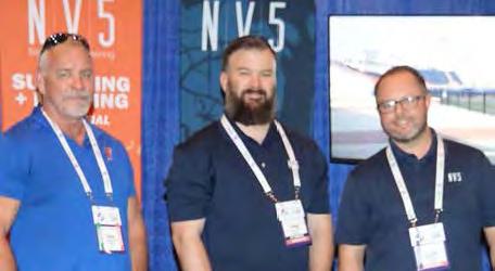
NV5
NV5 is a leading provider of technology, conformity assessment, and consulting solutions for public and private sector clients supporting infrastructure, utility, and building assets and systems. The Company primarily focuses on six business verticals: construction quality assurance, infrastructure support services, utility services, buildings & technology, environmental health sciences, and geospatial technology services. NV5 operates out of more than 100 offices nationwide and abroad, with 9 offices serving the Florida Region. NV5 is a leading provider of technology, conformity assessment, and consulting solutions for public and private sector clients supporting infrastructure, utility, and building assets and systems. The Company primarily focuses on six business verticals: construction quality assurance, infrastructure support services, utility services, buildings & technology, environmental health sciences, and geospatial technology services. NV5 operates out of more than 100 offices nationwide and abroad, with 9 offices serving the Florida Region.
SAM
For over thirty years, SAM has built a reputation as a trusted, knowledgeable, and innovative partner. Our licensed professionals transform petabytes of complex spatial data into intelligent insights in a holistic Managed Geospatial Services™ (MGS™) framework. As North America's premiere MGS™ company, SAM provides practical, precise, and highfidelity solutions designed to enhance decision-making, mitigate risks, achieve strategic objectives, and drive costs out of our client's business. Our vision is to advance spatial data acquisition, improve analysis capabilities, and develop predictive analytics to redefine and transform how infrastructure assets are developed and managed throughout their lifecycles.
EXHIBITORS
STANDARD
SURVEYORS INSTRUMENT SERVICES
Surveyors Instrument Services, LLC is a land surveyor and construction equipment supplier based in Tampa, Florida. We offer repairs, service, rentals, supplies, new and used equipment options for all of your surveying needs. Owner, Stan Denison, has 40+ years or service and expertise in the surveying and construction industry. We provide customers with superior service and a quick turnaround time. Our years of experience, knowledge, and service in the industry has allowed us to be a reputable company for our customers. The list of equipment we sell and service is extensive.
THE UNDERGROUND DETECTIVE
The Underground Detective locates private utilities using state-of-the-art equipment for all pre-excavation and site planning needs. The state one-call (811) only marks public utilities, those which are before the service meter. Any utility beyond the service meter is usually considered private, which will require a second call to The Underground Detective. Although The Underground Detective is not a licensed civil engineer or surveyor, we can map the utility locations with sub-meter accuracy and provide GPS coordinates with a shapefile and a Google Earth overlay. This valuable information can be used in your Auto CADD project, but our mapping work is to give our clients a basic overview of the project they are engaging in and help assess what to expect when designing, updating, or performing preliminary site work. We will go anywhere and have offices in Atlanta, Nashville & Johnson City,TN, Spartanburg, SC, Lakeland, FL, Cincinnati & Toledo ,OH, Chicago, St. Louis and Philadelphia. If you or your coworkers ever need any estimates in those areas, do not hesitate to contact us.
EXHIBITORS
STANDARD
Timeless Witness Post
Timeless Witness Post, a product by the makers of Timeless Fence System, is now being used as Survey Marker posts for land surveying. This groundbreaking use of Timeless Fence's products showcases the versatility and durability of Rigid PVC posts, marking a significant advancement in the field of land surveying. Traditionally, land surveyors have relied on various materials for marker posts, but Timeless Fence's Rigid PVC posts are designed to withstand the elements and the test of time, these posts are becoming an essential tool for surveyors across the nation.
VISIONARY SUBSURFACE SOLUTIONS
PRECISION BEYOND BOUNDS
FRONTIER PRECISION UNMANNED SOLUTIONS
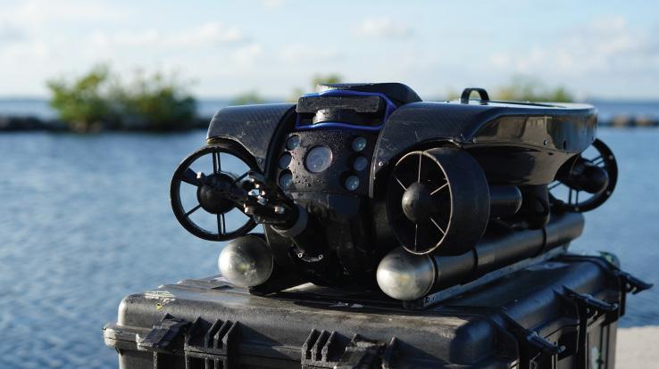
Frontier Precision has been leading the way in delivering innovative solutions – on land, air and underwater with our Unmanned technology. Now, every place on earth is reachable – with our UAS/ Drones, ROV’s, and LiDAR solutions. We help you with the latest technology to get your job done efficiently while keeping your business profitable.
UAS / DRONE DOCKS
The latest innovations in drones and docks to deliver the right product for the right UAS application.
LIDAR / SENSORS
LiDAR/Sensor solutions designed for precision data collection.
UNDERWATER ROVS
Deep Trekker’s underwater ROVs showcase proven durable and innovative solutions.
FRONTIER PRECISION | JACKSONVILLE, FL
Jordan Baranowksi | 904.855.9827 [Office] or jordanb@frontierprecision.com
FIND OUT MORE AT: www.frontierprecision.com/unmanned
EXHIBITORS GRATIS
BPSM (FDACS)
The Florida Board of Professional Surveyors and Mappers is housed within the Florida Department of Agriculture and Consumer Services (FDACS). The Board is charged with regulating surveyors and mappers, adopting rules to implement Chapter 472, F.S., and protecting the health, safety, and welfare of the public.
FAU (Florida Atlantic University)
A three-time NCEES award winner, Florida Atlantic University's Bachelor of Science degree in Geomatics Engineering is one of the state-of-the-art ABET-accredited engineering programs in the nation. The awardwinning faculty has outstanding teaching and research experience and diverse professional backgrounds. Students can collaborate with other engineering and science disciplines, such as geosciences, computer science, urban planning, and other fields. While this program prepares students for the Professional Land Surveyor (PLS) license, some students successfully pass the NCEES Fundamentals of Surveying (FS) and Fundamentals of Engineering (FE) examinations before graduating from the program.
The Florida Resources and Environmental Analysis Center (FREAC), established in 1969, is the original center within the Institute of Science and Public Affairs (ISPA) at Florida State University (FSU). FREAC professionals conduct research in the general areas of resource management and environmental analysis, as well as provide advice and technical assistance to state and local agencies. Public lands research and analysis, geographic information system development, and graphic representation of digital databases are current and long-range FREAC research interests. FREAC also trains university students in these areas through direct involvement in projects, providing real-world experiences.
UF GEOMATICS
The UF Geomatics program was established in 1973 and is the preeminent Geomatics program in Florida. Consisting of six full-time faculty members, 76 Bachelor’s degree students, 18 graduate students, and boasting two remote educational facilities in Ft. Lauderdale and Plant City, it has become the premier and leading resource for students seeking a degree in Geomatics from one of the country’s most prestigious institutions. The UF Geomatics Student Association (GSA) is an active student chapter of the Florida Surveying & Mapping Society (FSMS) and has been a regular exhibitor at their Annual Conference for many years, providing GSA members the opportunity to interact with FSMS members, gain inspiration and professional Awareness, as well as increase visibility of the GSA and UF Geomatics program to prospective students.
SPONSORS
Exhibitor Reception Trimble
Room Keys Hyatt Survey
Recognition Banquet KEITH
Recognition Banquet
$1,700
Sponsorship Opportunities
Refreshment Breaks (Company Name & Logo on Signage at All Seminar Refreshment Breaks along with a Full-Page Ad in The Florida Surveyor.)
$1,700
Registration Desk & Signs (Company Name & Logo on Conference Welcome Banner located at the Registration Desk. Assists with Conference Sign expenses.)
* $1,500 *O nly 1 Sponsorship Available! Back Cover of Conference Program Book (Company Name, Logo or Ad placed on Back Cover of Conf. Program Book given to Attendees.)
$1,500
Banquet Door Prizes (Sponsorship of Prizes given at Recognition Banquet along with Company Name & Logo on Signage During Banquet.)
$1,500
Exhibit Hall Breakfast (Company Name & Logo on Signage during Friday morning Exhibitors Breakfast. Assists with Breakfast Expenses.)
$1,500
Legislative Reception (Company Name & Logo on Signage at Reception. Sponsorship assists with Speaker and Reception expenses.)
$1,200
Exhibit Hall Door Prizes (Company Name & Logo on Signage during Friday's Exhibit Hall Event, in addition to being Recognized during Raffle as a Sponsor.)
$1,200
Exhibit Hall Luncheon (Company Name & Logo on Signage during Friday's Exhibitors Luncheon. Assists with Lunch Expenses.)
$1,200
SIT Test Prep (Company Name & Logo on Signage outside of classroom.)
$1,000
Cornhole Tournament (Company Name & Logo on Signage during Wed. Cornhole Tournament.)
$1,000
Exhibitor Welcome Bags (Company Name & Logo on Conference Exhibitor Welcome Bags).
$1,000
Fishing Tourney/Trip (Company Name & Logo on Signage. Assists with Food, Drinks, & expenses.)
SPONSORS
Lanyards SAM
Name Badges GPI
Conference Tote Bags LANGAN Welcome
$1,000
Sponsorship Opportunities
Golf Tournament (Company Name and Logo on Signage. Assists with Food, Beverage, and Prize costs.)
* $1,000 *O nly 1 Sponsorship Available!
Inside Front Cover of Conference Program Book (Company Name, Logo or Ad placed Inside the Front Cover of the Conference Program Book.)
$800
Exhibit Hall Luncheon Cash Bar (Company Name & Logo on Signage at 1 Cash Bar serving Beer & Soda during the Friday Exhibit Hall Luncheon. Includes 4 Complimentary Drink Tickets.)
* $800 *O nly 1 Sponsorship Available!
Inside Back Cover of Conference Program Book (Company Name, Logo or Ad placed Inside the Back Cover of the Conference Program Book.)
$750
CST Exams (Company Name & Logo on Signage before & during Exam.)
$700
General Business Session (Company Name & Logo on Signage at & during Conference GBS.)
$500
Exhibitor Beverage Break (Company Name & Logo on Signage at Exhibitor Afternoon Beverage Break in the Exhibit Hall.)
$500
Registration Packets (Company Name & Logo on Registration Packets given to All Attendees.)
$500
Saturday Seminar Refreshments (Company Name & Logo on Signage during Saturday's Seminar Refreshments Break.)
$500
Saturday Seminar Sponsor (Company Name & Logo on Signage at Sat. Seminar of your choice.)
$500
Young Surveyors Event (Sponsorship of Special Activity for the Young Surveyors Network.)
$300
SOLD out
General Sponsor (Half-Page Ad in The Florida Surveyor.)
Players will play on the Black Course. Opened in 2001, this course plays to a par of 72 and features five sets of tees.
The Black Course can play up to 6,949 yards from the championship tees. The Tiburon Black Course has been hosting the PGA Tour champions Chubb Classic since 2022.
• Four-Person Scramble
• Prizes for Closest to Pin
• Prizes for Longest Drive
• Prizes for Longest Putt REGISTRATION
$150/PERSON
$600/TEAM
I Should Have Been a Land Surveyor
and
Forts, Ports, Canals, Wars
An Uncommon History of Tallahassee & Surrounding Areas
by Dr. Joe Knetsch
Introduction
There are many ways to introduce a collection of articles, papers and presentations but the most effective is the straightforward approach. This collection represents a number of different facets of life and living in the Red Hills area of northcentral Florida, i.e. Leon, Gadsden, Wakulla and surrounding counties. They are organized in chronological order not in the order in which I wrote them but in their historical context. I first became interested in the area’s colorful history by working next to the late William (Bill) Rogers who was one of the first professors I got to know at Florida State University simply because we shared a passion for primary research and a good story. We often worked elbow to elbow in the basement of Strozier Library from eight in the morning until one of us had class or had to teach one. From these chance encounters to being asked to present a paper to the Tallahassee Historical Society (i.e. often known in those days as the “Bill Rogers Fan Club”, out of respect) came an interest in local history that I carried up from one of my bases in Broward County where I served on the Broward Historical Commission. My belief that all history is local was reinforced by my contact with Dr. Rogers and convinced me that good primary research makes it come alive. Hence, each of the chapters that follow are based upon primary research and hopefully they will come alive for you.
Some of the chapters stem from research I conducted for the State in my job as historian for the Division of State Lands, Florida Department of Environmental Protection. When I first went to work there in 1986,
it was the Department of Natural Resources. I began as an OPS (Other Personnel Services, although we had other versions for the title) working at the princely sum of four dollars per hour. By 1987, I was working in the Division of State Lands (then the staff for the Governor and Cabinet sitting as the Trustees of the Internal Improvement Fund) assisting surveyors and the legal staff researching navigable waters, history of department policies, and becoming an expert witness on these issues. In that job, like in the writings that follow, I could only use primary documents to present to the staff attorneys or to testify to in court. Other historian’s opinions were treated as “hearsay” and not admissible as evidence. My working mindset became locked on this view of the world and it has not changed. The lead piece on the life of Surveyor General Robert Butler, came from my interest in the powers of that office and the need to write a justification of a proposed historical marker on Colonel Butler’s gravesite, sponsored by the local professional surveyors’ society chapter. He proved to be more fascinating with each piece of research I uncovered, even when he may have abused his power on behalf of partisan politics. Like most of the chapters in this book, there are references to the sources of information used, however this is not true of all chapters herein. In some cases, the publication in which they appeared did not want endnotes or footnotes included. With the papers, many were for popular consumption and having had enough of my research taken and sold without permission or profit I decided nor to include the sources in the text but you can rest assured all are based upon solid, primary sources.
Because of the job and all that it entailed, I became very interested in internal improvements and the surveying profession. Although the piece on road building was intended for genealogists and appeared in three parts when published, it covers a form of internal improvements that is often neglected or simply assumed by other historians and researchers. When looked at as simply a passage way between places it is somewhat dull, however, as an improvement and leadership training ground for those supervising the construction, as noted in the chapter, one has a new respect for the simple roads. Looked at as an economic boon by lowering the costs of transportation of goods it has another facet often
Forts, Ports, Canals, and Wars
overlooked. Seen as a nexus of roadways connecting hubs of transportation and production centers, roads become even more important to the development of any given area. Add to this the names of the historical figures involved in the construction process, and now you have put meat on the bones of simple roadways and those who lived along, built and maintained and used these arteries of commerce and communication. Much can be said about the canal boom that had a great impact on the area in the 1830s-50s, even though few were completed and used in this region. The investors in this type of improvement were all the “movers and shakers” of the community. Seeing their schemes and dreams adds even more to the humanizing of the story.
Surveyors too, had/have a vital role in the development of the commu nity and I have included here a number of pieces related directly to the survey of the Forbes Purchase. The main reason is simple, all property titles derive from the surveys done by our pioneer surveyors. Not all were successful in their quest for profit and perfection. The failure of Charles Goldborough’s attempt to survey the exterior line of the grant is a case in point. The follow-up piece on Robert Ker’s successful survey shows the persistence needed to do good work. Florida has had the good fortune to have a number of very fine, accurate surveyors in its history, including the great Henry Washington, a distant relative of the first president. Yes, as in all professions, there were a few “clunkers” but by and large, they were a stout, honest and fairly accurate group of men. It also demonstrates the difficulties such a job entails on the wild frontier of Florida (and most other frontiers world-wide).
One of the few pieces I have been asked to present on more than one occasion is the paper on the salt in the Civil War. Here, primary research again throws into doubt the claim by Governor John Milton that speculators were trying to monopolize the salt-making areas along the coasts of Florida and charging extremely high prices to those not fortunate enough to live near the coast but in great need of salt as a preservative of meats and fish. Land records proved that this was more political scape-goating than actual fact. Indeed, the state allowed salt-makers from Georgia and
Alabama to come to Florida and produce salt for their own consumption or sale to the Confederacy. I normally have always tried to follow my own rule of not presenting a paper twice but as this was upon requests from the organizations to whom I presented, it was one of the rare times in my life that I did not force myself to research and write another paper on the same topic.
The post Civil War era is covered by two major essays, one of which has never seen the printed page and the other is the early draft of a chapter on William Dunnington Bloxham which was expanded for publication in a forthcoming book on Florida’s governors. The chapter on the “Floral City of the Flowery South” is as close as I ever attempted to get in presenting a Bill Rogers style paper. It is fun and serious at the same time showing the growth and development of Tallahassee in the 1880s. It stands on its own as one of the few papers done on this time period in our history and has a different, mostly non-political approach to this crucial era. Again it emphasizes the importance of transportation in the development of any given area and discusses the attempt to improve the accessibility of the state capital to the rest of the state, something we still contend with to this day. Bloxham’s chapter delves into the way in which he helped to get the state back on its feet via the Disston Purchase, one of the more controversial moves by any governor in the state’s history. Note, this Purchase was completed in 1881, none of the great railroad developers, i.e. Flagler, Plant or Chipley had built any roads in the state. The answer to the obvious question is in the chapter.
I have included two chapters devoted to the First and Second World War and the impact they had on Tallahassee. These are part of the story of the area that cannot be ignored and still are important in that the city grew in many ways because of them. Dale Mabry Field is the most obvious, yet most people do not realize that it is named for a First World War hero. Much of it is now part of Tallahassee Community College’s campus but other legacies exist from this base. Racial segregation is duly noted in both essays and both wars, in their own way, led to change along these lines, if not as apparent as the bus boycott or sit-ins of the 1960s. I chose not to
NEW AND USED EQUIPMENT
CALIBRATION AND REPAIR RENTALS SUPPLIES
DATA COLLECTORS
TOTAL STATIONS
GNSS UNITS AUTO LEVELS
include the essays I have published on the appearance of the Rough Riders in Tallahassee during the Spanish-American War nor the piece I did in the book on the Cuban Missile Crisis featuring Governor Bryant’s leadership in Civil Defense. Both of these essays are in two other books in which I collaborated with my friend and colleague Nick Wynne. One earlier essay I include here is that on the Second Seminole War through the eyes of Captain Samuel Heintzleman who served in the Quartermaster’s Corps here during that tragic and brutal war. Heintzleman’s views are very personal and come straight from his papers in the Library of Congress. He proves once and for all, gossip is not the sole prevue of the females of the species.
Two of the more joyful essays are those involving the attempt (not the first) to make Tallahassee a port dry. The other on the expansion of the Capital Center, is a good introduction to the changes that went on in the project to expand the government’s facilities and modernize the state’s ability to handle new problems. Both were researched directly from the “Vault” information at DEP and are here presented in print for those who want to see just what happened and who was involved at that time. The reasoning behind the port project was similar to many such projects in the immediate post-war period, putting people to work and improving transportation. We have to remember that Florida, like the rest of the nation, had experienced the impact of the Great Depression and did not have the resources to pull itself out without outside help, i.e. the Federal Government. The fear was that there would not be well paying jobs for the men when they returned from war and this would be a temporary stop-gap project with possible long-term benefits, if completed the way the backers envisioned it. Luckily, it failed to receive enough political support in Washington. On the other side, we can still see the benefits of the Capital Center Project and it did serve its purpose well. They were both fun researching and writing and it is hoped you will enjoy them too.
There are a few other essays included to spice up the offering in this volume. When putting together a volume like this, space and costs become involved and hence, tough decisions have to be made. In this case, some of the essays/papers I have done in the past are not included. There are Dr. Joe
Forts, Ports, Canals, and Wars
a couple that lack endnotes, as explained earlier. However, I trust you will see the value and entertainment in these essays and papers and enjoy reading them as much as I did researching and writing them. With that said, read on …
CHAPTER 1
A Brief Life of Robert Butler: Surveyor General of Florida
Featured in The Florida Surveyor – October 2023 from Faces on the Frontier: Florida Surveyors and Developers in the 19th Century
(Click Here to Read )
Road construction in the early years of Leon County was difficult and costly
(State Library and Archives of Florida)
CHAPTER
2
Road Builders of Early Leon County: A Study in Early Court Records
Originally published in The Tallahassee Geneology, November 1994, February and May, 1995
Early 1820s court records in Leon County give an indication of the difficulty of settling on the rugged frontier of Northern Florida. The early settlers had to organize every facet of their lives from the planting of crops to the building of the roads to get those crops to market. This was time consuming, labor intensive and required a level of cooperation that often crossed personal likes and dislikes. The sense of community gained by these excercises made the tasks seem easier and brought many people from all walks of life together for the common good. On the early frontier, this sense of oneness often meant the difference between life and death.
Although the City of Tallahassee was laid out in 1824 by Colonel Robert Butler and others, the roads connecting the various villages, settlements, etc. in the outlying regions were another matter. Some parts of the county had been surveyed in 1825 by the federal land surveyors, however, not all of the county had this advantage. This meant that surveys conducted for the purpose of road construction were not tied into an established system of land surveying. The old landmark system of metes and bounds, familiar to many of the early settlers from the old colonies, was often employed to designate the roads right-of-way. The other frequently used method was to simply follow the paths used by the local native American population. These “systems” were not always compatible with each other, however, on the frontier, whatever was the most practicable was often the method adopted.
TRANSCRIPTIONS
For April 2, 1825: “Ordered that the following persons be appointed Commissioners to superintend the building the roads of the County of Leon and recieve the same from the Contractor when finished to Wit, A. M. COLEMAN, Cromwell SPRAGUE and Wm. WYATT,
Forts, Ports, Canals, and Wars
and the Clerk notify them of this appointment. Ordered that the following persons be added to the road Commis sioners to wit … Thos. M. BRADFORD and [?] CARUTHERS. And Ordered further that the members of this Court be added to the Commission but are not to receive any compensation for their services … Ordered that the Road Commissioners meet on Wednesday next for the purpose of organization. Ordered that the Court adjourn to the Clerk’s office this evening at 7 O’ Clock. (Signed) A. GORDEN Clk p.t.” This document indicates the names of the people and gives the date for the first organi zation of the Road Commission, both very important historical facts. It also notes that the members of the court would also serve on the commission, though without pay.
Also from 1825 [the date was illegible] comes the following:
“Ordered that John EDWARDS, Neadham BRYANT & John TURNER be appointed Commissioners to lay off a road from the Georgia line at or near the point on the line between Georgia and Florida from the Commissioners of Thomas County, Georgia have located a road from that County to use the nearest and least ground to St. Marks. Ordered that Stephen TOWNSEND, Edmund GRAY & Lewis SMITH be appointed Commissioners to lay off a road from the Georgia line at or near the point on the line between Georgia and Florida where the Commissioners of Bevin County have located a road from that County seat over the nearest and best ground to St. Marks.”
The above document was succeeded, a few sessions later by the following:
“Present as before, David B. MACOMB Judge and Van EVOUR and Robert D. GEROULMAN Justices of the Peace. John D. EDWARDS from the Board of Commissioners to lay off the road from Thomas County, Georgia to St. Marks made report in the words following viz. We the Commissioners to lay off a road from the Georgia line in Thomas County to St. Marks by the nearest and best route down the west side of the Mickasookey Lake commenced in range three Township three in fractional section fifteen and intersected the
road bending down the east side of the Lake in section twenty two Range three and Town ship Two and from thence down said road to St. Marks. (signed) J. D. EDWARDS, John TURNER which were appointed by the Court and thereupon Ellis BURNEY, John D. EDWARDS and Richard C. RANDELL were appointed overseers and surveyors of said road.
Ordered that Willis BURNEY, Paul McCORMICK and Morris ELLIS be appointed a board of Commissioners to select and lay out a road from the west side of the Mickasookey Lake to commence at the most eligible point on the Thomas and St. Marks road the nearest and best rout to Tallahassee.
Ordered the Henry F. SIMMONS, John METHENA and Drury[?) VICKERS be appointed overseers and surveyors to straighten the road leading from Tallahassee to Vickers Ferry.”
These documents clearly point out the ad hoc nature of the road commissions and the fact that their personnel shifted very often. Qualified surveyors being a premium on the frontier, this shifting is understandable.
Another typical document (again the date is illegible) showed that the road to St. Marks from Tallahassee was, in 1826, layed out along the line of the Prime Merifian. In the words of the commissioners:
“We finally received from the office of the Surveyor General the [illegible word] of a line direct from the centre of the capital to St. Marks the line bears from a true Meridian South 12, 20 East this course we pursued to St. Marks without any variation and struck to the west of St. Marks eight yards.” This report was signed by W C. CAMPBELL, James CAMERON and Thomas H. CHAMBERLAIN.
Once this survey was completed, the road overseers and surveyors were appointed by the Court, namely Thomas H. CHAMBERLAIN, Daniel WIGGINS, Netherland [?] HAMBLIN, J. G. SEARCY and James CAMERON. Justice of the Peace, Robert D. GEROULMAN was designated to lay out the road and “apportion the persons subject to work thereon.” Dr. Joe Knetsch
This last phrase indicates that persons along the route, normally, were assigned work tasks in road construction and maintenance. This was often done as a labor “tax” or in lieu of such a levy.
In 1827, another example of how roads were layed off and constructed in the Territorial period comes to light.
Ordered that the report of commissioners appointed to examine the route of a road from the City of Tallahassee to Vickers ferry commencing at the north end of Adams Street running thence North forty two degrees West to the south west arm of Lake Jackson Section 5 Township 1 Range 1 North and West thence running north 25 degrees West to Vickers ferry be received and that Ordered that Ambrose CRANE a justice of the peace residing within the limits of the first district be appointed to lay off the several roads there into road districts.
For the first time, road districts become an item of concern and appointments in the minutes of the county court.
A final example, for this edition, comes from late 1827, and gives us a view of the northwest roads begun in the county.
The commissioners heretofore appointed to survey and mark out the road from Tallahassee to the Georgia line near Iamonia reported that they had performed the duty and marked out the following described road from commenced on the Georgia line where the Coffee road intersects and persues a south west direction to the slues on the Iamonia from thence a South East direction to a mill below Crooked Creek, thence a south west course to the Meridian line to Whiteheads plantations thence down the saud line by Hackleys plantations to the north end of Monroe Street Tallahassee.
Road construction in the early years of Leon County was difficult and costly. The frontier conditions of the area meant that necessary labor was lacking regardless of the system of slavery. Slave labor, if used for road building, drew workers from their tasks needed to maintain the plantations
of the territory. While slave labor was one of the primary sources of manual work on the roads, it may not have predominated as the major source of construction. The costs of using slave or free labor on the frontier was high simply because it did divert resources from other types of work required for economic expansion.
Construction methods used in the beginning stages of the Territory were crude and time consuming. The first tasks included the cutting and removal of trees or stumps from the right of way. If all of the trees were removed (and they often were cut short and left in the roadway) the grading of the road surface required the use of heavy physical labor by man and beast. Tools used to do this job were often inadequate for the relatively primitive conditions of the vicinity and often broke while in use. Getting adequate fill material was often difficult and costly, especially if gravel were to be used. Ditch digging, for the purpose of drainage, took time and labor by all concerned. Finally, if a marshy or wet area had to corduroyed, that is, filled with dirt and logs, the additional labor required made the task that much more expensive in time and money.
With all this known, it is important to understand that the key to good roads was in the initial survey of the route. If the surveyor(s) could avoid the morasses, marshes and other difficult areas, the costs, in time and money, were greatly reduced. Thus the court minutes, from which these articles have been taken, allow us to see the names of those capable men who were responsible for the surveying and maintenance of our early road system in Leon County. These are the names of those hardy pioneers who took an active and positive role in the community when the whole region relied upon their efforts to grow and prosper. Those men in the district and who surveyed the routes and oversaw the construction deserve our recognition. We should never forget that many of these early roads are the basis for our present roads and, in some cases, almost identical to our modern streets and highways.
TRANSCRIPTIONS
From the microfilm, “Leon County Court Minutes: 1825-1833.”
State Library of Florida, Dodd Room, Tallahassee, Florida
For October 11, 1827:
Ordered that the road now leading from the Fauchata Slough by John HEAVIS, George FISHER and Angus JOHNSON planters to Tallahassee, be and the same is hereby declared to be a public road.
Ordered that the said road be divided into two overseers for the districts and whereof Daniel O CANE is Northern district and John L. VICKERS appointed overseer of the Southern district.
Ordered that John HEAVIS, J.P. take on himself the appointment of the bands in the Northern District of said road and Angus JOHNSON, J. P. charged with the same duty in the Southern district of the same road.
Ordered that the road now laid off between Tallahassee and Rock Haven Commencing at the half mile post on the Maridian [sic] south from Tallahassee and thence in a direct course to the said Rock Haven as now marked and cut out be and the same is hereby declared a public road.
Ordered that the Rock Haven road be divided into two districts in equal divisions as follows the N. W. & S. E. John McIVER is appointed Overseer for the N. W. division and E. HOWARD is appointed overseer for the S. East District. WILLIAMS, J.P. is charged with the duty of apportioning the hands on said road.
Ordered that John D. EDWARDS, Paul McCORMICK, Archibal MILLS & Richard WALKER be appointed Commissioners to survey and mark out a road commencing at the head of the W. prong of the Mickosukee at the ford of dry Creek. Thence the nearest and best route to Rock Haven.
Ordered that Jessee HINES, Champion RODES, William C. CAMPBELL & Benj TENNILLE be and they are hereby appointed Commissioners to survey and mark out a road from the City of Tallahassee to ELLISes Ferry the nearest & best route and report thereon at or before the January Term of this Court.
At another October 1827 meeting of the Court, the following entry appears:
Forts, Ports, Canals, and Wars
Ordered that the petition of Augustus STEELE and sundry others Inhabitants of Leon County praying for a public road to be opened from the Ocklockney River ar or near the mouth of Rocky Comfort in as a direct a course as practicable to the Town of Magnolia on the River St. Marks be and the same is hereby granted and that John ADDISON, Augustus STEELE, L. M. ROBINSON & Benjamin TENNILLE be & they are hereby appointed commissioners to lay off & mark said road.
By September 19, 1828, the road building of Leon County was in fill bloom and nearly every meeting of the court had more road work than actual case work. The following is an illustration of this duty of the Court:
James COMKRON is appointed overseer of the road leading from Tallahassee to St. Marks and it is Ordered that he with the lands apportloned by Turnbull R. BETTON, Esqr. the Justice designated for that purpose, do forthwith Clean and Keep the same in repair according to Law.
Ordered that the Commissioners heretofore appointed to mark a route for a road from Thomas County road on the Georgia line to St. Marks, have leave to make their report at the next Term, And have further leave to go to Magnolia instead of St. Marks and that Arthur BURNEY be & he is hereby appointed Commissioner in the place of John FARMER, resigned And also that the present County surveyor R. LESTER be added to the said Commissioners. And they are directed to extend said road to Rockhaven if practicable.
Turnbull R. BETTON is designated as the Justice of the peace to apportion the hands on the Tallahassee end of the road, leading from Dry Creek to Tallahassee and Samuel B. SKAGGS as the Justice for the same purpose on the Dry Creek end of same road.
Ordered that Christopher C. WILLIAMS, John W. LENNUS, and William CAMERON, be and they are hereby appointed Commissioners on the part of this County to act in Concert with Commis sioners to be appointed by the County Court of Gadsden to
receive subscriptions, and to lacate and build a free bridge across the Ocklockny river on the most direct rout from Tallahassee to Quincy.
Jeremiah POWELL is appointed overseer of the Federal road leading from Ben CHAIRES plantation to the County line east, And It is ordered that he with the hands to be apportioned by James WILLIAMS Esqr. the Justice designated for that purpose, do forthwith clean and keep the same in repair according to Law.
Ordered that Pilariah WHITEHURST be and he is hereby appointed overseer of the road whereof John McIVER was late overseer, And that he with the hands to be apportioned by James WILLIAMS Esqr. the Justice designated for that purpose do forthwith Clean and Keep the same in repair according to Law.
John COOK is appointed overseer of the Tallahassee end of the road leading from Mannings to Tallahassee and it is ordered that he with the hands to be apportioned by John REAVIS, the Justice desig nated for that purpose do forth-with Clean and Keep the same in repair according to Law.
John Y. GAREY is designated as the Justice of the peace to apportion the hands on the Tallahassee end of the road leading from Tallahassee to the Iamonia Lake.
Ordered that James SCOTT, William HOLLINGSWORTH and Arthur BURNEY mark & lay off a route for a road from the Mikasukee lake near the plantation of Richard PARISH to the Big pond and make report thereof to this Court.
Nathaniel HAMLIN is appointed overseer of the Magnolia end of the road leading from Magnolia to the Ocklockney opposite the mouth of Rocky Comfort. It is Ordered the [sic] he with the hands to be apportioned by Hugh S. CAMPBELEL Esqr. the Justice designated for that purpose do forthwith Clean and Keep the same in repair according to Law.
John CARUTHERS is appointed Overseer of the Tallahassee end of the
Forts, Ports, Canals, and Wars
road leading from Tallahassee to the Iamonia Lake & It is Ordered that he with the hands to be apportioned by John Y. GAREY the Justice designated for that purpose, to forthwith Clean and Keep the same in repair according to Law.
After this exhausting list of appointments for road work, and this is not the complete listing, the next busy session of the Court came on March 24, 1829. The following appointments are from this date:
Ordered That Frederic WEEDON, Henry F. SIMMONS and William MONROE be appointed overseers of the road leading from Tallahassee to Fishers Ferry on the Ocklockney River. Weedon on the South End, Simmons on the Middle, and Monroe on the Northern End. And that John Y. GAREY be designated as the Justice of the Peace in the 2nd District and John REAVIS as the Justice of the Peace in the 4th District, to apportion the hands on said road.
Ordered That John D. PARISH be appointed Overseer of the road leading from the ford of the Micasuky Lake through the Long Pond to the old Tallahassee road - And that Samuel B. SKAGGS be designated as the Justice of the Peace to apportion the hands on said Road.
Ordered That Henry LONG, Richard WALKER and Asa McCAY be appointed overseers of the road leading from Thomas County Georgia to Magnolia. Long on the north end, Walker on the Middle part, and Mccay on the South End. Frand DAWKINS, Nearniah TILTON, and Robert LARKINS be designated as the Justices of the Peace in their Several Districts to apportion the hands on said Road.
Ordered That Pilitiah WHITEHURST, Samuel ALLIGOOD, and Timothy McCARTY be appointed overseers of the road Leading from Tallahassee to St. Marks. Whitehurst on the North End, Alligood on the Middle part, and McCarty on the South End; And that Turnbull R. BETTON be designated as the Justice of the Peace to apportion the hands on said Road.
From the above citations to the Court Minutes, it can be seen that
Forts, Ports, Canals, and Wars
the leadership of the community was well represented in the road building endeavor.
Earlier in this article, the discussions centered around the surveying of the routes for the early roads and the problems of getting them constructed on the Florida frontier. This portion will concentrate on the legal responsi iliries of road building and maintenance in early Leon County. It will focus on the roles of the Justice of the Peace, an important officer in the Territorial Period, and that of the overseers of the road districts. These officials were responsible for the gathering of the forces to build the road, assuring that the route was satisfactory and guaranteeing its maintenance, even in extreme circumstances. In a frontier community, such as Leon County, these functions could mean the difference between profit or loss, success or failure and, maybe, between life and death. While roads were the lifeblood of commerce, they were also the means of saving or delivering life. Therefore, the creation and maintenance of roadways was crucial to the development of the Florida frontier.
The first laws of the Territory concerning roads passed in 1824 and noted that roads already established “or hereafter to be established” by the county courts were declared to be public roads. Roads were to be laid out by orders of the courts in each county when it was deemed necessary to do so, or these could be abandoned if they were found to be “useless, burthensome, and inconvenient.” The main factors in determining the routes would be, “the nearest and most practicable route, and to the greatest ease and convenience of the inhabitants and as little as may be to the prejudice of any person or persons.” The process of laying out of the road was given to the “road commissioners” who were then to make a return to the court at its next setting. If approved and no objections were raised, the court ordered the Justice of the Peace to lay off the road into convenient “road districts” and apportion the labor to be used in the construction of the roadway. The court would then appoint the overseer and the Justice of the Peace to supervise the final construction and make sure that the road met the specifications of the law.
The actual road, as per the law of 1824, was to be twenty feet wide with overhanging limbs and branches cleared for carriages and horsemen.
The stumps in the right-of-way had to be cut to no more than twelve inches above ground or totally removed when practicable. All bridges and causeways made over small streams and swamps made in the corduroy fashion. As the law stated: “ ... and the materials wherewith the same, shall be made, may be taken from any land most convenient to such causeways or bridges, and shall be laid across the road and be at least twelve feet long, well secured and made fast and covered with earth.” This law goes contrary to some of the reported widths of the roads in the Territorial period.
Those subject to be called upon to perform the actual construction of the road make an interesting contrast. In the law of 1824, the age group to be called to duty was limited to all white males between the ages of sixteen and forty-five and all able bodied male black slaves, no age given. The residency requirement for the call up was ninety days. In an amendment to this act passed in the 1829 session of the Legislature, the requirements read very differently:
That all able-bodied free white males between the ages of eighteen and fifty years, residents for twenty days in any county of this Territory, and all able bodied male slaves, free negroes and mullatoes, from sixteen to fifty, residents of the aforesaid, shall be subject to work on public roads and highways, in such county.
The requirement for “free negroes and mulattoes” was something new and documents the growth of these two groups in the early development of Leon County. Work requirements could be commuted by the providing of teams, wagons, or “other necessary implements” for the construction or repair of the roads. This requirement does not, in the language of the law, exclude slaves, free negroes or mulattoes from the ability to have their work requirement commuted, either by their owners or others who had a claim on their labor during the time necessary to do the community’s road work.
The laws also noted the penalty for creating obstructions to the roads. The most notable “crime” listed in these obstructions was the building of a fence across the pathway or felling of a tree into the road. A fine of twenty dollars could be assessed against anyone guilty of
Forts, Ports, Canals, and Wars
obstructing a public road. This was done through the issuance of a warrant against such persons issued by any Justice of the Peace. The road overseer was responsible for the removal of all such obstructions. If these officers did not do their assigned Jury, fines were levied against the overseers, Justices of the Peace and road commissioners. The concept of responsibility in the form of fines, was a very important deterrent to shirking duty in the Territorial Period. Such penalties also provided for the funding of road projects and obstruction removal.
The County Court had the responsibility to order the construction, repair and laying out of the roads. It also had the duty to issue orders for the construction and repair of bridges. Additionally, it had the power to license ferries across the waterbodies of the area. The County Court also set the rates for these ferries and the cost of such licenses needed to operate these conveyances.
The final amount of time required for the construction of roads and bridges was set forth by the 1832 amendment. In the exact language of this legislation:
“That the road duty, which hereafter may be required of the citizens of this Territory, shall not exceed four working days at a time, or more than eight days in one year: Provided, however, that if, at any time, there be trees or other obstructions blown across any public road, in this Territory, or from incessant rain, some small bridge or causeway be washed away, the overseer of said road be authorised, and he is hereby required, as soon as may be expedient, to callout a sufficient number of road hands most convenient, and proceed to repair or remove said obstructions, and he shall at the next general road working, exempt the said hands as many days as they actually engaged in making said repairs or removing said obstructions.”
In the terms of today, these emergency requirements gave the workers “comp time” for their efforts.
It can be seen from the above summation of the two road laws (1824 and 1832) that much was expected from the local community in taking
the responsibility for road construction and repair. It also gives us an idea as to the importance of the officers involved in their building and repair. The Justices of the Peace, the overseers, the road commissioners and the County Court officers all played vital roles in the making of a viable infrastructure for the movement of goods and people to markets and other necessary destinations. It is from the work of these pioneers that we get the beginnings of a transportation system that extended throughout the Territory and allowed for better communication between the different parts of Florida. Without such efforts, the growth of the state would have been significantly different.
TRANSCRIPTIONS
From the microfilm, “Leon County Court Minutes: 1825-1833.”
State Library of Florida, Dodd Room, Tallahassee, Florida
From the County Court Minutes for March 24, 1829, comes the following:
Ordered That Edward KLEIN be appointed Overseer of the road leading from Magnolia to Ashton’s Mill, And that Robert LARKIN be designated the Justice of the Peace, to apportion the lands on said road. A report of the commissioners appointed to layoff a route for a direct road from the town of Magnolia to the City of Tallahassee was presented, And it is ordered that so much thereof be adopted as brings said road thirteen miles from Magnolia, and that the other part be not received.
And it is further ordered, that the said Commissioners George HAMLEN and Lewis ALLIGOOD, do join said road From the said thirteenth mile to the road from Tallahassee to St. Marks, at the thirteenth Section of Townsnip one, Range one South & East and make report thereof at the next term of this Court.
Ordered, That Joshua BYRD, John D. EDWARDS and John FARMER, be appointed Commissioners to layoff and mark a road from the North East Prong of the Micasukey Lake commencing at Dry Creek and running down the side of said Lake (as near as practicable) so as
Forts, Ports, Canals, and Wars
to intersect the road leading from Monticello to Magnolia, at or near Col. BAYLEY’s Mill.
Ordered, That Daniel GARNETT, James H. WEST and John W. LEVINIUS be appointed Commissioners to survey and layoff a route for a road, commencing at Monday’s ferry on the Ockolockney River and running so as to intersect the road on the West side of Lake Jackson leading to Tallahassee, and make report thereof to the next term of this Court.
Ordered that Jason BRINSON, Virgil VIVIAN and William R. WARD, be appointed Commissioners to survey and layoff a route for a road, commencing at the Wakulla River opposite Fort St. Marks, running by way of Green’s to Ashton’s Mill upon the Ockolockoney River, and making report thereof to this Court at the next term.
Ordered That David DAVIDSON be appointed overseer of the road leading from the long Pond to Tallahassee, and that Nehemiah TILTON be designated as the Justice of the Peace, to apportion the hands on said road, and that the said overseer with the same do forthwith clear and keep the said Road in repair according to law. (This may be dated March 23, 1829, and not the 24th).
At the September 29, 1829, term of the County Court the following entries were among the many dealing with the subject of roads:
Ordered that Simeon DAVIS be appointed overseer of the south end of the Meridian line Road from Tallahassee to the Georgia line, and it is further ordered that Justice GAREY be designated to apportion the hands to work said Road.
Ordered That William G. PONDER, Joseph SREWART, John C. BROWN, Henry B. BRADFORD and Eli LESTER be appointed Commissioners to straighten the Thomasville road from the fork near Jacob HORGIN’s house to Tallahassee,
And it is further ordered that William G. PONDER be appointed Overseer of said Road in the place of Daniel O. CANE.
Ordered that the report of James W. WEST and John W. LEVINIUS who were appointed by the Court at the last term to layout and mark a road from the West side of Lake Jackson to MUNDY’S ferry (now BAGGS’ bridge) over the Ochlockney river be received, and that the road from the Iamonia Slough uniting with the above road be and the said is hereby declared a public road.
And it is further ordered that John W. LEVINIUS be and he is hereby appointed Overseer over both roads, And that Justice HANDLY be designated to apportion the hands to work the same.
Upon the motion and petition of John S. TAYLOR it is Ordered that the Magnolia road and road from Long Pond to Tallahassee be altered according to the prayer of said Petition.
The Commissioners appointed to layout a road from the Federal road to Magnolia returned this day made their report, which was received and Ordered to be filed, And it is further ordered that Tom Peter CHAIRES be appointed overseer of said road. The Report of the commissioners appointed by Justice TILTON to lay out a neighborhood road for the benefit of E. R. GIBSON was received and approved, and the said road is hereby declared to be a public highway.
Ordered that John CARR, Alexander CAMERON and Zachariah FORT be appointed to shorten the road from ASHTON’s Mill to Magnolia.
A year later, on September 28, 1830, the following is entered:
Upon the report of Willis BURNEY, John W BROCK and Robert T. C. TUCKER who were appointed at the last term of this Court on the application of Wesley TAYLOR to examine the road from Thomasville to Magnolia and report whether it was expedient to change the direction of the same, It is ordered that the road be altered according to the prayer of the petition of the said Wesley TAYLOR.
Ordered That Joseph BANNERMAN be appointed overseer of the north end of the Meridian line road near the Georgia line, and that Nathaniel BRYAN apportion the hands on the same.
Forts, Ports, Canals, and Wars
These examples of the road commissioners, Justices of the Peace and overseers, are meant to give the readers an idea of the rich record left by the County Court in its capacity of designator of road right-of-way and construction. This is not meant to be an exhaustive search in these records or total transcription of the complete record, however, it should give everyone glimpse of the life and needs of an earlier time in Leon County’s history and help to trace some of the early residents who accepted the responsibility for the construction and maintenance of the newly created road system ofTerritorial Leon County. May these records of our ancestor’s struggle to bring order out of the frontier chaos be fruitful to those searching for a useable past.
Dr. Joe Knetsch is the author of over two hundred articles and eleven books concerning the state of Florida’s history. Three of these books involve the Seminole Wars and their impact on Florida’s development. He is also a frequent reviewer of books on military history for the Journal of America's Military Past and authored regular articles for Professional Surveyor Magazine for over a decade. For twenty-eight years he served as the historian for the Division of State Lands in the Florida Department of Environmental Protection. Dr. Knetsch lives in Tallahassee with his wife Linda and is now retired.
ARCHIVES FROM THE
SCENES IN A SURVEYOR’S LIFE ; OR
A
RECORD OF HARDSHIPS AND DANGERS ENCOUNTERED. AND AMUSING SCENES WHICH OCCURRED, IN
THE
Operations of a Party of Surveyors IN SOUTH FLORIDA .
By W. L. PERRY.
JACKSONVILLE:
C. DREW'S BOOK AND JOB PRINTING OFFICE 1859.
CHAPTER XX
AS soon as we had located the new camp in the last township but one, it became necessary to start the team for a new supply of rations.
It being the Captain ’ s wish that I should undertake the trip, I accordingly made all necessary preparation and started. It was a long road, or rather a long route, for there was no road—nothing but a dim trail that had been beaten years before by hunting parties of Indians. It was now so nearly overgrown with grass, that none but a practiced woodsman could have followed its windings. A portion of the route also lay through the woods, without even a semi-obliterated pathway to mark the way. We supposed the distance to Tampa to be about seventyfive miles, and I calculated to be absent seven days.
To enter into a minute description of the country through which I passed, and of the feeling of loneliness which oppressed me traveling alone in those wild woods, would only be an uninteresting repetition of what has already been said on the same subject. Suffice it, that the loneliness was not at all curtailed by a knowledge of the fact, that I was traveling almost entirely unprotected through a favorite hunting district of the Seminole Indians, and by recent demonstrations, such as stealing articles from our camp, burning woods in every direction, and others, that they entertained hostile feelings towards the whites, and only waited a good opportunity to raise the war-whoop, and exhume the long buried war hatchet.
In all our tramps, although we were in the midst of their favorite hunting grounds, and frequently heard the report of their fire arms, and almost daily saw their sign, we had not been able to see one of them.
On the second day after leaving camp, about ten o ’ clock, I accidentally met with a small band of them, under the following circumstances:
About an hour after coming into the old road, made some fifteen years previously, during the war with the Indians, by the transportation of troops and supplies from Fort Melon to Tampa, and which was now almost as hard to follow as the trail I had taken from the camp, I came to a thick swampy place through which the road passed. The ground being soft, the wagon made little or no noise, and on driving out into the open woods on the opposite side, I found myself in the presence of a party of about twenty Indians, of differenct ages and sexes, all seated against trees, resting themselves.
At my sudden and unexpected appearance among them, they were probably as much surprised as myself, but evidently not half so badly scared.
Knowing they had not the slightest affinity for a white man, and that I was almost completely in their power, my first impulse (I am dangerous when alarmed ) was to take up the double barrelled gun, which lay at my side in the wagon, fire into the crowd, and then trust to my heels and the thick undergrowth of the swamp for the balance. A single moment ’ s reflection, however, taught me the ridiculousness, and probably disastrous result of such a course, and I determined to pursue a different one.
The Indians, on seeing me emerge from the swamp, quickly rose from their seats and stared at me, with that peculiar sort of wild stare which can only be exhibited on an Indian ’ s countenance, expressive of indetermination whether they should run into the swamp, or remain where they were. They did the latter, and I drove boldly up into the midst of them, and stopping the ponies, alighted from the wagon and offered my hand to the nearest, a middle aged man, who appeared to be the chief of the party, which to my great relief he very readily accepted. I then went round and shook hands with the whole party, expressing to each a very affectionate “ howdy, ” which was returned by as many as could utter the word in broken english.
“ Which way from? ” asked the tall individual with whom I had first shaken hands, when I had got through with the rest.
“ From the woods, ” I answered, pointing in the direction of our camp. “ I belong to a party of surveyors, about thirty miles from here. ”
“ Oh! yes, ” said he, “ measure ground, blaze tree; me see you. ”
“ When did you see us? ” I asked.
“ Oh! one, two, free —heap time. ”
“ Well, why did you not come up and talk to us? We would have been glad to see you. ”
“ White man no like Ingin—Ingin ‘ fraid white man—no like come to see um. ”
“ You are mistaken, ” I answered. “ White people like good friendly Indians as much as anybody, and if you had come to our camp we would have been glad to see you, and treated you like white people. ”
Having a large jug suspended from his waist by a belt passed through the handle, I had the curiosity to inquire what it contained. Mistaking my question, (he thought I asked him for a drink,) and turning the jug upside down to satisfy me there was nothing in it, said, “ All gone, done drink all up, get more at Tampa. ”
After conversing for some time in a friendly manner with this son of the forest, and one or two others of the party who could speak a little English, I learned that they had been on a hunt for several weeks, and, having collected a large number of skins, were now making their way to Tampa to exchange them for powder, ball, and whiskey.
When I discovered we were all bound for the same destination, I invited them to accompany me, proffering to take the squaws and papooses with me in the wagon, but they respectfully declined, for the reason, as they said, that they wished to stop on the road occasionally and hunt, in order to procure as many skins as possible, and would probably not reach Tampa for some days to come.
I happened to have a good supply of Tobacco with me, and offered a small piece to each of the elder of the party, which they were delighted to receive. I soon shook hands all around again, bidding them
“ goodbye, ” and we separated excellent friends.
After leaving the redskins, I continued my route through a low, level, barren, monotonous country, the entire day, without finding a drop of water with which to quench the thirst of either myself or the ponies, which, toward the afternoon, was very great, and increasing at every moment.
Almost entirely overcome by the excessive heat and want of water, I greatly feared the ponies would not be able to hold out many hours longer, but I pressed them forward as fast as they could bear, which was only a slow walk, stopping only long enough to search in the low and bushy places near the road, where there appeared the least probability of procuring water. Dark came, and still no water, but, with the hope of soon coming to a creek or pond, I did not stop. About eleven o’clock at night I had the satisfaction of coming to a creek, the glimmering of whose waters, by the faint starlight, was a glorious sight to a famishing man. As I thought the ponies were suffering more than myself, I concluded to drive in and let them drink, and drive out on the other side before supplying myself. I drove in and stopped, but was very much surprised that on tasting the water the ponies refused to drink. After waiting a reasonable time I started them forward, and was very soon alarmed at the rapidly increasing depth of the water. The thought had never occurred to me that the creek was too deep to ford, until now it was too late to do otherwise. When the water came up to the backs of the ponies, and to my knees, standing in the wagon, I stopped to see if there was no way to get out the same way I had come in. Unfortunately there was none. On the right were brush and bushes—on the left the same. As well as I could see in the darkness, I had only got about one-third of the distance across. After some moments consideration of the matter, I resolved to go ahead and risk the consequences. I did so, and much to my gratification found I was then in the deepest part of the creek.
Driving fairly out of the water, I got out a tin cup, and hastened to quench my thirst from the creek; but imagine my feelings if you can, dear reader, when, on dipping up a cupful of water and applying it to my parched lips, I found it as salt as brine. It was tide-water from the Gulf. Jaded and worn down as the ponies were, it was preposterous to think of going farther, and I ungeared and fed them, but of course they ate but little. I spread my blanket on the grass and lay down, without so
much as kindling a fire, but not to sleep; I tossed from side to side the entire night, with a scorching fever.
On rising in the morning—will the reader believe it?—I discovered, not twenty feet from where I had lain, a spring of excellent water. It is useless to say more than that I drank enough to keep me in misery the whole day. I went on my way rejoicing, reached Tampa, and returned to camp without meeting with any other adventure worthy of note. •
Mapping Your Success Build Smarter Survey Teams
Actalent is a global leader in engineering and sciences services and talent solutions. With local roots in Florida and a proven track record in the architecture, engineering and construction sector, we offer comprehensive surveying services, ranging from civil and construction surveying to land development. Our global scale and flexible contract talent model ensures you get the right experts — when you need them. We tailor solutions to meet the unique demands of the surveying industry, helping our clients meet project deadlines, reduce overhead, and access specialized talent that aligns with their operational goals. We handle the sourcing, onboarding, and performance management, so you can focus on delivering results.
Learn more about how we advance surveying careers and complex projects at actalentservices.com
Past Presidents
1956 - 1957
H.O. Peters
1960 - 1961
Hugh A. Binyon
1964 - 1965
James A. Thigpenn, III
1957 - 1958
C.
1961 - 1962
Russell H. DeGrove
1965 - 1966
Harold A. Schuler, Jr.
1958 - 1959
P. Goggin
1962 - 1963
Perry C. McGriff
1966 - 1967
Shields E. Clark
1959 - 1960
1963 - 1964
Carl E. Johnson
1967 - 1968
Maurice E. Berry
Harry
Schwebke
John
R.H. Jones
Past Presidents
1968 - 1969
C. Hart
1972 - 1973
Broward P. Davis
1976 - 1977
Robert S. Harris
1969 - 1970
1973 - 1974
E.R. (Ed) Brownell
1970 - 1971
1974 - 1975
E.W. (Gene) Stoner
1971 - 1972
1975 -1976
Lewis H. Kent
Robert W. Wigglesworth
William
Frank R. Shilling, Jr.
William V. Keith
James M. King
Past Presidents
1980 - 1981
Ben P. Blackburn
1984 - 1985
Buell H. Harper
1988 - 1989
Stephen G. Vrabel
1981 - 1982
William B. Thompson, III
1985 - 1986
H. Bruce Durden
1989 - 1990
W. Lamar Evers
1982 - 1983
John R. Gargis
1986 - 1987
Jan L. Skipper
1990 - 1991
Joseph S. Boggs
1983 - 1984
Robert A. Bannerman
1987 - 1988
Stephen M. Woods
1991 - 1992
Robert L. Graham
Past Presidents
1992 - 1993
D.
1995 - 1996
Thomas L.
1999 - 2000 Jack Breed
1993 - 1994
1996 - 1997
R.
- 1995
1997 - 1998
E.
1998 - 1999
Nicholas
Miller
Loren E. Mercer 1994 -
Robert D. Cross
Kent Green
Gordon
Niles, Jr.
Dennis
Blankenship
W. Lanier Mathews, II
Connor
Past Presidents
Stephen M. Gordon
Richard G. Powell
Michael J. Whitling 2007
Robert W. Jackson, Jr. 2008 -
Pablo Ferrari
Steve Stinson
Dan Ferrans 2011
Jeremiah Slaymaker
Ken Glass
Russell Hyatt
William Rowe 2003 -
David W. Schryver
Past Presidents
2015 - 2016
2019 - 2020
2016 - 2017
2020 - 2021
2017 - 2018
2021 - 2022
2018 - 2019
2022 - 2024
Lou Campanile, Jr.
Robert Strayer, Jr.
Dianne Collins
Don Elder
Hal Peters
Lou Campanile, Jr.
Howard Ehmke
Dale Bradshaw
Advertise With Us!
All advertisements contained within the publication are published as a service to readers. Publication of the advertisements does not imply or express any endorsement or recommendation by FSMS.
Benefits: Full color; hyperlinks added to your webpages as well as email addresses.
Requirements: Contracts for one year (11 issues) receive 10% discount if paid in advance; 15% for Sustaining Firms. (Ads should be in jpeg, pdf, or png format)
New ads and/or changes are due by the 25th of each month.
Questions? Call our office at (850) 942-1900 or email at communications@fsms.org