Call us t o g et your complete work flow s olution today ! Efficiency and versatility that will accelerate productivity comes part of a workflow solution that includes the FC-6000 field controller, Magnet software, a HiPer VR receiver and the GT-1200/GT-600 single-operator robotic system. The power of longrange reflectorless measurements comes in your choice of 1”, 2” or 3” GT-1200 models or 2”, 3” or 5” GT -600 models.
The F lorida Surveyor is the official publication of the Florida Surveying and Mapping Society, also known as FSMS. It is published monthly for the purpose of communicating with the professional surveying community and related professions who are members of FSMS. Our award winning publication informs members eleven months out of the year about national, state, and district events and accomplishments, as well as articles relevant to the surveying profession. In addition, continuing educational courses are also available.
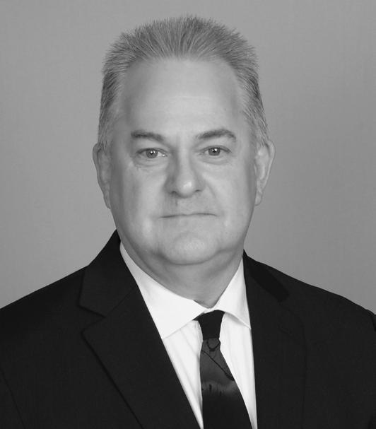
PRESIDENT’S Message
May 2025
Members,
We just had our latest Board Meeting in Tallahassee on May 16, and it went well. Unfortunately, I have a temporary health issue and could not physically be there but because of technology I was there by Zoom. I am thankful to Allen Nobles and Rebecca Porter for their joint effort in running the meeting in my place as Zoom is not that really a good platform to run a meeting from, but is fine for participating with.
FSMS Business:
• Based on our latest financial report for the first quarter of 2025, FSMS is in great financial shape with current assets around 1.25 million. Our investments are on solid ground, and everything is above board and transparent thanks to our financial committee’s hard work.
• Our Legislative Committee and our Lobbyist have had another successful year keeping our profession intact even though several attempts at deregulation were being fought. It’s an ongoing problem that’s not going away and we need to continue to fight i t through our FSMPAC fund and our members’ help.
• We are looking to finally replace our building sign in Tallahass ee with something much more substantial and permanent to show pride in our profession. We are getting quotes now on a new monument sign.
• The 2025 Conference planning is ongoing with 41 Booths reserved leaving only 14 Exhibitor Booths Available! In addition, we have 23 Sponsors so far, and we've already reached our contracted room allotment. The
PRESIDENT’S Message
Conference dates are July 30 through August 2, so get your rooms as soon as possible, because our discounted group rate availability will be limited as we move closer to conference.
• Elections for new Board members and Officers will open on May 28t h, please watch out for this and vote.
Rick's Musings: Seems to me lately, like we are in a world that technology is taking over. The leaps in human knowledge and understanding are growing exponentially every year and with the initialization of Artifici al Intelligence (AI) and ultra-ultra-high-speed computers we are now heading into the unknown boundaries of what we humans are capable of. It’s both exciting and a little scary if you ask me and hopefully cool heads will prevail in the long term and lead us into enlightenment and not in the other direction.
I was an early adopter to technology in surveying, starting with HP Calculators (21-25) and HP programs back in 1975-80. Since then, I have mad e it a point to try to learn something new every day, including multiple surveying programs, ESRI GIS, then remote sensing programs like ERDAS Ima gine, and finally multiple laser scanning and Lidar programs. Since I got into surveying in 1972, I found technology has helped me to satisfy my natural cu riosity about the world and find new ways to solve problems. It’s the challeng es we put onto ourselves that help to drive our path forward and to keep us engaged and ready for anything new.
I often think about what got me into Surveying in the first plac e, and ask why did I choose this profession and why do I love what I do? It all goes back to my love of the outdoors. Ever since I was able to walk, I was on the move, curiosity got the best of me and I was a constant wanderer. Be it fishing, hiking, canoeing, swimming, diving, and just wandering the beaches, woods and swamps around Florida. I would be looking at the different plant s and animals trying to understand the interconnection between them. I would watch the different weather patterns, cloud formations, and sit on my back porch and watch lightning storms and just wonder how it all worked and what I could learn from it. While on these little excursions, I would try to look at the overall picture I was seeing, the types of trees and plants I encountered, the type of soil I was walking on, and always searching and bringing back small treasures
PRESIDENT’S Message
I would find, an animal skull, an odd shaped rock, or even the o ccasional fossil from a fill pile near a construction site. My mind was always lo oking at the adventure and the mysteries of the world around me.
Surveying has just been a natural extension to all my questions , adventures, as well as the curiosities that drive me everyday, and continues to keep me interested and involved in everything we do.
One great profession that we need to protect and continue to pass on that knowledge, experience, and commitment to those coming after each one of us.
Players will play on the Black Course. Opened in 2001, this course plays to a par of 72 and features five sets of tees.
The Black Course can play up to 6,949 yards from the championship tees. The Tiburon Black Course has been hosting the PGA Tour champions Chubb Classic since 2022.
• Four-Person Scramble
• Prizes for Closest to Pin
• Prizes for Longest Drive
• Prizes for Longest Putt REGISTRATION
$150/PERSON
$600/TEAM
2024-25 Districts and
Directors
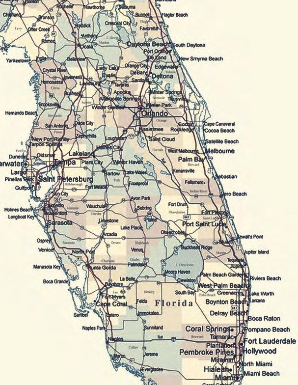
District 1 - Northwest
Bay, Calhoun, Escambia, Franklin, Gadsden, Gulf, Holmes, Jackson, Jefferson, Leon, Liberty, Madison, Okaloosa, Santa Rosa, Taylor, Wakulla, Walton, Washington
Professional Practice Committee Lou Campanile, Jr.
Workforce Development Committee Lou Campanile, Jr.
Liaisons
CST Program Alex Jenkins
FDACS BPSM Don Elder
Surveyors in Government
Richard Allen
Academic Advisory Justin Thomas UF / Earl Soeder FAU
FES
Lou Campanile, Jr.
Practice Sections
Geospatial Users Group
Young Surveyors Network
Richard Allen
Joseph Samberg
round the State A
Emanuel "Manny" Donate, P.S.M.
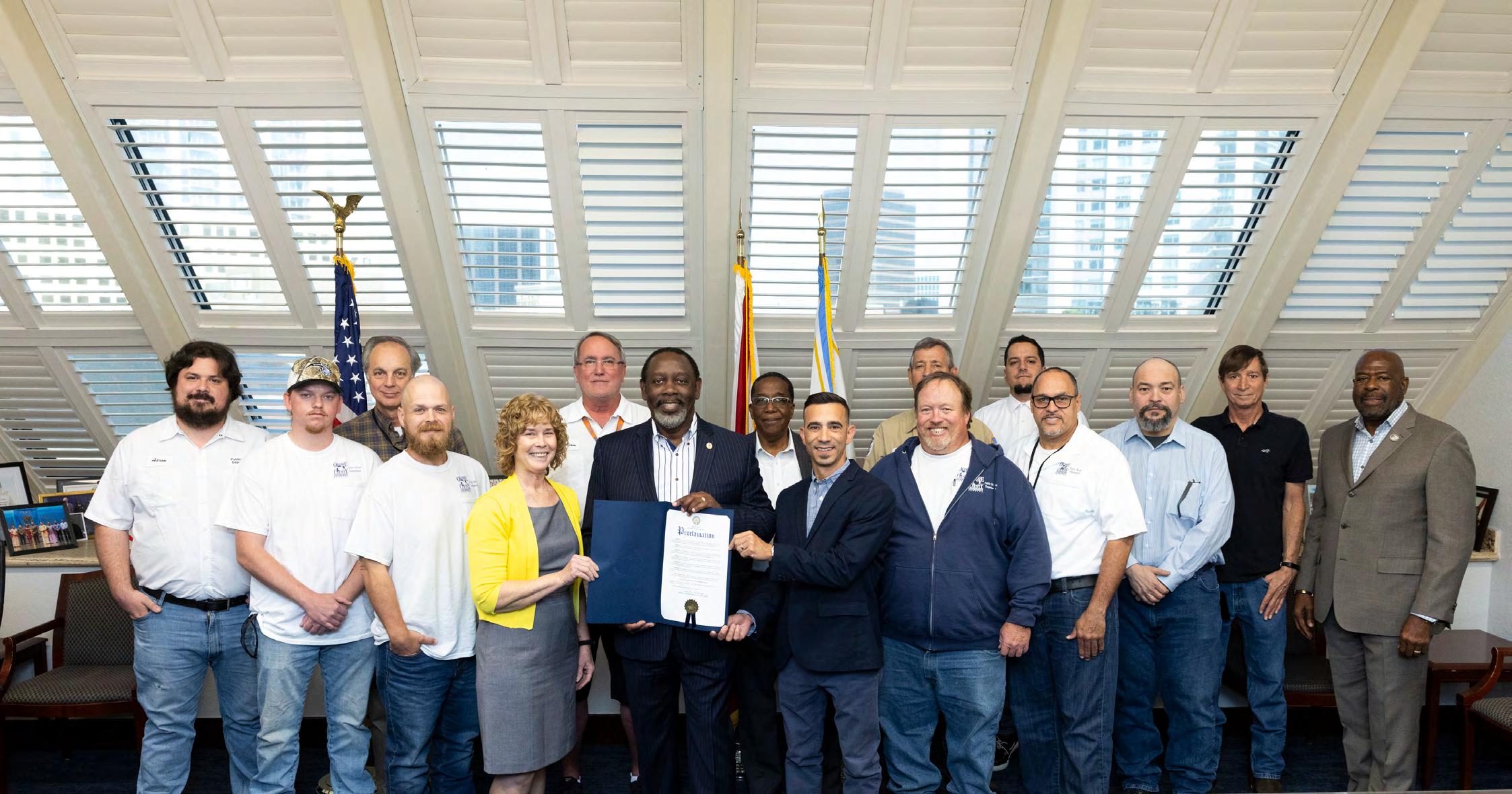
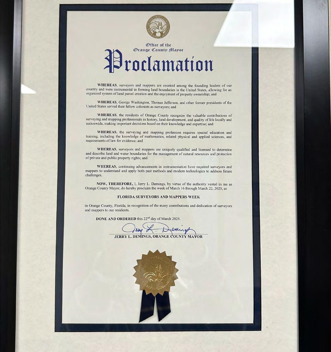
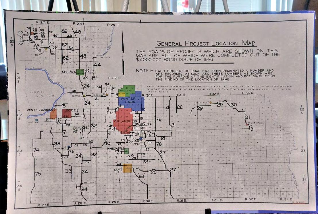
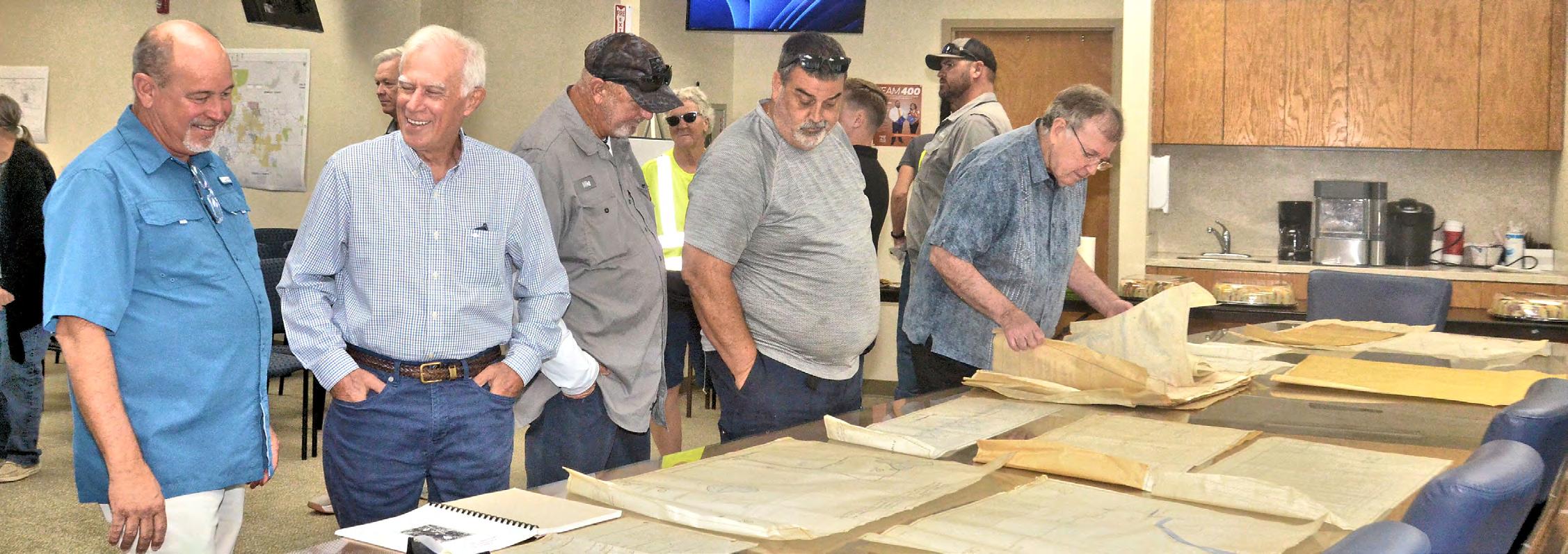
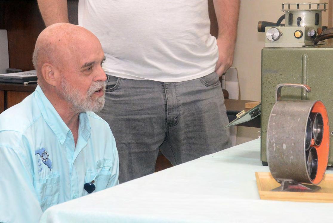
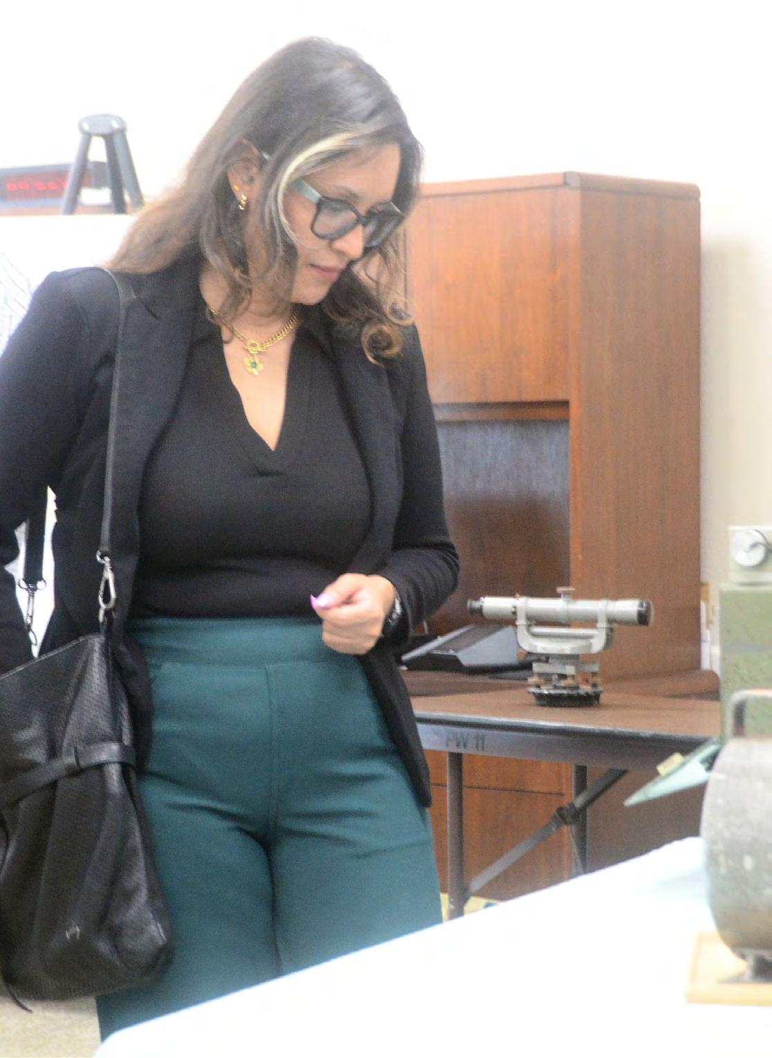
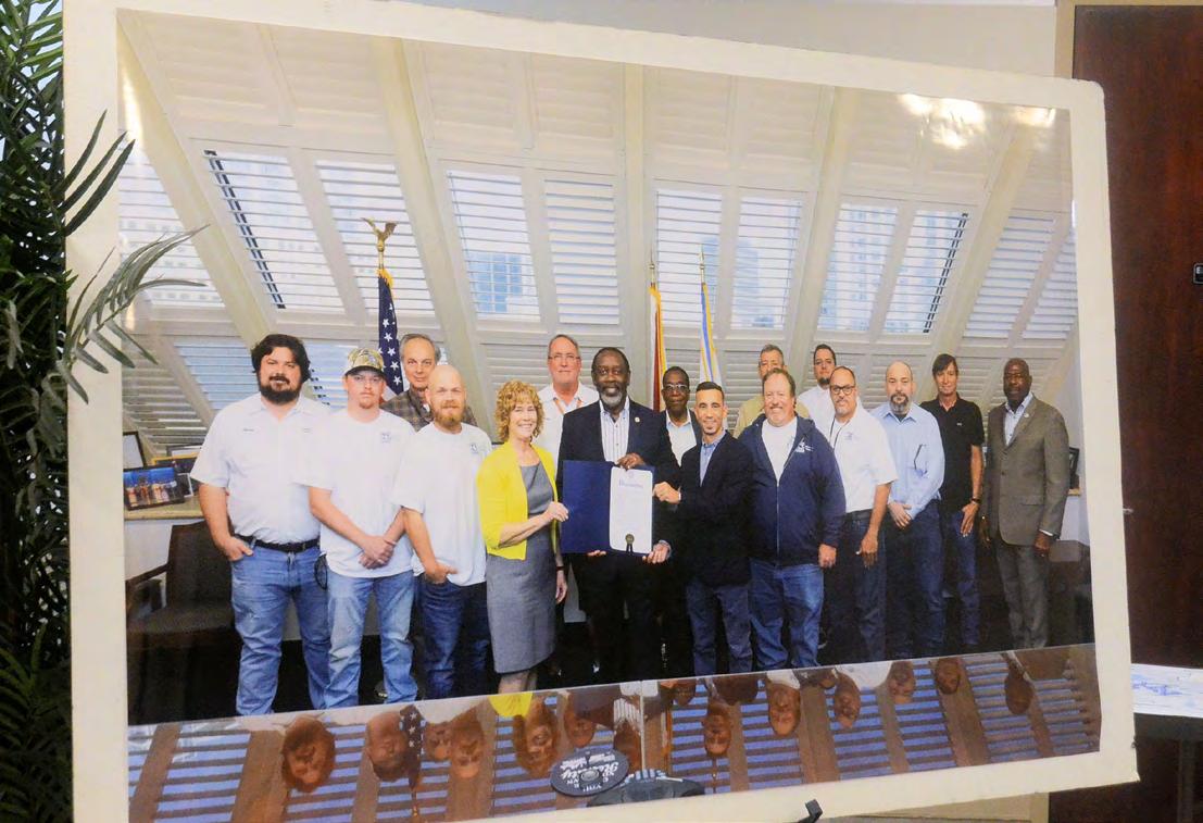
Proclamation pictures from Public Works Orange County Survey Team from Manny Donate; it was pushed back a couple of weeks after Surveyor's Week due to Mayor Deming's schedule.
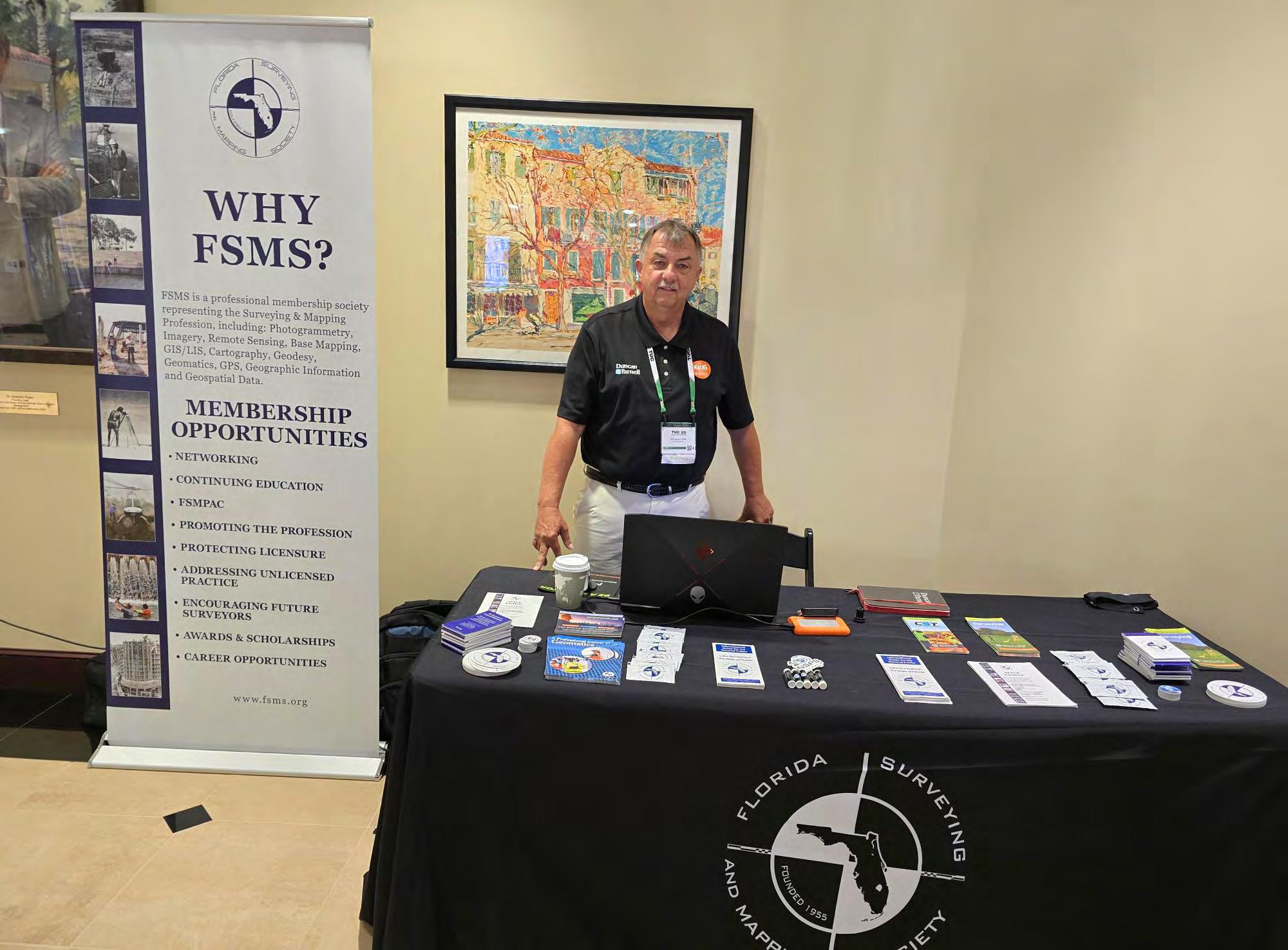
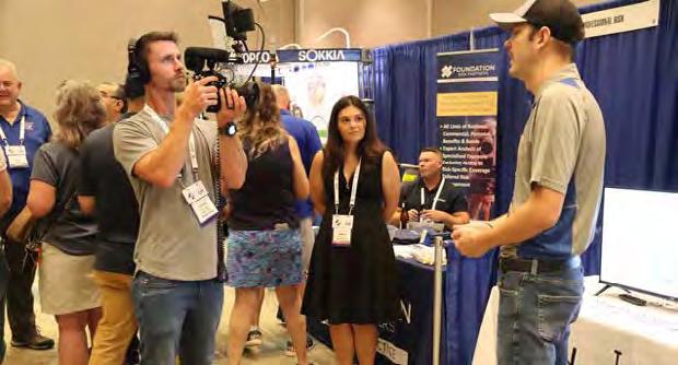
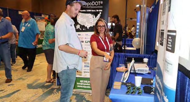
TopoDOT User Conference 2025 (TUC25)
Earl Soeder, PSM, District 6 - Southeast Director & Palm Beach Chapter President representing The Florida Surveying and Mapping Society at this year's TopoDOT User Conference 2025 (TUC25).
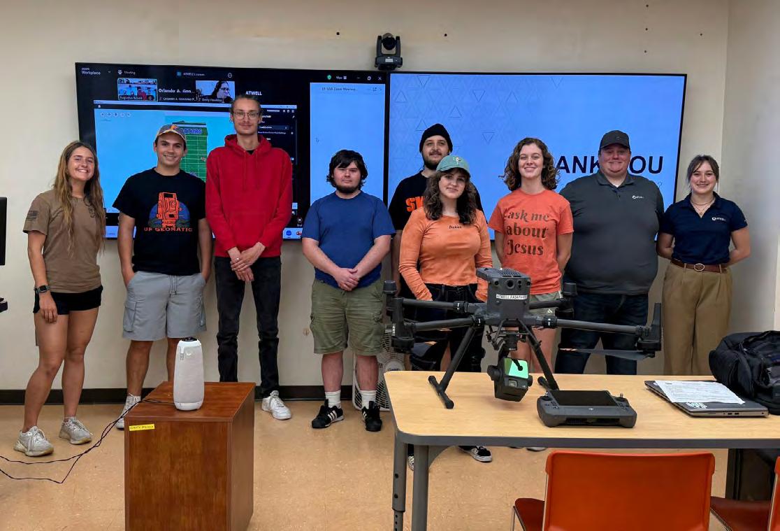
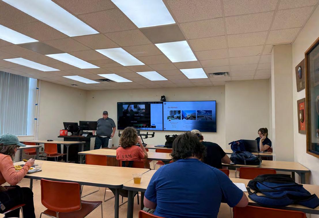
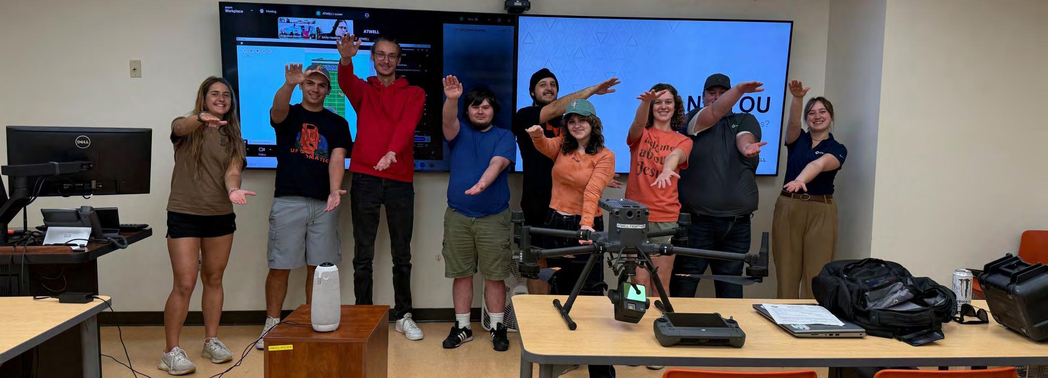
University of Florida Geomatics Student Association
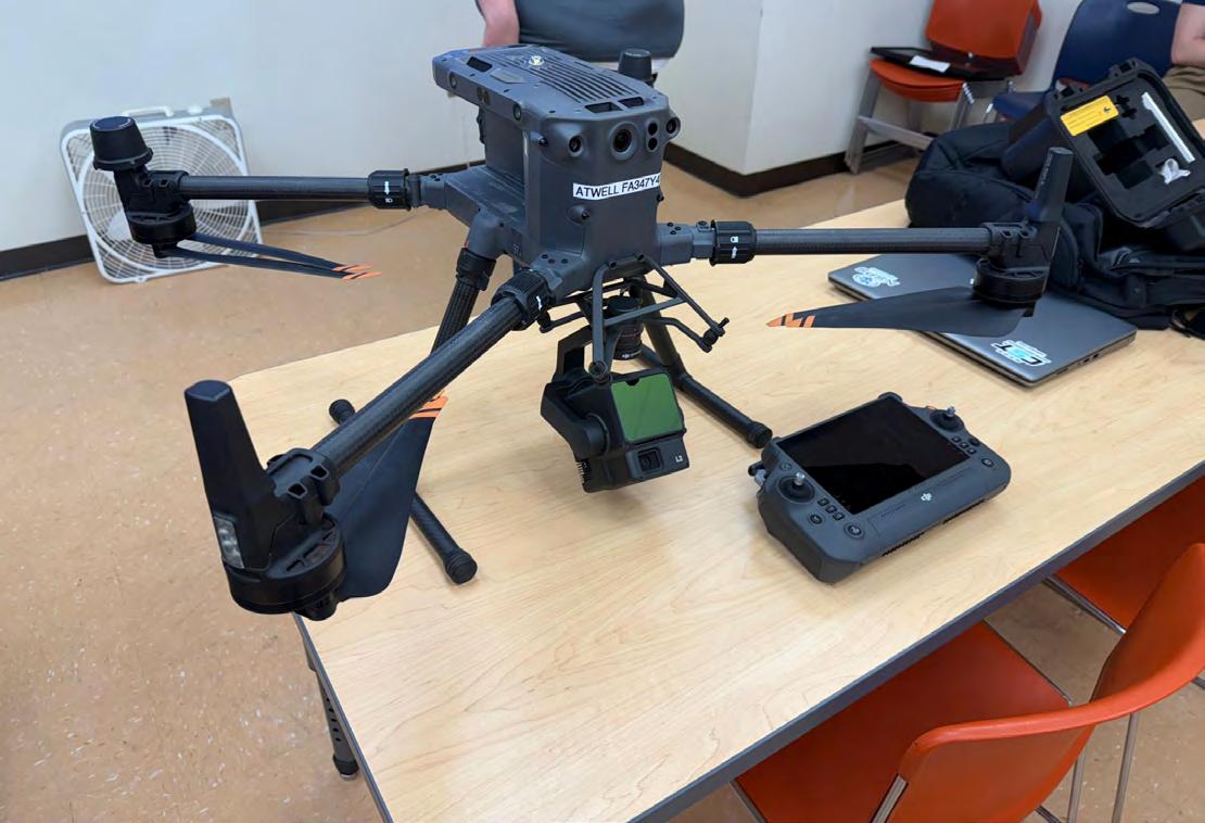
We’d like to give a big thank you to Nathan White, SIT, CST and Isabelle LaRonde of Atwell, LLC for closing out an amazing year of GSA meetings! They gave a great presentation on the company’s services and UAS/Point Cloud data.
Thank you to everyone who came out and supported the GSA this past year. We’ve had amazing growth and are looking forward to continuing success. Go Gator Surveyors!
CST Exam
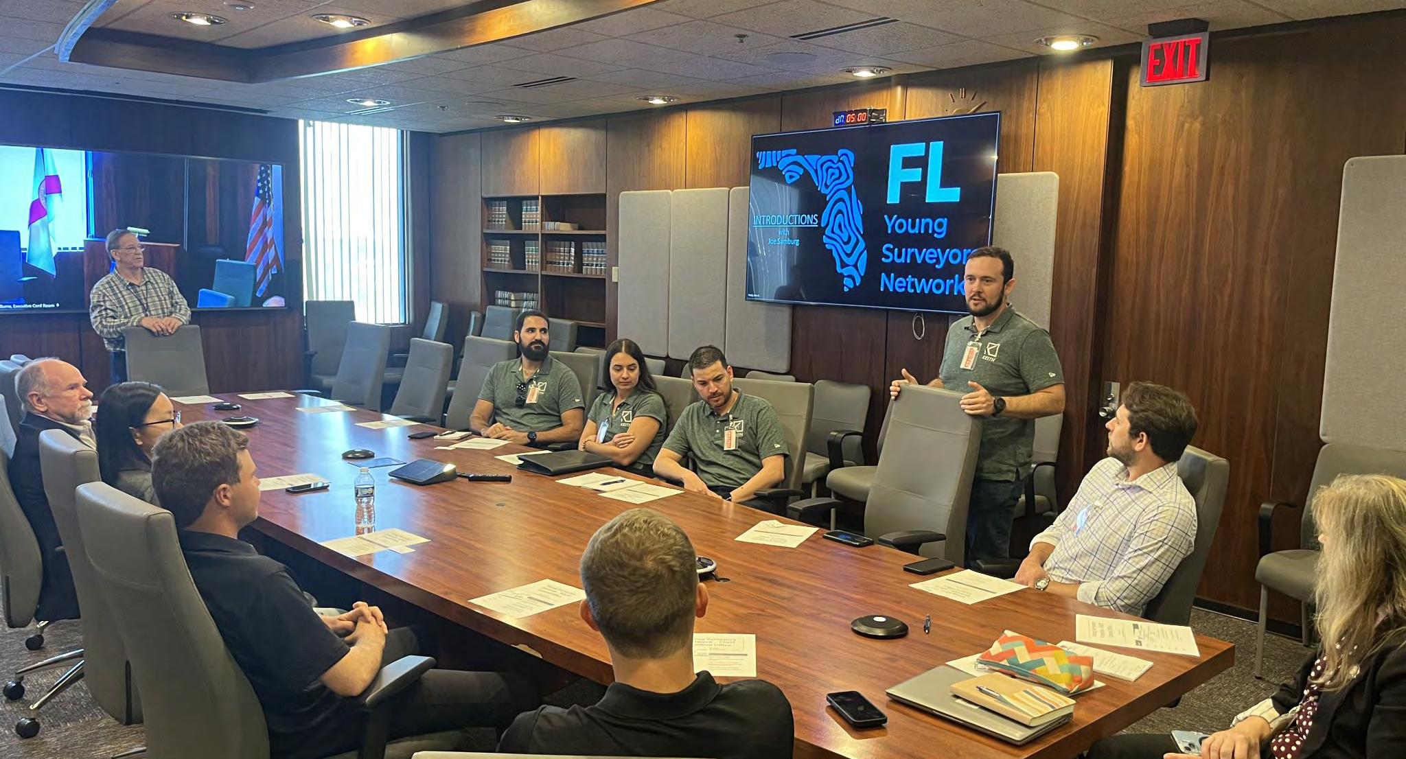
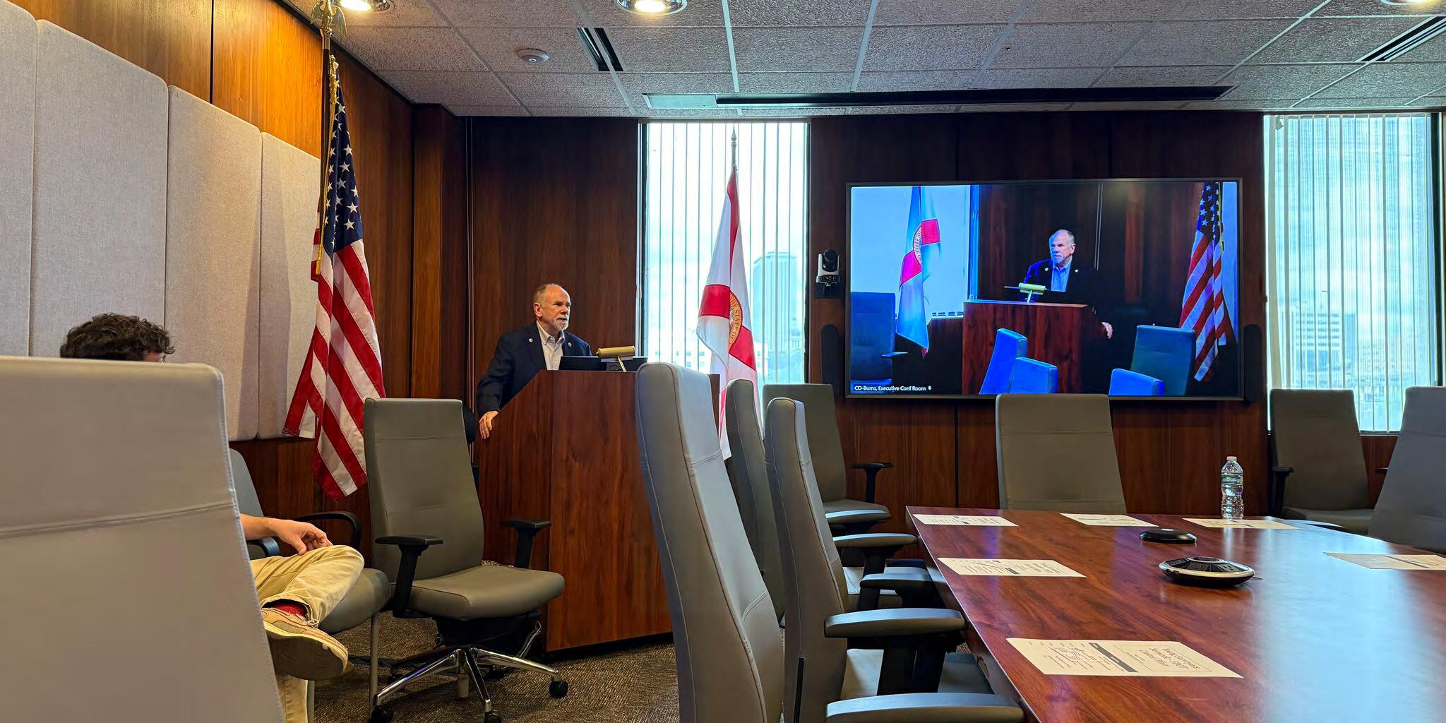
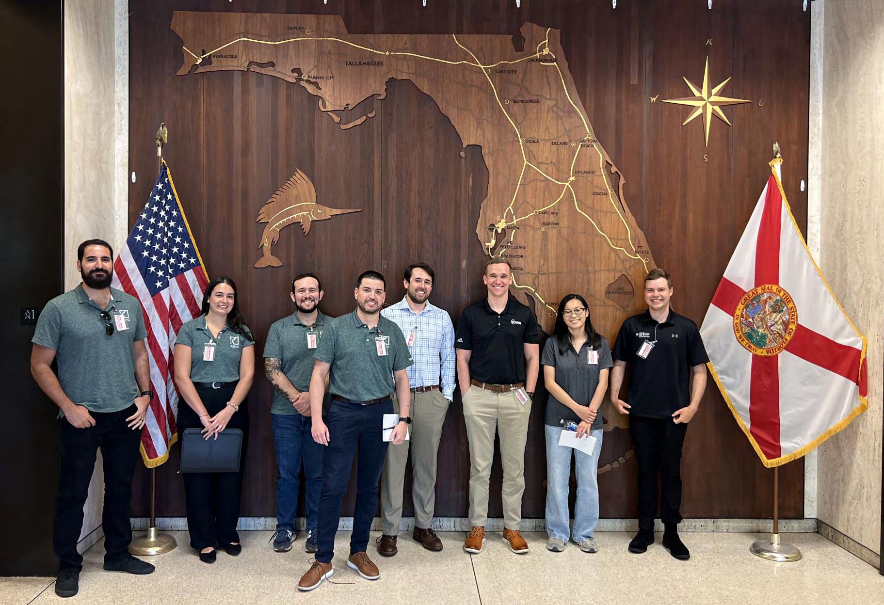
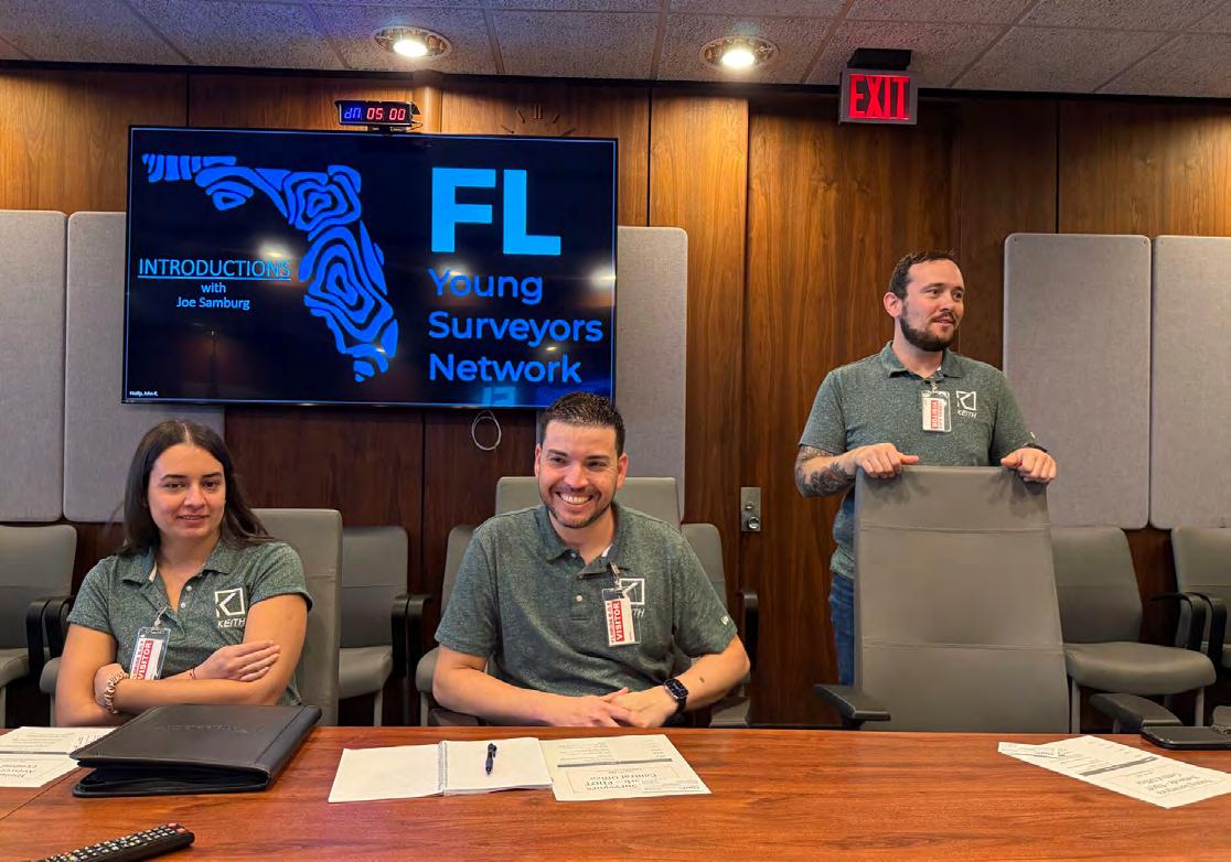
Florida Young Surveyors Network
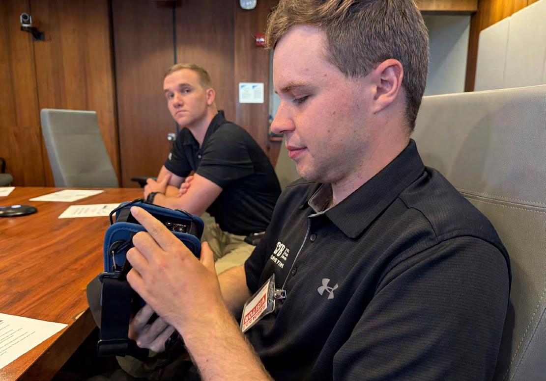
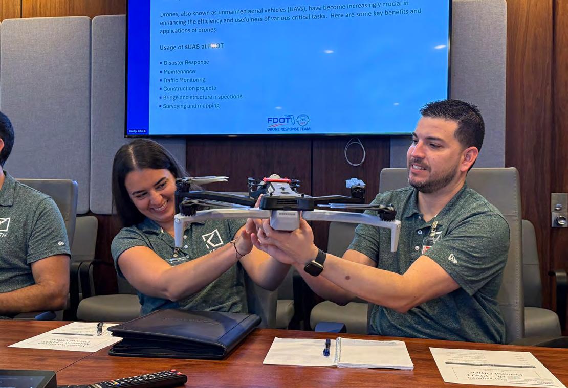
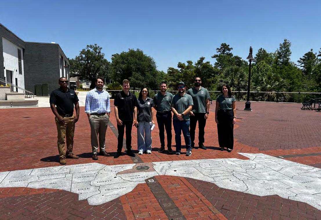
The Florida YSN takes Tallahassee! We had an amazing time at the Florida Department of Transportation's Central Office learning about the many services and divisions that utilize geospatial data within the FDOT.
We'd especially like to thank Brett Wood, PSM for hosting our young surveyors, as well as Rick Armond for helping to set this event up. We greatly appreciate the opportunity to come together and gain insight on the impacts of surveying onto the transportation industry.
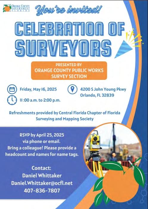
From Raymond F. Phillips, PSM and Central Florida Chapter President
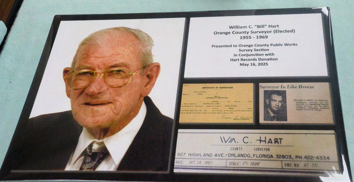
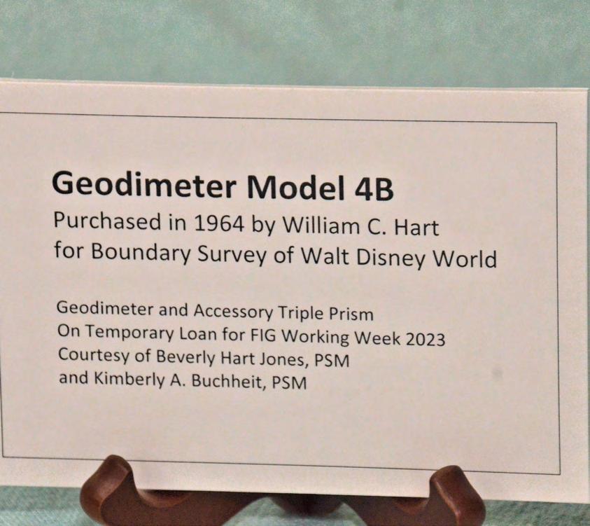
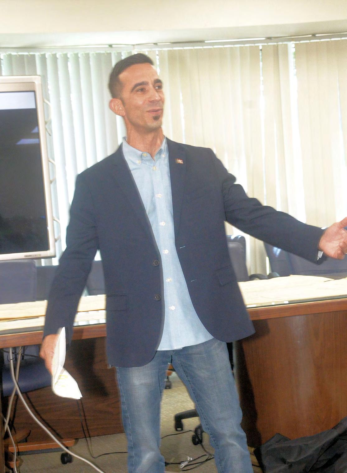
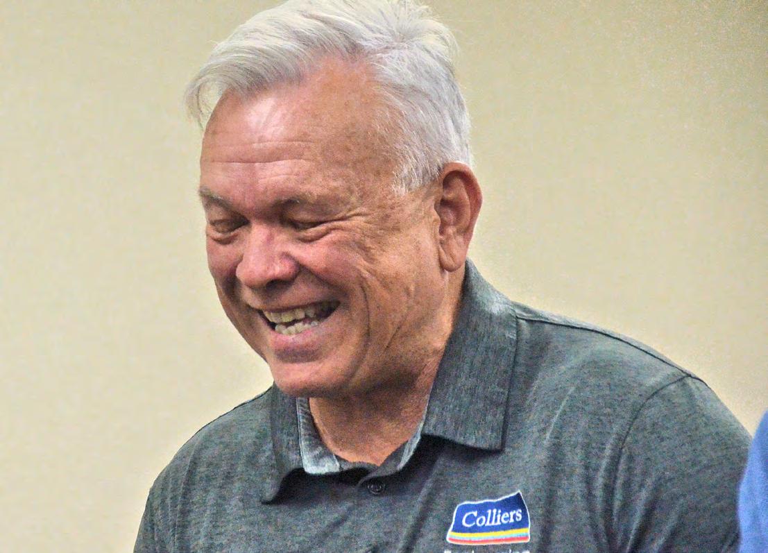
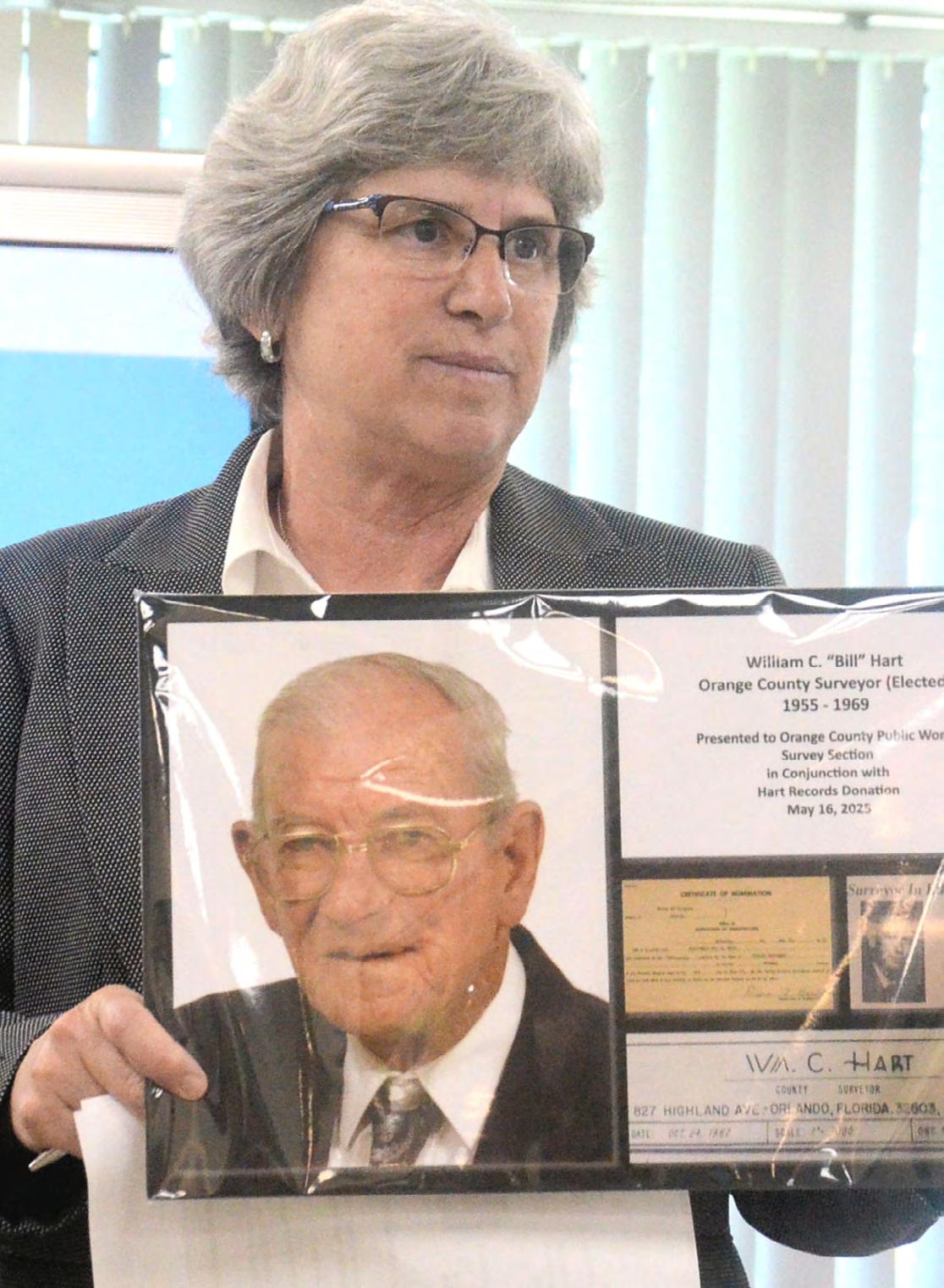
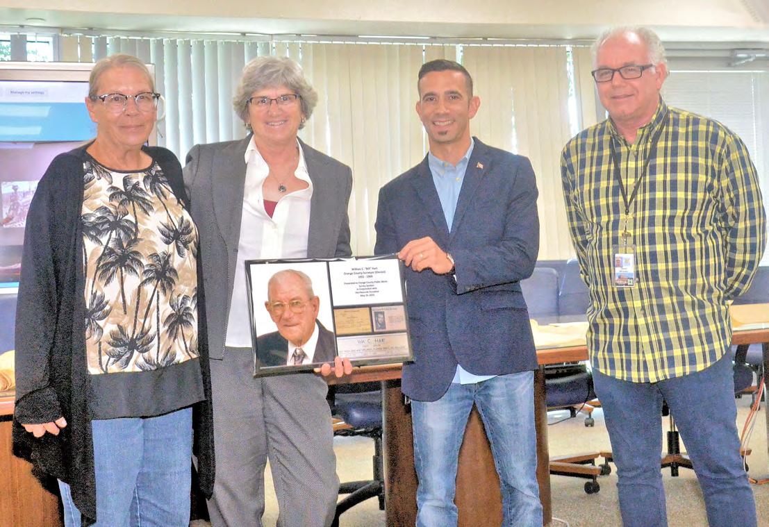
Orange County Public Works' Celebration of Surveyors honored FSMS Pioneer William "Bill" C. Hart. This was well attended with members of the Central Florida Chapter. Thank you to the Hart family, everyone that helped to bring this celebration together, and all those that were able to attend.
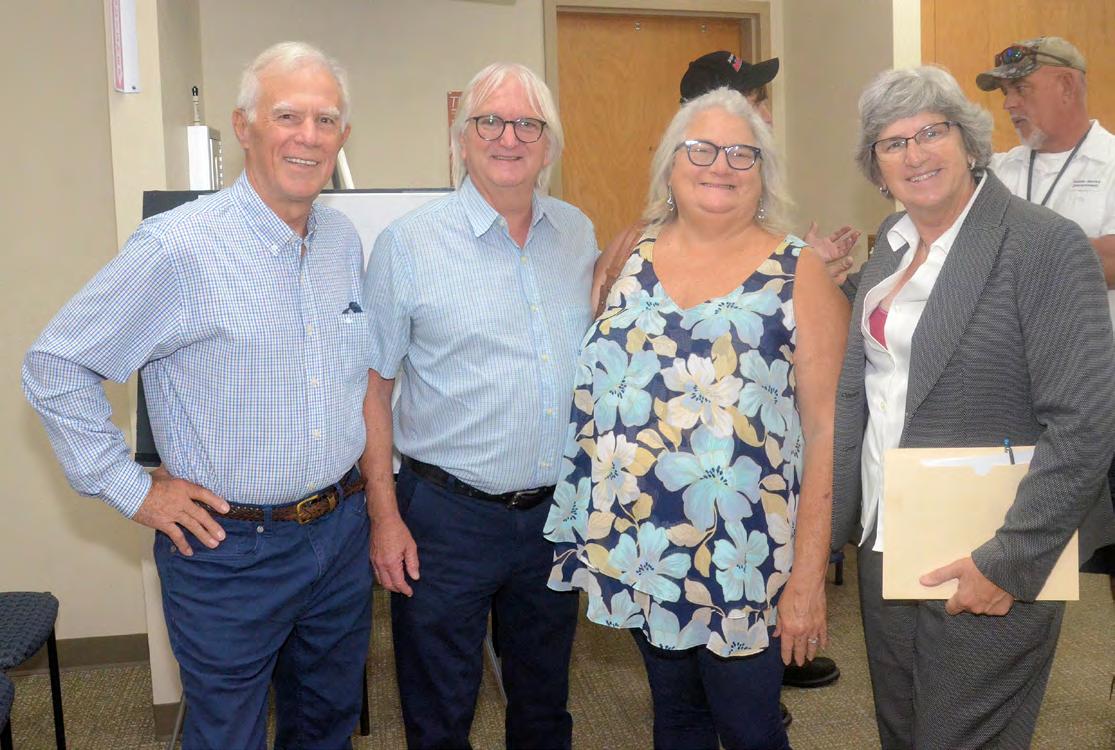
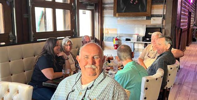
May Quarterly Board Meeting Dinner
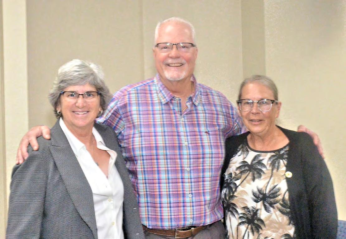
Vice President of FSMS, Allen Nobles, poses for the camera while the guests arrive at Pedro's Tacos & Tequila Bar.
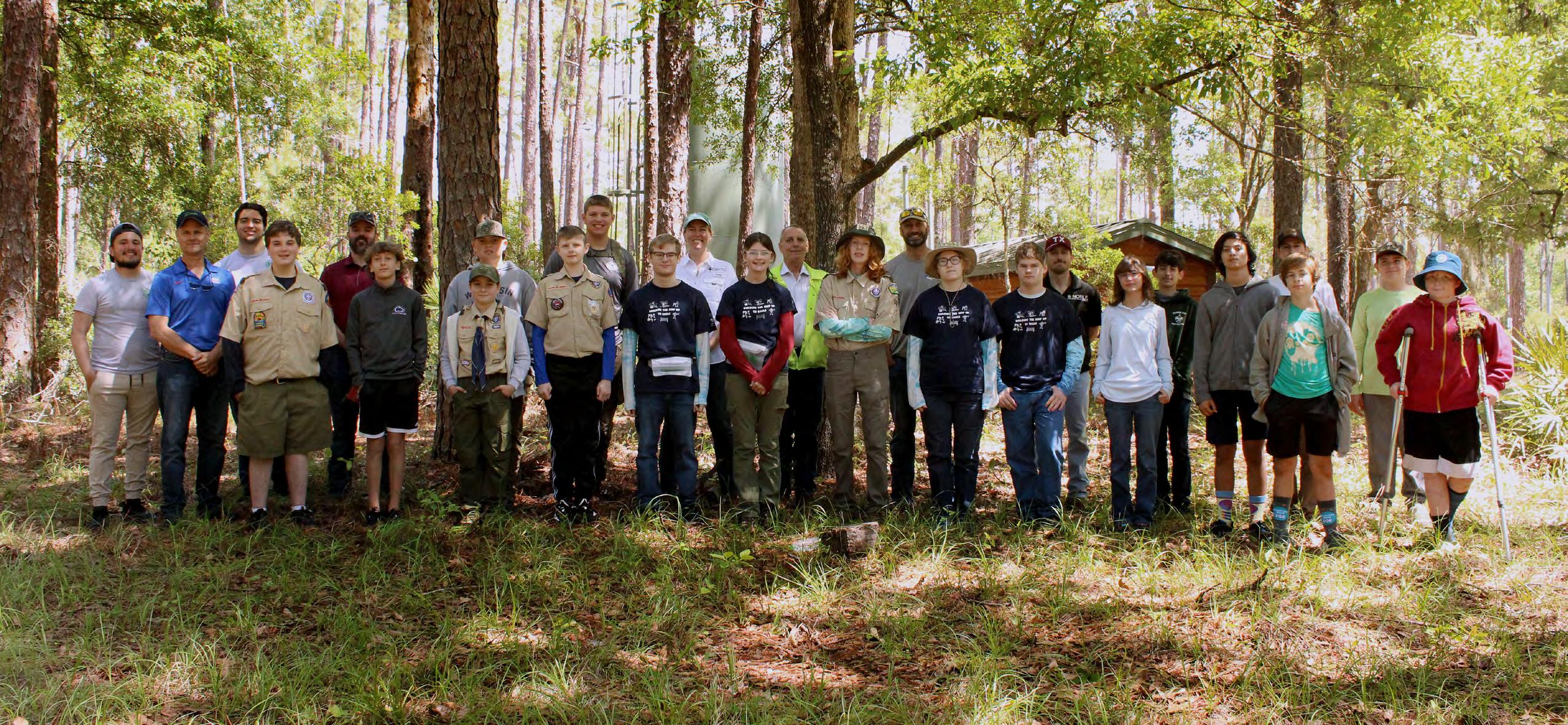
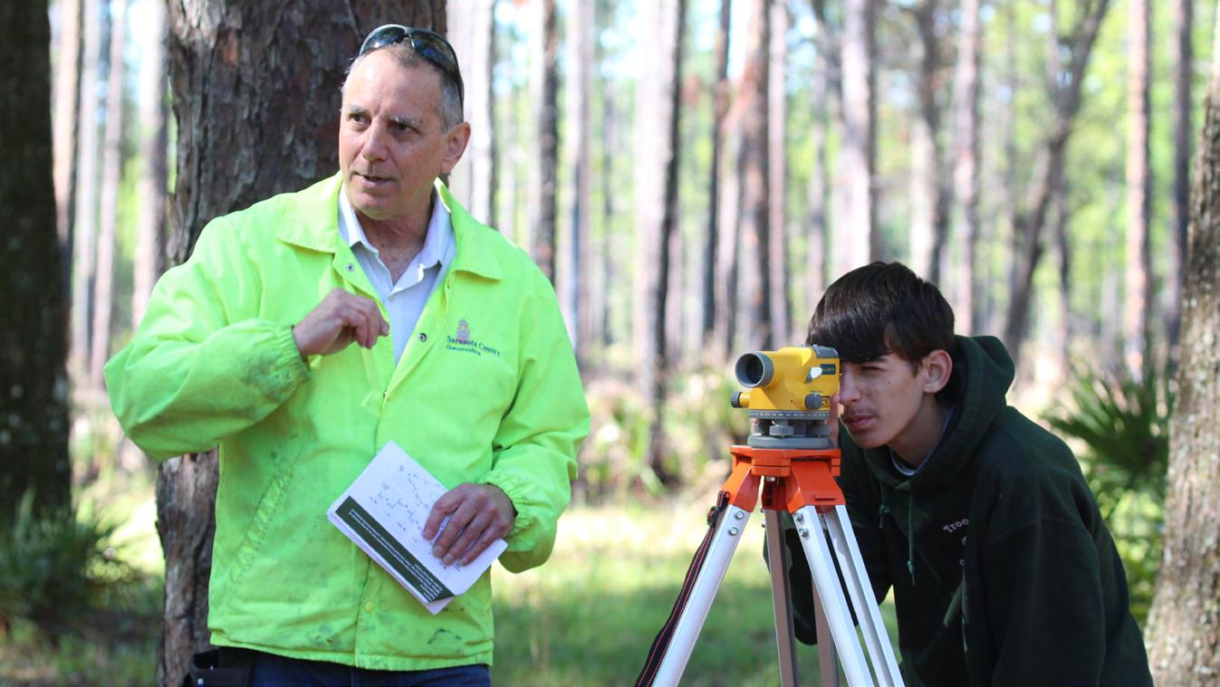
Scouts Earn Surveying Badges Thanks to UF Geomatics Extension Program
By Suzette Cook/SFFGS
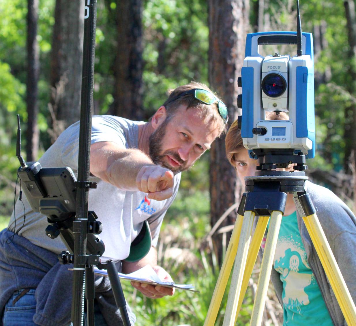
Scout Leader Hope Hutchison was not surprised that her son, Scout James Hutchison, 11, of Levy County, got an early start working on his Surveying Merit Badge.
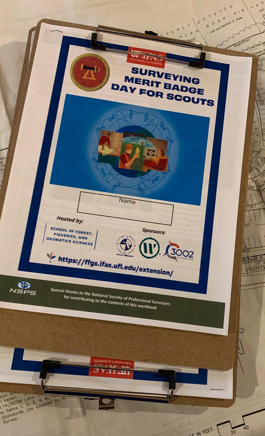
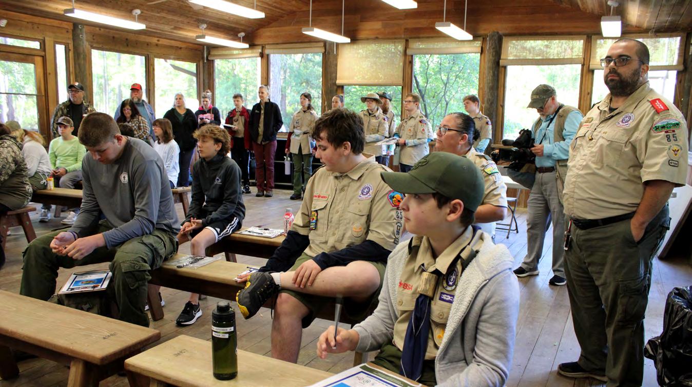
“He loves math and angles,” she said. And on April 12, along with 17 other Scouts from throughout Florida, James got to use math during hands-on lessons in surveying and mapping from top experts in the field.
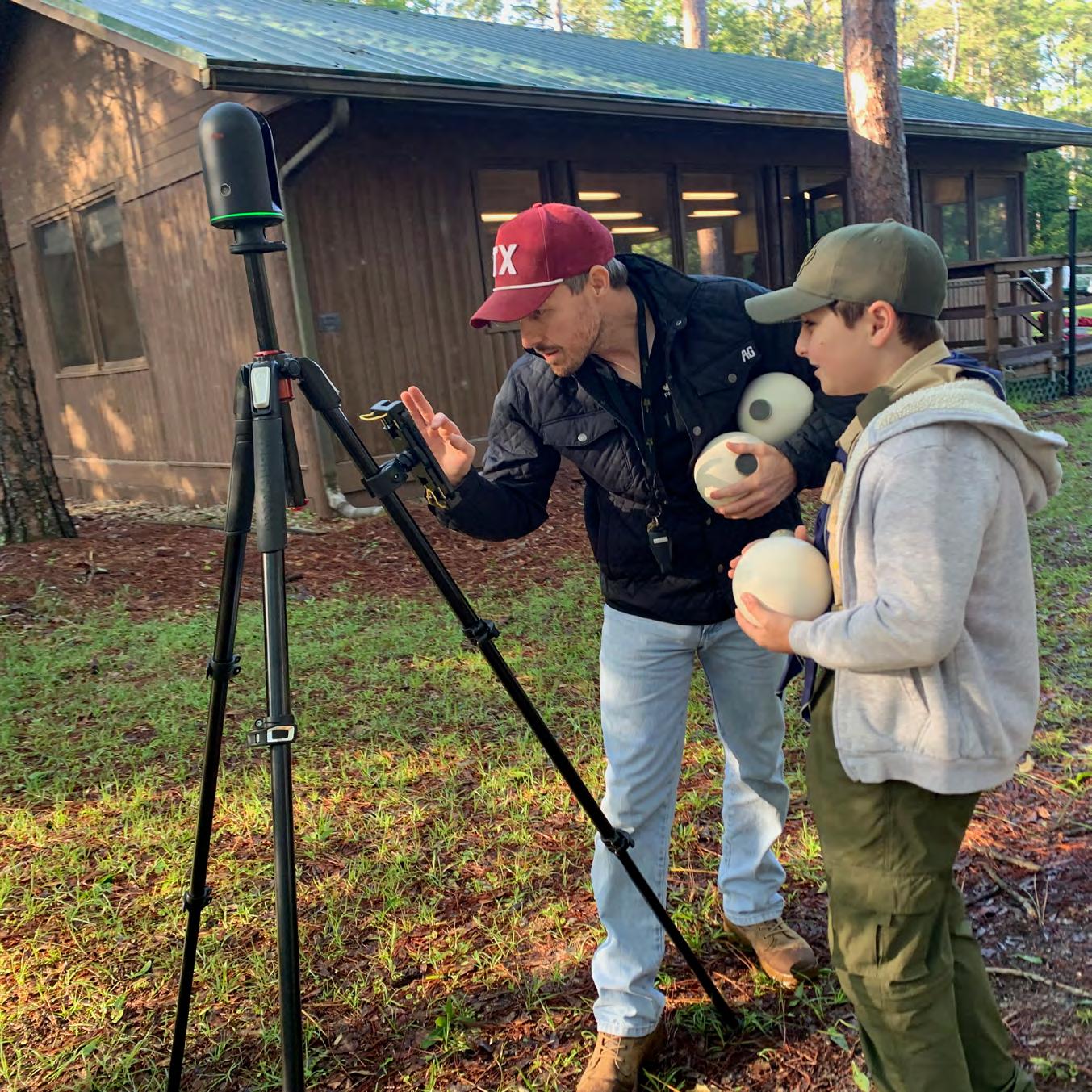
Even before the event hosted by University of Florida’s School of Forest Fisheries, and Geomatics Sciences (SFFGS) new Geomatics Extension program got started, James volunteered to help Noble Haile, owner of Noble Precision Technologies, set up data collecting orbs for a lesson in 3-D scanning.
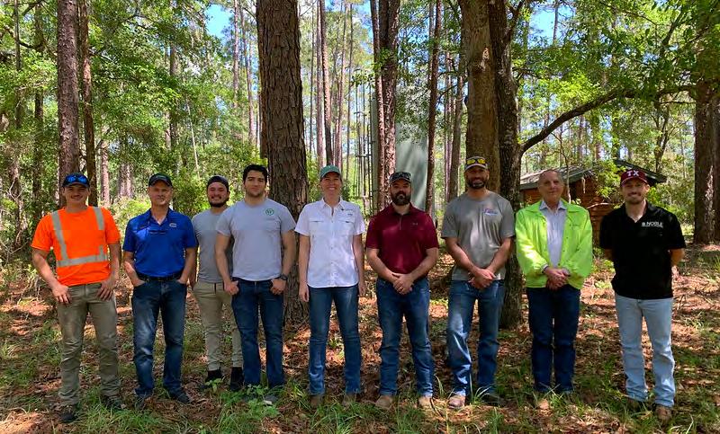
Haile along with Brian Murphy, president of 3002 Surveying, Eric Orndorff, market leader for Geospatial WGI, Nicholas DiGruttolo, survey manager for Pickett and Associates, and Marco Krieger, licensed surveytor for TRC Companies spent their Saturday in the woods at UF/IFAS Austin Cary Forest Campus off Waldo Road.
Each mentor brought the latest equipment they use in the field and Scouts rotated between five stations where they learned mapping and drafting, surveying history and careers, leveling, creating boundaries, and 3-D laser scanning.
At the end of the day, the paperwork for the Surveying Merit Badge for all 18 Scouts was signed by Orndorff, an Eagle Scout himself who later went on to become a Scout Master with Troop 432 in Gainesville and then became a merit
Brian Murphy, 3002 Surveying president, teaches Scouts how to replicate a boundary survey using the Total Station with a data collector.
badge counselor.
“I do credit Scouting,” Orndorff said about his career choice. “It sparked an interest.”
SFFGS Assistant Director for Geomatics Extension Katie Britt said that’s exactly why the event was held. Britt coordinates the only geomatics extension program in Florida and in the U.S., a position that SFFGS launched to not only spark interest in geomatics for youth but to help adults obtain the required certification to enter the high-demand career in Florid a and beyond.
“We were excited to have 18 youth participate in the event and complete the surveying merit badge,” said Britt. “This badge provides a great overview of surveying. There are so many career opportunities in a wide variety of surveying applications in Florida, and it’s a career that many people aren’t even aware of until later in life.”
The goal of hosting this event was to introduce more youth to surveying as a career and find some future surveyors, she added. “We hope to be able to
Eric Orndorff, market leader for WGI in Gainesville, is the assistant Scout Master with Troop #432 in Gainesville teaches the history and career aspects of surveying.
expand this event next year to include relevant badges for younger ages and include the whole of SFFGS. There are a ton of badges that our faculty and staff are experts in, and we’d love to introduce youth to what the whole school has to offer.”
SFFGS Associate Professor and Extension Coordinator Michael Andreu, Ph.D. said that is what Britt’s new role is aiming to accomplish.
“We are excited that this new extension program will engage youth in learning about job opportunities that they can pursue to support Florida’s economy,” he said.
Each of the topics relayed in the workshop resonated with the Scouts. Paisley Adkins,13, is a North Marion County seventh grader and a Scout with Troop 9563 from Anthony. She said she most enjoyed the boundaries workshop with Murphy.
Carson Orndorff, 14, from Gainesville said, “Drafting was really cool and running out the scale map was pretty fun.”
Roy Sanbury, 16, from Troop 563 out of Ocala said that tracking was his favorite lesson. “Learning how to get the precise motions in and how expensive having these measurements done is fascinating,” he said. His goal is to be a firefighter, but he said that surveying knowledge would help in that career. “It could have to do with surveying,” he said. “You have to know the places you go to.”
Britt gives credit for the successful workshop to the experts who volunteered to help. And it was Murphy’s initial suggestion to hold the workshop to increase recipients of the Surveying Merit Badge. He is a geomatics graduate of SFFGS as are DiGruttolo, Orndorff, and Krieger.
Terrell T. “Red” Baker, director of SFFGS looks forward to organizing similar opportunities in the months and years to come.
Scout Roy Sanbury
“We are grateful to our alumni and staff that came out on a weekend to support this important opportunity for local Scouts,” he said. “Scouts not only earned merit badges to demonstrate their competency in surveying, but they got the chance to learn about the newest technologies and career opportunities in the surveying and mapping profession.
Scout James Hutchison agrees that he has discovered his calling. At the end of the day, he summed up his experience, “My dream job would probably be a surveyor,” he said.
Scout James Hutchison helps set up orbs for data collection with Noble Haile, owner of Noble Precision Technologies.
YOUR FLORIDA GEOSPATIAL PARTNER
Duncan-Parnell, along with our valued partners, including Trimble and other top brands, are proud supporters of the Florida Surveying & Mapping Society. From solutions including GNSS, scanning, GPR, drones, and more to services including support, rentals, training, and repair, we are pleased to be your one-stop shop for geospatial professionals throughout the Sunshine State.
Jacksonville, FL (904) 620 - 0500
Orlando, FL (407) 601 - 5816
www.duncan-parnell.com
From Katie Britt , Assistant Director for Geomatics Extension UF/IFAS School of Forest, Fisheries, and Geomatics Sciences:
Sponsors:
North Central Florida FSMS Chapter
WGI Geospatial
3002 Surveying
Volunteers:
Nicholas DiGruttolo – Pickett and Associates
Heather Geyer - Fugro
Noble Haile – Noble Precision Technologies
Marco Krieger – TRC Companies
Brian Murphy – 3002 Surveying
Eric Orndorff – WGI Geospatial
We also had a few of WGI’s Geospatial Interns and a crew chief attend, and it was great to get some younger surveying experience to relate to the scouts:
Cody Bella Crew Chief - WGI
Esteban Rivera Geospatial Intern - WGI
Wesley Asmus Geospatial Intern - WGI
Thank you to all the Volunteers and Sponsors. We definitely couldn't have done this without the support from FSMS Members and the North Central Florida Chapter. I am more than happy to provide more information, suggestions, and resources to host a Boy Scouts Surveying Merit Badge Event if anyone around the state is interested.
Katie Britt
Assistant Director for Geomatics Extension
UF/IFAS School of Forest, Fisheries, and Geomatics Sciences
k.britt@ufl.edu | (813) 757.2223
CONGRATULATIONS TO Scott Graham of ETM (England-Thims & Miller)
Congratulations to our 2025 Recruitment Champion, Mr. Scott Graham of ETM.
He Recruited Two NEW Full Members as part of Our 2025 Membership Recruitment Contest.
Scott is the winner of a Conference Packet 1 Registration along with a Two Night Stay at the Naples Grande Beach Resort.
FSMS would like to thank all of the participants in this year's membership recruitment contest. Through all of your combined efforts, FSMS gained 27 New Members: 8 Full, 16 Associate, 1 Affiliate, and 2 Sustaining Firms.
Conference Schedule 2025
Wednesday, July 30
7:00am - 5:00pm Conference Registration Desk Open
7:30am - 8:00am Seminar Sign-In
8:00am - 12:00pm Golf Tournament
8:00am - 5:00pm BPSM Meeting
8:00am - 5:00pm BBQ Teams Cooking
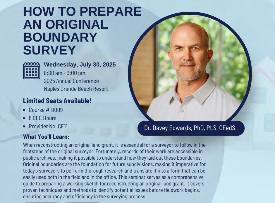
8:00am - 3:00pm Seminar I
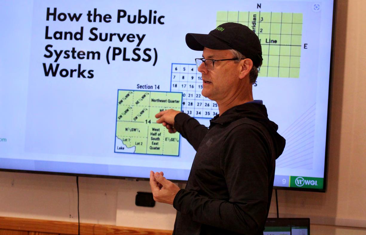
How to Prepare an Original Boundary Survey Course #11009 - 6 CEC Hours
When reconstructing an original land grant, it is essential for a surveyor to follow in the footsteps of the original surveyo r. Fortunately, records of their work are accessible in public archives, making it possible to understand how they laid out these boundaries. Original boundaries are the foundation for future subdivisions, making it imperative for today's surveyors to perform thorough research and translate it into a form that can be easily used both in the field and in the office. This course serves as a comprehensive guide to preparing a working sketch for reconstructing an original land grant. It covers proven techniques and methods to identify potential issues before fieldwork begins, ensuring accuracy and efficiency in the surveying process. This course is an interactive course which will require the attendee to bring the following materials: Scale, Allen Scale (optional), Pencil (color optional), Calculator
Dr. Davey Edwards, PLS LSLS CFedS is a licensed professional surveyor in Texas and Oklahoma, a Texas licensed state land surveyor, and a US certified Federal land surveyor. He has his master's degree in Geospatial surveying Engineering and Doctorate in geosciences. His expertise is in original land grant reconstruction and riparian boundaries. He is the current past president of the National Society of Professional Surveyors, past president of the Texas Society of Professional Surveyors, past member of the Texas Board of Professional Land Surveyors, and current emeritus member of the Texas Board of Professional Engineers and Land Surveyors. He serves as the US delegate for Commission 2 (Professional Education) for the International Federation of Surveyors and various committees in the National Council of Examiners for Engineers and Surveyors. He is the past director of the Texas Spatial Reference Center. He currently works for Dunaway in Fort Worth, Texas, and is an adjunct professor in the Geomatics program at New Mexico State University.
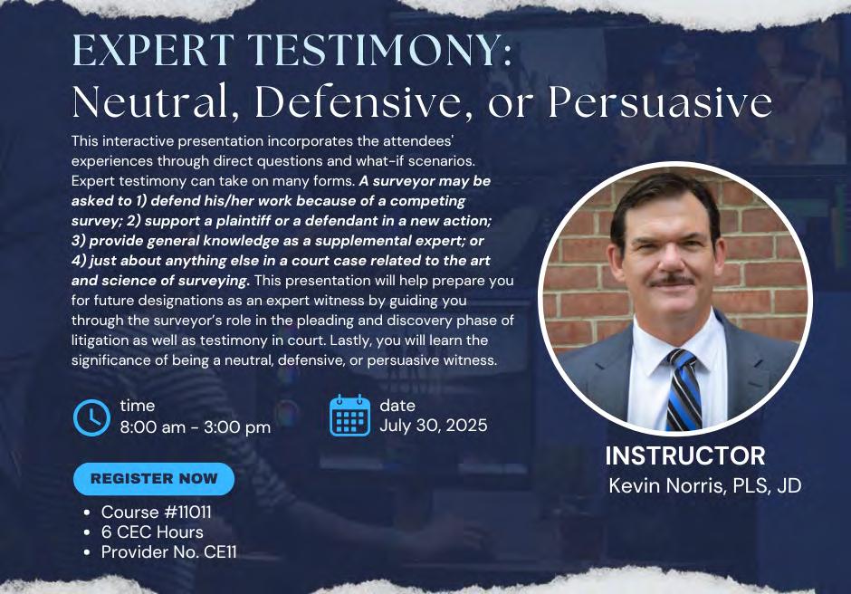
Expert Testimony: Neutral, Defensive, or Persuasive (6 CEC – #11011) Instructor: Kevin S. Norris, Esq.
This interactive presentation incorporates the attendees' experiences through direct questions and what -if scenarios. Expert testimony can take on many forms. A surveyor may be asked to 1) defend his/her work because of a competing survey; 2) support a plaintiff or a defendant in a new action; 3) provide general knowledge as a supplemental expert; or 4) just about anything else in a court case related to the art and science of surveying. This presentation will help prepare you for future designations as an expert witness by guiding you through the surveyor’s role in the pleading and discovery phase of litigation as well as testimony in court. Lastly, you will learn the significance of being a neutral, defensive, or persuasive witness.
Kevin S. Norris, Esq. has thirty-seven years of experience in land surveying, minor engineering, and land development. He is a licensed professional land surveyor in the state of Maryland, having received his license in 2002. His experience ranges from everyday survey-oriented tasks to managing every aspect of a surveying company. His expertise centers on boundary retracement; control surveys; resolution of title issues, statutory and zoning applications; general land planning; and land development. Mr. Norris is a licensed attorney barred in Maryland, Texas, the United States District Court District of Maryland, and the United States District Court Eastern District of Texas. He has represented clients in Maryland before the District Court, the Circuit Court, the Appellate Court of Maryland, and the Orphan’s Court. His areas of practice are land disputes, land development, the resolution of title matters, zoning issues, estate planning, and estate administration. Mr. Norris has been named as an expert witness in land surveying and in areas related to title for numerous cases in Maryland including the Federal District Court for the District of Maryland. He has testified many times regarding boundary issues and has litigated land-related cases. Mr. Norris is a frequent presenter at the Maryland Society of Surveyor’s Conference, has been a presenter at the Maryland State Bar Association Conference, and has spoken at many local surveying and bar events. Mr. Norris is currently the President -Elect of the Maryland Society of Surveyors.
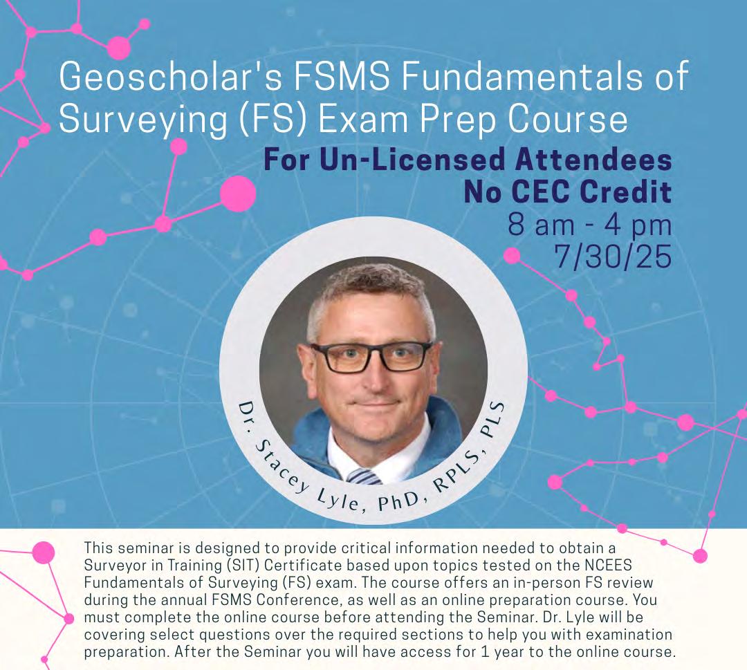
Geoscholar's Florida Surveying and Mapping Society Fundamentals of Surveying (FS) Exam Prep Course
Un-Licensed Attendees - No CEC Credit - Dr. Stacey Lyle, PhD, RPLS, PLS
Geoscholar's Florida Surveying and Mapping Society Fundamentals of Surveying (FS) Exam Prep Course is designed to provide critical information needed to obtain a Surveyor in Training (SIT) Certificate based upon topics tested on the NCEES Fundamentals of Surveying (FS) exam. The course offers an in -person FS review during the annual Florida Surveying and Mapping Society Conference, as well as an online preparation course.
You must complete the online course before attending the Seminar. Dr. Lyle will be covering select questions over the required sections to help you with examination preparation. After the Seminar you will have access for 1 year to the online course.
Dr. Stacey Lyle, PhD, RPLS, PLS is an Associate Professor of Practice at Texas A&M University’s Zachry Department of Civil and Environmental Engineering and Department of Geography. He has served as an expert witness on land boundary court cases. He is active in the industry with over 35 years of surveying experience including civil engineering, land surveying, cadastral land records databases, GIS/CAD/BIM Fusion, geodesy, hydrography, photogrammetry, and cartography.
Practitioners often encounter situations where the client’s possession (undocumented) boundary does not coincide with the record boundaries. Depending upon the circumstances, the undocumented boundary may become the ownership boundary. In other cases, acts of the party(ies) and surrounding circumstances may locate the boundary that the record alone fails to fix with clarity. The workshop will explain and discuss estoppel, acquiescence, practical location, agreement, adverse possession, and dedication. In addition to a basic understanding of these doctrines, the practitioner will learn what their role and responsibilities are in these cases.
Course Objectives At the completion of the workshop, attendees will: Understand the difference between the record boundary, possession boundary, and ownership boundary; be able to analyze the undocumented boundary in regard to supporting the record boundary location and the impact on the marketability of the title; explain the impact of doctrines such as estoppel, acquiescence, practical location, and adverse possession on surveying services; competently report the undocumented boundary and the potential impact on the title to the client.
Knud E. Hermansen, PSM, PE, Ph.D., Esq is an attorney, professional engineer, and professional land surveyor licensed in several states. His education includes a Ph.D. in Civil Engineering from the Pennsylvania State University and a J.D. (Doctorate in Law) from West Virginia University. Knud is a professor emeritus at the University of Maine and operates a consulting firm offering surveying, engineering, and legal services. Professional membership includes the National Society of Professional Surveyors, National Society of Professional Engineers, American Society of Civil Engineers, and several state survey societies. He is an author or co -author of several books and articles.
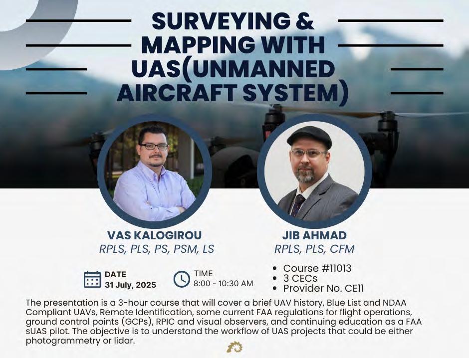
Surveying and Mapping with UAS
(3 CEC – #11013) Instructors: Jib Ahmad, RPLS, PLS, CFM & Vas Kalogirou, RPLS, PLS, PS, PSM, LS
This presentation will cover a brief UAV history, Blue List and NDAA Compliant UAVs, Remote Identification, some current FAA regulations for flight operations, ground control points (GCPs), RPIC and visual observers, and continuing education as a FAA sUAS pilot. The objective is to understand the workflow of UAS projects that could be either photogrammetry or lidar.
Jib Ahmad, RPLS, PLS, CFM started his surveying career in Oregon and Washington in 1994 and instantly loved looking for property corners. He is a licensed Land Surveyor in Texas, North Dakota, South Dakota, and Kentucky, is a Certified Floodplain Manager, a FAA Part 107 UAS Pilot, and has been a Professional SCUBA Divemaster for nearly 30 years. His diverse range of projects in land, aerial, hydrographic, seismic and pipeline surveying has given him the opportunity to work in 8 states. His experience includes large boundary surveys in Texas and in the U.S. Public Land system, large scale GPS control network design and processing, watershed mapping, coastal mapping for surface and underwater sites, riverine mapping, forensic surveys, hydrology and hydraulics studies, and archaeological surveys. Jib is a graduate of the University of Houston and is an active member of NSPS, TSPS, ASPRS, AUVSI, ASCE, TFMA, and the Archaeological Institute of America.
Vasileios "Vas" Kalogirou, RPLS, PLS, PS, PSM, LS started his surveying career in Greece 30+ years ago through his surveying family business and is a third generation Surveyor. While working in the surveying industry he received a 5-year Bachelor’s Degree in Land Surveying Engineering from the Aristotle University of Thessalonica, Greece in 2001. At the end of the same year he received his license as a Professional Land Surveyor in Greece and then moved to the United Kingdom where he received his Master Degree in GIS in 2003. At the end of 2003 he served in the Greek Artillery where he continued working as a surveyor for various expeditions. Vas moved to Dallas, Texas in 2005 and started working for Halff, which is where he is still employed today as the VP, Survey Practice Leader. Throughout his career, Vas managed DOT Projects in TX and OK, ALTA Surveys, FEMA, USACE, Energy and Geospatial projects in multiple states. Vas is a Licensed Surveyor in seven (7) states, including the state of Florida. Since 2007 he has been coordinating the nationwide NCEES FS Exam study groups and is also an adjunct professor teaching the courses of GIS and Geodetic Surveying & Mapping at Dallas County College since 2015. Vas also serves as a Chairman of Surveying Advisory Committee member on behalf of the Texas Board of Professional Engineers and Land Surveyors and an Advisor of the Curriculum Survey Program of the Aristotle University of Thessaloniki (AUTH) in Greece, but most importantly, he is a devoted family man who really enjoys Surveying.
8:00 am9:40am
8:00 am9:40 am
8:00 am9:40am
Saturday - August 2
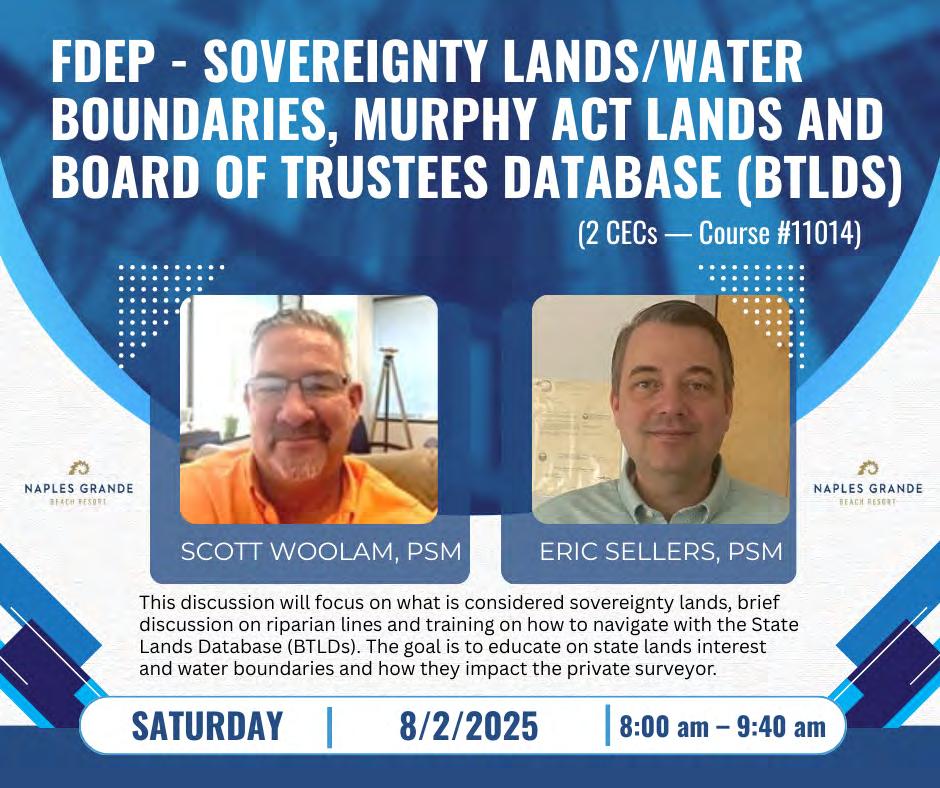
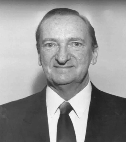
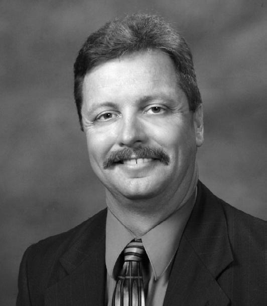
FDEP - Sovereignty Lands/Water Boundaries, Murphy Act Lands and Board of Trustees Database (BTLDS) (2 CEC – Course #11014) Instructors: Scott Woolam, PSM & Eric Sellers, PSM
This discussion will focus on what is considered sovereignty lands, brief discussion on riparian lines and training on how to navigate with the State Lands Database (BTLDs). The goal is to educate on state lands interest and water boundaries and how they impact the private surveyor.
Scott Woolam, PSM is the Chief of the Bureau of Survey and Mapping with the Department of Environmental Protection. After 10 plus years surveying in the private sector in the Pensacola area, he went to the Bureau of Survey and Mapping in 1991 where he is now in his 35th year of tenure. Scott graduated from the Surveying and Mapping Program (Geomatics) at the University of Florida. He is a member of Tau Beta Pi Engineering Honor Society and the Florida Survey and Mapping Society. He also wrestled in high school.
Eric Sellers, PSM is a Professional Land Surveyor and Mapper with the Bureau of Survey and Mapping with the Department of Environmental Protection. After 10 years surveying in the private sector in Georgia and North Florida, he went to the Bureau of Survey and Mapping in 2012. Eric graduated from Georgia Southern University. He is a member of the Florida Survey and Mapping Society.
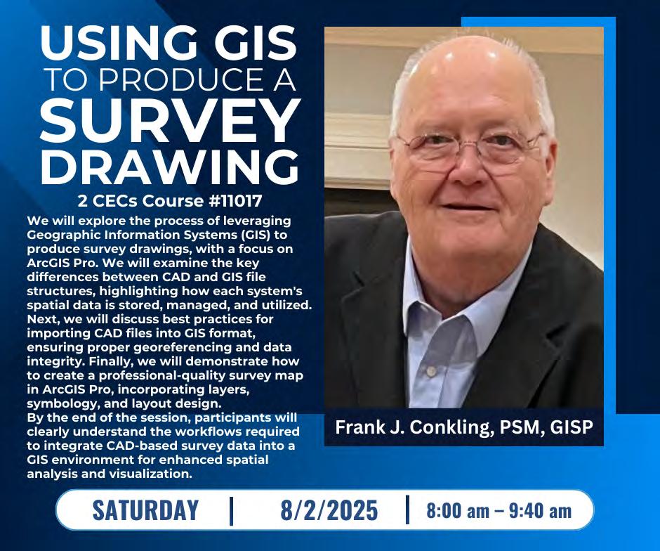
Using GIS to Produce a Survey Drawing (2 CEC- #11017) Instructor: Frank J. Conkling, PSM, GISP
This presentation will explore the process of leveraging Geographic Information Systems (GIS) to produce survey drawings, with a focus on ArcGIS Pro. We will examine the key differences between CAD and GIS file structures, highlighting how each system's spatial data is stored, managed, and utilized. Next, we will discuss best practices for importing CAD files into GIS format, ensuring proper georeferencing and data integrity. Finally, we will demonstrate how to create a professionalquality survey map in ArcGIS Pro, incorporating layers, symbology, and layout design. By the end of the session, participants will clearly understand the workflows required to integrate CAD -based survey data into a GIS environment for enhanced spatial analysis and visualization.
Frank J. Conkling, PSM, GISP owns Panda Consulting, an LB-licensed Professional Surveying and Mapping business offering GIS Professional Services since 1998. Frank is a recognized authority on GIS and Surveying and Mapping technology, including mapping various types of ownership interest in land. Frank has been involved in GIS and Parcel Mapping since 1974 and has enjoyed studying and guiding the creation, implementation, and maintenance of some of the country's most effective GIS systems and most accurate land ownership databases. Frank is a licensed Professional Surveyor and Mapper in Florida and a licensed GIS Surveyor in South Carolina. He is a Past President of the Florida Association of Cadastral Mappers, an organization focused on cadastral mapping throughout the state of Florida, and a Member Emeritus of the Florida Board of Professional Surveyors.
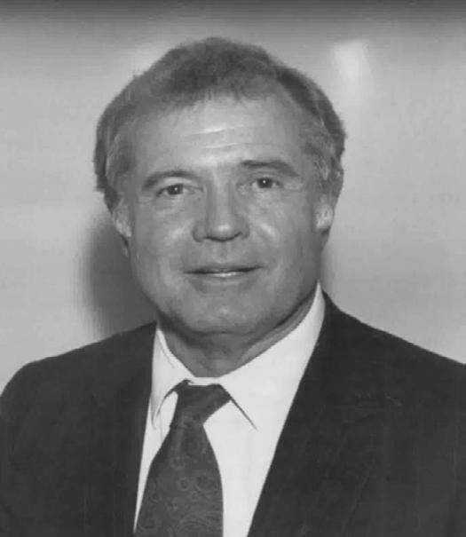
Introduction to Construction Surveying Basics
(2 CEC - #11020) Instructors: Clifford Culhane, PLS, PSM & Dionicio Montero, FAA Pilot Surveying in the United States is projected to reach a 10.7 -billion-dollar market share in 2025. This overview intends to explore the dynamic world of construction layout beginning with project planning, project execution, collaboration with the construction team and stakeholders, and finishing with the eventual closeout of the project. Attendees will come away with a general understanding of initial site preparation and planning, construction staking within tolerance and specification, design plan layout, and how to find answers within the plan set. They will also learn the importance of communication with the project team, site scheduling, and the how-to of integrating survey into the project life cycle.
Clifford Culhane, PLS, PSM is a Professional Land Surveyor with near 40 years of widely varied experience. Clifford manages a group of surveyors engaged in heavy civil infrastructure projects from highways, bridges, dams, and rail, to water plants, power generation, and other specialized unique projects. Clifford is interested in two things, primarily; training people to take his job and attracting curious and driven people to our profession by whatever means necessary.
Dionicio Montero, FAA Pilot, is a Survey Manager in the Southeast District of Kiewit Infrastructure. His passion for new and emerging technologies has led him to become the ‘go to’ integrator and subject matter expert for survey related tech in the Southeast District. From Drones, LiDar, terrestrial scanning to GPS networking Dionicio has had his hands in just about every project started in the Southeast for the last 5 years. Dionicio’s expertise is attributed to his education, hands on experience, and drive to find the most cost effective, practical solution to locally unique problems. Dionicio is currentl y working toward obtaining his Survey License in Florida.
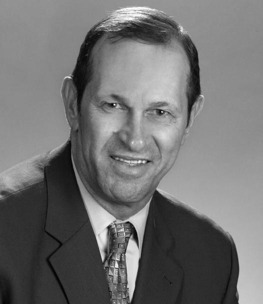
Saturday - August 2
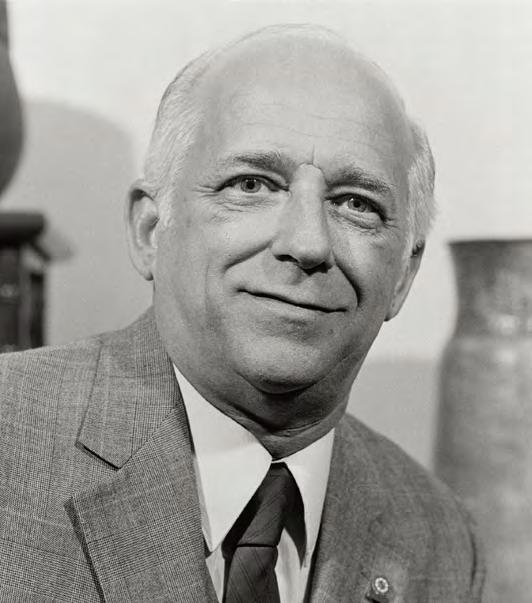
The FDOT RW Map – Purposes and Benefits to the Agency and the Surveying Profession (2 CEC - #11008) Instructors: Brett C. Wood, PSM & Christopher (Scott) Fowler, LS, MBA
The FDOT RW Map is a tool used by the agency typically associated with land appraisal and acquisition but also serves additional purposes and information to the agency and surveying profession. Learn more about the depth of the mapping and how this valuable resource can be best applied.
Brett C. Wood, PSM is the State Surveyor for the Florida Department of Transportation, Brett manages the Central Surveying and Mapping Office (CSMO) in Tallahassee and the Department’s Statewide Surveying and Mapping Program. CSMO operates and maintains the Department’s statewide continuous operating GNSS reference network, the Florida Permanent Reference Network (FPRN). Brett has over 40 years of experience in surveying and mapping and became a Florida Licensed Surveyor and Mapper in 1997. Brett came to the Department in 2009 from the private sector, specializing in geodetic and remote sensing technologies.
Christopher (Scott) Fowler, LS, MBA began land surveying in South Florida in 1989. His range of work experience includes land development, engineering support, construction layout, and roadway construction. He joined FDOT District Five in 2017 as Surveyor II in their Right of Way Mapping Section and is currently a Survey and Mapping Supervisor I in that same Section. He is a graduate of Miami Dade College, University of Minnesota, and Chancellor University. Mr. Fowler is a Licensed Surveyor in the State of Florida.
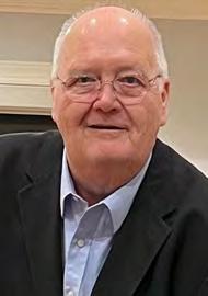
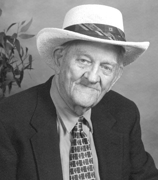
(2 CEC – #11018) Instructor: Richard Pryce, RLS, PSM
This presentation goes over five specific projects that he completed from 1999 to 2024 that combine Surveying and Geographic Information Systems into an integrated final product. The most current one being the entire water system for the City of Fort Lauderdale covering 750 miles of mains, hydrants, valves, and meters.
10:10 am11:50 am
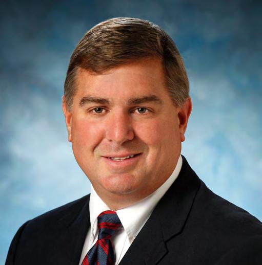
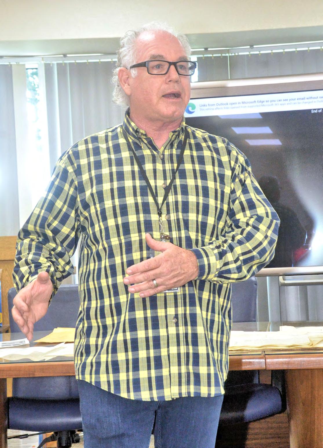
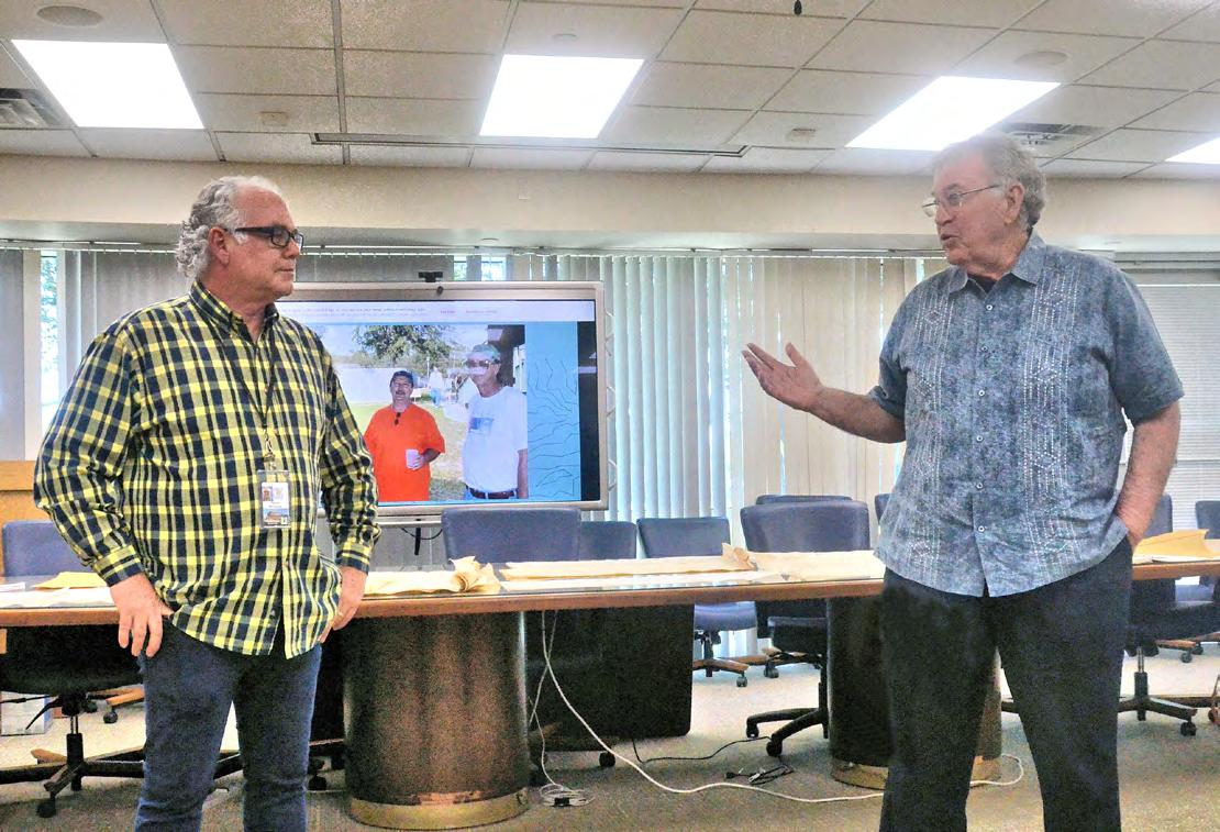
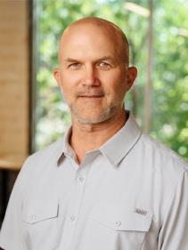
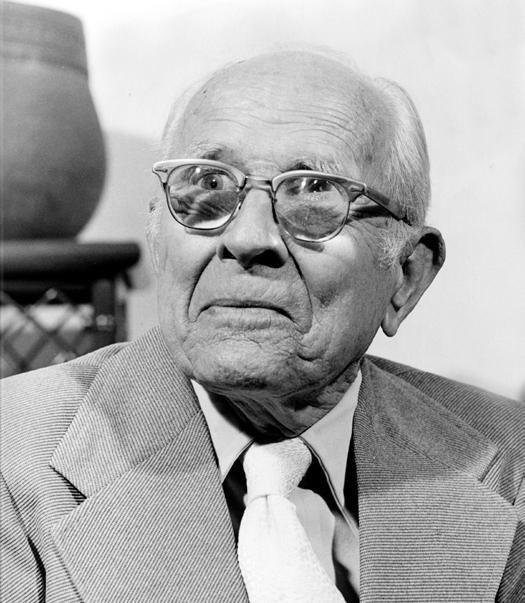
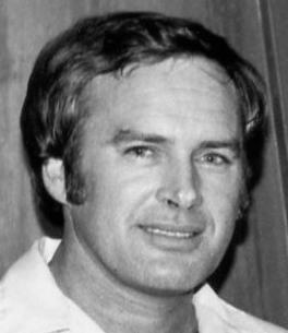
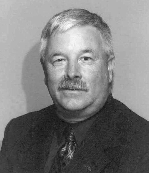
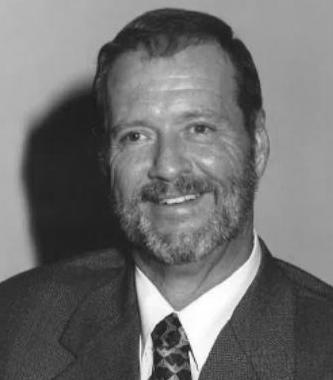
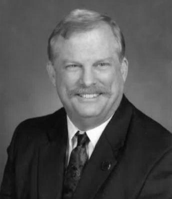
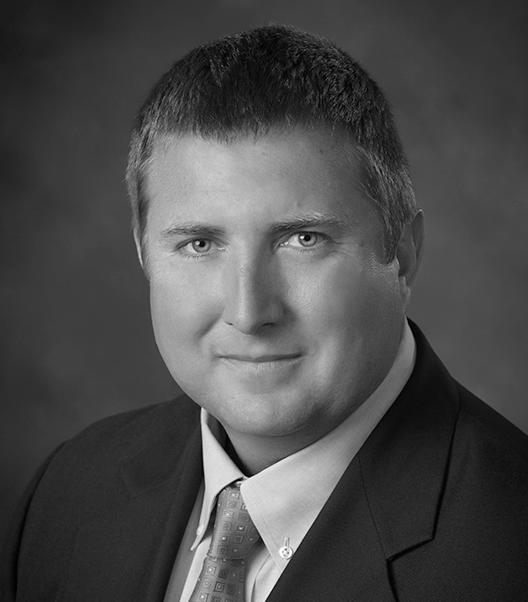
Richard Pryce, RLS/PSM is the current President of FSMS; former Director and President of Broward Chapter FSMS. Rick has been surveying since 1972 and was licensed in 1983. He has performed surveys in 42 counties within Florida and was an early adopter of Geographic Information Systems using ESRI software since 1990. He has successfully integrated and completed multiple Survey, Engineering, and GIS multi-million-dollar projects over the past three decades and has provided numerous presentations and general talks on them to a diverse group of Engineers, Surveyors, and GIS Professionals. His interest, knowledge, and expertise in remote sensing started in 1996 when he worked directly with a remote sensing firm while surveying, to assist in developing precision agriculture applications. He has expanded his knowledge and expertise to include all forms of LiDAR, (terrestrial, mobile and aerial) since then, and has also included forensic work on disaster site s. He developed multiple ways to do QA/QC LiDAR work and check both horizontal and vertical accuracies to improve upon the final product. Most recently he has been using his background with LiDAR and remote sensing to assess properties for Monroe County Land Authorities in determining how much of their properties are affected by Mean High Water Line.
Navigating Florida Statutes Chapter 177.073 – Embarking on a Journey to Allow Expedited Residential Permits with a Preliminary Plat (2 CEC - #11022) Instructor: Matthew Kalus, GISP-R, PSM, PE
This presentation details out the required items to prepare a Preliminary Plat for Municipal Approval that allow for Expedited Residential Permit; necessary milestones for the surveyor and the developer; and, reaching the destination with the Final Plat.
Matthew Kalus, GISP-R, PSM, PE holds a Bachelor of Science in Civil Engineering degree from the University of Central Florida, and has over 30 years of experience in drafting, civil and structural engineering, aviation planning, right -of-way mapping & acquisition, GIS parcel mapping, surveying, and platting. Matthew has worked for several private engineering consulting firms, as well as being employed as a public servant at Lake County Public Works, Lake County GIS, Orange County Property Appraisers Office, and for that last 11 years, at Orange County Public Works, Development Engineering Division. Mr. Kalus’ background and coordination with both the Lake County and Orange County Surveyors in right -of-way acquisition and parcel mapping, and as part of the Orange County Property Appraiser parcel re -engineering team, Matthew was involved in remapping over 340,000 parcels, several thousand plats, and nearly a hundred right -of-way maps for the 1,003 square mile county. This experience provided the foundational elements to transition to the Platting Coordinator at Development Engineering beginning in 2014 where the team processed, on average, a plat a week for recording over his entire tenure. Now in the role of Senior Project Manager for Orange County Public Works Department - Development Engineering Division, under the guidance of the division manager, Matthew oversees a staff of 50 engineers, surveyors, technicians, and inspectors comprised of six Sections: Platting, two Development Engineering Plan review teams, Permitting, Construction Inspection, and the Development Review Committee review team. These teams review all aspects of both residential and commercial development within unincorporated Orange County from Land Use plan review, subdivision and development plan review, site construction plan review, platting, and construction inspection.
1:30 pm3:00 pm
Saturday - August 2
Legal Topics for Professional Land Surveyors (2 CEC - #11016) - Instructors: Stacey D. Lyle, PhD, RPLS, PLS & Eryn L. Lyle, JD
This course will examine legal aspects of land ownership and the "4 corners rule"; the relationship between contracts and agreements for boundary and topographic engineering surveys; federal -state-local regulations for boundary and topographic engineering surveys; legal process and litigation procedures with professional surveyor expert witness and deposition responsibilities; mediation and arbitration process; and they will conclude on how selling a surveying firm while establishing a will and trust estate.
1:30 pm3:00 pm
Stacey D. Lyle, PhD, RPLS, PLS has over three decades of experience in designing and developing surveying and geospatial software and technology solutions, with 42 publications to his name. As a Professional Land Surveyor, he certifies legal land boundaries and serves as an Expert Witness in international, municipal, and private land boundary disputes. His career includes roles such as Geomatics Engineering Team Lead at BP American Production Company, Director of Machine Automation at Leica Geosystems, Systems Engineer at GeoScholar, and he is a former Research Fellow at NASA and USDA. Dr. Lyle holds a patentable new technology for "Geospatial Authentication," a cybersecurity technology licensed with NASA. He currently teaches Geography, Geology, and Civil Engineering as a Professor of Practice at Texas A&M Universit y
Eryn L. Lyle, JD Eryn is an associate of Hopper Mikeska, PLLC, having joined the firm in 2021. She focuses her practice on estate planning and estate, guardianship and trust administration. Prior to joining Hopper Mikeska, Eryn worked at Travis County Probate Court No. 1 as a Legal Intern.
1:30 pm3:00 pm
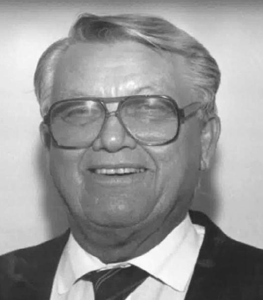
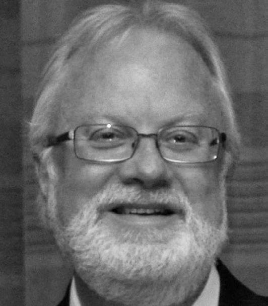
It Takes Time to Get Oriented (2 CEC – Course #11028) - Instructor: Brion Yancy, PSM
This class will go over the history of the Cape Sable Triangulation Baseline; how it was set and its purpose. Then we will delve into how we found the Cape Sable monuments; the trials/tribulations and how long it takes to get “oriented” on a new project.
Brion Yancy, PSM is a Professional Surveyor and Mapper in Florida. He began his career with his dad and pursued surveying sporadically until the age of 40. He then decided to earn his degree with the goal of becoming a licensed surveyor. While working for the Martin County Survey Department, Brion finished his degree, became licensed, and was promoted to a Project Manager. While at Martin County he had the opportunity to serve as an expert witness in photogrammetric measurements. Brion is now a Senior Project Manager with Bowman. In his current role Brion has written an estimated 60,000 legal descriptions. His surveying experience includes boundary, topographic, platting, route, right -of-way, mean high water, and hydrographic surveys. Brion is a member of the National Society of Professional Surveyors and the Florda Surveying and Mapping Society (FSMS). He was the Chapter President for the Indian River Chapter of FSMS from 2018-2020, 2022 to present, and currently a director for FSMS district 3. He was also the Indian River Chapter Treasurer from 2016-2018. Brion started the Indian River Chapter Annual Sporting Clay Charity Shoot. His vacations have evolved into successful recovery missions for monuments thought to be obliterated or lost.
Preparing to Lead
(2 CEC – Course #11024) - Instructor: Paul J. Cortissoz, SPHR
This course focuses on key elements for cultivating impactful leadership, starting with Authentic Leadership to help leaders align their values with their actions. Attendees will explore the fundamentals of Emotional Intelligence to enhance their selfawareness and empathy, as well as effective communication techniques to strengthen their relationships, presence and influence with others.
Paul J. Cortissoz, SPHR is the CEO and Co-Founder of HR Soul Consulting, a nationally recognized HR consulting firm honored with the Inc Magazine Power Partner Award for three consecutive years and the Tampa Bay Times "Best of the Best" Award for two years. With 30 years of cross -industry HR experience, he has held senior roles at Heineken USA, Columbia University, Yellow Pages, Gap Inc., and Liberty Mutual. Paul specializes in organizational development, talent management, and leadership development, delivering HR solutions tied to measurable business results.
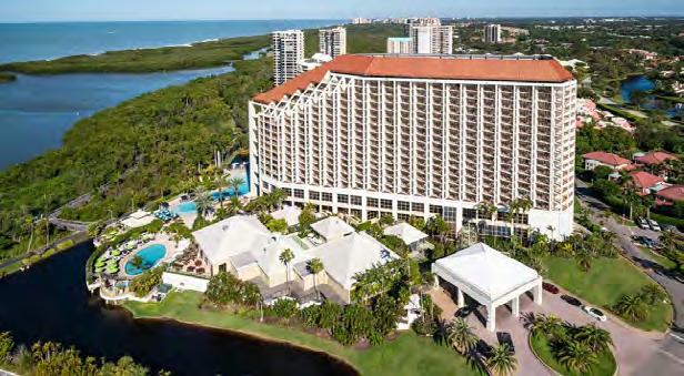
70th Annual FSMS Conference
CONFERENCE REGISTRATION
July 30th – August 2nd at Naples Grande Beach Resort
Registrants Name: _______________
Packet 1 – Full Registration/Best Value
Member
Licensed Non-Member
Non-licensed
$400
$500
$350
Includes: (1) Wednesday Welcome BBQ ticket, (1) Friday Exhibit Hall Breakfast ticket, (1) Friday Exhibit Hall Lunch ticket, (1) Friday Recognition Banquet ticket, and (6) Saturday Seminar CECs.
Member
Packet 2 – Partial Registration
Member
Licensed Non-Member
Non-Licensed
$385
$485
$335
Includes: (1) Friday Exhibit Hall Breakfast ticket, (1) Friday Exhibit Hall Lunch ticket, (1) Friday Recognition Banquet ticket, and (6) Saturday Seminar CECs.
Packet 3 – Saturday Only
Licensed Non-Member
Non-licensed
$240
$340
$190 Includes: (6) Saturday Seminar CECs.
SATURDAY SEMINARS
August 2nd
Course options are listed below, please mark the circle next to the course. Choose only ONE course per time segment.
Course name:
FDEP - Sovereignty
2 Hour Course Options
8:00 am–9:40 am
(choose one from this row)
10:10 am – 11:50 am
Lands/Water Boundaries, Murphy Act Lands and Board of Trustees Database (BTLDS)
(2 CEC’s – Course #11014)
Instructors: Scott Woolam, PSM & Eric Sellers, PSM
Course name:
Using GIS to Produce a Survey Drawing
(2 CEC’s - Course 11017)
Instructor: Frank Conkling, PSM, GISP
Course name:
Introduction to Construction Surveying Basics
(2 CEC’s - Course #11020)
Instructors: Clifford Culhane, PLS, PSM & Dionicio Montero, FAA Pilot
1:30 pm – 3:10 pm
(choose one from this row)
(choose one from this row) The FDOT RW Map – Purposes and Benefits to the Agency and the Surveying Profession
(2 CEC’s - Course #11008)
Instructors: Brett Wood, PSM & Scott Fowler, PSM
Course name:
Legal Topics for Professional Land Surveyors
(2 CEC’s – Course #11016)
Instructors: Stacey D. Lyle, PhD, RPLS, PLS and Eryn L. Lyle, JD
Expert Testimony: Neutral, Defensive, or Persuasive
(6 CECs - Course #11011)
Instructor: Kevin Norris, PLS, JD
SIT Prep Course (Un-Licensed Attendees, No CEC Credit)
July 30
8:00 am – 4:00 pm
Geoscholar's Florida Surveying and Mapping Society Fundamentals of Surveying (FS) Exam/Surveyor in Training (SIT) Certificate Prep Course
You must complete the online course before attending the Seminar. Dr. Lyle will be covering select questions over the required sections to help you with examination preparation. After the Seminar you will have access for 1 year to the online course.
• Vendor Spotlight: 30 Minute Priva te Room Speaking Opportunity (Limited Spaces Available, N o CECs)
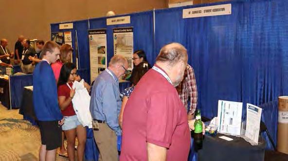
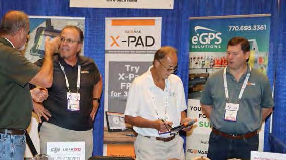
EXHIBITORS
PLATINUM
Duncan-Parnell
Duncan-Parnell is an Authorized Trimble Dealer for land survey, mapping/GIS, and construction instruments — and has been the leading provider of survey & mapping solutions in Florida for over 25 years. Our product offerings include GNSS receivers, drones/UAVs solutions, robotic and manual total stations, software for workflow integration, digital and automatic levels, 3D laser scanners, mobile mapping and monitoring solutions, construction lasers, as well as a full range of field supplies and accessories. Duncan-Parnell is your full field-to-finish provider. Our Geospatial team has decades of industry experience, certified service centers, and experienced trainers on staff. We’re ready to be a trusted partner and assist with your sales, rental, or maintenance needs. Contact us today!
EXHIBITORS GOLD
loo q
Looq AI is a high-growth technology platform company dedicated to advancing critical infrastructure digitization and diagnosis. The company has developed a fundamental new camera technology that makes survey-grade 3D capture cost-effective at scale. The Looq Platform is hand-held capture from the ground—a one-stop for creation, visualization, analysis, collaboration, and integration to digitize the built-world. Users work more efficiently and get accurate results for topographic mapping and modeling of transmission & distribution assets
TopoDOT
TopoDOT is a point cloud processing software application offering a comprehensive feature extraction tool suite with the right balance between automation and quality assurance. TopoDOT offers a well-documented process to extract Digital Twin deliverables such as topographies, assets, 3D models, measurements, analyses, and reports meeting the highest quality-controlled standards. Our TopoShare product provides a comprehensive process to organize, store and share your data across operations at the lowest possible cost. TopoDOT LLC is headquartered in Winter Garden, Florida.
Exhibitor Opportunities
SILVER EXHIBITOR
$2,300
• Company Bio and Logo in the Conference Program Book
• 1 month free half-page ad in The Florida Surveyor W: 8.5 in. x H: 5.5 in.
(Sustaining Firms will receive an additional free month )
• Recognition in the Conference Edition of The Florida Surveyor
• Logo with hyperlink to website displayed on FSMS.org
• Third priority when choosing booth(s)
• 2 Day Complimentary Self Parking
• Welcome-Bag Flyer Insert (Vend er Provided)
• 2 Welcome BBQ tickets
CONFERENCE EXHIBITOR
$1,800
• Company Bio and Logo in the Conference Program Book
• 1 month free half-page ad in The Florida Surveyor W: 8.5 in. x H: 5.5 in.
(Sustaining Firms will receive an additional free month )
• Recognition in the Conference Edition of The Florida Surveyor
• Last priority when choosing booth(s)
• Logo with hyperlink to website displayed on FSMS.org
ALL EXHIBITORS WILL R E CEIVE:
8’ x 10’ draped booth with 10’ backdrop and 36” side rails
7” x 44” booth identification sign
6’ draped table, 2 chairs and waste basket
4 name tags for booth personnel per booth
2 Exhibitor breakfast tickets per booth
2 Exhibitor lunch tickets per booth
Attendee List (By Request)
(Additional Booths can be Purchased for $950 per Booth)
Exhibitor Reception Trimble
Room Keys Hyatt Survey
Recognition Banquet LJA
Conference Tote Bags LANGAN
$1,700
Sponsorship Opportunities
Refreshment Breaks (Company Name & Logo on Signage at All Seminar Refreshment Breaks along with a Full-Page Ad in The Florida Surveyor.)
$1,700
Registration Desk & Signs (Company Name & Logo on Conference Welcome Banner located at the Registration Desk. Assists with Conference Sign expenses.)
* $1,500 *O nly 1 Sponsorship Available!
Back Cover of Conference Program Book (Company Name, Logo or Ad placed on Back Cover of Conf. Program Book given to Attendees.)
$1,500
Banquet Door Prizes (Sponsorship of Prizes given at Recognition Banquet along with Company Name & Logo on Signage During Banquet.)
$1,500
Exhibit Hall Breakfast (Company Name & Logo on Signage during Friday morning Exhibitors Breakfast. Assists with Breakfast Expenses.)
$1,500
Legislative Reception (Company Name & Logo on Signage at Reception. Sponsorship assists with Speaker and Reception expenses.)
$1,200
Exhibit Hall Door Prizes (Company Name & Logo on Signage during Friday's Exhibit Hall Event, in addition to being Recognized during Raffle as a Sponsor.)
$1,200
Exhibit Hall Luncheon (Company Name & Logo on Signage during Friday's Exhibitors Luncheon. Assists with Lunch Expenses.)
$1,200
SIT Test Prep (Company Name & Logo on Signage outside of classroom.)
$1,000
Cornhole Tournament (Company Name & Logo on Signage during Wed. Cornhole Tournament.)
$1,000
Exhibitor Welcome Bags (Company Name & Logo on Conference Exhibitor Welcome Bags).
$1,000
Fishing Tourney/Trip (Company Name & Logo on Signage. Assists with Food, Drinks, & expenses.)
Lanyards
SPONSORS
$1,000
Sponsorship Opportunities
Golf Tournament (Company Name and Logo on Signage. Assists with Food, Beverage, and Prize costs.)
* $1,000 *O nly 1 Sponsorship Available!
Inside Front Cover of Conference Program Book (Company Name, Logo or Ad placed Inside the Front Cover of the Conference Program Book.)
$800
Exhibit Hall Luncheon Cash Bar (Company Name & Logo on Signage at 1 Cash Bar serving Beer & Soda during the Friday Exhibit Hall Luncheon. Includes 4 Complimentary Drink Tickets.)
* $800 *O nly 1 Sponsorship Available!
Inside Back Cover of Conference Program Book (Company Name, Logo or Ad placed Inside the Back Cover of the Conference Program Book.)
$750
CST Exams (Company Name & Logo on Signage before & during Exam.)
$700
General Business Session (Company Name & Logo on Signage at & during Conference GBS.)
$500
Exhibitor Beverage Break (Company Name & Logo on Signage at Exhibitor Afternoon Beverage Break in the Exhibit Hall.)
$500
Registration Packets (Company Name & Logo on Registration Packets given to All Attendees.)
$500
Saturday Seminar Refreshments (Company Name & Logo on Signage during Saturday's Seminar Refreshments Break.)
$500
Saturday Seminar Sponsor (Company Name & Logo on Signage at Sat. Seminar of your choice.)
$500
Young Surveyors Event (Sponsorship of Special Activity for the Young Surveyors Network.)
$300
General Sponsor (Half-Page Ad in The Florida Surveyor.)
Swag Whidden Surveying & Mapping
Conference Morning Coffee Bowman
Conference Morning Coffee Pickett
Front Cover of Conference Program Book
E.R. Brownell & Associates
SPONSORS
Registration Desk & Signs SSMC
Back Cover of Conference Program Book
WBQ Design & Engineering
SIT Test Prep BGE
SIT Test Prep Tampa Bay Chapter
SPONSORS
Cornhole Tournament DRMP
Cornhole Tournament LENGEMANN
Exhibitor Welcome Bags Collier-Lee Ch.
Inside Front Cover of Conf. Program Book WGI
SPONSORS
CST Exams Central FL Chapter
Registration Packets Central FL Chapter
Registration Packets Tampa Bay Chapter
Saturday Refreshments Break DRMP
SPONSORS
Sat. Seminar Sponsor Tampa Bay Chapter
Young Surveyors Events Central FL Chapter
Young Surveyors Event LANGAN
Young Surveyors Events Palm Beach Chapter
PRECISION BEYOND BOUNDS
FRONTIER PRECISION UNMANNED SOLUTIONS
Frontier Precision has been leading the way in delivering innovative solutions – on land, air and underwater with our Unmanned technology. Now, every place on earth is reachable – with our UAS/ Drones, ROV’s, and LiDAR solutions. We help you with the latest technology to get your job done efficiently while keeping your business profitable.
UAS / DRONE DOCKS
The latest innovations in drones and docks to deliver the right product for the right UAS application.
LIDAR / SENSORS
LiDAR/Sensor solutions designed for precision data collection.
UNDERWATER ROVS
Deep Trekker’s underwater ROVs showcase proven durable and innovative solutions.
FRONTIER PRECISION | JACKSONVILLE, FL
Jordan Baranowksi | 904.855.9827 [Office] or jordanb@frontierprecision.com
FIND OUT MORE AT: www.frontierprecision.com/unmanned
Morris-Depew Associates, Inc. 239-337-3993 Murphy’s Land Surveying 727-347-8740 N Navigation Electronics, Inc. 337-237-1413
Northwest Surveying, Inc. 813-889-9236
O
On The Mark Surveying, LLC. 321-626-6376
PEC Surveying & Mapping
407-542-4967
Pennoni Associates, Inc.
863-594-2007
Perret and Associates, Inc
904-805-0030
Pickett & Associates, Inc.
863-533-9095
Plan Right Surveying, Inc.
239-276-2861
Platinum Surveying & Mapping, LLC.
863-904-4699
Polaris Associates, Inc.
727-461-6113
Porter Geographical Positioning & Surveying, Inc.
863-853-1496
Southeast Geospatial 877-653-6544
Stoner Inc. 954-585-0997
Suarez Surveying & Mapping, Inc. 305-596-1799
Survey Data Solutions, LLC 352-816-4084
Survey Pros, Inc. 305-767-6802
SurvTech Solutions, Inc. 813-621-4929 T
T2 UES Inc. 407-587-0603
F irm S Directory
Thurman Roddenberry & Associates
850-962-2538
TopoDOT
407-248-0160
TranSystems
727-822-4151
UF/IFAS
352-846-0850
Upham, Inc.
386-672-9515
Wade Surveying, Inc.
352-753-6511
Wantman
561-687-2220
LinkedIn = 1,977 Followers
Facebook = 1.1K Followers
X = 384 Followers
Instagram = 434 Followers
YouTube = 51 Subscribers • 16 Videos
CHAPTER EIGHTEEN
Getting the Water Right: The Restudy and Enactment of CERP, 1996-2000
In November 2000, the U.S. House of Representatives approved a bill authorizing the Comprehensive Everglades Restoration Plan (CERP), an ambitious project headed by the U.S. Army Corps of Engineers, to restore the South Florida ecosystem. Buoyed by the passage of the act, which President Bill Clinton signed on 11 December 2000, congressional leaders, Secretary of the Interior Bruce Babbitt, environmentalists, and even a man in a large green alligator costume (the mascot of the SFWMD) joined in a celebratory “love fest.”1 Sugar interests, environmental groups, state and county officials, Indian tribes, federal agencies, Republicans, and Democrats had all come together – through the Task Force, the Governor’s Commission for a Sustainable Florida, and the Corps’ Restudy team – in the latter part of the 1990s to develop a workable and agreeable restoration plan. Even though questions remained about the ultimate effects of CERP, it seemed that consensus had won the day. But it had been a long road to gain that consensus, fraught with pitfalls and obstacles.
As explained earlier, the Water Resources Development Act of 1996 (WRDA-96) directed the Corps to conduct a feasibility study on a comprehensive plan for Everglades restoration. At the same time, it mandated that the South Florida Ecosystem Restoration Task Force include non-federal interests. This stemmed from concerns expressed in 1994 and 1995 that non-federal groups – specifically the state of Florida and the Miccosukee and Seminole Indians – did not have enough input in the restoration effort. One of the problems was that the Federal Advisory Committee Act severely limited how non-federal organizations could participate on federal committees. Therefore, in the words of Colonel Terrence “Rock” Salt, now serving as the executive director of the Task Force, “Federal law does not provide a mechanism to build the sorts of relationships needed in the Everglades restoration efforts without complications from the FACA.”2 Salt recommended that the Task Force support legislative proposals to exempt the Task Force from the Federal Advisory Committee Act, and that it then appoint the Miccosukee, the Seminole, the state, and the SFWMD as ex officio Task Force members.
The Task Force had the immediate opportunity to implement Salt’s suggestions, as Congress was considering a bill to promote better cooperation between federal and non-federal interests. In March 1995, Congress passed the Unfunded Mandates Reform Act, stating that the Federal Advisory Committee Act would not apply to “meetings . . . held exclusively between Federal officials and elected officers of State, local, and tribal governments,” where the conferences were “solely for the purpose of exchanging views, information, or advice relating to the management or implementation of Federal programs.”3 Accordingly, in June 1995, the Task Force expanded its membership to include the state of Florida, the Miccosukee Tribe of Indians, and the Seminole Tribe of Florida.4
To ensure that no difficulties would result from this arrangement, and to provide a congressional mandate for these groups’ participation, Congress included a provision in WRDA96 specifically delineating the membership of the Task Force. It stated that the committee would
consist of the secretary of the Interior (who would chair the group), the secretaries of Army, Commerce, Agriculture, and Transportation, as well as the Attorney General, the administrator of the Environmental Protection Agency, and representatives from the state of Florida, the SFWMD, the Miccosukee, the Seminole, and a local government. The Task Force was instructed to consult with the Corps in the Corps’ preparation of the Restudy; to coordinate different policies and plans for restoration; to facilitate coordination between the different agencies; and to manage the gathering of scientific data.5 According to the Task Force’s 1996 annual report, the inclusion of the non-federal groups allowed the organization to shift its focus “toward issue resolution,” and it also “increas[ed] its emphasis on the urban and agricultural components” of restoration.6
With its official mandate, the Task Force delineated its goals for South Florida restoration. These included restoring the “diversity, interconnectedness and function of the region’s predrainage landscape,” as well as ensuring that the “working landscape” could sustain both “a healthy economy and a vibrant society while complementing the management of vital natural resources.” The Task Force wanted to restore “estuarine and marine systems,” and allow for “natural hydrologic functions in wetlands.” It would strive to provide air “healthy to breathe,” and it would educate South Floridians so that they could “understand and support the need to restore, preserve and protect the South Florida Ecosystem.” To achieve these “desired future conditions,” restoration had to consist of three components: getting the water right, restoring and enhancing the natural system, and transforming the built environment. It would also have to be based on sustainability, utilizing an “Ecosystem Approach.” The Task Force committed to employ “sound science,” as well as adaptive manage ment, in its efforts, and it pledged to use “expanded Partnerships,” including public involvement, to “integrate Restoration Planning.”7
In its restoration activities, the Task Force had several good resources, including Colonel Salt, who, as executive director of the Task Force, assisted the secretary of the interior in the management of the group, and Colonel Terry Rice, who had replaced Salt as District Engineer of the Jacksonville District in 1994. Both believed that Floridians needed to coordinate human needs with environmental quality, and both were firmly committed to the restoration effort. During his 1991-1994 term as District Engineer of the Jacksonville District, environmentalists had embraced Salt as a “green” commander because of his work on both the Kissimmee River and the Restudy. According to Rice, Salt was “the bee’s knees” in the eyes of many South Floridians.8 Salt emphasized the same integrated system approach to South Florida’s problems as he had used while dealing with salmon runs on the Columbia and Snake rivers as deputy commander of the Walla Walla District. The colonel had provided such strong leadership in environmental issues as District Engineer that restoration interests wrote letter after letter to Corps Headquarters in 1994, requesting that Salt be allowed to extend his three-year term.9
Because of Salt’s popularity, Rice faced a daunting situation, but he committed to do his best to “continue what [Salt] had started.” By the end of his tenure, restoration proponents were also asking for an extension of Rice’s time.10 Rice, who had a Ph.D. in water resources engineering, had spent most of his professional life in Africa, South America, Central America, and Europe, trying to solve water resource problems in developing countries. After becoming immersed in Everglades issues, Rice discovered that “the problems we face in South Florida are really the same problems we face everywhere,” namely, “how does man take care of himself and not
destroy the environment in which he lives.” He foresaw Everglades restoration as a prime opportunity to experiment with solutions to that fundamental question, and he regarded it as “one of our greatest chances on this earth” to develop “the model that we need to move forward into history.”11
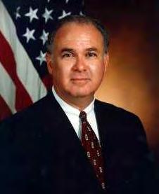
The Clinton Administration, especially Vice President Albert Gore, Jr., also provided strong support for Everglades restoration. Gore had been an early convert to the principles of ecosystem restoration and sustainability, and in the mid-1990s, he latched onto Everglades restoration as the crowning example of these concepts in action. He had strategic helpers in the Office of the Secretary of the Army, including Joseph Westphal and Michael Davis, Assistant Secretary and Deputy Assistant Secretary of the Army (Civil Works), respectively. Davis, for example, had studied wildlife ecology and wetlands science for 25 years, and had worked for the Council on Environmental Quality (CEQ) in the White House before becoming Deputy Assistant Secretary. Westphal, meanwhile, had been both a senior fellow at the Institute for Water Resources and the Senior Policy Advisor for Water at the EPA before his appointment as Assistant Secretary. Both held strong feelings in favor of Everglades restoration.12
In Florida, the state government had restoration proponents as well. Governor Lawton Chiles, who died in office in 1998, had worked for years, both as a state senator and as governor, on environmental initiatives. Governor John Ellis “Jeb” Bush, who became governor in 1999, did not have as strong of an environmental record, but he readily embraced restoration as both necessary and desirable, telling a gathering of the Everglades Coalition in January 2000 that “there certainly should be no question about my personal commitment.”13
Alarming statistics also fueled the desire for some kind of a comprehensive plan. According to a Task Force report, South Florida’s population was expected to expand to as much as 12 million in “the next generation,” fed by an estimated overall increase of 700 new residents every day. Such expansion, the Task Force declared, would continue to affect the natural resources of the area, which had already been “significantly disrupted” by “extensive drainage and flood control systems.” It noted that half of the Everglades had disappeared due to drainage, wading bird populations had declined by 90 percent, exotic plants threatened to eliminate native vegetation, pollutants diminished water quality, and Florida Bay was “in a state of ecological collapse.” All of these problems, the Task Force argued, revolved around the disruption of the “quantity, timing and distribution” in fresh water deliveries.14
An excess of rainfall in 1994 and 1995 emphasized the water distribution problems. The Corps’ flood control system functioned adequately, but it created difficulties in other areas. In order to maintain acceptable levels in Lake Okeechobee, for example, the SFWMD had to flush hundreds of thousands of gallons of water down the St. Lucie and Caloosahatchee canals. This
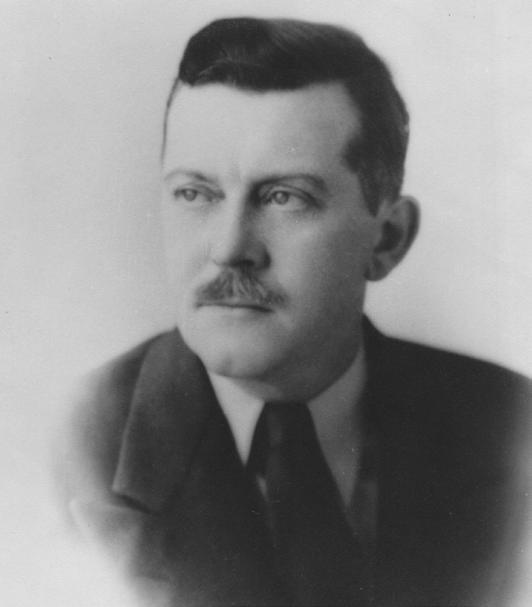
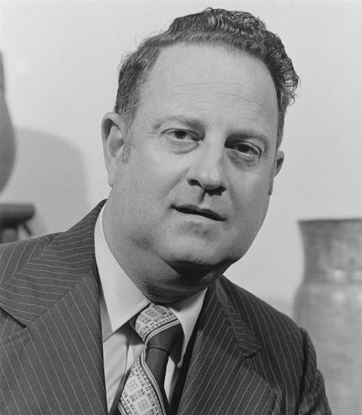
Assistant Secretary of the Army (Civil Works) Joseph Westphal. (Source: U.S. Army Corps of Engineers.)
pounded the estuaries with slugs of fresh water and silt, disrupting their salinity balance, causing lesions on game fish, and killing seagrass. Likewise, pumping water from the EAA into the water conservation areas threatened deer populations and damaged tree islands, much to the dismay of the Miccosukee Indians.15 Accordingly, the Miccosukee sued the United States in 1995, charging that the Corps had refused to send water to Everglades National Park because of objections from the NPS, causing undue damage to Miccosukee land in Conservation Area No. 3.16 Facing such difficulties, the Task Force determined that restoration efforts should be centered on reestablishing the “historic hydrologic functions” of the Everglades, meaning balancing the “quantity, quality, timing, and distribution of fresh water” throughout the ecosystem.17
Another problem involved the resurrection of the idea to build a commercial airport near Everglades National Park, this time at a site formerly housing the Homestead Air Force Base. In August 1992, Hurricane Andrew, a Category Five storm, had pummeled South Florida, destroying the Homestead base, which lay between Everglades National Park and Biscayne National Park (established in 1968 to preserve Biscayne Bay). Several politicians, including then-presidential candidate Bill Clinton and U.S. Senator Bob Graham, declared their support for redevelopment, and, soon after, Carlos Herrera, president of the Latin Builders Association, spearheaded a plan to construct a commercial airport on the former base’s site. In January 1996, Dade County, in what many believed was a classic Miami backroom deal, voted to allow Herrera and his colleagues to begin plans for the development, and an EIS was concluded that year.18
However, the Everglades Coalition charged that the EIS was inadequate, stating that it did not take into account numerous factors. For one thing, there was no analysis of how runoff through the Military Canal (which removed water from the ar ea) would affect Biscayne Bay, nor were there adequate considerations of the effects of noise on Everglades and Biscayne visitors. In addition, Task Force agencies had determined “that the Proposed Action likely conflicts with their restoration initiatives” and that it would not allow for adequate “protection of natural resources in Southern Dade County.”19 The coalition therefore requested that a supplemental EIS be performed, and Vice President Gore ordered that action in 1997.20
Meanwhile, the Natural Resources Defense Council, the Sierra Club, and the Friends of the Everglades contemplated filing a lawsuit. Yet not all environmentalists agreed with litigation, causing a rift within the environmental movement itself. The Audubon Society, for example, claimed that the Clinton administration’s support of the airport, coupled with the fact that Senator Graham wanted it built to promote Homestead’s economic development, made it useless to fight. Others, such as Joe Browder and Nathaniel Reed, however, were opposed to the airport and derided Audubon leaders for their stance.21
Such divisions generated by the Homestead airport, as well as the flooding problems in the water conservation areas, fragmented the foundation of consensus that the Task Force and the Governor’s Commission were constructing. One of the ways that the groups hoped to repair the damage was through the inclusion of unbiased scientific studies in the restoration effort, something that the Task Force’s Science Subgroup had recommended in 1996. The subgroup claimed that a South Florida Comprehensive Science Plan was essential, giving priority to studies detailing how the hydrologic system needed to be modified and operated to restore the
Map showing the location of the Homestead Air Force Base. [Source: U.S. Geological Survey, “Preliminary Determinations of Hydrobiological Conditions in the Vicinity of the Proposed Jetport and Other Airports in South Florida” (1969).]
ecosystem. Especially important was the delineation of pre-drainage hydrology and the use of adaptive management in the final comprehensive plan, including models, restoration support studies, and monitoring.22
Indeed, the strategy of adaptive management was a major focus for those developing the comprehensive plan. Proponents of adaptive management believed that it was a necessary component of CERP for several reasons. The uncertainty surrounding the effects of the restoration efforts and the size of the South Florida ecosystem were important factors, as was the fact that adaptive management recommended openness in the planning and implementation of components. Since water management decisions had generated so much mistrust over the years, such openness and commitment to conflict resolution was both desirable and necessary. Resource managers hoped that employing an adaptive management approach would “substantially improve the chance of success in achieving ecosystem goals” through several means. It would ensure a “proactive approach” in dealing with problems, while ensuring that “active collaboration” occurred between scientists, planners, and managers. It would provide a “formal mechanism to expedite and facilititate system-wide decision making, while also providing an “opportunity to develop best available science.”23
In integrating adaptive management into the comprehensive plan, the Corps was merely riding a wave sweeping over the United States. Many land management agencies, including the U.S. Forest Service and the U.S. Department of the Interior, had implemented adaptive management into certain projects, such as the Forest Service’s management plan of coastal forests in California, Oregon, and Washington in 1993, or the Interior Department’s building of riparian habitat in the Grand Canyon in 1996. Yet South Florida was one of the first places to use adaptive management in a large ecosystem restoration project. As such, observers focused on whether the strategy would actually work, or whether it would merely result in a series of expensive and time-consuming disasters. At the same time, scientists involved in the implementation of restoration endeavors charted the lessons whether the guiding principles of adaptive management proved true in South Flor ida. These included admitting that no easy answers and no experts existed; that new methodological approaches and new scientific methods were needed to solve ecological problems; that uncertainty should be embraced and acknowledged rather than minimized; that the ultimate goal of management was resilience, meaning “enhancing the ability of a system to persist and function in the face of extreme disturbance”; that surprises were the rule, not the exception; that the devil was in the dynamics of an ecosystem’s function, not just the details; that human and ecological systems were always changing and uncertain; and that management cannot be separated from the scientific process.24 But the relative newness of adaptive management, coupled with the fact that the strategy could potentially result in expensive experiments that wasted time and money without doing anything to restore the ecosystem, meant that criticisms and second-guessing were sure to arise in the process, as they certainly did.
Yet in dealing with scientific issues and with adaptive management, restoration proponents already had a good base. In 1989, the SFWMD and Everglades National Park had co-sponsored a symposium at Key Largo to examine what scientists knew about the Everglades ecosystem. Several hundred scientists attended, continuing the discussions after the conference in six adaptive environmental assessment workshops and in informal interactions and contacts. The
result of these efforts was the publication in 1994 of Everglades: The Ecosystem and Its Restoration, edited by Steven M. Davis of the SFWMD and John C. Ogden of Everglades National Park. This volume, which demonstrated the interdisciplinary nature of ecology and ecosystem studies, included contributions by 57 scientists from various universities and organizations, including the National Audubon Society, the SFWMD, the National Marine Fisheries Service, the Bureau of Land Management, Everglades National Park, the University of Florida, and the University of Miami, among others. Each chapter was peer-reviewed by at least three outside evaluators, and the final product covered a host of subjects, including agriculture, wetland protection, fresh water flows to Florida Bay, climate, fire, hydrology, vegetation, fish and wildlife, phosphorous, and ecosystem restoration. Contributors discussed these topics in both their historic and contemporary contexts. The main focus of the work, however, was on “the interrelated roles of ecosystem size, disturbance patterns, and hydrology as determinants of large-scale ecosystem restoration,” and its final chapter, co-authored by Davis and Ogden, synthesized the hypotheses and conclusions of the contributors into a set of problems that ecosystem restoration would have to solve.25
According to Ogden and Davis, “the reduction in ecosystem size and compartmentalization of the remaining system are trends that must be reversed in any Everglades restoration initiative.” Likewise, hydrologic and fire fluctuations needed to approach natural characteristics. Moreover, water delivery should occur according to historical rainfall patterns in an attempt to reestablish natural hydrology. Such a plan, they concluded, should also have components allowing for natural “volumes and distributions” and “depth patterns in time and space.” Finally, water delivery needed to “mimic extended periods of flooding” in Everglades marshes. These objectives would succeed, Davis and Ogden insisted, only if they occurred under a “regional ecosystem-level planning process.”26 The Corps agreed, and used the publication as “a primary source for the basic hypotheses and technical understandings of the Everglades system.”27
Using the blueprint that Davis and Ogden’s book provided, the Corps began working in earnest on a comprehensive plan. Instrumental in the program’s development was the Governor’s Commission for a Sustainable South Florida. In the eyes of many, the commission played a major role in the creation of CERP because it brought together a host of divergent interests – environmentalists, dairy farmers, sugar growers, vegetable producers, state agencies, county governments, and federal groups – and persuaded them to agree to a central plan. The task of building consensus was not easy; Richard Pettigrew, chairman of the commission, noted that when the commission first came together in 1994, distrust abounded among the different groups. In the words of Robert Dawson, former Assistant Secretary of the Army (Civil Works) during the Reagan administration and current lobbyist for the sugar industry, a lot of “scar tissue” had developed around water management issues through the years, influencing how interests perceived each other.28 To eradicate this baggage, Pettigrew forced the different representatives to mingle socially, planning evening “happy hours” for this purpose. “The happy hours were critical,” Pettigrew later recollected, because they made commission members “g[e]t to know each other as people.”29
As Pettigrew slowly built relationships of trust between the different interests, the sides compromised and negotiated in a productive manner. Their efforts were accelerated after Rice met with them in June 1995 and declared that if the Governor’s Commission could outline a
comprehensive restoration program that met the approval of all its members, it would serve as the template for the Corps’ restudy. Although commission members expressed skepticism with Rice’s pledge, they spent the next year developing a plan, using staffing and other support from the Corps. According to Rice, the negotiations were at times “excruciating” because of the manifold interests that had to be satisfied. “Every issue that came up [was] a major discussion,” the colonel noted, leading to the creation of numerous working groups to sort out the problems. 30 Finally, the commission constructed a plan unanimously approved by the whole group, and it submitted the proposal to the Corps in 1996.
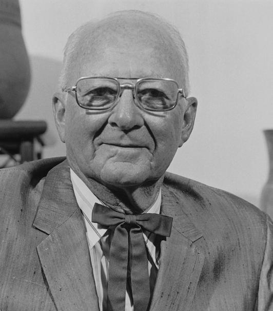
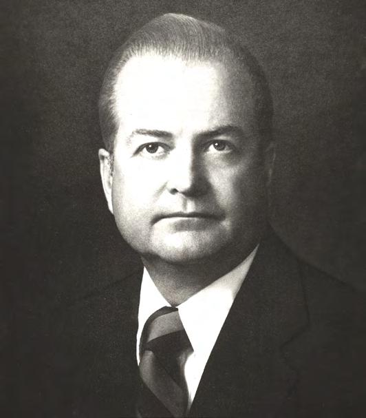
Richard Pettigrew when he was Speaker of the House in Florida's state legislature. (Source: The Florida Memory Project, State Library and Archives of Florida.)
After receiving the plan, the Jacksonville District’s interdisciplinary Restudy team molded and formatted it into a feasibility report. In essence, the Corps’ team had to take the recommendations made by the Task Force and the Governor’s Commission and formulate them into a clear and workable restoration plan (accepted by all interested parties) that the Corps could implement in South Florida. Stuart Appelbaum, of Kissimmee River restoration fame, headed this effort, using the same novel approaches to the comprehens ive plan as he did in the preparation of the Kissimmee feasibility study. Patterning the organization of his team after Skunk Works, the nickname for Lockheed Martin’s Advanced Development Program that built fighter planes, Appelbaum placed the different members – ecologists, biologists, engineers, economists, hydrologists, planners, public relations personnel, real estate specialists, and so forth – in the same area to facilitate communication. He also integrated similar personnel from federal, local, state, and tribal agencies into the process, making the Restudy team as inclusive as possible. Shaking things up was the only approach to take, Appelbaum insisted, because “the Corps was perceived as the bad guys.” If the agency presented the “traditional” Corps arrogance, Appelbaum believed, it would not be able to generate the necessary cooperation that it needed. 31
With Appelbaum’s fresh approach – designated the “Something Tells Me We’re Not in Kansas Anymore, Toto” method32 – the Corps analyzed the conceptual plan submitted by the Governor’s Commission. This re port recommended that numerous water projects be undertaken to “achieve a healthy ecosystem” capable of supplying “vital water resources” for “a sustainable South Florida.” It grouped these proposals under 13 thematic concepts:
• Regional Storage Within the Everglades Headwaters and Adjacent Areas
• Lake Okeechobee Operational Plan
• Everglades Agricultural Area Storage
• Water Preserve Areas
• Natural Areas Continuity
• Water Supply and Flood Protection for Urban and Agricultural Areas
• Adequate Water Quality for Ecosystem Functioning
• Increase Spatial Extent and Quality of Wetlands Beyond the Everglades
• Invasive Plant Control
• Aquifer Storage and Recovery
• Protection and Restoration of Coastal, Estuarine, and Marine Ecosystems
• Conservation of Soil
• Operation, Management, and Implementation of the C&SF Project Modifications and Related Lands.33
The Corps took the recommended projects and ran them through a model-based screening process, using the resulting data to determine, in Appelbaum’s words, “what ideas made the most sense.”34 The Internet facilitated the compilation and sharing of this data, allowing team members to post and download documents and reams of data.
Governor's Commission for a Sustainable South Florida
Formed in 1994
State and local coordination
Created conceptual plan for the Restudy
Provided recommendations for developing a healthy ecosystem in South Florida
South Florida Ecosystem Restoration Task Force
Chartered in 1993; officially established in 1996
Federal coordination
Provide recommendations to secretary of the interior regarding the development of Everglades Restoration
Jacksonville District Restudy Team
Formed in 1993
Integrating Governor's Commission and Task Force ideas into workable restoration plan
The different responsibilities of the South Florida Ecosystem Restoration Task Force, the Governor’s Commission for a Sustainable South Florida, and the Corps’ Restudy Team
By the middle of 1997, the team had targeted six options as feasible. After making additional analyses, the group made one proposal the preferred choice and formulated an initial draft plan for that option, releasing it to the public in June 1998. After receiving comments on the plan, the Corps finished its draft feasibility report in October 1998, “a record pace given the scale and complexity of this work,” and Vice President Gore, who happened to be at the West Palm Beach airport the day of its release, officially submitted it to the public.35
Equating the importance of ecosystem restoration in South Florida to “the first pyramid, the first dam, the first skyscraper, [and] the first trip to the moon,” the report outlined the predrainage conditions of the Everglades and the environmental effects of the C&SF Project. Although the project adequately fulfilled its designated responsibilities of flood control and water supply, “it significantly changed the way water moved and paused in the Everglades.” Therefore, “a rethinking” of the project was “in order.” The major problem was that project works and operation allowed as much as 1.7 billion gallons of water to flow to either the Atlantic Ocean or the Gulf of Mexico per day, reducing the amount of the resource “needed for the ecosystem and regional water supplies.” These flows also damaged estuaries, causing imbalances in salt and fresh water and killing seagrass, fish, and animal life. Other areas, such as Florida Bay and Everglades National Park, had too little water, causing another kind of ecological damage. Moreover, Lake Okeechobee was “often managed as if it were a reservoir,” diminishing the quality of its water and the water it emitted to the rest of South Florida. “These conditions,” the document concluded, “seriously threaten the natural and human environment of south Florida.”36
The Corps proposed 12 solutions. To conserve some of the water flowing to the ocean, and to reduce freshwater discharges to the Caloosahatchee and St. Lucie rivers, the Corps would construct surface water storage reservoirs, water preserve areas (between urban areas and the eastern portion of the Everglades), and more than 300 underground units used for aquifer storage and recovery. Aquifer storage and recovery, or ASR, was a process by which excess surface and ground water was injected underground into the Floridan Aquifer, where it was stored in a “freshwater bubble” until it was needed. Then, the water was extracted, requiring only disinfection before being placed in water distribution systems.37
In addition to ASR and above-ground reservoirs, the Corps also proposed the use of limestone quarries in northern Miami-Dade County for water storage. In addition, it would change the existing “rainfall-driven operational plan” so that it could “mimic nature” in its water deliveries to Everglades National Park and the water conservation areas. The removal of approximately 500 miles of canals and levees and the reconstruction of 20 miles of the Tamiami Trail into bridges would also allow for more natural sheet flow while improving water deliveries to Florida Bay and Biscayne Bay. In order to improve water quality, the Corps would manage Lake Okeechobee “as an ecological resource,” and it would construct over 30,000 acres of additional stormwater treatment areas (STAs) to cleanse urban and agricultural runoff. Implementing these proposals, the Corps stated, would provide “a comprehensive solution for ecosystem restoration” while still maintaining “the same level of flood protection, if not more, for south Florida.”38
Historic water flow in the Everglades. (Source: U.S. Army Corps of Engineers, Jacksonville District.)
Current water flow in the Everglades. (Source: U.S. Army Corps of Engineers, Jacksonville District.)
Future water flow in the Everglades (with implementation of CERP). (Source: U.S. Army Corps of Engineers, Jacksonville District.)
The admission of the ecological damage caused by the C&SF Project, and, especially, the proposals to correct such problems (including the removal of cana ls and levees), constituted a major concession for the Corps. According to Michael Davis, the Deputy Assistant Secretary of the Army (Civil Works), “we have people who worked on the original draining of the Everglades and who now, at the end of their careers, are seeing our work turn around 180 degrees.” Yet Davis did not perceive the Corps’ proposals as anything out of the ordinary. “Our traditional mission was flood control and navigation,” he explained, “but really it’s always been about problem solving.”39 In addition, the 12 plans of action were really just more engineering solutions, something that Appelbaum considered entirely appropriate. “You have to understand the system has been irrevocably altered,” he related. “50 percent of the spatial extent of the original [Everglades] is gone, so the patient is always going to have to be on a respirator.”40
But the plan dissatisfied many, something that the Corps readily admitted. Criticisms ranged from those who claimed that the restoration projects were a waste of money to those who believed that the Corps had not gone far enough. Some expressed skepticism about the ASRs, calling them a new, untested method of water storage. The cost of the plan – which the Corps estimated at $7.8 billion – gave others pause. The Corps agreed that the price tag was high, constituting a “major investment,” but it claimed that it would be worth it: “the overall beneficial effects of the recommended plan are expected to far outweigh its adverse effects.”41
SUPPORT FSMPAC TODAY!
Your contribution can make a monumental difference in ensuring that our profession thrives and our voices are heard where it matters most.
Join FSMPAC and become a driving force for the future of Surveying & Mapping in Florida.
FSMPAC, the Florida Surveying & Mapping Political Action Committee, is your ticket to shaping the future of our profession. Our mission thrives on the generosity of dedicated Surveyors and Mappers who want to champion and safeguard our profession.
Your contributions go toward researching, identifying,and supporting candidates who champion our concerns.
Le arn More & Donate Here
Perhaps the most stinging and surprising criticisms came from NPS officials and environmentalists who had worked with the Corps’ Restudy team. 42 They claimed that the proposal placed agricultural and urban interests above environmental concerns and did not significantly enhance water supplies to Florida Bay, Biscayne Bay, Northeast Shark River Slough, and Taylor Slough. According to Everglades National Park scientists, the plan increased flows to the park from 60 percent of predrainage levels to only 70 percent. Yet, the scientists argued, the plan provided immediate opportunities for developers, agriculture, and property owners to extend their holdings.43 “It doesn’t take $8 billion to get restoration benefits – it takes $1 billion,” Brad Sewell of the Natural Resources Defense Council explained. “Our concern is that most of the money will be spent on water-supply projects rather than restoration projects.”44
What environmental critics really wanted was the implementation of a modeling scenario developed by Everglades National Park and the U.S. Fish and Wildlife Service, called D13R1-4. This model proposed that water which normally ran to tide in the C-51 basin in Palm Beach County and in the C-14/C-13 basins in Broward County be cleansed of impurities and stored in Conservation Area No. 2A for future release to the park. Such a plan could produce an additional 245,000 acre feet of water for the Everglades. The Corps agreed to study the plan, even though it appeared it would adversely affect the conservation areas.45
Based on the input that it received at public meetings, as well as comments from other federal and state agencies, the Corps revised its draft report and issued the final version in April 1999. This report, which totaled over 4,000 pages, represented the efforts of over 150 people representing 30 different federal, state, and local agencies, including American Indian tribes, all of which had a slightly different perspective on water management. Some were from environmental organizations, others represented agricultural interests, while still others were from urban areas. According to Appelbaum, the final report dealt with essentially one question: how to enlarge the “water pie” so that “everybody can get a bigger slice.”46 The report itself explained that the Restudy team had focused on certain guiding principles in its preparation of the plan, including restoring the South Florida ecosystem without ignoring other “water needs”; using an “inclusive and open process” to engage “all stakeholders”; partnering with all interested federal, state, local, and tribal agencies; using the best available science; and advocating adaptive management techniques in order to make the program as flexible and successful as possible.47
In essence, the final comprehensive plan was little different from the draft proposal, including the ultimate cost. As one summary put it, the final version attempted to conserve 1.7 billion gallons of water a day through the construction of above- and below-ground reservoirs. It also proposed that 240 miles of levees and canals be removed, that 35,600 acres be used for the creation of additional STAs, and that over 200,000 acres of land be acquired for both the STAs and for the reservoirs.48
However, there were some changes. For one, the Corps proposed in the final report to implement a series of pilot projects in order to investigate whether certain proposals were really feasible. These included “wastewater reuse, seepage management, Lake Belt technology, and three aquifer storage and recovery projects” in the vicinity of Lake Okeechobee, the C-43 basin, and Site 1. It also outlined that a Florida Keys Water Quality Protection Program was “critical for restoration of the South Florida ecosystem,” and it proposed that water deliveries to Everglades National Park and the conservation areas be based on a rain-driven regulation
The D13R1 plan. [Source: U.S. Army Corps of Engineers, Jacksonville District, Central and Southern Florida Project Comprehensive Review Study: Final Integrated Feasibility Report and Programmatic Environmental Impact Statement (Jacksonville, Fla.: U.S. Army Corps of Engineers, Jacksonville District, 1999).]
schedule rather than a calendar-based one. Because of the uncertainty of how successful some of the proposals would be, the report called for the implementation of an Adaptive Assessment Program to monitor the accomplishments of the different phases of the plan. “Adaptive assessment provides an organized process for confronting and reducing the levels of uncertainty” resulting from insufficient information, the document noted. Although listing the D13R1-4 scenario as a tentatively promising plan, the report did not fully commit to the proposal, indicating only that more studies would be conducted in order to assess its impacts on the conservation areas. The Corps did promise, howev er, that it would “provide for an improved capability for delivery of additional water to Everglades National Park and Biscayne Bay by capturing additional runoff from urban areas.”49
Perhaps because the final proposal differed in only minor ways from the draft, criticism of the plan continued, largely at the hands of environmentalists. The Sierra Club, for example, argued that the ASRs would merely worsen urban sprawl in South Florida by providing more water for growth, while six ecologists, including Stuart Pimm from the University of Tennessee and Gordon Orians from the University of Washington, claimed that the lack of a firm commitment to provide 245,000 additional acre feet of water to Everglades National Park proved that the plan was based upon science that was faulty at best and manipulated at worst. Citing “deep, systematic problems,” they composed a letter to Secretary of the Interior Bruce Babbitt, asking for an independent scientific review of the proposal.50 Pimm also criticized the plan for its structural aspects. “We should just take out the damn dikes, for God’s sake, and leave the area alone,” he proclaimed, fearing that the Corps’ plan would just “maintain a managed, fragmented structure instead of restoring the natural system.”51 Likewise, Orians asserted that the Corps had allowed flood control and urban and agricultural water supply concerns to supersede ecological needs.
Meanwhile, the U.S. General Accounting Office (GAO) reviewed the final plan and concluded that the restoration process still needed a “strategic plan that clearly lays out how the initiative will be accomplished and includes quantifiable goals and performance measures.” The main problem, according to the GAO, was that the Task Force had delineated three specific goals for restoration – getting the water right, restoring and enhancing the natural system, and transforming the built environment – but the Corps’ plan focused only on the first, ignoring the other two. The GAO also expressed concern that the comprehensive plan included no clear way to resolve conflicts. Using the C-111 and Modified Water Deliveries Project as examples, the GAO declared that turf wars were sure to develop between the Corps and the Interior Department if a resolution mechanism was not included, resulting in delays and increased costs. “Without some means to resolve agencies’ disagreements and conflicts in a timely manner,” the GAO concluded, “problems . . . could continue to hinder the initiative.”52
Michael Davis disagreed with the GAO’s assessment, presenting to Senate subcommittees a joint statement with the Interior Department indicating “the close working relationship between the Army and [Interior] on all levels on Everglades issues.” He defended the Corps’ focus on water distribution by saying that getting the water right was an integral part of restoring the natural system and transforming the built environment, and he emphasized that the Corps was attempting to develop “an overarching strategic framework that ties all the pieces together.” “Waiting until we complete a detailed strategic plan would not be prudent in light of the
declining health of this ecosystem,” Davis argued. Although “in certain cases decision making could have been more efficient,” Davis claimed that the Restudy team, the Task Force, and the Governor’s Commission had been “efficient and successful in resolving issues.”53
Davis may have overstated his case, as disagreements still existed about the plan. Yet many environmentalists decided to support the project despite their reservations, believing it was the best proposal they could get. Charles Lee of the Florida Audubon Society, for example, backed the plan even though he preferred the removal of “every man-made barrier in the Everglades.”54 As Tom Adams, lobbyist for the National Audubon Society related, “First, you get the deal – and then [you] decide if it’s a good deal.”55
There were also encouraging signs that the sugar industry would not hinder the plan’s land acquisition proposals. For one thing, the industry had proved somewhat cooperative in the late 1990s in the purchase of what was known as the Talisman property. This land consisted of approximately 52,000 acres south of Lake Okeechobee and immediately north of the Holey Land Wildlife Management Area. It was divided into a central 32,000-acre parcel and smaller tracts totaling 20,000 acres. Owned by the Talisman Sugar Corporation, a subsidiary of the St. Joe Paper Company (which had purchased the acreage in 1971), these tracts ha d been used for sugar cultivation, but had experienced decreased productivity in recent years because of heavy soil subsidence. Therefore, Talisman Sugar wanted to sell the land. Other sugar companies were interested, but environmentalists had different ideas, advocating the purchase of the property, which it termed “the golden fleece,” so that it could be used as part of a large storage reservoir between the Miami and North New River canals in Palm Beach County.56
After the 1996 Farm Bill provided $200 million for the acquisition of lands for conservation purposes, the Interior Department began looking in earnest at the Talisman property, as well as at other EAA lands necessary for the storage reservoir. Because the department proposed taking as much as 150,000 to 200,000 acres in the EAA, the sugar industry was initially uncooperative, claiming that no scientific evidence indicated that such a large reservoir was necessary. The industry even filed a lawsuit against the federal government over Talisman. Facing this standoff, some hydrologists and biologists suggested that the government start with a 60,000-acre reservoir and then add additional space later if necessary. Subsequently, the sugar industry softened its stance and proposed that the two sides engage in a land swap. The Interior Department agreed, and William Leary (senior counselor to the assistant secretary of the interior for fish, wildlife, and parks), John Hankinson (a regional administrator of the EPA), Barry Roth (an Interior Department solicitor), and Buff Boland (a private consultant experienced in land purchases for conservation) began negotiations between the department, Florida’s governor’s office, the SFWMD, the Nature Conservancy, representatives of the St. Joe Paper Company, and a joint venture of sugar growers.
In 1998, an agreement was reached, and Vice President Gore announced its terms on a trip to South Florida. The sugar industry agreed not to obstruct the acquisition of the central 32,000 acres of the Talisman property and to provide additional EAA acreage to the federal government for the reservoir in exchange for some of the scattered pieces of land owned by St. Joe, as well as the right to farm the Talisman property for at least five years. This would enable the federal government to acquire a little over 60,000 acres, 50,400 of which would be used for the reservoir, while the remaining 10,700 acres would serve as filtering marshes. The Task Force
The Talisman tracts (shaded in dark gray). [Source: South Florida Water Management District, Save Our Rivers: 1998 Land Acquisition and Management Plan (1998).]
regarded the settlement as “a testimony to how cooperation among government agencies and stakeholders can help to accomplish South Florida ecosystem restoration and sustainability.” Restoration proponents hoped that this was an accurate observation.57
Meanwhile, the final feasibility report made its way through the higher echelons of the Corps. The usual practice was to have the Chief of Engineers review the report, comment on it, and send it to Congress. However, tension between Chief of Engineers Lieutenant General Joe Ballard and Deputy Assistant Secretary of the Army (Civil Works) Michael Davis, exacerbated by continuing denunciations of the report by environmentalists and Everglades National Park officials, complicated this arrangement. Because of Davis’s connections to the Clinton Administration, Ballard claimed that Davis and Joseph Westphal, Assistant Secretary of the Army (Civil Works), were actually trying to use Corps projects to garner more support for Vice President Gore in the 2000 presidential elections. At the very least, Ballard stated, Davis was acting as the “stovepipe” for Kathleen McGinty, chief of the CEQ and a strong advocate for Everglades restoration. Therefore, Ballard averred, Davis pushed the comprehensive plan incessantly because of Gore’s public commitment to it. Such actions infuriated Ballard, not because he disagreed with ecosystem restoration (he actually saw it as a prime market for the Corps), but because he believed that Davis “had an overbearing personality” without “a good understanding of the issues.”58
The problems between the two reached a head in 1999 over General Ballard’s Chief of Engineers report, which Davis supposedly rewrote – expanding it from two to twenty-five pages –to include a Corps commitment to provide an additional 245,000 acre feet of water to Everglades National Park. This assurance caused a storm of controversy. According to Ballard, different interests who had participated on the Restudy team were “surprised” by the recommendation, believing “they had been back-doored” by the Corps.59 In the words of Stuart Appelbaum, “some of the stakeholders viewed it as a [firm] commitment to deliver the water through the D13R4” scenario.60 Especially livid were the Miccosukee Indians, who worried that the D13R1-4 plan would cause even more flooding in the conservation areas. Therefore, the Miccosukee filed a lawsuit against the Corps in 1999, alleging that the pledge to provide 245,000 acre feet to the park violated both the National Environmental Policy Act (because it had not undergone the EIS process) and the Corps’ restudy authority.61
In spite of the controversy, Vice President Gore presented the final feasibility report on the comprehensive plan to Congress in July 1999, calling it “the single largest ecosystem restoration ever attempted anywhere in the world.”62 At the same time, Davis composed a bill authorizing the plan, entitled “Restoring the Everglades, An American Legacy Act” (REAL), for inclusion in the Water Resources Development Act of 2000. The purpose of the bill, according to Davis, was to obtain congressional authorization of the Comprehensive Everglades Restoration Plan (CERP) “as the conceptual road map for restoring the Everglades.”63 It would also include provisions to begin four of the six recommended pilot projects – the Caloosahatchee River (C-43) Basin ASR, the Lake Belt In-Ground Reservoir Technology proj ect, the L-31 Seepage Management Project, and the Wastewater Reuse Technology Project – while providing a programmatic authority for the Corps. In addition, the act would authorize 10 initial construction projects, including reservoirs in the EAA and the C-44 Basin, as well as the establishment of STAs in various locations. The bill proposed the use of adaptive assessment and monitoring to analyze the
Pilot projects and other recommended features in CERP. [Source: U.S. Army Corps of Engineers, Jacksonville District, Central and Southern Florida Project Comprehensive Review Study: Final Integrated Feasibility Report and Programmatic Environmental Impact Statement (Jacksonville, Fla.: U.S. Army Corps of Engineers, Jacksonville District, 1999).]
success of the efforts, and it encouraged the completion of the Modified Water Deliveries Project. Davis pointed out that the “bulk” of the comprehensive plan would be authorized in future water resources development acts, and the Corps was therefore requesting only a little over $1 billion for the initial appropriation (only half of which the federal government would have to provide, as project costs would be shared 50/50 with the state).64
After its introduction into Congress, the bill went to the Senate Committee on Environment and Public Works, where, proponents believed, danger lurked. Senator John Chafee, a Republican from Rhode Island who was a firm supporter of the restoration effort, had just passed away, replaced by Senator Robert C. Smith of New Hampshire, a conservative who had once declared that the Republican party was too liberal for his taste. According to Davis, Smith’s chairmanship worried many environmentalists, who believed that Smith’s conservatism would cause him to shoot the restoration effort out of the water. Yet to Davis’s surprise, Smith declared at the first hearing on the comprehensive plan – located in a packed, hot auditorium at the Naples Golf Club in Naples, Florida – that “you will not find daylight between John Chafee and Bob Smith on the support for the Everglades.”65 Smith pledged his full commitment to the comprehensive plan, and to those who questioned the large cost of the project, he replied that it would cost Americans only the price of “a can of Coke a year,” or “about 50 cents per person, per year.”66 Because of Smith’s support, Davis considered him as an instrumental force in the authorization of CERP. Having the complete backing of the Clinton Administration did not hurt either; Davis related that Gore made Everglades restoration a high priority, regarding it as an unprecedented and important program that required the full attention of senior staff.67
Another important facet to the actual authorization of the program was the fact that representatives from such divergent groups as the sugar industry and the National Audubon Society joined forces in support of the bill. Tom Adams of Audubon and Robert Dawson, a representative of sugar and urban interests, for example, patrolled the halls of Congress together, drumming up support. The culmination of the consensus-based effort that the Task Force and the Governor’s Commission had promoted since the mid-1990s, the unified support showed that interest groups were committed enough to Everglades restoration to support CERP, even though they might not agree to the full plan and despite their ideological differences with others who backed it.68
Yet as the bill made its way through Congress, criticisms continued to resound. Dexter Lehtinen, attorney for the Miccosukee Indians, testified before Smith’s Committee on Environment and Public Works that the “parochial attitudes” of the restoration effort discriminated against the Miccosukee and caused continuing and accelerated damage to Miccosukee land in the conservation areas. Lehtinen compared restoration to the Vietnam War, saying that everyone believed that things were “fine” in the Everglades, even as officials of the Florida Game and Fresh Water Fish Commission reported that Conservation Area No. 3A had experienced more ecological deterioration in the past five years than in the preceding 40. Lehtinen charged that the restoration effort was in “chaos” and needed to be exposed, much like the emperor who had no clothes.69 Sugar interests, represented by Malcolm “Bubba” Wade, senior vice president of the U.S. Sugar Corporation, as well as other agricultural interests and the Board of Commissioners for Miami-Dade County, also called for Congress to place assurances in the authorizing legislation that agricultural and urban interests would not have their water
supplies reallocated for environmental restoration “without replacement water being available on comparable terms.”70
In contrast, environmentalists and Everglades National Park authorities continued to claim that CERP offered no real solutions to the park’s water problems. Joe Browder was especially adamant in his opposition, as was the Natural Resources Defense Council and scientists such as Stuart Pimm, all of whom wanted a guarantee in the legislation that the park would have the extra 245,000 acre feet of water it needed. Yet, in part because of the Miccosukee lawsuit, the Clinton administration emphasized that the Corps would merely study the proposal; the legislation would contain no such guarantee. Environmentalists such as Browder continued to push for the commitment, but leaders of the Audubon Society, concerned that such efforts would submarine the bill, exerted pressure on the agitators to hold their tongues, believing, in the words of Audubon President John Flicker that “this isn’t perfect, but it’s more good than bad.”71
Hearing such complaints, Senator Max Baucus (D-Montana), one of the members of the Committee on Environment and Public Works, began to question the entire restoration plan. “I have this funny feeling that I might be buying something that sounds good,” Baucus stated, “but on down the road, I am going to leave to my successors here a huge, huge problem.” Baucus was especially concerned because no one seemed to be able to definitively list the problems, the solutions, and the issues that the restoration program would address. “Nobody,” he concluded, “has really provided a compelling case that this plan is going to work.”72 In response, Senators Smith and Graham jokingly threatened to leave Baucus in the Everglades as alligator fodder.73 With such pressure, whether serious or not, Ba ucus eventually muted his criticisms, although affirming that the plan was an imperfect proposal.74
By the summer of 2000, the complaints about CERP threatened to shatter the consensus surrounding the plan. As they had with Baucus, Senators Smith and Graham, together with Florida’s other senator, Connie Mack, coerced the major interests to concede to the plan, offering some compromises along the way. To satisfy agricultural and urban interests, for example, the bill specifically declared that no water could be taken from agriculture, urban areas, Everglades National Park, fish and wildlife, or the Miccosukee and Seminole Indians unless other comparable water sources were available. To reassure the Miccosukee and other critics, it stipulated that no conveyance of 245,000 acre feet of water to Everglades National Park would be made until the Corps had conducted a feasibility study and until Congress had specifically authorized such an action. To appease environmental concerns, the bill declared that its major purpose was ecosystem restoration. Senator Smith also ensured that a report of the Senate Committee on Environment and Public Works stated that “the water necessary for restoration, currently estimated at 80 percent of the water generated by the Plan, will be reserved or allocated for the benefit of the natural system.”75 Since this pledge was not proposed in the law itself (as were the urban and agricultural assurances), some hard-line environmentalists, such as the Friends of the Everglades, as well as Everglades National Park scientists, were not happy, and they denounced CERP as “a plan for ecological inaction.”76
Despite these few voices in the wilderness, most groups, including environmentalists, rejoiced when Congress passed the Water Resources Development Act of 2000 in November 2000 (signed by President Clinton in December), complete with the CERP provisions.77 As passed, the act authorized CERP “as a framework for modifications and operational changes to
the Central and Southern Florida Project” necessary to “restore, preserve, and protect the South Florida ecosystem while providing for other water-related needs of the region, including water supply and flood protection.” The law required that the $7.8 billion cost of the project be shared 50/50 with the state of Florida, and that the state be responsible for only 50 percent of the project’s operation and maintenance (estimated at $172 million annually). In accordance with the recommendations of the GAO, it required the Secretary of the Army and Florida Governor Jeb Bush to establish “an agreement for resolving disputes” within 180 days, and it stipulated that “an independent scientific review panel” would oversee “the Plan’s progress toward achieving the natural system restoration goals.” So that Congress could also track progress, it mandated that the Corps and the Interior Department submit a joint report “on the implementation of the Plan” at least every five years.78
With the passage of the act, the Corps, the Task Force, the Governor’s Commission, and all interests that had worked on CERP celebrated a great victory, and reactions were effusive. “The Everglades legislation is the most important piece of environmental legislation” of its generation, Secretary of the Interior Bruce Babbitt remarked. “It’s going to open an entirely new chapter in conservation history.” Governor Jeb Bush agreed, calling the measure the first step in “the restoration of a treasure for our country.”79 In the words of Senator Graham, the signing of the bill was “a signal day for the movement around the world to try to repair damaged environmental systems.”80 Audubon magazine was no less enthusiastic, stating that “on an overcast, bonechilling December morning in Washington, D.C., President Bill Clinton launched the restoration of the Everglades and quietly made conservation history.” The culmination of more than 50 years of effort, Audubon continued, CERP held the promise of a new day for the South Florida ecosystem.81
In many ways, the stars seemed to align to ensure the passage of CERP. Even though it carried the huge price tag of $7.8 billion – making it the “most expensive environmental project ever,” according to Audubon – it came at a time when the economy of the United States was surging and when the federal government had money to spend, largely because of the Clinton administration’s efforts to balance the federal budget.82 In addition, the work that environmentalists, state officials, and federal agencies had done since the 1970s to restore the Kissimmee River, to preserve Lake Okeechobee, and to reestablish more natural water flows to Everglades National Park had made Everglades restoration a non-partisan issue, one that both Republicans and Democrats supported. Florida had gone through a series of Republican and Democratic governors in the 1970s, 1980s, and 1990s, but each, beginning with Reubin O’D.
Senator Bob Graham and President Bill Clinton. (The Florida Memory Project, State Library and Archives of Florida.)
Askew, had supported Everglades measures. Governor Jeb Bush, a Republican who assumed Florida’s governorship in 1999, promised to keep that bipartisanship alive, “pressur[ing] and cajol[ing]” the state legislature “to pick up half the tab for restoration.”83 According to Charles Lee, senior vice-president of the Florida Audubon Society, “you cannot overstate [Bush’s] importance” to the passage of CERP.84 Likewise, the Clinton Administration, and especially Vice President Gore and Michael Davis, had embraced Everglades restoration as one of its primary environmental focuses, providing crucial l eadership and backing. The fact that Florida’s electoral votes played such an important role in the 2000 presidential election did not hurt either, nor did having two environmentally aware District Engineers – Rock Salt and Terry Rice – as commanders of the Jacksonville District between 1991 and 1997.
Because federal, state, local, and tribal interests had accomplished something that no one else had been able to do – the inauguration of a massive ecosystem restoration effort that would extensively modify a U.S. Army Corps of Engineers project – observers from across the United States looked to this success as a template for other environmentally troubled areas. Dan McGuinness, director of the National Audubon Society’s Upper Mississippi River campaign, for example, noted that “the prescription for restoring the [Upper Mississippi] means an Evergladesscale congressional appropriation and the same kind of national focus.”85 William C. Baker, president of the Chesapeake Bay Foundation, agreed, relating that it would cost at least $8.5 billion over the next 10 years to restore the bay. The funding of CERP left him hopeful that, in the words of one article, “the environment’s big win in the Everglades can be repeated.”86
Editorial cartoon from the St. Petersburg Times showing the skepticism some expressed about CERP. Used by permission of the St. Petersburg Times.
But had the environment won in the Everglades, or was CERP just another way to provide more water for the continued growth of agriculture and population in South Florida? What would actually be restored by the various projects proposed under CERP? Would vegetation and fish and wildlife populations really return? Did CERP do enough to revive Lake Okeechobee, and would it really provide for cleaner water in South Florida? These questions tempered the enthusiasm occasioned by CERP’s authorization, as did the fact that the Homestead airport proposal was still alive and kicking, despite nearly 40 years of environmentalist efforts to keep airports from infringing on Everglades National Park. In many ways, these questions were nothing that CERP proponents had not foreseen and were a major reason why adaptive management was implemented as an overall strategy. “It would be almost arrogant to get up and say we’ve got a plan, we’re just going to go down this track for the next thirty-plus years and we’ve got all the answers,” Stuart Appelbaum explained. Uncertainty was a part of ecosystem restoration because “we don’t have 100 years of experience” in that field. “In fact,” Appelbaum continued, “nobody’s ever done this before at this scale.”87 The ambiguity unnerved some observers, especially because technology and nature had collided frequently throughout the 1900s in South Florida, leaving only ecological devastation in its wake. Whether or not additional technologies could heal that damage remained to be seen.
Chapter Eighteen Endnotes
1 Mary Doyle, “Implementing Everglades Restoration,” Journal of Land Use and Environmental Law 17 (Fall 2001): 59-60.
2 Col. Terrence Salt, Executive Director, to Mr. George Frampton, Chairman, South Florida Ecosystem Restoration Task Force, 7 February 1995, Billy Causey’s Files, FKNMSAR. EPA Assistant Administrator Robert Perciasepe had also called for the expansion of the Task Force’s membership in 1994, specifying the inclusion of the Florida Department of Environmental Protection, the Florida Department of Community Affairs, the SFWMD, and the Governor’s Commission on a Sustainable South Florida. Perciasepe to Frampton, 7 September 1994, Billy Causey’s Task Force Files, FKNMSAR.
4 Rock Salt, Executive Director, to Task Force Members, South Florida Ecosystem Restoration Task Force, 26 June 1995, Billy Causey’s Task Force File, FKNMSAR.
5 Water Resources Development Act of 1996 (110 Stat. 3658, 3772-3773); “1996 Annual Report of the South Florida Ecosystem Restoration Working Group,” 12 December 1996, 5, Administrative Files, 1998, FKNMSAR.
6 South Florida Ecosystem Restoration Task Force, “Annual Report 1996,” copy in Everglades Digital Library <http://everglades.fiu.edu/taskforce/ar1996/index.html> (19 October 2004).
7 Quotations in “The Science Plan” (excerpt from Cross Cut Budget FY 99,” available at Everglades Information Network, South Florida Ecosystem Restoration Task Force Collection <http://everglades.fiu.edu/taskforce/index.html> (1 February 2006); see also U.S. General Accounting Office, South Florida Ecosystem Restoration: An Overall Strategic Plan and a Decision-Making Process Are Needed to Keep the Effort on Track, GAO/RCED-99-121 (Washington, D.C.: U.S. General Accounting Office), 6.
8 Rice interview, 11.
9 Salt interview – Catton, 5; “Update Regarding Colonel Rice,” File S. Fla. Water Mgt. Dist., Box 14, S1824, Executive Office of the Governor Subject Files, 1991-1996, FSA.
10 Rice interview, 11.
11 Rice interview, 10-11.
12 General Joe N. Ballard interview with Theodore Catton, 18 November 2004, Washington, D.C., 6 [hereafter referred to as Ballard interview].
13 Cyril T. Zaneski, “The Players: The Politicians,” Audubon 103 (July/August 2001): 74.
14 Quotations in “South Florida Ecosystem Restoration: FY 1996 Budget Cross-Cut Summary of Federal Projects, Summary of State of Florida Projects,” 19 May 1995, 1, Billy Causey Files, FKNMSAR; see also “A LastDitch Attempt to Save the Everglades,” ENR 240 (8 June 1998): 36.
15 “Testimony of Nathaniel P. Reed Before the Water Management District Review Commission,” 26 September 1995, File GOV 16 Water Management District Review Commission, 1995, Box 15771, SFWMDAR; Michael Grunwald, “Water World,” The New Republic 230 (1 March 2004): 23; Melanie Steinkamp to High Water File, 28 August 1996, File 1996 High Water Review Panel, FWSVBAR.
16 See Miccosukee Tribe of Indians of Florida v. United States of America, et al., Case No. 95-0532-CIVDAVIS, Omnibus Order, 31 July 1997, copy provided by James W. Vearil, Chief, Water Management Section, Met Section, Jacksonville District, U.S. Army Corps of Engineers.
17 “South Florida Ecosystem Initiative,” 9 December 1994, Billy Causey’s Task Force Files, FKNMSAR.
18 Grunwald, The Swamp, 309.
19 Bradford H. Sewell to William J. Perry, Secretary of Defense, 28 October 1996, Administrative Files, 1996, FKNMSAR.
20 Grunwald, The Swamp, 313.
21 Grunwald, The Swamp, 310, 335.
22 “South Florida Ecosystem Restoration, Scientific Information Needs: A Science Subgroup Report to the Working Group of the South Florida Ecosystem Restoration Task Force,” 1996, iii-iv, copy at Everglades Information Network, South Florida Ecosystem Restoration Task Force Collection <http://everglades.fiu.edu/taskforce/scineeds/ index.html> (1 February 2006).
23 RECOVER, “Comprehensive Everglades Restoration Plan Adaptive Management Strategy,” April 2006, copy provided by James Vearil, Senior Project Manager, RECOVER Branch, Programs and Project Management Division, U.S. Army Corps of Engineers, Jacksonville District, Jacksonville, Florida.
24 Steven Light, “Key Principles for Adaptive Management in the Context of Everglades History and Restoration,” paper presented at Everglades Restoration Adaptive Management Strategy Workshop, October 2003, copy provided by James Vearil, Senior Project Manager, RECOVER Branch, Programs and Project Management Division, U.S. Army Corps of Engineers, Jacksonville District, Jacksonville, Florida.
25 Quotation in Steven M. Davis and John C. Ogden, “Introduction,” in Everglades: The Ecosystem and Its Restoration, Steven M. Davis and John C. Ogden, eds. (Delray Beach, Fla.: St. Lucie Press, 1994), 4; see also John Ogden interview by Brian Gridley, 10 April 2001, 4, 6, 16, Everglades Interview No. 7, Samuel Proctor Oral History Program, University of Florida, Gainesville, Florida [hereafter referred to as Ogden interview].
26 Steven M. Davis and John C. Ogden, “Toward Ecosystem Restoration,” in Everglades: The Ecosystem and Its Restoration, 792-794.
27 “Responses by Dr. Joseph Westphal to Additional Questions from Senator Graham,” in Senate Committee on Environment and Public Works Subcommittee on Transportation and Infrastructure, U.S. Army Corps of Engineers’ Budget for Fiscal Year 2001: Hearing Before the Subcommittee on Transportation and Infrastructure of the Committee on Environment and Public Works, United States Senate, 106th Cong., 2d sess., 2000, 68.
28 As cited in Cyril T. Zaneski, “Anatomy of a Deal,” Audubon 103 (July/August 2001): 50.
29 As cited in Zaneski, “Anatomy of a Deal,” 52.
30 Quotations in Rice interview, 17-18; see also “Central and Southern Florida Project Comprehensive Review Study,” 3 January 1996, File General Information, Interagency MTGS/GRPS, Box 15079, SFWMDAR.
31 Appelbaum interview, 39.
32 Appelbaum interview, 19.
33 “The Conceptual Plan of the Governor’s Commission for a Sustainable South Florida” <http://fcn.state.fl.us/ everglades/gcssf/concept/conc_tc.html> (3 February 2006).
34 Appelbaum interview, 28.
35 Quotation in U.S. Army Corps of Engineers, Jacksonville District, “Overview: Central and Southern Florida Project Comprehensive Review Study,” October 1998, 22, copy in File Restudy Feasibility, Box 1365, JDAR; see also Appelbaum interview, 29-30; Buker, The Third E, 114-115.
36 U.S. Army Corps of Engineers, Jacksonville District, “Overview,” 9-11.
37 U.S. Army Corps of Engineers, Jacksonville District, “Overview,” 16-17; CERP Aquifer Storage and Recovery Program <http://www.evergladesplan.org/facts_info/sywtkma_asr.cfm> (25 May 2006).
38 U.S. Army Corps of Engineers, Jacksonville District, “Overview,” 16-17.
39 As cited in David Helvarg, “Destruction to Reconstruction: Restoring the Everglades,” National Parks Magazine 72 (March/April 1998): 24.
40 As cited in Helvarg, “Destruction to Reconstruction,” 24.
41 U.S. Army Corps of Engineers, Jacksonville District, “Overview,” 20-21.
42 Appelbaum interview, 31.
43 As quoted in Grunwald, The Swamp, 320-321.
44 As quoted in Zaneski, “Anatomy of a Deal,” 53.
45 See South Florida Restoration Office, U.S. Fish and Wildlife Service, “Final Fish and Wildlife Coordination Act Report, March 1999,” 1-5, copy in Library, Jacksonville District, U.S. Army Corps of Engineers, Jacksonville, Florida; Appelbaum interview, 31-32.
46 Appelbaum interview, 30.
47 U.S. Army Corps of Engineers, Jacksonville District, Central and Southern Florida Project Comprehensive Review Study: Final Integrated Feasibility Report and Programmatic Environmental Impact Statement (Jacksonville, Fla.: U.S. Army Corps of Engineers, Jacksonville District, 1999), ii [hereafter referred to as Final Integrated Feasibility Report].
48 See Tom Ichniowski, “Everglades Plan Sent to Hill,” Engineering News-Record 243 (12 July 1999): 12.
50 Quotation in “Saving the Everglades: Water In, Water Out,” The Economist (6 February 1999): 30; see also Mark Alpert, “Replumbing the Everglades,” Scientific American 281 (August 1999): 16; Grunwald, The Swamp, 324.
51 As cited in Alpert, “Replumbing the Everglades,” 16.
52 Quotations in U.S. General Accounting Office, South Florida Ecosystem Restoration , 17, 19; see also Andrew Wright and Tom Ichniowski, “GAO Hits Everglades Program,” Engineering-News Record 242 (10 May 1999): 13.
53 Quotations in Senate Committee on Energy and Natural Resources Subcommittee on National Parks, Historic Preservation, and Recreation and the Committee on Appropriations Subcommittee on Interior and Related Agencies, South Florida Ecosystem Restoration: Joint Hearing Before the Subcommittee on National Parks, Historic Preservation, and Recreation of the Committee on Energy and Natural Resources and the Subcommittee on Interior and Related Agencies of the Committee on Appropriations, United States Senate, 106th Cong., 1st sess., 1999, 26; see also Wright and Ichniowski, “GAO Hits Everglades Program,” 13.
54 All quotations in Alpert, “Replumbing the Everglades,” 16.
55 As quoted in Zaneski, “Anatomy of a Deal,” 53.
56 Quotation in Leary interview, 7; see also “Questions & Answers: The Talisman Property,” File Everglades, Box 13, S1824, Executive Office of the Governor Subject Files, 1991-1996, FSA; “Babbitt Enters Talisman Land Discussions,” The Palm Beach Post, 13 October 1995; Final Integrated Feasibility Report, F-34 – F-35.
57 Quotation in South Florida Ecosystem Restoration Task Force, “Maintaining the Momentum”; see also Michael Davis interview by Theodore Catton, 21 December 2004, 2 [hereafter referred to as Davis interview]; Wade interview, 32-33; Leary interview, 8. Nathaniel Reed pointed to the fact that in 2000, the sugar industry was trying to negotiate an additional 10-year delay for the completion of the reservoir as evidence that the industry would “do everything in its power quietly . . . to prevent Talisman from becoming a reservoir.” Reed interview, 2.
58 Ballard interview, 6; see also Davis interview, 3-4.
59 Ballard interview, 8.
60 Appelbaum interview, 32.
Chapter Eighteen Endnotes (continued)
61 Appelbaum interview, 33; see also John D. Brady, personal communication with the authors, 12 May 2005. This lawsuit was eventually dismissed by mutual agreement, but it had the effect of removing any references to the Chief of Engineers report from the eventual authorizing legislation.
62 Quotation in Ichniowski, “Everglades Plan Sent to Hill,” 12; see also Appelbaum interview, 30.
63 As quoted in Quotations in Senate Subcommittee on Transportation and Infrastructure and the Committee on Environment and Public Works, Everglades Restoration: Hearings Before the Subcommittee on Transportation and Infrastructure and the Committee on Environment and Public Works, United States Senate, 106th Cong., 2d sess., 2000, 24 [hereafter referred to as Everglades Restoration].
64 Everglades Restoration, 3, 24-25; see also Senate, Restoring the Everglades, An American Legacy Act, 106th Cong., 2d sess., 2000, S. Rept. 106-363, 7-13.
65 As cited in Everglades Restoration, 3; see also Davis interview, 5.
75 Senate, Water Resources Development Act of 2000 , 106th Cong., 2d sess., 2000, S. Rept. 106-362, available at <web.lexis-nexis.com> (22 February 2006).
76 As quoted in Grunwald, The Swamp, 344 (see also p. 343).
77 Davis interview, 4; “Clinton Signs Bill Endorsing $7.8-Billion Everglades Job,” Engineering News-Record 245 (18 December 2000): 9.
78 Water Resources Development Act of 2000 (114 Stat. 2572, 2681, 2684-2686, 2690-2692).
79 Both quotations in Zaneski, “Anatomy of a Deal,” 48-50.
80 As quoted in Grunwald, The Swamp, 352.
81 Zaneski, “Anatomy of a Deal,” 48-50.
82 Zaneski, “Anatomy of a Deal,” 51.
83 As quoted in Zaneski, “The Players,” 74.
84 As quoted in Zaneski, “The Players,” 74.
85 As quoted in Jon R. Luoma, “Blueprint for the Future,” Audubon 103 (July/August 2001), copy available at <http://magazine.audubon.org/features0107/nation/nation0107.html> (7 February 2006).
86 As quoted in Luoma, “Blueprint for the Future.”
87 Appelbaum interview, 35.
ARCHIVES FROM THE
SCENES IN A SURVEYOR’S LIFE ; OR
A
RECORD OF HARDSHIPS AND DANGERS ENCOUNTERED. AND AMUSING SCENES WHICH OCCURRED, IN
THE
Operations of a Party of Surveyors IN SOUTH FLORIDA .
By W. L. PERRY.
JACKSONVILLE:
C. DREW'S BOOK AND JOB PRINTING OFFICE 1859.
CHAPTER XIX
M any were the long, and, possibly, interesting stories, related at different times by different members of our company, that might be recorded in this history; but, as they would swell our “ Scenes ” into undue proportion, and probably tire the kind reader, I forbear, after having given one single example of the manner in which the monotonous midnight hours were metamorphosed into pleasant pastime on these occassions of sitting up to take the magnetic variation of the needle. A few other adventures I have to relate in a few more chapters, and then nothing remains but to take an affectionate leave of the reader who has condescendingly followed us through our varied scenes of pleasure and trouble.
We all participated to some extent, and very naturally, in that disposition to play tricks upon each other—of which we had so effectually broken Ralf by getting him into the “ Mollie scrape ” — and frequently exercised it, but only to a reasonable length. One or two of these tricks, fastidiously termed “ practical jokes, ” I design to relate in this chapter.
It happened that old Bet, one of the ponies, with whose name the reader has already become familiar, had a most inordinate propensity to sleep with the rest of us, immediately about the fire, and never failed to gratify it when left free to exercise her own pleasure in the matter. This curious disposition on the part of Bet, was especially terrifying to Sile, who dreaded the result of being trodden upon more than the spilling of hot fat over one of his limbs; and he never ventured to close his eyes for sleep until she was securely fastened to a neighboring sapling, except when it was necessary, as was frequently the case, for her to be turned loose to graze, and then he did so with much fear and trembling.
It not unfrequently occurred (and not a very pleasant occurrence to any of us) that, on awakening in the night from a slight dig about the region of the short ribs, we would find the old lady quietly stepping over us, looking for a good place to lie down; or, feeling a heavy pressure against our sides or back, we awoke to find her our close bed-fellow, with as much nonchalance as one having a perfect and undeniable right to half of each of our blankets.
On one occasion, when Bet had to be turned loose to graze, Sile took her before dark to a fine grazing place, some two hundred yards from the camp, with the hope she would remain until she filled herself, and would then lie down and rest till morning without returning to the camp. This, doubtless, she would have done if left to herself, but Ralf and I, seeing Sile so fearful of Bet, determined to make some fun out of it. When he had got into a sound sleep, we went and led Bet back to the camp, and, while Sile slept, made her step her forefeet over him, and leaving her there, retired to our blankets, from where, with a long stick provided for the purpose, we poked him in the ribs until he awoke. On opening his eyes, the first thing that met his gaze was the pony standing right across his body. Making one spring, in another instant he was standing some ten feet distant, debating with himself whether or not he should break her head with a lightwood knot; but after giving audible vent to sundry non-recordable execrations against the old pony, he quietly led her to a sapling near by and tied her fast, informing her, in the meantime, in tones loud enough for us to hear, that “ if she had no more sense than to be trampling over people while they were asleep, by thunder, she should remain tied if she starved! ”
Not altogether satisfied with the success of our trick, Ralf and I resolved to have it over again. Sile, now that Bet was tied, felt secure, and was soon sound asleep again. As soon as we were satisfied of this fact, Ralf got down on his hands and knees, some eight or ten feet from where our victim lay, and commenced a series of heavy springs, trying to make sufficient noise to arouse him, if possible, to a half conscious state. About the time Ralf got to Sile, I commenced hallooing whoa! whoa! in a very loud voice, and the very instant Sile began to exhibit signs of waking, Ralf lit on his stomach with hands and knees. Sile thinking, of course, it was old Bet, ejaculated, “ W-w-w-wo—whoa, Bet! ” at the same time throwing his long legs upward and over toward his
head, turning a couple of complete hoop somersets to get out of the way, and did not stop then, but ran some six yards further on his hands and knees.
On hearing the outbursts of laughter which followed this ridiculous exhibition of his agility, Sile rose to his feet, and taking a survey of objects around, was not long in arriving at a clear comprehension of the true nature of the case. On doing so, he placed both hands deep in his pockets, and as he walked leisurely back to the fire, with the palor still lingering about his cheeks, he said, “ Well, gentleman, it ’ s a confoundedly mean and dirty trick; I don ’ t care who of you were engaged in it. ”
Sile slept but little more during that night, through sheer fear that we would again run the old pony afoul of him.
About the time of the taking place of events above recorded, we completed all of our work save two townships which lay farther to the westward, and of the quality of which we knew nothing. All hands were anxious to get through, and with every mile done we became more and more so. The only obstacle now to an early completion of the work, was that our supplies had about given out, and it would be necessary for our impoverished team to make another trip, either to Fort Capron or Tampa, for enough to take us through.
We got everything in readiness to move in the direction of our last township. Before reaching the centre of the first, where the Captain designed to establish his encampment while subdividing it, we met with a formidable obstacle in the shape of a deep creek, which appeared to be impassable on account of its depth and width. The Captain, therefore, ordered the tent to be pitched here until we could ascertain whether there was any fording place where we might cross the team. Soon after we had taken dinner, and while preparing to explore the creek for some distance up and down in search of a ford, we were astonished by a voice hailing us from the opposite side of the creek in good english:
“ Halloo! Whose camp is that? ”
All eyes were immediately turned to the point from whence came the sound, and we beheld a man on horseback, who, though he did
not at the time impress us very favorably with that idea, from his dingy, camp-life appearance, turned out to be a real, civilized white man—an article some of us had not had the pleasure of seeing for months.
“ Who are you? ” asked the Captain, after eyeing him rather suspiciously for a few moments.
“ Don ’ t you know me? ” came from the other side of the creek.
“ I may have known you at some former time, ” answered the Captain, "but in your present plight, I can ’ t say I recognise you. ”
“Well,” said the man, “I am D—, a neighboring Surveyor. My work lies some miles west of this, and I have come purposely to pay you a visit.”
Of course, D. was at once recognised, and the Captain expressed himself as being gratified by a visit from him.
D. expressed a desire to compare compasses with the Captain, and the latter set all hands to work constructing a raft, upon which his compass might be taken over safely.
When the raft was completed, it was found to be of such heavy, sobby material that it lacked sufficient buoyancy to bear up the weight of a man; but rather than wait for another to be made of better material, which was hard to get, the Captain resolved to make an attempt to cross with the one on hand. With this view he tied the compass to his shoulders, supplied himself with a long pole, and taking his position in the centre of the raft shoved off.
The frail bark immediately began to sink, but when the Captain set his pole and bore down on it as a propelling power, much of his weight was transferred from the raft to the pole, and the former again rose to the surface. The moment he began to raise the pole for a new set the raft would disappear, and by the time the set was taken the Captain was up to his armpits in water. In this manner, after a tedious and ticklish voyage, he reached the opposite shore in safety.
Soon after this Tap and Sile discovered a safe fording place a short distance up the creek, where we crossed our team over, and spent a pleasant afternoon and night with D. and his men.
Next morning our visitors left us to return to their work, and we
pushed on for the middle of our township, for the purpose, as already stated, of establishing a permanent camp.
I will state, in this connection, that during this day, before reaching our destination, we discovered a wild horse feeding in the edge of a small pond, almost entirely surrounded by a thick hammock. We attempted to catch him by hemming him between the pond and hammock; but, when he found he was getting into a close place, he backed his ears and came at Tap and myself, who stood between him and the open woods, with such fierceness, that we were obliged to get out of the way and let him pass. He was, in all probability, an estray from some party of Indians. We hunted for him afterwards, but as we could never even see any sign of him, we must have given him such a fright that he thought proper to change his locality altogether. •
The Florida Surveying and Mapping Society has an eLearning Platform that is linked to your FSMS membership account .
When accessing the eLearning platform, use your FSMS membership username and password to log in. (Not Available for Sustaining Firm Memberships)
As always, Correspondence Courses are available by mail or email.
Updated Correspondence & eLearning Courses:
• Writing Boundary Descriptions
• Basics of Real Property
• Map Projections and Coordinate Datums
• Elevation Certificates and the Community Rating System
• Datums (eLearning Video Course)
• FL Surveying and Mapping Laws
Past Presidents
1956 - 1957
H.O. Peters
1960 - 1961
Hugh A. Binyon
1964 - 1965
James A. Thigpenn, III
1957 - 1958
C.
1961 - 1962
Russell H. DeGrove
1965 - 1966
Harold A. Schuler, Jr.
1958 - 1959
P. Goggin
1962 - 1963
Perry C. McGriff
1966 - 1967
Shields E. Clark
1959 - 1960
1963 - 1964
Carl E. Johnson
1967 - 1968
Maurice E. Berry
Harry
Schwebke
John
R.H. Jones
Past Presidents
1968 - 1969
C. Hart
1972 - 1973
Broward P. Davis
1976 - 1977
Robert S. Harris
1969 - 1970
1973 - 1974
E.R. (Ed) Brownell
1970 - 1971
1974 - 1975
E.W. (Gene) Stoner
1971 - 1972
1975 -1976
Lewis H. Kent
Robert W. Wigglesworth
William
Frank R. Shilling, Jr.
William V. Keith
James M. King
Past Presidents
1980 - 1981
Ben P. Blackburn
1984 - 1985
Buell H. Harper
1988 - 1989
Stephen G. Vrabel
1981 - 1982
William B. Thompson, III
1985 - 1986
H. Bruce Durden
1989 - 1990
W. Lamar Evers
1982 - 1983
John R. Gargis
1986 - 1987
Jan L. Skipper
1990 - 1991
Joseph S. Boggs
1983 - 1984
Robert A. Bannerman
1987 - 1988
Stephen M. Woods
1991 - 1992
Robert L. Graham
Past Presidents
1992 - 1993
D.
1995 - 1996
Thomas L.
1999 - 2000 Jack Breed
1993 - 1994
1996 - 1997
R.
- 1995
1997 - 1998
E.
1998 - 1999
Nicholas
Miller
Loren E. Mercer 1994 -
Robert D. Cross
Kent Green
Gordon
Niles, Jr.
Dennis
Blankenship
W. Lanier Mathews, II
Connor
Past Presidents
Stephen M. Gordon
Richard G. Powell
Michael J. Whitling 2007
Robert W. Jackson, Jr. 2008 -
Pablo Ferrari
Steve Stinson
Dan Ferrans 2011
Jeremiah Slaymaker
Ken Glass
Russell Hyatt
William Rowe 2003 -
David W. Schryver
Past Presidents
2015 - 2016
2019 - 2020
2016 - 2017
2020 - 2021
2017 - 2018
2021 - 2022
2018 - 2019
2022 - 2024
Lou Campanile, Jr.
Robert Strayer, Jr.
Dianne Collins
Don Elder
Hal Peters
Lou Campanile, Jr.
HowardEhmke
Dale Bradshaw
Advertise With Us!
All advertisements contained within the publication are published as a service to readers. Publication of the advertisements does not imply or express any endorsement or recommendation by FSMS.
Benefits: Full color; hyperlinks added to your webpages as well as email addresses.
Requirements: Contracts for one year (11 issues) receive 10% discount if paid in advance; 15% for Sustaining Firms. (Ads should be in jpeg, pdf, or png format)
New ads and/or changes are due by the 25th of each month.
Questions? Call our office at (850) 942-1900 or email at communications@fsms.org