T he F lorida Surveyor
IN THIS ISSUE
Search for an Elusive Army Fort
Spotlighting Florida Surveyors
Half-Mile Posts Perspectives

September 2023 Volume XXXI, Issue 8
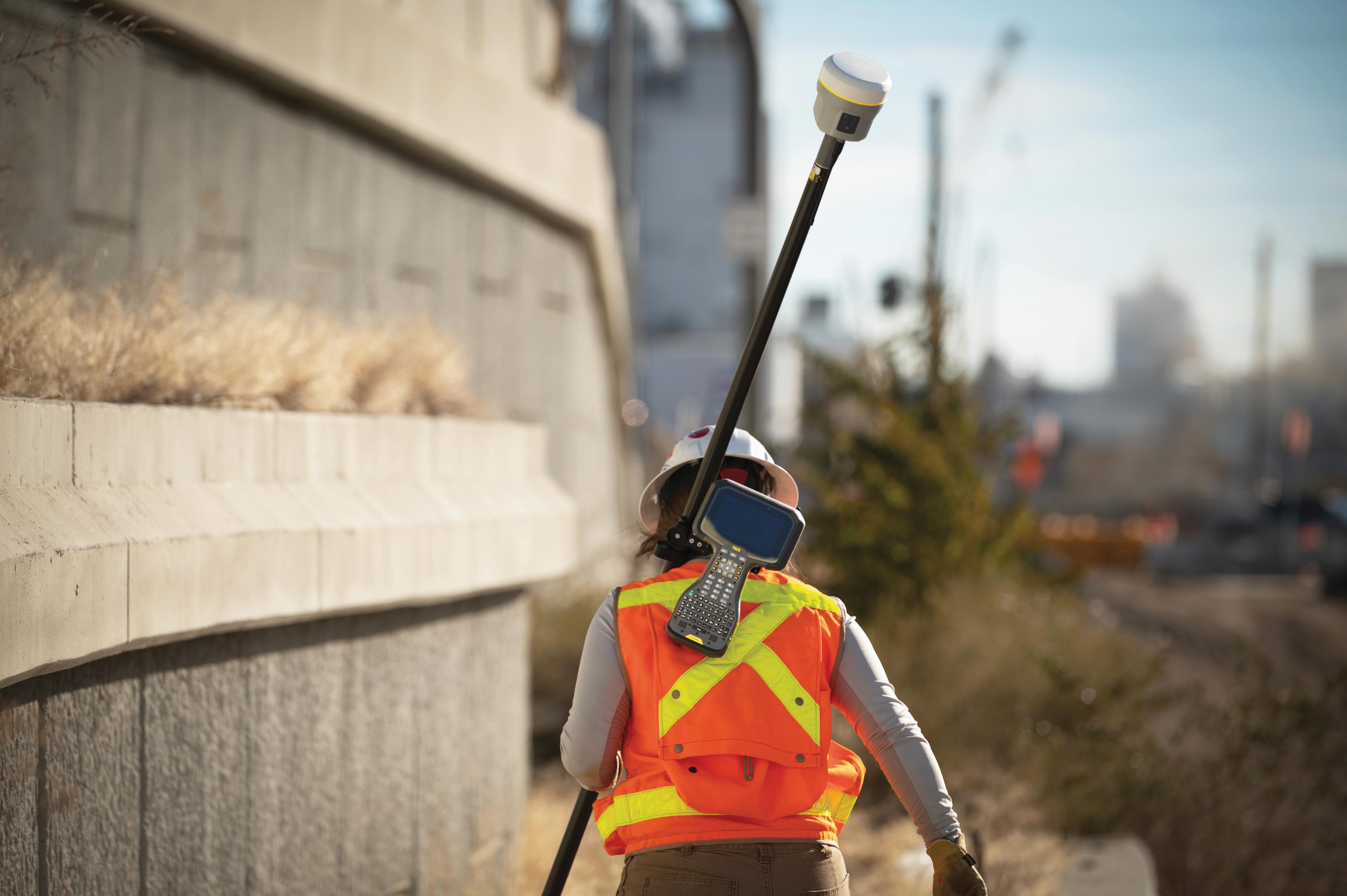
Increase productivity by combining lidar scanning with robotics
The GTL-1200 combines the power of a robotic total station with a best-inclass laser scanner to perform digital layout and capture high -res 3D scans in a single setup. Simplify the scanning process and dramatically reduce the need for post-processing by capturing scan data on survey control. The workflow seamlessly integrates with ClearEdge3D software for advanced construction QA workflows and as-builts.

• Quick layout and scanning with a single instrument.
• Wi-Fi capability enables point clouds to be transmitted wirelessly
• Proven robotic total station design, integrated with a scanner.

• Full dome scan in seconds, now with 2x point cloud resolution.
• Scan density tailored to minimize software processing time.
• Point clouds accurately matched to BIM model coordinates.
Reduce your modeling time by up to 75%
EdgeWise™ software from ClearEdge3D offers a host of modeling features and tools that help users quickly convert point clouds into usable, as-built 3D plant and building models. The software’s automated feature-extraction capability, pattern-recognition technology and object-recognition algorithms provide you with maximum efficiency. Using these features, the modeling process can be completed in a fraction of the time previously required.
• Increased accuracy and speed when modeling

• Ability to do 3D models of as-built pipes, structural elements, ducts, walls, tees and conduits
• MEP (Mechanical, Engineering and Plumbing), structural and architectural-modeling capabilities
• Billion-point visualization engine with photo-realistic project views
• Fully interoperable with Plant3D, CADWorx, PDMS and Autodesk Revit
43316 State Road 19 Altoona, FL 32702 www.lengemann.us
The F lorida Surveyor is the official publication of the Florida Surveying and Mapping Society, also known as FSMS. It is published monthly for the purpose of communicating with the professional surveying community and related professions who are members of FSMS. Our award winning publication informs members eleven months out of the year about national, state, and district events and accomplishments, as well as articles relevant to the surveying profession. In addition, continuing educational courses are also available.

DID YOU Know FROM THE Archives 26 SPOTLIGHTING Florida Surveyors 23 DEBUNKING ALL Modern Theories 30 2023 SUSTAINING Firms Directory 31 FACES ON THE Frontier Dr. Knetsch 41 59 73 AROUND THE State 37 HALF-MILE POSTS, Alabama and Florida PRESIDENT’S Message 1 2023 FSMS Officers 3 THE SEARCH FOR An Elusive Army Fort 7
TABLE
OF CONTENTS
PRESIDENT’S Message

September 7th, 2023
If you’ve not read “ Boundaries and Landmarks A Practical Manual ” by A.C. Mulford, 1912. I recommend you do so.
He said “ The training of the surveyor consists essentially in practice in turning angles, measuring lines, and getting over obstructions, to which are added rather meager suggestions on the compass and the re-running of old surveys. He is considered preeminently a measure of land. This is very true, and in certain localities and under certain conditions this may compose almost the entire work of the surveyor. But in the vast majority of cases the actual measuring of land forms the smaller portion of his duties.
His hardest work is often, to use a colloquial phrase, to ' find the land ' to be surveyed. ” …
“ For after all, when it comes to a question of the stability of property and the peace of the community, it is far more important to have a some-what faulty measurement of the spot where the line truly exists that it is to have an extremely accurate measurement of the place where the line does not exist at all. ”
I think this is true today. We may have GPS equipment that is very accurate, but providing the correct location on the property is what we are charged with. We are fact finders, not advocates for the client.
President Howard Ehmke (561) 360-8883 Howard@GCYinc.com
Boundaries and Landmarks A Practical Manual by A.C. Mulford Link.
The Florida Surveyor Page 1
F.S.M.S. 2023 CHARITY SPORTING CLAY SHOOT
ADVANCE TICKETS
$400 – per 4-person team
$100 – Individual shooter
WHEN: November 3rd 2023
Check in 9a - 10a
Clay shoot 10a - 1p
Awards & lunch 1p - 2p
WHERE: Talon Range
550 Commerce Blvd, Midway FL 32343
REGISTRATION DEADLINE:
October 27, 2023
SUBMIT TEAM INFORMATION TO:
Chad Thurner – (850) 200-2441 chad.thurner@sam.biz
Melissa Seitzinger – (850) 566-5518 mseitzinger@bowman.com
2844 Pablo Ave, Tallahassee FL 32308
SPONSORSHIPS
Due Oct 23rd
$150 – Per Station
$75 – Score card
*Donations welcome
BENEFITING
Local Community Initiatives such as Honor Flight
INFORMATION
Bring your own gun & shells
100 rounds per person
Target load 7.5-9
Breakfast & Lunch Included Complete online waiver at Talon.com
PAYMENTS

Checks payable to “FSMS NW Florida Chapter”
Credit Cards
Https://paypal.me/NWFSMS


President-Elect Richard Pryce (954) 739-6400 rdpryce@gmail.com Vice President Allen Nobles (561) 687-2220 allen.nobles@sam.biz Secretary Sam Hall (352) 408-6033 surveysam17@outlook.com Treasurer Bon Dewitt (352) 392-6010 bon@ufl.edu Immediate Past President Lou Campanile, Jr. (954) 980-8888 lou@campanile.net 2023-24 FSMS Officers The Florida Surveyor Page 3
2023-24 Districts and Directors
District 1 - Northwest
Bay, Calhoun, Escambia, Franklin, Gadsden, Gulf, Holmes, Jackson, Jefferson, Leon, Liberty, Madison, Okaloosa, Santa Rosa, Taylor, Wakulla, Walton, Washington
Eric Stuart (850) 685-1149
eric.stuart@sam.biz
Chad Thurner (850) 200-2441 chad.thurner@sam.biz
District 2 - Northeast
Alachua, Baker, Bradford, Clay, Columbia, Dixie, Duval, Gilchrist, Hamilton, Lafayette, Levy, Marion, Nassau, Putnam, Suwannee, St. Johns, Union
Nick Digruttolo (863) 344-2330
ndigruttolo@pickettusa.com
2 3 4 7 6 5
District 5 - Southwest
Charlotte, Collier, DeSoto, Glades, Hardee, Hendry, Highlands, Lee, Manatee, Sarasota
Shane Christy (941) 840-2809
schristy@georgefyoung.com
Pablo Ferrari (904) 824-3086 pferrari@drmp. com
District 3 - East Central
Brevard, Flagler, Indian River, Lake, Okeechobee, Orange, Osceola, Seminole, Martin, St. Lucie, Volusia
Al Quickel (407) 567-1566
alq.fsms@gmail.com
Robert Johnson (772) 562-4191
bobj@carterassoc.com
District 4 - West Central
Citrus, Hernando, Hillsborough, Pasco, Pinellas, Polk, Sumter
Greg Prather (863) 533-9095
gprather@pickettusa.com
Alex Parnes (813) 493-3952
alexwolfeparnes @gmail.com
Donald Stouten (239) 281-0410 dstouten@ ardurra.com
District 6 - Southeast
Broward, Palm Beach
Mark Sowers (954) 868-7172 msowers@mgvera.com
Earl Soeder (407) 601-5816 earl.soeder@ duncan-parnell.com
Miami-Dade, Monroe
Jose Sanfiel (305) 351-2942 psm5636@gmail.com
District 7 - South NSPS
Manny Vera, Jr. (305) 221-6210 mverajr@mgvera.com
Russell Hyatt (941) 748-4693
russell@hyattsurvey.com
1
Director
District 1
Panhandle
Bill Butler wtb@butlersurveying.com
Gulf Coast
Jonathan Gibson jgibson0102@gmail.com
Chipola Jesse Snelgrove jsnelgrove@ snelgrovesurveying.com
Northwest FL
Jeremiah Slaymaker jslay@wginc.com
District 2
FL Crown
Brandon Robbins brndrbbns@netscape.net
North Central FL
Jeremy D. Hallick jdhallick@hotmail.com
UF Ge omatics
Andrea Slaven aslaven@ufl.edu
2023-24 Chapter Presidents
District 3
Central FL
William (Bill) Rowe browe@southeasternsurveying.com
Indian River Brion Yancy brionyancy@gmail.com
Volusia Je ff Cory (Interim) jeff@corysurveyor.com
District 5
Charlotte Harbor
Derek Miller millersurveying@comcast.net
Collier-Lee
Steve Shawles II sshawles@haleyward.com
Manasota
Shane Christy schristy@georgefyoung.com
District 6
Broward
Benjamin Hoyle benjamin.hoyle@kci.com
District 4
Ridge
Kenneth Glass kglass@civilsurv.com
Tampa Bay John Beland jbeland1979@gmail.com
Palm Beach
Lee Powers
lpowers@zemangroup.com
FAU Geomatics
Brett Costanza brettcostanza@hotmail.com
District 7
Miami-Dade
Eddie Suarez marketing@longitudefl.com
2023-24 Committees
Standing Committees
Nominating Committee
Membership Committee
Finance Committee
Executive Committee
Education Committee
Annual Meeting Committee
Legal Committee
Strategic Planning Committee
Ethics Committee
Legislative Committee
Surveying & Mapping Council
Constitution & Resolution Advisory Committee
Rick Pryce
Nick DiGruttolo
Bon Dewitt
Howard Ehmke
Greg Prather
Allen Nobles
Jack Breed
Rick Pryce
Shane Christy
Jack Breed
Randy Tompkins
Eric Stuart
Special Committees
Equipment Theft
Awards Committee
UF Alumni Recruiting Committee
Professional Practice Committee
Workforce Development Committee
Liaisons
CST Program
Manny Vera, Jr.
Lou Campanile, Jr.
Russell Hyatt
Lou Campanile, Jr.
Allen Nobles
Alex Jenkins
FDACS BPSM Don Elder
Surveyors in Government
Academic Advisory UF
FES
Richard Allen
Bon Dewitt
Lou Campanile, Jr.
Geospatial Users Group Earl Soeder
Practice Sections
“The Search for an elusive Army Fort”

As part of Olde Florida Maps, I’m taking a side trip to a part of my past.
I came across this in my archive of maps and thought it would be of interest as it fits right in with old surveys and old historical Maps. This particular adventure is what got me started in research and collection of Old Maps and the stories they can tell.
(Background)
Some of you may know that I spent many years (1985-2006) of my career as a consultant for and preparing surveys for the Seminole Tribe of Florida on all of their Florida Reservations.
While my first love was Surveying, I got into GIS early (1989) as something I saw as a way to document all of the Surveys into a database with history behind it. I helped the Tribe develop their first GIS system starting with using an old survey program called DigiCAD and then moving up to InfoCAD, then eventually ESRI ArcInfo v. 7.0 and mapping all of the Surveys I had done over the two decades into it.
The Tribe eventually got an in-house Surveyor and I stopped, but the Tribe continued to use me in as a consultant and help their in-house Surveyors. They also continued to develop further in GIS and now have active GIS staff. In fact, we have recently updated their GIS with survey accurate drainage on the Hollywood Reservation. That project included us acquiring for aerial Lidar (GPI & Pickett) on portions of Hollywood, Brighton, Big Cypress and Immokalee Reservations for drainage work there.
Over those 20+ years, I surveyed and mapped the reservation boundaries, the Tribes homesites, the initial surveys of the Big Cypress Airport, Billie Swamp Safari, and the Ah-TaThi-Ki Museum. I also surveyed multiple governmental and commercial sites on all of the Hollywood, Big Cypress, Brighton, Immokalee, Fort Pierce reservations, as well as various sites across Florida they were buying up for pennies on the dollar after the collapse of the Savings and Loans. Other sites included the 2500-acre site in Yeehaw Junction they bought specifically for their Green Corn Dance celebration each year, and the Ted Smallwood Historical site on Chokoloskee Island.
The Florida Surveyor Page 7
“The Search for an elusive Army Fort”
That was the era when James Billie was Chairman of the Tribe, and they had their first windfall of income from their initial Bingo operations, before casinos. There were several Tribal members at that time with vision on how to expand their income and help develop the Reservations and assist all tribal members for the future. The rest is history for now, but it was a wild ride for me during that time period and a great experience.
During my time surveying for the Tribe, I did an extensive amount of research into the GLO, BLM, and the (BIA) Bureau of Indian Affairs, regarding surveying the reservation boundaries and the internal Sections. This is something that I will always relish as an integral part of my Survey life experience as it took me back in time during the research period, both in the office and in the field, and it got me into some very pristine areas of the wilderness and swamps on the reservations. Some areas had not seen a human in a very long time, if ever, so a surveyors dream job.
(1974 Expedition)
Getting back on track to Olde Surveys and why this story is relative. When reviewing notes from the GLO, I came across many interesting things of the past on the reservations. This one individual discovery took a particular interest for me because of an event in my early years of Surveying.
Not sure of the date, but around (1974-75) I was asked to participate by my then boss and mentor (John Z. Rowe) in an expedition and search for an old Army Fort from the Civil War days in the Everglades.
It seems there was a judge, who’s relative from the Second & Third Seminole Wars time, found out about this particular Fort named after a distant relative, and he was on a quest to find its location.
Besides the Judge, accompanying him were several Archaeologists, and several prominent local Surveyors at the time that participated and were part of this group. There was (William {Bill} Keith, Tom Schnars, & Eugene {Gene} Stoner) and others such as Ronnie (Alligator Ron) Bergeron, Developer to name a few. We all met about 15 miles out on the north side of Alligator Alley, at that time it was still a two-lane highway. There were at least 6 airboats, and several full tracks waiting to go. For a rookie surveyor like me at the time this was a great adventure, and something that stuck in my mind for a long time. I had no idea what we were in for that day, but I was excited. After a brief meeting with the important people, we all headed North through the famous “Sea of Grass” for about ¾ of an hour to particular island that they had previously picked out as a likely place for the search, and all converged on that site.
September 2023 Page 8
“The Search for an elusive Army Fort”


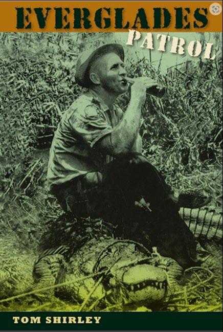
I was surprised to see a two-story building out there hidden by the hardwoods and pond apples trees, and it turned out to be a Florida Fish and Wildlife Game Wardens base camp. The Game Warden that met us out there was none other than Tom Shirley. He was infamous in the area as a hardnose law enforcement officer that pulled no punches when patrolling by airboat or full track but as friendly as they come and full of stories of past escapades with poachers and alligators. He later wrote a book about his 30 years on the job, “Everglades Patrol ”.
The Florida Surveyor Page 9
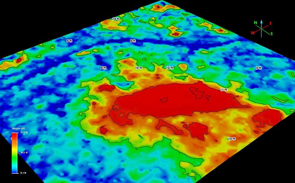
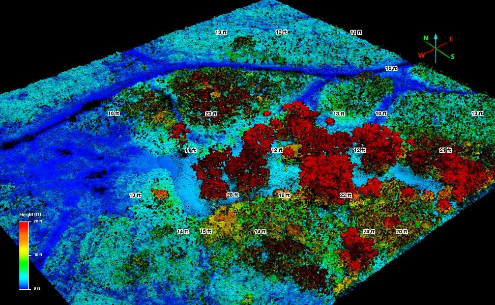
Topography of Game Warden Base Camp (2018 Lidar View)(Lat. 26° 11’ 03” Lon. 80°42’ 40”)
“The Search for an elusive Army Fort”


The archaeologist got us all in groups in different spots near several large Strangler Fig trees and we started digging and sifting through several layers of soil for the better part of the day. We found, animal bones, turtle shells, deer antlers, and some bear teeth, and a few bits of pottery, but nothing resembling an area occupied as a Fort. What we discovered was a camp site for the early native Americans (Tequesta) in the area, before the Seminoles. We all had a good time, even getting stuck in the sawgrass on the way back on top of a full track and having to radio one of the other full tracks to pull us out, quite the adventure for a rookie.
(1992 Discovery)
Fast forward…… 17 years, I was preparing to survey the Big Cypress Rodeo parcel lying along the main road through the reservation and gathering BIA data from the Tribe and Township surveys and notes from State Lands. Back then you had to call State Lands and talk to a very nice lady who would look up the notes and the maps and send them to you by mail. Sorry to say I don’t remember her name, but she was incredible, knew everything about the old notes and plats, and just a pleasure to deal with.
September 2023 Page 10
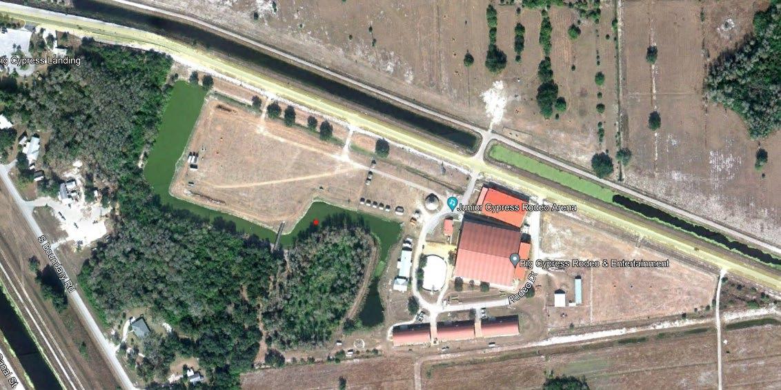
Big Cypress Rodeo Parcel (Lat. 26° 18’ 25” Lon. 80° 58’ 11”)
“The Search for an elusive Army Fort”


It took a couple of weeks before I got all of the puzzle pieces to start the work. I went through the BIA data first, which included old surveys and BIA roadway plans, and maps. I hadn’t worked in this township yet so I reviewed the resurveys (1938-39 & 1975) of the reservation boundaries and notes first to see what section corners were set and make my plan of attack and field reconnaissance to see what was still there if any. Even though I had the original GLO surveys also, I hadn’t looked at them yet.
When I had finished my initial recon, finding some 1939 monuments, I sat down to set up my next moves for the traverse because I didn’t find the section corners in my section yet. I went back to reviewing BIA and BLM notes, only this time I went back further to the GLO notes. Reviewing the original township surveys from 1875 by M. A. Williams was interesting and since I had some 1940 aerials of the area, I drew out the approximate township lines on and the started doing the Sections. Trying to follow along the calls in the notes by M.A. Williams, looking for any patterns in the vegetation from the aerials checking for Section lines that might have been run previously on the reservation.
The Florida Surveyor Page 11
As I was reading through the notes, I came across a passage and couldn’t believe my eyes. There in the Notes they were referring the Fort I had looked for on that expedition back in 1974-75. When I went back to the Township map and looked, there it was, plain as day.
I then went back to the aerials and of course there was nothing but pasture now, but I finally had the location from an actual Government Surveyor in writing.
I notified the Tribe of this information as it was a part of their history, the Second Seminole war, hoping they would want to investigate further, but at that time it wasn’t a priority to them so once again it was lost in time, but not forgotten.


“The Search for an elusive Army Fort”
September 2023 Page 12
I’ve kept track of Fort Shackleford over the years and in 2009 Archaeologist Annette Snapp who was the Operations manager at the Ah-Tah-Thi-Ki Museum launched a search for it, Florida Fron�ers “Searching for Fort Shackleford” | Florida Historical Society (myfloridahistory.org).


“The Search for an elusive Army Fort”
The Florida Surveyor Page 13
“The Search for an elusive Army Fort”
I don’t think they have found or proved its actual location yet, but they are close. I really think they need a Surveyor to mark the search location, and I keep hoping I can eventually finalize my adventure.
You just never know when this job we call Surveying will surprise you. And every map, every survey has a story behind it. It could be as simple as a lot and block survey with a dog chasing you over a fence, or something more substantial like blazing a trail through a swamp or Palmettos and listening for rattlesnakes. Researching old records and walking through history by the words written by some long-ago surveyor/adventurer, following their path.
Or ………. It could be your own adventure that leads to a lifelong expedition of discovery that keeps you continuously searching for that elusive “Fort” or “Section Corner” from the past …………. and draws you into something that keeps your interest and mind wandering.

Great Profession ………………. Love what you do and you’ll never work a day in your life.
Rick Pryce, RLS/PSM
More history on Florida Forts: Florida's Forts | American Batlefield Trust (batlefields.org)
1873 Colton New Township Map (Fort Shackleford)
September 2023 Page 14

Search for an elusive Army Fort”


September 2023 Page 16
“The
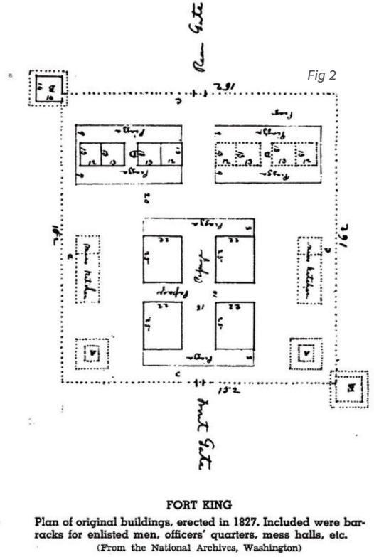
Example Fort layout “Fort King” 1823 in Ocala from National Archives
2023 - INDIAN FLORIDA SURVEYING CHARITY GOLF GATOR TRACE GOLF FORT
NOVEMBER TIME: 7:30 a.m., SHOTGUN
Breakfast sponsor: $500
Trophy sponsor: $500
Closest to sponsor: $500
Lunch sponsor: $500
Cart sponsor: $500
Bob Johnson
Office: (772)562-4191
Cell: (772)370-0558
bobj@carterassoc.com
Hole sponsor: $500 Longest Drive sponsor: $500

Longest Put sponsor: $500 Shortest Missed Put sponsor:
PROCEEDS TO BENEFIT:
• INDIAN RIVER CHAPTER SCHOLARSHIP
• FSMS PAC
The Florida Surveyor Page 17
SURVEYING AND MAPPING
GOLF TOURNAMENT

GOLF AND COUNTRY CLUB
PIERCE, FL
NOVEMBER 11, 2023
SHOTGUN START: 8:30 a.m. Put $500
the Pin $500
Missed sponsor: $500
“Best Dressed” sponsor: $250
September 2023 Page 18
INDIAN RIVER CHAPTER
to:
c/o
SCHOLARSHIP FUND
Please make checks payable to “FSMS Indian River Chapter” Mail
FSMS Indian River Chapter
Marla Moore 301 SE Ocean Blvd, Suite 301 Stuart fl, 34994
Office: (772)562-4191
Cell: (772)370-0558
bobj@carterassoc.com
The Florida Surveyor Page 19
2023 - INDIAN FLORIDA SURVEYING CHARITY GOLF GATOR TRACE GOLF FORT NOVEMBER TIME: 7:30 a.m., SHOTGUN
NAME:__________________________ SPONSORSHIP LEVEL:_______________________ CONTACT:_________________________________ E-MAIL:__________________________________ PHONE NUMBER:__________________________
SPONSOR
SPONSOR
Bob Johnson
SPONSOR APPLICATION
INDIAN RIVER CHAPTER
SURVEYING AND MAPPING
GOLF TOURNAMENT
GOLF AND COUNTRY CLUB
PIERCE, FL
NOVEMBER 11, 2023
SHOTGUN START: 8:30 a.m.
September 2023 Page 20
to: FSMS Indian River Chapter c/o Marla Moore 301 SE Ocean Blvd, Suite 301
Please make checks payable to “FSMS Indian River Chapter” Mail
Stuart fl, 34994
TWO PERSON TEAMS = $125 PER PLAYER PUTTING TAPE = $10/ARM STRETCH
MULLIGANS = $20/EA. OR 6/$100 (LIMIT 6) BREAKFAST,LUNCH, AND CART INCLUDED
Bob Johnson
Office: (772)562-4191
Cell: (772)370-0558
bobj@carterassoc.com
2023 - INDIAN FLORIDA SURVEYING CHARITY GOLF
GATOR TRACE GOLF FORT
NOVEMBER
TIME: 7:30 a.m., SHOTGUN
Player 1:_____________________________________
Phone No:___________________________________
E-mail:______________________________________
Player 2:_____________________________________
The Florida Surveyor Page 21 TEAM APPLICATION
APPLICATION
INDIAN RIVER CHAPTER
SURVEYING AND MAPPING GOLF TOURNAMENT
GOLF AND COUNTRY CLUB
PIERCE, FL
NOVEMBER 11, 2023
SHOTGUN START: 8:30 a.m.
Please make checks payable to “FSMS Indian River Chapter”
Mail to: FSMS Indian River Chapter c/o Marla Moore 301 SE Ocean Blvd, Suite 301 Stuart fl, 34994
September 2023 Page 22
1:_____________________________________ No:___________________________________ mail:______________________________________ 2:_____________________________________
Spotlighting Florida Surveyors

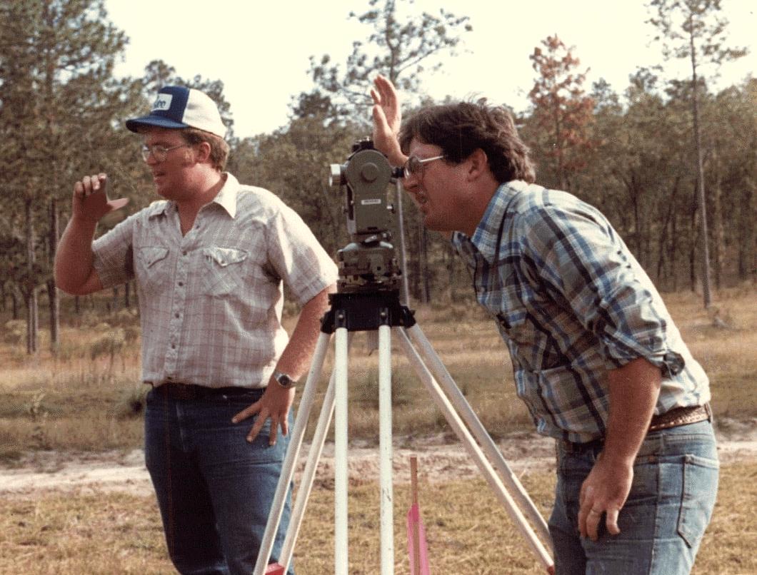
 John N. “Jack” Breed Florida Professional Land Surveyor #4089 August 28, 2023
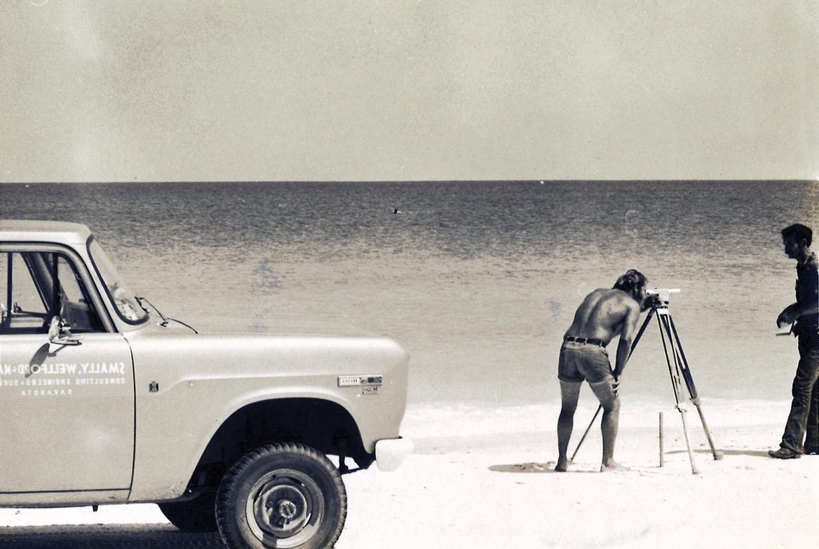
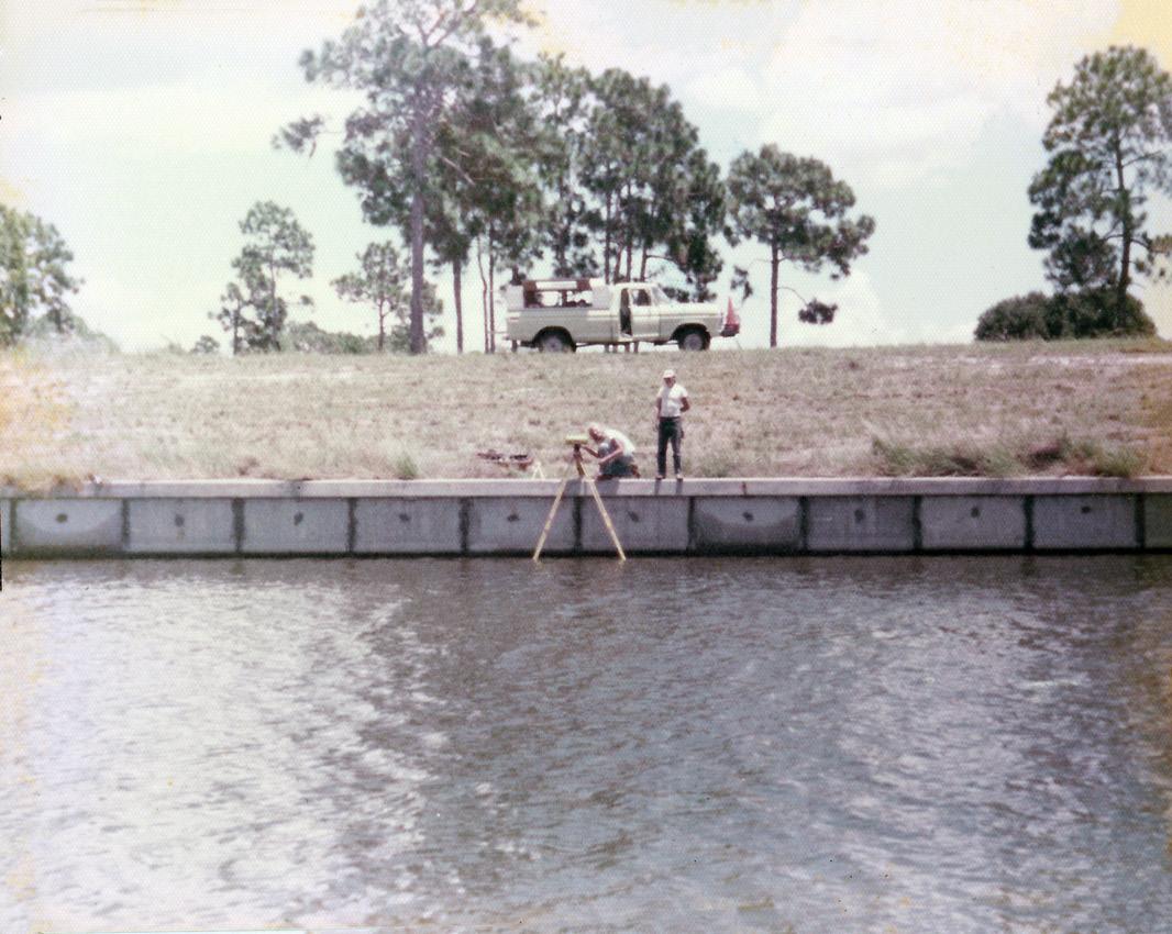
Iwas born November 17, 1959, in Avon Park, Florida, into a long-time Sebring family. As the grandfather of two sixth-generation Floridians, I am passionate about my home state, and its wonderful institutions, like the Florida Surveying and Mapping Society, and the University of Florida! I’m a proud Blue Streak from Sebring High School Class of ’78 and a proud Gator with a Bachelors Degree in Land Surveying, UF Class of ’82. I passed my professional licensure test in 1984, and my career tree has only one branch, CivilSurv Design Group, Inc., my employer (semi retired). CivilSurv, is the successor of firms that originated in 1980, when the great Bill Keith (Keith and Schnars, P.A.) opened a Lakeland Florida office “Imperial Engineering Services”. For the past 14 years, I have also served as a part-time instructor in the Geomatics Program at UF.
John N. “Jack” Breed PLS# 4089
My Christian Faith defines me, my life, family, business, and friends. I am the great-grandson of a Presbyterian Missionary to the “Indian Territories” (now the Dakotas), who moved to Sebring in the early 19th century. I am a fourth-
The Florida Surveyor Page 23
generation Presbyterian Elder, Adult Bible Fellowship instructor, Sunday School Teacher, and co-founder of a Classical Christian School. Our Sebring Office shares space with my brother’s Law Firm and he has lovingly restored and maintained our family home in downtown Sebring that Robert Telford (great grandfather) began construction in 1920 and occupied in 1921 with his daughter Charlotte Post (grandmother) who had just graduated from Stetson University (in the Breed family, the ladies all went to Stetson and the men all went to UF).
In a new season in life, I am enjoying part-time consulting, part-time teaching, and full-time grandkids/fishing/hunting/ GatorSports/travel with my wonderful bride, Sandy. I was blessed to have shared 32 years with my deceased wife, and have been doubly blessed to now be with the amazing Sandy! My family legacy lives on in my sons Jacob Wayne Breed (CivilSurv!) and Luke Townshend Breed (US Naval Submariner), and my magnificent 10-year old grandson, Case Wayne Breed (future MLB star), and my lovely granddaughter Maggie Breed (2 years old). I was weaned on Gator Sports and have been a season ticket holder to The Swamp since 1983.

I’m the leader of a rowdy group of TailGators, on campus for every home football game. I love to travel with the Gators and have been in almost every SEC stadium! Needless to say, I bleed Florida Orange and Blue, and tail gating for years developed into being the “Chief Rib Officer” of The Grove In The Swamp BBQ Team. I am blessed with a huge circle of friends, and my service and activities within FSMS have given me relationships with great Surveyors all over Florida.
So, that completes my biography. When Justin Ortiz called me from FSMS, I had the shock of realizing they were asking for interviews with “OLD SURVEYORS” to share their past, and I guess I’m now one of the old farts. Justin posed a series of questions, and I’ll do my best to answer them:
In high school, I enjoyed courses in Mechanical Drawing and thought it would lead into Engineering. In the summer of 1978, Roger Miller PE/PLS hired
September 2023 Page 24
me to draft sewer plan/profiles for land development (pencil on vellum). Often, the field surveyors needed an extra hand, so they sent the “drafting kid” out to help on the crews. That was the spark for me, and I entered UF that fall with the goal of a Survey degree. My in-school internships were with Dale Thomas, PLS of Sebring, and while in Gainesville, I worked for Robert Wigglesworth, PLS and had my first “career” job with him in 1982. In 1984 the legendary Bill Keith (yep, Dodie’s Daddy) came calling, and I’ve never had another job.
I truly love this profession and think that Surveyors are the highest evolution of the species! If I had to do it all over again, I’d pick Surveying and Mapping. I love the history of title and ownership, retracement work, and boundary surveys. Most of my career’s ‘big jobs’ have been infrastructure and I absolutely love working with a design team and being more than just the data source, but being an integral part of the actual facility being designed.
Final
thought… wow…. howzabout
the technology we’ve got today? It’s amazing how much data we can capture, especially when I think about transit and tape jobs we did in the summers of the late 70’s. One warning to all of you young PSM’s: don’t let this amazing technology turn you into POINT Surveyors and remember that the art of boundary work requires you to be LINE Surveyors. Beat the bounds. Walk the lines. Gather ALL the evidence.
Gators. BayBee!
Soli Deo Gloria
The Florida Surveyor Page 25
Jack performing a boundary survey in Venus, FL.
Jack Breed and John Clyatt at the University of Florida.
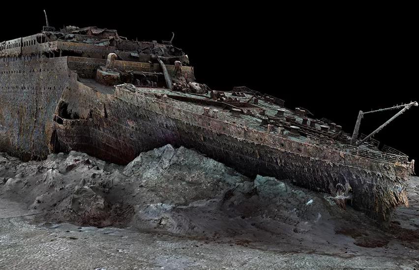
DID YOU KNOW?
More than 1,500 people died when the Titanic struck an iceberg during its voyage from Southhampton to New York. The first full-sized digital scan of the Titanic, which lies 3,800m (12,500ft) down in the Atlantic, has been created using deep-sea mapping. It provides a unique 3D view of the entire ship, enabling it to be seen as if the water has been drained away.
The scan was carried out in summer 2022 by Magellan Ltd, a deep-sea mapping company, and Atlantic Productions, who are making a documentary about the project.
Source
September 2023 Page 26
The scan is made up from 700,000 images captured by submersibles.
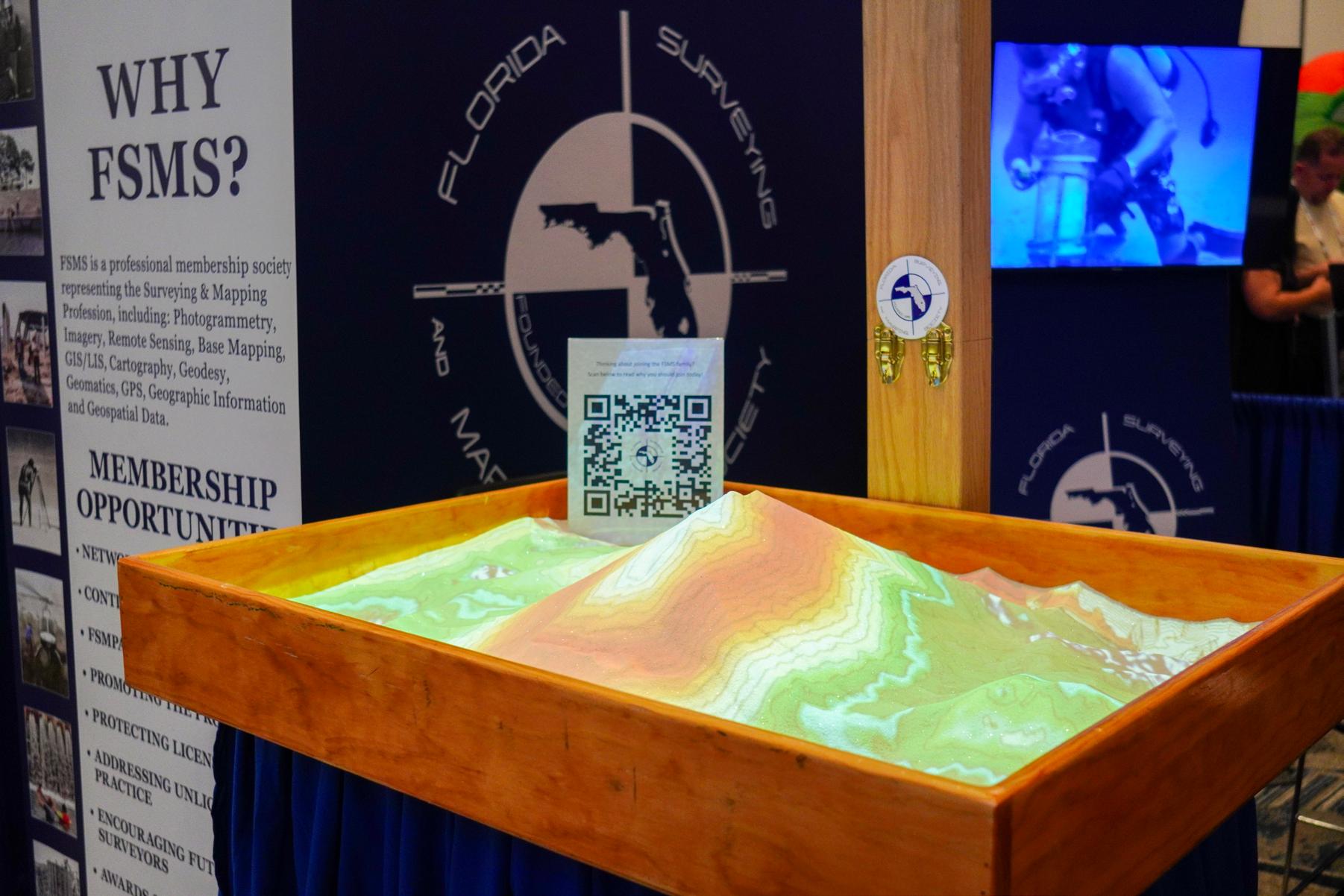
W HY FSMS?
FSMS is a professional membership society representing the Surveying & Mapping Profession, including: Photogrammetry, Imagery, Remote Sensing, Base Mapping, GIS/LIS, Cartography, Geodesy, Geomatics, GPS, Geographic Information and Geospatial Data.
MEMBERSHIP OPPORTUNITIES
• NETWORKING
• CONTINUING EDUCATION
• LEGISLATIVE FSMPAC
• PROMOTING THE PROFESSION
• PROTECTING LICENSURE
• ADDRESSING UNLICENSED PRACTICE
• ENCOURAGING FUTURE SURVEYORS
• AWARDS & SCHOLARSHIPS
• CAREER OPPORTUNITIES
The Florida Surveyor Page 27
September 2023 Page 28
IF PAYING BY CHECK, MAIL FORM TO: FSMS, P.O. Box 850001-243, Orlando, Florida 32885-0243
IF PAYING BY CREDIT CARD, FAX OR EMAIL FORM TO: 850.877.4852 education@fsms.org QUESTIONS? CALL 800.237.4384

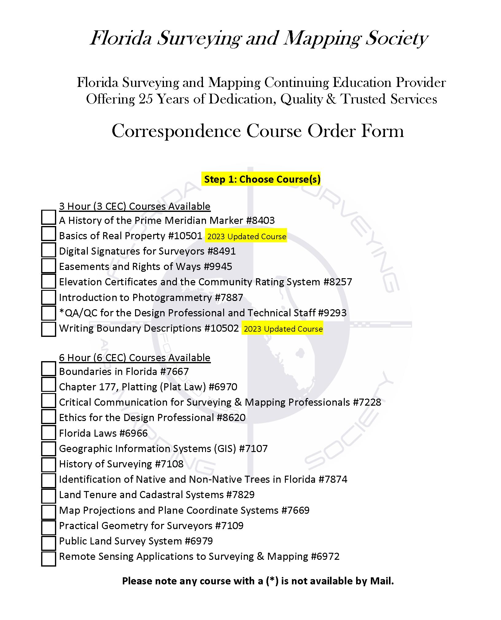
FSMS Member EMAILED Fee Quantity Amount 6 CEC $115 Per Course x = $ 3 CEC $58 Per Course x = $ MAILED 6 CEC $125 Per Course x = $ 3 CEC $68 Per Course x = $ TOTAL $ Non Non Name: _ YES _ NO Firm: ____ _ YES _ _ NO Address: ______________________________________________________________________________________ City/State: Email Address: Work Phone: Payment Information: ___ Check Enclosed (Payable to FSMS) _ VISA/MasterCard/American Express Card #: _______ Exp. Date: __ CVV Code:___________
Step 2: Choose Member Type
Billing Address of Credit Card: ______________________________________ Signature: _____________________________________ __
Provider
The Florida Surveyor Page 29
No. CE11 fsms.org
Debunking All Modern Theories About The Universe


September 2023 Page 30

3002 Surveying 352-538-1320 A AA Surface Pro, Inc. 239-471-2668 A. D. Platt & Associates, Inc. 850-329-5551 Agnoli,
Brundage, Inc. 239-597-3111 AIM Engineering & Surveying 239-332-4569 Allen & Company, Inc. 407-654-5355 Allen Engineering 321-783-7443 American Surveying, Inc. 813-234-0103 Amerritt, Inc. 813-221-5200 Arc Surveying
Inc. 904-384-8377 Ardurra,
239-292-7773 Associated
407-869-5002 Atwell,
Avirom
Axis
B Banks Engineering
Barnes,
Barraco
Bartram
Benchmark
Bennett-Panfil,
Bowman
703-454-1000 Bradshaw-Niles
904-829-2591 Brown
561-615-3988 BSE
321-725-3674 Buchanan
C Calvin, Giordano & Associates, Inc. 954-921-7781 Carlson Environmental Consultants, PC 704-283-9765 Carnahan, Proctor & Cross, Inc. 407-960-5980
The Florida Surveyor Page 31
Barber &
& Mapping,
Inc.
Land Surveying & Mapping, Inc.
LLC 866-850-4200
& Associates, Inc. 561-392-2594
Geospatial, LLC 410-822-1441
239-939-5490
Ferland and Associates, Inc. 407-896-8608
& Associates, Inc. 239-461-3170
Trail Surveying, Inc. 904-284-2224 Bello & Bello Land Surveying Corporation 305-251-9606
Surveying & Land Planning, Inc. 850-994-4882
Inc. 941-497-1290 Berntsen International 608-443-2772 Betsy Lindsay, Inc. 772-286-5753 Biscayne Engineering Company, Inc. 305-324-7671 Boatwright Land Surveyors, Inc. 904-241-8550 Bock & Clark Corporation(NV5) 330-665-4821
Consulting Group
& Associates, Inc.
& Phillips, Inc.
Consultants, Inc.
& Harper, Inc. 850-763-7427
202 3 S u S taining
F irm S Directory

Carter
CivilSurv
Collins
Associates, Inc. 772-562-4191 Caulfield & Wheeler 561-392-1991 Chastain-Skillman, Inc. 863-646-1402 CHW Professional Consultants (Causseaux, Hewett & Walpole, Inc.) 352-331-1976
Design Group, Inc. 863-646-4771 Clements Surveying, Inc. 941-729-6690 Clymer Farner Barley Surveying, Inc. 352-748-3126 Coastal Engineering Associates, Inc. 352-796-9423 Colliers Engineering & Design 732-383-1950
Survey Consulting, LLC. 863-606-2155 Cousins Surveyors & Associates, Inc. 954-689-7766 CPH Consulting, LLC 407-322-6841 Craven-Thompson & Associates, Inc. 954-739-6400 Culpepper & Terpening, Inc. 772-464-3537 Cumbey & Fair, Inc. 727-797-8982 D DeGrove Surveyors, Inc. 904-722-0400 Dennis J. Leavy & Associates 561-753-0650 Dewberry 407-843-5120 DMK Associates, Inc. 941-412-1293 Donald W. McIntosh Associates, Inc. 407-644-4068 Donoghue Construction Layout, LLC. 321-248-7979
E ECHO
September 2023 Page 32
Douglass, Leavy & Associates, Inc. 954-344-7994 DRMP, Inc. 833-811-3767 DroneView Technologies 248-321-9417 DSW Surveying & Mapping, PLC. 352-735-3796 Duncan-Parnell, Inc. 800-849-7708 Durden Surveying and Mapping, Inc. 904-853-6822
UES, Inc. 888-778-3246 Eda Consultants, Inc. 352-373-3541 Eiland & Associates, Inc. 904-272-1000 Element Engineering Group, LLC. 813-386-2101 Engenuity Group, Inc. 561-655-1151
Engineering Design
Construction,
772-462-2455 ER
305-860-3866 ESP Associates,
803-802-2515 ETM
&
904-642-8550 Exacta Land Surveyors,
866-735-1916 EXP Energy Services Inc. 305-213-9969 F Ferguson Land Surveyors 727-230-9606 First Choice Surveying, Inc. 407-951-3425 Florida
727-849-7588 Florida
FLT
Ford,
Frontier
G GCY,
H Haley
207-989-4824
HUB International
Hyatt Survey Services 941-748-4693
The Florida Surveyor Page 33
&
Inc.
Brownell & Associates, Inc.
Inc.
Suryeying
Mapping
Inc.
Design Consultants, Inc.
Engineering & Surveying, LLC. 941-485-3100
Geosystems 954-763-5300
Armenteros & Fernandez, Inc. 305-477-6472 Fortin, Leavey, Skiles, Inc. 305-653-4493
Precision Unmanned 701-222-2030 F.R.S. & Associates, Inc. 561-478-7178
Inc. 772-286-8083 GeoData Consultants, Inc 407-732-6965 Geoline Surveying 386-418-0500 Geo Networking, Inc. 407-549-5075 GeoPoint Surveying, Inc. 813-248-8888 George F. Young 727-822-4317 Geosurv, LLC 877-407-3734 Germaine Surveying, Inc. 863-385-6856 GPI Geospatial, Inc. 407-851-7880 Gustin, Cothern & Tucker, Inc. 850-678-5141
Ward, Inc.
Hanson Professional Services, Inc. 217-788-2450 Hanson, Walter & Associates, Inc. 407-847-9433 H.L. Bennett & Associates, Inc. 863-675-8882 Hole Montes, Inc. 239-254-2000
850-386-1111
202 3 S u S taining
I Ibarra Land Surveyors 305-262-0400 I.F. Rooks & Associates, LLC. 813-752-2113 J John Mella & Associates, Inc. 813-232-9441 Johnston’s Surveying, Inc. 407-847-2179 K KCI Technologies 954-776-1616 Keith and Associates, Inc. 954-788-3400 Kendrick Land Surveying, LLC 863-533-4874 L L&S Diversified, LLC. 407-681-3836 Land Precision Corporation 727-796-2737 Landmark Engineering & Surveying Corporation 813-621-7841 Langan Engineering and Environmental Services, Inc. 973-560-4900 Leading Edge Land Services, Inc. 407-351-6730 Leiter Perez & Associates, Inc. 305-652-5133 Lengemann Corp. 800-342-9238 Leo Mills & Associates 941-722-2460 Longitude Surveyors, LLC 305-463-0912 Long Surveying, Inc. 407-330-9717 M Manuel G. Vera & Associates, Inc. 305-221-6210 Marlin Engineering Inc. 305-477-7575 Massey-Richards Surveying & Mapping, LLC. 305-853-0066 Masteller, Moler & Taylor, Inc. 772-564-8050 McKim & Creed, Inc. 919-233-8091 McLaughlin Engineering, Co. 954-763-7611 Metron Surveying and Mapping, LLC. 239-275-8575 Mills & Associates, Inc. 813-876-5869 Mock Roos & Associates, Inc. 561-683-3113 Moore Bass Consulting, Inc. 850-222-5678 Morris-Depew Associates, Inc. 239-337-3993 Murphy’s Land Surveying 727-347-8740
Directory September 2023 Page 34
F irm S
N Navigation Electronics, Inc. 337-237-1413 Northwest Surveying, Inc. 813-889-92356 NV5, Inc 954-495-2112 O On The Mark Surveying, LLC. 321-626-6376 P PEC Surveying & Mapping 407-542-4967 Pennoni Associates, Inc. 863-594-2007 Perret and Associates, Inc 904-805-0030 Pickett & Associates, Inc. 863-533-9095 Platinum Surveying & Mapping, LLC. 863-904-4699 Point Break Surveying 941-378-4797 Polaris Associates, Inc. 727-461-6113 Porter Geographical Positioning & Surveying, Inc. 863-853-1496 Pulice Land Surveyors, Inc. 954-572-1777 Q Q Grady Minor & Associates, PA 239-947-1144 R Reece & White Land Surveying, Inc. 305-872-1348 Rhodes & Rhodes Land Surveying, Inc. 239-405-8166 Richard P. Clarson & Associates, Inc. 904-396-2623 Ritzel-Mason, Inc. 786-472-0358 River City Surveying & Mapping, LLC 904-675-9300 R.J. Rhodes Engineering, Inc. 941-924-1600 R.M. Barrineau & Associates, Inc. 352-622-3133 Robayna and Associates, Inc. 305-823-9316 S SAM Surveying & Mapping, LLC. 850-385-1179 SCR & Associates NWFL Inc. 850-527-1910 Sergio Redondo & Associates, Inc. 305-378-4443 Settimio Consulting Services, Inc. 850-341-0507 SGC Engineering, LLC. 407-637-2588 Shah Drotos & Associates, PA 954-943-9433 Sherco, Inc. 863-453-4113 Sliger & Associates, Inc. 386-761-5385 202
S u
taining The Florida Surveyor Page 35
3
S
F irm S Directory
Southeastern Surveying & Mapping Corp.
407-292-8580
Stephen H. Gibbs Land Surveyors, Inc.
954-923-7666
Stoner Inc.
954-585-0997
Survey Data Solutions, LLC
352-816-4084
Surveying & Mapping Inc.
239-340-2409
SurvTech Solutions, Inc.
813-621-4929
Thurman Roddenberry & Associates
850-962-2538
TranSystems Corporation Consultants
727-822-4151
WBQ Design & Engineering, Inc.
407-839-4300
Whidden Surveying
561-790-5515
Winnigham & Fradley, Inc.
954-771-7440
UWoolpert, Inc.
803-214-5928
UF/IFAS School of Forest, Fisheries, and Geomatics Sciences
352-846-0850
Upham, Inc.
386-672-9515
ZZNS Engineering, LLC.
941-748-8080
SOCIAL MEDIA LINKS

T2 UES Inc.
407-587-0603
Tectonic Engineering and Surveying Consultants
845-534-5959
Wade Surveying, Inc.
352-753-6511
Wallace Surveying Corp.
561-640-4551
Wantman Group, Inc.(WGI)
561-687-2220
LinkedIn = 700 Followers
Facebook = 837 Followers
X = 354 Followers
Instagram = 223 Followers
YouTube
T
W
September 2023 Page 36
round the State A

From Left to Right: Executive Director Rebecca Porter standing alongside Education Director Sam Hobbs with Past President Lou Campanile, Jr. at
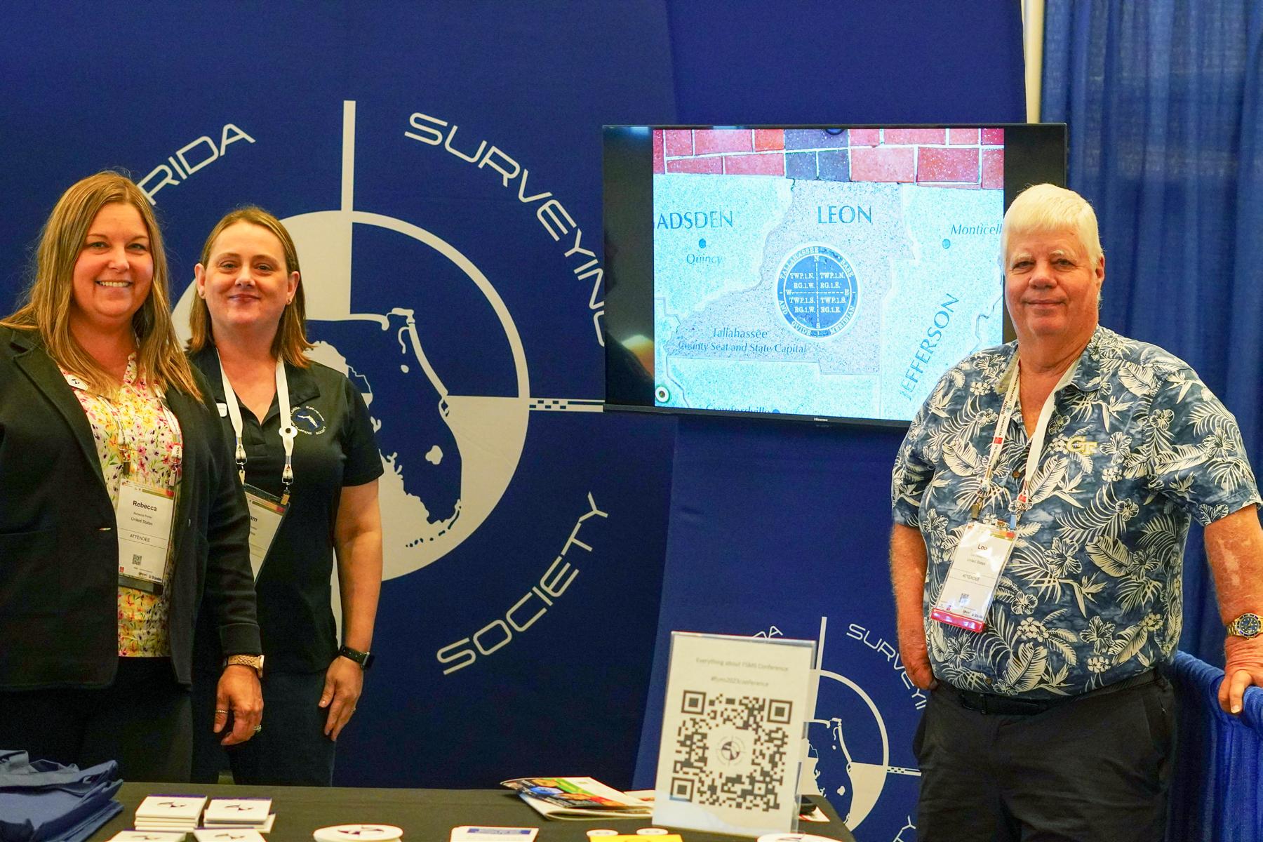
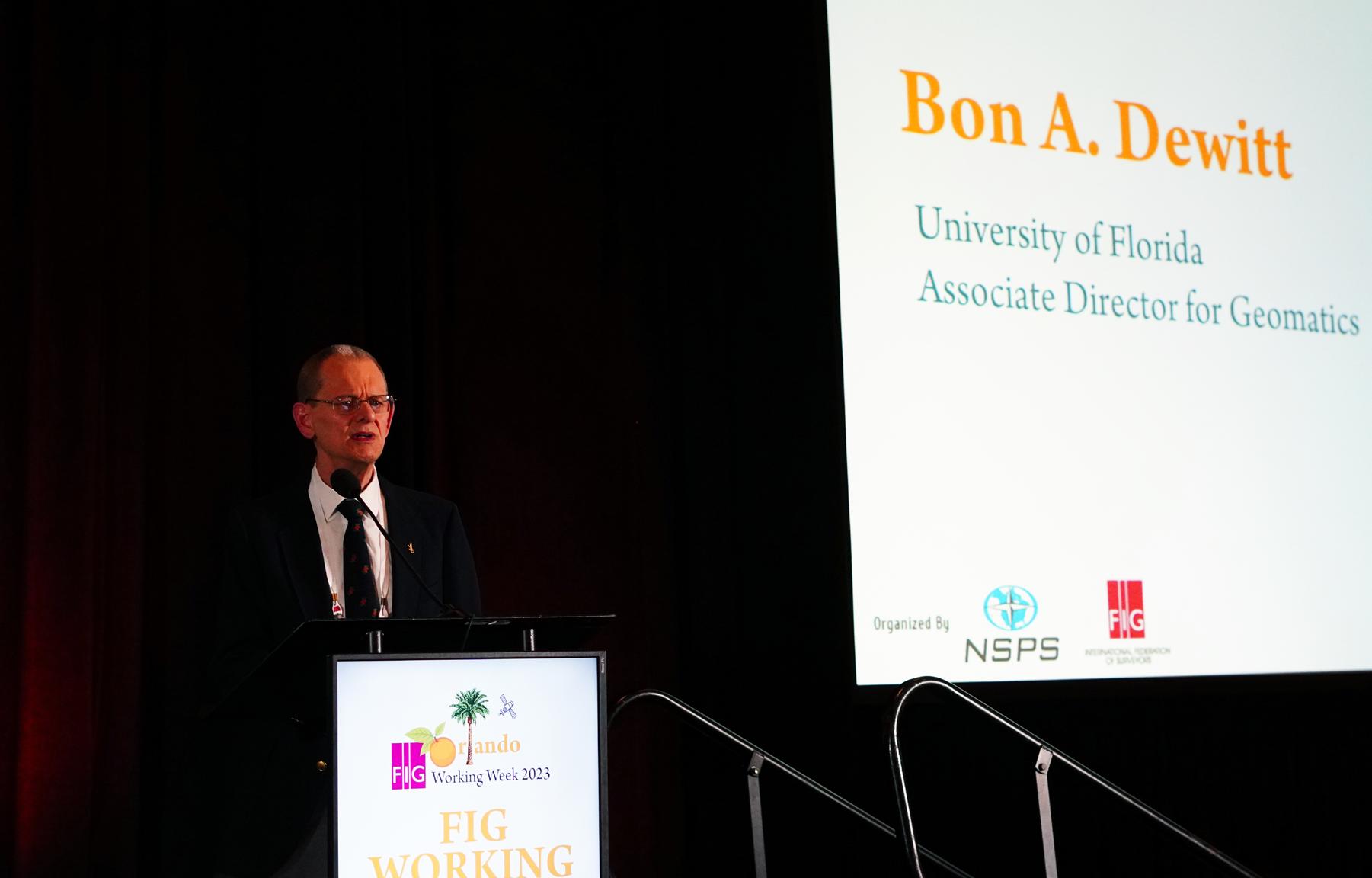
Associate Director for Geomatics at the University of Florida & Treasurer for FSMS, Dr. Bon A. Dewitt presenting at the 2023 FIG Conference.
 the 2023 FIG Conference.
Special Thank You to District 6 Director Mr. Earl Soeder for letting the FSMS Staff play in his "Sandbox" during the 2023 FIG Working Week Conference.

• Civil/Site Design • Construction Engineering • Construction Materials Engineering & Testing • Energy • Environmental, Health, and Safety • Geotechnical • MEP • Structural • Survey & Geospatial • Transportation • Urban Planning & Design • Water Resources • Water/Wastewater PARTNERS FOR WHAT’S POSSIBLE www.pennoni.com Join our Survey Team in Florida today!
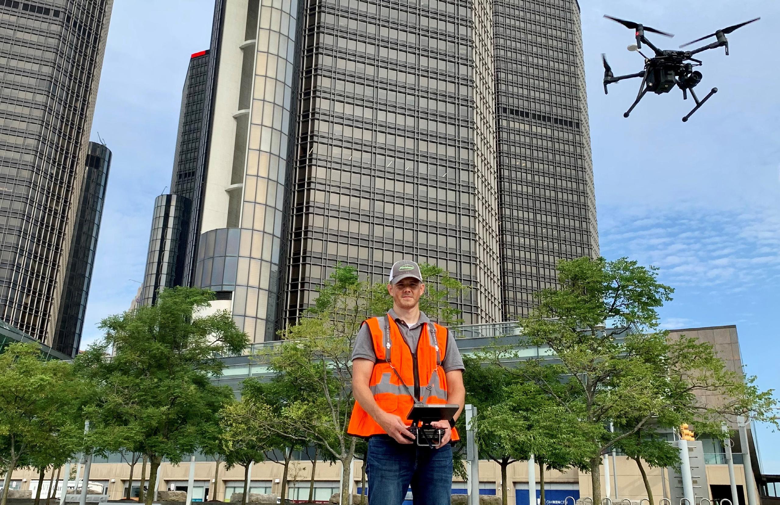
Thank You to Mr. Tom Whidden of Whidden Surveying and Mapping for these incredible photos from the field.
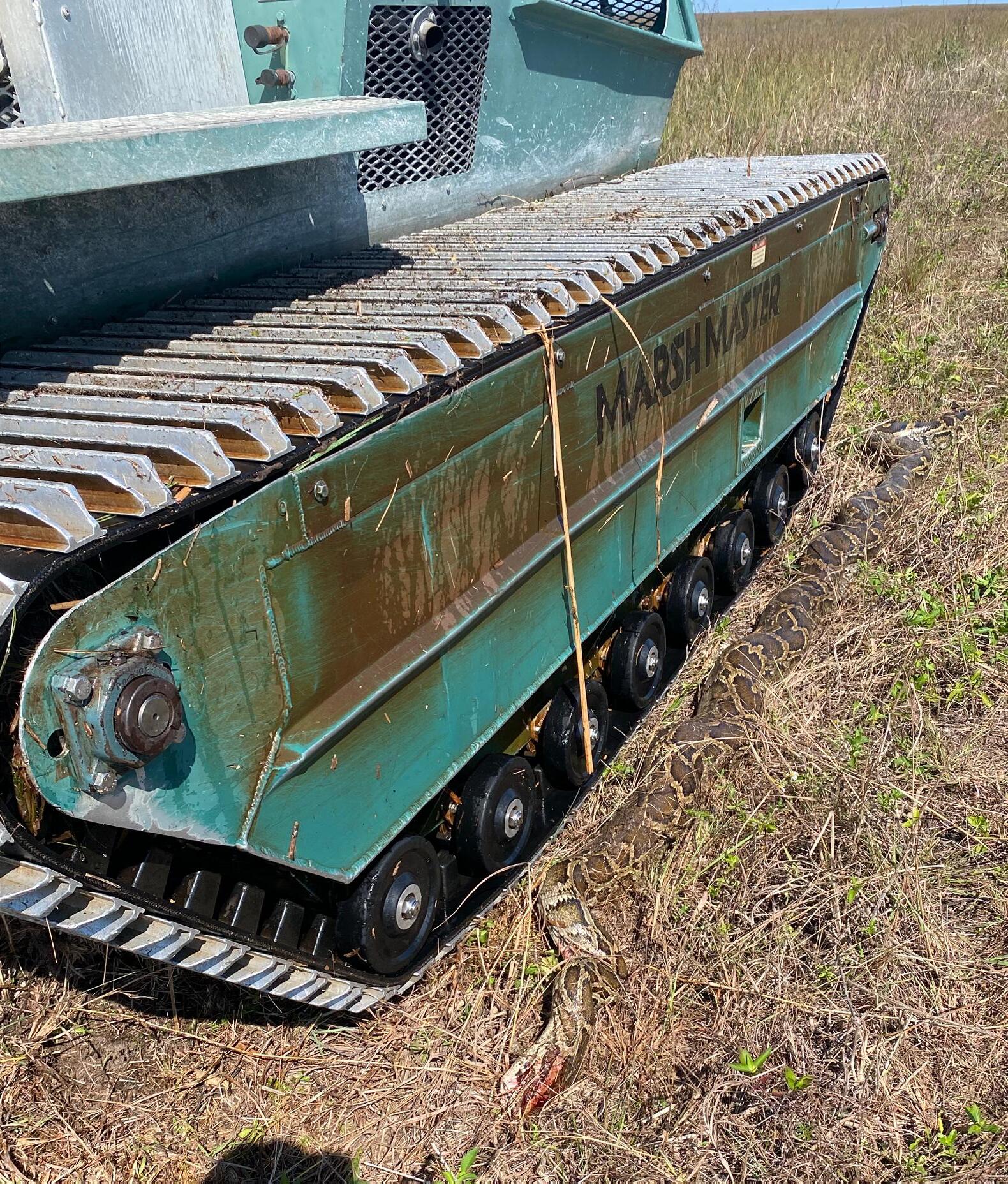
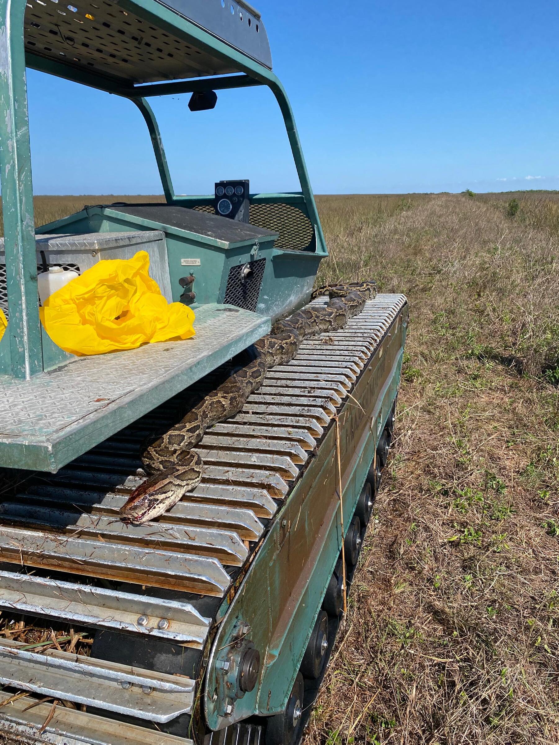
For those new to Florida, According to FWC, "Burmese pythons are not native to Florida and are considered an invasive species due to their impacts to native wildlife. Like all nonnative reptile species, Burmese pythons are not protected in Florida except by anti-cruelty law and can be humanely killed on private property with landowner permission."
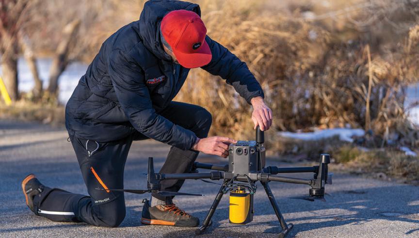
Frontier Precision has the latest LiDAR photogrammetry innovations to fit your job or application. Our staff has the knowledge and real-world experience to help you select the solution that’s best for you and the training to make you more proficient and profitable. Just as important, our professional services group can help you implement LiDAR and photogrammetry solutions on your next project – from field data capture to data processing – we have the expertise to make sure your project is done right.
YOUR LIDAR & PHOTOGRAMMETRY SOLUTIONS EXPERTS.
The YellowScan LiDAR UAV delivers the highest level of accuracy and density for real-time georeferenced point cloud data. Lightness and accuracy combine for a LiDAR solution that works hard for you.
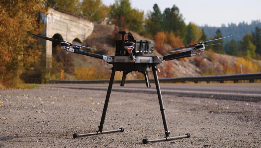
8301 Cyprus Plaza Drive, #107 Jacksonville, FL 32256
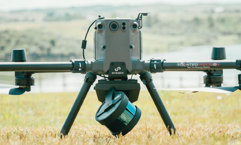
Emesent automates the collection and analysis of data in challenging GPS-denied environments, delivering revolutionary efficiency, safety, and operational insights to underground mining and other industries. It’s core areas of expertise are drone autonomy, SLAM-based LiDAR mapping, and data analytics.
Joey Civello | 904.477.6662 [Cell] or jcivello@frontierprecision.com

FIND OUT MORE AT www.frontierprecision.com/lidar
FRONTIER PRECISION
| TRAINING | REPAIR | RENTALS | TECHNICAL SERVICES
PRODUCTS
FACES ON THE FRONTIER
FLORIDA SURVEYORS AND DEVELOPERS IN THE 19TH CENTURY
by Dr. Joe Knetsch
Few textbooks tell the story of the men who brought order to the frontiers of America. By order we mean to measure the land into sections, townships, ranges, blocks and lots. Before anyone can obtain clear title to the land, it must first be surveyed and given distinction so one person can tell his/her property from another's. The men who performed this task were often the very first non-native Americans to see the land in its natural state. The descriptions they have left us, in the form of field notes and plat maps, are the closest we can get to a true picture of the physical frontier. Yet, their story is almost forgotten in the textbooks, official histories and biographies of those who have benefited most from their work, all of us.
It is not difficult to imagine some of the territory of Florida in its primitive state, one has only to look at the wild beauty of the Everglades National Park. But most of Florida was not everglades, but a widely varied land of rolling pine covered hills, with “blackjack” oaks and other hardwood trees sprinkled among them. Some of the land was covered with prairielike grasses that frequently burned in the lightening charged air of middle and southern Florida. Still other portions of the territory were covered with cypress swamp and thick “baygalls”, as the wet,entangled titi and wax myrtle scrub of the low lying areas were often called by the early settlers. All of these types of environments are described in the field notes of the U. S. Deputy Surveyors and all of them were surveyed by these very same men.
To survey the land means to mark it out in an organized pattern, such as sec tions, townships and ranges. Florida, like all public lands states, is divided up into such a pattern. First, a “prime meridian” (north to south) line is marked out. In Florida this line runs from the Gulf of Mexico, near
INTRODUCTION
The Florida Surveyor Page 41
St. Marks to the Georgia border and runs through the capitol of Tallahassee following the line of Meridian Street. A second line is run, called the basis parallel line, and it goes from Tallahassee east to near the southern end of Little Talbot Island, in Duval County, and westerly from Tallahassee to the Perdido River, the boundary between Florida and Alabama. Because of the great amount of water in Choctawhatchee Bay and St. Andrews Bay, there is a “jog” in the line running west. The basis parallel and the prime meridian lines intersect in Tallahassee (the spot is marked by a monument).
From this intersection point, all surveys of Florida begin. Lines running parallel to the basis parallel line are referred to as “township lines” and those paralleling the prime meridian line are called “range lines”. The unit called a township is a square of 6 miles and this square is divided into 36 sections. This system was developed, in its early stages, by Thomas Jefferson and refined by the Land Ordi nance of 1785. It is officially called the “rectangular system” of surveying.
Aside from the need to have an organized system of land measurement, the sur veys served another very important function. They told potential settlers exactly what the land was like in a given township. Just how important is this informa tion? Say a settler from New England, used to growing com, potatoes and pump kins wants to come to Florida, where all three crops can grow, but only in specific areas. The New Englander would not want to move his family and belongings to an area of high, sandy hills where these crops will probably fail and leave the fam ily without food. Therefore, by consulting the field notes at the local land office, these potential settlers will find the area of Florida where the crops they wish to grow will prosper.
To plot out this land and give the information to the potential settler was the major job of the surveyors. This meant, as noted before, that these men were often the first non-Native Americans to see the lands of Florida in their wild state. Spanish and English explorers did c9ver much of the state, however, they did not leave enough accurate information behind to be useful and the settlements they founded, like St. Augustine and Pensacola, were small and often isolated from the mainstream of colonial activity. This left the task of accurate description to the United States Deputy Surveyors, under the leadership of the Surveyor General for Florida. The job was not easy and full of danger.
September 2023 Page 42
When Florida was acquired from Spain, in 1821, it was not well mapped and virtually unknown in the interior. The first Surveyor General, a former ward of Andrew Jackson, Robert Butler, somewhat miscalculated the time needed to survey the first lands to be opened for settlement. He and his deputies were delayed by heavy rains, mixed and confusing instructions from the General Land Office in Washington D. C. and the difficult nature of the lands in northern Florida. Additionally, the surveying season, because of the Jack of medical knowledge, was limited to four to six months of the year, or only during the d1y months. It was believed that dangerous and fatal "miasma" rose from the lands during the rainy season and no one would work during this period. This was also believed by the United States Anny, which campaigned against the Seminoles, Miccosukees, Creeks and others during the “healthy” season, or dry time. Thus, when Colonel Butler, as he was known to most, said he would have his men finish 130 townships in one year, he was off by a large margin. Not until the surveying season of 1824-26 did the speed of surveying pick up and larger quantities of lands sold to the public.
Surveying in the early years of Florida was very difficult. The surveyors and their crews had to face numerous hardships. Many men died from disease during the first few years, most notably the crews who surveyed in the area of Pensacola and the Escambia River basin, who contracted the dreaded “yellow fever” in the 1820s and early 1830s. One surveyor, Benjamin Clements, an old friend of and soldier under Andrew Jackson, lost his son, Hosea, and one other crew mem ber to the fever and four others had to be hospitalized for an extended period. Malaria, dysentery and various forms of intestinal diseases afflicted the early crews of the surveyors. The terrain, too, was often rugged and a severe test of the stamina of these pioneer surveyors. Swamps, bogs and Florida's numerous water bodies provided difficult challenges to these frontiersmen. Few were prepared for tackling the twisted and knotted cypress swamps, particularly the great “Green Swamp” of central Florida, headwaters of four major river systems. The tidal marshes, also, gave surveyors a great deal of difficulty. Trampling through the swamps in Florida's cool winter months was not a pleasurable task.
The great variety of pests, known to all as insects, also plagued the surveyors, many of whom had never seen mosquitoes so large or sand fleas so hungry as those in Florida. Snakebites were common for the surveyors
The Florida Surveyor Page 43
Faces on the Frontier
and, although seldom fatal to most victims, they did make many very ill for three to five days. As with any profession requiring physical labor, accidents happened that laid up sur veyors or members of their crews for many days. Simple exhaustion often delayed surveys, because the surveyors had to work in all types of weather to cut (mark) lines, take measurements and literally make roads (paths) to get to their work. Poor planning often delayed the work for weeks at a time. One should never forget that the surveyor in the field had to provide the food and tools for the crew, plan the work so as to keep everyone productive as long as possible, buy the horses or mules and the wagons to haul the materials and food, pay for the instruments used to measure the land and, finally, pay everyone of the workers on his crew. This meant that the surveyors had to have money or people willing to pay expenses (bondsmen) and be willing to wait, sometimes as much as two years.
No Deputy Surveyor was ever killed in the line of duty by Florida's Indian population. This does not mean that confrontation did not occur. John Jackson, a deputy surveyor from Tampa, had some memorable encounters with Indians, including one where his campman/cook, an African-American, was told twice to leave the territory under pain of death and the poor man was, in Jackson's words, “nearly frightened out of his wits.” On another occasion, the Indians “fired the prairie” behind the surveyors forcing them to leave the vicinity. Upon waking up one early morning in 1855, surveyor W. S. Harris found his horses missing. He spent four days trying to find them and when he did eventually locate his horses, they were hobbled, Indian style, in the Kissimmee prairie. Yet, even when the surveyors were being used by the government to edge the Indians out of Florida by sur veying the “neutral ground” of 1842, the Seminoles and Miccosukees did not attack the crews, even though they had every opportunity to do so. The surveyors were not well armed, the U. S. Army was and for the Indian peoples, that was the major difference.
Of all the problems faced by the surveyors on the Florida frontier, loneliness was one of the worst. Thoughts of loved ones, family and friends often filled the letters of the surveyors. It could be weeks or months before a surveyor in the field would or could receive or send a letter to his family and friends back home. Since many of the surveyors were leaders of their respective communities, being out of touch with what was going on added
Dr. Joe Knetsch September 2023 Page 44
to the pangs of loneliness. In the late 1840s, surveyor Henry Wells, noted for his dry humor, wrote to the register of state lands, John Beard, a political and social friend: “I wish you would file away the list among my papers in the land office provided you are still the incumbent, if not, please hand or send it to that functionary … I have not heard from the white settle ments for a long time. Anything from any body would be truly acceptable.” The isolation a surveyor felt in the wilds of the territory of Florida was strong and is expressed often in their correspondence with other officials.
As leaders of their local communities, the Florida surveyors stand out as a group. The examples of their leadership abound. Dr. John Westcott, for example, served in two constitutional conventions, was the president of a railroad, became noted as the “Father of the Intracoastal Canal” and served in the State's first legis lative session, where he helped to shape today's educational system. Captain Samuel E. Hope was the founder of the community of Anclote, which later became part of today's Tarpon Springs. He also served in three legislatures and two constitutional conventions. Captain Hope served in the Third Seminole War and was elected captain of his unit during the Civil War. Major Romeo Lewis had the distinction of serving as sheriff of both Leon and Jackson Counties during his lifetime. Surveyor General Benjamin Putnam was one of the most respected military men and judges during Florida's years as a territory and early in its statehood. Putnam County is named for this distinguished gentleman. Finally, Governor Albert W. Gilchrist, of Punta Gorda, began his professional life as a surveyor for the railroad and for the United States. It should also be noted that these men fol lowed in a long tradition of surveyors as leaders of their communities, states and the nation. George Washington, Thomas Jefferson and Abraham Lincoln were all surveyors at some point in their lives.
Frontier surveyors were generally well-educated individuals. Their training, as a group, stands out in the very accuracy of their work. True, there were some who did not fulfill their functions properly, however, the majority of these pioneer surveyors showed that a good foundation in mathematical education paid dividends to the society that followed their lines. To this day, the survey lines of a Henry Washington, an A. M. Randolph or a Benjamin Whitner Jr., are so good, given the crudeness of their instruments, that modern surveyors can often follow them to the exact point of departure
Faces on the Frontier The Florida Surveyor Page 45
and ending with little difficulty. Each of these men, and their numerous colleagues, had good educations and a firm understanding of the principles of surveying.
Henry Washington was the nephew of General William Washington of Virginia and later South Carolina, and related, though vaguely, to that other surveying Washington, George. His immediate background is unknown, however, he was reared in the traditions of the genteel South and this often included some military training, which, in the early years of this nation, meant a good grounding in math ematics. He gained valuable experience in his early career in the agricultural fields of what is today's Mississippi and Alabama, where he worked out of the Washington, Mississippi, office of Surveyor General John Coffee. His work was highly thought of by his colleagues and nine of these gentlemen signed a joint letter of endorsement when he applied for his first surveying position in Florida. One letter of endorsement, from Levin Wailes, an early leader in Mississippi, named the character of Washington, “Without disparaging other Surveyors it is but an Act of justice due to Mr. Washington to state that his returns have been among those which have merited the highest approbation for their accuracy & perspecu ity. Indeed he never seemed satisfied with himself but when he has made practice approach theory the nearest of which it is susceptible.”
Henry Washington strived for perfection in a profession where it was, and still is, difficult. He worked in the wilderness areas of Mississippi, Alabama, Florida, Louisiana and California with imperfect instruments and tremendous hazards. He braved the heat of the Florida and Louisiana swamps and the cold of the Califor nia mountains to plot lines that became the basis for the property of millions of people. And in Florida, he succeeded in an arena fraught with the difficulties of political actions, especially in the survey of the “Great Arredondo Grant.” Nearly every surveyor who has ever followed the landlines he established, however, recognizes his achievements. As the historian of the Bureau of Land Management put it in Surveys and Surveyors of the Public Domain: 1785-1975, “Everywhere that surveyors have retraced his lines, whether in Florida swamp or California desert, their conclusions have been unanimous: Henry Washington was one of the best [surveyors].”
Two of Washington's colleagues in the field were medical doctors, Arthur
Dr. Joe Knetsch September 2023 Page 46
Morey Randolph and John Westcott. A. M. Randolph came to Florida at a young age and was sent off to school at the University of Pennsylvania for training in the medical profession, which, in those days, involved experimenting with measurements of the human anatomy to help diagnose diseases of the body. Arthur, according to family lore, had studied some engineering prior to his attending the famed medical school. Upon his return to Florida, he went into partnership with his brother, the well-known physician James Randolph. Tallahassee, which was not big enough to support two physicians, failed to offer Arthur the opportunities he needed to support himself and his bride, the daughter of Governor William Pope Duval. He, therefore, took up surveying and began a career that included surveying millions of acres of the State of Florida. Indeed, probably no other man surveyed as much land or for so many reasons than A. M. Randolph. His success as a surveyor soon allowed him to set up his own plantation on the outskirts of Tallahassee on the old mission site of San Luis where he built a steam-driven cotton gin and a hydraulic ram to pump water for the plantation's fields and gardens. Like Henry Washington, Randolph also surveyed many of the remaining Spanish land grants in Florida, a difficult task because many were never surveyed by the Spanish. In these special surveys, A. M. Randolph had to convert many of the Spanish measurements into their contemporary American equivalents, a task which presented many difficulties because of the many variations in the Spanish measurements. His surveys of these grants, with one notable exception, remain the standard in many areas is testimony to his attention to mathematical detail in the conversions and the actual measurements.
But Arthur Randolph was not only a surveyor of grants and township lines. His surveying experience carried him into the realm of numerous specialized surveys and unique requests upon his talents and judgment. In particular, A. M. Randolph, with Henry Wells, another good Florida surveyor, was chosen by the governor to become the first selector of lands under the Swamp and Overflowed Land Act of 1850, the most important land act passed concerning Florida and the largest single grant of land to any state in our nation's history. This act brought over 20,000,000 acres of land under state control. The first selections were cru cial in determining the future growth of the state. He also was one of the team of surveyors chosen to select the first “Internal Improvement” lands, by which the state of Florida received 500,000 acres of land, the sale of which was to promote railroads and canals.
Faces on the Frontier The Florida Surveyor Page 47
Randolph's career involved him in the Seminary lands selection and surveying lands permitted under the Armed Occupation Act of 1842. Because of his established reputation for accuracy and tenacity, A. M. Randolph was constantly trusted with the difficult jobs, which sometimes put him at the wrong end of a gun barrel, such as when the citizens of Alligator (today's Lake City) refused to let him survey the “Little Arrendondo Grant” for fear of losing their homesteads. In this famous case, discretion was the better part of valor and Randolph did not survey the grant, thus saving the lives of his crew and, maybe, many more individuals as well. In each of these special survey cases, Randolph's judgment was heavily relied upon to bring each to its proper close. It is always to be remembered in studying early surveying, that much was left to the discretion of the early surveyors. If their judgment was in any way faulty or erratic, their work could not and cannot be relied upon. The career of Arthur M. Randolph demonstrates that his judgment was sound in almost every instance, a true measure of his character and reliability.
The other physician in the ranks of Florida's early surveyors was Dr. John Westcott, the younger brother of Senator James D. Westcott. Like his colleague, Arthur Randolph, Westcott's hometown, Madison, was too small for two doctors. Dr. Westcott, after service in the Second Seminole War, began to cast around for another career and decided to use his natural inclination for mathematics in the profession of surveying. Westcott is known among today's surveyors for his meticulous work in the field. His sense of duty to the profession also made him one of the very few surveyors in Florida history to follow all directions given in the Manual of Instructions as closely as the terrain permitted. If the directions called for him to meander a twenty-five acre lake in the middle of a section and tie his meander posts into the nearest quarterquarter post, he did so to the best of his ability. When he became Surveyor General of Florida in late 1853, he demanded the same of those surveyors who worked under him. To make sure that his and the General Land Office instructions were being carried out in the field, he frequently went on personal field inspections of the work in progress and, when this was not possible, he hired competent surveyors to check the work of their colleagues, thus insuring the greatest possible accuracy in any work approved during his tenure.
John Westcott was more than a Deputy Surveyor or, even, a Surveyor General. He was an inventor and innovator of the highest order. In all cases,
Dr. Joe Knetsch September 2023 Page 48
his mathematical instincts and education played an important role. In Madison, he built one of the first steam sawmills to operate in that region. In the early 1870s he worked on an invention that was displayed for the world to see in the Centennial Exposition, a “saddle-bag railroad” line. The main feature of this invention was a single track with a shoe-like device propelled along in front of an engine driven by wheel-traction with the shoe inside of the track instead of straddling it like a railway car's wheels. This, as some will recognize, is a prototype of today's monorail. (He even established a company to test this out in Florida, but he attempted to build it on the ground between Orange Lake and the Ocklawaha River where the loose sand created too much friction for it to work.) However, even though his inven tions failed to bring him fame or fortune, he did begin two ventures that paid huge dividends for the citizens of Florida. The first was the organization of the St. Johns Railroad, from Tocoi to St. Augustine, the first successful attempt to link the St. Johns River to the Ancient City. This line later, after the War Between the States, became part of the Flagler system of railroad lines. The second venture was the organization of the Florida Coast Line Canal and Transportation Company, the forerunner to the Intracoastal Canal. In each case, the initial lines of the routes was surveyed and plotted by Westcott himself. He was nearly eighty years of age when he ran the last of the route for the coastline canal.
Westcott's remarkable career also included a stint in the first Florida legislature, where he pushed his now famous plan for education in Florida. In this plan he stated a basic truism for all to remember, “Education is to the Republican body politic, what vital air is to the natural body; necessary to its very existence, without which it would sicken, droop, and die.” He advocated a system of public libraries too which would be open to all in society and contain books, “chiefly works on morals, natural philosophy (mathematics), Natural history, Geography, Agriculture, Astronomy, History, and Biology, Chemistry & Physiology, and Political Economy.” His emphasis, as can be seen from this list of general works, was placed upon those sciences that are rooted in the study of mathematics. Westcott, like all surveyors, realized the very essential nature of mathematics to the fullness of human life and labor.
Not every surveyor, however, was to be taken so seriously as Washington, Randolph or Westcott. Not that these gentlemen did not display appropriate humor in the proper circumstances, but there was one fellow surveyor among
The Florida Surveyor Page 49
Faces on the Frontier
them who, for sheer volume, audacity and bombast stands out in the records of Florida surveying. His name was John Irwin. In the letters of “Bombastic John,” my nickname for this readily readable gentleman, are found some of the most unique phraseology found in the history of surveying. “In his own words” is the best way to appreciate the linguistic ramblings of this peripatetic purveyor of verbosity:
Sir: It is with mingled emotions of pleasure and pain that I respond to your brief but very welcome letter of the 12th ult. for I am mortified and depressed at my egregious oversight in not signing the hasty letter I wrote you on the 16th of last October. At the time of writing it, the man who was to take it to Marianna was impatiently waiting for it, while at the same time the men were importuning me, and clamouring for money, shoes and clothes, of which they stood extremely in want: for they were not only in a state of nudity, as their garments of many colours, and many patches, were almost all frittered away among the tie-tie scrubs, cypress swamps, bushes, and briars, of the Choctawhatchee Peninsula: but they also could display more scars and scratches than any of the war worn soldiers of the renown Napoleon. This no doubt contributed to confuse me, and commit the unconscious error; besides, after I had rehearsed the letter I concluded not to send it on account of its many faults. And yes, I had no other paper to copy it, nor any other opportunity of sending it to the Post Office and for the necessaries we stood in need of at the same time. But perhaps the best palliation I can offer is to plead guilty to the Irish blunder and to ask forgiveness of an indulgent friend; and to promise with Divine assistance to be guiltless of the like in the future.
As I always sympathized in your trials, and rejoiced in your triumphs ever since I had the honour and happiness of your first acquaintance it would seem almost supererogatory to say that I experienced similar sensations at the perusal of the statement of your health in your last letter. For the sensitive mind of the grateful recipient like every other thing very elastic when relieved of its burden rebounds with increased vigour even beyond its wonted equanimity at the prosperity and welfare of a good friend and benefactor.
And this letter goes on for an additional three pages in similar fashion. On
Dr. Joe Knetsch September 2023 Page 50
the last page, however, indicates, albeit rather fawningly, that even in the wilds of the Choctawhatchee swamps he could not forget that his basic task was a mathematical one:
I flatter myself that you will be pleased with the methods I pursue in ascertaining the width of the creeks, rivers, &c., Allow me to give you 1 or 2 specimens briefly; in running West I come to the bank of the river, I retrograde 43 lks through choice, and sight to an object due West; then I again take S. 30 W. as another sight, and go on this course until such time as the object on the opposite bank bears N. 30 W. which is the distance of 5.97 chs. hence I have per 32nd 1st b. Euclid, 3 angles and 1 side of an equilateral triangle viz. 60 & 5.97 chs. therefore 5.97 - .43 = 5.54 chs. the exact width of the river in this place.
His second example, not to be given here, involved the angles and one side of an isosceles triangle. In the deep woods of west Florida, a surveyor spends his evening by the campfire writing the surveyor general of the harsh conditions of work and still includes his basic math lesson for the day, as if the surveyor general needed one so late in the day.
Bombastic John Irwin is fun to read and entertaining to describe. However, the lesson here is that, even though it sounds silly to the modern ear to hear of a surveyor describing basic mathematics to the surveyor general, the need to reassure himself of these basic principles of mathematics was important to John Irwin. He felt the need to let his superior know that he knew exactly what he was doing in running his lines and thus give his superior confidence in his work product. What better way to express this need and prove the point than to run through the lesson, citing Euclid's theorem, book and verse?
In all of the above examples of early Florida surveyors, the theme has been their reliance on mathematics, education and self-motivation. Each man was meticulous in his work and accurate for his day and time. The hardships, indi cated here only by Irwin's letter, danger, and harshness of the climate are only to be added to give us an idea of the immense struggle each undertook to give us the basic lines with which to establish our property and perfect our inheritance.
Faces on the Frontier The Florida Surveyor Page 51
YOUR FIELD-TO-FINISH SURVEY PARTNER

As surveying technologies continue to advance, a trusted and knowledgeable partner can help you stay ahead of the game. For over 75 years Duncan-Parnell has provided leading-edge products and services to help surveyors succeed.
• Robotic Total Stations
• Trimble GNSS Instruments
• UAS/Drone Solutions

• Technical Training
• Software for Survey & Mapping
• Survey Supplies


• Instrument Repair & Maintenance
• Monitoring Solutions
www.duncan-parnell.com


Jacksonville, FL (904) 620 - 0500
Orlando, FL (407) 601 - 5816
Dr. Joe Knetsch
In establishing the boundaries of private and public property throughout the state, the surveyors of Florida's frontier performed an invaluable and necessary function. All land titles in the state depend upon the surveys of these early pioneers, which means that all titles to land in Florida can be traced back to the original work performed by these remarkable, yet often forgotten, men. To bring what Europeans called civilization to the frontier required that the land be parceled out to individual owners who would make the land productive of crops needed by everyone to live. The rectangular surveying system, founded upon Jefferson's work and developed by the United States government, made sure that the land was correctly surveyed and marked out for the benefit of individual owners.
Without the surveys, performed under hazardous conditions and in the unmarked swamps of early Florida, our world would be much different and more confusing place in which to live.
Joe Knetsch, PhD
Next Week …
CHAPTER 1
A BRIEF LIFE OF ROBERT BUTLER: SURVEYOR GENERAL OF FLORIDA
Joe Knetsch has published over 170 articles and given over 130 papers on the history of Florida. He is the author of Florida's Seminole Wars: 1817-1858 and he has edited two additional books. Faces on the Frontier: Florida Surveyors and Developers in 19th Century Florida is a history of the evolution of surveying public lands in Florida and traces the problems associated with any new frontier through the personalities of the majort historical figures of the period. As the historian for the Division of State Lands, Florida Department of Environmental Protection, he is often called to give expert witness testimony involving land titles and navigable waterways issues.
The Florida Surveyor Page 53
B e r m o n t S h o o t i n g C l u b
4 0 5 7 1 B e r m o n t R d
P u n t a G o r d a , F L 3 3 9 8 2

5 0 B i r d T o u r n a m e n t
8 : 0 0 A M R e g i s t r a t i o n
9 : 0 0 A M S t a r t
M u s t a r r i v e b y 8 : 3 0 A M f o r a m a n d a t o r y s a f e t y l e s s o n

L u n c h a n d a w a r d s c e r e m o n y a f t e r t h e t o u r n a m e n t

C h a l l e n g e s / R a f f l e s / P r i z e s
P r i z e s f o r 1 S T , 2 N D , a n d 3 R D p l a c e t e a m s
P r i z e s f o r 1 S T , 2 N D , a n d 3 R D p l a c e i n d i v i d u a l
G r e e n B i r d C h a l l e n g e f o r s h o t g u n e n t r y
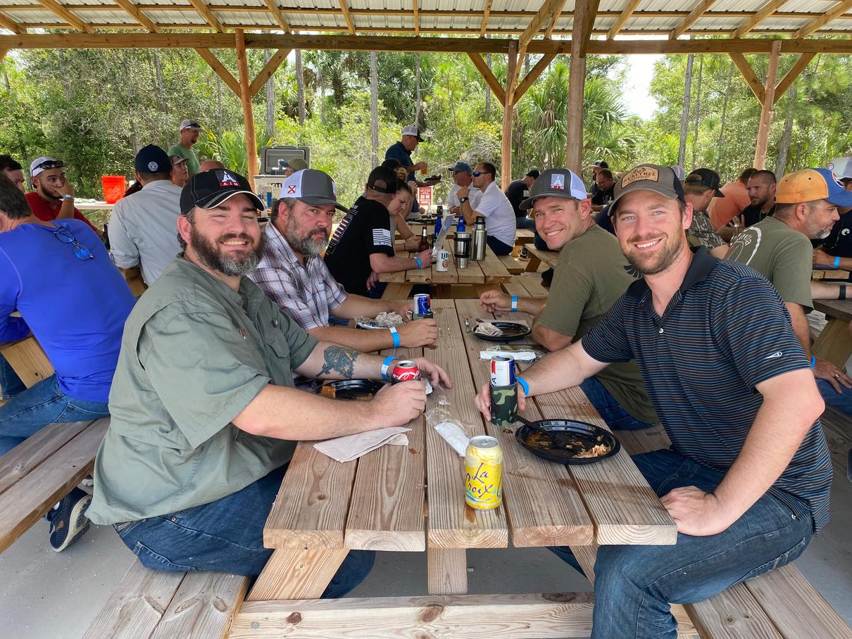
5 0 / 5 0 R a f f l e
A B O U T U S
T h e F l o r i d a S u r v e y i n g & M a p p i n g S o c i e t y h a s s e r v e d t h e S t a t e o f F l o r i d a f o r o v e r
6 0 y e a r s d e d i c a t i n g i t s e f f o r t s t o m a k i n g
a d i f f e r e n c e w i t h i n t h e c o m m u n i t y e a c h l o c a l c h a p t e r r e s i d e s i n .
O U R M I S S I O N
O u r m i s s i o n i s t o e x p a n d o u r c o m m u n i t y o u t r e a c h t o h e l p p r o v i d e s c h o o l s u p p l i e s f o r c h i l d r e n i n n e e d a n d c o n t i n u e p r o v i d i n g C h r i s t m a s g i f t s a n d h o l i d a y d i n n e r s t o f a m i l i e s w i t h i n L e e a n d C o l l i e r C o u n t y .
O N E P L A Y E R $ 1 3 0
F O U R S O M E $ 5 2 0
P r i c i n g i n c l u d e s g o l f c a r t f o r a f o u r s o m e , a m m o , e n t r y f e e s , b r e a k f a s t , a n d l u n c h .
S h o t g u n r e n t a l i s a v a i l a b l e f o r $ 2 0
( l i m i t e d s u p p l y )
I t i s r e c o m m e n d e d 1 s h o t g u n i s s h a r e d b y
2 p e o p l e
T h e r e a r e o n l y 2 8 g o l f c a r t s a v a i l a b l e , a c t q u i c k l y ! !
F O O D S P O N S O R $ 2 , 5 0 0
1 - F u l l P r i c e S l o t , o r
2 - $ 1 , 0 0 0 S l o t s & 1 - $ 5 0 0 S l o t
I n c l u d e s t a b l e d i s p l a y s i g n s o n e a c h t a b l e a n d o n t h e f o o d t a b l e .
G R E E N B I R D S P O N S O R $ 1 , 2 0 0
* P R I C E I S S U B J E C T T O C H A N G E *
1 - S l o t A v a i l a b l e
T i c k e t s t o d i s p l a y t h e c o m p a n y l o g o a n d t a b l e d i s p l a y t o b e d i s p l a y e d w i t h r i f l e .
C A R T S P O N S O R $ 8 0 0
1 - S l o t A v a i l a b l e
S P E C I A L T Y S T A T I O N S
P L E A S E B R I N G C A S H F O R A L L
S P E C T I A L T Y S T A T I O N S
5 0 / 5 0 R A F F L E
1 T I C K E T F O R $ 2 O R
3 T I C K E T S F O R $ 5
G R E E N B I R D C H A L L E N G E
1 T I C K E T F O R $ 2 0
R U L E S F O R T H E G R E E N B I R D :
P l a y e r s w i l l g e t 1 s h o t a t t h e G r e e n B i r d . I f y o u h i t i t w e w i l l d o u b l e y o u r t i c k e t s i n t o t h e r a f f l e . I f y o u m i s s i t , t h e a m o u n t o f t i c k e t s y o u p u r c h a s e d w i l l g o i n t o t h e r a f f l e .
I n c l u d e s 1 - 8 . 5 " x 2 0 " c o l o r l o w t a c s i g n t o b e d i s p l a y e d o n t h e f r o n t o f ( 2 8 ) g o l f c a r t s .
D R I N K S P O N S O R $ 7 5 0
1 - S l o t A v a i l a b l e
I n c l u d e s k o o z i e w i t h c o m p a n y l o g o p e r p a r t i c i p a n t , a n d d r i n k t i c k e t s t o d i s p l a y t h e c o m p a n y l o g o .
S T A T I O N S P O N S O R $ 2 5 0
1 4 - S l o t s A v a i l a b l e
I n c l u d e s 1 - 1 8 " x 2 4 " c o l o r s i g n a t a s t a t i o n .
O L U N T E E R S A R E N E E D E D !
P R I C I N G S P O N S O R S H I P S
P L E A S E L E T U S K N O W I F Y O U O R A N Y O N E Y O U K N O W W O U L D L I K E T O V O L U N T E E R F O R T H I S E V E N T . F O O D A N D D R I N K S W I L L B E P R O V I D E D T O A L L V O L U N T E E R S
V
TEAMS
The
SPONSORSHIPS
The deadline for sponsor registration is October 13th
PAYMENTS ARE ACCEPTED VIA CHECK OR CREDIT CARD THROUGH SQUARE
Please make checks payable to: Florida Surveying & Mapping Society Collier-Lee Chapter FSMS
Please mail checks to: Jennifer Sheppard 10511 Six Mile Cypress Parkway
Fort Myers, Florida 33966
SHOOTER #1
SHOOTER #2
SHOOTER #3
#4
ONE PLAYER $130 FOURSOME $520 R E G I S T R A T I O N F O R M
deadline for participant registration is October 30th
FOOD SPONSOR 2 - $1,000 Slots 1 - $500 Slot $2,500 $1,000 $500 GREEN BIRD SPONSOR $1,200 CART SPONSOR $800 DRINK SPONSOR $750 STATION SPONSOR 14 Slots $250 TOTAL AMOUNT ENCLOSED NAME MALE FEMALE
UNDER 16
JSHEPPARD@BANKSENG.COM
REGISTRATION
SHOOTER
INCLUDED WAIVER MUST BE COMPLETED AND EMAILED TO
WITH YOUR
FORM
P A R T I C I P A N T I N F O

The Florida Surveyor Page 57

September 2023 Page 58
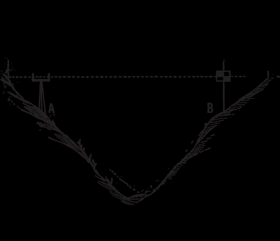
Half-Mile Posts, Alabama and Florida A Federal Perspective
As happens from time to time, an obscure aspect of the Public Land Survey System (PLSS) is brought to the forefront of scrutiny; debates ensue based upon various levels of understanding of the history and facts of the matter. The background and chronology that follow is intended to put the subject of Half-Mile Posts into its proper context. It can be a start for anyone wishing a more comprehensive understanding of the subject.
History and Administration of the PLSS
What is the Public Domain?
After the American Revolution, seven of the original thirteen colonies claimed the unsettled “wild” lands between the Allegheny Mountains and the Mississippi River. These seven colonies ceded their claims to this area to the newly confederated United States under the terms of the October 10, 1780, resolution of the Continental Congress.
The resolution stated that the ceded lands were to be utilized for the common benefit of all the people of the Confederated Colonies. They were to be disposed of or settled under such rules and regulations as agreed upon by the United States in Congress assembled.
The colonial sessions included the Territory south of the State of Tennessee, now Alabama and Mississippi, and the Territory northwest of the Ohio River, now the states of Ohio, Indiana, Illinois, Michigan, Wisconsin and the eastern portion of Minnesota. The lands ceded by the colonial states were from that time on referred to as: “The United States Public Domain.”
About 1.5 billion acres of land were added to the U.S. Public Domain when territories west of the Mississippi River, Florida, and Alaska were acquired by the United States.
The legal foundation for the PLSS
In 1780 the Congress of the Confederated States passed a resolution reserving to itself the right to dispose of the Public Lands and to make the rules for the means of its disposal. Terms of the 1780 resolution are incorporated in Article IV, Section 3 of the United States Constitution which says:
“The Congress alone shall have the power to dispose of and make all needful rules and regulations respecting the territory or other property belonging to the United States; and nothing in this Constitution shall be so construed as to prejudice any claims of the United States, or of any particular State.”
The specific act of Congress most germane to the half-mile post situation and the proper treatment of them is the Act of February 11, 1805.
The Florida Surveyor Page 59
Administration
The administration of the Public Lands, including surveying, was placed under the Secretary of the Treasury an appointee of the President. The Act of May 18, 1796 called for the appointment of the first Surveyor General, also a presidential appointee. The business of the Public Land administration became an overwhelming task for the Secretary, and in 1812 the General Land Office (GLO) was created within the Department of the Treasury. A Commissioner, also appointed by the President, headed the GLO.
The Treasury Secretary, the GLO Commissioner and the Surveyors General had to work closely together in dealing with the Public Land Surveys. These men were on equal footing, all having been appointed by the President. The Secretary and the GLO Commissioner had limited power over the Surveyors General. As new Surveyors General were appointed, control was exercised through the monies appropriated by Congress for the Public Land Surveys. These men, much like surveyors today, all had opinions on how to carry out the various Acts of Congress relating to the Public Land Surveys. If the Secretary or Commissioner didn't agree with a particular Surveyor General, they simply adjusted the amount of funds he received. This form of control had limited impact because the Surveyors General had equal access to the President.
Surveyors General
The first Surveyor General was Rufus Putnam, appointed November 5, 1796. He was responsible for the surveys in the Northwest Territory (the lands northwest of the Ohio River).
The second Surveyor General was Isaac Briggs, appointed April 1, 1803. He was responsible for the surveys south of the State of Tennessee (now Alabama, Mississippi and Louisiana after its purchase in 1803).
Seth Pease was appointed in 1807, replacing Briggs as Surveyor General for the lands south of the State of Tennessee.
Thomas Freeman succeeded Pease as Surveyor General for the lands south of the State of Tennessee with his appointment on September 10, 1810.
Edward Tiffin was the first Commissioner of the GLO from May 7, 1812 to October 11, 1814. He was also the fourth Surveyor General for the Northwest Territory, appointed in November of 1814.
Alabama was split out of the jurisdiction of the lands south of the State of Tennessee with the appointment of John Coffee as Surveyor General of Alabama in March 17, 1817.
September 2023 Page 60
Each of these Surveyors General was authorized to frame regulations and instructions for the direction of the deputy surveyors within their surveying districts. History shows that some did and some didn’t provide guidance, as evidenced by the written instructions that have survived. As stated above, they all had opinions as to carrying the Federal laws into effect, which explains the different methods of survey in the various jurisdictions.
Similarities can be explained by the fact that some of the Deputy Surveyors who later became Surveyors General had previously worked under or with other Surveyors General. For example, Coffee worked for Freeman who had worked for Pease. As documented by the field notes, contracting Deputy Surveyors migrated with the work. Deputy Surveyors who had worked in Mississippi and Alabama wound up with contracts in Florida. One can easily surmise that an experienced Deputy Surveyor from Alabama with a contract from Robert Butler, (the first Surveyor General of Florida appointed July 9, 1824) who never issued any general instructions of his own that we know of, execut ed his surveys in the same fashion as he had in Alabama. Even if Butler objected to the returns when he received them, he was hardly in a position to force the Deputy Surveyor to correct them as he had issued no general or specific instructions to the contrary and the Deputy’s former work, done in the same fashion, had been accepted.
An understanding of this early history and administration serves to explain how the practice of setting half-mile posts could exist in one area of the country and not another, and how this practice may have migrated to Florida.
The Origins of Half-Mile Posts
Where and when did this practice actually start?
We know from the field notes that few half-mile posts exist in Mississippi; many exist in Alabama, and some in Florida. To my knowledge, they are not found in any other township subdivision notes in any other part of the country. They do, however, exist in long straight-line segments of old Indian boundary surveys.
A glimpse into the possible true origins of the half-mile post is provided from research done by Mr. Lane Bouman, BLM Eastern States Deputy State Director for Cadastral Survey, retired. For many years Mr. Bouman studied various correspondence records between Surveyors General and the Secretary of the Treasury and the Commissioner of the GLO.
The following quotes were found by Mr. Bouman in correspondence between Seth Pease, Surveyor General for the lands south of the State of Tennessee and the Secretary of the Treasury.
Letter dated July 14, 1807 to the Secretary of the Treasury from Seth Pease: “Mr. Thomas Freeman is on his way from this place (Washington, Mississippi Territory) to the Tennessee river, in order to run the boundary lines of the Chickasaw session…”
The Florida Surveyor Page 61
Letter dated August 19, 1808 to the Secretary of the Treasury from Seth Pease: “Mr. Thomas Freeman has returned the notes of four Townships and informs me that he expects to complete the survey in the bend of Tennessee this season.”
Letter dated May 31, 1809 to the Secretary of the Treasury from Seth Pease: “I have the honor to transmit … the Townships of the Public Lands in Madison County M.T. from the field notes of Thomas Freeman and …”
Letter dated August 2, 1809 to the Secretary of the Treasury from Seth Pease: “I mentioned in my instructions to Mr. Thomas Freeman that the law required a post be set at each half mile for the corners of sections, or rather that it be placed just half way on each line between the corners of sections as run…”
Letter dated October 25, 1809 to the Secretary of the Treasury from Seth Pease: “Mr. Thomas Freeman informs me that he has set half mile posts on all his lines in his survey of Madison County, but that they will not always be found exactly half way between the section corners. I can furnish the Deputy Surveyor for that District with instructions for placing any one correctly which may not be so, without giving him any extraordinary trouble.”
Mr. Freeman, being an experienced Indian boundary surveyor, obviously carried the terminology and practice of setting half-mile posts into the subdivision of townships.
Looking at Mr. Pease’s side of the correspondence, it is easy to conclu de that the Secretary must have had some concerns with the half-mile posts set by Mr. Freeman. No other correspondence on the matter has been discovered and Mr. Pease’s remedy was never done. So the practice of setting half-mile posts, although questioned in 1809, was never corrected; and in fact, as evidenced by the field notes, was continued throughout Alabama and carried into Florida.
It has been suggested that Mr. Tiffin’s instructions of 1815 could be viewed as being written to “kill off” half-mile post procedures. As seen above, the issue had arisen as early as 1809, some 3 years prior to his first involvement with the Public Land Surveys as Commissioner of the GLO. One could postulate that because of Tiffin’s stint as GLO Commissioner, he was undoubtedly aware of these half-mile posts and given the obvious learned nature of the man, he could foresee the vexing problems that could result because of them.
Because of his experience as GLO Commissioner, Mr. Tiffin was surely aware of the lack of uniformity in the surveys being executed; and when he was appointed to the office of Surveyor General for the Northwest Territory, he developed his own detailed instructions as an effort to ensure uniformity in the future. He was also aware, however, that his instructions had no force and effect beyond his jurisdiction, the Northwest Territory.
September 2023 Page 62
The Controversy with Half-Mile Posts
What half-mile posts are and how they came to be is succinctly described in the first two paragraphs of Section 5-39 of the 1973 Manual and is quoted here.
“5-39. “Half-Mile Posts,” Alabama and Florida
In the early practice in parts of Alabama and Florida, so-called “half-mile posts” were established at distances of 40 chains from the starting section corner. The term was applied where the line might be more or less than an exact 80 chains in record length, and where by later methods the latitudinal lines have been run as “random and true.” The practice contemplated that in some cases these subdivisional lines be run in cardinal directions to an intersection, where the next section corner would be placed, and either or both lines might be more or less than 80 chains in length. In some cases the section corners were placed across the township at intervals of 80 chains on one of the cardinal lines, and the other lines were run on random only. On the first plan the “half -mile post” would not be at midpoint unless the line turned out to be 80 chains in length. On the second plan the “half-mile post” on the lines first run would b e in true position for the quarter-section corner, but on the lines last run they would usually not be on true line, nor at midpoint.
In both cases field notes were written showing a true line direction and midpoint distance for a quarter-section corner. This was done to meet the objection that the “half -mile post” did not satisfy the requirements of law, but the true line was not actually run on the ground, nor was a monument constructed at midpoint. In these cases only the true line field notes need be regarded if the evidence of the “half -mile post” has disappeared; but where the latter can be identified the point must be given proper weight for control. Each set of field notes requires its individual consideration, as the practices were not uniform even in the same surveying district.”
The intersection method of establishing the next section corner, which resulted in one or both lines being more or less 80 chains long, comes directly from instructions to Deputy Surveyors issued by John Coffee, Surveyor General of Alabama, dated May 4, 1817. Note that Coffee had been a contracting Deputy Surveyor for Freeman whose work had been questioned by Secretary Albert Gallatin in 1809.
The crucial problem with these half-mile posts is the fact that in most cases, they failed to satisfy the law.
Pertinent requirements of the Act of February 11, 1805
“
1st All the corners marked in the surveys, returned by the Surveyor General shall be established as the proper corners of sections, or subdivision of sections, which they were intended to designate; and the corners of half and quarter sections, not marked on the said surveys, shall be placed as nearly as possible equidistant from those two corners which stand on the same line.”
The Florida Surveyor Page 63
This is where the problem with the half-mile post begins. Some will point to this requirement in the statute and say that it doesn’t matter where the half-mile post is. If it can be recovered, it is controlling, after all it’s an original corner.
“2nd. The boundary lines, actually run and marked in the surveys returned by the Surveyor General, shall be established as the proper boundary lines of the sections, or subdivisions, for which they were intended, and the length of such lines, as returned, shall be held and considered as the true length thereof. And the boundary lines, which shall not have been actually run, and marked aforesaid, shall be ascertained, by running straight lines from the established corners to the opposite corresponding corners; but in those portions of the fractional townships, where no such opposite corresponding corners have been or can be fixed, the said boundary lines shall be ascertained, by running from the established corners due north and south or east and west lines, as the case may be, to the water-course, Indian boundary line, or other external boundary of such fractional township.”
The boundary lines actually run and marked being established as the proper boundary becomes a key consideration in the technical treatment of a recovered half-mile post.
“3rd. Each section, or subdivision of section, the contents whereof shall have been, or by virtue of the first section of this act, shall be returned by the Surveyor General, shall be held and considered as containing the exact quantity, expressed in such return or returns; and the half sections and quarter sections, the contents whereof shall not have been thus returned, shall be held and considered as containing the one half, or the one fourth part respectively, of the returned contents of the section of which they make part.”
The latter part of the 3rd subsection of Sec. 2 of the Act means that if the Surveyor General did not indicate by protracted subdivisions or lottings of the sections on the plat, the only division of the section allowed by the statute would be by aliquot part of the whole. This portion of the statute is the reason for Section 7-10 of the current Manual.
Most of the surveys in Alabama and some in Florida do not contain any protracted section subdivisions or any of the customary lottings. This is true even on sections closing into the township exterior. Many of these closing miles were considerably short or long of 80 chains going into the boundary, yet the half-mile posts were set at 40 chains from the starting section corner. In these instances, the lands were patented by one-fourth or one-half of the returned acreage for the entire section. This clearly indicates that the half-mile post, although set in the original survey, was not held as a controlling corner for the subdivision of the section.
September 2023 Page 64
Let’s look at some actual records to better see the situation .
Protracted subdivision and lot lines with acreages were returned on the plat by the Surveyor General for Section 6. In contrast, Section 1 in the abutting township has no protracted subdivision lines; and only the acreage of the entire section (573.68 acres) was returned.
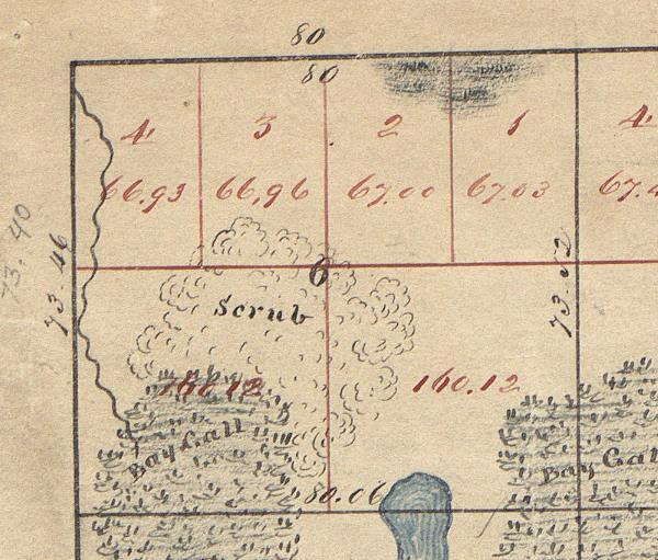
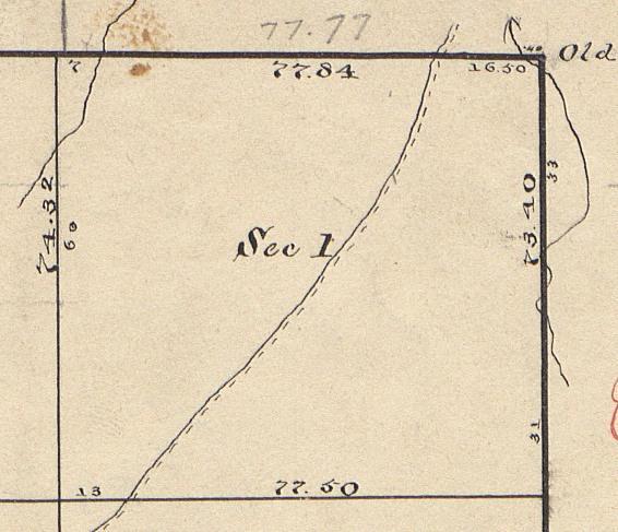
The patent for the NW¼ of Section 1 is for precisely one fourth the total acreage of Section 1 returned by the Surveyor General (143.42 acres). Patents for Section 6 were with specific reference to the lotting and areas as returned on the plat by the Surveyor General. These patents are in complete accord with the statute.
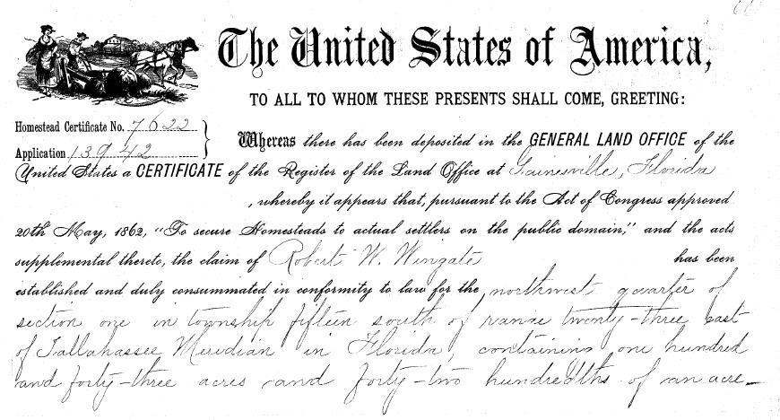 Section 1, T. 15 S., R. 23 E., Tall. Mer., FL. Section 6, T. 15 S., R. 24 E., Tall. Mer., FL.
Portion of the Patent for the NW¼ of Section 1, T. 15 S., R. 23 E., Tall. Mer., FL.
Section 1, T. 15 S., R. 23 E., Tall. Mer., FL. Section 6, T. 15 S., R. 24 E., Tall. Mer., FL.
Portion of the Patent for the NW¼ of Section 1, T. 15 S., R. 23 E., Tall. Mer., FL.
The Florida Surveyor Page 65
The official field notes of these surveys show that half-mile posts were set at 40 chains from the south on the west boundary of Section 1, the east boundary of Section 6 and on the range line common to both sections.
Everything is fine up to the point the sections are to be subdivided on the ground. There is generally no problem with Section 6 because the Surveyor General by his protraction and lotting made the original half-mile posts controlling for the subdivision. His protraction and lotting, in accordance with the statute, controlled the descriptions in the patents issued. Section 1, however, becomes a dilemma for some because according to the same statute, original monuments control.
The concept that original corners control has been ingrained in surveyors early on and throughout their careers. So much so, that recognizing there are exceptions becomes difficult. Our example here is even further compounded with the common knowledge among surveyors that the overage or shortage that exists in these surveys is by Federal law and Manual requirement to be placed against the north and west boundaries of the townships. In so doing, as many regular aliquot parts of the closing sections as possible are created. The Surveyor General’s protraction of Section 6 with nominal 160 acre aliquot quarter sections in the south half and the four lots in the north half demonstrat es this requirement.
Another element of confusion is where the Manual discusses subdivision of sections by protraction and by survey in chapter three. This chapter deals with original and completion surveys of vacant Public Land. The guidance for subdivision by protraction is for cartographers creating the plats that will be the basis for patenting. It has no merit for subdividing sections once any or all of the land in a section has been patented.
As a consequence today, most surveyors’ initial approach to Section 1 is to hold the original half-mile posts to control the subdivision of Section 1 as well. The result being that the patentee for the NW¼ of Section 1, having legally acquired it in good faith under the law, is by a survey process denied 16.58 acres of the 143.42 acres patented. Conversely, patentees in the south half of the section have their acreage enriched by 16.58 acres. It could easily be argued that this subdivision of Section 1, amounts to a taking without compensation and as such is unconstitutional.
The graphic below demonstrates the incongruity of the result.
September 2023 Page 66
With a little deeper consideration of the entire Act of February 11, 1805, in the context that it included elements applicable to the disposal of the Public Lands as well, one should recognize that there are instances when the patent records dictate the proper subdivision of sections.
The above shows the subdivision of Section 1, using the midpoint or equidistant principle from the Act of February 11, 1805, protecting the patents that contained ¼ of the total returned acreage as also specified by the same statute.
Hopefully, this serves to demonstrate that an original half-mile post, albeit an original corner set in the course of the original survey, represents an exception to the rule that original corners control.
The Florida Surveyor Page 67
Half-mile posts were not, in effect, the equivalent of original quarter section corners. They can only be used to control the subdivision of sections if by clear implication they were used to protract the subdivision of the section; or if by record they are, in fact, equidistant or midpoint between the section corners of the same line.
The Act of February 11, 1805 stipulates that a quarter section corner was to be established, as near as may be, equidistant between the corners of the sections on the same line. Understanding Coffee’s instructions and the common practice of setting these half-mile posts going back to Freeman’s 1809 work, it is eas y to see why they were generally not considered as marking the quarter section corner; they simply in most cases, did not meet the legally established requirement.
September 2023 Page 68
The Manual Treatment of Half-Mile Posts
Starting in 1809 with Treasury Secretary Gallatin’s objections to the half-mile posts set by Freeman, the GLO beginning in 1812 and later the Bureau of Land Management (BLM) since 1946 has taken a consistent position in regard to the half-mile posts. It should be acknowledged, considering the early nature and limited scope of half-mile posts, that there simply hasn’t been much written officially on the subject.
The following is quoted from the Restoration of Lost or Obliterated Corners, a Circular of the Department of the Interior, General Land Office, Washington, D. C., Revision of June 1, 1909. It is believed to be the first official Manual or Circular mention of halfmile posts:
“61. Note.- In some of the southern public-land States it was the custom in the early surveys to establish half-mile posts at a distance of 40 chains from the point from which the section line was initiated, at the same time inserting in the field notes at the midway point ”1/4 sec. cor.” without indication in the field notes that any other corner than the half-mile corner was set. And it is presumed that the ¼ sec. cor. was merely “called for” at that place. This practice has long been discontinued owing to the confusion thereby occasioned.
These half-mile posts have no bearing upon the subdivision of the section except where they happen to occupy the midway point on true lines b etween section corners. In such cases, when a subdivision is required of a section surveyed on this plan, and no original quarter corners are found, the latter should be reestablished at a point on a true line midway between the original section corners.”
The GLO and BLM have not varied from this viewpoint for nearly one hundred years as it is based on Statutory Laws. Any rule or regulation published in a technical bulletin by an administrative agency is null and void when it is in conflict with the law.
Not until 1947 were procedures for dealing with recovered half-mile posts incorporated into the Manual of Surveying Instructions. These procedures are binding upon the Cadastral Survey employees of the Bureau of Land Management in the course of conducting dependent resurveys on Federal lands. Any surveyor surveying private lands that abut Federal lands should also adhere to them.
The fourth rule relating to half-mile posts in Section 5-39 of the 1973 Manual of Surveying Instructions could be argued to be in violation of the Act of February 11, 1805.
The Act of February 11, 1805 stipulates that the section line as run and marked will be the true boundary. This fourth rule forces the angle point in the section line, if one exists, to be at the quarter section corner placed at the record correction from the original halfmile post.
The Florida Surveyor Page 69
Although admittedly a minor detail, this places the quarter section corner off the original line. If there was an angle point in the original line, it would have been at the half-mile post.
The author of the 1973 Manual Mr. Thomas Tillman was asked about this minor deficiency. Mr. Tillman was well aware of the objection to the procedure and explained that it was preferable because you would have to re-monument the half-mile post and the quarter section corner to preserve the original section alignment. Having two monuments so close together was judged to be too confusing; a procedure that placed the angle point at the quarter section corner, even if it was ever so slightly off the true line, was preferable.
The fourth rule under Manual Section 5-39 also requires the record correction for distance to be applied. This stems from the premise, if the original surveyor would have set the corner that is where he would have placed it. This theory has some merit; however, one can easily see where this notion could be totally in error.
Take for example, the placement of a sixteenth section corner, not set in the original survey, on a line closing into a former boundary i.e. a township line. See Section 5-41 of the Manual. This section of the Manual requires the use of the position of the offline closing corner, as opposed to the true intersection, to establish sixteenth corners not monumented in the original survey. It is likely that you could come up with a situation where the closing corner is so far off the senior controlling boundary that using this procedure would place the position for the sixteenth section corner over the said boundary as well. This would, in effect, eliminate or, if not over the senior boundary, severely diminish a lot that exists on the original plat.
No one today has the authority to dictate procedures, be it the treatment of half-mile posts or the establishment of minor corners not set in the original survey, if said procedures can be shown to impair a right properly granted under the authority of the Constitution. The diminished right could be argued as a taking without just compensation and that is clearly unconstitutional. I’m more inclined to following the Act of 1805 as strictly as possible.
Case Law Concerning Half-Mile Posts
The status of an original half-mile post, not set equidistant in accordance with Federal Statute was considered by the Supreme Court of Alabama in Walters v. Commons, 2 Port. 38; 1835 Ala.
Quoted Sections of Walters v. Commons
“ Walters was owner of the south east quarter of section eight, in township eighteen, of range ten, and Commons claimed the east half of the south west quarter of the same section. The whole section was found to contain six hundred and fifty two 37-100 acres, and the question raised in this case, was, in substance, whether the surveyors had the right of removing the half mile posts, and of thus giving the plaintiff his portion of the excess in the section. The Court below, charged, among other things, that the surveyors
September 2023 Page 70
had no right to remove the half mile stakes, if without doing so, they could give the quantity called for in the patent, though the section contained more than six hundred and forty acres. There was a judgment for defendant below, and the plaintiff having excepted to the opinion of the Court, took his writ of error.” …
“The titles to lands in this state, are derived from grants by the United States, and are made under surveys regulated by laws of the United States ” …
“... It is only when there is an error in not placing the half mile post or corner at the center of the line of the section, that the inequality occurs. By law, these corners are not declared to be "established as the proper corners," as is done in the case of sections; to disturb which would distract a whole township: but they are to be as "nearly equidistant as possible from the corners of the section;" and if there is an error found in that particular, by which one person owning one half or quarter of a section, has got possession of more than the half or quarter, it is the opinion of the Court that this error can be corrected.”
So the Alabama high court is saying the record establishment of the half-mile post is immaterial, if, by actual survey the half-mile post does not sit equidistant between the section corners of the line. This may well be the reason very few original half-mile posts have been perpetuated in Alabama. The majority of the sections have quarter section corners that have been established at midpoints on the section lines.
The 1835 Walters v. Commons decision of the Alabama Supreme Court has never been overturned. It is in accord with the stated long standing policy of the United States that a half-mile post that does not meet the statutory requirement for a quarter section corner does not constitute one.
Conclusions Concerning Half-Mile Posts
The majority of the remaining Public Lands in Alabama and Florida have already been dependently resurveyed and remonumented with regulation metal monuments. These surveys were executed in accordance with Federal policy and guidance for half-mile posts that has remained unchanged for nearly 100 years. Consequently, an attempt to expound upon the topic of half-mile posts adding criteria which is legally questionable serves no useful purpose in a Manual for the survey of Public Lands.
On the other hand, the proper treatment of half-mile posts is very relevant in private boundary surveys in Alabama and, to some extent, in Florida. Common law doctrines of unwritten transfer of rights may well be applicable. Statutory time frames and case law requirements that have evolved for adverse possession, acquiescence, agreement, and repose would need to be scrutinized in light of the facts developed on the ground. However, once land has been patented, the United States is without jurisdiction; therefore, BLM’s Manual treatment of half -mile posts is not compulsory when private boundaries are at issue.
The Florida Surveyor Page 71
I believe that surveyors will debate these types of situations forever. The reasons are numerous. Some surveyors just want to point to some authority such as the Manual for a cookbook answer to the situation at hand. They fail to realize that the Manual is, for the most part, merely a guide. It is not law even if it has been adopted by State Statute. See 116 Idaho 429; 776 P.2d 438; 1989
Other surveyors have deep-rooted “feelings” about the justices or injustices of a given survey situation and justify their actions upon these feelings. I was taught early in my career that “feelings” are good for writing songs but surveying is based upon evidence and the law.
Many differences attributable to one surveyor’s opinion over another are small; these small differences are rarely litigated because the courts do not deal with trifles. Lacking the courts consideration, the debates go on. There is always hope because unlike surveyors who are constantly trying to define how close is close, the courts have never defined what a trifle is.
The Federal surveyor’s solution to a particular survey decision is often times overly tempered by the apparent effect on the abutting private landowner. The justification given the most is that the method chosen protects the private landowner’s bona fide rights. What is neglected is the public’s bona fide right, which we, as Federal surveyors are charged to protect. Another perceived factor in this analysis is that Federal surveys are protested or contested by the abutting private landowners. I do not know of one survey that was ever contested on behalf of the public. Conversely, private surveyor’s decisions can get challenged from both sides of the line. The decision made must take into account the vested legal rights on either side. The public’s rights in the Public Domain are no less important than an abutting private right. Therefore, anyone surveying the boundaries of Federal land should likewise consider the valid rights on either side of the line.
-end -
This document was compiled for background and context relating to Half-Mile Posts. It was written to support BLM Eastern States’ comments concerning related sections of the next edition Manual.
Corwyn J. Rodine Cadastral Surveyor BLM Eastern States
September 2023 Page 72
ARCHIVES FROM THE
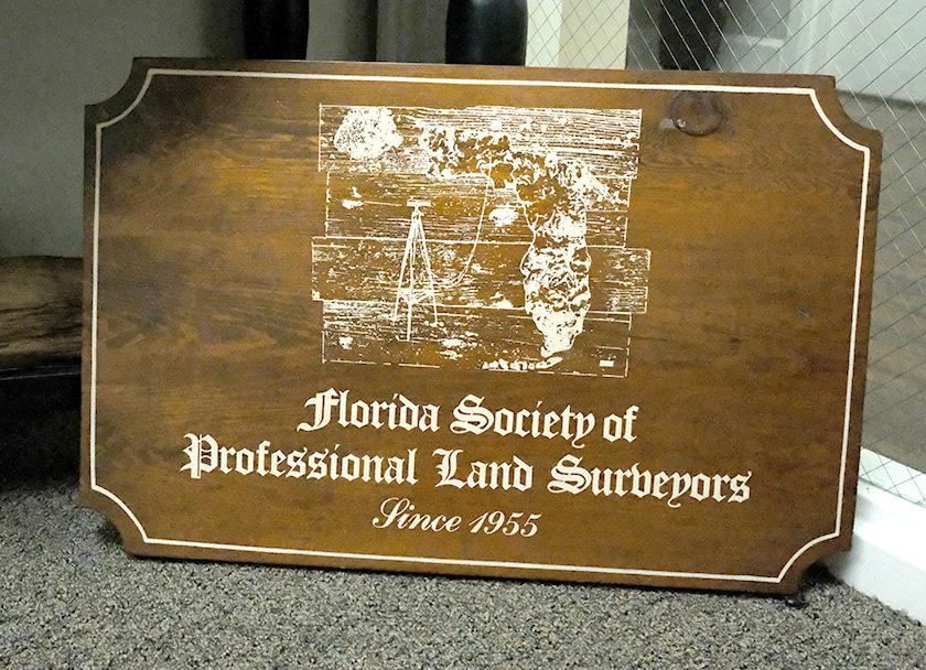
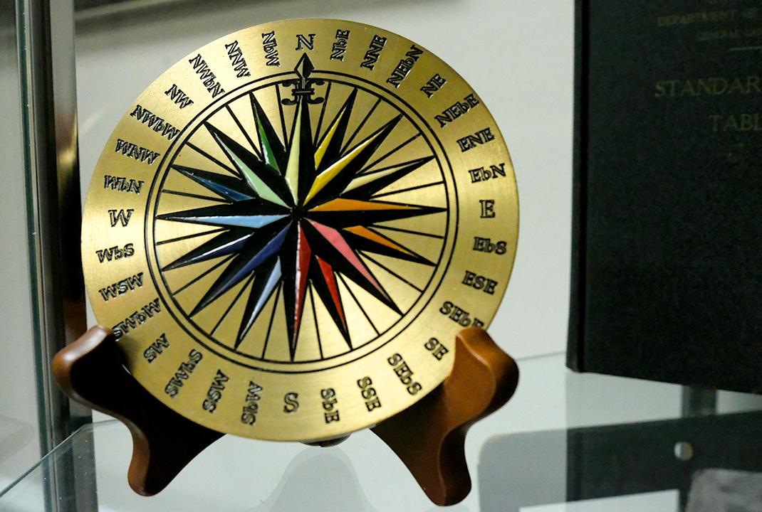
The Florida Surveyor Page 73
WHAT A SURVEYOR WILL DO FOR A QUARTER
James A. Thigpenn, III
BIOGRAPHICAL SKETCH
The author is a specialist in retracements of the early General Land Office surveys in Florida. He is a Registered Land Surveyor in Florida, Georgia and Alabama. He is a Past President and Fellow Member of the Florida Society of Professional Land Surveyors and a Past President of the American Congress on Surveying and Mapping.
ABSTRACT
A brief discussion of a variation in the subdivision of townships during the original public land surveys in parts of Florida and Alabama, and the rules to be followed by Land Surveyors today when encountering same during retracements requiring the subdivision of the sections into halves or quarters.
TEXT
On July 17, 1821, Andrew Jackson completed the formalities through which the territories of East and West Florida were turned over: to the United States by the Spanish authorities. Four days later, acting in his capacity as
A HALF CORNER IS BETTER THAN NONE or
(FSMS Past President 1964-1965)
September 2023 Page 74
Military Governor, he issued an ordinance dividing the newly acquired land into two counties with seats of government established in Pensacola and St. Augustine. The next year, following the establishment of a civil government in Florida with authority vested in a territorial governor and a legislative council made up of 13 citizens, the territory was divided into four counties, and a year later into five. By 1824, when the public land surveys were begun in Florida, the territory had been divided into eleven counties, evidencing its rapid development under the pressure of an avalanche of new settlers, all seeking a fresh start on land soon to be available for homesteads.
No doubt, there was a great deal of pressure also on the General land Office to expedite the surveys of those parts of the public domain in Florida found suitable for farming so that the land could be patented into private ownership. By law, public lands of the United States could not be disposed of until surveyed, marked and approved by the Surveyor General. It was not too surprising, therefore, to find that some short cuts were introduced into the routines employed during these early surveys.
The most significant variation officially introduced was the establishment of so called "half-mile posts" at the distance of 40 chains from beginning section corners on each line run. In actual practice, two distinctly different plans evolved, one being the running of all interior section lines in cardinal directions, or on bearings in harmony with the township boundaries, to intersections where the section corner post would be placed. If the distance from each beginning section corner to the intersection happened to be 80 chains, the "half-mile post" became a legitimate quarter corner as prescribed by law. If the distance varied, the total distance for that par ticular line was halved and the field notes would, in some manner, indicate that the quarter corner, or post, was located at that point midway between the section corners.
In the second plan, the interior section lines would first be run in one of the cardinal directions across the entire township with section corners set at each 80 chain interval and "half-mile posts" set at 40 chain intervals
Half
A
Corner Is Better Than None or What A Surveyor Will Do For A Quarter
The Florida Surveyor Page 75
between the section corners. The lines run later at approximate right angles to the first run lines were run only as random lines, although "half-mile posts" were set, and bearing trees recorded, at 40 chains on that trial line. If the last run lines did not cross the first run lines at the established section corners, the "half-mile post" was not on the true section line bearing shown in the field notes. If the closing distance was not 80 chains, half the distance was noted in the field notes as the distance to the quarter corner on the true line, but the line was not run and no quarter section post was set.
The most significant difference in the two plans was the probability that the "half-mile post" in the second plan would not actually be on the section line, and could not be used as a reference monument to the true quarter corner. Too, there could be no marked closing section line to aid the eventual purchasers in the location of their boundary. To the contrary, the bogus monument could cause an erroneous occupation to the wrong line. In making retracements, however, the second method did simplify the establishment of a quarter corner by a surveyor having access to the field notes, and having successfully identified the appropriate section corners, as he had only to halve the true distance, without regard for the half-mile post, and set his corner at the intended point. However, if the field notes indicated that the closing line actually hit the section corner at 80 chains, then that "half-mile post" would be the true quarter corner.
When the first described plan was followed, all of the "half-mile posts" were presumably set on the true section lines, but such posts, whether set on the north - south lines, or the east - west lines, could be quarter corners only where the distance from the beginning corners to the intersection point was exactly 80 chains, or so entered in the notes. In all other cases, the "half-mile posts" became reference monuments from which the quarter section corners could be located.
Chapter 5, Paragraph 39, in the 1973 Manual of Surveying Instructions, cites the rules regulating the establishment, or re-establishment of quarter corners created during original government surveys made in accordance
FROM THE ARCHIVES
September 2023 Page 76
with the two methods previously referred to:
(1) In case the "half-mile post" and quarter-section corner are recorded as being at a common point, the identified "half-mile post" will be restored as the quarter-section corner.
(2) If there is evidence of the position of the section corners in both directions, and if the record leaves doubt as to the establishment of the "half-mile post" on the true line, the quarter-section corner will be monumented at midpoint on the true line, disregarding the record of the "half-mile post."
(3) In the absence of evidence at one or both section corners and where the record leaves doubt regarding the running and marking of the true line, the "half-mile post" will be employed on a north and south line for the control of the latitude of the quarter-section corner, or on an east and west line for control of its position in departure, using the record correction for distance. The alignment of the section boundary and the position of the quarter-section corner on the true line will be adjusted to the location of the two section corners after the double proportionate measurements have been completed."
(4) Where the field notes show proper location for alignment and record correction for distance, the "half-mile post" will be employed for the full control of the position of the quarter-section corner, and for the restoration of the lost section corners. The position of the quarter-section corner in latitude on a north and south line, or in departure on an east and west line, will be ascertained by making use of the record correction for distance from the "half-mile post." The alignment from the position of the "half-mile post" to the point for the quarter-section corner will be determined by the position of the section corner to the south, if the record correction for distance is to be made to the north; the section corner to the north will be used if the record correction for distance is to be measured to the south; and similarly on east and west lines.
(5) The evidence of the "half-mile post" will not be destroyed.
A Half Corner Is Better Than None or What A Surveyor Will Do For A Quarter The Florida Surveyor Page 77
Upon first encountering a situation during a retracement requiring the application of the referred to rules, there is a great temptation to throw out the evidence of the "half-mile post" recovered during the random traverse made along or in the vicinity of the original section line. This occasionally is made possible by the fact that only two bearing trees or other accessories were given at the "half" corners, and it is often possible to find several pairs of the objects or remains of the objects matching the field note calls in the obvious vicinity of the point where the original post was placed. If two points can be identified with equal authenticity, then neither point can be identified as the true corner. This convenient solution, however, is not always possible and in any case, is not the object of the retracement. The concealment of evidence would be an actionable misrepresentation, as well as a breech of our code of ethics.
In every instance, the rules formulated by the Bureau of Land Management and its predecessor, The General Land Office, were issued to preserve the scheme of the public land surveys, to validate the performance of the deputy surveyors, and to satisfy the dictates of the federal laws governing the identification and disposal of the public lands of the United States. In most instances they have been successful, and the occasional failure detected in the results of their performance is infinitesimal in view of the magnitude of their undertaking. Nevertheless, rule (4) as cited here seemingly has the uniqueness of being a deliberate attempt to frustrate the object of the intersection plan rather than strengthen it, and I cannot help but believe that had this method of closing sections been widely used in other areas, instead of isolated in a few districts of Florida and Alabama, there would have been so many attacks on the rule that it would not have remained on the books for long.
To illustrate my objections, the consequence of the Bureau's standing rule is shown in Figure 1. This drawing portrays the two segments of a closing section line run in an easterly direction as a true line to an intersection with a line run earlier in a southerly direction from the northest corner of the section to be established. For the purpose of clarifying the results, an exaggerated turn has been made in the course between the "half-mile post"
FROM THE ARCHIVES
September 2023 Page 78
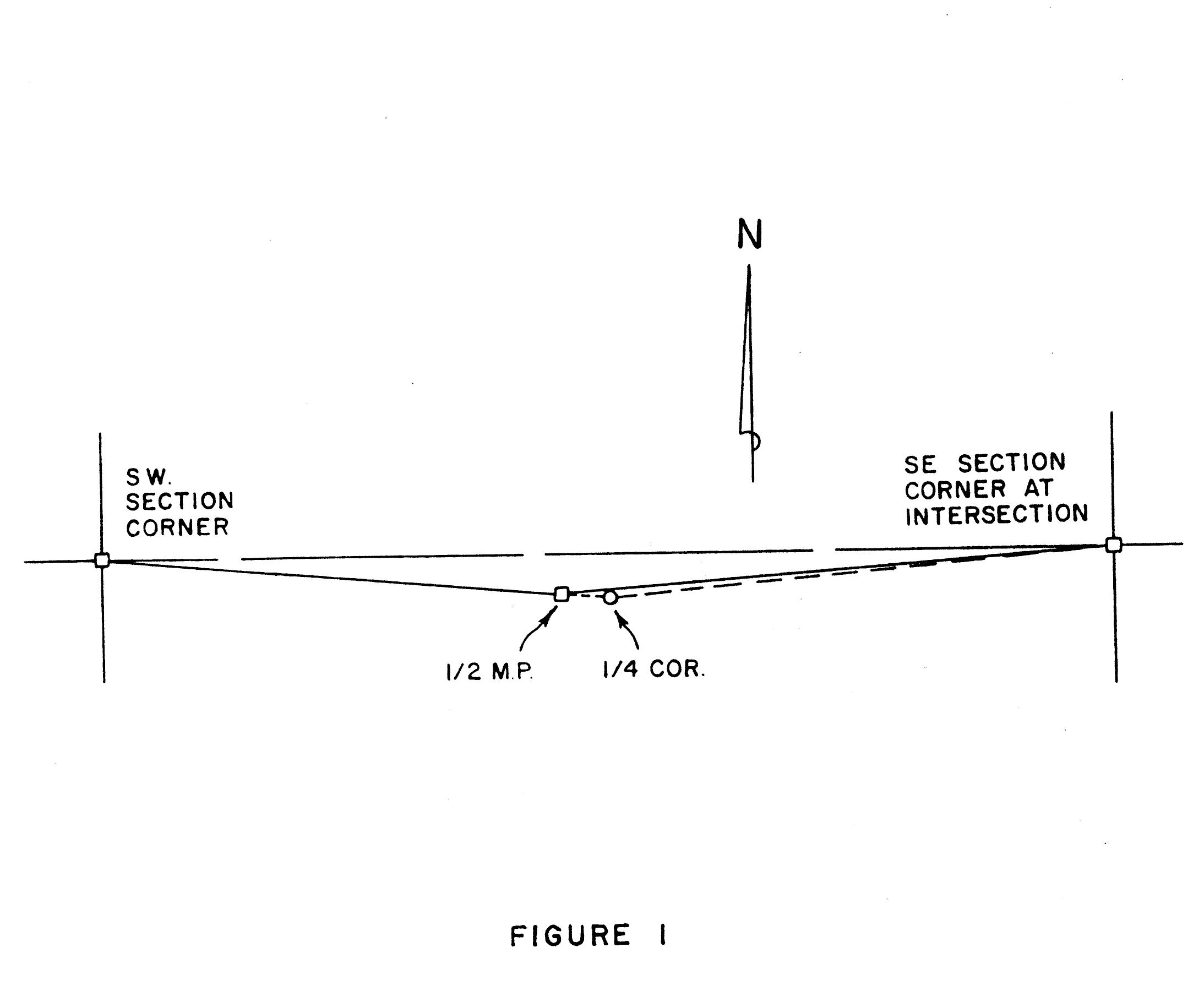
A
The Florida Surveyor Page 79
Half Corner Is Better Than None or What A Surveyor Will Do For A Quarter
and the section corner set at the intersection. In this example, as the total distance from section corner to section corner is greater than 80 chains, the correction distance must be measured in an easterly direction with the section corner to the west used for alignment. It is at once apparent that the original intent to establish a straight section line between the two corners has been completely ignored and the quarter-section corner established at a point even farther from a straight line than the "half-mile post" was to begin with. The only improvement realized through this method depends on the possibility that the quarter-section corner may be equidistant from the two section corners. If you believe that is much of a possibility, then you will probably want to vote slot machines back in too.
Of course, any movement of the quarter-section corner would disturb the line actually run, but why select a procedure that puts a larger turn in the boundary and a monument that is even farther out of place than the one set by the deputy surveyor? By way of explanation, the Manual provides this enlightening statement:
"The applicable rules for the restoration of the true line midpoint position for the quarter-section corners in the above practices are derived from the Act of February 11, 1805 (R.S. 2396), which requires that "the corners of half and quarter sections, not marked on the surveys, shall be placed as nearly as possible equidistant from two corners which stand on the same line."
It is not conceivable that the law could be so broadly interpreted so as to permit the quarter-section corner to be set just anywhere as long as it satisfies the equidistant provision. There was also a mention of "the same line." Where is the same line? Is it a line that would fix the points all in a row —a straight line— with the midpoint equidistant from the other two? Not necessarily. We have all sorts of lines; crooked lines, zig-zag lines, curved lines, and yes, even straight lines. We also have section lines, and in this case we can assume that this is the line referred to — the section line — but, if this is true, where was the section line when the rule was applied? Was it not right where the deputy surveyor put it when he ran the closing true line to its intersection with the
FROM THE ARCHIVES September 2023 Page 80
first run line for the purpose of establishing a section corner? As a matter of fact, there was no other line, except the theoretical straight line, on which the quarter-section corner can only be placed when the closing line was run as a random line to a post already set at the next section corner. Then where is the logic behind the published rule?
It has been written that the law is not based on logic; it is based on experience, and brother, we have had the experiences with "half-mile posts" some good and some bad. Today, I would like to tell you about one of our good experiences, with the hope that you never find some of our bad ones.
In the summer of 1831, Henry Washington, a most capable and reliable deputy surveyor, with the assistance of another deputy surveyor, George Willis, was engaged in the survey and subdivision of Township-2-South, Range-24-East, in Duval County. Leaving his camp by the old Spanish Trail, near the small settlement called Thigpen, at sunup one hot August day, he returned to the section corner post set late the day before at the southwest corner of Section 8. Running East, he entered a cypress swamp at about 32 chains and just reached its easterly margin as the talley reached 40 chains; At this point, he had a cypress post set and recorded the bearings and distances to two pines located near enough to his cleared line to be located without having to clear the dense underbrush growing along the edge of the swamp.
Continuing East from the "half-mile post" through a fairly open pine flat, his chainmen reached a point 25 links south of a temporary post set earlier at a distance of 80 chains from the northeast corner of Section 8 on a line run S 0°- 30 ' W. The total distance measured along the south line to that intersection point was 80 chains and 27 links. Washington noted that the quarter-section post was located at 40 chains and 13½ links on the south line and the quarter-section post was located at 40 chains and 12½ links on the east line of Section 8.
In the Fall of 1977, one hundred and forty-six years later, our survey crew, under the direct supervision of our chief of parties, J. R. 0'Quinn, made a
A Half Corner Is Better Than None or What A Surveyor Will Do For A Quarter The Florida Surveyor Page 81
retracement of these lines as a part of a survey that took in four sections in this vicinity. Running in an easterly direction from the proven southwest corner of Section 8, he found a point which fit a visible lightered pine stump lying S 82°W, 75 links, and a second lightered pine stump found below the surface lying N 89°W, 95 links, as recorded in the original field notes to reference the "half-mile post." He found no trace of a post at that point, and as the bearing trees were so close together, he was not too certain that he could fix the exact place where the original post was set. Therefore, he merely set a large nail, tied it in, and proceeded to the east.
In the vicinity of the southeast corner of the section we nearly blew the entire survey. At a point a bit south of the line indicated by the possibly proven "half-mile post," we found an old wood corner post, and nearly forty feet north of it we found a concrete monument. The concrete monument seemed to be in better alignment, but when we searched for supporting evidence of the accessories given in the field notes we came up empty handed. We then checked the old post, and found large pieces of lightered pine stumps at each call. We were not too happy with our findings, as this seemed to completely destroy the evidence of the "half-mile post," but we thought the matter settled and continued our random line east along the south line of Section 9.
It was a good move when we decided to run East before returning to make a search for a more likely point for the "half-mile post." The next "halfmile post," established on the south line of the adjoining Section 9, had been set in a cypress pond, and, as Robert O'Quinn put it, "The old blind hog finally found an acorn." We found an original scribing beneath the layers of overgrowth on a living cypress tree. Using this reference mark, and the remains of the second cypress given in the field notes, we dug up the entire point of a lightwood post. The only disappointment was the fact that the notes called for a cypress post. Even the later examination of the post by some of our other men failed to change it from a lightwood post. Nevertheless, it was a proven point, and we replaced it with a concrete monument and proceeded to make ties to three additional references in
FROM THE ARCHIVES September 2023 Page 82
compliance with the restoration of corners program. On two of the three trees selected to mark with an "X" we found blazes facing the corner, and as these marks were at least thirty years old, we came to the conclusion that someone had recovered this corner at about that time, and had, perhaps, replaced the original cypress post with a lightwood corner post.
With this new evidence, we soon located the correct position of the southeast corner of Section 8, but not before we made a very embarrassing discovery at the site of the old post that we had thought proven earlier. We had made what could only have been termed a fundamental error. We had found a fairly large piece of lightered pine at each point located from the post, but as we thought that the post was the true point, we had not dug deep enough to fix the tap root . We had only confirmed that there was a pine stump at each position called for in the notes, and there was. Unfortunately, though, stumps pushed in from somewhere else, and laying on their sides, or upside down, really do not count for brownie points. The sad fact is, the old post had been set in an old pile of pushed stumps, and we fell for it. Actually, we found that you would be on top of an old lightered pine stump no matter where you dug within a hundred feet of the post.
I am glad that I do not have to tell you that we found some more buried lightwood at the true corner. As a matter of fact we found four visible stumps — all much larger than any other stumps in that vicinity, indicating, we believe, that the bearing trees had been spared a lot longer than the other mature trees in their vicinity. It should also be realized that this was only a part of the evidence confirming the point where we reestablished the section corner. We also proved the northeast corner of Section 8, and found the entire buried portion of the original corner post at the point backed in from the four witnesses. After that we proved the "half-mile post" on the line run S 0°- 30' W for the east line of Section 8.
The most interesting facts revealed by our retracement of Henry Washington's original survey was not the recovery of so many old corners. We have found too many of them to be excited by a few more. It was the quality of that survey
A Half Corner Is Better Than None or What A Surveyor Will Do For A Quarter The Florida Surveyor Page 83
that should be emphasized; especially the consistency of the chainmen, James B. Walls and Joseph Warren. For example: The distance from the southwest corner of Section 8 to the proven "half mile post" on the south line was 40.1839 chains when measured with EDM equipment. The distance from the northeast corner of Section 8 to the "half-mile post" established on the east line was 40. 1814 chains. The distance from the southeast corner of this section to the "half-mile post" on the south line of Section 9 was 40.2456 chains. As this particular corner was said to also be the quarter-section corner on a line recorded as being 80 chains in length, it is also interesting to note that it was 40.2089 chains on to the proven southeast corner of Section 9, or only 0.0179 chains from the precise midpoint.
Returning our attention to the reestablishment of the quarter-section corner on the south line of Section 8, which was done by applying the correction distance given in the field notes, 13½ links, and the southwest corner for alignment, we set a concrete monument at a point that was only about four links short of the exact midpoint. The deflection at this point was only 0°01'-20" to the right, and inasmuch as I have already made my protest about this method, the difference in the closing line run and the line from the quarter-section corner was three whole tenths of a second. Now how can we live with that?
Our restoration of the quarter-section corner on the East line of Section 8 was just as satisfying, in that the concrete monument placed in the same manner as the one on the south line is only about one link from a true midpoint. In both instances, it is obvious that my concern over the placement of the quarter-section corner on a prolongation instead of directly on the line ahead was entirely unnecessary. By the same token, however, with so little effect contemplated, it is even more difficult to understand why such a unique rule was adopted, when it would have sufficed to say that the quar ter-section corner should be placed between the "half-mile post" and the section corner in the same direction, which would have at least been technically on the lone actually run.
FROM THE ARCHIVES September 2023 Page 84
I wish that I could assure you that all of your experiences with "half-mile posts" will be as satisfying as the examples used in this paper, but there is no likelihood of that. We have also found the predicaments caused by comparatively large discrepancies in the field note calls and the positions occupied by the controlling corners. In some such cases, the end result is anything but a satisfactory conclusion, but be that as it may, we must always bear in mind that we are merely investigators identifying the circumstances which happen to exist — not competitors in a game to see who can improve the original surveys the most.
A Half Corner Is Better Than None or What A Surveyor Will Do For A Quarter The Florida Surveyor Page 85
Please email communications@fsms.org to notify us of upcoming events.

Advertise With Us!
All advertisements contained within the publication are published as a service to readers. Publication of the advertisements does not imply or express any endorsement or recommendation by FSMS.
Benefits: Full color; hyperlinks added to your webpages as well as email addresses.
Requirements: Contracts for one year (11 issues) receive 10% discount if paid in advance; 15% for Sustaining Firms. (Ads should be in jpeg, pdf, or png format)
New ads and/or changes are due by the 25th of each month.
Size 1 Issue 2-11 Issues Full Page $720 $395/issue 1/2 Page $575 $320/issue 1/4 Page $290 $175/issue
DSWorld Online Tool Available

DSWorld software is a free application originally distributed by NGS in 2012 to display datasheet information in a “world view.” The tool adds new functionality in that it allows users to report errors they have discovered in the database. The software was designed to provide geospatial professionals and the public with up-to-date geodetic control information at the click of a button. Since its inception, it has been enhanced to become a major interface with NGS and the NGS Integrated Database (IDB).

The new DSWorld Upload Web Form , currently on Beta, offers many of the same features of the application as an online form. It allows users to upload new photos, descriptive text, and updated hand-held GPS coordinates for survey marks with poor positions, as well as report errors and corrections found in the database with photos, estimated coordinates, or text. The website will also allow users to request a new agency code if they do not currently have one.

The Florida Surveyor Page 87
Introducing the NSRS Modernization Alpha Site
To provide early access to upcoming, yet incomplete, products of the modernized NSRS, NGS has created the Alpha NSRS Modernization website. That site provides examples of the content, format, and structure of select data and products that NGS plans to release as a part of the Modernized NSRS. Products found on this page are for testing purposes only and do not contain any authoritative NGS data or tools. They are under active development and are subject to change without notice. But early access to alpha products should enable a smoother rollout of the Modernized NSRS. As products are released to this site, NGS will refer to them as being “released to Alpha.”
SPCS2022 Released to Alpha
An alpha version of the State Plane Coordinate System of 2022 (SPCS2022) and its implementation in the NGS Coordinate Conversion and Transformation Tool (NCAT) has been released to the Alpha site This includes:
• Alpha SPCS2022 website
• Alpha NCAT with SPCS2022 conversions enabled
• Online interactive maps of SPCS2022 zones
• Tables of zone definitions and example coordinates

• Maps of linear distortion with performance statistics
• Updated SPCS2022 Policy and Procedures

Alpha SPCS2022 content will be updated and augmented as it evolves toward completion
Progress in Ongoing Projects
There are currently 32 ongoing projects related to NSRS modernization around NGS. Here are some highlights.
GRAV-D (Project Manager: Jeffery Johnson)
In June of 2023, NGS's Gravity for the Redefinition of the American Vertical Datum (GRAV-D) project completed the airborne data collection effort in the American Samoan and Hawaiian regions. NGS teamed up with NASA Langley Research Center's Research Services Directorate to use their Gulfstream IV jet (Tail # N522NA) for this project. These remote Pacific islands were the largest hurdles for the GRAV-D project to finish before December 2023 so that the geoid team can have a complete airborne gravity data set as they build the North American-Pacific Geopotential Model of 2022 next year.
Issue 33 July 2023
ADMINISTRATIVE Staff
Executive Director


Rebecca Porter director@fsms.org

Education Director
Samantha Hobbs education@fsms.org
Communications Coordinator
Justin Ortiz communications@fsms.org

Regional Coordinator
Cathy Campanile
seminolecc84@gmail.com
The Florida Surveyor Page 89
Past Presidents
1956
H.O. Peters
Harry C. Schwebke
John P. Goggin
R.H. Jones
1960
Hugh A. Binyon
Russell H. DeGrove
Perry C. McGriff
Carl E. Johnson
James A. Thigpenn, III
Harold A. Schuler, Jr.
Shields E. Clark
Maurice E. Berry II
William C. Hart
Frank R. Schilling, Jr.
1970
William V. Keith
James M. King
Broward P. Davis
E.R. (Ed) Brownell
E.W. (Gene) Stoner
Lewis H. Kent
Robert S. Harris
Paul T. O’Hargan
William G. Wallace, Jr.
Robert W. Wigglesworth
1980
Ben P. Blackburn
William B. Thompson, II
John R. Gargis
Robert A. Bannerman
H. Bruce Durden
Buell H. Harper
Jan L. Skipper
Steven M. Woods
Stephen G. Vrabel
W. Lamar Evers
1990
Joseph S. Boggs
Robert L. Graham
Nicholas D. Miller
Loren E. Mercer
Kent Green
Robert D. Cross
Thomas L. Conner
Gordon R. Niles, Jr.
Dennis E. Blankenship
W. Lanier Mathews, II
Jack Breed
2000
Arthur A. Mastronicola
Michael H. Maxwell
John M. Clyatt
David W. Schryver
Stephen M. Gordon
Richard G. Powell
Michael J. Whitling
Robert W. Jackson, Jr.
Pablo Ferrari
Steve Stinson
2010
Dan Ferrans
Jeremiah Slaymaker
Ken Glass
Russell Hyatt
Bill Rowe
Dale Bradshaw
Lou Campanile, Jr.
Bob Strayer, Jr.
Dianne Collins
2020
Don Elder
Hal Peters
Lou Campanile, Jr.
Page 90
F.S.M.S. 2023 CHARITY SPORTING CLAY SHOOT
ADVANCE TICKETS
$400 – per 4-person team
$100 – Individual shooter
WHEN: November 3rd 2023
Check in 9a - 10a
Clay shoot 10a - 1p
Awards & lunch 1p - 2p
WHERE: Talon Range
550 Commerce Blvd, Midway FL 32343
REGISTRATION DEADLINE:
October 27, 2023
SUBMIT TEAM INFORMATION TO:
Chad Thurner – (850) 200-2441 chad.thurner@sam.biz
Melissa Seitzinger – (850) 566-5518 mseitzinger@bowman.com
2844 Pablo Ave, Tallahassee FL 32308
SPONSORSHIPS
Due Oct 23rd
$150 – Per Station
$75 – Score card
*Donations welcome
BENEFITING
Local Community Initiatives such as Honor Flight
INFORMATION
Bring your own gun & shells
100 rounds per person
Target load 7.5-9
Breakfast & Lunch Included Complete online waiver at Talon.com
PAYMENTS
Checks payable to “FSMS NW Florida Chapter”
Credit Cards
Https://paypal.me/NWFSMS
