T


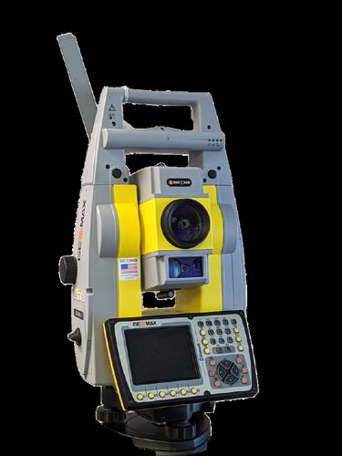
The GTL-1200 combines the power of a robotic total station with a best-inclass laser scanner to perform digital layout and capture high -res 3D scans in a single setup. Simplify the scanning process and dramatically reduce the need for post-processing by capturing scan data on survey control. The workflow seamlessly integrates with ClearEdge3D software for advanced construction QA workflows and as-builts.
• Quick layout and scanning with a single instrument.
• Wi-Fi capability enables point clouds to be transmitted wirelessly
• Proven robotic total station design, integrated with a scanner.

• Full dome scan in seconds, now with 2x point cloud resolution.
• Scan density tailored to minimize software processing time.
• Point clouds accurately matched to BIM model coordinates.
EdgeWise™ software from ClearEdge3D offers a host of modeling features and tools that help users quickly convert point clouds into usable, as-built 3D plant and building models. The software’s automated feature-extraction capability, pattern-recognition technology and object-recognition algorithms provide you with maximum efficiency. Using these features, the modeling process can be completed in a fraction of the time previously required.
• Increased accuracy and speed when modeling

• Ability to do 3D models of as-built pipes, structural elements, ducts, walls, tees and conduits
• MEP (Mechanical, Engineering and Plumbing), structural and architectural-modeling capabilities
• Billion-point visualization engine with photo-realistic project views
• Fully interoperable with Plant3D, CADWorx, PDMS and Autodesk Revit

Two more Tri-Chapter meetings wow, it’s been great. Rebecca and I attended the Collier-Lee, Charlotte Harbor, and Manasota on April 26th and we attended the Ridge, Central and Tampa Bay on April 27th.
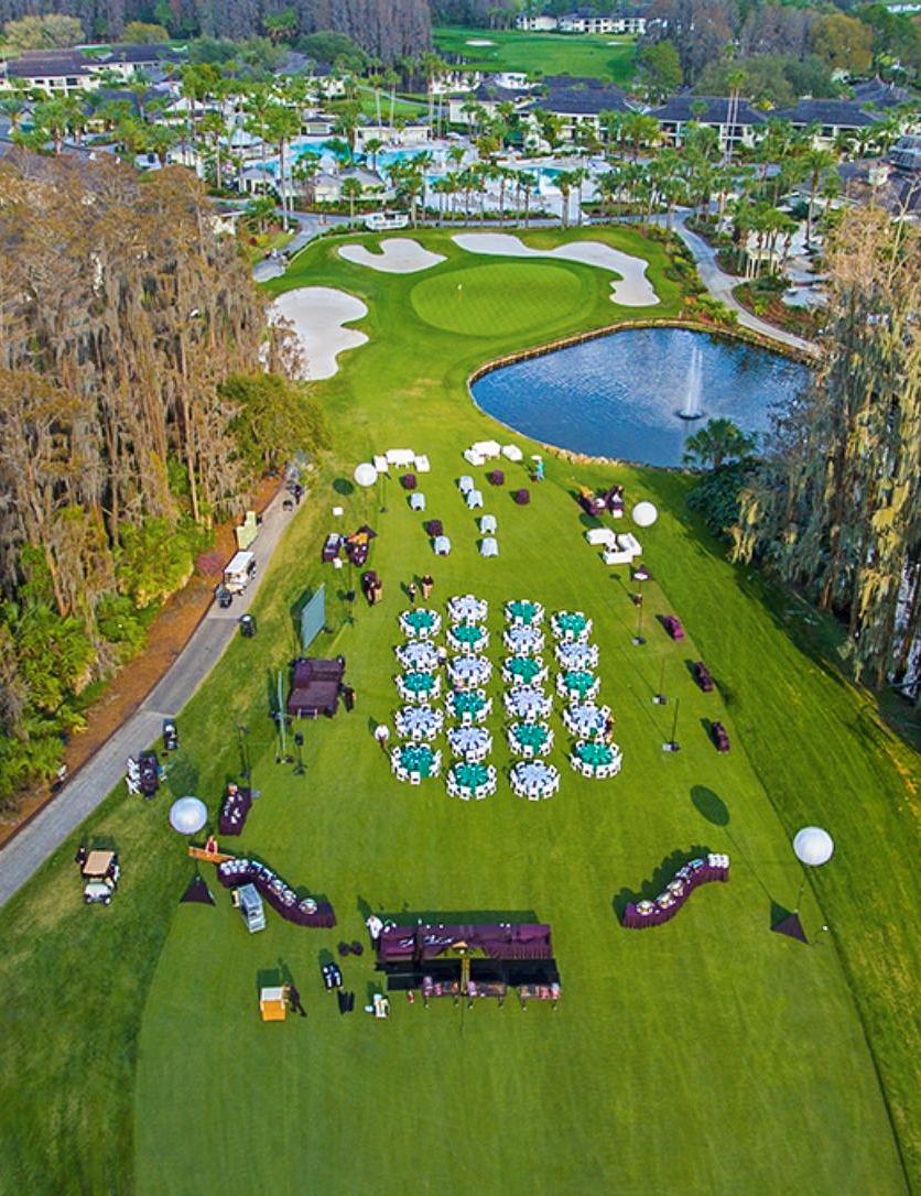
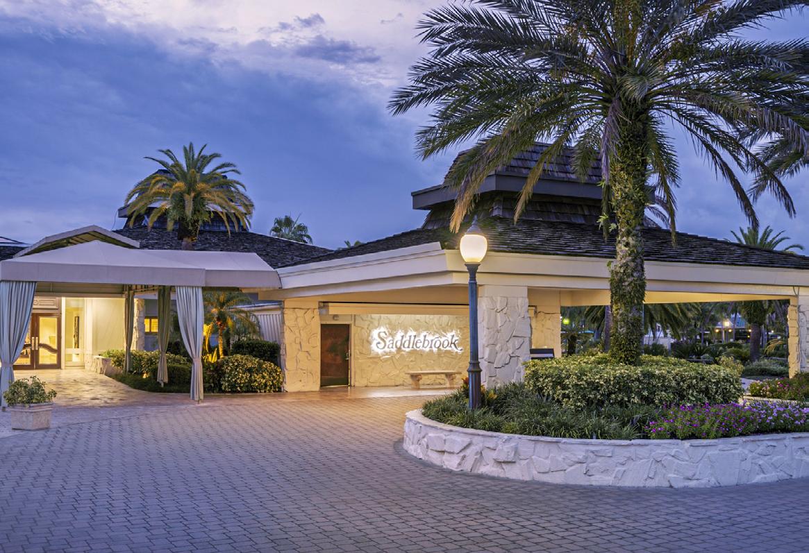
I encourage you to make plans to attend the Florida Surveying and Mapping Society (FSMS) Annual Conference week of July 26-29 at the Saddlebrook Resort in Wesley Chapel, FL!
Also, there is the FIG working week which runs from May 28th through June 1st. This is a good opportunity to see what the rest of the world does in the field of surveying. Visit https://www.fig.net/fig2023/
Mr. Lou Campanile, Jr. attended the NSPS conference in Arlington, Virginia and had some interesting things to report:
ALTA/NSPS –
• With no title work, one cannot title a survey an ALTA/NSPS LAND TITLE SURVEY (case in point: surveys on solar sites).
• Standards will be updated in 2026 and every 5 years thereafter.
• Look for a new standard of reflecting the relationship of set/found points to ground surface (e.g., 2” pipe 10” above ground, or 1” pipe 12” below grade).
• There is Federal Aid for certain Military Occupational Specialties (MOS) that will fund a military person’s salary for the last six months of their service, but those folks will be working (transitioning) in the private sector. This is workforce development related and will provide 6 months of training on the Military’s dime. Surveying is a MOS.
• Deregulation was a big topic. Apparently, North Carolina has been deregulated.
• Various legislation was discussed, including:
• Images Act
• Base Mapping Act
• Digital Coast Act
• Farm Bill Base Mapping Act
• Sinkhole Mapping Act, which is legislation sponsored by Rep Darren Soto (Kissimmee). This is a link to that proposed legislation:
• https://www.congress.gov/117/bills/hr3681/BILLS-117hr3681rh.pdf
I encourage you to read his full report: https://fsms.memberclicks.net/assets/FSMS.org/IMMEDIATE%20PAST% 20 PRESIDENT%20REPORT%20040823.pdf
Saturday, July 29th 8 am – 3:30 pm
For any questions, contact Alex Jenkins at ajenkins@ southeasternsurveying.com
Bay, Calhoun, Escambia, Franklin, Gadsden, Gulf, Holmes, Jackson, Jefferson, Leon, Liberty, Madison, Okaloosa, Santa Rosa, Taylor, Wakulla, Walton, Washington
Eric Stuart (850) 685-1149
eric.stuart@sam.biz
Chad Thurner (850) 200-2441 chad.thurner@sam.biz
District 2 - Northeast
Alachua, Baker, Bradford, Clay, Columbia, Dixie, Duval, Gilchrist, Hamilton, Lafayette, Levy, Marion, Nassau, Putnam, Suwannee, St. Johns, Union
Nick Digruttolo (863) 344-2330
ndigruttolo@pickettusa.com
2 3 4 7 6 5
District 5 - Southwest
Charlotte, Collier, DeSoto, Glades, Hardee, Hendry, Highlands, Lee, Manatee, Sarasota
Shane Christy (941) 840-2809
schristy@georgefyoung.com
Pablo Ferrari (904) 824-3086 pferrari@drmp. com
District 3 - East Central
Brevard, Flagler, Indian River, Lake, Okeechobee, Orange, Osceola, Seminole, Martin, St. Lucie, Volusia
Al Quickel (407) 567-1566
alq.fsms@gmail.com
Robert Johnson (772) 562-4191
bobj@carterassoc.com
District 4 - West Central
Citrus, Hernando, Hillsborough, Pasco, Pinellas, Polk, Sumter
Greg Prather (863) 533-9095
gprather@pickettusa.com
Alex Parnes (813) 493-3952
alexwolfeparnes @gmail.com
Donald Stouten (239) 281-0410 dstouten@ ardurra.com
District 6 - Southeast
Broward, Palm Beach
Mark Sowers (954) 868-7172 msowers@mgvera.com
Earl Soeder (407) 601-5816 earl.soeder@ duncan-parnell.com
Miami-Dade, Monroe
Jose Sanfiel (305) 351-2942 psm5636@gmail.com
District 7 - South NSPS
Manny Vera, Jr. (305) 221-6210 mverajr@mgvera.com
Russell Hyatt (941) 748-4693
russell@hyattsurvey.com
District 1
Panhandle
Bill Butler wtb@butlersurveying.com
Gulf Coast
Jonathan Gibson jgibson0102@gmail.com
Chipola
Jesse Snelgrove jsnelgrove@ snelgrovesurveying.com
Northwest FL
Jeremiah Slaymaker jslay@wginc.com
District 2
FL Crown
Brandon Robbins brndrbbns@netscape.net
North Central FL
Jeremy D. Hallick jdhallick@hotmail.com
UF Ge omatics
Andrea Slaven
aslaven@ufl.edu
District 3
Central FL
William (Bill) Rowe browe@southeasternsurveying.com
Indian River Brion Yancy brionyancy@gmail.com
Volusia Je ff Cory (Interim) jeff@corysurveyor.com
District 5
Charlotte Harbor
Derek Miller millersurveying@comcast.net
Collier-Lee
Steve Shawles II sshawles@haleyward.com
Manasota
Shane Christy schristy@georgefyoung.com
District 6
Broward
Benjamin Hoyle
benjamin.hoyle@kci.com
District 4
Ridge
Kenneth Glass kglass@civilsurv.com
Tampa Bay John Beland
jbeland1979@gmail.com
Palm Beach
Lee Powers
lpowers@zemangroup.com
FAU Geomatics
Brett Costanza brettcostanza@hotmail.com
District 7
Miami-Dade
Frank Paruas
fparuas@gpinet.com
Nominating Committee
Membership Committee
Finance Committee
Executive Committee
Education Committee
Annual Meeting Committee
Legal Committee
Strategic Planning Committee
Ethics Committee
Legislative Committee
Surveying & Mapping Council
Constitution & Resolution Advisory Committee
Rick Pryce
Nick DiGruttolo
Bon Dewitt
Howard Ehmke
Greg Prather
Allen Nobles
Jack Breed
Rick Pryce
Shane Christy
Jack Breed
Randy Tompkins
Eric Stuart
Equipment Theft
Awards Committee
UF Alumni Recruiting Committee
Professional Practice Committee
Workforce Development Committee
CST Program
Manny Vera, Jr.
Lou Campanile, Jr.
Russell Hyatt
Lou Campanile, Jr.
Allen Nobles
Alex Jenkins
FDACS BPSM Don Elder
Surveyors in Government
Academic Advisory UF
FES
Richard Allen
Bon Dewitt
Lou Campanile, Jr. Practice Sections
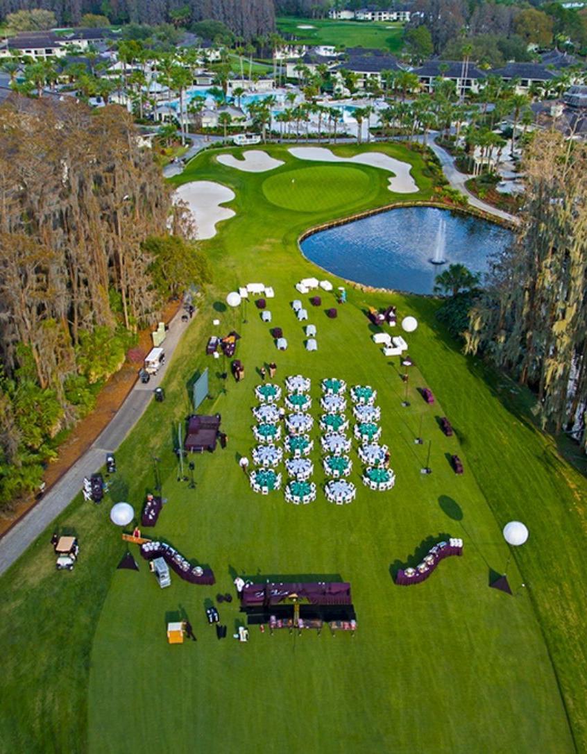
Make Plans to Attend the 68th Annual FSMS Conference
Make Plans to Attend the 68th Annual FSMS Conference
July 26th-29th at the Saddlebrook Resort in Wesley Chapel, FL.
July 26th-29th at the Saddlebrook Resort in Wesley Chapel, FL.


Name
July 26th – July 29th, 2023, Saddlebrook Resort
5700 Saddlebrook Way, Wesley Chapel, FL 33543
PSM #
Packet 1 – Full Registration/Best Value Member
$350
Licensed Non-Member $450
Non-licensed $300
(Includes one (1) Wednesday Barbecue ticket, one (1) Friday Exhibitors’ Lunch ticket, one (1) Friday Recognition Banquet ticket, six (6) Saturday Seminar CECs)
Packet 2 – Partial Registration Member $335
Licensed Non-Member $435
Non-Licensed $285
(Includes one (1) Friday Exhibitors’ Lunch ticket, one (1) Friday Recognition Banquet Ticket, six (6) Saturday Seminar CECs)
Packet 3 – Saturday Only Member $210
Licensed Non-Member $310
Non-licensed $160
(Includes six (6) Saturday Seminar CECs)
Saturday Seminars – July 29th
Course options are listed below, please mark the circle next to the course. Choose only ONE course per time segment.
6 Hour Course Option
Course name:
8:30 am – 3:00 pm (All day course)
To Adhere or Not Adhere – A Discussion on Laws and Rules, and BPSM Cases (6 CEC’s - Course #10491)
Moderator: Nicholas Campanile, PSM Guest Panelists
2 Hour Course Options
8:30 am–10:10 am
(Choose one from this row)
10:30 am – 12:10 pm
(Choose one from this row)
1:30 pm – 3:00 pm
(Choose one from this row)
FEMA and the Surveyor, dealing with MT-1 Processes
Course name: (2 CEC - Course #10500)
Instructors: Richard Allen, PSM
Course name:
The ASPRS Positional Accuracy Standards for Digital Geospatial Data, the 2014 Standards and 2023 Proposed Revisions (2 CEC - Course #10492)
Instructor: Michael Zoltek, L.S., C.P., CFedS, GISP, PMP
Course name:
Guiding the Course, Leveraging Mobile Mapping with TopoDOT to Help Build a Formula 1 Race Track (2 CEC – Course #10495)
Instructors: Russell Hall, PSM Jennifer Triana
Course name: Real-Time Surveying to Support the Mission to Mars
(2 CEC - Course #10498)
Instructor: Bryan Merritt, PSM/LS/FAA Certified UAV Pilot
Course name:
Professionalism & Ethics (2 CEC - Course #10493)
Instructor: Robin Petzold, PSM
Course name: Are We There Yet? Update on Working Towards the Modernized NSRS
(2 CEC - Course #10496)
Instructor: Denis Riordan, PSM
Course name:
Considerations for Automatic Feature Extraction of Drone Based Point Clouds (2 CEC - Course #10489)
Instructor: Jennifer Triana
Course name:
High-Tech, Low-Tech, No-TechEmbracing Technology to Overcome Labor Shortages (2 CEC - Course #10494)
Instructor: Timothy Kinder, PSM
Course name:
Sovereignty Lands/Water Boundaries (2 CEC - Course #10497)
Instructors: Richard Malloy, PSM Scott Woolam, PSM
Wednesday Seminars: Separate Registration Required for Each Seminar Choose the 6-hour option or the two 3-hour options
July 26, 2023
8:00 am – 3:00 pm
Seminar I: The Art of Original Retracement - Practical Application and Forensic Style (6 CEC’s - Course #10499)
Instructor: Robert A. Stevens, RSM Florida
July 26, 2023
8:00 am – 10:45 am
Seminar II: 2021 ALTA/NSPS Land Title Survey Standards – 2016 Changes (3 CEC’s - Course #10486)
Instructor: Gary Kent, PS
July 26, 2023 12:15 pm – 3:00 pm
Seminar III: The Surveyor in Jeopardy (3 CEC’s - Course #10487)
Instructor: Gary Kent, PS
SIT Prep Course (Un-Licensed Attendees, No CEC Credit)
July 26, 2023
8:00 am – 4:00 pm
Geoscholar's Florida Surveying and Mapping Society Fundamentals of Surveying (FS) Exam/Surveyor in Training (SIT) Certificate Prep Course
Included with Live Course - Online study materials (one year access)
Instructor: Dr. Stacey Lyle, PhD, RPLS, PLS
Thursday Seminars: Separate Registration Required for Each Seminar Choose One
July 27, 2023
8:00 am – 10:45 am
Seminar I: Surveyors of Florida: Who Were They (3 CEC’s - Course #10488)
Instructor: Dr. Joe Knetsch
Seminar II: Understanding Road Rights of Way (3 CEC’s - Course #10482 CE Provider# 53)
Instructor: David Melvin, PLS, CFM
Complete payment information on the following page of the registration form.
Cancellation Policy: 30 days prior to conference: 50% refund Less than 30 days to conference: No refund
$ Payment Information: Check Enclosed (Make Payable to FSMS) VISA/MasterCard/AE/Discover
#: Exp. Date:
Seminar I
8:00 am
3:00 pm
"The Art of Original Retracement" - A Practical Application and Forensic Style
Course #10499 - 6 CEC’s
Robert A. Stevens, RSM Florida
Objectives:
-Approach to successful retracement
-Procedures for success
-Evidence, historical and existing
-Role of astronomy
-Application of results
Robert A. Stevens, RSM Florida has been surveying for approximately 40 years. Acreage and Commercial surveys, Boundary, Right-of-way, and Easement Litigation, Expert Witness, and Trial Testimony with over a 90% success rate in original retracement. Robert A. Stevens & Associates, established 2009.
Seminar II
8:00 am
10:45 am
The 2021 ALTA/NSPS Land Title Survey Standards - Changes from 2016 Course #10486 - 3 CEC’s
Gary Kent, PS
After 2 years of work on the part of the Joint ALTA/NSPS Work Group and others, the 2021 ALTA/NSPS Land Title Survey Standards were adopted by ALTA and NSPS with an effective date of February 23, 2021. In this program we will explain the reasons for each of the many changes from the 2016 Standards and provide an explanation on what each change means to the Surveyor. In addition, an overview of the relationship between Land Title Surveys and title insurance will be provided and each of the eight sections of the Standards will be overviewed. Finally, some common questions that arise and conundrums that surveyors encounter in the process of performing a Land Title Survey will be discussed.
Gary Kent, PS is a Professional Surveyor with Schneider Geomatics in Indianapolis where, after 37 years, he transitioned to part-time in 2020 and formed Meridian Land Consulting to provide training, consulting and expert witness services. He has presented over 1,500 programs on various surveying topics multiple times in all 50 states over the last 20 years. Gary has served on the Indiana Board of Registration for Professional Surveyors since 2004 and is a past -president of both the American Congress on Surveying and Mapping and the Indiana Society of Professional Land Surveyors.
The Surveyor in Jeopardy
Seminar III
12:15 pm —
3:00 pm
Course #10487- 3 CEC’s
Gary Kent, PS
This program will be presented in a Jeopardy like format with the presenter offering answers for which audience members assembled into teams must provide the relevant question. The program will include approximately 175 questions/ answers in a variety of topic areas such as: ALTA/NSPS Land Title Surveys, Boundaries, Easements and Rights of Way, Expert Witness, Riparian Rights Risk Management, Safety and Health, Florida Statues and Rules, and Florida Standards of Practice. Answers and questions will be discussed as appropriate or necessary to be sure all participants understand the context and correct answers. This is a very “audience participation”-centric program; it is far more than a simple trivia contest.
Gary Kent, PS is a Professional Surveyor with Schneider Geomatics in Indianapolis where, after 37 years, he transitioned to part-time in 2020 and formed Meridian Land Consulting to provide training, consulting and expert witness services. He has presented over 1,500 programs on various surveying topics multiple times in all 50 states over the last 20 years. Gary has served on the Indiana Board of Registration for Professional Surveyors since 2004 and is a past -president of both the American Congress on Surveying and Mapping and the Indiana Society of Professional Land Surveyors.
Geoscholar's Florida Surveying and Mapping Society Fundamentals of Surveying (FS) Exam Prep Course
SIT Prep
8:00 am
4:00 pm
Un-Licensed Attendees No CEC Credit
Dr. Stacey Lyle, PhD, RPLS, PLS
Geoscholar's Florida Surveying and Mapping Society Fundamentals of Surveying (FS) Exam Prep Course is designed to provide critical information needed to obtain a Surveyor in Training (SIT) Certificate based upon topics tested on the NCEES Fundamentals of Surveying (FS) exam. The course offers an in -person FS review during the annual Florida Surveying and Mapping Society Conference in July 2023 supplemented by online self -paced instruction via Canvas Learning Management System (LMS) topic-based modules.
Dr. Stacey Lyle, PhD, RPLS, PLS is an Associate Professor of Practice at Texas A&M University ’s Zachry Department of Civil and Environmental Engineering and Department of Geography. He has served as an expert witness on land boundary court cases. He is active in the industry with over 35 years of surveying experience including civil engineering, land surveying, cadastral land records databases, GIS/CAD/BIM Fusion, geodesy, hydrography, photogrammetry, and cartography.

Seminar I
8:00 am
10:45 am
Surveyors of Florida: Who Were They
Course #10488 - 3 CEC’s
Dr. Joe Knetsch, PhD
The Course "Surveyors of Florida: Who Were They" will emphasize the personal nature of early surveying based upon the instructions from the Land Office and the Surveyor General of Florida. The instructions section will note the inconsistencies asked by the GLO, often to meet the special needs of those working in Florida. It will also include many citations to the letters written by individual surveyors to the Surveyor General describing the conditions facing them in the field. Pre -drainage Florida was a totally different looking place than we now see and offered many challenges to the early surveyors. The concept for the course is to put the current surveyors as close as possible into the mindset of the original surveyors whom they follow in their daily business. Hopefully this will give the current surveyors a better understanding of their predecessors p redicaments and how they solved the problems facing them, thus saving today's surveyors time and money in retracing our pioneer surveyors’ work and monuments.
Dr. Joe Knetsch received his PhD in history from Florida State University (1990), an MA in history from Florida Atlantic University (1974) and a BS from Western Michigan University with a major in History and Economics. He was the historian for the Florida Department of Environmental Protection (formerly Department of Natural Resources), Division of State Lands, from 1987 to August, 2014. He is the author of fourteen books (mostly on Florida History), over two hundred journal articles , forty book reviews, and over two hundred and twenty papers and presentations on Florida history. Dr. Knetsch is a member of numerous historical societies and associations. He currently resides in Tallahassee, Florida, with his wife of forty -five years, Linda. He also currently works as a consultant for the Town of Redington Beach, the State of Alabama, and other private interests.
Understanding Road Rights-of-Way
Seminar II
8:00 am —
10:45 am
Course #10482 Provider #CE-53 - 3 CEC’s

David Melvin, PLS, CFM
Understanding Road Rights of Way is a 3-hour seminar. It discusses things land surveyors should know about road rights of way. The instructor uses case law examples to explain how roads are defined, the road's ownership status, the landowner's rights, and others’ rights within the right of way.
David Melvin, PLS, CFM is a Professional Land Surveyor, licensed in the State of Florida, a 1981 graduate of the University of Florida with a degree in land surveying, with over 40 years of experience in land surveying and land surveyor education. He has owned and operated Land Pro Seminars since 2003 and is also a consultant specializing in land boundary problems, floodplain issues, wetland mapping, and land surveying regulations.
8:30 am
3:00 pm
To Adhere or Not Adhere – A Discussion on Laws and Rules, and BPSM Cases
Course #10491 - 6 CEC’s

Panel Discussion - Moderator: Nicholas Campanile, PSM
An expert panel will run through a variety of laws and rules applicable to surveying and mapping, to include potential for updates, and conclude with example disciplinary cases that came before the Board of Professional Surveyors and Mappers.
Nicholas Campanile, PSM is the FDOT District Five Surveyor and Mapper and recently completed serving eight years on the Board of Professional Surveyors and Mappers. Prior to FDOT, Nick served as Chief, Surveying and Mapping in DEP ’s Division of State Lands, and also served eight years as Adjunct at Tallahassee Community College, all after having served as adjunct at Miami-Dade Community College and was raised in a surveying and engineering family business.
Panelists:
Richard Allen, PSM, CFM Richard Malloy, PSM
Jack Breed, PSM David Melvin, PLS, CFM
Dianne Collins, PSM Ray Niles, PSM
Dr. Bon Dewitt, PSM Robin Petzold, PSM
Don Elder, PSM
8:30 am 10:10 am
Course #10500 – 2 CEC’s

Richard Allen, PSM
The course will cover eLOMA, LOMA, CLOMA, LOMR -F, CLOMR-F, and the other floodplain impacts and how the surveyor is involved in these processes. The material will cover the different processes and how they impact the floodplain, if any.
Richard Allen, PSM is a Florida Licensed Surveyor & Mapper, and Certified Floodplain Manager who is the City Surveyor at the City of Orlando. He has been in surveying for over 26 years and has been with the City for 17 years. He is the Surveyors in Government Liaison for FSMS and Region V Director for the Florida Floodplain Manager's Association. He is the scholarship chair and Valencia College Liaison for the Central Florida Chapter of FSMS. He is married to his lovely wife Amanda and has a son named Richie.
Course #10498 – 2 CEC’s
Bryan Merritt, PSM/LS/FAA Certified UAV Pilot

The unmanned Artemis I launch system this past November is the first in a line of complex missions aimed at enabling exploration of the Moon and Mars. But before the Orion spacecraft can be launched into space, it must first be moved from the Vehicle Assembly Building to the launch pad at the Kennedy Space Center. Enter the Crawler -Transporter, four connected building-sized vehicles on rolling tracks that, when loaded with the Orion and its mobile launcher, will carry over 25 million pounds. One of the heaviest overland loads ever recorded. NASA needed to evaluate the potential risk that this VERY heavy load may deform the travel way as carried Orion to the launch pad. The presentation will provide the background and process required to provide real-time surveying as the Crawler-Transporter moves to the launch pad. The hardest part: they needed to survey the Crawler -Transporter in motion, making the project exponentially more complex.
Bryan Merritt, PSM/LS/FAA Certified UAV Pilot is a Professional Land Surveyor licensed in FL and NY and FAA Part 107 Certified Pilot and serves as the Manager for Langan ’s Florida and Caribbean Geospatial/Survey Group. He has more than forty years of experience in the Geospatial Industry. His experience includes management and direct technical experience in performing complex geospatial related projects and providing solutions to complex situations. He is experienced in all facets of surveying and geomatics technologies which includes UAV/UAS systems; terrestrial and mobile lidar systems; 3D modeling and BIM (Scan to BIM); GIS data collection; building documentation and all forms of conventional survey technologies. Bryan has been published in many trade journals and has presented sessions in geospatial survey technology to many organizations. He is a member of the Geomatics Engineering Program Advisory Council for Florida Atlantic University and is one of the founders of the United States Institute of Building Documentation (USIBD) which is a non -profit organization dedicated to actively promote, guide, and support the building documentation industry.
8:30 am—
10:10 am
Course
Jennifer Triana
With the expansion of the geospatial drone market in the transportation industry, we explore how to achieve a more automated feature extraction process in topography mapping. Drone based point clouds from LiDAR vary greatly from Imagery based point clouds, so this presentation aims to explore their differences from the point cloud processing aspect. We will examine the pros and cons of each system for practical survey and mapping applications such as topographies, bare earth, volumetrics, etc. Learn how data accuracy, density, intensity/color, and other data characteristics affect a deliverable. We ’ll also show how to evaluate whether the data meets quality requirements for a certain application, and if it is suitable for automated feature extraction. Examples of automated extraction of break lines, surface models and asset identification will be demonstrated.
Jennifer Triana has over 18 years’ experience in the LiDAR industry. After graduating with a Mechanical Engineering degree from UCF, she joined Riegl USA heading the systems team. More than a decade ago she was one of the founding members of TopoDOT, Point Cloud Processing Software, where she is now the Business Development Director.
10:30 am -
12:10 pm
Course #10492 – 2 CEC’s
Michael Zoltek, LS, CP, CFedS, GISP, PMP
This workshop provides an in-depth look at the ASPRS Positional Accuracy Standards to categorize positional accuracy of products derived from digital aerial cameras, manned and unmanned aerial systems, and all types of lidar including terrestrial, mobile, and airborne. The workshop will explain the basis for each accuracy measure adopted in the standards.
Michael Zoltek, LS, CP, CFedS, GISP, PMP is a land surveyor, photogrammetrist, and GIS professional with over 30 years of geospatial experience. As the National Geospatial Program Director at GPI Geospatial, Inc (GPI), Mike is responsible for the coordination, execution, and supervision of projects for local, state, federal, DOT, and private clients. He brings to cl ients a comprehensive background in surveying and mapping, which includes data collection and processing, project management, and QA/QC coordination.
A licensed surveyor who holds active Surveying/Photogrammetry registrations in 26 states, Mike has extensive experience in a variety of Surveying & Mapping tasks for Departments of Transportation in multiple states. Mike is a member of Florida’s State Board of Professional Surveyors & Mappers and is a long-standing member of the American Society for Photogrammetry and Remote Sensing (ASPRS) where he currently serves on the Committee revising the ASPRS Standards for Digital Geospatial Data and where he Chairs the Evaluation for Certification Committee, overseeing the organization ’s certification program. He has also previously served as a member of the ASPRS Standards Committee responsible for establishing the 2014 ASPRS Accuracy Standards for Digital Geospatial Data, as the Director of the ASPRS Professional Practice Division and has also served as an ASPRS Board member. Mike has presented numerous technical seminars at universities and community colleges, as well as at industry conferences, and has served as an expert witness in boundary litigation cases in the state of Florida.
Professionalism & Ethics
10:30 am -
12:10 pm
Course # 10493 – 2 CEC’s
Robin Petzold, PSM
This course will delve into the professionalism and ethics that will keep you out of “harm’s way” should you ever have an encounter with the State Board. A case study will be presented showing you how to respond in a professional manner in accordance with our rules and regulations as well as the history of how these rules developed. Since these types of encounters are very stressful, this is a course worth your time to prevent any future anxiety.
Robin Petzold, PSM retired from Wantman Group, Inc. as an Executive Vice President and partner in December of 2018, but continued to serve on a consulting basis until February 2020. He holds professional Surveying Licenses in Florida, Alabama, Ohio, Iowa, and Wisconsin, and has over 40 years of professional experience. Additionally, Robin served as an adjunct faculty instructor for 12 years in the engineering department of Palm Beach State College as well as an adjunct instructor at the University of Florida from 2017 thru 2022. He has also taught seminars on State Plane Coordinates, Electronic Data Collection, and Global Positioning Systems Methodologies throughout the United States and abroad. In 2010 Robin was appointed to the Florida Board of Professional Surveyors and Mappers and served as Board Chair for three of those years. Robin’s second term ended in 2018 but he continued to serve on the Probable Cause Panel as a past Board member for an additional three years ending his tenure in January of 2021. During that time, Robin developed a keen sense of awareness of how Professionalism and Ethics play a very important roll in performing surveys under the guidelines of both the old and new rules, thus avoiding interaction with the Probable Cause Panel.
10:30 am 12:10 pm
Course #10494 2 CEC’s
Timothy Kinder, PSM
This presentation will walk through a brief history of surveying, where we are today with technologies, and the need to embrace multiple technology platforms to overcome the labor shortage in the surveying and engineering industry. The number of licensees leaving the profession is greater than the number entering. Fewer people are getting into surveying for various reasons; we will dig into this a little. The recession of 2008 – 2010 saw a huge loss to the survey labor market; we lost a lot of younger staff that decided to never get back into surveying. We will have sample projects, case studies, visuals, and data to drive the discussion, as well as labor statistics and projections. Real life projects examples will be reviewed to show ho w technology was used to save time (labor) and some that should have used technology to save time but didn ’t. We will dive into what we can expect when we embrace the various technologies and when we don ’t. We will see how various technologies are currently being used to help offset the shortage of qualified and experienced talent, some of the best practices when using the different technologies, and what our end product could look like.
Timothy Kinder, PSM is a Licensed Professional Land Surveyor and experienced leader of 3D reality capture technologies. He has 28 years of experience in surveying and 3D data collection, analysis, processing, and modeling. He has spearheaded the growth and development of the Reality Capture operations with his current and previous employers pushing them to be some of the foremost providers of advanced technologies in the region. Under Tim ’s direction, his teams have scanned more than 45,000 lane miles of roadway across the eastern half of the United States. More than 7,200 miles of roadways have been developed into 360 degree panoramic videos. In addition to investigating and implementing ongoing technology solutions for capturing data to support engineering design, Mr. Kinder is responsible for building a strong talent pool, directing surveyors and technicians, as well as managing client expectations.
1:30 pm3:00 pm
Course #10495 — 2 CEC’s

Russell Hall, PSM and Jennifer Triana
This course is an overview of mobile LiDAR and its pros and cons versus UAV and Terrestrial LiDAR. It will go through the entire process from planning and acquisition, to registration of the clouds. We will then go through the case study of how it was used to complete a Formula 1 race track. The class will also cover how TopoDOT is used in the extraction process for both the track as well as other real world examples.
Russell Hall, PSM is a professional land surveyor in Connecticut and has over 20 years experience in various aspects of land surveying with a big focus on Terrestrial LiDAR, Mobile LiDAR, and UAV LiDAR.
Jennifer Triana has over 18 years experience in the LiDAR industry. After graduating with a Mechanical Engineering degree from UCF, she joined Riegl USA heading the systems team. More than a decade ago she was one of the founding members of TopoDOT, Point Cloud Processing Software, where she is now the Business Development Director.

1:30 pm
3:00 pm
Course #10496 2 CEC’s
Denis Riordan, PSM
The mission of NOAA's National Geodetic Survey (NGS) is "to define, maintain and provide access to the National Spatial Reference System (NSRS) to meet our nation's economic, social, and environmental needs." The NSRS is the system of latitude, longitude, elevation, and related models and tools, which comprise the nation's foundational positioning infrastructure. NGS has, for several years, been developing and promoting the ongoing modernization and evolution of NSRS, toward the 2022 goal of replacing the North American Datum of 1983 (NAD83) and the North American Vertical Datum of 1988 (NAVD88). The new positioning paradigm will impact all users of geospatial data, either directly or indirectly, and an understanding of the resulting changes of this effort will ease your transition. This presentation will update you on today's sta tus of the NSRS modernization and help you prepare for 2024.
Denis Riordan, PSM Gulf Coast Region Geodetic Advisor, NOAA, National Geodetic Survey - Mr. Riordan has worked with the National Geodetic Survey (NGS) for the past 18 years and serves as the Geodetic Advisor for the NGS Gulf Coast Region (AL, FL, LA, & MS). He works to support those who use NGS products and services, products like the National Spatial Reference Frame. He holds a B.S. Degree in Surveying and Mapping from the University of Florida, is a licensed surveyor in the State of Florida, and worked for over ten years with private industry in the field of land surveying prior to joining NGS

Sovereignty Lands and Water Boundaries
1:30 pm —
3:00 pm
Course #10497
2 CEC’s
Richard Malloy, PSM and Scott Woolam, PSM
This discussion will focus on the history of sovereignty lands and how to identify them. It will also look at water boundari es and how they impact the private surveyor.
Richard Malloy, PSM has worked for the Board of Trustees for over 40 years. He has worked on retracement surveys and boundary surveys for state lands; however, his specialty is water boundaries and he has worked for over 30 years defending the ownership of sovereignty lands for most of that time. Richard has had the opportunity to work with many of the surveyors throughout the state, an opportunity most surveyors haven ’t had the pleasure to experience. Through this, he has learned how surveyors have handled many difficult problems as they arise through the course of conducting surveys.
Scott Woolam, PSM is the Chief of the Bureau of Survey and Mapping with the Department of Environmental Protection. After 10 plus years surveying in the private sector in the Pensacola area, he went to the Bureau of Survey and Mapping in 1991 where he is now in his 33rd year or tenure. Scott graduated from the Surveying and Mapping Program (Geomatics) at the University of Florida. He is a member of Tau Beta Pi Engineering Honor Society and the Florida Survey and Mapping Society.


Richard Malloy was born in Augusta, Georgia in 1958. His father was in the military and the family moved to various places throughout his childhood including Munich, Germany; Columbus, Georgia; Leesville, Louisiana; and Alexandria, Virginia. Most of his childhood was spent in Leesville, Louisiana, where he graduated from high school and went to college at Louisiana State University before transferring to Florida State University. He has one son, as well as family on his father’s side that is originally from the Tallahassee area, and family on his mother’s side from Archer and Cedar Key.
Richard first got involved in surveying while attending LSU. He was hired by Lowe Engineers to do contract work for the U.S. Army Corps of Engineers along the Mississippi River conducting cross sections, as well as establishing horizontal and vertical control, and operating the Corps’ ship recording soundings. Richard has been employed by Lowe Engineers, Paul Williamson Land Surveying, and the Board of Trustees of the Internal Improvement Trust Fund of the State of Florida for both the Florida Department of Natural Resources and the Florida Department of Environmental Protection. From 2016 to 2020, Richard was Chief of the Bureau of Survey and Mapping and the State Cadastral Surveyor for the State of Florida. He has dedicated over 40 years of his surveying career to public service, surveying for the State of Florida and advocating the
importance and necessity of the surveying and mapping profession.
What Richard loves most about surveying is the field work which allows him to be out in the forests, swamps and beaches throughout Florida. He has many great memories spanning the course of his surveying career, but one that sticks out the most is the time he worked with Mark Stokes on an extensive tide study project in the Florida Keys.
There have been many surveys Malloy has conducted throughout his career, but establishing water boundaries on miles and miles of sovereign lakes, rivers and tidal waterbodies throughout the state has been his focus. The most challenging survey he recalls was the time he had to establish ordinary high water boundaries on several large lakes in central Florida for litigation.
Richard’s favorite type of surveys are locating and establishing water boundaries. “I like the math for the tidal boundaries and applying case law to the non-tidal.” The biggest surprise for him as a surveyor, and a good tip for future aspiring surveyors, has been the amount of law that is needed and applied throughout the profession.
Asked about what changes he wouldn’t mind seeing in the profession, Richard responds with “ I would like more of the upcoming surveyors to have a lot more field experience and understanding of the ‘old’ ways of performing surveys, instead of relying solely on GPS, Lidar and more modern technology.” Like many surveyors today, the biggest change Richard has noticed in the field is the increase and reliance on technologies like GPS and Lidar.
Malloy has had many colleagues and mentors influence him during his surveying career, but those he would like to mention are Dr. David Gibson PSM, Douglas Thompson PSM, Corky Rodine, BLM (Bureau of Land Management) Surveyor, David Kealy PSM, Rod Maddox PSM, Mark Stokes, PSM and George “Chappy” C. Young, PSM. The advice he would like to leave for the next generation of surveyors is to get lots of experience and a good understanding of field work. To remember that the survey is on the ground.

As surveying technologies continue to advance, a trusted and knowledgeable partner can help you stay ahead of the game. For over 75 years Duncan-Parnell has provided leading-edge products and services to help surveyors succeed.
• Robotic Total Stations
• Trimble GNSS Instruments
• UAS/Drone Solutions

• Technical Training
• Software for Survey & Mapping
• Survey Supplies


• Instrument Repair & Maintenance
• Monitoring Solutions
www.duncan-parnell.com


Jacksonville, FL (904) 620 - 0500
Orlando, FL (407) 601 - 5816
Greetings all, for this month’s article I wanted to share an interaction I had with one of the students in my Advance Survey Computations class regarding asbuilt surveys. He actually works for a company that submits as-built surveys for private development work.
Good afternoon Professor Allen,
How are You? I am sorry about this. You know I am working with As-Built and sometimes doubts and questions arise and I feel that you are a suitable person to clarify this.
First, I have been reading the Elementary Surveying Book, and I have noted that this has not too much information about As-Built Surveying. Does that mean asbuilt can vary in the different aspects according to the legal? Where you are? Or who is in charge of the department that carries out this work?
Second, in the company where I am working, we have a standard that says Invert should be 0.20 less or more than the proposed Invert. For example, the Proposed invert= 78.20 AB can be 78.00 or 78.40. That is something that came from where? Who made this rule? And what is the reason for this?
Third, if the project is public, does the county that is responsible for this work have inspectors? If you have inspectors and they approve something or give the go-ahead to continue with the project, why when are the as-build documents submitted, sometimes they ask again for those things that were previously approved by an inspector. Example, I am installing a water service and the inspector verified that it was done properly, why is the record requested again in the as-built document?
Fourth, the other day I had a question about the surveying licensees who sign the as-built documents. What is guaranteed by signing an as-built survey? Is it guaranteed that the work measurement was correct? That the work was built
correctly? Or in short, what is being tried to guarantee when a licensed surveyor signs?
Thank You in advance. I appreciate your patience with me. I just do not want to continue with doubt about what I am doing.
Response:
Good Morning Marcelo,
You have a lot of questions, no need to apologize for that. I will do my best to answer all of them. As-built surveys have discrepancies between professionals and their interpretation of them. For example, if you look at the previous definition of As-built or Record Surveys that were in the minimum technical standards, it gave a clear definition of the as-built survey you are familiar with and meets the requirements of the City of Orlando. With the introduction of Standards of Practice in 5J-17 of the Florida Administrative Code, they removed the definition and the expectancies of said survey.
They are giving surveyors more latitude in their professional judgment to the varying types of surveys outside of boundary surveys to address the survey needs of their clients. The one area that does not deviate is boundary surveys, which is because of the importance to have somewhat of a minimum standard. Our requirements are based on the previous administrative code, and the only true way you can ensure you are getting a true comparison between planned and constructed improvements.
As for Elementary Surveying, it is not a cover-all for surveying, the text is great but only covers generalities, specialties require additional data sources and texts. Some surveyors look at an as-built survey as being a topographic survey as it deals with vertical data. That can be confusing, as how can you compare between planned and constructed improvements? You have to see the asbuilt data in comparison to the engineering plans. What surveyors have done is clipped portions of the plan and underlaid them underneath the topographic
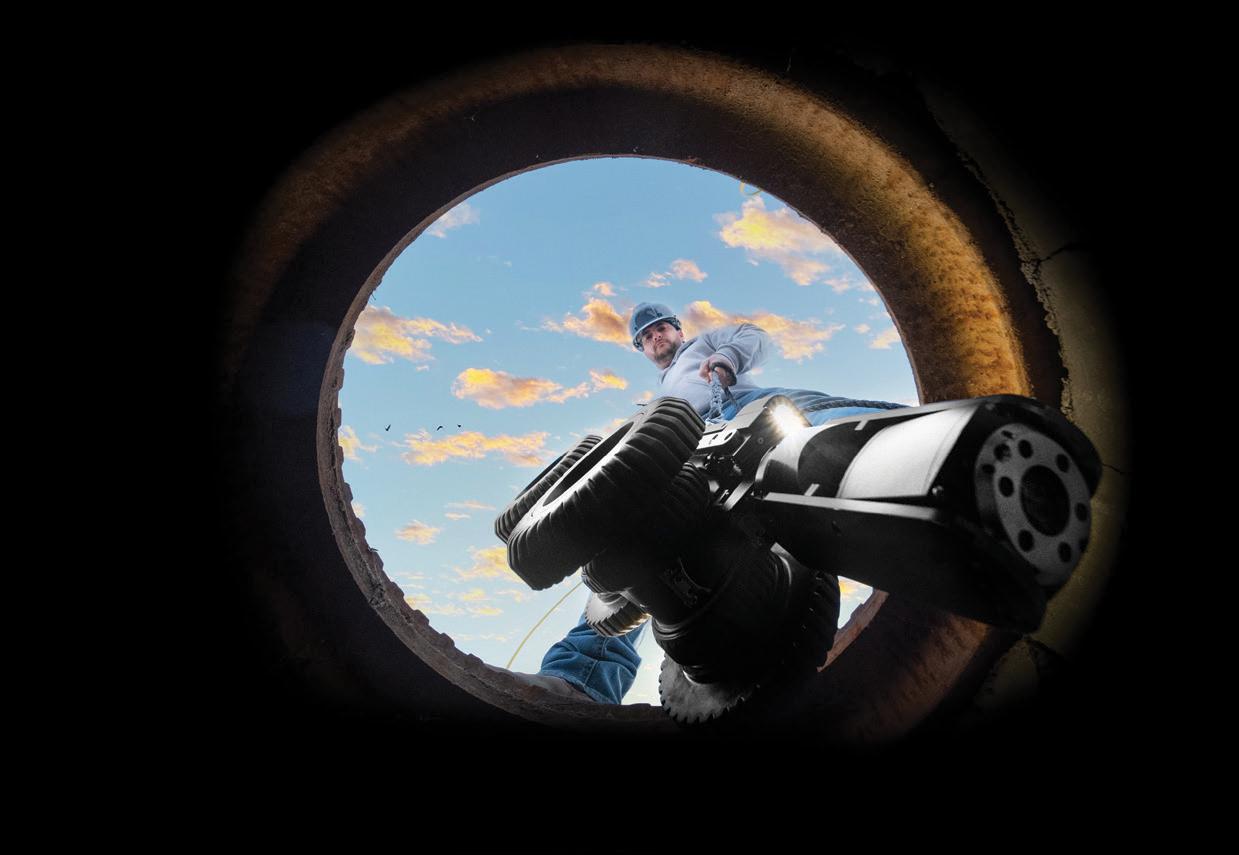
With the help of Frontier Precision, places you once couldn’t imagine measuring are now a daily reality. Frontier Precision leads the way in Unmanned technology – through the air, land, and underwater. Every place on earth is now reachable – with UAS from DJI, Autel, Parrot, Ascent, and ROVs, Pipe Crawlers, and Utility Crawler solutions from Deep Trekker. Count on us to deliver the latest technology to help you get your job done e ciently and accurately while driving your profits. Today, no mission is out of reach.


8301 Cyprus Plaza Drive, #107 Jacksonville, FL 32256
survey, and in many instances freeze or delete much of the plan information in doing so. How do you know that you are getting a true interpretation of the comparison? The answer is you do not unless you pull out the plans and make the comparison. The survey should be complete where one does not have to do that.
Now for your question about tolerances: There are stipulated tolerances as to the deviation of construction standards, they can be exceeded, but the engineer of record must state in their Engineer's Certification Letter that the design tolerances were exceeded, why and that it performs as designed. The tolerances are in place to make sure the deviation does not create a failure or issue, as the engineer designed to a standard, and that standard was approved in the engineering plan review. Does that mean there are not engineering design flaws, errors, or unforeseen encounters? It does not. That is typically where you will see revised plans. The design standards or requirements are defined in the jurisdiction's standards, ours is the City of Orlando's Engineering Standards Manual. The current edition is the 5th edition of the ESM.
Every jurisdiction is supposed to have inspectors, even when you have multiple agencies. For example, in the southeast part of the City, you have multiple agencies involved, the City for public and private development inspection that includes roads, city utilities, and other improvements. The County provides wastewater services and provides water as part of Orange County Utilities and has its own conditions and standards that have to be met for constructed improvements. Additionally, with FDEP and the sanitary sewer requirements, those standards for the City and County should be similar to one another. The County required asset tables long before the City required them. Each agency has its own inspector.
Now for the question as to why the as-built survey is required if the inspector signed off. That is because the inspection may be a log to an approval, but the as-built survey is the documentation of what was constructed. If done correctly it documents the comparison as stated between planned and constructed improvements. Another item of note is that the inspectors can only catch
so much, you will see a number of times that the as-built reviewer catches items that the inspectors missed. When you are talking about large-scale development, inspectors and plan reviewers are only going to catch so much. When you think about it, you have two to three reviews typically of construction plans totaling about 12-14 hours roughly at most for the project review of a project that is in construction for a year. The same is true when you look at the close-out portion, in which that time-frame is reduced significantly as most reviews cannot be in more than an hour at a time.
Lastly, in your question about licensees. The licensee is certifying that it meets the requirements as stated. You will see that I require they sign the as-built survey checklist that it conforms to the as-built survey standards in the 5th Edition of the City of Orlando's Engineering Standards Manual. In many situations they are not answering that truthfully as I find they are not truly reading and following the requirements. They are bound by their license to do their professional due diligence and meet the requirements in which they are certifying. If they fail to do so I can report them to the regulatory board (Florida Board of Professional Surveyors and Mappers) for failing to do so, if there is negligence on their part. I work with surveyors who do not fully understand the process, remember you have a number that believes that a topographic survey is an as-built survey. With the changes in 5J-17 F.A.C., as long as the client understands and has directed their surveyor to perform what their desired outcome is. A number of times surveyors are being directed to do below what our requirements are as stipulated, they want to make their clients happy and clients do not want to waste money in many cases. They do not realize that in doing so they end up wasting their time and money on multiple trips and submittals. Hope this answers your questions.
Sincerely,
Richard Allen, City Surveyor for the City of Orlando FSMS Surveyors in Government Liaison Richard.Allen@orlando.gov
sponsorship Includes:
• cash bar in the exhibit hall during friday's luncheon

• company name & logo on Signage at luncheon
• 4 drink tickets


68th Annual Conference at Saddlebrook Resort in Wesley Chapel, FL on July 26th – July 29th


*Only 1 Platinum Exhibitor allowed. All other levels can have multiple exhibitors
$4,700
• Company Name and Logo on a Banner overhanging the Registration Desk
• Company Bio and Logo in the Confer ence Program Book
• 1 month free full-page ad in The Florida S urveyor
• Sustaining Firms will receive an additional month f ree ad in The Florida Surveyor
• Recognition in Confer ence Edition of The Florida Surveyor
• Recognition on FSMS.org in Header Ad Banner for 2 months
• Logo with Hyperlink to Website displayed on FSMS.org
• Complimentary full page ad in Conference Pr ogram Book
• 2 night complimentary hotel stay
• Two Packet 1 Registrations (Each Registration includes 1 BBQ Ticket, 1 Exhibitor Luncheon
Ticket, 1 Recognition Banquet Ticket, & 6 Saturday Seminar CECs)
• 2 Floor Clings with Logo displayed in Exhibit Hall
• 2 Booths
• Opportunity to Speak at Welcome BBQ
$3,500
• Company Bio and Logo in the Conference Program Book
• 1 month free half-page ad in The Florida S urveyor
• Sustaining Firms will receive an additional month f ree ad in The Florida Surveyor
• Recognition in Confer ence Edition of The Florida Surveyor
• Logo with Hyperlink to Website displayed on FSMS.org
• 1 night complimentary hotel stay
• One Packet 1 Registration (Each Registration includes 1 BBQ Ticket, 1 Exhibitor Luncheon
Ticket, 1 Recognition Banquet Ticket, & 6 Saturday Seminar CECs)
• 1 Floor Cling with Logo displayed in Exhibit Hall
• Opportunity to Speak at Welcome BBQ
$2,000
• Company Bio and Logo in the Conference Program Book
• 1 month free half-page ad in The Florida Surveyor
• Sustaining Firms will receive an additional month f ree ad in The Florida Surveyor
• Recognition in Confer ence Edition of The Florida Surveyor
• Logo with Hyperlink to Website displayed on FSMS.org
• 2 Welcome BBQ tickets
$1,500
• Company Bio and Logo in the Conference Program Book
• 1 month free half-page ad in The Florida Surveyor
• Sustaining Firms will receive an additional month f ree ad in The Florida Surveyor
• Recognition in Confer ence Edition of The Florida Surveyor
• Logo with Hyperlink to Website displayed on FSMS.org
ALL EXHIBITORS WILL RECEIVE:
8’ x 10’ draped booth with 10’ backdrop and 36” side rails
7” x 44” Sign provided by Request Only!
6’ draped table, 2 chairs and waste basket
4 name tags for booth personnel per booth
2 lunch tickets per booth for Friday
Attendee List
Additional Booths can be purchased for $850 per Booth
1 full page 5.5” (width) x 8.5” (height)
7.5% sales tax
1/2 page 5.5” (width) x 4.25” (height)
7.5% sales tax
Contact N ame
Ads must be in .pdf, .jpg, or .png format
We agree to the terms & conditions in the rate schedule.
Print Name Signature
MAIL CHECK AND FORM TO: Florida Surveying & Mapping Society P.O. Box 850001-243, Orlando, FL 32885-0243
Email: Education@FSMS.org
Payment Information:
Check Enclosed AE/Discover/M astercard/Visa
Card Number
CCV/Card Identification # Billing Zip Code
Signature
Card Expiration Date
• Civil/Site Design
• Construction Engineering
• Construction Materials Engineering & Testing
• Energy
• Environmental, Health, and Safety

• Geotechnical
• MEP
• Structural
• Survey & Geospatial
• Transportation
• Urban Planning & Design
• Water Resources
• Water/Wastewater
PARTNERS FOR WHAT’S POSSIBLE
ALL SPONSORSHIPS INCLUDE:
• Recognition in C onference Program Book
• Recognition in the C onference Edition of The Florida Surveyor
• Company Logo with Hyperlink to website displayed on FSMS.org
*Only 1 Sponsorship Available, Call for Availability (850) 942-1900
*Conference App Sponsor $2,700
-Sponsorship of phone app available for all registrants to download
-Company Name & Logo on App
Recognition Banquet $2,700
-Sponsorship of Conference Banquet
-Full Page Ad in The Florida Surveyor
-Company Name & Logo on Signage
Clay Shoot $2,000
-Sponsorship Assists with Clay Expenses
-Full Page Ad in The Florida Surveyor
-Signage at the Registration Desk
-Assists with Food & Beverage Costs Swag Sponsor $2,000
-Sponsorship of multiple Key Events throughout Conference
-Conference/Sponsor Swag for All Attendees
-Name and Logo on Swag
UF 50th Anniv. Recognition $2,000
-Celebration & Recognition of UF Geomatics Program
-Sponsorship of Recognition Breakfast for Attendees and Special Guests
-Company Name & Logo on Signage
*Conference Tote Bags $2,000
-Sponsorship of Tote Bags given to Attendees
-Company Name & Logo on Tote Bags
Registration Desk & Signs $1,500
-Sponsorship of Signs at Conference
-Company Name & Logo on Conference Welcome Banner at Registration Desk
Refreshment Breaks $2,000
-Sponsorship of Refreshments available during Seminar Breaks
-Full Page Ad in The Florida Surveyor
-Company Name & Logo on Signage
Welcome BBQ $2,000
-Sponsorship of our Conference Welcome BBQ (popular networking event)
-4 Complimentary Tickets
-Company Name & Logo on Signage
*Program Book (Front Cover) $1,700
- Company Name & Logo displayed on front cover
Banquet Door Prizes $1,500
-Sponsorship of Prizes given at Recognition Banquet
-Company Name & Logo on Signage
*Room Keys $2,000
-Sponsorship of Room Key Cards given to each Attendee staying at hotel
-Company Name & Logo on Room Key Cards
Geospatial Sponsor $2,000
-Company Name and Logo on Signage at the General Business Session and Banquet
-Full Page Ad in The Florida Surveyor
-Assists in Conference Expenses
*Program Book (Back Cover) $1,500
-Company Name & Logo on back cover
Legislative Reception $1,500
-Sponsorship for Reception and Guest Speaker
-Company Name & Logo on Signage
*Name Badges $1,500
-Company Name & Logo on Signage
-Company Name & Logo on Name Badges given to All Conference Attendees Exhibit Hall Door Prizes
-Name & Logo on Signage
-Sponsorship of Door Prizes
-Company Recognized during Raffle
-Company Name & Logo on Lanyards given to All Conference Attendees
Exhibitor Luncheon
-Company Name & Logo on Signage
-Sponsorship Assists with Lunch Expenses
Golf $1,000
-Company Name and Logo on Signage
-Company Name & Logo on Signage
-Assists with Food & Beverage Costs
Auxiliary/Family Outing $1,000
-Company Name & Logo on Signage
-Assists with Event Expenses
Marquee Education Speakers $1,000
-Sponsorship of Headlining Education Speakers
-Company Name & Logo on Signage *Program Book
-Full Page Ad on inside of Front Cover
-Company Name & Logo on Signage
-Cash Bar in the Exhibit Hall on Friday (Includes 4 Drink Tickets)
-Company Name & Logo on Signage
-Company Name & Logo on Signage
-Company Name & Logo on Signage at Morning & Afternoon Coffee/Water Break
-Company Name & Logo on Signage at All Saturday Seminar Refreshment Breaks
Seminar Sponsor (Saturday) $500
-Sponsorship of Special Activity
-Company Name & Logo on Signage at Seminar of Your Choice
-Company Name & Logo on Signage
-Company Name & Logo on Registration Packets given to All Attendees
-1/2 Page Ad in The Florida Surveyor
*Only 1 Sponsorship Available, Call for Availability (850) 942-1900

Cost - $100
Or, FSMS can print your flyers on letter size copy paper (8.5” x 11”) with B & W print
Cost

Guests who pay the $50 player fee at conference registration or at the door will be given a predetermined amount of chips.
Players will then attempt to outplay the others and increase their stack throughout the night.


Re-buys are offered to ensure that the fun doesn't end. The player with the most chips at the end of the night brings home the prize.

If you want to join the fun, Register Online today.
Thursday 7/27/23 8:00pm - 11:59pm
Sponsored by: YOUR LOGO HERE!
Chipola, Gulf Coast, & Northwest FSMS TriChapter meeting. Thank You to Vice-President Allen Nobles for his amazing presentation on the new shift coming for the horizontal & vertical datums as part of the modernization of NSRS and the results showing the new State Plane Coordinate (SPCS) Zones for each state.
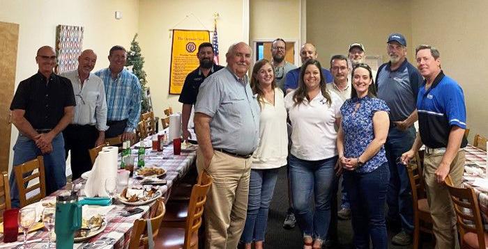
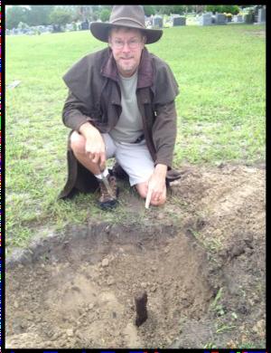
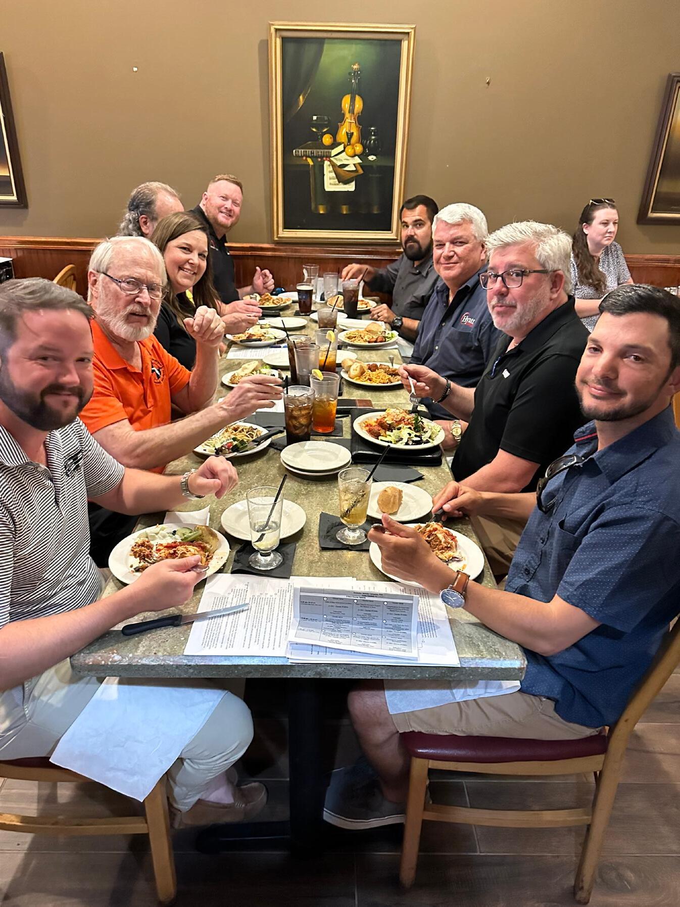
Charlotte Harbor, Collier-Lee, & Manasota FSMS Tri-Chapter meeting.
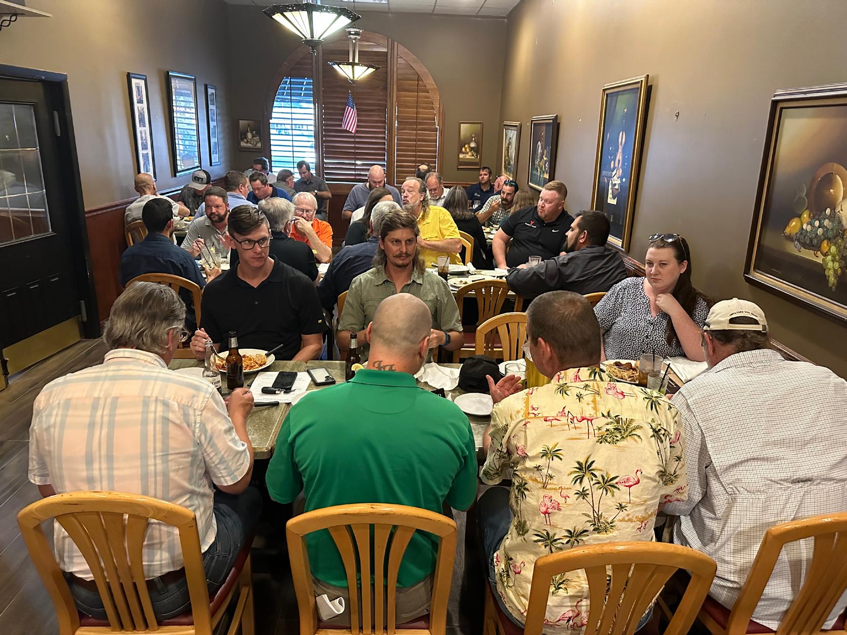
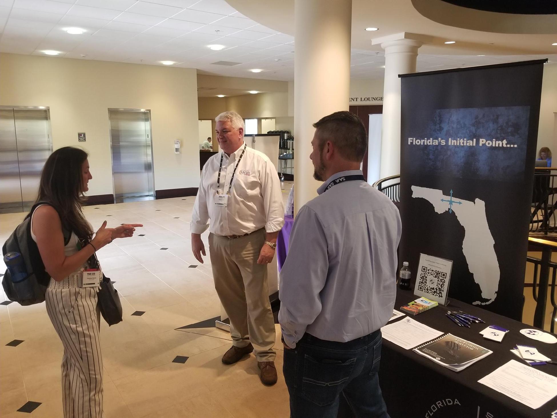
From L to R: Erick Bennett, President Howard Ehmke, Executive Director Rebecca Porter, Greg Rieth, District 5 Director & Manasota Chapter President Shane Christy, Aaron Levine, NSPS Director Russell Hyatt, Randy Thompkins, and Michael Saladino
First time Exhibiting at TopoDOT Conference.
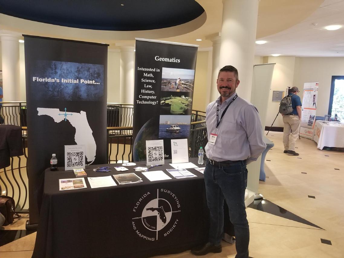
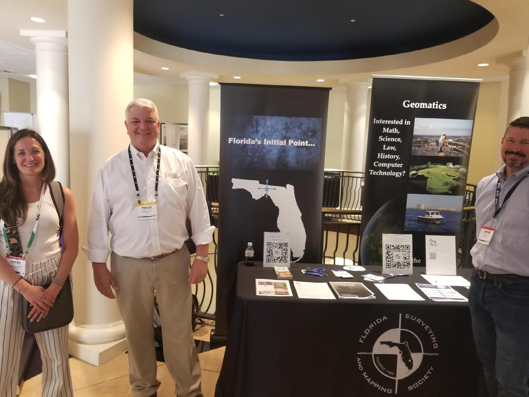
The FSMS Booth was manned by Directors Chad Thurner, Russell Hyatt, Earl Soeder, & Vice-President Allen Nobles.
Across & Below:
Fellow PLS & PSM
Christine Gayron of GdB Geospatial chatting it up with NSPS Director Russell Hyatt and Northwest Director Chad Thurner.


SmartDrone


Axis Geospatial


Carlson Preferred Solutions

Caulfield & Wheeler

eGPS Solutions

FLT Geosystems
Frontier Precision Unmanned

GeoNetworking

GPI


S u r v e y o r s I n s t r u m e n t S e r v i c e s , L L C , i s a f u l l - s e r v i c e s u r v e y i n g e q u i p m e n t r e t a i l s t o r e . W e o f f e r r e p a i r s , s a l e s , r e n t a l s a n d c o n s i g n m e n t s . S I S i s a f u l l - l i n e d e a l e r f o r G e o m a x , S p e c t r a , T r i m b l e , T o p c o n , S o k k i a , C a r l s o n , S e c o a n d S c h o n s t e d t .


W e p r i d e o u r s e l v


Exhibitor Reception Trimble

Clay Shoot SAM
Clay Shoot
Swag Sponsor
McKim & Creed
Room Keys
Welcome BBQ
Pickett & Associates
UF 50th Celebration Breakfast
Hyatt Survey
Conference Tote Bags
Langan

Lanyards
M.G. Vera & Assoc.
Name Badges
GPI

Registration Desk & Signs
Pennoni

Registration Desk & Signs
BGE
Cornhole Competition
Lengemann
SIT Test Prep
Clymer, Farner, Barley
CST Exams
Young Surveyors Event
Registration Packets
Central FL Chapter

Exhibitor Welcome Bags
Brown & Phillips
Exhibitor Welcome Bags
E.R. Brownell & Assoc.
Exhibit Hall Beverages
AGS(American Gov. Service)
3002 Surveying 352-538-1320
Ardurra, Inc. 239-292-7773
Associated Land Surveying & Mapping, Inc. 407-869-5002

Bello & Bello Land Surveying Corporation 305-251-9606
A. D. Platt & Associates, Inc. 850-329-5551
Agnoli, Barber & Brundage, Inc. 239-597-3111
AIM Engineering & Surveying 239-332-4569
Allen & Company, Inc. 407-654-5355
Allen Engineering 321-783-7443 American Surveying, Inc. 813-234-0103
Amerritt, Inc. 813-221-5200
Arc Surveying & Mapping, Inc. 904-384-8377
Atwell, LLC 866-850-4200
Avirom & Associates, Inc. 561-392-2594
Axis Geospatial, LLC 410-822-1441
Benchmark Surveying & Land Planning, Inc. 850-994-4882
Bennett-Panfil, Inc. 941-497-1290
Berntsen International 608-443-2772
Betsy Lindsay, Inc. 772-286-5753
Biscayne Engineering Company, Inc. 305-324-7671
Banks Engineering 239-939-5490
Barnes, Ferland and Associates, Inc. 407-896-8608
Barraco & Associates, Inc. 239-461-3170
Bartram Trail Surveying, Inc. 904-284-2224
Boatwright Land Surveyors, Inc. 904-241-8550
Bock & Clark Corporation(NV5) 330-665-4821
Bowman Consulting Group 703-454-1000
Bradshaw-Niles & Associates, Inc. 904-829-2591
Brown & Phillips, Inc. 561-615-3988
BSE Consultants, Inc. 321-725-3674
Buchanan & Harper, Inc. 850-763-7427
Calvin, Giordano & Associates, Inc. 954-921-7781
Carlson Environmental Consultants, PC 704-283-9765
Carnahan, Proctor & Cross, Inc. 407-960-5980
Carter Associates, Inc. 772-562-4191
Caulfield & Wheeler
561-392-1991
Chastain-Skillman, Inc.
863-646-1402
CHW Professional Consultants (Causseaux, Hewett & Walpole, Inc.) 352-331-1976 CivilSurv Design Group, Inc.
863-646-4771 Clements Surveying, Inc.
941-729-6690
Clymer Farner Barley Surveying, Inc.
352-748-3126 Coastal Engineering Associates, Inc.
352-796-9423
Colliers Engineering & Design
732-383-1950
Collins Survey Consulting, LLC. 863-606-2155 Cousins Surveyors & Associates, Inc. 954-689-7766 CPH Consulting, LLC 407-322-6841
Craven-Thompson & Associates, Inc. 954-739-6400
Culpepper & Terpening, Inc. 772-464-3537
Cumbey & Fair, Inc. 727-797-8982
DMK Associates, Inc. 941-412-1293
Donald W. McIntosh Associates, Inc. 407-644-4068
Donoghue Construction Layout, LLC. 321-248-7979
Douglass, Leavy & Associates, Inc. 954-344-7994
DRMP, Inc. 833-811-3767
DroneView Technologies 248-321-9417
DSW Surveying & Mapping, PLC. 352-735-3796
ECHO UES, Inc. 888-778-3246
Eda Consultants, Inc. 352-373-3541
Eiland & Associates, Inc. 904-272-1000 Element Engineering Group, LLC. 813-386-2101
DeGrove Surveyors, Inc. 904-722-0400
Dennis J. Leavy & Associates
561-753-0650
Dewberry 407-843-5120
Duncan-Parnell, Inc.
800-849-7708
Durden Surveying and Mapping, Inc.

904-853-6822
Engenuity Group, Inc. 561-655-1151 Engineering Design & Construction, Inc. 772-462-2455 ER Brownell & Associates, Inc. 305-860-3866
ESP Associates, Inc. 803-802-2515

LinkedIn = 442 Followers
Facebook = 805 Followers
Twitter = 340 Followers
Instagram = 180 Followers
YouTube
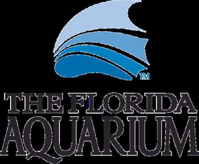
Rated among the best aquariums in the US, The Florida Aquarium welcomes visitors to experience a wide variety of aquatic and terrestrial animals – including sea turtles, sharks, lemurs, otters – with the goal of building awareness and inspiring conservation action.

Sponsored By: YOUR LOGO HERE!

Solve three dimensional geodetic and astronomic position problems, determine geodetic and astronomic azimuths, and measure fluctuations and accelerations in the Earth’s magnetic and gravity fields. They serve as NGA’s primary ground-based data collectors and use and maintain a variety of geodetic and geophysical survey equipment to support data acquisition.
They compute, adjust, and evaluate geodetic survey data acquired by other organizations. They provide indepth technical expertise on geodetic and geophysical issues to customers and represent NGA in external community forums establishing DoD and Intelligence Community doctrine and policy.


Applicants must meet the following criteria to qualify for employment with NGA:
•U.S. Citizen
•18 years of age or older
•Able to obtain aTop Secret/SCI security clearance


•Pass mandatory pre-employment drug screening
•COVID-19 vaccination, subject to exceptions required by law

Go to NGA’s career website: www.intelligencecareers.gov/NGA

•To start your job search,click on Search NGA jobs, which will take you to a list of current opportunities at NGA.
•18 years of age or older
• Register: You must register to apply for a job opening. To register, click New Users on the Job Search page.
•Click Apply on the job listing to start the process.

• Follow the instructions on each screen.
• Review your application. Ensure your package is complete and includes all required documentation.
•Click Submit Application to submit your complete application. You will receive an email confirming submission. If you do not receive an email, your application was not successfully submitted.
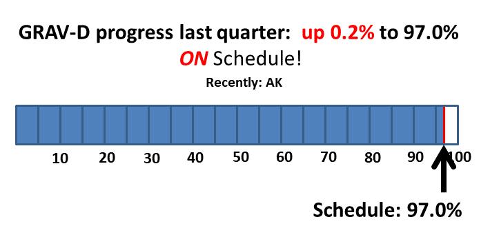
In a stroke of bad luck, the long-planned GRAV-D trip to the outer Aleutian Islands was interrupted just after getting started. On Monday, April 11 the Russian Shiveluch Volcano erupted, spewing ash up to 50,000 feet. This ash began to drift toward the Aleutians, which interrupted GRAV‑D flights for two days before the wind blew the ash out of the region. The eruption and an aircraft maintenance issue early in the project raised concern that data would not be collected over the Aleutian Island Region during the short time allocated for those flights (only 21 days in April 2023). However, the last part of the project was very successful, averaging six, 8.5-hour flights per week. The crew collected data for all of the high and medium priority data lines, and two of the low priority flights as well. The resulting data collection preserves the nominal 10 km data line spacing 70 km or more south of the islands, and then switches to a 20 km spacing until the entire GRAV-D target region is covered. Even with significant challenges, the NGS field team and the NOAA Aircraft Operations Center flight crew worked hard and are bringing home a high-quality airborne gravity data set in the region.
As mentioned in issue 29, NGS is focusing on improvements to the existing OPUS-S and OPUSProjects programs, eventually modifying them to work with GNSS data in the modernized NSRS, before working on software that will integrate leveling, classical, gravity and GNSS data, known as OPUS 6.
In alignment with that decision, OPUS-Projects 5.1 is now live on the NGS website. OPUS-Projects 5.1 fully supports the uploading, QA/QC, adjustment, and submission for publication of real-time kinematic (RTK) vectors in the GVX file format.
There are currently 32 ongoing projects related to NSRS modernization around NGS. Here are some highlights.
NGS has successfully run “alpha” adjustments on all existing GNSS vectors in our holdings (630,000+ vectors across 116,000+ points). This yielded ellipsoid heights which, combined with xGEOID20 were held as constraints for an “alpha” adjustment of all leveling runnings in our holdings (2,000,000+ runnings over 900,000+ points). With these tests in place, NGS will now begin the arduous process of cleaning the data more fully, in preparation for final adjustments that will yield coordinates in the modernized NSRS.

NGS is excited to announce that we will be presenting a full-day’s worth of content on the National Spatial Reference System (NSRS) Modernization during the FIG Working Week 2023 meeting, taking place at the end of May 2023 in Orlando, Florida. For the first time in over 20 years, this annual gathering of the International Federation of Surveyors will be taking place in the United States, hosted by the National Society of Professional Surveyors (NSPS). Click here to register now!

“The International Federation of Surveyors (FIG) is a United Na tions and World Bank recognized non-governmental international professional organization. FIG was founded in 1878 and represen ts national associations of surveying, cadastre, valuation, nation al mapping professionals, geospatial experts and quantity surveyor s working in both the public and private sectors, in the scientifi c, research and academic community, as well as from technology innovators and industry from more than 120 countries around the world.”
The 2023 Working Week will be an exciting week-long conference that brings the international community of surveying and geospa tial professionals together for a mix of technical sessions and work shops, a trade exhibition and a variety of side events and social func tions.
On Wednesday, May 31, 2023 , NGS Director Juliana Blackwell will give a keynote address to the full conference and NGS staff will host a
series of sessions on our efforts to modernize the U.S. National Spatial Reference System. More information will be posted to the NGS FIG 2023 webpage as it becomes available.
We encourage you to attend as much of the Working Week as you c an, and be sure to join us on the Wednesday after Memorial Day to t alk to NGS staff about NSRS Modernization.
Attendance at NGS Day is included in the registration fee for the Working Week. If you wish to only participate in this event you can make a Day Registration for Wednesday 31 May . This day registration will also include the FIG Working Week Keynote Session. Below is the updated agenda for NGS Day at the 2023 FIG :
Updated Agenda:
09:00 - 11:00: FIG Keynote - Featuring Juliana Blackwell, Director of National Geodetic Survey
11:00 - 11:30: Coffee and Tea Break
11:30 - 13:00: Practical implications of National Spatial Reference System (NSRS) Modernization
• Practical impacts of the modernized NSRS
• Canada’s implementation of the modernized frames
• Changes Afoot: State Plane 2022 and Retirement of the U.S. Surv ey Foot
• Preparing for the Modernization of the NSRS
• Q&A
13:00 - 14:30: Lunch
14:30 - 16:00: Update on the NOAA CORS Network and OPUS
• The NOAA CORS Network (NCN) Services
• Updating OPUS-S to Support Multi-GNSS
• OPUS-Projects 5: Supporting RTK for Establishment of Geodetic Control
• OPUS-Projects for Manager’s Training - Transitioning from Instructor-led to Online, Self-paced instruction
• Augmenting Data exchange formats for OPUS of the future
• Q&A
16:00 - 16:30: Coffee and Tea Break
16:30 - 18:00: Case studies of Surveys NGS does now and how they will change
• Implementing NGS OPUS Projects’ GVX feature to align RTK vector s to the NSRS to establish Geodetic Control for FirstNet Indoor Mapping.
• IGLD: A case study for leveraging digital tools to enhance QA/Q C on large scale static GNSS observation campaigns
• Geodetic Leveling in the Modernized NSRS
• NGS Field Operations: Modernizing in Many Ways
• Q&A
• Closing Remarks by Director of National Geodetic Survey
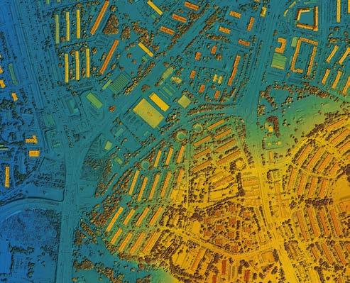
• I.F. Rooks & Associates is a full-service Geospatial firm serving clients throughout Florida and the Southeastern United States for 54 years.

• We have extensive experience in providing topographic / planimetric mapping , digital orthophotos, Aerial LiDAR, fixedwing and helicopter aerial photography for transportation, site development, coastal and environmental projects.
• Our steady growth in technology and personnel has allowed the development of long -term relationships with several Florida municipalities and government agencies, power companies, mining companies as well as engineering firms.
• I.F. Rooks is Pre -Qualified by FDOT in Workgroup 8.3
Photogrammetry.
OPUS Projects 5 has added an [ Upload GNSS Vectors ] function to incorporate high efficiency real-time kinematic (RTK) surveys into geodetic control projects. This update, along with new Requirements for Use in the 2023 GPS on Bench Mark Campaign will guide users in using high-efficiency GPS methods to maintain NGS datasheets and improve transformation models relating the nation’s existing NAVD 88 heights to the next GPS-based vertical datum.
Users can now upload GNSS vectors into their OPUS Projects, inc luding vectors derived from either a single-base RTK setup or from a r eal-time network (RTN), for evaluation, quality assessment, and inclusio n in a least squares network adjustment.
Use the new GNSS Vector Exchange (GVX) file format to transfer data from various manufacturer hardware to OPUS Projects 5:
• ask your GPS vendor about new converters to GVX file format.
• explore GVX sample data .


(Originally published from FSPLS Newsletter, No. 45, April, 1980)
Arecent opinion by Mr. Leonard Lampert, chairman of the Land Surveys Division Ethics and Practices Committee of the American Congress on Surveying and Mapping, stated that a professional land surveyor who acted as a County Surveyor should be prevented from also engaging in private practice. This ruling was based on an accepted concept of professional ethics that a professional should not review the work of a fellow professional except with the knowledge and consent of that professional. The ethical consideration which supports this concept is the avoidance of conflicts of interest. Mr. Lampert reasoned that the review of a land surveyor's plats and maps should be performed by an impartial, independent agency and not by a competitor land surveyor.
An opinion such as Mr. Lampert's which is based on a professional society's code of ethics does not have the force of law. However, the breach
of such a code of ethics could be the basis for profes sional discipline or for the society seeking a disci plinary proceeding before the Board of Land Surveyors pursuant to §455.225, Florida Statutes. As the FSPLS (Florida Society of Professional Land Surveyors) Code of Ethics contains a provision similar to the one relied on by Mr. Lampert in his opinion, a Florida County Surveyor who also main tained a private practice in that county would be in violation of that code and would very likely be subject to professional discipline by FSPLS.
In addition to the professional code of ethics of FSPLS, two other codes of ethics and attendant disciplinary measures would be applicable to a Flor ida County Surveyor who maintained a private practice in the county where he was employed. First, every registered land surveyor in Florida is subject to the rules of professional conduct promulgated by the Board of Land
Surveyors (the Board). The Board has promulgated rules entitled “Grounds for Disciplinary Proceedings” which became effective on January 3, 1980. Ch. 21HH–2, Fla. Admin. Code. One of the provisions of these new rules states:
“A registered land surveyor shall not commit misconduct in the practice of land surveying. Regis tered land surveyors shall be guided in all their professional relations by the highest standards of integrity and shall act in professional matters for each client or employer as faithful agents or trust ees. Misconduct . . . shall include but not be limited to:
“…
“( f ) becoming involved in a conflict of interest with an employer or client, without the knowledge and approval of the employer or client, but if unavoidable a registered land surveyor shall imme diately take the following actions:
“l. Disclose in writing to his employer or client the full circumstances as to a possible conflict of interest; and
“2. Assure in writing that the conflict will in no manner influence the registered land surveyor's judgment or the quality of his services to his employer or client; and
“3. Promptly inform his client or employer in writing of any business association, interest,
or circumstances which may be influencing his judgment or the quality of his services to his client or employer. Rule 21HH2.01(5), Fla. Admin. Code.”
[ emphasis supplied ]
Under section (f) of the above rule, a County Surveyor could avoid a conflict of interest charge by obtaining the county's approval or possibly by simply disclosing the conflict to the county. Whether or not such disclosure would insulate the County Surveyor from being found guilty of misconduct would depend on the Board's determination of whether the conflict was “unavoidable.” Since the rules have only been in effect since January 3, 1980, there have been no rulings on this point.
It should also be noted that the list of practices which constitute misconduct contained in the rule is not exhaustive. Therefore, it is possible that the Board would hold that a breach of the FSPLS Code of Ethics constitutes misconduct.
Should the Board find a registered land surveyor guilty of misconduct, §472.033(3), Florida Statutes, provides that the land surveyor would be subject to one or more of the following penalties:
a . Denial of an application for licensure.
F-106, number 58-0787, landed almost intact in a snowy field after the pilot ejected.
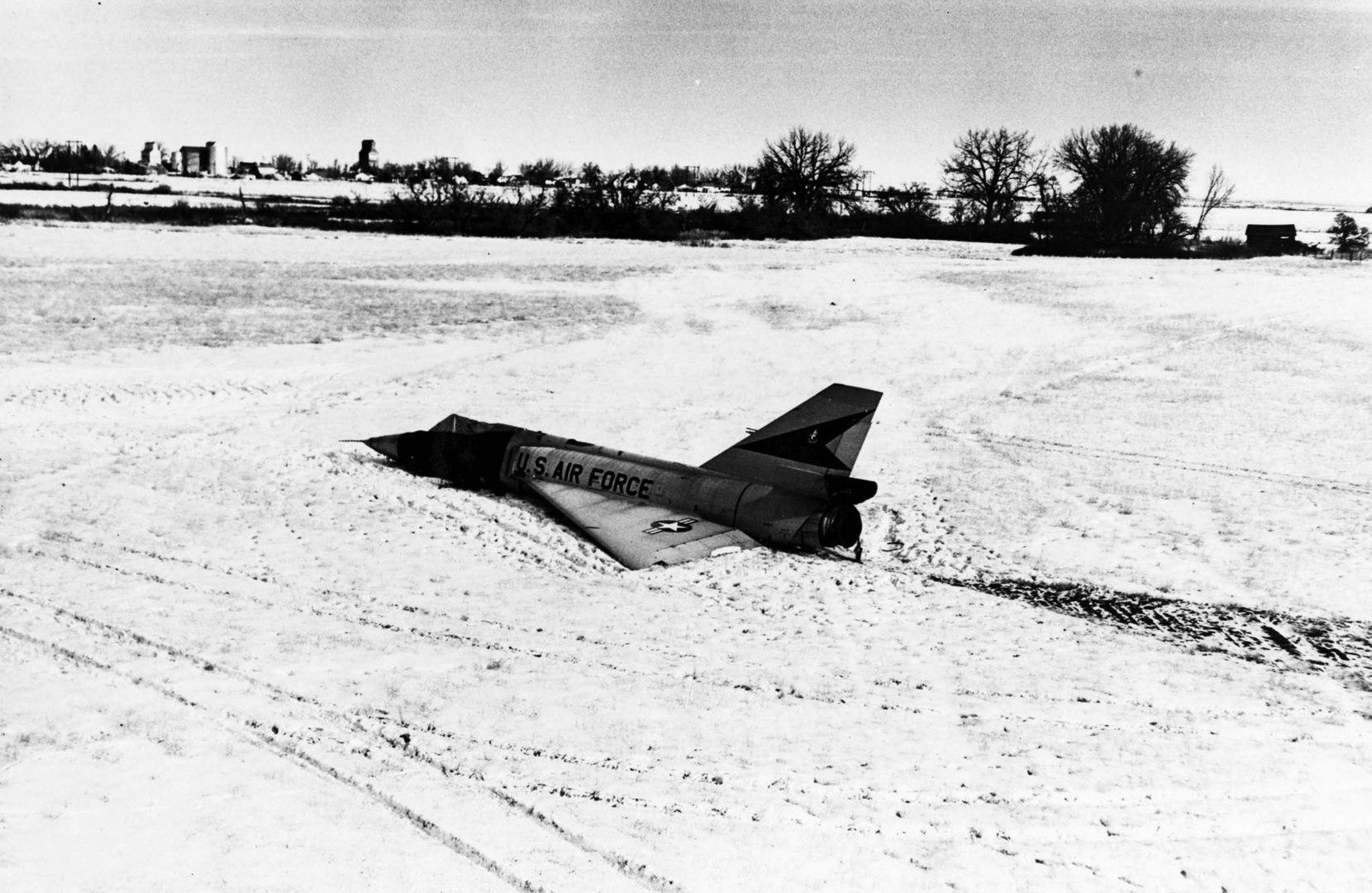
The "Cornfield Bomber" is the nickname given to a Convair F-106 Delta Dart, operated by the 71st Fighter-Interceptor Squadron of the United States Air Force.
In 1970, during a training exercise, it made an unpiloted landing in a farmer's field in Montana, suffering only minor damage, after the pilot had ejected from the aircraft. The aircraft, recovered and repaired, was returned to service, and is currently on display at the National Museum of the United States Air Force.
b . Revocation or suspension of a license.
c . Imposition of an administrative fine not to exceed $1,000 for each count or separate offense.
d . Issuance of a reprimand.
e . Placement of the land surveyor on probation for a period of time and subject to such conditions as the Board may specify.
f . Restriction of the authorized scope of prac tice by the land surveyor.
Secondly, all public employees in Florida, state and local, are subject to the Code of Ethics contained in Ch. 112, Part III, Florida Statutes. The pertinent provision states:
“No public officer or employee of an agency shall have or hold any employment or contractual relationship with any business entity or any agency which is subject to the regulation of, or is doing business with, an agency of which he is an officer or employee . . . nor shall an officer or employee of an agency have or hold any employment or contractual relationship that will create a continuing or frequently recurring conflict between his private interests and the performance of his public duties or that would impede the full and faithful discharge of his public duties.”
§112.313(7) (a), Fla. Stat.
This provision would appear to prevent a County Surveyor from also maintaining a private practice in the county in which he is an employee without violating this code. Violation of this statutory code of ethics would result in one or more of the following penalties:
a . Dismissal from employment.
b . Suspension from employment for not more than 90 days without pay.
c . Demotion.
d . Reduction in salary level.
e . Forfeiture of no more than onethird salary per month for no more than 12 months.
f . A civil penalty not to exceed $5,000.
g . Restitution of any pecuniary benefits received because of the violation committed.
h . Public censure and reprimand.
§112.317(1) (b), Fla. Stat.
In summary, a Florida County Surveyor who also maintained a private practice in the county of his employment would be in violation of the FSPLS code of ethics, and potentially in violation of the Board of Land Surveyors rules of professional conduct and the public employees' statutory code of ethics.
FSMS is a professional membership society representing the Surveying & Mapping Profession, including: Photogrammetry, Imagery, Remote Sensing, Base Mapping, GIS/LIS, Cartography, Geodesy, Geomatics, GPS, Geographic Information and Geospatial Data.
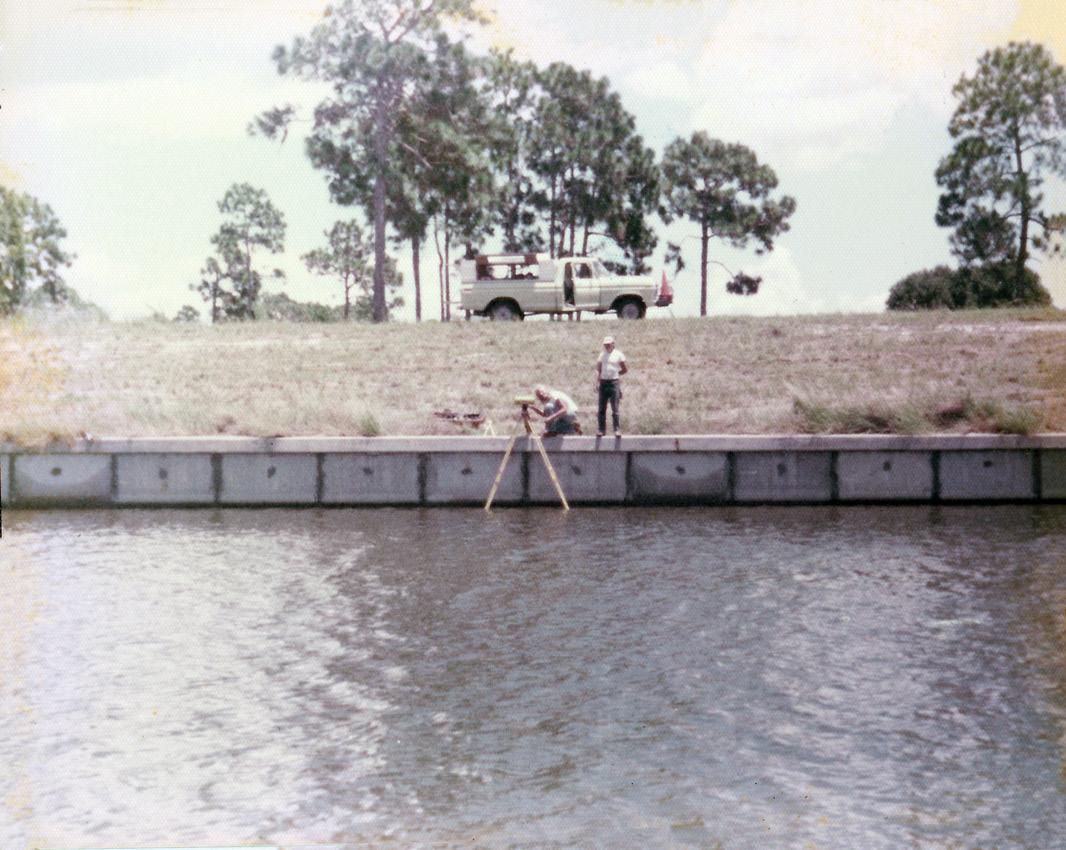
• NETWORKING
• CONTINUING EDUCATION
• LEGISLATIVE FSMPAC
• PROMOTING THE PROFESSION
• PROTECTING LICENSURE
• ADDRESSING UNLICENSED PRACTICE
• ENCOURAGING FUTURE SURVEYORS
• AWARDS & SCHOLARSHIPS
• CAREER OPPORTUNITIES

Step
3 Hour Courses Available
□ A History of the Prime Meridian Marker,
□ Basics of Real Property
□ Digital Signatures for Surveyors
□ Easements and Rights of Ways,
□ Elevation Certificates and the Community Rating System
□ Introduction to Photogrammetry
□ Quality Assurance/Quality Control for the Design Professional and Technical Staff, #9293, 3 CEC
□ Writing Boundary Descriptions
6 Hour Courses
□ Boundaries in Florida
□ Chapter 177, Platting (Plat Law)
□ Critical Communication for Surveying & Mapping Professionals
□ Ethics for the Design Professional
□ Florida Laws
□ Florida Surveying Law and Rule Changes
□ Geographic Information Systems (GIS)
□ History of Surveying,
□ Identification of Native and Non-Native Trees in Florida
□ Land Tenure and Cadastral Systems
□ Map Projections and Plane Coordinate Systems , #7669, 6 CEC
□ Practical Geometry for Surveyors , #7109, 6 CEC
□ Public Land Survey System, #6979, 6 CEC
□ Remote Sensing Applications to Surveying & Mapping, #6972, 6 CEC
Billing Address of Credit Card:
IF PAYING BY CHECK, MAIL FORM TO: FSMS, P.O. Box 850001-243, Orlando, Florida 32885-0243
IF PAYING BY CREDIT CARD, FAX OR EMAIL FORM TO: 850.877.4852 education@fsms.org QUESTIONS? CALL 800.237.4384

Executive Director

Rebecca Porter director@fsms.org
Education Director
Samantha Hobbs education@fsms.org
Communications
Coordinator

Justin Ortiz communications@fsms.org

Regional Coordinator
Cathy Campanile
seminolecc84@gmail.com
1956
H.O. Peters
Harry C. Schwebke
John P. Goggin
R.H. Jones
1960
Hugh A. Binyon
Russell H. DeGrove
Perry C. McGriff
Carl E. Johnson
James A. Thigpenn, III
Harold A. Schuler, Jr.
Shields E. Clark
Maurice E. Berry II
William C. Hart
Frank R. Schilling, Jr.
1970
William V. Keith
James M. King
Broward P. Davis
E.R. (Ed) Brownell
E.W. (Gene) Stoner
Lewis H. Kent
Robert S. Harris
Paul T. O’Hargan
William G. Wallace, Jr.
Robert W. Wigglesworth
1980
Ben P. Blackburn
William B. Thompson, II
John R. Gargis
Robert A. Bannerman
H. Bruce Durden
Buell H. Harper
Jan L. Skipper
Steven M. Woods
Stephen G. Vrabel
W. Lamar Evers
1990
Joseph S. Boggs
Robert L. Graham
Nicholas D. Miller
Loren E. Mercer
Kent Green
Robert D. Cross
Thomas L. Conner
Gordon R. Niles, Jr.
Dennis E. Blankenship
W. Lanier Mathews, II
Jack Breed
2000
Arthur A. Mastronicola
Michael H. Maxwell
John M. Clyatt
David W. Schryver
Stephen M. Gordon
Richard G. Powell
Michael J. Whitling
Robert W. Jackson, Jr.
Pablo Ferrari
Steve Stinson
2010
Dan Ferrans
Jeremiah Slaymaker
Ken Glass
Russell Hyatt
Bill Rowe
Dale Bradshaw
Lou Campanile, Jr.
Bob Strayer, Jr.
Dianne Collins
2020
Don Elder
Hal Peters
Lou Campanile, Jr.
Please email communications@fsms.org to notify us of upcoming events.

All advertisements contained within the publication are published as a service to readers. Publication of the advertisements does not imply or express any endorsement or recommendation by FSMS.
Benefits: Full color; hyperlinks added to your webpages as well as email addresses.
Requirements: Contracts for one year (11 issues) receive 10% discount if paid in advance; 15% for Sustaining Firms. (Ads should be in jpeg, pdf, or png format)
New ads and/or changes are due by the 25th of each month.