T he F lorida Surveyor

IN THIS ISSUE

June 2023 Volume XXXI, Issue 6
Surveying Pioneer Chappy Young Conference Exhibitors/Sponsors Annual Conference Seminars
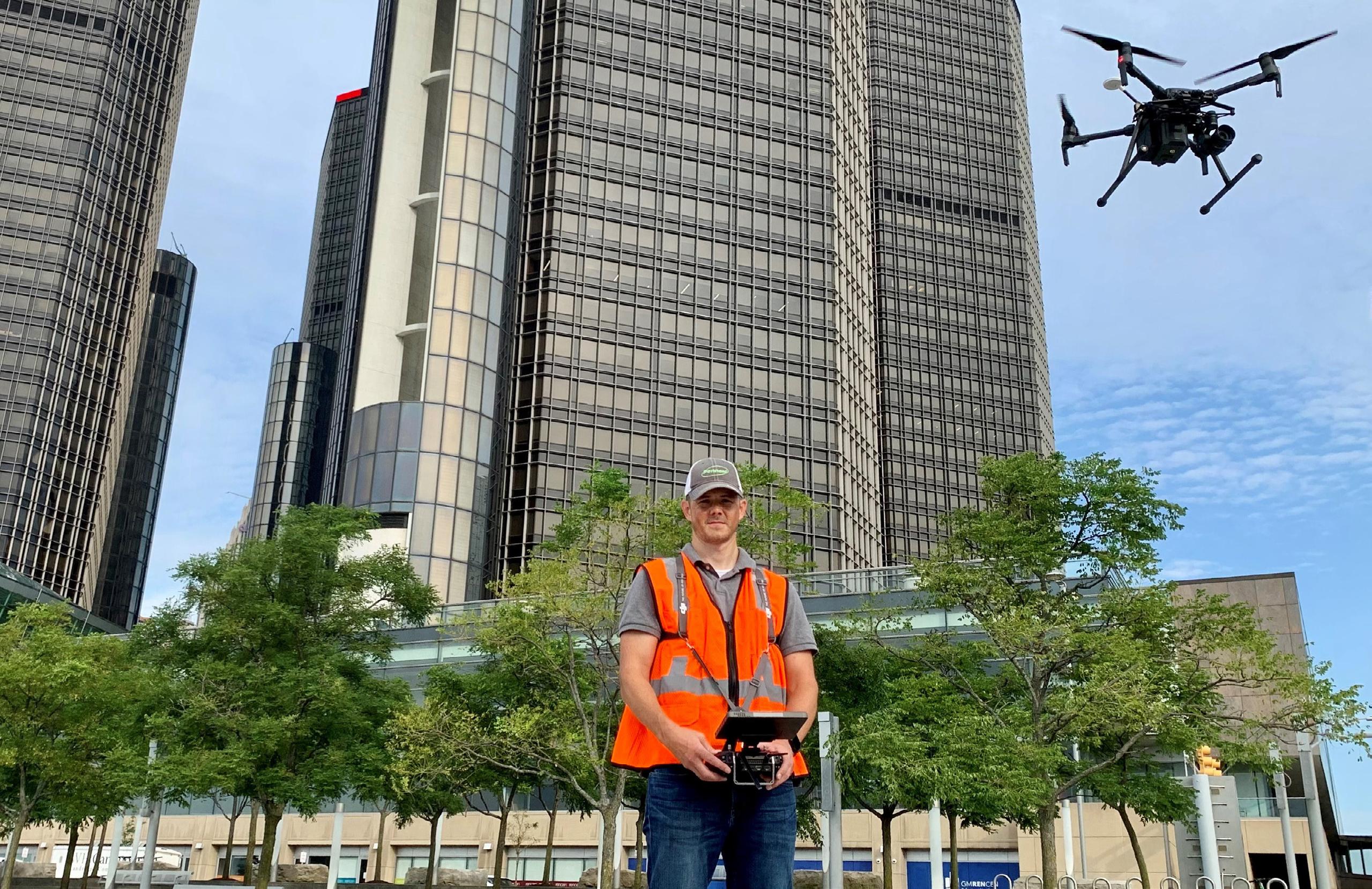
Increase productivity by combining lidar scanning with robotics
The GTL-1200 combines the power of a robotic total station with a best-inclass laser scanner to perform digital layout and capture high -res 3D scans in a single setup. Simplify the scanning process and dramatically reduce the need for post-processing by capturing scan data on survey control. The workflow seamlessly integrates with ClearEdge3D software for advanced construction QA workflows and as-builts.
• Quick layout and scanning with a single instrument.
• Wi-Fi capability enables point clouds to be transmitted wirelessly
• Proven robotic total station design, integrated with a scanner.

• Full dome scan in seconds, now with 2x point cloud resolution.
• Scan density tailored to minimize software processing time.
• Point clouds accurately matched to BIM model coordinates.
Reduce your modeling time by up to 75%
EdgeWise™ software from ClearEdge3D offers a host of modeling features and tools that help users quickly convert point clouds into usable, as-built 3D plant and building models. The software’s automated feature-extraction capability, pattern-recognition technology and object-recognition algorithms provide you with maximum efficiency. Using these features, the modeling process can be completed in a fraction of the time previously required.
• Increased accuracy and speed when modeling

• Ability to do 3D models of as-built pipes, structural elements, ducts, walls, tees and conduits
• MEP (Mechanical, Engineering and Plumbing), structural and architectural-modeling capabilities
• Billion-point visualization engine with photo-realistic project views
• Fully interoperable with Plant3D, CADWorx, PDMS and Autodesk Revit
43316 State Road 19 Altoona, FL 32702 www.lengemann.us
The F lorida Surveyor is the official publication of the Florida Surveying and Mapping Society, also known as FSMS. It is published monthly for the purpose of communicating with the professional surveying community and related professions who are members of FSMS. Our award winning publication informs members eleven months out of the year about national, state, and district events and accomplishments, as well as articles relevant to the surveying profession. In addition,


Page 3 CONFERENCE Seminars 23 68TH CONFERENCE Registration 20 EXHIBITOR/SPONSOR Opportunities 29 68TH CONFERENCE Exhibitors/Sponsors 41 NGS News 59 2023 SUSTAINING Firms Directory 53 FROM THE Archives 64 PRESIDENT’S Message 1 2023 FSMS Officers 3 FSMS Pioneers 7
TABLE OF CONTENTS
continuing educational courses are also available.
June 5, 2023
The tools that a land surveyor uses have changed drastically, from Gunter’s chain and compass to GNSS, Robotic Total Stations, Lidar and UAV’s. The tools and their accuracies have also changed, but Land Surveying is still an art and the knowledge that comes with years of experience cannot be replaced with books or technology. Our profession was founded on the master/apprentice relationship and that principal remains to this day. The single master has evolved to many specialized masters that teach us our niche in the profession. Whether it is Retracement, land boundaries, hydrographic or topographic we still rely on the experience and background of the individual Surveyor to make the final determination.
The surveyor is compelled to find the true boundaries of the property. Remember we are fact finders and not advocates for our clients. As hard a concept as that may seem, do not fall into that trap, because your responsibilities lie with protection of the public as a whole when determining boundaries and measurements.
The Annual Conference is just around the corner. Find a Seminar at the conference that will advance your knowledge in your niche of the profession or one that fills in the missing gaps.
Respectfully submitted.
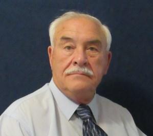
Howard J. Ehmke II

The Florida Surveyor Page 1
President Howard Ehmke (561) 360-8883 Howard@GCYinc.com
PRESIDENT’S Message
Saturday, July 29th 8 am – 3:30 pm
For any questions, contact Alex Jenkins at ajenkins@ southeasternsurveying.com


The Florida Surveyor Page 3 President-Elect Richard Pryce (954) 739-6400 rdpryce@gmail.com Vice President Allen Nobles (561) 687-2220 allen.nobles@sam.biz Secretary Sam Hall (352) 408-6033 surveysam17@outlook.com Treasurer Bon Dewitt (352) 392-6010 bon@ufl.edu Immediate Past President Lou Campanile, Jr. (954) 980-8888 lou@campanile.net 2023 FSMS Officers
2023 Districts and Directors
District 1 - Northwest
Bay, Calhoun, Escambia, Franklin, Gadsden, Gulf, Holmes, Jackson, Jefferson, Leon, Liberty, Madison, Okaloosa, Santa Rosa, Taylor, Wakulla, Walton, Washington
Eric Stuart (850) 685-1149
eric.stuart@sam.biz
Chad Thurner (850) 200-2441 chad.thurner@sam.biz
District 2 - Northeast
Alachua, Baker, Bradford, Clay, Columbia, Dixie, Duval, Gilchrist, Hamilton, Lafayette, Levy, Marion, Nassau, Putnam, Suwannee, St. Johns, Union
Nick Digruttolo (863) 344-2330
ndigruttolo@pickettusa.com
2 3 4 7 6 5
District 5 - Southwest
Charlotte, Collier, DeSoto, Glades, Hardee, Hendry, Highlands, Lee, Manatee, Sarasota
Shane Christy (941) 840-2809
schristy@georgefyoung.com
Pablo Ferrari (904) 824-3086 pferrari@drmp. com
District 3 - East Central
Brevard, Flagler, Indian River, Lake, Okeechobee, Orange, Osceola, Seminole, Martin, St. Lucie, Volusia
Al Quickel (407) 567-1566
alq.fsms@gmail.com
Robert Johnson (772) 562-4191
bobj@carterassoc.com
District 4 - West Central
Citrus, Hernando, Hillsborough, Pasco, Pinellas, Polk, Sumter
Greg Prather (863) 533-9095
gprather@pickettusa.com
Alex Parnes (813) 493-3952
alexwolfeparnes @gmail.com
Donald Stouten (239) 281-0410 dstouten@ ardurra.com
District 6 - Southeast
Broward, Palm Beach
Mark Sowers (954) 868-7172 msowers@mgvera.com
Earl Soeder (407) 601-5816 earl.soeder@ duncan-parnell.com
Miami-Dade, Monroe
Jose Sanfiel (305) 351-2942 psm5636@gmail.com
District 7 - South NSPS
Manny Vera, Jr. (305) 221-6210 mverajr@mgvera.com
Russell Hyatt (941) 748-4693
russell@hyattsurvey.com
1
Director
District 1
Panhandle
Bill Butler wtb@butlersurveying.com
Gulf Coast
Jonathan Gibson jgibson0102@gmail.com
Chipola Jesse Snelgrove jsnelgrove@ snelgrovesurveying.com
Northwest FL
Jeremiah Slaymaker jslay@wginc.com
District 2
FL Crown
Brandon Robbins brndrbbns@netscape.net
North Central FL
Jeremy D. Hallick jdhallick@hotmail.com
UF Ge omatics
Andrea Slaven aslaven@ufl.edu
Chapter Presidents
District 3
Central FL
William (Bill) Rowe browe@southeasternsurveying.com
Indian River Brion Yancy brionyancy@gmail.com
Volusia Je ff Cory (Interim) jeff@corysurveyor.com
District 5
Charlotte Harbor
Derek Miller millersurveying@comcast.net
Collier-Lee
Steve Shawles II sshawles@haleyward.com
Manasota
Shane Christy schristy@georgefyoung.com
District 6
Broward
Benjamin Hoyle benjamin.hoyle@kci.com
District 4
Ridge
Kenneth Glass kglass@civilsurv.com
Tampa Bay John Beland jbeland1979@gmail.com
Palm Beach
Lee Powers
lpowers@zemangroup.com
FAU Geomatics
Brett Costanza brettcostanza@hotmail.com
District 7
Miami-Dade
Eddie Suarez marketing@longitudefl.com
2023
Standing Committees
Nominating Committee
Membership Committee
Finance Committee
Executive Committee
Education Committee
Annual Meeting Committee
Legal Committee
Strategic Planning Committee
Ethics Committee
Legislative Committee
Surveying & Mapping Council
Constitution & Resolution Advisory Committee
Rick Pryce
Nick DiGruttolo
Bon Dewitt
Howard Ehmke
Greg Prather
Allen Nobles
Jack Breed
Rick Pryce
Shane Christy
Jack Breed
Randy Tompkins
Eric Stuart
Special Committees
Equipment Theft
Awards Committee
UF Alumni Recruiting Committee
Professional Practice Committee
Workforce Development Committee
Liaisons
CST Program
Manny Vera, Jr.
Lou Campanile, Jr.
Russell Hyatt
Lou Campanile, Jr.
Allen Nobles
Alex Jenkins
FDACS BPSM Don Elder
Surveyors in Government
Academic Advisory UF
FES
Richard Allen
Bon Dewitt
Lou Campanile, Jr. Practice Sections
Geospatial Users Group
Soeder
Earl
2023 Committees
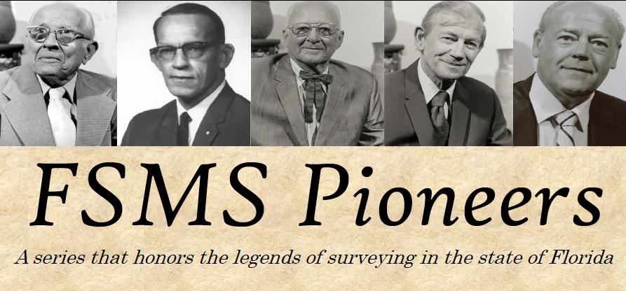
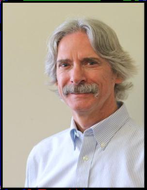
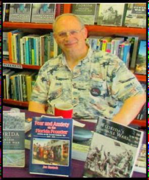
PIONEER SURVEYOR
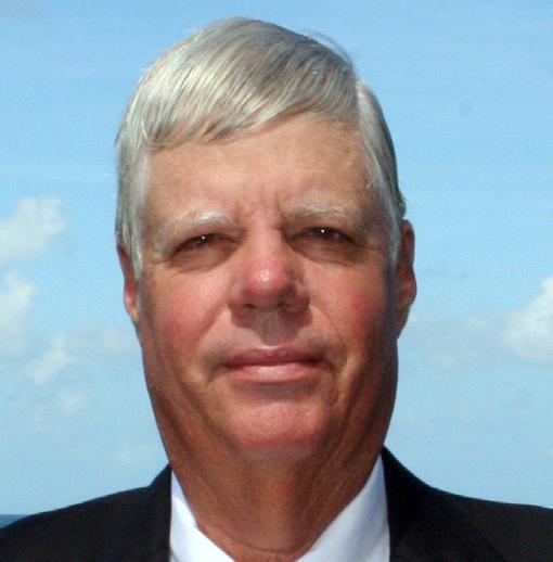
George Chapman (Chappy) Young, Jr., PSM President of GCY, Inc., Professional Surveyors and Mappers
PROLOGUE:
FIRST, I would like to say that being considered a “Pioneer” in the surveying profession is a privilege! If I would ever be asked if I would ‘do it over again’ … my career with all the challenges, suffering and difficulties, I would answer without hesitation, ABSOLUTELY!
“Success is not measured by money, but by happiness!”
SECOND, I believe that the reader is expecting “stories of old” from a Pioneer. So here they come. “It is not what you gather, but what you scatter that tells what kind of life you have had!”
MY STORY:
I was born in Bradenton, Florida, on April 2, 1947, at Dr. Sugg’s private Hospital. It’s my understanding that it was the only hospital in Bradenton at that time. Dr. Suggs was a family friend. Dad told me that he and Dr. Suggs were setting on the second story fire escape smoking cigarettes as Mom was in labor with me. Who does that anymore?
At the age of three, my family moved to Belle Glade, Florida where my father George C. Young (RIP) became the manager of the newly created Glades Livestock Market, a cooperative market owned by local ranchers and Dad managed the market’s construction.
My mother (RIP Mom) had the highest IQ in our family and her score was deemed a genius. (Dad
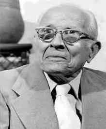
The Florida Surveyor Page 7
Chappy Young Jr., PSM
and I, not so much). She constantly read books, at least one a day usually, and her love of books led to her career as a librarian, from which she retired.
My only sibling and older sister, Edwina Jane retired from AT&T Long Lines. She was another family genius and worked for AT&T at the home office directly under one of the VPs. Jane, among other significant accomplishments, led a team of accountants and attorneys to submit AT&T’s annual long distance fees submittal to be approved by the FCC. One package was delivered to the FCC in DC by Rail, and another (backup) was delivered by Truck, to ensure delivery on time. Later, Jane was tasked to develop early retirement packages with another team of accountants and attorneys, for the firm’s employees. This was because of the federally mandated decentralization of the communication giant, AT&T. She finally created a retirement package she liked and retired at the age of 55. After retiring, Jane travelled extensively throughout the United States, Canada in her RV and hosted many Jeep 4x4 camporees leading Jeep drivers through many canyons and mountain trails throughout Colorado and the west. My family and I were privileged to have Jane with us at our home for her final two years. After a long illness, Jane passed away at the age of 72 (RIP Jane).
I attended school in Belle Glade, FL from kindergarten through junior high school. After junior high, my parents sent me to Battle Ground Academy (BGA), a non-military private school, in Franklin, Tennessee where I succeeded as a poor student. It was an expensive private school where my only success was football, playing defensive tackle. After two years at BGA, I transferred to Gainesville High School, living with my sister while she attended the University of Florida in Gainesville. There, too, I excelled as a poor student. However, ultimately, I graduated from West Palm Beach High School during their summer term with a GED (did I mention I was a poor student?).
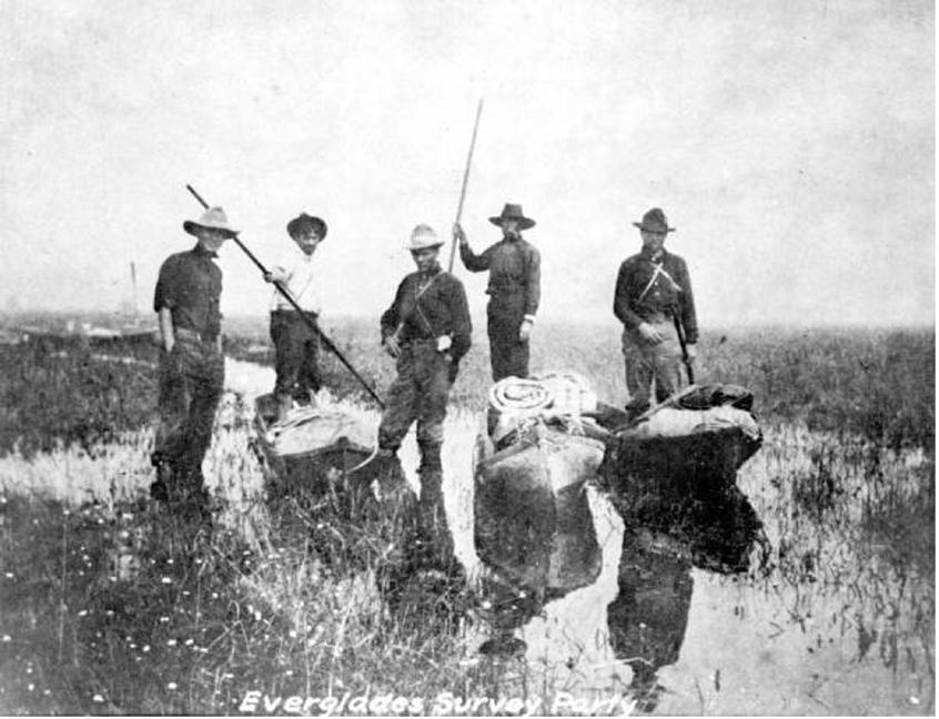
My introduction to surveying began in the winter of 1964 while working for Hutcheon Engineers, Inc. (HEI) at their Belle Glade, FL office. I started as a “green” rodman surveying 40,000 acres in the sawgrass of the Everglades, south of South Bay, Florida. This project lasted for several years as all work was done with a one minute mountain transit and a 200-foot chain in the soft muck of the Everglades. We retraced every exterior and interior section line, and the HEI engineers designed the drainage/irrigation infrastructure for its water management. Surveying the boundary, running profiles of the muck and the subsurface rock, and “as built” of all the contractors’ work, was the survey involvement for this job. This project was to become Big B Ranch, owned by King Ranch out of Texas. Of course, this project was conducted when it was deemed ‘OK’ to develop the raw Everglades into agricultural use as it was considered within their “Property Rights” … not so much anymore. This job meant miles and miles of walking in the sawgrass in calf deep water, measuring behind an especially equipped D-6 dozer, killing water moccasins, and encountering alligators daily. Over the next few years, we surveyed other large acreages in the Everglades, and I rose to the level of Party Chief within HEI. In the meantime, the owner of HEI, Bob Hutcheon (Hutch) took a “shine” to me. We became personal friends and I got to know his family. I also worked under Norman Gimpel, PSM, the
June 2023 Page 8
Senior Surveyor and a Partner in HEI as well as Pedro Gonzalez, PSM and Office Manager in the Belle Glade office of HEI.
During this time, the war in Vietnam was heating up. Next door to our office in Belle Glade was the Selective Service Office where Mrs. Ulm worked as the secretary for the local Selective Service Board. One afternoon after work, Mrs. Ulm stopped me and advised me that my name was coming before the next board meeting and said I should expect a draft notice soon. The military was going to knock on my door as my number was up! That certainly got my attention! A Partner in HEI, Russ Gilbert, PE was also a Navy Lt. Commander in the West Palm Beach Reserves of the U.S. Naval Construction Battalion (CBs, aka: Sea Bees). Russ told me that the Sea Bees had a special enlistment program called the Direct Procurement of Petty Officers (DPPO) and were looking for experienced and skilled surveyors, together with other skilled construction tradesmen. Russ advised that if I was accepted into that program, I would receive an advanced rank of at least an E-4 (pay scale) in boot camp. I accepted and signed up, thus avoiding the draft into the Army or Marines. I became a Third-Class Engineering Aid Petty Officer (EA-3 with E-4 pay) into the United States Navy Construction Battalion 133 (NCB 133), stationed at Gulfport, Mississippi. On my initial deployment to Guam on the advance party, we began building a Sea Bee base, however I was soon redeployed to a detachment named Det Koala, to NAS MIRAMAR, the home of the Navy’s “Top Gun” (no, I never met Tom Cruise while I was there). Det Koala was tasked to build the first “on base housing” (a trailer park) on stateside soil, a brainchild of then Chief of Naval Operations (CNO or the Senior Officer of the Navy) four-star Admiral Elmo Zumwalt who visited our detachment while I was stationed there. That was a Big Deal! During this deployment, I was the lead surveyor for the project and advanced to SecondClass Engineering Aid Petty Officer (EA-2 with E-5 pay).
After that duty, I volunteered for a 13-man Sea Bee Team (Sea Bee Team 133-09) to be trained as a counter insurgency team for Vietnam. We were cross trained with other construction skills, taught Vietnamese language and attended Survival, Evasion, Resistance & Escape (SERE) School in the woods of Northern Maine. We were treated as prisoners in a mock “Hanoi Hilton”. They broke my nose in an “interrogation” and treated us like dirt for a week. We spent the week crawling on our hands and knees on cracked granite gravel with no sleep and very little food. The cadre were “psycs” (Dr. of Psychology and Psychiatry). Upon my debriefing, I was told I would have been killed within the first hour by the Northern Vietnamese Army (NVA) because I obstructed their every command. Otherwise, I did great…, dead, but great! One of our team “cracked” and was soon replaced. “The sun that melts the ice is the same sun that hardens the crust”.
Thankfully, the war was winding down and we were never deployed to Vietnam. Instead, my team was sent to Truck Lagoon (now renamed Chuuk Lagoon) in the Pacific where we worked with the native population to build tribal infrastructures such as boat docks, water catchments in Japanese bombed fuel tanks and new schoolhouses, etc. We became the Navy’s Peace Corps. My Sea Bee team also taught construction skills to the native youth in Truck Lagoon. During the weekends, my leisure time on the island was spent SCUBA diving on the sunken Japanese war ships and armed freighters (full of Zero plane parts, ammunition and ordinance), that our Navy had sunk in the 40-mile diameter lagoon. I even dove on, and entered into a sunken Japanese Submarine, the I-169. You can Google it … “Operation Hailstorm” and/or “Japanese Submarine I-169”. My military experience was formable.
Upon leaving the Sea Bees in 1972, I returned home to Florida and demolished and rebuilt our family’s roof on our home. Then I rejoined working for HEI as a party chief. My former buddies that I had left behind when I joined the Sea Bees, were now senior party chiefs and had begun
The Florida Surveyor Page 9
CASINO

Blackjack / Poker / Roulette / Craps Tables
Guests who pay the $50 player fee at conference registration or at the door will be given a predetermined amount of chips.
Players will then attempt to outplay the others and increase their stack throughout the night.


Re-buys are offered to ensure that the fun doesn't end. The player with the most chips at the end of the night brings home the prize.

If you want to join the fun, Register Online today.
Pegasus South
Thursday 7/27/23 8:00pm - 11:59pm
Sponsored by: YOUR LOGO HERE!
taking survey courses at Lake Worth Junior College from David Gibson (prior to David founding the survey program at UF), Norman Gimpel and other volunteer “adjunct professors”. I started school again to catch up with the other chiefs and this time I excelled and graduated with an A.S. degree in Surveying. Dave Gibson also worked at HEI part time to gain his survey “experience” so that he could take the State surveyor’s license exam. Dave was an amazing and natural leader, teacher and, over time, became a good personal friend. Norman Gimpel taught Legal Aspects and Legal Descriptions at Lake Worth Junior College. Norman was revered by all who knew him and had him as a professor.
I became a Professional Land Surveyor in 1977 and over the years, rose in the ranks of HEI. I became a stockholder of the 70-man Engineering and Surveying company, a member of the 5-man Executive Committee and founded the Stuart office for HEI. Did I mention Hutch took a “shine to me” LOL? I once told him I was going to be his next partner and he replied: “Not unless you become registered, you’re not”. That sure put a burr under my saddle because he didn’t say NO WAY.

In 1984, Hutch retired, and the firm accepted a merger offer with Kimley Horn & Associates (KHA). HEI was the first of KHA’s many acquisitions. Later, as you may know, KHA became a nationwide engineering firm. I was crushed when I lost the family- oriented firm (HEI) that I grew up in and realized that the “bean counters” now were the new boss and that personal relationships weren’t as important and didn’t really matter. Since that kind of leadership and thinking wasn’t for me, the day after the Executive Committee voted to join KHA, I resigned and soon started my firm, GCY, Inc. in October of 1984.
Later, I became an Adjunct Professor teaching Legal Aspects of Surveying at Florida Atlantic University for their Surveying Engineering program. During my stint as an adjunct professor, a few students approached me saying: “We know you started your own firm. Can you give us some advice as we wish ultimately to do the same?” That caught me by surprise, and I paused for a few moments before I responded and said: “Well, the very best advice I could give you is seek great Mentors and KEEP YOUR STANDARDS HIGH, as you can’t put a price on integrity. Starting out, you will be priced compared against every ‘mom and pop’ small surveyor firm and keeping your standards high will result in two things: First, you will lose often in a price war; and Second, once you prove your worth by quality services to those clients that accept your proposals, they will never leave you in the future.” That has worked for me, and I wished them success.
Over the years, since the founding of GCY, Inc., our firm has performed survey related projects of over 499,400 acres in Florida. We have had two boundary surveys with fees in excess of $1,000,000. Most of these large surveys have been for the FDEP/DSL/BSM. (totaling over 330,000+ acres conducted over 20+ years), while the rest of the large surveys were for private clients. As a foundation to all those acres surveyed, “Retracement Surveying”, according to the BLM’s Manual of Surveying Instructions, was at the core. As a result of this effort, I have become a student of history, not by choice, but by necessity. This is a niche of surveying that because of the large acreage surveys that our firm has done. I have embraced Retracement Surveying since my earliest days as a professional. I have attended approximately 13 “Retracement Surveying Courses (CEUs)” taught by Lane Bouman (RIP) and Corwin (Corky) Rodine. These two gentlemen soon became close personal friends and later retired from a career long tenure with the Federal Bureau of Land Management (BLM) and have taught many retracement courses throughout the southeastern U.S. Lane retired as the Chief Cadastral Surveyor of the BLM’s Eastern States division. Corky retired as a senior Cadastral Surveyor for the same agency.

The Florida Surveyor Page 11
LAND WATER
With the help of Frontier Precision, places you once couldn’t imagine measuring are now a daily reality. Frontier Precision leads the way in Unmanned technology – through the air, land, and underwater. Every place on earth is now reachable – with UAS from DJI, Autel, Parrot, Ascent, and ROVs, Pipe Crawlers, and Utility Crawler solutions from Deep Trekker. Count on us to deliver the latest technology to help you get your job done e ciently and accurately while driving your profits. Today, no mission is out of reach.

FRONTIER PRECISION | JACKSONVILLE
8301 Cyprus Plaza Drive, #107 Jacksonville, FL 32256
FIND OU T M O RE A T : W W W .FRO N T IE RPRE C IS I ON.CO M / U N M A NN E D P R O DUCTS | T R AINING | RE PAIR | REN TA L S | T ECHNI C A L SE R VICE S AIR
Lane, Corky, and the now Chief Cadastral Surveyor for the entire BLM, Dominica Van Koten, have been guest in my home for several days during a famous airboat journey into the Everglades. To say that my retracement surveying experiences have been a fun adventure, is an understatement. Additionally, Corky is now an employee of GCY, Inc. working remotely from his home in Arizona.
Over the past 20+ years of my now 59-year long career, I have been asked to be an “expert witness” for many litigation boundary disputes. (Definition of EXPERT: X=unknown and SPIRT is a drip under pressure) Most of these expert services have been relative to waterfront disputes, such as Riparian Rights and Sovereign Submerged Land claims. I have now developed a statement that I share with each client that I represent as an expert: “I am your fact finder, not your advocate!” I feel that the rightful duty of a surveyor is to present the facts to our clients so that they can apply those facts to make the best decisions for themselves. All too often, the mistaken approach I see some other surveyors make is to adopt a tactic and twist some facts to support their client’s belief, while ignoring other facts that may differ. We do not have that authority and cannot become advocates for our clients. Attorneys can be advocates, but not us! How many times have we seen attorneys representing murderers in a trial when we believe, or feel the defendant is guilty. (OJ Simpson comes to mind) In that case, the attorney is doing his job as an advocate for his client, as he should do.
At this point I have been involved in approximately 87 disputes, testified in some 33 depositions, and testified 18 times in court. I believe my clients have only lost once in court. Reminder, one never knows the outcome of a court case until one hears the slap of the Judge’s gavel. There are no guarantees. Of the 87 disputes, most never made it to court because the parties either reached a settlement agreement before a legal dispute is filed with the court, or the opposing party withdrew from the dispute after my work product was disclosed, or for some other unknow reason. GCY, Inc. has filed some 1,151 Certified Corner Records (CCRs), according to the latest available FDEP database. Now that I have had multiple “experiences” with legal disputes in depositions and in court, I can truthfully say that I have learned the very most from the most aggressive attorneys representing the opposing parties. Their tactics became a lesson each and every time. (“Good judgement comes from Experience and Experience comes from Bad Judgements.”) My clients in these challenges have been: Federal, State and Regional Governments, and of course, private clients, stretching from Fort Walton Beach to Key West, Florida.
Now, as the elder PSM at GCY, I like to quote the recent TV commercial by Farmers Insurance Company: “I know a few things because I’ve seen a few things”! I also recognize that our success is ‘WE’ thing, not a ‘ME’ thing. “WE” involves the entire staff at GCY … those being long-standing and talented employees. I like to think we just don’t work together; we constantly train and lean together. We never stop learning and, if we do stop learning, we need to hang it up.
MY MENTORS:
There are three ways to learn: First, you HAVE to learn. Second, you WANT to learn. And Third, you GET to learn. A good mentor will excite in you the desire to GET TO LEARN.
Although the higher learning degrees mandated by Florida’s requirements to become a
The Florida Surveyor Page 13
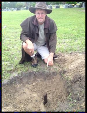
Figure ~ Chappy & Lane
Professional Surveyor and Mapper in this State is admirable, however it is not the end of one’s learning. No doubt, this education requirement provides young surveyors with the foundation of knowledge to build upon. One should not discount the value of quality Mentors as these professionals can teach you what books cannot! It is my opinion that a surveyor graduate is just beginning to learn this profession. My advice upon graduation is to research the available surveying businesses and select those that excel in the type of surveying you desire to become proficient. Seek firms that have quality mentors and discount the salary carrot! That is where you refine your surveying skills to become the best professional you can possibly be.
I must apologize that the following list will be incomplete as I feel there are far too many men and women that have significantly contributed to my career, both personally and professionally. I will surely not be able to mention them all. In addition, the list is not limited to surveyors, but to those people who have helped shape who I am today. Some are as follows:
• Beverly, my dear wife of 38+ years. Bev has taught me to be a “family man” and that “family comes FIRST”! Her undying love of family is the beginning and ending of everything she does. She has provided us with three wonderful children (Luke, Geordie & Noelani) who, in turn, have provided us with four beautiful grandchildren so far (Cole, Lyla, George & Benni). By the same token, nobody should ever come between Bev and our family. The results won’t be pretty. Bev was with me at the beginning of GCY, Inc. and still unselfishly supports me today. She likes to say she “will always be YOUNG” and ,“If you’re going to be dumb, you better be tough!” Bev attended Marshal University during that fateful day when university’s football team crashed in an airplane returning home after an away game and killed all aboard. It was a small school, and she lost many friends that day.
• My father, George C. Young, Sr. was the second GCY in our family tree and I am the third (consequently one of my sons is the fourth and his son is the fifth GCY in our family tree). Pap, as I called Dad in his later years, was a kind man that never ever raised his voice. He secured my first job as a surveyor with HEI as he was friends with Norman Gimpel, the lead surveyor at HEI. Pap’s motive was to get me out of the house to teach me to become independent. Pap instilled in me the strength of character and honesty that shaped my future. I credit Pap with the old southern saying that I often quote: “the addem-ups gotta equal the take-aways” He told me that mantra works for level runs, traverse closures, checking accounts and relationships! How very true. Pap lived to be 93 years “Young” (RIP PAP).
• Robert G. Hutcheon, PE (RIP Hutch) was a giant of a man. Not just in physical stature (he was 6’-4”) but also in his strength of character and in leadership. Hutch had a unique ability of boiling down a multitude of confusing facts to the very essence, in just a few seconds. As the Town Engineer for the Town of Palm Beach for several decades, he conversed with Royalty with ease and with the common laborer, with utmost respect. Hutch was a true leader of men and women. Did I mention he was on an Gold Medal Olympic rugby team while in college? Hutch saw something in me that he nurtured and gave me my opportunities. Hutch even bonused me extra money one Christmas to purchase stock in HEI. Who does that?
• Norman Gimpel, PSM was German born immigrant and an exacting masterful surveyor. Norman was noted for serving in a multitude of court cases as a surveying Expert. Norman was a stockholder in HEI and hired me in 1964. Norman was a hard man to get to know personally, but his dedication to perfection always gave me guidance and inspiration. Norman was also selected as a “Friend of the Court” by judges to help them understand the rules that govern our profession.
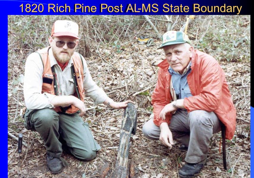
• The next Mentor(s) is actually two men, Lane Bowman (RIP) and Corky Rodine and were both Cadastral Surveyors (later retired) for the BLM. Together they took on the task of
June 2023 Page 14
Chappy & Lane
teaching “RETRACEMENT CAMPS” for several State Surveying Societies, including Florida and Alabama. Over the years I got to know Lane and Corky personally as I attended some 13+, four day camps in several states. On one such camp in the 1980s at the Ocala National Forest, I found a littered stump with spayed roots and put it in my truck. I took it out and secretly sat it on the ground upright nearby when Corky was explaining how he discovered original evidence of a proven corner. When he finished his spiel, I spoke up and asked: “Corky, did you consider this stump?” I can still see the puzzled look on his face wondering if he had missed it. When I picked it up, Lane and the rest of my fellow students roared with laughter. I laughed and said that one never knows when one needs another witness tree to prove a corner. He still hasn’t forgiven me for that one. At another Camp at Fisheating Creek, a 60,000 acre retracement survey that GCY performed for the FDEP/DSL/BSM, Corky, Chip Allen and Pete Andersen, riding in a Government Suburban raced Lane and I, in my Suburban, while I was pulling my trailered Swamp Buggy, to the next corner to study prior to the event. I almost beat him there, as Lane and I took a little known short cut. There is a lot more to this story and one day, I will share a poem I wrote about it with you. Another great story that I wrote about was “JACK IN THE GLADES”. Unfortunately, I can’t share those details for several more years, for reasons I can’t disclose. Lane passed away on October 29, 2018, while retired in Ashland, Oregon. Did I mention that Corky now works for GCY? Although Corky lives in Arizona, we speak several times a week about several Court Cases we both serve as Experts on. I will always be proud to call Corky and Lane my friends.
• Fred C. Elliot, PE, the Trustees of the Internal Improvement Trust (TIIF) (Governor and Cabinet of Florida) senior staff member in the early 1900’s. Although I never met him, Fred Elliot is one of my survey Heroes. I have researched much of Fred’s work and followed his survey crews throughout the Everglades and even on Florida’s east coast. Fred was not only the State’s (TIIF) Chief Drainage Engineer, but he was also the first (to my knowledge) State of Florida “Cadastral Surveyor” (in those days engineers were also surveyors) creating many original surveys of townships in the Everglades. Fred was responsible for all issues of land conveyances and surveys by the TIIF. Fred was also responsible for all the surveying of the Everglades obtained from the Federal Government, by virtue of the Federal Swamp and Overflowed Lands Act of 1850. I have a copy of a written report, published in an early newspaper, in which Fred advised the TIIF to build reservoirs in the Everglades that would hold back drainage waters to rehydrate that vast region. Unfortunately, the TIIF didn’t have the funds to accomplish his plan. A true visionary no doubt, as today we are spending multiple hundreds of millions (dollars) to do just that!
During my retracement surveys in the Everglades, I have measured hundreds of miles of Fred’s surveyor’s work and can attest to his miles always being within ten feet of his record distances, when compared to today’s modern measurement devices. Don’t forget, his surveyors used dugout canoes to access their survey lines in the Everglades during the early 1900’s. Also, I have acquired several of Fred’s letters to the Grantee(s) of the TIIF DEEDS to submerged lands in Lake Worth (the body of water) in 1924 that became the pivotal clue to an important
The Florida Surveyor Page 15
Corky & Lane

June 2023 Page 16
LF $100 per person $100 per person $100 per person $400 per team (4 players) $400 per team (4 players) $400 per team (4 players) WEDNESDAY 26 JULY 2023 SADDLEBROOK RESORT 5700 Saddlebrook Way / Wesley Chapel, FL / 33543 (813)973-1111 Sponsored by: 8:00 AM1:00 PM YOUR LOGO HERE !
G
civil suit I recently worked on, and they allowed me to successfully challenge a commonly used section corner in the urban environment of today.
CONCLUSION:
As I craft this article today, I have been surveying for 59+ years and I pray for many more years yet to come. GCY has 6,000+ field books and hundreds of maps from several surveyors and firms that are no longer alive or are active. The earliest field record I have found in these records was scribed in 1900. I look forward to sharing what I know with all that ask.
Thank you,
Chappy Young
From gcyinc.com:
SURVEYING CAREER
• Began Surveying with Hutcheon Engineers, Inc. in Palm Beach County ~1964.
• Served as a surveyor in the U.S. Navy SeaBees and Honorably Discharged (Construction Battalion 133) from 1969 to 1972.
• Continued Surveying for Hutcheon Engineers, Inc. from 1972 to 1982. During that time I became the office manager of the Stuart, Florida office, a Stockholder and a member of the Corporate Executive Committee of the firm.
• In 1982 Hutcheon Engineers, Inc. was acquired by Kimley Horn & Associates, Inc. and I continued as Stockholder and Office Manager.
• In 1984, I left the employee of Kimley Horn & Associates, Inc. to establish the firm of GCY, Inc., Professional Surveyors and Mappers.
• 1984 to Present I have been the President and Chairman of the Board of Directors of GCY, Inc.
• 2010 Teaching “Legal Aspects of Land Surveying” at FAU in the Geomatics Engineering (Surveying) Department. This course is a senior level course for a four-year degree in Geomatics (Surveying).
PROFESSIONAL REGISTRATION & AFFILIATIONS
• Professional Surveyor & Mapper, State of Florida License No. 3036. Date of Registration: 1977.
• Past officer 1977-1983 (President, V. President, Secretary, Treasure and Member) of the Palm Beach Chapter of the Florida Society of Professional Surveyors (now Florida Society of Professional Surveyors and Mappers).
• Current member of Florida Society of Professional Surveyors and Mappers.
• Past member of the Alabama Society of Professional Land Surveyors.
• Past member of the American Congress of Surveying and Mapping.
The Florida Surveyor Page 17
CERTIFICATIONS OR CONTINUING EDUCATION CREDITS
• Retracement and Restoration of Original Corners. (39 mandays)
• Survey Quality GPS training, San Jose, CA and Alexandria, VA. (4 manweeks)
• Advance Cyclone Training, Norcross, GA., 2006. (Leica Scanner) (1 manweek)
• Multiple Professional Level Continuing Education classes at the rate of 24 credit hours every two years.
• 2007 Riparian Rights Continuing Education course.
• 2013 Testifying as an Expert.
OTHER AFFILIATIONS (PRESENT AND PAST)
• Member Martin County Planning & Zoning Board (1984 thru 1988), Former Chairman.
• Member Martin County Local Planning Agency (1984 thru 1988), Former Chairman.
• Member Martin County Airport Advisory Committee 1988-1990.
• Martin County Leadership Program Graduate ~ CLASS 01.
• Florida GPS User Group.
• Martin County Code Enforcement Board. (Past Appointment)
• Martin County Agricultural Landowners - Executive Director 1988-1996/Founding Member.
• Member of Board of Directors of First Bank and Trust of Indiantown, 1992-2012, Vice-Chair 2008-2012.
• Member of Board of Directors of “Treasured Lands Foundation, LLC” a non-profit Land Trust, 2009-2012.
• Florida Atlantic University Advisory Board Member to the Geomatics Engineering (Surveying) four-year degree Program, 2009 to 2012.
• Florida Atlantic University Adjunct Professor teaching “Legal Aspects of Surveying” Geomatics Engineering Program, 2010.
PRINCIPAL AREAS OF PRACTICE
• Boundary Surveys (from 108,000 +/- acres to 1⁄4 acre lot surveys)
• F.D.E.P. Acquisition Surveys
• F.D.E.P. Mapping Projects
• F.D.E.P. Submerged Land Lease Surveys
• Expert Testimony on Boundary and Construction disputes
• Riparian Rights Line Allocation Determination
• Condominium Surveys
• Geodetic Horizontal and Vertical Surveys
• GPS Surveys
• Construction Staking
• Mean High Water Surveys
• As Built Surveys
• Subdivision, Platting and Land Development
• Topographic Surveys
• Mortgage and Title Surveys
• Materials Quantity Surveys
June 2023 Page 18
Make Plans to Attend the 68th Annual FSMS Conference
Make Plans to Attend the 68th Annual FSMS Conference
July 26th-29th at the Saddlebrook Resort in Wesley Chapel, FL.
July 26th-29th at the Saddlebrook Resort in Wesley Chapel, FL.


Name
68th Annual FSMS Conference
Conference Registration
July 26th – July 29th, 2023, Saddlebrook Resort
5700 Saddlebrook Way, Wesley Chapel, FL 33543
PSM #
Packet 1 – Full Registration/Best Value Member
$350
Licensed Non-Member $450
Non-licensed $300
(Includes one (1) Wednesday Barbecue ticket, one (1) Friday Exhibitors’ Lunch ticket, one (1) Friday Recognition Banquet ticket, six (6) Saturday Seminar CECs)
Packet 2 – Partial Registration Member $335
Licensed Non-Member $435
Non-Licensed $285
(Includes one (1) Friday Exhibitors’ Lunch ticket, one (1) Friday Recognition Banquet Ticket, six (6) Saturday Seminar CECs)
Packet 3 – Saturday Only Member $210
Licensed Non-Member $310
Non-licensed $160
(Includes six (6) Saturday Seminar CECs)
Saturday Seminars – July 29th
Course options are listed below, please mark the circle next to the course. Choose only ONE course per time segment.
6 Hour Course Option
Course name:
8:30 am – 3:00 pm (All day course)
To Adhere or Not Adhere – A Discussion on Laws and Rules, and BPSM Cases (6 CEC’s - Course #10491)
Moderator: Nicholas Campanile, PSM Guest Panelists
2 Hour Course Options
8:30 am–10:10 am
(Choose one from this row)
10:30 am – 12:10 pm
(Choose one from this row)
1:30 pm – 3:00 pm
(Choose one from this row)
FEMA and the Surveyor, dealing with MT-1 Processes
Course name: (2 CEC - Course #10500)
Instructors: Richard Allen, PSM
Course name:
The ASPRS Positional Accuracy Standards for Digital Geospatial Data, the 2014 Standards and 2023 Proposed Revisions (2 CEC - Course #10492)
Instructor: Michael Zoltek, L.S., C.P., CFedS, GISP, PMP
Course name:
Guiding the Course, Leveraging Mobile Mapping with TopoDOT to Help Build a Formula 1 Race Track (2 CEC – Course #10495)
Instructors: Russell Hall, PSM Jennifer Triana
Course name: Real-Time Surveying to Support the Mission to Mars
(2 CEC - Course #10498)
Instructor: Bryan Merritt, PSM/LS/FAA Certified UAV Pilot
Course name:
Professionalism & Ethics (2 CEC - Course #10493)
Instructor: Robin Petzold, PSM
Course name: Are We There Yet? Update on Working Towards the Modernized NSRS
(2 CEC - Course #10496)
Instructor: Denis Riordan, PSM
Course name:
Considerations for Automatic Feature Extraction of Drone Based Point Clouds (2 CEC - Course #10489)
Instructor: Jennifer Triana
Course name:
High-Tech, Low-Tech, No-TechEmbracing Technology to Overcome Labor Shortages (2 CEC - Course #10494)
Instructor: Timothy Kinder, PSM
Course name:
Sovereignty Lands/Water Boundaries (2 CEC - Course #10497)
Instructors: Richard Malloy, PSM Scott Woolam, PSM
June 2023 Page 20
Additional Seminar Offerings
Wednesday Seminars: Separate Registration Required for Each Seminar Choose the 6-hour option or the two 3-hour options
July 26, 2023
8:00 am – 3:00 pm
Seminar I: The Art of Original Retracement - Practical Application and Forensic Style (6 CEC’s - Course #10499)
Instructor: Robert A. Stevens, RSM Florida
July 26, 2023
8:00 am – 10:45 am
Seminar II: 2021 ALTA/NSPS Land Title Survey Standards – 2016 Changes (3 CEC’s - Course #10486)
Instructor: Gary Kent, PS
July 26, 2023 12:15 pm – 3:00 pm
Seminar III: The Surveyor in Jeopardy (3 CEC’s - Course #10487)
Instructor: Gary Kent, PS
SIT Prep Course (Un-Licensed Attendees, No CEC Credit)
July 26, 2023
8:00 am – 4:00 pm
Geoscholar's Florida Surveying and Mapping Society Fundamentals of Surveying (FS) Exam/Surveyor in Training (SIT) Certificate Prep Course
Included with Live Course - Online study materials (one year access)
Instructor: Dr. Stacey Lyle, PhD, RPLS, PLS
Thursday Seminars: Separate Registration Required for Each Seminar Choose One
July 27, 2023
8:00 am – 10:45 am
Seminar I: Surveyors of Florida: Who Were They (3 CEC’s - Course #10488)
Instructor: Dr. Joe Knetsch
Seminar II: Understanding Road Rights of Way (3 CEC’s - Course #10482 CE Provider# 53)
Instructor: David Melvin, PLS, CFM
Complete payment information on the following page of the registration form.
Cancellation Policy: 30 days prior to conference: 50% refund Less than 30 days to conference: No refund
The Florida Surveyor Page 21 68th Annual FSMS Conference
68th Annual FSMS Conference Registration Form
$ Payment Information: Check Enclosed (Make Payable to FSMS) VISA/MasterCard/AE/Discover
#: Exp. Date:
June 2023 Page 22
Name: PSM#: FSMS Member: YES NO Phone: Address: City/State: Zip Code: Email Address: If Any: Guest Name(s): Name Badge: Yes No PACKET SELECTION Licensed Government employees receive a $100 discount on Packet 1 price See pg. 1 to choose Saturday Seminars $ Amount: Packet 1 ($350 member, $450 licensed non-member, $300 non-licensed) Includes one (1) Welcome Barbecue ticket (Wed.), one (1) Exhibitors’ Lunch ticket (Fri.), one (1) Recognition Banquet ticket (Fri.), six (6) Saturday Seminar CECs $ Packet 2 ($335 member, $435 licensed non-member, $285 non-licensed) Includes one (1) Exhibitors’ Lunch ticket (Fri.), one (1) Recognition Banquet ticket (Fri.), six (6) Saturday Seminar CECs $ Packet 3 ($210 member, $310 licensed non-member, $160 non-licensed) Includes six (6) Saturday Seminar CECs $ ADDITIONAL SEMINARS Wednesday Options: Select the 6 hr. course, or one or both 3 hr. courses Thursday: Only Select One Per Day $ Amount: SIT Prep Course - Wed. (8 hrs., 8:00 am – 4:00 pm) $250 $ Wednesday Seminar I (6 hrs., 8:00 am – 3:00 pm) $200 $ Wednesday Seminar II (3 hrs., 8:00 am – 10:45 am) $100 $ Wednesday Seminar III (3 hrs., 12:15 pm – 3:00 pm) $100 $ Thursday Seminar l (3 hrs., 8:00 am - 10:45 am) $100 $ Thursday Seminar II (3 hrs., 8:00 am - 10:45 am) $100 $ EVENT TICKETS *Only Pay if Participating Number of Tickets: $ Amount: *Casino Night (Thur.): $50 $ Golf Match (Wed): $100 per person $ $400 per team (4 players) Players: $ The Florida Aquarium (Thur.) $50 per person (Auxiliary) $ *Clay Shoot (Thur.): $175 per person $ $700 per team (4 players) Players: $
* No cancellations unless replacement found Number of Tickets: $ Amount: Welcome BBQ (Wed.): $50 $ $60 (at conference) $ *Legislative Reception (Thur.): $100 $ Exhibitors’ Lunch (Fri.): $50 $ $60 (at conference) $ Recognition Banquet (Fri.): $100 $ $110 (at conference) $ $25 (kid’s meal
$
TOTAL
Card
CVV
IF PAYING BY CHECK, MAIL FORM TO: FSMS, P.O. Box 850001-243, Orlando, Florida 32885 IF PAYING BY CREDIT CARD, FAX OR EMAIL FORM TO: 850.877.4852 or director
Questions? Call us at 850-942-1900 Cancellation Policy: 30 days prior to conference: 50% refund Less than 30 days to conference: No refund Provider No. CE11 fsms.org
FOOD TICKETS (Additional or Individual Tickets)
12 or under)
Requested Vegetarian Meal Payment must accompany all pages of registration form.
ENCLOSED
Number: Billing Address of Credit Card:
@fsms.org
Seminar I
8:00 am
3:00 pm
"The Art of Original Retracement" - A Practical Application and Forensic Style
Course #10499 - 6 CEC’s
Robert A. Stevens, RSM Florida
Objectives:
-Approach to successful retracement
-Procedures for success
-Evidence, historical and existing
-Role of astronomy

-Application of results
Robert A. Stevens, RSM Florida has been surveying for approximately 40 years. Acreage and Commercial surveys, Boundary, Right-of-way, and Easement Litigation, Expert Witness, and Trial Testimony with over a 90% success rate in original retracement. Robert A. Stevens & Associates, established 2009.
Seminar II
8:00 am
10:45 am
The 2021 ALTA/NSPS Land Title Survey Standards - Changes from 2016 Course #10486 - 3 CEC’s
Gary Kent, PS
After 2 years of work on the part of the Joint ALTA/NSPS Work Group and others, the 2021 ALTA/NSPS Land Title Survey Standards were adopted by ALTA and NSPS with an effective date of February 23, 2021. In this program we will explain the reasons for each of the many changes from the 2016 Standards and provide an explanation on what each change means to the Surveyor. In addition, an overview of the relationship between Land Title Surveys and title insurance will be provided and each of the eight sections of the Standards will be overviewed. Finally, some common questions that arise and conundrums that surveyors encounter in the process of performing a Land Title Survey will be discussed.
Gary Kent, PS is a Professional Surveyor with Schneider Geomatics in Indianapolis where, after 37 years, he transitioned to part-time in 2020 and formed Meridian Land Consulting to provide training, consulting and expert witness services. He has presented over 1,500 programs on various surveying topics multiple times in all 50 states over the last 20 years. Gary has served on the Indiana Board of Registration for Professional Surveyors since 2004 and is a past -president of both the American Congress on Surveying and Mapping and the Indiana Society of Professional Land Surveyors.
The Surveyor in Jeopardy
Seminar III
12:15 pm —
3:00 pm
Course #10487- 3 CEC’s
Gary Kent, PS
This program will be presented in a Jeopardy like format with the presenter offering answers for which audience members assembled into teams must provide the relevant question. The program will include approximately 175 questions/ answers in a variety of topic areas such as: ALTA/NSPS Land Title Surveys, Boundaries, Easements and Rights of Way, Expert Witness, Riparian Rights Risk Management, Safety and Health, Florida Statues and Rules, and Florida Standards of Practice. Answers and questions will be discussed as appropriate or necessary to be sure all participants understand the context and correct answers. This is a very “audience participation”-centric program; it is far more than a simple trivia contest.
Gary Kent, PS is a Professional Surveyor with Schneider Geomatics in Indianapolis where, after 37 years, he transitioned to part-time in 2020 and formed Meridian Land Consulting to provide training, consulting and expert witness services. He has presented over 1,500 programs on various surveying topics multiple times in all 50 states over the last 20 years. Gary has served on the Indiana Board of Registration for Professional Surveyors since 2004 and is a past -president of both the American Congress on Surveying and Mapping and the Indiana Society of Professional Land Surveyors.
Geoscholar's Florida Surveying and Mapping Society Fundamentals of Surveying (FS) Exam Prep Course
SIT Prep
8:00 am
4:00 pm
Un-Licensed Attendees No CEC Credit
Dr. Stacey Lyle, PhD, RPLS, PLS
Geoscholar's Florida Surveying and Mapping Society Fundamentals of Surveying (FS) Exam Prep Course is designed to provide critical information needed to obtain a Surveyor in Training (SIT) Certificate based upon topics tested on the NCEES Fundamentals of Surveying (FS) exam. The course offers an in -person FS review during the annual Florida Surveying and Mapping Society Conference in July 2023 supplemented by online self -paced instruction via Canvas Learning Management System (LMS) topic-based modules.
Dr. Stacey Lyle, PhD, RPLS, PLS is an Associate Professor of Practice at Texas A&M University ’s Zachry Department of Civil and Environmental Engineering and Department of Geography. He has served as an expert witness on land boundary court cases. He is active in the industry with over 35 years of surveying experience including civil engineering, land surveying, cadastral land records databases, GIS/CAD/BIM Fusion, geodesy, hydrography, photogrammetry, and cartography.

The Florida Surveyor Page 23
Seminar I
8:00 am
10:45 am
Surveyors of Florida: Who Were They
Course #10488 - 3 CEC’s
Dr. Joe Knetsch, PhD
The Course "Surveyors of Florida: Who Were They" will emphasize the personal nature of early surveying based upon the instructions from the Land Office and the Surveyor General of Florida. The instructions section will note the inconsistencies asked by the GLO, often to meet the special needs of those working in Florida. It will also include many citations to the letters written by individual surveyors to the Surveyor General describing the conditions facing them in the field. Pre -drainage Florida was a totally different looking place than we now see and offered many challenges to the early surveyors. The concept for the course is to put the current surveyors as close as possible into the mindset of the original surveyors whom they follow in their daily business. Hopefully this will give the current surveyors a better understanding of their predecessors p redicaments and how they solved the problems facing them, thus saving today's surveyors time and money in retracing our pioneer surveyors’ work and monuments.
Dr. Joe Knetsch received his PhD in history from Florida State University (1990), an MA in history from Florida Atlantic University (1974) and a BS from Western Michigan University with a major in History and Economics. He was the historian for the Florida Department of Environmental Protection (formerly Department of Natural Resources), Division of State Lands, from 1987 to August, 2014. He is the author of fourteen books (mostly on Florida History), over two hundred journal articles , forty book reviews, and over two hundred and twenty papers and presentations on Florida history. Dr. Knetsch is a member of numerous historical societies and associations. He currently resides in Tallahassee, Florida, with his wife of forty -five years, Linda. He also currently works as a consultant for the Town of Redington Beach, the State of Alabama, and other private interests.
Understanding Road Rights-of-Way
Seminar II
8:00 am —
10:45 am
Course #10482 Provider #CE-53 - 3 CEC’s

David Melvin, PLS, CFM
Understanding Road Rights of Way is a 3-hour seminar. It discusses things land surveyors should know about road rights of way. The instructor uses case law examples to explain how roads are defined, the road's ownership status, the landowner's rights, and others’ rights within the right of way.
David Melvin, PLS, CFM is a Professional Land Surveyor, licensed in the State of Florida, a 1981 graduate of the University of Florida with a degree in land surveying, with over 40 years of experience in land surveying and land surveyor education. He has owned and operated Land Pro Seminars since 2003 and is also a consultant specializing in land boundary problems, floodplain issues, wetland mapping, and land surveying regulations.
8:30 am
3:00 pm
To Adhere or Not Adhere – A Discussion on Laws and Rules, and BPSM Cases
Course #10491 - 6 CEC’s

Panel Discussion - Moderator: Nicholas Campanile, PSM
An expert panel will run through a variety of laws and rules applicable to surveying and mapping, to include potential for updates, and conclude with example disciplinary cases that came before the Board of Professional Surveyors and Mappers.
Nicholas Campanile, PSM is the FDOT District Five Surveyor and Mapper and recently completed serving eight years on the Board of Professional Surveyors and Mappers. Prior to FDOT, Nick served as Chief, Surveying and Mapping in DEP ’s Division of State Lands, and also served eight years as Adjunct at Tallahassee Community College, all after having served as adjunct at Miami-Dade Community College and was raised in a surveying and engineering family business.
Panelists:
Richard Allen, PSM, CFM Richard Malloy, PSM
Jack Breed, PSM David Melvin, PLS, CFM
Dianne Collins, PSM Ray Niles, PSM
Dr. Bon Dewitt, PSM Robin Petzold, PSM
Don Elder, PSM
June 2023 Page 24
8:30 am 10:10 am
FEMA and the Surveyor, dealing with MT-1 Processes
Course #10500 – 2 CEC’s

Richard Allen, PSM
The course will cover eLOMA, LOMA, CLOMA, LOMR -F, CLOMR-F, and the other floodplain impacts and how the surveyor is involved in these processes. The material will cover the different processes and how they impact the floodplain, if any.
Richard Allen, PSM is a Florida Licensed Surveyor & Mapper, and Certified Floodplain Manager who is the City Surveyor at the City of Orlando. He has been in surveying for over 26 years and has been with the City for 17 years. He is the Surveyors in Government Liaison for FSMS and Region V Director for the Florida Floodplain Manager's Association. He is the scholarship chair and Valencia College Liaison for the Central Florida Chapter of FSMS. He is married to his lovely wife Amanda and has a son named Richie.
Real-Time Surveying to Support the Mission to Mars
Course #10498 – 2 CEC’s
Bryan Merritt, PSM/LS/FAA Certified UAV Pilot

The unmanned Artemis I launch system this past November is the first in a line of complex missions aimed at enabling exploration of the Moon and Mars. But before the Orion spacecraft can be launched into space, it must first be moved from the Vehicle Assembly Building to the launch pad at the Kennedy Space Center. Enter the Crawler -Transporter, four connected building-sized vehicles on rolling tracks that, when loaded with the Orion and its mobile launcher, will carry over 25 million pounds. One of the heaviest overland loads ever recorded. NASA needed to evaluate the potential risk that this VERY heavy load may deform the travel way as carried Orion to the launch pad. The presentation will provide the background and process required to provide real-time surveying as the Crawler-Transporter moves to the launch pad. The hardest part: they needed to survey the Crawler -Transporter in motion, making the project exponentially more complex.
Bryan Merritt, PSM/LS/FAA Certified UAV Pilot is a Professional Land Surveyor licensed in FL and NY and FAA Part 107 Certified Pilot and serves as the Manager for Langan ’s Florida and Caribbean Geospatial/Survey Group. He has more than forty years of experience in the Geospatial Industry. His experience includes management and direct technical experience in performing complex geospatial related projects and providing solutions to complex situations. He is experienced in all facets of surveying and geomatics technologies which includes UAV/UAS systems; terrestrial and mobile lidar systems; 3D modeling and BIM (Scan to BIM); GIS data collection; building documentation and all forms of conventional survey technologies. Bryan has been published in many trade journals and has presented sessions in geospatial survey technology to many organizations. He is a member of the Geomatics Engineering Program Advisory Council for Florida Atlantic University and is one of the founders of the United States Institute of Building Documentation (USIBD) which is a non -profit organization dedicated to actively promote, guide, and support the building documentation industry.
Considerations for Automatic Feature Extraction of Drone Based Point Clouds
8:30 am—
10:10 am
Course
#10489 – 2 CEC’s
Jennifer Triana
With the expansion of the geospatial drone market in the transportation industry, we explore how to achieve a more automated feature extraction process in topography mapping. Drone based point clouds from LiDAR vary greatly from Imagery based point clouds, so this presentation aims to explore their differences from the point cloud processing aspect. We will examine the pros and cons of each system for practical survey and mapping applications such as topographies, bare earth, volumetrics, etc. Learn how data accuracy, density, intensity/color, and other data characteristics affect a deliverable. We ’ll also show how to evaluate whether the data meets quality requirements for a certain application, and if it is suitable for automated feature extraction. Examples of automated extraction of break lines, surface models and asset identification will be demonstrated.
Jennifer Triana has over 18 years’ experience in the LiDAR industry. After graduating with a Mechanical Engineering degree from UCF, she joined Riegl USA heading the systems team. More than a decade ago she was one of the founding members of TopoDOT, Point Cloud Processing Software, where she is now the Business Development Director.

The Florida Surveyor Page 25
10:30 am -
12:10 pm
The ASPRS Positional Accuracy Standards for Digital Geospatial Data 2014 Standards/2023 Proposed Revisions
Course #10492 – 2 CEC’s
Michael Zoltek, LS, CP, CFedS, GISP, PMP
This workshop provides an in-depth look at the ASPRS Positional Accuracy Standards to categorize positional accuracy of products derived from digital aerial cameras, manned and unmanned aerial systems, and all types of lidar including terrestrial, mobile, and airborne. The workshop will explain the basis for each accuracy measure adopted in the standards.
Michael Zoltek, LS, CP, CFedS, GISP, PMP is a land surveyor, photogrammetrist, and GIS professional with over 30 years of geospatial experience. As the National Geospatial Program Director at GPI Geospatial, Inc (GPI), Mike is responsible for the coordination, execution, and supervision of projects for local, state, federal, DOT, and private clients. He brings to cl ients a comprehensive background in surveying and mapping, which includes data collection and processing, project management, and QA/QC coordination.
A licensed surveyor who holds active Surveying/Photogrammetry registrations in 26 states, Mike has extensive experience in a variety of Surveying & Mapping tasks for Departments of Transportation in multiple states. Mike is a member of Florida’s State Board of Professional Surveyors & Mappers and is a long-standing member of the American Society for Photogrammetry and Remote Sensing (ASPRS) where he currently serves on the Committee revising the ASPRS Standards for Digital Geospatial Data and where he Chairs the Evaluation for Certification Committee, overseeing the organization ’s certification program. He has also previously served as a member of the ASPRS Standards Committee responsible for establishing the 2014 ASPRS Accuracy Standards for Digital Geospatial Data, as the Director of the ASPRS Professional Practice Division and has also served as an ASPRS Board member. Mike has presented numerous technical seminars at universities and community colleges, as well as at industry conferences, and has served as an expert witness in boundary litigation cases in the state of Florida.
Professionalism & Ethics
10:30 am -
12:10 pm
Course # 10493 – 2 CEC’s
Robin Petzold, PSM
This course will delve into the professionalism and ethics that will keep you out of “harm’s way” should you ever have an encounter with the State Board. A case study will be presented showing you how to respond in a professional manner in accordance with our rules and regulations as well as the history of how these rules developed. Since these types of encounters are very stressful, this is a course worth your time to prevent any future anxiety.
Robin Petzold, PSM retired from Wantman Group, Inc. as an Executive Vice President and partner in December of 2018, but continued to serve on a consulting basis until February 2020. He holds professional Surveying Licenses in Florida, Alabama, Ohio, Iowa, and Wisconsin, and has over 40 years of professional experience. Additionally, Robin served as an adjunct faculty instructor for 12 years in the engineering department of Palm Beach State College as well as an adjunct instructor at the University of Florida from 2017 thru 2022. He has also taught seminars on State Plane Coordinates, Electronic Data Collection, and Global Positioning Systems Methodologies throughout the United States and abroad. In 2010 Robin was appointed to the Florida Board of Professional Surveyors and Mappers and served as Board Chair for three of those years. Robin’s second term ended in 2018 but he continued to serve on the Probable Cause Panel as a past Board member for an additional three years ending his tenure in January of 2021. During that time, Robin developed a keen sense of awareness of how Professionalism and Ethics play a very important roll in performing surveys under the guidelines of both the old and new rules, thus avoiding interaction with the Probable Cause Panel.

High-Tech, Low-Tech, No-Tech Embracing Technology to Overcome Labor Shortages
10:30 am 12:10 pm
Course #10494 2 CEC’s
Timothy Kinder, PSM
This presentation will walk through a brief history of surveying, where we are today with technologies, and the need to embrace multiple technology platforms to overcome the labor shortage in the surveying and engineering industry. The number of licensees leaving the profession is greater than the number entering. Fewer people are getting into surveying for various reasons; we will dig into this a little. The recession of 2008 – 2010 saw a huge loss to the survey labor market; we lost a lot of younger staff that decided to never get back into surveying. We will have sample projects, case studies, visuals, and data to drive the discussion, as well as labor statistics and projections. Real life projects examples will be reviewed to show ho w technology was used to save time (labor) and some that should have used technology to save time but didn ’t. We will dive into what we can expect when we embrace the various technologies and when we don ’t. We will see how various technologies are currently being used to help offset the shortage of qualified and experienced talent, some of the best practices when using the different technologies, and what our end product could look like.
Timothy Kinder, PSM is a Licensed Professional Land Surveyor and experienced leader of 3D reality capture technologies. He has 28 years of experience in surveying and 3D data collection, analysis, processing, and modeling. He has spearheaded the growth and development of the Reality Capture operations with his current and previous employers pushing them to be some of the foremost providers of advanced technologies in the region. Under Tim ’s direction, his teams have scanned more than 45,000 lane miles of roadway across the eastern half of the United States. More than 7,200 miles of roadways have been developed into 360 degree panoramic videos. In addition to investigating and implementing ongoing technology solutions for capturing data to support engineering design, Mr. Kinder is responsible for building a strong talent pool, directing surveyors and technicians, as well as managing client expectations.
June 2023 Page 26
1:30 pm3:00 pm
Guiding the Course, Leveraging Mobile Mapping with TopoDOT to Help Build a Formula 1 Race Track
Course #10495 — 2 CEC’s

Russell Hall, PSM and Jennifer Triana
This course is an overview of mobile LiDAR and its pros and cons versus UAV and Terrestrial LiDAR. It will go through the entire process from planning and acquisition, to registration of the clouds. We will then go through the case study of how it was used to complete a Formula 1 race track. The class will also cover how TopoDOT is used in the extraction process for both the track as well as other real world examples.
Russell Hall, PSM is a professional land surveyor in Connecticut and has over 20 years experience in various aspects of land surveying with a big focus on Terrestrial LiDAR, Mobile LiDAR, and UAV LiDAR.

Jennifer Triana has over 18 years experience in the LiDAR industry. After graduating with a Mechanical Engineering degree from UCF, she joined Riegl USA heading the systems team. More than a decade ago she was one of the founding members of TopoDOT, Point Cloud Processing Software, where she is now the Business Development Director.

1:30 pm
3:00 pm
Are We There Yet? Update on Working Toward the Modernized NSRS
Course #10496 2 CEC’s
Denis Riordan, PSM
The mission of NOAA's National Geodetic Survey (NGS) is "to define, maintain and provide access to the National Spatial Reference System (NSRS) to meet our nation's economic, social, and environmental needs." The NSRS is the system of latitude, longitude, elevation, and related models and tools, which comprise the nation's foundational positioning infrastructure. NGS has, for several years, been developing and promoting the ongoing modernization and evolution of NSRS, toward the 2022 goal of replacing the North American Datum of 1983 (NAD83) and the North American Vertical Datum of 1988 (NAVD88). The new positioning paradigm will impact all users of geospatial data, either directly or indirectly, and an understanding of the resulting changes of this effort will ease your transition. This presentation will update you on today's sta tus of the NSRS modernization and help you prepare for 2024.
Denis Riordan, PSM Gulf Coast Region Geodetic Advisor, NOAA, National Geodetic Survey - Mr. Riordan has worked with the National Geodetic Survey (NGS) for the past 18 years and serves as the Geodetic Advisor for the NGS Gulf Coast Region (AL, FL, LA, & MS). He works to support those who use NGS products and services, products like the National Spatial Reference Frame. He holds a B.S. Degree in Surveying and Mapping from the University of Florida, is a licensed surveyor in the State of Florida, and worked for over ten years with private industry in the field of land surveying prior to joining NGS

Sovereignty Lands and Water Boundaries
1:30 pm —
3:00 pm
Course #10497
2 CEC’s
Richard Malloy, PSM and Scott Woolam, PSM
This discussion will focus on the history of sovereignty lands and how to identify them. It will also look at water boundari es and how they impact the private surveyor.
Richard Malloy, PSM has worked for the Board of Trustees for over 40 years. He has worked on retracement surveys and boundary surveys for state lands; however, his specialty is water boundaries and he has worked for over 30 years defending the ownership of sovereignty lands for most of that time. Richard has had the opportunity to work with many of the surveyors throughout the state, an opportunity most surveyors haven ’t had the pleasure to experience. Through this, he has learned how surveyors have handled many difficult problems as they arise through the course of conducting surveys.
Scott Woolam, PSM is the Chief of the Bureau of Survey and Mapping with the Department of Environmental Protection. After 10 plus years surveying in the private sector in the Pensacola area, he went to the Bureau of Survey and Mapping in 1991 where he is now in his 33rd year or tenure. Scott graduated from the Surveying and Mapping Program (Geomatics) at the University of Florida. He is a member of Tau Beta Pi Engineering Honor Society and the Florida Survey and Mapping Society.
The Florida Surveyor Page 27
YOUR FIELD-TO-FINISH SURVEY PARTNER

As surveying technologies continue to advance, a trusted and knowledgeable partner can help you stay ahead of the game. For over 75 years Duncan-Parnell has provided leading-edge products and services to help surveyors succeed.
• Robotic Total Stations
• Trimble GNSS Instruments
• UAS/Drone Solutions

• Technical Training
• Software for Survey & Mapping
• Survey Supplies


• Instrument Repair & Maintenance
• Monitoring Solutions
www.duncan-parnell.com


Jacksonville, FL (904) 620 - 0500
Orlando, FL (407) 601 - 5816
Exhibitor Opportunities

68th Annual Conference at Saddlebrook Resort in Wesley Chapel, FL on July 26th – July 29th


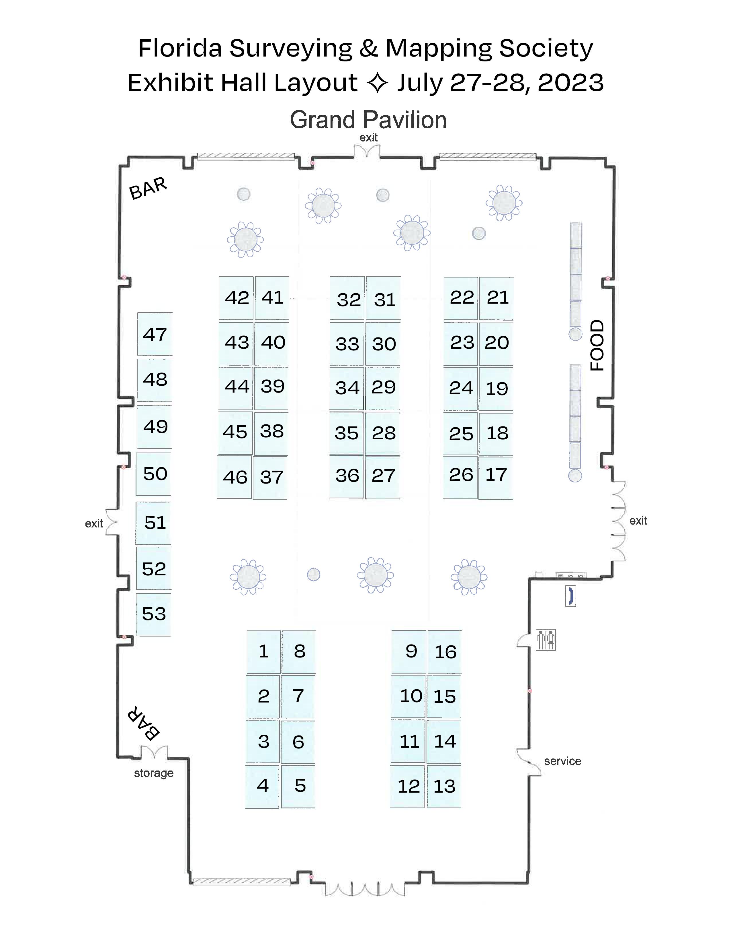

Exhibitor Opportunities
*Only 1 Platinum Exhibitor allowed. All other levels can have multiple exhibitors
PLATINUM EXHIBITOR*
$4,700
• Company Name and Logo on a Banner overhanging the Registration Desk
• Company Bio and Logo in the Confer ence Program Book
• 1 month free full-page ad in The Florida S urveyor
• Sustaining Firms will receive an additional month f ree ad in The Florida Surveyor
• Recognition in Confer ence Edition of The Florida Surveyor
• Recognition on FSMS.org in Header Ad Banner for 2 months
• Logo with Hyperlink to Website displayed on FSMS.org
• Complimentary full page ad in Conference Pr ogram Book
• 2 night complimentary hotel stay
• Two Packet 1 Registrations (Each Registration includes 1 BBQ Ticket, 1 Exhibitor Luncheon
Ticket, 1 Recognition Banquet Ticket, & 6 Saturday Seminar CECs)
• 2 Floor Clings with Logo displayed in Exhibit Hall
• 2 Booths
• Opportunity to Speak at Welcome BBQ
GOLD EXHIBITOR
$3,500
• Company Bio and Logo in the Conference Program Book
• 1 month free half-page ad in The Florida S urveyor
• Sustaining Firms will receive an additional month f ree ad in The Florida Surveyor
• Recognition in Confer ence Edition of The Florida Surveyor
• Logo with Hyperlink to Website displayed on FSMS.org
• 1 night complimentary hotel stay
• One Packet 1 Registration (Each Registration includes 1 BBQ Ticket, 1 Exhibitor Luncheon
Ticket, 1 Recognition Banquet Ticket, & 6 Saturday Seminar CECs)
• 1 Floor Cling with Logo displayed in Exhibit Hall
• Opportunity to Speak at Welcome BBQ
SOLD
SILVER EXHIBITOR
$2,000
• Company Bio and Logo in the Conference Program Book
• 1 month free half-page ad in The Florida Surveyor
• Sustaining Firms will receive an additional month f ree ad in The Florida Surveyor
• Recognition in Confer ence Edition of The Florida Surveyor
• Logo with Hyperlink to Website displayed on FSMS.org
• 2 Welcome BBQ tickets
CONFERENCE EXHIBITOR
$1,500
• Company Bio and Logo in the Conference Program Book
• 1 month free half-page ad in The Florida Surveyor
• Sustaining Firms will receive an additional month f ree ad in The Florida Surveyor
• Recognition in Confer ence Edition of The Florida Surveyor
• Logo with Hyperlink to Website displayed on FSMS.org
ALL EXHIBITORS WILL RECEIVE:
8’ x 10’ draped booth with 10’ backdrop and 36” side rails
7” x 44” Sign provided by Request Only!
6’ draped table, 2 chairs and waste basket
4 name tags for booth personnel per booth
2 lunch tickets per booth for Friday
Attendee List
Additional Booths can be purchased for $850 per Booth
—
—
Exhibitor Opportunities
68th Annual Conference Program Book Advertising
1 full page 5.5” (width) x 8.5” (height)
7.5% sales tax
1/2 page 5.5” (width) x 4.25” (height)
7.5% sales tax
Contact N ame
Ads must be in .pdf, .jpg, or .png format
We agree to the terms & conditions in the rate schedule.
Print Name Signature
MAIL CHECK AND FORM TO: Florida Surveying & Mapping Society P.O. Box 850001-243, Orlando, FL 32885-0243
Email: Education@FSMS.org
Payment Information:
Check Enclosed AE/Discover/M astercard/Visa
Card Number
CCV/Card Identification # Billing Zip Code
Signature
Card Expiration Date
$200.00
$ 15.00 TOTAL $215.00
$125.00
$
TOTAL $134.38
9.38
Sponsor/Advertiser
Address City State Zip Phone Email


• Civil/Site Design • Construction Engineering • Construction Materials Engineering & Testing • Energy • Environmental, Health, and Safety • Geotechnical • MEP • Structural • Survey & Geospatial • Transportation • Urban Planning & Design • Water Resources • Water/Wastewater PARTNERS FOR WHAT’S POSSIBLE www.pennoni.com Join our Survey Team in Florida today! new sponsorship opportunity! exhibit hall cash bar sponsorship Includes: • cash bar in the exhibit hall during friday's luncheon • company name & logo on Signage at luncheon • 4 drink tickets
Sponsorship Opportunities
ALL SPONSORSHIPS INCLUDE:
• Recognition in Conference Program Book
• Recognition in the Conference Edition of The Florida Surveyor
• C ompany Logo with Hyperlink to website displayed on FSMS.org
*Only 1 Sponsorship Available, Call for Availability (850) 942-1900
*Conference App Sponsor
$2,700
-Sponsorship of phone app available for all registrants to download
-Company Name & Logo on App
Recognition Banquet
$2,700
-Sponsorship of Conference Banquet
-Full Page Ad in The Florida Surveyor
-Company Name & Logo on Signage
Clay Shoot $2,000
-Sponsorship Assists with Clay Expenses
-Full Page Ad in The Florida Surveyor
-Signage at the Registration Desk
-Assists with Food & Beverage Costs Swag Sponsor $2,000
-Sponsorship of multiple Key Events throughout Conference
-Conference/Sponsor Swag for All Attendees
-Name and Logo on Swag
UF 50th Anniv. Recognition $2,000
-Celebration & Recognition of UF Geomatics Program
-Sponsorship of Recognition Breakfast for Attendees and Special Guests
-Company Name & Logo on Signage
*Conference Tote Bags $2,000
-Sponsorship of Tote Bags given to Attendees
-Company Name & Logo on Tote Bags
Registration Desk & Signs $1,500
-Sponsorship of Signs at Conference
-Company Name & Logo on Conference Welcome Banner at Registration Desk
Refreshment Breaks $2,000
-Sponsorship of Refreshments available during Seminar Breaks
-Full Page Ad in The Florida Surveyor
-Company Name & Logo on Signage
Welcome BBQ $2,000
-Sponsorship of our Conference Welcome BBQ (popular networking event)
-4 Complimentary Tickets
-Company Name & Logo on Signage
*Program Book (Front Cover) $1,700
- Company Name & Logo displayed on front cover
Banquet Door Prizes $1,500
-Sponsorship of Prizes given at Recognition Banquet
-Company Name & Logo on Signage
*Room Keys $2,000
-Sponsorship of Room Key Cards given to each Attendee staying at hotel
-Company Name & Logo on Room Key Cards
Geospatial Sponsor $2,000
-Company Name and Logo on Signage at the General Business Session and Banquet
-Full Page Ad in The Florida Surveyor
-Assists in Conference Expenses
*Program Book (Back Cover) $1,500
-Company Name & Logo on back cover
Legislative Reception $1,500
-Sponsorship for Reception and Guest Speaker
-Company Name & Logo on Signage
SOLD SOLD SOLD
Sponsorship Opportunities
*Name Badges $1,500
-Company Name & Logo on Signage
-Company Name & Logo on Name Badges given to All Conference Attendees Exhibit Hall Door Prizes
-Name & Logo on Signage
-Sponsorship of Door Prizes
-Company Recognized during Raffle
-Company Name & Logo on Lanyards given to All Conference Attendees
Exhibitor Luncheon
-Company Name & Logo on Signage
-Sponsorship Assists with Lunch Expenses
Golf $1,000
-Company Name and Logo on Signage
-Company Name & Logo on Signage
-Assists with Food & Beverage Costs
Auxiliary/Family Outing $1,000
-Company Name & Logo on Signage
-Assists with Event Expenses
Marquee Education Speakers $1,000
-Sponsorship of Headlining Education Speakers
-Company Name & Logo on Signage *Program Book
-Full Page Ad on inside of Front Cover
-Company Name & Logo on Signage
-Cash Bar in the Exhibit Hall on Friday (Includes 4 Drink Tickets)
-Company Name & Logo on Signage
-Company Name & Logo on Signage
-Company Name & Logo on Signage at Morning & Afternoon Coffee/Water Break
-Company Name & Logo on Signage at All Saturday Seminar Refreshment Breaks
Seminar Sponsor (Saturday) $500
-Sponsorship of Special Activity
-Company Name & Logo on Signage at Seminar of Your Choice
-Company Name & Logo on Signage
-Company Name & Logo on Registration Packets given to All Attendees
-1/2 Page Ad in The Florida Surveyor
*Only 1 Sponsorship Available, Call for Availability (850) 942-1900
Casino Night $1,500
*Lanyards $1,500
$1,200
$1,200
Cornhole Tournament $1,000
$1,000
(Inside Front Cover)
SIT
Test Prep $1,000
Cash Bar During Exhibit Hall Luncheon $800
CST
Exams $750
Exhibitor
General
Welcome Bags $750 -Company Name & Logo on Exhibitor Welcome Bags
Business Session $700
Exhibit
Hall Coffee Break $500
Saturday
Refreshments Break $500
Registration
Packets $500
Young
Surveyors Event $500
General
Sponsor $300
SOLD
SOLD

68th Annual Conference Showcase Flyer Inserts


Cost - $100
Or, FSMS can print your flyers on letter size copy paper (8.5” x 11”) with B & W print
Cost
Create a Unique Touchpoint with Your Showcase Flyer Insert!
inserts)
An additional way to showcase your company at our Annual Conference is via our Attendee Registration Packets. Prepare your company’s flyer and ship (200
to the Administrative Office for arrival by June 15th.
Company Contact Name Signature Address City State Zip Method of Payment: Check Credit Card(AE/D iscover/MasterCard/Visa) Card # Exp. Date CCV/Card Identification # Billing Zip Code Email MAIL CHECK AND FORM TO: Florida Surveying & Mapping Society P.O. Box 850001-243, Orlando, FL 32885-0243 Email: Education@FSMS.org
- $200 We agree to the terms & conditions in the rate schedule.
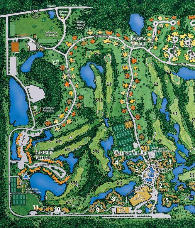


PLATINUM GOLD
Page 41
Exhibitors
Duncan-Parnell to All our Exhibitors & Sponsors Exhibitors Sponsors
SmartDrone


SILVER STANDARD AYRES
American Government Services Corporation
ATWELL TopoDOT
Carlson Preferred Solutions
Caulfield & Wheeler

eGPS Solutions


FLT Geosystems
Frontier Precision Unmanned

Fugro

GeoNetworking

GPI STANDARD
Page 43
STANDARD
G-Source Technologies

I.F. Rooks & Associates
Leica Geosystems


Lengemann

McKim & Creed

Multicopter Warehouse
 National Geospatial Agency
SAM
Stakemill
Surveyors Instrument Services
VACMASTERS
Florida Atlantic University

UF Geomatics


STANDARD UF | IFAS
Page 45
STANDARD
FREAC

SPONSORS
Exhibitor Reception Trimble

Clay Shoot SAM
Clay Shoot
McKim & Creed
Swag Sponsor
Pickett & Associates


Room Keys Hyatt Survey

Welcome BBQ
UF 50th Celebration Breakfast
ATWELL
June 2023 Page 47
AYRES
SPONSORS


Conference Tote Bags Langan

Program Book(inside cover) Bowman Consulting Group


Saturday Refreshments Break
Lanyards M.G. Vera & Assoc.
Name Badges
Registration Desk & Signs
Registration Desk & Signs
GPI
Pennoni
BGE
UF | IFAS UF 50th Celebration Breakfast
SPONSORS

Cornhole Competition Lengemann
Cornhole Competition
Exhibit Hall Beverages
SIT Test Prep Clymer, Farner, Barley
Young Surveyors Event
Registration Packets
Exhibitor Welcome Bags Brown & Phillips

Exhibitor Welcome Bags
DRMP
E.R. Brownell & Assoc.
Exhibit Hall Beverages AGS(American Gov. Service)
CST Exams Central FL Chapter
Page 49
SPONSORS
Registration Packets
Collier-Lee Chapter
• I.F. Rooks & Associates is a full-service Geospatial firm serving clients throughout Florida and the Southeastern United States for 54 years.

• We have extensive experience in providing topographic / planimetric mapping , digital orthophotos, Aerial LiDAR, fixedwing and helicopter aerial photography for transportation, site development, coastal and environmental projects.
• Our steady growth in technology and personnel has allowed the development of long -term relationships with several Florida municipalities and government agencies, power companies, mining companies as well as engineering firms.
• I.F. Rooks is Pre -Qualified by FDOT in Workgroup 8.3 –Photogrammetry.
Office: 813.752.2113 ~ Web: www.ifrooks.com
Please email communications@fsms.org to notify us of upcoming events.

Advertise With Us!
All advertisements contained within the publication are published as a service to readers. Publication of the advertisements does not imply or express any endorsement or recommendation by FSMS.
Benefits: Full color; hyperlinks added to your webpages as well as email addresses.
Requirements: Contracts for one year (11 issues) receive 10% discount if paid in advance; 15% for Sustaining Firms. (Ads should be in jpeg, pdf, or png format)
New ads and/or changes are due by the 25th of each month.
Size 1 Issue 2-11 Issues Full Page $720 $395/issue 1/2 Page $575 $320/issue 1/4 Page $290 $175/issue
Clay Shoot


27 July 2023 8:00 am1:00 pm
Tampa Bay Sporting Clays 10514 Ehren Cutoff Land O'Lakes, Florida *Check-In begins at 8:00 am *Coffee & Donuts *Lunch not provided $175 per person $700 per team (4 players) $10 Gun Rental or Bring Your Own Gun ponsored By:
EXPLORE & DISCOVER
Rated among the best aquariums in the US, The Florida Aquarium welcomes visitors to experience a wide variety of aquatic and terrestrial animals – including sea turtles, sharks, lemurs, otters – with the goal of building awareness and inspiring conservation action.
THURSDAY JULY 27, 2023


(MEET IN LOBBY)
Sponsored By: YOUR LOGO HERE!
$ 5 0 P E R P E R S O N M E E T I N H O T E L L O B B Y @ 8 : 4 5 A M T R A N S P O R T A T I O N P R O V I D E D B Y F S M S L U N C H O N Y O U R O W N
S U R V E Y O R S
I N S T R U M E N T S E R V I C E S
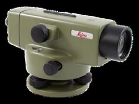
S u r v e y o r s I n s t r u m e n t S e r v i c e s , L L C , i s a f u l l - s e r v i c e s u r v e y i n g e q u i p m e n t r e t a i l s t o r e . W e o f f e r r e p a i r s , s a l e s , r e n t a l s a n d c o n s i g n m e n t s . S I S i s a f u l l - l i n e d e a l e r f o r G e o m a x , S p e c t r a , T r i m b l e , T o p c o n , S o k k i a , C a r l s o n , S e c o a n d S c h o n s t e d t .
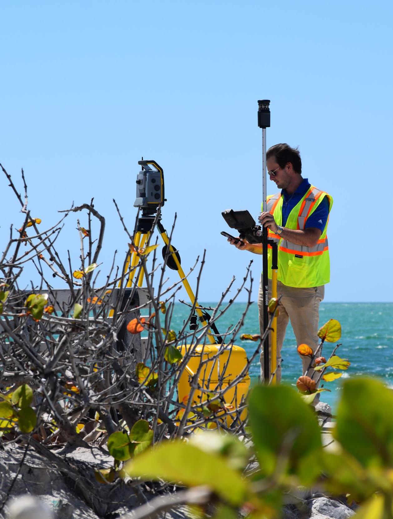


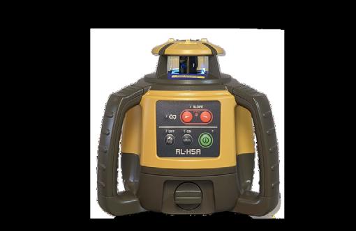
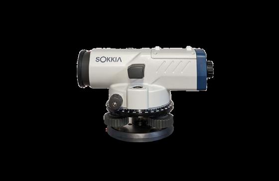
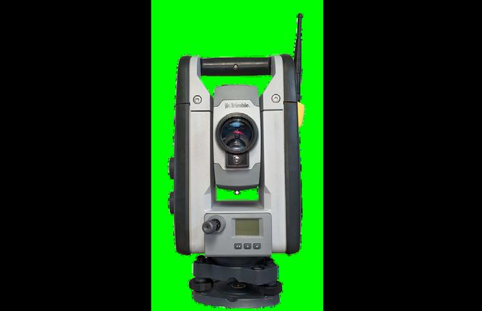
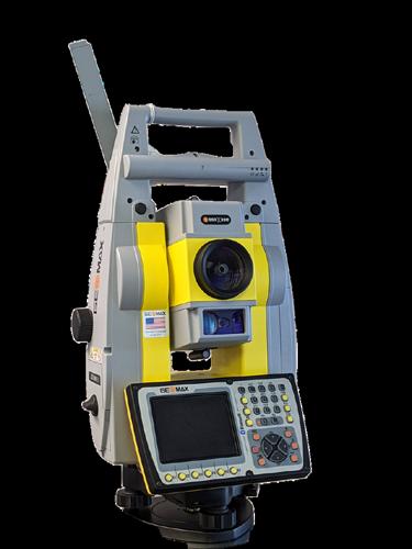
W e p r i d e o u r s e l v

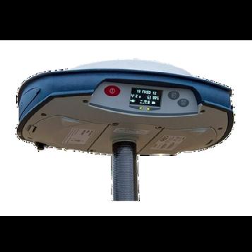
S U R V E Y O R S I N S T R U M E N T . C O M ( 8 1 3 ) 9 9 9 - 8 9 9 8 6 0 9 1 J O H N S R D S U I T E 4 T A M P A F L O R I D A 3 3 6 3 4
e s i n p r o v i d i n g o u r c u s t o m e r s w i t h s u p e r i o r s e r v i c e a n d a q u i c k t u r n a r o u n d t i m e . O w n e r , S t a n D e n i s o n , h a s 4 0 + y e a r s o f s e r v i c e a n d e x p e r t i s e i n t h e s u r v e y i n g a n d c o n s t r u c t i o n i n d u s t r y . Check out our website for current deals, promotions, and consignment instruments!
Survey + Aerial Mapping + GIS Nationally recognized for our skill and experience in land surveying, aerial mapping, and GIS. Ayres delivers efficient and intelligent solutions for your projects. 813.978.8688 | www.AyresAssociates.com Tampa I Titusville
Land
Land Surveying & Mapping, Inc. 407-869-5002

LLC 866-850-4200 Avirom & Associates, Inc. 561-392-2594
Bartram Trail Surveying, Inc. 904-284-2224
Bello & Bello Land Surveying Corporation 305-251-9606 Benchmark Surveying & Land Planning, Inc. 850-994-4882 Bennett-Panfil, Inc. 941-497-1290
Berntsen International 608-443-2772
Geospatial, LLC 410-822-1441
Betsy Lindsay, Inc. 772-286-5753
Biscayne Engineering Company, Inc. 305-324-7671
& Harper, Inc. 850-763-7427
Engineering 239-939-5490 Barnes, Ferland and Associates, Inc. 407-896-8608 Barraco & Associates, Inc. 239-461-3170
Boatwright Land Surveyors, Inc. 904-241-8550
Bock & Clark Corporation(NV5) 330-665-4821
A AA
A.
Agnoli,
AIM
Allen
Allen
American
Amerritt,
Associated
Atwell,
Axis
B
3002 Surveying 352-538-1320
Surface Pro, Inc. 239-471-2668
D. Platt & Associates, Inc. 850-329-5551
Barber & Brundage, Inc. 239-597-3111
Engineering & Surveying 239-332-4569
& Company, Inc. 407-654-5355
Engineering 321-783-7443
Surveying, Inc. 813-234-0103
Inc. 813-221-5200 Arc Surveying & Mapping, Inc. 904-384-8377 Ardurra, Inc. 239-292-7773
Banks
Bowman
Buchanan
C Calvin,
Carlson
Carnahan,
Consulting Group 703-454-1000 Bradshaw-Niles & Associates, Inc. 904-829-2591 Brown & Phillips, Inc. 561-615-3988 BSE Consultants, Inc. 321-725-3674
Giordano & Associates, Inc. 954-921-7781
Environmental Consultants, PC 704-283-9765
Proctor & Cross, Inc. 407-960-5980 202 3 S u S taining
F irm S Directory
Associates, Inc. 772-562-4191 Caulfield & Wheeler 561-392-1991 Chastain-Skillman, Inc. 863-646-1402 CHW Professional Consultants (Causseaux, Hewett & Walpole, Inc.) 352-331-1976
Design Group, Inc. 863-646-4771
Engineering & Design 732-383-1950
Survey Consulting, LLC. 863-606-2155
Surveying, Inc. 941-729-6690 Clymer Farner Barley Surveying, Inc. 352-748-3126 Coastal Engineering Associates, Inc. 352-796-9423
Surveyors & Associates, Inc. 954-689-7766 CPH Consulting, LLC 407-322-6841 Craven-Thompson & Associates, Inc. 954-739-6400 Culpepper & Terpening, Inc. 772-464-3537
Cumbey & Fair, Inc. 727-797-8982
DeGrove Surveyors, Inc. 904-722-0400 Dennis J. Leavy & Associates 561-753-0650 Dewberry 407-843-5120 DMK Associates, Inc. 941-412-1293
Donald W. McIntosh Associates, Inc. 407-644-4068 Donoghue Construction Layout, LLC. 321-248-7979
Douglass, Leavy & Associates, Inc. 954-344-7994
DRMP, Inc. 833-811-3767
DroneView Technologies 248-321-9417
DDSW Surveying & Mapping, PLC. 352-735-3796
Duncan-Parnell, Inc. 800-849-7708 Durden Surveying and Mapping, Inc. 904-853-6822

Carter
CivilSurv
Clements
Colliers
Collins
Cousins
E
ECHO UES, Inc. 888-778-3246 Eda Consultants, Inc. 352-373-3541 Eiland & Associates, Inc. 904-272-1000 Element Engineering Group, LLC. 813-386-2101 Engenuity Group, Inc. 561-655-1151
202 3 S u S taining
Engineering Design & Construction, Inc.
772-462-2455
ER Brownell & Associates, Inc.
305-860-3866
ESP Associates, Inc.
803-802-2515
ETM Suryeying & Mapping
904-642-8550
Exacta Land Surveyors, Inc.
866-735-1916
EXP Energy Services Inc.
305-213-9969
Florida Design Consultants, Inc.
727-849-7588
Florida Engineering & Surveying, LLC. 941-485-3100
FLT Geosystems
954-763-5300
Ford, Armenteros & Fernandez, Inc. 305-477-6472
Fortin, Leavey, Skiles, Inc. 305-653-4493
Frontier Precision Unmanned
701-222-2030
F.R.S. & Associates, Inc. 561-478-7178
Geoline Surveying
386-418-0500
Geo Networking, Inc.
407-549-5075
GeoPoint Surveying, Inc. 813-248-8888
George F. Young 727-822-4317
Geosurv, LLC
877-407-3734
Germaine Surveying, Inc. 863-385-6856
GPI Geospatial, Inc. 407-851-7880
Gustin, Cothern & Tucker, Inc.
850-678-5141
Ferguson Land Surveyors
727-230-9606
First Choice Surveying, Inc.
407-951-3425
GCY, Inc.
772-286-8083
GeoData Consultants, Inc 407-732-6965
Haley Ward, Inc.
207-989-4824
Hanson Professional Services, Inc.
217-788-2450
Hanson, Walter & Associates, Inc.
407-847-9433
H.L. Bennett & Associates, Inc. 863-675-8882
Hole Montes, Inc. 239-254-2000
HUB International 850-386-1111
Hyatt Survey Services
941-748-4693
F
G
H
F irm S Directory
I Ibarra Land Surveyors 305-262-0400 I.F. Rooks & Associates, LLC. 813-752-2113 J John Mella & Associates, Inc. 813-232-9441 Johnston’s Surveying, Inc. 407-847-2179 K KCI Technologies 954-776-1616 Keith and Associates, Inc. 954-788-3400 Kendrick Land Surveying, LLC 863-533-4874 L L&S Diversified, LLC. 407-681-3836 Land Precision Corporation 727-796-2737 Landmark Engineering & Surveying Corporation 813-621-7841 Langan Engineering and Environmental Services, Inc. 973-560-4900 Leading Edge Land Services, Inc. 407-351-6730 Leiter Perez & Associates, Inc. 305-652-5133 Lengemann Corp. 800-342-9238 Leo Mills & Associates 941-722-2460 Long Surveying, Inc. 407-330-9717 M Manuel G. Vera & Associates, Inc. 305-221-6210 Massey-Richards Surveying & Mapping, LLC. 305-853-0066 Masteller, Moler & Taylor, Inc. 772-564-8050 McKim & Creed, Inc. 919-233-8091 McLaughlin Engineering, Co. 954-763-7611 Metron Surveying and Mapping, LLC. 239-275-8575 Mills & Associates, Inc. 813-876-5869 Mock Roos & Associates, Inc. 561-683-3113 Moore Bass Consulting, Inc. 850-222-5678 Morris-Depew Associates, Inc. 239-337-3993 Murphy’s Land Surveying 727-347-8740 N Navigation Electronics, Inc. 337-237-1413 Northwest Surveying, Inc. 813-889-9236 NV5 - Technical Engineering & Consulting Solutions 954-495-2112
O On The Mark Surveying, LLC. 321-626-6376 P PEC Surveying & Mapping 407-542-4967 Pennoni Associates, Inc. 863-594-2007 Perret and Associates, Inc 904-805-0030 Pickett & Associates, Inc. 863-533-9095 Platinum Surveying & Mapping, LLC. 863-904-4699 Point Break Surveying 941-378-4797 Polaris Associates, Inc. 727-461-6113 Porter Geographical Positioning & Surveying, Inc. 863-853-1496 Pulice Land Surveyors, Inc. 954-572-1777 Q Q Grady Minor & Associates, PA 239-947-1144 R Reece & White Land Surveying, Inc. 305-872-1348 Rhodes & Rhodes Land Surveying, Inc. 239-405-8166 Richard P. Clarson & Associates, Inc. 904-396-2623 River City Surveying & Mapping, LLC 904-675-9300 R.J. Rhodes Engineering, Inc. 941-924-1600 R.M. Barrineau & Associates, Inc. 352-622-3133 Robayna and Associates, Inc. 305-823-9316 S SAM Surveying & Mapping, LLC. 850-385-1179 SCR & Associates NWFL Inc. 850-527-1910 Sergio Redondo & Associates, Inc. 305-378-4443 Settimio Consulting Services, Inc. 850-341-0507 SGC Engineering, LLC. 407-637-2588 Shah Drotos & Associates, PA 954-943-9433 Sherco, Inc. 863-453-4113 Sliger & Associates, Inc. 386-761-5385 Southeastern Surveying & Mapping Corp. 407-292-8580 Stephen H. Gibbs Land Surveyors, Inc. 954-923-7666 Stoner Inc. 954-585-0997 Surveying & Mapping Inc. 239-340-2409 SurvTech Solutions, Inc. 813-621-4929 202 3 S u S taining
F irm S Directory
T2 UES Inc.
407-587-0603
Tectonic Engineering and Surveying Consultants
845-534-5959
Thurman Roddenberry & Associates
850-962-2538

TranSystems Corporation Consultants
727-822-4151
WTWade Surveying, Inc.
352-753-6511
Wallace Surveying Corp.
561-640-4551
Wantman Group, Inc.(WGI) 561-687-2220
WBQ Design & Engineering, Inc. 407-839-4300
SOCIAL MEDIA LINKS
LinkedIn = 442 Followers
Facebook = 805 Followers
Twitter = 340 Followers
UF/IFAS School of Forest, Fisheries, and Geomatics Sciences
352-846-0850
Upham, Inc.
386-672-9515
Whidden Surveying
561-790-5515
Winnigham & Fradley, Inc.
954-771-7440
Woolpert, Inc.
803-214-5928
Instagram = 180 Followers
YouTube
ZZNS Engineering, LLC. 941-748-8080
U
DSWorld Online Tool Available
DSWorld software is a free application originally distributed by NGS in 2012 to display datasheet information in a “world view.” The tool adds new functionality in that it allows users to report errors they have discovered in the database. The software was designed to provide geospatial professionals and the public with up-to-date geodetic control information at the click of a button. Since its inception, it has been enhanced to become a major interface with NGS and the NGS Integrated Database (IDB).

The new DSWorld Upload Web Form , currently on Beta, offers many of the same features of the application as an online form. It allows users to upload new photos, descriptive text, and updated hand-held GPS coordinates for survey marks with poor positions, as well as report errors and corrections found in the database with photos, estimated coordinates, or text. The website will also allow users to request a new agency code if they do not currently have one.
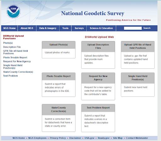
The Florida Surveyor Page 61
Geodetic Surveyor
Solve three dimensional geodetic and astronomic position problems, determine geodetic and astronomic azimuths, and measure fluctuations and accelerations in the Earth’s magnetic and gravity fields. They serve as NGA’s primary ground-based data collectors and use and maintain a variety of geodetic and geophysical survey equipment to support data acquisition.
They compute, adjust, and evaluate geodetic survey data acquired by other organizations. They provide indepth technical expertise on geodetic and geophysical issues to customers and represent NGA in external community forums establishing DoD and Intelligence Community doctrine and policy.
Stop by our booth at the FSMS Conference to learn about current job openings and internship opportunities!
Applying to Jobs and Internships at NGA


AreYou Eligible for Employment at NGA?

Applicants must meet the following criteria to qualify for employment with NGA:
•U.S. Citizen
•18 years of age or older
•Able to obtain aTop Secret/SCI security clearance


•Pass mandatory pre-employment drug screening


•COVID-19 vaccination, subject to exceptions required by law
BeginningYour Job Search

Go to NGA’s career website: www.intelligencecareers.gov/NGA

•To start your job search,click on Search NGA jobs, which will take you to a list of current opportunities at NGA.
•18 years of age or older
• Register: You must register to apply for a job opening. To register, click New Users on the Job Search page.
Apply for a Job
•Click Apply on the job listing to start the process.

• Follow the instructions on each screen.
• Review your application. Ensure your package is complete and includes all required documentation.
•Click Submit Application to submit your complete application. You will receive an email confirming submission. If you do not receive an email, your application was not successfully submitted.
June 2023 Page 62
We Are Seeking Geodetic Suur veyors JOIN THE TEAM!
Approved for Public Release, 22t@ l
www.intelligencecareers.gov/NGA recruitment@nga.mil

Register Your Team at Conference! $50 per Team to Enter Wed. Night 8–10 pm (after Welcome BBQ)
Eddie Munoz B2B Champion (2021 & 2022)
2023 Cornhole Tournament 2023 Cornhole Tournament 2023 Cornhole Tournament Sponsored By: the “CornHolios”
Alex Jenkins III B2B Champion (2021 & 2022)
OPUS Projects v.5.1 is Live!
OPUS Projects 5 has added an [ Upload GNSS Vectors ] function to incorporate high efficiency real-time kinematic (RTK) surveys into geodetic control projects. This update, along with new Requirements for Use in the 2023 GPS on Bench Mark Campaign will guide users in using high-efficiency GPS methods to maintain NGS datasheets and improve transformation models relating the nation’s existing NAVD 88 heights to the next GPS-based vertical datum.
Users can now upload GNSS vectors into their OPUS Projects, including vectors derived from either a single-base RTK setup or from a r eal-time network (RTN), for evaluation, quality assessment, and inclusio n in a least squares network adjustment.
Use the new GNSS Vector Exchange (GVX) file format to transfer data from various manufacturer hardware to OPUS Projects 5:
• ask your GPS vendor about new converters to GVX file format.
• explore GVX sample data .
June 2023 Page 64
ARCHIVES FROM THE


The Florida Surveyor Page 65
The Need for Professional Education in Land Surveying
By Dr. R. B. BUCKNER Department
of Geodetic Science
The Ohio State University, Columbus
(Originally published in Surveying and Mapping, Volume XXXIV, No. 1, March, 1974)
INTRODUCTION A Missing Curriculum
In 1964 an article was published, entitled “The Case of the Missing Curriculum” and authored by Professor Kenneth S. Curtis of Purdue University. This missing cur riculum discussed in the Curtis article is that of surveying and mapping. In the 1950's and earlier, related statements were made and papers were written which dealt with the need for professional education in sur veying and mapping. The movement for formal education for surveyors is at least 20 years old, perhaps even older.
A review of the Curtis article, related arti cles, and letters written by surveyors in prac tice and in education reveals that most “ex perts” feel that professional degree programs are needed to educate professional surveyors and that the apprenticeship and other meth ods are no longer suitable for this purpose. Such opinions are not based on whim or fancy but have solid foundation; for example, the education of surveyors is a require ment before one is considered a professional in most other progressive countries. Why should the requirements in this country
be lower? Modern methods, increased knowledge, sophisticated equipment, the high costs of land, the needs of the public for diversi fied services other than just property line locations, the level of educational standards used by other so-called “professions,” and the lack of adequate land description and surveying in some past surveys, all create the need for formal education for surveyors today.
Filling In What Is Missing
As a result of efforts by both educators and practicing surveyors in Indiana, Purdue University now has a program leading to a bachelor's of science degree in land surveying. It is a well-rounded program with at least 32 semester credit hours of course work that could be termed surveying and mapping and with an adequate amount of related course work. The program is administered by the School of Civil Engineering, but graduates receive a land surveying degree rather than a civil engineering degree.
The University of Florida now has a bach elor's degree called “engineering technology” which emphasizes surveying. Surveyors in that state are now trying
June 2023 Page 66
The Need for Professional Education in Land Surveying
to upgrade the de gree to a bachelor of science in land survey ing.
Ferris State College in Big Rapids, Michigan, has recently expanded their two-year associate degree to a four-year program lead ing to the degree of bachelor of science in surveying. The program appears to be tech nical in nature, having evolved from a tech nician program.
The Committee on Surveying Education of the New York State Association of Profes sional Land Surveyors has designed a pro gram for a bachelor of science degree in land surveying, which supposedly will be in troduced soon at one of the major universi ties in New York. This program closely re sembles Purdue's program.
California State University in Fresno offers a bachelor of science degree in survey ing and photogrammetry. From the course titles, the program appears to be adequate in most areas of surveying and photogrammetry except for a noticeable weakness in property surveying, legal principles, surveying his tory, and other background courses desirable for future registered surveyors.
Efforts are being made in other states to establish land surveying programs. For example, the Society of Land Surveyors of Iowa recently adopted a resolution encourag ing the development of a curriculum in sur veying and mapping at Iowa State Univer sity. The Wisconsin Society of Land Sur veyors recently passed a motion that their society should contact the University of Wis consin and urge the formation of a four-year program leading to a degree in land survey ing. These actions imply that surveyors in both Iowa and Wisconsin feel a need for a program
other than the surveying and map ping options in civil engineering presently offered at their state universities. There have been discussions among members of the Professional Land Surveyors of Ohio and the separate Departments of Geodetic Sci ence and Civil Engineering at The Ohio State University toward establishing a sep arate degree program designed to educate professional surveyors. At the time of the writing of this paper, the Geodetic Science Department was leading the efforts toward developing that degree, but progress was moving slowly due to administration and other problems.
Undoubtedly there are discussions and movements to establish full professionallevel degree programs elsewhere. Those men tioned here are the ones that have come to the attention of the author; programs not mentioned are those in other countries hav ing a survey science approach and a few “surveying and mapping” options in civil engineering curricula in this country. These have not been included in this listing as their central purpose and scope is not expressly designed to educate professional survey prac titioners.
Toward Understanding the Problem
The remainder of this discussion encompasses the author's viewpoints on what sur veying is today, what surveying education means, the relationship between education and professionalism, and what a professional educational program should include. It is hoped that a review of these points will lead to a common understanding of the future of surveying as a profession and give insight into ways in which educators and practition ers can
Page 67
work together to establish and main tain professional curricula.
WHAT IS LAND SURVEYING? Background
Land surveying is claimed to be one of the oldest or perhaps the oldest of all profes sions. It was practiced as an art and a sci ence many hundreds of years before Christ. Historical references to boundary stones hav ing been placed and resurveyed in early Egypt and Babylonia have been found. Sur veying and mathematics developed simul taneously; basic geometric principles de rived from a need to lay something out on the ground. Since man became civilized, there has been a continuing need to locate and relocate not only real property but also man-made and natural features on the earth's surface. More recent needs include locations below and above the earth's surface as well.
Definition and Function
The practice of surveying as a profession is defined under the term “land surveying” in nearly all state statutes. One reference discloses that three states use other terms. In Texas, it is “public surveying,” and in Ohio and Pennsylvania it is simply “survey ing.” Definitions range in scope from one short sentence to lengthy descriptions, such as the one recently accepted in Florida. Many are patterned after the American So ciety of Civil Engineers' definition and others after that of the National Council of Engi neering Examiners. Some states have kept their own unique definitions. All definitions of land surveying that include more than
one or two sentences have some common features. They include: original property line surveys, resurveys, land subdivision (often excluding engineering functions, however), topographic surveying and mapping, and the preparation of plats and descriptions of whatever has been surveyed. Many defini tions spell out more detailed functions, such as route surveys, hydrographic surveys, min ing surveys, photogrammetric surveys, and control surveys.
Land surveying has usually been equated with property surveying. This is unfortunate as this connotation implies that land surveying is narrow, when actually, all sur veying functions are found in its definition. Furthermore, professional registration or li censing is found only in land surveying. Other narrow specialties in surveying and mapping do not have licensing requirements. Therefore, a truly professional surveyor is a land surveyor. To put it in the words of Sol Bauer of Cleveland, Ohio:
… the land surveyor should be the general practitioner of the surveying field, with sufficient knowledge of the various specialties so that he would be familiar with their applications, realize his own limitations, and be able to coordinate the efforts of one or more specialists into his work.
This statement by Mr. Bauer was made in 1952, so even then it was recognized by some that land surveying was broader than just property surveying. In the last 20 years, the surveying practice has become even broader, warranting even more the changes of the land surveyor's image to the diversi fied practitioner that he is.
Electronic distance equipment, photogram metric equipment, electronic
June 2023 Page 68
FROM THE ARCHIVES
The Need for Professional Education in Land Surveying
computers and calculators, and other automated equipment have changed surveying practice consider ably. Accelerated land development and high land values have increased the need for accurate surveys and maps. Today, land surveying firms are larger and more diversi fied than they were 50 years or even 20 years ago. Surveyors are actively performing ser vices not only in property location but also in construction and engineering surveys, con trol surveys for mapping and other purposes, aerial photography, the preparation of photogrammetric maps, land planning or subdi vision design and layout, computer services for other surveying and engineering firms, mining surveys, industrial surveys, hydro graphic surveys, accident surveys, and other services.
Thinking of land surveying and property surveying as synonymous should he stopped. Property surveying is only one part of mod ern land surveying. Land surveying in cludes all surveys made on or near the land surface. Besides the recognized functions listed previously, this could include environ mental surveying and mapping of slopes, soils, geology, vegetation, land use, and other natural and cultural details. Such surveys and maps are needed by planners, landscape architects, ecologists, and others working with the environment. A practicing profes sional surveyor is the logical person to make such environmental surveys and analyses for planning agencies and others.
A New Image for the Land Surveyor
If the land surveyor of the future is to perform most of the functions falling
within the present definition competently, a better formal education will be necessary. Before educational needs are discussed, let us first describe the image that should be molded by education.
The modern version of a land surveyor would know how to measure expertly for any purpose. He would understand error propagation, know how to control his errors to the extent feasible for each job, and esti mate his probable error for statements on plats of survey. To do this, he need not he a highly educated statistician. He would un derstand photogrammetry enough to make maps or coordinate the efforts of other specialists, but he need not be a research scien tist in photogrammetry, nor would he want to be. He would need to be a geodesist to the extent necessary for performing control surveys within limited areas, but he need not be involved in research concerning the earth's size and shape or gravity field. He would be a planner and designer to the extent necessary to lay out safe, efficient, and appealing new communities, but he would not be a landscape architect or an urban planner and would work with such professionals for extensive landscaping and planning problems. He would know how to determine accurate directions, but he would not be an expert astronomer. He would take pride in preparing maps and plats to make them por tray the intended message in an appealing manner, but he need not be a highly educated cartographer. He would know how to program computers for surveying and land subdivision problems, but he need not be a mathematician or computer science specialist. He would understand drainage,
The Florida Surveyor Page 69
sewage flow, alignment, and grades of var ious forms of circulation necessary for land subdivision, but he would not be a structural, sanitary, transportation, or other civil engi neering specialist, nor would he need to be to make a living. The land surveyor envi sioned here would he a property surveyor of the first order. He would understand prop erty law and survey history toward conduct ing resurveys efficiently, but he would not be a lawyer or historian. He would appre ciate preservation of survey evidence. He would be proud of his work and would identify his survey monuments with his reg istration number, place accurate directions on his survey lines, prepare clear and concise descriptions, place his surveys on public record, continue his education, seek to im prove his profession further, and experience the joy of being a highly useful servant to the public. Add to all of this the logical function of being a terrain or environmental surveyor and mapper and the new image of the land surveyor is complete.
A Word on Surveyor Pride
In today's society many groups are seeking either to assert themselves and be recog nized or to be free of unnecessary prejudice and discrimination. Is it not time that land surveyors assert themselves as a group which is separate and unique in itself? There is more than enough surveying function to permit the profession to quit hiding under the skirts of the engineering profession. Engineers are not the mothers of surveyors! Engineers and surveyors are brothers , closely related but each having individual character istics. Surveying has
a heritage of its own. Surveyors in past years have held the high est respect of the public and other profes sionals; many famous Americans were sur veyors. The surveyor performs an indispens able role in society. He should be able to hold his head high, so why does he some times not do so? A simplified explanation stems from what might be termed “the apprenticeship syndrome.” Those highly esteemed surveyors of the last century were selftaught, which was all that was needed to be termed a “professional.” Nowadays, other professions have strong educational requirements; therefore to gain the respect of other professions—not as individuals, but as a group—the practice must be upgraded through education. When educational re quirements are raised, all those identified with the profession, including progressive surveyors who were educated by the “school of hard knocks,” will have reason to stand and be recognized and thus “surveyor pride” will be a reality. Without this elevation to a profession by accepted definition, surveyors will continue to grovel at the feet of engi neers and other professionals. This idea is stated as a principle in a wellknown text on land surveying:
Professional stature cannot be attained by selfproclamation; it must be earned, and others must bestow the title on the profession.
One acknowledged way to gain attention is to make a lot of noise. To gain true rec ognition and respect, rather than just atten tion, points must be proved through actions. This is not to say that this is the way it should be, but human nature seems to operate in this fashion. Acceptance is meas ured by impressions on others. Pride
June 2023 Page 70
FROM THE ARCHIVES
RAFFLE
YOUR CHANCE TO WIN A SPECIAL EDITION
- $100.00 per ticket
-Tickets sold at Registration Desk
- Drawing to be held at Recognition Dinner
- Do not need to be present to win
Valued at $1,800
No. 8 in a Special Edition of only 100 A "Tribute to the American Surveyor" Comes with a Certificate of Authenticity

The Florida Surveyor Page 71
comes from acceptance. Without this acceptance, pride is false. The frustration resulting from false pride causes peculiar reactions and sometimes manifests itself in the desire of some surveyors to align themselves closely with another profession, such as engineering. The “apprenticeship syndrome” forms the base of the disease eating away at the mar row of the pride of the profession. It must be overcome. Then and only then can sur veyors, engineers, and other professionals treat each other as brothers.
WHAT IS SURVEYING EDUCATION?
General Comment
One constantly hears of short courses, correspondence courses, refresher courses, extension courses, technical curricula, technology curricula, professional curricula, institutes, conferences, etc. All of these forms of education are often considered as just variations of the same theme with little dis tinction among purposes. The courses and curricula are often considered as avenues toward professional registration and instruc tion in “survey-type things.” Conferences, institutes, and conventions are usually considered as gatherings for those already reg istered and others to discuss mutual problems, and possibly learn how to do some more “survey-type things.” Some of these narrow impressions may be accurate, but since education does and should serve varied purposes, finer distinctions are warranted. Let us attempt to categorize and examine the various forms of education available.
Technical Training
Technicians in surveying are generally considered to be those who gather field data, plot the data, and perform calculations— highly valuable, skilled individuals who are depended upon to make accurate measure ments, plot and draft accurately and neatly, and compute without mistakes or errors. They are the group who are given individual job titles, such as rodmen, tapemen, instru mentmen, draftsmen, computers, compilers, lab technicians, photographers, and sometimes party chiefs. Usually they are not expected to make all of the decisions in the field or office and are supervised either by a party chief, a section leader, a head drafts man, or simply the boss. Their work and importance on a survey team should never be downgraded as they are highly important to the success of any surveying mission.
Technical college training generally requires two years with 20 to 30 semester hours of surveying topics; most of the re mainder of the course is devoted to mathe matics and technical subjects related to sur veying. Graduates of such curricula are generally awarded an associate degree. Re cently, such technical training has been ex panded or introduced in some schools in the form of a four-year study course. During the second two years, advanced surveying topics are introduced and the student's back ground is broadened through course work in related engineering and other subjects. Graduates of such curricula are usually awarded a bachelor of technology degree. A technologist might be considered as being a highly trained technician or as a dependable link between the technician and the supervisor
June 2023 Page 72
FROM THE ARCHIVES
The Need for Professional Education in Land Surveying
or boss. His background may ideally equip him to be a survey party chief.
Technical schooling is more properly termed training instead of education, since technicians are taught how to “do things.” In the training for associate or technology degrees, emphasis is generally on practical matters, rather than theoretical. There is no pretense that graduates are highly educated theoreticians or ready-made professionals. This is evident in the names of the degrees and the course titles and descriptions which deal almost entirely with survey practice. The practice of surveying is usually taught in a traditional fashion to insure that graduates are of immediate use to employers. As such, technical and tech nological curricula serve a valuable purpose in supplying established survey firms with needed technical employees and in providing organized training for interested individuals.
Education for Professionals
Professionalism has been discussed in the context of defining modern-day land sur veying: professiona1ism is not selfbestowed; the title must be awarded by others. For land surveying to be considered a profession, educational requirements must be uniform and equivalent to the quality for other professions. As stated in the Taft-Hartley Act of 1947, a profession is a vocation:
Requiring knowledge of an advanced type in the field of science or learning customarily acquired by prolonged course of specialized intellectual instruc tion and study in an institution of higher learning, as distinguished from an apprenticeship or from training in the performance of routine,
mental, manual or physical processes.
The key phrases of this statement might be “advanced knowledge,” “prolonged course of … study,” and “'intellectual instruction.” The distinction between professional education and apprenticeship or training in routine processes is most significant, setting professional education apart from technical training.
Professional education not only teaches the student how to do things but also gives insight into how they might be done better. If courses are structured and taught properly, students should begin to automatically question—but never automatically reject— traditional ways of performing surveys. Stu dents' minds should be opened to new ideas, no matter how abstract the ideas may seem initially. True professionals always con sider new methods and approaches to survey practice.
With the possible exception of the program at Purdue, it is doubtful that a truly professional-level curriculum in land survey ing exists in this country. Some approach what is needed, but significant features are missing. Desirable features will be outlined subsequently.
Continuing Education
As implied by its name, continuing education is for those currently practicing, either as registered surveyors or as technicians. Such education is designed to keep practi tioners abreast of new techniques and ideas, or to round out their background in established areas of study.
There are movements in some states to require by law that practicing surveyors
The Florida Surveyor Page 73
par ticipate in some type of continuing education as a condition for renewing registration. Surveyors might be required to accumulate a certain number of “points,” with various activities being assigned different point values.
The following categories of continuing education are presented with implications of their relative value, but they are discussed primarily to place the subject into a logical perspective.
The first category of continuing education as viewed by the author, is the most formal approach and takes the form of extension, correspondence, and short courses. These courses may or may not offer college credits, but what sets this category apart from others is that some effort is required from the re cipient: he must write lessons, take exams, etc. Courses offering college credits and a grade are generally of a higher quality than noncredit courses. Some credit courses might also be used toward a technical or professional college degree.
A second category , still rather formal, but less so than the first, consists of workshops, institutes, and seminars. Such programs are usually attended by individuals desiring in struction in some specific topic or series of topics. Sessions are usually well attended, and participants are issued various materials and notebooks or workbooks. Certificates are generally issued to all attendees. The certificate merely witnesses the fact that the individual attended the sessions. Since there are no requirements for writing papers or passing exams, the certificate carries no guarantee that the person
gained signi fi cantly from participation. Stated differently, the person attending can gain as much or as little knowledge from the sessions as desired.
A third category , less formal than the second, consists of conferences and conven tions. The only formality is that speakers appear according to a planned program, but attendance is purely arbitrary, with no requirement. Attendance of conferences and conventions rarely results in receipt of a certificate. Again, the participant gains intellectually according to self-motivation to become involved in the activities.
A fourth category of continuing education includes membership in professional so cieties, attendance at informal local meetings and discussions, and subscriptions to publications related to one's area of interest. This form of education is, of course, quite in formal. Society membership does not guar antee the participation of a member in activities or in reading the publications.
Other Surveying Education
In a class nearly alone are “refresher courses.” As the name suggests, these are designed to refresh the memory concerning a topic to which one has supposedly been exposed to sometime in the past. If taught properly, basic theory is only briefly outlined and is then developed by examples and answers to questions. Unfortunately, many consider such courses as the principal formal educational vehicle to become registered as surveyors. For example, this author has been involved with the teaching of refresher courses
June 2023 Page 74
FROM THE ARCHIVES

Use the RTk5 as a versatile network rover, handheld GIS unit, or ruggedized data collector. The RTk5 is designed for surveying, stake-out, GIS mapping, and construction layout. • Carlson Gama RTK Engine and Fixed+ with dual RTK engine • Exceptional performance under canopy • 25% lighter than traditional GNSS setups • Equipped with SurvPC 7 • All-day battery life, hot swappable, optional high capacity battery • Long range bluetooth Call 561.316.6250 or visit carlsonps.com
Carlson RTk5 GNSS REIMAGINED
to students who have never seen or used much of the theory but expect to learn all that is necessary from the course. Furthermore, concerning some topics such as astronomic observations for azimuth, some confess that they never intend to use the theory but need it to pass a registration ex amination. Refresher courses should not be considered as “cram” courses. If treated as such by educators and students, their ultimate value may be negative rather than positive.
Compilations of sample registration exam questions are in the same class with refresher courses. The purpose of such ques tions should be to give registration aspirants a chance to drill in typical problems. If the sample questions or problems appear in the same form on any future registration exam, the publishing of such samples ultimately has a negative effect on professionalism. This is especially true of detailed mathe matics and practical situation problems. The public is entitled to registered practitioners with higher qualifications than the ability to memorize solutions to specific mathemati cal exercises or answers to some examiner's pet questions.
Service courses for those not studying surveying as a profession or vocation are often taught in colleges and universities. For example, landscape architecture, forestry, geology, geography, and engineering students often take an elective or required course in general surveying, photogram metry, or other areas related to surveying and mapping. Such courses are and should be designed merely to explain and define surveying, to present the basic theory, and to include any special topics
desired by stu dents for background in their particular cur ricula. These should not he used as an attempt to teach individuals to be surveyors but only to understand the function of sur veying. Many feel that surveying for civil engineers should be taught in this fashion, especially since most surveying has been re moved from the curricula and what re mains is grossly insufficient—even in cur ricula with surveying and mapping “options”—to educate land surveying professionals. There is an obvious threat to the existence of surveying as a unique profession if students taking only one or a few courses in surveying are led to believe that they have acquired sufficient background to practice as professionals. The idea that professional depth is developed through exposure to a few basic topics is absurd. This point will be further developed subsequently.
ALTERNATIVE APPROACHES FOR PROFESSIONAL EDUCATION General Comments
In this discussion so far, the land surveyor of today has been described as the general practitioner of the surveying field, and it has been implied that any undergraduate degree program should provide background to assure that graduates will make competent professional surveyors whether they decide to practice classical land surveying or seek employment in other areas of surveying. Surveying education has been explained and the different purposes placed in perspective. Following is a discussion of professional college education in Surveying. The various approaches advocated or used
June 2023 Page 76
FROM THE ARCHIVES
The Need for Professional Education in Land Surveying
at present will be discussed in terms of their potential for molding the type of professional surveyor visualized herein. The last one described, as yet nonexistent, is the author's opinion of what is needed.
Exclusively Property Surveys
When some practitioners speak of curricula in land surveying, often they mean property surveying; they would have stu dents spend most of their time learning how to search for and evaluate property line evi dence. Although ample time should be devoted to this, there are other equally impor tant topics. With this approach, only very basic mathematics would be taught. All subjects, including surveying, would be taught only to the extent that they relate to local property line resurvey practices. Most advocates of this approach agree that photo grammetry and computers are important, so a course in each would be included. Pro ponents of this idea are usually quite con cerned that graduates will not be able to “go out and make a survey” on graduation day.
Many who feel that this is what is meant by professional education really only want colleges to do the training that should be acquired mostly on the job during the “prac tical experience” phase of education. Others see land surveying as a narrow field of sur veying based on past practices and do not see a need for including many scientific as pects or topics designed to broaden land surveying practice Some feel that pro fessionalism can be attained through a purely technical approach and that instilling original thought through more varied and theoretical topics is unnecessary.
The major weakness in this approach is that there is not much basis for actually ad vancing or improving the profession. The principles and practice of modern land sur veying, as pointed out in a previous section, go beyond traditional property surveying. As professional programs these would fail because of their irrelevance and narrowness, but probably none are in existence anywhere. However, similarities can be seen in techni cal programs used as vehicles toward registration.
Survey Science and Engineering
At the opposite extreme from the exclusive property surveying approach is the program that emphasizes the scientific aspects of sur veying. Proponents of this approach are difficult to identify, but observations indicate that they are primarily science-oriented edu cators. Surveying educators typically hold a Ph.D. degree and their interests are greatly in research. Frequently they are inexperienced regarding the practice of surveying. Their interests, knowledge, and values are naturally transferred into education for future surveyors, resulting in courses that emphasize theory. Applications, practical aspects, and legal principles of boundary relocations are all but excluded. Topics such as survey history are considered too mundane for inclusion in such theoretical curricula. Such programs are probably very good as stepping stones for students continuing in graduate school or seeking employment in research or governmental agencies. What is lacking is a foundation in practical problems to create student
The Florida Surveyor Page 77
interest in the land surveyor as a general practitioner with the goal of serving the public at the “grass roots” level. Without this orientation, employers may be disillusioned with institutions of higher learning, because gradu ates will be grossly incapable of “going out and making a survey.” As a result, the need for private practitioners may not be filled since employers in practice may be reluctant to hire graduates. Stu dents may then become more interested in scien tific research and theoretical endeavors and therefore seek employment in those areas.
With the inclusion of additional courses to form a foundation for the general practitioner land surveyor, emphasis on practical as well as theoretical problems, and perhaps even a name change, these programs would be excellent. Such additional flavor may have to be developed by appointing faculty having both academic degrees and practical ex perience, whose main interest is in teaching and scholarly endeavors rather than in “hard-core” research. Teaching, scholarly, and service efforts would of course have to be evaluated for promotion in rank in lieu of research in order to attract and keep such faculty.
Civil Engineering Degree
The trend of reduction in surveying courses as part of civil engineering curricula has been observed for several years and in dicates that the civil engineering depart ments are not in the business of educating students in two professions. Perhaps this is as it should be. References for the need for separate curricula are numerous in literature.
Milton O. Schmidt said it in 1951, Sol Bauer said it in 1952, Hugh C. Clark said it in 1956, Ken Curtis stated it in his own words and through other quotations in 1964, and Rolland Hardy made several excellent observations in 1965. The list of advocates of separate curricula could continue indefinitely, but to attempt to quote from all of them would unnecessarily lengthen this article.
Despite what seems obvious to most surveyors, there are still a few— unfortunately, sometimes respected educators and surveyors—who feel that the subordinate role held traditionally by land surveying under civil engineering is all the profession deserves. A statement issued by the American Society of Civil Engineers in 1959 has done more harm than good, according to many who feel the profession is unique.
The few civil engineering departments with “options” in surveying and mapping seldom require any property surveying, and other courses available seem to be mostly science and theory-oriented. Furthermore, even if a student elects a course in property surveying, the time allotted for one course is not adequate to cover even a fraction of what should be taught. Two of the most elaborate options of this type do not require a course in property surveys but have only a two or three credit hour elective. Therefore, students supposedly being educated as professional surveyors either receive no background in property surveying, or receive such a shallow presentation that they are left with a very incomplete idea of the professional practice of surveying. Most will have a rude awakening later.
June 2023 Page 78
FROM THE ARCHIVES
The Need for Professional Education in Land Surveying
Some will take the initiative to learn what they need to know—an extension of the apprenticeship approach; others will not bother but will somehow manage to make a minimum score on registration exams. The result is that all are short changed, including the graduates, the employers, and the public.
None of these comments should be construed to imply that a land surveying degree could not be granted through a department of civil engineering. It matters little where the program is administered. What does matter is that the land surveying degree is a separate and distinct degree. Nor are these comments meant to imply that considerable material could not be taught by civil engi neering faculty and that there could not be general cooperation between the faculties for the two separate degrees—as long as the separate degree in land surveying is recognized as having its own objective and course content.
Land Surveying
The basic idea . A curriculum in land surveying should be consistent with the new image of the land surveyor as described previously. Desirable objectives should be to emphasize modern survey practice and broaden the base of land surveying expertise in order to make the profession somewhat more attractive to prospective students and enable graduates to be of substantial use to society upon graduation. A policy to retain the best elements of traditional land surveying practice without compromising the objectives should be effected. Rational, professional, and ethical practices as well
as thought should be taught continuously within the program. Other principles should be to provide sufficient depth and flexibility in the program so that students could complete another undergraduate degree or a master's degree in a related field within a reasonable time and to keep the required credit hours within limits that would allow students to complete the program in four academic years without undue hardship or strain.
As long as the ECPD remains the primary accrediting council for surveying programs and the NCEE continues to prepare land surveyor examination questions, close alli ance with engineering, is felt to be practical and appropriate. The inclusion of physics and engineering fundamentals in a land surveying program would accomplish the purpose of providing background courses toward ECPD accreditation and would cover those topics listed on the NCEE syllabus of the Fundamentals of Land Surveying Examination. Most first and second year physics, engineering fundamentals, and mathematics provide excellent theoretical background in surveying courses and also serve as necessary prerequisites for some civil engineering counties which would be desirable to include in a land surveying cur riculum. There is an overlap between the practices of land surveying and civil engi neering, and flexibility would be added to the program if students could earn a second bachelor of science degree in civil engineering, with perhaps not much more than an additional year of study beyond the B.S. in land surveying. This would be an attractive element, it is felt, for prospective students whose
The Florida Surveyor Page 79
primary interest may be in surveying but who have more than a passing interest in civil engineering design. The inclusion of engineering fundamentals would provide a stepping stone toward a second degree. It should be emphasized, however, that this in no way suggests that both land surveying and civil engineering could be covered in one four-year program.
A professional program in surveying should emphasize both the theoretical and practical aspects of surveying. It is im portant that the practical remain, or else the instruction is pure theory, which by itself is of limited value. Science itself cannot be practiced as a profession; it must be applied. But without theory, philosophy of thought, and teaching approaches designed to make the student think, the professional ingredient would be missing. The courses should develop the students progressively in the several aspects of surveying and have professional overtones throughout. These should not he just a series of topics hut should he an integrated body of knowledge designed to develop thought processes, to present ideas, and to teach facts.
Although the program envisioned is an undergraduate degree program, a professional graduate degree is also a possibility for students holding undergraduate degrees in related fields or for those wishing to con tinue in the surveying program. One must consider “first things first,” however, and this means implementation of an undergradu ate program.
A rough outline . University, college, and departmental requirements vary at
different institutions. Course offerings, course con tent, available faculty, faculty interests, laboratory space, and available equipment also vary; some schools operate on a semester system, others on a quarter system. For these reasons, no unique outline of a curriculum would be appropriate. The follow ing outline assumes that there are certain requirements in physical sciences, social sci ences, humanities, and physical education for all university students. It also assumes that faculty and equipment are available in the department where the curriculum is based to teach most of the surveying courses (listed in capital letters). Approx imate credit hours are listed on both the semester and quarter system, although the courses are designed for the latter. Where credit hours for courses on the semester sys tem are low, consideration shall be given to combining some of the courses. The curricu lum is explained following the outline.
June 2023 Page 80
Credit Hours Quarter Semester FRESHMAN YEAR English 5 3 Mathematics 15 10 Physics 15 10 Graphics 4 3 Computer Science, 5 3 Social Science, or Humanities Electives 3 2 Chemistry or 4 3 Science Requirement Physical Education 3 2 FROM THE ARCHIVES
The Need for Professional Education in Land Surveying
Year. The freshman year is essentially that of any student enrolled in
Sophomore Year. The second year includes additional background courses, basic education requirements, and courses in the major. At the end of the second year, students will have completed enough mathe matics, science, drafting, and surveying courses to have attained some proficiency as survey technicians. Should education be terminated for any reason at the end of the sophomore year, a student should be capable of working
The Florida Surveyor Page 81 Credit Hours Quarter Semester SOPHOMORE YEAR Economics 5 3 Mathematics 10 7 Statics and Dynamics 8 5 Geology and Astronomy, or 10 7 Other Science Requirement History or Other Social 5 3 Science Elective ls –1 survey orientation 1 1 ls –2 survey measurement theory 3 2 ls –3 survey computations 4 3 ls –4 field surveying 3 2 ls –5 land surveying history 3 2 JUNIOR YEAR Transportation Principles 5 3 or Hydrology Geography or other 5 3 Social Science Elective Landscape Architecture 5 3 Design Strength of Materials 4 3 Real Estate or Property Law 3 2 Fluid Mechanics 4 3 ls –6 photogrammetry 4 3 ls –7 site and engineering 5 3 surveys ls –8 environmental surveys 3 2 ls –9 boundary relocation 5 3 principles ls –10 cartographic principles 4 3 ls –11 site planning for 3 2 surveyors Credit Hours Quarter Semester SENIOR YEAR Humanities Electives 7 5 Technical Writing 3 2 Land Use Control Law 3 2 City Planning Principles 3 2 Soil Science or other 5 3 Science Requirement ls –12 photo - interpretation 4 3 / r emote s ensing ls –13 geodesy 5 3 ls –14 mathematical methods 3 2 and adjustments ls –15 preservation of 6 4 survey evidence ls –16 land survey practice 2 2 Area of Specialization 13 9 Electives TOTALS 210 141 Freshman
engineering
science.
LS–1 Survey Orientation might be
in
freshman
or
The course called
included
the
year.
as a technician. Students should also be useful, at this point, as summer help ers for surveying firms.
Survey Orientation LS–1 is designed as a motivating and interest-arousing experi ence for the student and general familiarization with surveying and might include films, demonstrations, and lectures from the faculty and guest speakers. Surveying would be defined. LS–1 shall be taught concurrently with or precede LS-2.
Survey Measurement Theory LS–2 is intended to familiarize students immediately with the world of measurement. This course would be a lecture-lab. It is felt that this theory should be presented first to prevent the development of misconceptions and bad habits. However, the course would not be pure theory, since it would include field familiarization with tapes, transits, theodo lites, and levels. Systematic errors, random errors, mistakes, significant figures, theoreti cal analysis of measured quantities, weights, propagation of random errors, derivation of specifications for measurements, and a gen eral discussion of basic measurements in the three elements of space would be covered.
Survey Computations LS–3 is planned for the winter quarter to follow LS–2. It would cover angles and directions, traverse computations, triangulation, geometry of the circle, and the application of trigonometry and analytic geometry to the solu tion of problems, such as those of land division and missing parts. The course would be a lecture-lab where all computational methods, including logarithms, cal culators, and computers,
would be employed; emphasis would be placed on electronic calculators and computers. Sig nificant figures in computations would be stressed.
Field Surveying LS–4 is the first actual field course and continues where LS–2 ends. The field surveying course is intended for the spring. Its main purpose should be to develop the art of keeping field notes, and planning and executing field problems. At the same time, students should gain more appreciation for the art and science of ac curately measuring in the three elements of space. Lab problems would consist of elevation, angles and magnetic directions, and distance measurements. Electronic distance and other equipment would be employed as available. The subject of sources of instru mental and other errors would be expanded over that taught in LS–2, instrument ad justments would be included, and error theory would be applied.
Land Surveying History LS–5 could be taught at any time between the middle of the sophomore year and the first part of the junior year, but should precede the course in Boundary Relocation. The history course should include a sketch of early Greek, Roman, and Egyptian surveying and trace the development of surveying equipment and units of measure. Various principles of land ownership and transfer should also be discussed, which could be followed by land surveying and ownership in this country prior to the Revolution. A detailed accounting of the Public Land Survey System would account for a large part of the course. Substantial time should be
June 2023 Page 82
FROM THE ARCHIVES
MAPPING A WORLD OF POSSIBILITY
At McKim & Creed, we are surveyors who see a bigger purpose. We are experts at applying geo-intelligence to survey and map a world lled with possibility. With a strong commitment to the advancements of technology, we challenge the impossible to build the possible, advance our industry, and deliver value to our clients.
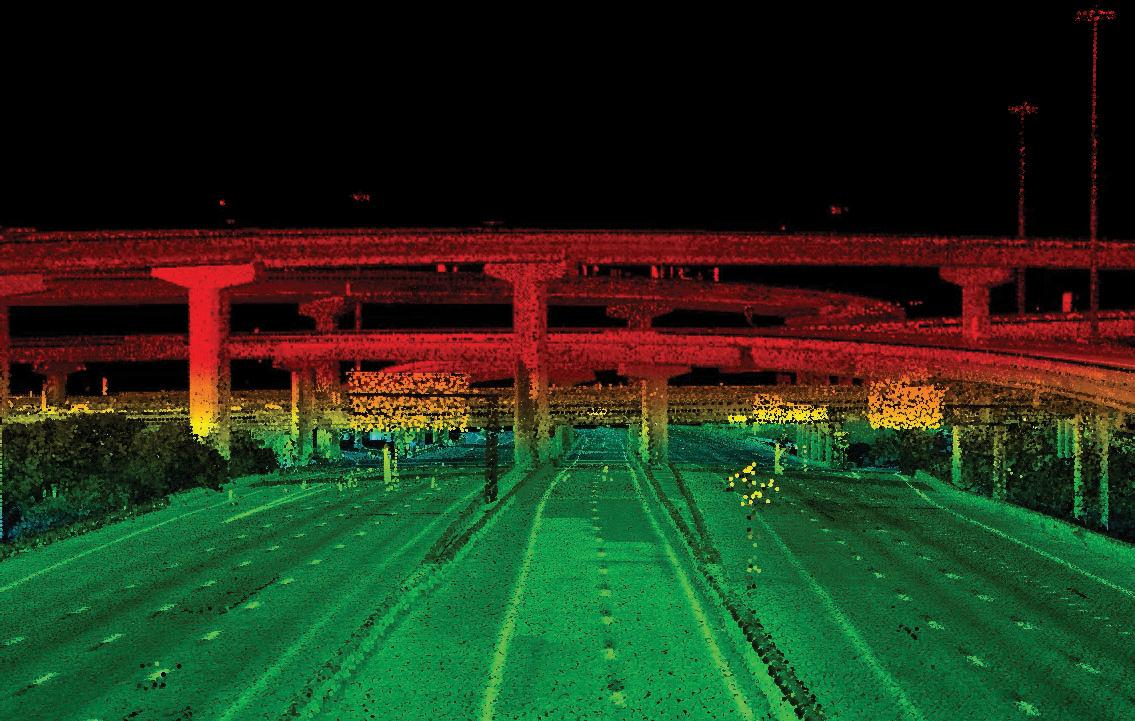

Page 83
CONNECT WITH US MCKIMCREED.COM MATT LALUZERNE, PSM Business Development Director 321.233.9940 mlaluzerne@mckimcreed.com
spent on metes and bounds systems in states not using the Public Land System. State and local peculiarities of early surveys should be discussed. The course could be concluded with a discussion on developments in surveying in the 20 th century and the future of the profession.
Mathematics throughout the sophomore year would include calculus, analytic geom etry, and differential equations. Physics would include mechanics, heat, light, sound, electricity, and magnetism.
Junior Year . The third year should include more in-depth courses in several aspects of land surveying and related areas, additional engineering fundamentals, a course in landscaping designs, a law course related to real property, and civil engineering courses in transportation or hydrology.
Photogrammetry LS–6 should include basic optics, photography, metric cameras, stereoscopy, ground control, photographic missions, stereoplotters and other equipment, an introduction to interior and exterior orientation, special problems in aerial and terrestrial photogrammetry, and applications to mapping and surveying. This course could be taught anytime during the junior year.
Site and Engineering Surveys LS–7 should include the several ground methods of gathering data for topographic maps, engineering p1ans, and architectural designs. Topics in route surveying would include circular curve design and layout, parabolic vertical curve design and staking, spirals, and geometric design of streets and high ways. Construction staking for various types of engineering works should be in cluded as well as earthwork
computations, hydrographic surveys, mine and tunnel sur veys, as well as industrial surveys. The course would be a lecturelab and should move fairly fast after the background developed in the sophomore year. This course is intended for the fall term.
Environmental surveys LS–8 is intended for the winter term but could also be taught in the fall. Data sources, soils classification and mapping, geology and water sources investigation, vegetation classification and mapping, slope mapping and studies of land forms and drainage should be covered at this point. Also included would be terrain analysis and land use suitability mapping, using computer methods and other tech niques. Applications of airphoto interpretation and remote sensing to environmental surveys should be discussed. This course might be developed in cooperation with the civil engineering or landscape architecture faculty.
Boundary Relocation Principles LS–9 should be an intensive course covering real property transfer and interests, survey evi dence, resurveys for sequence and simultane ous conveyances, Public Land resurveys, and special resurvey problems. Pertinent state laws and court decisions concerning re surveys should be covered, with basic steps in conducting a resurvey included. Some laboratory time would be spent on records searching and evaluation of field evidence. Boundary Control and Legal Principles by Curtis Brown and Evidence and Procedures for Boundary Location by Brown and Eldridge ought to be covered as well as Restoration of Lost or Obliterated Corners and Sub division of Sections , and the Manual
June 2023 Page 84
FROM THE ARCHIVES
The Need for Professional Education in Land Surveying
of Instructions and books by Skelton, Clark, and others should be introduced.
Cartographic Principles LS–10 would include thematic mapping, map projections, map reproduction, inking and scribing tech niques, map compilation techniques, map and information sources, map generalization, computer mapping, and map expression. It should not be a course in topographic surveying and mapping. This course could be taught anytime during the junior year; it might be available for geography de partment.
Site Planning for Surveyors, LS-11, should follow the course in site and engineering surveys. As visualized, this course would encompass traditional courses entitled “subdivision design” but would approach the problem of land conversion not only from a design and platting procedure view point, but also from a social and aesthetic viewpoint. The art of site planning would be developed through a study of Site Planning by Kevin Lynch, and practical aspects of land development through study of The Community Builders Handbook by the Urban Land Institute. Topics would include site analysis, land use controls, con sideration of environmental factors, design principles, and platting procedures. Traditional and modern designs for residential, commercial, industrial, and recreational areas would be discussed, also planned unit developments and new cities. Student lab projects would be preparation of various types of plans. The role of the surveyor as designer and member of a design team would be presented as well as surveyor relation ships with clients, contractors, plan commissions, and others.
Construction inspection problems would also be included.
Senior year. The fourth year of study should include more courses in surveying and related areas, a course in technical writing or similar substitute, land use control law as taught from a legal or planning approach, basic principles of city and re gional planning, a soil science or similar earth science course, and humanities elec tives.
Photo Interpretation/Remote Sensing LS–12 should include principles of interpretation from aerial photographs for geo logical, forestry, city planning, and survey planning purposes. Remote sensing methods and applications should include an intro duction to the basic physical principles, multiband photography, thermal imagery, multispectral imagery, radar imagery, and passive microwave systems. The student should emerge with an appreciation of how various methods might be applied to land and environmental surveying problems. This could be taught in the junior year or the early part of the senior year and might be taught in cooperation with civil engineering or other departments.
Geodesy LS–13 would be an introduction to the basic problems involved in the extension of major control, the use of high order geodetic instruments, geometric geo desy, gravimetric geodesy, geodetic astron omy, and satellite geodesy. This course could also be taught during the junior year but should follow or be taught concurrently with LS–14.
Mathematical Methods and Adjustments LS–14 should encompass vector
The Florida Surveyor Page 85
analysis, matrix computations, Taylor series, variance, covariance, observation equations, and condition and normal equations. The subject of weights and propagation of errors should be reviewed.
Preservation of Survey Evidence
LS–15 as visualized by the author would be a course designed to cover subjects tradition ally taught in courses with such titles as “land descriptions,” “astronomical observations,” and “state plane coordinates.” That is, all such subjects would be discussed in the appropriate context of preservation of evidence. Topics would include measurements as evidence and how to show them on plats of survey,, written and graphical de scription preparation, survey monumentation, survey recording and filing, astronomy and gyro systems for determining directions and position, and state plane and other co ordinate systems. Student lab problems would include description and plat preparation, astronomical observations, and state plane coordinate computations. Since this course contains much important material, it might suitably be divided into two courses: one to be taught in the spring of the junior year and the other in the fall of the senior year.
Land Survey Practice LS–16 would be a final seminar-type course, intended as a transition from the academic to the real world for graduating seniors. Survey busi ness problems, professionalism, fees, salaries, ethics, business management, and personnel problems might be discussed. Guest speak ers from practice would be used.
The balance of the senior year would consist of two or three courses in the student's chosen “area of emphasis,” which are explained below.
Areas of emphasis . These areas are intended to provide an opportunity for students to pursue individual interests and to develop further the background necessary for professional practice. The areas could also serve as springboards for more advanced graduate study or later specialization in practice.
• Area 1, Boundary Relocation Surveys contain aspects that have always been a part of the land or property surveyor's role. This could be developed primarily through a second course in boundary relocation problems, where more indepth study of references on surveying boundaries would be undertaken. Part of the study might also be handled through summer employ ment with land survey firms where the student would be required to participate in the analysis of several property surveying problems and submit reports on these to the pro fessor in charge. Other elective courses might be photogrammetry, accounting, busi ness, economics, civil engineering, botany, law, and other areas.
• Area 2, Topographic and Control Surveys, encompasses functions which have also traditionally been a part of land surveying, namely, plotting and mapping the shape of the land. Necessarily, it includes the geodetic control work and techniques of mapping by modern methods. Among choices offered the student would be
June 2023 Page 86
FROM THE ARCHIVES
The Need for Professional Education in Land Surveying
photogram metry, geodesy, cartography, and advanced mathematical and adjustment concepts. The student may possibly wish to take additional courses in mathematics, statistics, or astronomy. Within this area of emphasis students could specialize specifically in photogrammetry, geodesy, or cartography, or combine these sciences as appropriate, in order to practice in these fields or pursue advanced degrees in theory and research.
• Area 3, Community Design, is included since it relates to the part of the land surveyor's function in land subdivision and represents a slight expansion of this function. Hopefully it will help to attract some students to the program. This area is intended to broaden the student's background in the planning, design, legal, and social aspects involved in platting land. It could include an advanced course in community design problems, where more in-depth study of planning layouts would be undertaken, and could also include electives in landscape architecture, city planning, civil engineering, geography, agricultural economics, political science, and law.
• Area 4, Environmental Surveying and Analysis, adds a new dimension to traditional land surveying, and it is hoped that it would also help to attract students to the program. This area is intended as an answer to the current needs for land use suitability survey and analysis of the many aspects of the physi cal and national environment prior to the planning of cities and regions. Additional study in
remote licensing and elective courses in geology, astronomy, landscape architec ture, geography, agricultural economics, computer mapping, and law could be in cluded.
It must be pointed out that at least one course in all of these areas was included in the junior year or in the first term of the senior year. The assumption is that a student will have chosen an area of emphasis by the beginning of their senior year.
Discussion . The proposed program has no provision for summer camp. However, if a camp is deemed desirable, then the course called Site and Engineering Surveys LS–7 could be eliminated from the academic year program and the camp could be held after the sophomore year. The course mentioned does contain much laboratory time, and most of the traditional camp topics would be covered, assuming there is field space to work on campus. An alternative to camp might be summer employment after the sophomore and junior years; stu dents might be required to submit reports for credit within their area of emphasis. It would probably be necessary to screen prospective employers for assurance that stu dents would be assigned meaningful tasks in their chosen areas, sufficient to produce the required reports. Such arrangements would be economically advantageous to stu dents. The experience might also count toward professional registration. The danger of such arrangements is that bad habits sometimes develop if students work in non -progressive surveying firms. For this rea son, care in placing students should be taken, and generally encouragement
The Florida Surveyor Page 87


The Need for Professional Education in Land Surveying
should not be given to seek surveying employment before the foundation of thought is developed in sophomore year courses.
This author has been asked by more than one educator in civil engineering, including surveying instructors, what could possibly be included in a program in land surveying that would take four years. It is hoped that the answer to this question has been made obvious. The outlined program may be use ful to others who are attempting to develop professional programs, since they will in evitably be asked this same question. De tailed course syllabi in lieu of the sketchy descriptions herein emphasize the point even more dramatically.
Upon comparing the program outlined with typical civil engineering programs with surveying options, several similarities can be noted. An easily seen difference between the two approaches is that the 30 credit hours, at least, of structures, sanitary engi neering, transportation, and related courses included in civil engineering are replaced with surveying and supporting courses more related to surveying than civil engineering. An equally important difference is the manner in which the courses are arranged and taught. This difference is somewhat subtle inasmuch as some of the same material may be presented in civil engineering surveying courses. But, since one approach is for educating professional surveyors and the other for civil engineers, there is a difference. Cases in point are the importance placed on measurement theory, the context in which preservation of evidence is presented, the attempt to
cause the sequence of subjects to flow into one body of knowledge and not just a series of vaguely related topics, and an appropriate emphasis on property surveying and other subjects needed by a prac titioner.
The engineering orientation of the program might at first seem inconsistent with the earlier comments on “surveyor pride,” etc. These comments are idealistic and should be what we are seeking eventually. The pro gram, if it is to work, cannot be too radical. For reasons stated relative to accreditation and appeal to prospective students, it is felt that the approach outlined has the most likelihood of succeeding. Perhaps after many graduates are practicing and everybody accepts land surveying as unique, some of the courses in mechanics and other engineering fundamentals might be eliminated, allowing more time for other surveying electives. In the meantime, these courses do contain much relevant background material and should be considered advantageous for the overall goal of increasing the number of professionally educated surveyors.
Some might be tempted to ask why a student should be required to take all of the land survey history, boundary surveying, and other such topics, if they are interested in other areas. A similar question might be: Why do students interested in property surveys need to take all of the mathematics or courses such as adjustment computations and geodesy? Similar questions have been heard from students studying for other pro fessions. Civil engineering students interested in structures wonder why they
The Florida Surveyor Page 89
need to take sanitary engineering. Others interested in transportation ask why they need structures. Perhaps law and medical students ask similar questions about their requirements. The answers to these questions are obvious: A body of knowledge defining any profession usually consists of several subjects; none should be omitted or the profession becomes illdefined. In regard to land surveying, the public welfare is assured if all students study ing for the profession have ample background in all areas, particularly property surveying. There is room for specialization in the “'areas of emphasis.” Students wishing to specialize further or who are interested in teaching or research can continue in gradu ate school. The spirit of any undergraduate program should be to educate professional surveyors and, at the same time, provide flexibility for any student inclined toward more specialization or more theoretical study. This is best done by using the approach out lined herein. Professor Curtis recently stated:
There has never been an attempt to call it [the Purdue program] anything other than a program in “land surveying.” That's what it is all about! The program outlined here has been conceived in a similar spirit. Basic courses in all areas must be required of all students, or the program is incomplete. Surveying is land surveying when speaking of it as a profession.
It might be noted that the professional de gree graduate will receive all of the techni cal education received by graduates of tech nical programs. If he is employed in private land surveying practice, his immediate func tion may be essentially the
same as the tech nical program graduate, since field experi ence will be important to fulfill the spirit of the practical experience requirement for registration as a land surveyor, and since such experience is important toward devel oping his ability to direct technicians in the future and to make the transition from the academic to the real world. The real worth of a professional degree program graduate will be realized ultimately in directing survey operations from a departmental head level, as an owner of his own business, as a future educator or researcher, or as a key member of a governmental agency involved in surveying and mapping. After registration as a professional, he may continue to function effectively in the field as well as in the office.
If future registered surveyors are required to have education as described, eventually survey practice should improve appreciably. The principal recipients of the benefits will be the public who will receive better quality for less cost, the educated professional him self who will enjoy confidence and pride from knowing he is useful to society and ac cepted as a professional by others, and the existing owners of surveying businesses who will be able to improve their own practices.
SUMMARY
For years many surveyors have advocated separate degree programs for educating pro fessional surveyors. Only recently has much action been taken to direct education along the lines of a separate degree program and away from the apprenticeship method and the civil engineering approach. Land sur veying
June 2023 Page 90
FROM THE ARCHIVES
The Need for Professional Education in Land Surveying
today is a broad field encompassing many facets of surveying and mapping, and is not confined in practice or definition to property surveying alone. Such a broad field requiring knowledge of modern equip ment, background in several areas, and an appreciation of public responsibility warrants an educational program consistent with accepted standards for any profession. So much is involved in the surveying profes sion that surveyors should not need to be come civil engineers or scientists first. They can become proud land surveying profes sionals first, then diversify or pursue scien tific endeavors, if so inclined.
Professional education in surveying differs from technical education. It is broader, more intense, more theoretical, and is de signed to dilate the mind and ultimately ad vance the profession. Careful program ming and attention to teaching methods is important to create the professional flavor; there are many surveying programs de signed to train technicians. The higher level programs are found in graduate schools or are scientific in approach to groom undergraduates for graduate school. What is needed are sound undergraduate programs that can fill the gap between the technology programs and the scientific programs. Civil engineering programs do not accomplish this because many times they are science-oriented and because there is not time in such curricula to educate both civil engineers and land surveyors. The approach suggested here will fill the gap mentioned, educate pro fessional surveyors who wish to go into prac tice or government work, and give back ground
for more advanced graduate study. Calling the program “land surveying” seems logical since this is “what it is all about.” Graduates would be qualified for any type of surveying endeavor, whether it required professional registration or not. Develop ment and survival of educational programs demand the acceptance and active support of practitioners and educators. With sufficient interest in and promotion of these programs, the “sleek new surveying cat” envisioned here will soon be creeping around the countryside performing the best survey work in the history of mankind—all to the benefit of the public, the surveying firms who are fortunate enough to hire him, and to the individual himself.
The Florida Surveyor Page 91
W HY FSMS?
FSMS is a professional membership society representing the Surveying & Mapping Profession, including: Photogrammetry, Imagery, Remote Sensing, Base Mapping, GIS/LIS, Cartography, Geodesy, Geomatics, GPS, Geographic Information and Geospatial Data.

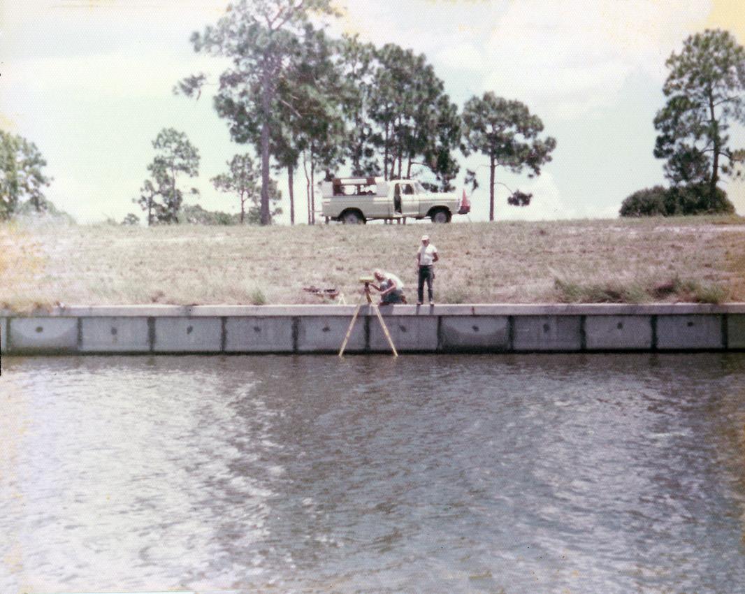
MEMBERSHIP OPPORTUNITIES
• NETWORKING
• CONTINUING EDUCATION
• LEGISLATIVE FSMPAC
• PROMOTING THE PROFESSION
• PROTECTING LICENSURE
• ADDRESSING UNLICENSED PRACTICE
• ENCOURAGING FUTURE SURVEYORS
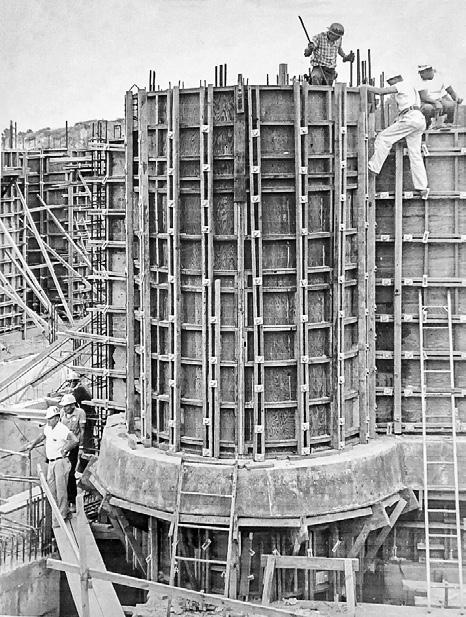
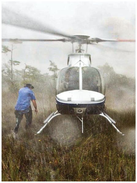
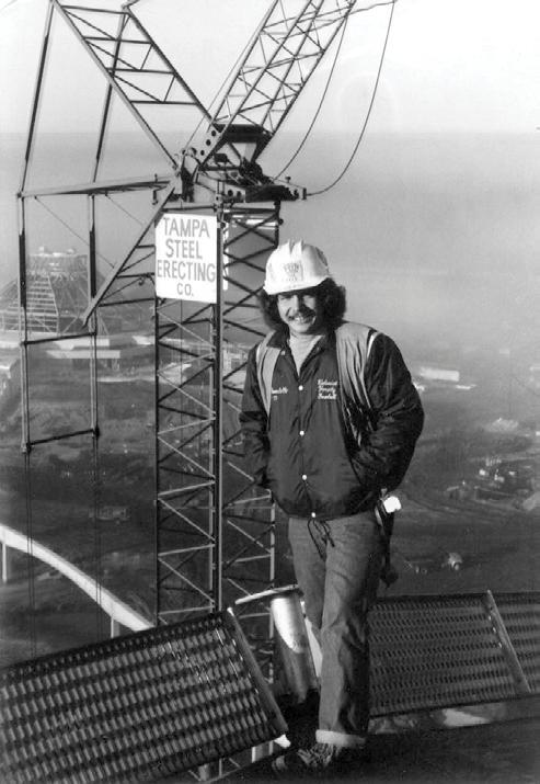
• AWARDS & SCHOLARSHIPS
• CAREER OPPORTUNITIES
June 2023 Page 92
Florida Surveying and Mapping Continuing Education Provider Offering 25 Years of Dedication, Quality & Trusted Services
Step 1: Choose Course(s)
3 Hour Courses Available
□ A History of the Prime Meridian Marker,
□ Basics of Real Property
□ Digital Signatures for Surveyors
□ Easements and Rights of Ways,
□ Elevation Certificates and the Community Rating System
□ Introduction to Photogrammetry
□ Quality Assurance/Quality Control for the Design Professional and Technical Staff, #9293, 3 CEC
□ Writing Boundary Descriptions
6 Hour Courses
□ Boundaries in Florida
□ Chapter 177, Platting (Plat Law)
□ Critical Communication for Surveying & Mapping Professionals
□ Ethics for the Design Professional
□ Florida Laws
□ Florida Surveying Law and Rule Changes
□ Geographic Information Systems (GIS)
□ History of Surveying,
□ Identification of Native and Non-Native Trees in Florida
□ Land Tenure and Cadastral Systems
□ Map Projections and Plane Coordinate Systems , #7669, 6 CEC
□ Practical Geometry for Surveyors , #7109, 6 CEC
□ Public Land Survey System, #6979, 6 CEC
□ Remote Sensing Applications to Surveying & Mapping, #6972, 6 CEC
The Florida Surveyor Page 93
Billing Address of Credit Card:
IF PAYING BY CHECK, MAIL FORM TO: FSMS, P.O. Box 850001-243, Orlando, Florida 32885-0243
IF PAYING BY CREDIT CARD, FAX OR EMAIL FORM TO: 850.877.4852 education@fsms.org QUESTIONS? CALL 800.237.4384
June 2023 Page 94
FSMS Member EMAILED Fee Quantity Amount 6 CEC $115 Per Course x = $ 3 CEC $58 Per Course x = $ MAILED 6 CEC $125 Per Course x = $ 3 CEC $68 Per Course x = $ TOTAL $ Non Non Name: _ YES _ NO Firm: ____ _ YES _ _ NO Address: ______________________________________________________________________________________ City/State: Email Address: Work Phone: Payment Information: ___
to FSMS) _ VISA/MasterCard/American Express Card
Exp. Date: __ CVV Code:___________
Step 2: Choose Member Type
Check Enclosed (Payable
#: _______
______________________________________ Signature: _____________________________________ __
Provider No. CE11 fsms.org
ADMINISTRATIVE Staff
Executive Director

Rebecca Porter director@fsms.org
Education Director
Samantha Hobbs education@fsms.org
Communications
Coordinator

Justin Ortiz communications@fsms.org

Regional Coordinator
Cathy Campanile
seminolecc84@gmail.com
The Florida Surveyor Page 95
Past Presidents
1956
H.O. Peters
Harry C. Schwebke
John P. Goggin
R.H. Jones
1960
Hugh A. Binyon
Russell H. DeGrove
Perry C. McGriff
Carl E. Johnson
James A. Thigpenn, III
Harold A. Schuler, Jr.
Shields E. Clark
Maurice E. Berry II
William C. Hart
Frank R. Schilling, Jr.
1970
William V. Keith
James M. King
Broward P. Davis
E.R. (Ed) Brownell
E.W. (Gene) Stoner
Lewis H. Kent
Robert S. Harris
Paul T. O’Hargan
William G. Wallace, Jr.
Robert W. Wigglesworth
1980
Ben P. Blackburn
William B. Thompson, II
John R. Gargis
Robert A. Bannerman
H. Bruce Durden
Buell H. Harper
Jan L. Skipper
Steven M. Woods
Stephen G. Vrabel
W. Lamar Evers
1990
Joseph S. Boggs
Robert L. Graham
Nicholas D. Miller
Loren E. Mercer
Kent Green
Robert D. Cross
Thomas L. Conner
Gordon R. Niles, Jr.
Dennis E. Blankenship
W. Lanier Mathews, II
Jack Breed
2000
Arthur A. Mastronicola
Michael H. Maxwell
John M. Clyatt
David W. Schryver
Stephen M. Gordon
Richard G. Powell
Michael J. Whitling
Robert W. Jackson, Jr.
Pablo Ferrari
Steve Stinson
2010
Dan Ferrans
Jeremiah Slaymaker
Ken Glass
Russell Hyatt
Bill Rowe
Dale Bradshaw
Lou Campanile, Jr.
Bob Strayer, Jr.
Dianne Collins
2020
Don Elder
Hal Peters
Lou Campanile, Jr.
Page 96
