Artistic Cartography of Surveyors BPSM: Message from Ia Hall Monopoly's Secret History
Call us t o g et your complete work flow s olution today ! Efficiency and versatility that will accelerate productivity comes part of a workflow solution that includes the FC-6000 field controller, Magnet software, a HiPer VR receiver and the GT-1200/GT-600 single-operator robotic system. The power of longrange reflectorless measurements comes in your choice of 1”, 2” or 3” GT-1200 models or 2”, 3” or 5” GT -600 models.
The F lorida Surveyor is the official publication of the Florida Surveying and Mapping Society, also known as FSMS. It is published monthly for the purpose of communicating with the professional surveying community and related professions who are members of FSMS. Our award winning publication informs members eleven months out of the year about national, state, and district events and accomplishments, as well as articles relevant to the surveying profession. In addition, continuing educational courses are also available.
PRESIDENT’S Message
December 12th, 2024 Members,
Happy Holidays, Merry Christmas and Happy New Year to All,
I had a couple of great chapter meetings in the last two months with our members.
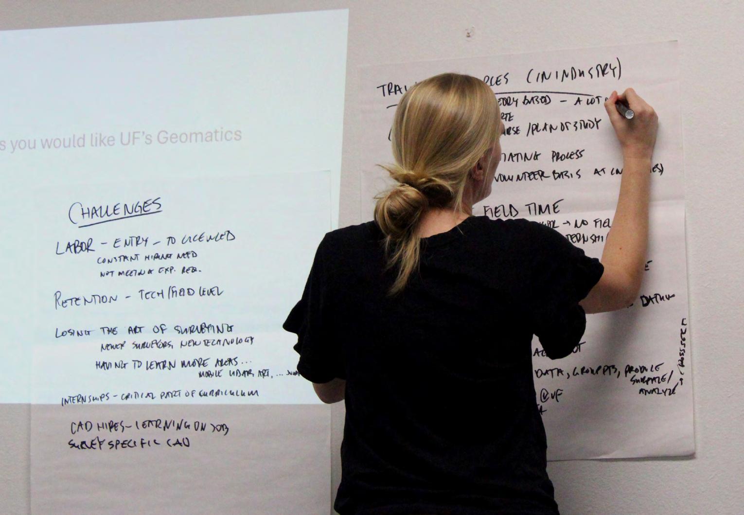
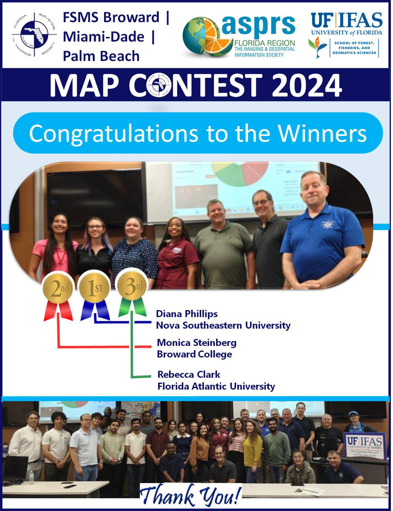
• The Broward Chapter had the second annual GIS Mapping Contest with cash prizes this year to celebrate GIS-Day on November 21st. They had Gabbie Drice, Geographic Information Systems Manager from Broward County give a presentation on GIS at the County level, and then we had 15 contestants from multiple GIS programs (Miami, Broward, Palm Beach, and Orlando) participate and give a 3 minute speech about their map with the top three getting cash prizes. This Map Contest was Dr. Youssef Kaddoura's (UF Geomatics Program) brainchild and he continues to build upon this event with the help of the Broward Chapter. He hopes to make this into a much bigger event each year to celebrate GIS day and to bring more focus on Geomatics.
President
Richard
Pryce
(954) 651-5942
rdpryce@gmail.com
• I was invited to the Indian River Chapter for their Holiday Social event at Cobbs Landing in Fort Pierce on December 5th. What a great place to have a meeting as there was plenty of food and drink to satisfy everyone's taste. I want to say a special thanks to Brion Yancy for all of the work he’s done with the Chapter and it was obivious to me that he really takes special pride in being a Surveyor and the President, and now the new Director for this chapter. Brion and the Chapter have some very lofty financial go als with their upcoming events (Clay Shoot and a New Chili Cookoff) to assist F SMS and our FSMPac Fund. If his dreams come true or are even close, he will accomplish something that no one else has attempted. I will leave those details to him and the Chapter, but I love the enthusiasm and heart that he and the
PRESIDENT’S Message
Chapter are putting into this. I would encourage all chapters to support his efforts and goals as well as participate if they can.
Our Legislative Committee is active and on top of things coming up this year. Jack Breed sent out a notice recently looking for a Local Contact in Palm Beach that has a relationship with Representative Anne Gerwig, and several members stepped up to the plate quickly. This was very refreshing and positive and much appreciated by FSMS. Working together we all benefit in finding a nd supporting our friends in Tallahassee. Politics, like it or not, is something we have to be involved with as a society so I commend all of those that can do it and participate in helping anyway they can.
Winter, this is my favorite time of year, cooler weather, lots of festive occasions to get friends and family together and as an early riser since I was a kid (4am), a good time to peer into the night sky for some star gazing.
Since August I’ve been greeted every morning with my favorite constellation “Orion, The Hunter”. He starts being visible in the eastern sky in August and continues to cross to the western horizon by the end of December. Why my favorite, because it’s the harbinger of fall and winter to me and when Florida becomes the most comfortable place to work outside and get things done. I plan all my outside work during this time and really look forward to it.
My place in Ocala is off the beaten path, has no streetlights an d is surrounded by woods. On a clear crisp night or morning, you walk outside to blackness where you can’t see your hand in front of your face and add a quick search with a flashlight to make sure there’s no bears around. But then , take about 10 minutes when your eyes adjust to the darkness, and look up and the stars light up your night for a show of the heavens. I can see why the early civilizations were so mesmerized by the universe that lay before them each night. Surveyors have always been stargazers, dreamers, visionaries, and lovers of the outdoors.
I highly recommend taking some time this winter to get out, away from as much light as you can and watch the heavenly show that presents itself to all that seek it. Wonder, dream, and immerse yourself into the universe and beyond. You’ll never regret it.
As always, respectfully submitted, Richard D. Pryce, RLS/PSM
2024-25 Districts and
Directors
District 1 - Northwest
Bay, Calhoun, Escambia, Franklin, Gadsden, Gulf, Holmes, Jackson, Jefferson, Leon, Liberty, Madison, Okaloosa, Santa Rosa, Taylor, Wakulla, Walton, Washington
Constitution & Resolution Advisory Committee Pablo Ferrari
Annual Meeting Committee Allen Nobles
Legal & Legislative Committee Jack Breed
Surveying & Mapping Council Randy Tompkins
Strategic Planning Committee Bob Johnson
Executive Committee Rick Pryce
Special Committees
Equipment Theft Manny Vera, Jr.
Awards Committee Howard Ehmke
UF Alumni Recruiting Committee Russell Hyatt
Professional Practice Committee Lou Campanile, Jr.
Workforce Development Committee Lou Campanile, Jr.
Liaisons
CST Program Alex Jenkins
FDACS BPSM Don Elder
Surveyors in Government
Richard Allen
Academic Advisory Justin Thomas UF / Todd Bates FAU
FES
Lou Campanile, Jr.
Practice Sections
Geospatial Users Group
Young Surveyors Network
Richard Allen
Melissa A. Padilla Cintrón, SIT
Artistic Cartography of Surveyors
Rick Pryce, RLS/PSM
With the development of technology and the progression of computers over the past 50 years, the cartography of Surveyors and Mappers has lost most of the artistic qualities of previous generations when hand drafting was used. The evidence appears most vividly in one of the most visible and recognizable portions of our work, “The Record Plat”.
Nothing against computers, for they have brought us enormous value in computational capabilities, consistency, and efficiencies to overall work, as well as the ability to store the data electronically, and make editing a breeze from the hand drafting and manual calculation days of old.
But with all of the pluses that computers have given us, “Record Plats” have become so consistent and stagnant in the overall appearances, machine made so now it is somewhat dull and boring in my opinion. It used to be that depending on the Survey and/or Engineering company you could immediately recognize who did the Plat because they had a unique and individual quality and style to them that went along with getting it recorded in the Public Records.
Creating a Plat of your work represented the epitome of your survey talents, and the surveyor took great pride in what was going to be recorded on paper for all to see throughout time and space. A lasting impression of work that hopefully another surveyor would want to follow in the footsteps
of those that came before them. You could recognize the style and knew right away whether you had confidence in it by the way it looked and the important information it provided. Each plat became a piece of Artwork that not only represented you as a surveyor, but your company and the talent within.
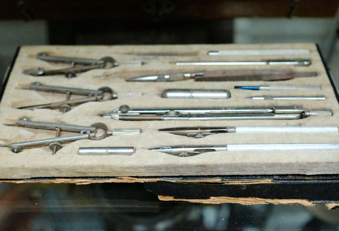
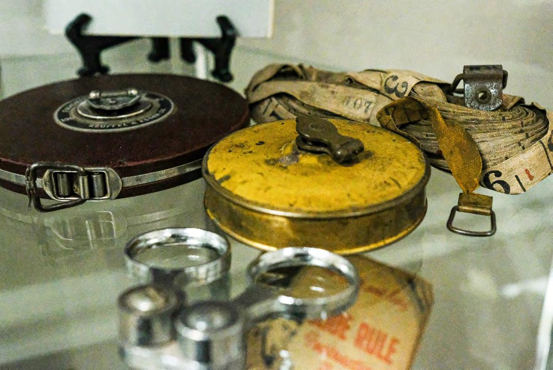
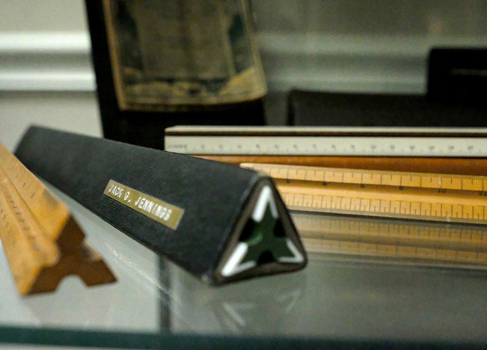
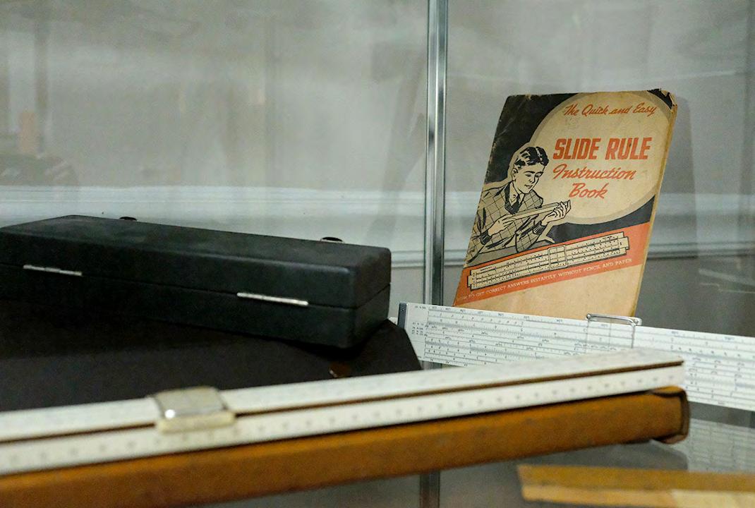
I came up through the ranks, and learned from the best of the best, both office and field. I was hired as a draftsman first back in 1972, fresh out of high school with commercial art and mechanical drafting experience. I learned survey hand drafting skills from a master draftsman. Starting with crow quill pens dipping into ink wells to write descriptions and create mortgage surveys. Then moved on to using precision German made drafting pens with dials for thickness of line work and then finally to rapidigraph pens, a game changer at the time. All of the skills were taught individually on how to use the equipment, triangles, T-squares, slide rules for calculations, mechanical pencils with different hardnesses for plotting guidelines to
keep your lettering perfectly straight, and forming letters and numbers consistently and readable. But one of the most important skills to learn and master was the ability to make a drawing/survey balanced, readable, understandable and visually comfortable to look at. A skill that is still needed and important in surveys, plats, and any kind of map or exhibit you prepare as a surveyor.
Survey Cartography:
Being an early adopter of technology and fascinated with computers, the late 70s and early 80s was just a whirlwind of new things that kept me working late hours and learning everything I could about these new toys. I jumped into it with enthusiasm and a constant thirst for what they could do and how we could use them in our Survey work. Computers became my life blood, learning to program them, build them and fix them. But the next big thing was when the pen plotters came out in the early 80s. I saw them demonstrated at conference and had to convince my boss at the time to buy one. I still
Artistic Cartography of Surveyors
remember the cost, $17,000 which was an enormous expense for a small survey company, but he said OK and then it was up to me to make it work. It took me a couple of weeks to work out the kinks, but when I did it took on a life of its own. I remember everyone standing around the plotter watching it write letters with ease, it was mesmerizing to most of us back then. Soon it became standard equipment at surveyor offices within the next two-three years. Then came more advanced Inkjet and Electrostatic plotters.
With all of the changes in technology we, as Surveyors, became better, be it the calculations, the field work, the equipment, and also more consistent in the mapping part. Surveys, Exhibits, Maps, and Plats became easier to create, as well as make them more consistent in their appearance and somewhat unique to each company creating them.
However, there was something lost in this progression and leap into the future. In our goals to become more efficient, quicker, and more ready to take on more complex surveys and maps, we somehow lost our way on the artistic and cartographic expression of our work. Even now when you look at any computer drawn map it’s very consistent, all text and titles, north arrows and scales, very readable in most cases. There are always a few outliers out there where the Plat/Map is too busy, possibly drawn to a scale that makes details difficult to discern or maybe not enough details. But it’s become just a
HP 7580 Pen Plotter (1982)
HP 7600 Electrostatic Plotter (1988)
machine drawing, put out by CAD techs that have been told to do it this way, why, because we’ve always done it that way or that’s our standard. I myself got into that mindset after using computers and forgot all about individuality, style, and old fashioned cartography making a unique and interesting Plat/Map.
In 1987, I was running the Office and Field operations for R.P. Legg & Associates at the time. We were working with a developer/builder named Ivanhoe Land Investments. They were great people to work with and produced a quality product that sold well. The Plats we did for them all had names reflecting an Olde English flair to them, (i.e. “Ivanhoe Estates, Waterford, Falcon’s Lea and Waverly Hundred” ) and it always brought in thoughts and memories of Olde English books and tales of kings, knights, and castles from days gone by. When we got the next development project in from them, the name of the Plat set me back in my seat and I just felt it deserved something special. Even though we did all linework of our Plats now on the computer, they still had hand lettering on them. With this new name I got an idea. So, I got the four CAD techs together and offered them a challenge to come up with the artistic design for the new Plat name. I discussed it with the owner of our company and called the developer as well. He thought it was unusual, but was intrigued by the idea. In order to get his final approval for this contest, I said he would be the judge in the competition, and if he didn’t like any of them we would just forget the whole thing, so that he had the last word. I believe we also had a monetary prize, but I don’t remember that part as well.
The Contest went on and a design was approved by the developer and we prepared the plat. It was quite unique, cartographically beautiful, and stood out amongst anything we had done in the past. But, little did we know, or suspect, that a problem was lurking in the background.
We submitted it to the County for the approval process and when we got back our first comments, the bureaucracy was rejecting it because of the artwork, and wanted us to remove it and said it wasn’t allowed for plats, even though there was nothing in the requirements. Anyways, we were a little stunned and definitely disturbed by this. Luckily the owner of our company and the developer were politically connected. It took a little time, but in the end we were approved. Artistic cartography won out in the end, and continued into the next plat, but not as foremost as the first.
Artistic Cartography of Surveyors
I haven’t pushed this issue into future Plats that I have been a part of since then, because none of the names have really struck the same nerves as the two plats we did back then. But if you do come across an unusal and unique name, and it hits the artistic nature in your whole being, I would definitely encourage all Surveyors to think about it and push the limits, take a chance and bring back the Cartography from our past once again.
As a proud Surveyor and Mapper and lover of our history, I am thankful for those that came before us. For they had the fortitude, grit, and vision to press into the unknown territories of this great country and plot and plat the boundaries we map and remap today. They were the true adventurers and we owe them a debt of gratitude.
I’ll leave the judgement on the quality of the Artistic Cartography up to all of you, but it gave me satisfaction that we brought a little something back to the forefront at the time, even if it was short lived, and I would love to see more of it in the future.
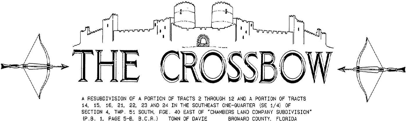
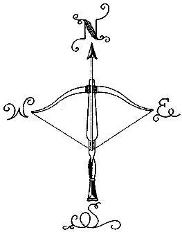
The name of the two Plats recorded in Broward County, FL records from my past are:
• “The Crossbow” (Plat Book 131, Page 11) Design and North Arrow below.
• “Hawkes Bluff” (Plat Book 134, Page 24) North Arrow design on next page.
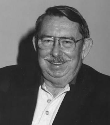
Marvin Egerton Carter
September 2, 1936 – June 16, 2024
M arvin C arter , 87, or Gator, as he was fondly called by many friends, was born on September 2, 1936, into a pioneer family of Indian River County that homesteaded 80 acres west of Wabasso in 1913. His love of the local area was evident in his many professional and personal pursuits, and it played a large role in shaping him as an individual.
Marvin’s heart for community service and his dependable nature were apparent early on in his life. Described even in high school as being “always around when he’s needed,” Marvin instinctively availed himself to help others without expecting anything in return and maintained a reputation for solid reliability in the community. Ever loyal to friends and family, Marvin was beloved by so many people for his kind, gentle manner and wonderful sense of humor. His ability to tell a colorful story and deliver the punch line were masterful. Marvin enjoyed the outdoors, especially diving off the coast in his early years and hunting in the Big Cypress Swamp and west of Vero Beach throughout his life.
Marvin knew how to put people at ease and make them feel at home; he was a man of few words, but his actions spoke volumes and his loving nature was always communicated. The impact Marvin made on his community, his many friends, and his family has been significant; he leaves a legacy of love and generosity that will not be forgotten. Link to Marvin’s obituary.
round the State A
From UF Geomatics Student Association
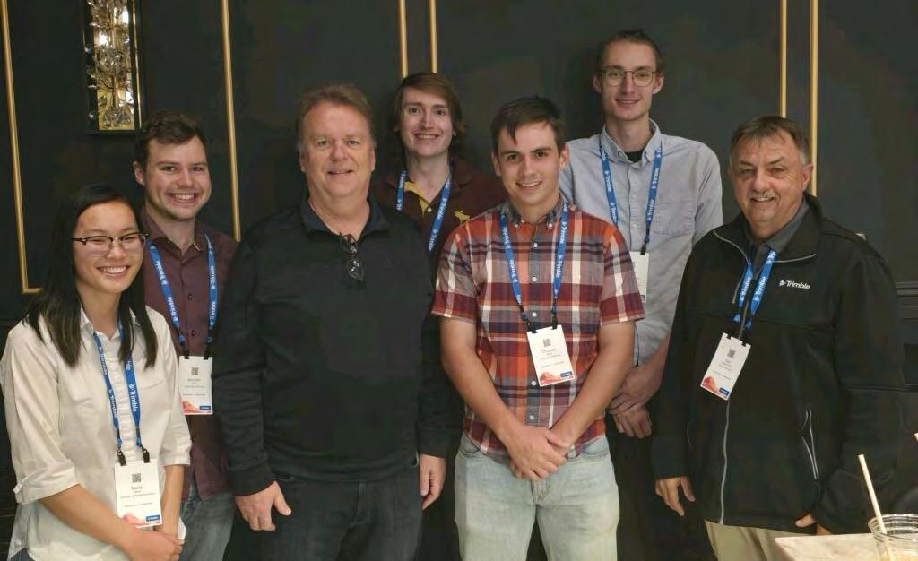
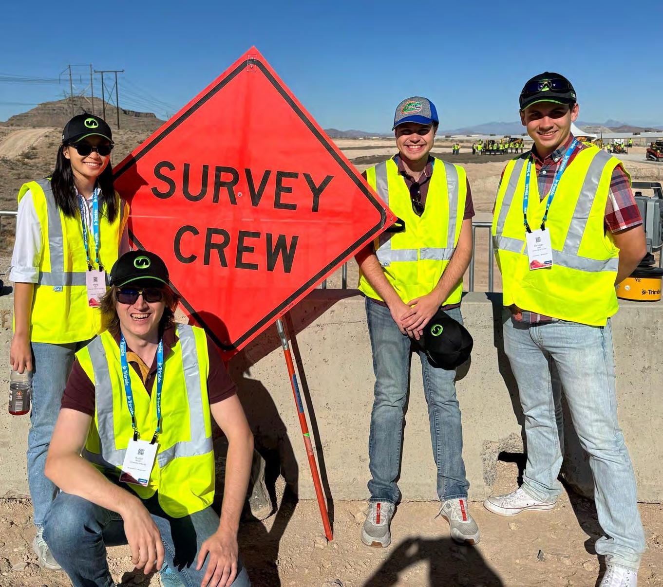
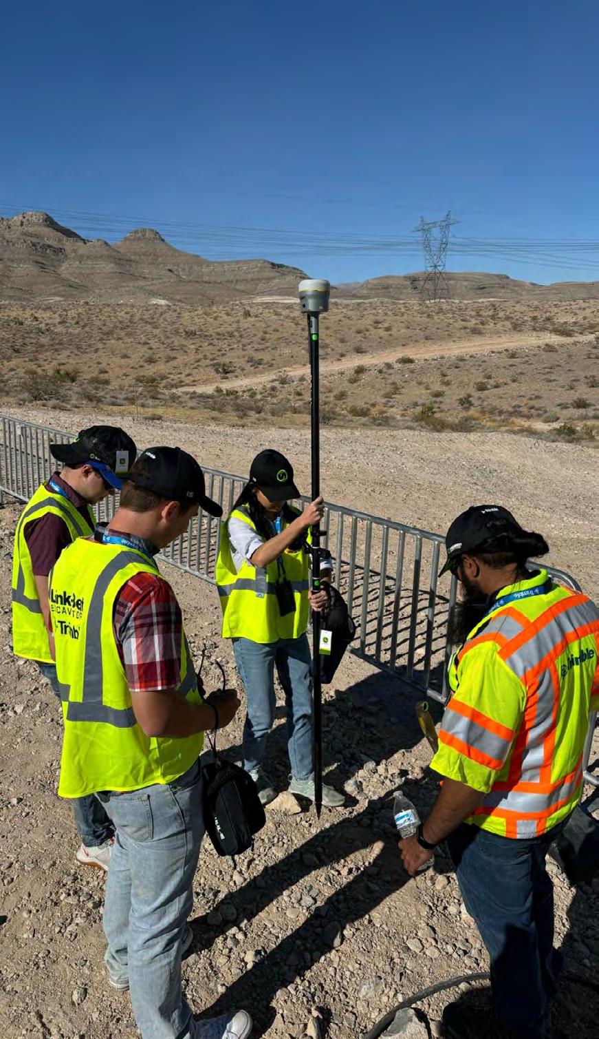
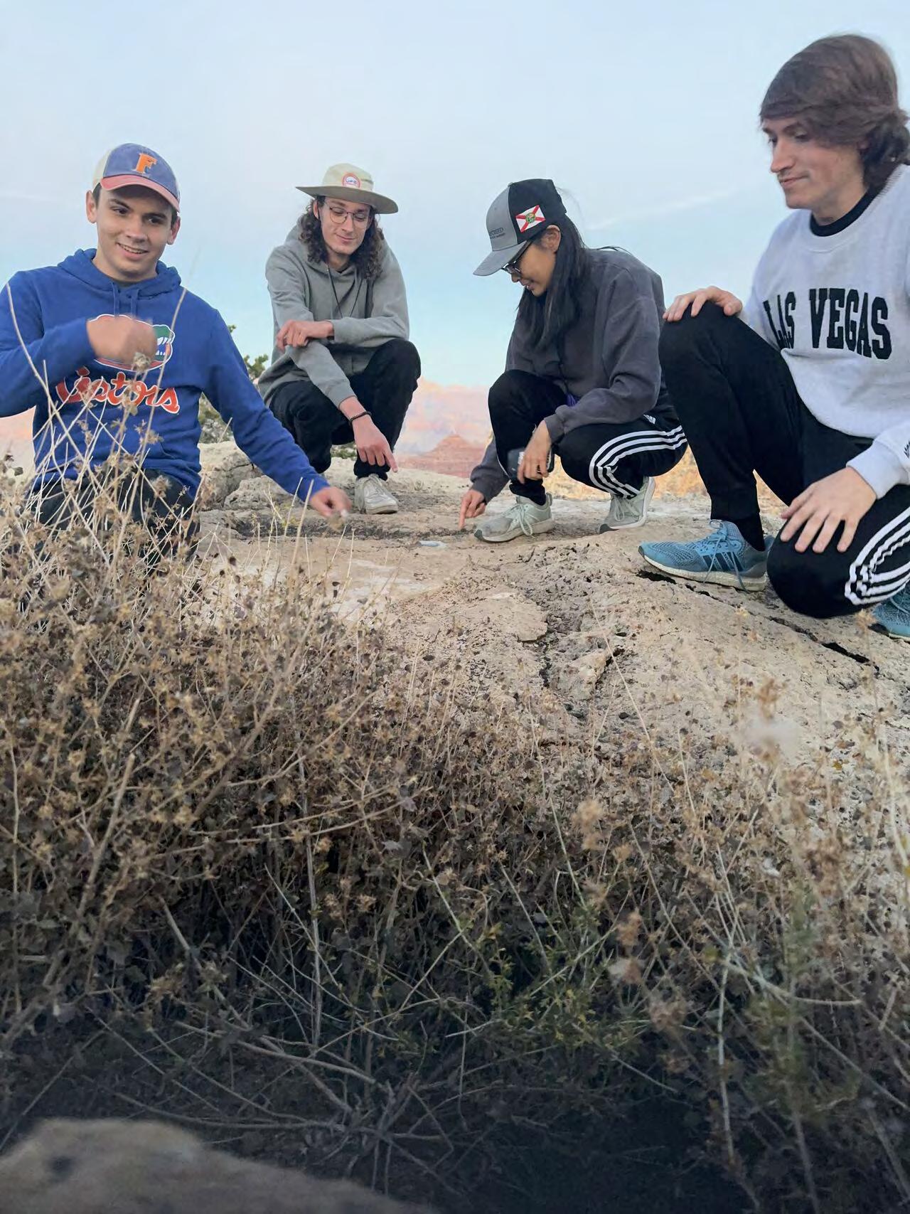
The University of Florida Geomatics Student Association traveled to Las Vegas, NV for the Trimble Dimensions Conference.
UFGSA would like to give a huge thank you to Earl Soeder and Duncan-Parnell Inc. for reaching out to sponsor our students’ conference registration. It was a very enriching experience that allowed the students to interact with and learn more about geospatial technology, as well as getting the chance to network and meet industry professionals. In addition, we’d like to thank UF Geomatics alumni Jeremy Hallick & Joshua Hazen, PLS for connecting with us and providing great insight into the surveying profession. Go Gator Surveyors!
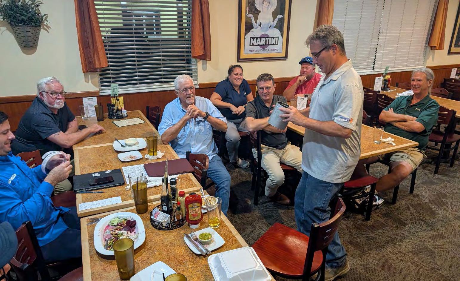
From The Benchmark – Central Florida Chapter Newsletter :
Photos by Chapter President Raymond F. Phillips, PSM and Betty Morris GISP Chapter Treasurer.
Chipola Chapter Meeting with Guest Speaker
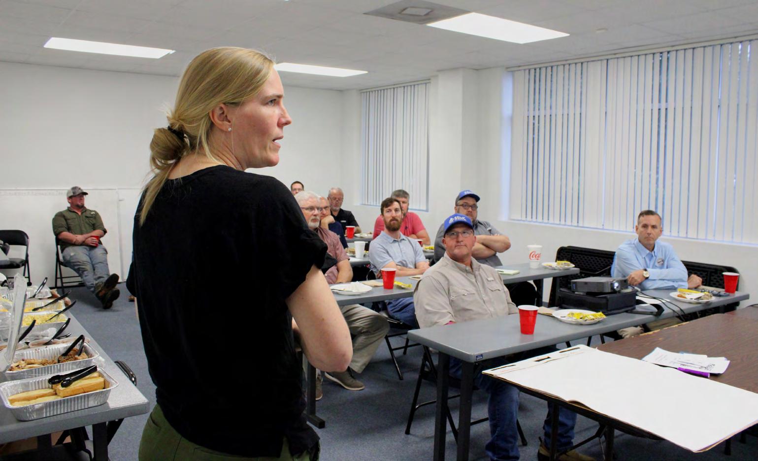
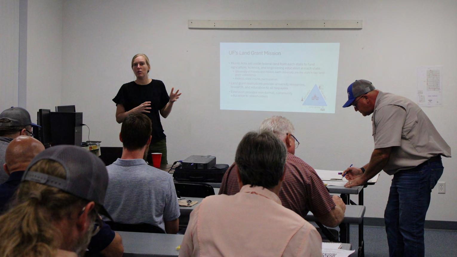
Katie Britt, UF Assistant Director for Geomatics
Extension, presenting on behalf of UF/IFAS'S Workforce Development Program.
From Dr. Youssef Kaddoura, Geomatics Specialist at UF:
We are excited to announce the winners of our GIS Day Map Contest 2024! In celebration of GIS Day and our efforts to promote Survey/GIS to the next generation, we received incredible submissions from students across all colleges.
-> 1st Place: Diana Phillips from Nova Southeastern University
-> 2nd Place: Monica Steinberg from Broward College
-> 3rd Place: Rebecca Clark from Florida Atlantic University
A huge thank you to our distinguished guest speaker, Gabrielle Drice, GIS Manager at Broward County Government, for her insightful and inspiring presentation. Gabrielle shared her wealth of knowledge and passion for GIS, leaving us all with a deeper appreciation for this vital field. This event was made possible through the partnership of the following organizations:
-> FSMS Broward Chapter
-> FSMS Palm Beach
-> FSMS Miami Chapter
-> ASPRS - Florida Region
-> University of Florida School of Forest, Fisheries, and Geomatics Sciences
It was an honor to have the Florida Surveying and Mapping Society
President Richard Pryce and Palm Beach Chapter President Todd Bates, PSM with us for this event. Your leadership and support continue to drive the success of our industry.
Thank you to everyone who participated, supported, and made this event such a success. Let’s continue to inspire and engage the next generation of Survey/GIS professionals!
FSMS Officers:
Eduardo "Eddie" Suarez, Todd Bates, PSM, Benjamin Hoyle, Scott McLaughlin, Earl Soeder, Maria Barboza, Edward Jones, & Ethan Jiping Cao.
ASPRS FL-Region Officers:
Matt LaLuzerne, MBA, PSM, Al Karlin, Joe Aufmuth, Stephen Medeiros, Meagan Anderson, Nick Kules, Richard Allen, PSM, CFM, Brian Murphy, PSM, CP, GISP, & Rick Householder.
Board Members
Iarelis (Ia) Hall - Chair
Apopka
Eugene Collings-Bonfill Miami
L a ndon Cross Boca Raton
Andrew G etz Dade City
Jim Sullivan Palm Beach Gardens
Danny W illiams Cape Canaveral
Michael Zoltek
Cape Coral
Consumer Members
Keith FountainVice Chair
DeLand
Wendi McAleese
Tampa Board Staff
Liz Compton Executive Director
Christopher E Green
Co-Executive Director
Regenia S. Lee Government Analyst I
Jacob Sternlicht Board Attorney
VACA N T Board Prosecutor
MESSAGE F ROM
T HE I NCOMI NG
BOA R D CH A IR Ia Hall
Dear Colleagues,
My first message to you is filled with gratitude and humility as I take on the role of Chair of this esteemed board. It is both an honor and a privilege to serve our profession—one that has been foundational in shaping our understanding of the world around us and ensuring that what we do is always thought of as a highly-regarded profession by ensuring that people are qualified to hold a license, keeping the public safe and ensuring that there’s some remedy for them to hold us accountable for our actions.
Yes, I am as nervous as I was when I started on the Board 4 years ago. I am nervous because I want to do this right. Thankfully, and because my work is not to operate from an island, I want to give you an insight into our remarkable assembly of talent, dedication, and vision that will make the work and my nerves much more manageable. We have two consumer members (Wendi McAleese and Keith FountainVice Chair). We couldn’t be luckier with their valuable input because Wendi is a Florida Licensed Title Insurance Agent and Licensed Real Estate Salesperson in the insurance industry providing management of title examination and also serves as Project Manager for the Florida Department of Environmental Protection and Keith is an attorney for conservation strategies
and conservation real estate. They aren’t looking at what we do as a totally strange and unknown world where the lingo and the acronyms could get confusing and therefore appreciating the work the Board is trying to do as they are on the other side of the fence with a more objective view of what we should be doing; and keeping us accountable as, well, consumers as the name states.
Then, we have seven Professional Surveyors and Mappers with a wide spectrum of areas of practice related to surveying and mapping and many years of experience in the field. Five of them, including me, have been serving on the Board and you may even know some of them. I can say with zero degree of doubt that they always thoroughly read the cases, review the applicants, and look at all the angles of the matters brought upon us. The other four are Michael Zoltek, Landon (Alfie) Cross, Eugene Collings-Bonfill, and Danny Williams. Each of them contributes uniquely to our mission of advancing surveying and mapping and protecting the public. We have two new members joining us to take over for Chris McLaughlin and David Schryver who served with distinction until October 31, 2024. They served on all the committees and as Board Chairs as well as serving as mentors and friends to us. They will be incredibly missed, and I thank you for your service. We will get to know the new members on February 3rd at the next meeting in Gainesville. Together, we are not just practitioners; we are custodians of vital information that supports sustainable development, enhances public safety, and fosters innovation. These people are focused on the task at hand. We volunteer our time to serve, we focus on the task, and we also grow as professionals.
I want to take a moment to express my sincere thanks to my predecessors, whose leadership and commitment have paved the way for the strides we’ve made, and I am committed to building on that legacy as we move forward. I have learned so much from the people who have come before us, Board Members, the administration, past members, and liaisons to professional organizations who provide their input at the meetings. The meeting minutes are available to the public if you ever want to see what is happening at one of the meetings and they contain a lot of information for those who care to know and have some time to read them.
I can’t forget to tell you about the administrative side of the Board, the ones who do all the work for you licensees and licensees to be and make our Board work so organized and laser-focused. Regenia Lee (Government Analyst), Patricia (Liz) Compton (Executive Director), who is not allowed to leave but doesn’t know it, and Chris Green (Incoming Executive Director), who is going to serve together with Liz until her retirement. And then we have our investigators, Jayla Smith (Mediation and Enforcement) and JC Branum (Prosecuting Attorney), and our very capable Board Counsel Jacob Sternlicht.
The challenges we face are significant—rapid technological advancements, changing regulatory landscapes, and the increasing need for sustainable practices. Yet, with challenge comes opportunity. Together, we can advocate for best practices and elevate the standards of our profession. We have seen a steady increase in applicants and the numbers are holding. I am particularly excited about our focus on collaboration. We can strengthen our voice and broaden our impact by fostering partnerships within our
industry and with related sectors. Our profession thrives when we share knowledge, innovate, and support one another.
In closing, I want to reiterate my heartfelt gratitude. I am eager to learn from each of you as we work together to not only meet the challenges ahead but to seize the opportunities that will enhance our profession for future generations. Let us strengthen the bonds that connect us and build a future we can all be proud of.
Thank you and stay out of trouble. You can find our professional rules and statutes online. Hint, hint. Happy upcoming Holidays and cheers to new beginnings!
PRECISION BEYOND BOUNDS
FRONTIER PRECISION UNMANNED SOLUTIONS
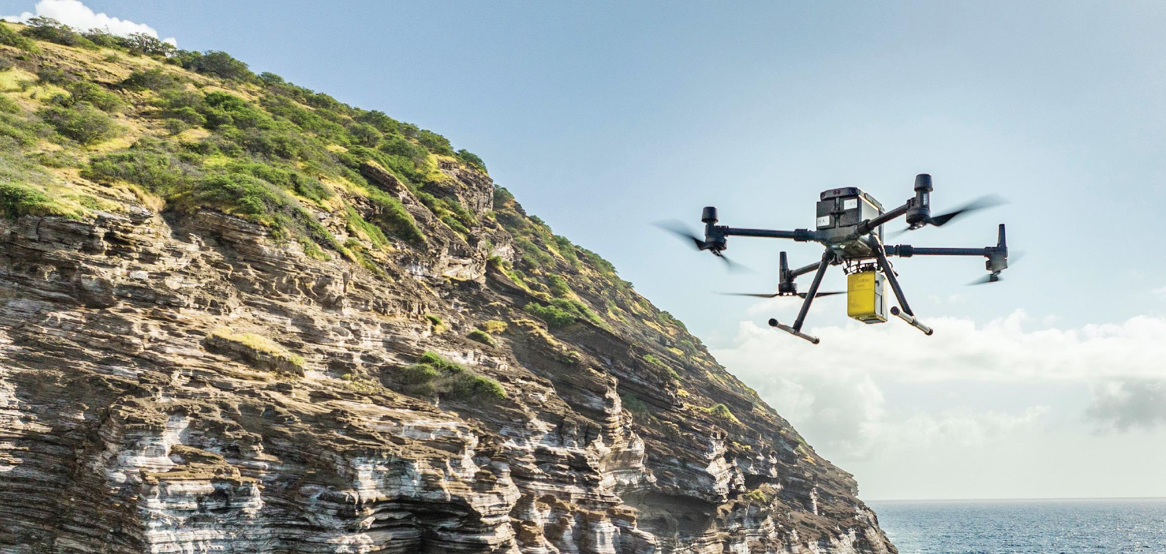
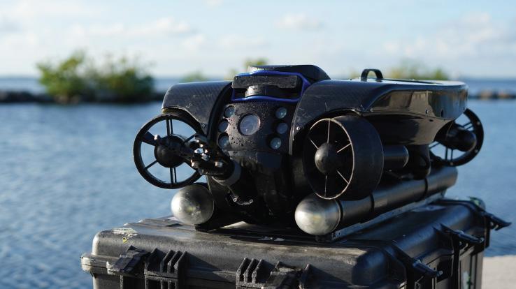
Frontier Precision has been leading the way in delivering innovative solutions – on land, air and underwater with our Unmanned technology. Now, every place on earth is reachable – with our UAS/ Drones, ROV’s, and LiDAR solutions. We help you with the latest technology to get your job done efficiently while keeping your business profitable.
UAS / DRONE DOCKS
The latest innovations in drones and docks to deliver the right product for the right UAS application.
LIDAR / SENSORS
LiDAR/Sensor solutions designed for precision data collection.
UNDERWATER ROVS
Deep Trekker’s underwater ROVs showcase proven durable and innovative solutions.
FRONTIER PRECISION | JACKSONVILLE, FL
Jordan Baranowksi | 904.855.9827 [Office] or jordanb@frontierprecision.com
FIND OUT MORE AT: www.frontierprecision.com/unmanned
WIN A PACKET ONE REGISTRATION FOR ANNUAL CONFERENCE!
FSMS is Awarding a Recruitment Bonus for Current Members Bringing in New Memberships
The Bonus will be a Conference Packet One Registration (includes One Wed. BBQ Ticket, One Fri. Exhibitor's Luncheon Ticket, One Fri. Recognition Banquet Ticket, and Six Sat. Seminar CECs) along with a 2 Night Stay at Naples Grande Beach Resort.
• The Recruitment Bonus will be Awarded based on a Point System.
• 6 Points for each New Full Member, Gov. Surveyor, & Sustaining Firm.
• 1 Point for each New Associate, Affiliate, & Student Member.
• Whenever a New Member fills out their membership form they must provide referred current member's name when asked, “Were you referred by a Current Member of FSMS?”
Points will be awarded during Open Enrollment between now and March 31, 2025. The Member with the most points will be deemed the Winner and be announced in April's edition of The Florida Surveyor!
2025 MEMBERSHIP IS OPEN!
Membership for 2025 is open and available for those needing to renew or for those wanting to join The Florida Surveying and Mapping Society. You can Renew your current membership by Clicking Here and logging-in to your FSMS account.
For those New Members wishing to join or rejoin if they were not a member in 2024, Click Here to read about our Membership types and click on the “Join FSMS Today ” button at the top of the page to begin your membership with The Florida Surveying and Mapping Society.
CHAPTER THIRTEEN
A Broader Perspective: Ecosystem Restoration Becomes National Policy
Throughout the 1980s and early 1990s, Florida politicians lobbied Congress and the president of the United States for federal help in Everglades restoration. Governor Bob Graham appealed to President Ronald Reagan for federal assistance in support of the state’s Save Our Everglades program. Congressman Dante Fasc ell pushed enactment of the law initiating experimental water deliveries to Everglades National Park – a federal incursion into state water rights that he and other Florida lawmakers regarded as a practical necessity. Graham, both as governor and as a U.S. senator, fought for a congressional directive for the Corps to restore the Kissimmee River. All of these initiatives required federal appropriations. The threshold question for these politicians was always whether or not there was a national interest. But the problems of ecological decline stemmed fundamentally from Florida’s burgeoning population growth, critics contended, and it was the responsibility of the state to manage growth. Therefore, why should the federal government invest in Everglades restoration if the state ultimately controlled the outcome?
With that counterargument in view, Florida’s entire congressional delegation vigorously pursued more federal protections for South Florida wild lands: establishment of Biscayne National Park in 1980, additions to Big Cypress National Preserve in 1988 and Everglades National Park in 1989, creation of Florida Keys National Marine Sanctuary in 1990, and designation of Dry Tortugas National Park in 1992. By the early 1990s, the federal interest in South Florida was manifestly huge, and Florida politicians pointed to the federal lands whenever they angled for more federal involvement in South Florida’s water management. “We are right now on the edge of a severe water crisis,” Congressman Clay Shaw, Jr., a Republican from Miami, declared to his fellow members of the House. “The Federal Government, as the largest landowner . . . has the responsibility . of seeing to it that its investment is preserved and the water flow is preserved.”1
As the complexity, scale, and cost of ecosystem restoration in South Florida grew, the threshold question for federal involvement subtly changed. The national politics of saving the Everglades turned a corner. Instead of “is this a federal interest?” the question became “is this a national priority?” The problem was not if the government should develop and implement a comprehensive plan for saving the Everglades from ecological collapse, but how. And the politicians speaking out for Everglades restoration were no longer just Florida politicians. Increasingly, political leaders from across the nation saw Everglades restoration as a test case for efforts to restore and protect other ecosystems at risk throughout the United States. They adopted the dire rhetoric that Graham, other Florida politicians, and environmentalists had used for more than a decade: Everglades National Park, one of the crown jewels in the national park system, was dying. As Representative George Miller, a Democrat from California, ominously observed at a field hearing in the Florida Keys in July 1993, “We are not prepared to
designate, if you will, the Everglades, Yellowstone, or Yosemite” as areas needing federal protection.2
This new political framework began to take shape following the election of William J. Clinton to the United States presidency in November 1992. Despite Clinton’s mixed record on the environment as governor of Arkansas, many environmentalists saw him as the “great green hope.”3 During the presidential campaign, Clinton made numerous pledges of increased federal support for environmental programs, such as enactment of a new Clean Water Act that would regulate nonpoint sources of pollution and real commitment to “no net loss” of wetlands (two matters of importance to South Florida). Clinton also rejected the Bush administration’s position that environmental protection was adverse to economic growth. Rather, Clinton maintained, environmental cleanup efforts would create jobs and lead to a stronger economy based on sustainable development.4 Florida lawmakers who wanted the federal government to get more involved in cleaning up the Everglades were encouraged by this rhetoric.
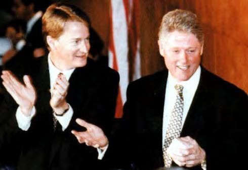
President Bill Clinton at a joint session of Florida’s legislature. (Source: The Florida Memory Project, State Library and Archives of Florida.)
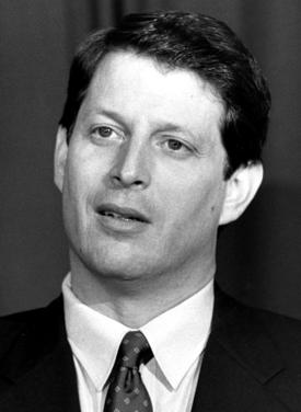
Clinton boosted his environmental credentials by selecting Albert Gore, Jr., as his vice-presidential running mate. Gore, a senator from Tennessee, was recognized as one of the leading thinkers on environmental policy in Congress; his book Earth in the Balance came out during the election year. In that work, Gore argued that environmental problems were the most urgent global challenge of the post-Cold War era, that the United States had a responsibility to lead the world community on environmental issues, and that President George H. W. Bush had failed to provide that leadership.5 When Clinton was elected president, members of Congress who supported environmental issues expected presidential leadership in areas where it had been lacking over the past 12 years.
Floridians who desired a larger federal role in saving the Everglades had reason to be pleased, too, as President Clinton formed his administration. His nominee for attorney general was Janet Reno, a Florida native, who soon began overseeing the job of preparing a new settlement in Dexter Lehtinen’s lawsuit. His choice for EPA administrator was Carol Browner, another Floridian, who had served under Governor Bob Martinez and Governor Lawton Chiles as chief of the state’s Department of Environmental Protection.6 Clinton’s selection for secretary of the interior, Bruce Babbitt, a former governor of Arizona, was not as
Vice President AlbertGore, Jr. (Source: The Florida Memory Project, State Library and Archives of Florida.)
familiar to Floridians. Babbitt, however, was eager to dispel any concerns that he would focus inordinate attention on the West, and he quickly dove into the Everglades issues, making Everglades restoration his leading cause in the eastern United States.7
As the Jacksonville District of the Corps, the SFWMD, and other agencies in South Florida took measure of the new administration, they noted events occurring in the opposite corner of the country. Clinton and Gore, delivering on a campaign promise, convened a “forest summit” to break the deadlock over old-growth logging and protection of the northern spotted owl on national forests in Oregon and Washington state. The president and vice-president met with environmentalists and the timber industry in Portland, Oregon, in April 1993, and announced a forest plan the following July. Emblematic of Clinton’s compromise approach to controversial issues, the plan allowed for a resumption of logging at set harvest levels for 10 years, designation of certain areas for habitat conservation, and federal assistance for retraining displaced timber industry workers in other jobs. While the forest plan was fundamentally a political compromise, it charted a course for the future by employing a rigorous and revolutionary new method called “ecosystem management.”8 The Clinton administration’s early commitment to ecosystem management in such a highly charged atmosphere as that surrounding the northern spotted owl sent a powerful signal all the way from the Pacific Northwest to South Florida.
South Florida’s resource managers had long pr acticed elements of ecosystem management before the term became fashionable in the late 1980s and early 1990s. Members of the Corps of Engineers applied principles of ecosystem management when they worked with Everglades National Park staff in restoring sheet flow to Shark River Slough for the purpose of protecting the park’s flora and fauna. So, too, did NPS specialists who developed a fire management plan for Everglades National Park, scientists in the SFWMD who collected and analyzed water samples from Lake Okeechobee, and members of the Miccosukee Tribe who hunted, fished, and trapped in their usual and accustomed places within the Big Cypress National Preserve. What was new in the 1990s was that resource manage ment agencies began to adopt ecosystem management as an organizing principle for many of their disparate activities. With the advent of the Clinton administration in 1993, ecosystem ma nagement was elevated to national policy.
Amid a deluge of scientific papers examining ecosystem management as a concept, an essay by ecologist R. Edward Grumbine, published in the journal Conservation Biology in 1994, offered the most round and succinct appraisal of what it entailed.9 Grumbine recognized ten dominant themes of ecosystem management, beginning with a “hierarchical context,” or “systems perspective,” for addressing environmental problems. A systems perspective meant that managers working on a problem at any one level or scale in the biosphere – whether they were focused on genes, species, populations, ecosystems, or landscapes – needed to seek connections between all levels in the system. A corollary or second theme of ecosystem management involved the need to define ecological boundaries at appropriate scales. In other words, managers had to recognize when it was necessary to seek environmental solutions across jurisdictional lines. In the case of South Florida, resource managers had long understood – but with growing clarity – that the ecological boundaries of concern to them encompassed the entire Kissimmee River-Lake Okeechobee-Everglades watershed, even extending to Florida Bay and the Florida Keys. Third, ecosystem management aimed to preserve “ecological integrity.” Standards for maintaining this integrity varied, but generally they included conserving viable
populations of native species and maintaining natural disturbance regimes. For example, in South Florida, a state game warden and a NPS scientist might have different objectives for maintaining ecological integrity, but they would agree that restor ing the natural hydropattern and allowing for extremes of high water and drought were key elements in their work. Additional themes were associated with the scientific method – data collection, monitoring, adaptive management – and with institutional processes, such as interagency cooperation and organizational change. Finally, Grumbine emphasized that ecosystem management was a social construct: it recognized that “humans are fundamental influences on ecological patterns” and that “human values play a dominant role in ecosystem management goals.”10
Many viewed ecosystem management as essentially a change of focus from the protection of single species to the conservation of whole systems, but Grumbine noted that this did not capture the full scope of the “seismic shift” in thinking that the new approach required. At base, ecosystem management was “an early stage in a fundamental reframing of how humans value nature.” It was an alternative to “resourcism” – the premise long held by modern industrial societies that nature was a storehouse of raw materials awaiting exploitation by humankind. Ecosystem management recognized biodiversity as something with intrinsic value, or as one set of authors included in Grumbine’s survey explained, it assumed that “living systems have importance beyond their traditional commodity and amenity uses.”11 Other authors whom Grumbine cited argued that ecosystem management required an ethical reorientation to nature, even a “rejection of humanism or anthropocentrism” in favor of “a biocentric embrace of all life,” although not all proponents would accept this philosophy.12 One of the central challenges of ecosystem management, Grumbine suggested, was to pursue the goal of ecological integrity within a sociopolitical framework still governed by values that supported resourcism. Distilling all of these factors into a working definition, Grumbine declared that “ecosystem management integrates scientific knowledge of ecological relationships within a complex sociopolitical and values framework toward the general goal of protecting native ecosystem integrity over the long term.”13
When President Clinton came into office, the best example of ecosystem management in South Florida was what the Corps and the SFWMD were undertaking in the Kissimmee River restoration project. But the scale was limited; some resource managers had begun thinking more grandly. One reason for this was because major problems with Florida Bay had surfaced, and many believed that the water management regime in South Florida under the C&SF Project was to blame.
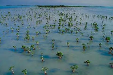
Florida Bay, a shallow triangular coastal lagoon located south of the southern Florida peninsula, extended south and east to the Florida Keys and west to the Gulf of Mexico. The unusual geography of the bay made it especially susceptible to changes in salinity. Exceedingly shallow (generally three to ten feet deep over most of its expanse), the bay’s rate of evaporation relative to the volume of water was very high. In addition, mud banks covered considerable parts of the bay floor, moving like underwater sand dunes. Resting just below the surface of the water, the banks reduced the force of lunar tides and restricted the circulation of seawater into the bay. Fresh water flowed to the bay mainly through Taylor Slough (and, to a lesser degree, Shark River Slough), and this water mingled with gulf currents in the outer portion of the bay. The brackish waters supported rich communities of seagrasses, molluscs, crustaceans, and fish,
and, in general, the seagrasses were more prolific where the waters of the bay mixed more freely with gulf waters.14
Scientists and environmentalists had been concerned about the bay for years. In the 1960s, a dearth of fresh water in Everglades National Park caused many to worry that Florida Bay’s salinity would rise to dangerous levels, killing the shrimp and fish. This, in turn, harmed the shrimp and commercial fishing industries that depended on the bay for their livelihood. Additional concerns arose in the 1970s, and resident fishermen, such as Michael Collins, were the first to call attention to ecological changes in Florida Bay. A resident of the island community of Islamarada in the Florida Keys, Collins made a living taking wealthy clients out on his charter fishing boat around the Everglades, the Bahamas, and the bay. With other fishermen, Collins began observing changes in seagrass communities in Florida Bay, and in 1976 the Islamarada Fishing Guide Association sent him to Everglades National Park to consult with research scientists about possible causes. Not satisfied that the park was giving the problem adequate attention, Collins began to research the history of the C&SF Project on the theory that water diversions from the Everglades – particularly the construction of the C-111 canal – had reduced freshwater flows into Florida Bay, thereby altering the bay’s estuarine characteristics.15
During the 1980s, Collins took his concerns to the SFWMD, and at the end of the decade Governor Bob Martinez appointed him chairman of the Resource Planning and Management Committee for the Keys Areas of Critical State Concern. According to Collins, that group’s activity “was one of the first efforts I saw to get a number of government entities from different branches of government together to discuss re source management.” The interagency cooperation was at the state and county level, rather than the federal level, and participants tried to define the ecological boundaries of the problem.16
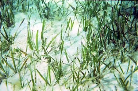
Turtle grass, or Thalassia testinum, the most abundant species of seagrass in Florida Bay, proved to be the canary in the coalmine. Fishing guides first observed that the turtle grass was spreading, colonizing the inner part of the bay, an indication that conditions were becoming more saline. In 1987, they began to see huge patches of turtle grass looking sick or dead. During the next four years, the seagrass die-offs spread over several hundred thousand acres. Floating mats of the decomposing matter blocked out sunlight, lowered the oxygen content in the water, and led to massive algal blooms. The normally crystal clear waters of Florida Bay became more turbid. As Collins told one journalist, “You should be able to read a newspaper lying on the
Mud Banks in Florida Bay. (Source: South Florida Water Management District.)
bottom in 10 feet of water.”17 In southwestern portions of the bay, increased turbidity and phytoplankton growth led to massive die-offs of sponges.18
By 1991, these conditions had reduced shrimp and fish harvests to record lows. Then, in November 1991, a huge algal bloom erupted in Florida Bay, spreading until, by the summer of 1992, it covered miles and miles of the bay, choking out sunlight, devastating sponge, shrimp, and fish populations, and creating a “dead zone” along the bay’s western edge.19 Observers, including commercial fishermen, Everglades National Park officials, and environmentalists, were horrified by the developments. “Florida Bay is falling apart like a rotting piece of cloth,” Jay Zieman, a marine scientist with the University of Virginia, asserted. “This is a disaster on the same scale as the Yellowstone fires” (which, ironically, turned out not to be a disaster after all).20 The bay was “becoming a huge dead zone,” an editorial in The Miami Herald, declared. “Slime and algae cloud its once clear waters, where sea grass waved gently in the current.”21 The condition of the bay, Mike Robblee, chief of Everglades National Park’s marine science section, related, showed that either the bay was “very sick” or it was “changing drastically.” Whatever the situation, Robblee continued, “we need to sit up and take notice.”22
Collins, who would later become a member of the SFWMD governing board, continued to assert that the cause of the devastation lay in the management of water in South Florida. “It was the drainage system that had been put in that was the problem,” he averred.23 Some environmentalists agreed. George Barley, an Orlando developer who was also an avid sports fisherman, part time summer resident of Islamorada in the Florida Keys, and chairman of the Florida Keys National Marine Sanctuary Advisory Council (created in 1990 by the Florida Keys National Marine Sanctuary and Protection Act, in part to deal with Florida Bay issues), became convinced that “the basic problem in Florida Bay is its fresh water has been taken away by a variety of means upstream.”24 Barley and others claimed that development in South Florida and the C&SF Project had drastically reduced how much fresh water flowed into the bay, creating an imbalance between the amounts of salt and fresh water that characterized a healthy estuary and making it more like the sea. Others, however, insisted that the problem came from an overabundance of nutrients resulting from runoff from the EAA and South Florida’s urban areas. 25
But the real dilemma was that no one could say with certainty what had caused the dramatic seagrass dieoff. Were the seagrass communities responding to nutrient loading similar to that occurring in Lake Okeechobee? Was Florida Bay receiving nitrogen and phosphorus coming all the way from the sugar cane fields? Or was it a problem of water supply and increased salinity?
Turtlegrass in Florida Bay. (Source: South Florida Water Management District.)
Was the sharp reduction of freshwater input from the C-111 basin causing more seawater to infiltrate and mix with the shallow waters in Florida Bay?26 No one seemed to know. As Everglades National Park Superintendent Richard Ring explained, park scientists had largely ignored Florida Bay since the 1960s in order to concentrate on mainland water issues. “Basic research that should have been done in the 1970s has not been done,” Ring stated, noting that the park’s research center did not have the funding to study the problem adequately.27
Realizing the severity of the situation, and hoping to prevent the bay’s impending collapse, Barley used his position with the Florida Keys National Marine Sanctuary – and his friendship with President George H. Bush, an avid fisherman of Florida Bay waters – to warn public officials of the problems. He recruited a wealthy friend with a seaplane to give flight tours of the bay to any public official who was interested in having a look. At first county commissioners accepted the offer, then elected officials who came from outside the area. This sounded an alarm that was soon heard in Washington; in the words of Billy Causey, director of the Florida Keys National Marine Sanctuary, “the noise level started getting so loud that [Congress] couldn’t help but . . . hear it.”28
Even before Barley began publicizing the Florida Bay issue, the Corps of Engineers had recognized the need for increased coordination in South Florida between water management agencies in order to promote the overall environmental health of the region. Colonel Terrence “Rock” Salt, District Engineer of the Jacksonville District, for example, had proposed a review of the whole C&SF Project in 1991 with a view to developing a comprehensive framework for interagency coordination on water management issu es in South Florida. He took Lieutenant General Arthur Williams, director of the Corps’ civil works program, and Nancy Dorn, Assistant Secretary of the Army, on a helicopter tour of the Kissimmee River system, receiving their support to put the review study into the annual appropriation bill for the Corps’ civil works program. Although the Water Resources Development Act of 1992 (WRDA-92) authorized the review study, it got lost in th e frenzy of the Corps’ emergency response to Hurricane Andrew, which struck South Florida in August 1992, and, as a result, the Bush administration did not allocate funds for a review. When Clinton came into office in January 1993, then, the idea of a comprehensive ecosystem restoration plan was embryonic and without a federal funding source. 29
Florida environmentalists knew of the proposed study and wanted to see it funded through the Corps. After Colonel Salt became absorbed in the Hurricane Andrew disaster relief efforts, James “Jim” Webb of the Wilderness Society took the matter into his own hands and drafted the language for a congressional authorization.30 Meanwhile, the Everglades Coalition produced its own restoration plan for the “Greater Everglades Ecosystem,” influenced in part by the condition of Florida Bay. Not surprisingly, the coalition’s plan called for restoration of “the essential features of the natural hydrology – the volume, depth, timing and distribution of water that once flowed through the system.” It also sought a return of pristine water quality and enhancement of urban and agricultural water supplies. Drawing upon ecosystem management concepts then in development for the “Greater Yellowstone Ecosystem,” the plan further called for restored connectivity among wetland communities and use of biological indicator species to monitor the health of the ecosystem.31
After the 1992 presidential election, Florida environmentalists scrambled to reposition themselves and to establish links to the Clinton administration, even though some took a dim view of Clinton. According to Joseph Browder of the Audubon Society, those who considered themselves close to Clinton advised that the way to get his attention was to recast the Everglades restoration plan as a way to create jobs. “I had been getting reports by people who were supposedly in the know that we needed to turn this into a pork barrel program,” Browder remembered in an interview. Browder himself heard the president-elect make an off-the-cuff remark at a gathering in Hilton Head, South Carolina, during the winter of 1992-1993, that the only people that mattered were those who invested money and created jobs. “It reinforced the feeling that this was going to be a tough slog,” Browder recalled.32
Jim Webb of the Wilderness Society had other ideas. Webb knew Bruce Babbitt from his years in Arizona and he correctly recognized the new secretary of the interior as the key figure on Clinton’s environmental team. Webb got Babbitt to come to Tallahassee, Florida, in January 1993 and give the keynote address to the annual conference of the Everglades Coalition. This was Babbitt’s first public appearance after his confirmation. At the podium, Babbitt referred warmly to his two dinner companions, Colonel Salt and Richard Ring, superintendent of Everglades National Park, and promptly launched into a visionary speech about a Corps restudy of the whole ecosystem based on consultation with other federal agencies, input by a team of scientists, and political support from the highest levels. The audience cheered, applauding this bold new course.33
Babbit’s resolve stiffened after paying a visit to Everglades National Park. His examination of the park left him “absolutely appalled,” and Webb convinced him that drastic measures were needed, including the purchase of more private land to protect the park’s boundaries. “We can’t defend the Everglades – or Yellowstone – just at their boundaries,” Webb noted. “We have to deal with the whole ecosystem.”34 Back in Washington, Babbitt put this plan into motion. Just as he had outlined in Tallahassee, the restoration effort would go forward simultaneously at three levels in the federal government: at the cabinet level in Washington, at the agency level with the coordination of key managers like Colonel Salt and Superintendent Ring, and at the field level with scientists in each agency participating on an interagency team. Cooperation would start at the cabinet level with a new interagency task force and flow down to the field level. Whatever emerged from this effort would be science-driven.
In attempting to implement this plan, Babbitt had other examples of interagency efforts providing advice on water resource management. In the 1960s, for example, the St. Paul District of the Corps initiated the Upper Mississippi River Comprehensive Basin Study, an interagency
Secretary of the Interior Bruce Babbitt. (Source: U.S. Department of the Interior.)
examination of the river that morphed into the Upper Mississippi River Basin Coordinating Committee in the 1970s. Consisting of representatives from the Corps and the Departments of Agriculture, Commerce, Health, Education and Welfare, Housing and Urban Development, Interior, and Transportation, as well as individuals from the EPA and the Federal Power Commission, this committee was specifically tasked with developing a plan to solve water and land resource problems on the Upper Mississippi River. For additional management of the Upper Mississippi, the Great River Environmental Action Team was formed in the late 1970s, made up of representatives from the Corps, the USGS, the EPA, the Soil Conservation Service, the Bureau of Outdoor Recreation, and the Department of Transportation. The team, also known as GREAT, had the responsibility of coordinating navigation and dredging on the Upper Mississippi River with other river uses, especially recreation and fish and wildlife management. Studies initiated by GREAT eventually led to congressional authorization of the Upper Mississippi River System Environmental Management Program in 1986, which, under the leadership of the Corps, specifically focused on enhancing and preserving environmental values on the Upper Mississippi River.35
In a similar way to these Upper Mississippi management committees, Babbitt established a cabinet-level task force for South Florida, composed of five assistant or under secretaries representing the Departments of Interior, Defense, Commerce, Agriculture, and Justice, and an assistant administrator representing the Environmental Protection Agency.36 It would meet semiannually. Although task force members would delegate most of the effort to the Interagency Working Group, such attention to an ecosystem by so many senior officers in the executive branch of government was unprecedented.
In the early 1990s, observers had begun making references to the “federal family” in South Florida, meaning the constellation of federal agencies involved in resource management. In welding this federal family into an interagency team, Babbitt’s first task was to get together the several agencies in the Department of the Interior. These included the NPS, the FWS, the Bureau of Indian Affairs (BIA), and the USGS. Babbitt arranged a meeting of the Interior agencies in South Florida in April 1993 so that they could begin to develop a united vision for Everglades restoration. He sent his own science advisor, Thomas E. Lovejoy, as his representative. Lovejoy, a renowned conservation biologist, had recently gone to work for Babbitt to head up a new National Biological Survey, and on top of that effort Lovejoy plunged headlong into Everglades issues. At the April meeting Lovejoy encountered a general mood of optimism, although the representative from Everglades National Park sounded a discordant note when he insisted that the park did not want the USGS to conduct a hydrological survey in the park, preferring to have its own science staff do it.37
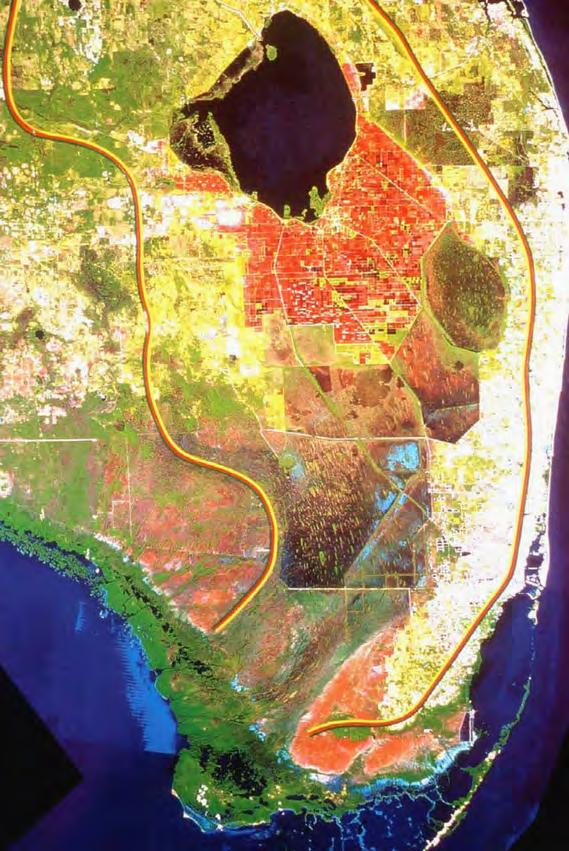
The focal point of this meeting was a composite satellite view of South Florida in which human development showed up in red and natural vegetation appeared in green. The satellite view was a remarkably clear expression of the extent of human manipulation of the natural environment and the hydrological pattern of flow from the headwaters of the Kissimmee River through Lake Okeechobee and the Everglades to Florida Bay. “You could see where the agricultural interests had encroached, and the way the water didn’t flow unless somebody turned a valve somewhere,” Lovejoy remembered in an interview. “You could see all the manmade structures, ditches, and dikes.”38 The satellite image was a fitting point of departure for the new
A satellite map of South Florida. (Source: U.S. Army Corps of Engineers, Jacksonville District.)
Ways to Earn Your Required 24 Continuing Education Credits
1. Earn hour-for-hour continuing education credits by completing board-approved FSMS courses or seminars.
2. Earn up to 6 continuing education credits per biennium by attending local chapter, state or national professional meetings.
3. Earn 2 continuing education credits per day of attendance at meetings of the Board of Professional Surveyors and Mappers.
4. Earn 6 continuing education credits for each semester hour of a completed course in a “surveying and mapping subject” at a regionally accredited university or college.
5. Earn up to 10 continuing education credits by researching, writing and publishing a book, paper or article related to surveying and mapping.
6. Up to twelve (12) continuing education credits earned beyond the required twenty-four (24) may be carried forward to the following renewal period. (5J17.041, F.A.C.)
7. Newly licensed PSMs are not required to earn continuing education before their first license renewal. (5J-17.041(4), F.A.C.)
interagency planning effort. Jurisdictional lines did not appear in the image, though the location of certain boundaries could be inferred from various hard edges separating red and green areas. More importantly, the image stimulated a holistic view or ecosystem perspective.
In June, Babbitt called the first meeting of the Interagency Working Group in Key Largo. Billy Causey, director of the Florida Keys National Marine Sanctuary, described this conference as “pivotal.” The group’s initial task was to define the extent of the ecosystem and agree upon some restoration objectives. “Never in my wildest imagination,” Causey said, “did I expect all the people in that room to define the ecosystem as starting in the Kissimmee headwaters and coming all the way down to the Florida Keys.”39 However, since Florida Bay’s condition was not improving, and, in many ways, was worsening, the group’s definition was not surprising. As a panel of scientists later concluded, South Florida ecosystems had been “managed as if they were in isolation from one another,” in many ways causing the freshwater problems that Florida Bay now faced. In their estimation, “it is clear that what is now needed is a broader perspective.”40 Accordingly, the group began coordinating several different Everglades project already underway, such as the C-111 Project (replumbing the East Everglades for better water flow to Everglades National Park) and the investigation of Florida Bay’s problems, with the goal of improving the Everglades ecosystem as a whole.41
The Key Largo meeting also saw the emergence of some interesting group dynamics. Babbitt had insisted that each department send two – and only two – representatives to this initial meeting because he did not want an influx of Interior personnel. Moreover, he asked Assistant Secretary of the Interior George Frampton to co-chair the meeting with Deputy Under Secretary of Commerce Doug Hall – a clear signal that the Commerce Department’s National Oceanic and Atmospheric Administration (NOAA) had a role in Everglades restoration as the managing agency of South Florida’s coastal waters. Frampton and Hall effectively led the group, displaying a new confidence that national park interests would get their due. Representatives of the Miccosukee and Seminole tribes and some state officials attended the meeting as well, but were not invited to sit at the table. Instead, they sat mutely against the back wall. This peculiar seating arrangement struck some participants as imperious on the part of the federal government. Colonel Salt showed up with Jimmy Bates, the senior civilian in the civil works directorate of the Corps’ headquarters division, plus four others, a ll in Army uniform. This military escort was contrary to Babbitt’s instruction that exactly two people attend for each department. “We all kind of bristled,” Causey remembered. “We started counting heads.” However, Salt, a large, square-shouldered man whom everyone knew as “Rock,” quickly put everyone at ease with his disarming and enthusiastic manner, and he began to act as the group facilitator. “We could see it was a new era for the Corps,” Causey recalled. “We had had some good colonels but Rock was here to get the work done.”42
Colonel Salt was undoubtedly the right man in the right place at the right time, another one of the many fortunate circumstances that propelled Ev erglades restoration to a national priority status during the Clinton administration. Salt’s consensus-based leadership style was atypical of a commanding officer.43 He was deeply interested in ecosystem restoration. Earlier in his career he had been assigned to the Corps’ Walla Walla District in the Pacific Northwest where he worked on mitigating the impacts of Columbia-Snake River dams on anadromous fish runs, and on other efforts to restore habitat for endangered salmon. He also had the backing of leaders in
the Corps who wanted to move the organization in a “greener” direction, notably Lieutenant General Henry Hatch, Chief of Engineers from 1988 to 1992. When Salt was selected for the Jacksonville District command, he went to G. Edward “Ed” Dickey, the Acting Secretary of the Army for Civil Works who had contributed to the development of the “Principles and Guidelines” in 1983, by which the Corps evaluated the federal interest in proposed environmental projects. Salt asked Dickey bluntly if the Corps was serious about Kissimmee River restoration and Everglades modified waters projects. “Oh, yes,” Dickey replied, but the colonel must do two things: demonstrate that the project was in the federal interest, and show that it was deserving of high priority in the nation. Salt focused on those problems when he represented the Corps in the Interagency Working Group and when he initiated the restudy of the C&SF Project. Ultimately, he had to prove to his superiors in Washington that the federal interest in ecosystem restoration in South Florida was more compelling than competing initiatives contemplated in regions such as California or the Mississippi Valley.44
Salt understood the need to follow and respect the internal process of the Corps even as that process began to get short-circuited by Washington politics. One significant consequence of Babbitt’s initiative in creating a federal task force was that the Jacksonville commander communicated directly with the Army’s task force representative, Acting Assistant Secretary Dickey. The normal chain of command in the Corps of Engineers ran from the Secretary of Defense, the Secretary of the Army, and the Assistant Secretary of the Army to the Chief of Engineers at Corps headquarters, then to the Division Engineer, and then to the District Engineer. Direct communications between Dickey and Salt, which grew increasingly frequent, bypassed headquarters and the division. During Salt’s command the task force’s impact on the Corps’ organizational structure did not produce significant tensions or repercussions, but by the end of the Clinton administration it would.45
At the same time that Babbitt initiated the creation of a federal task force on ecosystem restoration in South Florida, he pushed the Corps to commence an immediate comprehensive review of the C&SF Project. If the seeds of this restudy were already sown before Babbitt came into office, it was undoubtedly Babbitt’s energy that caused the project to germinate. As Salt remembers, he received a “frantic call from Ed Dickey” in April 1993. Did Salt know anything about a restudy, Dickey inquired. The next day Dickey called him again, this time relating that the administration wanted the Corps to begin a restudy immediately using existing funds. Next, General Roger F. Yankoupe, Division Engineer of the South Atlantic Division, phoned Salt, telling him to bring his chief planner to Atlanta to get the restudy started. With the help of John Rushing, Chief of Planning in the South Atlanta Division, Salt moved the project expeditiously “through the stovepipes in the Corps.” Initially, Salt and others thought the study would be funded out of the Corps’ general investigations account, but Rushing had another idea. “By
Colonel Terrence “Rock” Salt, District Engineer of the Jacksonville District.
calling it a review study [we] could use construction dollars, which were an order of magnitude greater than [general investigations] dollars,” Salt later explained. “By putting it into that account we were able to initiate a $2 million reconnaissance study that was unprecedented in terms of size.”46
By June 1993, the “Restudy” (as it was now officially called) had assumed national importance. Jimmy Bates, Deputy Director of Civil Works, instructed Salt to select his planning team carefully and assemble the best talent the Corps had. With such strong backing at the highest Corps level, it was no wonder that Salt exuded confidence at the initial gathering of the Interagency Working Group.47
Salt tapped Stuart Appelbaum, chief of the Jacksonville District’s Flood Control and Floodplain Management Planning Group, to head the Restudy. Appelbaum, who had worked on the Kissimmee River restoration plan, had contemplated how he would run the C&SF Project review study since its first discussion in 1992, influenced by the mentoring of Mann Davis, who had headed the District’s 1980 water supply study. Because that examination had been less than a stellar success, Davis had determined that the Corps needed to improve the way it conducted the study, and he transmitted some of these ideas to Appelbaum. Appelbaum therefore decided that the Restudy would have to involve the public and be interdisciplinary and interagency. Most importantly, people had to perceive it as something new and different. In order to accomplish these purposes, Appelbaum co-located all of the team – all disciplines, all agencies – in one room. His organizational model was the Skunkworks operation in the Lockheed Corporation. As Appelbaum explained, “You give them their own status off on the side; they are no longer working for the same organization, but they’re kind of a unique, standalone organization; you let them go solve tough problems.” By late summer Appelbaum had a team of 12 people and a room in the basement of the Jacksonville District affectionately known as “the cave.” His oftrepeated instruction to his team members was that they leave their agency hats at the door. One wag brought in 12 hats with a generic “agency” logo printed on each one. The team began to form a group identity.48
By the end of summer it was clear that the Restudy would serve as the vehicle for developing a comprehensive Everglades restoration plan. The Task Force and the Interagency Working Group would provide oversight. In September 1993, the second meeting of the Interagency Working Group occurred in Orlando. Ed Dickey attended with Salt. Talking about the Restudy, Dickey told the group that the other agencies must decide what they wanted restored, and then the Corps would draw up the engineering plans. This was a familiar refrain, but never in history had such an invitation involved so many agencies and so much area. Indeed, it was now evident that the scope of the Restudy would exceed the geographic limits of the C&SF Project.49
The Orlando meeting produced an interagency agreement on South Florida ecosystem restoration, which formally established the South Florida Ecosystem Restoration Task Force. The agreement declared that the South Florida ecosystem encompassed the Kissimmee watershed, Lake Okeechobee, the Big Cypress Basin, the Everglades, Florida Bay, and the Florida Keys. It listed the many federal interests in the area. These were not limited to federal lands, but also included the C&SF Project and the enforcement of environmental laws such as the Clean Water Act, the Clean Air Act, the Endangered Species Act, and others. The purpose of the Task Force was “to coordinate the development of consistent policies, strategies, plans,
programs, and priorities for addressing the e nvironmental concerns of the South Florida Ecosystem.” The agreement acknowledged the need for coordination with state, local, and tribal governments, as well as with member agencies. Specific goals of the task force were to agree on federal objectives for ecosystem restoration; to promote an ecosystem-based science program; to support the development of “appropriate multi-species recovery plans for threatened and endangered species” (a careful effort to move from single-species management to the conservation of whole systems); and to help expedite projects aimed at ecosystem restoration.50
The interagency agreement also formally established the Interagency Working Group. It was to be composed of Florida-based representatives of the following federal agencies: NPS, FWS, USGS, BIA, National Biological Survey (Department of the Interior); NOAA (Department of Commerce); Soil Conservation Service (Department of Agriculture); U.S. Attorney for the Southern District of Florida (Department of Justice); EPA; and U.S. Army Corps of Engineers (Department of the Army). The Working Group was to prepare recommendations in the form of an integrated plan one year from the first meeting of the Task Force, and update this document annually thereafter. Other responsibilities included developing an integrated financial plan, an ecosystem-based science program, and public outreach efforts. The Working Group was also charged with identifying and resolving interagency differences concerning ecosystem restoration, and it was empowered to establish subgroups.51
Yet some groups – most notably the Miccosukee Indians – believed that they had been intentionally excluded from both the South Florida Ecosystem Restoration Task Force and the Interagency Working Group, despite their obvious interests in Everglades restoration. Indeed, both the Seminole and the Miccosukee were intensely interested in water quality and restoration issues, especially since the quality of water entering Conservation Area No. 3 directly affected their lands, and had developed water rights compacts in the 1980s and 1990s to protect their interests. Having expressed this concern in the past, both the Seminole and the Miccosukee expected at least some kind of a role in ecosystem restoration efforts. When no formal position was offered, the Miccosukee protested, spurred on by Dexter Lehtinen, who they had hired as their attorney. In 1994, for example, the tribe sued the federal government, charging that it had been unfairly excluded from a meeting where SFWMD and Florida Department of Environmental Protection scientists had met with federal scientists. Although Truman E. “Gene” Duncan, Jr., head of the Miccosukee water management division, attended the meeting, he alleged officials ejected him from the gathering. Jay Ziegler, spokesman for the Interior Department, did not dispute the charge, but said that the reason for the action was so that federal authorities could discuss President Clinton’s upcoming budget. The Miccosukee disagreed; Angel Cortinas, one of their attorneys, insisted that the Indians were “being excluded from the discussions that affect the tribe’s interest.”52
Yet the Task Force and the Working Group did not maliciously prevent the inclusion of the Miccosukee; instead, the Federal Advisory Committee Act, which authorized the creation of organizations such as the Task Force, precluded non-federal interests from actively sitting on federal committees. Non-federal groups could attend meetings, but could not participate in any decision-making. As explained in Chapter 18, not until 1995 would Congress remedy this situation by amending the Federal Advisory Committee Act. Until then, Task Force and Working Group officials believed there was nothing they could do.
The Miccosukee action indicated that the consensus approach that Secretary Babbitt was trying to produce with the working groups was not entirely successful, but the Task Force and Working Group continued their operation. In order to carry out Babbitt’s vision of science lying at the heart of the restoration efforts, the Working Group established a Science Subgroup, and in November 1993, this subgroup completed its initial report, “Federal Objectives for South Florida Restoration.” This document foresaw the outcome of ecosystem restoration as follows:
The idealized goal for the natural areas of South Florida is to restore to predrainage conditions the landscape-scale hydrologic and ecologic structure and function in order to reinstate ecological integrity and sustainable biodiversity. The goal is an ecosystem that is resilient to both chronic stresses and catastrophic events with as little human intervention as possible.53
The report also presented more specific restoration objectives and measurable success criteria for the entire region and nine subregions. In each case, it described three levels of protection based on the amount of developed area that would be restored to wetlands. The Science Subgroup termed the levels of protection at either end of this continuum as “constrained” and “unconstrained” options, while the level of protection in the middle was termed the “incremental” choice. The point of this presentation was to show that for each increment of developed area restored to wetlands, the social and economic costs rose while the environmental risk fell. Put another way, if ecosystem restoration did not go far enough, it would entail a high risk of failure.
When the Working Group released this report, controversy ensued. The “unconstrained” option of complete restoration of all wetlands, which the Science Subgroup described only for purposes of framing the “incremental” option, inflamed certain stakeholders – and with good reason. Under this option, the report graphically showed one swath of restored wetlands obliterating a small city north of Tampa Bay, while also displaying an immense area of restored wetlands completely engulfing the EAA. As if these visual images were not provoking enough, the Science Subgroup’s choice of terminology seemed strangely aggressive: to say that the presence of communities and farms was “constraining” sent the wrong public message. The Task Force, the Working Group, and the Scie nce Subgroup were all chastened by the public reaction, which served as a healthy reminder to them that ecosystem management was fundamentally a social endeavor. 54 As Grumbine would write less than a year later in his timely
A field of sawgrass, one of the dominant plants of the pre-drainage Everglades. (Source: The Florida Memory Project, State Library and Archives of Florida.)
synopsis of ecosystem management, “human values play a dominant role in ecosystem management goals.55
Thus far, Secretary Babbitt’s initiative had produced much organizational change but little else. Yet it was a necessary first step toward implementing an ecosystem management approach to Everglades restoration. In the new organizations that had been created – the South Florida Ecosystem Restoration Task Force, the Inte ragency Working Group, the Science Subgroup, and the Restudy team – the seeds of ecosystem management had been planted. Many of the attributes of ecosystem management were already visible and at play. The resource managers were adopting a systems perspective, formulating goals that would define success in the effort to restore ecological integrity, developing a science-based approach to decision making, and fostering interagency coordination. Although the South Florida Ecosystem Restoration Task Force was thus far a federal initiative, it would, once it received authorizing legislation, evolve to include representatives of state, local, and tribal governments. The organizational change provided a new institutional environment in which the idea of ecosystem restoration could grow and flourish.56
Chapter Thirteen Endnotes
1 House Committee on Interior and Insular Affairs Subcommittee on National Parks and Recreation, Additions to the National Park System in the State of Florida: Hearings Before the Subcommittee on National Parks and Recreation of the Committee on Interior and Insular Affairs, House of Representatives, 99th Cong., 1st and 2d sess., 1986, 140.
2 Miller quoted in House Committee on Natural Resources Subcommittee on Oversight and Investigations and Subcommitee on National Parks, Forests and Public Lands and House Committee on Merchant Marine and Fisheries Subcommittee on Environment and Natural Resources, Florida Everglades Ecosystem, 103rd Cong., 1st sess., 1993, 14. On Everglades restoration as a test case for ecosystem management, see Congressional Research Service, “The Florida Everglades: An Ecosystem in Danger,” as published in the hearing, 201.
3 Byron Daynes, “Bill Clinton: Environmental President,” in The Environmental Presidency, Dennis L. Soden, ed. (Albany: State University of New York, 1999), 259.
4 Norman J. Vig, “Presidential Leadership and the Environment: From Reagan to Clinton,” in Norman J. Vig and Michael E. Kraft, eds., Environmental Policy in the 1990s, 3rd ed. (Washington, D.C.: Congressional Quarterly, 1997), 104-105.
5 Albert Gore, Earth in the Balance: Ecology and the Human Spirit (New York: Houghton Mifflin Company, 1992), 295-360.
6 Browner had earlier served as a Senate environmental aide of Gore. Another one of Gore’s environmental aides, Kathleen McGinty, was appointed head of the new Office of Environmental Policy. McGinty would become highly instrumental in Everglades restoration in Clinton’s second term.
7 Vig, “Presidential Leadership and the Environment: From Reagan to Clinton,” 106; William Leary interview by Theodore Catton, 24 November 2004, Washington, D.C., 5; Stuart Stahl interview by Julian Pleasants, 22 February 2001, 25, Everglades Interview No. 3, Samuel Proctor Oral History Program, University of Florida, Gainesville, Florida [hereafter referred to as Stahl interview].
8 Lettie McSpadden, “Environmental Policy in the Courts,” in Environmental Policy in the 1990s, 176-177; Theodore Catton and Lisa Mighetto, The Fish and Wildlife Job on the National Forests: A Century of Game and Fish Conservation, Habitat Protection, and Ecosystem Management (Washington, D.C.: USDA Forest Service, 1998), 263-273.
9 R. Edward Grumbine, “What is Ecosystem Management?” Conservation Biology 8 (March 1994): 27-38.
10 Grumbine, “What is Ecosystem Management?” 31.
11 W.B. Kessler, H. Salwasser, C. Cartwright, Jr., and J. Caplan as quoted in Grumbine, “What is Ecosystem Management?” 34.
12 R.F. Noss and A. Cooperrider as quoted in Grumbine, “What is Ecosystem Management?” 34.
13 Grumbine, “What is Ecosystem Management?” 31. In a follow-up article, Grumbine reported that many managers and academics found the ten themes to form a useful framework for understanding ecosystem management. See R. Edward Grumbine, “Reflections on ‘What is Ecosystem Management?’” Conservation Biology 11 (February 1997): 41-47.
14 James W. Fourqurean and Michael B. Robblee, “Florida Bay: A History of Recent Ecological Changes,” Estuaries 22 (June 1999): 349-350.
15 Michael Collins interview by Theodore Catton, 13 July 2004, West Palm Beach, Florida, 1-2 [hereafter referred to as Collins interview].
16 Collins interview, 1.
17 Ben Iannotta, “Mystery of the Everglades,” New Scientist (9 November 1996): 3535.
Chapter Thirteen Endnotes (continued)
18 Fourqurean and Robblee, “Florida Bay,” 345.
19 See Billy Causey interview by Theodore Catton, 20 January 2005, Marathon, Florida, 3-5 [hereafter referred to as Causey interview]; Collins interview, 2; Fourqurean and Robblee, “Florida Bay,” 345; “Panel Blasts Florida Bay Neglect,” The Miami Herald, 21 September 1993; “If Florida Bay Dies, An Industry Will, Too,” Tallahassee Democrat, 17 February 1993.
20 As quoted in “Ailing Florida Bay Endangers Coral,” The Miami Herald, 11 August 1992.
21 “Florida Bay: Catastrophe,” The Miami Herald, 12 August 1992.
22 As quoted in “Ailing Florida Bay Endangers Coral,” The Miami Herald, 11 August 1992.
23 Collins interview, 3.
24 George M. Barley, Jr., Chairman, Advisory Council, to Honorable Jim Smith, Secretary of State, 27 August 1992, File Florida Bay, Box 157406, SFWMDAR.
25 See “Ailing Florida Bay Endangers Coral,” The Miami Herald, 11 August 1992.
26 Collins interview, 1.
27 As quoted in “Ailing Florida Bay Endangers Coral,” The Miami Herald, 11 August 1992.
28 Causey interview, 5-6.
29 House Committee on Natural Resources Subcommittee on Oversight and Investigations, Committee on Agriculture Subcommittee on Specialty Crops and Natural Resources, and the Committee on Merchant and Marine Fisheries Subcommittee on Environment and Natural Resources, Ecosystem Management: Joint Oversight Hearing on Ecosystem Management and a Report by the General Accounting Office, “Ecosystem Management—Additional Actions Needed to Adequately Test a Promising Approach,” 103rd Cong., 2d sess., 1995, 99; Colonel Terrence C. “Rock” Salt interview by Theodore Catton, 19 January 2005, Miami, Florida, 5 [hereafter referred to as Salt interview – Catton].
30 Richard Bonner interview by Theodore Catton, 13 May 2005, Jacksonville, Florida, 13.
31 According to Joseph Browder, the plan was first published in 1992 and republished in 1993. Browder interview, 6. The 1993 document is in House Subcommittee on Oversight and Investigations et al., Florida Everglades Ecosystem, 309-347.
32 Browder interview, 6.
33 Everglades Coalition, “Past Conferences” <http://www.evergladescoalition.org/site/pastconference.html> (26 May 2005); Salt interview – Catton, 5.
34 All quotations in Philip Elmer-Dewitt, “Facing a Deadline to Save the Everglades,” Time 141 (21 June 1993): 57.
35 George W. Griebenow, “A Team Called GREAT,” Water Spectrum 9 (Winter 1976-1977): 19-20; U.S. Army Corps of Engineers, North Central Division, Upper Mississippi River System Environmental Management Program, Sixth Annual Addendum (Chicago: U.S. Army Corps of Engineers, North Central Division, 1991), 2-4; Upper Mississippi River Basin Coordinating Committee, Upper Mississippi River Comprehensive Basin Study Main Report (Chicago: Upper Mississippi River Basin Coordinating Committee, 1972), 1-3.
36 Clinton had requested that EPA Administrator Carol Browner join his cabinet, as he wanted Congress to confer cabinet-level status on the agency.
37 Thomas E. Lovejoy interview by Theodore Catton, 9 December 2004, Missoula, Montana [by telephone], 1 [hereafter referred to as Lovejoy interview].
38 Lovejoy interview, 1.
Chapter Thirteen Endnotes (continued)
39 Causey interview, 7.
40 As quoted in “Panel Blasts Florida Bay Neglect,” The Miami Herald, 21 September 1993.
41 “Testimony of George T. Frampton, Jr., Assistant Secretary for Fish and Wildlife and Parks,” in House Committee on Natural Resources, et al., Subcommittee on Oversight and Investigations, Ecosystem Management, 100.
42 Causey interview, 6-8; Salt interview – Catton, 6.
43 Colonel Terry Rice interview by Brian Gridley, 8 March 2001, 29, Everglades Interview No. 4, Samuel Proctor Oral History Program, University of Florida, Gainesville, Florida [hereafter referred to as Rice interview].
44 Salt interview – Catton, 1-2.
45 Leary interview, 12; General Joe Ballard interview by Theodore Catton, 18 November 2004, Missoula, Montana [by telephone], 7-8.
46 Salt interview – Catton, 5-6.
47 Salt interview – Catton, 5-6.
48 Quotations in Stuart Appelbaum interview by Brian Gridley, 22 February 2002, 18-19, Everglades Interview No. 11, Samuel Proctor Oral History Program, University of Florida, Gainesville, Florida [hereafter referred to as Appelbaum interview]; see also James Vearil, personal communication with the authors, 18 April 2006.
49 Salt interview – Catton, 6. One year later, Colonel Terry Rice would make the same pitch to the Governor’s Commission on a Sustainable South Florida. See Rice interview, 18.
50 “Interagency Agreement on South Florida Ecosystem Restoration,” 23 September 1993, Billy Causey’s Task Force Files, Florida Keys National Marine Sanctuary administrative records [hereafter referred to as FKNMSAR].
51 “Interagency Agreement on South Florida Ecosystem Restoration.”
52 Quotations in “Indians Sue U.S. Government,” Sun-Sentinel, undated newspaper clipping in File Everglades Mediation Miccosukee, Box 19706, SFWMDAR; see also “Miccosukee Tribe Sues U.S. Agency Over Glades Plan,” The Herald, 4 November 1994. The Miccosukee’s accusation was nothing new; they had complained about being left out of financial discussions in 1993 as well. See Woodie Van Voorhees, Government & Public Affairs, to Til Creel, Irene Quincey, Steve Lamb, and Vince Katilus, 20 July 1993, File Everglades Mediation Miccosukee, Box 19706, SFWMDAR.
53 Quoted in House Committee on Natural Resources, et al., Subcommittee on Oversight and Investigations, Ecosystem Management, 294.
54 Richard G. Ring, Chairman, South Florida Ecosystem Restoration Working Group, to George Frampton, Chairman, South Florida Ecosystem Restoration Task Force, n.d., Billy Causey’s Task Force Files, FKNMSAR; Stuart Appelbaum interview by Theodore Catton, 7 July 2004, Jacksonville, Florida, 1 [hereafter referred to as Appelbaum interview – Catton]; Salt interview – Catton, 6.
55 Grumbine, “What is Ecosystem Management?” 31.
56 Whitfield interview, 40; Water Resources Development Act of 12 October 1996 (110 Stat. 3658, 3771).
RUTHLESS : Monopoly's Secret History
FACES ON THE FRONTIER
FLORIDA SURVEYORS AND DEVELOPERS IN THE 19TH CENTURY
by Dr. Joe Knetsch
CHAPTER 13
FORGING THE FLORIDA FRONTIER: THE LIFE AND CAREER OF CAPTAIN SAMUEL E. HOPE
The frontier is often defined as the area beyond the edge of civilization or settlement, the edge of the wilderness or some similar notation. It is much more than these definitions in that it also shapes the character of those who try to tame it. The frontier is also an area to be exploited and developed by those who claim it as their dominion. Fortunes and lives can be made or lost in the struggle the frontier demands before it gives up its riches. Life on the frontier is harsh, sometimes barren, often lonely and frequently brutal. The only sugarcoating offered by the frontier comes with the cane the pioneer plants, nurtures, cultivates and grinds himself. Yet, by the acts of planting, nurturing, cultivating and refining the frontiersman brings forth the civilization and settlement, now redefined by the new circumstances, similar to that the frontiersman once left behind.
The biggest change in the circumstances of the new settlement and civilization is the frontiersmen who created it are now the new leadership. Men who once were counted on to follow or bow to the established order are now those making the rules that they, in turn, expect others to obey. The constant flux of the frontier situation brings with it more conflict between those who wish to stake their claim to the roles of leadership. However,
because the new settlement is on the edge of the new frontier, it is still open to the violence and danger lurking just beyond the line of sight. The question facing all such settlements is can the new leadership actually take the next step and create a more stable and less violent community? It is into such a situation that the father of Samuel E. Hope, William Hope, stepped in around the year 1842. 1
1“Biographical Sketch of Samuel E. Hope,” Clara Hope Baggett, Printed in 1919. A copy can be seen in the Hope Family file at the Hillsborough County Historical Commission, Library and Museum, Tampa, Florida. A copy was provided to the author by Kyle Van Landingham, to whom the author is deeply indebted. Mr. and Mrs. L. E. Vinson, of Tarpon Springs, descendants of Captain Samuel Hope, have also provided this sketch, along with countless other documents which are used in this short biography. Without the aid of the Vinsons, this article would not be possible. Donald Ivey, Curator of the Heritage Park Museum in Largo, Florida, has also provided much useful and informative data from the files of the museum. And, finally, the generous staff and fine collection found at the Tarpon Springs Area Historical Society, was of great benefit to this article.
William Hope was a man of great determination and stamina. Born in Liberty County, Georgia in 1810, William moved his family to Florida in the mid-1830s. Accounts differ as to the first settlement of William Hope, however, he was soon engulfed, as was all of Florida, in the conflict known as the Second Seminole War. 2 After service in the Florida Militia and the drawing to an end of this tragic conflict, he moved his family to the area near Brooks ville, on the edge of the Choocachattee Hammock at a place to be named, “Hope Hill.” 3 Richard J. Stanaback, in his A History of Hernando County, 1840-1976 , noted that Hope became a substantial rancher and regularly drove his cattle to the Tampa market where he sold his beef, “for a handsome profit.” Citing the Florida Census for 1850 , Stanaback quotes this work as detailing Hope’s family and holdings. His family included his wife, Mary Jane, the second Mrs. William Hope, 22; Samuel, 17 years of age and a “student” and born in Georgia; Virginia, 10 years and born in Florida; Adela, 3 years of age, also born in Florida; and, finally, baby, listed as a female, Christiana.
2A genealogical chart drawn up on Samuel Edward Hope in the Heritage Park, Pinellas County Historical Museum, states that William moved to Jacksonville, while Clara Hope Baggett’s sketch states they went to Brandy Branch, northwest of Jacksonville. Both sources, when read carefully agree that William Hope migrated to Florida in 1836.
3William Hope appears on the muster roll of Captain J. G. Black’s Company of Florida Mount Volunteers. This group was mustered into service on May 9, 1839, and mustered out in the usual six months time, on November 9, 1839, at Fort Harllee. He served as a private. Also appearing on the roll are John C. Hope, 1st. Lieutenant and privates William Hope Jr. and David Hope. Florida Department of Military Affairs, Special Archives Publication Number 68: “Volume 2, Florida Mil itia Muster Rolls Seminole Indian Wars,” State Arsenal, St. Francis Barracks, St. Augustine, Florida 34-35. [No date of publication]
By 1850, William Hope was listed as a planter who owned 2,240 acres of land, a substantial holding for a frontier farm. 4 According to Clara Hope Baggett, William Hope owned one hundred and fifty-seven slaves by the time of the Civil War. 5 Given the frontier nature of the area, there can be no doubt that William Hope’s determination to succeed in his new environment paid off handsomely for the family. Also, his newly acquired status brought him respect from his neighbors and made his one of the “most influential families” in the area. 6
4Richard A. Stanaback, A History of Hernando County, 1840-1976 (Brooksville: Action ‘76 Steering Committee, 1976), 13-19. Stanaback states that the Hopes first settled in Florida south of Gainesville, but later moved near Newnansville. This seems highly unlikely given that the former city did not exist when Hope entered. Florida and “south of Gainesville” would have meant Mican opy or Wacahoota. Neither of these two settlements list Hope as an early settler.
5Clara Hope Baggett, 1.
6Applications for Employment, Volume 3: 1858-1860. Letter of June 22, 1858. H. V. Snell to F. L. Dancy. 79. Florida Department of Environmental Protection, Division of State Lands. Land Records and Title Section, Tallahassee, Florida.
Samuel Edward Hope, the only male child born to William Hope and his first wife, Susan Mitchell Harville, was born on September 17, 1833.Only three years of age when William moved to Florida, the trip to Brandy Branch, near Jacksonville, was probably very exciting. The Second Seminole War brought hardships to nearly every Floridian, Indian and white alike. Food shortages were common and the federal government instituted a program to feed those who suffered at the hands of Indian attacks. It is difficult to believe that Sam Hope had the opportu nity to carry on “normal” studies to prepare himself for the next recorded step of his life, study at the
YOUR FLORIDA GEOSPATIAL PARTNER
Duncan-Parnell, along with our valued partners, including Trimble and other top brands, are proud supporters of the Florida Surveying & Mapping Society. From solutions including GNSS, scanning, GPR, drones, and more to services including support, rentals, training, and repair, we are pleased to be your one-stop shop for geospatial professionals throughout the Sunshine State.
Jacksonville, FL (904) 620 - 0500
Orlando, FL (407) 601 - 5816
www.duncan-parnell.com
Alexandria Boarding School in Alexandria, Virginia. At the school, Sam Hope did very well in Plane Trigonometry and Surveying and Davis’ Algebra, but did not fare so well in reading, grammar and spelling for the term ending July 1, 1854. His overall marks were, however, high enough to earn him his certificate of proficiency, an equivalent to the diploma by today’s standards. 7 The fact that his highest scores were in the field of surveying gives an indication of his future direction and interests.
7Copy of Samuel E. Hope’s Certificate from the Alexander Boarding School. Thirtieth Annual Session - Ending 7 mo. 1st 1854. Copy in the possession of the L. E. Vinson family and used with their permission.
Sam Hope returned to Florida to find it again preparing for war with the remaining Indian population. By 1856, the war had begun in earnest and Sam Hope was called upon to serve. His first appointment was none too glorious, that of First Lieutenant on the staff of General Jesse Carter and assigned as “Special Agent to the Independent Companies of Volunteers.” His specific assignment was as Assistant Quartermaster and Coroner for all frontier troops. This duty lasted from October 22, 1856, to February 22, 1857. 8 His second tour of duty brought him into contact with one of the more energetic men on the South Florida frontier, Hamlin V. Snell. Hope served as First Lieutenant under Snell’s company of Mounted Volunteers from December 15, 1857, until this unit was mustered out on May 22, 1858, at the end of active hostilities. The muster roll for this unit shows young Hope to be twenty-four years of age with a horse worth $200 and equipment worth $15, a relatively expensive outfit for the time and vicinity. 9 Snell recognized the character of his former First Lieutenant and when Sam Hope applied for his first job as a U. S. Deputy Surveyor, Hamlin V. Snell wrote to Surveyor Gen eral F. L. Dancy the following, “I take this method to commend to your favourable consideration Mr. Samuel E. Hope of Hernando County who wishes an appoint ment as Deputy Surveyor. Mr. Hope is a staunch Democrat and connected with the most influential families of his County his qualifications are of the best order and his habits are unexceptionable his appointment will confer a favour upon your obt servant.” 10 Dancy, a West Point trained engineer, staunch Democrat and fel low officer in the Florida Militia, in which he held the rank of Colonel, understood the importance of appointing someone with Sam Hope’s connections.
8
Florida Department of Military Affairs, Special Archives Publication Number 67. “Florida Mili tia Muster Rolls, Seminole Indian Wars, Volume 1,” 1.
9Florida Department of Military Affairs, Special Archives Publication Number 75. “Florida Mili tia Muster Rolls, Seminole Indian Wars, Volume 9,” 96-99.
10Applications for Employment, Volume 3; 1858-1860. Letter of June 22, 1858. H. V. Snell to F. L. Dancy. 79. Florida Department of Environmental Protection, Division of State Lands, Land Records and Title Section, Tallahassee, Florida.
On December 27, 1858, Sam Hope began the professional career that was to last through most of his active life in one form or another. With the receipt of a letter from Dancy dated December 16, he accepted the obligations for the contract he soon signed and presented in person in early January 1859. At that point in his life, Sam Hope had never done a survey on his own, however, he wrote to Dancy. “I have never had much practice in surveying, but I have studied the theory and feel confident that I can give satisfaction as to my work.”11 Sam Hope received his instructions on January 15, 1859, and headed south to his appointed region in the area near the Kissimmee River and Lake Istokpoga. The land he surveyed was swampy, filled with creeks and ponds, and subject to inundation during the rainy season. On April 2, 1859, he wrote confidently to the sureyor general from Fort Meade, “I found the country very dry and I got along better than I anticipated. I have finished all in Tp 34 & 35 Range 30 & 31 S & E. I am now on My way down Peas Creek [River] in Tp 38 & 39 Range 24 & 25 where I am expecting to find a better country than I have been through.” He also noted for Dancy’s bene fit, “Some think that the Indians will be apt to trouble me while on this work, but I intend to give them the trial of it. I wont quit until I am made, until I get through.”12 He had no worries about the Indians and saw none during his survey. Yet, confident though he may have been in early April, by May 16th he was reporting that he had returned home and had not completed the contract, because one township remained to be finished. 13
11 Letters and Reports to Surveyor General , Volume 3, 1857-1861. Letter of December 27, 1858. Hope to Dancy, 47. Florida Department of Environmental Protection, Division of State Lands, Land Records and Title Section, Tallahassee, Florida. Hereafter Letters and Reports, date & page number.
12 Letters and Reports , Letter of April 2, 1859. Hope to Dancy. 66.
Letters and Reports , Letter of May 16, 1859. Hope to Dancy. 71-72.
Hope had a good reason for not finishing his survey and it was one that Dancy, as a leader of the State militia, would easily understand and forgive. “The cause of my not finishing was this,” he wrote, “I was Liut. in Capt. Snells Co. Mt. Vol. and in making up the company I had to become responsible for several thousand dollars for horses in the company. I was ready to commence work on my last Tp when my Father sent for me, that the Paymaster was in Tampa and paying off the troops. I had then to quit to go there and my provisions being only enough to last me the time it would have taken me to finish and get to where I could get some —which was Tampa—I found in getting to Tampa that my mules would never hold out to get back to my work, and I concluded that I would fix up my work that I have and ask for time to finish the other, if nothing else but finishing it will give Satisfaction. I wish to give satisfaction to my work if I dont make any thing on my contract.” Dancy, as expected, gave Hope an extension of time to finish this difficult contract. The four townships in the area of Lake Istokpoga were very di ffi cult. As he explained, “I dont think that any one man ever had four Townships like the four I had on Lake Istokpoga. I dont think there ever could be that num ber together again or before so bad as they were.” With his usual expression of dogged determination, Sam Hope continued, “I never like to take hold of any thing and fail. If I take a contract and make a hard bargain I always Stick the tightest to it.” 14 Hope finished his survey but had one request when offered another surveying contract the following season, “Can you give me the subdividing of Townships 37 & 38 or 39 S, Ranges 26 & 27, with the other Townships & Ranges given in the Bond leaving out the Ranges 29 & 30 in Township 36, anywhere in the whole country but on Lake Istokpoga.” 15 The tough, wet sawgrass prairie of that region was simply too much, even for a tough frontiersman like Sam Hope.
14 Ibid
15 Letters and Reports , Letter of November 3, 1859. Hope to Dancy. 99-100.
Hope’s inexperience in surveying was soon overcome by actual fieldwork and he became skilled enough to spot errors in his own work. “I have finished Township 39 S Range 24 E, Tp 40 Range 23, 24 & 25,” he reported to
Dancy on February 21, 1860. “I have found out the error in Tp 39 S R 25 East of my last years work, it was an error of my own and a large one at that, but I am more than willing to correct my error in my work. I thought that I was correct but I was not. I am now at work on that Township and will give you new set of field notes for the whole Township when I get through.” 16 This extra work was done at his own expense, which meant paying the crew’s wages, the costs of the food, transpona tion and instruments and all other costs associated with drawing up the revised field notes and plats. The profession of surveying, even in the earliest years, had substantial up-front overhead costs which had to be borne by the surveyor. This meant that most of the early surveyors had to have some wealth to perform the contracts or be backed by those who did, most often indicated by those who backed the surveyor’s personal bond. In Sam Hope’s particular case, his bonds men were William and David Hope and William Wall, more evidence of the suc cess of William Hope in shaping the frontier situation into personal benefit. 17 The family characteristics of stamina and determination showed in Sam’s attitude toward his surveying career and the recognition of his own error and the willingness to correct it.
16 Letters and Reports , Letter of February 21, 1860. Hope to Dancy. 112-13.
17Drawer, “U. S. Surveyors A-H,” [File] “U. S. Deputy Surveyor Samuel E. Hope.” Contracts and Bonds. Florida Department of Environmental Protection, Division of State Lands, Land Records and Title Section, Tallahassee, Florida.
The year 1860 brought great changes to the life of Samuel E. Hope. After finishing his second surveying season, he married Mary Henrietta Hooker, the daughter of William B. Hooker, one of the most prominent men in Florida. A woman of refinement and an above average musical talent, Mary Hope was edu cated at the Soventon Masonic School in Georgia. The fact that Sam Hope was also a member of the Masonic Lodge did not hurt his chances of winning Mary’s father’s approval of the match. This union produced eight children and many years of communal happiness for the Hope family. 18 However, the newlyweds nearly had a very short marriage when, on April 25, 1860, they were reported as injured in a train-wreck near Lake City, Florida. Sam dislocated his shoulder and Mary suffered foot lacerations, both, luckily, short lived injuries. 19
Clara Hope Baggett, 2.
19 Florida Peninsular , May 26, 1860, 3.
This same year also saw Sam Hope enter the field of politics. The Tampa -based Florida Peninsular for September 1, 1860, published the first announce ment of his entry into the race for the Hillsborough seat in the State Senate. His opponent was not, like Sam, a political novice but the highly experienced local politician, James T. Magbee. Because the Democratic party was highly fractional ized at this point in time, primarily by the brief but colorful Know-Nothing party, the field for office appeared to be wide open. Some of those wanting county divi sion, a splitting off of Hillsborough and Manatee with the creation of a new county, later called Polk, backed Magbee, who was the first to announce his can didacy. Many opposed to division, such as Hope’s old commander H. V. Snell and Madison Post, the former mayor of Tampa, both bitter enemies of Magbee, who had engineered his removal from the post of collector of customs with Snell as his replacement. Post, to use historian Canter Brown, Jr.’s phrase, “attempted to pull together and manipulate against Magbee the Hillsborough Counry Democratic party.” The result, as Brown notes, was a shallow attempt at a party convention where Hope was nominated by Snell, the “convention” being poorly attended and many communities not represented. 20 The conservative Florida Peninsular , edited by former judge, Simon Turman, came out quickly on the side of Magbee and lashed out at Hope for following Post’s leadership. Charges and counter charges of office bartering, hypocrisy and political manipulation literally covered the pages of the Florida Peninsular . Although some have viewed this as a relatively gentlemanly affair, and by frontier standards it may have been, it was still an old fashioned “mud-slinging” campaign by all accounts. With the help of Tur man, John Darling and other leaders of Hillsborough’s pro-division forces.
20Canter Brown, Jr., Florida’s Peace River Frontier (Gainesville: University Presses of Florida, 1991), 131-34. Brown loosely demonstrates the volatile nature of Magbee’s career with its many political swings, including a switch to the Republican Party after being at first a Union Democrat and changing to a staunch backer of the Confederacy, even serving in the 1865 Constitutional Convention along side of Sam Hope. Unlike Magbee, Hope, the “staunch Democrat,” remained one until he died.
SUPPORT FSMPAC TODAY!
Your contribution can make a monumental difference in ensuring that our profession thrives and our voices are heard where it matters most.
Join FSMPAC and become a driving force for the future of Surveying & Mapping in Florida.
FSMPAC, the Florida Surveying & Mapping Political Action Committee, is your ticket to shaping the future of our profession. Our mission thrives on the generosity of dedicated Surveyors and Mappers who want to champion and safeguard our profession.
Your contributions go toward researching, identifying,and supporting candidates who champion our concerns.
Le arn More & Donate Here
Magbee won by a substantial margin. 21 Hope’s year had started in a prosperous fashion but came to an end in an unsuccessful election bid, but the fact that he had learned much about politics, gained a political base and married the woman who would become his lifelong companion had to ease the brief pain of the elec tion loss.
21 Florida Peninsular , September 8 through December 8, 1860. The issue for December 8, 1860, carried a number of important letters and editorial comments concerning this election, which had been decided in early October. The fact that the recriminations carried on for so long after the elec tion gives a clue to the bitterness of the race.
Sam Hope did not have long to relive the lost election for other, far more important matters, were to enter into the lives of all Floridians. Florida, in December 1860, elected members to a convention that was to decide the fate of the State early in the following year. The decision to succeed from the Union was not easy and left much of Florida divided. Recent studies have indicated a great deal of Unionist sentiment at the time of the convention. Former leaders, like Ter ritorial governors Richard K. Call and Thomas Brown openly opposed any break with the Union and local leaders, such as F. A. Hendry, Jacob Summerlin, Ossian Hart and James T. Magbee, were all supporters of keeping Florida’s ties to tht Union. 22 Although Hope may not have wanted war, he certainly supported the principles upon which the Confederacy was founded and did not shy away from his duty to defend his home state.
22Brown, Florida’s Peace River Frontier , 140.
Sam Hope’s Civil War duty extended from early in 1862 until the very end of the war. His first assignment was with the local unit named the Brooksville Guards which were organized locally on February 22, 1862, and was mustered into Confederate service on March 15, 1862, with Samuel Hope elected as its cap tain, for a term of “3 years or during the War.” 23 The duty called for the unit to defend the area around Bayport, Florida. The duty, except for scouting the coast and peering at the ever-tightening Union blockade, was dull and tedious. The company was assigned to Bayport for about one year when it was transferred to Tampa for nearly one year. The only break in this dreary duty was a brief sojourn to Crystal River in August of 1863. In the spring of 1864, Sam Hope’s company was ordered to Camp
Finegan, about seven miles west of Jacksonville. Here, Hope’s company came face to face with enemy troops for the first time. 24
23Letter of January 22, 1910. Sam Hope to Mrs. J.C. Davaut. “United Daughters of the Confeder acy: Florida Division (Papers), Volume 1.” Mrs. Townes R. H. Leigh, compiler, 1926-27. State Library of Florida, Florida Room (Dodd Room). Tallahassee, Florida. Hope’s Confederate Record lists him as a Captain of Company C and the date of Entry or Muster into the Confederate service as March 15, 1862.
24Gary Loderhose, “A History of the 9th Florida Regiment,” (Unpublished Master’s Thesis, Uni versity of Richmond, May, 1988), 30-32. Loderhose does not mention any return to Tampa after the Crystal River service and has the unit immediately going to Camp Finegan. Hope states that his company was not transferred to the camp until spring of 1864. The records, thus, show an unac counted for gap as to where the company, reduced to 36 men at Crystal River, was stationed between August-September 1863 and February 8, 1864, the date Hope states that they lost equipment in the evacuation of Camp Finegan. See Records of Samuel E. Hope, Company C, 6th Battalion Florida Volunteers. Military Records of the 9th Florida Regiment. Records of the U. S. War Department. Record Group 109, National Archives. Washington D. C. Copies of these records were supplied to the author by the generosity of Kyle VanLandingham.
This affair, brief as it was, did not end gloriously for the 6th Florida Battalion, of which Hope’s company was now a part. Although Sam’s men were willing to fight the enemy as they approached the camp, they soon discovered that the Federal troops had taken two roads to reach the area and threatened to cut off other units of the 6th Battalion. With the threat of being surrounded by the enemy star ring him in the face and because his unit was greatly outnumbered, Hope relied on a soldier, W. L. Eubanks, who was from the immediate area, to guide them to safety and tie up with other units, most notably John W. Pearson’s Ocklawaha Rangers. After successfully evading the raiding federals, Hope’s company and the remainder of the 6th Battalion headed for Lake City, arriving one day before Florida’s largest battle was to commence. 25
25Zack C. Waters, “Florida’s Confederate Guerillas: John W. Pearson and the Oklawaha Rang ers,” Florida Historical Quarterly , 70 (October 1991), 143-44. Mr. Waters has a typescript of the “'Reminiscence of Captain Samuel E. Hope” in his personal possession, but has been generous in providing a copy to the Pinellas County Historical Museum at Heritage Park, Largo, Florida. Donald Ivey, curator of the museum, was kind enough to lend me a copy of Mr. Waters’ typescript for this article.
Faces on the Frontier
The Battle of Olustee, or Ocean Pond, took place on February 20, 1864, on a site not selected by either commander. The 6th Battalion was stationed on the extreme right of the battlefield near the railroad tracks. “There it opened a deadly enfilade on the 8th Colored Troops,” states historian Gary Loderhose, “inflicting such severe damage as to compel them to fall back in mass confusion, abandoning five pieces of artillery in the process.” Then, as so often happened in this war, the ammunition ran low and a halt in the fighting was called until supplies were brought forward. By this time, the battle had been, in essence, won and the Union invasion of Florida ended. 26 Sam Hope’s Company C was in the thick of the fighting, suffering heavy casualties and recording the highest death rate of all the companies. 27 Hope, himself described the fight and aftermath as follows:
I went on the Battlefield on the day of the fight with 30 men all told in my company. We were the Color Company of the Battalion and in that fight at Olustee lost 15 men Killed and wounded 5 killed dead and 10 wounded. The night after the Olustee fight I was ordered forward to St. Marys River to take care of a tressel after the Union Army had retreated to Jacksonville. 28
26Loderhose, 53-55. The best account of the entire battle can be had by reading David J. Coles, “A Fight, a Licking, and a Footrace: The 1864 Florida Campaign,” (Unpublished Master’s Thesis, Florida State University, 1985).
27Loderhose, 55.
28Letter of January 22, 1910. Hope to Davaut. UDC Papers.
The total for the entire battle has been given as 1,861 killed, wounded or missing for the Union forces, while Confederate losses totaled 946. The over 2,800 casualties of this battle make it more than a minor skirmish, though it does pale in comparison to Gettysburg, Shiloh or many of the Virginia battles with which more people are familiar. 29
29Loderhose, 54-55.
Sam Hope’s time in Florida, effectively, came to an end with the Battle of Olustee; however, two events that took place during his Florida service
have made him a minor legend in the history of his home state. The first incident took place allegedly, in the late summer of 1864 when some Union deserters, along with some escaping slaves, attempted to send a signal to a passing blockading ship from the mouth of Anclote River. According to local historical writer, Glen Dill, “However, a tough Confederate captain was hot on their heels with a small detachment of soldiers. Waiting for low tide, they crossed the river at night, surprised the fugitives, and hanged them all on the spot.” 30 According to Wilfred T. Neill, in an article published in the St. Petersburg Times on February 19, 1978, the deserters were “dissatisfied” Confederates who were attempting to flee service at Fort Brooke. Again, the date is given as mid-1864. 31 To this day, the story of Sam Hope and the hanging of the deserters on Deserter’s Hill persists. There is only one catch to the story, Sam Hope’s only leave in 1864 came in February of that year and lasted only twenty-eight days. 32 He did not return to the area until he was elected to the Legislature in October, therefore, he could not have been around when the accounts allege that he hanged the fleeing deserters. If the incident did happen, as local tradition insists, it had to have occurred during this Feb ruary leave, not in “late summer” as Dill’s account has it. Until further documents surface definitely linking Hope to the hanging of the deserters, there is no reason to believe that Hope was the commander of the unit that perpetrated the hangings.
30Glen Dill, “Sorting Througb the Stories Behind Deserter’s Hill.” Copy obtained from the clip pings file at the Tarpon Springs Area Historical Society, Tarpon Springs, Florida.
31Wilfred T. Neill, St. Petersburg Times , February 19, 1978. Also from the clippings file at the Tarpon Springs Area Historical Society, Tarpon Springs, Florida.
32Letter dated January 25, 1864. Leave was granted from February 1 to 28th, 1864. Record Divi sion: Rebel Archives, War Department (stamped): Record Group 109, Military Records of the 9th Florida Regiment. National Archives: Washington, D. C.
The other incident involved Hope in the alleged disappearance of one Henry M. Stanley, the famed explorer of Africa, from the Confederate forces on the verge of the Battle of Olustee. According to an article published in Pensacola on May 31, 1913, Hope reportedly told reporter Frank Huffaker, “The last time I saw Stanley he was gathering his belongings preparatory to decamping, and I think he stayed behind just long enough to get captured
Faces on the Frontier
and sent north.” Hope told Hu ff aker that Stanley had joined his command at Tampa in late 1863 or early 1864 and that he was so, “awkward and English in his ways that the other boys dubbed him ‘Darby Gallikins,’ and that name stuck to him until he disappeared.” Hope noted that he was a “rawboned fellow” with the makings of a good soldier, how ever he was either captured or deserted to Union forces when Seymour’s troops captured Camp Finegan. When asked whether he was sure this was the same Henry M. Stanley of exploration fame, Hope replied, “Sure, do you think a fellow could ever forget that Englishman after looking at him once?” Sam Hope specu lated that things were just too slow in Florida and that Stanley wanted to get up north to Virginia, where the fighting was hotter. M. N. Hill, another Anclote resident who served with Hope, was also interviewed about Stanley and declared he was a member of his “mess” during the campaign. He agreed with Hope’s assess ment and believed he submitted to capture so as to be sent north, where the real action was. 33 Whether true or not, the story made for entertaining reading in 1913 and still fascinates the curious today.
33Pensacola Morning News , May 31, 1913. Copy from the clippings file at the Tarpon Springs Area Historical Society, Tarpon Springs, Florida. Name of the newspaper is unclear.
In early March 1864, Major General Patton Anderson, the new commander of the districts of East and West Florida, received a call for more troops to be sent to the Virginia theater of the war. Grant’s strategy of wearing down the armies of Lee was enjoying success and men were desperately needed at the major front. At this time, Sam Hope’s men had become part of the newly formed 9th Florida Regiment of Infantry. On May 18, the new regiment pulled up stakes and marched into Georgia to catch the trains that would take them to their new destination in Virginia. The trip was anything but plush and rations were shorter than the men’s patience. After many stops and little food, the 9th Florida Regiment arrived at Petersburg, Virginia, on May 24, 1864. 34 The fortunes of the troops were to now take a decidedly different and deadly turn.
34Loderhose, 60-64.
The new anivals were immediately assigned to the division commanded by Major General Anderson, however, since he was absent, the command
passed to General William Mahone of Virginia. In the first week of June, the 9th Regiment now part of the unit called Finegan’s Brigade, was involved in fighting Union forces under General Philip Henry Sheridan and Hope’s company suffered two casualties, both of whom died from the wounds suffered. 35 Finegan’s Brigade, on June 3, 1864, distinguished itself in the socalled “Second Battle of Cold Harbor” when, just as General Breckenridge’s lines were broken, they charged and recap tured the position and inflicted heavy casualties on the federal troops. Luckily for Hope’s company, it suffered no casualties in this heavy battle, although the brigade lost fifty men to Union fire. 36 The brigade was stationed along the far right of the defenses and established entrenchments along the ridges near the Chickahominy River. Constantly under cannon and sniper fire, the troops suffered greatly from the enforced inactivity and hot, dry Virginia summer. According to historian Gary Loderhose’s history of the 9th Florida, the morale of the troops throughout June and July of 1864 was very low and desertion was openly talked about in camp. Many of the men believed that they should be back in Florida defending homes and family. Moved to Petersburg by June 19, 1864, the troops from the brigade suffered greatly from disease and boredom. For men of action, trench warfare was tough duty. 37
35Loderhose, 72-23.
36 Ibid , 77-78.
37 Ibid , 89-105. Loderhose has aptly entitled his sixth chapter, “Glory Fading.” A recent account of the actions involving the brigade can be found in Zack C. Waters, “Tell Them I Died Like a Confederate Soldier,” Florida Historical Quarterly , 69 (October 1990), 156-77.
According to an unnamed source in the files of the Pinellas County Historical Museum, Heritage Park, which was taken from the Soldiers of Florida , Hope was wounded on August 25, 1864, at Petersburg, Virginia. The wound must not have been serious, since there appears to be no break in his active duty until October 1864, when he was elected to the legislature. This brief respite from the fighting did not last longer than a month and he returned to Virginia. He remained there until the last day of the war, surrendering his arms, like the rest of the Florida troops with General Robert E. Lee at Appomattox Court House. His discharge from the Confederate service was dated April 9, 1865, under Special Order Num ber 260. 38 Dr. Joe Knetsch
38Department of Military Affairs: Special Archives Publication Number 93. “Florida Soldiers: CSA 9th, 10th, 11th Florida Infantry,” 211. State Arsenal, St. Francis Barracks, St. Augustine, Flor ida. This source lists Sam Hope’s service as: Muster In (June 21, ‘62); Mustered Out (April 9 ‘65); Remarks (Wounded at Petersburg August 25, ‘64: resigned November 1, ‘64). The resignation was caused by his election to the legislature. Upon return to duty, he was restored to his previous rank.
Sam Hope’s election to the legislature, during the middle of the fighting around Petersburg and which included such noted skirmishes as Weldon Railroad, Cold Harbor, Reams Station and Hatcher Run, was not an uncommon occurence during this war. Many of the legislators with whom Sam Hope served were also on leave from active duty. Sam’s assignments in this extra-ordinary session of the wartime legislature included the chairmanship of the Internal Improvements Committee and membership on the Committee on Corporations. 39 During his stay, he introduced only one bill for the relief of Benjamin Hagler. He did not appear as a speaker during the debates or as an active introducer of motions, acts or resolu tions. However his voting record was very consistent in constantly opposing any granting of discretionary powers to the Governor or county commissioners. He also voted against an attempt to require local troops to serve anywhere other than their immediate neighborhoods. He opposed an attempt to limit what might or might not be grown by individuals on their own land. 40 Late in the session, he was added to the Committee on Elections, after serving on a special committee formed to investigate the accounts of former governor Madison S. Perry and Quartermaster General of Florida H. V. Snell, his former commander and friend. 41 His attendance was excellent in not missing a single day of the term and he missed very few floor votes. Like every other member, he did not vote against anything that might adversely affect the soldiers in the field or their families at home, such as limitations on what could be grown, pensions and widow’s benefits. Upon completion of his term, he immediately reported back to service.
39 Journal of the House of Representatives of the General Assembly of the State of Florida, 13th Session, 1864 . (Tallahassee: Dykes and Sparhawk, 1864), 33.
40 Ibid , 96-107. During the debates covered by these pages, Hope showed his consistent voting against discretionary powers of the executives, state and local. This pattern, which was very clear, indicated his belief in the things that most southerners were
fighting for when opposing the enforcement of national laws on certain issues believed to belong solely to the State.
41 Ibid , 107, 55-56. The special committee did not find any wrongdoing on the part of Perry or Snell.
His return home did not mean the beginning of inactivity. In 1865, he was elected to represent Hernando County in the Constitutional Convention. At this futile convention, he served on the Committee on Militia and the Committee on Public Domain and Property and Internal Improvements, both natural assignments for a frontiersman who had served in the militia and as a Deputy Surveyor. 42 His voting record was not exceptional and generally reflected the feelings of the majority at this ill-starred meeting. The constitution passed by this assembly of men, deprived Blacks of the right to vote, petitioned the federal government for the removal of Black troops stationed in Florida and deprived anyone employed by the federal government, such as soldiers, sailors or tax-collectors unless they were qualified voters and residents of Florida, from voting or running for office. It also gave to the governor powers similar to those given to the president and presaged a strong centralized state government. It was exactly this type of document that drove many Radical Republicans to the brink and brought about the strongest measures of Reconstruction. Sam Hope did not sign the final document. 43
42 Journal of the Proceedings of the Convention of Florida (Tallahassee: Dyke and Sparkhawk, 1865), 25-26.
43 Ibid , 117. No document has surfaced to explain why Sam Hope did not sign this constitution, however, it would be within the realm of reason, given his strong dislike of centralized government that it was the provisions giving the executive branch so much power that they may have persuaded him to withhold his signature.
Immediately after his return from the front, Sam Hope also participated, in a small way, in the escape of Judah P. Benjamin. According to Hope’s account published in the Confederate Veteran in June 1910, Benjamin came to Hernando County and stopped at the residence of Leroy G. Lesley. Hope stated that he talked with the fleeing former cabinet officer while he hid out at Lesley’s home. He did not, however, disclose the topic of discussion. From there, Hope relates, “Captain Lesley took him in his buggy
to Braidentown, Mannatee [ sic ] County, to an old friend, Capt. Fred Treska, an experienced seaman. Captain Treska took charge of Mr. Benjamin and landed him safely in Bahama with a small sailboat.” 44
44 Confederate Veteran , 8 (June 1910), 263.
The years after the war brought Hope some additional family responsibilities namely the birth of six additional children. The first two daughters, Susan Mary and Grace May, were born prior to the end of the war, but on September 30, 1865, the first son, Samuel E. Hope, Jr., was born. After this blessed event, two more daughters and three sons were born, making a total of eight children. Sadly, when Sam Hope passed away, in June 1919, just three months after the death of his daughter Grace May, he had outlived all but two of his children, Clara Hope Bag gett and John James Hope. His wife Mary lived until August 14, 1926. 45
45File, “Samuel Edward Hope,” Pinellas County Historical Museum, Heritage Park, Largo, Flor ida. The file lists all of the birth dates, marriage dates and death dates of Sam Hope’s family.
Sam Hope returned to an economy that was devastated by the war and offered few new avenues to wealth and security. However, he was always resourceful and soon entered the land business, both as a broker and surveyor of private proper ties. His relatively frequent letters to Hugh A. Corley, the mainstay of the land office in Tallahassee for nearly four decades, show a number of entries for lands in his and his family’s name. The object in some cases was to secure homesteads for these members, however, because of their locations, some of these entries were probably for speculation. 46 The most notable cases of the latter type were those sections entered in the swamps of northwestern Hernando County, near the Chas sahowitzka River. As these lands are too swampy for any useful homesteading, the speculation theme can be the only answer for their entry.
46Florida Department of State, Division of Archives and Records Management. Series 914, Car ton 14. Hereafter, Florida State Archives, Record Group and Carton Number. Box 14 contains a number of Hope’s letters to Corley from January 30, 1866 to December 22, 1872. The lands noted in these letters acreage due east of Brooksville, a section just west of Pasco (in Pasco County) and some very wet acreage in western
Hernando County in today’s Chassahowitzka National Wildlife Refuge.
Hope, like many other men of means during this era of Florida’s history, was speculating in lands rich with white cedar, the type used by the Eberhardt-Faber, Eagle Pencil and Dixon Crucible firms for the making of writing pencils. The fabled boom in this industry, centered at Cedar Key, Florida, is well known to most Floridians and need not be repeated here, except to note that the rapid growth of the industry and the heavy harvesting of these trees led to many charges of harvesting on state-owned lands. Hope was not immune from such charges. On June 20, 1877, Sheriff D. L. Hedrik, of Hernando County, wrote to Corley:
I [have] written you Some time past in relation to H T Lykes and S E Hope. How mutch Land they had entered your reply was that Lykes had only Entered fourty acres: I wish to ascertain exactly how much H T Lykes has Entered and all allso S E Hope and William Hope. My object for making this enquirey is that they are cutting Cedar and I wish to do my duty in behalf of the State the map I am in possession of says all is State lands Where they have been cutting pleas answer deffinately and as soon as convenant as the Cedar has not bin Shiped yet. 47
47Florida State Archives, Series 914, Carton 19, Letter of June 20, 1877. Hedrik to Corley.
Hope and neighbor and friend Dr. Howell T. Lykes invested in lands in this area specifically for the purpose of harvesting the cedar available there. Lykes’ case became so bitter that he refused to negotiate a settlement with the local tim ber agent at Crystal River, C. T. Jenkins and, with many others who operated out of that cedar port, brought charges against Jenkins himself. Whether Hope was involved in this latter incident, is not known, although it would be difficult to see how he was not as the lands he did own were in juxtaposition with those Lykes was accused of abusing. 48
48See letters of December 16 and 29, 1879, in Florida State Archives Series 914, Carton 21 and Letters of February 3 and March 4, 1880 in Florida State Archives Series 914, Carton 22. Letters found in the correspondence of Timber Agent E.T. Berry, also from these cartons, also tell part of this story. The letters cited above are all from C. T. Jenkins to Hugh A. Codey.
For many years, Sam Hope was looking for a new place to call his own. His family was growing, his business interests took him farther away from the Brooksville area and communication was difficult. On August 12, 1877, he wrote the following to his friend, Hugh Corley:
Dear Hugh - I don’t often think you make mistakes, but I think you did in regard to last letter you wrote me, you say the N.W. 1/4 of N.W. 1/4 of Sec. 28 Tp 22 R 19 was entered by Thos. H. Parsons there was such a man in this country long time ago but he is dead, and I have examined the Tax Books and his Exacutors does not give it in and it never has been claimed for him. Examine closely for me and be sure of it. Is the N.E. 1/4 of S.E. 1/4 of sec 34, Tp. 26. R 15. and N.W. 1/4 of S.W. 1/4 of sec 35 Tp 26 R 15 subject to Entry or not. By letting me know, you much oblige. 49
49Florida State Archives, Series 914, Carton 19. Letter of August 12, 1877. Hope to Corley.
This land was at the mouth of the Anclote River, on the north shore, and this letter indicated that Hope was very much interested in registering it in his name. This land was later included in the S. E. Hope Subdivision at Anclote, Florida. The next year, 1878, Sam Hope moved his family to their home by the river, where he was to remain until 1906. 50
50From copies of Subdivision plats in possession of Mr. and Mrs. L. E. Vinson of Tarpon Springs, Florida. Used with permission of the Vinsons.
Throughout the remainder of his life, Sam Hope worked in the real estate busi ness and occasionally did some private surveying. His pursuit of a comfortable life paid off very well and his home on the Anclote River attracted a number of people by the turn of the century. For many years prior to the founding of Tarpon Springs, the mail was delivered to the home of Hope’s son-in-law, Joseph B. Mickler. The house still stands on the shores of the river and still has the slot through which the out-going mail was deposited when the Micklers were not at home.
Before and immediately after his move to Anclote, Hope served two terms in the State Legislature. The first term in 1874 found him on the
Committee on Fish eries, chaired by the notorious William Gleason. His other assignment was on the Committee on Legislative Expenses. 51 This could not have been a pleasant ses sion for Hope because it was one of the Reconstruction Legislature’s and was filled with those who sympathized with the Radical program. Hope was always the self-declared conservative Democrat and never hid this fact from anyone. He hated the carpetbag supremacy that he felt controlled state politics, yet in 1874, he attempted to get some legislation through that would lessen its impact. On Janu ary 13, 1874, he introduced “an act to prevent Attorneys-at-law from acting as Clerks of Sheriffs or Deputies of either.” 52 This obviously aroused a great deal of opposition and he was probably told that it had no chance of passage. The reason he took on the legal profession was that many of these gentlemen, almost all northerners, or like his old enemy James T. Magbee, turncoat scalawags, were act ing as assistant sheriffs to newly enfranchised Blacks, many of whom never had the opportunity to learn to read and were being led, at least in the eyes of those like Hope, down the wrong path by these outsiders. He later had the bill with drawn from consideration. 53 His only other attempt at legislation was the passage of a resolution to establish a mail route in Hernando County, which was passed on a voice vote. 54 In line with his conservative philosophy of government, he voted against a bill requiring parents and guardians to educate their children and against a bill entitled “an act to prevent and punish Trespass upon the Public Lands of this State.” In both cases he was in the minority and the bills became law. 55 He did not run again the following term, but, did submit his name for the session for 1879 and was elected.
51 Journal of the Proceedings of the Assembly of the State of Florida. Seventh Session, 1874 (Tallahassee: Hamilton Jay, 1874), 46.
52 Ibid , 53.
53 Ibid , 71.
54 Ibid , 69.
55 Ibid , 320-21.
In a campaign speech, following the Brooksville convention of the
Democratic Party of Hernando County, he stated the following:
It is not I as an individual that claims your votes, but as an exponent of Democratic and liberal principals, and the representative of that class of Citizens who further opposes tyranny, oppression, high tariff and Carpet bag supremacy. I have no political reputation which is tarnished, no accusations of turn coat to clear up, but as you all know my political principals have been purely conservative, and I now stand upon the broad platform, which was accepted at Cincinattis convention and Enforced at Baltimore. To the Colored voters I have to say in addition to what I have already said, I am your friend, Have I not shown by my actions, I challenge any one to say otherwise. If I am elected I cannot legislate for any laws for myself and not for you. The same laws that govern me will govern you and he that says to the contrary is both an enemy to you as well as myself. 56
56Handwritten copy of Speech. From the files of Mr. and Mrs. L. E. Vinson, Tarpon Springs, Florida. Used with permission.
Hope is shown here as the conservative Democrat he had always been. The Cincinnati platform he alludes to, stressed a return to democratic principals and strongly urged, “Opposition to centralization and to that dangerous spirit of encroachment which tends to consolidate the powers of all the departments in one, and thus to create, whatever the form of government, a real despotism.” It also emphasized “Home rule” and a tariff “for revenue only,” things obviously dear to the heart of Sam Hope. 57
57Frank R. Kent, The Democratic Party: A History (New York: The Century Co., 1928), 269-71.
The 1879 session was much more congenial to Sam Hope than that of 1874 and he landed a key assignment on the Committee on Railroads and Canals. This committee was chaired by John Westcott, another former surveyor and a major in the Florida 10th Infantry during the war. On the question of the expansion of internal improvements, such as railroads and canals, these gentlemen saw eye-to-eye. Hope’s first attempt at legislation was to get a resolution passed asking for a lighthouse at Anclote Key, which was passed unanimously by the House on Janu ary 16, 1879, early in the session. 58
Four days later, he pushed for a joint resolu tion to establish a mail route from Anclote to Tampa, via “Stevison’s bridge.” 59 Feeling that these resolutions would bring results, Hope next asked for another mail route, this one from Troy, Florida, to Anclote. This was passed with only one vote of opposition. 60 The remainder of this remarkable session, from Hope’s point of view, was spent getting approval of numerous proposals for canals and railroads passed on for the governor’s signature. The only other action requested by Hope during this term was Resolution No. 42 which was “an act authorizing the Governor to appoint a commissioner to adjust certain Indian war claims against the U.S. Government.” No action was taken on the issue in the form pro posed by Sam Hope, but in a more refined and improved act to examine and resolve these claims, passed as Assembly Bill No. 251. 61 These claims were one of the more important concerns of Hope’s later life and something he felt deeply about.
58 Journal of the Proceedings of the Assembly of the State of Florida Tenth Session, 1879 (Tallahassee: C. E. Dyke, Sr., 1879), 71.
59 Ibid , 79.
60 Ibid , 107.
61 Ibid , 227, which is his first proposal, and 423, which is the refined version.
Sam Hope had one more political function to perform before his active office seeking days were over and that was the election to the Constitutional Convention of 1885, where he again sat with Westcott, then the oldest member of this august body. 62 Representing Hillsborough County, Hope sat on the Committee for the Legislative Department and on the Committee on Enrollment and Engrossment. 63 A reading of the entire Journal of the Proceedings shows that Sam Hope was not one to introduce, at least from the floor, amendments or amendments to amend ments. He was noted only once in the Journal , aside from voting, and that on a motion to kill any new amendments that had not first gone through the committee process. It was “laid over under the rule.” 64 His voting record on this important document showed, again, his conservative values and resistance to such things as high salaries for the governor. Because of the lack of letters home from this period and the form of the Journal , it is impossible, at this time, to determine Hope’s
exact role in the convention. In the stereotypical Gary Cooper mold of frontiersman, he probably took his colleagues aside and quietly persuaded them in his own fashion. But this is mere speculation and is undocumented.
62For more on John Westcott, see Joe Knetsch, “A Finder of Many Paths: John Westcott and the Internal Development of Florida,” in Lewis N. Wynne and James J. Horgan, Editors, Florida Path finders (St. Leo, Florida: St. Leo College Press, 1994), 81-104.
63 Journal of the Proceedings of the Constitutional Convention of the State of Florida, 1885 (Tallahassee: N. M. Bowen, 1885), 53-56. The author would like to express his appreciation here to the staff of the State Library of Florida, Tallahassee, Florida, for allowing weekend checkouts of the House and Convention Journals . Without this cooperation, this work would be far less complete.
64 Ibid , 156.
Sam Hope had one other passion in his life that took many years and much of his personal time in advocating, though he never lived to see the final result. He was consumed by a drive to get the last of the Seminole War veterans paid their pensions and the other obligations honored that were promised in 1858. This struggle lasted throughout the remainder of his life and took him, many times, to Tallahassee to personally lobby the Legislature for the money. The first hurdle he did overcome, however, was an acknowledgement from the federal government that money was owed the State of Florida for the service of volunteer units. By the end of the 1870s, these claims were adjusted and paid by the Secretary of the Treasury to the State of Florida. The real struggle came with the payment by the state to the veterans of the Indian Wars. First the state had to pay the agents who procured the funds from Washington. S. I. Wailes, a powerful lobbyist and land agent, and W. K. Beard, of Tallahassee, acted as the agents and, in the end received $25,000 from the account for the Indian War Claims as compensation for their activities. An additional amount of $132,000 was deducted from the Indian Trust Fund, which was paid back from funds meant for the Indian War veterans or their heirs. Although the two funds did not relate, the total amount, according to a typescript signed by Sam Hope was deducted from the veteran’s money. 65 Hope was frustrated by the constant deduction of funds from the monies owed to the deserving veterans or their heirs.
65Typescript of the letter sent to the Editor of the Florida Times Union, Jacksonville, Florida, n.d. Typescript from Mr. and Mrs. L. E. Vinson, Tarpon Springs, Florida. Used with permission.
In the early part of the new century, he privately printed a pamphlet on the topic showing the amount of funds, without adding any interest, due to the veterans or their families. Exhibit I of this pamphlet showed the total amount allowed to the troops after an auditor’s report to be $163,645.79. Under a legislative act in 1861, Florida obligated itself to pay these claims, yet, by 1902, when Hope and a select few received payments from the Legislature, most of the money had not been disbursed to the those deserving it. As Hope declared, “The state has held this money about long enough to turn it over to the proper owners. Most of these old soldiers are dead, but they have children and grand children and should be paid from the Muster as paid by the U. S. Government.” 66 He tried nearly every avenue open to a private citizen to get the old soldiers paid.
66Samuel E. Hope, “Those Indian War Claims: A Full Truthful History,” Privately Published n.d., Exhibit I, no page number.
One of the more interesting collections is the correspondence between Hope and his old friend and colleague, John T. Lesley. During the time of the corre spondence presently available, the two men discussed various strategies to use on Governors Broward and Gilchrist. Hope noted that Broward had listened closely to what he had said and acknowledged the recommendations for appointments on the claims commission wanted by the veterans. Hope then wrote, “Now if you and Perry G. Wall will write to the Gov. and ask the necessity of having good men appointed on the commission you may help it along.” 67 Later in April 1909, the claims still not paid, he again wrote to Lesley informing him that, “I wrote to Gil christ a long letter he opened the way. And I give it to him right & left.” 68 But, alas, this letter was to no avail and the pensions were still not paid at the time of Sam Hope’s death in 1919.
67Letter of June 18, 1907. Hope to John T. Lesley. In private collection of Lesley family at the present time. My thanks to Kyle VanLandingham, who has examined this collection, for his work ing copy of the manuscript letter and the loan of it for use in this article.
It was on the frontier that Sam Hope made his name as an Indian fighter and officer. He pioneered a new settlement on the Anclote River
and made it a perma nent home for his family and many friends. His determination never showed truer than in the pursuit of the Indian Wars pensions that lasted well beyond his life time. His conservative principals remained with him throughout his life and reflected the lessons of that life on the wild frontier. He always resisted placing too much power in the hands of governors or county officials and opposed the Radical Reconstructionists’ views of Florida and the South. His principals dic tated that every man should be treated fairly and that each should have an opportu nity to make the land do what it could for the benefit of their family and home. In the traditions of frontier democracy, Sam Hope best exemplified what these val ues meant on the Florida frontier. The traditions of self-reliance, strong family bonds and the willingness to fight for principals deemed fitting to all were the hallmarks of the life of Sam.
68Letter of April 12, 1909. Hope to John T. Lesley. Private collection of Lesley family.
Next Month …
CHAPTER 14
IMPOSSIBILITIES NOT REQUIRED: THE SURVEYING CAREER OF ALBERT W. GILCREST
Joe Knetsch has published over 170 articles and given over 130 papers on the history of Florida. He is the author of Florida's Seminole Wars: 1817-1858 and he has edited two additional books. Faces on the Frontier: Florida Surveyors and Developers in 19th Century Florida is a history of the evolution of surveying public lands in Florida and traces the problems associated with any new frontier through the personalities of the majort historical figures of the period. As the historian for the Division of State Lands, Florida Department of Environmental Protection, he is often called to give expert witness testimony involving land titles and navigable waterways issues.
The Florida Surveying and Mapping Society has an eLearning Platform that is now linked to your FSMS membership account.
When accessing the eLearning platform, use your FSMS membership username (Not Available for Sustaining Firm Memberships) and password to log in. As always, Correspondence Courses are available by mail or email.
Updated Correspondence & eLearning Courses:
• Writing Boundary Descriptions
• Basics of Real Property
• Map Projections and Coordinate Datums
• Elevation Certificates and the Community Rating System
• Datums (eLearning Video Course)
• FL Surveying and Mapping Laws
CHECK YOUR CREDITS HERE
ARCHIVES FROM THE
SCENES IN A SURVEYOR’S LIFE ; OR
A
RECORD OF HARDSHIPS AND DANGERS ENCOUNTERED. AND AMUSING SCENES WHICH OCCURRED, IN
THE
Operations of a Party of Surveyors IN SOUTH FLORIDA .
By W. L. PERRY.
JACKSONVILLE:
C. DREW'S BOOK AND JOB PRINTING OFFICE 1859.
CHAPTER XIV
T hese sand hills are exceedingly barren, the growth of which consists entirely of low, scrubby pines, knotty black-jacks, and stunted wire-grass. But, notwithstanding the barrenness, the number of deer roving over them was truly astonishing. We scarcely ever travelled a mile on a stretch without seeing one or more large droves of them, numbering from twenty to fifty in each drove. Sile, Ralf, and myself determined to indulge in a fire-hunt when night came, as we were sure it would afford rare sport .
On account of the steepness of the sand hills, and the difficulty in making the proper measurements with the chain, having to level it every time it was stretched, we made but slow progress; but it was much more pleasant than floundering through the swamps, and all hands were in fine spirits.
We found this country of hills interspersed with beautiful clear water lakes of various sizes, from a few hundred yards to several miles in diameter, and generally of a circular shape, surrounded by a sand beach twenty or theirty yards in width, almost white as snow.
About the middle of the afternoon of our second day out, in running our township line, we passed along the southern shore of one of these, about three miles across, and came to a swamp so thick and boggy that old Bet could not get through with her load, and Joe was sent with her around the swamp and another lake, the opening of which we could see to the southward, and with which the swamp was joined, while the rest of us should pass through the swamp, which we supposed to be the only connection between the lakes, and meet Joe on the other side. After cutting our way through the thick swamp for
some distance we came to an open, clear water connection between them, some two hundred yards in width, which at first we thought impassable on account of its depth, but on noticing a row of small cypress trees, some fifty yards apart, extending across at one point, and supposing they must grow on a ridge of sand thrown up by the action of the water from each lake, we determined to attempt a passage. We found our supposition with regard to the sand-ridge true. It proved to be about four or five feet wide, with deep water on either side, and not very shallow on the ridge itself. Fortunately one of the boys discovered part of an old Indian canoe lying near the shore, which would serve admirably to carry over our heavy packs upon, and keep them dry. We accordingly placed all our plunder on board, after dragging her into the water, and started across, pushing the boat before us. We had only proceeded about fifty yards from the shore—the water armpit deep, and at every step getting deeper and deeper—when an alligator rose to the surface, some twenty feet ahead of us, immediately in our track, whose size and unusual viciousness marked him as an “ old residenter, ” and who, “ knowing his rights, dared maintain them. ”
As soon as his head popped out of the water, he turned towards us, and, spreading his enormous mouth to its utmost extent, gave vent to one of those hoarse, guttural, frightful sounds peculiar to the alligator, indicating imminent danger should the object of his wrath come within reach of his power. We halted, and for a moment stood still, considering what was best to be done, as he came rapidly towards us with his mouth widely extended, and furiously lashing the water with his ponderous tail. When within ten feet or so, and neither his speed nor his fury seeming to abate, we concluded prudence might, in this case, prove the better part of valor, and we beat a precipitate retreat for the shore. As long as we remained on shore, the alligator remained perfectly quiet, content merely to watch our movements; but whenever we started into the water, he would begin to show signs of rising passions, which increased in proportion as we advanced towards him.
Having made several attempts to pass over, and being driven back each time, the Captain at last, impatient to be at business, proposed, if we should unanimously agree to it, that he would lead the way, and we would fight our way through, and cross over in spite of him. All hands at once agreed to the proposition, preferring, they said, to risk the
consequences of a fight rather than be driven six or eight miles out of the way by an alligator .
The Captain took the lead, with his sharp-pointed jacob ’ s staff in his hand in a convenient position for use; I walked by his side, pushing the old boat loaded with the compass and knapsacks; Tap followed closely behind, holding Bull by the back of the neck, and the rest of the boys brought up the rear, armed with stout pointed poles of convenient size and length for offensive and defensive operation. The moment we started in, he commenced lashing the water with his tail, roaring, and snapping his great jaws at a fearful rate. When we had advanced some distance towards him, he opened his mouth, and made at us as if he would swallow the whole crowd, boat and all; but we moved steadily onward, ready to strike whenever he should venture within reach, without betraying the least concern at his presence.
He seemed almost frantic with rage at our daring audacity, but played around at the distance of eight or ten feet without attempting to make a plunge at us. Finally, he sunk down out of sight, almost directly in front of us, and I thought the fearful moment had come when some one of us—and which?—must be made a sacrifice of to accompany the ugly beast on an exploring expedition to the bottom of the lake.
The two minutes after his disappearance was the most fearful period of my whole past life. Standing face to face at that moment with the fiercest panther of the forest, would to me have been far more preferable. The Captain, knowing the extent of the peril, made no stop, but said, in a firm tone, “ Now, boys, prepare to fight; he ’ ll probably rise amongst us and attempt to carry one of us off, but he must not do it . ”
We pushed forward as rapidly as the water, then up to our chins, would permit, expecting every moment to be struck by him; but we passed the spot where he had sunk without getting afoul of him, and had begun to breathe a little easier, when he rose again, about three yards to the rear, and made at us from that direction. By whooping, and flourishing of poles, we kept him at bay, though he followed as closely as he dared do. The danger now was, that the water between us and the opposite shore was too deep to wade, and we should have to pass him again to get out. This, however, was not the case, and we passed over safely.
There was not one of our adventures, while engaged in this survey, that made so powerful an impression on my mind as this; believing, as I did then and do now, that the alligator, in water, is by far the most dangerous animal we have. To this day I often shudder when I think how nearly we must have passed this amphibious monster, crouched in the mud, and how easily he might have risen to the surface and carried one of us under, before the others could possibly have rendered any assistance to prevent it.
Now for the fire-hunt. We struck camp about sunset, and while the others were preparing coffee for supper, Sile, Ralf, and I were busy preparing a wallet of lightwood for the hunt.
Having eaten supper, I shouldered the fire-pan, Sile the gun, Ralf the wallet, and we started. At the distance of about a mile from the camp I discovered a pair of eyes, and making sign for and receiving the gun, walked forward for the purpose of getting within fair gun shot. I had proceeded only a short distance when I discovered another pair of eyes, and, to my surprise, about four or five feet right above the first. Presently another and another pair became visible, until I distinctly saw and counted some eight or ten pair, all in a perpendicular line, and at a uniform distance of about four or five feet apart, one above another. This puzzled me exceedingly. At first the idea struck me that we had got into a whole family of panthers, and they were all climbing the same tree, for some purpose, at the same time. I was afraid to shoot, and would not do so until I had beckoned to the boys, who had stopped behind me, and asked their advice in the matter. They said, “ Shoot, and risk the consequences; ” and, taking deliberate aim at the lowest pair of eyes, I let drive. At the crack of the gun we heard a tremendous thumping on the ground, and knew something was shot down; but, on the clearing away of the smoke, there stood the balance of the game precisely where they were before I shot. I again took deliberate aim and fired at the next lowest pair of eyes, and, this time , a dozen cows, each with a tin bucket of busk-shot tied to her tail, could not have made more noise than was kicked up in that direction.
On cautiously approaching the spot, we found one large buck lying dead, and, from the blood and other signs, together with the noise made in running away, we knew another was badly wounded. The next thing was to account for the strangeness of the appearance of the eyes
being one pair above another, which was easily done, on examination of the ground. The drove of deer were coming down a remarkably steep hill, which formed an angle with the horizon of about forty-five degrees, and while the foremost was at the bottom the hindmost was at the top, and the others strung along at uniform distances between these two. This, from where I stood, made it appear that they were directly one above another, and suggested the idea of panthers climbing a tree.
We shouldered our buck and returned to the camp, resolving to rise early in the morning and search for the wounded one, as we knew he could not go very far. This, and other matters, will be treated of in the next chapter. •
An update on OPUS and GDX in the modernized NSRS
In preparation for the pending release of the various components of the modernized NSRS (2024 through 2025), we have prioritized the following recentlymade decisions for which users should prepare:
For OPUS-Static (OPUS-S):
1) OPUS-S will accept and use multi-GNSS data, relying on NGS’s new M-PAGES program.
2) OPUS coordinates at the observation epoch will be computed using a least-squares adjustment within M-PAGES as part of simultaneously processing all GNSS data, replacing a simple averaging adjustment performed upon sequentially processed GPS data. OPUS coordinates at the latest reference epoch (currently 2020.00) will then be approximated by applying the intra-frame deformation model 2022 (IFDM2022) to the OPUS coordinates at the observation epoch.
3) Results will be provided in ITRF2020, N/P/C/MATRF2022, NAPGD2022, SPCS2022, UTM and USNG. No other frames or datums will be supported.
4) All OPUS coordinates will be labeled in a manner to reflect that NGS does not support stand-alone occupations as a way to set geodetic control in the NSRS. Users who need to set geodetic control should use OPUS-Projects rather than OPUS-S.
5) RINEX (v 2.10 or later) will be the only supported upload format. No proprietary formats will be supported.
For OPUS-Shared solutions from OPUS-S: Blueprint Part 3 proposed replacing the OPUSShared solution database with a “shareable URL” to allow users to easily share their OPUS solutions with others. However, this decision has been reversed, and a shareable URL will not be provided.
For OPUS-Projects:
1) OPUS-Projects will accept multi-GNSS RINEX data files, but only the GPS constellation will be used in the first release
2) Each session will be processed separately using PAGES to yield vectors. These vectors can then be projected to two different epochs: a representative epoch for all observations, and the latest reference epoch (currently 2020.00), using internal software called SPROCCET.
3) OPUS-Projects will allow the user to perform two different least-squares adjustments, one at each of the two epochs listed above. For the representative epoch, results will be provided in ITRF2020 and NAPGD2022. For the latest reference epoch, results will be provided in ITRF2020, N/P/C/MATRF2022, NAPGD2022, SPCS2022, UTM and USNG.
4) RINEX (v 2.10 or later) and GVX will be the only supported data formats.
For GDX Format:
Release of the GDX format has been put on hold until after the release of the modernized NSRS.
Now Available: NOAA Technical Memorandum NOS NGS 92
This week, NGS published NOAA Technical Memorandum NOS NGS 92 (NGS 92) to provide classification, standards, and specifications for using GPS/GNSS surveying measurements in conjunction with OPUS Projects software , as these types of surveys were not wellestablished by the dates of the previous 1997 and 2008 publications. Using NGS 92, users can establish geodetic control referenced to the National Spatial Reference System (NSRS) in the quantity, proximity, timeliness, and the accuracy and precision needed for their applications. Any user has the option to submit their GNSS surveys to NGS for review and publication as a part of the NSRS.
NGS 92 has detailed specifications for achieving intended networ k and local accuracies that meet the needs of a broad range of applications. Three positional classifications are introduced: l ocal, secondary, and primary. By adhering to the specifications in NGS 92, the following network and local accuracies at the 95% confidence level are expected to be achieved:
• Local: 2.5 cm horizontal, 5 cm ellipsoid height, 6 cm orthometric height
• Secondary: 1.5 cm horizontal, 3 cm ellipsoid height, 4 cm orthometric height
• Primary: 1 cm horizontal, 2 cm ellipsoid height, 3 cm orthometric height
NGS 92 addresses using a combination of multiple static (2+ hours) and real-time kinematic (5+ minutes) GNSS occupations. Real-time kinematic (RTK) occupations may use a single base (SRTK) or a
network (NRTK). The observation method requirements are flexible , allowing the surveyor to choose the most efficient method for the project. NGS 92 includes clear standards and specifications to h elp obtain high accuracy results using the chosen methods.
NGS 92 replaces earlier documents that were published to guide users in establishing high-accuracy GPS-derived heights, known as NOAA TM NOS NGS 58 and NOAA TM NOS NGS 59. NGS 92 supplements “Standards and Specifications for Geodetic Control Networks” which was published before the broad accessibility of GPS. The OPUS Projects User Guide should be consulted in tandem with NGS 92, and OPUS Projects training is highly recommended.
NGS has a long history of providing guidance for geospatial professionals to establish or tie to geodetic control networks. Today, NGS’s highly accurate geodetic control network consists of stable, identifiable marks with published positions referenced to datums designed and established by NGS. These marks provide a consistent geospatial framework for scientific purposes, engineering projec ts, navigation, precision agriculture, emergency response, disaster recovery, and community resilience.
For more information and background, watch our April 2023 webinar, Classifications, Standards, and Specifications Supporting OPUS Projects 5.1 . For questions or concerns, please email NGS at ngs. infocenter@noaa.gov .
Past Presidents
1956 - 1957
H.O. Peters
1960 - 1961
Hugh A. Binyon
1964 - 1965
James A. Thigpenn, III
1957 - 1958
C.
1961 - 1962
Russell H. DeGrove
1965 - 1966
Harold A. Schuler, Jr.
1958 - 1959
P. Goggin
1962 - 1963
Perry C. McGriff
1966 - 1967
Shields E. Clark
1959 - 1960
1963 - 1964
Carl E. Johnson
1967 - 1968
Maurice E. Berry
Harry
Schwebke
John
R.H. Jones
Past Presidents
1968 - 1969
C. Hart
1972 - 1973
Broward P. Davis
1976 - 1977
Robert S. Harris
1969 - 1970
1973 - 1974
E.R. (Ed) Brownell
1970 - 1971
1974 - 1975
E.W. (Gene) Stoner
1971 - 1972
1975 -1976
Lewis H. Kent
Robert W. Wigglesworth
William
Frank R. Shilling, Jr.
William V. Keith
James M. King
Past Presidents
1980 - 1981
Ben P. Blackburn
1984 - 1985
Buell H. Harper
1988 - 1989
Stephen G. Vrabel
1981 - 1982
William B. Thompson, III
1985 - 1986
H. Bruce Durden
1989 - 1990
W. Lamar Evers
1982 - 1983
John R. Gargis
1986 - 1987
Jan L. Skipper
1990 - 1991
Joseph S. Boggs
1983 - 1984
Robert A. Bannerman
1987 - 1988
Stephen M. Woods
1991 - 1992
Robert L. Graham
Past Presidents
1992 - 1993
1995 - 1996
Thomas L.
1999 - 2000 Jack Breed
1993 - 1994
1996 - 1997
R. Niles, Jr.
- 1995
1997 - 1998
E.
1998 - 1999
Nicholas D. Miller
Loren E. Mercer 1994 -
Robert D. Cross
Kent Green
Gordon
Dennis
Blankenship
W. Lanier Mathews, II
Connor
Past Presidents
Stephen M. Gordon
Richard G. Powell
Michael J. Whitling 2007
Robert W. Jackson, Jr. 2008 -
Pablo Ferrari
Steve Stinson
Dan Ferrans 2011
Jeremiah Slaymaker
Ken Glass
Russell Hyatt
William Rowe 2003 -
David W. Schryver
Past Presidents
2015 - 2016
2019 - 2020
2016 - 2017
2020 - 2021
2017 - 2018
2021 - 2022
2018 - 2019
2022 - 2024
Lou Campanile, Jr.
Robert Strayer, Jr.
Dianne Collins
Don Elder
Hal Peters
Lou Campanile, Jr.
Howard Ehkme
Dale Bradshaw
Advertise With Us!
All advertisements contained within the publication are published as a service to readers. Publication of the advertisements does not imply or express any endorsement or recommendation by FSMS.
Benefits: Full color; hyperlinks added to your webpages as well as email addresses.
Requirements: Contracts for one year (11 issues) receive 10% discount if paid in advance; 15% for Sustaining Firms. (Ads should be in jpeg, pdf, or png format)
New ads and/or changes are due by the 25th of each month.
Questions? Call our office at (850) 942-1900 or email at communications@fsms.org