
IN THIS ISSUE Brown's Professional Status of Land Surveyors Early American Surveying Equipment FIG Working Week 2023
he F lorida Surveyor December 2022 Volume XXX, Issue 11
T
Increase productivity by combining lidar scanning with robotics
The GTL-1200 combines the power of a robotic total station with a best-inclass laser scanner to perform digital layout and capture high res 3D scans in a single setup. Simplify the scanning process and dramatically reduce the need for post processing by capturing scan data on survey control. The workflow seamlessly integrates with ClearEdge3D software for advanced construction QA workflows and as builts.
• Quick layout and scanning with a single instrument.
• Wi Fi capability enables point clouds to be transmitted wirelessly
• Proven robotic total station design, integrated with a scanner.

• Full dome scan in seconds, now with 2x point cloud resolution.
• Scan density tailored to minimize software processing time.
• Point clouds accurately matched to BIM model coordinates.
Reduce your modeling time by up to 75%
EdgeWise™ software from ClearEdge3D offers a host of modeling features and tools that help users quickly convert point clouds into usable, as built 3D plant and building models. The software’s automated feature-extraction capability, pattern-recognition technology and object recognition algorithms provide you with maximum efficiency. Using these features, the modeling process can be completed in a fraction of the time previously required.
• Increased accuracy and speed when modeling
• Ability to do 3D models of as built pipes, structural elements, ducts, walls, tees and conduits
• MEP (Mechanical, Engineering and Plumbing), structural and architectural modeling capabilities
• Billion point visualization engine with photo realistic project views
• Fully interoperable with Plant3D, CADWorx, PDMS and Autodesk

43316 State Road 19 Altoona, FL 32702 www.lengemann.us

Revit
The F lorida Surveyor is the official publication of the Florida Surveying and Mapping Society, also known as FSMS. It is published monthly for the purpose of communicating with the professional surveying community and related professions who are members of FSMS. Our award winning publication informs members eleven months out of the year about national, state, and district events and accomplishments, as well as articles relevant to the surveying profession. In addition, continuing educational courses are also available.
Page 3
27
9 SUSTAINING Firms 47 2022
30 AROUND The State 33 EARLY AMERICAN Surveying Equipment 41 NGS News 37 15 EMERGING Technologies 46 PRESIDENT’S Message 1 2022 FSMS Officers 3 2022 DISTRICTS and Directors 4
FIG Working Week 2023
THE PROFESSIONAL Status of Land Surveyors by Curtis M. Brown
CONTINUING Education Courses
TABLE OF CONTENTS
53
FROM THE Archives
PRESIDENT’S Message
Well, it is time for my “swan song” President’s Message. It is hard to believe that it has almost been a year, but time sure has flown by this year.
Unlike my first term as FSMS President, this year has been a walk in the park. Yes, we faced the recurring efforts to whittle down our mandatory education requirements for licensure at the start of my present term, but we worked hard on that issue (kudos to David Daniel & Jack Breed) to make it not happen, and then were gifted when a certain legislator decided not to return to office. We have learned that this former legislator has tried to get a (any) current legislator to sponsor the same legislation for the upcoming legislative session but could not find a current legislator to agree to do so. Times are good.
The only other possible detriment to my current term is when Tom Steckler retired as our Executive Director, but I have to say that the Society has not missed a beat with Rebecca Porter (her new married name) now in the position. She has done wonders in her new role. Not surprising, but definitely gratifying. One of the trepidations that we had with Rebecca leaving her former role as Education Director is finding a suitable replacement, but that trepidation was quelled when she hired Samantha (Sam) Hobbs as our new Education Director. Sam is a welcome addition to the FSMS staff, which prior to my first term as President, was a virtual revolving door. Our Communications Director (the one who hounds me to produce these messages) Justin Ortiz has been making great strides in increasing our social media presence and in modernizing our office AV capabilities which is oh so important in this post-Covid era. And then there is Cathy (yes, my sister-in-law), who is actually our longest serving employee and helps round out the staff with her work in membership renewals and at our annual conference (yeah, I’m probably leaving out a few of her other tasks). The end result that that our employees are an excellent fit for FSMS’ main goal, which is to help us help the profession (being a volunteer organization and all…).
I am so looking forward to the immediate future for our Society being led by Howard Ehmke (2023) and Rick Pryce (2024). We have been hampered in pursuing legislation (e.g., Chapter 177 updating for new Datum) the last four years due to the politics

President
Lou Campanile, Jr. (954) 980-8888 lou@campanile.net
PRESIDENT’S Message
involved in having a Secretary of the Department of Agriculture and Consumer Services (DoACS) who was not of the same political persuasion as the rest of the Cabinet and most of the legislature. That will change next year.
This year, we have gotten the ball rolling with the creation of our Workforce Development Committee. Another great point of 2022 is that we were able to secure recurring legislative funding for the UF Geomatics program (kudos to David Daniel and Jack Breed), and this funding includes the hiring of a new UF Faculty member who will be assisting us in our Workforce Development initiatives (the position has been advertised). Allen Nobles will be the 2023 Chair of this committee (I will be Vice-Chair), so I am definitely looking forward to working with Allen and the rest of the committee in helping our members with workforce staffing and training.
Finally, I want to thank all members for allowing me to continue my service to the profession through FSMS*. This year marks 25 years of my being on the FSMS Board of Directors. I have seen good times and I have sure seen some bad times in those 25 years. I have made numerous lifelong friends and a few lifelong adversaries. I have been ridiculed. I have survived several (obviously unsuccessful) attempts to have me kicked out of the Society. I cannot recall how many times in Board meetings I heard: “I hate to admit it, but I agree with Lou”, or “You know what, Lou is right” as if believing the same as me was some sort of affliction. I have withstood it all. Some have said it is because I do not care what others think of me, but I assure you that is not the case. I am resolute in my beliefs and am staunchly determined to see them through. And now what I see is the Florida Surveying and Mapping Society at its strongest and admired by our peers throughout this country as one of the preeminent societies representing the Surveying and Mapping profession. Obviously, I am not solely responsible for this, but FSMS thankfully has many like-minded members who have worked long and hard for what we now have. Many thanks to those who have helped. You know who you are. The train is back on the tracks. What I and others had to do is done, hopefully never needing to be repeated**.
* Most especially the members of the Miami-Dade Chapter who determinedly elected and then reelected me to the FSMS Board as District 7 Director (17 of my 25 years). Eternal gratitudes.
** So much for a “swan song”, but I am more than certain that I have earned the right to sing it.
NLTBW


The Florida Surveyor Page 3 President-Elect Howard Ehmke (772) 286-8083 howard@gcyinc.com Vice President Jim Sullivan (561) 687-2220 J im.Sullivan@wginc.com Secretary Sam Hall (352) 408-6033 surveysam17@outlook.com Treasurer Bon Dewitt (352) 392-6010 bon@ufl.edu Immediate Past President Hal Peters (352) 304-9534 hpeters@gpinet.com 2022 FSMS Officers
District 1 - Northwest
Eric Stuart (850) 685-1149 eric.stuart@sam.biz
District
Chad Thurner (850) 200-2441 chad.thurner@sam.biz
Charlotte, Collier, DeSoto, Glades, Hardee, Hendry, Highlands, Lee, Manatee, Sarasota
Alachua, Baker, Bradford, Clay, Columbia, Dixie, Duval, Gilchrist, Hamilton, Lafayette, Levy, Marion, Nassau, Putnam, Suwannee, St. Johns,
Randy Tompkins (904) 755-4235 randytompkins1@ outlook.com
Shane Christy (941) 840-2809 schristy@georgefyoung.com
Jeffrey Cooner (239) 707-6679 jeff@ coonerconsulting.com
Broward, Palm Beach
Mark Sowers (954) 868-7172 msowers@mgvera.com
Earl Soeder (407) 601-5816 earl.soeder@ duncan-parnell.com
Miami-Dade, Monroe
Jose Sanfiel (305) 351-2942 psm5636@gmail.com
Manny Vera, Jr. (305) 221-6210 mverajr@mgvera.com
Russell Hyatt (941) 748-4693 russell@hyattsurvey.com
1 2 3 4 7 6 5
Bay, Calhoun, Escambia, Franklin, Gadsden, Gulf, Holmes, Jackson, Jefferson, Leon, Liberty, Madison, Okaloosa, Santa Rosa, Taylor, Wakulla, Walton, Washington
Union
2 - Northeast
Pasco,
Nick Digruttolo (863) 344-2330 ndigruttolo@pickettusa.com Polk,
Citrus, Hernando, Hillsborough,
Pinellas,
Sumter
District 4 - West Central
Flagler, Indian River, Lake, Okeechobee,
District 3 - East Central District 5 - Southwest District 6 - Southeast District 7 - South NSPS Director
2022 Districts and Directors
Greg Prather (863) 533-9095 gprather@pickettusa.com Alex Parnes (813) 493-3952 alexwolfeparnes @gmail.com
Brevard,
Orange, Osceola, Seminole, Martin, St. Lucie, Volusia Al Quickel (407) 567-1566 alq.fsms@gmail.com
Robert Johnson (772) 562-4191 bobj@carterassoc.com
Broward Benjamin Hoyle benjamin.hoyle@kci.com Palm Beach Lee Powers lpowers@zemangroup.com FAU Geomatics Brett Costanza brettcostanza@hotmail.com Miami-Dade Frank Paruas fparuas@gpinet.com District 5 District 6 District 7 Central FL Sam Hall surveysam17@outlook.com Indian River Brion Yancy brionyancy@gmail.com Volusia Anthony Sanzone ecls_@bellsouth.net Charlotte Harbor Derek Miller millersurveying@comcast.net Collier-Lee Steve Shawles II sshawles@haleyward.com Manasota Aaron Levine aaron@msbsurveying.com Ridge Larry Sharp lsharp@collinssurvey.com Tampa Bay Charlie Arnett carnett@ geopointsurveying.com District 3 District 4 Panhandle David Glaze davidpga@bellsouth.net Gulf Coast Vacant Chipola Jesse Snelgrove jsnelgrove@ snelgrovesurveying.com Northwest FL Jeremiah Slaymaker jslay@wginc.com FL Crown Brandon Robbins brndrbbns@netscape.net North Central FL Brian Murphy bmurphy@3002inc.com UF Ge omatics Taylor Whidden taylorwhidden@ufl.edu District 1 District 2 2022 Chapter Presidents
Special Committees Equipment Theft Manny Vera, Jr. Awards Committee Hal Peters UF Alumni Recruiting Committee Russell Hyatt Professional Practice Committee Lou Campanile, Jr. Workforce Development Committee Don Elder Liaisons CST Program Alex Jenkins FDACS BPSM Don Elder Surveyors in Government Richard Allen Academic Advisory UF Bon Dewitt FES Lou Campanile, Jr. Practice Sections Geospatial Users Group Earl Soeder
Standing Committees Nominating Committee Howard Ehmke Membership Committee Nick DiGruttolo Finance Committee Bon Dewitt Executive Committee Lou Campanile, Jr. Education Committee Greg Prather Annual Meeting Committee Jim Sullivan Legal Committee Jack Breed Strategic Planning Committee Lou Campanile, Jr. Ethics Committee Shane Christy Legislative Committee Jack Breed Surveying & Mapping Council Randy Tompkins Constitution & Resolution Advisory Committee Eric Stuart
2022 Committees

FSMS MEMBERSHIP RENEWALS HAVE BEGUN! To Renew, Log In to Your Account and Update Your Contact Information. Then Click the “Join or Renew Now ” Button on our Website. If you have any questions or need assistance logging in to your account call us at (850) 942-1900. Click on the link below to access your log in page: https://fsms.org/login
The Professional Status of Land Surveyors
By CURTIS M. BROWN
At the present time, the professional status of the land surveyor is the subject of national discussion. Within the next few years, the surveyor will be in one of two positions. First, he can have subprofessional standing with low educational requirements and minor areas of practice, or, second, he can bring himself up to the standards of the better professions and assert himself in a larger area of practice. The surveyor cannot afford to stand still. The engineers, land planners and the like are advancing their stature at a rapid pace and if they pass the surveyor too far they will supplant him.
All of you are no doubt acquainted with the fact that the original unadopted report of the American Society of Civil Engineers task committee excluded surveying as a part of civil engineering. The later report, as adopted, included land surveying as a branch of civil engineering. At the recent American Congress on Surveying and Mapping meeting the ASCE task committee's report, with some modifications to better suit the land surveyor,
was adopted by the ACSM status committee.
At the same time the status committee was having its problems resolved, the National Council of State Boards of Engineering Examiner's special committee was meeting to consider a model law (including educational requirements) for surveyors. This meeting was called to coincide with the ACSM meeting so that the two groups could merge ideas. The talks did bring about a unification of many thoughts.
Before pointing out what areas of agreement were achieved at this meeting, a general discussion of the present status of the land surveyor is advisable.
Attaining Professional Stature
Professional stature cannot be attained by self-proclamation. The lazy say, give me the prize without the training, the wages without work, the reward without the quest, heave without probation, a profession's prestige without a professional's skill. If the land surveyor is to have a professional standing, that standing
©1961 American Congress of Surveying and Mapping, Surveying and Mapping , vol. 21, no. 1. pp. 63-71. Curtis M. Brown
December 2022 Page 8
must be earned — and bestowed upon him by others.
You and I know and believe that land surveying is a profession. But whether it is a profession or not is not our privilege to proclaim; others are the judges. The opinion of learned men and the opinion of the public is the proof.
Fortunately for the world, professional stature is something that must be earned, not merely claimed. If it were otherwise, everyone would soon lay claim to a higher standing, whether qualified or not. Many do attempt to pitch good names. The A.F.L. engine operator (dozer operators and the like) inflate their egos by calling themselves “operating engineers”. This of course proves to them that they are engineers, hence, it is their right to organize all surveyors as a part of the operating engineers union. The boy who carries the stake bag, coats, lunches, and water is certain of his important position in society if he is called an engineering aid rather than a flunky 3rd grade. Mere claiming a good name is not proof that a person has the right to the name. A person's actions, behavior, and conduct are far more potent proof.
The proof of what we are is not what we claim to be. The proof is what others know us to be. We might well ask ourselves, what, on average, do others think of us?
The profession that you and I and most everyone recognize and acclaim as professions, i.e., the doctors, attorneys, and clergy, need not use the title professional doctor, professional attorney, or professional clergy; everyone considers them professional. The title was bestowed upon them because of their ethics, behavior, and standing in the community. If land surveyors wish to acquire and maintain a professional reputation, they must earn that right by the average standing of the majority of all land surveyors.
Definition of a Profession
I have no intention of trying to pinpoint a definition of what constitutes a profession; even the experts have varied opinions. To make matters worse, there are two definitions – one broad and one restricted. Quotations from a few cases of law will help us understand the meaning.
From State v. Cohn (184 LA 53) is quoted, “Very generally the term ‘profession’ is employed as referring to a calling in which one professes to have acquired some special knowledge, used by way of instructing, guiding, or advising others or of serving them in some art. Formerly theology, law, and medicine were specifically known as ‘the professions,’ but, as the applications of science and learning are extended
The Florida Surveyor Page 9
to other departments of affairs, other vocations also received the name. The word ‘profession’ is a practical dealing with affairs as distinguished from mere study or investigation; and an application of such knowledge for others as a vocation, as distinguished from the pursuits for its own purposes.”
While scientific research is certainly a learned occupation requiring special knowledge, it certainly is not a profession. A profession deals with the affairs of others; it aids others; it does not merely seek knowledge for the sake of gaining knowledge.
From 107 S.W. 555 is quoted, “The word ‘profession’ in its larger meaning, means occupation, that is, if not industrial, mechanical, agricultural, or the like, to whatever one devotes oneself; the business which one professes to understand and follow. In a restricted sense, it only applies to the learned professions.”
One last quotation is from Stiner v. Yelle (174 Wash 402) and it refers to the higher type of profession. “A ‘Profession’ is not a moneygetting business. It has no element of commercialism in it. True, the professional man seeks to live by what he earns, but his main purpose and desire are to be of service to those who seek his aid and to the community of which he is a necessary
part. In some instances, where the recipient is able to respond, seemingly large fees may be paid, but to others unable to pay adequately, or at all, the professional service is usually cheerfully rendered.”
From this, it is obvious that in a broad sense “profession” includes many fields such as college professors, engineers, professional boxers, and surveyors, all with varying degrees of qualifications. In a narrow sense, there are only three professions, the learned professions of theology, law, and medicine.
Land surveying to me is a profession; my only question is one of classification of standing. I am not so naive as to believe that we, at present and in the opinion of others, are anywhere near equal in stature with the three learned professions, but I do believe that by a sustained effort we can achieve a standing comparable to the learned professions.
Attributes of a Profession
Most surveyors have a sufficient ego to want to measure up to the three learned professions rather than to measure down to those of doubtful standing whose only claim to fame may be by self-proclamation. If the surveyor is to compare with the learned professions, he must approach the attributes of those professions and some of those attributes are:
December 2022 Page 10

1. Superior education in a field of knowledge.
2. Service to the public.
3. The possibility of gaining the highest eminence without necessarily earning much money.
4. Providing services to those unable to pay.
5. Independent judgment and liability as a result of that judgment.
6. Ethics.
7. If fees are charged to those able to pay, fees are dependent upon knowledge rather than labor or product. Without question, superior education in a field of knowledge is an essential feature of a profession, and there is little question that a good professional land surveyor should have superior knowledge in a specialized field. Some individual land surveyors, by self-effort or by formal training in colleges, are well educated, but, as compared to the learned professions, are surveyors required to have an equivalent amount of knowledge? How many licensed practicing surveyors have the benefit of a college degree as compared to doctors, attorneys, and clergy? Proof of the simplicity of our knowledge requirements can be had by looking at the past surveyor examinations administered in many States. In a number of States, no registration or examination is needed;
in others, the examination is so simplified that even the flunky 3rd grader could make a good showing. No wonder many look skeptically at our profession. The standing of all surveyors as a professional group will suffer unless we as a whole raise our requirements. Experience is never a complete substitution for education. It augments education, but can never supplant education. Education, of course, can be attained either formally at college or selftaught at home. Whichever way it may be gained, there is no reason for allowing a professional surveyor to be registered without having superior knowledge. Without superior knowledge, we have an inferior profession.
Man's knowledge in itself does not make a profession; man must use knowledge to aid, assist, teach or benefit others. Application of knowledge to the affairs of others is an essential part of the definition of a profession.
The process of acquiring knowledge and the process of application of knowledge are distinctly different. Parrots can memorize a vocabulary of sorts, but who has ever observed a parrot with the ability to tell another of his needs? The knowledge and experience of a professional man combined with his ability to reason and arrive at a solution to a problem are why others
December 2022 Page 12
seek his advice. The success or failure of each of us is, in a measure, due to our reasoning ability.
In the learned professions the professional man has a call of duty beyond that of a fee. The doctors are obligated to serve the sick regardless of ability to pay; the clergy does not turn away those in trouble; the attorneys defend the criminal. However, it is noted that the doctors and attorneys do charge a fee and those able to pay must pay. This is as it ought to be.
The land surveyor does not display this type of obligation. It is doubtful if many surveyors would willingly serve those incapable of paying the required fee. Land surveying is not an urgent necessity; if it is not done today, it can be done tomorrow. If a person cannot pay today, his survey can wait until tomorrow. Attorneys more or less adopt this attitude for services in connection with business matters.
The surveyor does have moral obligations to the public and among them is the duty to never subtract from the rights of adjoiners. Every boundary survey for a client establishes the boundary of an adjoiner. One of the reasons for giving surveyors the exclusive privilege of marking boundaries is to prevent the unskilled from monumenting lines that encroach on the bona fide rights of others. As an obligation to the
public the surveyor should not, in any way, assist a client in acquiring rights to land that are not his to enjoy.
Any surveyor can attain eminence without necessarily earning much money. In your own area, what do other surveyors and the public think of you? Do they consider you ethical? Do they seek you out for advice? Have you contributed anything to the surveying profession, or do you just sit back and let others advance the profession? Is earning a dollar by any means more important than maintaining a principle? Will you sell your signature? Do you aid others in evading the licensing act? Do you degrade your fellow land surveyors? Have you actively pushed the cause of all surveyors or do you selfishly only look out for yourself? Are you active in your professional society? Have you had articles published in a professional surveyors magazine? Do you serve on committees? Or do you just sit back on your prerogatives? One of the first duties of a professional man is to advance his profession. These questions serve to evaluate yourself. It is only by the concerted effort of all that we as a group will advance to an unquestioned professional stature. In every community, we find those that are substandard and those that have attained eminence. Which are you? Attorneys and doctors charge a fee that is not dependent upon
The Florida Surveyor Page 13
the physical labor or force applied. Personal knowledge gained through education and experience creates the demand for the service rather than the size of the muscle on the arm. Contracting is for businessmen actively competing on the basis of the lowest cost or the lowest bid. The moment services are based upon the lowest price, a profession has reduced itself to a business. Service based upon superior knowledge is the foundation of the fee of a professional. Are you a member of a profession, or are you a businessman? Many individuals in the matter of fees have attained professional standing. From the complaints I have heard in various meetings, I can only assume that, as a group, on average, surveyors have not attained professional stature in their methods of charging fees.
Money, in itself, does not enter into the definition of a profession, but it does have a profound influence on what others think of a profession. Members of a group that show by their outward appearances that they are not successful in handling their own financial affairs, can hardly instill confidence in the public. A person who uses antiquated equipment and the back room of his house as an office is not likely to contribute to professional standing. Success breeds success. Outward appearances do count. They are a part of the overall pictures.
Ethics is that branch of moral science that treats the duties a member of a profession owes to the public, to his professional brethren, and his client. Without ethics, land surveying can never be a profession.
Everyone is familiar with the fact that an individual may strictly observe the laws of the land and yet be an undesirable citizen and a poor neighbor. Lord Moulton in an article in the Atlantic Monthly (134 Atlantic Monthly 1, 13, 1924) stated, “The real greatness of a nation, its true civilization, is measured by the extent of Obedience to the Unenforceable.” Ethics are often unenforceable. True professional stature arises from obedience to the unenforceable.
Advocating observances of ethics is not sufficient; the surveyor's personal example is far more important. It is not sufficient that the surveyor alone feels that he has honesty and integrity; the public, clients, and fellow practitioners must also believe so. The proof of observance of ethics lies in the opinions of others.
If we as surveyors are to maintain a respected position as professionals in the community, we must look beyond the club of the law to ethical standards which prohibit the doing of that which the law does not forbid.
December 2022 Page 14
What Others Think of Us
What is the present professional status of a particular surveyor or all land surveyors can only be answered by examining what others think of us. And what others think of us varies considerably depending upon which group or individual you ask. The opinion of the courts is distinctly in contrast with the educators. The layman's opinion is different from that of a non-surveyor engineer.
Courts, in response to liability litigation, have taken a positive stand on the status of all land surveyors. In the eyes of the law, the land surveyor is treated with professional respect; he has all the liability accorded to a professional man. While from the viewpoint of the pocketbook, this privilege of liability does have disadvantages, it is proof, in a backhanded way, that the land surveyor is above the technician level.
The word privilege of liability was used advisedly. Human nature, being what it is, always offers a temptation to met competition by doing a poorer job for less money. But professional liability is independent of the fee. A person agreeing to do a poorer job for less money carries identical liability to that of a person doing a better job for more money. This is as it ought to be.
Since we as surveyors are liable, one of the greatest deterrents
to substandard work is the liability. While liability to the individual may be considered a disadvantage, it is an advantage to a profession as a whole. Without liability, I fear that those willing to do poorer work for less money would soon ruin the professional standing of all land surveyors. And so I say, professional liability is a privilege tending to prove the land surveyor's professional standing.
The courts say that we as a group are professional men, but this is not prima facie proof that everyone thinks that each of us is, nor is it proof that we are looked upon with equal standing to the learned professions. If we are to enjoy the standing and dignity afforded professional men, others must know and act as if they believe we are professional men. What do educators think?
Without a doubt, educators are the most severe critics of our reputation, and their criticism has justifiable merit. As a whole, and without question, we are not nearly as well educated as is required of the learned professions. We are usually the low man on the totem pole with respect to engineering. Engineering professors, with minor exceptions, are more than likely to refer to the surveyor as a “technician” or subprofessional requiring a small amount of specialized education that can be acquired by the apprentice
The Florida Surveyor Page 15
system. As proof of this, we need only glance at the college engineering curriculum. Surveying on average has been reduced to nothing more than a few hours of fragmentary instructions covering limited phases of the work. Every year additional college summer surveying camps are being abandoned. In short, we are being gradually ousted as a part of engineering education.
In the eyes of the average engineer, the average land surveyor is not top-grade “A” quality, and this is probably the result of educational differences. The Professional Engineers Society, with minor exceptions, does not extend surveyors the privilege of membership. Surveyors are looked upon as secondgrade citizens and assigned to functional groups. Even the American Society of Civil Engineers displayed considerable doubt, to judge by the first report of its task committee. The second report restored the surveyors to membership possibilities. But in their wording for the requirements to advance to the “fellow” grade, they have excluded the surveyor from the possibility of ever achieving this honor. After questioning many engineers of all classifications on this subject, I would say that on average, a majority of engineers are more apt to consider land surveyors as technicians rather than as professional men. In a few States, perhaps not exceeding five, surveyors
are looked upon with favor.
Within land surveying practice there are many grades of workers. One of our failures, and many engineers' failures, is to properly distinguish between chainmen, draftsmen, technicians, and the professional level. On highway work, the engineer in charge has surveyors who make measurements to determine the shape of the ground. They are merely measuring the grounds it exists and recording the facts as they are. To be sure, the surveyor must have superior ability in knowing how to use instruments and how to make measurements, but this is purely technical. He does not design the road nor does he utilize his measurements. Again the engineer may tell the surveyor to grade-stake a road in accordance with a given plan. Since no design or judgment is involved, it is a purely technical matter. To the average engineer, the surveyor is a technician who carries out his orders. And often he is just that. But the engineer frequently overlooks the fact that there is a professional land-surveyor level.
Perhaps one of the greatest attributes of a successful practitioner is measured by how well he gets along with others. Knowledge alone does not make a professional man. He must have the knowledge and use that knowledge in guiding, teaching, or instructing others, and his success
December 2022 Page 16
in this depends upon how well he can influence others. We have all seen those who have superior knowledge, but who are pugnacious, contrary, unyielding, and never wrong. We have all seen those that display the fiery impulse of an infuriated clam and those that have the backbone of a wet noodle. Such types seldom succeed as professional men. Often such individuals fail to understand why they cannot get business and as a final desperate effort, they assume that price is the reason and resort to trying to get business by the nonprofessional means of being the lowest bidder.
The problem of varying ability is common to all professions. Some doctors have good public relations, others do not. This does not explain why one profession is superior to another, it merely explains why some individuals attain greater success than others. To a certain extent, all professions are judged by how each individual member gets along with others.
Our Present Shortcomings
There is no doubt that land surveying is entitled to professional status of some sort within the broader meaning of the term; the courts indicate such by their decisions. But there is also no doubt, that we on average do not measure up to the three learned professions, or for
that matter to any of the other better professions.
In the minds of most surveyors, there is no question but what they would like to be looked upon with the same respect, dignity, and standing as the doctor, the attorney, or the clergyman. I have repeatedly heard surveyors compare themselves with doctors. No shortcut to gaining this prestige exists; it must be earned, and as yet, on average, we have not earned it.
Land surveying can be a profession approaching the level of the learned professions, and whether we wish it to be so or not is ours to decide by group behavior — that is action, not wishful thinking.
Education and knowledge can never be purchased; each individual must acquire these through his own efforts. All the money in the world will not cram knowledge into the heads of those unwilling to learn. It is recognized that all education is not acquired in colleges, but colleges are the major source of education. They are the repository or storage place for accumulated knowledge.
All learned professions have one characteristic, specialized and extensive knowledge in a particular field, and that particular field is offered in the curriculum of many institutes of higher learning. How many colleges offer a degree in land surveying? How many offer a master's
The Florida Surveyor Page 17
LAND WATER
With the help of Frontier Precision, places you once couldn’t imagine measuring are now a daily reality. Frontier Precision leads the way in Unmanned technology – through the air, land, and underwater. Every place on earth is now reachable – with UAS from DJI, Autel, Parrot, Ascent, and ROVs, Pipe Crawlers, and Utility Crawler solutions from Deep Trekker. Count on us to deliver the latest technology to help you get your job done e ciently and accurately while driving your profits. Today, no mission is out of reach.


FRONTIER PRECISION | JACKSONVILLE
8301 Cyprus Plaza Drive, #107 Jacksonville, FL 32256
OU T M O RE A T : W W W .FRO N T IE
C
/ U N M
D P R O DUCTS | T R AINING | RE PAIR | REN TA L S | T
A
SE R
S
FIND
RPRE
IS I ON.CO M
A NN E
ECHNI C
L
VICE
AIR
degree in geodesy? Colleges simply do not recognize land surveying as a learned profession, and until they do we will not be classified as professionals.
The major deterrent to our becoming a learned profession is our low requirements for the right to practice. So long as we have low admission requirements, we will have low standards of practice and low public opinion. A person must know what is right and wrong before he can practice right. If we are satisfied with our present low professional standing, that of a sub profession not measuring up to the standards of the better professions, we should do nothing. But if we want to improve our standing, we must raise our standards.
Without ethics, a group of people can never be a profession. Realizing this, most land surveyor groups have adopted some form of ethics; but these ethics are without effective enforcement. The lawyer, for failure to abide by ethics, can be disbarred. The doctor can be removed from the American Medical Association and thus lose hospital practice rights. The clergy can be defrocked. Who has ever heard of a land surveyor being de–licensed for failure to observe ethics? We must seek and find a way to enforce ethics.
An essential part of the definition of a profession is service
to others, i.e., knowledge is used to aid and assist fellow men. I presume this means all men. If we are a profession, should we not have a free exchange of information between ourselves? How many secretly hoard survey evidence and refuse to allow fellow practitioners the privilege of knowing that formerly existed? Are we a business in this matter or are we a profession? Fortunately, in our area, but not in all of our State, we do have extensive free exchange of information, but from conversations with various surveyors in many areas, I can only assume that this practice is not as widespread as it ought to be.
In California's Owens Valley we have two lakes. One is fresh and full of trout. Trees spread their branches over it and children play along its shores. A river flows into this lake and out into a second lake. Here in the second lake are no fish and no children's laughter. Travelers choose other routes. Neither man, beast, or fowl will drink of its waters. There is a difference between the two lakes. The first lake receives fresh mountain water. For every drop that flows in another drop flows out. The other lake is shrewder. Every drop it gets, it keeps. The first lake receives and gives, the second lake receives, does not give, and is salted to death. Are we going to be like the first lake and receive and give information, or are we going to be like the second lake and jealously hoard professional information?
The Florida Surveyor Page 19
Among the many things that would elevate the surveyor to higher stature, perhaps the most important, is the work “agreement.” All of us have heard the complaint, “it is a notorious fact that no two surveyors are in agreement on the position of a corner.” Differences between surveyors are a cause of degradation. We prove by our own survey monuments that we are incompetent, since we cannot all arrive at the same location using the same written deed. The difference is caused by numerous circumstances, some of which can never be remedied by the surveyor, but in all too numerous instances differences are caused by surveyors. We, in California, have overcome much of this by certain practices which ought to be part of all registration acts. Specifically, these are:
1. Filing public records of survey showing all evidence found and all points set.
2. Placing the surveyor's license number on every monument set. The surveyor is given exclusive privilege to monument property lines, and in exchange for this exclusive privilege, he ought to and does have obligations to the public. Original monument evidence should never be the exclusive property of one; it should be the knowledge of all.
Deeds have a chain of title back to their inception. The validity and correctness of a deed are based upon
that chain of title. Similarly, monuments should have a continuous chain of history. The original surveyor sets a stone mound for the section corner. Surveyor number two finds a stone mound for the section corner and sets a 2 inch iron pipe. Surveyor number three finds the 2 inch pipe and sets reference points 30 feet on each side of a new proposed road. Surveyor number four finds the reference monuments and resets the true section corner in the centerline of the new road. Surveyor number five finds the new monuments in the centerline and wants to prove its identity and the correctness of its position. How can he do this without a continuous record of what surveyors numbers 1, 2, 3, and 4 did? The surveyor who discovers and alters evidence has a duty to record and maintain a record of what he did, and unless that record is a public record, it will soon be lost with the death of the surveyor. This is the reason that California has a law that makes it mandatory to file a record of survey under certain circumstances, and these circumstances are:
(a) Material evidence, that in whole or in part does not appear on any map or record previously recorded or filed in the office of the County Recorder, County Clerk, municipal or county surveying department, or in the records of the Bureau of Land Management of the United States.
(b) A material discrepancy with
December 2022 Page 20

such record.
(c) Evidence that, by reasonable analysis, might result in alternate positions of lines or points.
(d) The establishment of one or more lines not shown on any such map, the positions of which are not ascertainable from an inspection of such map without trigonometric calculations.
The record of survey must show all evidence found and all new points set.
Whenever a monument is discovered it has little value without evidence of its origin. By requiring a license number on every point set by a surveyor, the identity of the point can usually be established by calling the surveyor. This is an incentive to exchange information and maintain liaison between surveyors. If a discrepancy is discovered, the first surveyor can be immediately notified and differences worked out prior to a client's display of a desire for revenge on a hostile neighbor.
Conclusions and Recommendations
Any single land surveyor can attain outstanding eminence as a professional man. Of necessity, his knowledge would have to be broad enough to include an intimate acquaintance with such related fields as geodesy, photogrammetry, cartography, and land law. His only limitations would be his own desires
and his own ability to push his knowledge, his behavior, his conduct, and his ethics to the forefront. A good professional man cannot be a recluse; one of the essential definitions of a professional man is that he serves the public and serves them well.
There are bright spots throughout the United States. Ohio has equal or almost equal knowledge requirements as compared to the civil engineer. California and Massachusetts have good standing, though even there improvements can be made. Minnesota surveyors, by their successful sponsoring of the platting law, have enormously enhanced their professional standing. Unfortunately, those in the same group are often tarred by the same brush. If most land surveyors throughout the United States are of low professional standing, all will tend to be thought of in the same vein. If we as a group are to be thought of with the dignity and respect that we would like to command, we must all be above reproach. Among the many things that we can do to improve our standing are those areas of tentative agreement reached between the various model-law committees at the ACSM annual meeting and these are:
1. The knowledge or educational requirements of the surveyor should be raised to an equivalent level to that of the civil engineer. This does not mean that both would be given
December 2022 Page 22
the same examination, nor that both will need to know the same subject matter. It merely means that the surveyor will need to know much more than is being asked of him in present examinations. Ignorance is a voluntary misfortune and should not be tolerated in our professions.
2.Require a minimum of 16 hours of written examination. This would be divided into two parts, one part on fundamentals and one part on professional practice. Passage of the Engineer-in-Training examination of the civil engineer or the passing of the first 8-hour test would entitle a person to take the second half on professional practice of surveyors. I am sure that if a civil engineer can pass the EIT examination he would be qualified in the fundamental mathematics of surveying.
3.The surveyor will be allowed to perform every step in the making of subdivisions. Since this would allow him to design water lines, paving, grading, etc., his examination must include these subjects. His scope of examination is increased.
4.Always keep the door open so that it is possible for a man to progress by self-education to the professional level. Formal education in college is merely one of the many ways that a man can acquire an education. A college degree is proof of theoretical training in a given area. The lack of a college degree is
certainly not an indication of a man's knowledge. Many have acquired excellent educations by their own efforts. After examining present-day college civil-engineering curricula, I will not hesitate to say that possessing a civil engineering degree, is not proof of adequate training in surveying.
5.Require eight years of experience in responsible charge, four years of which may be acquired by an accredited college degree. And that college accreditation implies accreditation in surveying subjects –not thermodynamics, electricity, and the like.
These areas of agreement were attained without a contrary opinion. If these objectives can be put into practice, I am sure the professional tone of all surveying will be on an equivalent standing with that of other learned professions.
The ACSM task committee envisioned that at a future date both the surveyor and engineer would, on average, have equivalent planes of practice and equivalent professional standing and ideals. At such time, if each professional so desired, it would be possible for a reduction to one license. Whether that is advisable or not, we need not concern ourselves; that decision will be made by the next generation.
Most registration acts are only definitions of who may practice surveying; they do not obligate the
The Florida Surveyor Page 23

SUSTAINING FIRMS ON LY! To Place Your Bulk Order, Please Fill Out the FSMS Correspondence Courses Form for each Surveyor. Each form should have the Surveyor’s completed contact information and selected emailed course names. Contact Sam Hobbs at education@fsms.org to place your order or with questions. For the month of December, FSMS will offer 15% OFF on Bulk Orders of 15 or more emailed continuing education courses for Sustaining Firms Only.
surveyor to file records of his work nor do they require him to use license numbers on monuments. By adding to most registration laws and requiring surveyors to abide by certain practices, the professional standing can be upgraded.
I have chosen the land surveyors profession because I like it and am proud of it. Although our office does do numerous engineering jobs, I never infer or imply in any way that I am an engineer. I know that we as land surveyors should have professional standing, but I also believe that we have not acquired the standing we ought to have. These remarks were designed to point out some of our weaknesses and suggest some remedies.
I started out with a thought and wish to close with the same thought. Professional stature is not gained by self-proclamation. Professional stature must be earned and can only be measured by what others think of us. If you want to find out whether you are a professional man, ask what others think, don't ask yourself. If you want to be a professional man, earn that right.
The Florida Surveyor Page 25

The planning and preparation of next year’s FIG Working Week in Orlando from May 28th through June 1st, 2023 is in full swing. John Hohol, Co Conference Director FIG Working Week 2023 , was here in Orlando this past week to coordinate with the venue speak with vendors and plan on technical tours and classes. This will be an excellent opportunity for us locals in the state of Florida, as we will get the chance to be immersed in this world event that will bring surveyors and geospatial professionals from all over the United States and the world. This conference will not be solely for licensed professionals or those who have been working in the profession for some time. This will bring interaction with those in colleges and universities and even those in high schools and get them involved with the conference.

This will be beneficial in opening more eyes into what the geospatial pr ofession is all about and get more people interested in the industry. In preparing for this conference, they have worked with NGS to have their 2022 Geospatial Summit at the FIG Working Week. The Geospatial Summit is extremely well attended when NGS puts on the conference, attracting attendees from all over the countr y to Washington D.C. to attend.


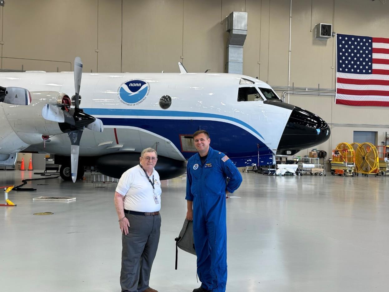
There will be numerous opportunities that many in Florida have not had the opportunity to travel to or to be a part of the Working Week. This includes technical tours and many presentations. As part of the technical tou rs, one is being planned to visit with NOAA’s Hurricane Hunters and tour their facilities in Lakeland and meet with their staff. The hurricane hunters are fresh off their most recent activity for Hurricane Ian.

The Florida Surveyor Page 27
This is just one of many tours and acti vities that are planned for the conference. FIG and NSPS and a host of volunteers are working to prepare for an event that most of us have never seen. The opportunity to be a part of it is now, there is a call for papers (presentations as we call them) now if you would like to present something you would like to share with the world. https://fig.net/fig2023/call.htm
More information can be found at fig.net/fig2023
I hope to see you all there.
Sincerely,
Richard Allen Surveyors in Government Liaison Orlando City Surveyor
December 2022 Page 28


The Florida Surveyor Page 29 • Civil/Site Design • Construction Engineering • Construction Materials Engineering & Testing • Energy • Environmental, Health, and Safety • Geotechnical • MEP • Structural • Survey & Geospatial • Transportation • Urban Planning & Design • Water Resources • Water/Wastewater PARTNERS FOR WHAT’S POSSIBLE www.pennoni.com Join our Survey Team in Florida today! The End of the Biennium is on February 28, 2023! • This is the deadline for License Renewal. • Licensed Surveyors are Required to have Completed at least 24 Continuing Education Credit Hours. Need Continuing Education Credits? (Click Here) FSMS Full/Government Members get a Voucher towards any 3 Hour Course of Your Choice. To Claim Your Voucher, Contact our Education Director Samantha Hobbs at education@fsms.org .
• History of Surveying - Course #7140
• Identification of Native & Non-Native Trees in Florida - Course #8132
• Ethics for the Design Professional - Course #8621
• Land Tenure & Cadastral Systems - Course #8260
• Map Projections & Plane Coordinate Systems - Course #8261
• Public Land Survey System - Course #7147
• Remote Sensing Applications to Surveying & Mapping - Course #7148
#7141
• Basics of Real Property - Course #8360 • Elevation Certificates & the Community Rating System - Course #8256 • Introduction to Photogrammetry - Course #7968 • Writing Boundary Descriptions - Course #8362
Florida Surveying & Mapping Society 1689 Mahan Center Blvd. Suite A Tallahassee, FL 32308 www.fsms.org (850) 942-1900
December 2022 Page 30
- $99/course (members)
2022 eLearning Courses 6 General CEC
$120/course (non-members)
- $49/course (members) $70/course (non-members)
• Practical Geometry for Surveyors - Course
3 General CEC
Florida Surveying and Mapping Continuing Education Provider Offering 25 Years of Dedication, Quality & Trusted Services
Step 1: Choose Course(s)
3 Hour Courses Available
A History of the Prime Meridian Marker,
Basics of Real Property
Digital Signatures for Surveyors
Easements and Rights of Ways,
Elevation Cert *2020 UPDATED COURSE
Introduction to Photogrammet
Quality Assurance/Quality Cont , #9293, 3 CEC
Boundaries in Florida
Chapter 177, Platting (Plat Law)
Critical Communication for Surveying & Mapping Professionals
Ethics for the Design Professional
Florida Laws
Florida Surveying Law and Rule Changes
Geographic Information Systems (GIS)
History of Surveying,
Identification of Native and Non-Native Trees in Florida
Land Tenure and Cadastral Systems
Map Projections and Plane Coordinate Systems , #7669, 6 CEC
Practical Geometry for Surveyors, #7109, 6 CEC
Public Land Survey System, #6979, 6 CEC
Remote Sensing Applications to Surveying & Mapping, #6972, 6 CEC
*2020 UPDATED COURSE
The Florida Surveyor Page 31
□
□
□
□
□
□
□
□
□
□
□
□
□
□
□
□
□
□
□
□
□
□
Writing Boundary Descriptions 6 Hour Courses
December 2022 Page 32 Step 2: Choose Member Type FSMS Member EMAILED Fee Quantity Amount 6 CEC $115 Per Course x = $ 3 CEC $58 Per Course x = $ MAILED 6 CEC $125 Per Course x = $ 3 CEC $68 Per Course x = $ TOTAL $ Non Non Name: _ YES _ NO Firm: ____ _ YES _ _ NO Address: ______________________________________________________________________________________ City/State: Email Address: Work Phone: Payment Information: ___ Check Enclosed (Payable to FSMS) _ VISA/MasterCard/American Express Card #: _______ Exp. Date: __ CVV Code:___________ Billing Address of Credit Card: ______________________________________ Signature: _____________________________________ __ IF PAYING BY CHECK, MAIL FORM TO: FSMS, P.O. Box 850001-243, Orlando, Florida 32885-0243 IF PAYING BY CREDIT CARD, FAX OR EMAIL FORM TO: 850.877.4852 education@fsms.org QUESTIONS? CALL 800.237.4384 Provider No. CE11 fsms.org

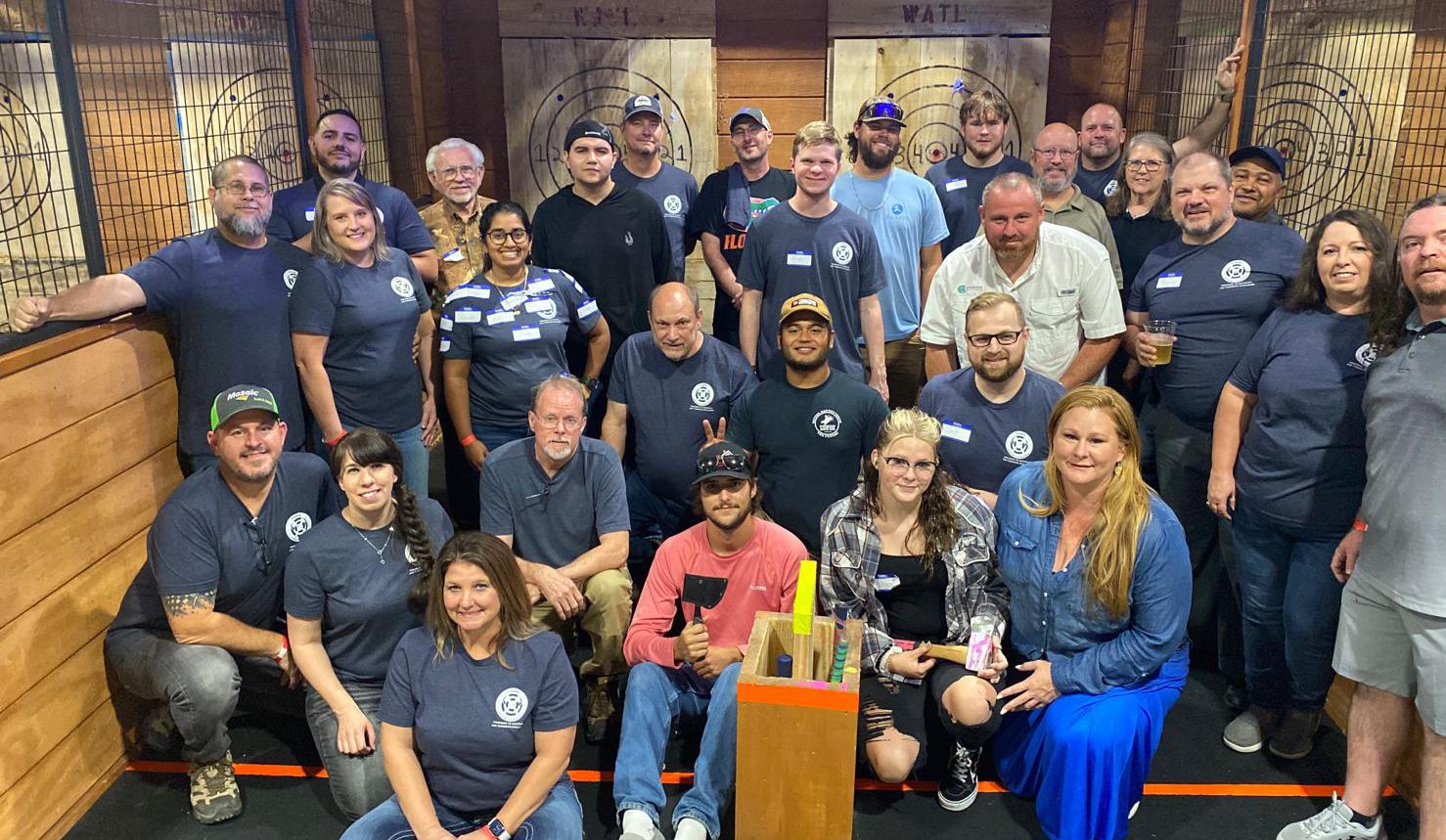
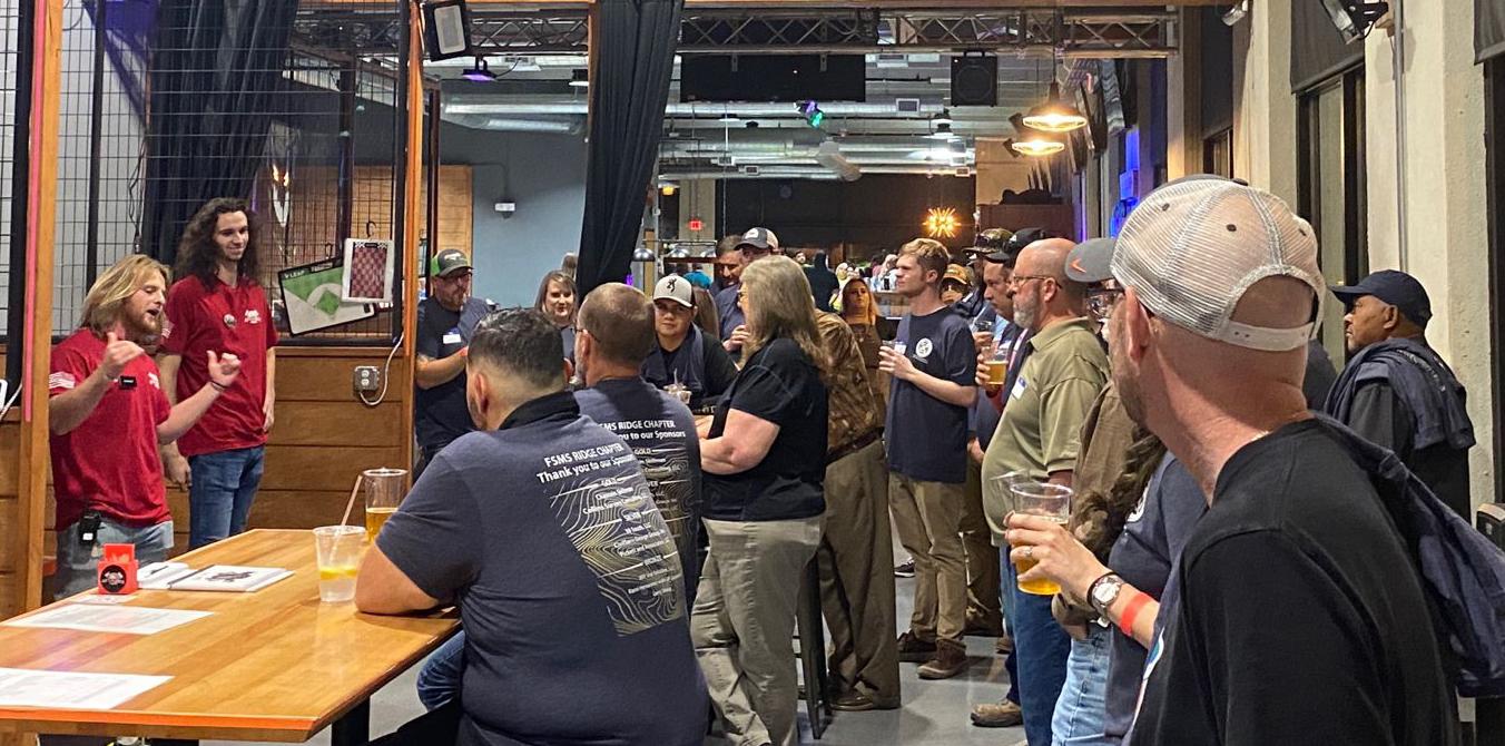
Ridge Chapter Ax-Throwing Fundraiser Thank You to the Sponsors, Members, and Participants. Below: Ax-Experts Matt & Sunshine instructing the crew before the tournament. The Florida Surveyor Page 33
the State Around
2022 Ridge Chapter Ax-Throwing Champions.
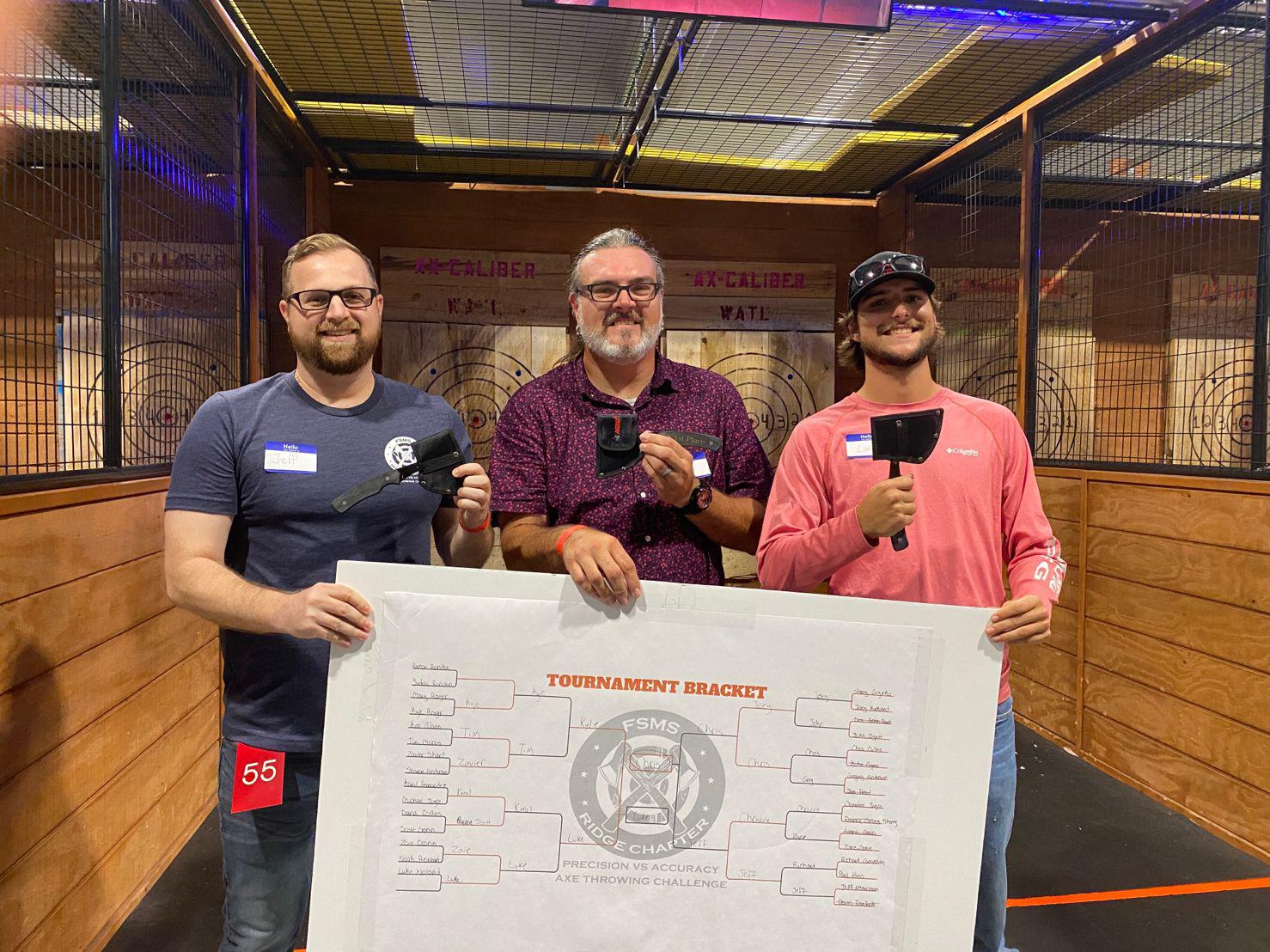
From L to R:
Jeff (3rd Place) Chris (1st Place) Luke (2nd Place)
From L to R: Karol Hernandez & Sherry Grymko

December 2022 Page 34
Thursday evening dinner & gathering prior to November's Board Meeting.
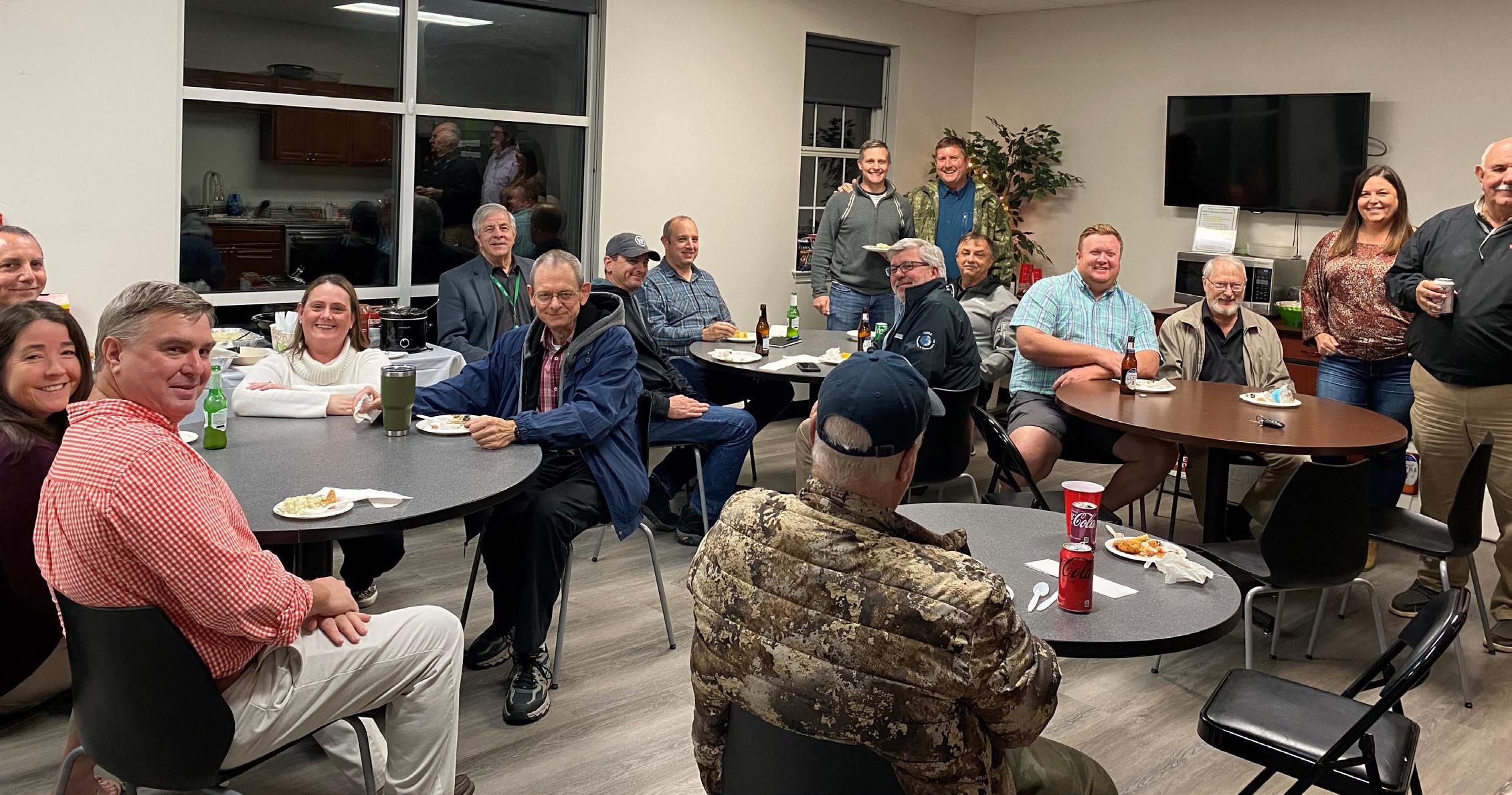
Incoming VicePresident, Allen Nobles & NW FL Chapter President, Jeremiah Slaymaker frying up a storm to feed the crew.
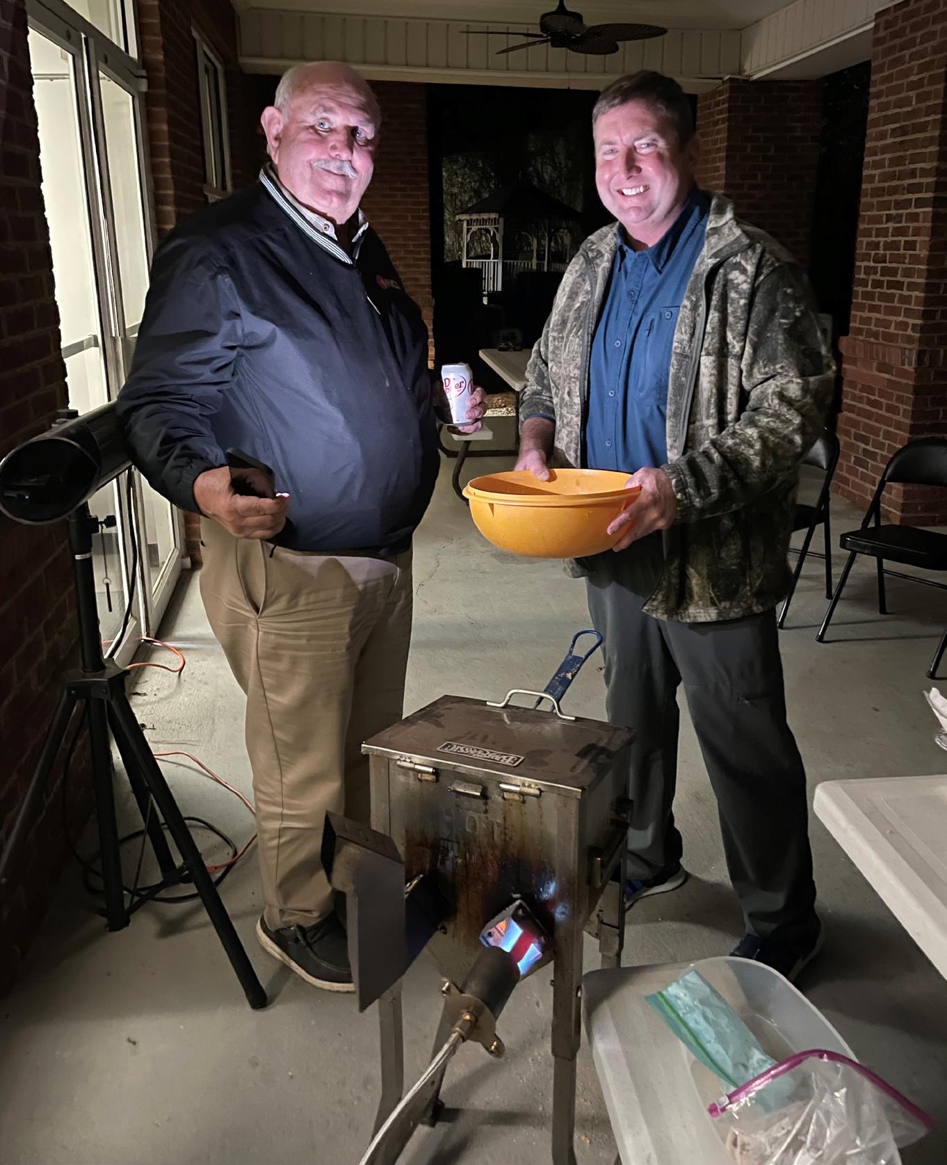
The Florida Surveyor Page 35
Why Join FSMS?
LegisLative support –
The Legislative Committee and our Lobbyist are committed to keeping the Public and the Surveying and Mapping Profession protected
educationaL Benefits –
With recently updated courses, getting your CECs has never been better
networking –
Attend our Annual Conference to meet other professionals and meet vendors with all the latest equipment sociaL Benefits –
Attend local chapter meetings to meet individuals with common professional goals
Florida Surveying & Mapping Society
1689 Mahan Center Blvd. Suite A Tallahassee, FL 32308 www.fsms.org (850) 942-1900
December 2022 Page 36 Aug/Sept 2021 30
HERE TO JOIN!
CLICK
New Reference System and Products: IGS20/ITRF2020
A new reference system, ITRF2020, was released on 2 October 2022 by the International Earth Rotation and Reference System Service (IERS), replacing the previous ITRF2014 reference system. Shortly after that date, the International GNSS Service (IGS) released the IGS20 reference frame which is closely related to ITRF2020. The IGS will cease support for the old IGS14 frame on 27 November 2022. The upcoming reference frame transition will result in changes to some of the fundamental IGS products used in GPS and GNSS data processing.
What's Changing:
• The IGS14/ITRF2014 frames have been superseded for ITRF & IGS products.

• From 27 November 2022 forward, all IGS products will refer to the IGS20/ITRF2020 frames and this frame change includes changes to file name conventions .
• Antenna calibration additions will appear in 2020 frame files only.
The Florida Surveyor Page 37
Users of NGS's Online Positioning User Service (OPUS)
The IGS frame change should have no appreciable impact on users of OPUS . The GPS data processing method utilized by OPUS mitigates the impact of the input orbits on frame realization. Therefore, OPUS will continue to provide users with position solutions that are aligned with the IGS14/ITRF2014 frames and NAD83(2011) datum.
Direct Users of Orbit and Antenna Calibration Products
Note that for products associated with the change in reference system, the file formats have not changed. However, in many cases the data values will change with the reference frame and in some cases the file naming convention will change.
If you download and use IGS orbit products or NGS antenna calibrations directly in your own GNSS data processing workflows , there are several things to be aware of:
• If you process your own data using IGS products , then depending on the software used and the end-user application the change in reference frame may or may not have an
December 2022 Page 38
appreciable effect on ground station coordinates that are estimated with orbit and antenna calibration products in the new frame. We advise downloading the IGS20 test orbits and the associated IGS20 ANTEX file to test the impact on ground station estimates. Test orbits are already available at the following locations: ftp://igs-rf.ign.fr/pub/igs20_tests/${WWWW} and https://cddis.nasa.gov/archive/gnss/products/${WWWW}/igs20/ where ${WWWW} is the week of interest. The test products are available starting with GPS week 2222.
• If you have automated processes that download IGS orbits from the NGS data archive , those processes will not be affected yet. For a time period yet to be determined, NGS will continue to archive the IGS orbits with short file names in parallel with the long file names. If at some future time NGS decides to cease archiving the products with short file names, users will be given ample notification to update their automated processes.
• If you have automated processes that download IGS orbits or clocks from an IGS datacenter like CDDIS , your software will need to be updated to download the IGS products using the new long file names to continue functioning after November 27, 2022. Support for short file names at CDDIS and other IGS data centers will cease after that date. The format specification for the long file name formats can be found at the link below: http://acc.igs.org/repro3/Long_Product_Filenames_v1.0.pdf
• If you have automated processes that download antenna calibration products (ANTEX) from NGS , your software will need to be updated to download the ngs20 products. A complete set of antenna calibrations in IGS20 will soon be released to the ANTCAL BETA webpage - please check this URL in the future.
For further details on this forthcoming change to IGS products, please see IGSMAIL-8256 and IGSMAIL-8238
The Florida Surveyor Page 39
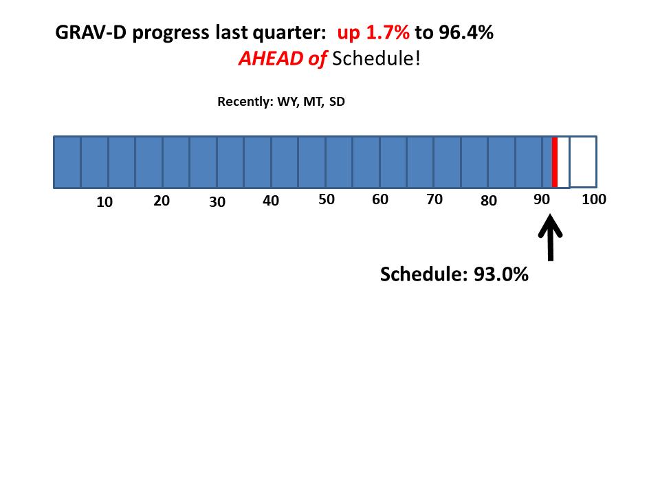
Achieving GRAV-D 100% Completion
At the outset of GRAV D (2007–9), NGS drew geo graphic “target polygons” for collecting airborne gravity data. A re-consideration of those targets was done in 2012, with adjustments made to size and shape (some being quite substantial) That second generation of target polygons has stood for ten years. As NGS approaches completion of the GRAV-D airborne mission, we are making final adjustments. The first adjustment is to slightly tweak each polygon edge to conform to the “as flown” flight lines. Some lines go a little over the original target edges and some under, though such over/under flights have no signif icant impact on the final geoid model. The second adjustment is removal of 12 flight lines over the Commonwealth of the Northern Mariana Islands (CNMI) trench While scientifically interesting, NGS has determined that this data will not impact the final geoid in Guam or CNMI, the U.S. territories nearest the trench (results will be shown in a forthcoming NOAA technical report). Removing these 12 lines from the plan will allow NGS to use its limited GRAV D resources to fly other high priority areas. Having made these adjustments to the target polygons, NGS can now report with confidence our progress toward a more accurately defined 100% goal. These final polygons are reflected in the GRAV D progress chart herein.
Progress in ongoing Projects
There are currently 33 ongoing projects related to NSRS modernization around NGS. Here are some highlights:
GPS Campaign for Transformations (Project Manager: Galen Scott)
NGS has extended the deadline for submitting GPSonBM data for transformation tools through September 2023. Data submitted before then will be considered for use in the 2020.00 REC adjustments. Marks with valid geodetic coordinates in both the current NSRS and the modernized NSRS will be used to create updates to NADCON and VERTCON. Observations submitted to NGS after September 2023 will have RECs and Survey Epoch Coordinates (SECs) computed in the new frames, however they will not help define the transformations between the current and modernized NSRS.
SPCS2022 (Project Manager: Dr. Michael Dennis) NGS completed review of SPCS2022 zones designed by state stakeholders. Designs were sub mitted for 806 zones in 28 states, and nearly all are low-distortion projections. Most of the zone designs were approved as submitted, with NGS and stakeholders working cooperatively to modify some. When completed, these SPCS2022 zones will add to the 160 zones designed by NGS.

Issue 30 October 2022
Early American Surveying Equipment
BY DR. RICHARD L. ELGIN, PS, PE ROLLA, MISSOURI
Much of America’s surveying practice descended from the English, but our early surveying equipment did not.
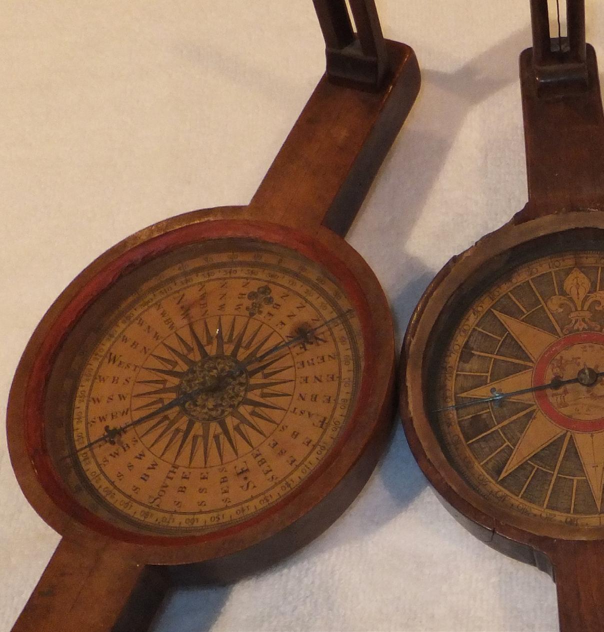
The Old World used the delicate, expensive theodolite to divide its lands, sighting on points and measuring angles on a divided, graduated circle. American surveyors needed to establish boundaries over vast wildernesses which were difficult to traverse, and they needed to do it quickly and cheaply. Enter American innovation, technology and craftsmanship to improve a device used by mariners for hundreds of years, a form of which was being made in England, the magnetic compass. The result was the rugged, inexpensive standard American compass. As one commentator said of the American compass, “where accuracy can be sacrificed to speed and cheapness.”
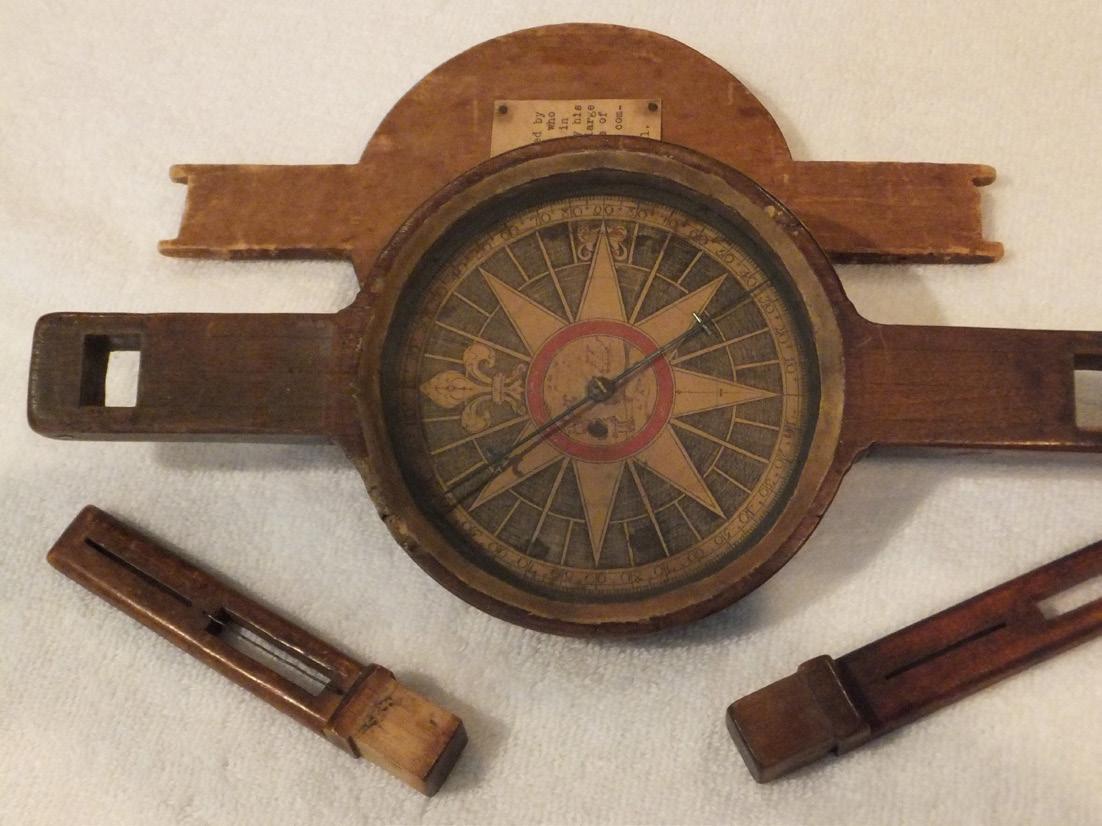
The Compass
Rugged, the compass with its body of wood or brass, two sight vanes, a leveling device and placed on a staff or tripod, required only a balanced magnetized needle resting on a sharp point. The needle aligned itself with the earth’s magnetic field and pointed to magnetic north. Magnetic north was known to move and hence was a poor direction with which to reference boundaries. This movement was well known, being noted in some 1746 instructions that it “…may in time occasion much confusion in the
A wooden compass by T h o m a s G r e e n o u g h , Sr (1710 1785), Boston At top: three 18th century New England compasses From left to right: unsigned wooden compass with 32 point mariner’s p paper card Thomas G r e e n o u g h , S r , B Boston wooden c compass Unsigned w wooden and brass c compass All of these a are plain compasses
Bounds…and, Contention.” Variation, the angle between True Meridian (a line of longitude) and Magnetic North was known to differ at different locations on earth and the angle was known to change in amount over time and location. True North was a better reference direction and in 1779 Thomas Jefferson wrote that the plats of surveys were to be drawn “protracted by the true meridian” and the variation noted.
The first standard American compasses were “Plain” compasses. They used magnetic north and had no mechanism for applying the variation angle, converting magnetic direction to true direction. David Rittenhouse (1732-1796) was an American man of science. He is generally credited with adding a vernier to the plain compass so one could “set off” the variation, the needle still pointing to magnetic north, but the bearing to
The Florida Surveyor Page 41
the object sighted read on the compass circle being the true bearing. Thus the “plain compass” became the “vernier compass,” a great advancement in the American compass.
The Land Ordinance of 1785 specifies that all lines of the U.S. Public Land Survey System (USPLSS) be surveyed “by the true meridian…the variation at the time of running the lines thereon noted.” Tiffin’s Instruction of 1815 (the first written instructions issued by the General Land Office (GLO) to its Deputy Surveyors) specified “a good compass of Rittenhouse construction, have a nonius division….” This is a vernier compass, “nonius division” meaning a vernier. Thus, the vernier compass became the standard instrument for surveys of the USPLSS. Until………
William Austin Burt and His Solar Compass
William Austin Burt (1792-1858) was a GLO Deputy Surveyor who, in 1835, while laying out townships in Wisconsin, noted unusual deviations in the lines surveyed using his compass. He began work on a method and form of compass that would determine the direction of the true meridian independent of magnetic north. He invented an ingenious device that uses the observer’s latitude, the sun’s declination and local time to determine true north. The device mechanically solves the PZS (PoleZenithStar) Triangle. The prominent
Philadelphia maker, William J. Young (1800-1870) built the device, and Burt was awarded Patent 9428X on February 25, 1836.
Burt made improvements to his solar compass and an improved version was patented in 1840. In 1850 Burt’s patent expired, which allowed other makers to produce the solar compass. (The circumstances of the expired patent are a sad story.)
There are about 12 known post-1850 makers of solar compasses. All the solar compasses made prior to 1850 are marked “Burt’s Patent” and “W.J. Young” or “Wm. J. Young,” he having made them. They are not dated or numbered. Those made by Young after about 1852 are numbered. The solar compass was not widely used in the eastern and northeastern parts of the U.S., its purpose being the original GLO surveys of the USPLSS, and creating those lines independent of magnetic north. And, the solar compass found application after about 1860, which is “late” compared to most original surveys in the east and northeast.
The Wooden Compass

Manufacturing a compass in brass requires a foundry, and, at times in a young New World, brass was scarce. Enter Yankee ingenuity and a solution, the compass made of wood. As early as the late 1600s, a few New England makers produced compasses made entirely of wood, to include the sight vanes. Most of these were plain compasses. A few were vernier compasses and made partially of brass. The compass cards for most wooden compasses were printed on paper. Some of these were decorated in a mariner’s motif using 32 rays emanating from a central star, North designated with an elaborate fleurdelis. They were used in both mariner’s and land surveying compasses. Most of these printed cards have suffered some degradation in the intervening 250 or more years since they were printed.
Some known New England makers of wooden compasses include: Joseph and his son James Hasley of Boston. Joseph (1657-1745) seems to have been the earliest maker in Boston. Thomas Greenough, Sr., Boston (1710-1785) who, with his son Thomas, Jr. likely made more wooden compasses than the other makers. They also made brass compasses. William Williams, Boston (17371792) who also made clocks. Samuel Thaxter, Boston

December 2022 Page 42
(1769-1842) who also make brass compasses.
Benjamin Hagger, Boston (c. 1790-1834).
Benjamin Warren, Plymouth, Massachusetts (c. 1740-?). Gordon Huntington, Walpole, New Hampshire (1763-1804) who made both compasses and clocks. This list was taken from the late Silvio Bedini’s book, Early American Scientific Instruments and Their Makers (1964). Bedini’s book lists other New England makers and further describes the wooden compass. Bedini says no makers, other than those in New England, made wooden compasses.
To most collectors, wooden compasses, although generally more rare and older, are not as desirable and sought after as ones in brass. Compasses in brass offer the maker the opportunity for beautiful engraving, raising the interest and value for the instrument’s artistry. And, wooden compasses, not being used in most of the United States, are just not highly desired by collectors.
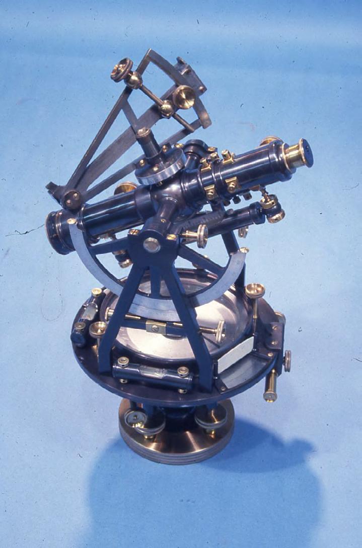
such as a variation on Burt’s solar compass, was added by many manufacturers. For mining applications, parallel telescopes were added, thus allowing sightings at large vertical angles into steep mine shafts. Large precise transits were constructed for control surveys and astronomical observations. Horizontal circle diameters can be as large as 18 inches.
Collecting and Values
Early and vintage surveying equipment is highly collectible. It is the surveyor’s heritage, it represents about 200 years of advancing measurement technology, and some illustrate incredible craftsmanship and artistry, especially of the early makers. As with other collectibles, there are highly desirable, usually rare instruments such as the solar compass. And, there are the early Virginia and Pennsylvania makers that made compass that are works of art. But even instruments by prolific makers like W. & L.E. Gurley and Keuffel & Esser are desirable.
Generally the theodolite refers to an instrument with divided circles to measure both horizontal and vertical angles to high precision, the telescope is relatively long and will not transit, or rotate 360 degrees, about its horizontal axis. The more common term “transit” refers to an instrument with both horizontal and vertical circles (only horizontal on early transits), a 4-screw leveling head, bubbles for leveling and a telescope that will transit. William J. Young is credited with building the first dividing engine in America. That allowed him to cut circles and he is credited with building the first American transit in 1831.
The transit developed and attachments,
There are many collectors of early American surveying equipment, some with very large collections. Most collectors buy and sell instruments, research makers and surveying equipment, and a few offer repair and restoration services. Most collectors focus on a particular maker or two, others focus on the makers of a particular city, like St. Louis, and others are interested in a particular instrument form, such as transits with unusual attachments. There are online resources for early surveying equipment. Some are: surveyhistory.org, run by David Ingram; the Facebook page “Antique Surveying Instrument & Ephemera,” run by Dale Beeks; and compleatsurveyor.com, run by Russ Uzes. Among the collector community there is broad and deep knowledge of early American surveying equipment, but that knowledge is not well documented. There are not many reference books on the makers and their equipment. A few have been covered in articles and short treatises, but there are not good reference materials on the broad topic.
To most collectors, what drives value is: 1) The craftsmanship, artistry and rarity of the maker. Generally the winners are the highly decorated compasses by the early eastern makers. 2) Instruments with attachments such as compasses with telescopes and transits with
Is it a transit or a theodolite?
The Florida Surveyor Page 43
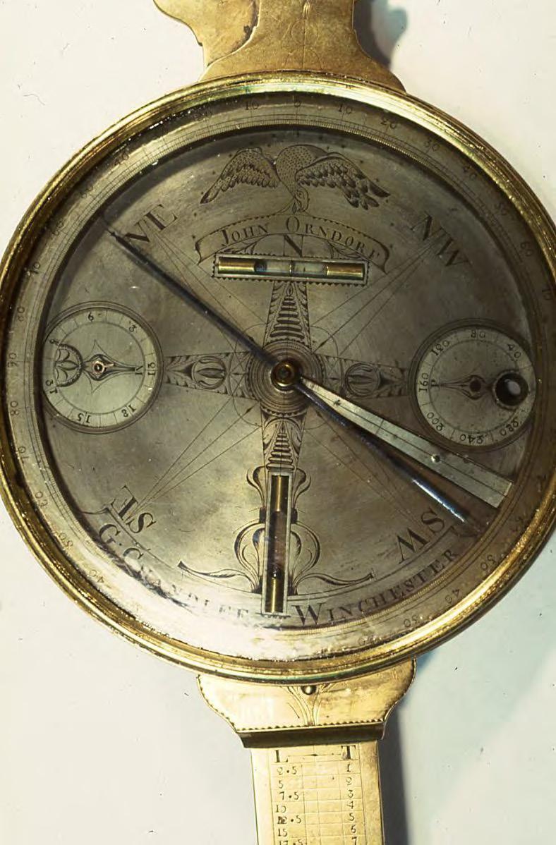
A highly ornate Goldsmith Chandlee compass made for John Orndorf (c 1800) One of two known Chandlee compasses with American Eagle holding banner
solar attachments and parallel telescopes. 3) Odd, unusual, very small or very large instruments such as the diminutive “explorer’s transit” or a large geodetic theodolite. 4) But, some collectors focus very specifically on a particular maker or form of instrument or city of manufacturer. Likely the most valuable instrument in America: any instrument made by David Rittenhouse. (And the least likely to be found at a garage sale.)
by a local surveyor.
As with most collectibles, old or vintage surveying equipment is not worth what it was 10 or 20 years ago. The rare, unusual, historically important pieces have not lost their value during that time period and can easily be sold.

The Future
Regrettably, there is not a national museum or repository where surveying equipment can be donated. Beloved equipment left to families or owned by old surveyors and seeking a home have limited options. The Smithsonian will not accept any such equipment, except for historically important equipment with known provenance. Most such equipment is not highly valuable.
It is likely 90 percent of such equipment would be worth less than $1000 per piece. Eight percent would likely be worth up to $10,000. One and one-half percent up to $100,000. And the last half percent over $100,000. Most collectors will have no interest in about 90 percent of the equipment offered to them (they already have plenty of early to mid-1900s Gurley and K&E transits and levels). The best recipient for most low- to mid-level surveying equipment may be a local museum, particularly if the equipment was used in the area
Boundary surveyors, being mensurators, detectives and historians, have an appreciation for the equipment that laid out America. The equipment is our heritage, to be preserved, admired, studied and displayed. Every boundary surveyor needs an old compass (or transit) and a chain proudly displayed on their desk. They are available at a very reasonable price.
Our thanks to Dr. Richard L. Elgin, PS, PE, of Rolla, Missouri, who wrote this article for The Cornerpos t. Dick is a surveying practitioner, educator, researcher and author. He owns a large collection of early American surveying equipment. His research interests include the Chandlee family of compass makers, the St. Louis makers and John S. Hougham, among others. Thanks to fellow collectors and researchers Dale Beeks, Dave Ingram and Mickey Shackelford, who contributed to this article. You may contact Dick at elgin@rollanet.org
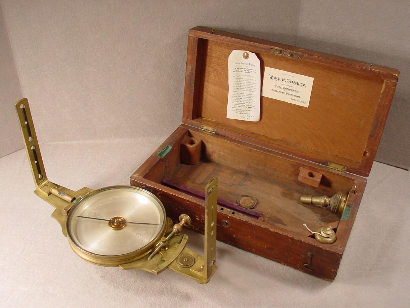
Above, equipment by W & L E Gurley: at left, a transit with solar attachment (c early 1900s); and a standard American surveyor ’ s compass (c late 1800s)
What are we going to do with Grandpa’s surveying stuff, and what’s it worth?
December 2022 Page 44
Lou Campanile, Jr.
Board Member of the Year Award
Samuel Thomas Hall Life Member Award
Robert B. Strayer Jr.
Fellow Member Award
Gregory Alan Prather
Honorary Member Award
Thomas Steckler
Committee Chair of the Year Award

Jim Sullivan
Young Surveyor of the Year Award
Shane Alan Christy
Professional Excellence Award Dr. Amr Abd-Elrahman
Chapter President of the Year Award
Brion D. Yancy
Steven Woods Exceptional Service Award
Richard D. Pryce
Small Chapter of the Year Award
Indian River
Large Chapter of the Year Award
Broward
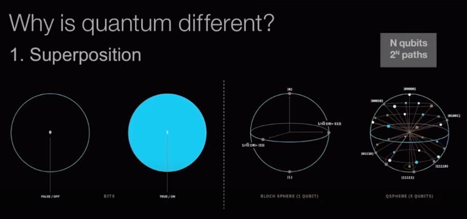
15 Emerging Technologies that Will Change the World


December 2022 Page 46

3002 Surveying 833-352-3002 A Accuright Surveys of Orlando, Inc. 407-894-6314 Agnoli, Barber & Brundage, Inc. 239-597-3111 AIM Engineering & Surveying 239-332-4569 Airworks 857-990-1060 Allen & Company, Inc. 407-654-5355 Allen Engineering 321-783-7443 American Consulting Professionals, LLC. 813-435-2600 American Surveying, Inc. 813-234-0103 Amerritt, Inc. 813-221-5200 Arc Surveying & Mapping, Inc. 904-384-8377 Ardurra, Inc. 239-292-7773 Associated Land Surveying & Mapping, Inc. 407-869-5002 Atlanic Drafting & Surveying 386-264-8490 Avirom & Associates, Inc. 561-392-2594 Axis Geospatial SE, LLC. 410-822-1441 B Banks Engineering 239-939-5490 Barnes, Ferland and Associates, Inc. 407-896-8608 Barraco & Associates, Inc. 239-461-3170 Bartram Trail Surveying, Inc. 904-284-2224 Bello & Bello Land Surveying Corporation 305-251-9606 Benchmark Surveying & Land Planning, Inc. 850-994-4882 Berntsen International 608-443-2772 Betsy Lindsay, Inc. 772-286-5753 Biscayne Engineering Company, Inc. 305-324-7671 Boatwright and Durden Land Surveyors, Inc. 904-241-8550 Bock & Clark Corporation(NV5) 330-665-4821 Bowman Consulting Group 703-454-1000 Bradshaw-Niles & Associates, Inc. 904-829-2591 Brown & Phillips, Inc. 561-615-3988 BSE Consultants, Inc. 321-725-3674 Buchanan & Harper, Inc. 850-763-7427 C Calvin, Giordano, & Associates 954-921-7781 Carlson Environmental Consultants, PC 561-371-2402 Carter Associates, Inc. 772-562-4191 2022 Sustaining

Firms Directory Caulfield & Wheeler 561-392-1991 Chastain-Skillman, Inc. 863-646-1402 CHW Professional Consultants (Causseaux, Hewett & Walpole, Inc.) 352-331-1976 CivilSurv Design Group, Inc. 863-646-4771 Clary & Associates, Inc. 904-260-2703 Clements Surveying, Inc. 941-729-6690 Clymer Farner Barley, Inc. 352-748-3126 Coastal Engineering Associates, Inc. 352-796-9423 Colliers Engineering & Design 732-383-1950 Collins Survey Consulting, LLC. 863-937-9052 Compass Engineering & Surveying, Inc. 727-822-4151 Cousins Surveyors & Associates, Inc. 954-689-7766 CPH Consulting, LLC 407-322-6841 Craven-Thompson & Associates, Inc. 954-739-6400 Cross Surveying, LLC 941-748-8340 Culpepper & Terpening, Inc. 772-464-3537 Cumbey & Fair, Inc. 727-324-1070 D Dagostino Geospatial, Inc. 239-352-6085 DeGrove Surveyors, Inc. 904-722-0400 Dennis J. Leavy & Associates 561-753-0650 Dewberry 321-354-9729 DMK Associates, Inc. 941-475-6596 Donald W. McIntosh Associates, Inc. 407-644-4068 Donoghue Construction Layout, LLC. 321-248-7979 Douglass, Leavy & Associates, Inc. 954-344-7994 DRMP, Inc. 407-896-0594 DroneView Technologies 248-321-9417 DSW Surveying & Mapping, PLC. 352-735-3796 Duncan-Parnell, Inc. 407-601-5816 Durden Surveying & Mapping, Inc. 904-853-6822 E Echezabal & Associates, Inc. 813-933-2505 ECHO UES, Inc. 888-778-3246 Eda Consultants, Inc. 352-373-3541 E.F. Gaines Surveying Services, Inc. 239-418-0126 Eiland & Associates, Inc. 904-272-1000
Element Engineering Group, LLC. 813-386-2101 Engenuity Group, Inc. 561-655-1151 Engineering Design & Construction, Inc. 772-462-2455 ER Brownell & Associates, Inc. 305-860-3866 ESP Associates FL, Inc. 813-295-9024 ETM Suryeying & Mapping 904-642-8550 Exacta Land Surveyors, Inc. 866-735-1916 EXP Energy Services Inc. 305-213-9969 F Ferguson Land Surveyors 727-230-9606 First Choice Surveying, Inc. 407-951-3425 Florida Design Consultants, Inc. 727-849-7588 Florida Engineering & Surveying, LLC. 941-485-3100 FLT Geosystems 954-763-5300 Fortin, Leavey, Skiles, Inc. 305-653-4493 F.R. Aleman & Associates, Inc. 305-591-8777 Frontier Precision Unmanned 701-222-2030 F.R.S. & Associates, Inc. 561-478-7178 FTE Engineers & Planners 800-639-4851 G Gary Allen Land Surveying 850-877-0541 GCY, Inc. 772-286-8083 GeoData Consultants, Inc 407-732-6965 Geoline Surveying 386-418-0500 Geomatics Corporation 904-824-3086 Geo Networking, Inc. 407-549-5075 GeoPoint Surveying, Inc. 813-248-8888 George F. Young 727-822-4317 GeoSurv, LLC. 877-407-3734 Germaine Surveying, Inc. 863-385-6856 GPI Geospatial, Inc. 407-851-7880 Gustin, Cothern & Tucker, Inc. 850-678-5141 H Haley Ward, Inc. 239-481-1331 Hanson Professional Services, Inc. 217-788-2450 Hanson, Walter & Associates, Inc. 407-847-9433 H.L. Bennett & Associates, Inc. 863-675-8882 Hole Montes, Inc. 239-254-2000 HUB International 850-386-1111 2022 Sustaining
Hyatt Survey Services 941-748-4693 I I.F. Rooks & Associates, LLC. 813-752-2113 J John Ibarra & Associates, Inc. 305-262-0400 Johnson, Mirmiran & Thompson, Inc. 813-314-0314 Johnston’s Surveying, Inc. 407-847-2179 K KCI Technologies 954-776-1616 Keith and Associates, Inc. 954-788-3400 Kendrick Land Surveying 863-533-4874 L L&S Diversified, LLC. 407-681-3836 Land Precision Corporation 727-796-2737 Landmark Engineering & Surveying Corporation 813-621-7841 Langan Engineering 973-560-4900 Leading Edge Land Services, Inc. 407-351-6730 Leiter Perez & Associates, Inc. 305-652-5133 Lengemann Corp. 800-342-9238 Leo Mills & Associates 941-722-2460 LiDARit Inc. 407-946-1398 LiDAR USA 256-274-1616 Long Surveying, Inc. 407-330-9717 M Manuel G. Vera & Associates, Inc. 305-221-6210 Marco Surveying & Mapping, LLC. 239-389-0026 Massey-Richards Surveying & Mapping, LLC. 305-853-0066 Masteller, Moler & Taylor, Inc. 772-564-8050 McCain Mills, Inc. 813-752-6478 McKim & Creed, Inc. 919-233-8091 McLaughlin Engineering, Co. 954-763-7611 Metron Surveying and Mapping, LLC. 239-275-8575 Metzger + Willard, Inc. 813-977-6005 Midwest Aerial Photography 614-853-2902 Mills & Associates, Inc. 813-876-5869 Mock Roos & Associates, Inc. 561-683-3113 Moore Bass Consulting, Inc. 850-222-5678 Morris-Depew Associates, Inc. 239-337-3993 Murphy’s Land Surveying 727-347-8740 Firms Directory
N Navigation Electronics, Inc. 337-237-1413 Northwest Surveying, Inc. 813-889-9236 NV5, Inc 407-896-3317 O On The Mark Surveying, LLC. 321-626-6376 Orange orangeuas.com P PEC Surveying & Mapping 407-542-4967 Pennoni Associates, Inc. 863-594-2007 Perret and Associates, Inc 904-805-0030 Pickett & Associates, Inc. 863-533-9095 Platinum Surveying & Mapping, LLC. 863-904-4699 Point Break Surveying 941-378-4797 Polaris Associates, Inc. 727-461-6113 Porter Geographical Positioning & Surveying, Inc. 863-853-1496 Pro-Line Survey Supply, Inc. 904-620-0500 Pulice Land Surveyors, Inc. 954-572-1777 Q Q Grady Minor & Associates, PA 239-947-1144 R Reece & White Land Surveying, Inc. 305-872-1348 Rhodes & Rhodes Land Surveying, Inc. 239-405-8166 Richard P. Clarson & Associates, Inc. 904-396-2623 R.J. Rhodes Engineering, Inc. 941-924-1600 R.M. Barrineau & Associates, Inc. 352-622-3133 Robayna and Associates, Inc. 305-823-9316 S SAM Surveying & Mapping, LLC. 850-385-1179 SCR & Associates NWFL Inc. 850-527-1910 Sergio Redondo & Associates, Inc. 305-378-4443 Settimio Consulting Services 850-341-0507 SGC Engineering, LLC. 407-637-2588 Shah Drotos & Associates, PA 954-943-9433 Shannon Surveying, Inc. 407-774-8372 Sherco, Inc. 863-453-4113 Sliger & Associates 386-761-5385 2022 Sustaining

Southeastern Surveying & Mapping Corp. 407-292-8580 Stephen H. Gibbs Land Surveyors, Inc. 954-923-7666 Stoner Inc. 954-585-0997 Strayer Surveying & Mapping, Inc. 941-497-1290 SurvTech Solutions, Inc. 813-621-4929 T T2 UES Inc. 407-587-0603 Tectonic Engineering and Surveying Consultants 800-829-6531 Thurman Roddenberry & Associates 850-962-2538 U Upham, Inc. 386-672-9515 W Wade Surveying, Inc. 352-753-6511 Wallace Surveying Corp. 561-640-4551 Wantman Group, Inc. 561-687-2220 WBQ Design & Engineering, Inc. 407-839-4300 Winningham & Fradley, Inc. 954-771-7440 Woolpert, Inc. 803-214-5928 Z ZNS Engineering, LLC. 941-748-8080 Firms Directory SOCIAL MEDIA LINKS LinkedIn = 256 Followers Facebook = 748 Followers Twitter = 319 Followers Instagram = 151 Followers YouTube
ARCHIVES FROM THE
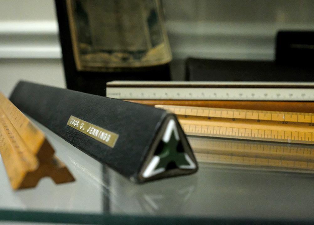
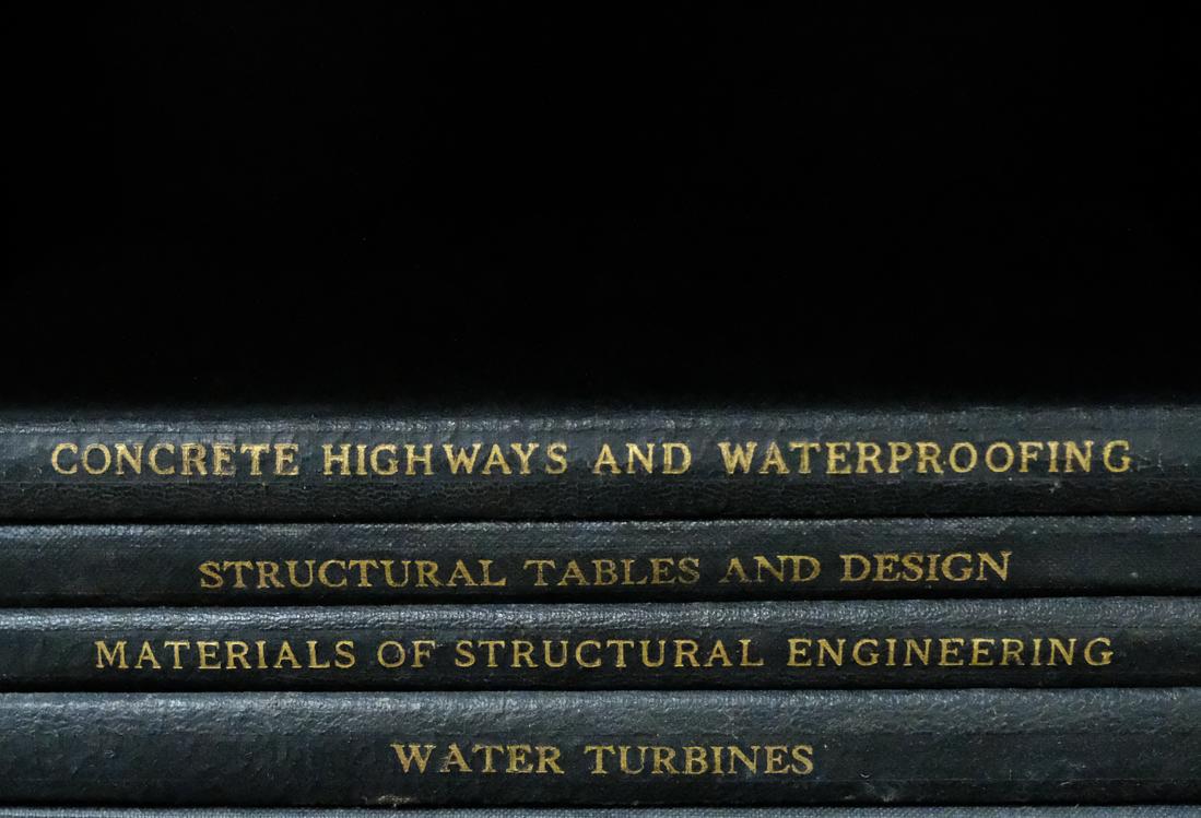
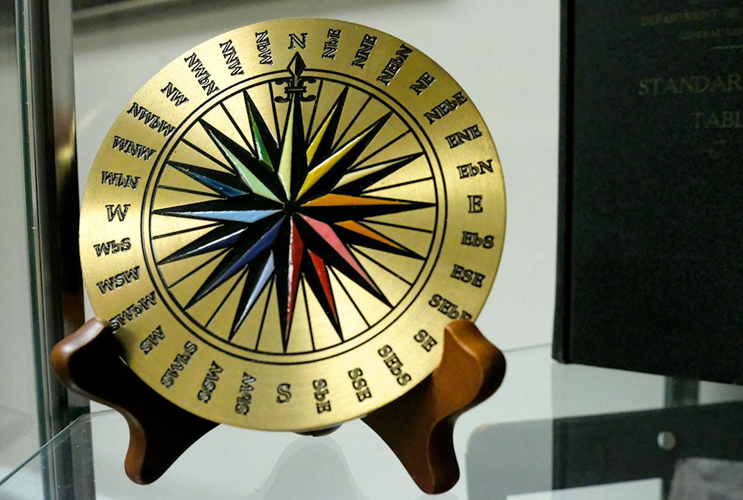
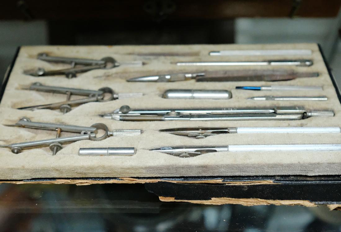
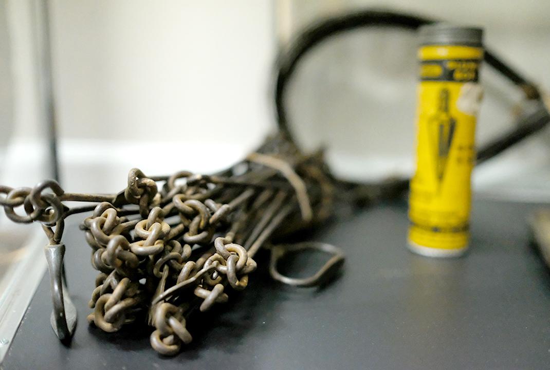
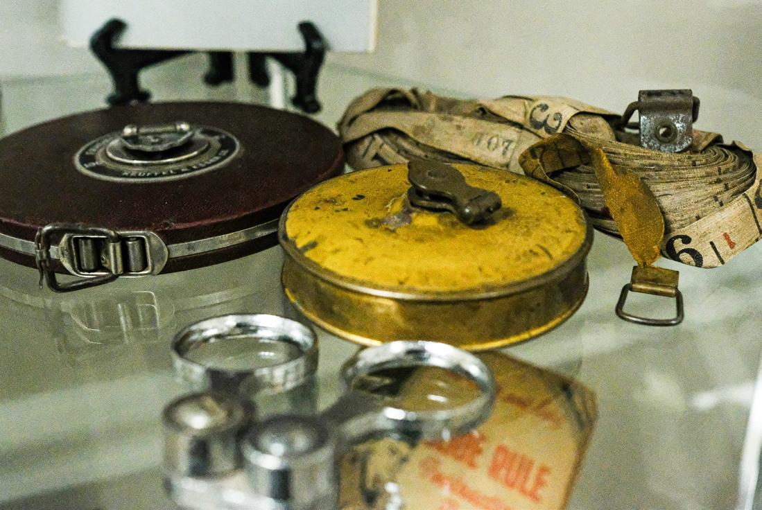
The Florida Surveyor Page 53
Land Surveying: The Past, Present and Future
By JAMES A. THIGPEN III
Chief, Maps & Surveys, St. Regis Paper Company; Past President, Florida Society of Professional Land Surveyors; Past President, American Congress on Surveying and Mapping.
(Originally published September 1971 in Surveying and Mapping.)
In the middle of the 14th Century, the Italian poet, Francesco Petrarca wrote:
“ Here stand I as though on a frontier between two peoples, looking both to the past and to the future.”
Perhaps no other words could so aptly describe the viewpoint of the Land Surveyor, who, like this ancient poet, often finds that he is compelled to consider both the past and the future in dealing with the present. In fact, only when we have failed to adopt this viewpoint in our preoccupation with the present have we failed to satisfy the demands of our profession, for it has never been the right of the conscientious Land Surveyor to be only concerned with the obvious expediencies of the present. We have never known success in contemporary accomplishments. We have succeeded only when our
work has accurately perpetuated the intentions of our predecessors and has itself endured beyond a following generation.
It is easy to recognize our interest in the past, as we are constantly involved in the recovery of evidence of earlier land surveys and in the interpretation of statements recorded years, and even centuries before our birth. And too, we are prone to take pride in the fact that the recorded history of our profession extends back to the earliest writings of man, clearly showing that its followers were competently performing acts of surveying and making involved calculations of irregular fields more than a thousand years before the first, so-called, stepped pyramid was constructed at Saggara in Egypt.
Our interest in the history of our profession is not without meaning.
As Associate Justice Cardozo, who served on the U.S. Supreme Court
December 2022 Page 54
Land Surveying: The Past, Present and Future
from 1932 to 1938, wrote in The Nature of the Judicial Process, “… history, in illuminating the past, illuminates the present, and in illuminating the present, illuminates the future.” In Techt v. Hughes, the Chief Justice of the New York Supreme Court stated, “Let me speak first of those fields where there can be no progress without history. I think the law of property supplies the readiest example.” Justice Holmes of the U.S. Supreme Court, stated in N.Y. Trust Co. v. Eisner , that “a page of history is worth a volume of logic.”
The history of land surveying had no pretentious beginning. Its introduction into society was neither kindled by the spark of a new and wondrous invention, nor heralded by the sage of some ancient forum. It was born of purpose—not suddenly, as with the cry of a newborn child, but quietly, without announcement, as ruts are made by the wheels of evolution.
Land surveying began in the earliest communities at the end of the stone age when man first began to cultivate crops and hold certain tracts of land for that purpose. Some writers have stated that surveying began along the Nile, where, according to Strabo, a Greek geographer who settled in Rome following a journey along the Nile in 24 B.C., each flooding
of the Nile removed boundaries and landmarks essential to the determination of property rights. It should be noted, however, that Herodotus, who is often referred to as the “Father of History,” visited Egypt more than four hundred years before Strabo was born, and his description of surveying along the Nile did not include any reference to the reestablishment of markers. In the George Rawlinson translation of the History of Herodotus, we find the following account:
“Sesostris also, they declared, made a division of the soil of Egypt among the inhabitants, assigning square plots of ground of equal size to all, and obtaining his chief revenue from the rest which the holders were required to pay him year by year. If the river carried away any portion of a man's lot, he appeared before the king, and related what had happened, upon which the king sent persons to examine, and determine by measurement the exact extent of the loss; and thenceforth only such a rent was demanded of him as was proportionate to the reduced size of his land. From this practice, I think, geometry first came to be known in Egypt, whence it passed into Greece. The sun-dial, however, and the gnomon with the divisions of the day into twelve parts, were
The Florida Surveyor Page 55
received by the Greeks from the Babylonians.”
Other authorities have stated that the first surveys of the Nile Valley should be credited to Rameses II (12911224 B.C.), who, some historians believe, may have been the leg endary Egyptian monarch referred to by Herodotus as Sesostris. The most ancient Egyptian map known to exist, a map depicting the location and plan of a gold mine, is believed to have been drawn in about 1320 B.C., or about the time of that famous warrior king. Nevertheless, we are certain that this map was not the first plat produced in Egypt and that the surveys by Rameses II were not the first surveys made in that land. Many centuries before the dynasty of the Ramesides, or about 1990 B.C., Amenenahat I began a thirty-year reign during which it was recorded that he “personally superintended a new survey of the land.” It is also recorded that an important deity Khonsa, the plan maker, was recognized at a still earlier date.
In Man Makes Himself , Professor Childe describes a ceremony of the Old Kingdom (c. 3200 B.C.) termed “stretching the cord.” The ceremony, which was performed by the pharaoh, probably as the initial step toward the erection of a temple, is possibly the oldest record of man
obtaining the bearing of True North and establishing a line based on that bearing. The traditional formula as recited by the king has been transliterated as follows:
“I have grasped the peg with the handle of the hammer. I took the measuring line with the Goddess Safekhabui. I watched the advancing motion of the stars. My eye was fixed on the ( ? Bear). I reckon the time, checking the hour, and determine the edges of thy temple . . . . I turn my face to the course of the stars. I direct my eyes upon the constellation of the (? Bear). There stands the time pointer with the hour. I determine the edges of thy temple.”
At the time of this ceremony, the star designated Draco alpha, which is also known as Thuban, was the Pole Star. It lies between the Big and Little Bear, or as we generally refer to them, the Big and Little Dipper. The precession of the pole, often spoken of as the Great Year, caused by an effect similar to the wobbling of a spinning top, re quires about 25,800 years to complete a full cycle. For example, when Hipparchus first recorded the position of Polaris in about 156 B.C., it was nearly 12 degrees away from the point of True North. At that time, the star Kochab (Ursa Minor beta) was the nearest visible star to the pole. In 1860 Polaris
December 2022 Page 56
III
JAMES A. THIGPEN
In 1944 during the height of the second world war, an American B-29 bomber was captured by the Russians. Soviet leader Joseph Stalin, who had a reputation for brutally punishing failure, ordered replicas of the B-29 be made for the Russian air force. A small hole was located on the left wing of the B-29 due to a manufacturing mistake, but the Russians duplicated the hole. As a result, all Russian TU-4 bombers were manufactured with the unnecessary hole in their left wings.
The Florida Surveyor Page 57
Source
DID YOU KNOW?
B-29 bomber
Land Surveying: The Past, Present and Future
was still an average of 1° - 26' - 12.”7 from the pole. Polaris is now less than a degree from the pole, and the distance is being steadily reduced at a rate of less than twenty seconds a year, until early in the 21st Century when Polaris will reach its nearest approach toward the pole, being only about 28 minutes away. Afterwards, it will move steadily away from the pole, and about 12,000 years from now the bright star Vega (Lyra alpha) will serve as the North Star, outshining Polaris, but never approaching nearer than about 5 degrees from True North.
Although the history of land surveying can be traced back more than four thousand years in Egypt, written records of our accomplishments in the fertile valley of the Tigris-Euphrates river system of the land, once known as Mesopotamia, place the beginning of land surveying at a point in time more than a thousand years earlier and offer indisputable evidence that the first significant advancements in the technologies of surveying were made by the Sumerians—the same remarkable people who first invented writing, developed the first calendar (which, I might add, was substantially the same as the present day Jewish calendar), invented the wheel, the sailboat, soldering, cosmetics, and divided the day into two 12-hour parts with each hour divided into 60 minutes, instituted the first formal
schools, produced the first poetry and literature as well as the first codified laws.
Clay tablets unearthed from the ruins of the ancient towns of Sumer, Kish, Ur, Lagash, Nippur, Shuruppak, Erech and Asmar show records of lands being mortgaged, nine-judge court trials of boundary and ownership disputes, and maps of town and tracts of land and acreage computations. One tablet shows that they had deduced the circumference of a circle to be the product of 6 17⁄60 times the radius, or 6.2833 times r. This value is very close to the present known value of 2 pi (6.2832), when carried to the same number of decimal places. Those of you with long slide rules, who use 3.141592653589793238462 64338327950. . . . . as the value of pi will probably not agree.
It is also interesting to note that during the Uruk period, in the 4th millennium B.C., before the invention of writing, the Sumerians introduced the cylinder seal, which, like the land surveyor's seal of today, was engraved in intaglio so that the design stood out in relief when an impression was made.
The Sumerian culture, which was undoubtedly one of the most progressive and productive civilizations of all times, lasted
December 2022 Page 58
Land Surveying: The Past, Present and Future
until 1720 B.C., when the semitic conquerors of Babylon under Hammurabi finally completed their conquest of the entire area. The “Black-Headed-Ones,” as the Sumerians were known, had ruled the region now known as Iraq for nearly two thousand years or more. No other important civilization has equalled that record for endurance.
Land surveying did not fade away with the fall of Sumer. The Babylonians introduced marked changes in the patterns of land ownership and made further advances in science and mathematics. During the Sumerian period, title to land had been vested in the gods and rent was paid to the priests instead of taxes. Under the Baby lonians, however, we find the first examples of land being held in fee. In about 1686 B.C., during the reign of Samsuiluna, a house and corner lot was sold in the town of Sippar, resulting in the following deed of conveyance:
“Two sar, 4 gan of house property; next the house of Ili-awilim-rabi, son of Shamash-natsir, and next the street; one end abutting on the street, the other on the house of Sinidinnam; from the hands of Ili-awilim-rabi, son of Sham ash-natsir, Shamash-bani, son of Kishti-ningizida hath bought.
The full price, 2/3 mina and 9 shekels of silver hath he paid. The transaction is completed; his heart is satisfied. Never shall the one make any claim against the other. In the names of Shamash, Aia, Marduk, and king Samsu-iluna have they sworn. 2 sar 4 gan ceded in possession.” (This was followed by the names of twelve witnesses and the date.)
The Babylonian Empire did not survive as long as that of their predecessors, and by 1600 B.C. the Kassites were occupying the throne of Babylon. The authority of the Kassite rulers, however, dwindled during their 576 year reign, and the people found that they could not depend on their rulers for protection of their private property. Because of this insecurity, landowners were not satisfied with written titles to land, and they sought the protection of their gods by erecting stone monuments with divine sym bols and inscriptions giving the history of the property, and threats of vengeance against anyone who should alter or move the monu ments engraved upon them. Many ex amples of these boundary stones, or kudur rus, have been preserved in the various museums around the world. One such inscription reads:
“Do not move the boundary-stone
The Florida Surveyor Page 59
from its place, do not set it up in another place, do not set it up in another locality, do not put it in a house of lead, do not break it, do not hide it in the earth, do not cast it into the water, do not cover it with asphalt, do not burn it in the fire, do not erase the writing. The gods whose names are written on this stele, when in war, battle, fight, in sickness, disease, pestilence, plague, you raise your hands, will hear your prayer and will come to your aid. Whoso changes by writing and my name, Ashur, Shamash, the pest god Dibbara, and Amurru, the great gods, without limit will be unpropitious.”
The importance of the survey to the people of this period is clearly revealed in a “Moral Code” inscribed on a clay tablet during these days. It reads as follows:
“Has he estranged son from father?
Has he estranged father from son?
Has he taken the wrong sum, not taken the correct amount?
Has he drawn a false boundary, not drawn the right boundary?
Has he removed the limit, mark, or boundary?
Has he possessed himself of his neighbor's house?
Did he follow the path of evil?
Did he overstep the bounds of what was just?”
JAMES A. THIGPEN
From about 893 to 626 B.C., the Babylonians were ruled by the Assyrians. The clay tablets of that period relate a story of lands being taken from their rightful owners and of problems caused by forgotten boundary lines and destroyed boundary stones when the Assyrian armies devastated the land. On the other hand, the Assyrians introduced a unique system of reviewing titles to land and enacted severe laws dealing with land trespasses. In the city of Assur, a periodic review of land titles was undertaken. Three times each month an official, the nashi, would issue a proclamation identifying certain estates to be reviewed. Anyone who had any claim in support or against the possession of the designated lands was invited to appear at the hearing and to bring their tablets and witnesses before an arbitral tribunal composed by a representative of the king, assisted by the town scribe, the nashi himself, governors, the mayor and three notables. Following the hearing and review, a decision was set down in writing and communicated to the interested parties. If no one appeared as a claimant at any one of three sessions, title to the land reverted to the city and the land was advertised and auctioned off.
If a landholder was found guilty of enlarging his holdings at the expense
December 2022 Page 60
III
Land Surveying: The Past, Present and Future
of an adjoiner, severe penalties were meted out. Upon conviction of the crime of displacing the main boundary of his field, the guilty party was condemned to give up three times the area of the stolen land, to receive one hundred strokes of the rod, to do one month of labor on the Royal works, and sometimes suffered the amputation of a finger as well. For displacing a smaller boundary, the penalty was the same, except that the number of strokes with the rod were reduced by one-half, and a fine of a talent of lead was substituted for the mutilation.
For fencing in land belonging to a neighbor and building on it, the penalty was fifty strokes of the rod, a month's compulsory labor, confiscation of the bricks and payment for the land at three times its value. If an orchard was planted on the land of another, two possible penalties were offered. If the true owner lived nearby, he was presumed to have given his consent and merely received an equal block of land as compensation, but if the owner's residence was remote, it was concluded that the planting had been done without his permission, and on his appearance and discovery he was given possession of the orchard.
So many details of the numerous records associated with the practice
of land surveying and land titles must be neglected in this brief reflection of our early history, but we cannot face only in one direction. The pres ent is with us momentarily and we are wrapped up in our obligations to our families, to our society, and to our profession, but even so, we cannot afford to neglect our responsibility to face in the direction of the future as well. We have left behind our casual approach to professionalism, our indifference to written descriptions, our generalizations of bearings and distances, our careless references, and our reluctance to charge a reasonable fee for our services, but unless we are cautious in the application of our improving technology, we will only find that we have entered an age of precise mistakes.
At such gatherings as this of the dedicated members and supporters of our state organizations, it is only natural that most of our attention is directed to local problems and to the fraternity which strengthens our trust in one another as fellow practitioners. Nevertheless, representation at the national level remains one of the better safeguards of the integrity of our profession. For there are those in the broader field of surveying and mapping whose education and experiences in certain specialties, coupled with an impressive understanding of the technical and
The Florida Surveyor Page 61

Land Surveying: The Past, Present and Future
scientific aspects of surveying, and exceptional capabilities in the production of precise drawings, conceal their lack of knowledge of the intricacies of land surveying, and they often presume to speak for our profession and to relate our goals to their aspirations. These are the seemingly well-informed individuals who mistakenly relate the achievements of our profession to the accomplishments of our technology, which at best is a deception, attributable to, but not the intention of an educational system that has generally limited courses relating to the practices of land surveying to studies of specifics. This tendency has served to place an emphasis on the scientific aspects of land surveying; creating an atmosphere of pseudo-competence, in which many graduates attempt to operate without a full appreciation of the arts of land surveying, or of the legal consequences of their acts.
Land Surveying is not an exact science. It is more often the judgment of an individual following an intense consideration of many conflicting bits of evidence. It is a constant repetition of the conflict between the assumed precisions of one age and the obvious carelessness of another. It is an assumption of accuracies today that will be the subject of ridicule in the not too distant future, but underneath
it all, it is a transformation of knowledge into more reasonable terms without disturbing the underlying truths.
In an article published a few years ago in S urveying and M apping , the Quarterly Journal of the American Congress on Sur veying and Mapping, Professor G. G. Blak ney—who, through his annual short courses at Auburn University has contributed mag nificently to our programs of continuing education—made the following suggestion: “It may be,” he wrote, “that there is not as much that can be taught about land surveying at the university as is implied. After the student has been exposed to the 'order of calls' and 100 legal precedents, the 101st may well observe yet another combination of points of evidence. Therefore, we have to eventually depend on the judgment of the surveyor, an item not easily taught in the classroom. It is even difficult,” he added “to really convey the idea that evidence could supersede a system of numbers appear ing on a deed.
It would seem that any conclusion drawn from the preceding remarks would contain some justification for the apprenticeship system upon which our profession has been compelled to depend. Even such a conclusion, with its own inherent
The Florida Surveyor Page 63
fallacy, however, would not divorce us from the need for every advantage that a formal higher education can provide. The fact that science alone does not completely satisfy our need cannot, in itself, deny a need of that science. Science remains an important and indispensable tool of our profession, and competence in the technologies of surveying and the structure of mathematical models and relationships remain essential ingredients of our performance. Science can fail us only when we ignore its purpose.
As we have seen, the land surveying profession is rich in history and experience. It is also rich in tradition, which, under our present circumstances, may or may not be to our advantage in our competition with other industries engaged in activities overlapping, or just beyond, the statutory definitions of land surveying. We are traditionally conservative and, if this means that we are cautious and considerate, it is well that we are; but, if it means that we are unyielding in our ways, in our methods and in our techniques, it is not good. We are traditionally stubborn and, if this means that we are determined to serve our purposes and to reach our goals, it is also well that we are; but, if it means that we are reluctant to accept new ideas or to consider different ways to reach
JAMES A. THIGPEN
our objectives, it is not good. We are traditionally rugged individuals and, if that means that we are unafraid of the truth and that we are confident of our ability to cope with adversity, it is well that we are; but, if this description implies that we are bull-headed, or that we cannot be reshaped by our experiences or that we will not adjust to change, again it is not good.
Over a period of time as great as the length of written history, we have established a long list of traditions. The patterns of our way are clearly evidenced by these traditions whenever we view our profession as a whole, although in considering individuals there would be little similarity in our comparison. On the whole, however, we have held closely to the conventions of our predecessors and have been slow to adjust to change and to adopt new methods and equipment. This may be partly justified by our obligation to duplicate the past experiences of our profession, our necessary adherence to terms relating present conditions to ancient records of title, and the fact that like the law, the principles of land sur veying are based on experience, not logic. Nevertheless, as a profession, we have suffered from the reluctance to make significant change. And because of this, we have periodically found ourselves out of step with the times and our standing
December 2022 Page 64
III

far below that of other important professions. Too often, we have followed in the wake of advancing technologies instead of accompanying the crest.
To keep the record straight, we must recognize that the present generation of land surveyors had nothing to do with the earlier history of the profession or, for that matter, any part in the development of our longstanding traditions, but we are related to that history through the factors contributing to those traditions, and if they are the same today or if they remain unchanged, we will probably contribute to the extension of that history and to the continuation of those traditions without any significant alteration of the established patterns.
When did our reluctance to change our ways begin? We may never know, but archeologists have noted that in Mesopotamia, centuries after the round clay tablets had been discarded in favor or the rectangular shaped tablet, surveys were still inscribed on the round. From this it would seem that this particular trait had a fairly early beginning. However, while it cannot be shown that our holding to the round shaped tablet four thousand years ago had an adverse affect on our capabilities or reputation, it can be shown that our failure to keep pace
in more recent times has jeopardized our standing and limited the scope of our activities in the development of our communities. We have seen our horizon diminished by a growing encirclement of specialized services. We have seen our opportunities in planning, subdivision development, and small-scale mapping siphoned off by progressive planners, landscape architects, photogrammetrists, and cartographers, who had the foresight to invest in the sophisticated equipment essential to such undertakings.
The surveyor who scratched his data on the moistened oblate surface of a round clay tablet with a sharpened reed may have had no reason to be concerned about competition, but the land surveyor of today enjoys no such sanctuary. Efficient equipment, innovation and the realities of economics offer the only advantages in this highly competitive society of today. If we are to survive as a profession, we must brush aside our traditional handicaps, retire our obsolete equipment, and adjust our methods to take advantage of the most advanced techniques and modern devices in everything that we do. We cannot afford to do otherwise. The land surveyor of tomorrow who attempts to compete with equipment common to today's practice, will have about the same chance as a
December 2022 Page 66
Land
Present
Future
Surveying: The Past,
and
farmer with a singletree plow and a blind mule. There is absolutely no margin of error in that prediction. In fact, it will vary only to the extent that new advancements and more sophisticated equipment enter the picture to make it necessary to give an even more ridiculous comparison of his chances.
On the surface there may appear to be some consolation in the fact that this is still today—not tomorrow. You may not be faced with this competition when you return to your office on Monday. You not be faced with it next week, or the week after, or even next month; but again, it is possible that it already exists—that you have not improved your equipment or methods even to the extent that you are really competitive today. And that is no idle supposition, because we have already seen a small group of specialists, who had little more to offer 20 years ago than recommendations to change some downtown streets to one-way streets, grow into a profession of planners with their hands in almost every major land development in many of our communities today. This did not come about because we were cognizant of the changing need of our society. It did not come about because we recognized that competition can come from outside the profession as well as from within. It came about only because we failed to recognize
that we must always face in two directions. We must give as much attention to our future as to our past— or the present is meaningless.
The Florida Surveyor Page 67
Future
Land Surveying: The Past, Present and


The Florida Surveyor Page 69 Executive Director Rebecca Culverson director@fsms.org Communications Coordinator Justin Ortiz communications@fsms.org Regional Coordinator Cathy Campanile seminolecc84@gmail.com Education Director Samantha Hobbs education@fsms.org ADMINISTRATIVE Staff
Past Presidents
1956
H.O. Peters
Harry C. Schwebke John P. Goggin
R.H. Jones
1960
Hugh A. Binyon Russell H. DeGrove Perry C. McGriff Carl E. Johnson James A. Thigpenn, III Harold A. Schuler, Jr. Shields E. Clark Maurice E. Berry II William C. Hart Frank R. Schilling, Jr.
1970
William V. Keith
James M. King Broward P. Davis
E.R. (Ed) Brownell E.W. (Gene) Stoner Lewis H. Kent
Robert S. Harris
Paul T. O’Hargan
William G. Wallace, Jr. Robert W. Wigglesworth
1980
Ben P. Blackburn William B. Thompson, II John R. Gargis
Robert A. Bannerman H. Bruce Durden Buell H. Harper Jan L. Skipper Steven M. Woods Stephen G. Vrabel W. Lamar Evers
1990 Joseph S. Boggs Robert L. Graham Nicholas D. Miller Loren E. Mercer Kent Green Robert D. Cross Thomas L. Conner Gordon R. Niles, Jr. Dennis E. Blankenship W. Lanier Mathews, II Jack Breed
2000 Arthur A. Mastronicola Michael H. Maxwell John M. Clyatt
David W. Schryver
Stephen M. Gordon Richard G. Powell
Michael J. Whitling Robert W. Jackson, Jr. Pablo Ferrari Steve Stinson
2010 Dan Ferrans Jeremiah Slaymaker Ken Glass
Russell Hyatt Bill Rowe Dale Bradshaw Lou Campanile, Jr. Bob Strayer, Jr. Dianne Collins
2020 Don Elder Hal Peters
Page 70
Advertise With Us!
All advertisements contained within the publication are published as a service to readers. Publication of the advertisements does not imply or express any endorsement or recommendation by FSMS.
Benefits: Full color; hyperlinks added to your webpages as well as email addresses.

Requirements: Contracts for one year (11 issues) receive 10% discount if paid in advance; 15% for Sustaining Firms. (Ads should be in jpeg, pdf, or png format)
New ads and/or changes are due by the 25th of each month.
The Florida Surveyor Page 71 Please email communications@fsms.org to notify us of upcoming events.
Size 1 Issue 2-11 Issues Full Page $720 $395/issue 1/2 Page $575 $320/issue 1/4 Page $290 $175/issue
