

www.roanokecountyva.gov/pz

www.roanokecountyva.gov/pz

Kelly McMurray Cave Spring District (January 2020)
Wayne Bower Hollins District (July 2014)
Rick James Vinton District (January 2014)
Troy Henderson Catawba District (February 2017)
Jim Woltz Windsor Hills District (January 2013)
The Planning Commission is an advisory board to the Board of Supervisors. The Commission makes recommendations on a variety of land use issues. The Commission is also charged with preparing and maintaining the Comprehensive Plan and recommending changes to reflect new land use policies.
The Planning Commission held a total of 19 meetings in 2024, including 11 public hearings, 6 work session meetings, and 2 special meetings. Rick James served as Chairman and Wayne Bower as Vice-Chairman.
The Commission is established under the authority of the Code of Virginia (1950, as amended), Chapter 22, Article 2 and pursuant to a motion of the Roanoke County Board of Supervisors on June 19, 1939, as authorized by Section 2, Chapter 427 of the Acts of the General Assembly, adopted March 30, 1936.
Rezoning Applications Recommended by the Planning Commission in 2024:
• The petition of Patricia M. Sink to rezone approximately 5.545 acres from AG-3, Agricultural/Rural Preserve District, to AV, Agricultural/Village Center District, located at 3455 Pitzer Road, Vinton Magisterial District.
• The petition of Appalachian Power Company to rezone approximately 3.255 acres from C-2, High Intensity Commercial District, to I-2, High Intensity Industrial District, located at 1835 Loch Haven Drive, Catawba Magisterial District.
• The petition of Sheetz, Inc. to remove the proferred conditions on approximately 0.978 acre of land zoned C-2C, High Intensity Commercial with conditions, located at 4143 Franklin Road, Cave Spring Magisterial District.
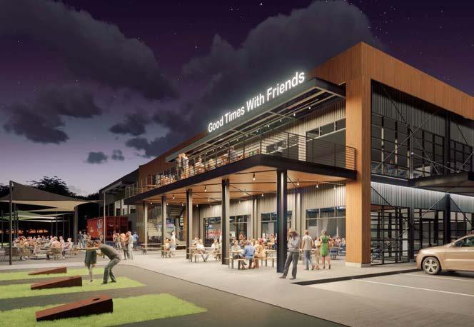
Trail Development Group, LLC Conceptual Rendering
• The petition of Trail Development Group, LLC to rezone approximately 9.67 acres from I-1, Low Intensity Industrial District, to C-2, High Intensity Commercial District, located near 3475 and 3801 Challenger Avenue, Vinton Magisterial District.
• The petition of Roanoke Valley Holdings, LLC to remove a proffered condition on approximately 50.8 acres of land zoned R-1C, Low Density Residential District with conditions, in order to develop a residential subdivision, located near the 6200 block of Crumpacker Drive, Hollins Magisterial District. The Board of Supervisors voted to deny this petition.
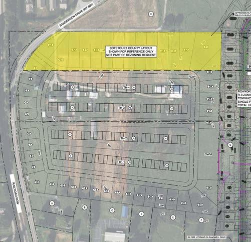
• The petition of Dale Wilkinson to rezone approximately 21.39 acres of land zoned I-1, Low Intensity Industrial District, to R-3, Medium Density Multi-Family Residential District, in order to develop a residential subdivision, located at 7812 Sanderson Drive, Hollins Magisterial District.
• The petition of ABoone Real Estate, Inc. to rezone approximately 16.27 acres of land from R-3C, Medium Density MultiFamily Residential District with conditions, to C-2C, High Intensity Commercial with conditions, to obtain a special use permit for mini-warehouse on approximately 19.73 acres zoned C-2C, High Intensity Commercial District with conditions, and to amend the proferred conditions on 32.323 acres of land zoned C-2C, High Intensity Commercial District with conditions, and R-3C, Medium Density Multi-Family Residential District with conditions, located in the 1300 and 1400 blocks of Edgebrook Road, Catawba Magisterial District.
• The petition of Kevin Manor to obtain a special use permit to operate a short-term rental on approximately 1.23 acres of land zoned R-1, Low Density Residential District, located at 4127 Mockingbird Hill Road, Hollins Magisterial District.
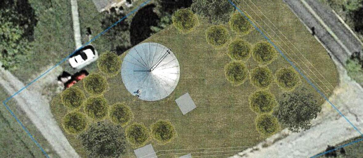
• The petition of the City of Salem Water Department to obtain a special use permit for a water tank on approximately 0.38 acre of land zoned R-1, Low Density Residential District, located at 1490 Hearth Lane, Catawba Magisterial District.
• The petition of Ramseys and Jesica Sandoval to obtain a special use permit to operate a short-term rental on approximately 0.3794 acre of land zoned R-1, Low Density Residential District, located at 5207 North Spring Drive, Catawba Magisterial District.
• The petition of Franco and Dawn DeBartolo to obtain a special use permit to operate a short-term rental on approximately 2.99 acres of land zoned R-1, Low Density Residential District, located at 3663 Chaparral Drive, Cave Spring Magisterial District.
• The petition of Evelyn Liu to obtain a special use permit to operate a short-term rental on approximately 2.04 acres of land zoned R-1, Low Density Residential District, located at 4058 Keagy Road, Windsor Hills Magisterial District.
• The petition of Robert and Jerri Jackson to obtain a special use permit to operate a short-term rental on approximately 0.5768 acre of land zoned R-1, Low Density Residential District, located at 1727 Mountain Heights Drive, Catawba Magisterial District. The Planning Commission voted to recommend denial of this SUP. The applicants withdrew their application.
• The petition of Neil Aneja to obtain a special use permit to operate a short-term rental on
approximately 0.30 acre of land zoned R-1, Low Density Residential District, located at 2726 White Pelican Lane, Cave Spring Magisterial District. The Planning Commission voted to recommend denial of this SUP. The Board of Supervisors voted to deny this SUP.
• The petition of Brad Prescott to obtain a special use permit to develop on a lot without public road frontage and to obtain a special use permit for custom manufacturing in a C-2, High Intensity Commercial District, on approximately 1.44 acres of land located in the 2900 block of Peters Creek Road, Catawba Magisterial District.
• The petition of Jonathan Kenneth Burns-Carrera to obtain a special use permit to operate a short-term rental on approximately 1.42 acres of land zoned R-1, Low Density Residential District, located at 5909 Old Mountain Road, Hollins Magisterial District.
• The petition of Joel Calfee to obtain a special use permit to operate a short-term rental on approximately 0.2599 acre of land zoned R-1, Low Density Residential District, located at 1176 Nover Avenue, Hollins Magisterial District.
• The petition of Reed Road Solar 1, LLC to obtain a special use permit for a major utility service (solar farm) on approximately 36.48 acres of land zoned AR, Agricultural/Residential District, located at 9150 Reed Road, Windsor Hills Magisterial District.
• The petition of Tracy Etayo to obtain a special use permit to operate a shortterm rental on approximately 0.18 acre of land zoned R-1, Low Density Residential District, located at 5445 Endicott Street, Hollins Magisterial District.
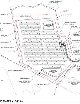
Reed Road Solar 1, LLC Concept
Planning Commission in 2024:
The Planning Commission and staff developed amendments to the Zoning Ordinance that would: add an asterisk to retail sales indicating additional, modified or more stringent standards as listed in article IV, use and design standards in the C-1 Low Intensity Commercial District, C-2 High Intensity Commercial District, and I-1 Low Intensity Industrial District in Article III (District Regulations); and add a use and design standard for convenience store, fuel center, gasoline station, and retail sales prohibiting the sale of tobacco products, vapor products, alternative nicotine products, or hemp products intended for smoking on properties located within 1,000 feet of a principal school building in Article IV (Use and Design Standards). On October 1, 2024, the Planning Commission voted to recommend approval of the amendments. Their recommendation did not include tobacco products, elementary schools operated by Roanoke County Public Schools or private schools. On November 19, 2024, the Board of Supervisors voted to adopt an ordinance regulating the sale of nicotine and hemp products (no tobacco) within 1,000 feet of Roanoke County high schools and middle schools.
At its regularly scheduled Planning Commission work session on April 16, 2024, Amanda McGee, the Director of Community Development with the Roanoke Valley-Alleghany Regional Commission, presented the Roanoke Valley Urban Tree Canopy Assessment. This study produced an inventory of the existing tree canopy in the Roanoke Valley and identified areas where tree canopy can be increased.
At a joint work session between the Planning Commission and the Board of Supervisors on June 11, 2024, staff with Energy Right, a Virginia-based non-profit that advocates for solar energy in the Commonwealth, presented on the logistics and economics of solar energy producing projects and presented recommendations for potential Ordinance Amendments that can facilitate solar projects.
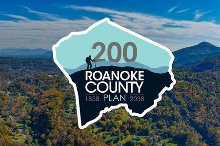
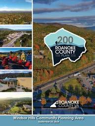
The Planning Commission held a public hearing on August 6, 2024, on the Roanoke County 200 Plan. No citizens spoke during the public hearing. The Planning Commission voted to recommend approval of the Roanoke County 200 Plan. On September 24, 2024, the Board of Supervisors approved a resolution adopting the Roanoke County 200 Plan. More information on the Roanoke County 200 Plan is included on page 12.
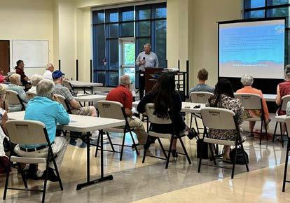
At its regularly scheduled Planning Commission work session on October 15, 2024, Megan Cronise, Assistant Director of Planning, provided upates on transportation projects in the County, including the following: implementation of the Route 419 Town Center Plan, Hollins Center Plan, Oak Grove Center Plan, and the Route 460 Land Use and Connectivity Study; the Interstate 81 Corridor Improvement Program; improvements to the Woodhaven Technology Park access; North County and Glenvar area transportation projects; and greenway projects progress. In addition, Isaac Henry presented on the West Roanoke River Greenway Feasibility Study and Paula Benke presented on Transit-related projects. Remaining presentation topics included the status of the Safe Streets and Roads For All Comprehenisve Safety Action Plan and the 2024 SMART SCALE applications.
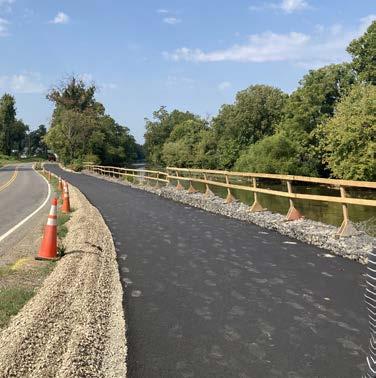
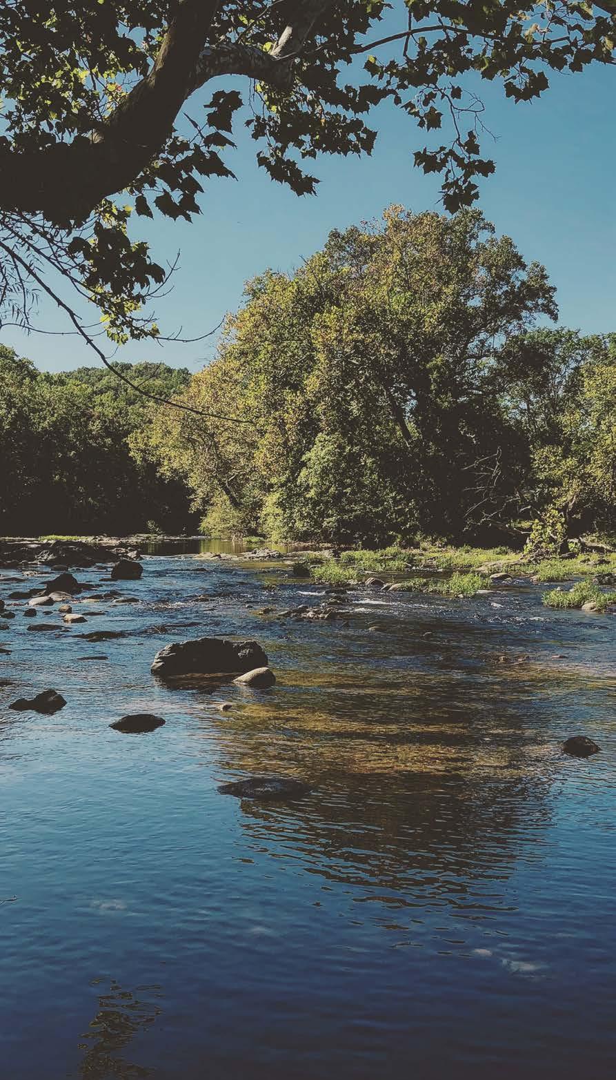
West Roanoke River Greenway - Phase 1
W. Eric Thomas Vinton District (February 2000)
Charlotte Moore Cave Spring District (June 2021)
Richard Jones Jr. Catawba District (July 1993)
Jeffrey Armstrong Hollins District (March 2023)
NOT PICTURED: Rick Pevarski, Windsor Hills District
The chief role of the Board of Zoning Appeals (BZA) is to hear variance applications relative to the Roanoke County Zoning Ordinance and administrative appeals of the Zoning Administrator’s decisions. The board consists of five members who serve five-year terms and are appointed by the Board of Supervisors.
The BZA held a total of two meetings in 2024, including two actions on zoning variances. Richard L. Jones Jr. served as Chairman and W. Eric Thomas as Vice-Chairman.
• The petition of Donald W. and Judith K. Sublett to obtain a variance from Section 30-41-3(B)4 of the Roanoke County Zoning Ordinance to reduce the required front yard setback from 30 feet to 8 feet, 2 inches to construct an attached addition on a corner lot. The property is zoned R-1, Low Density Residential District, and is located at 4544 Hammond Lane, in the Cave Spring Magisterial District. This variance was continued indefinitely.
• The petition of Stephan Jones to obtain a variance from Section 40-41-3(B)3 of the Roanoke County Zoning Ordinance to reduce the rear setback line of a new subdivided lot from 25 feet to 15 feet. The property is zoned R-1, Low Density Residential District, and is located at 3506 View Avenue in the Cave Spring Magisterial District. This was denied on December 18, 2024.
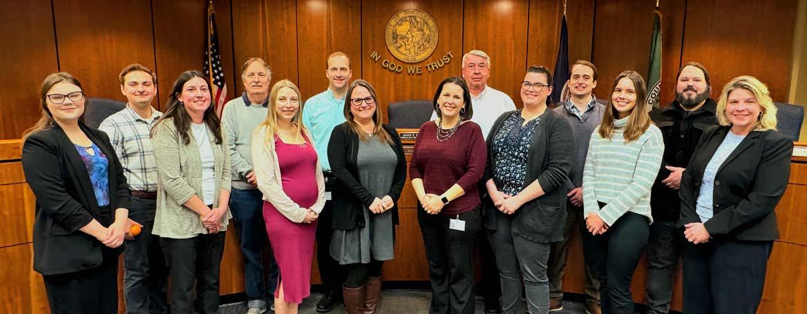
BACK: [Jason Nowak, Bill Richardson, Nathan Grim, Philip Thompson, Isaac Henry, Ross Hammes]
FRONT: [Cecelia Thomas, Sarah Gilmore, Alyssa Dunbar, Rebecca James, Megan Cronise, Summer Bork, Skylar Camerlinck, Paula Benke]
New Employees:
• Jason Nowak, Planner I - Code Enforcement Officer, Zoning Division
• Sarah Gilmore, Planner II, Long-Range Planning Division
• Summer Bork, Transportation Planner, Transportation Division
New Certifications:
• Sarah Gilmore: Certified through the American Institute for Certified Planners
• Alyssa Dunbar, Cecelia Thomas and Skylar Camerlinck: Certified Zoning Administrator through the Virginia Association of Zoning Administrators
• Skylar Camerlinck, Nathan Grim, Ross Hammes and Sarah Gilmore: Certified Planning Commissioners’ Program
• Jason Nowak: Certified Board of Zoning Appeals Program
Staff supported the following boards, committees, and business and civic associations this year:
• Council of Community Services
• Hazard Mitigation Plan Steering Committee
• Regional Bicycle & Pedestrian Advisory Committee
• Roanoke Regional Housing Network
• Regional Local Food Planning Committee
• Roanoke River Blueways Committee
• Roanoke Valley Greenway Commission
• Roanoke Valley Urban Forestry Council
• Salem-Roanoke County Chamber of Commerce
• Roanoke Valley Transportation Planning Organization (RVTPO)
• Transportation Technical Committee (TTC)
• Greater Williamson Road Area Business Association (GWRABA)
• Roanoke Valley-Alleghany Regional Commission (RVARC)
• American Institute of Certified Planners (AICP): 4
• Certified Board of Zoning Appeals Program: 5
• Certified Combined Administrator for Erosion and Sediment Control: 1
• Certified Transportation Manager (CTM): 1
• Certified Zoning Administrator (VAZO): 4
• Graduate Certificate of Geographic Information Technology: 1
• Graduate Certificate of Natural Resource Management: 1
Brian Epperley, Transportation Engineer in the Planning Department, passed away unexpectedly on December 2, 2024. Brian was 56 years old and had just marked 25 years of service with Roanoke County at the time of his passing. He had previously worked for the City of Roanoke, for SFCS and for Mattern & Craig. Brian could design just about anything in AutoCAD and, as a result, his initials are on hundreds of County concept plans, construction plans and exhibits. Brian designed a wide variety of projects including canoe launches, trailhead parking lots, sidewalks, shared use paths, McAfee Knob Trailhead Shuttle pulloffs, drainage projects, utility projects, roadway improvements and exhibits for easements and land donations. His concept plans were the foundation for many successful grant applications, including a segment of the Glade Creek Greenway through Vinyard Park West. Brian collaborated on the conceptual design and construction plans for the greenway that will be complete in Summer 2025.
His attention to detail and outstanding research skills were wellregarded by not only County employees, but also by VDOT staff and Civil Engineering firms throughout the Roanoke Valley. Outside of work, Brian most enjoyed weekly fishing trips to Smith Mountain Lake, watching football and attending live music events. Born and raised in the Garden City/Mount Pleasant area and a graduate of Patrick Henry High School, Brian ran into friends wherever he went. We dearly miss our friend and colleague.
• Lean Management for Practitioners (VT): 1
• Locally Administered Projects Qualification Program (VDOT): 3
• Virginia Certified Planning Commissioners Program (VCU): 9

Other Zoning Concerns (i.e. signage, setback concerns, operating
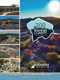
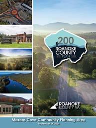
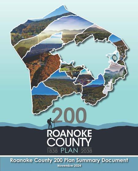
On September 24, 2024, the Roanoke County Board of Supervisors voted to approve the adoption of the Roanoke County 200 Plan as the County’s Comprehensive Plan. The adoption concluded a three-year planning process that included 25 community meetings attended by a total of 934 people, two surveys that elicited a total of 717 responses, meetings with 24 different stakeholder groups, and three Planning Commission public hearings. The 200 Plan represents the first major overall update to the Roanoke County Comprehensive Plan since 2005. It consists of a main document covering the entire County, as well as shorter summary documents for each of the County’s eleven Community Planning Areas (CPAs). The 200 Plan outlines existing conditions, analyzes potential future opportunities, needs, and challenges, and provides recommendations to guide natural and cultural resources, community facilities, transportation, and land use and housing in the County through its bicentennial anniversary in 2038.
The Roanoke County 200 Plan was created in-house by County Planning staff as well as other County departments. The Long-Range Planning division managed the project, but it was ultimately a group effort that also included substantial contributions from the Transportation and Zoning divisions as well as other County departments. The Planning Commission provided essential input on early drafts of the Plan during numerous work sessions held with staff between Fall 2023 and Summer 2024. The result of all this hard work is a well-researched, detailed, visually appealing, and forward-looking document that aims to preserve and enhance Roanoke County’s status as a top-notch place to live, work, and do business.
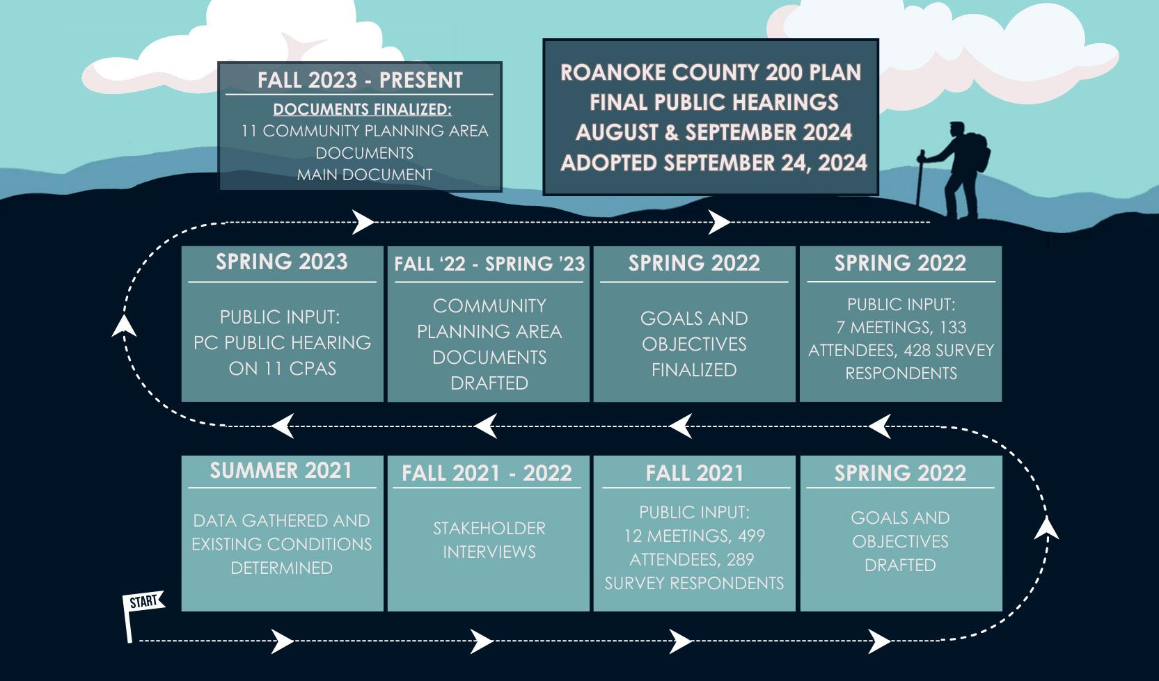
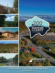
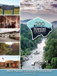
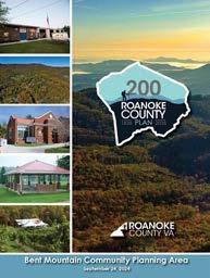
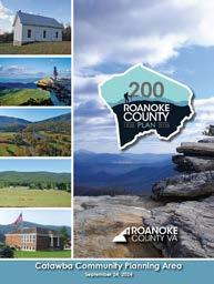
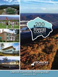
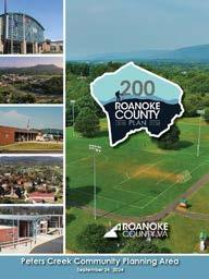
Summary documents for each of the eleven (11) unique Community Planning Areas (CPAs) were prepared with citizen input gained from community engagement events held in Fall 2021, Spring 2022, and Spring 2023. The CPA summary documents are key components of the 200 Plan that identify specific goals and recommendations for implementation within each CPA. The CPA summary documents were adopted as part of the Roanoke County 200 Plan in September 2024.
A Summary Document for the main document of the Roanoke County 200 Plan is currently being prepared that is intended to be used as a reference guide to the goals, objectives, recommendations, and implementation strategies of the Plan. The Summary Document is anticipated to be available to the public in early 2025.
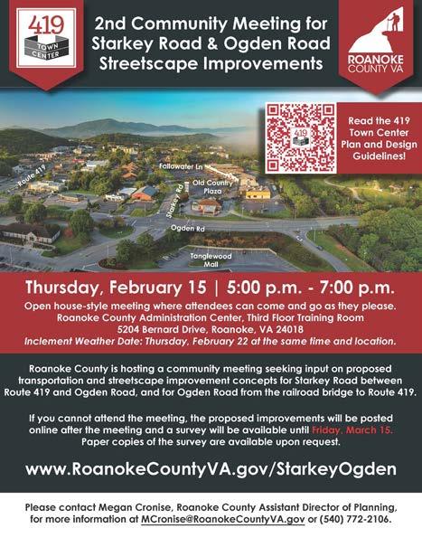
In 2019, the Roanoke County Board of Supervisors adopted the 419 Town Center Plan as part of the County’s Comprehensive Plan. In 2022, the Board of Supervisors amended the 419 Town Center Plan by incorporating the Roanoke County 419 Town Center Design Guidelines into the 419 Town Center Plan. The 419 Town Center Plan redefines Roanoke County’s largest retail destination as a vibrant, walkable community with many transportation and economic development projects.
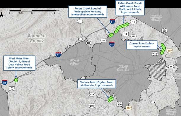
Transportation Projects: VDOT held a Design Public Hearing in June 2024 on the Route 419 Streetscape Improvements, Phase 2, between Ogden Road and Starkey Road. The project includes widening Route 419 to three lanes, extending sidewalk and bicycle lanes along both sides of the road, improving the Starkey Road intersection with a Through-Cut configuration with pedestrian crosswalks and signals, and installing a Restricted Crossing U-Turn at Ridge Top Road/Madison Square. Construction is anticipated in 2027.
A new bike rack has been installed in front of the Michaels Craft Store at Tanglewood Mall. Coordination has continued with VDOT and Valley Metro to install a Tanglewood-branded bus shelter on Route 419 in front of Copper Croft Apartments. Installation is anticipated in early 2025.
A SMART SCALE Round 6 application was submitted in August 2024 requesting funding for streetscape and multimodal improvements for Starkey Road from Route 419 to Ogden Road, and Ogden Road from Route 419 to the Norfolk Southern railroad bridge. Proposed improvements include bicycle lanes, sidewalks, crosswalks, a new traffic signal at Starkey Road and Ogden Road with pedestrian crosswalks and signals, reconfiguration of Ogden Road travel lanes north of Starkey Road and relocation of a Valley Metro bus stop. Awards will be finalized by the Commonwealth Transportation Board in June 2025.
Economic Development Projects:
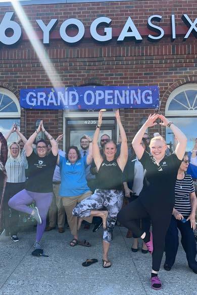
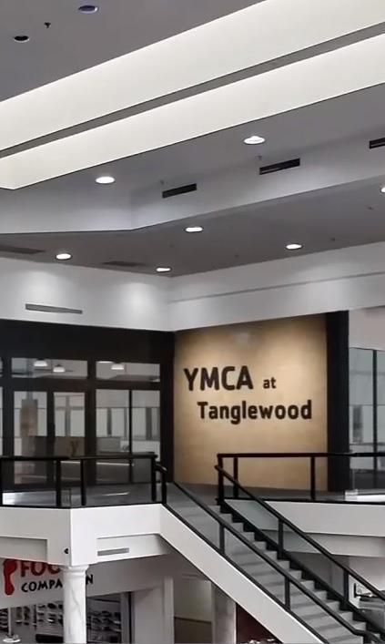
The following businesses opened in 2024: YMCA at Tanglewood on the second floor of Tanglewood Mall which provides 47,000 square feet of recreational facilities, including pickle ball, yoga, saunas, and areas for kids, YogaSix across from Tanglewood Mall, Signature Property Management and Secret Oasis Med Spa in Old Country Plaza, and The Revive Center across from the Old Country Plaza. Running Latte coffee kiosk is currently under construction and is slated to open in 2025. AB II 419 LLC has purchased the professional office park located at the southeast corner of Starkey Road and Route 419 and a redevelopment project is anticipated soon.
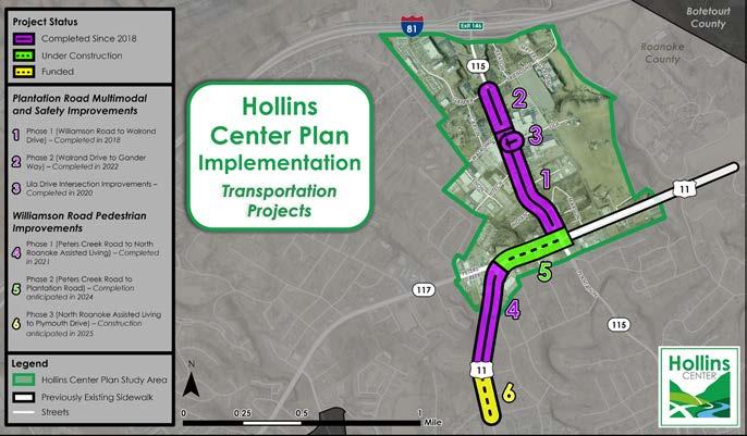
In 2020, the Roanoke County Board of Supervisors adopted the Hollins Center Plan as part of the County’s Comprehensive Plan. The Hollins Center Plan implementation continued this year with the planting of six new street trees along the Plantation Road Shared Use Path and the continuation of the Hollins Library Replacement Project, the construction of which has been included in the FY2026 budget cycle.
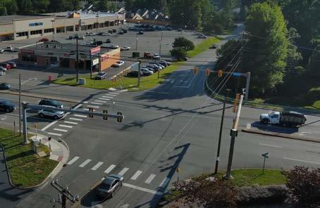
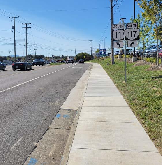
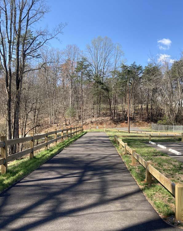
Transportation Projects: A gap in the sidewalk network along Williamson Road was completed to connect the Plantation Road shared use path, existing sidewalk on Williamson Road towards Hollins University, pedestrian signals and crosswalks at the Peters Creek Road/Williamson Road intersection and new sidewalk on Williamson Road south of Peters Creek Road.
Sidewalk was also installed along the Plantation Road and Friendship Lane frontage of a new Starbucks. The new sidewalk connects to pedestrian signals and crosswalks at the Plantation Road/Friendship Lane/ Gander Way traffic signal.
Three SMART SCALE Round 6 applications were submitted in August 2024 that were identified in the Peters Creek Road/Williamson Road Multimodal Safety Improvements Study. More information on these projects can be found in the Funding Requested in 2024 section on page 21.
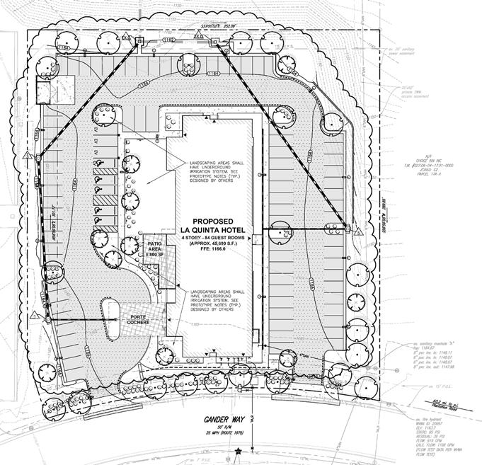
Economic Development Projects: The following businesses opened in 2024: Southern Team Hyundai and Aspen Total Fitness on Williamson Road, Starbucks on Plantation Road, and Springhill Suites by Marriott North on Gander Way. In addition, the Roanoke County Career & Technology Center on Peters Creek Road is currently under construction and is expected to be completed in Fall 2026. Sheetz at the intersection of Plantation Road and Williamson Road and La Quinta by Wyndham on Gander Way are also under construction and are expected to be completed in 2025.
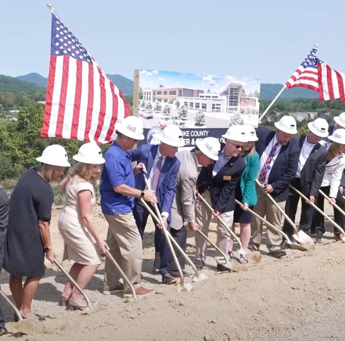
Roanoke County Career & Technology Center Groundbreaking Williamson Road Sidewalk Improvements - Completed 2024

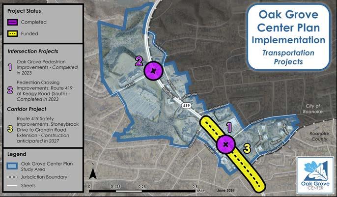
In 2021, the Roanoke County Board of Supervisors adopted the Oak Grove Center Plan as part of the County’s Comprehensive Plan. The Oak Grove Center Plan envisions an area that boasts thriving businesses, places to gather, housing options and extensive parks and trails, as well as travel options that are safe and accessible for all ages and abilities and that connect the activity center to adjacent neighborhoods, greenways, and surrounding areas.
Transportation Projects: Preliminary engineering began on two funded SMART SCALE Round 5 applications on Route 419 that VDOT combined into one project. Features include Restricted Crossing U-Turns at Route 419/Stoneybrook Drive and at Route 419/Glen Heather Drive, sidewalk on the west side of Route 419 from Glen Heather Drive to Grandin Road Extension that will connect with the new pedestrian signals and crosswalks at Carriage Drive/Grandin Road, and new pedestrian signals and crosswalks at Route 419/Postal Drive/Berry Lane and at Route 419/Brambleton Avenue. A community meeting will be held in March 2025.
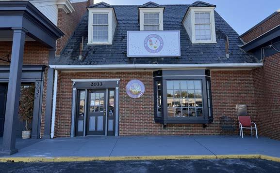
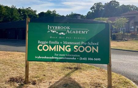
Economic Development Projects: The following businesses opened in 2024: Sips and Scoops at Oak Grove Plaza, Tiffany Nails and Spa in Southwest Plaza, and Ivybrook Acadmy is currently under construction and is slated to open in early 2025.
Route
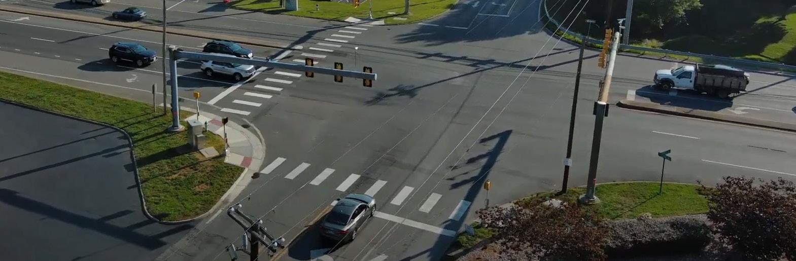
The U.S. Route 460 Land Use and Connectivity Study was adopted by the Board of Supervisors on March 28, 2023, and incorporated into the Roanoke County Comprehensive Plan. Implementation in 2024 included:
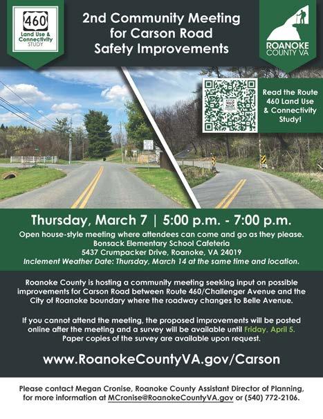
Transportation Projects: The August submission of a SMART SCALE Round 6 application to request funding to replace and expand the one-lane-wide bridge on Carson Road and to widen and channelize the right turn lane from Carson Road onto Challenger Avenue to reduce crashes.
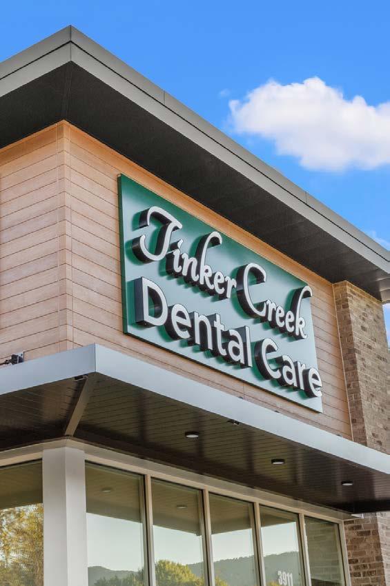
Sidewalk was also constructed between Challenger Avenue and the new Tinker Creek Dental Care located near CVS which will connect with planned pedestrian crosswalks and signals at the Challenger Avenue/ West Ruritan Road intersection anticipated to start construction in 2026.
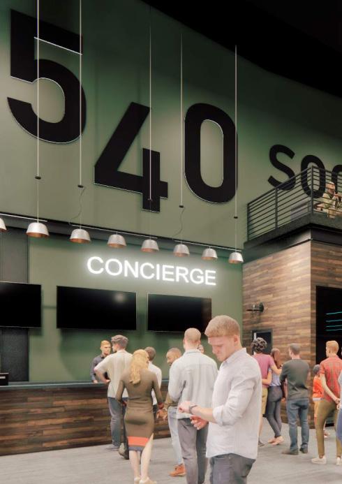
Economic Development Projects: The opening of Tinker Creek Dental Care on Challenger Avenue. The Board of Supervisors approved a rezoning request in July from Trail Development Group, LLC for a new commercial establishment named 540 Social located near 3475 and 3801 Challenger Avenue.
Planning staff often assist other departments or organizations with conceptual plans, graphic design projects, mapping, and public engagement initiatives.
The graphics and marketing strategy for the Roanoke County 200 Plan and other community plans have been designed, generated, planned and executed in-house by Planning staff.
This includes the County website and social media pages, print materials and signage, roadside banners, meeting exhibits, video content and e-newsletters. A variety of in-house 2024 design projects are showcased on the following page:
Funding award timeframes vary by grant program. Several projects applied for in 2023 were awarded in 2024, some 2024 applications have already been awarded, and others will not be finalized until the second quarter of 2025. The total funding awarded in 2024 was $12,499,962 including $7.6 million in conditional STBG/ CRP funding.
Projects include:
• CORTRAN: An application was submitted to Virginia Department of Rail and Public Transportation (DRPT) to support the County’s CORTRAN (County of Roanoke Transportation) program. The application requested FTA (Federal Transit Administration) Section 5310 funding (96% State/Federal funding and 4% Local Match). DRPT awarded the County $674,765 for funding in the urban and rural areas.
• Revenue Sharing Program for Dry Hollow Road Safety Improvements: Funding was requested to satisfy a deficit for the project which will reinforce the roadway against the creek and will widen the roadway under the historic railroad bridge. Funds are 50% State/50% Local and $1,391,175 was awarded by the Commonwealth Transportation Board (CTB).
• East Roanoke River Greenway from the Blue Ridge Parkway to Explore Park: The Eastern Federal Lands Division of the Federal Highway Administration awarded $536,000 in supplemental Federal Lands Access Program funding (80% State/Federal funding and 20% Local Match) to cover a project deficit due to higher than anticipated construction bids.
• Explore Park Greenway: The Roanoke Valley Transportation Planning Organization (TPO) approved $500,000 in additional Surface Transportation Block Grant/Carbon Reduction Program (STBG/ CRP) funding (100% State/Federal) to satisfy a project deficit for the Explore Park Greenway prior to construction advertisement.
• Orange Market Park and Ride: The TPO approved an additional $1,500,000 in STBG/CRP funding (100% State/Federal) to satisfy a project deficit which enabled the start of preliminary engineering.
• Glade Creek Greenway through Vinyard Park West: The TPO awarded $248,022 in additional Transportation Alternatives Program funds (80% State/Federal funding and 20% Local Match) to cover a project deficit prior to construction advertisement.
• Friends of the Blue Ridge/Roanoke ValleyAlleghany Regional Commission for Bicycle Racks: Two applications requesting bicycle racks were awarded from Friends of the Blue Ridge. Locations include Green Hill Park and Tanglewood Mall near Michaels. Both bicycle racks have been installed.
• Peters Creek Road at Williamson Road Intersection Improvements: The TPO awarded $3.6 million in conditional STBG/CRP funding (100% State/Federal) for leverage in SMART SCALE Round 6.
• Route 11/460/West Main Street at Dow Hollow Road Intersection Safety Improvements: The TPO awarded $4 million in conditional STBG/ CRP funding (100% State/Federal) for leverage in SMART SCALE Round 6.
Planning staff applied for funding through several programs in 2024. Applications not already represented in the Funded section include:
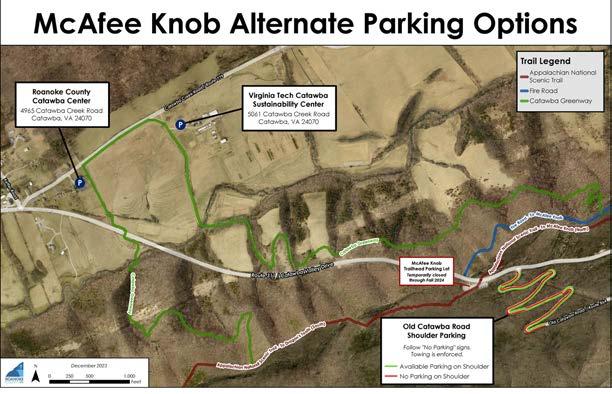
• Congressionally Directed Spending Request for National Park Service Appalachian National Scenic Trail McAfee Knob Trailhead Parking and Transit Access Improvements: An application was submitted to Senators Kaine and Warner requesting $5,502,943 to expand, pave and stripe the McAfee Knob Trailhead parking lot with restrooms, sidewalks and a shuttle stop with a shelter. This request is included in the FY 2025 Federal Budget and is awaiting adoption.
The following projects were submitted for SMART SCALE Round 6 funding in August. This source is 100% State and Federal funding and is awarded by the Commonwealth Transportation Board in mid-2025.
Projects include:
• Peters Creek Road/Williamson Road Multimodal Safety Improvements (Deer Branch Road to Plantation Road): This project includes Restricted Crossing U-Turns, a roundabout at Peters Creek Road and Williamson Road, right turn lanes at Williamson Road and Plantation Road and sidewalks with crosswalks. The total requested amount submitted was $42,680,509.
• Peters Creek Road Multimodal Safety Improvements (Wendover Drive to Dwight Street): This project also includes Restricted Crossing U-Turns, a through-cut configuration and other intersection improvements at Peters Creek Road/Airport Road/Archcrest Drive, and sidewalks. The total requested amount submitted was $31,880,832.
• Starkey Road/Ogden Road Streetscape Improvements: This project adds sidewalks, bicycle lanes, relocates a bus stop and replaces the Starkey Road/Ogden Road traffic signal with a new signal that includes pedestrian crosswalks and signals. The total requested amount submitted was $17,574,820.
• Carson Road Safety Improvements: This project replaces the existing one-lane-wide bridge with a double box culvert that allows for two travel lanes and improves the Carson Road/Challenger Avenue intersection with a channelized right turn lane onto Challenger Avenue. The total requested amount submitted was $8,030,993.
• Route 11/460/West Main Street at Dow Hollow Road Intersection Improvements: TPO staff submitted this application on behalf of Roanoke County to improve the West Main Street at Dow Hollow and Fallbrooke Drive intersections with a peanut-style roundabout. The total requested amount submitted was $56,697,003.
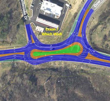
Proposed Peanut Roundabout at Route 460 and Dow Hollow Road
• Peters Creek Road and Williamson Road Corridor Improvements (Wood Haven Road to Plantation Road): TPO staff also submitted this application on behalf of Roanoke County. This project includes all intersection improvements studied as part of the OIPI Project Pipeline Study to improve safety, reduce congestion and expand multimodal transportation options. The total requested amount submitted was $148,466,414.
• Peters Creek Road at Valleypointe Parkway Improvements: City of Roanoke staff submitted this application on behalf of Roanoke County. This project proposes adding a second left turn lane from eastbound Peters Creek Road to northbound Valleypointe Parkway, adding bicycle lanes on Peters Creek Road and replacing the existing traffic signal with a new signal that includes pedestrian crosswalks and signals. The total requested amount submitted was $27,601,325.
The following studies focus on an issue or problem, identify many different alternatives to potentially address that issue or problem, and then determine recommendations.
Studies include:
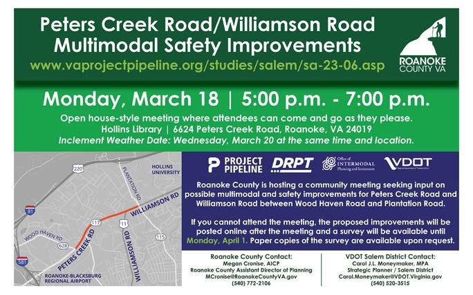
• VDOT Project Pipeline Study for Peters Creek Road and Williamson Road: Roanoke County requested and VDOT initiated a multimodal safety study for Peters Creek Road and Williamson Road from Wood Haven Road to Plantation Road. This study implements recommendations in the Hollins Center Plan and studies concerns identified in the Roanoke County 200 Plan. A survey was conducted in August 2023 and additional engagement took place in March 2024.
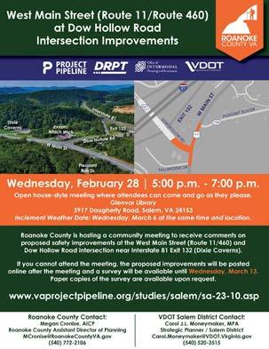
• VDOT Project Pipeline Study for West Main Street at Dow Hollow Road: VDOT initiated a safety study for the intersection of West Main Street at Dow Hollow Road due to high crash volumes and significant impacts from Interstate 81 detours. This study implements recommendations in the Glenvar Community Plan and considers concerns voiced as part of the Roanoke County 200 Plan. A survey was conducted in August 2023. VDOT facilitated additional community engagement in February 2024.
• Carson Road Safety Improvements Study: To continue implementing the U.S. Route 460 Land Use and Connectivity Study, Roanoke County surveyed and studied Carson Road with assistance from Timmons Group. A community meeting was held in November 2023 with an associated survey. Additional public engagement took place in March 2024.
• Starkey Road/Ogden Road Multimodal Improvements Study: Roanoke County continues to implement the 419 Town Center Plan by focusing on Starkey Road from Route 419 to Ogden Road, and Ogden Road from Route 419 to the railroad bridge at the City of Roanoke boundary. The corridors were surveyed and Whitman, Requardt and Associates studied these roadways. A community meeting was held in October 2023 with a corresponding survey. The second round of community engagement took place in February 2024.
The following studies focus on an issue or problem, identify many different alternatives to potentially address that issue or problem, and then determine recommendations.
Studies include:
• Safe Streets and Roads for All Comprehensive Safety Action Plan: This multijurisdictional study with the Town of Vinton and Botetourt County was awarded by the Federal Highway Administration in January 2023. The study began in December 2023 with the assistance of Roanoke County’s consultant, Timmons Group. This study will conclude in February 2025. More information on this study is provided on page 24.
• West Roanoke River Greenway Feasibility Study: This study began in Summer 2022 and seeks to build off the 2018 Roanoke Valley Greenway Plan and VDOT Valley to Valley Trail Study by identifying realistic alignments for this section of the Roanoke River Greenway that can be used for future funding requests. A second round of community meetings was held in July 2023. The draft Study will be presented for action by the Planning Commission and Board of Supervisors in 2025.
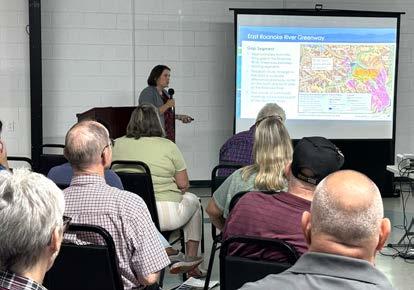
• East Roanoke River Greenway Feasibility Study: Roanoke County has engaged AECOM to study potential alternatives to span the gap in the East Roanoke River Greenway between the existing greenway terminus near the Western Virginia Water Authority’s Water Pollution Control Plant and the new greenway constructed at 3204 Highland Road, just west of the Blue Ridge Parkway. Two rounds of public engagement are planned for 2025.
The Bipartisan Infrastructure Law established the Safe Streets and Roads For All (SS4A) Discretionary Grant Program to fund initiatives to prevent roadway deaths and serious injuries. The U.S. Department of Transportation appropriated $5 billion for the SS4A program over five years. Roanoke County applied for the first round of funding for fiscal year 2022 which had up to $1 billion available and was split between Planning and Implementation grants.
The SS4A program provides eighty percent (80%) Federal funding for a twenty percent (20%) local match. Applicants must first have an eligible Safety Action Plan in place in order to apply for Implementation Grants in subsequent grant rounds.
Staff requested an Action Plan Grant for development of a Comprehensive Safety Action Plan in partnership with the Town of Vinton and Botetourt County. Roanoke County was notified of a $280,000 award on January 31, 2023, and executed a Grant Agreement with the U.S. Department of Transportation effective April 27, 2023. Roanoke County contracted with Timmons Group in November 2023 for planning activities to support and develop a Comprehensive Safety Action Plan for all three localities.
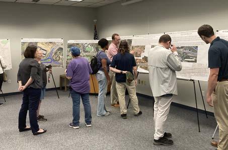
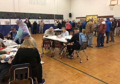
The first round of community meetings were held in April and May 2024 to provide an opportunity for community members to review and comment on the top ten high crash corridors and intersections for fatalities and serious injuries. A total of 16 people attended the two Roanoke County meetings held at the Brambleton Center and at the Hollins Library with 121 surveys completed in May.
Staff and consultants updated the Planning Commission and Board of Supervisors on the status of the study at work sessions in August 2024. The second round of community meetings were held in September 2024 at the South County Library and at the Hollins Library. These meetings focused on potential safety improvement recommendations to reduce crashes at the identified high crash corridors and intersections. Seventeen people attended these Roanoke County meetings and 113 surveys were completed.
Staff and consultants reviewed the draft Comprehensive Safety Action Plan with the Planning Commission and Board of Supervisors at work sessions in December 2024.
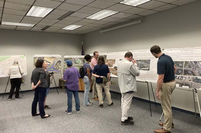
May 2024 Community Meeting
Next steps in 2025 include:
• January 2 through 16, 2025: Draft Comprehensive Safety Action Plan to be released for public comment
• January 21, 2025: Planning Commission work session on public comments
• February 4, 2025: Planning Commission to hold a public hearing on the draft Plan
• February 25, 2025: Board of Supervisors to hold a public hearing to consider adopting the Comprehensive Safety Action Plan as part of the Roanoke County 200 Plan
• Summer 2025: The top prioritized project will be designed and estimated for submission as an Implementation Project
Roanoke County and VDOT work together to initiate, fund, design and construct transportation-related projects across the county. The following projects were completed in 2024.
Projects Completed in 2024 include:
• Williamson Road Sidewalk, from Plantation Road to Peters Creek Road: Constructed sidewalk along the north side of Williamson Road between Peters Creek Road and Plantation Road. (Funding Sources: TA, SMART SCALE)
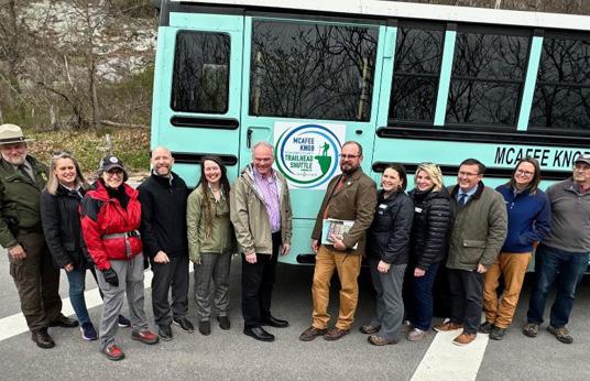
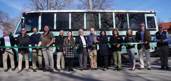
• McAfee Knob Trailhead Shuttle Expansion: Demonstration Project funding for shuttle service was awarded from DRPT in 2023 to expand the original shuttle route (Interstate 81 Exit 140 Park and Ride to the McAfee Knob Trailhead) into the City of Salem, to the Orange Market Park and Ride and to Route 311 near the Dragon’s Tooth trailhead parking lot. Expanded service began on March 1, 2024, and concluded on December 1, 2024, with service on Fridays, Saturdays, Sundays and holiday Mondays. The shuttle saw record ridership due to the closure of the McAfee Knob Trailhead parking lot during construction of the Appalachian Trail pedestrian bridge over Route 311.
Roanoke County and VDOT work together to initiate, fund, design and construct transportation-related projects across the county. The following projects were under construction in 2024.
Projects Underway in 2024 include:
• Interstate 81 Widening, Exit 137 to Exit 141: Widening the roadway to six travel lanes. The project is connecting to existing and proposed widening projects. Completion anticipated in early 2026. (Funding Source: I-81 funding)
• Interstate 81 Widening, Exit 143 to 150: Widening the roadway to six travel lanes. Completion anticipated in 2032. (Funding Source: I-81 funding)
• Appalachian Trail Bridge over Route 311: Constructing a pedestrian bridge over Route 311 for the Appalachian National Scenic Trail. Completion anticipated in early 2025. (Funding Source: HSIP)
• East Roanoke River Greenway from Highland Road to Explore Park: Two segments of Roanoke River Greenway with a trailhead parking lot are under construction to connect the existing greenway on Virginia Recreational Facilities Authority property to Explore Park across property owned by the National Park Service and the Roanoke Valley Resource Authority. Completion anticipated in early 2025. (Funding Sources: TA, FLAP)
• East Roanoke River Greenway through Explore Park: Constructing a segment of the Roanoke River Greenway through Explore Park to Rutrough Point. Completion anticipated in 2026. (Funding Sources: STBG, CRP)
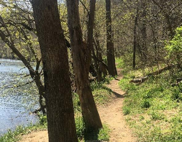
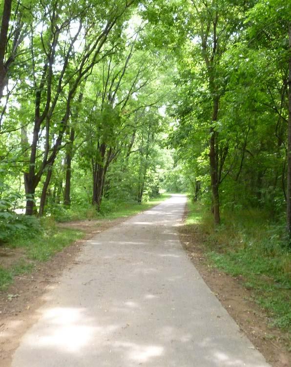
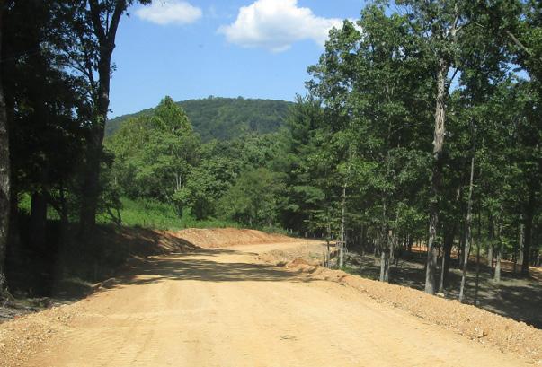
• West Roanoke River Greenway, Phase 1: Constructing 0.60 mile of Roanoke River Greenway south of the Roanoke River between West Riverside Drive and Kingsmill Drive with a trailhead parking lot. Completion anticipated in Summer 2025. (Funding Sources: HSIP, STBG, SMART SCALE)
• Glade Creek Greenway through Vinyard Park West: Constructing a segment of the Glade Creek Greenway along Glade Creek in Vinyard Park West. Completion anticipated Spring 2025. (Funding Source: TA)
• Bus Shelter installation at an existing Valley Metro bus stop on Route 419 across from Tanglewood Mall in front of Copper Croft Apartments: Completion anticipated early 2025. (Funding Source: Transit Ridership Incentive Program)
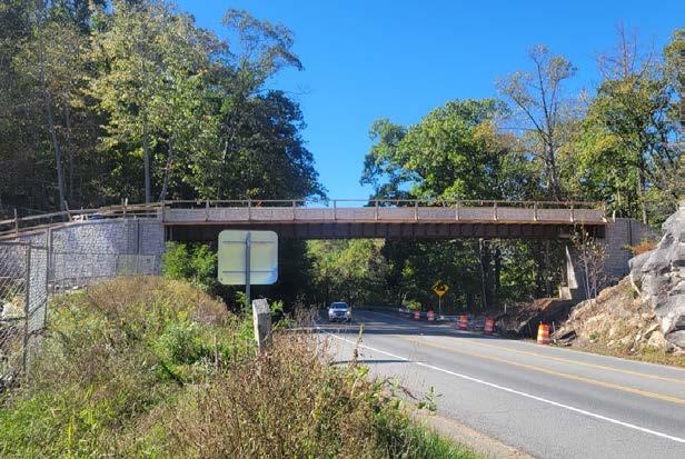
Route 311 Appalachian Trail Pedestrian Bridge
East Roanoke River GreenwayBlue Ridge Parkway to Explore Park
Roanoke County and VDOT work together to initiate, fund, design and construct county transportation-related projects. The following projects are anticipated to start construction in 2025.
Projects include:
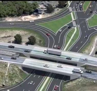
• Route 419 and Route 220 Diverging Diamond Interchange: Realigning the interchange with a Diverging Diamond configuration to improve traffic flow and safety with pedestrian and bicycle accommodations. This project also includes modifying three Route 419 intersections with through-cut configurations at South Peak Boulevard, Elm View Road and Ogden Road (Funding Sources: STBG, SMART SCALE)
• Route 220 Signal Improvements: Reduce signal phases and add pedestrian accommodations at four intersections along Route 220 between Valley Avenue/ Southern Hills Drive and Indian Grave Road/Clearbrook Village Lane. (Funding Source: I-73 Earmark)
• Interstate 581 at Exit 2 (Peters Creek Road) Interchange Improvements: Realign, widen to two lanes and signalize the I-581 northbound off-ramp to eastbound Peters Creek Road. (Funding Source: STBG)
• Williamson Road Sidewalk: North Roanoke Assisted Living to Plymouth Drive Intersection. Sidewalk will be constructed to continue along the west side of Williamson Road from North Roanoke Assisted Living to the intersection with Plymouth Drive. (Funding Source: HSIP)
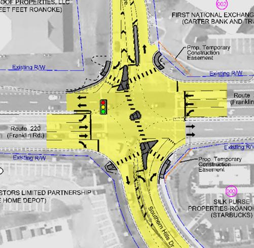
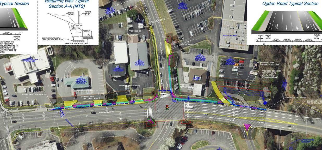
Route 220/Franklin Road and Valley Avenue Intersection Proposed Improvements
Planning staff are frequently asked to assist other departments with important County projects. The list below reflects work completed for several different departments, as well as detailed concept plans created for potential grant applications.
• Glade Creek Greenway through Vinyard Park West Construction Plans
• Mount Pleasant Fire Station Sewer Connection Plans
• West Riverside Drive Concepts
• Orchards Stormwater Management Project
• Various Drainage Projects and Plans
• Ranchcrest Drive Sidewalk and Crosswalk Concept
• Sanderson Drive at Shadwell Drive Left Turn Lane Concept
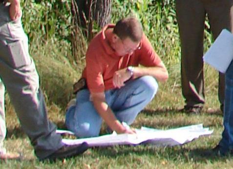
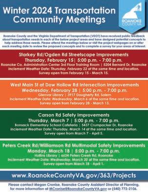
Planning staff hosted or participated in the following community meetings in 2024:
• Starkey Road/Ogden Road Streetscape Improvements Project Community Meeting (February)
• Cave Spring Baptist Church Board Meeting re: Proposed Brambleton Avenue Pedestrian Safety Improvements (February)
• West Main Street/Dow Hollow Road Intersection Safety Improvements Community Meeting (February)
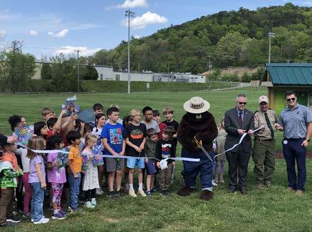
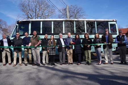
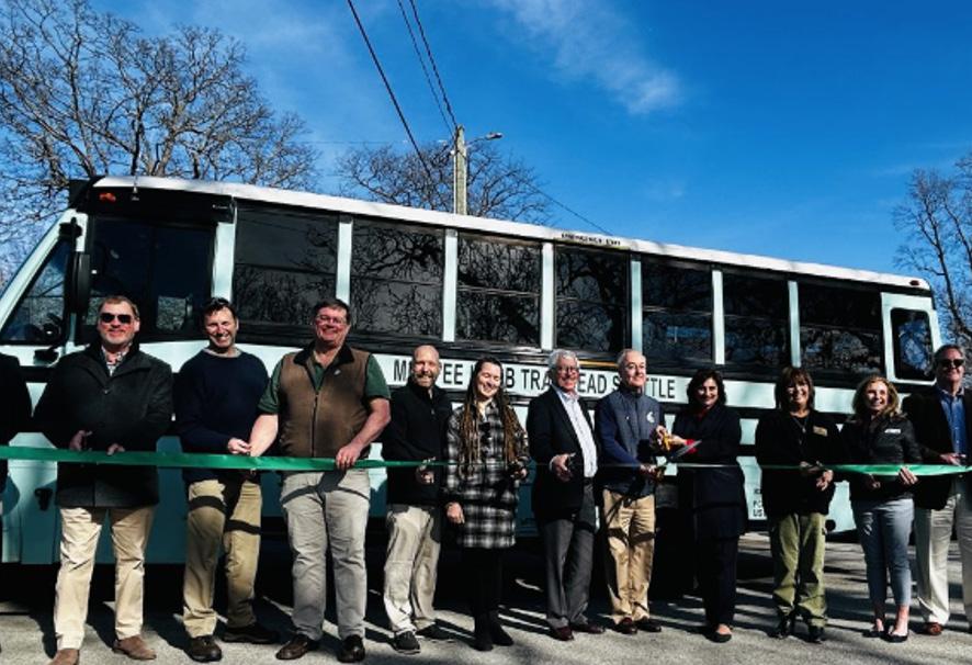
• McAfee Knob Trailhead Shuttle Expansion Ribbon Cutting (February)
• Carson Road Safety Improvements Community Meeting (March)
• Peters Creek Road/Williamson Road Multimodal Safety Study Community Meeting (March)
• West Roanoke River Greenway (WRRG) Phase 2 Community Meeting (April)
• Catawba Neighborhood Watch re: Old Catawba Road parking and McAfee Knob Trailhead Shuttle (April)
• Safe Streets and Roads For All Community Meetings (April/May and September)
• Reed Road Solar 1, LLC Special Use Permit Community Meeting (May)
• Roanoke Valley Holdings, LLC Rezoning Community Meeting (May)
• Mount Pleasant Neighborhood Watch (June)
• Route 419 Streetscape Improvements, Phase 2 VDOT Design Public Hearing (June)
• Buriak Memorial Sign Dedication (July)
• Beahm Rezoning Community Meeting (August)
• Route 460 and Route 220 Alternate Road Improvement Projects Design Public Hearing (August)
• Hollins Community Meeting hosted by Chairman North (August)
• Vinton Community Meeting hosted by Supervisor Shepherd (September)
• Montgomery Village HOA (September)
• Bonsack Community Meeting hosted by Chairman North and Supervisor Shepherd (October)
• Dry Hollow Road Safety Improvements Project Community Meeting (November)
• Poage Farm Rezoning Community Meeting (December)
• Quarterly Civic League Meetings (February/May/November)
Starkey/Ogden Streetscape Improvements
WRRG Phase 2 Community Meeting
The McAfee Knob Trailhead Shuttle kicked off the season with a ribbon cutting for the expansion of the service on February 29th at one of the new shuttle locations at Longwood Park in Salem. With over 60 people in attendance, the event offered a ride on the new on demand shuttle bus to visit the new shuttle locations, as well as view the progress at the McAfee Knob Trailhead of the construction of the pedestrian bridge to carry the Appalachian Scenic Trail over Route 311 to increase safety for hikers.
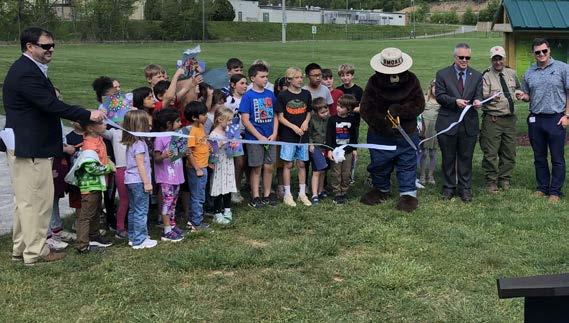
Planning staff coordinated with Roanoke County Parks, Recreation & Tourism staff, Roanoke County Public Schools, Roanoke Valley-Alleghany Regional Commission, and Virginia Department of Forestry to host Roanoke County’s Annual Arbor Day event at Merriman Soccer Complex on April 25th. Five new shade trees were planted along the South County Trail Extension Project and six new shade trees were planted along the Plantation Road Shared Use Path. This year’s Arbor Day Celebration marks Roanoke County’s 26th time selected as a Tree City USA by the Arbor Day Foundation.
Arbor Day 2024 at Merriman Soccer Complex
Roanoke County hosted a ceremony on July 8th at Green Hill Park to dedicate the Diuguids Lane bridge over the Roanoke River as the United States Navy Aircrewman Rescue Swimmer James P. Buriak Memorial Bridge. Speakers included Supervisor Martha Hooker, Delegate Joe McNamara, State Senator David Suetterlein, Patrick Pollifrone (friend of the deceased) and Reverend Paul Henrickson. Members of the family in attendance included Jimmy’s parents, wife and son. Five United States Navy Reserve members attended the event from Greensboro, N.C. Roanoke County Fire and Rescue staff provided a ladder truck displaying the American flag and an ambulance. VDOT Salem Residency staff coordinated the approvals and installation of the signs.
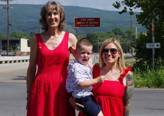
USN AWS1 James P. Buriak Memorial Bridge Dedication
Nathan Grim applied for and was accepted into the 2025 Virginia Walkability Action Institute cohort, a 9-month long program through the Virginia Department of Health which will culminate in the development of a project with the goal of improving walkability in Roanoke County.

• Paula Benke attended the Virginia Department of Rail and Public Transportation FTA 5311 Workshop as well as the Community Transportation Association of Virginia Conference and Expo.
• Nathan Grim attended the VDOT Land Use Forum and the the VDOT Local Programs Workshop.
• Megan Cronise presented at the VDOT Local Programs Workshop. She also attended American Planning Association, Virginia Chapter conference. In addition, she participated in a panel discussion at the Experience Conference and participated in a Transportation panel discussion for Leadership Roanoke Valley.
• Ross Hammes attended the Southeast Rural Community Assistance Project, Inc. (SERCAP) banquet dinner.
• Sarah Gilmore attended the Experience Conference.
• Becky James and Alyssa Dunbar attended the Virginia Association of Zoning Officials Conference.


YouTube


www.roanokecountyva.gov/pz |