


Wayne Bower Hollins District (July 2014)

Jim Woltz Windsor Hills District (January 2013)
Rick James Vinton District (January 2014)
Troy Henderson Catawba District (February 2017)
Kelly McMurray Cave Spring District (January 2020)
The Planning Commission is an advisory board to the Board of Supervisors. The Commission makes recommendations on a variety of land use issues. The Commission is also charged with preparing and maintaining the Comprehensive Plan and recommending changes to reflect new land use policies.
Planning Commission held a total of fifteen meetings in 2021, including eight public hearings and seven work sessions. Wayne Bower held the position of Chair and Kelly McMurray was Vice Chair.
The Commission is established under the authority of the Code of Virginia (1950, as amended), Chapter 22, Article 2 and pursuant to a motion of the Roanoke County Board of Supervisors on June 19, 1939, as authorized by Section 2, Chapter 427 of the Acts of the General Assembly, adopted March 30, 1936.
REZONING APPLICATIONS RECOMMENDED BY THE PLANNING COMMISSION:
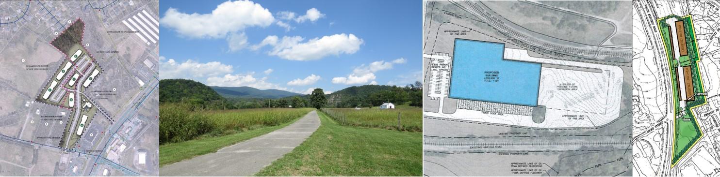
Kent Wheeler: To rezone approximately 13,023 acres from R-1C, Low Density Residential District, with conditions, to I-2, High Intensity Industrial District, and to rezone approximately 14.483 acres from I-2, High Intensity Industrial District to AG-1, Agricultural/Rural Low Density District located at and near 5454 Aerospace Road (January).
R.P. Fralin, Inc.: To rezone approximately 41.85 acres from I-1, Low Intensity Industrial District to R-1, Low Density Residential District to develop a 124-lot single family home subdivision located at 5524 Old Mountain Road (February).
Secure Store, LLC: To remove proffered conditions on approximately 10.064 acres zoned C-2C, High Intensity Commercial District, with conditions (June). See associated special use permit below.
Economic Development Authority of Roanoke County: To rezone approximately 30.5 acres from AR, Agricultural/Residential District to I-2, High Intensity Industrial District located at 5832 West River Road (October).
New Millennium: To rezone approximately 2.0 acres from R-1C, Low Density Residential District, with conditions, to I-2, High Intensity Industrial District located at 3878 Garman Road (November).
Lawson Companies: To amend existing proffered conditions on approximately 12.15 acres on property zoned R-3C, Medium Density Multi-Family Residential District, with conditions, to construct 216 apartments located in the 5000 block of Cove Road, the 2700 block of Peters Creek Road, and south of Beacon Ridge subdivision (December).
SPECIAL USE PERMITS RECOMMENDED BY THE PLANNING COMMISSION:
Mark Reinhardt: To obtain a special use permit for a special events facility located at 2875 Timberview Road (February).
Secure Store, LLC: To obtain a Special Use Permit for a mini-warehouse, located adjacent to and south of 925 North Electric Road (June). See associated rezoning above.
SPECIAL USE PERMIT POSTPONES BY THE BOARD OF SUPERVISORS:
Mark Reinhardt: Special events facility see above (February).
ZONING ORDINANCE AMENDMENTS RECOMMENDED BY THE PLANNING COMMISSION:
Zoning Regulations: Corrections and updates to various sections of the zoning ordinance; amended or new regulation on home beauty/barber salons, short-term rentals, temporary construction yards, yard encroachments, and change from requiring a special use permit to allowing a by right use for Religious Assembly in AG-3 and Commercial Indoor Amusement in C-2 (January).
Zoning Ordinance: Amendments include: Article I (General Provisions), Article II, (Definitions and Use Types), Article III (District Regulations), Article IV (Use and Design Standards) and Article V (Development Standards) (July).
CORTRAN: Update on CORTRAN provider and program changes (February).
ROANOKE COUNTY COMPREHENSIVE PLAN: Work sessions on the comprehensive plan rewrite process (March, April, July, August).
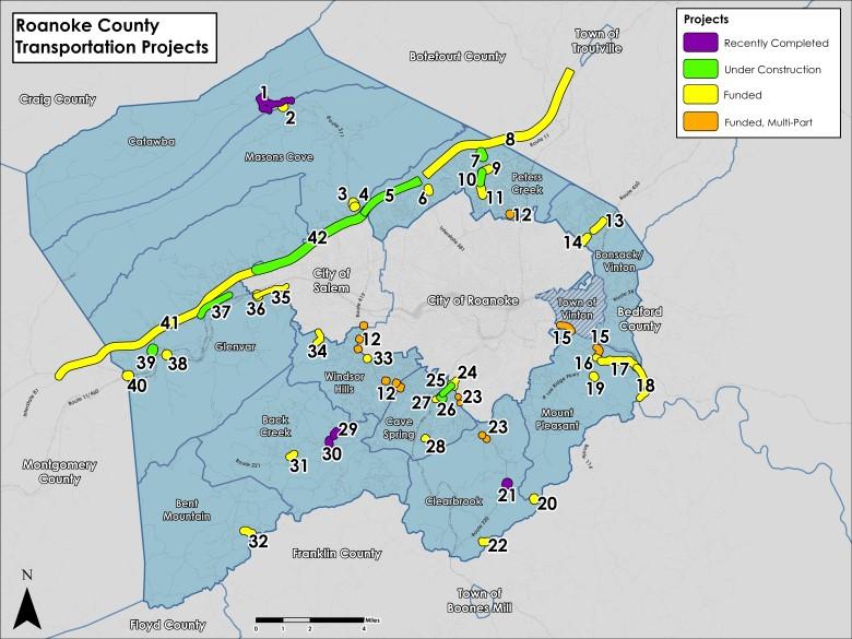
TRANSPORTATION: Update on transportation projects (April).
419 TOWN CENTER: Work session on potential development standards (September).
ECONOMIC DEVELOPMENT AUTHORITY: Joint meeting to discuss the Economic Development Strategic Plan (July).
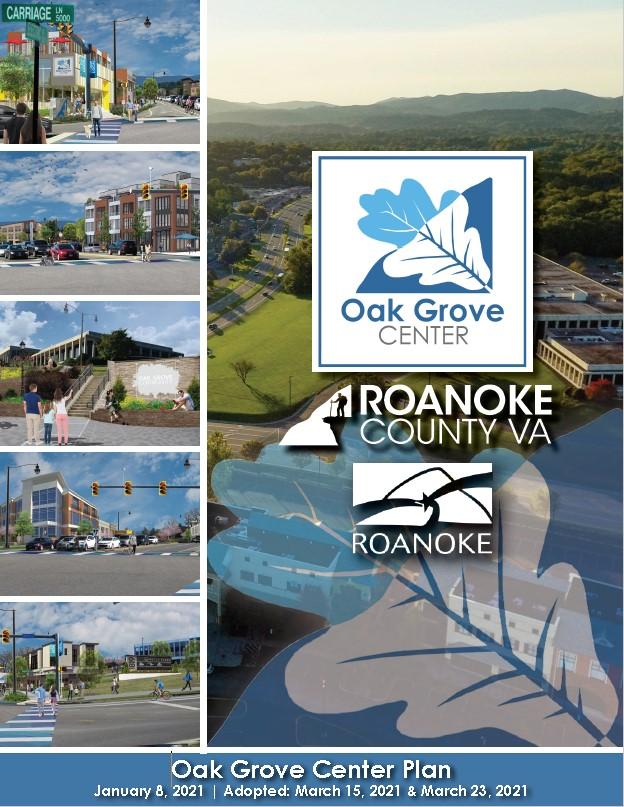
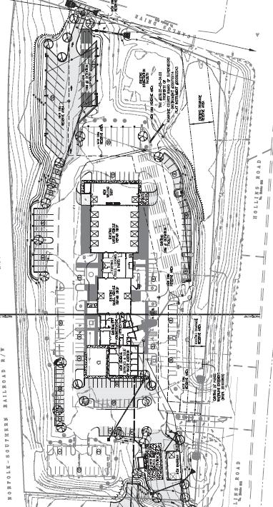
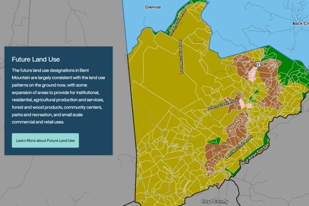
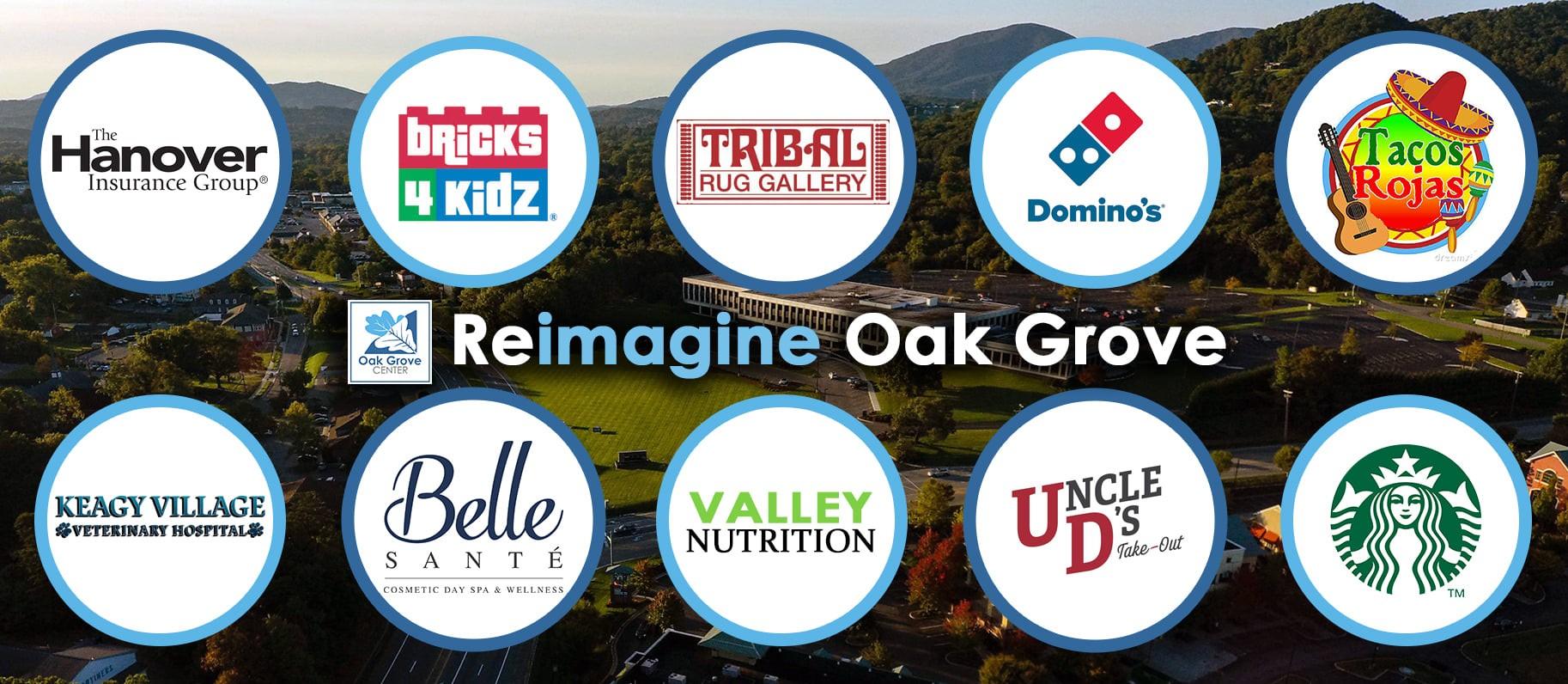
The Oak Grove Center Plan: The Planning Commission recommended incorporating the Oak Grove Center Plan into the Roanoke County Comprehensive Plan in February, and the Board of Supervisors adopted the Plan in March. The Oak Grove Center Plan study area is approximately 173 acres in size located along Electric Road generally between Glen Heather Drive and Keagy Road. The study area is located in both Roanoke County and the City of Roanoke and includes Oak Grove Plaza, Southwest Plaza, Oak Grove Elementary School, Metis Plaza, and Keagy Village. The proposed Plan includes recommendations on the future development of this area.

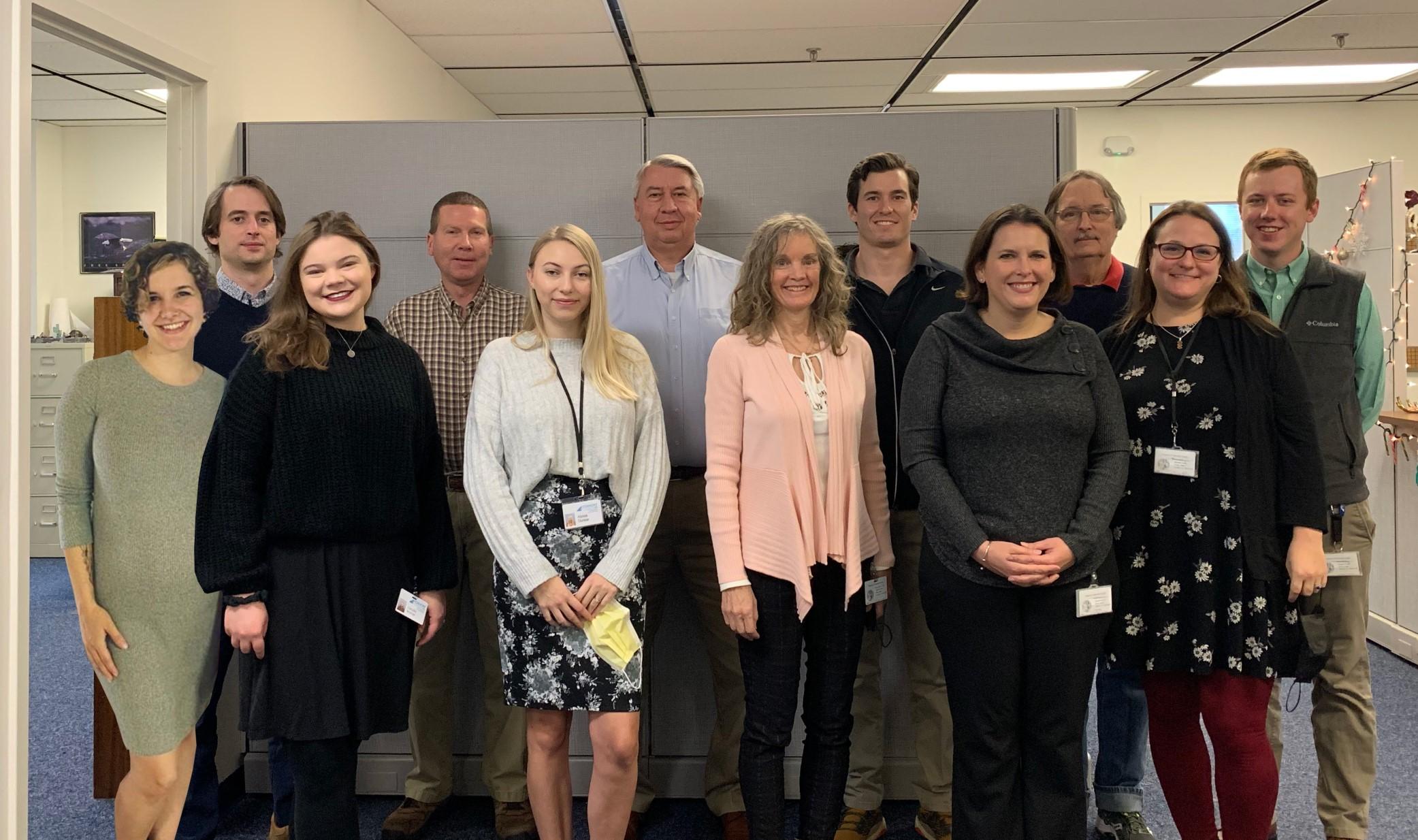
Front: Bailey Howard-DuBois, Cecelia Thomas, Alyssa Dunbar, Cecile Newcomb, Megan Cronise, Rebecca James
Back: Isaac Henry, Brian Epperley, Philip Thompson, Will Crawford, Bill Richardson, Alexander Jones
NEW 2021 CERTIFICATIONS:
Will Crawford
American Institute of Certified Planners
American Planning Association
NEW EMPLOYEE:
Cecelia Monnin
Planning Administrative Assistant
RETIREMENTS:
Susan McCoy
Planning Administrative Assistant
Staff supported the following boards, committees, and business and civic associations this year:
Career & Technical Education (CTE) Citizen’s Advisory Committee
Council of Community Services
Plan Roanoke Responsible Regionalism Committee
Regional Bicycle & Pedestrian Advisory Committee*
Regional Housing Study*
Regional Local Food Planning Committee*
Roanoke River Blueways Committee*
Roanoke Valley Greenway Commission
Roanoke Valley Urban Forestry Council
Town of Vinton Route 24 Technical
Steering Committee
Transportation Policy Board (TPO)*
Transportation Technical Committee (TTC)*
Greater Williamson Road Area Business Association (GWRABA)
*Roanoke Valley-Alleghany Regional Commission Boards and Committees
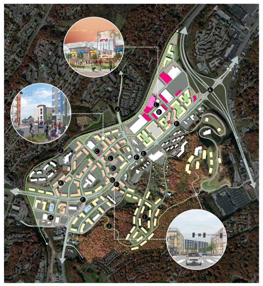
Staff was awarded the Growth and Accessibility Planning (GAP) Technical Assistance Program Grant from the Virginia Office of Intermodal Planning and Investment (OIPI). The purpose of the grant is to help localities conduct multimodal planning within existing or planned growth areas. The grant allowed us to hire consultants to translate the 419 Town Center Plan and vision into design guidelines that will shape development and inform updates to Roanoke County’s development codes. Nick Britton, Project Manager with Michael Baker International, and Mike Callahan, Project Manager with Renaissance Planning have been working with staff throughout 2021 to develop proposed guidelines that will be considered for adoption in 2022. The development standards will help us create concept plans using local money, so that we can seek funding through RSTP which we can leverage for SMART SCALE projects, and ultimately help us to build out the whole road, pedestrian and bicycle network for the town center as envisioned by the 419 Town Center Plan. New standards might incorporate uses, building and site development, open spaces and more.
CERTIFICATIONS HELD BY PLANNING STAFF:
American Institute of Certified Planners (AICP): 6
Certified Board of Zoning Appeals Program: 2
Certified Combined Administrator for Erosion and Sediment Control: 1
Certified Floodplain Manager, Association of Floodplain Managers: 1
Certified Transportation Manager (VAZO): 1
Certified Zoning Administrator (VAZO): 1
Graduate Certificate of Local Government Management: 1
Lean Management for Practitioners (VT): 2
Locally Administered Projects Qualification Program (VDOT): 3
Virginia Certified Planning Commissioners Program (VCU): 6
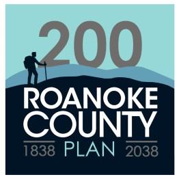
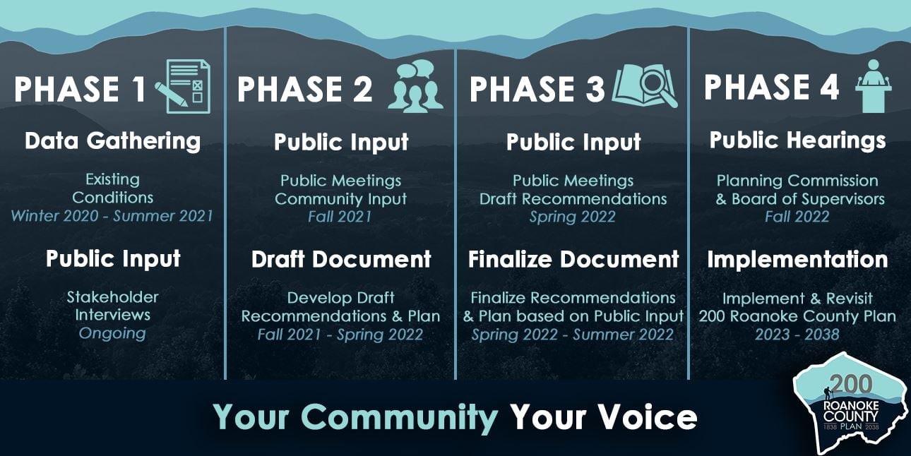
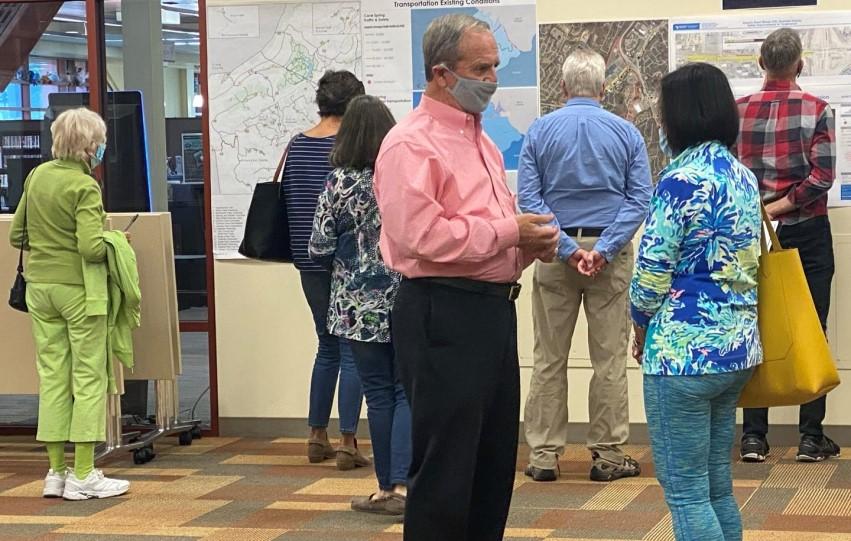
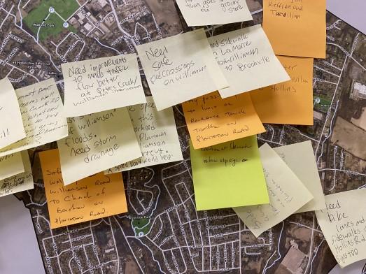
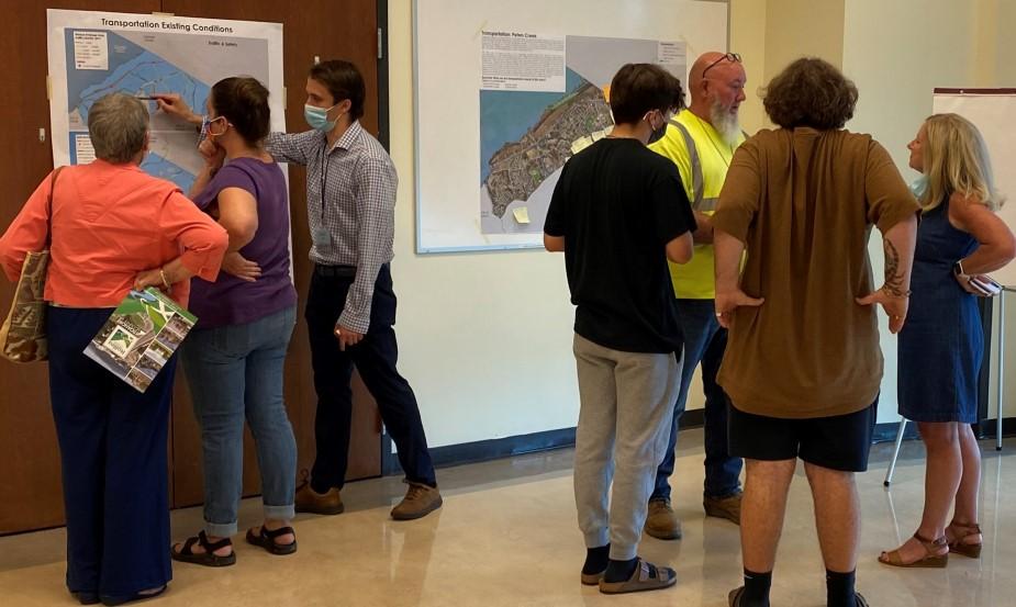
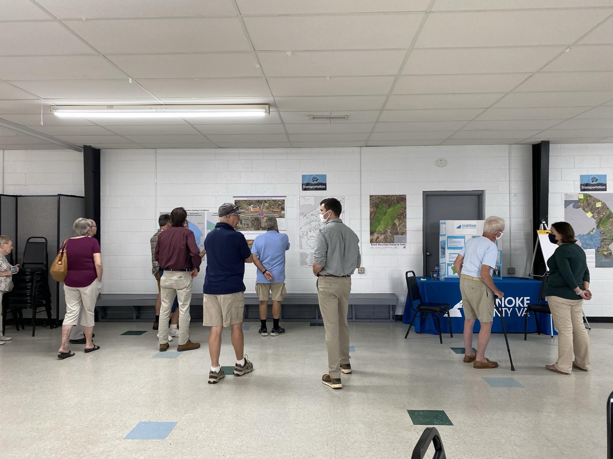
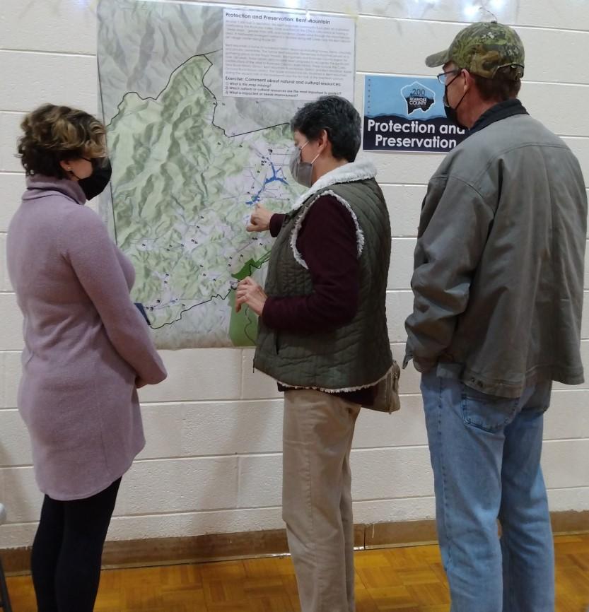
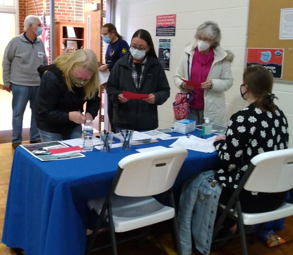
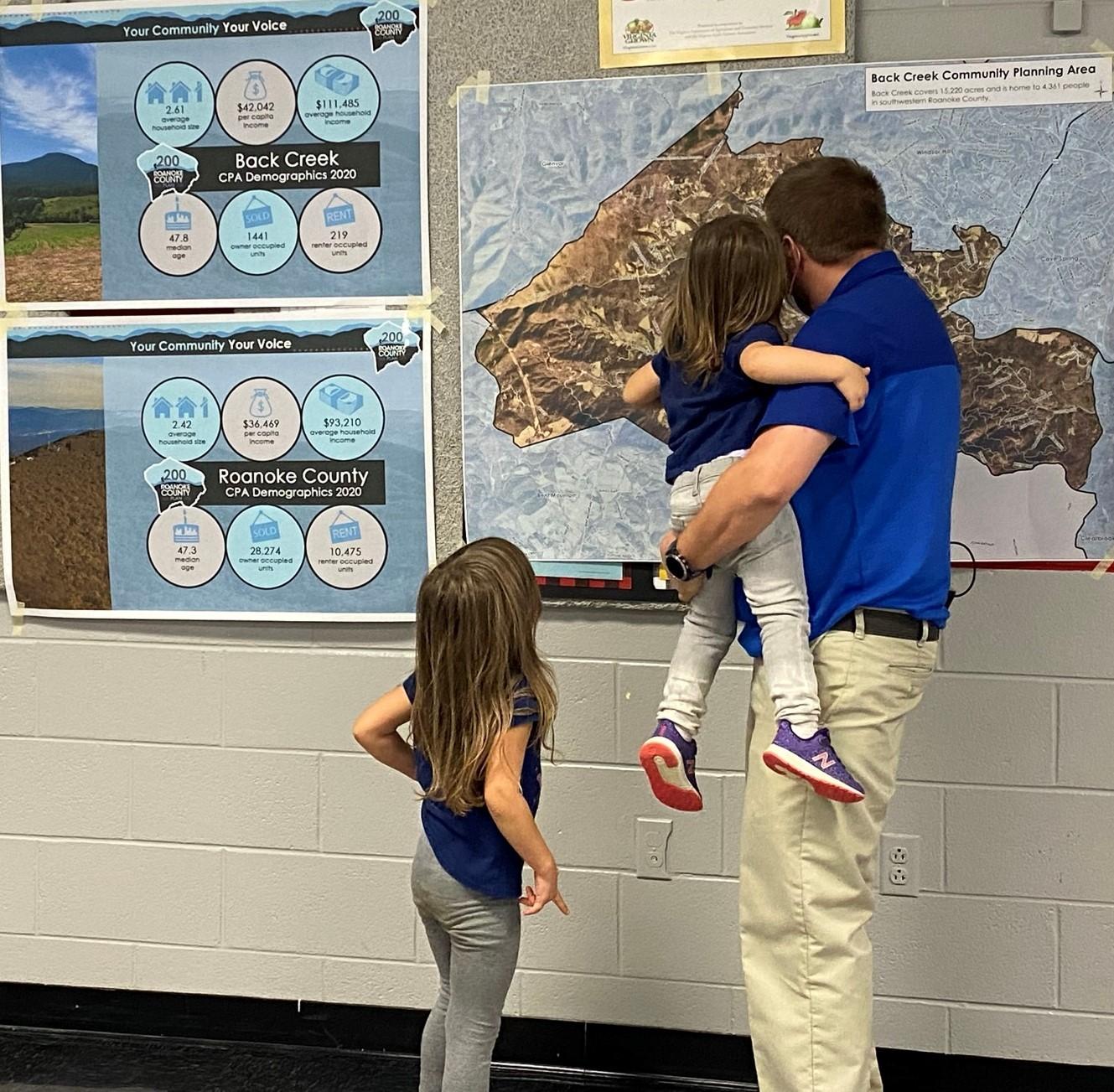
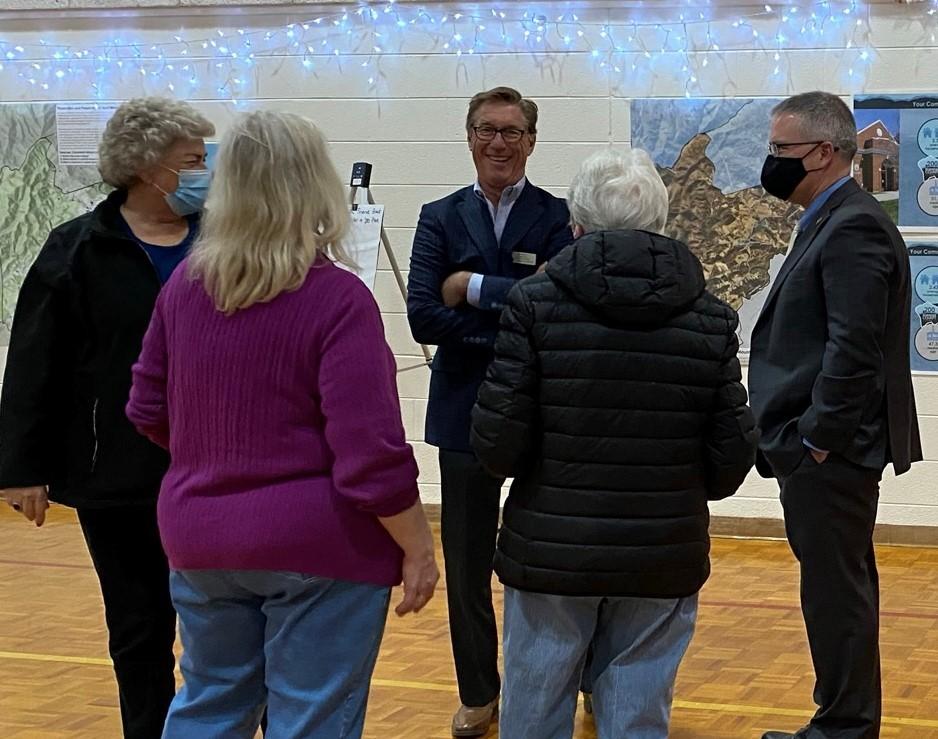
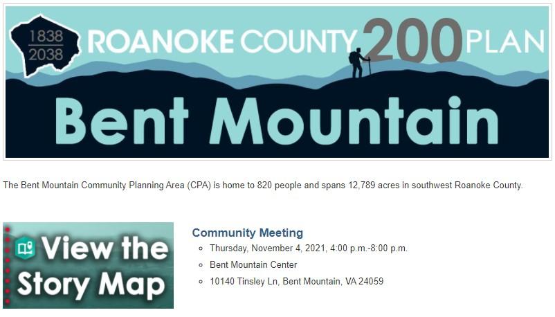
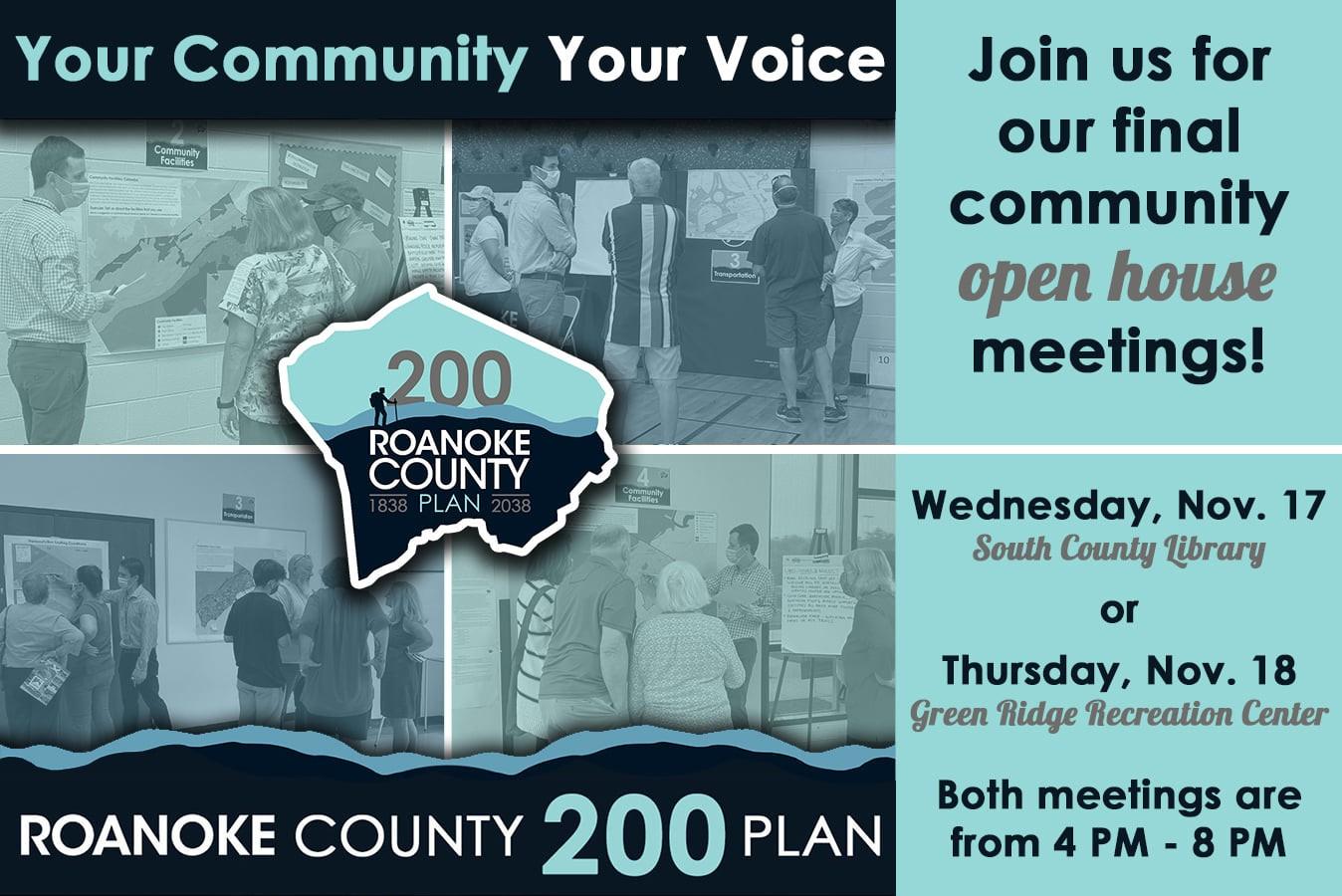
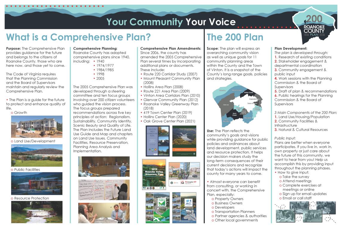
Planning staff have been busy this year completing Phase I and II of the Roanoke County 200 Plan process. The 200 Plan is a major, 15-year update to the Comprehensive Plan to mark the County’s bicentennial in 2038. The plan will guide public policies about land development, public services, and resource protection. The planning process is expected to take a couple of years. Phase I was completed by the end of the summer, and the Phase II public meetings and community input were completed in the fall.
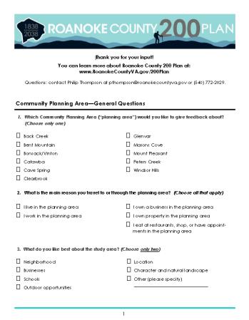
2021 public engagement totals:
Nearly 500 people attended 12 community meetings or participated virtually.
289 people took the survey (available September 1 November 30, 2021).
37 stakeholder meetings were held, with 170 participants.
The 200 Plan email list grew to over 3,000 people.
Staff held a comprehensive planning workshop with the Roanoke County Public Schools Student Advisory Committee.
Staff gave presentations to County decision makers, local business groups, civic leagues and other organizations.
22,000 people stayed informed and engaged through Roanoke County social media pages.
Moving into Phase III in spring of 2022, we will continue stakeholder meetings, host more community meetings and add new information and input exercises to the website.
COUNTY 200 PLAN
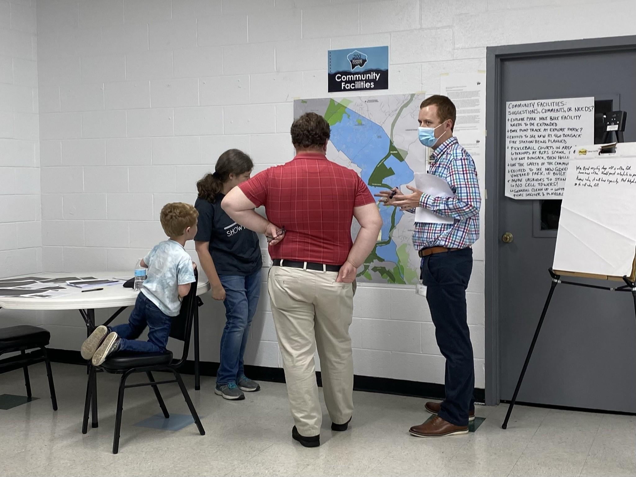
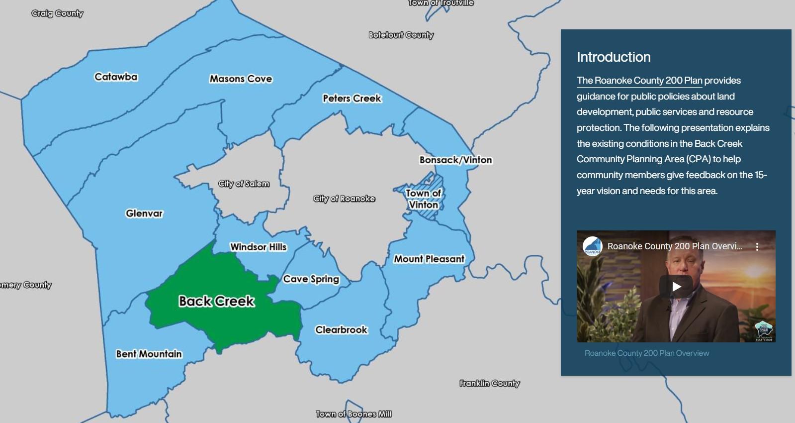
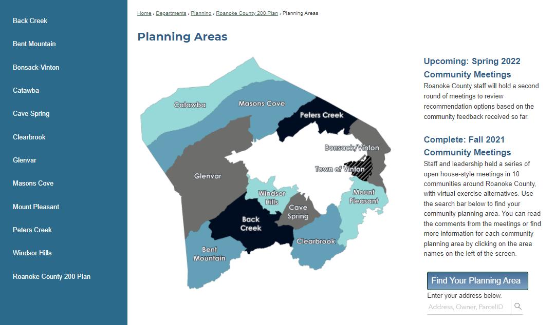
A total of 12 community meetings were held during the fall, with almost 500 attendees. Ten meetings were tailored for 11 community planning areas and the Town of Vinton, and two meetings were designed for countywide perspectives.
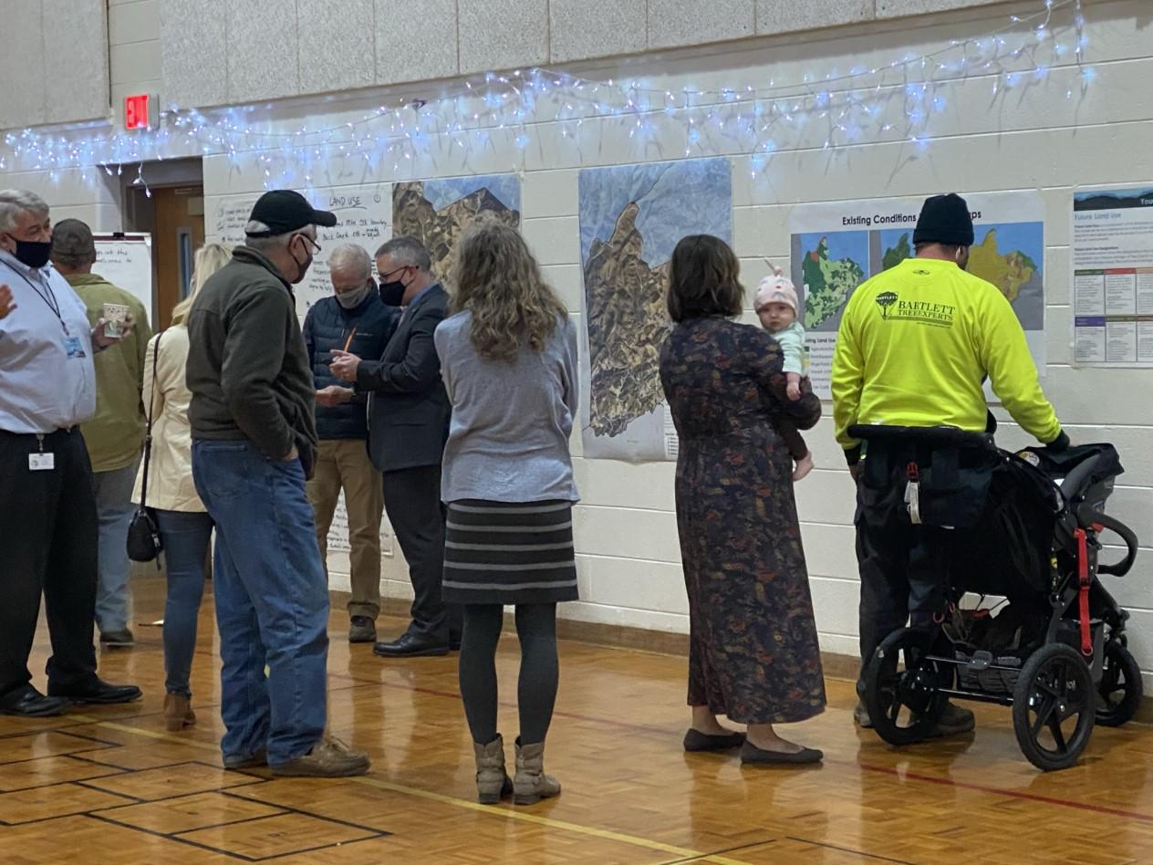
In order to include everyone, all public outreach information and activities have been available on the 200 Plan website. While some preferred not to attend the public meetings, staff was also prepared to go virtual in case of shutdowns due to COVID-19. This included online input exercises, ESRI StoryMaps and a survey for each of the eleven community planning areas. Additionally, staff worked with RVTV to produce a series of informational videos about the comprehensive plan and the 200 Plan process; a list with over 3,000 people is being maintained to give regular email updates; and Roanoke County’s social media pages are regularly updated with new information. All content was designed and executed in
Stakeholder meetings were held throughout the year, and will continue during the planning process. Thus far, the following organizations have participated:
Botetourt County
City of Roanoke
City of Salem
Community Accessibility & Inclusion Organizations
R.C. Economic Development Authority
ELEVATE Roanoke County Plan Stakeholders
Franklin County
Montgomery County
Public Safety
R.C. Board of Supervisors
R.C. Departments & Experts
R.C. Libraries
R.C. Planning Commission
R.C. Public Schools
Regional Housing Experts
Roanoke Valley Broadband Authority
Town of Vinton
Transportation Organizations
Western Virginia Water Authority
Hollins Center Plan Implementation continued this year with several transportation projects and new businesses have opened in the area.
Transportation projects include:
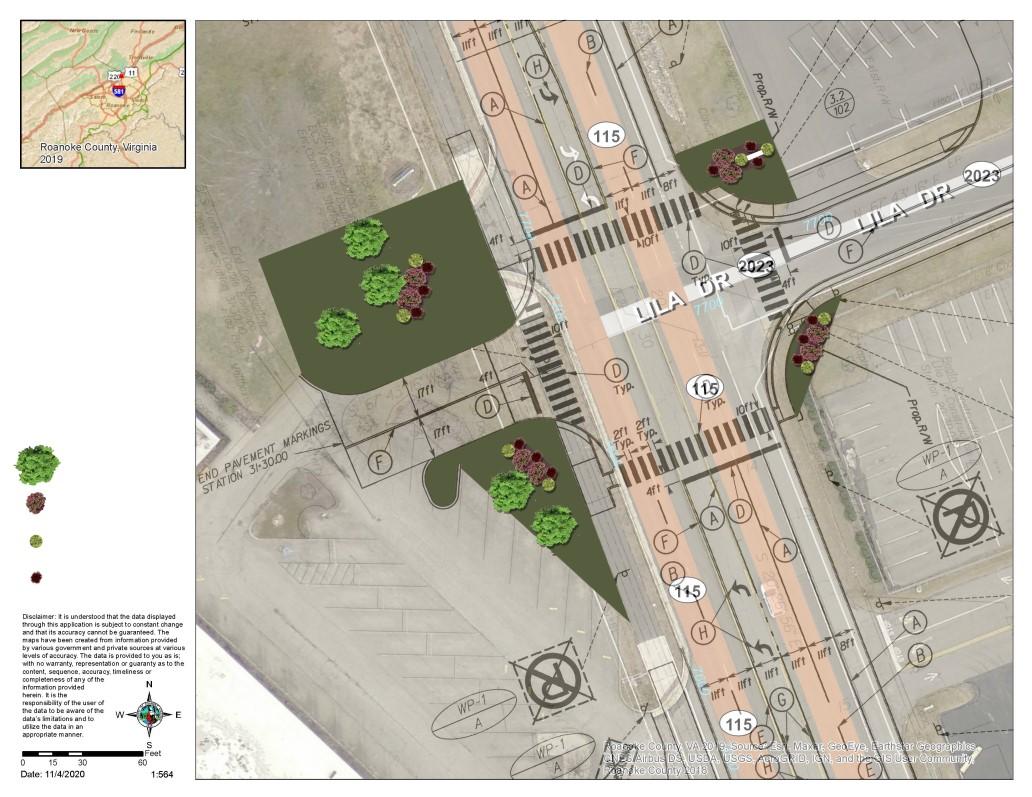
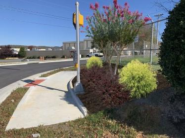
The Lila Drive/Plantation Road Intersection has been freshly landscaped.
The Plantation Road Shared Use Path Project, Phase 2 is under construction with completion anticipated in Spring 2022.
Sidewalk along Williamson Road between Peters Creek Road and North Roanoke Assisted Living is almost complete.
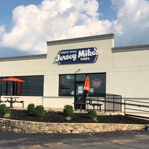
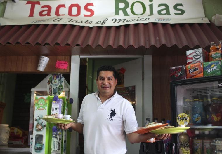
New businesses that opened in Hollins this year include Old Virginia Outpost, Jersey Mike’s, Stubby’s Bistro & Pub, Friendship Transitional Care Unit, Luttrell Staffing Group and GWRABA’s new office.

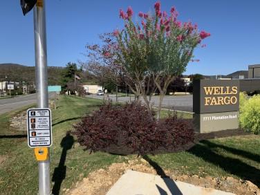
On March 23, 2021 the Board of Supervisors adopted the Oak Grove Center Plan as part of the County’s Comprehensive Plan. The Plan will guide the area’s development over the next 20 years.
The Oak Grove Center Plan study area is approximately 173 acres in size located along Electric Road in both Roanoke County and the City of Roanoke.
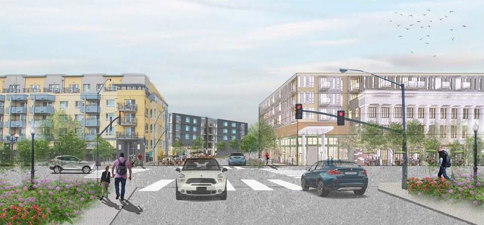
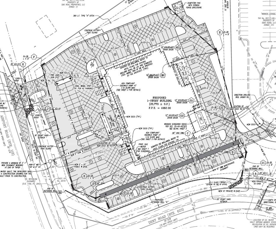
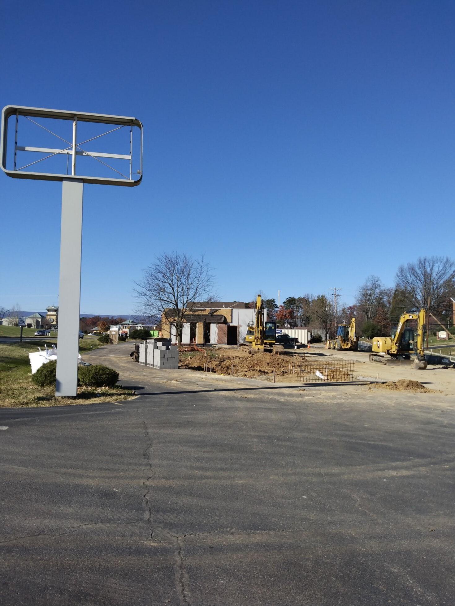
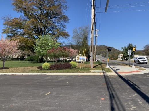
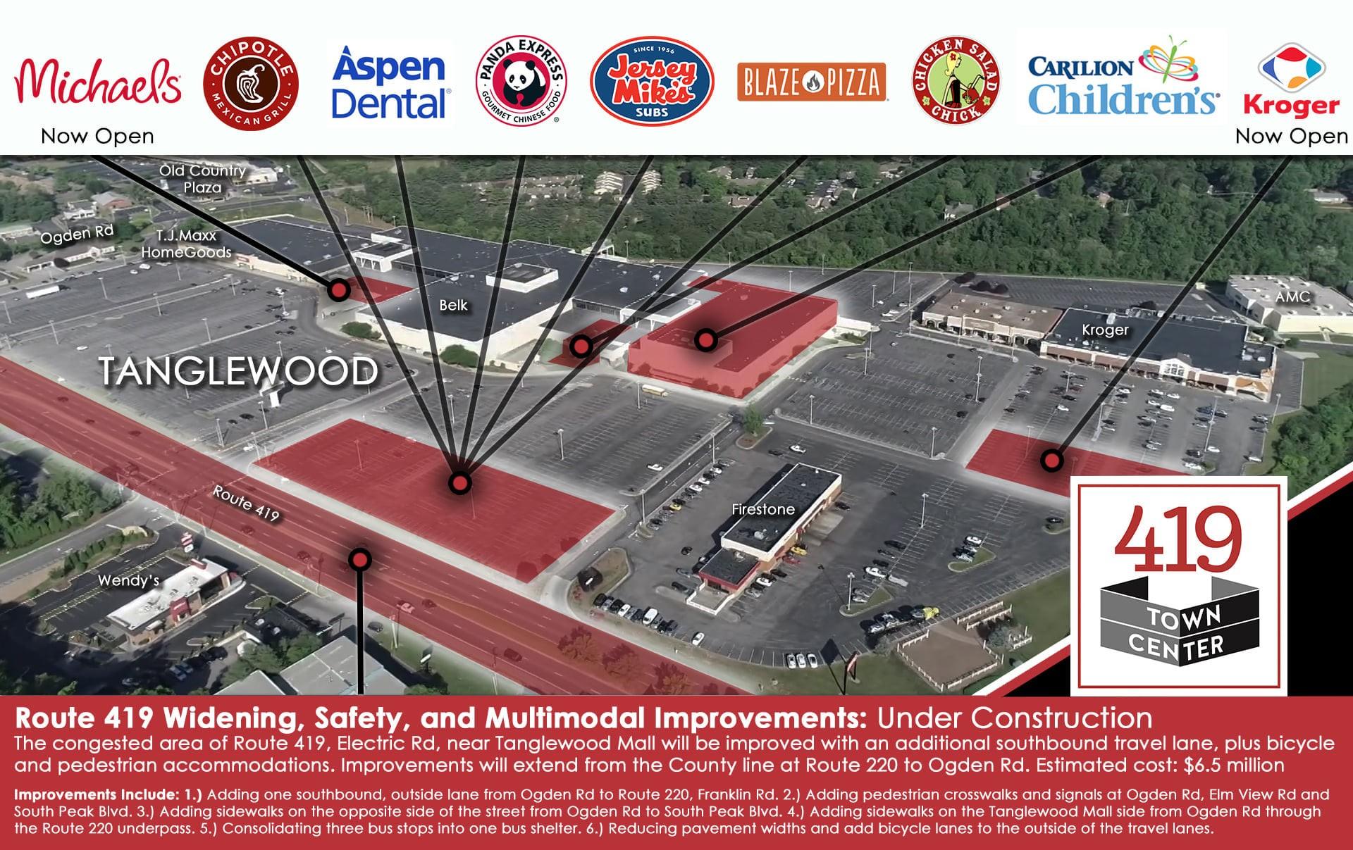
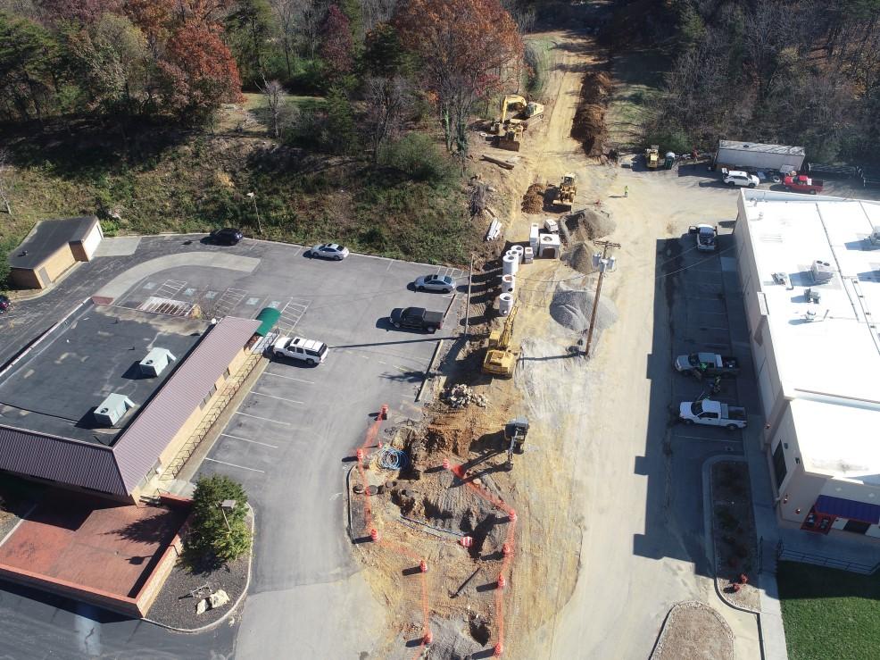
The Oak Grove area is already seeing increased development and new businesses opening (see graphic below). A study will be conducted by VDOT and Office of Intermodal Planning and Investment (OIPI) to evaluate safety and operational conditions along the 419/Electric Road corri-
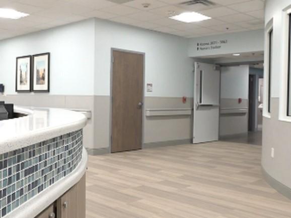
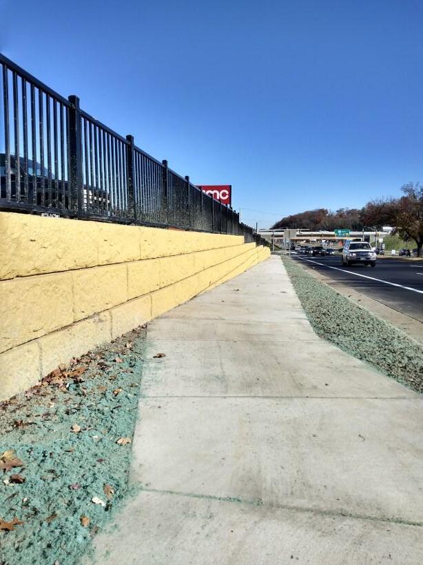
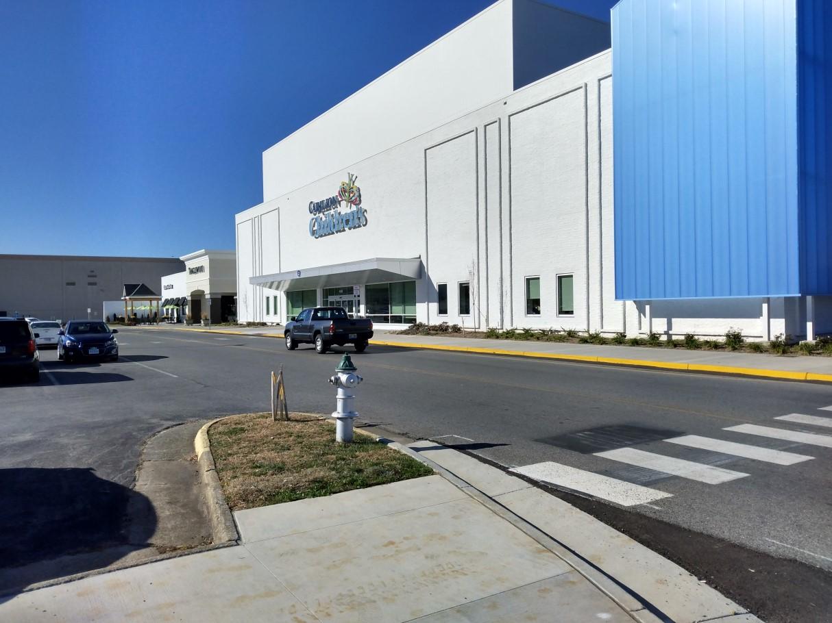
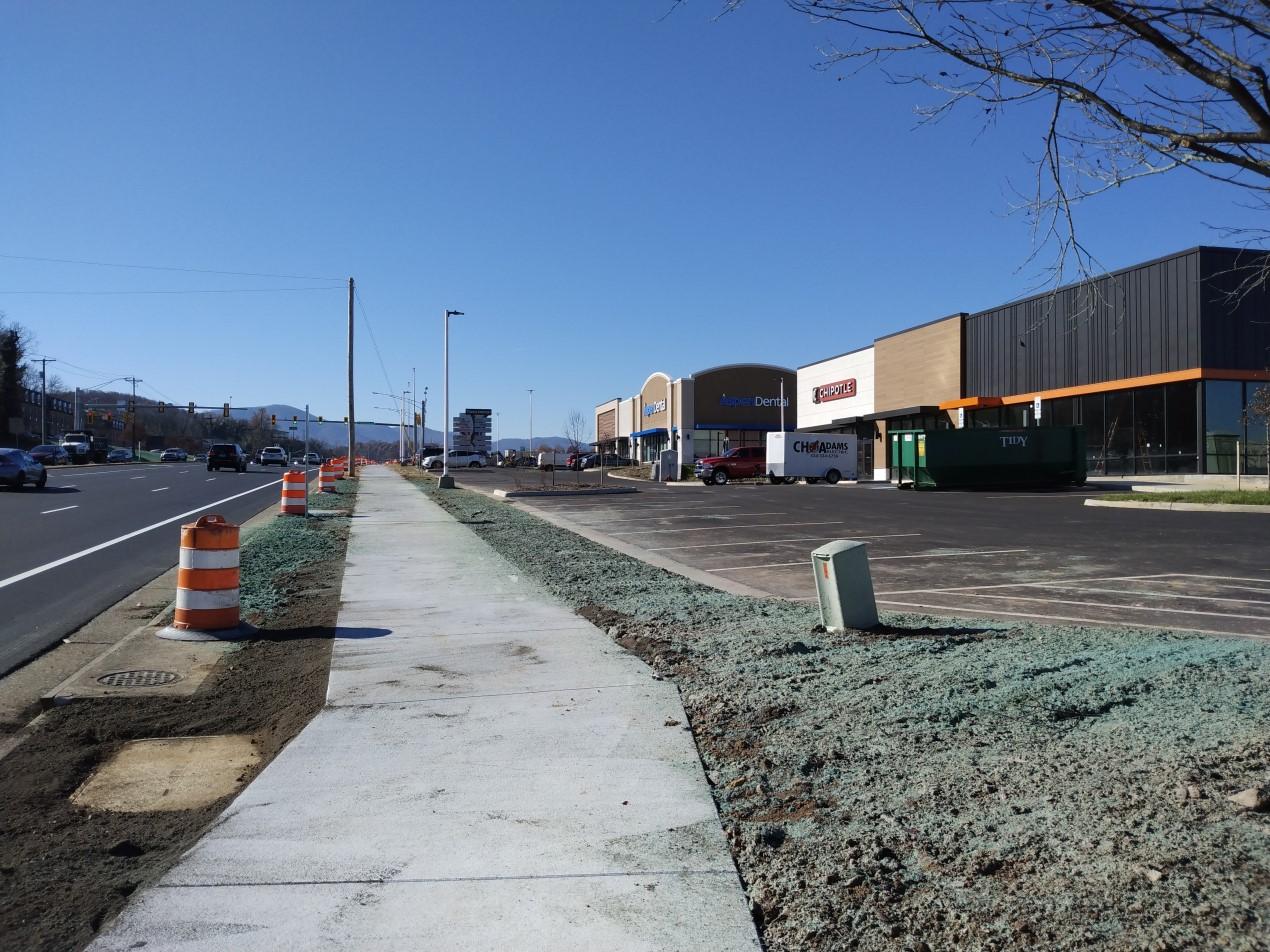
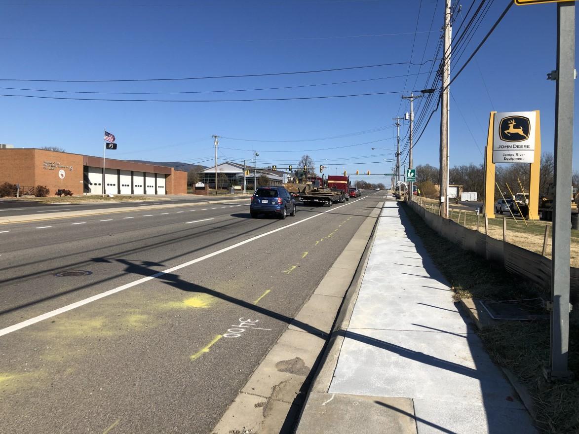
Staff have been meeting with consultants to prepare proposed design guidelines that will help position the 419 Town Center for success (see page 5). Meanwhile, plan implementation has continued with the Route 419 Widening, Safety and Multimodal Improvements Phase I project, which is nearly complete. Sections of sidewalk and bicycle lanes are finished, new signage installed, Carilion Children’s opened in September, while several new restaurants, a dental office and gas station are now open in the area. Construction is underway for a new office building on Fallowater Lane. Fallowater Lane Extension will be complete in Spring 2022. Funding was awarded this year for the Route 419 Streetscape Improvements, Phase II, to extend the Phase I multimodal improvements and additional travel lanes between Starkey Road and Ogden Road (see page 17).
The graphics and marketing strategy for the 200 Plan have been designed, generated, planned and executed in-house by Planning staff. This includes the County website and social media pages, print materials and signage, roadside banners, community meeting exhibits, video content and e-newsletters.


Planning staff often assist other departments or organizations with landscape architecture plans, graphic design projects, mapping, and public engagement initiatives. In 2021, projects included Economic Development, the Arbor Day Celebration, transportation and landscaping projects.
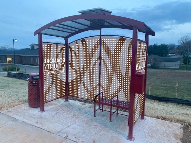
The conceptual Route 419 bus shelter designs add a placemaking component to the proposed bus shelters in front of Tanglewood and Copper Croft Apartments. The design features parts of the Roanoke County, 419 Town Center, and Tanglewood branding. The conceptual design is being considered by Valley Metro.
Landscaping at all four corners of the new Lila Drive and Plantation Road intersection add a placemaking component to complement the Plantation Road Bicycle, Pedestrian and Streetscape Improvement project. Roanoke County worked with three businesses to install a landscape palette that will look great year round.
Exhibits for the fall 200 Plan Community Meetings including maps, posters, signs and all print materials were planned, designed and generated in-house by planning staff.


Several 2020 SMART SCALE applications were awarded funding in 2021. This 100% state and federal funding is highly competitive. Because Roanoke County may only submit four applications, the Roanoke Valley Alleghany Regional Commission (RVARC) and Roanoke Valley Transportation Planning Organization (RVTPO) staff assisted with and submitted three additional SMART SCALE applications for projects located in Roanoke County. RVTPO provided substantial leverage funding for several applications through the Surface Transportation Block Grant (STBG) program
Valleypointe Parkway Realignment: Realign and widen Valleypointe Parkway at Wood Haven Road to expand transportation infrastructure to serve Wood Haven Technology Park.
STBG leverage funding: $2.5 million. SMART SCALE award: $7.7 million
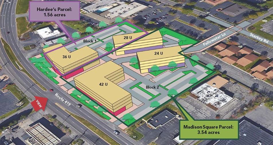
Route 419 Streetscape Improvements, Phase II: Extend multimodal improvements and additional travel lanes from Phase I to the next block between Starkey Road and Ogden Road. This project is a key implementation strategy in the 419 Town Center Plan.
STBG leverage funding: $4.3 million, SMART SCALE award: $14.8million
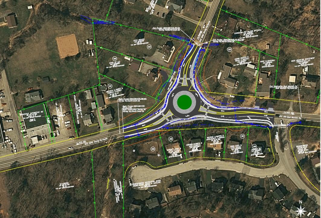
Starkey Road/Buck Mountain Road Intersection Improvements: This project is in the right-of-way phase to convert the existing “T” intersection to a single-lane roundabout. Additional funding is needed to eliminate an anticipated project deficit. SMART SCALE award: $2.6 million
Route 460 at West Ruritan Road Intersection Improvements: Construct a Thru-Cut at the intersection to prohibit through movements on the side streets and reduce traffic signal phases to improve traffic flow on Route 460.
STBG leverage funding: $790,000, SMART SCALE award: $6.8 million
Route 460/Challenger Avenue Intersections from Carson Road to Huntridge Road: Improve a series of four intersections to improve safety and traffic flow along Route 460.
STBG leverage funding: $430,000, SMART SCALE award: $2.3million
Route 460 at Alternate Route 220 Intersection Improvements: Reconstruct the existing intersection with a Displaced Left Turn to relieve traffic congestion and improve safety. Originally not part of the VDOT Six-Year Improvement Program in June 2021, surplus funding directed to the SMART SCALE program later in the year resulted in project funding in November 2021 from the RVTPO and in December 2021 from the Commonwealth Transportation Board (CTB). STBG leverage funding: $2.5 million, SMART SCALE award: $19 million
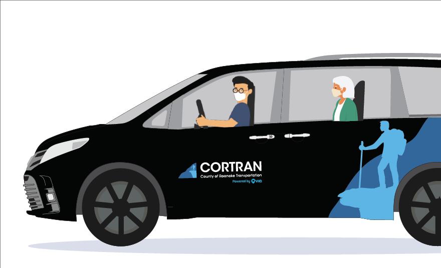
CORTRAN: Planning staff assisted the CORTRAN (County of Roanoke Transportation) Program Coordinator to submit applications to the Virginia Department of Rail and Public Transportation (DRPT) to support the County’s CORTRAN program. Applications were submitted for FTA Section 5310 funding for the urbanized area of Roanoke County, as well as for FTA Section 5311 funding for the rural area of the County. DRPT awarded Roanoke County $119,000 to support service in the urbanized area and provided $15,000 in Technical Assistance.
Planning staff applied for funding through several programs in 2021. These programs include the Transportation Alternatives Program (TA) (80% Federal/20% Local match), the Revenue Sharing Program (50% State/50% Local match) and the Surface Transportation Block Grant (STBG) (100% State/Federal). Awards are anticipated in Summer 2022.
Dry Hollow Road Improvements: Additional funding was requested for Phase 2 of this project, which will install box culverts to pipe Dry Hollow Creek under a Norfolk Southern Railroad Bridge. The roadway can then be extended to widen the travel lanes.
Revenue Sharing request: $1.3 million County match (50/50 County/VDOT)
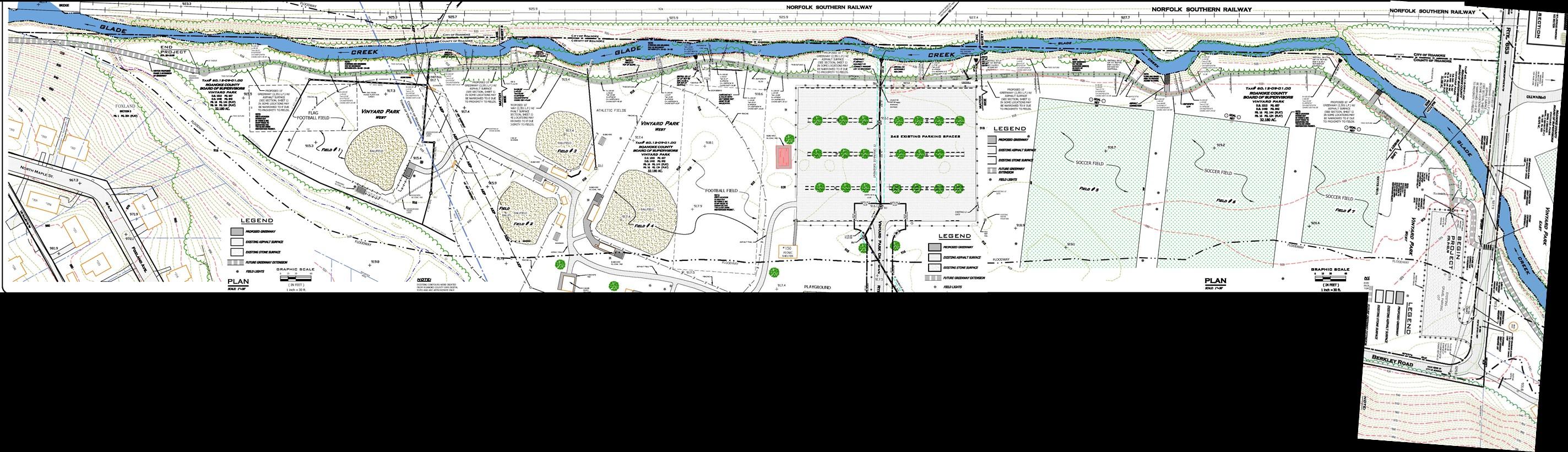
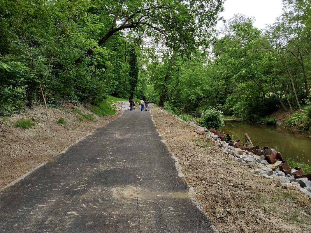
Glade Creek Greenway through Vinyard Park West: Construct Phase 4 of the Glade Creek Greenway along Glade Creek in Roanoke County’s Vinyard Park West.
TA request: $521,000 (80/20 Federal/County match)
Walrond Drive Multimodal Improvements: Construct sidewalk and crosswalks along Walrond Drive to connect the Plantation Road Bicycle, Pedestrian and Streetscape Improvements Project to Walrond Park. STBG request: $4.5 million (100% State/Federal funding)
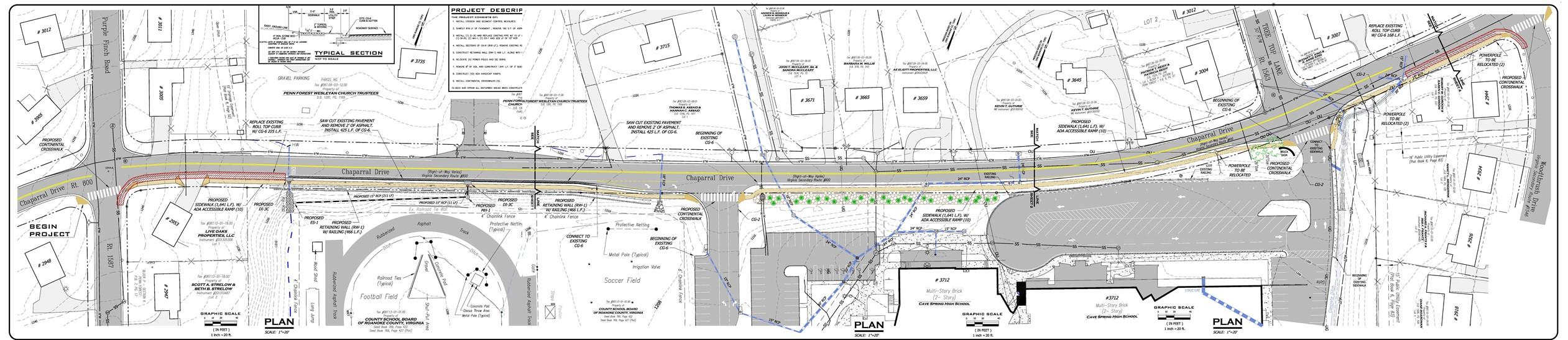
Chaparral Drive Pedestrian Improvements: Construct sidewalk and crosswalks along Chaparral Drive between Purple Finch Road and Woodthrush Drive to improve pedestrian safety for Cave Spring High School. STBG request: $3.7 million (100% State/Federal funding)
Washington Avenue Corridor Improvement Study: Collaborate with the Town of Vinton and VDOT on a multimodal study to improve traffic flow and safety between South Pollard Street and Stonebridge Drive at the Blue Ridge Parkway. STBG request: $150,000 (100% State/Federal funding)
West Main Street Pedestrian Improvements, Phase 3: Complete missing sidewalk segments along both sides of West Main Street between the City of Salem and Technology Drive. STBG request: $3 million (100% State/Federal funding)
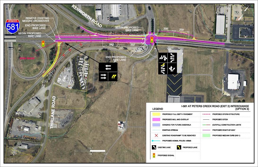
I-581 at Exit 2 (Peters Creek Road) Interchange Improvements Phase 1/Request for SMART SCALE Leverage Funds: Requested funding for Option 1, which would realign the I-581 northbound off-ramp to Peters Creek Road eastbound and add a traffic signal at Peters Creek Road. If awarded, this funding will be used as leverage in SMART SCALE to build Option 3, which would add improvements at the Valleypointe Parkway/Thirlane Road intersection, as well as sidewalks and bicycle lanes. STBG request: $4.1 million (100% State/Federal funding)
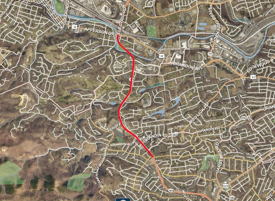
Route 419/Electric Road Study between Route 11/Apperson and Bower Road Projects Request for SMART SCALE Leverage Funds: Requested leverage funding for one or more projects to be determined as part of the Route 419/Electric Road Study currently underway.
The following studies focus on an issue or problem, identify many different alternatives to potentially address that issue or problem, and then determine recommendations.
County staff have been working with AECOM to review, obtain feedback about, and discuss potential changes for the existing CORTRAN program. The study will conclude in February 2022.
Building off of the completed VDOT Route 460 Operational Improvements Study, County staff is working with Timmons Group, VDOT, the City of Roanoke, Botetourt County and the Roanoke Valley Alleghany Regional Commission to recommend alternative routes to Route 460/Challenger Avenue, to determine potential land use changes in the vicinity of Route 460/Challenger Avenue and to examine existing at-grade railroad crossings for potential improvements that could create development opportunities between the railroad and the Blue Ridge Parkway. The study will conclude in Summer 2022.
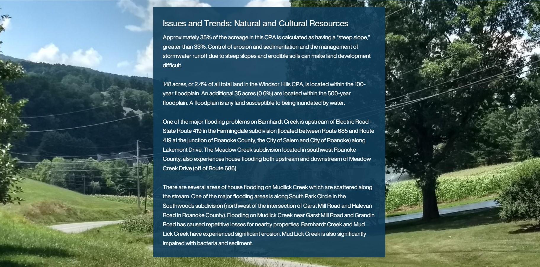
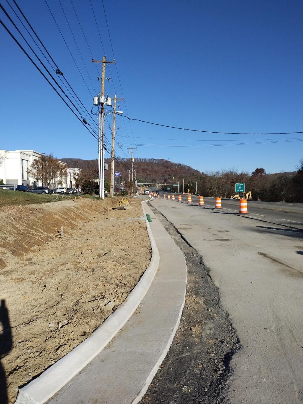
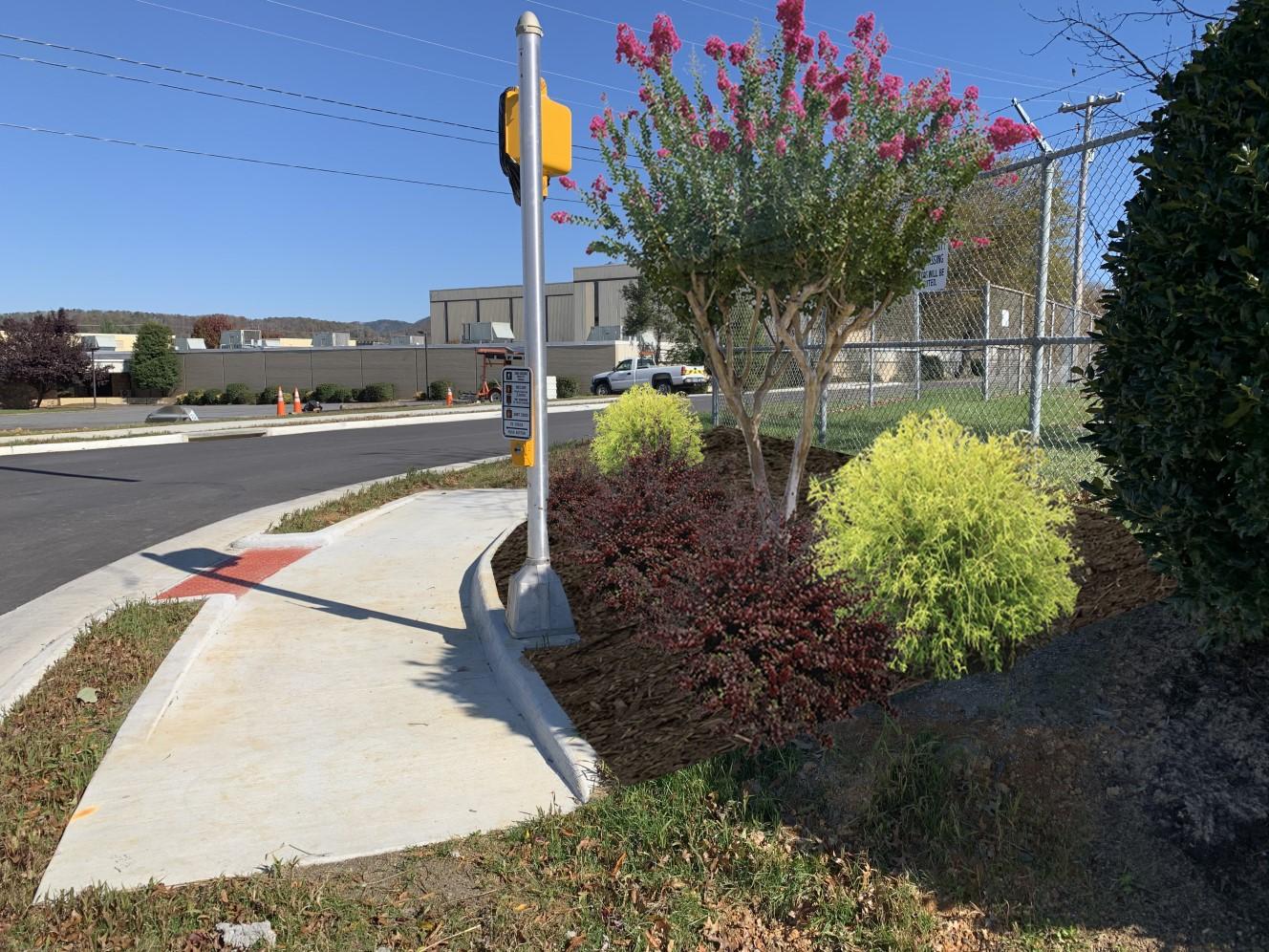
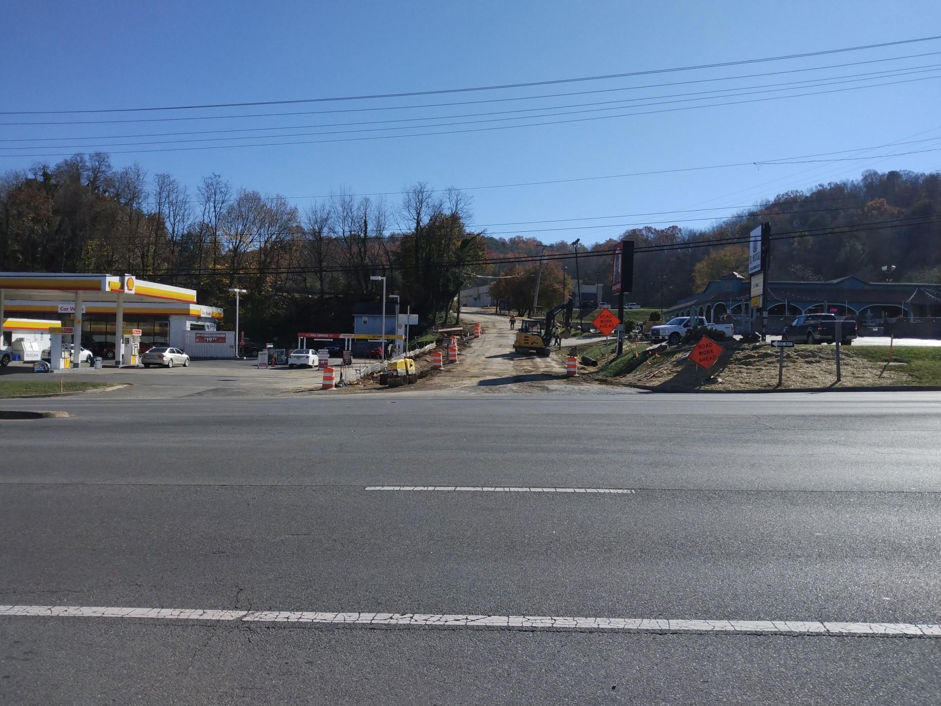
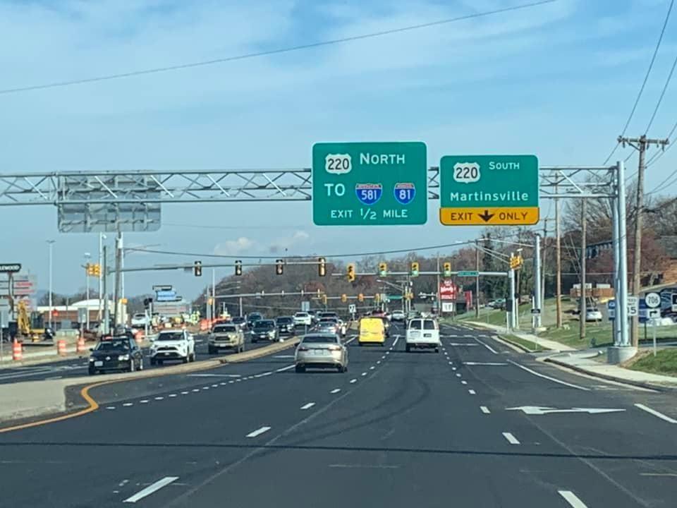
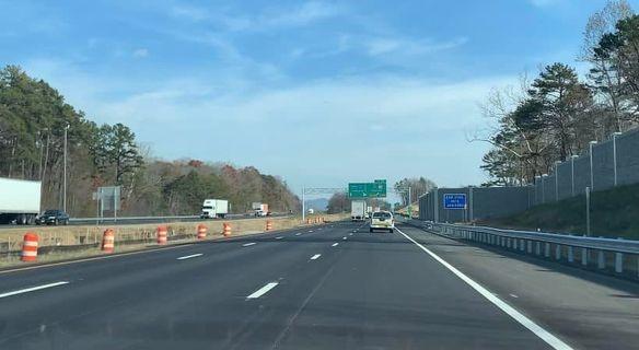
A VDOT and OIPI Study with the City of Roanoke, City of Salem and Roanoke County to evaluate existing safety and operational conditions, to consider and evaluate potential safety and operational improvements and to identify fundable and implementable solutions for vehicles, pedestrians and transit. One or more project recommendations will be submitted for SMART SCALE funding in 2022. The study will conclude in Spring 2022 (see photo below).
Interstate 81 Widening, Exit 141 to Exit 143. Widening the roadway to six travel lanes. The project will connect to future widening projects. Substantially complete with final completion in 2022. SMART SCALE
Route 419 Widening, Safety and Multimodal Improvements Ogden Road—Route 220. Constructing a third lane from Ogden Road to the Route 220 south ramp, sidewalks, bicycle lanes, pedestrian signals/crosswalks, and a bus shelter. Complete. Highway Safety Improvement Project (HSIP), SMART SCALE
West Main Street Pedestrian Improvements. Construct sidewalk, pedestrian signals and crosswalks between Alleghany Drive and Valley Tech Park. Complete. Revenue Sharing, SMART SCALE
Plantation Road, Phase II. Install sidewalk, curb and gutter from Walrond Drive to Gander Way. Widen Walrond Drive intersection. Install pedestrian signals and crosswalks at Gander Way. Completion Spring 2022. SMART SCALE, Locally Administered
Fallowater Lane Extension. Upgrade the existing private road to public road standards and connect to Chevy Road. Completion Spring 2022. Secondary Six Year Plan (SSYP), Revenue Sharing, Locally Administered except for ROW
Huffman Lane Reconstruction. Reconstructed 0.1 mile of Huffman Lane to VDOT standards and constructed a turnaround. Complete. Revenue Sharing
Williamson Road Sidewalk, Peters Road to North Roanoke Assisted Construct sidewalk along the west side Williamson Road from Peters Creek Road North Roanoke Assisted Living with an signals and crosswalks at the Peters Creek Road/Williamson Road Intersection. Complete. HSIP
Construction 2022
Interstate 81 Widening, Exit 137 to Exit 141. Widening the roadway to six travel lanes. The project will connect to existing and proposed widening projects. Completion anticipated in 2026. I-81 funding
Route 311/Route 419 Intersection Safety Improvements. Construct a roundabout to replace the existing traffic signal. SMART SCALE
Oak Grove Pedestrian Improvements, Route 419/Carriage Lane/Grandin Road Intersection. Install pedestrian signals and crosswalks at the existing signalized intersection. STBG
Dry Hollow Road Improvements. Phase 1 will reinforce the roadway against the creek. Phase 2 to widen the roadway will take place at a later date. SSYP, Revenue Sharing
Williamson Road Sidewalk, from Plantation Road to Peters Creek Road. Construct sidewalk along the north side of Williamson Road between Peters Creek Road and Plantation Road. TA, SMART SCALE
Starkey Road/Buck Mountain Road Intersection Improvements. Replace the existing “T” intersection with a roundabout including pedestrian accommodations. STBG, Revenue Sharing, SSYIP, SMART SCALE
Construction 2024
McAfee Knob Pedestrian Bridge over Route 311. Constructing a pedestrian bridge over Route 311 for Appalachian Trail users. HSIP
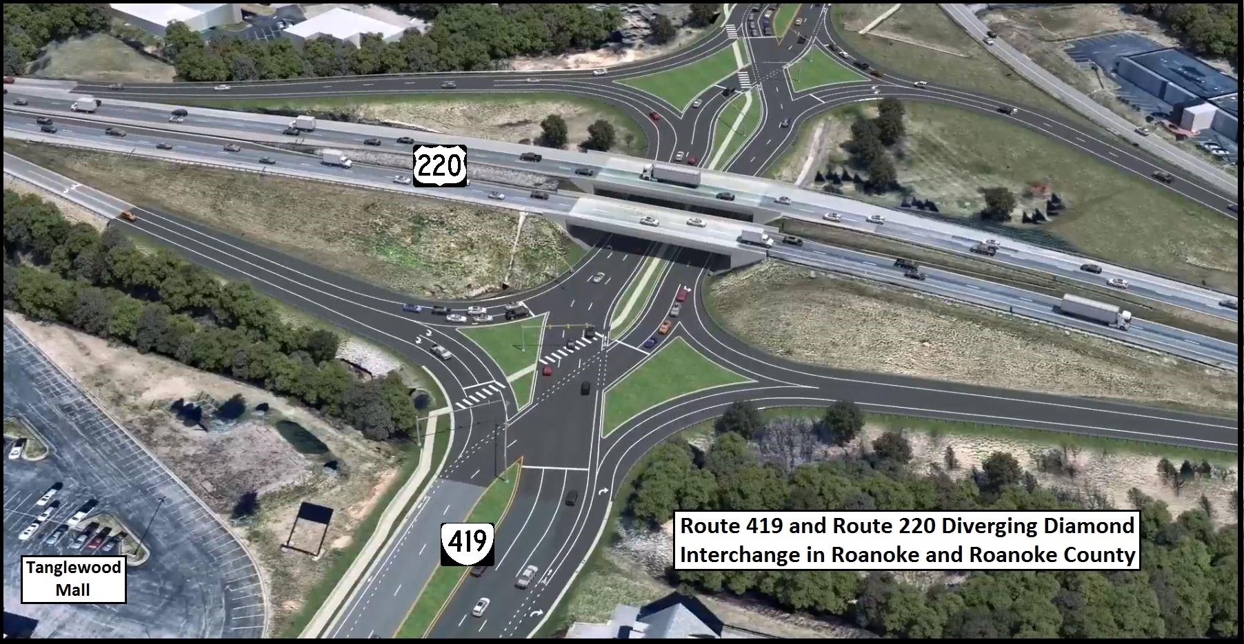
Route 419 and Route 220 Diverging Diamond Interchange. Realigning the interchange with a Diverging Diamond configuration to improve traffic flow and safety. STBG, SMART SCALE
Route 220 Signal Improvements. Reduce signal phases and add pedestrian accommodations at four intersections along Route 220 between Valley Avenue/Southern Hills Drive and Indian Grave Road/Clearbrook Village Lane. Funded by VDOT
Williamson Road Sidewalk: North Roanoke Assisted Living to Clubhouse Drive and Dent Road Intersection. Sidewalk will be constructed to continue along the west side of Williamson Road from North Roanoke Assisted Living to the intersection of Clubhouse Drive and Dent Road. HSIP
Below:
Starkey Road/Buck Mountain Road Intersection Route 419 and Route 220 Diverging Diamond Interchange
Planning staff are frequently asked to assist other departments with important County projects. The list below reflects work completed for several different departments, as well as detailed concept plans submitted as part of a Transportation Alternatives and Surface Transportation Block Grant applications.
Chaparral Drive Pedestrian Improvements
Explore Park access concepts for the Bedford County lands
Glade Creek Greenway through Vinyard Park West
McAfee Knob Trailhead Parking and Shuttle Investigation
Mount Pleasant Library Sewer Extension Plans
Timberview Road Community Meeting and associated projects
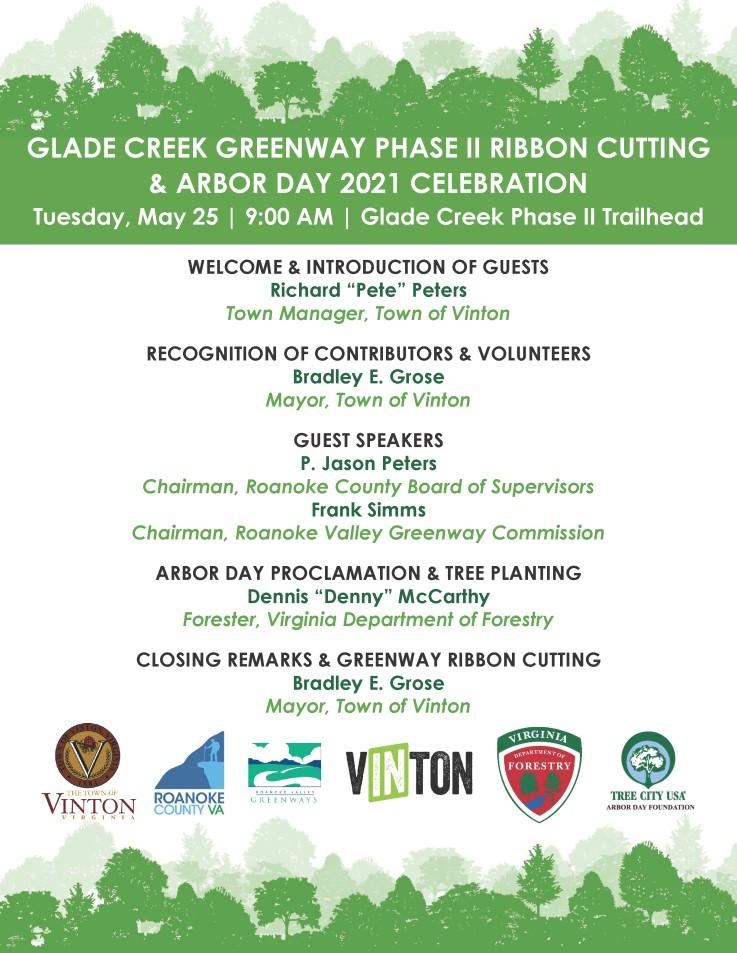
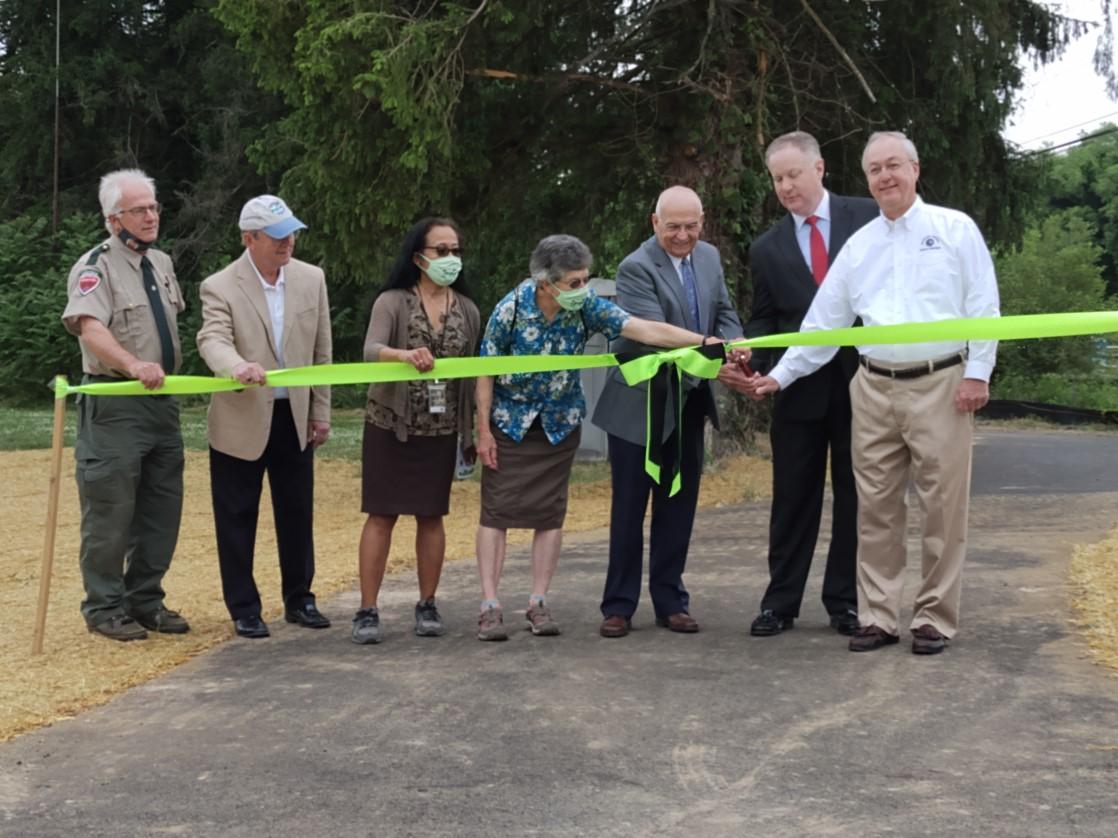
Planning staff partnered with the Town of Vinton, the Greenway Commission and Roanoke County Parks, Recreation & Tourism to hold an Arbor Day Celebration in conjunction with the Glade Creek Greenway Ribbon Cutting in May. Staff also retained the County’s Tree City USA status for the 21st year in a row!
The County's contributions include the greenway easement, trailhead parking areas on County property, staff time to design graphics and assistance with tree planting locations.
Planning staff collaborated with VDOT and County Police to determine the need and community support for a traffic calming pilot project in the Penn Forrest and Canterbury Park neighborhoods. With Board of Supervisors approval, speed boards were installed in both neighborhoods in an attempt to slow traffic. Results will be analyzed to determine effectiveness and next steps.
staff have been appointed to the CTE Advisory Committee, whose purpose is to advise the Board of Supervisors and the School Board regarding the size, site and potential incorporation of solar technology relating to the construction of a new career and technical education center for Roanoke County. CTE provides students with the academic and technical skills, knowledge and training necessary to succeed in future careers and to become lifelong learners by introducing them to workplace competencies, and making academic content accessible by providing it in a hands-on context.
https://www.roanokecountyva.gov/305/Planning