


Planning Commission
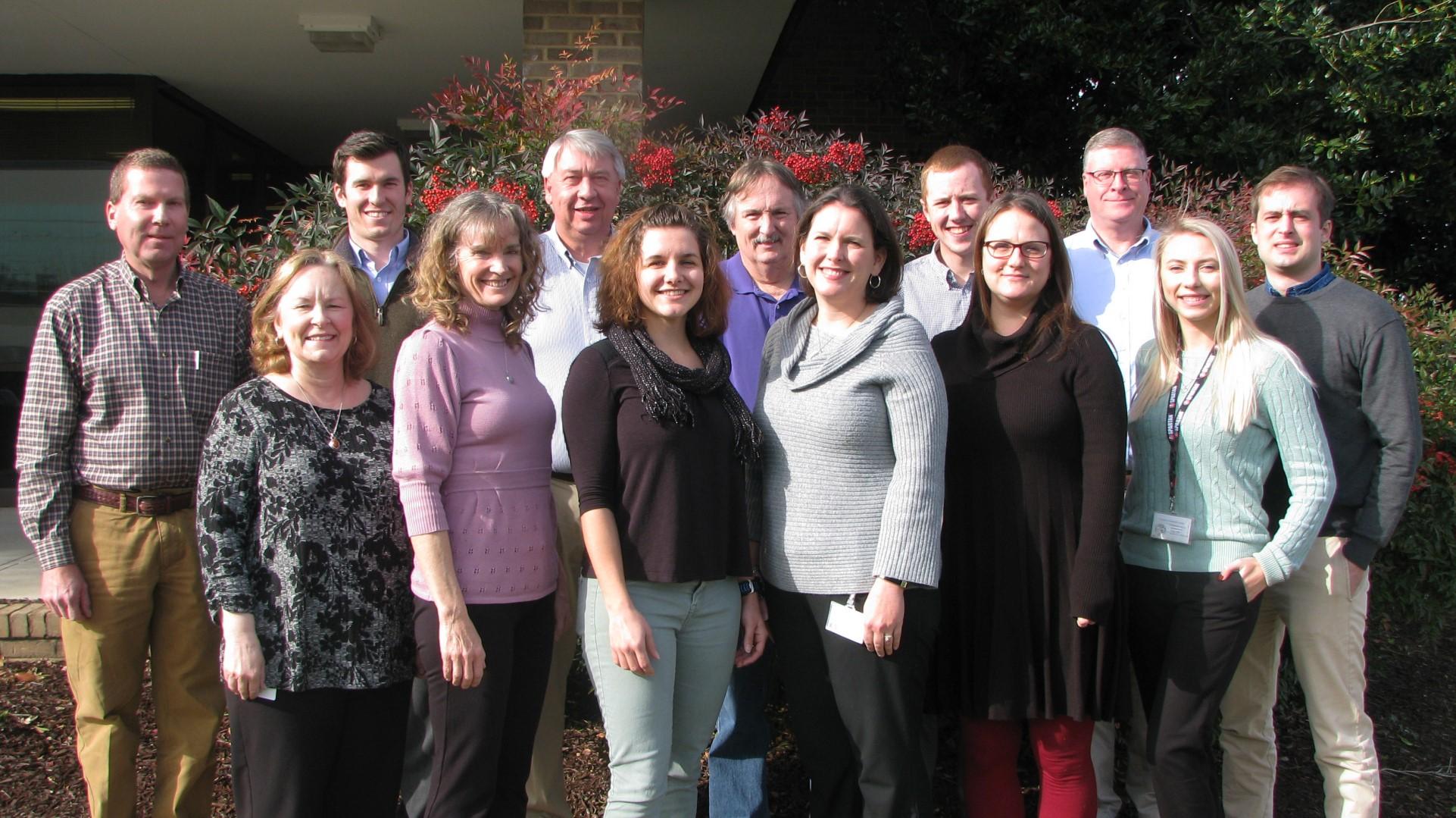
Planning and Zoning Staff
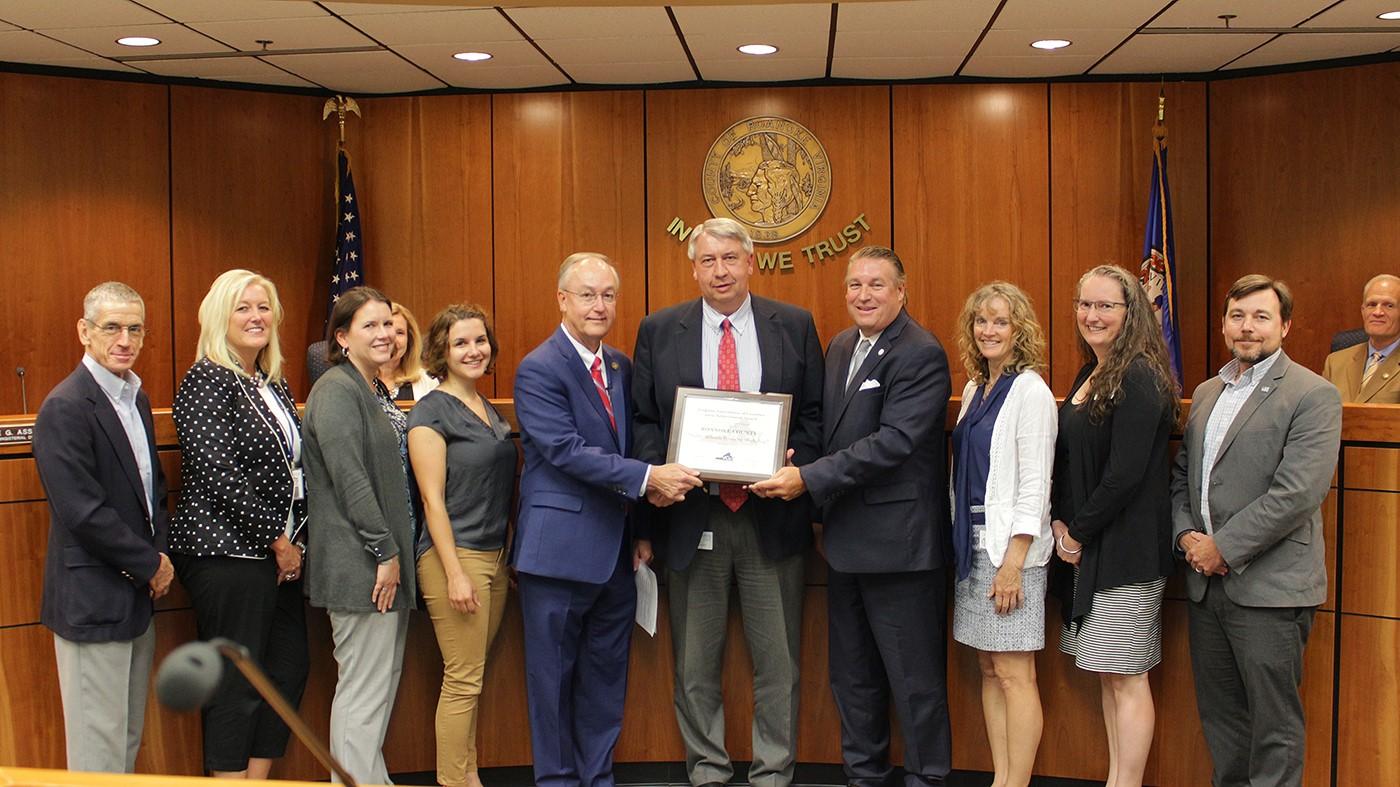
Awards and Certifications
Zoning Review
Zoning Enforcement
Planning Commission Actions
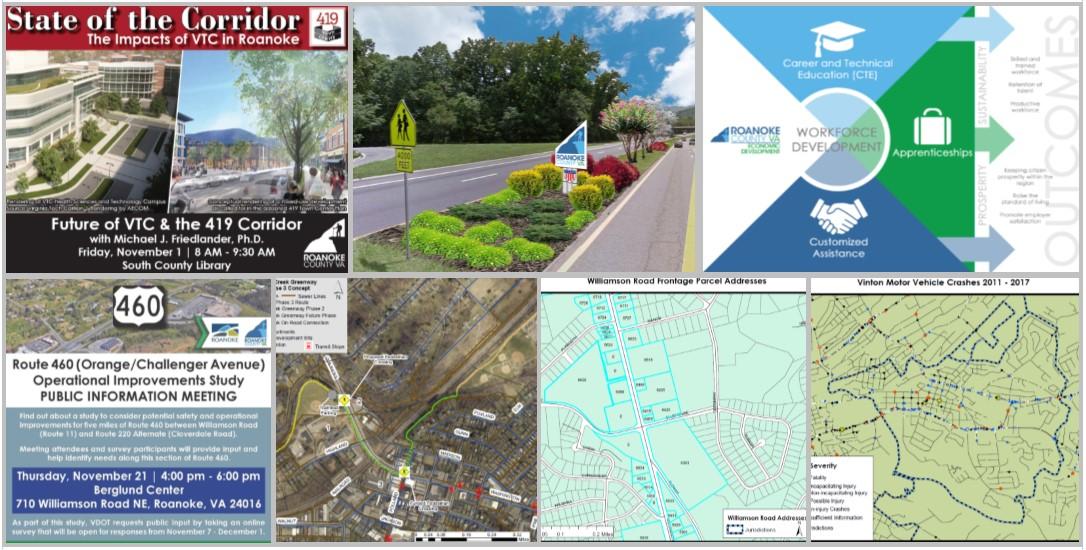
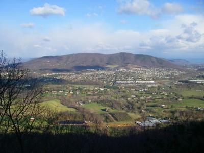
Long Range Planning 419 Town Center Plan

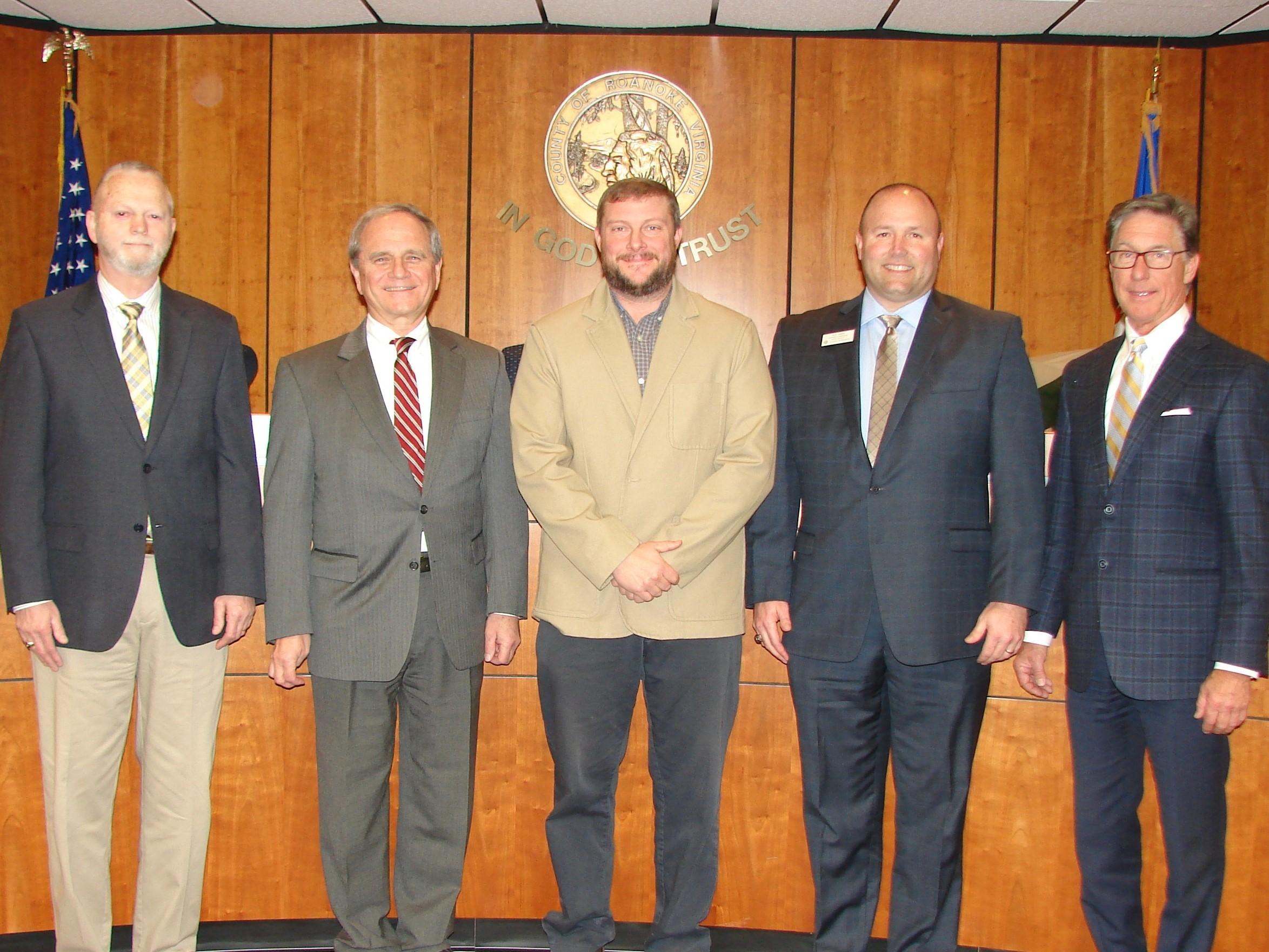
Wayne Bower
Hollins District (July 2014)
Paul Mahoney
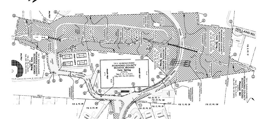
Cave Spring District (July 2016)
Troy Henderson
Catawba District (February 2017)
Rick James Vinton District (January 2014)
Jim Woltz
Windsor Hills District (January 2013)
The Planning Commission is an advisory board to the Board of Supervisors. The Commission makes recommendations on a variety of land use issues. The Commission is also charged with preparing and maintaining the Comprehensive Plan and recommending changes to reflect new land use policies.
In 2019, the Planning Commission held a total of 16 meetings, including nine public hearing meetings, six work session meetings and one special meeting with the Board of Supervisors and Roanoke Valley Resource Authority. Troy Henderson held the position of Chairman and Rick James was Vice Chairman.
The Commission is established under the authority of the Code of Virginia (1950, as amended), Chapter 22, Article 2 and pursuant to a motion of the Roanoke County Board of Supervisors on June 19, 1939, as authorized by Section 2, Chapter 427 of the Acts of the General Assembly, adopted March 30, 1936.

NEW 2019 CERTIFICATIONS:
Alex Jones
Virginia Certified Planning Commissioners’ Program, Virginia Commonwealth University
Bailey Howard-DuBois
Lean Management for Practitioners Training
Virginia Tech
Megan Cronise
Locally Administered Projects Qualification Program (VDOT)
NEW STAFF:
Alyssa Dunbar, Planner I
Will Crawford, Transportation Planner
Isaac Henry, Transportation Planner
Staff support many boards, committees, and business and civic associations:
Back Creek Civic League
South County Business Collaboration
Regional Bicycle & Pedestrian Advisory Committee*
Plan Roanoke Responsible Regionalism Committee
Regional Local Food Planning Committee*
Roanoke County Census Complete Count Committee
Roanoke Regional Housing Network
Roanoke River Blueways Committee*
Roanoke Valley Greenway Commission
Rural Bikeway Plan Steering Committee*
Transportation Policy Board (TPO)*
Transportation Technical Committee (TTC)*
U.S. 220 Arterial Preservation Program
U.S. 460 Arterial Preservation Program
Williamson Road Area Business Association (WRABA)
*Roanoke Valley-Alleghany Regional Commission
Roanoke County Planning Services
2019 Achievement Award, Virginia Association of Counties (VACo)

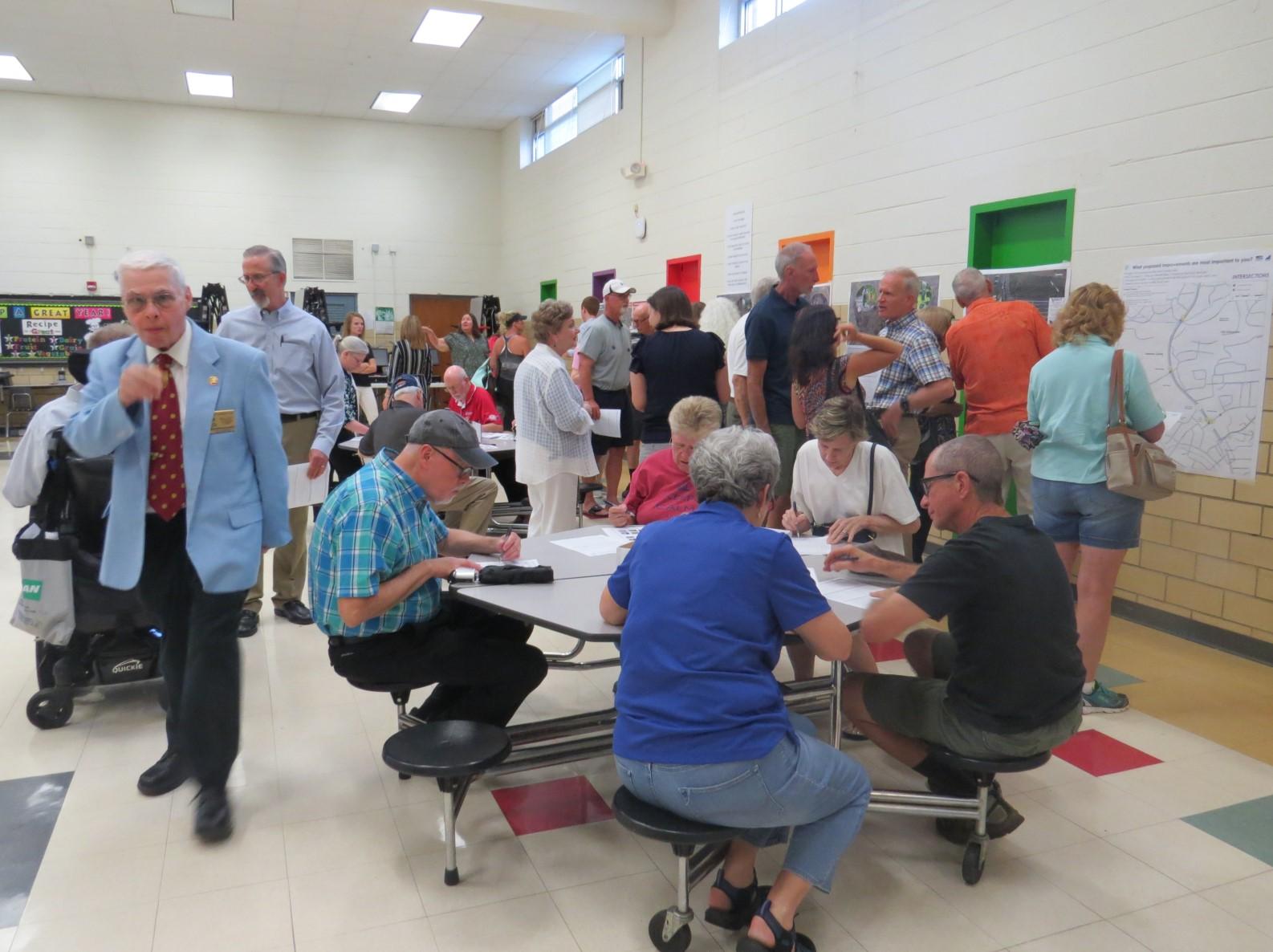
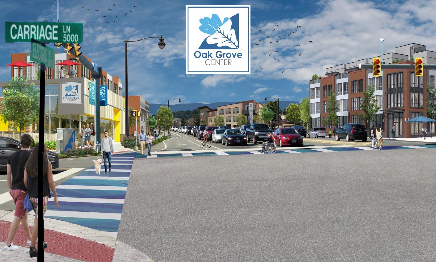
Staff received this award for the Public Schools Planning Workshops component of the community engagement strategy for the Oak Grove Center Plan. The workshops sought to address two main problems. First, long range planning efforts in the past have largely gleaned input from residents over the age of fifty, leaving planners to guess the preferences of younger generations. Secondly, students are rarely exposed to the planning profession and are not aware that it is a career option when they are making college plans. The program was a collaboration between Roanoke County, the City of Roanoke and Roanoke County Public Schools. The workshops began with the Roanoke County Public Schools Student Advisory Committee, made up of 9th – 12th graders, and were subsequently repeated with five assemblies of teachers, administrators, and school leadership teams. The exercises included educating the participants about the plan area, then breaking into small groups to markup maps with their ideas for park locations, public spaces, commercial businesses, sidewalks, trails, bus stops and public facilities. The workshops provided valuable public input for the Oak Grove Center Plan.
American Institute of Certified Planners (AICP): 3 certified, 2 Candidates
Certified Board of Zoning Appeals Program: 3
Certified Combined Administrator for Erosion and Sediment Control: 1
Certified Floodplain Manager, Association of Floodplain Managers: 1
Certified Transportation Manager (VAZO): 1
Certified Zoning Administrator (VAZO): 2
Graduate Certificate of Local Government Management: 1
Lean Management for Practitioners (VT): 2
Locally Administered Projects
Qualification Program (VDOT): 1
Virginia Certified Industrial Development Authority Program: 1
Virginia Certified Planning Commissioners Program (VCU): 8
Permit Review
Residential Permits
New Construction 159
Alterations/Additions 487
Accessory Structures 158
Reviews Performed 478
Commercial Permits
New Construction 16
Alterations/Additions 139
Reviews Performed 372
Planning & Zoning
Business Licenses Reviewed
Zoning Permits
Multiple Dog Permits
Sign Permits
Site Plan Review
Erosion and Sediment Control Plans
Large Subdivision Plats
Site Plan Review
Certificate of Occupancy:
Residential and Commercial
Total Certificates Issued
Change of Use
REZONING APPLICATIONS RECOMMENDED BY THE PLANNING
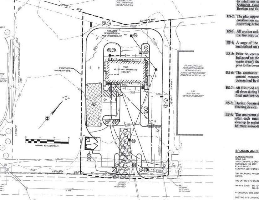
Virginia Interventional Pain and Spine Center: Amendment to proffered conditions on a 3.2 acre commercial property on Ogden Road for Ogden Road Professional Park (January).
Economic Development Authority of Roanoke County: Amendment to the master plan proffered conditions at the Center for Research and Technology to separate the zoning of the property from the private covenants (February).
Virginia Class Action Softball Club: To rezone 11.03 acres at 4774 Pioneer Drive from residential to commercial for an outdoor sports and recreation facility (February).
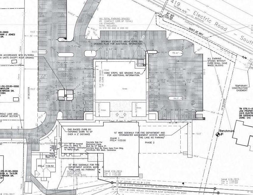
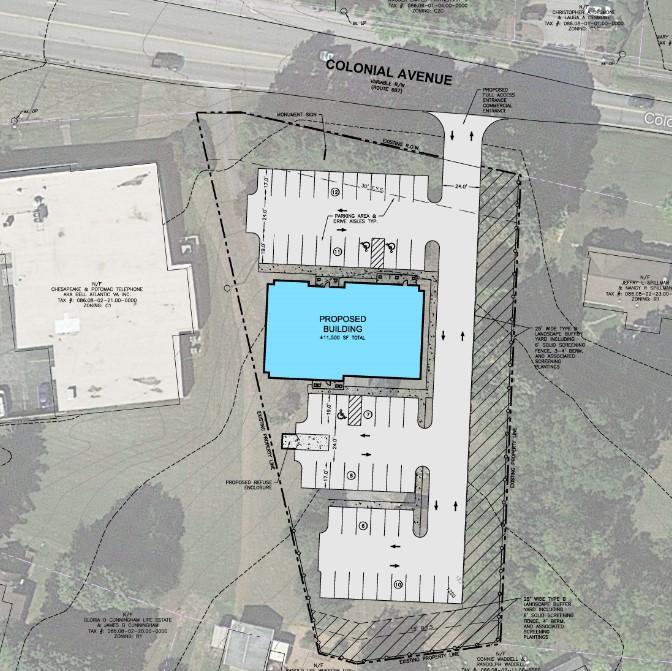
Balzer and Associates, Inc: To rezone 1.17 acres at 4920 Colonial Avenue from residential to commercial for a 2 story, 11,500 square foot medical office building (February).
Lindor Development, LLC: To rezone 14.90 acres near 5100 Hollins Road from commercial to industrial for a 22,600 square foot building, fuel canopy and parking for a truck terminal (May).
Donald and Elaine Kepple: To rezone 4.6 acres at 6121 Peaceful Drive from industrial to residential to construct a single family dwelling (September).
Lewis Gale Medical Center: To rezone 1.44 acres at 1423 West Ruritan Road from residential to commercial to construct a free standing emergency room (October).
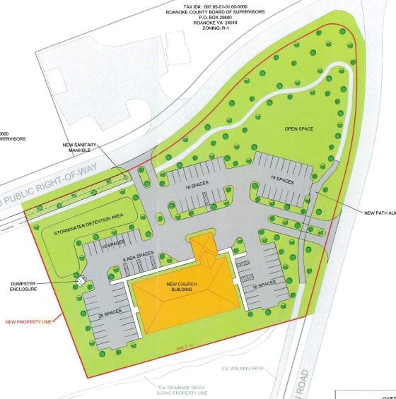
Fellowship Community Church: Remove proffered conditions on 3.5 acres near the 6500 block of Merriman Road to allow for a special use permit request for religious assembly (November).
Explore Park District: Revisions to the Roanoke County Zoning Ordinance to amend the purpose, applicability and permitted uses; add development regulations, and delete the rezoning application process. Also, revisions to use and design standards for the following uses: public maintenance and service facilities, automobile rental/leasing, minor auto repair, campground, convenience store, gas station, restaurant and transportation terminal.
Sign ordinance amendment: Staff presented amendments to the Board of Supervisors for their ultimate approval (March). Planning Commission had recommended approval in September, 2018.
Other Amendments: Roanoke County Zoning Ordinance standards and requirements regarding bed and breakfast, commercial kennel, special events facility, camps, public parks and recreation areas and campground uses, and buffer yard requirements.
SPECIAL USE PERMIT APPROVALS RECOMMENDED BY THE PLANNING COMMISSION:
Rhonda Conner: Multiple dog permit at 6185 Bent Mountain Road (February).
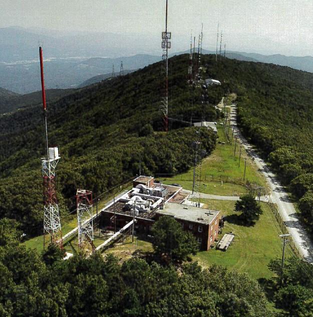
Skyway Towers: Construction of a 199 foot broadcasting tower on Split Oak Road (March).
SRW Squared LLC, Wolf’s Den Billiards: Commercial indoor amusement facility use at 4820 Hollins Road (May).
Girl Scouts of Virginia Skyline Council, Inc: Amend special use permit conditions for the operation of a camp located at 5488 Yellow Mountain Road (July).
Balzer and Associates, Inc: Construction of a 145 foot broadcasting tower at 8181 Honeysuckle Road (October).
David and Stace Todd: Accessory apartment use at 1047 Barrens Village Court (November).
Fellowship Community Church: Religious assembly use on property located near the 6500 block of Merriman Road (November).
Roanoke Valley Resource Authority, Smith Gap Landfill: Sanitary landfill use for an additional 8.05 acre parcel in the rail/transportation corridor. The parcel was transferred from Norfolk Southern to RVRA. Also, amendment to existing special use permit for the 887 acre landfill at 8484 Bradshaw Road (November).
Bane International Company, LLC: A special use permit to operate a campground located at 2755 Loch Haven Lake, Catawba Magisterial District (December).
SPECIAL USE PERMIT DENIALS RECOMMENDED BY THE PLANNING COMMISSION:
Venture Storage Group, LLC: Construction of a three story, 105,000 square foot building for miniwarehouse use on three parcels totaling 3.10 acres on South Peak Boulevard (January).
COMPREHENSIVE PLAN AMENDMENTS
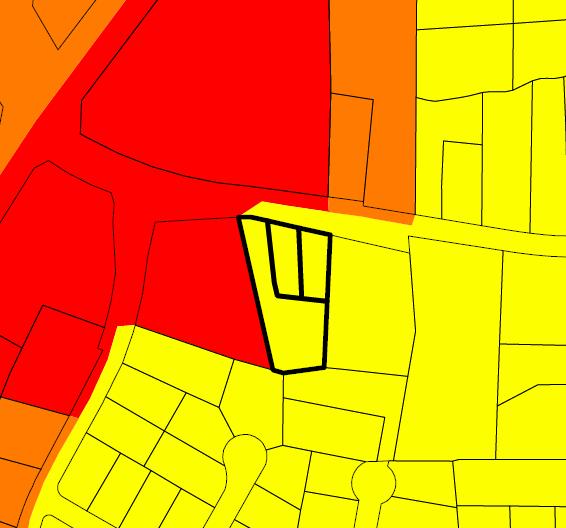
Future Land Use Designation: Three parcels between 4904 Colonial Avenue and 4920 Colonial Avenue were changed from Neighborhood Conservation to Transition (February).
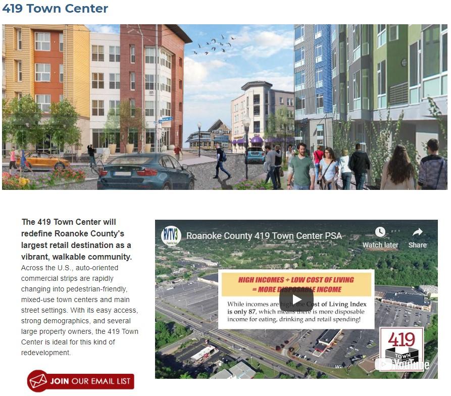
419 Town Center Plan: Amendment to incorporate the Plan into the Roanoke County Comprehensive Plan (March).
PRESENTATIONS
Roanoke-Blacksburg Regional Airport: Tim Bradshaw, Executive Director (July).


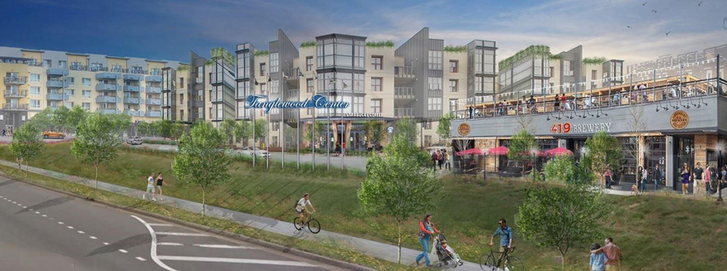
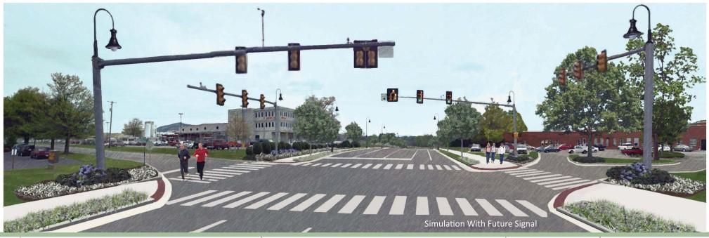
The Board of Supervisors adopted a resolution incorporating the 419 Town Center Plan into the Roanoke County Comprehensive Plan on July 23, 2019. The Plan redefines Roanoke County’s largest retail destination as a vibrant, walkable community. Subsequently, Carilion Clinic announced plans to lease a large space in Tanglewood Mall and Roanoke County hosted the first State of the Corridor meeting for the Electric Road/Franklin Road corridor.
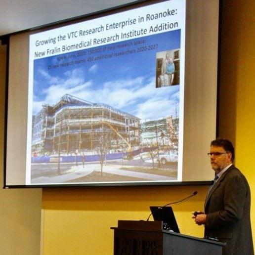
Dr. Michael J. Friedlander, Ph.D. Executive Director, Fralin Biomedical Research Institute at VTC spoke to over 100 members of the public on November 1, 2019 about current and future impacts of Virginia Tech Carilion (VTC), the Fralin Biomedical Research Institute at VTC, and the growth of the Health Sciences and Technology Campus in Roanoke.
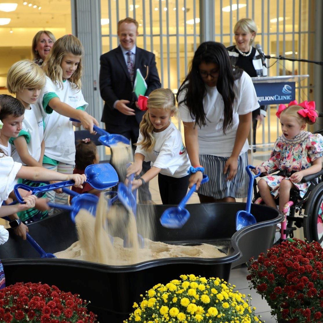
A groundbreaking for the Carilion Children’s facility expansion at Tanglewood Mall was held on September 26, 2019. Carilion has leased 150,000 square feet of space for outpatient practices. The project is expected to cost more than $30 million. Carilion Children’s provides services from hospital to pediatric offices to educational programs for kids.
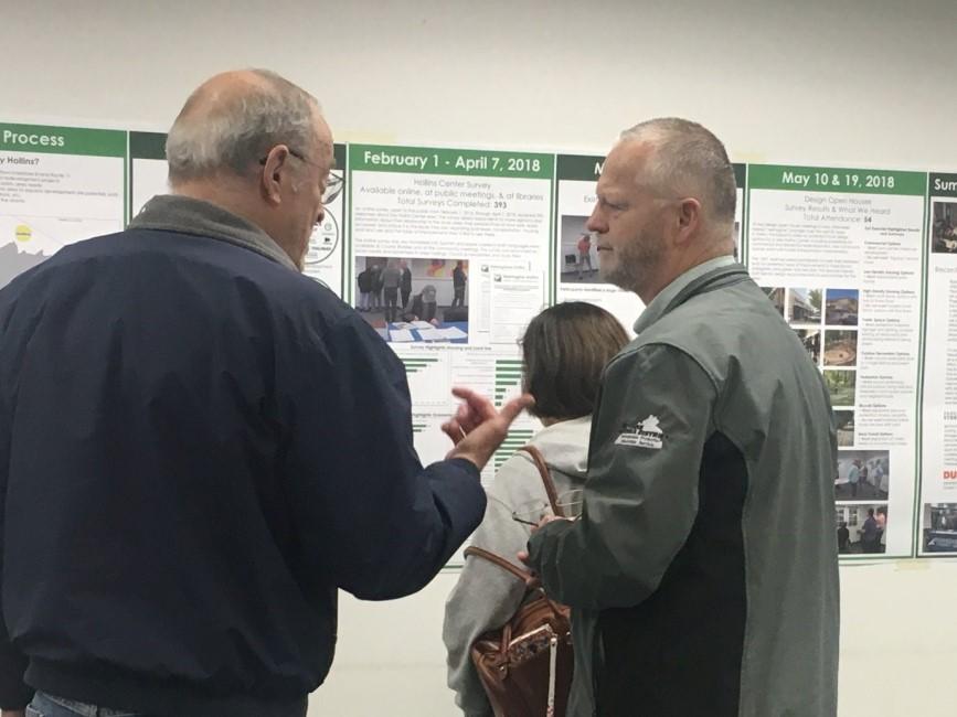
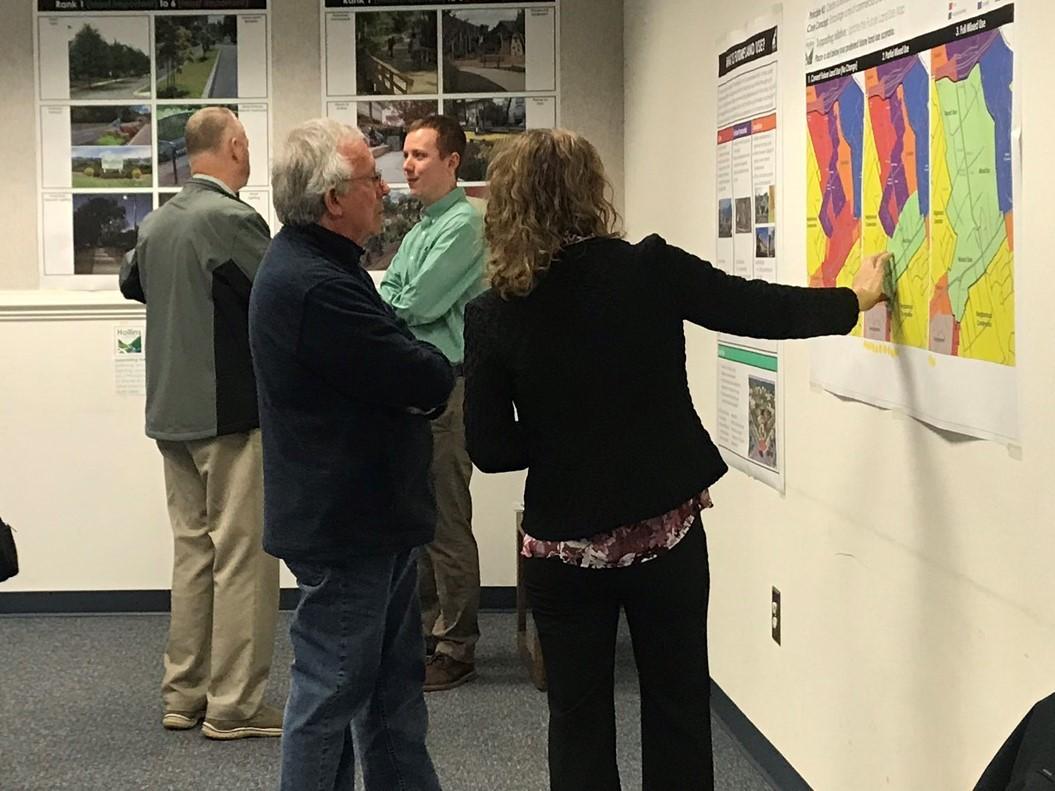
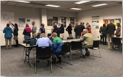
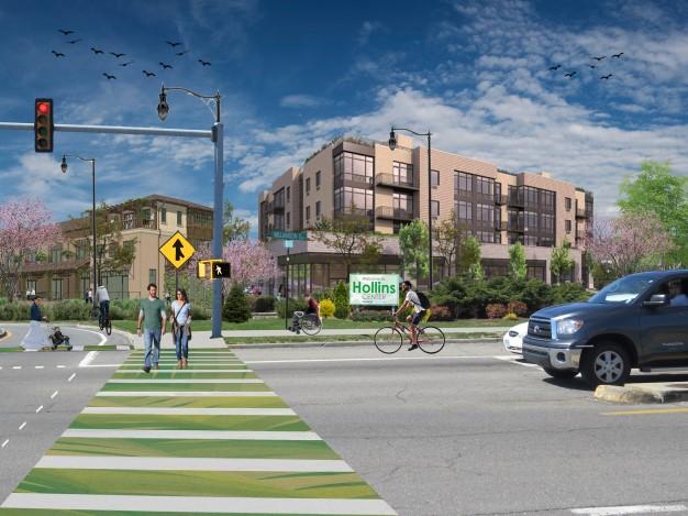
In 2019 staff continued the public engagement strategy for Hollins Center by hosting draft plan reveal community meetings in March. The meetings were held on Saturday morning and Monday night to accommodate working adults and families. The meetings were well attended, providing valuable feedback on the draft plan. Following the community meetings staff has been preparing the final draft which will be presented to Planning Commission and subsequently the Board of Supervisors in early 2020.
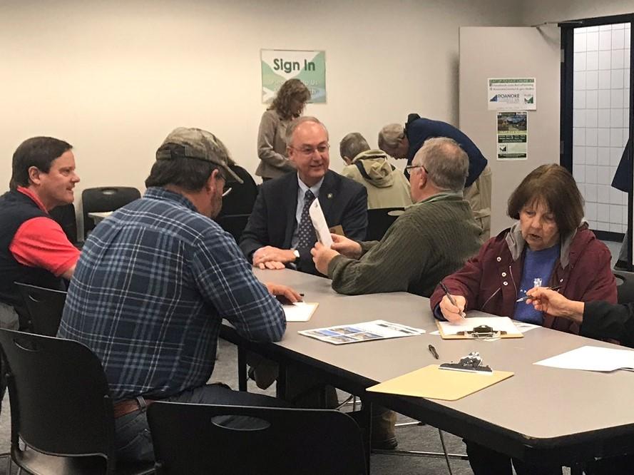
Meetings and surveys included 5 feedback exercises:
1. Vision, Principles, Core Objectives
2. Transportation Projects ranking exercise
3. Park Improvements comment sheet
4. Gateway/Streetscape Improvements and Community Amenities ranking exercise
5. Future Land Use options dot exercise
Hollins Center Online Survey Responses: 54
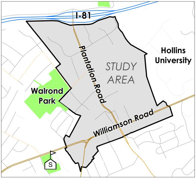
The Hollins Center study area includes 270 parcels over 465 acres stretching from Williamson Road, Peters Creek Road, and Plantation Road up to Interstate 81.
Results of the meetings and surveys are being incorporated into the draft plan, which will go to the Planning Commission and then the Board of Supervisors for public hearings. If approved, the Plan will be adopted as an amendment to the Comprehensive Plan.
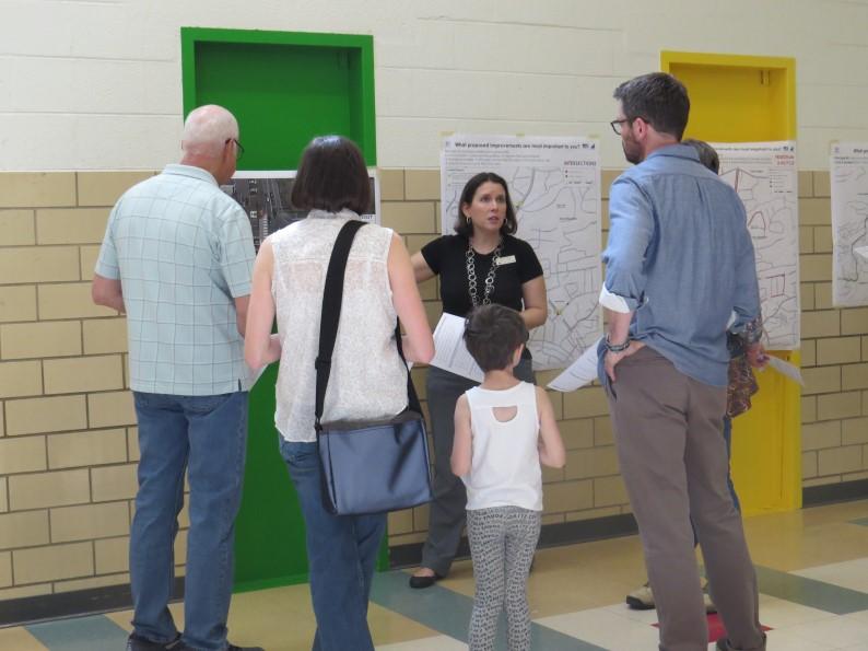
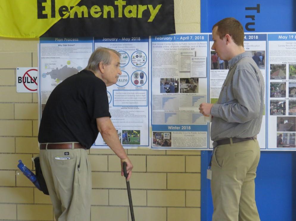
In 2019 staff continued the public engagement strategy for Oak Grove Center by hosting draft plan reveal community meetings in May. The meetings were held on Saturday morning and Thursday night to accommodate working adults and families. The meetings were well attended, providing valuable feedback on the draft plan. Following the community meetings staff has been preparing the final draft which will be presented to Planning Commission and subsequently the Board of Supervisors in 2020.
Meetings and surveys included 5 feedback exercises:
1. Vision, Principles, Core Objectives
2. Gathering Spaces and Streetscape
3. Development Patterns
4. Oak Grove Park and vacant County parcel improvements
5. Multimodal transportation projects
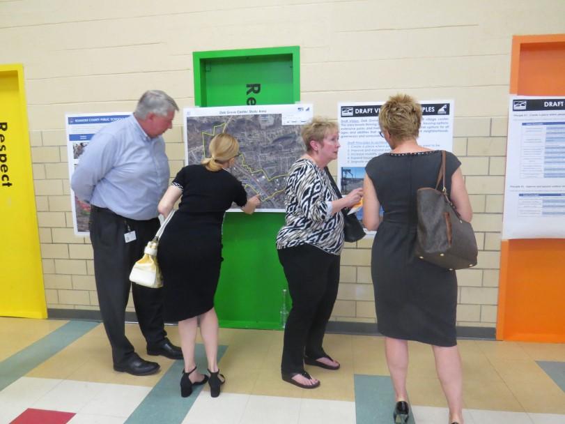
Meeting attendance: 191
Oak Grove Center Online Survey Responses: 215
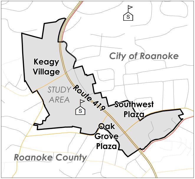
The Oak Grove Center study area covers 173 acres and more than 80 commercial and residential properties, including Keagy Village and Oak Grove Plaza in the County, and Southwest Plaza in the City.
Results of the meetings and surveys are being incorporated into the draft plan, which will go to the Planning Commission and then the Board of Supervisors for public hearings. If approved, the Plan will be adopted as an amendment to the Comprehensive Plan.
2019 Interdepartmental projects: Planning services regularly assists departments and organizations throughout Roanoke County with graphic design projects, mapping, zoning ordinance amendments, and public engagement initiatives. In 2019 this included multiple designs for Economic Development projects or events, regional signage collaboration, Vinton zoning and transportation projects, and VDOT public meetings.
Graphic designs also include creating renderings, documents and presentations for Roanoke County Reimagine Plans and public engagement, transportation project initiatives and others.

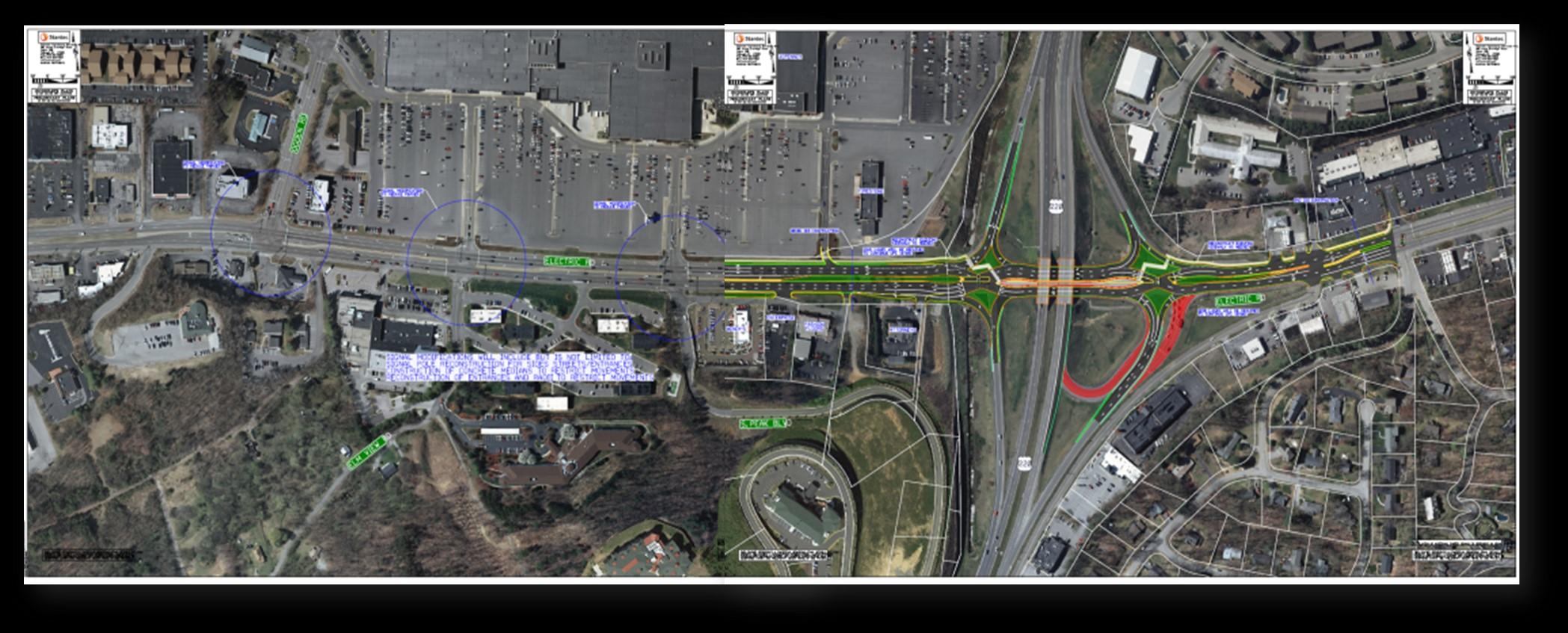
Preliminary engineering is underway on this $17.5 million project funded through Surface Transportation Block Grant (STBG) and SMART SCALE programs. The purpose of the project is to move multimodal traffic through the intersection more safely and efficiently by reconstructing Route 220 on and off ramps, reducing traffic signal phases, and adding pedestrian and bicycle facilities. This project is also a key implementation strategy in the 419 Town Center Plan. Construction anticipated: 2024.
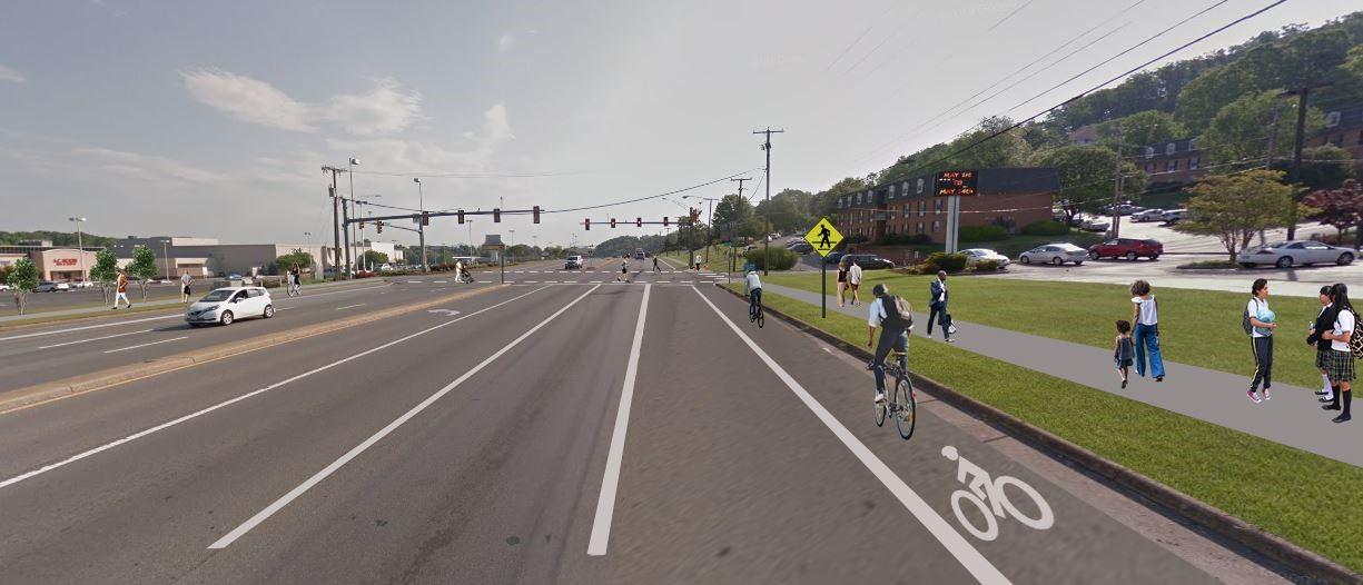
Funded through the SMART SCALE and Transportation Alternatives programs, this $2 million project will construct sidewalk on the north side of Williamson Road to connect planned pedestrian signals and crosswalks at the Peters Creek/Williamson Road intersection to the Plantation Road Shared Use Path and existing sidewalk east of Plantation Road. Construction anticipated: 2023.
Roanoke River Greenway, Highland Road Crossing: Construct 0.30 mile of the Roanoke River Greenway along Highland Road and under the Blue Ridge Parkway through an existing tunnel. An additional $250,000 was requested to add to previous TA funding ($492,000) due to increased project costs.
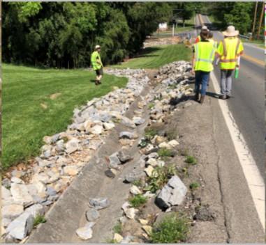
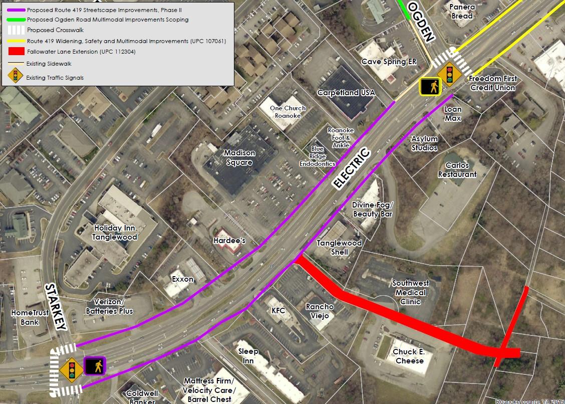
Fallowater Lane Extension: Upgrade the existing private road to public road standards and connect to Chevy Road. Preliminary engineering administered by Roanoke County and Rightof-Way administered by VDOT. An additional $1.8 million requested for $4.3 million total.
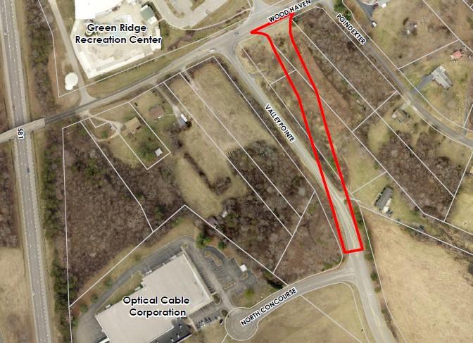
Valleypointe Parkway Realignment: Widen and realign Valleypointe Road at Wood Haven Road to improve and expand transportation infrastructure to serve Wood Haven Technology Park. $5.4 million requested.
Route 419 Streetscape Improvements, Phase II: Extend multimodal improvements from Phase I to the next block between Starkey Road and Ogden Road. This project is a key implementation strategy in the 419 Town Center Plan. $1.5 million requested.
Orange Market Park and Ride Lot Improvements: Construct multimodal and accessibility improvements for the park and ride and Hanging Rock Battlefield Trail. $350,000 requested.
Old Cave Spring Road Intersection Improvements: Improve Old Cave Spring Road at the intersection with Brambleton Avenue. $2,900,000 requested.
Oak Grove Streetscape Improvements: Install pedestrian signals/crosswalks and ADA ramps at Route 419/Carriage Lane/Grandin Road intersection, and scoping for pedestrian facilities extending along Route 419, Grandin Road and Carriage Lane. $220,000 requested.
Ogden Road Multimodal Improvements Scoping: Collaborate with City of Roanoke, Valley Metro and VDOT to generate concepts for possible pedestrian, bicycle and bus stop improvements along Ogden Road between Route 419 and Colonial Avenue. $80,000 requested.
The goal of this VDOT-administered study is to explore solutions to reduce traffic weaving conflicts affecting adjacent intersections and to provide better access to Wood Haven Technology Park. The study is analyzing improvements and considering alternative and innovative intersections at the I-581 Exit 2 Interchange. The study will be complete in Summer 2020. This study is funded through STBG.
VDOT is proposing to reduce signal phases at intersections along Route 220. Community meetings were held in November, 2019. Roanoke County intersections include:
Valley Avenue/Southern Hills Drive
Crossbow Circle/Pheasant Ridge Road
Buck Mountain Road/Stable Road
Indian Grave Road/Clearbrook Village Lane
VDOT is studying operational and safety conditions in order to propose improvements to the corridor from Williamson Road (Route 11) to Cloverdale Road (Alt. 220). A public survey received over 1,000 responses and a public meeting was held in November, 2019.

Source: nbc12.com
Governor Northam signed legislation establishing the I-81 Corridor Improvement Fund in April, 2019 which dedicates funding for priority projects along the I-81 corridor through Virginia. An advisory committee was established to advise the Commonwealth Transportation Board regarding implementation of the I-81 Corridor Improvement Plan. The committee meets four times a year. The Plan identifies several projects for funding located in Roanoke County that, when constructed, are anticipated to help relieve congestion and improve safety on Interstate 81.
Construction 2020
Interstate 81 Auxiliary Lanes, Exit 141 to Exit 143. Connecting ramps between the exits with new travel lanes. The project is designed to connect to future widening projects. SMART SCALE
Lila Drive Intersection Safety Improvements. New traffic signal, crosswalks and pedestrian signals, with entrance reconfigurations at Double Envelope and Wells Fargo . SMART SCALE
Route 419 and Route 221 Adaptive Signal Control. Coordinating signals to improve traffic flow and reduce delays on Route 419 from Colonial Avenue to Valley Drive and on Route 221 from Garst Mill Road to Ranchcrest Drive. Infrastructure is in place and systems will be activated in 2020. SMART SCALE
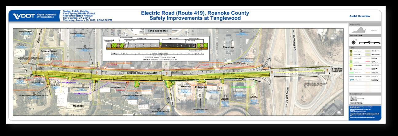
Route 419 Widening, Safety and Multimodal Improvements-Ogden to Route 220. Constructing a third lane from Ogden Road to the Route 220 south ramp, sidewalks, bicycle lanes, pedestrian signals/ crosswalks, and a bus shelter. The project is a key implementation strategy in the 419 Town Center Plan. HSIP, SMART SCALE
West Main Street Pedestrian Improvements. Constructing sidewalk, pedestrian signals and crosswalks between the City of Salem and Valley Tech Park, south side; and between Daugherty Road and Valley Tech Park, north side. Revenue Sharing, SMART SCALE
Construction 2021
Plantation Road, Phase II. Install sidewalk, curb and gutter from Walrond Drive to Gander Way. Widen Walrond Drive intersection. Install pedestrian signals and crosswalks at Gander Way. SMART SCALE, Locally Administered.
Route 311/Route 419 Intersection Safety Improvements. Construct a roundabout to replace the traffic signal. SMART SCALE
Construction 2022
Dry Hollow Road Improvements. Rework the roadway under the Norfolk Southern railroad trestle. SSYIP, Revenue Sharing
Williamson Road Sidewalk, from Peters Creek Road to North Roanoke Assisted Living. Construct sidewalk with pedestrian signals at crosswalks at the Peters Creek/ Williamson Intersection. HSIP
Construction 2023
Starkey Road/Buck Mountain Road Intersection Improvements with a roundabout Replace the existing “T” intersection with pedestrian accommodations. STBG, Revenue Sharing, SSYIP
Construction 2024
McAfee Knob Pedestrian Bridge over Route 311. Constructing a pedestrian bridge over Route 311 for Appalachian Trail users. HSIP
Williamson Road Sidewalk- North Roanoke Assisted Living to Clubhouse Drive and Dent Road Intersection. This project is funded, but not yet started. HSIP
Hidden Valley High School Dam & Stormwater Pond Maintenance Easement
Staff completed the following design projects in 2019:
County Projects:
Hinchee Trail Parking Lot & Pedestrian Crossings
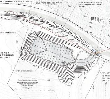
Orange Market Park & Ride Improvements
Rutrough Point Parking Lot
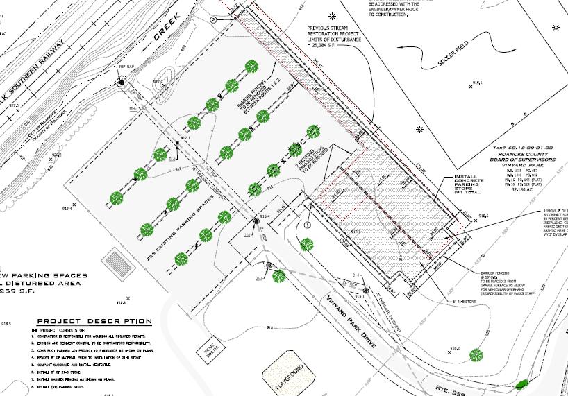
Vinyard Park Parking Lot
Williamson Road Street Light Improvements
Drainage Projects:
Craighead Drainage Easement
Hidden Valley Stormwater Pond Easement
Rural Addition:
Moncap Trail
Lean Project: Staff completed a Lean project to improve the zoning verification letter (ZVL) request process. ZVLs provide a history of zoning activity on a property. Banks, attorneys, real estate offices and others use ZVLs for legal or financing purposes. After several months of data collection and process review staff created a standardized ZVL form and submittal process. The form reduces communication time, reduces average delivery time from 5 days to 1 day, and ensures that a fee is always collected.
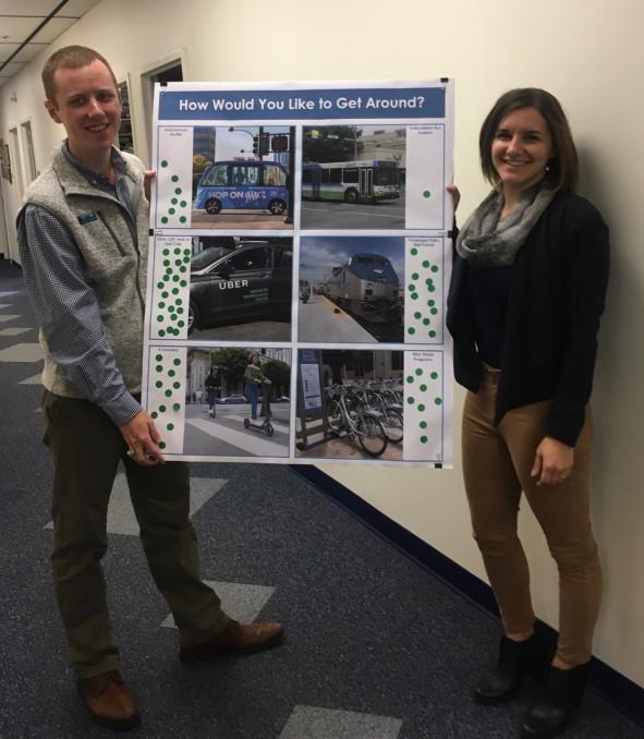
Staff participated in the 3rd Annual Glenvar High School Career Expo which gave students an inside view at many of the career opportunities available in the region. Students also voted on which transportation methods they would like to use to move around the region:
Uber, Lyft, and/or Taxi - 24
Passenger Train/Rail Transit -14
E-Scooters –12
Bike Share – 9
Autonomous Shuttle – 8
Read Mountain Preserve: Staff assisted in writing a successful grant application for Read Mountain Preserve. The grant will allow Roanoke County to purchase approximately 300 acres adjacent to the preserve, almost doubling the amount of land available on Read Mountain for public recreation.
Website Redesign: Following the launch of the new Roanoke County website in May 2019, staff updated and reorganized the Planning and Zoning division webpages to make it easier for citizens to access pages that they use every day. The project also simplified online information, improved descriptions and reviewed content for current projects and responsibilities of the division. In addition, many Planning and Zoning permit applications were rebranded and made into fillable pdfs.

Planning and Zoning
www.roanokecountyva.gov/pz facebook.com/RoCoPlanning