2018 Annual Report
of the Planning Commission and Planning & Zoning Staff


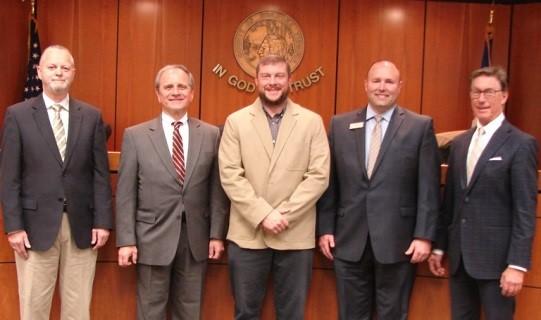
Wayne Bower
Hollins District (July 2014)
Paul Mahoney
Cave Spring District (July 2016)
Troy Henderson Catawba District (February 2017)
Rick James Vinton District (January 2014)
Jim Woltz
Windsor Hills District (January 2013)
The Planning Commission is an advisory board to the Board of Supervisors. The Commission makes recommendations on a variety of land use issues. The Commission is also charged with preparing and maintaining the Comprehensive Plan and recommending changes to reflect new land use policies.
In 2018, the Planning Commission held a total of 19 meetings, including seven public hearing meetings, 10 work session meetings and two special meetings with the City of Roanoke. Paul Mahoney held the position of Chairman and Rick James was Vice Chairman.
The Commission is established under the authority of the Code of Virginia (1950, as amended), Chapter 22, Article 2 and pursuant to a motion of the Roanoke County Board of Supervisors on June 19, 1939, as authorized by Section 2, Chapter 427 of the Acts of the General Assembly, adopted March 30, 1936.
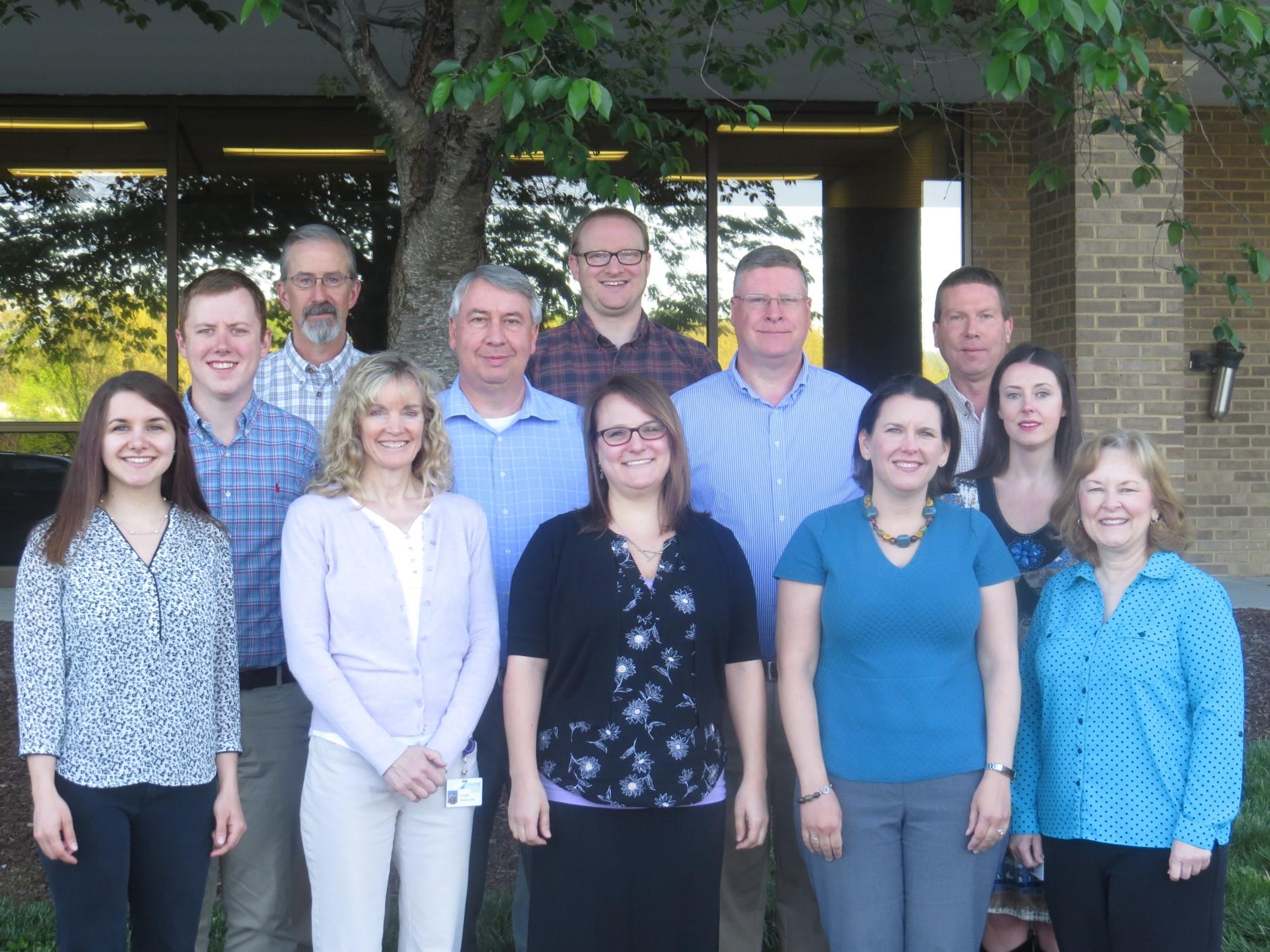
Bailey Howard-DuBois
American Institute of Certified Planners
American Planning Association
Certified Planning Commissioner Program
VCU Land Use Education Program
Cecile Newcomb
American Institute of Certified Planners Candidate
American Planning Association
Megan Cronise
Lean Management for Practitioners Training
Virginia Tech
SUMMER PLANNING INTERN:
Max DuBois
Vassar College
Staff are active on many boards and committees and support business and civic associations:
Back Creek Civic League
Brambleton Avenue Business Association (BABA)
Regional Bicycle & Pedestrian Advisory Committee*
Plan Roanoke Responsible Regionalism Committee
Regional Local Food Planning Committee*
Roanoke Regional Housing Network
Roanoke River Blueway Committee*
Roanoke Valley Greenway Commission
Rural Bikeway Plan Steering Committee*
Transportation Policy Board (TPO)*
Transportation Technical Committee (TTC)*
U.S. 220 Arterial Preservation Program
U.S. 460 Arterial Preservation Program
Williamson Road Area Business Association (WRABA)
*Roanoke Valley-Alleghany Regional Commission
The Planning Commission held public hearings and recommended that the Board of Supervisors approve the following petitions:
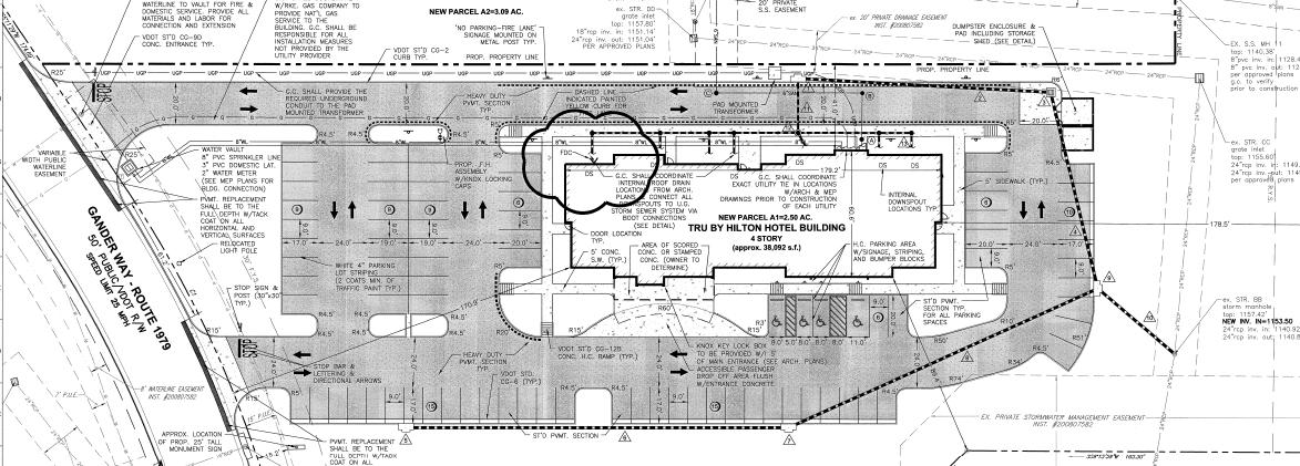
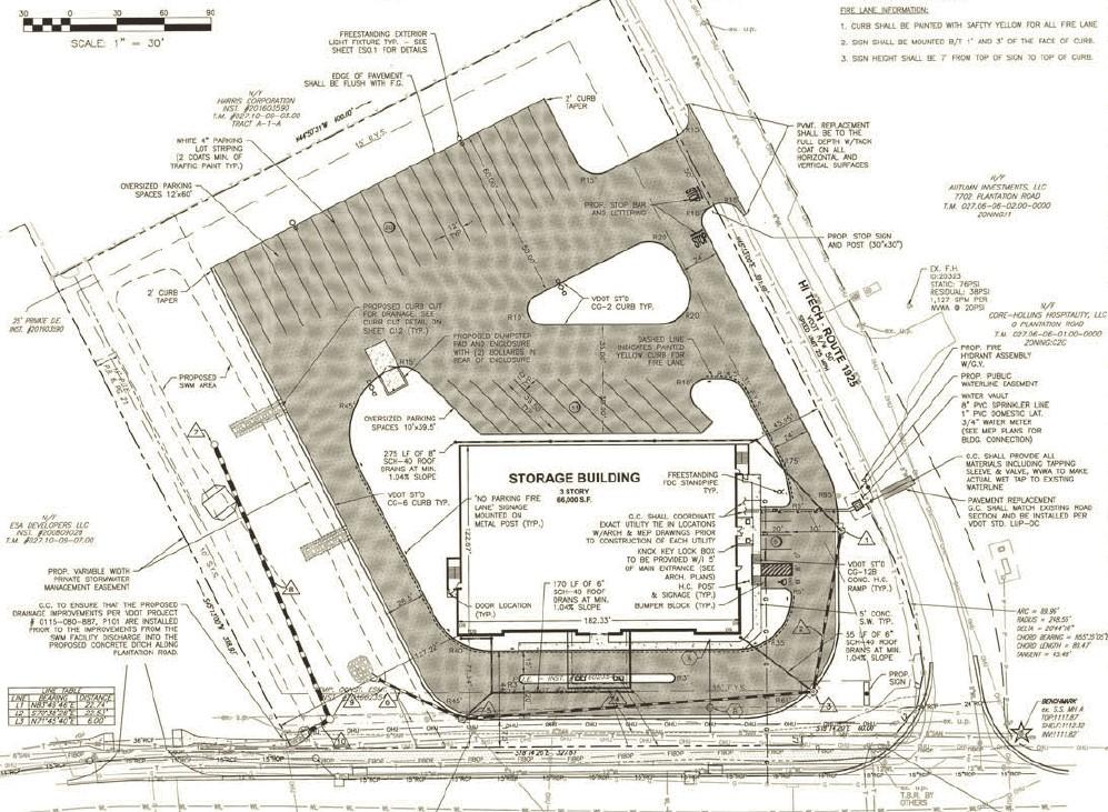
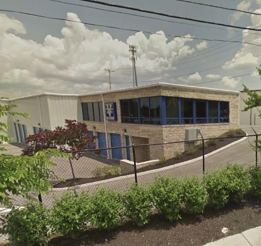
Virginia Varsity Storage: to rezone property at 5881 Starkey Road from C-2C, High Intensity
Commercial with conditions, to I-1, Low Intensity Industrial, to remove proffered conditions and to obtain a special use permit for a mini-warehouse facility (June).
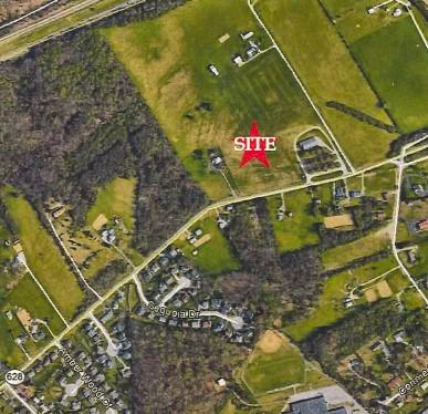
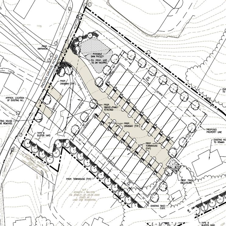
Laurel Crest, LLC: to rezone properties at 5356 and 5372 Indian Grave Road from AR, Agricultural/ Residential to R-3, Medium Density Multi-Family Residential for the purpose of townhomes and single family attached homes (July).
Western Virginia Regional Industrial Facility Authority and Lewis Living Trust: to rezone properties at Wood Haven Road and Thirlane Road from I-1, Low Intensity Industrial, and R-1, Low Density Residential, to PTD, Planned Technology Development, for the purpose of a Technology Park (July).
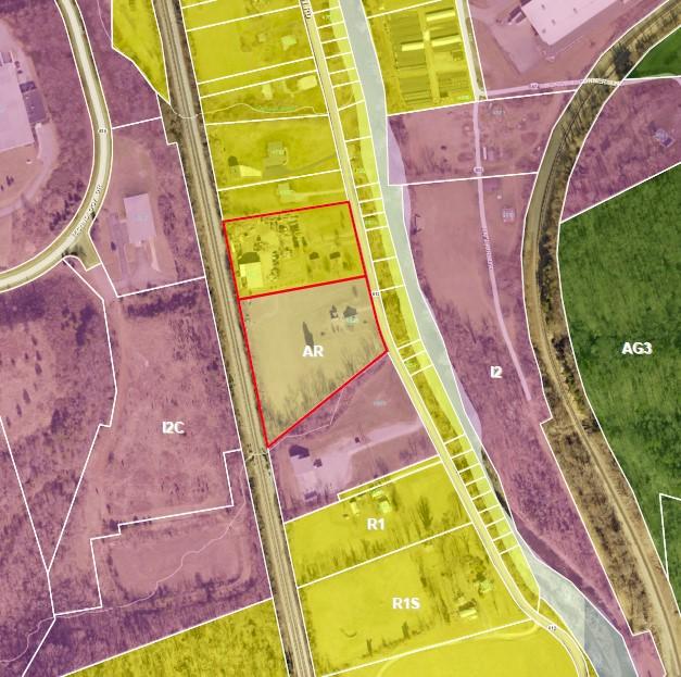
Michael Sanctuary and Dezaray Allaire: to rezone a property at 4053 Aerospace Road from I-1, Low Intensity Industrial to AG-1, Agricultural/Rural Low Density for the purpose of a single family home (September).
Horace Obenchain: to rezone properties at 4191, 4185, and 4165 Barley Drive from R-1, Low Density Residential to AG-3, Agricultural/Rural Preserve for the purpose of keeping livestock on the property (October/November).
Richard Atkinson and Kay Atkinson: to rezone properties at 4821 and 4835 Poor Mountain Road from R-1, Low Density Residential, District and AR, Agricultural/Residential to AV, Agricultural/ Village Center and to obtain a special use permit for a construction yard (November).
The Planning Commission held public hearings and recommended that the Board of Supervisors approve the following petitions:
Kimberly J. Bolden, Charlotte W. Johnston, and Triple J Farm Events, LLC: for a special use permit at 5198 Blacksburg Road for the purpose of a special events facility (January).
Diana England: for a special use permit at 4579 Layman Road for the purpose of a multiple dog permit for seven dogs (March).
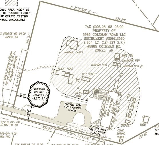
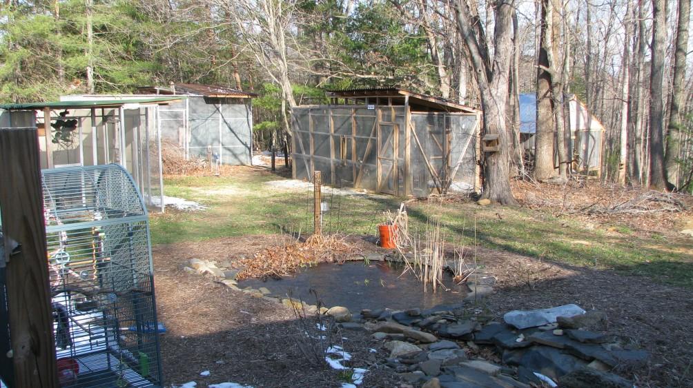
Southwest Virginia Wildlife Center of Roanoke, Inc.: for a special use permit at 5985 Coleman Road for the purpose of constructing buildings without public road frontage (September).
The Planning Commission also heard several presentations throughout the year:
Transportation Updates (February/October
Catawba Sustainability Center (May)
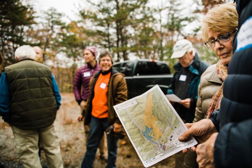
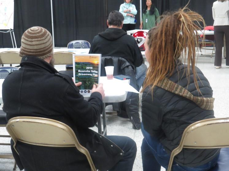
2018 Greenway Plan Update (May)
Strategic Direction of Economic Development in Roanoke County (September)
Regional Study on Transportation Project Priotitization for Economic Development and Growth (TED) Study (September)
Planning Internship (October)
Regional Blueways (November)
The Board of Zoning Appeals heard the petition of two administrative appeals:
ADMINISTRATIVE APPEALS
The appeals were requested by Stanley A. Seymour, III and Jane L. Seymour of 5960 Coleman Road and by Adrian Maver and Blaine Creasy of 5946 Coleman Road. The Board found that the petitioners lacked standing (they were not proper parties to bring the appeals) and dismissed the petitions for appeal. The administrative appeals are based on written zoning determination letters rendered by the Zoning Administrator on March 30, 2018 and on May 17, 2018, regarding a property located at 5985 Coleman Road owned by 5985 Coleman Road LLC (Southwest Virginia Wildlife Center of Roanoke) (August).

The Planning Commission and staff worked on amendments to the County’s sign regulations to comply with the Supreme Court decision in Reed v. Town of Gilbert. Revisions (additions, deletions, or modifications) were made to the following sections: Definitions; Purpose; Exempted Signs; Prohibited Signs; Temporary Signs; Damaged or Neglected Signs; and District Regulations. The Planning Commission held a public hearing and recommended that the Board of Supervisors approve the changes; the Board has not yet reviewed the changes.
The Planning Commission proposed several zoning ordinance amendments to address agritourism:
1. Add definitions for agritourism, farm brewery, farm distillery, and farm winery;
2. Add agritourism, farm brewery, farm distillery, and farm winery as permitted by right uses in the AG-3, AG-1, AR, and AV zoning districts;
3. Add use and design standards for agritourism, farm brewery, farm distillery, and farm winery;
4. Amend the use and design standards for special events facility;
5. Add minimum parking required standards for agritourism, farm brewery, farm distillery, and farm winery; and
6. Amend the parking area surface standards for agricultural and forestry use types. In addition, a resolution provided guidance to the Zoning Administrator when reviewing and determining agritourism activities. The Planning Commission held a public hearing and recommended that the Board of Supervisors approve changes; the Board approved the changes.
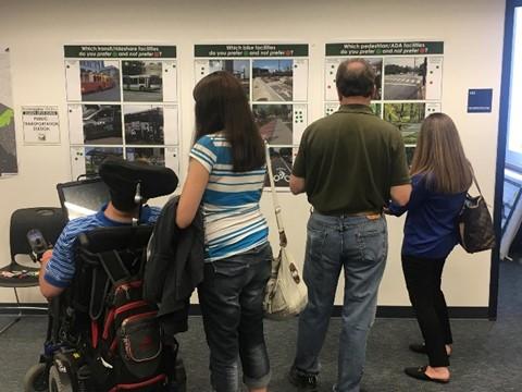
Top results of the visual preference survey
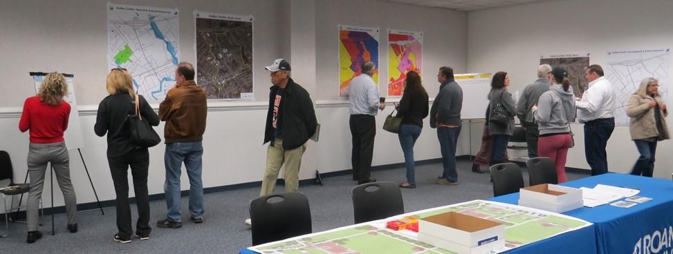
In 2018 staff laid the groundwork for two Reimagine planning studies. Staff designed an expansive public engagement strategy, visited businesses, designed digital and paper advertisements to widely market events, staked out local Goodwill stores to reach a lower-income demographic than typically attends meetings, and collaborated with other departments. Staff hosted open house community meetings on Saturday mornings and Thursday nights to accommodate working adults and families at the recommendation of student stakeholders.
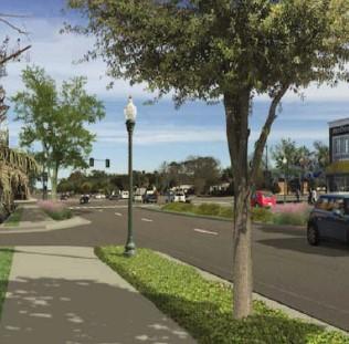
The Draft Plan is in the Works for 2019!
18 stakeholder meetings (93 stakeholders)
2 community meetings (96 attendees)
2 design open houses (54 attendees)
Hollins Center Survey (393 responses)*
Visual Preference Survey (58 responses online)
*The survey, open from February 1 through April 7, was also translated into Spanish and paper copies in both languages were available at community meetings and County libraries.
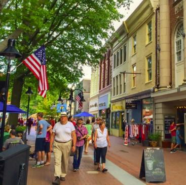
The Hollins Center study area is 465 acres stretching from Williamson Road, Peters Creek Road and Plantation Road up to I-81.
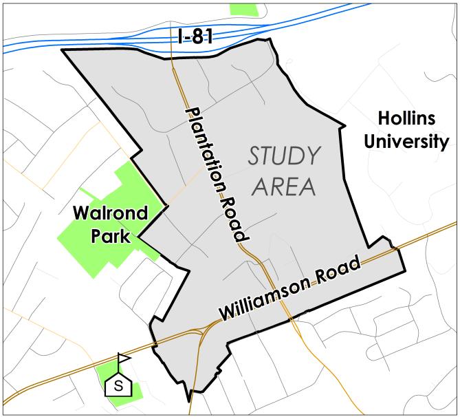
The draft Hollins Center Plan will be available in 2019. The Plan’s vision, goals and implementation strategies will be highlighted at an additional series of community meetings in the spring. After these meetings the draft will go to the Planning Commission and then the Board of Supervisors for public hearings. If approved, the Plan will be adopted as an amendment to the Comprehensive Plan.
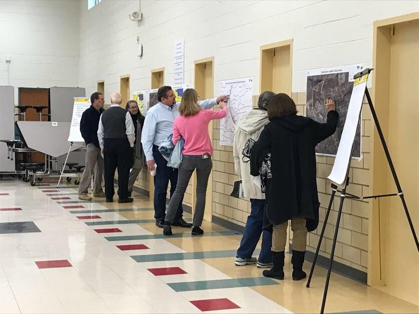
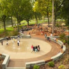
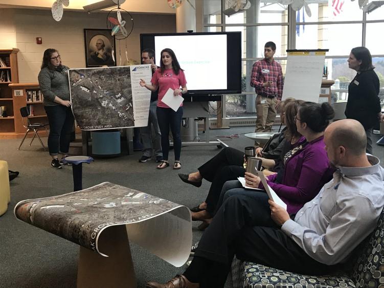
The Oak Grove Center planning study also included collaboration with the City of Roanoke and several area schools. A new partnership with the schools engaged a younger demographic than we had before, and also helped us understand what it takes to reach school-aged citizens. The partnership led to an in-class exercise where students designed a new Oak Grove Park on paper.
Roanoke County Schools Workshops and Presentations
Student Advisory Council
Hidden Valley HS/MS Leadership
Hidden Valley HS Faculty
Hidden Valley MS Faculty
Oak Grove Elementary Faculty
Public Engagement Strategies:
18 meetings (~100 stakeholders)
2 community meetings (102 attendees)
2 design open houses (63 attendees)
Oak Grove Center Survey (595 responses)*
Visual Preference Survey (60 online responses)
*The survey, open from February 1 through April 7, was also translated into Spanish and paper copies in both languages were available at community meetings and County libraries.
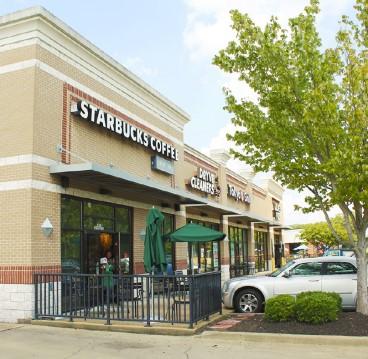
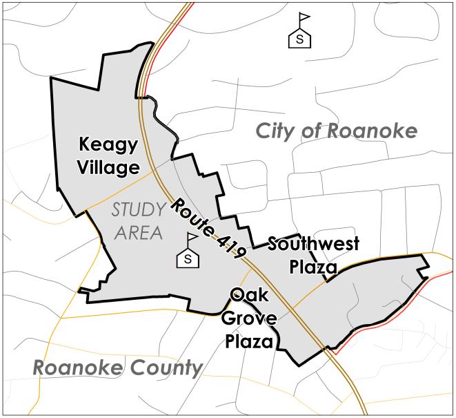
The Oak Grove Center study covers 173 acres and more than 80 commercial and residential properties, including Keagy Village and Oak Grove Plaza in the County, and Southwest Plaza in the City.
The Planning Commission held two joint meetings with the City of Roanoke Planning Commission to discuss the Plan. It will follow the same public hearing and adoption process as the Hollins Center Plan, in addition to anticipated presentations by City staff before the City Planning Commission and City Council for joint adoption.
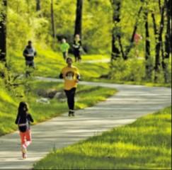
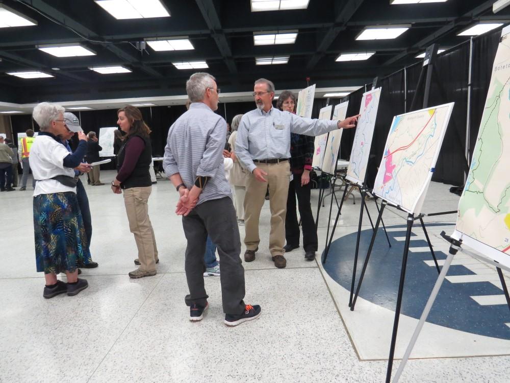
Over the past two years the Roanoke Valley Greenway Commission, in collaboration with Roanoke Valley Alleghany Regional Commission and other locality staff, has worked to update the 2007 Conceptual Greenway Plan. The goal of the update was to provide a status report for greenway routes; to demonstrate the importance of off-road and on-road routes which tie neighborhoods and communities to the larger greenway network; to document the Commission’s progress on its 10year goals; and to incorporate Botetourt County, a new member of the Greenway Commission.
The Plan incorporates public input on four major themes:
A regional vision for the greenway network,
A neighborhood vision,
Route options for the Tinker Creek Greenway, and
Operations and Management.
Community meetings were held at six locations across the Valley in the spring of 2017, involving over 200 members of the public. An online survey open during this period received 542 responses. A steering committee including Roanoke County staff members met frequently with locality staff, locality greenway teams and the Greenway Commission over the next year. Finally, the Greenway Commission held a plan reveal meeting with over 100 attendees and received comments on the Plan in the spring of 2018.
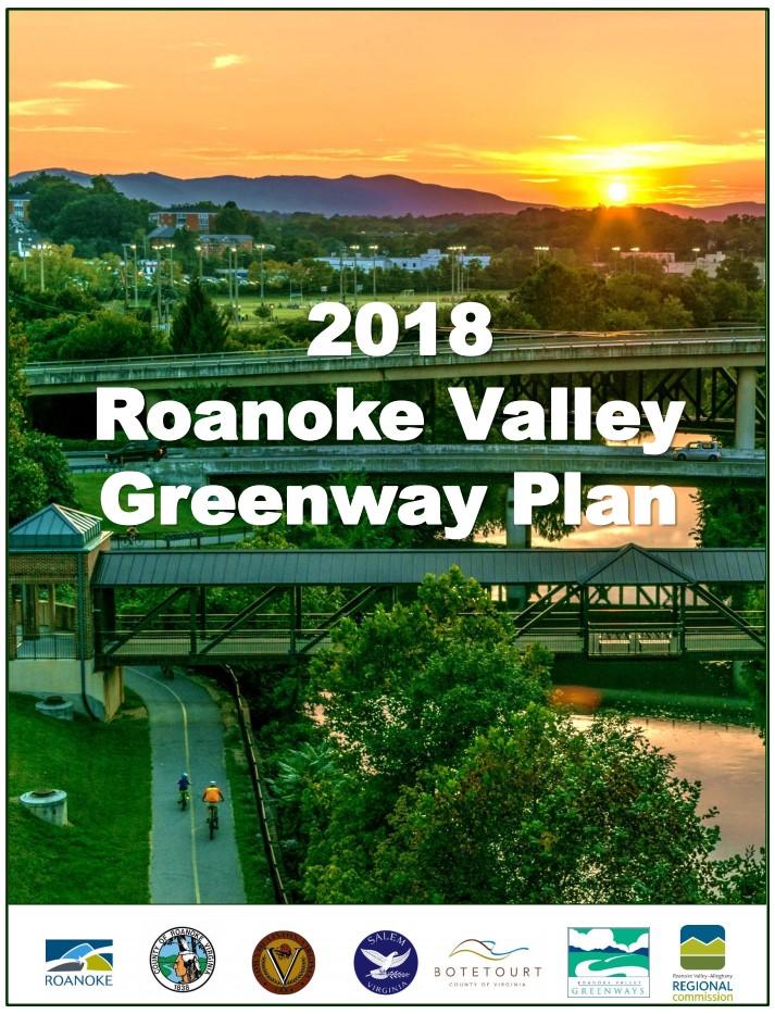
The Greenway Commission officially adopted the Plan on June 27, 2018. The Planning Commission discussed the draft Plan in a work session on May 15, and then held a public hearing on September 4. The Planning Commission recommended that the Board of Supervisors approve the Plan; the Board adopted the Plan as an amendment to the Comprehensive Plan on September 25 following a public hearing.
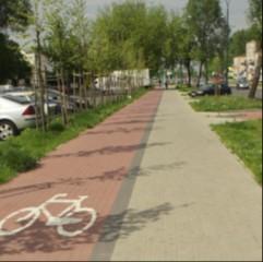
Plantation Road Bike, Pedestrian and Streetscape Improvement Project, Phase I
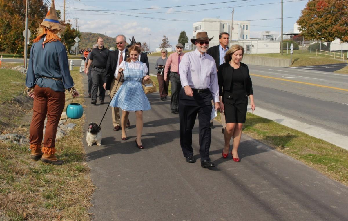
Halloween Ribbon Cutting and Trick or Treat Walk
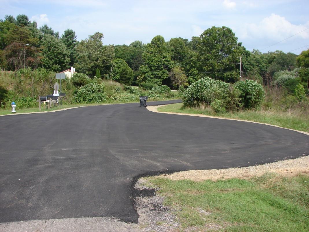
Project Details: County and VDOT staff coordinated with citizens at the end of Fort Lewis Church Road to construct a new public turnaround. The turnaround creates new space for refuse collection vehicles, school buses, and VDOT maintenance vehicles to maneuver. It also provides improved access to an existing fire hydrant.
Project Cost: $700 and staff time
Project initiated by: Roanoke County
Project constructed by: VDOT
Project Details: Phase 1 improvements include a pedestrian and bicycle shared use path on the west side of Plantation Road from Williamson Road to Walrond Drive Street trees, curb, gutter, and storm drains are also part of this project.
Project Cost: $4,200,000
Project initiated by: Roanoke County
Project constructed by: Roanoke County
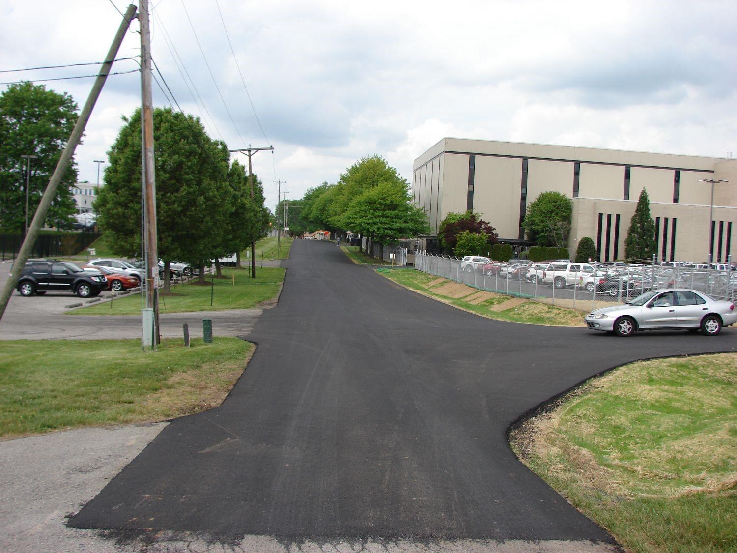
Project Details: Reconstructed Lila Drive to public road standards, including a turnaround which made Lila Drive eligible for acceptance into the VDOT Secondary Road System.
Project Cost: $195,000
Project initiated by: Roanoke County
Project constructed by: Roanoke County
1. Future Smart Scale Project: Route 419 (Ogden to Starkey) - Concept Plan, Surveying and VDOT Field Consultation
2. County Projects:
Parkway Trail Equestrian Crossings (Rutrough and Highland Road)
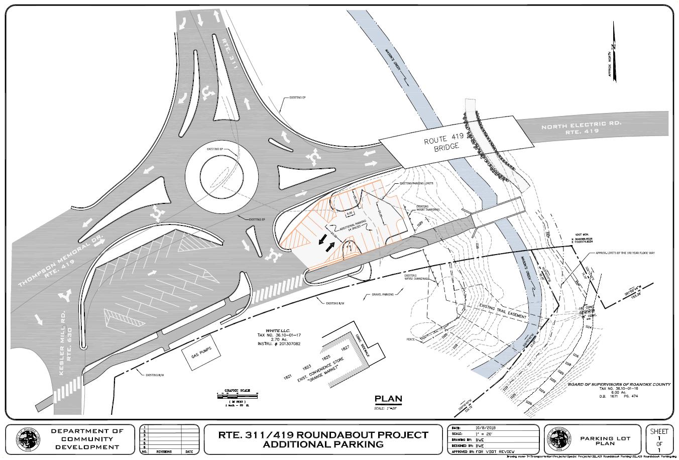
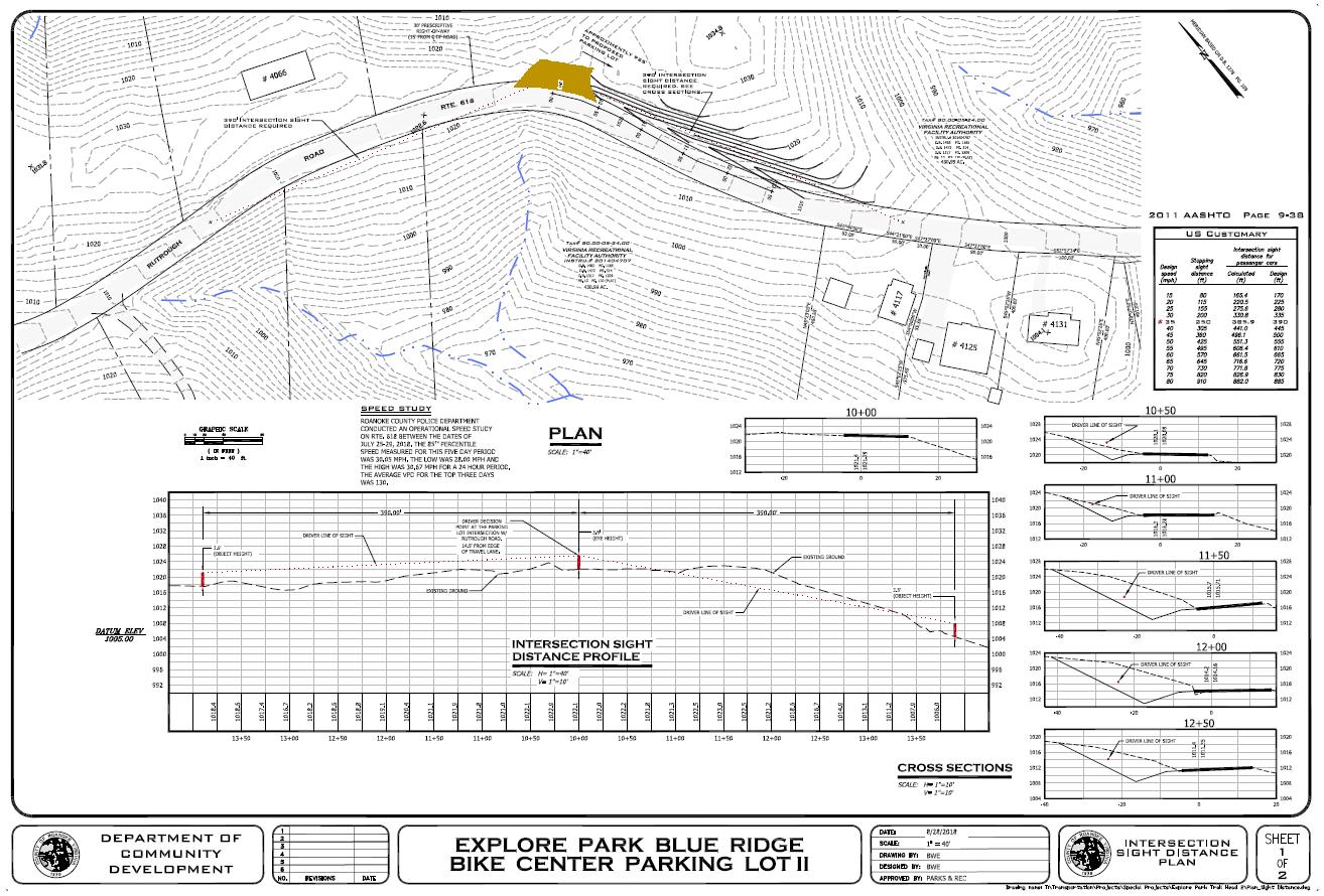
Explore Park Bike Parking Lot II
Rte. 311 – 419 Trail Head Parking Lot
Williamson Road Sidewalk Plan
3. Drainage Projects:
Franklin Street Drainage Improvements
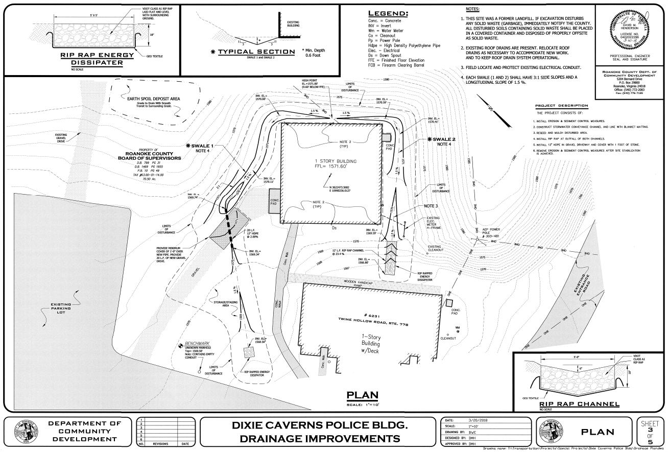
Dixie Caverns Police Building
Reconstruct the Route 419 (Electric Road) and U.S. 220 interchange to a Diverging Diamond Interchange (DDI). Include sidewalk to fill in the gap between sidewalk under design along Tanglewood Mall’s frontage to sidewalk along the north side of U.S. 220 Business (Franklin Road) in Roanoke City. Include bicycle lanes through the DDI to connect planned bicycle lanes on Route 419 to existing bicycle lanes on U.S. 220 Business. The Regional Surface Transportation Program (RSTP) award was $750,000 The total cost is $17,505,000.
Upgrade the private driveway from Route 419 to Chuck E. Cheese to public road standards and construct a new section between the end of the private driveway and Almond Road. Rebuild Almond Road to public road standards to the intersection with Chevy Road. Fully funded by the Secondary Six Year Improvement Plan and Revenue Sharing at $2,500,000.
Convert the unsignalized intersection at Starkey Road and Buck Mountain Road to a single lane roundabout. Sidewalks will encircle the roundabout, with crosswalks across each street leg. Sidewalk is also planned to extend on one side of Buck Mountain Road to the Branderwood subdivision. Bicycles will be accommodated through wide travel lanes. The project was funded through a combination of RSTP, Revenue Sharing (second half of County match is requested in this year's CIP) and Secondary Six Year Improvement Plan. Fully funded at $3,258,000.
Analyze potential interstate highway improvements to the I-581 Exit 2 Interchange. With the goal of reducing traffic weaving conflicts affecting adjacent signalized and unsignalized intersections, consider alternative and innovative intersections, a Diverging Diamond Intersection (DDI) or Single Point Urban Intersection (SPUI), on the Peters Creek bridges crossing over I-581, and associated reconstructed I-581 entrance and exit ramps. Fully funded by RSTP at $150,000.
Roanoke River Greenway through Explore Park
Construct a 1.8 mile greenway through Explore Park as a 10-foot wide, shared use path for bicyclists and pedestrians paved to meet accessibility guidelines. Fully funded by RSTP at $3,020,000.
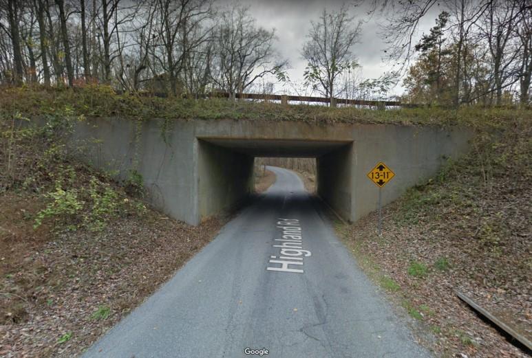
Roanoke River Greenway—Extension along Highland Road and the Blue Ridge Parkway
Construct 0.30 mile of Roanoke River Greenway along Highland Road and under the Blue Ridge Parkway through an existing tunnel. It will be an 8-10 foot wide, paved, shared use path along the northern side of Highland Road. Fully funded by Transportation Alternatives and a County match at $492,000.
Route 419/U.S. 220 Diverging Diamond Interchange
Reconstruct the Route 419 (Electric Road) and U.S. 220 interchange to a Diverging Diamond Interchange (DDI). Include sidewalk to fill in the gap between sidewalk under design along Tanglewood Mall’s frontage to sidewalk along the north side of U.S. 220 Business (Franklin Road) in Roanoke City. Include bicycle lanes through the DDI to connect planned bicycle lanes on Route 419 to existing bicycle lanes on U.S. 220 Business. SMART SCALE funding requested: $16,755,000.
Williamson Road Pedestrian Improvements
Construct sidewalk on the north side of Williamson Road to connect planned pedestrian signals and crosswalks at the Peters Creek Road/Williamson Road intersection to the Plantation Road Bicycle, Pedestrian and Streetscape Improvement Project and existing Williamson Road sidewalk east of Plantation Road. The project will extend along Williamson Road (Rte 11) from Peters Creek Road (Rte 117) to Plantation Road (Rte 115) on the north side. SMART SCALE funding requested: $1,662,220.
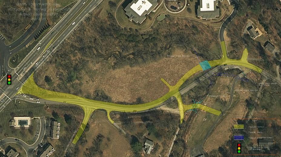
McVitty Road Improvements
Realign and widen a portion of McVitty Road (Rte 1662) from the existing width of 18 feet to the proposed width of 22 feet. Several horizontal and vertical curves will be improved. The existing shoulder will be reconstructed with 2 feet of pavement and a total width of 5 feet (8 feet w/ guardrail). Turn lanes will be added and the traffic signal at the intersection of Routes 419 and McVitty Road will be upgraded. The bridge over Mudlick Creek will be replaced with a box culvert. SMART SCALE funding requested: $9,998,000
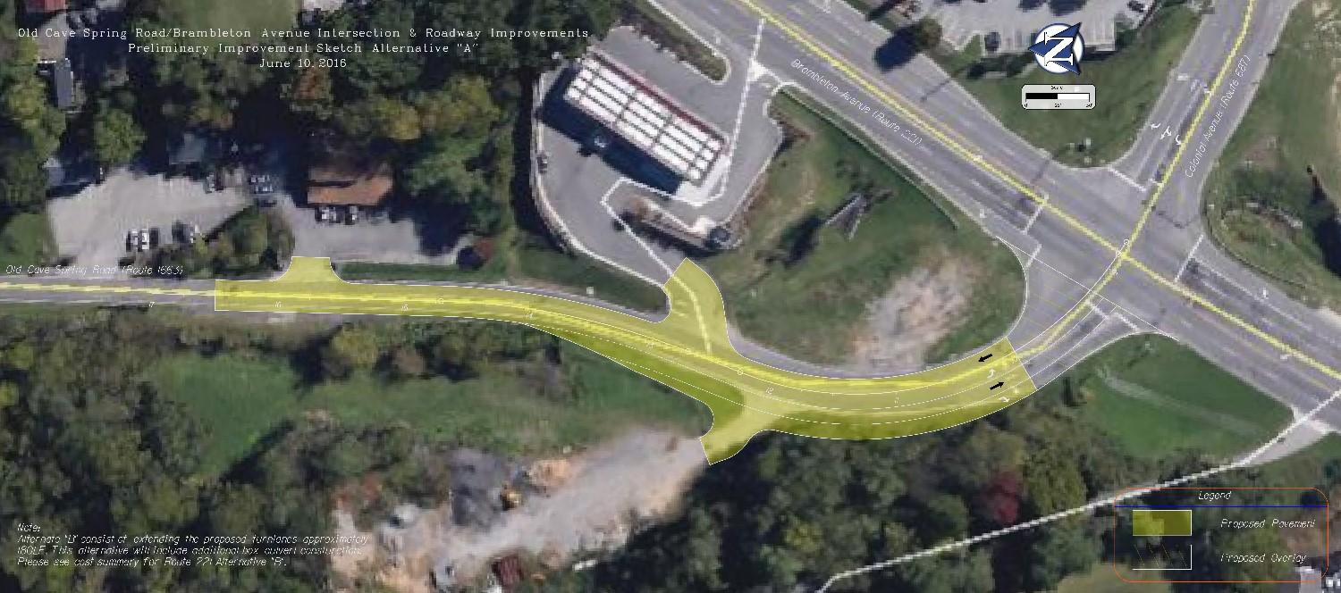
Old Cave Spring Road Improvments
Widen a portion of Old Cave Spring Road (Route 1663) intersecting with Brambleton Avenue near the Kroger gas station from the existing width of 18 feet to the width of 22 feet. The existing shoulder will be reconstructed with two feet of pavement (a total of eight feet wide with the guardrail). Turn lanes will be lengthened at the Brambleton Avenue intersection. SMART SCALE funding requested: $2,561,000.
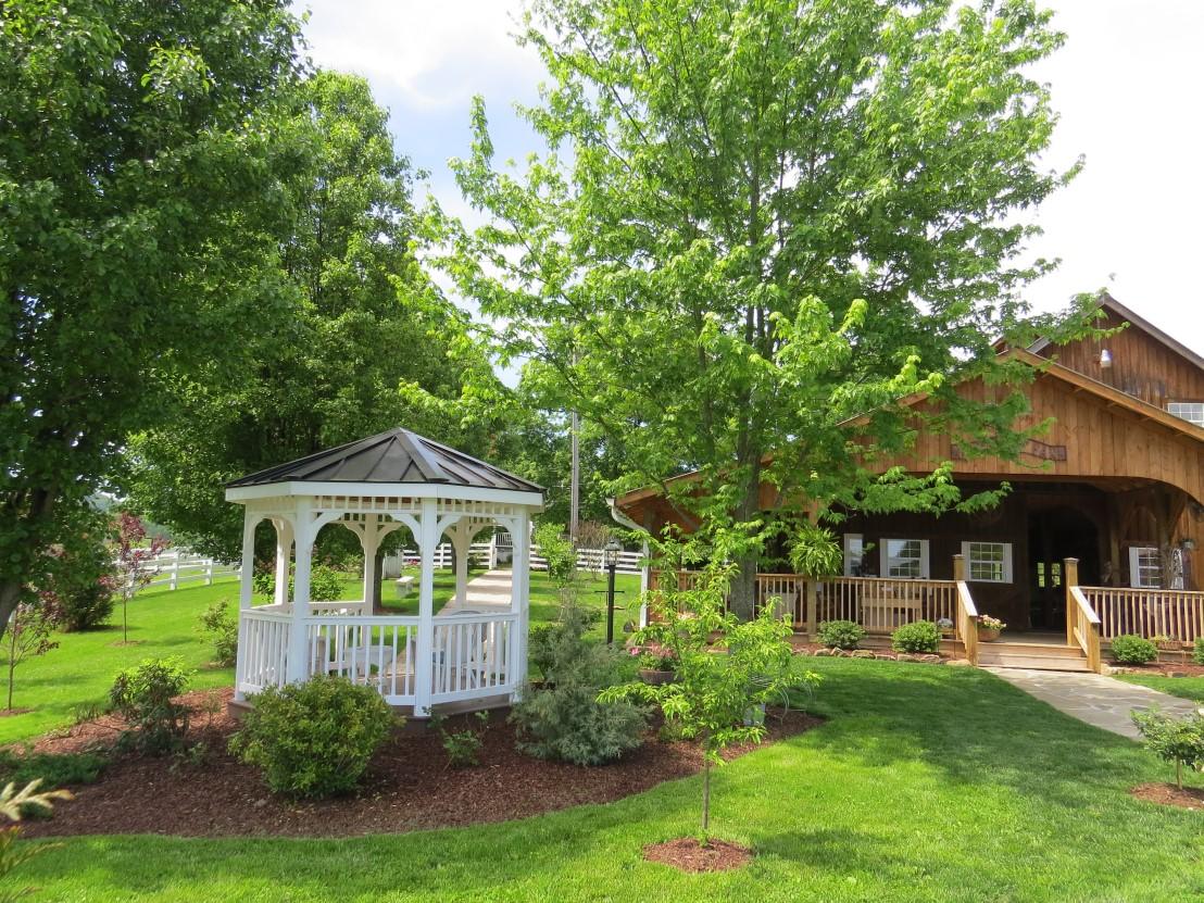
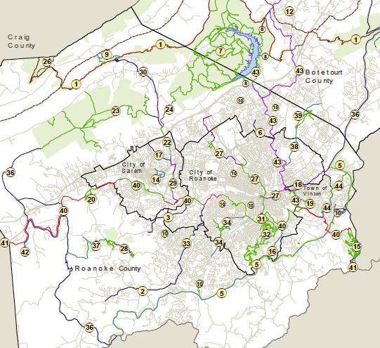
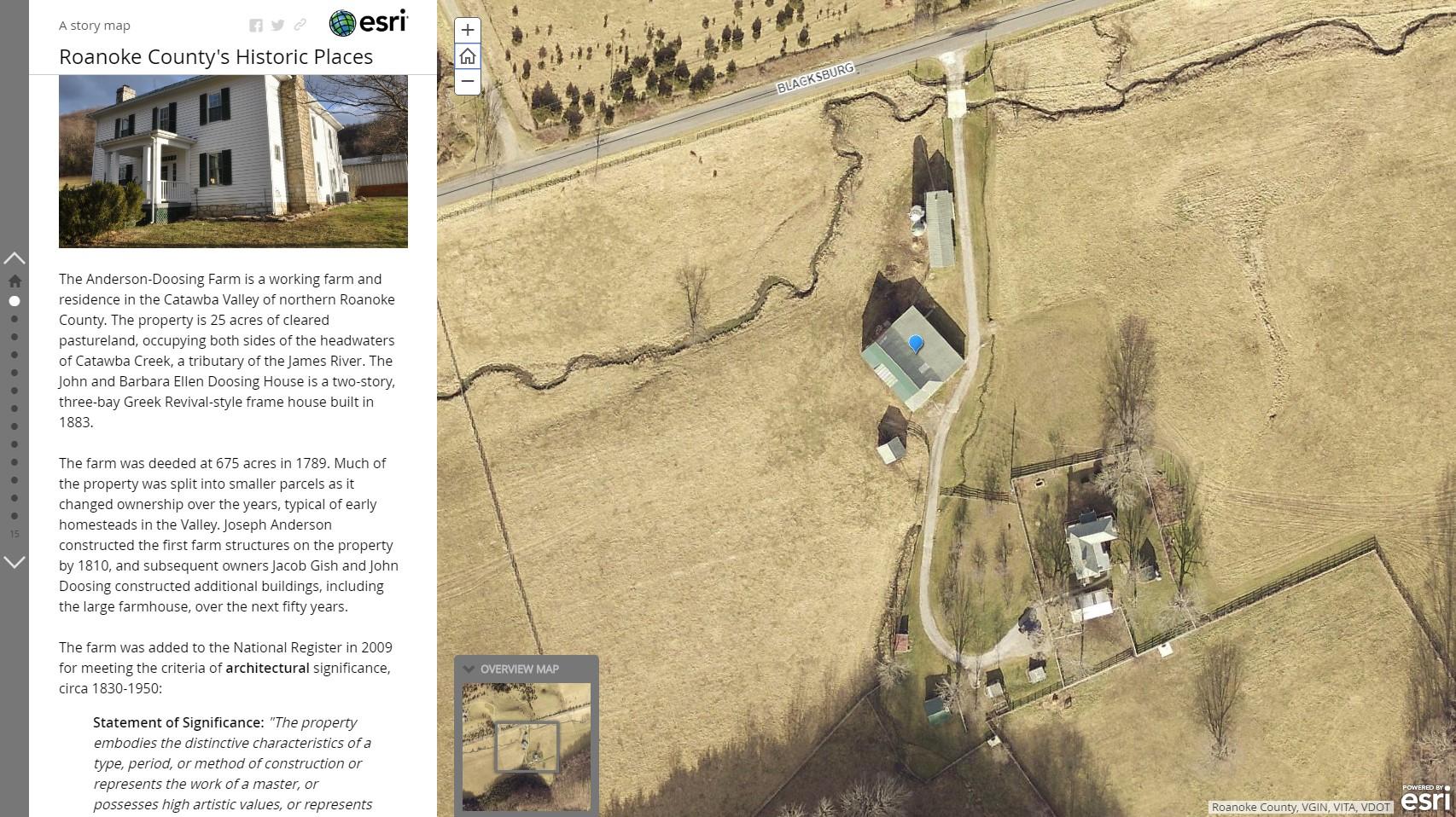
Staff designed an interactive online map that showcases properties in Roanoke County that are listed on the Virginia Landmarks Register and the National Register of Historic Places. Residents and visitors can now more easily learn about these early homes, schools and community centers!

Planning and Zoning
www.roanokecountyva.gov/pz facebook.com/RoCoPlanning