

2017 ANNUAL REPORT OF THE PLANNING COMMISSION AND PLANNING & ZONING STAFF

2017 ANNUAL REPORT OF THE PLANNING COMMISSION AND PLANNING & ZONING STAFF
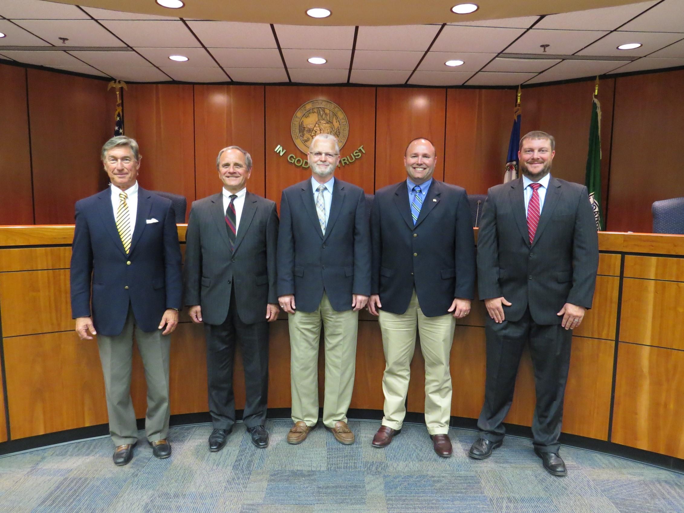
Jim Woltz Windsor Hills District (January 2013)
Paul Mahoney Cave Spring District (July 2016)
Wayne Bower Hollins District (July 2014)
Rick James Vinton District (January 2014)
Henderson Catawba District (February 2017)
The Planning Commission is an advisory board to the Board of Supervisors. The Commission makes recommendations on a variety of land use issues. The Commission is also charged with preparing and maintaining the Comprehensive Plan and recommending changes to reflect new land use policies.
In 2017, the Planning Commission held six public hearings, 11 work sessions and two special meetings (one work session with the City of Roanoke and one work session with the Board of Supervisors). Wayne Bower held the position of Chairman and Paul Mahoney was Vice Chairman.
The Commission is established under the authority of the Code of Virginia (1950, as amended), Chapter 22, Article 2 and pursuant to a motion of the Roanoke County Board of Supervisors on June 19, 1939, as authorized by Section 2, Chapter 427 of the Acts of the General Assembly, adopted March 30, 1936.
RECOGNITION AND AWARDS:
In August, Roanoke County received the Virginian Award for Implementation and Accountability from the Virginia Chapter of the American Planning Association for the 2016 Community Strategic Plan. The County also received a 2017 Achievement Award from The National Association of Counties for the Neighborhood Concerns Zoning Code Enforcement Application. The project was selected as one of 100 Brilliant Ideas at Work, showcasing innovation in county government.
CERTIFICATIONS:
Rebecca James & Brian Hughes
Certified Transportation Manager
Virginia Association of Zoning Officials
A lean project was created to reduce delays in the Land Use Application Process. It was intended to reduce the application process length and improve the application document. The project led to updates for the application, webpage and new requirements, including preapplication meetings and a meeting checklist.
Alexander Jones, Planner II
Bachelor of Landscape Architecture
Virginia Tech
Cecile Newcomb, Planner II
Masters in Urban and Regional Planning Certificate in Local Government Management
Virginia Tech
Dorothy Baker, Summer Planning Intern Pursuing Master of Urban and Environmental Planning (Spring 2018)
University of Virginia
Permit Review
Residential Permits
New Construction
Alterations / Additions
Accessories
Reviews Performed
Commercial Permits
New Construction
The Planning Commission held public hearings and recommended that the Board of Supervisors approve the following petitions:
Henry L. Bennett IV: to rezone properties at 10102 Bent Mountain Road from AR, Agricultural Residential to AV, Agricultural Village for the purpose of a hair salon (January)
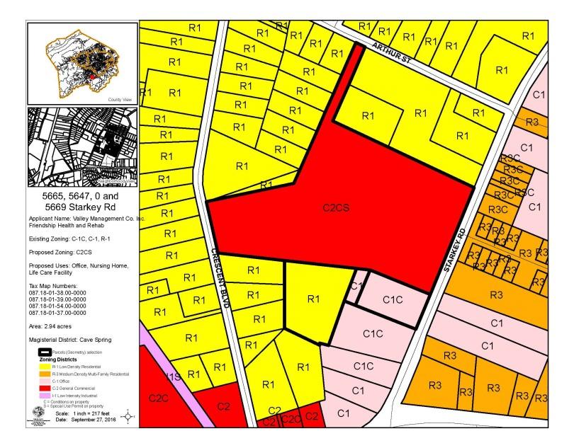
Valley Management Co., Inc. and Friendship Health and Rehab Center South, Inc.: to rezone properties at 0, 5647, 5665, and 5669 Starkey Road from R-1, Low Density Residential and C-1, Low Intensity Commercial to C-2, High Intensity Commercial, for the purpose of a life care facility (January)
North Point Apts, LLC and North Point Apts II, LLC: to rezone properties at 6430 and 6451 Archcrest Drive to amend proffered conditions for the purpose of constructing an additional apartment building (March)
Richard Rife, Rife + Wood Architects: to rezone properties at 3722 Colonial Avenue from R-1, Low Density Residential to C-1, Low Intensity Commercial for the purpose of a beauty salon (April)
Lexington Falls, LLC: to rezone properties at 6065 Peters Creek Road from C-1, Low Intensity Commercial to C-2, High Intensity Commercial and to amend a proffered condition for the purpose of additional parking and a new access drive for a Bojangles (May)
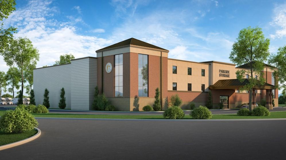
Valley Management Co., Inc. and Friendship Health and Rehab Center South, Inc.: for a special use permit on properties at 0, 5647, 5665, and 5669 Starkey Road for the purpose of a nursing home (January)
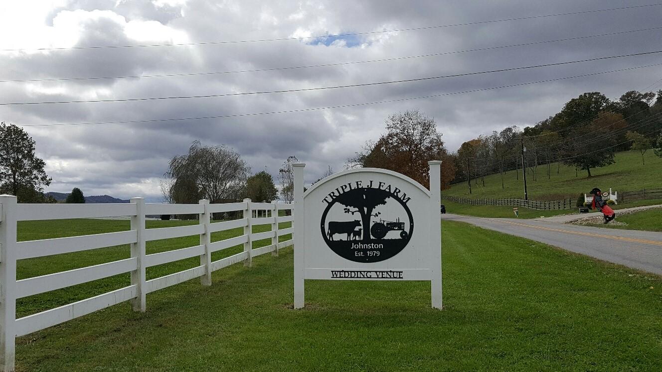
Triple J. Farm Events: for a special use permit at 5198 Blacksburg Road for the purpose of a special events facility (January) : for a special use permit at 7544 Plantation Road for the purpose of a
The Board of Supervisors approved all of the rezoning and special use petitions.

Staff recommended that the Planning Commission make changes to Article III (District Regulations). The changes deleted sections dealing with the approval of preliminary and final site development plans and the failure to begin development within PRD (Planned Residential Development), PCD (Planned Commercial Development) and PTD (Planned Technology Development) Districts. The Planning Commission held a public hearing and recommended that the Board of Supervisors approve changes; the Board approved the changes.
Staff recommended that the Planning Commission allow guidance services as a by-right use in the I-1, Low Intensity Industrial, District, and I-2, High Intensity Industrial, District. Guidance services are defined as “a use providing counseling, guidance, recuperative, or similar services for persons requiring rehabilitation assistance as a result of mental illness, alcoholism, detention, drug addiction, or similar conditions for only part of a twenty-four-hour day.” The Planning Commission held a public hearing and recommended that the Board of Supervisors approve changes; Board approved the changes.
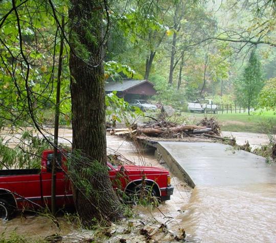
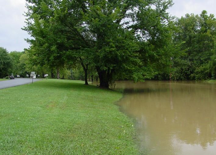
The County is currently reviewing changes to the Floodplain Overlay District that will align Roanoke County's Zoning Ordinance more closely with the model ordinance produced by FEMA. Agreement with FEMA's model ordinance keeps a community in compliance with the National Flood Insurance Program (allowing homeowners to buy flood insurance at a reduced rate) and maintains Roanoke County's classification in the Community Rating System. The Planning Commission held work sessions on the proposed changes and will hold a public hearing in 2018.
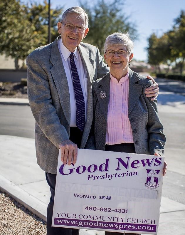
The County is currently reviewing its ordinance for compliance with new federal law based on the findings of the 2015 Supreme Court case, Reed v. Town of Gilbert

Clyde Reed, pastor of Good News Community Church (Good News), rented space at an elementary school in Gilbert, Arizona, and placed about 17 signs in the area announcing the time and location of Good News' services. Gilbert has an ordinance (Sign Code) that restricts the size, number, duration, and location of certain types of signs, including temporary directional ones, to prevent improper signage.
After Good News received an advisory notice from Gilbert that it violated the Sign Code, Good News sued Gilbert and claimed that the Sign Code violated the Free Speech Clause of the First Amendment and the Equal Protection Clause of the Fourteenth Amendment.
The Supreme Court held that the restrictions were subject to strict scrutiny because they were content-based restrictions, or restrictions that were applied differently depending on the message of the sign. Where a local ordinance identifies different categories of signs (political, real estate, directional) and then subjects each category to different restrictions, the ordinance is “content based”, is presumptively unconstitutional, and requires strict scrutiny review.
The ordinance must further a “compelling governmental interest” be “narrowly tailored” to achieve that interest and must leave open “ample alternative channels of communication.”
The Court stated that its decision will not prevent governments from enacting ordinances that are content neutral to “resolve problems with safety and aesthetics, including regulating size, building materials, lighting, moving parts, and portability.” The decision further states that localities “may be able to forbid postings on public property, so long as it does so in an evenhanded, content neutral manner.”
The Court also suggested that an ordinance that is “narrowly tailored to the challenges of protecting the safety of pedestrians, drivers and passengers” (such as warning signs marking hazards on private property or signs directing traffic) might survive strict scrutiny.
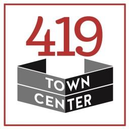
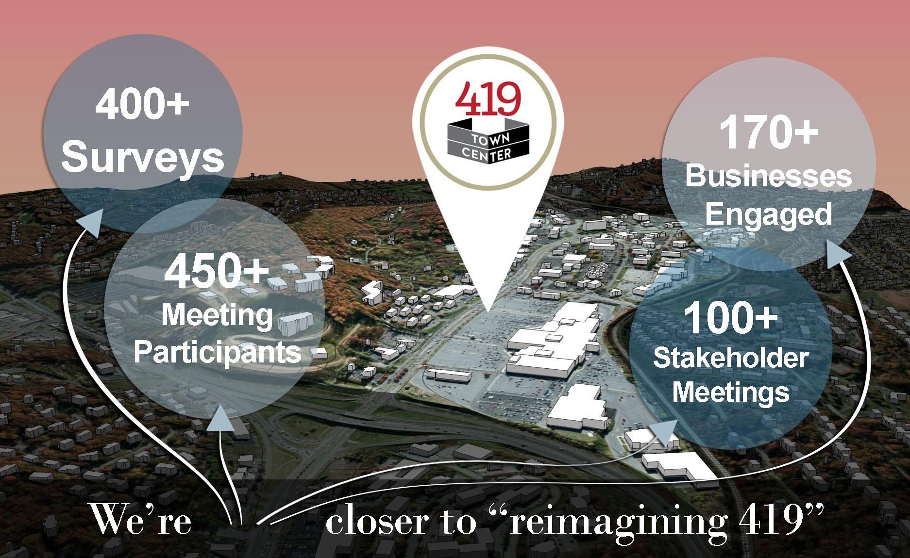
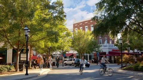
In 2016, Roanoke County began a planning study for roughly 390 acres along Route 419. Anchored by Tanglewood Mall, the area includes the South Peak planned community, vacant property owned by Old Heritage Corporation as well as numerous commercial, office and high-density residential uses.
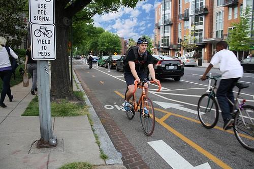
The planning study kicked off with a series of stakeholder and community meetings. Hundreds of residents and members of the business community contributed to the draft Plan. It proposes increased pedestrian and bicyclist access, improvements for traffic congestion, mixed-use and multi-family residential space, and better retail/entertainment options.
The Planning Commission held a public hearing and recommended that the Board of Supervisors approve the plan. The County will begin implementation once the Plan is adopted.


1. Harness the power of our location and market strengths to enhance the Town Center’s livability
2. Create an authentic place
3. Improve connectivity
4. Celebrate the Town Center’s nature and the corridor’s natural setting
5. Promote a sense of community and inclusion


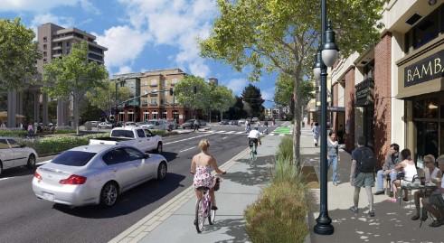
Roanoke County initiated two new Reimagine plans, continuing to focus on the Roanoke Valley's busiest commercial corridors.
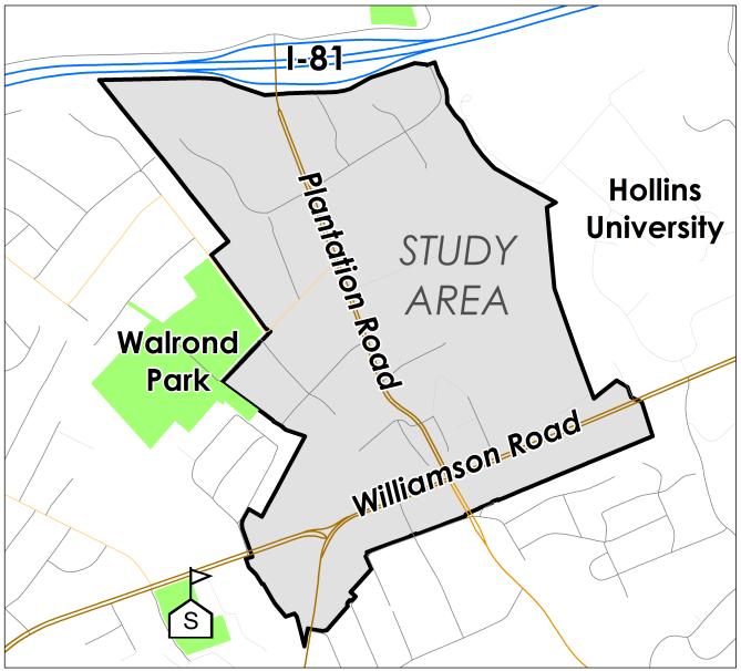
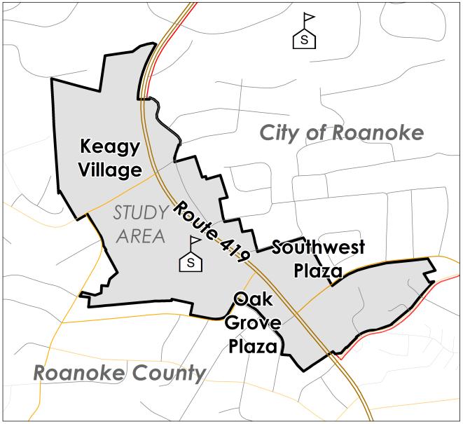
The Oak Grove Center study covers 173 acres and more than 80 commercial and residential properties, including Keagy Village and Oak Grove Plaza in the County, and Southwest Plaza in the City. The Hollins Center study area is more than two and a half times larger at 465 acres stretching from Williamson Road, Peters Creek Road and Plantation Road up to I-81. Community meetings and draft adoption are intended for 2018.

"Imagine a Hollins where people come to learn, work, dine and stay all in one place. Do you picture a premier location for new businesses, an entertainment hub for local and regional visitors, an eating and shopping destination accessible by foot or by bike, or something different? We are developing plans for a connected, mixed-use center in the heart of the Hollins community. Share your ideas and help shape the future of the new Hollins Center."
"In 2040, what does Oak Grove look like to you? How about a place to eat, shop, entertain and connect all within a short, comfortable walk? Roanoke County and the City of Roanoke are developing plans to make it easier for Oak Grove’s residents and visitors to get to the parks, shops, restaurants and amenities that they pass by every day. Share your ideas to shape the future of this community and help build a walkable and dynamic center in Oak Grove."
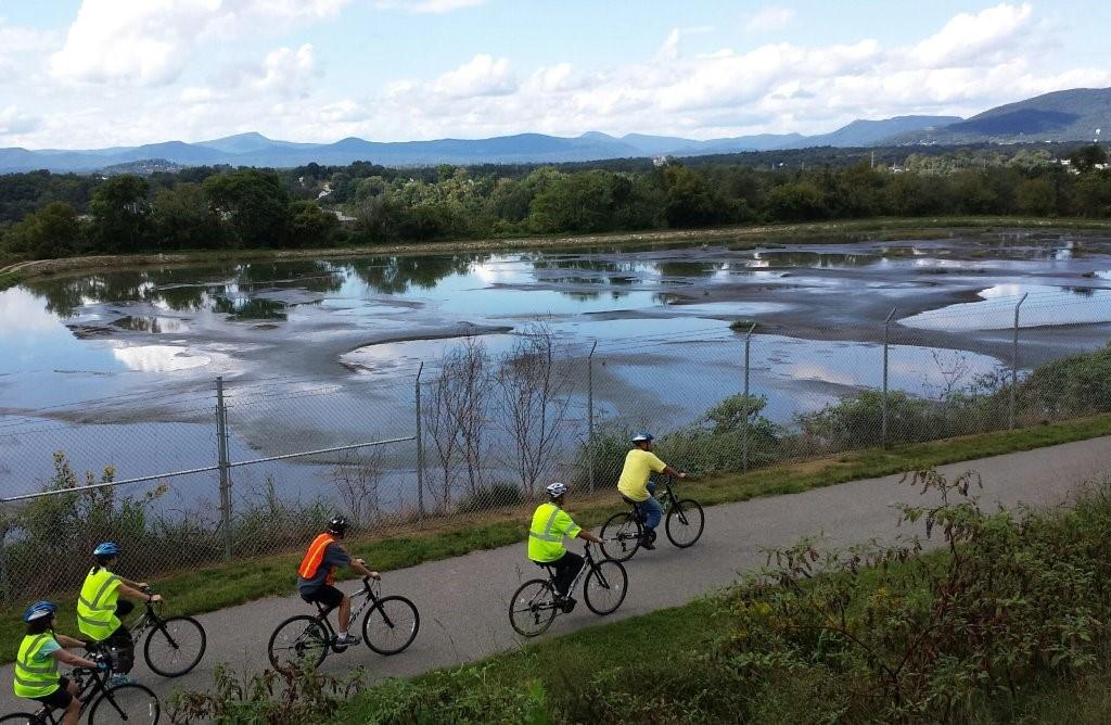
In 2017, County staff participated in four public input meetings to gather information about the 10-year update to the Roanoke Valley Conceptual Greenway Plan. The purpose of the update is to document progress towards goals identified in previous plans, to consider additional routes and issues, and to incorporate Botetourt County, a new member of the Greenway Commission, into the planning process and vision.

Throughout the year staff also joined in an intensive, regional planning effort to propose alignments for the Tinker Creek Greenway, a high priority greenway that will connect the Roanoke River Greenway (and the whole greenway network) to Botetourt County. The proposed alignments will be incorporated as a chapter in the Update.

The Western Virginia Regional Industrial Facility Authority (WVRIFA) was formed in 2014 by Botetourt County, Franklin County, Roanoke County, the City of Roanoke, the City of Salem and the Town of Vinton. The purpose of the Authority is to provide a mechanism for localities cooperate regionally on economic development projects.

The 100+ acre Wood Haven Road site was purchased in 2016 for industrial development along I-81 near Exit 143. WVRIFA held three community meetings in 2017 to discuss development scenarios.
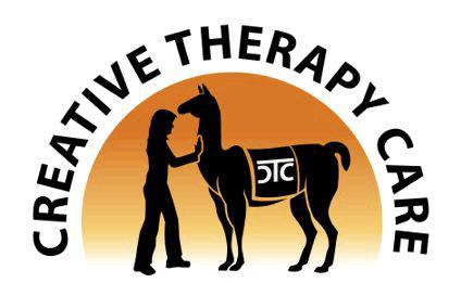
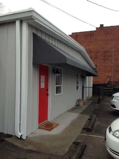
Creative Therapy Care (CTC) received funds through the County's Commercial Corridor Matching Grant Program (CCMGP) to remodel its facade and turn a three building eyesore into an attractive new home for a special business:
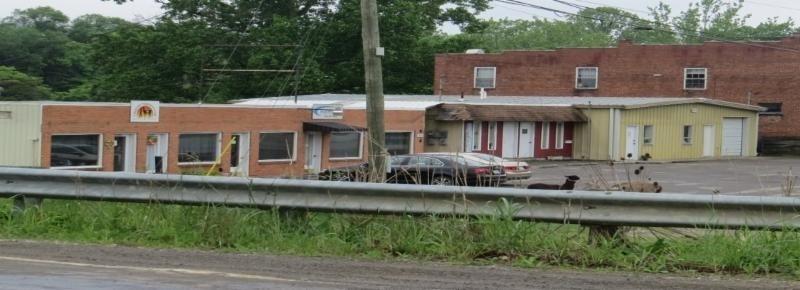
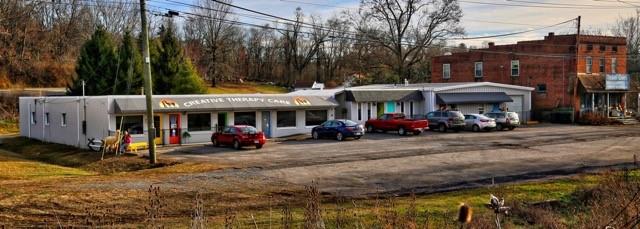
CTC supports children and adults with special needs through the use of occupational, speech, music, creative expression and carpentry therapies, incorporating animals. They also provide education for the public regarding the therapeutic benefits and advantages of working with animals, as well as raise funds to provide these therapies to individuals with special needs, regardless of their ability to pay.
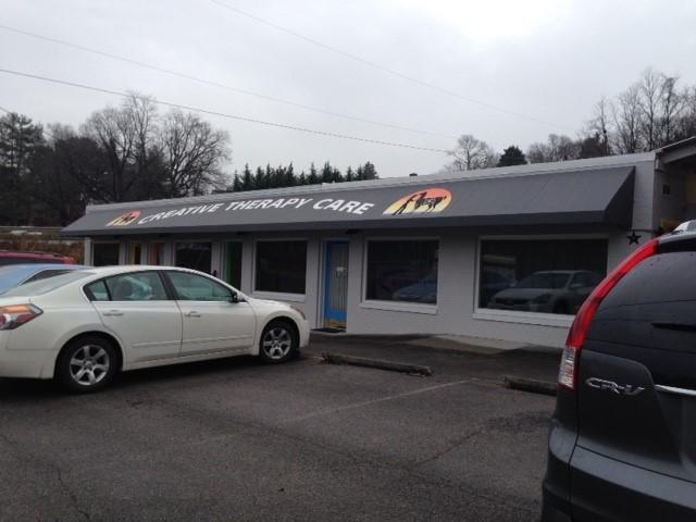
The goal of the CCMGP is to encourage site improvements above and beyond the current zoning requirements. Currently, the program is offered in Roanoke County along Williamson Road and Plantation Road in the Hollins area and along West Main Street in Glenvar.
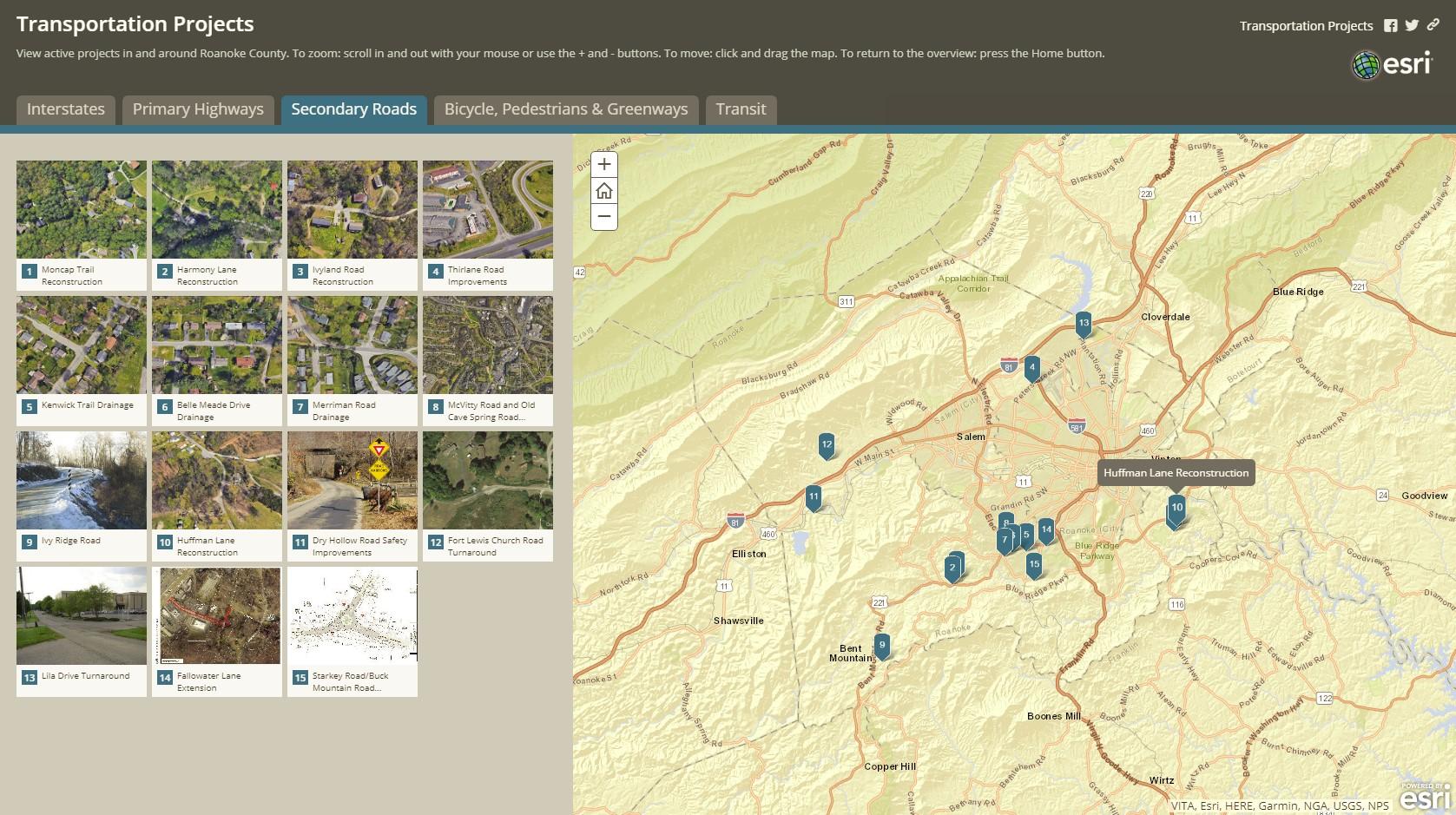
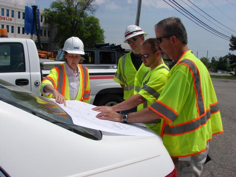
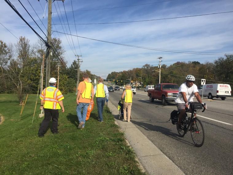
Staff designed an interactive online map that organizes transportation projects in the County by type, and includes photos, descriptions and links to VDOT project pages. We hope citizens will use the map to stay up-to-date on our progress improving County streets, sidewalks and greenways.

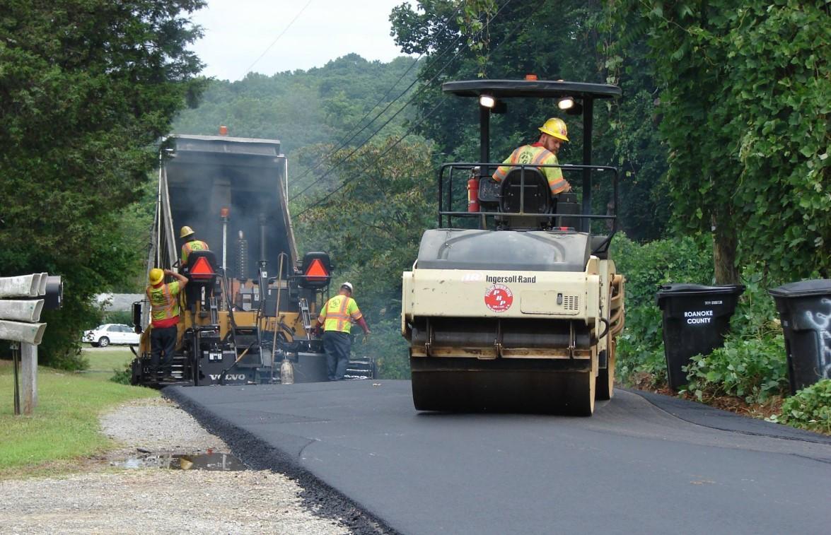
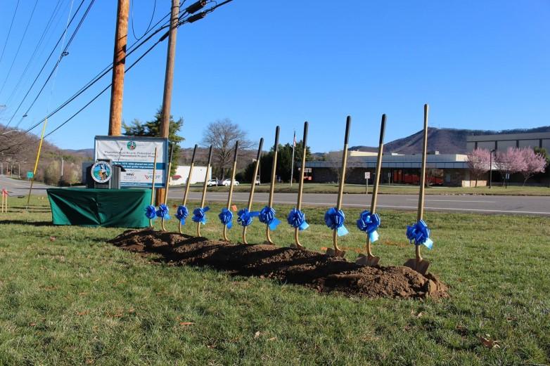
Project Details: Phase 1 improvements include a pedestrian and bicycle shared use path on the west side of Plantation Road from Williamson Road to Lila Drive. Sidewalk will be added on the west side of Plantation Road from Lila Drive to Walrond Drive Street trees, curb, gutter, and storm drains are also part of this project.
Project Status: Under construction
Project Cost: $4,200,000
Project initiated by: Roanoke County
Project to be constructed by: Roanoke County
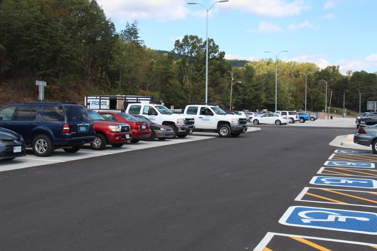
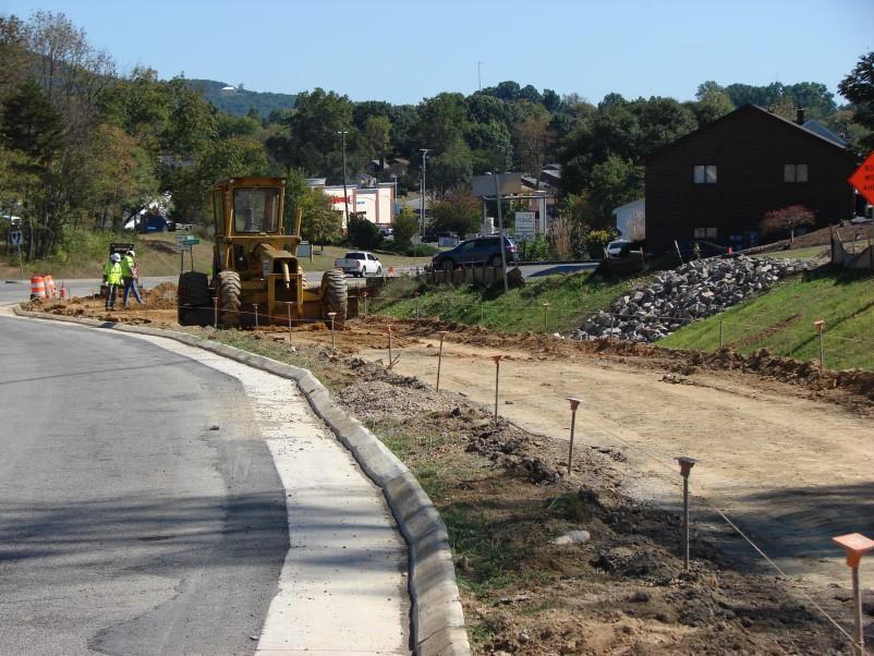
Project Details: This project increased parking spaces from 112 to 236. The project included replacing existing pavement, expanding parking limits to increase capacity and using permeable pavement to achieve water quality standards. Sidewalk, lighting, two bus shelters, bike racks, an informational kiosk, motorcycle parking spaces, and additional handicap accommodations were provided.
Project Status: Complete
Project Cost: $2,650,000
Project initiated by: Roanoke County
Project constructed by: VDOT
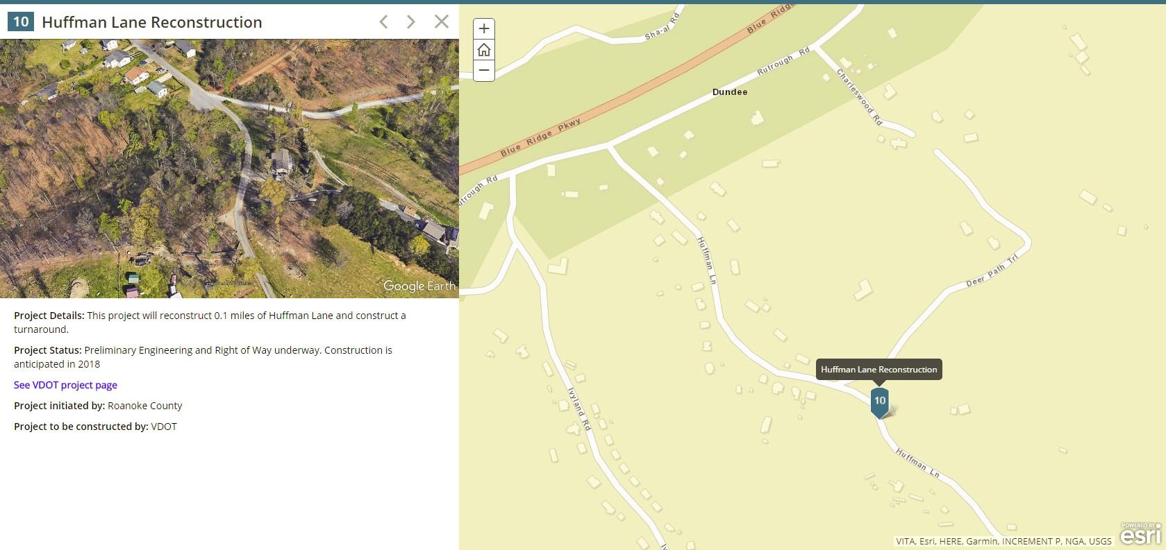
Project Details: Reconstructed 0.2 mile of Ivyland Road and construct cul-de-sac, for acceptance into state secondary system.
Project Status: Complete
Project Cost: $213,000
Project initiated by: Roanoke County
Project constructed by: VDOT
1. Smart Scale Project: Route 419 (Ogden to Starkey) - Concept Plan
2. Transportation Alternatives Project: Williamson Road Pedestrian Improvements - Sidewalk Plan
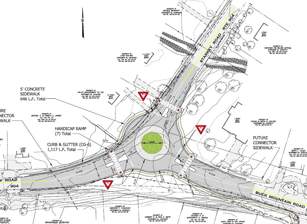
3. RSTP & Revenue Sharing Projects: Starkey & Buck Mountain Road Roundabout Plan
4. County Projects:
Explore Park Bike Parking Lot Plans
Catawba Trail Parking Lot Plans
Route 311 Parking Lot Pedestrian Crossing Plans
Brambleton Recycling Center - Demolition & Site Plan
Police Office at Cave Spring Middle School Access Improvement Plan
Fort Lewis Church Road Cul-De-Sac Plan and Plats for General Services
5. Rural Additions Projects:
Huffman Lane - Plats & Plans
Lila Drive
6. Drainage Projects:
Dixie Caverns Police Training Building - Drainage Improvements
Cedarmeade Drive (Brookfield Subdivision) - Drainage Improvements
Pedigo Lane Drainage Easement Plat
Provide additional capacity with a 12-foot auxiliary lane on both northbound and southbound I-81 from Exit 141 to Exit 143. Provide for safer merge movements between exits. VDOT total project estimate: $61,999,000.
Plantation Road Bike, Pedestrian and Streetscape Improvement Project, Phase II
Construct sidewalk, curb, gutter, drainage systems and plant street trees between Walrond Drive and Gander Way, on the west side of Plantation Road. Add pedestrian signals and crosswalks to the Gander Way/Friendship Lane traffic signal. Widen and realign Walrond Drive/Plantation Road intersection. VDOT total project estimate: $1,752,000
West Main Street Sidewalks
Install sidewalk along the north side of West Main Street, from Daugherty Road to Technology Drive. Install continental crosswalk and pedestrian signals at Alleghany Drive and Daugherty Road intersections, as well as sidewalk along the south side of West Main Street from the Salem city limits to Technology Drive. VDOT total project estimate: $1,037,000
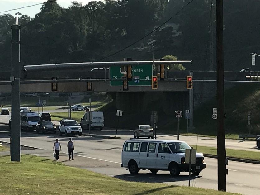
Williamson Road Pedestrian Improvements
Install sidewalk on the north side of Williamson Road from Peters Creek Road to Plantation Road to connect to the Plantation Road Bike, Pedestrian and Streetscape Improvement Project and existing sidewalk along Williamson Road. VDOT total project estimate: $272,000
Route 419 and Route 221 Adaptive Traffic Control
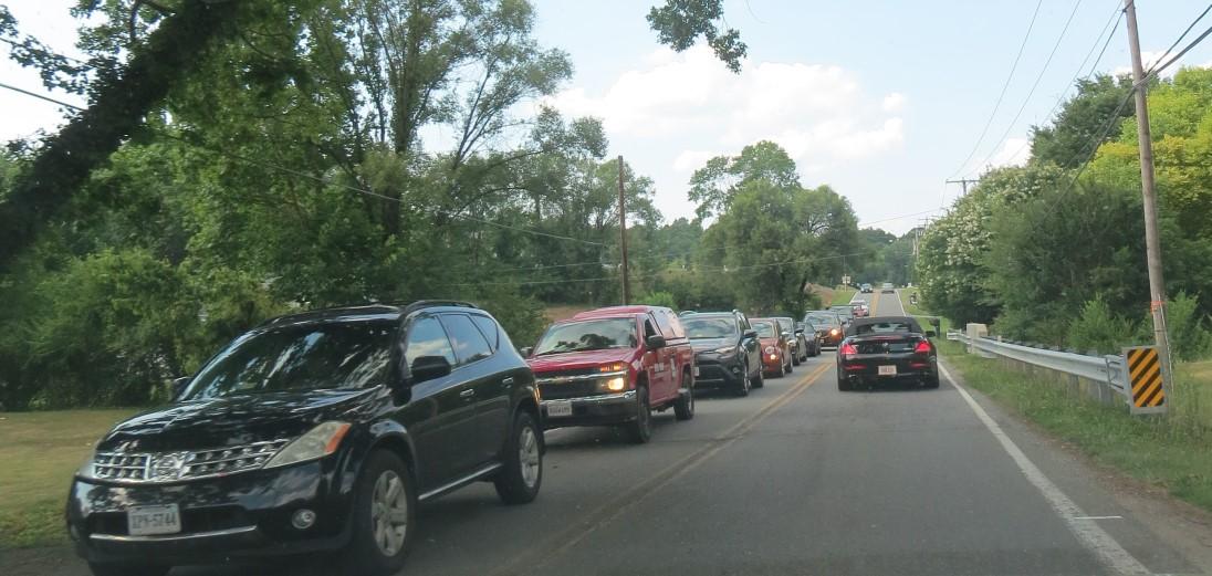
Add Adaptive Traffic Control systems to seven existing traffic signals on Route 419, and to four existing traffic signals on Route 221, in the Cave Spring and Oak Grove areas of Roanoke County. Detect demand in real time and improve the flow of traffic to reduce congestion on both corridors. VDOT total project estimate: $663,000
Extend the Roanoke River Greenway from the Blue Ridge Parkway to Explore Park. VDOT total project estimate: $1,700,000
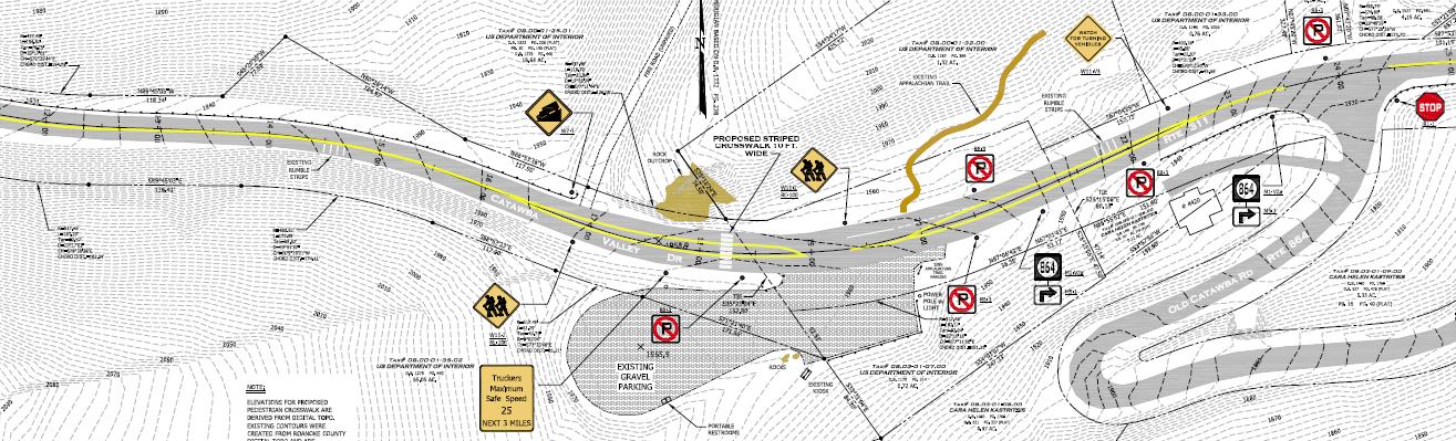
Route 311 Appalachian Trail Pedestrian Bridge
Make parking lot improvements and build a pedestrian bridge over Route 311. VDOT total project estimate: $2,880,000
Huffman Lane Reconstruction
Reconstruct 0.1 mile of road and construct a turnaround. VDOT total project estimate: $140,000
Funding requested
Route 419/U.S. 220 Diverging Diamond Interchange Preliminary Engineering
Reconstruct the Route 419 (Electric Road) and U.S. 220 interchange to a Diverging Diamond Interchange (DDI). Include sidewalk to fill in the gap between sidewalk under design along Tanglewood Mall’s frontage to sidewalk along the north side of U.S. 220 Business (Franklin Road) in Roanoke City. Include bicycle lanes through the DDI to connect planned bicycle lanes on Route 419 to existing bicycle lanes on U.S. 220 Business.
Roanoke River Greenway from Explore Park to Rutrough Road
Construct a 1.8 mile greenway through Explore Park as a 10-foot wide, shared use path for bicyclists and pedestrians paved to meet accessibility guidelines.
Starkey Road/Buck Mountain Road Intersection Improvements
Convert the unsignalized intersection at Starkey Road and Buck Mountain Road to a single lane roundabout. Sidewalks will encircle the roundabout, with crosswalks across each street leg. Sidewalk is also planned to extend on one side of Buck Mountain Road to the Branderwood subdivision. Bicycles will be accommodated through wide travel lanes.
Roanoke River Greenway—Extension along Highland Road and the Blue Ridge Parkway
Construct 0.30 mile of Roanoke River Greenway along Highland Road and under the Blue Ridge Parkway through an existing tunnel. This section of the Greenway will be an 8-10 foot wide, paved, shared use path along the northern side of Highland Road.
Fallowater Lane Extension
Upgrade the private driveway from Route 419 to Chuck E. Cheese to public road standards and construct a new section between the end of the private driveway and Almond Road. Rebuild Almond Road to public road standards to the intersection with Chevy Road.
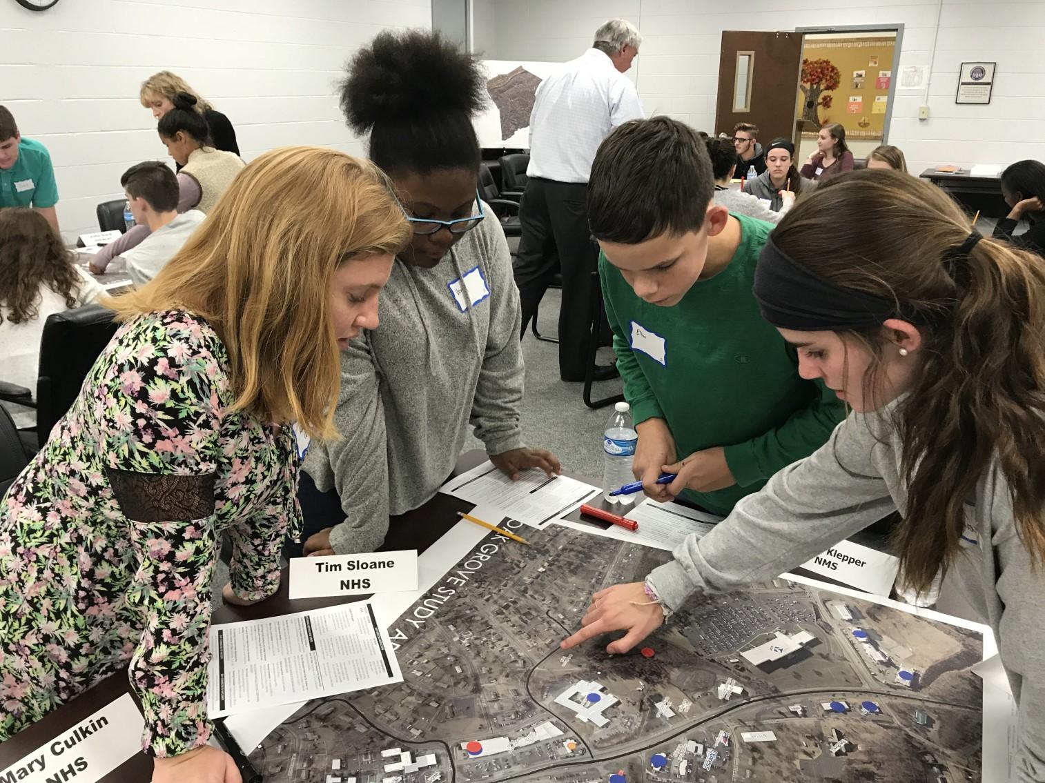
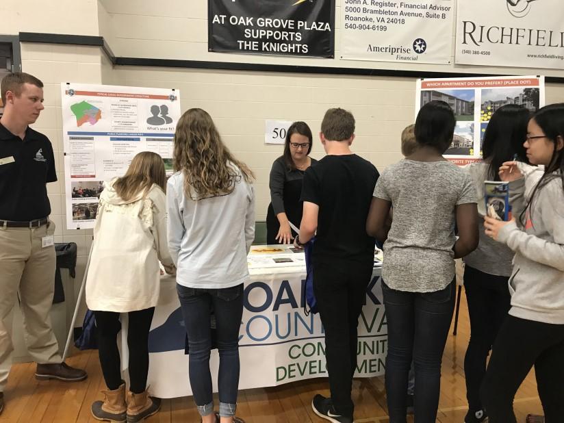
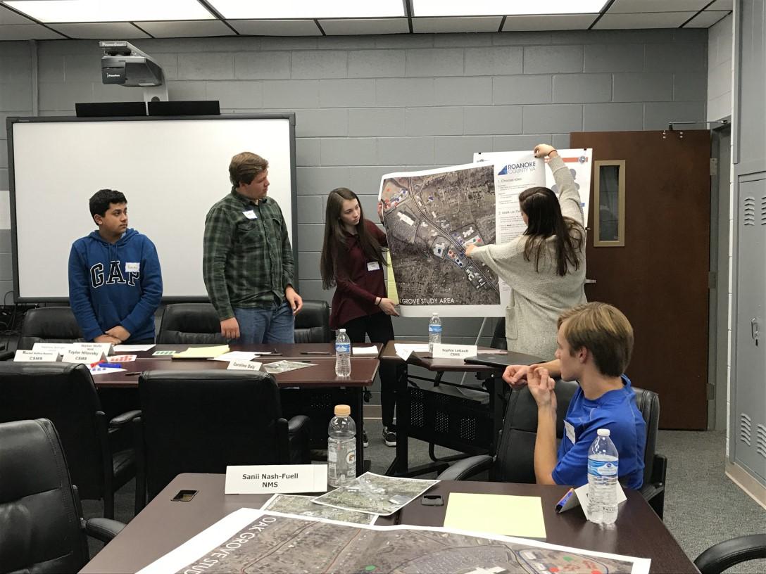
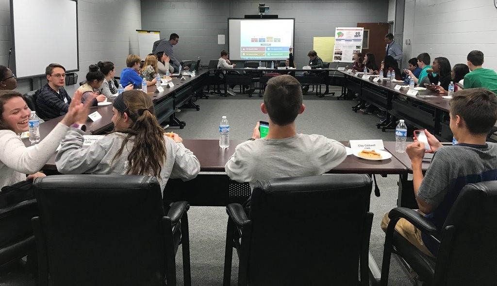
All planners are familiar with the challenge of engaging younger audiences as stakeholders in community plans. In 2017, staff kicked off a new collaboration with the Roanoke County Public Schools using an upcoming study area as an example. Staff worked with Student Advisory Council (SAC) members to show how they could influence the future of their community.
SAC is a student group composed of 8th-12th graders from every County school who serve the School Board by advocating for student issues. These young leaders provide communication between the students, the administration and the community. The meeting kicked off further demonstrations in 2018 with school administration and teachers in order to encourage the schools to take real world planning exercises back into their own classrooms.
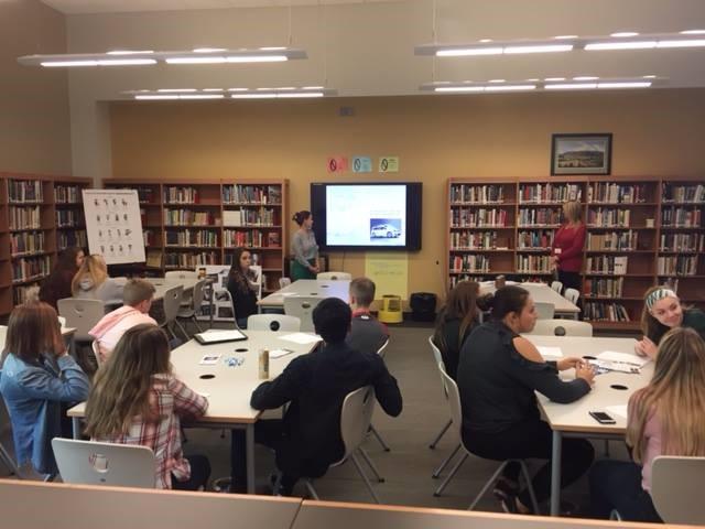
Staff also took part in two career day expos at Cave Spring High School and Glenvar High School in the fall, giving students an opportunity to learn about what planners do.


Planning and Zoning www.roanokecountyva.gov facebook.com/RoCoPlanning