


www.roanokecountyva.gov/pz


www.roanokecountyva.gov/pz
Rick James Vinton District (January 2014)
Kelly McMurray Cave Spring District (January 2020)
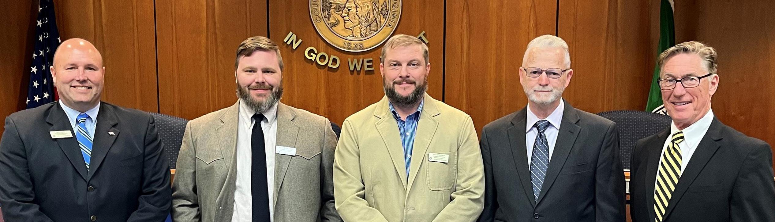
Troy Henderson Catawba District (February 2017)
Wayne Bower Hollins District (July 2014)
Jim Woltz Windsor Hills District (January 2013)
The Planning Commission is an advisory board to the Board of Supervisors. The Commission makes recommendations on a variety of land use issues. The Commission is also charged with preparing and maintaining the Comprehensive Plan and recommending changes to reflect new land use policies.
The Planning Commission held a total of 18 meetings in 2023, including 10 public hearings and 8 work session meetings. Troy Henderson served as Chairman and Rick James as Vice-Chairman.
The Commission is established under the authority of the Code of Virginia (1950, as amended), Chapter 22, Article 2 and pursuant to a motion of the Roanoke County Board of Supervisors on June 19, 1939, as authorized by Section 2, Chapter 427 of the Acts of the General Assembly, adopted March 30, 1936.
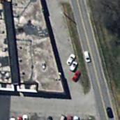
• The petition of Terio and Lisa Comerose to remove the existing proffered conditions on approximately 14.7 acres of land zoned AVCS, Agricultural/Village Center District with Conditions and Special Use Permit, and AR, Agricultural/Residential District, located at 9651 Bent Mountain Road, 9744 Tinsley Lane, and 9786 Tinsley Lane, Windsor Hills Magisterial District.
• The petition of Hugo Jimenez to rezone approximately 1.24 acres of land from C-1, Low Intensity Commercial District to I-1, Low Intensity Industrial District, and to obtain a special use permit to operate a construction yard located at 5681 Starkey Road, Cave Spring Magisterial District.
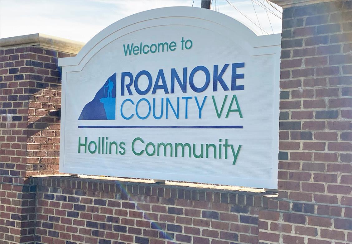
• The petition of Roanoke County Public Schools to rezone approximately 12 acres from R-3, Medium Density Multi-Family Residential District, to C-1, Low Intensity Commercial District, and to remove the proffered condition on approximately 5 acres of land zoned C-1C, Low Intensity Commercial District with conditions, located at the end of Burlington Drive, 6305 Peters Creek Road, and 1120 East Drive, Hollins Magisterial District.
• The petition of Glenmary Drive Roanoke LLC to amend a portion (approximately 19.1 acres) of the Roanoke County Center for Research and Technology Master Plan to allow warehousing and distribution as a permitted use, located within the 5200 and 5300 blocks of Glenmary Drive, Catawba Magisterial District.
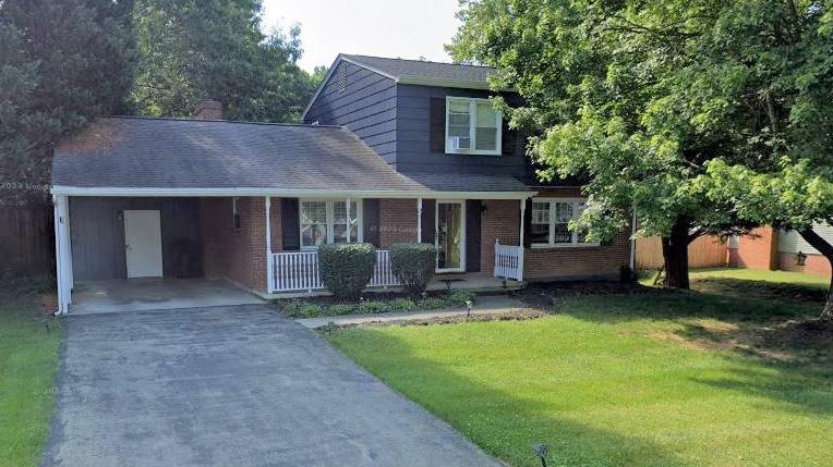
• The petition of Greg and Amanda Speiran to obtain a special use permit to operate a short-term rental on approximately 0.16 acre on land zoned R-1, Low Density Residential, located at 3113 Fleetwood Avenue, Windsor Hills Magisterial District.
• The petition of Cellco Partnership DBA Verizon Wireless to amend a proffer condition and to obtain a special use permit for a broadcasting tower approximately 124 feet in height on 4.8 acres of land zoned C-2C, High Intensity Commercial District with conditions located at 2918 Peters Creek Road, Catawba Magisterial District.
• The petition of Engineering Concepts, Inc. to obtain a special use permit for a water tank (major utility service) approximately 42 feet in height located on approximately 1.8 acres of land zoned AG-3, Agricultural/Rural Preserve District, located in the 2600 block of Summit Ridge Road, Hollins Magisterial District.
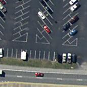
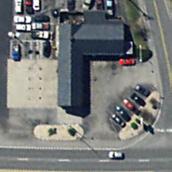
• The petition of Boing US Holdco, Inc., to obtain a special use permit to operate a car wash on approximately 1.97 acres of land zoned C-2, High Intensity Commercial District, and CVOD, Clearbrook Village Overlay District, located at 3434 Buck Mountain Road and 5147 Franklin Road, Cave Spring Magisterial District.
• The petition of Martie Murphy to obtain a special use permit to operate a car wash on approximately 5.99 acres of land zoned C-2, High Intensity Commercial District, and C-2C, High Intensity Commercial District with conditions, located at 3939 Valley Gateway Boulevard, Vinton Magisterial District. The Board of Supervisors voted to deny this SUP.
• The petition of Larry and Rhonda Conner to obtain a special use permit to operate a short-term rental on approximately 1.32 acres of land zoned R-1, Low Density Residential District, located at 5859 Bent Mountain Road, Windsor Hills Magisterial District.
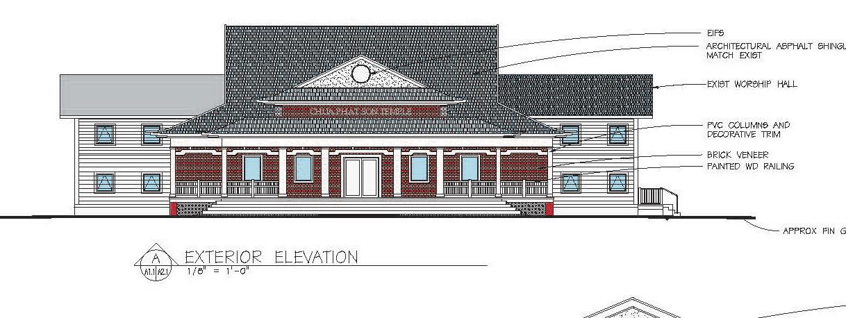
• The petition of Parker Design Group, Inc. to obtain a special use permit for religious assembly on approximately 2.9 acres of land zoned C-2, High Intensity Commercial District, located on Oakland Boulevard between 233 Hershberger Road and 4843 Oakland Boulevard, Hollins Magisterial District.
• The petition of LaTinya Lambert to obtain a special use permit to operate a short-term rental on approximately 0.29 acre of land zoned R-1, Low Density Residential District, located at 5064 Sunnyside Drive, Cave Spring Magisterial District.
• The petition of Terry Dooley, Jr. to obtain a special use permit to operate a short-term rental on 0.24 acre of land zoned R-1, Low Density Residential District, located at 4501 Girard Drive, Cave Spring Magisterial District. The Board of Supervisors voted to deny this SUP.
The Planning Commission and staff developed amendments to the Zoning Ordinance regarding industry, type I, cluster subdivisions, commercial kennels, multiple dog permits, and home occupations. The Planning Commission held a public hearing on these amendments on June 6, 2023, and recommended approval of the amendments. The Board of Supervisors adopted the amendments on June 27, 2023. The proposed amendments: added a definition for data center; amended the definitions of multiple dog permit, commercial kennel, and industry, type I in Article II (Definitions and Use Types); added single family dwelling, attached (cluster subdivision option) and single family dwelling, detached (cluster subdivision ordinance) as permitted uses in the AR (Agricultural/Residential) District in Article III (District Regulations); and amended the use and design standards for home occupations, type I and type II, and for single family dwelling, attached and detached (cluster subdivision option), and amended the accessory uses for industrial use types in Article IV (Use and Design Standards).
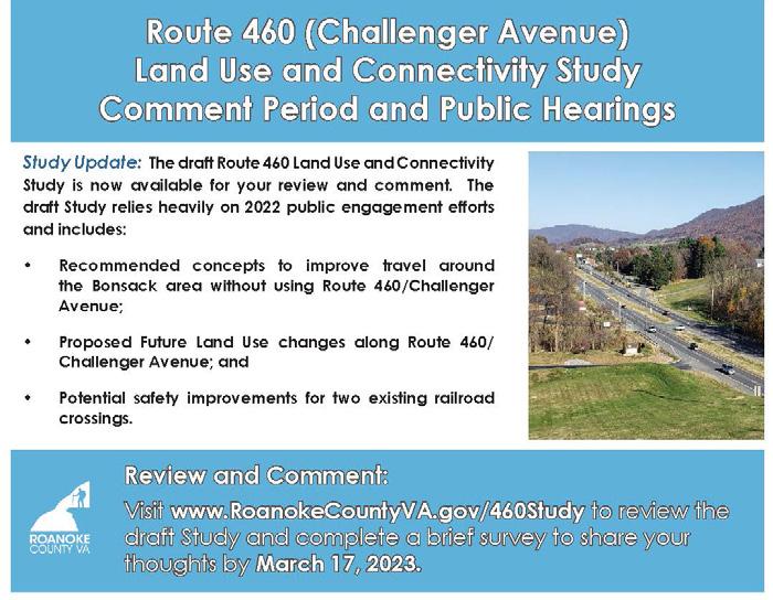
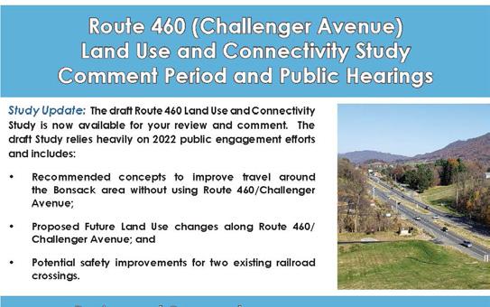
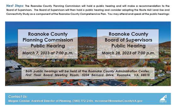
The Planning Commission held a public hearing on March 7, 2023, to incorporate the U.S. Route 460 Land Use and Connectivity Study into the Roanoke County Comprehensive Plan. The Board of Supervisors adopted the Study into the Comprehensive Plan on March 28, 2023. The study will guide future decisions and actions in the Challenger Avenue corridor over the next 15 to 20 years. More information on the U.S. Route 460 Study can be found on Page 19.
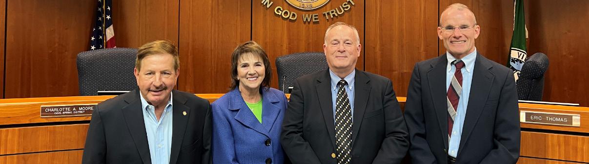
W. Eric Thomas Vinton District (February 2000)
Charlotte Moore Cave Spring District (June 2021)
Richard Jones Jr. Catawba District (July 1993)
VACANT: Windsor Hills Magisterial District
Jeffrey Armstrong Hollins District (March 2023)
The chief role of the Board of Zoning Appeals (BZA) is to hear variance applications relative to the Roanoke County Zoning Ordinance and administrative appeals of the Zoning Administrator’s decisions. The board consists of five members who serve five-year terms and are appointed by the Board of Supervisors.
The BZA held a total of 5 meetings in 2023, including 5 actions on zoning variances. Richard L. Jones Jr. served as Chairman and W. Eric Thomas as Vice-Chairman.
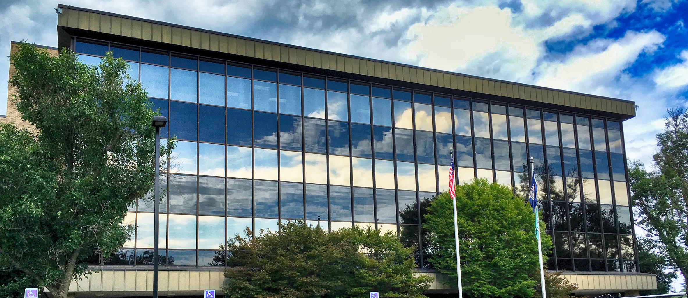
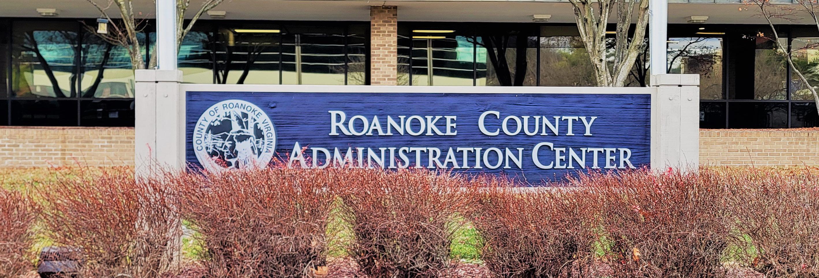
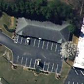
Roanoke County Administration Center
• The petition of David Kahn to obtain a variance to reduce the side yard setback from 10 feet to 3 feet to install a ground mounted solar system, Windsor Hills Magisterial District. This was approved on May 17, 2023.
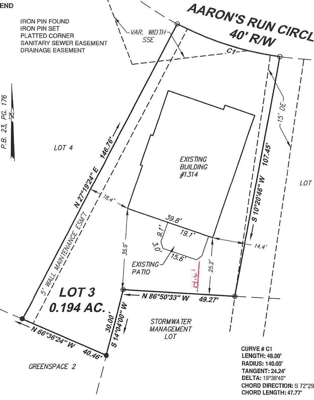
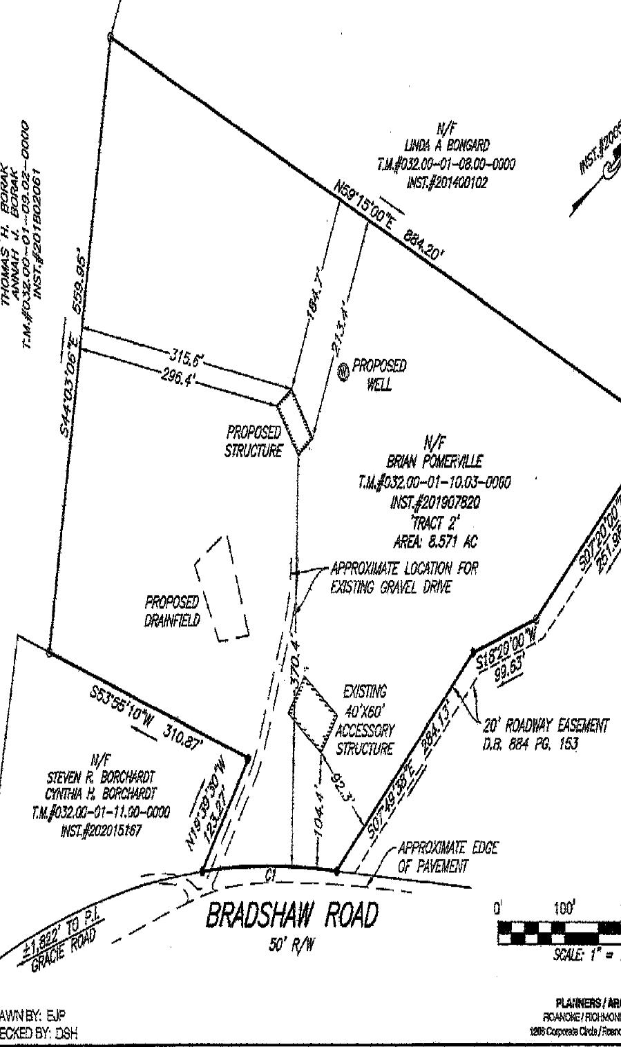
• The petition of Brian Pomerville to obtain a variance to build a primary structure behind the existing accessory structure, Catawba Magisterial District. This was approved on June 21, 2023.
• The petition of Charlie Wilson to obtain a variance to build a primary structure behind the existing accessory structure, Windsor Hills Magisterial District. This was withdrawn by the applicant.
• The petition of E. Glenn Mayhew to obtain a variance to allow for construction of an accessory building five feet from the front property line, Vinton Magisterial District. This was approved on September 20, 2023.
• The petition of James and Angela Wooten to obtain a variance to install an accessory structure in front of the front building line of the principal structure, Catawba Magisterial District. This was withdrawn by the applicant.
• The petition of Jonathan and Kathryn Horin to obtain a variance to modify side yard setback on the west side of the property from 20 feet to 15 feet, Catawba Magisterial District. This was approved on October 18, 2023.
• The petition of James and Patricia Sheppard to obtain a variance to modify rear yard setback from 25 feet to 14 feet and 6 inches to construct an attached addition, Catawba Magisterial District. This was approved on December 13, 2023.
New Employees:
• Nathan Grim, Transportation Planner, Transportation Division
• Skylar Camerlinck, Planner I - Code Enforcement Officer, Zoning Division
New Certifications:
• Isaac Henry: Recertified through VDOT’s Locally Administered Projects Qualification Program
• Nathan Grim: Certified through VDOT’s Locally Administered Projects Qualification Program
Staff supported the following boards, committees, businesses and civic associations this year:
• Council of Community Services
• Greater Williamson Road Area Business Association (GWRABA)
• Regional Bicycle & Pedestrian Advisory Committee
• Regional Local Food Planning Committee
• Roanoke Regional Housing Network
• Roanoke River Blueways Committee
• Roanoke Valley-Alleghany Regional Commission Boards & Committees
• Roanoke Valley Greenway Commission
• Roanoke Valley Urban Forestry Council
• Roanoke Valley Urban Tree Canopy Committee
• Transportation Policy Board (TPO)
• Transportation Technical Committee (TTC)

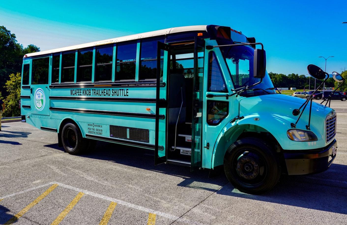
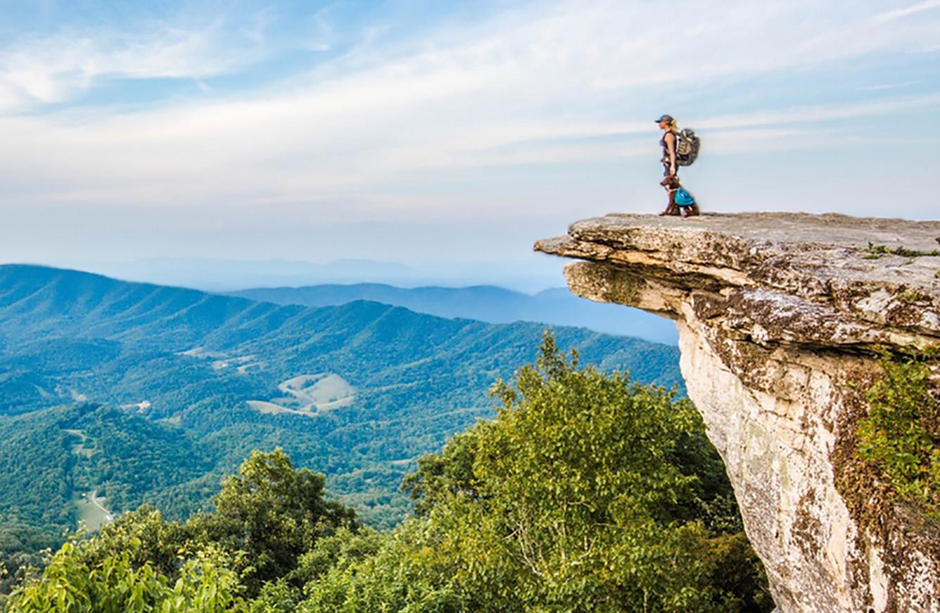
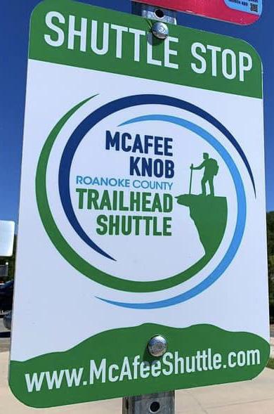
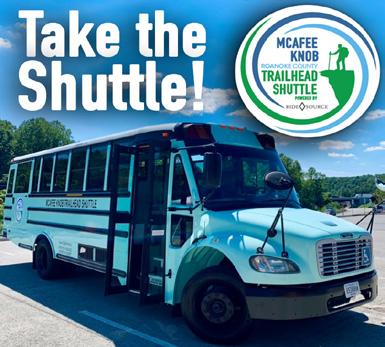
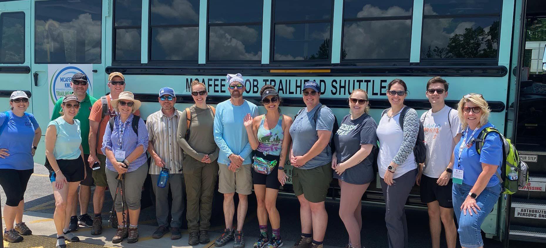
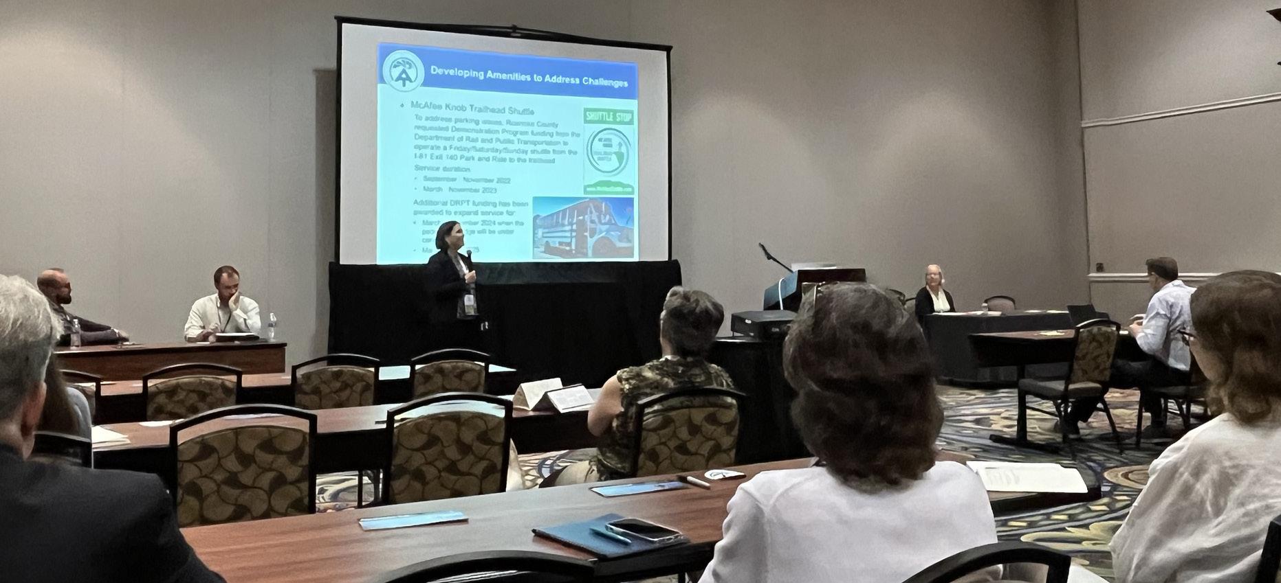
Roanoke County’s McAfee Knob Trailhead Shuttle won a National Association of Counties (NACo) Award in May 2023. McAfee Knob is the most photographed location on the Appalachian National Scenic Trail (AT) and has sparked increased visitation. McAfee Knob is between Dragon’s Tooth and Tinker Cliffs and is the most popular of the three sites in Virginia’s Triple Crown, with photographs frequently taken at the “diving board” bluff viewpoint. The McAfee Knob Trailhead shuttle service addresses the increasing parking demands at the trailhead parking lot by shuttling hikers from the Interstate 81 Exit 140 Park and Ride located in Roanoke County to the McAfee Knob trailhead parking lot in Catawba, Virginia. This service is offered Fridays, Saturdays, and Sundays, with occasional Mondays (i.e., Memorial Day and Labor Day) from the beginning of March through the end of November for 10-12 hours per day. The round-trip fare is $10 per rider plus booking fees. The number of visitors substantially increased in the last several years causing parking and the safety of visitors and the community to be a concern. The shuttle service addresses these concerns by providing visitors a convenient alternative. This type of investment in transit helps offer a sense of excitement for visitors, attracting them to return again, and promotes tourism for the region.
• American Institute of Certified Planners (AICP): 3
• American Society of Landscape Architects (ASLA): 1
• Certified Board of Zoning Appeals Program: 4
• Certified Combined Administrator for Erosion and Sediment Control: 1
• Certified Transportation Manager (VAZO): 1
• Certified Zoning Administrator (VAZO): 1
• Graduate Certificate of Geographic Information Technology: 1
• Graduate Certificate of Natural Resource Management: 1
• Lean Management for Practitioners (VT): 1
• Locally Administered Projects Qualification Program (VDOT): 3
• Virginia Certified Planning Commissioners Program (VCU): 6

Other Zoning Concerns (i.e. signage, setback concerns, operating business from home, no zoning permit)
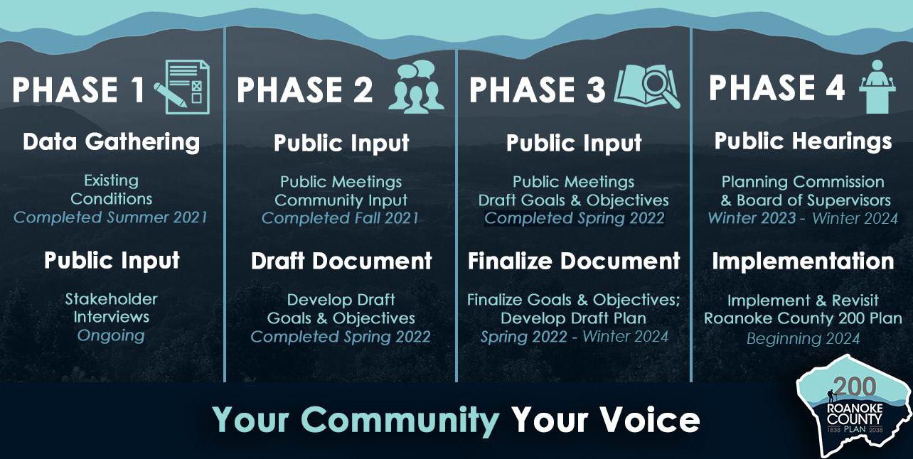
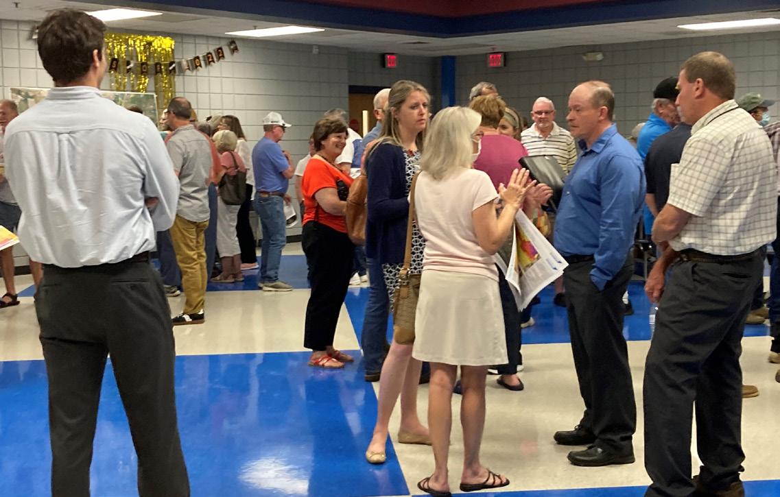
Beginning in early 2023, the Roanoke County Comprehensive Plan entered the final stages of its creation that required intricate processes that involved careful consideration of recommendations. These were guided by collaboration among planning staff, community members, and various stakeholders that has taken place over the last three years. It is essential to conduct a thorough review and revision of the drafted plan based on input from experts, government agencies, citizens, and other relevant entities. This includes assessing the plan’s alignment with future goals, existing conditions, potential long-term impacts, and ensuring its feasibility within the local socio-economic and environmental context.
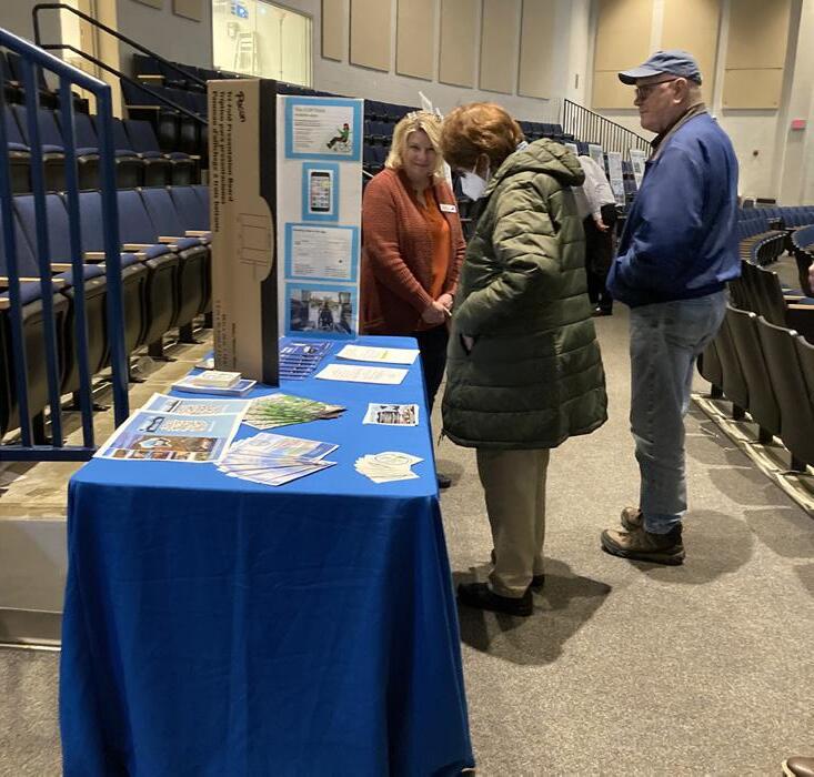
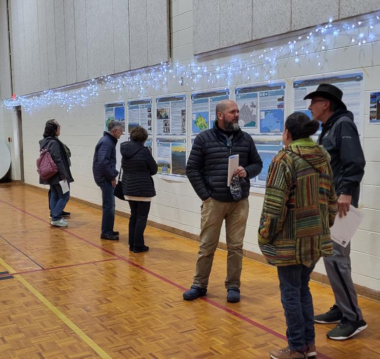
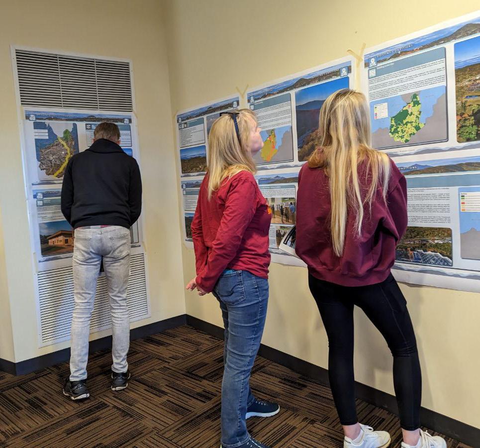
One of the final phases of a successful comprehenisve planning process is engaging with the public to obtain their final input. As highlighted on the next page, public meetings and hearings were conducted in early 2023 to allow community members to review draft plans for each of the eleven (11) community planning areas and voice their concerns, provide feedback, and contribute valuable insights to the finalization of their plan that will help guide them into the future. Utilizing various communication channels, such as online platforms and media, helped ensure widespread awareness and participation with nearly 1,000 members of the community engaging throughout the entirety of the creation of the 200 Plan. Approximately 305 community members participated in the winter of 2023 and approximately 610 community members participated over the course of the previous two years. It is essential to create an inclusive environment that encourages diverse perspectives, ensuring that the final adopted 200 Plan reflects the needs and aspirations of the entire community. Incorporating public input into the 200 Plan not only enhances its legitimacy but also fosters a sense of ownership among residents, encouraging a collaborative approach to sustainable development.
The Draft Roanoke County 200 Plan can be viewed at: www.RoanokeCountyVA.gov/200Plan
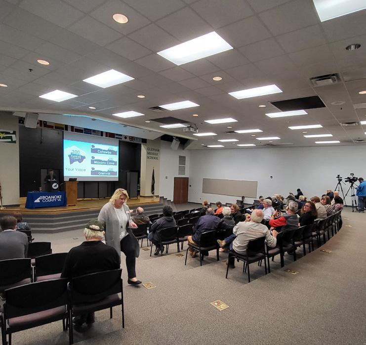

Six (6) open house Community Draft Plan Reveal Meetings were held in the Winter of 2023 to provide an opportunity for residents to review the draft of the Roanoke County 200 Plan and provide their comments. The meetings were held from 4:30 PM - 6:30 PM on the following dates in the following locations:
1. Catawba, Glenvar & Masons Cove: Glenvar Middle School - Monday, February 27
2. Peters Creek: Green Ridge Recreation Center - Wednesday, March 1
3. Bonsack/Vinton & Mount Pleasant: Vinton War Memorial - Monday, March 6
4. Windsor Hills: Hidden Valley High School - Wednesday, March 8
5. Back Creek & Bent Mountain: Bent Mountain Center - Monday, March 13
6. Cave Spring & Clearbrook: South County Library - Wednesday, March 15
The draft plans were also revealed to the Roanoke County Planning Commission at two public hearings, which were held at 5:00 PM on the following dates in the following locations:
1. Public Hearing Option 1: Green Ridge Recreation Center - Thursday, March 23, 2023
2. Public Hearing Option 2: Roanoke County Administration Center - Monday, April 3, 2023
Planning staff often assist other departments or organizations with conceptual plans, graphic design projects, mapping, and public engagement initiatives.
The graphics and marketing strategy for the Roanoke County 200 Plan and other community plans have been designed, generated, planned and executed in-house by Planning staff.
This includes the County website and social media pages, print materials and signage, roadside banners, meeting exhibits, video content and e-newsletters. A variety of in-house 2023 design projects are showcased on the following two pages:
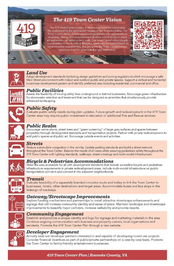

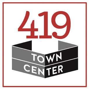
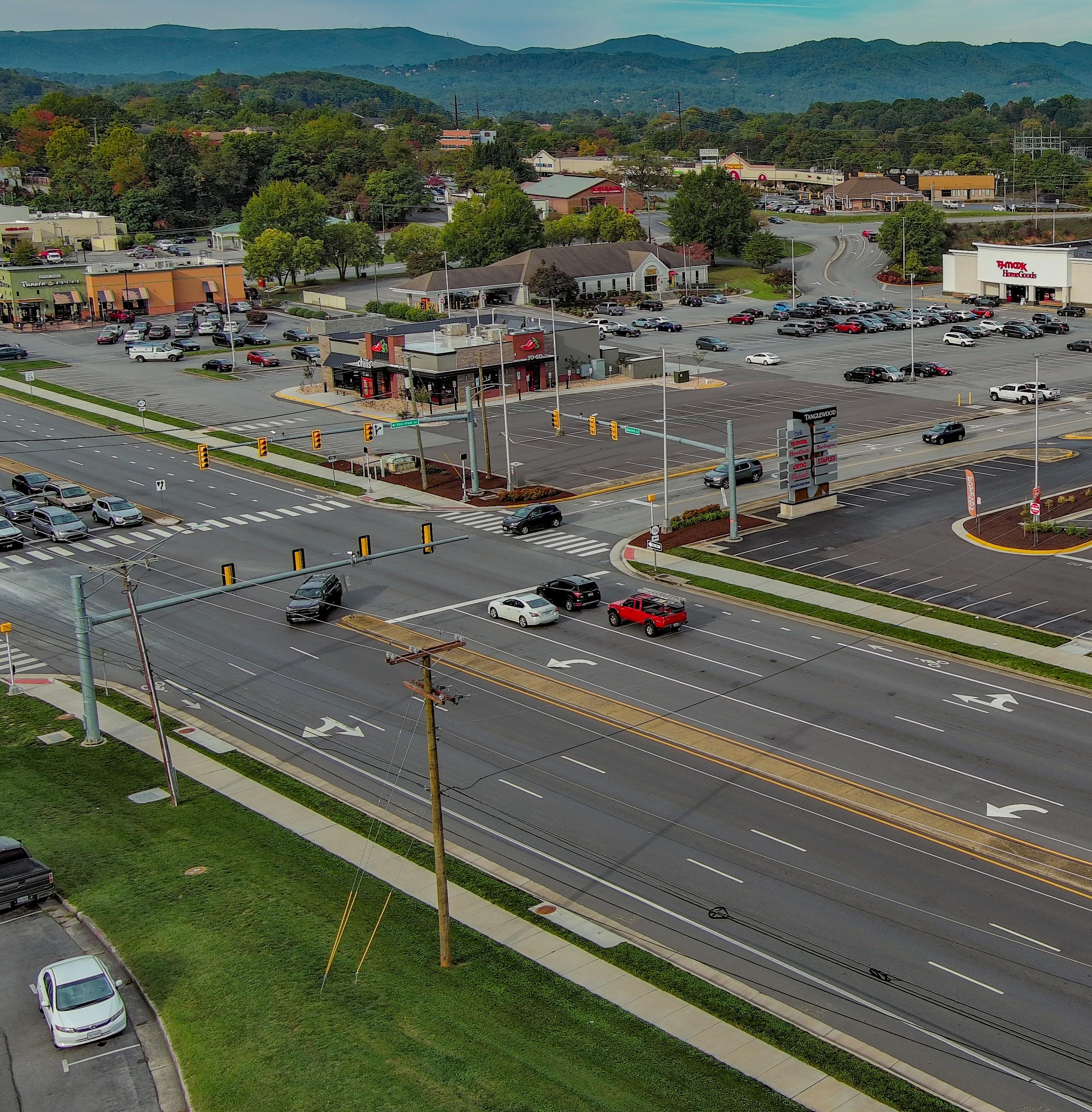
In 2019, the Board of Supervisors adopted the 419 Town Center Plan as part of the County’s Comprehensive Plan. On September 28, 2022, the Roanoke County Board of Supervisors approved an amendment to the 419 Town Center Plan by incorporating the Roanoke County 419 Town Center Design Guidelines into the 419 Town Center Plan. The 419 Town Center is redefining Roanoke County’s largest retail destination as a vibrant, walkable community with many transportation and economic development projects.
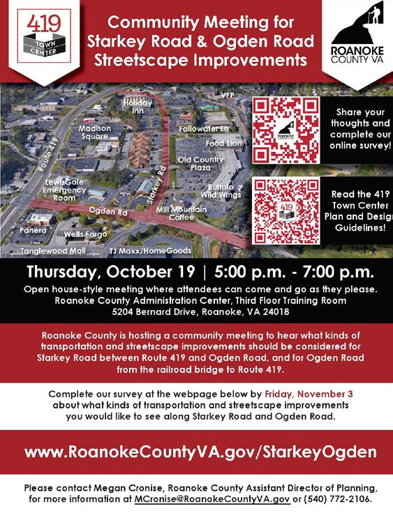
Transportation projects: Implementation of the Plan and Design Guidelines continues with a focus on Starkey Road between Route 419 and Ogden Road, and Ogden Road between Route 419 and the railroad bridge at the City of Roanoke boundary. Roanoke County is scoping potential streetscape improvements along these two roadways for a potential SMART SCALE Round 6 application. A community meeting was held in October 2023 with a survey to request feedback about desired improvements. A second community meeting will be held in February 2024 to review the draft concepts. Funding was obtained from the Virginia Department of Public Transportation to install a bus shelter at an existing Valley Metro bus stop across from Tanglewood Mall at Copper Croft Apartments.
Construction of the Diverging Diamond Interchange at Route 220 and Route 419 will begin in 2024, as will traffic signal improvements along Route 220 between Valley Avenue/Southern Hills Drive and Indian Grave Road/Clearbrook Village Lane.
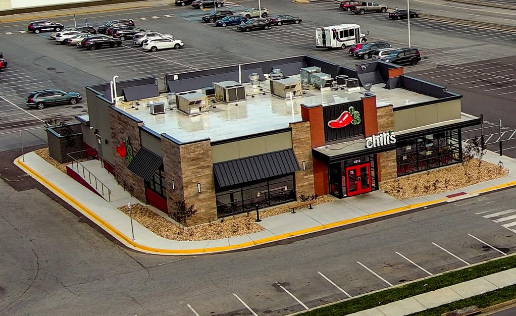
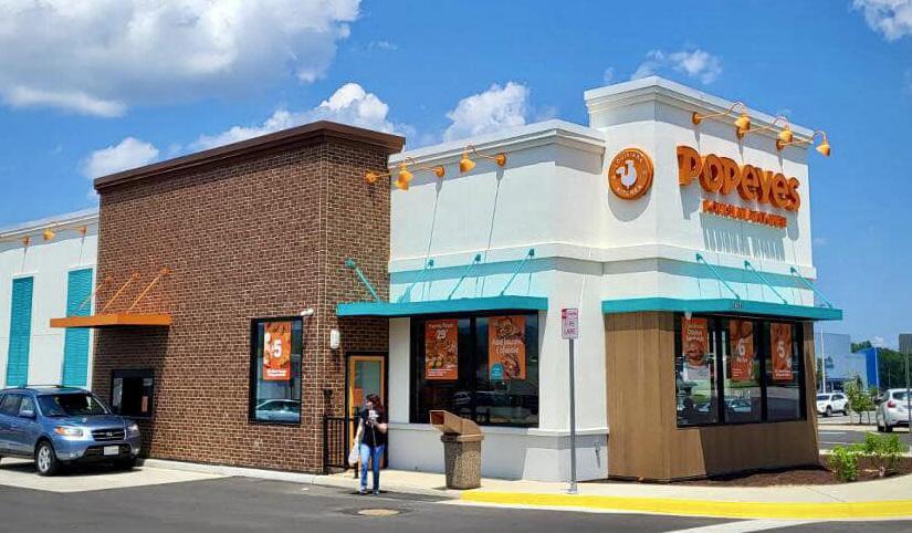
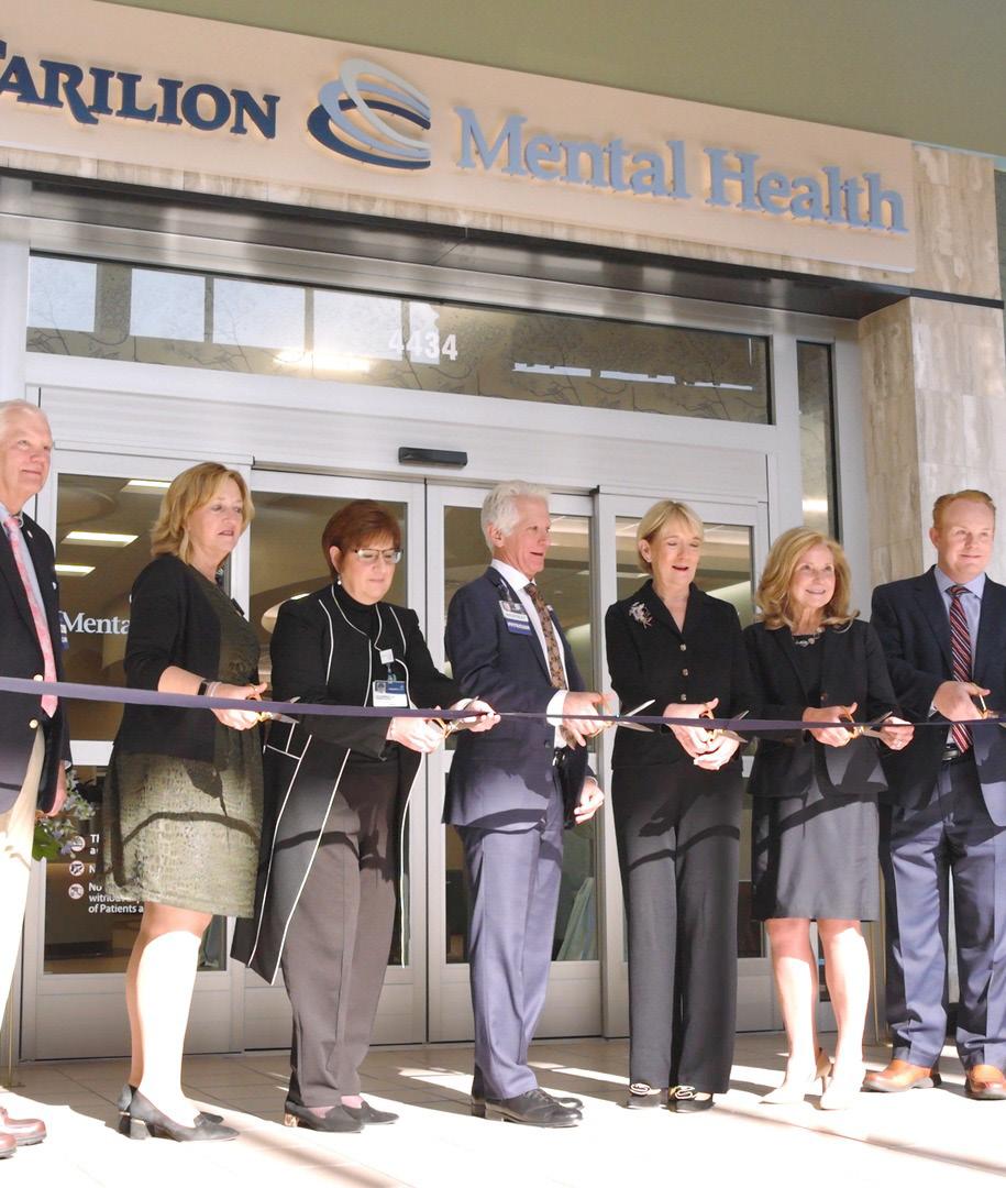
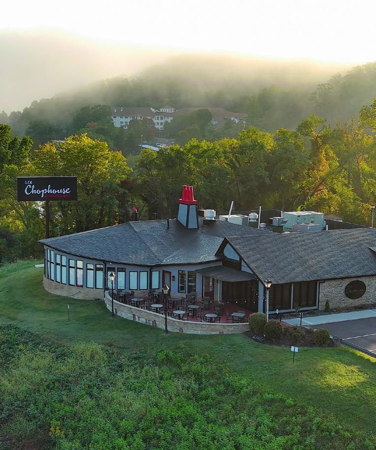
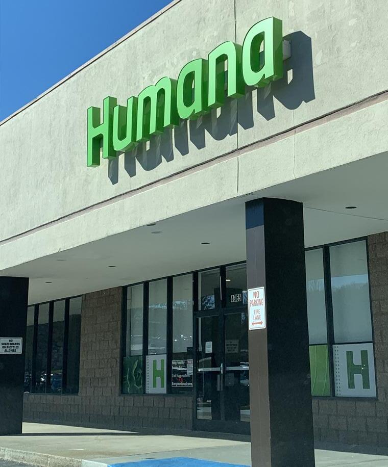
Economic Development projects: The opening of the new $15 million Carilion Clinic expansion at Tanglewood Mall adding new psychiatry and behavioral medicine outpatient services. The opening of the new-tomarket Chili’s, new-to-market Skechers, and Popeyes at Tanglewood Mall. Hackney Real Estate Partners purchased Tanglewood Mall. The opening of O.T.H. Chophouse restaurant on Route 419 and Humana at Old Country Plaza. YogaSix is currently under construction and should open in 2024.
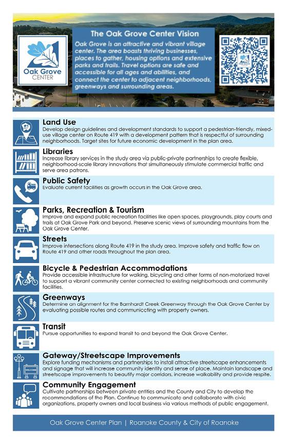
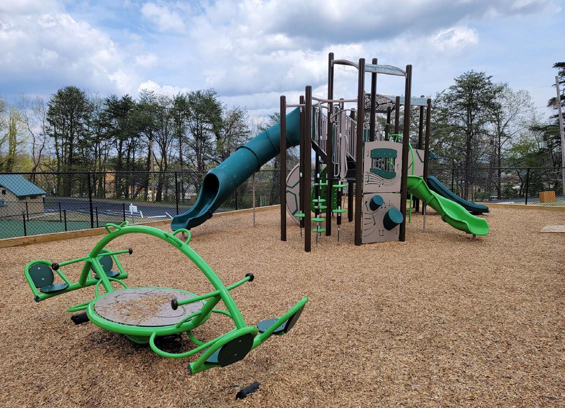
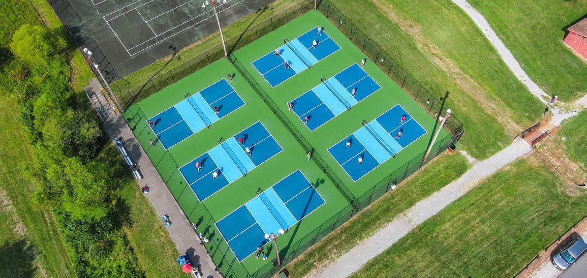
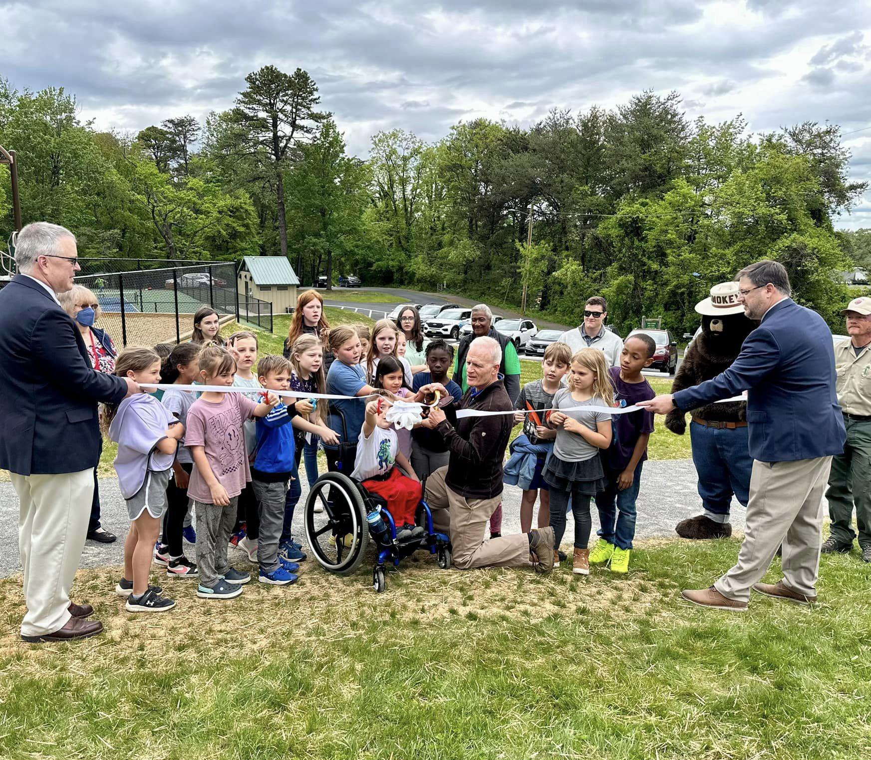
In 2021, the Board of Supervisors adopted the Oak Grove Center Plan as part of the County’s Comprehensive Plan. Oak Grove Center Plan implementation continued this year with Oak Grove Park improvements, including a new playground, pickleball court, picnic shelter, interpretive nature education trail, enhanced walking path, expanded parking, and restrooms
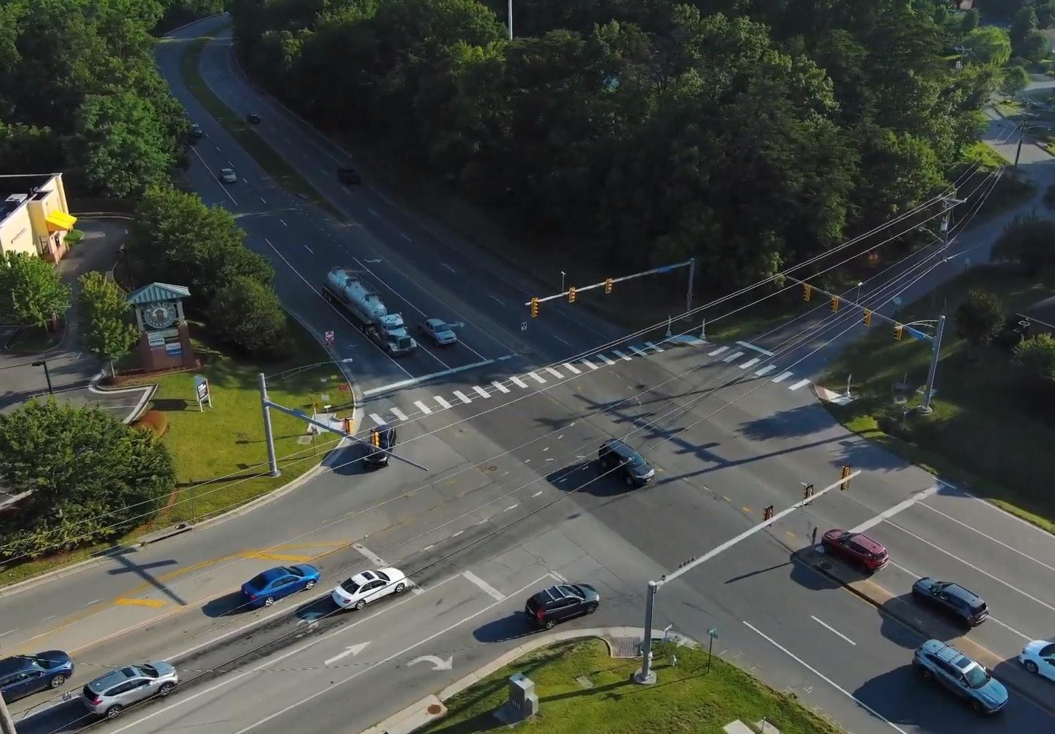
Transportation projects: Pedestrian signals and crosswalks were installed at two important Oak Grove intersections in 2023: Route 419 at Carriage Lane/Grandin Road and Route 419 at Keagy Road/Keagy Road near Keagy Village and Metis Plaza.
SMART SCALE funding was obtained to install two Restricted Crossing U-Turns at Route 419 and Stoneybrook Drive, and at Route 419 and Glen Heather Drive. Sidewalks will also be installed as part of this project between Glen Heather Drive and Grandin Road Extension in Roanoke County and will connect to the new pedestrian signals and crosswalks at Route 419/Carriage Lane/Grandin Road.
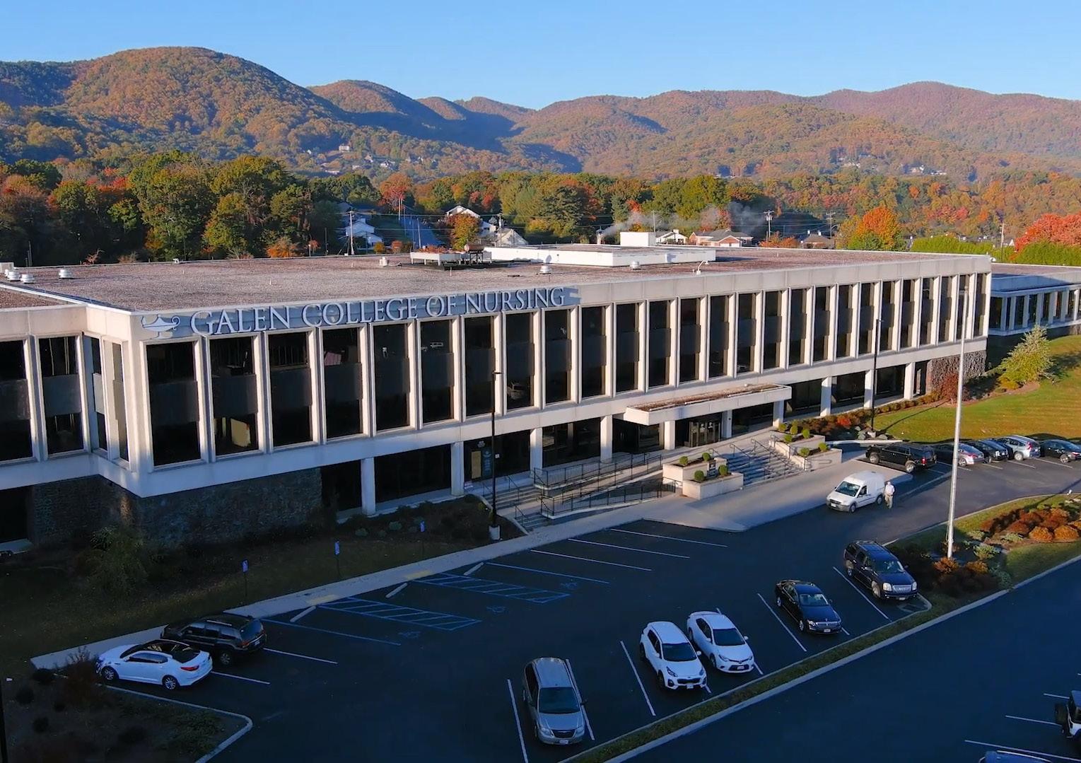
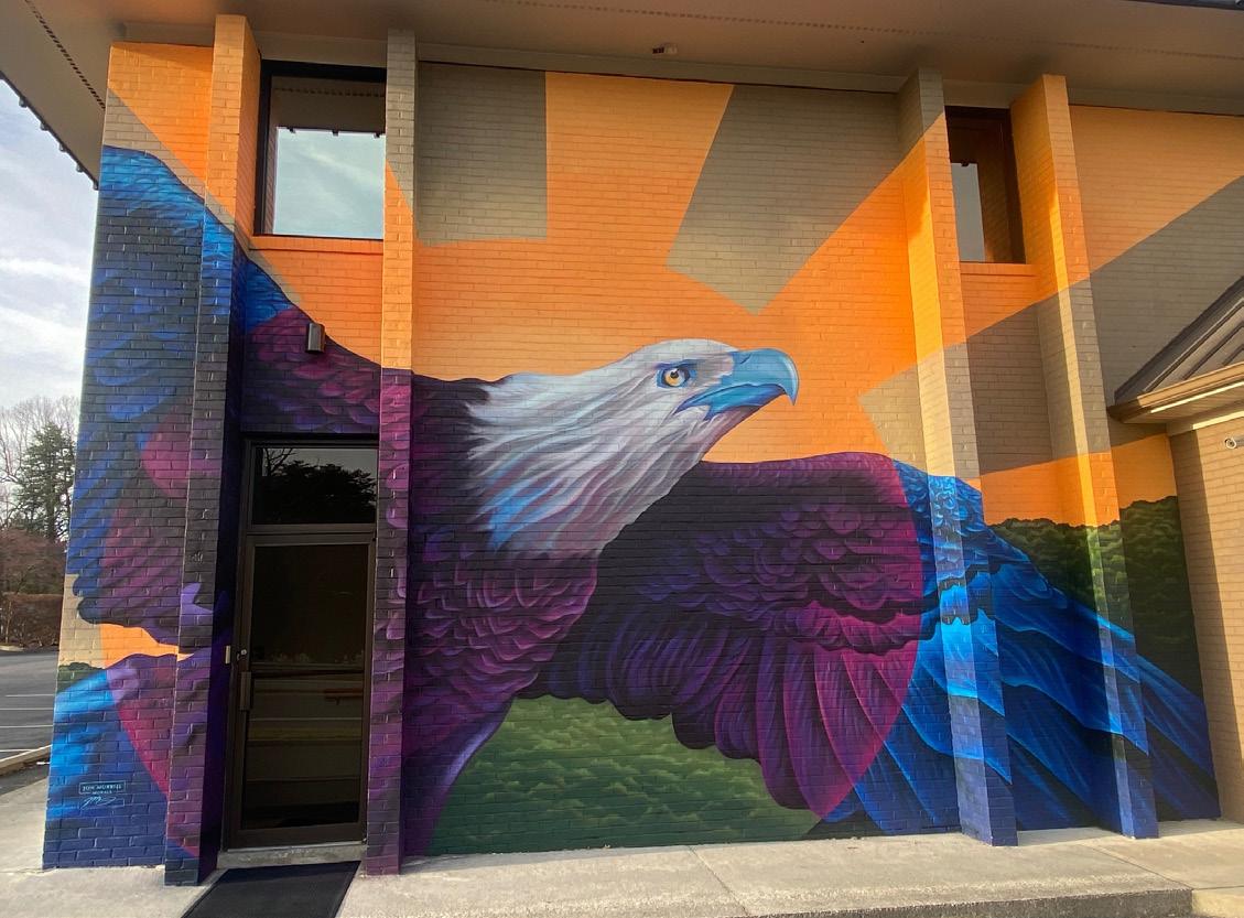
Economic Development projects: The opening of Galen College of Nursing Roanoke Campus at Metis Plaza and Dollar Tree at Oak Grove Plaza. A second public art mural installation in Oak Grove.
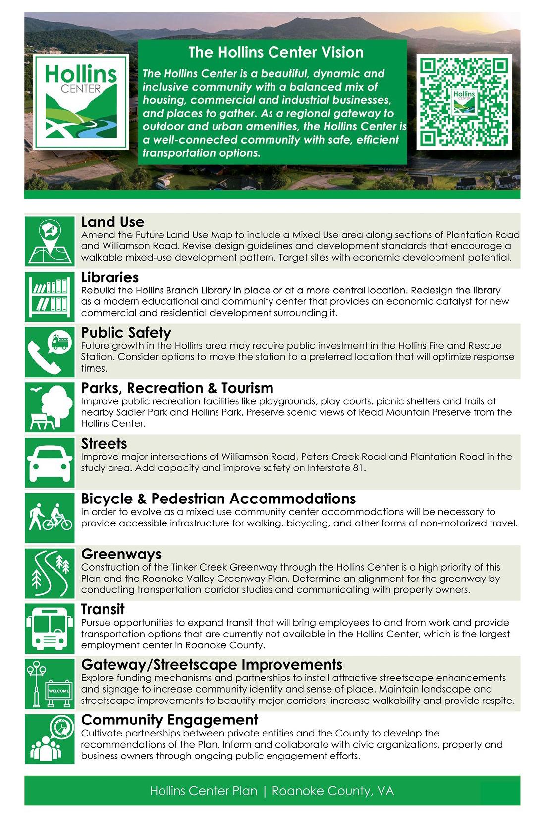
In 2020, the Board of Supervisors adopted the Hollins Center Plan as part of the County’s Comprehensive Plan. Hollins Center Plan implementation continued this year with new pickleball courts at Walrond Park and placemaking enhancements.
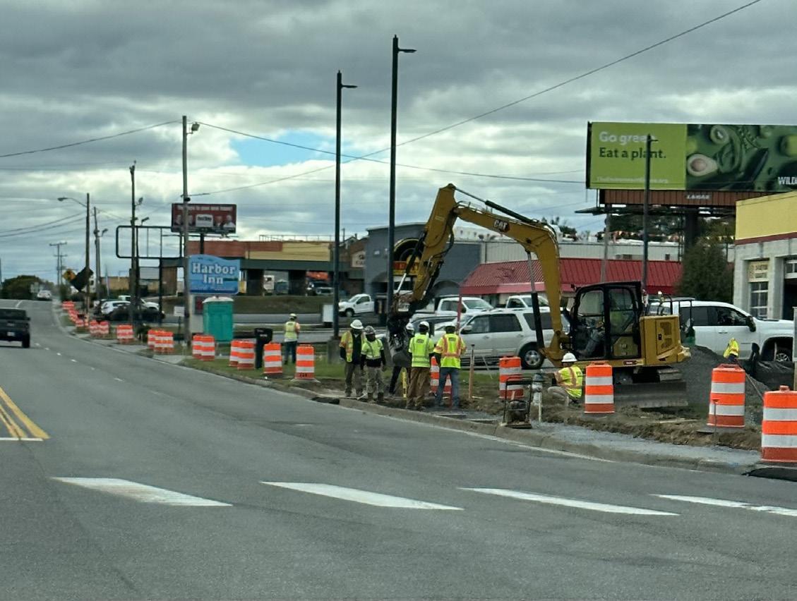
Transportation projects: Sidewalk is under construction along Williamson Road between Peters Creek Road and Plantation Road on the north side of the roadway. This segment will connect to new pedestrian infrastructure along Williamson Road and Plantation Road.
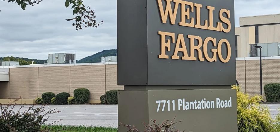
Economic Development projects: Wells Fargo announced its investing $87 million to modernize and expand its customer support center on Plantation Road. The investment will allow room for the creation of approximately 1,100 new jobs and enhance the working experience for more than 1,650 current employees.
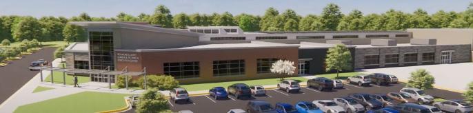
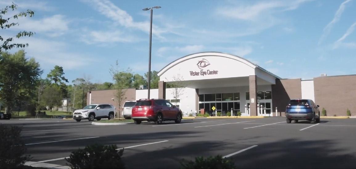
Vistar Eye Center opened a 26,000 sq. ft. state-of-the-art facility on Aiport Road. Springhill Suites by Marriott on Gander Way and Starbucks on Plantation Road are both under construction and should open in 2024. Southern Team Hyundai is under construction with a new 30,000 sq. ft. Sales & Service Center at 7300 Williamson Road. The new Roanoke County Career & Technical Education Center at 6251 Peters Creek Road is expected to begin construction in Summer 2024 and be completed in Fall 2026.
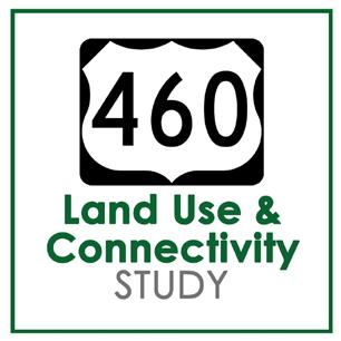
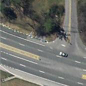
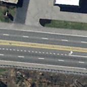
Route 460/Challenger Avenue handles the second highest traffic volume and has the second highest number of crashes in Roanoke County, behind Route 419 near Route 220 in the Tanglewood area.
To begin to address congestion and crashes along the corridor, the Virginia Department of Transportation (VDOT) initiated a Strategically Targeted Affordable Roadway Solutions (STARS) Study in 2019 to analyze opportunities for safety and operational improvements along Route 460 between Williamson Road in the City of Roanoke and Alternate Route 220/Cloverdale Road in Roanoke County near the Botetourt County line. Seven projects were chosen for submission through the SMART SCALE program and six were funded. All projects are currently in the design phase and construction is anticipated to begin in 2026 and 2027.
While the STARS Study projects focus on safety and operational improvements for Route 460, Roanoke County had also identified a need to consider opportunities for connectivity off of Route 460 to reduce the necessity for area residents to travel the busy corridor. Roanoke County contracted with Timmons Group in September 2021 to conduct the U.S. Route 460 Land Use and Connectivity Study with three goals:
1. Recommend ways to travel around the Bonsack community that are alternatives to Route 460/ Challenger Avenue;
2. Consider existing zoning classifications and future land use designations to determine potential changes to match desired development types; and
3. Examine existing at-grade railroad crossings for potential improvements that may create development opportunities between the railroad and the Blue Ridge Parkway.
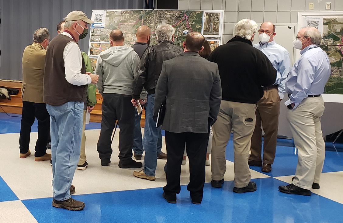
Three (3) community meetings were held with about 250 total attendees. Three (3) surveys were conducted with almost 400 respondents.
Meetings were held with the Planning Commission, Economic Development Authority and Board of Supervisors to review and discuss progress on the study.
On March 7, 2023, the Planning Commission held a public hearing on the draft U.S. 460 Land Use and Connectivity Study with six speakers. The Planning Commission recommended approval of the study.
The Board of Supervisors held a public hearing to consider additional public comments on March 28, 2023. At that meeting the Board of Supervisors approved a resolution to adopt an amendment to the Roanoke County Comprehensive Plan to incorporate the U.S. 460 Land Use and Connectivity Study as part of the Plan.
Funding award timeframes vary by grant program. Several projects applied for in 2022 were awarded in 2023, some 2023 applications have already been awarded, and others will not be finalized until the second quarter of 2024.
Projects include:
• CORTRAN: An application was submitted to Virginia Department of Rail and Public Transportation (DRPT) to support the County’s CORTRAN (County of Roanoke Transportation) program. The application requested FTA Section 5310 funding (96% State/ Federal funding and 4% Local Match) for the urbanized area of Roanoke County. DRPT awarded the County $313,921 for funding in the urbanized area and $170,549 for funding in the rural area.
• McAfee Knob Trailhead Shuttle: Demonstration Project funding for shuttle service was requested and awarded from DRPT in the amount of $170,709 (80% State/20% Local Match) to expand the original shuttle route (Interstate 81 Exit 140 Park and Ride to the McAfee Knob Trailhead) into the City of Salem, to the Orange Market Park and Ride and to Route 311 near the Dragon’s Tooth trailhead parking lot. Expanded service will begin on March 1, 2024, and will run until December 1, 2024, on Fridays, Saturdays, Sundays and holiday Mondays.
• Bus Shelter on Route 419 at Copper Croft Apartments: Transit Ridership Incentive Program funding was awarded from DRPT in the amount of $30,000 to install a bus shelter at an existing Valley Metro bus stop across from Tanglewood Mall in front of Copper Croft Apartments.
• Safe Streets and Roads for All Comprehensive Safety Action Plan: An application was submitted to the U.S. Department of Transportation through the Safe Streets and Roads for All Discretionary Grant Program for a Comprehensive Safety Action Plan for Roanoke County, Botetourt County and the Town of Vinton. The Federal Highway Administration awarded the $280,000 request (80% Federal/20% Local Match) and the study is underway.
• Explore Park Greenway additional funding: The Roanoke Valley Transportation Planning Organization approved $1,275,000 in Carbon Reduction Program funding (100% Federal) to satisfy a project deficit for the Explore Park Greenway.
The following projects were submitted for SMART SCALE Round 5 funding. This source is 100% State and Federal funding and is awarded by the Commonwealth Transportation Board.
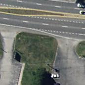
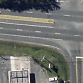
• Route 419/Electric Road Safety Improvements, Stoneybrook Drive to Grandin Road Extension: This project includes Restricted Crossing U-Turns at Stoneybrook Drive and at Glen Heather Drive, as well as sidewalk along the west side of Route 419 between Glen Heather Drive and Grandin Road Extension. The funding awarded was $6,624,464.
• Pedestrian Crossing Improvements on Route 419 at Postal Drive and Brambleton Avenue: This project will install pedestrian signals, crosswalks and sidewalk at the Route 419 at Brambleton Avenue and Route 419 at Postal Drive intersections. The funding awarded was $3,944,955.
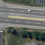
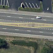
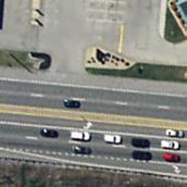


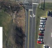
Route 419 from Stoneybrook to Grandin Road Ext. Concept


Federal and State Programs run through the Virginia Department of Transportation
• Surface Transportation Block Grant/Carbon Reduction Program – Requested SMART SCALE Leverage Funds for the following proposed Round 6 applications, which will be determined in Spring 2024:
• Route 419/Electric Road Safety and Streetscape Improvements, Grandin Road Extension to Keagy Road
• Peters Creek Road at Williamson Road Intersection Improvements
• Route 11/460/West Main Street at Dow Hollow Road Intersection Safety Improvements
• Transportation Alternatives Program for the Glade Creek Greenway through Vinyard Park East: Funding was requested to construct Phase 5 of the Glade Creek Greenway along Glade Creek through Vinyard Park East. Funds are 80% Federal/20% Local Match and the request was $990,578. This request was unsuccessful.
• Revenue Sharing Program for Dry Hollow Road Safety Improvements: Funding was requested to satisfy a deficit for the project which will reinforce the roadway against the creek and will widen the roadway under a railroad bridge. Funds are 50% State/50% Local and $1,391,175 was requested from VDOT. Awards will be finalized in June 2024.
• Friends of the Blue Ridge/Roanoke Valley-Alleghany Regional Commission for Bicycle Racks: Two applications were submitted requesting bicycle racks from Friends of the Blue Ridge. Locations include the new Roanoke River Greenway trailhead parking lot at 3226 Highland Road and the Tanglewood Mall parking lot near Blaze Pizza. Awards will be announced in early 2024.
The following studies focus on an issue or problem, identify many different alternatives to potentially address that issue or problem, and then determine recommendations.
• Route 460/Challenger Avenue Land Use and Connectivity Study: Building off of the completed VDOT Route 460 Operational Improvements Study, County staff worked with Timmons Group, VDOT, the City of Roanoke, Botetourt County and the Roanoke Valley Alleghany Regional Commission to recommend alternative routes to Route 460/Challenger Avenue, to determine future land use changes in the vicinity of Route 460/Challenger Avenue and to examine existing at-grade railroad crossings for potential improvements that could create development opportunities between the railroad and the Blue Ridge Parkway. Additional information on this study is shown on Page 19.
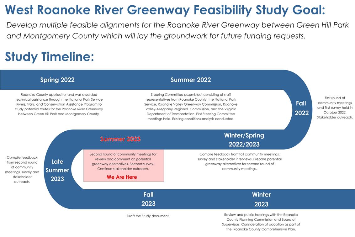
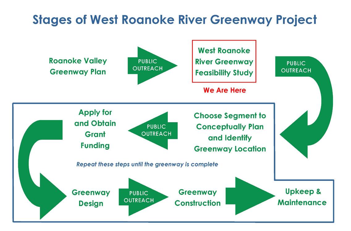
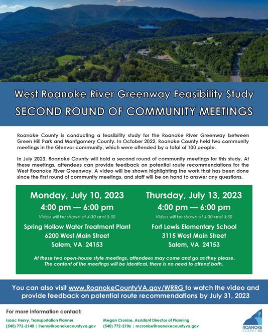
• West Roanoke River Greenway Feasibility Study: This study kicked off in Summer 2022 and seeks to build off the 2018 Roanoke Valley Greenway Plan and ongoing VDOT Valley to Valley Trail Study by identifying realistic alignments for this section of the Roanoke River Greenway that can be used for future funding requests. A second round of community meetings was held in July 2023 and the draft study is being compiled for action by the Planning Commission and Board of Supervisors in 2024.
• Safe Streets and Roads for All Comprehensive Safety Action Plan: This multijurisdictional study with the Town of Vinton and Botetourt County was awarded by the Federal Highway Administration in January 2023. The study began in December 2023 with the assistance of Roanoke County’s consultant, Timmons Group, and will conclude in February 2025. Two rounds of community engagement will occur in 2024.
• VDOT Project Pipeline Study for Peters Creek Road and Williamson Road: Roanoke County requested and VDOT initiated a multimodal safety study for Peters Creek Road and Williamson Road from Wood Haven Road to Plantation Road. This study implements the Hollins Center Plan and is intended to study concerns identified in the draft Roanoke County 200 Plan. A survey was conducted in August 2023 and additional engagement will take place in early 2024. It is anticipated that this study will generate one or more SMART SCALE applications.
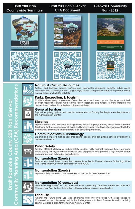
• VDOT Project Pipeline Study for West Main Street at Dow Hollow Road: VDOT initiated a safety study for the intersection of West Main Street at Dow Hollow Road due to high crash volume and significant impacts from Interstate 81 detours. This study implements the Glenvar Community Plan and considers concerns voiced as part of the draft Roanoke County 200 Plan. A survey was conducted in August 2023. VDOT anticipates additional community engagement in early 2024. It is anticipated that a 2024 SMART SCALE application will be a product of this study.
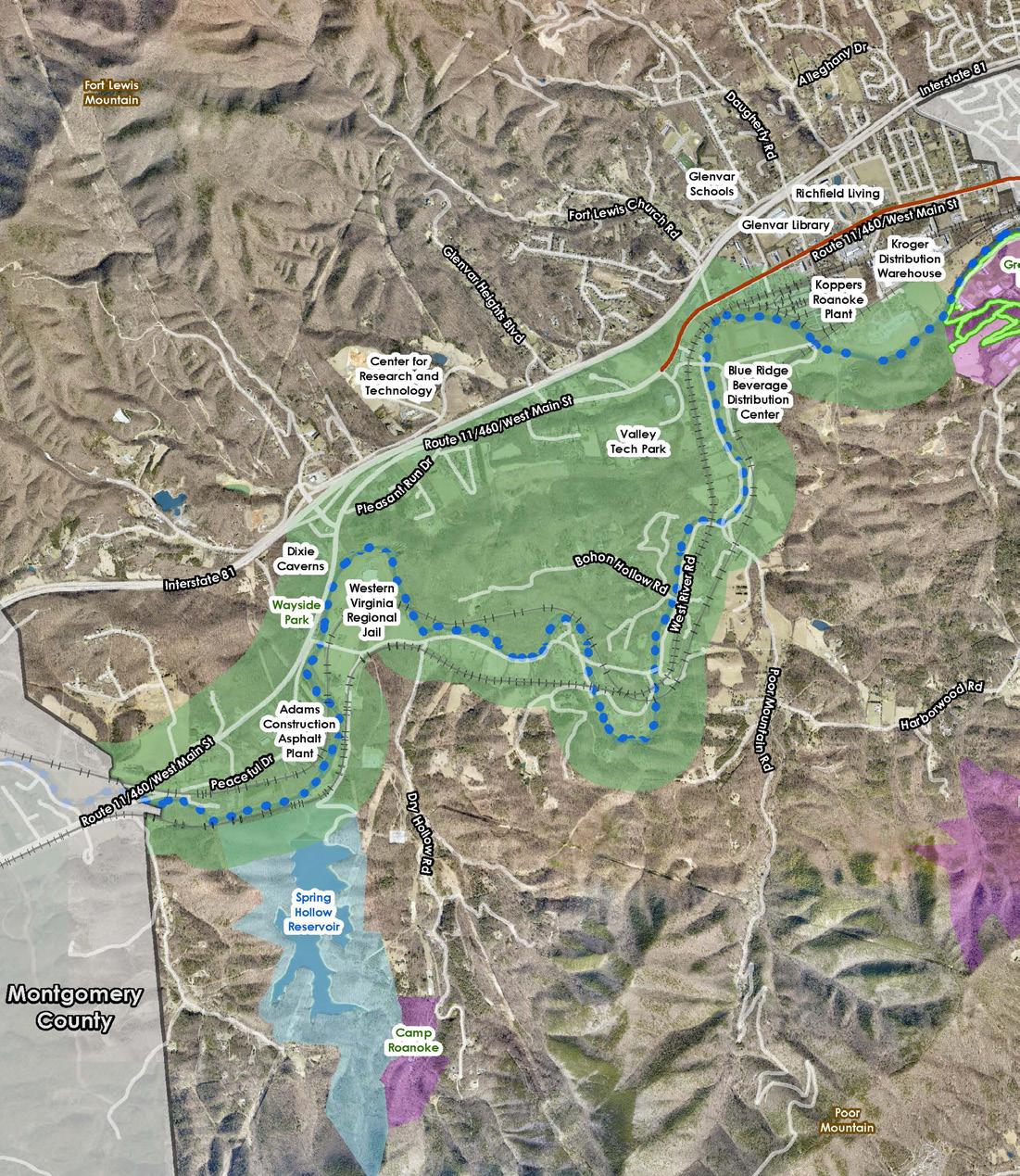
Study Area for the West Roanoke River Greenway Feasibility Study
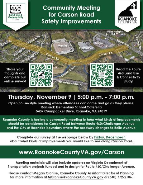
• Carson Road Safety Improvements Study: To begin implementing the Route 460/Challenger Avenue Land Use and Connectivity Study, Roanoke County surveyed and is studying Carson Road with assistance from Timmons Group. A community meeting was held in November 2023 with an associated survey. Additional public engagement will take place in March 2024. It is anticipated that this study will result in a 2024 SMART SCALE application.
• Starkey Road/Ogden Road Multimodal Improvements Study: Roanoke County continues to implement the 419 Town Center Plan by focusing on Starkey Road from Route 419 to Ogden Road, and Ogden Road from Route 419 to the railroad bridge at the City of Roanoke boundary. The corridors were surveyed and Whitman, Requardt and Associates is studying these roadways. A community meeting was held in October 2023 with a corresponding survey. The second round of community engagement will take place in February 2024. The study will likely yield at least one SMART SCALE application.
• East Roanoke River Greenway Gap Feasibility Study: Roanoke County will engage consultants in 2024 to study potential alternatives to span the gap in the East Roanoke River Greenway between the existing greenway terminus near the Western Virginia Water Authority’s Water Pollution Control Plant and the new segment of greenway constructed by Roanoke County at 3204 Highland Road, just west of the Blue Ridge Parkway. Public engagement will be an important component of this study.
Roanoke County and VDOT work together to initiate, fund, design and construct transportation-related projects across the county. The following projects represent actual and planned construction activity for 2023 and 2024.
Projects
• Oak Grove Pedestrian Improvements, Route 419/Carriage Lane/Grandin Road and Keagy Road at Keagy Village Intersections. Installed pedestrian signals and crosswalks at the existing signalized intersections. (Funding Sources: STBG, HSIP)
• East Roanoke River Greenway from 1800 feet north of Highland Road to Highland Road. A segment of greenway and a trailhead parking lot were constructed on Virginia Recreational Facilities Authority property. Planning staff assisted with project funding. (Funding Sources: TA, STBG)
• Ivy Ridge Road. A VDOT-maintained gravel segment of Ivy Ridge Road was paved as part of the Secondary Six-Year Program. (Funding Source: VDOT SSYP)
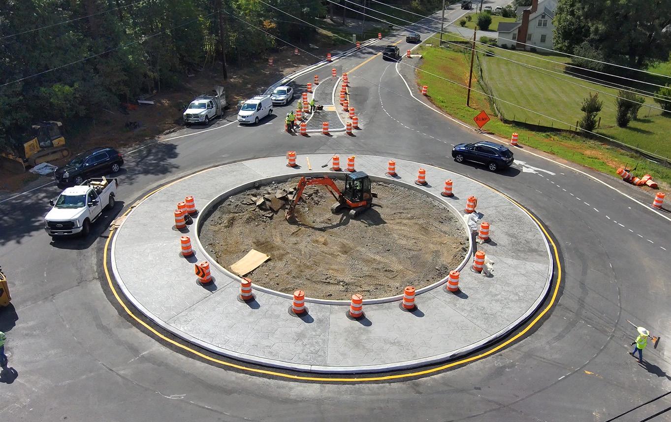
• Starkey Road/Buck Mountain Road Intersection Improvements. Replacing the existing “T” intersection with a roundabout with pedestrian accommodations. (Funding Sources: STBG, Revenue Sharing, SSYIP, SMART SCALE)
Projects Underway:
• Interstate 81 Widening, Exit 137 to Exit 141. Widening the roadway to six travel lanes. The project will connect to existing and proposed widening projects. Completion anticipated in 2026. (Funding Source: I-81 funding)
• Appalachian Trail Bridge over Route 311. Constructing a pedestrian bridge over Route 311 for the Appalachian National Scenic Trail. (Funding Source: HSIP)
• Williamson Road Sidewalk, from Plantation Road to Peters Creek Road. Constructing sidewalk along the north side of Williamson Road between Peters Creek Road and Plantation Road. (Funding Sources: TA, SMART SCALE)
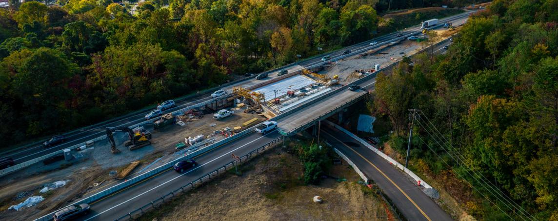
Interstate 81 Bridge Under Construction Source: VDOT
• East Roanoke River Greenway from Highland Road to Explore Park. Two segments of Roanoke River Greenway with a trailhead parking lot are under construction to connect the newly-constructed greenway on Virginia Recreational Facilities Authority property to Explore Park across property owned by the National Park Service and the Roanoke Valley Resource Authority. Planning staff assisted with project funding. (Funding Sources: TA, FLAP)
• West Roanoke River Greenway, Phase 1. Construct 0.60 mile of Roanoke River Greenway south of the Roanoke River between West Riverside Drive and Kingsmill Drive with a trailhead parking lot. Planning staff assisted with project funding. (Funding Sources: HSIP, STBG, SMART SCALE)
• Route 220 Signal Improvements. Reduce signal phases and add pedestrian accommodations at four intersections along Route 220 between Valley Avenue/Southern Hills Drive and Indian Grave Road/ Clearbrook Village Lane. (Funding Source: I-73 Earmark)
• Route 419 and Route 220 Diverging Diamond Interchange. Realigning the interchange with a Diverging Diamond configuration to improve traffic flow and safety with pedestrian and bicycle accommodations. (Funding Sources: STBG, SMART SCALE)
• East Roanoke River Greenway through Explore Park. Construct a segment of the Roanoke River Greenway through Explore Park to Rutrough Point. Planning staff assisted with project funding. (Funding Sources: STBG, CRP)
• Glade Creek Greenway through Vinyard Park West. Construct a segment of the Glade Creek Greenway along Glade Creek in Vinyard Park West. (Funding Source: TA)
• Williamson Road Sidewalk. North Roanoke Assisted Living to Plymouth Drive Intersection. Sidewalk will be constructed to continue along the west side of Williamson Road from North Roanoke Assisted Living to the intersection with Plymouth Drive. (Funding Source: HSIP)
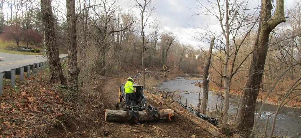
West Roanoke River Greenway Construction from December 2023
Planning staff are frequently asked to assist other departments with important County projects. The list below reflects work completed for several different departments, as well as detailed concept plans submitted as part of grant applications.
• Glade Creek Greenway through Vinyard Park West Construction Plans
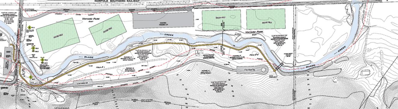
• Glade Creek Greenway through Vinyard Park East Concept for Grant Application
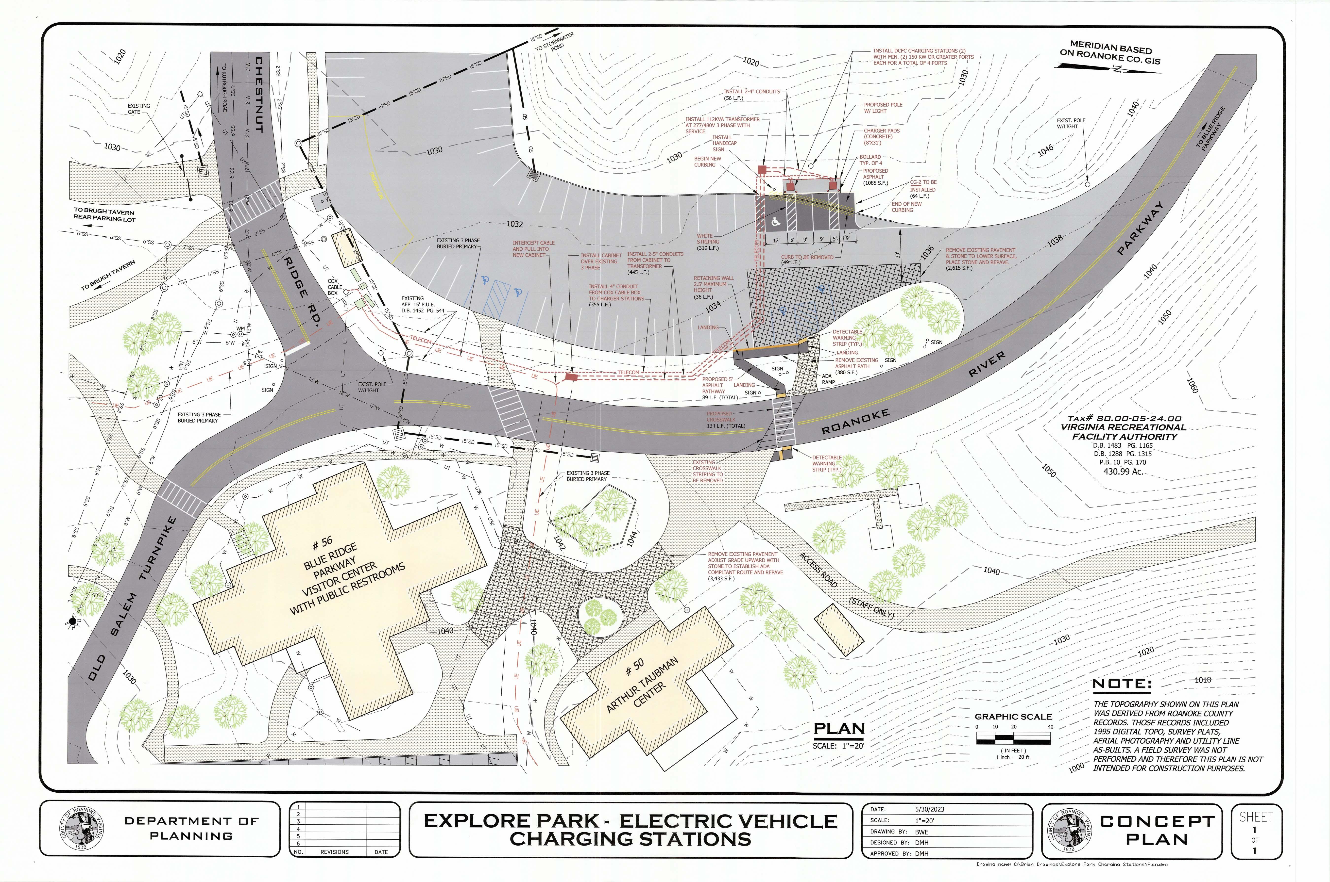
• Explore Park Electric Vehicle Charging Station Concept for Grant Application
• Town of Vinton Wolf Creek Greenway Restroom Concept Plan for Grant Application
• Britaney Road Paper Street Vacation Plat
• Mayes Plat to Implement Explore Park Grant
• Hinchee Trail at Sycamore Station Right-of-Way Plat
• Richards Boulevard/Pilot Boulevard Drainage Plans
• Bent Mountain Road Plat for Drainage Project
• Mount Pleasant Fire Station Sewer Connection Plans
2023 Planning Projects:
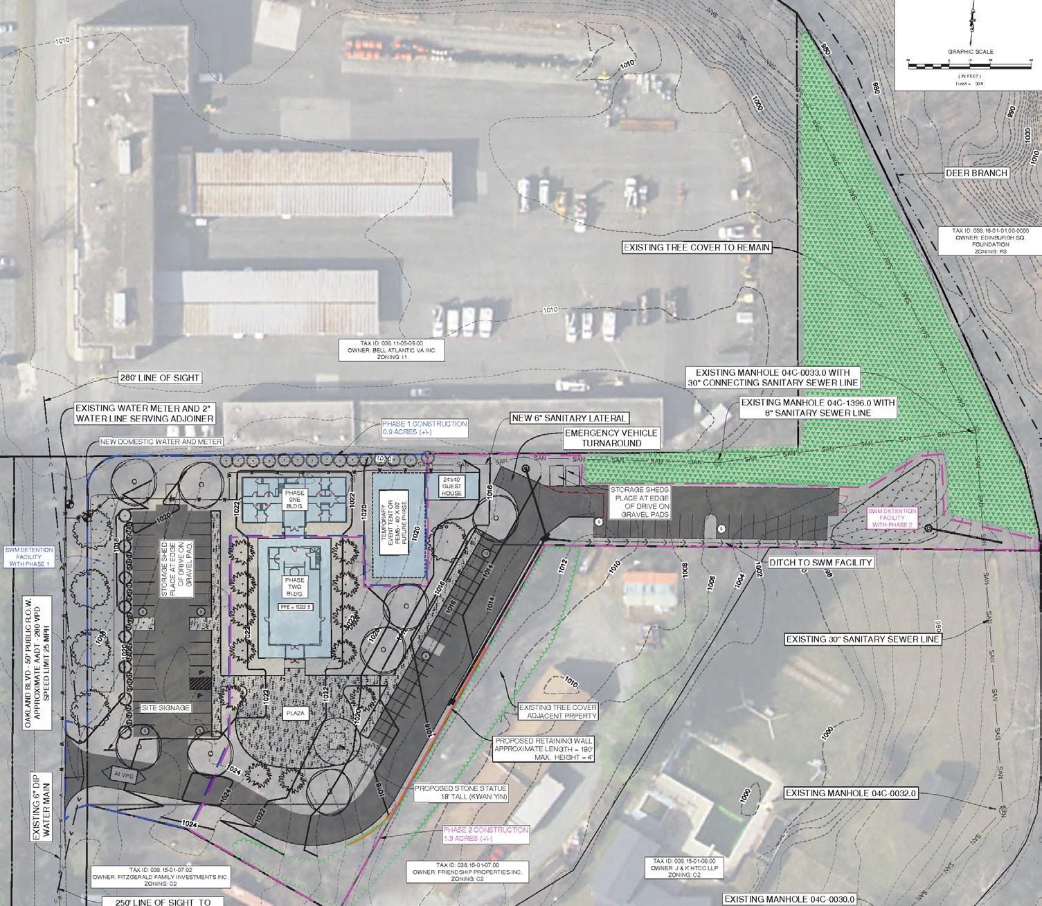
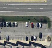
• McAfee Knob Trailhead Parking Lot Expansion and Transit Access Improvements (Parking lot improvements/expansion, restrooms, shuttle stop, sidewalks) for Grant Application
• McAfee Knob Trailhead Shuttle Pull-Off along Route 311 Northbound near Dragon’s Tooth Trailhead Parking Lot for Grant Application
• Orange Market Park and Ride Shuttle Stop Concept for Grant Application
• Ranchcrest Drive Sidewalk and Crosswalk Concept

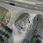
McAfee Knob Trailhead Parking and Transit Access Improvements Concept
The American Planning Association (APA) Virginia Chapter Annual Conference was held in Roanoke July 16-19, 2023. Assistant Director of Planning Megan Cronise and Principal Planner Alexander Jones served on the Local Conference Committee to assist planning the conference. Four Planning staff members attended the conference connecting and collaborating with nearly 400 Virginia planners and planning commissioners from across the Commonwealth.
Planning staff hosted three mobile tours for conference participants around Roanoke County:
1. Appalachian Trail Hike to Sawtooth Ridge, including the McAfee Knob Trailhead Shuttle
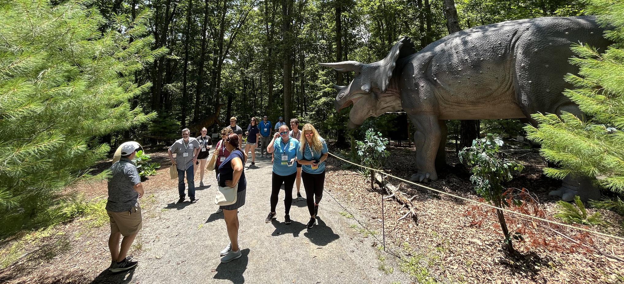
2. Exploring Roanoke County’s Explore Park, including Treetop Quest and T-Rex Trail
3. Transportation Projects in the Roanoke Valley
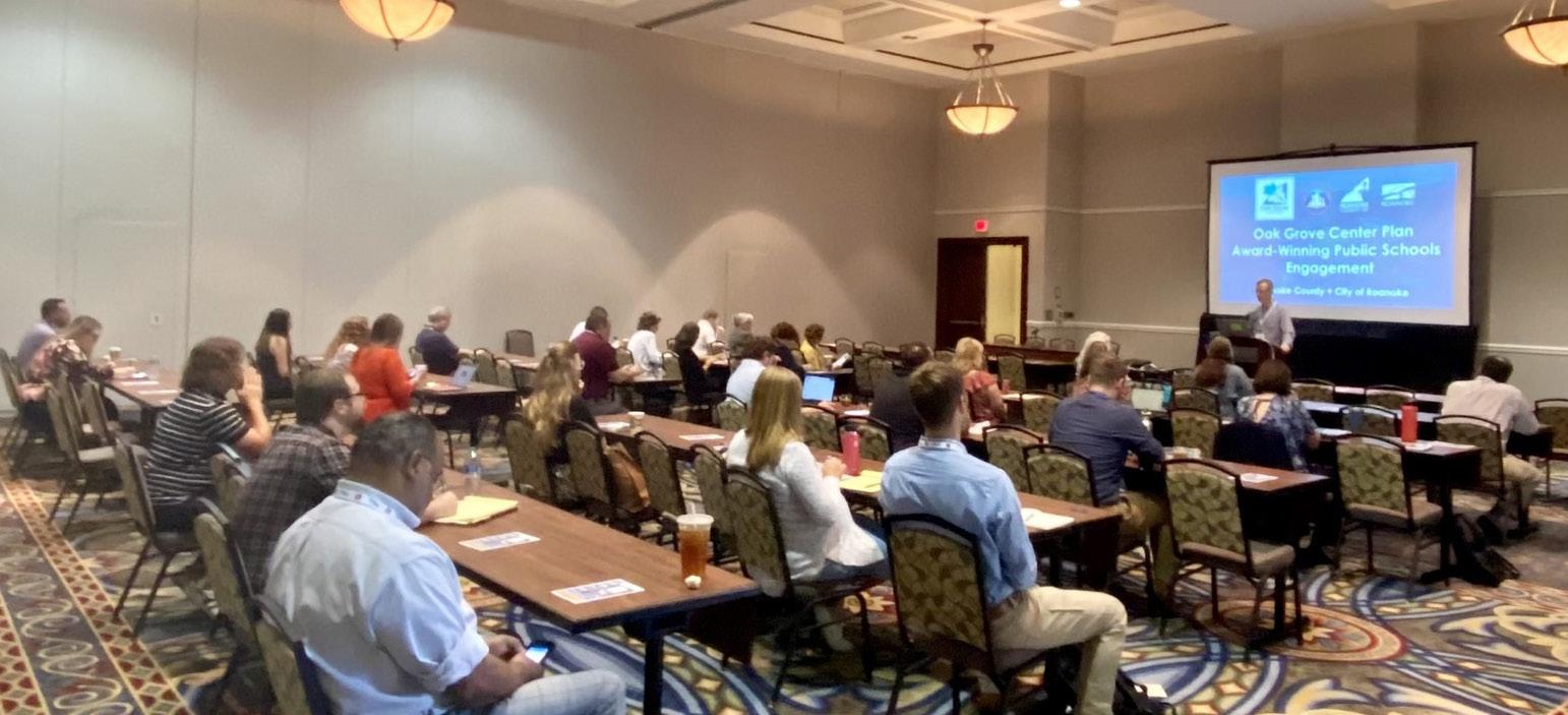
Planning staff were also chosen as conference speakers for the following sessions at The Hotel Roanoke, which highlighted many Roanoke County projects:
1. Route 419 Town Center Plan: Placemaking and the Art of Leveraging, with Roanoke County Economic Development
2. Oak Grove Center Plan Award-Winning Public Schools Engagement
3. Complete Streets - Safety Improvements Through Lane Reductions and Signal Removals, with City of Roanoke Transportation
4. From the Mountains to the Sea, a Deep Dive into Conversation in Virginia, with the Appalachian Trail Conservancy, Coastal Virginia Conservancy, the Land Trust Alliance, and the Chesapeake Bay Program
Planning staff coordinated with Roanoke County Parks, Recreation & Tourism staff, Roanoke County Public Schools, Roanoke Valley-Alleghany Regional Commission, and Virginia Department of Forestry to host Roanoke County’s Annual Arbor Day event at Oak Grove Park and Oak Grove Elementary School on April 27. This year’s Arbor Day and Oak Grove Park Improvements Ribbon Cutting Celebration marks Roanoke County’s 25th time selected as a Tree City USA by the Arbor Day Foundation. Four new shade trees were planted at the enhanced Oak Grove Park with grant funding. The new trees and other park improvements further implement our Oak Grove Center Plan.
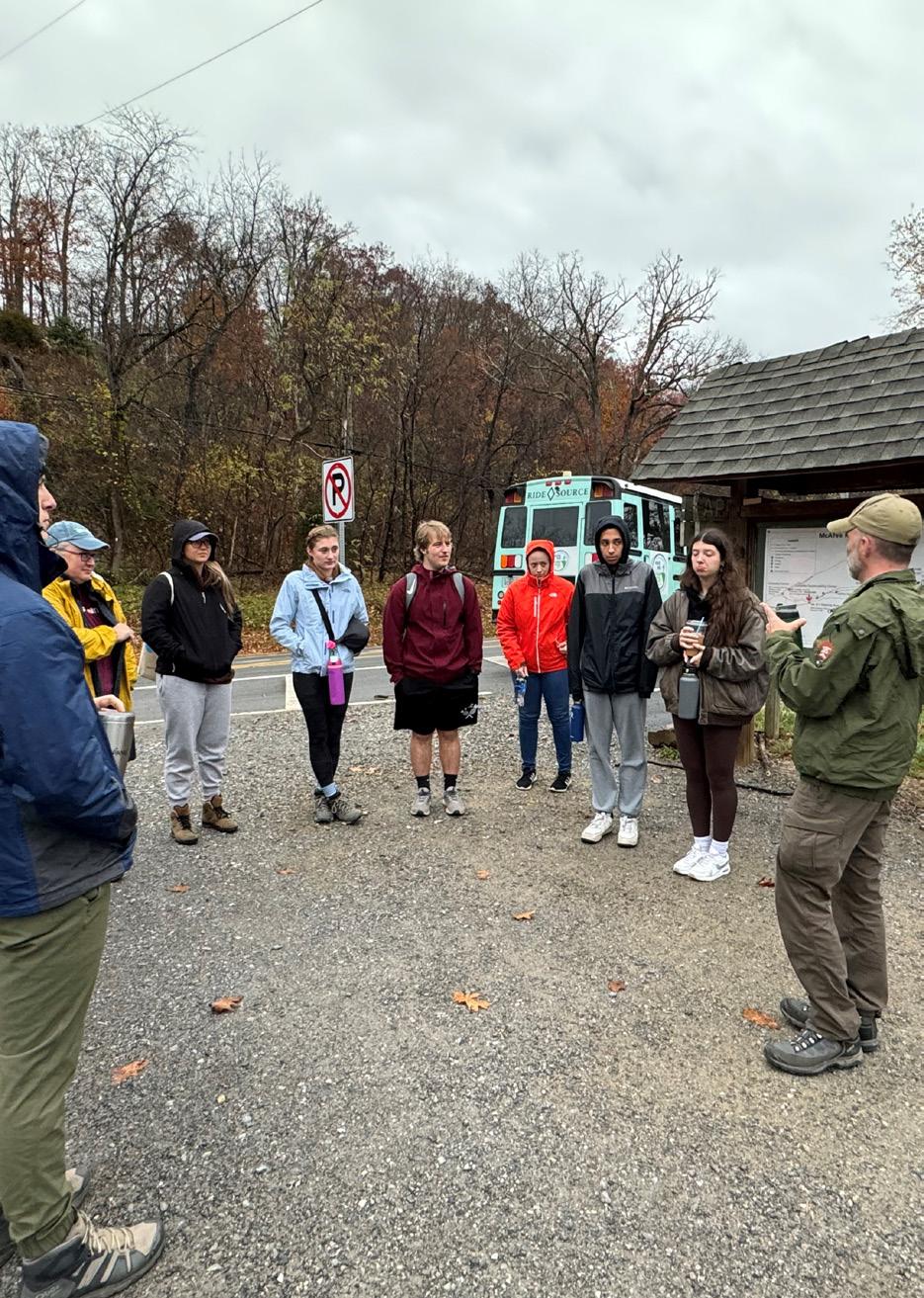
Planning staff collaborated with Dr. Annie Pearce and her Virginia Tech Sustainable Infrastructure Systems students over the course of four classes to introduce the multidisciplinary graduate students to real world challenges, opportunities and problem solving. Staff reviewed the ongoing work of a variety of federal, state, regional and local stakeholders to manage the hiking demand to access McAfee Knob, which included a shuttle ride and hike south along the Appalachian Trail to Sawtooth Ridge with National Park Service Park Ranger Brian Wilson. The students also studied the potential greenway segments identified at the July West Roanoke River Greenway Feasibility Study community meeting to evaluate each using the Envision Rating System. The class and staff walked sections of the Roanoke River Greenway in Salem and in Green Hill Park and drove by the construction for the West Roanoke River Greenway Phase 1 segment. The students concluded the class in mid-December with a virtual presentation on the results of their Envision analysis to County staff and Feasibility Study Steering Committee members.
The Roanoker Magazine recognized Alexander Jones, Principal Planner, in their “40 Under 40” Class of 2023. Applicants were judged not only on their career achievements, but also on their involvement in the community and other factors. Alexander Jones leads the long-range planning division in the Department of Planning; he also manages the social media pages and assists managing other Roanoke County pages to promote community, planning and zoning-related projects to all county citizens. When interviewed, Alexander said “Serving the citizens of Roanoke County is the best and most impactful part of my job.”
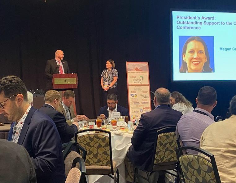
American Planning Association’s Virginia Chapter (APA-VA) awarded Megan Cronise, Assistant Director of Planning, the President’s Award for “Outstanding Support to the Chapter’s Annual Conference” at The Hotel Roanoke on July 19, 2023. Megan hosted two mobile tours at the annual conference including the Appalachian Trail Hike to Sawtooth Ridge, which showcased the McAfee Knob Trailhead Shuttle, and Transportation Projects in the Roanoke Valley. Megan also participated in three conference sessions, highlighting the Route 419 Town Center Plan, Complete Streets, and the McAfee Knob Trailhead Shuttle/ Appalachian Trail.
Megan Cronise, Assistant Director of Planning was recently recognized by the Virginia Regional Partnership as Agency Partner of the Year for her outstanding contribution to the Appalachian National Scenic Trail in consideration of her work in implementing the McAfee Knob Trailhead Shuttle. Megan was nominated by former President of the Roanoke Appalachian Trail Club (RATC), William Neilan. This is an unprecedented recognition as the award is usually for volunteers or state level partners.This is the first time a Roanoke County employee has been awarded this recognition.

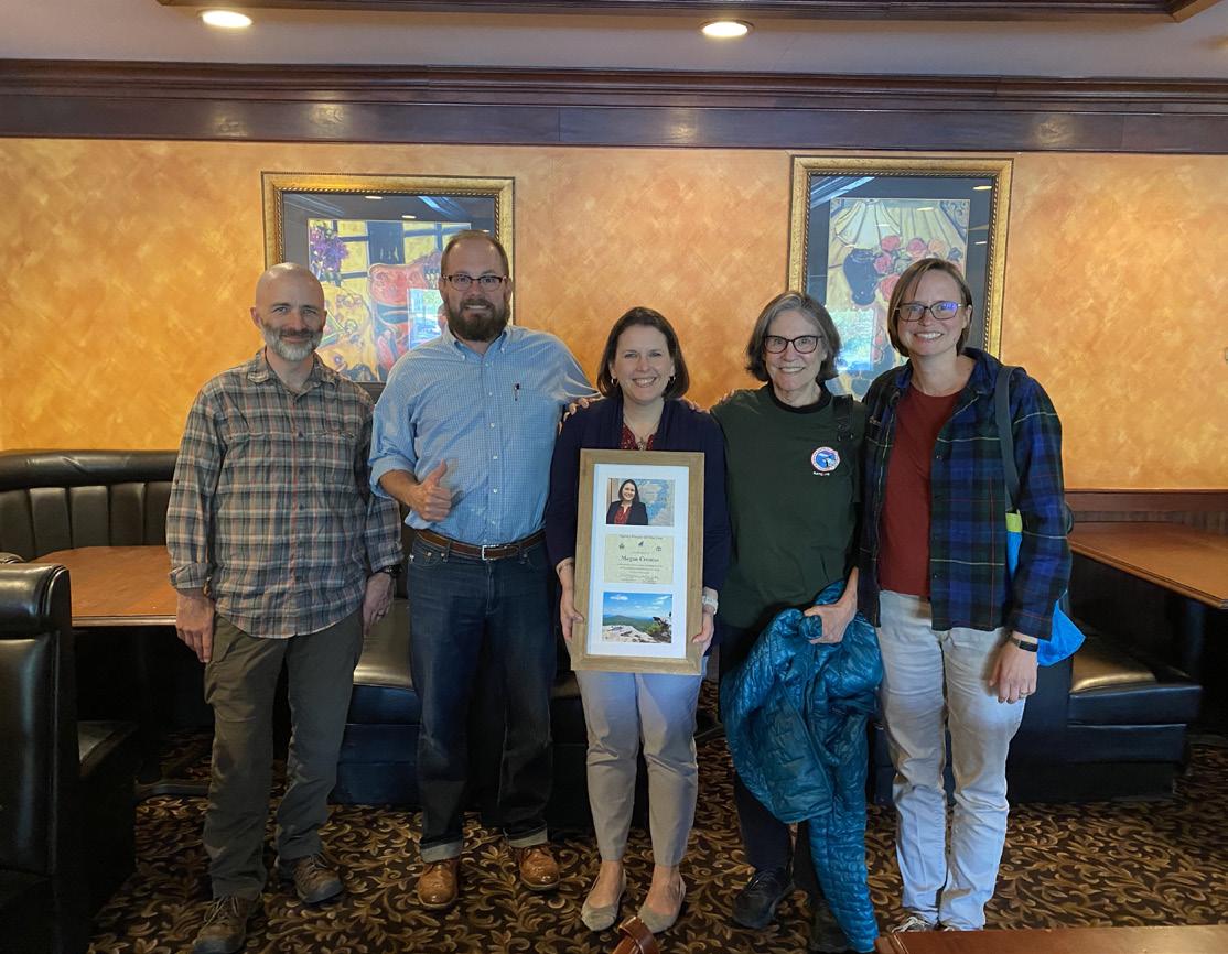
Megan receiving the VRPA Partner of the Year


www.roanokecountyva.gov/pz | www.facebook.com/RoCoPlanning