This Plan Summary highlights the key components of the various sections of the Peters Creek Planning Area. The Existing Conditions section features the study area’s demographics, community facilities, natural resources, cultural resources, land use, zoning, and the people that participated in the Plan’s development.
The Peters Creek Planning Area’s goals were inspired by public input and used to develop the Plan’s recommendations in the County’s Comprehensive Plan Update. Implementation of this Plan will be completed over the next 15 years.
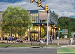
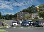
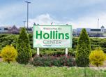
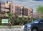
Hollins Center Plan (2020)
The Hollins Center Plan was adopted by the Board of Supervisors on July 28, 2020, as a component of the Roanoke County Comprehensive Plan. The Hollins Center Plan is also a component of this Peters Creek Community Planning Area Summary Document.
Natural & Cultural Resources
Protect and improve ground, surface and stormwater resources; beautify public areas, viewsheds and roadways; clean up garbage; protect steep slope areas; and protect forests, natural areas, and wildlife habitats.
Parks, Recreation, & Tourism
Continue developing programs at Green Ridge Recreation Center; promote Park Partners Program; evaluate opportunities for parks & greenways/trails; increase trail connections as shown in the Roanoke Valley Greenway Plan; and evaluate park, trail and blueway options.
General Services
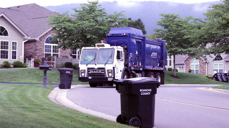
Support recycling options and implement recommendations from the assessments of County Fire Department Facilities and the Administration Center.
Libraries
Improve service and enhance existing facility; evaluate programming needs from consumer feedback that serve people of all ages and backgrounds; raise level of engagement with the community; and ensure timely delivery of all circulating materials.
Communications & Technology
Expand and improve high-speed broadband access and cell phone service availability in underserved areas.
Public Safety
Provide efficient delivery of public safety services with minimal response times; enhance public safety staffing; enhance facilities and equipment; and provide a high-level of citizen engagement and education opportunities.
Transportation (Roads)
Initiate a Williamson Road Multimodal Safety Study with VDOT to determine improvements to reduce crashes and improve safety for all users.
Transportation (Roads)
Initiate a Peters Creek Road Multimodal Safety Study with VDOT to determine improvements to reduce crashes and improve safety for all users.
Transportation (Greenways)
Collaborate with property owners and stakeholders to finalize the alignment, fund and construct the Tinker Creek Greenway between the City of Roanoke and Botetourt County.
Land Use
Amend the Future Land Use Map to strategically preserve the residential character of Peters Creek and promote economic development. Continue implementing the Hollins Center Plan. Develop a plan for the Wood Haven Activity Center adjacent to exit 143 on Interstate 81.
Location, Context, and Boundary
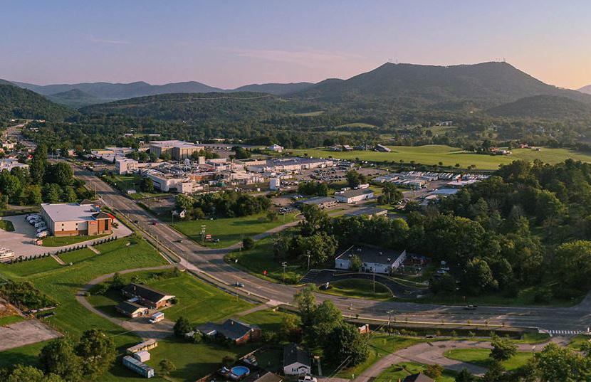
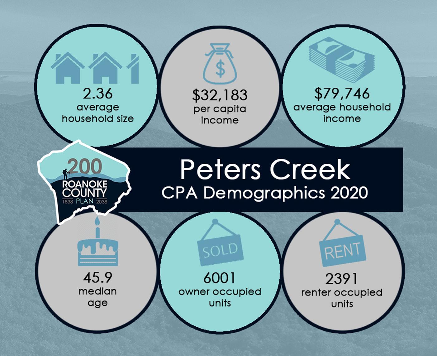
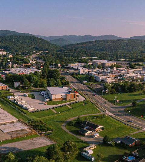
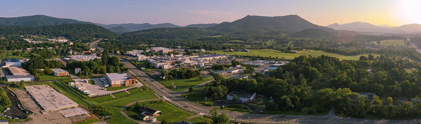
The Peters Creek Community Planning Area (CPA) is located in the north eastern part of Roanoke County. This suburban portion of Roanoke County is bordered by Botetourt County to the north, the City of Roanoke to the south and the City of Salem to the west. The study area encompasses 8,897 parcels totaling approximately 9,310 acres. The Peters Creek Community Planning Area is home to approximately 20,800 people
Peters Creek Planning Area is a hub of commercial activity, particularly along Peters Creek Road and Interstate 81. This planning area has many amenities including several overlooks at Read Mountain Nature Preserve and Carvins Cove Natural Reserve. The CPA is transected by Interstate 81. It is conveniently located to both the City of Roanoke’s and the City of Salem’s downtowns by approximately five miles.
Source: 2019 US Census Data , ,
Demographic Trends
• The median age of residents continues to increase as the baby boomer generation ages. The median age in Peters Creek is 45.9 years.
• Countywide, over the last few decades families living in the same house have fewer people, and two-person households are increasing.
• Peters Creek’s population grew 15% from 1983 to 2010 and 5% from 2010 to 2020, to 20,810. Countywide, there were fewer babies born from 2010 to 2020, but population grew 4.9% due to people moving here from outside the County.
• According to most recent Census data, more than 72% (6,001) of the housing units are owned, while approximately 28% (2,391) are rental properties.
• Per capita income is around $32,180 in the Peters Creek CPA for each individual and the average household income is approximately $79,750.
• The average household size is 2.36 persons per household.
E X I S T I N G C O N D I T I O N S
Natural Resources
Topography
Hydrology
Floodplains
Soils
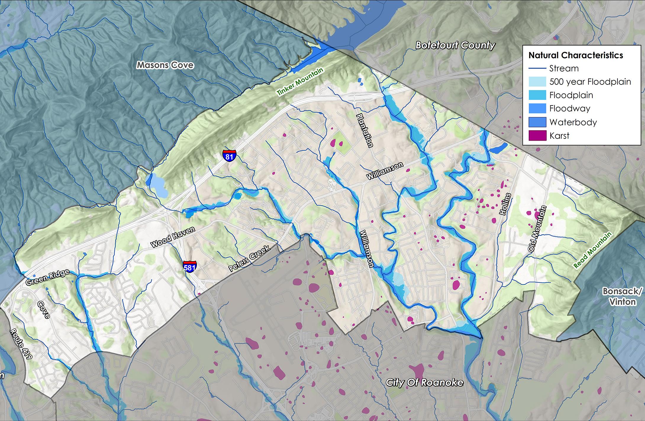
Peters Creek has a large number of streams and significant floodplain areas. Other environmentally sensitive conditions include karst topography, an underlying geologic condition resulting in caves and crevices that allow stormwater to infiltrate and quickly migrate and transport potential pollutants. There are several creeks in this CPA where flooding has caused repetitive losses for nearby properties. These include: 1) Peters Creek and its tributary near Green Ridge Road and Cove Road; 2) Tinker Creek near Summerdean Gardens subdivision; and 3) Carvin Creek near Orlando Avenue and Hollins Gardens subdivision.
The Peters Creek CPA has 477 acres, or 4.8% of all total land, located within the 100-year floodplain. An additional 150 acres (1.5%) are located within the 500-year floodplain. There is a major flooding problem in the Carvin Creek watershed in the Sun Valley subdivision located on the main stem of Carvin Creek (Verndale Drive and Route 623 in northeastern Roanoke County). Approximately 100 houses are located in the 100-year floodplain, including more than 25 that are inundated by a 10-year storm. Approximately 592 acres of land (6%) in this CPA are under conservation easements. A conservation easement is designed to protect agricultural, forest, historic, or open space resources. An additional 389 acres (4%) of land is under public and private protective management.
Cultural Resources
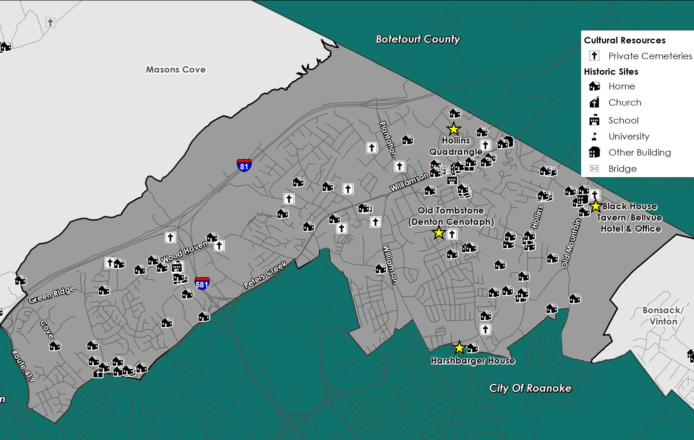
The Peters Creek CPA has four (4) properties on the National Register of Historic Places and the Virginia Landmarks Register (these are marked on the map with a gold star). View the Roanoke County Historic Places Story Map to learn more and see photos of the properties. Other historic resources include numerous homes and private cemeteries
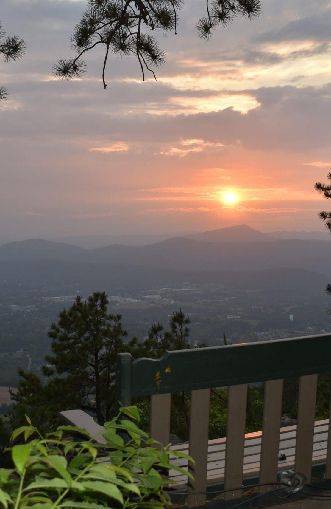
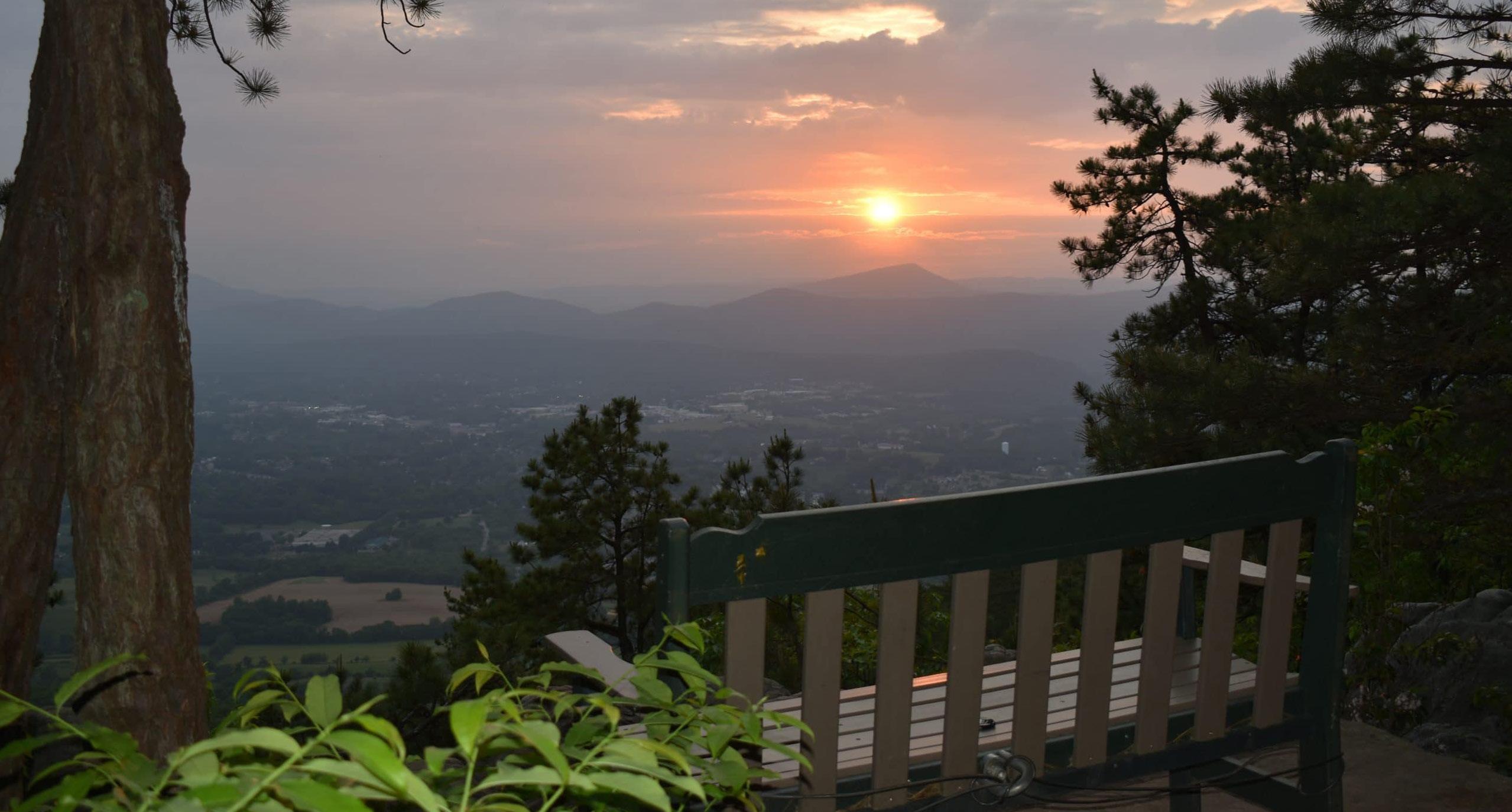
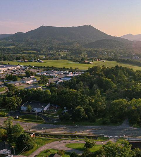
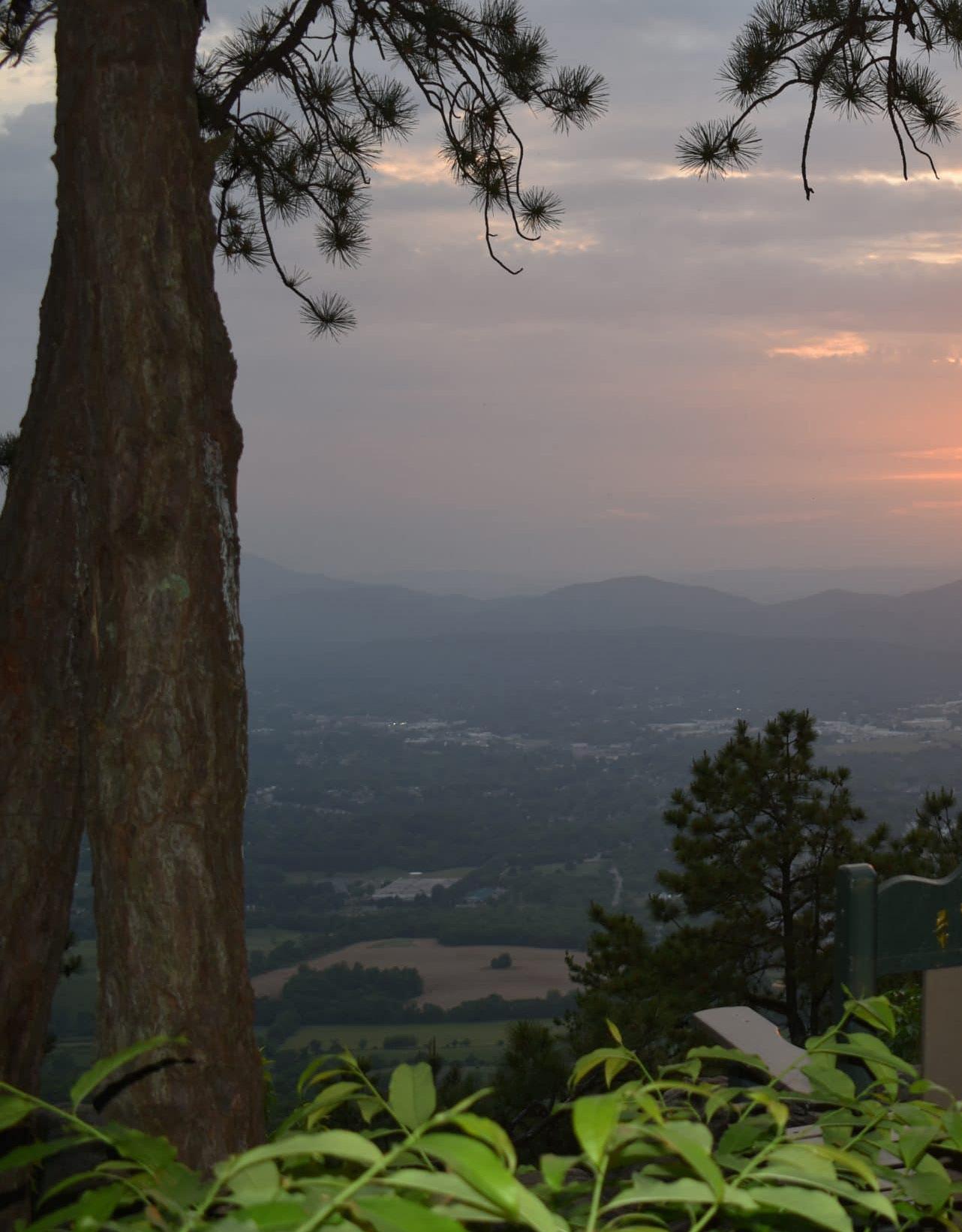
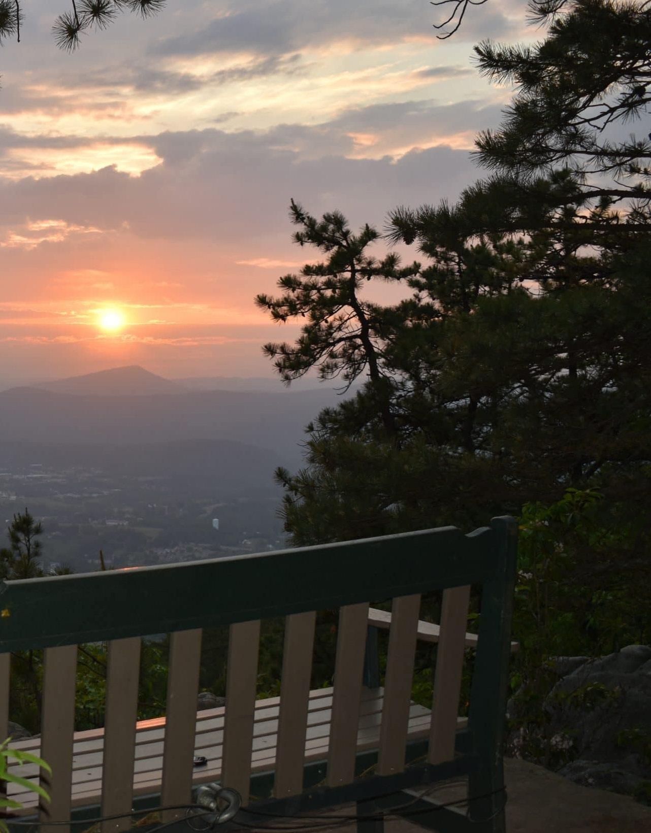
Viewshed protection for Tinker Mountain to the northeast of the CPA is identified in the Hollins Area Plan as significant to the overall identity of Peters Creek. Other important viewsheds include Read Mountain to the southeast, Brushy Mountain to the north, and Fort Lewis Mountain in the southeast.
Source: Historical Architecture Reconnaissance Survey Report (1992) and National Register of Historic Places
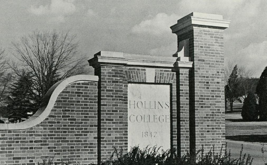
HOLLINS UNIVERSITY ENTRANCE
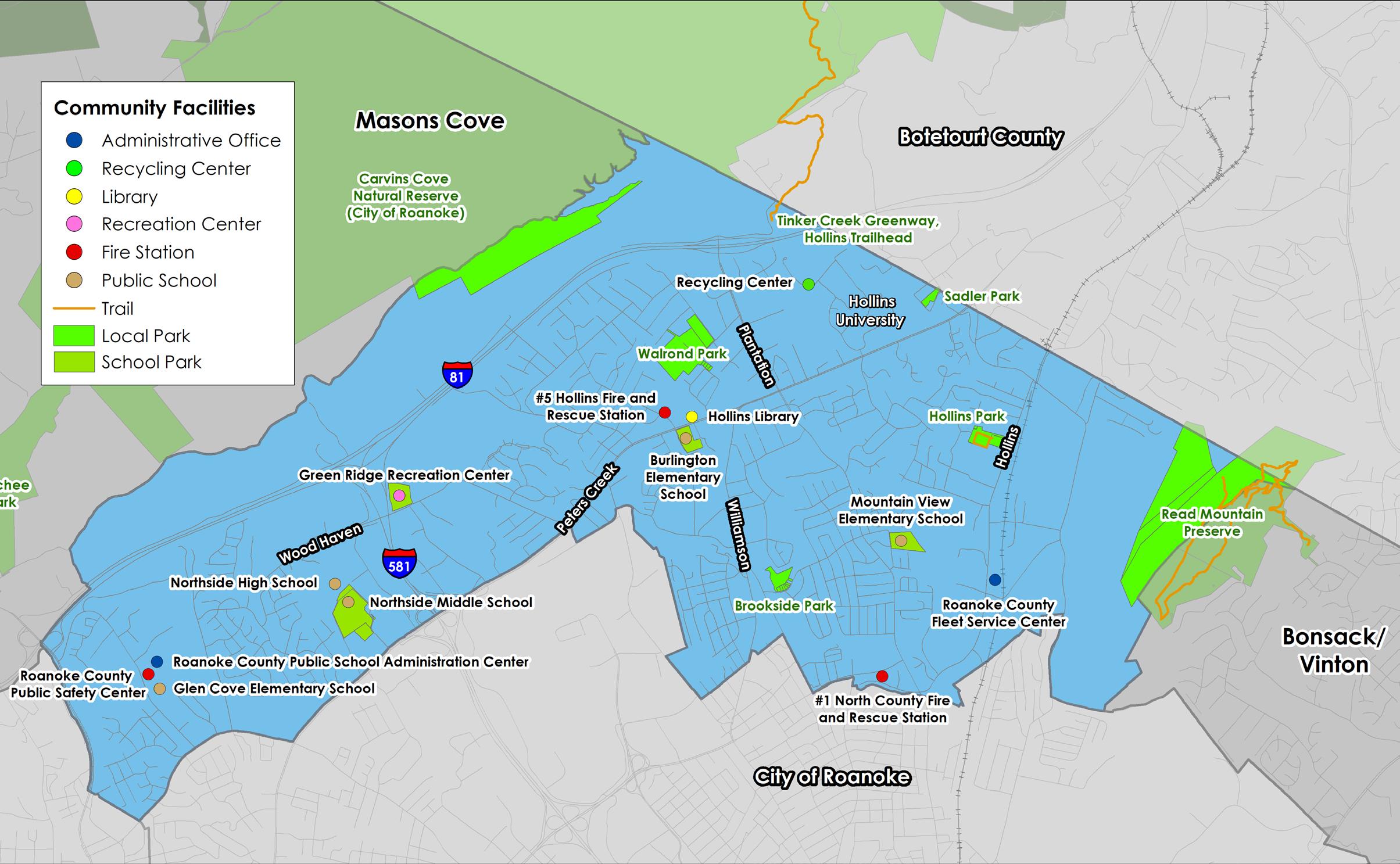
Community Facilities
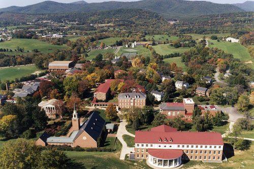
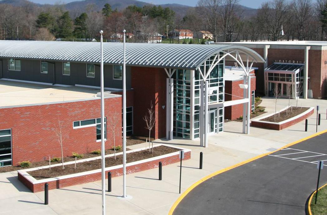
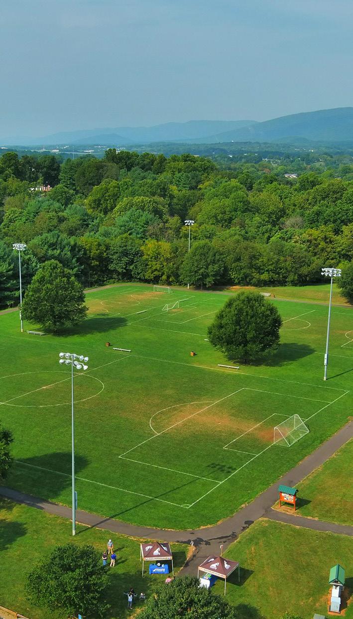
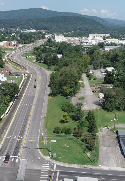
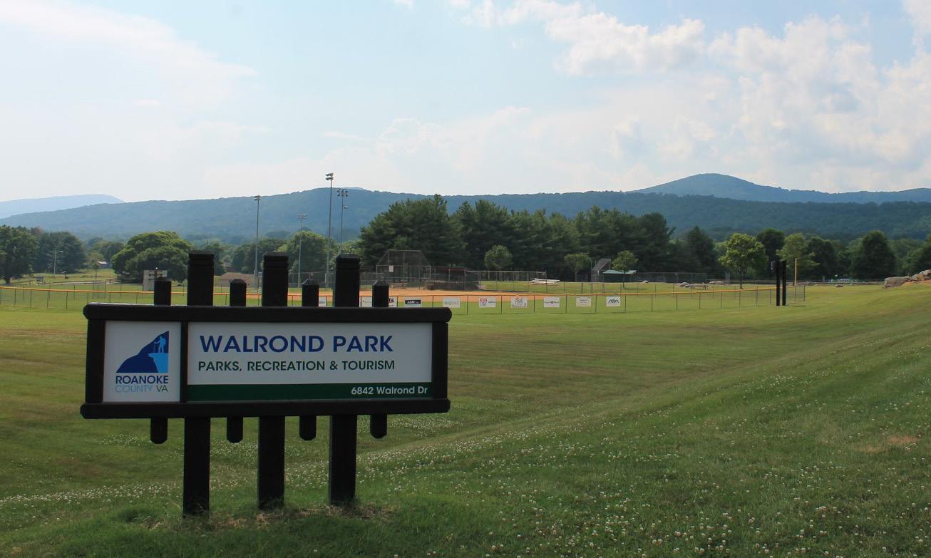
Peters Creek is a gateway to the region. It can be easily accessed by Interstate 81, Interstate 581, Peters Creek Road, Plantation Road, and Williamson Road. This CPA is home to Hollins University, the Hollins Library and Roanoke County’s Public Safety Center. Recreation spaces in this CPA include Green Ridge Recreation Center, Splash Valley Water Park, Walrond Park, several smaller neighborhood parks, Read Mountain Preserve, Northside High Softball Complex and the trailhead for the Tinker Greek Greenway, which runs to Carvins Cove Natural Reserve.
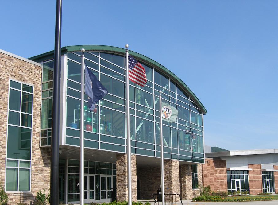
The Hollins Center Plan (2020) called for the Hollins Library to be rebuilt as a 21st century library for learning and gathering. Schools serving the Peters Creek area are under enrollment capacity. This is consistent with most Roanoke County Public School trends. Burlington Elementary School, Glen Cove Elementary School, Mountain View Elementary School, Northside Middle School, and Northside High School are all under maximum capacity. A 31-acre site was recently purchased by the School Board at 6251 Peters Creek Road in North County for a new Career and Technical Education (CTE) center for Roanoke County Public Schools.
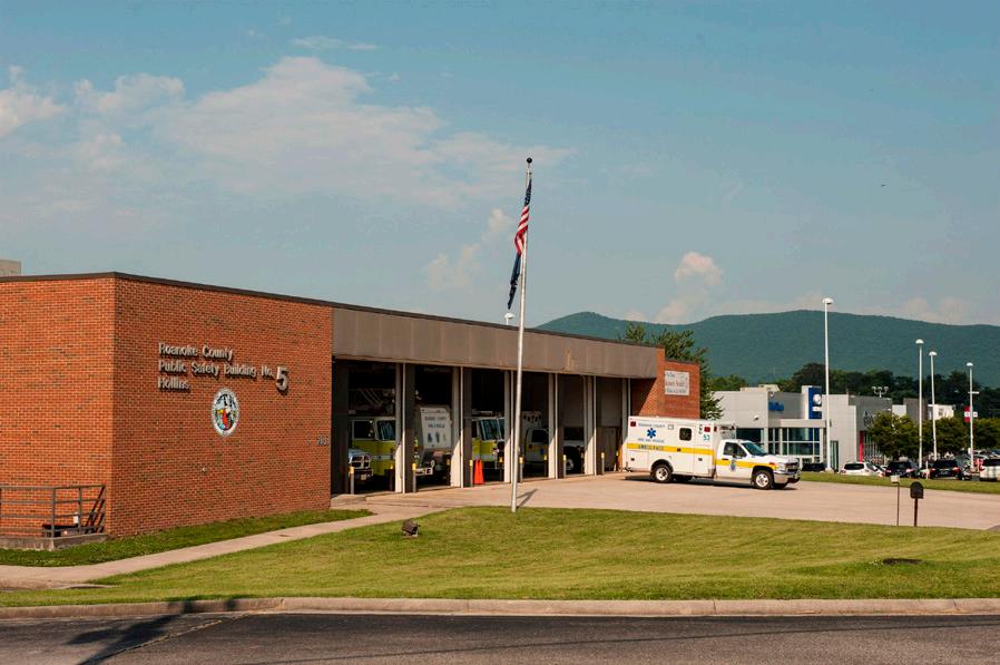
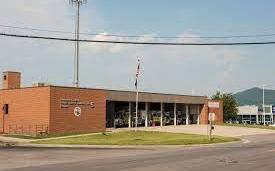
The area is served by the #1 North County Fire and Rescue Station and #5 Hollins Fire and Rescue Station. Out of all 11 CPAs, the Peters Creek CPA has the highest number of Fire-EMS and Police calls for service.
E X I S T I
N D I T I O N S
Transportation
Roads
Transit
Greenways/Trails
Bicycle & Pedestrian Accommodations
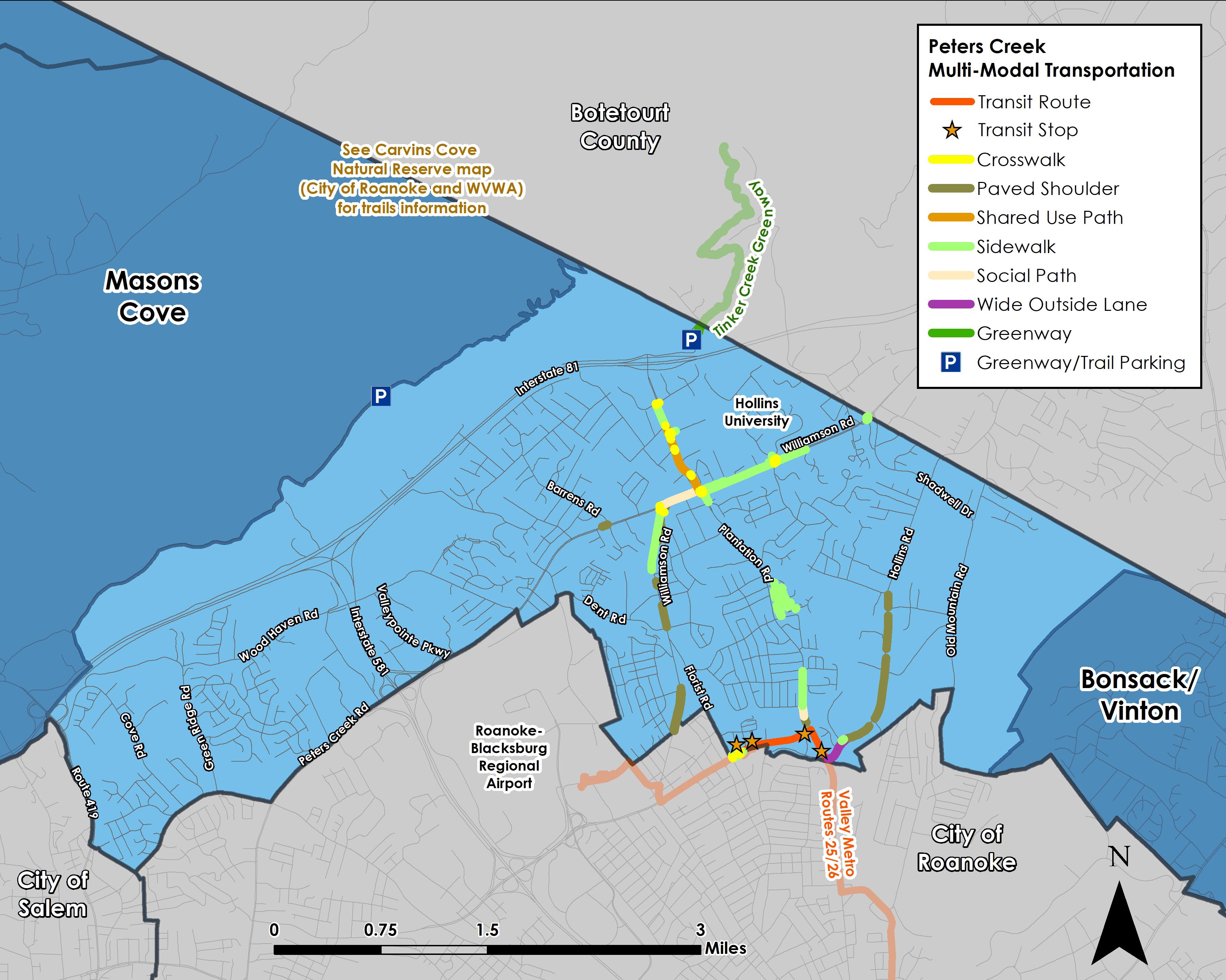
As a densely-populated area, Peters Creek is home to more multimodal infrastructure than most CPAs in Roanoke County. This includes a shared use path on Plantation Road and a trailhead parking lot for a section of the Tinker Creek Greenway connecting Hollins University to the Carvins Cove Natural Reserve. Sidewalks connect Hollins University to the Williamson Road/Plantation Road intersection. There are four stops for Valley Metro’s Routes 25 & 26 located along Plantation Road and Hershberger Road, which connect Downtown Roanoke to the RoanokeBlacksburg Regional Airport.
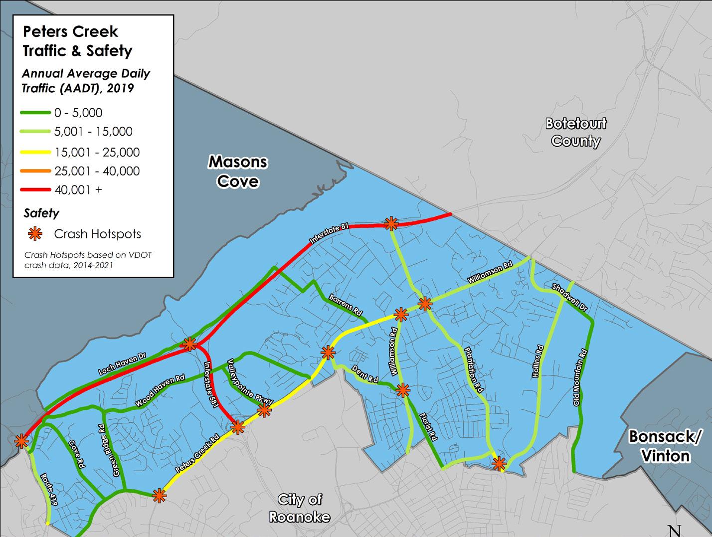
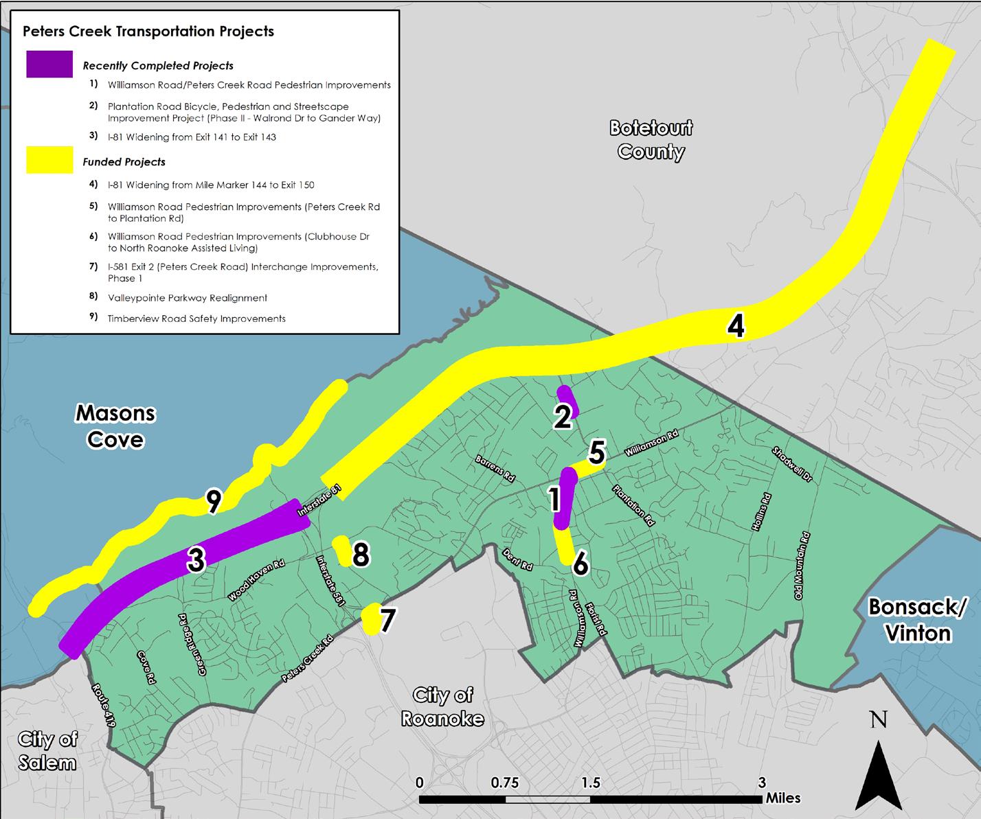
Interstate 81 crosses the northern portion of the Peters Creek CPA and is the busiest roadway in the County with over 73,000 vehicle trips per day between Exit 141 at Route 419 and Exit 143 at I-581. Crash hotspots are located at Exit 141 (Route 419), Exit 143 (I-581) and at Exit 146 (Plantation Road). Construction is complete to widen I-81 to six lanes between Exit 141 and Exit 143. Funding is in place and design is underway for widening to occur between Mile Marker 144 and Exit 150 (Route 220 at Troutville). Outside of Interstate 81, Peters Creek Road is the most traveled roadway with over 20,000 vehicle trips. This roadway also has several crash hotspots at major intersections.
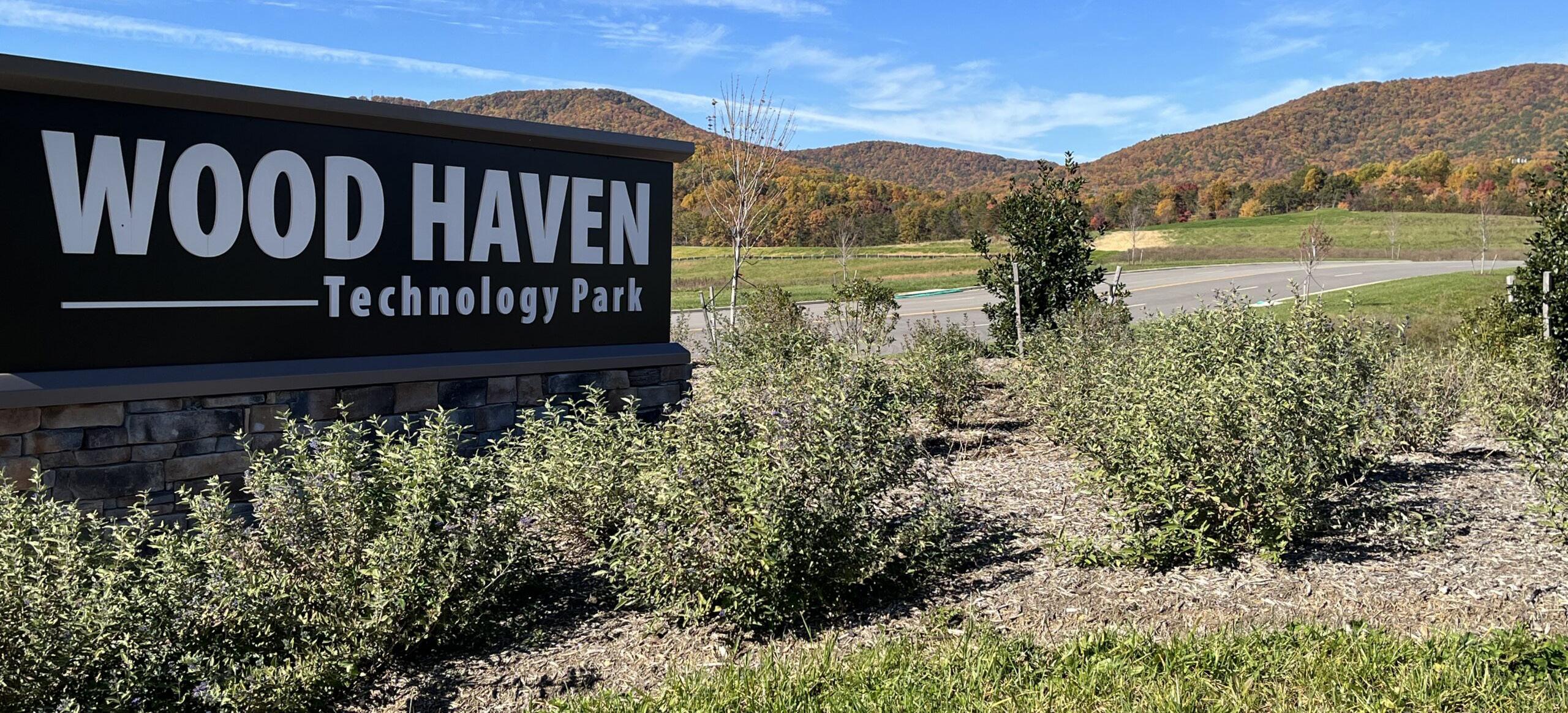
The Hollins area has been the focus of two long-range planning studies since 2007 that have resulted in recommendations for and funded projects to construct sidewalk and bicycle accommodations along Plantation Road and Williamson Road. Two sidewalk projects are complete along Williamson Road between Peters Creek Road and North Roanoke Assisted Living, and along Plantation Road between Walrond Drive and Gander Way. Additional funded sidewalk segments will create a continuous path along Williamson Road between Plymouth Drive and Plantation Road. The trails in the area include a segment of the Tinker Creek Greenway that starts on Hollins University property just north of Interstate 81, trails at the City of Roanoke’s Carvins Cove Natural Preserve and trails at the Read Mountain Preserve. A project to widen and realign Valleypointe Parkway with sidewalk was recently funded to improve access to the Wood Haven Technology Park. Valley Metro bus service stops at a few locations just inside the Peters Creek CPA in this area, along Plantation Road and Hershberger Road.
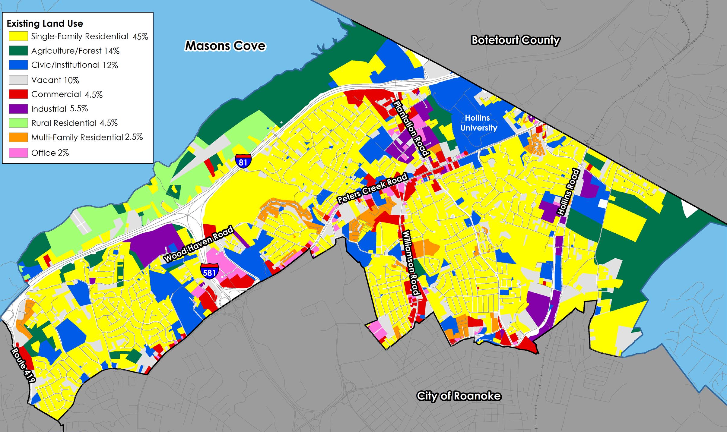
Existing Land Use
Peters Creek is surrounded by the scenic views of Tinker, Green Ridge and Read Mountains. Outdoor public amenities such as Roanoke Valley Greenways, Carvins Cove Natural Reserve trails and water sports, and Read Mountain hiking trails, as well as Walrond and Brookside Parks and Green Ridge Recreation Center, are key resources for Peters Creek and the larger region. Educational resources include Glen Cove, Mountain View and Burlington Elementary schools, Northside Middle and High Schools, and Hollins University.
52% of the land is developed as residential neighborhoods: 45% single-family residential, 4.5% rural residential, and 2.5% as multi-family residential. The Peters Creek CPA has the highest population density in the County.
25% of the land is developed by educational, commercial, industrial and office uses. Hollins University has a population of 668 women undergraduate students and 130 coed graduate students. Plantation Road, between I-81 and Williamson Road, has the highest employment concentration in the County. Wood Haven Technology Park is being developed by Western Virginia Regional Industrial Facility Authority to attract new industries to the region.
14% of the land is in agricultural use, while 10% is vacant. Read Mountain Preserve has been expanded from approximately 250 acres to approximately 500 acres.
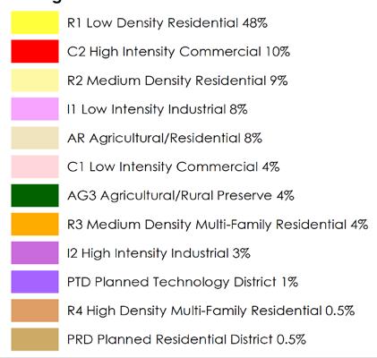
Zoning
The majority of land in Peters Creek (48%) is zoned for single family neighborhoods. Commercial, industrial and technology districts together comprise 26%. The rest of the residential districts combined equal 22%, while Agricultural/Rural Preserve is 4% of the land area.
The R-1 Low Density Residential district and R-2 Medium Density Residential district are established for areas of the County within the urban service area with low and medium density residential development. The R-3 Medium Density Multi-Family Residential district provides areas in the County within the urban service area for medium and high density residential developments such as townhomes and apartments. The R-4 High Density Multi-Family Residential district similarly provides for only high density residential developments. The Planned Residential Development (PRD) district is intended to allow greater flexibility than is generally possible under conventional zoning district regulations to allow developers to incorporate a variety of housing options as well as certain limited commercial and office uses designed to serve the inhabitants of the district. The C-1 Low Intensity Commercial district provides low-intensity commercial land uses within the urban service area, including small-scale office and retail businesses. In contrast to the C-1 district, the C-2 High Intensity Commercial district provides for a much wider variety and greater intensity of commercial land uses at a regional scale within the urban service area. The I-2 High Intensity Industrial district allows for high-intensity, industrial land uses within the urban service area. The I-1 Low Intensity Industrial district similarly allows for low-intensity industrial land uses. Both zones are regulated in a manner to protect surrounding properties and natural resources from potential negative impacts commonly associated with industrial activity. These districts are provided to promote economic activity in the region. The PTD Planned Technology Development district is intended to function as a well designed industrial park with architecture and landscaping that compliments the surrounding properties and natural resources. This district is also provided to provide flexibility and incentives for potential developers.
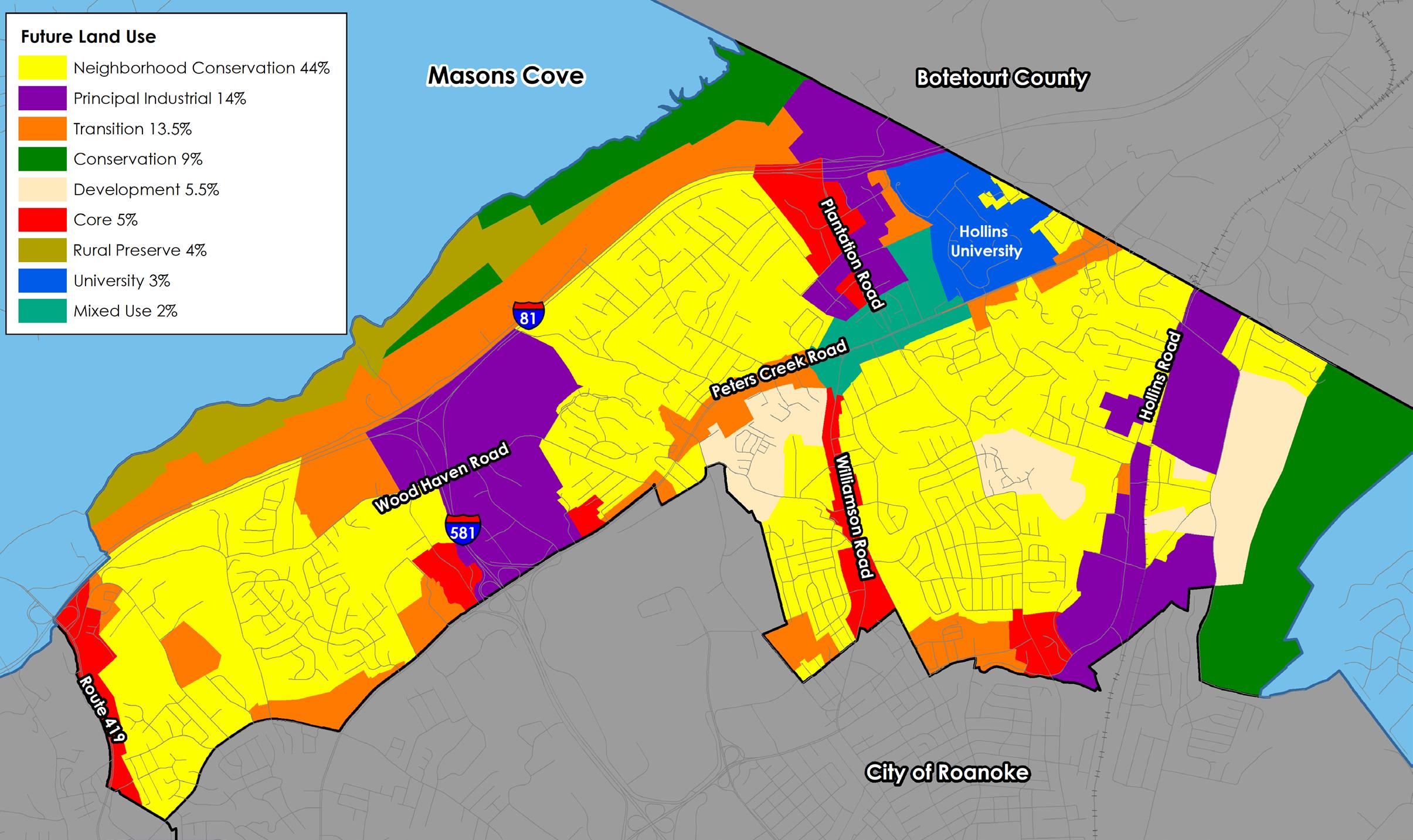
Future Land Use
The map below shows the future land use designations in the Peters Creek CPA from the 2005 Comprehensive Plan. The Peters Creek CPA is considered to be within the County’s urban development area.
44% of the CPA is designated for the Neighborhood Conservation future land use, which is intended to protect existing residential neighborhoods. 5.5% of the land is designated for Development, which is intended to promote future residential development. These two (2) future land uses combined are about half (49.5%) of the land in the Peters Creek CPA.
The Peters Creek CPA has a high ratio of land designated for commercial and industrial uses. Together, Principal Industrial (14%), Transition (13.5%), and Core (5%) make up about a third (32.5%) of the land in the Peters Creek CPA. These future land uses are located along I-81, Route 419, Peters Creek Road, Plantation Road, Williamson Road, Hollins Road, and Valleypointe Parkway.
9% of the land in Peters Creek is designated Conservation (Carvins Cove and Read Mountain). The rest represent Rural Preserve, University, and Mixed Use future land uses.
PLANTATION ROAD
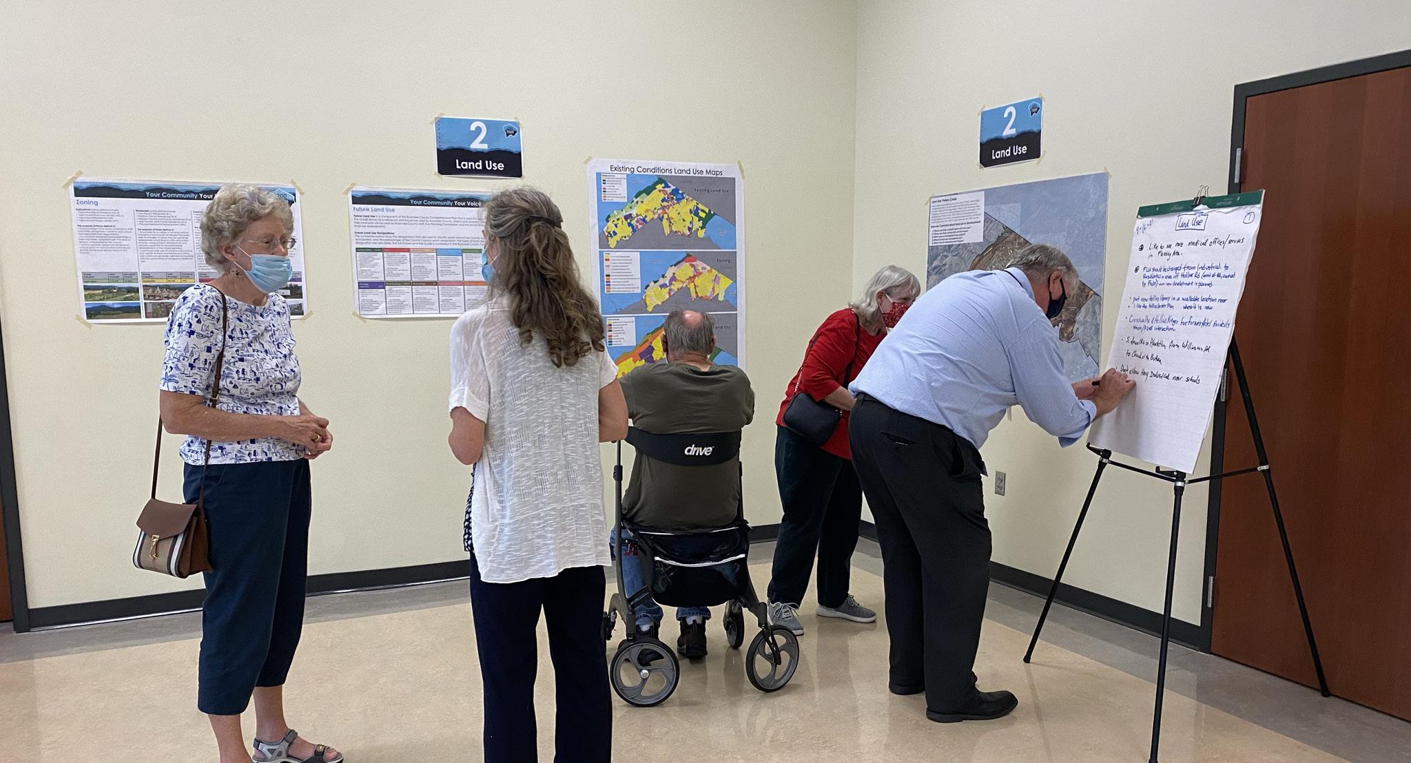
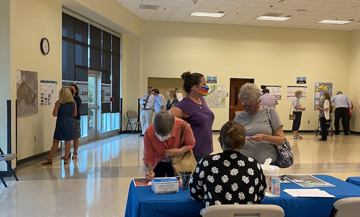
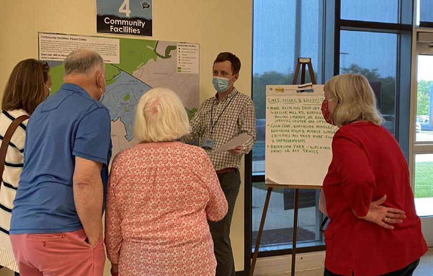
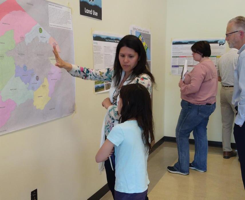
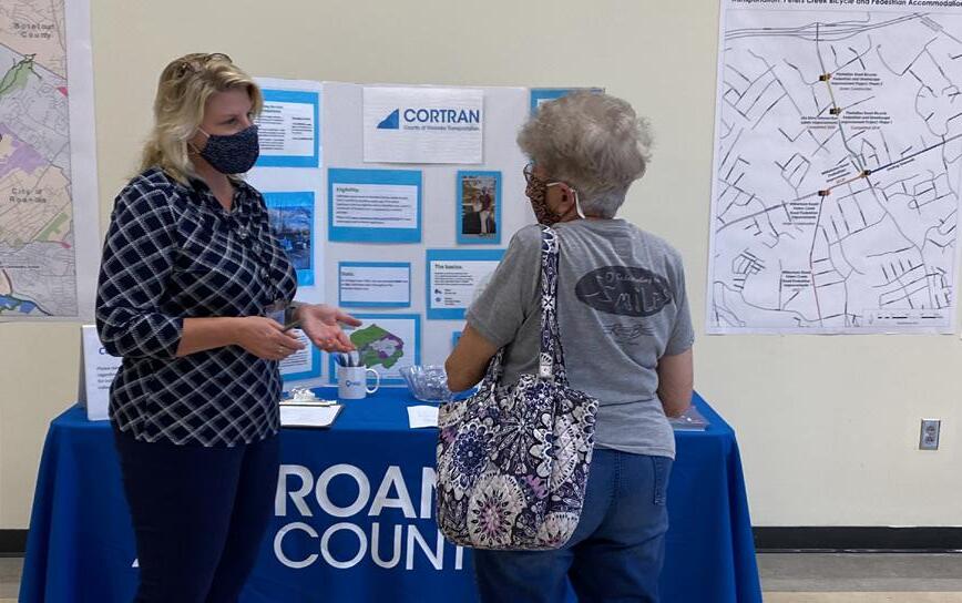
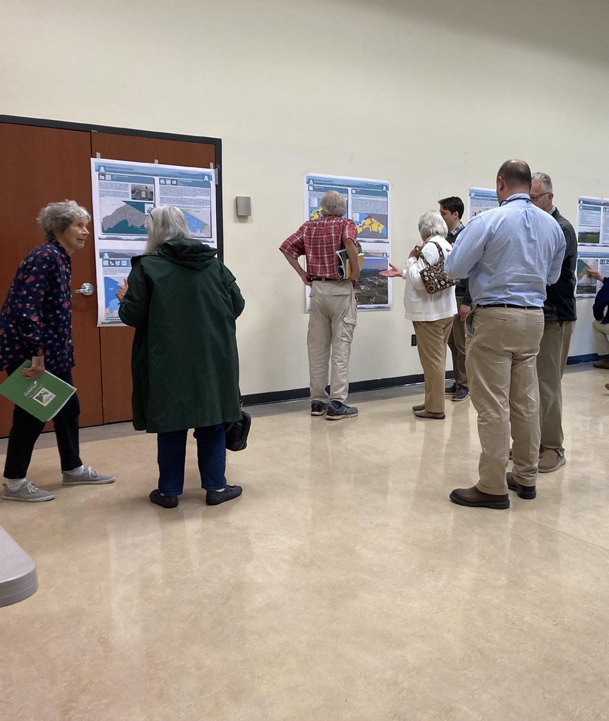
Fall 2021 Community Meetings - Existing Conditions
Twelve (12) planning meetings were held around Roanoke County in Fall 2021 to collect preliminary feedback about community issues and needs. The community meeting for the Peters Creek CPA was held on September 16, 2021, at the Green Ridge Recreation Center. There were 39 attendees. Citizens were invited to comment on Land Use, Community Facilities, Transportation, and Protection and Preservation. Comments and suggestions from citizens were collected and assembled by staff into a “Post Meeting Summary” document. A digital copy of this document can be found on the Roanoke County 200 Plan webpage.
Fall 2021 Community Input Highlights:
a. Attendees brought up a wide variety of land use issues including additional commercial/ office development and protecting single family neighborhoods.
b. Residents generally wanted improved community facilities in the area, including a new Hollins Library.
c. Staff had many discussions with attendees about transportation issues including Peters Creek Road, Plantation Road, and the Tinker Creek Greenway.
d. Natural Preservation was a high priority for Peters Creek residents.
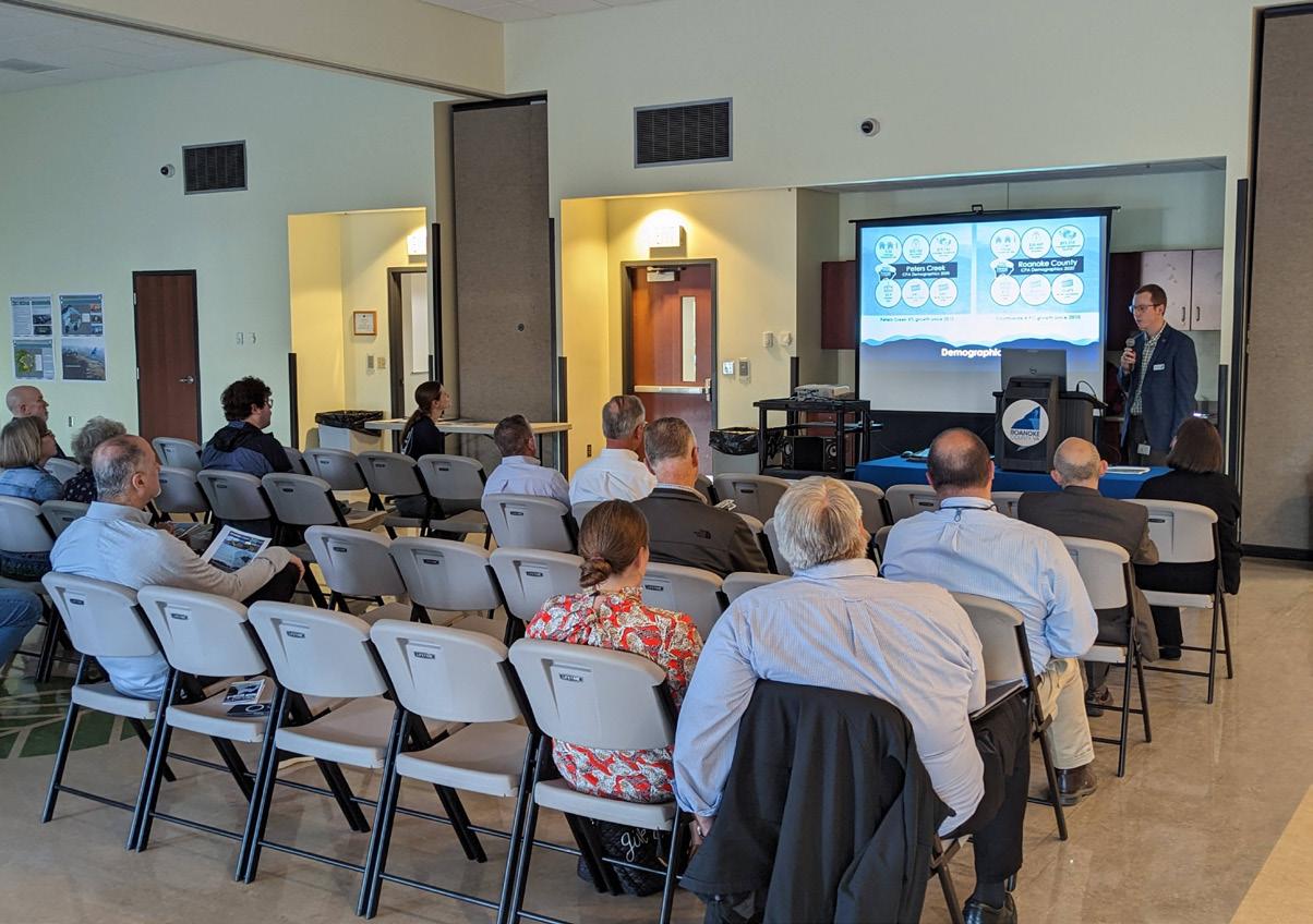
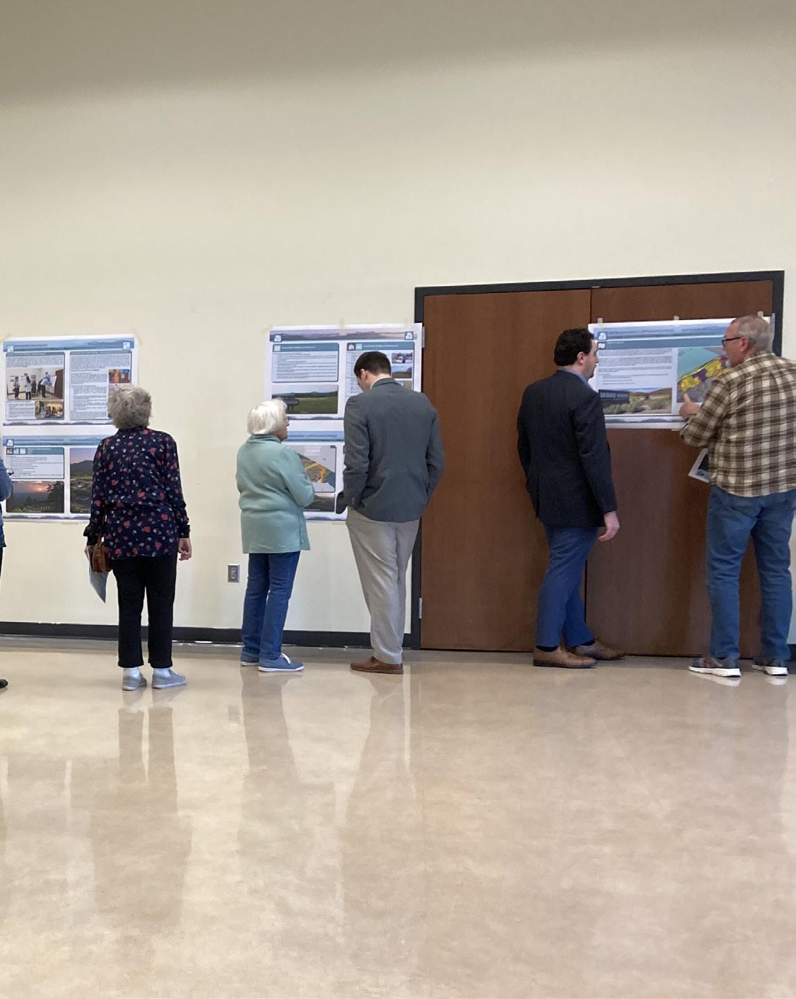
Spring 2022 Open House Meetings - Draft Goals and Recommendations
Seven (7) Roanoke County 200 Plan open house planning meetings were held around Roanoke County in Spring 2022 for citizens to review draft goals and recommendation options based on the feedback received throughout the Fall 2021 community engagement. Draft goals were developed based on input that we received at the community meetings and online surveys in Fall 2021. Citizens reviewed and provided comments on the new draft goals and recommendations that will shape the draft Roanoke County 200 Plan document. The draft goals and recommendations displayed included natural and cultural resources, land use, community facilities and infrastructure, and transportation. The community meeting for the Peters Creek CPA was held on April 11, 2022, at the Green Ridge Recreation Center. There were 14 attendees.
Spring 2022 Community Survey Highlights:
Natural and Cultural Resources:
The majority (92%) of survey respondents and community meeting participants support the eleven recommendations to protect and improve ground, surface and stormwater resources; beautify the County’s public areas, viewsheds and roadways; clean up garbage; protect steep slope areas; protect trees and forests, natural areas and wildlife habitats; as well as protection of historic and cultural resources.
Community Facilities and Infrastructure:
a. Parks, Recreation and Tourism: 96% of respondents support the Countywide recommendations as well as the following items pertaining to the Peters Creek CPA: 1. Evaluate new parks, greenways/trails and blueways. 2. Evaluate needs at existing parks.
b. General Services: 90% of respondents support recycling options and assessments of County Fire Department Facilities and the Administration Center building.
c. Public Libraries: 93% of respondents support the Countywide library system recommendations.
d. Communications and Information Technology: 95% of respondents support expansion and improvement of broadband and cell phone access.
e. Public Safety: 97% of respondents support Countywide public safety recommendations.
Land Use:
83% of respondents support the activity centers as shown on the Activity Center Map, while 9% indicated interest in additional activity centers near Northside High School and in vacant building areas on Routes 460 and 117. 67% of respondents support the proposed changes to the Future Land Use Map.
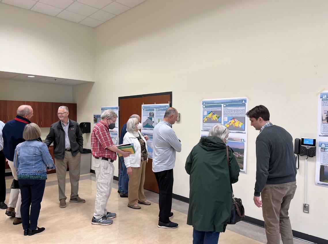
Winter 2023 Community Meetings - Draft Plan Reveal
Six (6) Roanoke County 200 Plan open house planning meetings were held around Roanoke County in Winter 2023 for citizens to review the Draft Roanoke County 200 Plan Countywide Summary Document and Draft Community Planning Area Documents based on the feedback received throughout the community engagement process. Citizens reviewed and provided comments on the draft Roanoke County 200 Plan documents. The community meeting for the Peters Creek CPA was held on March 1, 2023, at the Green Ridge Recreation Center. There were 29 attendees.
In general, the comments provided by residents were concerned with the following:
a. The need for more bicycle and pedestrian accommodations including greenways.
b. Support for economic development and the need to bring additional businesses to the area.
c. A desire to see older, vacant commercial areas redeveloped.
d. Protection of natural resources, including open space, water, air, and floodplains.
e. The location and expansion of the Principal Industrial Future land use designation throughout the area.
f. Automobile and truck traffic safety issues as well as railroad safety.
These issues and concerns are addressed by recommendations in the Peters Creek CPA Summary Document. These recommendations include:
a. Initiate a Williamson Road Multimodal Safety Study with VDOT to determine improvements to reduce crashes and improve safety for all users.
b. Initiate a Peters Creek Road Multimodal Safety Study with VDOT to determine improvements to reduce crashes and improve safety for all users.
c. Collaborate with property owners and stakeholders to finalize the alignment, fund and construct the Tinker Creek Greenway between the City of Roanoke and Botetourt County.
d. Determine pedestrian accommodations along Route 419 from Route 311/Catawba Valley Drive over Interstate 81 to connect to the Hanging Rock Battlefield Trail and to the Hinchee Trail.
e. Construct multimodal improvements on Walrond Drive between Plantation Road and Walrond Park.
f. Evaluate the Carvin Creek Greenway between the City of Roanoke and Clubhouse Drive.
g. Evaluate the Lick Run Greenway between the City of Roanoke and Green Ridge Recreation Center.
h. Complete sidewalk and crosswalks along Williamson Road between the City of Roanoke and Botetourt County.
i. Complete sidewalk and crosswalks along Valleypointe Parkway between Green Ridge Recreation Center and Peters Creek Road.
j. Protect and improve the quality of water in our streams, creeks and rivers.
k. Coordinate with State agencies regarding floodplain risks and prevention.
l. Protect natural areas and wildlife habitats.
m. Amend the Future Land Use Map as shown to strategically preserve the residential character of Peters Creek and promote economic development.
n. Continue Implementing the Hollins Center Plan.
o. Develop a Plan for the Wood Haven Activity Center adjacent to exit 143 on Interstate 81.
In addition to the Draft Plan reveal meetings, the Planning Commission and the Board of Supervisors held public hearings on the Roanoke County 200 Plan. Information on these hearings is contained in the main document of the Roanoke County 200 Plan.
Recommendations
Natural & Cultural Resources
Topography/Viewsheds
Hydrology/Floodplains
Water Quality/Pollution Prevention
Vegetation/Natural Areas
Historic & Cultural Resources
1. Protect and improve the quality of water in our streams, creeks and rivers.
2. Coordinate with State agencies regarding floodplain risks and prevention.
3. Reduce quantity and improve quality of stormwater.
4. Protect and prevent risks to surface waterways, reservoirs, underground aquifers and drinking water wells.
5. Beautify County roadways and public areas.
6. Protect viewsheds from the ridges and from the valleys.
7. Clean up and prevent litter and illegal dumping.
8. Protect steep slope areas.
9. Protect trees and forests and increase tree canopy.
10. Protect natural areas and wildlife habitats.
11. Coordinate with State agencies regarding historic and cultural resources, including cemeteries and archaeological sites.
TINKER MOUNTAIN FROM HOLLINS CENTER
Community Facilities & Infrastructure
Parks, Recreation & Tourism
Parks, Recreation and Tourism Recommendations
1. Evaluate new park, greenway, and blueway opportunities in the community.
2. Evaluate on- and off- road connectivity options between parks, neighborhoods, and community facilities.
3. Continue coordination on regional efforts to enhance and develop outdoor recreation opportunities in our communities.
4. Update the Parks, Recreation & Tourism Master Plan.
5. Continue promotion of the Park Partners Program to encourage citizens and businesses, and organizations to adopt a park, greenway, or trail.
6. Educate citizens on park ordinance updates (i.e., park sign updates, dog-friendly parks/special events and leash laws, drones, etc.).
7. Continue developing programs that balance community needs with available staffing resources.
8. Evaluate the needs of existing parks and trails (i.e., trail maintenance, tennis court conversion to pickleball, etc.).
WALROND PARK
General Service Recommendations
1. Evaluate recycling program options.
Community Facilities & Infrastructure
2. Implement recommendations from the Roanoke County Fire Department Facilities Assessment.
3. Implement recommendations from the Roanoke County Administration Center Assessment.
Public Libraries Recommendations
1. Improve services and continue enhancing facilities.
2. Evaluate programming needs and wants based on a variety of data and customer feedback.
3. Implement responsive, community focused program that serves people of all ages and backgrounds.
4. Ensure timely delivery of all circulating materials.
5. Raise level of engagement with the community, and increase awareness about library services and programs.
Communication & Information Technology Recommendations
1. Explore opportunities to extend broadband service with universal availability and access to high-speed Internet in unserved and underserved areas.
2. Explore alternative broadband and cell phone service providers for choice and competition.
3. Explore more public-private partnerships to implement more stages of Roanoke County’s Rural Broadband Initiative to bring high-speed Internet to homes without broadband access.
4. Explore providing improved cell phone service in unserved and underserved areas.
Public Safety Recommendations
1. Provide the efficient delivery of public safety services with minimal response times.
2. Enhance and maintain public safety staffing.
3. Enhance and maintain facilities and equipment.
4. Provide a high-level of citizen engagement and educational opportunities.
Recommendations
• Priority transportation projects:
Transportation Roads
Transit
Greenways/Trails
Bicycle & Pedestrian Accommodations
1. Initiate a Williamson Road Multimodal Safety Study with VDOT to determine improvements to reduce crashes and improve safety for all users.
2. Initiate a Peters Creek Road Multimodal Safety Study with VDOT to determine improvements to reduce crashes and improve safety for all users.
3. Collaborate with property owners and stakeholders to finalize the alignment, fund and construct the Tinker Creek Greenway between the City of Roanoke and Botetourt County.
• Other transportation projects:
4. Determine pedestrian accommodations along Route 419 from Route 311/Catawba Valley Drive over Interstate 81 to connect to the Hanging Rock Battlefield Trail and to the Hinchee Trail.
5. Construct a trailhead parking lot on the north side of the Read Mountain Preserve.
6. Construct multimodal improvements on Walrond Drive between Plantation Road and Walrond Park.
7. Evaluate the Carvin Creek Greenway between the City of Roanoke and Clubhouse Drive.
8. Evaluate the Lick Run Greenway between the City of Roanoke and Green Ridge Recreation Center.
9. Initiate a Corridor Study for Shadwell Drive and Old Mountain Road with VDOT from Route 11 to the City of Roanoke.
10. Complete multimodal accommodations including crosswalks along Plantation Road between the City of Roanoke and Interstate 81.
11. Complete sidewalk and crosswalks along Williamson Road between the City of Roanoke and Botetourt County.
12. Evaluate improvements for bus stops on Plantation Road and Hershberger Road with Valley Metro.
13. Complete sidewalk and crosswalks along Valleypointe Parkway between Green Ridge Recreation Center and Peters Creek Road.
14. Evaluate expanding Valley Metro routes to serve the Hollins area, to include Hollins University and the Department of Motor Vehicles located on Valleypointe Parkway.
15. Continue to improve access to the Wood Haven Technology Park from Interstate 581.
Land Use
Future Land Use Activity Center
Residents supported more than half of the proposed changes to the Future Land Use Map. These changes generally went from more intense future land use designation to a less intense future land use designation or reflected existing zoning and development patterns. These changes are located to the northern side of I-81, near Williamson Road and Peters Creek Road, along Plantation Road, and along Old Mountain Road.
Several changes to the Future Land Use Map were not supported by residents. These future land use designation changes were an increase in development density to Transition or Principal Industrial. These changes were recommended based on the existing zoning of properties or the properties location adjacent to industrial or higher density residential areas. These changes are located at and near Wood Haven Technology Park, adjacent to I-81, along Peters Creek Road, and along Old Mountain Road. These changes would promote economic development opportunities in Roanoke County.
A few residents suggested that the Wood Haven Technology Park area be turned into an activity center. Such an activity center could compliment the Planned Technology Development zone in the area and promote further economic development.
Recommendations:
1. Amend the Future Land Use Map as shown to strategically preserve the residential character of Peters Creek and promote economic development.
2. Continue Implementing the Hollins Center Plan.
3. Develop a Plan for the Wood Haven Activity Center adjacent to exit 143 on Interstate 81.