Mount Pleasant Community Planning Area
September 24, 2024
INTRODUCTION
This Plan Summary highlights the key components of the various sections of the Mount Pleasant Planning Area. The Existing Conditions section features the study area’s demographics, community facilities, natural resources, cultural resources, land use, zoning, and the people that participated in the Plan’s development.
The Mount Pleasant Planning Area’s goals were inspired by public input and used to develop the Plan’s recommendations in the County’s Comprehensive Plan Update. Implementation of this Plan will be completed over the next 15 years.
Natural & Cultural Resources
Protect and improve ground, surface and stormwater resources; beautify public areas, viewsheds and roadways; clean up garbage; protect steep slope areas; and protect forests, natural areas, and wildlife habitats.
Parks, Recreation & Tourism
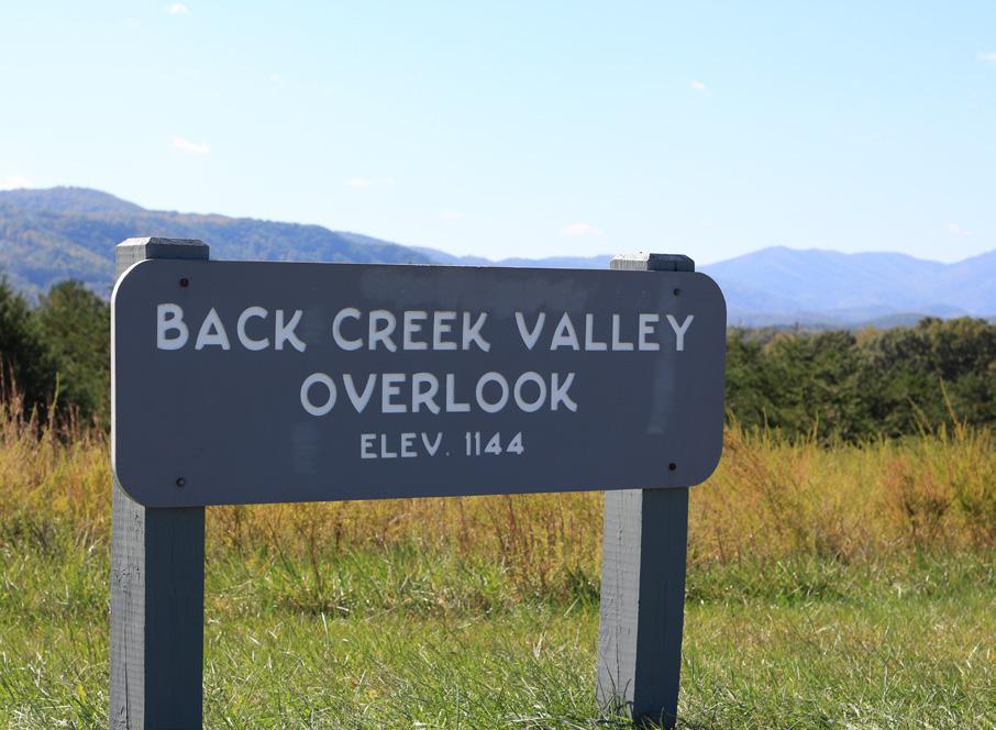
Implement the Explore Park Adventure Plan; evaluate opportunities for parks & greenways/trails; continue coordination with the Blue Ridge Parkway; increase trail connections as shown in the Roanoke Valley Trail Plan; and evaluate park, trail and blueway options.
General Services
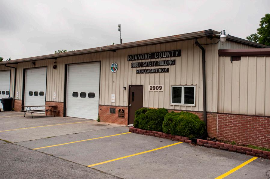
Support recycling options and implement recommendations from the assessments of County Fire Department Facilities and the Administration Center.
Libraries
Improve service and enhance existing facility; evaluate programming needs from consumer feedback that serve people of all ages and backgrounds; raise level of engagement with the community; and ensure timely delivery of all circulating materials.
Communications & Technology
Expand and improve high-speed broadband access and cell phone service availability in underserved areas.
Public Safety
Provide efficient delivery of public safety services with minimal response times; enhance public safety staffing; enhance facilities and equipment; and provide a high-level of citizen engagement and education opportunities.
Transportation (Roads)
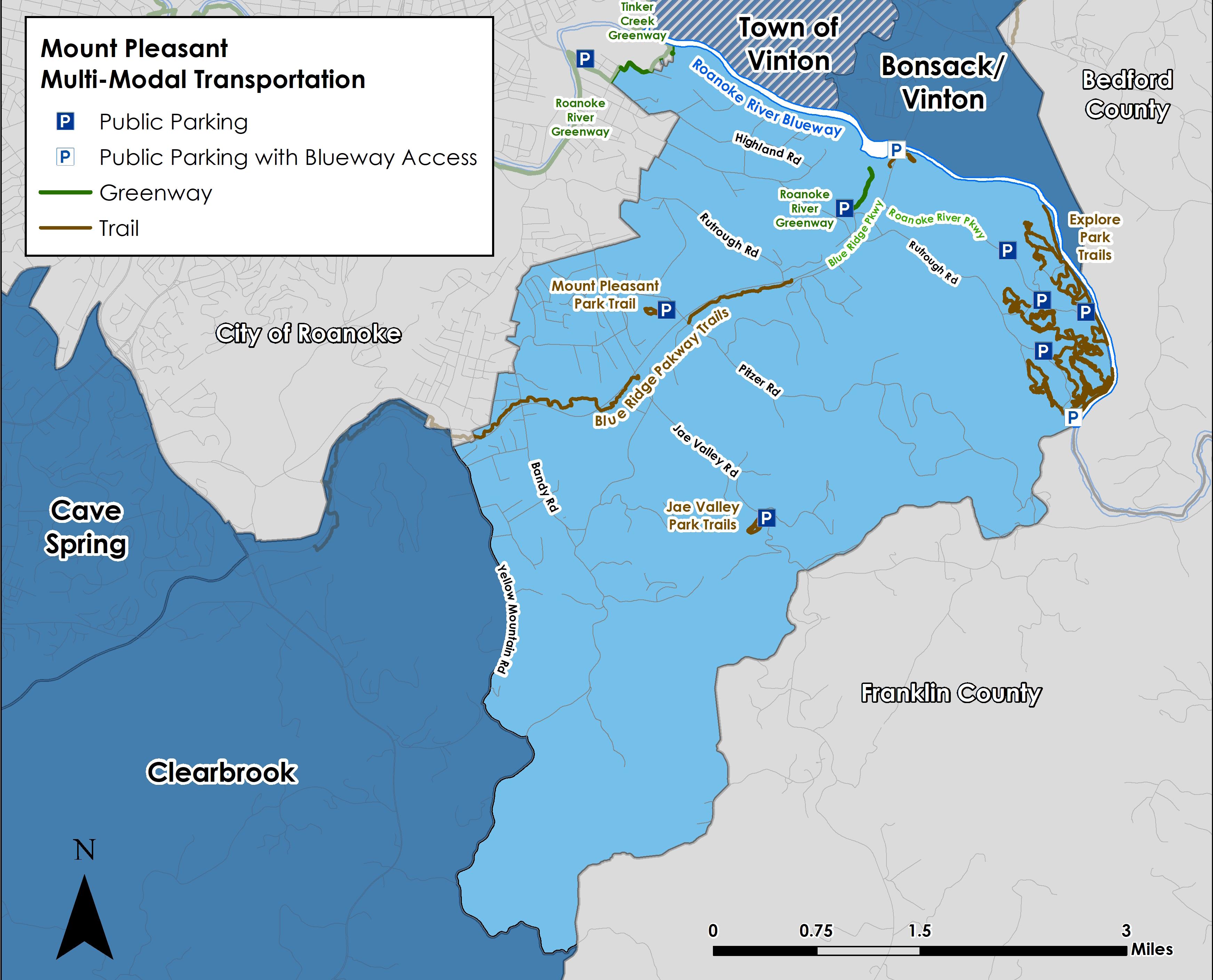
Determine appropriate safety improvements for Route 116/Jae Valley Road in collaboration with VDOT.
Transportation (Roads)
Determine appropriate improvements for Bandy Road in collaboration with VDOT.
Transportation (Roads)
Determine appropriate improvements for Pitzer Road and Brookridge Road in collaboration with VDOT.
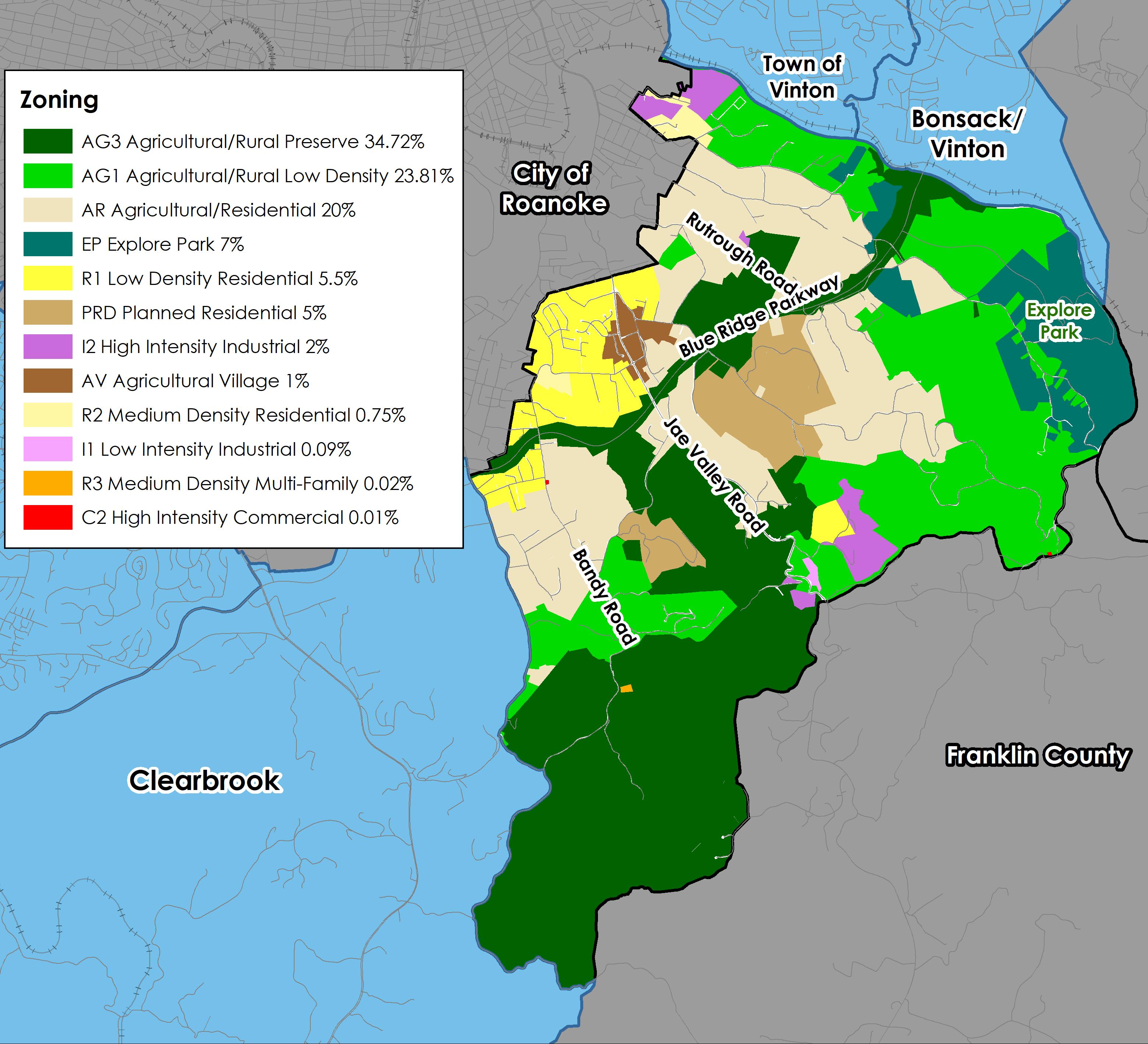
Land Use
Amend the Future Land Use Map to preserve the rural character of Mount Pleasant and capitalize on tourism opportunities in Explore Park. Develop a plan for the Mount Pleasant Activity Center.
Location, Context, and Boundary
The Mount Pleasant Community Planning Area (CPA) is located in the southeastern portion of Roanoke County. It is bordered by the Roanoke River and the Town of Vinton to the north, Bedford County to the east, Franklin County to the south, the City of Roanoke and the Clearbrook CPA to the west. The study area encompasses 2,400 parcels totaling approximately 10,240 acres. The Mount Pleasant Community Planning Area is home to approximately 3,900 people.
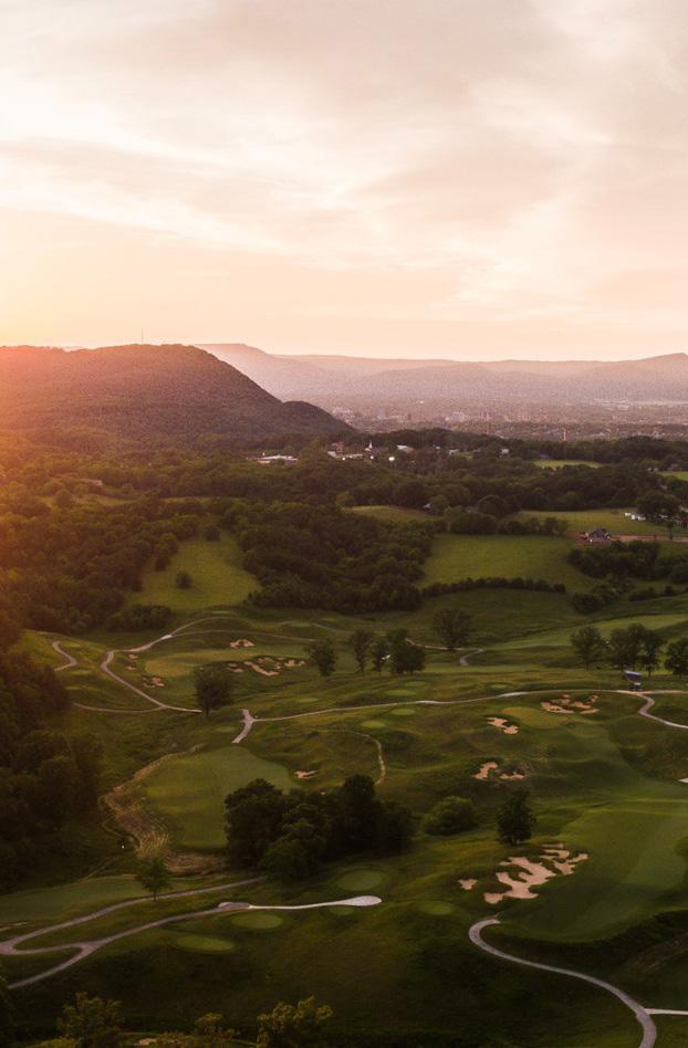
Mount Pleasant Planning Area includes a small number of businesses along Mount Pleasant Boulevard and Jae Valley Road in the eastern region of the County. This planning area has many wonderful amenities including several overlooks along the Blue Ridge Parkway and Explore Park. The area is located approximately thee miles from the center of the City of Roanoke. The Planning Area is rural in nature mostly consisting of single-family dwellings.
Demographic Trends
Source: 2019 US Census Data ,
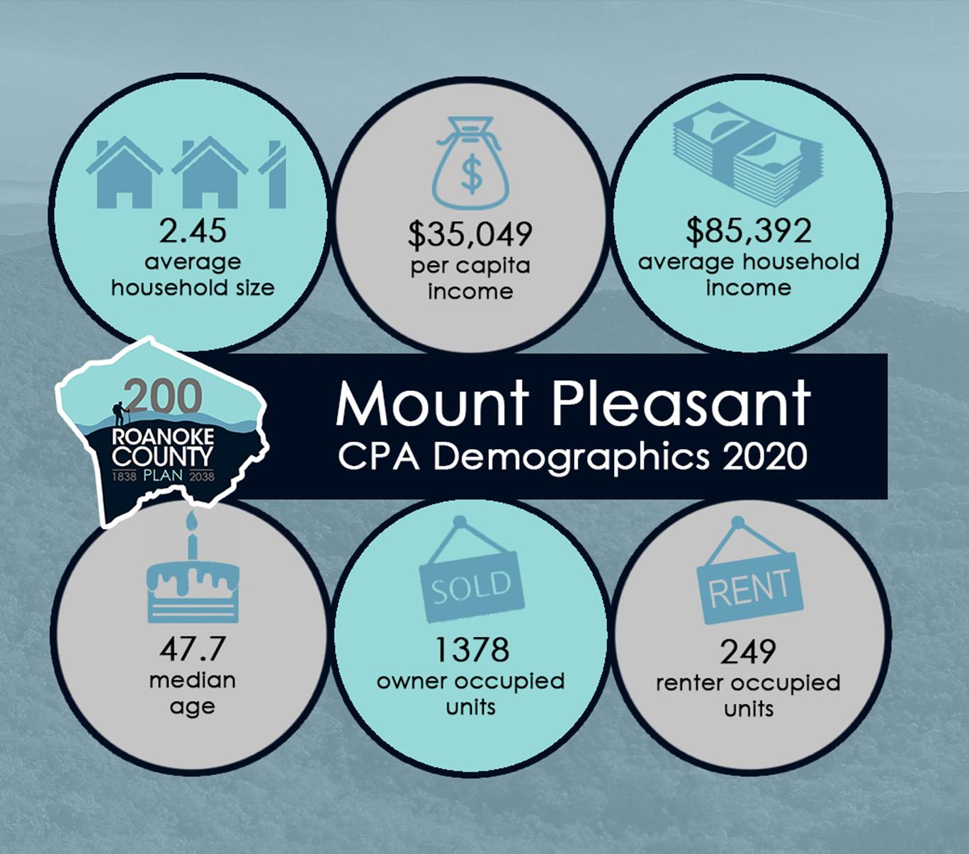
• The median age of residents continues to increase as the baby boomer generation ages. The median age in Mount Pleasant is 47.7 years.
• Countywide, over the last few decades families living in the same house have fewer people, and two-person households are increasing.
• Mount Pleasant’s population decreased by 4% from 1983 to 2010, but grew 3% from 2010 to 2020 to 3,964. Countywide there were fewer babies born from 2010 to 2020, but the population grew 4.9% due to people moving here from outside the County.
• According to most recent Census data, more than 85% (1,378) of the housing units are owned, while approximately 15% (249) are rental properties.
• Per capita income is around $35,050 in the Mount Pleasant CPA for each individual and the average household income is approximately $85,390.
• The average household size is 2.45 persons per household.
Natural Resources
Topography
Hydrology
Floodplains
Soils
Mount Pleasant has two prominent watercourses: the Roanoke River along the area’s northeastern edge, and Back Creek, which runs the length of the southern half. It is characterized by varied topography and large tracts of undeveloped land. The CPA is home to a variety of wildlife, including rare species, and features attractive viewsheds and other natural amenities. The Roanoke logperch (Percina rex) is found only in the Roanoke and Chowan drainages, but predominantly in the Roanoke River and its tributaries. It is listed as a federally endangered species, which means that it is extremely rare and is vulnerable to extinction. Its habitat has been threatened by agriculture, overdevelopment, and other activities that produce excessive silt runoff.
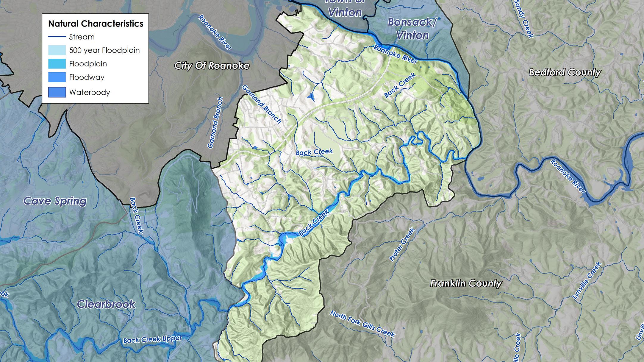
Many of the natural features, such as floodplains and steep slopes, create developmental constraints. Approximately 35% of the acreage in this CPA is calculated as having a “steep slope,” greater than 33%. Control of erosion and sedimentation and the management of stormwater runoff due to steep slopes and erodible soils can make land development difficult. Both major waterways (Back Creek and the Roanoke River) in the CPA are currently listed as impaired. Impaired streams are streams or rivers that do not meet state water quality standards because pollutant levels are too high. The primary pollutant for most of the streams is bacteria (E. coli) that comes from discharges including municipal separate storm sewer systems, livestock, pet waste, unspecified domestic waste and other sources. Approximately 93 acres of land (1%) in this CPA are under conservation easements. A conservation easement is designed to protect agricultural, forest, historic, or open space resources. It prevents the development of a property while allowing continued private ownership and rural use such as farming or forestry. An additional 1,073 acres (11%) of land is under protective management.


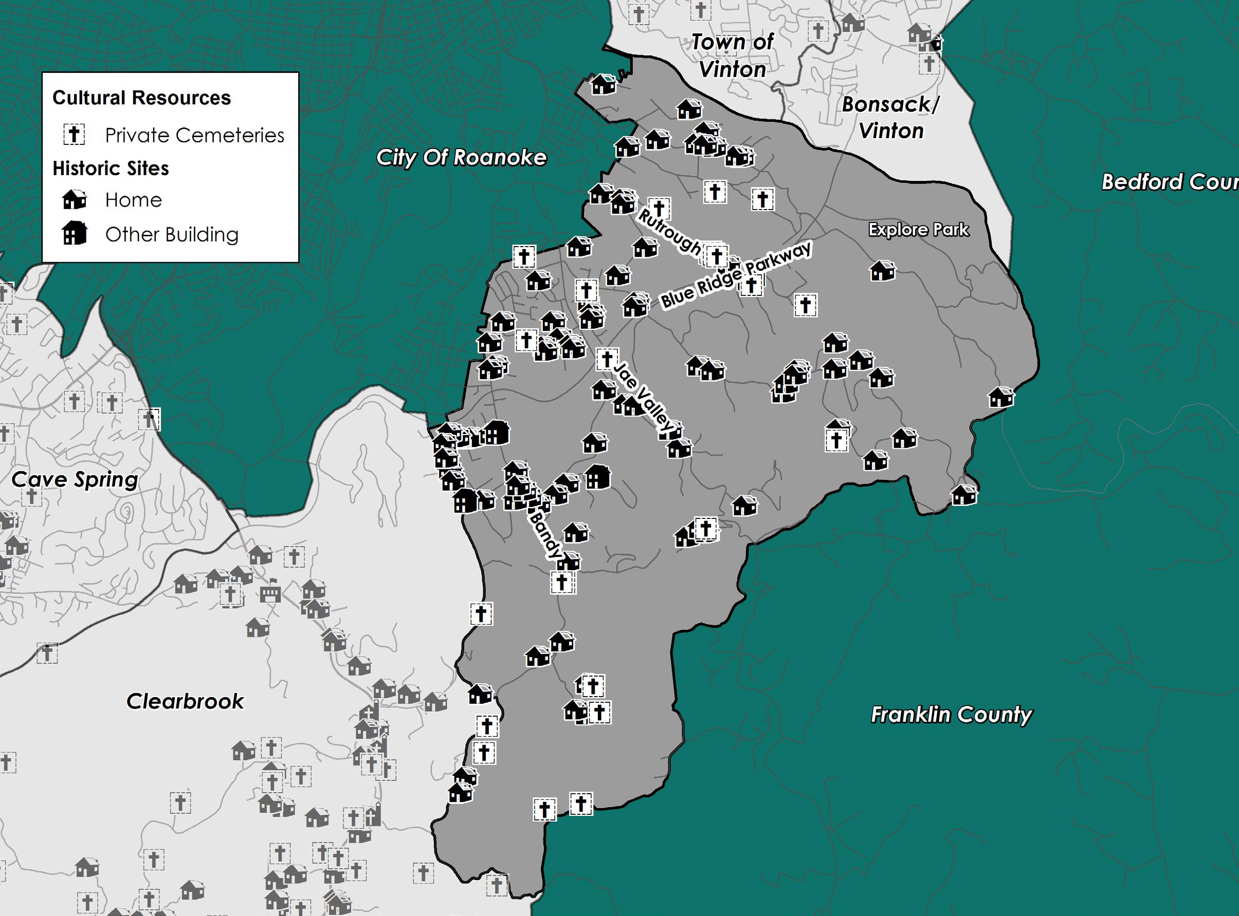
Cultural Resources Districts
Buildings Cemeteries
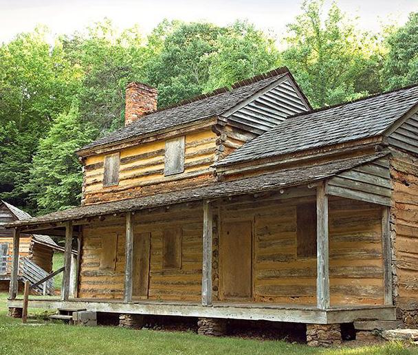
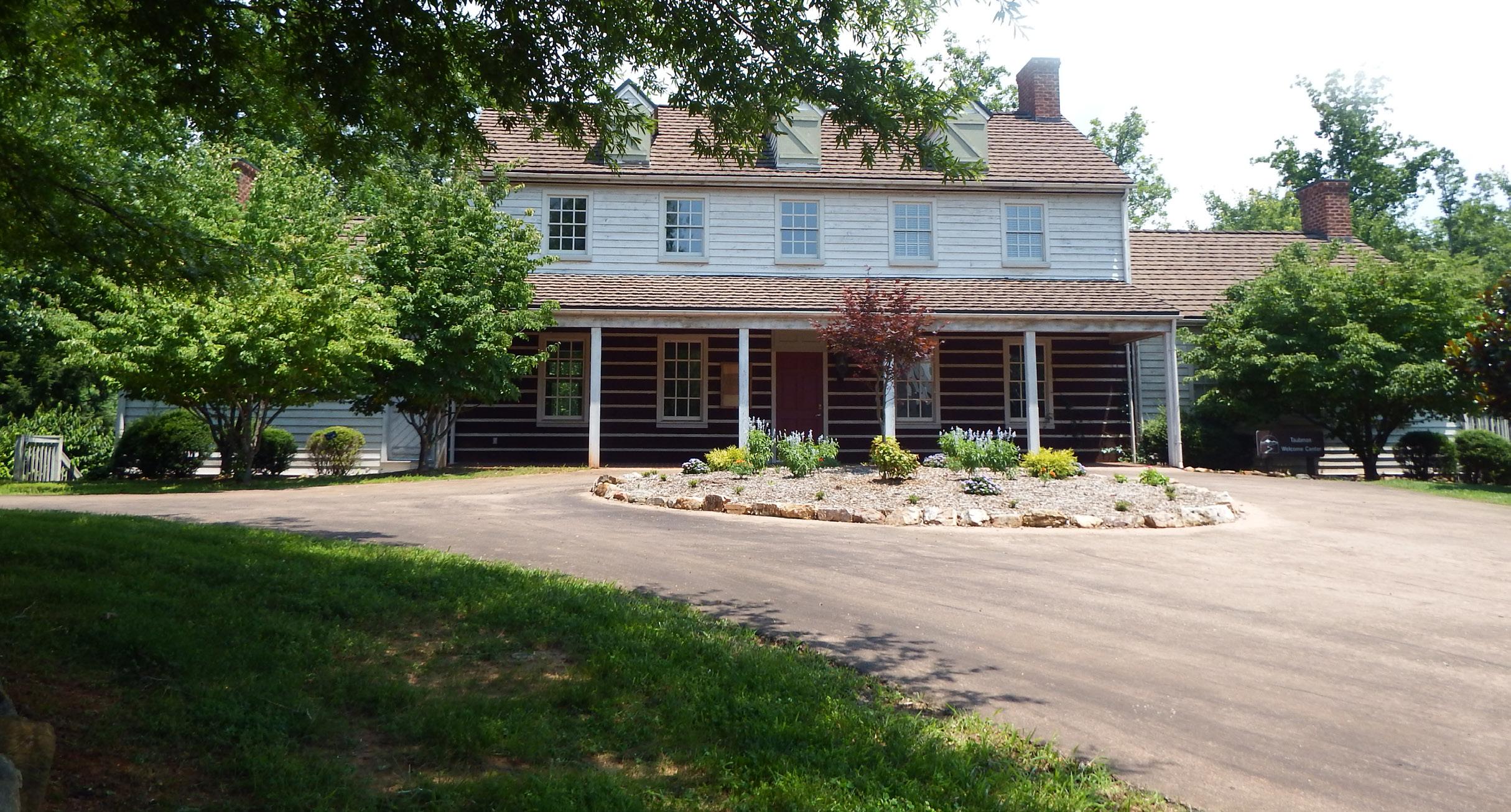
The Blue Ridge Parkway bisects the northern half of the CPA and connects the region to Roanoke County’s Explore Park. This four-mile stretch is the largest tract of protected land in Mount Pleasant. However, motorized access to the Parkway itself only exists outside of the CPA at Route 220, the Mill Mountain Parkway into the City of Roanoke and near Vinton at Route 24, Washington Avenue. The Mount Pleasant CPA is home to numerous historic resources including homes, farms and private cemeteries. Family cemeteries are the most common type of cemetery in Mount Pleasant; most are inactive and small in size (less than 50 interments), ranging in age from 68 to 167 years old.
Source: Historical Architecture Reconnaissance Survey Report (1992) and National Register of Historic Places
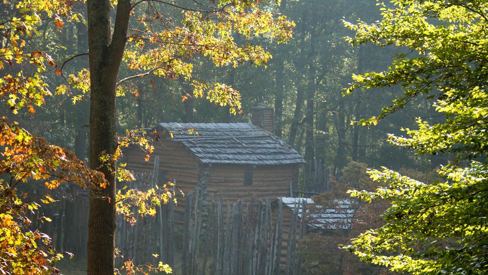
KEMPS FORD SCHOOL HOUSE
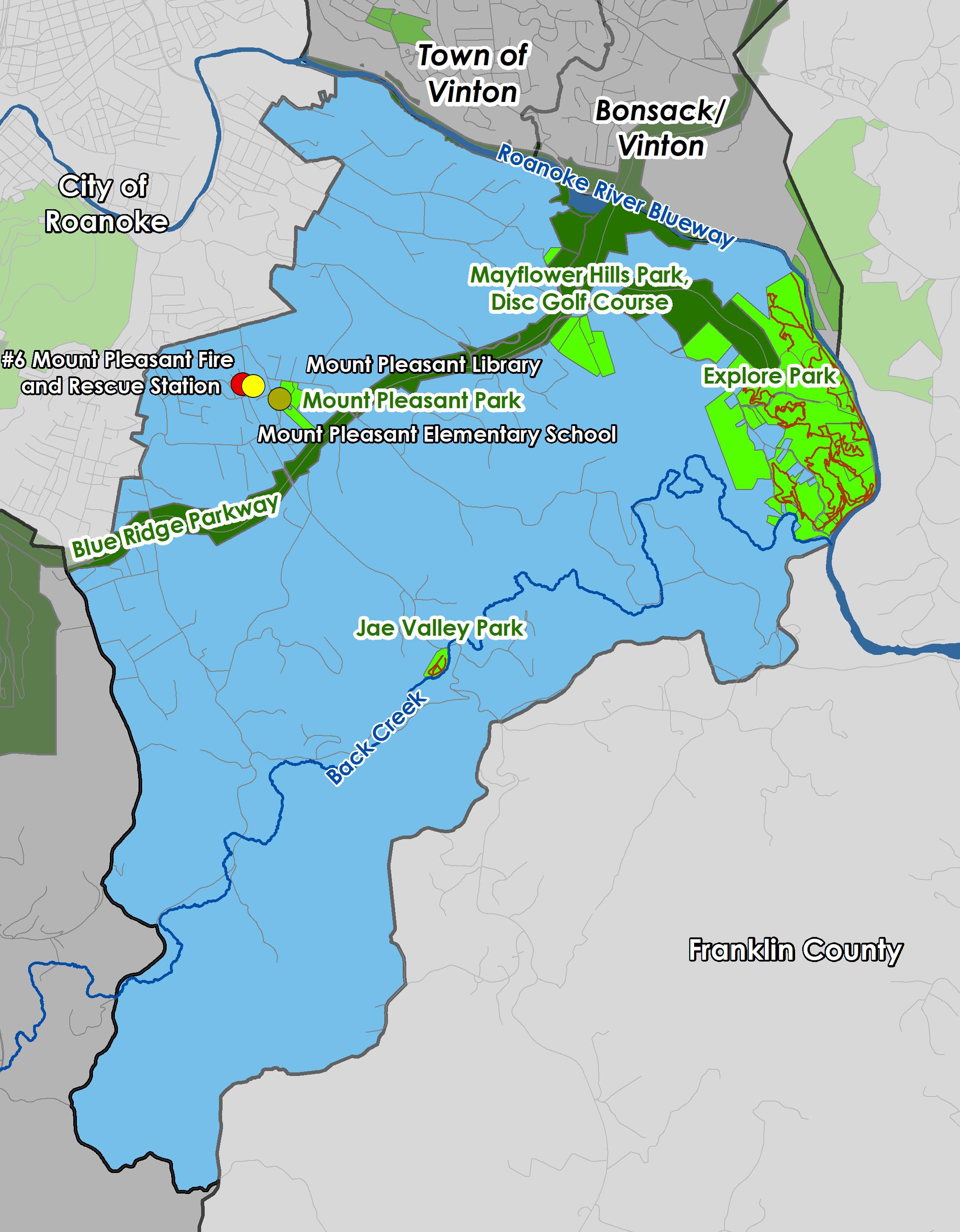
Community Facilities
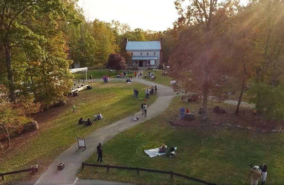
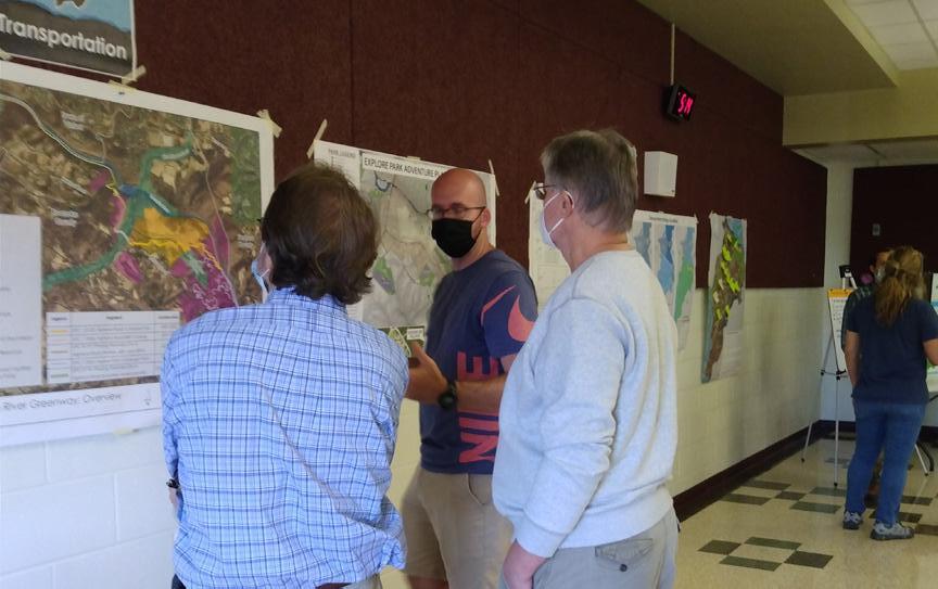
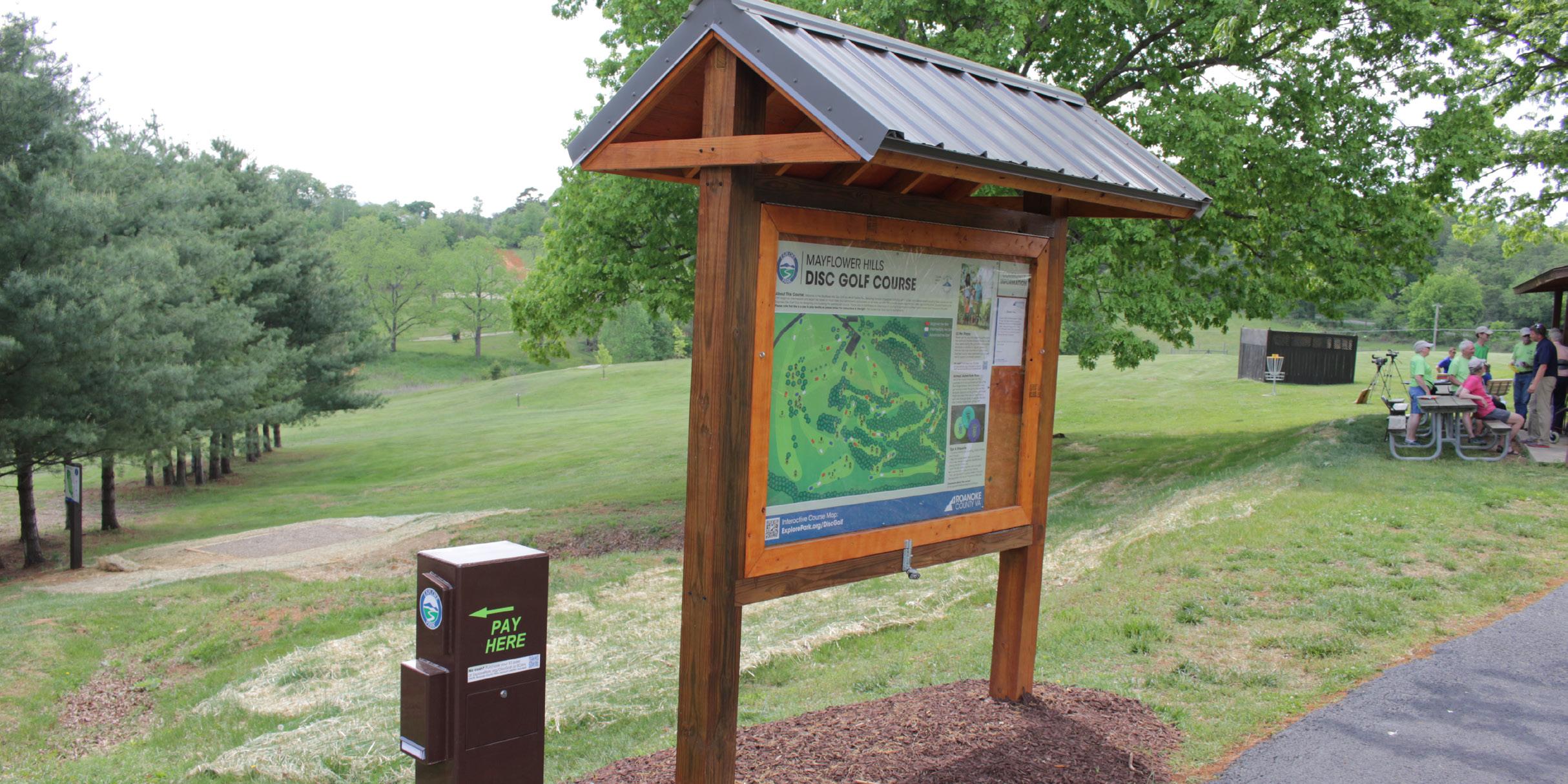
Mount Pleasant is a recreation destination for Roanoke County and Virginia’s Blue Ridge. This CPA is home to a diverse range of outdoor recreation spaces such as Explore Park, Mayflower Hills Park and Disc Golf Course, the Blue Ridge Parkway, the Roanoke River Blueway and the Ballyhack Golf Club. Other local recreation spaces in this CPA include Mount Pleasant Park, Jae Valley Park and Back Creek (with Blueway access between Jae Valley Park and Explore Park when seasonal water levels are appropriate).
Explore Park is a regional park destination adjacent to the Roanoke River and Blue Ridge Parkway. The Blue Ridge Parkway, Explore Park and Jae Valley Park are important recreation and outdoor tourism assets for Mount Pleasant and the larger region. Back Creek and the Roanoke River Blueway are popular for water sporting activities, with access points at Jae Valley Park and Explore Park.
Mount Pleasant is served by the Mount Pleasant Library. The Mount Pleasant Library offers a variety of services for adults, teenagers, children and families.
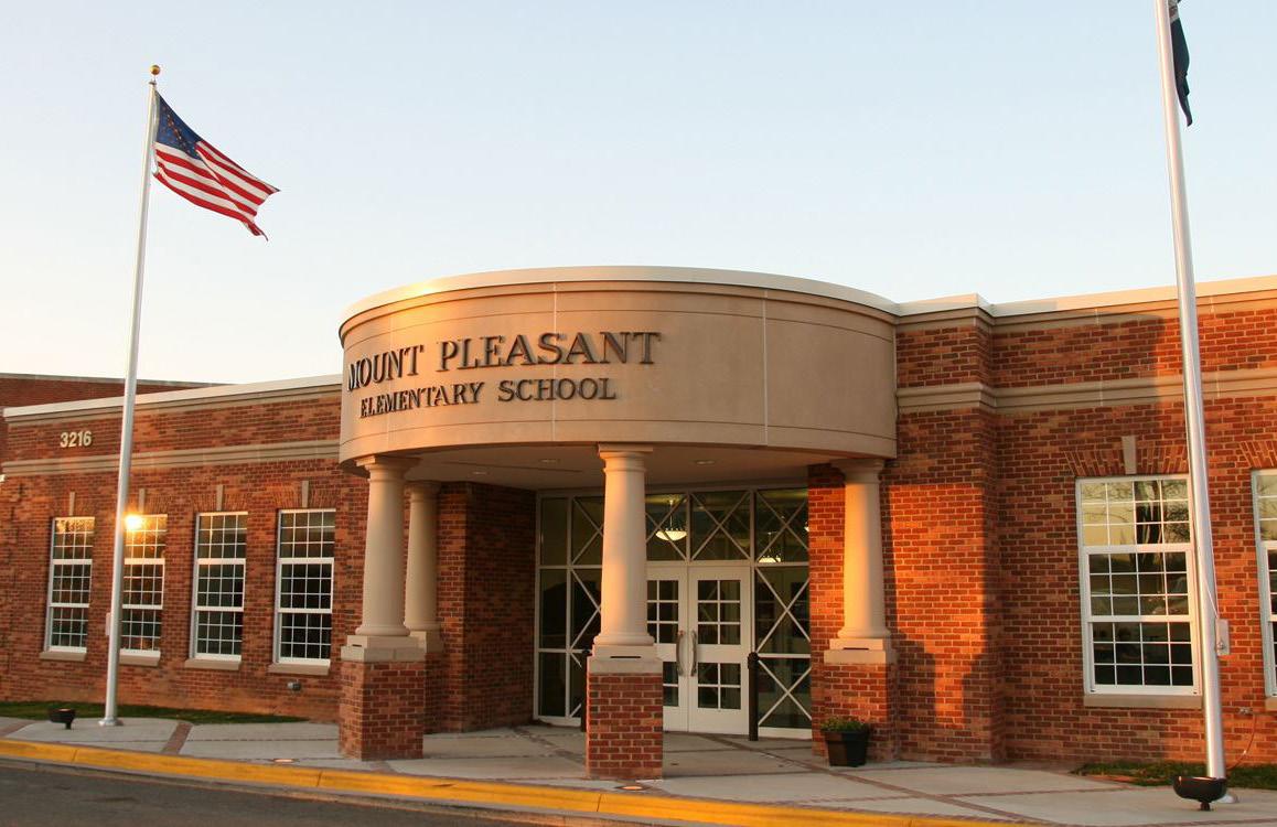
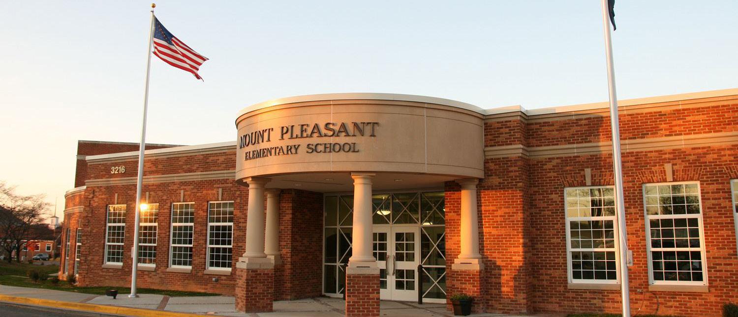
Schools serving the Mount Pleasant area are under enrollment capacity. This is consistent with most Roanoke County Public School trends. Mount Pleasant Elementary, William Byrd Middle School, and William Byrd High School are all under maximum capacity.
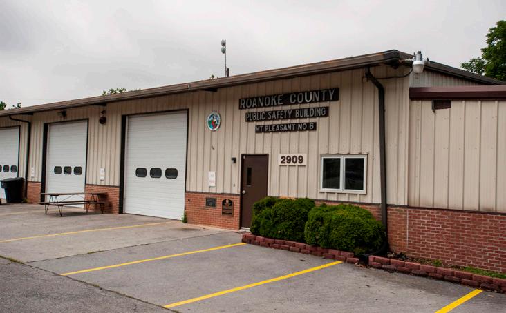
The area is served by the #6 Mount Pleasant Fire and Rescue Station. Of the 11 Roanoke County Community Planning Areas, Mount Pleasant ranks in the lower half for Fire-EMS and Police service calls.
E
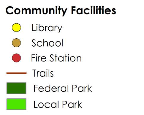
Transportation
Roads
Transit
Greenways/Trails
Bicycle & Pedestrian Accommodations
As a sparsely populated rural area, Mount Pleasant is not home to any sidewalks, crosswalks, bike lanes, or transit. Mount Pleasant is home, however, to a long stretch of the Roanoke River Blueway. The Roanoke River Blueway can be accessed from the Blue Ridge Parkway at Niagara Dam and Rutrough Point in Explore Park. Mount Pleasant is also home to Explore Park’s extensive trail network, as well as smaller trail networks at Jae Valley Park and Mount Pleasant Park.
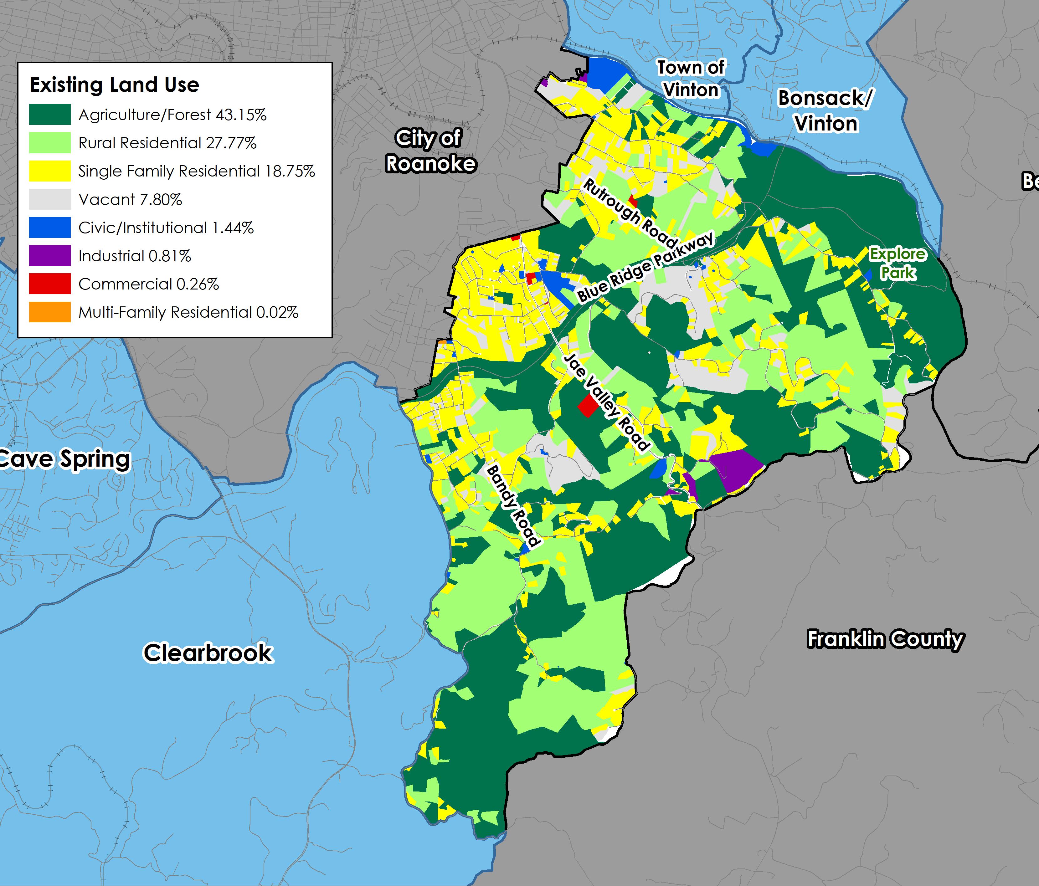
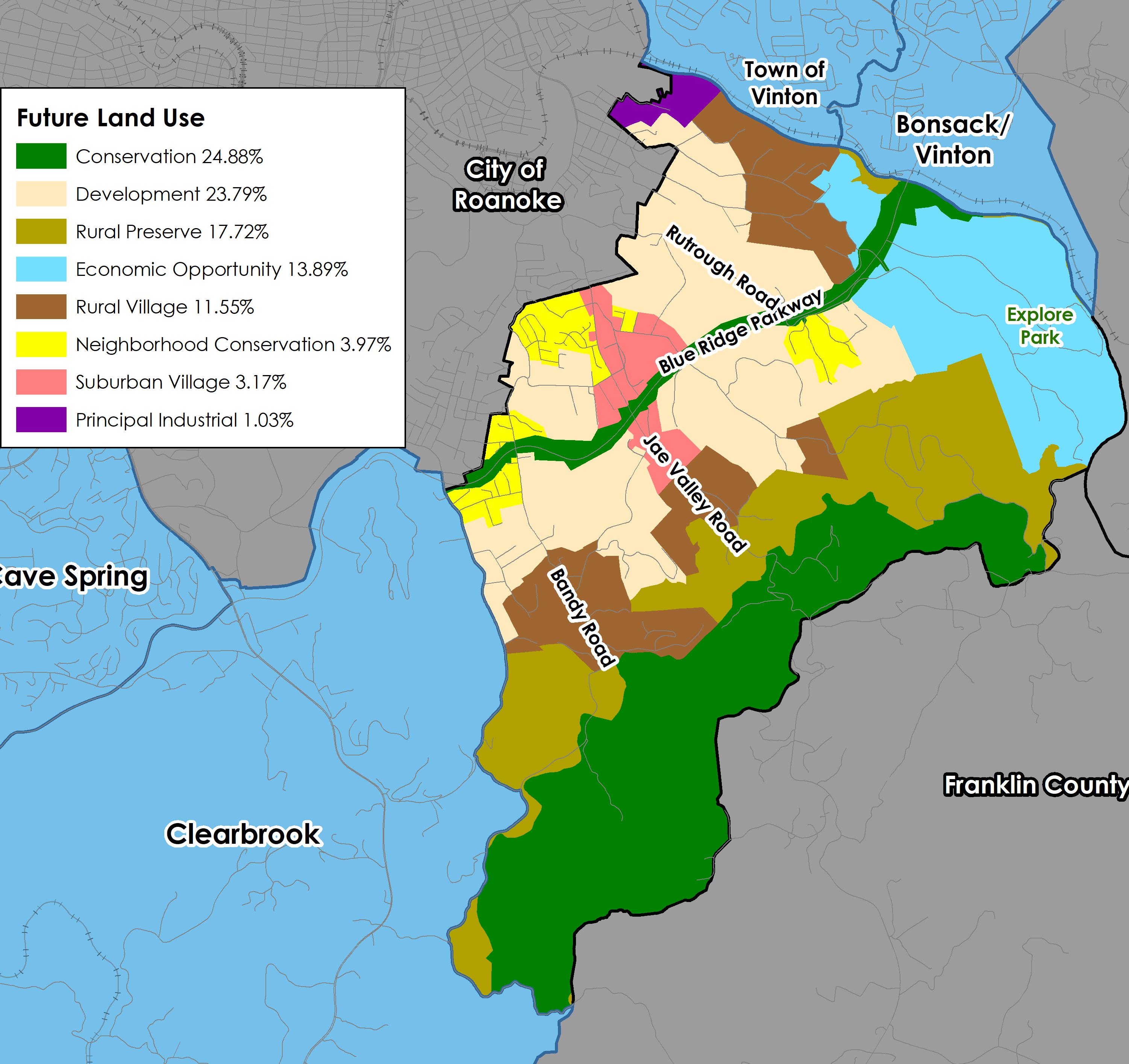
Future Land Use
The map to the right shows the future land use designations in the Mount Pleasant CPA from the 2005 Comprehensive Plan. Approximately half of the CPA is considered to be within the County’s urban development area, the other half of the CPA is not.
A little more than half of the land in Mount Pleasant is intended to remain rural. 29.3% of land that is designated for Rural Preserve and Rural Village to protect the rural character of the area. 24.9% is designated for Conservation, which includes ridgelines, mountainsides, the Blue Ridge Parkway, and public lands. The Conservation future land use designation is intended to protect environmental, natural, or cultural features from encroaching development.
The Economic Opportunity future land use is unique to the Mount Pleasant CPA, found only in Explore Park and adjacent properties. Explore Park is designated as Economic Opportunity future land use because Explore Park was proposed to be developed by a private developer. This was done for its tourism potential along the Blue Ridge Parkway. This future land use is 13.9% of the Mount Pleasant CPA.
Another future land use unique to the Mount Pleasant CPA is Suburban Village, which is 3.2% of the CPA. As opposed to Neighborhood Conservation, which is intended to protect existing residential neighborhoods, the Suburban Village is intended to permit single family residential development while preserving surrounding rural land uses such as agriculture or environmentally sensitive lands. It also allows some types of small-scale commercial uses, such as convenience stores. 4.0% of the CPA is designated for the Neighborhood Conservation future land use. 23.8% is designated for Development, which is intended to promote future residential development.
The remaining 1% surrounding the Western Virginia Water Authority sewer treatment plant is designated as principal industrial.
MOUNT PLEASANT ELEMENTARY SCHOOL
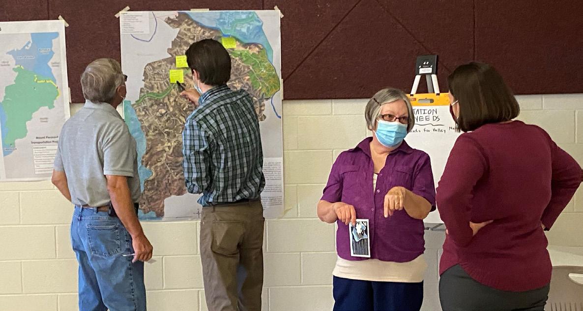
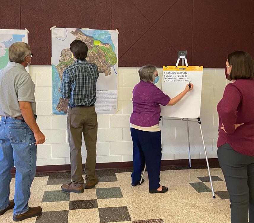
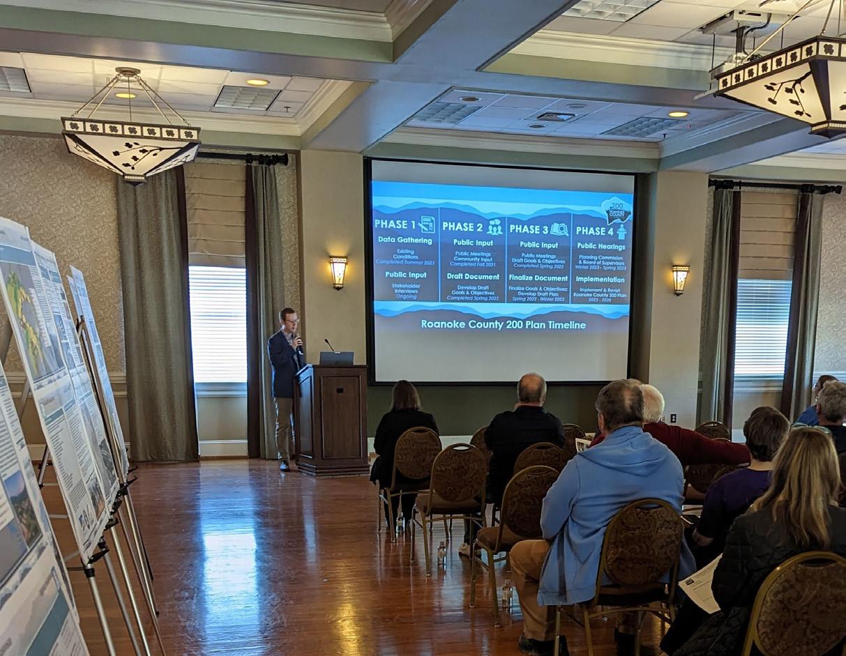
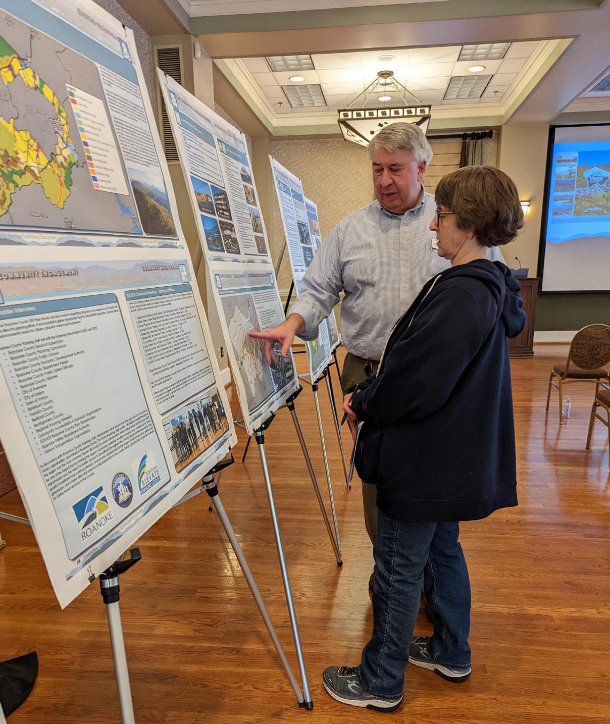
Fall 2021 Community Meetings - Existing Conditions
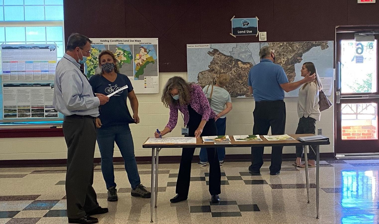
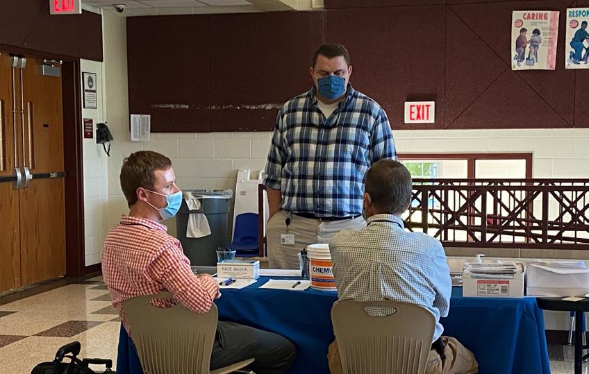
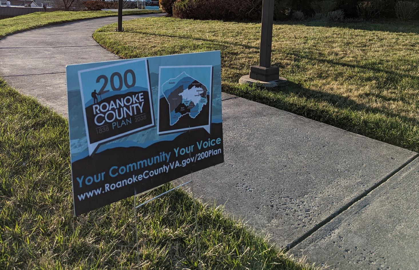
Twelve (12) planning meetings were held around Roanoke County in Fall 2021 to collect preliminary feedback about community issues and needs. The community meeting for the Mount Pleasant CPA was held on September 23, 2021, at Mount Pleasant Elementary School. There were 30 attendees. Citizens were invited to comment on Land Use, Community Facilities, Transportation, and Protection and Preservation. Comments and suggestions from citizens were collected and assembled by staff into a “Post Meeting Summary” document. A digital copy of this document can be found on the Roanoke County 200 Plan webpage.
Fall 2021 Community Input Highlights:
a. While a number of attendees were prodevelopment, attendees generally wanted to keep Mount Pleasant low-density and rural.
b. Environmental hazards and recycling were major themes of the Protection and Preservation station.
c. Attendees were very enthusiastic about sharing transportation issues and ideas for improvement, especially Pitzer Road.
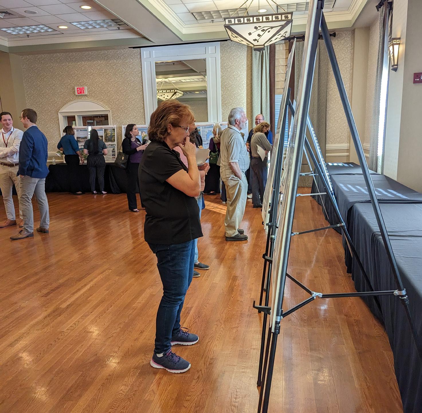
Spring 2022 Open House Meetings - Draft Goals and Recommendations
Seven (7) Roanoke County 200 Plan open house planning meetings were held around Roanoke County in Spring 2022 for citizens to review draft goals and recommendation options based on the feedback received throughout the Fall 2021 community engagement. Draft goals were developed based on input that we received at the community meetings and online surveys in Fall 2021. Citizens reviewed and provided comments on the new draft goals and recommendations that will shape the draft Roanoke County 200 Plan document. The draft goals and recommendations displayed included natural and cultural resources, land use, community facilities and infrastructure, and transportation. The community meeting for the Mount Pleasant CPA was held in conjunction with the Bonsack/Vinton CPA on April 14, 2022, at the Charles R. Hill Community Center. There were 14 attendees.
Spring 2022 Community Survey Highlights:
Natural and Cultural Resources:
The majority (85%) of survey respondents and community meeting participants support recommendations to protect and improve ground, surface and stormwater resources; beautify the County’s public areas, viewsheds and roadways; clean up garbage; protect steep slope areas; protect trees and forests, natural areas and wildlife habitats; as well as protection of historic and cultural resources.
Community Facilities and Infrastructure:
a. Parks, Recreation and Tourism: 75% of respondents support the Countywide recommendations as well as the following items pertaining to the Mount Pleasant CPA: 1. Implement the Explore Park Adventure Plan. 2. Evaluate opportunities for parks and greenways/trails. 3. Evaluate new parks, greenways/trails and blueways. 4. Continue regional collaboration for the Roanoke Valley Trail Plan. 5. Evaluate needs at existing parks.
b. General Services: 78% of respondents support recycling options and assessments of County Fire Department Facilities and the Administration Center building.
c. Public Libraries: 76% of respondents support the Countywide library system recommendations.
d. Communications and Information Technology: 87% of respondents support expansion and improvement of broadband and cell phone access.
e. Public Safety: 94% of respondents support Countywide public safety recommendations.
Land Use:
90% of respondents support the activity centers as shown on the Activity Center Map, while 10% indicated interest in additional activity centers. 80% of respondents support the proposed changes to the Future Land Use Map.
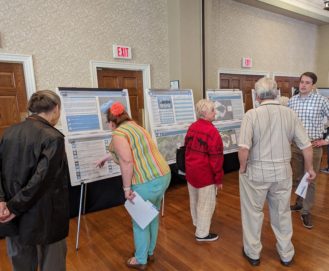
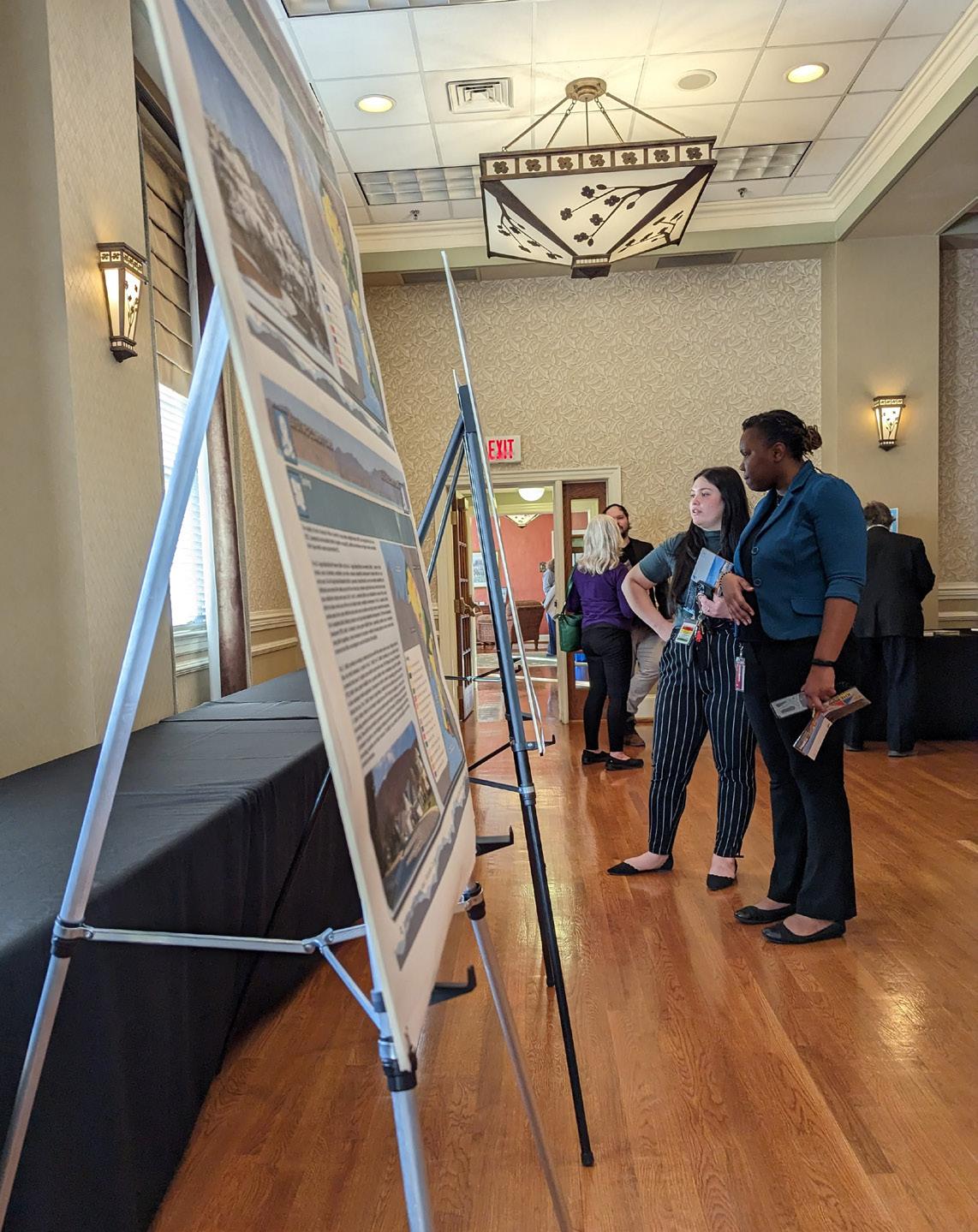
Winter 2023 Community Meetings - Draft Plan Reveal
Six (6) Roanoke County 200 Plan open house planning meetings were held around Roanoke County in Winter 2023 for citizens to review the Draft Roanoke County 200 Plan Countywide Summary Document and Draft Community Planning Area Documents based on the feedback received throughout the community engagement process. Citizens reviewed and provided comments on the draft Roanoke County 200 Plan documents. The community meeting for the Mount Pleasant CPA was held in conjunction with the Bonsack/Vinton CPA on March 6, 2023, at the Vinton War Memorial. There were 59 attendees.
In general, the comments provided by residents were concerned with the following:
a. Road imporvements to Rutrough Road, Randall Drive, Pitzer Road, and Brookridge Road.
These issues and concerns are addressed by recommendations in the Mount Pleasant CPA Summary Document. These recommendations include:
a. Determine appropriate safety improvements for Route 116/Jae Valley Road in collaboration with VDOT.
b. Determine appropriate improvements for Bandy Road in collaboration with VDOT.
c. Determine appropriate improvements for Pitzer Road and Brookridge Road in collaboration with VDOT.
In addition to the Draft Plan reveal meetings, the Planning Commission and the Board of Supervisors held public hearings on the Roanoke County 200 Plan. Information on these hearings is contained in the main document of the Roanoke County 200 Plan.
Recommendations
Natural & Cultural Resources
Topography/Viewsheds
Hydrology/Floodplains
Water Quality/Pollution Prevention
Vegetation/Natural Areas
Historic & Cultural Resources
1. Protect and improve the quality of water in our streams, creeks and rivers.
2. Coordinate with State agencies regarding floodplain risks and prevention.
3. Reduce quantity and improve quality of stormwater.
4. Protect and prevent risks to surface waterways, reservoirs, underground aquifers and drinking water wells.
5. Beautify County roadways and public areas.
6. Protect viewsheds from the ridges and from the valleys.
7. Clean up and prevent litter and illegal dumping.
8. Protect steep slope areas.
9. Protect trees and forests and increase tree canopy.
10. Protect natural areas and wildlife habitats.
11. Coordinate with State agencies regarding historic and cultural resources, including cemeteries and archaeological sites.
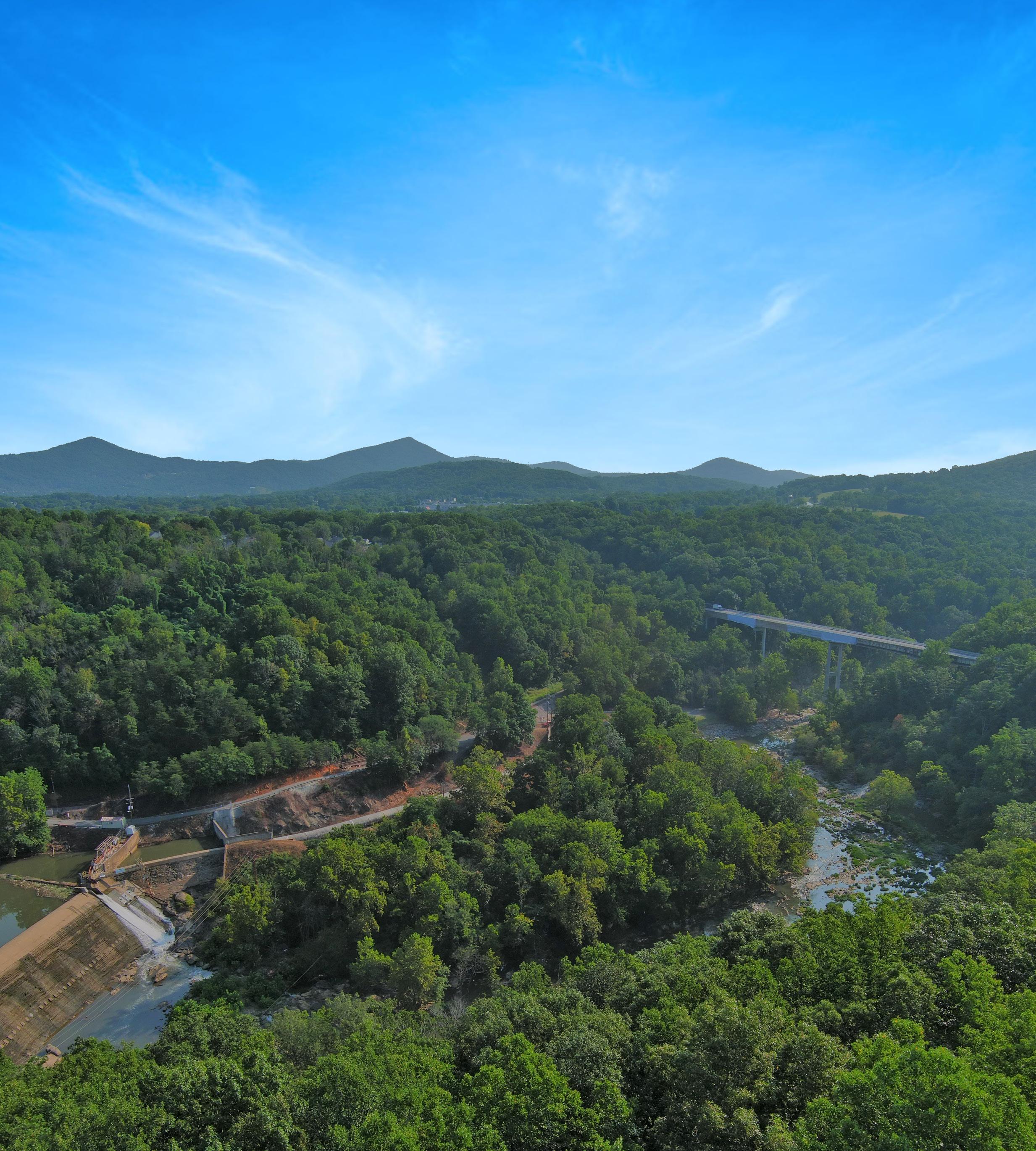
NIAGARA DAM BY BLUE RIDGE PARKWAY BRIDGE
Community Facilities & Infrastructure
Parks, Recreation & Tourism
Parks, Recreation and Tourism Recommendations
1. Evaluate new park, greenway, and blueway opportunities in the community.
2. Evaluate on- and off- road connectivity options between parks, neighborhoods, and community facilities.
3. Continue coordination on regional efforts to enhance and develop outdoor recreation opportunities in our communities.
4. Update the Parks, Recreation & Tourism Master Plan.
5. Continue promotion of the Park Partners Program to encourage citizens and businesses, and organizations to adopt a park, greenway, or trail.
6. Educate citizens on park ordinance updates (i.e., park sign updates, dog-friendly parks/special events and leash laws, drones, etc.).
7. Continue developing programs that balance community needs with available staffing resources.
8. Continue implementation of the Explore Park Adventure Plan (i.e., vehicular access between Blue Ridge Parkway and Hardy Road, mountain bike trail improvements, Roanoke River Greenway, etc.).
9. Evaluate the needs of existing parks and trails (i.e., trail maintenance, tennis court conversion to pickleball, etc.)
10. Continue coordination with the Blue Ridge Parkway for implementation of the Roanoke Valley Trail Plan.
Community Facilities & Infrastructure
General Service Recommendations
1. Evaluate recycling program options.
2. Implement recommendations from the Roanoke County Fire Department Facilities Assessment.
3. Implement recommendations from the Roanoke County Administration Center Assessment.
Public Libraries Recommendations
1. Improve services and continue enhancing facilities.
2. Evaluate programming needs and wants based on a variety of data and customer feedback.
3. Implement responsive, community focused program that serves people of all ages and backgrounds.
4. Ensure timely delivery of all circulating materials.
5. Raise level of engagement with the community, and increase awareness about library services and programs.
Communication & Information Technology
1. Explore opportunities to extend broadband service with universal availability and access to high-speed Internet in unserved and underserved areas.
2. Explore alternative broadband and cell phone service providers for choice and competition.
3. Explore more public-private partnerships to implement more stages of Roanoke County’s Rural Broadband Initiative to bring high-speed Internet to homes without broadband access.
4. Explore providing improved cell phone service in unserved and underserved areas.
Public Safety Recommendations
1. Provide the efficient delivery of public safety services with minimal response times.
2. Enhance and maintain public safety staffing.
3. Enhance and maintain facilities and equipment.
4. Provide a high-level of citizen engagement and educational opportunities.
Determine appropriate locations for improved bicycle accommodations in the Mount Pleasant Community Planning Area.
Provide wayfinding signage from the City of Roanoke through Mount Pleasant to Explore Park.
Evaluate opportunities to connect neighborhoods to the Roanoke River Greenway.
Consider expanding Valley Metro routes to serve businesses and residents in Mount Pleasant.
Recommendations
• Priority transportation projects:
Transportation
Roads
Transit
Greenways/Trails
Bicycle & Pedestrian Accommodations
1. Determine appropriate safety improvements for Route 116/Jae Valley Road in collaboration with VDOT.
2. Determine appropriate improvements for Bandy Road in collaboration with VDOT.
3. Determine appropriate improvements for Pitzer Road and Brookridge Road in collaboration with VDOT.
• Other transportation projects:
4. Determine appropriate locations for improved bicycle accommodations in the Mount Pleasant Community Planning Area.
5. Provide wayfinding signage from the City of Roanoke through Mount Pleasant to Explore Park.
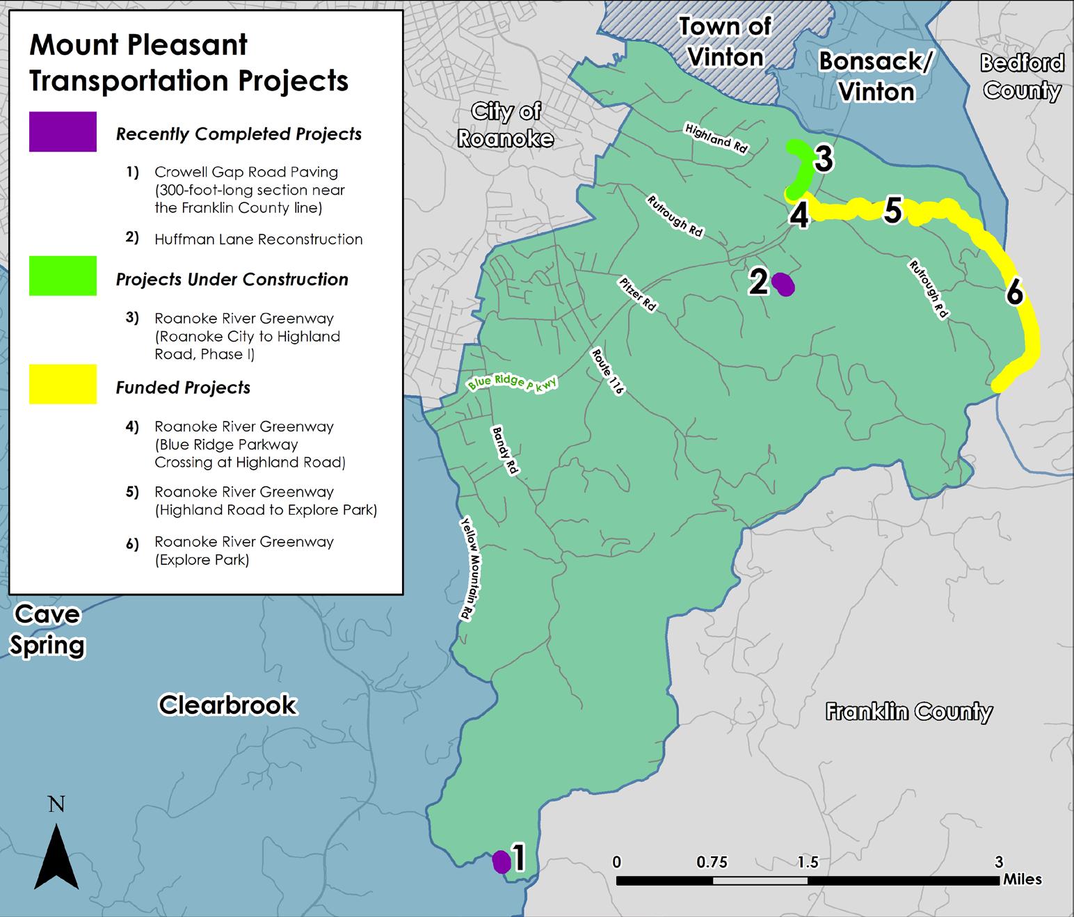
6. Construct the Roanoke River Greenway between the City of Roanoke and Rutrough Point at Explore Park.
7. Evaluate opportunities to connect neighborhoods to the Roanoke River Greenway.
8. Extend the Roanoke River Greenway between Rutrough Point and Franklin County.
9. Evaluate expanding Valley Metro routes to serve businesses and residents in Mount Pleasant.
10. Evaluate potential pedestrian connections to businesses and destinations within the Mount Pleasant village.
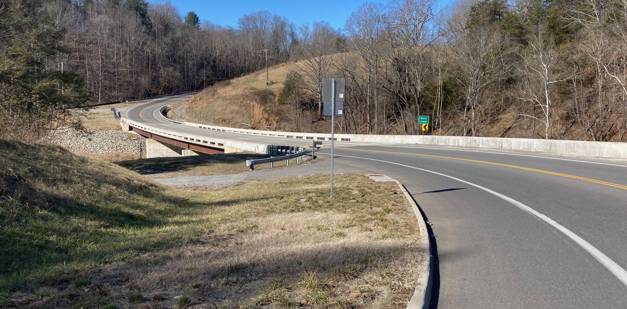
ROUTE 116 BRIDGE OVER BACK CREEK AT JAE VALLEY PARK
Land Use
Future Land Use Activity Center
Residents supported the three (3) proposed changes to the Future Land Use Map in the Mount Pleasant CPA during the Spring 2022 open house and on the accompanying survey. The first was to remove the Economic Opportunity future land use and create an entirely new designation called Explore Park to protect and support the park. The second and third were from Development and Suburban Village to Rural Village to preserve the rural character of Mount Pleasant.
Recommendations
1. Amend the Future Land Use Map as shown in the map below to preserve the rural character of Mount Pleasant and capitalize on tourism opportunities in Explore Park.
2. Develop a plan for the Mount Pleasant Activity Center.
Mount Pleasant Future Land Use - Proposed
Bonsack/ Vinton
City of Roanoke
Bedford County
Town of Vinton
Clearbrook Franklin County
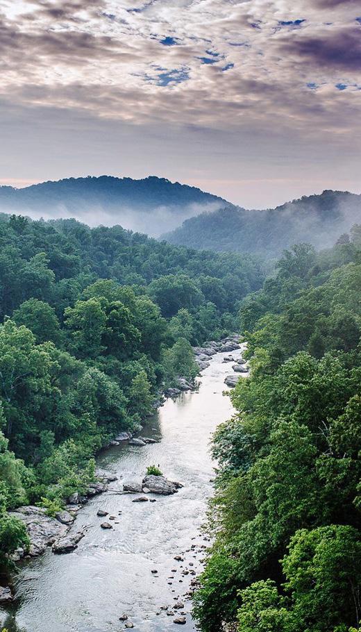
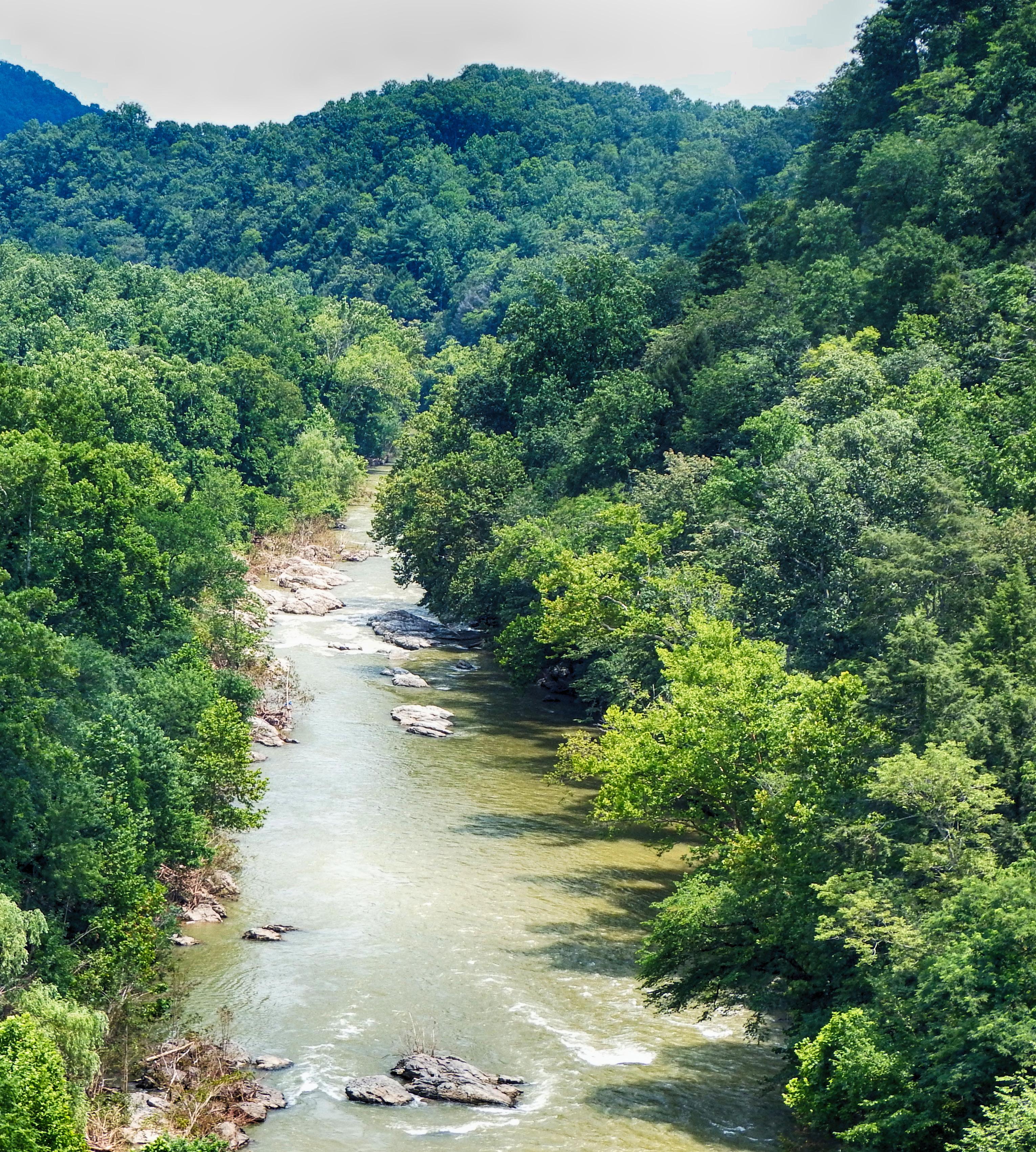
THE ROANOKE RIVER IN EXPLORE PARK