This Plan Summary highlights the key components of the various sections of the Masons Cove Planning Area. The Existing Conditions section features the study area’s demographics, community facilities, natural resources, cultural resources, land use, zoning, and the people that participated in the Plan’s development.
The Masons Cove Planning Area’s goals were inspired by public input and used to develop the Plan’s recommendations in the County’s Comprehensive Plan Update. Implementation of this Plan will be completed over the next 15 years.
Natural & Cultural Resources
Protect and improve ground, surface and stormwater resources; beautify public areas, viewsheds and roadways; clean up garbage; protect steep slope areas; and protect forests, natural areas, and wildlife habitats.
Parks, Recreation & Tourism
Make improvements at Whispering Pines Park; evaluate opportunities for parks & greenways/ trails; increase trail connections; and evaluate park, trail and blueway options.
Parks, Recreation & Tourism
Continue regional collaboration for the Triple Crown (Dragon’s Tooth, McAfee Knob, & Tinker Cliffs)
General Services
Support recycling options and implement recommendations from the assessments of County Fire Department Facilities and the Administration Center.
Libraries
Improve service and enhance existing facilities; evaluate programming needs from consumer feedback that serve people of all ages and backgrounds; raise level of engagement with the community; and ensure timely delivery of all circulating materials.
Communications & Technology
Expand and improve high-speed broadband access and cell phone service availability in underserved areas.
Public Safety
Provide efficient delivery of public safety services with minimal response times; enhance public safety staffing; enhance facilities and equipment; and provide a high-level of citizen engagement and education opportunities.
Transportation (Roads)
Initiate a Route 311/Catawba Valley Drive Multimodal Safety Study with VDOT to determine potential improvements to reduce crashes and improve safety for all users.
Transportation (Roads)
Initiate a Route 311/Thompson Memorial Drive and Route 419/North Electric Road Multimodal Transportation Study from Interstate 81(Exit 140) to Interstate 81 (Exit 141).
Land Use
Amend the Future Land Use Map to include changing Rural Preserve areas with steep slopes to Conservation, and changing certain recently developed areas from Development to Neighborhood Conservation. Develop a plan for the Route 311/Hanging Rock Activity Center.
Location, Context, and Boundary
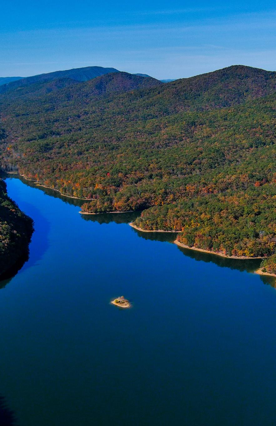
Masons Cove Community Planning Area (CPA) is located in the northern and northwestern portions of Roanoke County. It borders the Catawba CPA on its northern boundary, Botetourt County on its eastern boundary, Montgomery County on its western boundary, and the City of Salem on its southern boundary. The study area encompasses 2,613 parcels totaling approximately 27,930 acres. The Masons Cove CPA is home to approximately 3,430 people.
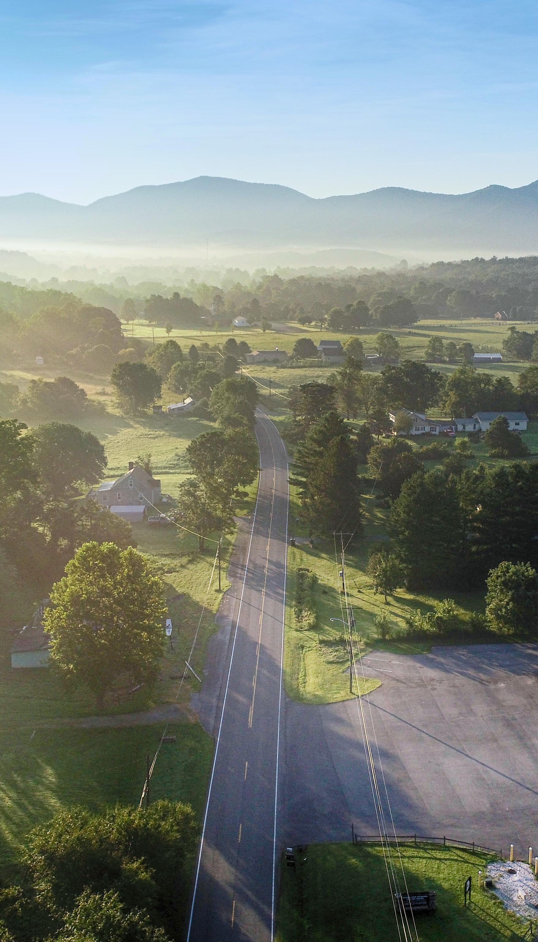
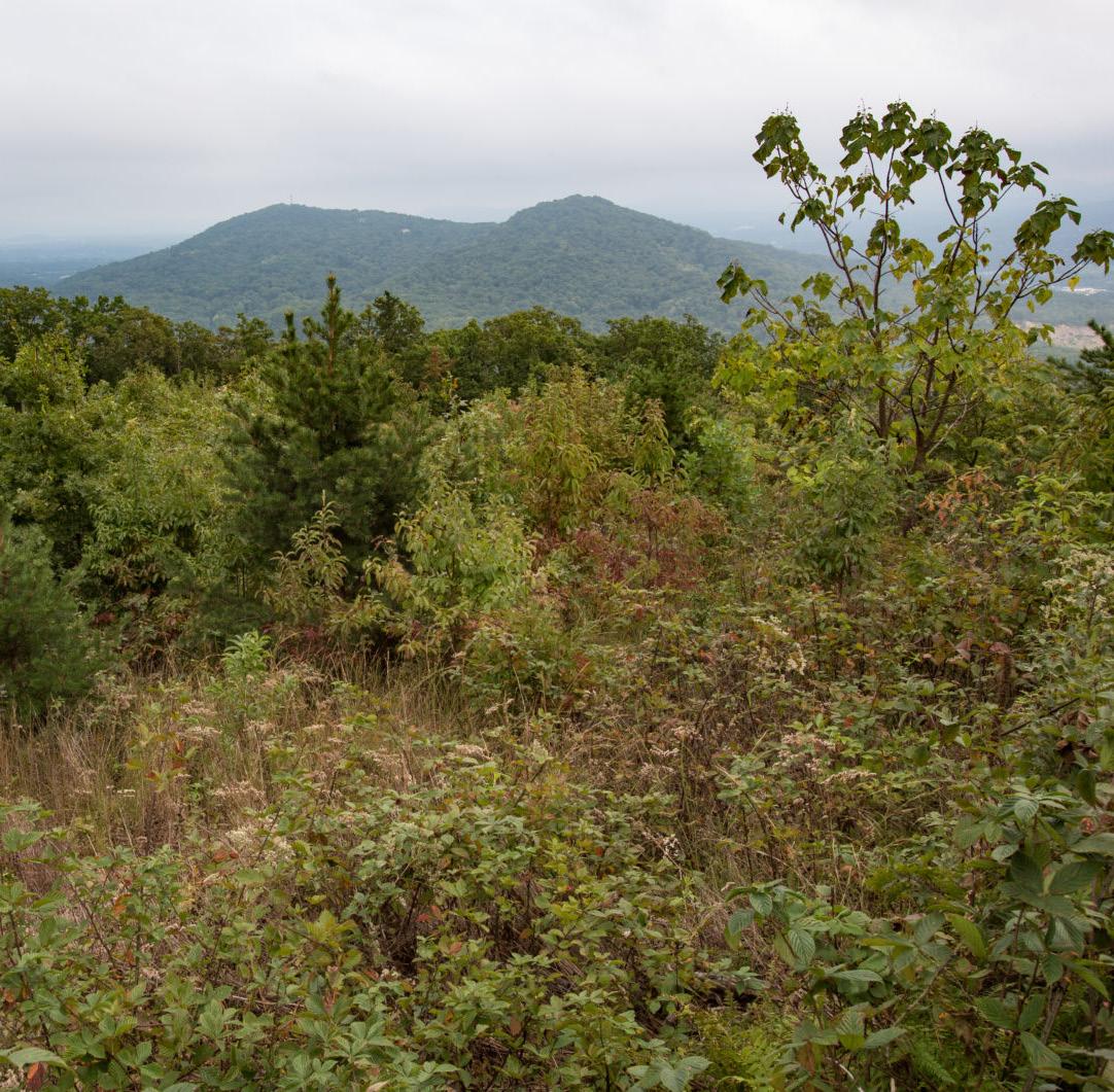
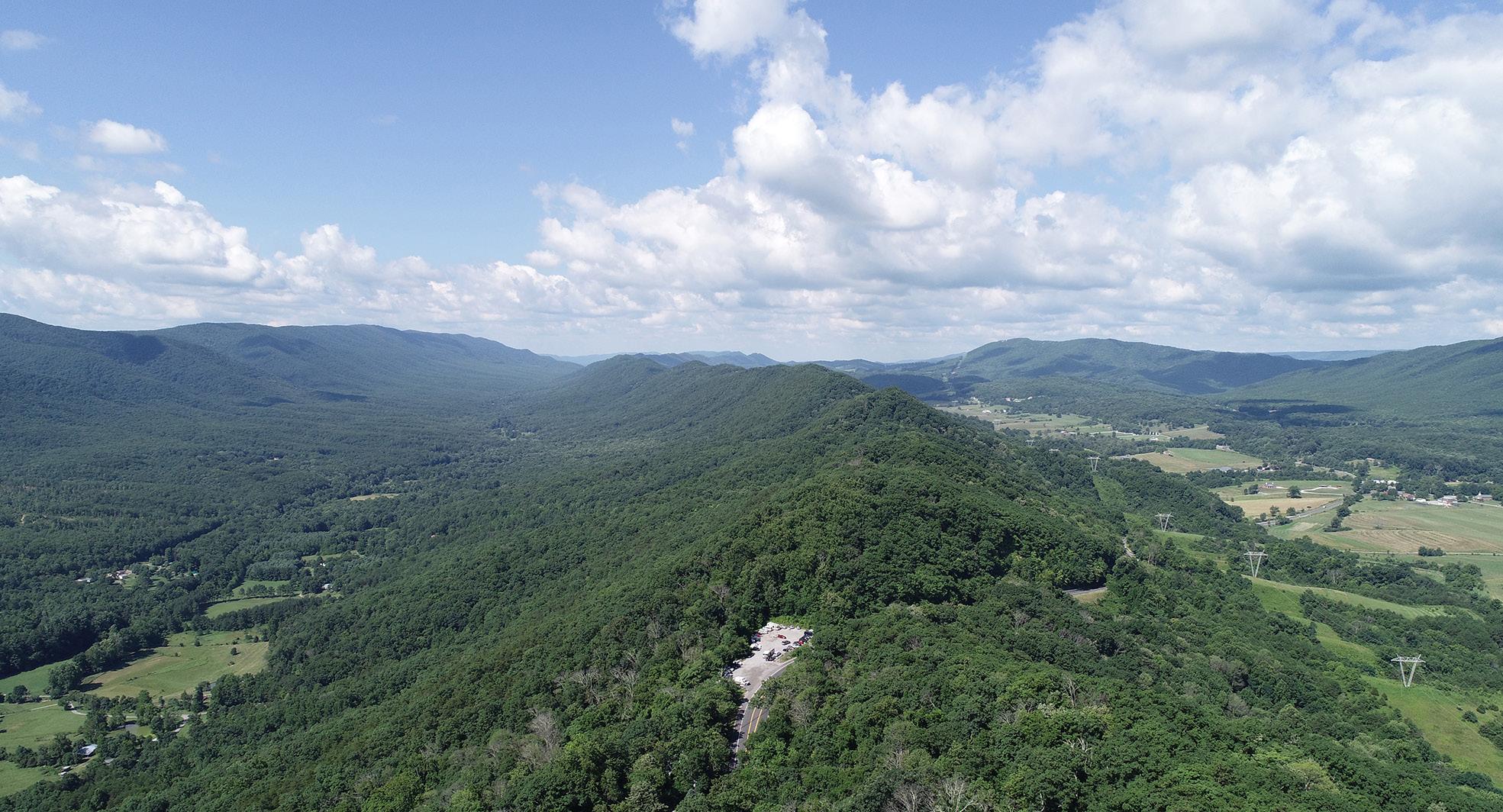
This planning area has many wonderful amenities including several overlooks including the Appalachian Trail to McAfee Knob, Havens Wildlife Management Area, and Carvins Cove Recreation Area. The CPA is divided by Route 311 and borders Interstate 81. This area is rural in nature, mostly consisting of single family homes and farmland.
Demographic Trends
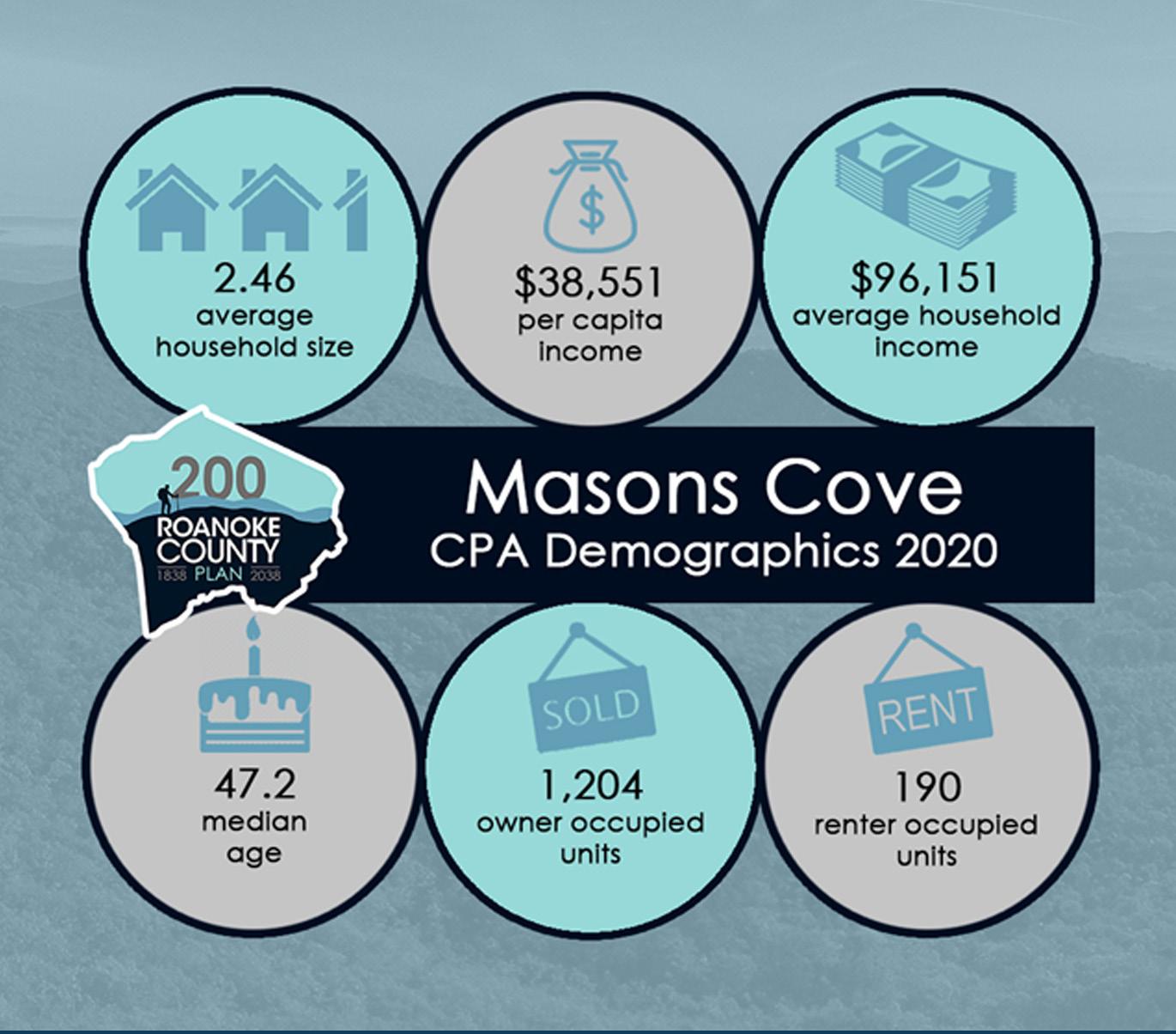
• The median age of residents continues to increase as the baby boomer generation ages. Masons Cove’s median age is 47.2 years.
• Countywide, over the last few decades families living in the same house have fewer people, and two-person households are increasing.
• Masons Cove’s population grew 64% from 1983 to 2020 and 2% from 2010 to 2020 to 3,434. Countywide there were fewer babies born from 2010 to 2020, but population grew 4.9% due to people moving here from outside the County.
• According to most recent Census data, more than 86% (1,204) of the housing units are owned, while approximately 14% (190) are rental properties.
• Per capita income is around $38,550 in the Masons Cove CPA for each individual and the average household income is approximately $96,150
• The average household size is 2.46 persons per household.
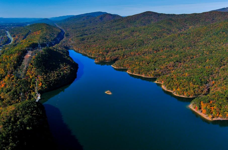
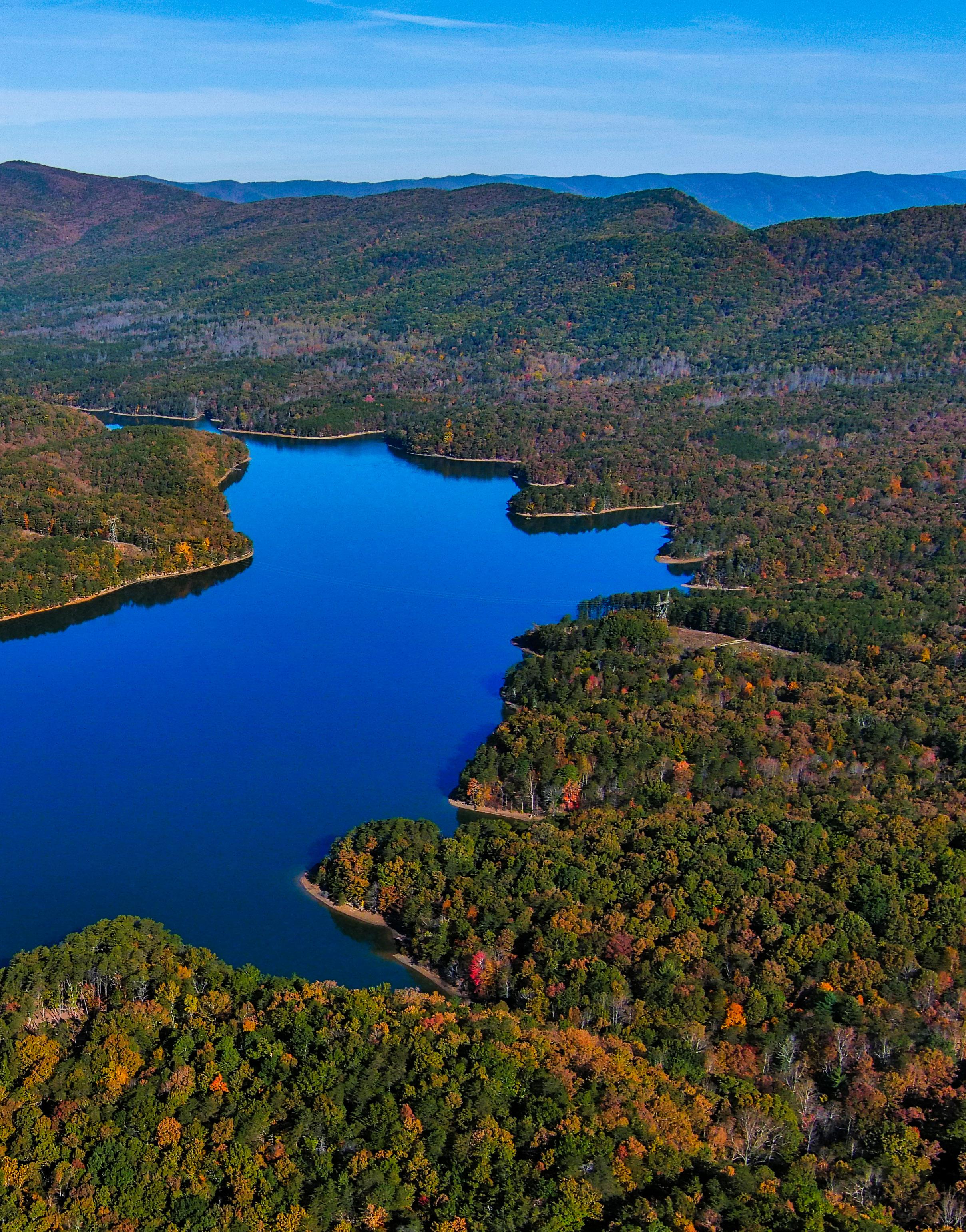
CARVINS COVE RESERVOIR
Source: 2019 US Census Data
Natural Resources
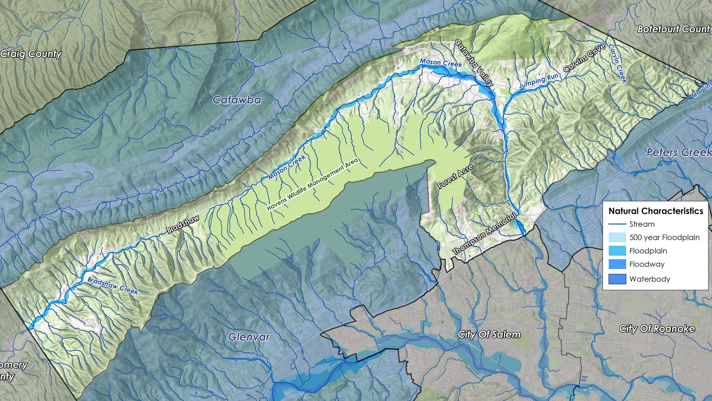
Over 20,000 acres of land are protected in Masons Cove. More than half of the planning area has steep slopes greater than 33%. Most of the area’s floodplain is generated by Bradshaw Creek and Mason Creek, which run along the major valleys. Areas subject to flooding include North Electric Road to Janee Drive (north of Interstate 81), Janee Drive to Carvins Cove Road, Carvins Cove Road to Catawba Valley Road, and Catawba Valley Road to Plunkett Road. The Masons Cove CPA has 805 acres, or 2.9% of all total land, located within the 100-year floodplain. An additional 69 acres (0.3%) are located within the 500-year floodplain. Flooding on Mason Creek at Catawba Valley Drive near the intersection of Carvins Cove Road has caused repetitive property losses.
Control of erosion and sedimentation and the management of stormwater runoff due to steep slopes and erodible soils can make land development difficult. Approximately 8,126 acres of land (30%) in the Masons Cove CPA is in a conservation easement. An additional 13,078 acres (48%) of land is protected by the National Park Service for the Appalachian National Scenic Trail Corridor, the Virginia Department of Wildlife Resources for Havens Wildlife Management Area, the City of Roanoke for Carvins Cove Natural Reserve, and the Hinchee Trail by Roanoke County. The Virginia Department of Conservation and Recreation’s Ecological Cores map shows that this CPA has “very high” and “high” ecological cores, large patches of natural land that support wildlife habitats.
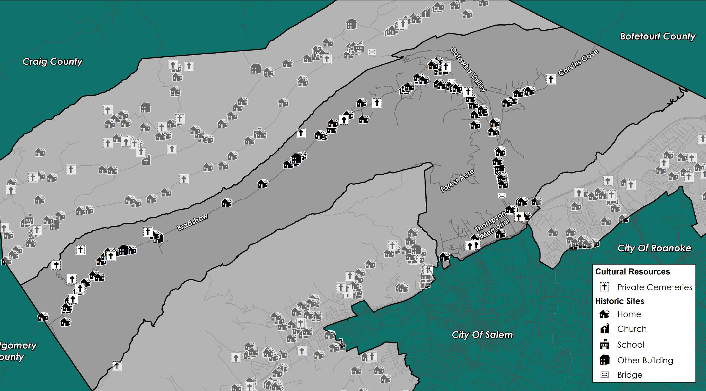
Cultural Resources
Districts Buildings Cemeteries
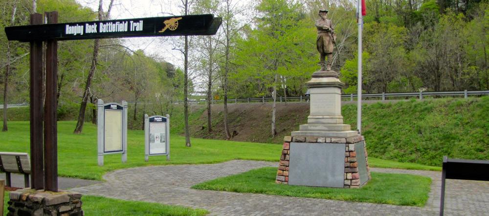
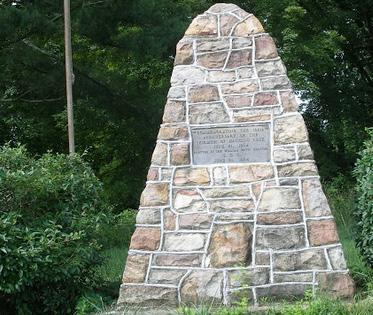
Historic resources in Masons Cove include numerous homes and private cemeteries along Bradshaw Road, Catawba Valley Road and Carvins Cove Road. The Hanging Rock Battlefield Monument north of I-81 Exit 141 commemorates a Civil War battle that occurred in June 1864 near Salem.
HANGING ROCK BATTLEFIELD TRAIL
COMMEMORATIVE PILLAR AT THE HANGING ROCK BATTLEFIELD SITE
Source: Historical Architecture Reconnaissance Survey Report (1992) and National Register of Historic Places
Community Facilities
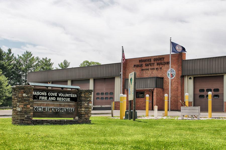
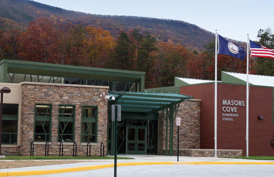
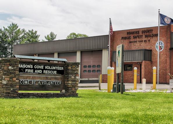
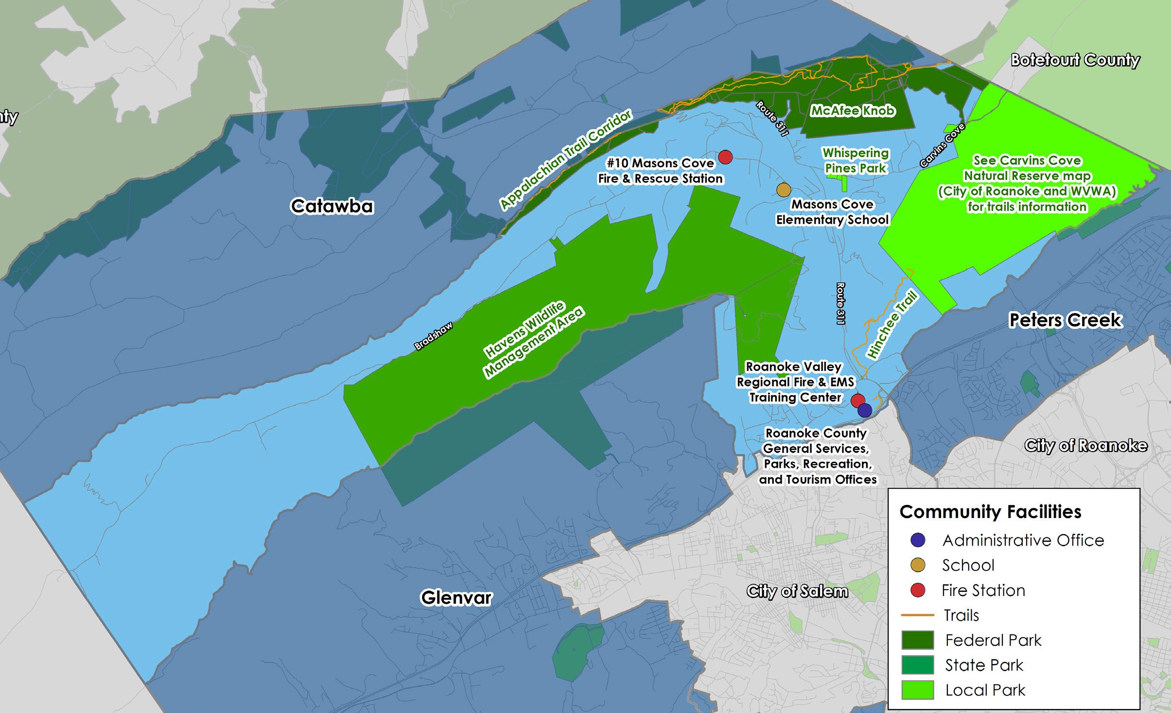
Masons Cove is known for several world-class recreation spaces including the Appalachian Trail, Havens Wildlife Management Area, McAfee Knob, Whispering Pines Park, Carvins Cove, and the Hinchee Trail. Masons Cove is also home to the Roanoke County General Services, Parks, Recreation and Tourism offices as well as the Roanoke Valley Regional Fire & EMS Training Center. Masons Cove Fire and Rescue Station #10 provides fire and rescue services for the Masons Cove CPA. Two new stations are planned to improve service in Catawba and Hollins areas of Roanoke County.
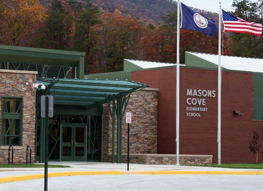
Masons Cove does not have its own library; it is served by Glenvar Library and Hollins Library. Schools serving the Masons Cove area are under enrollment capacity. Masons Cove Elementary enrollment is at 70% of capacity. Funding will begin in FY 2028 to replace lighting systems at Whispering Pines Park with more energy efficient LED lights to allow for increased athletic field usage.
MASONS COVE ELEMENTARY SCHOOL
FIRE & RESCUE STATION #10
Transportation
Roads
Transit
Greenways/Trails
Bicycle & Pedestrian Accommodations
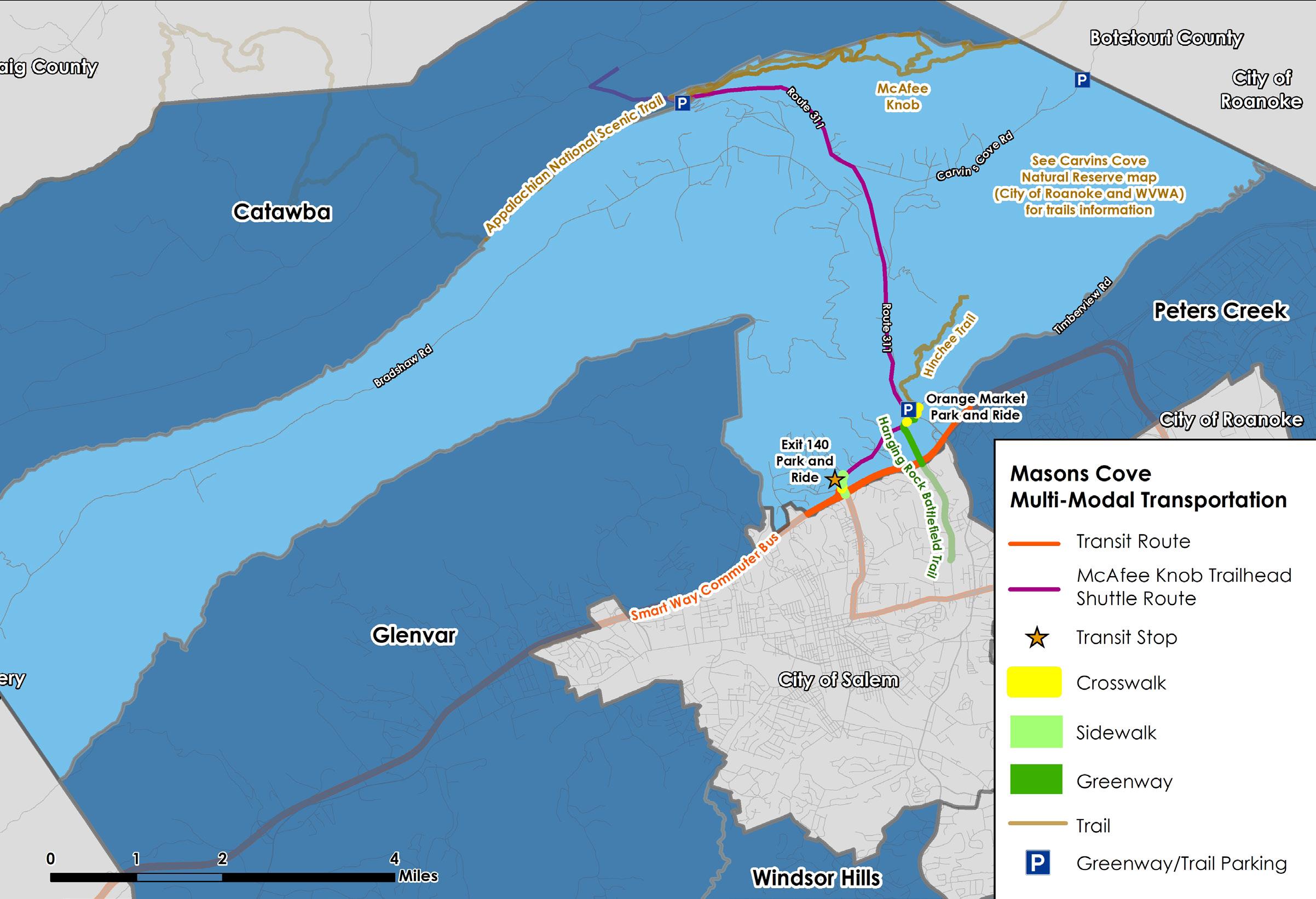
Masons Cove hosts the only Smart Way Commuter Bus stop in Roanoke County, which is located at the Exit 140 Park and Ride. A little less than half of the 1.7-mile Hanging Rock Battlefield Trail is located in Masons Cove.
The Hanging Rock Battlefield Trail connects to the Hinchee Trail and, by way of this, Carvins Cove. At the Hanging Rock Battlefield Monument, there is a trailhead parking lot. Parking areas for Carvins Cove are located on Timberview Road and Carvins Cove Road. A section of the Appalachian National Scenic Trail to McAfee Knob is located in Masons Cove, with trailhead parking located on Route 311.
Transportation cont.
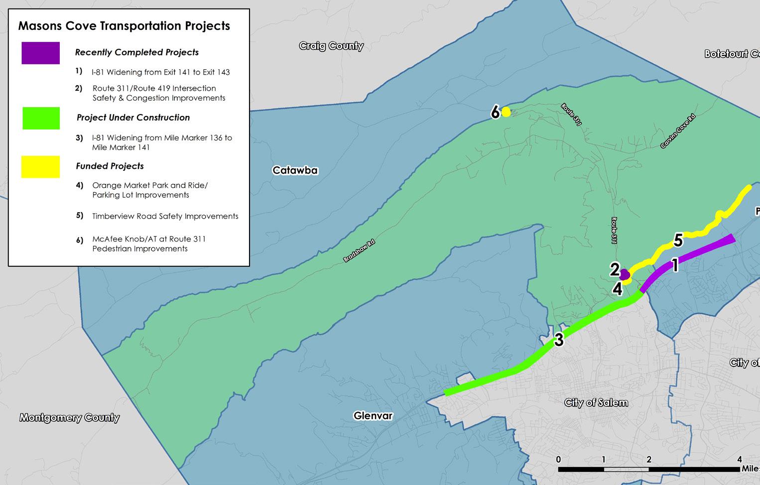
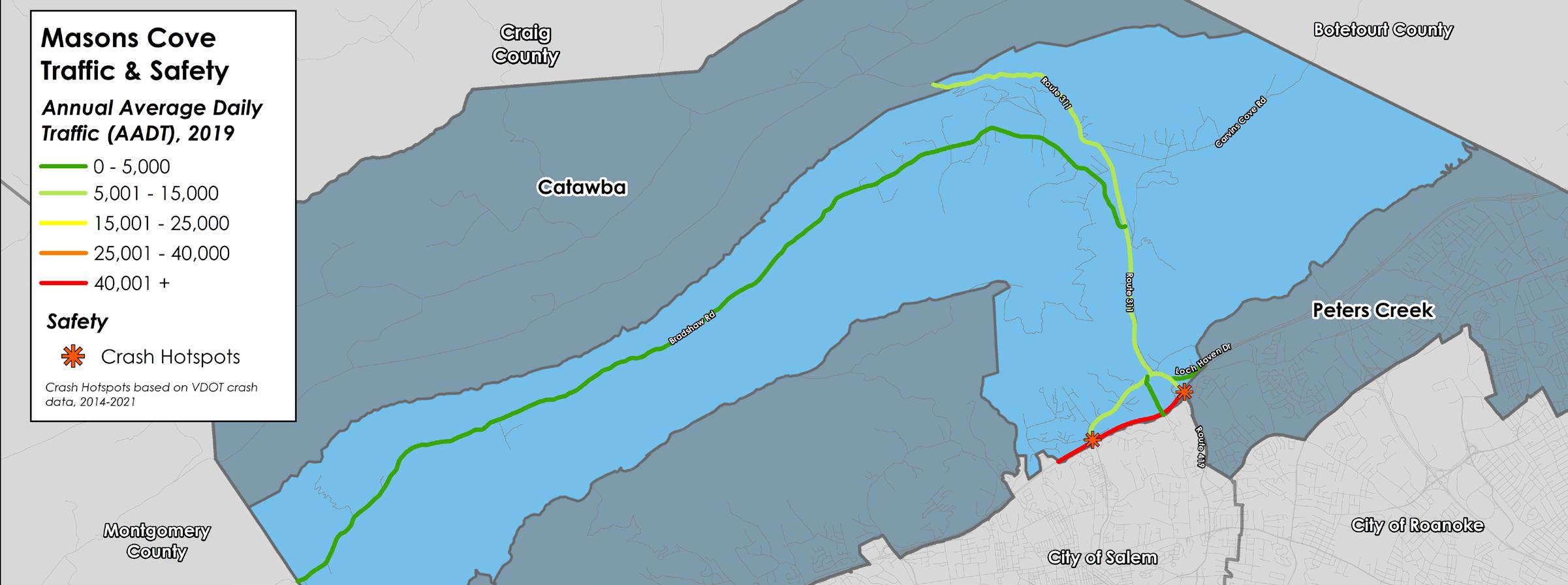
Interstate 81 skirts the southern edge of the Masons Cove CPA and is the busiest roadway in the County with over 67,000 trips per day between Exit 140 at Route 311 and Exit 141 at Route 419. Crash hotspots are located at both exits as well. A map showing this information is located at the bottom of the page.
Interstate 81 widening to three lanes in both directions is complete between Exit 141 and Exit 143, and is under construction between Exit 141 and Mile Marker 136. A VDOT Park and Ride is located at Exit 140 and connects under Interstate 81 to the City of Salem with sidewalk and crosswalks. The Smart Way Commuter Bus stops at the park and ride on its route between Virginia Tech in Blacksburg and the Virginia Tech Carilion School of Medicine in the City of Roanoke. The Virginia Breeze stops at the park and ride on its route between Bristol and Washington, D.C. The McAfee Knob Trailhead Shuttle also stops at the park and ride to transport hikers to and from the McAfee Knob Trailhead parking lot.
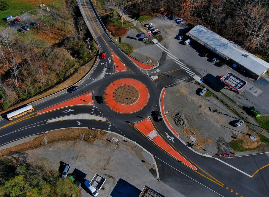
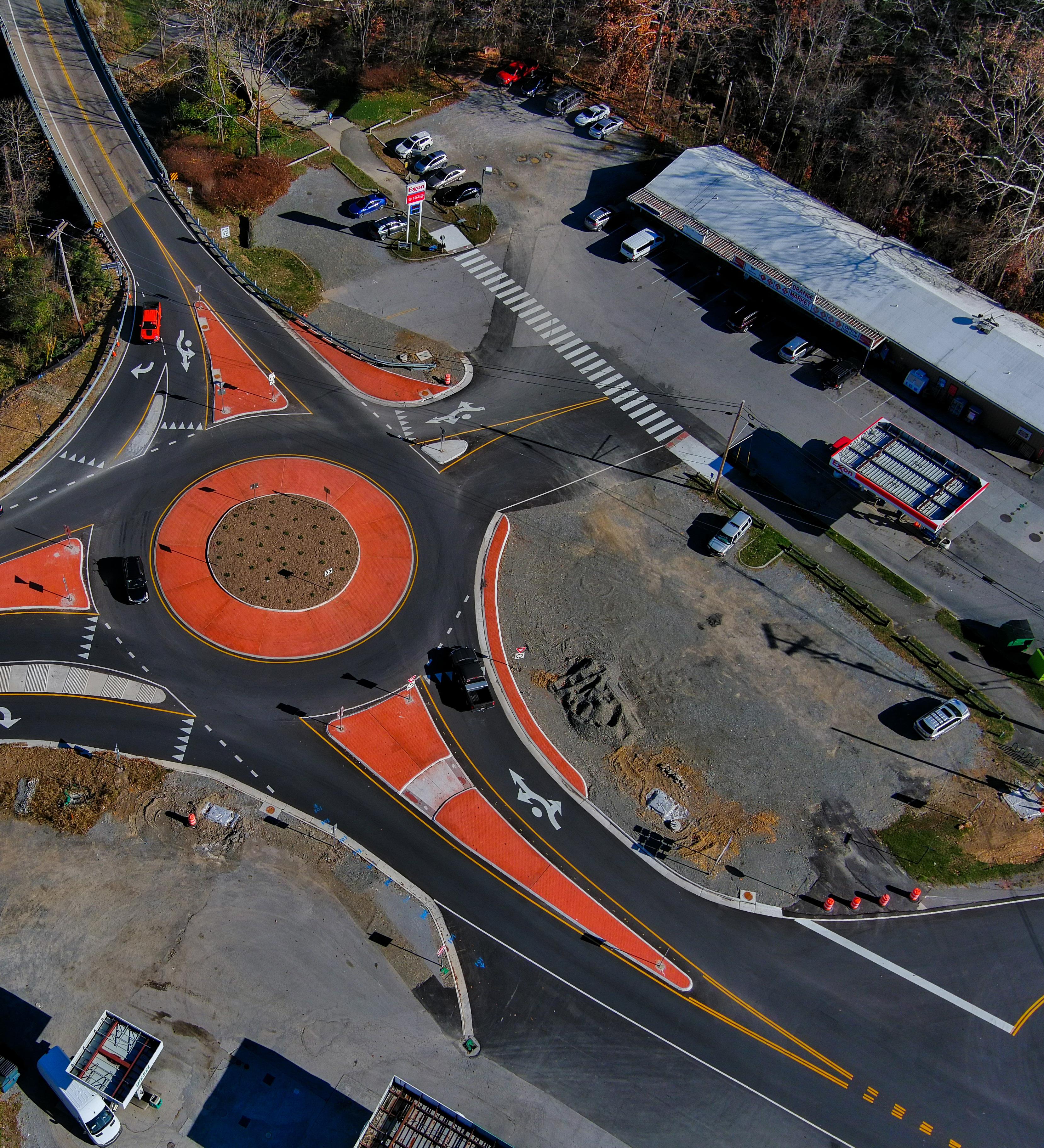
Approximately half of the Hanging Rock Battlefield Trail is located in the Masons Cove CPA. This trail connects to the Hinchee Trail which intersects with over 60 miles of trails at Carvins Cove Natural Reserve (owned by the City of Roanoke). Two City trailhead parking lots serve Carvins Cove in this area, located at the end of Timberview Road and on Carvins Cove Road. The Appalachian National Scenic Trail (AT) crosses Route 311 at the McAfee Knob trailhead parking lot. A pedestrian bridge for the AT is funded and will be constructed over Route 311 in 2024. In the southern part of the CPA, a new roundabout has replaced the traffic signal at the intersection of Route 419 and Route 311 at Orange Market.
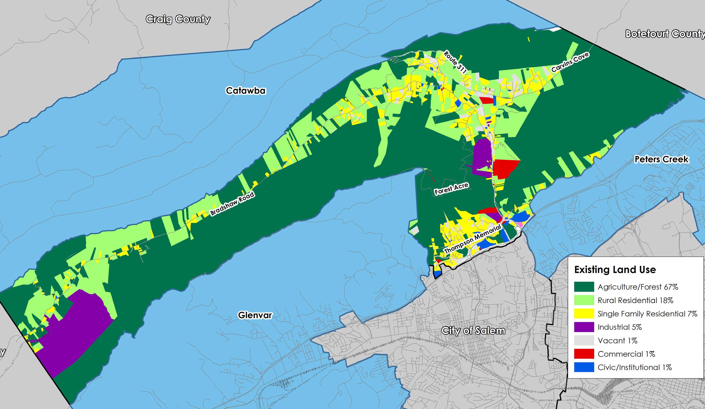
Existing Land Use
The beauty and rural character of Masons Cove is woven from natural landscape features and compatible land uses. Land uses include agricultural and forest uses, low density housing, outdoor recreation, and the Hanging Rock commercial center. Key resources include views of surrounding ridgelines, creeks and streams, Havens Wildlife Management Area, greenways, the Appalachian National Scenic Trail and Carvins Cove Natural Reserve. Industrial uses include the 1000-acre Smith Gap Landfill on Bradshaw Road.
67% of the land is agricultural and forest uses. 18% of the land is developed by rural residential homes. 7% of the land is comprised of single-family neighborhoods. 8% of the land is split amongst industrial, vacant, commercial, civic/institutional and office uses. Opportunities exist for commercial enterprises in the area in and around Hanging Rock.
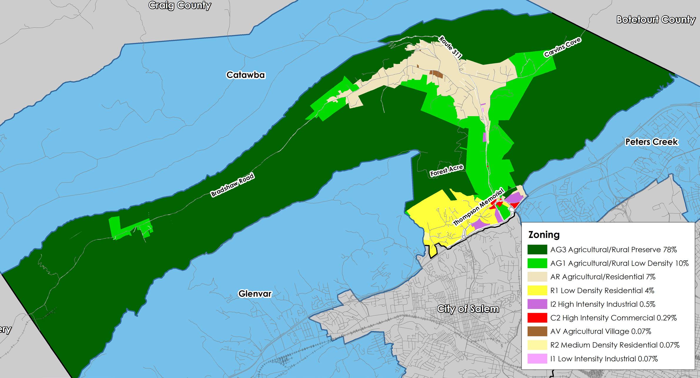
Zoning
The majority of land in Masons Cove is zoned for agriculture and low density rural residential. These zoning districts account for 25,729 acres of the community planning area and are located primarily in valley and ridge terrain. Low density neighborhood zoning comprises 4% of the land, with the remainder split amongst commercial and industrial zoning districts.
The AG-3 Agricultural/Rural Preserve district and the AG-1 Agricultural/Rural Low-density district consist of land primarily used as farmland, woodlands, and widely scattered residential development located within the rural service area. The AR Agricultural/Residential district is generally characterized by very low density residential and institutional uses mixed with smaller parcels that have historically contained agricultural uses, forest land and open space outside the urban service area. The AV Agricultural/Village Center district serves as the focal point for cultural and commercial activity of the rural service areas of the County. The overwhelming presence of these districts in the Masons Cove CPA accomplishes the purpose of maintaining this area in its rural state, and attempt to protect sensitive and unique land resources from degradation as recommended in this summary document.
Along its southern border with I-81 and the City of Salem, 5% of the Masons Cove CPA has its most intensive zoning. The R-1 Low Density Residential district and R-2 Medium Density Residential district are established for areas of the County within the urban service area with low and medium density residential development. The C-2 High Intensity Commercial district provides for a wide variety of commercial land uses at a regional scale within the urban service area. The I-2 High Intensity Industrial district allows for high-intensity industrial land uses within the urban service area. The I-1 Low Intensity Industrial district similarly allows for low-intensity industrial land uses.
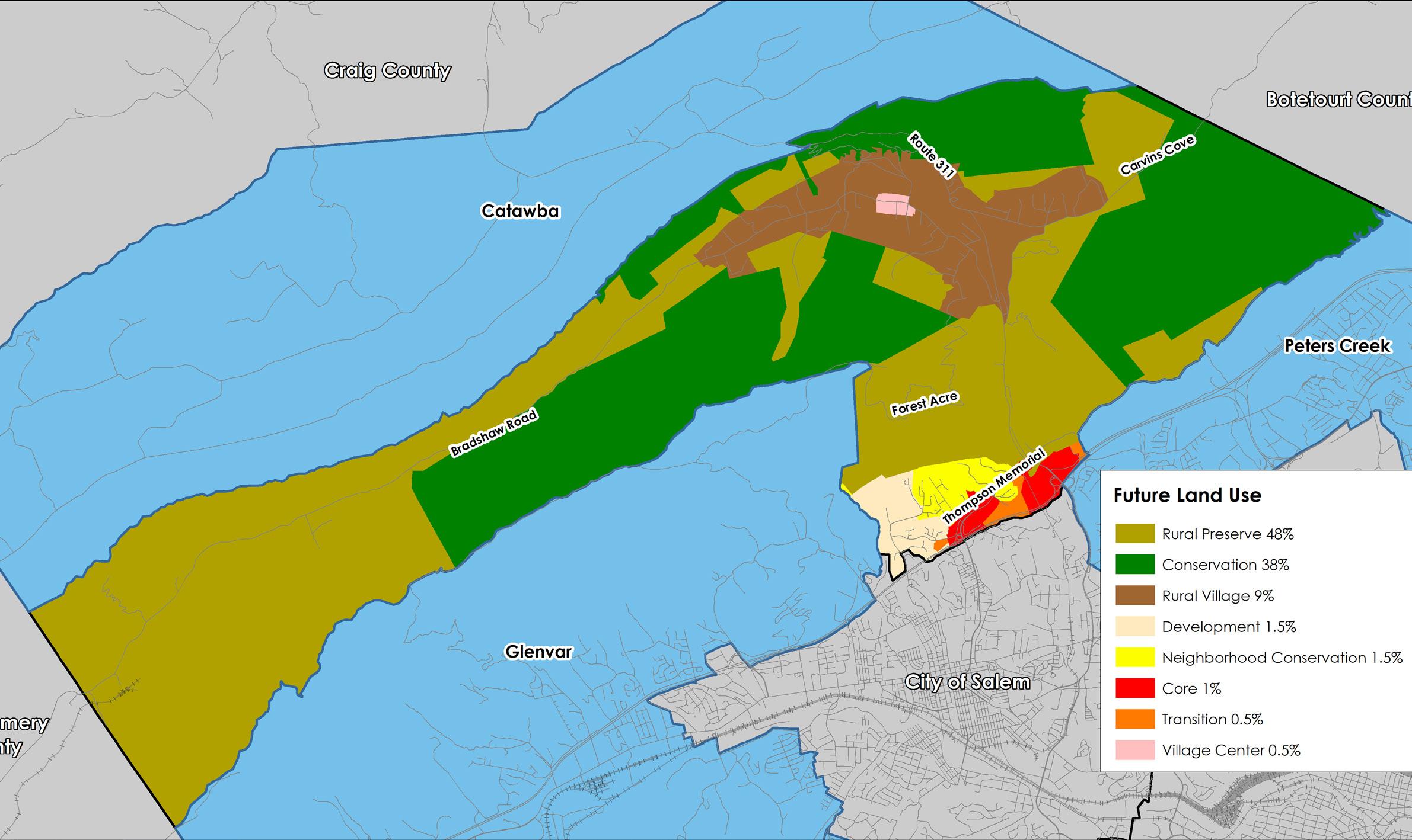
Future Land Use
The map below shows the future land use designations in the Masons Cove CPA from the 2005 Comprehensive Plan.
Most of the land in Masons Cove is intended to remain rural. 57% of land that is designated for Rural Preserve and Rural Village to protect the rural character of the area. 38% is designated for Conservation, which includes ridgelines, mountainsides, and public lands. The Conservation future land use designation is intended to protect environmental, natural, or cultural features from encroaching development. The remaining 5% is designated for Development, Neighborhood Conservation, Core, Transition, and Village Center primarily in the Hanging Rock area, surrounding the Route 311 and Route 419 exits on I-81. Approximately 63 acres of land near the junction of Old Catawba Road and Bradshaw Road is designated as Village Center.
HAVENS WILDLIFE MANAGEMENT AREA
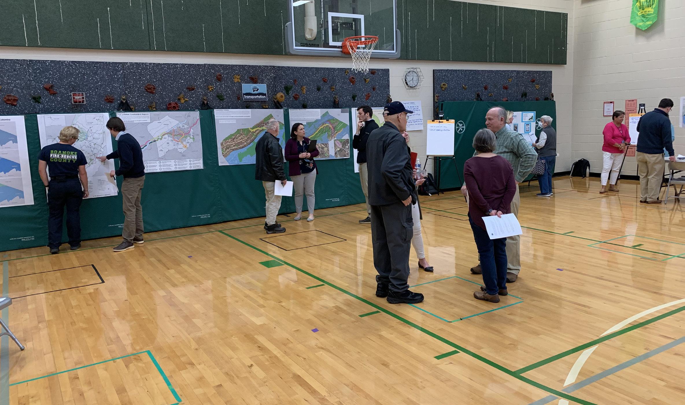
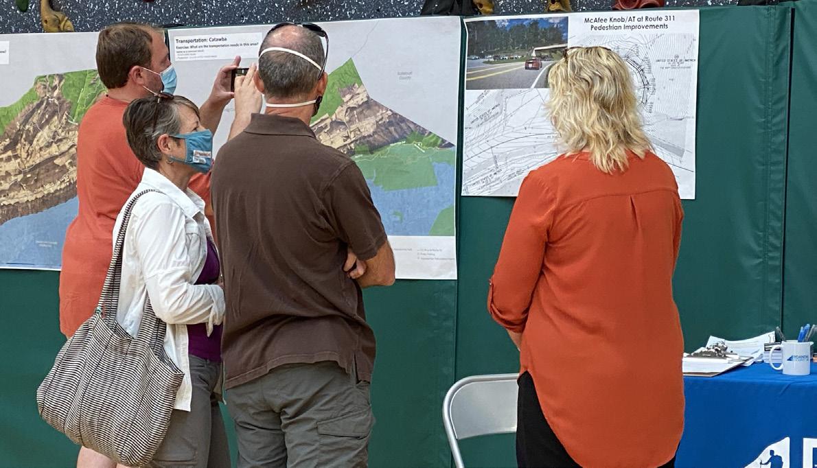
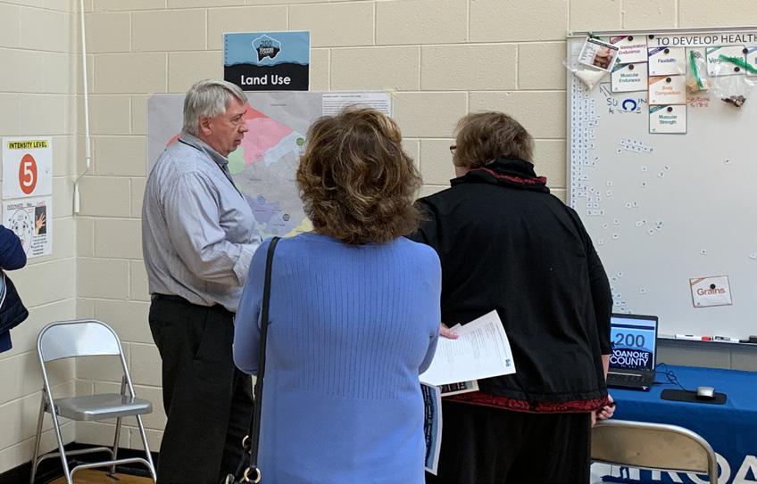
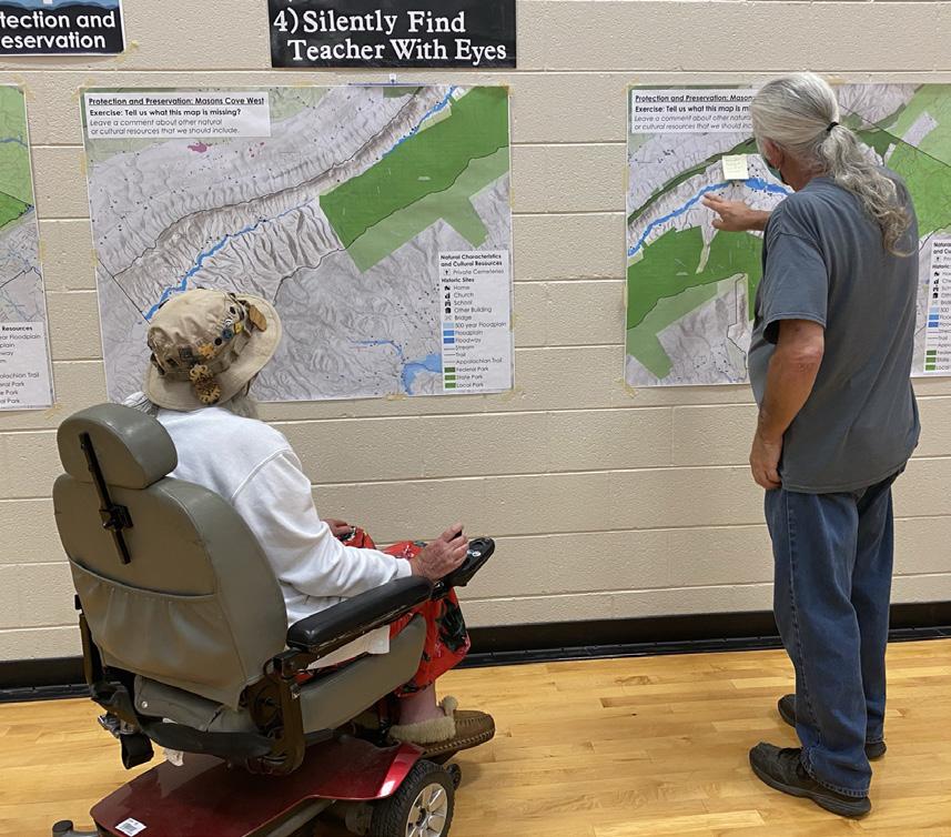
Fall 2021 Community Meetings - Existing Conditions
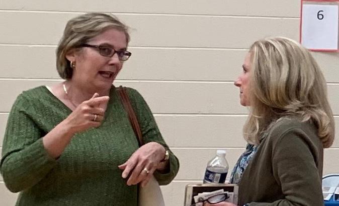
Twelve (12) planning meetings were held around Roanoke County in Fall 2021 to collect preliminary feedback about community issues and needs. The community meeting for the Masons Cove CPA was held in conjunction with the Catawba CPA on September 9, 2021, at Masons Cove Elementary School. There were 50 attendees. Citizens were invited to comment on Land Use, Community Facilities, Transportation, and Protection and Preservation. Comments and suggestions from citizens were collected and assembled by staff into a “Post Meeting Summary” document. A digital copy of this document can be found on the Roanoke County 200 Plan webpage.
Fall 2021 Community Input Highlights:
a. Residents wanted the character of Masons Cove to remain agricultural and rural.
b. People generally wanted improved community facilities in the area.
c. Staff spoke with many people about various vehicle traffic issues throughout the area, especially on Bradshaw Road and Route 311.
Spring 2022 Open House Meetings - Draft Goals and Recommendations
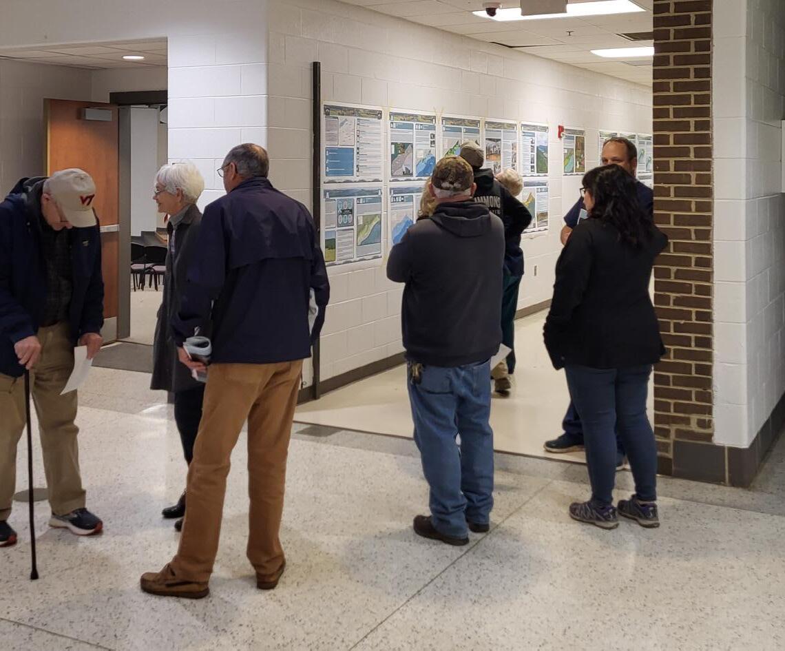
Seven (7) Roanoke County 200 Plan open house planning meetings were held around Roanoke County in Spring 2022 for citizens to review draft goals and recommendation options based on the feedback received throughout the Fall 2021 community engagement. Draft goals were developed based on input that we received at the community meetings and online surveys in Fall 2021. Citizens reviewed and provided comments on the new draft goals and recommendations that will shape the draft Roanoke County 200 Plan document. The draft goals and recommendations displayed included natural and cultural resources, land use, community facilities and infrastructure, and transportation. The community meeting for the Masons Cove CPA was held in conjunction with the Catawba CPA on April 4, 2022, at the Masons Cove Elementary School. There were 41 attendees.
Spring 2022 Community Survey Highlights:
Natural and Cultural Resources:
The majority (91%) of survey respondents and community meeting participants support recommendations to protect and improve ground, surface and stormwater resources; beautify the county’s public areas, viewsheds and roadways; clean up garbage; protect steep slope areas; protect trees and forests, natural areas and wildlife habitats; as well as protection of historic and cultural resources.
Community Facilities and Infrastructure:
a. Parks, Recreation and Tourism: 92% of respondents support the Countywide recommendations as well as the following items pertaining to the Masons Cove CPA: 1. Evaluate improvements at Whispering Pines Park. 2. Evaluate opportunities for parks, greenways/trails and blueways. 3. Continue regional collaboration for the Triple Crown (Dragon’s Tooth, McAfee Knob, Tinker Cliffs). 4. Expand options for Little Free Libraries.
b. General Services: 93% of respondents support recycling options and assessments of County Fire Department Facilities and the Administration Center building.
c. Public Libraries: 80% of respondents support the Countywide library system recommendations.
d. Communications and Information Technology: 88% of respondents support expansion and improvement of broadband and cell phone access.
e. Public Safety: 98% of respondents support Countywide public safety recommendations.
Land Use:
63% of respondents support the activity centers as shown on the Activity Center Map, while 15% indicated interest in additional activity centers. 80% of respondents support the proposed changes to the Future Land Use Map.
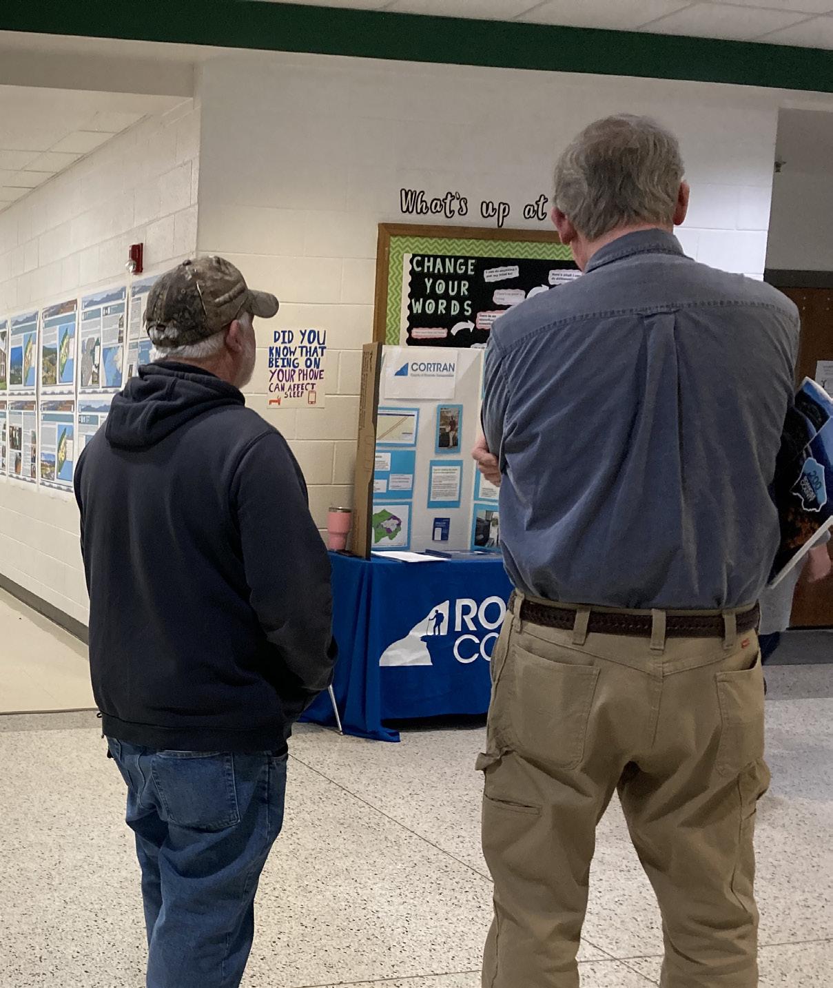
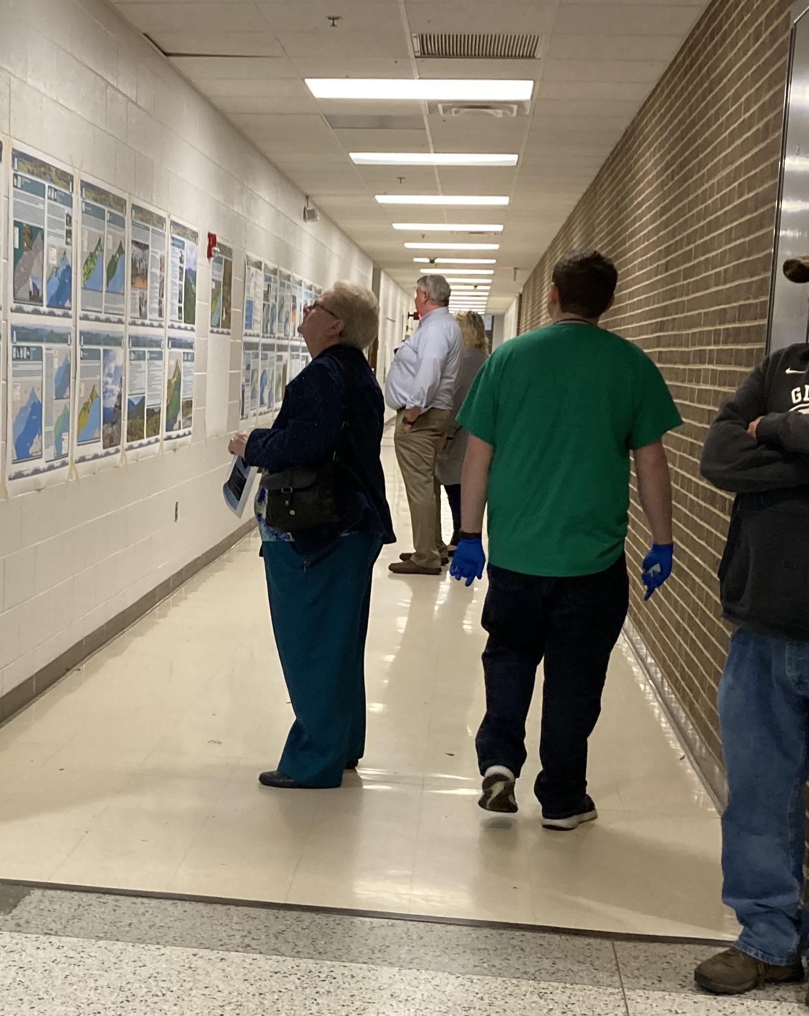
Winter 2023 Community Meetings - Draft Plan Reveal
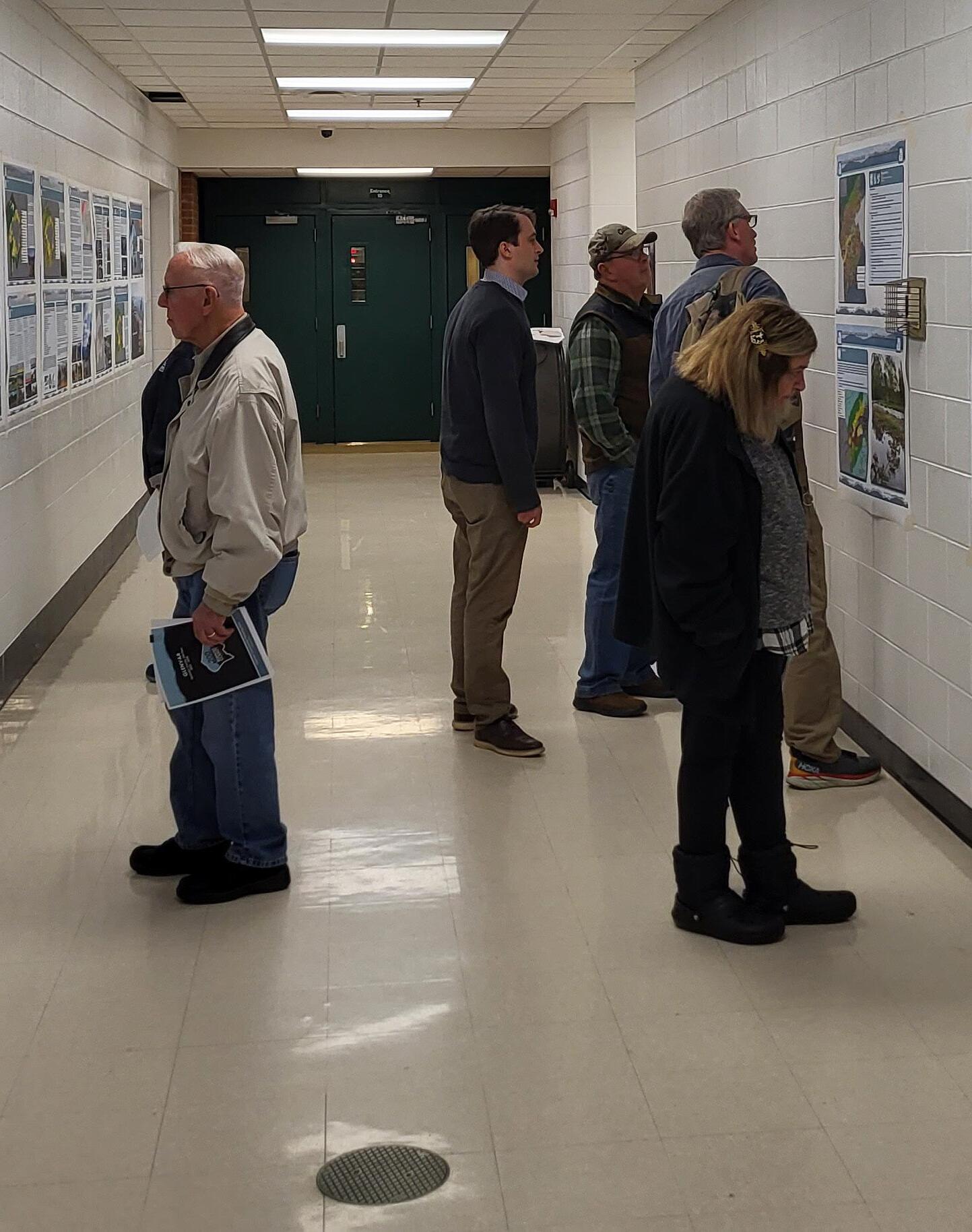
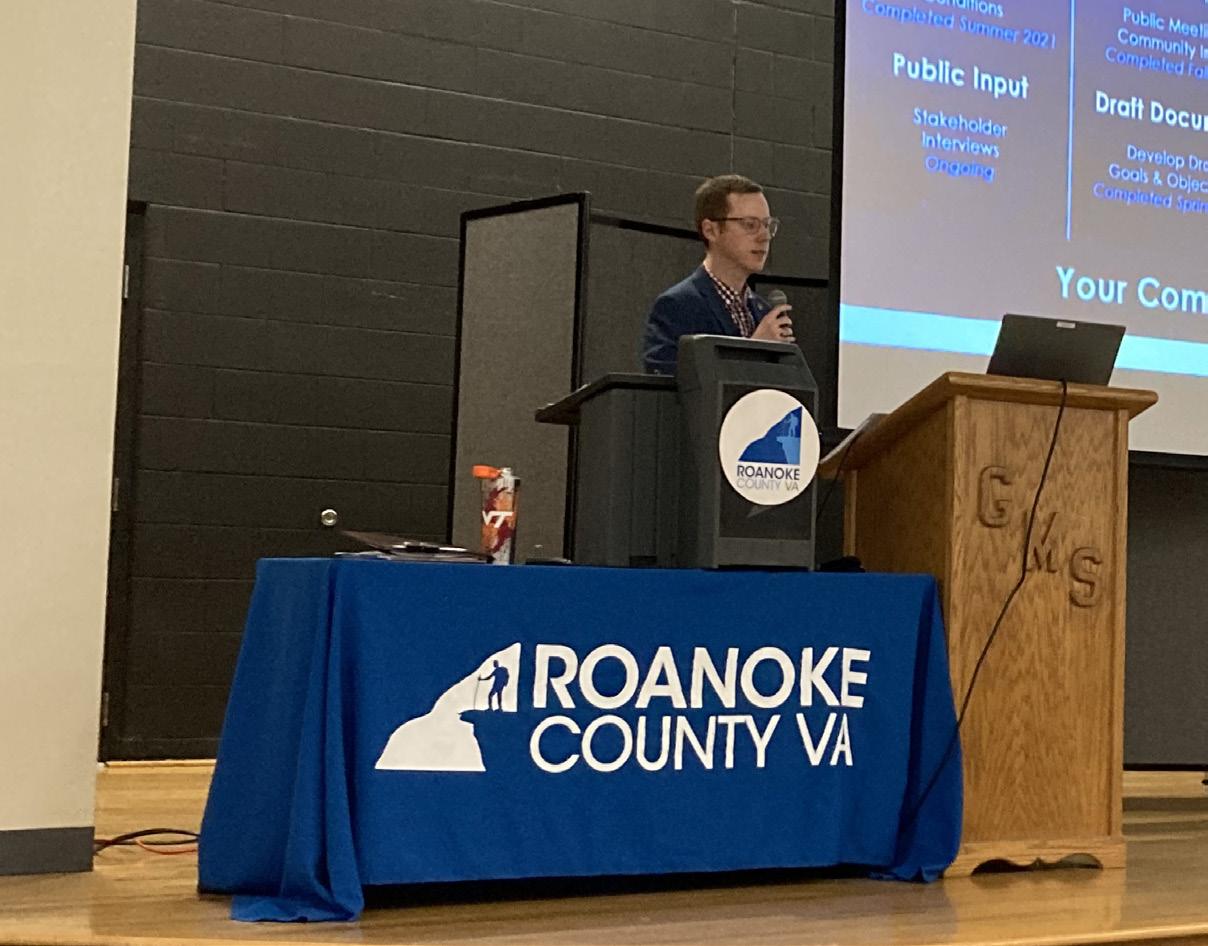
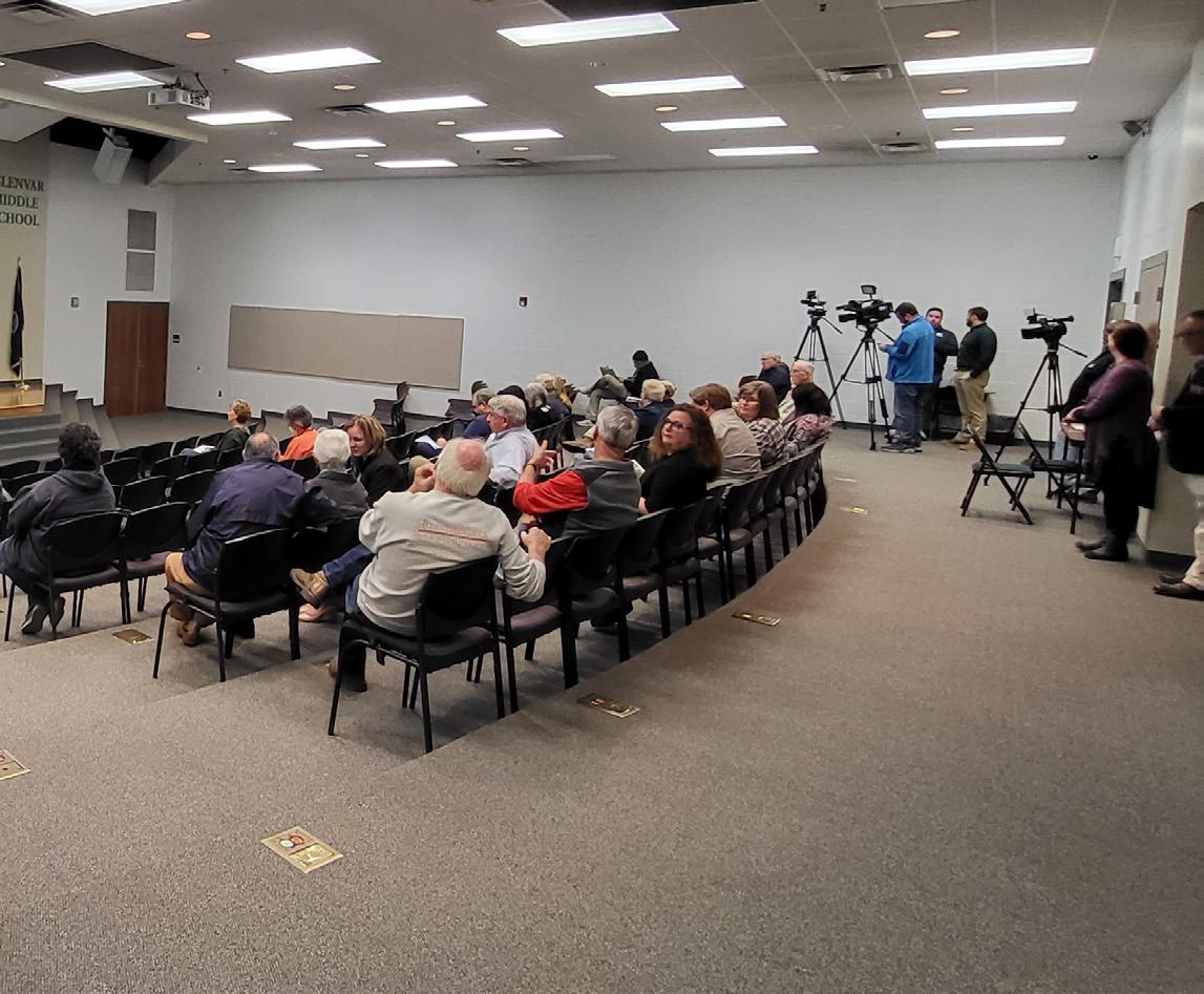
Six (6) Roanoke County 200 Plan open house planning meetings were held around Roanoke County in Winter 2023 for citizens to review the Draft Roanoke County 200 Plan Countywide Summary Document and Draft Community Planning Area Documents based on the feedback received throughout the community engagement process. Citizens reviewed and provided comments on the draft Roanoke County 200 Plan documents. The community meeting for the Masons Cove CPA was held in conjunction with the Catawba CPA and the Glenvar CPA on February 27, 2023, at Glenvar Middle School. There were 37 attendees.
In general, the comments provided by residents were concerned with the following:
a. A desire for bicycle accomodations and trailhead parking improvements.
b. Traffic safety and congestion concerns on Route 311 and Dutch Oven Road.
c. The extension of public utilities, especially public sewer, in the Route 311/Hanging Rock area.
These issues and concerns are addressed by recommendations in the Mason Cove CPA Summary Document. These recommendations include:
a. Study the entirety of Old Catawba Road for potential improvements in collaboration with VDOT and adjacent property owners.
b. Develop an Activity Center Plan in the Masons Cove area around the Route 311 intersection at Hanging Rock.
c. Initiate a Route 311/Thompson Memorial Drive and Route 419/North Electric Road Multimodal Transportation Study from Interstate 81(Exit 140) to Interstate 81 (Exit 141).
d. Investigate trailhead parking options for the Hinchee Trail.
e. Construct the Masons Creek Greenway North, from the end of the Hanging Rock Battlefield Trail generally along Route 311/Catawba Valley Drive, to the Bradshaw Road intersection.
In addition to the Draft Plan reveal meetings, the Planning Commission and the Board of Supervisors held public hearings on the Roanoke County 200 Plan. Information on these hearings is contained in the main document of the Roanoke County 200 Plan.
Recommendations
Natural & Cultural Resources
Topography/Viewsheds
Hydrology/Floodplains
Water Quality/Pollution Prevention
Vegetation/Natural Areas
Historic & Cultural Resources
1. Protect and improve the quality of water in our streams, creeks and rivers.
2. Coordinate with State agencies regarding floodplain risks and prevention.
3. Reduce quantity and improve quality of stormwater.
4. Protect and prevent risks to surface waterways, reservoirs, underground aquifers and drinking water wells.
5. Beautify County roadways and public areas.
6. Protect viewsheds from the ridges and from the valleys.
7. Clean up and prevent litter and illegal dumping.
8. Protect steep slope areas.
9. Protect trees and forests and increase tree canopy.
10. Protect natural areas and wildlife habitats.
11. Coordinate with State agencies regarding historic and cultural resources, including cemeteries and archaeological sites.
APPALACHIAN TRAIL NEAR MASONS COVE
Community Facilities & Infrastructure
Parks, Recreation & Tourism
Parks, Recreation and Tourism Recommendations
1. Evaluate new park, greenway, and blueway opportunities in the community.
2. Evaluate on- and off- road connectivity options between parks, neighborhoods, and community facilities.
3. Continue coordination on regional efforts to enhance and develop outdoor recreation opportunities in our communities.
4. Update the Parks, Recreation & Tourism Master Plan.
5. Continue promotion of the Park Partners Program to encourage citizens and businesses, and organizations to adopt a park, greenway, or trail.
6. Educate citizens on park ordinance updates (i.e., park sign updates, dog-friendly parks/special events and leash laws, drones, etc.).
7. Continue developing programs that balance community needs with available staffing resources.
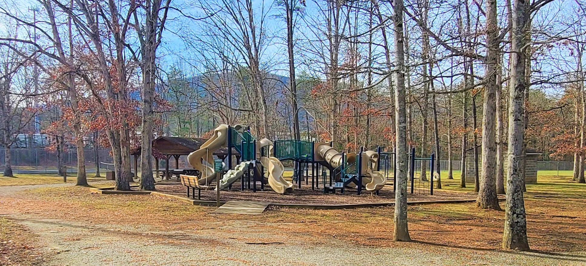
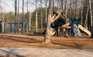
8. Evaluate improvements at Whispering Pines (i.e., sports field lighting).
9. Evaluate the needs of existing parks and trails (i.e., trail maintenance, tennis court conversion to pickleball, etc.).
10. Continue collaboration with National Park Service, VDOT, U.S. Forest Service, and Appalachian Trail Conservancy on the Triple Crown Area (Dragon’s Tooth, McAfee Knob, and Tinker Cliffs).
11. Evaluate additional options for expanding Little Free Libraries Program with Park Partners Program.
WHISPERING PINES PARK PLAYGROUND
Community Facilities & Infrastructure
General Service Recommendations
1. Evaluate recycling program options.
2. Implement recommendations from the Roanoke County Fire Department Facilities Assessment.
3. Implement recommendations from the Roanoke County Administration Center Assessment.
Public Libraries Recommendations
1. Improve services and continue enhancing facilities.
2. Evaluate programming needs and wants based on a variety of data and customer feedback.
3. Implement responsive, community focused program that serves people of all ages and backgrounds.
4. Ensure timely delivery of all circulating materials.
5. Raise level of engagement with the community, and increase awareness about library services and programs.
Communication & Information Technology Recommendations
1. Explore opportunities to extend broadband service with universal availability and access to high-speed Internet in unserved and underserved areas.
2. Explore alternative broadband and cell phone service providers for choice and competition.
3. Explore more public-private partnerships to implement more stages of Roanoke County’s Rural Broadband Initiative to bring high-speed Internet to homes without broadband access.
4. Explore providing improved cell phone service in unserved and underserved areas.
Public Safety Recommendations
1. Provide the efficient delivery of public safety services with minimal response times.
2. Enhance and maintain public safety staffing.
3. Enhance and maintain facilities and equipment.
4. Provide a high-level of citizen engagement and educational opportunities.
Transportation
Greenways/Trails
Bicycle & Pedestrian Accommodations
Recommendations
Priority transportation projects:
1. Initiate a Route 311/Catawba Valley Drive Multimodal Transportation Study with VDOT to determine potential improvements to reduce crashes and improve safety for all users.
2. Initiate a Route 311/Thompson Memorial Drive and Route 419/North Electric Road Multimodal Transportation Study from Interstate 81 (Exit 140) to Interstate 81 (Exit 141).
Other transportation projects:
3. Construct the Masons Creek Greenway North, from the end of the Hanging Rock Battlefield Trail generally along Route 311/Catawba Valley Drive, to the Bradshaw Road intersection.
4. Investigate trailhead parking options for the Hinchee Trail.
5. Improve the Orange Market Park and Ride and Creekside parking lot for use by commuters and greenway users.
6. Determine potential improvements for the Timberview Road trailhead in collaboration with the City of Roanoke and VDOT.
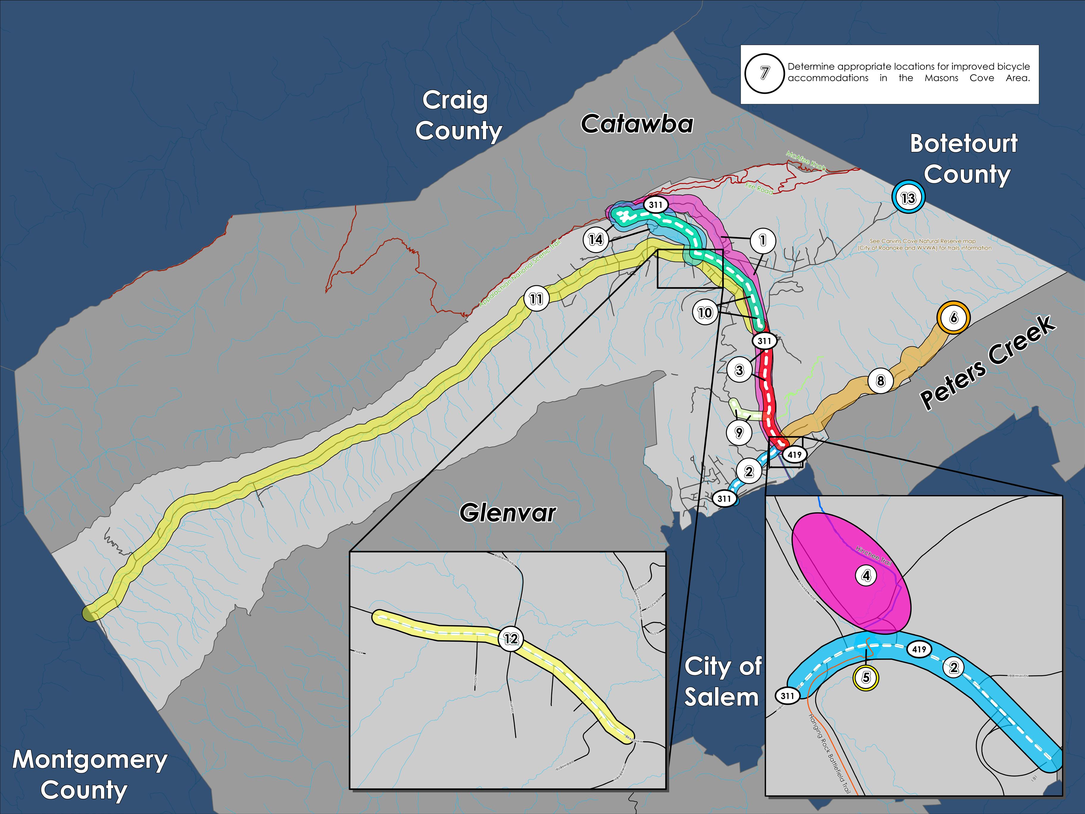
7. Determine appropriate locations for improved bicycle accommodations in the Masons Cove area.
8. Determine appropriate Timberview Road improvements in collaboration with VDOT.
9. Evaluate a trail connection between Route 311/Catawba Valley Drive and Havens Wildlife Management Area.
10. Evaluate the Masons Cove Greenway between Bradshaw Road and Route 311/Catawba Valley Drive at Old Catawba Road.
11. Determine appropriate improvements for Bradshaw Road in collaboration with VDOT.
12. Evaluate potential pedestrian connections to businesses and destinations along Bradshaw Road between Masons Cove Elementary School and Fire Station 10.
13. Support potential improvements for the Bennett Springs trailhead in collaboration with the City of Roanoke.
14. Study the entirety of Old Catawba Road for potential improvements in collaboration with VDOT and adjacent property owners.
Land Use
Residents supported the eleven (11) proposed changes to the future land use map in the Masons Cove CPA during the Spring 2022 open house and survey. Seven (7) of these changes were from the Rural Preserve designation to the Conservation designation due to steep slopes greater than 33%, conservation easements, or recreation lands that exist there. There were three different changes made to preserve the existing zoning in the area for certain agricultural, residential, and village land uses. The final change was to amend the CPA boundaries bordering the Peters Creek CPA, from I-81 to instead be along the ridge between Loch Haven Road and Timberview Road.
Recommendations
1. Amend the Future Land Use Map as shown below to conserve the natural beauty and rural character of Masons Cove.
2. Develop an Activity Center Plan in the Masons Cove area around the Route 311 intersection at Hanging Rock.
3. Develop a Rural Center Plan in the Masons Cove area around Route 311/Bradshaw Road intersection.