This Plan Summary highlights the key components of the various sections of the Cave Spring Planning Area. The Existing Conditions section features the study area’s demographics, community facilities, natural resources, cultural resources, land use, zoning, and the people that participated in the Plan’s development.
The Cave Spring Planning Area’s goals were inspired by public input and used to develop the Plan’s recommendations in the County’s Comprehensive Plan Update. Implementation of this Plan will be completed over the next 15 years.
419 Town Center Plan (2019)
The 419 Town Center Plan was adopted by the Board of Supervisors on July 23, 2019, as a component of the Roanoke County Comprehensive Plan. The 419 Town Center Plan is also a component of this Cave Spring Community Planning Area Summary Document.
Natural & Cultural Resources
Protect and improve ground, surface and stormwater resources; beautify public areas, viewsheds and roadways; clean up garbage; protect steep slope areas; and protect forests, natural areas, and wildlife habitats.
Parks, Recreation, & Tourism
Continue developing programs at the Brambleton Center; promote Park Partners Program; evaluate opportunities for parks, greenways/trails, and blueway options; and increase trail connections as shown in the Roanoke Valley Greenway Plan.
General Services
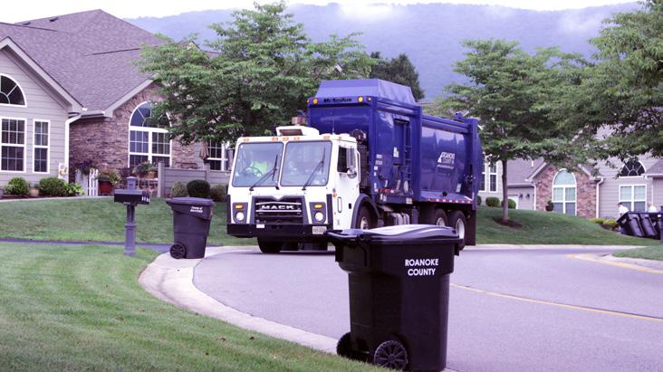
Support recycling options and implement recommendations from the assessments of County Fire Department Facilities and the Administration Center.
Libraries
Improve service and enhance existing facility; evaluate programming needs from consumer feedback that serve people of all ages and backgrounds; raise level of engagement with the community; and ensure timely delivery of all circulating materials.
Communications & Technology
Expand and improve high-speed broadband access and cell phone service availability in underserved areas.
Public Safety
Provide efficient delivery of public safety services with minimal response times; enhance public safety staffing; enhance facilities and equipment; and provide a high-level of citizen engagement and education opportunities.
Transportation (Roads)
Continue to implement the roadway recommendations identified in the Route 419 Town Center Plan. Study and improve Route 419/Electric Road for all users, in collaboration with VDOT, the City of Roanoke and City of Salem.
Transportation (Roads)
Initiate a Route 221/Brambleton Avenue Multimodal Safety Study, in collaboration with VDOT, to determine improvements to reduce crashes and improve safety. Continue to implement VDOT’s US 220 Arterial Preservation Plan to improve safety along Route 220.
Continue to connect and expand existing sidewalks and trails between Penn Forest Elementary School, South County Library and County parks.
Land Use
Amend the Future Land Use Map to preserve the suburban character of Cave Spring and promote economic development in the area. Continue to implement the 419 Town Center Plan. Develop plans for the Cave Spring Corners Activity Center and the Penn Forest Activity Center.
Location, Context, and Boundary
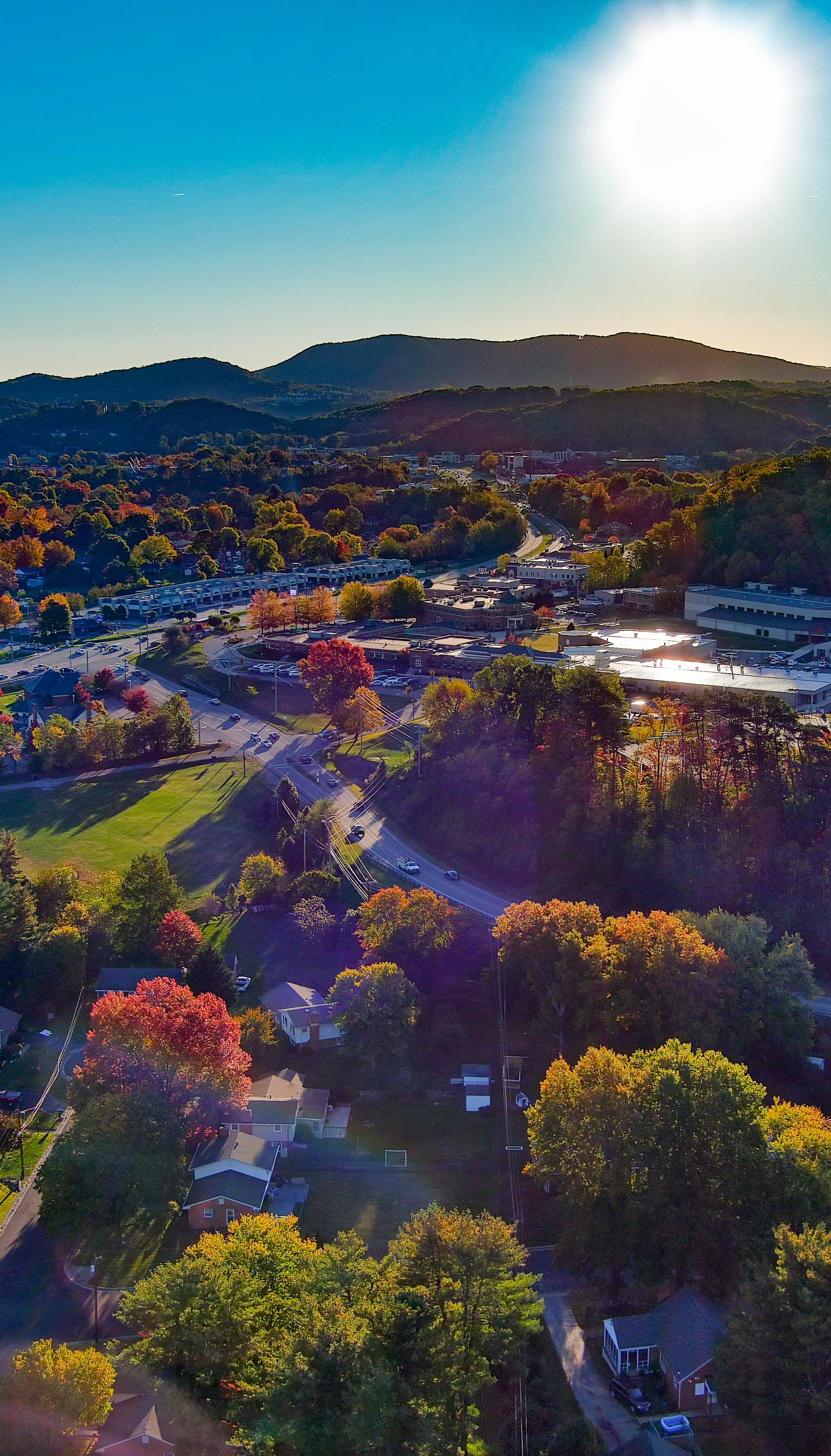
The Cave Spring Community Planning Area (CPA) is located in the southern portion of Roanoke County. It is bordered by the City of Roanoke to the north, by the Clearbrook CPA to the east, by the Clearbrook CPA and the Back Creek CPA to the south, and by the Windsor Hills CPA to the west. The study area encompasses 6,659 parcels totaling approximately 5,150 acres. The Cave Spring Community Planning Area is home to approximately 15,060 people.
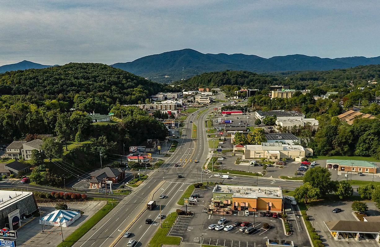
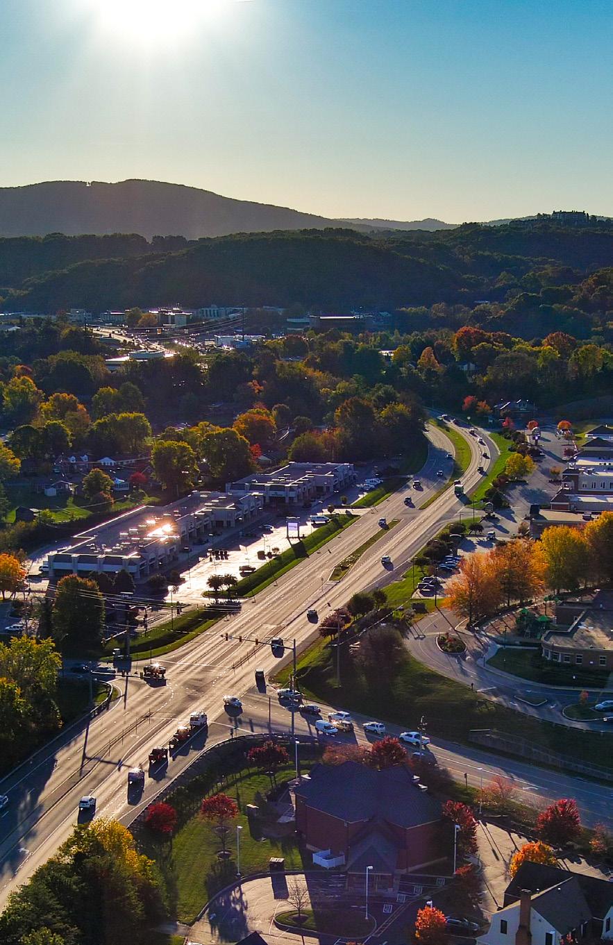
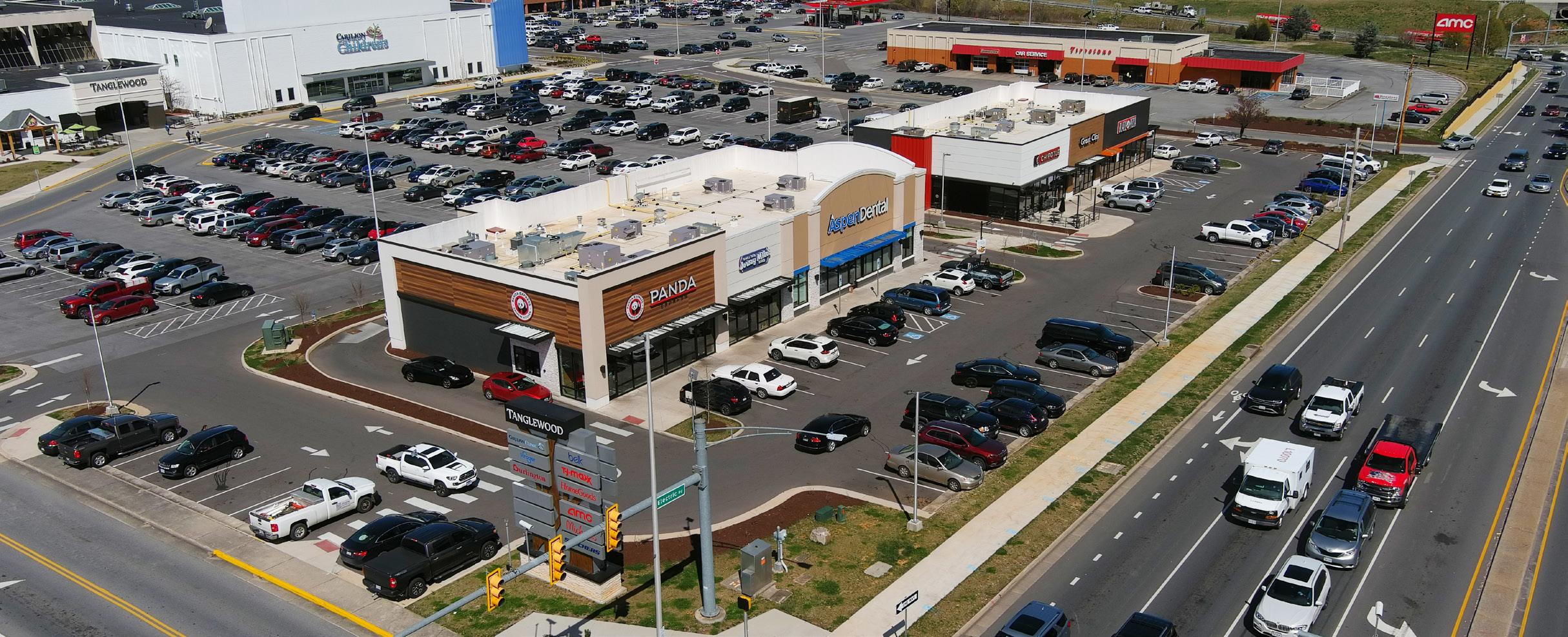
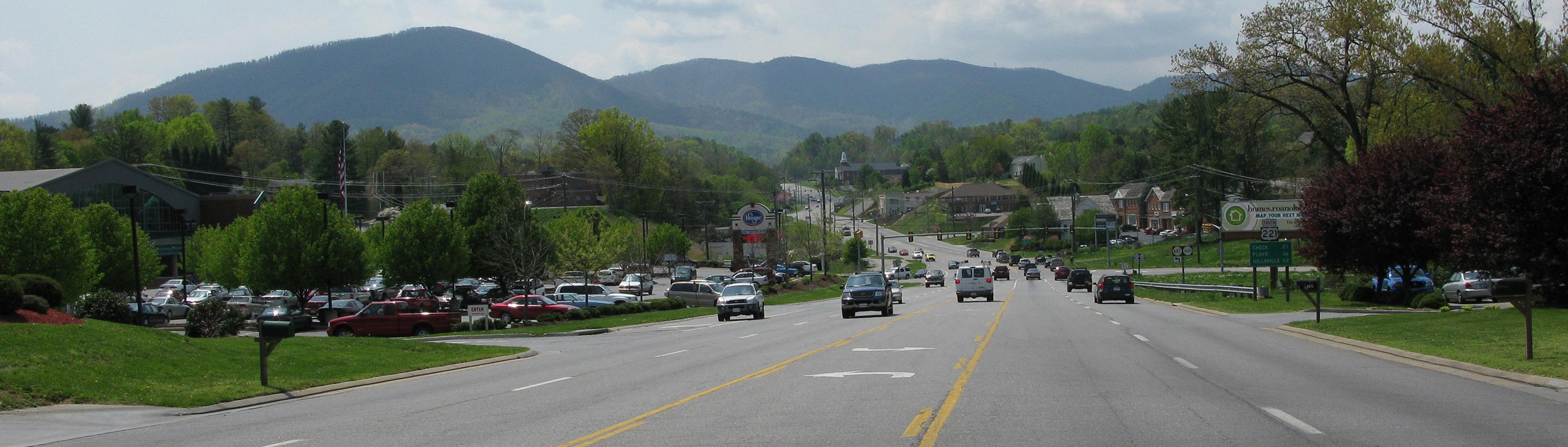
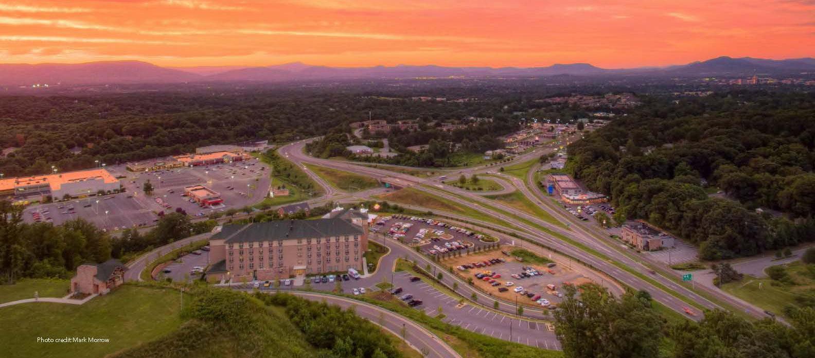
Cave Spring Planning Area is a hub of commercial activity, particularly adjacent to Route 419 encompassing Tanglewood Mall. This planning area has many amenities including several overlooks along the Blue Ridge Parkway. The CPA has many single family neighborhoods, is bordered by Routes 220 and 221, and is transected by Route 419. In addition, it is conveniently located to the Cities of Roanoke and Salem. It is also the home to the County’s Administration Center.
Source: 2019 US Census Data
Demographic Trends
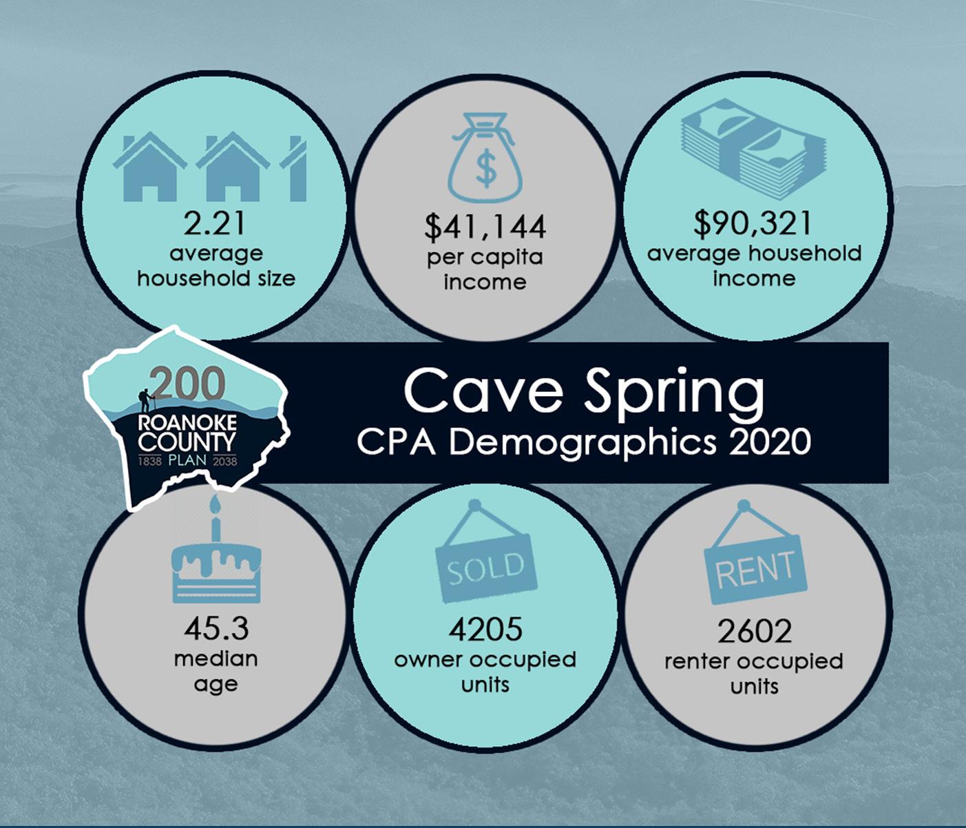
• The median age of residents continues to increase as the baby boomer generation ages. The median age in the Cave Spring CPA is 45.3 years.
• Countywide, over the last few decades families living in the same house have fewer people and two-person households are increasing.
• Cave Spring’s population grew by 31% from 1983 to 2010, but decreased by 1% from 2010 to 2020 to 15,060 people.
• Countywide there were fewer babies born from 2010 to 2020, but population grew 4.9% due to people moving here from outside the County.
• According to most recent Census data, more than 61% (4,205) of the housing units are owned, while approximately 39% (2,602) are rental properties.
• Per capita income is around $41,150 in the Cave Spring CPA for each individual and the average household income is approximately $90,300.
• The average household size is 2.21 persons per household.
WEST VILLAGE AND PROMENADE PARK SHOPPING CENTERS ON 419
Natural Resources
Topography
Hydrology
Floodplains
Soils
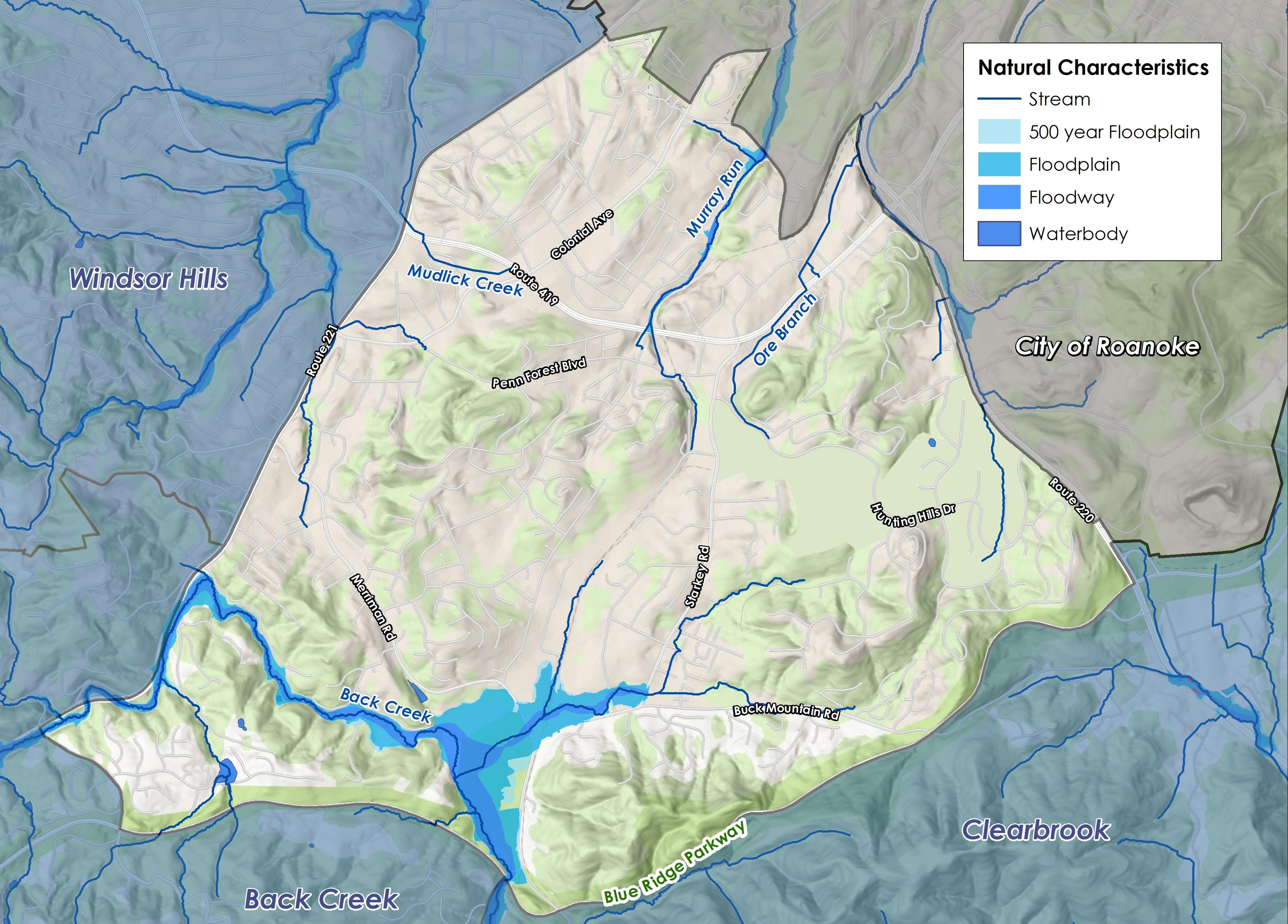
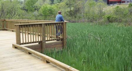
Several streams flow through the Cave Spring CPA, including Back Creek, Ore Branch, Murray Run and Mudlick Creek. Areas of significant floodplain on the southern portion of the CPA have been developed into parks and recreation facilities. Along Murray Run, several homes in the Green Valley subdivision and apartments upstream of Ogden Road are flooded by a 100-year or a 10-year storm (a storm that is capable of producing rainfall expected to be equaled or exceeded on average once in 10 years). On Back Creek, house flooding occurs between Merriman Road and Coleman Road. Despite the challenge of steep slopes, homes occupy many of the area’s hillsides.
In the Cave Spring CPA, 215 acres (4.2%) are located within the 100-year floodplain and 26 acres (0.5%) are located within the 500-year floodplain. 259 acres (5%) of land is publicly protected by the National Park Service for the Blue Ridge Parkway.
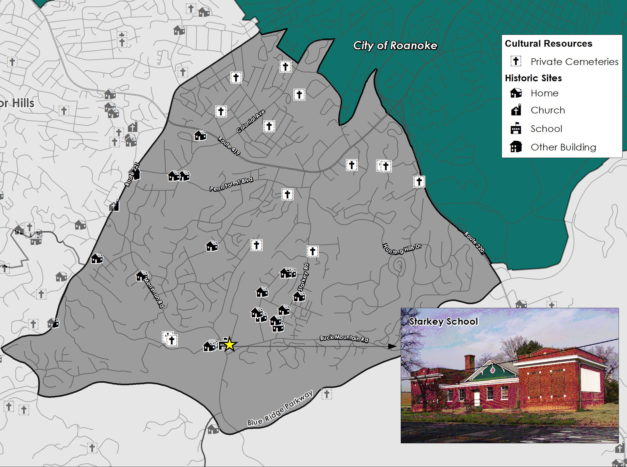
Cultural Resources
Districts
Buildings Cemeteries
Cave Spring is home to Starkey School, a National Register of Historic Places and Virginia Landmarks Register property. It served as a public elementary school for over six decades. Built in 1915 on the site of an earlier school (a one room building in 1894), Starkey School was renovated and expanded several times. The last class was held in 1961. Other historic resources in Cave Spring include numerous homes and private cemeteries.
Source: Historical Architecture Reconnaissance Survey Report (1992) and National Register of Historic Places
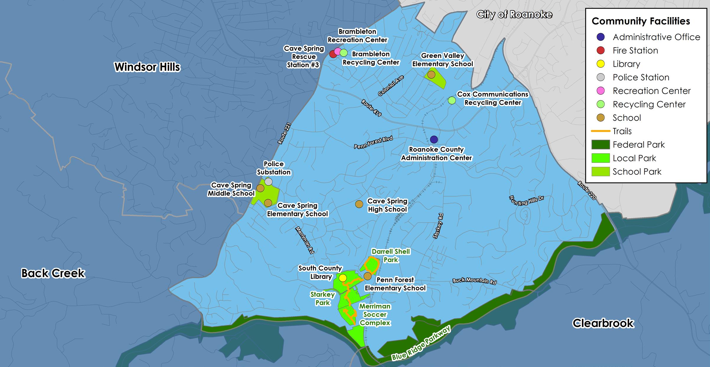
Community Facilities
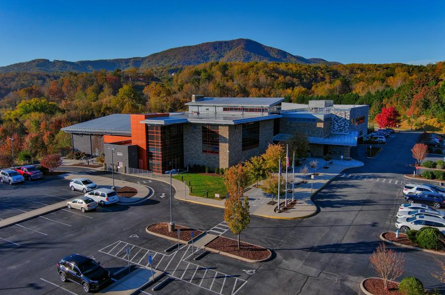
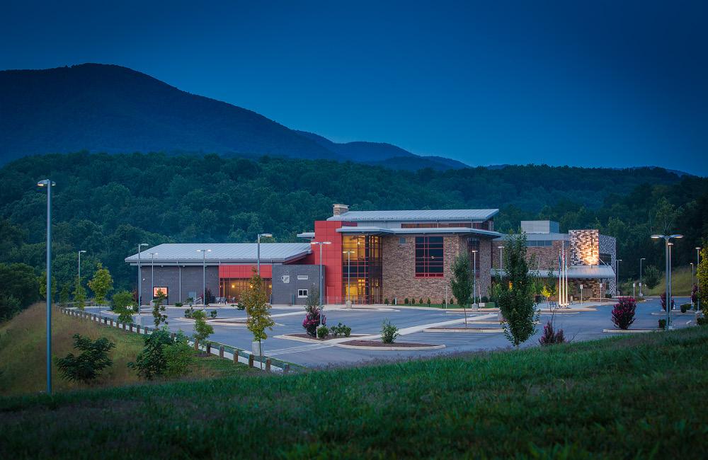
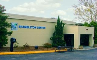
Cave Spring boasts high quality recreation spaces and many scenic vistas along the Blue Ridge Parkway. The community can be easily accessed by Route 221 (Brambleton Avenue), Route 419 (Electric Road), and Route 220 (Franklin Road). This CPA is home to recreation spaces such as the Brambleton Center, Darrell Shell Park, Starkey Park, Merriman Soccer Complex and the Blue Ridge Parkway. The Brambleton Center is considered a valuable resource that supports a variety of diverse needs in the community (i.e., voting, CORTRAN, recreation, recycling, VA Cooperative Extension, etc.).
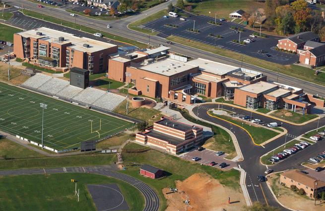
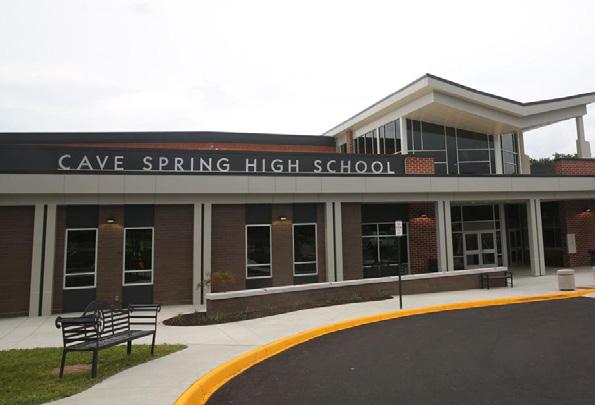
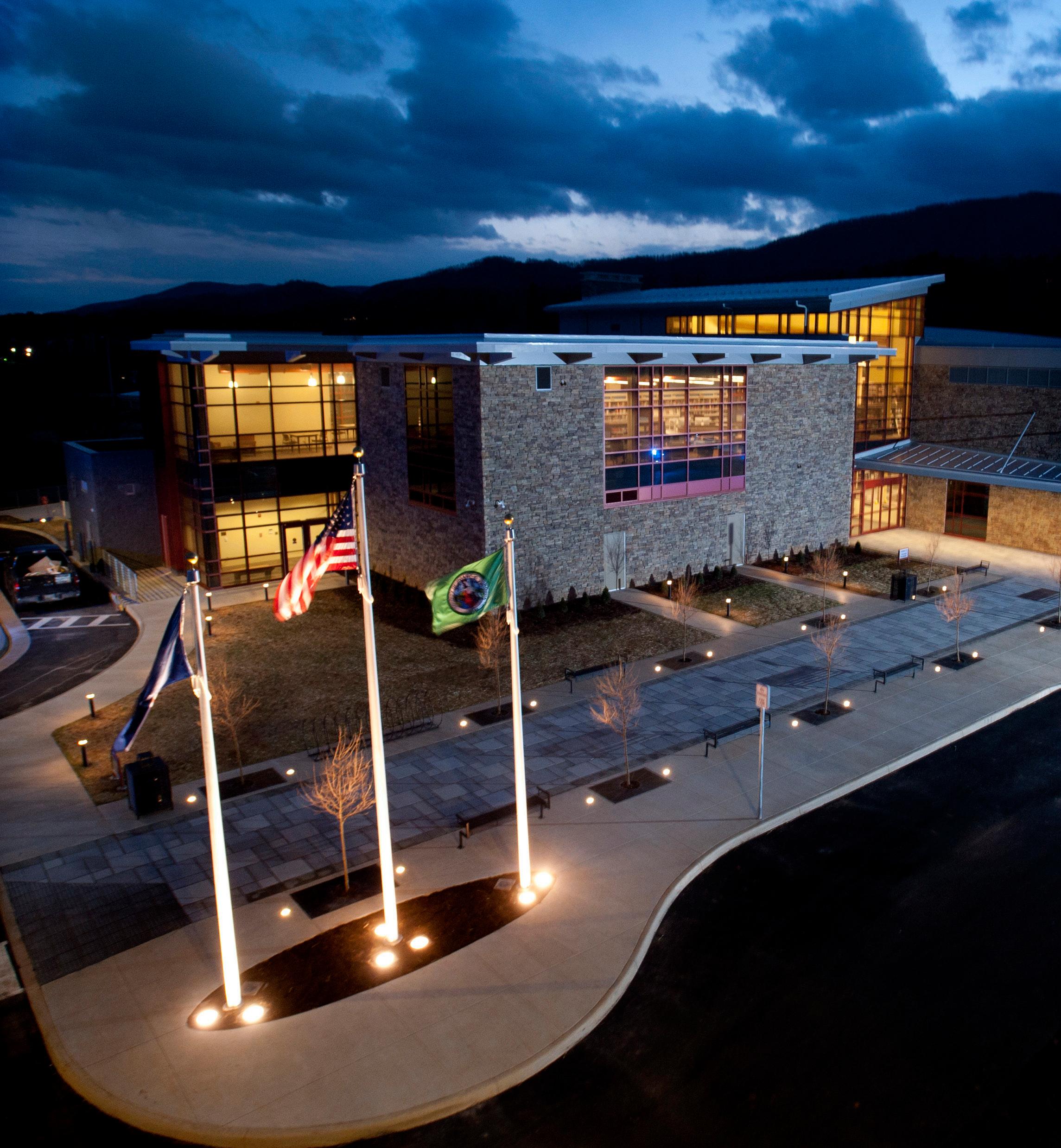
The Roanoke County Administration Center is located in Cave Spring, as well as five public schools. Schools serving the Cave Spring area are under enrollment capacity. This is consistent with most Roanoke County Public School trends. Cave Spring Elementary, Green Valley Elementary, Penn Forest Elementary, Cave Spring Middle, Hidden Valley Middle, Cave Spring High, and Hidden Valley High are all under maximum capacity.
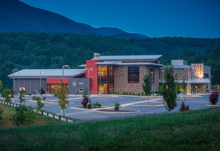
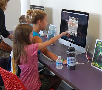
Cave Spring is served by the South County Library. The South County Library offers a variety of services for adults, teenagers, children and families. The area is served by the #3 Cave Spring Fire and Rescue Station. Of the 11 Roanoke County CPAs, Cave Spring has the second highest number of Fire-EMS and Police service calls.
CAVE SPRING HIGH SCHOOL
SOUTH COUNTY LIBRARY
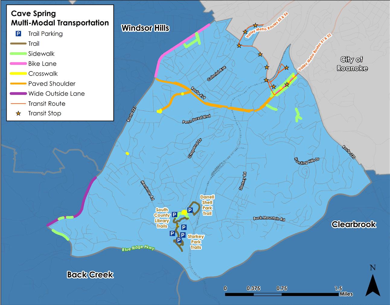
A high percentage of the County’s existing multimodal infrastructure is located in Cave Spring, though connectivity is still an issue. Cave Spring also hosts Valley Metro Routes 51, 52, 55 and 56.
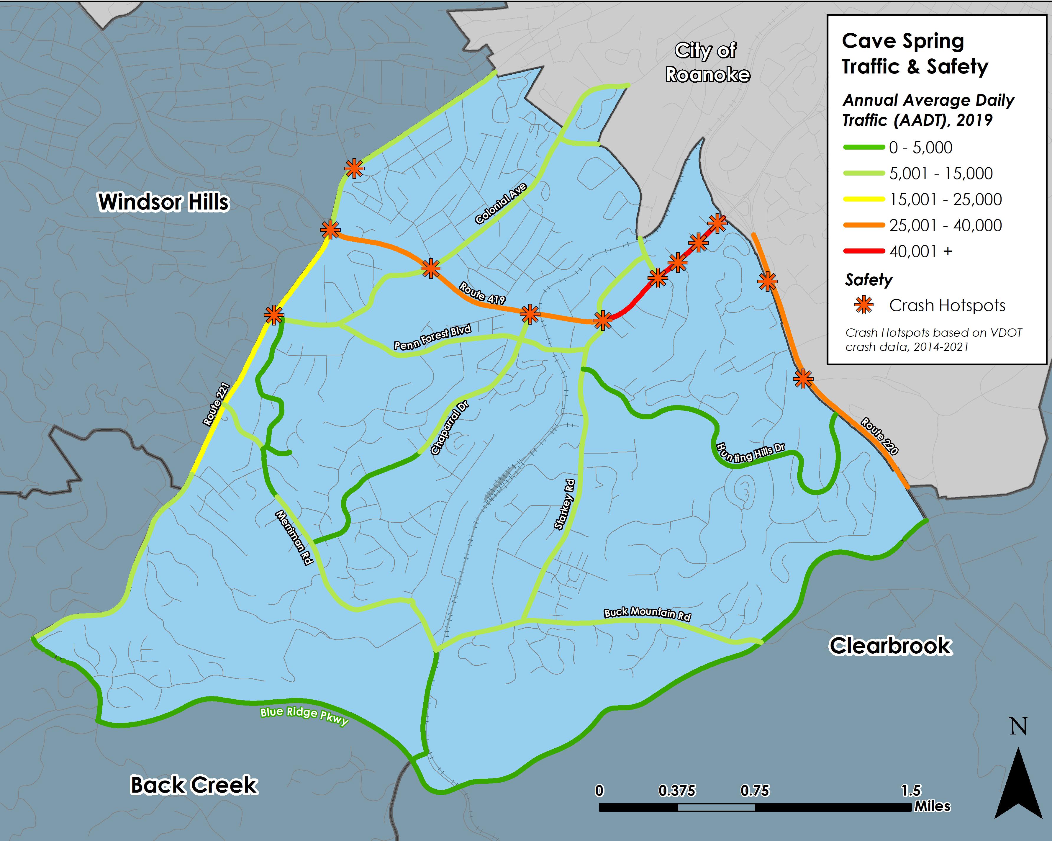
The Cave Spring CPA includes several of the busiest non-interstate roadways in the County. Route 419, Electric Road, between Route 220 and Starkey Road, has the highest traffic count in the County (over 40,000 trips per day) behind Interstate 81. Route 220, Franklin Road, between Route 419 and the Blue Ridge Parkway, has over 32,000 trips per day and Route 221, Brambleton Avenue, hosts over 20,000 trips per day between Route 419 and Arlington Hills Drive. Crashes frequently occur at major intersections along all of these roadways.
Some multimodal infrastructure exists in the Cave Spring CPA with loop trails and sidewalk at Darrell Shell Park, South County Library and Starkey Park. Bicycle lanes are striped on Brambleton Avenue between Route 419 and the City of Roanoke. Valley Metro bus service is available in this area with stops along Route 419, Ogden Road and Colonial Avenue.
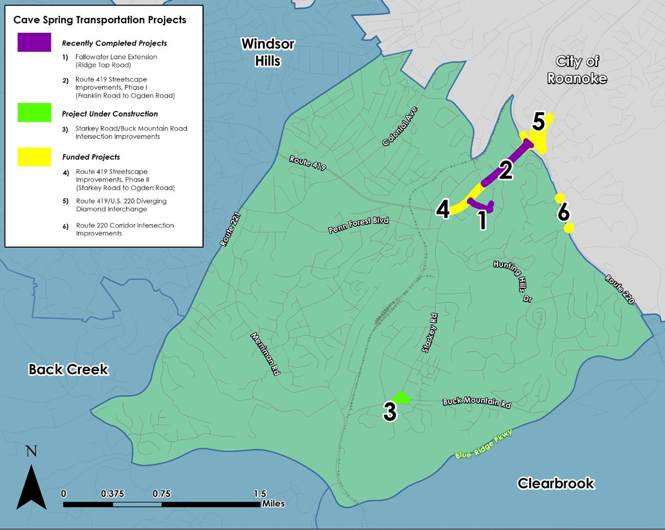
Several projects are under construction to improve safety, to reduce congestion and to provide pedestrian and bicycle accommodations. Route 419 in front of Tanglewood Mall is complete. Ridge Top Road improved the private roadway to Chuck E. Cheese to provide access to land zoned for multifamily development at The Ridges. A second phase of Route 419 improvements has been funded between Ogden Road and Starkey Road. A Diverging Diamond Interchange is in design to improve the Route 419 and Route 220 interchange. Signal improvements are planned in the Southern Hills area along Route 220 and a roundabout has replaced an existing “T” intersection at Starkey Road and Buck Mountain Road in 2023.
Transportation
Greenways/Trails
Bicycle & Pedestrian Accommodations
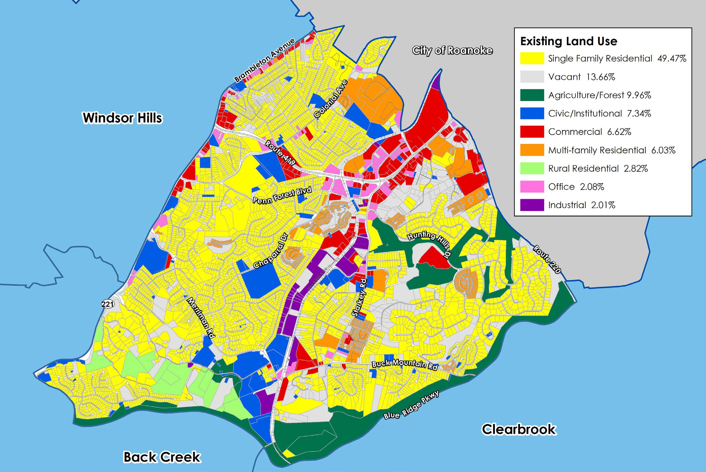
Existing Land Use
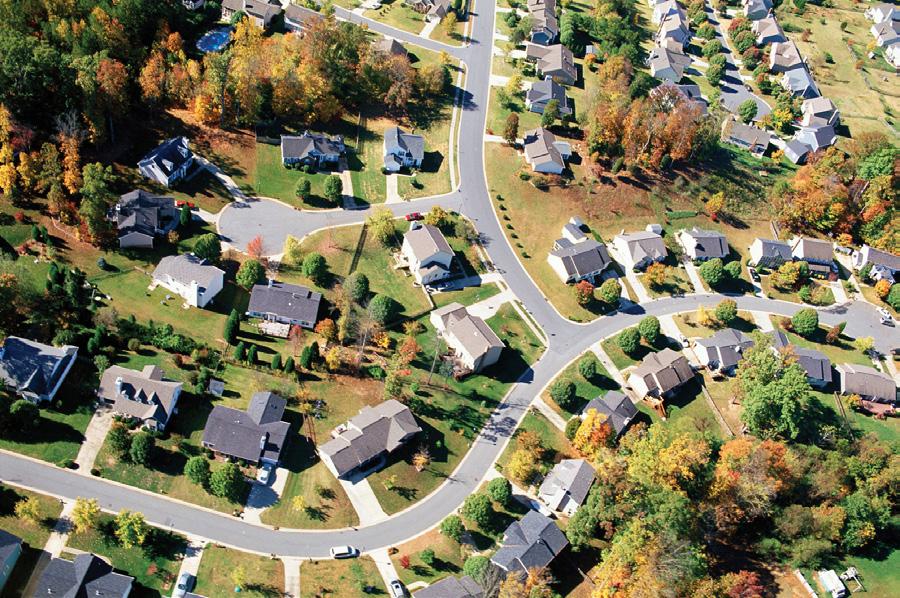
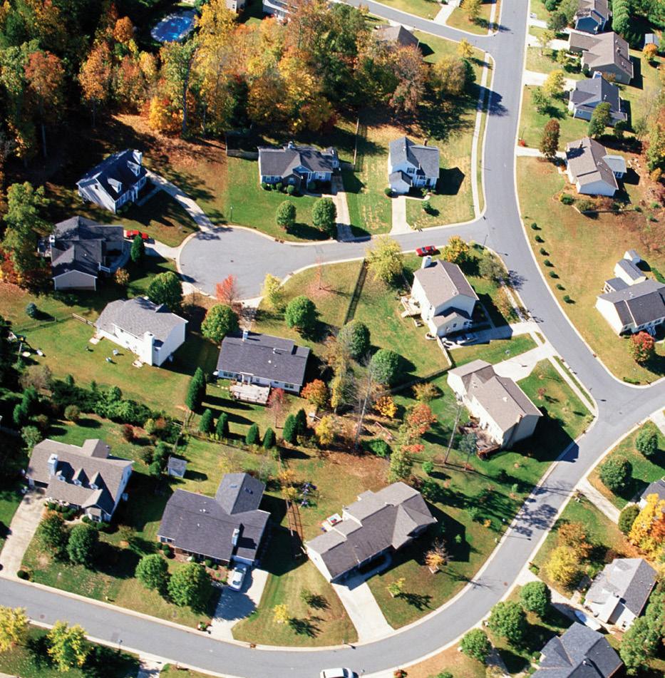
Cave Spring is a suburban area with many single family neighborhoods and some multi-family housing, along with a mix of office, commercial, institutional and industrial uses along major transportation corridors like Route 419, Route 220 and Route 221. In previous studies, the community has valued a balance of natural, cultural and historic resource protection as well as quality development in Cave Spring.
Almost half of the CPA is used for single-family residential. 6% of the land is developed as multi-family residential uses. 14% of the land is vacant with a majority of vacant properties in commercial and transitional areas. Civic/ institutional uses make up 7% of the CPA, while commercial uses account for almost 7%. Office and industrial uses take up 4% of the land. More than 12% of the CPA is used for agriculture, forest, and rural residential uses.
Zoning
The majority of land in Cave Spring is zoned for single-family neighborhoods. The remaining acreage is zoned for high density residential, industrial, office, commercial, and agricultural uses.
The AG-3 Agricultural/Rural Preserve district, consists of land primarily used as farmland, woodlands, and widely scattered residential development located within the rural service area. The AR Agricultural/Residential district is generally characterized by very low density residential and institutional uses mixed with smaller parcels that have historically contained agricultural uses, forest land and open space outside the urban service area.
The R-1 Low Density Residential district and R-2 Medium Density Residential district are established for areas of the County within the urban service area with low and medium density residential development. The R-3 Medium Density Multi-Family Residential district provides areas in the County within the urban service area for medium and high density residential developments. The R-4 High Density Multi-Family Residential district similarly provides for only high density residential developments. The Planned Residential Development (PRD) district is intended to allow greater flexibility than is generally possible under conventional zoning district regulations, to allow developers to incorporate a variety of housing options as well as certain limited commercial and office uses designed to serve the inhabitants of the district.
The C-1 Low Intensity Commercial district provides low-intensity commercial land uses within the urban service area, including small-scale office and retail businesses. In contrast to the C-1 district, the C-2 High Intensity Commercial district provides for a much wider variety of commercial land uses at a regional scale within the urban service area. The I-2 High Intensity Industrial district allows for high-intensity, industrial land uses within the urban service area. The I-1 Low Intensity Industrial district similarly allows for low-intensity industrial land uses. Both zones are regulated in a manner to protect surrounding properties and natural resources from potential negative impacts commonly associated with industrial activity. These districts are provided to promote economic activity in the region.
TANGLEWOOD MALL OUTPARCELS
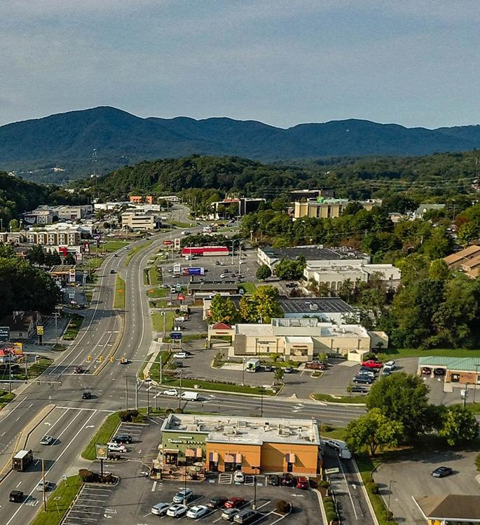
ROUTE 419 & OGDEN ROAD
Future Land Use
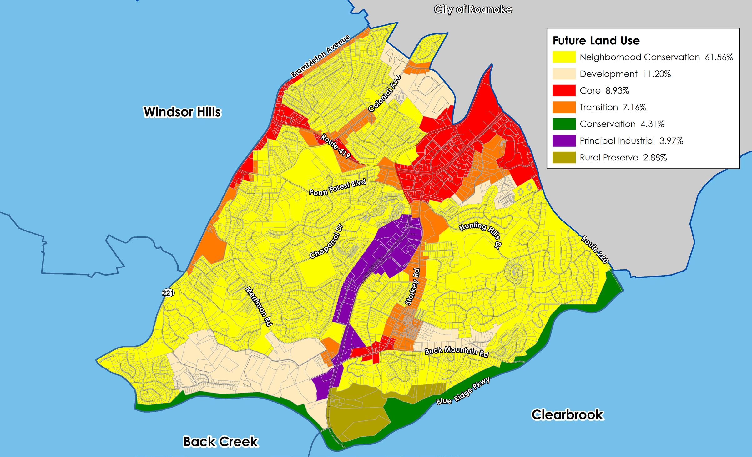
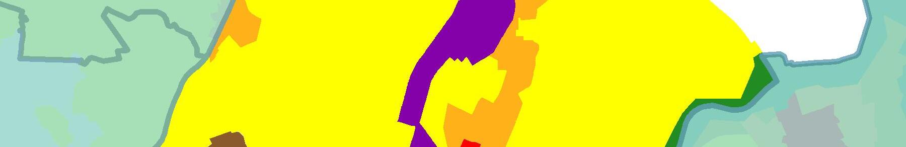
The map below shows the future land use designations in the Cave Spring CPA from the 2005 Comprehensive Plan. The Cave Spring CPA is located within the County’s urban development area.
61.6% of the CPA is designated for the Neighborhood Conservation future land use, which is intended to protect existing residential neighborhoods. 11.2% of the land is designated for Development, which is intended to promote future residential development. These two (2) future land uses combined are about three-fourths (72.8%) of the land in the Cave Spring CPA. The Cave Spring CPA has a higher ratio of land designated for commercial and industrial uses compared to other CPAs. Together, Principal Industrial (4.0%), Transition (7.2%), and Core (9.0%) make up about a fifth (20.2%) of the land in the Cave Spring CPA. These future land uses are located along Route 419, Brambleton Avenue, Starkey Road, Colonial Avenue, and the railroad line that goes through the area. 4.3% of the land in Cave Spring is designated Conservation (along the Blue Ridge Parkway). The remainder is Rural Preserve.
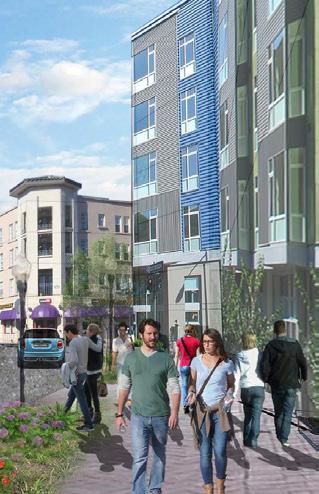
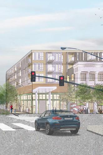
In July 2019, the Board of Supervisors adopted the 419 Town Center Plan as a component of the County’s Comprehensive Plan. This plan seeks to create a mixed-use, walkable area with higher densities for residential and commercial development and redevelopment near Tanglewood Mall.
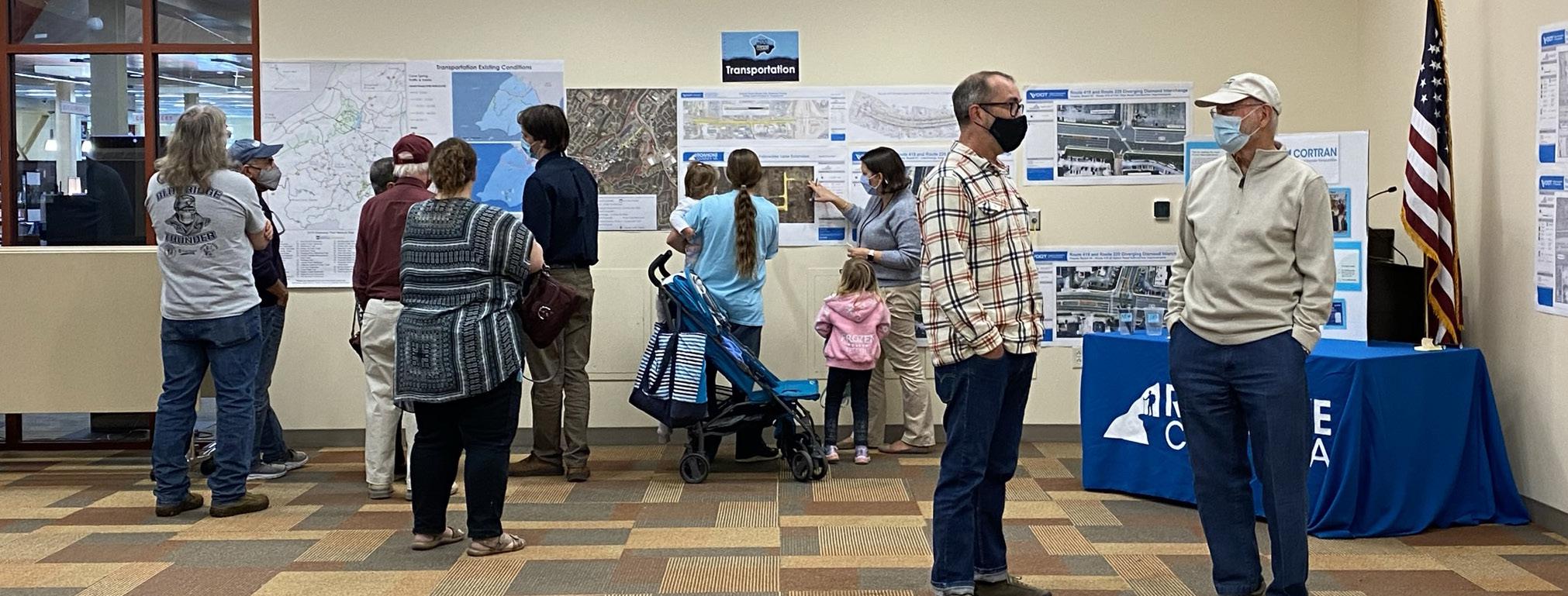
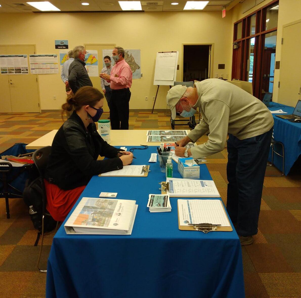
Fall 2021 Community Meetings - Existing Conditions
Twelve (12) planning meetings were held around Roanoke County in Fall 2021 to collect preliminary feedback about community issues and needs. The community meeting for the Cave Spring CPA was held on October 18, 2021, at the South County Library. There were 56 attendees. Citizens were invited to comment on Land Use, Community Facilities, Transportation, and Protection and Preservation. Comments and suggestions from citizens were collected and assembled by staff into a “Post Meeting Summary” document. A digital copy of this document can be found on the Roanoke County 200 Plan webpage.
Fall 2021 Community Input Highlights:
a. Meeting attendees were enthusiastic to learn about the exhibits and give their feedback. Comments were generally positive and people were genuinely interested and concerned about how the County is planning for the future and potential growth.
b. Citizens support the existing community facilities, but would like to see new facilities and improvements to the existing ones. They would also like to see the expansion of programs at existing facilities.
c. Residents raised several issues, especially transportation and traffic along Routes 419, 220, and 221. Additional pedestrian and bicycle accommodations were requested by citizens.
d. Residents were concerned about keeping a higher standard for green space and trees in commercial areas as the community continues to grow.
Spring 2022 Open House Meetings - Draft Goals and Recommendations
Seven (7) Roanoke County 200 Plan open house planning meetings were held around Roanoke County in Spring 2022 for citizens to review draft goals and recommendation options based on the feedback received throughout the Fall 2021 community engagement. Draft goals were developed based on input that we received at the community meetings and online surveys in Fall 2021. Citizens reviewed and provided comments on the new draft goals and recommendations that will shape the draft Roanoke County 200 Plan document. The draft goals and recommendations displayed included natural and cultural resources, land use, community facilities and infrastructure, and transportation. The community meeting for the Cave Spring CPA was held in conjunction with the Clearbrook CPA on April 21, 2022, at the Cave Spring Elementary School. There were 8 attendees.
Spring 2022 Community Survey Highlights:
Natural and Cultural Resources:
The majority (91%) of survey respondents and community meeting participants support recommendations to protect and improve ground, surface and stormwater resources; beautify the County’s public areas, viewsheds and roadways; clean up garbage; protect steep slope areas; protect trees and forests, natural areas and wildlife habitats; as well as protection of historic and cultural resources.
Community Facilities and Infrastructure:
a. Parks, Recreation and Tourism: 81% of respondents support the Countywide recommendations as well as the following items pertaining to the Cave Spring CPA: 1. Continue developing programs at the Brambleton Center. 2. Explore new park, greenway and blueway opportunities. 3. Promote Park Partners Program.
b. General Services: 85% of respondents support recycling options and assessments of County Fire Department Facilities and the Administration Center building.
c. Public Libraries: 86% of respondents support the Countywide library system recommendations.
d. Communications and Information Technology: 90% of respondents support expansion and improvement of broadband and cell phone access.
e. Public Safety: 91% of respondents support Countywide public safety recommendations.
Land Use:
68% of respondents support the activity centers as shown on the Activity Center Map, while 22% indicated interest in additional activity centers in Cave Spring. 78% of respondents support the proposed changes to the Future Land Use Map.
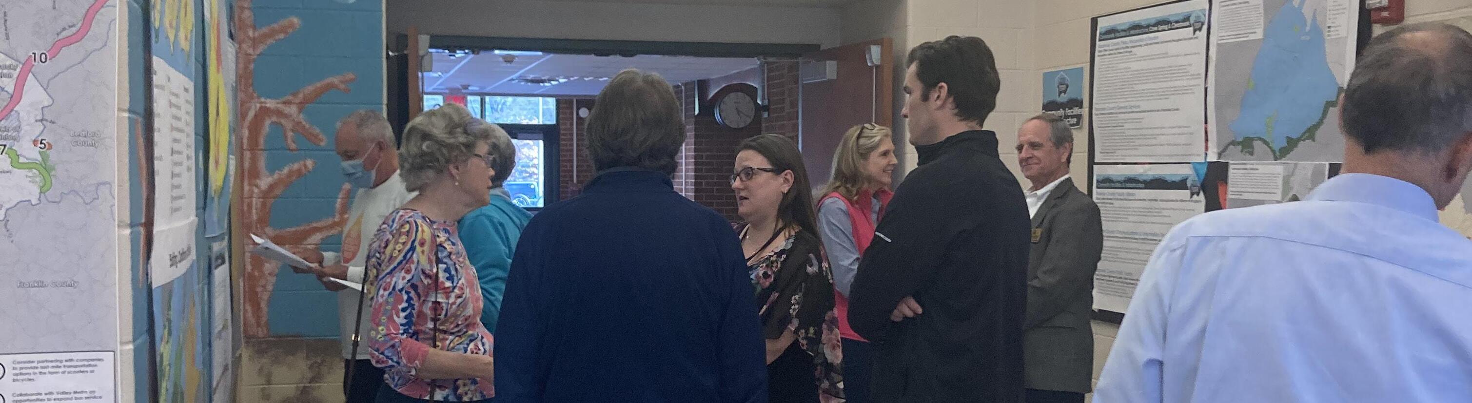
Winter 2023 Community Meetings - Draft Plan Reveal
Six (6) Roanoke County 200 Plan open house planning meetings were held around Roanoke County in Winter 2023 for citizens to review the Draft Roanoke County 200 Plan Countywide Summary Document and Draft Community Planning Area Documents based on the feedback received throughout the community engagement process. Citizens reviewed and provided comments on the draft Roanoke County 200 Plan documents. The community meeting for the Cave Spring CPA was held in conjunction with the Clearbrook CPA on March 15, 2023, at South County Library. There were 44 attendees.
In general, the comments provided by residents were concerned with the following:
a. The lack of sidewalks, especially on major aerterials and collector roads.
b. The lack of bicycle infrastructure, including bike lanes and greenways.
c. The lack of transit service in the CPA.
d. The potential loss of Rural Preserve future land use designation.
e. Improvements needed at Penn Forest Boulevard/Chaparral Drive intersection.
f. The need for more trees and green space in commercial areas.
These issues and concerns are addressed by recommendations in the Cave Spring CPA Summary Document. These recommendations include:
a. Continue to connect and expand existing sidewalks and trails between Penn Forest Elementary School, South County Library and County parks.
b. Study and improve Route 419/Electric Road for all users, in collaboration with VDOT, the City of Roanoke and City of Salem.
c. Initiate a Route 221/Brambleton Avenue Multimodal Safety Study, in collaboration with VDOT, to determine improvements to reduce crashes and improve safety.
d. Construct pedestrian accommodations on Chaparral Drive at Cave Spring High School between Woodthrush Drive and Purple Finch Road.
e. Study Starkey Road between Route 419 and Terminal Road in collaboration with VDOT to determine potential safety improvements for all vehicle times.
f. Extend Route 419/Electric Road Streetscape Improvements from Starkey Road to Chaparral Drive.
g. Continue to install pedestrian signals and crosswalks at intersections along Route 419/Electric Road.
h. Evaluate a potential route for the Back Creek Greenway between Route 221/Brambleton Avenue at Rosecrest Road and Route 221/Brambleton Avenue at Cotton Hill Road.
i. Evaluate potential pedestrian connections to businesses and destinations within the Cave Spring Community Planning Area.
j. Initiate an Ogden Road Multimodal Study in collaboration with the City of Roanoke and VDOT to determine what kinds of improvements can be made for pedestrians, bicyclists and transit riders.
k. Determine appropriate locations for improved bicycle accommodations in the Cave Spring Community Planning Area.
l. Extend the Murray Run Greenway from the City of Roanoke into the Tanglewood area.
m. Consider expanding Valley Metro routes to serve businesses and residents in Cave Spring.
n. Connect crosswalks planned for Route 220 intersections between Valley Avenue/Southern Hills Drive and Crossbow Circle/Pheasant Ridge Road with pedestrian accommodations.
o. Amend the Future Land Use Map (as shown on page 27) to preserve the suburban character of Cave Spring and promote economic development in the area.
p. Continue to implement the 419 Town Center Plan. In addition to the Draft Plan reveal meetings, the Planning Commission and the Board of Supervisors held public hearings on the Roanoke County 200 Plan. Information on these hearings is contained in the main document of the Roanoke County 200 Plan.
Recommendations
Natural & Cultural Resources
Topography/Viewsheds
Hydrology/Floodplains
Water Quality/Pollution Prevention
Vegetation/Natural Areas
Historic & Cultural Resources
1. Protect and improve the quality of water in our streams, creeks and rivers.
2. Coordinate with State agencies regarding floodplain risks and prevention.
3. Reduce quantity and improve quality of stormwater.
4. Protect and prevent risks to surface waterways, reservoirs, underground aquifers and drinking water wells.
5. Beautify County roadways and public areas.
6. Protect viewsheds from the ridges and from the valleys.
7. Clean up and prevent litter and illegal dumping.
8. Protect steep slope areas.
9. Protect trees and forests and increase tree canopy.
10. Protect natural areas and wildlife habitats.
11. Coordinate with State agencies regarding historic and cultural resources, including cemeteries and archaeological sites.
Community Facilities & Infrastructure
Parks, Recreation & Tourism
Parks, Recreation and Tourism Recommendations
1. Evaluate new park, greenway/trails, and blueway opportunities in the community.
2. Evaluate on- and off- road connectivity options between parks, neighborhoods, and community facilities.
3. Continue coordination on regional efforts to enhance and develop outdoor recreation opportunities in our communities.
4. Update the Parks, Recreation & Tourism Master Plan.
5. Continue promotion of the Park Partners Program to encourage citizens and businesses, and organizations to adopt a park, greenway, or trail.
6. Educate citizens on park ordinance updates (i.e., park sign updates, dog-friendly parks/special events and leash laws, drones, etc.).
7. Continue developing programs that balance community needs with available staffing resources.
8. Evaluate the needs of existing parks and trails (i.e., trail maintenance, tennis court conversion to pickleball, etc.)
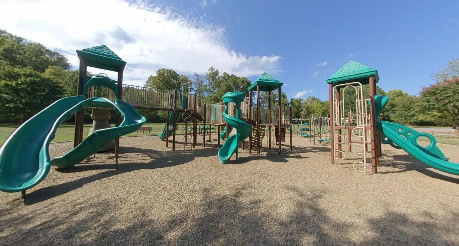
PLAYGROUND AT STARKEY PARK SOUTH
SOUTH COUNTY LIBRARY
General Service Recommendations
1. Evaluate recycling program options.
Community Facilities & Infrastructure
2. Implement recommendations from the Roanoke County Fire Department Facilities Assessment.
3. Implement recommendations from the Roanoke County Administration Center Assessment.
Public Libraries Recommendations
1. Improve services and continue enhancing facilities.
2. Evaluate programming needs and wants based on a variety of data and customer feedback.
3. Implement responsive, community focused program that serves people of all ages and backgrounds.
4. Ensure timely delivery of all circulating materials.
5. Raise level of engagement with the community, and increase awareness about library services and programs.
Communication & Information Technology Recommendations
1. Explore opportunities to extend broadband service with universal availability and access to high-speed Internet in unserved and underserved areas.
2. Explore alternative broadband and cell phone service providers for choice and competition.
3. Explore more public-private partnerships to implement more stages of Roanoke County’s Rural Broadband Initiative to bring high-speed Internet to homes without broadband access.
4. Explore providing improved cell phone service in unserved and underserved areas.
Public Safety Recommendations
1. Provide the efficient delivery of public safety services with minimal response times.
2. Enhance and maintain public safety staffing.
3. Enhance and maintain facilities and equipment.
4. Provide a high-level of citizen engagement and educational opportunities.
1. Continue to implement the roadway recommendations identified in the Route 419 Town Center Plan.
2. Continue to connect and expand existing sidewalks and trails between Penn Forest Elementary School, South County Library and County parks.
3. Study and improve Route 419/Electric Road for all users, in collaboration with VDOT, the City of Roanoke and City of Salem.
4. Initiate a Route 221/Brambleton Avenue Multimodal Safety Study, in collaboration with VDOT, to determine improvements to reduce crashes and improve safety.
5. Continue to implement VDOT’s U.S. 220 Arterial Preservation Plan to improve safety along Route 220.
• Other transportation projects:
6. Construct pedestrian accommodations on Chaparral Drive at Cave Spring High School between Woodthrush Drive and Purple Finch Road.
7. Study Starkey Road between Route 419 and Terminal Road in collaboration with VDOT to determine potential safety improvements for all vehicle times.
8. Encourage inter-parcel connections for commercial areas on both sides of Route 419/Electric Road.
9. Extend Route 419/Electric Road Streetscape Improvements from Starkey Road to Chaparral Drive.
10. Continue to install pedestrian signals and crosswalks at intersections along Route 419/Electric Road.
11. Evaluate a potential route for the Back Creek Greenway between Route 221/Brambleton Avenue at Rosecrest Road and Route 221/Brambleton Avenue at Cotton Hill Road.
12. Evaluate potential pedestrian connections to businesses and destinations within the Cave Spring Community Planning Area.
13. Initiate an Ogden Road Multimodal Study in collaboration with the City of Roanoke and VDOT to determine what kinds of improvements can be made for pedestrians, bicyclists and transit riders.
14. Determine appropriate locations for improved bicycle accommodations in the Cave Spring Community Planning Area.
15. Extend the Murray Run Greenway from the City of Roanoke into the Tanglewood area.
16. Consider expanding Valley Metro routes to serve businesses and residents in Cave Spring.
17. Connect crosswalks planned for Route 220 intersections between Valley Avenue/Southern Hills Drive and Crossbow Circle/Pheasant Ridge Road with pedestrian accommodations.
Land Use
Residents supported the thirteen (13) proposed changes to the Future Land Use Map in the Cave Spring CPA during the Spring 2022 open house and on the accompanying survey. Three (3) of these changes were from Rural Preserve and Development to Conservation due to steep slopes greater than 33% grade, existing floodplain, conservation easements, or land being owned by the National Park Service. Three (3) of these changes were from Development and Transition to Neighborhood Conservation to protect existing residential neighborhoods. Five (5) of these changes were from Neighborhood Conservation and Development to Transition due to existing land uses, such as multi-family housing or commercial uses. One (1) of these changes was from Development to Rural Village due to existing agricultural and rural land uses. The last change was from Transition to Core along Brambleton Avenue to reflect existing zoning.
A few residents suggested that the Cave Spring Corners area be designated an activity center. Staff proposed that the Penn Forest area be designated as an activity center in the Spring 2022 survey. The majority of respondents (67.6%) supported this.
Recommendations:
1. Amend the Future Land Use Map as shown to the right to preserve the suburban character of Cave Spring and promote economic development in the area.
2. Continue to implement the 419 Town Center Plan.
3. Develop a plan for the Cave Spring Corners Activity Center.
4. Develop a plan for the Penn Forest Activity Center.
VIEW OF THE 419 TOWN CENTER AREA
Cave Spring Future Land Use - Proposed Conservation
Principal Industrial
Rural Village Neighborhood Conservation Development Core Transition