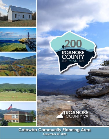
This Plan Summary highlights the key components of the various sections of the Catawba Planning Area. The Existing Conditions section features the study area’s demographics, community facilities, natural resources, cultural resources, land use, zoning, and the people that participated in the Plan’s development.
The Catawba Planning Area’s goals were inspired by public input and used to develop the Plan’s recommendations in the County’s Comprehensive Plan Update. Implementation of this Plan will be completed over the next 15 years.
Natural & Cultural Resources
Protect and improve ground, surface and stormwater resources; beautify public areas, viewsheds and roadways; clean up garbage; protect steep slope areas; and protect forests, natural areas, and wildlife habitats.
Parks, Recreation & Tourism
Make improvements at the Catawba Center; continue regional collaboration for the Triple Crown (Dragon’s Tooth, McAfee Knob, and Tinker Cliffs); evaluate opportunities for parks and greenways/ trails connections; and evaluate park, trail and blueway options.
General Services
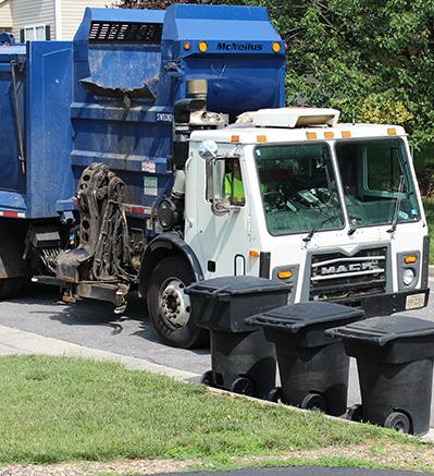
Support recycling options and implement recommendations from the assessments of County Fire Department Facilities and the Administration Center.
Libraries
Improve service and enhance existing facilities; evaluate programming needs from consumer feedback that serve people of all ages and backgrounds; raise level of engagement with the community; and ensure timely delivery of all circulating materials.
Communications & Technology
Expand and improve high-speed broadband access and cell phone service availability in underserved areas.
Public Safety
Provide efficient delivery of public safety services with minimal response times; enhance public safety staffing; enhance facilities and equipment; and provide a high-level of citizen engagement and education opportunities.
Transportation (Roads)
Initiate a Route 311/Catawba Valley Drive Multimodal Safety Study with VDOT to determine potential improvements to reduce crashes and improve safety for all users.
Transportation (Trails)
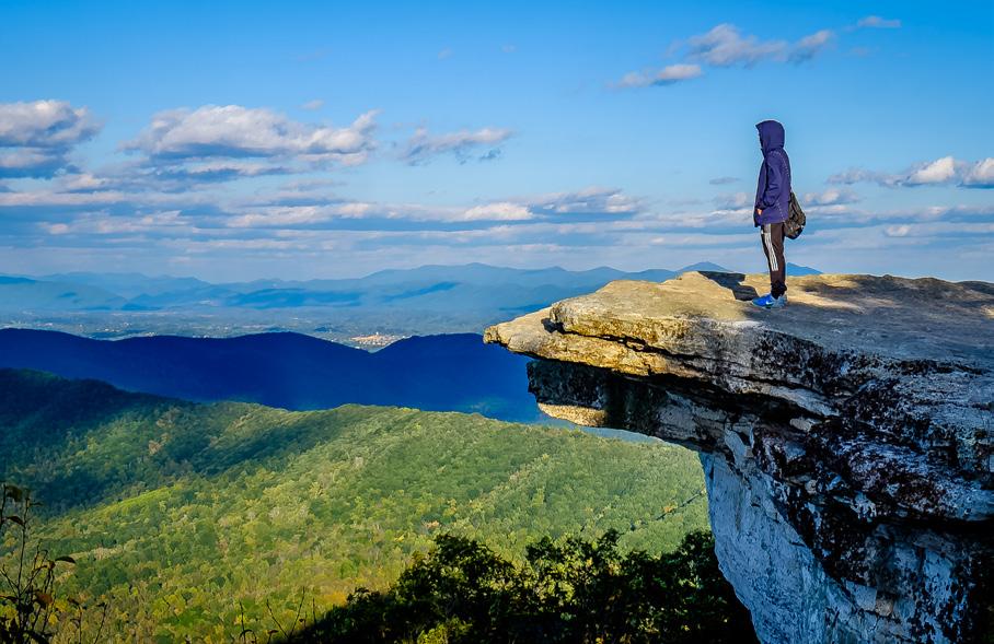
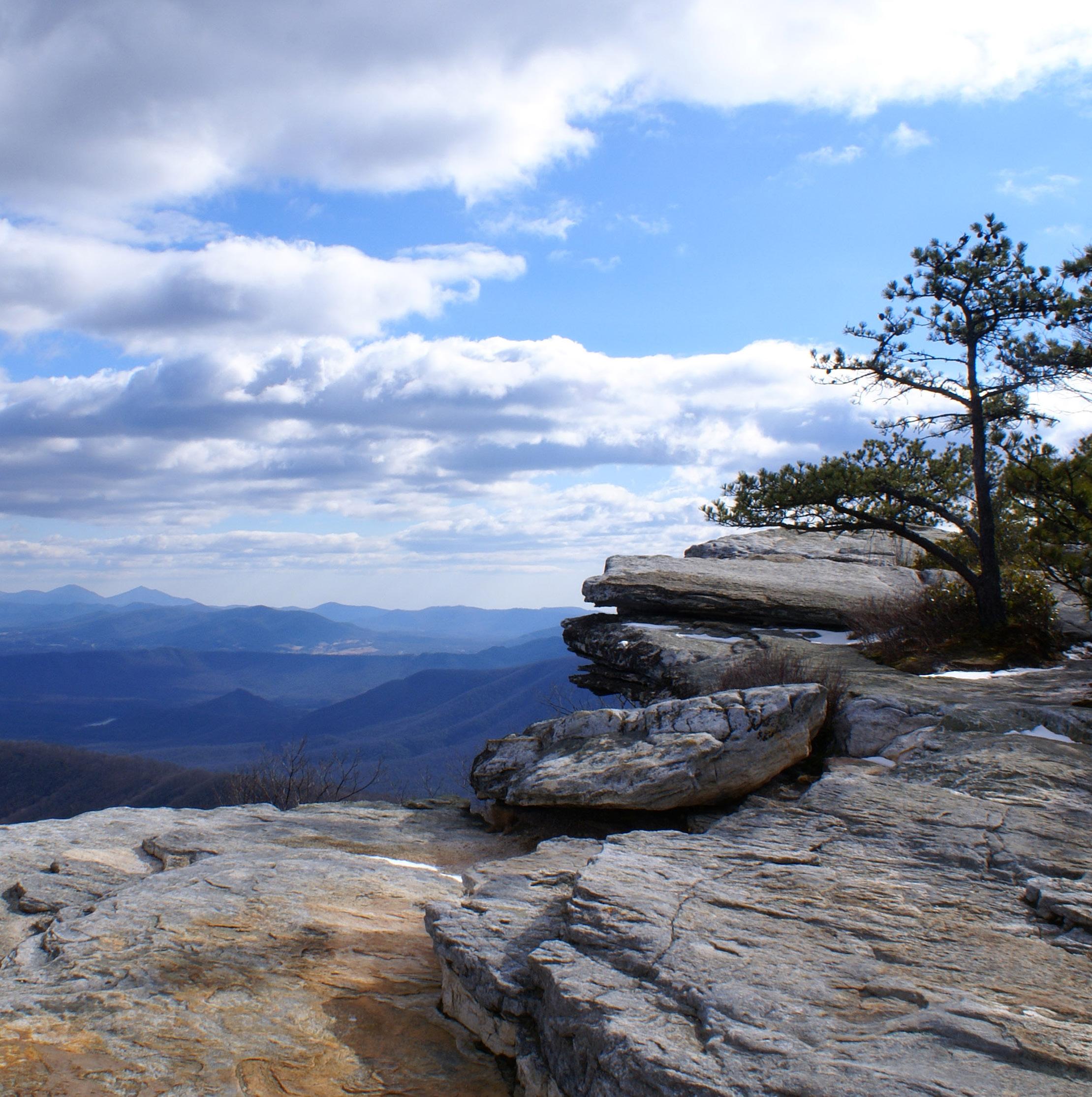
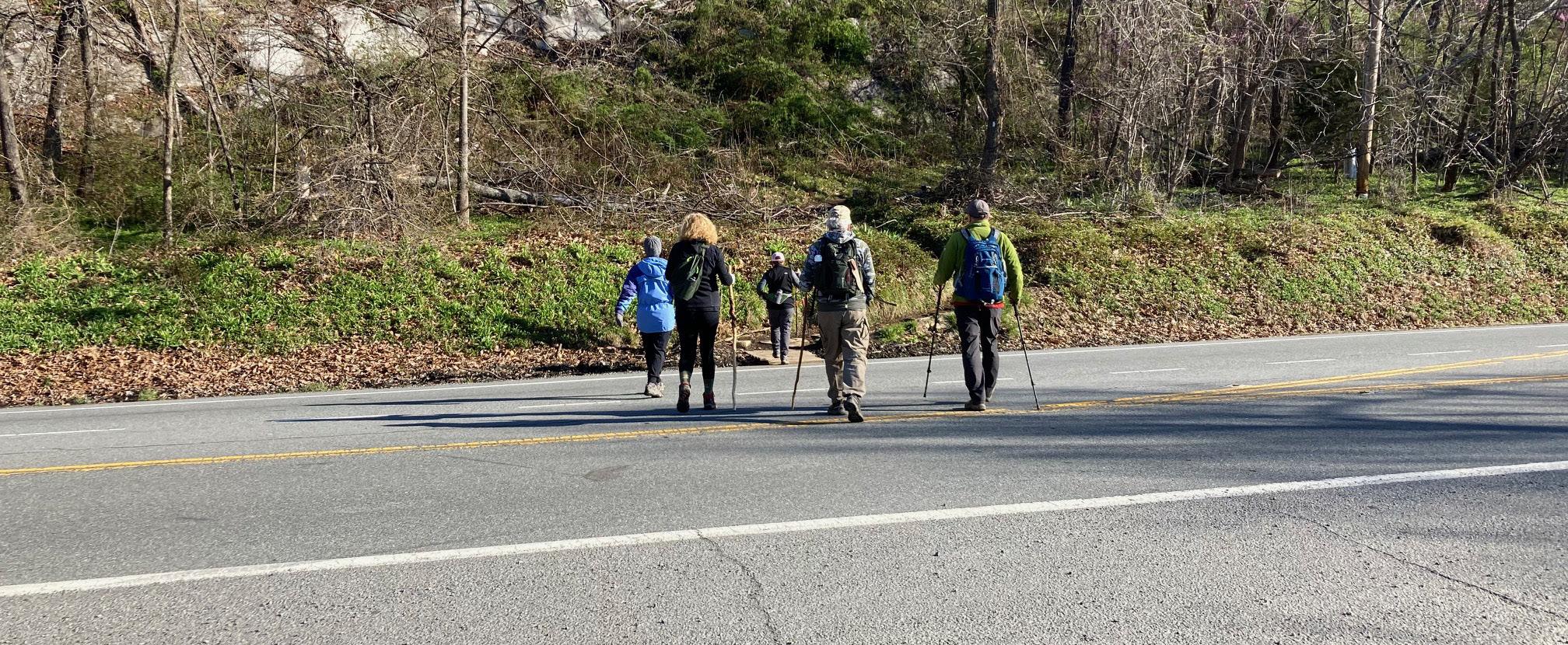
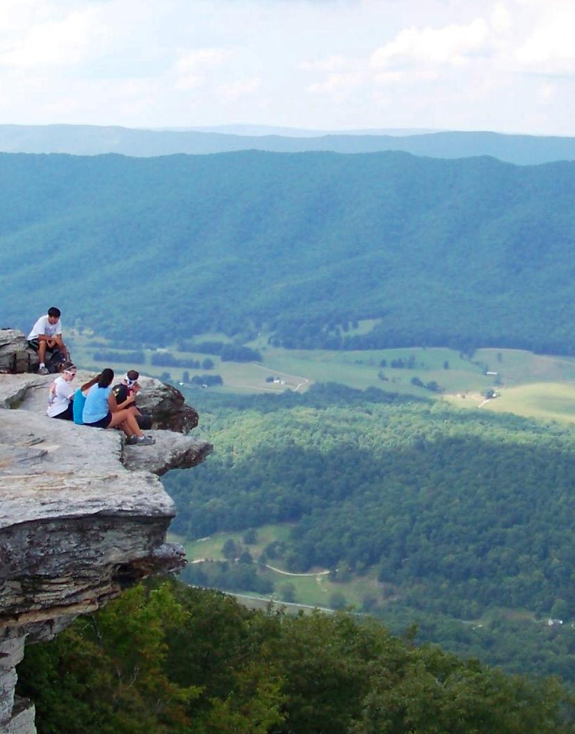
Improve access and accommodations for Appalachian Trail hikers visiting McAfee Knob in collaboration with the National Park Service and the Appalachian Trail Conservancy.
Transportation (Trails)
Collaborate with the U.S. Forest Service and VDOT to improve the Dragon’s Tooth trailhead parking lot and access to the parking lot from Route 311.
Land Use
Amend the Future Land Use Map to include changing Rural Preserve areas with steep slopes to Conservation and changing the Village Center area along Keefer Road to Rural Village. Develop a Rural Center Plan oriented around the Catawba Center.
Location, Context, and Boundary
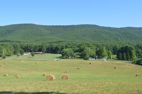
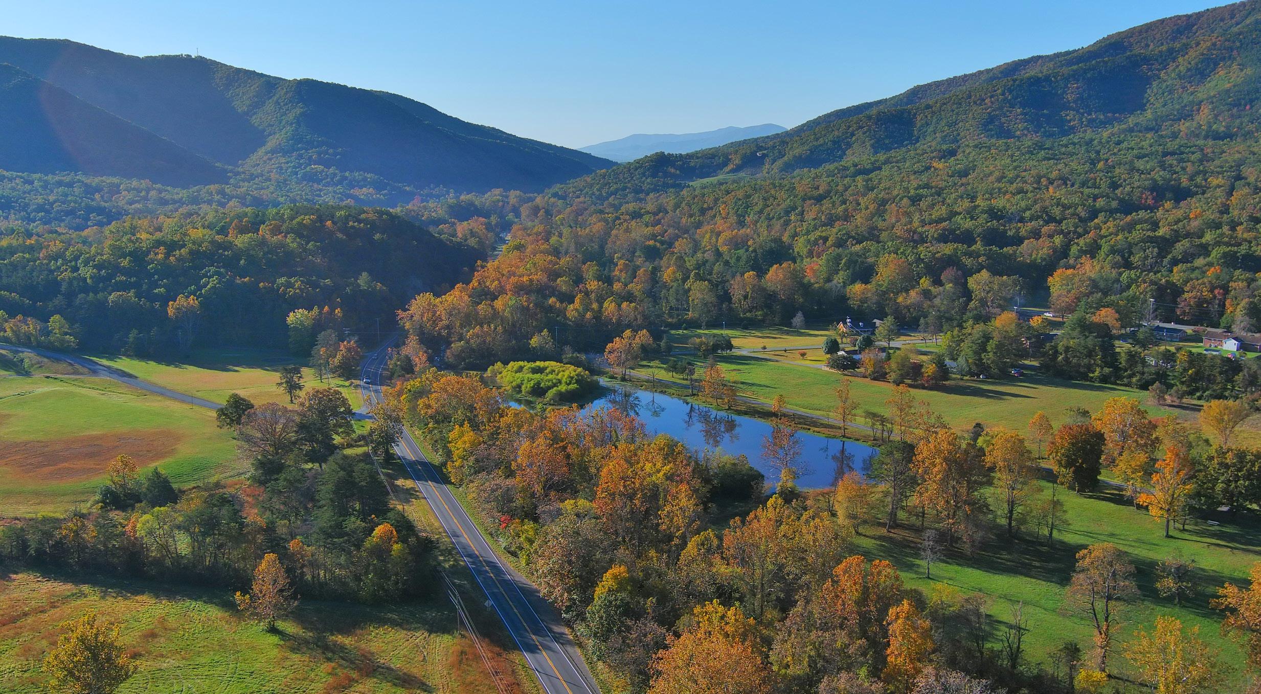
The Catawba Community Planning Area (CPA) is located in the northwest portion of Roanoke County along the Craig County line. The Catawba CPA also borders Botetourt County to the east and Montgomery County to the west. The study area encompasses 837 parcels totaling approximately 21,210 acres. The Catawba Community Planning Area is home to approximately 1,120 people.
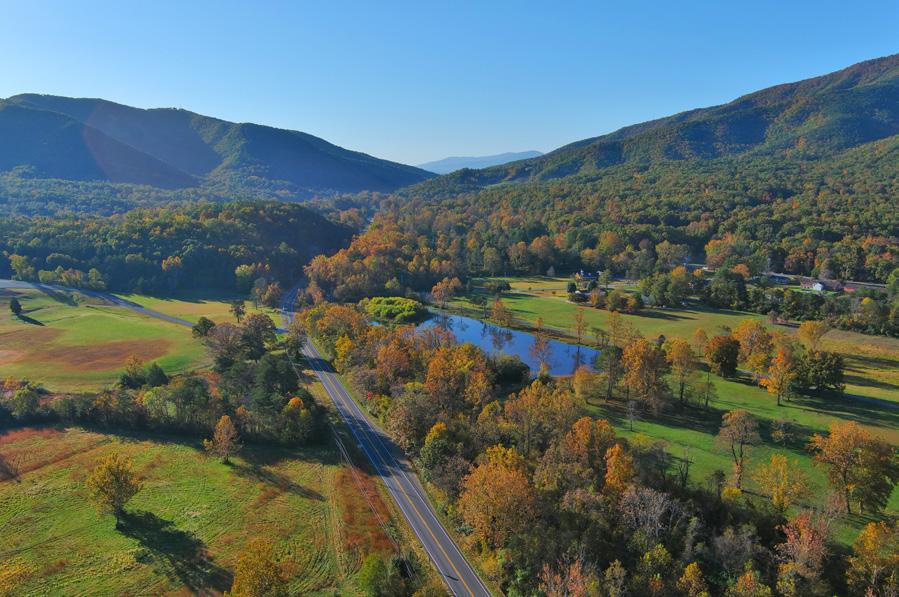
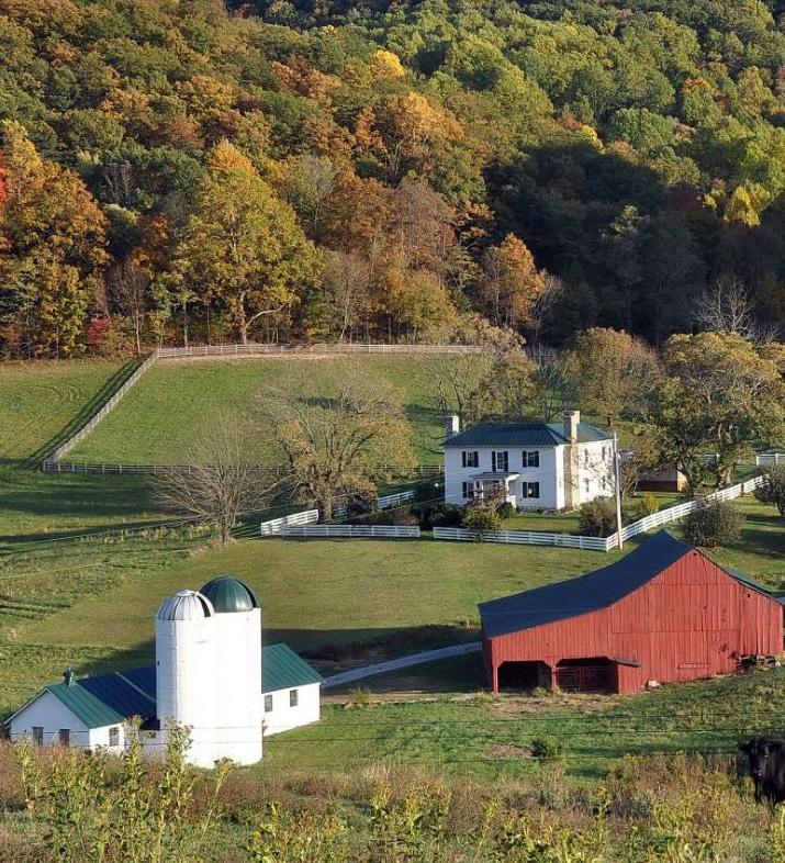
The Catawba CPA includes a small number of businesses along Routes 779 and 311 in the northern region of the County. This planning area has many wonderful amenities including several overlooks including portions of the Triple Crown, consisting of Dragon’s Tooth and McAfee Knob. The CPA is divided by Catawba Creek Road and Blacksburg Road. This area is rural in nature and is the farthest CPA from Downtown Roanoke.
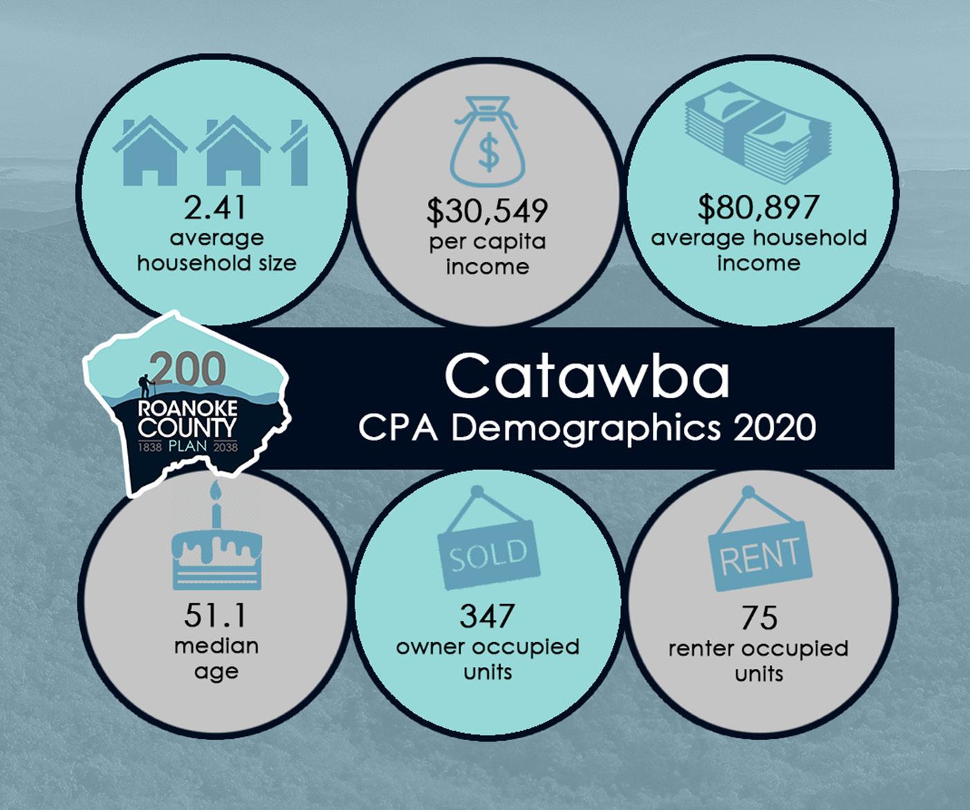
Source: 2019 US Census Data
Demographic Trends
• The median age of residents continues to increase as the baby boomer generation ages. Catawba has one of the highest median ages in the County at 51.1 years.
• Countywide, over the last few decades families living in the same house have fewer people, and two-person households are increasing.
• Catawba’s population grew 2% from 1983 to 2010 and 1% from 2010 to 2020, to 1,121. Countywide, there were fewer babies born from 2010 to 2020, but population grew 4.9% due to people moving here from outside the County.
• The most recent Census data reflects that more than 82% (347) of the housing units are owned, while approximately 18% (75) are rental properties.
• Per capita income is around $30,550 in the Catawba CPA for each individual and the average household income is approximately $80,900.
• The average household size is 2.4 persons per household.
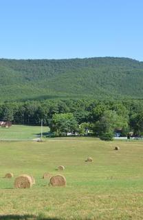
CATAWBA VALLEY
E X I S T I N G C O N D I T I O N S
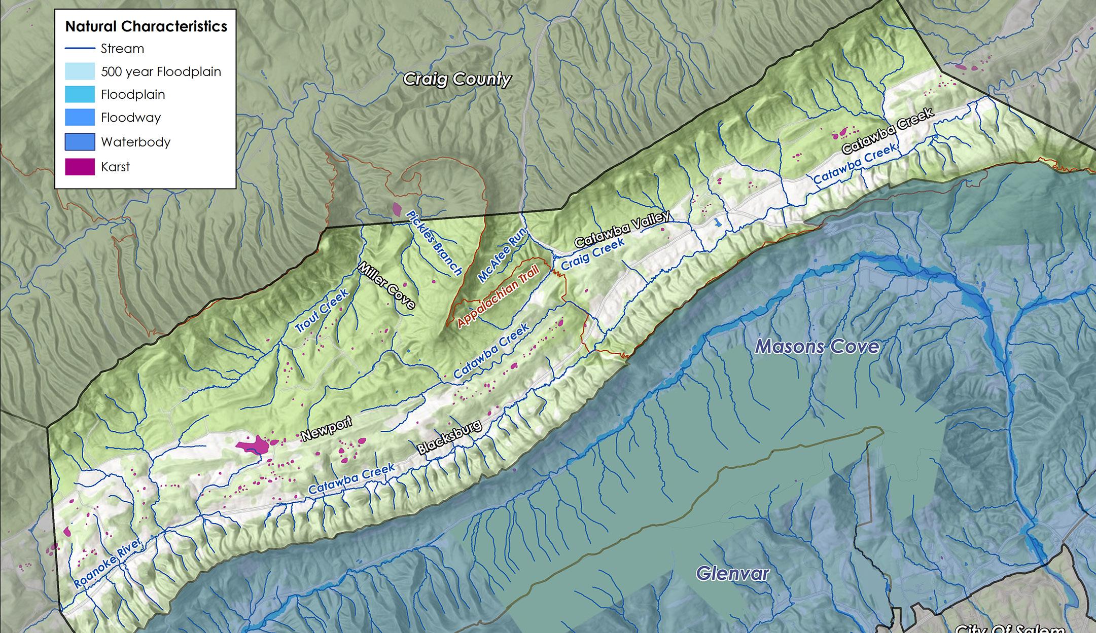
Natural Resources
Topography
Hydrology
Floodplains
Soils
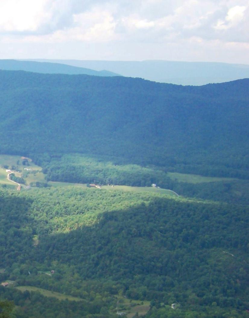
Numerous streams and tributaries travel through the Catawba Valley, namely Catawba Creek along the southern boundary, Craig Creek and Trout Creek to the north, and the North Fork of the Roanoke River in the west. Watersheds in this area flow to two different locations: the North Fork of the Roanoke River flows to the Albemarle Sound in North Carolina, while Catawba Creek and its tributaries flow to the James River and on to the Chesapeake Bay. A third of this mountainous planning area has steep slopes of greater than 33%. In Catawba, 3% of land is in conservation easements to protect agricultural, forest, historic or open space resources. 4,304 acres (20%) of land is publicly protected by two federal agencies, the National Park Service for the Appalachian Trail and the U.S. Forest Service for the Jefferson National Forest.
Control of erosion and sedimentation and the management of stormwater runoff due to steep slopes and erodible soils can make land development difficult. Approximately 34% of the acreage in this CPA is calculated as having a “steep slope” of greater than 33%. The Department of Conservation and Recreation’s Ecological Cores map shows that this CPA has “very high” and “high” ecological cores, which are large patches of natural land that support wildlife habitats. The Virginia Natural Landscape Assessment identifies, prioritizes, and links natural lands in Virginia using land cover data derived from satellite imagery. The Appalachian Trail Conservancy has identified that land acquisition is needed to help preserve views from McAfee Knob, improve access to the Appalachian Trail and provide greater conservation of the surrounding area.
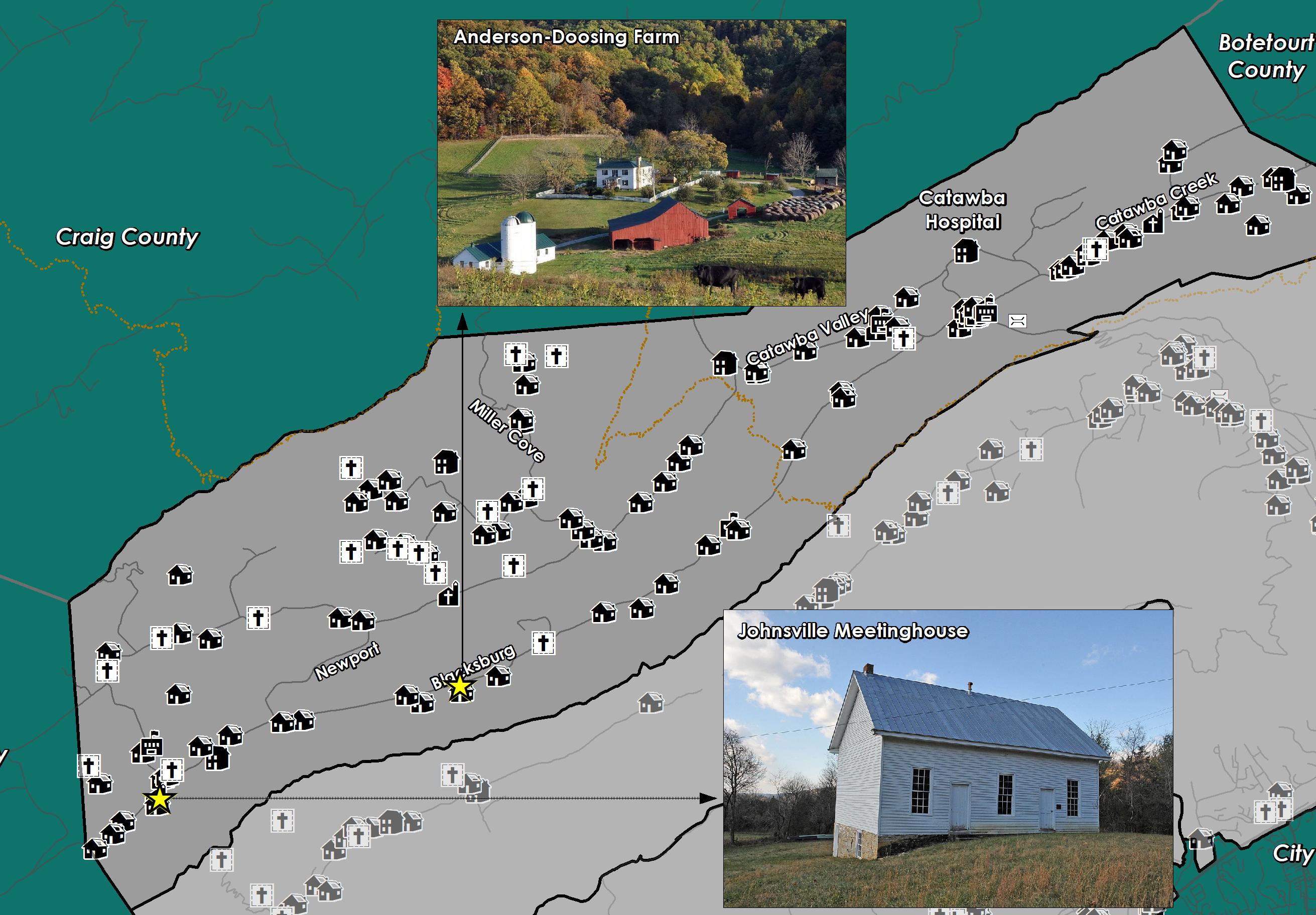
Cultural Resources
Districts
Buildings Cemeteries
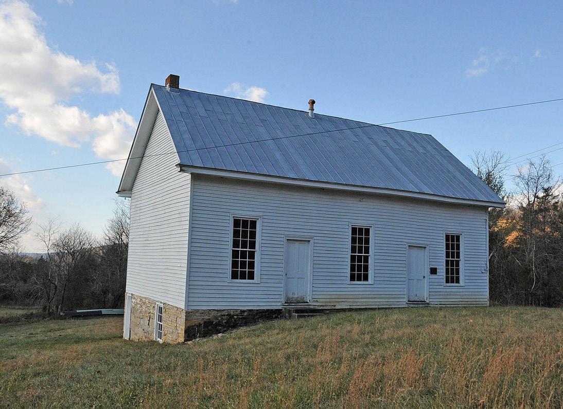
The Anderson-Doosing Farm is a working farm and residence built in the first half of the 19th century and is now on the National Register of Historic Places and the Virginia Landmarks Register. Also on the register is the Johnsville meeting-house, one of only two known Tunker meeting-houses to survive in its original form.
In 1908, the Commonwealth of Virginia purchased the Catawba Hospital property. Part of the Commonwealth of Virginia public behavioral health system, Catawba Hospital specializes in serving adults including geriatric individuals who are in need of mental health care. The hospital offers both short-term “acute care” units and dedicated geriatric units. Both private and semi-private rooms are available. Catawba Hospital is affiliated with the Virginia Tech Carilion School of Medicine, where staff psychiatrists may have faculty appointments and help train psychiatry residents and medical students. A clinical practicum is available for students of various disciplines including nursing, psychology, social work, music therapy, recreation therapy, and food and nutritional services.
Source:
Historical Architecture Reconnaissance Survey Report (1992) and National Register of Historic Places
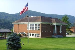
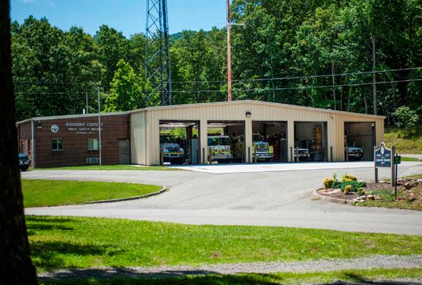
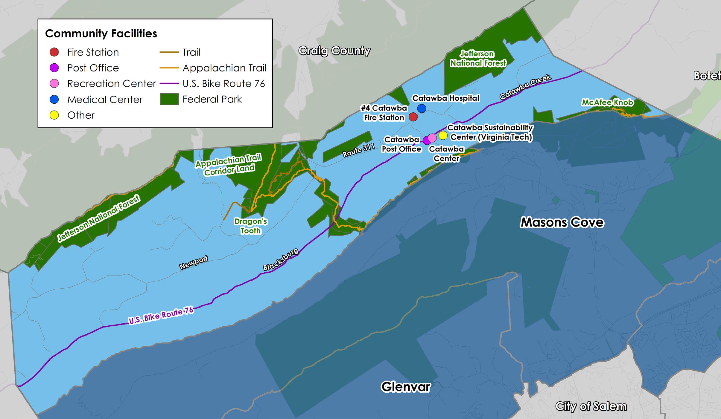
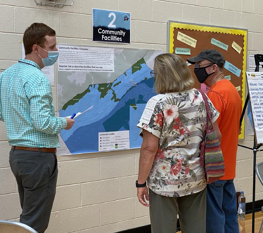
Community Facilities
The Catawba Center, Catawba Sustainability Center and Catawba Hospital are located within the heart of Catawba. Recreation spaces in Catawba include the Appalachian Trail, Jefferson National Forest, Dragon’s Tooth trail and McAfee Knob trail. U.S. Bicycle Route 76 runs along Blacksburg Road, a portion of Catawba Valley Drive and along Catawba Creek Road in the County.
Catawba does not have its own library; it is served by Glenvar Library and Hollins Library. Schools serving the Catawba area are under enrollment capacity. This is consistent with most Roanoke County Public School trends. Masons Cove Elementary enrollment is at 70% of capacity. The Catawba Hospital serves adults in need of mental health care.
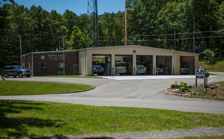
The area is served by the Catawba Fire Station #4 and Catawba Post Office. Catawba is the second lowest CPA out of 11 for Fire-EMS and Police calls for service.
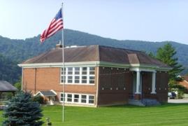
CATAWBA CENTER
CATAWBA FIRE STATION #4
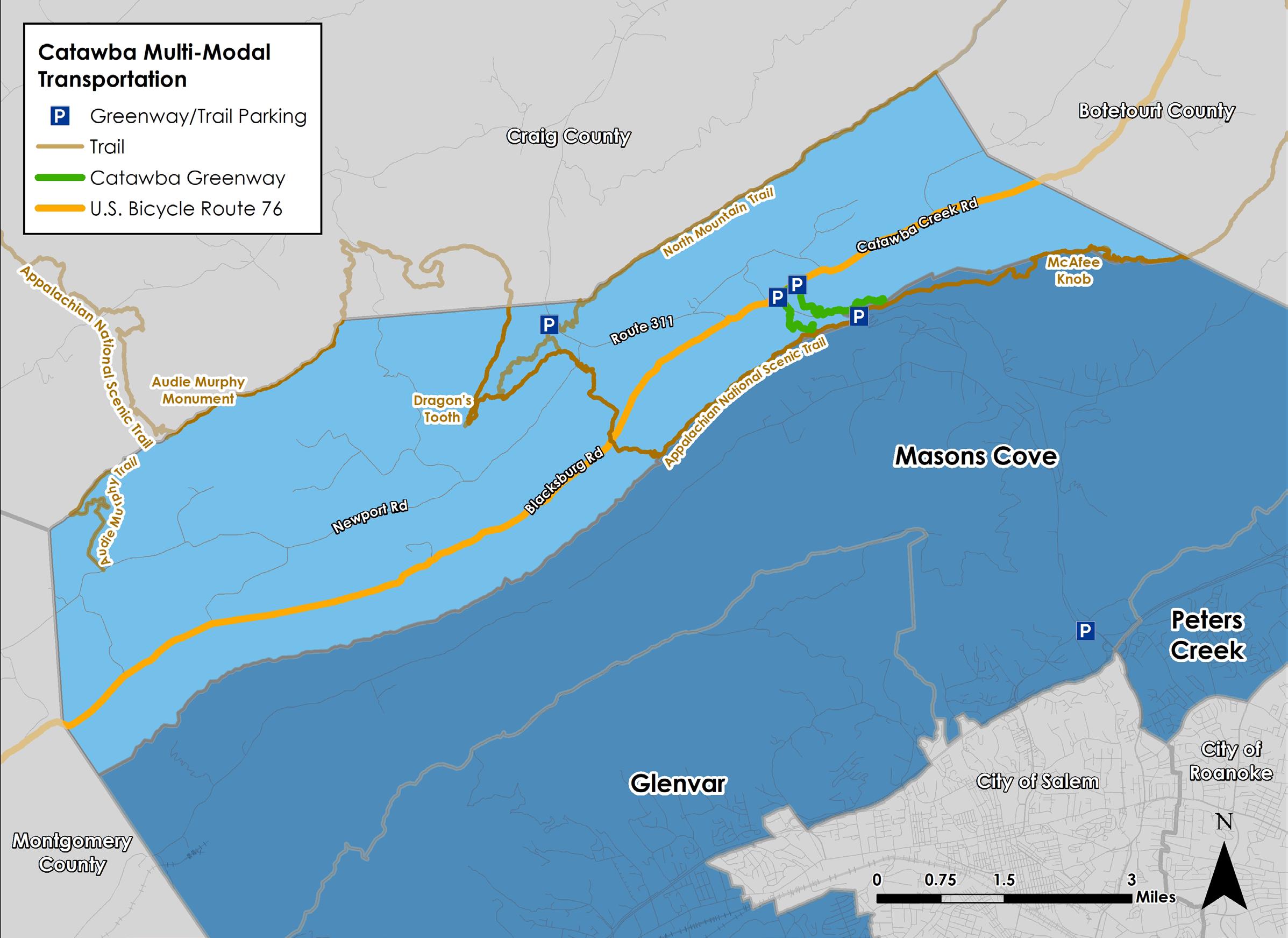
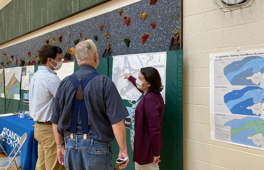
Transportation
Roads
Transit
Greenways/Trails
Bicycle & Pedestrian Accomodations
Catawba is home to Roanoke County’s only portion of U.S. Bicycle Route 76, which runs from the Kansas-Colorado line to Yorktown, VA.
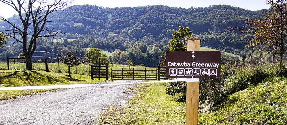
The newly constructed Catawba Greenway provides access to the Appalachian National Scenic Trail, with trailhead parking lots located at Virginia Tech’s Catawba Sustainability Center and Roanoke County’s Catawba Center. Additional Appalachian National Scenic Trail access can be found at the Dragon’s Tooth trailhead on Route 311.
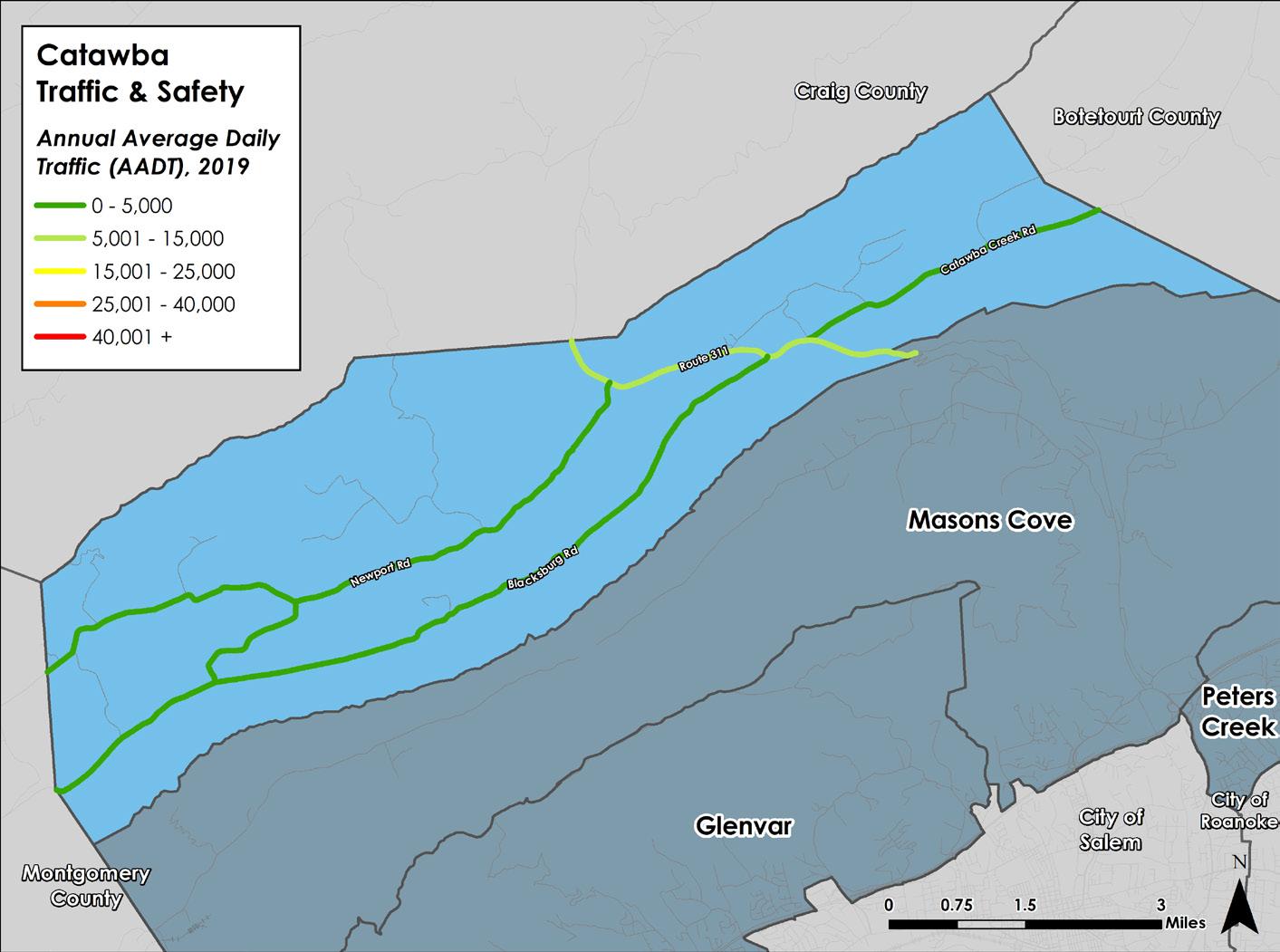
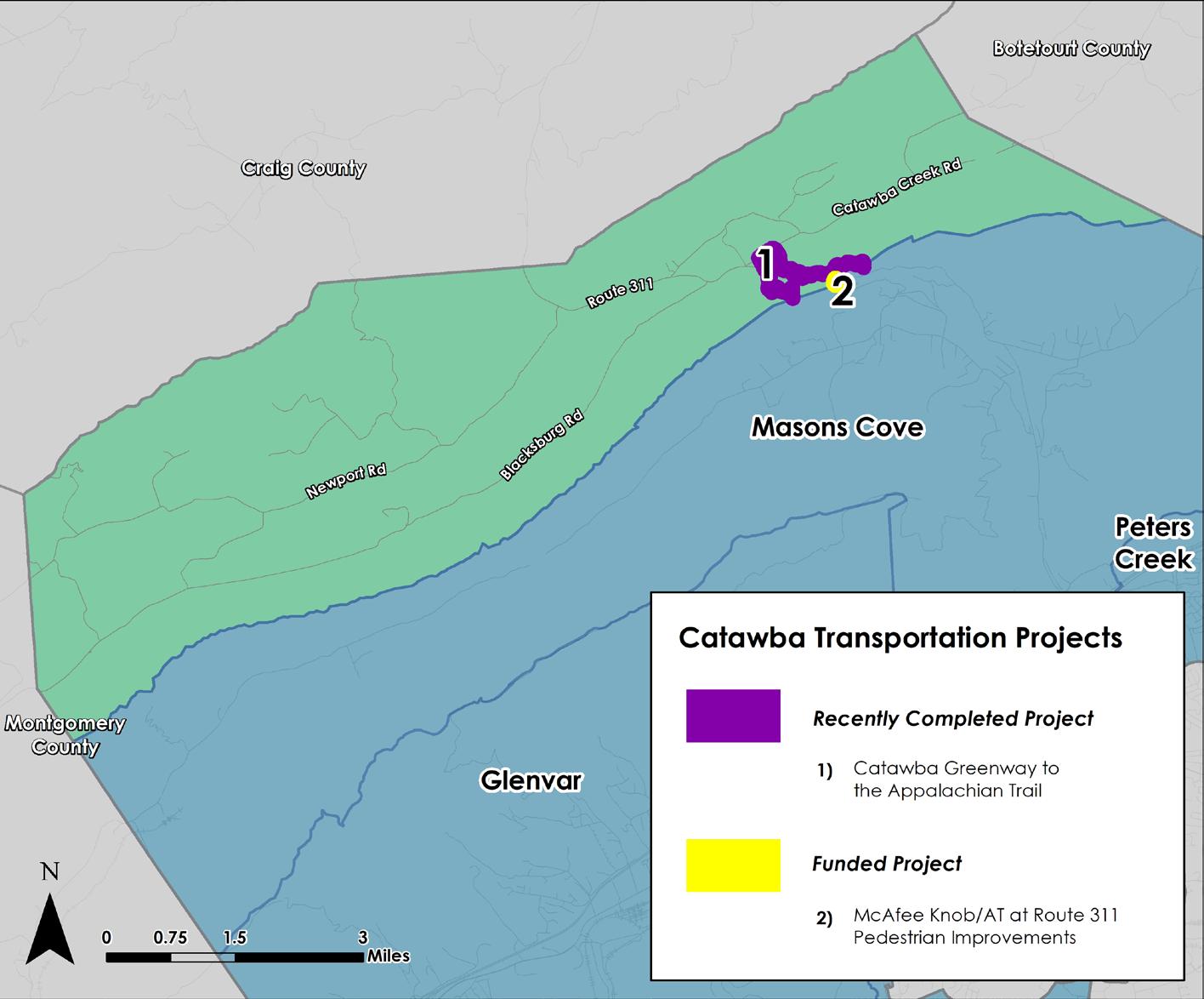
Route 311, Catawba Valley Drive, is the most heavily traveled roadway in the Catawba CPA with between 5,000 and 10,000 vehicle trips per day and the highest percentage of crashes (41%). The multi-modal infrastructure in Catawba includes two significant resources: U.S. Bicycle Route 76 along Catawba Creek Road to Catawba Valley Drive to Blacksburg Road, and the Appalachian National Scenic Trail (AT). Both resources attract cyclists and hikers from around the country and the world. There are two trailhead parking lots located on Route 311 that serve the AT for access to Dragon’s Tooth and McAfee Knob. A pedestrian bridge for the AT is funded and will be constructed over Route 311 in 2024. Roanoke County initiated the McAfee Knob Trailhead Shuttle in 2022 with a grant from the Virginia Department of Rail and Public Transportation to provide a shuttle for hikers to and from the Interstate 81 Exit 140 Park and Ride to the McAfee Knob Trailhead parking lot. The Catawba Greenway provides a connection between the AT and the Virginia Tech Catawba Sustainability Center, where Roanoke County has constructed a new trailhead parking lot.
Recently completed projects include the 1) Catawba Greenway to the Appalachian National Scenic Trail. There is one funded transportation project in the Catawba CPA: 2) McAfee Knob/AT at Route 311 Pedestrian Improvements. These can be seen to the right.
E
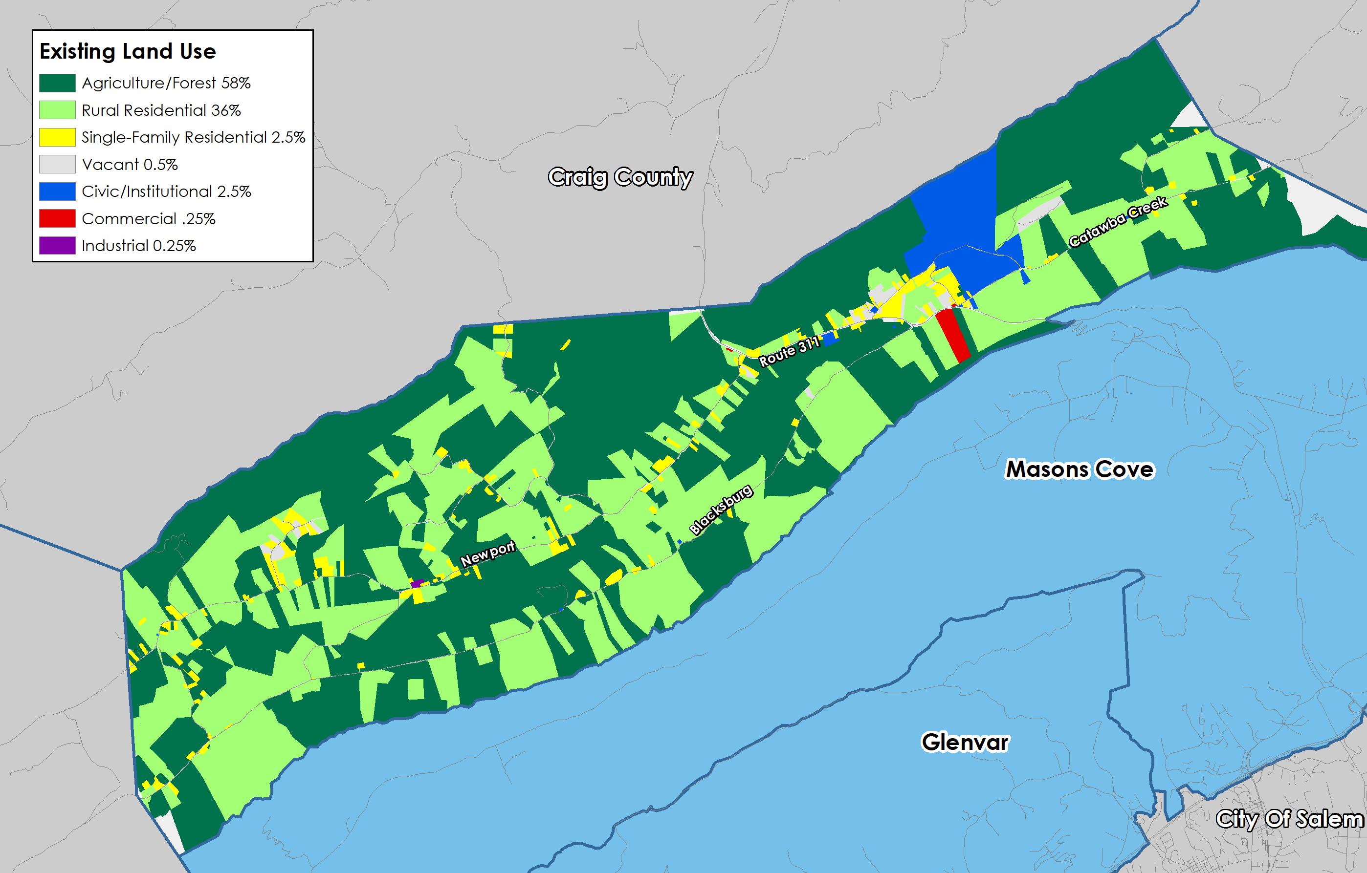
Existing Land Use
The beauty and rural character of the Catawba Valley is woven from natural landscape features and compatible land uses. These uses include low density housing, farming and agricultural operations, agritourism, outdoor recreation, and small, custom manufacturing and cottage industries. Catawba is home to Jefferson National Forest and the Appalachian National Scenic Trail, including McAfee Knob and Dragon’s Tooth overlooks that are important outdoor tourism assets. These resources are growing in popularity, which is increasing maintenance and access needs.
58% of the land is used for agricultural and forest uses. These lands are mostly private property, with a sizable minority of the land being publicly owned for the Jefferson National Forest and the Appalachian Trail Corridor. 36% of the land is used as rural residential. The difference between rural residential properties and agricultural residential properties is the primary use of the property. If it’s primarily used as a residence, it’s classified as rural residential. 2.5% of the land is single-family residential. These are properties where the only use is residential. 2.5% of the land is also used for civic uses, such as churches, fire stations, and public gathering places. Civic uses are skewed to an unusually high percentage in the Catawba CPA because of the Catawba Hospital. The hospital sits on a very large, 352 acre parcel that is mostly natural forest. Approximately 1% of the land is split amongst vacant, commercial, and industrial uses.
Zoning
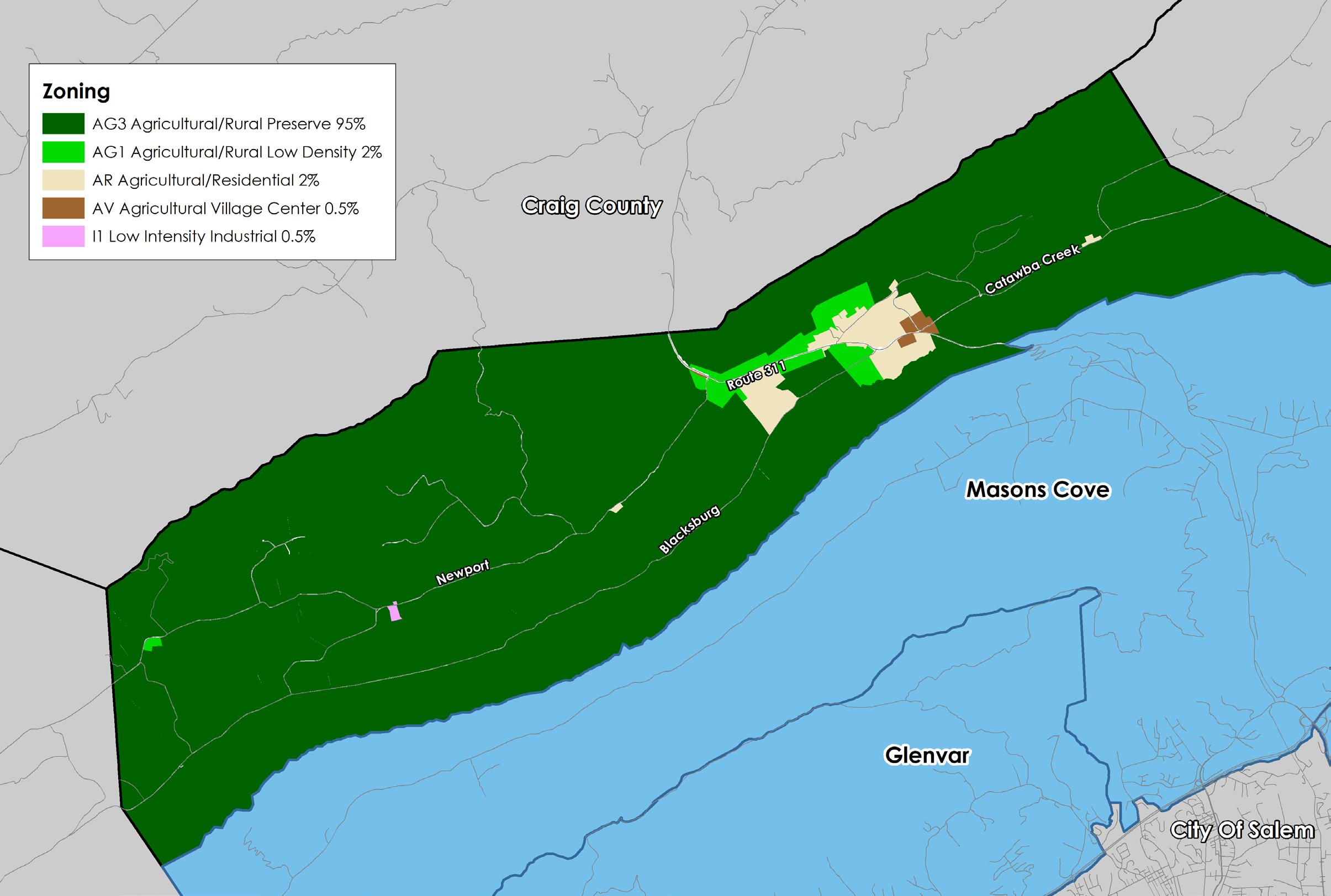
The vast majority of land in Catawba is zoned agriculturally. Agricultural zoning districts account for more than 99% of the land in the community planning area and are located primarily in valley and ridge terrain.
The AG-3 Agricultural/Rural Preserve district and the AG-1 Agricultural/Rural Low-density district, consist of land primarily used as farmland, woodlands, and widely scattered residential development located within the rural service area. The AR Agricultural/Residential district is generally characterized by very low density residential and institutional uses mixed with smaller parcels that have historically contained agricultural uses, forest land and open space outside the urban service area. The AV Agricultural/Village Center district serves as the focal point for cultural and commercial activity of the rural service areas of the County.
The overwhelming presence of these districts in the Catawba CPA accomplishes the purpose of maintaining this area in its rural state, and attempt to protect sensitive and unique land resources from degradation as recommended in this summary document.
Future Land Use
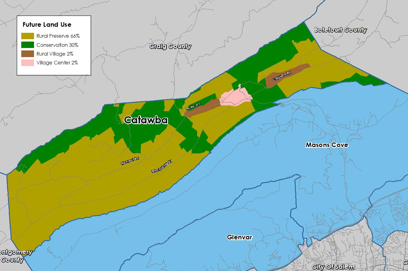
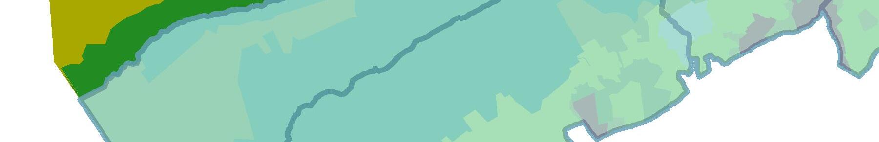
The map below shows the future land use designations in the Catawba CPA from the 2005 Comprehensive Plan.
Almost all of the land in Catawba is intended to remain rural and agricultural. 66% of the land is designated as Rural Preserve to protect the rural character of the area. 30% is designated for Conservation, which includes ridgelines, mountainsides, scenic views from the Appalachian Trail, and state forest lands. The Conservation future land use designation is intended to protect environmental, natural, or cultural features from encroaching development. Rural Village comprises 2% of the CPA, while the remaining 2% is designated Village Center near the Keefer Road area and serves as a rural focal point for the Catawba region.
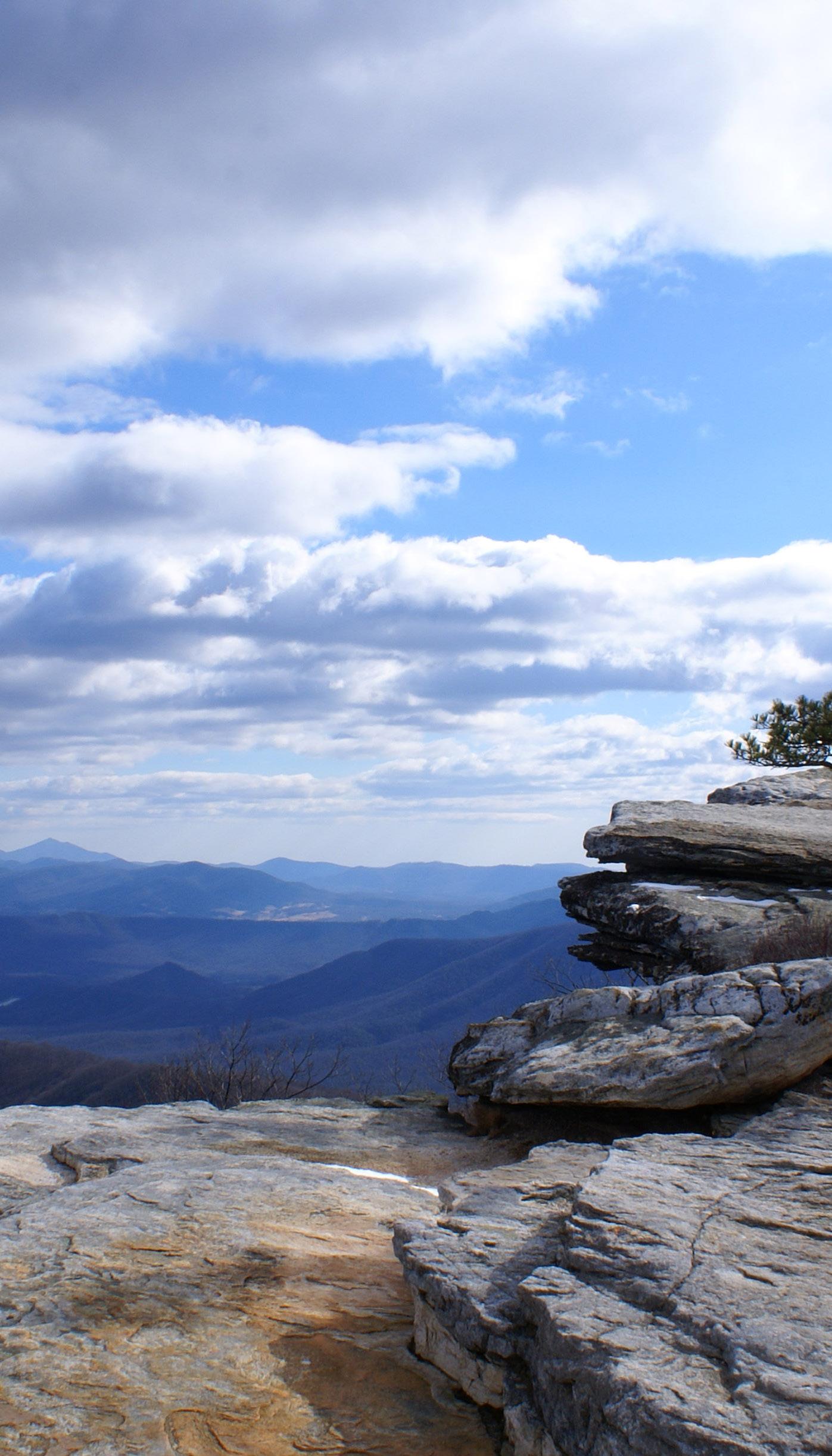
MCAFEE KNOB
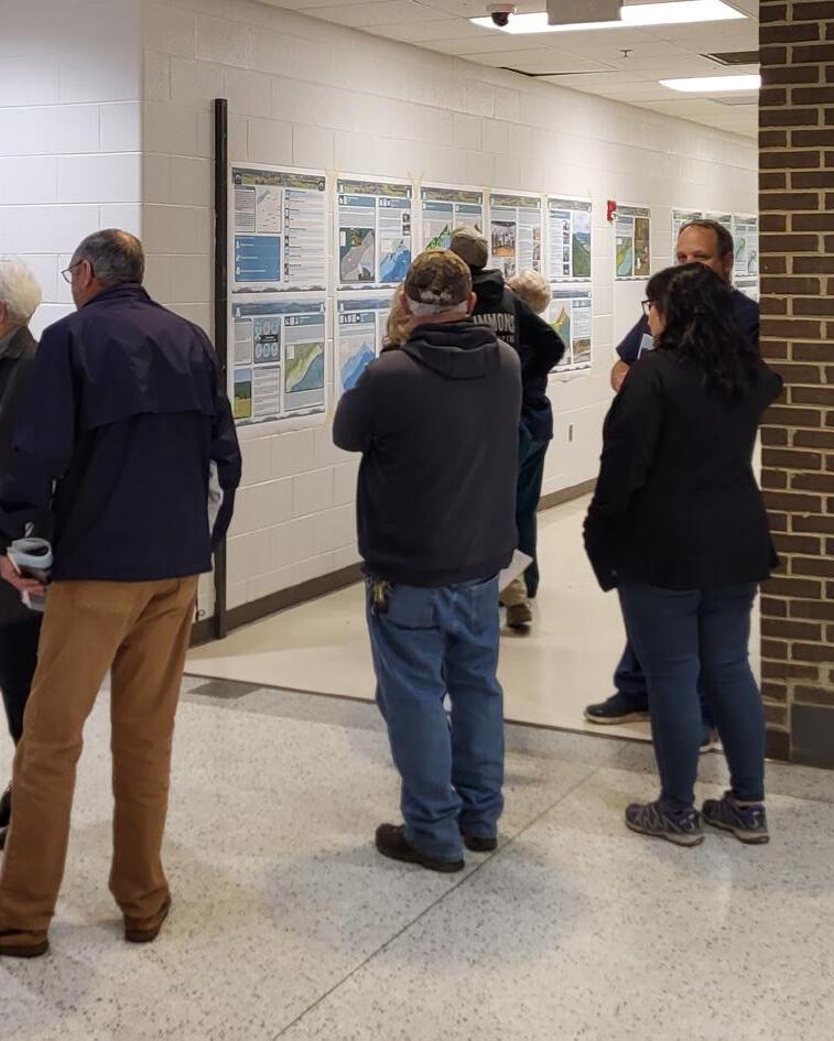
Fall 2021 Community Meetings - Existing Conditions
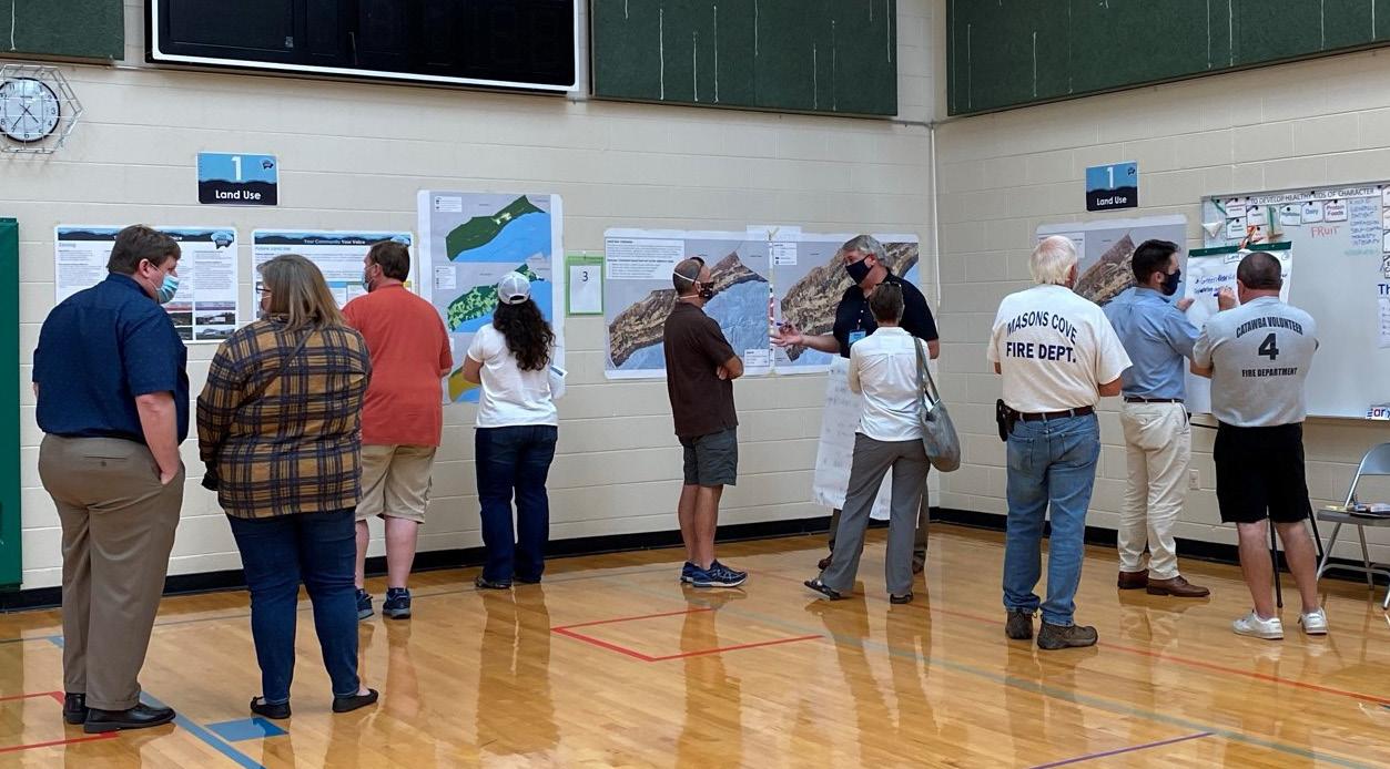
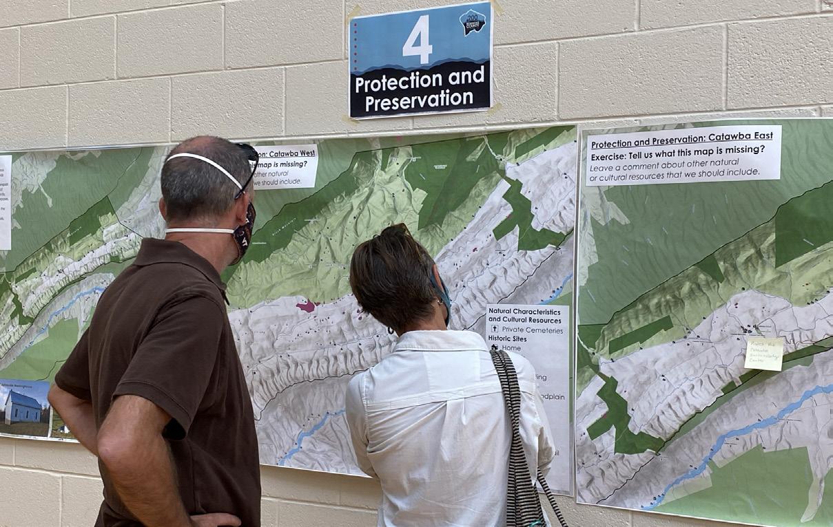
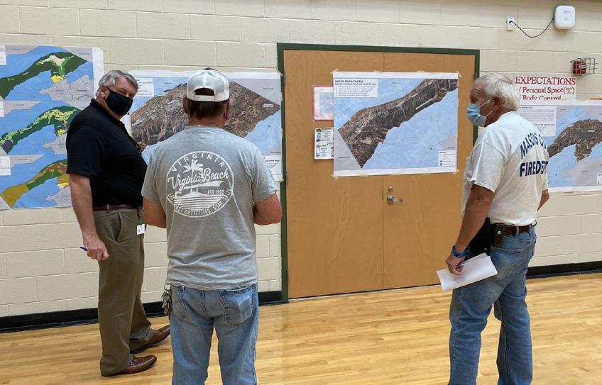
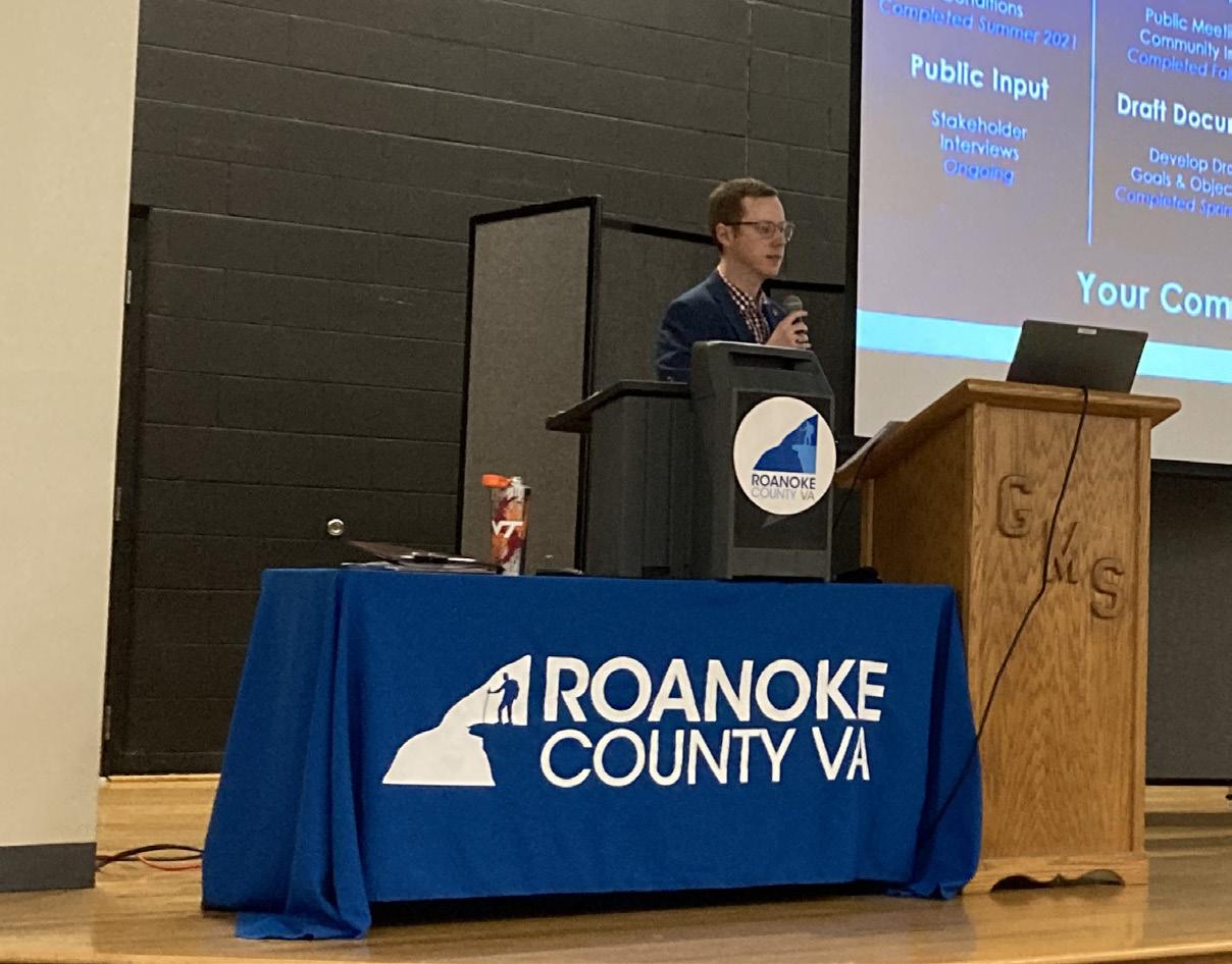
Twelve (12) planning meetings were held around Roanoke County in the fall of 2021 to collect preliminary feedback about community issues and needs. The community meeting for the Catawba CPA was held in conjunction with the Masons Cove CPA on September 9, 2021, at Masons Cove Elementary School. There were 50 attendees. Citizens were invited to comment on Land Use, Community Facilities, Transportation, and Protection and Preservation. Comments and suggestions from citizens were collected and assembled by staff into a “Post Meeting Summary” document. A digital copy of this document can be found on the Roanoke County 200 Plan webpage.
Fall 2021 Community Input Highlights:
a. Residents wanted the character of Catawba to remain agricultural and rural.
b. Residents generally wanted improved community facilities in the area.
c. Staff spoke with many people about various vehicle traffic issues throughout the area, especially concerning Route 311.
d. Residents also desired protection for many natural and cultural resources, including viewsheds, ridgelines, trails, historic sites, and greenways.
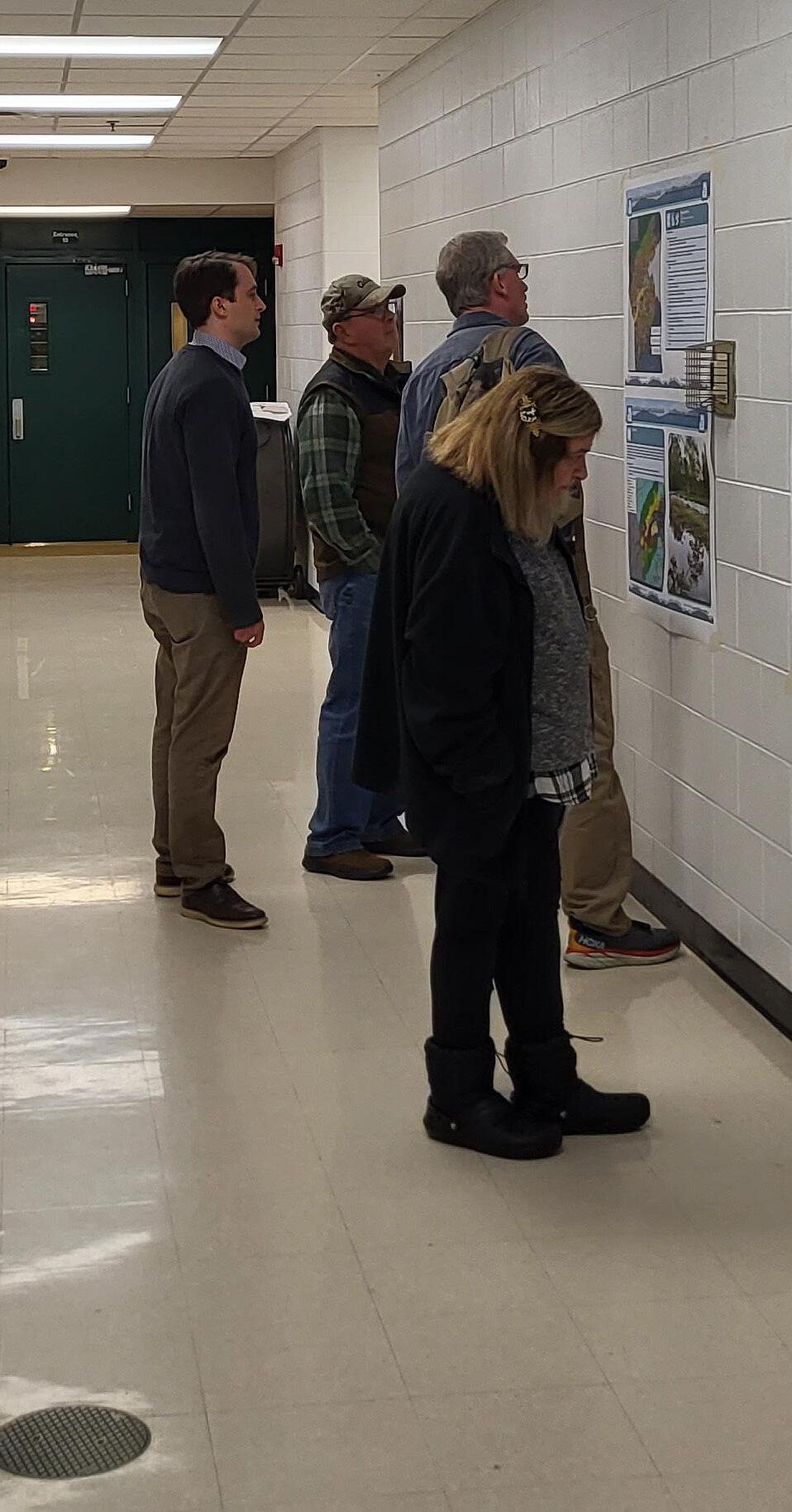
Spring 2022 Open House Meetings - Draft Goals and Recommendations
Seven (7) Roanoke County 200 Plan open house planning meetings were held around Roanoke County in Spring 2022 for citizens to review draft goals and recommendation options based on the feedback received throughout the Fall 2021 community engagement. Draft goals were developed based on input that we received at the community meetings and online surveys in Fall 2021. Citizens reviewed and provided comments on the new draft goals and recommendations that will shape the draft Roanoke County 200 Plan document. The draft goals and recommendations displayed included natural and cultural resources, land use, community facilities and infrastructure, and transportation. The community meeting for the Catawba CPA was held in conjunction with the Masons Cove CPA on April 4, 2022, at the Masons Cove Elementary School. There were 41 attendees.
Spring 2022 Community Survey Highlights:
Natural and Cultural Resources:
The majority (90%) of survey respondents and community meeting participants support recommendations to protect and improve ground, surface and stormwater resources; beautify the County’s public areas, viewsheds and roadways; clean up garbage; protect steep slope areas; protect trees and forests, natural areas and wildlife habitats; as well as protection of historic and cultural resources.
Community Facilities and Infrastructure:
a. Parks, Recreation and Tourism: 64% of respondents support the recommendations as well as the following items pertaining to the Catawba CPA: 1. Improvements at the Catawba Center. 2. Explore new park, greenway and blueway opportunities. 3. Continue regional collaboration for the Triple Crown. 4. Expand options for Little Free Libraries.
b. General Services: 69% of respondents support recycling options and assessments of County Fire Department Facilities and the Administration Center building.
c. Public Libraries: 66% of respondents support the Countywide library system recommendations.
d. Communications and Information Technology: 86% of respondents support expansion and improvement of broadband and cell phone access.
e. Public Safety: 70% of respondents support Countywide public safety recommendations.
Land
Use:
86% of respondents support the activity centers as shown on the Activity Center Map, while 12% indicated interest in additional activity centers. 69% of respondents support the proposed changes to the Future Land Use Map.
Winter 2023 Community Meetings - Draft
Plan Reveal
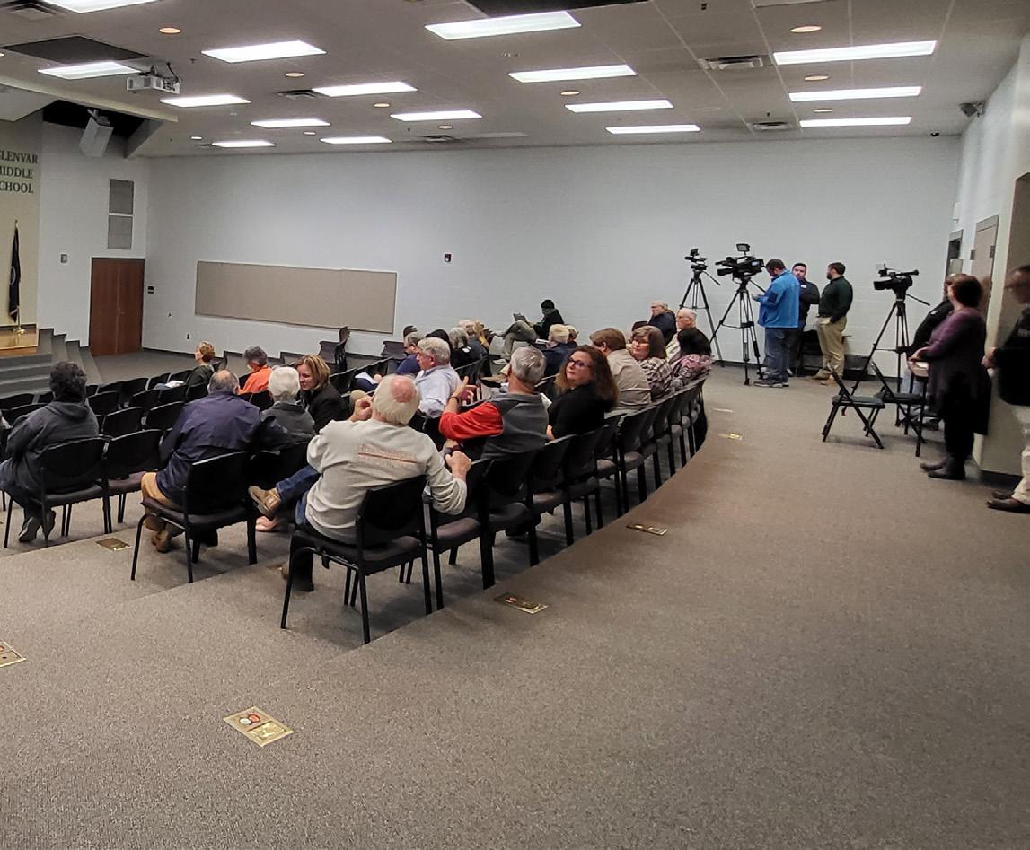
Six (6) Roanoke County 200 Plan open house planning meetings were held around Roanoke County in Winter 2023 for citizens to review the Draft Roanoke County 200 Plan Countywide Summary Document and Draft Community Planning Area Documents based on the feedback received throughout the community engagement process. Citizens reviewed and provided comments on the draft Roanoke County 200 Plan documents. The community meeting for the Catawba CPA was held in conjunction with the Masons Cove CPA and the Glenvar CPA on February 27, 2023, at Glenvar Middle School. There were 37 attendees.
In general, the comments provided by residents were concerned with the following:
a. Development in the Appalachian Trail viewshed.
b. Access to cell phone and internet services.
c. Cyclist safety on rural roads.
d. Additional programming at the Catawba Center
e. The proposed reduction of the Village Center future land use designation.
These issues and concerns are addressed by recommendations in the Catawba CPA Summary Document and the Countywide Summary Document. These recommendations include:
a. Protect viewsheds from the ridges and from the valleys.
b. Explore opportunities to extend broadband service with universal availability and access to high-speed Internet in unserved and underserved areas.
c. Explore providing improved cell phone service in unserved and underserved areas.
d. Work with regional groups to provide education for drivers and bicyclists regarding laws and etiquette.
e. Determine appropriate locations for improved bicycle accomodations in the Catawba area, particularly along U.S. Bicycle Route 76.
f. Initiate a Route 311/Catawba Valley Drive Multimodal Safety Study with VDOT to determine potential improvements to reduce crashes and improve safety for all users.
g. Continue developing programs that balance community needs with available staffing resources.
h. Amend the Future Land Use Map (as shown on page 25) to conserve the natural beauty of Catawba.
In addition to the Draft Plan reveal meetings, the Planning Commission and the Board of Supervisors held public hearings on the Roanoke County 200 Plan. Information on these hearings is contained in the main document of the Roanoke County 200 Plan.
Recommendations
Natural & Cultural Resources
Topography/Viewsheds
Hydrology/Floodplains
Water Quality/Pollution Prevention
Vegetation/Natural Areas
Historic & Cultural Resources
1. Protect and improve the quality of water in our streams, creeks and rivers.
2. Coordinate with State agencies regarding floodplain risks and prevention.
3. Reduce quantity and improve quality of stormwater.
4. Protect and prevent risks to surface waterways, reservoirs, underground aquifers and drinking water wells.
5. Beautify County roadways and public areas.
6. Protect viewsheds from the ridges and from the valleys.
7. Clean up and prevent litter and illegal dumping.
8. Protect steep slope areas.
9. Protect trees and forests and increase tree canopy.
10. Protect natural areas and wildlife habitats.
11. Coordinate with State agencies regarding historic and cultural resources, including cemeteries and archaeological sites.
CATAWBA VALLEY
Community Facilities & Infrastructure
Parks, Recreation & Tourism
Parks, Recreation and Tourism Recommendations
1. Evaluate new park, greenway, and blueway opportunities in the community.
2. Evaluate on- and off- road connectivity options between parks, neighborhoods, and community facilities.
3. Continue coordination on regional efforts to enhance and develop outdoor recreation opportunities in our communities.
4. Update the Parks, Recreation & Tourism Master Plan.
5. Continue promotion of the Park Partners Program to encourage citizens and businesses, and organizations to adopt a park, greenway, or trail.
6. Educate citizens on park ordinance updates (i.e., park sign updates, dog-friendly parks/special events and leash laws, drones, etc.).
7. Continue developing programs that balance community needs with available staffing resources.
8. Evaluate improvements at Catawba Center (i.e., proposed playground).
9. Evaluate the needs of existing parks and trails (i.e., trail maintenance, tennis court conversion to pickleball, etc.).
10. Continue collaboration with National Park Service, VDOT, US Forest Service, and Appalachian Trail Conservancy on the Triple Crown Area (Dragon’s Tooth, McAfee Knob, and Tinker Cliffs).
11. Evaluate additional options for expanding Little Free Libraries Program with the Park Partners Program.
CATAWBA GREENWAY
General Service Recommendations
1. Evaluate recycling program options.
Community Facilities & Infrastructure
2. Implement recommendations from the Roanoke County Fire Department Facilities Assessment.
3. Implement recommendations from the Roanoke County Administration Center Assessment.
Public Libraries Recommendations
1. Improve services and continue enhancing facilities.
2. Evaluate programming needs and wants based on a variety of data and customer feedback.
3. Implement responsive, community focused program that serves people of all ages and backgrounds.
4. Ensure timely delivery of all circulating materials.
5. Raise level of engagement with the community, and increase awareness about library services and programs.
Communication & Information Technology Recommendations
1. Explore opportunities to extend broadband service with universal availability and access to high-speed Internet in unserved and underserved areas.
2. Explore alternative broadband and cell phone service providers for choice and competition.
3. Explore more public-private partnerships to implement more stages of Roanoke County’s Rural Broadband Initiative to bring high-speed Internet to homes without broadband access.
4. Explore providing improved cell phone service in unserved and underserved areas.
Public Safety Recommendations
1. Provide the efficient delivery of public safety services with minimal response times.
2. Enhance and maintain public safety staffing.
3. Enhance and maintain facilities and equipment.
4. Provide a high-level of citizen engagement and educational opportunities.
Recommendations
Priority transportation projects:
Transportation
Roads
Transit
Greenways/Trails
Bicycle & Pedestrian Accommodations
1. Initiate a Route 311/Catawba Valley Drive Multimodal Safety Study with VDOT to determine potential improvements to reduce crashes and improve safety for all users.
2. Improve access and accommodations for Appalachian Trail hikers visiting McAfee Knob in collaboration with the National Park Service and the Appalachian Trail Conservancy.
3. Collaborate with the U.S. Forest Service and VDOT to improve the Dragon’s Tooth trailhead parking lot and access to the parking lot from Route 311.
Other transportation projects:
4. As the use of Catawba Hospital evolves, work with VDOT on potential access changes to facilitate safe access for employees and visitors.
5. Investigate potential improvements at the Newport Road and Blacksburg Road Appalachian Trail crossings, in collaboration with the U.S. Forest Service and VDOT.
6. Evaluate potential pedestrian connections to businesses and destinations within Catawba Village.
7. Determine appropriate locations for improved bicycle accommodations in the Catawba area, particularly along U.S. Bicycle Route 76.
8. Evaluate a location for trailhead parking for the North Mountain Trail in collaboration with the U.S. Forest Service and VDOT.
Land Use
Future Land Use Rural Center
Residents supported the seven (7) proposed changes to the future land use map in the Catawba CPA during the spring 2022 open house and survey. Six (6) of these changes were from the Rural Preserve designation to the Conservation designation due to steep slopes greater than 33%, conservation easements, or recreation lands that exist there. The last change was from Village Center to Rural Village in order to create a properly sized area to encourage growth of a vibrant village center and reflect the existing zoning of the area.
Recommendations
1. Amend the Future Land Use Map as shown below to conserve the natural beauty of Catawba.
2. Develop a Rural Center Plan in the Catawba CPA oriented around the Catawba Center.
Catawba Future Land Use - Proposed Rural Preserve Rural Village Conservation Village Center