

September 24, 2024


September 24, 2024
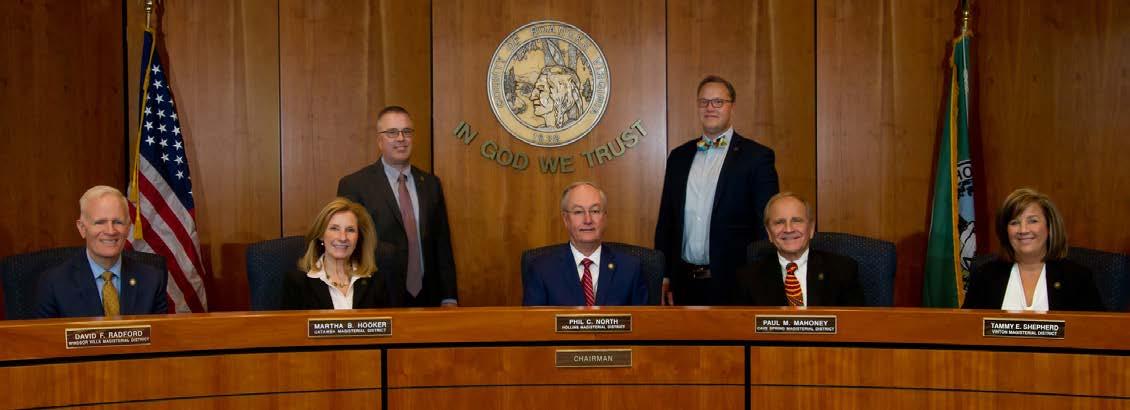
Roanoke County Board of Supervisors
Phil C. North
Chairman
Hollins Magisterial District
Martha B. Hooker
Vice Chair
Catawba Magisterial District
Paul M. Mahoney
Cave Spring Magisterial District
David F. Radford
Windsor Hills Magisterial District
Tammy E. Shepherd
Vinton Magisterial District
Roanoke County
Planning Commission
Rick James Chairman
Vinton Magisterial District
Wayne Bower
Vice Chair
Hollins Magisterial District
Troy Henderson
Catawba Magisterial District
Kelly McMurray
Cave Spring Magisterial District
Jim Woltz
Windsor Hills Magisterial District

We would like to thank the citizens of Roanoke County and others for their input and participation throughout the planning process. The Roanoke County 200 Plan is a reflection of the community’s values and vision for the future, and we are grateful for the opportunity to have worked with so many people to make it a reality.
The Roanoke County 200 Plan was prepared by the Roanoke County Planning Department including the following individuals:
• Philip Thompson, Director of Planning
• Megan Cronise, Assistant Director of Planning
• Rebecca James, Zoning Administrator
• Isaac Henry, Principal Planner
• Alexander Jones, Former Principal Planner
• Bailey Howard-DuBois, Former Principal Planner
• Ross Hammes, Planner II
• Sarah Gilmore, Planner II
• Alyssa Dunbar, Planner II
• Cecile Newcomb, Former Planner II
• Jake Harding, Former Planner II
• Paula Benke, Transit Planner
• Nathan Grim, Transportation Planner
• Will Crawford, Former Transportation Planner
• Brian Epperley, Transportation Engineer
• Cecelia Thomas, Planning Administrative Assistant
• Lindsay Webb, Former Parks Planning and Development Manager
The 200 Plan was developed with the assistance of the following departments & organizations:
• Roanoke County Administration
• Roanoke County Public Schools
• Roanoke County Public Safety
• Roanoke County Libraries
• Roanoke County Attorney’s Office
• Roanoke County Real Estate Office
• Virginia Department of Transportation
• Valley Metro Transportation
• The National Park Service
• Roanoke County Economic Development Department
• Roanoke Valley-Allegheny Regional Commission
• Virginia Department of Environmental Quality
• Community Accessibility & Inclusion Organizations
• Roanoke Valley Broadband Authority
• Roanoke Valley Resource Authority
• Western Virginia Water Authority
• Hollins University
• Virginia Western Community College
• Roanoke County Economic Development Authority
• Roanoke County Economic Development Stakeholders
Roanoke County would like to thank all of these organizations for their contributions to the Roanoke County 200 Plan.
Appendix A: Planning Commision Resolution
Appendix B: Board of Supervisors Resolution
Appendix C: 2024 Future Land Use Guide
Appendix D: 2024 Future Land Use Change Breakdown
Appendix E: Fall 2021 Community Engagement Summary
Appendix F: Spring 2022 Community Engagement Summary
Appendix G: Winter 2023 Community Engagement Summary
Question 5 - Please identify up to three (3) most important issues facing the planning area today.
Question 6 - Please identify up to three (3) important issues facing the planning area in the next 15 years. 8-6
Question
Question
-
-
Question 11 - Please rate your satisfaction with each of the following in your community.
Question 12 - What forms of transportation do you use in the planning area? . . . . 8-11
Question 13 - What are the most important transportation issues in the CPA? . . . . 8-12
Question 14 - Which streetscape improvements would you most like to have in this area? 8-12
Question 15 - Which of these transportation improvements would you most like to have in this area?
Question 16 - Please rate your satisfaction with each of the following in your community.

The Roanoke County 200 Plan (200 Plan) is intended to serve as the framework for the County, its citizens, business owners, and the development community to guide growth and development for the next 15 years. The 200 Plan is an update to the existing 2005 Community Plan and its subsequent amendments. This chapter provides an overview of the benefits of developing a comprehensive plan for the County, summarizes the unique content of the plan and its relationship to other County planning documents, and gives an outline of the planning and approval process.

A comprehensive plan, also known as a comprehensive land use plan or master plan, is a long-range planning document that sets forth a vision for the future of a community and provides guidance on how to achieve that vision. It is a comprehensive plan in the sense that it addresses all aspects of community development, including land use, transportation, housing, economic development, parks and recreation, public facilities, infrastructure and environmental protection.
Comprehensive plans are typically developed by a planning commission or department, with input from the public and stakeholders. The planning process typically involves the following steps:
1. Data collection and analysis: The planning team gathers and analyzes data on the community’s existing conditions, including population demographics, economic trends, land use patterns, housing, environmental and cultural resources, community facilities, transportation, and infrastructure.
2. Public engagement: The planning team engages the public to gather their input on the community’s vision for the future and their priorities for development.
3. Vision and goals development: Based on the data collection and public engagement, a vision and goals for the community’s future are developed.
4. Policy and strategy development: The planning team develops policies and strategies to achieve the community’s vision and goals.
5. Plan adoption: The planning commission or department presents the draft comprehensive plan to the governing body for adoption. Once the plan is adopted, it becomes an official policy document for the community.
Comprehensive plans are typically updated every 5 to 10 years to ensure that they remain relevant to the community’s changing needs and priorities.
Comprehensive plans offer a number of benefits to communities, including:
• Guiding growth and development: Comprehensive plans provide a framework for guiding growth and development in a way that is consistent with the community’s vision and goals. This can help to avoid haphazard development and promote a more livable and sustainable community.
• Protecting community resources: Comprehensive plans can help protect the community’s natural and cultural resources, such as farmland, forests, wetlands, and historic sites.
• Promoting economic development: Comprehensive plans can help to promote economic development by creating a favorable environment for businesses to invest and grow.
• Improving quality of life: Comprehensive plans can help to improve quality of life for residents by promoting safe and accessible neighborhoods, affordable housing, and quality public facilities and services.
The Roanoke County 200 Plan (200 Plan) is a major update to the County’s existing comprehensive plan, which was last updated in 2005. The 200 Plan name has been coined because the plan represents the community’s vision for the future growth and development of the County by the year 2038, when the County will be celebrating its 200th anniversary.
The 200 Plan provides direction and guidance, for both the public and private sectors, in making decisions about land development, public services and resource protection. This Plan allows decision makers to study the long-term consequences of current decisions and recognize that today’s actions will impact the County for many years to come. It allows the Board of Supervisors to present a snapshot of the County’s long-range goals, policies and strategies to the community. This includes those involved in private land development, neighborhood organizations and civic groups, neighboring jurisdictions, County departments, commissions and boards and the public. It also provides those in the land use and development process the opportunity to anticipate Board decisions and to actively work in concert with the Plan rather than in conflict with it.
The 200 Plan is a public document, developed with a great deal of public participation. It encourages individual participation in public affairs and particularly the long-range planning process of the County. It also ensures citizens that decisions based on the Plan are well-thought out and in the best interests of the County as a whole.
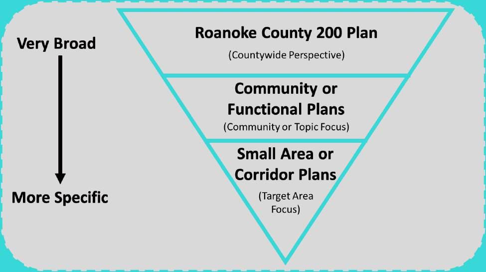
What’s included in the 200 Plan?
The 200 Plan is intended to replace the County’s 2005 Comprehensive Plan with a new plan reflecting the current social and economic conditions of the County and providing updated goals and objectives for guiding the growth anticipated over the next 15-20 years. Although it will serve as a replacement, the 200 Plan intentionally incorporates many of the plan elements of the 2005 Plan. This includes providing an updated discussion and engagement process specific to the County’s
eleven (11) Community Planning Areas to provide an overview of the values and concerns specific to each area, and incorporating by reference many of the existing component area plans and studies whose implementation over the next 15-20 years is still relevant. The County is making these area plans because each area has unique needs and priorities. The area plans will allow the County to tailor its policies and programs to the specific needs of each area.
To ensure the concerns and desires of all community members throughout the County’s many geographic areas are addressed in the development of the 200 Plan, each of the County’s (11) Community Planning Areas (CPAs) have been individually engaged throughout the development of the 200 Plan. While engagement has been based on the goals and objectives of the County-wide 200 Plan, engagement on the CPA level has allowed for the unique needs of each CPA community to be identified. While these summary documents are based on the goals and objectives of the 200 Plan, they provide more detail to better tailor County policies and programs and guide growth and development specific to each individual CPA.
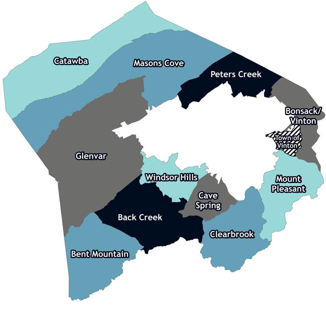
The 11 CPAs found throughout the County are:
• Back Creek
• Bent Mountain
• Bonsack-Vinton
• Catawba
• Cave Spring
• Clearbrook
• Glenvar
• Masons Cove
• Mount Pleasant
• Peters Creek
• Windsor Hills

The Roanoke County 200 Plan Community Planning Area (CPA) documents are eleven (11) small area plans in Roanoke County. These documents provide more specific guidance for the development of each of the 11 areas, in addition to any goals and objectives of the Roanoke County 200 Plan.
In addition to CPA documents, the 200 Plan incorporates smaller area plans and studies specific to various focus areas in the County. These small area plans and studies provide site specific design guidelines and implementation actions for individual areas such as neighborhoods or corridors. The following plans and studies are incorporated by reference into the 200 Plan for the purpose of fine-tuning decision-making and guiding public and private investments for specific locations in the County:
• 419 Town Center Plan (2019)
• Colonial Avenue Corridor Study (2000) – Design Guidelines for Development/Redevelopment (only)
• Glenvar Community Plan (2012)
• Hollins Center Plan (2020)
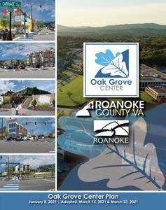
• Oak Grove Center Plan (2021)

• Roanoke Valley Greenway Plan (2018) - except for the Perimeter Trail (#36) from Havens Wildlife Management Area to the Roanoke River including the greenway along Callahan Branch from the Center for Research and Technology to Valley Tech Park
• Route 220 Corridor Study (2007)
• U.S. Route 460 Land Use and Connectivity Study (2023)
What’s not included in the 200 Plan?
Other component area plans and studies exist as part of the current comprehensive plan but will not be incorporated into the 200 Plan because they have either: 1) been implemented and are no longer applicable as guiding documents; 2) have had their goals and objectives incorporated directly into the 200 Plan; or 3) have had their content replaced by a more current planning document. The following plans and studies are intentionally excluded from the 200 Plan:
• Colonial Avenue Corridor Study (2000) – except for the Design Guidelines for Development/ Redevelopment
• Community Facilities Map (2008)
• Hollins Area Plan (2008)
• Mount Pleasant Community Plan (2008)
• Route 221 Area Plan (2009)
• Vinton Area Corridors Plan (2010)
• The following previous studies and plans were incorporated into the 2005 and 1998 Community Plans:
• Route 419 Frontage Development Plan (1987)
• Roanoke River Corridor Study (1990)
• Roanoke Valley Regional Stormwater Management Plan (1998)
• Previous regional greenway plans (1995, 2007)
The 200 Plan as a whole serves as a guiding document for informing decision making at a broad scale for the next 15-20 years. It summarizes a shared County-wide vision for growth and development patterns for the next 15-20 years. The overarching 200 Plan vision is intended to be general in nature and does not provide the level of detail required to inform decision making at all scales.
For this reason, the 200 Plan is intended to be used in conjunction with other planning documents that provide more site-specific guidance for certain focus areas throughout the County. The 200 Plan
should be used as the primary guiding document when considering decisions that have communitywide impacts, while the smaller scale component plans and studies of the 200 Plan are meant to enhance decision making by providing specific design guidelines and recommendations at a finer scale.
These additional planning documents are incorporated by reference into the 200 Plan with the intent that they are used to better inform decision-making when considering future land use and development applications as well as the development of future ordinances and policies.
All jurisdictions within Virginia are required to develop a comprehensive plan in accordance with the Code of Virginia section §15.2-2223, which states that:
“The local planning commission shall prepare and recommend a comprehensive plan for the physical development of the territory within its jurisdiction and every governing body shall adopt a comprehensive plan for the territory under its jurisdiction”.
The Roanoke County 200 Plan serves as the state mandated comprehensive plan and will act as a framework for the County and its developers, business owners, and residents to help shape future growth and development in a manner that is consistent with the community’s shared vision.
In accordance with the Code of Virginia, the comprehensive plan is required to be reviewed at least once every five years to determine whether it is necessary to amend the plan. Although the 200 Plan will serve as a 15-year plan for the County, reviewing the Plan and amending it as necessary is important to ensure it continues to be relevant to the community’s needs.
Amendments to the 200 plan will provide the opportunity to analyze and address changes in the community and to update statistical data
and implementation strategies. It will also provide the opportunity to measure progress and make adjustments, where necessary, toward the implementation strategies recommended in the 200 Plan.
Amendments to the 200 Plan may occur through the following ways:
• Request by an applicant to amend the comprehensive plan, typically the future land use map, in concert with a land use application (rezoning);
• Annual review by staff of the comprehensive plan to identify any needed adjustments or inconsistencies;
• Amendments initiated by the Planning Commission or Board of Supervisors; and
• Incorporation of local or regional planning studies as components of the comprehensive plan.
The Planning Commission will review any amendment to the 200 Plan, then hold a public hearing and recommend to the Board of Supervisors whether to consider the amendment. If recommended by the Planning Commission, the Board of Supervisors will hold a public hearing and vote to accept, deny, or modify the amendment.
Section 15.2-2232 of the Code of Virginia states:
“… unless a feature is already shown on the adopted master plan or part thereof or is deemed so under subsection D, no street or connection to an existing street, park or other public area, public building or public structure, public utility facility or public service corporation facility other than a railroad facility or an underground natural gas or underground electric distribution facility of a public utility as defined in subdivision (b) of § 56-265.1 within its certificated service territory, whether publicly or privately owned, shall be constructed, established or authorized, unless and until the general location or approximate location, character, and extent thereof has been submitted to and approved by the commission as being substantially in accord with the adopted comprehensive plan or part thereof.”
The expansion of a public utility or public facility not identified in the 200 Plan would need to be reviewed by the Planning Commission as being in conformance with the 200 Plan.

The Roanoke County Comprehensive Plan, Zoning Ordinance, the Roanoke County Community Strategic Plan, and the Capital Improvement Program are all related to each other in that they all play a role in shaping the future of Roanoke County.
The comprehensive plan is a long-range planning document that sets forth a vision for the future of Roanoke County and provides guidance on how to achieve that vision. It is a comprehensive plan in the sense that it addresses all aspects of community development, including land use, transportation, housing, economic development, parks and recreation, public facilities, and environmental protection.
The Zoning Ordinance is the primary tool for implementing the comprehensive plan. It regulates the use of land and the type of development that is allowed in different areas of the community. The Zoning Ordinance is based on the comprehensive plan and helps to ensure that new development is consistent with the community’s vision and goals.
The Community Strategic Plan is a shorter-term planning document that identifies the County’s top priorities for the next five years. The Community Strategic Plan is based on the comprehensive plan and provides a more specific roadmap for how the County will achieve its vision and goals.
The Capital Improvement Program (CIP) is a longrange plan for public projects, such as parks, fire and rescue stations, libraries, and other infrastructure. The CIP is based on the comprehensive plan and the Community Strategic Plan and helps to ensure that the County has the infrastructure it needs to support its growth and development goals.
The four (4) documents are all related to each other in that they all work together to shape the future of Roanoke County. The comprehensive plan is the foundation for all of the other documents. It provides the overall vision and goals for the County. The Zoning Ordinance, Community Strategic Plan, and CIP all implement the comprehensive plan in different ways.
The Zoning Ordinance ensures that new development is consistent with the comprehensive plan’s vision and goals. The Community Strategic Plan identifies the county’s top priorities for the next five years and provides a more specific roadmap for how the county will achieve its vision and goals. The CIP helps to ensure that the County has the facilities and infrastructure it needs to support its growth and development goals.
Overall, the four documents are all important tools for shaping the future of Roanoke County. By working together, they can create a more livable, sustainable, and prosperous community for all.

Over the past three years, Roanoke County has been involved in an extensive outreach program to involve its citizens in the development of a new comprehensive plan. This outreach has been categorized into four phases. The first phase was to gather data, the second was to gather public input about community issues, the third was to gather public input on the draft of the 200 Plan, and the final phase was to present the drafts at public hearings for approval and implementation.
The process of gathering data to write a comprehensive land use plan can be timeconsuming and complex, but it is essential to ensure that the plan is based on sound information. Some of the data that was collected includes information about the population, the economy, the environment, and the facilities and infrastructure in Roanoke County. It comes from a variety of sources, including census data, economic reports, and various studies. The kinds of data needed to write a comprehensive plan vary depending on the specific goals and objectives of the plan. However, types of data that were collected for the Roanoke County 200 Plan include:
• Demographics: Data on the population, such as age, race, ethnicity, income, and education level.
• Economics: Data on the economy, such as employment, income, and business activity.
• Environment/Cultural: Data on the environment, such as air quality, water quality, land resources, and cultural resources.
• Public Facilities: Data on community facilities, such as schools, libraries, public safety facilities, and parks.
• Infrastructure: Data on infrastructure, such as water and sewer lines, gas lines, and other infrastructure.
• Transportation: Data on transportation, such as roads, traffic pattern, transit, and bike and pedestrian facilities.
• Housing: Data on housing, such as the number of housing units, the age of housing units, and the cost of housing.
• Land Use: Data on land use, such as existing land use, zoning, and future land use.
When developing a comprehensive plan, it is important to get input from a variety of stakeholders. Stakeholders are individuals or groups who have an interest in the outcome of the planning process. They may be directly affected by the plan, or they may have a financial or other stake in the outcome.
Some of the key stakeholders that were interviewed to provide input for the 200 Plan include:
• Roanoke County Planning Commission and Board of Supervisors
• Roanoke County Economic Development Authority and Department
• Roanoke County Parks, Recreation and Tourism
• Roanoke County Libraries
• Roanoke County Public Schools
• Roanoke County Public Safety
• Roanoke County Communication & Information Technology
• Town of Vinton, City of Roanoke, and City of Salem
• Botetourt County, Franklin County, and Montgomery County
• Community Accessibility & Inclusion Organizations
• Regional Housing Experts
• Roanoke Valley Broadband Authority
• Virginia Department of Transportation
• Valley Metro
Gathering data and interviewing a variety of stakeholders has contributed to the County developing a comprehensive plan that is based on sound information and is intended to meet the needs of the community.
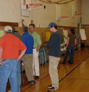
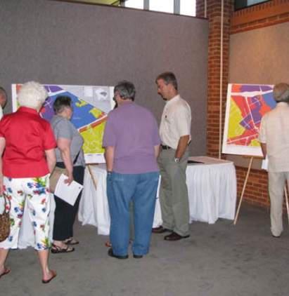
In the Fall of 2021, a series of twelve (12) community meetings were held in Roanoke County to gather input from residents on the future of the County. The meetings were held in September, October, and November 2021, and they were attended by 500 residents.
These meetings were a valuable opportunity for residents to share their thoughts and ideas about the future of the County. The meetings were successful in gathering a wide range of input from residents regarding the future of various planning elements. Some of the topics that were brought up by residents included:
• Economic development: Residents were interested in discussing how the County can attract new businesses and create jobs.
• Housing: Residents were interested in discussing the availability of affordable housing and the need for more housing options.
• Transportation: Residents were interested in discussing the need for better public transportation and improvements to roads as well as bicycle and pedestrian accommodations.
• Environment: Residents were interested in discussing the need to protect the County’s natural and cultural resources.
• Quality of life: Residents were interested in discussing the need to improve the County’s parks and recreation facilities, its schools, and other public infrastructure.
In addition to the meetings, a survey was conducted online and by mail. It was open for two weeks and received over 289 responses.
After all the input from Phase 2 and the data from Phase 1 was assembled and analyzed, specific and actionable recommendations were drafted to prepare for Phase 3.
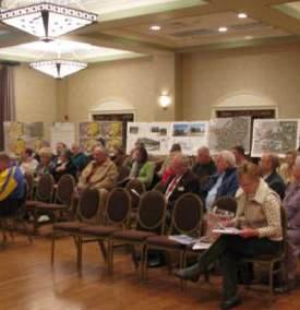
In the Spring of 2022, a series of seven (7) community meetings were held in Roanoke County to gather input from residents on the future of the County. The meetings were held in March and April 2022, and they were attended by approximately 147 residents. In addition to the meetings, a survey was conducted online and by mail. It was open for two weeks and received 428 responses.
The draft recommendations for the Roanoke County 200 Plan were generally supported by the residents who attended the Spring 2022 Community Meetings. The majority of survey respondents supported the draft recommendations for the Roanoke County 200 Plan.
Responding to the feedback received, staff made edits to the recommendations and began drafting the 200 Plan documents.
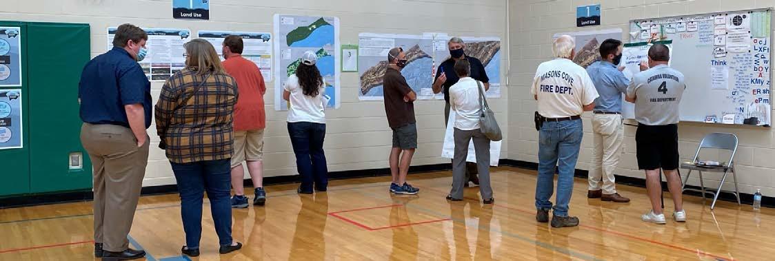
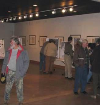
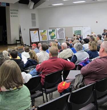
Six (6) planning meetings were held around Roanoke County in Winter 2023 for citizens to review the Draft Roanoke County 200 Plan Countywide Summary Document and Draft 11 Community Planning Area Documents based on
the feedback received throughout the community engagement process. The meetings were held in February and March 2023 and they were attended by approximately 300 residents. In addition to these meetings, two (2) Planning Commission public hearings were held in March and April to receive feedback from residents. A survey was also distributed to allow residents to comment on the draft documents of the 200 Plan. There were eight (8) public hearing comments and 40 responses to the survey.
The draft documents of the Roanoke County 200 Plan were generally supported by the residents who attended the Winter 2023 Community Meetings. Many of the survey respondents supported the drafts as well.
After the plan reveal meetings and public hearings in early 2023, drafts of the 200 Plan Summary Document and the 11 Community Planning Area Documents were posted on the County website for public review. Between Fall 2023 and Summer 2024, the final drafts of the main document of the 200 Plan and the 11 CPA documents were finalized in anticipation of a final Planning Commission public hearing.
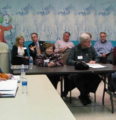
On August 6, 2024, a final Planning Commission public hearing was held on the final draft of the 200 Plan, which included consideration of the main document and the 11 Community Planning Area Documents. No citizens spoke during the public hearing and the Planning Commission voted (5-0) to recommend approval of the Roanoke County 200 Plan to the Board of Supervisors.
On September 24, 2024, the Board of Supervisors held a public hearing on the adoption of the 200 Plan. No citizens spoke during the public hearing and the Board of Supervisors voted (5-0) to approve through resolution the adoption of the Roanoke County 200 Plan as the County’s Comprehensive Plan.

This document is organized by the themes of the planning process. First, existing conditions are examined through data and community input. Then, the future of the County is discussed through visioning, goals, recommendations, and implementation to change the conditions of the County over the course of the next fifteen (15) years.
Chapters 2 through 7 analyze the existing conditions of the County by topic. Chapter 8 is an analysis of the community input process and feedback from residents. These chapters are listed below:
• Chapter 2: Background
• Chapter 3: Demographics
•
•
•
•
•
Chapter 4: Natural & Cultural Resources
Chapter 5: Community Facilities
Chapter 6: Transportation
Chapter 7: Land Use & Housing
Chapter 8: Community Engagement
Chapters 9 and 10 attempt to describe the future of Roanoke County. Chapter 9 focuses on visioning and goals. Chapter 10 lists recommendations and implementation strategies to reach that vision by the County’s 200th anniversary in 2038. These chapters are listed below:
• Chapter 9: Vision and Goals
• Chapter 10: Recommendations
Additional information is included in the Appendices of the plan.

The Roanoke County 200 Plan (200 Plan) will serve as the County’s communitydriven comprehensive plan from its adoption in 2024 to the County’s bicentennial anniversary in 2038.
This chapter provides a background of the County’s history of community engagement and plan development since the creation of its first Planning Commission in 1939. It includes a discussion of the planning initiatives that are incorporated into the 200 Plan, including the Community Planning Areas which are key components to its development, the adopted Designated Growth Areas, and provides background on the establishment of Activity Centers which provide specific design
guidelines and implementation strategies at the neighborhood scale. This chapter concludes with a discussion of how the 200 Plan relates to other County-wide planning efforts, including the Board of Supervisors’ strategic planning efforts and those of the Roanoke Valley-Alleghany Regional Planning Commission.

Roanoke County has a long history of long-range planning and developing regulations for implementation. A chart of these events and the year they happened can be seen on the following page.
Zoning Ordinance and Zoning Map adopted
revision to Zoning Ordinance text and county-wide reclassification of zoning map
The existing Comprehensive Plan (1974) is amended to incorporate minor modifications as a result of a 1975 special annexation court order
Although the Comprehensive Plan has not been updated since 2005, the County has prepared many smaller area studies and plans that focus on specific locations and corridors of interest since that time. These studies and plans have all been prepared and adopted for incorporation into the Comprehensive Plan to assure it remains current and relevant as the County has continued to grow and develop. The constant evolving nature of the Comprehensive Plan constitutes it as a living
document whose implementation has helped the County continuously address the changing wants and needs of citizens and work towards achieving land use and development goals.
Similarly, although the County has not adopted a new Zoning Ordinance since 1992, multiple amendments have been adopted since that time to help address evolving land use patterns and development design standards.

In 2014, House Bill 2 (HB2) was signed into law, which established new methods and procedures for scoring and funding transportation projects in Virginia. Since the passing of HB2, for proposed transportation projects to be eligible for state funding, they are required to be located within a Corridor of Statewide Significance, Regional Network, or an Urban Development Area.
At the time that HB2 was passed, Corridors of Statewide Significance and Regional Networks existed across the County, but Urban Development Areas had not been established. An Urban Development Area (UDA) is an area “designated by a locality that is 1) appropriate for higher density development due to its proximity to transportation facilities, the availability of a public or community water and sewer system, or developed area and 2) to the extent feasible, to be used for redevelopment or infill development” (Code of Virginia §15.2-2223.1-A). In order for a UDA or similar growth area to be established, a locality shall designate the area(s) in its comprehensive plan and provide reference to Code of Virginia §15.2-2223.1.
In response to this new funding criteria, the County established a Designated Growth Area (DGA) by analyzing its existing future land use designations and determining which designations met the UDA criteria. The resulting DGA includes all future land use designations except for Conservation, Rural Preserve, and Rural Village, a map of which can be viewed on page 2-5. The DGA shall incorporate principles of traditional neighborhood design, which may include but need not be limited to (i) pedestrian-friendly road design, (ii) interconnection of new local streets with existing local streets and roads, (iii) connectivity of road and pedestrian networks, (iv) preservation of natural areas, (v) mixed-use neighborhoods, including mixed housing types, with affordable housing to meet the projected family income distributions of future residential growth, (vi) reduction of front and side yard building setbacks, and (vii) reduction of subdivision street widths
and turning radii at subdivision street intersections. In September 2015, the County amended the 2005 Comprehensive Plan to incorporate the designated DGA and add reference to the Code of Virginia §15.2-2333.1.

The County’s geographic area is divided into individual Community Planning Areas (CPAs), each of which represents a different demographic of the County. These CPAs were formally introduced with the adoption of the 1985 Comprehensive Development Plan as the ‘primary building blocks upon which the Inventory and Analysis and the Comprehensive Development Plan are founded’. At that time, twelve (12) CPAs were identified, whose boundaries were based on the topography of the County, availability of utility services, existing land use, and elementary school districts (1984 Community Development Plan, Vol. 1). Analysis of each CPA and engagement with its citizens helped define key concerns, community objectives, and standards, helped prioritized actions needed to manage land use and transportation growth, and helped develop strategies for meeting future demands for public facilities (1984 Community Development Plan, Vol. 1).
Since their formal introduction in the 1984 Community Development Plan, the CPAs have remained a key component of the County’s comprehensive planning efforts, including the 1985 Comprehensive Plan. The citizens of each CPA were heavily involved during preparation of the 1998 Community Plan, with the input received and goals and recommendations developed carried over into the 2005 Community Plan. The CPAs were again engaged during the development of the 200 Plan, with the exception that at this time, the Bonsack and Vinton CPAs were combined into one due to their small size, resulting in a total of eleven (11) CPAs.
Engagement with the 11 CPAs during the development of the 200 Plan facilitated both the

The Designated Growth Area was previously determined based on the recommended future land use of contiguous development areas throughout Roanoke County. This area is intended to protect, preserve, enhance, and efficiently utilize county resources by guiding future growth and development through promoting compact and connected, infill development.
identification of County-wide needs and values as well as the identification of CPA-specific needs and values. The outcomes of these engagement processes during the 200 Plan development are summarized in 11 individual Community Planning Area Summary Documents. These Community Planning Area Summary Documents also identify specific recommendations for community facilities, natural and cultural resources, transportation, housing, and future land use for each CPA, including recommended future land use maps.
The eleven unique Community Planning Areas spanning across Roanoke County include:
• Back Creek
• Bent Mountain
• Bonsack-Vinton
• Catawba
• Cave Spring
• Clearbrook
• Glenvar
• Masons Cove
• Mount Pleasant
• Peters Creek
• Windsor Hills

When looking forward to the growth that the County anticipates, it has been recognized that the County currently has a limited amount of land that is zoned appropriately for future high-density development, including commercial and industrial land uses. As of the date of the 200 Plan adoption, only 1.76% of the County’s land is commercially zoned, and 2.20% is industrially zoned. Of this land zoned commercially and industrially, only a portion is vacant and can accommodate new development while other portions are either already developed or are underutilized, meaning
a use occupies the land that is not conforming to the underlying zoning district, such as a single-family dwelling in a commercial district. In consideration of the County’s economic development goals, these current conditions mean a limited land base available for future commercial and industrial development and a reliance on a primarily residential tax base.
While it may be valuable to evaluate whether the County should increase its commercial and industrial zoning, there are opportunities within existing Activity Centers for redevelopment and infill development. Activity Centers are areas along major transportation corridors that contain employment and housing opportunities, have existing public and institutional uses, are home to a high population density in relation to surrounding areas, and that offer potential for mixed-use, walkable development. Furthermore, Activity Centers often already contain commercial and industrial zoning, allowing for a mix of different uses in a concentrated area. Developing plans for infill and redevelopment in these Activity Center areas will help to focus reinvestment in areas currently served by vital infrastructure and prevent expansion of development into areas of natural, agricultural and cultural importance in the County.
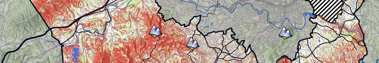
In early 2016, Planning and Economic Development staff evaluated potential Activity Center locations by evaluating the existing land uses, zoning districts, and future land use designations of various areas in the County. Several Activity Centers were identified that present opportunities for investment that will improve their economic viability, aesthetics and value. A map of the areas identified as future Activity Centers is found on page 2-7. As of the date of adoption of the 200 Plan, four (4) of these identified Activity Centers have had plans prepared and adopted since that time:
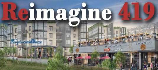
419 Town Center Plan (2019): This plan focuses on the Tanglewood Mall location and the greater area along the Route 419 corridor and envisions it as a high-density, mixed-use activity center. The advantages of this area as an Activity Center include its proximity to residential

development, its access provided by existing transportation networks, and its high percentage of commercial and high-density residential zoning. In addition, many of the larger parcels prime for redevelopment are held under single ownership.
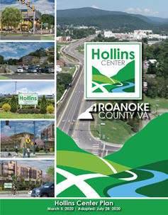
Hollins Center Plan (2020): This plan explores opportunities to develop higher density, mixed-use activity areas along the existing commercial corridors found along the crossroads of Plantation Road, Williamson Road and Peters Creek Road. The Hollins Center was identified as a viable Activity Center due to its proximity to Interstate 81 and Hollins University, the fact that its home to the highest concentration of employment in the County, and because it has multiple redevelopment opportunities in proximity to community services, including parks, schools, libraries, and public safety facilities.
Oak Grove Center (2021): This plan focuses on redevelopment of an area that is primarily commercial in nature located along a busy stretch of Route 419 and within proximity to existing residential, including multi-family development. This area was chosen as an Activity Center due to its high visibility for potential future redevelopment
and its proximity to existing residential, office and community services, including parks, schools, libraries, and public safety facilities. Preparation of this plan was a joint effort with the City of Roanoke due to the study area also being located within their jurisdictional boundary.
Challenger Avenue/Route 460 Land Use and Connectivity Study (2023): This study is intended to inform future decisions related to the Route 460/ Challenger Avenue corridor, which is recognized as a primary location for future development, redevelopment, and infill. The study provides recommendations for alternatives to traveling the corridor, potential changes to zoning and future land use designations to match desired land uses and examining at-grade railroad crossings for potential improvements.

In 2016, the Roanoke County Board of Supervisors adopted its first ever Community Strategic Plan, a five-year plan designed with input from County citizens that defined a community Vision Statement and established seven (7) Strategic Initiatives intended to guide County plans, programs, and activities in the five-year time frame. The following Vision Statement was established to summarize the shared vision for the County that was determined during the Community Strategic Plan process:
Roanoke County is a vibrant, innovative, and scenic community that values its citizens, heritage, and quality of life.
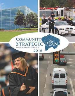
A key component to the development of the Community Strategic Plan was the various methods of community engagement employed by the County to gather input from citizens. Citizen input helped to pinpoint important strategic objectives and to identify common themes and overlapping priorities that existed among six key focus areas: Economic Development, Transportation, Quality of Life, Education, Community Health and Wellbeing, and Public Safety. These efforts resulted in the identification of the following seven (7) Strategic Initiatives that would help shape Roanoke County over the five-year span of the Community Strategic Plan:
• Connect Roanoke County to the World
• Position Roanoke County for Future Economic Growth
• Promote Neighborhood Connectivity
• Ensure Citizen Safety
• Be a Caring and Inclusive Community
• Promote Lifelong Learning
• Keep Roanoke County Healthy, Clean, and Beautiful
During the five-year tenure of the Community Strategic Plan, these Strategic Initiatives were used to inform various County planning efforts, including the Annual Fiscal Plan, Capital Improvement Plan, Organizational Strategic Plan, and the preparation of the Roanoke 200 Plan. County departments also used the initiatives of the Community Strategic Plan as a tool for preparing annual departmental business plans and establishing performance measurements aimed at achieving the community’s vision as summarized in the Vision Statement.

In 2022, the Board of Supervisors committed to continuing strategic planning efforts with the adoption of a Strategic Plan, including seven (7) Strategic Target Outcome Areas and vision
statements for their implementation. The following 7 Strategic Target Outcome Areas were adopted:
• Economic Development
• Community Development
• Outdoor Recreation
• Education
• Housing
• Public Safety
• Organizational Effectiveness
Each Strategic Target Outcome Area included a three-year work plan for implementation, which outlined key actions to be taken during the three-year timeframe, and identified which County departments and staff would be responsible for their implementation. Since its adoption in 2022, the Strategic Plan and the work plans associated with the outcome areas have been updated annually to ensure the stated action items are still relevant to achieving the stated vision of each outcome area.

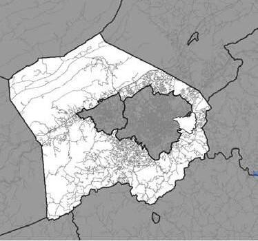
A map of Roanoke County is shown on page 2-11and provides information on its location in Virginia and its relationship to neighboring counties and independent cities. Roanoke County is strategically located in southwestern Virginia on Interstate 81, a critical transportation connector to Washington D.C., Maryland, West Virginia, Ohio, North Carolina, Tennessee and Kentucky. The scenic Roanoke River runs through the center of the County and is recognized for its recreational opportunities and spectacular mountain scenery, rock cliffs, and gorges. Roanoke County also hosts portions of the Jefferson National Forest along its northern and western borders. Roanoke County is primarily rural agricultural or mountainous forested land in terms of undeveloped land area. The County also includes the incorporated Town of Vinton and census designated places such as Cave Spring, Glenvar, and Hollins. This southwest portion of
Virginia is also rural, and the surrounding counties of Botetourt, Bedford, Montgomery, Craig, Floyd, and Franklin portray similar agrarian landscapes, forests, and low-density land development patterns. The interstate and highway systems, the Blue Ridge Parkway, and the Roanoke River distinguish Roanoke County as a crossroads and a logical regional center for agriculture, economic development, tourism, and outdoor recreation.
Roanoke County is one of several local government units that make up the Roanoke Valley. While the outer perimeter of the County borders the counties of Botetourt, Bedford, Franklin, Floyd, Montgomery, and Craig, the inner perimeter of the County completely surrounds the City of Salem and the City of Roanoke, sharing its boundary with both. Sharing jurisdictional boundaries with these two independent cities has resulted in an overlap of physical development and an interconnected network of people, resources, and services. Some
of the highest concentrations of people and development are found in the suburban areas at the crossroads between these localities, which requires strong cooperation to collectively plan and manage these areas to maintain the high quality of life that Roanoke County citizens have come to expect and deserve.
As Roanoke County approaches its bicentennial anniverary, the Roanoke Valley and its intertwined localities needs to be thought of as a cohesive unit rather than as many, often competing, individual parts. Many of the challenges of the twenty first century will know no geographic boundary line and will present all Valley citizens and local officials with opportunities to seek efficient and effective solutions. Critical issues such as economic development, natural resource preservation, transportation, cultural opportunities, and housing require a regional perspective and solutions.


Roanoke Valley – Alleghany Regional Commission
Roanoke County is located in southwestern Virginia in the eastern portion of the United States.
Roanoke County is a member of the Roanoke Valley–Alleghany Regional Commission (RVARC) which is one of 21 planning districts commissions (PCDs) in Virginia that assist communities in regional planning efforts pursuant to the Regional Cooperation Act (Code of Virginia §15.2-42). RVARC promotes orderly and efficient development of the physical, social, and economic elements of the region by assisting government entities with planning efforts related to transportation, housing, economic development and environmental factors. RVARC is comprised of a full-time staff in addition to representatives from local governments within the PDC.
A primary role of the RVARC is managing the staffing and administration of the Roanoke Valley Transportation Planning Organization (RVTPO). RVTPO is responsible for transportation planning and budgeting federal funding received for projects in the Roanoke Region. RVTPO focuses on the urban areas of the region, including those areas that are anticipated to urbanize in the next 20 years.


As part of the planning process to update the comprehensive plan, a demographic analysis of Roanoke County was conducted to understand trends and identify opportunities for future growth. An overview of their results is summarized in the following paragraphs.
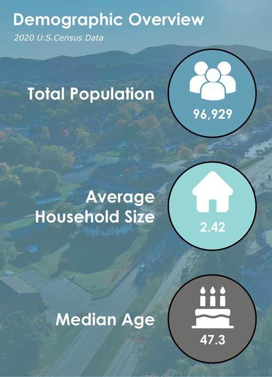
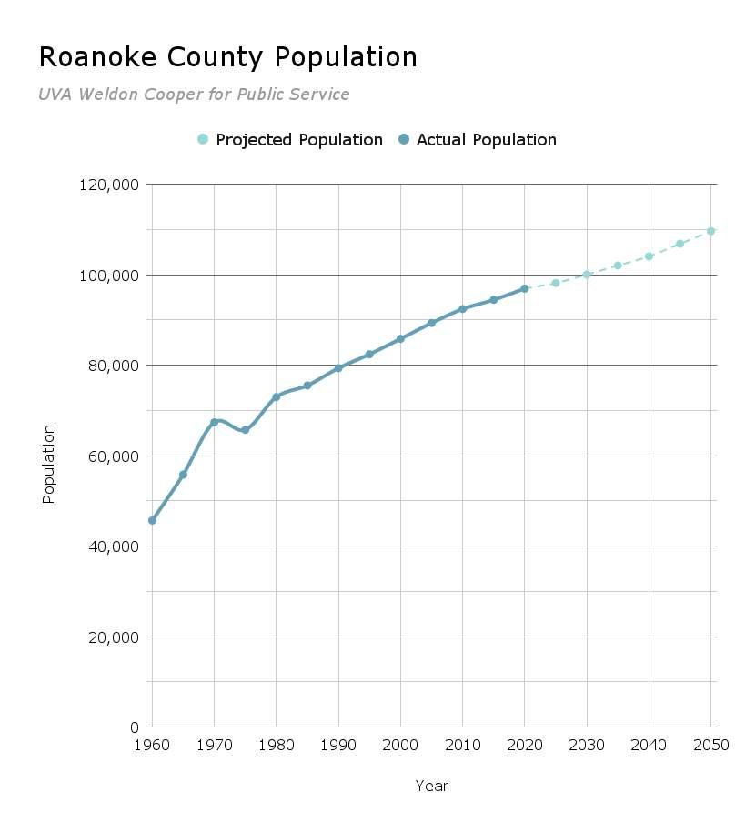
The population of Roanoke County in 2020 was 96,929 and estimated to be approximately 96,605 in 2022 based on the U.S. Census Bureau’s American Community Survey. This is a minimal decrease of less than a half of a percent. The Town of Vinton’s population has also remained relatively unchanged from 8,059 people in 2020
to an estimated 8,021 people in 2022 according to the Weldon Cooper Center. The chart on page 3-3 shows population from 1960 to present along with projections. In 1975, part of Roanoke County was annexed to Roanoke City, resulting in a slight decline.
Data from the U.S. Census, Weldon Cooper Center, and other publicly available data sources used in this chapter are from the most recent year available at the time in which the existing conditions information was collected.

The population in the County grew by 12.9% from 2000 to 2020, mirroring a regional trend in population gain. The population in Roanoke County is expected to grow between 2023 and 2050, reaching approximately 109,621 by 2050. Growth in the County is expected to continue over the coming decades, with the population nearing 100,027 by 2030 and 104,046 by 2040. An increase of 3.2% and 4.1% respectively. These figures are based on historic growth rates and projections provided by the Weldon Cooper Center. It is likely a conservative estimate, as employment growth is expected to increase in the County. The table on page 3-4 details the changes over the last twenty years and projected changes over the next 20 years for neighboring localities.
Population in 2040
In the year 2040, which is near the 200th anniversary of Roanoke County (2038), the population of Roanoke County is projected to be:
104,050

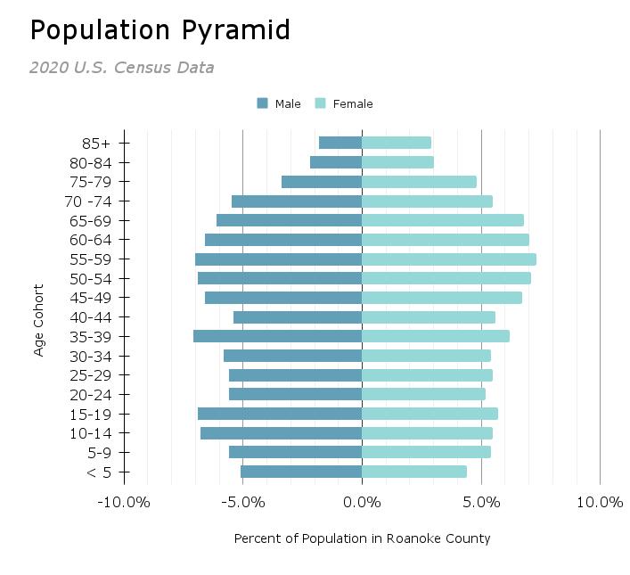
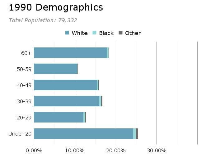
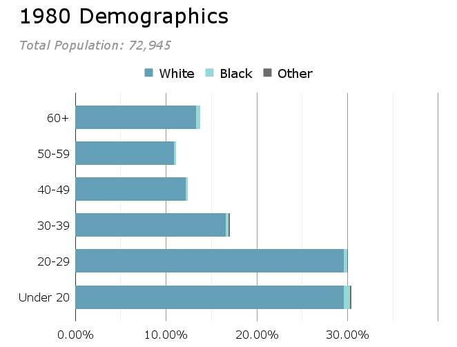
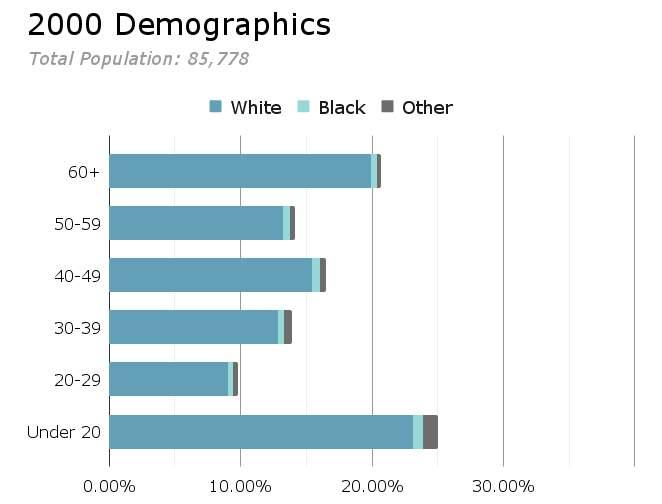
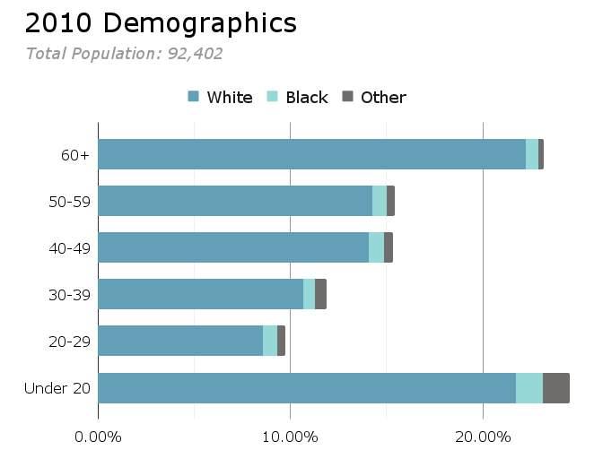
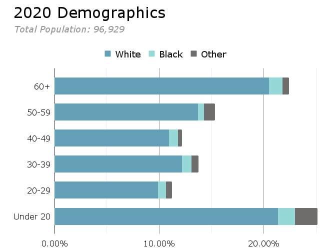
In 2020, the median age in Roanoke County was 47.3 years. This is an increase from 2010 when the median age was approximately 43.5 years. Children and teens under the age of 20 made up 21.9% of the population and 29.1% of the population was 60 years old or over. Population projections by age published by the United States Census, suggest that Roanoke County’s population will age over the next two decades, with growth concentrated in the population age 65 years and older. Approximately 48.2% of the population are male and 51.8% of the population are female. The table on page 3-6 compares Roanoke County to surrounding localities by age groups for 2020.

Roanoke County has an aging population. An aging population is a demographic trend in which the proportion of older people in a population increases. This can have a number of implications for the future of the County, including:
• Increased demand for healthcare services.
• Increased demand for transportation services.
• Increased demand for social services.
• Decreased tax revenue.
Sources: 2020 U.S. Census Bureau Population Estimates

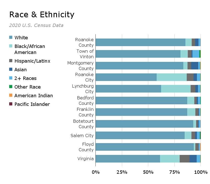
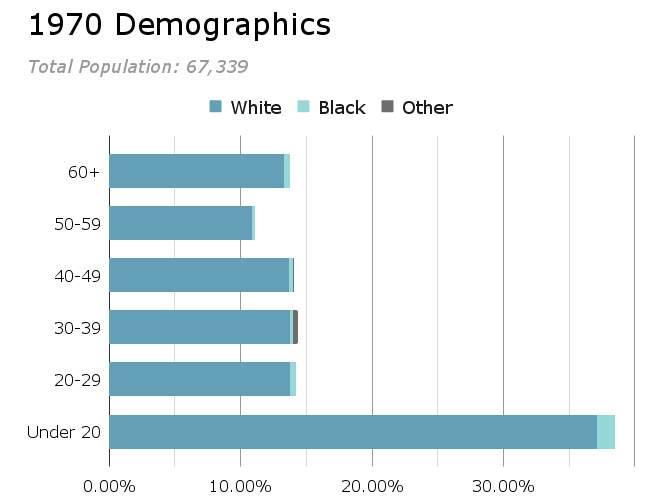
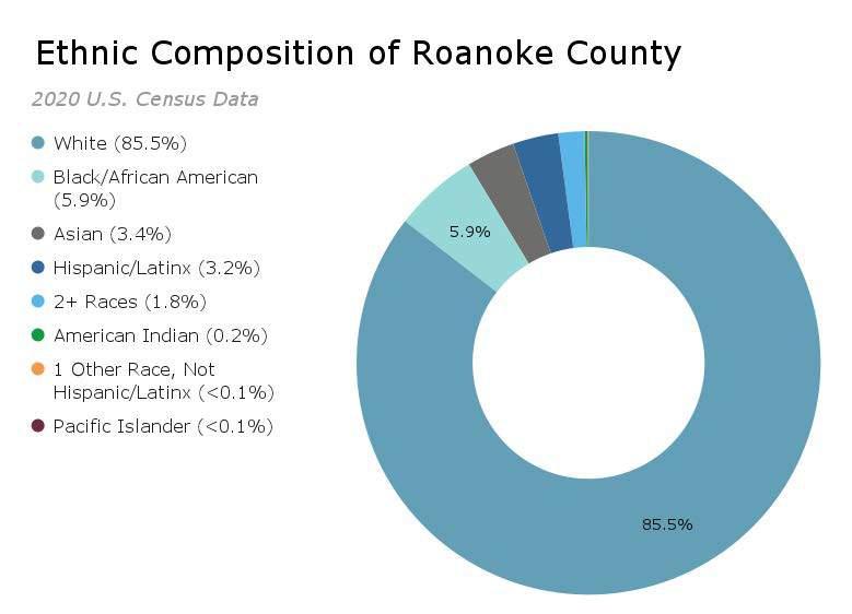
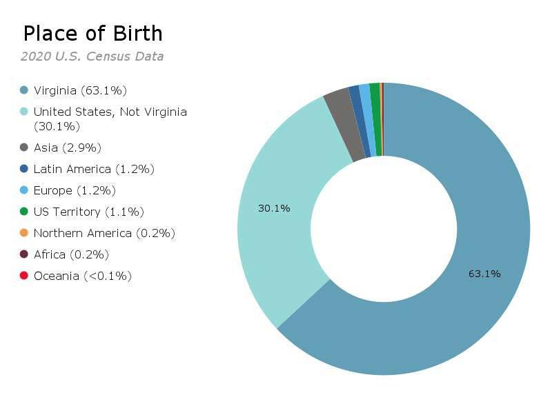
As of 2020, a majority of the population of Roanoke County is white (85.47%). Approximately 5.90% of the population is black and not Hispanic/Latinx, 3.35% is Asian, 3.18% is Hispanic/Latinx and 1.82% is two or more races. The County has a relatively low population that identifies as American Indian (0.19%), Native Hawaiian/Pacific Islander (0.04%), or Other Single races (0.05%). The chart below and the table on page 3-8 compares race in Roanoke County to surrounding localities. The charts on pages 3-9 and 3-10 shows race broken down by age groups from 1970 to 2020. The chart on upper portion of page 3-11 breaks down the racial and ethnic composition of the County. The chart on the lower portion of the same page breaks down the places of birth of Roanoke County residents.

Sources: 2020 U.S. Census Bureau Population Estimates

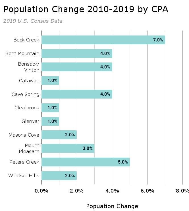
According to 2019 U.S. Census data estimates delineated by Community Planning Area (CPA), Peters Creek CPA is the most populated CPA with approximately 20,810 people. Bent Mountain CPA has the fewest number of people with approximately 820. Back Creek CPA experienced the largest growth of approximately 7%, while Catawba, Clearbook, and Glenvar CPAs had the least change of approximately 1% growth from 2010 to 2019. These estimates can be seen below.
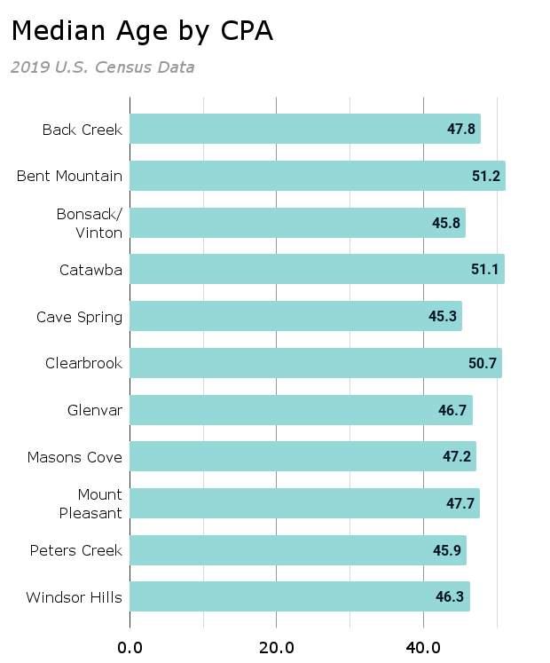
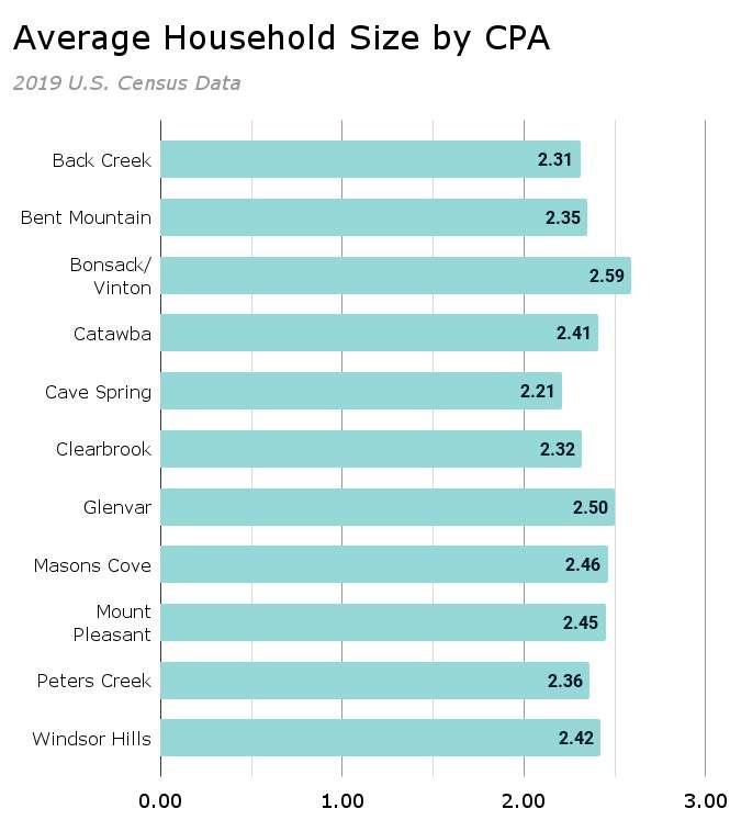
The pie chart on page 3-13 shows a percentage of each Community Planning Area population based on total population of Roanoke County. The bar graphs found at the bottom of the same page provide the estimated average household size and median age by each CPA. The table on page 3-14 provides a summary of population, population change, household size, and median age for each CPA in comparison to Roanoke County as a whole.
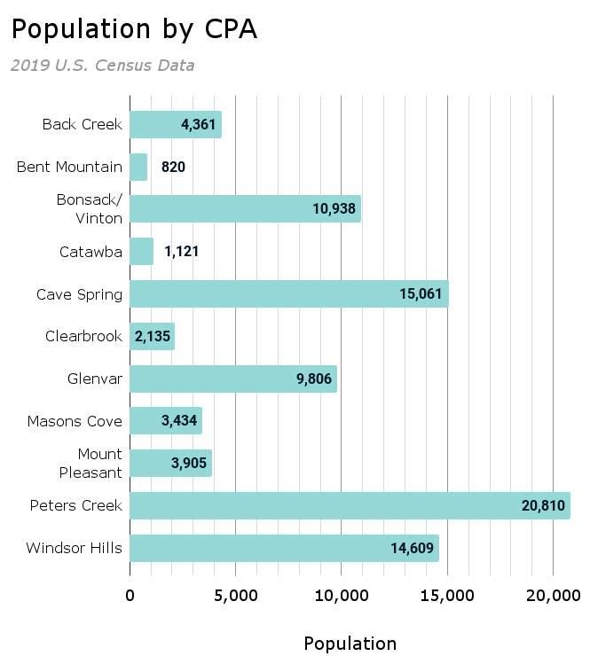

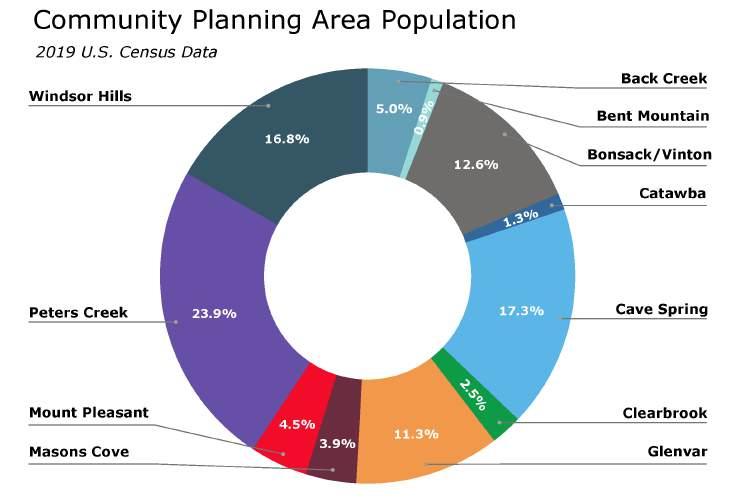
Percentages are based on total population estimates of Roanoke County excluding the Town of Vinton. This total is approximately 87,000 people across the 11 Community Planning Areas.

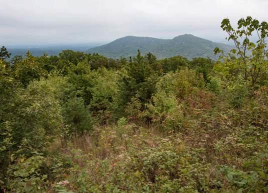
Roanoke County citizens have a strong desire to preserve the quality of the County’s natural, scenic, and historic resources. The County’s natural features - including mountains, forests, productive soils, waterways, fresh air, and wildlife - serve to distinguish the greater Roanoke Valley as a unique regional environment and center for biodiversity. The County’s scenic beauty contributes to its value as both a place to live and an attractive place for outdoor recreation enthusiasts and a growing tourism industry. These natural and scenic features are enriched by the County’s many cultural features that symbolize the County’s history and provide citizens with a sense of place and connection to the area.
This chapter discusses the natural and cultural resources that citizens cherish and wish to protect into the future. As the County continues to grow, citizens believe that it is essential to maintain the high quality of these natural and cultural amenities that are unique to the area while accommodating pressures for future growth and development.

According to the 2019 National Land Cover Dataset (See map on page 4-3), approximately 69% of Roanoke County is covered in forest, almost 20% is developed land, 11% is shrubland and pasture/ cropland, and 0.3% is water or wetland.
There are over 13,950 acres of land under conservation easements. These are held by Blue Ridge Land Conservancy, The Nature Conservancy, U.S. Forest Service, U.S. National Park Service, Virginia Department of Forestry, and the Virginia Outdoors Foundation. There are an additional 5,186 acres of land in private or public protective management, including parks. A map of designated conservation lands is found on page 4-4.
The Blue Ridge Land Conservancy is a communitybased, non-profit organization formed to help protect local lands important to the quality of life and environmental health of their regions. A land conservancy works to encourage balanced community development and to save important local landscapes – the natural and cultural features that define a community’s character and identity. Of the lands held in conservation easements in Roanoke County, 702 acres is managed by the Blue Ridge Land Conservancy.
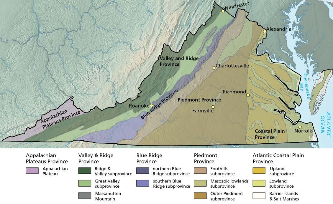
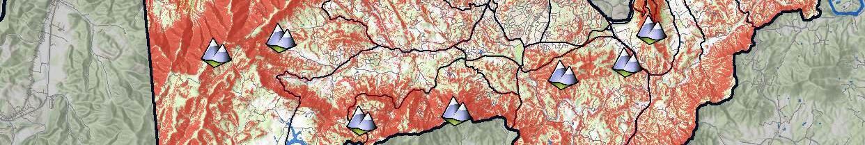
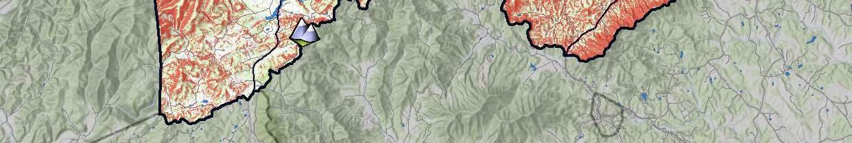
Roanoke County is unique as it is the only county in Virginia to be covered by five physiographic subprovinces (see map on page 4-5). The southern portion of the County is within the southern Blue Ridge subprovince which consists of broad upland plateaus with moderate slopes. The eastern portions are within the Foothills province, which consists of rolling hills and moderate slopes with low elevations, and the northern Blue Ridge subprovince, which consists of rugged terrain with steep slopes and narrow ridges. The northwest portion of the County is within the Ridge and Valley province which is described as long linear ridges separated by valleys with trellis drainage patterns. Lastly, the central portion of the County is within the Great Valley subprovince which includes broad valleys with low to moderate slopes underlain by carbonate rocks. The location of the various rock formations found throughout the County are shown on the map on page 4-6.
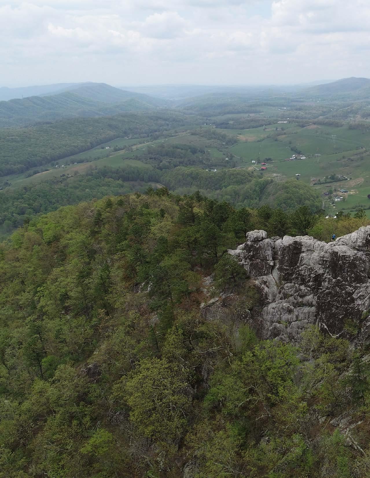
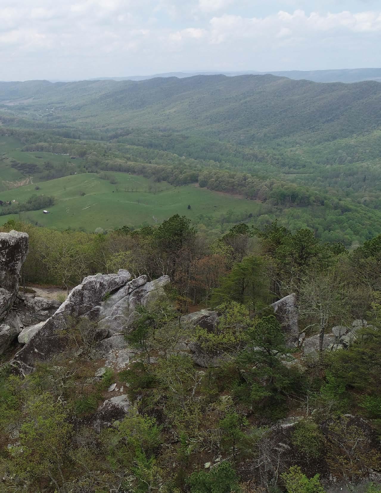
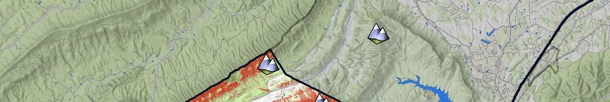
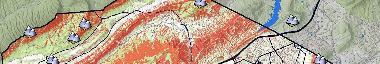
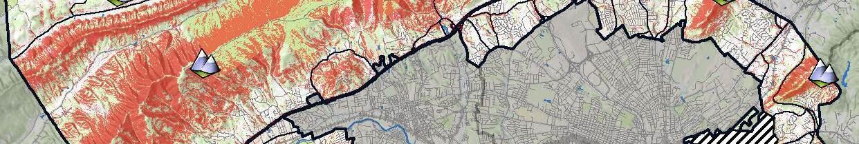
There are eight mountain ranges in Virginia which include the Ridge and Valley range (also known as the Appalachian Ridges) as well as the Blue Ridge Mountain range. Roanoke County is unique in that it falls within two of the eight. The northwestern portion of the County contains the eastern most portion of the Ridge and Valley range as Fort Lewis Mountain and Catawba Mountain span throughout the Glenvar, Catawba and Masons Cove Community Planning Areas. These mountains are also sometimes called the


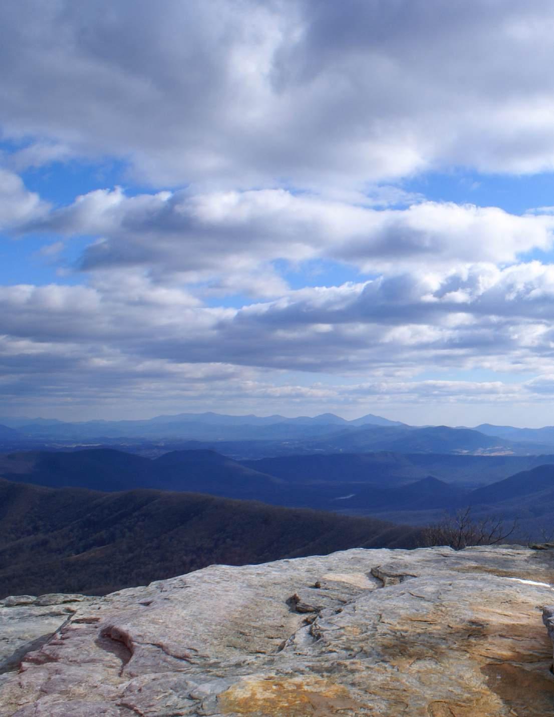
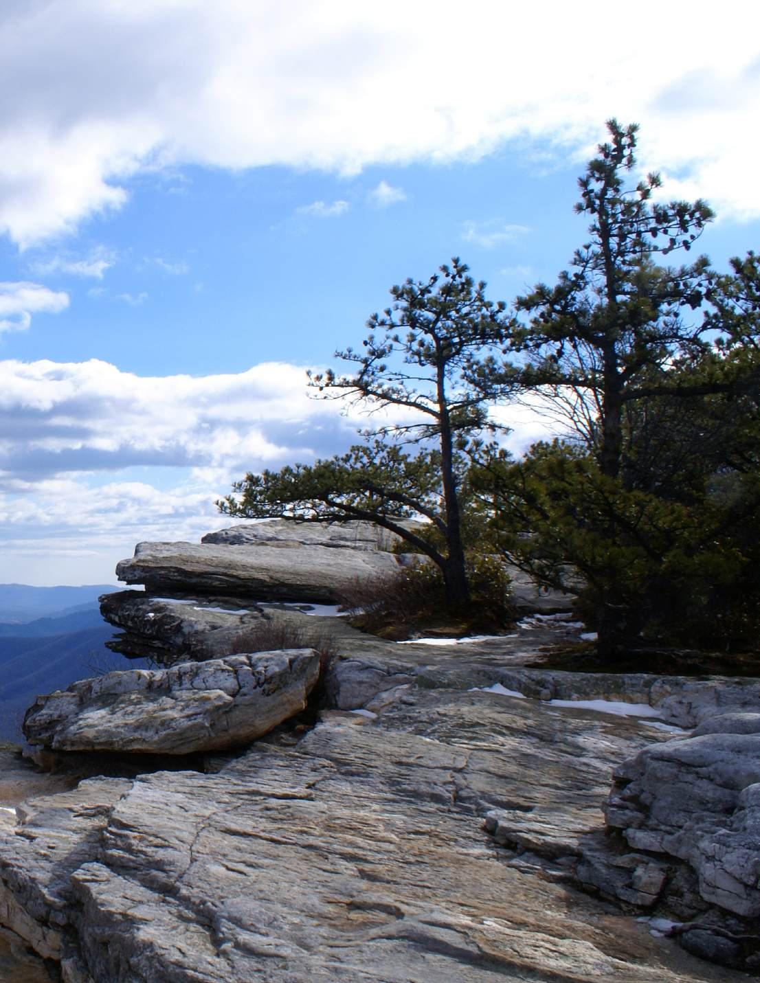
Allegheny Mountains. Catawba Mountain is home to McAfee Knob, one of the most photographed overlooks on the Appalachian Trail.
The widely recognized Blue Ridge Mountain range is located to the east of the Ridge and Valley range and south of the Shenandoah Valley. It is adjacent to an important feature that spans across the entire Appalachian Mountain range in the eastern United States called the Great Appalachian Valley. This is a chain of valley lowlands and is the central feature of the Appalachian Mountains system. The trough stretches about 1,200 miles from Quebec in the north to Alabama in the south and has been an important north–south route of travel for centuries. All mountains in the eastern portion of the County are located in the Blue Ridge Mountain range, including notable peaks such as Roanoke County’s tallest peak, Poor Mountain. Other notable mountains include Buck Mountain, Read Mountain, Bent Mountain, Roanoke Mountain, and Twelve O’clock Knob (see map on page 4-7).
The highest point in Roanoke County is Poor Mountain at 3,928 feet above sea level while the lowest elevation is found at the base of the watershed at a low point of nearly 800 feet in the eastern portion of Roanoke County in the Roanoke River Basin.
Approximately 38.9% of Roanoke County is classified as having “steep slopes” or slopes greater than 33% grade (see map on page 4-7). Approximately one-quarter of all steep slopes in the County occur within the combined Glenvar, Catawba, and Masons Cove Community Planning Areas. More than half of all land in the Masons Cove CPA is considered “steep” and approximately 47% of land in Glenvar and Clearbrook Community Planning Areas are “steep.” The Peters Creek CPA and Cave Spring CPA have the least steep slopes, at 14% and 17% respectively.

Black
Dolomite
Gneiss
Granite
Granitic Gneiss
Sources: contributors,

North Mountain, 3,061
Craig County
Brush Mountain, 3,101 ft
Tinker Cliffs, 2,998 ft
McAfee Knob, 3,196 ft
Dragon's Tooth 2,842 ft
Sandstone Ridge, 2,382 ft
Fort Lewis Mountain, 3,284 ft
Cove Mountain, 3,025 ft
Tinkertop Mountain, 2,264 ft
County
Read Mountain, 2,346 ft
City of Salem
Twelve O'clock Knob, 2,664 ft
Sugarloaf Mountain, 1,795 ft
City of Roanoke
Mill Mountain, 1,739 ft
Town of Vinton
Stewart Knob, 2,425 ft
Poor Mountain, 3,927 ft
Montgomery County
Lost Mountain, 2,182 ft
Roanoke Mountain, 2,185 ft
Hemppatch Mountain, 3,068 ft
Bent Mountain, 3,199 ft
Buck Mountain, 1,965 ft
Masons Knob, 3,169 ft
Franklin County
Haystack Mountain, 1,651 ft
Floyd County
of
Slopes Over 33% Grade Mountain Peaks

In 1989 a soil survey was conducted in Roanoke County that contains information that can be used in land planning programs in the County. The soil survey contains predictions of soil behavior for selected land uses such as agriculture, woodland management, recreation, and development. The survey also highlights limitations and hazards associated with the soil, improvements needed to overcome the limitations, and the impact of selected land uses on the environment.
Soils are grouped into hydrologic soil groups according to their runoff-producing characteristics (see map on page 4-9). The chief consideration is determining the hydrologic soil group is the inherent capacity of soil bare of vegetation to permit infiltration of water. Some soils are seasonally wet or subject to flooding, while some are shallow to bedrock. Some are too unstable to be used as a foundation for buildings, roads or other development. Wet soils are poorly suited to use as septic tank absorption fields. A high water table makes soil poorly suited to basements or underground installations.
In doing this survey, soil scientists observed the steepness, length, and shape of slopes; the pattern of drainage; the kinds of crops and native plants growing on the soils; and the kinds of bedrock. The soils in the survey area occur in an orderly pattern that is related to the geology, landforms, relief, climate, and natural vegetation of the area. Each kind of soil is associated with a particular kind of landscape or with a segment of the landscape. By observing the soils in the survey area and relating their position to specific segments of the landscape, a soil scientist develops a model of how the soils were formed. During mapping, this model enables the soil scientist to predict the kind of soil at a specific location with a degree of accuracy. Predictions about soil behavior are based on soil properties and on variables such as climate and biological activity. Soil conditions are predictable over long periods of time, but they are not predictable from year to year. After soil scientists located and identified the significant natural bodies of soil in the survey area, they drew the boundaries of these bodies on aerial photographs and identified each as a specific map unit.

As part of the 1989 soil survey, prime farmland was identified throughout Roanoke County (see map on page 4-11), which is defined by the U.S. Department of Agriculture as the land that is best suited to be used for food, feed, forage, fiber and oilseed crops. Prime farmland is recognized as of major importance in meeting the Nation’s short and long-range needs for food and fiber and therefore should be responsibly managed.
The 1989 soil survey, which included the cities of Salem and Roanoke, found that the largest areas of prime farmland are primarily found along the flood plains and terraces of the Roanoke River and its main tributaries. At the time of the survey, most areas of prime farmland were being used for pasture, hay, and cultivated crops such as corn, corn silage, and small grain. The survey also identified that some prime farmland has been lost to industrial, commercial, residential, and recreational uses. This loss of prime farmland to other uses puts pressure on marginal lands, which generally are more erodible, droughty, and less productive and cannot be easily cultivated.
Most of the karst topography in Virginia is found in the Ridge and Valley Province. Over time, the carbonate bedrock (limestone and dolomite) can be dissolved by acidic waters, forming a network of interconnected caves. These areas can be especially troublesome for groundwater wells because of the potential for water quality degradation. Sinkholes can also be a problem for development when the karst formations are close to the surface. Approximately 188 acres of land in Roanoke County is designated as karst topography, which is primarily found within the Catawba, Glenvar, and Peters Creek Community Planning Areas (see map on page 4-12).
The Blue Ridge and Allegheny Mountains of the Southern Appalachian Mountain range are one of the most significant natural wilderness areas in the United States. Roanoke County contains several
national, state, and local forested and wildlife protection areas that are conjoined creating a massive wilderness area that is ideal for plants and wildlife to thrive. This mountainous region of the southeastern United States is a natural biosphere where one can enjoy and appreciate the many facets of its diverse plants and wildlife species. In addition, there are 32 natural heritage sites in Roanoke County including Dixie, Poor Mountain, Bradshaw Creek, and many more. These sites can be seen on the map on page 4-13.
Flowering shrubs in the spring and foliage changing colors in the fall make Roanoke County a haven of natural beauty throughout the year. The changes of elevation in the mountains display various colors and blooming periods. The peak periods of change in Roanoke County tend to occur earlier in the year than those in other parts of the Appalachian Mountains which typically occurs in late-April to mid-May. The azalea is at its brightest in mid-May while mountain laurel typically blooms during the first two weeks of June. Groves of rhododendron can also be found in the region during the first part of June. There are also various species of wildflowers that bloom in the Blue Ridge Mountains of Roanoke County at different times in the spring and fall. There are also an abundance of tree species.
On any given mountain in Roanoke County, you can expect to find varieties of oak, pine, maple, dogwood, redwood, and other assorted plants. The colors on the trees during the fall make the Blue Ridge Mountains in the County, one of the most beautiful destinations in the world for a fall getaway. Dogwood, sourwood, and black gum trees produce an intense color that paint the Blue Ridge with shades of red, yellow, and orange. Tulip trees and birch trees provide a beautiful yellow color, sassafras produce a vivid orange, and red maples help complete the unique ecological experience. In the spring, the Blue Ridge Mountains are dotted with flowering shrubs and wildflowers, including rhododendrons and dogwoods that help make the Blue Ridge Parkway one of the most beautiful scenic drives in the world. Daisies make some of the striking color of the mountains during


Sources: contributors,
INVERTEBRATE ANIMAL VASCULAR PLANT SPECIES
the summer. The evergreen trees that provide the beautiful green hues of the mountains come from the Virginia pine, white pine, hemlock, spruce, and fir trees in Roanoke County. The region’s location and climate allow for the mountains of Roanoke to offer us iconic views and colors during all four seasons of the year.
The combination of hard and soft mast-producing trees and the availability of cover habitat provides for high mammal population diversity. The Roanoke River Basin is classified as an area with a high density of white-tailed deer habitat, with density estimates ranging as high as 60 deer per square mile in some areas. Likewise, a remnant population of black bear occurs along the lower river in one of the few remaining expanses of habitat for this species in this part of the state. In addition to the availability of food, these bears likely take advantage of the abundance of large old trees for winter denning sites. Gray squirrels and marsh rabbits are abundant. Furbearers include raccoon, mink, muskrat, otter, fox, bobcat, beaver, and opossum. Typical birds found in Roanoke County include eagles, hawks, falcons, turkeys, owls, woodpeckers, pigeons, hummingbirds, cardinals, doves, and countless others.
The Roanoke River and its associated floodplain wetlands are especially critical to aquatic and reptilian species. Roanoke River fish include the striped bass, blueback herring, alewife, hickory shad, and American shad. The river provides critical spawning habitat for a highly significant population of striped bass. Representative floodplain amphibians and reptiles include the southern leopard frog, green tree frog, southern dusky salamander, black rat snake, eastern cottonmouth, yellow-bellied turtle, snapping turtle, and five-lined skink.
The Virginia Department of Wildlife Resources is responsible for managing threatened and endangered species in Virginia. Species are listed by the federal government as well as the state government. As of 2022, the U.S. Fish and Wildlife Service lists 77 species in Virginia that are protected under the Endangered Species Act. These include fish, amphibians, reptiles, invertebrates, birds, mammals, and plants.

The 2015 Virginia Wildlife Action Plan prepared by the Virginia Department of Game and Inland Fisheries notes that there are 111 species needing protection in Virginia that occur in the Roanoke Valley-Alleghany Planning area. The highest priority within Roanoke County are located in the northwest portion in the Catawba and Masons Cove Community Planning areas. Some of those priority conservation species in the region include the Jefferson Salamander, Eastern Meadowlark, Alleghany Crawfish, and the Brook Trout.

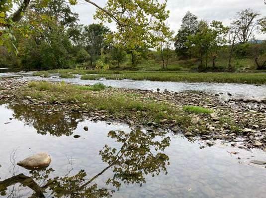
Roanoke County has an abundant amount of water resources ranging from rivers and streams, to wetlands and groundwater. Water resources serve many purposes, including providing a source for drinking water, contributing to the functionality of the area’s diverse ecosystems, and offering recreational opportunities.
The Upper Roanoke River drainage system serves the entirety of Roanoke County, aside from a small area in the northern portion of the County that is drained by the Catawba Creek watershed and is part of the James River drainage that flows to the Chesapeake Bay (see map on page 4-16). The
Roanoke River springs from the Jefferson National Forest in Virginia’s western mountain highlands and flows through Montgomery County to Roanoke County and east to Smith Mountain Lake and eventually to the Albemarle Sound in North Carolina.
There are approximately 201 acres of surface water and 15.75 linear miles of the Roanoke River within the County boundary. In addition, there are over 760 miles of streams and creeks.
The mainstem of the Roanoke River is formed by the confluence of the North Fork, which drains a portion of the Ridge and Valley physiographic province, and the South Fork, which drains the western face of the Blue Ridge. The two converge at Lafayette, a short distance west of the Roanoke County line, and the mainstem continues on through a narrow, steep-walled valley near Glenvar. It then traverses the main valley, picking up many short and steep tributaries as it passes through the cities of Salem and Roanoke. The river follows the western slope of the Blue Ridge to Mill Mountain, where it turns east and enters the Roanoke Gap. Once through the Blue Ridge, the river enters the rolling Piedmont province, where it has been impounded to form Smith Mountain Lake in Bedford County, Franklin County, and Pittsylvania County.
While flowing through the County, the Roanoke River is fed by several streams and creeks: the North Fork of the Roanoke River; Mason Creek in the Masons Cove area, which flows into the Roanoke River in Salem; Tinker Creek, which drains from the north out of Botetourt County and joins Carvin Creek, which drains from Carvins Cove Reservoir to the northwest; Back Creek, which drains from the Poages Mill area and joins the Roanoke River east of the Bedford County line; and Bottom Creek, which drains the Bent Mountain area.
Impaired streams are considered to be streams or rivers that do not meet water quality standards because pollutant levels are too high. The Virginia Department of Environmental Quality maintains a list of impaired waters that is updated periodically. As of the date of this Plan, Roanoke County has thirteen (13) streams that are considered impaired. The location and source of pollution (BMIs, E. coli, PCB in fish tissue, and Fecal Coliform) for these streams can be seen on the map on page 4-18.
The Roanoke River Blueway is a 45-mile water trail that runs from eastern Montgomery County to Smith Mountain Lake. The Blueway consists mostly
of the Roanoke River but also contains portions of Back Creek in Roanoke County, Tinker Creek in the City of Roanoke, and South Fork Roanoke River in Montgomery County. All in all, the Blueway runs through or borders seven localities:
• Bedford County
• Franklin County
• Montgomery County
• Roanoke County
• City of Roanoke
• City of Salem
• Town of Vinton
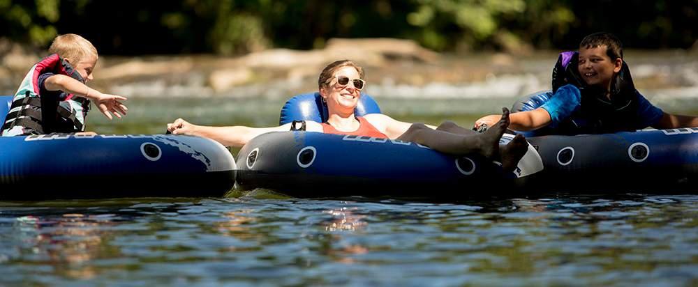
The Roanoke River Blueway offers access to the river for various recreational activities such as canoeing, kayaking, fishing, tubing, wading, and wildlife observation, and connects to numerous local parks. In Roanoke County, the Blueway can be accessed from Wayside Park, Green Hill Park, the Blue Ridge Parkway, and Explore Park. The planning, development, and marketing of the Roanoke River Blueway is facilitated by the Roanoke River Blueway Committee of the Roanoke Valley-Alleghany Regional Commission (RVARC).

Legend
Benthic-Macroinvertebrate Bioassessments (BMI's)
BMI's & E. coli
BMI's, E. coli, & PCB in Fish Tissue
E. coli & PCB in Fish Tissue
Fecal Coliform
PCB in Fish Tissue
E. coli Only
Sources: contributors,
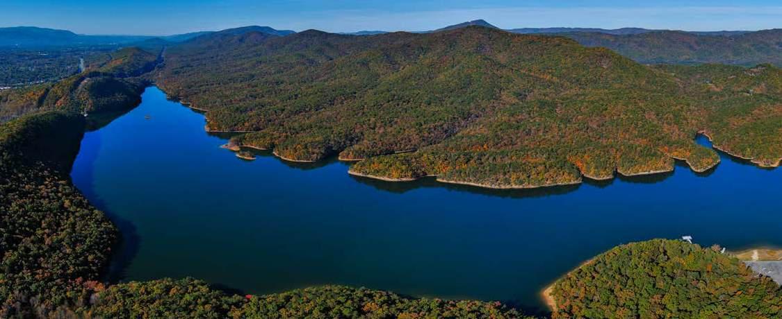
There are over 600 acres of surface water including ponds, lakes, reservoirs, and wetlands in Roanoke County. This does not include more than 600 acres of Carvins Cove Reservoir located on the Roanoke County and Botetourt County boundary. A map of surface water bodies and wetlands can be viewed on the map on page 4-20.
Carvins Cove Natural Reserve is one of the largest municipal parks in the United States and offers outdoor recreation opportunities including boating, fishing, and hiking. It is approximately 12,700 acres with 11,363 acres that are protected by the largest conservation easement in Virginia’s history. The reservoir and land immediately surrounding the reservoir are owned by the Western Virginia Water Authority, while the City of Roanoke owns the land above the 1,200 foot contour line. In addition to receiving water from the watershed, the reservoir is fed from two underground tunnels that carry overflow from Tinker and Catawba Creeks. This surface water source stores 6.4-billion gallons of water when it is full.
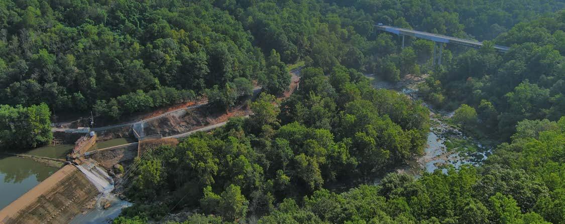
Spring Hollow Reservoir is located in western Roanoke County. The water stored in the Spring Hollow Reservoir comes from the Roanoke River and is pumped into this 3.2-billion gallon sidestream storage reservoir. The Western Virginia
Water Quality 2020 Annual Report stated that total Coliform and E.coli bacteria were not detected at Spring Hollow Reservoir. Water treated at the Spring Hollow Treatment Facility meets all state and federal monitoring and reporting requirements.
There are over 127 acres of wetlands in Roanoke County, with 44% classified as emergent wetland and 56% classified as forest/shrub wetland.
Groundwater is water that exists underground in saturated zones beneath the land surface. The upper surface of the saturated zone is called the water table. All water that is not located on the surface (lakes, rivers, streams, etc.) is considered groundwater and is an equally important fresh water source for the ecosystem.
While most drinking water comes from reservoirs, residents in parts of the County without public water use wells to access groundwater. The Western Virginia Water Authority maintains over 70 wells in Roanoke County. However, some of the wells are inactive while many serve communities that are farther away from the main distribution system. The wells that are inactive offer an additional supply of water if needed.

Sources: contributors,
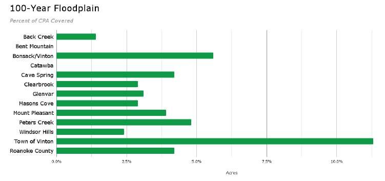
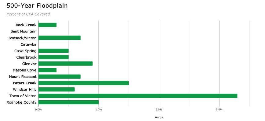
A majority of the County has been mapped to show floodplains, with the exception of the Bent Mountain and Catawba Community Planning Areas. There are approximately 1,910 acres designated and mapped as floodway, 2,274 acres of 100-year floodplain, and 848 acres of 500-year floodplain. The following charts and maps show the percentage of floodplain per Community Planning Area in Roanoke County.
There are approximately 1,910 acres designated as floodway, 2,274 acres of 100-year floodplain, and 848 acres of 500-year floodplain. The following graphs show the percentage of floodplain per Community Planning Area in Roanoke County.


Air resources relates to climate, weather patterns, wind, and air quality which measures particulate matter in the air. Roanoke County is attractive due to its healthy, clean air and is known for its distinct seasons. It is classified as a humid, subtropical climate.
Since the flow of air over Virginia is predominantly from west to east, the continental influence is much greater than the ocean or marine influence. Therefore, the state experiences a fairly large variation in temperature from winter to summer.
Meteorological data is used to determine climate over time and it is collected daily at various locations around the County with the most prominent at the Roanoke-Blacksburg Regional Airport. According to data recorded since 2000, summers are warm and humid, the winters are very cold and snowy, and it is partly cloudy year round. Over the course of the year, the temperature typically varies from 29°F to 87°F and is rarely below 16°F or above 94°F.
The hot season lasts for three months, from mid-June to mid-September, with an average daily high temperature above 78°F. The hottest month of the year (recorded at Roanoke-Blacksburg Regional Airport) is July, with an average high of 86°F and low of 68°F. The cold season also lasts for three months, from the beginning of December to the beginning of March, with an average daily high temperature below 54°F. The coldest month of the year (recorded at Roanoke-Blacksburg Regional Airport) is January, with an average low of 30°F and high of 46°F.
The clearer part of the year recorded at RoanokeBlacksburg Regional Airport begins around mid-July and lasts for nearly four months, ending around mid-November. The cloudier part of the year begins around mid-November and lasts for eight months, ending around mid-July. The cloudiest month of the year (recorded at
Roanoke-Blacksburg Regional Airport) is January, which on average is overcast or mostly cloudy over half of the time. September is the clearest month of the year on average.
Humidity comfort level is based on the dew point, with lower dew points feeling drier and higher dew points feeling more humid and sticky. Unlike temperature, which typically varies significantly between night and day, dew point tends to change more slowly and seasonally, so while the temperature may drop at night, a muggy day is typically followed by a muggy night. The muggier period of the year lasts for nearly four months, from May to September. The month with the muggiest days is July, with approximately 17 days that are classified as highly humid. The least muggy days of the year are within the month of February, when muggy conditions are extremely rare.
To show precipitation variation within the months and not just the monthly totals, rainfall accumulation is collected over a sliding 31-day period centered on each day of the year. Roanoke County experiences some seasonal variation in monthly rainfall due to its leeward position in relation to the Appalachian Mountains, with a wet day considered to be one with at least 0.04 inches of precipitation. The wet season lasts approximately five months, from the end of March to the end of August, with a greater than 31% chance of a given day being a wet day. The month with the wettest days in Roanoke County is July, with an average of 13 days with at least 0.04 inches of precipitation. The drier season lasts the remaining seven months, from the end of August to the end of March. The month with the fewest wet days is October, with an average of six days with at least 0.04 inches of precipitation. The month of May has the highest average rainfall, with an average of 3.5 inches. The month with the least rain is February, with an average rainfall of less than two inches.
The snowy period of the year lasts for three months, from the beginning of December to early March, with a sliding 31-day snowfall of at least one inch
during this time. The month with the most snow recorded at the Roanoke-Blacksburg Regional Airport is February, with an average snowfall of five inches. However, this average has decreased drastically in recent years. The snowless period of the year lasts for eight months, from the end of March to the end of November.
The Virginia Department of Environmental Quality, whose regional office is located in Salem near exit 141 off of Interstate 81, monitors particulate matter in various locations throughout Southwest Virginia in accordance with adopted emission standards. Roanoke hosts an air quality monitoring station for ozone at East Vinton Elementary School and an additional station is located at Salem High School. Based on historical data reported by the Virginia Department of Environmental Quality in the Virginia Ambient Air Monitoring 2020 Annual Report, Roanoke County had no days in which ozone levels exceeded the established standard for ozone. As of 2022, historical data indicates that air quality has remained within established standards and is considered good.
The wind experienced at any given location is highly dependent on local topography and other factors, and instantaneous wind speed and direction vary more widely than hourly averages. The average hourly wind speed at Roanoke -Blacksburg Regional Airport experiences mild seasonal variation over the course of the year.
The windier part of the year lasts for nearly 23 weeks, from mid-November to the beginning of May, with average wind speeds of more than 4.4 miles per hour. The windiest month of the year is February, with an average hourly wind speed of 5.6 miles per hour. The calmest month of the year is August, with an average hourly wind speed ranging from three to four miles per hour.

The mountainsides and ridgetops that surround Roanoke County have always served as a source of great beauty, community pride, and cultural heritage to those who call this area home. The mountains that form the bowl around the Valley below make this area unique - very few places can claim the scenic beauty of this region.
The mountains are not only beautiful to look at, but they also provide a valuable tool in economic development whether it be courting a new industrial prospect, being selected as the site of a major sports event, or drawing in outdoor enthusiasts and tourists from around the region and the world.
The Roanoke Valley is able to offer something unique and different from anywhere else and that can be attributed to the scenic beauty of the region - the mountains, the forests, the Blue Ridge Parkway, the Appalachian Trail, and so many more incredible resources. As Roanoke County grows and developable land is used, it becomes increasingly important to implement strategies to protect these mountains, viewsheds, and unique ecosystems.
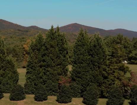

Settlement began in Roanoke County in the mid-18th century, with the first immigration into the Great Valley of Virginia. The earliest settlers came south along the Great Wagon Road, through the Shenandoah Valley and into the Roanoke River Valley. By 1838, Roanoke County was established, with the growing town of Salem as its county seat. In 1852, the Virginia and Tennessee Railroad completed tracks through Salem to Bristol improving access to other markets. By the 1880’s, Roanoke had become a major transportation hub for several railroads, particularly when Norfolk and Western Railroad established Roanoke as the location of its major headquarters for its Virginia operations. The Roanoke area is focal in the regional network of historic and resource preservation in southwest Virginia.
Historic Resources
The Historical Architecture Reconnaissance Survey was conducted in 1992 and inventoried nearly 400 historic structures in Roanoke County. More than 80% of the structures were single-family dwellings and more than 60% were constructed in the early 1900’s with another 35% built in the
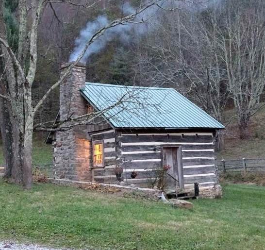
mid-to-late nineteenth century. More than 60% of the structures were wood frame with 68% located in rural or rural neighborhood settings.
According to the survey conducted in 1992, there are approximately 871 historic sites. These sites include 713 houses/cottages, 42 farms, 25 churches, 24 university structures, 15 stores, 12 schools, and 11 barns. The remaining 31 structures include bridges, mills, taverns, and a hospital. A map showing the amount of historic sites surveyed in each Community Planning Area is shown on page 4-27.
This survey identified 384 early 20th century properties throughout the county, including largely bungalows, foursquare, and other vernacular dwellings. These buildings were identified on the U.S.G.S. Quad maps and their building types noted. Additional survey efforts could record these buildings at the reconnaissance level. Pages 4-28 and 4-29 provide charts showing how many acres of land in the County contain historic sites with various historic building types, materials, construction periods, degrees of change, and settings.
Farm buildings are one of the most endangered building types in the County with the rapid development occurring in Roanoke County and the abandonment of its traditional agricultural base. This particular survey effort documented all Historic Cabin Structure

A majority of historic sites are located in the northwestern part of Roanoke County in the Catawba, Glenvar, and Masons Cove CPAs
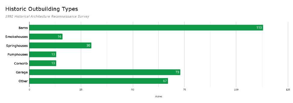
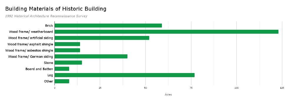
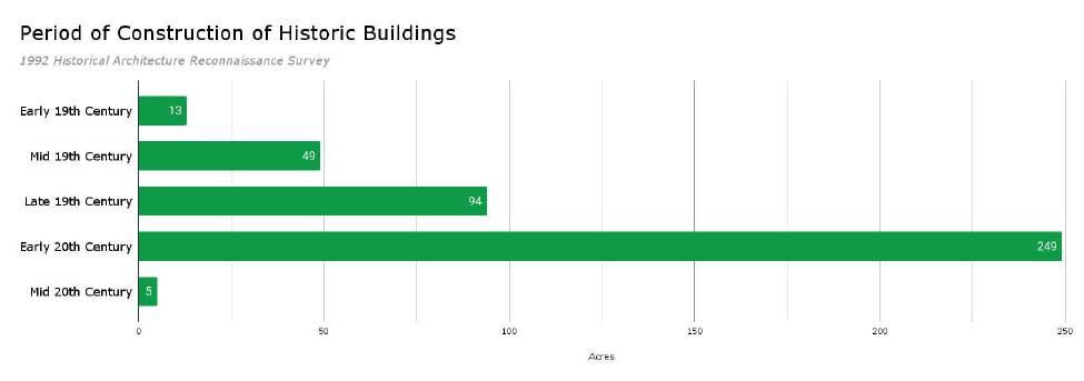
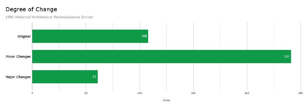
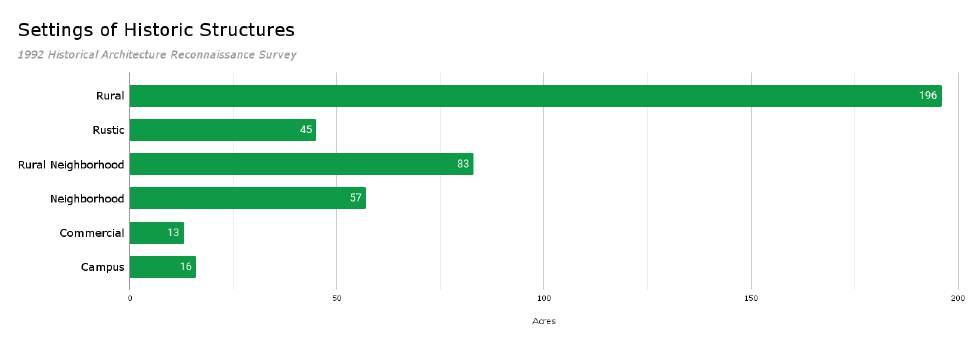
standing agricultural buildings within the survey area. More time should now be devoted to surveying these resources at a more intensive level. Many of the buildings recorded in the survey are currently suffering from neglect and may soon be gone. Additional survey efforts should document historic structures, such as 19th century log houses to help preserve the heritage of Roanoke County. These resources might also include stores, schools, or churches, some of the most common building types recorded in the survey. These efforts can also lead to National Register nominations, which is one way to identify, recognize, and nominate a variety of building types in the County.
An important starting point in the protection of the historic resources in the county is making nominations to the National Register of Historic Places for individual properties and for historic districts. Once the importance of the structures is recognized, the owner and local and state governments have the authority to permanently protect these resources. Furthermore, the government is required to investigate alternatives if any federal or state funded project will have an adverse impact on a property listed on the National Register. Once historic sites have been identified through the survey, it is very beneficial to study the impact of the present zoning on these
properties. The zoning ideally should promote the retention of the property and not allow categories that would encourage destruction of the integrity of the historic property. The provisions of the zoning classification in a historic district should assure that any new construction site has similar lot size, building height, and building size relative to the existing historic properties in the district.
There are currently twelve (12) Registered Historic Places in Roanoke County on the National and State Register:
• Anderson-Doosing Farm: The Anderson-Doosing Farm is a working farm and residence in the Catawba Valley that includes 10 contributing buildings. The farm was originally deeded at 675 acres in 1789, but has been split into smaller parcels as it changed ownership over the years. The first farm structures on the property constructed in 1810 by Joseph Anderson, and subsequent owners Jacob Gish and John Doosing constructed additional buildings over the next fifty years. This farm was added to the National Register in 2009 for meeting the criteria of architectural significance.
• Black Horse Tavern/Bellevue Hotel and Office: The property includes the 1782 Black Horse Tavern, the 1854 Greek-Revival style Bellevue
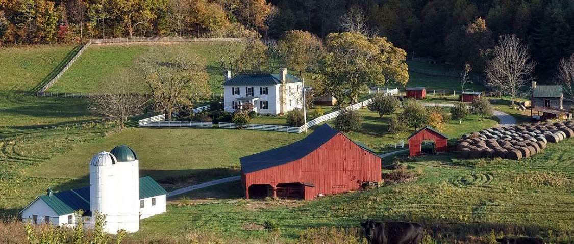
Hotel and the 1840 temple-fronted Bellevue Office. This property was added to the National Register in 2002 for meeting the criteria of architectural, educational, commercial and transportation significance.
• Gish Mill: Gish Mill is located along the south bank of Glade Creek in the Town of Vinton. The oldest portion of the building is a circa 1846 three-story brick structure. Gish Mill ceased operation in 1982, operating as a feed and seed store until closing in 2015. The property was added to the National Register in 2021.
• Harshbarger House: The Harshbarger House is one of the earliest documented homes built in the area with the original stone section of the house constructed in 1797 for Samuel Harshbarger. This house was added to the National Register in 1992 for meeting the criteria of architectural and ethnic heritage significance.
• Hollins College Quadrangle: The Hollins Quadrangle stands on the site of the former Botetourt Springs resort, which operated from 1820 – 1841. The school was founded in 1837 as the Roanoke Female Seminary, and then became a leading woman’s college in 1846. The school’s name was changed to Hollins in 1855 to honor Mr. and Mrs. John Hollins of Lynchburg, who paid for East Dormitory, the quadrangle’s oldest building. The quadrangle was added to the National Register in 1974 for meeting the criteria of architectural and educational significance.
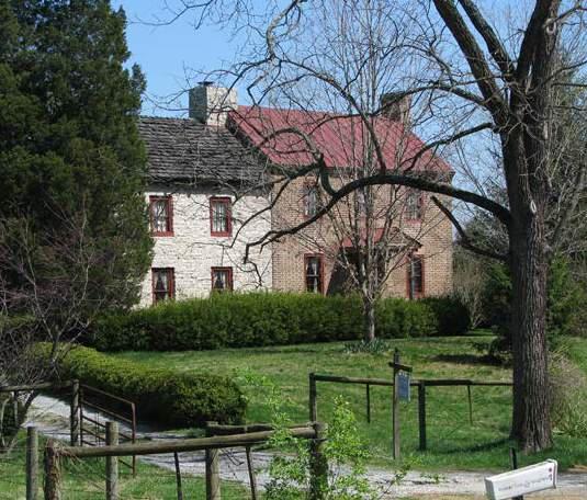
Harshbarger House
• Johnsville Meetinghouse: The Johnsville Meetinghouse is one of only two known meetinghouses to survive in its original form. The meetinghouse was added to the National Register in 1998 for meeting the criteria of ethnic heritage and religious significance.
• Old Tombstone (Denton Cenotaph): The Denton Cenotaph, nicked “Old Tombstone” was erected for nine-year-old Robert Denton after his death in 1805. This tombstone was added to the National Register in 1980 for meeting the criteria of art and funerary art significance.
• Pleasant Grove: Pleasant Grove was built on a mid-19th-century 1,150-acre plantation located on the Roanoke River. The collection
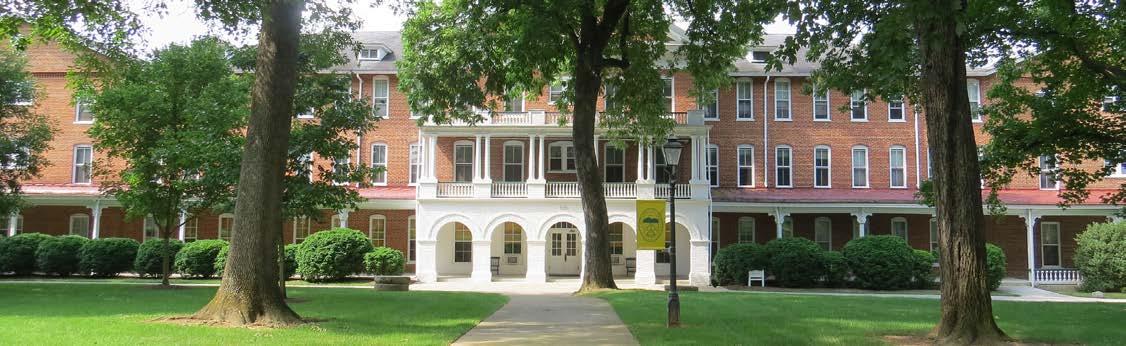
of buildings constitutes one of the most intact examples of historic domestic architecture in the region. This house was added to the National Register in 2003 for meeting the criteria of architectural and agricultural significance.
• Roland E. Cook Elementary School: The Roland E. Cook Elementary School was built in 1915 and expanded in 1924. It is an example of a local adaptation of the Classical Revival style, which was popular for governmental, civic, and educational buildings in the early 20th century. The school was added to the National Register in 2016 for meeting the criteria of educational and architectural significance.
• Starkey School: Starkey School, situated in the village of Starkey, served the small agricultural community for more than six decades. It began as a vernacular, two-room brick schoolhouse, constructed in 1915, prior to the consolidation of county schools in the 1920s. The school was added to the National Register in 2002.
• Vinton Downtown Historic District: This district encompasses the commercial core of the Town of Vinton and includes 27 contributing buildings. The district, which features a collection of commercial and municipal buildings from the early to mid-20th century, typifies a rural community in Southwest Virginia that developed into a downtown business hub over the course of the 20th century, after the establishment of railway transportation. This Historic District was added to the National Register in March 2024 for meeting the criteria of commercial and architectural significance.
• William Byrd High School: The main building of the William Byrd High School Historic District was built in 1933 in a Classical Revival-inspired style. The District consists of the main building, two annexes, secondary resources, and the associated parking and athletic field areas. This school was added to the National Register in 2017 for meeting the criteria of architectural, educational, and social history significance.
In addition, three (3) rural historic districts (RHD) have been proposed in the Bent Mountain Community Planning Area. These include the Coles-Terry Rural Historic District (submitted in 2019), Apple Orchard Rural Historic District (submitted in 2017), and Bent Mountain Rural Historic District (submitted in 2016). The Coles-Terry RHD and Bent Mountain Apple Orchard RHD were both deemed eligible historic districts in 2021, however, no further steps were taken by the submitter to pursue official listing as of January 2024. The Bent Mountain RHD was identified to secure federal permits for the Mountain Valley Pipeline by the applicants and reached the status of “potentially eligible for listing on the National Register of Historic Places.” However, this district did not go to the next level of investigation, where the Department of Historic Resources determines if it actually does meet the criteria for hypothetical listing on the National Register.
Lastly, one of the most significant cultural resources in Roanoke County is the Blue Ridge Parkway. This highly recognized resource is directly related to the culture and identity of Roanoke County and southwest Virginia. It was one of the first rural parkways to be conceived in America with nearly 24 miles of Blue Ridge Parkway within Roanoke County. Its original purpose was to link two national parks - the Shenandoah in Virginia to the north and the Great Smokey Mountains in North Carolina to the south - a distance of nearly 470 miles.
At the time of the Historical Architecture Reconnaissance Survey, there were 273 private cemeteries surveyed in Roanoke County, which can be seen on the map on page 4-31. A majority of the cemeteries are located in the southern and southwestern portion of Roanoke County, particularly in the Clearbrook, Back Creek, and Bent Mountain Community Planning Areas. Some of the larger cemeteries with the most burial sites are located in the Mount Pleasant CPA.


Farm
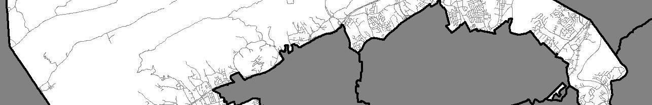
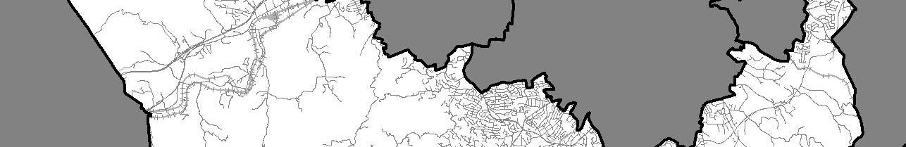


There are currently twelve (12) Registered Historic Places in Roanoke County on the National and State Registers.
The cemetery locations are symbolized with circles with the circle size increasing based on the number of burial sites at that location. These range from 1 to 340.
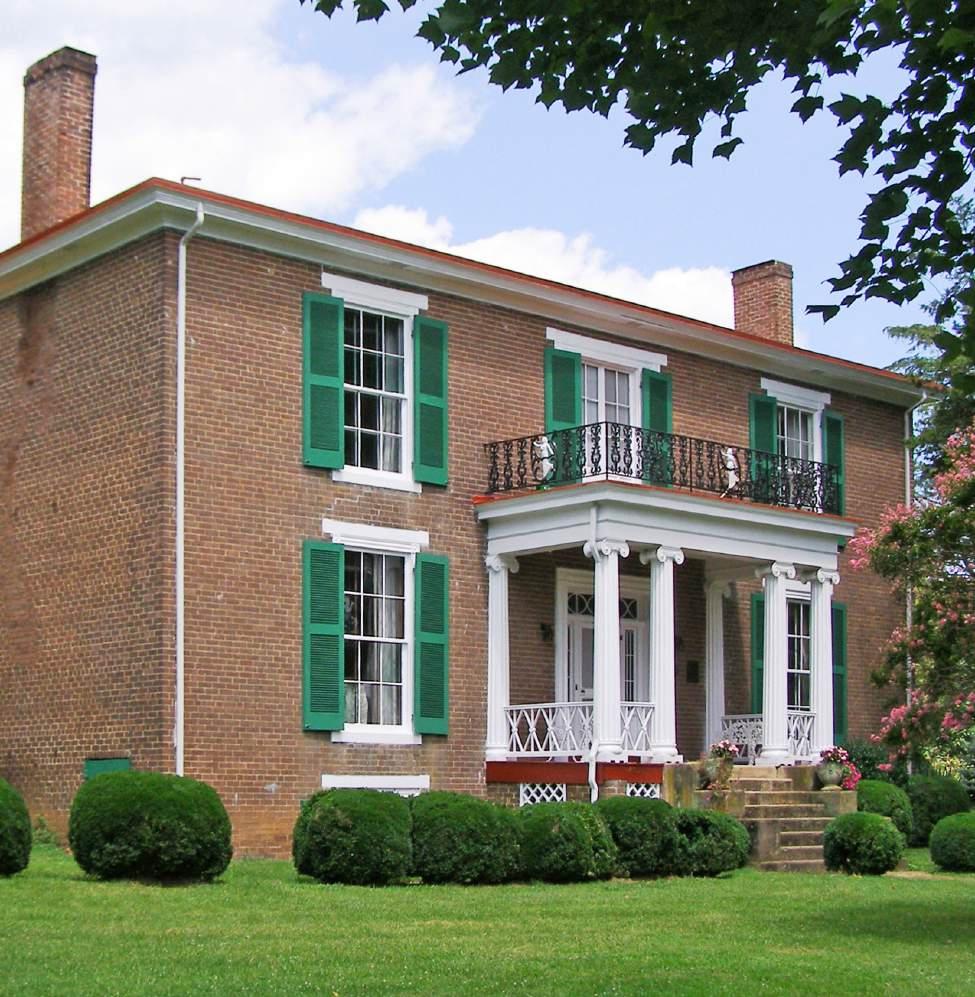
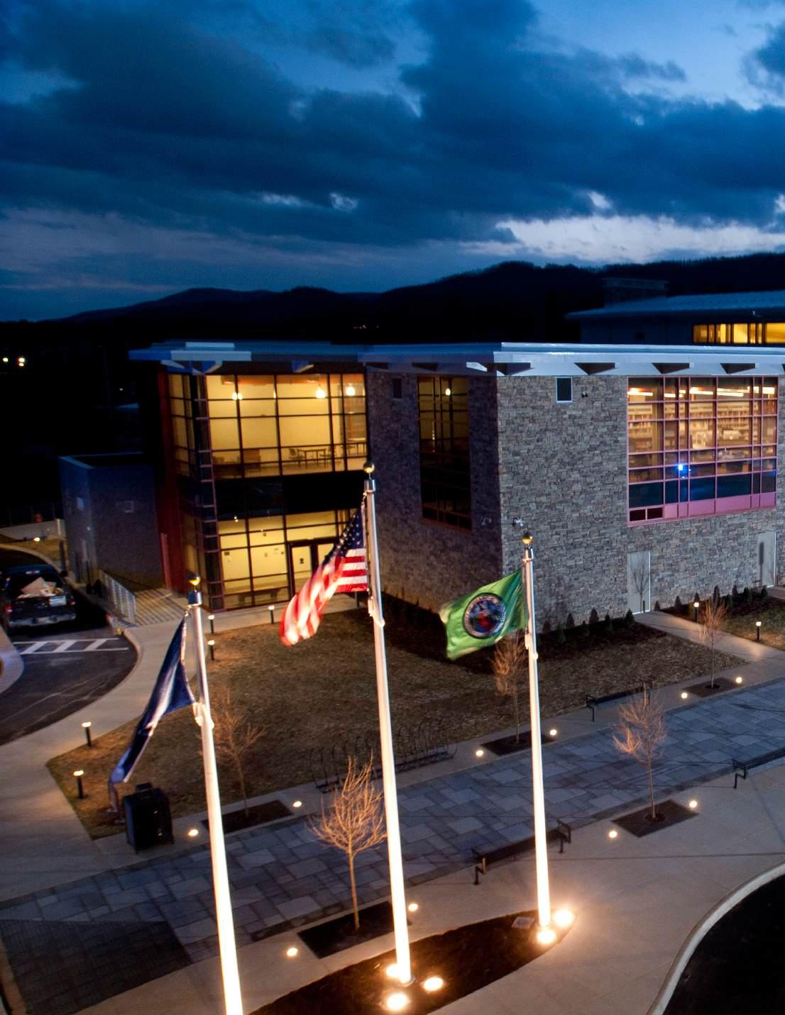
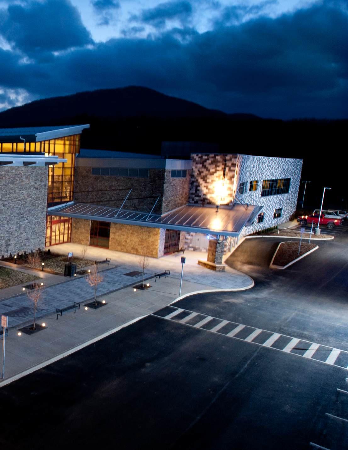

Roanoke County has an abundant amount of infrastructure and resources available to accommodate the needs of the community. This chapter details the specific information related to the facilties available to Roanoke County residents. These facilities include all public buildings such as 27 public schools spanning grades K-12; six libraries; the Roanoke County Administration Center; the Roanoke County Social Services Building and Roanoke County Jail located in Downtown Salem; the Western Virginia Regional Jail; the 15 fire and rescue response stations employing nearly 200 full-time personnel supported by approximately 200 active volunteers; the Roanoke Valley Regional Fire-EMS Training Center; and the Public Safety Center which houses the Police Department, Criminal Justice Academy, Fire and Rescue Department Headquarters, Information Technology, Emergency Communications Center, and the Emergency Operations Center. In addition, Roanoke County General Services operates curbside trash which is provided each week to Roanoke County residents and businesses. Roanoke County currently offers several recycling drop-offs at six convenient locations.
Lastly, Roanoke County Parks, Recreation and Tourism (PRT) is also a component of the community facilities available for public use. The PRT Department operates a wide variety of facilities and parks including Green Ridge Recreation Center, Splash Valley Water Park, Explore Park, Green Hill Park, Brambleton Center, and many other facilities, parks, and greenways.

Roanoke County Public Schools (RCPS) is the largest suburban school division in the region, with 27 schools: 16 elementary, 5 middle, 5 high, and one specialty school – Burton Center for Arts and Technology. Roanoke County Public Schools total enrollment (2021-2022) was 13,731 students and its Administrative Offices are located at 5937 Cove Road. RCPS consistently ranks among the
best in Virginia on student achievement metrics and all are fully accredited by the Virginia Board of Education. The map on page 5-3 shows the location of the existing 26 public schools in Roanoke County as well as the proposed Career and Technical Education (CTE) facility which will replace the Burton Center for Arts and Technology (BCAT).
American Indian or Alaska Native: 0.1%
Asian: 4.3%
African American: 7.9%
Hispanic: 7.5%
Native Hawaiian or Pacific Islander: 0.1%
Non-Hispanic, two or more races: 5.6%
White (not of Hispanic origin): 74.6%
Special Education: 16.1%
Source: Roanoke County Public Schools
The School Board operates the largest networked organization in the Roanoke Valley with connections to/from 32 physical buildings, totaling approximately 2.6 million square feet with a current average age of 52 years. Included in that total are sixteen elementary schools, five middle schools, five high schools, and one specialty high school. Other facilities include administration, transportation, warehouse, technology, and maintenance buildings.
As part of the RCPS CIP, $0.42 million is budgeted in FY 2023 and $1.00 million is budgeted annually from FY 2024 through FY 2032 for capital maintenance projects at RCPS facilities. This funding will provide for the completion of projects including but not limited to HVAC improvements, roofing repairs, window replacements, and other infrastructure improvements and preventative maintenance which will extend the useful life of RCPS facilities and help avoid costly as-needed repairs which are often more expensive than providing planned infrastructure improvements. These projects are funded with $9.42 million in RCPS cash sources over the life of the ten-year plan.

Renovation and Modernization Projects –Facilities Use and Condition Assessment & Demographic Study
During fiscal year 2016, the RCPS School Board funded a facilities use and conditions assessment study to help identify and plan for future facility renovation and modernization projects. The study reviewed all major systems in the facilities (HVAC, electrical, roofing, lighting, etc.) and identified the scope of renovations needed to restore the building to optimum operating condition. This assessment has helped inform some of the prioritization of projects in the FY 2023-2032 CIP.
Additionally, a demographics
future projected enrollment for each educational facility was also completed in fiscal year 2016. School buildings are used today in vastly different ways than they were over 40 years ago. Some programs did not exist then (certain special education services, technology, lab space, etc.) and older buildings may not be providing efficient program space. Likewise, the space needed for today’s programs impacts the student capacity in each building. The study indicated how RCPS is using school space for current programs and projected student and population trends by school and grade. With the information from this study, the School Board is able to better predict building renovations required based on programming and student enrollment.
Information from both the Facility Use and Condition Assessment Study and the demographics study, along with School Board project prioritization were utilized in developing the RCPS fiscal year 2023-2032 Capital Improvement Program.
The Roanoke County Board of Supervisors announced it will provide Roanoke County Public Schools (RCPS) $130 million to fund a new Career and Technical Education (CTE) Center and make improvements to two elementary schools. RCPS identified the critical needs for a new CTE Center in Roanoke County, as well as renovations to W.E. Cundiff Elementary School and Glen Cove Elementary School.
The current CTE Center, BCAT, must turn away students each year due to capacity issues. Our business community has shared their desires for well-trained students to enter the workforce immediately. A new CTE facility will expand the programs offered, provide more opportunities for students and meet the needs of our business community. Ensuring children’s success and sustaining our local economy is critical.
W.E. Cundiff and Glen Cove Elementary Schools were also identified as schools in need of renovations to help facilitate learning. The Board of Supervisors agreed there are issues at these two schools and improvements to the open-classroom spaces are needed.
The Board of Supervisors will provide $80 million to be utilized for the new CTE Center and $50 million to be utilized for improvements to Glen Cove and W.E. Cundiff Elementary Schools. Planning has been underway for the three projects, including recommendations from renovation studies for the elementary schools and the purchase last year of 28-acres of land to build the new CTE facility.
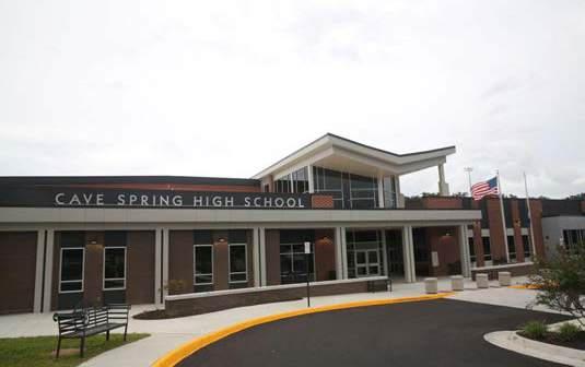
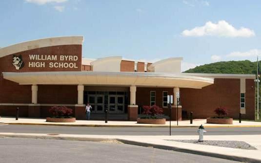
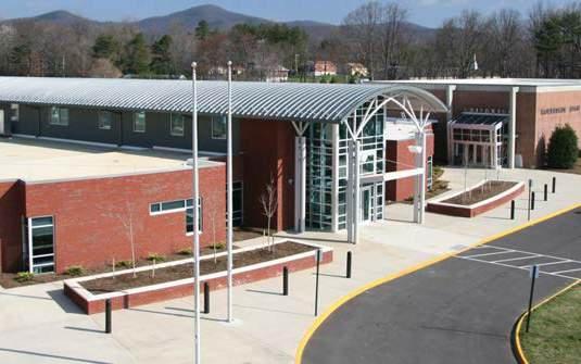

The Roanoke County Public Library System is a community information and lifelong learning center which provides citizens with the resources to help them develop their intellectual, economic, cultural, and educational potential. Roanoke County Public Library facilities include the South County Library Headquarters, Glenvar Library Branch, Hollins Library Branch, Vinton Library Branch, Bent Mountain Library Branch, and Mount Pleasant Library Branch. The map on page 5-9 shows the location of the existing six public libraries in Roanoke County.
Roanoke County Public Library facility and virtual offerings include a variety of services offered to the public ranging from technological services such as 3D printing, robotics, stargazing telescope, high-speed internet, and virtual learning environments to adult programming such as blind date book meets to meeting spaces such as study rooms as well as business and party rental spaces. Additional services for children and
families includes 1,000 books before kindergarten, at-home activities, launchpads, parent & caregiver resources, programs, storytime, tumble books, and virtual resources, while middle & highschoolers programming includes reading lounge, creative corner, the arena, learning lab, recharging station, writing playground, and tablets and computers.
• In-person visitors have been steadily decreasing over the past several years, reflecting a national trend. Library use tends to be the highest in slow economies.
• Program attendance has been steadily increasing over the past several years.
• Many patrons today are primarily electronic users, therefore when looking at the numbers for former and current users, e-location has become more prevalant with modern technology and broadband internet service expansion.
• Glenvar Library and South County have plenty of room and the design of each is sufficient for the patrons who use them.
• Vinton Library could use more open space and maybe another meeting room (or study rooms), though the square footage is sufficient.
• Bent Mountain Branch and Mount Pleasant Branch have been renovated in recent years to provide more meeting room and programming space, however, the building adjacent to the Mount Pleasant Library is currently being used for storage with plans to use as additional meeting space in the coming years.
• Hollins Library was built in 1970 and is centrally located in the Hollins Center and serves a majority of northern Roanoke County including the Masons Cove area. While the square footage is currently adequate, the Hollins Library Replacement Project Study suggests a need for more space to allow for a better layout and more moderized amenities such as meeting room space, programming areas, and quiet study rooms. The Hollins Library is also located on the smallest lot by acreage when compared to the other five branch locations which limits the ability to provide sufficient parking or additional amenities to the community. These outdoor amenities were discussed
in the community survey which suggested a desire for walking paths or outdoor gathering spaces such as a covered patio which was the highest rated choice in the survey. The Hollins area is most in need of a new library branch and is currently in the process of determining the best options moving forward.
• Smaller storefront options may be good to try as pilot locations for drop-off locations. For example, this interest has been expressed the most to library staff by residents in the Oak Grove area. They hear from patrons there that want to drop off books but that South County Library and Glenvar Library are too far in either direction.
• The library staff is currently analyzing areas using GIS that lack user visitorship in Roanoke County by determining where there are gaps in library accessibility and factoring in various demographic information to create a clearer picture of future needs. They are also looking at determining the various resources and materials most in use based on users of the library branches. For example, libraries in more urban areas may attract more family-oriented options with more technological opportunities where internet is best as opposed to more rural areas that may focus on more adult programming or in-person options negating the need for more online services.


Roanoke County Parks, Recreation and Tourism operates Green Ridge Recreation Center, Splash Valley Water Park, Explore Park, Green Hill Park, Brambleton Center, and many other facilities, parks, and greenways. The Parks, Recreation, and Tourism administrative offices are currently located at 1206 Kessler Mill Road.
Programming
Roanoke County Parks, Recreation and Tourism offers a wide range of programming for citizens to move, splash, learn, and explore. These include activities ranging from aerobic, anaerobic, and aquatic exercise of the body to learning-based exercise of the mind. Some of these non-aquatic forms of exercise include sports clinics, group exercise, yoga, martial arts, personal training, running, and health clinics with aquatic activities including swimming lessons, aquatic exercise, lifeguard training, and private swimming lessons. Some additional activities that are offered aside from exercise include cooking, crafts, dance, dog training, senior group activities, painting, drawing, pottery, and ceramics.
In addition, there are an abundance of outdoor recreation opportunities for citizens and visitors of all ages to explore and enjoy ranging from nature education, nature hikes, outdoor adventures, and travel trips. Summer camps are also available for patrons including Kids in Camp (K.I.C.), Discovery Day Camp at Camp Roanoke, Explore Park Day Camp, Pre-K Enrichment Camp at Brambleton Center, and other athletics camps.
There are also a variety of youth and adult sports available for Roanoke County residents. Residents ages 6 to 18 may participate in youth leagues as the department offers summer programs in every major sport to keep kids active while school is out. After School for Kids (ASK) is an alternative youth recreation program where children in grades K-5 can have fun while learning through
age-appropriate activities that foster physical, social, emotional, and cognitive development. ASK is currently available at 13 Roanoke County Public Schools elementary schools. As an additional community service, the Roanoke County Parks, Recreation and Tourism Department assists with the promotion of adult lifetime and team sport opportunities to residents of Virginia’s Blue Ridge which include: Curling (Curl Roanoke); Cricket (Roanoke Valley Cricket Club); Disc Golf (Roanoke Disc Golf Club); Ice Hockey (Roanoke Valley Adult Hockey Association); Mountain Biking (Blue Ridge Off-Road Cyclist); Roller Derby (Twin Valleys Roller Derby); Rugby (Roanoke Rugby Football Club); Running (Star City Striders and Mountain Junkies LLC); Soccer (Valley AFC); Softball (USA Softball); Tennis (Roanoke Valley Tennis Association); Ultimate Frisbee (Roanoke Ultimate); and Volleyball (Roanoke Valley Volleyball Association). The organizations listed above are private community organizations and are operated independently from Roanoke County.
Therapeutic Recreation Services of the Roanoke Valley has been empowering people with disabilities for over 50 years by assisting them in gaining knowledge and skills for the development of a quality leisure lifestyle to meet their interests and needs. Therapeutic Recreation Services continues to be the leading agency in government-guided, community-based therapeutic recreation within Roanoke County and across the greater Roanoke Valley.
Lastly, there are additional unique activities available to the public which help to draw tourism opportunities from all over the state, region, and world. Examples of some of these include Illuminights at Explore Park; Summer Concert Series at the Explore Park Tavern Stage; Touch-a-Truck at Green Hill Park; Blue Ridge Kite Festival at Green Hill Park; Splash Nights at Splash Valley; Ironman 70.3 across the Roanoke Valley and hundreds of other smaller facility events year-round.
Arnold R. Burton Complex 1760 Roanoke Boulevard
Bent Mountain Center and Park 10148 Tinsley Lane
Blue Ridge Parkway Visitor Center
56 Roanoke River Parkway Road
Bonsack Park 5435 Crumpacker Road
Brambleton Recreation Center 3738 Brambleton Avenue
Brookside Park 20 Verndale Drive
C. Darrell Shell Park 6328 Merriman Road
Camp Roanoke 6498 Dry Hollow Road
Catawba Center 4965 Catawba Creek Road
Clearbrook Park 5381 Tall Pine Road
Baseball/Softball Fields, Picnic Areas, Restrooms
Community Center, Kitchen, Open Space Park, Picnic Shelter
Auditorium, Gift Shop, Meeting Rooms, Museum, Restrooms
Baseball/Softball Fields, Picnic Shelters, Picnic Tables, Playground
Audio/Visual Equipment, Classrooms, Kitchen, Lounge, Pottery Studio, Presentation Screens
Baseball/Softball Fields, Grills, Picnic Shelters/ Tables, Playground, Portable Toilets, Soccer Field
Grills, Picnic Shelters/Tables, Playground, Restrooms, Tennis Courts, Paved Trails
Athletic Fields, Cabins, Challenge Course, Climbing Wall, Picnic Shelter
Basketball Court, Kitchen, Open Lawn Area, Picnic Shelters, Playground, Restrooms
Baseball/Softball Fields, Basketball Court, Grills, Picnic Shelters/Tables, Playground, Tennis Court
Roanoke River Parkway Fishing Access, Gift Shop, Hiking Trails, Ziplining, Disc Golf Course, Museum, Open Lawn Area, Picnic Shelters/Tables, Restrooms
Garst Mill Park and Greenway 2699 Willowlawn Street
Baseball/Softball Fields, Basketball Court, Creek, Grills, Picnic Shelters/Tables, Playground, Restrooms, Soccer Field, Tennis Court, Pickleball Court, Trails Gearhart Park
Fields
Glade Creek
Goode
Green Hill Park
Green Ridge Recreation Center
Hollow Gardens
Green Hill Park Road
Wood Haven Road
Baseball/Softball Fields, Parking, Picnic Areas, Restrooms, Soccer Field, Trails
Multi-Purpose Fields (Football, Soccer, Baseball/ Softball), Fishing Access, Grills, Hiking Trails, Open Lawn Area, Picnic Areas, Playground, Restrooms
Gym, Indoor Pool, Walking Track, Water Park, Pickleball Court, Classrooms
Amphitheater, Grills, Picnic Shelters/Tables, Trails
Hinchee Park
Dutch Oven Road Picnic Tables, Hiking Trails, Horseback Riding Trails Hollins Park
Hollins Road Playground, Soccer Field, Trails
Multi-Purpose Fields, Grills, Picnic Shelters, Restrooms, Trails Mount Pleasant Park
Fields, Basketball Court, Grills, Trails, Playground, Picnic Area, Tennis Court, Restrooms Northside Softball
Baseball/Softball Field, Picnic Shelters/Tables, Restrooms, Playground, Pickleball Court, Trails
Baseball/Softball Fields, Grills, Picnic Shelters, Playground, Restrooms, Multi-Purpose Fields, Trails
Court, Grills, Picnic Shelters/Tables, Playground, Pickleball Court, Restrooms, Trails
Multi-Purpose Fields (Football, Soccer, Baseball/ Softball), Grills, Hiking Trails, Open Lawn Area, Picnic Areas, Playground, Restrooms
Multi-Purpose Fields, Fireplace, Disc Golf, Grills, Hiking Trails, Picnic Shelters, Playground, Restrooms, Tennis Court, Pickleball Court

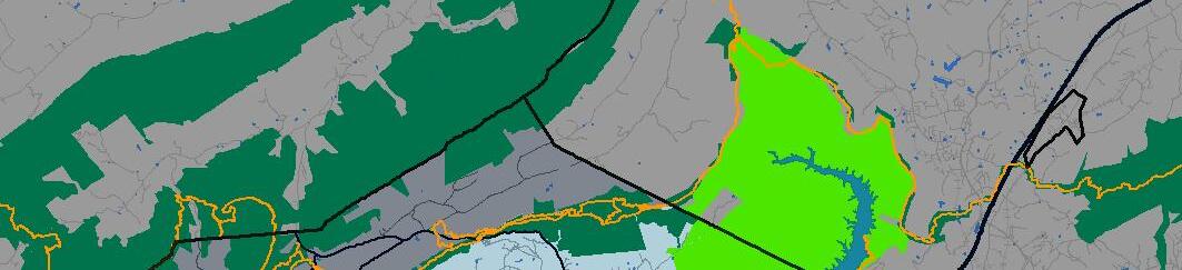
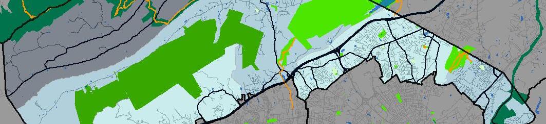
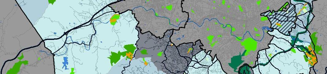
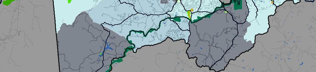
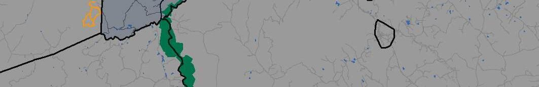
In 2013, Roanoke County assumed responsibility for the stewardship of the 1,100-acre Explore Park property (700 acres in Roanoke County and 400 acres in Bedford County), and the development of recreational amenities for public enjoyment of the Park. Starting in 2013, by signing a 99-year lease with the Virginia Recreational Facilities Authority (VRFA), the Roanoke County Parks, Recreation and Tourism Department led a master plan effort to provide strategic guidance for the actions that would be taken over the next twenty years. The plan was prepared by Wallace Roberts & Todd, LLC with Balzer and Associates, Inc. and Pros Consulting, LLC. The Board of Supervisors approved the plan in June of 2016.
The Explore Park Adventure Plan provides Roanoke County, its residents, and its visitors with a long-term strategy to improve the recreational, environmental, and economic potential of the Park’s 1,100 acres. The plan sets out a vision for the Park and describes the background from which the plan was derived, the organization of the Park, its proposed development, recreational and infrastructural features and systems, and its component projects. Supplemental reports to this document also include phasing and prioritization based on a business plan, an inventory of the Park’s existing natural and cultural features, and a record of the public engagement process that formed the plan. The Executive Summary provides a high-level overview of the project. The Overview describes organizing principles and the physical and programmatic structure of the Park and its component parts and systems. Understanding Explore Park provides background information on the Park, the recreational programming, and its infrastructural and environmental management. Adventure Concepts describes in detail the approach to the facility development program and systems of the Park. Explore Park Adventure Plan describes in detail the features and systems of the Park. The Park Development Areas describes the Activity Zones that make up the programs found within Explore Park, their facilities, and their management. The Conclusion discusses management strategies and provides guidance
on the Park’s development progress and future, and summarizes the major steps and the possible opportunities to shape a broader narrative for Explore Park.
Since the Adventure Plan was approved, numerous attractions, programs, and facility renovations have been implemented to enhance the overall experience for Explore Park visitors. Primitive camping spots and cabins have been added, Treetop Quest Ropes Course has opened, ziplining routes have been expanded, hiking trails have been extended with connections to the newly implemented sections of the Roanoke River Greenway, safer Roanoke River access points have been created, a new playground has been constructed, a brewpub has opened, wedding and event spaces have opened, picnic areas and shelters have been constructed, and disc golf trails have been created and expanded. In addition, numerous attractions have opened at Explore Park since the Adventure Plan’s implementation. These include the widely popular Illuminights (holiday lights trail event), T-Rex Trail (dinosaur informational science trail), and the Tavern Stage (monthly music series event in the summer). There have also been numerous children, teen, and adult programs geared toward fitness and wellness added to help connect residents and visitors to the outdoors.
Roanoke County Parks, Recreation and Tourism Department last updated its Comprehensive Master Plan in 2007 with Pros Consulting LLC. The 2007 Master Plan focuses on the existing and future parks, open space, trails, recreation facilities and program needs in an effort to create a more balanced parks and recreation system. The development of the Master Plan was performed in close coordination with the parks and recreation staff, the County Administrator’s staff, and the County Board of Supervisors.
The 2007 Master Plan guiding principles are expectations that the community has for Roanoke County Parks, Recreation and Tourism system.
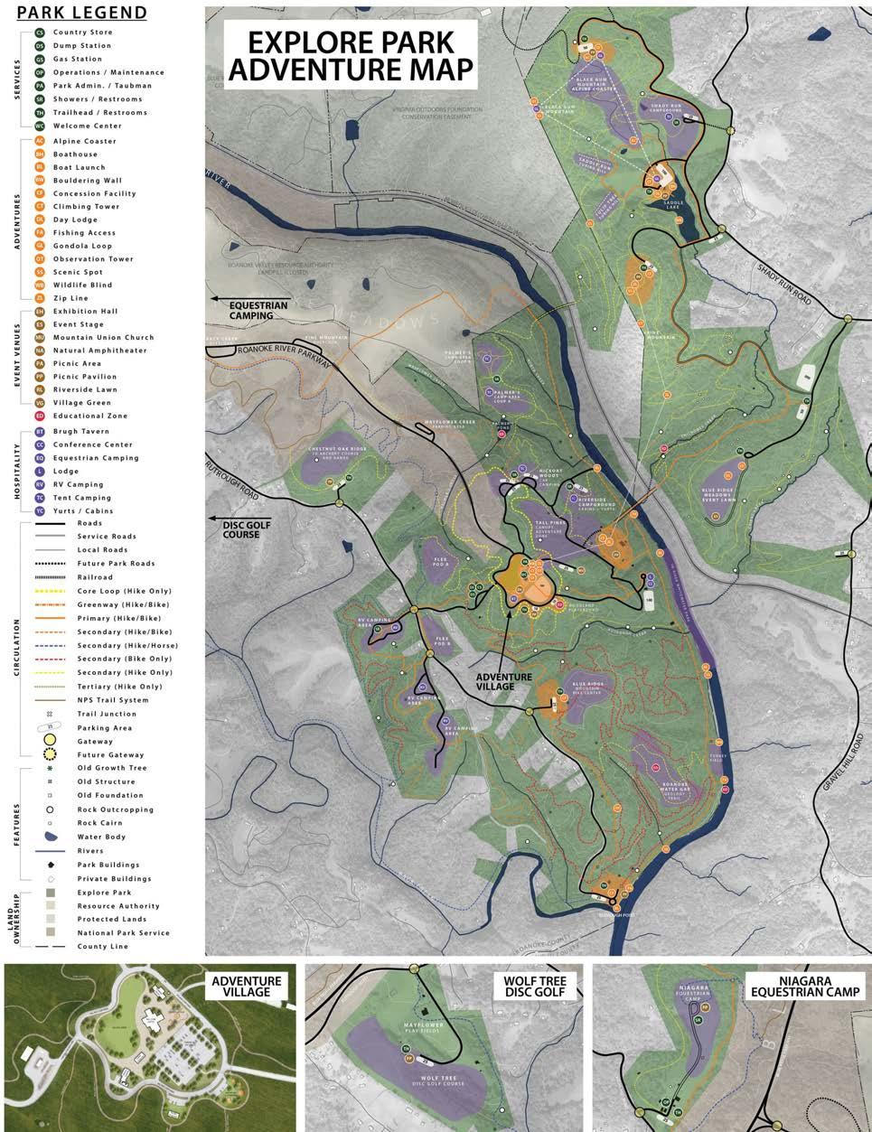
The community’s guiding principles includes the following:
• Create more indoor and outdoor destination parks and recreation facilities to establish a sense of pride with residents
• Create quality in all future development efforts
• Maintain existing parks and recreation facilities at a high level
• Continue development of greenways and trails throughout the County with connections to the Roanoke Valley Greenway network
• Create a balance of both passive and active experiences in parks and recreation facilities and program offerings
• Keep up with parks and recreation trends in facilities and programs and then provide them accordingly
• Programs and facilities should be designed to be family oriented and serve people of all age segments
• Continue to be fiscally responsible
• Create financial sustainability in facility design and operations
• Continue to develop appropriate partnerships with other service providers and special interest groups to maximize existing resources
• Create equity through proximity and accessibility of all parks, recreation facilities, trails and programs
• Ensure safety in all elements of design, development and operations of the parks
• Continue to acquire park land in underserved areas of the County and in areas where potential park land is available
• Focus attention on completing the implementation of the Master Plan in a timely manner
• Build a sense of stability throughout the parks and recreation facilities, programs and events
• Continue development of special events and festivals as these programs help bring the community together and serve to create a feeling of belonging that is vital for a community like Roanoke County

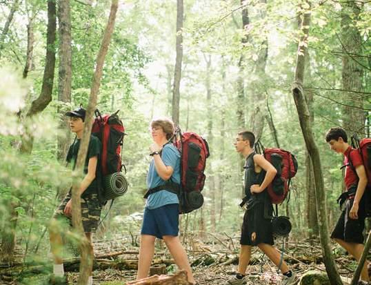
There are three projects included in the Fiscal Year 2024-2033 Capital Improvements Program related to the Parks, Recreation and Tourism Department. These include improvements at Explore Park as well as projects at Green Ridge Recreation Center and lighting systems at various ball fields around Roanoke County.
The first project of the FY 2024-2033 Capital Improvements Program is a continuation of funding for infrastructure at Explore Park in order to attract private development and help implement the Explore Park Adventure Plan. This first phase of the Explore Park Adventure Plan is projected to be spread over 10 years, with the funds providing for the development of Explore Park infrastructure to support private-public partnerships and to implement different aspects of the Adventure Plan (Roanoke County, 2018) The first round of funding for this project ($5.4M from FY 2016 - FY 2018) supported capital infrastructure, including water and sewer connections, design of internal water, sewer, and road systems, bike skills park, building repairs, land studies, broadband connections, land purchase, and road paving (Roanoke County, 2023). In 2018, Blue Mountain Adventures and Don’s Cab-Inns opened their businesses at Explore Park, with Treetop Quest’s aerial adventure course opening in 2019. The second round of request for proposals were issued in November of 2018 for additional outdoor adventure themed services and food and beverage for Brugh Tavern, and Roanoke County awarded a contract in the first half of calendar year 2019 to expand services by private vendors at Explore Park. Additional funding in 2023 ($1.4M from FY 2023 - 2032) provided for additional infrastructure based on public-private partnership needs for future developments, with future funding planned in FY 2026 in the amount of $750,000 to expand parking capacity at the park (Roanoke County, 2022).
The Green Ridge Dehumidification Units
Replacement project will replace two dehumidification units that are reaching the
end of their useful life. These units have had numerous components replaced and service calls administered since their installation in 2009. They are first generation units that are no longer in production and the ability to access replacement parts is becoming a challenge. The Green Ridge Recreation Center is a major county facility of over 76,000 square feet for health-centered recreational programs. The existing units have undergone numerous compressor, coil, and computer replacements and repairs throughout their years of service. The replacement is planned for FY 2026 for a total of $740,000.
The Sports Field Lighting Program project includes $900,000 in funding beginning in FY 2028 to replace lighting systems to allow for increased athletic field usage. Sports field lighting allows for youth adult sports to have more access to and use of Roanoke County fields outside of daylight hours. Sports field lighting allows more daily uses on a field and minimizes the need for additional athletic fields in the park system. This project will allow the replacement of two of the oldest lighting systems in the County’s park system while also adding an additional light system to Merriman field 4 located at Starkey Park to support lacrosse, soccer and flag football. The lighting systems that will be replaced are at Clearbrook Park and Whispering Pines Park, both of which are over 30 years of age and have passed their useful life. Clearbrook Park is essential for lacrosse, soccer and softball. Without lights, these three programs would need additional fields to be able to play in South Roanoke County, and lacrosse would not have fields to play on during March of each year until day light savings time. Clearbrook Park is also used each year by Roanoke County Public School system middle schools, junior varsity, and varsity sports teams. Whispering Pines Park fields support men’s softball tournaments as well as recreation and travel baseball. By adding LED light systems, Roanoke County will reduce energy consumption and have a 10-year warranty on the units.

Roanoke County’s Fire and Rescue Department (RCFRD) is committed to providing quality fire and EMS services to the citizens and visitors of Roanoke County. The Department is a combination department with both career and volunteer personnel operating out of 13 stations, strategically located throughout the 12 fire and rescue response areas, and one administrative office. The Department is made up of two main divisions: Operations and Support Services. The map on page 5-19 shows the location of the existing and future fire and rescue facilities.
The Department has witnessed a change in the workforce in that there is a decline in volunteerism causing a shift in the organization to become a more career-based Department. As of 2023, RCFRD employs over 188 full-time personnel and is supported with approximately 105 active volunteers. In 2022, the Department responded to over 15,677 calls for emergency or fire assistance annually, an increase from 20 years ago when about 8,000 calls were logged per year. Approximately 85% of calls are for EMS while 15% are for fires which included nearly 650 false alarm calls. The Department has nearly 50 vehicles including 22 ambulances, 16 pumper trucks, six tanker trucks, and three ladder trucks.
In Roanoke County there are fourteen volunteer organizations across the County. Within those organizations, there are nearly 200 active volunteer personnel who are trained in firefighting, emergency medical services, or both. These individuals go through training much like the career personnel and serve mostly during the nighttime hours, weekends, and holidays. Many of the volunteers have served for over a decade.
Roanoke County Fire and Rescue Department also offers various educational programs for adults and non-profit community groups within Roanoke County. These currently include: Public Safety Academy, Campus Fire Safety, CERT Training, Cooking Safety, Fire Safety & Severe Weather Safety Simulator, Firewise Virginia, Fireworks Safety,
First Aid & CPR Training, Holiday Safety, Summer Safety, Winter Heating Safety Tips, and Water Safety Tips. The Fire and Rescue Department educates citizens at the Public Safety Center on topics including fire system overview, personal protective equipment, CPR and AED certification, Fire Marshal investigations, inspections, public education, hazmat, EMS, CPAT, apparatus and hose streams, technical rescue and haul back systems.
The Roanoke County Fire Marshal’s Office is one of only a few in our area where the Fire Marshal and the three Deputy Fire Marshals are all sworn law enforcement officers which allows personnel to be integrated in the operations of the Roanoke County Police Department where they actively participate in school safety checks, training for potential active shooter events, and have even assisted the Police Department on several occasions with the apprehension of suspects. The Fire Marshal’s Office also attends many community events throughout the year to educate the public on fire safety and teach people the five E’s of fire prevention — Enforcement, Education, Emergency Response, Engineering, and Economics — and in so doing, rises to the top when it comes to Community Risk Reduction. The specially trained Wildland Team is nationally recognized with the U.S. Forest Service which means that not only do they help protect Roanoke County but they also can be deployed to help fight wildland fires in other parts of the state or even the country.
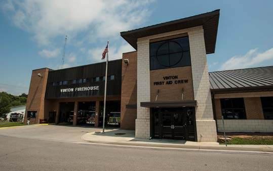

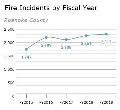
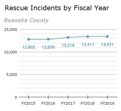
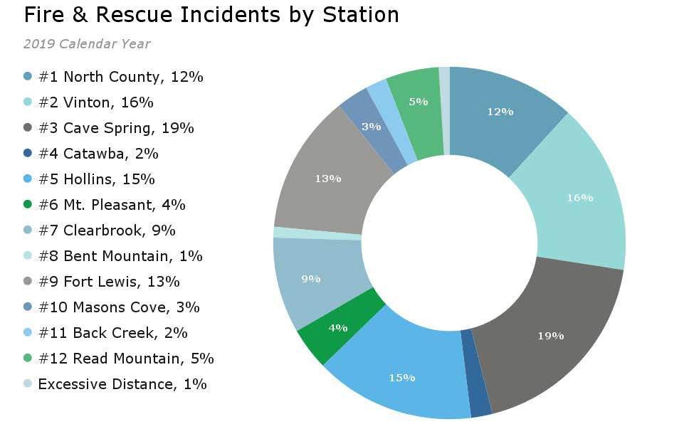
Source: 2023, Roanoke County Fire and Rescue Department
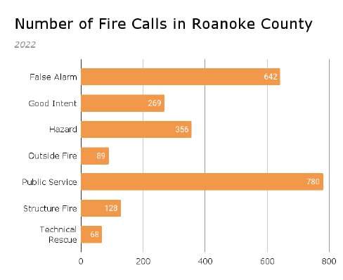
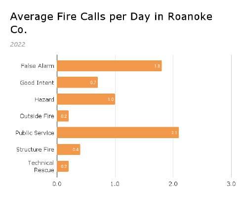
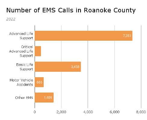
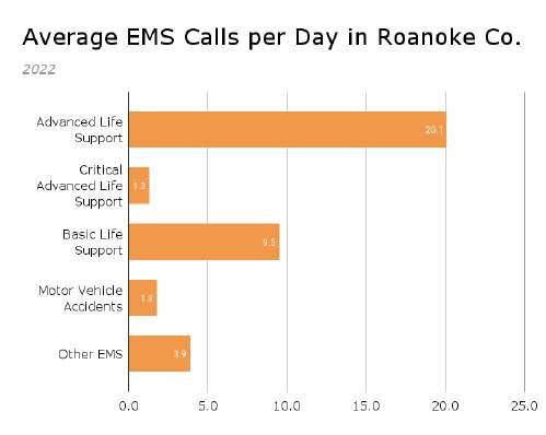
Source: 2023, Roanoke County Fire and Rescue Department
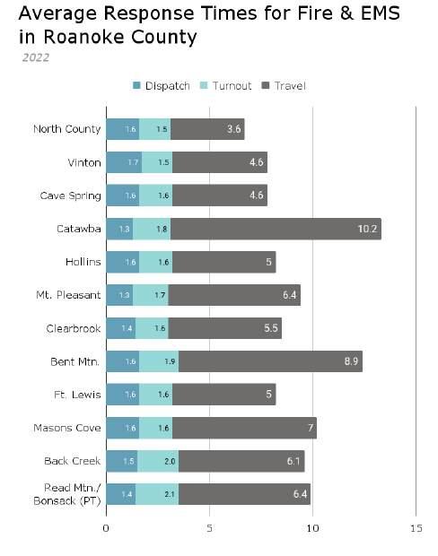
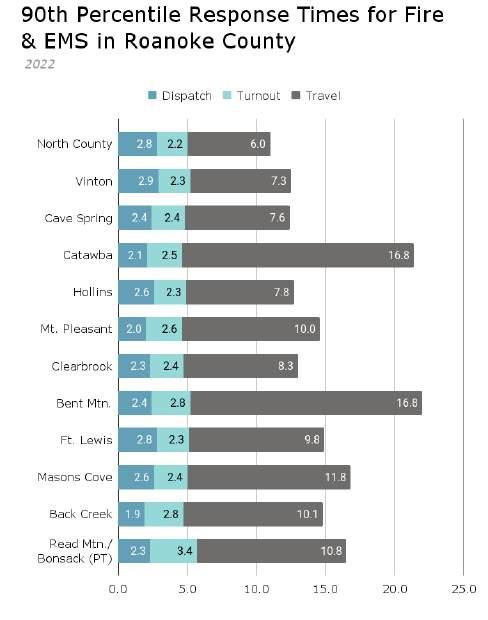
Source: 2023, Roanoke County Fire and Rescue Department

The Roanoke County Police Department strives to provide citizens of Roanoke County with the best possible police services through providing successful community programs and a dedicated workforce. The Roanoke County Police Department is nationally accredited by the Commission on Accreditation for Law Enforcement Agencies, which it has maintained since November 1992. In 2022, the department deployed 134 sworn officers and 16 civilian employees (Roanoke County Police Department, 2022).
The map on page 5-19 shows the location of existing police and training facilities. This includes the Public Safety Center located at 5925 Cove Road, the Police Substation located at 5051 Ranchcrest Drive, and the Laurel Mountain Driver Training Center located at 6231 Twine Hollow Road. The Laurel Mountain Driver Training Center is a Virginia Department of Criminal Justice Services (DCJS) approved facility for training law enforcement officers in the proper and safe methods of handling vehicles in a variety of road conditions. Originally built for use by Roanoke County, the 30-acre training center is conveniently located just off Interstate 81 at Exit 132 in western Roanoke County and includes a paved roadway, skid pad, classroom, and garage for minor maintenance and repairs. The Laurel Mountain Driver Training Center is managed by the Roanoke County Police Department and is the only training facility of its kind west of Richmond.
The Roanoke County Police Department offers a variety of services including animal control, the Public Safety Academy, public safety videos, Neighborhood Watch, self-defense classes, Youth Police Academy, Criminal Justice Academy, C.O.P.S. Camp, school resource officer program, and the Roanoke County Police Foundation. The Animal Control unit is responsible for enforcing state laws and local ordinances within Roanoke County. Officers have specialized training and equipment to handle animal related incidents such as attacks, sheltering, animal abuse, lost animals, and the welfare of livestock and wildlife.
The Public Safety Academy aims to educate citizens on why and how our agencies carry out our missions while working together as a team with police topics including patrol, budget, community service officers, school resource officers, driving range, use of force, traffic unit, firing range, K9, S.W.A.T, VICE, criminal investigations, evidence collection, academy tour, polygraph and building clearing. The Youth Police Academy is a summer outreach program that introduces youth to the field of law enforcement. It allows the opportunity for youth and police to build stronger, positive relationships. The Roanoke County Criminal Justice Academy was a product crafted from the vision of the executives of Roanoke County and is committed to adhering to the highest ethical and professional standards expected from those employed as law enforcement practitioners.
The School Resource Officer (SRO) program is offered in cooperation with Roanoke County Public Schools, with SROs assigned to elementary schools, middle schools, and high schools throughout the County. The SROs also assist at elementary schools with law-related incidents or programs. SROs provide classroom instruction on law enforcement
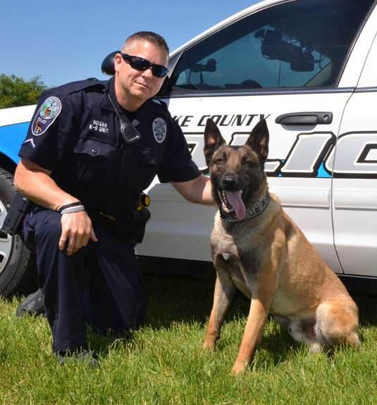
topics and the Virginia Rules Program, an expansion of the Class Action program offered from the Virginia Attorney General’s Office. SROs hold classroom presentations in the high schools and middle schools, conduct classroom observations, and special events at schools, and hold conferences with students, staff and parents.
Neighborhood Watch was created to build relationships between citizens, the Roanoke County Police Department and the Roanoke County Sheriff’s Office. This program provides citizens with information on crime statistics and an opportunitiy to learn about problems that are commonly seen around Roanoke County. The Rape Aggression Defense System teaches selfdefense tactics and techniques for women. It is a program of realistic, self-defense tactics and techniques. The RAD System is a comprehensive course for women that begins with awareness, prevention, risk reduction and avoidance, while progressing on to the basics of hands-on defense training. The Rape Aggression Defense (RAD) System of realistic defense will provide women with the knowledge to make an educated decision about resistance. C.O.P.S. (Challenging
Opportunities for Police and Students) Camp is a week-long overnight camp program organized by the School Resource Officers at Camp Roanoke.

The Office of the Sheriff has proudly served the citizens of Roanoke County since 1838. The deputies provide three main areas of service to the community: civil process, court security, and corrections. The Roanoke County Sheriff’s Office and Jail are located at 401 East Main Street in Salem. The Sheriff’s Department Administration handles the overall supervision and leadership of the Sheriff’s Office, including maintaining the civil process, professional standards, and budgetary operations. This is also the location of the Magistrate’s Office. In addition, the Sheriff’s Office also engages with the community by providing personal safety courses, firearm safety courses, drug take back programs, and the inmate workforce program. The Sheriff’s Department covers the jail history, jail tour, jury selection, court security, civil process, criminal law, E.R.T, clerk of court, services, and A.V.O.I.D self-defense. The Roanoke County Sheriff’s Office
is accredited by the American Correctional Association, the oldest and largest international correctional association in the world. Roanoke County Sheriff’s Office received accreditation by the Virginia Law Enforcement Professional Standards Commission. The map on page 5-19 shows the location of the existing Sheriff’s Office, Jail, and Courthouse.
The second division of the Sheriff’s Office includes court security that provides a secure and safe environment to maintain order in the courtrooms and courthouse for all members of the judiciary and the public. The Roanoke County Courthouse including Circuit Court, General District Court, Juvenile Court, and Domestic Relations Court, are located at 305 East Main Street in the City of Salem.
The third division of the Sheriff’s Office includes corrections security which provides temporary supervised housing for persons entrusted to the Sheriff’s Office care.

Opened in 2008, the Western Virginia Regional Jail is located at 5885 West River Road in Roanoke County and was built to alleviate the overcrowded and potentially unsafe conditions in the local jails of the four localities (Roanoke County, City of Salem, Montgomery County, and Franklin County) that formed the Western Virginia Regional Jail Authority in 2005. The local jails were operating at two to 3 times their rated capacities creating the need for a larger facility to serve the region. There are over 200 people employed at the Western Virginia Regional Jail including corrections officers, civilians, and contract workers who provide food, medical, and commissary services. The Jail holds both male and female inmates for its four member agencies, federal and state responsible inmates, and contract inmates for other localities. Since 2016 the average population has been approximately 800 inmates. The Jail’s medical section provides a comprehensive range of medical, dental, and mental health services in house that meet Virginia Department of Corrections and American Correctional Association standards.


Located in the Public Safety Center, the Roanoke County 9-1-1 Emergency Communications Center (ECC) is comprised of Communications Officers serving as first responders who work in conjunction with emergency medical services, fire, and law enforcement personnel of Roanoke County and the Town of Vinton to save lives, protect property, and stop crime. The ECC provides crossagency communication amongst all public safety departments throughout the Roanoke Valley and also engages with the community through outreach and education. Roanoke County ECC is accredited by the Commission on Accreditation for Law Enforcement Agencies. There are less than 100 public safety communications centers nationwide with this distinction. Furthermore, all ECC Communications Officers maintain CPR and Emergency Medical Dispatch (EMD) certification. EMD enables a Communications Officer to assist citizens over the phone with medical instructions until a first responder can treat the patient.

There are two administrative bodies directly involved with solid waste removal and recycling operations in Roanoke County. Roanoke County’s General Services offices are split between the main offices located at 5235 Hollins Road and operations, equipment and storage located at 1216 Kessler Mill Road. The Roanoke Valley Resource Authority (RVRA) is the second administrative body which consists of four member communities: the Cities of Roanoke and Salem, the County of Roanoke and the Town of Vinton. The mission of RVRA is to provide environmentally sound disposal in the most cost-effective manner to residential and commercial haulers within the region. The Roanoke Valley Resource Authority manages the Tinker Creek Transfer Station located in Roanoke City at 1020 Hollins Road and the Salem Transfer Station located in Salem at 1271 Indiana Street where materials are collected and separated to be exported out of the Roanoke Valley. The Smith Gap Landfill is a 950-acre site located at 8484 Bradshaw Road in Roanoke County, which is managed by RVRA.
Curbside trash collection is provided each week to Roanoke County residents and many businesses. Bulk and brush is collected on a biweekly basis from residences Roanoke County Solid Waste provides lid and wheel repairs without any direct charge to residents, when possible. Residents can complete an online application to request these repairs. Roanoke County Solid Waste also provides bear-resistant latch hardware installation on Roanoke County trash containers.
Recycling is currently offered as a drop-off service only with six facilities in Roanoke County including facilities at Hollins University; William Byrd Middle School; Cox Communications located in the Cave Spring Planning Area; Brambleton Center; Glenvar Middle School; and Wal-Mart located in Salem.

The Roanoke County Administration Center at 5204 Bernard Drive currently houses the Board of Supervisors/Clerk to the Board; County Administrator’s Office; County Attorney; Economic Development; Management and Budget; Finance; Accounts Payable; Payroll; Purchasing; Risk Management; Human Resources; Planning; Development Services; Real Estate Valuation; Commissioner of the Revenue; and Treasurer.
The map on page 5-30 shows the location of the Roanoke County Administration Building and the remaining existing Administrative Facilities.
The Public Safety Center at 5925 Cove Road houses administrative offices for public safety departments including the Police Department; Roanoke County Criminal Justice Academy; Fire and Rescue Department; Information Technology; and Emergency Communications Center (9-1-1 Center).
Other administrative facilities include social
services, fleet services, and election services. Roanoke County’s Social Services Department is located at 220 East Main Street in Salem. Social Services offers aid to families and children in need including disaster assistance, healthcare, nursing home care, access to food, protective services, foster care, and adoption.
The Fleet Services Center is located at 5235 Hollins Road in Roanoke County. Fleet Service serves as the County’s maintenance facility for all fleet vehicles, including Garbage Trucks, Fire & Rescue vehicles, Police vehicles, Parks, Recreation and Tourism maintenance vehicles and more. Through a cooperative agreement, the Fleet Service Center also maintains vehicles for the Western Virginia Water Authority. The Registrar’s Office processes registration applications and requests for transfer or change of address from other residents and manages voter registration. They are located at 900 Chestnut Street in the Town of Vinton.

The existing public water and sewer lines in Roanoke County as well as water treatment plants, reservoirs, and wastewater treatment plants can be viewed on pages 5-32 and 5-33.
Western Virginia Water Authority
Properties connected to public water in Roanoke County are served by the Western Virginia Water Authority (WVWA). On July 1, 2004, the water and wastewater operations of the City of Roanoke and Roanoke County consolidated to become the Western Virginia Water Authority. The Western Virginia Water Authority was the first authority in the Commonwealth formed from two existing entities to treat, deliver and administer water and wastewater. Five years later, on November 24, 2009, Franklin County officially joined the Western Virginia Water Authority and on July 1, 2015, Botetourt County joined. The Authority also contracts to operate the water and wastewater systems for the Town of Fincastle. The ownership and operations of the Town of Vinton utility system officially began July 1, 2022 to provide the best long-term rate and infrastructure stability, service, and water quality for current and future customers of both the Town and the Authority.
The WVWA’s water and wastewater system is in good condition and is regularly inspected and maintained. The Authority is committed to providing its customers with safe, reliable, and affordable service acknowledging that this utility system and network is an important part of the infrastructure that supports the growth and development of the Roanoke Valley. The system provides a safe and reliable way to collect and treat water and wastewater, which helps to protect the environment and public health.
The Western Virginia Water Authority (WVWA) utilizes four surface water sources in addition to multiple springs and wells as drinking water sources accessible to Roanoke County residents. These sources include primary reservoirs, Carvins
Cove and Spring Hollow, as well as two secondary reservoirs, Beaverdam Creek and Falling Creek. Having an abundant supply of water helps protect against drought or other emergencies.
WVWA provides water service to over 69,000 accounts in the City of Roanoke, the Counties of Roanoke, Franklin and Botetourt and the Towns of Boones Mill and Vinton. The WVWA’s water network consists of over 1,790 miles of water lines that are made of a variety of materials, including lead, galvanized iron, brass, copper or plastic (PVC). The lines are buried underground and connect homes, businesses, and other facilities to the reservoirs and WVWA’s two water treatment plants. The water treatment plants are designed to treat water to meet all applicable state and federal regulations. The WVWA has approximately 100 water tanks and 57 pump stations that store and distribute clean water throughout the region.
The Western Virginia Water Authority (WVWA) provides wastewater service to more than 60,000 accounts in the City of Roanoke, the Counties of Roanoke, Franklin and Botetourt and the Towns of Boones Mill and Vinton. The wastewater treatment plants are designed to treat wastewater to meet all applicable state and federal regulations.
The WVWA’s sewer network consists of over 1,000 miles of sewer lines that are made of a variety of materials, including concrete, steel, and plastic (PVC). The lines are buried underground and connect homes, businesses, and other facilities to the wastewater treatment plants. The WVWA has 10 wastewater treatment plants located throughout its service area. The plants use a variety of methods to treat wastewater, including physical, chemical, and biological processes. The treated wastewater is then discharged into rivers, streams, or lakes. Lastly, the WVWA has 10 pump stations located throughout its service area. The pump stations are used to move wastewater from low-lying areas to higher elevations, where it can be collected by the sewer lines.
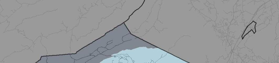
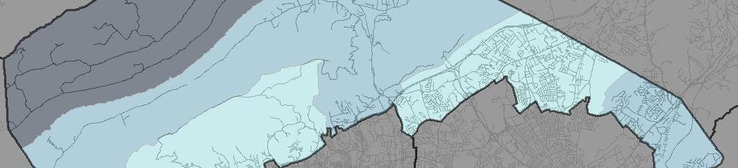
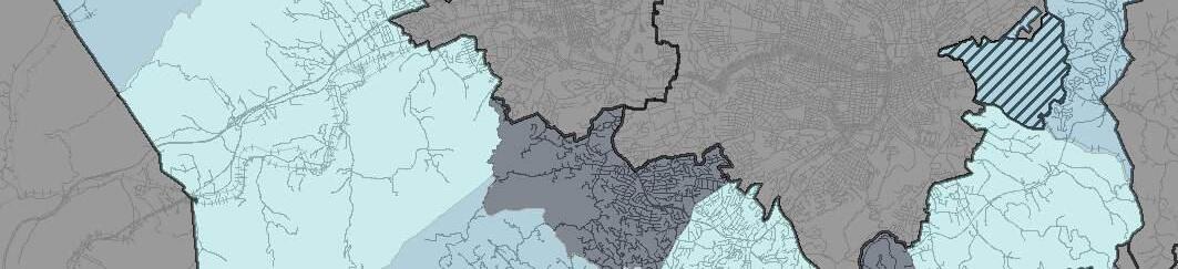
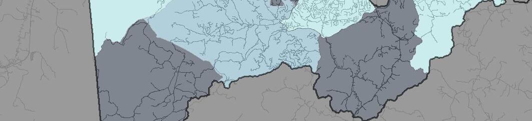


Stormwater Management is the process of controlling the runoff from precipitation (i.e, rain or snow) that flows off of impervious surfaces like parking lots, driveways, sidewalks, and rooftops. Unchecked stormwater flows from these hard surfaces to streets and gutters, which carry the untreated runoff to nearby receiving waters.
Stormwater runoff does not go to a treatment plant before discharging into the area’s receiving waters, and it can carry pollutants like motor oil, pet waste, fertilizers, pesticides, grass clippings, leaves, litter, trash, debris, and sediment into nearby waterways. All of these items negatively impact the water quality of our rivers, streams, and ponds.
Techniques to manage stormwater runoff include the use of vegetation and mulch to protect bare soil areas from erosion along with the use of Best Management Practices (BMPs) that are designed to slow velocity, reduce volume, and
limit the rate of runoff in an effort to reduce the quantity and improve the quality of stormwater runoff before it reaches the receiving waters. The map on page 5-35 shows the existing Stormwater Best Management Practice project locations and Drainage Basins for some of those projects including bioretention ponds, above-ground and underground detention areas, and other manufactured or filtration systems as well as areas with porous pavement.
Recent Roanoke County Stormwater Projects
• Restoration of Glade Creek, Vinyard Park Phase 1
• Restoration of Murray Run at Ogden Road
• The Orchards and Other Drainage System Improvements
• Wolf Creek - Phase II
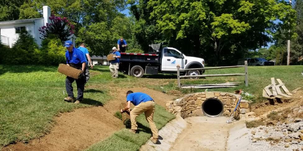

There are a number of existing natural gas facilities in Roanoke County. The map on page 5-37 shows the existing gas distribution lines to homes and businesses. Additional gas utility facilities include:
• Pipelines: There are a number of natural gas pipelines that run through Roanoke County. These pipelines transport natural gas from production areas to distribution areas.
• Compressor stations: Compressor stations are used to increase the pressure of natural gas in pipelines. This is necessary to transport gas over long distances.
• Storage facilities: Natural gas is stored in underground storage facilities. These facilities are used to store natural gas during times of low demand and to provide a buffer in case of supply disruptions.
• Regulator stations: Regulator stations are used to reduce the pressure of natural gas before it is delivered to customers. This is necessary to ensure that the gas is safe to use.
The natural gas facilities in Roanoke County are a vital part of the infrastructure of the county. These facilities provide natural gas to homes, businesses, and industries. Natural gas is a clean-burning fuel that is a good alternative to coal and oil. In addition to these existing natural gas facilities, a new natural gas pipeline recently completed construction - the Mountain Valley Pipeline.
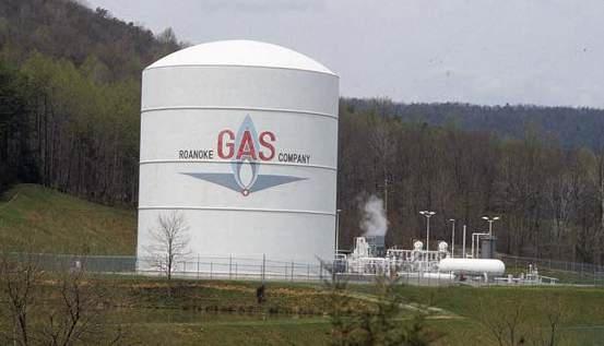

The Mountain Valley Pipeline (MVP) is a 303-mile-long (488 km) natural gas pipeline that completed construction in 2024. The pipeline transports natural gas from the Marcellus Shale region of Pennsylvania to the states of Virginia, North Carolina, and South Carolina.
The section of the MVP pipeline that will pass through the Bent Mountain area of Roanoke County can be seen on the map on page 5-38. The construction of the pipeline in this area has been controversial. Some people support the construction of the pipeline, arguing that it will create jobs and economic development for the area. Others oppose the construction of the pipeline, arguing that it will harm the environment and public health, could increase the risk of fires and explosions, could lower property values, and could leak into the groundwater.
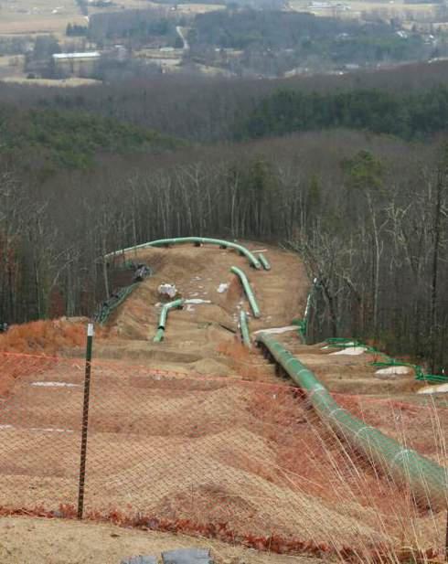

Roanoke Valley Broadband Authority (RVBA) is a partnership of the City of Roanoke, County of Roanoke, City of Salem and County of Botetourt. It exists to make the Roanoke Valley, the region comprising these localities, a better place to live and do business by owning and operating a broadband network to improve local internet service for businesses, community institutions and residents. The value of a middle mile network extends to every citizen and business of the Valley. The open-access arrangement of the network promotes competition, increases consumer choice, lowers prices, and incentivizes better service from local internet carriers. By maintaining an open-access fiber network, RVBA seeks to achieve three main outcomes: expanding access and access to new providers; increasing speed and infrastructure capacity; and lowering the cost of internet to make it more affordable for everyone.
There are a number of existing broadband providers in Roanoke County. These include Cox Communications, Comcast, B2X On-Line, and Glo Fiber. These providers offer a variety of broadband services including fiber optic, cable, and DSL. Fiber optic broadband is a service that is delivered over fiber optic cable and is the fastest type of broadband service that can provide speeds of up to 10 gigabit per second (Gbps). Cable broadband is a service that is delivered over coaxial cable as a high-speed broadband service that can provide speeds of up to 1 Gbps. DSL broadband is a type of broadband service that is delivered over copper telephone lines and can only provide speeds of up to 100 Mbps.
The map on page 5-40 shows the coverage for these services with cable-line being the traditional form of distribution and the newly available fiberoptic line expansion shown in red. The availability
of broadband services in Roanoke County varies depending on the location. In general, broadband services are more widely available in urban areas than in rural areas. The map on page 5-41 shows the existing coverage of mobile broadband services based on data speed as well as the location of cellular towers.
The Roanoke County government is working to expand broadband access to rural and unserved areas in the County. In 2021, the County received a $3.7 million grant from the Virginia Telecommunications Initiative (VATI) to expand broadband connectivity throughout the County. The County partnered with internet service providers to leverage more than $7.7 million to expand broadband connectivity throughout the County. These four projects will connect nearly 1,400 locations in the region to fiber broadband. These included partnerships between Roanoke County and the following providers:
• Craig Botetourt Electric Cooperative will leverage $1.65 million to expand to 495 locations.
• Cox Communications will leverage $1.59 million to expand to 396 locations.
• Shentel will leverage $510,000 to expand to 213 locations.
• B2X Online will leverage $177,500 to expand to 290 locations.
The expansion of broadband access in Roanoke County is important for a number of reasons including economic development, education, and healthcare. Broadband access can also help to close the digital divide and ensure that everyone has access to the information and resources that they need.

Roanoke County has a robust power/ electrical infrastructure that is owned and operated by Appalachian Power Company (APCo). APCo is a regulated electric utility that provides electricity to over 1 million customers in Virginia, West Virginia, and Tennessee. The map on page 5-43 shows the existing powerlines transecting Roanoke County with their voltage capacity.
The power/electrical infrastructure in Roanoke County consists of the following:
• Power plants: The closest APCo power plant to Roanoke County is the Smith Mountain Lake pumped-storage hydroelectric dam where the Smith Mountain Gorge and Roanoke River converge.
• Transmission lines: APCo has a network of transmission lines that carry electricity from the power plants to the substations.
• Substations: APCo has a number of substations located throughout Roanoke County. These substations step down
the voltage of the electricity from the transmission lines and distribute it to homes and businesses.
• Distribution lines: APCo has a network of distribution lines that carry electricity from the substations to homes and businesses.
The power/electrical infrastructure in Roanoke County is in good condition and is regularly inspected and maintained.
In addition to the existing infrastructure, APCo is investing in new infrastructure to improve the reliability and resilience of the power grid. In 2021, APCo announced a $1 billion investment in new infrastructure over the next five years. This investment will include the construction of new power plants, transmission lines, and substations.
The investment in new infrastructure is important to ensure that the power grid in Roanoke County is able to meet the needs of the growing population and economy. The investment will also help to improve the resilience of the power grid to extreme weather events.
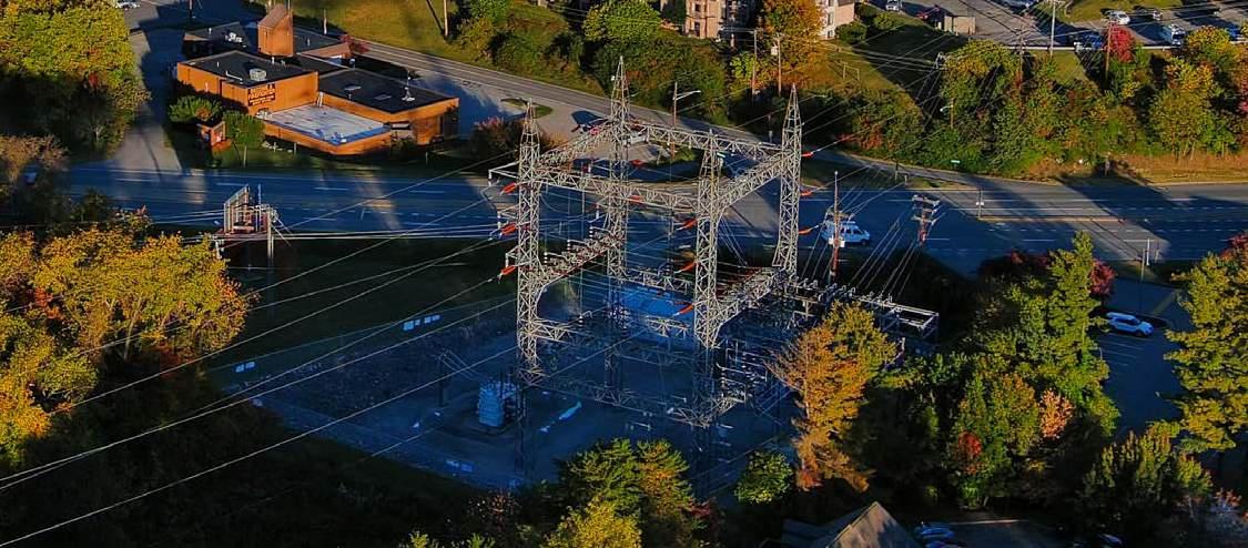
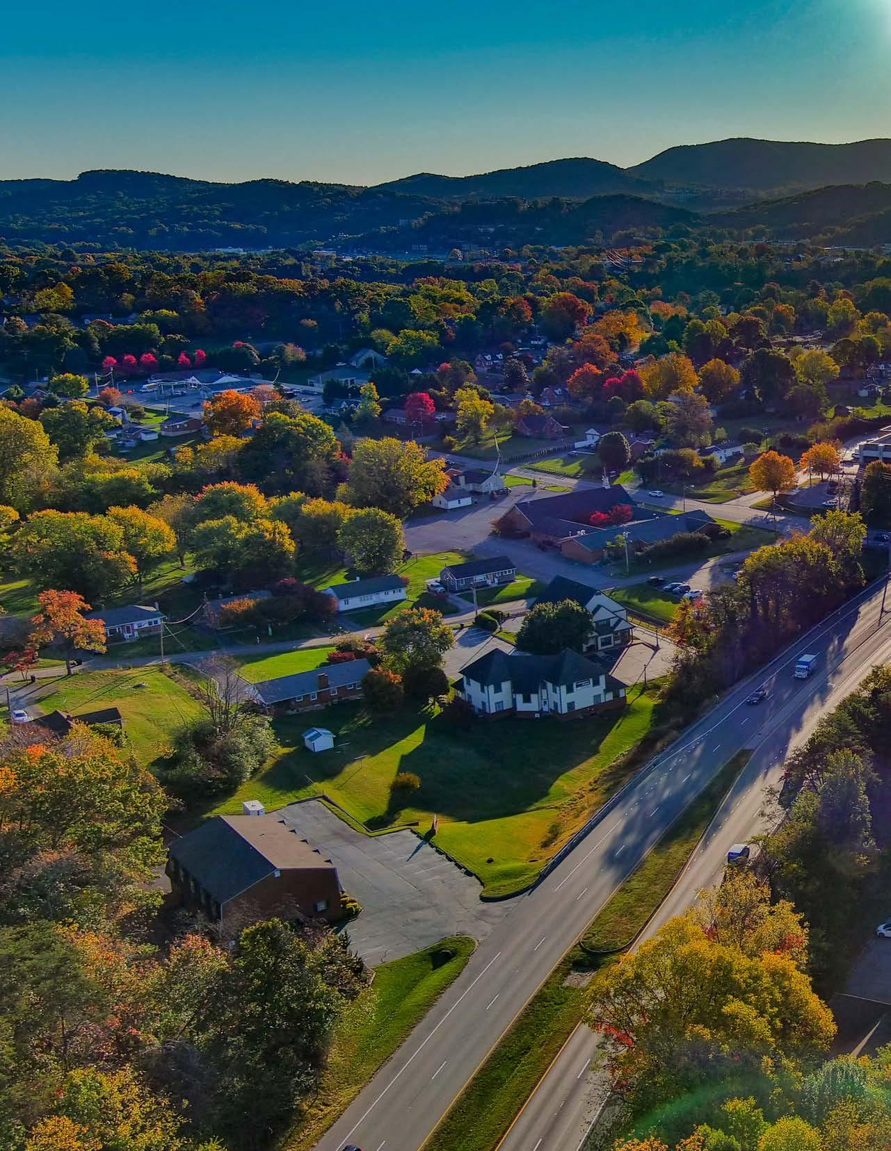
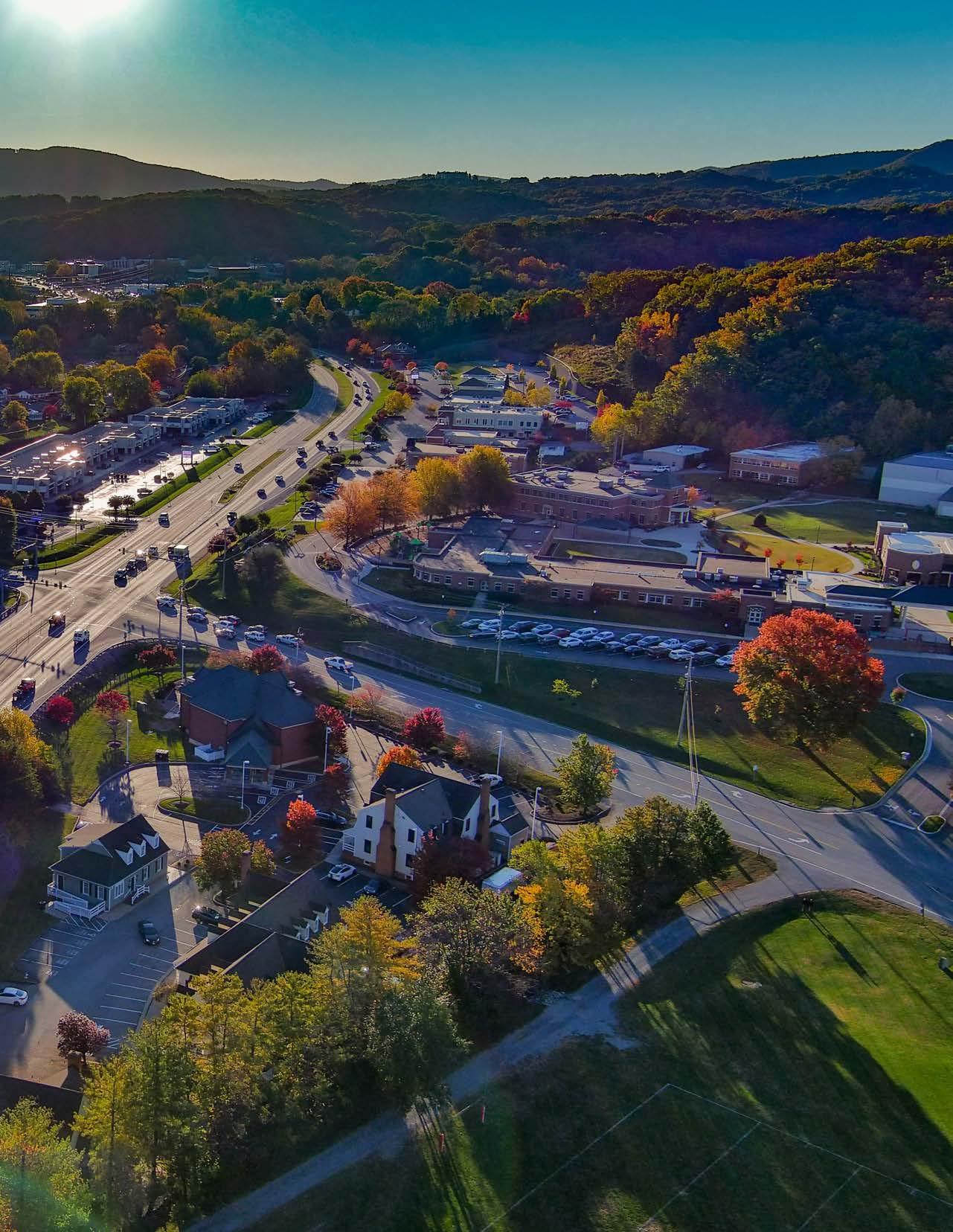

Because transportation infrastructure is used by citizens almost every time they leave their house, transportation is a frequent topic of conversation and criticism. Though Roanoke County’s major roads were primarily developed in the 1960s and 1970s when counties did not build or request sidewalks, citizen desires have changed. Roanoke County has spent considerable time and resources since the 2005 Comprehensive Plan was adopted to focus on not only improving area roadways, but also improving multimodal infrastructure throughout our community with the goal of allowing residents to leave their cars at home and travel by other means.
This chapter lays out the existing conditions of transportation in Roanoke County, discusses potential trends that could influence transportation in the next fifteen years, and identifies key issues and needs for the Roanoke County transportation system.
Organizations essential to the development of transportation infrastructure in Roanoke County are discussed (Sec. 6.2), as are relevant transportation plans and studies (Sec. 6.3), and changes to the transportation planning and funding environment since the last Comprehensive Plan was adopted in 2005 (Sec. 6.4). The separate-but-overlapping transportation networks that serve the various modes of transportation available within Roanoke County are discussed one-by-one. These are: Roads (Sec. 6.5), Transit (Sec. 6.6), Bicycle & Pedestrian (Sec. 6.7), Greenways & Trails (Sec. 6.8), Rail (Sec. 6.9), and Air (Sec. 6.10). An overview of emerging and future transportation technologies that could be deployed in Roanoke County in the next fifteen years follows (Sec. 6.11), and the chapter concludes with a summary of the existing state of the Roanoke County transportation system and what are anticipated to be the primary issues faced by it over the next fifteen years (Sec. 6.12).
Project recommendations and implementation strategies are outlined in Chapter 10.
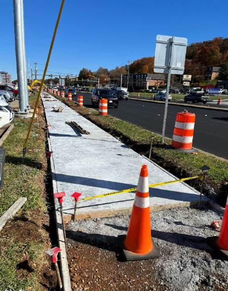

The organizations covered in this section are those that are essential to the development and continued functioning of the Roanoke County transportation system. These organizations are varied in their size, focus, jurisdiction, and overall level of influence, but the Roanoke County transportation system would not be where it is today, and would not be adequately prepared for the future, without every one of them.
The Viginia Department of Transportation (VDOT) builds, maintains, and operates public roads, bridges and tunnels in the Commonwealth of Virginia. VDOT is responsible for all public roads in Virginia counties, except for roads in Arlington and Henrico Counties. Cities and towns typically
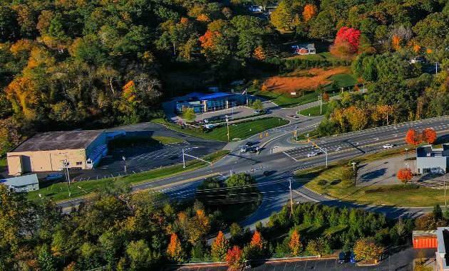
maintain their own roads. Roanoke County’s public roadways are owned and maintained by VDOT, and are prioritized in the following manner:
1. Interstates (I-81 and I-581)
2. Primary Routes numbered 1 through 599
3. Secondary Routes numbered 600 and greater
VDOT is divided into nine highway districts, which are then further divided into 31 residencies. Roanoke County is located in the 12-county Salem District which stretches from West Virginia to North Carolina. Roanoke County is also located within the Salem Residency with Botetourt and Craig Counties. The map on page 6-8 shows the counties and cities included in the VDOT Salem District and Salem Residency.
County staff works closely with VDOT staff on
a variety of projects spanning from interstate improvements to maintenance needs.
Virginia Department of Rail and Public Transportation
The Department of Rail and Public Transportation (DRPT) is a state agency that reports to the Secretary of Transportation and the Commonwealth Transportation Board. DRPT’s mission is “to connect and improve the quality of life for all Virginians with innovative transportation solutions” (DRPT, 2023).
DRPT’s programs include:
• Passenger and freight rail
• Public transportation including bus providers, commuter rail, heavy rail, light rail, paratransit and ferryboat
• Local and regional commuter assistance programs
Since 2021, DRPT has assisted Roanoke County with funding to offset the cost of both the CORTRAN and McAfee Knob Trailhead Shuttle services.
The Virginia Passenger Rail Authority (VPRA) was created during the 2020 General Assembly session to promote, sustain, and expand the availability of passenger rail service in Virginia. VPRA is an independent subdivision of the state, with board members appointed by the Governor, that works in collaboration with the Virginia Department of Rail and Public Transportation.
In June 2022, VPRA finalized the purchase of a section of track from Norfolk Southern that runs from Salem to Christiansburg, to serve the expansion of Amtrak service to Christiansburg. This track runs through western Roanoke County, roughly following the path of the Roanoke River.
VPRA is allowed to authorize recreational trails within their property in western Roanoke County, provided these trails meet rigid safety standards.
The Commonwealth Transportation Board (CTB) members are appointed by the Governor and approved by the General Assembly. The CTB is comprised of 17 members including:
• Secretary of Transportation
• Commissioner of VDOT
• Director of DRPT
• One representative from each of the nine highway districts
• Two At-Large Urban
• Three At-Large Rural
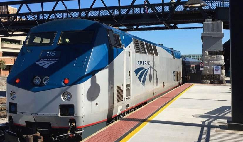
The CTB oversees seven transportation agencies including:
• VDOT
• DRPT
• Department of Aviation
• Virginia Port Authority
• Motor Vehicle Dealer Board
• Virginia Commercial Space Flight Authority
• Department of Motor Vehicles
The CTB adopts the Six-Year Improvement Program (SYIP) annually which programs funding for transportation projects across the state over six years.
The Office of Intermodal Planning and Investment (OIPI) is an Office of the Secretary of Transportation. OIPI focuses on statewide multimodal and intermodal transportation planning. OIPI staff also oversee the SMART SCALE program and VTrans, which is Virginia’s multimodal surface transportation plan.
The Commonwealth of Virginia is divided into 21 Planning Districts. The Roanoke Valley-Alleghany Regional Commission (RVARC) is comprised of elected officials and citizens appointed by the following member governments:
• Alleghany County
• Botetourt County
• Craig County
• Franklin County
• Roanoke County
• City of Covington
• City of Roanoke
• City of Salem
• Town of Clifton Forge
• Town of Rocky Mount
• Town of Vinton
RVARC assists its members with technical and program services such as grant assistance, management services for program implementation, land use planning services, mapping and transportation.
RVARC is responsible for the following documents:
• Roanoke Valley-Alleghany Regional Comprehensive Economic Development Strategy – establishes the region’s economic development goals and identifies strategies for implementing these goals, including transportation projects
• Rural Bikeway Plan - identifies where bicycle infrastructure improvements are needed in locations that are within the RVARC service area, but outside of the Roanoke Valley Transportation Planning Organization (RVTPO) service area
• Partnership for a Livable Roanoke Valley Plan - outlines numerous strategies to safeguard and improve quality of life in the Roanoke Valley, including transportation strategies
The Metropolitan Planning Organization (MPO) for the Roanoke Valley is called the Roanoke Valley Transportation Planning Organization (RVTPO). This organization is staffed by RVARC and includes elected representatives from the following localities:
• Bedford County
• Botetourt County
• Montgomery County
• Roanoke County
• City of Roanoke
• City of Salem
• Town of Vinton
• Franklin County (ex-officio)
Representatives from other organizations include:
• Greater Roanoke Transit Company (Valley Metro)
• Virginia Department of Rail and Public Transportation (DRPT)
• Virginia Department of Transportation (VDOT)
The RVTPO is responsible for planning and budgeting federal transportation funding designated for the Census Urbanized Area, which is currently based upon the 2010 Census. Because the Roanoke Urbanized Area exceeded a population of 200,000 with the 2010 Census, Roanoke was designated a Transportation Management Area (TMA) by the U.S. Department of Transportation. This designation has resulted in the availability of additional transportation funding. The map on page 6-9 shows the areas in Roanoke County that are within the 2010 Census Urbanized Area and the RVTPO service area.
The RVTPO is responsible for the following documents and programs:
• Roanoke Valley Transportation Plan – long range Transportation Plan which is updated every five years
• Transportation Improvement Program –includes federal obligations for funded transportation projects over four years
• Traffic Congestion Management Process –considers and annually monitors congestion
• Unified Planning Work Program – annual transportation planning activities to be undertaken
• Surface Transportation Block Grant Program – annual federal funding that the RVTPO can allocate to selected projects
• Carbon Reduction Program - annual federal funding that the RVTPO can allocate to projects that reduce transportation emissions
• Transportation Alternatives Program – the RVTPO receives funding for this program which it can also allocate to applicants
• SMART SCALE – statewide program to prioritize transportation projects for funding over six years
• Regional Pedestrian Vision Plan –identifies where pedestrian infrastructure improvements are needed in the RVTPO service area
• Bikeway Plan – identifies where bicycle infrastructure improvements are needed in the RVTPO service area
• Transit Vision Plan – identifies opportunities for expanding Valley Metro bus service
• Regional Study on Transportation Project Prioritization for Economic Development and Growth – identifies transportation improvements which could help advance the region’s economic development goals
The Roanoke Valley Greenway Commission is an advisory board that facilitates coordination and collaboration on greenways among its five member jurisdictions. The member jurisdictions are:
• Roanoke County
• Town of Vinton
• City of Roanoke
• City of Salem
• Botetourt County
The member jurisdictions each appoint two staff members and three citizens to the Greenway Commission, and RVTPO and Pathfinders for Greenways (detailed in next sub-section) each appoint one representative as well. In addition, RVARC, the Western Virginia Water Authority, Roanoke Regional Partnership, and Virginia Tourism Corporation provide one ex-officio (non-voting) member each.
Pathfinders for Greenways is a non-profit organization that was founded in 1997 for the purpose of involving citizens in the development of the Roanoke Valley greenway network. Pathfinders
for Greenways fulfills this purpose by facilitating volunteer participation, coordinating workdays, organizing promotional events, and raising funds. The organization has purchased and utilized over $60,000 worth of trail building equipment over the years and facilitates 3,000-5,000 hours of volunteer service each year. The organization has proven to be particularly effective in constructing and maintaining natural surface trails.
The Appalachian Trail Conservancy (ATC) was created in 1925 to protect, maintain and celebrate the National Park Service’s Appalachian National Scenic Trail (AT). The ATC works in partnership with local, state and federal agencies, to include the National Park Service and the U.S. Forest Service. An ATC office located in Roanoke City houses the Senior Regional Director for the South section of the AT and Central Virginia-focused staff.
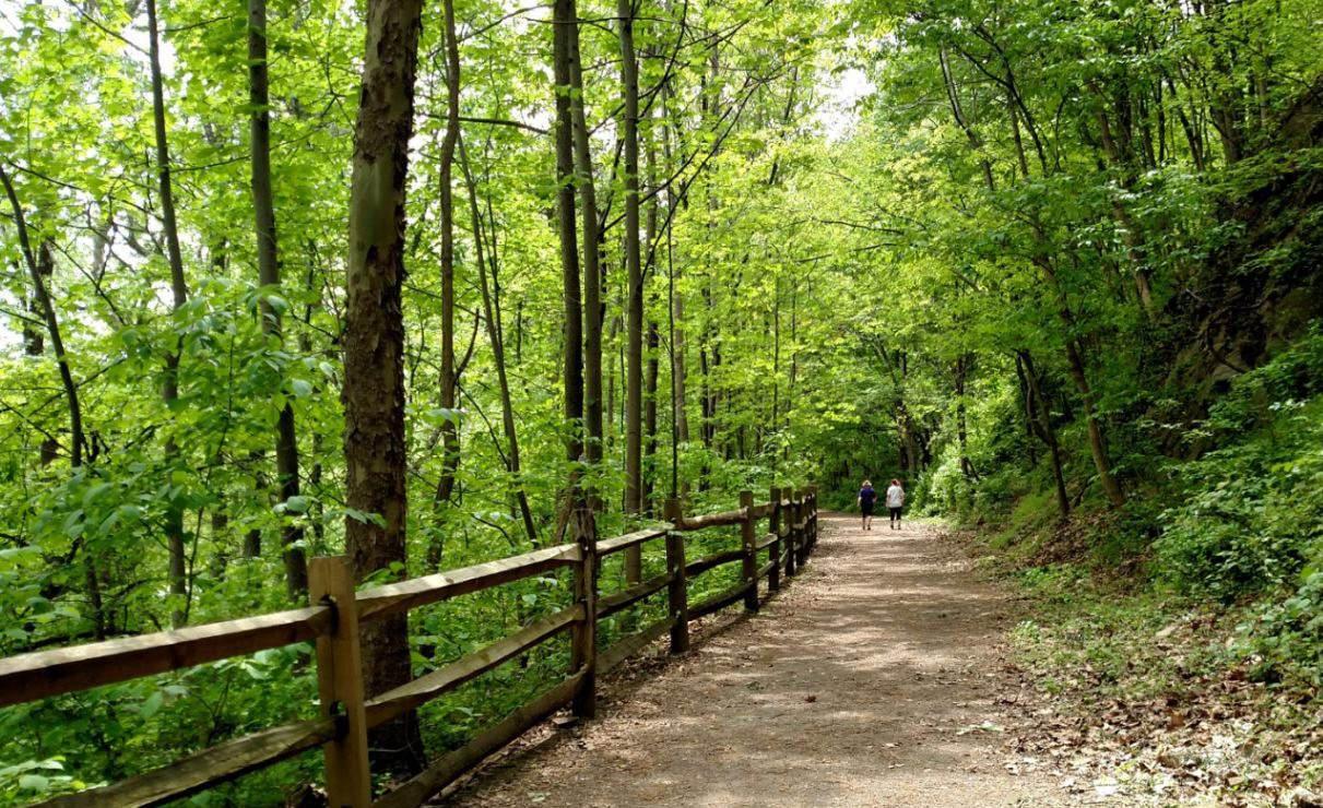

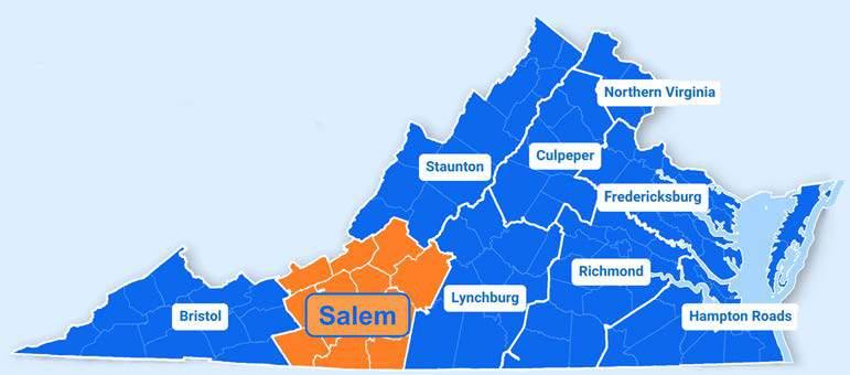
The Roanoke Appalachian Trail Club (RATC) was established in 1932 as a volunteer organization to explore, maintain and protect 120 miles of the AT in the Roanoke area. Designated the McAfee Knob Task Force, one RATC task is to patrol the McAfee Knob, Dragon’s Tooth and Tinker Cliffs sections of the AT.
The Roanoke Regional Airport Commission is an independent subdivision of the Commonwealth of Virginia that owns and operates the RoanokeBlacksburg Regional Airport (ROA). Roanoke City Council appoints four representatives to the Airport Commission, the Roanoke County Board of Supervisors appoints two representatives, and Salem City Council appoints one representative. The Airport Commission is financially independent from the localities of the Roanoke Valley and
receives no local tax revenue.
The Roanoke County Board of Supervisors sets priorities for County transportation projects. The first step in determining project priorities is identifying areas of Roanoke County to study. Planning staff typically lead these studies in partnership with other departments like Economic Development, Administration, and/or Parks, Recreation and Tourism. Public engagement is critical and opportunities for community feedback occur throughout the study. Implementation strategies, which could include proposed transportation projects, are included in the draft study.
The Roanoke County Planning Commission is an advisory board to the Board of Supervisors. The Planning Commission works closely with Planning staff throughout the course of all studies. When
complete, the Planning Commission holds a public hearing on the draft study to make a recommendation to the Board of Supervisors. Another public hearing is held with the Board of Supervisors to consider adoption of the study as part of a County plan.
When the study is complete, staff will identify which implementation strategies could be started first. With Board of Supervisors concurrence, additional studies may be funded to determine conceptual plans and estimates for submission as grant applications. For several grant programs, resolutions of support are obtained from the Roanoke County Board of Supervisors as part of the grant application, particularly if County match funding is proposed.
For Roanoke County-administered projects, the Board of Supervisors needs to adopt ordinances to accept and appropriate grant funds prior to a project beginning and if additional funding is added to the project from other agencies.

The plans discussed in this section were not drafted by Roanoke County, but each plan has contributed to the development of the Roanoke County transportation system, and each continues to do so. The recommendations included in these plans influence Roanoke County’s selection and prioritization of projects, and inclusion as a recommendation in one or more of these plans greatly enhances a project’s chances of receiving grant funding.
Once a plan is in place, the next step is often to undertake one or more studies to examine highpriority plan recommendations in greater detail and narrow down potential locations for projects. Some studies include early-stage project design. The studies discussed in this section, beginning with Arterial Preservation Program Studies on page 6-16, are in various stages of completion. Some
have not yet been completed, while others were completed years ago. Roanoke County, VDOT, and RVTPO all undertake studies that advance Roanoke County transportation projects.
Prepared and adopted by the RVTPO with significant input from localities, the Roanoke Valley Transportation Plan serves as the federally required Long Range Transportation Plan (LRTP) for the RVTPO service area. The latest version of the Roanoke Valley Transportation Plan was adopted in 2023, with a plan horizon of 2045. This plan outlines regional transportation needs and priorities and serves as the foundation for the development of the RVTPO’s Transportation Improvement Program (TIP). The Roanoke Valley Transportation Plan also includes a list of all transportation projects currently funded in the RVTPO service area, and a list of short-term and long-term priority projects for localities and public agencies to pursue in the future.
RVTPO’s 2015 Regional Pedestrian Vision Plan
provides a coordinated and strategic approach for advancing walking as a means of transportation in the Roanoke Valley. This plan identifies where pedestrian infrastructure is most needed in the RVTPO service area based on the potential for residents, employees, shoppers, diners, and other visitors to access nearby destinations.
The 2012 Bikeway Plan was prepared and adopted by the Roanoke Valley Area Metropolitan Planning Organization (RVAMPO), the precursor to RVTPO. This plan provides a coordinated and strategic approach to developing a regional bicycle network in the RVTPO service area. The Bikeway Plan provides recommendations for bicycle infrastructure that would advance bicycling as a means of transportation in the Roanoke Valley by enhancing connectivity between activity centers, cultural resources, and other points of interest.
The 2020 Rural Bikeway Plan was prepared and adopted by RVARC, as RVTPO only serves the
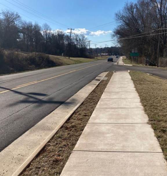
urbanized area of the Roanoke Valley. This plan identifies bicycle infrastructure improvements for localities to consider in the rural parts of the RVARC service area. The Rural Bikeway Plan also identifies why people bicycle in these rural areas, where exactly they are bicycling, and the quality of existing bicycle facilities.
The Roanoke Valley Greenway Plan sets the foundation for greenway development in the Roanoke Valley by providing coordinated recommendations for greenway projects across the five member jurisdictions of the Roanoke Valley Greenway Commission. The Greenway Plan is developed by the Roanoke Valley Greenway Commission in conjunction with its member jurisdictions. The Roanoke Valley Greenway Plan is a ten-year plan, and it has been updated roughly every ten years since the first iteration of the plan was published in 1995. An update was published in 2007, and the most recent iteration was published in 2018. The Greenway Commission is currently working on a five-year update to the Greenway Plan, which is anticipated to be finalized in 2024. The Roanoke Valley Greenway Plan has been
adopted as a component of the Roanoke County Comprehensive Plan by the Roanoke County Board of Supervisors.
RVTPO’s 2016 Roanoke Valley Transit Vision Plan provides a roadmap for expanding and improving transit service in the Roanoke Valley. This plan provides short-term (2016-2022), mediumterm (2022-2030), and long-term (2030-2040) recommendations for extending bus routes, increasing service frequency on existing routes, and adding new routes.
The designation of the Roanoke Urbanized Area as a Transportation Management Area (TMA) following the 2010 Census brought with it the requirement that the RVTPO produce a congestion management process (CMP) for the Roanoke Urbanized Area. The Traffic Congestion Management Process, first published in 2014 and updated in 2020, serves as the CMP for the RVTPO service area and identifies priority corridors for congestion management activities as well as
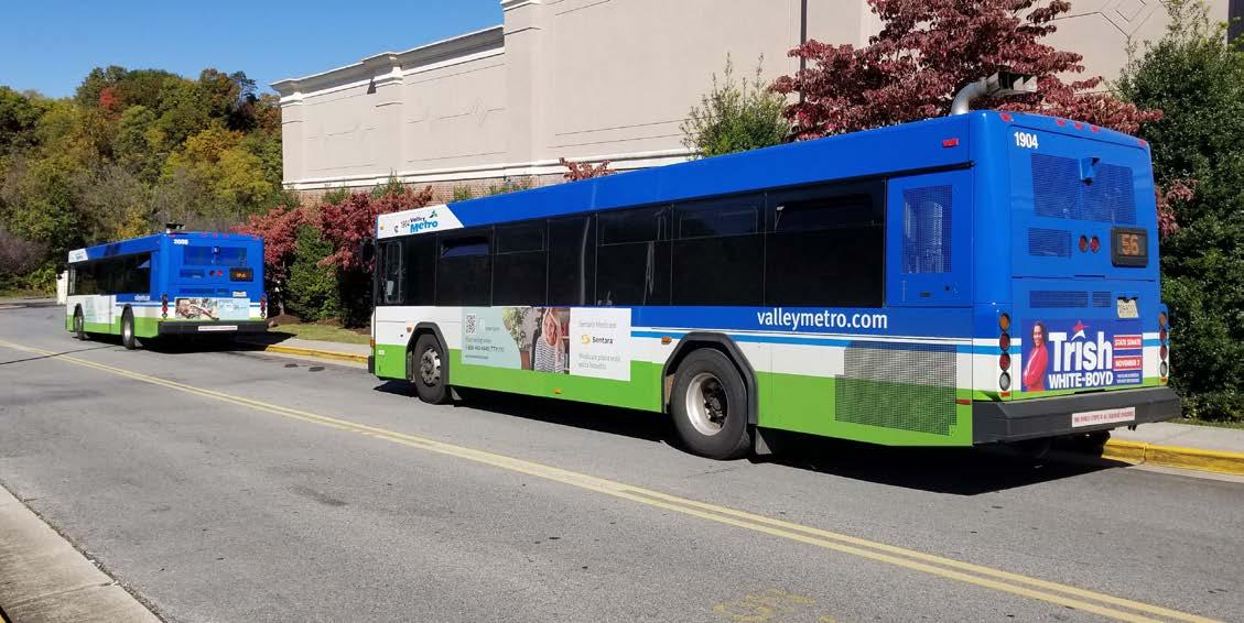
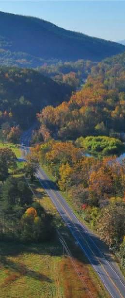
strategies to reduce and mitigate congestion in the RVTPO service area.
The 2014 Partnership for a Livable Roanoke Valley Plan outlines numerous strategies to safeguard and improve quality of life in the Roanoke Valley. This plan focuses on promoting economic development, workforce development, health, and natural assets, and many transportation strategies are recommended to advance the region’s progress in these areas. The Partnership for a Livable Roanoke Valley Plan was facilitated by RVARC.
A Comprehensive Economic Development Strategy (CEDS) is a prerequisite for a region to be designated an Economic Development District (EDD) by the U.S. Economic Development Administration (EDA). EDD designation enhances the ability of regional entities and localities to obtain grants from the EDA. The Roanoke ValleyAlleghany Regional Comprehensive Economic Development Strategy is the CEDS for the RVARC service area, and is updated and adopted annually by RVARC. This document provides an economic roadmap for the RVARC service area by assessing the regional economy, establishing reginal goals and objectives, and outlining an action plan of priority projects (including transportation projects) to advance these goals and objectives. In 2017, the EDA designated the RVARC service area as an EDD.
In 2018, the RVTPO prepared and adopted the Regional Study on Transportation Project Prioritization for Economic Development and Growth to identify how the region’s economic vitality can be supported through transportation
projects. The 2018 Regional Study on Transportation Project Prioritization for Economic Development and Growth provided a high-level overview of the regional economy and identified transportation projects that could help advance the region’s economic priorities. In 2021, the Regional Study on Transportation Project Prioritization for Economic Development and Growth was updated, with a greater focus on engaging local businesses and economic development stakeholders, and a new list of transportation project recommendations.
In January 2023, Roanoke County, Botetourt County, and the Town of Vinton were awarded planning funds through the Safe Streets and Roads for All Grant Program (SS4A) to create a joint Comprehensive Safety Action Plan covering those three jurisdictions.
This planning process will run through 2024 and will include three phases:
• An analysis of crashes over the previous five or more years that have resulted in a fatality or serious injury, the modes of transportation involved in these crashes, and the demographic characteristics of the people involved in these crashes. This will inform the identification of a “high-injury network” spanning all three jurisdictions
• Feedback gathered during a public outreach process will be considered, along with the high-injury network, to develop a prioritized and comprehensive set of recommendations for each locality. These recommendations will consist of projects, strategies, and policies
• Conceptual design plans and cost estimates will be produced for each locality’s highest priority project
SS4A offers implementation grants for projects included in Comprehensive Safety Action Plans. Roanoke County will seek implementation
grants to construct projects recommended in the Comprehensive Safety Action Plan once it is complete.
In 2018, the CTB adopted the Interstate 81 (I-81) Corridor Improvement Plan, a joint effort between OIPI, VDOT, and DRPT to identify improvements to address the delays that have become increasingly common on I-81 as traffic, especially tractor trailer traffic, has increased over time. The plan identifies recommendations of capital improvements to be funded in the next ten years. All the segments of I-81 in Roanoke County for which an additional lane had not yet been funded were recommended for additional lanes in the plan, except for southbound I-81 between Exit 128 (in Montgomery County) and Exit 137. All the segments of I-81 in Roanoke County for which an additional lane was recommended in the I-81 Corridor Improvement Plan have since been funded through the I-81 Corridor Improvement Fund that was created in 2019 to fund projects recommended in the plan. Per § 33.2-3604 of the Code of Virginia, the CTB must “regularly” update the plan.
In 2019, the Roanoke Regional Airport Commission initiated an update of the Roanoke-Blacksburg Regional Airport (ROA) Master Plan, the first update to the Airport Master Plan since 2008. The Airport Master Plan evaluates and determines ROA’s long-term needs and development plans for the next twenty years. The Airport Master Plan is necessary to prepare the airport for anticipated increases in demand for commercial passenger flights, air cargo, and general aviation, and for the emergence of new technologies. The Airport Master Plan also examines opportunities to support other economic and development uses at ROA.
The Airport Master Plan was approved by the Roanoke Regional Airport Commission in July 2023 and submitted to the Federal Aviation Administration (FAA) and Viginia Department of Aviation (DOAV) for final approval. FAA and
DOAV are expected to reach a determination by Spring 2024. The draft Airport Master Plan includes five potential alternatives for extending runways, two of which would extend into Roanoke County (over Peters Creek Road or over Dent Road). The draft Airport Master Plan also recommends the construction of four “vertiports” at ROA to serve Electric Vertical Takeoff and Landing Aircraft (eVTOLs), an emerging technology that is discussed on pages 6-71 and 6-72.
VTrans is Virginia’s statewide transportation plan, prepared on behalf of the CTB by OIPI. This plan lays out the overarching vision and goals for transportation within the Commonwealth and outlines strategies for realizing these goals. VTrans includes two planning horizons - Mid-Term (0-10 years) and Long-Term (20+ years) – and utilizes different approaches for these two planning horizons.
For the Mid-Term planning horizon, VTrans identifies needs in specific locations within three travel markets - Regional Networks (see pages 6-38 and 6-39), Corridors of Statewide Significance (see pages 6-40 through 6-42), and Urban Development Areas (called Designated Growth Areas in Roanoke County) - as well as priority locations to focus on in these travel markets. For the Long-Term planning horizon, VTrans identifies megatrends, or powerful and transformative forces, and macrotrends, or emerging patterns of change, that are anticipated to influence transportation throughout the Commonwealth, as well as a register of risks and opportunities relating to these megatrends and macrotrends. VTrans is updated at least once every four years, and the most recent update was adopted by the CTB in 2021.
VDOT initiated the Arterial Preservation Program to improve the capacity and safety of roadways that are part of the Arterial Preservation Network. In the Roanoke region, roadways in the Network are Route 220 and Route 460.
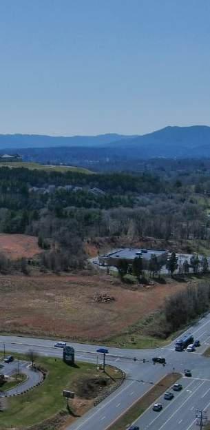
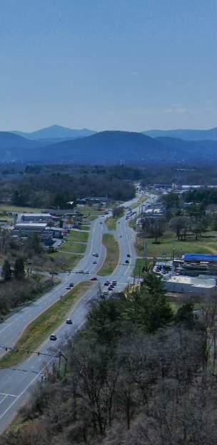
The U.S. 220 Arterial Preservation Program Study began in Fall 2017. The section of U.S. 220 studied started at U.S. 220 Business (Franklin Road in the City of Roanoke) to the North Carolina state line, a distance of about 43 miles. Consultants reviewed locality, regional and statewide studies relevant to the corridor, evaluated existing conditions including crash locations and types of crashes. Safety improvement recommendations were generated with an emphasis on utilizing Innovative Intersections, which are concepts that change traffic movements to improve safety, reduce delay and increase efficiency. It was determined that because of the high traffic volumes and high crash rates between U.S. 220 Business/Franklin Road and Indian Grave Road/Clearbrook Village Lane that an additional study would be undertaken to look at the northern portion of the corridor in Roanoke County and the City of Roanoke. This study was undertaken as a means to implement a portion of an Interstate 73 Earmark intended to improve access management along the Route 220 corridor between the Martinsville Bypass and Interstate 581 in Roanoke. Eight traffic signals were identified for modifications to reduce one traffic signal phase from four phases to three. This change in the traffic signal to a Through-Cut configuration prohibits through movements from side street to side street, and instead requires a right or left turn and either a u-turn at the next opportunity or a turn into a different roadway or entrance to access the destination. The Through-Cut reduces congestion, improves safety, minimizes impacts to businesses by rerouting a very small percentage of traffic and is cost effective. Four intersections along Route 220 in the City of Roanoke and Roanoke County are funded through this earmark for construction in 2024:
• Valley Avenue/Southern Hills Drive
• Crossbow Circle/Pheasant Ridge Road
• Buck Mountain Road/Stable Road
• Indian Grave Road/Clearbrook Village Lane
The U.S. 460 Arterial Preservation Program Study also began in Fall 2017. The extent of the corridor
studied began at Interstate 81 in Botetourt County on Route 220 Alternate and continued along Route 460 to Nottoway County. Consultants again studied existing plans and existing conditions. The Route 460/Challenger Avenue signalized intersection at Route 220 Alternate/Cloverdale Road showed the highest number of crashes on the corridor. Several recommendations were proposed to improve safety at this intersection. The preferred recommendation, a Displaced Left-Turn, was carried over to and included within a Strategically Targeted Affordable Roadway Solutions (STARS) Route 460 Corridor Improvement Study.
The Strategically Targeted Affordable Roadway Solutions Program (STARS) was launched by VDOT in 2007 to support the development of affordable and short-range projects to address congestion bottlenecks and safety issues throughout the Commonwealth of Virginia. In the aftermath of the Great Recession, the program’s focus shifted to developing corridor studies and conceptual design plans to address more complex congestion and safety issues with innovative, affordable long-term solutions. This remains the focus of the program today, as funding for transportation projects has still not returned to pre-Recession levels (adjusted for inflation), putting complex widening and capacity expansion projects out of reach for most localities. On top of reduced funding availability, high inflation in the wake of the COVID-19 pandemic has led to dramatic increases in project costs, further necessitating the availability of innovative, affordable solutions to address critical traffic and safety challenges.
One STARS study has been completed in Roanoke County in the past five years, the Route 460 (Orange Avenue/ Challenger Avenue) Corridor Improvement Study. This study began in September 2019 and built upon recommendations included in the U.S. 460 Arterial Preservation Program Study. The corridor studied extended from Williamson Road/Route 11 in the City of Roanoke to Cloverdale
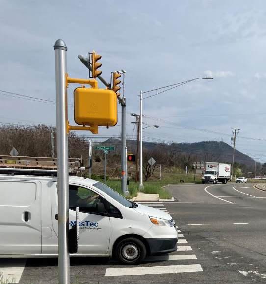
Road/Route 220 Alternate in Roanoke County. An existing conditions analysis showed many high crash intersections. A survey was conducted along with an in-person community meeting in November 2019. Intersection alternatives were presented to the localities and to the public at a June 2020 virtual meeting. Seven projects were ultimately chosen for submission into the SMART SCALE program. Five of the seven projects were funded with two located in Roanoke County (these two projects have since been combined into one project):
• Route 460 at West Ruritan Road Intersection Improvements
• Route 460 Intersection Improvements from Carson Road to Huntridge Road
A third STARS-recommended project in Roanoke County, Route 460/Challenger Avenue and Alternate Route 220 Intersection Improvements,
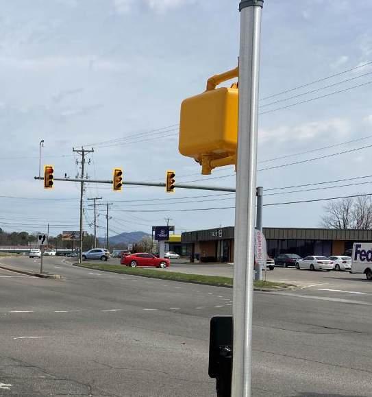
was funded by the CTB with surplus funding in December 2021.
Project Pipeline is a performance-based planning program that was launched in 2021 with the goal of identifying cost-effective solutions to VTransidentified transportation needs in VTrans-identified priority locations. The program is a collaborative effort between OIPI, VDOT, and DRPT. Project Pipeline is modeled on STARS, but with a focus on implementing VTrans. The vision for the program is that it will conduct efficient studies that will provide state funding programs with a steady stream, or “pipeline,” of well-developed projects that address the statewide transportation priorities laid out in VTrans.
Roanoke County requested and VDOT initiated a Project Pipeline Initiative study along Route 419 between the City of Salem and Bower Road in
2021 because the corridor includes VTrans Priority Level 2 Needs. This corridor also coincides with Route 419 intersection concerns identified by area residents and businesses as part of the Oak Grove Center Plan. Consultants completed an existing conditions analysis and needs identification, followed by build alternatives analysis. A survey was conducted in March 2022 which helped to identify which projects would be submitted for SMART SCALE funding. Roanoke County assembled two applications comprising several Innovative Intersection modifications and sidewalks. One project located between Stoneybrook Drive and Grandin Road Extension has been funded. The study concluded with the publication of a final report in December 2022.
In May 2023, VDOT initiated two new Project Pipeline studies in Roanoke County: One for Peters Creek Road and Williamson Road between Wood Haven Road and Plantation Road, and another for the Route 11/460/West Main Street at Dow Hollow Road intersection. The purpose of the Peters Creek Road and Williamson Road study is to identify project recommendations that would improve roadway safety, reliability, and multimodal accessibility and connectivity, and address transportation demand management needs. The purpose of the Route 11/460/West Main Street at Dow Hollow Road intersection study is to identify project recommendations that would improve roadway safety while preserving capacity. Public outreach for these studies concluded in Spring 2024, and it is anticipated that both studies will be finalized in Summer 2024. Their recommendations will be submitted for SMART SCALE Round 6 applications in 2024.
In Spring 2022, Roanoke County applied for and was awarded technical assistance through the National Park Service Rivers Trails, and Conservation Assistance Program (NPS-RTCA) to study potential routes for the Roanoke River between Green Hill Park and Montgomery County. The West Roanoke River Greenway Feasibility Study began in Summer 2022. In October 2022, the first round of public
outreach was held, consisting of two community meetings and survey. In the first round of public outreach, participants identified how often they use greenways and how they use them, gave feedback on potential greenway amenities, identified destinations they’d like to see the greenway connect to, and noted how close they would like the greenway to be to their property.
A second round of public outreach was held in Summer 2023, consisting again of two community meetings and a survey. This time, participants gave feedback on conceptual routes for the greenway. As of October 2023, Roanoke County and NPS-RTCA staff are working to draft the West Roanoke River Greenway Feasibility Study document, which will contain multiple potentially viable routes for the Roanoke River Greenway between Green Hill Park and Montgomery County.
In June 2023, The Roanoke County Board of Supervisors approved the County’s budget for Fiscal Year 2024, which included funding to study potential routes for the Roanoke River Greenway between the City of Roanoke and the newlycompleted 0.4-mile section of the Roanoke River Greenway just west of the Blue Ridge Parkway. This study will start in 2024.
VDOT initiated the Route 11/460 Corridor Study in 2013 between Technology Drive in Roanoke County and Interstate 81 Exit 118 in the Town of Christiansburg. The study analyzed existing conditions for vehicles, bicycles and pedestrians, determined a long-term vision for the corridor and provided recommendations for future improvements. Short-term, mid-term and long-term recommendations are included and have provided a foundation for additional studies along the corridor. The intersection at Route 11/460/West Main Street at Dow Hollow Road near Interstate 81 Exit 132 continues to have a high number of crashes and is under investigation by
VDOT and the county for potential improvements.
VDOT assisted Roanoke County in its efforts to improve Plantation Road between Interstate 81 and Route 11/Williamson Road by initiating a Plantation Road Corridor Study. The study was completed in May 2012 and included recommendations for pedestrian crosswalks, pedestrian and bicycle accommodations, and opportunities for landscaped medians. Most importantly, a traffic signal warrants analysis indicated that a traffic signal could be warranted at the Plantation Road/Lila Drive intersection.
The Roanoke Valley Area Metropolitan Planning Organization partnered with VDOT on a study of the entirety of Route 419 in 2010. The Route 419 Corridor Study is a multimodal transportation plan for the 9.5-mile-long corridor between Interstate 81 and U.S. 220 and involved the City of Salem, City of Roanoke and Roanoke County. The study included two public meetings, a review of existing conditions including crash analysis and a number of specific multimodal recommendations for intersections along the corridor. The Route 419 Corridor Study has proven to be a valuable reference that has been utilized for every Route 419 grant application submitted since the study’s completion.

The 2005 Comprehensive Plan included recommendations to add lanes to all primary routes and several secondary routes in Roanoke County. This is no longer feasible due to cuts to transportation project funding during the recession that began in 2008, changes in the priorities of funding programs, and a dramatic increase in the cost of constructing transportation projects. With several new transportation funding sources available over the last decade, additional staff and resources have been dedicated to scope, request funding, design and construct a variety of transportation projects.

Roanoke County and VDOT are constantly working to keep motorists safe and traffic flowing smoothly. VDOT owns, operates, and maintains the roads in Roanoke County, but both Roanoke County and VDOT analyze data and conduct research and public outreach to plan projects that address issues faced by Roanoke County roads.
Roadways are used by every citizen in the County and roadway safety is of paramount importance. Safety is typically the most important factor when considering new roadway projects. Both VDOT and Roanoke County Police track crash data which provides invaluable information to determine which roadway segments and intersections should
be analyzed for potential safety improvements. For instance, the chart on this page shows the ten intersections with the highest crash counts in Roanoke County. The ability to collect this information for specific locations around the County helps the Board of Supervisors to make informed decisions on where limited funds should be focused.
This data can also help determine the effectiveness of new roadway projects. For instance, Route 419 between Starkey Road and Route 220 is the busiest corridor in Roanoke County. Significant crash data has been documented at most intersections throughout this corridor. Roanoke County applied for and was awarded SMART SCALE funding for the Route 419 Widening, Safety and Multimodal Improvements project between Route 220 and Ogden Road in 2016. VDOT constructed the project in 2020 and 2021.
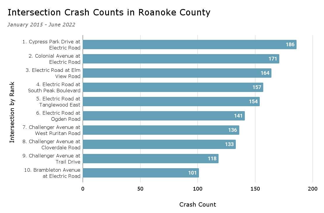
Bedford County
Interstate
Principal Arterial
Minor Arterial
Major Collector
Minor Collector
Local

Roanoke County does not have any roadways in the “Other freeways and expressways” functional class
Functional classification is the grouping of streets and highways into classes based on the character of service they are intended to provide. Roadways are grouped into one of seven functional classes, which are shown below in descending order from highest intensity of use to lowest intensity of use:
• Interstates
Town of Bedford
• Other freeways and expressways
• Other principal aterials
• Minor arterials
• Major collector
• Minor collector
• Local
Since the passage of the Federal Aid Highway Act of 1973, all states have been required to group all of their roads that are eligble for federal funding into the seven classes outlined above. The Federal Highway Administration (FHWA) provides uniform guidelines for functional classification to the states, so that there is consistency across state boundaries. In Virginia, functional classification is determined by VDOT’s Transportation and Mobility Planning Division (TMPD).
A roadway’s functional class determines its geometric design standards and maintenance requirements. Eligibility for federal funding and for traffic calming are also determined by a roadway’s functional class.
The table on the following two pages details the functional class and length of every segment of roadway in Roanoke County classified something other than “local,” and is color coded to the map on this page.
• Before: The location with the highest crash count, near the intersection of Ogden Road and the intersection of Cypress Park Drive, averaged about 50 crashes per year in 2018 through 2020.
• After: the same location dropped to 24 crashes in one year, between July 2021 and June 2022.
The Route 419 project addressed five of the top ten high-crash intersections in Roanoke County (Cypress Park Drive, Elm View Road, South Peak Boulevard, Tanglewood East Entrance Road and Ogden Road).
VDOT proposed and constructed a project at another location along Route 419 at Colonial Avenue. The project, which offset the Route 419 left turn lanes onto Colonial Avenue to improve sight distance for drivers turning left on the permissive yellow phase (flashing yellow arrow), was constructed in 2020. This project addressed the location with the second highest crash count in the County.
The three high-crash locations on Route 460/ Challenger Avenue were analyzed as part of the
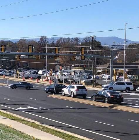
Route 419 at Tanglewood Mall
Route 460 (Orange Avenue/ Challenger Avenue) Corridor Improvement STARS Study completed in 2020. Three projects received SMART SCALE funding in 2021 and are currently in design:
• Route 460 at West Ruritan Road Intersection Improvements
• Route 460 Intersection Improvements from Carson Road to Huntridge Road
• Route 460/Challenger Avenue and Alternate Route 220 Intersection Improvements
The remaining top ten crash location is Route 419 at Route 221/Brambleton Avenue. The top ten crash locations will continue to change over time as safety improvements are constructed and as new traffic patterns emerge with new development.
VDOT maintains and annually updates two publicly available traffic volume datasets covering all VDOT roadways: Average Daily Traffic (ADT) and Annual Average Daily Traffic (AADT). Both metrics are useful for transportation planning and decision-making, and provide critical information for designing, maintaining, and improving transportation infrastructure to meet the needs of current and future traffic demands. ADT is the number of vehicle trips taken on a roadway over the course of any number of days, divided by that number of days. AADT is the number of vehicle trips taken on a roadway over the course of an entire year, divided by 365 days. AADT is considered the more reliable measurement of traffic volume and is more frequently cited than ADT.
The tables on pages 6-28 and 6-29 show the County’s top ten highest-trafficked roadway segments according to the AADT data from 2019 and 2021. AADT data from 2019 was used in the existing conditions analysis for this plan. This is because traffic volumes in 2021 were still somewhat suppressed by the COVID-19 pandemic. It is anticipated that by the time of the adoption of this Plan, traffic volumes will have mostly returned to pre-pandemic levels.
The map on page 6-30 shows AADT for all Roanoke County roadways on which AADT was collected in 2019. However, since road projects are usually constructed multiple years after funding applications are submitted and will ideally serve vehicular traffic for decades into the future, VDOT also makes projections about future traffic volumes. The map on page 6-32 shows projected AADT for 2045.
Traffic volume figures like AADT provide a sense of the level of congestion on a roadway, but they do not tell the whole story. AADT is not calculated on a per-lane basis, so a road with multiple lanes may have much higher AADT than a road with one lane, but less congestion if it has fewer vehicles per lane than the one lane road. In addition, other factors like geometry and signal timing can contribute to congestion.
To measure the overall operating conditions of a roadway, Roanoke County and VDOT use a measurement called Level of Service (LOS). Level of Service analyzes a variety of factors, such as speed, travel time, maneuverability, delay, and safety, to assign each roadway segment a score of “A” through “F,” with “A” indicating free-flow traffic and “F” indicating stop-and-go traffic. The map on page 6-31 shows VDOT’s 2019 LOS calculations for Roanoke County roads. The map on page 6-33 shows projected LOS for 2045.
Roanoke County has intentionally focused its limited dollars on high-volume, low LOS roadway segments - Route 419 between Starkey Road and Route 220 (highest-volume non-Interstate segment, D Level of Service), and Route 460 between the City of Roanoke and Botetourt County (second highest-volume non-Interstate segment, C Level of Service) - to address congestion and safety issues on those roads.
There are a few areas in which roadways in Roanoke County are outdated and in need of update. Most arterial and collector routes in Roanoke County were designed either in the centuries before World War II, when the County was predominantly rural,
or in the first few decades following World War II, when the flatter areas of the County near the City of Roanoke were becoming suburban in character but had not been developed to anywhere near the degree that they are today. Some of the most important roadways in Roanoke County are struggling to accommodate the traffic generated by the development that has occurred in the years since they were designed. Roanoke County has pursued, and continues to pursue, innovative, cost-effective roadway improvements to reduce the congestion brought about by previous development, and keep traffic flowing smoothly as development continues.
Many of the roadways built in the county were built during a time of urban and suburban sprawl with only automobiles in mind. Over the last 20 years, County residents have increasingly requested accommodations for walking and bicycling. These alternative modes of transportation are now considered with most roadway projects.
Aging, unsafe bridges are a problem throughout the United States. In 2021, the average age of bridges on public roads in the United States was 45 years old, up from 42 years in 2003 (Hartman, 2021; Chase, et al, 2003). The 2023 National Bridge Inventory rated 6.8% of bridges in the United States and 3.5% of bridges in Virginia as “structurally deficient.” Structurally deficient bridges are bridges that are closed to traffic or require reduced weight limits and/or significant maintenance or repair to remain open to traffic. These bridges usually require eventual rehabilitation or replacement to remain in service over the long term. Luckily, there are no structurally deficient bridges in Roanoke County, but this may change as Roanoke County’s bridges age.
Upgrading and coordinating traffic control devices with newer technology has also shown significant benefits to increase traffic flow and safety. VDOT is also encouraging the integration of Innovative Intersections, like roundabouts, to improve roadway safety. The roundabout completed in 2022 at the intersection of Route 311 and Route 419 has dramatically improved travel times by eliminating the traffic signal at that intersection.
Ultimately, the challenges of safety, congestion, and outdated infrastructure are interrelated and should all be considered when identifying and planning for future projects.
Access Management is an approach to locating, spacing, and designing entrances, street intersections, median openings, and traffic signals that focuses on minimizing conflict points and thus reducing crashes and congestion. Access Management regulations for VDOT roadways were first implemented in 2008 (principal arterials) and 2009 (minor arterials, collectors, and local roads), and in 2013 were combined into one unified set of regulations. Access Management design standards for all VDOT roadways were adopted as an appendix of the VDOT Road Design Manual in 2011. These regulations and design standards have helped to preserve safety and capacity on Roanoke County’s winding rural roadways, on which sight distance calculations for entrances, intersections, and median openings may have been made with slower automobiles in mind, and on arterial and collector roads in the suburban parts of the County, which already have too many points of access due to strip commercial development.
Innovative Intersections and Interchanges are alternative intersection or interchange configurations that are intended to improve traffic flow and safety. Innovative intersections give localities new, more affordable options for improving traffic flow and safety at problem locations where traditional widening, redesign, or relocation projects may be infeasible or ineffective. VDOT has approved thirteen innovative intersection designs, and seven innovative interchange designs, for use in Virginia. The following Innovative Intersection and Interchange designs have been constructed, or are funded to be constructed, in Roanoke County.
Roundabout
Roundabouts are circular, unsignalized intersections
where all traffic moves counterclockwise around a central island. Roundabouts can be constructed with either one or two, circular, interior lanes. Vehicles in the circular lanes possess the right of way and vehicles entering the roundabout must yield. Roundabouts have been constructed at the following intersections in Roanoke County, all with a single circular lane:
• Route 311, Route 419, and Orange Market (1821-1827 Thompson Memorial Drive)
• Penn Forest Boulevard and Colonial Avenue
• Merriman Road, Meadowlark Road, Penn Forest Elementary School (6328 Merriman Road), and the South County Library (6303 Merriman Road)
• Starkey Road and Buck Mountain Road
A thru-cut is an intersection where through movements from side streets are prohibited. To complete a through movement, side street vehicles must turn left or right then make another turn at an existing opening. A project, which implements recommendations from the Route 460 (Challenger Avenue) Corridor Improvement Study, is funded to improve intersections on Route 460 between West Ruritan Road and Huntridge Road. This funded project includes the installation of a thru-cut at West Ruritan Road and CVS Pharmacy (3909 Challenger Avenue). Thru-cuts are also funded for four intersections on Route 220 between the City of Roanoke and Franklin County, implementing recommendations from the 2017 U.S. 220 Arterial Preservation Program Study.
Also known as “superstreet” intersections, Restricted Crossing U-Turn (RCUTs), are intersections where all side street movements start with a right turn. Dedicated downstream median openings are constructed so that vehicles originating from side streets can complete the through and left turn movements. The intersection at Route 419 and Bernard Drive, near the Roanoke County Administration Center, is an RCUT. Roanoke
County was recently awarded funding to construct two more RCUTs on Route 419, at Stoneybrook Drive and Member One Federal Credit Union (2310 Electric Road), and at Glen Heather Drive. Additionally, as part of the funded project for Route 460 intersections between West Ruritan Road and Huntridge Road, RCUTs will be constructed on Route 460 at Carson Road, at East Ruritan Road, at Bonsack Road, and in front of the Country Corner Store (4723 Challenger Avenue).
A modified “half RCUT” will be constructed at the Huntridge Road intersection. This modified RCUT will prohibit left turns from Huntridge Road onto Route 460 eastbound and eastbound-to-westbound U-turns on Route 460, and will only allow left turns from eastbound Route 460 to Huntridge Road.
A Continuous Green-T (CGT) is a three-legged intersection on a divided highway where one direction of travel on the divided highway can continue through the intersection without stopping, and the other direction of travel on the divided highway has a signalized intersection with the roadway that is connecting to the divided highway. Roanoke County has received funding to construct a CGT at the intersection of Route 460 and Route 220 Alternate (westbound Route 460 will be signalized and eastbound Route 460 will not). This project implements a recommendation of the Route 460 (Challenger Avenue) Corridor Improvement Study.
A Displaced Left Turn (DLT) is a leg of an intersection where vehicles cross to the other side of the opposing through traffic in advance of an intersection. As part of the funded Route 460 at Route 220 Alternate project, a DLT will be utilized for the signalized left turn movement from Route 220 Alternate onto eastbound Route 460. This DLT was recommended in both the U.S. 460 Arterial Preservation Program Study and the Route 460 (Challenger Avenue) Corridor Improvement Study.
A Diverging Diamond Interchange (DDI) is a
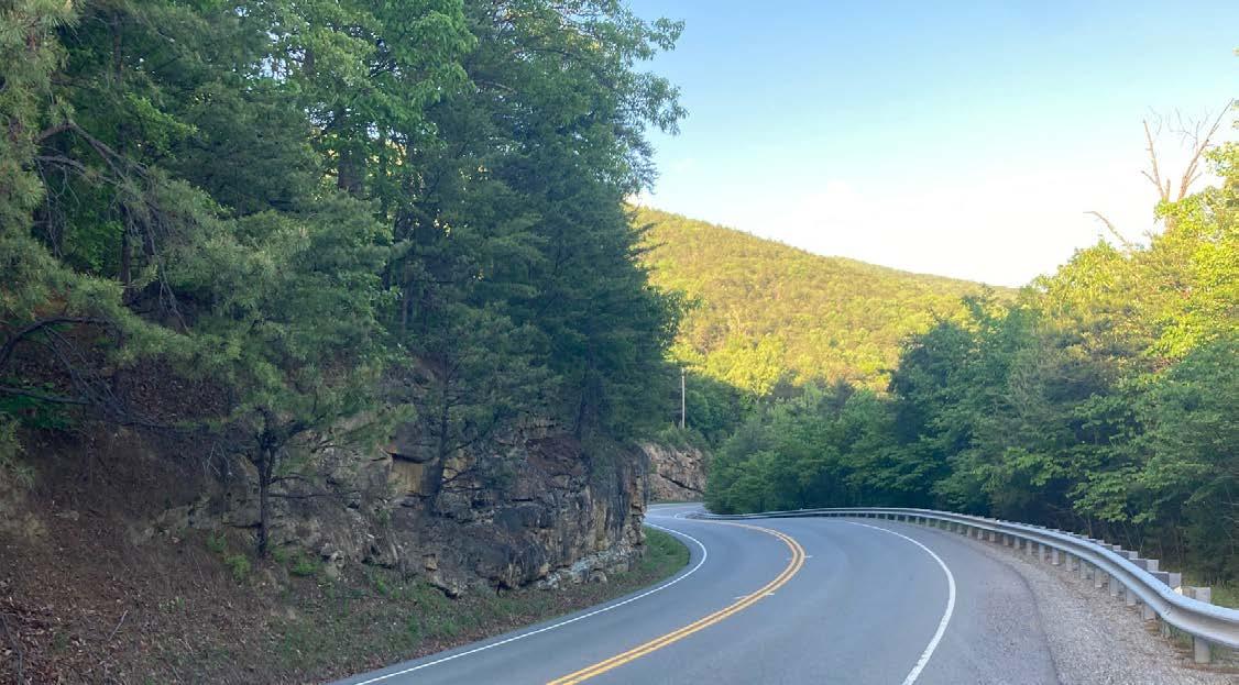
grade-separated interchange where traffic on the intersecting arterial roadway crosses to the other side of opposing through traffic for the distance between freeway ramps. This requires two signalized “crossovers” where vehicles on the arterial roadway switch sides, first from the right side to the left side, then back to the right side. This configuration allows all movements on and off freeway ramps to be unsignalized. The Interstate 581/Valley View Boulevard interchange in the City of Roanoke is a modified “half DDI” with only one crossover, as Valley View Boulevard does not continue west of I-581. Roanoke County has secured funding to construct the first full DDI in the Roanoke Valley at the Route 220/Route 419 interchange, which is also partially located in the City of Roanoke.
VDOT maintains all public roadways and associated right-of-way that extends beyond the edge of pavement in Roanoke County. Typical maintenance activities include:
• Repairing pavement and resurfacing/ surface treatment, to include striping where applicable
• Removing snow
• Keeping traffic signals operational
• Repairing and replacing regulatory signs
• Mowing grass and trimming vegetation to maintain sight distance and sign visibility
• Maintaining stormwater management infrastructure associated with roadways except on subdivision streets and rare cases of County-maintained facilities on VDOT-owned right-of-way
The VDOT Salem Residency dedicates funding for Roanoke County through the Secondary Six-Year Program for the following activities:
• Traffic Services
• Engineering and Surveying
• Fertilization and Seeding
• Right-of-Way Engineering
These accounts are charged when Roanoke County requests related tasks or assistance that fall within these categories.
As greenways and multimodal transportation projects are completed, it is important to dedicate sufficient County funding and resources to maintain these facilities. While some projects like sidewalks and bicycle lanes may be located within the VDOT right-of-way, VDOT does not have resources available to weed, sweep or mow grass adjacent to these facilities. Greenways are typically located outside of VDOT right-of-way so these facilities are Roanoke County’s responsibility to maintain.
VDOT operates five Traffic Operations Centers (TOCs) throughout the Commonwealth, and one TOC is located in Roanoke County near Interstate 81 Exit 140. TOCs utilize Intelligent Transportation Systems (ITS) - advanced applications that deliver innovative services to enable users to make safer, more coordinated, and smarter use of transport networks – to monitor traffic conditions and deliver traffic information to motorists, program changeable message signs, monitor weather conditions, control access at busy interstate on-ramps (no on-ramps in Roanoke County require this), provide rapid response to roadway incidents, and coordinate signals on detour routes.
Throughout the Commonwealth, VDOT uses changeable message signs to convey vital real-time information about traffic incidents, congestion, work zones and inclement weather to motorists. In 2021, VDOT installed thirty changeable message signs in the Interstate 81 (I-81) corridor to implement recommendations of the I-81 Corridor Improvement Plan. Twenty-one of these signs were
installed on I-81, and nine were installed on the busiest interstates and arterial routes that feed into I-81 to deliver information to motorists to help them decide whether to merge onto the interstate. One new sign was installed on northbound I-81 at mile marker 142 in Roanoke County, and another new sign was installed on southbound I-81 at mile marker 147.3 in Botetourt County - 0.1 mile before southbound motorists enter Roanoke County.
The VDOT Salem District also owns a number of portable changeable message signs that are deployed throughout the district, including in Roanoke County, to convey real-time information on a short-term basis to motorists on lower traffic roadways.
In recent years, VDOT has coordinated signals at key intersections on four principal arterial routes in Roanoke County: U.S. Routes 220, 221, and 460, and State Route 419. This has improved traffic flow on these routes and has been well-received by citizens, who have consistently called for more signals to be coordinated. However, the cost of coordinating signals is high so the coordination of traffic signals throughout the Roanoke Valley will be a slow process. Coordination of signals on I-81 detour routes will be the top priority.
In parallel and in support of the 2018 I-81 Corridor Improvement Plan, OIPI developed at least one incident detour plan for each exit-to-exit segment of I-81 in Virginia. Incident detour plans were developed for some short segments between the off-ramp and on-ramp at the same exit, as well. These plans were developed in conjunction with VDOT, Virginia State Police, and localities. Thirteen different incident detour plans utilize Roanoke County roadways. South of Exit 140 in Roanoke County, these plans mostly utilize Route 11/460 as a detour route. North of Exit 140, these routes utilize a wide range of corridors including (from west to east) Thompson Memorial Drive, North Electric Road, Peters Creek Road, Interstate 581, Williamson Road, and Plantation Road. Since the
Regional Network
Localities in VTrans Roanoke Region
Virginia Localities Outside of VTrans Roanoke Region
Interstates, Freeways, and Arterials
Other Public Roads
Need for Congestion Mitigation
Need to preserve and enhance capacity by improving access management, reducing signals or signal phases, and implementing innovative intersection configurations
Need for new or expanded public transportation services and facilities, bicycle and pedestrian facilities, coordination of commuter assistance programs, and Shared Mobility
Need for Transit Access Improvements
Need for Pedestrian Access Improvements
Need for Safety Improvement (Segment)
Need for Improved Travel Time Reliability
Need for new or expanded park and ride facilities, rail and public transportation services and passenger facilities, bicycle and pedestrian facilities where permitted, and expansion and coordination of commuter assistance programs services
Need for Accessibility Improvement within Equity Emphasis Areas
Need for Bicycle Access Improvements
Need for Safety Improvement (Intersection)
Need for Pedestrian Safety Improvement
Regional Networks (RNs) are one of three travel markets - along with Corridors of Statewide Significance and Urban Development Areas (called Designated Growth Areas in Roanoke County) - from which VTrans, Virginia’s multimodal surface transportation plan, identifies mid-term needs and priority locations. There are fifteen RNs in Virginia.
Counties that are at least partially within the service area of a Metropolitan Planning Organization (MPO) are included in RNs corresponding to their MPOs. Roanoke County is in the Roanoke Region, which contains every locality in the RVTPO service area except for Bedford County and Montgomery County, as those two counties have more territory served by other MPOs than they have in the RVTPO service area. The VTrans mid-term needs for the Roanoke Regional Network found in Roanoke County are detailed in the table on this page.
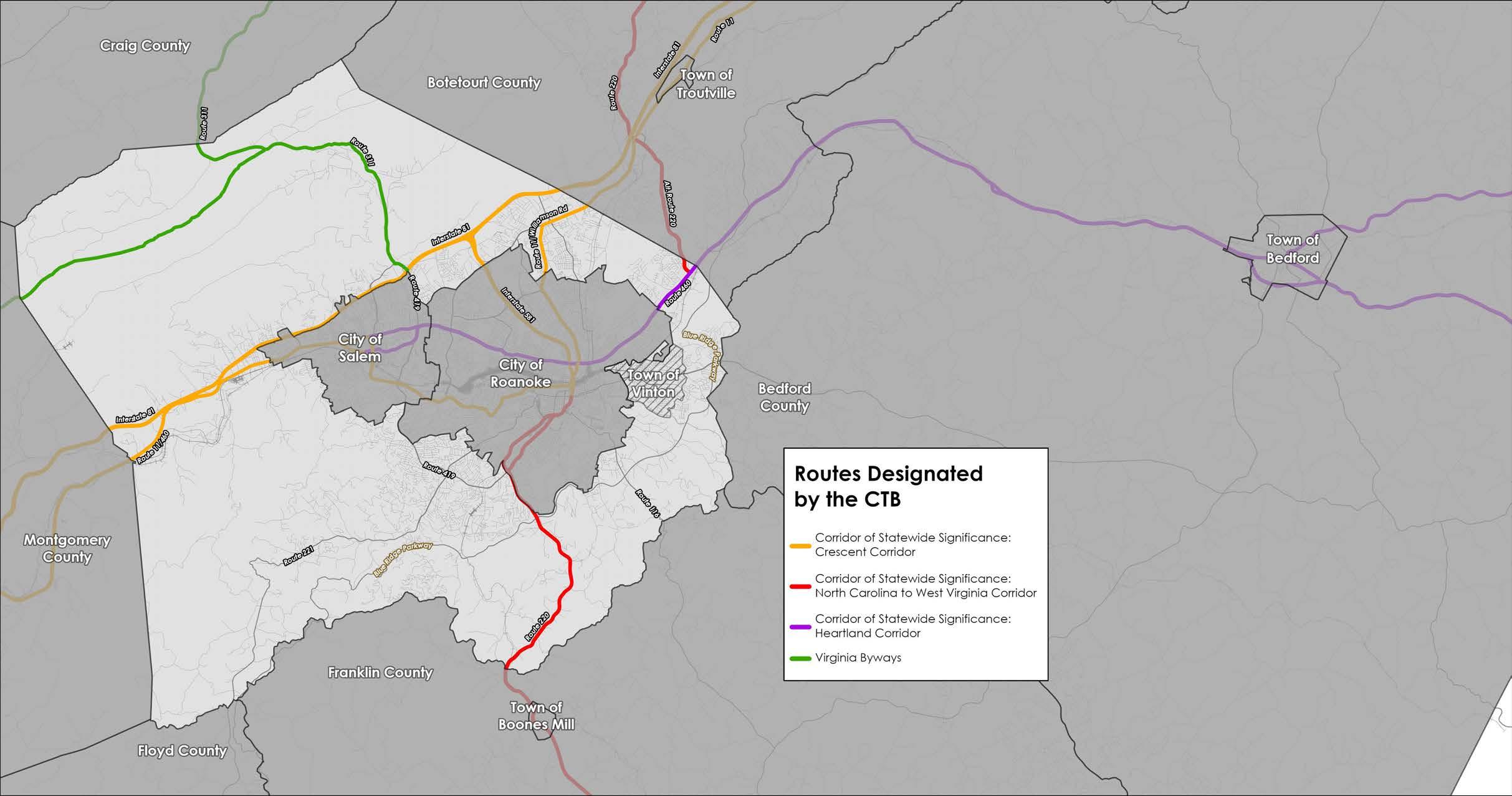
The Commonwealth Transportation Board (CTB) designates two types of routes, Corridors of Statewide Significance and Virginia Byways, which serve vastly different functions.
Corridors of Statewide Significance (CoSS) are another travel market for which VTrans identifies mid-term needs. CoSS represent intergrated, multimodal networks that connect major activity centers throughout Virginia and promote the long-range movements of people and goods that are essential to the economic prosperity of the Commonwealth. Twelve CoSS have been designated by the CTB, and three pass through Roanoke County. A table on the the following page details the rodway segments in Roanoke County included in CoSS, and the VTrans mid-term needs identified for these segments.
Virginia Byways are roads that have high aesthetic or cultural value that are within or lead to areas of historical, natural, or recreational significance. For a road to be designated a Virginia Byway, designatation must be supported by VDOT, the Department of Conservation and Recreation (DCR), and the localities the roadway is in. Once designated by the CTB, Virginia Byways are managed by VDOT and DCR. The road segments in Roanoke County that are parts of Virginia Byways are detailed in a table on the following page. Both the Virginia Byways table and CoSS table are color coded to the map on this page.
Locations and VTrans Mid-Term Needs
Crescent Corridor
Segments in Roanoke County
Interstate 81 between Botetourt County and the City of Salem
Interstate 81 between the City of Salem (Wildwood Road east) and the City of Salem (Wildwood Road west)
Interstate 81 between the City of Salem and Montgomery County
Interstate 581 between Interstate 81 and the City of Roanoke
Route 11/Williamson Road between Botetourt County and the City of Roanoke
Route 11/460 between the City of Salem and Montgomery County
VTrans Mid-Term Needs
Need for Congestion Mitigation
Need to preserve and enhance capacity by improving access management, reducing signals or signal phases, and implementing innovative intersection configurations
Need for new or expanded park and ride facilities, rail and public transportation services and passenger facilities, bicycle and pedestrian facilities where permitted, and expansion and coordination of commuter assistance programs services
Need for Safety Improvement on Corridors of Statewide Significance (Intersection)
Need for Safety Improvement on Corridors of Statewide Significance (Segment)
North Carolina to West Virginia Corridor
Segments in Roanoke County
Alternate Route 220 between Botetourt County and Route 460
Route 220 between the City of Roanoke and Franklin County
VTrans Mid-Term Needs
Need for Congestion Mitigation
Need for Improved Travel Time Reliability
Need to preserve and enhance capacity by improving access management, reducing signals or signal phases, and implementing innovative intersection configurations
Need for Safety Improvement on Corridors of Statewide Significance (Intersection)
Need for Safety Improvement on Corridors of Statewide Significance (Segment)
Heartland Corridor Segment in Roanoke County
Route 460 between Botetourt County and the City of
VTrans Mid-Term Needs
Need for Safety Improvement on Corridors of Statewide Significance (Intersection)
Need for Safety Improvement on Corridors of Statewide Significance (Segment)
Route 419 between Interstate 81 and Route 311
Route 311 between Route 419 and Craig County
Blacksburg Road between Route 311 and Montgomery County
This map shows roadways in Roanoke County, from all three travel markets (RN, CoSS, and Urban Development Areas / Designated Growth Areas), with mid-term needs identified in VTrans.
adoption of the I-81 Corridor Improvement Plan, VDOT has completed upgrades to traffic signals and communications at numerous intersections along I-81 detour routes in Roanoke County.
Roanoke County has experienced issues with inadequate parking and resources for tractor trailers for many years, particularly near warehousing and distribution or manufacturing businesses. A 2015 Virginia Truck Parking Study prepared for VDOT identified a deficit of 692 truck parking spaces along Interstate 81 between the Tennessee State Line and Interstate 64. Recommendations from that study include:
1. Partner with private industry and local governments to increase capacity and related improvements
2. Provide accurate and real-time information about truck parking supply and availability in Virginia
3. Improve the safety, effectiveness, and supply of truck parking spaces at Stateowned facilities
As online shopping continues to gain dominance over brick-and-mortar retail, more and more goods will be shipped via tractor trailer. Over the next fifteen years, the scale, and consequences, of Southwest Virginia’s truck parking deficit will only increase, unless more truck parking spaces are constructed or innovations occur that give other modes of freight transportation the combination of speed, flexibility, and cost effectiveness necessary to compete with tractor trailers.
The Fixing America’s Surface Transportation (FAST) Act, passed in 2016, amended a section of United States Code to revise Emergency Vehicle weight limits for bridges on the Interstate System and within reasonable access to the Interstate System. As a result, signs at many VDOT bridges in Roanoke County have been updated over the
past few years to specify new Emergency Vehicle maximum weight limits. Due to the new posted weight limits, one bridge on each of the following roads will not support all Roanoke County Fire and Rescue equipment:
• Old Catawba Road, Route 864
• Fort Lewis Church Road, Route 777
• East Ruritan Road, Route 609
• Willow Branch Road, Route 677
• Crescent Boulevard, Route 632
• McVitty Road, Route 1662
• Gladden Road, Route 737
• Bent Mountain Road, Route 221
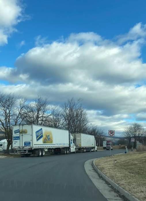
When alternate routes with a similar arrival time are available, the posted bridges do not present an issue. When there are no alternate routes available, lighter equipment must be substituted to cross the posted bridges to respond to emergencies. Roanoke County has made VDOT aware of the bridges that present challenges for emergency services. Collaboration with VDOT is needed when opportunities arise to upgrade these bridges to carry all Emergency Vehicles.
Since 2018, Visit Virginia’s Blue Ridge (VBR), an outdoor tourism marketing organization funded by Botetourt, Franklin, and Roanoke Counties and the Cities of Roanoke and Salem, has led an effort to install consistent wayfinding signage throughout the Roanoke Valley. As of November 2023, three
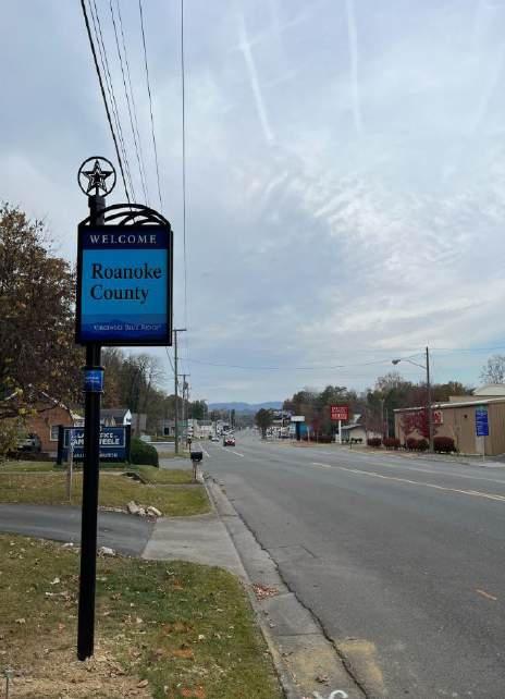
VBR wayfinding signs have been installed in Roanoke County, all collaborations with the City of Roanoke – two directing visitors to the Carvins Cove Boat Launch at the intersection of Williamson Road and Reservoir Road, and one gateway sign at the City-County line on Brambleton Avenue. The signs are attractive, but costly, so the process has been slow. Roanoke County has committed to partnering with Botetourt County and the Cities of Roanoke and Salem to construct eight (8) VBR wayfinding signs in the coming years.
Planned to run between Charleston, South Carolina and Detroit, Michigan, Interstate 73 (I-73), if constructed, would run through the Roanoke Valley roughly following the path of U.S. Route 220 (south of Interstate 581) and Interstate 581, and would be co-located with Interstate 81 between Interstate 581 and the New River Valley. Thus far, only North Carolina has constructed a section of I-73, a 101-mile section between Ellerbe and Greensboro. Through most of the 1990s and early 2000s, VDOT intended on constructing I-73 in Virginia, and conducted years of studies and public outreach to advance the project. However, the reductions in funding for transportation projects in the aftermath of the 2008 financial crisis prompted VDOT to shelve the project, and it has remained a low priority in Virginia since. Like Virginia, most states included in the proposed I-73 corridor have not prioritized the project. The future of I-73 is uncertain.

Several modes of transit are available within the Roanoke Valley and run through Roanoke County. The County currently operates the CORTRAN program and the McAfee Knob Trailhead Shuttle.
The Greater Roanoke Transit Company (GRTC) operates public transportation in the Roanoke Valley, including Valley Metro and the Smart VBR Gateway Sign on Brambleton Avenue
Way Bus. Valley Metro operates within the City of Roanoke, City of Salem and the Town of Vinton.
Three of Valley Metro’s local bus routes have stops in Roanoke County. Two routes pass through and stop at the Tanglewood Mall area, utilizing Electric Road and Ogden Road. The third route travels along Plantation Road and Hershberger Road to provide service to the Food Lion shopping center, the Walmart Neighborhood Market, to Edinburgh Square apartments and to Friendship Living. There are no bus shelters located at any of the Valley Metro stops in Roanoke County, with the exception of one bus shelter located on the north side of Hershberger Road at Friendship Living.
Valley Metro operates S.T.A.R. (Specialized Transit – Arranged Rides) paratransit service to provide transportation for disabled individuals who cannot ride Valley Metro. The service area includes threequarters of one mile from the regular Valley Metro fixed route within the City of Roanoke, the City of Salem and the Town of Vinton. RADAR (Roanoke Area Dial-A-Ride) operates this service for Valley Metro.
The Smart Way commuter bus, which connects Roanoke to the New River Valley, has one stop in Roanoke County at the Interstate 81 Exit 140 Park and Ride lot in Salem. The route offers ten stops between downtown Roanoke and Virginia Tech in Blacksburg. The Smart Way Express connects the Virginia Tech Carilion campus in Roanoke with Virginia Tech in Blacksburg.
County of Roanoke Transportation (CORTRAN) began operating in 1985 using a vendor to transport seniors, and those with disabilities from their homes to destinations within Roanoke County, the City of Roanoke, the City of Salem and the Town of Vinton. This program helps Roanoke County residents stay in their homes and remain independent.
CORTRAN is currently operated by Via, a contracted service, and provides an on demand, curb-to-curb, ride share service Monday through Friday from 7:00 AM to 6:00 PM. Roanoke County residents, age 65 or older and those who have disabilities are eligible for the service. Rides are
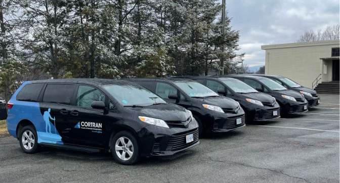
five dollars per trip. Booking options include the CORTRAN App, web portal or phone bookings.
CORTRAN provides essential transportation services to an average of 83 residents a month along with an average of 800 trips a month for medical appointments, education, employment and shopping.
CORTRAN is funded by Roanoke County. Grant funding has been applied for and obtained from the Department of Rail and Public Transportation (DRPT) since 2020 to offset the County’s operating cost for the program. Current DRPT funding is available through September 2024.
Due to growing popularity and resulting parking challenges for hikers wanting to hike to McAfee Knob, Roanoke County launched the McAfee Knob Trailhead Shuttle in the Fall of 2022 to transport hikers from the Interstate 81 Exit 140 Park and Ride lot in Salem to the National Park Service’s McAfee Knob Trailhead parking lot on
the Appalachian National Scenic Trail (AT). The shuttle service implements the National Park Service’s 2021 Appalachian National Scenic Trail, Triple Crown Area Transit Feasibility Study.
Over the 37 days of service in 2022 the shuttle transported 488 passengers and had 716 reservations. Day hikers and thru-hikers comprised the population of individuals from 49 zip codes and 13 states, including the District of Columbia, with international hikers from Germany and Turkey.
Shuttle service resumed on March 3, 2023, through November 26, 2023, with 1,531 reservations. Ridership has increased in 2024 due to the closure of the trailhead parking lot for pedestrian bridge construction. A total of 1,211 reservations were booked between March 1, 2024 and April 30, 2024. The service operates on Fridays, Saturdays, Sundays and holidays that fall on a Monday. Roanoke County currently partners with Ride Source to provide the service and reservations may be made through www.McAfeeShuttle.com. The service provides easy and convenient transportation, for a small fee, for local residents and visitors to the
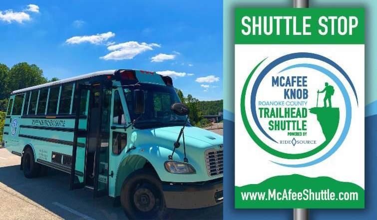
County Bicycle & Pedestrian Infratructure (Excluding Greenways & Trails)
area. Shuttle vehicles are equipped with cameras and Real Time tracking of the shuttle.
DRPT has funded the expansion of the shuttle service in 2024 and through June 2025. The McAfee Knob Trailhead Shuttle is currently funded by Roanoke County. Operation costs are offset with grant funding from DRPT through June 2025.
The Roanoke Valley-Alleghany Regional Commission houses RIDE Solutions, a Transportation Demand Management (TDM) Agency. RIDE Solutions assists commuters and employers with commuting options to reduce traffic on roadways and to improve air quality with fewer vehicle emissions.
Town of Bedford
The Virginia Breeze Intercity Bus Service is operated by Megabus and funded by DRPT. The Highlands Rhythm route provides one trip daily northbound and one trip daily southbound, from the Interstate 81 Exit 140 Park and Ride lot in Salem and includes seven stops between Bristol and Washington D.C.

Roanoke County is home to a growing network of bicycle and pedestrian infrastructure, but the system still lacks connectivity. Much has been achieved since the adoption of the 2005 Comprehensive Plan, but there is a long way to go before the network is connected enough to become a viable transportation option for any significant portion of Roanoke County’s population. Excluding greenways and trails, which are discussed at length in Section 6.8, there are approximately 16 miles of shared use paths, sidewalks, or bicycle lanes in Roanoke County. The map on this page shows all the existing bicycle and pedestrian infrastructure in Roanoke County, excluding greenways and trails.
Transportation preferences are changing, and in the next fifteen years it will become increasingly

important for Roanoke County to supply its citizens with a connected network of bicycle and pedestrian infrastructure. A recent study estimated that Millennials drive 8%-9% less than Gen-Xers or Baby Boomers (Zhang & Li, 2022). The 2020 National Association of Realtors Community and Transportation Preferences Survey found that Gen-Xers, Millennials, and Gen-Zers value living within walking distance of work and amenities more than Baby Boomers and members of the Silent/Greatest Generation. In the public engagement process for this plan, many residents expressed a desire to see a more connected network of bicycle and pedestrian infrastructure in Roanoke County (see Community Engagement, Chapter 8). At some point in the next fifteen years, it will likely become essential for at least some parts of Roanoke County to have connected bicycle and pedestrian networks if the County wishes to attract and retain new residents and businesses.
Town of Bedford
Between January 2014 and June 2021, there were fifty-six crashes reported involving a cyclist or pedestrian in Roanoke County. Twenty-one of these crashes resulted in a serious injury and four crashes were fatal. It is estimated that a large percentage of crashes involving cyclists and pedestrians go unreported (Pedestrian and Bicycle Information Center, 2022; Calma & Jackson, 2021), so it is likely that there were more crashes during this time period than were reported. In the public engagement process for this plan, many residents voiced concern for the safety of bicyclists on roads (see Community Engagement, Chapter 8).
To address gaps in connectivity, keep pace with changing preferences, and address safety concerns, Roanoke County and VDOT have in recent years submitted numerous funding requests for bicycle and pedestrian projects. Many of these funding requests have been successful, including the funding requests for the following current and recently completed projects (as of October 2023):

Other Trails Greenways Appalachian National Scenic Trail
McAfee Knob Trailhead Shuttle Route
McAfee Knob Trailhead
Shuttle Stop
• Oak Grove Pedestrian Improvements, Route 419 at Carriage Lane and Grandin Road (completed in 2023)
• Pedestrian Crossing Improvements, Route 419 at Keagy Road South (completed in 2023)
• Plantation Road Bicycle, Pedestrian and Streetscape Improvement Project, Phase 1 (Completed 2018)
• Plantation Road Bicycle, Pedestrian and Streetscape Improvement Project, Phase 2 (Completed 2022)
• Route 419 Pedestrian Crossing improvements, Brambleton Avenue and Postal Drive (funded)
• Route 419 Safety Improvements, Stoneybrook Drive to Grandin Road Extension (funded)
• Route 419 Streetscape Improvements, Starkey Road to Ogden Road (funded)
• West Main Street Pedestrian Improvements, Phase 1 (Completed 2014)
• West Main Street Pedestrian Improvements, Phase 2 (Completed 2021)
• Williamson Road Pedestrian Safety Improvements, Peters Creek Road to North Roanoke Assisted Living (Completed 2021)
• Williamson Road Pedestrian Improvements, Peters Creek Road to Plantation Road (Completed 2024)
• Williamson Road Pedestrian Improvements, Plymouth Drive to North Roanoke Assisted Living (funded)

Some or all of five greenways run through Roanoke County: Wolf Creek Greenway, Mudlick Creek Greenway, Roanoke River Greenway, Hanging Rock Battlefield Trail, and Tinker Creek Greenway. All in all, there are approximately 4.25 miles of greenway in Roanoke County. Roanoke County Parks, Recreation and Tourism operates and maintains all greenways within Roanoke County.
Roanoke County is a member of the Roanoke Valley Greenway Commission, and constantly coordinates with the other member jurisdictions on greenway matters. The regional collaboration facilitated by the Greenway Commission is essential, as greenways stretch across multiple localities and are among the region’s most popular recreational destinations. This popularity brings with it constant calls for expansion and increasing maintenance challenges. The Roanoke County greenway network is set to expand rapidly,
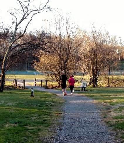
as approximately five miles of greenway are set to be constructed in the next three years in the form of the following funded projects:
• Glade Creek Greenway Through Vinyard Park West
• East Roanoke River Greenway, Blue Ridge Parkway Crossing at Highland Road
• East Roanoke River Greenway, Explore Park
• East Roanoke River Greenway, Highland Road to Explore Park
• West Roanoke River Greenway, Kingsmill Drive to Riverside Nursery
Wolf Creek Greenway
The 2.2-mile Wolf Creek Greenway is a cindersurface greenway located in the Town of Vinton and Roanoke County. The 0.6-mile Town of Vinton section was completed in 1999, and the 1.6-mile Roanoke County section was completed
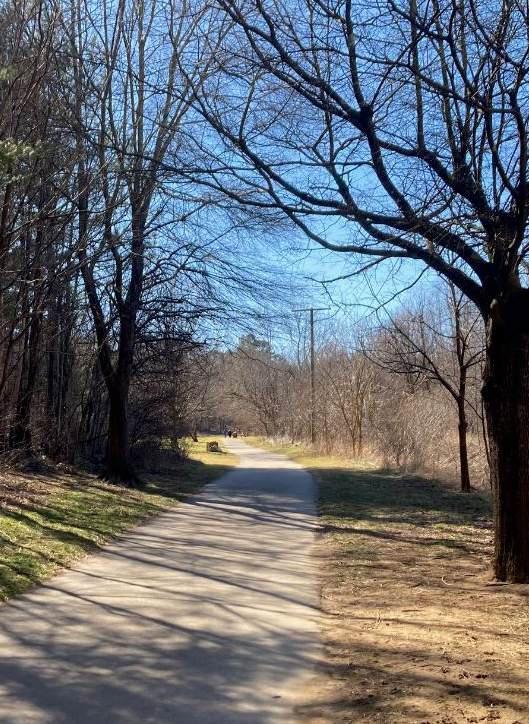
in 2006. The Wolf Creek Greenway is Roanoke County’s most popular greenway. In 2021, it had nearly twice as many visitors as the second most popular greenway in Roanoke County (Roanoke River Greenway at Green Hill Park). During public outreach for this plan, feedback about the Wolf Creek Greenway exclusively took the form of requests for additional capacity on, or access to, the greenway.
The half-mile section of the Mudlick Creek Greenway at Garst Mill Park was constructed in 1997 and was the first greenway constructed in the Roanoke Valley. It is the only constructed section of the Mudlick Creek Greenway, which is proposed to run 4.9 miles and would connect the Roanoke River Greenway to Cave Spring Middle School and the proposed Back Creek Greenway. Numerous neighborhood connections make this paved-surface greenway a popular destination for area residents.
This 0.8-mile greenway in western Roanoke County’s Green Hill Park was the first section of the Roanoke River Greenway to be constructed in Roanoke County. This paved-surface greenway opened in 2008, and is Roanoke County’s secondmost-popular greenway, after the Wolf Creek Greenway. It connects at its western terminus to a 2.2-mile network of hiking and mountain biking trails running up the north face of Green Hill.
This 0.4-mile greenway, the first section of the Roanoke River Greenway to be constructed in eastern Roanoke County, was completed in August 2023. This paved-surface greenway runs south-to-north from a new trailhead parking lot on Highland Road towards the Roanoke River and Niagara Dam. It sits entirely on Virginia Recreational Facilities Authority (VRFA) property.
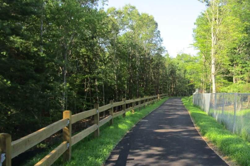
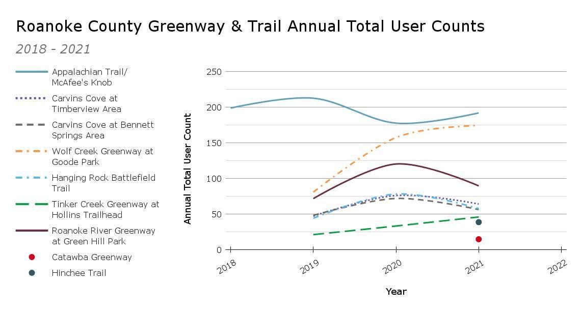
The Hanging Rock Battlefield Trail is a 2.2-mile paved and cinder-surface greenway that runs alongside Kessler Mill Road in the City of Salem and Roanoke County. One and a half miles are located in Salem and 0.7 mile is located in Roanoke County. The first section of the greenway constructed, which was the 1.5-mile cinder-surface section between Branch Drive and the Hanging Rock Battlefield, was opened in 1999. In 2023, a 0.7-mile paved section was completed, extending the greenway from Branch Drive to East Main Street.
The Hanging Rock Battlefield is where in 1864, during the American Civil War, Confederate cavalry briefly engaged with a Union column that was retreating from Lynchburg to Lewisburg, WV. The Hanging Rock Battlefield is also where the Hanging Rock Battlefield Trail connects to Roanoke County’s Hinchee Trail, which connects to the Carvins Cove Trail Network. Trailhead parking lots are located at the Hanging Rock Battlefield, Kessler Mill Road at Branch Drive, and East Main Street at Kessler Mill Road.
This 2.2-mile natural surface trail is the only section of the Tinker Creek Greenway that has been constructed to date in Roanoke County or Botetourt County. It connects Hollins University to the Carvins Cove boat ramp and is a popular hike for Hollins University students.
Two federally operated trail networks pass through Roanoke County: The Appalachian National Scenic Trail and the Blue Ridge Parkway Trails (see map on pages 6-52 and 6-53) The Appalachian National Scenic Trail (AT) runs 2,190 miles between the summit of Springer Mountain in Georgia and the summit of Mount Katahdin in Maine. The brainchild of planner and forester Benton McKaye, the AT was completed in 1937 after fourteen years of work. Today the trail is managed by “the National Park Service, U.S. Forest Service, Appalachian Trail Conservancy, numerous state agencies and thousands of volunteers” (U.S. National Park Service, 2023). The Roanoke Appalachian Trail
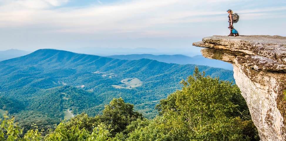
Club maintains the trail in the vicinity of Roanoke – 120 miles in all between Botetourt and Bland counties.
Nearly seventeen miles of the AT are located in Roanoke County, and Roanoke County’s two most popular day hikes – McAfee Knob and Dragon’s Tooth – are located on the AT. The trailhead parking lots at both locations are too small to accommodate the crowds that these hikes draw on weekends, especially in the fall. Roanoke County has coordinated extensively with the National Park Service about parking issues at McAfee Knob and will continue to do so. In Fall 2022, Roanoke County launched the McAfee Knob Trailhead Shuttle to help accommodate hiker demand.
Funding has also been secured for a pedestrian bridge to replace the AT’s at-grade crossing of Route 311 at the McAfee Knob trailhead parking lot. This will vastly improve safety at this location, as the posted speed limit of Route 311 is 55 miles per hour, and sight distance is minimal for both hikers crossing Route 311 on the AT and drivers approaching the Appalachian Trail crossing on Route 311.
The McAfee Knob and Dragon’s Tooth trail networks both contain additional trails which fall under federal jurisdiction but are not part of the AT: The McAfee Knob Fire Road, Dragon’s Tooth Trail, Dragon’s Tooth Spur, and Boy Scout Trail. The North Mountain Trail, which runs nearly fourteen miles along the ridgeline of North Mountain, also connects at its western terminus to Route 311 near the Dragon’s Tooth parking area. The North Mountain Trail joins with the Dragon’s Tooth Trail, the Appalachian Trail, and the Andy Layne Trail to form the Virginia’s Triple Crown Loop, a 35-mile hiking loop that includes Dragon’s Tooth, McAfee Knob, and Tinker Cliffs.
The Blue Ridge Parkway also maintains trails for hiking and horseback riding in Roanoke County. There are approximately 7.5 miles of trail on Blue Ridge Parkway property in Roanoke County. These trails are mostly flat and do not lead to stunning views like McAfee Knob or Dragon’s Tooth. For this reason, they draw less traffic than the trails in the vicinity of the Triple Crown Loop. The 2011 Roanoke Valley/Blue Ridge Parkway Trail Plan calls for all the trails to eventually be connected and run between Stewart’s Knob and U.S. Route 220 (save for one gap at the Roanoke River bridge).
Over four miles of trail are located at the Poor Mountain Natural Area Preserve, a 1,404-acre preserve in southwestern Roanoke County that is operated by the Virginia Department of Conservation and Recreation (see map on pages 6-52 and 6-53). These trails pass through the largest concentration of Piratebush (Buckleya distichophylla) in the world, which is a rare shrub that grows only in the mountains of southern Virginia, eastern Tennessee, and western North Carolina (Virginia DCR, 2021; Virginia Tourism Corporation, 2024). This is a moderately popular local destination, but it cannot accommodate large crowds as there are only ten parking spaces at the trailhead parking lot and the topography precludes both spillover parking and the expansion of the parking lot.
Over fourteen miles of trail are located at the Havens Wildlife Management Area, a 7,190-acre Wildlife Management Area (WMA) in northwestern Roanoke County that is operated by the Virginia Department of Wildlife Resources (DWR). The Havens WMA occupies much of Fort Lewis Mountain, and ranges from 1,500 to 3,200 feet in elevation. Visitors must purchase an Access Permit from DWR to access the Havens WMA. Hunting is permitted in the Havens WMA, so hikers should exercise caution during hunting season. Trailheads are located off of Bradshaw Road and Wildwood Road.
Roanoke County Parks and Recreation maintains numerous trails throughout Roanoke County. These trails are spread fairly evenly throughout the County, as ten of eleven Community Planning Areas have local trails that can be accessed from within their boundaries (see map on pages 6-52 and 6-53). The most extensive trail network maintained by Roanoke County is located at Explore Park, with over five miles of trails for hikers and mountain bikers of all skill levels. Roanoke County evaluates and regularly pursues opportunities to expand and improve the Explore Park trail network.
Another crown jewel among Roanoke Countymaintained trail networks is the Read Mountain Preserve. Approximately 4.5 miles of trail are located at the Read Mountain Preserve, and multiple locations along the trails feature expansive views of the Roanoke Valley. Roanoke County purchased a large portion of the north side of Read Mountain in 2019.
The Carvins Cove Natural Reserve, though within the boundaries of Roanoke County and Botetourt County, is owned and operated by the City of Roanoke. Over 60 miles of trails for hiking, mountain biking, and horseback riding are located at the Carvins Cove Natural Reserve.
Ultimately, most Roanoke County-owned trails are short trails at neighborhood parks. Eight of fourteen local trail networks contain less than one-half mile of trails.

Railroad tracks cross the entire length of Roanoke County from east to west, and also run south along Route 220. Both freight and passenger trains pass through Roanoke County.
Roanoke County has a well-established freight rail network that is utilized by a number of industries for the shipment of goods and materials. The location of the County’s rail infrastructure near major transportation hubs, such as highways and airports, make it an attractive location for businesses that rely on efficient and reliable freight transportation. Roanoke has two major Norfolk Southern freight rail corridors passing through it. These include the Crescent Corridor and the Heartland Corridor. The Crescent Corridor is Norfolk Southern’s primary north-south corridor which parallels I-81, providing freight services between the Northeast and Southeast U.S. markets. The Heartland Corridor is Norfolk Southern’s primary east-west route, and parallels U.S. Route 460 to connect the Port of Virginia and major markets in the Midwest. Overall, Norfolk Southern has nearly 22,000 route miles
connecting all major markets east of the Mississippi River, with Roanoke located near the center of its rail corridors.
The history of freight rail in Roanoke is closely tied to the development of the Norfolk and Western Railway (N&W), which played a significant role in the industrial and economic growth of the region. The N&W was formed in 1881 when the new owners of the Atlantic, Mississippi, and Ohio Railroad (AM&O) changed the name of the railroad to the Norfolk & Western Railway. The new owners then decided to move the railroad’s headquarters from Lynchburg to Roanoke (known as Big Lick at the time). After the name change and relocation to Roanoke, the N&W quickly became one of the largest railroads in the United States.
In the early years, N&W focused on transporting coal from the coalfields of Virginia, West Virginia, and Kentucky to ports on the East Coast. N&W invested heavily in improving its infrastructure, including building new rail lines, upgrading its locomotives, and constructing modern facilities for maintenance and repair. As the coal industry grew in the region, N&W expanded its operations to include other types of freight, such as iron and steel products, timber, and agricultural goods. They also played a key role in transporting troops and supplies during both World War I and World War II.
In the mid-20th century, the rise of the interstate highway system and the decline of the coal industry had a major impact on N&W and other
railroads in the region. However, N&W was able to adapt by diversifying its business and developing new sources of revenue, like container shipping and intermodal transport.
Today, N&W is part of the Norfolk Southern Corporation, which continues to operate in the Roanoke area and is a major employer and economic driver for the region. The Virginia Museum of Transportation, located in the City of Roanoke, is an excellent source for a deeper dive into the history of the railroad and its contributions to the area.
The proliferation of rail in the Roanoke Valley has offered many great benefits, such as cost-effective transportation, particularly over long distances. The ability for trains to carry large volumes of cargo long distances at once allows them to spread out the fixed costs of transportation over a larger number of goods. Rail is also one of the most energy-efficient modes of transporting freight, so it produces less emissions of greenhouse gases and other pollutants. It also reduces traffic congestion on highways and other major transportation routes, as it reduces the number of tractor-trailers on highways. In addition, rail is considered to be a safer mode of transportation, as railroads have rigorous safety protocols in place to prevent accidents and theft. Rail can transport a wide variety of goods that may be much more difficult to transport via other methods.
Freight rail does, however, come with its concerns. Safety is a major concern among those who live or work near active railroad tracks. While the County has little influence on the internal safety measures on day-to-day operations of Norfolk Southern, it does have the ability to influence some of the external safety concerns that result from interaction between other transportation types and the railroad.
In October 2020, a coal train derailed on a bridge over the Roanoke River and Barley Drive in western Roanoke County. In all, twenty-six cars were derailed, and sixteen cars carrying approximately
2,600 tons of coal ended up in the Roanoke River. About half of the coal was removed from the river by Norfolk Southern in the weeks following the derailment, but heavy rain and the high level of the river during that time meant that almost 1,300 tons of coal were swept downstream. On March 10, 2023, Norfolk Southern was issued a $27,000 fine by the Virginia Department of Environmental Quality (VDEQ) for this incident.
About one month before Norfolk Southern was fined for the Roanoke River incident, a far more disastrous train derailment occurred in East Palestine, Ohio. The East Palestine derailment, which resulted in well over one million pounds of toxic chemicals burning over multiple days and the evacuation of approximately half of the town’s 5,000 residents, thrust the issue of freight rail safety to the forefront of the national consciousness. On March 1, 2023, the Federal Rail Administration announced a rigorous new inspection program for tracks and railroads carrying high-hazard flammable trains (HHFTs) like the train that derailed in East Palestine, or other trains carrying large volumes of hazmat commodities. In May 2023, the U.S. Senate Committee on Commerce, Science, and Transportation approved the bipartisan Railway Safety Act, which would strengthen rail safety requirements, improve train car inspections, increase standards for transporting hazardous materials, give more support to first responders and increase penalties on rail companies for wrongdoing. If signed into law the Railway Safety Act, which as of January 2024 awaits vote in the Senate, would decrease the frequency of events like the Roanoke River and East Palestine derailments, and bring increased restitution to the communities that are faced with them.
Norfolk Southern freight trains can be extremely long, sometimes over 2 miles in length, and this can bring about additional safety issues. For instance, it is sometimes impossible for trains that long to stop without blocking at least one at-grade road crossing. This frequently occurs in the Bonsack area of Roanoke County, where there are two different neighborhoods that can only be accessed via an at-grade crossing of railroad tracks. Preliminary
engineering reports for grade separation projects at both crossings – on Glade Creek Road and Layman Road – were completed in January 2022 as part of the Route 460 Land Use and Connectivity Study. In October 2022, Roanoke County applied for funding to conduct planning, environmental review, and design of grade separation projects for both intersections in the inaugural cycle of the Railroad Crossing Elimination Grant Program (RCE) but was not awarded funding. Future RCE cycles may be less competitive, though, if the highest priority projects are awarded funding in early cycles and removed from the application pool.
Roanoke County, like the rest of the Roanoke Valley, is served by the Amtrak station in downtown Roanoke. Amtrak’s Northeast Regional route stops in Roanoke seven days a week. This service began in October 2017, ending nearly 40 years without passenger rail in Roanoke. In July 2022, a second
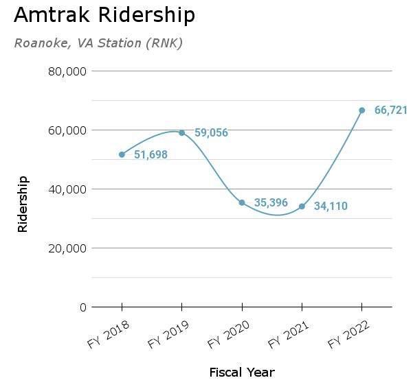
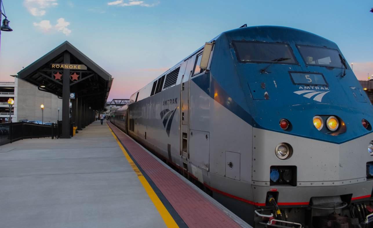
train began running to and from Roanoke each day. Before the COVID-19 pandemic, ridership to and from the Roanoke station was increasing at a faster rate than at any other station in Virginia. After a two-year lull during the pandemic when ridership dipped to a little over half of pre-pandemic levels, ridership in FY 2022 surged back to an all-time high of 66,721.
In May of 2021, then-Governor Ralph Northam announced that the Northeast Regional line would be extended to Christiansburg. To accomplish this, a Norfolk Southern-owned track between Salem and Christiansburg (the former Virginian line) was purchased in 2022 by the Virginia Passenger Rail Authority, a new agency created by the Virginia General Assembly in 2020.
Passenger rail brings safety concerns and planning challenges that are distinct from those associated with freight rail. In 2025, Amtrak service to Christiansburg is expected to begin, and when it does, Amtrak trains will pass through western Roanoke County. Passenger trains are faster and quieter than freight trains, so people notice the presence of passenger trains later, and have less time to react when they do. Western Roanoke County is mostly rural, and some residents cross the train tracks on agricultural equipment or other modes of transportation that move at much slower speeds than automobiles. Due to the higher speed and lower noise output of passenger trains, those crossing the tracks on agricultural equipment may need more sight distance to safely cross the tracks than they are afforded at the crossings they currently use. For this reason, VPRA is working with property owners to limit the number of crossings available in western Roanoke County to those that can meet strict safety standards.
Emergency evacuation routes are required for tracks that carry Amtrak trains, and these will need to be established in western Roanoke County before service to Christiansburg can begin. There is potential for Roanoke County to construct portions of the Roanoke River Greenway that could serve as emergency evacuation routes for Amtrak in western Roanoke County.

Roanoke County, like the rest of the Roanoke Valley, is served by the Roanoke-Blacksburg Regional Airport (ROA) in the City of Roanoke. The airport is owned and operated by the Roanoke Regional Airport Commission. Scheduled passenger flights began at the Airport in 1934. Four airlines currently offer flights in an out of ROA:
• Allegiant Air
• American Airlines
• Delta Air Lines
• United Airlines
Direct flights are offered to nine cities:
• New York
• Philadelphia
• Washington, D.C.
• Charlotte
• Orlando
• St. Petersburg
• Atlanta
• Nashville
• Chicago
Approximately forty passenger flights arrive or depart at ROA every day. Ridership on passenger flights declined dramatically during the COVID-19 pandemic but is moving towards pre-pandemic levels.
Cargo traffic declined only slightly during the COVID-19 pandemic, as people were still able to shop online during that time and has already fully returned to pre-pandemic levels.
Airports bring planning challenges, as they generate noise, and the heights of structures must be limited within a certain radius. To address these challenges, Roanoke County has implemented
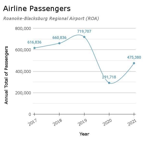
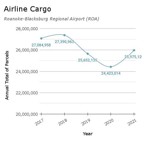
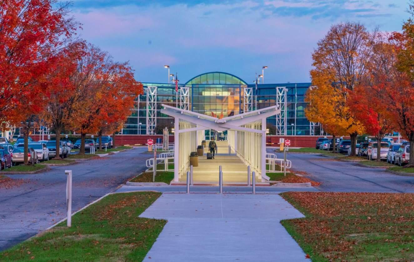
the Airport Overlay District, which limits structure heights along flight takeoff and landing paths, and has applied the Principal Industrial Future Land Use designation to the part of the County north of the airport that is impacted by flight noise.
Expansion of at least one of the airport’s two runways has long been discussed by the Airport Commission and localities of the Roanoke Valley as the runways, at 5,810 feet and 6,800 feet, are currently not long enough to accommodate Boeing 737s or Airbus A320s for passenger flights. It is possible that a runway expansion would extend one of the existing runways into Roanoke County. If the runway is extended into Roanoke County, the County would need to expand the boundary of the Airport Overlay District to ensure that structures are not built in a way that could interfere with flight paths and could consider amending the future land use map to mitigate the impacts of flight noise.
Roanoke County recognizes the economic development and quality of life benefits that the airport brings to the Roanoke Valley.

Advancements in transportation technology are constant. It is important to provide flexibility to accommodate these advancements when and where appropriate.
Electric vehicles (EVs) are becoming an increasingly popular mode of transportation. Potential benefits of EVs include improved safety, fewer maintenance needs, lower operating costs, and less environmental impact compared to gas-powered vehicles. These benefits make EVs an attractive option for people who are looking for an efficient and cost-effective mode of transportation.
However, with these benefits in mind, it is important to remember that EVs have drawbacks and
there are issues that must be addressed for EVs to achieve widespread adoption, including:
• Limited driving range: Most existing EVs need to be recharged far more often than gas-powered cars need to be refilled with gas.
• High upfront cost: Despite the lower operating costs of EVs, the upfront cost of purchasing an EV is still higher than that of traditional gasoline-powered vehicles.
• Limited charging infrastructure: In some areas, the charging infrastructure is still limited, making it difficult for EV owners to find a convenient place to charge their vehicles.
• Long charging time: While fast charging is becoming more widely available, the time required to charge an EV is still longer than the time required to refuel a gasolinepowered vehicle.
• On-demand reliability: The reliability of EVs during any type of power outages where electricity is not readily available is a common concern.
To prepare for an increased number of EVs in the future, Roanoke County can take several steps. These steps could include installing public charging stations, adopting new regulations focused on increasing charger availability, or cooperating with energy providers to plan for grid upgrades to ensure the electrical grid can support increased demand for electricity.
EV charging infrastructure is an important component of the transportation ecosystem, and there are three main types of charging infrastructure:
• Level 1 (120V) – Slow charging that is typically used for overnight charging at home
• Level 2 (240V) – More powerful charging that is used for both home and public charging
• DC Fast Charging (DCFC) – Fastest charging, used for quick charges during long-distance travel
Roanoke County could play a role in supporting the expansion of EV charging infrastructure by offering incentives for installation, streamlining permitting and regulations, prioritizing charging infrastructure in planning, supporting public charging stations, and partnering with utilities. Providing more EV charging opportunities will benefit citizens currently using EVs and business owners who would gain customers from travelers stopping in the area to charge their vehicles.
There are growing numbers of state and federal grant programs that support the installation of EV charging infrastructure that offer the opportunity to leverage funding for the potential installation of charging stations in convenient locations.
One of the key efforts to increase EV ranges is the development of solid-state batteries. These batteries offer increased charge capacity in a smaller package, faster charging times, and improved safety.
The charging technology for EVs is also quickly adapting. An example of this is the development of a high-speed 350 Kw charger which allows vehicles to be charged in minutes rather than hours. This offers a great reduction in the planning necessary when deciding when or where to charge your vehicle. If located near retail use, these chargers could help attract potential shoppers who could quickly charge their vehicle while visiting a store or restaurant.
E-bikes, E-scooters, and other electric mobility devices are rapidly gaining popularity as a means of transportation in urban and suburban areas. These devices are powered by batteries and use electric motors to assist the rider, making
it easier and more convenient to travel. These devices are often seen as a more sustainable and environmentally friendly alternative to cars for short trips.
Currently, E-bikes and E-scooters are widely available for rent or purchase. Their convenience and low cost makes them a popular option for short trips.
According to the Virginia State Code, E-bikes are classified into three categories: Class 1, Class 2, and Class 3.
• Class 1 E-bikes are pedal-assist bikes that provide a boost to the rider’s pedaling effort. These E-bikes have a motor that provides assistance when the rider is pedaling and stops providing assistance when the rider reaches a speed of 20 miles per hour (mph).
• Class 2 E-bikes are throttle-control bikes that can be powered without pedaling. These E-bikes have a motor that provides power to the bike through a throttle, similar to the acceleration control of a motorcycle, and have a maximum assisted speed of 20 mph.
• Class 3 E-bikes are pedal-assist bikes that provide a boost to the rider’s pedaling effort and have a speedometer that displays the speed of the bike. These E-bikes have a motor that provides assistance when the rider is pedaling and stops providing assistance when the rider reaches a speed of 28 mph.
E-scooters are designed for short distances of travel and are typically used for short commutes, for traveling in urban settings, or for recreation. They are similar in appearance to traditional kick scooters but are equipped with an electric motor and a rechargeable battery that provides power to the scooter to propel it forward rather than relying on the rider. E-scooters can reach speeds of up to 15-20 mph. They are often rented through mobile apps and are available for pick
up and drop off throughout the areas which they are permitted. E-scooter rental programs typically operate on a dock-less basis, meaning, they are not rented or dropped off at a fixed location. This is highly convenient for users but raises some concerns about clutter and conflicts with other infrastructure and uses.
There are several other types of electric mobility devices on the market which offer similar benefits to those offered by E-bikes and E-scooters. Some examples include electric skateboards, hoverboards, electric unicycles, and electric kick scooters. Electric skateboards are electrically propelled, allowing for longer distances and higher speeds of travel than traditional skateboards.
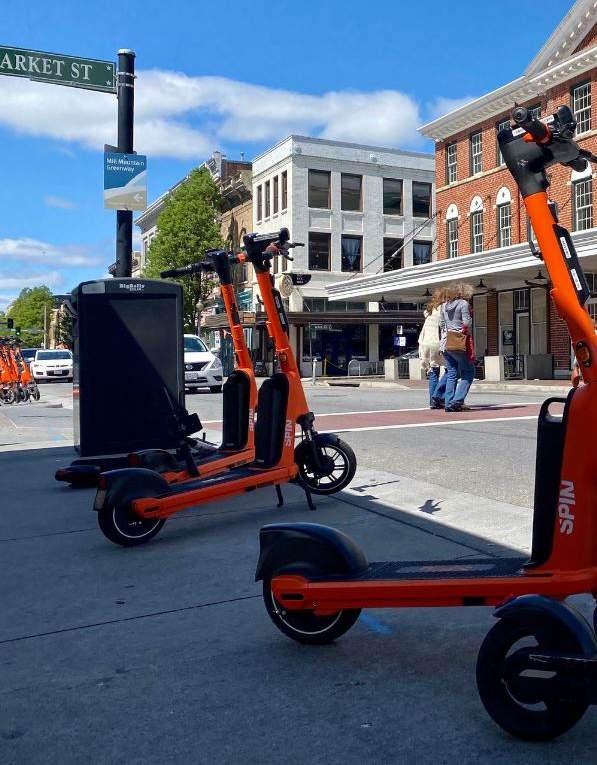
Hoverboards are self-balancing scooters that use two parallel wheels and an electric motor that compensates for balance to propel it forward. Electric unicycles are similar to hoverboards, the only differences being that they only use one wheel instead of two, and they contain features which compensate for the balance of the rider. Electric kick scooters are traditional kick scooters with added electric power to assist rather than acting as the sole power supply. While these electric mobility devices are convenient and costeffective, they also raise concerns about safety and regulation, and even some concerns about environmental impact.
Some of the concerns of both riders of electric
mobility devices and the general public include safety, regulation, parking, and natural surface trail damage. Safety is a major concern for these devices, as they can travel at higher speeds than manually-powered bikes and scooters. This can lead to crashes involving users of these devices and users of manually-powered transportation modes, in which the electric mobility device user is likely traveling faster and using heavier equipment than the manually-powered device user. Another major concern is regulation, as these devices are not regulated in the same way as cars or bicycles, leading to confusion for both electric mobility device users and other road, shared use path, and trail users. The issues surrounding dock-less parking of electric mobility devices are also of major concern, especially in urban areas where public spaces are limited and transportation routes such as sidewalks are crowded. The potential impacts on natural surface trails from the increased use of electric bikes and other off-road electric vehicles is another common concern surrounding these devices. To address these concerns, it is important for the manufacturers of these devices, rental program operators and local governments to work together to develop regulations and guidelines for safe and responsible use.
It is expected that E-bikes, E-scooters, and other electric mobility devices will continue to be popular modes of transportation in the Roanoke Valley and beyond. It is very likely they will continue to evolve and become more advanced. As this expanded use occurs it is important to keep in mind the many concerns surrounding these devices so the County can better plan for their safe and effective use.
Autonomous Vehicles (AVs) are already on the road, and over time the technology will progress towards “self-driving” cars that can navigate anywhere with little to no assistance from humans. As cars can incorporate different levels of automation, experts have historically separated autonomous vehicles into five levels. A breakdown of these levels can be viewed in the table on page 6-68.
Automation Level ADAS or ADS Automated System Capability Driver’s Role System’s Role Vehicle Feature Examples
Level 0 Neither No system present All driving functions at all times None None
Level 1 ADAS Assist steering OR accelereation/ deceleration
All driving functions with limited assistance
Level 2 ADAS
Some assistance with steering or acceleration/ braking but not both at the same time
Simultaneously assist steering and acceleration/ deceleration Can engage part-time assistance but must monitor driving at all times Assists driver with steering and acceleration/ braking at the same time
Level 3 ADAS/ ADS Partial autonomous driving
Must be ready to take control when system requests Conditional autonomous driving
Level 4 ADS Highly autonomous driving Limited need to take control
Autonomous driving in most circumstances
Adaptive cruise control, lane departure warning, collision warning, automated emergency braking
Level 1 plus lane keeping assist, colliision avoidance, parking assist
Level 2 plus highway driving, traffic jam assist, remote park, driver monitoring
Level 3 plus geo-fenced urban driving, valet parking
Level 5 ADS Fully autonomous driving None
All functions at all times. No driver controls needed
Lower-level AVs utilize an “advanced driver assistance system” (ADAS) to assist drivers, while higher-level AVs will utilize an “advanced driving system” (ADS) to actually drive the car. Vehicles utilizing ADAS are already on Roanoke County roads, and it is likely that some vehicles utilizing ADS will be on Roanoke County roads by 2038. Long-haul tractor-trailers and ride sharing services will likely incorporate ADS first, but by 2038 there is also a strong chance that there will be some privately-owned ADS passenger cars on Roanoke County roads. McKinsey & Company predicts that in 2030, between 4% and 20% of new automobile sales will be Level 3 or above AVs and by 2035 between 17% and 57% will be Level 3 and above AVs (Deichmann, et al, 2023). A Level 3 AV built by Honda has been available to the public in Japan since 2021.
Vehicles with ADS will change driving patterns. They will likely increase vehicle miles traveled, as people will tolerate longer trips if they are not driving, but they also have the potential to reduce traffic and crashes as the ADS systems will be able to coordinate movements with one another (Wang & Wu, 2021). However, these congestion and safety benefits will likely not be realized while automated and human-operated cars share the roads (Schaller, 2017). The widespread adoption of ADS will reduce the need for parking, as vehicles will be able to circulate rather than needing to park, but this could ultimately offset any reduction in congestion brought about by ADS (Wang & Wu, 2021; Millard-Ball, 2019). New “attendant” jobs will likely be created at the mega-truck stops that will likely serve automated trucks (D’Orazio, et al, 2020).
Roanoke County will need to monitor new developments in AV technology, and work to plan for them so that their positive effects can be maximized, and their negative effects minimized.
Not only will AVs be able to communicate with each other, they will eventually be able to communicate with roads, traffic lights, and potentially many other objects through the use of Vehicle-to-Everything (V2X) technology. V2X represents the logical conclusion of Intelligent
Transportation Systems (ITS), which are currently used to collect and deliver traffic information to motorists, provide automated enforcement of speed limits in some locations, and outfit some roadways with variable speed limits, among other things. With V2X, traffic lights would alter their signal phases to accommodate emergency vehicles, and cars would be alerted to roadway hazards and automatically re-routed. Widespread use of V2X will require infrastructural updates, including both deployment of new infrastructure and significant upgrades to existing cellular networks. Some of these updates will likely take place in the next fifteen years, as the draft V2X deployment plan released by USDOT in October 2023 includes the ambitious goal of V2X deployment across the entire National Highway System and at 75% of public intersections by 2034 (USDOT, 2023).
The use of drones for delivery has the potential to greatly transform the transportation of goods. Air and ground drones for smaller parcel delivery currently have the most growth potential in this sector. These delivery systems are being used for many types of delivery including commercial delivery, and the technology is expected to expand. They have the potential to greatly reduce delivery time, as well as reduce the number of delivery vehicles currently on the road (Lyon-Hill, et al., 2020).
Aerial delivery drones are typically equipped with multiple rotors and can fly autonomously using GPS navigation. They can be used to deliver packages, medical supplies, or other goods to remote or hard-to-reach locations or for fast last mile delivery.
Some of the companies that are currently using aerial delivery drones include Amazon Prime Air, UPS Flight Forward, Walmart DroneUp and Wing Aviation. Wing Aviation currently works with Virginia Tech to make deliveries within a four-mile radius of its headquarters to citizens in Montgomery County. Wing Aviation offers delivery from Walgreens, FedEx and some local businesses.
Ground delivery drones are typically four-wheeled unmanned vehicles that operate on pedestrian amenities to deliver packages to customers in residential areas, where aerial delivery is not feasible. Ground delivery drones can also be used for transporting goods within warehouses or industrial complexes. Some companies with aspirations to expand ground drone deliveries include Amazon, Google, and even Domino’s pizza using the unmanned vehicle Nuro R2.
Both aerial and ground delivery drones have gained popularity in recent years due to their speed, efficiency, and ability to reduce the cost of last-mile delivery. However, there are still some challenges that need to be addressed, such as regulations, privacy concerns, and security issues.
The following should be considered in the future planning for drones and supporting infrastructure:
• Market demand: The demand for drone delivery services should be assessed to ensure that Roanoke County is staying up
to date with the needs of its residents to prepare for the potential adoption of this service.
• Regulations: Federal, state, and local regulations regarding drone operation, safety, and privacy should be reviewed or created and updated as necessary to ensure the safe and responsible use of drones if this technology were to expand and become commonplace within the community.
• Public education and outreach: If this technology were to expand into Roanoke County, Public education and outreach programs should be established to raise awareness about the benefits and responsible use of drones, and to gather feedback and concerns from citizens on the potential use of delivery drones.
• Collaboration with private and public sector: Collaboration between the private and public sector should be encouraged to stay up to date on the potential development and deployment of drone delivery services and related infrastructure.

It is important to consider these, along with any other factors that present themselves during the rollout of this technology in and around Roanoke County. This will offer the ability to address any concerns associated with this technology and to create a transportation system that is efficient, convenient, and sustainable for both residents and businesses located in the Roanoke Valley.
Electric Vertical Takeoff and Landing Aircraft (eVTOLs) or “flying taxis” are essentially super-sized drones that can carry human passengers. They hover, take off, and land vertically, like drones. Prototypes are mostly fully electric (but some are hybrid-electric), have a top speed of 62 to 250 miles per hour, a range of 17 to 500 miles, a cruising altitude of 1,000 to 5,000 feet, and a passenger capacity of one to four. NASA anticipates that eVTOLs will be a commercially viable transportation option in the U.S. by 2028, but rollout could begin sooner. They will likely be used at first for transport between suburbs and city centers and transport to and from airports in large metro areas. There is not much need for these types of trips within the Roanoke Valley, but eVTOLs could be used for trips to and from the New River Valley.
Helicopters are not in danger of being replaced by eVTOLs for emergency medical services in the near future, as helicopters still provide greater range and flexibility for transporting payloads of different sizes than eVTOLs (Cowan, 2019). In the short term, eVTOLs could unburden helicopters from lower-weight, shorter-distance trips like organ transport. In the long term, advances in battery technology may come which would increase the range of eVTOLs and allow them to compete more directly with helicopters.
The FAA does not allow aircraft to fly below 1,000 feet in “congested areas” or below 500 feet in “other than congested areas,” but helicopters can fly below these altitudes as long as they stay on specific routes. It is likely that during the early years of eVTOL adoption, eVTOLs will fly on these defined helicopter routes. As adoption increases, though, eVTOLs may need to be separated from helicopters and given their own routes.
EVTOLs can take off and land at both permanent and modular stations. Both types of stations can be very compact. Planners will need to consider the implications of eVTOLs taking off and landing at permanent “vertiports” in densely developed areas, and of eVTOLs flying in and out of modular “vertipads” on more isolated private property.


It is impossible to predict the exact challenges that will be faced by the Roanoke County transportation system over the next fifteen years. It is certain, however, that new challenges will arise, and the transportation system will develop new needs.
An analysis of existing conditions shows that the Roanoke County transportation system is currently in good shape and projects are funded, or have been recently constructed, to address the most
pressing current issues. The map on pages 6-74 and 6-75 shows all transportation projects in Roanoke County that are funded or have been constructed in the past two years. The table on pages 6-76 and 6-77 lists all projects in Roanoke County that are in the Fiscal Year 2024 VDOT Six-Year Improvement Program, the mechanism by which Commonwealth Transportation Board allocates funding to transportation projects over a six-year timeframe. Roanoke County’s funded and recently constructed transportation projects will
Maintenance and upkeep
Mitigation of safety issues as traffic volumes increase
Mitigation of congestion as traffic volumes increase
Upgrades to, and coordination of, traffic signals
Repair or replacement of aging bridges
Upgrades to bridges that are unable to support all emergency vehicles
Additional tractor trailer parking
Expansion of service to new areas and new days and times
Education and outreach about Roanoke County transit programs
Elimination of at-grade rail crossings that serve as the only way in and out of neighborhoods
Establishment of safe crossings of the track that will be used for the Amtrak Christiansburg expansion
Development of emergency evacuation routes for the Amtrak Christiansburg expansion
go a long way towards ensuring that the County’s transportation system functions smoothly over the next fifteen years.
However, these projects will not address all the needs of, or challenges faced by, the Roanoke County transportation system over the next fifteen years. To keep the Roanoke County transportation system functioning smoothly in a constantly changing environment, Roanoke County must attempt to anticipate the ongoing, and future,
needs of the transportation system. The table on this page outlines what Roanoke County staff anticipate will be the most pressing needs of the county transportation system over the next fifteen years. Roanoke County’s good working relationship with VDOT, the analysis of existing conditions, the summary of anticipated needs presented in this section, and the County’s persistent pursuit of the projects recommended in Chapter 10 will prepare Roanoke County to face the transportation challenges of the next fifteen years.
Bicycle & Pedestrian
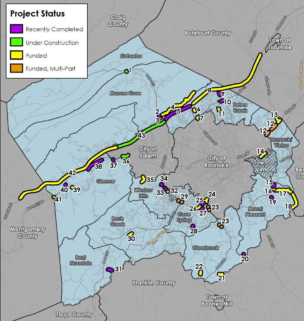
Transportation projects located in Roanoke County are shown in various stages of design and construction. These projects are funded through many different sources and programs, depending upon the project features and location. While Roanoke County staff administer greenway projects and a few other projects, Virginia Department of Transportation (VDOT) staff administer most of the projects in the County.
1) McAfee Knob/AT at Route 311 Pedestrian Improvements
2) Route 311/Route 419 Intersection Safety & Congestion Improvements
3) Orange Market Park and Ride/Parking Lot Improvements
4) Timberview Road Safety Improvements
5) I-81 Widening from Exit 141 to Exit 143
6) Valleypointe Parkway Realignment
7) I-581 Exit 2 (Peters Creek Road) Interchange Improvements, Phase I
8) I-81 Widening from Mile Marker 144 to Exit 150
9) Plantation Road Bicycle, Pedestrian and Streetscape Improvement Project (Phase IIWalrond Drive to Gander Way)
10) Williamson Road Pedestrian Improvements (Peters Creek Road to Plantation Road)
11) Williamson Road Pedestrian Improvements (Plymouth Drive to North Roanoke Assisted Living)
12) Route 460 Intersection Improvements at West Ruritan Road and from Carson Road toHuntridge Road
13) Route 460 and Alt. Route 220 Intersection Improvements
14) Glade Creek Greenway Through Vinyard Park West
15) East Roanoke River Greenway (Connection to Highland Road)
16) East Roanoke River Greenway (Blue Ridge Parkway Crossing at Highland Road)
17) East Roanoke River Greenway (Highland Road to Explore Park)
18) East Roanoke River Greenway (Explore Park)
19) Huffman Lane Reconstruction
20) Crowell Gap Road Paving (300-foot-long section near the Franklin County line)
21) Webb Road Paving (gravel road segment to the Franklin County line)
22) Boones Chapel Road Paving
23) Route 220 Access Management Improvements Project
24) Route 419/U.S. 220 Diverging Diamond Interchange
25) Route 419 Streetscape Improvements, Phase I (Franklin Road to Ogden Road)
26) Route 419 Streetscape Improvements, Phase II (Starkey Road to Ogden Road)
27) Fallowater Lane Extension/Ridge Top Road
28) Starkey Road/Buck Mountain Road Intersection Improvements
29) Pedestrian Crossing Improvements, Route 419 at Brambleton Avenue and Postal Drive/ Berry Lane
30) Berganblick Lane Paving
31) Ivy Ridge Road Paving
32) Route 419 Safety Improvements (Stoneybrook Drive to Grandin Road Extension)
33) Oak Grove Pedestrian Improvements
34) Pedestrian Crossing Improvements, Route 419 at Keagy Road (South)
35) Franklin Street Improvements
36) West Roanoke River Greenway, Phase 1(Kingsmill Drive to Riverside Nursery)
37) Route 760 (Diuguids Lane) Bridge over Roanoke River Rehabilitation
38) West Main Street Pedestrian Improvements, Phase II
39) Dry Hollow Road Safety Improvements
40) Wayside Park Improvements
41) Stoneskeep Lane Bridge Rehabilitation over the Roanoke River
42) I-81 Northbound Widening from Exit 128 to Exit 137
43) I-81 Widening from Mile Marker 136 to Mile Marker 141
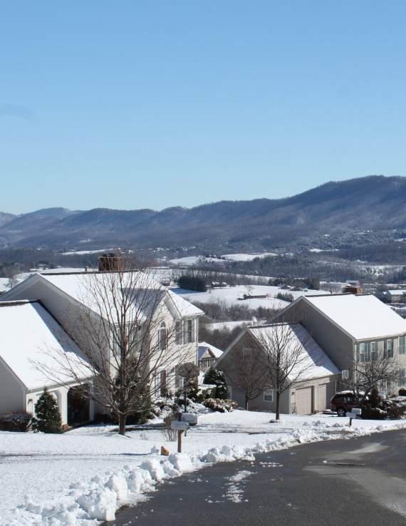
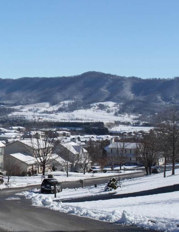
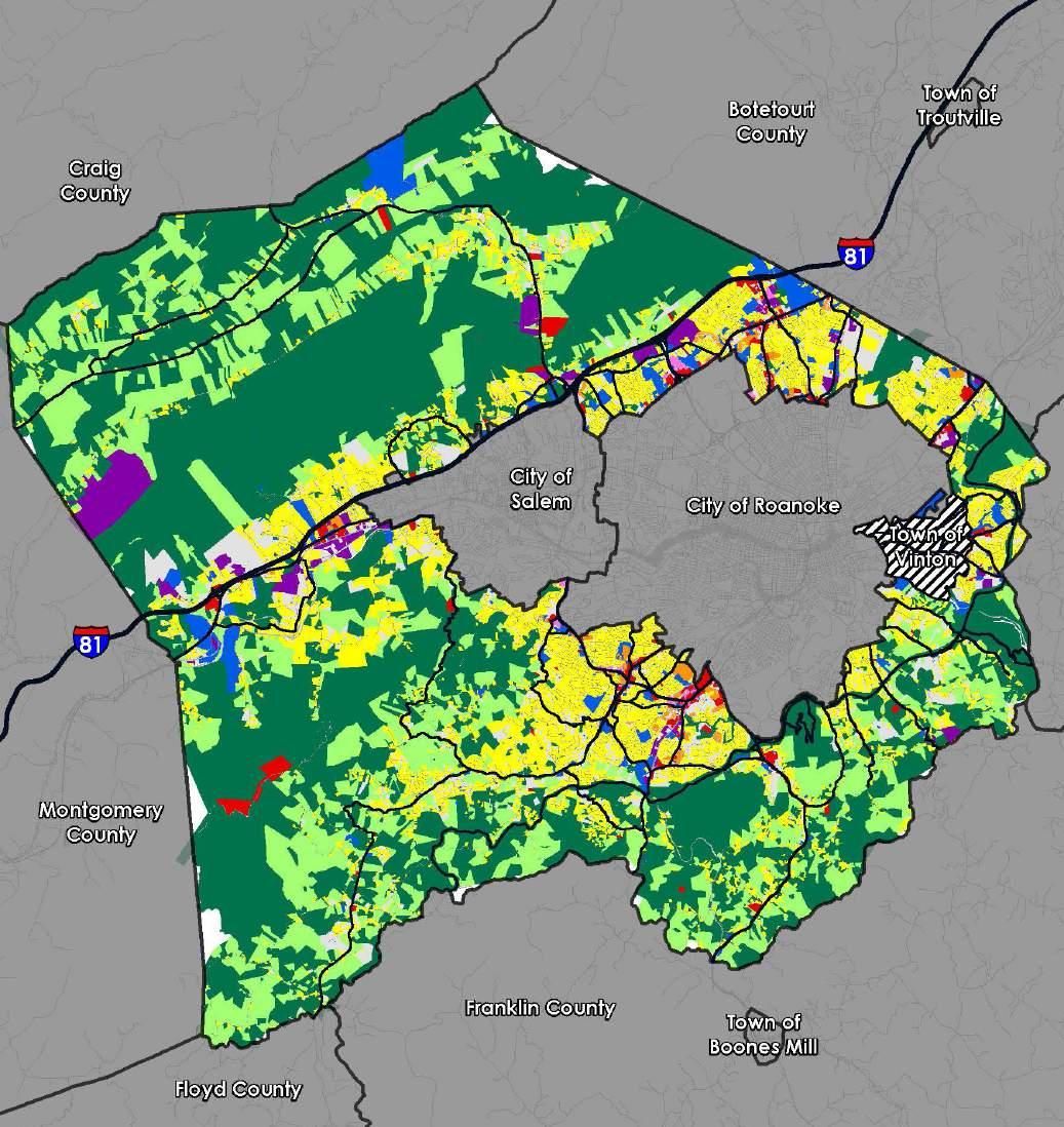
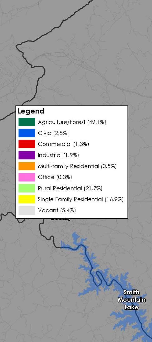

This chapter discusses the existing conditions of land use, economic development, and housing in Roanoke County. These topics were paired together due to their interconnected nature. Land use often dictates which kinds of businesses and housing are allowed and the housing market informs land use decisions. Land use is important to the future of Roanoke County not only to address housing issues, but also to capitalize on economic opportunities and preserve natural and cultural resources. Land use can be analyzed in three ways: existing land use, zoning, and future land use. Existing land use simply describes how the land is being used at the present time. Zoning defines how land can be used--what is permitted and unpermitted. Future land use accompanies the existing comprehensive plan and determines what changes to the zoning would be consistent with Roanoke County’s vision for its future.

As mentioned, existing land use refers to the classification of land use that currently exists for a property. Just under half (49.1%) of all land in Roanoke County is currently being used for forest or agriculture. Most of this land is in the more rural parts of the County, such as the Catawba, Masons Cove, or Bent Mountain areas.
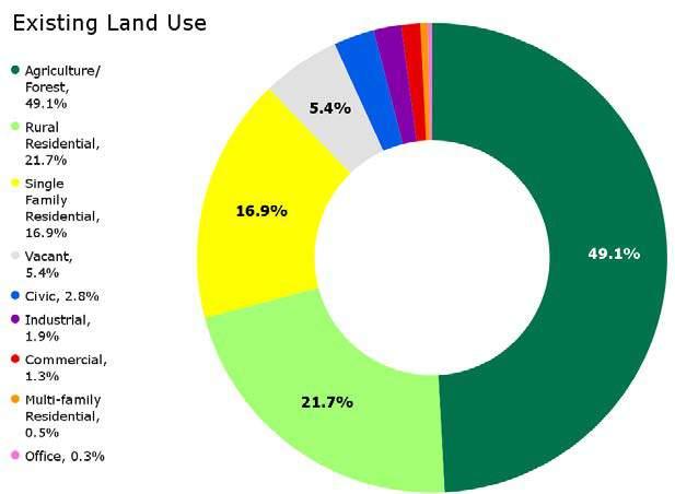
39.1% of the land is being used for residential purposes. Most of this is rural residential land (21.7%). The majority of the single-family (16.9%) and multi-family (0.5%) residential land is found in the more urban planning areas of the County such as Peters Creek, Windsor Hills, Cave Spring, and Bonsack-Vinton.
At approximately 5.4%, there is more vacant land in Roanoke County than all land used for industrial (1.9%), commercial (1.3%), and office (0.3%) uses combined. This vacant land is scattered randomly throughout the County, but is generally found more frequently within the urban core regions. Approximately 2.8% of land is currently used for civic use which includes public land containing Roanoke County community facilities such as schools, libraries, fire/rescue, and parks.
C1 (Low Intensity Commercial) - 0.5%
C2 (High Intensity Commercial) - 1.2%
I1 (Low Intensity Industrial) - 0.7%
I2 (High Intensity Industrial) - 1%
PCD (Planned Commercial Dev.) - 0.06% PRD (Planned Residential Dev.) - 0.6%
PTD (Planned Technology Dev.) - 0.5%
R1 (Low Density Residential) - 15.1%
R2 (Medium Density Residential) - 1.1%
R3 (Medium Density Multi-Family Res.) - 0.7%
R4 (High Density Multi-Family Res.) - 0.1%
(Explore Park) - 0.5% AG1 (Agricultural/Rural Low Density) - 9.9% AR (Agricultural/Residential) - 9.2% AV (Agricultural/Village Center) - 0.3%
Most of the industrial land is located in the Glenvar area along the I-81 corridor. The favorable access to the freeway and the railroad makes this region a prime location for industrial uses. Almost all the land used for commercial and office purposes is found along major arterial roads.

As mentioned previously, zoning is a land use tool that municipalities can use to define what is permitted and is not permitted within a zoning district. The map to the left shows the current zoning in Roanoke County as of May 2024.
Roanoke County has seventeen (17) different zoning districts. These districts derive from five (5) categories of land use: agriculture, residential, commercial, industrial, and other.
There are four (4) agricultural zones in Roanoke County, AG-3, AG-1, AR, and AV. The AG-3 Agricultural/ Rural Preserve district and the AG-1 Agricultural/Rural Low-density district consist of land primarily used as farmland, woodlands, and widely scattered residential development located within the rural service area. The AR Agricultural/Residential district is generally characterized by very low density residential and institutional uses mixed with smaller parcels that have historically contained agricultural uses, forest land and open space outside the urban service area. The AV Agricultural/Village Center district serves as the focal point for cultural and commercial activity of the rural
service areas of the County. Approximately 78% of the land in the County is zoned agriculturally.
There are five (5) residential zones in the County. The R-1 and R-2, residential districts are established for areas of the County within the urban service area with low and medium density residential development. The R-3, residential district provides areas in the County within the urban service area for medium and high density residential developments such as townhouses and apartments. The R-4 residential district similarly provides for only high density residential developments. The Planned Residential Development (PRD) district is intended to allow greater flexibility than is generally possible under conventional zoning district regulations, to allow developers to incorporate a variety of housing options as well as certain limited commercial and office uses designed to serve the inhabitants of the district. Approximately 17% of the land in the County is zoned residentially, with a majority of that zoned as R-1 Low-Density Residential.
There are four (4) commercial zones in the County. The Neighborhood Commercial (NC) district allows for low-intensity retail and service establishments that enhance surrounding residential land uses. The C-1 district provides low-intensity commercial land uses within the urban service area, including smallscale office and retail businesses. In contrast to the C-1 district, the C-2 district provides for a much wider variety of high-intensity commercial land uses at a regional scale within the urban service area. The Planned Commercial Development (PCD) district allows greater flexibility than is possible under conventional zoning district regulations to allow developers flexible application of development controls to protect surrounding properties and promote efficient land use. Approximately 1.76% of the land in the County is zoned commercially and is primarily along arterial roads.
There are three (3) industrial zones in the County. The I-2 district allows for high-intensity industrial land uses within the urban service area. The I-1 district similarly allows for low-intensity industrial land uses. Both zones are regulated in a manner to protect surrounding properties and natural resources from
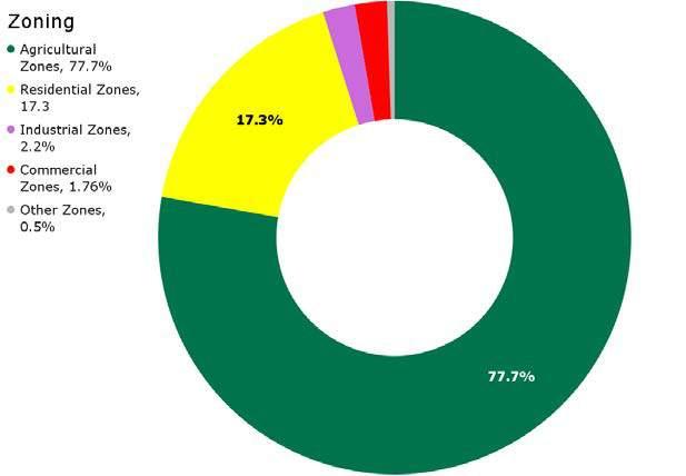
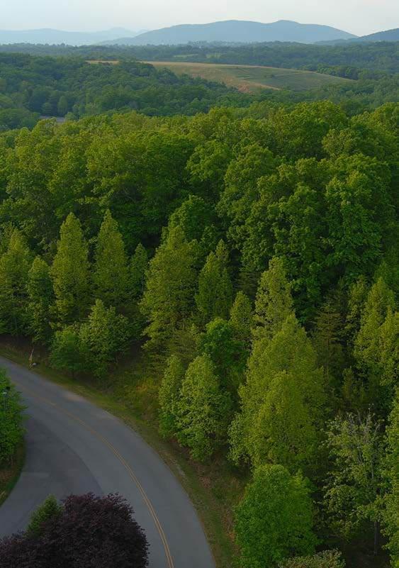
potential negative impacts commonly associated with industrial activity. These districts are provided to promote economic activity in the region. The Planned Technology Development (PTD) District is intended to function as a well-designed industrial park with architecture and landscaping that compliments the surrounding properties and natural resources. This district also provides flexibility and incentives for potential developers.
There is one miscellaneous zone that the County has, the Explore Park (EP) district. This district is intended to allow the unique activities associated with Explore Park to be permitted, while simultaneously protecting the park and surrounding properties from unwanted activities or development. This zone was created as part of a broader vision to turn Explore Park into a regional destination on the Blue Ridge Parkway.
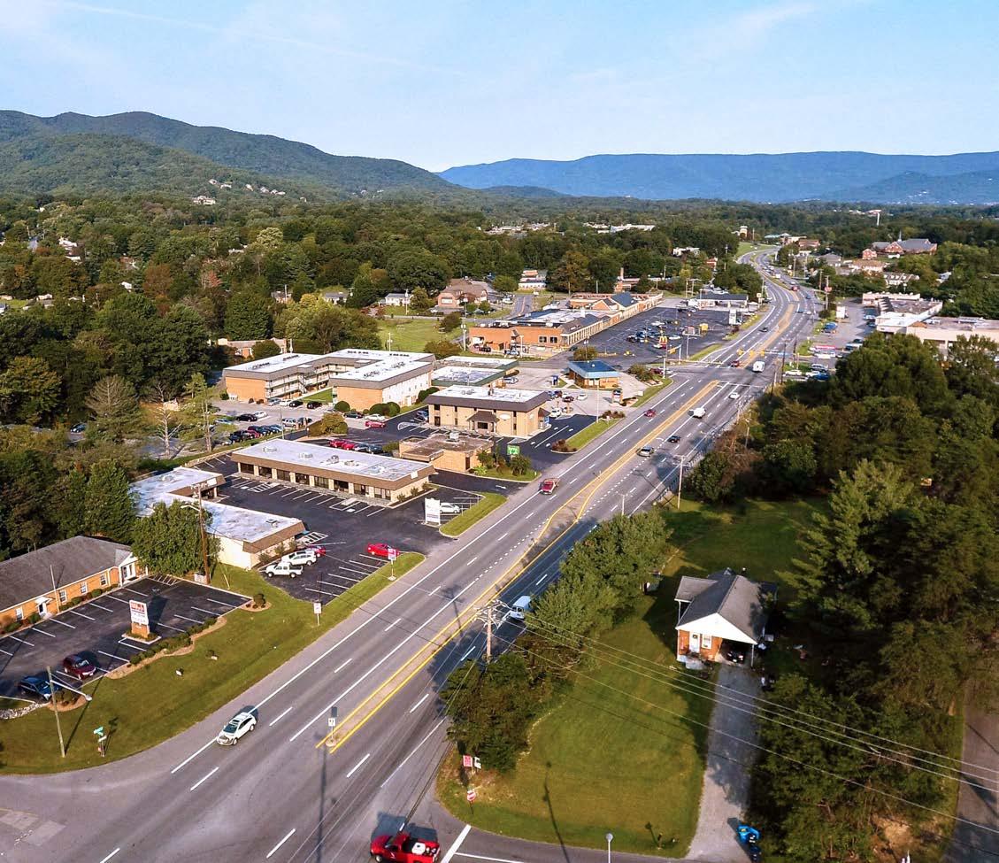

A future land use map typically accompanies a comprehensive plan and determines what changes to the zoning would be consistent with Roanoke County’s vision for its future. The map to the left shows the future land use designations in Roanoke County that were made in association with the 2005 Comprehensive Plan, including its amendments.
There are fourteen (14) future land use designations. The table on the map to the left shows when these future land use categories were created.
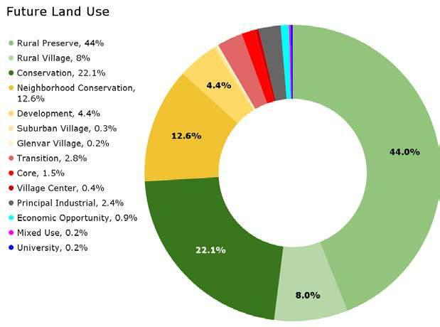
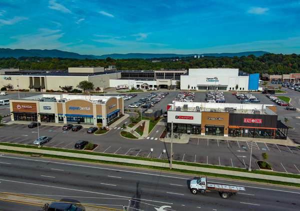
Conservation
Approximately 22.1% of the land in the County is designated Conservation. Almost all of this land follows ridgelines and steep slopes throughout the County and is typically found in the rural parts of Roanoke County such as Catawba, Glenvar, Masons Cove, and Mount Pleasant Community Planning Areas (CPAs). This land use is intended to protect the various natural resources that are associated within them.
Conservation includes areas of environmental sensitivity due to topography, open space, or location with respect to other state or federally preserved and conserved lands. Typical resources would include wetlands, ridgelines, mountainsides, scenic views from the Blue Ridge Parkway and Appalachian Trail, identified greenway corridors, agricultural lands, historical and cultural resources and threatened or endangered species habitats.
The following land use types are examples of uses that may be appropriate for this future land use:
• Agricultural Production
• Forest and Wood Products
• Parks
• Public Lands
• Conservation Easements
• Rural Residential
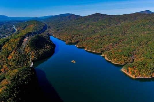
Approximately 1.5% of the land in the County is designated as Core. Land uses designated as Core, typically parallel major commercial corridors and are located in conjunction with central business districts of Roanoke, Salem, and Vinton.
They are commonly found in areas designated as Activity Centers such as the Hollins, Oak Grove, 460/Bonsack, and 419/Tanglewood areas. The intent of Core as a future land use area is to support high-intensity urban development including largerscale highway-oriented retail uses and regionallybased shopping facilities. Bicycle and pedestrian connectivity and safety is also highly encouraged in this future land use area.
The following land use types are examples of uses that may be appropriate for this future land use:
• General Retail Shops and Personal Services
• Office and Institutional Uses
• Limited Industrial Uses
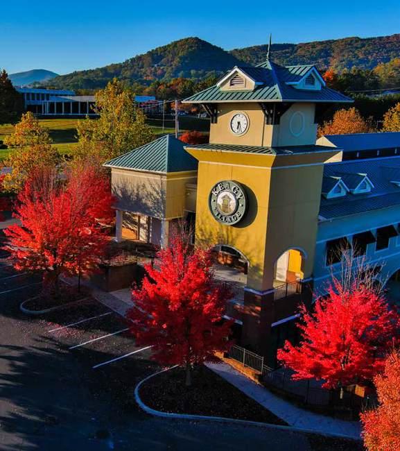
Approximately 4.4% of the land in the County is designated Development. This future land use area is typically located along major corridors surrounded by neighborhood conservation and is where most new neighborhood development will occur including large-scale planned developments which mix residential with potential retail and office uses. This land use intends to support clustered development patterns that aim to encourage bicycle and pedestrian connectivity via trails, greenways, and shared-use paths.
The following land use types are examples of uses that may be appropriate for this future land use:
• Conventional Residential
• Cluster Residential
• Multi-Family Residential
• Planned Residential Development
• Planned Community Development
• Community Activity Centers
Approximately 0.9% of the land in the County is designated Economic Opportunity. This future land use designation was created with the intention to take advantage of tourism and commercial opportunities on the Blue Ridge Parkway in the Explore Park area. This area in the eastern-most portion of Roanoke County is the only area of the County with this future land use designation.
The Economic Opportunity designation is a future land use area that aims to guide a mix of commercial, tourist-related, and limited industrial uses related specifically to destination resort and outdoor recreation facilities. Economic Opportunity areas are applied to lands owned or leased by the Virginia Recreational Facilities Authority or Virginia Living Histories, Inc., and adjacent lands that could potentially be expansion areas for the facilities. The designation discourages uses that may conflict with the resort or outdoor recreation activities.
The following land use types are examples of uses that may be appropriate for this future land use:
• Family Destination Resort
• Existing Land Uses and Zoning
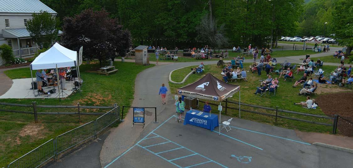
Economic Opportunity Land Use
Approximately 0.2% of the land in the County is designated as Glenvar Village. This future land use is located along a stretch of West Main Street and is home to community identifiers such as the Glenvar Library, Richfield Retirement Community, Fort Lewis Fire and Rescue Station #9, Fort Lewis Elementary, entrance to Glenvar Schools Complex, and Fort Lewis Baptist Church. Glenvar Village is a future land use area intended to serve as focal point for the Glenvar Community. Because of the importance to the community, a high degree of architectural and creative site design is encouraged to enhance the rural and historic character of the area as well as pedestrian and vehicular connectivity between properties. A mix of uses on a parcel and/or along the West Main Street Corridor is encouraged in the Glenvar Village designation.
The following land use types are examples of uses that may be appropriate for this future land use:
• Community Activity Centers
• Commercial
• General Retail Shops and Personal Services
• Parks and Outdoor Recreation/Ecotourism
• Limited Industrial
• Mixed Use
• Office and Institutional
• Residential
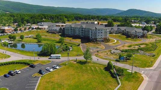
Approximately 0.2% of the land in the County is designated Mixed Use. The majority of land designated as Mixed Use is located in the Peters Creek CPA in the Hollins Center at the intersections Peters Creek Road and Williamson Road as well as Plantation Road and Williamson Road. This land use recognizes the existing mixture of uses and zoning districts and provides for a mix of uses to preserved and developed. Bicycle and pedestrian safety and connectivity between uses are highly encouraged.
The following land use types are examples of uses that may be appropriate for this future land use:
• Community Activity Centers
• Commercial
• General Retail Shops and Personal Services
• Limited Industrial
• Mixed Use
• Office and Institutional
• Parks and Outdoor Recreation/Ecotourism
• Residential
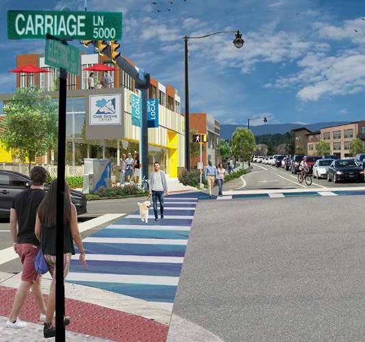

Neighborhood Conservation
Approximately 12.6% of the land in the County is designated Neighborhood Conservation. This land use can be found where established single-family neighborhoods are delineated, particularly in the more suburban and urban areas of Roanoke County, such as the Cave Spring, Glenvar, Peters Creek, Bonsack/Vinton, and Windsor Hills CPAs. This land use is intended to conserve the existing development pattern of neighborhoods where single-family or multi-family homes are encouraged.
The following land use types are examples of uses that may be appropriate for this future land use:
• Single-Family Residential
• Neighborhood Institutional Centers
• Neighborhood Commercial
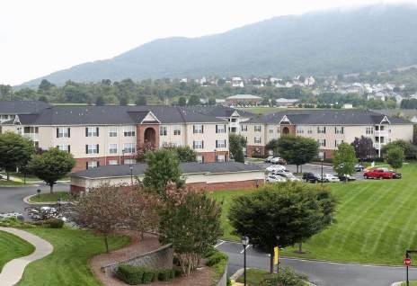
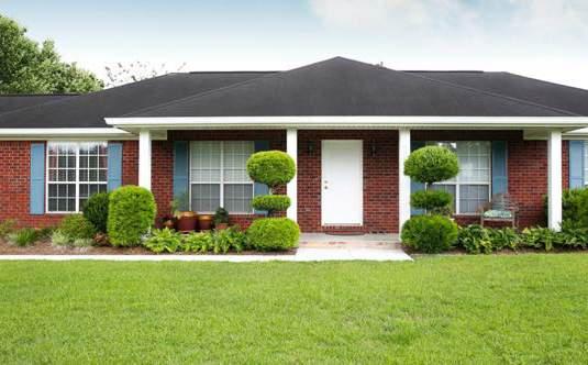
Principal Industrial
Approximately 2.4% of the land in the County is designated Principal Industrial. Most of this future land use is within the Glenvar and Peters Creek CPAs along the I-81 corridor to take advantage of the proximity to the interstate to promote economic development. Principal Industrial areas are intended to exist within planned regional employment centers of the County with convenient access to major highways.
The following land use types are examples of uses that may be appropriate for this future land use:
• Agricultural
• Small Industries and Custom Manufacturing
• Mining and Extraction
• Industrial Development
• Industrial Parks
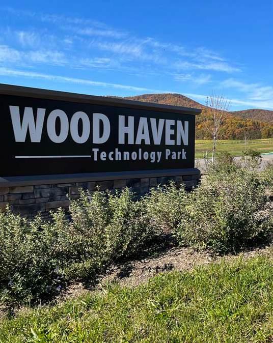
Approximately 44% of the land in the County is designated Rural Preserve. This land use is typically found in areas near conservation land where a higher concentration of forests and farmland are located. This primarily includes the most rural CPAs such as Bent Mountain, Back Creek, Clearbrook, Catawba, Glenvar, and Masons Cove. This land use is intended to preserve the natural landscape and discourage new development. It includes areas of mostly undeveloped, outlying lands.
These rural regions are generally stable and require a high degree of protection to preserve agricultural, forestal, recreational, and remote rural residential areas.
The following land use types are examples of uses that may be appropriate for this future land use:
• Agricultural Production
• Agricultural Services
• Forest and Wood Products
• Parks and Outdoor Recreation Facilities
• Rural Residential
• Rural Institutional
• Mining and Extraction Operations
Approximately 8% of the land in the County is designated Rural Village. This land use can be found at the heart of many rural areas designated as Rural Preserve where a higher concentration of growth is expected and encouraged to occur, particularly where public facilities and infrastructure are located. Rural community and farming areas are generally in between the intense suburban development patterns already established in the County and the designated Conservation and Rural Preserve areas.
While suburban or urban development patterns are discouraged, this land use is intended to limit commercial activity and higher residential density in the more rural areas of Roanoke County such as Bent Mountain, Back Creek, Catawba, Glenvar, and Masons Cove CPAs.
The following land use types are examples of uses that may be appropriate for this future land use:
• Rural Housing
• Rural Community Centers
• Agricultural Production and Services
• Forest and Wood Products
• Small Scale Commercial
• Rural Parks and Outdoor Recreation
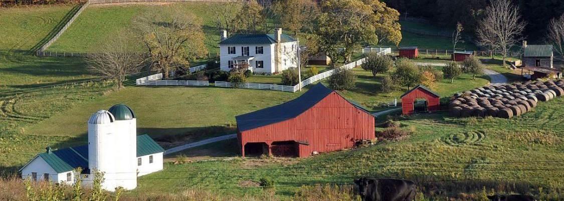
Approximately 0.3% of the land in the County is designated as Suburban Village. This future land use is located in two areas of Roanoke County, the Poages Mill area of the Back Creek CPA and the area encompassing the Mount Pleasant Library and Fire and Rescue Station #6 in the Mount Pleasant CPA. This future land use is intended to support lower intensity commercial and residential growth within a mixture of surrounding development. New neighborhood development occurs in close proximity to institutional, office and retail uses.
The following land use types are examples of uses that may be appropriate for this future land use:
• Agricultural Production and Services
• Parks and Outdoor Recreation
• Residential
• Community Activity Centers
• Commercial
Approximately 2.8% of the land in the County is designated as Transition. Transition areas are typically located adjacent to developed areas and serve as buffers between major arterial roads with high-intensity development and adjacent low-intensity residential development. This future land use is most commonly found in the Bonsack/Vinton, Clearbrook, Glenvar, and Peters Creek CPAs. The intent of Transition is to soften development adjacent to intense retail and highway oriented commercial uses, where office, institutional and small-scale, coordinated retail uses are more suitable.
The following land use types are examples of uses that may be appropriate for this future land use:
• Office and Institutional
• Retail
• Multi-Family Residential
• Single-Family Attached Residential
• Parks
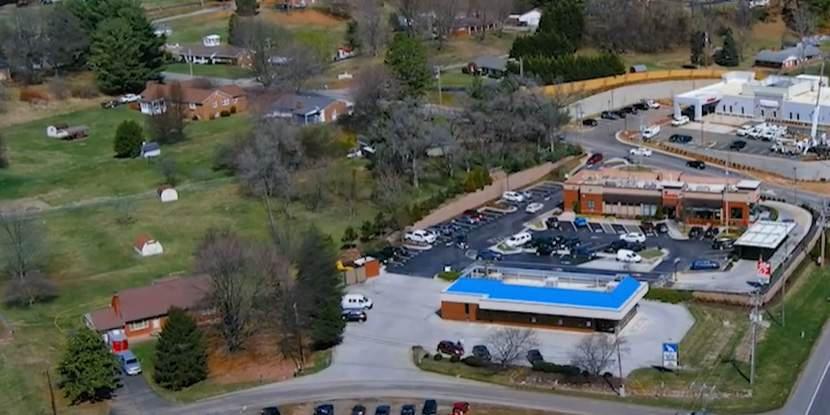
Approximately 0.2% of the land in the County is designated University. This land use is located in the Peters Creek CPA in the Hollins Center along Williamson Road at Hollins University. The University future land use area is intended to guide a mix of educational, institutional, limited commercial, recreational, and open space uses related to a college or university campus. Other lands owned by the University may be included in other future land use designations that are more appropriate to their existing zoning or land uses. Proposed land uses adjacent or in close proximity to the University should compliment college-related activities including bicycle and pedestrian connectivity.
The following land use types are examples of uses that may be appropriate for this future land use:
• University Campus
• Special Events and Recreation

Approximately 0.4% of the land in the County is designated as Village Center. This future land use area is located along the Route 221 corridor in the Back Creek and Bent Mountain CPAs as well as the Route 311 corridor in the Catawba and Mason Cove CPAs. The intent of this land use is to serve as the commercial and institutional focal point of surrounding rural residential and farming establishments. Here, the highest level of rural land use activities may occur. By nature, the majority of commercial and institutional activities in Village Center areas are designed and scaled to best serve the needs of the residents from the surrounding rural areas.
The following land use types are examples of uses that may be appropriate for this future land use:
• Agricultural Production and Services
• Parks and Outdoor Recreation
• Residential
• Rural Community Centers
• Convenience Retail
• Rural Highway Retail
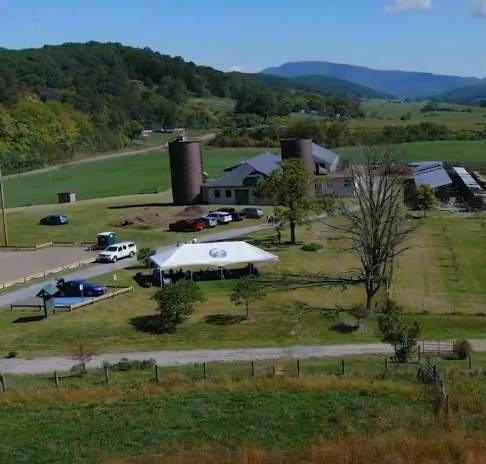
Village Center Land Use

Roanoke County has experienced economic and population growth over the past decade and is expected to continue growing. Proximity to high-quality educational institutions, numerous outdoor recreation attractions, and a high quality of life for a lower cost all contribute to the livability and continued growth of the County. Roanoke County’s unique location, surrounding the independent cities of Roanoke and Salem, gives it access to urban amenities while the County maintains its suburban identity.
Despite the aging population, employment increased in the last decade, with notable growth in the healthcare and social services, manufacturing, and professional and technical services sectors. Healthcare and social services was also the top-employing industry sector in the County as of 2020, which is due to the local presence of the Carillion and Lewis Gale medical networks. The other two top employing industry sectors were retail trade and government. A list of the top employers in Roanoke County can be viewed on page 7-24.
The Roanoke County Department of Economic Development offers an extensive array of information and services that are designed to assist international and domestic businesses with establishing new facilities, relocating existing facilities, or expanding current facilities in Roanoke County. The department is actively involved in the following economic development initiatives:
• Business referral services and technical assistance
• Existing business retention and expansion programs and services
• New business recruitment and assistance
• Real estate consultation services
Local and state organizations that assist the Department of Economic Development include:


Roanoke County Economic Development Authority (EDA)
The Economic Development Authority (EDA) of Roanoke County is responsible for guiding economic development policy.
The EDA was established under Code of Virginia, Industrial Development and Revenue Bond Act, Chapter 49, § 15.2-4900-4920 in 1971. The Code of Virginia authorizes the EDA to:
• Acquire, sell, and exchange real and personal properties
• Exercise all powers expressly given the authority by the governing body of the locality which established the authority
• Issue bonds, borrow money and/or accept grants
• Make loans or grants for the purposes of promoting economic development
There are ten members of the EDA, who are appointed (two from each magisterial district) by the Roanoke County Board of Supervisors who govern the Economic Development Authority of Roanoke County, created in 1971.
The EDA is authorized to acquire, own, lease and dispose of local properties that will potentially promote industry and develop trade in Virginia.
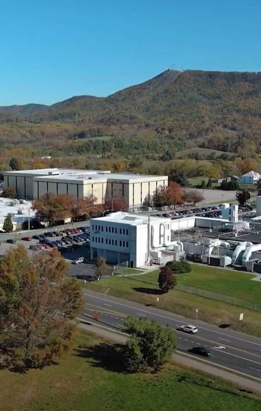
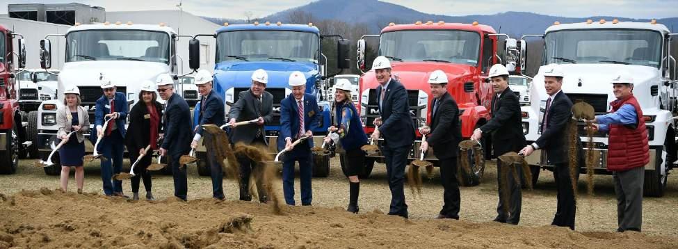
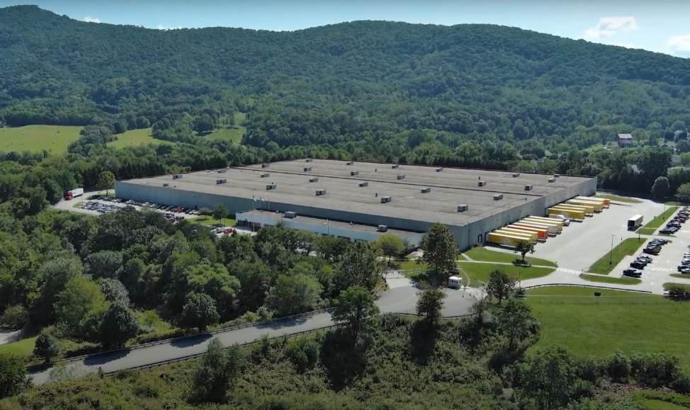
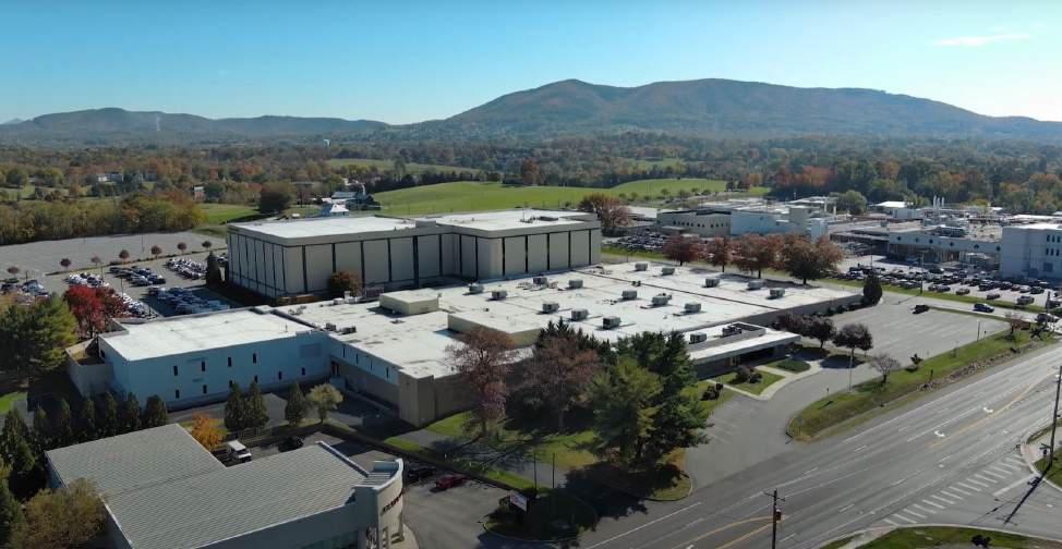
Roanoke County has a cluster of advanced material manufacturing. This includes industries vested in metal, glass, and plastic manufacturing as well as machine shops, R & D (Research and Development), and equipment manufacturing for communication and electrical components. This manufacturing cluster largely employs scientists, physicists, and engineers and related production chain positions. In 2020, the County’s advanced material manufacturing cluster had approximately 1,913 workers employed in businesses belonging to this cluster, which account for 4.3% of County employment. Nevertheless, new facilities have opened and continue to thrive in the County as part of the larger regional industry cluster. The success of these facilities and growth trends may indicate an opportunity for growth.
The Center for Research and Technology and Valley Tech Park are both located in the Glenvar area along the I-81 corridor. Wood Haven Technology Park is located adjacent to the I-81 and I-581. The Vinton Business Center is located along Hardy Road near the Bedford County line.
The Center for Research and Technology, Wood Haven Technology Park and the Vinton Business Center are zoned Planned Technology Development District (PTD). This zone is intended to function as a well-designed industrial park with architecture and landscaping that compliments the surrounding area and natural resources. This district also provides flexibility and incentives for potential developers.
A map showing the locations of each of the Industrial Parks can be found on page 7-21. These include the following:
• Center for Research and Technology: Approximately 480 acres of land located in the western portion of the County directly off of Interstate 81. There are two developable pads remaining, a 26 acre and 13 acre pad. As of 2024, the park has four tenants.
• Valley Tech Park: Approximately 166 acres of land located in the western portion of the County directly off of West Main Street adjacent to Interstate 81. As of 2024, there are four tenants occupying the park.
• Wood Haven Technology Park: Approximately 94 acres of land located in the northern portion of the County directly off of Wood Have Road adjacent to Interstate 81. There are no tenants occupying the site as of 2024. Key assets of Wood Haven include I-81 frontage (2,000+ feet), interstate access, completed due diligence, utilities on site, and airport access.
• Vinton Business Center: Approximately 97 acres of land located in the eastern portion of the County directly off of Hardy Road outside of the Vinton town limits. As of 2024, there is one tenant occupying the site. That tenant is Cardinal Glass, which occupies approximately 25 acres of the site. Approximately 72 acres are undeveloped.
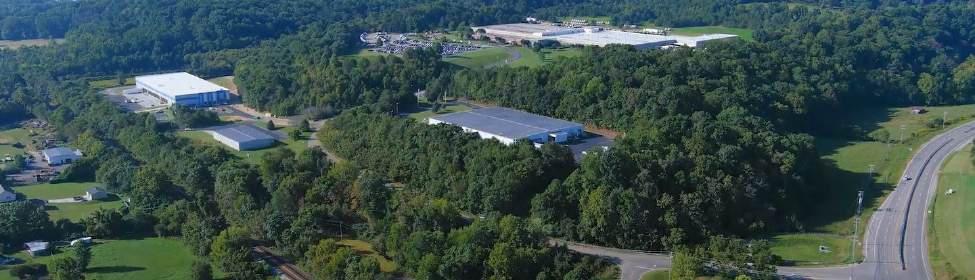
Contrary to the Southwest Virginia trend of population decline, the Roanoke County population is growing and expected to continue to expand. However, the County population is continuing to age, with decreases in younger population cohorts as household sizes are decreasing and less families are choosing to have multiple children. Employers lack the younger workforce needed to fill and replace positions left vacant after older generations retire.
The modern economy is driven by education. In the 2019-2020 graduate year, most high school graduates reported that they plan to attend a four-year (45.2%) or two-year college (33.5%). A higher percentage of graduates in the County chose to attend a two-year college compared to the state average of 25.2%. About 15% of students had plans to directly enter the workforce.
Health professions and related programs had the greatest postsecondary program completions (993) for the Roanoke County, City of Roanoke, and City of Salem region. These degrees offer a wide variety of careers in nursing, the medical/clinical field, business administration and management, and biological and physical sciences. Program career pathways reported having high annual openings (3,732) and strong projected job changes in the next ten years (6.2%). Additionally, the Business, Management, Marketing, and Related Support Services pathway had a very large number of job openings in the County compared to the number of completions for the program. This indicates unfilled demand by employers in this field.
Virginia Western Community College produced the greatest amount of program completions (1,210 individuals) within the Roanoke County, Roanoke City, and Salem City region. However, Radford University-Carilion saw the greatest amount of growth (32%) in its number of completions, an increase of 133 completions between 2013-2019.
The County’s median incomes of high school graduates and some college and associate graduates are slightly higher than state and national averages, while incomes of those with a
bachelor’s degree or higher are lower. This may reflect the County’s job market which may not be able to incentivize workforce participants who have higher educational attainments to remain or relocate to the County.
Labor force participation has fallen at the County, state, and national level. Roanoke County’s labor force participation rate decreased from 67.3% in 2010 to 61.3% in 2019. This is likely related to the aging population trend and the increase in the over-65 population. A large portion of labor force participants in Roanoke County also tend to be older, with 48.1% being over the age of 45. There is also a smaller population aged 20 to 34 years, representing 20.7% of labor force participants. This is comparable to trends for the state and nation.
The tables on the following pages include data from the United States Census Bureau dating back to 2010. This includes data on employment status, commuting patterns, class of worker, occupation, household income, and health insurance.
The Greater Roanoke Workforce Development Board (GRWDB) is the regional workforce development board serving the Roanoke Valley and Alleghany Highlands regions. They provide strategic workforce programming and solutions to meet business demand via partnerships and career opportunities through the educational pipeline. In 2019, the Western Virginia Workforce Development Board (WVWDB) rebranded to become Virginia Career Works - Blue Ridge, of which the GRWDB is a partner of. Other partners include the Virginia Employment Commission, Virginia Western Community College, Region 5 Adult Education Program, Total Action for Progress (TAP), Department for Aging & Rehabilitative Services, Local Departments of Social Services, Blue Ridge Job Corps, Roanoke Regional Chamber of Commerce, Roanoke Regional Partnership, Local Economic Development Departments, Virginia Economic Development Partnership, and Roanoke Redevelopment Housing Authority.
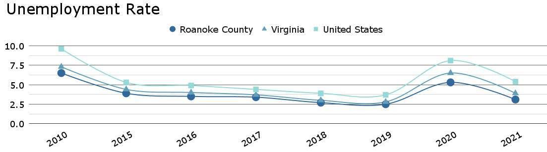
Source: Virginia Employment Commission and Bureau of Labor Statistics
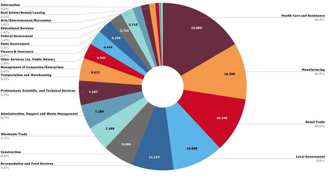

Housing is a critical part of the social and physical landscape of Roanoke County. It generates wealth, creates neighborhoods, and provides shelter. This section will examine the current status of the housing in Roanoke County by comparing and contrasting housing data with the state, the nation, and surrounding municipalities. As is true for the rest of the 200 Plan, most of the data that will be discussed below comes from 2019 U.S. Census data. As of this writing, the U.S. Census Bureau has not completely released all the data collected from 2020-2023. However, some 2020 and 2021 housing data is available, and will be specified before it is discussed.
The figure below shows the total housing units of municipalities in the region. As of 2019, Roanoke County has 41,306 housing units. Compared to neighboring municipalities, only Roanoke City has more total units (46,991). Three-fourths of the County’s housing stock (75.1%) is single-family detached homes. An additional 5.3% is singlefamily attached homes. About a sixth (17.6%) of the housing stock is multi-family units ranging from duplexes to large apartment buildings. The relatively high amount of single family detached housing and the wide variety of housing densities attracts many people to live in the County. A map of the total housing units by each CPA can be found on page 7-27.
Throughout the region, single family detached housing is the most dominant type of housing.
Roanoke County has a relatively moderate share compared to other municipalities with approximately 75.1% of housing being this housing type. Botetourt County has the highest share of this type of housing (83.4%) and Montgomery County has the lowest share (52.2%). Roanoke County is comprised of approximately 17.6% multi-family units, while Montgomery County has the largest share of this type of housing (28.9%) and Floyd County has the lowest share (2.0%).
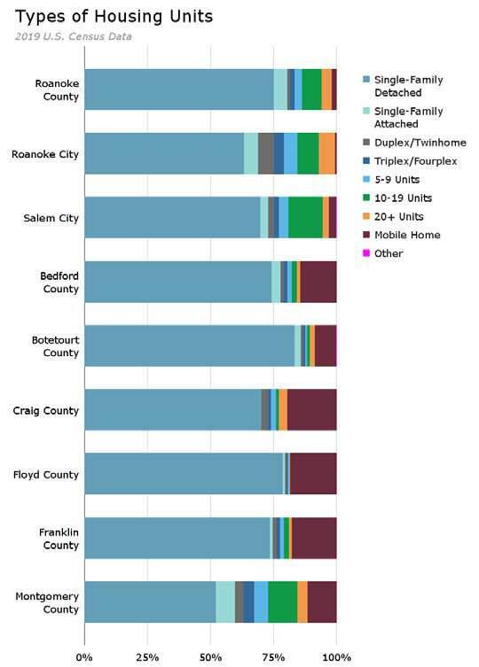
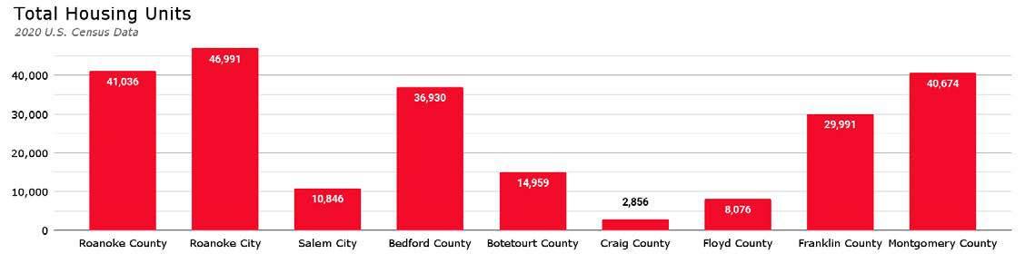
Persons per household is a measure of the average number of people in a single household. A higher average household size is indicative of more families and children, where a lower rate might indicate more households of singles and couples.
The national average in 2019 was 2.61 persons per household. The Virginia average was 2.60 persons per household. Roanoke County’s average household size was 2.45 persons per household in that same year, which is a lower than the national and state averages. Compared to surrounding municipalities, Roanoke County has a moderate average household size. Bedford County has the highest persons per household at 2.50 with Craig County having the lowest share at 2.22 persons per household. Roanoke County is following the national, state, and regional trend to have smaller and smaller household sizes over time.
The Community Planning Area (CPA) with the highest average household size (2.61) in 2019 was Back Creek. The lowest was Cave Spring (2.21).
An important indicator of the existing conditions of Roanoke County’s housing stock is its age. Age of housing is measured in two ways. First, it can be measured by number of housing units built in a certain time period. Second, it can be measured by the median year all the housing in the municipality was constructed. The median year all housing in the nation was constructed was 1978. Roanoke County’s is very similar to the nation median at 1977. However, Roanoke County’s median is much older than the Virginia median of 1983.
Much of the housing in Roanoke County was constructed in the 1970’s. 10,226 units were constructed during this period, more than any
other period. There has not been this amount of housing construction since that time. Between 2010 and 2019, a total of 1,368 housing units were constructed. Most of the housing that has been constructed since 2014 in the region has been in Bedford County and Montgomery County (approximately 1,250 units each).
As of 2019, the areas of the County with the oldest median age of housing include the Bent Mountain, Catawba, Clearbrook and Mount Pleasant CPAs. The area of the County with the youngest median age of housing includes the Back Creek CPA. A map of the median age of housing for each CPA can be found on page 7-31.
Home values directly impact the economy through residential investment. This important data point illustrates the cost-burden and investment return of households throughout Roanoke County.
In 2019 the Virginia median home value was $249,100. In just two years, it increased more than 34% to $336,000. The national median home value was $217,500 in 2019, it increased by more than 29% to $281,400 in 2021. Although Roanoke County saw a slight rise in its median home value, it has not risen as sharply. In 2019, the median home value was $199,800. 2021 saw an increase of 8% to $215,800.
Regionally, the County is relatively affordable. The highest 2019 median home value was Botetourt County at $227,700. The lowest was Roanoke City at $135,100.
In 2019, the areas within the County with the highest median home value includes the Back Creek and Windsor Hills CPAs ranging from $236,600 to $285,300. The areas with the lowest median home value includes the Clearbrook, Mount Pleasant, and Catawba CPAs which range from $157,900 to below $174,000.
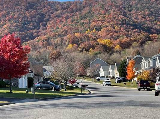
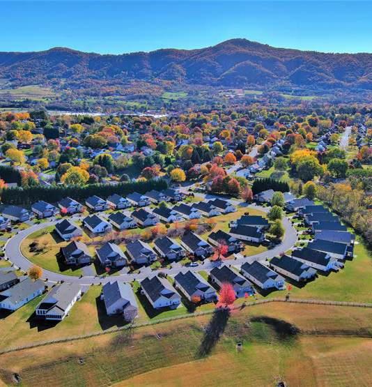
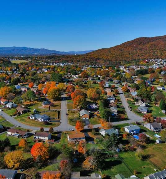

Roanoke County home values had a similar increase as Virginia from 2010 to 2021 with the state having a greater median increase since 2021. Roanoke County has remained below the state average for median home values, while it has remained relatively the same as the national average.
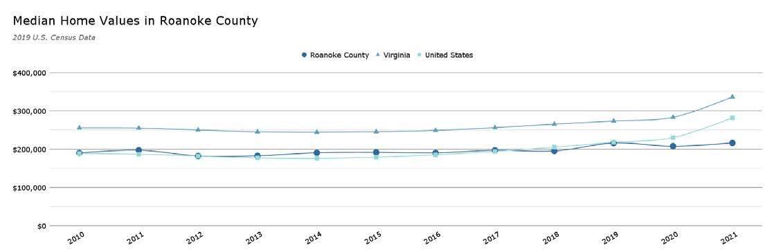
Regionally, the County is relatively affordable. The highest 2019 median home value was Botetourt County at $227,700. The lowest was Roanoke City at $135,100.
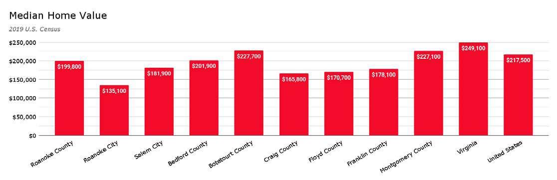
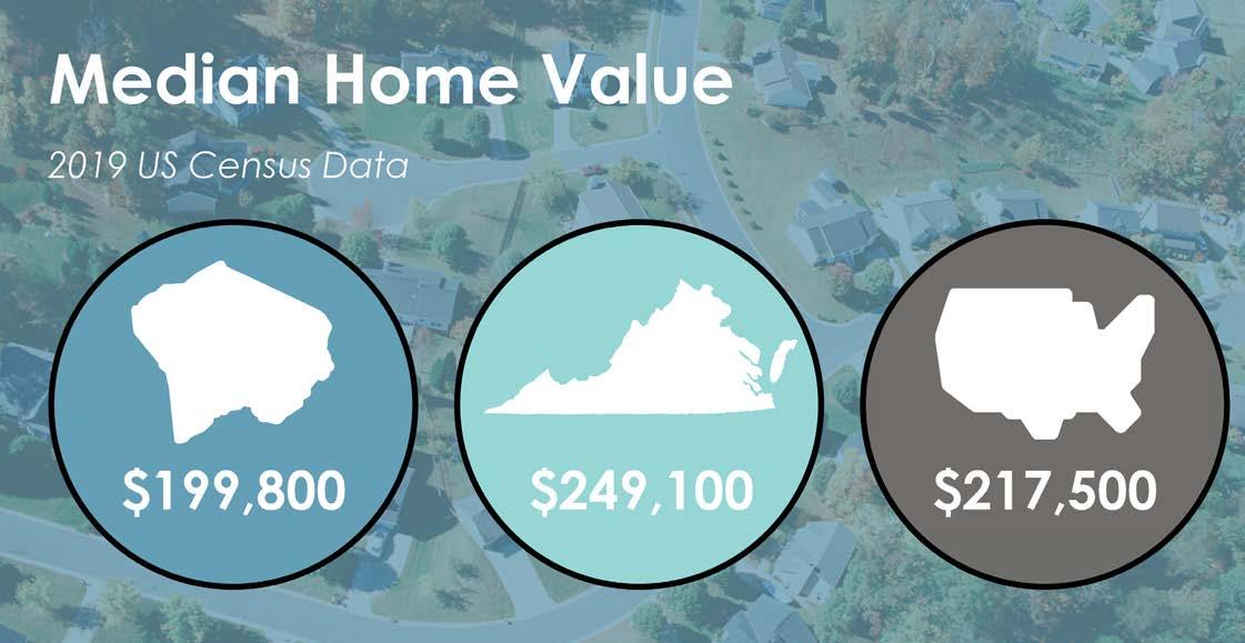
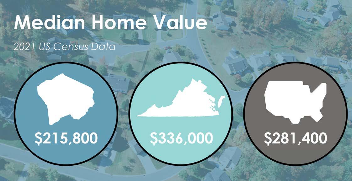
In 2019, the areas within the County with the highest median home value includes the Back Creek and Windsor Hills CPAs ranging from $236,600 to $285,300. The areas with the lowest median home value includes the Clearbrook, Mount Pleasant, and Catawba CPAs which range from $157,900 to below $174,000.
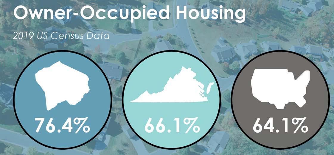
Homeownership plays an important role in building strong communities.
Roanoke County has a higher rate of homeownership (76.4%) than the national and state averages (64.1% & 66.1%). In 2019, the County had 28,591 owner-occupied housing units. This is more than Roanoke City had in the same year (21,479). No other municipality in the region has more owner-occupied housing than the County; however, there are several that do have a higher ratio. Botetourt County has the highest percentage of owner-occupied housing units (86.3%) in the Roanoke region.
The chart on page 7-37 shows when the population of Roanoke County moved to the County. Just over half of the population (55.3%) has moved into the County prior to 2010. Less than a fourth has moved in since 2015 (23.7%).
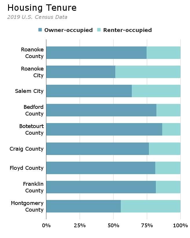
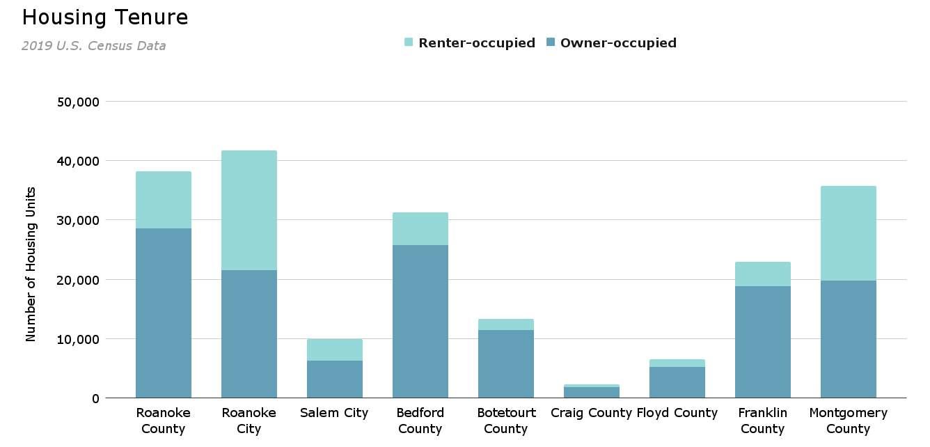
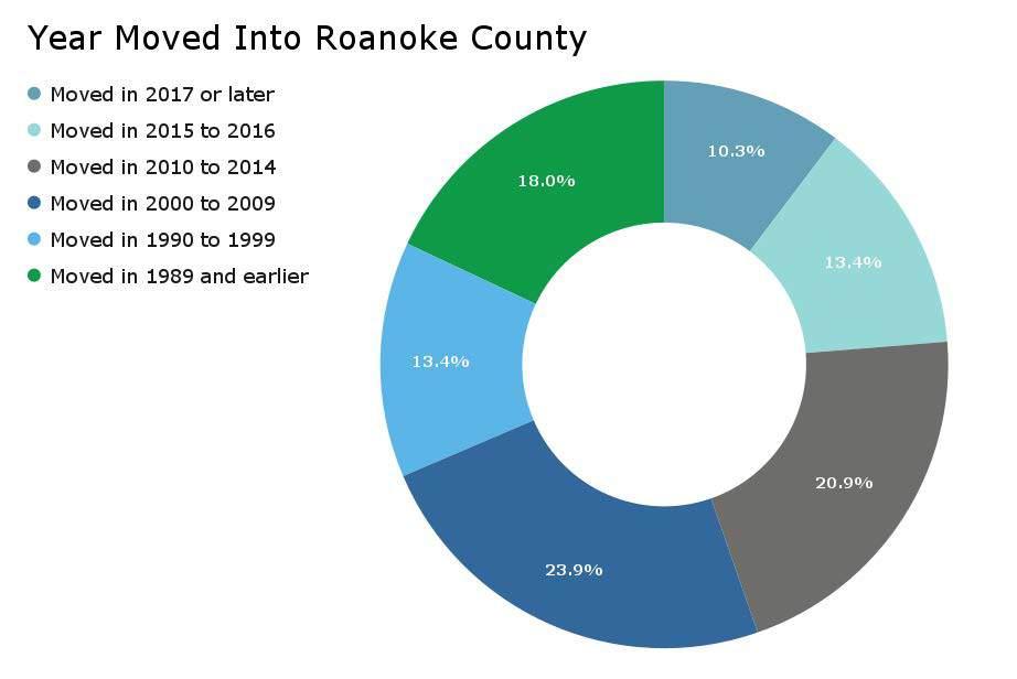
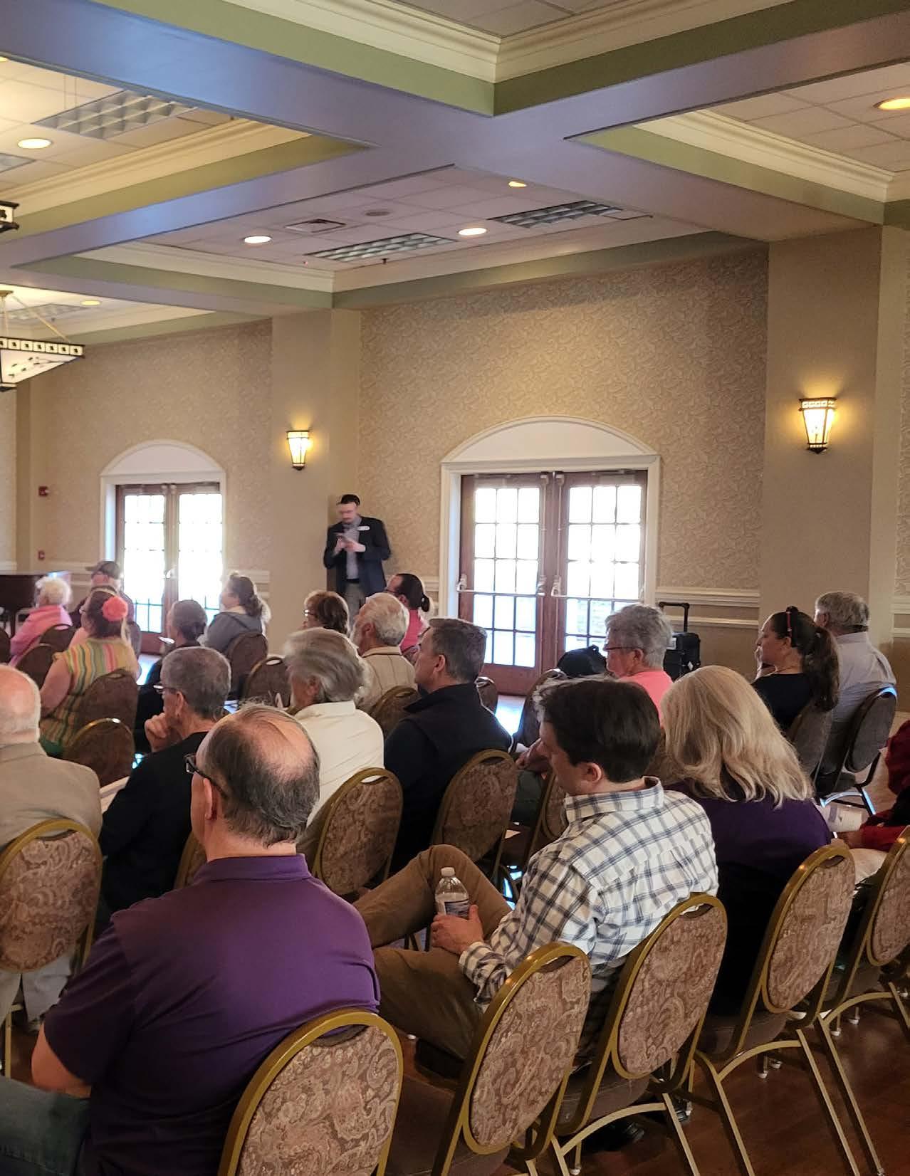

Over the course of two and a half years following a global pandemic, nearly one-thousand residents and visitors attended approximately thirty meetings to discuss the future of Roanoke County. The process began with various stakeholder discussions and open-house style meetings in the fall of 2021 which equated to 500 attendees at twelve (12) total meetings and resulted in 289 survey respondents. The next phase of community engagement continued discussions of the vision of the county in the spring of 2022 which equated to 147 attendees at seven (7) total meetings and resulted in 428 survey respondents. The engagement process in the winter of 2023 presented draft recommendations for Roanoke County as a whole as well as each of the eleven (11) unique planning areas with nearly 300 attendees at six (6) different meetings over a three week period. The following chapter details the quantitative and qualitative information that was the result of countless hours of effort from Roanoke County citizens, visitors, leaders, and staff alike.

Since the Roanoke County 200 Plan informs decision makers regarding long-term consequences and helps the County direct its planning efforts, it was essential to gather stakeholder input to help identify regulatory, development, and environmental needs for citizens, property owners and businesses.
Roanoke County Planning staff met with the following stakeholders in 2021 and 2022:
• Roanoke County Planning Commission
• Roanoke County Board of Supervisors
• Roanoke County Economic Development Authority and Department
• Roanoke County Department Leadership
• Roanoke County Parks, Recreation and Tourism


• Roanoke County Libraries
• Roanoke County Public Schools
• Roanoke County Fire & Rescue Department
• Roanoke County Police Department
• Roanoke County Sheriff’s Office
• Roanoke County Communication & Information Technology
• Town of Vinton
• Botetourt, Franklin, & Montgomery Counties
• City of Roanoke
• City of Salem
• Community Accessibility & Inclusion Organizations
• ELEVATE Roanoke County Plan Stakeholders
• Roanoke Regional Partnership
• Regional Housing Experts
• Blue Ridge Workforce Development Board
• The Advancement Foundation
• Roanoke Valley Broadband Authority
• Virginia Department of Transportation
• Valley Metro
In discussions with Roanoke County Planning staff, stakeholders were asked what they perceived as the needs, issues, opportunities, and trends in Roanoke County. The issue of lacking high quality, affordable housing throughout the region was the most common theme. Many stakeholders felt this issue might be one of the largest factors limiting the region’s economic potential. Another common issue mentioned was the need for better access to broadband throughout the county. Many felt that abundant, high quality broadband was a strong attractor of economic development in the region. Outdoor recreation, particularly greenways, was a topic often discussed as a big opportunity for the county. Several stakeholders expressed a desire for better transit services in the County.

Twelve (12) community meetings were held around Roanoke County in fall 2021 to collect preliminary feedback about community issues, needs, and existing conditions. Meetings were open house
format and were held from 4:00 PM - 8:00 PM. at the following locations on the following dates:
1. Catawba and Masons Cove: Masons Cove Elementary School - Thursday, September 9, 2021. 50 attendees.
2. Peters Creek: Green Ridge Recreation Center - Thursday, September 16, 2021. 39 attendees.
3. Mount Pleasant: Mount Pleasant Elementary School - Thursday, September 23, 2021. 30 attendees.
4. Bonsack/Vinton: Charles R. Hill Community Center (Vinton) - Thursday, September 30, 2021. 42 attendees.
5. Clearbrook: Clearbrook Elementary SchoolThursday, October 7, 2021. 15 attendees.
6. Windsor Hills: Brambleton Center - Monday, October 11, 2021. 42 attendees.
7. Cave Spring: South County Library - Monday, October 18, 2021. 56 attendees.
8. Back Creek: Back Creek Elementary School - Thursday, October 28, 2021. 17 attendees.
9. Bent Mountain: Bent Mountain CenterThursday, November 4, 2021. 77 attendees.
10. Glenvar: Fort Lewis Elementary SchoolMonday, November 8, 2021. 56 attendees.
11. South County: South County LibraryWednesday, November 17, 2021. 28 attendees.
12. North County: Green Ridge Recreation Center - Thursday, November 18, 2021. 11 attendees.
13. Other: Roanoke County Public Schools Student Advisory Council (RCPS SAC)Wednesday, November 3, 2021. 37 students.
There were 500 total attendees across all meetings combined. Additionally, a general survey was disseminated and 289 people responded to it.
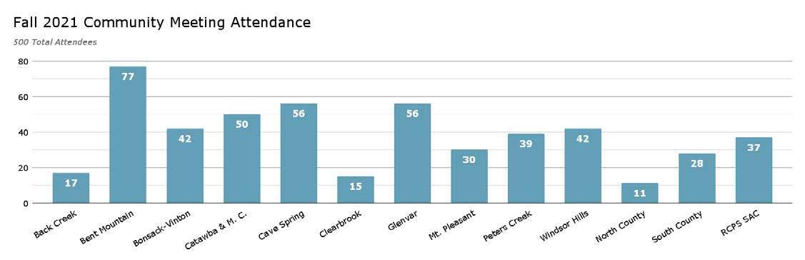
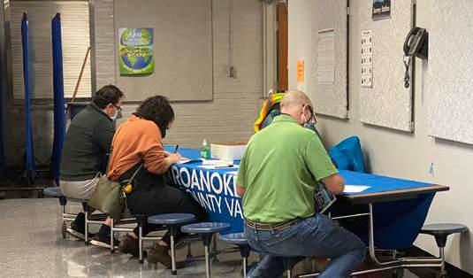
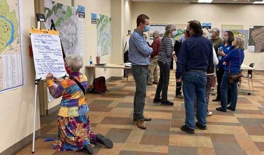
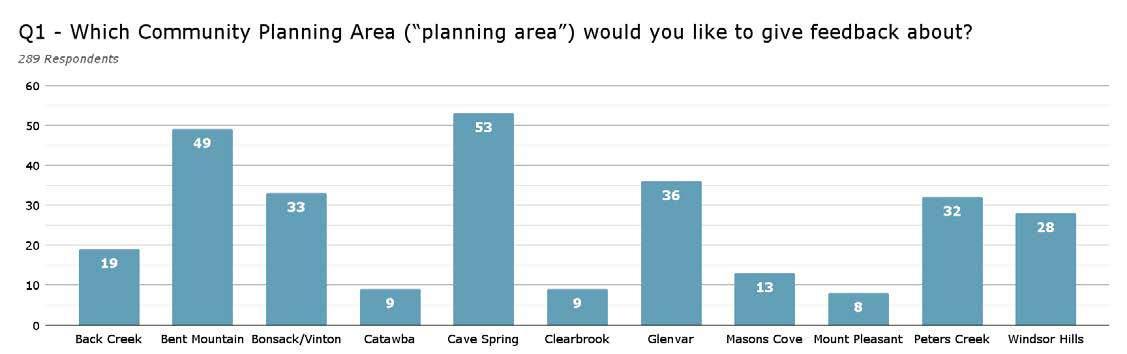
Citizens were invited to comment on Land Use, Community Facilities, Transportation, and Protection and Preservation. Comments and suggestions from citizens were collected and assembled by staff into “Post Meeting Summary” documents for each Community Planning Area. A digital copy of each document can be found on
the County’s 200 Plan webpage.
There were two (2) surveys sent out for public feedback in phase two and phase three of the planning process. The first was sent out during Fall 2021 in conjunction with the first round of Community Planning Area (CPA) meetings. The
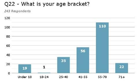
purpose of this survey was to find out from residents what the issues were and which were most important that the 200 Plan needed to address. The second was sent out during the spring of 2022 in conjunction with the second round of CPA meetings. The purpose of this survey was for staff to receive feedback regarding draft goals for the 200 Plan.
The fall survey was distributed at twelve (12) public open house CPA meetings, at all Roanoke County libraries, and was available online. 289 responses were received. The survey had 22 questions. The first 18 were intended to gather information and feedback regarding issues in residents’ respective CPA. The final four (4) were intended to gather similar data regarding County-wide issues. The specific responses to questions highlighted below were selected because they speak to Countywide issues.
Question 1 (Which Community Planning Area would you like to give feedback about?) and Question 22 (What is your age bracket?) of this survey demonstrate potential bias in the responses to the fall survey. Because response rates vary across CPAs, the results will favor those areas that had the highest number of responses, such as Cave Spring and Bent Mountain. Similarly, because response rates also vary across age, the results will favor those age brackets that had the highest response rate.
Questions 4, 5, and 6 (listed below and on the following page) regard features that are important to the success of residents’ local area. Their responses reveal what they think the top issues are facing their respective CPAs. While these questions and their answers are intended to focus at a neighborhood scale, when considered at a County-wide scale they reveal the issues held in common by all neighborhoods in the County.
Question 4 reveals that residents across the County felt that the three (3) most important features for both present and future success for their CPA were:
1. Public services provided.
2. Aesthetics and character of the community.
3. Public outdoor recreation spaces.

What
features are important for the present and future success of the community? (Choose all that apply) Question 4
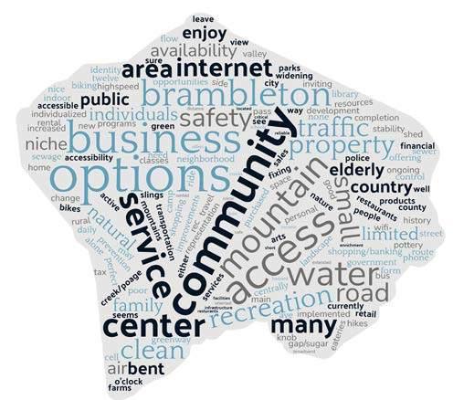
Please identify up to three (3) most important issues facing the planning area today.
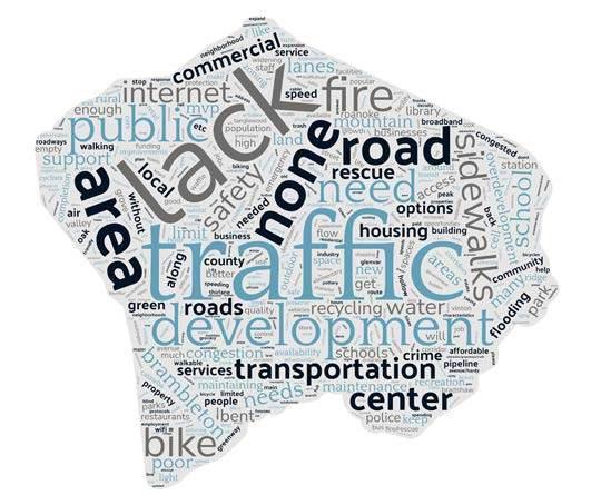
Please identify up to three (3) most important issues facing the planning area in the next 15 years.
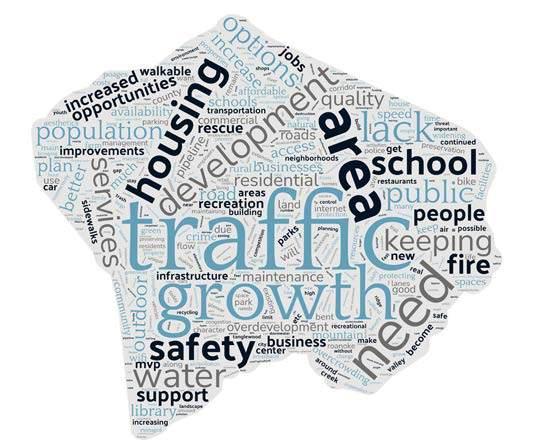
Walkability, bikeability, and daily services were also well rated. Residents felt that the least important features from the provided question were:
1. Transportation connectivity.
2. Housing.
3. Public outdoor event spaces.
Residents were asked to describe the top issues facing their neighborhood (CPA) today and in the future in questions 5 and 6. Word clouds of their responses are provided to the right. In a word cloud, the larger the size of the word, the more frequently it appeared in the data. Residents felt that traffic was the most important issue facing each CPA at the present and the future. A lack of various services and infrastructure was a close second as a present issue. Growth was the second issue in the future. Housing, business, and development were felt to be bigger issues in the future than the present. Sidewalks, internet, and roads were felt to be bigger issues at the present. Residents felt that safety and schools were both issues in the present and the future.
Questions 9 and 10 asked residents which types of future development they would like to see in their respective CPAs. The most desired businesses in the various CPAs were:
1. Restaurants.
2. Retail and shopping.
3. Grocery stores and health food stores.
The least desired from the provided list were:
1. Professional offices.
2. Industrial.
3. Personal services.
30.9% of residents answered “other” when asked this question. The most common response in the other category was “none.” Outdoor recreation was the second most common response.
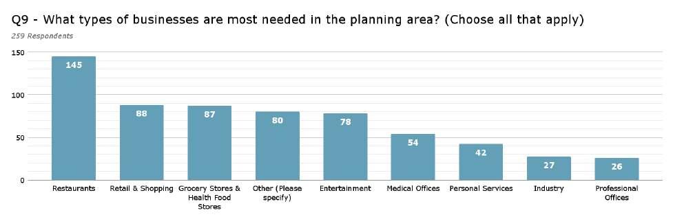
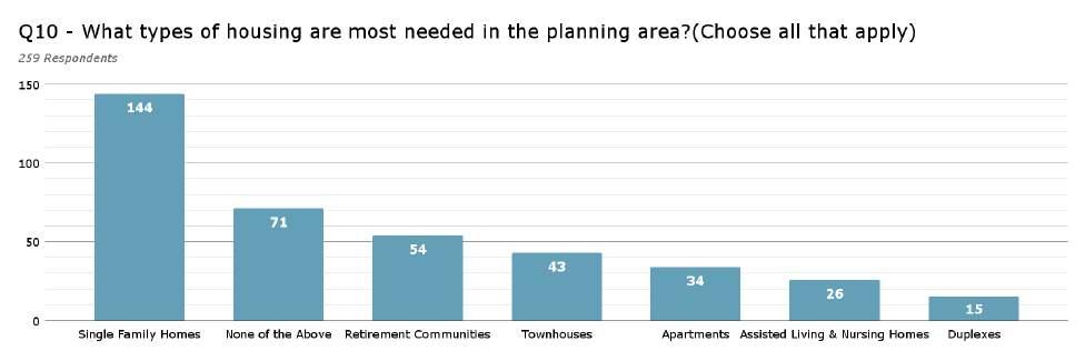
Residents felt that these types of housing were most needed in their CPAs:
1. Single family homes.
2. None.
3. Retirement communities.
Residents felt that the least needed types of housing from the provided list were:
1. Duplexes.
2. Assisted living and nursing homes.
3. Apartments. Mt. Pleasant Fall 2021 Community Meeting
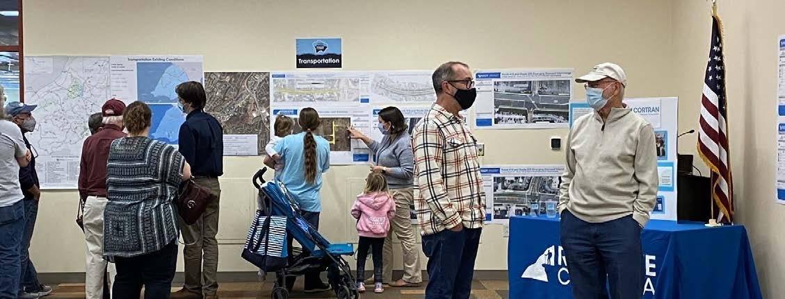
Residents were asked to rate how satisfied they were with the management of several natural resources within their respective CPAs in question 11. Of all the natural resources in the County, residents felt most satisfied with the air quality in their CPA, with 92.5% of respondents rating it above average or satisfactory. Residents were also satisfied with forest conservation and amount of outdoor recreation lands with 71.7% and 63.5% rating them above average or satisfactory. Of the options presented in the question, residents were least satisfied with water management. Surface water protection was rated the least with 45.7% giving it a ‘needs improvement’ rating. Ground water protection and stormwater management also received poor ratings with 44.7% and 40.9% ‘needs improvement’ scores.
Please rate your satisfaction with each of the following in your community.
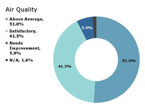
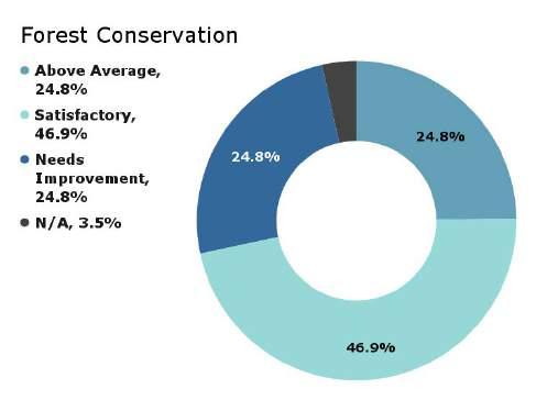
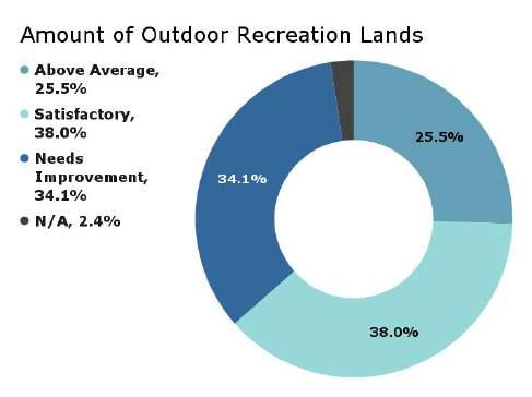
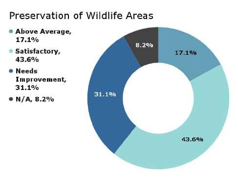
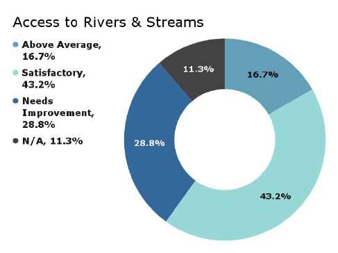
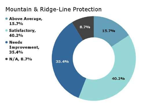
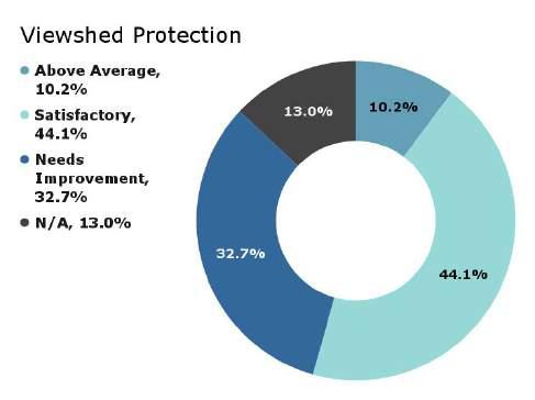
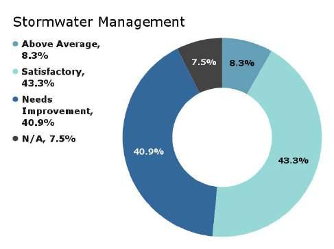
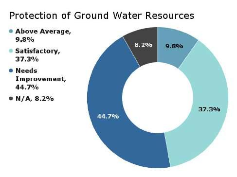
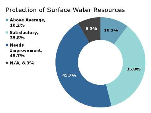
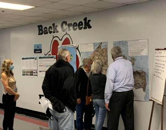
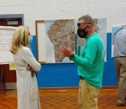
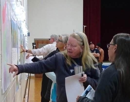
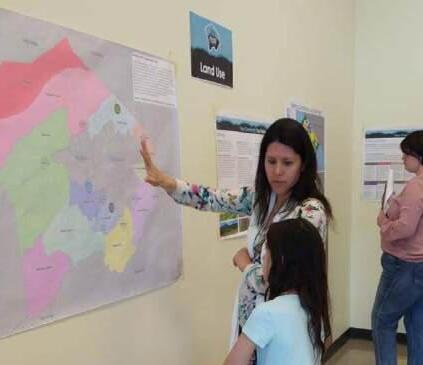
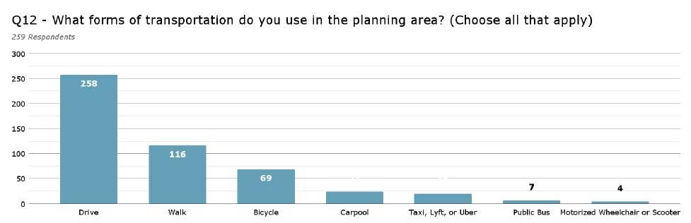
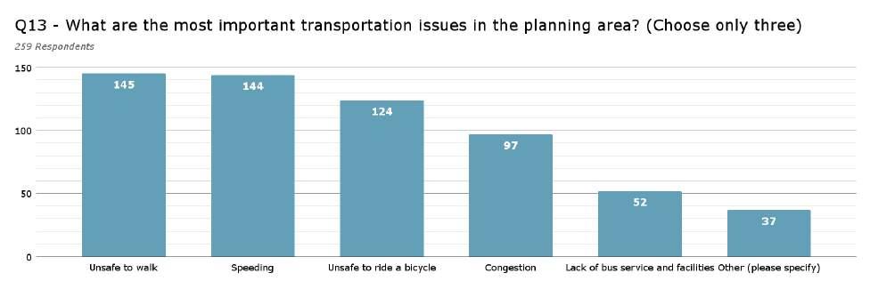
Question 13 - “Other”
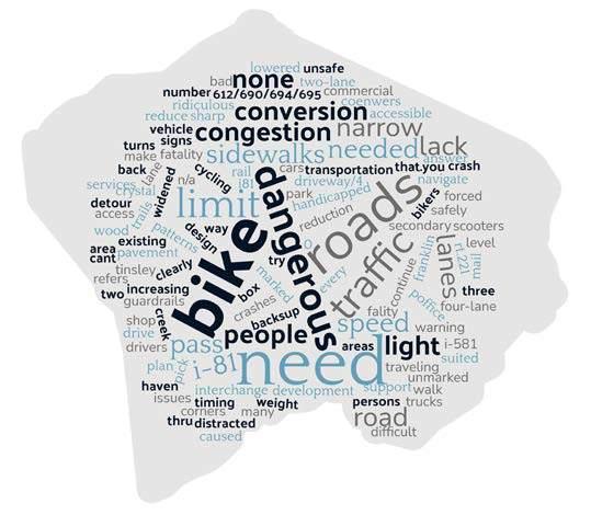
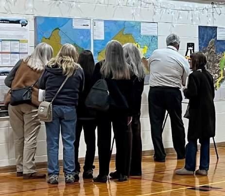
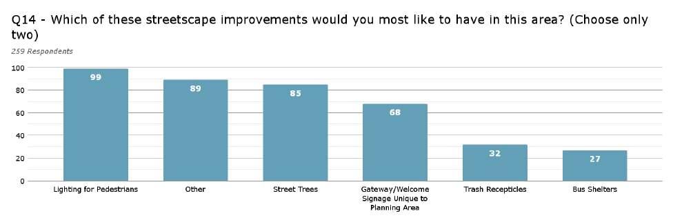
Question 14 - “Other”
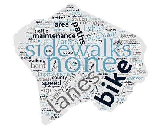
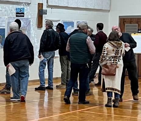
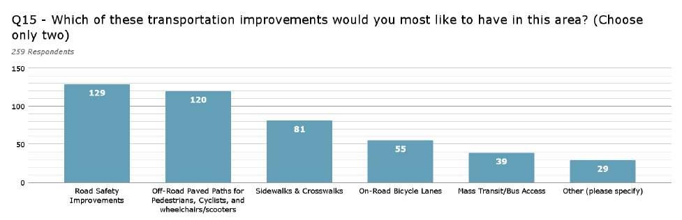
Question 15 - “Other”
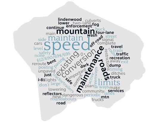
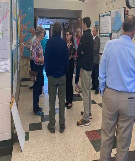
Questions 12, 13, 14, and 15 regarded transportation issues within the various CPAs. 99.6% of respondents drive within their CPAs. It should be noted that 44.8% of respondents reported that they walk, which was the second highest reported mode of transportation. Question 13 highlighted the top three (3) most important issues across all eleven (11) CPAs, which were:
1. Unsafe to walk (56.0%).
2. Speeding vehicles (55.6%).
3. It is unsafe to ride a bicycle (47.9%).
14.5% answered “other” when asked question 13, which was the least selected option for this question. When asked to specify, no clear pattern emerged from their responses.
When asked, in question 14, which kinds of streetscape improvements residents would like to have in their CPA, lighting for pedestrians surfaced as the top answer with 38.2% of respondents favoring it. “Other” was a close second with 34.4% selecting it. When asked to specify, sidewalks, and bike lanes were all highly asked for. The most requested “other” streetscape improvement was “none”; there were 8.5% asking for none or no streetscape improvements. Street Trees were also desired, with 32.8% favoring it.
When asked, in question 15, which kinds of transportation improvements residents would like to have in their CPA, these were the top three (3):
1. Road safety improvements (49.8%).
2. Off-road paved paths for pedestrians, cyclists, wheelchairs, and scooters (46.3%)
3. Sidewalks and crosswalks (31.3%)
11.2% of respondents answered, “other.” When asked to specify, only lowering vehicle speed emerged as a common issue.
Questions 16 and 17 attempted to gauge residents’ thoughts on community facilities. Of all the County facilities services listed in question 16, residents felt most satisfied with garbage collection with 87.2% of respondents either ranking it as above average or satisfactory. In fascinating contrast, the service they were least satisfied with was recycling with an overwhelming 65.1% of respondents ranking it as, “needs improvement.” Other well ranked services include libraries (81.6% ‘above average’ and ‘satisfied’) and fire and rescue (77.5% ‘above average’ and ‘satisfied’). Storm water drainage was also ranked poorly (34.2% ‘needs improvement’).
Residents were asked to respond freely regarding community facilities. Their responses are represented in the word cloud on page 8-16. In a word cloud, the larger the size of the word, the more frequently it appeared in the data. Residents spoke highly of their local libraries. Many asked for improvements and expansions to their libraries. Since the survey was distributed during the COVID-19 pandemic, many residents asked for their local community centers to reopen. Others asked for certain classes offered at those centers to return. Residents in Bent Mountain in particular asked for more support at the Bent Mountain Center. Residents also spoke highly of public parks and asked for more of them, expansion of existing ones, and a greater variety of amenities within the existing ones. Many residents provided high-quality comments to improve existing community facilities.
Question 16
Please rate your satisfaction with each of the following in your community.
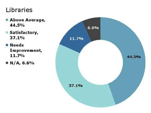
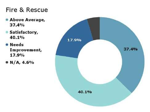
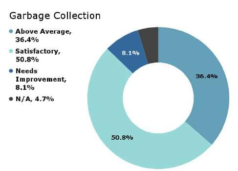
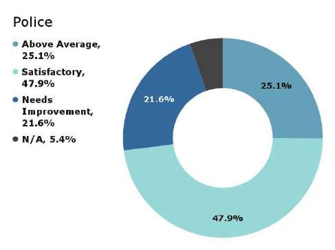
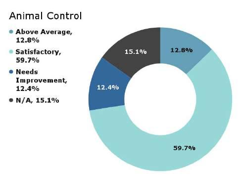
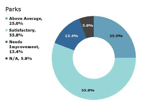
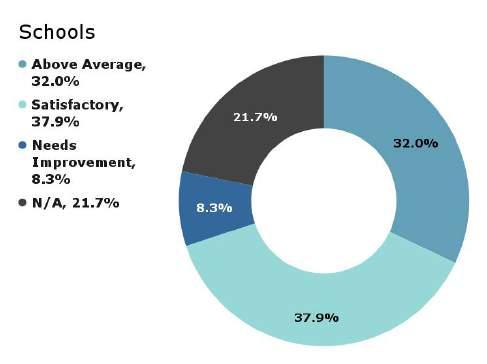
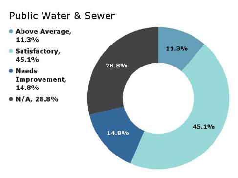
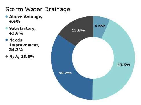
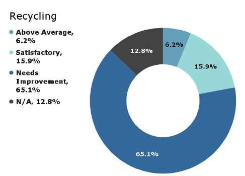
Question 17 - “Other”
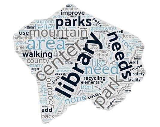
Residents were asked what they felt the countywide issues were in questions 19, 20, and 21. When asked why they moved to Roanoke County,
Please identify up to three (3) most important issues facing Roanoke County today.
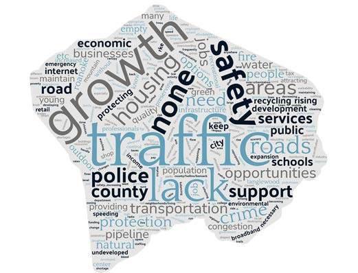
Please identify up to three (3) most important issues facing Roanoke County in the next 15 years.

a little more than a fourth (27%) of the survey respondents indicated that they were born or raised in the area. Residents selected the other options provided relatively equally. 11.5% of the respondents indicated, “other.” The majority of those respondents indicated that they moved for family reasons.
Similar to questions 5 and 6 mentioned on page 8-6, residents were asked to describe the top issues facing the County today and in the future in questions 20 and 21. Word clouds of their responses are provided on this page. In a word cloud, the larger the size of the word, the more frequently it appeared in the data. Just as in question five, residents felt that traffic was the most important issue facing the County at the present. However, growth was considered the top issue for the County in the future and traffic was second. Other issues that were considered high priority in the present were growth, safety, development, and housing. Other issues that were considered high priority in the future were safety, crime, and schools.

Seven (7) Roanoke County 200 Plan open house planning meetings were held around Roanoke County in Spring 2022 for citizens to review draft goals and recommendation options based on the feedback received throughout the Fall 2021 community engagement. Draft goals were developed based on input that was received at the community meetings and online surveys in Fall 2021. Citizens reviewed and provided comments on the new draft goals and recommendations that will shape the draft Roanoke County 200 Plan document. The draft goals and recommendations displayed included natural and cultural resources, land use, community facilities and infrastructure, and transportation.
Meetings were open house format at the following locations and dates:
1. Catawba and Masons Cove: Masons Cove Elementary School - Monday, April 4, 2022. 41 attendees.
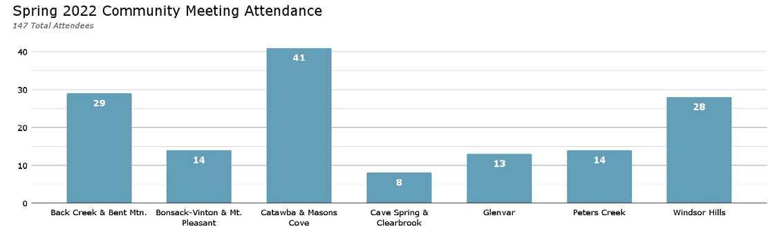
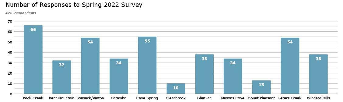
2. Glenvar: Fort Lewis Elementary SchoolThursday, April 7, 2022. 13 attendees.
3. Peters Creek: Green Ridge Recreation Center - Monday, April 11, 2022. 14 attendees.
4. Bonsack/Vinton and Mount Pleasant: Charles R. Hill Community Center (Vinton) - Thursday, April 14, 2022. 14 attendees.
5. Back Creek and Bent Mountain: Bent Mountain Center - Monday, April 18, 2022. 29 attendees.
6. Windsor Hills: Oak Grove Elementary SchoolTuesday, April 19, 2022. 28 attendees.
7. Cave Spring and Clearbrook: Cave Spring Elementary School - Thursday, April 21, 2022. 8 attendees.
There were 147 total attendees across all meetings.
As mentioned previously, there were two (2) surveys sent out for public feedback in phase two
and phase three of the planning process. The first was sent out during the fall of 2021 in conjunction with the first round of Community Planning Area (CPA) meetings. The second was sent out during the spring of 2022 with the second round of CPA meetings. The purpose of the spring 2022 survey was for staff to receive feedback regarding draft goals and initiatives for the 200 Plan.
The spring survey was distributed at seven (7) public open house CPA meetings, at all Roanoke County libraries, and was available online. Approximately 428 responses were received. The survey had 50 questions that pertained to County-wide interests and initiatives. Each survey also had additional questions that were specific to each CPA.
The CPA specific questions will not be discussed here, but they are discussed in each CPA summary document, the Appendices of this document, and the 200 Plan webpage. The responses to questions highlighted on the following pages will primarily be shown as County-wide results only.
Compared to the fall 2021 survey, there was a much better representation from most CPAs. However, there was a low response rate from the Clearbrook and Mount Pleasant CPAs. Because response rates vary across CPAs, the results will favor those areas that had the highest number of responses, such as Back Creek.
Natural & Cultural Resources
The survey respondents supported all natural and cultural resources recommendations as shown in the following charts:
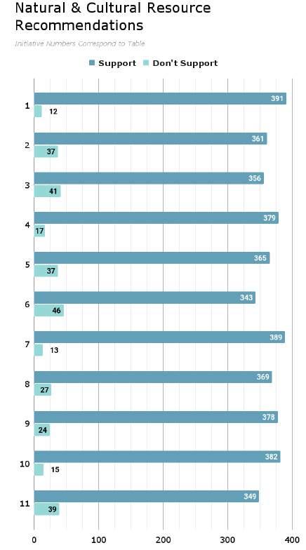
1
2
3
4
Protect and improve the quality of water in our streams, creeks and rivers.
Coordinate with State agencies regarding floodplain risks and prevention.
Reduce quantity and improve quality of stormwater.
Protect and prevent risks to surface waterways, reservoirs, underground aquifers and drinking water wells.
5 Beautify County roadways and public areas.
6
7
Protect viewsheds from the ridges and from the valleys.
Clean up and prevent litter and illegal dumping.
8 Protect steep slope areas.
9
10
11
Protect trees and forests and increase tree canopy.
Protect natural areas and wildlife habitats.
Coordinate with State agencies regarding historic and cultural resources, including cemeteries and archaeological sites.
The survey respondents supported all community facility recommendations as shown in the following tables and charts:
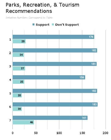
1
2
3
4
Evaluate new park, greenway, and blueway opportunities.
Evaluate on- and off- road connectivity options between parks, neighborhoods, and community facilities.
Continue coordination on regional efforts to enhance and develop outdoor recreation opportunities in our communities.
Update the Parks, Recreation & Tourism Master Plan.
5
6
Continue promotion of the Park Partners Program to encourage citizens and businesses, and organizations to adopt a park, greenway, or trail.
Educate citizens on park ordinance updates (i.e. park sign updates, dog-friendly parks/special events and leash laws, drones, etc.).
7
Continue developing programs that allow for safer post-COVID plans that balance community needs with available staffing resources.

Implement responsive, community focused program that serves people of all ages and backgrounds.
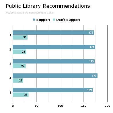
Raise level of engagement with the community and increase awareness about library services and programs.
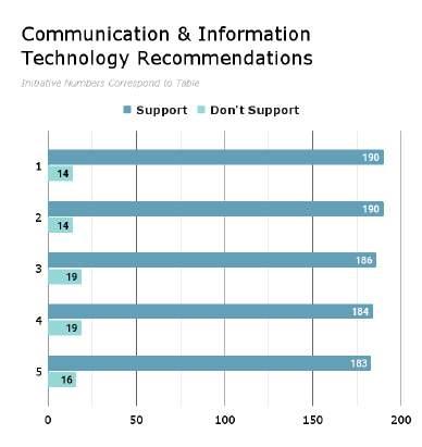
opportunities to extend broadband service with universal availability and access to high-speed Internet in unserved and under-served areas.
Explore alternative broadband and cell phone providers for choice and competition.
Explore more public-private partnerships to implement more stages of Roanoke County’s Rural Broadband Initiative to bring high-speed Internet to homes without broadband access.
Explore providing improved cell phone service in unserved and under-served areas.
Consider submitting applications for the Virginia Telecommunications Initiative (VATI) grant and other grants.
Provide a high-level of citizen engagement and educational opportunities.
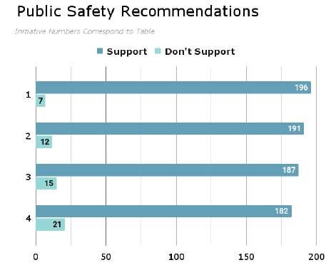
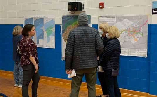
Survey respondents were asked if they supported the existing activity centers on the map and if there should be more areas designated. If any responded whether in favor of more, they were invited to suggest areas within the County that they thought should become an activity center. 83.8% supported the existing activity centers as shown on the map to the right. Only 16.5% felt that there should be other areas designated as activity centers. Of these 50 responses, 48% provided suggestions for areas that should be designated as activity centers. Bent Mountain, Back Creek, and West Main Street were suggested multiple times.
Given the existing rural character of Bent Mountain and Back Creek, staff does not think it prudent that these areas become future activity centers. Perhaps a future rural center designation could be created to accommodate these residents’ desires.
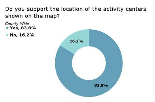
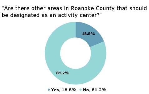
Proposed Activity Centers Map from Survey
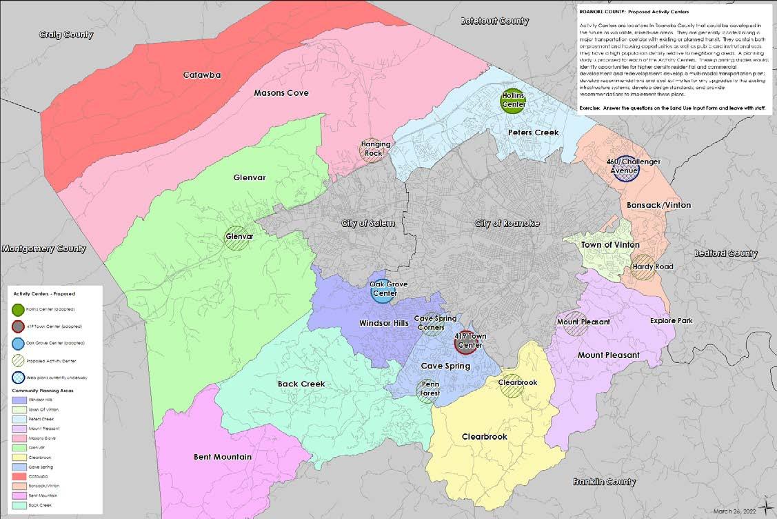
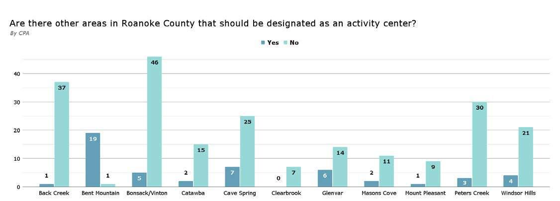
The survey respondents supported all transportation recommendations as shown in the table to the right except for recommendation 20.
In addition to these County-wide recommendations, a few regional recommendations should also be discussed. Several of the CPAs were asked whether they would support the creation of a County perimeter greenway trail. Generally, survey respondents did not support the proposed locations for such a greenway. A few major corridor studies that the County could conduct were floated, and generally received support. Among these was the U.S. Route 460 Land Use and Connectivity Study. Shortly after this survey was conducted, and a positive response was recognized, the County moved forward and began that study. The study was completed and the plan was adopted in March of 2023.
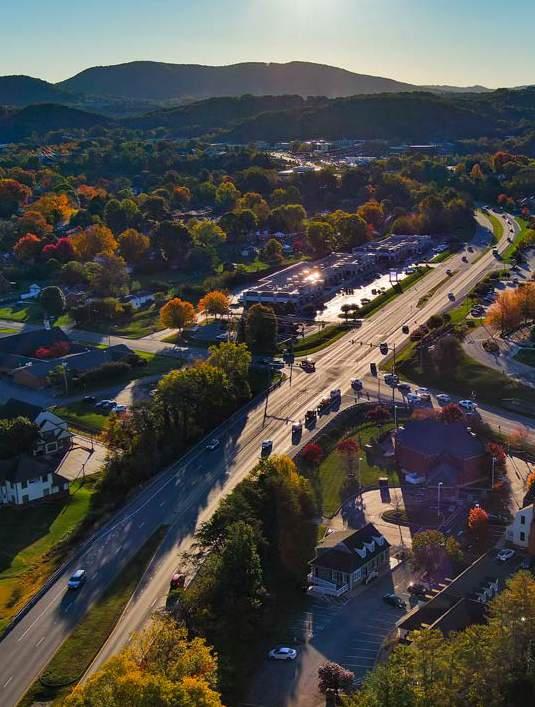
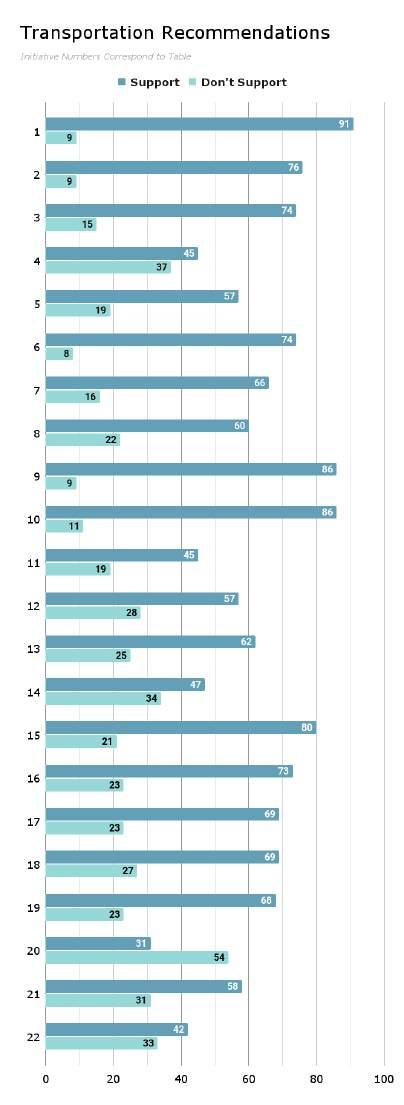
Support widening of Interstate 81 to three lanes in each direction between Exit 118 in Montgomery County to Exit 150 in Botetourt County.
Widen the currently unfunded segment of southbound I-81 between Exit 137 at Wildwood Road and Exit 128 at Ironto.
Beautify County gateways and major corridors with welcome signage and landscaping.
Install wayfinding signage throughout the County to direct visitors to locations of interest. 3
Improve the existing interchange at Interstate 581 at Exit 2/Peters Creek Road to improve traffic flow and safety on both roadways.
Support construction of Interstate 73 through the Roanoke Valley.
Improve access to Explore Park from the Blue Ridge Parkway and from Bedford County.
Continue to study and improve Route 419/Electric Road between Route 311/ Catawba Valley Drive and the City of Roanoke at Franklin Road for all users.
Complete the Roanoke River Greenway in Roanoke County between Montgomery County and Franklin County.
Study locations for and work with others to construct electric vehicle charging stations.
Encourage sidewalk construction along public roads in conjunction with new and redevelopment activities in the urban/suburban area.
Improve pedestrian and/or bicycle connectivity to County schools, parks and other facilities.
Improve pedestrian and/or bicycle connectivity to regional recreational resources such as Carvins Cove, the Blue Ridge Parkway, U.S. Bicycle Route 76, and National Forest lands.
Collaborate with VDOT prior to roadway repaving on opportunities to stripe bicycle lanes and/or expand paved shoulders for cyclists. 8
Support the construction of the Valley to Valley Trail to connect the Roanoke Valley to the New River Valley.
Support the expansion of the RoanokeBlacksburg Regional Airport to include infrastructure and service improvements.
Support the expansion of Amtrak service to and beyond Christiansburg.
Evaluate the need for additional Park and Ride locations near Interstate 81 in Roanoke County.
Work with regional groups to provide education for drivers and bicyclists regarding laws and etiquette.
Consider partnering with companies to provide last-mile transportation options in the form of scooters or bicycles.
Collaborate with Valley Metro on opportunities to expand bus service into the County.
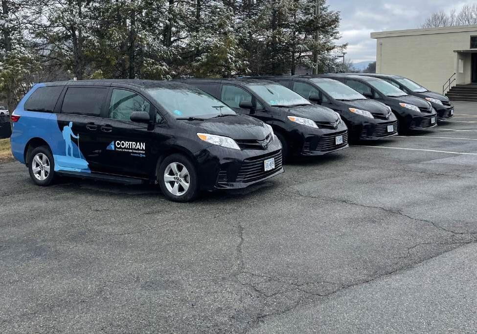
Residents were asked in the spring survey to prioritize proposed initiatives of the CORTRAN program as shown in the table to the right. The initiative that was prioritized the highest was to offer weekend hours for the service.
CORTRAN is a ride share program with a limited amount of rides available Monday through Friday. It is administered by the County of Roanoke partnered with Via. It is available to preapproved, eligible County of Roanoke residents who are either at least 65 years old, or who have a disability, and need transportation to and from destinations within the County of Roanoke, Town of Vinton, City of Salem, and City of Roanoke.

Six (6) planning meetings were held around Roanoke County in Winter 2023 for citizens to review the draft of the 200 Plan, including goals and recommendations that were made based on the feedback received throughout previous phases of the community engagement.
1. Catawba, Glenvar & Masons Cove: Glenvar Middle School Forum - Monday, February 27. 37 attendees.
2. Peters Creek: Green Ridge Recreation Center Meeting Room - Wednesday, March 1. 29 attendees.
3. Bonsack/Vinton & Mount Pleasant: Vinton War Memorial Ballroom - Monday, March 6. 59 attendees.
4. Windsor Hills: Hidden Valley High School Auditorium - Wednesday, March 8. 27 attendees.
5. Back Creek & Bent Mountain: Bent Mountain Center Gymnasium - Monday, March 13. 91 attendees.
6. Cave Spring & Clearbrook: South County Library Auditorium - Wednesday, March 15. 44 attendees.
There were 287 total attendees across all meetings combined.
There were 40 comments submitted by citizens in the open response feedback forms that were available online and in-person as well as comments at the first round of public hearings. Individual comments for each Community
Planning Area can be found in their respective CPA Summary Documents. Of the comments submitted, 27 were specific to individual CPAs with 13 of the total responses specific to the County as a whole. These comments varied across different planning issues such as growth management, transportation improvements, natural and cultural resource protection, and more.
The following is a summary of the Winter 2023 feedback received:
• The importance of citizen buy-in for developing land into residential or commercial areas.
• Need for discussion of the importance of historic resources, improved recycling options, and definitions of the future land use categories.
• Need more recycling pick-up or drop-off options throughout the county.
• More resources needed in the protection of natural and cultural resources including working with state and federal agencies.
• The need for more pedestrian and bicycle safety accommodations which can include signaled pedestrian crosswalks, sidewalks, bike lanes, greenways, etc. Other transportation needs include better street lighting (particularly along Route 221), expanded bus service routes, and picking up litter along major roads.
• Greater cell phone and broadband options in the more rural areas of Roanoke County is needed.
• Expanding on programs and activities at the recreation centers.
• Affordable housing options are needed as well as places to shop and eat.
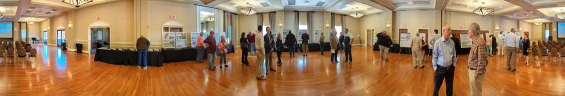
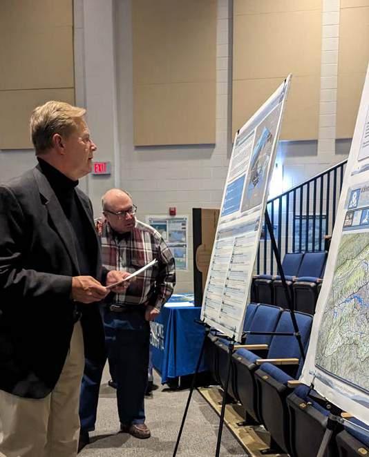
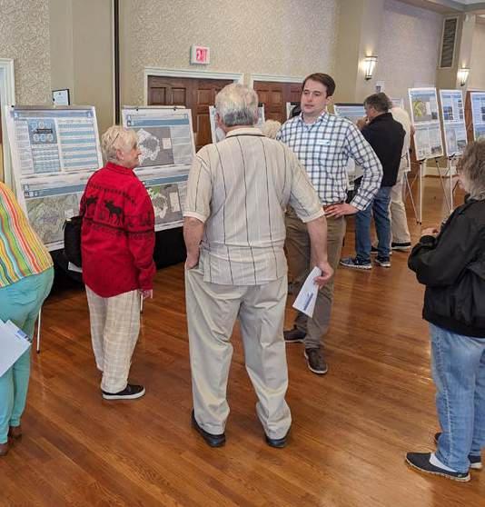
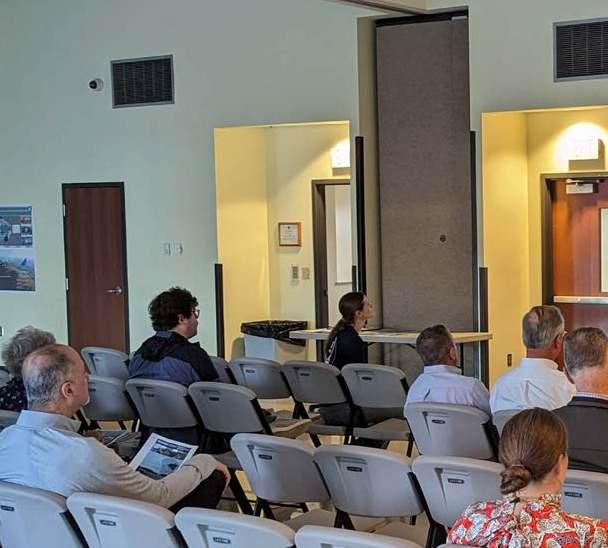
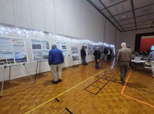
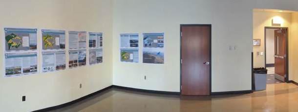
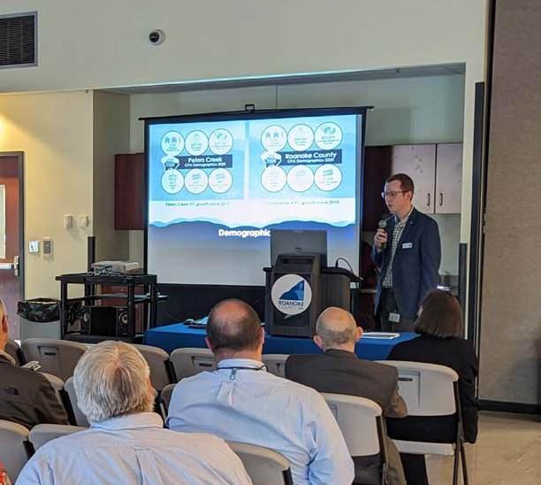
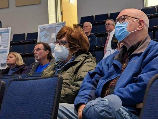
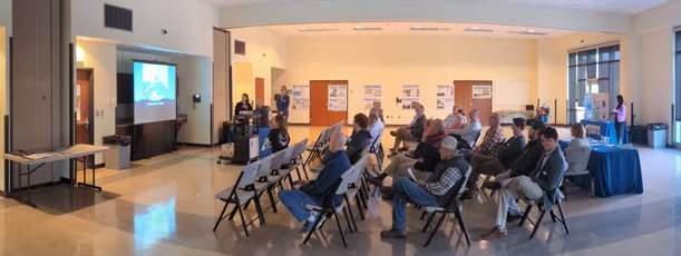
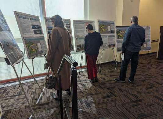
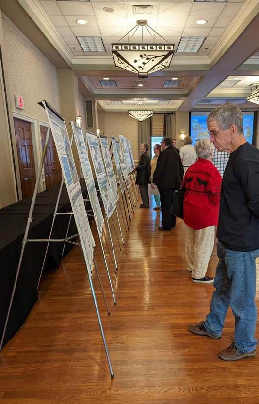

Work sessions were held periodically on a bi-monthly schedule throughout the fall and winter of 2023 leading into mid-2024 with members of the planning commission on a chapter-by-chapter basis of the main document. These work sessions allowed for planning commission members to provide feedback on specific chapters by taking the time to review text, maps, charts, and other information in great detail.

Following shortly after the Winter 2023 community meetings ended, the Planning Commission held two (2) public hearings in the spring to give residents an opportunity to provide feedback on the drafts of the individual CPA Summary Documents and the County-Wide Summary Document of the Roanoke County 200 Plan.
The first public hearing was held on March 23, 2023, at the Green Ridge Recreation Center. Five (5) residents attended and two (2) residents provided comments. The second public hearing was held on April 3, 2023, at the Roanoke County Administration Building. Twelve (12) residents attended and six (6) residents provided comments.
The following is a summary of the feedback received at the public hearings:
• Support for the 200 Plan and CPA Summary Documents by highlighting the attention to detail regarding a balance between growth and natural resource protection.
• Improving bicycle and pedestrian safety accommodations, particularly along major routes in the County, is needed.
• Access to expanded broadband services, particularly in rural areas such as Catawba and Bent Mountain, is important and needed.
• Protection of agricultural land in the County for the future by stating the importance of locating areas of agricultural importance and discouraging increased density in these areas.
• Concern that the 200 Plan allows for too much development, particularly in areas surrounding suburban neighborhoods.
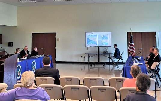
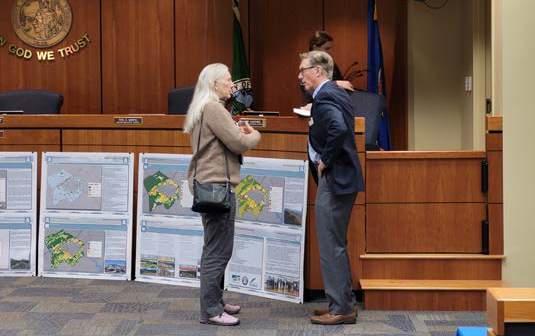
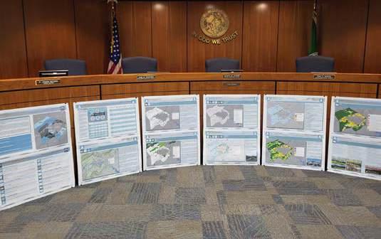
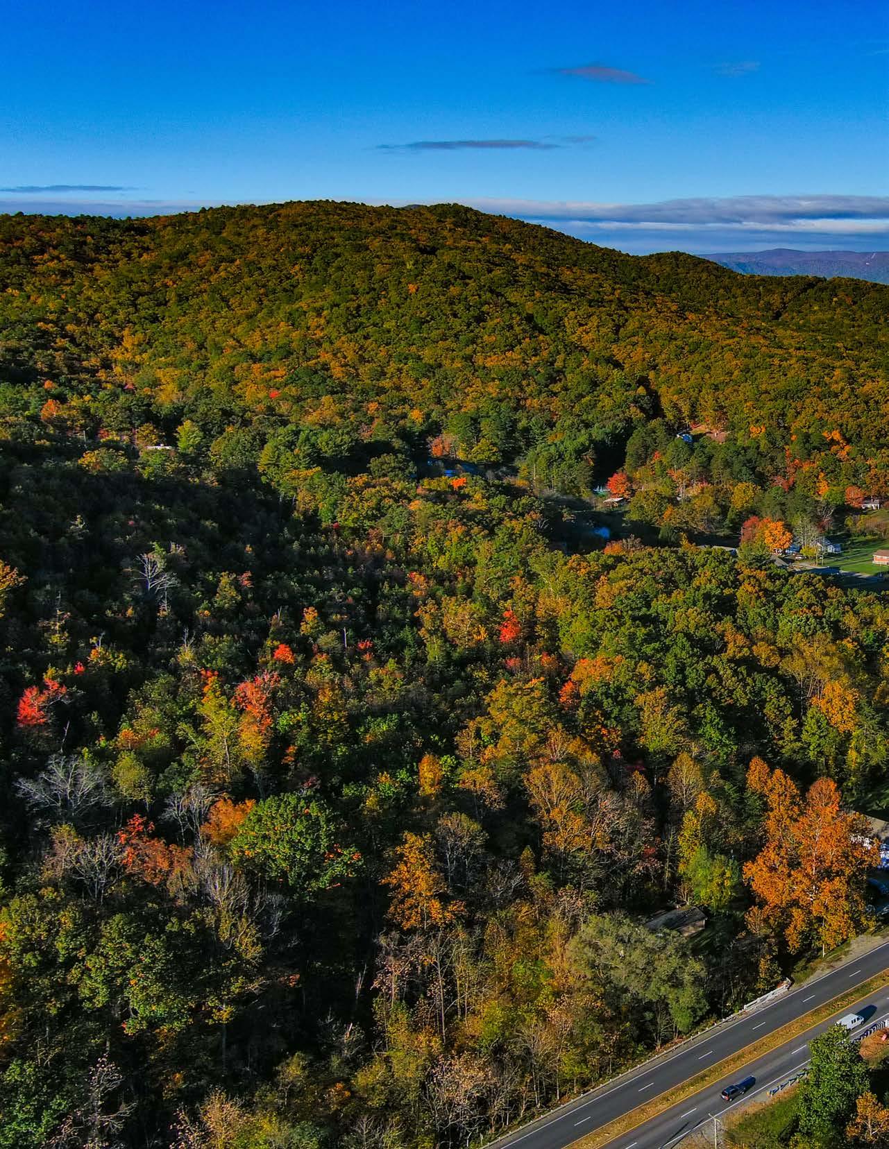
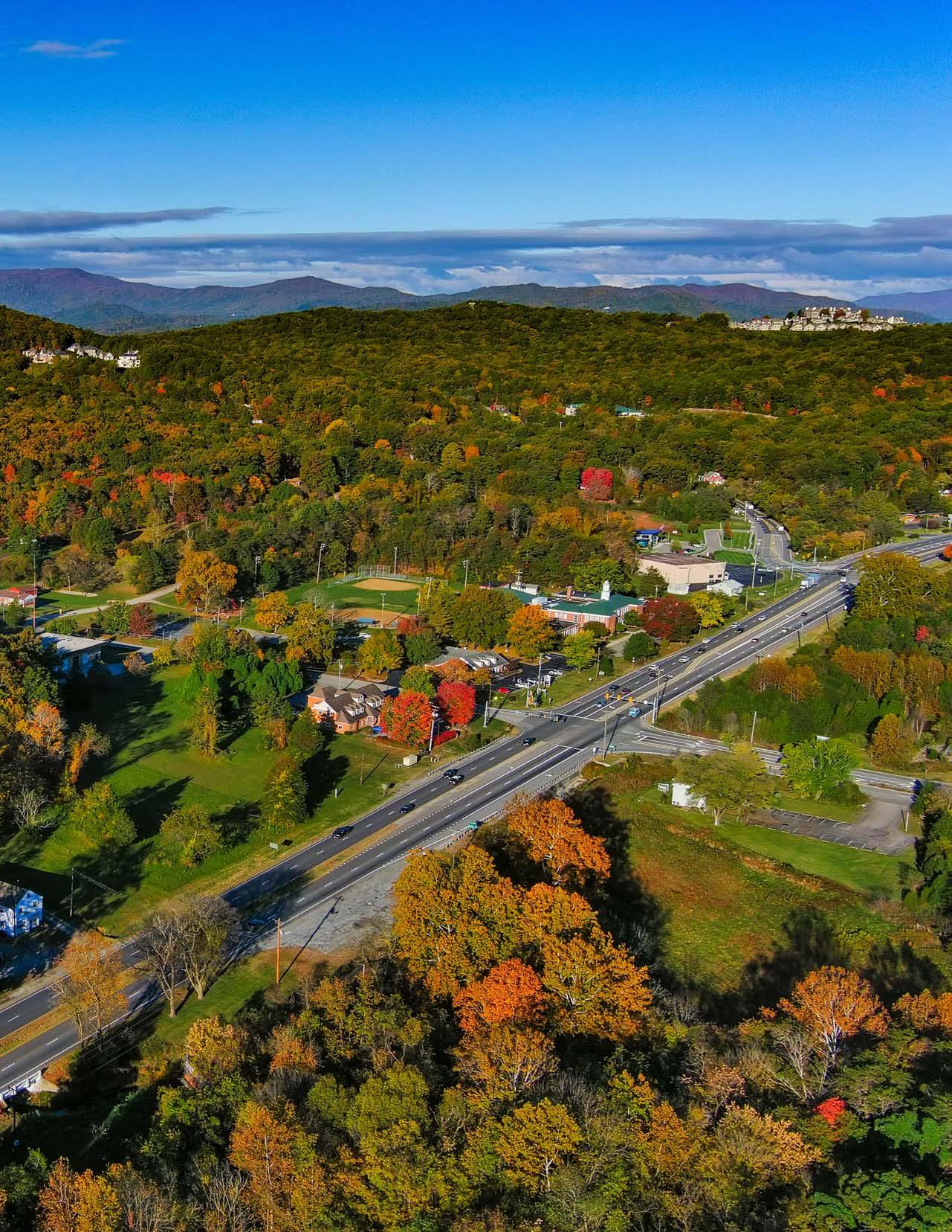
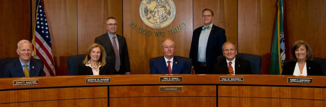

This chapter discusses the Vision Statement that has been established in collaboration with the public and that serves as the shared vision for the County by 2038, when it celebrates its bicentennial anniversary. This chapter also discusses the five (5) community-wide themes identified during the development of the 1998 Community Plan that were carried over into the 2005 Community Plan and have continued to emerge as common themes during the 200 Plan’s community engagement process. The combination of the Vision Statement, these 5 themes, and the community input received during the 200 Plan preparation have collectively helped to establish the goals and objectives of this chapter that guide the development of recommendations and implementation strategies for the 200 Plan.

During the preparation of the 2016 Community Strategic Plan, a Vision Statement was developed through the collaborative efforts of County leadership and the community. Although adopted in 2016, this Vision Statement remains relevant today and continues to embody the priorities of the community that have been voiced during the development of the 200 Plan.
This Vision Statement recognizes that an ideal future for Roanoke County from the perspective of its citizens depends on:
• Facilitating positive change;
• Recognizing and promoting our great natural beauty, outdoor-oriented lifestyle, and amenities;
• Including people from all segments of the community;
• Cherishing the traditional values of our community; and
• Recognizing and promoting the overall excellent quality of life enjoyed by citizens.
“Roanoke County is a vibrant, innovative, and scenic community that values its citizens, heritage, and quality of life.”
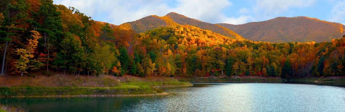

Within the 1998 and 2005 Community Plans, five (5) community-wide themes are identified as common issues, or principles of action, that emerged during engagement with focus groups representing the community. These themes provide additional insight into the shared community values that are important and are incorporated into the 200 Plan.
Regionalism:
The County must take the lead in finding new and innovative ways to look beyond its boundaries for solutions to future challenges.
Recognizing that our natural systems are vital to providing both economic needs and quality of life for all citizens, sustainable development has been incorporated into County planning -- meeting the needs of the present generation without compromising the ability of future generations to meet their own needs.
Roanoke County citizens identify very closely with their neighborhoods and school districts. Efforts must be made to preserve the elements of community identity that provide gathering places for the exchange of information and support.
The mountains that surround the County provide a sense of place and are a source of beauty and recreational activity. Steps must be taken to develop conservation policies for our farmlands, mountainsides and ridges, rivers and streams, soil and air. These resources are considered by many to be our region’s greatest asset.
The citizens of Roanoke County recognize that there exists a fragile balance between economic growth and prosperity and the preservation of a way of life that is cherished by many. Proactive steps must be taken to manage growth in a positive way - to act conservatively and with deliberation when making decisions that will affect our high quality of life and that of our children’s children.
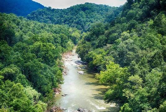
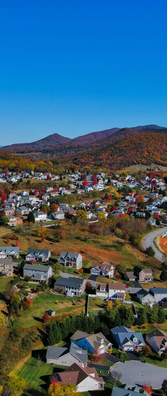

The community input that was derived from the community engagement process of the 200 Plan was paired with the values embodied in the Vision Statement and the 1998 and 2005 Community Plans’ themes to create the following goals that define the long-term outcomes that Roanoke County seeks to achieve through implementation of the 200 Plan:
• Regionalism: Roanoke County is active in communicating and collaborating as a regional partner with its neighboring localities and regional organizations when seeking solutions to future challenges.
• Natural and Cultural Resources: Roanoke County is valued for its natural amenities, recreational opportunities, and cultural heritage and strives to maintain and improve these resources for the continued enjoyment of all generations and abilities.
• Educational Opportunity: Roanoke County promotes a high caliber educational landscape that promotes the efficient delivery of K-12 education, workforce training, and lifelong learning opportunities.

• Public Service Provider: Roanoke County provides quality public services at an affordable cost to all areas and citizens of the County.
• Transportation: Roanoke County recognizes the long-term benefits of community-driven transportation planning to improving safety, reducing congestion, increasing connectivity, and encouraging alternative means of transportation.
• Economic Development: Roanoke County recognizes that a strong economy benefits from partnering with current and potential businesses, cultivating a skilled workforce, and fostering connectivity to the world.
• Housing: Roanoke County provides a variety of housing types for all segments of the population to promote housing availability and affordability in neighborhoods that contribute to a high quality of life.
• Thoughtful Design: New development and redevelopment, including of infrastructure and utilities, should be thoughtfully designed to ensure efficiency and functionality of the natural and built landscape.

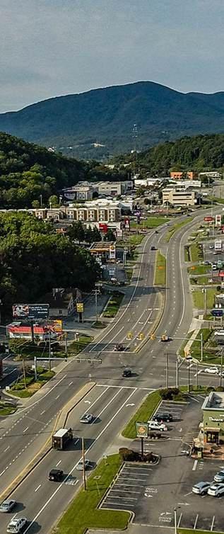

The following objectives have been developed to provide measurable outcomes in furtherance of the goals of the 200 Plan. These objectives inform the recommendations and implementation strategies of the following chapter.
Regionalism:
• Work to grow a unified regional identity with neighboring communities through placemaking projects.
• Coordinate regional planning for land use, housing, transportation, economic development, environmental issues, public services, and civic amenities.
• Establish and maintain regular communication opportunities between regional governments so issues of regional importance and responsibility are considered.
• Continue coordination and collaboration on regional efforts to enhance and develop outdoor recreation opportunities in our communities.
Natural and Cultural Resources:
• Protect natural resource amenities, including air and water resources, forests, soils, wildlife habitat, open space, and viewsheds.
• Beautify public areas, viewsheds and roadways.
• Clean up and prevent litter and illegal dumping.
• Protect steep slope areas.
• Prioritize preservation of historic and cultural resources, including historic buildings and landscapes, archaeological sites, and heritage resources and traditions.
• Protect viewsheds and scenic resources from the ridges and from the valleys.
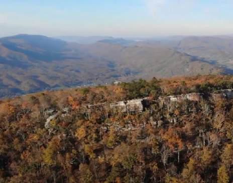
McAfee Knob
Educational Opportunity:
• Provide access to world-class educational services and foster lifelong learning by preparing learners for the workplace and instilling characteristiscs of responsibility and productivity.
• Provide citizens the tools to obtain the technological skills required to work and function in a rapidly changing world through technical schools, extension programs, and higher learning opportunities.
Public Service Provider:
• Maintain quality public facilities and the provision of reliable services and improve these resources to meet future demands.
• Make improvements at existing park, recreation, and tourism facilities and evaluate the need for new facilities.
• Support recycling options.
• Enhance library facilities and services, raise level of library engagement with the community, increase awareness about library programs, and provide efficient delivery of circulation materials.
• Provide efficient delivery of public safety services with minimal response times.
• Enhance and maintain public safety facilities, equipment, staffing, citizen engagement, and educational opportunities.
• Expand and improve high-speed broadband access with universal availability and cell phone service availability in unserved and underserved areas.
• Incorporate opportunities to increase the capacity and efficiency of the County’s and region’s transportation system.
• Identify transportation safety issues and concerns and work to resolve these issues and concerns.
• Evaluate opportunities to incorporate multimodal transportation into the transportation network, including bicycle routes, pedestrian pathways, greenways, blueways, public transit, and other modes.
• Evaluate on-and-off road connectivity options between neighborhoods and schools, parks, and other community facilities.
• Ensure that Roanoke County citizens have their voices heard on transportation projects and issues that will affect them.
• Encourage the reuse, redevelopment and occupancy of existing, vacant commercial and industrial space.
• Provide resources and support to help retain and expand existing businesses.
• Seek new business development and investment in the County.
• Ensure sufficient infrastructure is available to support new development and redevelopment.
• Ensure transportation infrastructure is maintained to provide a high level of mobility to support business activity, such as efficient movement of both products and employees into and out of the region.
• Support a well-coordinated effort of economic agencies working together to execute recruitment, work force training, and development programs.
• Grow and support Roanoke County’s outdoor tourism identity as an economic driver.
• Encourage a diverse housing stock meeting the demands of current and future residents.
• Develop incentives and policies to encourage quality housing that is affordbale.
• Implement sustainable growth policies and programs that maintain a high quality of life, promote a strong economy, and protect our natural resource amenities.
• Encourage sidewalk construction along public roads in conjunction with new development and redevelopment activities in the urban/ suburban area.
• Encourage the provision of open space and park facilities with new development.
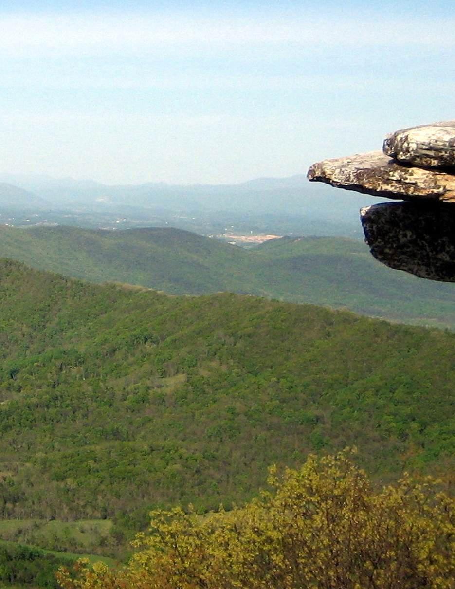
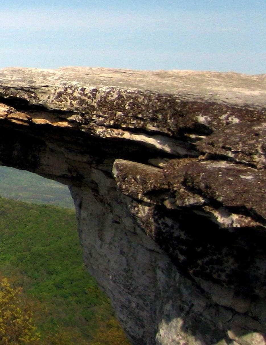

The first section of this chapter provides the recommendations that have been prepared with consideration of the existing conditions of the County as discussed in Chapters 4 through 7, the input from the community that is summarized in Chapter 8, and the vision and goals that are provided in Chapter 9. The recommendations that are provided here are followed by the implementation section that summarizes the implementation tools and funding that is available to help implement the 200 Plan after its final adoption. The final section of this chapter discusses the timing of implementation and the communication that will continue to happen after adoption of the plan.

• Amend and/or develop ordinances, regulations, plans, studies, programs, policies, and educational materials, as needed, to continue to protect the County’s natural and cultural resources addressing the following: water quality; stormwater runoff; drinking water protection; floodplain risks and prevention; littering and illegal dumping; protection of forests, natural areas, and wildlife habitats; protection of mountain ridges, steep slopes, scenic resources, and viewsheds; farmland preservation; and identifying and protecting historic and cultural resources, including cemeteries and archaeological sites.
• Work and coordinate with local, regional, state and federal agencies, civic and environmental groups and organizations, developers, business and property owners, and residents to protect the County’s natural and cultural resources.

Schools:
• Maintain and improve existing school facilities and build new school facilities as needed.
• Coordinate with Roanoke County Public Schools to verify capacity of K-12 schools in concert with future housing developments.
• Continue to provide excellent educational services to prepare learners for the workplace.
• Promote lifelong learning by supporting community art, culture, and recreational programming.
• Develop educational partnerships among the region’s educational institutions.
• Strengthen the ties between businesses and educational institutions and promote workforce training through practical and educational opportunities.
Public Libraries:
• Raise level of engagement with the community and increase awareness about library services and programs.
• Evaluate programming needs and wants based on a variety of data and feedback.
• Ensure timely delivery of all materials, improve services, and continue enhancing facilities.
Parks, Recreation & Tourism:
• Maintain and enhance existing facilities.
• Evaluate new park, greenway, and blueway opportunities.
• Evaluate on- and off- road connectivity options between parks, neighborhoods, and community facilities.
• Continue coordination on regional efforts to enhance and develop outdoor recreation opportunities in our communities.
• Update the Parks, Recreation & Tourism Master Plan.
• Continue to implement the recommendations of the Explore Park Adventure Plan.
• Continue promotion of the Park Partners Program to encourage citizens and businesses, and organizations to adopt a park, greenway, or trail.
• Educate citizens on park ordinance updates (i.e. park sign updates, dog-friendly parks/ special events and leash laws, drone safety, etc.).
• Continue developing programs that balance community needs with available staffing resources.
• Provide the efficient delivery of public safety services with minimal response times.
• Maintain and enhance public safety staffing.
• Maintain and improve facilities and equipment.
• Provide a high-level of citizen engagement and educational opportunities.
• Implement recommendations from the Roanoke County Fire Department Facilities Assessment.
• Evaluate recycling program options.
• Implement recommendations from the Roanoke County Administration Center Assessment.
• Expand and improve high-speed broadband access and cell phone service availability in underserved areas.
• Explore opportunities to extend broadband service with universal availability and access to high-speed Internet in unserved and underserved areas.
• Explore alternative broadband and cell phone providers for choice and competition.
• Explore more public-private partnerships to implement more stages of Roanoke County’s Rural Broadband Initiative to bring high-speed Internet to homes without broadband access.
• Explore providing improved cell phone service in unserved and under-served areas.

• Work with the Western Virginia Water Authority (WVWA) to maintain and enhance existing public water and sewer lines and facilities.
• Work with the WVWA to extend public water and sewer lines and facilities within the water and sewer service boundary shown on the map below.


Several of the following transportation recommendations are shown on the map on page 10-6. The numbers on the map correspond to the numbers in parentheses after the recommendations.
• Support widening of Interstate 81 to three lanes in each direction between Exit 118 in Montgomery County to Exit 150 in Botetourt County. (1)
• Widen the currently unfunded segment of southbound I-81 between Exit 137 at Wildwood Road and Exit 128 at Ironto. (2)
• Support the expansion of the RoanokeBlacksburg Regional Airport to include infrastructure and service improvements. (3)
• Support the expansion of Amtrak service to and beyond Christiansburg. (4)
• Improve the existing interchange at Interstate 581 at Exit 2/Peters Creek Road to improve flow and safety on both roadways. (5)
• Complete the Roanoke River Greenway in Roanoke County between Montgomery and Franklin County. (6)
• Encourage sidewalk construction along public roads in conjunction with new and redevelopment activities in the urban/ suburban area.
• Continue to study and improve Route 419/ Electric Road between Route 311/Catawba Valley Drive and the City of Roanoke at Franklin Road for all users. (8)
• Improve pedestrian and/or bicycle connectivity to County schools, parks and other facilities.
• Determine opportunities to stripe bicycle lanes and/or expand paved shoulders for cyclists with VDOT prior to roadway repaving.
• Improve pedestrian and/or bicycle connectivity to regional recreational resources such as Carvins Cove, Blue Ridge Parkway, U.S. Bicycle Route 76, and National Forest lands.
• Support the construction of the Valley to Valley Trail to connect the Roanoke Valley to the New River Valley. (12)
• Install wayfinding signage throughout the County to direct visitors to locations of interest.
• Beautify County gateways and major corridors with welcome signage and landscaping.
• Collaborate with Valley Metro on opportunities to expand bus service into the County.
• Improve access to Explore Park from the Blue Ridge Parkway and Bedford County. (16)
• Study locations for and work with others to construct electric vehicle charging stations.
• Support construction of Interstate 73 through the Roanoke Valley. (18)
• Evaluate the need for additional Park and Ride locations near Interstate 81 in Roanoke County.
• Partner with VDOT and the private sector to study and create opportunities for additional tractor-trailer parking in the Roanoke Valley.
• Work with regional groups to provide education for drivers and bicyclists regarding laws and etiquette.
• Consider partnering with companies to provide last-mile transportation options in the form of scooters or bicycles.
• Consider expanding CORTRAN services to meet the needs of eligible riders.
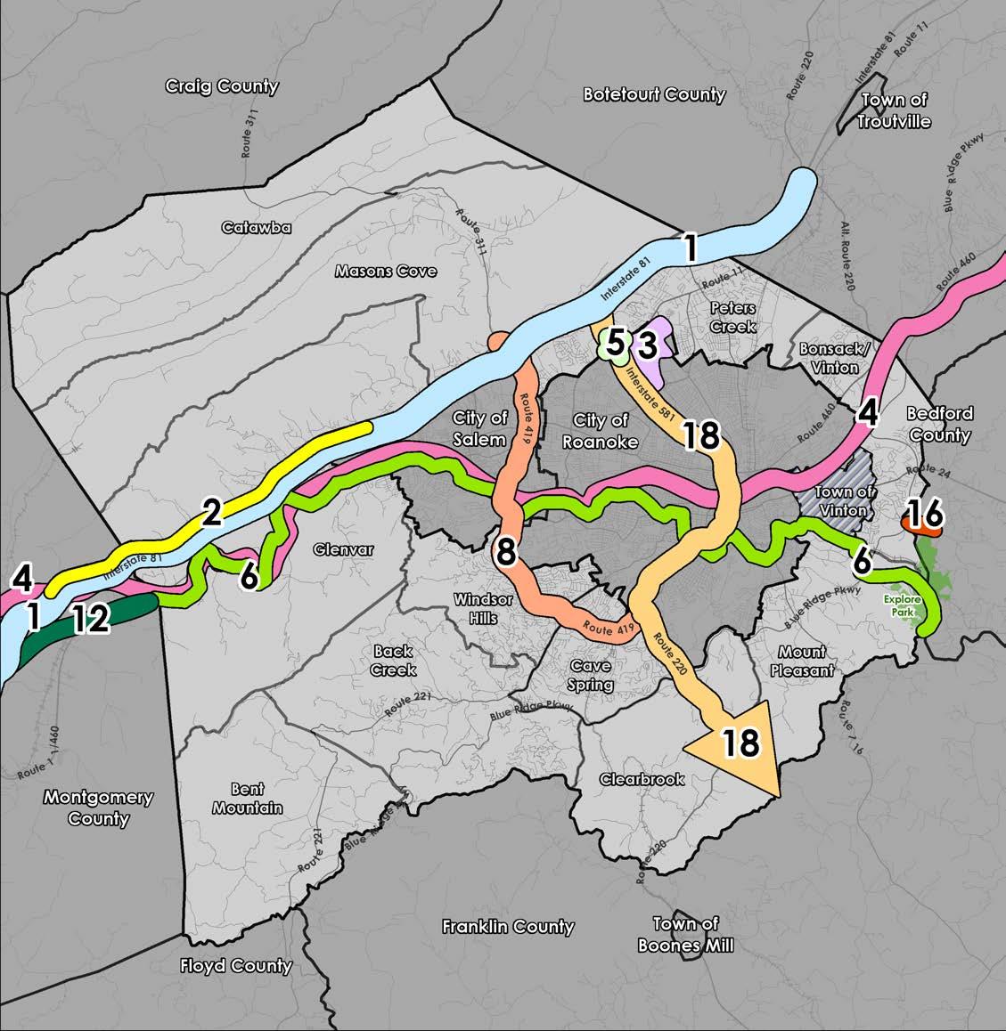

Transportation Recommendations

• Amend the Future Land Use Map as shown on page 10-8 to conserve the natural beauty, preserve rural and suburban areas, and promote economic development in Roanoke County.
• Adopt the Designated Growth Area as shown on page 10-9 to be consistent with the amended future land use designations in accordance with §15.2-2223.1 of the Code of Virginia.
• Develop plans for Activity Centers and Rural Centers as shown on pages 10-10 and 10-11 in a manner that compliments surrounding land uses.
• Develop and adopt a new zoning ordinance that allows additional “by-right” uses, allows more flexibility in promoting mixed use development, and enhances future business development.
• Identify and maintain an inventory of commercial, industrial, and residential parcels of land that are appropriate for development and redevelopment.
• Maintain and extend infrastructure improvements to support development and redevelopment of commercial, industrial, and residential parcels of land.
• Remove outdated proffer conditions on certain properties to promote redevelopment and expedite the development process.
• Conduct a Housing Study for Roanoke County to identify housing needs.
• Incorporate the Future Land Use Guide with the future land use designations from the 2005 Roanoke County Comprehensive Plan into the Roanoke County 200 Plan with the following changes to the Conservation, Core, and Economic Opportunity Future Land Use
Designations (note that only the changes are shown and that the remaining unchanged portions are still part of these future land use designations):
► Conservation: A future land use area of particular environmental sensitivity due to topography (greater than 33% grade), existence of unique land characteristics, conservation/open space/greenway easements, soil types or location with respect to other State or Federally preserved lands. Typical resources would include wetlands, ridgelines, mountainsides, scenic views from the Blue Ridge Parkway and Appalachian Trail, identified greenway corridors, productive agricultural lands, historical and cultural resources and threatened or endangered species habitats.
• Land Use Types:
• Public Lands: Includes land that is owned by a public entity but is not an official park Examples would be include, but are not limited to, Haven’s Wildlife Management Area, Spring Hollow Reservoir, Carvin’s Cove watershed, Appalachian Trail, Blue Ridge Parkway, Forest Service lands and publicly owned land on Green Ridge Mountain. Activities on these sites should be in accordance with their appropriate management plan.
• Rural Residential: Very limited, Low density single-family homes in accordance with the underlying zoning generally averaging a gross density of one unit per 10 acres. Cluster developments are encouraged
► Core: A future land use area where high intensity urban commercial and high-density residential developments is are encouraged. Land uses within core areas may parallel the central business districts of Roanoke, Salem and

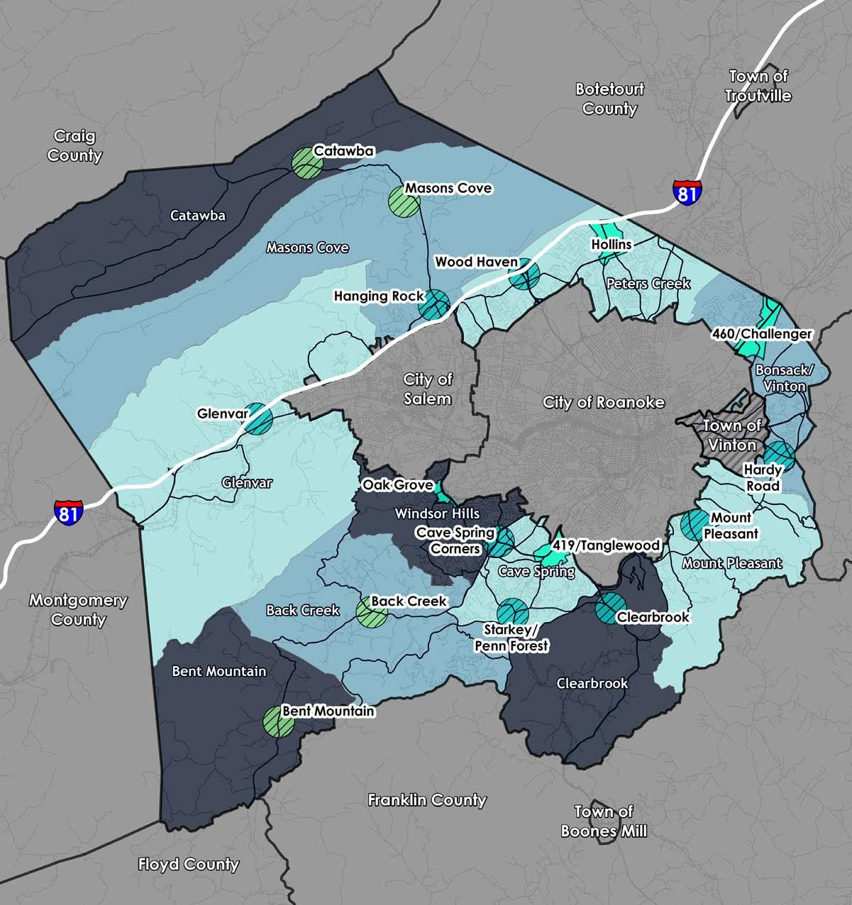

Activity Centers are areas that have potential for high-density mixed-use walkable development and that exist along major transportation corridors, contain employment and housing opportunities, have existing public and institutional uses, and are densely populated. Rural Centers are similar but are intended to be lower density nodes of activity that serve communities in areas of the County that are more rural in character. The recommended areas on the map to the left are locations that have been identified for the future development of Activity Center and Rural Center plans. The tiers below were developed by staff based on the current development activity of the recommended areas. The priorities for developing Activity Center and Rural Center plans will be determined by the Board of Supervisors and the Planning Commission.
Activity Centers:
Tier A
Cave Spring Corners
Glenvar
Starkey/Penn Forest
Wood Haven
Rural Centers:
Tier A
Bent Mountain Catawba
Tier B
Clearbrook
Hardy Road
Hanging Rock
Mount Pleasant
Tier B
Back Creek
Masons Cove
Vinton. Core areas may also be appropriate for larger-scale highway-oriented retail uses and regionally-based shopping facilities. Due to limited availability, areas designated as Core are not appropriate for tax-exempt facilities.
• Land Use Types:
• General Retail Shops, Restaurants and Personal Services: Planned shopping centers and clustered retail uses are encouraged. These centers should incorporate greenways, bike and pedestrian trails into their designs and link them to surrounding neighborhoods.
• Office and Institutional Uses: Planned developments are encouraged office parks and independent facilities in park-like settings are encouraged.
• Limited Industrial Uses: Planned uses in areas designated as economic opportunity areas Low intensity industrial uses that should not have an adverse impact on air or water quality.
• Multi-Family Residential: Multi-family residential developments up to 24 units per acre.
• Mixed-Use: Developments that combine retail, service and other commercial uses with office and/or residential uses in the same building or on the same site.
► Economic Opportunity Explore Park:
A future land use area that would guide a mix of commercial, tourist-related and limited industrial uses related specifically to a regional park destination resort facilities. Economic Opportunity Explore Park areas are applied to lands owned or leased by the Virginia Recreational Facilities Authority or Virginia Living Histories, Inc., the County of Roanoke associated with Explore Park and adjacent lands that could potentially be expansion areas for the facilities compatible development. The designation discourages uses that may conflict with or detract from the regional park resort activities.
• Land Use Types:
• Family Destination Resort: Various agricultural, civic, office, commercial, and limited industrial uses as defined in the Explore Park zoning district, and associated with the operation of resort facilities regional park destination. A high degree of architectural design and creative site design is are encouraged.
• Existing Land Use and Zoning: For lands designated Economic Opportunity Explore Park that are outside the resort park property, uses permitted in the existing zoning districts are encouraged until such time that rezoning to Explore Park zoning district is sought. Rezoning to other zoning districts should be carefully examined for compatibility with the resort regional park activities.


This section provides an overview of recommendations, strategies, and potential action projects to engage public and private partners in implementing the Roanoke County 200 Plan. There must be many partners committed to working toward future goals which include both public and private interests. Regional partnerships and leadership are essential as local government does not have the financial resources or the staffing to take on all of the issues and challenges discussed in this plan alone. Roanoke County Officials can guide public investment and land development decisions, but developers, citizens, and private interests must assist in furthering the strategies identified herein. Collaboration with officials of the Town of Vinton, Roanoke Valley-Alleghany Regional Commission, surrounding counties and localities, several state and federal agencies, and the citizens of Roanoke County, will be essential in implementing the Roanoke County 200 Plan.
Comprehensive plans are implemented through a variety of regulatory mechanisms, including ordinance amendments. The following regulatory tools are available to the County to help implement the 200 Plan:
• Zoning Ordinance: Zoning ordinances are the primary tool for implementing comprehensive plans. Zoning ordinances regulate the use of land and the type of development that is
• Use and Design Standards: While the Zoning Ordinance may provide provisions that regulate land uses and design standards generally for a zoning district, specific use and design standards can be adopted that are specific to a certain area or district (i.e. historic district) of interest that requires more stringent use and design standards than the underlying zoning district to ensure compatibility with surrounding uses or buildings to match the character of existing structures.
• Subdivision Regulations: Subdivision regulations regulate the division of land into smaller parcels. Subdivision regulations can be used to ensure that new development is consistent with the comprehensive plan and that it meets the community’s needs for infrastructure and public services.
• Other Ordinances: In addition to the Zoning Ordinance, other ordinances may be amended to ensure the recommendations of the 200 Plan are implemented (i.e. Erosion and Sediment Control ordinance).
• Capital Improvement Program: Capital Improvement Programs (CIPs) are long-range plans for public infrastructure projects, such as roads, water filtration systems, and wastewater treatment plants. CIPs are based on the comprehensive plan and help to ensure that the community has the necessary infrastructure it needs to support its growth and development

• Operational Budget: The County’s operational budget is a fiscal plan adopted on an annual basis that outlines the revenues and expenditures for each fiscal year. Each County department estimates their operational costs for the year for incorporation into the budget, which may include costs associated with the implementation of the Comprehensive Plan.
• State and Federal Funding: State and federal agencies offer a variety of funding to localities through various means. These funds may be applied for according to state and federal guidelines to be used for qualified projects associated with implementation of Comprehensive Plan recommendations, such as infrastructure improvements, plans and studies, and public projects.
• Grants: Funding in the form of grants are offered by state, federal and non-profit agencies that can be pursued through applications and are an avenue for funding community recommended improvements such as infrastructure, plans and studies, and other public projects.
• Private Investment: Although many recommendations of the Comprehensive will be pursued and initiated by the County as a public entity, many recommendations associated with private property will require investment by private property owners. This includes development and redevelopment of privately owned parcels of commercial, industrial, and residential lands and associated infrastructure improvements.
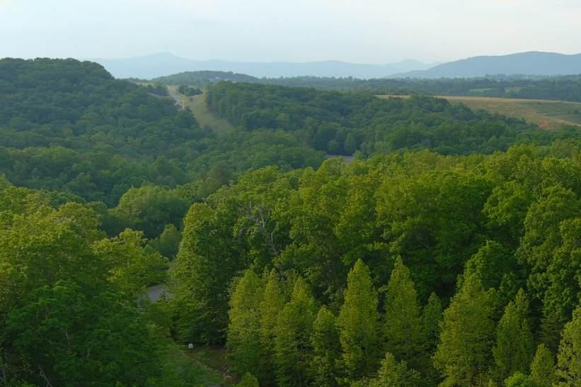
The Roanoke County 200 Plan will be achieved in stages over the next 15-plus years. While some implementation steps could be taken immediately following the adoption of the 200 Plan, others will occur or evolve over time. As different components of the plan are implemented, annual reviews of the 200 Plan will be necessary and adjustments made based on changing conditions.
An annual review will be conducted to ensure that the 200 Plan continues to reflect the needs of the County and that the recommendations of the Plan remain relevant. In addition, the Roanoke County Planning Commission will identify annual action items through the yearly development of its Annual Work Plan.
It will be a high priority for Roanoke County to keep residents, businesses and the greater region informed about progress of the implementation of the Roanoke County 200 Plan. The existing 200 Plan website will shift to communicate about the implementation of the 15-year comprehensive plan update. Current email lists will be used to update those interested as progress occurs. The community may also be engaged through implementation of the recommendations called for in the 200 Plan, transportation and development projects, and future annual reviews and updates of the 200 Plan document. The Roanoke County 200 Plan and CPA documents will remain located at: https://www.roanokecountyva.gov/200Plan
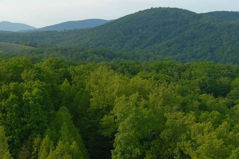
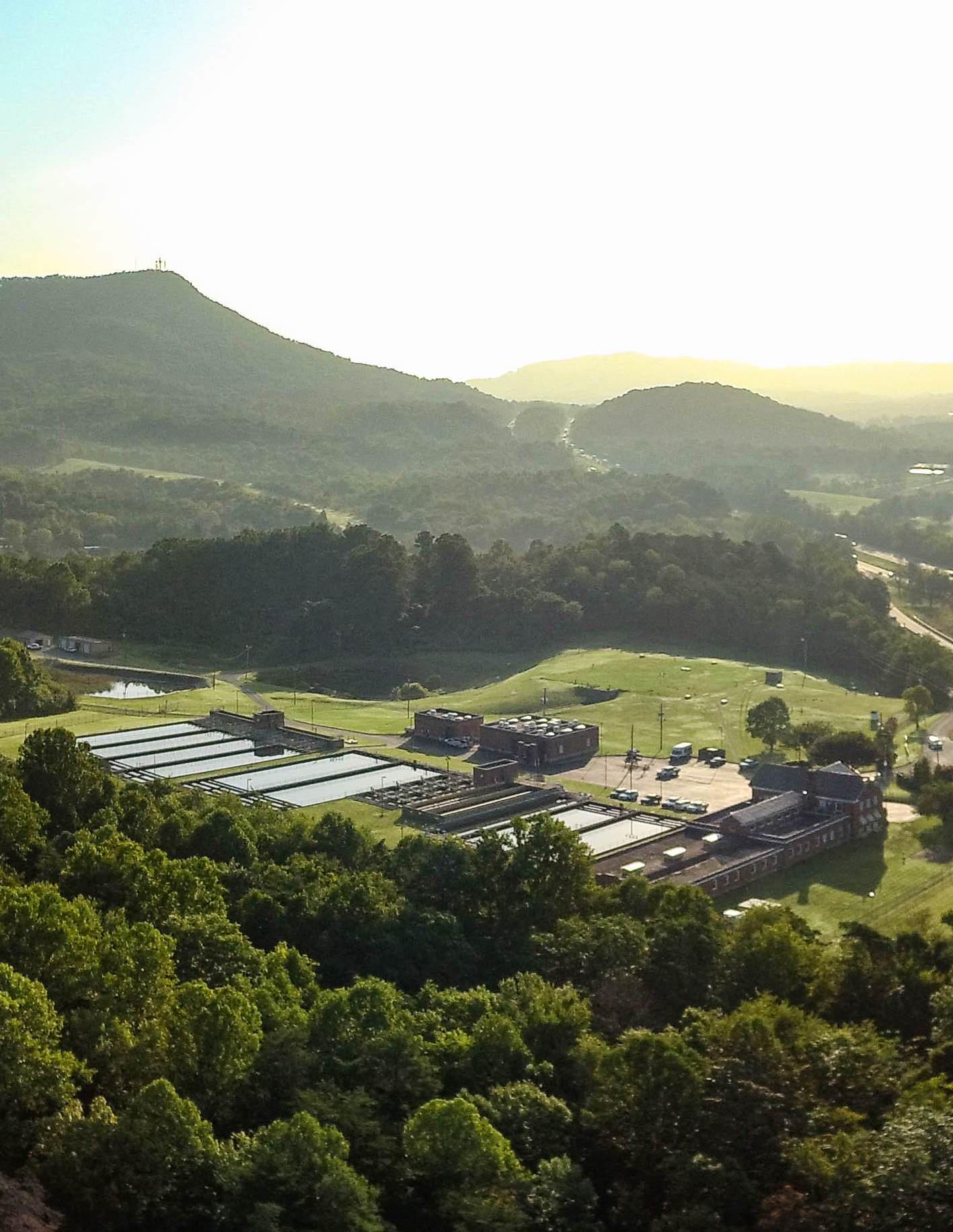
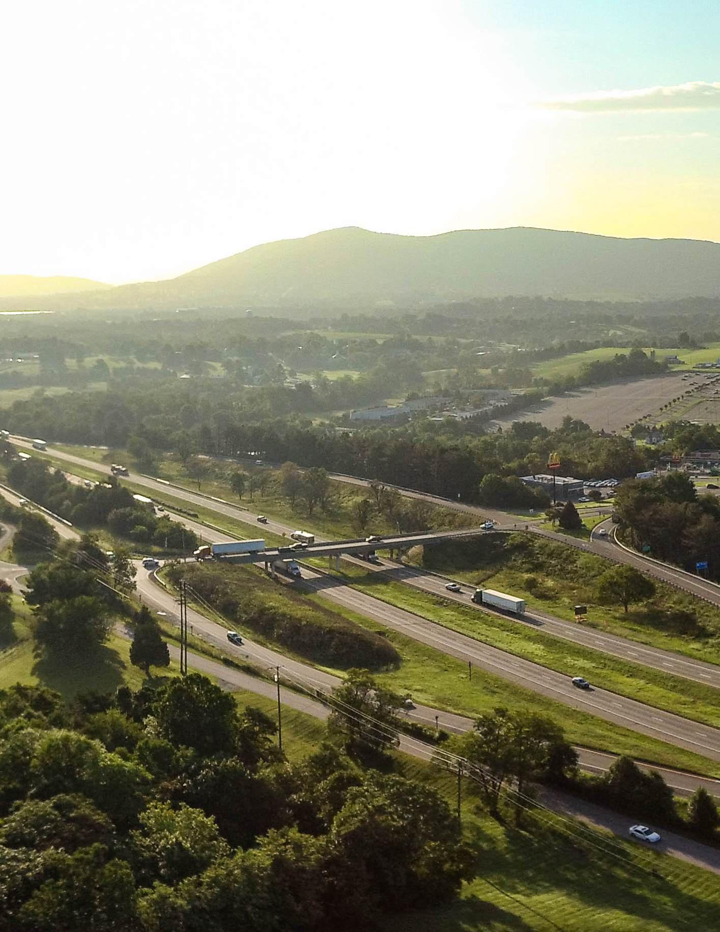
Bailey, C.M. and Chad Roberts (1999) Physiographic Map of Virginia. Retrived from: https://virginiastudies.org/content/ virginias-five-regions.
Calma, Emma, & Charlotte Jackson. (2021, Oct 5). Observed disparities between 911 calls and crash reports. D.C. Policy Center. Retrieved from: https://www.dcpolicycenter.org/publications/ crash-report-disparities/.
Chase, Steven B, Sheila Rimal Duwadi, and John M. Hooks. (2003). “Getting Ahead of the Curve.” Public Roads (67:3), pp. 2-7.
Cowan, Gerrard. (2019). How eVTOL aircraft might find their way into EMS. Vertical. Retrieved from: https://verticalmag.com/features/ evtol-aircraft-prospects-ems/.
D’Orazio, Michael, Cornelius Bittersohl, Max Rasovsky, Raul Kraus. (2020). White Paper: Refueling Automated and Autonomous Trucks – Challenges and Opportunities. Umlaut. Retrieved from: https://www.umlaut.com/ uploads/documents/2020-02-06-Refuelingautomated-and-autonomous-trucks.pdf.
Deichmann, Johannes, Eike Ebel, Kersten Heineke, Ruth Heuss, Martin Kellner & Fabian Steiner. (2023). Autonomous driving’s future: Convenient and connected. McKinsey & Company. Retrieved from: https://www. mckinsey.com/industries/automotive-andassembly/our-insights/autonomous-drivingsfuture-convenient-and-connected.
Federal Emergency Management Agency (2007) FEMA Flood Map Service Center Retrieved from: https://msc.fema.gov/portal/ advanceSearch#searchresultsanchor
Frazier Associates (1992). Historical Architecture Reconnaissance Survey Report, Roanoke County, Virginia
Hartmann, Joey. (2021). Bolstering the Safety of America’s Bridges for Half a Century. Public Roads (85:3), pp. 23-26.
Lyon-Hill, Sarah, Melissad Tilashalski, Kimberly Ellis, and Elli Travis. (2020) Measuring the Effects of Drone Delivery in the United States. Report prepared by the Virginia Tech Office of Economic Development and the Grado Department of Industrial & Systems Engineering. Retrived from: https://vtechworks. lib.vt.edu/server/api/core/bitstreams/ e6290289-4ed3-433f-9ed9-b6fdb77f2328/content.
Millard-Ball, Adam. (2019). The autonomous vehicle parking problem. Preprint of Manuscript published in Transport Policy. Retrieved from: https://millardball.its.ucla.edu/wp-content/ uploads/sites/22/2022/06/Millard-Ball_2019_The_ autonomous_vehicle_parking_problem_parking_ preprint.pdf.
National Aeronautics and Space Administration (NASA). (2018). Urban Air Mobility (UAM) Market Study. Retrieved from: https://www.nasa.gov/ sites/default/files/atoms/files/uam-market-studyexecutive-summary-v2.pdf.
National Association of Realtors. (2020). National Community and Transportation Preferences Survey. Retrieved from: https://cdn.nar. realtor//sites/default/files/documents/2020transportation-survey-analysis-slides.pdf.
National Park Service (2024) Physiographic Provinces. Retrieved from: https://www. nps.gov/media/photo/gallery-item. htm?id=00c527b1-e60a-455a-9ba4773de81deb87&gid=189ADE8D-C5D3-4A88B567-927EC25A8FA5.
Natural Resources Conservation Service, United States Department of Agriculture (n.d.). Web Soil Survey. Retrived from: https://websoilsurvey.nrcs. usda.gov.
Pedestrian and Bicycle Information Center. (2022). PedBikeInfo: Safety. U.S. Department of Transportation. Retrieved from: https://www. pedbikeinfo.org/factsfigures/facts_safety.cfm.
Roanoke County (2023). Proposed FY 2024 - FY 2033 Capital Improvement Program (CIP) County Funding and Projects [Board of Supervisors Work Session]. Retrieved from https:// www.roanokecountyva.gov/DocumentCenter/ View/25879/Capital-Work-Session-andAttachment-A-Project-Summary-Information.
Roanoke County (2022). Adopted Capital Improvement Program, Fiscal Years 2023 - 2032. Retrieved from: https://www.roanokecountyva. gov/DocumentCenter/View/23951/ FY-2023---FY-2032-Adopted-CIP.
Roanoke County (2018). Adopted Capital Improvement Program, Fiscal Years 2019-2028. Retrieved from: https://www.roanokecountyva. gov/DocumentCenter/View/11948/ FY19-28AdoptedCIP?bidId=.
Roanoke County Police Department (2022). 2022 Annual Report. Retrieved from: https://www.roanokecountyva.gov/1169/ Annual-Report-Online.
Schaller, Bruce. (2017). Empty Seats, Full Streets: Solving Manhattan’s Traffic Problem Schaller Consulting. Retrieved from: http:// schallerconsult.com/rideservices/emptyseats. pdf.
United States Census Bureau. (2020). U.S. Census Data. U.S. Department of Commerce. Retrieved March 9, 2023, from https://data.census.gov/.
United States Department of Agriculture (1997) Soil Survey of Roanoke County and the Cities of Roanoke and Salem, Virginia. National Cooperative Soil Survey.
United States Department of Transportation (2023). Saving Lives with Connectivity: A Plan to Accelerate V2x Deployment [DRAFT]. Retrived from: https://www.its.dot.gov/research_areas/ emerging_tech/pdf/Accelerate_V2X_ Deployment.pdf.
United States Fish & Wildlife Service (2024). National Wetlands Inventory. Retrieved from: https://www.fws.gov/program/ national-wetlands-inventory/wetlands-data.
United States Geological Survey (2021). National Land Cover Database. Retrived from: https://www.usgs.gov/centers/eros/science/ national-land-cover-database.
United States Geological Survey (2021). TNM Download (v2.0). Retrieved from: https://apps. nationalmap.gov/downloader/.
United States Geological Survey (2021).
Soil Survey. Retrived from: https:// www.usgs.gov/centers/eros/science/ national-land-cover-database.
United States National Park Service. (2023). Appalachian National Scenic Trail. Retrieved from: https://www.nps.gov/appa/index.htm.
University of Virginia, Weldon Cooper Center for Public Service (2024). Virginia Population Estimates. University of Virginia, Weldon Cooper Center for Public Service. https://www. coopercenter.org/virginia-population-estimates.
Virginia Career Works, Blue Ridge Region (2024) Virginia Career Works - Blue Ridge. Retrieved from: https://www.vcwblueridge.com/.
Virginia Department of Conservation & Recreation. (2021) Poor Mountain Natural Area Preserve. Retrieved from: https://www. dcr.virginia.gov/natural-heritage/document/ pgpoormtn.pdf.
Virginia Department of Conservation & Recreation (2024) Conservation Lands Shapefiles and Metadata. Retrived from: https://www.dcr. virginia.gov/natural-heritage/cldownload.
Virginia Department of Energy (2011). Geology and Mineral Resources. Retrived from: https://www.energy.virginia.gov/geology/ GeologyMineralResources.shtml.
Virginia Department of Environmental Quality (2022). Implementation (IP) Watershed and Total Maximum Daily Load (TMDL) Datasets. Retrieved from: https://geohub-vadeq.hub.arcgis.com/ pages/c1ad79b7b58844f9b468f19c3907cac2.
Virginia Department of Historic Resources (2024) Interactive Database of the Virginia Landmarks Register & National Register of Historic Places. Retrieved from: https://www.dhr.virginia.gov/ historic-registers/.
Virginia Department of Rail and Public Transportation (DRPT). (2023). Our Mission. Retrieved from https://drpt.virginia.gov/ about-us/our-mission/.
Virginia Department of Wildlife Resources (2015). Wildlife Action Plan. Retrieved from: https://dwr. virginia.gov/wildlife/wildlife-action-plan/.
Virginia Tourism Corporation. (2024)
Virginia Mountains, Poor Mountain Natural Area Preserve. Retrieved from: https://www.virginia.org/listing/ poor-mountain-natural-area-preserve/7724/.
Virginia Works, Department of Workforce Development and Advancement (n.d.) Quarterly Census of Employment and Wages. Retreived from: https:// virginiaworks.com/Quarterly-Censusof-Employment-and-Wages-QCEW/ index.
Wang, Liming & Yao-Jan Wu. (2021). Land Use and Transportation Policies for a Sustainable Future with Autonomous Vehicles. National Institute for Transportation and Communities. Retrieved from: https://drive.google.com/ file/d/1YKqThLChw3oiajEcRsYtGW9Qard2XzZa/ view.
Weather Spark (2016) Climate and Average Weather Year Round in Roanoke. Retrieved from: https://weatherspark.com/y/19622/ Average-Weather-in-Roanoke-Virginia-UnitedStates-Year-Round.
Zhang, Ming & Yang Li. (2022). Generational travel patterns in the United States: New insights from eight national travel surveys. Transportation Research Part A: Policy and Practice (Vol 156, Feb 2022), pp. 1-13.
September 24, 2024