LEBANON REDEFINED
The City of Lebanon Comprehensive Plan
The City of Lebanon Comprehensive Plan
The City of Lebanon began the process of creating a new comprehensive plan in early 2018. The plan, which serves to outline a vision and strategic framework for future development, redevelopment, and community building projects within the City, was last fully updated in 2007 Much has changed in Lebanon since that time, and it is critical that the comprehensive plan respond to these changes, reflect current conditions, and most importantly, be representative of the vision and goals of current residents and businesses.
Indiana state law identifies requirements that need to be incorporated into a comprehensive plan (Indiana Code 36-7-4-502). A comprehensive plan must contain at least the following elements:
• A statement of objectives for the future development of the jurisdiction.
• A statement of policy for the land use development of the jurisdiction.
• A statement of policy for the development of public ways, public places, public lands, public structures, and public utilities.
Beyond those minimum requirements, the overall purpose of the updated comprehensive plan for the City of Lebanon is to:
• Embody and promote the futurevision for the Cityas developed by citizensand community leaders throughout the planning process
• Create action-oriented recommendations to help guide land use and development decisions.
• Ensure the City remains competitive from a business retention and attraction standpoint while also maintaining the high quality of life for Lebanon’s residents.
• Incorporate the recommendations and results from the many other recent planning initiatives.
• Include a diverse spectrum of residents, businesses, and local leaders in shaping the vision, goals, and policy frameworks within the plan
A comprehensive plan is a document with a long-range view, that serves as a guide for making land use decisions, preparing capital improvement programs, and determining the rate, timing, and location of future growth. It establishes a vision, goals, and objectives that direct investment and development activity within the City of Lebanon. This then provides the policy basis for zoning regulations and other construction and development controls. The comprehensive plan examines the inter-relationships between land use, transportation, utilities, and the local economy.
The City of Lebanon Comprehensive Plan
City staff, the Plan Commission, and City Council should interpret the goals and objectives as a long-term reflection of the community’s values. The spirit of this plan should be remembered when reviewing development and policy proposals to ensure that the community’s vision is realized. The strategic recommendations are intended to direct the day-to-day decisions concerning more specific and task-oriented activities. Interpreting the plan in this way will enable the members of both the Commission and Council to justify approval, or denial, of any proposed development or redevelopment projects or policy initiatives brought forth for the City.
When a new annexation, rezone, planned unit development (PUD), subdivision, or site plan review request is filed with the Planning Department, the planning staff as well as other city departments should review and evaluate the application against the Lebanon Comprehensive Plan and the City’s other ordinances and provide a staff report with a formal recommendation to the Plan Commission regarding its findings. The staff report should include an evaluation of the development and the degree to which the proposed project conforms to the plan’s goals, objectives, recommendations, and future framework maps.
The comprehensive plan is not an ordinance and does not contain the actual decisions that should be made. It is however, a policy document that will help guide decision-making related to land use, growth, public investments, and economic development. It serves as a reminder of the community’s collective vision for the future growth and development of the area and should be interpreted as such.
The City of Lebanon has the power to make planning and zoning decisions only within its municipal boundaries. However, to ensure compatibility of future growth and land use changes, an area larger than the current City boundaries was addressed with this process. The planning area includes all of Lebanon as well as the remainder of Center Township. This is not an official extra-territorial planning jurisdiction as recognized by state law, but this area will have an effect on the City’s future tax base and utility service area should the municipal boundaries grow. By including this additional area in the comprehensive plan process, the plan can be used to provide guidance as properties may be annexed and Lebanon zoning districts applied to them.
Planning is a continuous process that had been initiated prior to this plan and will continue after its adoption. This new Comprehensive Plan is the result of a detailed process that brought residents and stakeholders together to identify existing conditions throughout the City, recognize potential trends, and ultimately create recommendations for the future. Plan recommendations
The City of Lebanon Comprehensive Plan
and this website were developed over fifteen months with oversight from a project steering committee which included the Mayor of Lebanon, representatives from the Plan Commission and Redevelopment Commission, City staff, and other community leaders. The community leaders represented various non-profit organizations and private businesses; they were included because their respective expertise and experience in various backgrounds could provide benefit to the process. The committee met six times; these meetings were interactive work sessions and resulted in the overall input needed to develop the plan.
In addition to the regularly held steering committee meetings, a series of focus group discussions was held early in the process to gather input from key stakeholders and organizations The goal of the focus group discussions was to assess the issues each group faces and understand what they hoped to achieve through comprehensive planning process.
Leaders and industry experts in each of the following categories were invited to participate:
• City staff, boards, and commissions
• Business leaders and employers
• Developers, builders, and real estate professionals
• Community institutions, non-profits, and service organizations
• Neighborhood leaders and residents
• Youth and young professionals
• Transportation organizations and utility providers
Two community open houses were held to solicit input and discuss opportunities, issues, goals and recommendations for the plan. The first meeting was held early in the process on July 31, 2018 at Lebanon High School. Open house participants were able to voice their opinions, interests, and concerns about the current conditions and future vision for the community. A brief presentation about the plan process and background was given before attendees participated in several feedback exercises. The second community open house took place on February 12, 2019; it was also held at Lebanon High School. A number of stations were organized around the plan topics. City officials and the planning consultants staffed these stations and were on hand to answer questions and provide additional in-sight. Participants were asked to confirm and prioritize plan recommendations. The key initiatives were also presented with a slideshow.
In addition to in-person input opportunities, a project website was maintained throughout the process. This website included background information, meeting materials, and a frequently asked questions section. It also hosted a number of community survey questions over a period of several months. Several of the survey questions received more than 500 responses. Complete survey results can be found in the Maps & Documents section.
The plan process was broken into four major components:
The City of Lebanon Comprehensive Plan
• Existing Conditions Analysis
• Vision & Components Framework
• Implementation Plan
• Final Website & Adoption
The existing conditions analysis phase looked both objectively and subjectively at the issues and challenges facing the City. Issues and opportunities were discussed with the project steering committee, at the first public open house, and during the focus group discussions. A Community Profile was prepared, highlighting demographic, housing, and retail market conditions. The existing conditions information is included in the Maps & Documents section.
The vision and components framework included the creation of the plan vision statement and associated framework topics. The vision and goals served as the structure for the remainder of the plan process. Each framework goal statement is supported by a number of objectives, many of which were generated during public engagement while others incorporate best practices demonstrated in other communities. After the objectives were refined and prioritized by the steering committee, a list of key initiatives was created. These 18 key initiatives represent the overlap and interaction of many of the most important objectives in terms of policies, programs, and development goals of the community.
The implementation plan involved identifying the relative priority of each objective. These priority timeframes can be used to aid in decision making and implementation. After translating the many plan recommendations into the website format, the plan was presented to the Plan Commission and City Council as part of the adoption process. The Plan Commission held a public hearing and approved and certified the plan on December 16, 2019. The City Council adopted the plan on January 13, 2020, after which it became the official comprehensive plan for the City of Lebanon
In addition to this introductory section, the comprehensive plan website is organized around the six plan elements:
• Housing & Neighborhoods
• Land Use & Development Character
• Transportation & Utilities
• Downtown
• Quality of Life
• Economic Development
The City of Lebanon Comprehensive Plan
Each plan element includes a goal statement, summary map, and series of supporting objectives. The plan elements page can be accessed via the website header or at the bottom of the landing page. Once at one of the specific element pages, the goal statement is listed under the element heading. This list of objectives can then be found below the goal. Additional description and information about each objective can be found by clicking the objective text itself or the arrow to the right. Finally, the element map can be found at the bottom of the page. Specific to the Land Use & Development Character element, a link to the Future Land Use Classifications can be found in the website footer bar under the Resources heading.
The six plan elements are supported by 18 key initiatives. Because many of the key initiatives are applicable to or support several plan elements, they have been organized on their own page. There is a “Read More” button to the right of each key initiative statement that will take you to another page that includes a summary of the initiative, expected outcomes, both short and longterm actions needed for implementation, and the organizations, departments, or other implementers that will be needed for success.
The Implementation page, also accessed from the website header bar, details how to use and update the plan when needed. Also included is a summary of early action items that represent the immediate next steps necessary to realize the vision of the Lebanon Redefined Comprehensive Plan. Finally, the Maps and Documents page houses the six plan element maps as well as supporting documentation developed during the planning process. The drop-down menu on the left-side of the page can be used to view the different maps.
The Frequently Asked Questions (FAQS) and News pages will be developed as plan implementation progresses. They are not technically components of the comprehensive plan but have been included to share information and make the plan more user-friendly. To the right of the News link on the header bar is a magnifying glass. Clicking this icon will open a drop-down search form. Additionally, contact information and links to the City website and Planning Department page are included in the footer bar.
The City of Lebanon Comprehensive Plan
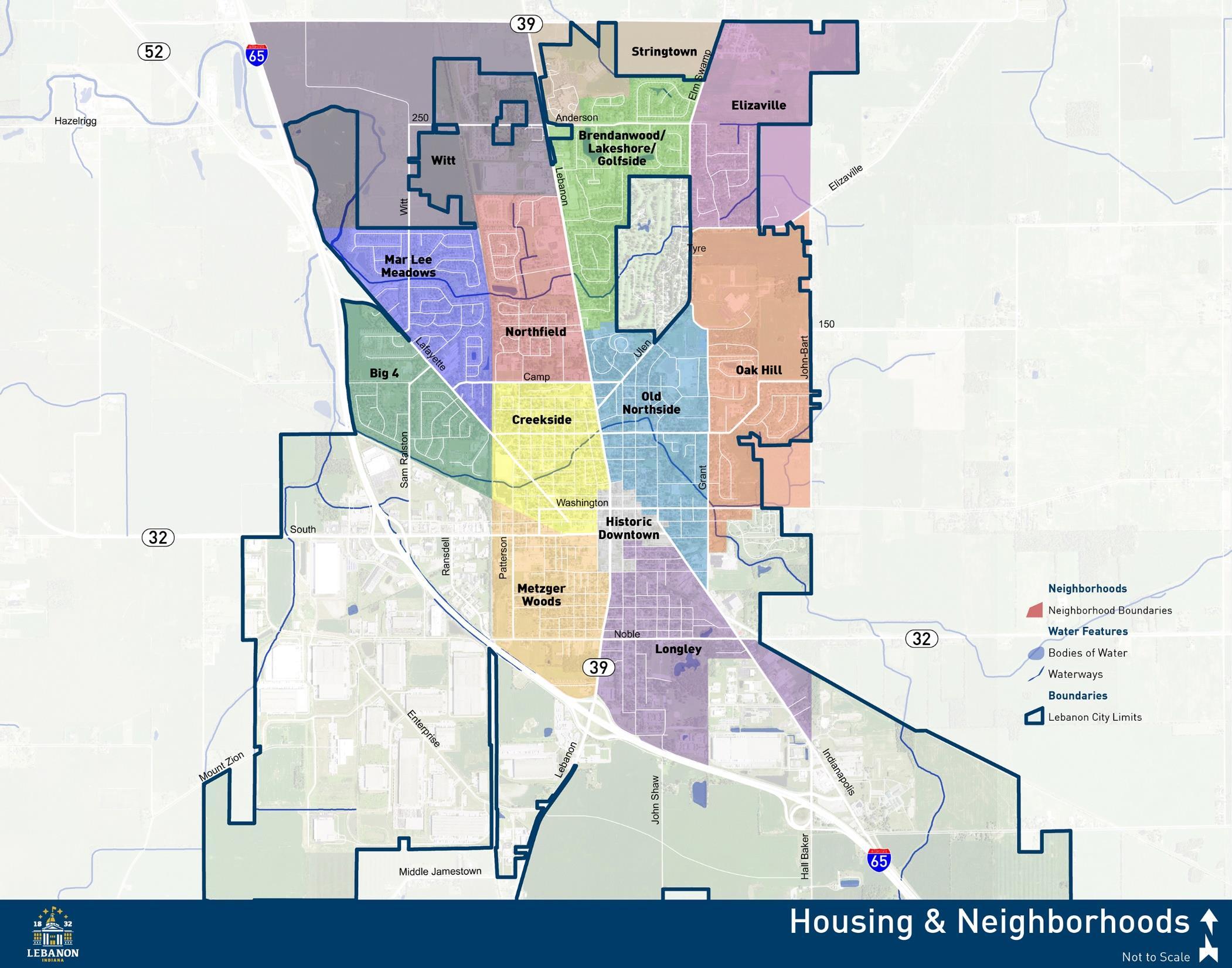
Create a diverse housing stock in quality and connected neighborhoods, to serve existing residents as their housing needs change and to attract new residents of all incomes and age groups.
1. Expand the downtown façade program or create a comparable program to include grant funds and/or low-interest loans for improvements to residential structures in the City’s core.
Currently, the Lebanon Historic Preservation Commission funds building improvements with a cost sharing grant program, but the property must have commercial activity as its primary purpose. A comparable program to fund residential improvements outside of the Lebanon Downtown Historic District should be developed. This program will likely have to be administered through a different commission or department, but the goals are similar, to preserve and protect existing properties, enhance property values, and attract new residents to areas that may otherwise not see investment.
2. Create incentives for mixed-density residential infill and rehabilitation on vacant and under-utilized lots, for projects that complement and enhance surrounding neighborhoods.
Residential infill development can be challenging because of the scattered nature of lots, outdated infrastructure, or increased construction costs. City incentives and programs could be used to help offset some of these challenges. The City could establish a revolving loan fund, similar to what is frequently used to fund small business expansion and development, to help with gap financing or to meet the additional down payment requirements of a construction or construction-to-permanent loan. Another residential infill incentive is to reduce permitting or utility connection fees for these lots.
3. Expand the existing historic district or create new districts to be used in protecting older housing stock, ensuring improvements are respectful of adjacent properties, and offering programs to assist owners in maintenance and upkeep.
The Lebanon Downtown Historic District applies primarily to the courthouse square and surrounding commercial core. A certificate of appropriateness (COA) is required for any alteration or demolition of structures within the district. New districts, for the areas surrounding the downtown that are comprised of more residential structures, could be useful in defining appropriate maintenance and rehabilitation efforts to protect valuable housing character. These new districts could then be used in conjunction with existing or new maintenance and rehabilitation programs.
The City of Lebanon Comprehensive Plan
4. Use targeted City investments in transportation and utility infrastructure, landscapes, and lighting to catalyze private investment in the City’s historic neighborhoods
Older neighborhoods often find themselves with dated infrastructure in need of repair or replacement. These infrastructure deficiencies can detract from neighborhood character and prevent private investment The City should strategically invest in targeted neighborhoods to exhibit a commitment to these neighborhoods in hopes of attracting additional landowner and developer investment in area properties.
5. Ensure opportunities for the creation of diverse housing options for first-time buyers, repeat buyers, and renters both with the future land use plan and unified development ordinance.
Many newer subdivisions contain a homogenous housing stock that caters to one particular market segment. However, individuals rarely have the same housing needs or preferences through their entire life and may find they need to relocate outside of their neighborhood or community to meet these changing needs. Integrating different housing styles and types within the community can have a huge impact on the long-term viability of neighborhoods and the ability of Lebanon residents to stay in the community as they age.
6. Assist with the creation of neighborhood groups to improve communication with the City and coordinate beautification, crime prevention, and other improvements.
The historic homes and older neighborhoods around downtown Lebanon are organized in a regular grid street pattern. As such, identifying where one neighborhood stops and the next starts can be difficult. The City of Lebanon should begin encouraging and facilitating the creation of neighborhood organizations to improve communication and coordination with City officials. These organizations can help to establish a sense of belonging and be used as an official mechanism for residents to share community concerns or goals with City leaders.
7. Ensure new housing developments contribute to overall community character through the provision of open spaces, trails, landscaping, and other amenities.
As new subdivisions and apartments are developed, they will primarily be designed for the future residents of that neighborhood or apartment community. Equally important, however, is how these developments contribute to existing City character. New developments should be designed to add to the community open space and trail network and include landscape plantings that enhance the visual quality of the area.
The City of Lebanon Comprehensive Plan
8. Limit the conversion of single family homes into duplexes or multi-family apartments, and consider incentives for returning structures that have been split into multiple units back in to single family residences.
The conversion of single family homes into two or more units in primarily single family neighborhoods can have negative impacts on surrounding homes. Single family lots are typically sized and organized to accommodate vehicles and provide open space for one unit. As additional units are created, the exterior use and character of the property often begins to change. Residential rehabilitation incentives recommended elsewhere in this plan could be used to promote conversion of multi-unit structures back to single family use.
9. Increase code and parking enforcement to ensure public safety and improve the visual appearance of City neighborhoods.
An effective means of stabilizing property values and creating quality neighborhoods is by ensuring the good maintenance of buildings and lots. Unfortunately, when properties are not adequately maintained, the City may have to get involved through code enforcement. This is typically a resource intensive process that involves City staff and legal counsel. The City should periodically focus efforts on widespread or recurring issues, first with an information campaign, then notices to owners of property that are violating codes, and finally formal violation tickets, if necessary. More active code enforcement will show property owners that the City is serious about its appearance and hopefully elevate property maintenance city-wide.
10. Connect neighborhoods to shopping, employment, and recreation destinations through the construction of multi-use paths, sidewalks, and bicycle facilities.
Lebanon should expand the multi-use trail, sidewalk, and bicycle networks to better connect neighborhoods to the downtown, recreational facilities like Memorial Park, and employment centers. Bicycling and walking are health and recreational activities, but also sometimes one’s only means of transportation. They are critical to maintaining the high quality of life residents so greatly desire. When planning for these facilities, it is important to consider the context within which the trail, path, or sidewalk will be located, and the design standards that are offered by organizations such as the National Association of City Transportation Officials (NACTO).
The City of Lebanon Comprehensive Plan
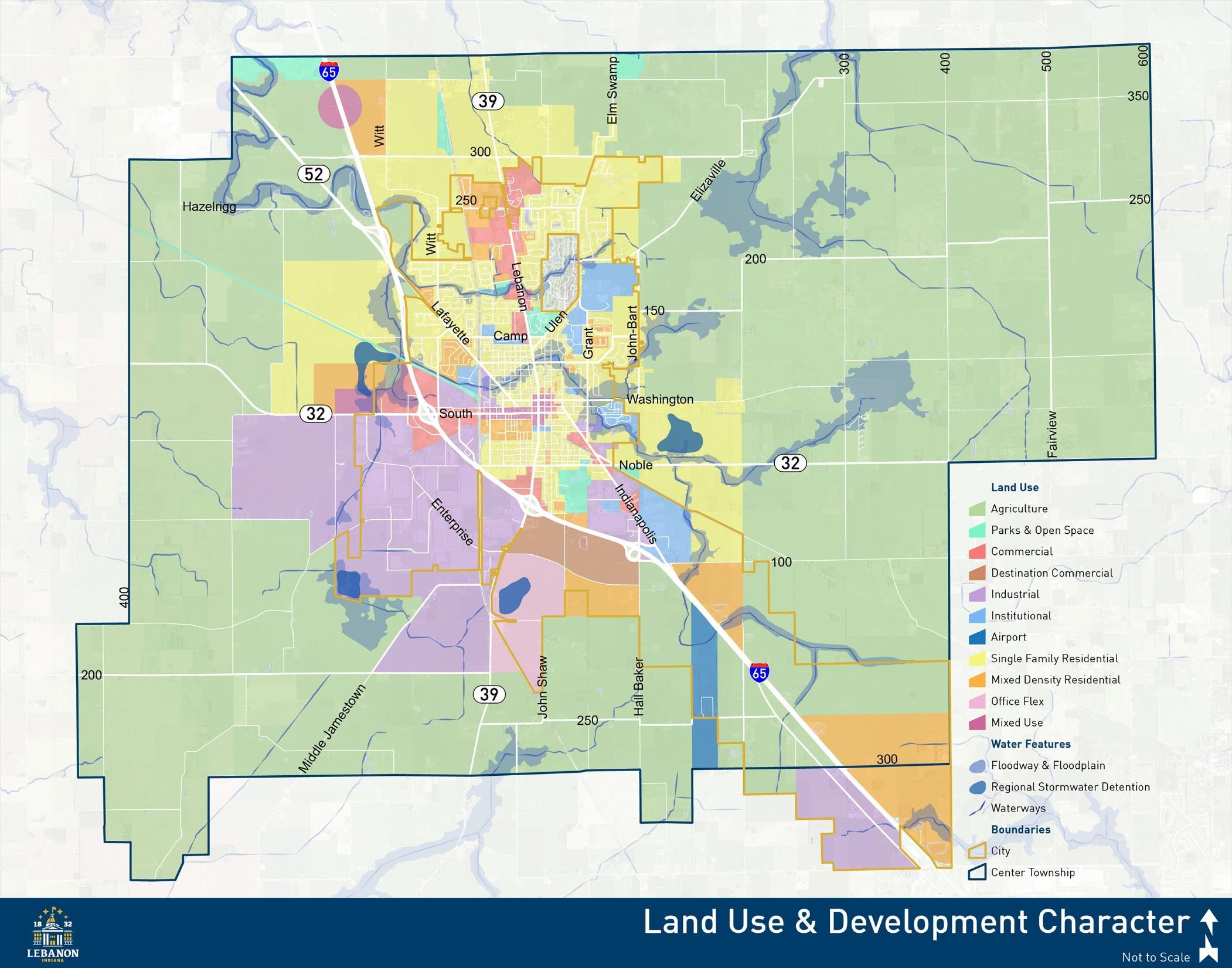
Ensure a diverse and balanced mixture of land uses that contribute to the community character and identity of Lebanon, preserve historic assets, support the City’s fiscal health, and protect sensitive natural areas.
1. Promote infill and redevelopment of underutilized parcels already served by municipal services and utilities.
Infill development refers to the construction of new buildings on vacant or underutilized land in previously developed areas of the City. Infill development is beneficial because it can utilize land, infrastructure, and municipal services more efficiently and without the need for service extensions. Additionally, it results in more active streets and neighborhoods by filling in spaces of inactivity. Incentives may be used to promote infill and make it more attractive to developers. Potential incentives include reduced application or utility connection fees, City-led infrastructure upgrades, or tax abatement.
2. Encourage new development that is compatible with surrounding use and character and contributes to the diverse mixture of uses across the City.
New development and redevelopment, especially in residential areas, should be designed to reflect adjacent character and scale. Where mixed density and more residential dwelling types are recommended, it is still important to scale down in intensity when neighboring property is of a different density or character. This is important because while new development increases the tax base of the City, new homes and businesses also create costs to the city for services such as sewer, water, fire and police protection, parks, libraries, and roads. Low density residential development is almost always tax negative. Even when home prices are high, the long-term infrastructure maintenance and replacement costs outweigh the tax revenues. In order to reduce the costs of low-density residential development, the City must promote future development that reflects existing character but also allows more mixed uses and densities
3. Promote mixed use development in and around the downtown and at key locations to create vibrant districts with more round-the-clock activity.
Mixed use districts include a diverse combination of businesses and dwellings within a connected and walkable block layout. These areas may be characterized by individual buildings that contain a mixture of uses or by single use buildings that contain different uses near each other. Combining employment generators in close proximity to new housing, retail destinations, and community recreation amenities, can result in benefits such as: more efficient infrastructure systems, decreased land consumption, increased community interaction, and higher property values associated with walkable neighborhoods.
The City of Lebanon Comprehensive Plan
4. Support expansion of the Lebanon Business Park south of SR 32 and west of SR 39.
The Lebanon Business Park is nearly built out, with only one existing site available for development. Whether it be Duke Realty, the original developer of the park, private landowners, or a new developer, the park should be expanded to provide additional economic development opportunities for the City. This growth should continue to the west and/or south of the existing park. The large-scale warehouse and industrial uses that currently comprise the park should not be expanded to the north side of SR 32 or the east side of SR 39.
5. Promote development of high-quality office, research and development, technology flex, and supporting commercial and residential uses in the area southeast of the I-65 and SR 39 interchange.
The area east of SR 39 and west of I-65 is envisioned to include a mixture of employment generating uses different from those provided in the Lebanon Business Park. With additional transportation and utility investments, this area will benefit from interstate access and visibility, and should support office, technology, and complementary commercial and residential uses. Given the potential significance of this area to the City for many years to come, high quality architecture and site design should be a priority.
6. Ensure the zoning map and unified development ordinance support development in accordance with the future land use plan and other recommendations of this plan
The comprehensive plan is a policy document used to aid in decision making regarding development and redevelopment. The future land use and development map is only a guide and should not be confused with the official zoning map for the City. In order to fully implement the recommendations of the comprehensive plan, the unified development ordinance should be reviewed and amended as necessary to support the goals of the plan. A preliminary list of suggested edits is included on the implementation page. Additionally, the City may want to proactively rezone critical properties as a means to better direct development in accordance with the future land use and development map.
7. Explore expanding the City’s planning and zoning jurisdiction to be able to more proactively plan for new development within Center Township.
Development happening adjacent to, but outside Lebanon’s municipal limits can impact areas within the City in terms of traffic, incompatible use, or utility capacity if served by City sewer or water. Past communication and coordination between the City and the County has largely been successful, but given potential growth pressures, Lebanon would like more control over development happening adjacent to the City. In Indiana, there are two options to exercise planning and zoning jurisdiction outside the City: Township Joinder or Extraterritorial Jurisdiction. With a township joinder, Lebanon would assume planning
The City of Lebanon Comprehensive Plan
and zoning control over all of Center Township. An extraterritorial jurisdiction could apply to properties within two miles of city limits. The extraterritorial jurisdiction does not have to be the full two miles; it may only include a specific group of parcels most critical to the City. The additional planning and zoning area would need to be approved by the Township Trustee and board, or county commissioners, respectively.
8. Improve the visual character of both the streetscape and adjacent development along the SR 32, SR 39, and Indianapolis Avenue corridors to present a quality image of Lebanon at these key gateways
For many, first impressions make the biggest impact. The SR 32, SR 39, and Indianapolis Avenue corridors are the major access points into Lebanon and should be given the highest priority for streetscape and aesthetic improvements. Recent improvements to Indianapolis Avenue, including extension of the multi-use path, should be continued to the downtown. Enhancements to the SR 32 and SR 39 corridors will require coordination with INDOT and should include sidewalk improvements and street trees where possible.
9. Protect flood hazard areas and wetlands from future development and promote removal of existing structures within these areas.
Limiting development in flood hazard areas is absolutely necessary to reduce the future impacts and associated costs of flooding. Special flood hazard areas are those that would be under water during a 100-year flood. A 100-year flood does not mean a flood of that magnitude can only happen once every 100 years but rather, there is a 1 percent chance of a flood of that magnitude every year. The 2019 Flood Resilience Plan identifies measures to reduce the vulnerability of the community to damage from flooding. In addition to preventing future construction in these areas, Lebanon should take a proactive role in buying property and removing these structures within the flood plain. Existing owners should not be forced into selling their properties, but as properties are marketed for sale the City should consider acquiring them. Eventually, the flood plain can become an open space asset and potential trail corridor
10. Incentivize green infrastructure and stormwater best management practices to reduce stormwater volumes and the subsequent risk of flooding.
Development results in buildings, roads, and sidewalks that act as impervious surfaces which prevent stormwater from infiltrating and recharging groundwater supplies. Instead, stormwater travels over the land and runs off at a rate much higher than would occur naturally. Stormwater runoff can carry pollutants and sediment to receiving lakes, streams, and rivers thus reducing water quality. Higher stormwater volumes can also contribute to greater downstream flooding. Stormwater management has typically occurred at the site level, using pipes, curbs, and detention basins to direct and/or temporarily store the stormwater. Green infrastructure practices can be developed to mitigate the negative
The City of Lebanon Comprehensive Plan
impacts of stormwater at the site, municipal, and watershed levels. Green infrastructure can minimize runoff by preserving existing natural features on a site, reducing the amount of impervious coverage, disconnecting drainage flows, and increasing opportunities for infiltration. Incentives to encourage the use of green infrastructure in new development and redevelopment may include reduced stormwater fees, parking reductions, or density bonuses.
11. Preserve area around the Boone County Airport for potential future expansion.
The Boone County Airport located just west of I-65 on the north side of E CR 250 S, was identified as an underutilized community asset. The City and County both have goals of a more active and expanded airport to serve commercial needs and nearby businesses, ultimately resulting in business growth and attraction.
The City of Lebanon Comprehensive Plan
The Commercial area designation is intended for activity centers including office,retail, hospitality, restaurants, and professional service businesses. These areas have the potential to be employment and tax revenue generators for the community. While not differentiated on the Land Use & Development Character map, commercial areas may be defined by scale and potential customer base area. Neighborhood scaled commercial centers may be distributed throughout the City at key intersections or nodes. Regional commercial districts are typically larger in size and have the potential for greater impacts to the transportation network. Therefore, they should only be located close to I-65 or on major thoroughfares such as N. Lebanon Street.
Neighborhood scaled commercial centers contain a mix of active uses at key intersections that serve surrounding residential concentrations. These centers should be compatible with and contribute to neighborhood character and livability. They should be defined by building frontages and an activated street, not by parking lots. Neighborhood commercial centers should be pedestrian-friendly places with high-quality architecture, plazas, outdoor dining, sidewalks, and other pedestrian and bicycle amenities that create active, connected gathering places.
Regional commercial districts can include higher intensity retail and office developments that attract users from a wider area. These areas should be located closer to I-65 interchanges and major thoroughfares that can handle higher traffic volumes that may be generated. New developments should have integrated designs with coordinated accesses, amenities, and cohesive architecture that fits within the context of the larger corridor. Buildings should be arranged so that they frame and define the street network; internal drives should resemble streets rather than parking lot drive aisles. Large expanses of surface parking, particularly between the building front and the street, should be avoided. Landscape plantings should be used to create more attractive developments and buffer adjacent residential areas. A coordinated pedestrian system should be provided throughout the commercial area, connecting uses on the site and between the site and adjacent properties.
The Destination Commercial classification is designed to accommodate a range of potential entertainment, recreation, hospitality, and retail activities. These uses may include open air attractions with limited or small building forms or may be larger footprint structures for indoor recreation and entertainment. A defining characteristic of this area is that customers will plan a special trip there and the overall concept is the experience as opposed to shopping for a particular good. Generally, consumers are willing to travel longer distances to destination commercial centers and will spend longer periods of time there. Additional office uses may be present as well
The City of Lebanon Comprehensive Plan
as support services such as restaurants and bars. This area benefits from high visibility along I65, and as such, quality design facing the interstate is important. The design of development in this area should accentuate regional character, include amenities for pedestrians, and promote connections to adjacent development.
While not specifically a recommended future land use, the floodway and flood hazard areas have been identified on the Land Use & Development Character frameworkmap to help inform planning decisions regarding responsible development. The floodway includes the stream channel and adjacent lands that are reasonably required to discharge flood waters downstream. The flood hazard area is the area that is susceptible to being inundated by a flood event having a 1-percent chance of being equaled or exceeded in any given year. This is sometimes referred to as the base flood or 100-year flood. Future development should not be permitted within the floodway and floodplain; however, these areas may be protected and incorporated into open space on a development site. Existing structures within the floodway present a danger to those property owners as well as those downstream. These structures should be removed as funding and resources become available.
The Industrial use classification provides locations for manufacturing, warehousing, office, and research and development uses, with some supporting local commercial businesses. While these uses may produce some adverse impacts to the community in terms of traffic or aesthetics, they are incredibly important to the employment and economic base of the City. Building types may include both large footprint users with multi-story buildings on large parcels or groups of smaller structures in a business park setting. Some of these uses involve extensive exterior storage or movement of goods and require measures to control adverse environmental and visual impacts. When potential conflicts between uses may occur, buffering and landscaping should be used to minimize these impacts. Where areas are subdivided for development of an industrial or business park, opportunities for shared open space and connection to the City’s planned regional detention facilities should be explored. Industrial areas may include limited commercial support uses, but these should be as a secondary element that follows the industrial or office development. These areas should be located along rail and roadway corridors with the capacity to handle the necessary volumes of truck traffic and be built out in a planned manner so as to maximize investments in public infrastructure systems.
The industrial area identified on the west side of I-65, in the southeast corner of the corporate limits, is envisioned to have a different character than the Lebanon Business Park. This area should not include the large footprint manufacturing and logistics uses that make up much of the business park. Instead, it should be comprised of service businesses and light industrial uses typically under 100,000 square feet. Despite these relatively smaller footprints, it is still important
The City of Lebanon Comprehensive Plan
to mitigate and buffer potential negative impacts to neighboring properties through thoughtful site design, landscaping, and screening. Development should also reflect a higher architectural standard and incorporate lifestyle amenities for employees.
The Institutional classification includes uses such as schools, libraries, museums, religious institutions, and government facilities. These uses may vary in scale and impact to the transportation system. Large institutional uses should be located along thoroughfares with the capacity to handle anticipated traffic generation. Many institutional uses are distributed within single family residential and other future land use classifications. Several key areas are identified for institutional use on the future land use map because of their importance to the City and/or are unlikely to change in use. These include the Boone County Fairgrounds, Lebanon Senior High School and Middle School, and the Lebanon Utilities Wastewater Treatment Facility.
The Mixed Density Residential classification is intended for a range of housing types including single family detached homes on lots of varying size, townhomes, duplexes, and apartments. Densities and housing types may vary but should always consider surrounding character; more dense portions of a development should scale down to reflect adjacent context. These areas allow for greater flexibility in form and scale to achieve active, cohesive, and vibrant neighborhoods. Mixed residential developments should be designed around common open space and amenity areas. Multi-family apartments will only be appropriate at certain locations given surrounding development patterns and the nearby transportation system. These areas should be developed in a walkable and connected grid pattern to reinforce traditional neighborhood design. Infill and redevelopment near downtown Lebanon should maintain the traditional residential character; architecture, building setbacks, housing types, and massing are important components of infill design. Mixed residential development should be designed around natural features to highlight existing tree stands, ponds, and water courses as accessible community amenities. Parks, schools, religious institutions, and other community facilities may be included in the mixed density residential classification at appropriate locations.
Mixed Use areas provide for a diverse combination of high-activity uses within a connected and walkable block layout. These areas may be characterized by individual buildings that contain a mixture of uses or by single use buildings that contain different uses in close proximity to each other. Appropriate uses include restaurants, small-scale retail and professional services, offices, multifamily apartments and condominiums, townhomes, and recreation amenities. Building height should typically range from two to four stories, with active commercial uses on the first floor and office or residential uses on upper floors. Mixed use centers should have coordinated
The City of Lebanon Comprehensive Plan
development patterns at a pedestrian scale, with high-quality architecture, plazas, sidewalks, and pedestrian and bicycle amenities to activate the street and connect these centers to the residential neighborhoods they support. Building setbacks from the primary street should be minimal. All buildings should have an entry oriented toward the primary street; first floor non-residential uses should include large windows to allow views into and out of the space to better activate the adjacent streetscape.
Office Flex areas are primarily comprised of office, research and development, small-scale prototyping, and institutional uses. Building types may include both large footprint users with multi-story buildings on large parcels or groups of smaller structures in a business park setting. Research and development and small-scale prototyping uses should conduct all operations within an enclosed building and should not utilize extensive outdoor storage areas or operations. When potential conflicts between uses may occur, buffering and landscaping should be used to minimize these impacts. Where areas are subdivided for development of a business park, opportunities for shared open space and connection to the City’s planned regional detention facilities should be explored. Flex areas may include limited commercial support uses such as restaurants and personal service businesses, but these should be as a secondary element that follows the office development.
The Single-Family Residential classification is designed primarily for residential subdivisions of varying lot and dwelling sizes. The defined character may vary by neighborhood, but new developments should include mostly single-family homes and transition from the existing development patterns in adjacent neighborhoods. New neighborhoods should have walkable, well-connected street systems that connect to surrounding neighborhoods and nearby destinations. They should be designed around natural features to highlight existing tree stands, ponds, and water courses as accessible community amenities. Parks, schools, religious institutions, and other community facilities may be included in the single-family residential classification at appropriate locations.
The Airport land use classification includes both airside and landside airport related uses. Airside activities include runways, taxiways, aprons, and hangars. Landside activities may include offices, parking, other airport-support facilities, or businesses which rely on the airport for their function and are generally accessible to the public. Commercial uses serving the airport, such as office, retail, and restaurant uses are also appropriate in this zone. There are design standards and considerations for development on airport and airport adjacent lands. The location and height of proposed structures as well as landscape plans must be reviewed accordingly.
The City of Lebanon Comprehensive Plan
Agriculture areas are lands that are sparsely populated and used primarily for farmland, agriculture uses, and single-family homes on large lots. Public sewer and water service is frequently unavailable in these areas. Rural road widths are not capable of handling high traffic volumes. New growth should only be encouraged in areas where adequate public water, sewer, and streets are available or are planned. These areas should be subject to further planning and timed with infrastructure improvements and public-service delivery before significant development occurs. New buildings should be designed around natural features to protect forested areas, streams, and tree fence rows.
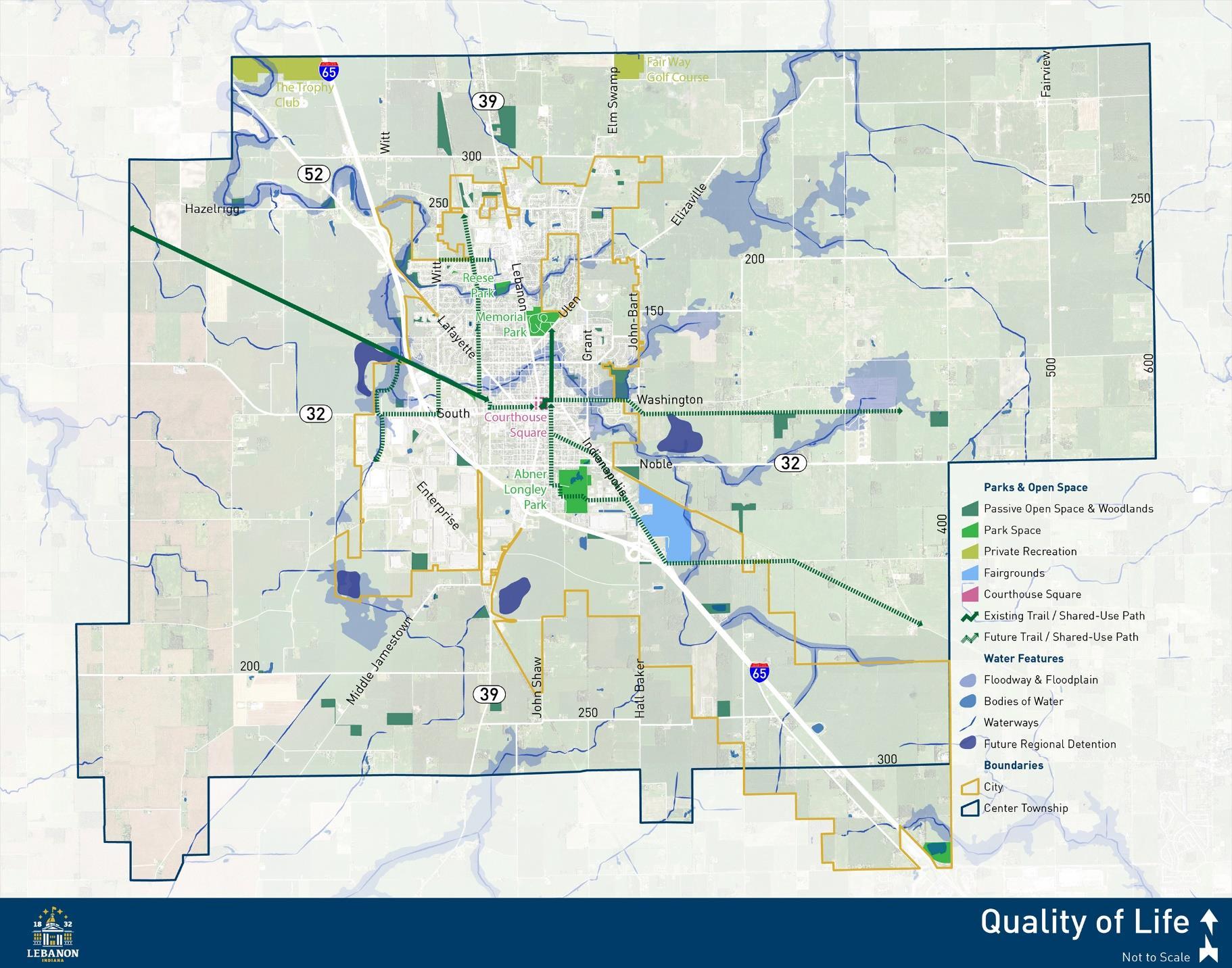
The Parks & Open Space classification is established to distinguish and protect recreational areas, public parks, and general open space. Uses may include passive open spaces, ball fields, play equipment, golf courses, conservation areas, and environmentally sensitive lands. Public parks and open space further increase the overall quality of life for residents. Recreation and park areas should be used as a respite from urban development and link to each other with bicycle and pedestrian facilities.
The City of Lebanon Comprehensive Plan
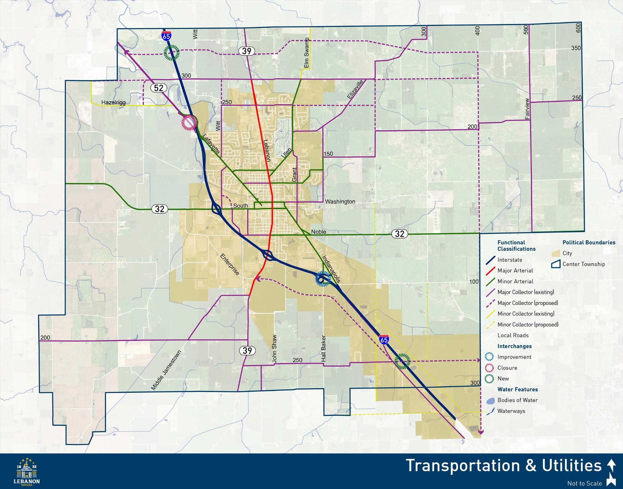
Provide a safe and efficient transportation system for all users, well maintained utility infrastructure, and superior municipal services in coordination with land use planning, to connect and serve neighborhoods, employment centers, and other community destinations.
1. Use investments in transportation and utility infrastructure as a mechanism to direct desired development types in appropriate locations.
Transportation and utility infrastructure are vital components of any new development. By strategically locating infrastructure investments and service extensions, a City can direct development to desired locations. Developers will be more likely to pursue opportunities at sites already served by municipal utilities and a robust transportation network, as opposed to paying for extensions to other sites.
2. Create and maintain a capital improvements plan to prioritize and budget for future infrastructure upgrades and extensions.
A capital improvements plan aids in plan implementation by allocating the necessary funding for short-range infrastructure and capital improvement projects on a three to fiveyear basis. The plan states the City Council’s prioritization of the financial resources available for capital project spending by identifying which projects should be included, when they should be constructed, and how they will be financed. As projects are completed each year, they are removed from the capital improvements plan and new priorities are added.
3. Utilize access management best practices along arterial and collector roadways to ensure safe and efficient traffic conditions.
Access management involves coordinating and balancing development access needs with the area-wide transportation goals along a corridor. The goal of access management is to ensure and improve safety, preserve function and mobility, and manage existing and future access in a regular and consistent manner. Successful access management strategies require careful planning and anticipation of future development needs and can contribute to established community character, advance economic development goals, and protect the City’s investment in local roads.
A significant factor contributing to poor roadway function, appearance, and safety is the number of curb cuts along the road. It is recommended that primary access to new development sites be from existing collector roads or consolidated access points along arterials. Where sites can only be accessed from an arterial, driveway spacing should be maximized so motorists have time to address one set of potential conflicts before worrying
The City of Lebanon Comprehensive Plan
about another. Driveways should also be properly set back from intersections so as not to impair intersection function.
4. Coordinate utility, transportation, stormwater, and other infrastructure improvements to combine construction projects and reduce costs where possible.
The City of Lebanon is the primary public facility and service provider for water, sewer, stormwater, electric, and transportation infrastructure within city limits. Other providers include the Indiana Department of Transportation, Vectren Energy, Boone REMC, AT&T, Metronet, Comcast, and others. When the City or another service provider is undertaking a capital improvements project, such as a road reconstruction or sewer line replacement that requires disturbance to the right-of-way, other potential improvements should be considered to create time efficiencies and cost savings.
5. Explore creation of a road impact fee and/or an established set of standards by which to determine transportation facility improvements to be funded with new development.
An impact fee is a one-time, monetary charge imposed on new development by a governmental unit to defray the capital costs of new construction or expansion of existing infrastructure needed to serve the new development. An impact fee would need to be established by the Council, through an ordinance, only after an impact fee advisory committee has been established. Impact fees can be collected for sewer and water infrastructure, parks, drainage, and roads.
6. Ensure right-of-way dedication with all new development and redevelopment in accordance with the Lebanon Thoroughfare Plan.
The Lebanon Thoroughfare Plan designates existing roadways based on function and identifies certain upgrades or widenings. It also designates the future extension of roadways and their general location. When new development occurs, the City should require that these roadways be built and dedicated to the City. If a developer only owns a portion of the land that is designated for the construction of the roadway, they should dedicate that portion of the right-of-way needed Ensuring that this land is dedicated during the development process prevents the City from later having to buy the needed right-ofway
7. Create an interconnected network of bicycle and pedestrian facilities in accordance with the City of Lebanon Bike & Pedestrian Plan.
Dedicated bicycle and pedestrian facilities help to provide safe travel for these additional modes of transportation, contribute to overall quality of life, and can act as an economic development tool. The Lebanon Bike & Pedestrian Plan was created in 2015 to illustrate gaps in the system, and identify future multi-use paths, bike lanes, and other multimodal transportation infrastructure. These improvements should be integrated into the capital
The City of Lebanon Comprehensive Plan
improvements plan and prioritized to occur alongside other infrastructure improvements associated with the roadway.
8. Continue development of the City’s trail system, including exploration of a trail along Prairie Creek.
In addition to implementation of the Lebanon Bike & Pedestrian Plan, the City should examine the feasibility of a trail along Prairie Creek. Currently, much of the creek is lined with homes and other development, and a creek adjacent trail is unlikely. However, the Flood Resilience Plan recommends removal of a number of structures currently in the floodway or floodplain. As structures may be purchased and removed, land along Prairie Creek could become available for a trail.
9. Explore alternative commercial routes around Lebanon to mitigate heavy traffic through the downtown.
Downtown Lebanon is bisected by State Roads 32 and 39, which bring a number of large vehicle trips through the area. The City continues to explore an alternative truck route for these roadways to avoid potential conflicts in what should be a pedestrian-friendly district. Work is currently being done to study how SR 39 could connect with I-65 north of the City, thereby allowing trucks to use I-65 to bypass the downtown area.
10. Update the Americans with Disabilities Act (ADA) Transition Plan and implement recommendations as resources are available.
The City has an Americans with Disabilities Act (ADA) Transition Plan to identify needed upgrades within City-owned buildings and public spaces. Making every improvement in a short time frame would be much too costly for the City. By having the plan, the City can prioritize improvements and show a good faith effort in meeting the requirements of the Americans with Disabilities Act. This plan should be updated to reflect improvements that have been made and re-prioritize those still needed. Additionally, the City should continue an annual budget allocation to address ADA deficiencies.
11. Identify gaps in the sidewalk network and create a plan to complete priority sections.
Sidewalks are a key component of creating an attractive, walkable community. They help to connect residents to recreational amenities and commercial areas. However, several streets in the City do not have any sidewalks or they are in disrepair and need complete replacement. The 2015 Lebanon Bike & Pedestrian Plan included a sidewalk repair plan. This map should be used as a starting point to prioritize the most critical gaps and fund their replacement.
12. Improve pedestrian connectivity across I-65
The City of Lebanon Comprehensive Plan
Interstates can be a significant barrier to pedestrian and bicycle travel. None of the bridges over I-65 around Lebanon currently include sidewalk or trail infrastructure. The City should continue coordination with INDOT to advocate for the inclusion of trail or sidewalk facilities as maintenance and improvements are made to these interchanges. This will help to ensure safe access to the business park and planned developments along S Lebanon Street (SR 39) and Hall Baker Road.
13. Explore opportunities to construct pedestrian facilities within the business park
The Lebanon Business Park, as it exists today, does not have any pedestrian amenities. While an industrial park may not seem like a location likely to generate much pedestrian traffic, not everyone has a personal automobile with which to commute. Some employees of the area carpool and may have to walk from one site to another. In order to ensure pedestrian safety given the volume of truck traffic in the park, sidewalks should be added to at least one side of every street.
14. Extend Enterprise Boulevard east to Hall Baker Road.
The existing eastern terminus of Enterprise Boulevard is at S Lebanon Street. However, as development occurs west of I-65 between S Lebanon Street and Hall Baker Road, Enterprise Boulevard should be extended to the east. This new extension should connect to Hall Baker Road slightly south of the existing I-65/Hall Baker Road/Indianapolis Avenue interchange. This extension is important to create an east-west connection and open additional lands to potential development along the interstate
15. Review signal visibility, advance warning, and timings at the SR 39 and SR 32 intersection.
The intersection of State Roads 32 and 39 has a high instance of accidents, with 65 crashes occurring in a 4-year period. The most prevalent collision type were rear end collisions. This intersection should be further studied to determine the cause of these accidents and how to improve the safety of both motorists and pedestrians
16. Pursue improvements to the Hall Baker Road interchange to allow for an alternative commercial route.
The Hall Baker Road/Indianapolis Avenue interchange is an atypical design and doesn’t provide the clear access preferred by many businesses. The City should continue to advocate with INDOT for redesign and construction of a new interchange to provide better access and promote development west of I-65.
17. Continue discussions with INDOT and planning for relocation of the I-65 and US 52 interchange (exit 141) to a new northern location as a full-service interchange.
The Interstate 65 and State Route 52 interchange has long been an area of concern both for the City and INDOT, especially given the southbound I-65, left-lane exit onto US 52.
The City of Lebanon Comprehensive Plan
An interchange feasibility study was conducted in 2018 to explore three potential alternatives for a new interchange. All three locations were determined to be viable; a decision on the final location will not be made until an engineering assessment, environmental documentation, cost analysis, and coordination with state and federal agencies is complete.
18. Work with INDOT to develop a relinquishment plan for the City to take control of SR 39/Lebanon St.
Lebanon wishes to exercise greater control of State Road 39/Lebanon Street to improve safety, pedestrian facilities, and beautification along the corridor. Ideally, SR 39 would merge with I-65 at a redesigned SR 52 interchange, north of the City. SR 39 would run concurrently with I-65 to exit 139 where it would then continue south along its existing alignment. INDOT could then relinquish the SR 39 right-of-way to the City, between I-65 to the south and the municipal limits to the north. While the City would then be responsible for maintenance, it gains the ability to construct improvements to the corridor that INDOT may have been unwilling or unlikely to make.
19. Pursue discussions with CSX to improve railroad overpass crossings, specifically at Camp Street and Lafayette Avenue.
Railroad overpasses along the CSX line have existed since the early 20th century. The overpasses were designed for the time and do not meet existing transportation standards. The City of Lebanon should strongly encourage CSX to improvethese structures to ensure the safety of residents and improve their overall visual appearance.
20. Adopt a complete streets ordinance to guide public infrastructure investment in a manner that creates a better sense of public space and equal access for multiple modes of transportation.
Complete streets are designed to allow the safe access and movement of all users regardless of age and ability. A complete streets policy ensures that adequate consideration is given to multiple transportation users and abilities when designing, constructing, and reconstructing roadways. A complete streets policy is not a design prescription that states all roadways must contain every transportation element possible or that existing roadways must immediately be retrofitted. Instead, the complete streets policy requires that consideration be given to each transportation mode; walking, bicycling, driving, and transit. Obviously not all roads will be part of transit routes and some conditions may exist that prevent the inclusion of bicycle facilities. The intent is to recognize transportation corridors as more than streets for cars and to provide appropriate pedestrian and bicycle facilities in as many locations as possible.
21. Examine opportunities for a new fire station on west side of I-65
The City of Lebanon Comprehensive Plan
As development continues to progress west of I-65, the need for emergency services will increase. The business park has grown substantially in the last decade. With the additional business activity and associated transportation impacts, a new fire station in needed to ensure adequate emergency response times. Creating a new fire station on the west side of Lebanon will lower emergency response times and increase safety for businesses, residents, and the business park.
22. Develop a plan to increase the water and wastewater systems treatment and conveyance capacity to accommodate new growth
As Lebanon continues to grow, development must proceed in conjunction with utilities. Historically, the City and other utility providers have been able to serve new and growing businesses with existing capacity or service extensions. This has assisted economic development efforts as a lack of necessary utilities can be a substantial obstacle to expansion or construction. Leapfrog development patterns and reactionary utility extensions can lead to inefficiencies and increased costs. When this happens, the high costs are passed on to all customers, not just those using the upgraded or extended service. While it is important to grow and maintain excellent utility systems, these extensions should be planned in conjunction with land use and economic development efforts to ensure efficiencies for all users
23. Explore opportunities for a new I-65 interchange in the southeast portion of the City, between existing exits 133 and 138
There is a desire among City and business leaders for a new interchange in the southeast portion of the City, between exits 133 and 138. This recommendation was included in the 2017 Thoroughfare Plan, with the potential interchange location identified near CR 250 S. The feasibility and likelihood of construction of this interchange will be dependent on the type and intensity of future development in the area. This should be considered a longterm goal communicated to INDOT as part of on-going coordination efforts.
The City of Lebanon Comprehensive Plan
Capitalize on the iconic Boone County Courthouse and existing historic assets to continue promotion of and investment in downtown Lebanon to better realize the vision of an active and diverse, walkable, mixed use district.
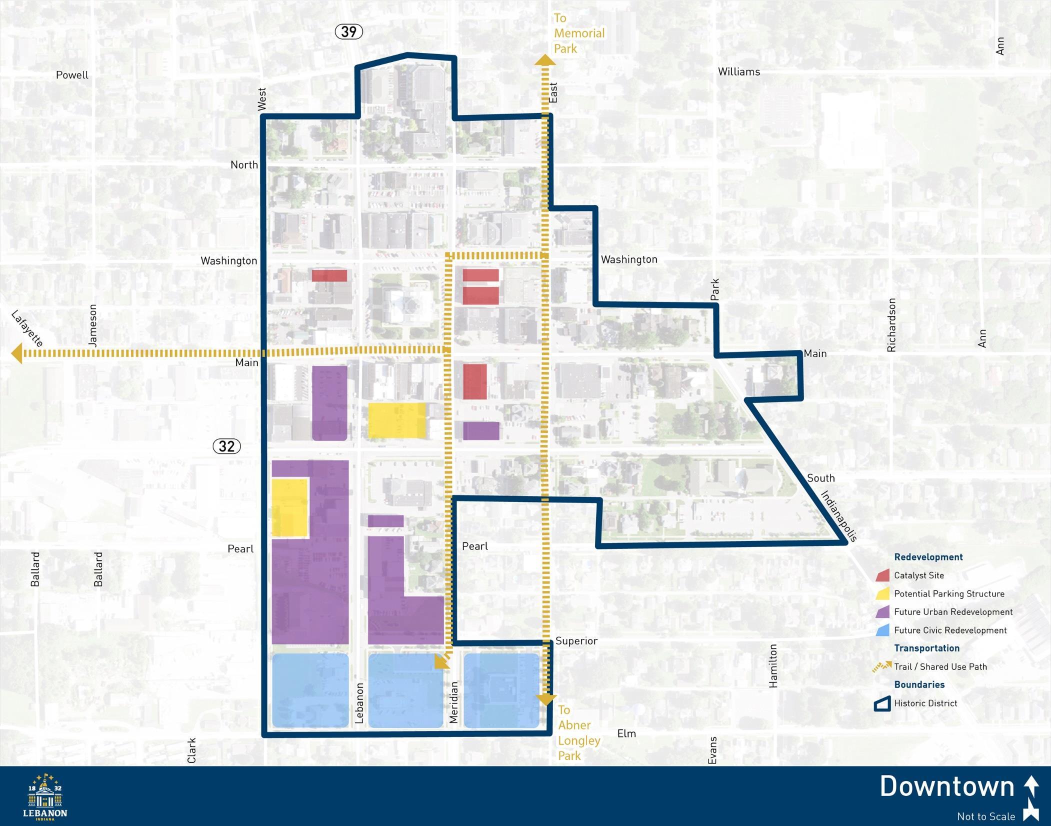
1. Explore incentives for “Catalyst Projects” as identified in the 2017 Downtown Action Plan.
Six catalyst projects were identified in the 2017 Downtown Action Plan. These buildings and sites were selected because of their potential to generate additional private investment, preserve historic assets, and improve the appearance of downtown streetscapes. Potential incentives for these projects could include some combination of reduced application or utility connection fees; flexible development standards for items such as lot size, setbacks, or parking requirements; City-led infrastructure upgrades; or tax abatement. Specific incentives should be discussed on a case-by-case basis between City departments, elected and appointed officials, and the property owner or developer.
2. Create a multi-use path to connect downtown to Abner Longley Park.
Streetscape improvements to N East Street have been successful in providing a pedestrian and bicycle connection between downtown and Memorial Park. A similar facility should be created to connect downtown and Abner Longley Park. Continuation of the N East Street streetscape to S East Street is likely the most beneficial route for this connection. Such a facility would improve safety and access for nearby residents and visitors to the downtown area.
3. Promote mixed use infill at key downtown sites, including the southwest corner of Main Street and Lebanon Street, along S. Lebanon Street, and along E. Superior Street just east of Lebanon Street.
Infill development refers to the construction of new buildings on vacant or underutilized land in previously developed areas of the City. The addition of quality mixed use development in the downtown can increase round-the-clock activity in the area and better utilize valuable space within the district. Infill development can reinvigorate a district by improving its appearance and perceived safety. It also utilizes land, infrastructure, and municipal services more efficiently and without the need for service extensions.
4. Encourage a wide array of downtown businesses and activities to create a healthy mixture of shopping, dining, office, housing, and civic uses, in a walkable, urban framework.
Creating a variety of uses within a district has many benefits. Often, developments comprised of a single use have limited times of activity and may not utilize available space to its full potential. By promoting and allowing a mixture of uses, both day and evening activity can be enhanced. Additionally, reduced parking requirements or shared parking
The City of Lebanon Comprehensive Plan
can help use space more efficiently, as residents or visitors to the area patronize multiple businesses within one trip.
5. Explore construction of a public parking structure to serve the downtown.
Downtown districts frequently struggle with concerns of parking availability. Whether these parking shortages are actual or perceived, many visitors want to be assured there will be available parking, convenient to their destination. The creation of a public parking garage was recommended in the 2017 Downtown Action Plan to serve growing businesses and additional development in the area. The parking structure should be within a block or two of the courthouse square to be convenient for those businesses. South of the square is likely most beneficial so that it may also serve proposed redevelopment along S Lebanon Street.
6. Explore civic focused redevelopment opportunities in the two blocks west of City Hall, as recommended in the 2017 Downtown Action Plan.
The civic redevelopment area envisioned in the 2017 Downtown Action Plan would be comprised of three square blocks between Superior Street to the north, East Street to the east, Elm Street to the south, and West Street to the west. City Hall anchors the east block, while the other two blocks currently reflect auto-oriented uses and open space. The plan recommends a new public facility to anchor the west block with a civic plaza and open space on the center block. This civic redevelopment area would then serve as a gateway into the downtown along the SR 39/Lebanon Street corridor and create a space to host additional events and programming activities.
7. Implement streetscape enhancements for Washington, Lebanon, Main, and Meridian streets as recommended in the 2017 Downtown Action Plan, when development occurs along these blocks or as resources are otherwise available.
The proposed streetscape improvements aim to enhance safety for all modes of transportation and elevate the aesthetics of these corridors. In order to better protect pedestrians, curb bump outs can be used to decrease crossing distances and offer greater visibility of pedestrians to motorists Improved streetscape features can also include additional space for landscape plantings, public art, lighting, and bicycle and pedestrian amenities such as benches, trash receptacles, and bike racks
8. Develop a public art program and identify appropriate locations for wall murals.
Art can liven up a district and highlight culture, promote economic development, and add to the quality of life and image of the community. Public art can take many forms, but in general is designed with the intent to be displayed and experienced in the public realm. With a public art program, the community can develop a planthat identifies sites, concepts,
The City of Lebanon Comprehensive Plan
and potential approaches for integrating public art into downtown. These installations may be publicly funded, paid for with grants, or initiated by the property owner.
9. Encourage upper floor housing in downtown mixed use buildings through incentives such as reduced permitting and infrastructure connection fees.
Increasing the number of people living downtown in lofts and apartments is vital to the continued success of the district. This not only fills the underutilized upper-story floors of many buildings, it also creates around-the-clock customers for downtown restaurants, shops and services. It is important to remove potential roadblocks to residential development in the downtown, in addition to creating incentives to speed up revitalization efforts, entice new developers, and create permanent downtown residents. Potential development incentives could include reduced permitting or utility connection fees, a revolving loan fund to assist property owners in building out upper-story apartments, or using TIF funds for parking or stormwater improvements that benefit the district.
10. Enhance gateway and corridor connections between the downtown core and adjacent neighborhoods.
Downtown Lebanon and the areas surrounding it currently have a sense of physical and visual disconnect. To help bridge this gap, the City should create downtown gateways and prioritize bicycle and pedestrian connections to and from the adjacent neighborhoods. Additional streetscape design, including street trees and wayfinding signage will help tie the areas together. New development on surface parking lots will help activate the streetscape and fill voids in the urban framework.
11. Promote and support downtown events programming as offered by organizations such as ‘The Heart of Lebanon’.
Creating attractive open spaces is important, but there also needs to be a reason to visit them. To help Lebanon’s downtown gain greater popularity and recognition beyond the City, it is important to create a number of events and programming activities happening there. This helps to attract new visitors and user groups who might otherwise not visit These events or programs can include holiday celebrations, music or artistic performances, food trucks, or fitness events. The goal is to keep the downtown active throughout the year.
The City of Lebanon Comprehensive Plan
Utilize parks and recreation facilities and programming, historic, cultural, and artistic resources, and unique community character to improve the quality of life for all in Lebanon.
1. Continue to improve existing park and recreation properties as identified in the Comprehensive Five-Year Park System Master Plan 2017-2021.
The Comprehensive Five-Year Park System Master Plan is a guide for park maintenance and growth of existing park facilities and programs. A list of recommended improvements is included for each park as well as the existing trail system. Programming, administrative, and promotions/marketing recommendations are also included. The City should continue to prioritize and fund park maintenance and improvements to promote the quality of life of Lebanon citizens and protect the health, vitality, and growth of the community.
2. Maintain a five-year park system master plan and develop new park and recreation facilities to sustain park levels of service as the community grows.
The Lebanon Parks & Recreation Department adopted a new Comprehensive Five-Year Park System Master Plan in 2017. This plan keeps the City eligible for Land and Water Conservation Fund (LWCF) grants through the Indiana Department of Natural Resources. It is important for the City to maintain this eligibility, and as such, the five-year park system master plan. The plan is used to assess existing park facilities and levels of service. As the population of Lebanon grows, so to should the acreage, amenities, and programs of the parks system.
3. Use the results of the recent community branding initiative to develop and implement a wayfinding program for community destinations.
Wayfinding signs are used to direct residents and visitors to local attractions and points of interest. They are essential in creating an atmosphere of comfort and confidence as visitors navigate the community. The City can use the brand foundation completed in October 2017 as the basis for a wayfinding program that supports community identity, directs people to key destinations, promotes bicycle and pedestrian facilities, and includes interpretive elements related to City history and culture. Once the initial sign package is developed, it can be easily expanded to broaden reach or incorporate new destinations.
4. Continue to expand park and public space programming with events celebrating the historic, cultural, and community identity of Lebanon.
Even the best designed parks and public spaces cannot reach their full potential without proper activation and programming. Programming refers to formally organized and delivered activities that may include concerts, festivals, physical activities, farmers
The City of Lebanon Comprehensive Plan
markets, games, and other activities that appeal to a mix of interests, ages, and abilities. The City already offers a number of events and celebrations throughout the year. Ongoing improvements to the courthouse square will create new opportunities for programming that highlights unique aspects of the community.
5. Explore creating a park impact fee to help fund new park and recreation facilities.
Indiana Code 36-7-4-1300 series establishes a process by which cities can assess and collect impact fees for certain infrastructure, including park and recreational facilities. Before the City Council can adopt a park impact fee ordinance, the City must first create an impact fee advisory committee and a zone improvement plan. State code includes specifics for the ordinance, committee, and improvement plan. It is recommended that Lebanon take the first step in this process by creating the impact fee advisory committee. This committee will then determine if a park impact fee is appropriate. If so, the committee would oversee and advise the creation of the improvement plan and ordinance. It is important to note that park impact fees can only be used for new facilities, not the maintenance of existing facilities.
6. Continue working with developers in the design and construction of trails within new development in accordance with the City of Lebanon Bicycle & Pedestrian Plan.
The City of Lebanon Bicycle & Pedestrian Plan identifies an overall system master plan and project list to improve multimodal connectivity in the City. Some projects will be led by the City and undertaken as resources become available. Other projects should happen in conjunction with adjacent development. When private development occurs where a bicycle or pedestrian facility has been identified in the plan, that facility should be installed by the developer at the time of development construction.
7. Advertise and manage a strategic code enforcement system that concentrates targeted efforts on specific problems such as small multi-family buildings, junk cars, or certain geographic areas to improve the appearance and safety of Lebanon.
An effective means of stabilizing property values and creating quality neighborhoods is by ensuring the good maintenance of buildings and lots. When properties are not maintained, the City may have to get involved through zoning, building, and health code enforcement. To help create a more successful and efficient process, the City should periodically focus efforts on widespread or recurring issues, first with an information campaign, then notices to owners of property that are violating codes, and finally formal violation tickets, if necessary. The goal of code enforcement should be removal or correction of issues, punitive fines or fees to the City should be viewed as a last resort.
8. Beautify gateway corridors using signage, enhanced landscape treatments, public art, lighting, and street trees.
The City of Lebanon Comprehensive Plan
Lebanon’s gateways and entry corridors vary in character from local and regional commercial destinations to major institutional anchors and industrial development of differing intensities. In order to better define the sense of entry and experience of coming into Lebanon, future streetscape and right-of-way improvements to the SR 32/South Street, SR 39/Lebanon Street, and Indianapolis Avenue should include additional investments in signage and aesthetic enhancements. Additional gateway corridors may be created with future interchange modifications or as development occurs in the southeast portion of the City. Gateway treatments for established entrances could then be replicated at these new locations.
9. Explore creation of a Lebanon Community Center to house both adult and youth fitness facilities, meeting and event spaces, before/after school care, and education and recreation programming.
Numerous residents identified the need for a community center during the planning process. A community center can serve as the figurative heart of the City and offer classroom and event spaces, an early childhood learning center, fitness facilities for all ages, a health and wellness clinic, a café, and other amenities and services. Use of some programs or amenities may require membership while other spaces and activities are open to the public. The City should conduct a feasibility study to explore the creation of a Lebanon Community Center. This study could more closely examine programming and space needs, costs, and potential funding or revenue streams to help make the facility a reality. Such a facility would not replace the Witham Family YMCA or the Boys & Girls Club of Boone County, but may be able to fill service gaps or expand program offerings, either independently or in conjunction with one or both of those existing organizations.
10. Continue to promote the value of historic preservation in conjunction with consideration of an expanded historic district or new district(s) to better protect historic resources.
The Lebanon Downtown Historic District and Historic Preservation Commission were created in 2012. The historic district designation seeks to preserve and protect historic resources, ensure appropriate restoration activities, and require compatible new development where applicable. The Lebanon Redevelopment Commission offers a cost sharing grant program to commercial properties within the historic district for building repairs and renovations that support preservation. In order to better promote historic preservation, the City and Historic Preservation Commission should consider expanding the existing district or creating a new historic district. It would also be beneficial to expand the existing grant program to include residential structures.
11. Utilize development regulations and incentives to establish a higher quality of design and construction for key sites and corridors.
The City of Lebanon Comprehensive Plan
The City currently uses zoning overlay districts to require higher quality site and architectural design for properties along thoroughfares, the interstate, and within the downtown. As part of an update to the Unified Development Ordinance (UDO), these overlay district boundaries and regulations should be reviewed to ensure they are resulting in the desired development character. In addition to existing requirements, it may be beneficial to incorporate incentives into these or other development regulations to promote desired aesthetic goals. Incentives could come in the form of density bonuses, parking reductions, landscape flexibility, or City-led infrastructure or amenity improvements.
12. Actively campaign to improve the distribution of positive information about the community in order to spread good news and improve attitudes and perceptions about Lebanon.
Certain negative perceptions about the City and the negative attitudes of some residents were repeated throughout the planning process. In order to better emphasize the good things happening within Lebanon and call for more people to help improve the community, the City should initiate a positivity campaign. The initiative could be an expansion of the existing Lovin’ Lebanon campaign. It would be organized to highlight positive aspects of the City and call attention to good news, whether a major community event, jobs announcement, or something as simple as a neighborhood clean-up or “front yard of the month” recognition.
The City of Lebanon Comprehensive Plan
Grow and attract a diverse mixture of businesses and develop a highly skilled, welleducated, and creative workforce to foster employment opportunities for residents and improve the economic vitality of the City.
1. Ensure opportunities for diverse commercial and industrial business development exist by advertising available sites and long-range planning efforts.
One of the first steps in attracting new businesses to the community is ensuring developable parcels exist to house them. The future land use plan identifies potential locations for future industrial, commercial, and mixed use development and redevelopment. The City should share the future land use plan and additional long-range planning efforts with property owners and site developers to ensure they are aware of planned city investments and development priorities.
2. Create a business incubator/innovation center to develop entrepreneurial talent, enhance opportunities for collaboration, and offer flexible office space options to help grow successful businesses in the community.
Sustaining long-term economic growth in the community comes from fostering the development of ideas and creation of new businesses from existing City assets. A business incubator/innovation center may include both a coworking space and small, flexible office spaces for start-up businesses. Coworking spaces can host a variety of entrepreneurs and small businesses and typically include an open work space with a variety of work stations as well as breakout or conference rooms. Coworking spaces can host special events, networking opportunities, and casual meet ups. In addition to the coworking space, it can be beneficial to offer individual, small office spaces with short term leases. As companies succeed and grow out of the coworking space they may want a more private office space. However, these companies are still considered start-ups and can’t provide the assurance for long-term office leases. They may quickly outgrow an office space or they may shift focus or have to contract back into a coworking space.
3. Promote and expand the microloan program in conjunction with Boone County EDC.
The current Boone County EDC microloan program provides small-scale, low interest loans in amounts ranging from $1,000 - $15,000. These loans are used to support startups and small businesses in conjunction with other investments. They are generally used for specific equipment or facility improvements; they can’t be used for payroll or general operating expenses. The City of Lebanon should work with the Boone County EDC to expand funding for and use of themicroloan program in alignment with theCity’s economic development goals. This program should be marketed towards entrepreneurs as they grow out of the innovation center or other coworking and start-up spaces.
The City of Lebanon Comprehensive Plan
4. Promote redevelopment of existing vacant and underutilized non-residential properties within City limits before annexing additional lands for these purposes.
There can be several challenges when developing on vacant and underutilized sites, including limited parcel size and subsequent ability to expand, outdated infrastructure, illsuited development regulations, and potential environmental contamination (brownfields). However, seeing these properties redeveloped can lead to benefits such as aesthetic improvements to the area, increased tax revenues without having to expand municipal services, and preservation of open space. To help catalyze redevelopment of these properties, the City may choose to offer incentives. These could be in the form of reduced permitting or utility connection fees; flexibility in development regulations such as lot size, setback, or parking requirements; or City-led infrastructure or amenity improvements.
5. Encourage mixed commercial and office-flex development in the area west of I-65 and east of SR 39.
This area includes the former Holiday Inn site on the east side of S Lebanon St/SR 39 and continues to the south and east. As opposed to the large footprint industrial tenants of the Lebanon Business Park, this area is envisioned to be a mixture of office, destination commercial, and office-flex development. The area benefits from interstate access and visibility and would be organized around the extension of Enterprise Boulevard. Destination commercial uses may include entertainment, amusement, sports and recreation attractions as well as destination retail uses that serve a large region. Generally, customers will plan a special trip to such uses and the overall concept is the experience as opposed to shopping for a particular good. Office-flex uses are employment generators that may include traditional office space combined with research and development, retail product sales and display, light industry, and small-scale warehousing. For the most part, destination commercial uses should be located along the interstate while the office-flex uses should be south of the extended Enterprise Boulevard. Supporting commercial uses such as restaurants, hospitality, and professional services should also be promoted.
6. Consider development of a formalized incentive program for business retention and attraction based on opportunities for local employment at competitive wages.
Incentives such as real estate and personal property tax abatements, infrastructure improvements, and Tax Increment Financing (TIF) district allocations are important tools in economic development efforts to grow and attract jobs and wealthforthe local economy. There are several best practices to use to help protect public investments in the private sector while also ensuring the City remains competitive from an economic development perspective. Lebanon already utilizes many of these practices, but it can be helpful for public transparency and potential businesses to have a more formal incentive program.
The City of Lebanon Comprehensive Plan
Goals of the program should include aligning incentives with well-defined economic development goals, conducting cost-benefit analyses of potential incentive candidates, and establishing performance standards for employment growth, wages, or workforce training. Incentive programs should be evaluated regularly to ensure they are truly generating the economic returns intended.
7. Continue to develop partnerships between the City, Lebanon Community Schools, WorkOne Lebanon, Boone County EDC, and other organizations involved in workforce development training
Expansion of local businesses and the attraction of new ones is hindered without the availability of an adequate workforce. Workforce development may include skill development for displaced workers, on-the-job training for existing employees, curriculum changes at local schools, and other assistance to match skilled workers with open positions and provide employers access to qualifies candidates. The City will not be the provider of actual services when it comes to workforce training; typically this is done through existing training providers and education institutions. However, the City can play a role in facilitating and coordinating initiatives between providers, institutions, and local employers.
8. Review planning and zoning procedures and conduct follow up surveys with recent applicants to ensure ease of understanding and timeliness in the review process.
As a precursor to or part of an update to the Unified Development Ordinance (UDO), the City should seek out recent businesses or developers that have gone through planning and zoning development review to understand their impressions of the process. The goal of such a survey or interview would be to ensure the City remains business friendly while also protecting the public interest and ensuring the community’s goals for new development are being met. Uncertainty in the review and permitting process, whether for a rezoning, variance, or site development plan review, is often one of the most significant challenges for a business or developer. It is imperative that the City’s UDO be as clear, concise, and user-friendly as possible and that development regulations are applied in a uniform manner.
9. Conduct a formal business visitation program with City leaders and Boone County EDC representatives to ensure communications and improve relationships with current businesses
A business visitation program works to focus local economic development efforts on supporting and improving relationships with existing businesses. A successful program will demonstrate that theCity appreciates local business contributions to economic growth, help to address issues local businesses may be facing, and better pair education and technical assistance programs to business needs. The visits should include an economic
The City of Lebanon Comprehensive Plan
development official specifically focused on existing business development. City leadership may include elected, appointed, or staff positions.
10. Develop a working group with both City and private utility providers, INDOT, Boone County Highway Dept. and others to coordinate planning and infrastructure investment to further business attraction.
Regional coordination and the sharing of information across organizations and political boundaries is essential to successful economic development. Employees, capital, and goods and services are all increasingly mobile, and regional partners must work together to support and promote common economic objectives for the benefit of each partner. The City alone cannot provide all the infrastructure and services necessary to support emerging enterprises. The City, other local utility providers, and agencies with jurisdiction over area rights-of-way and easements should share plans for future improvements and investments so that all partner organizations can consider potential upgrades or installations, ultimately creating cost and time savings.
11. Identify potential sites and encourage property owners to pursue Indiana Site Certified program certification through the Indiana Office of Community and Rural Affairs (OCRA) to better market properties for development
The Indiana Site Certified program is an initiative of the Office of Community and Rural Affairs (OCRA) designed to certify sites that are ready for economic development. The program has three main goals: mitigate risks, as a marketing tool, and illustrate a community’s commitment to economic development. Sites are certified as either silver, gold, or prime depending on certain parameters and site characteristics. The City should assist property owners in pursuing site certification in alignment with future land use and economic development goals to better advertise development potential within the community.
12. Promote the City’s regional stormwater detention initiatives as a development incentive tool that can reduce land development costs and provide an attractive recreational amenity.
Lebanon commissioned a study of a potential regional stormwater detention system that could be constructed across the City to better mitigate flooding and stormwater issues
Completed in 2016, the plan identified four primary locations for detention basins, or lakes
To date, only the detention facility immediately southwest of and serving the Lebanon Business Park has been created. The plan is for it to be expanded as additional development occurs in the area. This regional plan should be promoted to site selectors and developers as a way to decrease land area requirements, and subsequently costs, for new development. The detention lakes also have the potential to become recreational amenities for nearby development and the community at large.
The City of Lebanon Comprehensive Plan
13. Advertise City assets such as open space and recreational opportunities, events programming, the historic downtown, and housing affordability as a business and employee attraction tool.
A primary component of attracting an adequate workforce is creating a place where people want to live. Lebanon continues to make investments in placemaking initiatives including recent improvements to the downtown, continuation of the City’s trail system, and expanded parks andrecreation programming. Additionally, low cost of living makes homeownership within reach for many residents. These strengths need to be advertised as a critical piece to growing and attracting local employment.
14. Promote mixed use development to increase opportunities for retail, restaurant, and office development located closer to residential concentrations while also being distributed throughout the City.
Zoning regulations focused on single-use districts have been and will continue to be the primary means of land use regulation in both Lebanon and much of the country. Singleuse districts were established to protect public health and safety by separating potentially harmful industrial uses from residential and commercial areas. As environmental performance standards have increased, strict land use separations are less necessary. By allowing and promoting mixed use development, benefits such as reduced traffic congestion, improved public health, increased community interaction, land conservation, and more efficient use of infrastructure can be realized.
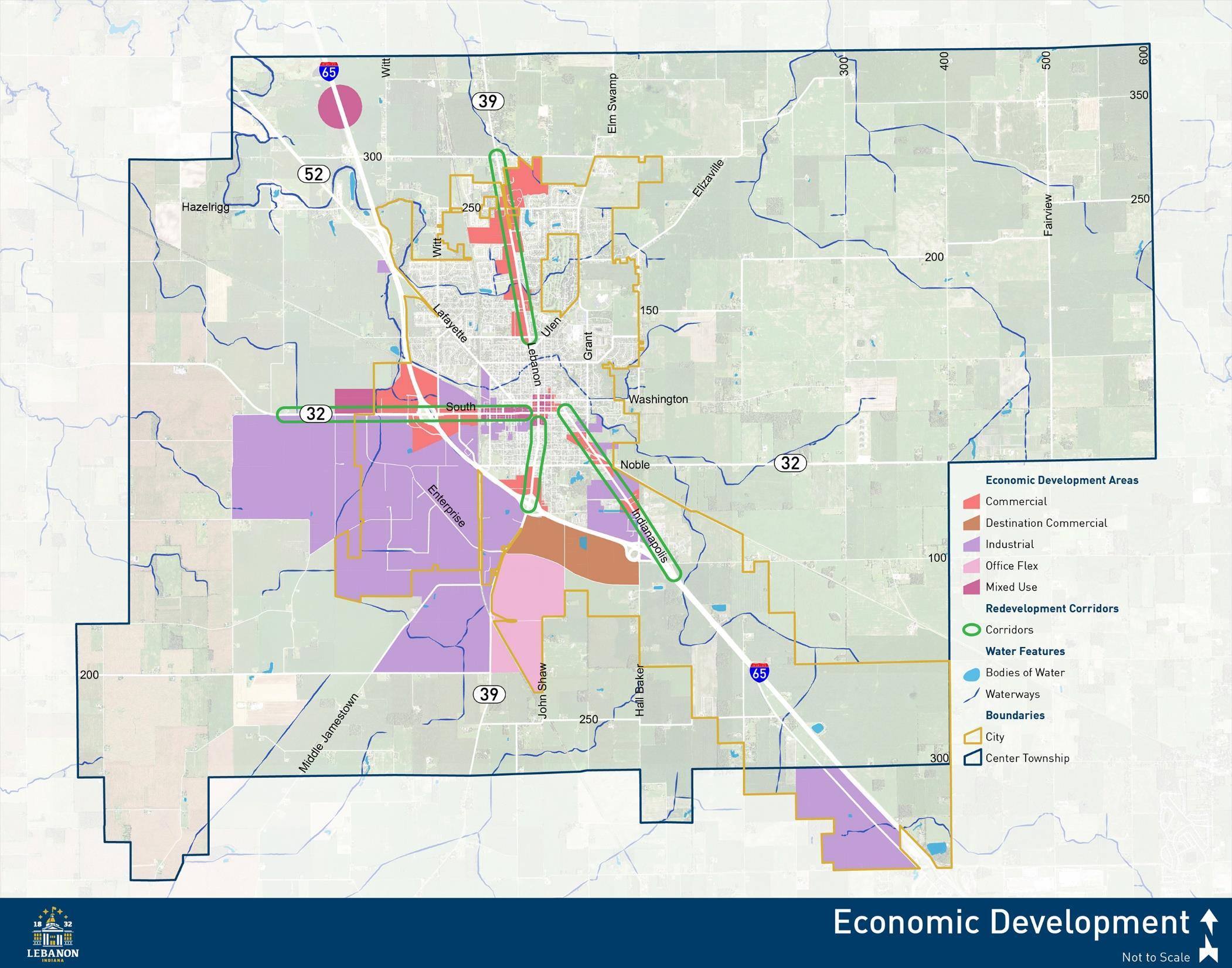
The City of Lebanon Comprehensive Plan
Promote infill, redevelopment, and repurposing of vacant and underutilized commercial and industrial sites throughout the City.
Applicable Frameworks:
• LAND USE & DEVELOPMENT CHARACTER
• DOWNTOWN
• ECONOMIC DEVELOPMENT
• QUALITY OF LIFE
Infill development refers to the construction of new buildings on vacant or underutilized land in previously developed areas of the City. It is in contrast to greenfield development, where new construction occurs on the periphery of the City on lands that had been used for agriculture or open space. For communities that are fully built out with no room to expand, infill is the only opportunity to create new businesses and uses. For communities like Lebanon that have room to grow, infill is still incredibly beneficial because it can utilize land, infrastructure, and municipal services more efficiently and without the need for service extensions. Additionally, it results in more active streets and neighborhoods by filling in spaces of inactivity.
There are challenges inherent to redevelopment and infill on vacant sites. Most of these sites are surrounded by existing development and as such, are inflexible in terms of size. The cost of development may also be higher because of the need for demolition, replacement of outdated infrastructure, or remediation of past environmental contamination. Furthermore, many development regulations are written to address greenfield development where there are fewer constraints. For these reasons, it is important that the City proactively encourage infill and redevelopment.
Incentives may be used to make infill more feasible or attractive to developers. Potential incentives include reduced application or utility connection fees; flexible development standards for items such as lot size, setbacks, or parking requirements; City-led infrastructure upgrades; or tax abatement. Ultimately, incentives should be discussed on a case-by-case basis between City departments, elected and appointed officials, and the property owner or developer.
Several specific opportunities for infill and redevelopment in Lebanon are:
• Former Holiday Inn site near the I-65 and SR 39 interchange.
• Northfield Plaza on N Lebanon St.
• Former Montgomery Ward building at Meridian and South streets.
• Former Parker Hannifin/Schumates site on W South St.
• Former Prairie Industries site on N Patterson St.
• Several vacant lots along Indianapolis Ave.
• Several vacant lots along W South St.
The City of Lebanon Comprehensive Plan
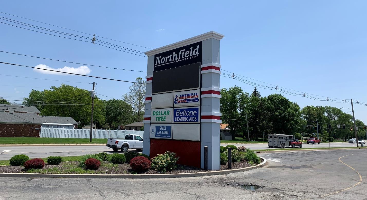
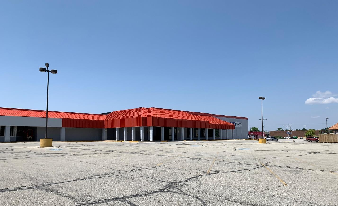
The City of Lebanon Comprehensive Plan
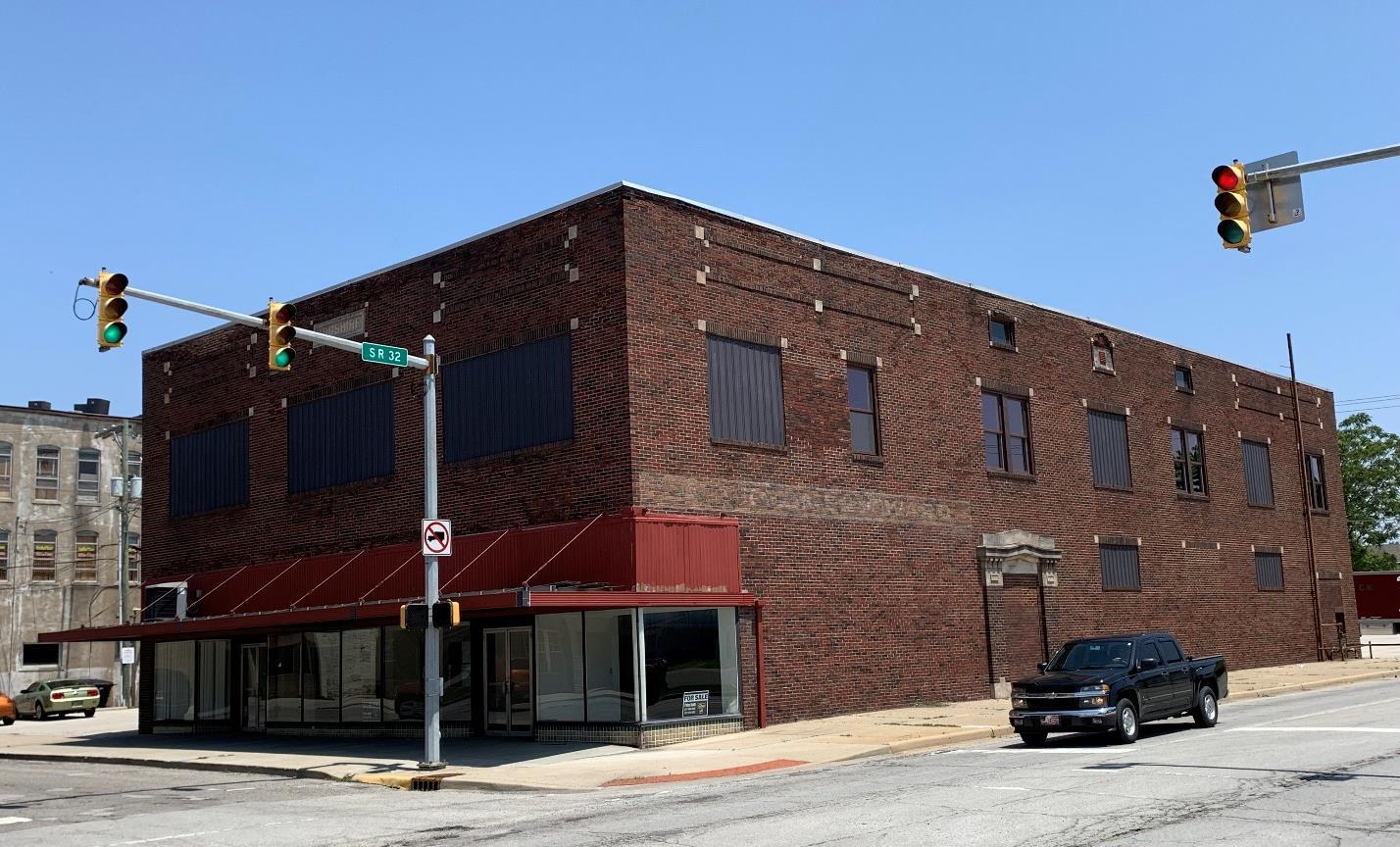
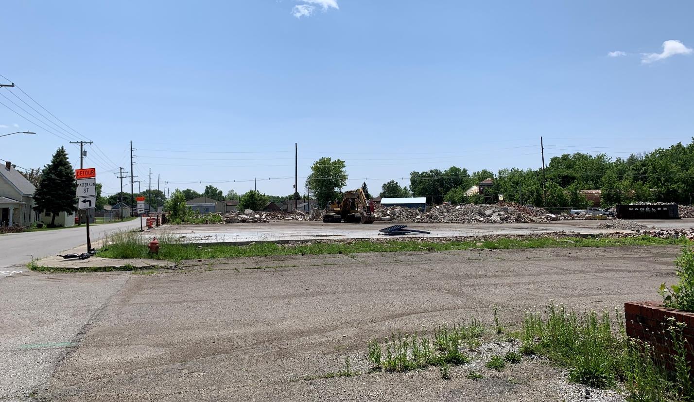
The City of Lebanon Comprehensive Plan
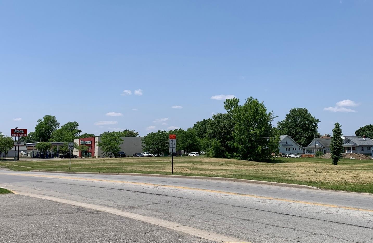
There are a number of reasons to promote and encourage infill and redevelopment of vacant and underutilized sites. This includes:
• Directing new construction to already developed areas, thereby preserving agriculture and open space lands around the edge of the City.
• Increased tax revenues for the City as vacant parcels are developed, thereby increasing assessed value and contributing to the tax base. This is especially beneficial in built-out areas of the City already served by municipal utilities and within existing police, fire, and other service areas. No new utility or service area extensions mean no new long-term maintenance obligations are created.
• Increased property values for surrounding properties.
• Removal of outdated or unkept buildings and overall aesthetic improvements to key corridors and streetscapes.
• Opportunities for new business and job creation without having to annex new lands and expand the City area.
1. Develop and maintain a list of potential infill and redevelopment sites.
2. Evaluate potential City incentives to better promote infill and redevelopment.
The City of Lebanon Comprehensive Plan
3. Review and amend the unified development ordinance as needed, to remove barriers to infill and redevelopment and better incorporate flexibility in standards where appropriate.
1. Work with owners of vacant parcels and buildings to prepare the sites for redevelopment. This may include building maintenance, demolition, environmental remediation, and marketing or broker services.
2. City investment in public infrastructure and municipal services to targeted infill sites or areas to proactively support private investment in these areas.
3. Consider City purchase of key sites that can act as a catalyst to broader corridor or neighborhood revitalization.
• Planning Department
• Plan Commission
• Redevelopment Commission
• City Council
• Mayor’s Office
• City Engineer
• Lebanon Utilities
• Property Owners
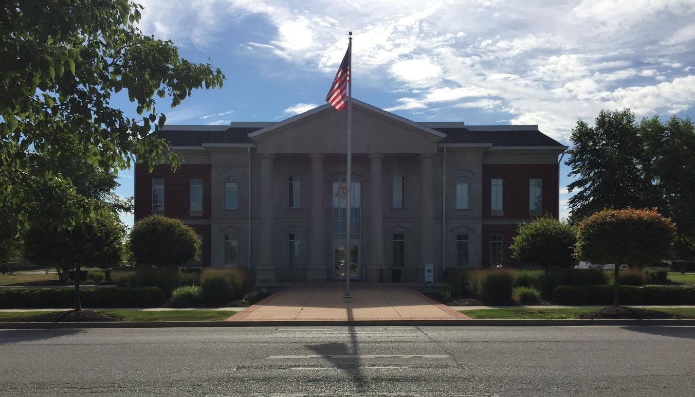
The City of Lebanon Comprehensive Plan
Support the creation of a vibrant, mixed use district along the west side of Interstate 65, between SR 39 and Hall Baker Road, which includes an extension of Enterprise Boulevard.
Applicable Frameworks:
• LAND USE & DEVELOPMENT CHARACTER
• TRANSPORTATION & UTILITIES
• ECONOMIC DEVELOPMENT
The interstate 65 corridor, and specifically the area between the SR 39 and Hall Baker Road interchanges, represents a prime opportunity to realize job creation and development goals of the City. This area includes the former Holiday Inn site on the east side of S Lebanon St/SR 39 and continues to the south and east, and was included in the larger City of Lebanon Interchange Land Use Plan. While that plan covers a greater area to the south and east, much of the desired vision remains applicable. This includes “quality growth along the I-65 and SR 39 corridors that expands the City of Lebanon and Boone County’s economic foundation and job base with a diverse mix of high-quality commercial, professional office, retail, light industrial, high-tech, flex office and industrial businesses, and residential uses that support the continued enhancement of Lebanon’s existing and desired quality of life while maximizing its unique location in central Indiana” (City of Lebanon Interchange Land Use Plan, 2014).
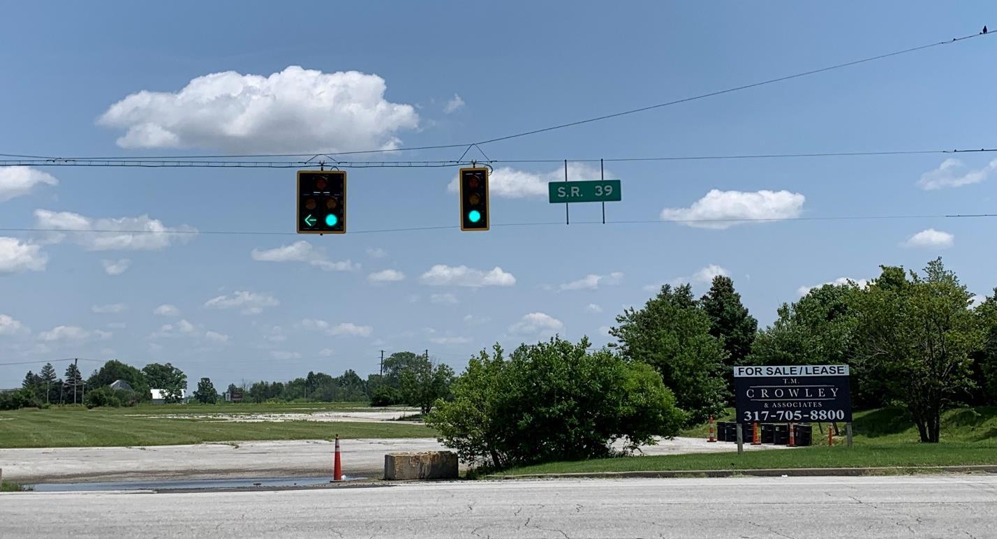
The City of Lebanon Comprehensive Plan
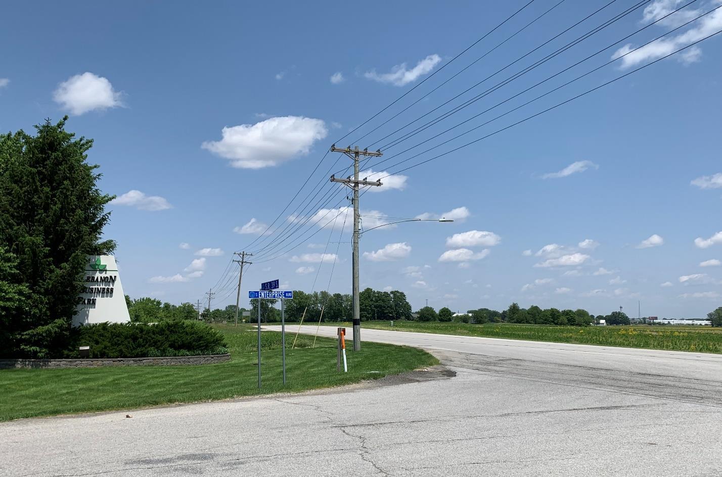
Enterprise Drive is proposed to extend east, past its current terminus at State Road 39.
As opposed to the large footprint industrial tenants of the Lebanon Business Park, this area is envisioned to be a mixture of office, destination commercial, and office-flex development. The area benefits from interstate access and visibility and would be organized around the extension of Enterprise Boulevard. Destination commercial uses may include entertainment and amusement attractions as well as destination retail uses that serve a large region. Generally, customers will plan a special trip to such uses and the overall concept is the experience as opposed to shopping for a particular good. Office-flex uses are employment generators that may include traditional office space combined with research and development, retail product sales and display, light industry, and small-scale warehousing. For the most part, destination commercial uses should be located along the interstate while the office-flex uses should be south of the extended Enterprise Boulevard. Supporting commercial uses such as restaurants, hospitality businesses, and professional services should also be promoted. In all cases, high quality architecture and site design, attractive landscaping, and open space amenities should be included with new development.
The City of Lebanon Comprehensive Plan
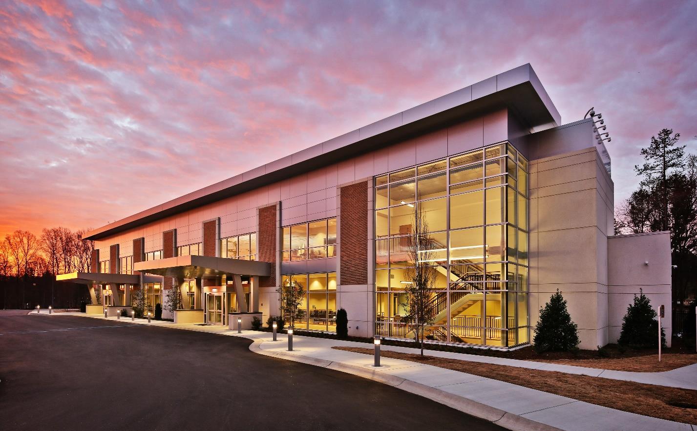
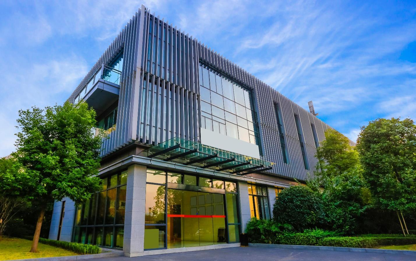
Another precedent example of a quality office or research and development building.
The City of Lebanon Comprehensive Plan
By promoting a mixed use district and planning for multiple land uses, the area is able to combine employment generators in close proximity to new housing products, retail destinations, and community recreation amenities. Benefits of such compact mixed use development include:
• Reduced infrastructure costs because of fewer miles of roads and pipes, which reduces fiscal impacts and subsequently tax burdens.
• Higher property values associated with pedestrian-friendly neighborhoods and roadways as opposed to purely auto-oriented ones.
• Decreased land consumption when promoting density.
• Environmental benefits from reduced emissions associated with fewer vehicle miles travelled when people can live near job centers.
• Improved public health given walking and bicycling opportunities.
• Increased community interaction through the provision of bicycle and pedestrian facilities and community gathering areas.
Currently, the western half of this area is within the Planned Business Commercial (PBC) zoning district. The eastern half is within the Single-family Residential (SF) district. Zoning changes will be needed to fully realize the mixed use vision of the area. This could occur through the creation of a new mixed use district(s) within the City’s Unified Development Ordinance, that could then be applied to these parcels through a zoning map amendment. Alternatively, the area could be rezoned to the Planned Unit Development (PUD) district. The PUD district is intended to allow for greater flexibility in the development of land, including mixed uses and mixed densities. When creating a PUD district, a concept plan and ordinance text are created for the specifically defined property.
Access to the mostly large agriculture parcels is provided by SR 39, John Shaw Road, and Hall Baker Road. East/west connectivity through the area is limited. As such, an extension of Enterprise Boulevard is recommended to improve connectivity and access as the larger agriculture parcels are subdivided for development. Improvements will be needed to existing roadways such as John Shaw Road and Tyre Road, and new collector and local roadways will also be constructed.
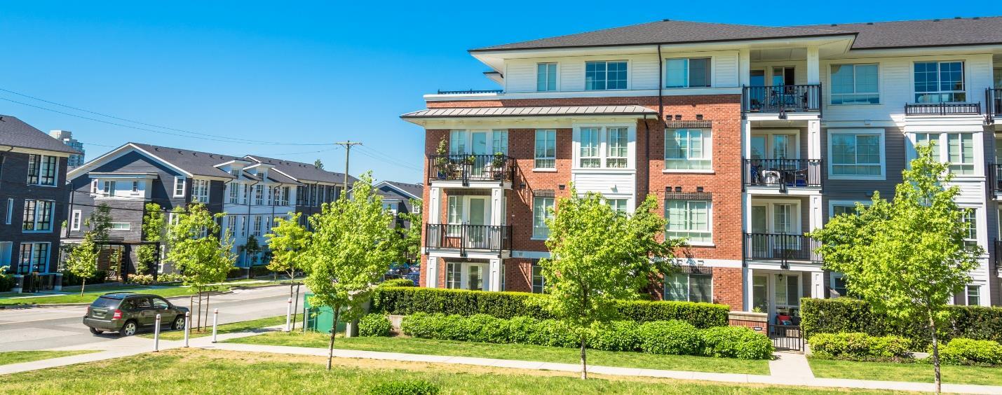
The City of Lebanon Comprehensive Plan
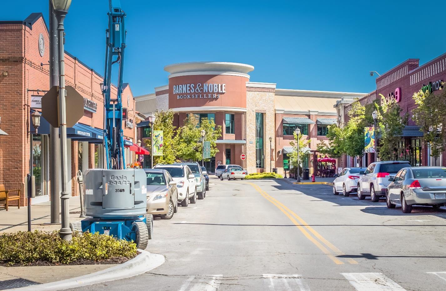
Destination commercial development is recommended for the area closest to I-65 and the SR 39 interchange.
Some, but not all, of this area is currently served by municipal services, including sewer and water. The Enterprise Boulevard right-of-way should include new utility extensions including a water main to serve the area. Sanitary service will require a new lift station and additional mains along major roadways. Stormwater management should be planned regionally in coordination with the City’s regional detention plan. A major detention pond is proposed to serve this area. It would be located east of SR 39 and north of Tyre Road, but an exact size and location has yet to be determined. By accommodating stormwater management at the district level, individual sites don’t have to dedicate significant space to detention, ultimately leading to a more compact urban form. Additionally, the regional stormwater detention pond can become a community recreation amenity.
The area is bisected by two natural gas pipelines, one running diagonally from the intersection of Enterprise Boulevard and SR 239 to the intersection of Tyre Road and John Shaw Road. The other is oriented east/west, south of Tyre Road, before turning north/south approximately 700 feet east side of John Shaw Road. While the pipelines and their respective easements present a constraint to development and must be planned around accordingly, they could be used for trail corridors.
Creation of a mixed use development area along Interstate 65 between SR 39 and Hall Baker Road will result in:
The City of Lebanon Comprehensive Plan
• Enhanced visibility and the quality character of Lebanon development along the interstate.
• Attraction of job-creating businesses of a type and scale different than those currently represented in the Lebanon Business Park.
• Development of commercial businesses that create a unique attraction and draw visitors to Lebanon.
• Diversified dwelling types organized around a compact and walkable development pattern.
• Open space and active recreation amenities.
• Increased tax revenue for the City.
1. Evaluate proactive creation of a mixed use zoning district(s) versus waiting for a planned unit development district proposal.
2. Amend the unified development ordinance as needed to support desired development goals.
3. Support zoning map changes that reflect the desired land use and character mix for the area.
4. Work with property owners in the area to educate them about desired character and uses for the district.
1. Plan for, fund, and construct the extension of Enterprise Boulevard and associated utility extensions within the right-of-way.
2. Plan for, fund, and construct additional sanitary sewer and water improvements to serve new development.
3. Implement the recommendations of the regional stormwater detention plan for the area.
• Planning Department
• Plan Commission
• Redevelopment Commission
• City Council
• Mayor’s Office
• City Engineer
• Lebanon Utilities
• Property Owners
• Development Community
• Boone EDC
The City of Lebanon Comprehensive Plan
Applicable Frameworks:
• LAND USE & DEVELOPMENT CHARACTER
• TRANSPORTATION & UTILITIES
• QUALITY OF LIFE
During this process, in focus groups, online surveys, public meetings, and with the steering committee, numerous comments regarding the City’s image, its identity, and especially the impression of the entrances into the City were a topic of discussion.
In the context of city planning, a gateway is a landmark, land use transition, or significant feature that is a point of visual interest when entering a community. Gateways into Lebanon play a significant role as part the regional transportation network, moving people into and around the City. They also contribute to community character and the first impression realized by travelers passing through the City on I-65, new visitors to the community travelling along state roads 32 or 39, or residents who come in and out of City daily. Gateways are typically a combination of elements that work together to create an experience as someone traverses the City Various components of a gateway could include public art, landscape plantings, signage, adjacent private development, and various other aesthetic treatments.
The City has several gateways including:
• I-65 and SR 52 (Lafayette Avenue)
• I-65 and SR 32 (South Street)
• I-65 and SR 39 (Lebanon Street)
• I-65 and Indianapolis Avenue
• SR 39 (Lebanon Street) and north City limits
• SR 32 and Spencer Avenue/Indianapolis Avenue
The City of Lebanon Comprehensive Plan
Existing gateway signage at the I-65 and S Lebanon Street (SR 39) interchange.
With the exception of I-65 and SR 39 (Lebanon Street), there are few distinguishing features at any of the major gateways, such as welcome signs, landscaped areas, or architectural details to communicate to passers-by that they are entering a special place. While the I-65 and SR 39 gateway has received mixed opinions from those in the community, there is no doubt that the signage is a distinguishing feature that identifies Lebanon from other communities along the interstate corridor.
Typically, gateways are characterized in two categories - major and minor. Major gateways would include I-65 and SR 52 (Lafayette Avenue), I-65 and SR 32 (South Street), I-65 and SR 39 (Lebanon Street), and I-65 and Indianapolis Avenue. Major gateways elements should include features such as bicycle and pedestrian facilities, landscape treatments, lighting, art, signage, restricting certain land uses, and design regulations for development in the area. These gateways tend to be the most used entrances into the community and in Lebanon’s case, are all associated with I-65. Therefore, to make an impact, the elements of the gateway must be scalable to be seen at high rates of speed.
The City of Lebanon Comprehensive Plan
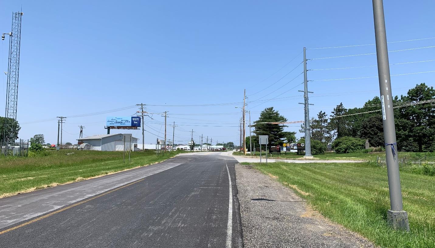
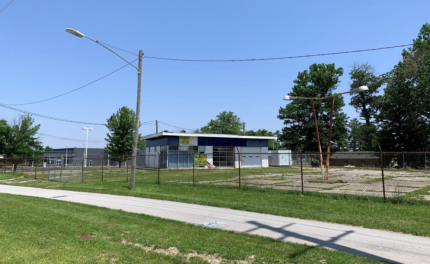
The City of Lebanon Comprehensive Plan
The I-65 and SR 32 gateway area can be characterized as a fairly typical interstate interchange, developed with fast food restaurants and hotels. However, restrictions could be placed on land uses through an overlay district. Prohibiting uses at the gateways, or limiting a use, such as only allowing one gas station at each gateway, requiring more on-site landscape, buffering trash areas, and orienting loading docks away from the road, are all zoning regulations that can set the character for the gateway. Access management practices along the roadway may also help the function and appearance of the area, especially as redevelopment and infill occur east along South Street and new development happens to the west. Since INDOT controls SR 32, access management and improvements within the right-of-way will have to be an on-going discussion between City leaders and the Crawfordsville district of INDOT.
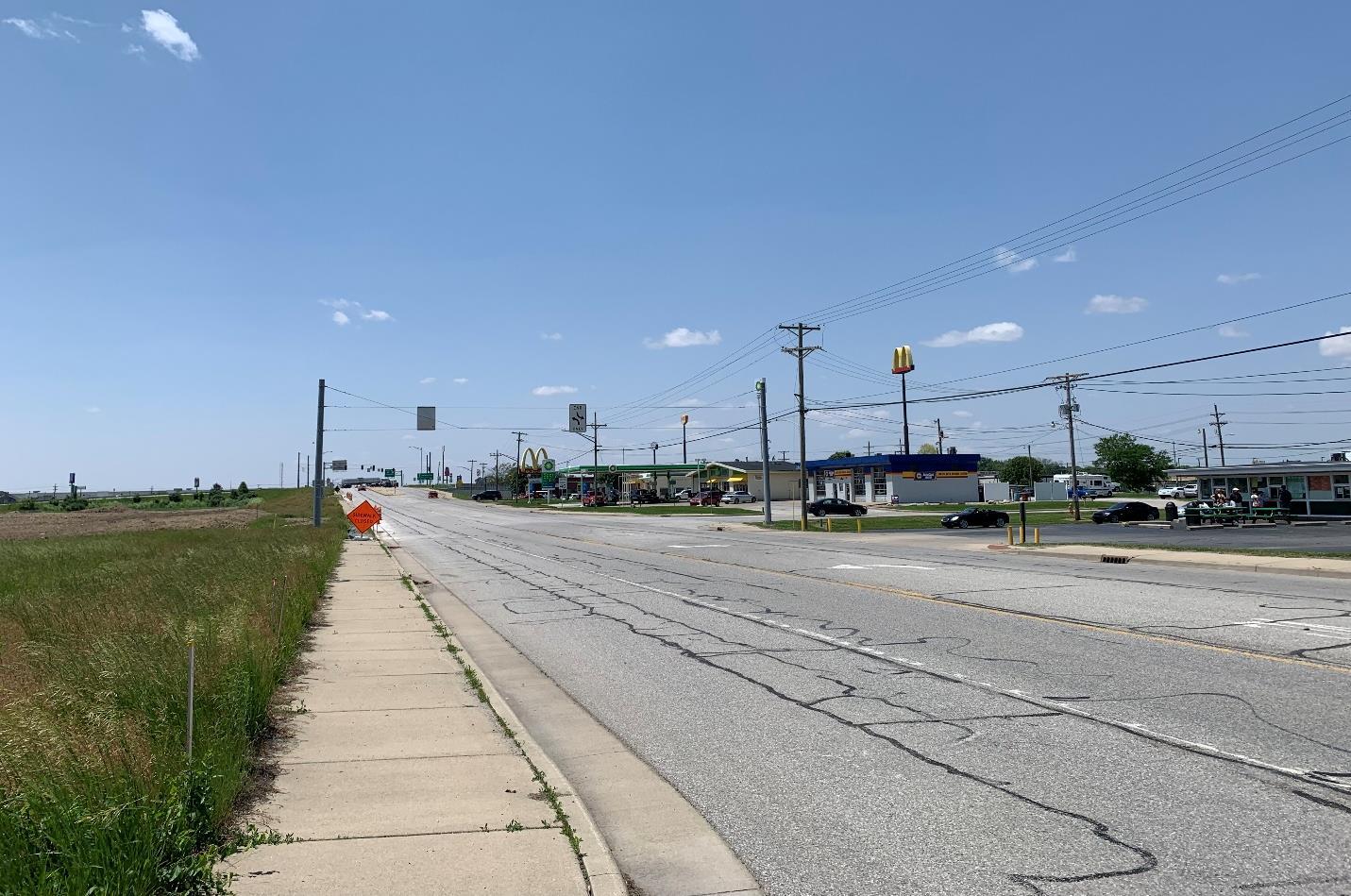
view of W South Street (SR 32), looking west towards the I-65 interchange.
The I-65 and SR 52 (Lafayette Avenue) gateway area has a different interchange configuration than a traditional diamond-shaped interchange. The land uses adjacent to the highway include single-family homes and apartments to the east and auto-related and salvage businesses to the west. Travelers can see this directly from I-65 heading southbound. An interchange feasibility study was conducted for this area as a precursor to potential re-design or re-location of the interchange by INDOT. Discussions are still very early and the project does not have any funding allocated, but should INDOT proceed with substantial work at the interchange, the City should advocate for and consider funding additional gateway improvements.
The I-65 and Indianapolis Avenue interchange and gateway area includes a mixture of industrial, commercial, and institutional uses. Because of its atypical configuration it does not experience traffic volumes as high as the SR 32 and SR 39 interchanges. However, it is the first Lebanon
The City of Lebanon Comprehensive Plan
interchange heading north from Indianapolis, and as such is a major gateway. A “Lebanon Indiana” monument sign is present on the east side of the road, just north of CR 100 S, in front of the Boone County Fairgrounds. Unfortunately, this signage is out of scale with the surrounding area and isn’t readily noticeable. The City has made significant investments in the Indianapolis Avenue corridor including a multi-use path, new paving, curb and gutter, and roundabouts at Hendricks Drive and CR S 100 E. A second phase of streetscape improvements is planned to continue this right-of-way configuration to the north. The City should now focus efforts on improving the appearance of adjacent development. This should include standards for landscape, lighting, signage, and architectural character.
Minor gateways are secondary entrances into a community that do not carry a significant amount of traffic but still serve as an entrance. Minor gateways incorporate some of the elements of a major gateway, but are typically smaller in scale to reflect surrounding context. For Lebanon, those gateways are at SR 39 and CR W 300 N (north City limits) and SR 32 and Spencer Avenue/Indianapolis Avenue.
No matter the type of gateway, the City should develop a set of standards for gateway areas that reflects the City’s brand identity. An update to the 2010 Lebanon Gateway and Corridor Master Plan is needed to truly set the vision and design standards for each gateway that can then be communicated to the Indiana Department of Transportation (INDOT), developers, and property owners. The plan update would:
• Provide a clear vision for the future design of key corridors.
• Identify the design elements that should be incorporated into each gateway, including pavement types, landscape, lighting, signage, and art.
• Recommend design standards for adjacent development.
• Identify the zoning changes that are needed to implement the vision.
The City of Lebanon Comprehensive Plan
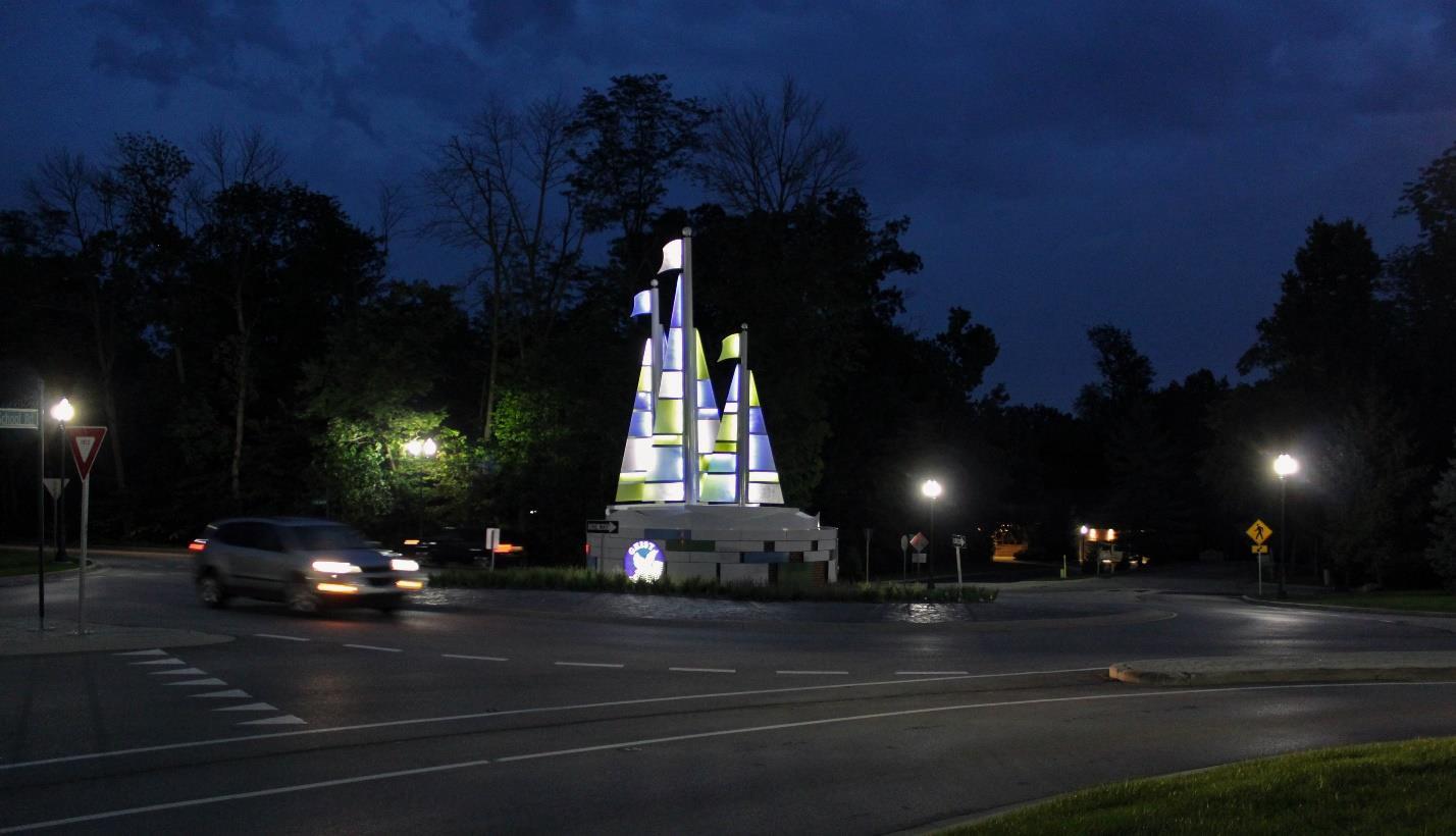
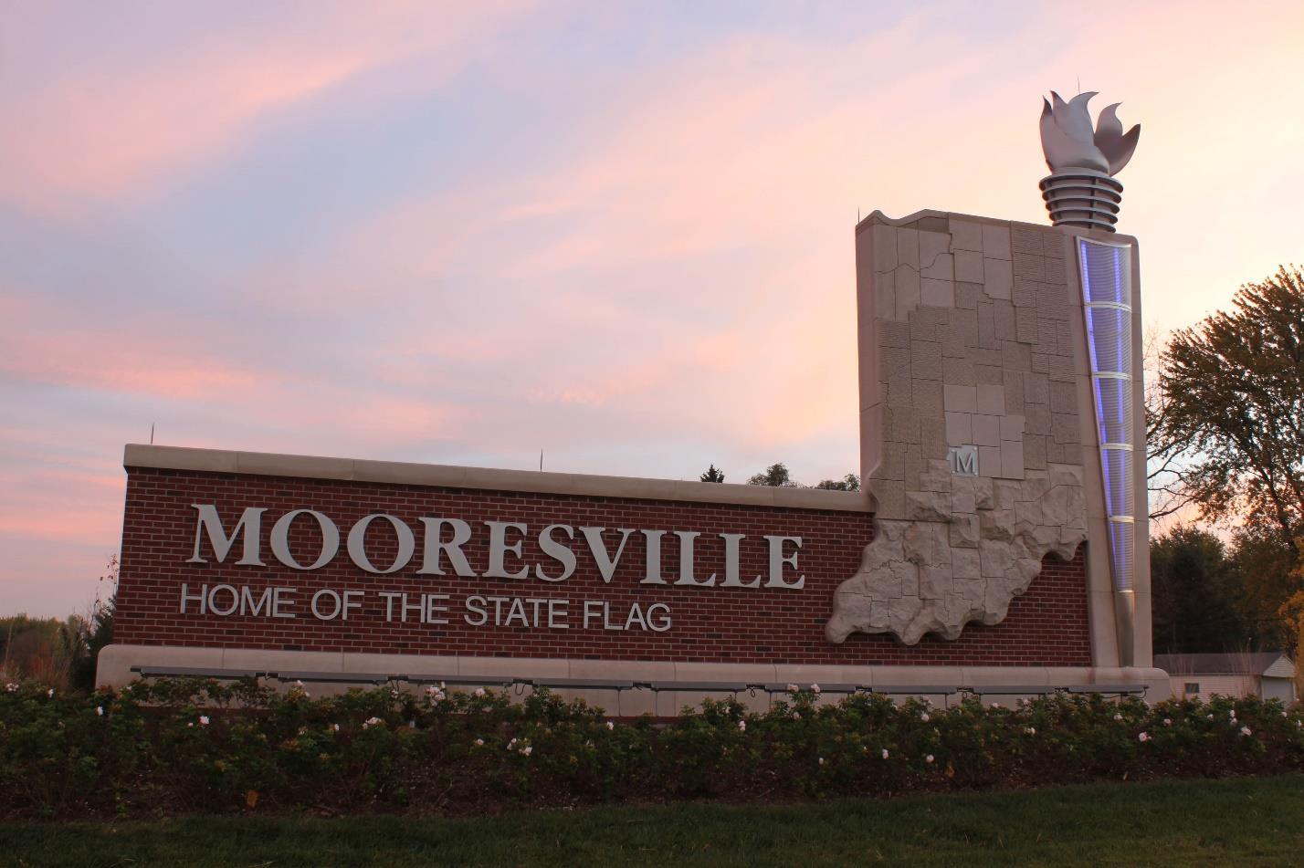
The City of Lebanon Comprehensive Plan
• Promote City brand and character at entrances.
• Create more attractive corridors.
• Support economic development/revitalization through City investment.
• Changes in land use and character at gateways that are more representative of Lebanon.
1. Review UDO to ensure overlay districts are accomplishing the intent and resulting in desired development character.
2. Coordinate with INDOT regarding access management on state routes and interchanges.
3. Work with the business community to develop champions for gateway initiatives.
4. Adhere to an aesthetic that is consistent with Lebanon’s brand in all aspects of design, development, and marketing.
1. Update the Lebanon Gateway and Corridor Master Plan to contain very detailed recommendations for each gateway for design, access, aesthetic treatment, lighting, signage, and land use character.
2. Coordinate gateway locations design work with local and state transportation plans to ensure continuity and constructability.
3. After completion of the master plan, prepare design development level gateway plans for a gateway showing specific improvements including treatment of pavement, sidewalks, lighting, signage, landscape, art, and site amenities.
• Planning Department
• City Engineer
• Street Department
• Mayor’s Office
• City Council
• Plan Commission
• Indiana Department of Transportation (INDOT)
• Property Owners
The City of Lebanon Comprehensive Plan
Protect the floodway and floodplain to mitigate property
damage and enhance these natural corridors.
Applicable Frameworks:
• LAND USE & DEVELOPMENT CHARACTER
• HOUSING & NEIGHBORHOODS
• QUALITY OF LIFE
Flooding events have been some of the most widespread and costly natural disasters in the United States despite continued investment in structural flood controls and other non-structural measures. Flood events and impacts are anticipated to increase in the future as the frequency and severity of storms increases and development pressure increases in at-risk areas. As proof of this, six of the ten worst floods in Prairie Creek history have occurred since 2003. Limiting development in special flood hazard areas (SFHA) is absolutely necessary to reduce the future impacts and associated costs of flooding. Special flood hazard areas are those that would be under water during a 100-year flood. A 100-year flood does not mean a flood of that magnitude can only happen once every 100 years but rather, there is a 1 percent chance of a flood of that magnitude every year.
The City of Lebanon, in conjunction with Christopher B. Burke Engineering, LLC, recently created a Flood Resilience Plan (FRP) to identify measures to reduce the vulnerability of the community to damage from flooding and to support recovery after an extreme flood. Overall strategies to enhance resilience in Lebanon, as detailed in the plan, include:
• Integrate Flood Resilience Concepts into the Comprehensive Plan Update
• Update the Unified Development Ordinance to include Flood Resilience Strategies
• Integrate Flood Resilience Concepts into the Capital Improvement Plan
• Implement Flood-related Mitigation Strategies listed in the All-Hazard Mitigation Plan (2017 Boone County AHMP)
• Conduct Regular Audits of Plans, Programs, and Policies
The City of Lebanon Comprehensive Plan
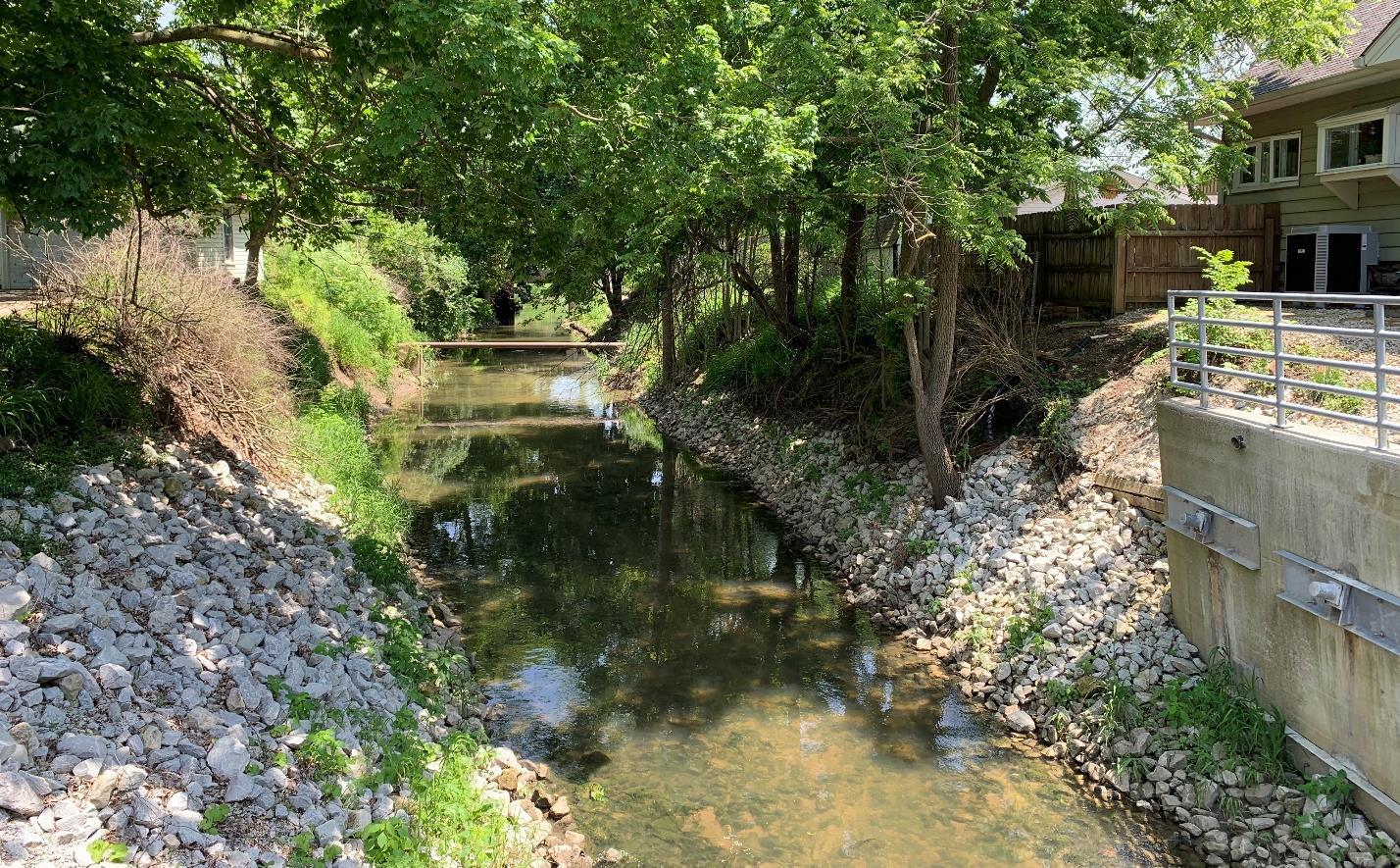
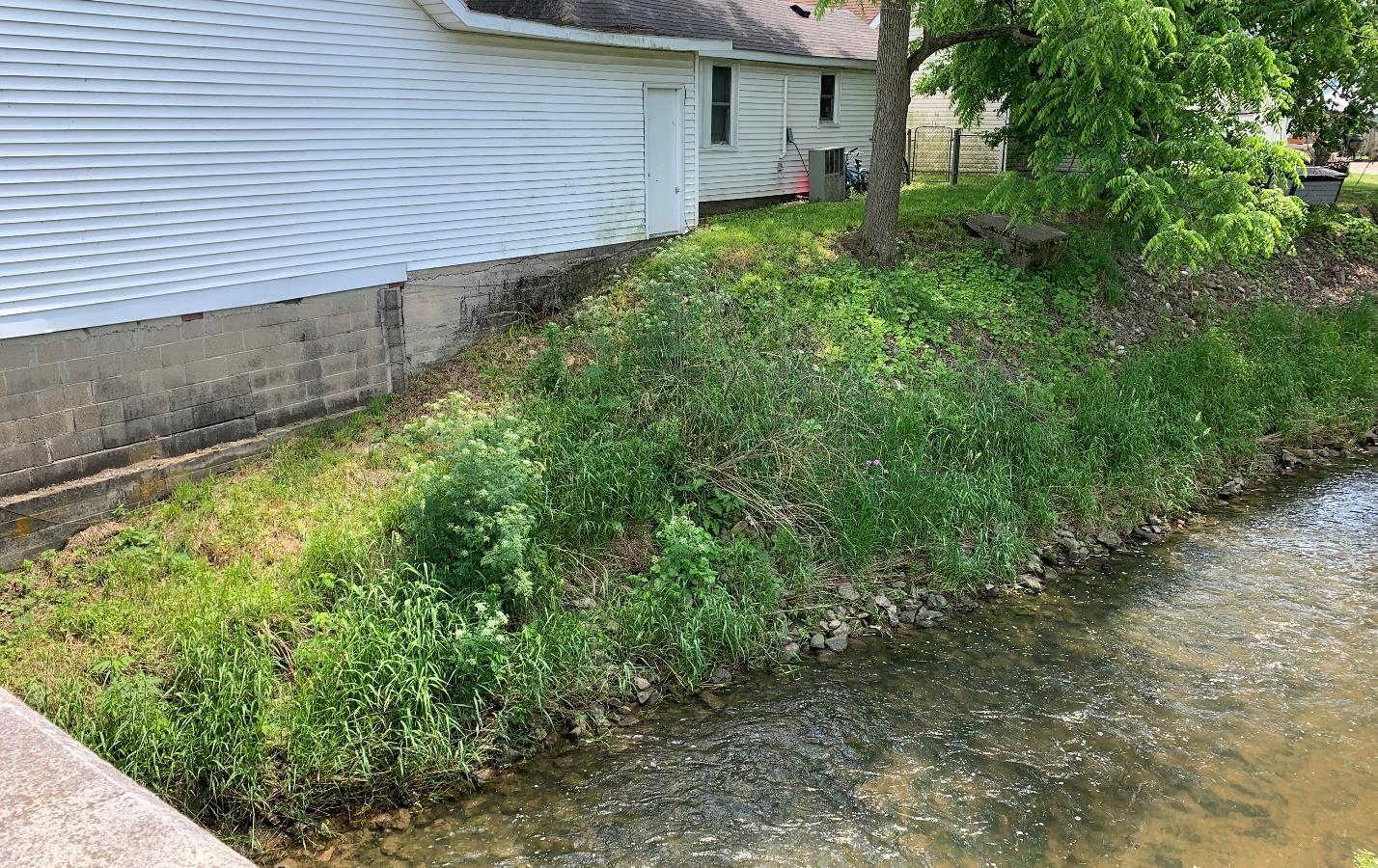
The City of Lebanon Comprehensive Plan
Additionally, the FRP defines five flood resilience planning areas within the City; they are the river corridor impact area, undeveloped high flood hazard/flood storage area, vulnerable developed areas, safer areas outside the SFHA, and the watershed.
• River Corridor Impact Area is defined as the floodway or fluvial erosion hazard, whichever is larger. The floodway is the river channel itself and the portion of the floodplain used to carry and discharge flood flows. Recommendations include:
o Adopt a River Corridor Impact Area Overlay Zone
o Protect Undeveloped Land in the River Corridor Impact Area
o Remove Non-Essential Bridge Crossings over Prairie Creek
o Restore Prairie Creek using an Open Corridor Channel Modification
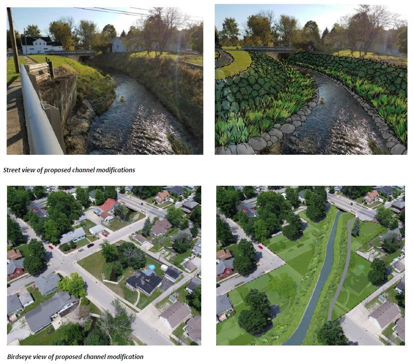
The City of Lebanon Comprehensive Plan
• Undeveloped High Flood Hazard/Flood Storage Area is made up of undeveloped land in the floodway fringe. The primary goal for this area is to keep future development out and preserve existing floodway and floodplain function. Specific recommendations include:
o Prohibit Development of New Critical Facilities in the Floodplain
o Protect Undeveloped Land in the Floodway Fringe
o Increase Compensatory Floodplain Storage Requirements
• Vulnerable Developed Areas are where existing development is already within the floodway and special flood hazard area Here, it is important to protect people, buildings, and facilities and reduce future flood risk. Ideally, this would be accomplished with buyout of these properties and removal of structures. However, there are almost 1,500 structures in the SFHA in Lebanon and removing them all is unrealistic. Recommendations for this area include:
o Protect Existing Critical Facilities in the SFHA
o Impose a Post-Flood Building Moratorium
o Relocation and/or Buyouts of Structures
o Floodproof Structures
o Bring Nonconforming Uses into Compliance
o Promote Flood Insurance Coverage
o Create New Flood Storage through Redevelopment
o Require Building Expansions to Meet Additional Requirements
o Create a Flood Storage Facility Upstream of Lebanon
• Safer Areas are all of the lands in Lebanon outside of the SFHA. This is where new growth and development should be occurring. Specifically:
o Steer Public Policy and Investment into Safer Areas
o Promote Conservation Design and Development
o Promote Placement of Critical Facilities in Safer Areas
• The Watershed Area extends beyond Lebanon municipal limits to include all of the lands that drain into Prairie Creek and its tributaries. This area is identified to promote coordination and best practice implementation for the broader region. Recommendations include:
o Support USGS Stream Gages
o Adopt Natural Resource Overlay Zone
o Promote Use of Cover Crops and Soil Health Practices
o Reduce Impact from Tile and Surface Drains in the Watershed
For more details about these recommendations, please see the complete Flood Resilience Plan.
The City of Lebanon Comprehensive Plan
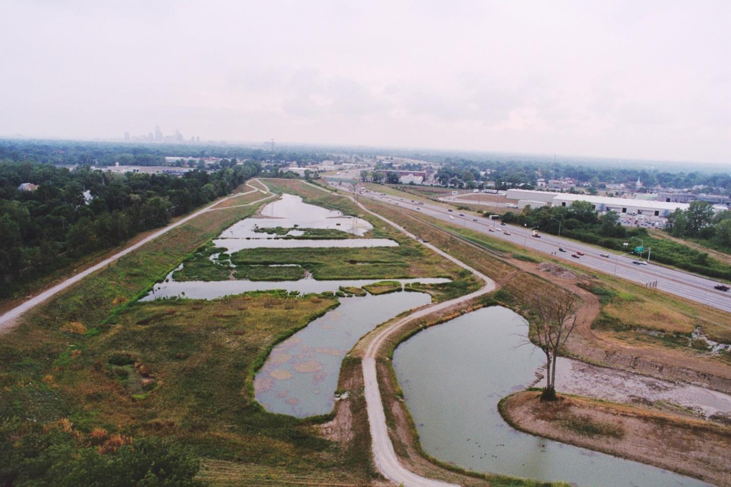
An example of what a regional detention basin may look like. Credit: Christopher B. Burke Engineering, LLC
Successful implementation of flood resilience and hazard mitigation strategies will result in:
• Fewer flood events by returning the Prairie Creek corridor to a more natural, open channel.
• Reduced damage to properties and structures when flooding does occur.
• Preservation of special flood hazard areas as a natural amenity that can be utilized for passive and active recreation.
• Constructed regional stormwater detention facilities that can double as recreation facilities or development amenities.
• Fewer structures along Prairie Creek, thereby creating better access to the waterway for viewing and enjoyment within the heart of the City.
1. Amend the unified development ordinance to include flood resilience strategies as identified in the FRP.
2. Identify stormwater management construction projects to be included into the City’s capital improvement plan.
The City of Lebanon Comprehensive Plan
3. Conduct a public education campaign about protecting and preserving the SFHA, maintaining a healthy creek corridor, and the potential for long-term actions that could include property buyouts.
1. Construct regional stormwater detention facilities to provide additional storage during flood events.
2. Remove structures, both houses and non-essential bridges, from the floodway and floodway fringe.
3. Restore the natural creek corridor as structures are removed.
• Planning Department
• City Engineer
• Stormwater Department
• City Council
The City of Lebanon Comprehensive Plan
Continue to assess and advocate for improved access into and around the City, including redesigned and new interchanges.
Applicable Frameworks:
• TRANSPORTATION & UTILITIES
• ECONOMIC DEVELOPMENT
Access in to, out of, and around a community is critical from both an economic development and quality of life standpoint. Luckily, Lebanon is at the crossroads of many thoroughfares – Interstate 65, US Highway 52, State Road 32, and State Road 39. However, what all these corridors have in common is that they are under the management of the Indiana Department of Transportation (INDOT). When improvements or changes are needed to any of these roadways, INDOT is the agency responsible for the design and construction. INDOT will typically include a public input component to major roadway projects and will consult with local leadership. Given the importance of these corridors, it is imperative for Lebanon to be actively involved in discussions with INDOT for changes or improvements.
Roads not managed by INDOT are under the purview of the Lebanon City Engineer and Streets Department. Therefore, Lebanon has more control over the design and maintenance of these roadways. To ensure that the local road network supports future development options, the City completed a Thoroughfare Plan in 2017. [LINK]
I-65 plays an outsized role in the overall transportation and development framework of the City. Of the five I-65 interchanges within or adjacent to City limits, three are the common diamond interchange design. The other two interchanges, US 52 and Indianapolis Avenue/Hall Baker Road, are atypical and don’t provide the clear access preferred by many businesses. Throughout the public engagement process, numerous residents and business owners commented on needed improvements to these interchanges. Additionally, these interchange designs, and especially the left-side exit from southbound I-65 onto US 52 at exit 141, are no longer preferred by INDOT. Because of this, an interchange feasibility study was conducted for the north (US 52) interchange.
The City of Lebanon Comprehensive Plan
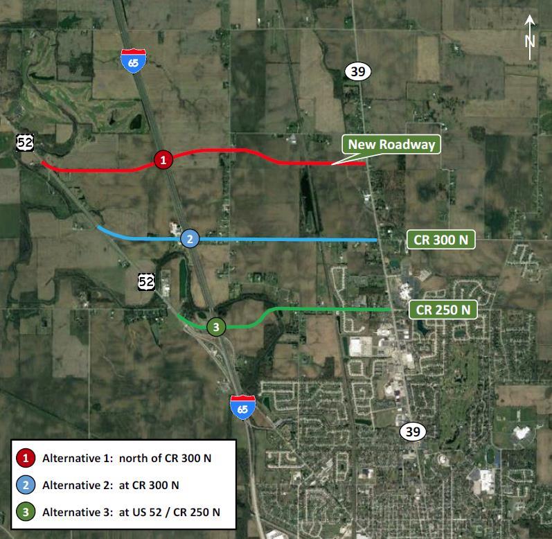
Completed in June 2018, the interchange feasibility study explored three potential alternatives for a new interchange. Alternative 1 would create an all new interchange approximately 0.6 miles north of CR 300 N. Alternative 2 would create an all new interchange at CR 300 N, and Alternative 3 would modify the existing US 52 interchange at its current location. All three locations were determined to be viable; a decision on the final location will not be made until an engineering assessment, environmental documentation, cost analysis, and coordination with state and federal agencies is complete.
Also discussed during the planning process was the desire among City and business leaders for a new interchange in the southeast portion of the City, between exits 133 and 138. This recommendation was included in the 2017 Thoroughfare Plan, with the potential interchange near
The City of Lebanon Comprehensive Plan
CR 250 S. Whether this interchange is warranted will be dependent on the type and intensity of future development in the area. As such, it should be considered long-term.
Ultimately, to achieve improved or new access sooner than what may be included on INDOT longrange plans, Lebanon may have to leverage local funds. Providing local funds has been a common occurrence with communities in Central Indiana. Cities like Greenwood, Fishers, Noblesville, Carmel and Westfield all have worked with INDOT to either relinquish roads to the city or have provided local funds to supplement design work in accordance with community goals.
• Improved access and ease of understanding when traveling in to or out of the community via I-65.
• Increased safety at interchanges.
• Additional development opportunities near interchanges or as a result of improved regional access.
SHORT-TERM ACTIONS
1. Develop a long-term relationship with INDOT to ensure open, honest, and regular communication about roadway plans and development pressures in Lebanon that affect the transportation system.
2. Meet with INDOT to discuss when Lebanon’s projects will be designed and signal interest to be more involved in the design process.
3. Identify any additional improvements desired for INDOT controlled thoroughfares that would be beyond INDOT’s traditional project scope.
1. When a large industry desires to locate in Lebanon, involve INDOT early in the process to work through transportation needs.
2. Incorporate identified improvements to significant thoroughfares into the capital improvements plan.
3. Secure funding for identified enhancements that would be above the improvements INDOT would include for a typical project.
4. Incorporate the new interchange into City’s capital improvements plan.
RESOURCES / ORGANIZATIONS / IMPLEMENTERS
• City Engineer
• Mayor’s Office
• City Council
• INDOT
• Residents
The City of Lebanon Comprehensive Plan
Applicable Frameworks (to be replaced with icons, delete those that do not apply from list below):
• LAND USE & DEVELOPMENT CHARACTER
• TRANSPORTATION & UTILITIES
• ECONOMIC DEVELOPMENT
One of the key drivers of growth is infrastructure, specifically utility infrastructure. As Lebanon continues to grow, development cannot out-pace the expansion of utility systems. These systems require continual investment to replace aging infrastructure and maintain systems in a state of good function. Maintaining infrastructure and utility service depends upon both on-going and future revenue streams. Most utilities are funded through monthly usage bills as well as tap and availability fees at the time of construction. Larger improvements may require bonding or general funds from tax revenue. Given current property tax caps within the State of Indiana, it is difficult for the City to proactively expand utility capacity to desired development areas.
In the future, growth must proceed in conjunction with utilities. Leapfrog development patterns and reactionary utility extensions can lead to inefficiencies and increased costs in more piping, pumping, and line replacement. The southeast area of the City, along I-65, is more vulnerable to a leapfrog development pattern given the shape and overall land availability in the area. However, very little utility infrastructure currently exists to support significant new development and future expansion into the area will be difficult due to distance from treatment facilities.
The City has been able to meet the current infrastructure needs and has not had to restrict new development because of a lack of services, but continued growth will present challenges. Therefore, the City should ensure that it is targeting its resources to areas where infrastructure already exists, for example in the downtown where redevelopment is feasible, or targeted future development areas such as the area between SR 39 and Hall Baker Road. There are many ways Lebanon can manage the growth of infrastructure and development. The most common ways the City can manage growth are through an adequate public facilities ordinance (APFO), longrange capital improvements planning, developer driven improvements, tax increment finance (TIF) districts, impact fees, or a combination thereof.
The City of Lebanon Comprehensive Plan
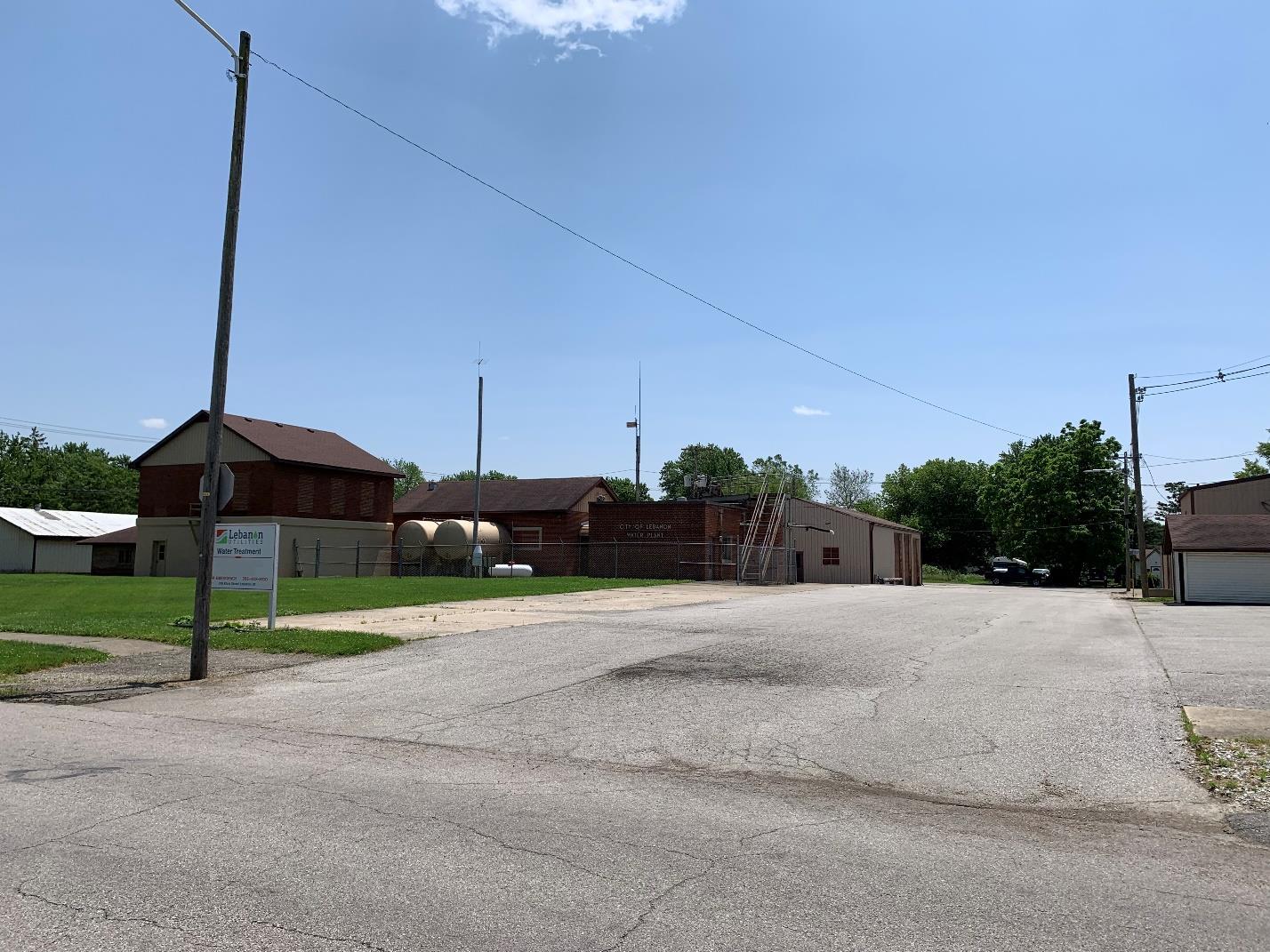
The existing water treatment plant may need expansion, or a new facility will need to be created to serve long-range growth and development plans.
An APFO ties infrastructure to growth. An APFO, sometimes known as a concurrency ordinance, can be applied to almost any community facility including transportation, water, sanitary sewer, schools and parks. The APFO ensures that the existing utilities can service the new development and if not, then the developer will need to provide the additional facilities or wait until the facilities are available before the project can proceed. At a minimum, the City can require that the new development be concurrent to an area that is already served.
Advanced planning for a major utility improvement refers to master planning for the entire utility system. Many communities prepare dedicated utility master plans for various municipal utilities they may provide. The City of Lebanon has a Utility Master Plan for the entire City that identifies existing facilities and capacity for water and sanitary sewer systems as well as planned future extensions and capacity. The master plan identifies both major and minor improvements including new treatment facilities as well as line extensions, lift stations, and pipe upsizing. The master plan contains cost estimates and timing for each of these projects. The projects from the plan are then incorporated into a five-year capital facilities plan that is coordinated with the City’s annual budget.
Developer driven improvements are those utility infrastructure improvements that are specifically tied to a proposed development project. During the comprehensive plan process, the type and
The City of Lebanon Comprehensive Plan
character of development is identified as part of the future land use plan. Some areas of the community may be identified as a lower priority for development and therefore the City may choose not to spend its valuable resources to expand or construct utilities in this area. Therefore, when a developer opts to develop property in a low priority area, the developer will be responsible for paying for the necessary utility improvements.
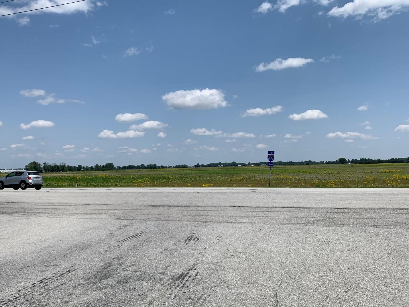
A view of potentially developable land east of SR 39 and west of I-65.
Tax increment financing (TIF) is a financing mechanism that the City can use to pay for and install utility infrastructure in a priority area. TIF districts are typically established for high growth or priority growth/redevelopment areas such as a business park or downtown. TIF districts capture the additional tax revenue as a result of development, redevelopment, or increased property values. Those additional revenues must be re-invested within the TIF boundary. The City can extend utility services for a development project and then use the tax increment generated by that project to pay back the cost of the improvement.
Impact fees are another tool that Indiana communities can establish to require developers to pay for the cost of providing public services to new construction. Impact fees are discussed in greater depth in another key initiative
As a matter of policy, the City of Lebanon should not extend utility services outside of its municipal boundaries. However, if the City is going to extend services outside the City, it should ensure that the proposal:
• Only be considered when the utility request is accompanied by a petition for annexation;
• Is consistent with long-range utility master plans;
• Creates demand within current capacity;
• Meets city design and construction standards;
• Enhances the contiguous development area of the City of Lebanon.
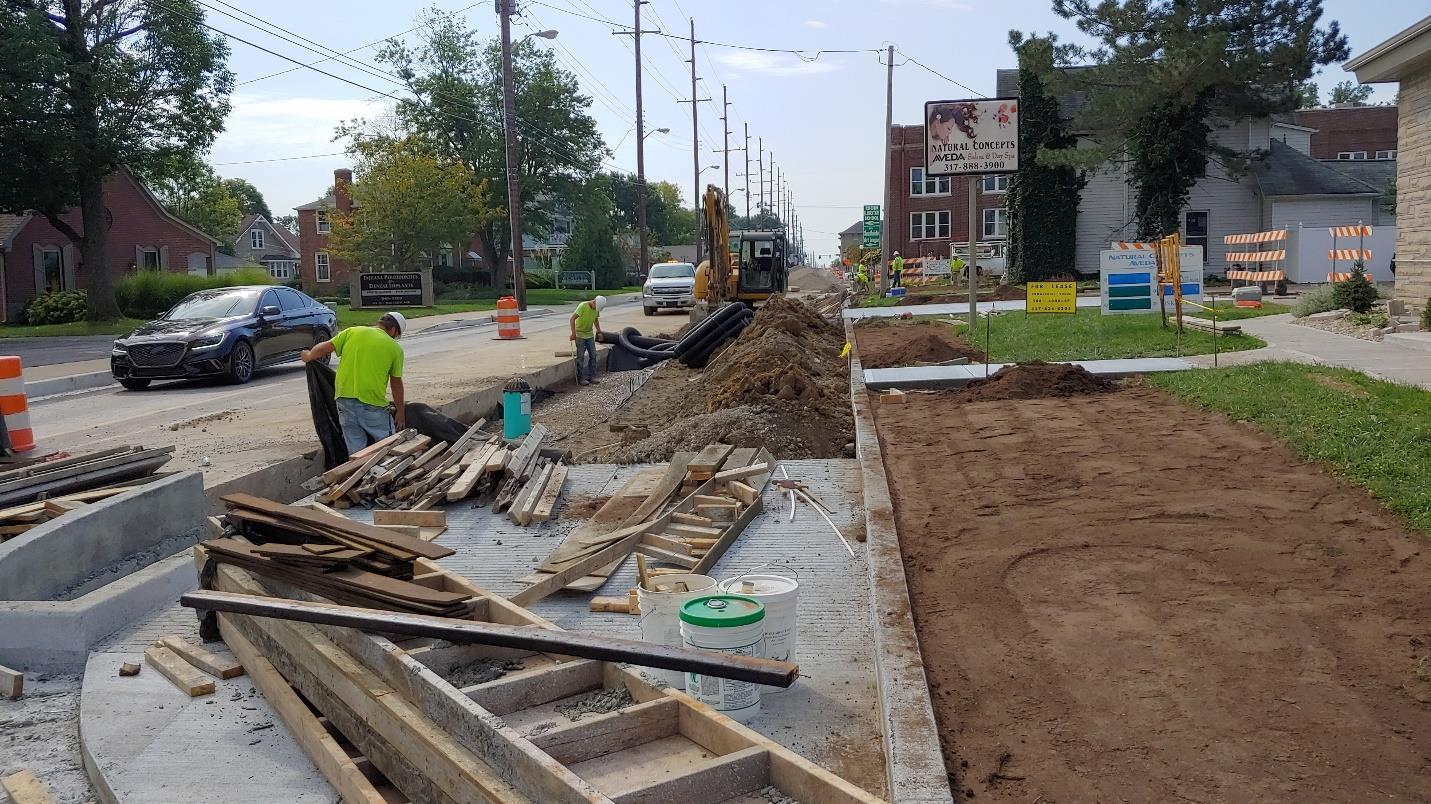
Infrastructure and utility improvements should be coordinated for cost and time efficiencies.
• Support new growth without significant utility rate increases.
• New growth that is concurrent to existing developed areas and facilitates an orderly extension of new utility infrastructure.
• Maintain the existing, quality level of service of existing utility services.
1. Identify which infrastructure growth mechanisms are appropriate for Lebanon to implement.
2. Maintain and update a capital improvements plan.
3. Incorporate planned utility extensions as part of on-going land use planning and capital improvements programming.
4. Coordinate the review and approval of municipal service extensions with City of Lebanon engineering, utilities and planning departments.
The City of Lebanon Comprehensive Plan
1. Adopt written level of service standards for each type of public facility or utility service and provide capital improvements to achieve and maintains such standards for existing and future development.
2. Require that capital improvement projects improve the city’s operational efficiency or reduce costs by increasing capacity, use, and/or life expectancy of existing facilities.
• City Engineer
• Planning Department
• Lebanon Utilities
• Street Department
• Stormwater Department
• County Surveyor
• Redevelopment Commission
• City Council
• Mayor’s Office
The City of Lebanon Comprehensive Plan
Assist with the creation of neighborhood groups, and support residential infill, rehabilitation, and beautification efforts to enhance all of Lebanon’s neighborhoods.
Applicable Frameworks:
• HOUSING & NEIGHBORHOODS
• QUALITY OF LIFE
How people answer the question “Where do you live?” can say a great deal about their neighborhood. Residents of vibrant locales will often describe themselves as residing in a specific neighborhood or subdivision rather than the city as a whole, while those who live in places with less character may either default to a larger geography as their place of residence or near a specific intersection if there is no discernable neighborhood.
The historic homes and older neighborhoods around downtown Lebanon are organized in a regular grid street pattern. As such, identifying where one neighborhood stops and the next starts can be difficult. In the more newly developed subdivisions north of downtown, identifying neighborhood boundaries is a bit easier. As part of the comprehensive plan process, and in hopes of creating a better sense of community and identity in some of the City’s neighborhoods, a neighborhoods map was created. This map should be used as the starting point to begin to organize a framework of neighborhood groups to communicate and coordinate with the City staff and leadership. The neighborhood boundaries, and more importantly names, on the map should be considered preliminary. Ultimately both the neighborhood extent and name will need to be confirmed by the respective neighborhood group to ensure it is representative.
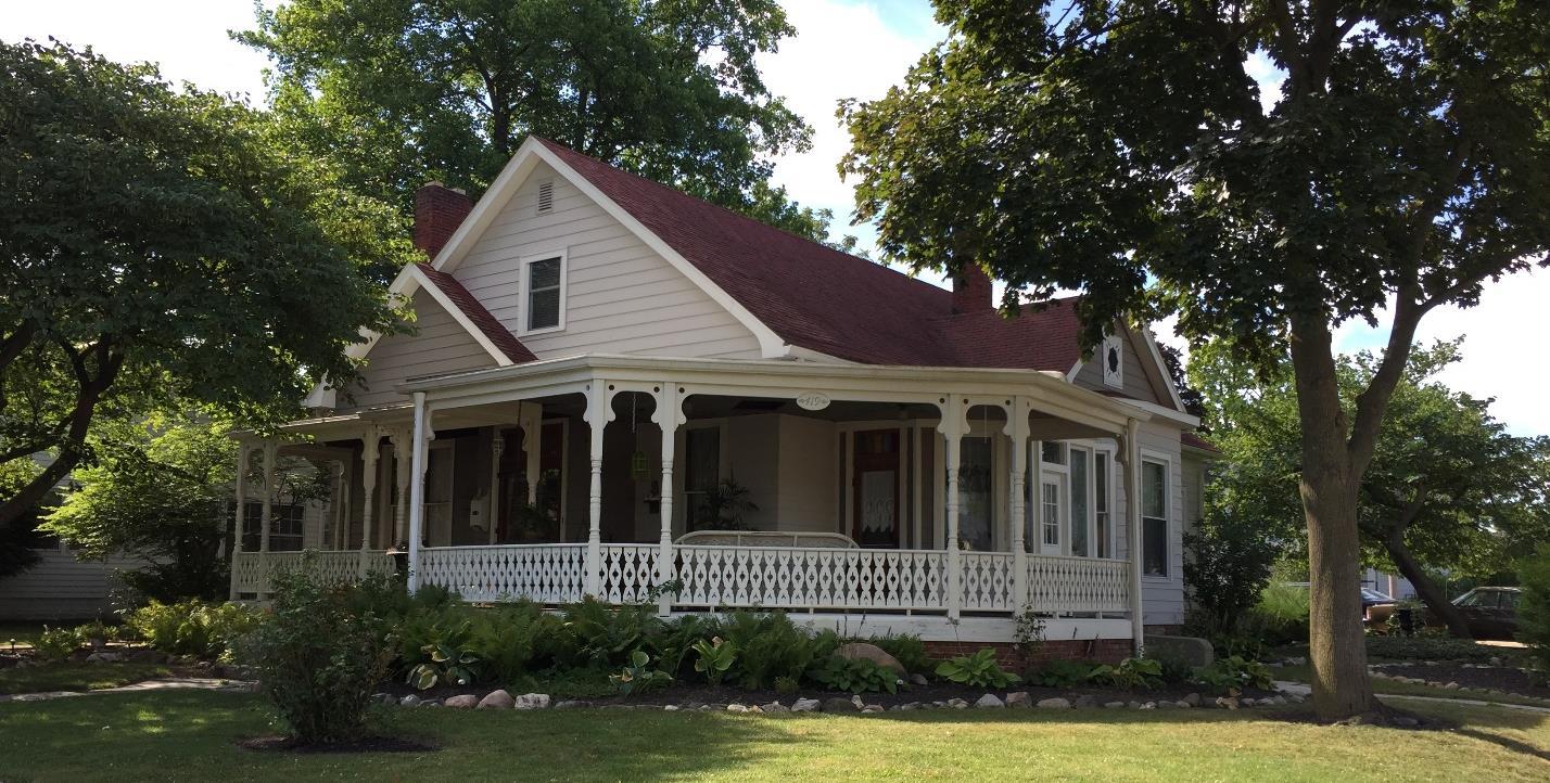
The City of Lebanon Comprehensive Plan
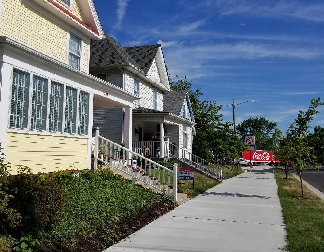
Recent improvements to N East Street.
Once the neighborhood groups are established, a neighborhood liaison program can be created to make a stronger connection between residents and local government. Program goals vary from community to community, but liaison responsibilities may include:
• Information intermediary consolidating neighborhood concerns and presenting them to the City and conversely distributing information from the City to the neighborhood.
• Advocating on behalf of the neighborhood to City staff and leaders.
• Coordinating City services with target user groups.
• Promoting and marketing neighborhood events.
One such program, the City of Philadelphia’s Philly 311 Neighborhood Liaison program, was created to centralize concerns and issues of the community by creating an account for each neighborhood to get action taken. The liaison records items discussed during community meetings such as streetlight repair, missed rubbish, vacant lots, abandoned vehicles, etc. and contacts Philly 311 for action and answers.
In addition to facilitating the creation of neighborhood groups, the City must also continue efforts to strengthen and beautify existing neighborhoods. One way to accomplish this is through promoting and incentivizing infill on vacant lots and rehabilitation of outdated or unkept housing
The City of Lebanon Comprehensive Plan
stock. Residential infill refers to the construction of new homes on vacant lots in existing City neighborhoods. Occasionally these lots were never built on, but more frequently they result from demolition of a damaged or poorly maintained structure. Infill activity presents an opportunity to improve the fabric of existing neighborhoods while creating housing units for new residents. It is important that infill development reflect the context and scale of the existing neighborhood. This does not mean replicating structures that are already there, but how new development can respond to the basic patterns and valued aspects of the neighborhood.
Residential infill development can be challenging because of the scattered nature and potentially low number of lots, outdated infrastructure, or increased construction costs. In instances where a house was demolished and the site leveled and planted with a lawn, there are frequently large portions of the old foundation and utility connections just underground. Additionally, average home size has increased significantly since many of these lots were first platted. Housing options in line with current market preferences may not be able to fit on these lots while also meeting all the development standards present in the Unified Development Ordinance. Yet another challenge is that home buyers who may be willing to take on a significant rehabilitation project can’t navigate the more complex lending requirements for the necessary loans.
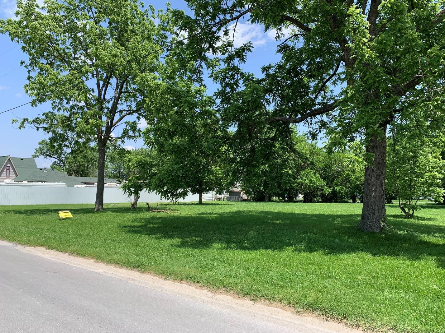
The City of Lebanon Comprehensive Plan
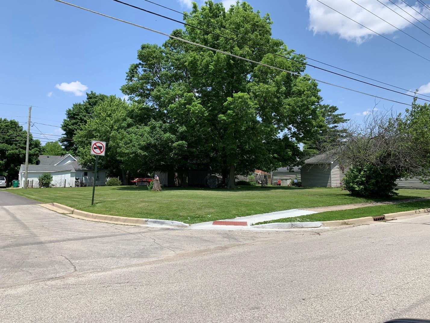
Construction of new houses on vacant lots helps to fil voids in the neighborhood and adds to the City’s tax base without having to expand municipal infrastructure and services.
City incentives and programs could be used to help offset some of these challenges. The City could establish a revolving loan fund similar to what is frequently used to fund small business expansion and development, to help with gap financing or to meet the additional down payment requirements of a construction or construction-to-permanent loan. A home repair grant or lowinterest loan program, similar to the downtown façade improvement program but available to owner-occupied housing, could be created. The Indiana Housing & Community Development Authority (IHCDA) has an owner-occupied rehabilitation program funded with Community Development Block Grant (CDBG) funds. IHCDA does not fund owners directly; the grants of up to $25,000 per home must be administered through the local government or a not-for-profit organization. The City should consider applying to IHCDA for the owner-occupied rehabilitation program. Another residential infill incentive would be to reduce permitting or utility connection fees for these lots. This would best be accomplished with a City Council approved ordinance that establishes clear criteria, which fees may be reduced, and how much.
As opposed to direct incentives to property owners or builders, a strategy of targeted city investment could also be employed. Here, the focus would be to identify key opportunities in targeted housing investment areas. The two targeted housing investment areas identified through the planning process are:
The City of Lebanon Comprehensive Plan
• Opportunity Zone Investment Area: generally bounded by Camp Street to the north, SR 39/Lebanon Street to the east, I-65 to the south, and the CSX railroad to the west.
• Abner Longley Investment Area: generally bounded by E South Street to the north, Indianapolis Avenue and Abner Longley Park to the east (inclusive of the park itself), I-65 to the south, and SR 39/Lebanon Street to the west.
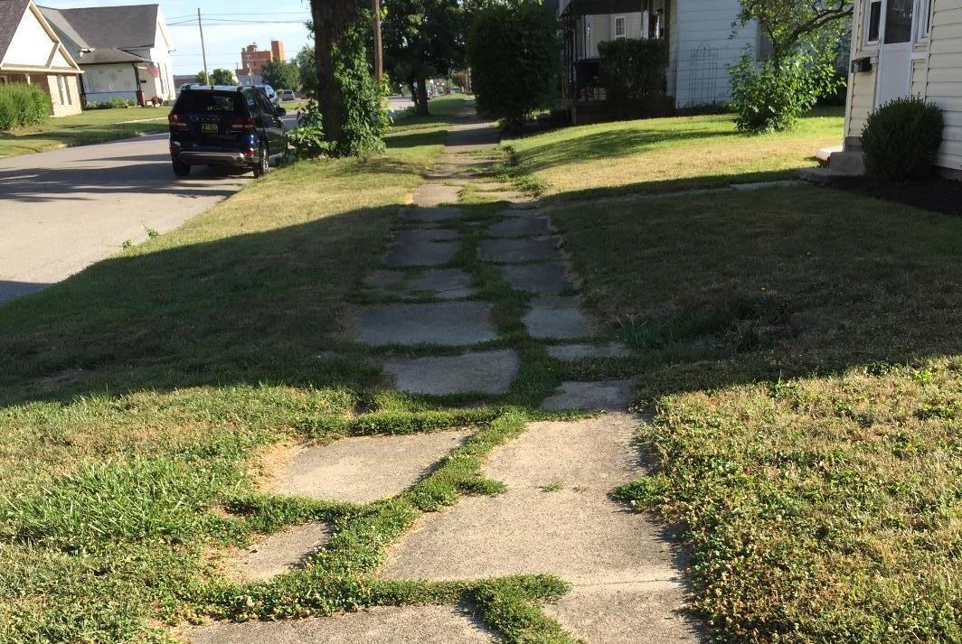
Deteriorating infrastructure is a significant concern in some of the City’s older neighborhoods.
These areas were identified given their current use, character, demographic statistics, and importance in providing residential variety and affordability to the community. The city should work with proposed investors or developers, as one potential solution, to identify properties within the targeted areas that have reinvestment potential. For each investment opportunity, the City should evaluate the condition of public infrastructure that supports the area and determine where deficiencies are present. In partnership with the investor or developer, the city could replace sidewalks and curbs as needed, resurface the road, and repair alleys if present. Other infrastructure deficiencies, such as outdated sewer and water lines, could also be addressed. Once the infrastructure work is completed and the new curbs and sidewalks installed, installation of street trees could be used to help beautify the blocks.
Unsafe or problem houses could be acquired by the City and demolished, preparing the lot to then be sold for new construction. There may be buyers willing to design and build a new house but don’t want the burden of demolition or the cost of the tax lien on some of these properties. Collectively, these improvements would exhibit the City’s commitment to existing residents to hopefully encourage them to invest in their properties, as well as to potential homebuilders to
The City of Lebanon Comprehensive Plan
invest in neighborhoods they may otherwise pass over. Once the targeted investment opportunity has been revitalized, private sector investment should spill over to neighboring blocks and the City can then target a new area.
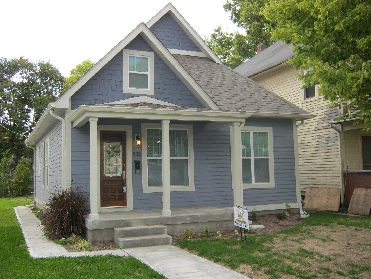
In addition to the focus blocks, the City also recognizes the need for a broader housing initiative within each neighborhood investment area. Lebanon is committed to improving the quality of life for all residents. As a part of that commitment, the City supports the development of safe, quality for-sale and rental units for a variety of income levels and age groups. This includes residential units at all price points that may be in the form of single-family and duplex homes for sale as well as rental multi-family apartments and mixed use developments. In some instances, infill and redevelopment of former commercial or industrial properties can be an opportunity to create additional housing units for multiple income levels. Specifically, the City supports housing that:
• Aligns with the Future Land Use and Development map incorporated as part of this plan.
• Involves and is supported by area neighborhood organizations.
• Contributes to affordability goals of the City.
• Reflects quality design and architecture.
• Can be served with existing City utility capacity.
• Contributes to infill of vacant lots or redevelopment of unkept properties.
The City of Lebanon Comprehensive Plan
Maintaining quality neighborhoods and creating a place where people want to live is the best way to grow businesses and employment and attract new restaurant and retail offerings. Specifically, enhancing Lebanon’s neighborhoods will:
• Create additional housing units and housing types to attract new residents.
• Establish stronger and more connected neighborhoods.
• Increase communication between residents and City government.
• Improve aesthetics in mature neighborhoods.
• Increase residential property values throughout the community.
1. Identify a City department or position to lead the neighborhood liaison program and begin a series of meetings across the City.
2. Establish official names and boundaries for each neighborhood.
3. Explore the possibility of grant and loan programs and other incentives for residential rehabilitation and infill projects.
4. Review and amend the unified development ordinance to ensure it allows desired infill types.
1. Implement neighborhood liaison program.
2. Create an infill and redevelopment guide to identify appropriate building types and character in established neighborhoods.
3. Support desired infill and redevelopment through public investments in infrastructure improvements and beautification efforts.
4. Continually enforce City codes to protect investment and property values in Lebanon neighborhoods.
• Mayor’s Office
• Planning Department
• City Engineer
• Plan Commission
• City Council
• Redevelopment Commission
• Area Homebuilders
• Existing Residents
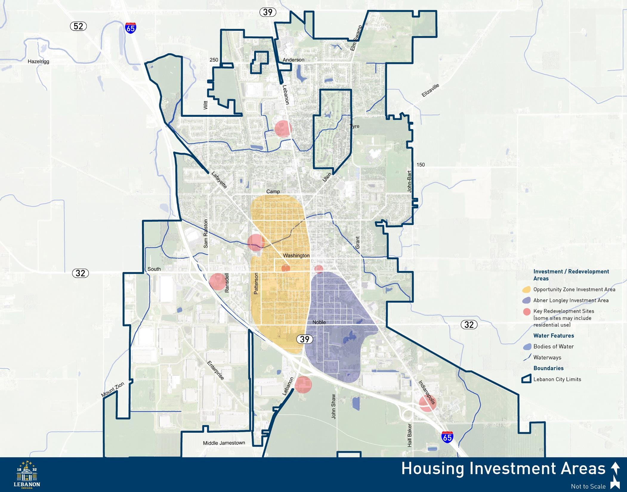
The City of Lebanon Comprehensive Plan
Continue to promote an active, walkable downtown full of diverse uses through infill and redevelopment of key sites.
Applicable Frameworks:
• DOWNTOWN
• QUALITY OF LIFE
Downtown Lebanon is experiencing a resurgence as new businesses, shops, and restaurants occupy what had been vacant or underutilized buildings. As more residents recognize the value and appeal of a vibrant and pedestrian-friendly district, the courthouse square and broader downtown area should continue to see new investment. Historically, downtown Lebanon was the economic driver of the community, home to a number of offices and shops. Now, most employers, with the exception of county government and financial institutions, and many shopping destinations are elsewhere in the City, and downtown is transitioning into an arts, culture, and entertainment destination. Fully realizing this walkable, arts and entertainment district can help attract and retain families and talented professionals, as well as the companies looking to hire them.
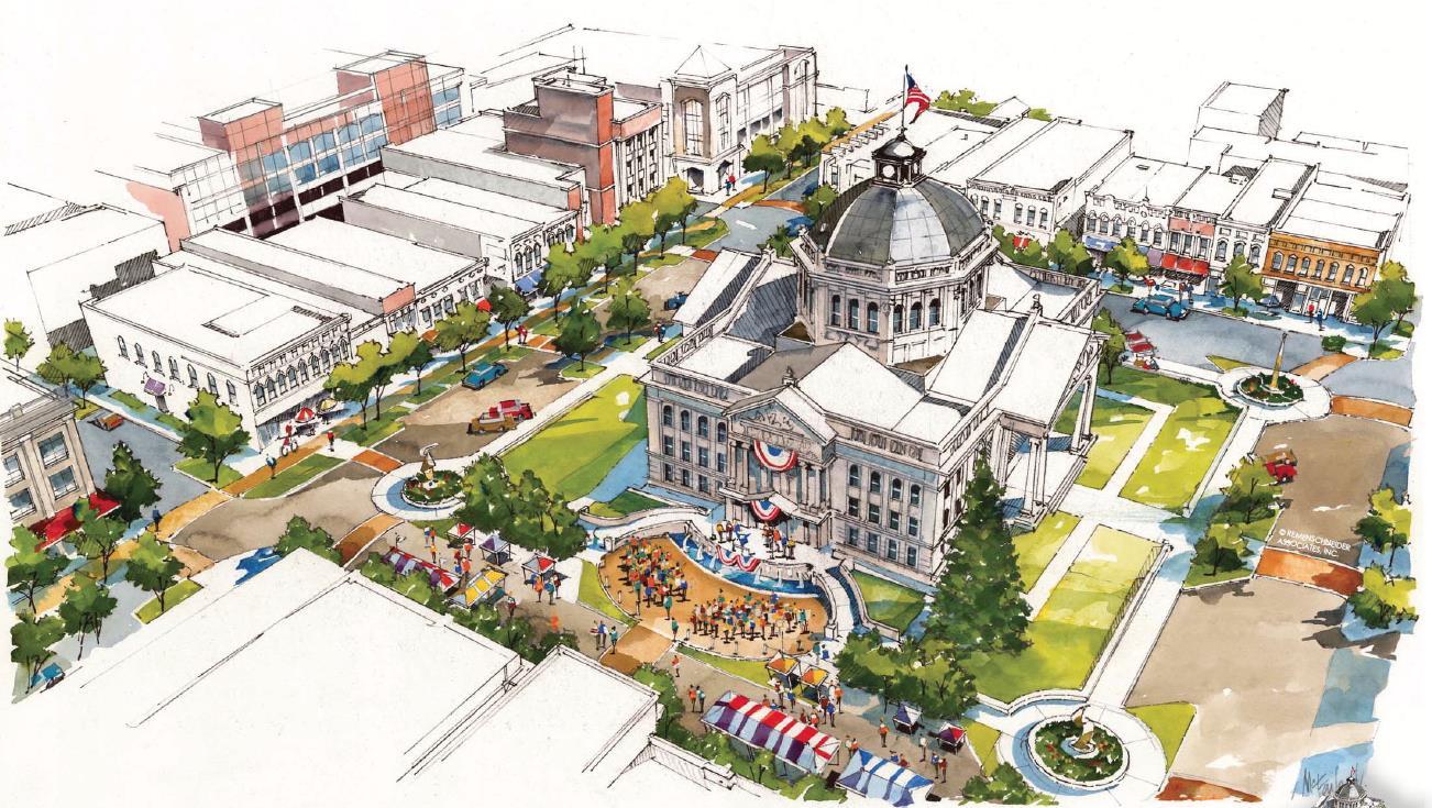
A rendering of proposed improvements included in the 2017 Downtown Action Plan. Streetscape enhancements were being constructed around the Courthouse Square during the comprehensive planning process. Credit: Remenschneider Associates, Inc.
The City of Lebanon Comprehensive Plan
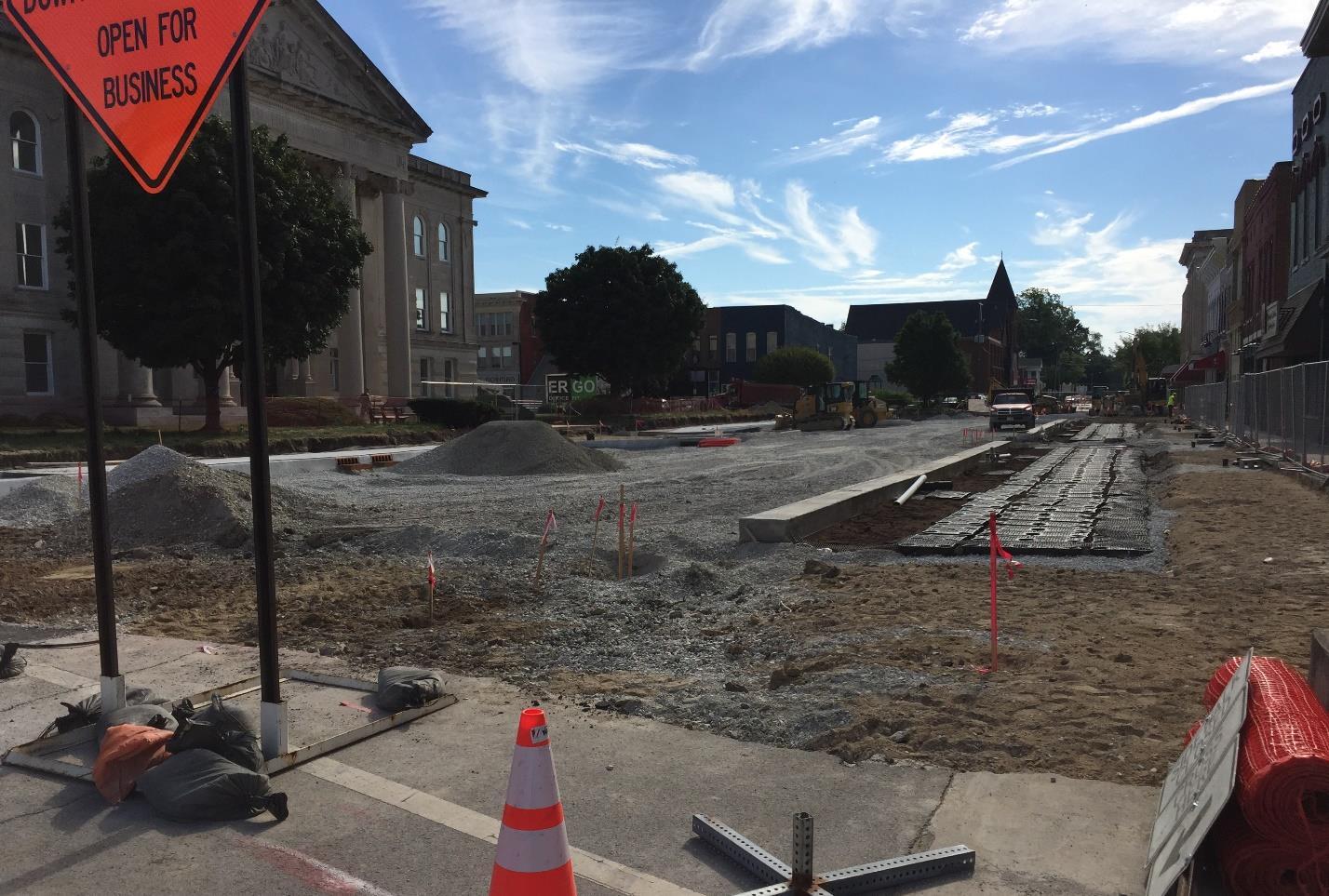
A view of the Main Street streetscape under construction during the comprehensive planning process.
The City’s commitment to the downtown area is evident with all the recent investments made on and around the square, including the extension of the Big 4 trail from the west side of the City into downtown. Lebanon should continue to implement the recommendations of the 2017 Downtown Action Plan as resources become available. This includes additional roadway and streetscape improvements to:
• Washington Street
• Lebanon Street
• Main Street
• Meridian Street
• East Street
The City of Lebanon Comprehensive Plan
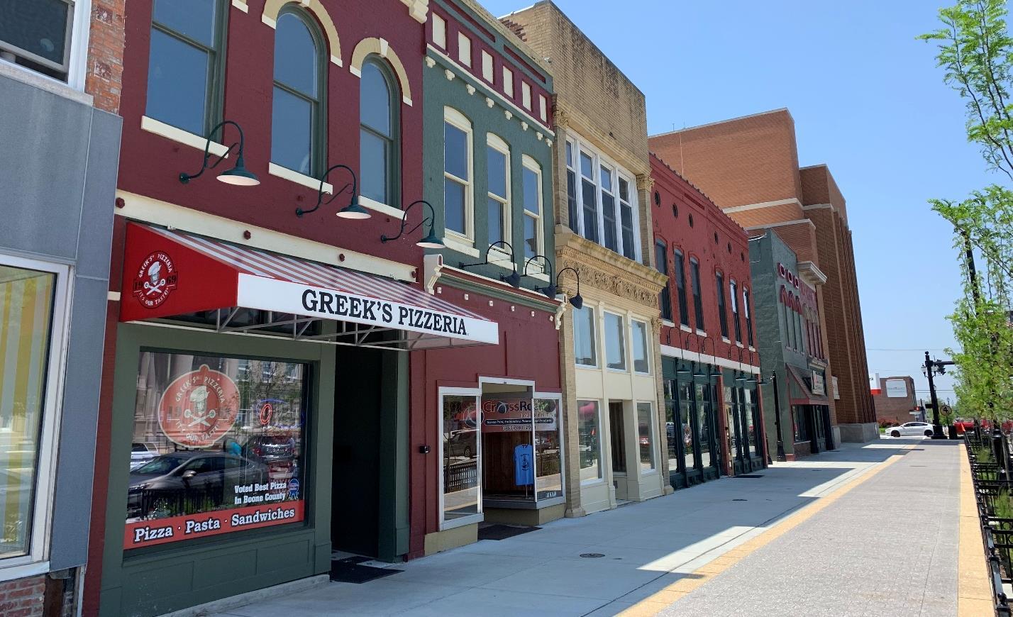
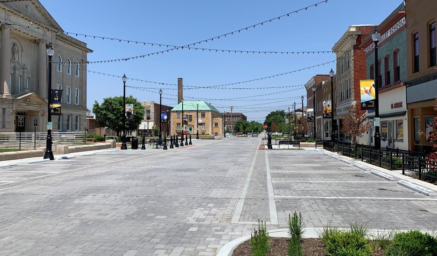
The City of Lebanon Comprehensive Plan
Additionally, a civic redevelopment area and downtown parking garage are recommended. The parking structure should be within a block or two of the courthouse square to be convenient for those businesses. South of the square is likely most beneficial so that it may also serve proposed redevelopment along S Lebanon Street. The civic redevelopment area is comprised of three square blocks between Superior Street to the north, East Street to the east, Elm Street to the south, and West Street to the west. City Hall anchors the east block, while the other two blocks reflect auto-oriented uses and open space. The Downtown Action Plan envisioned a new public facility to anchor the west block with a civic plaza and open space on the center block. This civic redevelopment area would then serve as a gateway into the downtown area along the SR 39/Lebanon Street corridor.
The Downtown Action Plan identified six key redevelopment sites. Five of these sites include existing structures; the sixth site is the surface parking lot on the southwest corner of Main and Lebanon streets. The catalyst building sites include:
• Net-Tec Building
• Heflin / Cragun Building
• Patrick’s / Truitt’s Building
• Merle Norman / Samson Leather Building
• Montgomery Ward Building
These buildings and sites were selected because of their potential to generate additional private investment, preserve historic assets, and improve the appearance of downtown streetscapes. More details about the potential of each site or structure can be found in the Downtown Action Plan. As these properties are revitalized, more sites should be evaluated and added to the key property list.
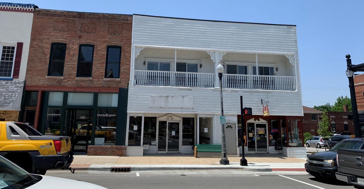
The City of Lebanon Comprehensive Plan
Another important component to better activating the downtown is to increase the number of people living downtown in lofts and apartments. This will not only fill the underutilized upper-story floors of many buildings, it will also create around-the-clock customers for downtown restaurants, shops and services. It is important to remove potential roadblocks to residential development in the downtown, in addition to creating incentives to speed up revitalization efforts, entice new developers, and create permanent downtown residents. While many residential uses are permitted in the Central Business (CB) district, parking minimums and other development standards may be limiting the construction of or conversion to new dwelling units. Potential development incentives could include reduced permitting or utility connection fees, a revolving loan fund to assist property owners in building out upper-story apartments, or using TIF funds for parking or stormwater improvements that benefit the district.
Continued downtown revitalization efforts should result in:
• Increased occupancy of existing downtown structures.
• New construction on vacant or underutilized sites.
• Increased residential population in the downtown, and especially on the courthouse square.
• Additional tax revenues as the value of downtown properties increase.
• New transportation and utility infrastructure and enhanced streetscapes along key corridors.
• More events programming, activities, and businesses to draw a wider range of uses to the downtown, throughout the day and night.
• Development interest across the City as residential, commercial, and industrial developers recognize the strength and success of the downtown, making Lebanon a destination within central Indiana.
1. Review and amend the unified development ordinance to remove potential barriers to downtown development and redevelopment, with particular consideration given to parking requirements.
2. Continue to engage downtown businesses and residents regarding City plans and potential construction projects.
3. Continue to promote and fund the downtown façade grant program with the goal of improving aesthetics and attracting new businesses.
4. Continue marketing City owned property in and around the downtown to potential developers both within the region and outside of it.
5. Develop a guidebook for downtown building and property owners to advertise city incentives and programs and help them navigate the development review and permitting process.
The City of Lebanon Comprehensive Plan
1. Evaluate the potential for other development incentives and incorporate into City plans, ordinances, and policies.
2. Establish public-private partnerships with private entities to facilitate implementation of key goals such as the downtown parking garage or civic redevelopment area.
3. Explore the use of tax abatements for commercial and residential development in the downtown.
4. Periodically convene key downtown stakeholders and property owners to evaluate project successes, identify on-going needs, and strategize for future growth.
• Heart of Lebanon
• Planning Department
• Plan Commission
• Redevelopment Commission
• City Council
• Mayor’s Office
• City Engineer
• Lebanon Utilities
• INDOT
• Property Owners
• Development Community
The City of Lebanon Comprehensive Plan
Improve connections to and from downtown with enhanced streetscapes, gateways, and a trail to Abner Longley Park.
Applicable Frameworks (to be replaced with icons, delete those that do not apply from list below):
• TRANSPORTATION & UTILITIES
• DOWNTOWN
• QUALITY OF LIFE
A streetscape refers to the collection of elements that make up a street’s character. This includes not only the road itself, but sidewalks, building facades, landscape plantings, open spaces, multimodal trail systems, and amenities like art, lighting, signage, and site furniture. A well-designed streetscape reinforces a sense of place and improves the economic vitality of an area by promoting visual continuity and making a more comfortable space for residents and visitors. Streetscapes that are designed to accommodate multiple modes of transportation including automobiles, bicycles, and pedestrians create activity in front of stores and businesses which can lead to increased sales, higher property values, and improved safety and security.
A gateway is a landmark, streetscape, or land use transition that a resident or visitor first sees and experiences when entering an area. It not only provides a physical and sensory point of entry into a place but helps to define community identity and can have a significant impact on perceptions of the area. Gateways should respect the scale and character of the area they are identifying. For example, the City of Lebanon gateway signage on the SR 39 / Lebanon Street bridge over I-65 reflects the surrounding conditions of the wide interstate right-of-way and high speed of traffic on the interstate. That gateway would be completely out of scale with the downtown.
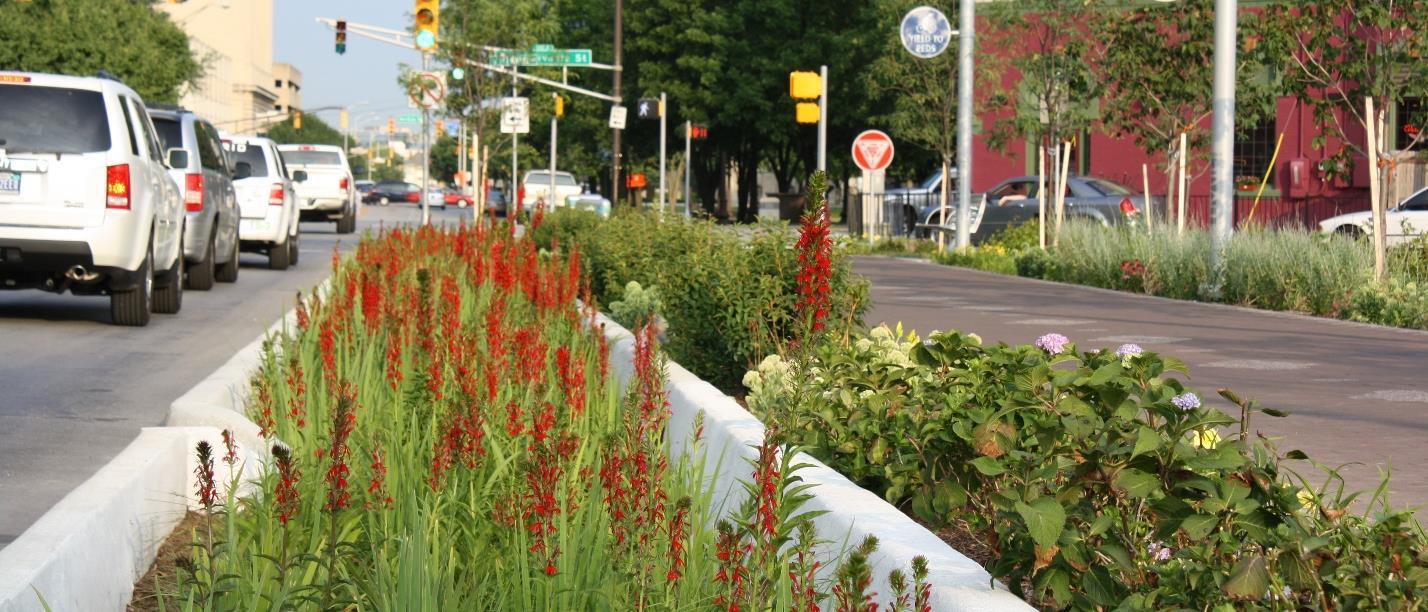
The City of Lebanon Comprehensive Plan
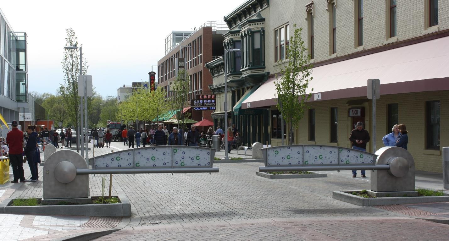
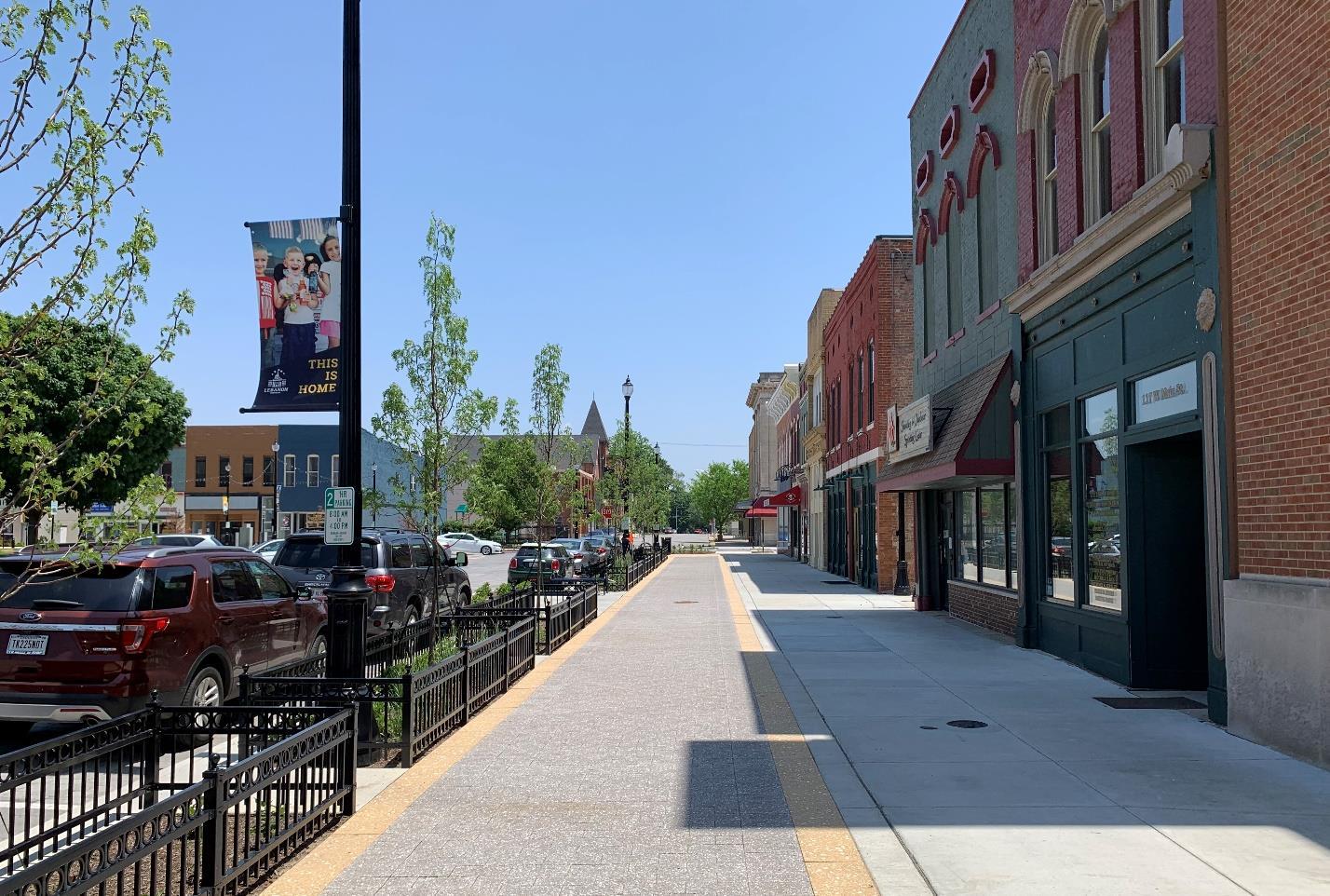
The City of Lebanon Comprehensive Plan
Elements of the new courthouse square streetscape should be used to enhance street connections and create gateways as major corridors extend out of the downtown and transition to residential areas to the north and east and more auto-oriented commercial corridors to the south and west. The same or similar lighting, seating, fencing, and pavement materials can be used to reinforce the downtown identity and character.
Additionally, a trail connection needs to be established between the downtown and Abner Longley Park, the Conservation Club property, and Hot Pond Park. The N. East Street reconstruction included creation of a 10-foot sidepath connecting the downtown and Memorial Park. A similar facility should be created along S. East Street or an alternate route to Abner Longley Park and then east to Hot Pond Park. In conjunction with the extension of the Big 4 Trail from Patterson Street into the downtown, residents and visitors would then be able to travel to and from any of the major park and recreation destinations in Lebanon all the way to Thorntown on a dedicated bicycle and pedestrian facility.
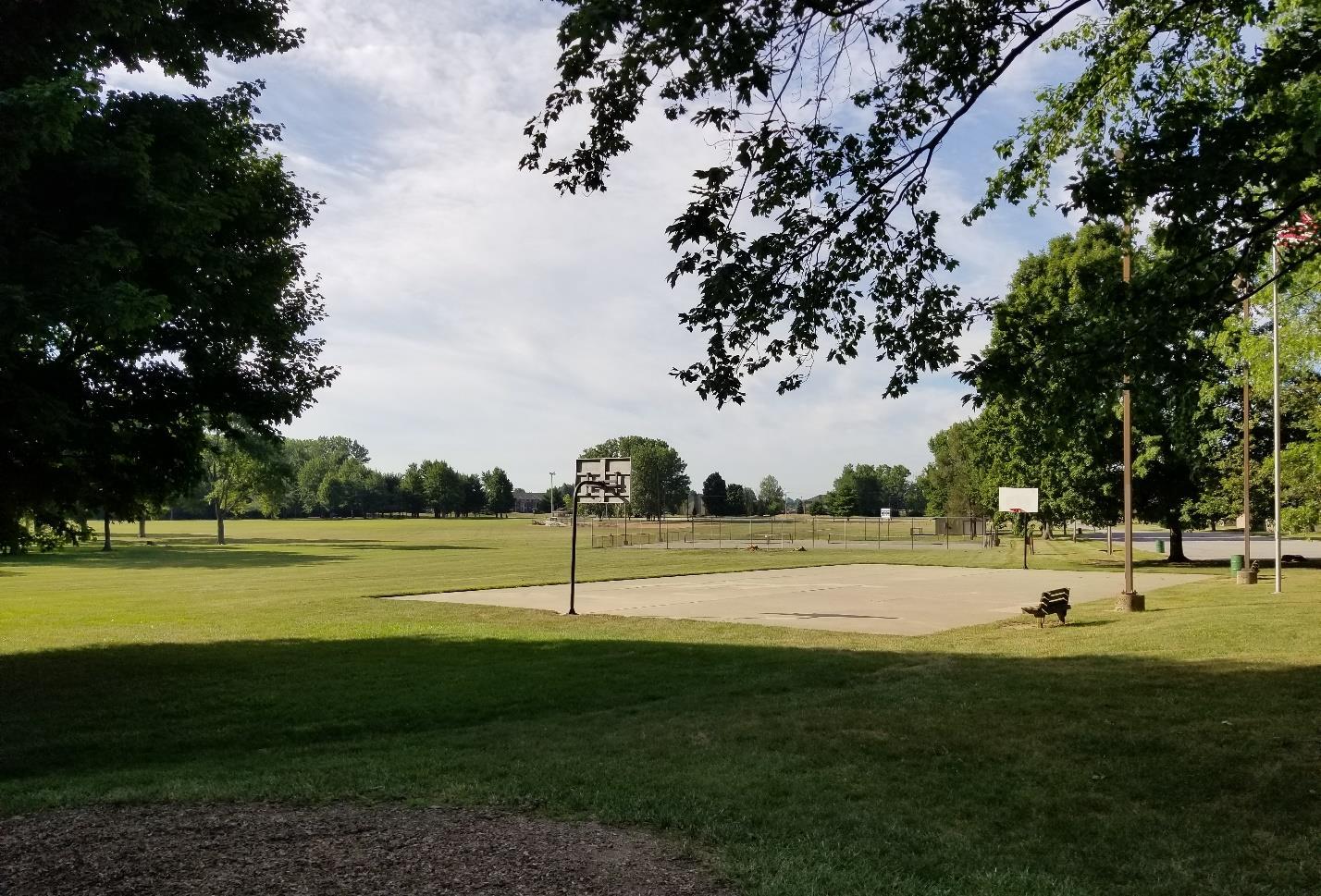
The City of Lebanon Comprehensive Plan
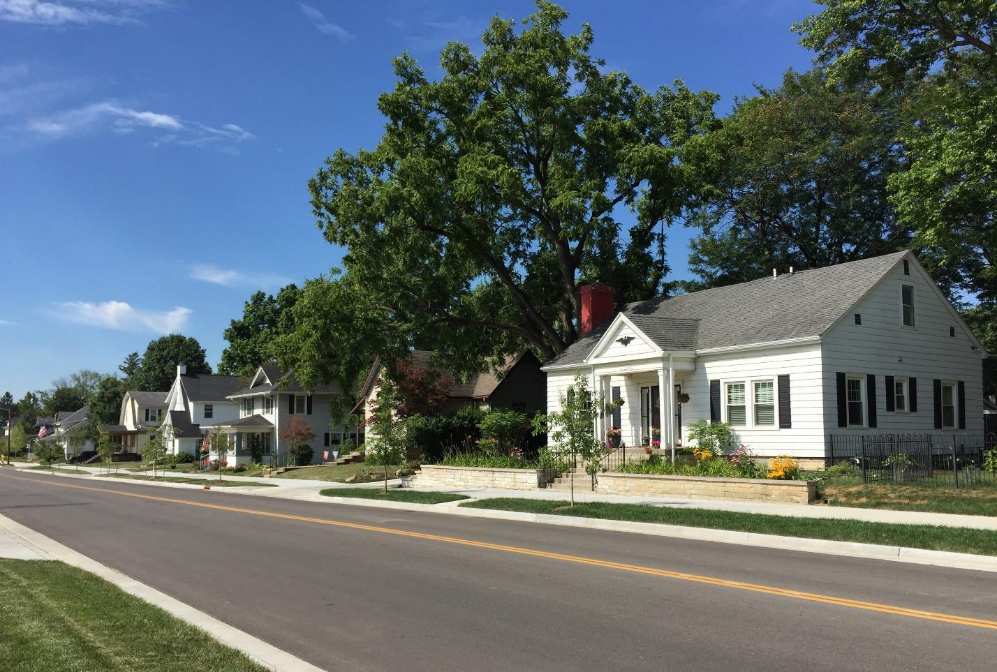
Streetscape enhancements along N East Street have improved the connection between downtown and Memorial Park.
Downtown Lebanon is an employment, entertainment, recreation, and dining destination in the community. Improving connectivity to the downtown will:
• Enhance quality of life for residents and improve visitor experiences with the community.
• Reinforce the historic quality and unique charm present in the downtown area.
• Allow for employees who work in the downtown to more easily commute by biking or walking.
• Establish a trail connection between Memorial Park, Abner Longley Park, and Hot Pond Park.
• Create more attractive streetscapes and neighborhoods adjacent to the downtown.
1. Determine which elements of the courthouse square streetscape can cost effectively be replicated on corridors leading into and out of the downtown core.
2. Expand streetscape recommendations from those included in the Downtown Action Plan to extend further into adjacent neighborhoods.
The City of Lebanon Comprehensive Plan
3. Amend the Unified Development Ordinance to reduce parking requirements in the downtown fringe so that surface parking lots can become infill development sites to better activate streetscapes.
1. Continue to implement streetscape recommendations included in the Downtown Action Plan.
2. Implement extended streetscape designs, including wayfinding signage and design elements established for the downtown, into adjacent neighborhoods and along gateway corridors.
• City Engineer
• Street Department
• Mayor’s Office
• City Council
• Parks & Recreation Department
The City of Lebanon Comprehensive Plan
Create a city-wide public art program to facilitate public art installations and programming.
Applicable Frameworks:
• DOWNTOWN
• QUALITY OF LIFE
Successful public gathering spaces typically contain art, and more cities are using art coupled with programming in public spaces to highlight their culture, promote economic development, and add to the quality of life and image of the community. Public art is most effective when it results in awareness and interest in civic design within a community. Public art can take many forms, but in general is designed with the intent to be displayed and experienced in the public realm, as opposed to in a museum or gallery. Public art may include:
• Wall murals
• Sculptures
• Interactive water features, video images, or light displays
• Formally designed gardens
• Integrated architecture and landscape architecture design
• Pop-up or installations intended to be temporary
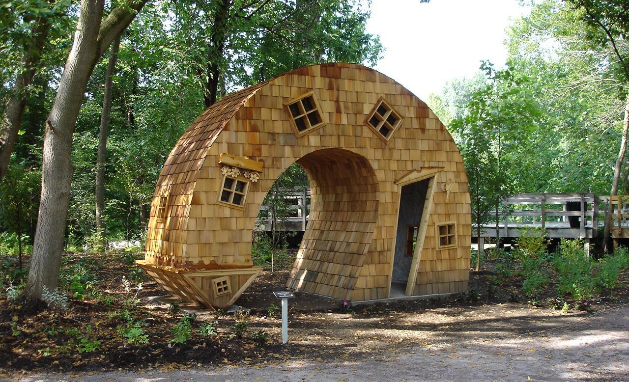
The City of Lebanon Comprehensive Plan
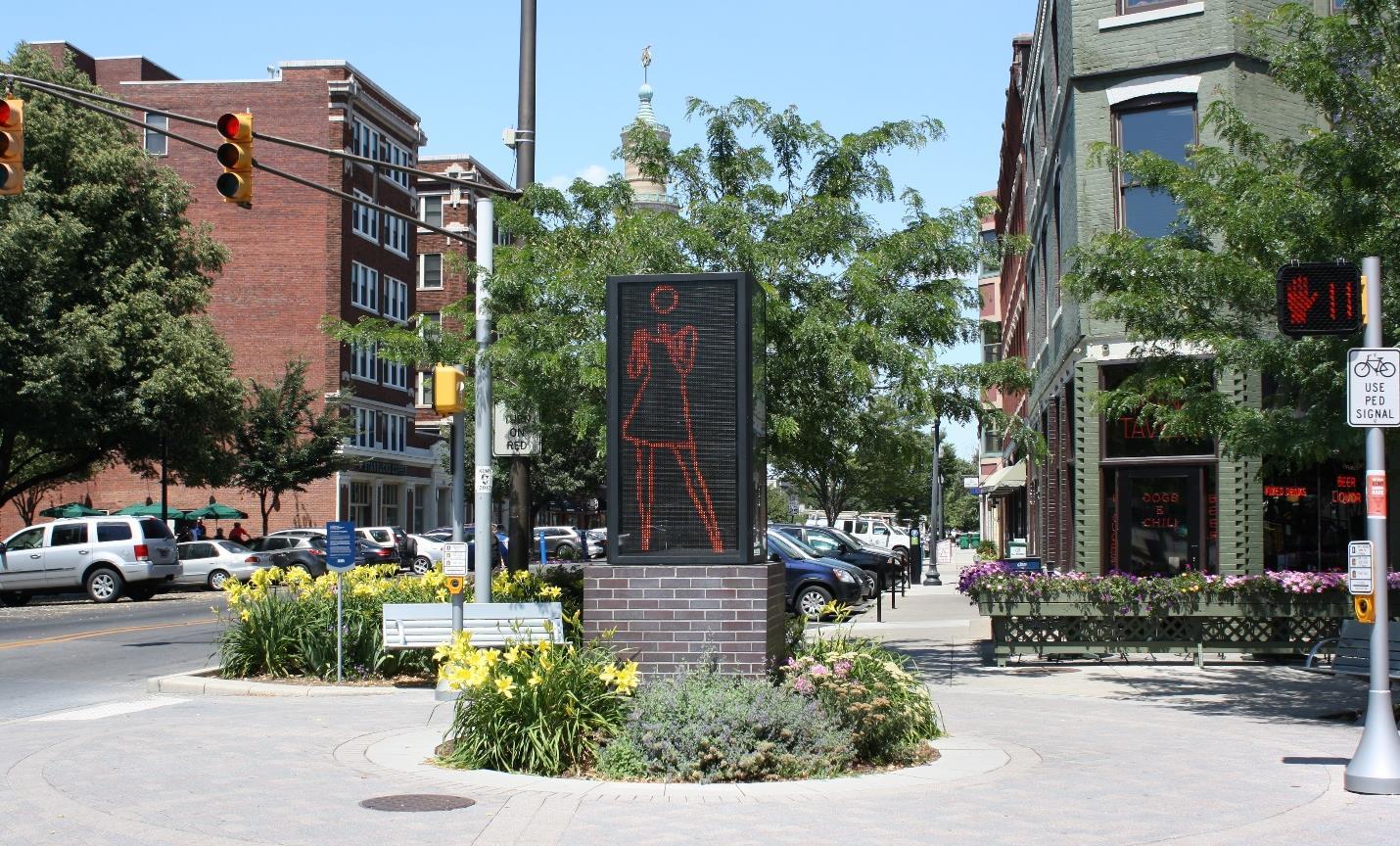
Freestanding public art in Indianapolis, IN.
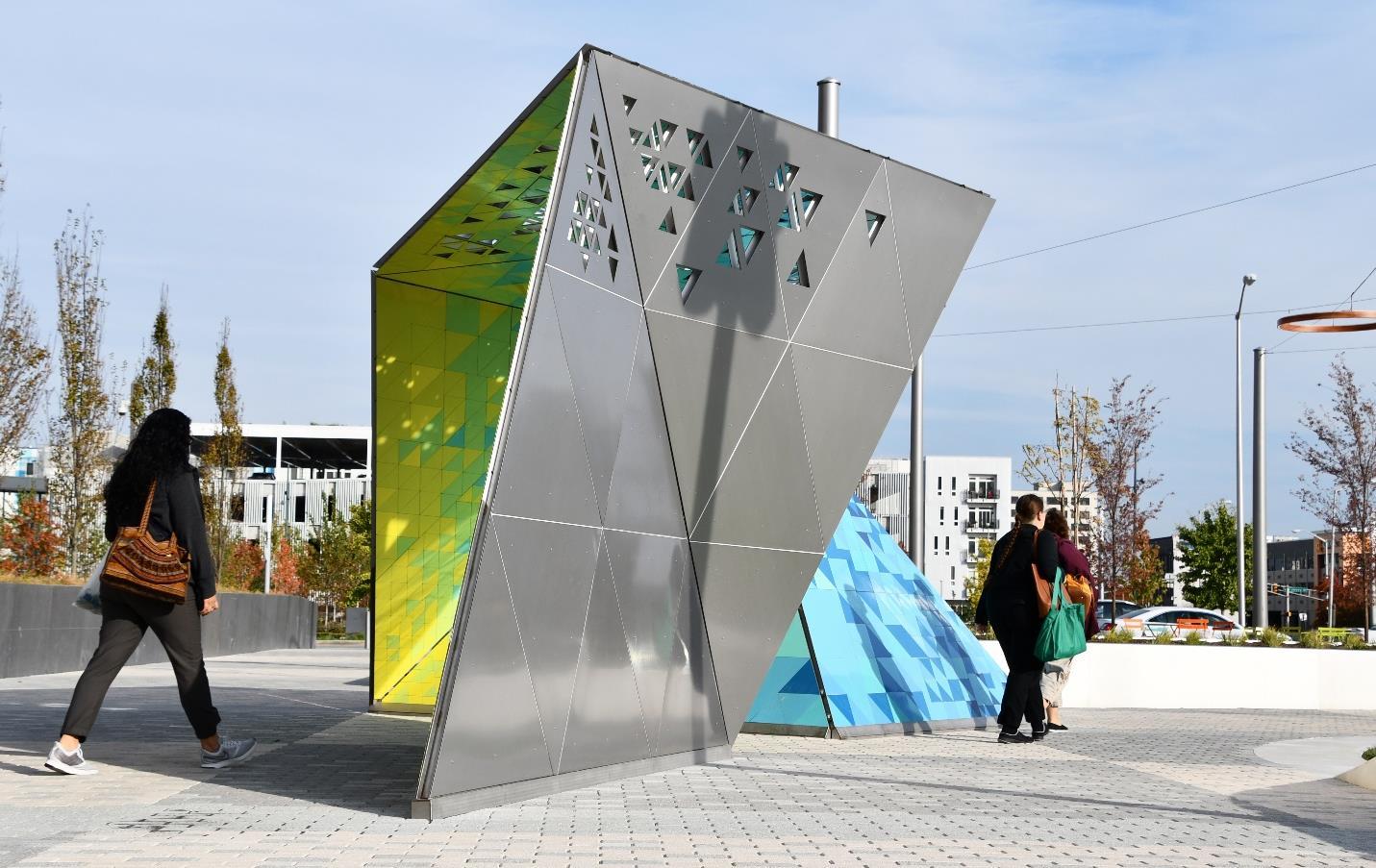
The City of Lebanon Comprehensive Plan

The article “Why Public Art Matters,” published by the Americans for the Arts (2018), explores how public art impacts five community values: economic growth and sustainability, attachment and cultural identity, artists as contributors, social cohesion and cultural understanding. Conclusions of the article include:
• Public art directly supports tourism and economic development strategies by attracting and retaining residents. Additionally, developers now use art to attract and keep renters. From a 2016 Americans Speak Out About the Arts Survey, “Half of the people with a college degree and a majority of Millennials and Generation Xs say they would strongly consider whether a community is rich in the arts when deciding where to locate for a job.”
• Art allows people to create a connection to their community or feel an attachment to a public space. Public art can make places unique by reflecting local history, design, and architecture. From a 2018 Americans Speak Out About the Arts Survey, “70 percent of Americans say they experience the arts in a non-traditional arts venue such as a park, hospital, shopping mall or airport.”
• Inviting local artists to contribute to the design of public space demonstrates the community’s commitment to cultural enhancement.
• Public art tells a visual story of the heritage of other cultures. Understanding other cultures promotes social cohesion and acceptance. From a 2018 Americans Speak Out About the
The City of Lebanon Comprehensive Plan
Arts Survey, “72 percent of Americans believe the arts unify our community regardless of age, race, and ethnicity.”
Art can be permanent, temporary, or pop-up for a day. Temporary public art has a predetermined life span. It is a great way for a community to introduce art into a community. Temporary art, such as a mural on the side of a wall, can add visual interest in the downtown. In effect, using rotating art within the community becomes an exhibit without residents going to a museum. Some communities have even paid rent to artists to display art temporarily. Pop-up art is typically a temporary art event showcasing emerging artists and their work. Pop-up art can also be used to fill in a vacant downtown store to provide interest, detract from a vacant space, and increase traffic downtown.
Most communities start small with temporary art or pop-up art events. Temporary art allows the community to gauge the interest of the public in an on-going art program. Typically, proactive art programs are linked to a redevelopment commission or board of works, where they can be incorporated into the capital improvement program. Other communities have established an art commission, created by the City Council through an ordinance. With a public art program, a community will need to develop a plan that identifies sites, concepts, and potential approaches for integrating public art into capital projects. This plan would then be submitted to the arts commission and approved by the City Council. Once approved, the staff would develop project parameters, a process for selection of artists, and coordinate artists’ work with the professionals designing a public space, park, or capital project. The arts commission, City Council, and staff would need to determine how to fund this program. Many communities have used the following sources:
• Fund as part of capital improvements plan.
• Create a grant or other special funding programs for private donors, not-for-profits, etc.
• Charge a 1% public art fee to development applications to fund program.
• Provide incentives if public art is included as part of a development.
The City of Lebanon Comprehensive Plan
• Increased art throughout Lebanon.
• Public art incorporated into new developments.
• City supported public art program.
SHORT-TERM ACTIONS
1. Ensure the Unified Development Ordinance permits art, including statues, murals, and other elements that can be considered art as opposed to just signage.
2. Create a list of potential sites on City-owned property that could include an art element.
3. Curate temporary art exhibits or installations inside any vacant buildings in downtown to provide some visual stimulation and limit the impact of vacant buildings downtown.
4. Rotate local art exhibits in the lobby of City Hall.
LONG-TERM ACTIONS
1. Create opportunities for public engagement with the arts and culture events through programming, such as festivals and art shows that could be hosted downtown.
2. Develop a “mini-grant” program which would award a grant to community organizations for performing and visual art activities.
RESOURCES / ORGANIZATIONS / IMPLEMENTERS
• Planning Department
• The Heart of Lebanon
• City Council
• The Community Foundation of Boone County
• Parks & Recreation Department
• Board of Works
• City Engineer
The City of Lebanon Comprehensive Plan
Support the creation of an innovation center and business incubator to better develop entrepreneurial talent and offer flexible office space options to help grow successful businesses.
Applicable Frameworks (to be replaced with icons, delete those that do not apply from list below):
• DOWNTOWN
• ECONOMIC DEVELOPMENT
Sustaining long-term economic growth in the community comes from fostering the development of ideas and creation of new businesses from existing City assets. Too often, economic development activities focus on attracting new businesses, and subsequently jobs to the community. While new business attraction does have a positive economic impact on the local economy, it can require substantial resources. A business incubator and innovation center can help to facilitate the development of entrepreneurial talent and startup businesses in the City. The goal of the innovation center/incubator is to grow ideas into successful businesses that then leave the facility as economically viable companies, thereby creating jobs and supporting the local economy.
An innovation center and business incubator will typically provide two types of services. Business assistance services may be in the form of technical support and management guidance related to business strategy, marketing, finance, legal, or product development as well as more general networking connections. Facility-based services can include both a coworking space and small, flexible office spaces for start-up businesses. Coworking spaces can host a variety of entrepreneurs and small businesses and typically include an open workspace with a variety of workstations as well as breakout or conference rooms. Coworking spaces can host special events, networking opportunities, and casual meet ups. In addition to the coworking space, it can be beneficial to offer individual, small office spaceswith short term leases. As companies succeed and grow out of the coworking space they may want a more private office. However, these companies are still considered start-ups and can’t provide the assurance for long-term office leases. If successful, they may quickly outgrow an office space or be acquired by a larger firm and join their office. If not successful, they may shift focus or have to contract back into a coworking space or home office. Either way, a long-term lease on an office space for a handful of employees is not practical.
The City of Lebanon Comprehensive Plan
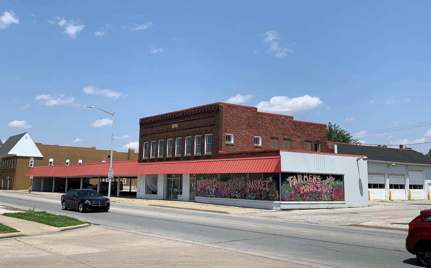
Additional redevelopment could occur along the west side of S
The City of Lebanon Comprehensive Plan
A coworking space has been discussed as part of a larger mixed-use development on S. Lebanon Street. Such a project would greatly contribute to downtown revitalization efforts by creating modern living units, new retail opportunities, and an economic and activity hub in the coworking space itself. In fact, a business incubator and innovation hub shouldn’t be isolated to an office building. Integrating it with other uses in a walkable district will further the goals of interaction and information sharing for the betterment of all involved.
Launch Fishers is a local example of an entrepreneurial coworking space. Founded in 2012, Launch Fishers is organized as a not-for-profit organization, but it did receive most of its initial funding from the Town of Fishers and again when Launch Fishers grew out of its initial space into a larger, renovated office facility. The current space is over 50,000 square feet and includes open work spaces, numerous conference and meeting rooms, 16 dedicated offices, and a full-service coffee shop. It hosts multiple events every week, on a range of topics to help build successful businesses. Membership is available on a monthly or annual basis and is open to all, not just Fishers residents.

Launch Fishers is a local example of a coworking and entrepreneurship space founded in 2012 in Fishers, IN. Credit: CC image courtesy of Tom Britt on Flickr (https://creativecommons.org/licenses/by/2.0/legalcode)
The City of Lebanon Comprehensive Plan
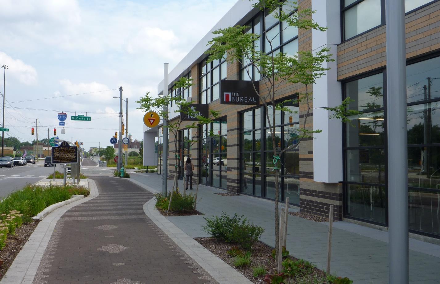
The Bureau coworking space is part of the Hinge mixed use development in Indianapolis, IN.
Enhancing the entrepreneurial atmosphere in Lebanon through creation of a business incubator and innovation center will:
• Develop a coworking center focused on innovation and business incubation as part of a larger mixed-use redevelopment project on S Lebanon Street.
• Facilitate the startup and growth of successful small businesses from the ideas of existing and future residents, ultimately creating jobs and value in the City.
• Foster a collaborative atmosphere among the small business community in Lebanon.
• Create new energy and excitement in the downtown.
• Assist with the creation of a more balanced and sustainable local business community.
1. Explore potential demand for such a facility to ensure it is appropriately scaled.
2. Determine the facility’s mission and goals to help shape the space’s identity (program offerings, membership options, space needs).
3. Collaborate with other coworking facilities and organizations to learn from their experiences.
The City of Lebanon Comprehensive Plan
1. Partner with a developer to create the innovation center and business incubator.
2. Develop a coworking and entrepreneurial culture in the facility to grow successful businesses in Lebanon.
• Private Development
• Boone County Economic Development Corporation
• Boone County Chamber of Commerce
• Mayor’s Office
• City Council
The City of Lebanon Comprehensive Plan
Work with property owners to develop marketing materials for potential development sites and advertise potential City investments and incentives regarding economic development.
Applicable Frameworks (to be replaced with icons, delete those that do not apply from list below):
• LAND USE & DEVELOPMENT CHARACTER
• ECONOMIC DEVELOPMENT
The City, in conjunction with Boone EDC, can assist property owners and real estate brokers in advertising potential development sites in accordance with future land use plans. Oftentimes, there is local knowledge about potential development opportunities that does not get translated to site selection databases. While the Boone EDC and IEDC host interactive site mapping applications on their websites, not all properties may be represented. Sites advertised by owner or with smaller brokerages may be left off site selection websites. Continuing to develop these relationships may increase the number of potential development sites on the market and present an image that the City is development friendly. Similarly, some potential development sites may not formally be listed as for sale, but the owner is willing to sell given an appropriate offer.
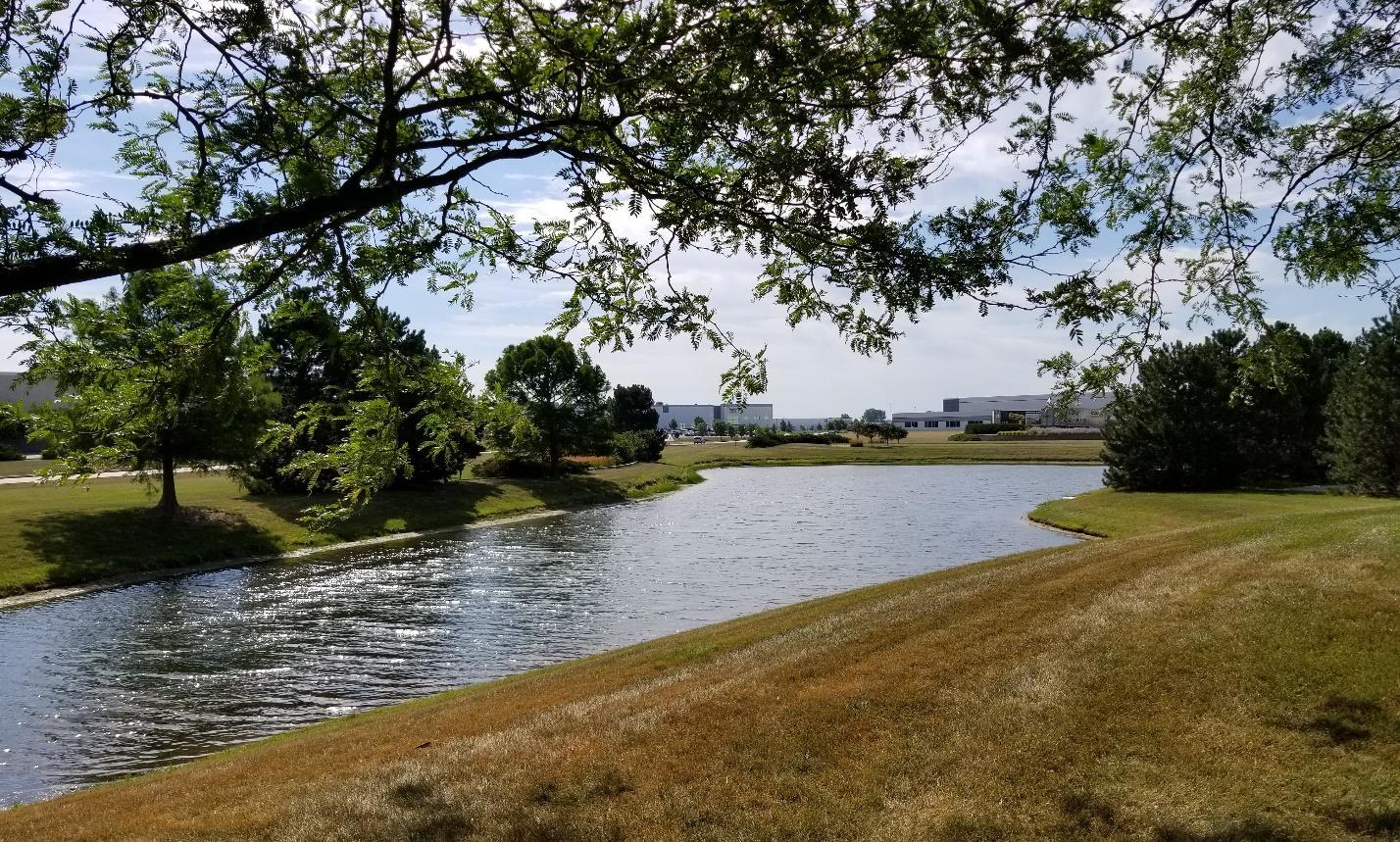
The City of Lebanon Comprehensive Plan
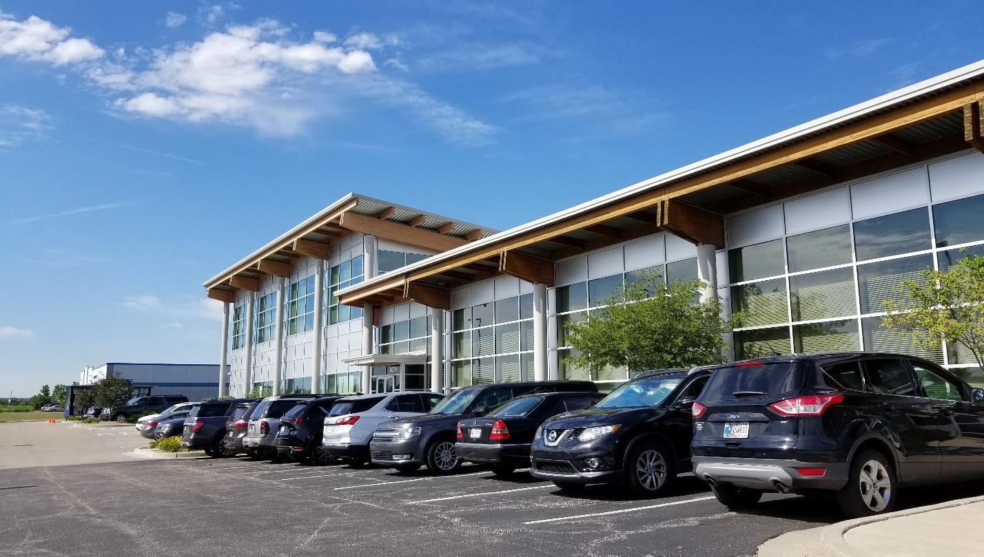
Marketing materials for potential development sites should include details of the property and any existing buildings if they exist, as well as zoning information, future land use classification, and nearby City investments of planned investments such as utility upgrades or transportation improvements. The City should not commit to economic development incentives without a thorough understanding of planned investment, proposed job creation, and average wages, but it may be helpful to outline potential incentives or infrastructure improvements that would be considered for different development types or areas, in line with City goals.
Beyond ensuring sites are advertised, the Indiana Site Certified program is an initiative of the Office of Community and Rural Affairs (OCRA) designed to certify sites that are ready for economic development. Sites are certified as either silver, gold, or prime depending on certain parameters and site characteristics. The City should identify a primary staff person to assist property owners in pursuing site certification in alignment with future land use and economic development goals.
By working with property owners to create marketing materials and by better advertising planned City investments, expected outcomes include:
• More properties being actively listed for economic development potential.
• More properties achieving Indiana Site Certified status.
• Improved communication and clearer expectations between property owners and City leaders regarding city-led infrastructure improvements and potential business attraction or expansion efforts.
The City of Lebanon Comprehensive Plan
The Indiana Economic Development Corporation maintains a site locator mapping tool to help market potential development sites
SHORT-TERM ACTIONS
1. Identify a City staff person to be the official liaison with Boone EDC, property owners, and brokers in desired development areas.
2. Educate property owners about the value of targeted marketing campaigns and the Indiana Site Certified program.
3. Develop marketing templates that can be completed for individual development sites.
LONG-TERM ACTIONS
1. Plan capital improvements with realistic implementation timeframes and advertise those plans with nearby property owners.
2. Evaluate the success of economic development incentives in achieving desired development and job creation goals.
3. Refine economic development incentive offerings to better target desired development and job creation types.
• Planning Department
• Property Owners
• Boone EDC
• Plan Commission
• Redevelopment Commission
• City Council
• Mayor’s Office
• Real Estate Brokers
The City of Lebanon Comprehensive Plan
•
•
An impact fee is a one-time, monetary charge imposed on new development by a governmental unit to defray the capital costs of new construction or an expansion of existing infrastructure needed to serve the new development such as roads, parks, and sewers. An impact fee is established by the legislative body of a community, through an ordinance, that allows the City to collect a fee from new development to pay for all or a portion of the costs to provide or expand public services to the new development. In Indiana, according to Indiana Code 36-7-4-1311, communities can only enact impact fees for the following public services: sewer, water, recreation, roads and drainage.
According to a September 2010 study at Purdue University called A Cost of Community Services Study For Indiana Counties and School Corporations by Larry DeBoer, in Boone County, for every $1 collected from residential uses approximately $1.14 was spent on services as compared to commercial & industrial where only $0.22 was spent on services. Municipal budgets can be significantly impacted by unplanned development. Many city departments try to estimate the costs of yearly services to provide input to the Common Council regarding the City’s budget. Thoughtfully planned new development should consider the following areas of impact: the demand for schools; traffic congestion/road capacity along with necessary road maintenance; air and water pollution; water and sewer capacity; emergency services; and stormwater runoff. These considerations provide valuable information for budget estimations.
Many communities are finding it more difficult to provide services within their community due to decreasing revenues from property tax caps. Therefore, communities must investigate new ways to pay for new development to ensure that basic services are provided. However, that alone is not enough. In this very competitive market, to attract new businesses and residents, communities have to offer more services to increase the quality of life within a community.
There are some requirements that communities must meet before an impact fee ordinance is adopted and fees may be collected. First, the planning department must have an adopted comprehensive plan for the entire jurisdiction. Second, a completed or updated public service improvement plan (i.e. sewer or water master plan, thoroughfare plan, parks and recreation plan) is needed for the impact zone area. These improvement plans must include information and analysis of existing public services, current level of services, projected levels of service, capacity levels of service, estimated locations and costs of additional services as design occurs, and general projections of development within the zone for ten years. Lebanon could have a zone improvement plan for the impact zone rather than a community wide master plan. Finally, an impact fee advisory committee must also be formed to guide the decisions of the legislative body.
The City of Lebanon Comprehensive Plan
In establishing an impact fee, an impact zone must be identified. That impact zone must have a functional relationship to the public service improvements that will be made with the collected fees. For example, the City could identify the southeast side of Lebanon as an impact zone for a sewer impact fee. If a residential development was to be constructed in this impact zone, the impact fees collected would have to be used in the area to support any sewer improvements, expansions, or upgrades.
With the establishment of an impact fee ordinance, a schedule stipulating the amount of fees that may be imposed for each type of public service, and a formula stating how these fees are calculated must be included. This is necessary so that payers can calculate the imposed fees on their development. There are generally two acceptable practices for developing the formulas for the collection of impact fees:
1) A flat fee is charged for a provided service or amenity.
2) A three-part tariff comprises the following:
a. Costs of the construction or improvement to a new or existing facility.
b. Costs of delivery of the service based on the distance from the facility.
c. Actual usage amounts of a larger development versus a single-family development.
The second method allows for a City staff to choose the locations of their new facilities and how to charge for their uses. The market then determines where and what types of efficient development would occur based upon the appropriate fee schedules. Impact fees can be collected in many ways. The process and rules regarding the collection of fees, fee appeals, reduced rates, and use of fees can be found in more depth in IC 36-7-4-1300 series.
If implemented, impact fees would:
• Establish a clear and stable source of revenue to be used for future infrastructure projects.
• Ensure the City is being proactive regarding improvements and expansions to the parks system and transportation network.
• Direct the financial burden of infrastructure expansion to the source of growth as opposed to existing residents.
1. Determine support from Council in order to explore an impact fee
2. Identify key persons to serve on committee including builders, developers, realtors, business owners, etc. These individuals would become the Impact Fee Advisory Committee.
3. Determine the impact zone for each type of public service for which an impact fee would be established.
4. Update public service master plan or create an impact zone improvement plan.
5. Look at impact fees of comparable communities
The City of Lebanon Comprehensive Plan
6. Engage financial consultant and engineer or landscape architect consultant to assist with study.
7. Conduct Study:
a. Determine Impact Zone.
b. Determine to which type of development it will apply.
c. Develop a zone improvement plan or update an existing utility/roads/park master plan which is a detailed analysis of roads, utilities, or parks.
i. Estimate the nature and location of new development within 10 years from the tentative effective date of the ordinance.
ii. Determine the level of service for the impact zone.
1. If an Ordinance is adopted, it will need to be extended every five years to be consistent with Indiana law.
• Resources:
o Penn State University, Costs and Revenues of Residential Development: A Workbook for Local Officials and Citizens
o Penn State University, Calculating a Cost of Community Services Ratio for Your Pennsylvania Community, 1998
o Indiana Code 36-7-4-1300 Series
• Organizations:
o Common Council
o Engineering Department
o Parks Department
o Planning Department
The City of Lebanon Comprehensive Plan
Update the Unified Development Ordinance to reflect the goals and recommendations of this plan.
• LAND USE & DEVELOPMENT CHARACTER
• QUALITY OF LIFE
A Unified Development Ordinance (UDO) is one regulatory mechanism that implements the policies of the comprehensive plan. A UDO is a legal document that combines the traditional zoning and subdivision ordinances, along with other desired regulations such as design guidelines or drainage standards into one comprehensive document. Lebanon adopted its UDO on December 10, 2007. It was amended on November 10, 2015.
The purpose of the Lebanon UDO is to protect the rights of individual property owners while promoting the general welfare of the City. Lebanon uses a zoning map to divide the City into different districts in order to locate specific land uses where they are most appropriate, thereby protecting property values and ensuring the health, safety, and general welfare of the City. In determining the most appropriate zoning designations, the City must consider such things as public utility availability, road access, and the existing or established development pattern of an area in which development is proposed.
When a comprehensive plan is updated, it’s best to review the UDO to determine if any changes are needed. Additionally, zoning ordinances and UDOs have continued to evolve over the years in response to the following: technological advances; the need for more flexibility in development; changes in demographics; lack of attainable housing; multi-modal transportation options; changes in economic development financing and restructuring; emphasis on authentic place; and changes in communications.
Given the time that has passed since the last significant amendment to the UDO and the adoption of this new comprehensive plan, Lebanon should undertake a comprehensive review and make the necessary changes to bring the UDO in line with the comprehensive plan.
Some changes the City should consider include:
• Go Digital: The City’s comprehensive plan has been moved to a website instead of a traditional print or pdf document. The advances in desktop publishing and online services have made it more advantageous to communities to take their UDOs digital. At a minimum, Lebanon should update its UDO document to be hyperlinked within a pdf document to create easier access to different sections in the document and easily find cross references throughout the UDO. The long-term goal would be to integrate the UDO into an online service or website-based document.
• Create A Lean & Streamlined Ordinance: The City’s current ordinance is more than 400 pages. It can be found on the City’s website under the planning department page; however, it is divided into individual chapter PDF’s. There is redundancy in the UDO, and
The City of Lebanon Comprehensive Plan
many different chapters that, if reorganized, would make the document easier to use. Some of the reorganization and consolidation recommendations include:
a. Move the administration section to the end of the document
b. Change Chapter 9 to “Processes and Procedures” and move the “Planned Unit Development (PUD)” chapter into that chapter so it’s all together.
i. Create a matrix that lists all processes and indicate the roles of each body. This should include roles of staff, Technical Advisory Committee, Plan Commission, Board of Zoning Appeals, and Common Council.
c. Move the overlay districts into the zoning districts chapter.
d. Create a preface to the zoning districts chapter that discusses base zoning districts, overlay districts and any special districts.
e. Chapter 7: Development Standards, contains all the major elements that are typically of importance to applicants and developers. Therefore, these should be reorganized and split into different chapters for ease of use, including a chapter on Use Regulations & Standards (see point “d.” below), Dimensional Standards (see point “e.” below), Universal Standards, Development Standards, Natural Resources & Environmental Standards, Parking and Loading Standards, and Sign Standards.
There are longer term items the City should consider:
a. Take each zoning district and reduce to a one-page format. Permitted and conditional uses do not need to be listed with each district and in the use matrix.
b. Incorporate more photos, illustrations, graphics, tables, and charts into the UDO.
c. Simplify language A good ordinance has common language and is clear enough to allow two or more readers of reasonable intellect to reach the same conclusions regarding requirements and processes.
d. Many ordinances today regulate land uses via use specific standards. This allows more uses to be allowed in more districts as long as the necessary conditions are met. This cuts down on sending petitions to the Board of Zoning appeals and streamlines the process to be more efficient and quicker to obtain a permit. This also allows a community to more effectively manage uses that may have more impacts on traffic, incompatibility with adjacent uses, parking, or access.
e. Update the use matrix by broadening the uses and eliminating very specific uses. For example, Lebanon’s use matrix has the following categories professional services, retail/wholesale, food sales & services, and personal services. These categories could be reorganized to include Commercial, Institutional, Lodging, Recreation. Then the uses could be broader because many of the uses in the categories have very similar impacts and therefore does not need to be broken down in as much detail. For example, there is very little difference in impacts between the categories above. Instead uses can be listed more generally under the commercial heading, such as office, personal services, retail store, restaurant with drive-in or drive-through and restaurant without drive-in or drive-through. Just these uses listed above would decrease the size and simplify Lebanon’s use table, especially since the impacts of each of these uses would already be identified and addressed in a use specific standards chapter.
The City of Lebanon Comprehensive Plan
f. Create provisions that allow modifications that can be approved by staff. Adding these provisions into the UDO will allow flexibility, reduce time in the process, and allows the Plan Commission to focus on more important issues than minor details that can be addressed by staff.
g. Review the number of residential districts and see if some of these could be simplified.
h. Determine if there truly is a need for the planned business commercial / planned business office / planned business industrial districts. The intent of these districts is not any different than the vision for Lebanon and other corresponding commercial or industrial districts. The requirement for higher design features could be incorporated into a development standard chapter with incentives for higher design elements.
i. Incorporate current rulings for state and federal cases (i.e. small cell wireless, Reed vs. Gilbert Supreme Court case related to signs)
j. Update parking and loading standards, and incorporate elements for parking flexibility, parking studies, and access management.
k. Develop standards to promote infill development within downtown and the surrounding neighborhoods.
• Avoid Legal Pitfalls: Good ordinances contain reasonable standards that are easy to interpret and administer. They do not single out uses or areas without appropriate justification. Good ordinances are current with existing laws and court decisions. In the current ordinance, there are instances where specific uses are treated differently for no apparent reason, and some regulations do not seem to have a defined purpose. Still others are very subjective without clear criteria. Difficult and conflicting language within various sections of the ordinance make the current ordinance hard to administer and enforce.
• Add in provisions that promote and allow flexibility: With any ordinance, there is a balance between being predictable and being flexible. The ordinance should enforce Lebanon’s updated vision and goals while balancing predictability and consistency. The current UDO does not allow reasonable flexibility and creativity to achieve the intent of the vision and in some cases over-regulates certain issues. Additionally, the current UDO was designed to facilitate greenfield development and does not provide the flexibility needed to facilitate redevelopment on infill sites.
• Updated Ordinance consistent with comprehensive plan polices.
• A more streamlined document that is easier for residents, developers, City staff, and elected leaders to use and interpret.
1. Update Unified Development Ordinance:
a. Determine whether this can be addressed in house or if a consultant is needed.
b. Determine level of digital accessibility the code should have (cross references, pop-up boxes, bookmarks, etc.).
The City of Lebanon Comprehensive Plan
1. Move UDO to an online format:
a. Determine whether a custom website or an online service is desired.
b. Research various options and seek answers to the cost, ability to handle graphics, ease of updating, long-term maintenance.
c. Secure funding from Common Council.
• Planning Department
• Plan Commission
• Common Council
The City of Lebanon Comprehensive Plan
Applicable Frameworks:
• LAND USE & DEVELOPMENT CHARACTER
• TRANSPORTATION & UTILITIES
Development occurring outside Lebanon’s boundary can result in impacts on the City such as increased traffic and incompatible land use. Strong communication and coordination between the City and the County are necessary to mitigate potential challenges. Given the pending growth pressures Lebanon will experience as Boone County continues to grow, the City needs to explore options for how to manage development around, and adjacent to, the City thereby avoiding or reducing unfavorable outcomes. In Indiana, Lebanon has the following two options to better plan for development outside the City, but within a certain distance from the City: Township Joinder or Extraterritorial Jurisdiction.
Township Joinder
According to Indiana Code 36-7-4-1200, in a county where an Area Plan Commission exists, no County planning and zoning exists, or if a City already exercises planning and zoning jurisdiction in a portion of a township, a Township can join with a City so that the City manages the land use and zoning for the area encompassing both the City and the unincorporated County portion of the Township.
Lebanon is primarily located in Center Township, with a small portion of the City extending into Perry Township. Because Boone County is an Area Commission, Center Township could consider joining Lebanon’s Planning and Zoning official area. For this to occur, fifty property owners residing in the Township can petition the Township Trustee to join with Lebanon’s Advisory Plan Commission. The Township Trustee and Township Legislative Board must hold a public meeting and hear the petition within 30 days. However, if a majority of the freeholders residing within the township, but outside of the municipality, sign a remonstrance and file it with the Township Trustee prior to or on the date of the hearing, no action can be taken on the Township Joinder. The Township Joinder request cannot be refiled for one year.
However, if there is no remonstration, then the Township can move forward with the hearing by notifying the Lebanon Advisory Plan Commission. Then both the Lebanon Plan Commission and the Common Council can consider the petition and make decisions accordingly.
The City of Lebanon Comprehensive Plan
If approved, the City would gain the advantage of being able to directly manage development outside its corporate boundary by approving, denying, or adding conditions to new development. This would directly impact how the City spends money to mitigate impacts from this development on City resources (sewer, water, roads, parks, etc.). The Township and the City must decide what is the appropriate action together.
Because Boone County has an Area Plan Commission, the City could consider petitioning the County Commissioners to establish an area outside the City, but less than the entire Township, in which Lebanon can manage planning and zoning. The City could ask to manage planning and zoning within a two-mile boundary from the City’s existing municipal boundary. This process is allowed under IC 36-1-7 et seq. which is the guiding law on agreements. Per Indiana Code, agreements should include guidance on the following:
• Purpose
• Duration
• Manner of financing, staffing and establishing and maintaining budget
• Termination
• Administration
• Disposal of real and personal property
An agreement would be established through a joint planning agreement or interjurisdictional agreement. Joint planning agreements are a form of intergovernmental cooperation that help local governments address cross-jurisdictional impacts on infrastructure, land use, capital improvements, and development timing. Although these agreements can occur between any two or more local governments, most joint planning agreements involve at least one municipality and one county.
The basic purpose of a Lebanon-Boone County joint planning agreement is to create a mechanism for planning and reviewing future growth in a specified area around Lebanon. For joint planning agreements between a City and County, the agreement usually relates to specifically designated county land that may be annexed by the city at some time in the future. Looking ahead to such potential annexations, the City’s interest is ensuring that development within these county areas is compatible with existing City standards and development patterns.
Typically, all interjurisdictional agreements have a timeframe for which the agreement is valid. A termination clause should be included so that either party could terminate the agreement. Additionally, the agreement should be reviewed when either party updates their comprehensive plan or not to exceed ten years, if the comprehensive plan is not updated.
Other topics to work through would include:
The City of Lebanon Comprehensive Plan
• Whose standards would prevail
• Timing of review periods
• Forwarding of applications
The next steps for implementation of an interjurisdictional agreement would include representatives of the City and County meeting to work out the details. A draft agreement would be drawn up and presented to both parties for review. Then the County Commissioners and the Common Council would adopt the formal agreement and set an effective time period for the date on which review or control would begin.
• More consistent land use patterns and construction standards, whether development occurs in the City or County jurisdiction for lands around the City of Lebanon.
• Better communication between City, County, and Township leaders regarding the use, intensity, and timing of development.
• Streamlined process for city planning approval for properties in the process of annexation to the City.
SHORT-TERM ACTIONS
1. Discussion with the Plan Commission and Common Council as to the need to manage land use and its impacts in areas outside of the City.
2. Undertake a study to determine the positive and negative impacts of each process and what would be more supported by residents. As part of this study, initial conversations should occur with the Area Plan Commission, Boone County Commissioners and Township Executive and Legislative Body.
LONG-TERM ACTIONS
1. Based on the results of the study, implement the decision, which could include doing nothing, township joinder, or extraterritorial jurisdiction.
• Planning Department
• City Engineer
• Mayor’s Office
• Lebanon Plan Commission
• Lebanon Common Council
• Boone County APC Office
• Boone County Area Plan Commission
• Boone County Commissioners
• Center Township Trustee
• Center Township Board
The City of Lebanon Comprehensive Plan
Continue to improve bicycle and pedestrian connectivity by filling key sidewalk gaps and expanding the trail and sidewalk network.
• TRANSPORTATION & UTILITIES
• QUALITY OF LIFE
Connectivity and mobility in Lebanon are critical to maintaining the high quality of life of residents. Bicycling and walking are health and recreational activities, but also sometimes the only means of transportation to work, the store, or school. Throughout the comprehensive planning process, a series of survey questions was posted to the project website, and several of these questions related to bicycle and pedestrian facilities. In response to evaluating existing City characteristics, 33% of the 340 respondents indicated that walkability was good, 43% stated walkability was fair, and 21% reported poor walkability. When asked how important it is for the City to develop improved bike and pedestrian facilities, 32% of the 323 respondents indicated that bicycle and pedestrian facilities were very important, whereas 46% responded important.
Another survey question asked what the City’s role should be regarding improvements in residential areas in need of reinvestment. Street and sidewalk repair was selected at the highest percentage, 72% of 365 responses, taking precedence over the following list of action items: providing grants/low-interest loans; housing demolition and resale of lots; street trees and lighting; sewer and water improvements; reduce permitting/inspection; tax abatement; and doing nothing. Finally, when asked to rank the importance of several categories of transportation investments, improvements to pedestrian facilities (sidewalks and crosswalks) averaged the second most important behind only resurfacing existing roads.
The results of these multiple survey responses reveal that there is broad support and desire to increase connectivity and enhance walkability in Lebanon. The City is gaining momentum in working with developers to create more destinations for walking and biking. As the City continues to invest in sidewalks, bike lanes and multi-use trails, the opportunity exists for all residents to take better advantage of this bicycle-pedestrian network as a mode of travel to and from various destinations.
The City, in partnership with Butler, Fairman & Seufert, completed the City of Lebanon Bike & Pedestrian Plan in 2015. The plan makes recommendations for future bicycle and pedestrian improvements, including shared use paths, bike lanes, shared roadways, cycle tracks, and sidewalks across the City. The plan identified and prioritized the following bike and pedestrian routes:
• East Street: bicycle boulevard & cycle track
• Elm Swamp Road - Elizaville Road - Ulen Drive: bike lanes
• Anderson Lane: bike lanes & shared-use path
The City of Lebanon Comprehensive Plan
• Sidewalk Improvement Plan: city-wide sidewalk repairs
• Frontier Drive - Garfield Street: bike lanes & shared roadway
• Indianapolis Avenue: shared-use path
• Grant Street: bike lanes, shared roadway, & sidewalk
• Main Street: bike lanes, shared roadway, & sidewalk
• Abner Longley Park: shared-use path
• Lebanon Street: shared-use path
• Big 4 Trail West: shared-use path
• Chicago Street: bicycle boulevard
• Lafayette Avenue: bike lane & sidewalk
• Noble Street - Peterson Street: bike lane & sidewalk
• Essex Street: shared roadway
• Washington Street: shared roadway
• RR Underpass Trail: shared-use path
• Railroad Trail: shared-use path
• Park Street: shared roadway
• Millerwood Trail: shared-use path
• Camp Street: bike lanes & sidewalk
• Witt Road: shared roadway
• Sam Ralston Road: shared-use path & shared roadway
• South Street - SR 32: shared-use path
• Business Park Trail: shared-use path
• Elizaville Road: shared roadway & sidewalk
• Fordice Road - Fordice Street: bike lanes, shared roadway, & sidewalk
For more details about these recommendations, please see the complete Bike & Pedestrian Plan. In 2018, the City contracted with HWC Engineering to conduct a sidewalk inventory of all sidewalks in the City. The purpose of this study was to identify any gaps in the sidewalk network and evaluate all existing sidewalks on a scale of one to ten, with one meaning seriously deteriorated and ten being in the best condition. Other items identified included barriers in the sidewalk, including mailboxes, vegetation, and vehicles that hindered access, as well as any tripping hazards.
To help quickly repair sidewalks in Lebanon, in 2019 the City implemented a 50/50 Sidewalk Replacement Cost Share Program. The purpose of this program is to assist residents in making improvements in their neighborhood while partnering with the City. The property owner submits a request to the City for a partnership to replace a sidewalk. The City obtains a cost estimate and provides it to the property owner. If agreeable, the City will start construction once the property owner submits their portion of the payment. This program is on a first come, first serve basis until the money runs out. To find out more about the program, please see the City’s website.
Additionally, opportunities may exist to incorporate new trails and sidewalk improvements into the design and construction of new developments. Updates to the UDO are needed in order to require developers of subdivisions, apartments, and mixed-use developments to incorporate these improvements into their design or to provide an easement for the City to construct improvements at a later date.
The City of Lebanon Comprehensive Plan
The comprehensive plan identifies the extension of the Big 4 trail. The extension includes the ongoing construction to connect the existing Big 4 trail on the west side of the City to Main Street. The trail then extends along Main Street to East Street. The trail would continue north on East Street and connect to Washington Street. From there it would extend from East Street to JohnBart Road, where it will turn south to utilize the old railroad right-of-way to continue east to the Midland Trace Trail in Westfield.
• Increase in bike and pedestrian facilities.
• All sidewalk gaps are filled in.
• All sidewalks are considered to be in good condition because of repairs or replacement.
• Improved connections from neighborhoods to schools and parks.
1. Annually evaluate if and what projects to construct during that fiscal year. Facilities close to or connected with schools or parks should be given priority.
2. Review scheduled roadway improvements and incorporate bike and pedestrian improvements before it’s constructed.
3. Incorporate all projects into a new capital improvements plan.
4. Identify and place amenities along the City’s significant trails (i.e., lighting, benches, trash cans, water fountains, help call buttons, etc.).
5. Update the UDO to ensure that new developments have sidewalks on at least one side of the street.
6. Update the UDO to ensure that new development does one of the following: constructs trail connections through development; provides fees in lieu of construction; or dedicates easements to the City to continue proposed trails.
1. Update the Bike and Pedestrian plan every 5 to 8 years.
2. Establish a dedicated annual budget line within the general budget dedicated to sidewalk repair, multi-use paths, trails, and bike lanes.
3. Continue the 2019 50/50 Sidewalk Replacement Shared Cost Program.
4. Work with Boone County and Westfield to connect the Big 4 Trail and Midland Trace Trail.
5. Continue to design and construct segments of the Big 4 Trail.
6. Seek state and federal funding for the Big 4 Trail.
• City Engineer
• Planning Department
• Plan Commission
• City Council
• Property Owners
• Developers
• Boone County Commissioners
• Hamilton County Commissioners
• Indiana Department of Transportation
The City of Lebanon Comprehensive Plan
Applicable Frameworks (to be replaced with icons, delete those that do not apply from list below):
• QUALITY OF LIFE
Many communities realize the value of parks and public spaces and their economic impact within the community. Parks and public spaces come in all shapes and sizes. They can be strictly recreational, used to protect environmental and natural areas, or can simply be passive spaces. They can be located in downtown Lebanon, adjacent to schools or within neighborhoods and can be linear greenways, small pocket parks or large neighborhood parks. Whatever their constitution, the best parks are designed for multi-use versatility.
Successful parks and public spaces usually have five elements associated with them. They are engaging, adaptable, authentic, connected, and iconic. They should be designed to provide comfort, convenience, and enjoyment, fostering social interactions and physical connectivity. Moreover, good design creates visually appealing, interactive space that attracts people every day, year round. It should also be adaptable to support a variety of programming.
It is important for public spaces to also be authentic - celebrating the unique identity, heritage, and culture of Lebanon, while also contributing to the quality of life of a neighborhood or specific area within the city. Connections to the broader City system of sidewalks, bike paths, green spaces, streetscapes, and mixed use environments that connect neighborhoods, employment centers, and cultural districts are necessary. And finally, they should be iconic, creating a unique and transformative experience where they shift the paradigm and redefine their neighborhood or community.
While the intangible benefits of parks and public spaces are wonderful for people’s quality of life, there are quantifiable economic benefits in return on investment and a city’s tax base. As CityLab noted in its “Why We Pay More for Walkable Neighborhoods,” (https://www.citylab.com/life/2012/05/why-you-pay-more-walkable-neighborhoods/2122/) if your home is located within a walkable area and near a park, the value will likely go up by $81.54 per square foot. According to Americans for the Arts’ “Arts & Economic Prosperity III” report, parks and public spaces that incorporate local heritage and art will attract more tourists, while also promoting a sense of pride and connection for residents. For every dollar invested, there is generally a $7 return on the investment.
Amenity infrastructure is so critical that it helps potentially undesirable areas transform into hubs of activity and redevelopment. In many cases, the creation of any park space or public space on a vacant or under-utilized parcel can lead to new residential, mixed-use or retail area around these sites, all of which increase the quality of life for residents and visitors to that community.
The City of Lebanon Comprehensive Plan
Activating Lebanon’s parks and public spaces goes beyond the physical design elements by incorporating interactive programming. Many communities engage residents and attract tourists with performing arts, food trucks, fitness workouts, and dance parties. Often, local governments do not have the capacity or funding to dedicate staff to work on programming; therefore, partnerships between a downtown association, parks department, neighborhood associations, scouts, and other not-for-profit organizations are critical to creating and managing an events program.
• More active parks and public spaces.
• More attendees enrolled in parks programs.
• Increased number of events within downtown.
• Increased number of events at select parks.
1. Identify under-utilized parks and public spaces and determine if design enhancements are needed.
2. Ensure there are sidewalks or trails connecting neighborhoods to the park or public space to allow for safe passage from the neighborhoods.
3. Work with the parks department/not-for-profit/businesses to ensure a continuous cycle of planning, implementation, evaluation, and modification of programs and services for parks and public spaces
4. Identify programming that can occur each season on a yearly basis
a. Encourage stewardship with park and public space clean-up campaigns
b. Implement a community gardening program
c. Consider a fun run or a 5k running event
d. Continue the BBQ Festival
e. Organized sports
f. Yoga in the park
g. Food trucks
h. Ice skating
i. Movies in the park
5. Promote intergenerational programming through outdoor activities, education, community service, and more.
6. Conduct an internal assessment of park department programs to determine what works well, what is missing, and what is desired. This internal assessment should be completed every 2 to 3 years.
7. Periodically survey organizational partners and users to rate satisfaction and identify gaps and opportunities.
1. Develop a network of volunteers that can assist with events or offer unique talents, including nature tours, bird watching, gardening, storytelling, puppet shows, etc.
The City of Lebanon Comprehensive Plan
2. Study the feasibility of developing a Lebanon parks foundation to fund programming and design enhancements at parks.
3. Partner with a not-for-profit organization or hire a full-time staff person to program for Lebanon’s parks and public spaces.
4. Work with Lebanon schools to develop a class that provides opportunities for students to explore and learn about nature through photography, outdoor education, and creative expression through recreation.
5. Work with schools, universities, community colleges, businesses, and community organizations to develop park-based curriculum and programming.
• Parks Department
• The Heart of Lebanon
• Business Owners
• Common Council
• The Community Foundation of Boone County
• Center Stage Community Theater
• Black Box Theater Company
• Lebanon School Corporation
The City of Lebanon Comprehensive Plan
Applicable Frameworks:
• LAND USE & DEVELOPMENT CHARACTER
• HOUSING & NEIGHBORHOODS
• QUALITY OF LIFE
Every community deals with houses in disrepair, unmowed lawns, illegal dumping of trash, and inoperable or abandoned vehicles. Homes that are in disrepair or that have inoperable vehicles on site can eventually affect the values of other properties in the neighborhood.
The purpose of code enforcement is to help minimize the effect of deterioration and blight within a neighborhood or the larger community. Like many cities, Lebanon has a code enforcement officer within the Planning Department and code enforcement provisions within the Unified Development Ordinance (UDO). However, there can be more code violations than the code enforcement officer can keep up with. As a result, code enforcement is sometimes reactionary to complaints.
The process includes the following:
1. Any person in the community can file a written complaint with the Planning Department, or the Planning and Zoning Administrator. Additionally, the Code Enforcement Officer may observe a violation of the UDO
2. The Code Enforcement Officer investigates the complaint or violation.
3. If a violation is deemed to have occurred, the Code Enforcement Officer issues a citation for a civil zoning violation. The property owner must remedy the citation via different options noted in the UDO
4. If not remedied, then monetary fines, injunctions, or a trial can occur.
It may take several months to resolve even a minor violation and years to resolve a major one if it goes to litigation.
Many communities proactively address potential violations by initiating a code enforcement campaign. This campaign is a program meant to improve compliance with zoning codes by making code inspection more proactive than reactive. The City should periodically focus efforts on widespread or recurring issues, first with an information campaign, then notices to owners of property that are violating codes, and finally formal violation tickets, if necessary. Code officers can proactively establish personal relationships with property owners, tenants, and landlords. This relationship allows code officers to more effectively work with offenders to determine how best to address and remedy the situation before the City is forced to take legal action. The end goal of the program should be compliance and a more attractive community, and code enforcement should not be looked at as a potential revenue stream for the City.
The City of Lebanon Comprehensive Plan
Some communities have also established a separate department to handle less serious violations. Establishing this department requires an operating budget for the department, additional code enforcement officers, and a code hearing officer to hear violations.
• Reduced number of complaints.
• Reduced number of violations.
• Increased compliance without sending violation letters.
• Improved appearance of the community.
1. Remove monetary fines from the Unified Development Ordinance and make them a separate fee ordinance.
2. Develop a pilot program to target a specific area or specific issue within the City for a 6month time frame to gauge how successful the program can be.
3. Seek approval from City Council on pilot program.
4. Implement pilot program and monitor results, including number of existing violations prior to start of program, number of owners/tenants/landlords contacted, number of violations remedied, and the number of citations issued.
1. If pilot program is successful, then implement through the larger City by breaking the City into different geographic regions were code officers would cover each region.
2. Hire additional code officers to implement program to ensure success.
3. Codify the program in the Unified Development Ordinance as an alternative process to code enforcement.
4. Study the feasibility of creating a Neighborhood and Business Services Bureau that could create a quicker remedy process rather than the City using the court system.
• Planning Department
• Property Owners
• Business Owners
• Neighborhood Associations
• Tenants
• Landlords
• Plan Commission
• Common Council
The City of Lebanon Comprehensive Plan
Lebanon Redefined is comprehensive in addressing many different community elements including land use and development character; transportation and utilities; housing and neighborhoods; and economic development While the plan goals and objectives have been organized under these and other categories, they are all interconnected and implementation relies on treating each component as a part of a whole. Great care was taken to ensure the Plan provides policies, programs, and recommendations within the context of that basic reality. With this framework in mind, this section is meant to help community leaders adopt and implement the comprehensive plan
The vision, goals, and recommendations included in the plan have been vetted by the project steering committee and confirmed by residents, but the plan must be treated as a living document. With the plan being entirely website-based, it will be easier for the City to use it as a living plan and make amendments as needed. This means that the plan should continue to evolve over time as physical, economic, and market conditions change, and as resources become available.
The key implementation challenge often comes in translating a plan’s vision, goals, and recommendations into the day-to-day operations and actions of City government. As the City determines how to implement the plan’s recommendations, it is important to continuously consider the integrity of the planning process, Lebanon’s values, its resources, and why the policy, recommendation, or project is important to the City’s future. A plan is a community’s desired future. It is the collective will and roadmap for how to achieve that future. It is critical to find ways to give the plan life and maintain its integrity.
Extensive discussion was undertaken to ensure the comprehensive plan reflects the desired land use pattern for the community, and identifies improvements needed for undeveloped and targeted redevelopment areas over the next 20 years. This 20-year period allows adequate time to implement new development ordinances, adjust existing land use patterns where needed, and improve the multi-modal transportation network. It also allows the City adequate time to formulate capital improvement strategies and funding sources to implement the recommendations and achieve ultimate success of this planning effort. The planning department will track progress in meeting the plan goals and objectives, when an update should be initiated, what changes should be incorporated, and how those changes will be incorporated. Any amendments should include an evaluation of the vision, goals, objectives, and key initiatives
The City of Lebanon Comprehensive Plan
Once the planning process is over, many communities struggle with what to do first. This section provides guidance on what needs to be completed and in what order. This section is broken down into ten subsections including:
• Early Action Initiatives
• Adoption
• Interpretation
• Implementation Committee & Work Plan
• Annual Review & Report
• Monitoring & Updating the Plan
• Unified Development Ordinance Update
• Fiscal Considerations
• Capital Improvement Program
• Private Land Use Decisions
• Coordination and Partnerships
Early action initiatives are the immediate next steps the City needs to take to implement the Comprehensive Plan. These early actions include:
1. Adoption of the Comprehensive Plan by the City Council
2. Creation of a Joint Implementation Committee
3. Update the Unified Development Ordinance
4. Update forms, applications, and develop an online submittal process
5. Develop a planning focused annual review report
6. Develop a five-year capital improvement plan
The first step in implementation is to adopt the comprehensive plan. The process begins with the Plan Commission. They hold a public hearing to review the comprehensive plan and recommend approval to the City Council. The Council must prepare a resolution to adopt the comprehensive plan to ensure that it promotes the public health, safety, morals, convenience, order, or the general welfare and for the sake of efficiency and economy in the process of development. Typically, the City Council allow additional public comment as part of the resolution adoption process. Using a resolution, the City Council will formally adopt the Comprehensive Plan by a simple majority vote. The procedures for adopting and amending a plan are described in Indiana Code, 36-7-4-500 Series.
The City of Lebanon Comprehensive Plan
The Comprehensive Plan does not contain the actual decisions that the Plan Commission or City Council should make regarding development and redevelopment; however, it does provide guidance of the community’s collective vision for future growth and change in the City, and should be interpreted as such. City staff, Plan Commission, and City Council members should interpret the goals and objectives as a long-term and deliberately broad vision. The commission and council should keep in mind that this plan reflects the community’s values, and the spirit of this plan should be adhered to in order to ensure the community input is respected. The strategic action steps, on the other hand, are intended to direct the day-to-day decisions concerning more specific and task-oriented activities. Members of the City Council should interpret the strategic actions steps by saying, “given our long-term goals and changing community conditions, these are the projects and programs that we want to complete in the short-term and long-term, and this is how we plan to accomplish them.” Interpreting the plan in this way will enable the members of both the commission and council to justify their approval, or denial, of planning and zoning petitions
When a zoning change, subdivision, or site plan review request is filed, City planning staff as well as other city departments should review and evaluate the application against the Comprehensive Plan and the City’s ordinances to provide a staff report with a formal recommendation to the Plan Commission regarding its findings. The staff report should include an evaluation of the development and the degree to which the proposed project conforms to the plan’s vision, goals, objectives and key initiatives
Zoning protects the rights of individual property owners while promoting the general welfare of the community. The purpose of zoning is to locate specific land uses where they are most appropriate. In determining the most appropriate zoning designation, the City must consider such things as public utilities, road access, and the existing or established development pattern of the area in which development is proposed. When an application for a rezone or planned unit development (PUD) is submitted, the Plan Commission and City Council should consider the recommendations of the Comprehensive Plan in deciding whether to approve the rezone or PUD. In general, the Plan Commission and City Council should consider that a rezone/PUD is only justifiable under the following circumstances:
• When the requested rezoning is consistent with the long-range land use plan included in the Comprehensive Plan.
• When there was an error or oversight in the original zoning of the property
• When changes have occurred to conditions in the vicinity of the property which prevent the reasonable use of the property as currently zoned.
• When the requested rezoning benefits the community at large.
The City of Lebanon Comprehensive Plan
Rezones should not be granted because of a single hardship expressed by a property owner or group of property owners. The community’s collective vision for the future is not negotiable. Should the Plan Commission recommend approval to the City Council for numerous rezones that are substantially inconsistent with the future land use map associated with the Comprehensive Plan, the plan should be updated. This is an indication that the area’s conditions, issues and/or priorities have changed.
For the plan to be a living document, it must be used to define the City’s work plan and agenda for the physical, fiscal and policy implementation mechanisms. Therefore, the Plan Commission and City Council should jointly create an Implementation Committee to help guide the City staff in preparing and prioritizing elements of the comprehensive plan. The Implementation Committee should develop an annual work plan by prioritizing the recommendations and actions steps for the fiscal year and develop a strategy for moving these items forward. This information should be shared and approved by the City Council, since they control the budget for the City. It will be important that this is completed prior to City budgeting time in order to ensure adequate funding is in place for those policies or programs that require financial resources It is best to try to develop a work plan in two-year increments so that the Plan Commission and City Council and supporting department staff can allocate budgetary resources to help implement the appropriate recommendations prioritized for the upcoming year.
Annually, the staff should perform an audit of the planning department and incorporate benchmarks of the comprehensive plan. Generally, the planning department keeps track of the number and type of cases that are before the Plan Commission and Board of Zoning Appeals. They also know how many building permits are approved each year by building type. These should be summarized in an annual report and provided to the Plan Commission and City Council at the beginning of the following year. This gives these bodies the ability to see trends emerge regarding growth and development patterns of the City as well as the impact government policies are having. Additionally, given the plan is in the format of a website, the City could eventually incorporate the annual review into the implementation or benchmark section of the plan.
Planning does not have a defined beginning and end. It is an on-going process that responds to new information and circumstances and incorporates changing conditions into decisions.
The City of Lebanon Comprehensive Plan
Circumstances that may change include physical conditions of buildings and/or infrastructure, the economic climate, the natural environment, and social and community goals.
Once the plan is adopted it will need to be revised from time to time to ensure that it stays consistent and relevant to current conditions. This plan should be updated approximately every five years, unless otherwise directed by the Plan Commission or City Council. This update does not need to be a complete overhaul or rewrite of the plan. The City’s prime consideration in deciding when an update is needed should include what changes have occurred since the Plan was last updated. These changes may be in such areas as the economy, the environment, changes in administration, traffic congestion, jurisdictional priorities, projected growth or something else significant. The plan update should include a thorough review and evaluation of the vision, goals, objectives, and key initiatives. Within that review, each development policy should be reviewed for achievement, in process or lack of relevancy. Policies that have been achieved or are not relevant should be changed or removed from the plan. New policies should be developed, if necessary, to accommodate any changes in conditions and ensure the plan is still effective. A plan update should also include a thorough review of the validity of all the information contained within the plan and should include extensive opportunities for involvement by the public, boards and commissions, elected and appointed officials, staff and other affected interests. The plan update process is further described below.
A disciplined schedule for plan review is helpful in plan implementation. Noting areas of the plan’s success helps to build support for future planning activities. The identification of less successful components of the plan may suggest a need for refinement and/or amendment. The Implementation Committee should therefore conduct a thorough annual review of the plan, asking whether the conditions on which the plan was predicated still hold true. An annual “report card” should be prepared by the City staff which reviews and documents the activities of the Redevelopment Commission, Plan Commission, Board of Zoning Appeals, and City Council that are relevant to the Comprehensive Plan.
Prior to preparing the annual City operating budget, an assessment should be completed that documents the impacts of the plan implementation activities. This assessment should consist of the following:
• Major differences between projected economic and demographic growth rates and actual growth.
• Necessary adjustments to the implementation tools and techniques, sometimes brought on by changes in state legislation
• Deviations by the Redevelopment Commission or Plan Commission from the plan, and why those deviations were made
• Requests for amendments to the plan, in order to determine if there is a pattern of requested changes emerging.
The City of Lebanon Comprehensive Plan
• Changes in the local/regional political structure that may affect the implementation of the plan
• Identifying the plan recommended programs and projects that have been completed
• For each implementing program/project, develop criteria that can be used to measure the effectiveness of the program, apply those criteria, and write a report summarizing the strengths and weaknesses of the program
• Identify new programs, if any, that should be implemented.
• A separate process exists for amendments to the Plan. The City should perform amendments on a yearly or periodic basis as needed. This plan amendment should be at the recommendation of the Implementation Committee. Plan amendments may include changes to the land use plan map, other maps, or may be as small as correcting text.
The Comprehensive Plan is a statement of policy and is not a regulatory document. The most common regulatory means for implementing the plan is the City’s Unified Development Ordinance (UDO). The UDO is a combination of the zoning ordinance and the subdivision control ordinance into one document. The UDO controls the use, size, density, and character of development within a district using various standards. Zoning classifications are broken into permitted land uses within each district as well as conditional and special exception land uses. In addition to restricting uses, zoning ordinances also dictate the bulk of development, typically through height requirements, floor-area ratios, and/or maximum land coverage, and building placement, typically using lot setbacks. The UDO also contains standards for the division of land and the development of many types of infrastructure within subdivisions. Standards include the splitting and design of lots, design of streets, sidewalks and multi-use paths, and other physical improvements to the land. These subdivision standards protect landowners from inadequate services and ensure taxpayers are not burdened with the cost of replacing improperly installed or inadequate infrastructure
The UDO is managed through Lebanon’s Planning Department in conjunction with the Plan Commission. After the Plan is adopted, the City should consider revising the UDO to be consistent with the recommendations of this plan. Some potential amendments to consider include:
• Make the UDO more user-friendly by creating a digital, hyperlinked version of the Ordinance that allows easier navigation
• Incorporate additional graphics to convey concepts and use tables to display information wherever possible.
• Remove information that can be put in applications
The City of Lebanon Comprehensive Plan
• In the downtown, look at more character standards such as orientation to the street, setback, building height, parking, and first floor transparency.
• Remove redundancy throughout the ordinance and use cross references
• Update parking standards, look at using maximums instead of minimums, reduce the required number of parking spaces, update downtown parking standards to further reduce the amount of parking downtown or omit parking standards entirely in favor of regulating only the design and location of parking; incorporate parking flexibility including shared parking
• Use more common language, removing a lot of the legalese in the UDO.
• Update sign standards so they are consistent with the updated court ruling regarding Reed V. Gilbert.
• Expand the definitions section and move the Defined Words and the Meanings of Words into the Definitions Section, which should be at the end of the UDO.
• Create a mixed-use district beyond just the Central Business (CB) District.
• Examine whether to combine some of the Single Family (SF) Districts and allow more types of residential dwellings in the Single Family (SF) Districts.
• Examine the planned business commercial, business office, and business industrial districts and determine if any of these districts can be combined.
• Create an article where all uses are listed, and under each use list any standards applicable to those uses. This is an excellent way to manage issues for specific uses
• Move elements of the PUD section into the Administrative and Procedures Article.
• Update telecommunications provisions to be consistent with small cell structures Indiana State Law.
• Update the use matrix and align with NAICS codes for staff to better interpret uses that might not be in the use matrix in the future.
• Put sign regulations in a table to quickly understand and access information instead of reading through all the text.
• Develop lighting standards
• Re-evaluate if conservation subdivisions are a viable option in Lebanon
• Update any cross references or design standards for street, pedestrian, and utility standards since some of these standards are sometimes set by other departments.
• Write a process for splitting lots.
• Add a section on vacation, re-subdivision and combination of plats.
• Add a section on assurances for completion and maintenance of improvements.
• Add an alternative enforcement penalty of ticketing.
The City of Lebanon Comprehensive Plan
The implementation of the comprehensive plan will require the City’s financial commitment and support. Although it is the City’s intent to administer this plan with the current financial resources available, monies may need to be set aside in future budgets to carry out some of the recommended actions. The adoption of the Comprehensive Plan does not authorize expenditures for its implementation. The City Council, in accordance with state statutes and the City’s policies, may authorize the financial resources to implement the plan. Additional funding may be available from outside sources. When opportunities become available and make sense financially, the City should seek these funds through federal, state or local grants, loans and other resources.
The CIP is a planning document that covers a timeframe of three to five years and is updated annually. It aids in plan implementation by providing the necessary funding for short-range infrastructure and capital improvement projects. The document provides guidance and planning for capital improvements throughout the city and allocates financial resources to various community needs and requests. The document states the City Council’s prioritization of the financial resources available for capital project spending by identifying which projects should be included, when they should be constructed and how they will be financed.
This plan represents the City’s tentative commitment to comply with the plan unless circumstances or priorities change in the future. The commitment is more certain in the first year of the CIP and becomes increasingly more tenuous in subsequent years. Nevertheless, the CIP should be used as the City’s present plan and priority over the next three to five years.
Even though the CIP is a planning document, it should not be an automatic authorization of the construction of projects, because of the procurement process and the allocation of resources.
The Plan guides landowners in the City of Lebanon. If landowners want to use their land in a new way, they need to identify the zoning district in which the property is located and determine whether the zoning regulations allow the development of the proposed land use. If not, the owner needs to examine the Comprehensive Plan concerning the property, since a change in zoning must be consistent with the intent of the Plan.
Planning elements are interconnected between many City initiatives, non-profit-based community projects, and private development. The City should assume a leadership role in
The City of Lebanon Comprehensive Plan
promoting strong partnerships between city, regional, and state public agencies; community groups and non-profit organizations; the local business community; neighborhoods; and the private sector. The City should conduct outreach and continuing education on the Plan’s vision and principles by encouraging developers, builders, and the business community to help implement the Plan.