June 2025

June 2025
It is with gratitude that we acknowledge the many individuals from the Town of McCordsville who helped develop this plan.
Steering Committee
Maria Bond
Greg Brewer
Paul Casey
Tim Gropp
John Jokantas
Alex Jordan
Keith Lash
Devin Stettler
Mark Witsman
Plan Commission
Chad Gooding
Brian Hurley
Katie McLear
Dr. John Price
Brianne Schneckenberger
Scott Shipley
Devin Stettler
Town Council
Greg Brewer
Dr. Bryan Burney
Chad Gooding
Scott Jones
Dr. John Price
Town Staff
Tim Gropp, Town Manager
Ryan Crum, Director of Planning and Building
Mark Witsman, Town Engineer
Stan Wilson, Director of Parks and Recreation
Prepared by:
The McCordsville Advisory Plan Commission held a public hearing on Tuesday, May 20, 2025, to consider a request for a recommendation to adopt the Town of McCordsville 2040 Comprehensive Plan. Notice of the public hearing was advertised and noticed in accordance with Indiana law and the Advisory Plan Commission’s Rules of Procedure. Notice was shown to have been published in a newspaper of general circulation in Hancock County, Indiana.
The petition is as follows:
Docket No.: PC-25-007
Description: An Ordinance adopting the Town of McCordsville 2040 Comprehensive Plan in accordance with IC 36-7-4 500 Series.
Pursuant to IC 36-7-4-508, the McCordsville Advisory Plan Commission hereby certifies that it held a public hearing on the proposed 2040 Comprehensive Plan, and on May 20, 2025, voted to certify a favorable recommendation to the Town Council for adoption of said Comprehensive Plan
The vote of the Advisory Plan Commission was as follows: 7 in favor, 0 opposed.
The above-mentioned recommendation of the Advisory Plan Commission is hereby certified to the Town Council.

Ryan Crum, Director
May 23, 2025________________________________
Date
A comprehensive plan is a guidebook for the development of a community. It considers land use, transportation, utilities, parks, and other elements of the community that are interconnected and provides direction for residents, developers, and local officials as they consider development in the community.
Under Indiana code, the requirements for a comprehensive plan are in the Indiana Code 36-7-4-500 series . This series establishes that comprehensive plans are adopted by resolution and are intended to promote the public health, safety, morals, convenience, order, or the general welfare and for the sake of efficiency and economy in the development process.
The series also establishes the required contents of a comprehensive plan:
1 2 3
A statement of objectives for the future development of the jurisdiction
A statement of policy for the land use development of the jurisdiction
A statement of policy for the development of public ways, public places, public lands, public structures, and public utilities
A comprehensive plan may also include additional elements, some of which are listed in the series, but concludes with “any other factors that are a part of the physical, economic, or social situation within the jurisdiction.”
The 500 series also establishes the adoption process; including that the plan must be available for public comment 10 days before the public hearing and must be noticed, a public hearing must be held, the plan commission may consider adoption of the plan, the recommendation of the plan commission to adopt the plan be certified to the legislative body, and that the legislative body can approve the plan or send it back for revision and plan commission response. After the plan is adopted, it must be filed with the county recorder’s office.
The McCordsville Comprehensive Plan was developed to meet the requirements of the IC 36-7-4-500 series and adopted under the process outlined in the series.
The statement of objectives for the future development of the jurisdiction is in Chapter 1: Vision and Principles
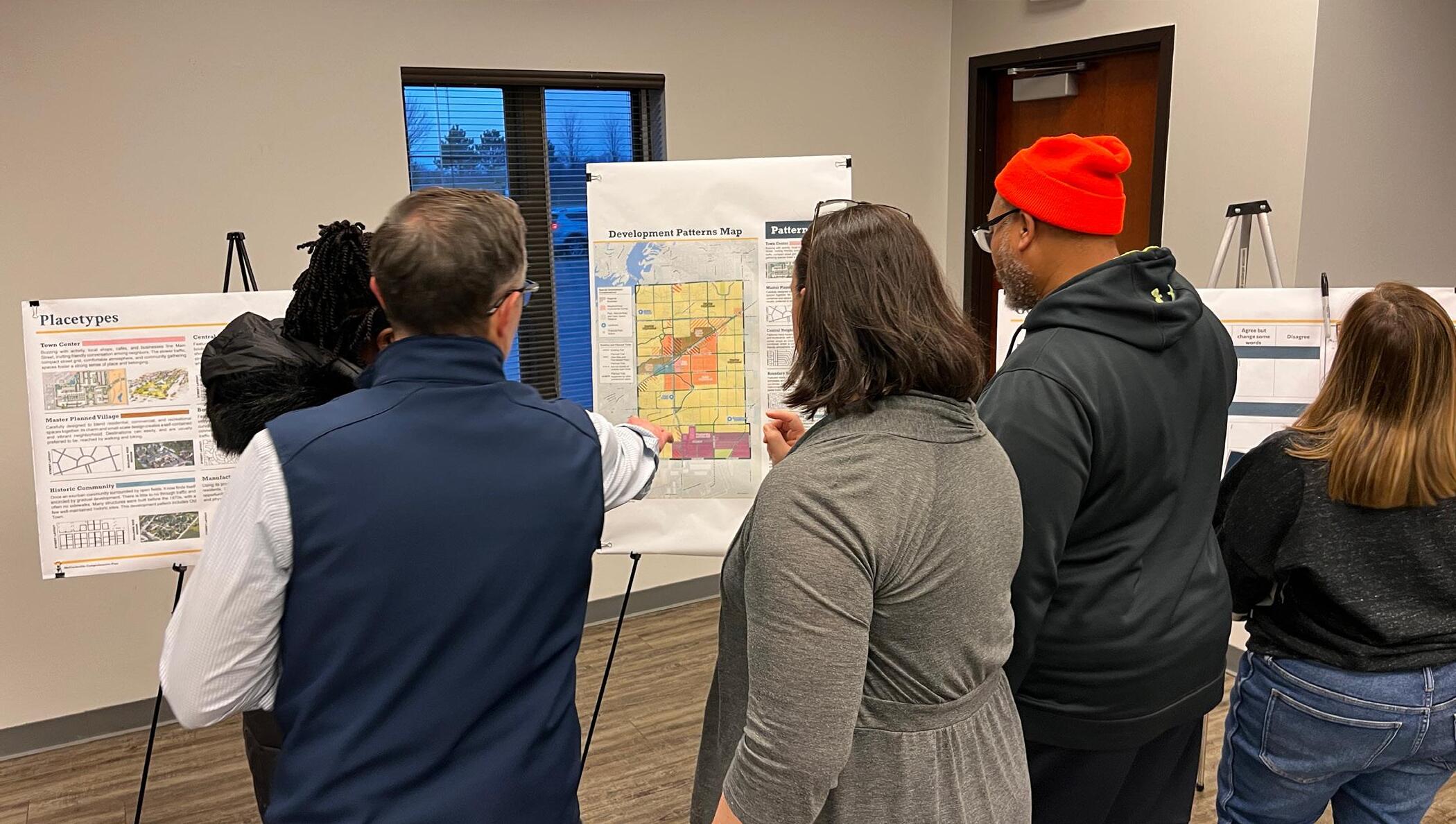
The policy statements for the land use development of the jurisdiction are in Chapter 8: Land Use and mapped in the Development Patterns Map.
The policy statements for the development of public ways, public places, public lands, public structures, and public utilities are in Chapter 3: Transportation, Chapter 5: Public Space, and Chapter 7: Town Administration and Utilities, respectively.
Implementation plans include a priority tier for each action.
The vision and principles will guide development decisions by local officials – elected and appointed – as they consider public investment and private development proposals.
The plan elements are the primary focus of the plan and include:
• Economic Development (Chapter 2)
• Transportation (Chapter 3)
• Housing and Neighborhoods (Chapter 4)
• Public Space (Chapter 5)
• Town Identity (Chapter 6)
• Town Administration and Utilities (Chapter 7)
• Land Use (Chapter 8)
Each of these chapters includes background information, con text, goals, and projects and an implementation plan as part of an action plan.
Three core maps are included in the plan: the Development Patterns Map, the Street Types Map, and the Functional Classification Map. The Development Patterns map is the future land use map and establishes the location of placetypes for development in addition to current and potential park locations. The Street Types map establishes a transportation framework that provides an alternative perspective to plan for streets and pedestrian circulation than on the thoroughfare map/plan. The Street Types Map should be used in conjunction with the Functional Classification Map for guidance on roadway planning and design. The Functional Classification Map is a second way of considering the street network and is commonly used by engineers and grant pursuits.
Information like the statutory details of Indiana Code 36-7-4-500 series, the existing conditions report, and a summary of existing plans are included in appendices to the plan for reference.
This comprehensive plan was prepared prior to the adoption of 2025’s SEA-1. SEA-1 includes a number of changes to tax policy that have not been fully analyzed for effects on local government. One of the specific concerns of SEA-1 is the elimination of the maximum levy appeal, which allows the town to capture revenue relative to our growth, which is well above Indiana’s MLGQ (maximum levy growth quotient). Fiscal analysis regarding SEA-1 is ongoing and the town may need to revise this plan accordingly following determination of financial effects of SEA-1. Additionally, the town council may use the forthcoming fiscal analysis in guiding land use decisions prior to this plan being formally updated.
A vision statement expresses the community’s values for the future and describes who and what the community hopes to be in 20 years. The vision expressed for McCordsville in 2045 is:
McCordsville is a welcoming and charming town with an active town center, local parks, local businesses, desirable schools, good healthcare access, and quality housing options connected by a complete street network that provides access to regional destinations.
It is vital that the community is actively and consistently engaged in planning, development, and partnerships to achieve the vision. This vision should guide all decisions by the town.
Guiding principles in a comprehensive plan are the values that should be reviewed when making land use, transportation, infrastructure, investment, and development decisions. The guiding principles for McCordsville are:
Industrial land uses are sufficiently buffered from residential areas both physically and visually. 1 2 4 6 7 8 5 3
The community is accessible for people of all ages and abilities. Development contributes to the sense of place.
Developments are, or will be, interconnected through a planned network of paths and streets.
Development standards are easy to understand and have a positive impact on shaping the community.
Environmentally sensitive and natural areas are preserved and featured as community assets.
Parks and open spaces are woven throughout the community and provide gathering spaces for the community.
Developments have a designated center or place where residents and visitors can gather.
Development should meet Americans with Disabilities Act requirements and guidance, and consider universal design principles, or the idea that the design choices that help people who use mobility aids or visual/audio accommodations are also useful for people pushing strollers or carts, toddlers and children, and older adults. These design elements can include: wide (6 foot minimum) sidewalks and passageways between buildings, lighting, visually distinct crosswalks, audio signals on crosswalks, places to sit and rest, providing shade structures or trees, wheelchair or walker accessibility to buildings and other points of interest.
The town is seeking to take spaces and make them feel like places. Placemaking is the central core of how people experience a community. Its about taking a physical space and through thoughtful design, create an environment that makes people feel connected to the community or the space they are in. When people have places and spaces that provide opportunities to interact and engage – community vibrancy is created. That vibrancy leads to fostering new ideas, connections, relationships and social engagement, which can lead to a higher quality of life. Places that feel like you have arrived and are at a destination are welcoming and inviting, promoting the character that is an important value of McCordsville. These places feel safe and open. They are comfortable and welldesigned with quality materials and visual elements. This means creating thoughtful use and design of physical infrastructure, spaces, and places, while maintaining functionality.
Development should be connected for vehicles and pedestrians in a way that allows mobility choices and doesn’t require trips on the regional connector roads to access an adjacent neighborhood or neighborhood commercial area.
Revisions to the zoning and subdivision control ordinance through the creation of a Unified Development Ordinance (UDO) should be written clearly and supported by graphics that communicate to the public, development community, plan commission, town council, and staff what is expected and reduce uncertainty in the approval process.
Tree stands, stream corridors, and other natural or historic areas should be protected by integration into development as amenities or set aside for parks and open space. These environmental assets can increase the appeal of a development as well as protect the community from flooding when preserved and protected.
Acquisition, development, and maintenance of public park spaces is important to the quality of like in McCordsville now and in the future. Private recreation amenities have been incorporated into residential development, but public park space has not been well established to meet the needs of the growing community. As parks are developed, connections to these parks from neighborhoods and business areas will be a consideration in the approvals process.
Industrial and commercial development is needed to diversify the tax base in McCordsville. While there was small industrial development historically on West Broadway, larger scale industrial development has typically been outside of the community. There are areas that are designated for industrial development, and they are adjacent to residential areas in many cases. It is important to the character of the community that these larger scale industrial developments be visually buffered from neighborhoods and have circulation patterns and operations that are not detrimental to the character of the town. The recommendation to extend Aurora Way is primarily to separate trucks from passenger vehicle traffic.
Gathering places, sometimes called “third places” are the places that people meet friends and come together as a community outside of home and work. Indoor or outdoor, they are places where people have opportunities to talk, share food, enjoy entertainment, interact with kids and older adults, and relax. Incorporating these places into neighborhoods and commercial areas will allow for a more socially connected community.
A bedroom community is a city or town in a metropolitan area where the primarily land use is housing as people work and shop elsewhere in the region.
Economic development includes business attraction, business retention and expansion, entrepreneurship, and workforce development. It is as much about people and talent as about business environment. There are two ways that economic development data is considered:
1. Those who live in the community and work (regardless of where they work) are the resident labor force.
2. Those who work in the community (regardless of where they live) are the workforce.
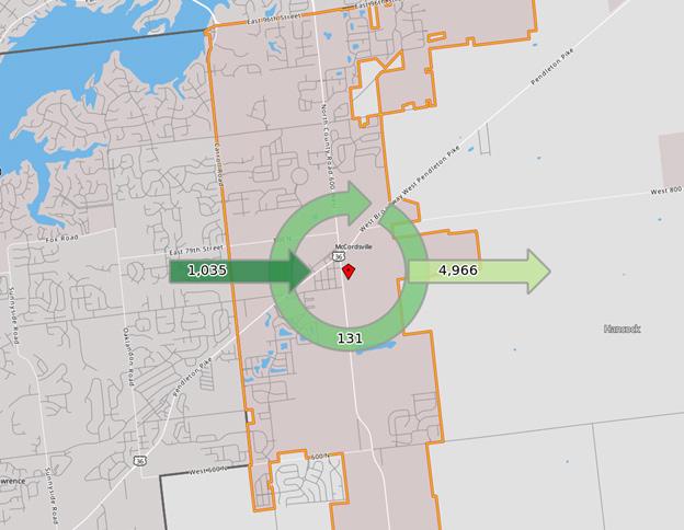
Like many suburban communities, McCordsville has been a bedroom community to Indianapolis and other cities in the Central Indiana region. With recent nonresidential development in the community and the community’s desire to increase the non-residential activity in town, matching workers and jobs in the community will be a priority
Entrepreneurship and remote work have grown in the past few years, creating opportunities for more people to both live and work in McCordsville. However, there is a need for the commercial and industrial tax base that brick and mortar business attraction can provide.
In 2022 there were 1,166 jobs in McCordsville (workforce) and only 131 (under three percent) of them were people who both live and work in McCordsville. The resident labor force was 5,097 people, which means 4,966 McCordsville residents work out of town.
When people work in a different county from where they live it benefits the county where they live since property taxes are based on residence, but county income taxes are also paid to the county of residence. Additionally, those who work outside McCordsville generally have higher earnings than what is offered from jobs in town. Shifting the balance of where
people live relative to where they work may not be a needed strategy for McCordsville. However, property taxes are higher for commercial and industrial land uses, so having those sources of revenue in the community can be important to the continued success of the town. While seeking to diversify the tax base with new commercial and industrial land uses should be a goal of the town, it is also important to note that the current economic development strategy trend is to focus on attracting the workforce. Today, jobs follow the people, more than people follow the jobs. So, a multi-point strategy that seeks to diversify the tax base, targets the type of jobs well-suited for McCordsville, along with investments in quality of life and amenities will likely be the best strategy moving forward.
Focusing only on primary jobs, the resident labor force in McCordsville in 2022 was 4,260 people. The Census defines a primary job as the highest paying job a person has (only one job per person) in the Longitudinal Employer-Household Dynamics (LEHD) dataset used by their On the Map tool. The difference between total jobs and primary jobs are the second (or third) jobs that an individual worker has. Nearly sixty percent of primary jobs were held by people in the prime working years of age 30 to 54. Approximately two-thirds of primary jobs had earnings of $3,333 per month ($40,000 per year).
The largest three employment sectors for the resident labor force were health care and social assistance (18.5 percent), manufacturing (11 percent), and retail trade (10.6 percent). Twenty-two percent of the resident labor force had a college degree.
Source: On the Map (Census)
There were 1,044 primary jobs in McCordsville in 2022. Of those workers, 44 percent were age 30 to 54. Earnings were nearly evenly split between those earning at least $3,333 per month ($40,000 per year) and those earning between $1,251 and $3,333 per month ($15,000 and $40,000 per year) with each group accounting for 38 percent of workers.
The three largest employment sectors for workers in McCordsville were retail trade (35 percent), manufacturing (14.7 percent), and administration, support, waste management, and remediation services (11 percent). People who work in McCordsville are less likely to have a college education than those who live in the community.
There are several locally owned and entrepreneurial businesses in McCordsville. Typically, the doctors and other medical professionals that work in clinics are independent contractors even when they are part of a practice and are not necessarily entrepreneurial activity. Many of the local fullservice restaurants are small businesses with 8 to 20 employees. The sales at these restaurants range from $267,000 to $763,000 annually.
Banking, finance, and insurance businesses that are not part of a commercial bank or an insurance company have 23 employees in the community. They work in advising and similar disciplines, and many are home-based businesses.
Construction sector companies typically have fewer than 10 employees. Arts, sports, entertainment, and recreation businesses only employ a total of 9 people in McCordsville. These sectors are part of the economic development goals for the town.
In the past five years there has been an increase in independent contractor/solo entrepreneur businesses that range from a “side hustle” making extra household income to the entrepreneur’s fulltime employment. Most of these businesses do not necessarily fall under the town’s home-based business section of the zoning ordinance because they do not have in-person sales of goods. The ordinance allows for businesses as a special exception in any residential district if certain criteria are met regarding business activity, in-person sales, on site employment or meetings, outdoor storage, entrances, and signs. Day care homes are required to follow Indiana statute.
The town should facilitate long-term strategies that increase the town’s efforts towards smart, effective, managed growth and diversification of its tax base. The town currently has formal or informal relationships/partnerships with various local and regional organizations focused or related to economic development, including, but not limited to the Hancock County Community Foundation, Indy Chamber, Central Indiana Regional Development Authority, and Hancock County Chamber of Commerce. The town should continue to evaluate current and future regional strategies and partnerships related to economic development
The Hancock Economic Development Council (HEDC) is the local economic development organization for Hancock County. They focus on business attraction, retaining jobs, and promoting a diversified tax base for the county. They are invested in initiatives that include entrepreneurship, site development and incentives, workforce housing, and workforce development. McCordsville is not a member of HEDC but is included in their data products and marketing efforts.
Comprised of municipal executives from our Central Indiana communities, CIRDA was established as an integrative regional entity, aimed at aligning the public sector on key initiatives in Central Indiana, to drive economic development. CIRDA’s efforts to attract investment in the region are focused on talent, quality of place, societal risk factors, entrepreneurship, and infrastructure. The key industry sectors for CIRDA are healthcare medical technology, software development, logistics and manufacturing, green jobs, and finance/insurance. McCordsville participates in CIRDA and was involved with the region for the Indiana READI 1.0 and 2.0 funding initiatives. The town was awarded a READI 1.0 grant, which went towards Phase I of McCord Square. The town has received an initial letter of approval for READI 2.0 grant which, if granted, will be used on Central Green.
The McCordsville Redevelopment Commission (RDC) offers a grant program called the Building Improvement Grant (BIG) to stimulate investment and initiate aesthetic improvements to buildings in McCordsville. Buildings need to be in the Town of McCordsville and in the program boundary area to be eligible for grant assistance. The grants are for buildings with primarily commercial activity and can’t be property tax delinquent or have code compliance issues. The program area is the Broadway corridor with some significant areas adjacent that are within the Tax Increment Finance (TIF) district.
Goals 1 4 2 3
Foster economic vitality through a variety of businesses. To achieve this purpose, several goals have been established:
Cultivate the McCord Square district as a destination with a variety of restaurants, shops, and activities.
Foster the entrepreneurial spirit by supporting the creation and viability of unique, local businesses.
Ensure that the design of businesses contributes to the desired atmosphere of each district.
Encourage arts and entertainment businesses, venues, and activities.
The action plan identifies projects and programming that will help McCordsville achieve the goals.
Projects underway in McCordsville and along the Mount Comfort Corridor outside the McCordsville corporate limits influence the future economic growth of McCordsville. The industrial development along the Mount Comfort Corridor south of CR 500N outside of town limits has been led by the county, as has the development of the workforce development center, Amplify Hancock.
Located on the southeast corner of W Broadway and Mt. Comfort Road, McCord Square is a partnership between the Town of McCordsville, Rebar Development, and Pride Investment Partners. Phase I of McCord Square is a 48-acre planned mixed-use development that accomplishes many goals set forth in the Town Center Development plan, including the creation of a defined, vibrant downtown district with a unique identity that will attract people and additional business to the area. Non-residential development includes IU Health, NineStar Connect offices, and the McCordsville Police Headquarters. There are 6,145 square feet of retail space in the Lucas building and 3,070 square feet of retail space in the Jackson building. Additional outparcel spaces, mixed-use buildings, and open spaces are anticipated as the development builds out. The town anticipates McCord Square will grow to approximately 130 acres at planned build-out and in addition to commercial space, will include between 1,000 to 1,800 residential units. The town will need to continue to focus on the appropriate mix of housing, mixed-use buildings, commercial space, amenities, and open spaces in future phases. There is significant public infrastructure to be installed in future phases,
and public incentives should be focused on public infrastructure to gain the traction needed for future phases. These phases are necessary to continue to create the sense of place and destination that is McCord Square, while adding the necessary customer base, increasing assessed value through construction of multi-story mixed-use and commercial buildings, and reducing dependence on single-family residential taxpayers.
A group known as the Coalition for Smart Growth in the Mount Comfort Corridor has come together to promote smart, sustainable growth along the Mount Comfort Corridor. McCordsville participates in the work of the coalition along with the Towns of Cumberland and New Palestine and businesses such as Ninestar Connect, Hancock Health, and Greenfield Banking Company. The group is working toward implementation of the 2019 Urban Land Institute (ULI) plan for the corridor and developed its own plan that includes four catalyst sites: McCordsville, the Indianapolis Regional Airport, Cumberland, and New Palestine.
The McCordsville catalyst site is located at the southwest corner of Mt. Comfort Rd and CR 750N. This site has been partially developed as a mixedresidential project. The general land uses outlined in the Coalition for Smart Growth’s Plan were used as the basis for the project. The remaining 10-acres of the site are undeveloped. Future development of the remaining acreage is expected to conform with this Comprehensive Plan, which complements the vision of the Coalition for Smart Growth’s Plan. Prior to the 2019 ULI study, there were corridor studies completed in 2017 and 2018. Each of these studies
addresses the corridor location, workforce, and the need for housing in the area. The consistent theme across all studies and plans of the Mt. Comfort Corridor is that it is the economic engine of western Hancock County. Planning for best land uses along the corridor, along with all jurisdictions (with planning and zoning authority) setting consistent and high standards for development, is paramount to the continued success of the corridor and ensuring that the corridor continues to provide for smart, managed growth and development. At the southwest corner of the Mount Comfort Road interchange at I-70 lies Hancock Health’s Gateway Campus. This campus is outside of McCordsville’s corporate limits but acts as the western gateway to all of Hancock County. It is a vitally important project to the region. The campus currently features a medical facility and residential and commercial uses.
The implementation plan includes projects and activities to advance the goals of the economic development chapter.
Amplify Hancock is a planned workforce development center in Hancock County. The facility will be at the northwest corner of CR 200W and CR 300N, where it will accommodate training and educational needs for employers, schools, and adult learners. Slated to open in July 2026, it will initially span about 95,000 square feet and is expected to grow in the future. The four Hancock County school corporations are involved in Amplify Hancock and will bring their workforce training curricula for high school students to the facility as a part of the new Hancock County Career Center (HC3). Ivy Tech Community College will provide career education to high school students there as well. The building and land will be owned by the Hancock County Commissioners and overseen by an independent board.
INDOT is the Indiana Department of Transportation and has jurisdiction over state and national roads as well as funding for local projects.
Transportation is one of the primary factors in town development and is directly connected to land use patterns and how people move throughout the community for work, school, and leisure
Functional Classification is one way that engineers, planners, and funders classify roads. The highest functional classification is interstates, while the lowest are local roads and streets (local functional). Per INDOT, functional classification recognizes that the public highway network in Indiana serves two basic and often conflicting functions - access to property and travel mobility. Each highway or street will provide varying levels of access and mobility, depending upon its intended service. Arterial highways are characterized by a capacity to quickly move relatively large volumes of traffic and a restricted function to serve abutting properties. Collector routes are characterized by a roughly even distribution of their access and mobility functions. Traffic volumes and speeds will typically be somewhat lower than those of arterials. In rural areas, collectors serve intra-regional needs and provide connections to the arterial system. All public roads and streets not classified as arterials or collectors are classified as local roads and streets. Local roads and streets are characterized by their many points of direct access to adjacent properties and their relatively minor value in accommodating mobility.
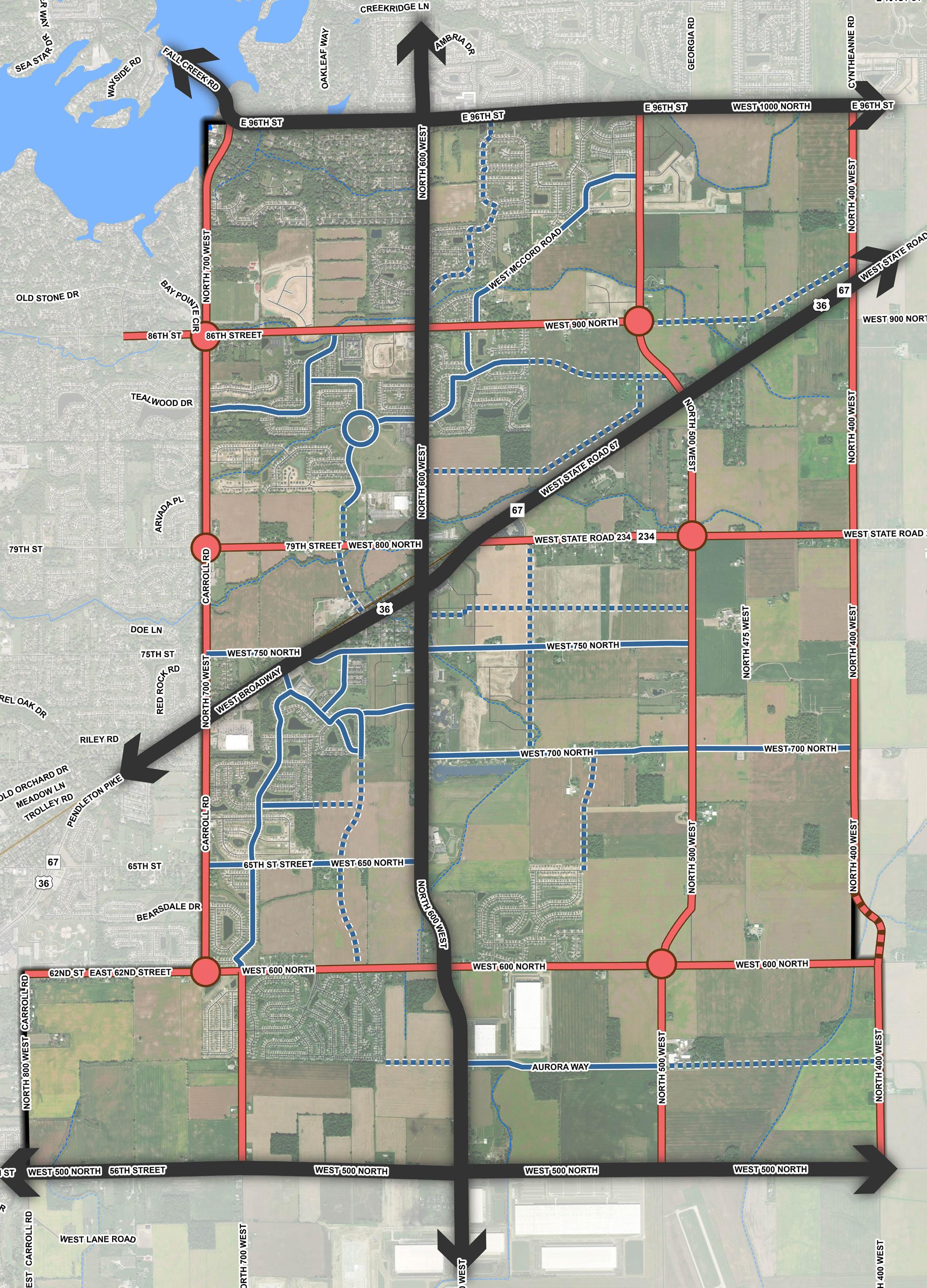
There are two official functional classifications for roadways in McCordsville: collectors and arterials. The local system determines the construction specifications and right-of-way for construction in the town. The INDOT system is primarily used for funding purposes and where INDOT controls the roadway.
The local classifications are included and shown on the map in the Functional Classification Map. Local collectors are local roads with a thicker pavement section.
Local Collectors:
• McCord Road
• Depot Street
• CR 475W
Minor Collectors:
• The new road connecting CR 600W to CR 500W (paralleling the railroad tracks) that traverses the Indiana Wesleyan Foundation property
• CR 900N from W Broadway to CR 400W
• CR 700N
• CR 650N
• Aurora Way
• CR 500W from CR 600N to CR 500N
Major Collectors
• CR 400W
• CR 500W from CR 1000N to CR 600N
• CR 900N from CR 700W to W Broadway
• Vail Road (CR 800N)
• SR 234
• CR 750N
• CR 600N
• CR 500N from CR 600W to CR 400W
• CR 700W from CR 600N to CR 500N
Secondary Arterials:
• CR 1000N (96th) from CR 600W to CR 400W
• CR 500N from CR 800W to CR 600W
• CR 700W from CR 1000N to CR 600N
Primary Arterials:
• Mt. Comfort Road
• W Broadway
• CR 1000N (96th) from CR 700W to CR 600W
INDOT and the Indianapolis MPO have their own functional classification system. While the town will not use these functional classes as a part of this comprehensive plan nor the future Unified Development Ordinance (UDO), it is important to note that their functional class system is what is used on grant applications through either organization. These functional class systems are based upon various metrics and are typically updated every five years. The town can request amendments to their functional class systems for local roadways. These requests are considered based upon the adopted metrics. The current Indianapolis MPO Functional Classification Map can be found on the Indianapolis MPO’s website.
The Indianapolis Metropolitan Planning Organization (MPO) is responsible for the distribution of federal transportation funding in central Indiana.
When roads define the boundary between municipalities or between a municipality and a county there are either: (a) arrangements between the entities for efficiency of paving, maintenance, and snow removal, or (b) state code regarding border roads is followed. Additionally, adjacent municipalities can share in funding for projects on these roads. In McCordsville, the town does not manage or control Carroll Road from CR 1000N to CR 600N, as it is a City of Indianapolis/City of Lawrence roadway. The town also does not control or manage 96th Street, as it is a City of Fishers/Hamilton County roadway. In the case of border roads, adjacent to town limits on one side and unincorporated county property on the other side, these border roads are under the jurisdiction of the town, due to state annexation laws.
When a state road travels through a community, they remain under the jurisdiction of the Indiana Department of Transportation (INDOT), unless some other agreement has been made between INDOT and the local authority. In McCordsville, both SR 234 and W Broadway remain under the control and management of INDOT. This means, in addition to normal roadway maintenance and capital projects, all new permitting requests must be approved through INDOT before any work can occur within their rightof-way.
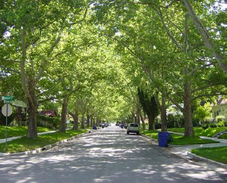
Sidepaths/sidewalks have been encouraged in McCordsville since the town’s original comprehensive plan in 2011. The Zoning Ordinance and Subdivision Control Ordinance, also adopted in 2011, required sidewalks along both sides of local streets, and sidepaths or sidewalks on both sides of collector and arterial streets, as development occurred. Fourteen years later, the town is beginning to see many of the once-disjointed segments being connected as development begins filling in the gaps in the system. In 2019, the town created and adopted a Bike and Pedestrian Master Plan. It lays out a more comprehensive perspective on the overall bike and pedestrian infrastructure plan for the town. In addition to the requirements for local sidewalks and sidepaths, the plan called for multi-use greenway trails along riparian corridors, branded sidepaths, and regional pedestrian connections into neighboring communities and areas. Those regional connections, branded sidepaths, and greenway trails are highlighted below:
• CR 750N connection west to 75th Street toward Castleton
• CR 650N connecting west to 65th Street/63rd Street toward Fort Harrison State Park
• Mount Comfort Road south toward Mount Comfort
• CR 600N east toward the round barn and Tuttle’s Orchards
• SR 234 east toward Mount Vernon Schools
• W Broadway northeast toward Fortville
Branded Sidepaths & Greenway Trails
• Mt. Comfort Road
• W Broadway
• North Fort Dry Branch/Schultz/CR 900N
• Dry Branch
• Town Center-Champion Lake
• Brookside Vail
The Indianapolis MPO maintains a vulnerable user (pedestrians and bicyclists) crash database from 2022 through present (3-4 months prior to the current date). Between 2022 and November 2024, there was one fatal crash in McCordsville, one nonincapacitating crash, and three others (refused medical care, unknown, etc.). The fatal crash occurred August 24, 2022, on Vail Road west of Mount Comfort Road. This stretch of road does not have sidewalks on either side of the two-lane cross-section. The Town Hall and Town Hall Park are in this area.
Similarly, the Indianapolis MPO tracks vehicle crashes from 2015 to present (3-4 months prior to the current date). In this period, there were 134 vehicle crashes attributed to McCordsville, six of them were fatal crashes. Between 2020 and present, there were 53 crashes attributed to McCordsville, fewer than the prior 5 years, but three of them were fatal and one was a pedestrian fatality. Most crashes were on Carroll Road , Mount Comfort Road, and Broadway. The fatal crashes in the planning area since 2020 were at :
• Vail Road west of Mount Comfort Road (vehiclepedestrian)
• CR N 600W at CR W 900N (vehicle)
• SR 234 and CR 475W (vehicle)
McCordsville is affected by roads that are on the National Highway System (NHS) as well as an active CSX rail and a regional airport.
The National Highway System (NHS) includes interstates, highways in rural and urban areas that provide access between an arterial and a major port, airport, public transportation facility, or other intermodal transportation facility. Interstate 70 and Interstate 465 are the nearest NHS roads to McCordsville.
Non-NHS highways in McCordsville are US Highway 36, Indiana 67, and Indiana 234. In McCordsville, US 36 is also Indiana 67 and is known locally as W Broadway. Both US 36 and Indiana 67 bisect the state from west to east, and in some locations use different routes.
The eastern leg of Indiana 234 begins in McCordsville at US 36/SR 67 and continues to SR 9 and 109 then heads north and turns east to SR 38.
Both W Broadway and Mt. Comfort Road through McCordsville are designated as part of the National (Truck) Network. The National Network supports interstate commerce by regulating the size of trucks, while the NHS supports interstate commerce by focusing federal investments. There is a regional freight network plan that was adopted by the Indianapolis MPO and uses a different set of criteria for identifying the roadways in the regional freight network. Refer to the plan on the Indianapolis MPO webpage for more information.
CSX operates a freight rail line through McCordsville parallel to W Broadway. The CSX line runs from the Illinois state line west of Terre Haute through Greencastle and Indianapolis before heading to Lawrence and McCordsville. In Anderson, the CSX line turns east to Muncie and Winchester before entering Ohio.
The Indianapolis Regional Airport, formerly known as the Mount Comfort Airport, has two paved runways and operates on approximately 1,800 acres. The airport is located along the east side of CR 600W, between CR 500N and CR 300N. Runway 7/25 is a 6,005-foot asphalt runway equipped and marked for precision approach. Runway 16/34 is a 3,902-foot concrete crosswind runway. As a general aviation airport, it serves both corporate businesses and private pilots. The Fixed Base Operator (FBO) at the airport is Jet Access. There are 110 hangar spaces for lease. The airport is owned and operated by the Indianapolis Airport Authority, who is in the process of developing a new Sustainable Airport Master Plan, which will guide the airport’s development over the next 20-years and beyond.
As the airport continues to expand, the Airport Authority anticipates the future of the airport will include regularly scheduled cargo service and eventually both scheduled and non-scheduled recurring commercial passenger service. To enable such expanded uses, both runways will be planned for extensions and the crosswind runway will be slightly re-oriented to a more north-south position.
The airport also anticipates both aeronautical and non-aeronautical development to occur on its campus, and depending upon future regulations and final design, there could be a closure of CR 500N, to allow for the lengthened crosswind runway. This will place greater importance upon Aurora Way being extended to CR 400W.
This type of expansion, of both airport uses and capabilities, should be acknowledged in the comprehensive plan. These changes will impact the type of development in the immediate area in two ways.
1. The airport’s airspace, building height, and other regulations will be expanded and cover a larger area.
2. Once cargo and then eventual passenger service are occurring, land uses not currently contemplated may become feasible and desirable.
McCordsville participates in the Indianapolis Metropolitan Planning Organization (MPO), which plans and funds transportation projects in Central Indiana. The Indianapolis MPO planning area includes Marion County and the adjacent counties. The MPO develops short- and long-range plans to support local governments and advance the region’s goals in transportation, housing, safety, sustainability, and other quality-of-life issues. The MPO also tracks and distributes certain transportation funds to local governments in the region for roads, transit, trails, and other means of moving people and goods around Central Indiana. The planning region includes almost 1,500 square miles, 36 member jurisdictions, and approximately 1.78 million residents.
Goals 1 4 5 2 3
McCordsville is well-connected with a walkable, safe, and complete street network. The design of streets, paths, and trails contribute to the charm of the community. To achieve this purpose, several goals have been established:
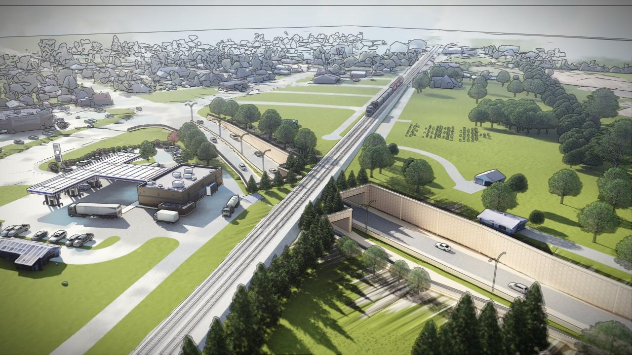
Improve connectivity across the railroad and across Broadway, supporting development of an underpass of the railroad while embracing life with the railroad.
Create a network of sidewalks, paths, and trails that connect people to destinations in the community. Design pedestrian and bicycle facilities to be safe, useful, and attractive for people of all ages. Identify key connections to improve connectivity to regional destinations. Evaluate and improve the safety outcomes of the transportation network, including supporting a range of transportation choices.
Street types are a way of classifying roadways locally that is different from functional classifications. Street types are concerned with the relationship between passenger vehicles, truck traffic, bicyclists, and pedestrians. The type of connectivity the road provides is also an important component of street types. While these streets may not currently have this form, the intention is that these cross-sections be considered as the road is redesigned.
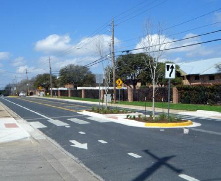
Regional thoroughfares are the roads that connect McCordsville to the larger Central Indiana region, regardless of classification. They balance traffic flow and access to adjacent land, as well as balancing truck and regional through-traffic with local vehicle traffic, bikes, and pedestrians. These roads typically have a center median that can accommodate turn lanes at key locations. Street trees can be used to buffer pedestrians from vehicle traffic and provide shade.
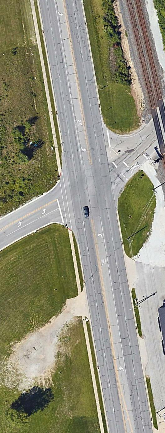
Intersections of this street type may be appropriate locations for roundabouts where sufficient right-of-way is available or able to be acquired. Roundabouts typically have lower maintenance costs since they generally replace signalized intersections and can manage traffic flow without unnecessary delay, particularly at low traffic volume times of day.
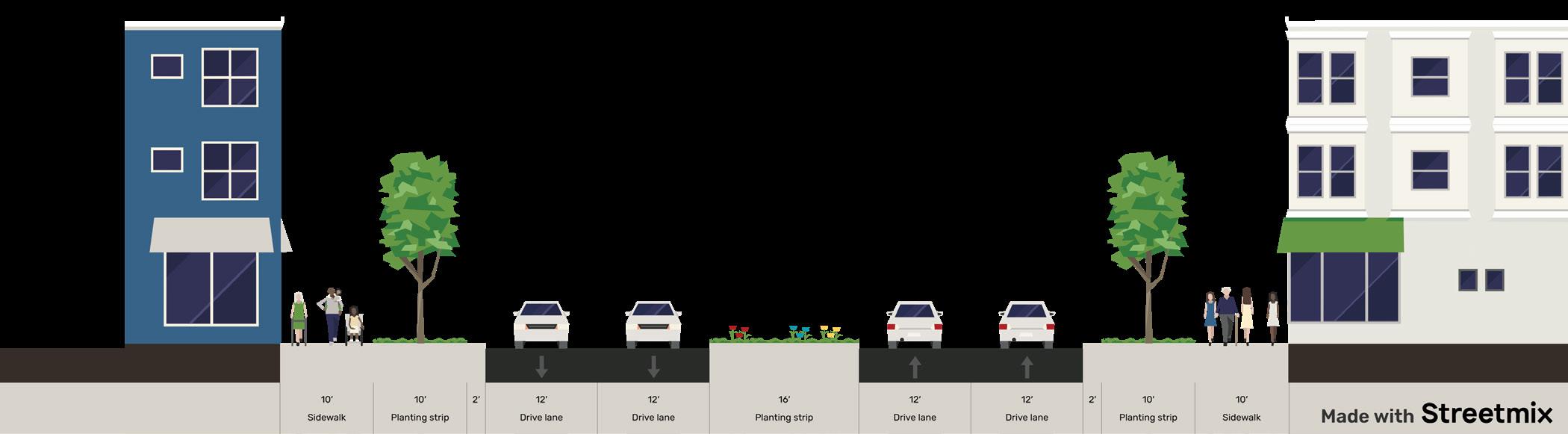
Crosstown boulevards move vehicles and people around McCordsville, connecting neighborhoods with places to work, learn, shop, and play. These roads carry more local traffic than regional traffic. An optional median separates traffic lanes and can accommodate turn lanes at key locations. Separated paths allow for bike and pedestrian travel as well as accommodating people using wheelchairs or motorized scooters. Crosstown Connection streets may utilize street trees, but of the three street type patterns, they are the least likely to feature street trees.
An increased level of attention is needed in intersection design where Crosstown Boulevards intersect, giving special consideration for bike and pedestrian crossing safety. Pedestrian crossing accommodations should be considered; including use of signals like Pedestrian Hybrid Beacons (PHBs), formerly known as HAWK signals, thermoplastic crosswalk treatments, and/or leading pedestrian interval signals.
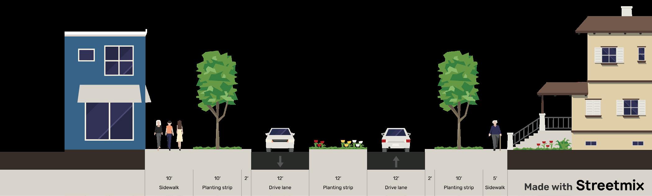
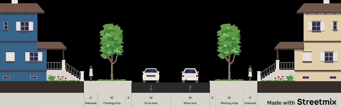
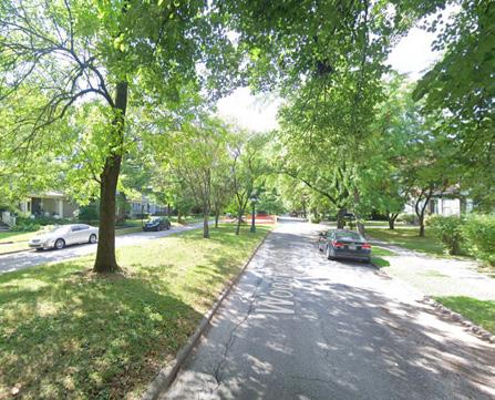
Neighborhood connectors are local streets that allow passenger vehicle and delivery truck movement throughout the community without using the higher traffic streets. These streets prioritize bike and pedestrian movement and have narrower lanes to reduce speed. In some cases, neighborhood connectors may provide for truck traffic to be separated from passenger traffic, connecting industrial areas and business parks, rather than neighborhoods. These streets tend to also allow on-street parking and street trees to assist in calming traffic speeds.
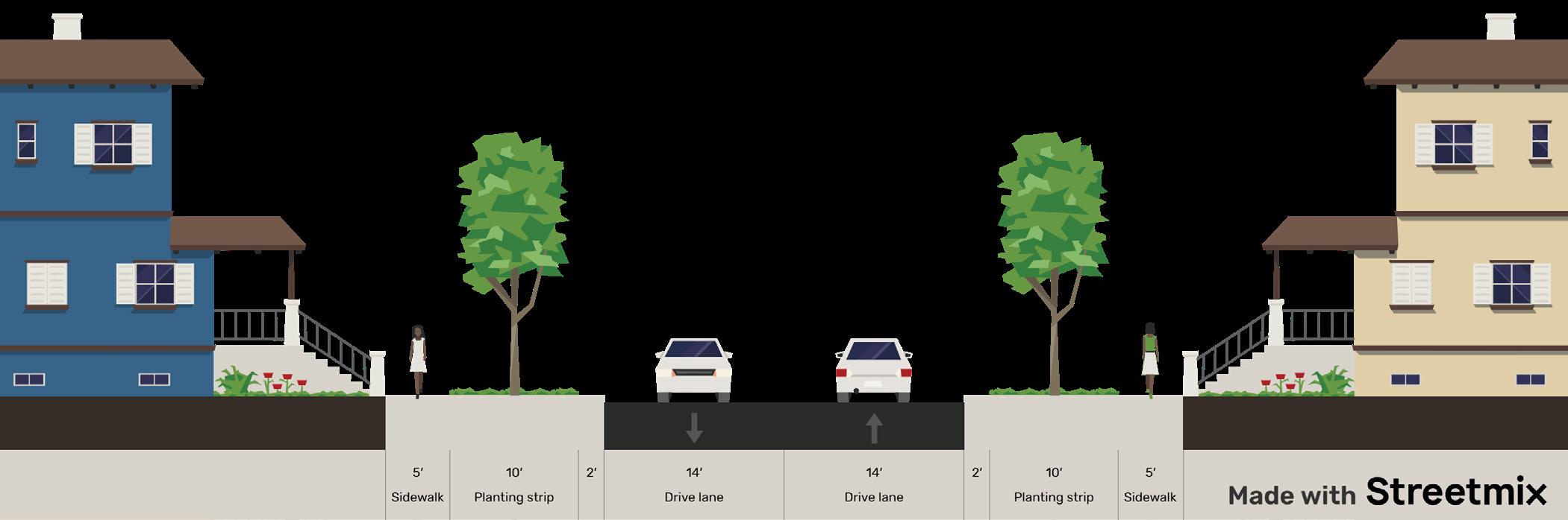
Regional thoroughfares are the roads that connect McCordsville to the larger Central Indiana region, regardless of classification. They balance traffic flow and access to adjacent land, as well as balancing truck and regional through traffic with local vehicle traffic, bikes and pedestrians. These roads typically have a center median that can accommodate turn lanes at key locations. Street trees can be used to buffer pedestrians from vehicle traffic and provide shade.
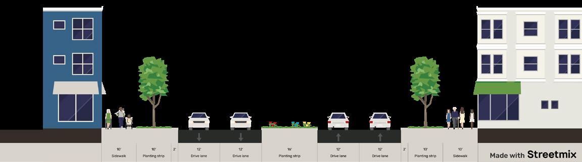

Crosstown boulevards move vehicles and people around McCordsville, connecting neighborhoods to places to work, learn, shop, and play. An optional median separates lanes of traffic and can accommodate turn lanes at key locations. Separated paths allow for bike and pedestrian travel as well as accommodating people using wheelchairs or motorized scooters. Crosstown Connection streets may utilize street trees, but of the three street type patterns are the least likely to feature street trees.
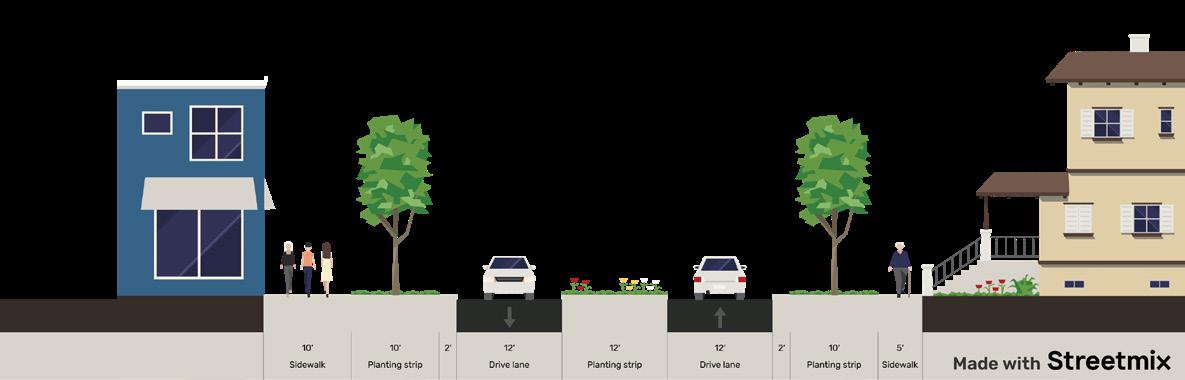
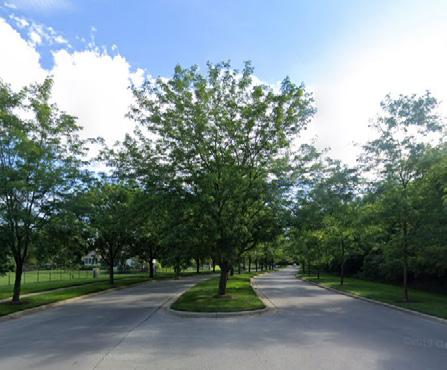
Neighborhood connectors are local streets that allow passenger vehicle and delivery truck movement throughout the community without using the higher traffic streets. These streets prioritize bike and pedestrian movement and have narrower lanes to reduce speed. In some cases neighborhood connectors may provide for truck traffic to be separated from passenger traffic, connecting industrial areas and business parks, rather than neighborhoods. These streets tend to also allow on-street parking to assist in calming traffic speeds.
Complete Streets are roadways designed to accommodate all users safely and comfortably, of all ages and abilities, including but not limited to motorists, cyclists, pedestrians, transit users, school bus riders, delivery and service personnel, freight haulers, and emergency responders. Publicly owned rights-of-way should safely accommodate destination-based and recreational users as well as provide opportunities as appropriate for rest and directional information within the public realm. The Indianapolis MPO Complete Streets Policy was adopted in 2014 and amended in October 2016. Several municipalities in Central Indiana have adopted their own Complete Streets policies.
The Indianapolis MPO has developed a Vision Zero toolkit for communities in Central Indiana to use in improving safety on their roadways. Vision Zero as a philosophy recognizes that road and vehicle design influences driver behavior. Even the most experienced drivers can make mistakes. To save lives, roads and vehicles must be designed to reduce risks, accommodate inevitable human error, and promote safe speeds through self-explaining and self-enforcing road design. Some of the tools mentioned in the toolkit, in addition to countermeasures, include:
• Updating construction standards
• Banning turns on red
• Establishing a crash review panel
• Enforcing no parking on sidewalks, in bike lanes, and on trails
• Snow removal
• Zoning reforms
The Access Board, an independent federal agency that advances accessibility through leadership in accessible design and the development of accessibility guidelines and standards, has published new guidelines, Public Right-of-Way Accessibility Guidelines (PROWAG), under the Americans with Disabilities Act (ADA). Additionally, the Architectural Barriers Act (ABA) address access to sidewalks and streets, crosswalks, curb ramps, pedestrian signals, on-street parking, and other components of public right-of-way for new construction and altered portions of existing pedestrian facilities in the public right-of-way. These guidelines also review shared-use paths, which are designed primarily for use by bicyclists and pedestrians for transportation and recreation purposes. The final rule was effective September 3, 2024 and adopted by the General Services Administration (GSA) and the Department of Justice (DOJ).
The action plan establishes the thoroughfare plan as well as presenting known major projects and an implementation plan for achieving the goals and policies established.
There are two official functional classifications for roadways in McCordsville (see the background section of this chapter). The second, the local system, determines the construction specifications and rightof-way for construction in the town. The INDOT/ IMPO system is primarily used for funding purposes and roadways controlled by INDOT.
The local classifications are included and shown on the map in the Functional Classification Map. Local collectors are local roads with a thicker pavement section. See the list of local functional classifications at the beginning of this chapter.
Several projects are in the planning or engineering stages that could affect the transportation system in McCordsville. Some of the projects are outside McCordsville but may have significant impacts on how vehicles move through McCordsville.
A cost estimate for the dual underpass option to separate the railroad and road grades at Broadway and the CSX railroad was completed in 2021. The opinion of probable construction cost included capital construction, professional fees, operation and maintenance, and property acquisition. The estimate included a 35 percent contingency as the plans were completed to 10% construction detail. The total likely cost estimate at that time was $77,979,241.
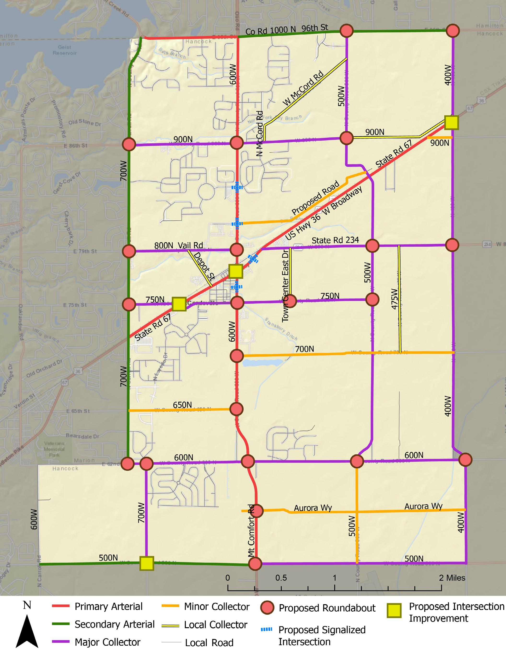
New Road Segments
• Extension of Aurora Way from its current terminus to CR 400W as a local truck route
• Extension of Aurora Way from CR 600W to the west to create a centralized access point for new development on Mount Comfort Road
• Extension of Stubbington Lane south to CR 600N
• Extension of Odessa Way east to the Stubbington Lane extension
• Extension of N Runway Road to Vail Road
• Extension of Glenview Drive to Mount Comfort Road
• Extend CR 900N east then parallel to the north side of the railroad and head northeast to connect to CR 400W
• Extension of Woods Pointe Drive to CR 500 W
• New road from CR 750N to SR 234 (between McCord Square and Jacobi Farms)
• Extension of Commons Drive through McCord Square and Jacobi Farms to CR 500W
• New road from Mount Comfort Road to run parallel to the north side of the railroad then turn northeast to connect with CR 500W
New Roundabouts
• CR 600W & CR 900N
• CR 600W & CR 800N
• CR 600W & CR 700N
• CR 600W & CR 650N
• CR 600W & CR 600N
• CR 600W & CR 750N
• CR 600W & Aurora Way
• CR 700W & CR 900N
• CR 700W & CR 800N
• CR 700W & CR 750N
• CR 700W & CR 600N
• CR 1000N & CR 500W
• CR 500W & CR 900N
• CR 500W & SR 234
• CR 500W & CR 750N
• CR 500W & CR 600N
• CR 400W & SR 234
• CR 400W & CR 600N
• 96th St (CR 1000N) & CR 400W
Intersection Improvements
• Mt. Comfort Road (CR 600W) and W Broadway (SR 67)
• W Broadway & CR 750N
• US 36 & CR 400W
• CR 1000N & CR 400W
• CR 700W & CR 500N
• CR 600W & CR 750N
Intersection Improvements
• CR 600W & Brookside Pkwy
• CR 600W & future road through the IWF property (connecting 600W to 500W)
• W Broadway & CR 750N
• W Broadway & Civic Drive (McCord SQ entrance)
This project has been discussed in McCordsville for more than 25 years and is increasingly desirable as the community grows and develops to facilitate traffic both through the community and through the region. The railroad is an active freight rail line and there is not a grade separated crossing though Hancock County on this line. The closest grade separated crossing is on 56th Street in the City of Lawrence.
In 2022, the town went through a road project identification and phasing exercise for Mt. Comfort Road corridor. This exercise outlined the various needed intersection improvements, along with widening of the corridor, and proposed a likely sequence to the improvements. During the exercise, the town had budgetary cost estimates developed along with an overall exhibit. This exhibit is included in Appendix 4 . In addition to that exercise focused on Mount Comfort Road, the town actively plans for roadway projects through its Capital Projects Plan, which is updated annually. Below are summaries for roadway projects that are in some stage of development, have funding identified, and/ or significant enough to warrant inclusion.
This project is included in the Indianapolis MPO Transportation Improvement Program (TIP). The estimated project cost is $8,691,860 and will include the addition of through lanes and turn lanes at the intersection of Mt. Comfort Road and W Broadway and replace the existing traffic signal. The added lanes will extend northward across the CSX tracks to Vail Road and to approximately 1,000 feet south of the intersection. The project also includes a multi-use path along the east side of the roadway. The town has received a grant of federal exchange funds for the project matching the local funds for construction.
New signal installation is anticipated at Broadway and CR 750N by 2028 (DES 2301247). The estimated total project cost is $1,122,359. This project is being led by INDOT.
Construction of added travel lanes and turn lanes at US 36 and N 400W is anticipated for 2027 and has received funding (DES 2214FFE). The total estimated project cost is $624,000 and this project is being led by INDOT. Projects led by INDOT do not have local match costs.
A roundabout is planned and funded for this intersection (also known as 96th and Cyntheanne Road) for 2026 construction. The estimated total project cost is $3,489,000 and the project is being led by the City of Fishers. (DES 2204FFE)
Hancock County is leading a project for a roundabout at CR 700W and CR 500N that is noted by the Indianapolis MPO as going to letting in December 2025, with a projected cost of $4,310,852. (DES 2003084)
A new roundabout is slated for the CR 600N and CR 600W intersection. The estimated total project cost is $2,850,000, and the project is being funded through a local project Tax Increment Finance (TIF) bond at the southwest corner of the intersection. Construction is set to begin in the late summer of 2025.
CR 600W & CR 750N
A new roundabout is under design for the intersection of CR 600W & CR 750N. This project will also include widening of CR 600W to 4-lanes from this intersection north to Main Street (McCord Square entrance). The town has funded design, and estimates beginning land acquisition in late 2025 or 2026. A construction timeline has not been set.
Hancock County is working with INDOT on the addition of a new I-70 interchange at CR 200W. The feasibility study has been completed, along with cost estimates. A timeline for this interchange has not been set. While the town will not be involved in this project, the introduction of a new interchange will have some effects on traffic along CR 600 W.
An access management plan is a tool that traffic engineers, planners, and developers use to determine where driveways or road cuts will be allowed (or the criteria under which they will be allowed) and the design of those cuts to limit the number of turning movements from an arterial road to an individual business, home, or a subdivision (either residential or commercial). These standards should be updated to reflect current practices and policies.
McCordsville is implementing TrainFo, a system that helps engineers and officials understand and prevent traffic delays at rail crossings using predictive blockage and delay information. The system uses roadside signs to reroute drivers around blocked crossings and adapts traffic signals to reduce vehicle delay at crossings. It also helps emergency dispatches select routes to avoid delays caused by trains. The statistics provided by the system helps engineers identify solutions related to train delays.
The implementation plan includes projects and activities to advance the goals of the transportation chapter.
Priority Tier 1: Top priority for the town. Such items are likely to be completed as soon as possible, and certainly within the next five years.
Priority Tier 2: Important priorities for the town but are often items that may require other steps to be completed first, and/or are not expected to be completed within the next five years.
Priority Tier 4: Priorities that are dependent upon growth/ development rates or patterns or are otherwise dependent upon other action or trigger points.
Action/Project
Railroad underpass study update
Railroad grade separation at Broadway
Extend Aurora Way from current terminus to CR 400W
Identify missing sidepath and sidewalk segments
Complete the sidepath and sidewalk network
Align offset intersections of CR 600N with CR 500W & CR 400W
Adopt a local Complete Streets policy
Priority Tier 3: Priorities that should be completed prior to the end of the horizon year for this plan.
Priority Tier 5: Ongoing priorities.
McCordsville Dept. of Engineering
McCordsville Dept. of Engineering
McCordsville Dept. of Engineering
McCordsville Dept. of Planning & Building
McCordsville Dept. of Engineering
McCordsville Dept. of Engineering
McCordsville Dept. of Planning & Building
Adopt PROWAG as the town’s accessibility standard Town Manager
Coordinate on changes to Mount Comfort Airport
Communicate road and trail maintenance plans with the public
Evaluate the Road Impact Fee
Update the Access Management Plan
Road extensions and new road segments
Update Apple Maps and Google Maps after changes are made to roads
McCordsville Dept. of Planning & Building with Indianapolis Airport Authority
McCordsville DPW
McCordsville Dept. of Planning & Building
McCordsville Dept. of Engineering
McCordsville Dept. of Engineering
McCordsville Dept. of Engineering
Tier 1
Tier 3
Tier 4
Tier 5
Tier 5
Tier 4
Tier 1
Tier 1
Tier 1
Tier 5
Tier 5
Tier 5
Tier 4
Tier 5
Updated renderings and Opinion of Probable Cost
Prioritization of segments for construction
Annual report; evaluation of rates and projects every 5 years
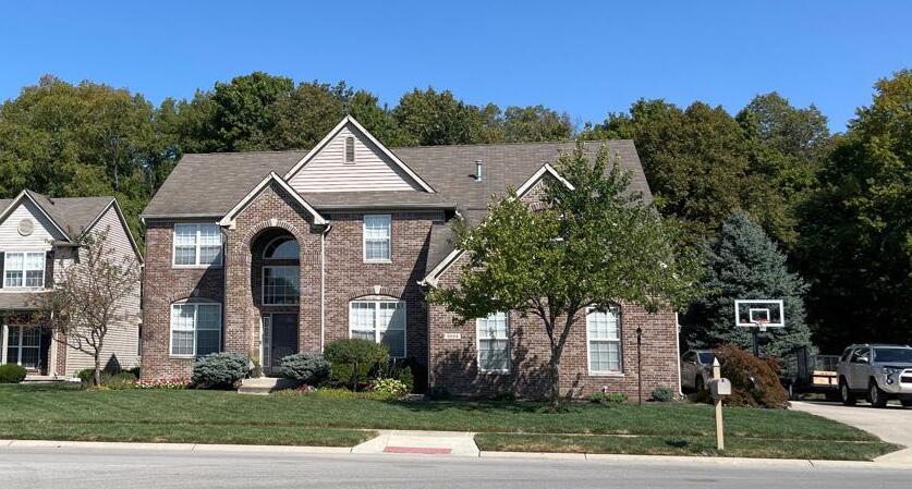
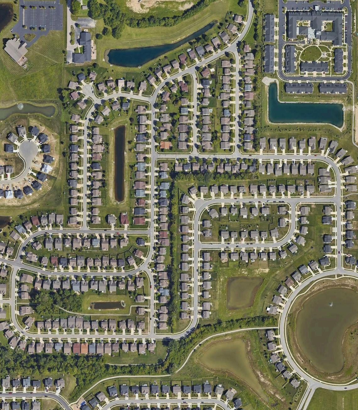
Housing and the aggregation of housing into neighborhoods is an important decision-making factor when people choose to locate, or remain in, a community. Older communities that developed over time generally have a mix of traditional neighborhoods and more modern subdivisions. Communities that have experienced the substantial portion of their housing development since the 1980s tend to have subdivisions that were planned by a single developer and may have a single builder with a limited number of product types available in any one development. The development pattern in McCordsville is largely based on the single-developer/ single-builder model. This model has resulted in amenity-rich subdivisions with homes that are similar in size and number of bedrooms that have similar building footprints and materials.
Many suburban subdivisions were built around an understanding of a household including a marriedcouple and their two or three children living at home and attending local schools. While that pattern is still largely the same in McCordsville, household dynamics are shifting toward single people, couples without children, older adults, and multi-generational households.
McCordsville has seen significant residential growth over the last 20 years. Existing conditions and historical data are provided in Appendix 3 . This growth is being driven by the town’s location in central Indiana and proximity to other communities, amenities, and transportation networks. The Mt. Vernon Community School District is another key attraction for many prospective residents, as well as the availability of lot/new home inventory. Most of the housing stock is in the middle income and higher market segments. The town’s median household income, according to the 2023 American Community Survey (5-year estimates) is $113,495.
This is a relatively high median and underscores the town’s current growth patterns for middle-income and higher income housing segments. Additional information on housing can be found in McCordville’s 2019 Market Study and the Coalition for Smart Growth’s 2021 Housing Gap Analysis.
More than three-quarters of the housing in McCordsville has been built since 2000. Woodhaven is the largest existing and completed subdivision neighborhood in the McCordsville planning area with 358 housing units. Other large neighborhoods include Austin Trace (315), Bay Creek (308), Emerald Springs (322), and the Villages at Brookside (332). When factoring all housing development types and future phases, the largest neighborhoods once completed will be McCord Square (670), Jacobi Farms (650), Villages at Brookside (579), and Gateway Crossing (565).
In Q1 of 2025, there were 13 active residential projects approved to pull building permits. There were an additional 7 residential projects with approved zoning, but not yet approved for building permits. These subdivisions are expected to add thousands of new housing units in the next five years. Building out the existing and approved projects would support a population of approximately 24,700 assuming 2.6 people per household.
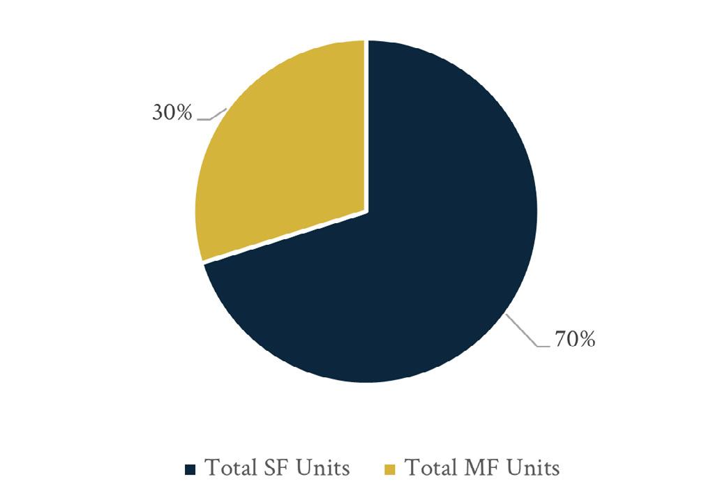
Single-family homes are the dominant housing type in McCordsville, accounting for just over 70 percent of housing units in existing neighborhoods and approved projects. The remaining 30 percent of housing types include, but are not limited to traditional for-rent apartments, assisted living/memory care, for-sale townhomes, and mixed-use buildings. There are approximately 9,500 residential units either existing or approved in McCordsville. A full breakdown of unit counts by housing type is included in Appendix 3 . Of approved residential units, 446 units are agerestricted, including 115 units of assisted/memory care housing at Traditions at Brookside. Additionally, 661 units are age-targeted with 85 percent being for-sale single-family homes. There are 5,611 units of traditional for sale-single family homes in McCordsville neighborhoods including Old Town.
Traditional rental multi-family units (not in vertical mixed-use buildings) total 1,315 and are located in Broadacre, Parkfield, Gateway Crossing, Morningside, and Jacobi Farms. Gardens on Gateway and Traditions at Brookside have age-restricted multi-family rental units. A full breakdown of unit counts by housing type is included in Appendix 3
At build-out the existing and approved projects would support a population of 24,700, assuming 2.6 people per household. At an average annual growth rate of four percent, McCordsville will have a population of 25,923 in 2045 and need a total of 9,932 housing units to support that population given the number of people per household remains the same. In addition to build-out of the approved subdivisions, an additional 468 units need to be completed through 2045 to accommodate the projected population. The community could potentially grow more than four percent per year over the planning period, and the community can accommodate a higher population if residential demand is stronger.
Sixty-five percent of households in McCordsville are married couple families, fourteen percent are single parents, and seventeen percent are people living alone. Forty-five percent of households have someone under age 18 living at home. People living
alone and couples without children under 18 living at home may desire different housing types than large single-family homes. Mid-career couples without children and empty-nester households may prefer homeownership to rental units without desiring a larger home or the maintenance that comes with a larger lot.
The Central Indiana Housing Study identified gaps in the regional housing market. The finding of note was that the region does not have enough smaller homeownership units (two bedroom or smaller). Often these units are attached units like condos or townhomes. It was also found that the region has more mid- and higher-cost three- and four-bedroom units than people would prefer. Attainable housing is also needed in much of Central Indiana. Local regulations are a factor in the high cost of housing, but macro-economic trends like construction costs and mortgage rates have put upward pressure on housing costs as has the entry of corporate single-family home investors into the market.
The 2021 Housing Gap Analysis of the Mt. Comfort Road Corridor found that the Mt. Comfort Corridor Region could absorb 13,779 new housing units by 2030. The same study found that in a larger 30-minute region of analysis, there is an estimated demand for 58,000 homes by 2030. This underscores that while McCordsville has been growing at a significant pace, there is still considerable housing demand in the area.
1 4 5 2 3
Cultivate quality housing options throughout the community that are developed as neighborhoods, inspire a small-town feel through design and provide a range of housing options. Neighborhoods are well-connected to daily community needs, facilities, and destinations. To achieve this purpose, several goals have been established: Cultivate a charming community atmosphere through the design of the housing, streets, and neighborhoods.
Provide a range of housing types for different preferences, ages, and needs. Establish clear standards for housing development. Design quality and long-term value into residential development to maintain appearance and property values.
Review processes to ensure they are streamlined and clear.
The action plan identifies projects and programming that will help McCordsville achieve the goals.
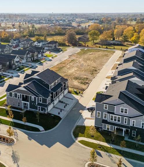
In the last few years, the town has approved several mixed-use and/or mixed-residential projects. These projects represent a paradigm shift for development in the area and will change the housing market in McCordsville.
The McCord Square Planned Unit Development was adopted in 2022 with the intent of creating a traditional downtown/town center feel focused on pedestrian-scale streets, streetscapes, and storefronts where people could live, work, shop, dine and play. The buildings in the mixed-use district are intended to be two to four stories with ground-floor retail. The initial phase of McCord Square includes approval for up to 670 residential units (all multifamily). These units will be primarily located within mixed-use buildings, containing commercial and other non-residential uses on the ground floor. Future phases of McCord Square, likely adding up to 80 acres to the overall project, are expected in the future on the undeveloped land between Phase I and Jacobi Farms. The future phases will seek to add to the multifamily inventory in the town, and maintain a dense, walkable scale.
The Jacobi Farms Planned Unit Development was adopted in 2022 and amended to add additional density in 2024. This project will feature multi-family units adjacent to McCord Square and is intended to transition from the mixed-use McCord Square, located to the west, to lower density single family homes at the east end of the project. Jacobi Farms is a significantly sized project and is important as a fringe development, providing an additional consumer base for McCord Square.
Hampton Walk is another project within a walkable distance to McCord Square. The project features 346 units, with 6 districts, featuring a mix of unit types ranging from single-family to townhomes. This project is intended to increase the density of residents around McCord Square.
Colonnade is located immediately south of McCord Square. The project features a total of 276 residential units, in 5 districts, featuring a mix of unit types ranging from single-family to townhomes. Density is at its highest at the north end of the project adjacent to McCord Square and at its least at the south end adjacent to the existing Champion Lake subdivision.
The implementation plan includes projects and activities to advance the goals of the housing and development chapter.
Priority Tier 1: Top priority for the town. Such items are likely to be completed as soon as possible, and certainly within the next five years.
Priority Tier 2: Important priorities for the town but are often items that may require other steps to be completed first, and/or are not expected to be completed within the next five years.
Priority Tier 4: Priorities that are dependent upon growth/ development rates or patterns or are otherwise dependent upon other action or trigger points.
Action/Project
Establish residential standards in the new Unified Development Ordinance (UDO)
Revise road standards in the new Unified Development Ordinance (UDO)
Seek developers with product types that are missing but desired for Master Planned Villages (see Chapter 8: Land Use )
Study and advocate for public service housing options
Priority Tier 3: Priorities that should be completed prior to the end of the horizon year for this plan.
Priority Tier 5: Ongoing priorities.
Responsibility
McCordsville Dept. of Planning and Building
Tier 1
McCordsville Dept. of Planning and Building
Tier 1
McCordsville Dept. of Planning and Building
McCordsville Town Council, Mount Vernon Community School Corporation
Tier 4
Tier 5
Quality of life is one of the most critical elements of success for growing communities. While public schools were used to define the quality of life in communities for decades, modern society includes more diverse households with a smaller percentage of them having school-aged children or connection to local schools. Parks, trails, gathering spaces, events, and even private recreation facilities have become the most attractive elements of desirable communities. McCordsville neighborhoods have highquality private amenities that are restricted for use to residents of those neighborhoods. As the town grows it has begun investing in public spaces and amenities
The McCordsville Parks and Recreation Department was newly established in June of 2024 and has a director and programming staff that will expand as the community grows. The department is funded through the Parks Impact Fee. Town parks consist of Old School Park (Phase I renovation in 2024-2025), Town Hall Park and public open spaces in McCord Square consisting of Civic Commons, Central Green, and McCord Square Park. The department also offers a variety of programs and events throughout the year.
The town does not have enough public park land for the growth it has experienced. Planning for acquiring additional park land will be a consideration in the 5-Year Parks and Recreation Master Plan. The town is open to donations of charitable land donations for future park development.
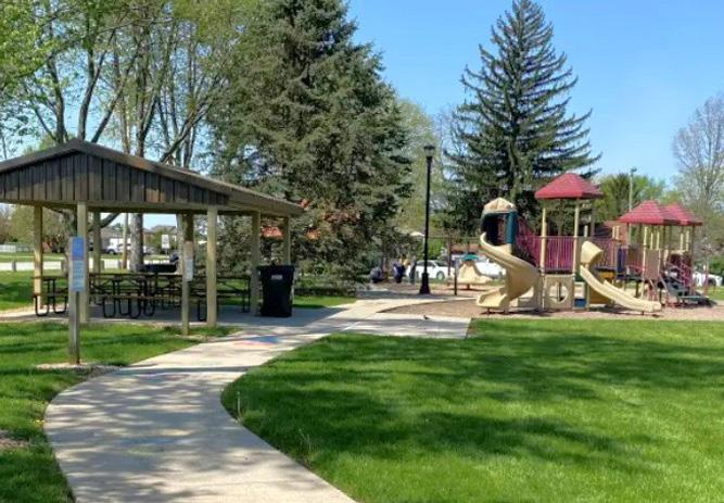
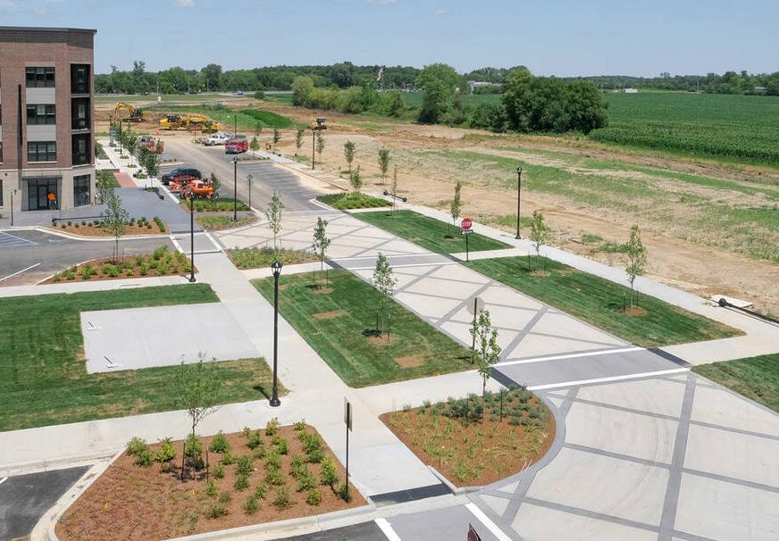
Old School Park
The Phase 1 Renovations will include two new playgrounds, one for ages 2-5 and another for ages 5-12 with new rubber playground surfacing with a new shelter, restroom, and two revamped basketball courts. Phase 2 is intended to add additional programmed space as well as passive open space.
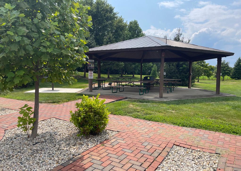
Town Hall Park is the large open space just west of Town Hall. It has a shelter with 6 picnic tables and a double-sided charcoal grill. It is used to host many park events such as Party in the Park, Cars and Coffee and the McCordsville Market. Many of these events will be transitioned to Civic Commons and Central Green at McCord Square once complete. There is a stone walking trail around the greenspace. The shelter is available to rent. Eventually, Town Hall Park will be closed and will become home to an expanded wastewater treatment plant.
The new McCord Square features four separate open space areas – Civic Commons, McCord Square Park, Central Green, and Main Street Plaza.
Civic Commons is approximately 1 acre and is centrally located along Main Street. It includes a programmed area featuring gas fire tables, seating, cornhole boards, a hardscaped plaza for food trucks and other events, as well passive open space. A water fountain and public art is also planned for this area in the future.
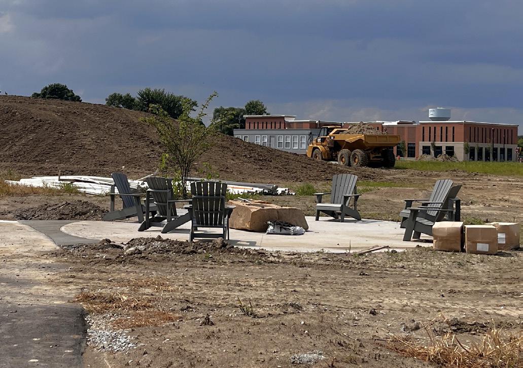
Stormwater Park is approximately 6 acres and is located at the southern end of McCord Square. It features a large, stocked detention pond, as well as a looped trail system, native plantings, seating, a fire pit area, and a pedestrian bridge for enhanced connectivity and engagement with the water. This area will also include a direct pedestrian connection to the multi-use side path system along CR 750N and CR 600W and the nearby trailhead. The trailhead, located between Stormwater Park and CR 600W, will feature seating, a water fountain, bike repair station, and a bubbling boulder installation.
Central Green is approximately 4 acres located between Market Street and the forthcoming Civic Drive. Central Green is planned as the primary open space, centered in the heart of McCord Square.
Central Green will be developed in phases, and at buildout is planned to include wide sidewalks, a hardscape plaza, children’s play area, outdoor event space, and an amphitheater. In 2024 the Town was awarded READI 2.0 funds for the first phase of Central Green.
Main Street Plaza is a small hardscaped plaza along the northside of Main Street, between CR 600W and Union Street. It will be located directly adjacent to the Main Street sidewalk area, and will contain a water feature, seating, and landscaping. It is intended to further activate the streetscape, adding to the quality of place of Main Street.
Planning for parks includes consideration of the number, size, location, land purchase price, development cost, and type.
Regional parks attract people from a larger area than the community. They range in size from 15 acres to several hundred acres and may meet a variety of recreation needs including sports fields, hiking or biking trails (paved or natural surface), picnic shelter areas, aquatic facilities, formal gardens or specialized nature centers (like an ornithology center), golf courses, disc golf, high ropes courses, and similar activities.
Urban/Community parks are in the highest density areas of the community serving residents and businesses. They often have hard surfaces anticipating more use and are small scale. Amenities include benches and tables. They may include small spray parks or water features, outdoor games, or interactive seating like swings.
Neighborhood parks are typically located within neighborhoods and serve the people who live nearby, whether they are owned and managed by the municipality, a homeowners’ association, or other entity. They are typically accessed by walking or biking, so any parking provided is typically limited and may be reserved for people with disabilities. They range in size from one to 15 acres. Typical amenities include playgrounds, benches, picnic shelters, and open areas. Some parks will have shade structures or inclusive playground equipment that is accessible to all.
There are several types of specialty parks that could be considered for McCordsville in the Parks and Recreation Master Plan process that happens every five years. Examples of special purpose parks are included for reference.
• Dog parks, also called bark parks, are places where people can allow dogs off leash to play with other people and dogs. Some are simple fenced areas with trees or rocks and benches. Others have separate enclosures for different sizes of dogs, obstacles or play structures, and dog drinking fountains.
• Ball fields, pickleball or tennis courts, BMX or mountain bike parks (purpose built), and basketball courts are examples of sports parks. The size and complexity of the park depends on the intended users, from casual pickup games among friends to competitive leagues and championship games. Larger facilities require increased consideration for parking, restrooms, stands, concession areas, electrical, scoring and announcing space, and shade. The town has identified a need for a sports park/ball diamonds and a study is underway.
• Pump tracks are small, looping circuit of rollers, banked turns and features that youth and adults can ride continuously without pedaling. The name “pump track” comes from the pumping motion used by the riders upper and lower body (instead of pedaling or pushing) as they ride around the track.
• A disc golf course is a space with a series of holes where players throw a disc to a target. It is similar in layout to golf courses. Disc golf course are popular around the Indianapolis area and the state.
• Nature parks, fishing piers, and sledding hills are popular park features, typically within a larger regional or community park. Pocket parks are small gathering areas that generally have seating and landscaping, with perhaps a small play structure for children. Trailheads are locations along trails that have benches and trash cans, but may also have information boards/signs, restrooms, and drinking fountains. Linear parks are typically called greenways (or blueways if a river corridor) and are used for transportation as well as recreation. They may have additional elements like public art, nature information, or fitness stations as part of the experience
Trails and Greenways are typically not part of a road corridor and may be through parks, along waterways, or along railroad or utility corridors. Sidepaths are the wider paths in road corridors.
Sidepaths have been required as part of development since the early 2000s and that network is becoming more complete as development begins to fill in the gaps along the collector and arterial roads.
The town created a Bike and Pedestrian Master Plan in 2019 that examined the road cross-sections with existing sidepaths and sidewalks at the time in detail. Refer to Chapter 3 for more information on the Bike and Pedestrian Plan and local sidepaths, sidewalks, and trails.
Central Indiana has an extensive regional trail network that will eventually provide connection between most of the communities in and around Indianapolis. The most regionally significant trail on the east side of the metro area is the Pennsy Trail from Indianapolis to Greenfield. While small gaps exist, the trail is nearing full connectivity through Irvington, Cumberland, and Greenfield. Another regional trail on the east side is the Buck Creek Trail, which extends from Irvington to CR W 100N. The Grassy Creek Trail is primarily contained in Grassy Creek Regional Park, but a connector trail is planned east to the MarionHancock County line. North of McCordsville, the Fall Creek Trail is coming together to connect Indianapolis, Lawrence, and Fishers. Geist Greenway is a planned, partially complete 5-mile pedestrian trail between 96th Street and 131st Street. The typical cross section is 18 feet, divided into 14 feet of pedestrian lanes with two-foot shoulders on either side. The town is the planning phase of an extension of the Geist Greenway into McCordsville. If successful, the construction of the extension will likely be completed as adjacent development occurs. The town’s Bike and Pedestrian Master Plan includes suggested routes for trail connections to neighboring community trails, with the goals of providing indirect connections, via other communities’ trail systems, to these larger regional trails.
McCordsville Elementary School is the only MVCS facility in McCordsville. MVCS has adopted a public use policy that allows the public to use the playgrounds for normal playground activity at no charge. The school has considerable outdoor recreation space, including playgrounds, ball courts, and a track/field. A gymnasium is indoors.
The following Mount Vernon Community Schools facilities are available for rent:
• Mt. Vernon High School Main Gym (Fortville)
• Mt. Vernon High School Auxiliary Gym (Fortville)
• Mt. Vernon High School Auditorium (Fortville)
• Mt. Vernon Performance Enhancement Center (Fortville)
• Mt. Vernon Middle School Fieldhouse (Fortville)
• Mt. Vernon Middle School Main Gym (Fortville)
• McCordsville Elementary Gym (McCordsville)
• Mt. Comfort Elementary Gym (south of McCordsville)
1 4 5 2 3
Provide public spaces for sports, events, arts, and social connection. To achieve this purpose, several goals have been established:
Create a public venue to host community events. Promote McCord Square District as a destination and an active town center. Create community parks and provide a range of options from passive to active recreation for all ages. Encourage public art throughout the community and at key destinations to foster a sense of community. Partner with and support the Mount Vernon Community School Corporation.
The action plan identifies projects and programming that will help McCordsville achieve the goals.
There are projects currently in planning or engineering for the town that will assist with public space delivery as the community grows.
The old fire station on Form Street has been acquired by the town and will be renovated into a community center. The community center will include two different-sized meeting rooms, along with a catering kitchen, storage space, office space for the parks department, and an outdoor plaza to further enhance the hosting capabilities of the center. The community center is currently scheduled to begin renovations in the latter half of 2025.
What is now McCordsville Sports Park sits on the restored foundation of the Dillinger Dog track that dates to the 1930’s. The dog track had another life as Raceland Indiana, a quarter mile sprint car and midget racetrack in the 1970s. After 30 years of inactivity, the park is now used for outdoor recreation, particularly youth soccer. The sports park is privately owned and operated but does provide a number of youth programs with the opportunity to schedule and utilize fields.
The Town of McCordsville plans to update the 5-year Parks and Recreation Plan in 2025. Parks and Recreation Plans are reviewed by the Indiana Department of Natural Resources and can support the community’s eligibility for certain state grant programs.
In 2013, the State of Indiana enacted House Enrolled Act 1159 – Liability for Use of School Facilities. This bill limits the liability of a public school or an accredited nonpublic school that opens school property for community physical activity. The law also provides protections to schools by limiting the liability for providing physical fitness activities. A school is not liable for the death or injury of a participant that results from an inherent risk of a physical fitness activity. A participant or the representative of a participant may not: (1) make a claim against; (2) bring or maintain an action against; or (3) recover damages from; a school for injury, loss, damage, or death of a participant that results from the inherent risk of a physical fitness activity. Schools opening their doors are required to post a warning sign informing the public of the inherent risk of fitness activity and that schools will not be held liable for any injury that results from the activity. Community use of school property can be a formal or informal agreement between two separate entities, often a school district and a city or county organization, setting forth the terms and conditions for the community use of school property of public property
Mount Vernon Community Schools allows the community to use playgrounds and there are rental opportunities for some of their activity spaces. There is also an access program for residents over age 65 to attend sporting events.
Mt. Vernon Community School Corporation (MVCSC) is offering any resident living in the district who is at least 65 years old an opportunity to receive a “Mt. Vernon 65+ Club” event pass. This 65+ Club card will provide free admission to most Mt. Vernon Middle School and Mt. Vernon High School events.
The implementation plan includes projects and activities to advance the goals of the public spaces chapter.
Priority Tier 1: Top priority for the town. Such items are likely to be completed as soon as possible, and certainly within the next five years.
Priority Tier 2: Important priorities for the town but are often items that may require other steps to be completed first, and/or are not expected to be completed within the next five years.
Priority Tier 4: Priorities that are dependent upon growth/ development rates or patterns or are otherwise dependent upon other action or trigger points.
Priority Tier 3: Priorities that should be completed prior to the end of the horizon year for this plan.
Priority Tier 5: Ongoing priorities.
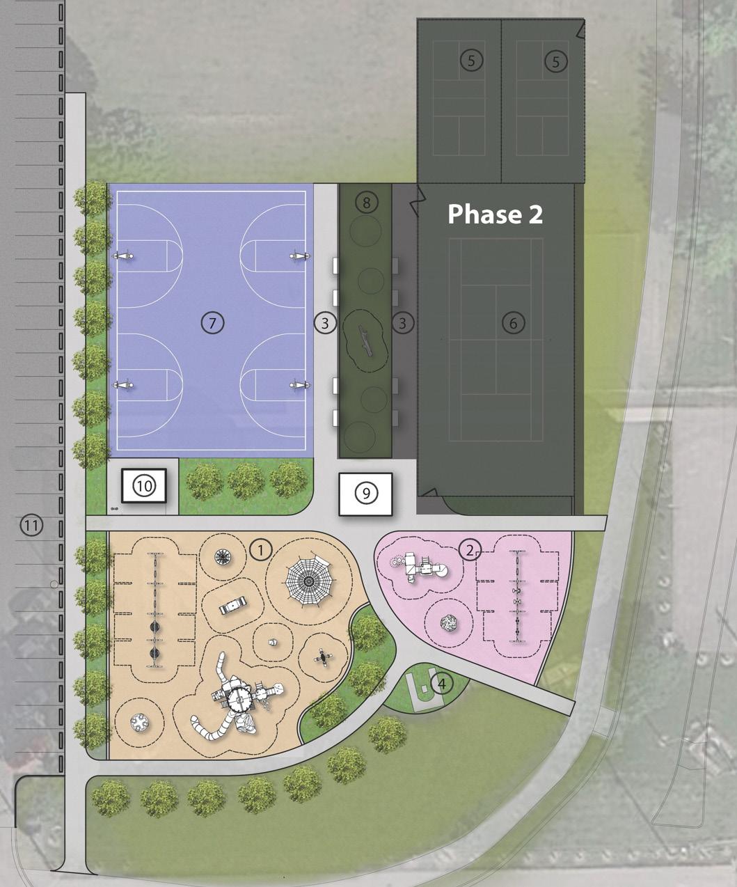
1. Playground Expansion with poured-in-place surfacing (5-12 yr)
2. Playground Expansion with poured-in-place surfacing (5-12 yr)
3. Outdoor Seating Space
4. 4. Relocated Monument
5. Phase 2 Pickleball Courts
6. Phase 2 - Tennis Courts
7. Basketball Court
8. Phase 2 - Synthetic Turf Gathering Area with Play Mounds
9. Picnic Shelter or Shade Structure
10. Restroom Building
11. Parking Spots (39 spaces)
McCordsville has grown rapidly and so has many residents with no family or historic connection to the community. Part of the community has been around for many decades and is familiar with the town history and institutions, but much of the community has more tenuous connections – considering McCordsville as a home base while working, shopping, and playing elsewhere in the region. Creating an identity that people can be proud of and feel connected to is important to maintaining and improving the quality of life in McCordsville through the next generation.
McCordsville has physically grown through annexation as development occurred. This means the town boundaries have changed, and it hasn’t been practical to build permanent town gateways at the edges of the community to identify arrival in McCordsville. The transition from Marion County and Lawrence to McCordsville would be indistinguishable to most people driving Carroll Road. This is one of the challenges suburban communities face in creating strong local identities. As McCordsville has grown, most of the community events have involved the schools and youth sports. For people not connected to the schools, there lacks a rich history of local events that are regional draws and must-attend events.
While town gateways haven’t been a priority, subdivision gateways have been a significant feature of neighborhood development in McCordsville since the growth began. Residents are likely to identify with their neighborhood subdivision as much as, or more than, with the town. These gateways can be complemented by permanent town gateways as the community approaches the planned boundary.
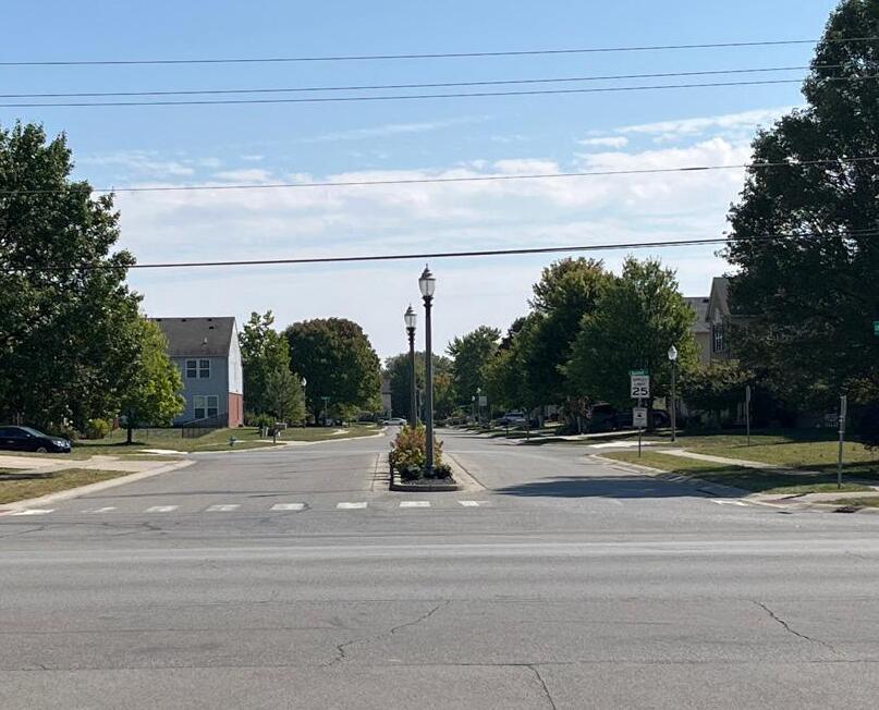
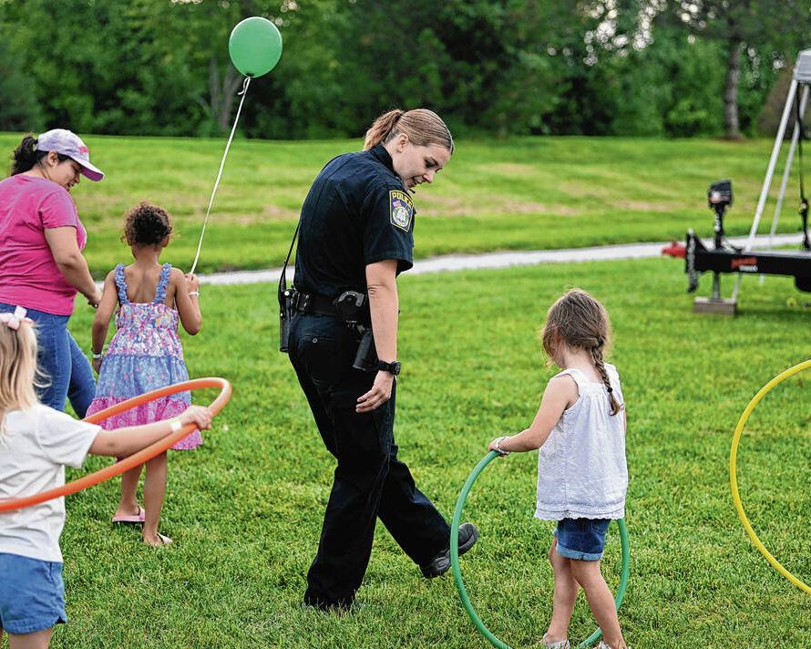
Many of the existing events in McCordsville are supported by the McCordsville Parks and Recreation Department. These include youth camps, seasonal events, and fitness events.
The McCordsville Parks and Recreation Department hosts six youth camps: flag football, hands-on robotics and coding, multi-sport, beginning golf, tennis, and pickleball. These camps are held during summer months at town parks or at the community center for indoor events.
Seasonal or periodic events in town are the Easter Bunny visit, Arbor Day seedling giveaway, Party in the Park, Trunk or Treat, and the Christmas Tree Lighting Ceremony. The Parks and Recreation Department also offers a Euchre league for youth and adults in the early spring, the Market in McCordsville at McCord Square quarterly, McCordsville Live at the Square (two outdoor movies and one concert), and Cars and Coffee at McCord Square six times a year.
Fitness events by the Parks and Recreation Department include yoga classes and the annual Path to Fitness 5K. Yoga is held at the town hall on Monday evenings for teens through older adults. The town has partnered with an independent yoga instructor for this program. The Path to Fitness 5K is an annual run/walk in August that highlights the community and promotes a healthy population.
Goals 1 4 5 2 3
McCordsville is a friendly and relaxing town. The town’s charming atmosphere make people proud to call McCordsville home. To achieve this purpose, several goals have been established:
Prioritize quality of life improvements for people of all ages and abilities. Organize and promote community events. Promote and support physical, mental, and emotional health.
Cultivate community identity through key districts with many small destinations. Address the separation issues created by the railroad location.
Goal 1 is also addressed in Chapter 5: Public Space . Goal 4 is also addressed in Chapter 8: Land Use through the Master Planned Village and Town Center placetypes and the sub-area plans. Goal 5 is also addressed in Chapter 3: Transportation
The action plan identifies projects and programming that will help McCordsville achieve the goals.
Gateways and districts are physical ways to establish an identity that can work in partnership with programming to support a more cohesive community.
McCord Square, the town’s downtown/town center, represents a major step forward for the town. In addition to providing public amenities, retail shops, dining options, live/work/play opportunities, and pedestrian-scale streets and streetscapes, the project gives the town an identifiable center and heartbeat. This should continue to be expanded not only with further development, but also with more programming, community events, activated public spaces, and other methods of increasing social interaction and engagement, leading to stronger connections between residents and within the community
The 40th anniversary of the town’s incorporation would be an opportune occasion to install gateway signs/structures for the community at key intersections on the community edges. McCordsville was incorporated as a town in 1988 even though the original plat was established in 1865 and named for the McCord family that had planned land in 1873.
The Master Planned Villages and McCord Square as the town center are opportunities to build destinations with distinct identities that are attractive places for residents and businesses as well as destinations for people, including from around the region, to come for play. Careful planning of these areas with live, work, play spaces and gathering spaces that have a strong identity of their own will help the community build an identity as well.
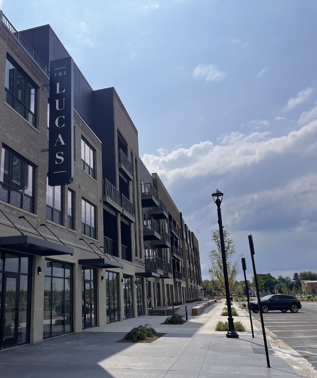
The implementation plan includes projects and activities to advance the goals of the town identity chapter.
Priority Tier 1: Top priority for the town. Such items are likely to be completed as soon as possible, and certainly within the next five years.
Priority Tier 2: Important priorities for the town but are often items that may require other steps to be completed first, and/or are not expected to be completed within the next five years.
Priority Tier 4: Priorities that are dependent upon growth/ development rates or patterns or are otherwise dependent upon other action or trigger points.
Develop and implement a 5-years Parks and Recreation Plan
Partner with non-profits and small regional businesses to provide additional social and recreation activities for residents
Develop a gateway plan and structure that communicates the McCordsville brand and identity
Adopt local names for the roadways replacing the county numbering system
Post physical, mental, and emotional health messages and resources at town owned facilities
Ensure the Master Planned Villages and sub-areas have a distinct identity and character with local and regional destinations (see Chapter 8: Land Use for more information about master planned villages and sub-areas)
Incorporate rail transportation themes into track adjacent development to create positive experiences around the trains
Priority Tier 3: Priorities that should be completed prior to the end of the horizon year for this plan.
Priority Tier 5: Ongoing priorities.
McCordsville Parks Department
Tier 1 Adoption of the plan
McCordsville Parks Department
Tier 1
Town of McCordsville
Tier 1
Town of McCordsville
McCordsville Parks Department
Tier 2
Installation of gateway signs
Tier 1, 5 Quarterly messages
McCordsville Dept. of Planning and Building
Tier 3
McCordsville Dept. of Planning and Building
Tier 2
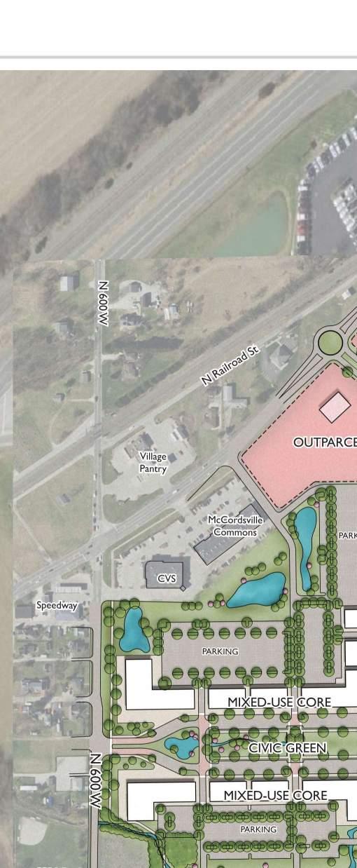
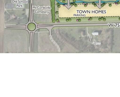
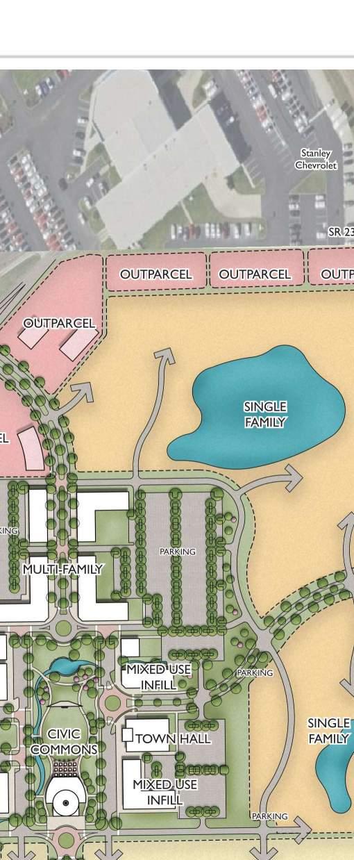
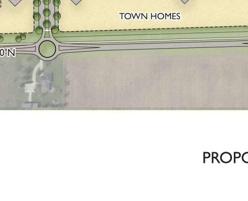
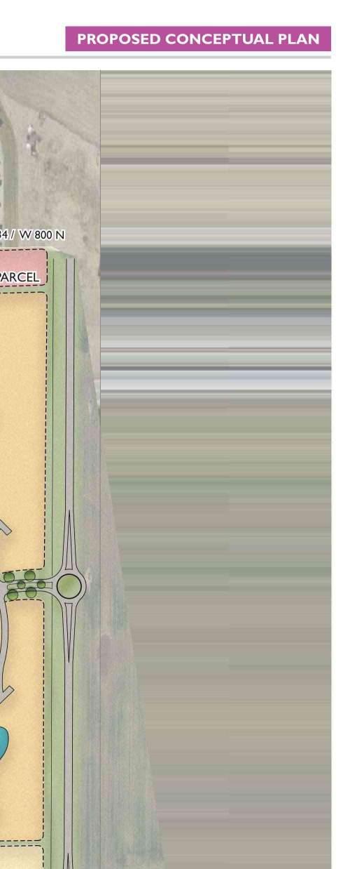
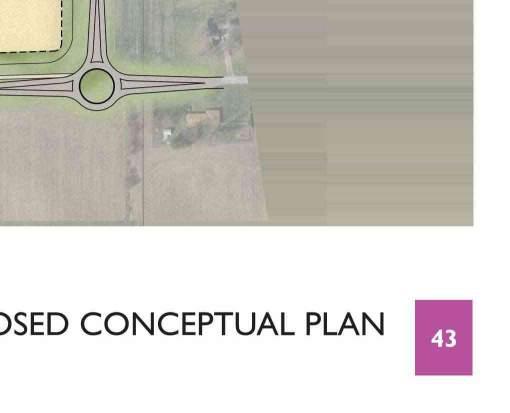
Utilities, like the transportation system, form the foundation for development in the community. The availability of water and sewer are drivers of development, and electricity, waste management, stormwater management, and telecommunications are critical for places where people live, work, and play. Public safety, as well as town administration, also play important roles in development patterns as proximity to fire hydrants and fire stations are key determinants of insurance cost and coverage.
Citizens Energy Group provides water for the Town of McCordsville. Individual water customers are billed by Citizens for their water use. The town is not responsible for the water delivery infrastructure.
The McCordsville Sewer Master Plan (2011) has a study area bounded by the county lines to the north and west, CR 650N to the south, and CR 400W to the east. The study uses 13 basins based on natural drainage areas to define sewage basins. Interceptor sewers are those over eight inches diameter that are located for the collection of sewage from other collector sewer lines.
The system has a total of eight regional lift stations. Additional lift stations are anticipated in the five basins that do not yet have a regional lift station including Bills Branch, Buck Creek, Camp Creek, Dry Branch, and Woodbury.
Phase 1 of the wastewater treatment facility was originally constructed in 1999 with a capacity of 75,000 gallons per day (GPD). Since then, the Town has expanded the wastewater treatment plant (WWTP) four times. The current WWTP facility has a treatment capacity of 1,000,000 GPD design flow with an average peak design flow of 1.2 MGD.
The engineering department has begun an update using WaterWorth to understand planning needs.
The Indiana Department of Natural Resources (IDNR) requires a system to be upgraded when it reaches 80 percent of capacity. This is predicted to occur in McCordsville in 2027. The town has secured land for the expansion.
The portion of the town south of CR 650 N is served by Aqua Indiana, a private utility. The town is not responsible for the wastewater infrastructure within Aqua’s territory.
There are approximately 500 existing septic systems in the planning area that are nearing the end of their useful life. The town will need to continue to discuss and plan for conversions with the property owners.
McCordsville is an MS4 community, responsible for stormwater education of residents and publishing plans for upgrading the town stormwater management system. The town participates in the Clear Choices, Clean Water Partnership for education and outreach related to stormwater and water protection. The town’s stormwater ordinance was last updated in May 2024.
Electric service in McCordsville is provided by both NineStar Connect, a non-profit utility cooperative, headquartered in Hancock County, and AES Indiana. The town is not responsible for electric infrastructure. Having more than one service provider can mean there is duplicative infrastructure that increases the cost of electric service in the community.
Natural gas service in McCordsville is provided by Centerpoint Energy. The town is not responsible for natural gas infrastructure
NineStar Connect provides high speed internet and phone in McCordsville. Residential speeds are available up to 10 gigabytes for residential and commercial speeds are available up to 100 gigabytes for business (upload and download). McCordsville is a 100% fiber-to-the-premise community.
Spectrum also provides telecommunications services in McCordsville as well as Comcast in parts of the community.
McCordsville provides residential sanitation (solid waste management) services through a vendor agreement. In 2025 the town entered into a contract with Priority to provide for solid waste collection and curbside recycling.
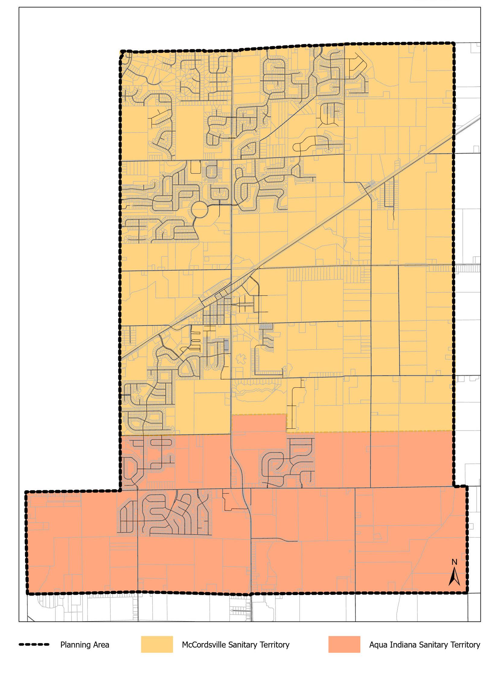
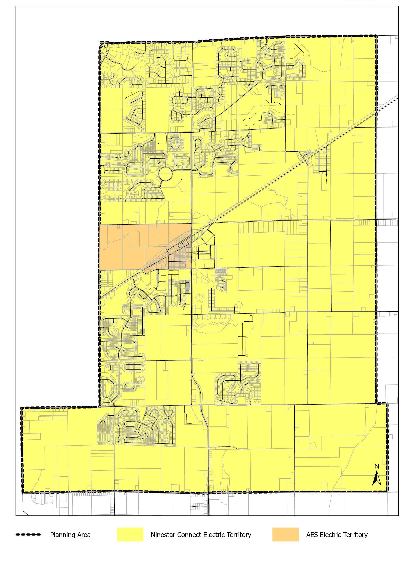
The administrative functions of the town are located at Town Hall, while the police department is in a new headquarters facility that is part of McCord Square. The Vernon Township Fire Protection Territory provides fire service to all portions of the town located within Vernon Township. Fire services for residents in Buck Creek Township are provided by the Buck Creek Fire Department.
The town is led by a legislative body of the fivemember town council. The president of the council serves as the executive officer. The town employs a town manager who oversees day-to-day operations and the rest of the administrative staff, which provides all local government services to its citizens, other than public safety.
All town departments other than police and public works are in town hall. Town Hall was built in 2011 and is located along Vail Road , adjacent to the wastewater treatment plant. The building was built with the longrange plan of becoming the wastewater treatment plant’s operational headquarters and laboratory space in the future as the plant continues to expand. This meant sizing the building to accommodate the office and laboratory needs of a future 5 million gallons-per-day (MGD) plant. In the meantime, the building would be used as town hall. The upcoming WWTP expansion to 2 MGD will not require the conversion of the building to the plant operational headquarters and laboratory space.
The town’s administrative staff is expanding, due to the expanding population, and is anticipated to outgrow the current town hall within the next five years.
The administration office consists of the chief of police, the assistant chief of police, and the administrative assistant.
The office of the chief is responsible for the day-today operations of the police department. The office maintains the accuracy and integrity of records kept in response to daily police activity and collects and processes fees, gun permits, tow releases, in addition to other administrative duties.
Administrative staff officers focus on personnel supervision, expenditures and procurements, operating policies and procedures, equipment maintenance and operation, interaction with other departments and elected and appointed members of the town’s boards and councils.
The McCordsville Police Department provides proactive patrols, reactive police response to calls for service, criminal apprehension, vehicle crash investigations, traffic enforcement, and community partnerships.
The police department moved into the new headquarters in 2024.
The Vernon Township Fire Department provides 24/7 station-based fire and EMS service to all portions of the Town of McCordsville within Vernon Township. In addition, Vernon Township provides Advanced Life Support (ALS) with both ambulance and an ALS engine. Station 432 opened in McCordsville in 2023. The Buck Creek Fire Department provides fire services to the portions of McCordsville within Buck Creek Township. In planning for a growing community, the town has identified a need for a third fire station south of the railroad tracks.
The town has quality, well-maintained infrastructure. The town is safe and has excellent emergency services. To achieve this purpose, two goals have been established:
1 2
Provide and plan for efficient utilities within the community. This may include evaluating Indiana Utility Regulatory Service (IURC) maps to identify opportunities for a reduction in cost by leveraging the electrical service split between Ninestar and American Electric Power.
Provide for and improve the already quality and responsive emergency services.
The action plan identifies projects and programming that will help McCordsville achieve the goals.
There are projects currently in planning or engineering for the town that will assist with utility and public safety delivery as the community grows.
Design of the next wastewater plant expansion is planned to start in April of 2027 with construction starting in August of 2028. The next expansion is anticipated to take the capacity from 1 million gallonsper-day (MGD) to 2 MGD.
The town’s existing Sanitary Master Plan was adopted in 2011. As the town continued to grow, the sequencing of development has not aligned with the 2011 presumptions of the Master Plan. Additionally, the new comprehensive plan is setting a revised vision and land use patterns for the next 20 years. The Sanitary Master Plan must be adjusted for that vision and land use patterns. The engineering department will begin an update immediately following adoption of the comprehensive plan.
The town will undergo a town hall feasibility study in the second half of 2025 to determine future town hall size and capability needs. Currently, the preferred plan is to construct a new town hall in McCord Square. This would place the civic services in the heart of the community, like the old county offices and courthouse in the downtown of the county seat. However, the town will also evaluate other options, which could include expanding the current town hall.
The Vernon Township Fire Protection Territory anticipates a third station will be needed in Vernon Township as the population continues to grow. Currently, based upon development patterns it is likely that the third station would ideally be located south of the railroad tracks
The town recognizes the benefit of a local library. Currently the closest library is in Fortville and the town maintains a small lending library in the town hall. The town plans to continue discussions and consideration of an approach to library services for residents.
The implementation plan includes projects and activities to advance the goals of the utilities and public safety chapter.
Priority Tier 1: Top priority for the town. Such items are likely to be completed as soon as possible, and certainly within the next five years.
Priority Tier 2: Important priorities for the town but are often items that may require other steps to be completed first, and/or are not expected to be completed within the next five years.
Priority Tier 4: Priorities that are dependent upon growth/ development rates or patterns or are otherwise dependent upon other action or trigger points.
Additional fire station
Community engagement
Town Hall Feasibility Study
Sanitary Master Plan
WWTP Expansion
Continue to study and plan for library services.
Priority Tier 3: Priorities that should be completed prior to the end of the horizon year for this plan.
Priority Tier 5: Ongoing priorities.
Vernon Township Fire Department
Town of McCordsville
McCordsville Police Department
Town Manager
McCordsville Engineering Department
McCordsville Engineering & Public Works Depts.
Town of McCordsville
Tier 6
Tier 5
Number of community events and participation. Number of communication pieces and reach.
Tier 1
Tier 1
Tier 1, 5
Tier 1
Land use patterns in a community are influenced by, and influence, the transportation system, utility infrastructure, natural area preservation, and open spaces. Broad categories of land use like residential, commercial, industrial, and institutional (or civic) have been part of the development planning in cities and towns for many decades. Land uses can also be much more discreet, considering the density or type of housing, business, or industrial use or accommodating mixed uses or specialty uses. More recently, communities have been looking back to historic development patterns where there are a greater mix of uses and the form of the building and sites is more important than the uses themselves.
The existing land use pattern may align with the existing zoning, but there are always uses that pre-date the zoning code or are otherwise allowed by variance or special exception. These legal nonconforming uses are part of the existing land use pattern but may not be part of the future land use pattern as ownership and adjacent development changes over time.
The land use shown on a future land use map or development pattern map may not be what happens in the next year, five years, or twenty years. It is a guide for what could be in that area and is further refined by the Zoning Ordinance (or Unified Development Ordinance) and the development process.
Residential development is the single largest land use in McCordsville. Approximately 70 percent of the residential development is single-family detached units. The development pattern reflects the recent history of McCordsville as a bedroom community for Indianapolis and other suburban communities in Central Indiana. As the community has grown there has been demand for commercial development to support the daily needs of the residents, and more commercial development has occurred as the number of rooftops and the household income has increased. The primary location for commercial development is along Broadway and Mount Comfort Road.
There are many subdivisions that are fully developed and more that have development plan approvals and are either under construction or awaiting construction, as detailed in the Housing and Neighborhoods Chapter.
The town and other local governments have become more mindful of tax base diversity to support quality of life – increasing government services, growth pressures, and the ever-changing tax structure in the State. Homestead residential development in Indiana generates property taxes that are capped at one percent of assessed valuation. There are currently a few taxes, like those approved by local referenda for schools, that are not subject to the cap. Nonhomestead residential, which includes apartments and single-family homes that are rented, has a tax cap of two percent of assessed valuation.
Commercial and industrial uses provide jobs in the community and have the ability to generate higher property tax revenues. These property taxes for these uses are capped at three percent of assessed valuation, excluding certain adopted tax assessments that are outside of the tax caps.
Planned Unit Development (PUD) is the negotiated development plan and zoning requirements process that has been used for most development in McCordsville over the past 25 years. It allows flexibility for both the town and the developers but can be lengthy and does not have a predictable outcome from the outset, which can increase costs and risks for developers. PUDs also tend to create more administrative oversight by the planning staff.
The comprehensive plan is a policy guide rather than a regulatory document. It sets the framework for zoning and subdivision control regulations and creates a vision for the community during the time period identified by the plan. The Town of McCordsville intends to update the regulatory documents after adoption of the comprehensive plan to better support the vision, principles, and goals of the plan.
Zoning establishes the use and development standards for parcels and districts. This includes height of buildings, lot size and setbacks, landscaping, lighting, signage, building materials, architectural elements, and similar requirements.
The Subdivision Control Ordinance establishes the processes and procedures for splitting land into smaller parcels and establishing and connecting transportation routes and public utilities. When a community has a subdivision control ordinance it is not permissible to split off parcels and record them without going through the subdivision control process. The ordinance may require different standards for a single lot split and correcting boundaries for small/minor subdivisions than for large/major subdivisions.
Some communities elect to combine the Zoning Ordinance and Subdivision Control Ordinance into one document, called a Unified Development Ordinance (UDO). As the town updates these regulatory documents, the intent is to move to the UDO model.
McCordsville will annex areas that are included in the comprehensive plan as appropriate and allowable under Indiana code. The intention is to grow the town to the east as far as CR 400 W, south to CR 500 N, and west to the Marion County line. The purpose of annexation is for reasonable and efficient delivery of government services, growth management, and diversification and growth of the tax base. Additionally, the town believes that residential subdivisions and commercial/industrial development is best served within a municipality which is equipped to provide the necessary municipal services commensurate with the density and intensity of the land use.
Trail-oriented development is intentional development of residential, commercial, recreation, or mixed-use nodes along multi-use trails/greenways to encourage activity along the trails at key locations and provide transportation choices for the people who live or work in the development node. Developments are designed to interact fully with and embrace the trail, rather than being merely trail adjacent with access for residents or business workers only. The Indianapolis Metropolitan Planning Organization developed a TrOD toolkit for communities to use when working with developers to achieve the right type of trailoriented development. Standards for trail-oriented development should be included in the McCordsville Unified Development Ordinance as it is developed.
1 4 2 3
Develop a sense of place and an active community identity by requiring specific characteristics within each community development pattern. To achieve this purpose, several goals have been established: Establish, develop, and promote an urban core that includes McCord Square, Old Town, and the Depot Street area. Studying and defining the boundaries of these areas will be part of the ongoing planning process.
Use design standards based on development patterns to achieve desired characteristics based on distinct districts.
Use design strategies along Broadway to cultivate a sense of arrival. Continue to prioritize street interconnectivity to create multiple route options.
The action plan establishes the future land use plan through placetypes and an implementation plan for achieving the goals and policies established.
Placetypes are a way to plan for experiences, character and sense of place. They consider the activities or experiences in an area and then build out the development pattern, transportation pattern, design characteristics, public spaces and art, and activities that fit that experience.
Uses can be included in placetypes. The transportation system needs to support the land uses and how people will come to and move through the area. Design is a part of defining the place. That could include setbacks or build-to zones, lot coverage, number of stories, windows, doors, and in some cases materials. The placetype in the comprehensive plan does not establish the zoning within the placetype but provides guidance for changes to the zoning or consideration of a Planned Unit Development (PUD).
Neighborhoods are generally part of the calm experience that people want to have at home and allow for walking and meeting with neighbors. Some neighborhoods will have a mix of uses and include small shops. Others will have larger lots and be strictly residential. Some will have a mix of housing types, while others will be more consistent.
Areas like the town center and Old Town provide for a wide variety of uses that meet local needs and create regional destinations.
Six primary placetypes have been developed for McCordsville. These include the town center, master planned village, central neighborhoods, boundary neighborhoods, Old Town, and a manufacturing and office hub.
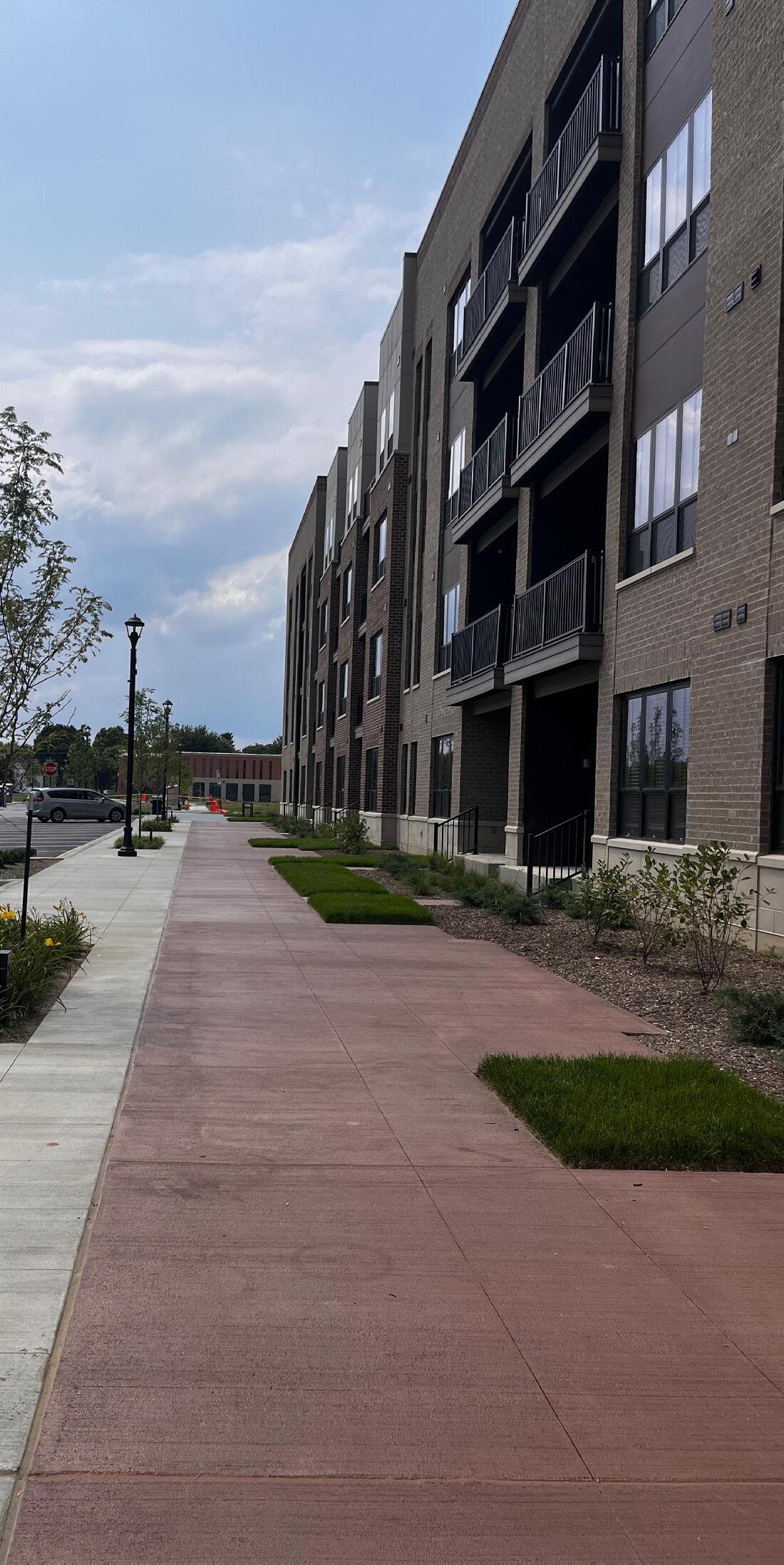
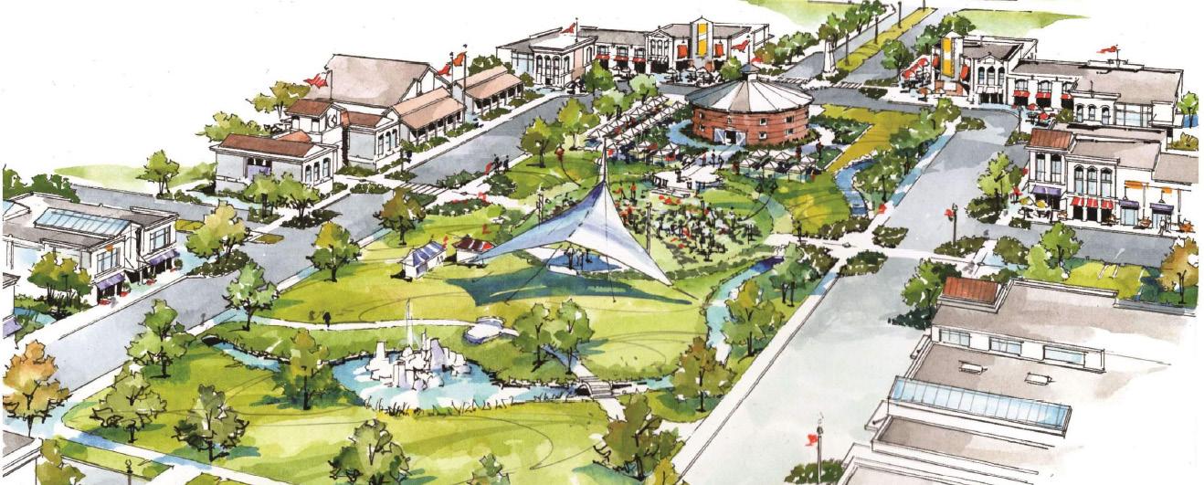
Buzzing with activity, Main Street is lined with local shops, cafés, and businesses, inviting friendly conversation among neighbors. The slower traffic, compact street grid, comfortable atmosphere, and community gathering spaces foster a strong sense of place and belonging
Encouraged uses:
• Townhomes
• Apartments
• Parks
• Dog parks
• Community centers/recreation centers
• Personal and professional services
• Specialty retail
• Veterinary clinics (no boarding or outdoor runs)
• Doctor, dentist, and specialist offices
• Eating and drinking places
• Parking structures
• Performing arts facilities
• Galleries
• Fitness studios (including yoga and martial arts)
• Cafes, ice cream, and coffee shops
• Day care centers
• Outdoor plazas
• Outdoor dining
• Public services (libraries, schools, police, fire, administration, etc.)
• Event space Discouraged uses:
• Drive-thrus
• Outdoor storage
• Auto maintenance and repair
• Gas stations
• Industrial uses
Design Characteristics:
• 2-4 story buildings
• Buildings sited close to the street with parking to the side or behind
• Building styles and materials compatible with the McCord Square master plan
• Walkable with universal design features
• Landscaped parking areas that have clear pedestrian circulation
• Outdoor plazas and gathering spaces
• First floor retail, eating/drinking places, and personal services businesses
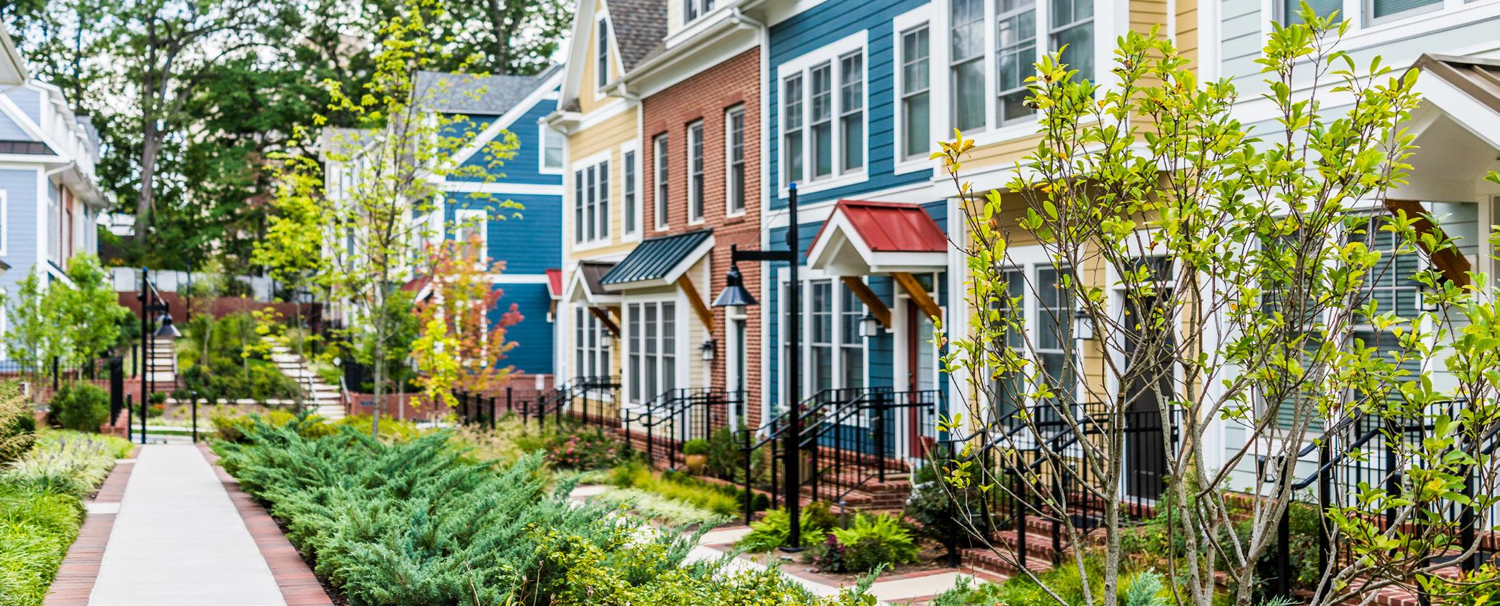
Carefully designed to blend residential, commercial, and recreational spaces together, its charm and smallscale design creates a self-contained and vibrant neighborhood. Destinations can easily, and are usually preferred to, be reached by walking and biking.
These large-scale developments are intended to create compact and walkable neighborhoods with their own identity established through their Planned Unit Development standards. They may develop in phases over many years.
• Single family homes
• Townhomes
• Apartments
• Parks
• Dog parks
• Community centers/recreation centers
• Personal and professional services
• Specialty retail
• Veterinary clinics (no boarding or outdoor runs)
• Doctor, dentist, and specialist offices
• Eating and drinking places
• Parking structures
• Performing arts facilities
• Galleries
• Fitness studios (including yoga and martial arts)
• Cafes, ice cream, and coffee shops
• Day care centers
• Outdoor plazas
• Outdoor dining
• Public services (libraries, schools, police, fire, administration, etc.)
• Drive-thrus
• Outdoor storage
• Auto maintenance and repair
• Gas stations Design characteristics:
• 1-3 story buildings
• Buildings sited close to the street with parking to the side or behind
• Walkable with universal design features
• Landscaped parking areas that have clear pedestrian circulation
• Outdoor plazas and gathering spaced
• First floor retail, eating/drinking places, and personal services businesses
• Horizontal or vertical mixed-use should be considered on a case-by-case basis for each village and/or sub-area within a village
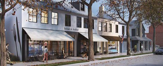
This placetype features many housing options neatly arranged on tree-lined streets and boulevards, with plentiful parks, open spaces, and neighborhood corner shops as community gathering spaces. Its loosely gridded, curvilinear street is compact, encouraging a pedestrian- and bike-friendly atmosphere, while discouraging through traffic.
Encouraged uses:
• Single family homes
• Townhomes
• Garden apartments, cottage court homes
• Apartments
• Parks
• Dog parks
• Outdoor plazas
• Neighborhood commercial
• Small offices
• Places of worship
• Schools
• Day care centers
Discouraged uses:
• Drive-thrus
• Outdoor storage
• Auto maintenance and repair
• Gas stations
• Regional/destination commercial uses
• Industrial uses
Design characteristics:
• Alleys are encouraged
• Mix of building materials including brick, masonry board, and other high-quality materials
• Mixed roof pitches
• Street trees
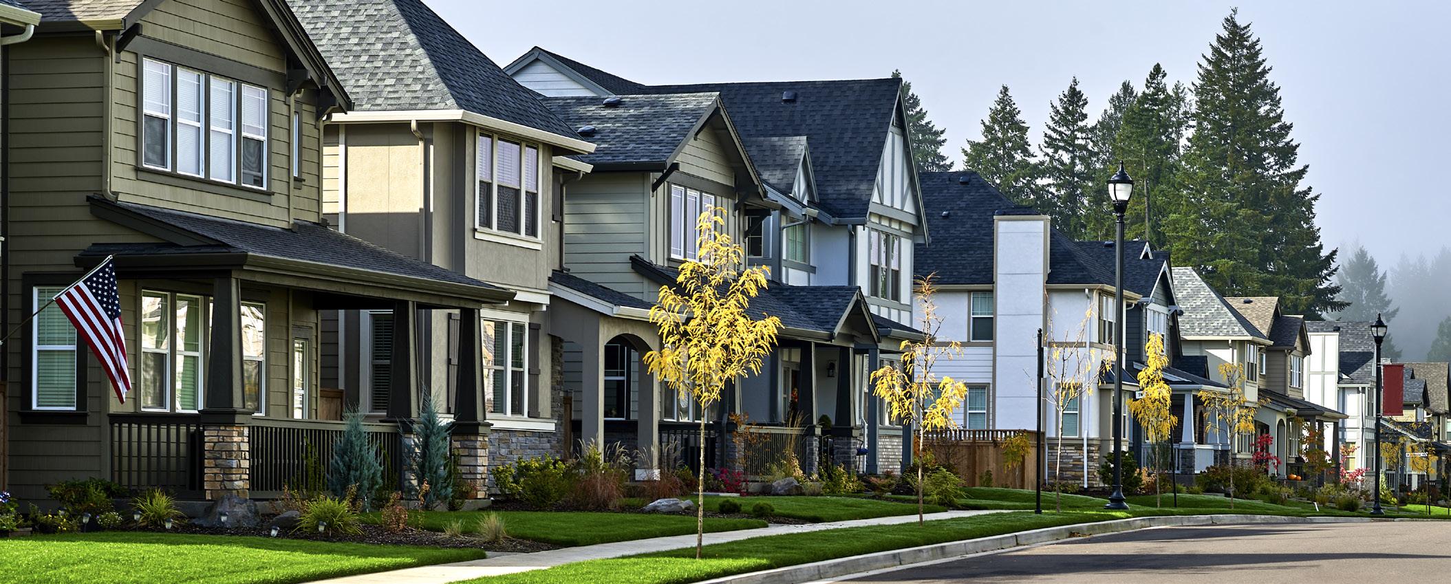
Features neatly arranged homes with tree-lined streets, landscaped entryways, and parks and open spaces as central gathering spaces. Its curvilinear, interconnected street network, including culs-de-sac with trail connections, seamlessly links surrounding neighborhoods, fostering better traffic flow and a more connected community.
Encouraged uses:
• Single family homes
• Townhomes
• Garden apartments, cottage court homes
• Parks
• Neighborhood recreation/gathering spaces
• Dog parks
• Places of worship
• Schools
• Home-based businesses
• Day care homes/ministries
Discouraged uses:
• Commercial & industrial uses
Design characteristics:
• Mix of building materials including brick, masonry board, and other high-quality materials
• Mixed roof pitches
• Street trees
Once an exurban community surrounded by open fields, it now finds itself encircled by development. There is little to no through traffic and often no sidewalks. Many structures were built before the 1970s, with a few well-maintained historic sites.
Encouraged uses in Old Town can be wide ranging –the more important considerations in this area are the context, along with site and building design. The Depot Street area of Old Town is less visible from Broadway Street and has a more industrial/railroad heritage character that supports certain uses that would not fit on Broadway.
The relationship between McCord Square and Old Town will continue to be studied and evolve as development occurs.
• Drive-thrus
• Outdoor storage of materials or vehicles
• Gas stations
• Warehousing or storage
• Regional/destination commercial uses
Design characteristics:
• Building closer to the street with small front yards
• Mix of building materials
• Preservation of large trees
• Blending new development into the context and existing character of Old Town
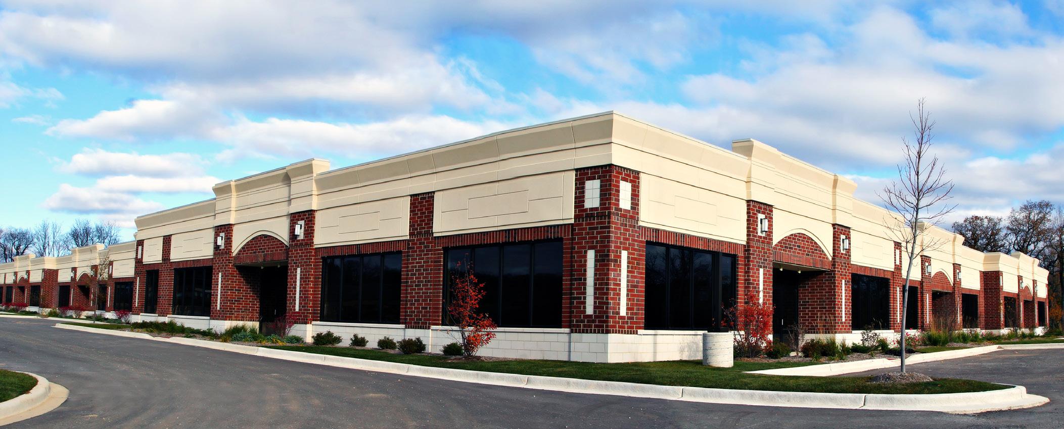
Using its proximity to the Indianapolis Regional Airport, this hub connects residents, both physically and economically, with high-quality jobs and opportunities. Industrial or office uses are sufficiently buffered both visually and physically from residential uses.
Encouraged uses:
• Clean/green manufacturing facilities
• Advanced manufacturing facilities
• Research and development
• Laboratories
• Large format recreation facilities (ie. fieldhouses)
• Indoor vertical agriculture
• Food processing facilities
• Artisan manufacturing facilities
• Airport related services
• Offices
• Flex space buildings
• Contractor facilities
• Drive-thrus
• Regional/destination commercial uses
• Conference center
• Outdoor storage
• Large scale warehouse, distribution, and logistics facilities
Certain types of land uses are necessary and desirable in a community, but their location, access, and design affect the way that they are perceived in the community. Some uses may be highly appropriate at the edge of a neighborhood, like neighborhood commercial, but would present challenges in the middle of a typical subdivision. Other uses are better suited for higher vehicle use areas and need larger lots to be successful. Parks and landmarks are other areas that establish a need for a greater level of consideration in the development process.
Regional business is the type of commercial development that people want to access nearby but are likely to access primarily by car and may include people stopping on their commute to or from work. This includes larger businesses and service offices. The street frontage and appearance, and access from arterial roadways, is important to the success of these businesses.
Encouraged uses:
• Doctor and dentist offices, clinics, and medical centers
• Day care facilities
• Grocery stores
• Restaurants with drive-thru service
• Gas stations (special consideration for access, lighting, signage)
• Dine in and carry out restaurants
• Post office, library, schools, other public buildings
• Day spas
• Veterinary offices, boarding of small animals, animal day care
• Auto service stations (tire shops, repair shops, oil service centers)
• Auto sales
• Large format retail stores (ie. big box stores)
Neighborhood commercial centers are primarily intended to meet the needs of local residents; such as corner stores, specialty markets, personal services, eating and drinking places, gathering places, and similar businesses. They may have reduced parking if accessible by walking or biking and adequate bike parking is provided. Access, travel mode, siting, building height, lighting, signs, noise and odors, and building design are considerations for appropriateness of the development.
Encouraged uses:
• Small footprint grocery
• Small footprint pharmacy
• Dine in restaurants
• Walk up/carry out restaurants
• Ice cream and coffee shops
• Hair, nail, waxing, braiding, and similar personal service salons
• Meat, poultry, or specialty food shops
• Financial institutions
• Outdoor dining areas
• Specialty retail (games, books, bicycle, fitness)
• Fitness studios (including yoga and martial arts studios)
• Day care facilities
Established and planned parks, natural areas, and open spaces are identified on the development patterns map. These are denoted as a small, dotted pattern. When considering development adjacent to these areas the following considerations should be reviewed:
• Access via sidepath, trail, or sidewalk
• Lighting
• Noise and views
• Use that would pose a danger to park or open space users
• Use that would present harm to natural resources like native trees or waterways
There is a need for development of public park land in McCordsville. This will require land acquisition for park space. Specific locations may be identified in the 5-Year Parks & Recreation planning process. The locations shown as potential park areas with small green asterisks are locations that are not currently served with public open space and are within a short distance from development. The town’s intent is for a distribution of park land across the town to meet the needs of residents, ideally locating these future parks within close proximity to population concentrations and where parks can be reached via a range of transportation choices.
Landmarks like the round barns and Daniel’s Vineyard are noted on the development patterns map. These are areas that are privately owned and managed yet have importance to the community. When considering development adjacent to these sites, elements like traffic patterns and site access, views, shade and shadow, building height, and building character should be reviewed for their potential impact on the landmarks.
The Littletown/Kingen Round Barn on W 600N dates to the early 1900s. The Round Barn Inn on N 600W also dates to the same period.
Several historic homes, farms, and institutions were listed in the Indiana Historic Landmarks Hancock County interim report that was developed several decades ago. Some of these structures exist in McCordsville, others are in the unincorporated areas.
Buzzing with activity, local shops, cafés, and businesses line Main Street, inviting friendly conversation among neighbors. The slower traffic, compact street grid, comfortable atmosphere, and community gathering spaces foster a strong sense of place and belonging
Carefully designed to blend residential, commercial, and recreational spaces together, its charm and small-scale design creates a self contained and vibrant neighborhood. Destinations can easily, and are usually preferred to, be reached by walking and biking.
Features many housing options, neatly arranged on tree-lined streets and boulevards, with plentiful parks, open spaces, and neighborhood corner shops as community gathering spaces. Its loosely gridded, curvilinear street is compact, encouraging a pedestrian- and bike-friendly atmosphere, while discouraging through traffic.
Features neatly arranged homes with tree-lined streets, landscaped entryways, and parks and open spaces as central gathering spaces. Its curvilinear, interconnected street network, including culs-de-sac with trail connections, seamlessly links surrounding neighborhoods, fostering better traffic flow and a more connected community.
Once an exurban community surrounded by open fields, it now finds itself encircled by development. There is little to no through traffic and often no sidewalks. Many structures were built before the 1970s, with a few well-maintained historic sites.
Using its proximity to the Indianapolis Regional Airport, this hub connects residents, both physically and economically, with high-quality jobs and opportunities. Industrial or office uses are sufficiently buffered both visually and physically from residential uses.
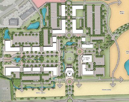
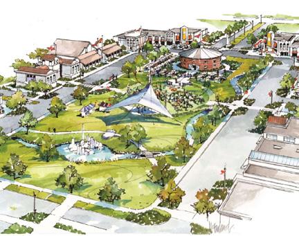
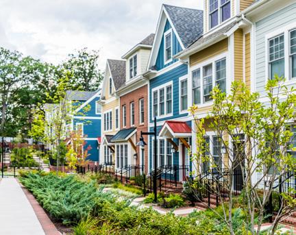
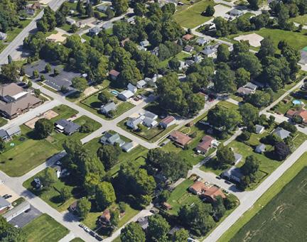

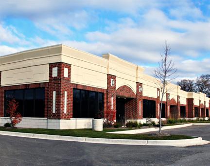
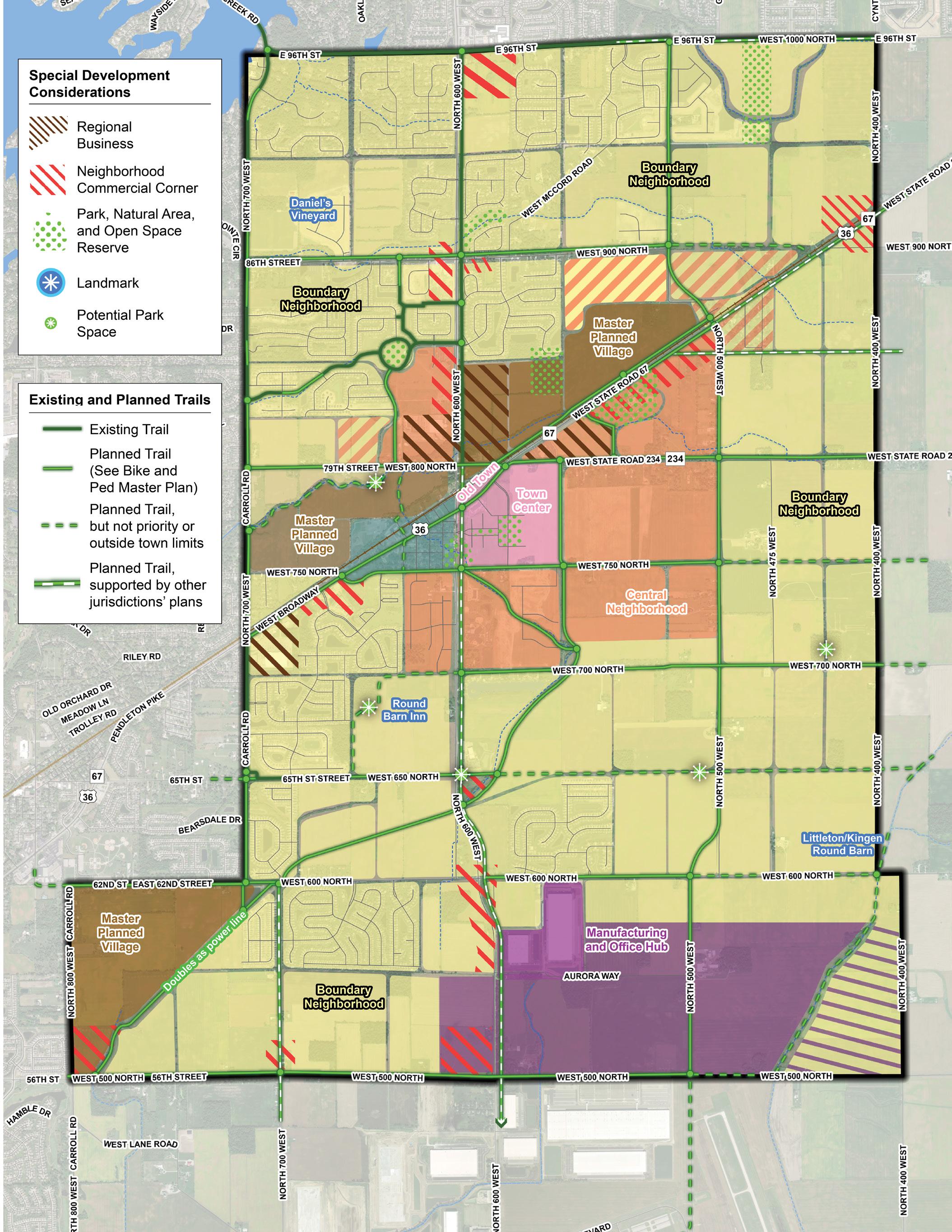
The implementation plan includes projects and activities to advance the goals of the land use chapter.
Priority Tier 1: Top priority for the town. Such items are likely to be completed as soon as possible, and certainly within the next five years.
Priority Tier 2: Important priorities for the town but are often items that may require other steps to be completed first, and/or are not expected to be completed within the next five years.
Priority Tier 4: Priorities that are dependent upon growth/ development rates or patterns or are otherwise dependent upon other action or trigger points.
Priority Tier 3: Priorities that should be completed prior to the end of the horizon year for this plan.
Priority Tier 5: Ongoing priorities.
Adopt a Unified Development Ordinance (UDO) Town of McCordsville
1
Revise the McCordsville zoning map Town of McCordsville
1
Annex land as development occurs Town of McCordsville
5
Develop master plans for the subareas Town of McCordsville
1
Acquire park land by purchase or donation Town of McCordsville
5
Sub-area plans have been developed at the framework level for four areas: CR 600 N and CR 600 W, known as 6 and 6; Old Town; North Business Park Village; and South Gateway. Developers who propose new development in these areas should work closely with the town to develop site plans that are aligned with the vision for the area and balance the market potential with community needs, character, and history.
The South Gateway sub-area presents an opportunity to redevelop single-family residential land to more intense land uses that will be more compatible to the land uses identified by the sub-area and denoted in the development pattern category Manufacturing and Office Hub. The town has tools, established in state and federal law, to accomplish this, but will likely prefer private development to accomplish this.
The 6 and 6 sub-area is located at the intersection of CR 600 W (Mount Comfort Road) and CR 600 N. This area is a place of transition in McCordsville, with various existing developments just outside the subarea boundaries featuring varying uses and intensities, underscoring the need for proper land use transitions and context sensitivity.
While 600W is commonly called Mount Comfort Road, the name of the sub-area is a play on the road numbers of 600N and 600W.
Existing development outside of the sub-area:
• Woodhaven is a 358-unit single-family detached residential subdivision comprised of traditional single-family homes and a neighborhood amenity area.
• Stansbury is a subdivision with single family homes and neighborhood amenities but is not within the corporate limits of the town.
• Morningside, located south and west of the intersection, will feature single-family homes, apartments, self-storage, and commercial out-lots.
• Southwark Metal Manufacturing is located along the eastside of CR 600W, just south the sub-area boundary.
• A large distribution/warehouse/logistics facility is located along the southside of CR 600N, east of the sub-area boundary.
The existing character within the sub-area is mostly undeveloped agricultural land, with a few metes and bounds single-family residential properties. The town has approved two projects within the sub-area boundaries that are intended to begin addressing the needs for land use transitions and context sensitivity:
• Broadacre, located at the southwest corner of the intersection, is a horizontal mixeduse development, featuring apartments and commercial out-lots surrounding a wooded area that will be conserved. This project serves to transition and buffer the single-family uses further to the west from the more intense land uses to the east.
• Parkfield, located near the southeast corner of the intersection, is a multi-family project featuring 166 garden apartments. This project is currently stalled and lacks a developer.
In addition, north of CR 600N there is a large electrical transmission line that bisects the undeveloped land at an angle and will create challenges for development. The sub-area denotes the need for additional landscaping along CR 600N to further soften and create visual separation between the industrial uses to the south and residential uses to the north. This landscaping could be incorporated into the public right-of-way, on either side of the street.
The proposed uses for the sub-area plan includes office, neighborhood commercial, detached and attached residential, institutional, and open space. The town envisions commercial land uses at all four corners of the intersection that quickly transition
to residential uses. More intense commercial or residential land uses should be located south of CR 600N as they are better suited to transition from the industrial uses farther south. The northwest corner of the intersection presents unique challenges due to existing parcel lines. The town should consider the creation of a small mixed-use district in this location to create an epicenter for the commercial node. This intersection is situated just over 3 miles from I-70 and 1.5 miles from McCord Square. As housing continues to grow in the area and the industrial uses to the south expand and fill in, this intersection should provide the necessary location for commercial services for both residents and workers in the larger area.
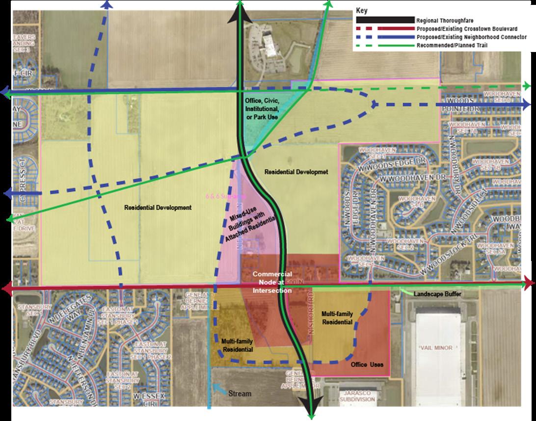
When McCordsville was founded, it was miles from development in Indianapolis, and just a small, compact community along the railroad tracks and highway (Broadway). Most of the development between the highway and the railroad were a mix of commercial and industrial uses and few streets crossed the tracks. The mostly residential portion of the community was bounded by Broadway, Mount Comfort Road, and W 750N. The school was located on the outskirts of town at the corner of Mount Comfort Road and 750N, which is now Old School Park. The cemetery is across the street from the park. The land uses and lot sizes are mixed, but many still bear resemblance to the original plats of McCordsville, which were completed prior to the automobile being the primary mode of transportation. There are some historic structures, but most of the development is 50 years old. The street pattern is loosely gridded, and the streets are narrow with no sidewalks or curbs.
The sub-area encourages preservation of existing traditional homes and business conversions as well as historic structures. It also seeks to maintain Old School Park and acknowledges that the park could be expanded to the north to encompass the floodplain limits. New development in these areas is encouraged to be compatible with the historic development in site and building design. The mixed-use areas are similar, continuing the development pattern while encouraging infill development and redevelopment that is compatible with the existing development. North of Railroad Street, a business incubator park is proposed to support entrepreneurship and small business development. Mixed-use redevelopment is anticipated across from McCord Square, with commercial development north of Broadway.
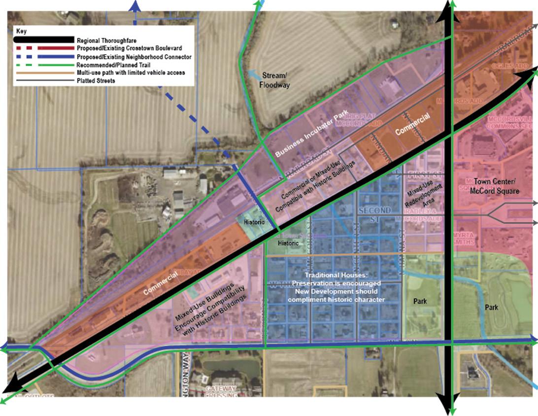
The North Business Park Village is located just north of W Broadway and east of Mount Comfort Road. The area is currently undeveloped and has a tree stand.
Proposed development for the sub-area includes a business park along the railroad tracks, with residential development between the business park and existing neighborhoods to the north. This subarea plan recommends preserving the tree stand. The town also sees an opportunity for additional open space between the railroad tracks and the ditch. This area could be reforested, with a trail constructed between it and the existing tree stand to create natural corridor for edge-dwelling animals. South of Emerald Springs, a mixed-used village is proposed with retail/office uses and multi-family residential. This mixed-use village will act as the gateway to the
business park. It should be designed to acknowledge the lower density of Emerald Springs and locate land uses that can serve as transition uses, along with an appropriate buffer. At the northeast periphery of this sub-area lies CR 500W. Its existing intersection with W Broadway is not ideal and presents traffic challenges due to the grade of the roadways being considerable lower than the railroad tracks. This intersection is not located within the town corporate limits, but is likely to be in the future. The town has engaged Hancock County in discussions on this intersection and should continue to pursue a regional solution to this issue.
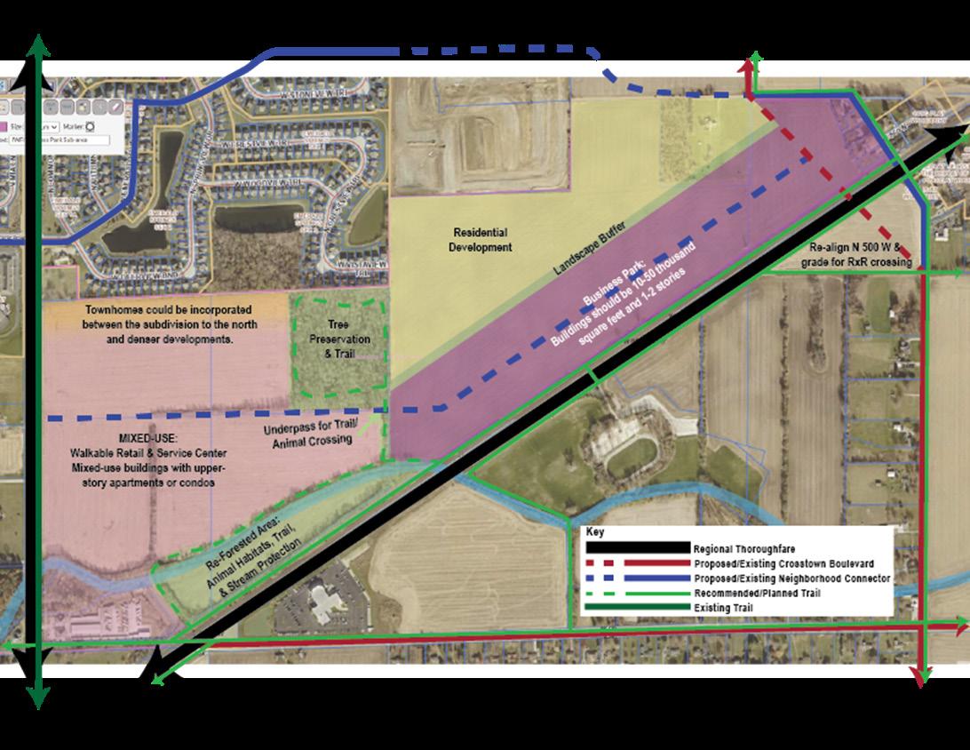
The South Gateway sub-area is at the southern edge of McCordsville, centered on Mount Comfort Road north of CR 500N. This is immediately south of the 6 and 6 sub-area. The northeast portion of the sub-area has industrial development and there is residential development that fronts on the east side of Mount Comfort Road. The remainder of the sub-area is largely undeveloped.
The development plan for this sub-area is a business and industrial area east of Mount Comfort Road. The homes along the eastside of Mount Comfort Road present a challenge as the best use for this land is not single-family residential. Additionally, the land immediately behind these homes is already zoned industrial. The town should encourage industrial developers interested in the area to acquire
residential properties, whose owners are willing to sell, to achieve best use and reduce the number of abutting, conflicting land uses. The stream buffer should be preserved, as should the tree stand. West of Mount Comfort Road the planned development is a business park from CR 500N to Aurora Way. From Aurora Way to the north end of the sub-area, a mixeduse project called Morningside has been approved.
To the west of the business park and Morningside, the sub-area plan calls for residential development to transition these uses from the existing single-family development further west and north.
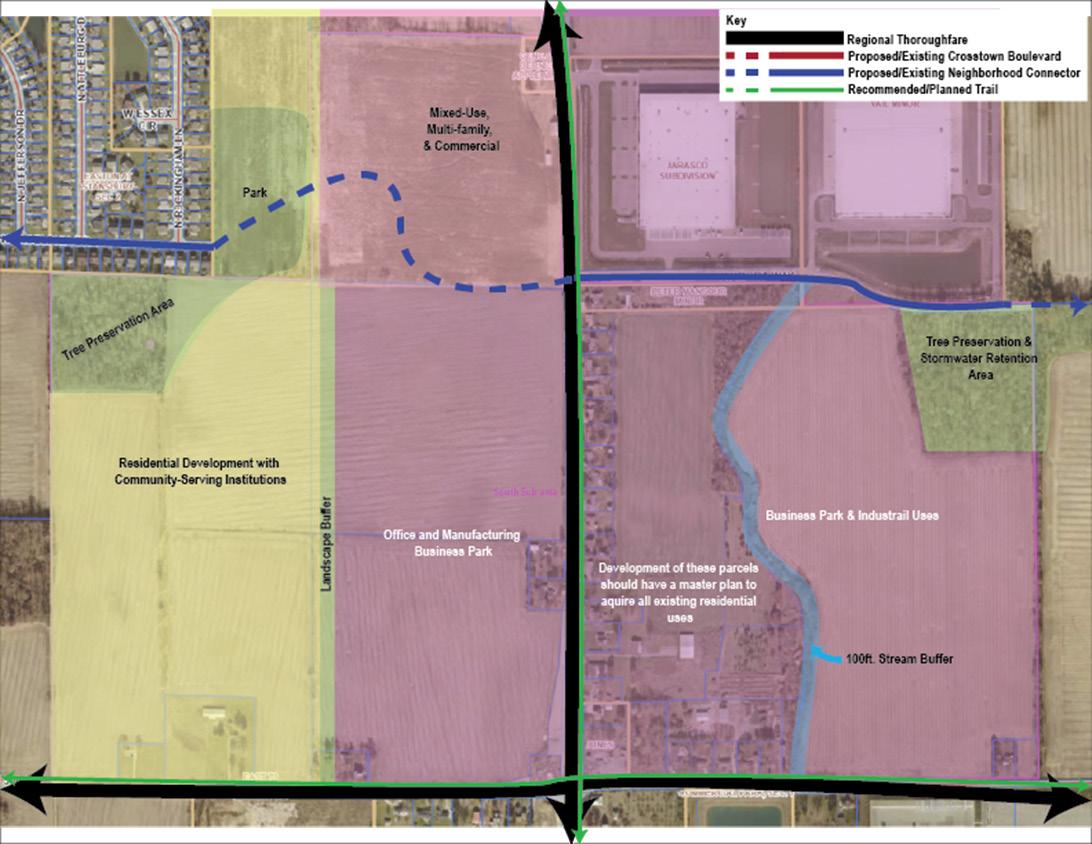
IC 36-7-4-500 Series—Comprehensive plan
Sec. 500. This series (sections 500 through 599 of this chapter) may be cited as follows: 500 SERIES—COMPREHENSIVE PLAN.
[Local Government Recodification Citation: New.]
As added by Acts 1981, P.L.309, SEC.23
IC 36-7-4-502 Comprehensive plan; contents
Sec. 502. A comprehensive plan must contain at least the following elements:
(1) A statement of objectives for the future development of the jurisdiction.
(2) A statement of policy for the land use development of the jurisdiction.
(3) A statement of policy for the development of public ways, public places, public lands, public structures, and public utilities.
[Pre-Local Government Recodification Citations: 18-7-4-502; 18-7-4-33.]
As added by Acts 1981, P.L.309, SEC.23. Amended by Acts 1981, P.L.310, SEC.27; P.L.335-1985, SEC.4.
IC 36-7-4-503 Comprehensive plan; additional contents
Sec. 503. A comprehensive plan may, in addition to the elements required by section 502 of this chapter, include the following:
(1) Surveys and studies of current conditions and probable future growth within the jurisdiction and adjoining jurisdictions.
(2) Maps, plats, charts, and descriptive material presenting basic information, locations, extent, and character of any of the following:
(A) History, population, and physical site conditions.
(B) Land use, including the height, area, bulk, location, and use of private and public structures and premises.
(C) Population densities.
(D) Community centers and neighborhood units.
(E) Areas needing redevelopment and conservation.
(F) Public ways, including bridges, viaducts, subways, parkways, and other public places.
(G) Sewers, sanitation, and drainage, including handling, treatment, and disposal of excess drainage waters, sewage, garbage, refuse, and other wastes.
(H) Air, land, and water pollution.
(I) Flood control and irrigation.
(J) Public and private utilities, such as water, light, heat, communication, and other services.
(K) Transportation, including rail, bus, truck, air and water transport, and their terminal facilities.
(L) Local mass transit, including taxicabs, buses, and street, elevated, or underground railways.
(M) Parks and recreation, including parks, playgrounds, reservations, forests, wildlife refuges, and other public places of a recreational nature.
(N) Public buildings and institutions, including governmental administration and service buildings, hospitals, infirmaries, clinics, penal and correctional institutions, and other civic and social service buildings.
(O) Education, including location and extent of schools and postsecondary educational institutions.
(P) Land utilization, including agriculture, forests, and other uses.
(Q) Conservation of energy, water, soil, and agricultural and mineral resources.
(R) Any other factors that are a part of the physical, economic, or social situation within the jurisdiction.
(3) Reports, maps, charts, and recommendations setting forth plans and policies for the development, redevelopment, improvement, extension, and revision of the subjects and physical situations (set out in subdivision (2) of this section) of the jurisdiction so as to substantially accomplish the purposes of this chapter.
(4) A short and long range development program of public works projects for the purpose of stabilizing industry and employment and for the purpose of eliminating unplanned, unsightly, untimely, and extravagant projects.
(5) A short and long range capital improvements program of governmental expenditures so that the development policies established in the comprehensive plan can be carried out and kept up-to-date for all separate taxing districts within the jurisdiction to assure efficient and economic use of public funds.
(6) A short and long range plan for the location, general design, and assignment of priority for construction of thoroughfares in the jurisdiction for the purpose of providing a system of major public ways that allows effective vehicular movement, encourages effective use of land, and makes economic use of public funds.
[Pre-Local Government Recodification Citations: 18-7-4-503; 18-7-4-37; 18-7-5-37.]
As added by Acts 1981, P.L.309, SEC.23. Amended by Acts 1981, P.L.310, SEC.28; P.L.335-1985, SEC.5; P.L.220-1986, SEC.9; P.L.185-2005, SEC.6; P.L.22007, SEC.386.
IC 36-7-4-504 Comprehensive plan; consideration of policy and pattern; validation, continuance, and consolidation of preexisting plans
Sec. 504. (a) After the comprehensive plan is approved for a jurisdiction, each governmental entity within the territorial jurisdiction where the plan is in effect shall give consideration to the general policy and pattern of development set out in the comprehensive plan in the:
(1) authorization, acceptance, or construction of water mains, sewers, conne ctions, facilities, or utilities;
(2) authorization, construction, alteration, or abandonment of public ways, public places, public lands, public structures, or public utilities; and
(3) adoption, amendment, or repeal of zoning ordinances, including zone maps and PUD district ordinances (as defined in section 1503 of this chapter), subdivision control ordinances, historic preservation ordinances , and other land use ordinances.
(b) A comprehensive plan or master plan adopted or approved under any prior law is validated and continues in effect as the comprehensive plan for the plan commission in existence on September 1, 1986, or any successor plan commission until the plan becomes a part of or is amended or superseded by the comprehensive plan of the latter plan commission. In addition, a thoroughfare plan adopted or approved under any prior law is validated and continues in effect as a part of the comprehensive plan on and after September 1, 1986, until the thoroughfare plan is amended or superseded by changes in the comprehensive plan approved under this chapter.
(c) AREA. To effect the consolidation of the various plans and ordinances in force in the county and in the participating municipality into one (1) comprehensive plan, the area plan commission shall approve the comprehensive
plans of the participating municipalities as its first comprehensive plan. The commission shall also recommend under applicable law to the participating legislative bodies, without amendment, the adoption of the zoning, subdivision control, thoroughfare, and other ordinances relating to the jurisdiction of the participating legislative body. If lands within the jurisdiction of the commission are not regulated by zoning ordinances, the commission shall classify those lands as residential or agricultural, until they can conduct such land use studies as are necessary for reclassification and zoning. Because the unification of the planning and zoning function is of an emergency character, the commission and the participating legislative bodies shall initially adopt these preliminary plans and ordinances by simple resolution, to continue in effect until finally adopted in conformity with the area planning law.
[Pre-Local Government Recodification Citations: 18-7-3-12; 18-7-4-504; 18-7-4-45; 18-7-4-94 part; 18-7-5-45.]
As added by Acts 1981, P.L.309, SEC.23. Amended by P.L.335-1985, SEC.6; P.L.220-1986, SEC.10; P.L.320-1995, SEC.5.
IC 36-7-4-504.5 Comprehensive plan; township advisory committee
Sec. 504.5. (a) In preparing or revising a comprehensive plan for a township, the legislative body of the consolidated city shall adopt an ordinance requiring the plan commission to establish an advisory committee of citizens interested in problems of planning and zoning for that township, a majority of whom shall be nominated by the township legislative body.
(b) An advisory committee created under subsection (a) must include a representative of the affected township legislative body as determined by procedures established in an ordinance adopted by the legislative body of the consolidated city.
As added by P.L.164-1995, SEC.18.
IC 36-7-4-505 Comprehensive plan; requests for related information
Sec. 505. (a) When the plan commission undertakes the preparation of a comprehensive plan, the commission may request any public or private officials to make available any information, documents, and plans that have been prepared and that provide any information that relates to the comprehensive plan.
(b) All officials and departments of state government and of the political subdivisions operating within lands under the jurisdiction of the plan commission shall comply with requests under subsection (a).
(c) All officials of public and private utilities operating within lands under the jurisdiction of the plan commission shall comply with requests under subsection (a) to furnish public information.
[Pre-Local Government Recodification Citations: 18-7-2-32 part; 18-7-4-505; 18-7-4-40.]
As added by Acts 1981, P.L.309, SEC.23. Amended by Acts 1981, P.L.310, SEC.29; P.L.335-1985, SEC.7.
IC 36-7-4-506 Thoroughfare plans included in comprehensive plans; location, change, vacation, or improvement of thoroughfares
Sec. 506. (a) A thoroughfare plan that is included in the comprehensive plan may determine lines for new, extended, widened, or narrowed public ways in any part of the territory in the jurisdiction.
(b) The determination of lines for public ways, as provided in subsection (a), does not constitute the opening, establishment, or acceptance of land for public way purposes.
(c) After a thoroughfare plan has been included in the comprehensive plan, thoroughfares may be located, changed, widened, straightened, or vacated only in the manner indicated by the comprehensive plan.
(d) After a thoroughfare plan has been included in the comprehensive plan, the plan commission may recommend to the agency responsible for constructing thoroughfares in the jurisdiction the order in which thoroughfare improvements should be made.
[Pre-Local Government Recodification Citations: 18-7-2-32 part; 18-7-4-506; 18-7-4-38; 18-7-5-38.]
As added by Acts 1981, P.L.309, SEC.23. Amended by Acts 1981, P.L.310, SEC.30; P.L.335-1985, SEC.8; P.L.220-1986, SEC.11.
IC 36-7-4-507 Comprehensive plan; notice and hearings before adoption
Sec. 507. Before the approval of a comprehensive plan, the plan commission must:
(1) give notice and hold one (1) or more public hearings on the plan;
(2) publish, in accordance with IC 5-3-1, a schedule stating the times and places of the hearing or hearings. The schedule must state the time and place of each hearing, and state where the entire plan is on file and may be examined in its entirety for at least ten (10) days before the hearing.
[Pre-Local Government Recodification Citations: 18-7-2-33; 18-7-4-507; 18-7-4-41; 18-7-5-39.]
As added by Acts 1981, P.L.309, SEC.23. Amended by Acts 1981, P.L.45, SEC.18; P.L.335-1985, SEC.9.
IC 36-7-4-508 Comprehensive plan; adoption; certification; plan and summary availability for inspection; legalization of certain comprehensive plans
Sec. 508. (a) After a public hearing or hearings have been held, the plan commission may approve the comprehensive plan.
(b) ADVISORY AREA. Upon approval, the plan commission shall certify the comprehensive plan to each participating legislative body.
(c) The plan commission may approve each segment of the comprehensive plan as it is completed. However, that approval does not preclude future examination and amendment of the comprehensive plan under the 500 series. A comprehensive plan that:
(1) was approved before March 14, 1994, under this subsection as in effect before March 14, 1994; and
(2) was not filed in the county recorder’s office as required by this subsection as in effect before March 14, 1994; is legalized.
(d) METRO. As used in this subsection, “comprehensive plan” or “plan” includes any segment of a comprehensive plan. Approval of the comprehensive plan by the metropolitan development commission is final. However, the commission may certify the comprehensive plan to the legislative body of each municipality in the county, to the executive of the consolidated city, and to any other governmental entity that the commission wishes. The commission shall make a complete copy of the plan available for inspection in the office of the plan commission. One (1) summary of the plan shall be recorded in the county recorder’s office. The summary of the plan must identify the following:
(1) The major components of the plan.
(2) The geographic area subject to the plan, including the townships or parts of townships that are subject to the plan.
(3) The date the commission adopted the plan.
[Pre-Local Government Recodification Citations: 18-7-2-34; 18-7-4-508; 18-7-4-42 part; 18-7-5-40; 18-7-5-41.]
As added by Acts 1981, P.L.309, SEC.23. Amended by P.L.335-1985, SEC.10; P.L.31-1994, SEC.11; P.L.220-2011, SEC.661.
IC 36-7-4-509 Comprehensive plan; legislative approval, rejection, or amendment
Sec. 509. (a) ADVISORY AREA. After certification of the comprehensive plan, the legislative body may adopt a resolution approving, rejecting, or amending the plan. Such a resolution requires only a majority vote of the legislative body, and is not subject to approval or veto by the executive of the adopting unit, and the executive is not required to sign it.
(b) ADVISORY AREA. The comprehensive plan is not effective for a jurisdiction until it has been approved by a resolution of its legislative body. After approval by resolution of the legislative body of the unit, it is official for each unit that approves it. Upon approval of the comprehensive plan by the legislative body, the clerk of the
legislative body shall place one (1) copy of the comprehensive plan on file in the office of the county recorder.
[Pre-Local Government Recodification Citations: 18-7-2-35 part; 18-7-4-509; 18-7-4-42 part; 18-7-4-43 part; 18-7-5-42.]
As added by Acts 1981, P.L.309, SEC.23. Amended by P.L.335-1985, SEC.11; P.L.220-1986, SEC.12.
IC 36-7-4-510 Comprehensive plan; procedure following legislative rejection or amendment
Sec. 510. (a) ADVISORY AREA. If the legislative body, by resolution, rejects or amends the comprehensive plan, then it shall return the comprehensive plan to the plan commission for its consideration, with a written statement of the reasons for its rejection or amendment.
(b) ADVISORY AREA. The commission has sixty (60) days in which to consider the rejection or amendment and to file its report with the legislative body. However, the legislative body may grant the commission an extension of time, of specified duration, in which to file its report. If the commission approves the amendment, the comprehensive plan stands, as amended by the legislative body, as of the date of the filing of the commission’s report with the legislative body. If the commission disapproves the rejection or amendment, the action of the legislative body on the original rejection or amendment stands only if confirmed by another resolution of the legislative body.
(c) ADVISORY AREA. If the commission does not file a report with the legislative body within the time allotted under subsection (b), the action of the legislative body in rejecting or amending the comprehensive plan becomes final.
[Pre-Local Government Recodification Citations: 18-7-4-510; 18-7-5-43.]
As added by Acts 1981, P.L.309, SEC.23. Amended by Acts 1981, P.L.310, SEC.31; P.L.335-1985, SEC.12; P.L.220-1986, SEC.13.
IC 36-7-4-511 Comprehensive plan; amendment approval; preparation and submission of amendments
Sec. 511. (a) Each amendment to the comprehensive plan must be approved according to the procedure set forth in the 500 series.
(b) ADVISORY AREA. If the legislative body wants an amendment, it may direct the plan commission to prepare the amendment and submit it in the same manner as any other amendment to the comprehensive plan. The commission shall prepare and submit the amendment within sixty (60) days after the formal written request by the legislative body. However, the legislative body may grant the commission an extension of time, of specified duration, in which to prepare and submit the amendment.
[Pre-Local Government Recodification Citations: 18-7-2-35 part; 18-7-4-511; 18-7-4-43 part; 18-7-5-44.]
As added by Acts 1981, P.L.309, SEC.23. Amended by P.L.335-1985, SEC.13; P.L.220-1986, SEC.14.
IC 36-7-4-512 Comprehensive plan; capital improvement projects
Sec. 512. METRO. This section applies only to capital improvement projects consisting of real or personal property (or improvements) that have a useful life of more than one (1) year and a value of more than one hundred thousand dollars ($100,000). At least thirty (30) days before a governmental entity within the county:
(1) undertakes or acquires any such capital improvement project;
(2) starts the required proceedings to spend money or let contracts for such a project; or (3) authorizes the issuance of bonds for the purpose of financing such a project; the governmental entity must notify the metropolitan development commission in writing of the location, cost, and nature of the project. The commission may by rule limit the kinds of capital improvement projects that are subject to the notification requirement of this section. The commission may designate an agency responsible for fiscal analyses or control to receive notifications required by this section.
[Pre-Local Government Recodification Citations: 18-7-2-36; 18-7-3-13 part; 18-7-4-512; 18-7-4-44; 18-7-5-46.]
As added by Acts 1981, P.L.309, SEC.23. Amended by Acts 1981, P.L.310, SEC.32; P.L.335-1985, SEC.14.
This section will provide a brief overview of existing plans and studies that contextualize development in McCordsville and provide a foundation of understanding.
Town of McCordsville Comprehensive Plan: Next Stop McCordsville (2011)
Goals from the plan were:
• Create a Village Center that is the focus of town activities.
• Promote a balance of land uses that secures the fiscal wellbeing of the town and its tax base.
• Attract quality residential and non-residential developers to the town of McCordsville.
• Create a sense of community suggestive of a well-planned “small town” by retaining an overall neighborhood character.
• Provide infrastructure for multiple modes of transportation including bicycling, walking, and public transit.
• Achieve and maintain a balanced transportation system that enhances the visual appearance of major streets and community gateways.
• Achieve and maintain a balanced transportation system that promotes safe and efficient traffic circulation.
• Achieve and maintain a balanced transportation system that promotes accessibility throughout the entire community.
• Plan for infrastructure and services in an efficient and cost-effective manner.
• Protect natural features, open spaces, and greenspaces while further providing areas for passive and active recreation.
• Continue the creation of a community-wide network of greenway corridors that connect with the path systems of neighboring communities.
• To the extent possible, protect and enhance the community’s land-based and water-based natural resources.
• Recruit and retain general business and light industrial development that enhances the business climate established by McCordsville’s existing businesses.
• Create a strong and diverse tax base that provides additional revenue and increases the quality of municipal services provided to the residents.
• Focus industrial economic development efforts on advanced manufacturing, life sciences, and information technology.
• Develop and advance community services as McCordsville grows, always maintaining a high level of service for town residents.
• Promote community organizations and functions that provide opportunities for social interaction and participation, as well as a sense of identity and pride in the town.
The plan includes a land use plan and thoroughfare plan.
This corridor development study by Thomas P Miller Associates (TPMA) has development scenarios for particular areas of the corridor, including McCordsville. The McCordsville scenarios included a downtown space with boutique shops and locally owned restaurants/retail, a high-end retail park (nonenclosed shopping center), medical office, and light industrial uses. The tax implications of each scenario were developed. High-end retail (open shopping center) would generate the most tax revenue for the town over a 20-year period. While this would also generate the most jobs, the jobs would likely be lower wage jobs since retail typically has low wages as an economic sector. TPMA recommended targeted industries for the corridor of life sciences, manufacturing, logistics, and information technology.
Recommends restaurants and grocery stores as The analysis recommends restaurants and grocery stores as first tier retail sectors, department stores as second tier, and health/personal care stores and beer, wine, and liquor stores as a third tier. There is a significant leakage of dollars out of the community in restaurants and other eating places. Local consumers favor locally owned and family-friendly upscale dining options.
This plan contains an extensive inventory of the existing bike and pedestrian facilities in McCordsville. It recommends regional connections to Lawrence via Pendleton Pike, North on Olio Road toward Hamilton Town Center in Noblesville, and a Fall Creek Trail connection toward Fishers. It also notes connection to Hancock County planned and existing trails towards New Palestine. The branded trails recommended are along W 900 N, N 600 W, and W Broadway as well as the North Fork Dry Branch/ Schulz Dry Branch greenway, Dry Branch greenway, Town Center – Champion Lake greenway, and Brookside Vail greenway. Bike routes are established along key roadways. The plan provides street cross sections and identifies intersections with needs for increased pedestrian facilities.
A ULI Advisory Services Panel worked in the community to focus on the future of the Mount Comfort Corridor including McCordsville, Cumberland, and New Palestine. The recommendations, by topic, include economic development, infrastructure, placemaking and design, organization, and implementation. Placemaking is seen as a quality-of-life mechanism to attract talent. Key sectors of focus were around existing areas of agri-tech, animal biomedical, advanced manufacturing, and agri-tourism. Public transit along the corridor was in the transportation recommendations, as well as improving traffic flow
along the roadway and addressing the rail crossings. The study recommended new residential, commercial, and mixed-use development be focused in the McCordsville Town Center as well as downtown New Palestine and Cumberland.
This highly graphic plan establishes the town center development plan. It calls for 903,800 square feet of buildings with 843 units of residential development. The typical building height is three stories. The plan establishes 2,156 parking spaces; 352 parking spaces on the street and the remainder in surface lots. This is 1.5 spaces per residential unit and two spaces per 1,000 square feet of ground floor space. The type one single family housing has an average density of two units per acre (40 units) and type two single family housing is anticipated to be 4.5 units per acre (38 units). Townhomes are expected to have a density of four units per acre with a total of 116 units. The first phase of development is expected to take one to five years and includes the civic green, mixed-use core, and outparcel development with supporting transportation investments. Phase Two, in the following five years, includes the south mixed-use core, townhomes, the community building, town hall, and single-family development. The later third phase would have multi-family development.
This study uses the Stantec land use plan, TPMA housing gap analysis, an Applied Economics impact report, and an A&F Engineering traffic analysis to develop a plan for the Mount Comfort Corridor. An overlay district specific to the corridor protecting the recommended uses in the Stantec report is advised, adding a layer of oversight to the development in the corridor. Targeted industries and workforce development are identified as key economic development strategies. Addressing the housing gap between the jobs and housing options available
locally was also identified as a priority. Beautification and branding of the corridor were important to stakeholders in the process.
This study evaluated three options for crossing the CSX rail line at CR 600W. The three options included an at-grade crossing, an overpass, and an underpass. Based upon the evaluation, the town determined the best long-term option to pursue would be the underpass. In the meantime, the town began to pursue at-grade improvements which would be considered a mid-term improvement until the long-term option could become feasible. The option of probable cost for a four-lane underpass of CR 600W under the CSX rail line was approximately $79 million. The town is in the process of updating this opinion of cost in 2025.
Thetown worked with A&F engineering to create a phasing, sequencing, and cost evaluation of all identified future roadway improvements, on the Mt. Comfort Road Corridor, based upon current and future traffic analysis. The combined projects are estimated to exceed $130 million.
This plan proposes access management for the Mount Comfort Corridor and adjacent roadways and identifies intersection types. Map includes anticipated land uses.
This plan outlines a strategic vision for the town’s parks and recreational amenities. It aims to enhance quality of life, support economic growth, and expand recreational access. The plan was developed with input from the McCordsville Parks and Recreation Board, town staff, the Indiana Department of Natural Resources, and local residents.
Key elements of the plan include:
• Addressing the town’s limited recreational spaces by identifying land for new parks and enhancing trail connectivity.
• Improving Old School Park and Town Hall Community Park with better amenities.
• Closing trail gaps and integrating pedestrian and bicycle infrastructure into the broader regional network.
• Utilizing impact fees, grants, and partnerships to finance park development and maintenance.
• Addressing public input, which highlighted strong demand for trails, playgrounds, and recreational programs.
The plan is a dynamic document meant to evolve based on community needs and funding opportunities.
This is a park impact fee study. Impact fees on development can be used to pay for, defray, or mitigate the capital costs and improvements that are necessitated by new development, including parks. In this way, current residents do not pay for the costs of increased facilities to support new residents. Impact fees can’t be used to address deficiencies, only to shift the cost of new and expanded facilities to meet the demand created by new development. A park infrastructure impact fee committee was established in McCordsville in 2022 and the planning area for the committee aligns with the comprehensive plan planning area. The impact zone is designated as the
current municipal boundary. The plan documents the existing infrastructure of park land including the Town Hall Community Park, Town Nature Preserve, Old School Park, and McCord Pointe Park. It also identifies the deficiency in park space based on population and existing facilities with five acres per 1,000 people as a community level of service standard. It recommends approximately 10 acres of park at the town center and an additional nearly 13 acres be funded with Tax Increment Financing (TIF) revenue, 10 acres at Haven Ponds funded with County Economic Development Income Tax (CEDIT), and 10 acres at Haven Ponds funded with existing Public Investment Fund (PIF) funds. The projected park impact fee was set at $1,525.
This is a road impact fee study. Impact fees on development can be used to pay for, defray, or mitigate the capital costs and improvements of roadways that are necessitated by new development. In this way, current residents do not pay for the costs of increased facilities to support new residents. Impact fees can’t be used to address deficiencies, only to shift the cost of new and expanded facilities to meet the demand created by new development.
A road infrastructure impact fee committee was established in McCordsville in 2023 and the planning area for the committee aligns with the comprehensive plan planning area. The plan documents the existing roadway infrastructure and identifies the deficiency in roadway system based upon a selected Level of Service (LOS). The road impact fee was set at $349.68
per 24-hour generated trip.
This plan provides direction and recommendations for future growth in Hancock County as well as a detailed Economic Development Strategy and Thoroughfare Plan. The strategic objectives of the plan are as follows.
• Enhance intergovernmental collaboration and coordination to benefit all county residents.
• Strengthen the sense if community with a diversity of lifestyle choices.
• Expand workforce opportunities to make Hancock a live work county. Support a high-quality housing mix.
• Invest in a safe and efficient transportation system concurrent with development.
• Leverage broadband infrastructure for community and economic development.
• Prioritize growth areas and investments in supporting infrastructure and services.
The Town of McCordsville was first settled by multiple branches of the McCord family beginning in 1833. The McCordsville village area was platted in 1865 and contained 35 lots. The town was named for the McCord family in 1873. The town was officially incorporated in 1988 and is now the second largest municipality in Hancock County Planning Area
The Town of McCordsville is currently 8.44 square miles. The McCordsville planning area is an additional 7.49 square miles for a total of 15.93 square miles. Over time McCordsville will have a boundary that aligns with the planning area. The new boundary will encompass the currently unincorporated community of Woodbury which lies east of the existing boundary.
The Town of McCordsville, Indiana is in the Indianapolis Metropolitan Area. The part of the Indianapolis Metropolitan Area referred to as Central Indiana consists of nine counties, including Hancock County where McCordsville is located in the northwestern corner and bordering the City of Lawrence in Marion County and the City of Fishers in Hamilton County. The Town of Fortville is less than ten minutes from McCordsville, and the Hancock County seat of Greenfield is less than half an hour away. Downtown Indianapolis is less than 20 miles from the town. Prominent Indianapolis suburbs such as Fishers and Carmel are also easily accessible as well as major transportation corridors such as I-69, I-70, I-465, and US 36.
McCordsville is part of the Indianapolis Metropolitan Planning Organization (IMPO) which funds and facilitates transportation projects in Central Indiana. McCordsville is also a member of the Central Indiana Regional Transportation Authority (CIRTA), which develops transportation services for communities
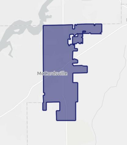
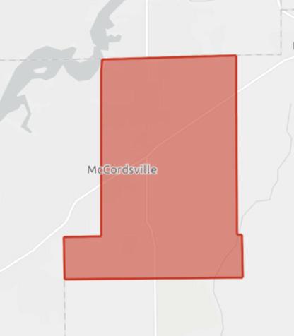
not served by IndyGo, as well as the Central Indiana Regional Development Authority (CIRDA), which primarily allocates project funds via participation in the State of Indiana READI program.
McCordsville is often compared to other communities within Hancock County, such as Greenfield, as well as Hamilton County municipalities such as Westfield, Carmel, Fishers, and Noblesville. The communities in Hamilton County particularly have seen tremendous growth in recent years. Between 2010 and 2020 Westfield had a 54 percent increase in population, Carmel had a 26 percent increase in population, Fishers had a 29 percent increase in population, and Noblesville had a 34 percent increase in population. The only peer community that did not see an increase in population during this time was Greenfield, which saw a population decline of 12 percent. McCordsville and its peer communities are all considered to be suburbs of Indianapolis and have strong ties due to their proximity to the city.
McCordsville has an elected five-member town council and clerk-treasurer. The town has a town manager and several professional department heads. Departments include engineering, parks and recreation, planning and building, police, and public works.
The administration office consists of the Chief of Police, the Assistant Chief of Police, and the Administrative Assistant.
The Office of the Chief-of-Police is responsible for the day-to-day operations of the Police Department. The office maintains the accuracy and integrity of records kept in response to daily police activity and collects and processes fees, gun permits, tow releases, in addition to other administrative duties.
Administrative staff officers focus on personnel supervision, expenditures and procurements, operating policies and procedures, equipment maintenance and operation, interacting with other departments and elected and appointed members of the town’s boards and councils.
The McCordsville Police Department provides proactive patrols, reactive police response to calls for service, criminal apprehension, vehicle crash investigations, traffic enforcement, and community partnerships.
The police department moved into a new headquarters facility in McCord Square in 2024.
The Vernon Township Fire Department provides 24/7 station-based fire and EMS service to all portions of the Town of McCordsville, within Vernon Township. In addition, Vernon Township provides Advanced Life Support (ALS) with both ambulance and an ALS engine. Station 432 opened in McCordsville in 2023, housing Engine 432 and Medic 432. The Buck Creek Fire Department provides fire services to the portions of McCordsville within Buck Creek Township.
Citizens Energy Group provides water for the Town of McCordsville. Individual water customers are billed by Citizens for their water use. The town is not responsible for the water delivery infrastructure.
The McCordsville Sewer Master Plan (2011) has a study area bounded by the county lines to the north and west, CR 650N to the south, and CR 400W to the east. The study uses 13 basins based on natural drainage areas to define sewage basins. Interceptor sewers are those over eight inches diameter that are located for the collection of sewage from other collector sewer lines. Interceptor and collector sewer lines have the same recommended minimum diameter.
The system has a total of eight regional lift stations. Additional lift stations are anticipated in the five basins that do not yet have a regional lift station including Bills Branch, Buck Creek, Camp Creek, Dry Branch, and Woodbury.
Phase 1 was originally constructed in 1999 with a capacity of 75,000 GPD. Since then, the town has expanded the wastewater treatment plant (WWTP) four (4) times. The current WWTP facility has a treatment capacity of 1,000,000 gallons per day design flow with an average peak design flow of 1.2 MGD.
The portion of the town, south of CR 650 N is served by Aqua Indiana, a private utility. The town is not responsible for the wastewater infrastructure in within Aqua’s territory.
McCordsville is an MS4 community, responsible for stormwater education of residents and publishing plans for upgrading the town stormwater management system. The town participates in the Clear Choices, Clean Water Partnership for education and outreach related to stormwater and water protection. The town’s stormwater ordinance was last updated in May 2024.
Electric service in McCordsville is provided by both NineStar Connect, a non-profit utility cooperative headquartered in Hancock County, and AES Indiana. The town is not responsible for electric infrastructure.
Natural gas service in McCordsville is provided by Centerpoint Energy. The town is not responsible for natural gas infrastructure
NineStar Connect provides high speed internet and phone in McCordsville. Residential speeds available are up to 10 gigabytes for residential and 100 gigabytes for business (up and down). McCordsville is a 100% fiber to the premise community.
Spectrum also provides telecommunications services in McCordsville.
McCordsville provides residential solid waste management services through a vendor contract. In 2025 the town entered into a contract with Priority to provide for solid waste collection and curbside recycling.
The Census 2019-2023 American Community Survey reports the population of McCordsville at 9,700. The margin of error is small, but the rapid growth of the community means that even the most recent data are likely underestimating the current population. Stats Indiana tracks Decennial Census population over time and annual population estimates since the last Decennial Census. They estimate the 2023 population for the town at 11,273.
The growth between 1990 and 2000 was 66 percent. Between 2000 and 2010, McCordsville grew considerably – 323 percent. In the following decade, the growth slowed down to 77 percent for the period between 2010 and 2020. Since 2020, the annual growth has been approximately 10 percent per year.
The population of McCordsville has become more diverse over time. Nearly 15 percent of the population in McCordsville identifies as Black or African-American and more than one percent identifies as Asian. Approximately four percent of the populations identifies as being two or more races. In terms of ethnicity, approximately four percent of the town identified as Hispanic.
Source: Stats Indiana
The Baby Boom population is roughly age 60 to 75, followed by Gen X at age 45 to 60 and Millennials at age 30 to 45. These three generations make up most of the working age population. Typically, the distribution between men and women will be within a few percentages of each other until age 65 when women become the majority. McCordsville’s population does not exhibit these characteristics. There are more men over age 65, particularly in the 65 to 69 age group. More typically, there are few 20–24-year-old residents, which is the prime age for young adults to be finishing their post-secondary education or living in larger cities where there is greater housing choices, greater housing affordability, and the lifestyle amenities that are desirable to that demographic. Interestingly, most of the pre-teens and teens in McCordsville are male, while more of the children under age nine are female.
The town has developed several population projections with varying assumptions about the average annual growth rate. The projected housing units for all growth projections are based on an average household size of 2.6 people. The projections show the potential growth rates and the year that McCordsville would “build out” given average density assumptions for different placetypes. The assumed build out population is 47,760. The build out year is highlighted.
Figure A3-5: Population Projections
Footnote:
There are 3,672 households in McCordsville. Sixtyfive percent of households are married couples. The second largest household type is non-family households, which are primarily people living alone.
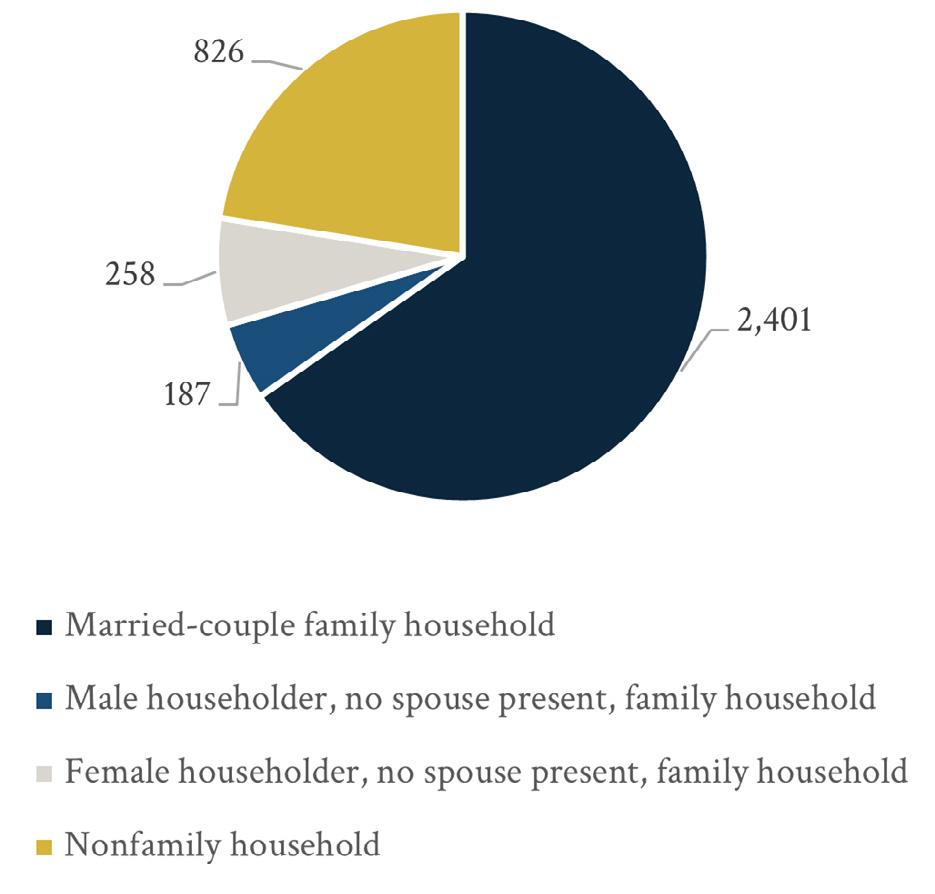
Source: American Communities Survey 2019-2023
McCordsville tracks both the neighborhoods and subdivisions that are built and those that are approved or under construction. This local information is timelier and more detailed than Census data.
More than three-quarters of the housing in McCordsville has been built since 2000. Woodhaven is the largest existing and completed subdivision neighborhood in the McCordsville planning area with 358 housing units. Other large neighborhoods include Austin Trace (315), Bay Creek (308), Emerald Springs (322), and the Villages at Brookside (332). When factoring all housing development types and future phases the largest neighborhoods once completed will be McCord Square (670), Jacobi Farms (650), Villages at Brookside (579), and Gateway Crossing (565).
In Q1 of 2025 there were 13 active residential projects approved to pull building permits. There were an additional 7 residential projects with approved zoning, but not yet approved for building permits. These subdivisions are expected to add thousands of new housing units in the next five years. Building out the existing and approved projects would support a population of approximately 24,700 assuming 2.6 people per household.
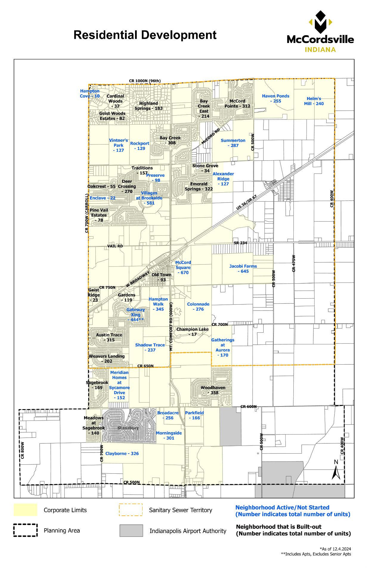
Single-family homes are the dominant housing type in McCordsville, accounting for just over 70 percent of housing units in existing neighborhoods and approved projects. The remaining 30 percent of housing types include, but are not limited to, traditional for-rent apartments, assisted living/memory care, for-sale townhomes, and mixed-use buildings. There are approximately 9,500 residential units either existing or approved in McCordsville. Of the approved residential units, 446 units are age-restricted, including 115 units of assisted/memory care housing at Traditions at Brookside. Additionally, 661 units are age-targeted, 85 percent being for sale single-family homes. There are 5,611 units of traditional for-sale single family homes in McCordsville neighborhoods including Old Town.
Traditional rental multi-family units (not in vertical mixed-use buildings) total 1,315 and are located in Broadacre, Parkfield, Gateway Crossing, Morningside, and Jacobi Farms. Gardens on Gateway and Traditions at Brookside have age-restricted multi-family rental units.
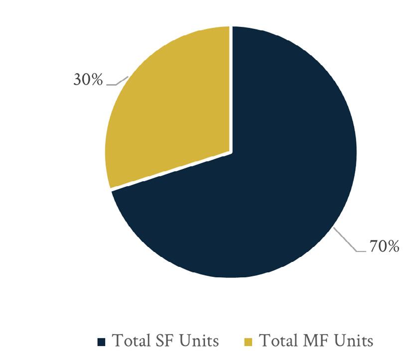
As of 3/13/25
pulling permits Zoning approved, permits not being pulled yet Completed
Source: Town of McCordsville
Source: Town of McCordsville
At buildout, the existing and approved projects would support a population of 24,700, assuming 2.6 people per household. At an average annual growth rate of four percent, McCordsville will have a population of 25,923 in 2045 and need a total of 9,932 housing units to support that population, given the number of people per household remains the same. In addition to buildout of the approved subdivisions, there would need to be an additional 468 units completed through 2045 to accommodate the projected population. There is potential that the community would grow more than four percent per year over the planning period, and the community can accommodate a higher population if residential demand is stronger.
Sixty-five percent of households in McCordsville are married couple families, fourteen percent are single parents, and seventeen percent are people living alone. Forty-five percent of households have someone under age 18 living at home. People living alone and couples without children under 18 living at home may desire different housing types than large single-family homes. Mid-career couples without children and empty-nester households may prefer homeownership to rental units without desiring a larger home or the maintenance that comes with a larger lot.
In 2022, there were 1,166 jobs in McCordsville (workforce) and only 131 (under three percent) of them were filled by people who both live and work in McCordsville. The resident labor force was 5,097 people, which means 4,966 McCordsville residents work out of town.
When people work in a different county from where they live it benefits the county where they live since property taxes are based on residence, but county income taxes are also paid to the county of residence. Those who work outside McCordsville generally have higher earnings than the jobs that are in town too. Shifting the balance of where people live relative to where they work may not be a needed strategy for McCordsville. However, property taxes are higher for commercial and industrial land uses, so having those sources of revenue in the community can be important to the continued success of the town.
Focusing only on primary jobs, the resident labor force in McCordsville in 2022 was 4,260 people. Nearly sixty percent of those jobs were of people in the prime working years of age 30 to 54. Approximately two-thirds of primary jobs had earnings of $3,333 per month ($40,000 per year).
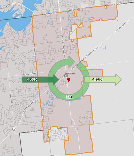
Source: On the Map (Census)
The largest three employment sectors for the resident labor force were heath care and social assistance (18.5 percent), manufacturing (11 percent), and retail trade (10.6 percent). Twenty-two percent of the resident labor force had a college degree.
Much of the population growth over the past decade has been of people who have a Bachelor’s degree.
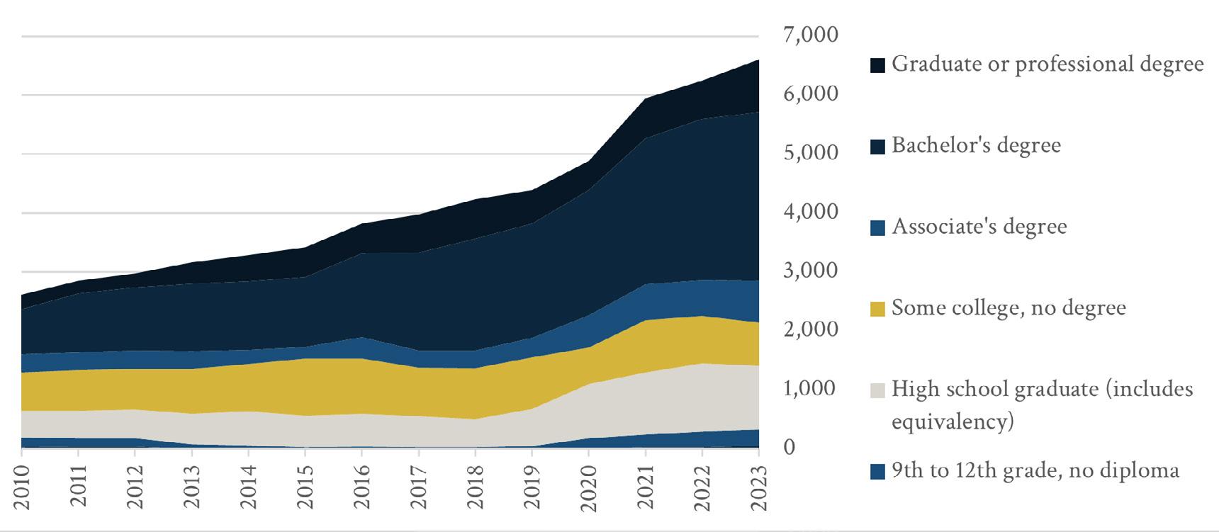
Source: American Community Survey
There were 1,044 primary jobs in McCordsville in 2022. Of those workers, 44 percent were age 30 to 54. Earnings were nearly evenly split between those earning at least $3,333 per month ($40,000 per year) and those earning between $1,251 and $3,333 per month ($15,000 and $40,000 per year) with each group accounting for 38 percent of workers.
The three largest employment sectors for workers in McCordsville were retail trade (35 percent), manufacturing (14.7 percent), and administration, support, waste management, and remediation services (11 percent). People who work in McCordsville are less likely to have a college education than those who live in the community.
The median household income in McCordsville is $113,495. Family households have a higher income than all other households at $136,004 and marriedcouple family households have a similar median income of $137,156. Non-family households the lowest median income, at $70,561. Many of the family households have more than one earner and nonfamily households may be younger or older.
Earnings for workers over age 16 are another income metric. The distribution of income in McCordsville for full-time year-round workers over age 16 shows the largest group of earners making over $100,000. The median earnings for those workers is $74,657 while the median earnings for all workers over age 16 is $62,166. Part time or seasonal workers bring down the median for all workers with earnings.
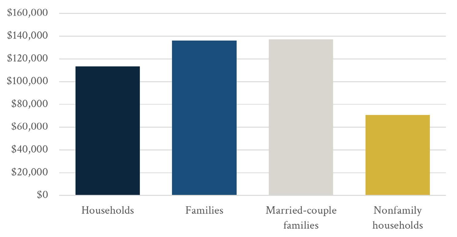
Source: American Community Survey 2019-2023
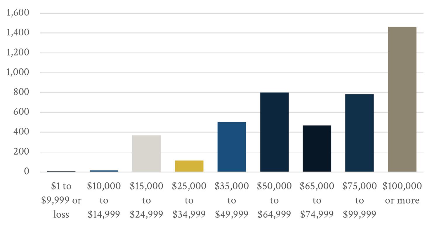
Source: American Community Survey 2019-2023
The median earnings vary by educational attainment. The more education a worker has, the higher their income. Workers with a high school diploma or equivalency have earnings of $53,810, workers with a bachelor’s degree have median earnings of $73,341, and those with a graduate or professional degree have median earnings of $95,333.
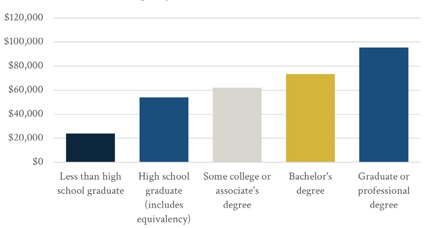
Source: Source 11: American Community Survey 2019-2023
Carmel and Fishers are the largest suburbs of Indianapolis and have grown to populations over 100,000. Carmel has been a city since 1976, and Fishers became a city in 2015. Both were incorporated towns before voters decided to change to the city form of government. Noblesville became a city in 1887 after being named the county seat of Hamilton County in 1824 and has a population of 71,940. Greenfield is the county seat of Hancock County and became a city in 1876. The current population is 24,308. Westfield was incorporated as a town in 1849 but became a city in 2008. Fortville is a small town in Hancock County that faces similar development pressures to McCordsville. Zionsville is a town in Boone County that is balancing suburban and rural growth with high quality development. The larger communities are for reference and as aspirational peers.
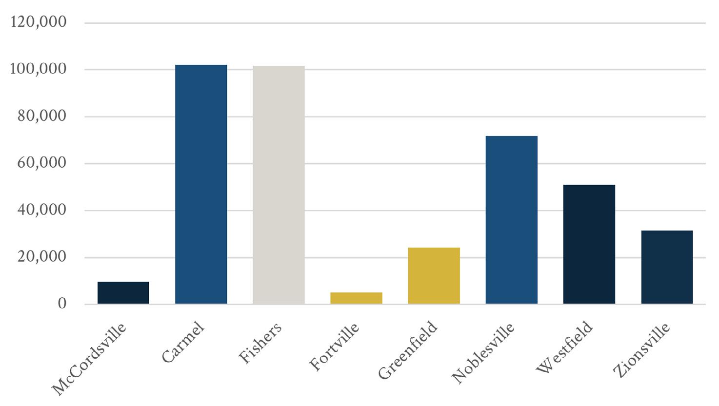
Source: American Community Survey 2019-2023
Both Carmel and Fishers have approximately 40,000 housing units. Noblesville has approximately 30,000 housing units while Westfield has 20,000. Fortville is the smallest community with under 2,000 housing units. Greenfield and Zionsville have slightly more than 10,000 housing units.
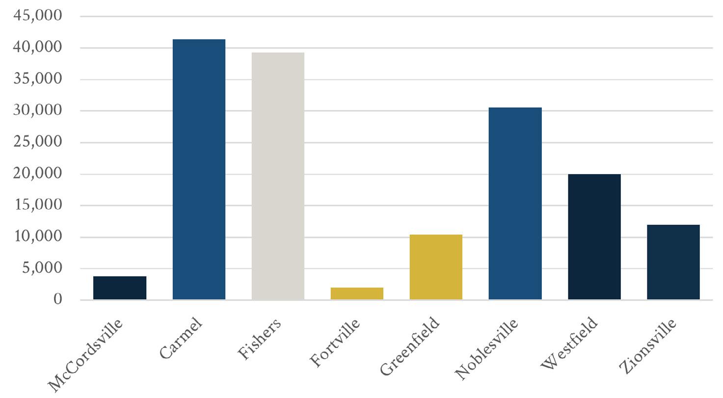
Source: American Community Survey 2019-2023
The household mix between family and non-family households is similar between the communities.
Source: American Community Survey 2019-2023
Many of the peer communities have experienced periods of rapid growth. Carmel grew considerably each decade from the 1950s through to the current Census. Fishers’ growth began in the 1970s and exploded in the 1990s. Westfield has experienced a similar growth since the 1960s with a dip in growth in the 1980s.
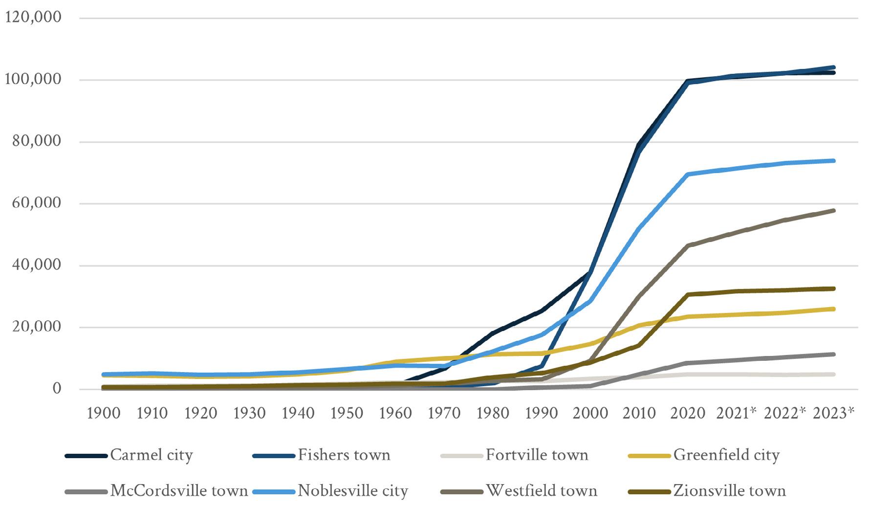
Source: Stats Indiana
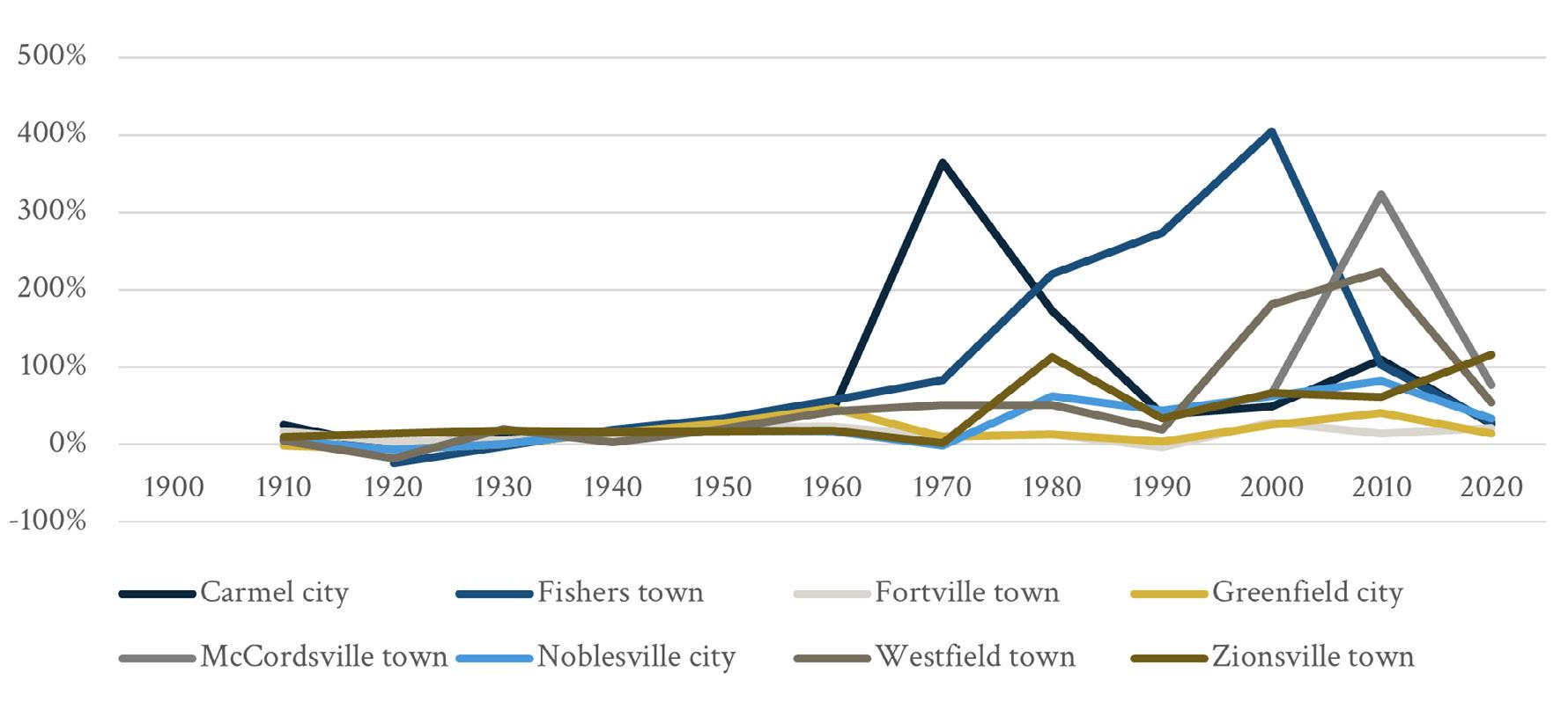
Source: Stats Indiana
Average annual growth rates since 2020 have been generally under five percent for these communities, with McCordsville experiencing around 10 percent average annual growth. Westfield has a higher growth rate than the other Hamilton County municipalities.
Figure A3-21: Peer Community Recent Growth (2020-2023)
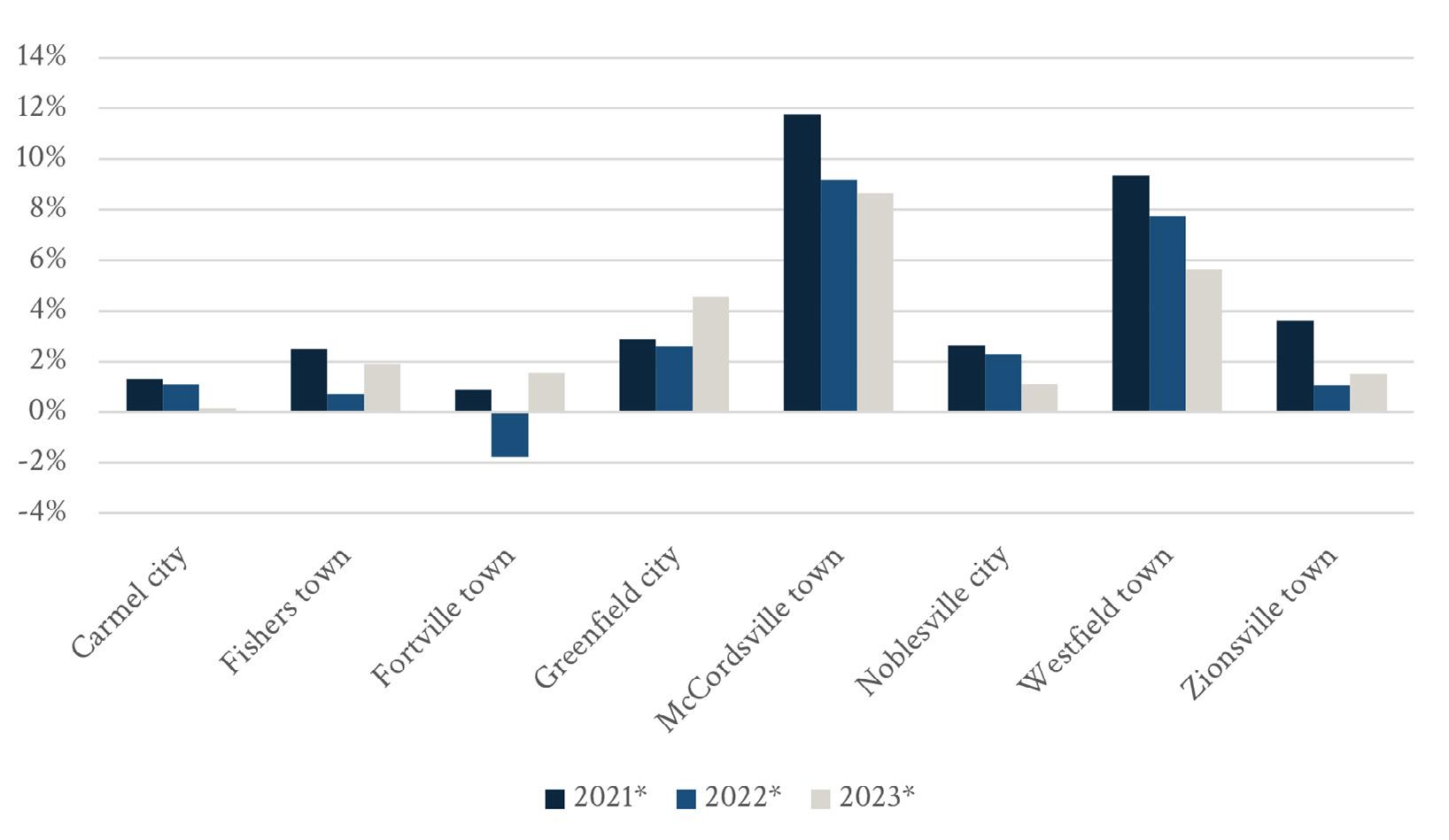
Source: Stats Indiana
All the peer communities are relatively high median income communities except Greenfield. The median household income in Indiana is $69,477. The median household income in Greenfield is $74,949 which is higher than the state median, but under $100,000 – the other peer communities and McCordsville have median incomes above $100,000. Zionsville has the highest income of the communities, near $160,000.
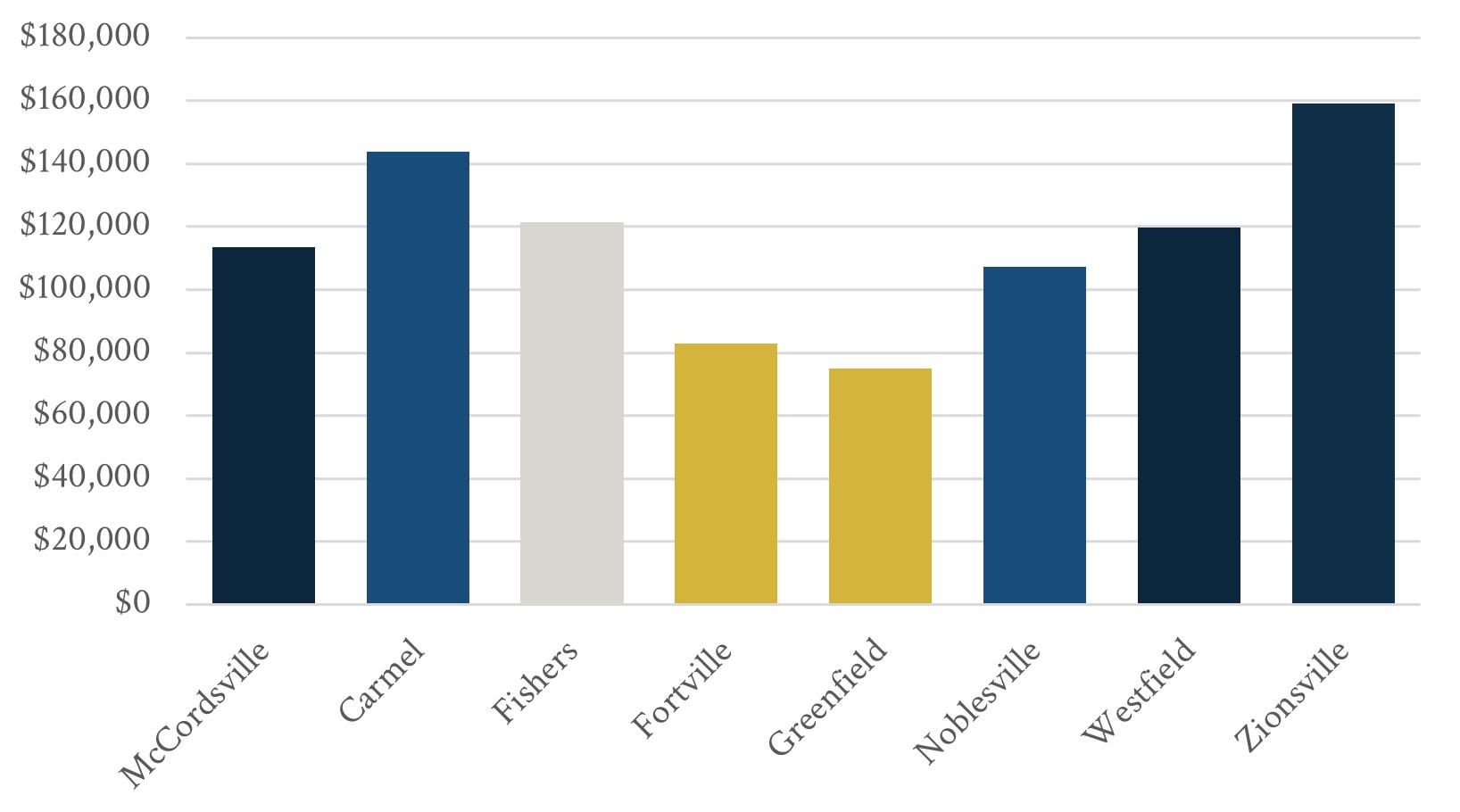
Source: American Community Survey 2019-2023
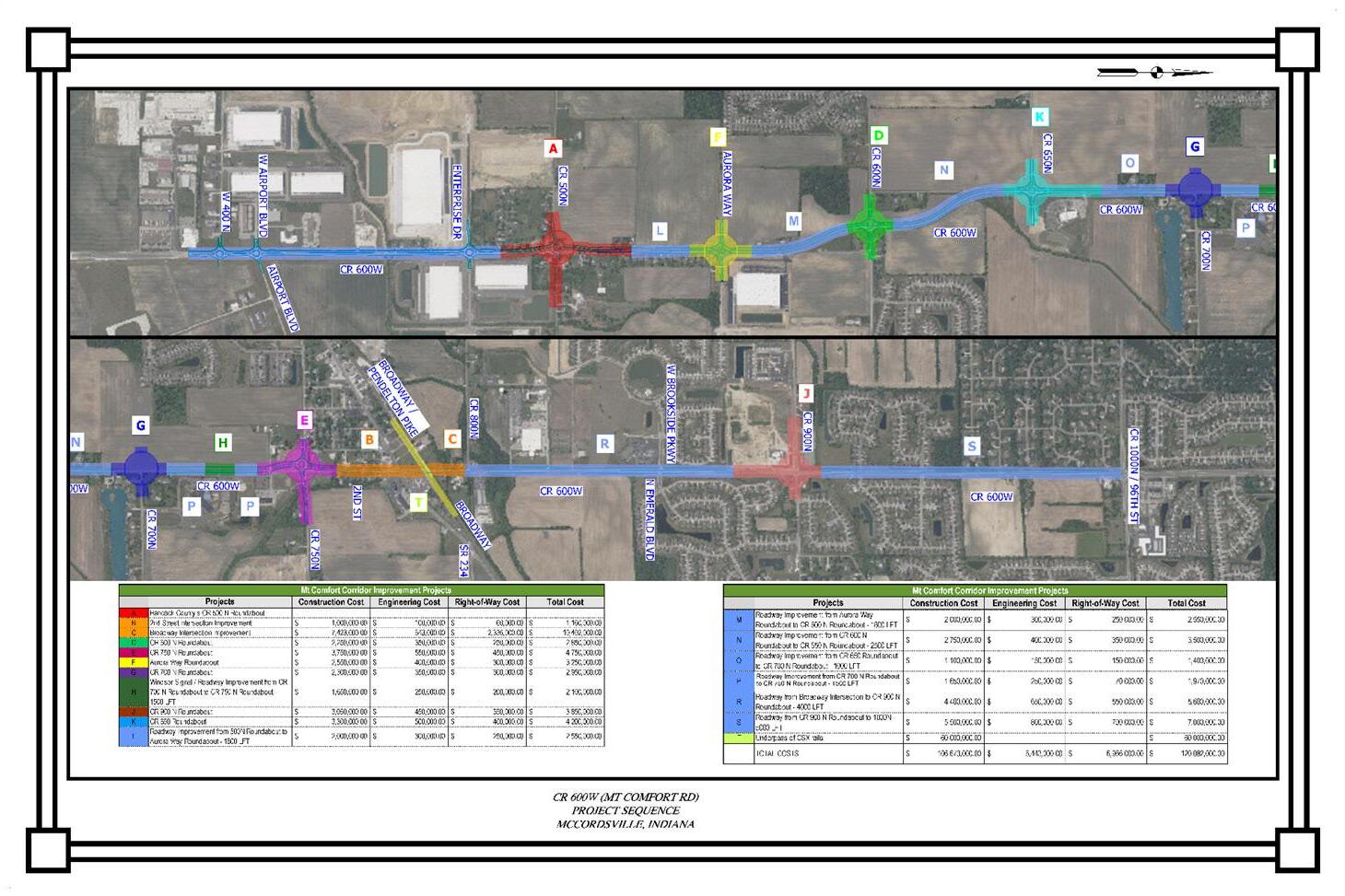
This section will provide a brief overview of the public engagement that was conducted as part of the planning process.
September 7, 2024, 6:00 pm to 9:00 pm at McCordsville Town Hall
This event included showing a movie. Prior to the movie, boards were set up to gather opinions on strength and priorities. The goal was to spread the word about the comprehensive plan and publicize the public workshop dates.
October 21, 2024 at McCordsville Police Headquarters
A survey was conducted with the participants to gather opinions about the proposed vision and goal statements. They survey was online and the materials provided a QR code to access the survey in addition to the draft vision, guiding principles, and goals.
September 16 – 19, 2024 at McCordsville Town Hall. The week with REA in residence included focus group meetings, a community workshop to solicit input in to the plan, a steering committee meeting, and a community workshop at the end of the week to present the information gathered and early recommendations.
September 16, 2024
Seven focus groups were held throughout the week in residence. Each group was asked a series of questions to discuss and provide insight to the REA team.
The seven focus groups are listed below.
1. Developers (13 participants)
2. Economic Development (6 participants)
3. Health and Livability (5 participants)
4. Home Owners Association (HOA) (4 participants
5. Land Use (10 participants)
6. Land Use #2 (2 participants)
7. Utilities (5 participants)
Participants emphasized preserving McCordsville’s small-town identity amid rapid development and expressed mixed views on housing—some supported diverse options, while others were concerned about too much rental or high-density housing. Key concerns included traffic congestion, especially on Mt. Comfort Road, and the need for better pedestrian and bike connectivity. Residents strongly supported creating a walkable downtown with local shops and restaurants, as well as more parks, trails, and family amenities. Schools were seen as a community asset, though overcrowding was a concern. Focus group members also called for more transparency and public involvement in town planning
September 16, 2024, 6:30 pm to 8:00 pm at McCordsville Town Hall
21 participants
Discussion Summary
Participants identified a need for more local businesses, especially unique restaurants, youth activities, small retail shops, and coworking or professional spaces. Recreational desires focused on walking and biking trails, splash pads, sports courts, and interactive green spaces like gardens and story walks. Many residents emphasized the importance of increasing tree cover, improving pedestrian and bike connectivity between neighborhoods, and preserving a small-town feel.
Key priorities included traffic and road improvements, particularly around Mt. Comfort Road and other high-traffic areas like 600 and Broadway, where crashes and congestion are concerns. There was strong interest in expanding parks, trails, and walkability, along with support for a new public library and a free town shuttle. Residents also called for better pedestrian safety measures, lighting for sidewalks, and creative ideas like a community board, public gardens, and a local business hub. Overall, the feedback reflected a strong desire for thoughtful, connected growth that enhances community character and livability
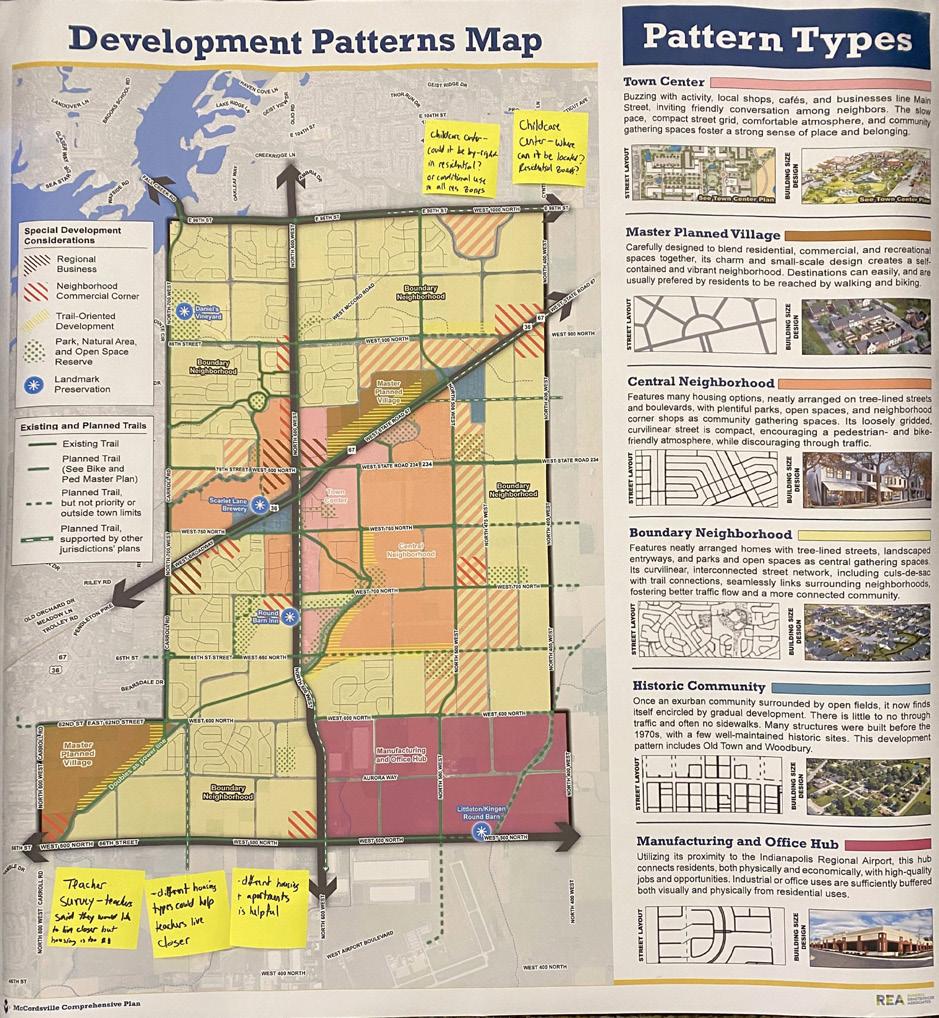
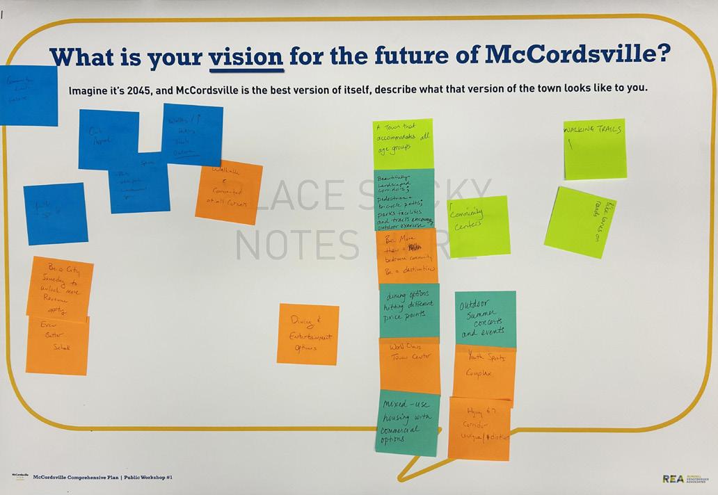
September 19, 2024, 6:30 pm to 8:00 pm at McCordsville Town Hall
10 Participants
Discussion Summary
Community members were invited to attend a second public workshop, also during community planning week. They provided feedback on the findings of REA throughout Community Planning Week. The format was an open house with boards that participants could provide input to the draft vision, principles, and goals. REA staff were available to answer questions from the community participants.

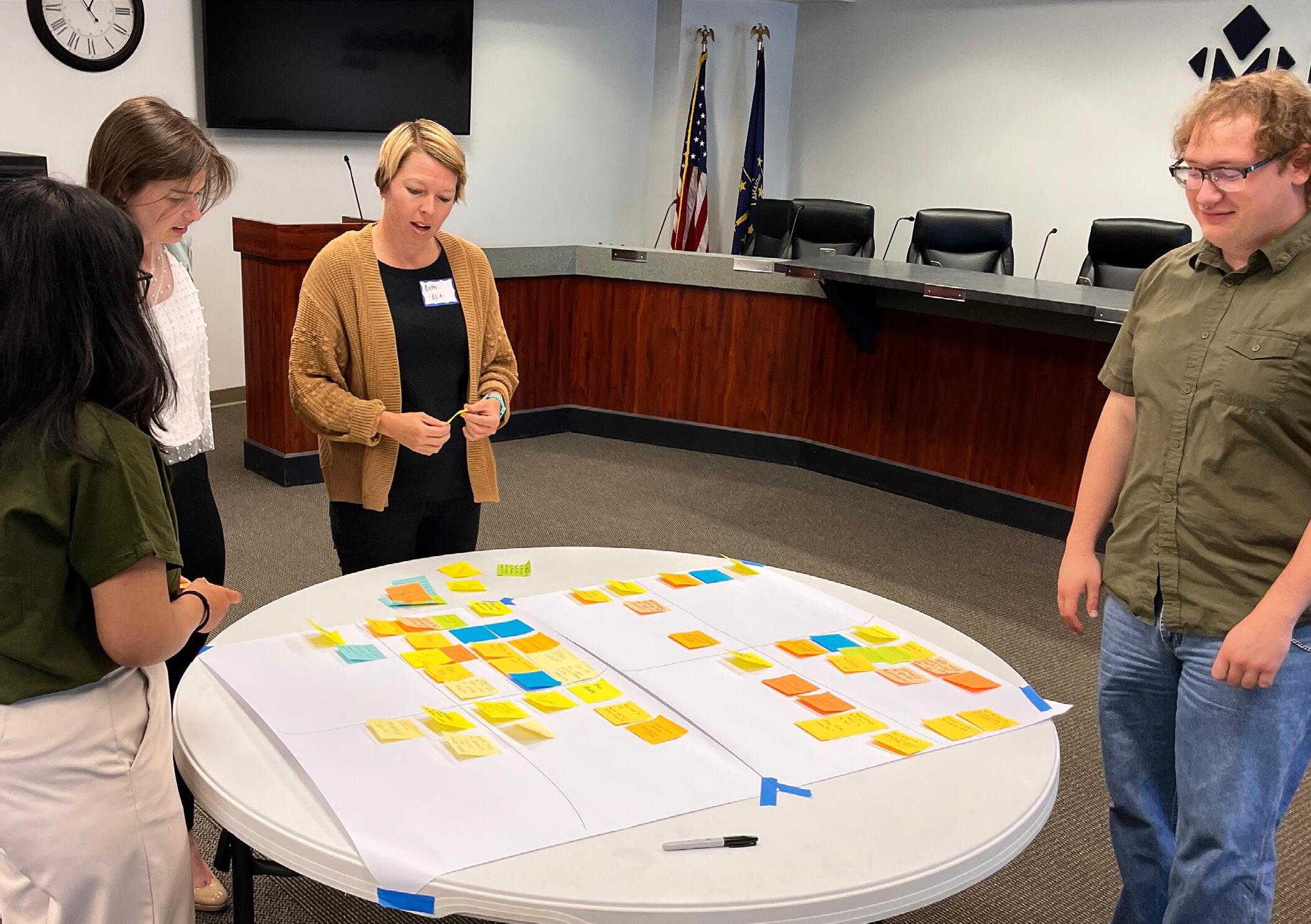
February 10, 2025, 5:00 pm to 7:00 pm at McCordsville Town Hall
24 participants signed in
Members of the public were invited to attend an open house and review the data collected throughout the plan and give feedback on the vision statements, policy statements, goal statements, and placetypes.
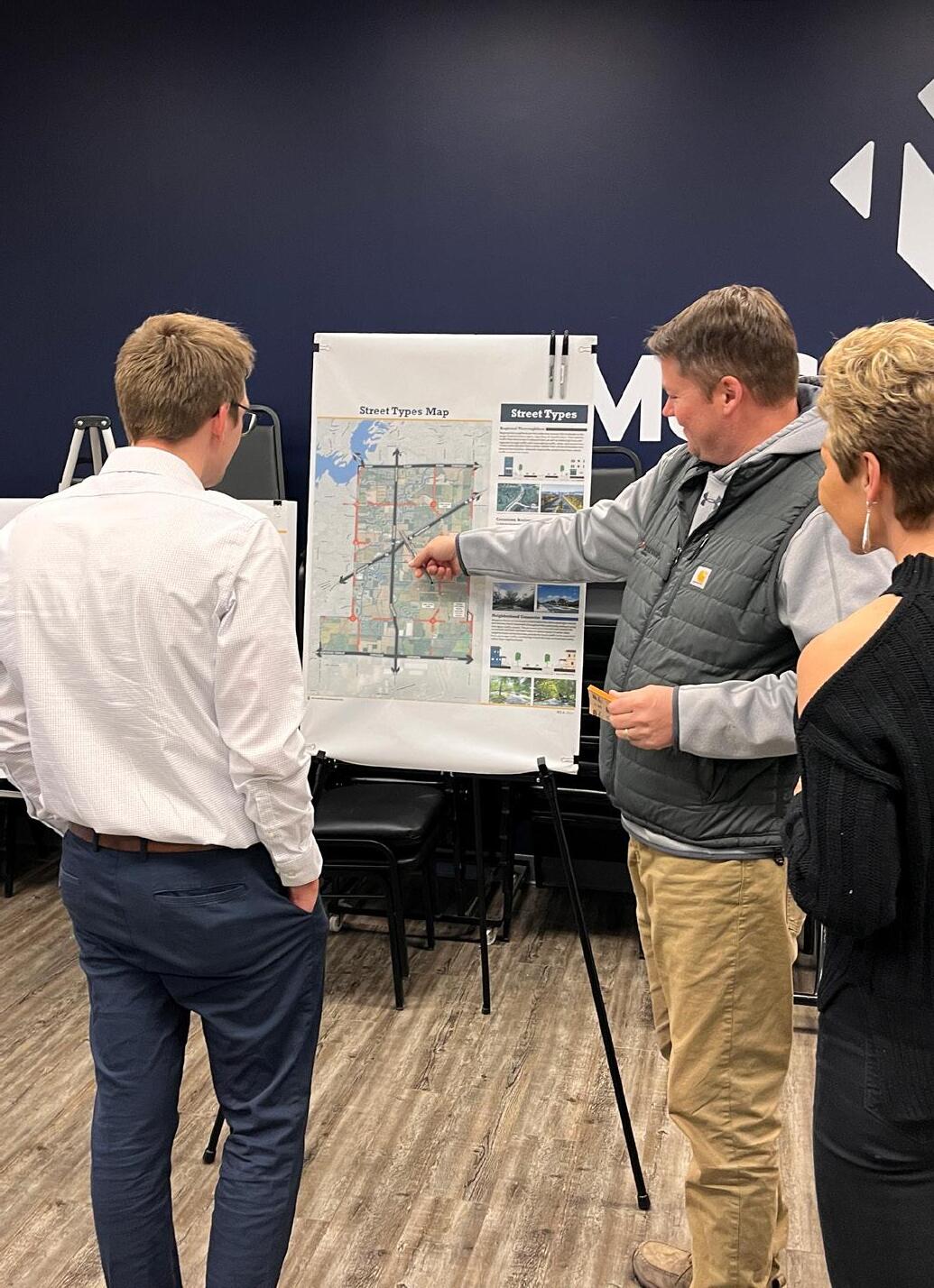
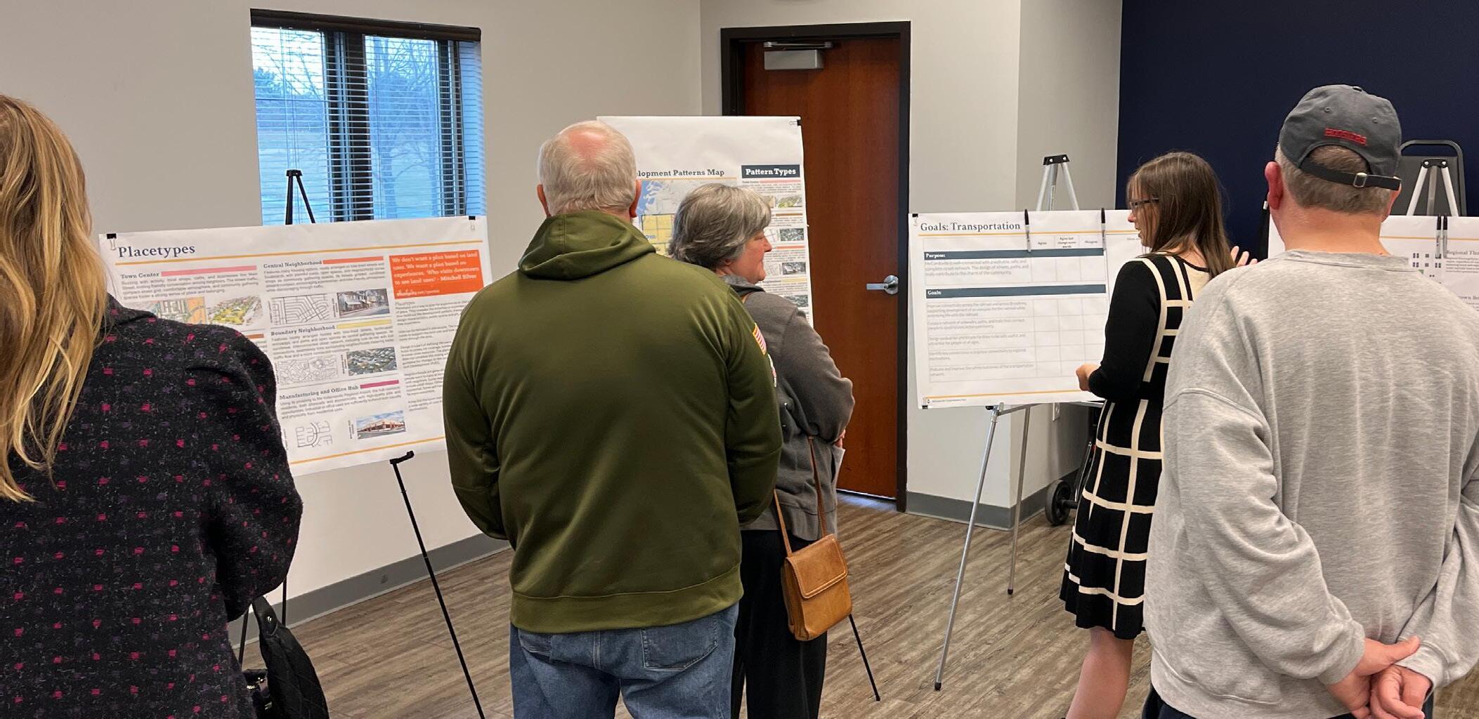
At public events, participants were asked to fill out a short demographic survey. The survey indicated things such as town council district as well as more generic demographic information such as age.
August 16-19, 2024 and February 10, 2025 at Town Hall
Open House Participants: 37
The results from the demographic survey were as follows:
• Most participants were from Town Council District 2 (12 participants) and District 3 (15 participants)
• More than half of participants were male (22)
• Nearly all participants identified as white/ Caucasian (31)
• The two largest age groups of participants were 22-44 (14) and 45-64 (13)
• Most participants had a Bachelor’s Degree (18) or a Master’s/professional Degree (13)
• Most participants had a household income over $100,000 (26)
• Most participants did not have a child under 18 living at home (26)
• Email (16) and social media (14) were the most effective outreach tools
• The meetings captured a different audience than the webpage, with 21 participants not having visited the plan page
• 30 participants had not attended a prior meeting
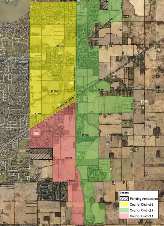
Responses: 35
The results from the demographic survey were as follows:
• 91 percent of responders live in McCordsville
• 71 percent work outside McCordsville
• 37 percent have lived in McCordsville 1-5 years
• 31 percent have lived in McCordsville 11+ years
• 29 percent were age 25-34
• 37 percent were age 35-54
• 66 percent of responders were female
• 97 percent were homeowners
• 51 percent have children under 18 years old living at home
• 94 percent were white/Caucasian
• 43 percent hold a Master’s/professional degree
• 40 percent hold a Bachelor’s Degree
• 31 percent had a household income over $200,000
• 23 percent had a household income of $100,00$149,000
• 89 percent had not attended a comprehensive plan meeting or event
Top five amenities desired:
• Parks, open space, and playgrounds
• Community events
• trails
• sidewalks
• sit-down restaurants

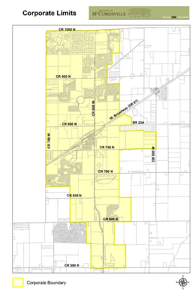


9181 views, 757 unique visits, 591 unique visitors
89 contributions, 57 contributors
planmccordsville.com
A website was set up specifically for the new comprehensive plan. Information such as upcoming meetings and plan updates could be found here.
Public open house boards were available for people to participate virtually after each event.
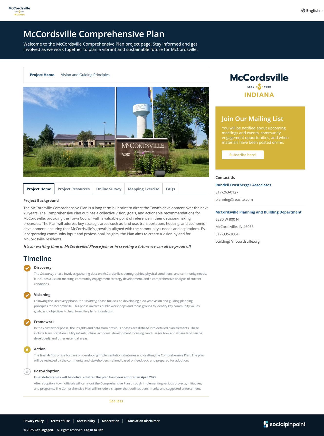
32 contributions were made to the online mapping exercise.
Summarized comments were:
• Traffic is very heavy with all the new construction and addition of all the new homes. It is nearly impossible to turn out of the neighborhood. (96th Street and Mount Comfort Road)
• Nearly impossible to get out of Bay Creek and head north. The planned roundabout will make the issue worse because there will be a constant flow of cars going north. It is a dangerous area and we can’t even think about crossing on foot to use the trail.
• With increased residential construction at 900N (near Carroll Road) consider a roundabout to improve traffic.
• Can the town annex property up 67 to increase the tax base as commercial is built out?
• Dangerous and short railroad crossing
• Traffic is rerouting to avoid Mount Comfort Road and Broadway.
• Create a larger park and splash pad area for the market and Party in the Park. Incorporate new park facilities and increase vendors to encourage more use.
• Heavy traffic and difficult turns near Hancock Health and Emerald Springs.
• Add a youth sports complex.
• Increased walkability like some of the regional trails.
• Original downtown McCordsville should be preserved and revamped so that there are more opportunities for visitors to window shop and visit.
• McCord Square development needs to be accelerated. More commercial. Town outdoor amphitheater. Maintain a high standard for curb appeal for even national brands and chains.
• Old Town is a general opportunity to create a historic district that adds charm right next to the newly built downtown.
• What can we do to make Broadway through McCordsville distinct, unique, walkable, and add greenspace and street lamps?