INDIANA
5 YEAR PARKS PLAN 2025 - 2029
April 15, 2025 - Draft
Benchmark
Natural
History of Anderson
Topography
Geology & Soils
Forest and Vegetation Resources
Water Resources
Threatened & Endangered Species
Man-made, Historical, & Cultural
Transportation
Landmarks,
Existing

ACKNOWLEDGEMENTS
It is with gratitude that we acknowledge the many individuals from the City of Anderson who helped develop this plan.

CITY OF ANDERSON
OFFICE OF THE MAYOR
Thomas J. Broderick, Jr.
CITY OF ANDERSON
TOWN COUNCIL
Jennifer Culp, District 1
Jeff Freeman, District 2
Greg Graham, District 3
Ollie Dixon, District 4
Lance Stephenson, District 5 | President
Joe Newman, District 6
Tiffany Harless, District at Large
Rachel Landers, District at Large
Mark Turner, District at Large
CITY OF ANDERSON
PARKS & RECREATION BOARD
Betty Williams, President
Jack Keesling, Vice President
Kenny Davenport, Member
Randy McVey, Member
Judy Streeter, Secretary (Non-Voting)
DEPARTMENT OF PARKS & RECREATION
David Eicks, Interim Parks Superintendent
Michael Davis, Recreation Superintendent
Kyle Morgan, Recreation Superintendent
Tom Tacket, Maintenance Superintendent
Rachel Johnson, Golf Pro
Greg Spencer, Course Superintendent
Diana Brenneke, Administrative Assistant
PLAN COMMISSION
Greg Spencer, President
Jennifer Culp, Vice President
David Eicks
Marilyn Goree
Keith Grubbs
Matthew House, City Engineer
Betty Williams
Mark Turner
David Beeman
ASSURANCE OF COMPLIANCE
Assurance of accessibility compliance with: Architectural Barriers Act of 1968 (As Amended); Section 604 of the Rehabilitation Act of 1973 (As Amended); And Title II of the Americans with Disabilities Act of 1990 ( As amended)
The City of Anderson Parks and Recreation Board (Applicant) has read the guidelines for compliance with the Architectural Barriers Act of 1968 (As Amended); Section 504 of the Rehabilitation Act of 1973 (As Amended); and Title II of the Americans with Disabilities Act of 1990 (As Amended) and will comply with the applicable requirements of these Acts.
SIGNATURE
SIGNATURE
(Printed name)
DATE
(Printed name)
RESOLUTION ADOPTION
RESOLUTION 2025- 00 OF THE CITY OF ANDERSON BOARD OF PARKS AND RECREATION A RESOLUTION APPROVING THE FIVE YEAR PARKS MASTER PLAN 2025-2029
WHEREAS , the City of Anderson, Indiana Board of Parks and Recreation (“Park Board”) is aware of the park and recreational needs of the residents of the City of Anderson, Indiana; and
WHEREAS , the Park Board is desirous of providing aesthetic and functional facilities and programs to the residents of the City of Anderson to meet their needs; and
WHEREAS , the Park Board realizes the importance of sound planning in order to meet the needs of its citizenry; and
WHEREAS , the Park Board is continually aware of the value and importance of outdoor and leisure opportunities, as well as programs and facilities, to the future of the City of Anderson Parks and Recreation Department and its programs, and to the residents of the community as a whole.
NO W, THEREFORE, BE IT RESOLVED that the City of Anderson Board of Parks and Recreation does now adopt the Anderson Parks and Recreation Five Year Master Plan 20252029, a copy of which is on file in the Park Department Office, as its official plan for the growth and development of parks and recreation opportunities for the City of Anderson, Indiana for the next five years. The City of Anderson Board of Parks and Recreation continues its commitment to annual reviews and, if need be, updates to the goals and objectives of this Anderson Parks and Recreation Five Year Parks Master Plan.
DULY PASSED AND ADOPTED this ____ day of _________, 2025, by the Anderson Board of Parks and Recreation of the City of Anderson, Madison County, Indiana, having been passed by a vote of ___ in favor and ___ opposed.
BOARD OF PARKS & RECREATION OF THE CITY OF ANDERSON, MADISON COUNTY, INDIANA
MEMBER
Betty Williams, President
Jack Keesling, Vice President
Kenny Davenport, Member
Randy McVey, Member
YEA NAY
INTRODUCTION
The following section outlines the purpose of five-year parks and recreation master plan and provides general information on the City of Anderson. In addition, a description of the Anderson Parks and Recreation Department is provided, including a description of their existing staff organization, facilities, and assets that are managed by the department.

PLANNING PURPOSE
BACKGROUNDDRAFT
There are many reasons to update a master plan, including identifying emerging issues, noting new recreational trends, and developing department budgets for future years.
The 2011-2015 Anderson Parks Master Plan was the most recently adopted plan. Committed to providing a high quality of life for residents, ensuring access to recreational facilities and programs, and serving as stewards of the community’s natural resources, the City of Anderson recognized the immediate need and importance of updating the five-year parks and recreation master plan to help identify emerging issues and recreational trends, outline community needs and goals, define on-going facility maintenance and program updates, and develop a budget for the department.
The Anderson Parks and Recreation Department is focused on being good stewards of the land balanced with providing recreational opportunities for the residents of Anderson and Madison County, Indiana. The department focuses on park amenities that promote physical fitness and well-being for the community.
The Anderson Parks & Recreation Department is dominated by urban parks that provide a variety of activities available throughout the year. As heard throughout the public engagement process, the residents of Anderson appreciate the amenities that they have but would like to have more of these amenities within the city.
In addition, this master plan was completed to meet the requirements of the Indiana Department of Natural Resources (IDNR) Division of State Parks, Community Grants and Trails to remain eligible for grant funding through the IDNR and other state agencies.
However, meeting the requirements was not the main focus for this planning process. Ultimately, this plan was developed to guide the department through the next five years and beyond. All those who were involved with the preparation of this plan stressed the need for the process to gather and then address the community’s current and future needs.
Recommendations that were developed address not just physical improvements like new parks and amenities but also existing facilities which need upgrades, recreational programming, and the need for additional staff for the department to continue the excellent level of service.
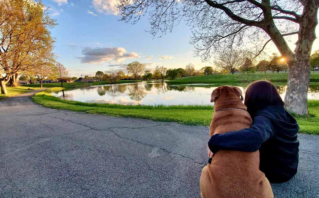
A woman watches the sun set with her dog at General Pulaski Park in Anderson / source: Kreepy_kween
PLANNING PROCESS
The City of Anderson began the planning process in the Summer of 2024 concurrently with the development of an updated Comprehensive Plan. While the two planning processes shared research on community demographics and a common public engagement strategy, the five-year parks and recreation planning process followed its own six-step process to ensure compliance with the Indiana Department of Natural Resources’ (DNR) planning guidelines for the development of five-year parks and recreation master plans and to ensure eligibility for future state grant opportunities. The six step planning process included:
• Inventory and Analysis
• Obtaining Public Input
• Planning and Design
• Recommendations
• Priorities and Action Plan
• Plan Submittal and Adoption
This process documented the current condition of parks, identifying deficiencies and opportunities with each of the facilities, and reviewing the level of service throughout the community. The community was engaged through targeted stakeholder meetings, open houses, and online survey mapping exercises to understand the public’s perceptions and desires for the community’s parks. With an understanding of the existing conditions, the community was compared to peer cities and against national best practices before recommendations were developed to guide the future of the parks department. Priorities were developed, and a phased strategy for achieving the community’s goals was created prior to final plan submittal and adoption.
DEFINITION OF THE STUDY AREA
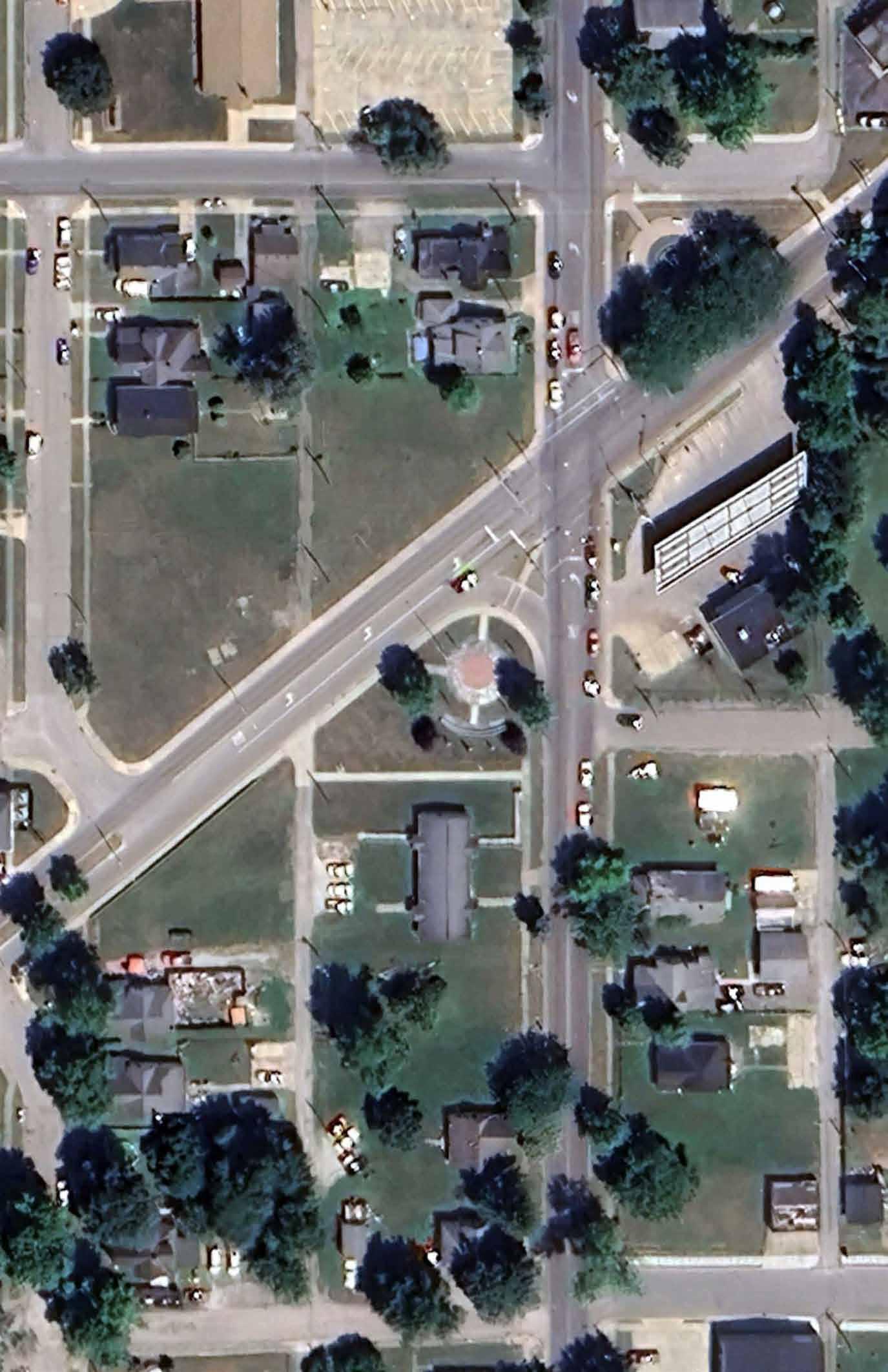
The City of Anderson is located within east central Indiana and is the county seat for Madison County. The incorporated city area occupies 41.7 square miles, 0.1 square miles of which are water. Most of the study area is within Anderson Township. State Road 9/109 runs north/south through the eastern edge of the city and State Road 32 runs east/west through downtown and the center of Anderson. Interstate 69 extends east/ west through the southern edge of the city. Additionally, the White River meanders through the city from east to west, forming the northern boundary to downtown and the historic core of the community. Multiple railroads and rail spurs exist within the community running in various directions. They include CSX, Norfolk Southern, Indian Creek, and Central Indiana Western.
DRAFT
Anderson is located approximately:
• 40 miles northeast of Indianapolis, IN
• 20 miles southwest of Muncie, IN
• 80 miles southwest of Ft. Wayne, IN
• 100 miles northwest of Dayton, OH
• 120 miles northwest of Cincinnati, OH
• 200 miles southeast of Chicago, IL
• 200 miles northeast of Louisville, KY
While the planning service area for the five-year plan is focused on the jurisdictional boundaries of the city, Anderson parks receive use from individuals and families throughout Madison County. Similarly, there are multiple, regional recreational facilities within proximity of Anderson that residents and community members utilize.
Among others, the most notable include:
• Anderson University campus
• Davis Park, First United Methodist Church
• Edgewood Park, Town of Edgewood
• Mounds State Park
• Meadowbrook Golf Course
• Anderson Country Club
• Edgewood Country Club
• YMCA
• White River Fitness Center
• Falls Park, Town of Pendleton
This plan and the recommendations included have an impact on the quality of life for constituents in the planning area. Investments made by the Anderson Parks and Recreation Department will play a pivotal role in enhancing the social, physical, and mental wellbeing of residents. A 2016 study conducted by Ball State University’s Center for Business and Economic Research cited recent trends in where people choose to live. The study found a strong correlation between the built environment and resident attraction. Parks, trails, and recreational amenities have a heavy influence on resident attraction. Similarly, a 2022 survey by Project for Public Spaces found that 80% of respondents would sacrifice salary for an ideal community and that 70% of business owners found their community prior to starting their business. A 2017 study by Americans for the Arts estimated a $7 return on investment for every municipal dollar spent on quality-of-life improvements. The city of Anderson recognizes the importance of parks and recreation and the benefits from investing in local quality of life initiatives.
While the amenities within the existing park network may not attract residents outside of the corporate limits, many of the park’s programs and seasonal events draw attendance from surrounding communities such as Chesterfield, Alexandria, and Pendleton. Seasonal youth and recreational sports tournaments played with the park facilities attract several hundred out-of-town residents to the city each year.
Additionally, the Anderson Parks Department aims to leverage capital improvements forthcoming to Athletic Park to establish a regional attraction and destination. The development of Athletic Park is anticipated to attract park users from outside the city limits in Madison and surrounding counties. It is anticipated that these users will patronize local shops, restaurants, and businesses located within the downtown business district located near the proposed aquatic facility. The city’s leadership has strategically programmed Athletic Park with seasonal aquatic activities to avoid competition with the current programming and services already provided by Dickmann Town Center and other surrounding municipal parks. Additionally, downtown revitalization through new housing and commercial development is anticipated to occur with the construction of the unique aquatic facility, event center, and performance stage within Athletic Park.
MISSION
The mission for the parks and recreation master plan is the same as the mission for the Anderson Parks and Recreation Department. While it has not changed significantly since completion of the previous master plan, it has evolved. The mission statement is “envisioning, planning, developing, and operating public recreational facilities that support recreational opportunities and programs for all citizens of Anderson.”
DRAFT
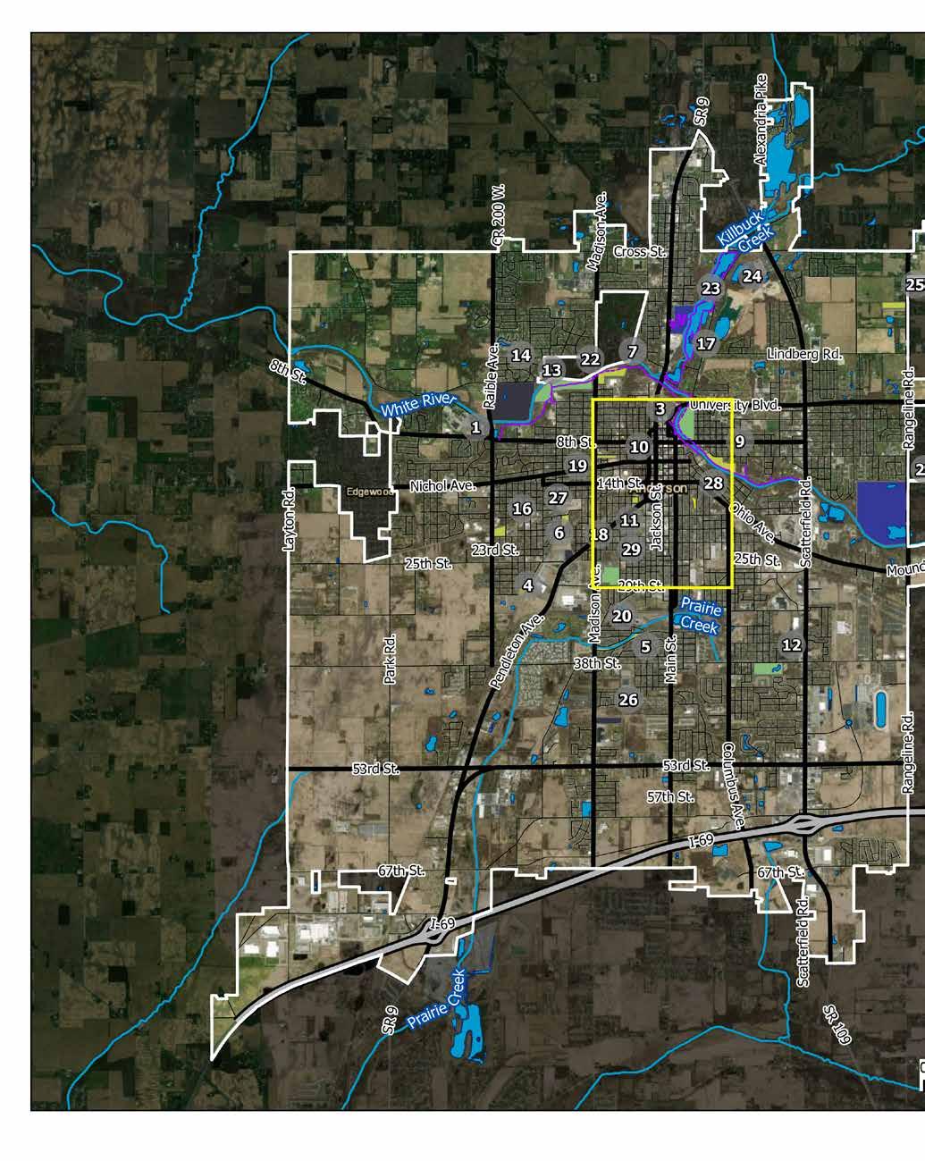
Anderson, Indiana Vicinity Map
PLAN & DEPARTMENT GOALS
The goals for this plan and the Anderson Park’s and Recreation Department directly support the mission. They include:
1. Ensuring all people have access to recreational activities and facilities regardless of age, sex, income, cultural background, housing, environment, or physical condition
2. Coordinating public recreation with community recreation opportunities to avoid duplication and to encourage innovative co-sponsored programs and facilities
3. Integrating public recreation with all other public services, such as education, health, and transportation
4. Providing multi-use facilities that encourage diversity of use and achieve higher participation to support long-term facility success and sustainability
5. Maximizing facility exposure to make it more visible and accessible, and to deter unwanted facility activity and vandalism
6. Creating facilities adaptable to future needs
7. Involving citizens of Anderson in all stages of parks and recreation planning
8. Acquiring lands in strategic areas to ensure access to parks and recreation in existing underserved areas and developing areas of the community
13. Supporting the development of cultural amenities
14. Promoting city-wide social events and activities
15. Supporting existing arts and cultural community assets
16. Supporting street design that promotes walkability and space for transit stops
17. Providing organized recreational activities for various age groups
18. Creating or improving accessible and attractive spaces for youth to enjoy (K-12)
DRAFT
9. Integrating regional and State plans with Anderson’s recreational plan
In addition, specific goals have been identified and developed as a part of the ongoing City of Anderson 2025-2045 comprehensive plan update directly related to the community’s natural resources, parks and open spaces, and recreation opportunities. They include:
10. Supporting strategic investment in downtown destinations, including downtown parks
11. Centering programming activities in downtown
12. Preserving historic structures and spaces in Anderson that add to local character
19. Activating gathering spaces with an array of events and programming that fosters community connectedness
20. Improving the condition, accessibility, safety, and connectivity of existing parks
21. Supporting existing cultural assets and venues that enhance Anderson’s quality of life
22. Attracting entertainment venues that support quality of life through quality of place
23. Reimagining the White River as a recreational asset
completing a
ANDERSON PARK BOARD
PARK BOARD HISTORY
Shortly after the election of Mayor Jesse Hickory Mellett in 1914, an announcement was made that a Park Board to “serve all the citizens of Anderson” was to be appointed. Sixteen days after taking office, Mayor Mellett appointed the following individuals to the first official Anderson Park Board: David H. Durbin, President; Mrs. Frank E. Kimble, Secretary; Harry Elliott, Mrs. J.J. Netterville, and Mrs. C.N. Smith. Mayor Mellett was praised by citizens and local newspapers – The Anderson Bulletin and The Anderson Herald – for “exercising good political judgment” in his decision to include three women on the Board. The Bulletin stated that the ladies “will improve and dignify our park system” while the Herald offered the following insight: “To the calm unbiased judgment in most affairs that concern the homes and families, women must again be credited to a movement for the improvement of control of the park system in Anderson.”
CURRENT BOARD
The city’s Department of Parks and Recreation ordinance was updated in 1983 to bring iit in compliance with the state’s updated requirements (I.C. 36-10-3-4) .
Today, the Anderson Parks & Recreation Department is supervised by a four-member Parks and Recreation Board and ex-officio members as allowed by state statute. All board members are appointed by the active city mayor. Current members include Betty Williams, President; Jack Keesling, Vice President; Kenny Davenport, Member; Randy McVey, Member; and Judy Streeter, Secretary (non-voting).
The board meets on the first Tuesday of each month in the council chambers city hall, located at 120 E 8th St. Meetings begin at 4:30 p.m. Special meetings may be scheduled and announced in the local newspaper or on the City’s official social media platforms.
DRAFT
PARKS DEPARTMENT
INTRODUCTION
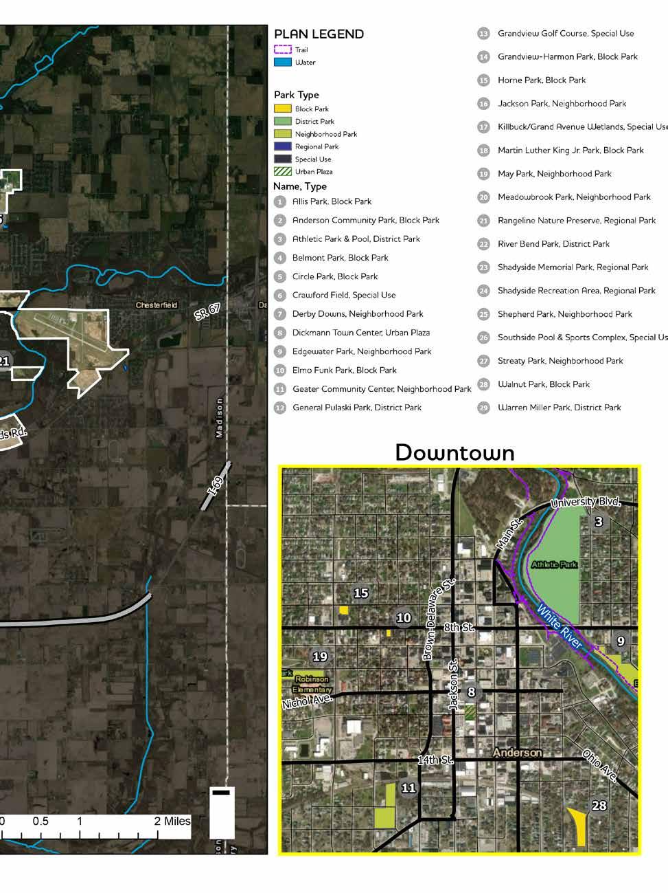
The City of Anderson Parks System features 728-acres of public land and 15.8 miles of recreational trails over a network of 30 parks and open spaces. In addition to public park land, the City of Anderson Parks & Recreation Department also manages several structures and facilities including the Geater Community Center, Old Trustees Building at Warren Miller Park, Bobbers Bait and Tackle and Shadyside Café at Shadyside Lake Recreation Area, the Grandview Pro Shop, and a restaurant – 1925 Pubhouse – at the Grandview Golf Course.
From traditional sports and recreation activities such as basketball, baseball, tennis, and soccer to unique amenities – including a community center, outdoor fitness equipment, and an extensive off-road bike course – the Anderson Parks and Recreation department offers a variety of recreational opportunities that aid in developing a healthy and happy community.
STAFFING & ORGANIZATION
The Anderson Parks and Recreation department is operated by a staff of 84 full-time, part-time, and seasonal employees. Fourteen full-time employees oversee daily operations, while 71 temporary staff members aid with seasonal recreation opportunities, programs, and maintenance requirements.
The department is led and administered by the Park Superintendent. The park superintendent oversees the construction, repair, and maintenance for park facilities and equipment as well as the planning and organization of recreational programs and activities within the city’s 30 parks. The superintendent position is currently vacant. David Eicks, the City of Anderson Board of Public Works chairman, presently serves as the interim Parks Superintendent until the position is filled. The superintendent is aided by a full-time business administrator and receptionist. The department’s administrative office is situated within the Johnny Wilson Pavilion inside the Geater Community Center at 1611 Chase Street.
The maintenance division of the department is supervised by the tenured Maintenance Superintendent, Tom Tacket. Tom oversees three full-time foremen, three full-time laborers, the Riverwalk Maintenance Supervisor, and several seasonal maintenance employees. The maintenance crew is responsible for mowing the parkowned properties, performing regular inspections and repairs, and maintaining facilities. The department’s primary maintenance facility is located at 705 W 29th Street near the northwest corner of Warren Miller Park.
DRAFT
The park department has several employees who assist with the management of community programs, events, and recreational opportunities. Positions include a fulltime Sports & Recreation Manager, Sports & Recreation, and Activities Director. Eugenia Davis serves as the director of the Geater Community Center.
Grandview Golf Course, a city-owned 18-hole golf course located on the northwest side of the community employs three full-time staff members. Jama Donovan operates the Pro Shop while Greg Spencer and Dan Hutton serve as the Course Superintendent and Facilities Manager, respectively.
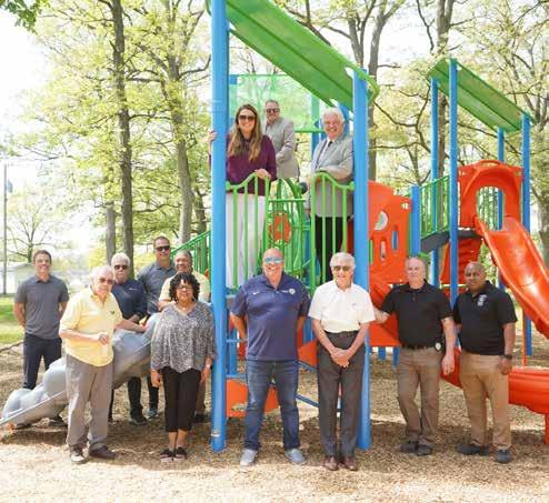
Above: Mayor Thomas J. Broderick, the Anderson Park Board, and Park staff pose for a photo near the recently updated playground at Shadyside Park.
COMMUNITY PROFILE

The City of Anderson is a rich and diverse community comprised of a unique offering of natural resources and man-made assets supported by a multi-cultural citizen population. The following section provides an overview of the community’s history, natural resources, man-made and cultural resources, community demographics, industry, and housing.

HISTORY OF ANDERSON
NATURALDRAFT RESOURCES
Originally a landscape of wooded forests and marshlands inhabited by the indigenous Delaware (Lenape) people, westward colonial expansion during the early 1800s established civil communities including “Anderson Town”. Significant industrial development and economic growth occurred throughout the late 1800s and early 1900s due to the discovery of natural gas near the town, attracting a diverse immigrant workforce and growing the community.
By 1912, the natural gas reserves had been depleted and many businesses left the region. However, with the emerging popularity of the automobile, city officials persuaded Delco Remy and Guide Lamp to maintain factories and offices in Anderson. For decades, Delco Remy and Guide Lamp continued to be two of the largest employers in the community. By the end of the millennium, both Delco Remy and Guide Lamp has virtually closed all of their facilities due to declining demand of parts.
Today, Anderson has rebranded itself as community of technology, healthcare, and innovation. Purdue University’s investment in the community with the construction of the Purdue Polytechnical campus and
Ivy Tech’s Anderson Campus along the I-69 corridor provide the necessary training and collaboration for entrepreneurs and startup businesses. Ascension St. Vincent, Community Health, Nestle, Harrah’s Hoosier Park Racing and Casino, and Healing Hands home healthcare are the top employers in Madison County. Anderson University, a religious-based private university, continues to be a civic magnate within the community.
TOPOGRAPHY
Anderson is situated approximately 902 feet above sea level. The terrain is relatively flat with an elevation range of 81 feet. Most of the significant elevation changes are located within the riparian floodplain of the White River and its associated tributaries. According to the Federal Emergency Management Agency (FEMA), the base flood elevation for the White River is 852.8 feet near the eastern limits of the city, 843.2 feet near Athletic Park adjacent to downtown Anderson, 834.8 feet near the City of Anderson Central Services Building, and 826.9 feet near the western extents of the city.
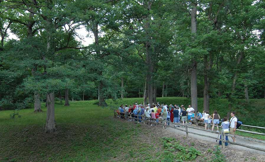
A group of park visitors explore the Great Mound created by indigenous people at Mounds State Park near Anderson
GEOLOGY AND SOILS
The study area is located within the U.S. EPA Level III Eastern Corn Belt Plains ecoregion. This landscape is characterized by rolling till plains with localized moraines. Historically, the land featured glacial deposits of rich, well-to-moderately drained clayey and loamy soils. The landscape was dominated by beech-maple forests. Elmash swamps were observed in wetter lowland soils. The U.S. EPA notes that extensive human disturbance from corn, soybean, and livestock production has replaced much of these wooded habitats. Urban development has also affected the characteristics of the native soil and the chemistry and turbidity of local waterbodies.
FOREST AND VEGETATION RESOURCES
East Central Indiana was once covered by hardwood deciduous forests dominated by beech, maple, hickory, and oak trees. Many of these stands of forest were found along the banks of rivers, lakes, and wetlands. According to the Indiana Department of Environmental Management, of the county’s total 7,014 acres of wetlands, 5,155 acres were classified as “forested”.
By the 1800s westward expansion and human development had cleared much of the wetlands and wooded forests to make room for farmland. Today, much of the study area is urbanized with limited natural areas. Remnants of the wooded deciduous forests can be found in small, undisturbed stands in the rural areas of Madison County. Many of the larger tree species overlook the riparian floodplain of the White River and its tributaries. Much of the urban tree canopy is composed of trees found along roadways within the right-of-way and within the open lawns of the city’s parks.
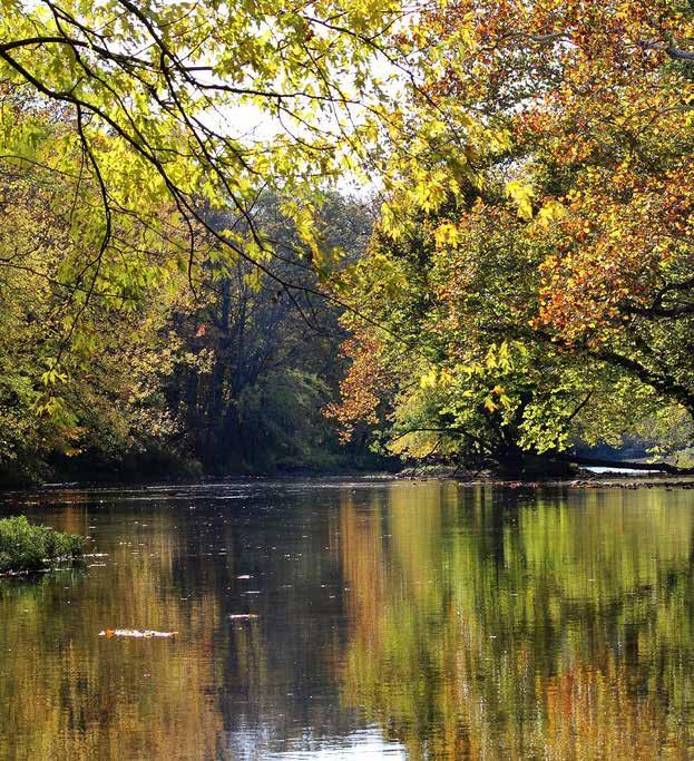
WATER RESOURCES

DRAFT
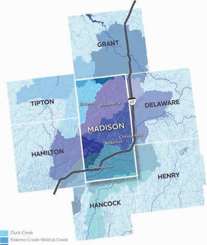
Early industrial development and land use patterns in Anderson were strongly influenced by the location of water features within the study area. The incorporated area of Anderson is located within the White and West Fork White River sub-basin (HUC 8: 05120201). This basin spans the mid-section of the state and encompasses approximately 5,600 square miles of land and all or part of 29 counties.
Major streams within the study area include Fall Creek, Killbuck Creek, Pipe Creek, and the West Fork White River. The West Fork White River is the largest drainage channel within the study area. The river freely meanders throughout the county in an east-to-west flow pattern. The river is unobstructed from any low head dams through the study area.
The headwater of the river begins as an insignificant creek surrounded by rural farmland approximately 3 miles east of Farmland, Indiana in Randolph County. It transitions into a significant river as it progresses westward through the populated communities of Muncie,
River Bend Park
Mounds State Park
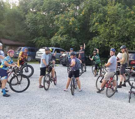
A group of cyclists look on as they prepare to explore the trails at Rangeline Nature Preserve
Anderson, Noblesville, and Indianapolis. The White River becomes a tributary to the Wabash River in Southern Indiana near Mt. Carmel before ultimately discharging into the Ohio River.
The West Fork White River basin is subdivided into the Pipe Creek, Killbuck Creek-White River, and Geist Reservoir-Fall Creek watersheds within Madison County and study area. Killbuck Creek is considered the largest tributary to the White River in Madison County. Killbuck Creek begins as small drainage channels in the western portion of Delaware County. As the meandering waterbody navigates through Madison County, it collects runoff from farmland in the eastern part of the county before transitioning into an urban creek within Anderson’s city limits. The confluence of Killbuck Creek and the White River can be found near the Killbuck Creek Wetlands near Grand Avenue north of downtown.
Groundwater
Most of the county is found within the Silurian and Devonian Carbonates Aquifer System. Static water levels within the Silurian and Devonian Carbonates Aquifer typically range from 15 to 36 feet below the surface terrain. According to the Indiana Department of Natural Resources Division of Water, wells drilled into the aquifer system have a reported depth ranging between 25 and 480 feet and provide an average of 8 to 26 gallons per minute (gpm). High-capacity well depths range from approximately 100 to 400 feet below the land surface with yields ranging from 90 to 5,000 gpm.
THREATENED AND ENDANGERED SPECIES
Madison County is home to several state and federally endangered or threated species. According to the Indiana Department of Natural Resources, Division of Nature Preserves, state threated flora includes tufted hair grass (Deschampsia cespitosa), great St. John’s-wort (Hypericum pyramidatum), butternut (Juglans cinerea), cucumber magnolia (Magnolia acuminata), and shining ladiestresses (Spiranthes lucida) – a rare orchid that thrives near rivers, lakeshores, seeps, and wet meadows with high pH. State endangered birds include the American Bittern, Loggerhead shrike, King Rail, and Golden-winged Warbler. The North American badger is considered a state species of concern.
DRAFT
Due to chronic point and non-point pollutants and bacteria contaminants from rural farmland and urban development runoff, the White River is an impaired waterbody. A major source of pollution is from the city’s combined sewer overflow (CSO) system. The city’s original sewage system was designed to carry both sewage and stormwater directly to streams and rivers. As the city’s population grew, a municipal wastewater treatment plant was constructed near 8th Street and Raible Avenue along the White River to treat sewage before it is discharged into the river. Additionally, new infrastructure has been installed to separate sewage from stormwater within the community. Nevertheless, the City still manages 14 active CSO outfalls into the White River.
NATURAL RESOURCES SUMMARY
Topography - Many of Anderson’s parks are located within the low-lying areas of the White River floodway. Seasonal flooding restricts pedestrian use of the parks. Prolonged flooding within the parkland has negatively impacted the lifespan of park infrastructure. Careful consideration should be given to future park improvements, which may require the construction of new structures or facilities. Facilities should be constructed outside of the floodway or built with materials to withstand environmental changes.
Many of Anderson’s neighborhood and pocket parks are built on level ground. The limited gradient change on the site is favorable for the mobility of wheelchair users.
Vegetation – A majority of the city’s urban forest inventory can be found on the city’s public lands. Multiple large and mature hardwood trees are located within the White River riparian corridor and adjacent to the city’s riverwalk trail. The Anderson Park Department should prioritize the preservation of trees within the park to mitigate the urban heat island effect and support the overall urban tree canopy.
Invasive species and natural plant succession should be considered when maintaining the city parks. Left unmanaged, the threat of aggressive weeds and invasive vegetation can significantly alter the ecology of several of Anderson’s natural parks, including Killbuck Wetlands, the Rangeline Nature Preserve, and Shadyside Lake Recreation Area. The park department’s annual maintenance practices should address long-term stability of the natural areas in the parks. Invasive species control also provides an opportunity for the parks department to engage the community in volunteer plant removal programs.
Threatened or Endangered Species – Natural habitats located on parkland should be preserved whenever possible to provide habitat to rare and endangered species. Future construction of new park facilities should be placed in locations that do not negatively impact natural habitats.
In addition, new park educational programs and events should be developed to celebrate and recognize the native biology of the region.
DRAFT
Water – The natural hydrologic system of the region plays a critical role in the development of Anderson’s park and open spaces. Many of the public parks were developed along the river corridor. The city’s primary paved trail network follows the streambank of the White River Trail. While several access points are provided to the river in Anderson’s parks, little programming is provided to connect residents to this vital resource. The park department should continue to invest in best management practices to preserve the quality of the river corridor, develop additional trails along the river to connect residents to local resources, and provide new opportunities to access the river whenever possible.
MAN-MADE,DRAFTHISTORICAL, & CULTURAL RESOURCES
TRANSPORTATION
The City of Anderson is located approximately 49 miles northeast of Indianapolis and 82.5 miles south of Fort Wayne, Indiana. The city is strategically located along the Interstate 69 corridor along its southernmost corporate limits. The multi-lane interstate provides significant logistic and transportation connections to the larger urban communities of Evansville, Indianapolis, and Fort Wayne, Indiana.
State Road 9 is a significant north-south arterial that connects Anderson with the nearby communities of Pendleton and Alexandria. Additionally, State Road 32 provides transportation connections between Anderson and similar urban communities of Muncie, Noblesville, and Lebanon, Indiana.
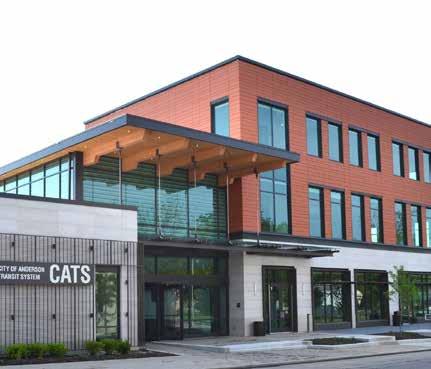
C.A.T.S. Bus Service
The City of Anderson Transportation System (CATS) was established in 1973 as a municipal transit utility. In 1982, the municipal utility became its own separate government department. Administrative offices are located at 530 Dale Keith Jones Road, Anderson.
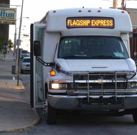
CATS provides seven fixed bus routes to nearly every major commercial, cultural, and business destination in the community. Buses on routes 1 through 6 operate from 6:00 am to 6:30 pm Monday through Friday and 9:00 am to 3:30 pm on Saturdays. The Flagship Bus (Route #7) offers nonstop service from the downtown terminal to the Flagship Enterprise Industrial Park located on the southwest side of the town Monday through Friday, 6:00 am to 7:00 pm. There is currently no service on Sundays. Bus service is not provided on major holidays such as Memorial Day, Independence Day, Labor Day, and Christmas.
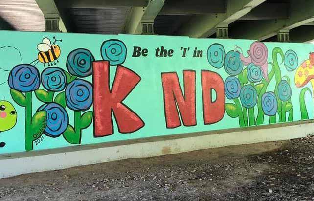
A public mural painted on the abutment of the Madison Avenue bridge near Derby Downs
Buses for each route leave the downtown terminal, located at 1220 Jackson Street, at the top of the hour. Each route takes approximately 50 minutes to complete with a 10-minute layover at the downtown terminal.
Bus fares are $1.00 for all passengers, ages 6 to 59. A reduced fee of $0.50 is available for individuals 60 and over, Medicare card holders, the Disabled, and Disabled Veterans. College students may apply for a discounted 15-day and 31-day pass. Additional reduced fee daily passes are available.
Nifty Lift
The City of Anderson Transportation System offers the Nifty Lift service for those unable to use the CATS regular bus system due to a disability. The Nifty Lift service features smaller transit buses equipped with motorized ramps and lifts.
TRAM
Established in 1985, TRAM (Transportation for Rural Areas of Madison County) provide transportation services for residents of rural to Madison County. The service is provided through Hillcroft Services, an independently contracted transportation provider. TRAM trips are restricted to Madison County. Either the origin or destination of the trip must be outside the urban area of Anderson.
The fee for a one-way trip is $4 for residents age 59 and younger, or $2.50 for residents older than 60. Monthly passes are also available. Riders must schedule an appointment at least 24 hours in advance. The TRAM service operates 7:00 am to 5:00 pm, Monday through Friday. Some TRAM vehicles are equipped with a lift to aid mobility-impaired riders.
Reliable Transit
DRAFT
Hillcroft Services also offers safe and reliable nonemergency transportation services to individuals utilizing Medicaid. Anderson residents may commute to other communities within East Central Indiana in addition to longer destinations such as Indianapolis, Fort Wayne, and Richmond.
C.A.T.S. Downtown Terminal
C.A.T.S. Flagship Express Bus Route
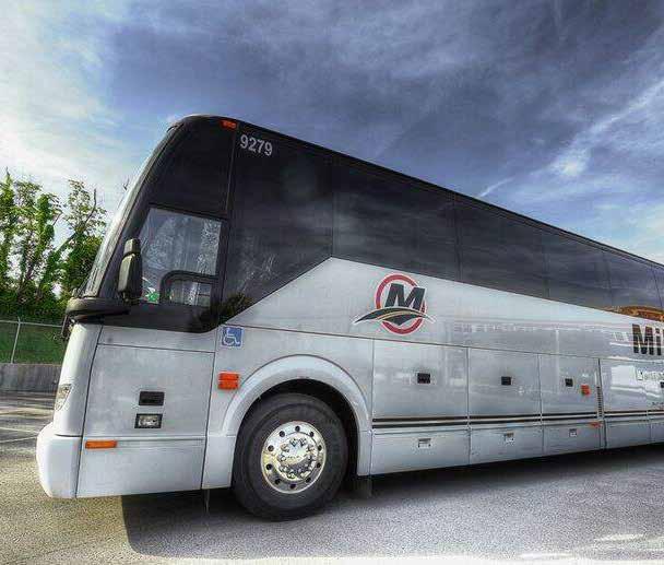
Miller Charter Coach - Hoosier Ride
Hoosier Ride - Muncie to Indianapolis
Hoosier Ride is a state- and federal-level interurban bus service that connects residents in rural communities to more than 2,300 destinations in North America. As a part of the program, Miller Transportation - in collaboration with Greyhound and the Indiana Department of Transportation - offers a twice daily bus route from Muncie to Indianapolis with stops in Anderson, Pendleton, and Fortville. The economically viable bus service provides connections to the Greyhound Lines nationwide system as well as the Indianapolis International Airport.
Commuter Connect
Commuter Connect is a service of the Central Indiana Regional Transportation Authority (CIRTA) that offers free commuter services to Indianapolis and surrounding communities.
Airports
The Anderson Regional Airport (AID) is located a few miles east of city limits near Chesterfield, Indiana. The airport is easily accessible from Anderson from State Road 32.
This small municipal airfield provides provisions such as an air traffic control tower, two runways, a passenger and cargo terminal, and hangers for both private and corporate aircrafts.
Attractions
The community is home to several noteworthy landmarks, amenities, and cultural attractions. They include:
• Anderson Public Library
• Anderson Mainstage Theatre
• Anderson Museum of Art
• Anderson Roll Arena
• Anderson Speedway
• Champions Lanes (Bowling Alley)
• Jeeninga Museum at Anderson University
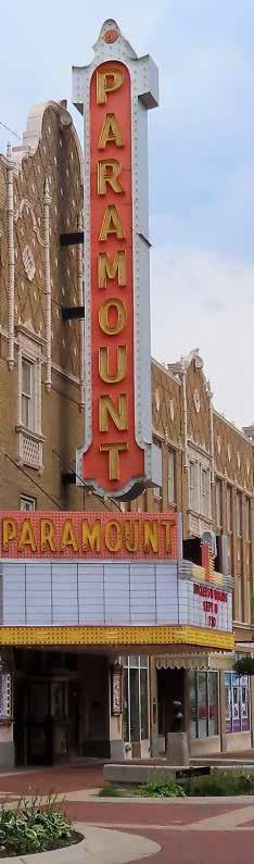
• Paramount Theatre
• Reardon Auditorium at Anderson University
• The Wigwam Visual & Performing Arts Center
• YMCA of Madison County
DRAFT
LANDMARKS, HISTORICAL BUILDINGS, AND ATTRACTIONS
Historical Society
The Madison County Historical Society was established in 1884 and incorporated in 1926. The organization’s goal is to “preserve the history of our rich heritage through the use of exhibits, speaking engagements, tours of interesting and educational destinations, cataloging artifacts, and providing a safe place for historical items and documents.” The historical society operates a museum at the corner of Meridian and 11th Street in Anderson. The museum host exhibits discussing topics such as the indigenous tribes, Civil War, Hoosier homesteading, local athletes, artists, authors, businesses and items made in Madison County, the gas boom, local African American history, and genealogy. Exhibits are open for public viewing from 9:00 am to 3:00 pm on Mondays, Wednesdays, and Fridays.
• Harrah’s Hoosier Park Racing & Casino
In addition, several historic sites include:
• Saint Mary’s Catholic Church
• The Gruenewald Home
• Byrum Hall at Anderson University
• Trinity Episcopal Church
• Athletic Park Pool
• Historic 8th Street Neighborhood
MAN-MADE, HISTORICAL, AND CULTURAL RESOURCES SUMMARY
Transportation
To support inclusive access to park facilities, the park department should consider installing additional infrastructure, such as enclosed bus shelters and designated drop-off areas, near or within the existing parks. The parks department should coordinate with the local and countywide transit authorities to provide special transit services to large and significant park events, festivals, and programs. Special off-hour shuttle service may be required periodically to provide greater access to evening and weekend events.
While the city currently lacks significant on-street bicycle infrastructure and facilities, the 2016-2040 Bicycle Facilities Plan created by the Madison County Council of Government outlines several long-term initiatives. The Park Department should consult this plan and install bike-friendly infrastructure to promote the development of the plan’s proposed facilities. Repair, replacement, and the installation of bike parking in the parks and along the White River Trail can significantly encourage alternative modes of transportation. The installation of bike repair stations near trailheads also improves the park’s level of service for recreational cyclists. The Parks Department may also consider installing long-term and enclosed bike parking at their indoor facilities, such as the Geater Community Center and Shadyside Lake Recreation Area.
Attractions
Anderson Parks Department should develop partnerships and strengthen relationships with local non-profit agencies and organizations to expand their education opportunities for youth and adults. For example, the Parks Department can working closely with the Andesron Historic Society to develop new or seasonal programs that celebrate the community’s indigenous and industrial history.
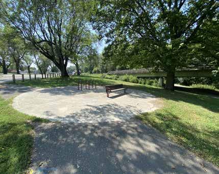
Several fitness trails have been installed in Shadyside Memorial Park and General Pulaski Park. These trails feature signage with instructions for simple workout routines to promote active and healthy lifestyles. The parks department can create a similar StoryWalk™ attraction in collaboration with the Anderson Public Library to promote youth literacy.
DRAFT
The city has developed an extensive network of pedestrian sidewalks that transverse local streets and the public right-of-way. Many of these accessible paved pathways lead to the edge of park properties or circumnavigate around the perimeter of the park. To promote connectivity, the Parks Department should consider extending its network of accessible pathways to sidewalks located within the public right-of-way. Additionally, the Parks Department should work with the local Department of Public Works to install new crosswalks, HAWK signals, and other traffic-calming measures when sidewalks are not adjacent to a public park and pedestrians are forced to cross oncoming traffic to access the local network of sidewalks.
Additional programming may include park excursions to Killbuck Creek to observe waterfowl or to Shadyside Lake for weekly social strolls for the aging adult population.
SOCIAL & ECONOMIC FACTORS
The following excerpts are summarized from the City’s comprehensive plan which was under development concurrently with this five-year parks and recreation master plan.
POPULATION
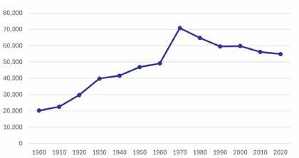
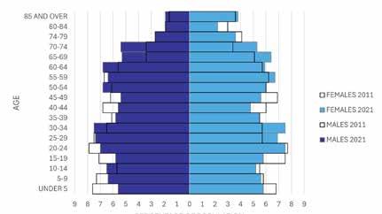
The City of Anderson is the most populated city in Madison County with an estimated population of 55,199 in 2023 according to the StatsIndiana website. Elwood, Pendleton, Alexandria, and Ingalls round out the top five most populated communities in Madison County. The population of Anderson peaked in 1970 at 70,787 people but began declining steadily starting in the 1980s due to industrial decline. Over the past decade, Anderson’s population trend has been relatively stable, with minor fluctuations. From 2010 to 2022, the population decreased by approximately 2%. Anderson’s decade can be divided into two distinct periods: from 2010 to 2013 and from 2013 onward. Anderson experienced relatively steady population levels in the first period, reflecting stability following the Great Recession. From 2013 onwards, the city began to experience a gradual population decline. However, from 2020 to 2023, the city once again saw an increase in population from 54,762 to 55,199.
19 to 64. As noted in the comprehensive plan, between 2011 and 2021, Anderson experienced significant demographic shifts. The population of young children (under 20 years) declined, indicating a potential decrease in birth rates, insufficient post-secondary educational opportunities, or outmigration of young families. The city saw relative stability in the young adult age group (20-34 years), suggesting that Anderson remains attractive to this demographic. The percentage of older adults (55 and above) increased, reflecting an aging population and longer life expectancies.
DRAFT
According to the United State’s Census Bureau, 51% of Anderson’s population is female and 49 percent is male. 75.8 percent of the population is White, 15.5 percent is Black or African American, 7.2 percent is Hispanic or Latino, 5.2 percent is two or more races, .7 percent is Asian, and .4 percent is American Indian or Alaskan native. People aged 65 and over represent 19.3 percent of the population, people under 18 represent 20.6 percent of the population, and people under 5 represent 6.3 percent. The remainder of the population is aged
As noted in the comprehensive plan, in Anderson, a significant portion of the population lives with a disability, impacting various aspects of their daily lives. Understanding the prevalence and nature of disabilities within Anderson can help ensure that community support and infrastructure are effective, accessible, and meaningful for all residents. The data on disability characteristics in Anderson reveals that nearly 23 percent of the non-institutionalized population, or 12,153 individuals, have a disability. The prevalence of disability increases with age, rising significantly in older age groups (35 and over) with a substantial over-representation of those aged 75 and over. The majority of those with disabilities have cognitive (11.6 percent) and independent living (11.0 percent) difficulties. These findings highlight the importance of tailoring infrastructure and services to support individuals with disabilities, particularly as the population ages. Ensuring enhanced accessibility in public spaces is essential to Anderson’s growth and residents’ quality of life.
EDUCATION
According to 2021 ACS estimates, 41.3 percent of Anderson residents have earned a high school diploma which is higher than the State of Indiana’s average of 33 percent. Approximately 16.0 percent of Anderson residents over 25 years old have earned a bachelor’s degree or higher which is significantly lower than the average found across the State of Indiana of 27.8 percent.
Early Childhood Education
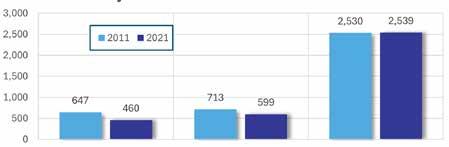
According to ACS estimates for 2021, there are about 460 children enrolled in preschool, 599 in kindergarten, 2,539 in grades 1 to 4 – elementary school typically consists of grades 1 to 5, however, the ACS does not have this category available. This represents about 11.5 percent of the city’s population, down from 12.0 percent in 2011. Out of these three categories, enrollments in preschools have had the most dramatic change since 2011 with a 28.9 percent decrease, more than tripling the rate of change for both Madison County and Indiana. This dramatic decrease can be attributed to a declining birth rate and population loss, especially from the emigration of families to communities closer to Indianapolis.
Primary Education
Between 2011 and 2021, the number of students enrolled in junior high and high school dropped by 6.2 and 18.1 percent, respectively. The larger drop in high school enrollment, compared to junior high enrollment, means a larger number of students are not continuing onto high school from junior high, at least not within the city. Similar to elementary and preschool enrollment, the drop in enrollment could also be a result of population loss as families may be opting to move once their child finishes junior high in part for their child to attend a different high school.
DRAFT
in grade 5 to grade 8
Higher Education
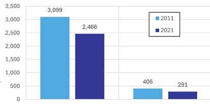
Anderson is home to two higher education institutions, Anderson University and IVY Tech Community College Anderson. As noted in the comprehensive plan, there are 2,757 residents enrolled in college. Some of these individuals attend the local university and college, but several are also attending institutions outside of Anderson, including Ball State University in nearby Muncie, Indiana. Since 2011, the number of residents enrolled in college has decreased by 21.3 percent. Undergraduate enrollment dropped by 20.4 percent, while graduate enrollment dropped by 28.3 percent.
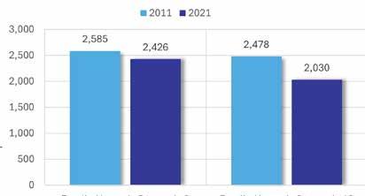
There are 2,426 students enrolled in grades 5 through 8 and 2,030 enrolled in high school, representing about 8.5 percent of Anderson’s population, according to ACS estimates for 2021 – junior high typically covers grades 6 through 8, however, the ACS does not have this category available.
Junior High / High School Enrollment Early Childhood School Enrollment Higher
Enrolled in
INDUSTRY & EMPLOYMENT
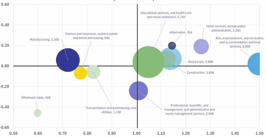
Industry Base
As noted in the comprehensive plan, the city of Anderson’s largest industries consists of the ‘Arts, entertainment, recreation, accommodation and food services’ with the strongest location quotient of 1.5, indicating that this industry in Anderson is 1.5 times higher than the national average. Similarly, the ‘Other services, except public administration’ has the second highest location quotient slightly above 1.25. The city’s growing industries measured by the change since 2011 in workforce include ‘Other services, except public administration’ and the ‘Information’ industry that are growing at a similar rate.
Some of the declining industries in Anderson bewteen the period of 2011-2021 included wholesale trade and professional, scientific, administrative, and waste management services. It should be taken into consideration that while this period is 10 years, only 2-3 industry sectors were growing - the other industries hover slightly above or below 0 on the vertical scale measuring change/growth since 2011.
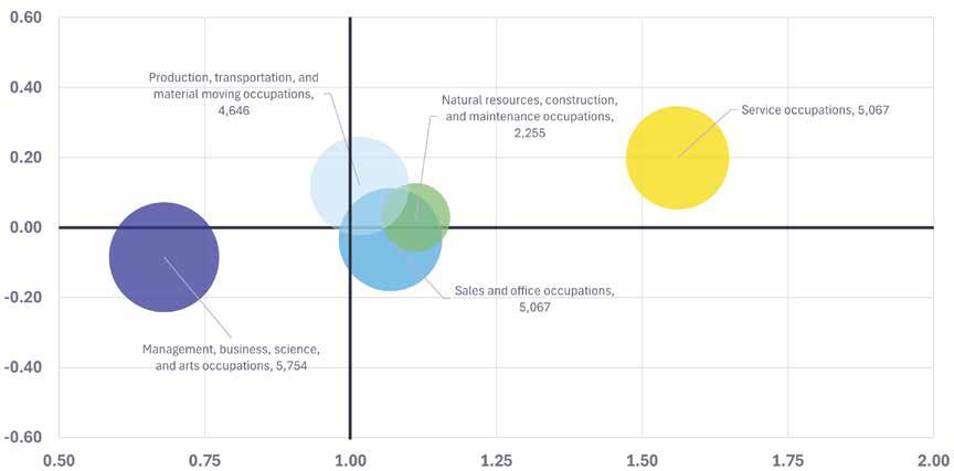
Occupation
DRAFT
Anderson’s largest and most rapidly growing occupation is the service occupation, with a location quotient slightly over 1.5. Other than the Management, business, science and arts occupations which has a lower location quotient below 0.75, the remaining 3 categories of occupation have similar levels of change since 2011 and location quotients similar to the state average.
Paramount Theatre, Downtown Anderson
Industry Shift-Share Analysis
Occupational Shift-Share Analysis Location
DRAFT
Employment by Industry
The city of Anderson has a diverse workforce. From 2011 to 2021, Anderson experienced an increase of employees in its largest industries. As of 2021, Educational and Healthcare Services is the industry with the largest level of employment (5,743) representing 24% of Anderson’s workforce with an increase of 676 workers in the 10-year period (13.3 percent change between 2011 and 2021). Anderson’s second and third highest workforce industries have a similar number of employees. Manufacturing is the city’s second largest
industry (3,166 employees), comprising 13% of the city’s workforce, with an increase of 428 workers in the 10year period (15.6% change between 2011 and 2021).
The ‘Arts, Entertainment, Recreation, Accommodation, and Food Services’ is the third largest industry by workforce, with 2,939 employees accounting for 12.5% of the city’s workforce.

Major Employers
As of April 2024, Anderson is home to several major employers that play a key role in the city’s economy. The top five employers in Anderson are:
1. Ascension St. Vincent Anderson
2. Community Hospital Anderson
3. Nestle
4. Healing Hands
5. Harrah’s Hoosier Park Racing and Casino
Ascension St. Vincent Anderson and Community Hospital Anderson are large healthcare providers, with an extensive network of hospital and satellite facilities, providing comprehensive medical services for Anderson and the region. Nestle, a major beverage production and distribution corporation, contributes significantly to the local manufacturing industry. Healing Hands offers essential home health care services, indicating a strong demand for in-home medical care from residents. Harrah’s Hoosier Park Racing and Casino provides entertainment and gaming, attracting tourists and bolstering the hospitality sector.
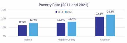
Poverty
In 2021, there were 11,502 people living below the poverty line in Anderson – down from 13,021 in 2011. However, the poverty rate of the City was higher than both Madison County and almost twice that of Indiana in both 2011 and 2021. The declining number of people below poverty can mostly be attributed to people moving away, perhaps to find better opportunities elsewhere for upward mobility. Meanwhile, the rising poverty rate means there is a growing concentration of poverty within the City relative to Madison County and Indiana.
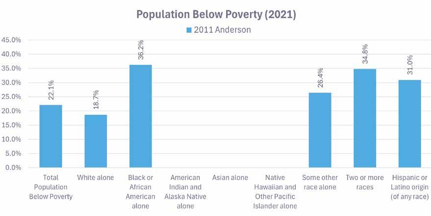
Certain groups of people in Anderson experience poverty at a higher rate than their neighbors. As shown in the charts below, people identifying as “Black or African American alone” experience almost twice the rate of poverty than people identifying as “White alone.” This trend is also prevalent with people who identify with two or more races as well as people with Hispanic or Latino ethnic origins. The poverty rate for other groups identified in the chart had margins of error that were too high to be considered reliable for this analysis due to a smaller population size in the City.
DRAFT
ASSET-LIMITED, INCOMECONSTRAINED, EMPLOYED (ALICE) DATA
What is ALICE?
Over the last few years, the prices of goods and services have significantly surpassed the increase in wages for many households. While many households with lowerpaying jobs or a single source of income may make more than the Federal Poverty Level (FPL), they may still struggle to procure basic needs and resources. Individuals who are earn wages below the Federal Poverty Level are eligible to receive public support, such as Medicaid and cost-sharing reductions. Those households that make more than the Federal Poverty Level are not eligible for these assistance programs.
A.L.I.C.E. is an acronym for data collected by the national United Way organization known as Asset Limited, Income Constrained, Employed. The data identifies low-income households that achieve monthly or annual wages above the state’s Federal Poverty Level. According to the United States Department of Health and Human Services, the 2025 Federal Poverty level is $ 32,150 for a household of four members. Lower-paying labor, retail, and service employees are commonly at risk of being at or below the A.L.I.C.E. wage threshold.
According to the United Way data, nearly 13% of all Hoosier households earn below the Federal Poverty Level, while an additional 27% of households are within the A.L.I.C.E. threshold. 60% of all households are above the A.L.I.C.E. threshold. Households within Madison County tend to align with the state levels, with 15% of all residents living below the Federal Poverty Level, and 26% of households living within the A.L.I.C.E. threshold. 23,152 households (or 53% of total households) within Anderson Township, the primary township for the City of Anderson, live below the A.L.I.C.E. threshold. Singlefemale and single-male heads of household with children are disproportionately greater in A.L.I.C.E. households. Moreover, 77% of the total Madison County population under the age of 25 lives at or below the A.L.I.C.E threshold.
Sports and Recreation
Households that struggle to meet basic needs may need to prioritize their monetary assets different than those who earn wages about the A.L.I.C.E. threshold. These households may have less funds available to participate in park activities that require a registration fee. Additionally, households may not have enough funds to purchase proper equipment necessary to participate in certain sports, such as baseball, hockey, or golf.
Individuals within lower-income households may not have access to personal vehicles or share a single vehicle between multiple adults or heads of household. These individuals may be unable to travel to park facilities on a daily basis. Likewise, individuals may not be able to participate in park programs or events held during weekends or evenings when public or private transportation systems are non-operable.
DRAFT
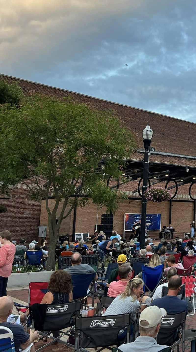
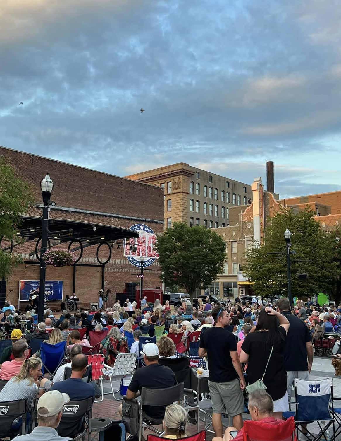
Anderson Parks offers a variety of events and programs with free or reduced costs. Free rentals to paddleboards, boats, and kayaks are offered by the Parks Department at Shadyside Lake Recreation Area. Free concerts are hosted seasonally at Dickmann Town Center. Community Block Parties provide access to free community resources, such as health screenings, free food, and opportunities to socialize with peers.
To be more inclusive for all households, Anderson Parks should continue to offer a variety of free or reduced activities and programs to the public. Scheduling of programs should be avoided during working business hours, which may make it challenging for blue-collar workers to participate. Larger events should be avoided on evenings and weekends when public transportation may be unavailable, or public transportation schedules should be adjusted to accommodate those needing their services..
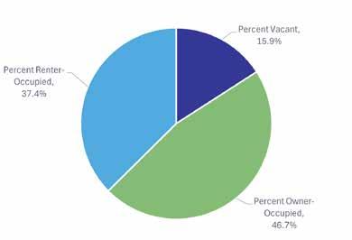
HOUSING
Of Anderson’s 27,839 housing units, 84 percent are occupied. More than 55 percent of occupied homes are occupied by property owners, with more than 44 percent occupied by renters. The homeownership rate is higher, at 69 percent, in Madison County than in the City of Anderson. The overall housing vacancy rate in the County is similar to Anderson, with more than 14 percent of units unoccupied.
Detached, single-dwelling units are the dominant housing type in the City of Anderson and represent 70 percent of all residential structures. This type of housing also dominates both Madison County at 78 percent and across the State of Indiana at 73 percent. In Anderson, attached and multi-family units are approximately 25 percent of all structures with mobile homes as the remaining five percent.
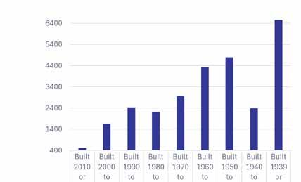
The City of Anderson has 27,839 housing units with a median year built of 1960. Nearly 24 percent of the City’s units were constructed before 1940. Less than two percent of the total number of units has been constructed within the last 15 years and 35 units have been constructed since 2020. Madison County has 58,791 housing units with a median year built of 1965. Approximately 20 percent of the housing stock was constructed before 1940. Of the total number of units in the County, 2.3 percent hasve been constructed within the last 15 years. 66 units have been constructed since 2020.
SOCIAL & ECONOMIC FACTOR
SUMMARY
Based on the socio- and economic factors of the city, the following considerations should be reviewed by the park board.
• The city’s population is evenly distributed between younger families, adults, and aging adults less than 75 years old. A diversity of programming should be provided to engage and meet the needs of each demographic. Multiple sports and games should be provided to promote physical activity for youth. In contrast, passive and leisurely activities such as walking, nature observation, arts & crafts, and education are ideal for older adults.
• Anderson is primarily a working-class city. Much of the population is employed within the service industry. Working-class communities often prioritize park amenities that support families, social interaction, and practical needs. Walking paths within the larger neighborhood or regional parks, concerts at Dickmann Town Center, and group sports such as basketball, pickleball, and skateboarding are available in several of the local parks to encourage social interactions. Many of Anderson’s parks include playgrounds, picnic shelters, and restrooms that support the practical needs of individuals and families.
DRAFT
• Nearly 40% of the county’s population is below the A.L.I.C.E. threshold. Lower-wage working-class families may struggle to find the necessary time and resources to participate in park activities. These individuals may have a greater reliance on free or reduced-cost programs and events. Likewise, lower-income households may not have access to a personal mode of transportation. This lack of resources may make it difficult to travel to various parks around the city.
• Many households support individuals with a form of disability. Infrastructure such as paved pathways, adaptive sporting equipment, and accommodations during programs or events should be provided to allow for an inclusive environment. Hiring and engaging staff trained to support individuals with a mental or physical disability should also be considered.
• The city’s population is composed of a diverse melting pot of races and cultures. Park programming and activities should celebrate the unique heritages of each culture within the community. Murals, artwork, and signage within each park should honor and complement the unique identity of the surrounding neighborhoods.
• Park programs and activities should be designed and expanded to strengthen partnerships with other local non-profit and service groups. The Anderson Parks Department should work with these organizations to share resources.
Occupancy Composition (all units, 2021) Housing Supply Age

DRAFT
EXISTING CONDITIONS
The City of Anderson of Anderson Parks and Recreation Department manages the development, maintenance and operations, and programming of 30 parks covering 728 acres. The following section provides an inventory of each park facility, current department-led programs and activities, a review accessibility, and an overview of public input received during the planning process.

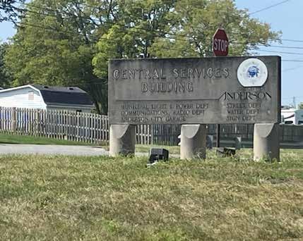
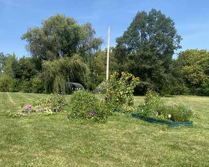
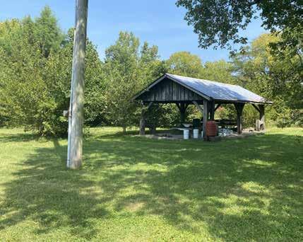
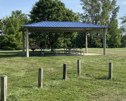
ALLIS PARK
2640 W. 8 th STREET
Allis Park is a 4.4-acre block park located on the northwest side of Anderson bounded by 8th Street and single-family residential development on the south, the entry drive to Anderson’s Central Services Building on the west, Central Services’ property to the north, and limited commercial and residential property to the east. Anderson Central Services includes multiple departments that include the Municipal Light and Power Department, Communications/Radio Department, Anderson City Garage, Street Department, Water Department, and Sign Department. There are currently no park signs present.
Access to the park occurs via the entry drive to the Central Services Building and a small intersecting drive that dead ends within the park property. No marked parking area is present. Within the park, there is a community garden and a picnic shelter with three picnic tables. The remainder of the park consists of open lawn and trees. There are no accessible routes connecting the features within the park.
DRAFT

ALLIS PARK
DRAFT
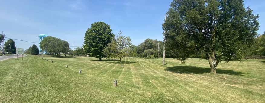

Open Lawn Area
Signage for Central Service Building
Community Garden
Mowed Lawn
Open Air Shelter
City Central
ANDERSON COMMUNITY PARK
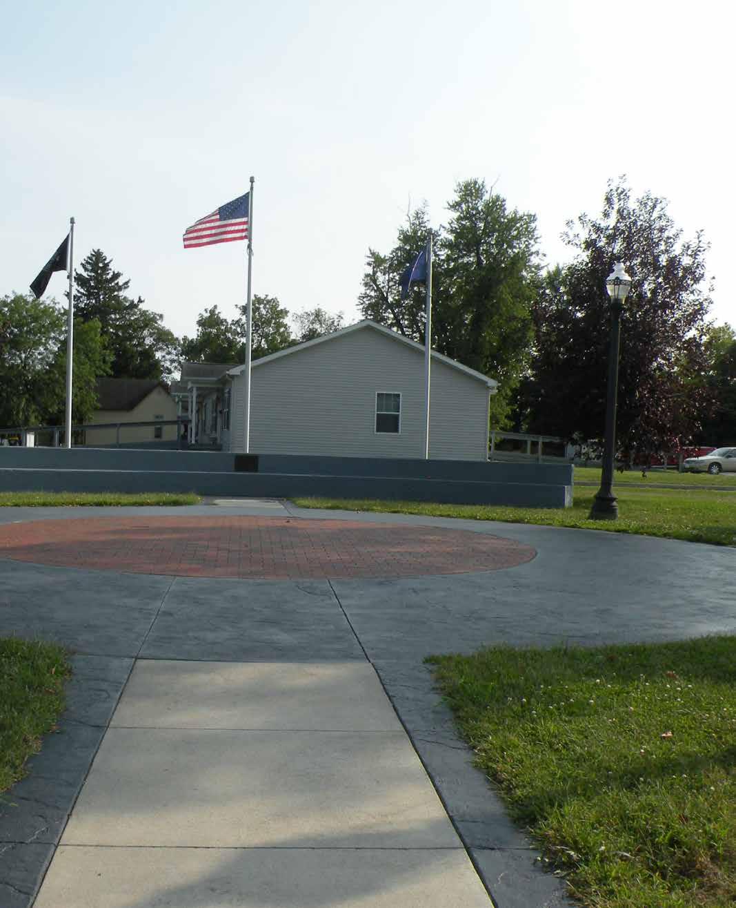
2303 W. MADISON AVENUE
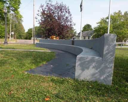
Anderson Community Park is a small pocket park located at the southwest corner of Martin Luther King Jr. Boulevard and Madison Avenue. A curved concrete retaining wall with terraced ledges encompasses a circular plaza located at the center of the triangular parcel. The plaza is constructed of decorative stamped concrete and clay pavers. Three flagpoles provide a backdrop to the retaining wall, while two street trees and two smaller ornamental trees are positioned around the circular plaza. A small grassy lawn within the southwest corner of the site provides limited space for passive recreation. Four ornate acorn-style area lights illuminate the space at night. A small metal park identification sign is visible by eastbound traffic along MLK Jr. Blvd.
This 0.25-acre lot was constructed in 2015 to honor individuals and community leaders who demonstrate a commitment to improve the local community. Several clay bricks within the plaza are engraved with the names of residents who were nominated for recognition. A small bronze plaque describing the park’s purpose is located on the east side of the concrete retaining wall. New engraved pavers continue to be added to the plaza on an annual basis.
Concrete pathways leading from the existing sidewalks within the public right-of-way along both MLK Jr. Blvd. and Madison Avenue to center of the park plaza provide access to the space. The park is not accessible by vehicle. No on street or off-street parking is provided. Martin Luther King Jr. Park, a slightly larger neighborhood park, is located across from the Anderson Community Park on the northeast corner of MLK Jr. Blvd. and Madison Avenue.
DRAFT

ANDERSON COMMUNITY PARK
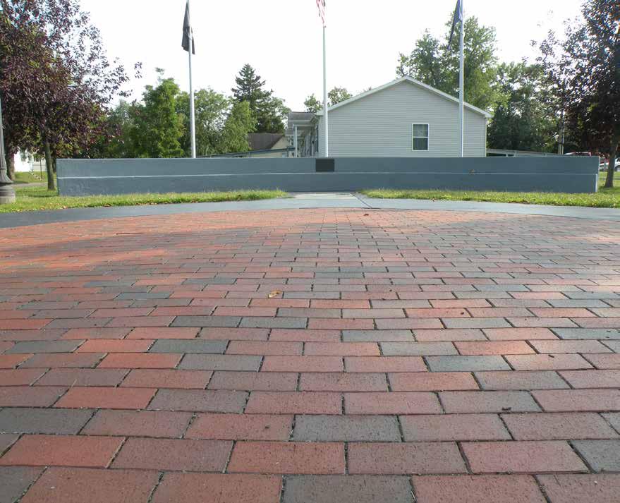

Memorial Plaza with Engraved Bricks
View of Park from MLK Drive
Curved Concrete Seat Wall
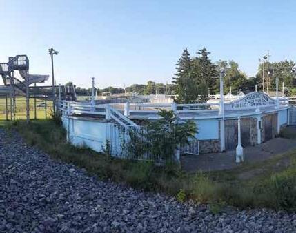
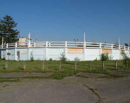
ATHLETIC PARK & POOL
312 E. 8 th STREET
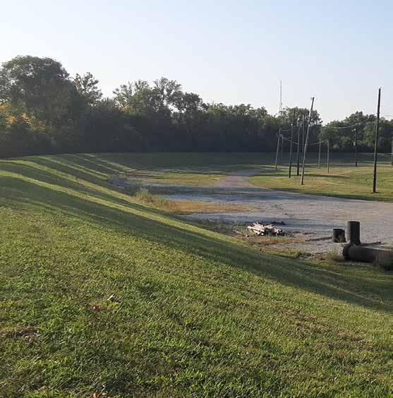
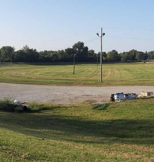
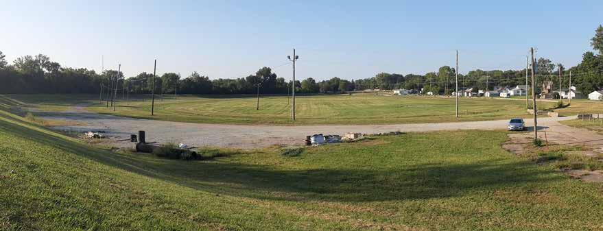
Athletic Park is a large open green space located on the east side of the White River near downtown. The 29.6acre park is bound by Wilcon Street to the east, Main Street to the north, the White River to the west, and East 8th Street to the south. The park historically hosted horse harness races. Remnants of the oval horse track are still visible within the open lawn. A former 40x100’ one-story horse barn is located at the northeast corner of the site. The barn is need of maintenance to repair damaged siding, windows, and doors. Today, the large open lawn space serves as a festival ground for large community events. Several utility poles located in-andaround the lawn area provide site lighting and power for these special events. No parking is available within the park.
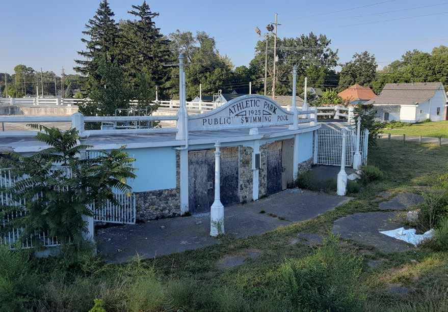
An above-ground swimming pool is located at the southeast corner of the site near East 8th Street. The pool has remained idle and abandoned since 2007. It has been subject to neglect, vandalism, and deterioration for the last two decades. The pool will require significant rehabilitation and remodeling to meet modern building codes and provide a functionable public amenity.
The park is located within the 100-year flood zone of the White River. The base flood elevation of the river near the park is 843.80; the approximate elevation of the park is 837.70. An earth-formed levee constructed by the U.S. Army Corp of Engineers spans the western edge of the park. The levee transitions into a concrete headwall near the E. 8th Street bridge. The surrounding neighborhoods are in a zone of moderate-to-low flood risk due to the presence of the levee.
The first phase includes relocating and upgrading three water lines that run through the park.
DRAFT
Views of the river are screened by dense tree canopy cover and understory growth. The earthen levee that separates the park from the river also provides a visual barrier. A portion of the paved White River Trail spans the westside of the park, paralleling the White River and levee.
Several conceptual design plans have been proposed for the park to provide additional recreational amenities and increase park programming. The most recent plan, completed by architecture firm Chapman Technical Group, features a new splash pad near the former municipal pool, athletic fields, a concession stand, playground, open air market pavilion, disc golf course, a circuit walking path, and an interior driveway that provides access to surface parking within the site. The city has received $1.5 million in funds from the Indiana READi program to implement the first phase of construction.
DRAFT
Recreation Lawn
Unique Landmark
Swimming Pool Parking
PARK AMENITIES
ATHLETIC PARK & POOL
DRAFT


Athletic Park looking North from E. 8th Street
Abandoned Municipal Pool
Athletic Park looking South from Levee Near Main St.
Abandoned Municipal Pool
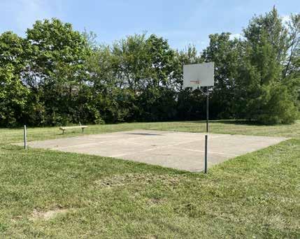
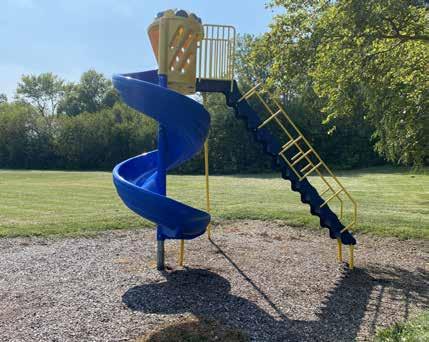
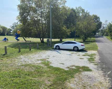
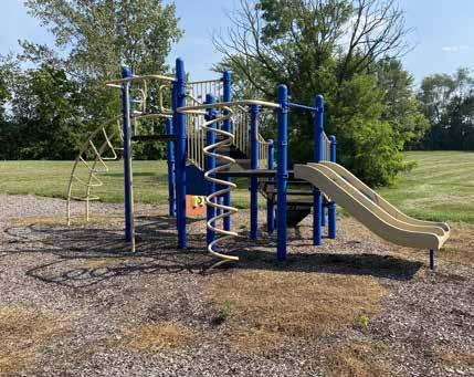
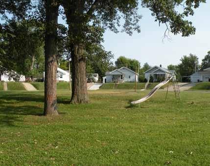
BELMONT PARK
2011 W. 29 th STREET
Belmont Park is a 3.2 acre park located on the southwest side of Anderson at the intersection of Dewey St. and W. 29th St. The park is bounded by a railroad and industrial development to the east, single-family residential to the north and west, and a large vacant parcel to the south. A small, gravel parking lot is located immediately adjacent to W. 29th St. The parking lot is bounded by wooden posts to deter automobiles from entering the park. No accessible parking is provided. A small park sign exists adjacent to the parking area.
Amenities within the park include a half-basketball court near the northeast corner of the property with a bench located adjacent to it. Southwest of the basketball court, a steel-structure picnic shelter provides five picnic tables, none of which are accessible, and two ground mounted grilles in the adjacent lawn. Immediately southwest of the picnic shelter, a small playground provides access to a central, age 5-12 play structure, merry-go-round/ spinner, curly slide, and two-bay swing set. The swing set provides two belt swings and two toddler swings. Engineered wood fiber mulch surrounds the playground and benches are located near the playground in the adjacent lawn. There are no accessible routes to, or between, the park features. Several of the park amenities have been subject to vandalism and spray paint. The remainder of the park consists of open lawns with scattered trees throughout. Some of the trees are in poor condition and require removal.
DRAFT
PARK AMENITIES

BELMONT PARK
DRAFT

Gravel Parking Lot
Freestanding Playground Slide
Open Air Shelter
Basketball Court
Bench Adjacent Basketball Court
Playground Equipment
Picnic Shelter
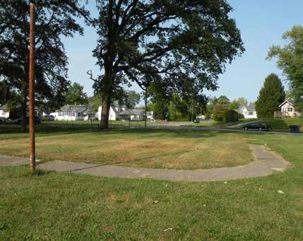
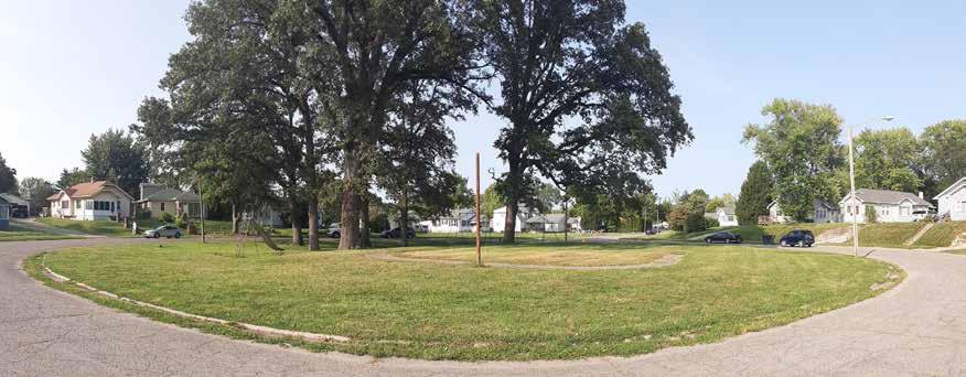
CIRCLE PARK
200 BLOCK RINGWOOD WAY
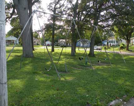
Circle Park is a small 0.49-acre pocket park situated in the Meadowbrook neighborhood on the south-central side of Anderson. The circular parcel is located within the middle of the cul-de-sac on Ringwood Way.
The park features a grove of mature trees, a freestanding swing, and a metal swing set with 6 belt seats. The large oak trees provide much needed shade over the play equipment and green space. Remnants of a concrete walking path are visible between patches of overgrown turf grass and years of sedimentation build-up. Four streetlights evenly spaced along the perimeter of the green space illuminate the surrounding cul-de-sac and provide some ambient lighting within the park.
A concentric concrete curb and gutter enclose the park from the surrounding roadway. No accessible path is provided to the slide or swing set. On-street parking is available along the outside perimeter of the cul-de-sac.
DRAFT

CIRCLE PARK
DRAFT

Swing Set
Metal Slide Adjacent to Mature Shade Trees
View of Park Looking Northeast
Open Lawn Area with Mature Shade Trees
Paved Circular Walking Path
1. Swing Set
2. Commemorative Plaque
3. Slide 4. Paved Circuit Path
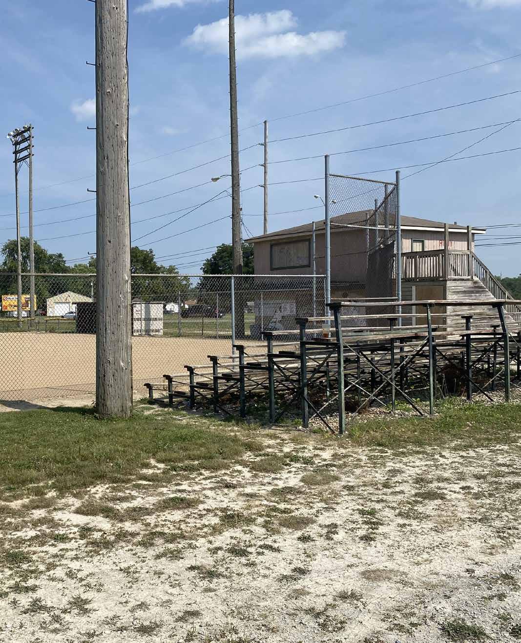
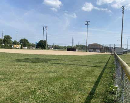
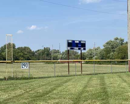
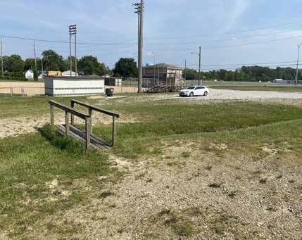
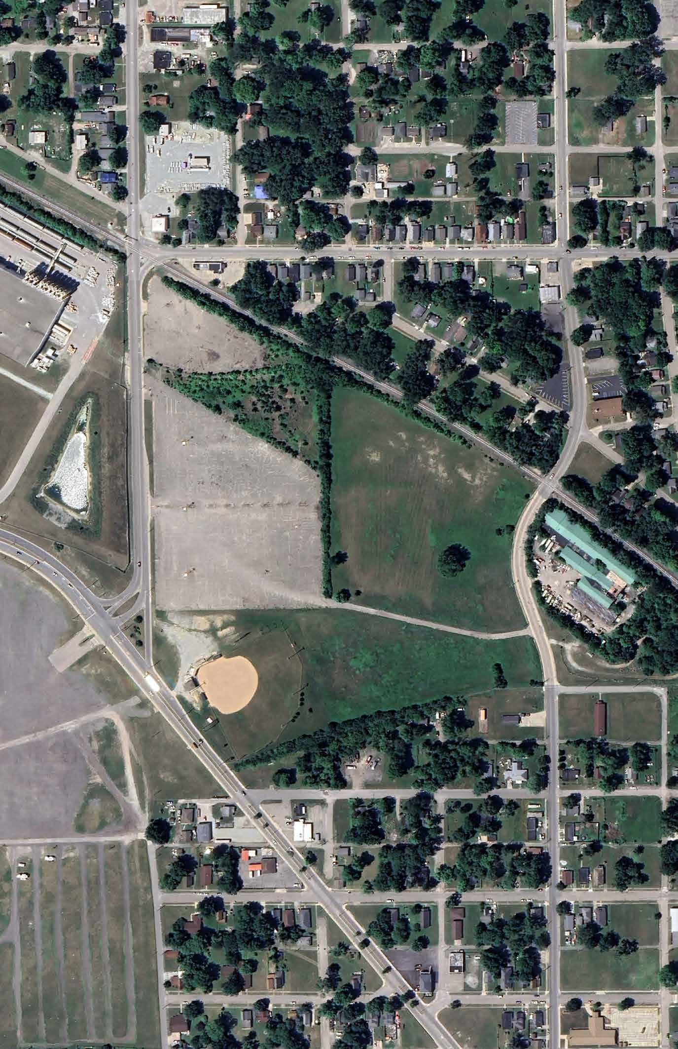
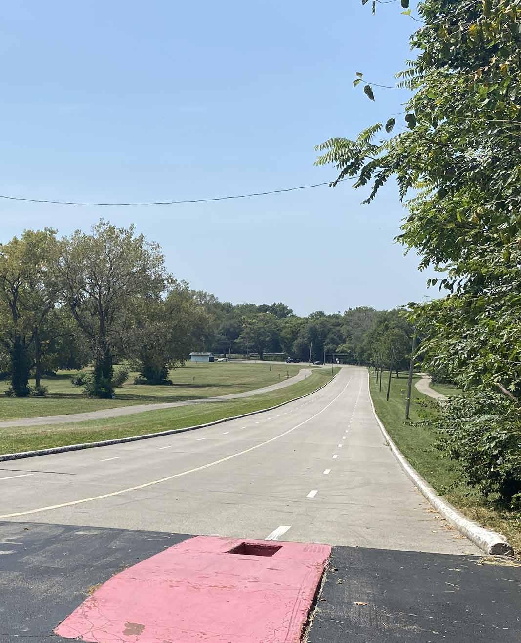
CRAWFORD FIELD
1402 MARTIN LUTHER KING BLVD.
Crawford Field is a 12.4 acre park located on the southwest side of Anderson at the intersection of W. 25th St. and Dr. M.L.K. Jr. Blvd. It is surrounded by the Anderson Speedway and industrial development on the south, limited commercial, single-family residential, and W. 22nd St. to the north, and single-family residential to the east and west. The main entrance occurs from a gravel drive on Dr. M.L.K. Jr. Blvd. The gravel drive accesses a gravel parking lot with limited parking and one signed handicapped parking space on the north side of the press box building. The handicapped parking space is not striped or paved. Secondary entrances occur from an asphalt drive that connects W. 25th St. on the south to W. 22nd St. on the north. A large asphalt parking lot is located west of the facility that is owned by the City of Anderson and acts as overflow parking for the facility.
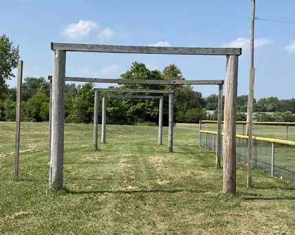
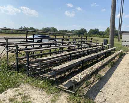
Amenities within the park include one baseball field with two dugouts, a perimeter chain-link fence, one set of bleachers, sports lighting, and a batting cage frame. The dugouts are masonry construction that have received significant graffiti. The field also features a two-story press box with public restrooms, concessions, and storage on the first floor, and the press box on the second floor. The first floor is constructed of masonry which has received graffiti and the second floor is constructed of wood which is in need of repair or replacement. A large practice field is located north of the baseball field.
DRAFT

CRAWFORD FIELD
DRAFT


Pressbox and Storage Facility
Bullpen
Outfield with Scoreboard
Baseball Diamond
Wooden Slat Bleachers
Pedestrian Footbridge Connecting Parking Lots
DERBY DOWNS
292 N. MADISON AVENUE
Derby Downs is a 15.0 acre park located in north central Anderson along the south bank of the White River. Commercial and light industrial development immediately border the park to the south, east, and west, while the White River borders the park to the north. The primary entrance to the park occurs from N. Madison Ave. An asphalt drive and parking lot provide vehicular access into the northwest corner of the park. The parking lot is striped but no accessible parking is provided. Pedestrian sidewalks along N. Madison Ave. end near the street where pedestrians transition on to the asphalt drive as they enter the park. A small, open shelter and drinking fountain are available near the park entrance. Two block buildings exist near the parking lot; the southern building is for storage, and the northern building is a restroom building. The southern storage building features a mural on the west façade with the park name that serves as the park signage from N. Madison Ave. The restroom building is locked and a portable toilet is located immediately adjacent to the north façade.
Two baseball fields once existed east of the block buildings, however, there is very little evidence of them remaining and they appear to be unused. A disc golf course with tee pads is located throughout the park. Signage is present at each tee pad, however, overall course signage is absent. Townsend Hill is located along the northern edge of the property featuring an extensive soap box track with infrastructure for signals and a parking area at the high point of the hill. The White River Greenway extends through the park undulating between wooded and open areas. A trailhead is located near the N. Madison Ave. bridge that features seating and bike parking. Wayfinding signage directs trail users to nearby attractions. Additional, blank sign stanchions exist throughout the park.
DRAFT

DERBY DOWNS

DRAFT

Public Restroom
Tee Box for Disc Golf Hole #7
White River Trail
Park Sign/Storage Building
Covered Drinking Fountain
White River Trailhead
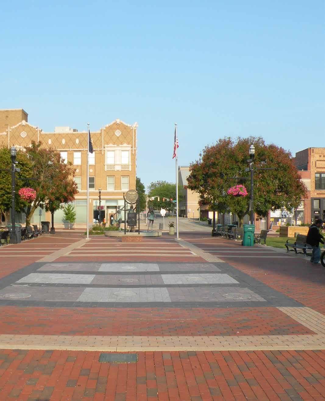
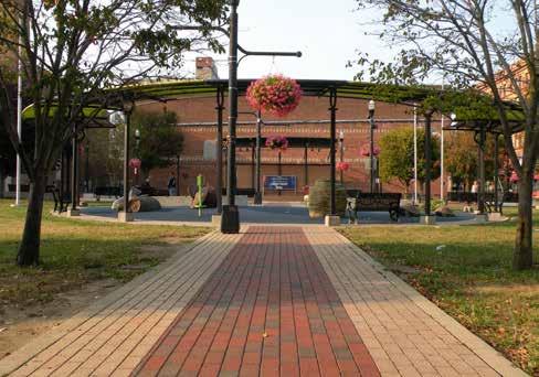
DICKMANN TOWN CENTER
1 TOWN PLAZA
Located along Meridian Street and across from the historic Paramount Theatre, Dickmann Town Center is an urban plaza that provides programmed open space within the downtown district. Two-story brick-and-mortar restaurants and retail are located within the block south of the plaza. Several enclosed street-level outdoor dining spaces overlook the town center. The Anderson YMCA and surface parking lot are located directly west of the plaza.
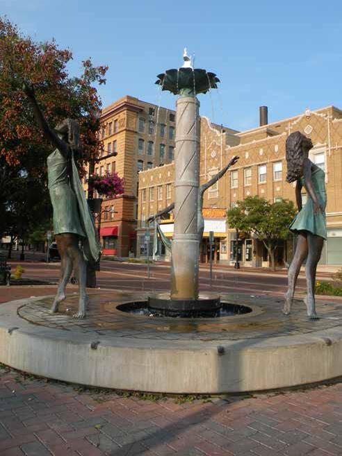
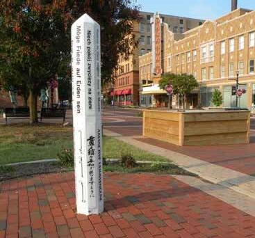
The 0.20-acre urban square features a brick plaza at the center of the rectangular property. Metal park benches surround the perimeter of the plaza, while a decorative information kiosk and ornate water fountain featuring three bronze dancers bookend the east and west edges of the plaza. A large flagpole is located within the center of the paver plaza.
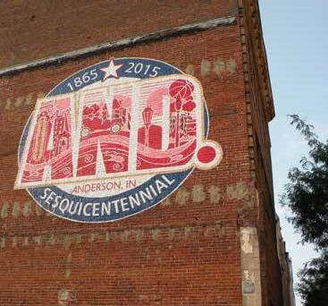
Situated on the north side of the plaza is a small performance stage and lawn. The stage features an elevated performance area with brick wall, steel roof canopy, lighting, and audio. A mural painted on the southfacing façade of the adjacent commercial development celebrates the city’s sequential heritage (1865-2015). The stage is frequently used to host local musicians and entertainers during the city’s Summer Concert Series and other special programs and events.
A semi-circle shade structure encloses a miniature playground to the south of the plaza. Poured-in-place rubber provides a tactile play surface. The playground includes a series of climbable precast concrete sculptures. Each sculpture - a turtle, a turkey, and a wolf - references one of the three clans of the indigenous Lenape (Delaware) tribe that settled in Madison County prior to European settlement. An interpretive sign provides additional information about the history of the region. The playground exhibits several years of wear-and-tear.
DRAFT
PARK AMENITIES
Ornate streetlamps with hanging flower baskets surround the central plaza and follow the pathways leading to both the performance stage and playscape. Several smaller shade trees provide shade for occupants of the site. A small obelisk with text celebrating global peace and written in multiple languages is located near the plaza. Picnic benches are scattered throughout the open lawn areas within the plaza. Additional seating options, bike parking, and litter receptacles are provided adjacent to the plaza along the Madison Street streetscape and west parking lot.
A temporary skating rink is installed within the park’s plaza from late November to early January.

DICKMANN TOWN CENTER
DRAFT

Fountain with Bronze Dancers
Sister Cities Unity Obelisk
Looking North Towards Playground
Ornamental Park Bench
Mural on South Building Facade
LEGEND
1. Elevated Stage
Open Lawn
Splash Pad
Plaza
Sculpture Fountain 6. Playground
7. Obelisk Sculpture
8. Shade Structure
EDGEWATER PARK
901 E. 10 th STREET
Edgewater Park is a 13.2-acre neighborhood park located east of downtown and along the east bank of the White River. A paved parking lot and concrete boat launch offer public river access. A public notice is posted near the boat launch that warns park users of the potential negative health concern of encountering wastewater pollution within the river.
Much of the property is open meadow that is infrequently mowed. Precast concrete picnic tables and a BBQ grill exhibit signs of deterioration within the meadow. Several native trees have been planted within the meadow to provide habitat for waterfowl and other wildlife. A large stand of deciduous shades trees is located along the eastern edge of the park.
The entirety of the park is located within the regulated 100-year flood zone of the White River. The base flood elevation of the river near the park is 846.80. An earthformed levee constructed by the U.S. Army Corp of Engineers spans the northern edge of the park. The U.S. Army Corp. of Engineering’s earthen levee separates the park from the single-family neighborhood located north of the park. The surrounding neighborhoods are in a zone of moderate-to-low flood risk due to the presence of the levee.
An 18-hole disc golf course transects the top of the levee and meadow. Each disc golf hole includes one or more concrete tee box, a disc golf tee basket, and postmounted maps of each hole. The disc golf course map has been damaged or removed from the large sign located near the boat launch.
DRAFT
Public murals have been painted on the remnants of the concrete abutments of a former railroad bridge located near the levee.
The paved White River Trail connects the northern segment of Edgewater Park to the Thomas McMahon Riverwalk and Athletic Park. The trail continues southeast and terminates at Scatterfield Road. A conservation buffer separates the trail and Edgewater Park from the river. Much of this buffer is densely planted with native hardwood trees and shrubby understory plantings. Perennial wildflowers can be seen in the shallow ditch that runs near the boat launch and in areas that receive frequent runoff.
PARK AMENITIES

Picnic
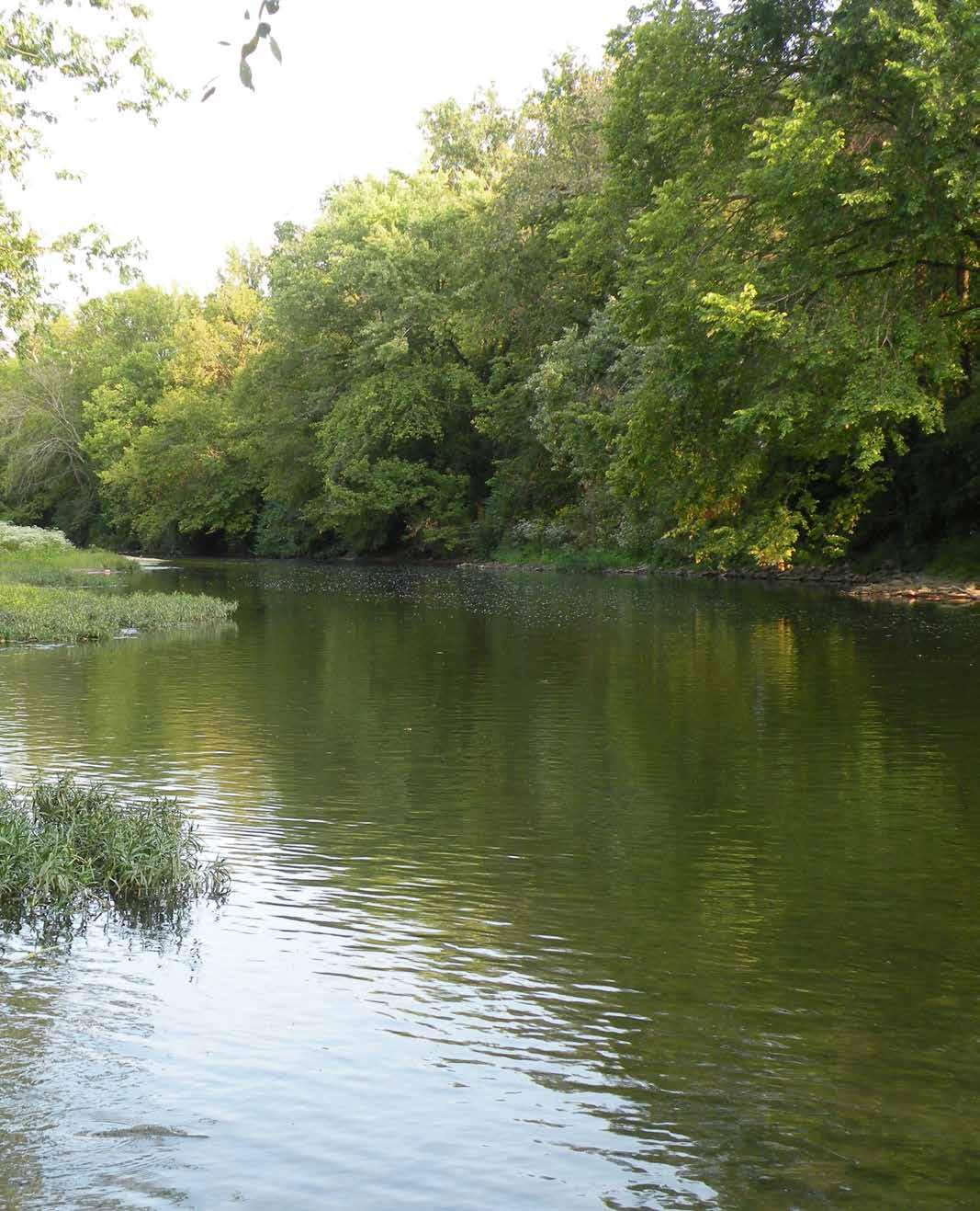
EDGEWATER PARK
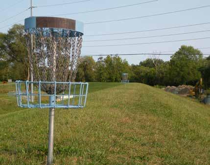
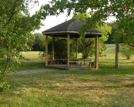
DRAFT
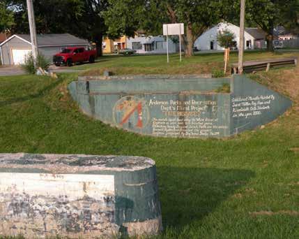


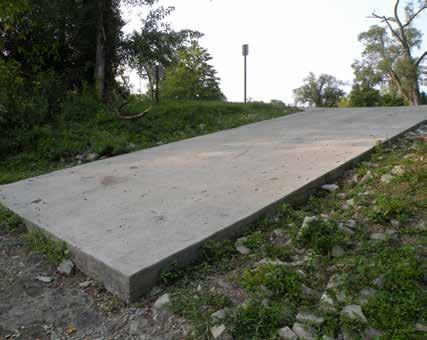

Mural on Remnants of Former Truss Bridge Abutment
Gazebo
Disc Golf Course Hole #6 Tee Box
Disc Golf Course on Top of Levee
Wildflowers - Jewelweed
Concrete Boat Launch into the White River
ELMO FUNK PARK
329 W. 8 th STREET
Elmo Funk Park is a small 0.18-acre pocket park tucked within the historic West Eighth Street neighborhood on the west side of downtown Anderson. The park was the former location of the first hospital in Madison County. Opened in 1974 and named for a prominent community member, Funk Park features an ornate and cascading water fountain, a 28-foot hexagonal gazebo, lush perennial plant beds, and paved pathways. Architectural motifs on the gazebo and fountain compliment the Victorian and classical architecture visible on the historical homes within the adjoining neighborhood. Several weatherproof power receptacles are located on the gazebo.
A large wrought iron gateway arch welcomes visitors to the park from Eighth Street. A decorative metal fence encloses the park from the adjacent residential dwellings and alleyway. Several park benches and movable tables and chairs provide seating opportunities. Towering trees located on adjacent private property provide shade and dappling light on the park. The park’s small and intimate atmosphere, coupled with the white noise provided by the trickling water of the fountain, creates a wonderful space for meditation or leisurely activities such as reading a book, eating lunch, or talking with a friend. The fountain and gazebo serve as an ideal backdrop for weddings and other special events.
An Indiana State Historical Marker, managed by the Indiana Historical Bureau, is located along the north side of the park near the West Eighth Street sidewalk. The marker provides additional information about the Historic West Eight Street neighborhood.
DRAFT
The park is accessible from the sidewalk that runs parallel to West Eighth Street. On street parking is provided near the park. No on-street parking spaces are reserved for accessible vehicles.
PARK AMENITIES
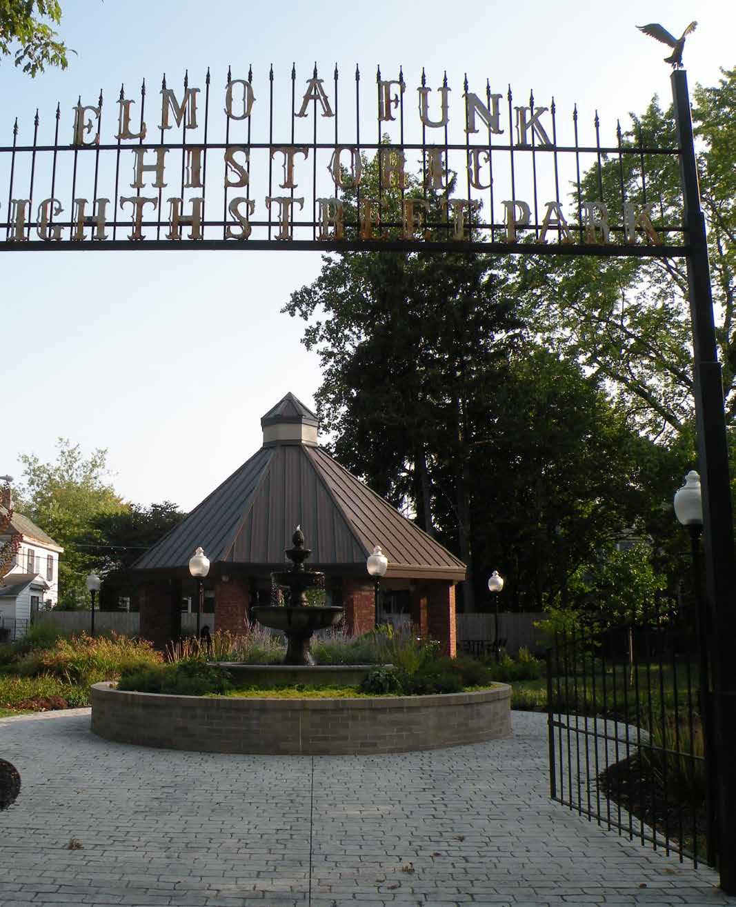
ELMO FUNK PARK
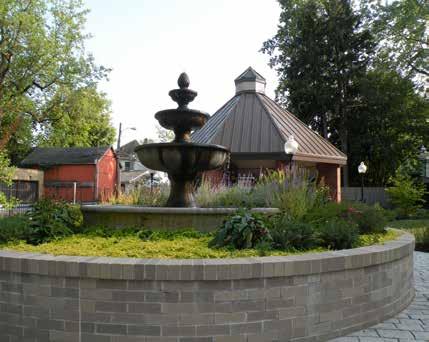
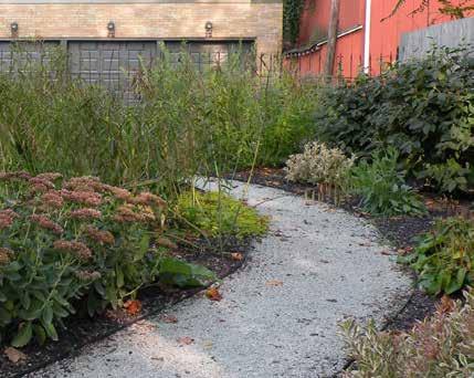
DRAFT
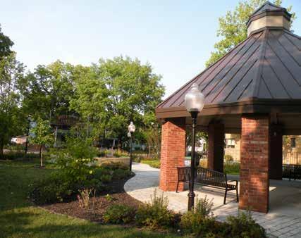
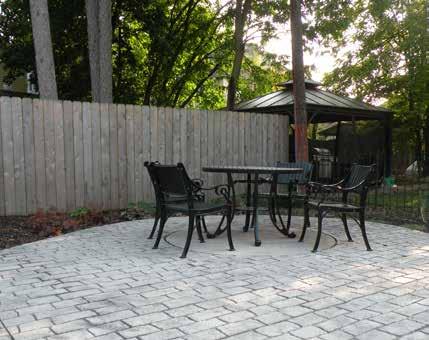
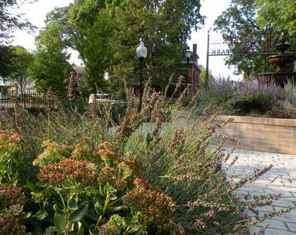
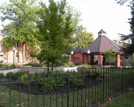

Brick-column Gazebo
Stone Pathway that Meanders Through Plant Beds
Ornamental Perennial Plant Beds
Decorative Water Fountain
Movable Furniture within Small Patio
Looking Southeast from W. 8th St. Sidewalk
LEGEND
1. Interpretive Sign
Fountain
Flower Bed
Gazebo
Seating
GEATER COMMUNITY CENTER
1611 CHASE STREET
The Geater Community Center is located at 1611 Chase Street. The indoor facility includes an indoor gymnasium, adult fitness center, game room, senior activity room, classrooms and small meeting rooms, and a computer lab. The building houses the administrative offices for the City of Anderson Parks & Recreation Department. A large, paved parking lot with accessible parking is located on the northeast side of the building.
Several former tennis courts have been retrofitted into basketball courts on the property north of the community center and parking lot. The courts are enclosed on the south, east, and north side by an 8’ tall chain link fence. The courts are illuminated by sports lighting. An accessible pathway leading from the parking lot to the courts has begun to deteriorate, buckle, and become overgrown by turf.
A large, un-programmed lawn and remnants of the concrete foundation of a former structure are located north and west of the basketball court. Several mature shade trees are located within the lawn.
New playground equipment that expands a larger footprint than the previous playground was installed during the spring of 2024 on the southwest side of the property. The new equipment was funded through a federal Community Development Block Grant (CDBG) through the Department of Housing and Urban Development. The playground features a central, multilevel climbing tower with a bridge and 6 slides, a pyramidshape merry-go-round, swings, spring rockers, and other freestanding play elements that accommodates children of all ages and abilities. The playground surface is engineered wood fiber mulch. Several metal park benches surround the perimeter of the playground and provide seating opportunities. The playground receives hot afternoon sun during the summer months and lacks trees or a canopy structure to provide adequate shade. A plaque near the playground indicates that the space has been designated as a National Play On!® Demonstration Site. An accessible pathway leads from the community center to the playground. No additional accessible routes are provided to the playground from the surrounding right-of-way.
DRAFT

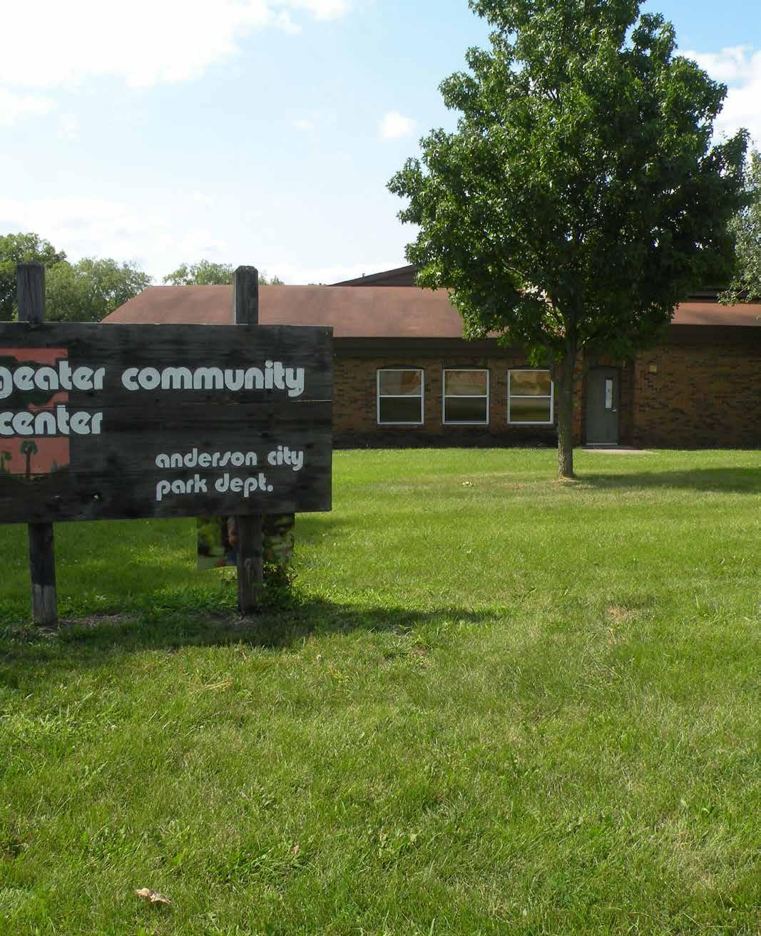
GEATER COMMUNITY CENTER
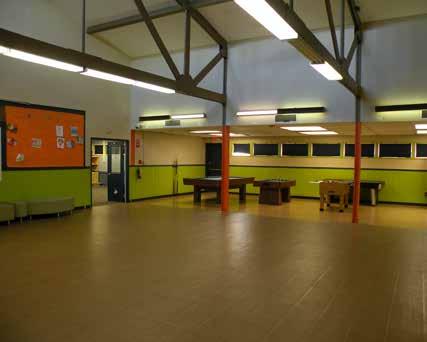
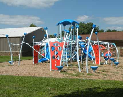
DRAFT
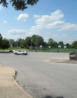
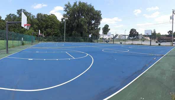

Parking Lot
Playground
Open Lawn Area North of Community Center
Game Room inside Community Center
Basketball Courts 1611
GENERAL PULASKI PARK
1615 E. 38 th STREET
General Pulaski Park is a 21-acre district park located along 38th Street. The park features many recreational amenities including two basketball courts, two tennis courts, six pickleball courts, a playground, restrooms, picnic shelters, pond, and a baseball field. The 0.68-mile paved trail circumnavigates the perimeter of the site and along the edge of the pond. A portion of the trail features informational signage that promotes a healthy lifestyle. The signage is provided through a partnership between the Kiwanis Club of Anderson, City of Anderson, and United Way.
A historical marker near the entrance of the park indicates that economic growth caused a large population of Polish immigrant families to settle within the neighborhood adjacent to the park during the 1930s. Single-family dwellings are located west of the park. Multi-family duplexes are located south of the park. The duplexes are screened from the park by an evergreen hedge. A dense privately-owned urban woodlot is located east of the park.
The park is accessible by two curb cuts off 38th Street. A crescent-shaped driveway transects the north central portion of the park. Perpendicular parking spaces flank both sides of the drive. Previous applications of pavement markings have weathered and faded, making it difficult to identify the individual parking spaces. The park’s trail network connects to 38th Street’s south sidewalk at the northwest corner of the park. The sidewalk terminates at the northwest corner of the park and does not continue eastward along 38th Street. No designated pedestrian crosswalks are provided near the park. 38th Street is a major east-west arterial street. The high volume of vehicular traffic makes it difficult for pedestrians to cross the street and access the park.
PARK AMENITIES
Baseball Fields
Walking Trails
Basketball Courts
DRAFT
Playground
Parking
Restrooms
Tennis Courts
Pickleball Courts
Picnic Shelter
The two full-size basketball courts are located east of the pickleball courts. The north and south sides of the basketball courts are enclosed by an 8-foot-tall chain link fence. Two post-mounted sports lights illuminate the court at night.
Fishing Pond
Interpretive Signage
Recreation Lawn

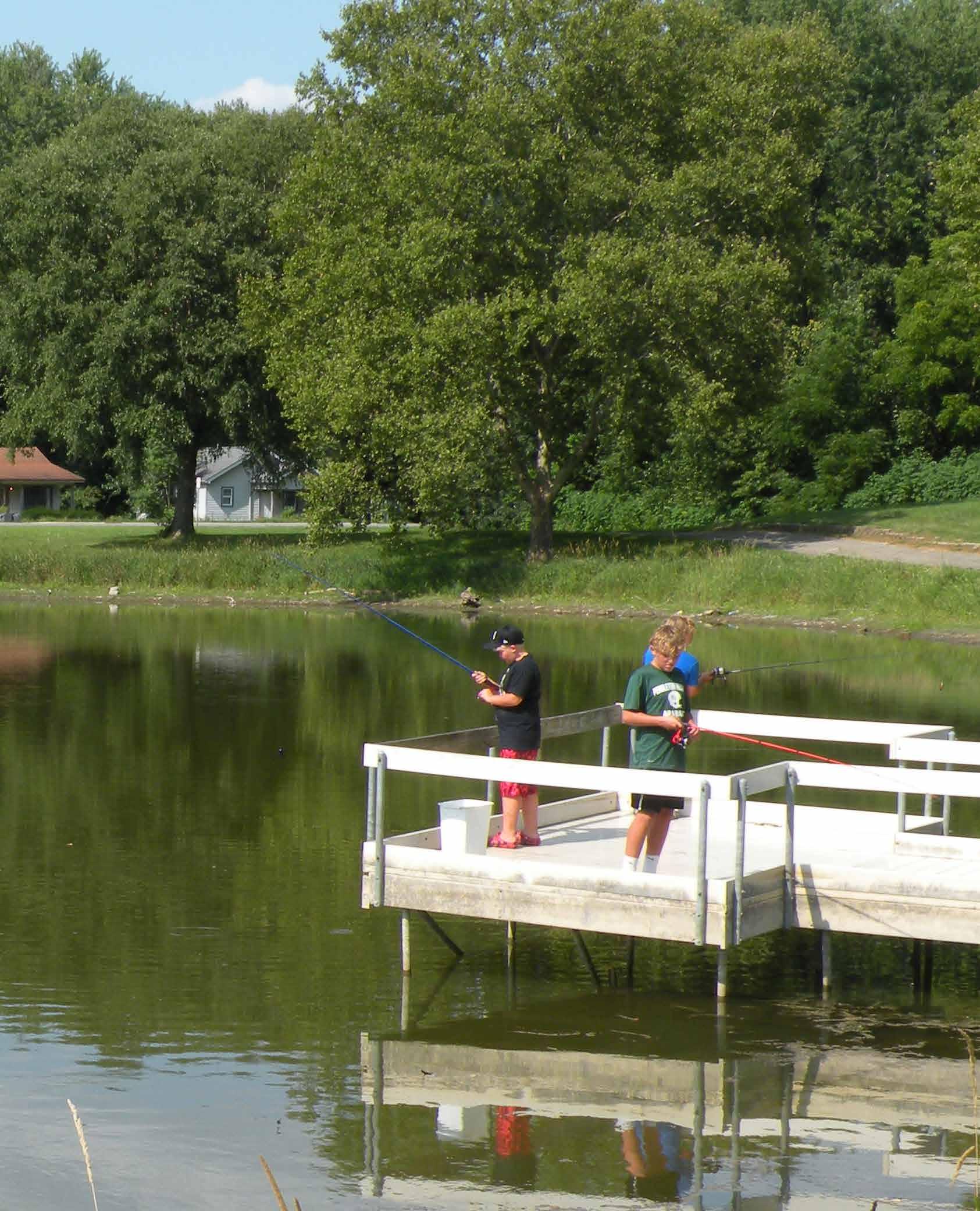
GENERAL PULASKI PARK
1615 E. 38 th STREET
The pickleball and tennis courts are located directly west of the basketball courts. Two of four tennis courts were retrofitted in 2021 to provide 6 pickleball courts. An 8-foot-tall chain link fence surrounds the perimeter of the tennis and pickleball courts. A smaller 4-foot-tall fence separates the three southern pickleball courts from the three northern courts. Sports court lights illuminate the courts at night.
The basketball, tennis, and pickleball courts are perched on top of a knoll at the northern edge of the park. A series of concrete steps lead from the parking lot to the sport courts. No accessible route is provided from the parking lot to the courts.
A public restroom, playground, and picnic shelter are near one another. These features can be accessed by paved sidewalks that lead from the parking lot. The playground includes a play tower with a slide and a freestanding swing set. Several mature deciduous trees located around these amenities provide shade for users.
The baseball field is located near the southwest corner of the park. The ball field is maintained by the local little league organization. The field includes two dugouts, wood bleachers, an outfield scoreboard, and sports lighting. No accessible route is provided to the bleachers nor are there any accessible seats. A Class 1 structure located near right field serves as a concession stand and storage facility. 40th Street provides vehicular access to the field. However, no formal parking is designated near the ball field.
DRAFT
A small pond is located on the eastern section of the park. Much of the vegetation along the shoreline is mowed to provide access to the water. A wooden fishing pier spans over the pond along the southwest shore. A paved trail loop follows the perimeter of the pond. A second picnic shelter is located near the northwest shoreline of the pond. It is accessible from the parking lot by a paved sidewalk. The shelter includes stationary picnic tables and a BBQ grill.
The remainder of the park is un-programmed lawn that can be used for a variety of recreational activities. Several large shade trees are planted at random intervals throughout the lawn. A plaque located within the lawn identifies the location of a Liberty Tree. The tree has been removed from its original location.
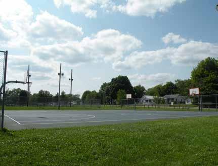
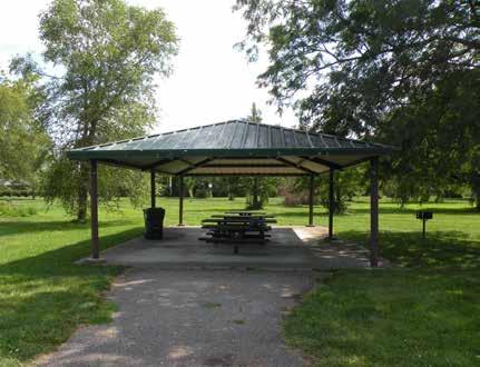
Basketball Court
Park Shelter
Little League Diamond
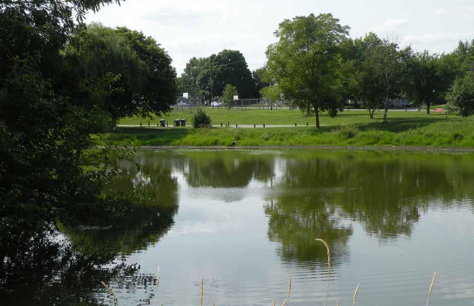
DRAFT
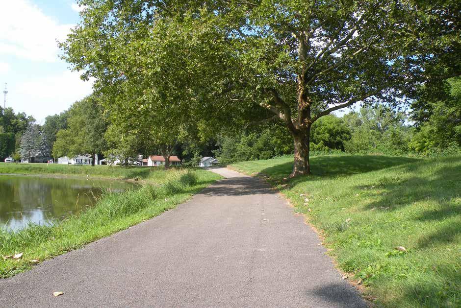
Perimeter Walking Path
Fishing Pond
GENERAL PULASKI PARK
1615 E. 38 th STREET
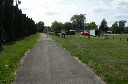
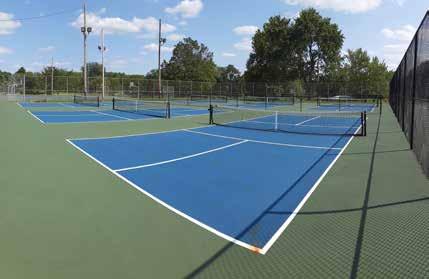
DRAFT

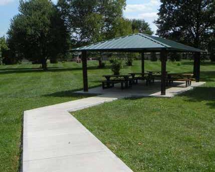
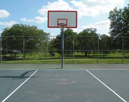
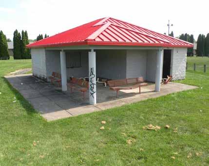

Playground
Pickleball Courts
Basketball Court
Paved Walking Trail along Southside of Park
Open Air Park Shelters with Accessible Pathway
Little League Field Concession Stand
CAROLINA
GRANDVIEW
GOLF COURSE
1905 NORTHSHORE EXTENSION
The 18-hole Grandview Golf Course is located near the intersection of Raible Avenue and Northshore Boulevard on the city’s northwest side. The 5,400-yard municipal course benefits from a rolling terrain and wide vistas adjacent to the White River. Constructed in 1925, the course includes a clubhouse and pro shop, the awardwinning 1925 Pubhouse, and a maintenance facility. The golf course features small greens and four Par 3’s. According to the golf course website, the 233-yard, Par 4 hole number 3 is considered to be the signature hole. The golf course offers several golf clubs and leagues for golfers of various ages and skill levels.
The current green fee is $15 per person for 18 holes and $9 per person for 9 holes. An additional fee of $15 is required to rent a golf cart for 18 holes or $8 for 9 holes. A $25 green fee with cart is available to seniors and players after 2:30 pm. The course is open daily, 7:00 am to 8:00 pm.
DRAFT
PARK AMENITIES

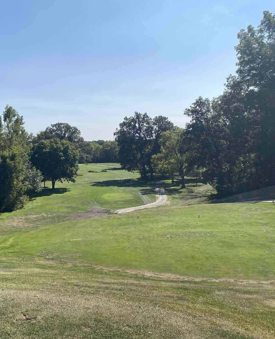
GRANDVIEW GOLF COURSE
1905 NORTHSHORE EXTENSION
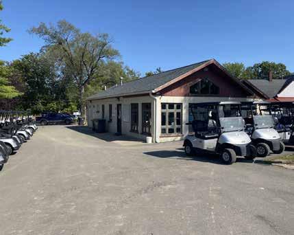
DRAFT
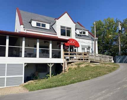
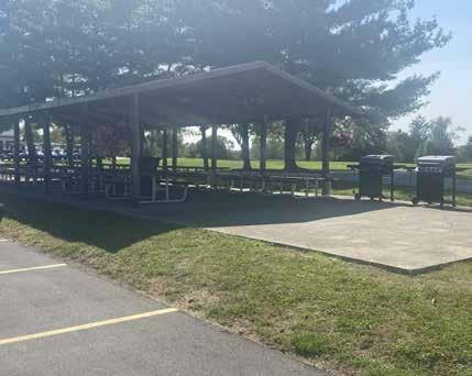
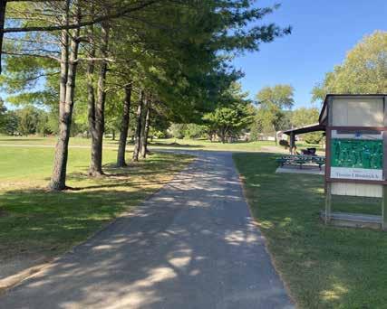
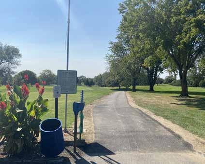
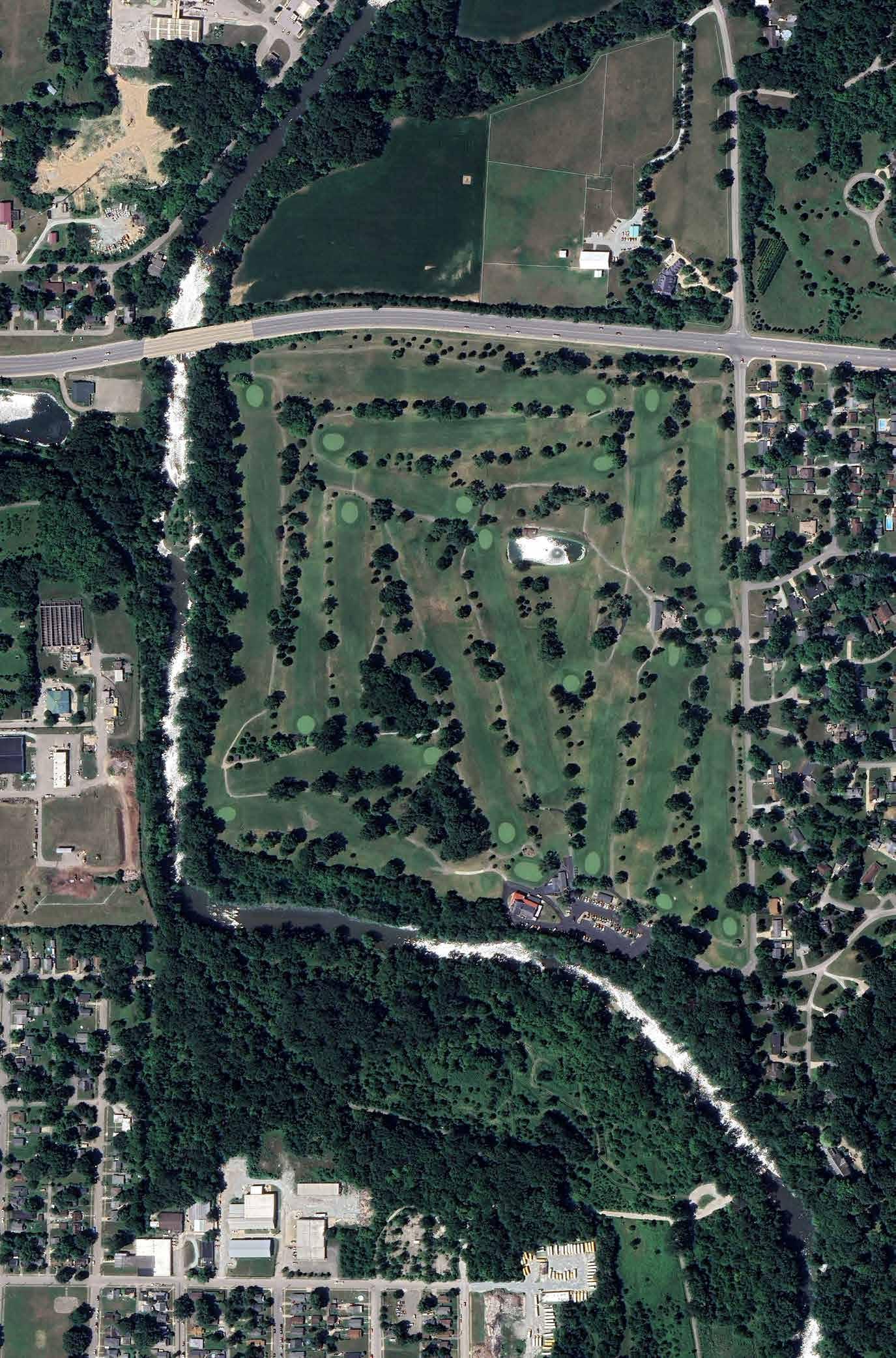

1925 Pub House Restaurant
Pro Shop
Course Map and Cart Path
Main Parking Lot
Open Air Shelter and Seating
Course Entry and Signage
GRANDVIEW
HARMON PARK
415 RAVINA AVENUE
Grandview Harmon Park is a 3.2-acre block park located on the northwest side of Anderson bounded by Van Buskirk Road on the north, Ravina Avenue on the east, Highland Avenue on the south, and single-family residential on the west. The primary entrance to the park is located on Ravina Avenue and a park sign is present at the intersection of Ravina Avenue and Van Buskirk Road. Perpendicular, gravel parking lots are located immediately adjacent to Ravina and Highland Avenues, although the Highland Avenue parking area is largely overgrown with grass. Neither parking area provides marked, accessible parking. A series of wooden posts separate the parking areas from the interior of the park and discourage vehicles from driving into the park.
A concrete sidewalk connects the Ravina Avenue parking lot to the interior of the park. Within the park, a recently installed playground designed for children ages 2-15 provides a number of elevated and ground features. Additionally, small play features for younger 2-to-5-year olds include a series of musical instruments and a fire truck. A curly slide, independent climbing feature, and 3-bay swing set with belt and toddler swings are also present. Engineered wood fiber mulch provides the play surfacing and is bounded by a perimeter concrete path that serves as an accessible route around the playground. Benches are also located along the perimeter pathway, as is a drinking fountain.
DRAFT
From the perimeter concrete path, a concrete walk connects to a large picnic shelter. The picnic shelter contains four permanently mounted picnic tables, including two accessible picnic tables. A full basketball court is located immediately west of the picnic shelter and playground. Surrounded by lawn, there is no accessible route that connects to the court. The remainder of the park is comprised of open lawn and trees.

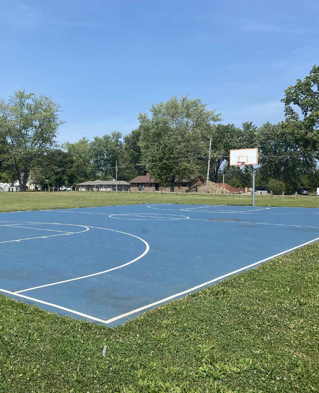
GRANDVIEW
HARMON PARK
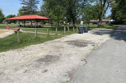
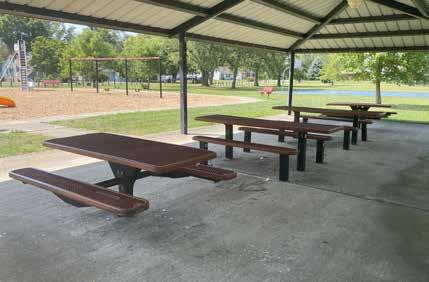
DRAFT

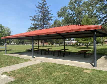
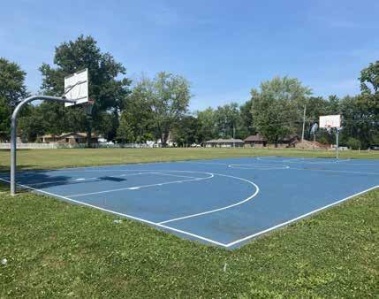
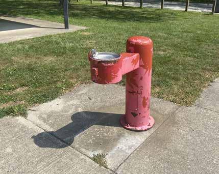

Playground
Shaded Seating Under Park Shelter
Basketball Court
Gravel Pull-off Parking
Open Air Park Shelter
Drinking Fountain Near Park Shelter
Basketball Court
Picnic Shelter
Playground
Gravel Parking
HORNE PARK
537 W. 7 th STREET
Horne Park is a 0.50 acre park located just northwest of downtown that is bounded by W. 7th St. on the north, the railroad and John St. on the west, an alley on the east, and a commercial building on the south. The park is surrounded by single-family residential development on the north and east, and commercial/light manufacturing on the south and west. A small, unstriped, asphalt parking lot is located immediately adjacent to the alley on the east and on-street parking is provided along 7th St. There are no marked accessible parking spaces provided and the asphalt parking lot is surrounded by wood posts to eliminate cars from entering the park.
Within the park, a small playground features recently installed play equipment that includes a curly slide, three-bay swing set, spinner, and two ground mounted spring riders. The swing set features four belt swings, an accessible swing, and a generational, or adult/child swing. The playground is contained within engineered wood fiber mulch surfacing. A half basketball court is located adjacent to the playground and a small picnic shelter with one accessible picnic table is located in the lawn. Three benches are located within the lawn and there is no accessible route from the parking area to the park amenities. Lawn and mature shade trees comprise the remainder of the park.
DRAFT
PARK AMENITIES

Basketball Court Picnic Shelter
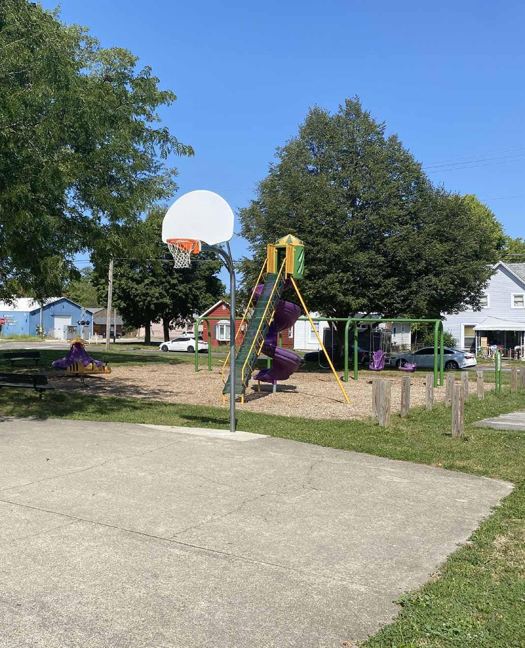
HORNE PARK
537 W. 7 th STREET
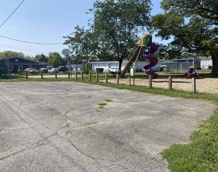
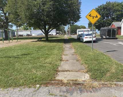
DRAFT
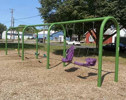
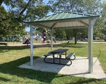
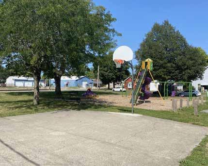
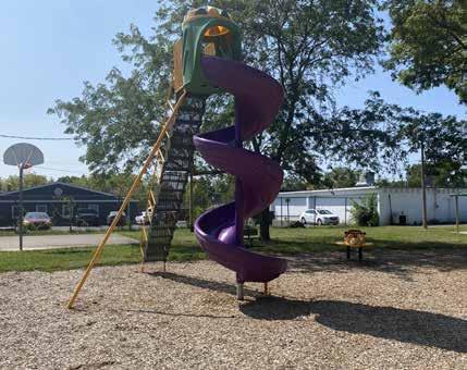

Swing Set with Belt Seats and Adaptive Zero-G Seats
On-street Parking with Nearby Sidewalk
Basketball Court
Parking Lot Adjacent Alley
Open Air Park Shelter with Picnic Table
Freestanding Spiral Playground Slide
Basketball Court
Picnic Shelter
JACKSON PARK
2430 W. 22 nd STREET
Jackson Park is a 7-acre neighborhood park located near the intersection of Raible Avenue and W 22nd Street. The park is surrounded by single family and multifamily dwellings to the south. Commercial and industrial buildings are located to the north and west of the park along Raible Avenue. An active railroad line defines the northern boundary of the park. The Anderson K-4 Preparatory Academy and Anderson Elementary School are both located within walking distance and proximity to the park. The Anderson Fire Station #2 is built on the southeast corner of the park near the intersection of W. 22nd Street and Fulton Street. A park identification sign is located at the corner of Raible and W 22nd Street.
The Park includes a large playground, a paved walking loop, outdoor fitness zone, an enclosed picnic pavilion, open picnic shelter/performance canopy, restroom facility, and an open lawn area surrounded by mature hardwood trees. The playground equipment includes a large tower with slides and climbing components, freestanding musical instruments, a swing set, benches, and a merry-go-round. The fitness zone includes seven stations with fitness equipment used to perform multiple exercises. The park also includes a unique amenity - a tethered race car track - which hosted the American Miniature Racing Car Association’s inaugural tethered car racing nationals in 2019. Signage near the playground provides recommendations for park users to increase their physical fitness activities.
Two paved parking lots are accessible from both Raible Avenue and Fulton Street. On-street parking is prohibited along Fulton and 22nd Street.
DRAFT

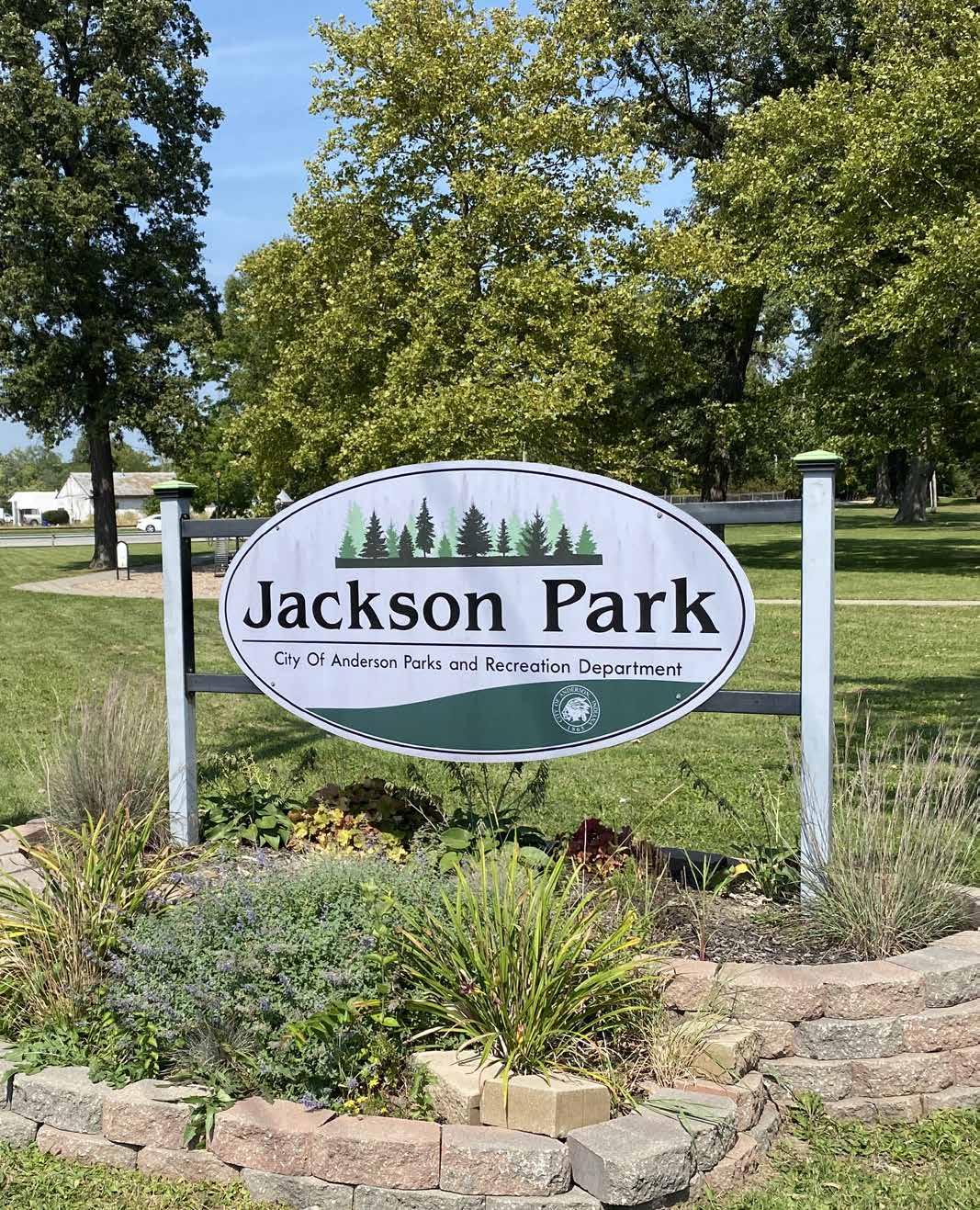
JACKSON PARK
2430 W. 22 nd STREET
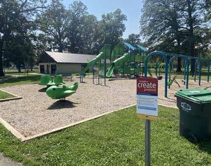
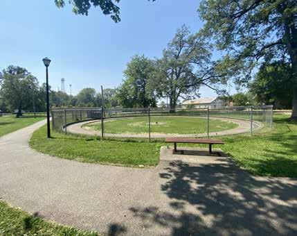
DRAFT
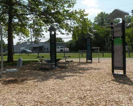
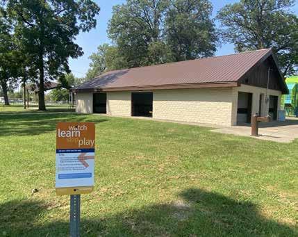
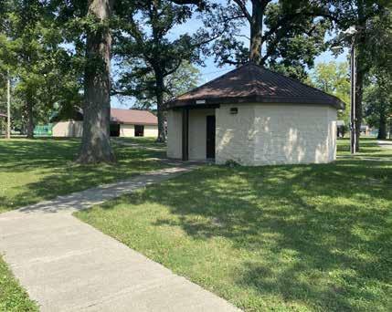
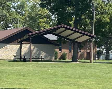

Adult Outdoor Fitness Equipment Circuit
American Miniature Racing Car Association’s Tether Track
Public Restroom with Accessible Pathway
Playground Near Fulton St.
Storage Facility and Enclosed Shelter
Picnic Shelter
FOUNTAIN
KILLBUCK CREEK
WETLANDS
600 GRAND AVENUE
Killbuck Creek Wetlands is a rich ecological parkland located near the intersection of Broadway Street and Grand Avenue. The majority of the 12.3-acre site is occupied by a perennial wetland that is fed from Killbuck Creek. Small peninsulas densely planted with aquaticvegetation can be found within the larger wetland area. Marshland and floodplain forest habitats are visible on the periphery of the wetland. Hoosier Lottery and Land and Water Conservation Funds (LWCF) have helped to support environmental restoration within the site.
A low-head dam retains a shallow pool of water in the wetland all year, while discharging excess flooding into the White River downstream of the wetland. A wood boardwalk that meanders near the eastern edge of the wetland provides panoramic views of the park. The boardwalk transitions into a paved trail that connects the wetland to Shadyside Lake.
Killbuck Creek is a primary stream located within the Killbuck Creek-White River Watershed (12-digit HUC: 051202010307). It drains approximately 14,226 acres of land in Madison and portions of western Delaware Counties. According to the Indiana Department of Environmental Management (IDEM), the primary pollution sources in the watershed include non-point sources from agriculture operations and urban and rural runoff as well as point sources from pipe discharges, home sewage treatment system disposal, and combined sewer overflow outlets. The primary cause of impairment is Escherichia coli bacteria (E. coli).
A small, paved parking lot south of the wetland provides parking for park users. Several spaces are reserved for seniors or individuals with mobility limitations. A mowed lawn area with large shade trees adjacent to the parking lot provides space for passive recreational activities. The park also serves as a trailhead for the multi-use White River Trail. A trail sign points provides directional orientation to points of interests within the wetland, along the trail, and near Shadyside Lake. A sign cabinet used to post announcements is also located near the parking lot.

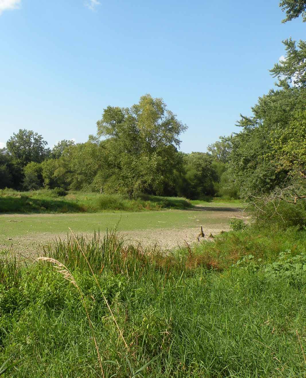
KILLBUCK CREEK WETLANDS
600 GRAND AVENUE
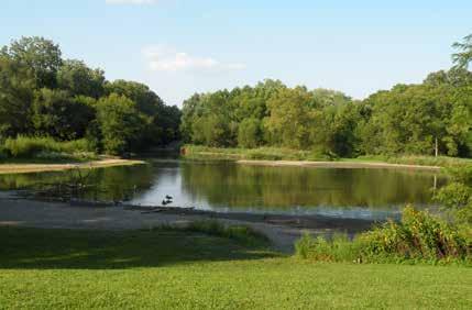
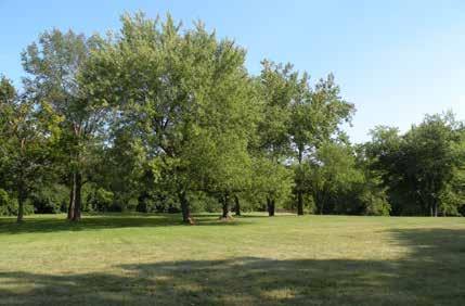
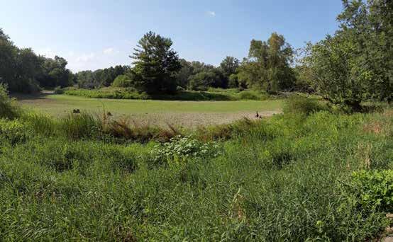
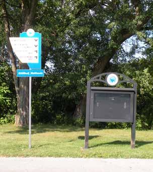
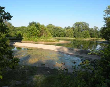
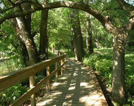
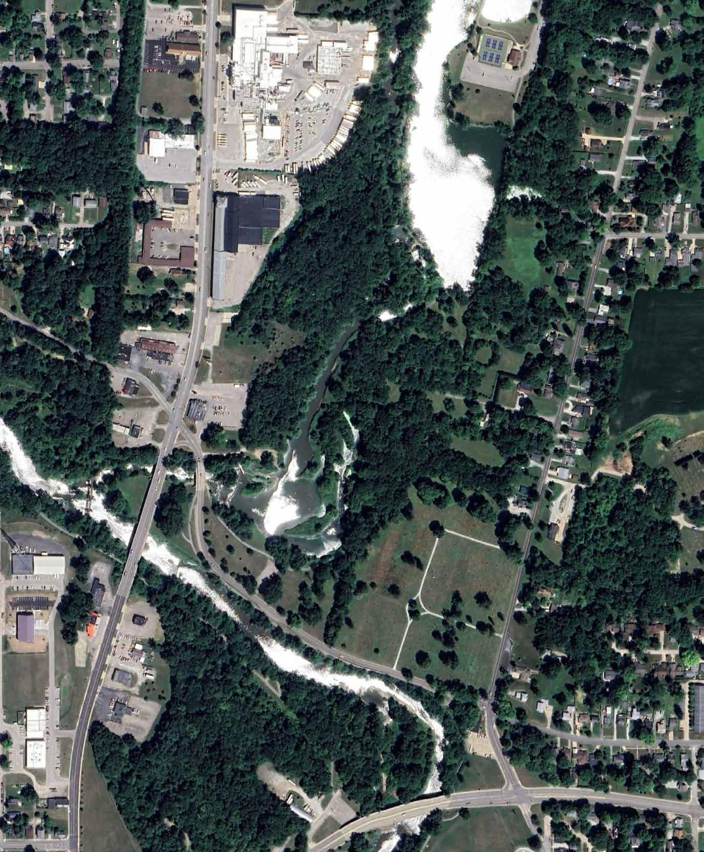

View Looking West of Wetland Impoundment
Mowed Open Lawn Area with Mature Shade Trees
Low Head Dam Downstream of Wetland
Information Bulletin Board and Trail Sign
View Looking North of Wetland Impoundment
Wooden Boardwalk Leading Through Wetland
MAY’S PARK
901-902
BLOCK W. 10 th STREET
May’s Park is located west of downtown Anderson at the intersection of W 10th Street and Madison Avenue. The park is divided by W. 10th Street, which runs east and west through the two park parcels. The speed limit along W. 10th Street is 30 miles per hour. Single-family housing surrounds the park on the north, south, and east sides. Mix-use commercial development is situated along Madison Avenue.
Renovations to the 6.03-acre neighborhood park were completed in 2022. The southern segment of the park features two tennis courts and four pickleball courts enclosed by a chain link fence, an open-air shelter with seating, a skatepark, two basketball courts, and an open lawn area. The northern portion of the park includes a small 30-vehicle off street parking lot, splash pad, openair shelter with seating, public restroom and pump house, playground, and a walking path that meanders through a lawn planted with both new and mature shade trees. The splash pad is open to the public daily, 10 am to 8 pm from May to August. The splash pad is activated by one of two sensors located on a post near the aquatic facility. Sports lighting is proved near the tennis, pickleball, and basketball courts. Area lighting is located near the playground, splash pad, and right-of-way.
Additional on-street parking is available on both sides of W. 10th Street. Two pedestrian curb ramps transect W. 10th Street and provide an accessible route to the park amenities.
DRAFT
PARK AMENITIES

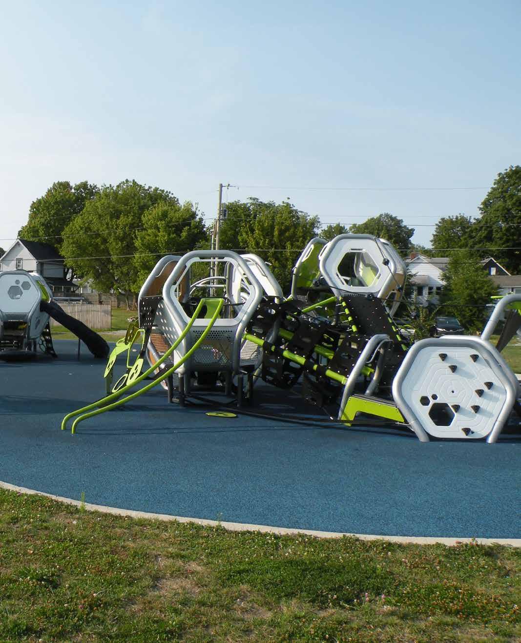
MAY’S PARK
901-902 BLOCK W. 10 th STREET
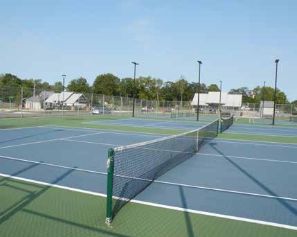
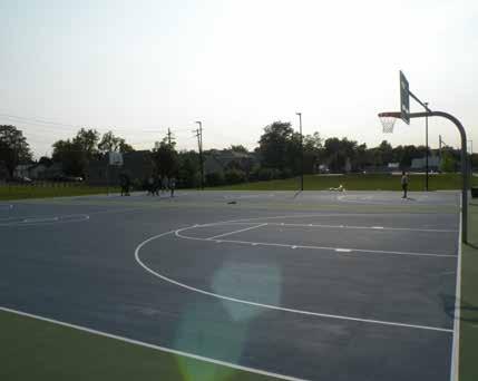
DRAFT
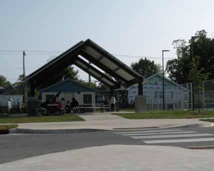
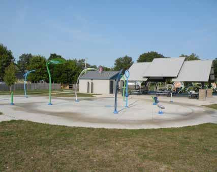
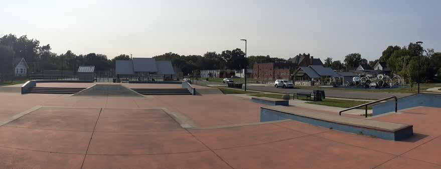
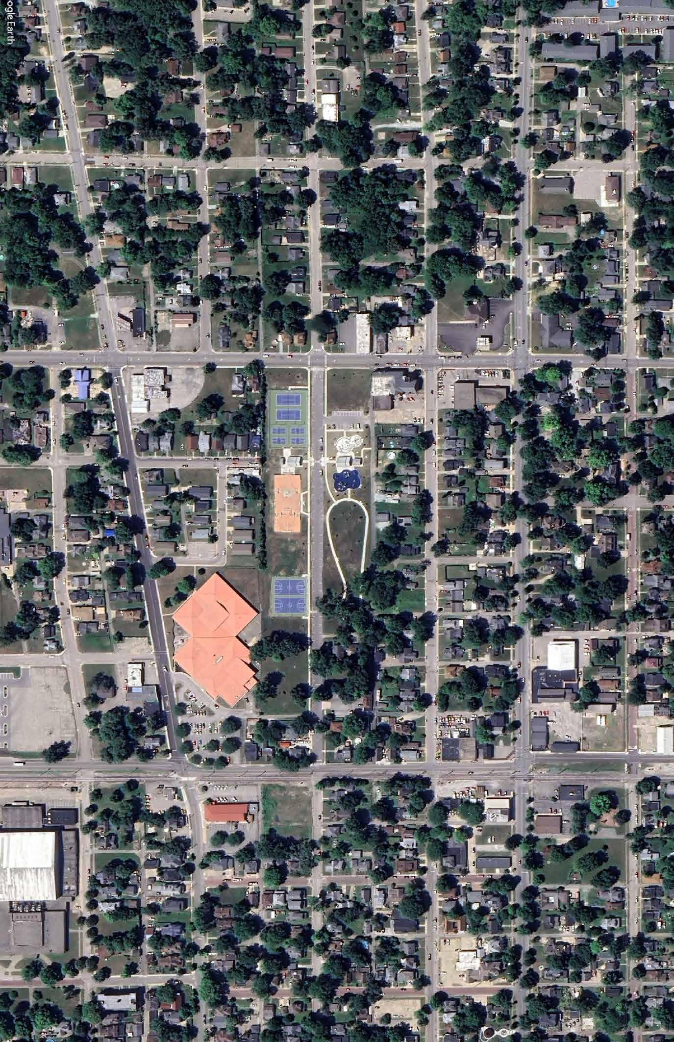

Crosswalk Across W. 10th St. to Open Air Shelter
Basketball Courts
Looking West Towards Skatepark
Splash Pad, Open Air Shelter, and Public Restrooms
Tennis Courts
MEADOWBROOK PARK
3600 MADISON AVENUE
Meadowbrook Park is a 10.5 acre linear park located south of downtown, immediately east of Meadowbrook Golf Course, and between Meadowbrook Parkway N. Drive and Meadowbrook S. Drive. Brown St. is the eastern boundary to the park. Stanley Ditch meanders through the park, flowing from east to west. One pedestrian bridge crosses Stanley Ditch approximately half-way along the park’s length near the intersection of Fairview St. and Meadowbrook Parkway Dr. N.
A gravel parking area provides parallel parking adjacent to Meadowbrook Parkway S. Dr. Near the gravel parking area, a small, dated playground features a three-bay swing with six belt swings and two toddler swings, and a curly slide surrounded by engineered wood fiber mulch. Within the lawn there is a merry-go-round, small slide, swing frame, and bench. The banks of Stanley Ditch include taller grasses, perennials, and small trees. The remainder of the park is comprised of lawn and mature shade trees.
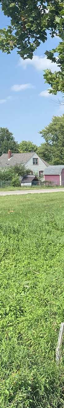
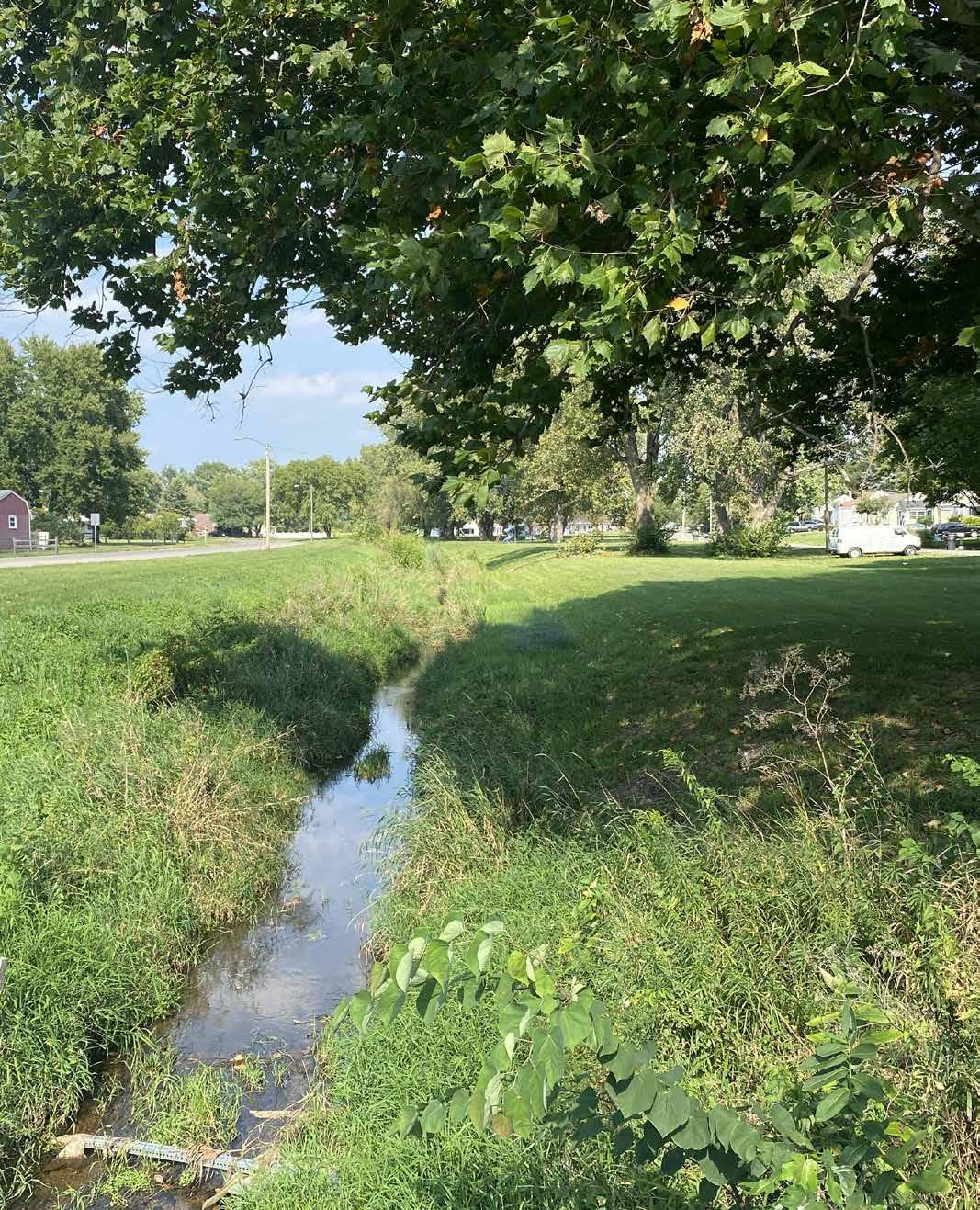
MEADOWBROOK PARK
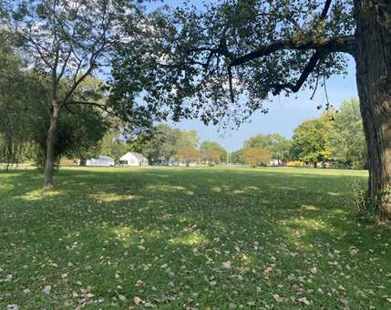
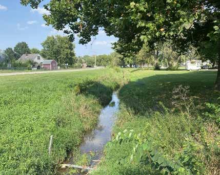
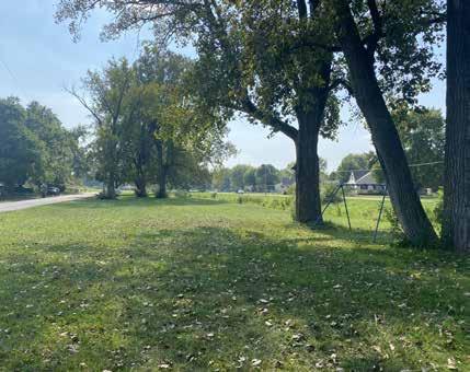
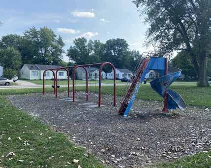
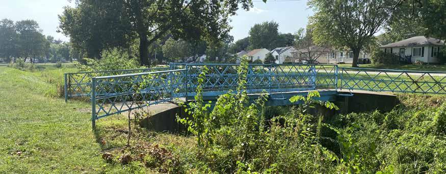
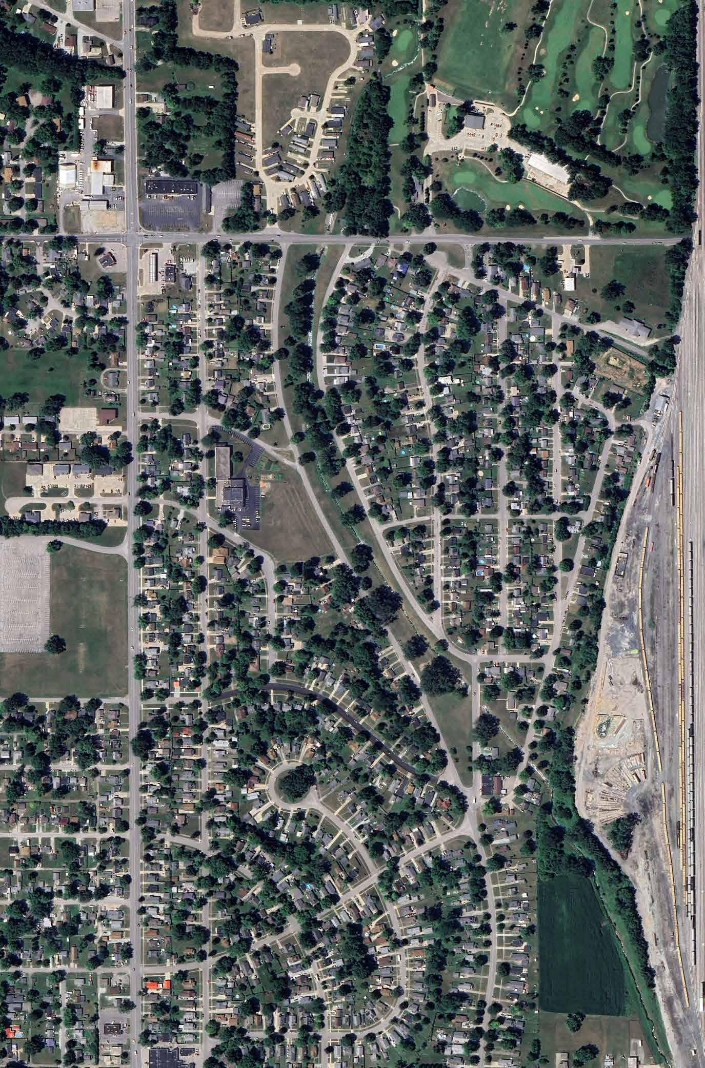

Open Lawn Area
Meadowbrook Creek
Pedestrian Bridge Across Meadowbrook Creek
Playground
Open Lawn Area
ELMWAY
MLK JR. PARK
W. 22ND STREET & MADISON AVE.
Martin Luther King Jr. Park is a 0.2 acre park located southwest of downtown. It is bounded by W 22nd St. on the north, Madison Ave. on the west, and Dr. M.L.K. Jr. Blvd. on the south and east. On-street parking is available along W. 22nd St., however, parking spaces are unmarked. The park is oriented towards Dr. M.L.K. Jr. Blvd. where a large sign announces the space. A secondary entrance to the park exists from the W. 22nd St. and Madison Ave. intersection.
The park serves as a memorial to Dr. Martin Luther King Jr. featuring a central bronze statue of the civil rights leader above a granite base. The granite is engraved with Dr. M.L.K.’s birth and death dates, a quotation of his, and the names of the donors to the park and memorial. A paver plaza encircles the statue and provides benches, accent lighting, and litter receptacles. Landscaped berms and mature shade trees help create a comfortable environment separated from the street.

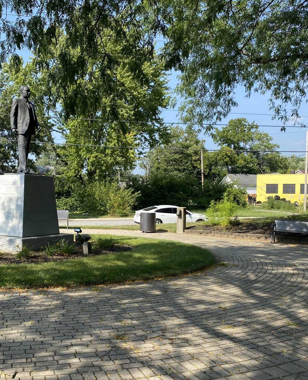
MLK JR. PARK
W. 22ND STREET & MADISON AVE.
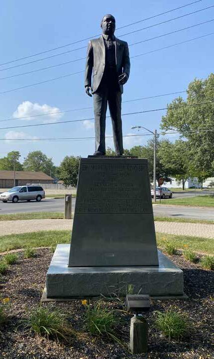
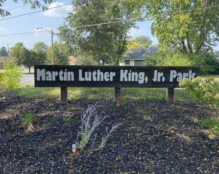
DRAFT
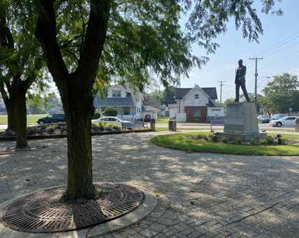
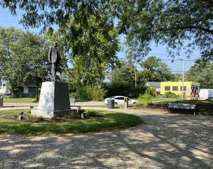
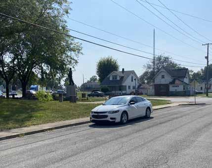
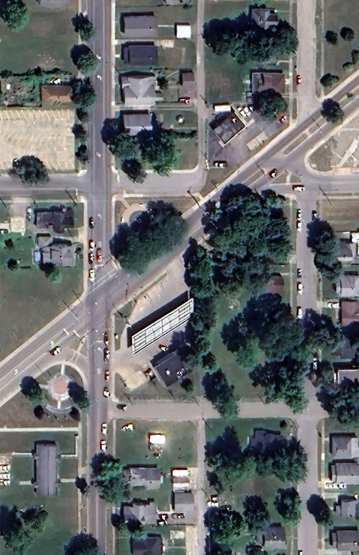

Dr. Martin Luther King Jr. Statue
Park Sign
Paved Pedestrian Plaza
Paved Pedestrian Plaza with Shaded Seating
On-street Parking
RANGELINE NATURE PRESERVE
1200 S. RANGELINE ROAD
The 174-acre Rangeline Nature Preserve is located on the grounds of a former gravel pit on the northern shore of the West Fork White River. The nature area includes a range of vegetation, topography, and ecological habitats. The nature preserve is accessible by a gravel parking lot and trailhead located near 1200 S. Rangeline Road. The trailhead includes an open lawn area with picnic tables, park shelter, porta-potty, litter bins, and wooden bike obstacles. Several large signs list park rules and additional information about the nature preserve.
Surrounding land use includes residential development and previously disturbed riparian woodlots. The East Fork of White River abuts the south and western extents of the nature preserve.
Most of the site is heavily wooded. The southern portion of the site is located within the regulatory floodway of the White River. Approximately 25.54-acres of the southern property fringe is classified as “freshwater forested-shrub wetland” habitat and PFO1A (palustrine forested broad-leaved deciduous temporary flooded) wetland by the U.S. Fish & Wildlife Service’s National Flood Inventory database. The base flood elevation of the river near the nature preserve is 850.90 feet.
A 15.10-acre freshwater pond is located near the southeast corner of the nature preserve. A natural spring keeps the pond constantly supplied with groundwater. Ephemeral bottomlands within the nature park retain water during the spring.
DRAFT
The altered and novel landscape has been greatly influenced by previous urban development. According to a sign posted near the trailhead, the park was acquired by the city in 1990 from the Vulcan Materials Company. The company took advantage of the river’s rich mineral deposits along the shoreline and used the site as a stone quarry during the 20th century. Remnants of the company’s development activities - including piles of concrete rubble and car parts – can be seen along portions of the trail. Several opportunistic noxious or invasive plant species have colonized within areas of the nature preserve. A Phase I and Phase 2 environmental assessment were conducted in 2011 and 2014 respectively as a part of the proposed Mounds Lake Reservoir project.
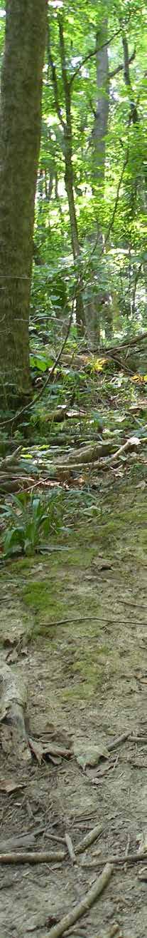
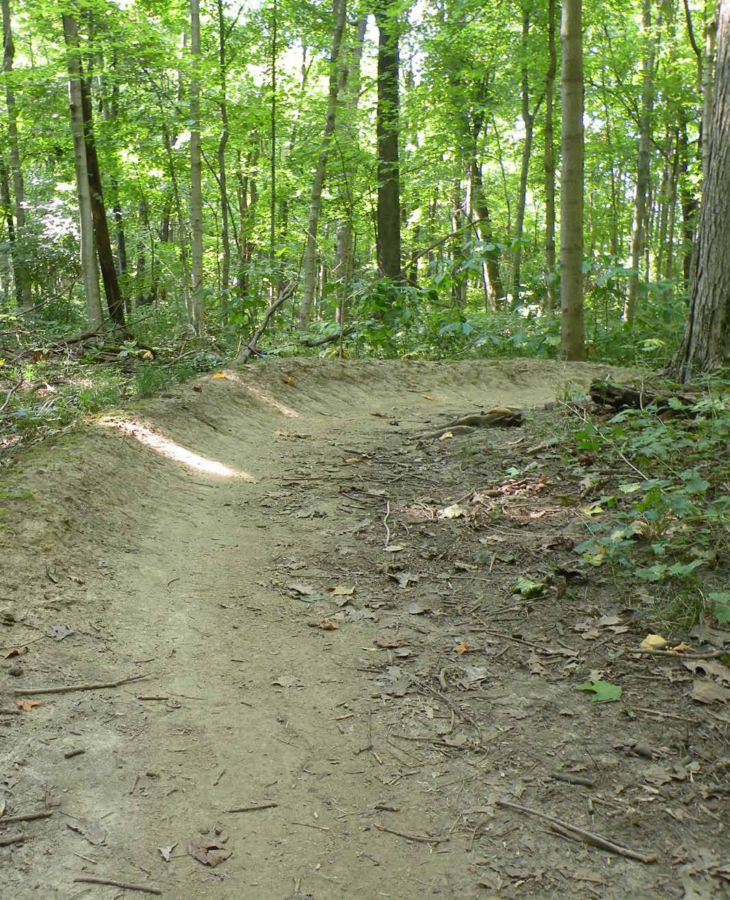
RANGELINE NATURE PRESERVE
1200 S. RANGELINE ROAD
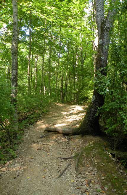
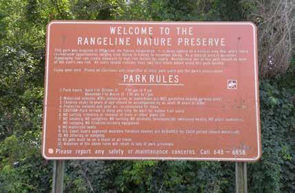
DRAFT
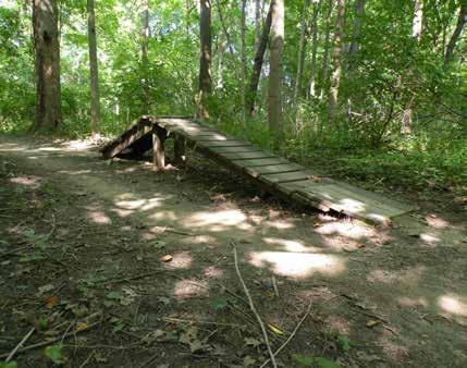
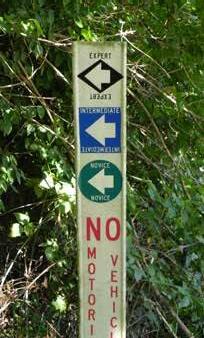

Remnants of previous site use are visible from the trail

Natural Surface Mountain Bike Course
Park Rules & Regulation Sign
Trail marker and regulation signage
Mountain Bike Platform Element
RANGELINE NATURE PRESERVE
1200 S. RANGELINE ROAD
An extensive trail network has been constructed throughout the park. The trail is composed of loose stone placed over native subgrade. The trails are open to both mountain bikers and hikers; Motorized vehicles and horseback riding is prohibited within the park. The nature preserve is open year-round from 7:30 am to 9:00 pm, April 1 to October 31, and 7:30 am to 7:00 pm, November 1 to March 31.
The off-road mountain bike course offers three loops for cyclists of various abilities: novice, intermediate, and expert. According to the Parks’ webpage, the 2-mile novice course offers a smooth, fast, and flowing experience with limited obstacles. The 3-mile intermediate course requires cyclists to use advanced skills to navigate the narrower trail and natural geologic features of the preserve. Multiple obstacles including a suspension bridge, gap jump, and teeter totter along with a tighter and slow-riding trail make the 6-mile expert course ideal for the professional rider. It is anticipated to take approximately 1 hour and 50 minutes to complete the entirety of the expert course.
Efforts by the volunteer group Rangeline Nature Preserve Mountain Biking Association (a chapter of the Hoosier Mountain Bike Association, Inc.) have helped to maintain the trails, control invasive species, and provided additional park amenities. Homeless encampments established near the river’s edge have reportedly been a problem within this park for several years.
DRAFT
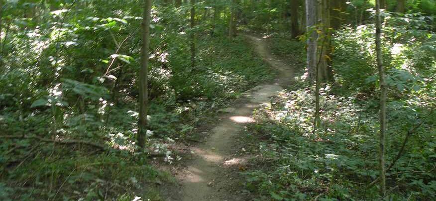
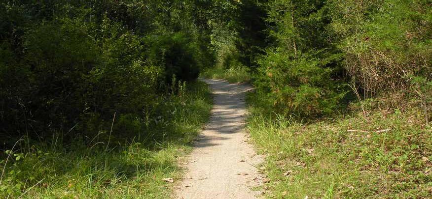
Parking lot and trailhead
Novice bike trail
Novice bike trail
RIVER BEND PARK
W. 2 nd ST. & SYCAMORE ST.
Riverbend Park is a 36.07 acre park located on the northwest side of downtown along the banks of the White River. Single-family residential, limited commercial, and City property border the park to the south while the White River, single-family residential, and the Grandview Golf Course border the park to the north. Primary access to the park occurs at the intersection of W. 2nd and Sycamore Streets. Entry signage to the park is limited and signage that does exist is faded and difficult to read.
Within the park, a gravel drive provides access to trails and a gravel parking area near a canoe launch. The gravel parking area is overgrown with grass and weeds and the parking is unmarked. Where the trails and roadway intersect no signage is present to denote automobile versus pedestrian areas and there are no barriers to eliminate automobile traffic on pedestrian trails. The primary section of the White River Trail is paved and in very good condition, connecting Riverbend Park to the 8th Street trailhead on the west and Derby Downs Park on the east. Many side trails are overgrown and impassible while other side trails appear to be used by all terrain vehicles and are severely rutted. Other features of the park include native plant restoration and reforestation areas.
DRAFT

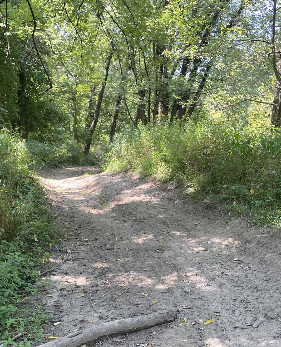
RIVER BEND PARK
W. 2 nd STREET & SYCAMORE ST.
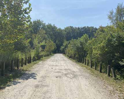
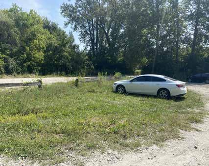
DRAFT
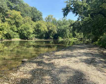
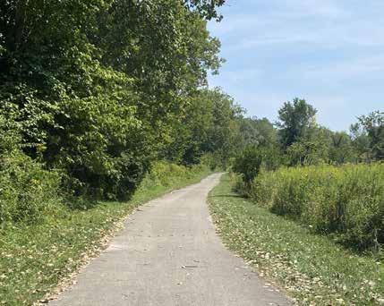
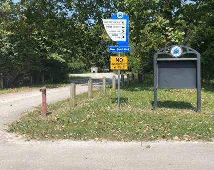
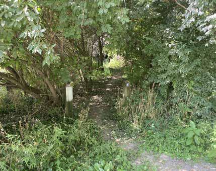

Canoe Launch/Access to the White River
Unpaved Public Parking Lot
Trailhead with Directional Signage
White River Trail Meanders Through the Park
Secondary Natural Surface Trail
Gravel Drive Leading to Public Parking Lot
SHADYSIDE MEMORIAL PARK
1112 BROADWAY AVENUE
Shadyside Memorial Park originally opened in 1897 as a private park for employees of the Union Traction Company. In 1923, the City of Anderson purchased the park grounds and opened the park to the public on July 4, 1923. A ceremony was held to dedicate the park to all Madison County war veterans. Local nurseryman, Milton H. Gaar, was contracted in 1928 to construct the Japanese Gardens (now known as the Terraced Gardens). Renovations were necessary in the late 1990s to repair the Terrace Gardens and make other general improvements. A botanical walk and earth-formed amphitheater were added to the park. The playground was expanded into a regional playground suitable for children of all ages and abilities.
The main vehicular entrance to the park is accessible from Broadway Street. A barrier wall, arching gateway, and columns constructed from stacked field stone greet visitors to the park. A meandering paved roadway leads to a parking lot in the middle of the park. A small restroom is located near the parking area.
Three baseball diamonds are located north of the parking lot. The ball diamonds include spectator bleachers, dugouts, press boxes, scoreboards, and sports lighting. The diamonds show signs of distress. Weeds have grown between the bleachers and several of the press boxes have been boarded up.
An accessible paved pathway also leads from the parking lot to a signature playground. The inclusive playground features several traditional climbing towers with bending, and curling slides, corkscrew poles, spinners, activity panels, and transfer platforms. The playground is surrounded by open lawn and dense tree canopy. The playground is currently being renovated in two phases. New playground equipment was installed during the initial phase during the summer of 2024.
DRAFT
A drinking fountain and large picnic shelter is located near the playground. The shelter is enclosed on two of the four sides and features a stove. Picnic tables are located under the canopy of the shelter.
The pathway leading from the playground to the shelter features several small signs that provide helpful facts and tips for healthy living. The signs were installed as a collaboration between Anderson Parks and United Way.

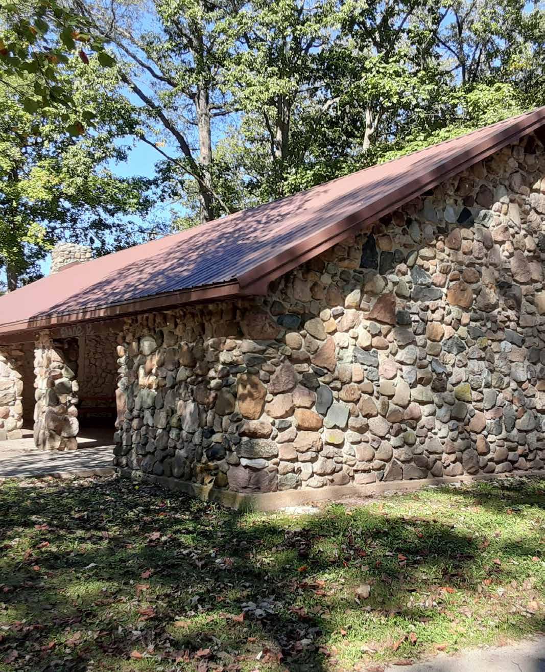
SHADYSIDE MEMORIAL PARK
1112 BROADWAY AVENUE
A meandering concrete pathway leads from the restroom through a wooded ravine to the Terrace Gardens. The terrace Gardens include raised plant beds and a shelter.
A sunken Veterans Memorial is located near the Terrace Gardens. The entrance to the memorial is contained by two rows of custom limestone benches. Several of the benches exhibit signs of deterioration. Round limestone piers are located on each end of each bench. A bronze medallion symbolizing each branch of the military is embedded on the top of the pier. Etched granite pavers depicting the timeline of American wars leads up to bronze sculpture of an American eagle and plant bed. The statue is flanked by two flagpoles. The American Flag and the POW flag is hung from the poles. A stone-clad wall provides a backdrop to the memorial. Granite panels inscribed with quotes from former military leaders and soldiers are inset within the stone wall.
The rolling terrain of the park was used to create a natural amphitheater. The amphitheater is tucked within a hill on the park’s west end and surrounded by large shade trees. A pathway and concrete stairs encircle the amphitheater and lead from the Veterans Memorial to the playground. The adjacent lawn features many mature shade trees.
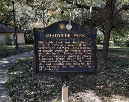
DRAFT
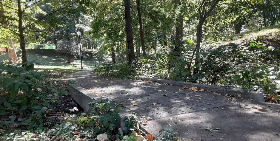

A State Historical Marker describes the cultural significance of Shadyside Memorial Park
Meandering Pathway along Creek
Baseball Fields
SHADYSIDE MEMORIAL PARK
1112 BROADWAY AVENUE
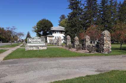
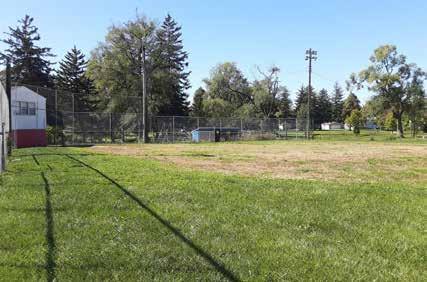
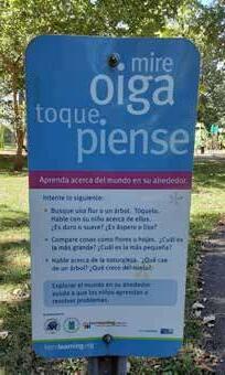
DRAFT
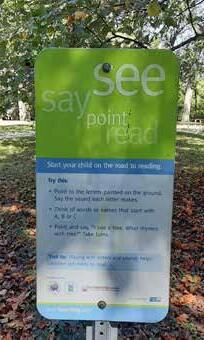
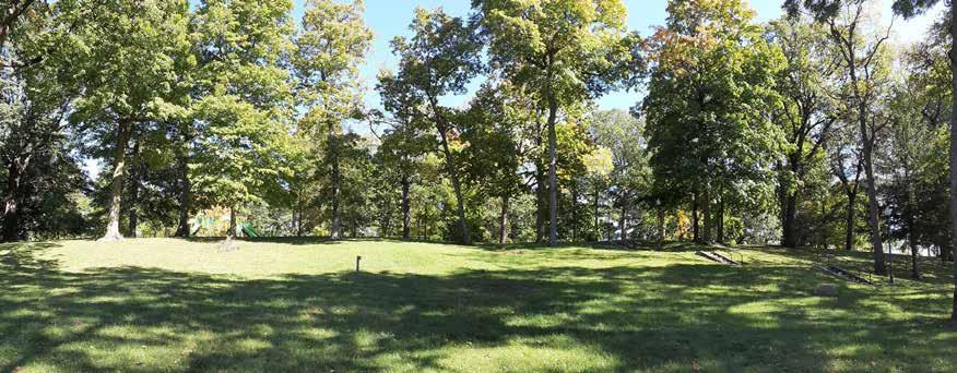
Bilingual Fitness Interpretation Signs
Little League Ball Field
Natural Amphitheater with Wooded Backdrop
Veteran’s Memorial
Main Park Entrance from N. Broadway St,

DRAFT
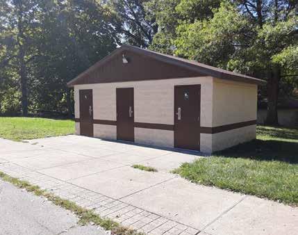
Public Restrooms
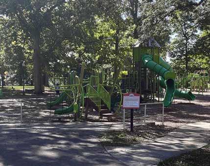
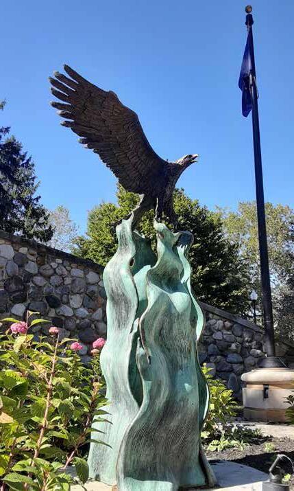
Shaded Playground
Veteran’s Memorial
Stone-clad Park Shelter
Meandering Pathway along Creek
SHADYSIDE LAKE RECREATION AREA
829 ALEXANDRIA PIKE
Shadyside Recreation Area is a regional park that has plenty of opportunities for walking, fishing, boating, and other recreational activities. The recreation area is bound by Alexandria Pike to the east and Cross Street to the north. Shadyside Memorial Park is located directly west of Shadyside Recreation Area. A pedestrian truss footbridge over Killbuck Creek provides access from Shadyside Recreation Area to Shadyside Memorial Park.
A paved trail spur provides a connection to Killbuck Creek Wetland located south of the park. Access to public parking is available from both Cross Street and Alexandria Pike. Parking lots are located near the Cross Street Boat Launch, Alexandria Pike playground, Bobber’s Café, and Shadyside Lake Activity Center.
Approximately 63 acres of the 87-acre parkland is occupied by two lakes used for fishing and non-powered recreational boating. The lakes provide aquatic habitat for several freshwater fish species, waterfowl, turtles, frogs, and other reptiles.
A gravel sandbar located north of the Bobber’s Café and Tackle Shop provides water access to the south lake. A paved boat launch near Cross Street offers water access to the north lake. Kayak and paddleboard may be rented for free from the Bobber’s Café and Bait & Tackle shop. Rentals are offered daily during the summer months. A fishing pier is located near the north boat launch. A concrete switchback ramp provides an accessible route to the pier. Two additional piers are located near the Bobber’s Café and Shadyside Lake Activity Center.
A 2.65-mile paved fitness trail encircles the two lakes. The trail is subdivided into two smaller loop trails by a rustic covered bridge near the center of the park. The bridge serves as a backdrop for multiple senior portraits, engagement and family photo sessions. The trail is open to walkers, joggers, and cyclists.
The north trail is approximately 1.1 miles long. The south trail is approximately 1.55-miles long. The north trail is illuminated at night by ornate pole-mounted pathway lights spaced at equal intervals along the trail shoulder. Several of the light poles appear to be damaged or nonoperable. Bollard-type distance markers are located near the shoulder of the trail.
PARK AMENITIES

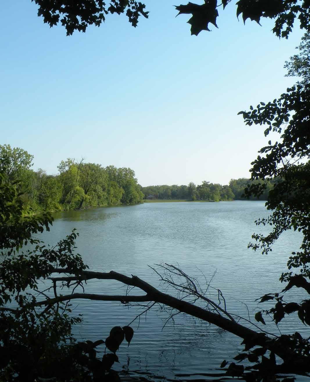
SHADYSIDE LAKE RECREATION AREA
829 ALEXANDRIA PIKE
The western portion of the fitness trail is built on top of a levee that separates the two lakes from Killbuck Creek. Reinforced concrete armor stabilizes the east embankment of the levee. However, exposure of the armor at isolated areas along the bank and trail shoulder indicate that wave motion within the lake and seasonal flooding of Killbuck Creek have caused significant erosion and washout. The western portion of the trail is densely shaded by tree cover and understory growth. Much of this understory growth is dominated by invasive bush honeysuckle.
Several giant metal sculptures depicting humans in a walking motion are found near the eastern trail segment in open lawn areas. Each sculpture has been adopted by a local agency and painted to represent the organization or a local landmark.
The Shadyside Lake Activity Center is located near the east central shoreline of the southern lake. The center includes public restrooms, a game room, and storage space. Six outdoor pickleball courts enclosed by a chainlink fence are attached to the activity center. Tennis courts were retrofitted to create the current pickleball courts. Sports lighting and bleachers are provided within the court area.
A large playground is located between the two lakes near Alexandria Pike. New playground equipment was installed in 2023. The playground features several large net climbing structures, a swing set, and other freestanding play components.
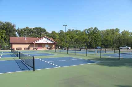
DRAFT
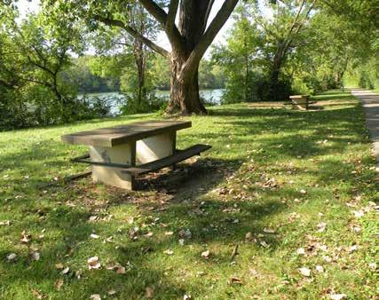
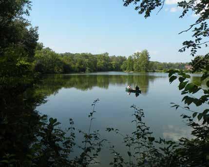
Shadyside Recreation Center and Pickleball Courts
Bobber’s Cafe & Bait and Tackle Shop
Picnic Area near Lakeshore
View of South Shadyside Lake looking North
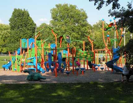
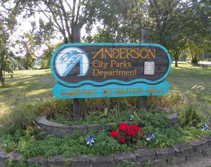
DRAFT
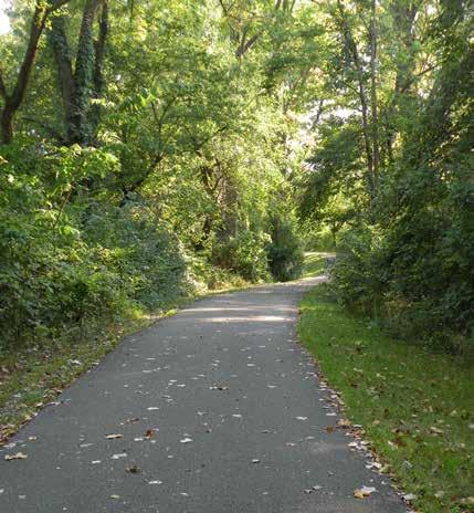
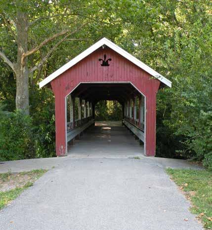
Covered Pedestrian Bridge
Park Sign at Cross St. and Alexandria Pike
Paved Look Trail
Public Art
Alexandria Pike Playground
SHEPHARD PARK
1415 RANGELINE ROAD
Shephard Park is a 10-acre suburban park located along the easternmost outskirts of the city’s corporate limits in Union Township. The 1,335 x 330-foot rectangularshape parcel is surrounded by agricultural farmland to the north, south and west. A small neighborhood with ranchstyle single family dwellings is located opposite the park on the east side of Rangeline Road. The park is located approximately 0.6 miles south of Highland Middle School. No sidewalks are constructed along Rangeline Road. The park is not located along a public transit route. The park is solely accessible by private vehicle.
The park has experienced decline in recent years due to decreased park usership. The north, south, and west edges of the park have become overgrown with dense tree canopy and woody growth of invasive understory honeysuckle shrubs. The easternmost portion of the park is dominated by a gently rolling mowed lawn. Several deciduous hardwood trees dot the lawn area. A short, paved access drive leads from Rangeline Road to a small parking lot. Remnants of a four-court tennis court is situated north of the parking lot. Multiple large longitudinal and transverse cracks have permeated the full depth of the tennis court pavement. The painted surface has faded significantly from multiple seasons of UV-exposure. The tennis nets and posts have been removed from the park altogether. Another large asphalt pad – presumably a former basketball court - can be found farther west of the tennis courts in the open lawn.
A paved driveway characterized by noticeable surface cracking is located on the west side of the parking lot. It follows the southern property line and leads farther west into the park. The driveway terminates at several piles of debris and construction waste. The westernmost 4-acres of the park have been left to naturalize. Successional hardwood trees have emerged from a meadow of tall grasses.
DRAFT
PARK AMENITIES
Open lawn

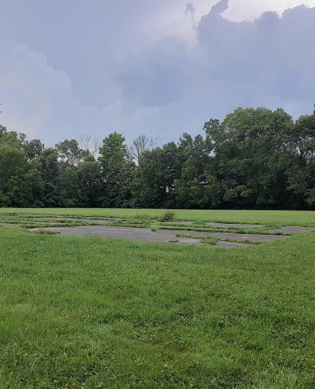
SHEPHARD PARK
1415 RANGELINE ROAD
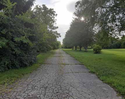
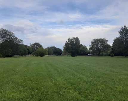
DRAFT
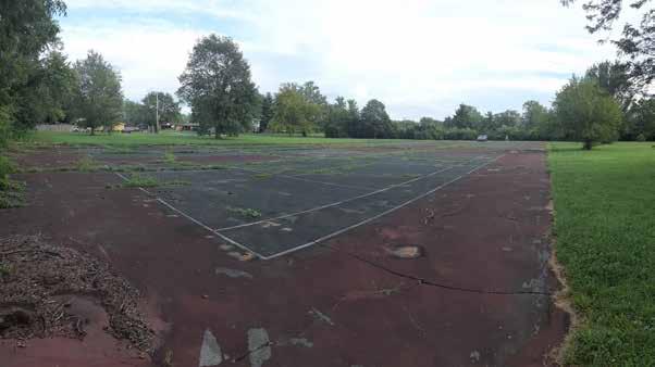
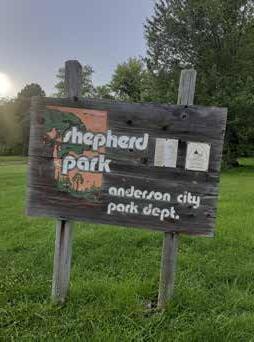
Deteriorating Former Tennis Court
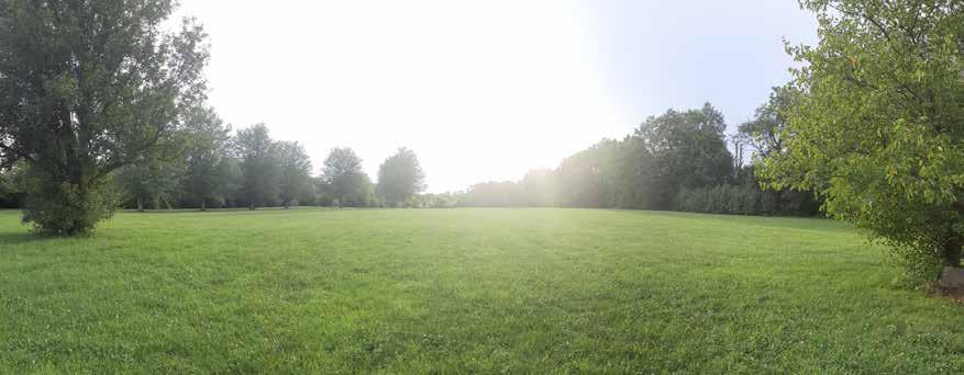

Recreation lawn looking east
Recreation lawn looking west
Park Sign
Paved Driveway Leading to the Back of the Park
Vehicular Drive
Parking Lot
Open Lawn
Former Tennis Courts
Concrete Pad
Woodland Border
SOUTHSIDE POOL AND SPORTS COMPLEX
4530 MADISON AVENUE
Southside Pool & Sports Complex is an 18.8 acre facility located on the south side of Anderson immediately north of Anderson High School. The pool facility is accessed from Madison Ave. on the west via an asphalt drive where a wooden park sign announces arrival. Madison Ave. has sidewalks within the street right-of-way, but the pool entry drive does not provide sidewalks that connect to the street. The parking lot is unstriped and no accessible parking spaces are provided. A sidewalk exists parallel to the parking lot that is grade separated by a tall curb. No curb ramp is present to provide an accessible route from the parking lot to the pool bathhouse.
Amenities within the pool facility include a large bathhouse, twenty-five-yard swimming pool, zero entry pool, diving board, and large pool deck with multiple picnic tables, lounges, planters, and site furnishings. A six-foot-tall chain link fence surrounds the perimeter of the pool and connects to the bathhouse. The bathhouse features an event space, men and women’s restrooms and locker rooms, concession’s room, office, and mechanical room. Some windows within the building are missing and in need of replacement.
DRAFT
PARK AMENITIES

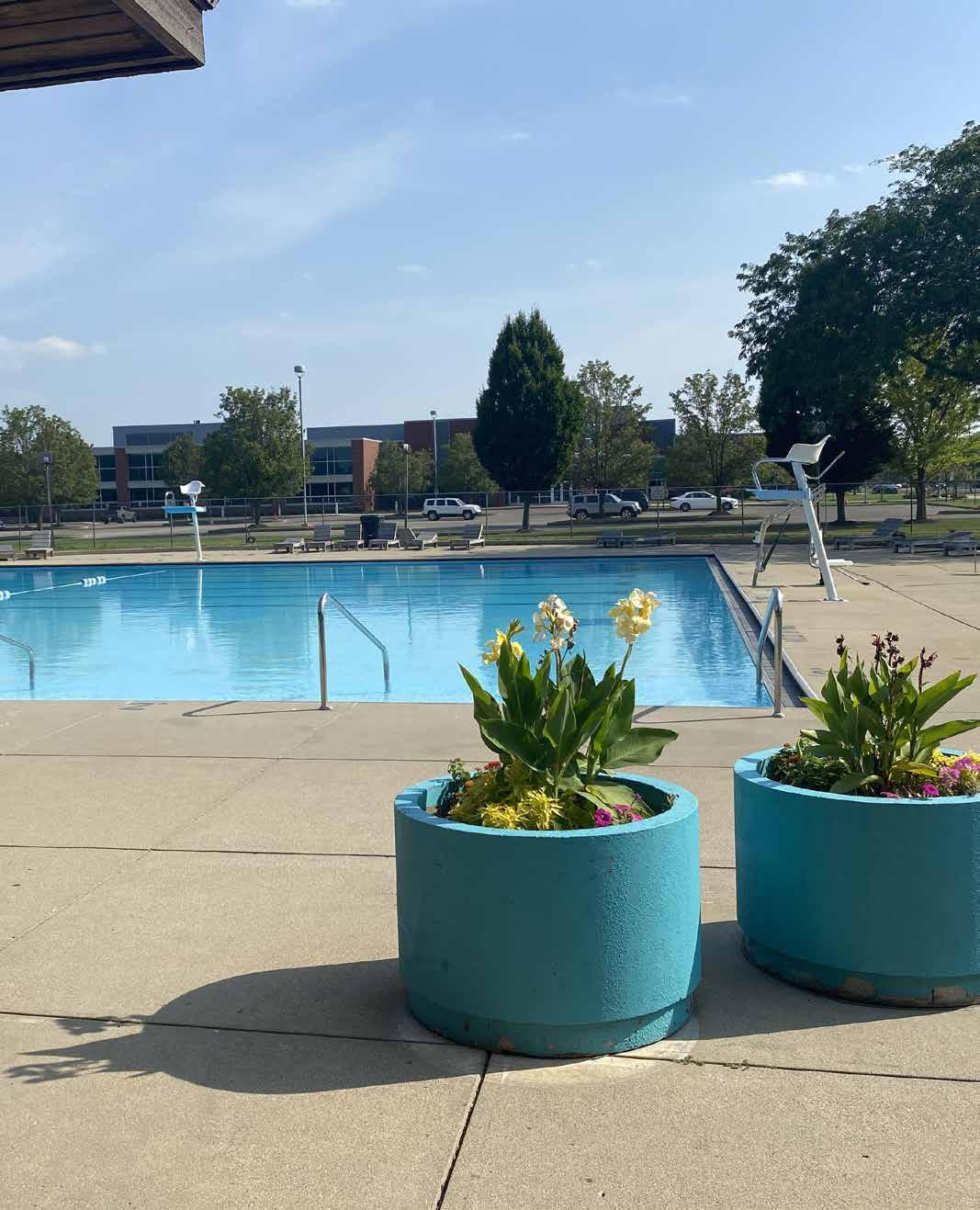
SOUTHSIDE POOL AND SPORTS COMPLEX
4530 MADISON AVENUE
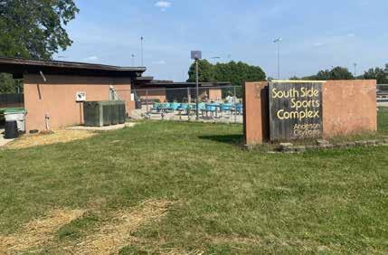
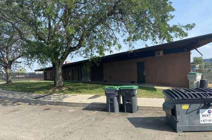
DRAFT

Bath House and Main Entrance
Main Entrance and Municipal Swimming Pool
STREATY PARK
2000 PARK AVENUE
Streaty Park is a 6.0 acre park located southwest of downtown near the intersection of W. 19th St. and Park Ave. It is surrounded by single-family residential development on the west, light industrial and commercial development on the north, south and east, and a railroad to the south. Three vehicular entrances to the park occur from W. 19th St. and Park Ave. Each entrance has a vehicular parking lot surrounded by wooden posts to eliminate vehicles from traveling beyond the designated parking areas. Park signage is located near the central parking lot from Park Ave. The north and central parking lots are paved and striped, however, no accessible parking is provided. The southern parking lot is paved but unstriped, and the asphalt is deteriorating. Sidewalks along Park Ave. provide pedestrian access from adjacent neighborhoods to the park’s western entrances and a wide asphalt path extends through the park connecting the north and central parking lots.
DRAFT
From the asphalt path, two picnic shelters are accessible from concrete sidewalk connections. One shelter is a wood frame structure with three accessible picnic tables. The second shelter is a steel frame structure that features two picnic tables, one of which is accessible, and two permanently mounted charcoal grills in the adjacent lawn. A large playground is also accessible from the central asphalt path. The playground features recently installed playground equipment that includes a large 5-12 play structure, a spinner/merry-go-round, a zip line, climbing wall, two ground mounted spring riders, and a large swing set. The swing set is a four-bay swing with four belt swings, two toddler swings, an accessible swing, and a generational, or adult/child swing. The surfacing surrounding the playground is engineered wood fiber mulch.
A restroom building featuring a single men’s restroom, and a single women’s restroom, as well as a central storage/mechanical room is located near the middle of the park. The restroom building has an accessible concrete stoop adjacent to it but there is no accessible route to the building from the parking lots or central asphalt path. Two full-size basketball courts are located on the south side of the park adjacent to the south parking lot. A tall fence separates the basketball courts from Park Ave. and eliminates errant balls from getting into the street. Multiple, free-standing benches are located throughout the park in lawn areas and litter receptacles are provided in high use areas.

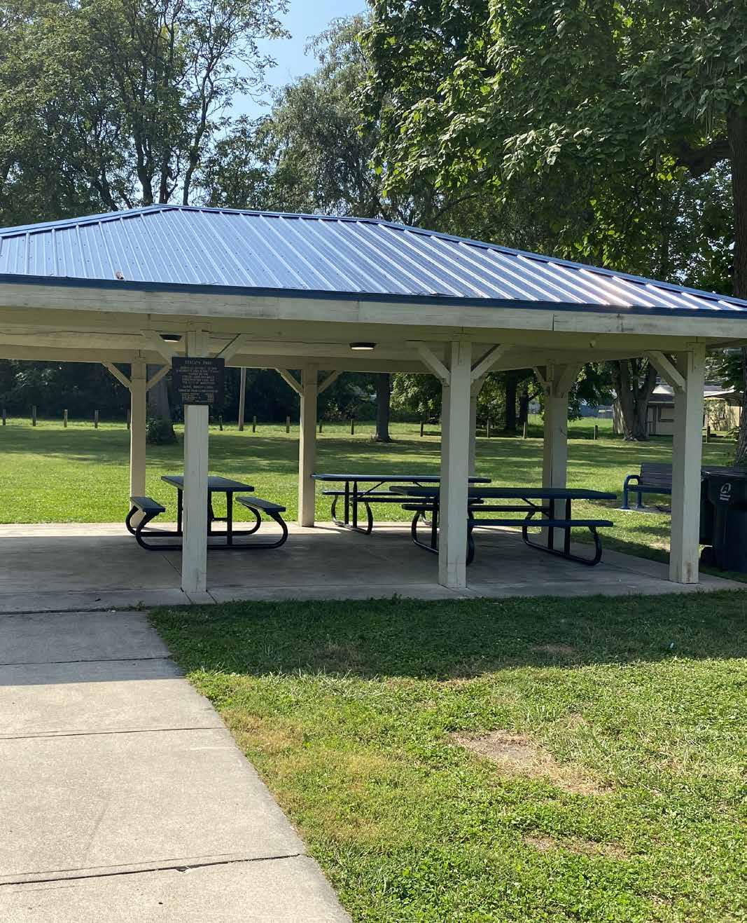
STREATY PARK
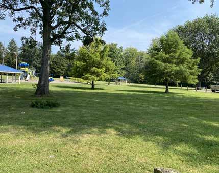
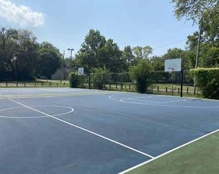
DRAFT
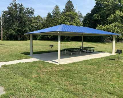
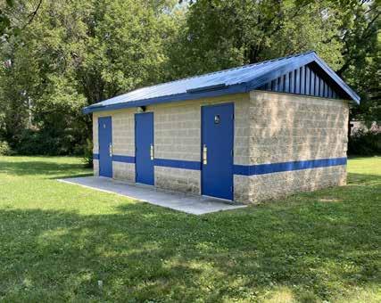
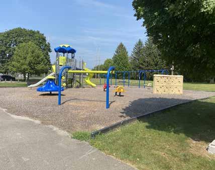
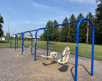
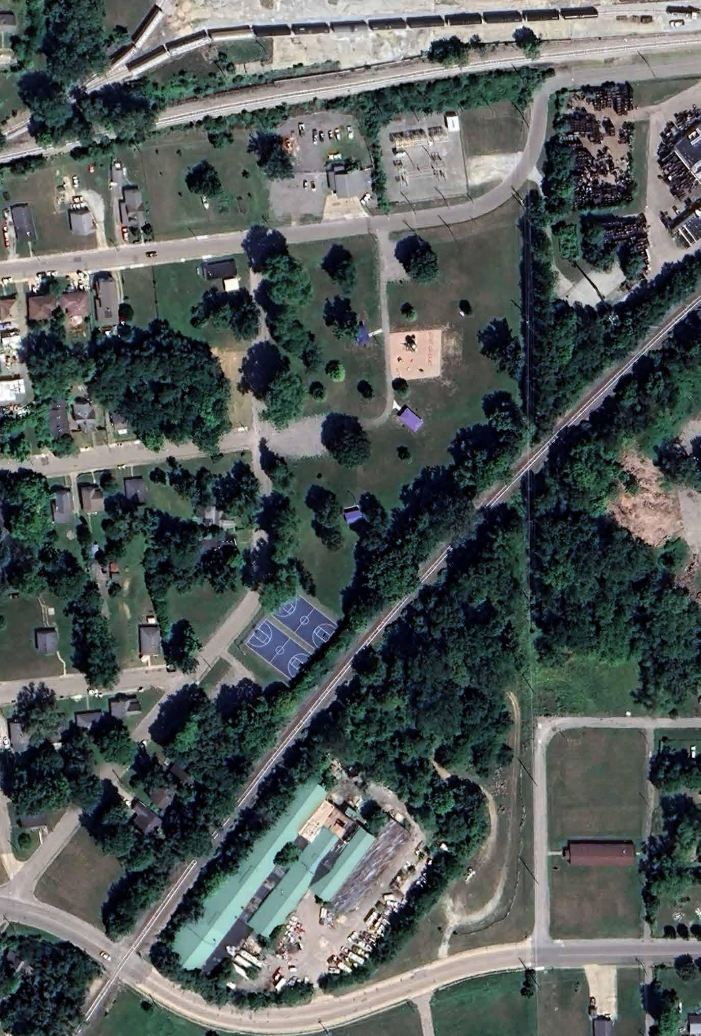

Open Air Shelter
Basketball Courts
Playground
Restroom
Swing set with belt seat, tot set, & adaptive zero-G seat
Recreation Lawn
W 21ST
WALNUT PARK
1715 WALNUT STREET
Walnut Street Park is a 2.8 acre park located southeast of downtown. It is bounded by Grant St. on the north, a railroad on the west, E. 19th St. on the south, and Walnut St. on the east. Selective clearing of overgrown vegetation along the railroad is currently underway and there is no barrier separating the park from the railroad. The park is surrounded by single-family residential development on all sides. There is no dedicated parking lot for the park, however, on-street parking is available along Walnut St. The park is accessed from the west Walnut St. sidewalk but there are no accessible routes connecting the sidewalk to the park amenities.
Amenities within the park include an open lawn on the south, two full size basketball courts, a picnic shelter, playground, informal baseball field with back stop, and open lawn on the north. A wooden park sign is located north of the playground oriented towards Walnut Street. The picnic shelter features two picnic tables, a litter receptacle, and two ground mounted grilles in the adjacent lawn. The playground includes an age 2-5 play area with a small slide and two ground mounted spring riders surrounded by engineered wood fiber mulch. A two-bay swing set is located in the lawn adjacent to the small play area that contains four toddler swings. A merry-go-round is located in the lawn between the 2-5 play area and the 5-12 play area. The 5-12 play area includes a tower play structure with two slides and multiple climbing elements and a two-bay swing with four belt swings surrounded by engineered wood fiber mulch play surfacing. A free-standing, ground-mounted climbing feature is located in the lawn immediately adjacent to the tower structure. Multiple freestanding benches are located throughout the park.
DRAFT

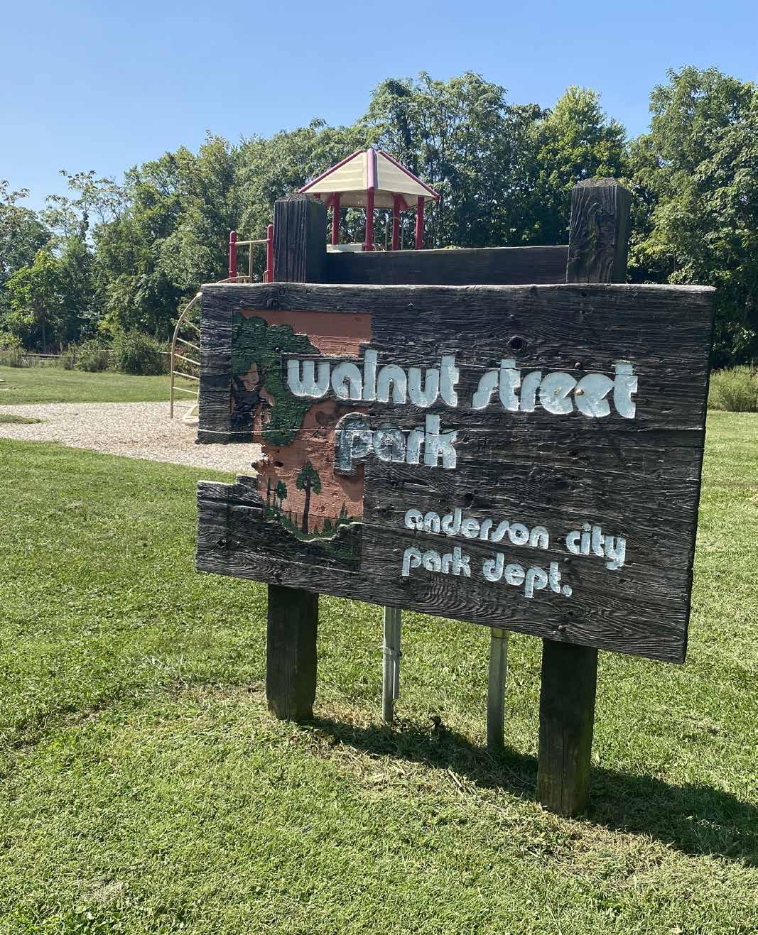
WALNUT PARK
1715 WALNUT STREET
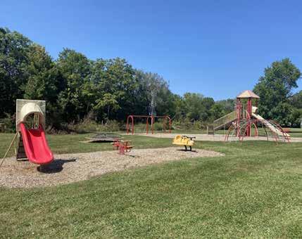
DRAFT
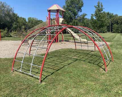
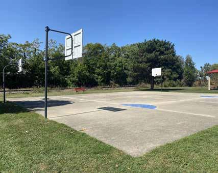
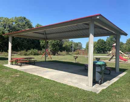

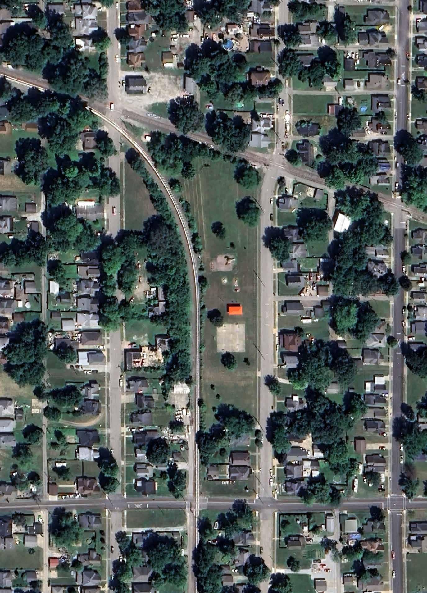

Jungle Gym
Playground
Open Air Shelter
Basketball Court Merry-go-round
Baseball/Softball Field
WARREN MILLER PARK
2801 FAIRVIEW STREET
This 7.10-acre park is in the city’s central neighborhood near the intersection of 27th Street and Madison Avenue. Single-family housing is located along the eastern, southern, and western borders of the park, while multi-family housing is located along the northern fringe. A vacated 0.4-acre paved commercial lot is located near the southwest corner of the park at the intersection of W. 29th Street and Fairview Street. Vehicular access to the park is available through two points of entry along Fairview Street and one point of entry along Madison Avenue. A paved roadway navigates through the park. Parking in the grass is mitigated by the placement of large boulders along the shoulder of the road.
The Park’s facilities include Memorial Field, the Old Trustees Building, and the Park Department’s maintenance facility. Memorial Field is located near the southwest corner of the park near the Old Trustees Building. The baseball field includes grandstands, enclosed dugouts, concession stand, pressbox, sports lighting, and an outfield scoreboard. Two smaller baseball and softball diamonds are located along the norther perimeter of the park. These diamonds are in significant disrepair with the spectator bleachers taken over by uncontrolled vegetative growth and faded infield markings.
The Old Trustees Building was purchased by the Park Department during the last decade. The building includes meeting rooms and office space. However, the space is somewhat underutilized by the public. The maintenance building and stock yard is enclosed by a chain-link fence. Park equipment, vehicles, and machinery are stored within the compound.
DRAFT
Rolling terrain creates an elevated urban forest of dense tree canopy along the eastern portion of the site. An open-air shelter and playground are nestled within the understory of the forest. The playground includes a large climbing tower with slides, swings, and freestanding play elements. An informal gravel area south of the playground and shelter provides space for vehicular parking. No accessible pathway is provided from the parking area to the shelter or playground.
A 12-pit horseshoe game court is located south of the wooded area. A decline in popularity and a lack of maintenance has led the pits to become overgrown with vegetation.
A small, paved parking area and restroom facility are located west of the playground. The exterior façade of the restroom is painted with a colorful mural. A large municipal water tower and pump house are located near the center of the park. The tower and pump house are enclosed by a security fence and monitored by surveillance cameras.
PARK AMENITIES

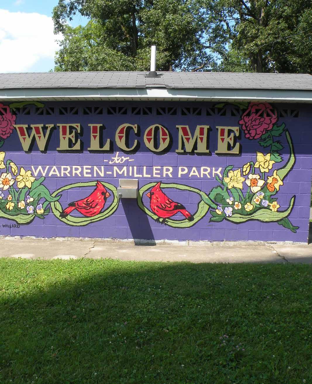
WARREN MILLER PARK
2801 FAIRVIEW STREET
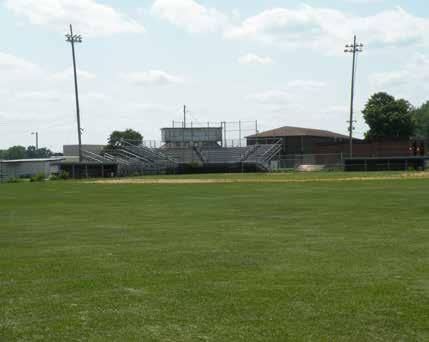
DRAFT
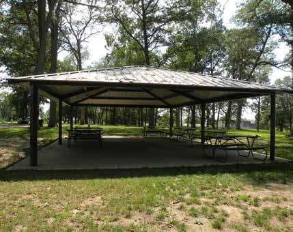
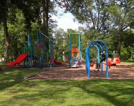
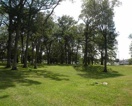

Anderson Municipal Water tower
Memorial Field
Playground
Open air Park Shelter
Passive lawn area below mature shade trees
SHERMAN
SHERIDAN
WHITE RIVER TRAIL
1300 BLOCK OF S. SCATTERFIELD RD TO GRAND AVENUE
White River Trail is a 4.3-mile walking and bicycle pathway that follows the riparian flood plain of the East Fork of the White River. The trail offers a variety of recreational opportunities including walking, jogging, running, roller skating, horseback riding, and bird watching. The trail connects several significant open spaces including Edgewater Park, Athletic Park and Pool, Killbuck Wetlands, Derby Downs, and River Bend Park in addition to the downtown district via the Thomas McMahan Riverwalk.
In addition to serving as a linear greenway for pedestrians, the trail also serves as a significant ecological corridor and conservation buffer along the shore of the White River. The trail navigates through various flood plain forests and wetlands. Scenic views of the river are framed along the river by subtle curves along the trail and opening within the riparian habitat.
The predominately paved trail begins as a gravel path on the northern shoreline west of Scatterfield Road. A gravel path leads from the parking lot of Liberty Christian School to the start of the trail. The trail navigates across sensitive habitat via a series of wooden boardwalks before transitioning to a paved path near Imel Drive. A spur of the trail leads to a small parking lot near the terminus of Imel Drive. An accessible parking space is provided near Imel Drive.
The paved trail meanders through a wooded habitat before arriving in the open, meadow-like landscape of Edgewater Park. Here, the flat lowlands of the river’s flood plane are visible while an earthen levee provides flood protection for adjacent neighborhoods. Parking and access to the trail is available from Edgewater Park.
DRAFT
The trail continues northward towards downtown. The trail connects to the Thomas McMahan Riverwalk near the intersection of Ruddle Avenue and E. 9th Street. A historic, blue-painted truss bridge provides pedestrian access across the White River to the western shoreline and the Thomas McMahan Riverwalk. The bridge is an ideal spot for scenic photographs. A small parking lot and trailhead are also located east of the bridge.
The paved trail crosses under E. 8th Street before arriving at Athletic Park and Pool. The trail rises above the park and follows the crest of the Army Corp. of Engineers’ (ACOE) levee before navigating under the Main Street bridge. Paved switchbacks provide access to the trail from both E. 8th Street and Main Street.
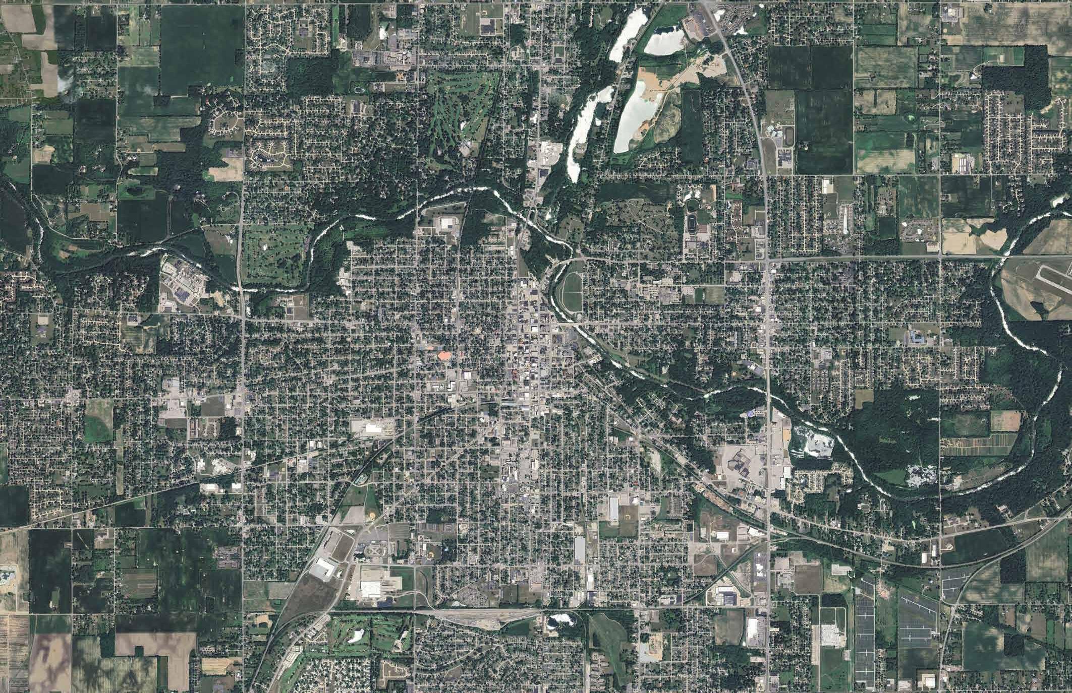
The trail parallels the White River within the right-ofway of E. Grand Avenue between Main and Broadway Street. A series of terraced wooden boardwalks, ornate pathway lights, and overlooks along this segment provide
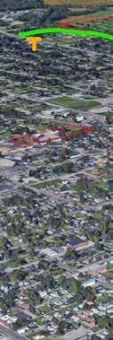
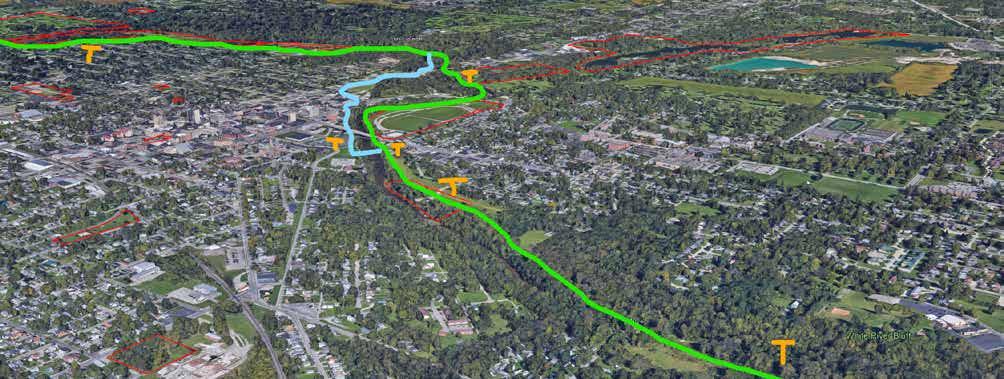
A bird’s eye view of the White River Trail system - looking northwest from Scatterfield Road
WHITE RIVER TRAIL
1300 BLOCK OF S. SCATTERFIELD RD TO GRAND AVENUE
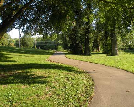
DRAFT
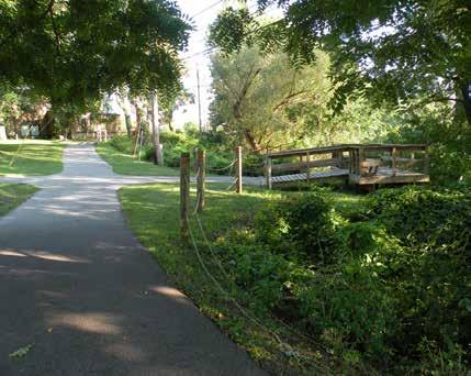
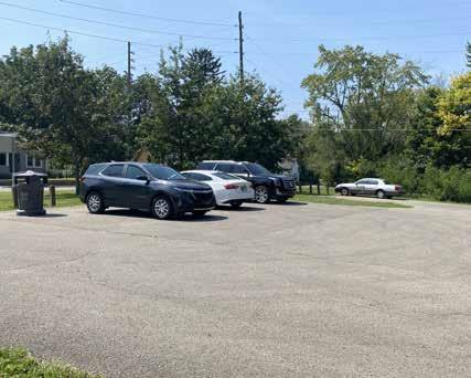
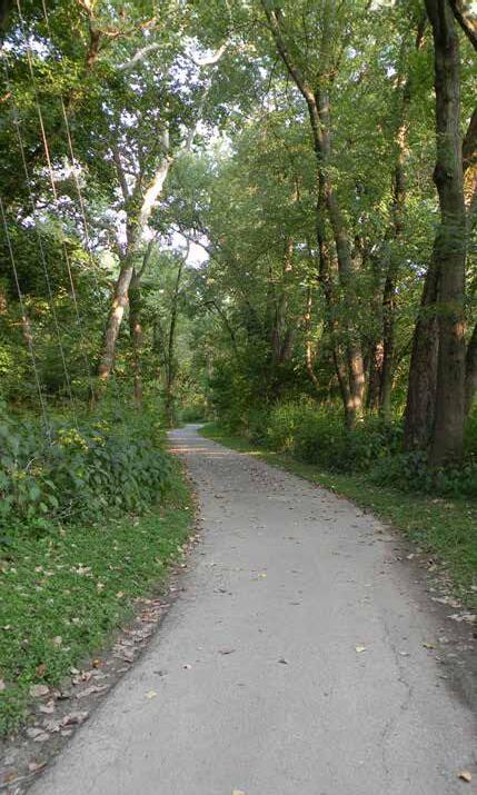
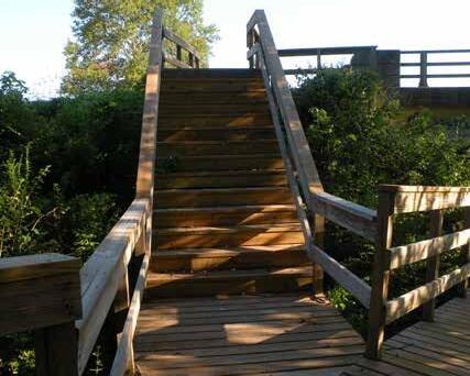
Paved trail near Edgewater Park
A meandering paved trail near Killbuck Wetlands
Eighth Street Trailhead
White River overlook near E. Grand Ave.
Boardwalk near University Blvd. & E Grand Ave.

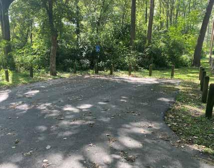
DRAFT
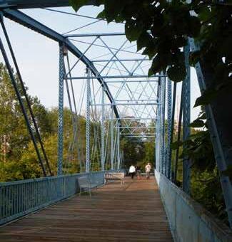
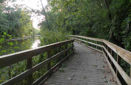
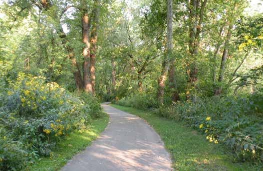
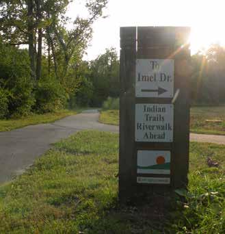
Many wildflowers can be viewed from the trail Imel Drive Trailhead
The paved trail meanders through the riparian hardwood forest
Wooden boardwalks provides access over sensitive landscapes
Trail spur to the Imel Drive Trailhead
Blue Truss Bridge
THOMAS M c MAHAN RIVERWALK
300-500 BLOCK MAIN STREET
The Thomas McMahan Riverwalk constitutes a section of the White River Trail that is located along the northeast side of downtown and immediately adjacent to the White River. The primary entrance to the riverwalk occurs at the intersection of Central Ave. and E. 7th St. The riverwalk features secondary entrances where the White River Trail intersects the Main St. and E. 5th St. intersection on the west and where it intersects a large parking lot serving Madison County Division of Family Resources and Health Department on the east.
From the primary entrance, the riverwalk is accessed from an extensive boardwalk that is marked accessible; however, the boardwalk is elevated above the connecting sidewalk more than two inches, and the boardwalk accesses the sidewalk at a curb ramp location making it difficult by wheelchair. The upper level of the boardwalk is significantly elevated above the White River Trail and trail users navigate the terrain by a boardwalk ramp system or a series of boardwalk steps. Constructed overlooks provide attractive views of the White River. At mid-level, the boardwalk connects to the White River Trail on the east and west. A lower boardwalk level steps down closer to the White River and a series of shade structures, benches, and decks provide unique access and views of the White River Corridor.
West of the boardwalk, the riverwalk transitions back to an asphalt path where it eventually forks, allowing users to continue to follow the river or to transition back towards Main St. At the fork in the trail, a shaded gathering node provides access to a gazebo, Desert Storm War Memorial, and a picnic area.
PARK AMENITIES
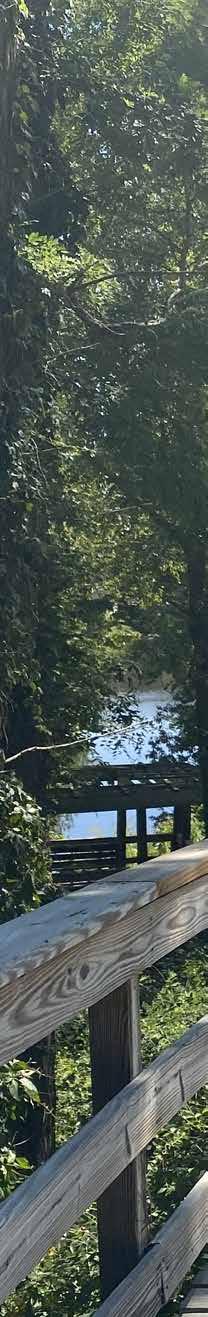
Multi-use Trail
Picnic Shelter
Boardwalk
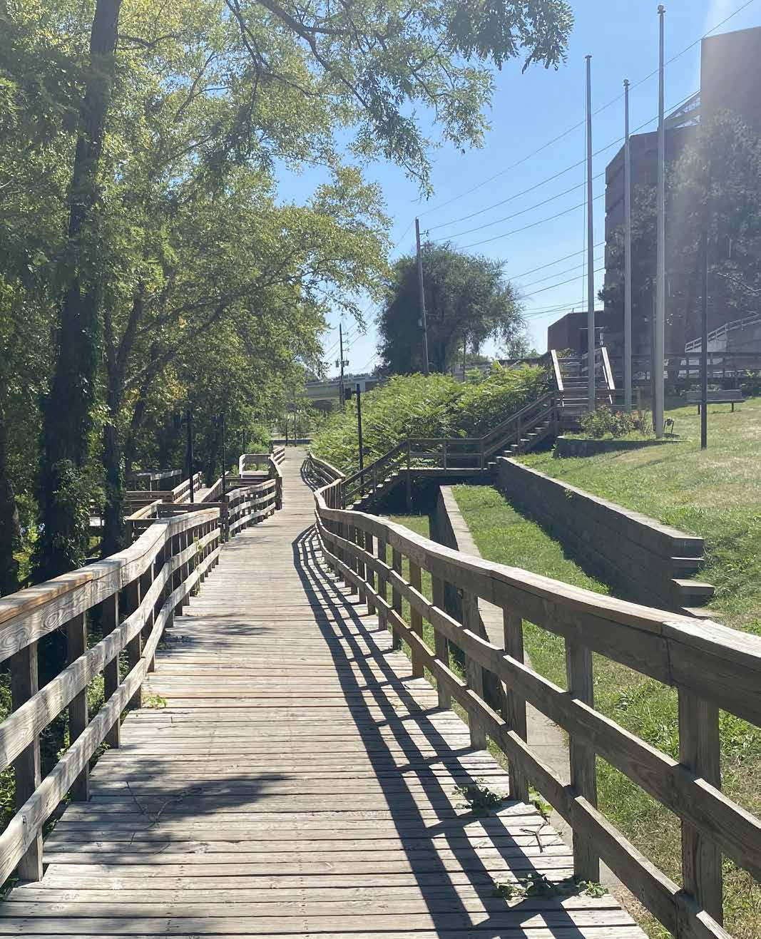
THOMAS M c MAHAN RIVERWALK
300-500 BLOCK MAIN STREET
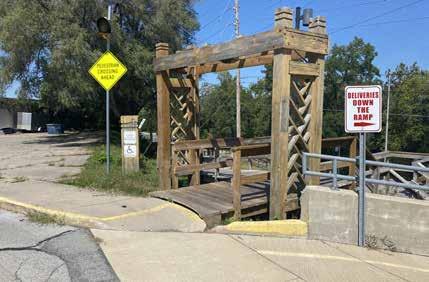
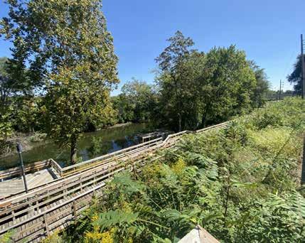
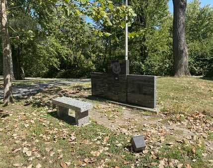
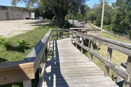
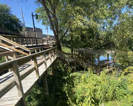
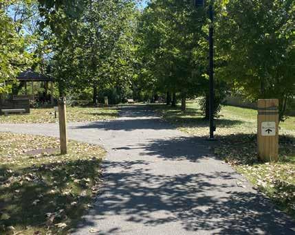
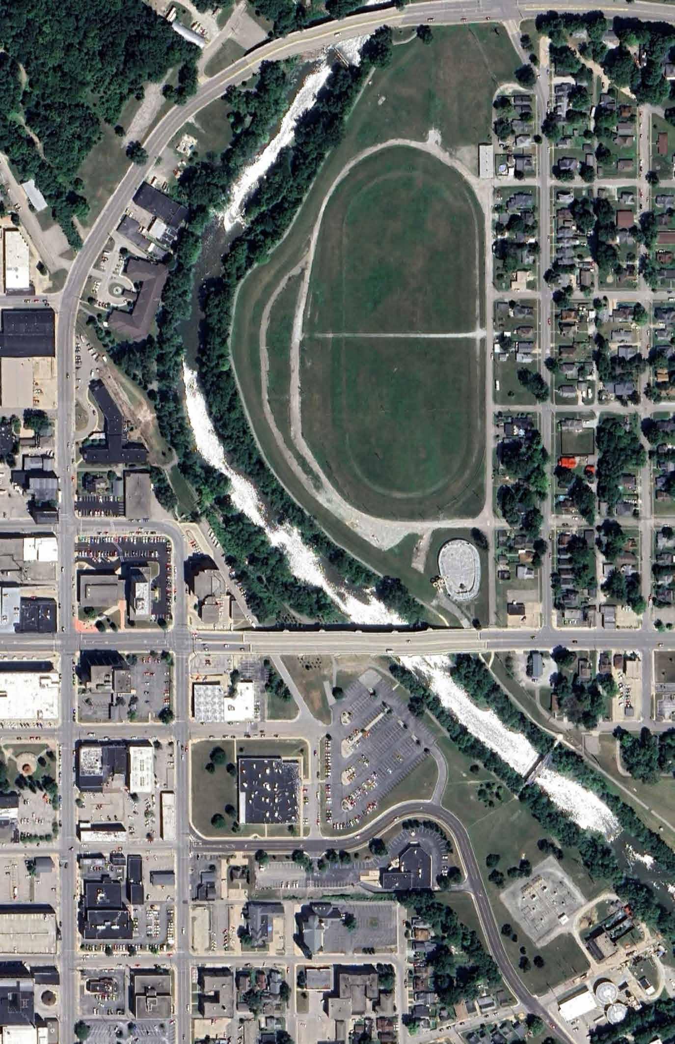
Upper Level Boardwalk Overlook
Upper Boardwalk Ramp
Desert Storm War Memorial
Lower Boardwalk Gathering Area
Trail Signage and Gazebo
Central Ave. and E. 7th St. Intersection Entrance
MOBILE STAGE
The Mobile Stage is a portable trailer with an integral performance stage built into the frame. The performance platform is 8-feet wide by 32-feet-long but can be expanded to 16-feet by 32-feet. The stage includes a canopy cover and is used at multiple parks for various events such as the city’s neighborhood block parties. The stage may be rented by the public. However, it must be used on city-owned property and cannot be reserved for private functions. The stage is stored at the Park Maintenance Facility near Warren Miller Park when not in use.
DRAFT

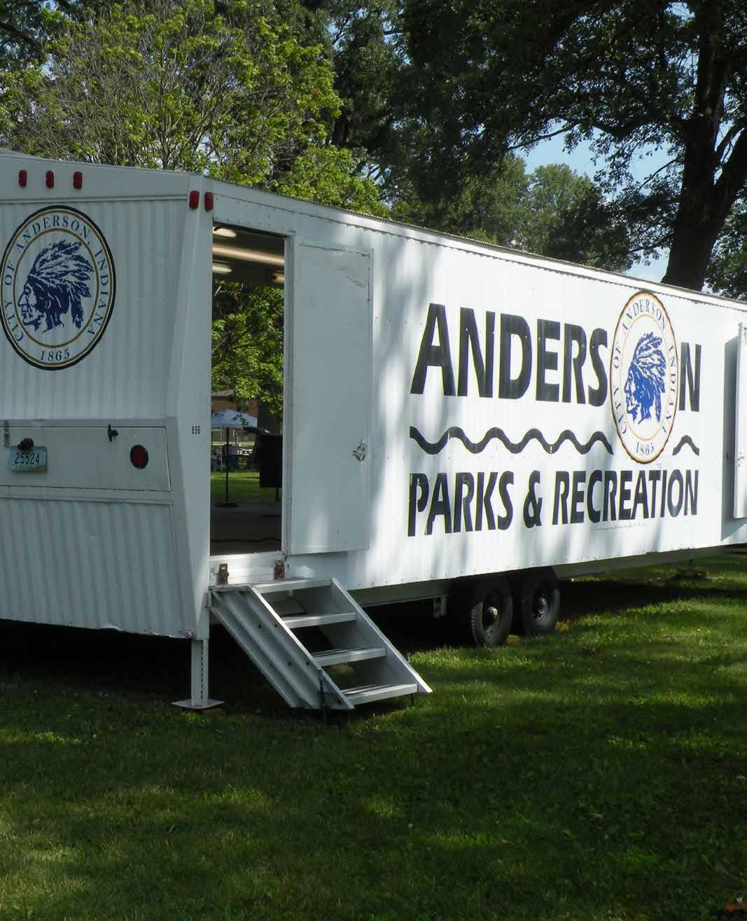
ACCESSIBILITY REVIEW
ACCESSIBILITYDRAFT
The City of Anderson values everyone’s civil rights and wishes to provide equal opportunity and equitable services for the citizens of the city. As a recipient of federal funds, the City of Anderson is required to conform to Title VI of the Civil Rights Act of 1964 (Title VI) and all related statutes, regulations, and directives, which provide that no person shall be excluded from participation in, denied benefits of, or subjected to discrimination under any program or activity receiving federal financial assistance on the grounds of race, color, age, sex, disability, national origin, ancestry, religion, or income status. Additionally, in accordance with Title II of the Americans with Disabilities Act, when structural changes are made to a facility and changes are needed to address ADA accessibility, these changes must be made during the facility improvements.
The city posts their Title VI obligations within each of their department offices, as well as online in multiple locations. The city has created a brochure summarizing Title VI, the city’s requirements and committments, citizen rights, and the process for filing a grievance, which can be found at: https://www.cityofanderson. com/DocumentCenter/View/3304/Title-VI-Brochure
Additionally, the parks and recreation department’s main webpage has a link to “Report a Concern” where users are able to report and track concerns related to accessibility and a variety of other issues.
The city contact for additional information on Title VI and for filing a complaint is:
Ms. Tamie Dixon-Tatum Title VI Coordinator 120 E. 8th St., Anderson, IN 46016 765-648-6136 tdixontatum@cityofanderson.com
The City of Anderson also has an ADA Transition Plan that is updated annually in coordination with the Madison County Council of Governments (MCCOG) who serves as the Metropolitan Planning Organization (MPO) for all of Madison County. The plan is available at https://www. heartlandmpo.org/ADATitleVI and outlines grievance procedures and provides the ADA Coordinator’s contact information which is listed on the following page.
Madison County’s ADA Coordinator is:
A lack of an accessible route leading to the public restrooms in Streaty Park
Mr. Ryan Phelps, AICP, PTP, RSP1
Principal Transportation Planner Systems Planning, Analysis, & Forecasting Madison County Council of Governments 739 Main Street, Anderson, IN 46016
For specific information related to accessible features and programs within each individual park, the public is encouraged to contact the Parks and Recreation Department at 765-648-6858, or by email at parks@ cityofanderson.com.
The individual park assessments within this master plan identify specific needs within each park facility, but general recommendations include the following:
Parks and Recreation Website: Although it is available through the City of Anderson’s main website, the parks and recreation website lacks a direct link to the City’s Title VI obligations and ADA Transition Plan. Additionally, not all city parks are represented on the website and there aren’t specific details highlighting the accessible features of each individual park. Updates to the department’s website should include direct links to the city’s Title VI and ADA information, as well as more detailed information on each park highlighting accessible features and accessible parks’ programming opportunities.
Parking Lots: Many parking lots lack dedicated ADA parking. Where paved parking lots are present, most lack required pavement striping, access aisles, and signage. Some parks do not provide paved parking lots and lack accessible surfaces.
Accessible Paths: Many parks lack accessible paths connecting parking lots to park amenities such as playgrounds, restrooms, benches, water fountains, and shelters among others. Additionally, some parks offer unique amenities such as kayak/canoe launches but accessible paths are not provided. Some priority should be given to establishing accessible routes to unique park system amenities.
DRAFT
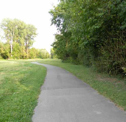
Playground Surfacing: Most playgrounds provide engineered wood fiber mulch (EWF) as the accessible play surface. Many playgrounds are in need of surface maintenance to meet required accessible heights.
Accessible Seating: Accessible picnic tables are provided within most picnic shelters, however several parks and shelters lack accessible picnic tables. Additionally, benches are provided in most parks, but they generally lack accessible routes and companion spaces for 50% of park benches.
Communication and Signage: Several parks lack signage and/or signage is in poor condition which makes it difficult to identify city parks in some instances. Additionally, the department website does not list all city parks and the website could be improved to identify the accessible features within each park.
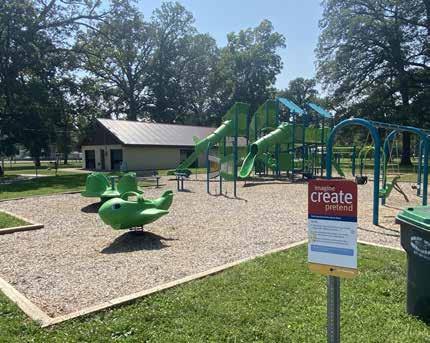
Killbuck Creek Wetlands.. Parking priority for an aging population.
White River Trail. A paved multi-use trail near Edgewater Park
Jackson Park Engineered wood fiber mulch is used as playground surfacing
PROGRAMMING & ACTIVITIES
The Anderson Parks & Recreation Department offers a diverse assortment of programs and activities for community members to improve their overall well-being and quality of life. Programs encompass a wide variety of topics including physical fitness, cooking, gardening, visual and performing arts, and local history. A few notable programs include:
• “Seedlings” Kids Garden Club meetings (SpringFall)
• Art Classes at various parks (Spring – Fall)
• Kid’s & adult art classes at Geater Community Center (Spring – Fall)
• Weekly or monthly aerobic, Hip Hop aerobic, and Chair exercise classes at Geater Community Center (Spring - Fall)
• Line dancing class at Geater Community Center (Spring - Fall)
• Spring Break programs & activities at various parks (March)
• Seed Swap at Jackson Park (March)
• Earth Day & Arbor Day community program (April)
• Art in the Park (May)
• Bike Safety Day (June)
• Summer Scavenger Hunt and Bubble Party (July)
Summer Concert Series
The Anderson Park Summer Concert Series is a popular and signature reoccurring program within the community. This well-attended program attracts several thousand people every-other Friday evening to the performance stage at Dickmann Town Center in downtown Anderson. Local and regional musicians and bands perform a variety of music genres (R&B, country, rock, etc.) for several hours on the stage. The concert is often accompanied by children’s activities. Local restaurants and food truck vendors offer food for attendees.
Notable 2024 performances include:
• Friday, June 7 – Cook & Belle
• Friday, June 21 – Magnolia Soul
• Friday, June 29 – Corey Cox (following the Independence Day Parade)
DRAFT
As seen above, programs and activities are scheduled throughout the year and accommodate a wide variety of users – including children, families, and adults. Several activities are offered as weekly classes, while others are seasonal. Children’s programs are often scheduled around local school calendars. Many activities are offered during Spring Break, Summer, and Fall Break.
The Geater Community Center provides a centralized location for many park classes. The facilities, classrooms, indoor gymnasium, game room, and kitchen accommodate many different programs and events. The indoor facility allows the Parks Department to schedule several winter activities that would otherwise be impractical during inclement winter weather.
• Friday, July 5 – Radio Junkies
• Friday, July 19 – The Doo
• Friday, August 2 – Toy Factory
• Friday, August 16 – Living Proof
• Friday, August 30 – Dane Clark
• Friday, September 13 – Soul Street
• Friday, September 20 – Groove Smash
• Friday, September 27 – Jai Baker

Skating
A temporary ice skating rink is installed within the plaza area of Dickmann Town Center from November to January. The installation of the skating rink coincides with the City’s annual Christmas Tree lighting and activities.
Winter at Dickmann Town Center
Tennis & Pickleball Courts
The Anderson Parks system includes several tennis and pickleball courts at Shadyside Lake Recreation Area, General Pulaski Park, and May Park. The courts are frequently used for pick-up games between residents. However, the courts are occasionally used for league tournaments and other special events. The parks department removes the nets from these facilities during the winter months. The nets are reinstalled in April.
Kayak and Paddleboarding
Anderson Parks also offers free, seasonal kayak and paddleboard rentals at Shadyside Lake Recreation Area. New paddleboards were purchased by the Anderson Parks Department in mid-Summer of 2023. The equipment, along with life safety vests, can be rented from Shadyside Docks Monday through Sunday, 12:00 pm to 6:00 pm during the summer months.


Youth Football League

month from May through September. The goal of this free community-wide event was to create stronger and positive relationships between residents and local law enforcement, government officials, and non-profit agencies. The block parties included free hot dog lunches, live music and entertainment, police and firefighter demonstrations, a petting zoo, an inflatable obstacle course, other children’s activities, and information booths for local non-profit organizations.
Block Parties were held at:
• May 11 @ Walnut Park
• June 8 @ Jackson Park
• July 20 @ May Park
• August 3 @ Pulaski Park
• September 14 @ Harmon Park
DRAFT
The Neighborhood Block Party program was considered a success for the many who attended.
Announcements
Many programs, activities, and special announcements are posted on the Anderson Parks & Recreation social media platforms. A monthly calendar is also frequently updated with upcoming events on the City’s website. In addition, flyers are placed on bulletin boards and inside kiosk at several of the parks. Registration forms and other announcements are emailed to previous event participants.
The Anderson Parks Department organizes an annual youth football league and summer camp for children enrolled in kindergarten through 6th grade. The camp occurs at the Anderson High School football field. The cost to participate is $65 per student. Pre-registration is required.
Neighborhood Block Party
In 2024, Mayor Thomas Broderick Jr. along with the Anderson Police Department and Anderson Parks & Recreation Department co-hosted a series of five neighborhood block parties. Each block party occurred at a different park on a Saturday afternoon once a
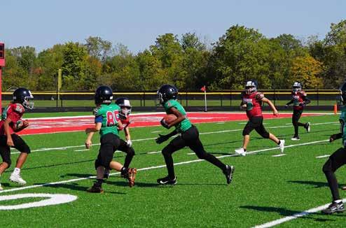
Children participate in the park’s Youth Football League at Anderson High School
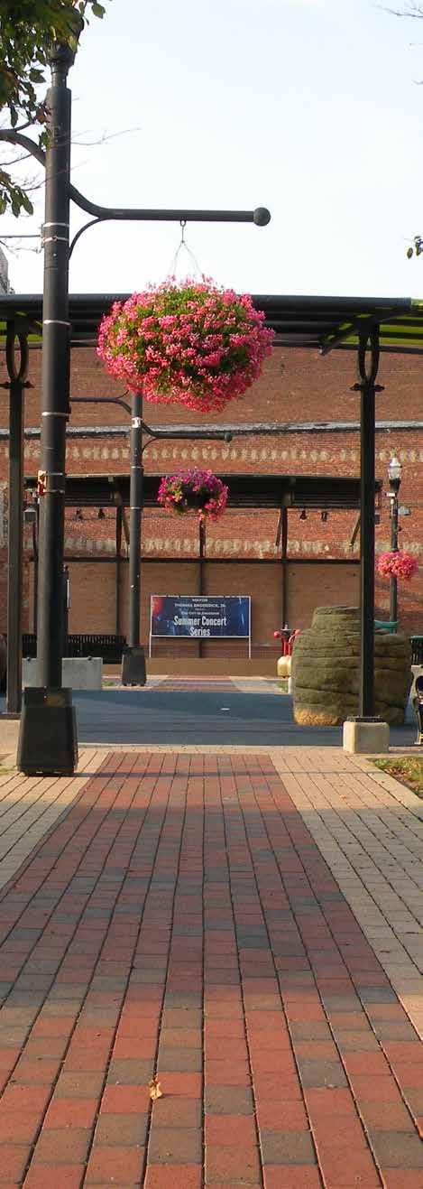
ANNUAL BUDGET
PARK BUDGET
The Anderson Parks and Recreation Department budget is allocated annually by the City Council as a part of the budget process and is comprised of revenues including property and auto-excise taxes, circuit breaker credits, facility rentals, vendor commissions, golf course revenue, and grant funding among others. These revenues are used to fund all aspects of the parks maintenance and operating budgets. The appropriated budgets for the last three years were as follows:
• 2024: $3,364,475.00
• 2023: $2,409,888.00
• 2022: $2,304,230.00
DRAFT
Improvements can also occur through monetary donations or donations of land. Additionally, the Parks Board can request additional funds from the city council on an as-needed basis to cover the operating, maintenance, and improvement costs.
FACILITY RENTALS
FACILITY USE
Residents have access to an assortment of various structures or sports facilities through the City of Anderson’s park system. Thirteen open-air picnic shelters are available for temporary use by the public for special events and activities. Basketball Courts at the Community Center, General Pulaski Park, and Streaty Park may be rented for tournaments and other activities. Most facilities are reserved on a day-by-day basis. However, several larger shelters and sports fields are available for multi-day use.
Park shelters may be reserved for a flat rate of $50 to $60. The most expensive facility to rent is Memorial Field at Warren Miller Park. It requires a flat rate fee of $300. The Park Department’s mobile stage may also be used by the public for a fee of $300. However, it must be used on city-owned property and cannot be reserved for private functions.
Residents must call the park office to schedule a reservation for use of any of the park facilities.
Dickmann Town Center
Anderson Parks & Recreation FACILITIES RENTAL SCHEDULE
Grandview
Shadyside Memorial Park
Shadyside Memorial Park
Shadyside Memorial
DRAFT
CURRENT NEEDS
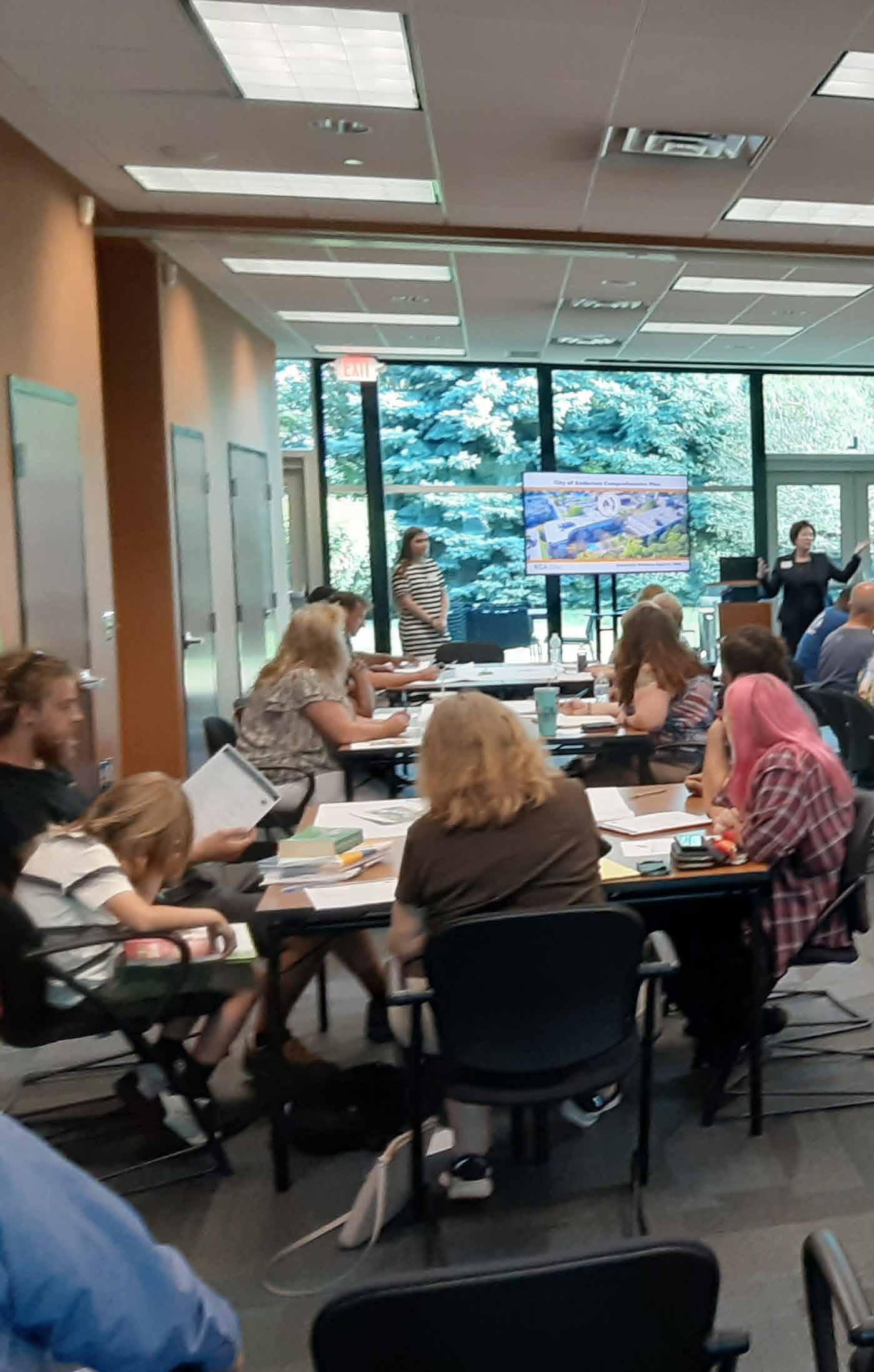
The following chapter outlines the procedure taken to identify the current strengths, opportunities, needs, and deficiencies within the Anderson Parks system. Public input was obtained by hosting a series of community open houses in conjunction with the development of Anderson’s Comprehensive plan. The feedback obtain from these meetings were combined with interviews conducted with current park employees to define the goals of the park department in addition to identifying future park improvement projects.
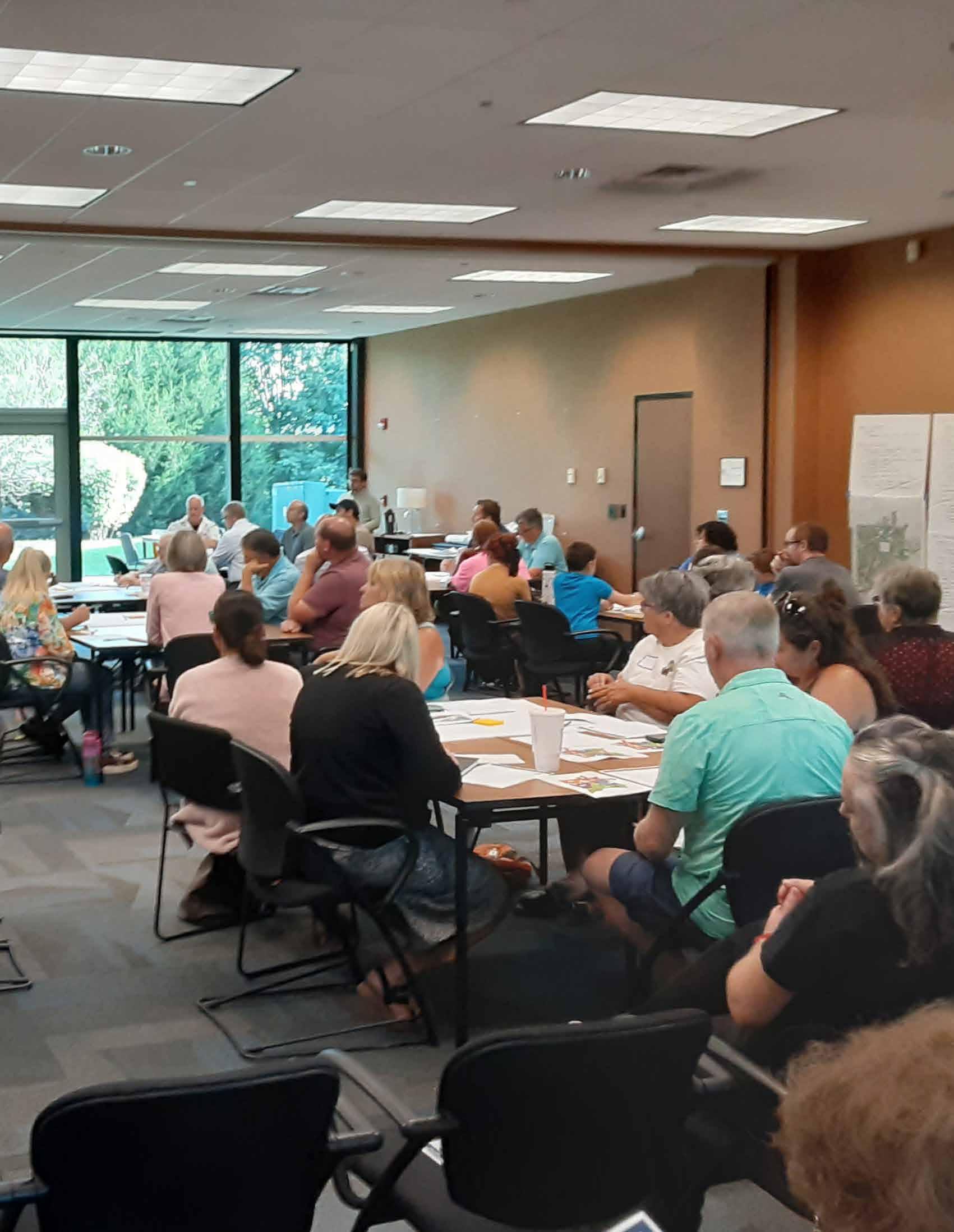
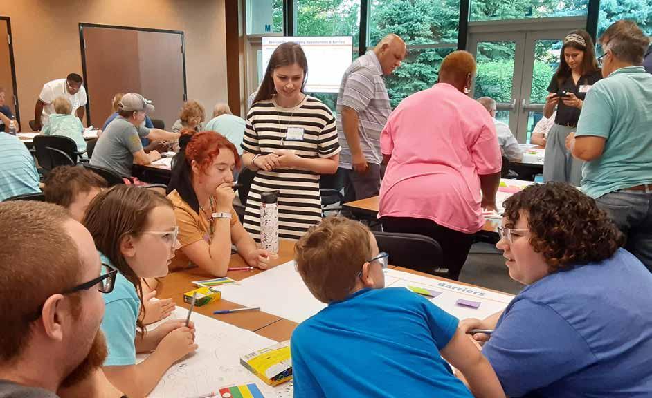
COMMUNITY PLANNING WEEK
DRAFT PUBLIC PARTICIPATION
The City of Anderson was undergoing a comprehensive plan update concurrently with the development of this five-year parks and recreation master plan. Public engagement for the comprehensive plan and the fiveyear parks and recreation master plan were coordinated to reduce “community planning fatigue” and to maximize community turn-out at events. From August 5th - 8th, 2024, the planning and design teams held a community planning week. The week began with a series of six focus group meetings. The focus groups were identified in collaboration with the project steering committee who provided contact information for the attendees. Direct email invitations were sent to each of the invitees two weeks in advance and specific focus groups included:
• City Departments
• Architects and General Contractors
• Social Services and Youth Organizations
• Downtown Businesses
• Large Employers/Land Owners
• Parks Department and Board
Each group included three to six invitees and the planning team met with them over the course of one hour. The groups were asked specific questions related to local strengths, weaknesses, opportunities, and threats. Notes were recorded on a flip chart and in digital format. The information gathered can be found in the appendices of this master plan.
That same evening, a public open house was held where the general public was invited to provide their feedback on the community and parks and recreation. The event was advertised in the local newpaper on August 2nd, 3rd, and 6th, 2024. In addition, a flyer was posted around the city and emailed to local interest groups, and a radio interview promoting the event was held on August 2nd. The public open housed attracted approximately 80 stakeholders who were asked a series of questions about a variety of subjects, including targeted questions related to parks. The information received at the beginning of community planning week was used to develop common themes for the comprehensive plan and five-year parks and recreation master plan. Once the common themes were identified, the planning and design teams used the information to generate a vision statement for the community guided by core principles and accompanying
Children and parents participate in an organized planning activity as a part of the City of Anderson Comprehensive Plan Planning Week in August 2024
goals. A summary of feedback from the public open house can be found in the appendices of this report.
Recurring themes related to parks and recreation strengths in Anderson included a recognition that the downtown square and gathering spaces serve as important hubs for social interaction and community events. The community also recognized the recent investment in parks’ facilities and appreciated the parks’ offerings, trail systems, and ongoing upgrades. The community noted the importance of these amenities in promoting tourism and economic development. Regarding weaknesses, the community noted concern over blighted properties and needed investment in public infrastructure. Limited financial resources were noted as barriers to more extensive investment in public facilities and parks.
The vision statement created during the community planning week was as follows:
Anderson is a thriving, diverse, family-friendly, and welcoming community that offers a high-quality of life for residents by focusing on sustainable growth and redevelopment that highlights the area’s natural features and community assets. Anderson’s future is one where:
• New development and investment supports and enhances local assets and creates a sense of place throughout the community;
• A thriving local economy with an abundance of jobs, fostering entrepreneurial business growth, and attracts high quality talent to the diverse job base;
• Vibrant and attractive street corridors that are designed to support well-being and bolster local shops and destinations;
• There is a bustling and active Downtown where people live, work, shop, and play and is a destination for arts and culture within the State;
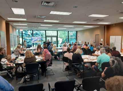
DRAFT
• Residents of all ages and abilities are afforded the opportunity to attain suitable housing, life-long learning, and recreational amenities;
• A desirable standard of living is obtainable, attracting new residents, and encouraging current residents to stay and grow their families;
• There is a noticeable commitment to inclusivity and appreciation for residents and their valuable contributions; and
• There is widespread civic pride!

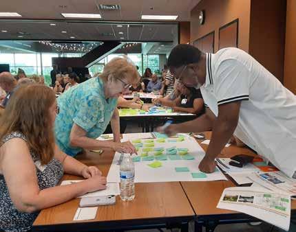
Community members listen to a presentation given by the design team during Community Planning Week in August 2024.
Residents complete a visioning exercise during Community Planning Week at the Flagship Enterprise Center in Anderson.
Attendees at the Community Planning Week workshop partcipate in a mapping exercise.
The design team identified guiding principles to support the vision statement that included:
• Sustainable Growth & Economic Development
• Attainable Housing Options
• Vibrant Mixed-Use Downtown
• Lively Arts & Culture Scene
• Strong Educational System
• Active Corridors
• Diverse Recreational & Entertainment Offerings
Within the guiding principles, parks and recreation plays integral roles in creating a vibrant mixed-use downtown, lively arts and culture scene, active corridors, and diverse recreational and entertainment offerings. Key goals within these guiding principles included:
• Supporting strategic investment in downtown destinations, including downtown parks
• Centering programming activities in downtown
• Preserving historic structures and spaces in Anderson that add to local character
• Supporting the development of cultural amenities
• Promoting city-wide social events and activities
• Supporting existing arts and cultural community assets
• Supporting street design that promotes walkability and space for transit stops
• Providing organized recreational activities for various age groups
• Creating or improving accessible and attractive spaces for youth to enjoy (K-12)
• Activating gathering spaces with an array of events and programming that fosters community connectedness
• Improving the condition, accessibility, safety, and connectivity of existing parks
• Supporting existing cultural assets and venues that enhance Anderson’s quality of life
• Attracting entertainment venues that support quality of life through quality of place
DRAFT
• Reimagining the White River as a recreational asset
During the final day of community planning week, a second open house was held to invite the public and focus group attendees from earlier in the week to comment on the vision statement and goals. Advertised in coordination with the public open house previously mentioned, there were approximately 40 attendees and the community provided invaluable input which the design and planning teams used to modify and update Anderson’s vision statement, guiding principles, and goals.
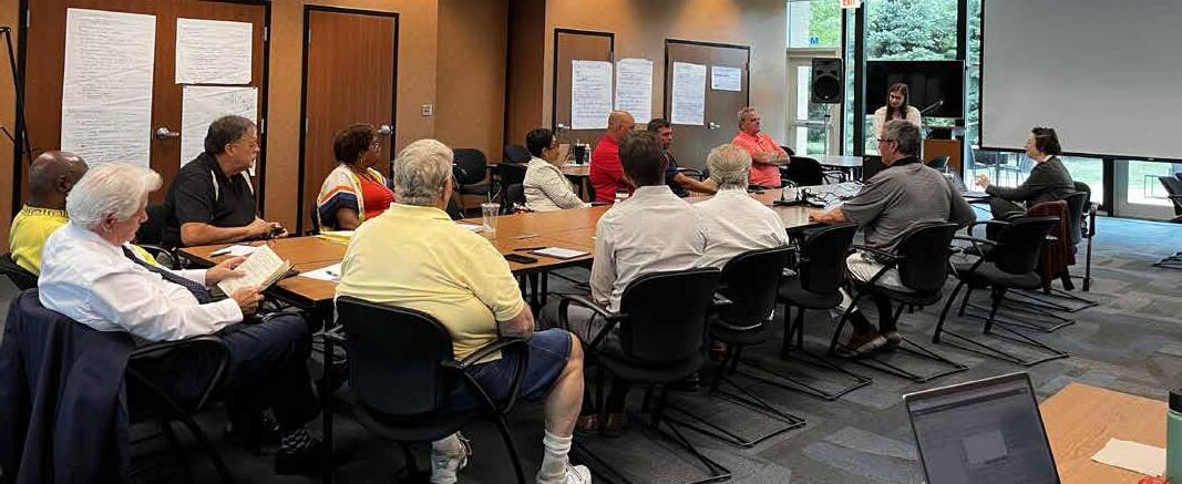
Anderson Comprehensive Plan Task Force Meeting, August 8, 2024
Public Survey
In addition to community planning week, the design team developed a project website (www.advanceanderson.com) that was advertised in local newspapers and on social media. The website provided an online mapping survey that was live between August 6th and August 28th, 2024, where citizens were asked to highlight areas of concern, locations facing challenges, valuable community resources, and areas of opportunity. The online mapping exercises received 11 contributors and 78 entries. Specific comments related to parks and recreation included:
• Desire to establish regional trail connections with connectivity to New Castle and Kokomo
• Recognition of the White River as a tremendous asset that should be connected to more frequently, both visually and physically
• Requests to transform existing tennis courts in Shepherd Park to pickleball courts
• Recognition of Pulaski Park as a major community asset
• Interest in seeing improvements and investment in Athletic Park to something unique and inviting such as a challenge course, bike trails, etc.
• Support for the addition of boat launches, shelters, picnic tables, water access, and restrooms at Rangeline Nature Preserve
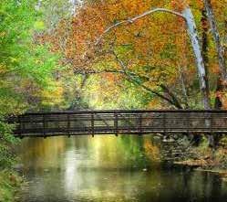
DRAFT
• Desire to incorporate campgrounds into select parks
• Ideas for re-purposing the former mall property into a family entertainment center
• Requested investments in Shadyside Park to improve the ball diamonds, replace outdated amenities, and create new ones
• Appreciation of the river access at Edgewater Park
• Requested improvements to the canoe/kayak launch at Derby Downs and Riverbend Park
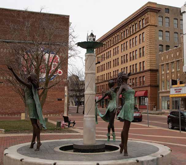
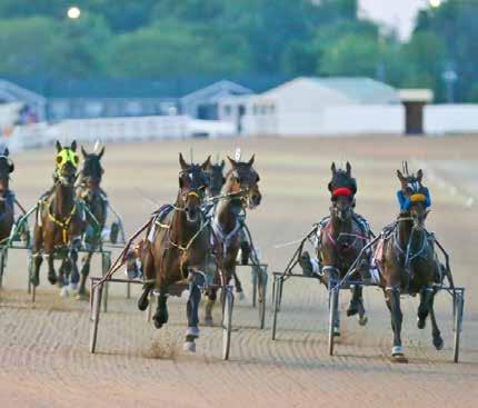
A pedestrian truss bridge crosses Killbuck Creek near Shadyside Lake Recreation Area
Dickmann Town Center
Harrah’s Hoosier Park Racing & Casino
Public Open House 2
Upon review and analysis of existing conditions in the Anderson parks’ system and receipt of public input, the planning team developed proposed recommendations for system-wide improvements, as well as specific improvements for individual parks. The recommendations were reviewed with the Park Board, the Mayor, and the interim Parks Superintendent.
After refining the recommendations based on Park Board input, the planning team facilitated a public open house on March 12, 2025 to provide the public an opportunity to provide feedback on the recommendations. The planning team created a public meeting flyer that was provided to the City on February 25, 2025. The flyer was printed and posted in various locations throughout the city, including at the parks and recreation department office, city hall, and the Flagship Center, a local business incubator/community center, where the public open house was hosted, among other locations. The flyer was also posted to the city’s website and shared through the city’s social media accounts. In addition, an article regarding the park planning process and public open house ran on the front page of the local newspaper, The Herald Bulletin, on March 11, 2025.
The public open house was organized around several key stations. The first station was designed to provide general information on the purpose of a parks master plan, the planning process, and how it is used. The remaining stations were focused on providing input on proposed parks recommendations from very high-level, systemwide recommendations, to very specific, existing park recommendations. Comment cards were also provided for attendees to provide additional feedback.
The third station focused on recommendations for individual parks within the overall system. Within this exercise, participants were provide six dots and asked to vote on their priority projects.
The top five priorities based on the input received included:
• Implementing revitalization plans for Athletic Park
• Enhancing aquatic and waterfowl habitats at Killbuck Creek/Grand Avenue Wetlands
• Mitigating erosion along the Shadyside Lake shoreline
• Prioritizing funding at the Grandview Golf Course to ensure long-term maintenance and operations
DRAFT
• Increasing White River access points
The last station included specific recommendations for two parks, Allis Park and Crawford Field, accompanied by conceptual renderings. Individuals were asked to provide written comments and to vote on their preferred improvements, or amenities.
The comments received on Allis Park can be summarized as follows:
• The proposed improvements should be simplified.
• There are pickleball courts and dogparks within close proximity and those would be redundant in this location.
The second station allowed participants to vote on their priorities for the entire parks’ system. Individuals were provided fake coins and asked to allocate their funds toward one of thirteen priorities that included pavements, accessibility, park website upgrades, signage, site furnishings, various programming, invasive plant management, playground equipment, public art, and development of naturalized areas.
The top five priorities based on voting included:
• Invasive Management & Trail Maintenance
• Additional Programming: Recreation/Sports
• Pave/Repave Parking Lots
• Upgrade Park Identification Signs
• Develop Natural Areas with an Ecology Focus
• An accessible walking path would be a nice addition, especially with a connection to the White River to the north. This could be problematic based on the uses north of the park.
The recommendations for Crawford Field received very few comments, however, participants noted a desire to improve the existing press box and to improve the curb appeal of the park from Martin Luther King Jr. Blvd.
Additional, recurring themes received on comment cards included desires to:
• address deferred maintenance within the overall parks system.
• improve the parks department website.
• fill vacant parks and recreation department staff positions
• add programming for al lage groups
For a complete summary of the information received, the sign-in sheets, and for copies of the activities provided, refer to the appendices at the end of the master plan.
Following the second public meeting, the in-person activities were made available as online activites through the comprehensive plan website. The activities were available from March 14th through March 18th, 2025. Two contributors provided input and the results generally mirrored those of the second public meeting.
Additional priorities included:
• Upgrading site furnishings
• Implementing a tree planting program in General Pulaski Park
• Replacing damaged amenities within Belmont Park
Following receipt of public input from the second public open house and the online activities, the recommendations for park improvements were adjusted to address the community’s desires. System-wide recommendations were adjusted to remove items not prioritized by the community, concepts for Allis Park and Crawford Field were modified to account for the public input received, and recommendations were added to existing parks to address additional desires not previously noted.
DRAFT

Anderson Five-Year Parks and Recreation Master Plan - Public Meeting 2 - March 12, 2025
BENCHMARK STUDY
SUMMARY
A benchmark study provides a high-level review of a park department’s level of service and offerings. The study compares the Anderson Parks Department (the benchmark or baseline) against other regional park departments of similar size and offerings, in addition to industry best practices. The study is used to identify areas for improvement.
Other communities used to compare the benchmark against were selected based on population size, geographic proximity to the study area, and availability of data. Each comparison community consisted of a municipal park department that primarily serves an urban population. The five reference departments that were incorporated within the study included West Lafayette, Kokomo, Muncie, Columbus, and Evansville.
While Anderson’s total land mass is similar in size to Evansville’s area, Evansville’s population is nearly three times as large as Anderson’s population. West Lafayette has the smallest land mass and total population of all benchmark communities. However, the population density is nearly double that of Anderson. Purdue University’s student population has a significant effect on the community’s population density. Most of the benchmark communities share a similar per capita income ranging between $23,000 and $31,000, with Columbus being the most affluent community with a per capita of $43,000.
The results of the benchmark study show that the Anderson Parks Department compares well with the reference departments. The total
of their courts in clusters of four or more to maximize playable space for tournaments and encourage social interactions. Based on the current needs and the data shown in the benchmark, the park department should limit or eliminate the construction of any new courts. Priorities for the construction of new facilities should be placed on other underrepresented sports or recreation opportunities.
Surprisingly, Anderson has a larger inventory of public artwork located on parklands. A total of 13 statues, memorials, monuments, or pieces of art are located within the parks. This is a surplus of nearly 9 pieces of art when compared to the survey of other park departments which have an average amount of 4. Anderson Parks should continue to expand their collection of art and develop new programming around these features. The procurement of public art establishes opportunities for the park department to collaborate and develop partnerships with art guilds and organizations within the community.
DRAFT
Playgrounds are one of several amenities that most park departments provide. The total number of playgrounds in the Anderson Parks system is less than the average of 19. Anderson’s park network consists of 10 playgrounds, the second least amount provided within the focus group, only behind West Lafayette with 8. Most of Anderson’s playgrounds feature larger layouts of multiple pieces of play equipment in neighborhood or regional parks. Consideration should be given to installing additional, small- to medium-size playgrounds in neighborhoods and pocket parks to support the growing recreation of young families and children.
The Anderson Parks Department has installed multiple new pickleball courts within their parks to meet the emerging demand for the “fastest-growing sport in America”. Anderson contains the greatest number of pickleball courts within the benchmark study group, with a total of 16 courts. This is significantly above the average amount of 5, with both Evansville and Muncie lacking any pickleball facilities. Anderson has strategically placed many
Not surprisingly, Anderson has an abundance of public access sites along the White River. Many of the community’s parks were situated within the floodway of the White River. Anderson’s five boat launches are slightly above the survey’s average quantity of 3. While additional physical and scenic river access has been identified as a possible priority for future development, the Anderson Park Department should allocate funding towards maintaining and improving their existing boat launches rather than constructing launches in new locations.
When reviewing staffing levels, the Anderson Park Department is slightly understaffed when compared to its equivalent park departments. The minimum fulltime equivalent (FTE) for the other benchmark park departments was 22. The Anderson Park Department employs only 14 full-time staff. Several positions remain vacant, including the Park Superintendent. The loss of staffing may limit the Park Department’s ability to fully meet the community’s needs. Likewise, a smaller-thanaverage number of staff may place additional stress on current staff. A lack of trained personnel and labor may increase the neglect of priority repairs and exacerbate the decline of park facilities.
General Department Information
(2024) $3,364,475$5,054,824$1,795,946$1,878,492$7,429,491$6,182,006
DRAFT
LEVEL-OF-SERVICE ANALYSIS
ANALYSIS
The Level of Service (LOS) Analysis was developed to determine standards for Anderson to strive for in serving the community’s recreational needs. Although this study can be helpful in determining the LOS for Anderson, it should only be one of the considerations. Parks and recreation facilities are very specific to each individual community. Determining the wants and needs of the community is a large part of developing LOS standards. Updating the parks plan on a regular basis allows the LOS standards to also be updated to meet the changing need of residents.
National Recreation & Park Association (NRPA) Park Metrics Report offers data standards and insights for park and recreation agencies. Based on the 2024 NRPA Agency Performance Review, the typical park and recreation agency in the USA offers:
• One park for every 2,386 residents served
• 10.6 acres of park land per 1,000 residents
• Operating expenditure per capita of $99.47/year
• Revenue to Operating Expenditure of 25.2%
• 8.9 full-time equivalent employees per 10,000 residents.
Level of Service standards can be developed using a variety of metrics, including land per capita, facilities, and access. The LOS standards utilized in this plan include land per capita and permanent outdoor facilities and amenities. Parks are distributed through the city, but the LOS study cannot determine if a given neighborhood, or district, is being adequately serviced.
ACREAGE LOS
Acreage LOS is one of the most commonly utilized metrics in parks and recreation planning. It is generally thought that the higher the amount of acreage, the higher the quality-of-life for the community’s residents. However, this doesn’t take into account the amenities that are provided throughout the community, or the location of the parks in relation to residents. As with the amenity LOS, the acreage LOS should take into account the needs of the citizens and should be reviewed on a regular basis.
The 2024 NRPA Agency Performance Review determined the national average Acreage LOS to be 10.6 acres of park land per 1,000 residents. The current LOS for Anderson parks is 13.18 acres per 1,000 residents, and by this metric, Anderson exceeds the national average for a city of its size.
DRAFT
The 2024 NRPA metrics determined the average number of residents per park to be 2,386 residents. The current LOS for Anderson parks is 1,840 residents per park indicating the parks system has a good number of total parks in comparison to the national average.
This data supports the city’s focus on maintaining the existing parks within the system and not adding acreage to the system in the near future.
AMENITY LOS
The recommended amenity level of service is included in the chart below. Amenities included in the level of service recommendations align with the parks and recreation department’s mission and goals for parks’ investments over the next five years based on local trends and priorities.
In general, Anderson appears to be similar to peer communities of comparable size. Anderson has a current surplus of pickleball courts, but has a slight deficit in the total number of pools and splash pads. This deficit aligns with the community’s focus on improvements to Athletic Park which will provide a destination pool and splash pad facility which will also bring the community in alignment with NRPA standards.
The city also appears to have a deficit in rectangle and diamond fields. Although the community has experienced decreased participation in city soccer, softball, and baseball over the last several years as many youth are transitioning to club and league play, the city is anticipating investment in Crawford Field to help fulfill the local need for high-quality softball fields. The city may want to consider additional investment in rectangle and diamond fields depending on local participation levels over the next several years.
In addition, Anderson appears to lack playgrounds when compared to the NRPA data. The city is currently focused on upgrading existing playgrounds that are outdated, or in need of repair. Once upgrades are complete, the parks and recreation department may want to consider additional park locations for playground installation.
DRAFT
ANDERSON POPULATION: 55,199
This analysis is based on national averages compiled in the 2022 NRPA Agency Performance Review. It does not account for local preferences and trends, only national averages.
FUTURE PLAN
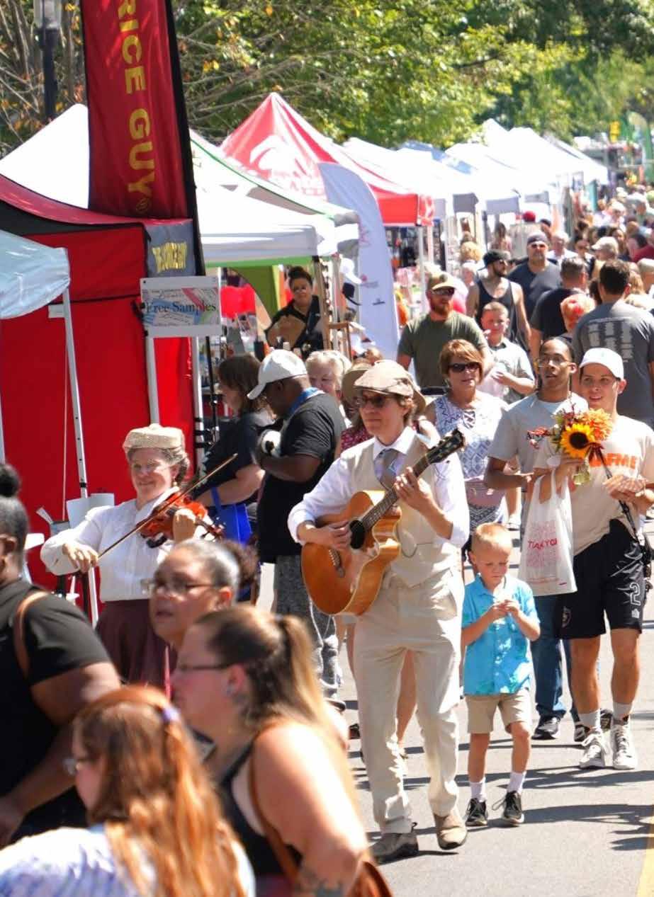
The recommendations for the master plan update include priority projects based on the existing conditions inventory, public input, benchmark analysis, and level of service study. The recommendations are primarily focused on improvements and maintenance to existing parks and amenities; no additional parks are proposed at this time. The recommendations are divided into system-wide recommendations for all City of Anderson parks and specific projects by park. In addition, three featured parks are included that focus on more significant projects over the next five years. The action plan included in the following chapter lists the priority projects and programs for the next five years and includes financial implications with funding options.
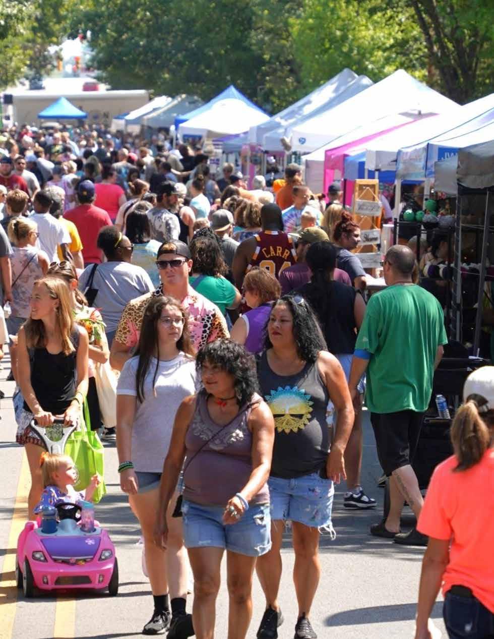
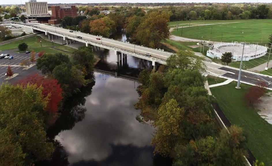
SYSTEM-WIDEDRAFTIMPROVEMENTS
During focus group interviews, public engagement, and review of existing conditions, several system-wide improvements were identified. These improvements center around accessibility, safety, maintenance, and general upgrades to existing parks to address deferred maintenance concerns resulting from a lack of property tax income and adequate funding in the past. The City of Anderson is prioritizing parks funding, increasing the parks budget by more than 46% over the last three years. and since 2016, the City has made improvements in 25 parks. The city plans to continue increasing parks funding and focus on the following system-wide and select improvement projects.
STAFFING
Critical to the long-term success of the Anderson Parks and Recreation Department is ensuring adequate park staffing. Dedicated staff help facilitate all maintenance, planning, and programming aspects of the department, and the department has had multiple, open positions for several years making day-to-day operations,
maintenance, and improvements more challenging. Moving forward, the city and parks and recreation department should consider enhanced employee attraction techniques and benefits to fill vacant positions. These techniques may include hiring a professional job recruiter, actively seeking workforce from within the community, and participating in programs such as “Make My Move” which incentives potential employees to relocate to communities such as Anderson.
PARKING LOT UPGRADES
As noted during the public input process, many parking lots within the Anderson park system are in need of maintenance, repair, and repaving. Additionally, multiple parking lots are currently gravel and lack marked accessible spaces. The parks department should prioritize parking lot improvements over the next five years, prioritizing parks with the highest visitation, including repaving existing lots and providing marked, ADA compliant parking spaces.
Aerial view of the White River Trail, Athletic Park, and Downtown Anderson.
PLAYGROUND ACCESSIBILITY AND SAFETY
The city has made significant investments in playground upgrades throughout multiple parks over the last several years. The parks department should continue to replace aging equipment, prioritizing replacement in high-visitation parks, and where equipment is in poor condition. Accessibility and inclusive play will be core considerations when selecting and specifying new equipment. In addition, most playgrounds within Anderson parks provide engineered wood fiber (EWF) play surfacing. While the cost of EWF is less than other play surfacing options, such as poured-in-place (PIP), or rubber tiles, accessibility is less than other alternatives because of its uneven and less compact nature.
Additionally, the annual maintenance is greater to ensure that EWF is maintained at the appropriate levels. While it is unrealistic to convert all playgrounds to PIP, the parks department should utilize PIP surfacing when feasible as equipment is upgraded and the department should continue to maintain EWF at appropriate levels where used.
ACCESSIBLE ROUTES
Many of the city’s parks lack accessible routes connecting to adjacent rights-of-way, vehicular parking areas, and park amenities. To increase accessibility within city parks, the department should prioritize investment in accessible routes that meet the requirements of the Americans with Disabilities Act (ADA). Key considerations should include the type of walking surface and minimum width. Walks and paths should be constructed from hard surface, or compacted materials, such as concrete, asphalt, or limestone fines, and should be constructed to a minimum five-foot width. Accessible routes should be prioritized to provide connections between accessible park features but also consider access to amenities such as water, natural areas, play features, and outdoor learning environments.
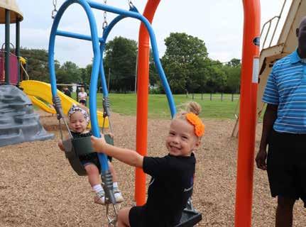
DRAFT
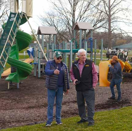
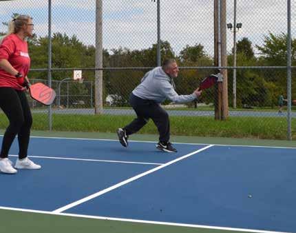
Shadyside Memorial Park generational swing dedication in 2017.
Playground improvements underway at General Pulaski Park in Spring 2025.
Attendees at the Community Planning Week workshop partcipate in a mapping exercise.
identification signage and incorporate parks department logos, standard colors, and branding.
PARK IDENTIFICATION SIGNAGE
As noted during the inventory phase of the master plan, park identification signs throughout the park system are inconsistent in design, some signs need repair, and some signs are missing. To promote a positive and consistent parks brand and ensure all public parks are well marked and identified, the City of Anderson Parks and Recreation Department should develop a standardized park sign to be implemented at all city park locations. Key considerations for signage design should include overall sign size, font size, and color to ensure legibility. Additionally, signs should be constructed from durable materials, such as metal, wood, or high-pressure laminate and incorporate the department logo for branding.
PARK WAYFINDING SIGNAGE
Park wayfinding signs are lacking or missing in multiple locations throughout the park system. Similar to park identification signage, new park wayfinding signs should be provided in all parks, located along primary access routes, and should describe and locate major park amenities. Wayfinding signs should be consistent in design throughout the park system, be easily legible and understood, and be constructed from durable materials. Wayfinding signs should be designed to establish a “family” of signage that is consistent with park
PARKS AND RECREATION WEBSITE
The existing City of Anderson Parks and Recreation Department website (https://www.cityofanderson. com/174/Parks-Recreation) provides general information on park facilities, events, and programming opportunities. It also provides the ability to reserve rentable facilities in select parks, view trail maps, and sign up for specific activities and youth camps. The website does not currently provide information for all parks, provide maps of the parks, or provide a full calendar of events and programs. Upgrades to the website should be considered to increase awareness of parks’ facilities and offerings which will increase the number of park users. Key considerations for website upgrades should include: a comprehensive list of all City of Anderson parks; maps of each facility indicating parking, trails, and major amenities; an updated calendar of events and programs; an accessibility statement and directory; access to park board
DRAFT
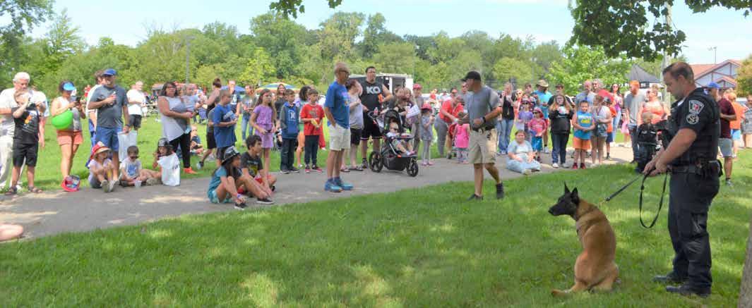
Mayor’s Block Party at Shadyside Memorial Park
meeting calendars, agendas, and meeting minutes; access to the latest five-year parks and recreation master plan; employment and volunteer opportunities; and general information related to current parks initiatives.
SITE FURNISHINGS
Benches, litter receptacles, picnic tables, and bike racks throughout the park system are in general need of repair and/or replacement. Additionally, there are a variety of styles and materials and a general lack of consistency. Moving forward, the parks department should consider establishing a unified standard for furnishings and adopting a “family” of furnishings that complement one another. Selected furnishings should be constructed of durable materials such as metal or heavy timber that are vandal resistant and long lasting.
PROGRAMMING
The City of Anderson Parks and Recreation Department understands the important role that programming plays in supporting local quality of life and resident well-being, and attraction. The department currently offers a variety of programs and activities focused on recreation, art, outdoor learning, safety, and community gathering, including both free and paid opportunities. During public engagement sessions, recreation/sports-based programming was the most requested, followed by outdoor/nature-based learning, with education/STEAM-based programming being the lowest priority. Additionally, specific public input requests included additional youth programming and additional programming at Geater Community Center. The city and parks department wish to expand their program offerings and should identify new and unique programming opportunities that can be offered at strategic locations throughout the system. Multiple parks, including May’s Park, Shadyside Memorial Park, General Pulaski Park, Crawford Field, and others provide significant opportunities for recreational programming while parks including Rangeline Nature Preserve, River Bend Park, and others provide significant opportunities for outdoor learning and education-based programming.
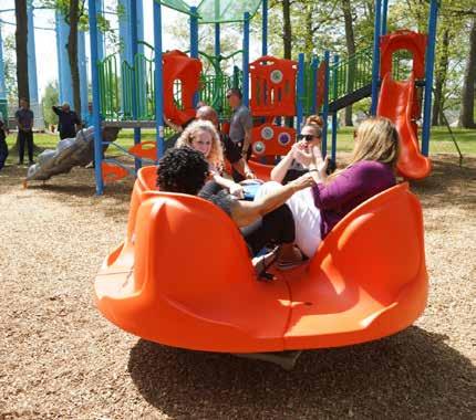
DRAFT
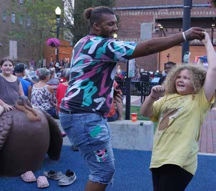
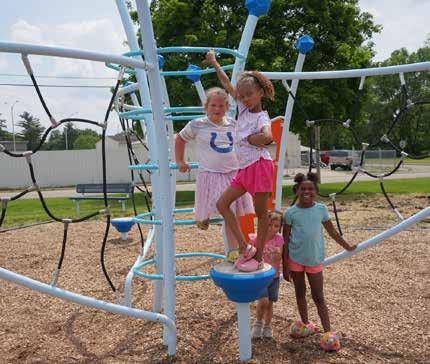
2023 Warren Miller Park Playground Grand Opening
Dickmann Town Center Concert - 2024
2024 Geater Park playground dedication
ALLIS PARK
2640 W. 8 th STREET
Allis Park is located on the northeast side of the city immediately east of the Central Services complex and south of the White River. Limited commercial development occurs to the east and residential development to the south. The park currently has a community garden plot and picnic shelter. During the public engagement process, the community was presented multiple proposed improvement concepts that included a variety of facilities such as sports courts, dog parks, and playgrounds. Due to the availability of amenities in other nearby parks and locations, the public requested a preferred concept that includes an informal playing field for pick-up games of soccer, frisbee, and other sports, and a walking path. Additional proposed improvements include park signage, a dedicated vehicular parking area adjacent to the central services entry drive, and a new park shelter in a more prominent and accessible location centralized within the park.
DRAFT
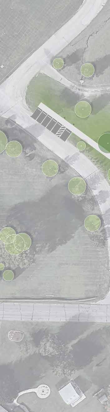
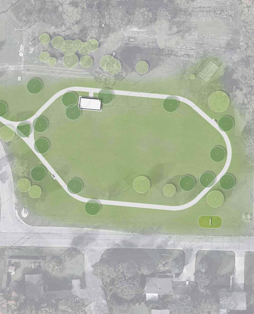
ATHLETIC PARK
312 E. 8 th STREET
Athletic Park is a 29.6 acre park located immediately northeast of downtown. Of historical significance within the city, the park is ideally located within the center of the city and provides major redevelopment potential within the downtown and larger community. A primary focus for the City of Anderson and the Parks and Recreation Department, major improvements are planned in the near future. Anticipated improvements will include new aquatic features, office space, playground, restrooms, parking, and event lawn featuring an event stage. Additionally, proposed improvements will include enhanced pedestrian connectivity to the city’s trail system and downtown.
Upon completion, the park is anticipated to become a regional destination for the aquatic facility and programmed events that will encourage private investment within the adjacent neighborhoods and downtown.
DRAFT

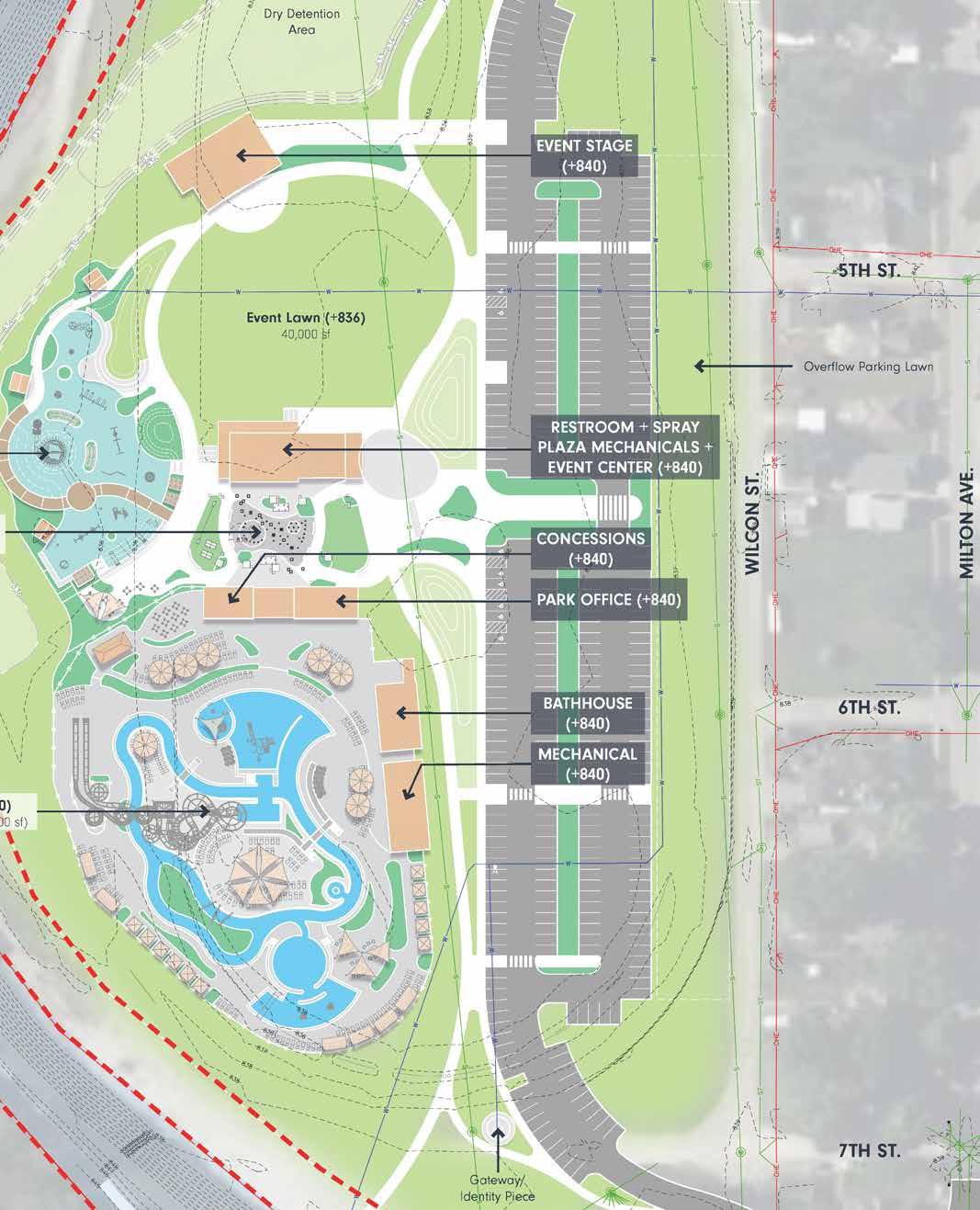
CRAWFORD FIELD
1402 MARTIN LUTHER KING BLVD.
Crawford Field is located in central Anderson along Dr. Martin Luther King Jr. Blvd. which serves as a major city thoroughfare and gateway corridor to the city. The park currently provides one softball field, a press box with restrooms and concessions, dugouts, and a dedicated parking lot. The softball field is surrounded by city owned property that was the location of a former manufacturing facility.
Proposed improvements to Crawford Field include a new park sign and gateway element along Dr. Martin Luther King Jr. Blvd. and an improved park entrance from W. 25th St. Additional improvements proposed include a renovated press box, improved parking lot with dedicated, accessible parking, and an accessible walking path connecting the on-site amenities to the improved parking area. Additional improvements include the creation of earthen berms surrounding the outfield fence to create additional, informal spectator seating.
DRAFT
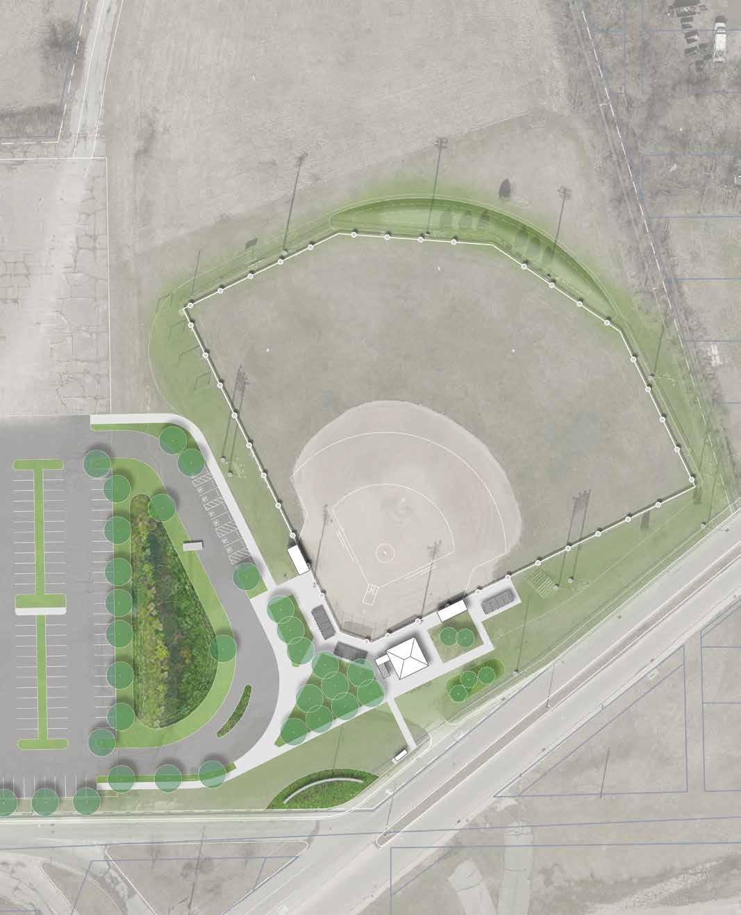
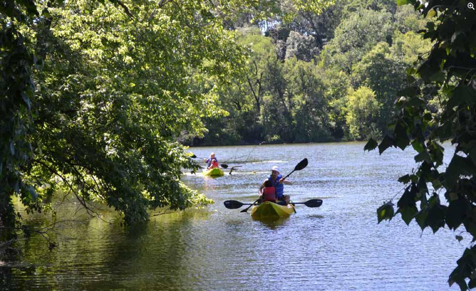
EXISTINGDRAFT PARK IMPROVEMENTS
The following includes identification of improvements for existing parks in addition to the system-wide improvements identified earlier in this chapter, and as noted during the park evaluation process. Many of the improvements focus on improving accessibility and safety while addressing issues of deferred maintenance. Allis Park, Athletic Park, and Crawford Field are highlighted on the previous pages since they are recommended to receive more significant enhancements. Parks not specifically discussed on the following pages are intended to receive the system-wide improvements.
The following recommendations resulted from multiple days of parks’ assessments and should be considered a supplement to the department’s ongoing maintenance schedule and priorities.
ANDERSON COMMUNITY PARK
• Increase park programming.
• Incorporate public art.
• Install additional landscape plantings to provide fourseasons of interest.
BELMONT PARK
• Pave existing gravel parking lot and provide accessible parking.
• Provide accessible pedestrian paths from the parking lot to the park shelter, basketball court, and playground.
• Replace damaged amenities (e.g. benches, signs)
• Remove dead trees.
• Program underutilized areas of the park.
CIRCLE PARK
• Install new playground equipment and play surfacing.
• Provide dedicated accessible parking near the park.
• Provide accessible pedestrian paths to park features.
Recreational kayakers enjoying free boat use at Shadyside Lake Recreation Area.
DERBY DOWNS/MADISON PARK
• Provide accessible parking adjacent to the White River Trail access and adjacent to the derby hill path and public restrooms.
• Provide an accessible pedestrian path to the public restroom.
• Provide an accessible pedestrian path to the N. Madison Ave. sidewalks.
• Enhance accessible access to the White River from the White River Trail.
• Construct a paved boat launch similar to Edgewater Park.
• Replace missing wayfinding and interpretive signage.
DICKMANN TOWN CENTER
• Renovate and repair playground poured-in-place surfacing.
• Implement additional programming on-site.
EDGEWATER PARK
• An ongoing CSO separation project is occurring within Edgewater Park. Due to prevalent flooding, long-term improvements will be limited to parking lot and entrance drive paving and maintenance.
• Provide accessible parking.
• Re-stripe the parking lot, provide accessible parking, and install bicycle parking.
• Implement a tree planting program to regenerate the tree canopy.
GRANDVIEW GOLF COURSE
• Prioritize funding for the golf course to ensure longterm maintenance and operations.
GRANDVIEW-HARMON PARK
• Provide accessible parking.
• Improve parking area along Highland Ave.
• Provide an accessible pedestrian path to the basketball court.
DRAFT
• Provide accessible pedestrian paths to park features and nearby city streets.
GEATER COMMUNITY CENTER
• Plant trees and/or provide shade near the playground.
• Expand the gymnasium to create separated recreational spaces for adults and youth. Designate a new basketball court for young children and teenagers.
GENERAL PULASKI PARK
• Renovate the restrooms.
• Renovate the baseball concession stand.
• Provide accessible pedestrian paths to park features and nearby city streets.
• Add accessible pedestrian paths and traffic calming measures along 38th St.
HORNE PARK
• Provide accessible parking.
• Provide accessible pedestrian paths from the parking lot to the playground, park shelter, and W. 7th St.
JACKSON PARK
• Provide striped and accessible parking in the Raible Ave. parking lot.
• Provide an accessible pedestrian path from the east parking lot accessible parking space to the park trail system.
• Review potential for additional shelter near tether track.
KILLBUCK/GRAND AVENUE WETLANDS
• Install seating for bird watching.
• Install new interpretive signage.
• Invest in, and enhance aquatic and waterfowl habitats.
MARTIN LUTHER KING JR. PARK
• Provide accessible parking along W 22nd St.
• Provide an accessible pedestrian path to the park from W. 22nd St.
• Upgrade park identification signage.
MAY PARK
• Provide annual maintenance & repair of PIP play surfacing.
• Provide annual maintenance & repair of splash pad.
• Increase park programming.
• Develop a tree planting schedule and program.
MEADOWBROOK PARK
• Provide accessible parking in proximity of the playground.
• Provide an accessible pedestrian path from the playground parking area to the playground.
• Provide an accessible pedestrian path to the pedestrian footbridge south of Fairview St.
• Provide accessible, measured walking paths through the park.
• Provide additional trees in lawn areas.
• Install new playground equipment and play surfacing.
RANGELINE NATURE PRESERVE
• Provide accessible parking.
• Pave the trailhead parking lot.
• Provide enhanced park identification signage.
• Replace missing interpretive/wayfinding signage.
• Construct a paved boat launch similar to Edgewater Park.
• Provide trail signage and/or bollards at intersection of the White River Trail and park access road to clearly delineate where automobiles are permitted.
SHADYSIDE MEMORIAL PARK
• Provide accessible parking.
• Provide accessible pedestrian paths to park features and nearby city streets.
• Complete phase 2 playground improvements.
DRAFT
• Stabilize the trail surface in erosion prone areas.
• Implement an invasive plant management plan.
• Install additional bike course obstacles.
• Install a bike repair station.
• Construct a restroom facility.
RIVER BEND PARK
• Provide accessible parking.
• Provide accessible pedestrian paths from the Sycamore St./W. 2nd St. intersection to the White River Trail and canoe launch parking lot.
• Pave the gravel parking lot.
• Repair damaged granite, limestone, and landscape lighting near the Veteran’s Memorial.
• Install new herbaceous plantings near the Chinese Terrace Garden.
• Recondition the baseball and softball fields, including the press boxes.
• Remove the North Anderson Community Center Sign along Oak St.
SHADYSIDE RECREATION AREA
• Continue invasive plant management strategy.
• Mitigate erosion along Shadyside Lake shoreline.
• Repair/replace damaged or faulty pathway lights.
• Upgrade public restrooms at Shadyside Lake Activity Center.
SHEPHARD PARK
• Provide accessible parking.
• Provide accessible pedestrian paths to park features and nearby city streets.
• Remove unused park amenities and reseed disturbed areas.
• Maintain park for future redevelopment.
SOUTHSIDE POOL
• Provide accessible parking.
• Provide an accessible pedestrian path from Madison Ave. to the existing bathhouse sidewalks.
• Provide an accessible pedestrian path from the pool bathhouse to the high school parking lot.
• Provide an ADA compliant curb ramp from the main parking lot to the building sidewalks.
• Replace missing/damaged bathhouse windows.
• Replace deteriorating wood on bathhouse.
STREATY PARK
• Provide accessible parking in the W. 19th St. parking lot.
WALNUT PARK
• Construct a dedicated parking lot adjacent to Walnut St.
• Provide accessible parking.
• Provide accessible pedestrian paths from Walnut St. to the playground, park shelter, and basketball courts.
• Repair/replace damaged park identification sign.
• Replace outdated playground equipment.
• Remove overgrown vegetation from baseball/softball backstop.
WARREN MILLER PARK
DRAFT
• Provide accessible parking in the parking lot at W. 20th St. and Park Ave.
• Provide accessible parking in the southern Park Ave. parking lot.
• Provide an accessible pedestrian path to the restroom facility.
• Provide an accessible pedestrian path from the southern Park Ave. parking lot to the basketball courts.
• Seal cracks and remove obstructions within main park access path.
• Assess the need for upgraded basketball court surfacing.
• Provide accessible parking.
• Repave and restripe the parking lot near Memorial Field’s outfield.
• Provide accessible pedestrian paths to park features and nearby city streets.
• Renovate, remove, or repurpose distressed sports fields.
• Analyze horseshoe courts for alternate purpose such as cornhole, chess, etc.
• Upgrade horseshoe court lighting for future, alternative use.
• Provide additional programming in old trustee’s building.
• Determine potential for repurposing property located at the NW corner of NW 29th St. and Fairview St.
WHITE RIVER TRAIL
• Provide accessible parking at the 8th St. trailhead.
• Provide accessible pedestrian paths from the 8th St. trailhead to the W. 8th St. sidewalks.
• Increase river access points along the White River Trail.
• Provide rules for equestrian trail use.
• Provide interpretive signage along the trail.
NEXT STEPS
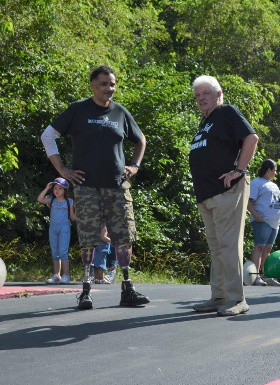
The recommendations included in the master plan seek to balance departmental and maintenance needs with community desires and long-range vision to ensure the Anderson Parks and Recreation Department continues to achieve its mission of envisioning, planning, developing, and operating public recreational facilities that support recreational opportunities and programs for all citizens of Anderson. After many years of inadequate funding resulting from tax revenue declines and a 72% budget cut in 2010, the current administration has placed a renewed focus and priority on the city’s park system. Significant investments and achievements have been made within the park system since 2016 with the city increasing the department’s budget by nearly 50% over the last three years alone, and with the support of the Anderson community. The following chapter provides potential funding strategies for the community’s use in leveraging local funds, as well as an action plan matrix to help prioritize continued investment in city parks. The action plan outlines various projects/initiatives, their priority, magnitude of cost, and location.
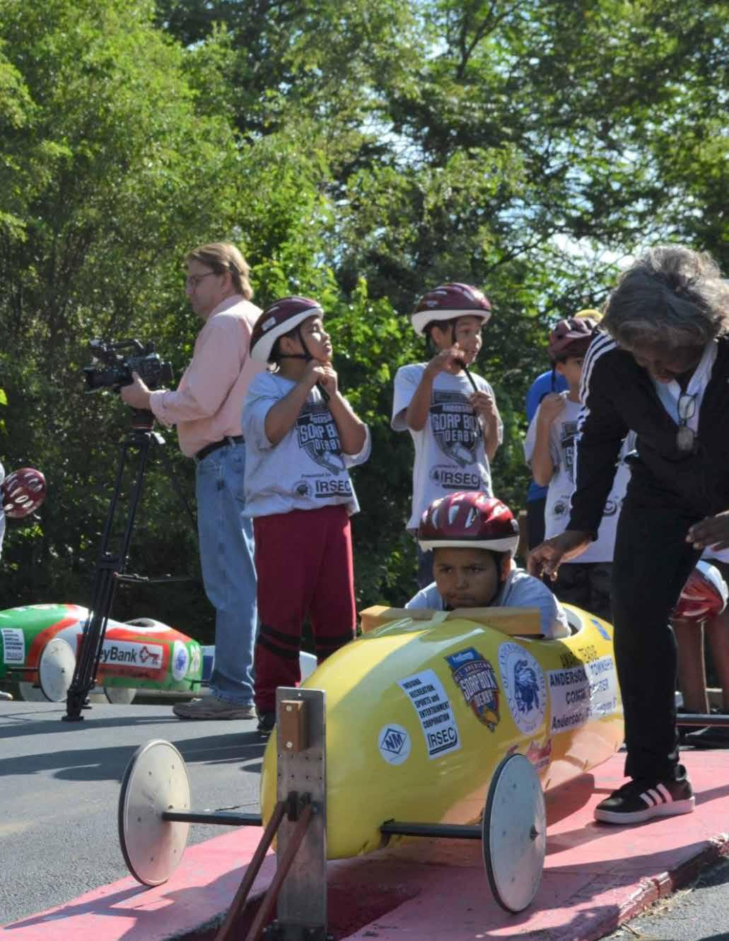
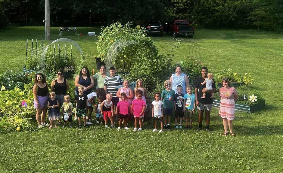
FUNDINGDRAFT STRATEGIES
The projects included in the following Action Matrix will require traditional funding used to build, maintain, and operate parks. These funds will likely need to be supplemented with other funding mechanisms through partnerships, grants, and bonds. The following provides a summary of funding mechanisms and strategies typically used to fund parks operation, maintenance, and improvement projects.
GENERAL BUDGET
The General Fund is used to cover expenses related to general administration, personnel, maintenance, operations, and recreational programming. Smaller capital projects have also been funded from the Department’s general budget. Equipment replacement costs are generally funded through this fund as well. As the city continues to prioritize investment in parks, the Parks and Recreation budget may need to be increased to accommodate additional staff and maintenance.
COST RECOVERY/REVENUE GENERATING
The parks department charges fees for reservation and use of specific park facilities, and for participation in select programming. While not all facilities and programs should require fees, select fees can help support limited funds and subsidize costs for amenities and programs. As Parks and Recreation Departments continue to find ways to leverage limited budgets, User Fees, or Capital Improvement Fees, have been utilized more regularly. These fees are typically set at reasonable amounts so they do not limit use and they can be used to help fund construction of new facilities, ongoing maintenance, and operations. The parks department should consider developing a Revenue and Expenditure Plan to determine appropriate fees based on future maintenance and operation plans.
Families care for community garden at Allis Park.
PARK IMPACT FEE
Park Impact Fees allow local communities to collect a one-time fee on new housing developments to support new park and recreational facilities that will be needed because of new residential growth within a community. The charges can only be used for new capital development that is shown to meet the needs of new residents. Park Impact Fees cannot be used for maintenance and repair of existing facilities or to fund recreational programming. The fees collected on an annual basis vary from year-to-year depending on the amount of new housing development.
PARTNERSHIPS
Creating new partnerships is vital and becoming a more common way of funding park and recreation improvements. Public/private partnerships are arrangements between government and private sector institutions. These usually involve initial private funding and long-term public payoff from revenue generated.
DONATIONS, SPONSORSHIPS, & NAMING RIGHTS
Donations of funds and land can be critical funding elements for parks departments. It is often in the best interest of the parks department to have conversations with landowners of properties that the department has a strategic interest in. This can lead to land donations or a first right of refusal for the parks department to purchase the land.
GRANTS
Applying for and managing grants can require a significant amount of time. The applications often require lengthy justification rationales. This master plan update can help with the application process by utilizing the goals and vision, implementation graphics, narratives, and graphics to supplement the grant applications.
Following is a list of commonly used grant sources which are administered by various local, state, and federal agencies. This list is not comprehensive. Grant opportunities change frequently and will require additional research from the parks department to determine specific requirements and deadlines for each. The department may also consider working with a grant writer to assist in grant applications.
INDIANA TRAILS PROGRAM
The Indiana Trails Program (ITP) replaced the Recreational Trails Program (RTP) in 2021. Previously RTP funds were provided through federal dollars. The new Indiana Trails program includes state funds but is otherwise very similar to the RTP program. The ITP provides a minimum of $100,000 and maximum of $400,000 in grant assistance with a 20% local match requirement. Projects will include construction of trails, development of trailheads, construction of bridges and acquisition of easement or property for trails.
DRAFT
Sponsorships are an important funding mechanism for community events organized by the Parks and Recreation Department. Community events are typically well-attended and are a good opportunity for local businesses to support the community and expand their brand exposure and name recognition. Parks staff should continue to explore and market sponsorship opportunities to help support and fund community events and programming.
Naming rights are a form of sponsorship where an individual, business, or entity purchases the right to name a facility, event, or amenity for an agreed-to period of time in exchange for a specific amount of compensation. Naming rights typically require a formal contract and can be renewed or sold to an alternate sponsor upon expiration of the contract. Many parks departments use naming rights to fund construction of major amenities such as shelters, splash pads, and playgrounds, as well as smaller amenities such as trees, benches, and pavements.
NEXT LEVEL TRAILS
The Next Level Trails (NLT) program was initiated in 2019 and included three rounds of funding with the final round awarded in 2022. Although this program is not currently funded beyond 2022, the program has seen wide popularity and support and has the potential to return for additional rounds of trail funding.
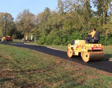
Recent trail paving at Shadyside Memorial Park
COMMUNITY DEVELOPMENT BLOCK GRANT
Community Development Block Grants (CDBG) are intended to support enhancement and improvement to neighborhoods. The requirements for eligible projects change from year-to-year but can support public facilities. Projects eligible for CDBG funds will focus on impacts to the surrounding community and schools.
LAND & WATER CONSERVATION FUND
The Land and Water Conservation Fund (LWCF) is administered by the Indiana Department of Natural Resources. The LWCF program is designed to alleviate some of the burden on parks and recreation departments caused by limited budgets and resources. The LWCF is a matching assistance program that provides a 50% match for purchase of park land or development of park facilities. According to the Indiana DNR, more than 30,000 acres of land have been acquired in Indiana through this program. The LWCF program is based on reimbursement which requires the agency receiving the funds to first pay for improvements then receive reimbursement. Grant amounts range from $50,000 to $500,000.
NEXT LEVEL CONSERVATION TRUST FUND
SAFETULU AND SAFE ROUTES TO SCHOOLS
Safe Routes to Schools and SAFETULU funds can be used for trail improvements which create connections to schools. Safe Routes to Schools requires no match and SAFETULU funds require a 20% match.
DRAFT
The Next Level Conservation Trust (NLCT) replaced the Indiana Bicentennial Nature Trust. The program funds can only be used to acquire land for conservation, recreation, and historic preservation. Property acquired with this fund will become part of the public trust to ensure that the land is protected for future generations. Each project requires a 3:1 match ($3 NLCT funds to $1 local match). The minimum project size is $1000,000 for the NLCT portion.
AMERICORP GRANTS
AmeriCorp is a federal agency that funds organizations to make positive impacts in communities. Typically, these funds include partnerships with local nonprofit organizations providing employment opportunities. Seasonal employment can be provided through the nonprofit which is funded through the AmeriCorp grant. Training is usually included in grant funding.
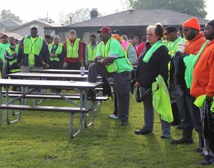
Annual J.T. Menifee Citywide Clean Up volunteer opportunity
ACTION PLAN MATRIX
INTRODUCTION
The action plan matrix on the following pages has been developed to guide the Parks and Recreation Department over the next five years. Recommendations include administrative actions along with physical park improvements.
Recommendations include a planned timeline for projects to begin. The timeline prioritizes items such as accessibility and safety, and seeks to balance that with amount of park use and community input. As donations and grant funds are made available these priorities may shift. The action plan matrix is intended as a guide and should not limit the ability of the city to take advantage of opportunities such as grants or targeted donations.
Is is important for the city to review the action plan matrix on a regular basis. As funding opportunities become available, priorities may rearrange. This review is also important in terms of keeping future project relevant and in the minds of city leaders to continue to have adequate funds dedicated to the Parks Department for improvements.
Potential funding and volunteer sources have been included in the action plan matrix. Projects will likely require a combination of public and private revenue sources. Public/private partnerships will be key to implementing the projects and programs included in this master plan update. Potential key partners include, but are not limited to:
• Ascension St. Vincent Anderson
• Community Hospital Anderson
• Madison County Community Foundation
• Madison County Department of Parks and Recreation
• RSVP of Madison County
DRAFT
• Clubs such as Rotary and Lions
• Anderson Madison County Visitors Bureau
• Private Program Providers and Sports Leagues
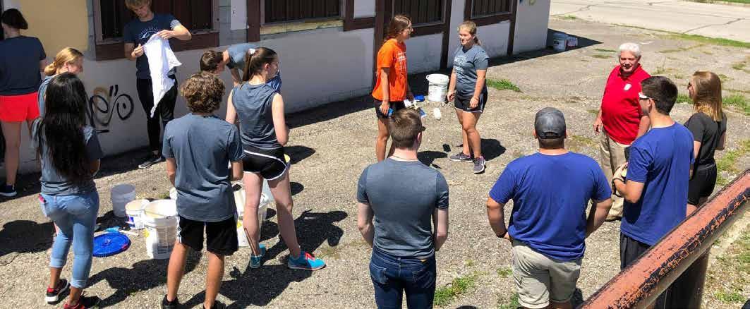
Anderson University service day to assist in the clean up of multiple parks.
SYSTEM-WIDE IMPROVEMENTS
Increase Staffing
Investigate opportunities for making active job postings more visible to job seekers. Consider platforms such as Indeed and LinkedIn, as well as incentive-based programs such as Make My Move.
Hire a full-time Parks Superintendent.
Hire a full-time Community Center Director. •
Fund Fully staff seasonal positions.
Upgrade Parking Lots
Identify and prioritize parking lots for maintenance, paving, repair, and repaving based on existing conditions and level of use.
Develop an annual paving budget for park parking lots
Pave existing gravel parking lots and repair and repave existing parking lots based on identified priority.
Provide dedicated, marked, and ADA compliant parking stalls.
Upgrade Playground and Playground Surfacing
Identify and prioritize playgrounds, including playground surfacing, for repair or replacement.
$12 - $25 hr General Fund
DRAFT
Develop and annual budget for playground repair and replacement, including maintenance of EWF and strategic placement of more accessible play surfacing such as poured-in-place rubber.
Replace playground equipment based on prioritization, maintain EWF in all playgrounds where used, and implement pouredin-place, or other accessible surface in strategic playground locations.
Provide Accessible Routes to Parks and Park Amenities
Identify parks lacking accessible routes to adjacent streets and right-of-ways.
Identify parks lacking accessible routes to and between key park amenities such as shelters, playgrounds, and restrooms.
Prioritize investment in accessible routes based on amount of park use.
Develop an annual budge for construction of accessible routes based on prioritization.
Construct accessible routes from asphalt or concrete based on prioritization.
SAFETULU
Upgrade Park Identification Signage
Develop an updated design standard for park identification signs.
Prioritize parks for new identification signs based on presence or absence of existing signs, condition of existing signs, visibility of park property, and amount of park use.
Develop an annual budget for park sign replacement.
Implement new park signs throughout parks system.
Upgrade Park Wayfinding Signage
Identify parks and facilities missing or lacking wayfinding signs.
Develop an updated design standard for park wayfinding signs.
Prioritize parks for new wayfinding signage based on locations that once had them where they are currently missing and/or where wayfinding signage is needed but has never been implemented.
Develop an annual budget for park sign replacement.
Implement new park signs throughout parks system.
Update Parks and Recreation Website
Research peer parks and recreation departments to identify features to implement in a new/future parks and recreation website for Anderson. Consider incorporating features such as maps of all parks, a full and updated calendar of events and programs, available job openings, links to recent Park Board meetings, access to the current five-year parks and recreation master plan, links to report ADA issues and other concerns, and general information on current parks initiatives.
Hire a consultant and/or work with city marketing staff to develop a new website based on research.
Upgrade Site Furnishings
Research and identify a new standard family of site furnishings to be implemented through the parks system that may include: benches, litter receptacles, picnic tables, bike racks, drinking fountains, etc.
Inventory and prioritize parks for site furnishing upgrades based on lack of furnishings and condition of existing furnishings.
Develop an annual budget for site furnishings replacement and implementation.
Provide and/or replace site furnishings based on prioritization.
Increase Programming
Evaluate participation in existing park programs.
Research peer parks and recreation departments and develop a list of program opportunities that could be implemented throughout the parks system and in select parks.
Distribute a survey to Anderson residents to determine the demand for select program opportunities.
Implement preferred park programs in strategic locations through the parks system to serve local constituents.
DRAFT
Madison County Visitors Bureau
EXISTING PARK IMPROVEMENTS
Allis Park
Provide a park identification sign in coordination with new park identification sign standards.
Apply for grant opportunities to fund improvements where feasible and competitive.
Commission a design professional to refine the overall park design and develop construction documents for the proposed improvements.
Bid and construct proposed improvements. If phased, include ADA compliant parking and accessible routes in the first phase.
Anderson Community Park
• $5,000$15,000 General Fund, Grants
• $0 Madison County Community Foundation, IDNR Land & Water Conservation Fund
• $50,000$100,000 General Fund
• $250,000$750,000 General Fund, Redevelopment Commission, IDNR Land & Water Conservation Fund, Madison County Community Foundation, Other Grants
Increase park programming and events. • $5,000$10,000 General Fund
Develop a working subcommittee to identify and implement public art opportunities within the park.
Design and implement new landscape plantings in park to provide four-season interest.
Athletic Park
Work with consultant to refine design and/or phase the project to create a project within budget.
Develop full construction documents for proposed improvements and bid project.
Construct proposed improvements.
Belmont Park
Pave existing gravel parking lot and provide ADA compliant parking.
Provide accessible pedestrian paths from the parking lot to the park shelter, basketball court, and playground.
Replace damaged amenities.
Remove dead trees.
Program underutilized areas of the park.
• $25,000$75,000 General Fund
• $10,000$15,000 General Fund
$10,000$20,000 General Fund
• $2.5 million - $3.5 million General Fund, Redevelopment Commission, BOT, Grants
• $25 million - $35 million General Fund, Redevelopment Commission, BOT, Grants
• $15,000$25,000 General Fund, Grants
• $35,000$50,000 General Fund, Redevelopment Commission, BOT, Grants
• $10,000$15,000 General Fund, Grants
• $2,500$5,000 General Fund, Grants
• TBD General Fund, Grants
Circle Park
Install new playground equipment and play surfacing.
Provide dedicated ADA compliant parking near the park.
Provide accessible pedestrian paths to park features.
Crawford Field
Provide a park identification sign in coordination with new park identification sign standards.
Apply for grant opportunities to fund improvements where feasible and competitive.
$75,000$200,000
$10,000$15,000
$15,000$25,000
$5,000$15,000
$0
Commission a design professional to refine the overall park design and develop construction documents for the proposed improvements. • $75,000$125,000
Bid and construct proposed improvements. If phased, include ADA compliant parking and accessible routes in the first phase.
Derby Downs/Madison Park
• $750,000$1 million
Provide ADA compliant parking adjacent to the White River Trail access and adjacent to the derby hill path and public restrooms. • $10,000
General Fund, Grants
General Fund, Grants
General Fund, Grants
General Fund, Grants
Madison County Community Foundation, IDNR Land & Water Conservation Fund
General Fund, Grants
DRAFT
General Fund, Redevelopment Commission, IDNR Land & Water Conservation Fund, Madison County Community Foundation, Other Grants
General Fund, Grants
Provide an accessible pedestrian path to the public restroom. • $7,500 General Fund, Grants
Provide an accessible pedestrian path to the N. Madison Ave. sidewalks.
Enhance accessible access to the White River from the White River Trail.
$15,000$20,000
• $25,000$50,000
Construct a paved boat launch similar to Edgewater Park. • $50,000$75,000
Replace missing wayfinding and interpretive signage in coordination with new wayfinding signage standards.
Dickmann Town Center
Renovate and repair playground poured-inplace surfacing.
Implement additional programming on-site.
$10,000$15,000
General Fund, Grants
General Fund, Grants
General Fund, Grants
General Fund, Grants
$25,000$50,000 NA
$5,000$10,000
Edgewater Park
Provide accessible parking upon completion of ongoing CSO separation project.
Provide accessible pedestrian paths to park features and nearby city streets.
Geater Community Center
Plant trees and/or provide shade near the playground.
• $15,000$25,000 General Fund, Grants
• $35,000$50,000 General Fund, Grants
• $5,000$10,000 General Fund, Grants
Commission a design professional to develop design options and cost opinions for gymnasium expansion. • $25,000$50,000 General Fund, Grants
Develop a budget and phasing strategy for building expansion. • TBD General Fund, Grants
General Pulaski Park
Renovate the restrooms.
• $100,000$150,000 General Fund, Grants
Renovate the baseball concession stand. • $50,000$75,000 General Fund, Grants
Provide accessible pedestrian paths to park features and nearby city streets.
• $80,000$100,000 General Fund, Grants
Add accessible pedestrian paths and traffic calming measures along 38th St. • $90,000$110,000 General Fund, Grants
Re-stripe the parking lot, provide accessible parking, and install bicycle parking.
Implement a tree planting program to regenerate the tree canopy.
Grandview-Harmon Park
Provide ADA compliant parking.
Improve parking area along Highland Ave.
• $15,000$20,000 General Fund, Grants
• $15,000$20,000
General Fund, Grants
• $5,000$10,000 General Fund, Grants
• $25,000$30,000 General Fund, Grants
Provide an accessible pedestrian path to the basketball court. • $5,000$10,000 General Fund, Grants
Horne Park
Provide ADA compliant parking.
Provide accessible pedestrian paths from the parking lot to the playground, park shelter, and W. 7th St.
Jackson Park
• $5,000$10,000 General Fund, Grants
• $10,000$15,000 General Fund, Grants
Provide striped and ADA compliant parking the Raible Ave. parking lot. • $2,500$5,000 General Fund, Grants
Provide an accessible pedestrian path from the east parking lot accessible parking space to the park trail system.
• $5,000$7,500 General Fund, Grants
Review potential for additional shelter near tether track. • $50,000$75,000 General Fund, Grants
•
Killbuck/Grand Avenue Wetlands
Install seating for bird watching.
• $7,500$10,000
Install new interpretive signage. • $5,000$10,000
Invest in, and enhance aquatic and waterfowl habitats.
Martin Luther King Jr. Park
Provide accessible parking along W 22nd St. •
Provide an accessible pedestrian path to the park from W. 22nd St. •
Upgrade park identification signage.
May Park
Provide annual maintenance & repair of PIP play surfacing.
• $10,000$20,000
$5,000$10,000
$5,000$10,000
• $15,000$25,000
$5,000$7,500
Provide annual maintenance & repair of splash pad. • $7,500$10,000
Increase park programming.
Develop a tree planting schedule and program.
Meadowbrook Park
• $5,000$10,000
• $5,000$7,500
Provide ADA compliant parking in proximity of the playground. • $15,000$25,000
Provide an accessible pedestrian path from the playground parking area to the playground.
Provide an accessible pedestrian path to the pedestrian footbridge south of Fairview St.
Provide accessible, measured walking paths through the park.
$20,000$25,000
$10,000$15,000
• $100,000$110,000
Provide additional trees in lawn areas. • $10,000$15,000
Install new playground equipment and play surfacing. • $75,000$200,000
General Fund, Grants
General Fund, Grants
General Fund, Grants
General Fund, Grants
General Fund, Grants
General Fund, Grants
General Fund, Grants
General Fund, Grants
General Fund, Grants
General Fund, Grants
General Fund, Grants
General Fund, Grants
General Fund, Grants
General Fund, Grants
General Fund, Grants
General Fund, Grants
Rangeline Nature Preserve
Provide ADA compliant parking. • $5,000$10,000 General Fund, Grants
Pave the trailhead parking lot. • $125,000$150,000 General Fund, Grants
Stabilize the trail surface in erosion prone areas. • $10,000$15,000
Implement an invasive plant management plan.
Install additional bike course obstacles.
$50,000$200,000
• $15,000$25,000
General Fund, Grants
General Fund, Grants
General Fund, Grants
Install a bike repair station. • $5,000$10,000 General Fund, Grants
Construct a restroom facility.
Shadyside Memorial Park
Provide ADA compliant parking.
Provide accessible pedestrian paths to park features and nearby city streets.
• $100,000$125,000 General Fund, Grants
$10,000$15,000 General Fund, Grants
$75,000$100,000
Complete Phase 2 playground improvements. • $150,000$200,000
Repair damaged granite, limestone, and landscape lighting near the Veteran’s Memorial.
Install new herbaceous plantings near the Chinese Terrace Garden.
Recondition the baseball and softball fields, including the press boxes.
General Fund, Grants
General Fund, Grants
• $25,000$35,000 General Fund, Grants
• $10,000$15,000 General Fund, Grants
• $200,000$250,000 General Fund, Grants
Remove the North Anderson Community Center Sign along Oak St. • $500$1,000
Shadyside Recreation Area
Continue invasive plant management strategy. • $25,000$50,000
Mitigate erosion along Shadyside Lake shoreline.
General Fund, Grants
General Fund, Grants
$75,000$125,000 General Fund, Grants
Repair/replace damaged or faulty pathway lights. • $100,000$125,000 General Fund, Grants
Upgrade public restrooms at Shadyside Lake Activity Center.
$50,000$75,000 General Fund, Grants •
Shephard Park
Provide ADA compliant parking.
Provide accessible pedestrian paths to park features and nearby city streets.
Remove unused park amenities and reseed disturbed areas. •
Maintain park for future redevelopment.
Southside Pool
Provide ADA compliant parking. •
• $5,000$10,000
• $45,000$50,000
$75,000$100,000
$5,000$7,500
Provide an accessible pedestrian path from Madison Ave. to the existing bathhouse sidewalks. • $10,000$15,000
Provide an accessible pedestrian path from the pool bathhouse to the high school parking lot. • $5,000$10,000
Provide an ADA compliant curb ramp from the main parking lot to the building sidewalks.
• $2,500$5,000
Replace missing/damaged bathhouse windows. • $10,000$15,000
Replace deteriorating wood on bathhouse. • $7,500$10,000
Streaty Park
Provide ADA compliant parking in the W. 19th St. parking lot.
Provide ADA compliant parking in the parking lot at W. 20th St. and Park Ave.
• $5,000$7,500
• $5,000$7,500
Provide ADA compliant parking in the southern Park Ave. parking lot. •
Provide an accessible pedestrian path to the restroom facility.
$5,000$7,500
• $10,000$15,000
Provide an accessible pedestrian path from the southern Park Ave. parking lot to the basketball courts. • $2,500$5,000
Seal cracks and remove obstructions within main park access path.
• $5,000$10,000
Assess the need for upgraded basketball court surfacing. • $25,000$150,000
General Fund, Grants
General Fund, Grants
General Fund, Grants
General Fund, Grants
General Fund, Grants
General Fund, Grants
General Fund, Grants
General Fund, Grants
General Fund, Grants
General Fund, Grants
General Fund, Grants
General Fund, Grants
General Fund, Grants
General Fund, Grants
General Fund, Grants
General Fund, Grants
General Fund, Grants
Walnut Park
Construct a dedicated parking lot adjacent to Walnut St.
Provide ADA compliant parking.
Provide accessible pedestrian paths from Walnut St. to the playground, park shelter, and basketball courts.
• $35,000$50,000 General Fund, Grants
• $5,000$10,000 General Fund, Grants
• $30,000$40,000 General Fund, Grants
Repair/replace damaged park identification sign. • $5,000$15,000 General Fund, Grants
Replace outdated playground equipment. • $150,000$250,000 General Fund, Grants
Remove overgrown vegetation from baseball/softball backstop.
Warren Miller Park
Provide ADA compliant parking.
Repave and re-stripe the parking lot near Memorial Field’s outfield.
Provide accessible pedestrian paths to park features and nearby city streets.
Renovate, remove, or re-purpose distressed sports fields.
Analyze horseshoe courts for alternate purpose such as cornhole, chess, etc.
Renovate and provide additional programming in old trustee’s building.
Determine potential for repurposing property located at the NW corner of NW 29th St. and Fairview St.
White River Trail
Provide ADA compliant parking at the 8th St. trailhead.
Provide accessible pedestrian paths from the 8th St. trailhead to the W. 8th St. sidewalks.
Increase river access points along the White River Trail.
Provide rules for equestrian trail use.
Provide interpretive signage along the trail.
• $5,000$7,500 General Fund, Grants
• $15,000$30,000 General Fund, Grants
• $180,000$200,000 General Fund, Grants
• $85,000$110,000 General Fund, Grants
• $50,000$250,000 General Fund, Grants
• $50,000$75,000 General Fund, Grants
• $150,000$200,000 General Fund, Grants
• $0 General Fund, Grants
• $5,000$10,000 General Fund, Grants
• $10,000$15,000 General Fund, Grants
• $50,000$150,000 General Fund, Grants
• $5,000$7,500 General Fund, Grants
• $10,000$15,000 General Fund, Grants
•

APPENDIX ACOMMUNITY PLANNING WEEK
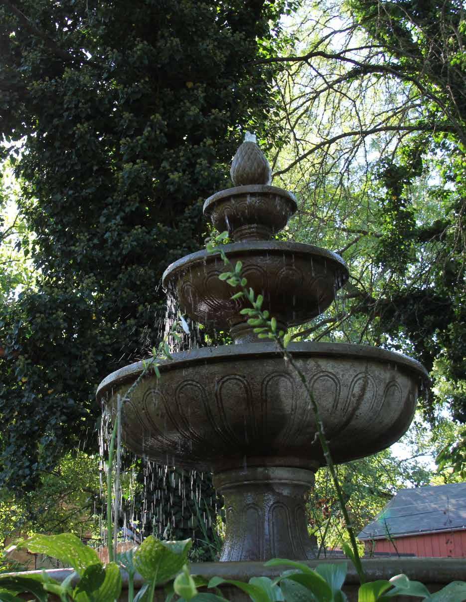
SIGN-IN SHEETS
DRAFT
DRAFT
SUMMARY PRESENTATION

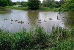


What Happened at the Workshop?

Available online at www.AdvanceAnderson.com
Existing Conditions
• Activities:
• Vision for Anderson in 20 years Opportunities & Barriers Growth & Development- where to go?
Open House August 8 & 12, 2024
Strengths

Recurring Themes Strong Sense of Community: Deep sense of pride and connection within the community, a warm and welcoming atmosphere, committed community members, collective pride in local assets and events.
Arts and Culture: Cultural and artistic amenities, cultural vibrancy within the community. Downtown and Gathering Spaces: Downtown square and other gather spots serve as important hubs for social interaction and community events.
Education and Collaboration: Collaboration between city, educational institutions, and nonprofits.
Affordable Housing: Highlighted multiple times as critical strength.
Strategic Location and Accessibility: Proximity to interstates and major cities, well-established infrastructure.
Parks and Recreation: Parks, trails, recreational spaces, with ongoing upgrades and expansions.
Open House August 8 & 12, 2024
Barriers


Weaknesses
DRAFT
Recurring Themes
Economic and Financial Challenges: High poverty rates, low-paying jobs, challenges securing grants and investments.

Recurring Themes
:
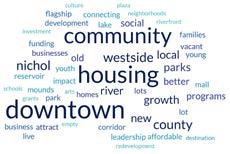
Draft Vision Statement

Open House Activities

Draft Guiding Principles
• Sustainable Growth & Economic Development
• Attainable Housing Options
• Vibrant Mixed-Use Downtown
• Lively Arts & Culture Scene
• Strong Educational System
• Active Corridors
• Diverse Recreational & Entertainment Offerings
Open House August 8 & 12, 2024
Attainable Housing Opportunities
Anderson aims to provide a variety of housing options that span the spectrum of community needs, from affordable to high-end housing.
Housing should be attractive and wellmaintained to promote Anderson as a safe and desirable residential community. Residential developments should be interconnected with each other and to city destinations, including employment, recreation, institutions, and other amenities and services.
FIRST DRAFT Goals
• Increase the amount of housing to match the future demand for a variety of housing and living options
Exercise #1: Review of Draft Vision Statement
Instructions:
• Discuss the vision statement with your group and determine whether you agree with it.
• Mark the appropriate box on the sheet Determine whether any other changes should be suggested or if we are missing any goals for the principle.

Sustainable Growth and Economic Development
DRAFT
• Identify barriers to housing and the types of housing that are in short supply
• Encourage maintenance of residential properties
• Improve multi-modal transportation connectivity in existing and future residential developments to key destinations in Anderson
• Allow a range of housing types both within neighborhoods and across the community
• Update the zoning ordinance to align with the comprehensive plan
Open House August 8 & 12, 2024
Lively Arts & Culture Scene
FIRST DRAFT Goals
Anderson has a history of excellence in arts and culture with amenities like the historic Paramount Theatre, the Anderson Museum of Art, and the Anderson Symphony Orchestra. The City aims to promote and expand upon these assets by supporting local talent and engaging the community through events and education.
• Preserve historic structures in Anderson that add to the character of the area
• Support the development of cultural amenities
• Promote city-wide social events and activities
• Become an arts district destination
• Utilize and promote the local arts as learning resources for community members of all ages
• Support existing arts and cultural community assets
Open House August 8 & 12, 2024
An important but difficult to quantify growth outcome is how the growing parts of Anderson look, feel, function, and are experienced – all of which contribute to whether people will feel good and safe in a given area. There are significant differences in how development looks and feels in different parts of Anderson – e.g. Downtown and Scatterfield Road. In this plan, Anderson must turn its attention to improving the quality of place. Through the design of the built environment, a community can convey its unique character, impact residents’ well-being, and promote a sense of community pride—this is quality of place. There are many components that can contribute to a sense of place including neighborhood character, residential form, land uses, street design, landscaping, public art, and more.
FIRST DRAFT Goals
• Achieve an intentional balance between new development and redevelopment
• Focus on the core to rehab or redevelop neglected properties while maintaining Anderson’s place-based character
• Encourage small local businesses and entrepreneurial development
• Attract and diversify employment industries
• Foster a strong community-industry partnership
Open House August 8 & 12, 2024
Vibrant Mixed-Use Downtown
The downtown is the heart of the City and a key area for both commerce and culture. Anderson is proud to have strong arts and culture programs that are typically not experienced in a city of this size. Key strategies in downtown redevelopment focus on changing the mix of uses, renovating existing buildings, inviting in more residential uses, and constructing new development in underutilized spaces. Increasing the number of residents downtown will help to spur more eateries and other services within the downtown to support the growing population.
FIRST DRAFT Goals
• Increase walkability and accessibility to and within downtown
• Attract service and shopping industries to downtown
• Center programing activities to downtown
• Encourage mixed use residential developments within downtown
• Support rehabilitation and new development to create more destinations within the downtown, especially near existing landmarks
• Focus on revitalization of old or vacant buildings
• Re-examine downtown street design to support downtown businesses, activities, and walkability
Open House August 8 & 12, 2024
Strong Educational System
Anderson is home to three higher education institutions and a network of public and private schools that provide opportunities for learning at any age. Anderson desires to support and retain its talented and educated citizens. The City aims to reduce the barriers to educational attainment by providing supportive services, such as convenient access to public transportation and availability of afterschool activities.
FIRST DRAFT Goals
• Support partnerships between educational entities to create more opportunities for educational attainment
• Support Anderson public schools
• Collaborate with Anderson University, Purdue Polytechnical, and Ivy Tech to attract and retain talent
• Collaborate with educational and social providers to offer tutoring and after school activities
• Focus on reducing barriers to educational attainment, such as lack of transportation or support for childcare services
Open House August 8 & 12, 2024
Active Corridors
Street design impacts well-being, safety, accessibility, and business opportunities. Our corridors serve to connect us within our community and connect us to regional destinations. Streets are the front doors to our community, businesses, activities, and homes. Many streets in Anderson were designed during a time that prioritized motor vehicle traffic flow, often at the cost of welldesigned sidewalks and without providing on-street parking. Community demands have shifted, and reexamining existing streets creates an opportunity to redesign the corridors based on new demands, best practices, and community goals.
FIRST DRAFT Goals
• Create an identifiable and welcoming gateway into Anderson
• Incentivize rehabilitation and redevelopment along corridors
• Encourage a variety of uses along corridors
• Remediate brownfields
• Support street design that promotes walkability, space for transit stops, and local businesses
Diverse Recreational & Entertainment Offerings
Anderson is a place for locals and visitors that want to enjoy a variety of recreation and entertainment options. Anderson’s existing parks and public spaces are being maintained and upgraded to serve a broad spectrum of users. These include activities and programming for people of all ages and abilities. Anderson further promotes their flourishing arts scene with community events and entertainment, including concerts and holiday celebrations.
FIRST DRAFT Goals
• Provide organized recreational activities for various age groups
• Create or improve accessible and attractive spaces for youth to enjoy (K-12)
• Activate gathering spaces with an array of events and programming that fosters community connectedness
• Improve the condition, accessibility, safety, and connectivity of existing parks
• Support existing cultural assets and venues that enhance Anderson’s quality
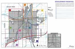
DRAFT
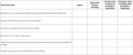

Next
• Review input from Planning Week and synthesize results
• Examine public engagement and engage with missing populations
• Update Vision, Principles, and Goals
• Begin Framework plans for each Principle
• Update the website
Interactive Maps and Surveys
Open House August 8 & 12, 2024
DRAFT
APPENDIX BPUBLIC OPEN HOUSE 2
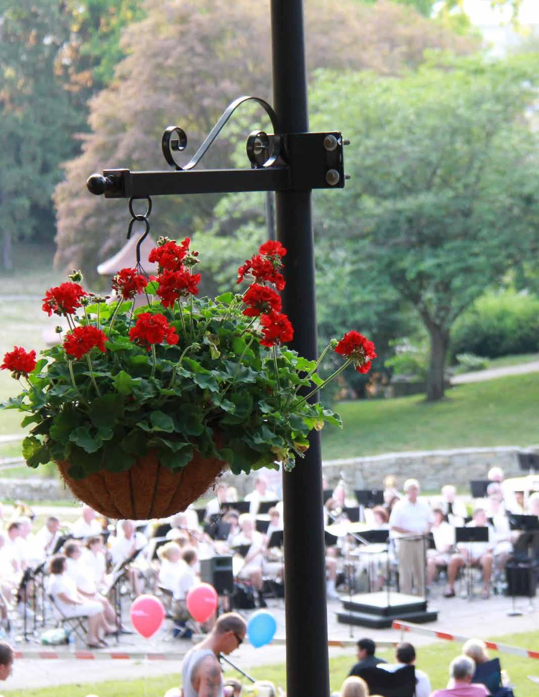
SIGN-IN SHEETS
WELCOME TO THE COMMUNITY WORKSHOP
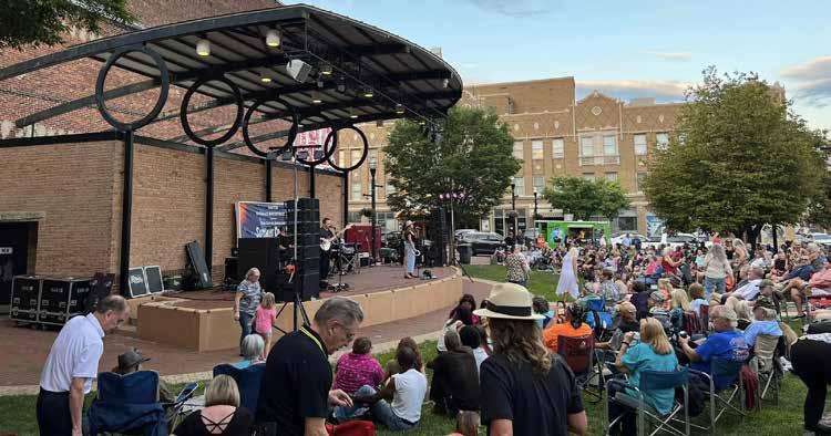
Anderson Parks
5-Year Parks Master Plan
Wednesday, March 12
Share your feedback for the proposed recommendations and priorities of the 2025-2029 Parks Master Plan
4:00 - 7:00 p.m.
Flagship Enterprise Center


THE CITY OF ANDERSON PARKS
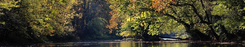
5-YEAR MASTER PLAN
THE PARKS DEPARTMENT MISSION
Envisioning, planning, developing, and operating public recreational facilities that support recreational opportunities and programs for all citizens of Anderson.
WELCOME TO Public Meeting #2
Anderson, Indiana | March 12, 2025
The Anderson Parks Department is currently engaged in the process to update their Parks & Recreation Master Plan. This process gives YOU the opportunity to participate in the development of a future vision for the parks network. Community members are encouraged to comment on proposed recommendations for the park system.
A number of input exercises are organized around this room. You may choose to participate in as many activities as you would like! Consultant team members are available to answer your questions about the plan. The feedback gathered from this event will be used to guide the remainder of the planning process.
Welcome
Thank you in advance for your participation! We look forward to hearing YOUR ideas!
THE CITY OF ANDERSON PARKS
What is a Parks Master Plan & How is it Used?
▪ A long range guide for the direction of parks and programming growth.
DRAFT
▪ Per Indiana DNR requirements, the plan must include at minimum:
▪ A detailed inventory and analysis of the current Park System
▪ Record of public participation and engagement in the planning process
▪ A list of recommendations for improving and growing the park system, including project prioritizations and timeline
▪ It allows the park staff to assess current and future needs, evaluate feasible options, develop a strategic action plan, and budget for longterm capital improvements.
▪ It guides the direction of community resources and investments.
▪ It prioritizes park upgrades, improvements, and additions over the next 5 years.
▪ It is used by the County Council and Parks Department when preparing a budget for the maintenance of existing parks and activities, while also allocating funds for new facilities and programs.
The Plan Outline
▪ The Purpose of the Plan
▪ List of Goals and Objections
▪ Definition of the Study Area
▪ Population Distribution / Economic Factors
▪ Organization of the Park Staff & Board
An Existing Park and Program Inventory
Project Purpose
▪ Accessibility Audit and Review of Barriers
▪ Public Engagement Process
▪ Benchmark and Needs Analysis Report ▪ Facility Recommendations
Recommendations
Plan
Why Update the Plan Now?


▪ The IDNR requires Park Master Plans to be updated every five years in order to receive state and federal funding for park improvements.
▪ Last update and adoption was in 2011
▪ Analyze newer socioeconomic data and trends
▪ Reflect vision of new county leadership and staff
▪ Create a holistic & comprehensive plan for parks & recreation in the City of Anderson
▪ Strategic focus on missing elements within the parks system
▪ Include strategies for long-term maintenance of facilities
▪ Incorporate new areas of interest for the community
▪ Manage and prioritize Parks and Recreation Department investments to maximize impact
▪ Create a plan that can assist the Parks and Recreation Department in seeking grants and additional funding sources to

THE CITY OF ANDERSON PARKS
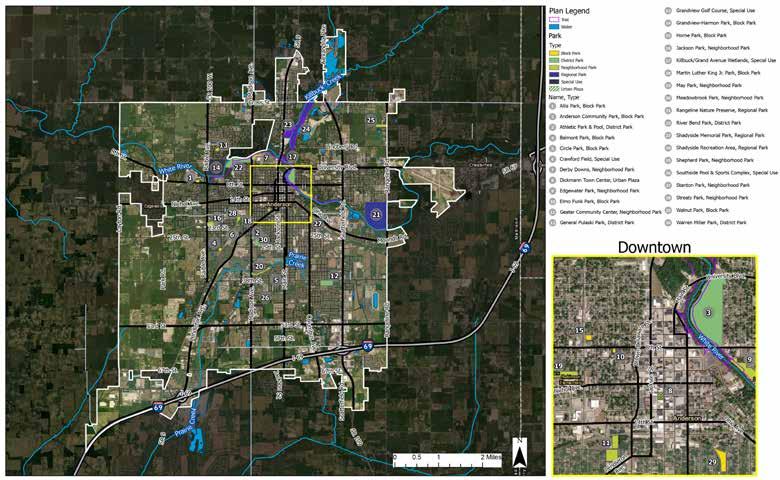
Parks System Map
THE CITY OF ANDERSON PARKS
DRAFT
How do you want to allocate funds for the Parks & Recreation System?
As a part of the master planning process, general recommendations for the parks system have been identified.
Please take 5 coins - each coin is worth $200
If you had $1,000 to spend on the Anderson Parks and Recreation Department, which of these items and priorities would you like to see your money invested in?
1Pave Gravel Parking Lots/ Repave Asphalt Parking Lots
2Increase Accessibility to Park Facilities (ADA parking, paved paths to facilities, etc.)
3Upgrade Parks Website (online event/facility registration, property descriptions, program updates & offerings)
4Upgrade Park Identitifcation Signs
5Install New Park Interpretive & Wayfinding Signage
6Upgrade site furnishings (benches, litter receptacles, etc.)
7Add Programming - Education Based/STEAM (e-sports, robotics, drones)
8Add Programming - Recreation/ Sports (baseball, softball, soccer, futsal, etc.)
9Add ProgrammingOutdoor Learning/Nature Based (plant ID, insect ID, etc.)
10Invasive Plant Management and Trail Maintenance
11Playground Equipment
Upgrades/Incorporate 21st Century Technology
12Incorporate Public Art Into Parks (sculpture, murals, etc.)
13Develop More Natural Areas with an Ecology Focus - Reduce Lawn Areas
PLACE STICKY NOTES HERE
Did we miss something?
If so, write it down on a post-it-note and place it above
THE CITY OF ANDERSON PARKS
How do you want to allocate funds for the Parks & Recreation System?
As a part of the master planning process, specific recommendations for individual parks have been identified. Help us identify your priorities
(Not all parks are represented below. Parks not represented below are anticipated to receive general recommendations.)
Please use dots to select up to six (6) priorities.
PARK RECOMMENDATIONPRIORITY
Athletic Park & Pool
Anderson Community Park
Belmont Park
Implement City announced revitalization plans (acquatic center, entry plaza, performance stage, gathering lawn)
Increase park programming
Install additional landscaping
Replaced damaged amenities (playground, benches, etc.)
Dickmann Town Center Renovate playground surfacing
Renovate the restrooms
General Pulaski Park
Grandview Golf Course
PARK RECOMMENDATIONPRIORITY
Jackson Park
Killbuck/Grand Ave. Wetlands
May Park
Renovate the baseball concession stand
Implement a tree planting program to regenerate the tree canopy
Prioritize funding for the golf course to ensure long-term maintenance and operations
Priorities by Park
THE CITY OF ANDERSON PARKS
Meadowbrook Park
Provide tech-based, interactive play elements.
Provide audio mixing station for outdoor performance shelter
Install seating for bird watching
Enhance aquatic and waterfowl habitats
Maintain/Repair playground
Maintain/Repair splash pad
Develop a tree planting schedule and program
Provide a measured walking path
Provide fitness stations
Upgrade playground equipment
Restore Stanley Ditch with native plantings
Provide additional trees in lawn areas
How do you want to allocate funds for the Parks & Recreation System?
As a part of the master planning process, specific recommendations for individual parks have been identified. Help us identify your priorities (Not all parks are represented below. Parks not represented below are anticipated to receive general recommendations.)
DRAFT
Please use dots to select up to six (6) priorities.
PARK RECOMMENDATIONPRIORITY
Rangeline Nature
Preserve
River Bend Park
Shadyside Memorial Park
Stabilize trail surface in erosion prone areas
Pave the gravel parking lot
Install additional bike course obstacles
Install a bike repair station
Construct a restroom facility
Pave the gravel parking lot
Construct a paved boat launch
similar to Edgewater Park
Provide trail signage and delineate automobile vs. pedestrian paths
Implement phase 2 playground
improvements
Repair damage to Fallen Soldiers
Memorial
Upgrade landscaping at Chinese Terrace Garden
Renovate baseball and softball fields
PARK RECOMMENDATIONPRIORITY
Shadyside Recreation Area
Southside Pool & Sports Complex
Walnut Park
Warren Miller Park
Mitigate erosion along Shadyside Lake shoreline
Repair/replace pathway lights
Upgrade public restrooms at Shadyside Lake Activity Center
Upgrade bathhouse
Provide a dedicated park parking lot
Replace outdated playground equipment
Renovate baseball/softball field and backstop
Renovate or remove distressed sports fields
Repurpose horeshoe courts into alternate game courts
Acquire commercial property at NW corner of NW 29th St. and Fairview St. for additional parking
White River Trail
Increase White River access points
Provide rules for equestrian trail use
Provide additional trees in lawn areas
How do you want to allocate funds for the Parks & Recreation System?
PLACE STICKY NOTES HERE
Did we miss something; are there additional parks and/or projects you would like to see prioritized for investment or improvements? If so, write down your recommendations on a post-it-note and place it above
Priorities by Park
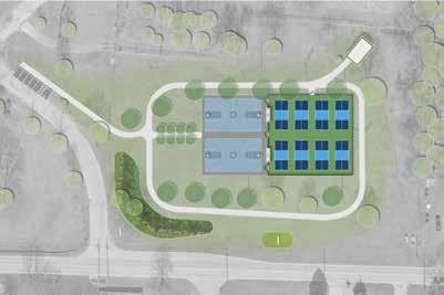
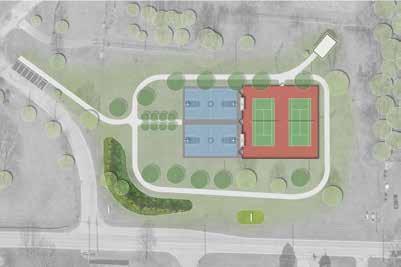

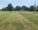
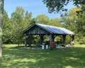
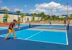
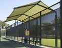
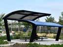
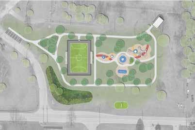
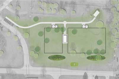
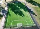
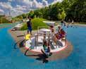
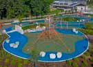
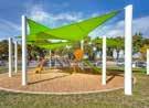
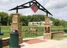
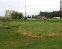


COMMUNITY FEEDBACK SUMMARY
RUNDELL ERNSTBERGER ASSOCIATES
Memorandum
Date: March 13, 2025
Project Number: 2024-1704
Project Name: Anderson Parks 5-year Master Plan
From: Cecil Penland
To: David Eicks City of Anderson, Department of Parks
Copies: City of Anderson: Stacy Johnson REA: Kyle Koger
Subject: Anderson Park Plan Public Meeting #2 – Public Comments
A. Getting Invested Exercise – General Park Recommendations
“If you had $1,000 to send on the Anderson Parks and Recreation Department, which of these items and priorities would you like to see your money invested in?
1. Pave Existing Gravel Parking Lots / Repave Existing Asphalt Parking Lots
2. Increase Accessibility to Park Facilities (ADA parking, paved paths to facilities, etc.)
3. Upgrade Parks Website (online events/facility registration, park descriptions, list program updates & offerings)
4. Upgrade Park Identification Signs
5. Install New Interpretive and Wayfinding Signage
6. Upgrade Site Furnishings (benches, litter receptacles, etc.)
7. Additional Programming: Education-base/STEAM
8. Additional Programming: Recreation/Sports
9. Additional Programming: Outdoor Learning/Nature-based
10. Invasive Management & Trail Maintenance
11. Playground Equipment Upgrades / Incorporation of 21st Century Playground Components
12. Incorporate Public Art Into Parks (sculptures, murals, etc.)
13. Develop Natural Areas with an Ecology Focus: Reduce Lawn Areas
B. How do you want to allocate funds for the parks and recreation system? Did we miss anything? Are there additional parks and/or recreation projects that you would like to see prioritized for investment or improvements? If so, write down your recommendation(s) on a post-it note and place it on the board.
1. Trail connectivity.
2. Add better aggregate at the Edgewater Park boat ramp and make the Riverbend Park boat ramp better.
3. Clean up old picnic tables at Shadyside Lake Recreation Area.
4. Will there be varied sources of funds used – both state and federal funds?
5. If paving the parking lot at Riverbend Park, add speed bumps. Drives fly through the parking lot.
6. Remove invasive honeysuckle shrubs around the lakeshore of Shadyside Lake. Replant with native plants. a. I agree.
7. Tear down underutilized baseball and softball fields at Shadyside Memorial Park. Replace them with green space.
8. Focus more on “nature preserve” component of Rangeline Nature Preserve with the removal of invasives and adding natives plants and trees.
9. Allocate more money for maintenance. 2024-1704 Anderson Parks 5-year Master Plan March 12, 2025 Memorandum Page 2 of 5
618 EAST MARKET STREET / INDIANAPOLIS, INDIANA 46202 / 317.263.0127 / REASITE.COM
2024-1704 Anderson Parks 5-year Master Plan March 12, 2025 Memorandum
10. Please clean up and update Shephard Park. It is being used as a location for drug exchanges homeless encampment, or anything other than its intended use as a park. It is an eyesore.
11. Athletic Park is not a priority to me. We need quality programming for our youth as soon as possible. Please!
12. Update Circle Park playground equipment.
13. Hire people who are educated in native trees, native plants, and native restoration to make decisions for Killbuck Creek Wetlands.
14. Parks are a real quality of life issue! We want people to move here.
15. Add safety lighting at parks. Program engagement. 16. Shephard Park needs to be restored. It is a complete eyesore with trash and homeless in that area. It once was nice with tennis courts and basketball courts. It is now a disaster.
17. Please plan to maintain Shephard Park.
18. From a 5th Grader at Valley Grove Elementary: She wrote an essay about fixing up the park by her house (the swings are broken). The park she is referring to is Warren Miller Park.
C. Comment Cards
1. The Parks need to be maintained much better! The “keystone” park, Shadyside Memorial Park, has been poorly maintained. We need our parks to shine.
2. Anderson Community Park looks more like a memorial than an actual park. don’t think the community understands what it is.
3. Please consider hiring a dedicated, professional Parks Director that can help carry out this plan.
4. Make maps and information available online. Have more meetings at different times and locations.
5. Consider memorializing Native American history of Anderson within the Athletic Park renovation and perhaps the jail property.
6. Please publish Anderson Park Master Plan public meeting worksheet inventories on the City’s website. The City should advertise these input sessions earlier.
7. Please hire a qualified Superintendent of Parks that can focus solely on the Parks Department. We need programming!
8. It is frustrating to only get notice of public meetings less than 24 hours in advance. No city officials were present while was here to express frustration with the process to the staff.
D. General Comments Water Recreation / Water Access
DRAFT
1. Establish a livery along the White River to expand water recreation. Develop a public-private partnership like Bobbers Café at Shadyside Lake Recreation that allows a private business to rent the brick-and-mortar facility and manage the boat, canoe, kayak, and paddleboard rentals.
2. I am not sure if there is public access to the
Trails
3.
4.
and Layton Road as a lynchpin to a successful trail network that connects the City of Anderson to surrounding communities. The County Parks and Recreation Board would like to partner with the City to develop trail infrastructure in this zone.
7.
used to be the site of a city-managed tree nursery. The nursery was in operation until 2010. Consider making a tree trail on the site with interpretive signage discussing trees.
8. Pickleball is not desired at Allis Park.
9. No more pickleball courts are needed within any Anderson park. The City already has enough pickleball courts at Shadyside Lake and General Pulaski Park. Pickleball is a social sport. There needs to be a minimum of 12 courts grouped together to promote social gatherings.
10. A dog park is not desired at Allis Park. The Animal Protection League has a public dog park located on their property less than a quarter mile east of Allis Park.
11. Allis Park is situated on city-owned land that backs up to the White River. Consider providing public access to the White River from the park.
12. Provide a restroom at Allis Park. Athletic Park
13. The Athletic Park Pool is beyond repair and needs to be removed.
14. Consider turning the Athletic Park Pool into a museum that honors and tells the story of indigenous people.
15. Consider placing a dome over the top of the Athletic Park Pool to make a terrarium-type greenhouse.
16. The Administration has not shared the current plans for Athletic Park with the public. Therefore, the public cannot comment and provide their input. Anderson Community Park
17. I don’t understand the function or purpose of Anderson Community Park. It is an odd space on the southeast corner of the Dr. MLK
18.
19.
20.
22. Reconstruct the boat ramp at Edgewater Park. Angular and jagged rocks at the toe of the boat ramp are difficult to walk across and potentially dangerous.
Geater Community Center
23. Increase programming at the Geater Community Center.
Grandview Golf Course 2024-1704 Anderson Parks 5-year Master Plan
24. The golf course is situated on land that used to be an infirmary or sanitarium. Consider incorporating interpretive signage or other features to celebrate the former use of the golf course.
May’s Park
25. The park was updated and reopened in 2022. The poured-in-place play surfacing already shows signs of failure. The Park Department needs to increase investments in maintenance to maintain this newer park.
26. Access to the park is odd. Tenth Street transects the park. Install gates or bollards at the end of the block to restrict vehicular traffic along Tenth Street for special park events.
27. Add a roller rink at May’s Park.
Shadyside Memorial Park
28. Fix the drainage issues at the terrace gardens.
Rangeline Nature Preserve
29. Construct a nature center at Rangeline Nature Preserve. Develop seasonal programming that includes Native American reenactments. Provide additional interpretive components that tells the story of Anderson Canal.
30. Provide aquatic equipment rentals.
31. Improve fishing access to the lake at the nature preserve. The pathway is currently rugged and not accessible.
Shephard Park
32. Shephard Park has become an eyesore. The tennis court has been left in disrepair. The grass is overgrown and is only mowed a few times a year. The park sign is crooked. The park has become a landmark for illicit drug use, a meeting spot for promiscuous affairs, and a dumpsite for trash.
Warren Miller Park
33. The horseshoe pits at Warren Miller Park have been abandoned. Horseshoe is not as popular as it used to be. Remove the horseshoe pits and incorporate new programs or amenities in this space.
34. The Old Trustees’ Building is currently underutilized. The Armory side of the building is in poor condition. However, the gymnasium is in good condition and could be converted into another community center.
Administration
35. There is currently a lack of leadership within the Parks Department. The Park superintendent position has been vacant for more than two years. Hire a qualified superintendent to manage the Anderson Parks Department.
36. The Administration dismantled the former City Tree Commission. The city lost its designation as a Tree City USA through the Arbor Day Foundation. Bring back the commission.
37. Bring back the urban forester/floriculturist position. Consider restructuring the agency so that the urban forester is managed by a different department (i.e. Department of Public Works).
38. The City’s Tree Ordinance is not being executed. Trees have been removed from the public rightof-way but not replaced. The urban tree canopy is declining
39. Update the City of Anderson Parks website.
40. Hire an invasive species management director or contract with a private business that specializes in invasive species removal and management.
41. Continue to build relationships with other agencies, community organizations, and non-profits. Collaborate with these groups to increase unique program offerings for children, adults, and families. Collaborate with these agencies to improve park maintenance.
Programs
42. Add programs for adults and senior citizens. Examples include weekly breakfasts, bus tours, or card game nights.
43. Develop fitness programs or workout bootcamps at Jackson Park.
44. Develop more programs – such as special education classes and yoga – within the Old Trustees’ Building.
45. Hire a Program Director to develop and manage more programs in the Old Trustees’ Building.
46. Convert the Old Trustees’ Building into a test kitchen. Host cooking classes for the community. General Beautification / General Recommendations
47. Provide more gateway components at the edge of the city to welcome visitors.
48. Plant more trees within the public right-of-way (streetscapes and parks). Allocate funds for long-term maintenance of the trees in the public realm.
49. Refer to downtown Franklin, Indiana. They have constructed a multi-use festival street that can be used as a farmers market, pickleball tournaments, or other special activities. The street can be closed to vehicular traffic by installing bollards at the end of the block.
50. Improve connections to parks. Provide accessible sidewalks that lead to the parks.
DRAFT
ONLINE INPUT SUMMARY