HOW TO USE TH i S UDO
4
5 Building Types
6
7
Environmental Protection & Processes
13 Development Types
&
17 Language Rules & Definitions
Establishes
the
Establishes the Official Zoning Map. Establishes the Zoning Districts purpose and development standards. Establishes Overlay Districts and Form-Based Districts and their development standards
Establishes the Table of Uses and in which districts they are permitted, permitted by special exception, conditional uses, accessory uses, and temporary uses. Establishes the Use Conditions for all uses.
Establishes the scale and design of buildings and certain site elements
Establishes development standards applicable to all districts regarding construction, access, utilities rules of measurement, and site lighting
Establishes standards for parking applicability, minimum parking, parking design, and other vehicle parking, queuing, and loading
Establishes standards for landscaping requirements including plants and materials, applicability and credits, prescribes required minimum site landscaping, buffers between differing uses, fences, screening, and landscaping for open space
Establishes standards for site layout(s) regarding design of lots and blocks, rights-of-way and circulation for vehicles, bicycles, and pedestrians; easements; common areas and open space; and development infrastructure.
Establishes design standards for development plan districts, overlay districts, and formbased districts regarding site and architectural design.
Establishes permitted sign types and their design standards including size, location, illumination, installation, and maintenance
Establishes compliance with construction standards and regulations of other City Departments. Establishes ordinances related to Wetlands, Flood Hazard Areas, and other geological factors.
Establishes development-specific standards for Planned Unit Developments, Mobile Home Parks, and Recreational Vehicle Parks and Campgrounds
Establishes legal procedures and application processes for administrative, legislative, and quasi-judicial land use decisions.
Establishes the legal basis for the Historic and Cultural Preservation Commission. Establishes conservation districts and historic preservation districts, and regulations regarding approvals and design standards for sites within those districts.
Establishes the authority and procedures for the City to investigate, issue, and penalize violations of this UDO.
Establishes interpretation of the UDO language and lists definitions of terms.
Understanding the UDO & Zoning
Zoning Districts
Zoning Districts are a regulating mechanism for the use and development of property.
Zoning District Development Standards
The development standards for zoning districts govern the physical development and form of real estate including lot size, building size, setbacks from property lines, and more.
Dimensional Tables
The regulations for each zoning district are presented in each district subsection of Section 3.4 under part D. Development Standards.
Use Matrix
Where a use may be permitted is dependent on its zoning district. The land use matrix includes all principal, accessory, conditional, special exception, and temporary uses. Refer to Chapter 4
Use-Specific Conditions
Each permitted use is subject to specific conditions, listed in Sections 4.3 through 4.10. Each use is defined in Section 17.4 Definitions.
Building Types
A list of building types regulates the general types of structures that are allowed within a zoning district. These building types are represented in the illustrative images and described in full detail in Chapter 5. The names of the building types are not intended to limit or expand uses allowed within the building.
GU i DEL i NES FOR PROJECT DEVELOPMENT & REV i EW
The following is intended to serve as a guideline for developing and/or reviewing site plans and construction projects. All properties within the jurisdiction of the City of Elkhart are required to comply with all sections of this UDO regardless if the standards are listed below.
Find your property on the Zoning Map
Identify which zoning district (and overlay district, if applicable) applies to your lot. The zoning map is available on the City of Elkhart website.
Determine if this zoning district and overlay matches the character, use, and intent of your project. Refer to Chapter 3 Zoning districts to determine if your site has the proper zoning classification for its purpose, and review the Use Table in Chapter 4 to determine if your proposed use is permitted, or if you would need a zoning petition such as a rezoning.
TWO
Review and Comply with Development Standards
Chapter 3. Zoning Districts
Find your Zoning District in this Section. See the building types, dimensional standards, and development conditions (if applicable) listed in this section that shall apply to the property. If a zoning overlay or form-based district applies, those standards will apply as well. If there is a conflict with the requirements of the base zoning district and the overlay district, the overlay or form-based district shall take precedence. Refer to Chapter 6 for exemptions and rules of measurement. Refer to Chapter 2 for nonconforming uses, lots, and/or structures.
Chapter 4. Use Specific Conditions
Review this section and Table 4.2-1 Use Matrix for all permitted uses in your zoning district. Each permitted use is subject to specific conditions, listed in Subsections 4.3 through 4.10. Each use is defined in Section 17.4 Definitions.
STEP TWO CONTINUED
Chapter 5. Building Types
This section includes form-based standards that apply to a type of building development in addition to the land use.
Chapter 6. General Regulations
Review this section for standards that apply to all districts. This section includes rules regarding exceptions and rules of measurement for the development standards listed in Chapter 4.
See Section 6.18 for Clear Sight Distance for intersections and driveways.
See Section 6.20 for Site Lighting Standards.
Chapter 7. Parking and Loading
This section includes required minimum vehicle and bicycle parking and loading spaces to be provided for a specific use and the required sizes, locations, and design of parking areas. See Table 7.4-1 for Required Parking.
Chapter 8. Landscaping, Buffers, and Open Space
Review this section for required landscaping, parking lot landscaping, buffers between uses, screening requirements, and fence standards.
Chapter 9. Design Standards
Review this section for requirements regarding site layout, access and street construction, land subdivision requirements, block layouts, and stormwater and utility standards.
See Section 9.6 for required sidewalks
Chapter 10. Design Criteria for Development Plans
Refer to this chapter for site and architectural design requirements if your site is in a Planned Unit Development, Riverfront Overlay, the Downtown (CBD Core) Overlay, or the Benham Neighborhood Overlay Districts.
STEP TWO CONTINUED
Chapter 11. Sign Standards
Review this section for all regulations related to signs, including permitted sign types, locations, and more.
Chapter 12. Environmental Protection & Hazard Mitigation
Review this chapter if your site is in a Wetland Conservation Overlay District or Flood Hazard Area. See also construction standards related to Grading, Drainage, and Erosion Control and other regulations.
Chapter 13. Development Types
This chapter includes standards applicable to PUDs, Mobile Home Parks, and Recreational Vehicle Parks and Campgrounds.
STEP THREE
Seek Approvals as Necessary
Are you subdividing a lot?
See Section 14.5 Subdivision Approval for procedures and processes. Subdivision designs must comply with the standards in Chapter 9.
Does your project reconfigure an existing street or create a new block or street?
See the lot and block standards, access, and street construction standards in Chapter 9
Does your project require a change in Zoning District?
Refer to Section 14.6.1 Zoning Amendments for procedures and processes related to filing a petition for rezoning.
Does your project require a Special Exception?
Refer to Section 14.7.2 for application procedures and requirements for Approval of a Special Exception.
STEP THREE CONTINUED
Does your project require a Conditional Use Approval?
Refer to Section 14.6.2 for application procedures and requirements for Approval of a Conditional Use.
Does your project require a Variance?
If your project is unable to comply with development standards, you may file for a Variance. Refer to Section 14.7.3 for application procedures and requirements for a Variance
Is your project a designated historic property?
Refer to Chapter 15 Historic Preservation Districts to determine if your project requires review or a Certificate of Appropriateness from the Historic Commission.
STEP FOUR
Zoning Clearance Permit
Once your project meets all the requirements of this UDO and has received any additional review or approvals, submit your permit application to the Building & Code Enforcement Department.
COM-R

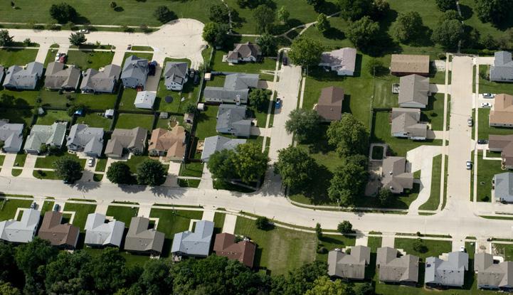
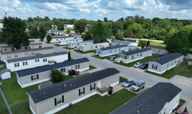
Suburban Residential District
The Suburban Residential district is intended to accommodate medium-sized detached residential uses and accessory uses.
Compact Residential District
The compact residential district is intended to accommodate medium to small-sized residential uses and accessory uses.
Mobile Home Park District
The Mobile Home Park District is designed to provide for the placement of single and doublewide mobile units, not placed on a permanent foundation, within a large-scale unified development under single ownership.
Development intensities and character are typical of traditional and suburban neighborhoods. Neighborhoods may be designed around open space, parks, or other features which contribute to the overall character. Infill and redevelopment should continue the existing visual patterns, rhythm, character, style, and orientation of the surrounding dwelling units.
Development intensities and character are typical of traditional neighborhoods and is intended to provide a transition between suburban and urban residential development patterns.
Developments should be similar in character to detached dwelling units and which minimize incompatibilities with surrounding land uses.
BUiLDiNG TYPES
• Detached Dwelling Narrow
• Detached Dwelling Standard
• Detached ADU
• Cottage
• Detached Dwelling Narrow
• Detached Dwelling Standard
• Detached ADU
• Cottage
• Duplex (special exception)
• Townhomes (special exception)
• Mobile Home


Urban Residential District
The urban residential district is intended to accommodate small-lot residential uses. Development should be walkable, wellconnected, and designed around natural and environmental features that are accessible community amenities.
Mixed Residential District
The mixed residential district is intended to provide for a variety of residential uses and intensities compatible with their sites and surroundings. Most residential building types are permitted in this district. This district supports both small-scale and large-scale multidwelling developments.
institutional District
The INST district is intended to provide for public and semi-public uses that serve the community.
Developments should be proximate to schools, parks, public services, and transit. Development intensities and character are typical of an eclectic neighborhood environment where a mix of low-intensity to medium-intensity housing types are supported. Infill and redevelopment is encouraged to continue the existing visual pattern, rhythm, character, style, and orientation of the surrounding dwelling units.
This district is intended to serve as a transition between higher intensity commercial and mixed-uses and lower-intensity residential development. The environment should be pedestrian-friendly, walkable, and wellconnected
Institutional uses locations should correlate with their scale of service. The environment should be pedestrian-friendly, walkable and wellconnected.
• Detached Dwelling Narrow
• Detached Dwelling Standard
• Detached ADU
• Cottage
• Duplex
• Triplex (special exception)
• Quadplex (special exception)
• Townhomes
• Detached Dwelling Narrow
• Detached Dwelling Standard
• Detached ADU
• Cottage
• Duplex
• Triplex
• Quadplex
• Townhomes
• Neighborhood Multi-Dwelling
• Multi-Dwelling
• Mid-Rise (special exception)
• Neighborhood Streetfront (special exception)
• Neighborhood Streetfront
• Flex (1-3 stories)
• Multi-Dwelling (special exception)
• Per Approval
NEi-B

Neighborhood Business District
The NEI-B district is intended to provide for a mix of uses intended for small-scale, low-impact neighborhood-serving commercial, office, service, and residential uses.
COM-B
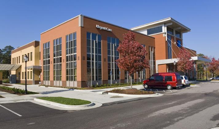
Community Business District
The COM-B district is intended to provide for a wide range of business, office, service, hospitality establishments, and residential uses typically, located along major street corridors. These establishments are intended to serve the needs of consumers beyond the immediate neighborhood but are not regional in focus.
REG-B
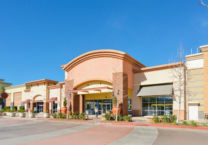
Regional Business District
The REG-B district is intended for large-scale commercial, retail, wholesale, service, autorelated, and residential uses. This district should be located with access to major thoroughfares that are designed to accommodate heavy traffic.
This district may facilitate mixed-use infill within established neighborhoods, where appropriate. The environment is pedestrian-friendly, walkable, and well-connected with public and semi-public gathering spaces.
This environment should have a wellconnected street system, and strong bicycle and pedestrian connections, but may include automobile-serving site amenities. Sidewalks and pedestrian spaces should be activated as gathering places. Land use diversity and destination proximity should be used to create walkable activity nodes that support nonmotorized modes of transportation.
This environment is more automobile-centric, but should still have a well-connected street system, and strong bicycle and pedestrian connections. Regional placemaking, land use diversity, and destination proximity should be used to create walkable activity nodes that support non-motorized modes of transportation.
• Detached Dwelling Narrow
• Detached Dwelling Standard
• Cottage
• Duplex
• Triplex
• Quadplex
• Townhomes
• Neighborhood Multi-Dwelling
• Multi-Dwelling
• Neighborhood Streetfront
• Flex (1-3 stories)
• Townhomes
• Neighborhood Multi-Dwelling
• Urban Streetfront
• Neighborhood Streetfront
• Flex (1-3 stories)
• Flex Attached
• Auto-Oriented
• Mid-Rise
• Urban Streetfront
• Flex (1-3 stories)
• Flex Attached
• Auto-Oriented



Central Business District
The Central Business district is intended to provide for a vibrant downtown environment incorporating a mix of commercial, office, service, hospitality, and residential uses in the City of Elkhart’s traditional community core.
Hospitality, Research, & Development Industrial District
The R&D-I district is intended to allow for the growth and development of research and development, technology, major educational, research, public service, and office uses, and their necessary support functions, while minimizing conflicts with adjacent land uses.
Manufacturing Industrial District
The MAN-I District is intended to accommodate a broad range of manufacturing activities, diverse in products, operational techniques, and size, which have a greater impact on the surrounding environment than the R&D District.
Public and semi-public spaces should be activated with sidewalks, street cafes, plazas, and similar uses where people may gather. Regional placemaking, land use diversity, and destination proximity should be used to create walkable activities. This environment must plan for high traffic volumes for all modes of transportation. Streets should be well-connected and prioritize safe and accessible pedestrian and bicycle infrastructure.
It is intended that development in this district be designed so that is compatible with adjacent neighborhoods and limits impact on the environment, and cultural and historic resources.
The uses permitted in this district generally include those manufacturing and industrial activities which create some higher intensity land use impacts which must be grouped in areas where similar industrial uses are now located or where the permitted uses will be best located in accordance with the comprehensive land use plan of the City, which is designed to protect the welfare of the community.
• Townhomes (special exception)
• Neighborhood Multi-Dwelling
• Multi-Dwelling
• Mid-Rise
• Urban Streetfront
• Neighborhood Streetfront
• Flex (1-3 stories)
• Multi-Dwelling (special exception)
• Mid-Rise
• Flex (1-3 stories)
• Flex Attached
• Auto-Oriented
• Distribution and Storage
• Flex (1-3 stories)
• Flex Attached
• Auto-Oriented
• Distribution and Storage
This Page is Intentionally Left Blank
C HAPTER 1:
GENERAL PROV i S i ONS
1.1 T i TLE
These regulations shall hereafter be known as the “City of Elkhart Unified Development Ordinance” and may be referred to as the “Zoning Ordinance,” “Subdivision Control Ordinance,” “Unified Development Ordinance,” “UDO,” or “Ordinance”.
1.2 AUTHOR i TY
This Unified Development Ordinance is adopted by the City Council pursuant to its authority under the laws of the State of Indiana, and all other applicable authorities and provisions of Indiana statutory and common law. Where codes cited in this Unified Development Ordinance refer to Indiana Code which has been amended or superseded, this ordinance shall be deemed amended in reference to the new or revised code.
1.3 PURPOSE AND RELAT i ONSH i P TO THE COMPREHENS i VE PLAN
The Unified Development Ordinance’s purpose is to promote public health, safety, morals, and general welfare for land use and development in the City of Elkhart. The regulations within this UDO intend to implement the goals and policies of the Elkhart Comprehensive Plan and other adopted plans to achieve the following objectives:
1.3.1 Combine Elkhart’s Zoning Ordinance and Subdivision Control Ordinance into a single document to reduce redundancy and efficiently apply land development laws for the jurisdiction.
A. The regulations established for the administration of a Subdivision Control Ordinance under IC 36-7-4-700 series are specifically covered in this UDO by Chapter 9 Design Standards and Section 14.5 Subdivision Approval.
B. The regulations established for the administration of a Zoning Ordinance under IC-36-7-4-600 series are specifically covered by Chapter 1 General Provisions and Chapter 14 Administrative Procedures and Processes of this UDO.
1.3.2
1.3.3
Improve the built environment by promoting orderly, responsible, and beneficial development within the City of Elkhart.
Establish reasonable standards and procedures for subdivisions, to further orderly layout and use of land; and to ensure proper legal descriptions and monuments for subdivided land.
1.3.4 Identify the approximate boundaries of zoning districts by reference to the official zoning map.
1.3.5 Regulate the density and distribution of population and the use and intensity of use of land.
1.3.6 Establish standards that regulate the location, amount, construction, reconstruction, and alteration of the uses, buildings, or structure within specific districts.
1.3.7 Protect and promote community character and cultural resources.
1.3.8
Promote the conservation of energy, land, and natural resources.
1.3.9 Promote development patterns that support safe and efficient infrastructure and public services.
1.3.10
Secure open space for mobility, habitat, light, air, recreation, and safety from fire, flood, and other danger.
1.3.11 Lessen or avoid congestion in public roadways.
1.3.12 Provide for the gradual elimination of nonconformities which may impact the character or value of adjacent properties.
1.3.13 Designate and define the powers and duties of the bodies and/or officials administering and enforcing this Ordinance, including prescribing penalties for the violation of this Ordinance.
1.4 i NTERPRETAT i ON
1.4.1 These regulations have been developed in conformance with the Elkhart Comprehensive Plan and special area plans and should be
interpreted to implement the land use goals, objectives, policies, and actions established by this document as strictly as possible.
1.4.2 Where interpretation of these regulations is required, such interpretation should be made in favor of the property owner’s rights whenever possible.
1.4.3 The language of these regulations must be read literally and are no more or less strict than stated.
1.4.4 The provisions of these regulations are interrelated and cannot be interpreted in isolation. All provisions and regulations must be interpreted within the context and intent of the entire document.
1.4.5 The provisions of these regulations are the minimum requirements deemed necessary to carry out their stated purpose and intent. In many instances, public interest is best served when such minimums are exceeded, and this ordinance may be interpreted, whenever permissible and appropriate, to encourage and allow use and development that exceeds stated minimums and reflects contemporary best practices.
1.4.6 Privileges granted under these regulations run with the land. All amendments to these regulations and all permits and approvals issued under its provisions shall apply to the applicable land, lot, structure, development, or use and will not be granted if the action sought would not be equally acceptable regardless of ownership or ownership status.
1.4.7 In addition to the requirements within these regulations, all use and development of land and structures must comply with all other applicable city, county, state, and federal regulations.
1.4.8 All references to other county, state, or federal regulations are for informational purposes only, do not constitute a complete list of such regulations, and must not be construed to imply any responsibility for the City to enforce state or federal regulations.
1.4.9 If a conflict exists between the provisions of the text of these regulations and any table, illustration, graphic depiction, caption, or
1.4.10
appendix, the provisions within the text shall prevail.
Headings and illustrations are provided for convenience and reference only and do not define or limit the scope of any provision of these regulations. Should there be a difference of meaning or implication between the text of these zoning regulations and any heading, the text controls.
1.4.11 The illustrations in these regulations are not drawn to scale and are intended solely as a guide to graphically represent requirements and concepts.
1.4.12
The omission of any specific use, dimension, word, phrase, punctuation, or other provision of these regulations shall not be interpreted as permitting any variation from its general meaning and intent as commonly inferred or interpreted, including but not limited to the omission of the last comma in a series commonly referred to as an “Oxford comma.”
1.5 RULES OF LANGUAGE SEVERAB i L i TY
Should any specific section, subsection, standard, or provision of this UDO, including any zoning district boundary that now exists or may exist in the future, be declared invalid or unconstitutional by any court of competent jurisdiction, such declaration shall not affect the validity of the UDO as a whole or any remaining parts not specifically declared to be invalid or unconstitutional. Any portion of these regulations not affected by the decision of the court shall remain in full force and effect.
1.6 CONFL i CT W i TH OTHER LAWS
When provisions of this ordinance impose higher standards than are required in any other statute or local ordinance or regulation, provisions of this ordinance shall govern. When the provisions of any other statute or local ordinance or regulation impose higher standards than are required by the provisions of this ordinance, the provisions of that statute or local ordinance or regulation shall govern.
1.7 REPEAL OF E xi ST i NG ZON i NG REGULAT i ONS
1.7.1 Except as otherwise provided in Section 1.9 Effective Date below and all ordinances amendatory thereof are repealed as of the effective date of this UDO.
1.7.2 Certain regulations contained within prior versions will remain applicable to legal nonconformities and legacy districts, to the extent required to ensure their legal status.
1.7.3 The adoption of this ordinance shall not affect nor prevent any pending or future prosecution of, or action to abate, an existing violation of said regulations.
1.8 FEES
Reasonable fees sufficient to cover the costs of administration, review, inspection, publication of notice, and similar matters may be charged to applicants for Zoning Clearance Permits, special use permits, certificates of appropriateness, subdivision plats, zoning amendments, appeals, variances, and other development applications, as established by the most current fee schedule as set by the Common Council.
1.9 EFFECT i VE DATE
This Ordinance, Ordinance #XX was adopted and became effective on XX.
C HAPTER 2:
APPL i CAB i L i TY AND CONFORM i TY
2.1
2.1 JUR i SD i CT i ON
This ordinance shall apply fully to all land, uses, and structures within the city’s planning jurisdiction, as permitted by Indiana Code 36-7-4 series.
2.2 COMPL i ANCE REQU i RED
2.2.1 Where required
Except as otherwise specifically provided in this ordinance:
A. No building, structure, or land shall be used or occupied in whole or in part unless in complete conformity with this ordinance.
B. No excavation, removal of soil, clearing of a site, or placing of fill shall take place on lands contemplated for development unless in complete conformity with this ordinance.
C. No building or structure, in whole or in part, shall be erected, reconstructed, renovated, moved, enlarged, or structurally altered unless in complete conformity with this ordinance.
D. No use shall be established or changed for any building, structure, or land unless in complete conformity with this ordinance.
E. No required design feature including, but not limited to, parking, landscaping, and buffering shall be constructed, reconstructed, moved, or otherwise altered unless in complete conformity with these regulations.
2.2.2 Platting required
No subdivision of land, combining of parcels, adjustment of a lot line, re-platting, amendments to a plat, conversion of common area, modification to a written commitment or condition imposed by the Plan Commission during the platting process, or any other alteration to a platted lot or subdivision shall occur unless in full compliance with all applicable provisions of this ordinance and all applicable rules of procedure. Further, no final action shall be completed until all required
signatures have been entered in writing and applicable recordings have been completed.
2.3 PERM i TS AND CERT i F i CATES
No development activity subject to the requirements of this ordinance shall occur on any property until all applicable permits, approvals, and certificates have been issued and approved by the appropriate officials.
2.4 PR i OR ACT i ONS AND PENALT i ES
This ordinance shall not be construed as eliminating or reducing any action now pending under an existing law or previous ordinance, nor shall it be construed as discontinuing, reducing, modifying, or altering any enforcement action or penalty accruing or about to accrue under such ordinance.
2.5 UN i FORM i TY W i TH i N D i STR i CTS
The regulations established for each zoning district apply uniformly to each class or kind of use, structure, or land and may include context-sensitive conditions applicable to uses, structures, and land located in similar areas or proximity to identified features.
2.6 CONFORM i TY W i TH OTHER LAWS
2.6.1
Conflicts
A. If a conflict exists between any provision in this ordinance and any other rules, regulations, or policies adopted by the City, the provision that is the most restrictive or specific shall prevail.
B. If a conflict exists between any provision in this ordinance and any state or federal law, the more restrictive provision shall control to the extent permitted by such law.
2.6.2 Other Jurisdictions
Unless specifically stated in this ordinance or as required by state or federal law, nothing in these regulations requires or implies the City will check for conformity with the laws of other jurisdictions prior to issuing a local approval. However, demonstration of compliance may be required as part of the permit approval process.
2.7 APPL i CAT i ON OF DEED RESTR i CT i ONS
This ordinance does not repeal or do away with any private agreements or covenants between parties. Unless deed restrictions, covenants, or other contracts directly involve the county, city, or town as a party in interest, the City has no responsibility or authority for enforcing their provisions. The Planning Staff may, however, as a condition of approval, require that such instruments be submitted for review to ensure their provisions do not conflict with this ordinance.
2.8 VESTED DEVELOPMENT R i GHTS
Any application that has been filed with the Plan Commission, or its designees, and is full and complete, prior to the effective date of this Unified Development Ordinance, shall be regulated by the terms and conditions of the Ordinance that was in place at the time of filing for a period of three years after the application was granted. However, any future administrative procedures and fees shall follow those set forth in this ordinance and any Fee Ordinance as amended.
2.9 TRANS i T i ONAL RULES
The following rules apply to development in process or approved prior to the adoption of these regulations:
2.9.1
Applications in Process
Development applications pending approval that are deemed complete by the Planning Staff received prior to the effective date of these regulations will be reviewed under the terms of the previous ordinance.
2.9.3 Permit Extensions
Where a permit extension has been requested in advance of permit expiration, the regulations that applied to the development or action when initially permitted will continue to apply, so long as the extension is requested in conformance with these regulations.
2.9.4
Approved Site Plans, Work Not Started
Where a site plan or secondary plat has been approved but site work hasn’t been started, the site plan shall be considered vested. The site plan/plat shall be governed by the ordinance it was submitted under.
2.10 LEGACY D i STR i CTS
Legacy districts may continue to develop as approved regarding use, density, intensity, massing, and scale. Changes to other features of a legacy district to bring them into compliance with these regulations and that do not negatively impact one of these elements or an established vested right may, at the discretion of the Planning Staff, be required.
2.11 NONCONFORM i T i ES
2.11.1
Purpose and Applicability
2.9.2
Unexpired Permits
Permits issued prior to the effective date of these regulations remain valid for the development, change, or use permitted provided they do not expire. If a permit has expired, and the Planning Staff determines that substantial work or investment in the development has not been made and no valid vested right has been established, any future development, change, or use of the site must conform to all the requirements of these regulations.
The purpose of this article is to establish a clear and consistent method of addressing nonconforming lots, uses, structures, and signs resulting from an interpretation or amendment of these regulations, or the zoning classification or reclassification of a property, referred to as “nonconformities.” Nonconformities are declared to be incompatible with the use and development of land and structures within the zoning districts established by this UDO. It is the intent of the governing bodies to allow nonconformities to continue until they are removed and/ or discontinued, but not to encourage their survival. Nonconformities may be continued and maintained in accordance with the provisions of this article and other applicable provisions of this ordinance.
2.11.3
General Provisions
A. Nothing in this ordinance shall be deemed to require a change in the plans, construction, or designated use of any building for which a permit was lawfully granted prior to the effective date of adoption or amendment of this Ordinance and upon which actual building construction has been started within six months after the date of permit and completed within eighteen months.
B. Any parcel of land, use of land, easement, or structure lawfully existing on the date of any amendment in the text of this UDO, or on the date of a zoning map amendment, that does not conform to the use or dimensional requirements of the zoning district in which it is located may be continued and maintained in accordance with the provisions of this section and other applicable provisions of this UDO.
C. A nonconformity shall not be extended, enlarged, or intensified unless it is in conformity with this section.
D. Repairs ordered by a government entity to improve public health, safety, or welfare may be made to any structure subject to the provisions of this section.
E. Lots, structures, or features made nonconforming solely through land acquisition for roads, utilities, or other public projects shall not be declared nonconforming for the purposes of this section and shall have all the rights and privileges afforded to other legal conforming lots, structures, or features of record.
F. Any use which is permitted as a special exception or conditional use in a district under the terms of this Ordinance shall not be deemed a nonconforming use but shall be considered a conforming use.
Nonconforming Lots
A. Nonconforming Vacant Lots.
Any single lot or parcel of land, which was of record prior to December 3, 1957,
which fails to meet the requirements applicable in its zoning district for lot area or width, or both, may be utilized for the erection of a principal structure and permitted accessory structures, but only if all other applicable district requirements are met.
B. Nonconforming Occupied Lots
Nonconforming lots occupied by buildings or structures that fail to comply with the dimensional requirements for the district in which they are located may continue to be used, provided the specific nonconformity is not increased. The minimum yard requirements of this UDO shall not be construed as prohibiting the conversion of an existing building which does not meet the minimum yard requirements to another permitted use, so long as no further encroachment is made into the existing yards.
C. Nonconforming Single Dwelling Unit Lots
In any district in which single dwelling units are permitted, notwithstanding limitations imposed by other provisions of this UDO, a single dwelling units and its customary accessory buildings may be erected on any single lot of record after the effective date of this UDO provided that all other applicable requirements, such as height, parking, landscape, etc. of the zoning district are met.
2.11.4 Nonconforming Uses
A. Establishment
A legal nonconforming use is a use existing legally at the time of the passage of these regulations but is not listed as a permitted use or special exception in conformance with the regulations adopted. A use established after the passage of these regulations which is not listed as a permitted use or special exception in conformance with these regulations shall be considered an illegal nonconforming use and is a violation subject to the enforcement procedures in Chapter 16 Legal nonconforming uses may continue
only in accordance with the provisions of this section.
B. Expansion Limited
A nonconforming use shall not be expanded except in conformity with this chapter. Any nonconforming use may be extended throughout any parts of an existing building which were manifestly arranged or designed for such use prior to the adoption or amendment of these regulations, but shall not be extended to occupy any land outside the building(s) designed for such use and shall not include an intensification of use, a physical expansion within the existing footprint that results in increased capacity or activity associated with the use, an extension of the hours of operation or number of days of activity and any similar change in activity or location. A nonconforming use of land outside a building shall not be intensified, enlarged, or extended to additional land after the effective date of these regulations. A nonconforming use shall not be moved from one location on a site to another building, structure, or location on the same site. No additional structure shall be erected in connection with a nonconforming use of land.
C. Change of Use Limited
A nonconforming use shall not be changed to any other use unless the new use conforms to the standards of the zoning district in which it is located. Once a nonconforming use is changed to a conforming use, a nonconforming use shall not be re-established.
D. Re-establishment Limited
A nonconforming use shall not be reestablished after vacancy, abandonment, or discontinuance for any consecutive period of 180 days.
2.11.5 Nonconforming Structures Except Signs
A. Ordinary Repairs Permitted
Permits may be issued for normal maintenance and incidental repair or replacement required to keep a structure in sound condition, including installation or relocation of non-bearing walls or non-bearing partitions, fixtures, wiring, or plumbing. A nonconforming structure may not be enlarged or altered in any way which increases its nonconformity unless an enlargement or alteration complies with these regulations or is required by law. Any structure may be altered to decrease its nonconformity. Repairs shall not be permitted if the structure or any portion thereof is declared to be unsafe by any official charged with protecting public safety.
B. Relocation Limited
A nonconforming structure shall not be moved to another location on a lot unless it thereafter conforms to the bulk and dimensional standards of the zoning district in which it is located.
C. Structural Changes Limited
No structural changes shall be made in any structure integral to, and occupied by, a nonconforming use except structural changes ordered by an authorized official to ensure the safety of the structure, maintenance and repairs to keep a structure in sound condition, the addition of facilities to improve handicapped accessibility, or the addition of energy conservation or generation features. Structural changes necessary to convert the nonconforming use to a conforming use are permitted.
D. Reconstruction Limited
1. Should a nonconforming structure or portion of a structure be destroyed by any means, it shall not be rebuilt, restored, or reconstructed, or occupied for any use unless the structure will then conform to all regulations of this
Ordinance. To be destroyed means to suffer damage to the extent of more than 50% of the replacement cost of the structure, based on construction estimates, exclusive of foundation.
2. When a nonconforming structure is damaged to the extent of 50% or less of the replacement cost of the structure, based on construction estimates exclusive of foundation, the structure may be rebuilt in the same location, using the same building footprint, provided rebuilding begins within one year of the event which caused the damage. Rebuilding shall be diligently pursued to completion, or the right to restore the structure as a nonconforming structure shall be forfeited.
2.11.6 Nonconforming Signs
Nonconforming signs that were issued a permit may be continued, provided the structure is not altered. Any structural alteration to a nonconforming sign shall conform to the regulations of the zoning district in which it is located. Structural alterations include alterations to the foundation base pole and cabinet. Structural alterations shall not include general maintenance or the replacement of lettering or panels.
2.11.7 Nonconforming Accessory Uses and Structures
No nonconforming accessory use or accessory structure shall continue after the principal use or structure is terminated by abandonment, discontinuance, damage, or destruction unless such accessory use or structure is permitted as a temporary nonconformity pursuant to Section 2.11.11 of these regulations.
2.11.8
Nonconforming Manufactured Homes and Manufactured Home Parks
A. Whenever a legal, nonconforming mobile home structure used for residential purposes within a mobile home community is damaged, destroyed, or
removed, the owner of the parcel shall be permitted to reconstruct, repair, renovate, or replace the structure, provided all requirements of Indiana Code 36-7-41019 are met.
B. Nonconforming mobile home parks may not be expanded or increased in size. This requirement shall include adding spaces to the park.
2.11.9 Nonconforming Features
Nonconforming features may be continued subject to the following limitations:
A. No action shall be taken which increases the degree or extent of the nonconforming feature. Any enlargement, extension, reduction, structural alteration, changes to parking, access, or site design elements shall conform to all current requirements of this ordinance.
B. For development existing (or for which a vested right had been established) prior to the effective date of current regulations, nonconforming features created by a change in regulations may continue to exist.
2.11.10 Nonconforming Parking Areas in Front Yards
In the case of reconstruction or redevelopment of a nonconforming parking area in the front yard, the nonconforming parking area shall either be eliminated or made to conform to current regulations of this UDO
2.11.11 Temporary Nonconformities
A permit may be issued for temporary nonconforming structures or uses incidental to building construction or land development or in response to a declared emergency for period not to exceed 24 months, provided that the owner of such temporary nonconformity agrees to remove it upon expiration of the time period established by the permit.
C HAPTER 3:
ZON i NG D i STR i
CTS
3.1.1 OFF i C i AL ZON i NG MAP
ESTABL i SHED
The locations and boundaries of the districts established herein are shown upon the Official Zoning Map which is part of this Ordinance. The Official Zoning Map, together with all notations, references and other information shown thereon and all amendments thereto, shall be part of this Ordinance and shall have the same force and effect as if fully set forth herein. Said Official Zoning Map may be maintained electronically as part of the City’s geographic information system (GIS) under the direction of the Planning Office Staff.
A. Regardless of the existence of purported copies of the Official Zoning Map which may from time to time be made or published, the Official Zoning Map maintained by the Planning and Zoning Office shall be the final authority as to the current zoning status.
B. No changes of any nature shall be made in the Official Zoning Map or any matter shown thereof except in conformity with the procedures and requirements of this Ordinance. It shall be unlawful for any person to make any unauthorized change in the Official Zoning Map.
C. If the Official Zoning Map becomes damaged, destroyed, lost or difficult to interpret because of the nature or number of changes, the City Council may, by resolution, adopt a new Official Zoning Map or portion thereof which shall supersede the prior map or portion.
The new Official Zoning Map may correct drafting or other errors or omissions in the prior map, but no map adopted by resolution shall have the effect of amending the Official Zoning Map.
3.1.2 ZON i NG MAP AMENDMENTS
A. If changes are made in district boundaries or other matters portrayed on the Official Zoning Map by amendment, such changes shall be made by the Planning and Zoning Staff when the amending Ordinance authorizing such changes becomes effective.
B. Amendments to the Official Zoning Map shall be entered by the Planning Staff. Physical maps and descriptions accompanying enacted amendments shall be retained in the planning department until such the amendments have been entered in the official zoning atlas and authenticated by the Planning Staff.
C. The Planning Staff shall authenticate the entry of each amendment on the Official Zoning Map and shall maintain a record of the nature and date of entry of each amendment. Following each zoning map amendment, prior versions of the zoning map shall be maintained for public inspection in either paper or digital formats. Changes to the Official Zoning Map other than those authorized by duly approved amendments to this appendix shall be prohibited.
D. Procedures for Zoning Map Amendments are described in Section 14.6.2. Map Amendments (Rezoning).
3.1.3 ZON i NG D i STR i CT BOUNDAR i ES
A. Unless otherwise provided, zoning district boundaries shall be located on municipal corporate lines, section lines, parcel lines, natural boundary lines or on the center lines of highways, streets, alleys, or railroad rights-of-way. In cases where these lines are not used, the zoning district lines shall be as determined by using the scale of the Official Zoning Map. If a parcel of land is divided by a zoning district boundary line at the time of enactment of this appendix or by subsequent amendments thereto, the appropriate standards and uses for each zone shall apply to the portion of the parcel covered by that zone.
B. Where uncertainty exists as to the boundaries of districts as shown on the Official Zoning Map, the following rules shall apply:
1. Boundaries indicated as approximately following the center lines of rights-ofway shall be construed to follow such center lines.
2. Boundaries indicated as approximately following platted lot lines shall be construed as following such lot lines.
3. Boundaries indicated as approximately following city limits shall be construed as following such city limits.
4. Boundaries indicated as following railroad lines shall be construed to follow the center line of the right-ofway.
5. Boundaries indicated as following shorelines or bodies of water shall be construed to follow such shorelines. Boundaries indicated as approximately following the center lines of streams, rivers, canals, lakes or other bodies of water shall be construed to follow such center lines. In the event of change in the shoreline or center line, such line shall be construed as moving with the actual shoreline or center line.
6. Boundaries indicated as parallel to or extensions of features indicated in Subsections 1 through 5 above shall be so construed. Distances not specifically indicated on the Official Zoning Map shall be determined by the scale of the map.
7. Where physical features existing on the ground are at variance with those shown on the Official Zoning Map or in other circumstances not covered by Subsections A through E above, the Planning and Zoning Staff shall interpret the district boundaries.
8. Where a district boundary line divides a zoning lot which was in existence as such lot at the effective date of this Ordinance, the Planning and Zoning
3.2
3.2.1
3.2.2
3.2.3
3.2.4
Staff shall make a determination as to the appropriate zoning category for the zoning lot and adjust the boundary line accordingly.
LAND HEREAFTER ANNE x ED TO THE C i TY
All land annexed to the City of Elkhart after the effective date of this Ordinance shall, at the time of annexation, retain the use district classification name and planned unit development district provided in the Elkhart County Zoning Ordinance, as amended, except that all agricultural use districts in said County Zoning Ordinance shall automatically be classified under this Ordinance in the COM-R Compact Residential District until such classification is changed by the City Council. Where discrepancies occur between the district regulations of the Elkhart County and Elkhart City Zoning Ordinances, the Elkhart City Zoning Ordinance shall apply after the effective date of annexation.
All special exceptions and any other special district rights granted by the Elkhart County Board of Zoning Appeals shall be retained upon annexation.
Any use or activity conducted in compliance with regulations of the Elkhart County Zoning Ordinance but which, at the effective date of annexation to the City, would not be in compliance with the regulations of this Ordinance may be continued and regulated in the same manner as other nonconformities of this Ordinance.
Any use or activity which, at the effective date of annexation to the City, is contrary to the provisions both of this Ordinance and the Elkhart County Zoning Ordinance shall constitute a violation of the applicable provisions of this Ordinance.
3.3.1 i NST D i STR i CT ESTABL i SHED
The Institutional INST district is established with the intent to permit specific civic, institutional, and cultural uses that are typically permitted as business uses where a business zoning district would not be recommended by the comprehensive plan.
3.3.2
CHANG i NG D i STR i CT NAMES
A. The R-1 district has been re-named the Suburban Residential SUB-R district.
B. The R-2 district has been re-named the Compact Residential COM-R district.
C. The R-3 district has been re-named the Urban Residential URB-R district.
D. The R-4 and R-5 districts have been combined and re-named the Mixed Residential MIX-R district.
E. The B-1 district has been re-named the Neighborhood Business NEI-B district.
F. The O, B-2 and B-3 districts have been combined and renamed the Community Business COM-B district.
G. The B-4 district has been re-named the Regional Business REG-B district.
H. The M-1, BP, and OP districts have been combined and renamed the Research and Development R&D-I district.
i The M-2 district has been re-named the Manufacturing MAN-I district.
3.4
BASE ZON i NG D i STR i CTS
Base Zoning Districts are as described in the following:
This Page is Intentionally Left Blank

A. intent
The suburban residential district is intended to accommodate medium-sized detached residential uses and accessory uses. The SUB-R district’s development intensities and character is typical of suburban neighborhoods. Neighborhoods may be designed around open space, parks, or other features which contribute to the overall character. Infill and redevelopment should continue the existing visual patterns, rhythm, character, style, and orientation of the surrounding dwelling units.
B. Building Types
• Detached Dwelling Narrow
• Detached Dwelling Standard
• Detached ADU
• Cottage
C. Uses
PERM i TTED USES
D. Development Standards
D i STR i CT
Lot Size, Min. 8,200 sq. ft.
Lot Width 60ft. min. 120ft. max.
ROW Frontage, Min. 45ft.
Front Yard Setback, Min. 25ft.
Build-To Zone 25ft-30ft.
May exceed 30ft. to meet the previously established setback
Front Yard Setback, Accessory1 No closer to the front property line than the principal building
Side Yard Setback, except Corner Side Yards1 5ft.
Corner Side Yard Setback1 Average setback or 10ft., whichever is greater
Rear Yard Setback, Principal 25ft.
Rear Yard Setback, Accessory1 5ft.
Rear Yard Setback where adjacent to a river or creek, Principal or Accessory1 30ft. or established average setback, whichever is less
Separation between Detached Dwellings 10ft.
Building Height, Principal 40ft. (2.5 stories)
Building Height, Accessory1
No taller than the existing principal building, or 24ft., whichever is less
Building Step Back n/a
Max. Lot Coverage 50%
Principal Buildings, Total 1
Accessory Buildings, Total1 2
Max. Footprint, Detached ADU1
75% of the primary dwelling floor area; maximum total living space shall not exceed 1,000 sq. ft.
1 See Sec. 4.9 Accessory Use Conditions for additional standards regarding setbacks

A. intent
The compact residential district is intended to accommodate medium to small-sized residential uses and accessory uses. The COM-R district’s development intensities and character is typical of traditional neighborhoods and is intended to provide a transition between suburban and urban residential development patterns.
B. Building Types
• Detached Dwelling Narrow
• Detached Dwelling Standard
• Detached ADU
• Cottage
• Duplex (special exception)
• Townhome (special exception)
PERM i TTED USES
TEMPORARY USES
SPEC i AL E x CEPT i ON USES
D. Development Standards
Lot Size, Min. 5,800 sq. ft.
Lot Width 50ft. min. 100ft. max.
ROW Frontage, Min. 35ft.
Front Yard Setback, Min. 20ft.
Build-To Zone 20ft.-30ft.
May exceed 30ft. to meet the previously established setback
Front Yard Setback, Accessory1 No closer to the front property line than the principal building
Side Yard Setback, except Corner Side Yards¹ 5ft.
Corner Side Yard Setback¹ Average setback or 7ft., whichever is greater
Rear Yard Setback 25ft.
Rear Yard Setback, Accessory1 5ft.
Rear Yard Setback where adjacent to a river or creek, Principal or Accessory1
30ft. or established average setback, whichever is less
Separation between Detached Dwellings 10ft.
Building Height, Principal Structure 35ft. (2.5 stories)
Building Height, Accessory1
No taller than the existing principal building, or 24ft., whichever is less
Building Step Back n/a
Max. Lot Coverage 50%
Principal Buildings, Total 1
Accessory Buildings, Total1 2
Max. Footprint, Detached ADU1
75% of the primary dwelling floor area; maximum total living space shall not exceed 1,000 sq. ft.
1 See Sec. 4.9 Accessory Use Conditions for additional standards regarding setbacks

A. intent
The urban residential district is intended to accommodate small-lot residential uses. Development should be walkable, well-connected, and designed around natural and environmental features that are accessible community amenities. Developments should be proximate to schools, parks, public services, and transit. URB-R reflects development intensities and character typical of an eclectic neighborhood environment where a mix of low-intensity to mediumintensity housing types are supported. Infill and redevelopment is encouraged to continue the existing visual pattern, rhythm, character, style, and orientation of the surrounding dwelling units.
B. Building Types
• Detached Dwelling Narrow
• Detached Dwelling Standard
• Detached ADU
• Cottage
• Duplex
• Triplex (special exception)
• Quadplex (special exception)
• Townhome
PERM i TTED USES
Residential
D. Development Standards
Lot
5,000 sq. ft.
Lot Width 40ft. min. 60ft. max.
ROW Frontage, Minimum 20ft.
Front Yard Setback, Min. 15ft.
Build-To Zone 15ft.-20ft.
May exceed 20ft. to meet the previously established setback
Front Yard Setback, Accessory1 No closer to the front property line than the principal building
Side Yard Setback, except Corner Side Yards1 5ft.
Corner Side Yard Setback1 Average setback or 7ft., whichever is greater
Rear Yard Setback 25ft.
Rear Yard Setback, Accessory1 5ft.
Rear Yard Setback where adjacent to a river or creek, Principal or Accessory1
30ft. or established average setback, whichever is less
Separation between Detached Dwellings 10ft.
Building Height, Principal 40ft. (3 stories)
Building Height, Accessory1
No taller than the existing principal building, or 24ft., whichever is less
Building Step Back n/a
Max. Lot Coverage 60%
Principal Buildings, Total 2
Accessory Buildings, Total1 2
Max. Footprint, Detached ADU1
75% of the primary dwelling floor area; maximum total living space shall not exceed 1,000 sq. ft.
1 See Sec. 4.9 Accessory Use Conditions for additional standards regarding setbacks

A. intent
The mixed residential district is intended to provide for a variety of residential uses and intensities compatible with their sites and surroundings. Most residential building types are permitted in this district. This district supports both small-scale and large-scale multi-dwelling developments. This district is intended to serve as a transition between higher intensity commercial and mixed-uses and lower-intensity residential development.
B. Building Types
• Detached Dwelling Narrow
• Detached Dwelling Standard
• Detached ADU
• Cottage
• Duplex
• Triplex
• Quadplex
• Townhome
• Neighborhood Multi-Dwelling
• Multi-Dwelling
• Mid-Rise (special exception)
• Neighborhood Streetfront (special exception)
PERM i TTED USES
D. Development Standards
D
STR i CT STANDARDS Mix-R
Lot Size, Min. 4,000 sq. ft.
Lot Width 30ft. min. n/a max.
ROW Frontage, Min. 20ft.
Front Yard Setback, Min. 10ft.
Build-To Zone 10ft.-20ft.
Front Yard Setback, Accessory1 No closer to the front property line than the principal building
Side Yard Setback, except Corner Side Yards¹ 5ft.
Corner Side Yard Setback¹ Average setback or 7ft., whichever is greater
Rear Yard Setback 5ft.
Rear Yard Setback, Accessory¹ 5ft.
Rear Yard Setback where adjacent to a river or creek, Principal or Accessory 30ft. or established average setback, whichever is less
Separation between Detached Dwellings 10ft.
Building Height, Principal 90ft. (6 stories)
Building Height, Accessory1 No taller than the existing principal building, or 24ft., whichever is less
Building Step Back 5ft. increments for every floor above the 4th floor
Max. Lot Coverage 70%
Principal Buildings, Total 6
Accessory Structures, Total1 6
Max. Footprint, Detached ADU1
75% of the primary dwelling floor area; maximum total living space shall not exceed 1,000 sq. ft.
1 See Sec. 4.9 Accessory Use Conditions for additional standards regarding setbacks
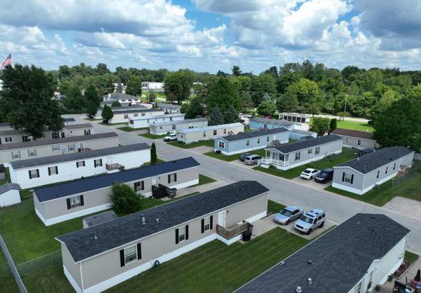
The Mobile Home Park District is designed to provide for the placement of single and double-wide mobile units, not placed on a permanent foundation, within a large-scale unified development under single ownership. Specific standards are included to promote developments that are similar in character to detached dwelling units and which minimize incompatibilities with surrounding land uses. See Section 13.2 Mobile Home Parks.
D. Development Standards
TTED USES
USES
Lot Size, Min. 5,000 sq. ft.
Lot Width 50ft. min. n/a max.
ROW Frontage, Min. 50ft.
Front Yard Setback, Min. 20ft.
Build-To Zone n/a
Front Yard Setback, Accessory1 No closer to the front property line than the principal building
Side Yard Setback, except Corner Side Yards1 7ft. with two side yards 14ft. with zero lot line
Corner Side Yard Setback1 Average setback or 7ft., whichever is greater
Rear Yard Setback 10ft.
Rear Yard Setback, Accessory1 5ft.
Rear Yard Setback where adjacent to a river or creek, Principal or Accessory1 30ft. or established average setback, whichever is less
Separation between Detached Dwellings 14ft.
Building Height, Principal 30ft.
Building Height, Accessory1
No taller than the existing principal building, or 24ft., whichever is less
Building Step Back n/a
Max. Lot Coverage 50%
Principal Buildings, Total 1 lease per space
Accessory Buildings, Total1 1 lease per space
1 See Sec. 4.9 Accessory Use Conditions for additional standards regarding setbacks

A. intent
The INST district is intended to provide for public and semi-public uses that serve the community. Locations should correlate with their scale of service.
B. Building Types
• Neighborhood Streetfront
• Flex (1-3 stories)
• Multi-Dwelling (special exception)
• per Approval
Construction
PERM i TTED USES
D. Development Standards
Lot Size 5,000 sq. ft. min. n/a max.
Lot Width, Min. 40ft. ROW Frontage, Min. 25ft.
Front Yard Setback, Min. 10ft.
Build-To Zone n/a
Side Yard Setback, except Corner Side Yards² 4ft.
Corner Side Yard Setback2 Average setback or 4ft., whichever is greater
Side Yard Setbacks if abutting a Residential District² 4ft.
Side Yard Setback, Accessory1 2 5ft.
Rear Yard Setback2 10ft.
Rear Yard Setback if abutting a Residential District2 10ft.
Building Height, Principal 45ft.
Building Height, Accessory¹ No taller than the existing principal building, or 30ft., whichever is less
Max. Lot Coverage n/a
Max. Floor Area Ratio n/a
Prinicpal Buildings, Total 2
1 See Sec. 4.9 Accessory Use Conditions for additional standards regarding setbacks
² See Sec. 8.8 Landscape Buffers

A. intent
The NEI-B district is intended to provide for a mix of uses intended for small-scale, low-impact neighborhood-serving commercial, office, service, and residential uses. This district may facilitate mixeduse infill within established neighborhoods, where appropriate. The NEI-B environment is pedestrianfriendly, walkable, and well-connected with public and semi-public gathering spaces.
B. Building Types
• Detached Dwelling Narrow
• Detached Dwelling Standard
• Cottage
• Duplex
• Triplex
• Quadplex
• Townhome
• Neighborhood Multi-Dwelling
• Multi-Dwelling
• Neighborhood Streetfront
• Flex (1-3 stories)
PERM i TTED USES
Industrial Uses
Wireless Communications Facility
Accessory Uses
Accessory Structure, general
Antennas & Satellite Dishes
Outdoor Dining
Parking Lots & Garages, Accessory
Solar, Small Scale
4.9.4
4.9.17 Swimming Pools
4.9.18 Wind Energy, Small
Construction Trailer, Temporary
D. Development Standards
Lot Width, Min. 50ft. ROW Frontage, Min. 50ft.
Front Setback, Min. 0ft.
Build-To Zone 0ft.-10ft.
Side Yard Setback, except Corner Side Yards2 4ft.
Corner Side Yard Setback1 2 Average setback or 4ft., whichever is greater
Side Yard Setbacks if abutting a Residential District2 4ft.
Side Yard Setback, Accessory1 5ft.
Rear Yard Setback1 2 15ft.
Rear Yard Setback if abutting a Residential District2 15ft.
Building Height, Principal 45ft. (3 stories)
Building Height, Accessory1 No taller than the existing principal building, or 30ft., whichever is less
Max. Lot Coverage 80%
Max. Floor Area Ratio n/a
Prinicpal Buildings, Total 1
1 See Sec. 4.9 Accessory Use Conditions for additional standards regarding setbacks
² See Sec. 8.8 Landscape Buffers

intent
The COM-B district is intended to provide for a wide range of business, office, service, hospitality establishments, and residential uses typically, located along major street corridors. These establishments are intended to serve the needs of consumers beyond the immediate neighborhood but are not regional in focus. This environment should have a well-connected street system, and strong bicycle and pedestrian connections, but may include automobile-serving site amenities. Sidewalks and pedestrian spaces should be activated as gathering places. Land use diversity and destination proximity should be used to create walkable activity nodes that support non-motorized modes of transportation.
B. Building Types
• Townhome
• Neighborhood Multi-Dwelling
• Urban Streetfront
• Neighborhood Streetfront
• Flex (1-3 stories)
• Flex Attached
• Auto-Oriented
PERM i TTED USES
Drive-through, accessory
Section 4.9.6
Outdoor Dining Section 4.9.8
Outdoor Sales, Accessory Section 4.9.9
Outside Storage of Liquids or Gases in one or more tanks Section 4.9.11
Parking Lots & Garages Section 4.9.12
Solar, Small Scale Section 4.9.17
Swimming Pools
Vending Machines
Wind Energy, Small
TEMPORARY USES
Construction Trailer, Temporary Section 4.10.1 Outdoor Sales, Temporary/ Seasonal Section 4.10.2
D. Development Standards
Front Yard Setback, Min. 10ft.
Build-To Zone 10ft.-30ft.
May exceed 30ft. to meet the established front yard setback
Side Yard Setback, except Corner Side Yards2 5ft.
Corner Side Yard Setback2 Average setback or 10ft., whichever is greater
Side Yard Setbacks if abutting a Residential District2 5ft.
Side Yard Setback, Accessory1 10ft.
Rear Yard Setback1 2 20ft.
Rear Yard Setback if abutting a Residential District1 2 20ft.
Building Height, Principal 45ft. (3 stories)
Building Height, Accessory1 No taller than the existing principal building, or 30ft., whichever is less
Max. Floor Area Ratio n/a
Prinicpal Buildings, Total 3
1 See Sec. 4.9 Accessory Use Conditions for additional standards regarding setbacks
² See Sec. 8.8 Landscape Buffers
This Page is Intentionally Left Blank

3.4.9
A. intent
The REG-B district is intended for large-scale commercial, retail, wholesale, service, auto-related, and residential uses. This district should be located with access to major thoroughfares that are designed to accommodate heavy traffic. This environment is more automobile-centric, but should still have a well-connected street system, and strong bicycle and pedestrian connections. Regional placemaking, land use diversity, and destination proximity should be used to create walkable activity nodes that support non-motorized modes of transportation.
B. Building Types
• Mid-Rise
• Urban Streetfront
• Flex (1-3 stories)
• Flex Attached
• Auto-Oriented
D. Development Standards
D i STR i CT STANDARDS REG-B
Lot Width, Min. 300ft.
ROW Frontage, Min. 300ft.
Front Yard Setback, Min. 75ft.
Build-To Zone n/a
Side Yard Setback, except Corner Side Yards1 2 10ft. min. 30ft. max
Corner Side Yard Setback1 2 Average setback or 30ft., whichever is greater
Side Yard Setbacks if abutting a Residential District1 2 20ft.
Rear Yard Setback1 2 30ft.
Rear Yard Setback if abutting a Residential District1 2 35ft.
Building Height, Principal 45ft.
Building Height, Accessory1 No taller than the existing principal building, or 30ft., whichever is less
Max. Lot Coverage 60%
Max. Floor Area Ratio n/a
Prinicpal Buildings, Total 3
1 See Sec. 4.9 Accessory Use Conditions for additional standards regarding setbacks
² See Sec. 8.8 Landscape Buffers
E. Development Conditions
1. The district should have access to a major arterial roadway that can accommodate truck traffic.
2. A development plan shall be submitted to the Planning and Zoning Office for review and approval in accordance with Chapter 14 Administrative Processes. All development shall comply with Building Types in Chapter 5.

B. Building Types
The Central Business district is intended to provide for a vibrant downtown environment incorporating a mix of commercial, office, service, hospitality, and residential uses in the City of Elkhart’s traditional community core. Public and semi-public spaces should be activated with sidewalks, street cafes, plazas, and similar uses where people may gather. Regional placemaking, land use diversity, and destination proximity should be used to create walkable activities. This environment must plan for high traffic volumes for all modes of transportation. Streets should be well-connected and prioritize safe and accessible pedestrian and bicycle infrastructure.
• Townhouses (special exception)
• Neighborhood Multi-Dwelling
• Multi-Dwelling
• Mid-Rise
• Urban Streetfront
• Neighborhood Streetfront
• Flex (1-3 stories)
PERM i TTED USES
D. Development Standards
up to 50% of the façade may be setback an additional 10 ft. to accommodate outdoor seating and/or amenities. Side Yard Setback, except Corner Side Yards
Min.
Max. structures should include architectural elements and/or roof details to give the impression of an active second floor if one is not provided.
The Planning Staff or Plan Commission may approve an increased max. height to accomodate an integrated parking structure. Building
Accessory1 No taller than the existing principal building, or 30ft., whichever is less
1 See Sec. 4.9 Accessory Use Conditions for additional standards regarding setbacks ² See Sec. 8.8 Landscape Buffers
E. Development Conditions
1. A development plan shall be submitted to the Planning and Zoning Office for review and approval in accordance with Chapter 14 Administrative Procedures and Processes. All development shall comply with Design Standards as specified in Chapter 5 Building Typologies.
2. See Chapter 7 for additional parking standards for properties fronting on Main Street from Pottawattomi Drive south to Prairie Street, Jackson Boulevard from Main Street east to Prairie Street/Johnson Street, and Elkhart Avenue from Johnson Street south to Waterfall Drive.
3. Placement of new utilities
a. The installation of new utility systems, including water, sewer, gas, telephone, cable television and electric, along with component parts, structures, appendages and materials, shall be installed underground in a manner approved by the applicable utility provider and in accordance with all city standards. Aboveground utility systems will not be permitted, except where certain appurtenances and accessory equipment must be installed above ground for servicing. Examples of such accessory equipment include fire hydrants, gas and electrical meters, electric service cabinets, irrigation controllers, and similar features.
b. Parcels adjacent to existing easements or public rights-of-way where overhead utility supply lines and service connections have previously been installed may be supplied with service from those overhead lines, but the service connections from the overhead lines shall be installed underground. Should a road widening or an extension of service, or other such condition occur as a result of the proposed development and necessitate the replacement or relocation of such utilities, such replacements or relocation shall be underground.
c. Where undergrounding of utilities within a site is not feasible due to utility or infrastructure conflicts, topographic conditions, or site limitations, alternative placement shall be approved by the Plan Commission and landscape screening may be required as a condition of approval.
d. Electric power transmission lines are exempt from these requirements.

A. intent
The R&D-I district is intended to allow for the growth and development of research and development, technology, major educational, research, public service, and office uses, and their necessary support functions, while minimizing conflicts with adjacent land uses. It is intended that development in this district be designed so that is compatible with adjacent neighborhoods and limits impact on the environment, and cultural and historic resources.
B. Building Types
• Multi-Dwelling (special exception)
• Mid-Rise
• Flex (1-3 stories)
• Flex Attached
• Auto-Oriented
• Distribution and Storage
PERM i TTED USES
Side Yard Setback except Corner Side Yards1 2 15ft.
Corner Side Yard Setback1 2 Average setback or 25ft., whichever is greater
Side Yard Setbacks if abutting a Residential District1 2 25ft.
Rear Yard Setback1 2 15ft.
Rear Yard Setback if abutting a Residential District1 2 30ft.
Building
Building
1 See Sec. 4.9 Accessory Use Conditions for additional standards regarding setbacks ² See Sec. 8.8 Landscape Buffers
E. Development Conditions
The transportation system/major access roads serving this district shall not be routed through a residential development, or a street serving a school, except vocational school.
This Page is Intentionally Left Blank

The MAN-I District is intended to accommodate a broad range of manufacturing activities, diverse in products, operational techniques, and size, which have a greater impact on the surrounding environment than the R&D District. The uses permitted in this district generally include those manufacturing and industrial activities which create some higher intensity land use impacts which must be grouped in areas where similar industrial uses are now located or where the permitted uses will be best located in accordance with the comprehensive land use plan of the City, which is designed to protect the welfare of the community. Certain performance standards shall apply. Refer to Section 4.8 Industrial Use Conditions.
• Flex (1-3 stories)
• Flex Attached
• Auto-Oriented
• Distribution and Storage
PERM i TTED USES
Side Yard Setback, except Corner Side Yard Setback1 2 15ft.
Corner Side Yard Setback1 2 Average setback or 25ft., whichever is greater
Side Yard Setbacks if abutting a Residential District1 2 50ft.
Rear Yard Setback1 2 15ft.
Rear Yard Setback if abutting a Residential District1 2 30ft.
Building Height, Principal 75ft.
Building
1 See Sec. 4.9 Accessory Use Conditions for additional standards regarding setbacks
See Sec. 8.8 Landscape Buffers
E. Development Conditions
The transportation system/major access roads serving this district shall not be routed through a residential development, or a street serving a school, except vocational school.
This Page is Intentionally Left Blank

DEVELOPMENT D i STR i CT
A. intent
The Planned Unit Development (PUD) District is intended to encourage quality land development and site design that cannot be achieved under current zoning standards. The purpose of Planned Unit Development is intended to allow large-scale unified development that is master planned and will result in higher quality, attractive, and affordable development than conventional developments would allow. See Section 13.1 Planned Unit Development.
B. Building Types
• All Types, per Approval
PERM i TTED USES
3.5 OVERLAY D i STR i CTS
3.5.1
GENERAL PROV i S i ONS
The overlay districts establish special considerations for areas of the city regarding uses and development standards. Where a conflict exists between the base zoning district standards and the overlay district standards, the overlay district standards shall apply, unless specifically stated otherwise.
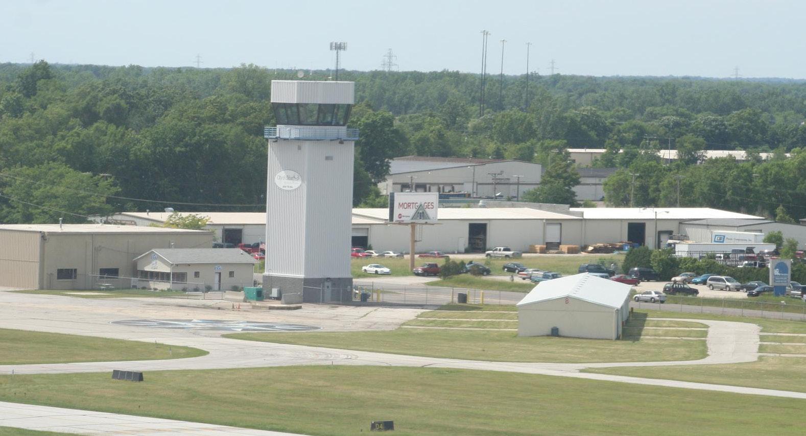
A i RPORT OVERLAY D i STR i CT
A. intent
The Air Space Control District is intended to protect the public health, safety, and welfare by regulating the development and land uses beyond the immediate area of the Elkhart Municipal Airport. Additional restrictions are needed outside of land zoned for airport use to maintain the functionality of the airport, promote the airport as an economic development generator for the City, and minimize land use conflicts and incompatibility between the airport, any future airport expansion, and the land uses and natural environment in the surrounding area.
B. Building Types
• Mid-Rise (conditional)
• Flex (1-3 stories)
• Flex Attached
• Distribution and Storage
C. Purpose
This district is an overlay district and may be established in addition to the underlying districts and shall place additional regulations upon the property located therein.
The purpose of this Section is to protect the airport environs by controlling the utilization of space above normal ground level which may interfere with or obstruct the proper operation of aircraft, the safety of persons and the effective operation of the airport.
D. Establishment of Zones
The following zones are established within the Airport Overlay District. These zones are shown on the Municipal Airport Zoning Map which is made a part of the Official Zoning Map.
1. Precision Instrument Approach Zone. A Precision Instrument Approach Zone is established at each end of the precision instrument runways of the airport for precision instrument landings and take-offs. The precision instrument approach zones shall have a width of 1,000 feet at a distance of 200 feet beyond each end of the runways, widening thereafter uniformly to a width of 16,000 feet at a distance of 50,200 feet beyond each end of the runways, its centerline being the continuation of the centerline of the runways
2. Non-precision Instrument Approach Zone. Non-precision Instrument Approach Zones are established at each end of the non-precision runways of the airport for non-precision landings and take-offs. The non-precision instrument approach zones shall have a width of 500 feet beginning at a distance of 200 feet beyond each end of the runways,widening thereafter uniformly to a width of 2,000 feet and 3,500 feet, respectively, at a distance of 5,200 feet and 10,200 feet, respectively, beyond each end of the runways, its centerline being the continuation of the centerline of the runways.
3. Transition Zone. Transition zones are hereby established adjacent to each runway and approach zone. Transition zones extend outward and upward, at right angles to the
runway centerline and runway centerline extended and at a slope of 7 feet horizontally for each 1 foot vertically from the side of the primary zones and from the sides of the approach zones to a point where they intersect the horizontal zone. Transitional zones for those portions of the precision approach zone which project through and beyond the limits of the conical zone extend a distance of 5,000 feet measured horizontally from the edge of the approach zone and right angles to the runway centerline.
4. Horizontal Zone. A horizontal zone is hereby established as the area which is constructed by swinging arcs of 10,000 feet radii from each end of the precision instrument primary zone and the east end of the east-west nonprecision primary zone and connecting the adjacent arcs by lines tangent to those arcs.
5. Conical Zone. A conical zone is hereby established as the area that commences at the periphery of the horizontal zone and extends outward there from a distance of 4,000 feet. The conical zone does not include the instrument approach zones and transition zones.
6. Primary Zone. The primary zone is a surface longitudinally centered on a runway extending 200 feet beyond each end of that runway. The width of the primary surface is 500 feet for non-precision runways and 1,000 feet for precision instrument runways.
E. Height Limitations
Except as otherwise provided in the Section, no structure or tree shall be erected, altered, allowed to grow, or maintained in any zone created by this Ordinance to a height in excess of the height limit herein established for such zone. Such height limitations are hereby established for each of the zones in question as follows:
1. Precision Instrument Approach Zone. One foot in height for each 50 feet horizontal distance beginning at a point 200 feet from and at the elevation of the end of the precision instrument runway and extending to a distance of 10,200 feet from the end of the runway, thence 1 foot
in height for each 40 feet horizontal distance to a point 50,200 feet from the end of the runway;
2. Non-precision Instrument Approach Zones. For the east-west non-precision zone - 1 foot in height for each 34 feet horizontal distance beginning at the ends of the primary zone and extending for a distance of 10,000 feet. For the north-south non-precision zone - 1 foot in height for each 20 feet horizontal beginning at the ends of the primary zone and extending for a distance of 5,000 feet;
3. Transition Zones. One foot in height for each 7 feet horizontal distance beginning at any point on the sides of the primary zone and approach zones, extending to a height of 150 feet above the airport elevation which is 777 feet above mean sea level. Further, where the precision instrument approach zone projects through and beyond the conical zone, a height limit of 1 foot for each 7 feet horizontal distance shall be maintained beginning at the edge of the instrument approach zone measured normal to the centerline of the runway extended;
4. Horizontal Zones. 150 feet above the airport elevation or a height of 927 feet above mean sea level; and
5. Conical Zones. One foot in height for each 20 feet horizontal distance beginning at the periphery of the horizontal zone, extending to a height of 350 feet above the airport elevation;
6. Primary Zones. The elevation of any point on the primary zone is the same as the elevation of the nearest point on the runway centerline.
Where an area is covered by more than one height limitation, the more restrictive limitation shall prevail. Nothing in this Section shall be construed as prohibiting the growth, construction or maintenance of any tree or structure to a height consistent with the provisions of this Ordinance.
F. Use Restrictions
1. No use may be made of the land within any zone established by this Ordinance in such manner as to create interference with any form of communication whose primary purpose is air navigation.
2. All lights in such zones shall be:
a. Located in such a manner that they do not interfere with the runway, taxiway, tower or any other airport lights.
b. Shielded such that no light is directed, focused, or beamed to an angle greater than 5 degrees above horizontal.
c. Prohibited which may result in glare in the eyes of air crews using the airport in the landing, taking off, or maneuvering of aircraft.
G. Markers and Lights on Nonconforming Structures and Trees
The owner of any nonconforming structure or tree is hereby required to permit the installation, operation and maintenance thereon of such markers and lights as shall be deemed necessary by the Board of Aviation Commissioners to indicate the presence of such airport hazards to the operators of aircraft in the vicinity of the Airport. Such markers and lights shall be installed, operated and maintained at the expense of the City.
H. Permits
1. Future Uses. Except as specifically provided in this Section, no material change shall be made in the use of land and no structure or tree shall be erected, altered, planted, or otherwise established in any zone hereby created unless a zoning clearance permit therefore shall have been applied for and granted. Each application for a zoning clearance permit shall indicate the purpose for which the permit is desired with sufficient particularity to permit it to be determined whether the resulting use, structure or tree would conform to the regulations herein prescribed.
a. In the area lying within the limits of the Horizontal Zone and the Conical Zone, no permit shall be required for any tree or structure less than 75 feet in height, except when, because of terrain, land contour or topographic features, such tree or structure would extend above the height limits prescribed for such zone.
b. In the areas lying within the limits of the instrument and non-instrument approach zones but at a horizontal distance of not less than 4,200 feet from each end of the runways, no permit shall be required for any tree or structure less than 75 feet in height, except when such tree or structure would extend above the height limit prescribed for such instrument or noninstrument approach zone.
c. In the areas lying within the limits of the Transition Zones beyond the perimeter of the Horizontal Zone, no permit shall be required for any tree or structure less than 75 feet in height, except when such tree or structure, because of terrain, landcontour or topographic features, would extend above the height limit prescribed for Transition Zones.
Nothing contained in any of the foregoing exceptions shall be construed as permitting or intending to permit any construction or alteration of any structure or growth of any tree in excess of any of the height limits established by this Ordinance, as set forth in Section 3.5.2.E. Height Limitations.
2. Existing Uses. No permit shall be granted that would allow the establishment or creation of any airport hazard or permit a nonconforming use, structure or tree to be made or become higher or become a greater hazard to air navigation, than it was on the effective date of this Ordinance or than it is when the application for a permit is made.
3. Hazard Marking and Lighting. Any permit or variance granted may, if such action is deemed advisable to effectuate the purpose of this Section and be reasonable in the circumstances, be so conditioned as to require the owner of the structure or tree in question to permit the Board of Aviation Commissioners, at its own expense, to install, operate and maintain thereon such markers and lights as may be necessary to indicate to flyers the presence of an airport hazard.
4. Any person desiring to erect any structure or increase the height of any structure or permit the growth of any plant life or use his
property not in accordance with the regulations prescribed in this Section may apply to the Board of Zoning Appeals for a variance in accordance with the procedure set forth in Section 14.7.3, plus the mandatory referral of such applications to the Board of Aviation Commissioners for their recommendation.
Legend

3.6.4 R i VERFRONT OVERLAY D i STR i CT
A. intent
The Riverfront Overlay District is established to implement design and bulk standards for the areas which are incorporated along multiple waterways, specifically, the Riverwalk area, St. Joseph and Elkhart Rivers. The purpose of this is to protect the waterways and ensure that it continues to be a scenic byway, recreational amenity, and economic generator for the City of Elkhart.
B. Building Types
• Urban Streetfront
• Neighborhood Streetfront
• Multi-Dwelling
• Flex (1-3 stories)
• Flex Attached
• Mid-Rise
Riverfront Overlay
Riverwalk Area
C. Landscaping
1. The street-tree pattern shall be spaced consistently at an approximate on-center distance not to exceed 30 feet. Street trees shall be located at corners as described ahead, and then spaced regularly from corner to corner. At corners, the corner tree’s distance from the intersection shall be 10 feet further from the intersection than the stop bar.
a. Each Street shall have a single consistent tree type for its entire length. Street trees shall have a minimum height of 10 feet and a minimum caliper of 3 inches at time of planting.
b. Any fire hydrants, mailboxes, parking meters, bicycle racks, or other impediments to foot traffic shall be in the planting zone towards the curb. Benches shall be provided along retail Frontages at a minimum of one per Block face. Benches in the planting zone shall face another bench, perpendicular to the Street. Benches built into building facades are encouraged and may encroach upon the sidewalk to a max. depth of 2 feet. Bicycle Racks are required at a minimum of one per 200 linear feet of sidewalk edge on all streets.
2. Landscaping in the Riverfront Overlay District shall be designed to soften the placement of buildings within the district and screen parking areas to create an overall “streetscape” along the Riverwalk.
3. Parking areas and access drives located within 20 feet of the Riverwalk shall be screened so that vehicles are not visible from the Riverwalk. Landscape screening shall include 1 or more of the following treatments:
a. A 5-foot-high opaque wall or fence in conjunction with shrubbery and/or trees. Fence and/or wall materials shall be compatible with façade materials used on the primary building.
b. Coniferous trees or hedges that are at least 5 feet in height.
c. An earthen berm that is at least 5 feet in height. The earthen berm shall have vegetative ground cover.
4. Yard areas that are adjacent to the Riverwalk shall have vegetative ground cover and include 2 or more of the following treatments:
a. Canopy trees
b. Decorative trees
c. Decorative shrubs
d. Decorative fencing
D. Streetlights
Streetlights shall be located at the outer edge of all sidewalks, shall be 10 to 15 feet tall, and shall be spaced regularly. Streetlight lamps shall be sized appropriately to their height and shall use energyefficient LED lamps. Varying streetlight designs are encouraged to attract pedestrians.
E. Street Design
1.
Configurations
Streets shall conform to the cross-sectional configurations shown in the Regulating Plan. That Plan specifies the width of driving lanes, parking lanes, sidewalks, and medians (if any) for the following thoroughfares:
a. Jackson Boulevard
b. Elkhart Avenue
c. Jr. Achievement Drive
d. Riverside District Drive
e. Clark Street Extension
f. Small Street
2. Curbs
a. Curbs shall be vertical without horizontal lips (no gutter pans). Rollover or rounded curbs are only permitted where required to facilitate truck turning motions.
b. The curb return radius at Street corners shall be 10 feet at corners without Bulbouts and 15 feet at corners with Bulb-outs.
The curb return radius at parking lots drives shall be 3 feet. The curb return radius at driveway ends shall be 1 foot. If such radii are not adequate to provide for the turning motions of trucks— with the truck allowed to swerve temporarily into the opposing lane—then they may be increased by only as much as is necessary to make such turning motions possible.
c. Curb Cuts are permitted at Primary Frontages only in those locations specifically indicated in the Plan. At Secondary Frontages, Curb Cuts are allowed to access parking lots but not private driveways or garages. Curb cuts are not regulated in non-Frontage locations. Parking lot drive Curb Cuts may not exceed 20 feet in width, plus curb radii. Driveway Curb Cuts may not exceed 10 feet in width, plus curb radii. Sidewalks crossing parking lot drive and driveway Curb Cuts shall maintain a level grade, creating a vehicular speed table.
3. Crosswalks
Crosswalks shall be located to continue all sidewalk trajectories across all intersections and shall be surfaced in a material that contrasts with the Street surface. At minimum dimension and quality of finish, crosswalks shall be 10 feet wide with zebra striping.
F. Circulation
1. Riverfront Overlay District parking lots and access drives shall be designed to minimize vehicular traffic along the Riverwalk. Primary structures shall be located between the Riverwalk and access drives and parking lots. Service and access drives shall not be located adjacent to the Riverwalk.
2. Developments located in the Riverfront Overlay District shall provide pedestrian access between the development and the Riverwalk. Materials used to construct the pedestrian circulation systems shall be complementary to those used in the Riverwalk.
G. Parking
1. Requirements
No minimum off-street parking is required for non-residential uses in the Riverfront Overlay District. Minimum residential parking shall be provided as required in Table 7.4.1
a. On-Street parking may apply towards the full equivalent of off-street parking spaces where located on the same side of the street as the use.
2. Parking Design
a. Surface parking shall be located to the rear of buildings away from public streets and screened. Loading and servicing of buildings shall be fully screened from Frontages.
b. Curb cuts for parking lots are allowed along Primary Frontages only where indicated in the Regulating Plan, and without restriction along Secondary Frontages. Front entry driveways shall not be permitted at any Frontages.
c. The ground floors of any parking structures shall contain a habitable edge at Primary Frontages. Where garage upper stories face Primary Frontages, these shall be lined by habitable buildings or detailed to resemble habitable buildings. Entries into structured parking lots shall be no wider than necessary to provide required access, using 10-foot travel lanes.
d. Private garages and tuck-under parking shall be accessed from rear lanes or shared driveways at the back of units.
e. Bicycle use shall be encouraged through the provision of safe and convenient bicycle parking areas. Since the River District is intended to make walking and cycling viable modes of transportation through the provision of appropriate infrastructure, bicycle parking and associated facilities shall be given careful consideration regarding ease of use, convenience, security and adequate
space to suit the required function. Visitor bicycle racks shall be located within 100 feet of the primary entries and served with lighting.
H. Block and Site Design
1. Riverfront Overlay District Structures shall be located to create an inviting, pedestrian-scaled “streetscape” along the Riverwalk.
2. For parcels within the Riverfront Overlay that front Main Street, Jackson Boulevard, or Elkhart Avenue, the site shall be designed to primarily address these streets. Consideration should still be given to creating an inviting atmosphere along the Riverwalk, but these parcels must support an established street wall along these important corridors.
3. The overall building design, massing, and bulk shall orient towards the streets an sidewalks. Buildings shall align with streets at grade while upper-story orientation may vary provided that buildings continue to be able to create a sense of enclosure to the public street.
4. Buildings shall provide a sense of enclosure to public areas, including streets and parks. Each building shall respond to its setting with contextually appropriate height and character to create harmony among buildings and between buildings and open space. Buildings shall support sidewalk and street side activity, gathering of residents, and “eyes on the street”.
5. Building Access
Buildings that abut rear lanes or parking lots at their rears shall allow only secondary access from these edges, maintaining principal orientation towards their Frontages. Specifically:
a. Retail uses may provide one rear door (or double door) for use by employees and suppliers. Supermarkets and other businesses from which the typical buyer leaves with a heavy burden of products may also allow customers to use this door.
b. Office and residential uses may have a single rear door (or double door), but this
door shallbe clearly hierarchically Inferior to the front door.
In both cases, the Frontage door shall be in a place that appears appropriate to a frontloaded business and shall be kept unlocked whenever any other access doors are unlocked.
6. All development in these districts shall comply with the design standards in Chapter 5 except for manufacturing uses located in an Industrial zoning district which shall comply with the following:
a. All structures shall present a decorative facade on the front facade facing the district street or river and the front onethird of any side facade visible from the district street or river.
i. Heights
1. Each Primary Frontage is assigned a minimum and a maximum allowed building height, as further defined in the UDO. When two different height requirements meet at a corner, the higher requirement takes precedence around the corner to a distance of at least 10 feet from the Frontage Line. Heights are measured in reference to the sidewalk at the center of the façade. At Secondary Frontages, heights are not regulated but may not exceed 6 stories.
2. To encourage an interesting skyline, building areas with a footprint of less than 500 square feet shall have no height limit.
3. Retail spaces shall have a minimum floor to ceiling height of 12 feet, but 18 feet is recommended. Office spaces shall have a minimum ceiling height of 10 feet. Residential spaces shall have a minimum ceiling height of 8 feet for upper stories and 9 feet for the first floor.
4. All retail spaces shall be located on a ground floor placed at grade. Buildings with residential first floors shall locate all first-floor residences a minimum of 12 inches above adjacent sidewalk grade. Handicapped access, when provided on a building with an elevated first floor, shall be placed internal to the building, serving a door at grade.
J. Building Fronts
1. All Frontages are assigned Setbacks and Build-To Lines that specify the proper location of the building façade.
2. All buildings shall place a building edge along no less than 75% of their Frontage Lines. The small gaps in Frontage allowed by that percentage shall not occur at building corners, with the exception that corners may be rounded or chamfered. On Primary Frontages, ground stories shall be habitable for at least the first twenty feet of depth, measured as the distance from the facade towards the interior of the building.
3. Any requirements pertaining to sight triangles in currently enforced codes shall be waived when in conflict with the Frontage Lines in the Regulating Plan, or with these Regulations’ tree-planting requirements.
4. Buildings located at Vista Terminations shall respond with a building element of appropriate size and impact to terminate the vista meaningfully. These shall be aligned properly to be framed symmetrically in the vista. Proper Vista Terminations include raised rooflines, stacks of balconies, grouped window compositions, towers, and cupolas.
5. Building materials shall be used in a manner appropriate to their intrinsic formal properties, including their structural capacities as demonstrated in openings and spans. Metal elements shall be natural colored galvanized steel, stainless steel, anodized or electrostatic plated aluminum, marine-grade aluminum, copper, or bronze. Wood elements shall be painted or sealed with an opaque or semi-solid stain, except walking surfaces, which may be left natural. Siding shall be wood or cementitious (Hardie Board or equivalent) and present 8 inches maximum siding width to the weather. All stucco shall be steel troweled with no evidence of the mark of the trowel. Sand cement render shall be applied without control joints. Corner beads are prohibited.
6. The overall building form shall also offer a varied and engaging visual experience and avoid the creation of monolithic structures
by using techniques such as the articulation of frontages with offsets, projections, and recesses.
a. Buildings shall have different architectural features between the base or first levels of buildings, the midsection, and the building tops. Large blocks shall be visually broken down into smaller entities.
b. Each building façade shall contain at most two different wall materials (not counting foundation walls and trim). Building walls shall be no more than two colors per material used (excluding trim).
c. Materials may only transition across horizontal lines, for example, between building stories, and not across vertical lines, except in the case of attachments such as bay windows. (The exception to this rule occurs when a building is intentionally designed to appear as several buildings to break down its scale.)
d. When two materials are stacked horizontally, the heavier-looking material shall sit below the lighter-looking material, such as brick below Hardie-board or stone below stucco. When a material transition occurs around a corner, the transition shall occur at a distance from the corner that is appropriate for the materials represented, for example 12 or 16 inches for brick. Expansion joints shall be a rational part of the wall composition and shall be colored to match the wall. Trim, except at stucco, is required where there is a change in material or plane. Trim around lights, outlets, vents, meters, etc. shall match the wall color, not the object color.
7. Style
The River District shall consist of buildings that are diverse, yet compatible in character.
a. Buildings shall strive to achieve notable architecture that is respectful of its neighbors and contributes positively to the overall character of the neighborhood.
b. Façades shall create lively, pedestrianoriented open spaces to enliven the public
realm and attract interest and interaction with the site
c. Buildings shall not present a historical pastiche. Buildings designed in a traditional style shall limit themselves to that style alone and shall embody that style convincingly. Alternatively, a building may appear to be a historical structure that has been renovated with modern additions. In such a case, the fiction of a historical building recently renovated shall be presented in a convincing way.
d. Keystones, quoins, and superimposed multiple gables (one gable overlapping another) are prohibited.
8. Legibility
Main entrances shall be clearly identified through architectural features and landscape treatment.
K. Connection to the Street
1. Design shall consider how the building shall interact with the public realm and consider the qualities and character of the streetscape and its function (retail street or quieter residential street) in siting and designing the building. Ground floors facing public streets, public parks, and publicly accessible pathways shall have spaces that are actively inhabited by people, such as retail stores, consumer service businesses and restaurants, or educational or residential entrances and building lobbies. Windows and doors for these active spaces are prominent aspects of the building and shall be considered accordingly through design. Where a mix of activities is accommodated in a building, the more active uses are encouraged to face Primary Frontages. The location, visibility and design interest of residential and commercial/mixed use entrances, lobbies, main stairs and elevators shall be optimized through establishing a sense of place and presence and a strong relationship to public streets and sidewalks. Building entries shall be visible and inviting and provide a sense of arrival, such that an approaching pedestrian is drawn to the front door.
2. Individual residential units at or near street level shall be designed with front doors to function in a manner similar to townhouses to create street-level interest and activity for residential frontages. Individual residential entries may provide stoops, lightwells, patios, forecourts, garden walls, porches, canopies, pergolas, porticos, building recesses, and terraces within the setback. Stoops shall only be allowed for ground-floor residential units, and are not allowed for residential lobbies, as those require ramps.
3. Multi-unit residential entrances, lobbies, main stairs, and elevators shall establish a sense of presence and safety through the design and by optimizing the location, visibility, and visual interest.
4. Non-residential uses shall be oriented towards Primary Frontages. The individuality of commercial uses shall be expressed through narrow frontages with high-quality storefront displays.
a. Each street level non-residential bay shall be clearly expressed on the street façade through architectural articulation. Active retail frontages are recommended to use glazed, operable walls that can be opened fully to the street, expanding the public space along the street.
b. Non-residential uses shall have a universally accessible external entrance at grade. The primary entrance orientation shall prioritize access from a Primary Frontage. A front door shall be visible from a street or pedestrian connection in a place appropriate for pedestrian-oriented, street-facing use. Inset doorways are recommended and shall include extensive glazing throughout the entryway to preserve visibility from the sidewalk.
L. Attachments
1. Overhead weather protection extending in the direction of the street shall be provided at all common entrances to residential buildings and non-residential front doors to give a potential visitor the feeling of already being inside. The upper side of weather protection elements shall be designed such that they do not create
unsightly conditions or glare from sunlight for upper floors. Weather protection, gutters and downspouts shall be integrated into the design of the structure as a whole.
2. Awnings are required on Retail Frontages along Jackson Boulevard. Awnings shall be a minimum of 6 feet deep and shall be metal with colored fabric or glass. Fabric awnings shall have a metal structure covered with canvas or synthetic canvas and be rectangular in shape with straight edges and no side panels or soffit. Awnings shall not be backlit or used as signs, except for a possible single inscription on the flap, not to exceed 6 inches in height. All awnings on a single shop shall have the same depth, material, and color. Fabric awnings are not permitted on residential buildings. All buildings without awnings, except single-unit dwellings, shall provide some form of shelter from rain at the front door.
3. Weather protection, including awnings, are the only first-floor attachments allowed to occupy the public right-of-way. On the second floor and above, balconies, bay windows, eaves, lights, and signs may occupy the public rightof-way. No attachment may extend above a vehicular roadbed at a height of less than 15 feet, or above a sidewalk at a height of less than 7 feet. Attachments other than roof eaves may not extend over adjacent private properties.
4. Stoops shall be between 3 and 6 feet deep. Stairs may extend to reach the edge of the right-of-way.
5. Balconies, porches, and loggias shall not constitute more than 50% of any facade. Balconies shall be designed as an integral part of the building.
6. Postal Number: Every building shall have a postal number applied within 5 feet of the entrance area. This may not be taller than 6 inches, unless constructed as a signature sculptural element.
M. Openings
1. Walls at Frontages may not be blank and shall have at least one window per structural bay per floor, in a pattern that suggests habitation.
2. Mullions, if used, shall either be true divided lights or be affixed to the exterior surface of the window to cast a shadow line. Mullions are recommended for residential windows where stylistically appropriate and discouraged for retail windows.
3. Vertically hinged shutters, when provided, shall coincide in size to the opening with which they are associated, such that closing them would cover the window area. While not necessarily operable, they shall appear so.
4. Window size, placement, shape and detailing contribute substantially to the overall quality of the building and are key features of façade design. Window placement shall enhance the visual coherence of the building, supporting rhythm and overall visual impact through the interrelationship between all windows on the façade, and with other façade elements. Dark or reflective glazing is prohibited for all building types on all floors.
N. Roofs
1. Roofs may include a combination of green roofs, solar panels, pitched roofs with or without dormers, and/or amenity area for residents of the building. As viewed by a pedestrian, roof lines and roof form shall reinforce the building’s design intent and silhouette and contribute to the skyline. Roof designs shall prevent falling ice, snow and discharge of roof leaders onto entrances and walkways.
2. The screening of rooftop mechanical equipment is required. All rooftop mechanical equipment shall be screened from view from all directions, and from all elevations of equal height or lower. Screening shall be consistent with the architecture of the building.
3. Dormers shall be habitable and sized no larger than necessary to hold window(s) and framing.
4. Bubble skylights shall not be visible at Frontages. Flush skylights, visible at Primary Frontages, shall be organized into a composed pattern.
O. Retail Design
1. At retail Frontages, the ratio of fenestration to area of the building façade shall be a minimum of 60%. Each facade shall be measured independently.
2. Front glazing on retail establishments shall begin above a knee wall located 12 inches to 18 inches above sidewalk grade.
3. Commercial tenants shall not place inner partitions in widows that significantly block views into the store.
4. All retail establishments shall be lit in the incandescent (warmer) spectrum, whatever technology is used. Small spotlights are recommended rather than a uniform wash of light.
5. All retail uses shall pave any sidewalks to match the adjoining sidewalk.
6. All retail uses shall locate their primary entrances within a small additional setback (alcove) between 30 and 100 square feet in size, paved to match the sidewalk.
7. Retail establishments are encouraged to place tables, chairs, and temporary displays on the public sidewalk as long a 5-foot-wide clear corridor is maintained for pedestrian flow. Rails and other barriers separating tables from the pedestrian flow are not permitted, except where required by local or state statute.
P. Details
1. Streets, squares, and other public spaces shall be designed with a common vocabulary of paving, curbing, fencing and walls, landscaping, signage, and lighting.
2. The architectural character and expression shall be consistent and used on all exterior portions of a structure, with emphases on portions visible from streets, parks, and plazas. Colors and materials shall be consistent on all exterior portions of a structure. Accessory and minor components including porches, canopies, railings, gates, fences, garden walls, lighting, mechanical penthouses, trash areas, and other related design elements shall all utilize a compatible palette to reinforce the overall building style. Building systems and services including utility, solar,
data, communications, and service equipment shall also relate to the architectural concept. Any screening of such systems shall be designed to be a logical continuation of the character and expression of the architecture of the building.
3. No more than 250 feet of continuous Street Frontage may appear to have a singular design.
4. Transformers, lift stations, trafficcontrol boxes, utility meters, HVAC equipment, and other such machinery shall not be located where visible at or from Primary Frontages. Antennas, radar dishes, chain link fence, Vinyl fencing, barbed wire, razor wire, and chicken wire shall not be permitted where visible at or from Primary Frontages. Dumpsters and trash shall be screened behind enclosures built for that purpose, and said enclosures shall not occur at Primary Frontages.
3.5.3 H i STOR i C CONSERVAT i ON OVERLAY D i STR i CT
The historic conservation district is intended to protect and conserve the heritage and character of the Elkhart Community by providing for the preservation of designated areas within the planning jurisdiction, including individual properties therein that embody important elements of social, economic, political, or architectural history, and by promoting the stabilization and enhancement of property values throughout such areas. The purpose of requiring regulation of placement and design of telecommunications equipment in this district is to help achieve these objectives and to protect the special character of the historic district. It is intended that these regulations ensure, insofar as possible, that buildings or structures in the historic district shall be in harmony with other buildings or structures located therein. However, it is not the intention of these regulations to require the reconstruction or restoration of individual or original buildings, or to prohibit the demolition or removal of such buildings, or to impose
3.5.4
architectural styles from particular historic periods, but rather to encourage design, whether contemporary or traditional, which is harmonious with the character of the historic district. See Historic Commission Chapter 15 for procedures and standards.
WETLAND CONSERVAT i ON OVERLAY D i STR i CT
See Section 12.6.
3.5.5
SPEC i AL FLOOD HAZARD AREA OVERLAY D i STR i CT
See Section 12.7
3.6
3.6.1
FORM-BASED D i STR i CTS
GENERAL PROV i S i ONS
The form-based overlay districts establish special considerations for areas of the city regarding uses and development standards. Where a conflict exists between the base zoning district standards and the form-based overlay district standards, the form-based overlay district standards shall apply, unless specifically stated otherwise.
3.6.2
DOWNTOWN (CBD CORE) OVERLAY D i STR i CT
A. Intent.
1. The purpose of the Downtown (CBD Core) Overlay District to provide the regulatory framework to implement the Downtown Elkhart Master Plan. The CBD Core Overlay is established to provide a cohesive set of standards to guide redevelopment in Downtown Elkhart. The following subzones define ranges of intensity that result from specific building setbacks, heights, and bulk. These districts include mandatory positive frontages on Downtown streets to ensure positive relationships to the public realm. This section defines three intensity zones that regulate placement of buildings and parking on a lot and mandatory heights: Downtown Core, Downtown General, and Downtown Edge.
2. Specified civic buildings within the Downtown are exempt to allow for architectural variety that deviates from the typical urban fabric.
B. Downtown (CBD Core) Map and Subzones Established.
1. Intent. The purpose of this section is to establish a set of form-based subzones that will guide development. The character of this district should support a range of uses with compatible scales. The Downtown (CBD Core) Overlay is divided into subzones: Downtown Core, Downtown General, and Downtown Edge. Figure 3.6.2.A. Downtown CBD Core Map shall establish the locations of these subzones.
Legend

Downtown Core
Downtown General
Downtown Edge
Open Space
2. Downtown Core
The Downtown Core zone applies to parcels facing Main Street, Second Street south of Jefferson St., and the cross streets connecting them. New buildings up to eight stories in height accommodate a mix of uses with commercial ground floors and residential or commercial upper floors. New buildings are located at the back of sidewalk and accessed via shopfronts or lobbies. Parking is located behind buildings, subterranean, or in park-once lots or structures.
3. Downtown General
The Downtown General zone applies to parcels located on the east side of Third Street, cross streets north of Jefferson Street, Hug Street, and Waterfall Drive. This zone enables multi-family and mixed-use buildings with an average height of three stories. Retail ground floors, accessed via shopfronts, are located at the back of sidewalk, while residential ground floors, accessed via stoops, terraces, or lobbies, are located behind small front yards. Parking is located behind buildings or subterranean.
4. Downtown Edge
The Downtown Edge zone enables house-form buildings that accommodate residential and office uses. New buildings are up to two stories in height and are set back from the sidewalk behind front yards. Parking is located behind buildings. New buildings match or complement prevalent building setbacks along the length of the block and complement building heights and massing of adjacent buildings or buildings across the street.

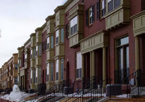
C. Building Types Permitted are as described in Chapter 5. The names of the building types are not intended to limit or expand uses allowed within the building.
D. Uses. See the Table of Uses in Chapter 4 UseSpecific Conditions to determine permitted and Special Exception Uses.
E. Form Standards
1. Building Placement
Buildings shall be located on the site as indicated below. Setbacks shall apply to all floors (for example, if the ground floor is set back 5 feet from the Primary property line, upper floors shall be set back a minimum of 5 feet from the property line).
2. Building Height
Buildings shall be located on the site as indicated below. Setbacks shall apply to all floors (for example, if the ground floor is set back 5 feet from the Primary Property Line, upper floors shall be set back a minimum of 5 feet from the Primary Property Line).
a. Top of plate height above adjacent sidewalk (max.)
b. Top of parapet height above top of plate (max.)
c. Pitched roof height above top of plate
d. Ground Floor above grade at building setback line (max.)
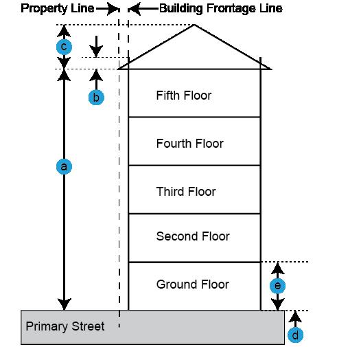
e. Ground story floor-to-floor height (min.)
(retail-ready)
15ft. 10ft. Non-Residential 15ft. 15ft. 12ft.
1The intent of non-residential ground floor height above grade is to enable direct access from the adjacent sidewalk into ground floor commercial spaces. Ground floor height may be higher than 0 feet in response to exceptional circumstances (such as existing grading or flood plain risk) at the discretion of the Planning Staff.
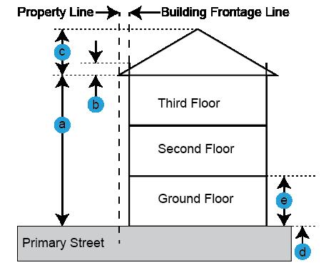
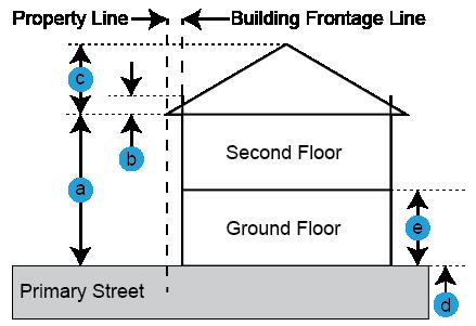
3. Parking Placement
On-site parking shall be located as indicated below and shown in the image.
PARK i NG PLACEMENT
b. Side Street Setback, Min.
c. Side Yard Setback, Min.
d. Rear Setback, Min.
4. Parking Requirements
Off-street parking spaces shall be provided for each land use per the below standards.
PARK i NG REQU i REMENTS
5. On-Site Open Space
a. Common On-Site Open Space. One or more of the on-site open space types listed below shall be provided on each lot that accommodates residential uses. The required on-site open space shall be generally rectangular in form, per the below listed minimum size requirements, and must be accommodated behind the Primary Setback line.
b. Private On-Site Open Space. Where private open space in the form of a yard, balcony, or roof deck is provided for a residential unit, it shall have a minimum area of 40 square feet with a minimum width of 5 feet.
c. Exceptions (Downtown Core). Permitted exceptions, subject to payment of parks and open space in-lieu fees: on-site open space (common or private) non required for buildings that line the “black box” buildings such as parking garages and theaters, and/ or if a building is located within a quartermile walking distance of a park that is at least a half-acre in size.
Building Size and Separation
Buildings shall be designed per the following building length and façade increment standards:
BU i LD i NG S i ZE & SEPARAT i ON
a. Building length along Primary Street (max.) On 40% of lot depth
330ft. 150ft. 60ft.
b. Building length along Side Street (max.) For 40% of lot depth 160ft. 100ft. 75ft.
c. Building separation along Primary Street (min.) Along 40% of lot
0ft. 15ft. 15ft.; Building separation must extend the entire lot depth or width or lead to a courtyard
d. Façade increment (max.) 150ft. 75ft. n/a
e. Façade break length (min.)
0ft. 15ft. n/a
f. Façade break depth (min.)
0ft. 15ft. n/a
g. Building Length along rear Property Line n/a n/a 150ft.
7. Frontage Elements, Allowed Encroachments, and Access
a. Required Frontage Elements. All Street- and Court-facing building facades shall provide at least one of the frontage elements listed below. Required Frontage Elements may encroach into the Primary Street and Side Street setbacks as measured from the building façade as identified below.
REQU i RED FRONTAGE ELEMENTS
b. Optional Frontage Elements. The following Frontage Elements may be provided on all Street- and Court- facing facades. Optional Frontage Elements may encroach into the Primary Street and Side Street setbacks or right-of-way as measured from the building façade as identified below:
c. Pedestrian Access
i. All ground floors shall be accessed directly from the sidewalk either directly to each unit or commercial space through an appropriate Frontage Element, Lobby, or On-Site Open Space, such as a Court.
ii. Upper floors may be accessed through an Exterior Stair, Interior Stair, or Lobby.
d. Vehicular Access
i. Parking shall be accessed from the alley.
ii. Where an alley is not present, parking/ service areas may be accessed from a primary street. Driveways shall be located as close to the side property line as possible.
iii. Parking/service areas for corner lots shall be accessed from side streets.
8. Signage
See Chapter 11 for Signs.
F. Connectivity
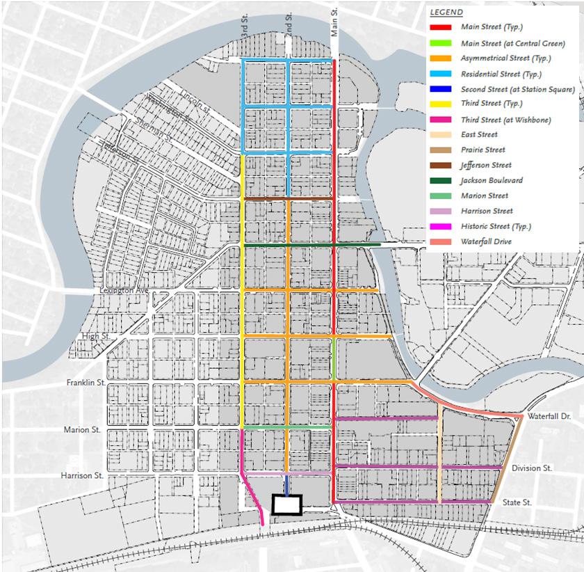
1. Intent. The Downtown Elkhart Master Plan focuses on speed management to support a vibrant pedestrian culture. The plan recommends the following design standards where possible:
a. 10-foot standard travel lanes
b. 11-foot truck route lanes (where applicable)
c. 8-foot parallel parking lanes
d. 18-foot angled parking lanes (measured perpendicular to the curb)
G.
2. Cross Sections
The Downtown Elkhart Master Plan identifies certain cross sections in the plan for Main Street, Second Street, Third Street, East Street, Prairie Street, Jefferson Street, Jackson Boulevard, Marion Street, Harrison Street, and Waterfall Drive. Prior to any street design and any building layout, the City Engineer should be consulted to provide input and feedback into the form and reconstruction of the downtown to ensure it meets with current City design standards.
Streetscape and Landscapes
The design of Downtown Elkhart’s streets should feature tree species suited to the weather and soil conditions in Indiana and the Midwest that complement the adjacent uses. See Chapter 8 Landscape, Buffers, and Open Space.
3.6.3 BENHAM NE i GHBORHOOD OVERLAY D i STR i CT
A. Intent
The purpose of this overlay district is to provide the regulatory framework to implement the Benham Neighborhood Plan. The Benham Neighborhood Overlay is established to provide a more cohesive set of standards that guides redevelopment in the neighborhood. The goals of this district include:
1. provide for a mix of residential dwelling types;
2. increase walkability;
3. identify a cohesive design for the public realm;
4. promote open space;
5. protection of historic buildings;
B. Subzones
1. Intent
The purpose of this subsection is to establish a set of form-based subzones that will guide the form of development. It is anticipated that the character of this district will support a full range of housing types and small scale commercial, office, and institutional uses that are compatible in scale. It is anticipated that over time, this area become more walkable again with a consistent block face, and smaller city blocks. The area is divided into subzones which include:
a. Residential Small.
b. Residential Medium,
c. Neighborhood Center, and
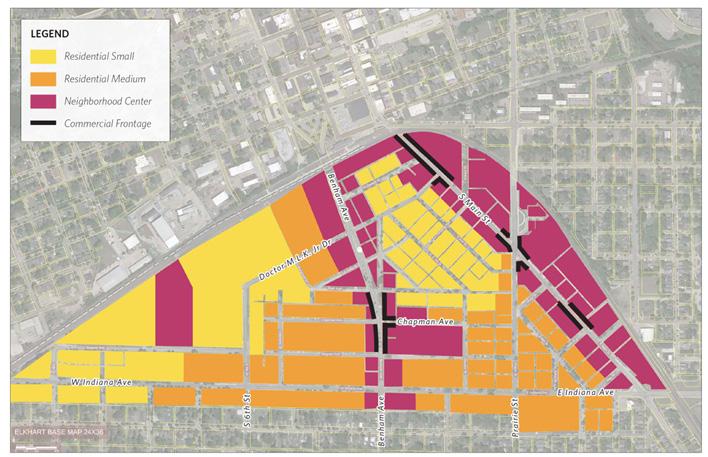

C. Building Types Permitted are as described in Chapter 5. The names of the building types are not intended to limit or expand uses allowed within the building.
D. Uses
See the Use Matrix in Chapter 4, Use-Specific Conditions to determine permitted and special exception uses in the Benham Neighborhood Overlay District.
E. Form Standards
Figure 3.6.3.C. Access & Parking
Pedestrian Access
A walkway shall connect the sidewalk or driveway to the main entrance.
Bicycle Access
See Chapter 7 Parking and Loading Standards, Subsection 7.7 Bicycle and Other Non-Vehicular Parking.
Parking Access
1. If access is available from an alley, there shall be no access allowed from the street.
2. For neighborhood center and commercial frontage, all parking should be at the rear of the building, especially for employees.
3. If allowed, a maximum of one driveway cut is permitted per street frontage.
Side and rear yard setbacks shall be 0 feet when abutting an alley
Required Spaces
1. One off-street parking space shall be required for each residential unit.
2. Off-street parking spaces are not required for detached dwelling units.
3. For detached dwelling units, parking pads may be located in the side or rear yards.
4. Parking is not permitted in front yards.
5. Off-street parking spaces are not required for any commercial use in the Benham Neighborhood.
6. Any off-street parking areas provided shall be developed in accordance with the standards set forth in Chapter 7 Parking and Loading Standards, and Chapter 8, Landscape Standards.
Figure 3.6.3. D Building Form
Building Height
Primary Building See Chapter 5, Building Types for the specific height of each building type.
Accessory Building
Building Orientation
Accessory buildings should not be taller than the primary building. For specific building types, see Chapter 5, building types for the specific height of each building type. If the building type is not listed, consult Chapter 4, Use-Specific Conditions, Accessory Uses.
Primary facades shall be oriented to a front lot line or open space.
4. BU i LD i NG COMPONENTS
3.6.3.E. Building Components
Allowed Building Frontage Types Porch
Building Entrance
The main entrance shall be located on the front façade or on the corner façade.
ENCROACHMENTS
Building components shall be at least 18 inches from any lot line.
See Chapter 17 for building component definitions.
F. Connectivity
1. Intent
The intent of the Benham Plan is to restore the street grid within the community. The proposed reconnection of the street grid is proposed in the figure below. Redevelopment should be mindful of, and where possible, attempt in reconnecting the street grid as shown in this diagram.
2. Cross Sections
The Benham plan identifies certain cross sections in the plan for Benham Avenue, South Main Street, Prairie Street, South 3rd Street, Chapman and Wagner Avenues. Prior to any street design and any building layout, the City Engineer should be consulted to provide input and feedback into the form and reconstruction of the neighborhood to ensure it meets with current City design standards.
G. Landscaping
1. To re-establish the rich vegetative cover within the Benham neighborhood, lots that are redeveloped will be required to plant street trees along the roadways.
2. One street tree will be required to be planted 18 inches away from the curb to protect from salt spray and provide a place for people to stand when entering and existing cards. It is recommended that silva cells or other structured soil be used per the Benham Neighborhood plan to locate the street trees to ensure proper and healthy growth.
3. There shall be a 5 to 12-foot green buffer based on the street type in the Benham neighborhood plan, where the street trees will be planted and there will be one tree for every 25 lineal feet of lot frontage, centered on the lot, or located 25 lineal feet on center of the adjacent tree, whichever is occurring first. Property owner will make every effort to ensure street trees are 25 lineal feet on center,
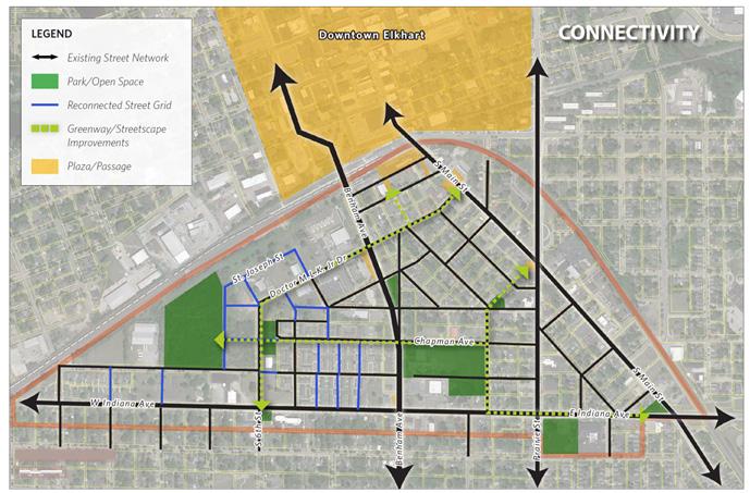
This Page is Intentionally Left Blank
C HAPTER 4:
USE SPEC i F i C COND i T i ONS
4.9
4.1 USE REGULAT i ONS
4.1.1 Determination of a Use Category
A. Any land use not listed as either a Permitted by Right, Special Exception, Conditional Use, or Accessory in the land use column of a particular zoning district shall be prohibited in that zoning district.
B. Any land use not listed in Section 4.2 Table of Uses, but that is substantially similar to a use that is a Permitted Use, Special Use, or Conditional Use in that zoning district may be deemed permitted by interpretation by the Planning Staff.
4.1.2 Determination of Principle Use
An individual lot or development site may include multiple principal uses permitted within a single building or structure or across multiple buildings or structures, pursuant to the zoning district within which it is located. Where multiple principle uses are allowed, they may include a combination of residential and non-residential uses, provided that each use is either a Permitted Use or a Special Exception in that district, that a Special Exception has been obtained, if applicable, that use-specific conditions applicable to each use are met, and that the development complies with all applicable standards.
4.1.3 interpreting the Table of Uses
A. Uses permitted by right are represented by a “P.”
B. Uses permitted by Special Exception are represented by an “S.” Uses permitted by special exception are subject to the procedures in Section 14.7.2 Special Exceptions.
C. Uses permitted as Conditional Uses are represented by “C.” Conditional Uses are subject to the procedures in Section 14.6.2 Conditional Uses.
D. Uses permitted only as an Accessory Use are represented by an “A.” Any use permitted by right in a district may also be permitted as an Accessory Use.
E. Uses permitted only as an Temporary Use are represented by a “T.”
4.2 TABLE OF USES
TABLE 4.2-1: USE MATR ix
TABLE 4.2-1: USE MATR ix
Bulk Fuel Storage, Petroleum Tank Farm, & Other Bulk Storage of Solids or Liquids
Bulk Storage Tanks including materials that do not require filing a Tier 1 or 2 SARA report or those that do not exceed and NFPA classification of 2
TABLE 4.2-1: USE MATR ix
4.3 AGR i CULTURAL USE COND i T i ONS
Agricultural Uses are not permitted by right in the City of Elkhart, except as expressly stated in Section 12.6 Wetland Conservation Overlay District. Agricultural uses may only be permitted by a variance of use.
4.4 RES i DENT i AL USE COND i T i ONS
4.4.1
Bed & Breakfast Inns
A. Intent
The provisions set forth in this Section of the Zoning Ordinance are intended to qualify and supplement the district regulations in the interest of public health, safety, and welfare to assure that bed and breakfast homes are developed, maintained, and operated in a manner consistent with the neighborhood in which they exist.
B. Short term rentals are permitted as a special exception. Short term rentals that are owner occupied are subject to Indiana Code 36-1-24-8 (or current statues), short term rentals that are not owner-occupied are subject to Indiana Code 36-1-24-9 (or current statutes).
1. Limitations on short term rentals shall be subject to enforcement per Indiana Code 36-1-24-10 (or current statutes).
C. Development Standards
The following provisions shall apply to all bed and breakfast homes:
1. Food shall be offered only to overnight guests.
2. The Board of Zoning Appeals may attach other conditions to the operation of the Bed and Breakfast Home including but not limited to parking, signs, number of rooms, patrons, and time of operation.
3. No special exception shall be granted until the Board of Zoning Appeals, in their deliberations, determines that the Bed and Breakfast home will not
change the residential character of the neighborhood.
4. All uses and operations shall be conducted within completely enclosed buildings. All on-site vehicular circulation and traffic patterns shall be approved by the Planning and Zoning Staff.
5. No show windows or other exterior display, except for one sign which shall be a non-illuminated identification sign attached to the residence not exceeding 6 square feet.
6. Bed and Breakfast homes shall provide parking as required by Chapter 7. All parking shall be in rear yards and shall be screened from adjoining land uses.
7. Accessory buildings and structures such as barns, sheds, and the like may not be used for guest rooms in a Bed and Breakfast home.
8. A landscaping plan shall be submitted for approval by the Planning and Zoning Staff.
9. All bed and breakfast homes located in Residential Zoning Districts must be owner occupied and shall have a maximum of 5 guest rooms.
4.4.2
Convalescent Homes, Nursing Homes, or Hospices
A. The facility shall maintain a common dining room and common kitchen. The facility shall provide communal gathering
B. Each residential room may have up to 2 occupants.
4.4.3
Day Care Home
A. Permitted as a special exception in residential districts. Any building renovation plans shall be submitted with the special exception application.
B. The operator of a day care home must reside on the premises as their primary residence.
4.4.4
C. Operation of a day care home is subject to State license requirements. A copy of the childcare home license shall be submitted to the Department of Planning and Zoning upon receipt from the Indiana Family and Social Services Administration.
D. If the day care ceases to operate for more than 1 year, or the license is revoked, the special exception becomes null and void. Any violation of the terms of the special exception as determined by the Department of Planning and Zoning shall render the special exception invalid.
E. All children shall be restricted to the building and fenced-in play area(s) except when arriving and leaving, or on supervised walks or outings.
F. The facility and grounds must be always kept clean and free of trash or debris.
G. There shall be no exterior display, signs, or other forms of advertising on the premises.
H. There shall be a maximum of 16 children.
i. Pick-up and drop-off shall be from alleys, if existing. Pick-up and drop-off queuing shall not disturb normal traffic.
Dormitory
A. A dormitory shall operate relative to an educational institution.
B. Residential occupancy of these facilities shall be subject to educational enrollment or employment and may operate seasonally.
C. Boarding rooms may or may not include individual bathrooms and/or kitchens.
D. Facilities may include shared amenities such as communal bathrooms, kitchens, laundry rooms, and recreation areas.
E. These facilities may include dining halls and convenience retail.
4.4.5
Dwelling, Attached
A. The building containing the attached dwelling units shall be configured as 1 residential structure.
B. This use may include shared site amenities, such as recreation areas, access drives, and garages or parking structures.
C. If configured horizontally, the units must share a common floor-to-ceiling wall.
D. If configured vertically, the units must share a common floor/ceiling that extends to the exterior walls.
E. Each unit must have its own entrance located at the front of the building unless otherwise specified in this UDO.
F. Primary structures shall be oriented so that the front façade is facing a public or private street, a common open space, or plaza. The front façade should not face surface parking.
G. Developments are encouraged to be designed to avoid long, monotonous rows of garage doors and blank building walls.
H. All sides of a building shall display similar materials.
i. Detached garages, carports, and surface parking shall not be located between any primary building and the adjacent public street frontage.
J. No more than 4 garage units shall be within 1 detached garage structure.
K. Garages shall be of the same building materials as the primary structure.
L. Walkways shall connect all buildings to each other, parking areas, and existing public sidewalks adjacent to the development.
4.4.6
Dwelling, Detached
A. The primary structure’s front door must face the street.
B. Any manufactured home may be permitted as a detached dwelling provided foundation requirements of the Indiana Residential Code are met.
C. This use may include related residential accessory structures for personal use, such as garages, gardens, sheds, children’s play equipment, and swimming pools.
D. An accessory dwelling unit may be permitted as accessory to the primary dwelling as a special exception as permitted by the use table in Section 4.2. and Section “5.4 Building Types” as applicable.
4.4.7 Dwelling, Live-Work
A. The office/non-residential use must have a primary entrance at the front of the building on the ground floor.
B. The residential dwelling unit shall be above or behind the work unit.
C. The dwelling unit may be occupied by the owner of the work unit or the owner’s employee, including others in that person’s household.
D. One off-street parking space must be provided for sole use by the dwelling occupant.
4.4.8 Group Care Facility
A.
Intent
The use regulations are to minimize the adverse impacts on established residential neighborhoods in the city and on the owners and residents of properties in these neighborhoods which may result from the conversion of residential properties to business or institutional uses. However, it is also the purpose of this Section to provide that the City may refuse to make a reasonable accommodation for a Group Care Facility whenever such an accommodation would not impose undue financial or administrative burdens on the jurisdiction
or require a fundamental alteration in the Comprehensive Plan.
B. A dwelling located in a business district or PUD may be used as a group care facility only if the owner or occupant applies for and is granted a special exception.
C. The term of a special exception approval granted to a group care facility shall be up to twenty years. The granting of a special exception does not confer a right to lease, sublease, or otherwise use a dwelling as a group care facility where such use is not otherwise allowed by law, a homeowners association agreement or requirements, any applicable covenant, condition, and restriction, a rental agreement, or any other restriction, requirement, or enforceable agreement. Nothing in this Section shall relieve any person of the obligations imposed by all applicable provisions of Federal and State laws and City ordinances, including but not limited to those obligations imposed by Indiana tax laws and rules. Further, nothing in this Section shall be construed to limit any remedies available under all applicable provisions of Federal or State law and this Ordinance.
D. The Planning Staff shall review the application for the purpose of determining whether it would be a reasonable accommodation for the City to grant the special exception to provide the residents who would be provided services at the group care facility with access to housing that is equal to that of residents who are not in need of such services. The following criteria is what the Planning Staff shall consider before making a recommendation:
1. If there are other group care facilities clustered within a block of the site;
2. The number of unrelated persons who will be living in the group care facility, and whether any professional support staff will also be residing there;
3. In addition to any residents’ cars, if more than 2 staff cars will be parked
4.4.9
at the group care facility, and whether they will be marked;
4. Any other exterior indication that the dwelling will be inhabited by group care facility residents;
5. Any undue financial or administrative burdens that would be imposed on the city; and
6. If a fundamental alteration in the Comprehensive Plan is required.
E. Where a group care facility is a special exception use under the UDO, an application shall not generally be entitled to favorable consideration, except as follows:
1. A proposed group care facility where not more than 8 unrelated persons will be residents shall generally be entitled to favorable consideration;
2. A proposed group care facility where not less than 9 nor more than 12 unrelated persons will be residents shall generally be entitled to favorable consideration, so long as the application is not opposed by the Planning Staff; and
3. A proposed group care facility where 13 or more unrelated persons will be residents shall be entitled to favorable consideration only if the application is supported by the Planning Staff.
Home Occupation
A. All home occupations are subject to local, state, and federal laws and licensing requirements.
B. The operator of a home occupation must occupy the dwelling as their primary residence.
C. The residential use of the property must remain the primary use; sleeping rooms, bathrooms, and kitchens cannot be removed from the property.
D. Operations for a home occupation, including storage areas, may not exceed
more than 30% of the gross floor area of the primary residential structure or 400 square feet, whichever is less.
E. Construction of an accessory structure for sole use by a home occupation is not permitted.
F. Operation of a home occupation shall not attract more than 1 person at a time to the property. Parking may not be expanded for use by a home occupation.
G. Operations should be generally limited to normal business hours, 7 am to 7pm.
H. Shipment of products from the site should not exceed 1 shipment per week. Use of heavy commercial vehicles for shipments (semi-trucks, flatbed trucks) is not permitted.
i. Signs advertising a home occupation are subject to the standards in Chapter 11.
J. No home occupation shall generate traffic, noise, smoke, odor, or vibrations, or otherwise affect neighboring properties.
K. Day care home and Bed and Breakfast are not home occupations per this section. See their respective sections.
4.4.10
Lifestyle Community/Facility
A. Dwellings may be detached, attached, multi-unit, or a combination thereof.
B. The facility may consist of 1 or more buildings under common ownership and management.
C. The facility shall maintain a common dining room and common kitchen.
D. The facility may provide dwelling units with or without independent kitchen facilities.
E. This use does not provide health maintenance services and/or treatment.
F. This use may include amenities typical of multi-unit developments, such as a leasing office/clubhouse, recreation areas, laundry rooms, and parking.
4.4.11
Mobile Home Park
A. A mobile home park may offer land for lease for placement of a mobile home. Refer to Section 13.2 Mobile Home Parks for additional standards.
B. Creation of a new mobile home park is not permitted; however, an existing mobile home park may be expanded in compliance with this ordinance.
C. Each mobile home structure shall consist of only 1 detached dwelling unit, or for office use by the developer.
D. Permitted Amenities
1. A Mobile Home Park may include management and/or maintenance facilities for services related to its operations.
2. Sale and management offices are limited to 3% of the total park area when located in the park’s interior.
3. A Mobile Home Park may include a daycare center serving only residents of the park.
4. This use may include amenities typical of multi-unit developments, such as a leasing office/clubhouse, recreation areas, laundry rooms, and parking.
4.4.12 Multi-Unit Dwelling
A. Refer to Section 5.4 Building Types for specific standards.
B. Multi-unit dwellings shall contain three or more dwelling units in a building and may have multiple buildings on one lot or development as permitted by the zoning district.
C. Multi-unit dwelling developments including two or more buildings must be located along a collector roadway or higher classification.
D. Administrative approval is required prior to issuance of Zoning Clearance Permit.
E. This use may include amenities typical of multi-unit developments, such as a leasing
office/clubhouse, outdoor recreation areas, laundry rooms, and garages or parking structures.
F. Developments are encouraged to be designed to avoid long, monotonous rows of garage doors and blank building walls.
G. Each building shall be oriented so that the front façade faces a public or private street, a common open space, or plaza.
H. Each building should have a shared entrance, or each unit should have an entrance on the front façade.
i. Exterior staircases to units on upper floors are prohibited. This does not apply to emergency fire escapes if required by the Indiana Building Code.
J. Garages shall be made of the same material as the primary structure.
K. Parking shall be located to the side or rear of the building.
L. Walkways and/or sidewalks shall connect all buildings to each other, parking areas, and existing public sidewalks adjacent to the development.
4.4.13
Rooming House or Boarding House
A. Permitted as conditional use.
B. Meals may be provided only to residents.
C. This use may include amenities typical of multi-unit developments, such as a leasing office/clubhouse, recreation areas, laundry rooms, and parking.
4.4.14 Short Term Rentals
A. See also Sec. 4.4.1 Bed & Breakfast Inns
B. Purpose
It is the purpose of this Section to benefit the public by minimizing adverse impacts on established residential neighborhoods in the City and the owners and residents of properties in these neighborhoods resulting from the conversion of residential properties to tourist and transient use.
C. Special Exception Eligibility
The property owner of a dwelling located in a Residential District may use the Dwelling as a Short Term Residential Rental Unit if:
1. The property owner applies for and is granted a Special Exception, pursuant to Section 14.7.2 Special Exception hereof.
2. The property owner posts a clearly printed sign inside his or her Dwelling on the inside of the front door that provides information regarding the location of any fire extinguishers in the unit and building, gas shut off valves, fire exits, or pull fire alarms;
D. Required Information for Application
Both the initial application and any renewal application for a Special Exception permit shall contain the following:
1. Information sufficient to show that the applicant is the property owner of the Short Term Residential Rental Unit.
2. Primary and secondary emergency contact information, including mailing address, phone number or email address. Upon approval of a Special Exception, emergency contact information shall be shared with the Elkhart Police Department.
E. Limitations
The term of a Special Exception permit granted to a property owner shall be 1 year. The grant of a Special Exception permit provides an exception only to the other requirements of this UDO. It does not confer a right to lease, sublease, or otherwise use a Dwelling as a Short Term Residential Rental Unit where such use is not otherwise allowed by law, a homeowners association agreement or requirements, any applicable covenant, condition, and restriction, a rental agreement, or any other restriction,
requirement, or enforceable agreement. Nothing in this Section shall relieve any person or facilitator of the obligations imposed by all applicable provisions of state law and the City of Elkhart Code, including but not limited to those obligations imposed by Indiana tax laws and rules. Further, nothing in this Section shall be construed to limit any remedies available under all applicable provisions of state law and the City of Elkhart Code.
F. Suspension of Section.
The Mayor may, subject to approval by resolution of the Council, suspend operation of this Section for not more than 30 days per calendar year, during special events.
4.4.15
Transitional or Sheltered Living Housing
A. Transitional housing must have 500 feet of separation from another transitional housing or group care facility.
B. Parking requirements may be reduced as determined by the Planning Staff.
C. Transitional housing is prohibited from dispensing controlled substances—refer to outpatient substance abuse treatment facility, Section 4.7.34.
D. Facilities should maintain residential characteristics compatible with the surrounding neighborhood.
E. Transitional Housing must provide notification to the Planning Staff about what type of operating license(s) the housing has, if any, and changing of use if over 8 occupants.
4.5 C i V i C, i NST i TUT i ONAL, AND CULTURAL USE COND i
4.5.1
Cemeteries & Mausoleums
T i ONS
A. The proposed location must be compatible with adjacent land uses, and will not adversely affect the public health, safety, and welfare of the inhabitants of the area.
B. All grave sites must be set back 20 feet from surrounding properties to establish a buffer.
C. Where the subject property is in an area not served by public water and sewer, water table tests shall be conducted to assure that there is adequate filtration of drainage between burial depth and the level of the high-water table.
D. A minimum of 3 acres shall be needed for any cemetery being developed as a principal use.
4.5.2 Community Buildings or Centers
A. Planning Staff may require technical review prior to issuance of a zoning clearance permit.
B. Community centers are subject to technical review and a traffic impact study.
4.5.3
Cultural & Sport Facilities
A. Planning Staff may require technical review prior to issuance of a zoning clearance permit.
4.5.4
Day Care Center
A. A day care center may be permitted as a primary or accessory use. Where a day care center is permitted as a special exception, it is subject to the requirements of Section 14.7.2 Special Exception
B. A day care center shall comply with all applicable local, state, and/or federal licensing requirements.
C. A day care center must provide safe and adequate pick-up and drop-off facilities. Vehicle queuing shall not disturb normal traffic.
D. In the MHP district, a day care center shall only be for use by residents of the mobile home park.
B. Parking requirements are subject to Chapter 7 Parking and Loading.
4.5.6 Libraries
A. Libraries must provide pedestrian connections to all adjacent streets.
B. Libraries may include a vehicle-accessed drop box where drive-throughs are permitted as accessory uses.
4.5.5
Hospitals & Clinics
A. Planning staff may require technical review prior to issuance of a zoning clearance permit.
4.5.7
Mass Transit Centers
A. Storage of transportation vehicles should be secured and screened with an opaque fence and landscaping.
B. Mass Transit Centers with stations must provide adequate pedestrian amenities, such as paved sidewalks and loading platforms.
4.5.8
Museums
A. Planning staff may require technical review prior to issuance of a zoning clearance permit.
B. Museum signage is subject to the provisions of the sign ordinance in Chapter 11.
4.5.9
Park & Ride Facilities
A. Planning staff may require technical review prior to issuance of a zoning clearance permit.
B. Shelters shall be provided for commuters or travelers waiting for transportation services.
4.5.10 Penal and/or Correctional Facilities
A. Penal and/or Correctional Facilities are permitted only as a conditional use.
B. Planning staff may require technical review prior to issuance of a zoning clearance permit
4.5.11
Places of Worship
A. Places of worship located in residential districts shall follow the dimensional
4.5.12
standards for the INST district regardless of their zoning classification.
B. Places of worship may have accessory childcare ministry as a special exception.
Police & Fire Stations
A. Planning staff may require technical review prior to issuance of a zoning clearance permit.
B. Stations must have direct access to arterial streets.
4.5.13
Post Office Branch
A. Planning staff may require technical review prior to issuance of a zoning clearance permit.
B. Loading facilities are not permitted in the front yard or front of the building.
4.5.17
Schools & Colleges
A. Schools and Colleges located in residential districts shall follow the dimensional standards for the INST district regardless of their zoning classification.
B. Facilities normally associated with a college such as resident halls, administrative buildings, cafeterias, gymnasiums, auditoriums, classrooms, and sports facilities shall be permitted.
C. Related outdoor recreation and playground facilities must be screened or fenced.
D. Schools and colleges’ sites must include public sidewalks and pedestrian amenities. Schools may implement Safe Routes to School programs.
4.5.14
Private Clubs or Lodges
A. Planning staff may require technical review prior to issuance of a zoning clearance permit.
4.5.15
Public Transportation Stations
A. Shelters shall be provided for commuters or travelers waiting for transportation services.
B. Stations must include paved sidewalks. Sidewalks should connect to adjacent properties.
4.5.18
E. Any school for children under 18 years of age shall provide an automobile service and bus pick-up and drop-off area adequate to protect student safety and shall provide pedestrian connections to all adjacent streets.
Trade Schools
A. No outdoor operations are permitted except for driving schools or electrical trade schools that include outdoor lights for training purposes.
B. Sound shall not travel beyond the site boundaries.
4.5.16
Public Utilities Facilities
A. Facilities must include landscaping and screening from roadways and residential areas.
B. Utility substations and transmission facilities (not including sewer or water boost or lifting stations) shall be screened with a solid fence or wall at between eight and ten feet in height and shall provide at least 1 tree and 3 shrubs per 10 linear feet of fencing to minimize the visual impact of the use on surrounding properties, public streets, and public open spaces. Required plantings shall be located on the side of the fence closest to abutting properties.
4.6 PARK, RECREAT i ON, AND OPEN SPACE USE COND i T i ONS
4.6.1
Community Garden
A. A community garden may not operate as a for-profit organization.
B. A community garden may include structures related to operations and maintenance, such as tool sheds or greenhouses (not commercial).
4.6.2 Parks, Playgrounds, & Recreation Facilities
A. Planning staff may require technical review prior to issuance of a zoning clearance permit.
4.6.3
Recreational Vehicle Parks & Campgrounds
A. The subject use is only permitted as a special exception.
B. Projects are required to be submitted for technical review prior to issuance of any permit.
C. The project shall have a minimum site area of 3 acres.
D. Signage shall adhere to the regulations if the zoning district.
E. The site perimeter shall include a screening fence as permitted by the zoning ordinance.
F. The site shall provide street trees at a minimum of 1 shade tree per 40 feet of frontage, or, if there are existing overhead utility lines, 1 ornamental tree per 15 feet of frontage.
4.7 COMMERC i AL AND BUS i NESS USE COND
i T i ONS
4.7.1 Adult Entertainment Establishments
A. Intent
The requirements set forth in this Section are intended to qualify and supplement the district regulations to manage the development, operation, and maintenance of adult entertainment facilities in the interest of public health, safety, and welfare.
B. Permitted only as conditional use
C. The following provisions shall apply to all adult entertainment facilities:
1. No adult entertainment use shall be located within a 1,000 foot radius of any other such use.
2. Adult entertainment uses shall not be located within 1,000 feet of schools whether public or private, religious institutions, parks, playing fields, or other areas in which large numbers of minors regularly travel or congregate.
3. These provisions may be waived by the City Council if it is found that:
a. The proposed use would not be contrary to the public interest or injurious to nearby properties, and the spirit and the intent of this section will be observed; and
b. All other applicable regulations of the zoning code of the City will be observed.
D. Outdoor sales and display are not permitted.
4.7.2 Airports or Aircraft Landing Fields & Heliports
A. The subject use is permitted only as a special exception.
4.7.3 Auction Barn or Room
A. An auction barn or room may have accessory outdoor storage if permitted in its zoning district.
4.7.4 Automobile, Truck, Recreational Vehicle, & Agricultural implement Sales or Rental
A. Permitted only in locations fronting on major roadways or primary arterials.
B. Vehicles for sale, lease, or rental may be displayed in the front setback provided that no vehicle shall be displayed in or within 10 feet of the street right-of-way.
C. Outdoor display must be a minimum of 10 feet from a property line.
D. Display areas must be shown on the site plan and approved as part of the Zoning Clearance Permit review.
E. No curb-cut may exceed 40 feet in width. For a corner lot, curb cuts are restricted to 1 curb cut per street frontage.
4.7.5
F. Sales may be permitted as accessory to an Automobile and Truck Repair or Vehicle Conversion Shop or Manufacturer; however, the accessory sales use shall not include outdoor display of vehicles.
Bakery Shop
A. All products must be produced and sold on-site.
B. All applicable health department licenses are required.
4.7.6 Banking & Financial institutions
A. In the NEI-B and CBD districts, check cashing and title loan businesses are not permitted as banking and financial services uses.
B. Where drive-throughs are permitted as an accessory use, drive-through windows shall be designed as a related, integrated architectural element and part of the overall design composition of the building. See Section 4.9.6 Drive-Throughs.
C. Automated Teller Machines (ATMs) are permitted as accessory to the subject use. ATMs may be integrated into a drive through where permitted. ATMs within a fully enclosed building are not regulated by this UDO.
4.7.7 Bar or Tavern
A. Any beer garden or similar outdoor bar area is subject to Indiana Code. The outdoor area must be screened by a wall or opaque fence a minimum of 72 inches tall per IC 7.1-3-20-28.
B. Electronically amplified sound using speakers or similar devices shall not be permitted outdoors unless it is within ambient noise levels at the property line. Sounds generated on-site shall be subject to the requirements and enforcement actions by the applicable city agency.
4.7.9
Building & Trade Contractors
A. Where permitted, outdoor storage of building materials must be on a paved surface and screened with a solid 6-foottall fence. Outdoor storage is prohibited in front of the building or in a required setback. Refer to Section 4.9.10 Outdoor Storage.
B. Parking and storage of company trucks shall be limited to the rear yard.
4.7.8
Broadcasting & Content Providers
A. Proposed community access centers or studio’s locations must be consistent with the cable communications plan.
4.7.10
Building Material & Supply
A. The subject use may have accessory outdoor sales and display on a paved surface, not in required parking or maneuvering area or setback. Outdoor display should not exceed 20% of the interior floor area. Refer to Section 4.9.9 Outdoor sales and display, accessory.
4.7.11
Catering
A. Any catering business must maintain the appropriate licenses from the State and local Department of Health.
B. Delivery vehicles may be parked on site except box trucks and/or semi-trailers.
4.7.12
Convenience Stores
A. May be a primary or accessory use.
B. May be accessory to a motor vehicle service station if a service station is permitted as a primary use in that district.
C. Where possible, cashier areas should be visible from the building exterior at the primary entrance.
4.7.13
Drive-in Facilities
A. A drive-in facility adjacent to a residential district shall be screened with 6-foot-tall opaque fence.
4.7.14
Dry-Cleaning
A. A dry-cleaning business must obtain all applicable licenses.
4.7.15 Firearm Retailer
A. A firearm retailer must comply with all federal, state, and local codes and licenses.
B. Firearm repair is permitted as an accessory use. Firearm repair as a primary use is considered Manufacturing, Heavy.
4.7.19 Heavy Equipment Rental
A. Equipment (excluding vehicles or trucks) may be stored outdoors on a compacted gravel surface; however, access drives to storage areas must be paved.
4.7.20 Highway Rest Stop
A. Must be located along an Interstate or limited access Highway.
4.7.16
Funeral Homes, Crematories, & Similar Services
A. The subject use requires a special exception where located in a residential district. The building should be compatible with the scale of adjacent residential buildings.
B. Operations must maintain applicable licenses.
C. Parking areas must be in the side or rear yard.
D. Crematoriums must be at least 500 feet from any residential district.
E. Crematoriums are not permitted in an air control overlay.
4.7.17 Greenhouses & Wholesale Growers
A. Outdoor storage and outdoor display are subject to all requirements of this ordinance. See Section 4.9 Accessory Use Conditions.
4.7.18 Grocery Store
A. A grocery store may include outdoor sales and display as an accessory or temporary use where permitted.
B. A grocery store may include an accessory pharmacy. The pharmacy may have an accessory drive-through where permitted. See Section 4.9.6.
C. A grocery store may include accessory motor vehicle service station only if it is permitted in that zoning district.
4.7.21 Hotels & Motels
A. A hotel may be within a mixed-use building.
B. Hotel rooms shall be accessed from the interior of the building, including from interior courtyards, lobbies, or halls.
C. Motel rooms shall be accessed from the exterior of the building.
D. Each unit shall provide a bathroom.
E. A hotel or motel may include accessory recreation areas or ballroom/conference space for guests’ use.
4.7.22 Household Appliance Retail & Repair
A. All storage and display must be within completely enclosed buildings.
B. Loading bays may not be on a building’s front façade or in the front yard.
4.7.23
Indoor Recreation & Entertainment
A. All operations must be within an enclosed building. Refer to Outdoor Recreation for outdoor operations.
B. Sound shall not travel beyond the site boundaries. Sounds generated on-site shall be subject to the requirements and enforcement actions by the applicable city agency.
C. Food and beverage sales are permitted as accessory uses with proper licenses. Drive-through facilities are not permitted.
D. Indoor recreation and entertainment including amusement machines are subject to all City of Elkhart Ordinances.
4.7.24
Indoor Shooting Range
A. An indoor shooting range must obtain all applicable licenses from federal, state, and local agencies.
B. Sound shall not travel beyond the site boundaries. Sounds generated on-site shall be subject to the requirements and enforcement actions by the applicable city agency
4.7.25 Kennels & Animal Hospitals
A. Operation of animal hospitals are limited to licensed veterinary practitioners for veterinary medicine, dentistry, or surgery for animals, and support staff.
B. Operation of kennels/pet boarding is subject to licensing requirements by local, state, and/or federal law.
C. Kennels/pet boarding must include recreation areas as required by licenses.
D. Operations may include grooming or pet training.
E. Animal waste must be appropriately disposed of so that it does not create a public nuisance.
4.7.28
Manufactured Home Sales
A. Display of manufactured homes must comply with required dimensional standards of its zoning district.
B. This use may include an on-site sales office.
4.7.29
Medical & Dental Offices & Clinics
A. Operations are limited to licensed medical professionals and support staff.
4.7.30 Motor Vehicle Service Stations
A. Motor vehicle service stations may include an accessory convenience store.
B. All operations must be indoors except fuel dispensing or vehicles in queue.
C. Filling station pumps, pump islands, and canopies shall be a minimum of 15 feet from any property line.
D. Repair service bays shall not face a residential district.
E. Repair service bays shall not face the street frontage except for corner lots. Where the site is a corner lot, service bays shall face the street with the lesser road function classification.
4.7.26
Laundromat
A. Laundromats must obtain proper licenses where applicable.
B. Laundromats may be accessory to residential uses as described in Section 4.4 Residential Use Conditions.
4.7.27
Liquor Store
A. Liquor stores shall not be located within 100 feet, measured in any direction, from the exterior wall of any school, religious use, public library, park, child day care, or indoor recreation & entertainment establishment that caters to, or markets itself predominantly to, persons under 21 years of age.
B. Any liquor store including sampling or sales for on-site consumption must obtain the appropriate licenses.
4.7.31
Motor Vehicle Wash
A. Motor vehicle washes, vacuums, and similar service devices shall be located a minimum of 100 feet from the nearest portion of an adjacent residential zoning district or use for facilities that do not include an automatic dryer. Where automatic dryers are installed, separation shall be 500 feet from the nearest lot line of a residential zoning district or use.
B. Mechanized motor vehicle washes shall erect and maintain sound attenuated structures or sound attenuated walls on the property lines.
C. 10 stacking spaces are required for 1 queue lane. 5 stacking spaces for 2 or more queue lanes.
D. The use must include adequate queuing so that vehicles do not block sidewalks or streets.
E. Accessory car washes shall be in the side or rear yard of the primary structure.
4.7.35
4.7.32
Office: Business, Professional, or Governmental
A. Accessory storage is limited to 10% of the gross floor area.
B. Amenities for employees’ use may be permitted as accessory uses, subject to Section 4.9 Accessory Use Conditions.
4.7.33
Outdoor Recreation
A. Outdoor rifle or archery ranges are not permitted as part of this use.
B. Electronically amplified sound using speakers or similar devices shall not be permitted outdoors unless it is within ambient noise levels at the property line. Sounds generated on-site shall be subject to the requirements and enforcement actions by the applicable city agency.
C. Outdoor lighting must comply with the lighting standards of this ordinance.
D. Landscaping and screening are required in all perimeter yards.
E. Concessions sales are permitted as accessory use.
4.7.34
Outpatient Substance Abuse Treatment
A. This use does not include group homes or any overnight accommodations for patients receiving treatment.
B. Outpatient Substance Abuse Treatment facilities shall not be located within 500 feet, measured in any direction, from the exterior wall of any school, religious use, public library, park, child day care, or indoor recreation & entertainment establishment that caters to, or markets itself predominantly to, persons under 21 years of age.
C. Operators must obtain all applicable licenses.
Parking Lots as a Primary Use
A. If the subject use is larger than 1 acre, a special exception is required prior to issuance of a Zoning Clearance Permit.
B. If the subject use is primarily for parking of commercial vehicles, semi-trucks, or semitrailers, the use shall be permitted only in the R&D-I and MAN-I zoning districts.
4.7.36 Parking Structures as a Primary Use
A. Parking structures shall be considered buildings, not parking, for the purpose of determining setbacks.
B. The right-of-way engineer may impose restrictions on parking structure entrances and exits
4.7.37
Pawn Shops
A. Pawn shops shall not permit outdoor storage.
B. Accessory outdoor sales display must comply with required setbacks and may not be in required parking areas. Refer to Section 4.9.9
4.7.38
Personal Care Services
A. Personal care service operators must obtain applicable licenses where required.
4.7.39
Pharmacy
A. Accessory drive-through facilities, where permitted, shall be in the side or rear yard. See Section 4.9.6.
4.7.40
Restaurant
A. A café restaurant serving only nonalcoholic beverages, excluding drive-in facilities, may be permitted as a special exception in the NEI-B district.
B. A restaurant may have accessory outdoor dining in compliance with Section 4.9.8 Outdoor Dining.
C. Drive-throughs, where permitted, shall comply with Section 4.9.6
4.7.41 Retail, General
A. Accessory or temporary/seasonal outdoor sales and display should not exceed 20% of the interior floor area. Outdoor displays must be on a paved surface and may not be in required parking or maneuvering areas. Refer to Section 4.9.9.
B. Loading bays may not be on a building’s front façade or in the front yard.
4.7.42 Service Business
A. Local and state business licenses shall be maintained where applicable.
B. Loading bays may not be on a building’s front façade or in the front yard.
4.7.43 Tattoo Parlors
A. Tattoo Parlors are only permitted as a special exception. Hours of operation may be enforced as a condition of a special exception.
B. A tattoo parlor must maintain a license from the State of Indiana.
C. A tattoo parlor must maintain a 100-foot separation from any residential district.
4.7.44 Therapeutic Massage
A. Any person who is engaged in the business of therapeutic massage shall be licensed by the Indiana State Department of Health, or is a student enrolled in an educational institute of professional massage therapy instruction accredited by the state of Indiana, performing massage therapy as a part of their training requirements.
4.7.45 Wholesale Business
A. Accessory outdoor sales and display is limited to 10% of the gross floor area. See Section 4.9.9
B. Loading docks cannot back up to residential use or district.
C. Loading areas must be accessed from an arterial street. Loading is prohibited in the front yard.
D. Landscape buffers shall be provided as described in Chapter 8.
4.8 i NDUSTR i AL USE COND i T i ONS
4.8.1
Automobile & Truck Repair or Vehicle Conversion Shops
A. Vehicles awaiting service shall be stored within an enclosed building, or within an outdoor storage area with a minimum 6-foot-tall solid fence on all sides of the storage area. Storage areas must comply with the required building setbacks for their district.
B. Repair or conversion service bays shall not face a residential district.
C. Repair or conversion service bays shall not face the street frontage except for corner lots. Where the site is a corner lot, service bays shall face the street with the lesser road function classification.
D. Sales may be permitted as accessory to an Automobile and Truck Repair or Vehicle Conversion Shop or Manufacturer; however, the accessory sales use shall not include outdoor display of vehicles.
4.8.2
Battery Energy Storage Systems (BESS)
A. Battery Energy Storage Systems (BESS) shall be permitted only by grant of a Special Exception
B. BESS Special Exception Applications must provide the following:
1. A BESS summary containing a general description of the project, including but not limited to:
a. The approximate total power capacity, energy capacity and discharge duration of the BESS
b. Types of batteries uses, and their potential manufacturers
c. A preliminary equipment specification sheet that documents the proposed BESS components, inverters, and associated electrical equipment to be installed
d. An electrical diagram detailing the BESS layout, associated components, and electrical interconnection methods, with all NEC compliant disconnects and other current devices
e. A project site plan, project phasing plan, and construction plans
2. A description of the applicant, owner, and operator, including their respective business structures;
3. A site plan for the BESS showing the planned location of the BESS and all related components, including legal descriptions for each site, Participating and Non-Participating Residences, Occupied Community Buildings, parcel boundary lines (including identification of adjoining properties), setback lines, public access roads and turnout locations, Substation(s), operations and maintenance buildings, electrical cabling to the Substation(s) and/ or energy generation facility, ancillary equipment, third party transmission lines, the location of any wetlands, flood plain, drainage structures including surface ditches and subsurface drainage lines), archaeological sites, underground mines, scenic and natural areas within 1,500 feet of the proposed BESS, and the layout of all structures within the geographical boundaries of any applicable setback;
4. A proposed Decommissioning Plan for the BESS;
5. All required studies, reports, certifications, and approvals demonstrating compliance with the provisions of this UDO;
6. Any relevant results and recommendations from the Indiana Department of Natural Resources;
7. Results of any United State Fish and Wildlife Service’s Information for Planning and Consulting environmental review or a
comparable successor tool that is consistent with an applicable guidelines;
8. Information demonstrating that the BESS will avoid protected lands;
9. Waivers from the setback requirements executed by the Occupied Community Building owners and/or the Non-participating Property owners, bearing a file stamp from the Elkhart County Recorder’s Office, confirming that the waiver was recorded against the title to the affected real property, if applicable.
10. Any other information requested by the Board of Zoning Appeals or other hearing body necessary to evaluate the application and operation of the BESS and to demonstrate that the BESS meets the regulations of this UDO.
C. Design and Installation
1. Design Safety Certification
a. Applicants seeking to operate a utilityscale BESS shall comply with NFPA 855 (2023) or the most recently adopted rules per the Fire Prevention and Building Safety Commission as required by Indiana Code 22-14-8-5.
b. BESS shall conform to applicable industry standards, including those of the American National Standards Institute (ANSI). Applicants shall submit certificates of design compliance that equipment manufacturers have obtained from the Underwriters Laboratories (UL). or an equivalent third party. All batteries, cells, panels, racking systems, containers, and all anchoring systems shall be new equipment commercially available; no used or experimental equipment shall be used without the approval of a special exception by the Board of Zoning Appeals.
c. Following the grant of a special exception, a structural engineer, as well as an electrical engineer, shall certify, as part of the BESS permit application process that the design of the BESS is within accepted professional standards,
given local soil, subsurface and climate conditions.
2. Electrical Components
All electrical components of the BESS shall conform to all applicable local, state and national codes, and relevant national and international standards (ANSI, NEC, and International Electrical Commission).
3. Height
No component of a battery, cell, racking system, container or Dedicated-Use Building shall exceed 12 feet in height above ground level.
4. Aesthetics and Lighting
a. All on-site utility lines shall be buried underground to the extent feasible and as permitted by the servicing utility, except for the main service connection at the utility company right-of-way.
b. Lighting of the BESS shall be shielded and downcast, such that the light does not spill onto any adjacent parcels.
c. Vegetation shall be cleared of all combustible vegetation and other combustible growth. Single specimens of trees, shrubbery, or other similar types of vegetation shall be permitted to be exempt, provided that they DO NOT form a means of readily transmitting fire.
5. Fencing and Security
a. A fence of at least 6 feet and not more than 25 feet in height shall enclose and secure the BESS.
b. All gates must be dearly labeled with a numbering scheme as approved by the City of Elkhart 911 Office and updated annually.
c. All locked gates with access to a public road must be locked with a lock that utilizes a numeric code or be equipped with a knox box. Numeric code locks must file the code with the City of Elkhart 911 Office and updated annually.
d. A BESS that is enclosed within the project area of a Solar, Community Scale facility shall not require additional fencing.
6. Signage
a. Signage shall be in compliance with ANSI 235 (American National Standards Institute Specifications for Accident Prevention) and shall include the type of technology associated with the BESS, any special hazards associated, the type of suppression system installed for the BESS, and 24-Hour emergency contact information, including reach-back phone numbers, These signs shall be placed at all gates of entrance to the facility, as well as on the entrance to any buildings that may house any components of the BESS.
b. As required by the NEC (National Electric Code), disconnect and other emergency shutoff information shall be clearly displayed on a light reflective surface.
c. A clearly visible warning sign concerning voltage shall be placed at the base of all pad-mounted transformers, substations and in a clearly visible area on all Dedicated-Use Buildings.
7. Setback Requirements
a. The BESS shall be sited as follows, with setback distances measured from the nearest edge of any component of the facility:
i. Occupied Community Buildings and Dwellings on Non-Participating Properties: 500 feet from the nearest edge of any component of the BESS, to the nearest point on the outside wall of the structure.
ii. Non-Participating Residences: 500 feet from the nearest edge of any component of the BESS, to the nearest point on the outside wall of the structure.
iii. Non-Participating Properties: 200 feet from the nearest edge of any
component of the BESS, to the nearest point on the property line of Non-Participating Property.
iv. Public Road Rights-of-Way: 200 feet from the nearest edge of any component of the BESS, to the nearest edge of the public road Rightof-Way.
b. The setback requirements for NonParticipating Properties may be waived by the written consent of the owner(s) of each affected Non-Participating Property. The Applicant does not need to obtain a variance from the Fulton County Board of Zoning Appeals upon waiver by the property owner of any of the above setback requirements. Any waiver of the above setback requirements shall run with the land and shall be recorded at the expense of the Applicant, with Land Records, in the Fulton County Recorder’s Office.
8. Compliance with Additional Regulations
Nothing in this Ordinance is intended to preempt other applicable State and Federal laws and regulations.
9. Use of Public Roads
a. An Applicant proposing to use any County, municipality, Township or Village roads, for the purpose of transporting BESS parts, components or related Substation parts or equipment for construction, operation or maintenance of the BESS or Substations shall:
i. Identify all such public roads
ii. Obtain applicable weight and size permits from the relevant governmental agencies prior to construction.
iii. Obtain applicable Entrance and Utility permits from relevant governmental agencies prior to construction, where required.
b. To the extent an Applicant must obtain a weight or size permit from the County,
municipality, Township or Village, the Applicant shall:
i. Conduct a third-party pre-construction baseline survey to determine existing road conditions for assessing potential future damage; and
ii. Any proposed public roads that will be used for construction purposes shall be identified and approved in writing by the respective Road District Commissioner or the City Engineer prior to the granting of the Special Exception. Traffic for construction purposes shall be limited to these roads. All overweight and/ or oversized loads to be transported on public roads may require a permit from the respective highway authority. Any road damage caused by the transport of the BESS’ s equipment, the installation, maintenance or removal, must be completely repaired to the reasonable satisfaction of the City Engineer. The City Engineer may choose to require remediation of road repair upon completion of the BESS, in addition to being authorized to collect fees for overweight and/or oversized load permits. Further, financial assurance in an amount lo be fixed by the City Engineer to ensure the City that future repairs are completed to their reasonable satisfaction shall be provided. Applicant shall submit a draft form of said financial assurance with the application for a Special Exception.
iii. Enter into a road use agreement with the City and each affected right-ofway jurisdiction that includes the following provisions, at a minimum:
1. Project layout map;
2. Transportation impact analysis;
3. Pre-construction plans
4. Project traffic map;
5. Project scope of repairs;
8. Financial Security in forms and amounts acceptable to the City; The road use agreement shall require Applicant to be responsible for the reasonable cost of improving roads used to construct the BESS and the reasonable cost of repairing roads used by the facility owner during construction of the BESS, so that those roads are in a condition that is safe for the driving public after the completion of the BESS construction, Roadways improved in preparation for and during the construction of the BESS shall be repaired and restored to the improved condition at the reasonable cost of the developer if the roadways have degraded or were damaged as a result of construction-related activities.
c. All repairs and improvements to public roads and roadway appurtenances shall be subject to the prior approval of the City or right-of-way jurisdiction before being made and shall also be subject to inspection and acceptance by the City or right-of-way jurisdiction after such repairs and improvements are completed. The City’s road use agreement, and any further agreements contemplated therein, regarding the maintenance and repair of public roads and highways, must be approved by the City Board prior to the Board of Zoning Appeals/Planning Department approval of any applicable permitting regulations set forth in this UDO, and any other applications related to the construction of the proposed BESS.
10. Site Assessment
a. To ensure that the subsurface conditions of the site will provide proper support for the BESS and soil restoration, the Applicant, at its expense, shall provide soil and geotechnical boring reports to
the City Engineer as part of its BESS permit application process.
b. The Applicant shall follow the guidelines for Storm Water Pollution Prevention Plan (SWPPP) prescribed by the Elkhart County Soil and Water Conservation District, and the Applicant shall submit grading plans for the proposed BESS for review and comment by the Elkhart County Soil and Water Conservation District prior to the issuance of any permit for the construction of said systems.
11. Noise Levels
Noise levels from BESS shall be in compliance with applicable City regulations. The Applicant shall submit manufacturer’s sound power level characteristics and other relevant data regarding noise characteristics necessary for a competent noise analysis. The Applicant, through the use of a qualified professional, shall appropriately demonstrate compliance with the applicable noise requirements in its Special Exception application.
12. As-Built Map and Plans
Within 60 calendar days of completion of construction of the BESS, the Applicant or Operator shall deliver “as-built” maps, site plan and engineering plans for the BESS that have been signed and stamped by a Professional Engineer and a licensed surveyor.
13. Engineer’s Certificate
The BESS engineer’s certificate shall be completed by a structural engineer registered in the State of Indiana or by a Professional Engineer with a certification from a structural engineer registered in the State of Indiana and shall certify that the specific soils and subsurface conditions at the site can support the apparatus, given local soil, subsurface and climate conditions. The BESS engineer’s certificate shall be a public record and shall be submitted as part of the Special Exception application.
14. Conformance with Approved Application and Plans
The Applicant shall construct and operate the BESS in substantial conformance with the construction plans contained in the Board of Zoning Appeals approved Special Exception applications, conditions placed upon the operation of the facility, this UDO and all applicable state, federal and local laws and regulations.
15. Additional Terms and Conditions
a. All technical submissions shall be prepared and signed by an Indiana Professional Engineer (or structural engineer) for the relevant discipline.
b. The City may retain a qualified, independent code inspector or professional engineer both to make appropriate inspections of the BESS during and after construction and to consult with the City to confirm that the construction, substantial repair, replacement, re-powering and/ or decommissioning of the BESS is performed in compliance with applicable electrical and building codes. The cost and fees so incurred by the City in retaining said inspector or engineer shall be promptly reimbursed by the Applicant of the BESS.
c. The Special Exception granted to the Applicant shall bind and insure to the benefit of the Applicant, its successorsin-interest and assigns. If any provision in this Ordinance, or conditions placed upon the operation of the BESS is held invalid, such invalidity shall not affect any other provision of this UDO that can be given effect without the invalid provision and, to this end, and the provisions in this UDO are severable.
d. The applicant shall provide an executed road use agreement between the Applicant and the appropriate governing road and highway jurisdictions or the Indiana Department of Transportation, to the City showing approved entrances prior to the issuance of any BESS
permits, such permits being subject to the permitting regulations set forth in this UDO.
D. Operation
1. Maintenance
a. The Applicant must submit, on an annual basis on the anniversary date of the Special Exception approval, an operation and maintenance report to the Board of Zoning Appeals. The report shall contain the following information:
i. A general description of any physical repairs, replacements or modifications to the BESS and/or its infrastructure;
ii. Complaints pertaining to setbacks, noise, appearance, safety, lighting and use of any public roads received by the Applicant concerning the BESS and the resolution of such complaints;
iii. Calls for emergency services;
iv. Status of liability insurance; and
v. A general summary of service calls to the BESS facility.
Failure to provide the annual report shall be considered a material violation of this UDO and subject to Section 4.8.2.G. Penalties.
b. Any physical modification to, retrofits or replacement of an existing BESS that increase the total battery energy storage system designed discharge duration or power rating shall require re-certification under Section 4.8.2.C.1. Design Safety Certification. Like-kind replacements and modifications that are made in the ordinary course of operations, including expected repairs and warranty items, shall not require re-certification. Prior to making any physical modification (other than a like-kind replacement or other modifications made in the ordinary course of operations), the Applicant shall confer with a relevant
third-party certifying entity identified in Section 4.8.2.C. Design and Installation to determine whether the physical modification requires re-certification.
2. Coordination with Emergency Responders
a. The Applicant shall submit to the local emergency responders a copy of the Site Plan, Standard Operating Procedures and Standard Operating Guidelines, and any amendments to such documents, for the BESS so that the local law enforcement, fire protection district and rescue units, emergency medical service providers and emergency management service providers that have jurisdiction over each BESS site may evaluate and coordinate their emergency response plans with the Applicant of the BESS.
b. The Applicant shall provide a map of the facility labeling the location of roads
i. The Applicant shall work with the City of Elkhart 911 Office to develop a private lane naming and addressing scheme.
c. The Applicant shall provide the Planning and Zoning Office and 911 Office with any GlS Shape Files created by the Applicant for the facility to assist with creating a map of the BESS. In the event GIS shape files of the BESS are not available, the Applicant agrees to allow City of Elkhart Staff access to the facility to create a digital map.
d. The Applicant, at its expense, shall provide annual training for, and the necessary/specialized equipment to, the Operator and local emergency response authorities and their personnel so that they can properly respond to a potential emergency at the BESS Facility.
e. In the event of a response for prevention cleanup, containment, or abatement of an actual or potential fire, spill and/ or release of hazardous materials, the owner and/or Operator of the site shall pay for all costs and expenses incurred as a result of such response including,
but not limited to, actual labor costs of the response organizations and/ or emergency management personnel involved in the response thereto for prevention, mitigation, containment, cleanup or abatement of the actual or potential discharge of hazardous materials, cost of equipment operation, damage and loss, cost of material obtained directly by the response organization and cost of any contract labor and material incurred by any governmental body or emergency response agency.
For the purposes of this section, any applicable state laws regarding reimbursement for emergency responders handling of hazardous materials shall also apply.
f. The Applicant and the Operator shall cooperate with all local emergency responders to develop an emergency response plan. The plan shall include, at a minimum, 24-hour contact information (names, titles, email addresses, cell phone numbers) for the Applicant and the Operator and at least 3 designated BESS representatives (a primary representative with 2 alternate representatives, each of whom are oncall “24 hours per day / 7 days per week, 365 days per year”). Any change In the designated BESS representative or his/ her contact information shall be promptly communicated to the City. The content of the emergency response plan, including the 24-hour contact information, shall be reviewed and updated on an annual basis.
g. Nothing in this section shall alleviate the need to comply with all other applicable life safety, fire/emergency laws and regulations.
3.
Water, Sewer, Materials Handling, Storage, and Disposal
a. All solid wastes related to the construction, operation, and maintenance of the BESS shall be removed from the site promptly and disposed of in
accordance with all federal, state and local laws.
b. All hazardous materials related to the construction, operation, and maintenance of the BESS shall be handled, stored, transported and disposed of in accordance with all applicable local, state and federal laws.
c. The BESS shall comply with existing septic and well regulations as required by the Health Departments of the city, county, and state.
4. Drainage Systems
The Applicant, at its expense, will repair, in a prompt and timely manner, all waterways, drainage ditches, agricultural drainage systems, field tiles, or any other private and public infrastructure improvements damaged during construction, maintenance and operation phases of the BESS in accordance with the Agricultural Impact Mitigation Agreement.
E. Liability Insurance and Indemnification
Commencing with the issuance of any BESS permits that are subject to the permitting regulations set forth in this UDO, the Applicant shall maintain a current general comprehensive liability policy and automobile liability coverage covering bodily injury, death and illness, and property damage with limits of at least $5 million per occurrence and in the aggregate; and, shall further maintain the above-stated lines of insurance from delivery of the building permit for the facility, in coverage amounts of at least $5 Million per occurrence and $20 million in the aggregate during the life of the BESS Facility. The Applicant shall file the original certificate of insurance upon commencement of project construction prior to the issuance of any BESS permits that are subject to the permitting regulations set forth in this UDO, corresponding policies and endorsements to be provided within 60 days of issuance, and at each subsequent renewal, at least annually thereafter.
The Applicant shall defend, indemnify and hold harmless the City and its officers, appointed and elected officials, employees, attorneys, engineers
and agents (collectively and individually, the “Indemnified Parties”) from and against any and all claims, demands, losses, suits, causes of action, damages, injuries, costs, expenses and liabilities whatsoever, including reasonable attorney’s fees relating to or arising out of the issuance of the Special Exception or the construction, operation, maintenance and removal of the BESS including, without limitation, liability for property damage or personal injury (including death or illness), whether said liability is premised on contract or on tort (including without limitation strict liability or negligence) or any acts or omissions of the Applicant, the Owner or the Operator under this section or the Special Exception, except to the extent any such claims, demands, losses, suits, causes of action, damages, injuries, costs, expenses and liabilities arise from the negligence or Intentional acts of such Indemnified Parties. This general indemnification shall not be construed as limiting or qualifying the City’s other indemnification rights available under the law.
F. Decommissioning and Site Reclamation Plans Required
Applicant (or Owner, if different from Applicant) must submit a Decommissioning Plan with cost estimation to the Board of Zoning Appeals as part of the application and provide testimony supporting the calculation of costs provided in said plan during the public hearing on the application. Prior to receiving any permit for the BESS, the Applicant or Owner shall provide a Decommissioning Agreement and post the required Financial Assurances for the benefit of the City, periodically, the Owner must update the Decommissioning Plan, cost estimations and provide update Financial Assurances to the benefit of the City.
G. Penalties
1. The Applicant’s failure to materially comply with any of the provisions under the Special Exception Approval, any conditions imposed on the project, and/ or failure to comply with any law or regulation shall be a default and shall be grounds for revocation of the Special Exception by the Board of Zoning Appeals.
2. Subsection G.1. above shall comply with the procedures established in Chapter 16 Enforcement and Penalties
H. Hearing Factors
1. The Board of Zoning Appeals may approve an application for a Special Exception for a BESS, if it finds the evidence complies with state and federal law and regulations, with the standards of this UDO, and the factors listed below:
a. Adequate public utilities, access roads, drainage, and/or necessary facilities have been or will be provided;
b. Adequate measures have been or will be taken to provide ingress and egress so designed as to minimize traffic congestion in the public streets;
2. The Board of Zoning Appeals may stipulate conditions, guarantees, and restrictions upon the establishment, location, construction, maintenance, and operation of the BESS as are deemed necessary for the protection of the public interest and to secure compliance with the standards of this UDO.
3. Revocation
a. In any case where a Special Exception has been approved for a BESS Facility, the Applicant shall apply for all relevant permits required by other government or regulatory agencies to commence construction, and commence and actively pursue construction of the Project within 36 months from the date of the granting of the permit. If the Applicant fails to apply for any of the aforementioned permits from the City and all other permits required by other government or regulatory agencies prior to construction and/or fails to commence and actively pursue construction of the Project within the 36 month period, then without further action by the Board of Zoning Appeals, the permit authorizing the construction and operation of the BESS shall be automatically revoked and void. Upon written request supported by evidence that the Applicant has diligently pursued
issuance of all necessary government and regulatory permits for the Project required to commence construction and that any delay in commencement of construction of the Project is due to conditions out of his/her/its control, the Board of Zoning Appeals, in its sole discretion, may extend the above 36 month period.
b. All related approvals and/or permits shall be subject to revocation if the Applicant dissolves or ceases lo do business, abandons the BESS or the BESS ceases to operate for more than 12 consecutive months for any reason.
c. Subject to the provisions of Section 4.8.2.G. Penalties, a Special Exception may be revoked by the Board of Zoning Appeals if the BESS is not constructed, installed and/or operated in substantial conformance with approved Project plans, the regulations of this Section and any stipulated conditions and restrictions.
4. Transferability; Owner or BESS Permittee.
The Applicant shall provide written notification to the Board of Zoning Appeals at least 30 days prior to any change in ownership of a BESS of any such change in ownership. The phrase “change in ownership of a Solar, Community Scale Facility” includes any kind of assignment, sale, lease, transfer, or other conveyance of ownership or operating control of the Applicant, the BESS or any portion thereof. The Applicant or successorsin-interest or assignees of the Special Exception, as applicable, shall remain liable for compliance with all conditions, restrictions and obligations contained in the Special Exception Approval, the provisions of this section and applicable local, state and federal laws.
5. Modification
Any modification of a BESS that alters or changes the essential character or operation of the BESS in a way not Intended at the time the Special Exception was granted, or as subsequently amended, shall require a new Special Exception. The Applicant or
authorized representative, shall apply for an amended Special Exception prior to any modification of the Solar, Community Scale Facility.
4.8.3 Bulk Fuel Storage, Petroleum Tank Farm, and Other Bulk Storage of Solids or Liquids
A. The subject use is prohibited on any lot adjacent to a residential district.
B. Above ground storage tanks and other storage shall be protected by bollards or other methods approved by Indiana Building Codes.
4.8.4 Bulk Storage Tanks, including materials that do not require filing a Tier 1 or 2 SARA report, or those that do not exceed NFPA classification of 2
A. Must be 100 feet from any residential district.
B. Subject to all standards in Section 4.9.10 Bulk Fuel Storage, Petroleum Tank Farm, and Other Bulk Storage of Solids and Liquids.
4.8.5 Cement and Lime Manufacturing
A. Accessory outdoor storage is not permitted within an established front or corner side yard. See Section 4.9.10 for outdoor storage regulations.
4.8.6 Commercial Laundry
A. Loading & Unloading Areas must be accessed from an arterial street. Loading bays may not be on a building’s front façade or in the front yard.
4.8.7 Contractors’ Yard
A. Outdoor storage is not permitted within an established front or corner yard. See Section 4.9.10 for outdoor storage regulations.
4.8.8 Distribution, Warehouse, or Wholesale Facilities
A. Loading areas shall not face the street frontage except for corner lots. Where the
site is a corner lot, service bays shall face the street with the lesser road function classification.
B. Outdoor storage is not permitted; however, transport vehicles and semitrailers may be stored temporarily adjacent to loading areas in compliance with required setbacks.
4.8.9
Excavation Areas and Gravel Pits
A. Outdoor storage is not permitted within an established front or corner yard. See Section 4.9.10 for additional outdoor storage regulations.
4.8.10
Food Production or Processing
A. Loading areas shall not face the street frontage except for corner lots. Where the site is a corner lot, service bays shall face the street with the lesser road function classification.
B. Outdoor storage is not permitted; however, transport vehicles and semitrailers may be stored temporarily adjacent to loading areas in compliance with required setbacks
4.8.11 Hazardous Waste Disposal, Generators, and Facilities
A. Prohibited adjacent to residential districts.
B. Must be located along an arterial road.
4.8.12 Manufacture of Gases, Acids, Chemicals, and Poisons
A. Prohibited adjacent to residential districts.
B. Outdoor storage is not permitted except for accessory Bulk Fuel Storage and Other Bulk Storage of Solids or Liquids. Refer to Section 4.8.2.
4.8.13 Manufacturing, Artisan
A. Artisan manufacturing uses shall not exceed 15,000 square feet of gross floor area.
B. Accessory outdoor storage is subject to Section 4.9.10
C. Deliveries or pick-ups related to the use are limited to parcel and small freight carriers.
4.8.14 Manufacturing, Heavy
A. Accessory outdoor storage is subject to Section 4.9.10.
B. All activities producing noise, dust, vibration, and glare shall be contained entirely within an enclosed building.
4.8.15 Manufacturing, Light
A. Accessory outdoor storage is subject to Section 4.9.10
B. All activities producing noise, dust, vibration, and glare shall be contained entirely within an enclosed building.
4.8.16 Motor Freight Terminals
A. Accessory outdoor storage is subject to Section 4.9.10
4.8.17 Quarries
A. Permitted only as a special exception.
4.8.18 Railroad Facilities
A. Permitted only as a special exception.
4.8.19 Recycling Centers
A. Not permitted adjacent to residential area.
B. Recycling centers must be located on arterial roads.
C. Accessory outdoor storage is subject to Section 4.9.10.
4.8.20 Research and Development Services
A. The subject use must properly dispose of any harmful materials.
B. The subject use must comply with all applicable licensing standards.
4.8.21 Salvage Yards
A. Subject to landscaping standards in Section 8.9.5 Fences Around Salvage Yards or Vehicle Impound Lots.
B. The subject use is prohibited adjacent to a residential district.
4.8.22 Self-Storage Facilities
A. Exterior doors to storage areas shall not face an adjoining property.
B. Landscaping and screening are required in all yards per Chapter 8.
C. All storage shall be kept within an enclosed building.
D. Outdoor storage of vehicles is permitted only in the R&D-I and MAN-I districts, which shall be enclosed on all sides with a fence and screened from view from any street frontage. Buildings may be integrated into the enclosure and screening.
E. Only storage of goods and materials are allowed in self-storage rental spaces. The use of storage spaces to conduct or operate a business is prohibited.
F. The use of power tools, paint sprayers, or the servicing, repair or fabrication of furniture, boats, trailers, motor vehicles, lawn mowers, appliances, and other similar equipment within a storage unit is prohibited.
G. The storage of hazardous materials is prohibited.
H. Security fencing shall not include razor wire or barbed wire.
i Where the site is adjacent to a residential zoning district or use:
1. Loading docks are prohibited on the side of the facility facing the residentially zoned land;
2. A permanent screen shall be required along all property boundaries and shall conform to landscaping and screening requirements in Chapter 8;
3. Public access shall only be permitted between 6:00 a.m. and 10:00 p.m.
J. As a condition of a special exception where the facility is within an COM-B district:
1. All storage shall be contained within a fully enclosed structure that is at least a two-story structure with storage units on upper floors with access doors to storage units accessed from interior hallways.
2. Garage doors or access doors to any storage unit shall not face any public street, park, or open space, unless the doors are screened from all visible public streets, parks, and open spaces.
3. Minimum lot size is 2 acres and maximum lot size is 5 acres.
4.8.23 Sewage Treatment Facilities
A. Sewage Treatment Facilities must obtain approval from IDEM.
4.8.24
Solar, Community Scale
A. Community Scale Solar Arrays shall only be permitted as a special exception.
B. Community Scale Solar Arrays shall comply with the standards in IC 8-1-42 (or current statute).
C. Solar arrays shall comply with the following setbacks and height limitations:
1. Minimum site area is 5 acres.
2. 40 feet from the nearest right-of-way of a federal, state, or county highway.
3. 30 feet from the nearest collector road right-of-way.
4. 10 feet from the nearest local road right-of-way.
5. 50 feet from a non-participating property line.
6. 250 feet from a non-participating dwelling unless separated by a landscape buffer.
7. Solar panels be no taller than 25 feet from grade.
D. Fencing around solar arrays shall be subject to the standards in Section “8.9 FENCES AND WALLS”
E. A solar project shall be designed and constructed to:
1. Minimize glare on adjacent properties and roadways; and
2. Not interfere with vehicular traffic, including air traffic.
F. Decommissioning, Abandonment, and “Force Majeure Event” Site Restoration shall comply with sections 18 through 20 of IC 8-1-42 (or current statute).
4.8.25
Steel Mills
A. The front yard must include screening and landscaping in compliance with Chapter 8
B. Outdoor storage must comply with the outdoor storage provisions in Section 4.9.10
4.8.26
Utility Substation and Transmission Facilities
A. Utility substations and transmission facilities (not including sewer or water boost or lifting stations) shall be screened with a solid fence or wall at between eight and ten feet in height and shall provide at least one tree and three shrubs per 10 linear feet of fencing to minimize the visual impact of the use on surrounding properties, public streets, and public open spaces. Required plantings shall be located on the side of the fence closest to abutting properties.
4.8.27
Vehicle Impound and Towing
A. Subject to landscaping standards in Section 8.9.5 Fences Around Salvage Yards or Vehicle Impound Lots.
B. The subject use is prohibited adjacent to a residential district.
4.8.28
Wind Energy, Large Scale
A. Large-Scale Wind Energy facilities shall only be permitted as a special exception.
4.8.29
B. Large-Scale Wind Energy facilities shall have a minimum site area of 25 acres.
C. Large-Scale Wind Energy facilities shall comply with IC 8-1-41 (or current statute).
D. Wind Energy Equipment must meet the Indiana Tall Structures Act.
Wireless Communications Facility
A. All communication facilities shall comply with the standards of Indiana Code 8-132.3-19 (or current statute).
B. Petitions for new communication facilities shall comply with the standards of Indiana Code 8-1-32.3-20 (or current statute).
C. Modifications of existing antennas, communication towers and communication equipment shall comply with Indiana Code 8-1-32.3-21 (or current statute).
D. General Provisions
1. Intent
To encourage the orderly development of wireless communication technologies throughout the city while controlling the proliferation of communication towers. Collocation of wireless communication facilities shall be emphasized. This section shall not apply to amateur television or radio towers attached to primary structures or to free-standing amateur television or radio towers that are 35 feet in height or less, as measured from grade to the highest point of the antenna.
2. Requirements
The following requirements shall apply to all wireless communication facilities regardless of location and are to be supplemented with the specific requirements set forth below.
a. The location of any wireless communication facility shall comply with other applicable standards of the zoning ordinance not specifically indicated in this
section, including but not limited to those for floodplains and wetlands.
b. All wireless communication facilities, except for television and radio towers, shall be fully automated, shall not require attention daily and shall be visited only for periodic and necessary maintenance or emergencies.
E. Plan Commission Approval
The Plan Commission shall approve or deny applications for wireless communications facilities that exceed 70 feet in height based on consideration of the following factors:
1. Whether the facility offers opportunities for collocation/site sharing.
2. Whether all applicable developmental standards will be met.
3. The previous or existing use of the site and its impact on surrounding properties.
4. Compatibility of the proposed use with existing use of the site and existing neighboring uses.
5. The extent to which granting the conditional use would substantially serve the public safety and welfare.
6. The physical suitability of the site for the proposed use.
7. Whether conditions may be imposed by the Plan Commission or commitments made by the applicant, which are sufficient to mitigate any potential adverse impact on neighboring property.
8. Other factors that the Plan Commission may deem relevant.
F. Development Standards
Notwithstanding any provision of this zoning ordinance to the contrary, the following Development Standards shall apply to all Wireless Communication Facilities:
1. Height Standards
The maximum height of Wireless Communication Facilities shall be less than 200 feet above the surface grade.
2. Tower Separation
Towers shall be separated from Residential zoning districts or uses by a minimum distance of two and a half times the height of the structure (multiply the tower height by a factor of 2.5. The product is the required setback from the residential property line).
3. Setback Standards
a. Wireless Communication Facilities located on properties zoned COM-B shall be located to the rear of the primary building. Where permitted as accessory use, the facilities must be attached to the primary structure.
b. Wireless Communication Facilities located on properties zoned R&D-I or MAN-I shall comply with setback requirements for accessory structures, unless attached to the primary structure.
4. Fencing Standards
An opaque fence, a minimum of 8 feet in height and a maximum of 15 feet in height, constructed of painted or treated wood, painted or textured block, or brick shall be maintained in good repair around each Wireless Communication Facility. Nothing herein shall prevent fencing that is necessary to meet requirements of State or Federal agencies.
5. Landscaping Standards
There shall be a minimum of a 4-foot landscape strip along the perimeter of the fence enclosure. The landscaped strip shall be planted with shrubbery, trees and groundcover, and shall comply with the planting standards as set forth in this ordinance.
6. Aesthetics, Placement, Materials, and Colors
Wireless Communication Facilities shall be designed to be compatible with the existing
structures and its surroundings to the extent feasible, including placement in a location which is consistent with proper functioning of the Wireless Communications Facility, the use of compatible or neutral colors, or camouflage technology.
7. Lighting Standards
Wireless Communication Facilities shall not be artificially illuminated, directly or indirectly except for security and safety lighting, and other illumination as may be required by the FAA or other applicable authority. All lighting shall be installed in a manner that will minimize impacts on adjacent properties.
8. Maintenance Inspections
All guyed towers, including those installed prior to this ordinance, shall be inspected every 2 years. Self-supporting towers shall be inspected every 4 years. Each inspection shall be by a qualified professional engineer or other qualified inspector, and any inspectorrecommended repairs and/or maintenance should be completed without unnecessary delay. A copy of the final inspection report shall be filed in the Planning and Zoning office. At a minimum each inspection shall include the following:
a. Tower structure
Including bolts, loose or damaged members, signs of unusual stress or vibration.
b. Guy wires and fittings
Check for age, strength rust, wear, general condition and any other signs of possible failure.
c. Guy anchors and foundations
Assess for cracks in concrete, signs of corrosion, erosion, movement, secure hardware, and general site condition.
d. Condition of antennas, transmission lines, lighting, painting, insulators, fencing, grounding, and elevator, if any.
e. For guyed towers
Tower vertical alignment and guy wire tension (both required tension and present tension).
9. Radio Frequency Emissions/Sound
The following radio frequency emissions standards shall apply to all Wireless Communications Facility installations:
a. Radio Frequency Impact
The FTA gives the FCC Jurisdiction of the regulation of Radio Frequency (RF) emissions, and Wireless Communications Facilities that do not exceed the FCC standards shall not be conditioned or denied based on RF impact.
b. FCC Compliance
To provide information to its citizens, copies of ongoing FCC information concerning Wireless Communications Facilities and RF emissions standards may be requested. Applicants for Wireless Communications Facilities shall be required to provide information with the application on the measurement of the effective radiated power of the facility and how this meets the FCC standards.
c. Sound Prohibited
No unusual sound emissions such as alarms, bells, buzzers or the like are permitted.
10. Structural Integrity
Wireless Communications Facilities with Support Structures shall be constructed to the Electronics Industries Association/ Telecommunications Industries Association (EIA/TIA) 222 Revision F Standard entitled “Structural Standards for Steel Antennas Towers and Antenna Support Structures” (or equivalent), as may be updated and amended. Each Support Structure shall be capable of supporting multiple antenna arrays.
11. Permitted Wireless Communication Facilities
Wireless Communication Facilities attached to Attachment Structures or Monopoles that are 70 feet or less in height and that meet the Development Standards as set forth in this Section, may be administratively approved by the Planning Staff in the COM-B, REG-B, R&D-I and MAN-I zoning districts except as hereinafter specified. All others located in the COM-B, REG-B, R&D-I and MAN-I, regardless of type or location shall be subject to review in a public hearing by the Plan Commission and may not be approved by the Administrative Review process.
12. Historic Districts and Overlay Districts
Wireless Communication Facilities to be located within an established Historic District, including single site historic designations shall be subject to review by the Historic and Cultural Preservation Commission (HCPC). Review by the HCPC shall be in accordance with procedures for a Certificate of Appropriateness.
G. Application Requirements
All requests for a Zoning Clearance Permit regardless of Wireless Communications Facility type, including but not limited to Temporary Wireless Communication Facilities shall submit an application in accordance with the requirements of this section.
1. Application Contents
Each applicant requesting a Wireless Communication Facility or Temporary Wireless Communication Facility shall submit a sealed complete set of drawings prepared by a licensed architect and/or engineer that will include a site plan, elevation view and other supporting drawings, calculations and other documentation showing the location and dimensions of the wireless communications facility and all improvements associated therewith, including information concerning specifications, antenna locations, equipment facility and shelters, landscaping, curb cuts, parking, stormwater retention, screening and landscaping. Applicants proposing to collocate on an existing wireless communication
facility shall include a Radio Frequency Intermodulation Study with their application.
2. Proof of Filing FAA Form 7460-1
A letter of receipt from the Federal Aviation Administration (FAA) providing proof of filing FAA Form 7460-1 and indicating the assigned AGL/File Number must be submitted along with application for all Wireless Communication Facilities within 20,000 feet of any airport runway, that exceed 100 feet in height.
3. Existing Network Locations
If a proposed Wireless Communication Facility is part of a larger network of similar facilities, a geographic and written depiction of all locations in this network shall accompany the petition for a proposed Wireless Communication Facility.
4. Affidavits of Colocation Agreement
All applicants for Wireless Communication Facilities must sign and provide a City of Elkhart Affidavit for Wireless Communication Facility indicating:
a. That no other colocation opportunities exist on a list of towers within a one-mile radius provided by the office of Planning and Zoning, including proof that a good faith effort has been made; names, addresses, and telephone numbers of all owners of Wireless Communication Facilities to whom inquiries have been made; and
b. Agreement to allow and reasonably market colocation of other Wireless Communication Facility users at rates that are comparable and competitive to those charged for location at comparable Wireless Communication Facilities. The statement shall include the applicant’s policy regarding collocation of other providers and the methodology to be used by the applicant in determining reasonable rates to be charged to other providers. The Colocation Agreement
shall be considered a condition of issuance of a Zoning Clearance.
5. Application Fees
A plan review fee and a Radio Frequency Intermodulation Study review fee (colocation applicants only), as determined by an adopted fee schedule, shall accompany each application. These fees may be used by the city to engage an engineer(s) or other qualified consultant(s) to review the technical aspects of the application and the Radio Frequency Intermodulation Study (if required).
6. Technical Assistance
During its consideration of an application, the Planning Staff, the Plan Commission or the Board of Zoning Appeals may deem it necessary, in complex situations, to employ an engineer(s) or other consultant(s) qualified in the design and installation of Wireless Communication Facilities (chosen by the City) to assist the City in the technical aspects of the application. In such cases, any additional reasonable costs incurred by the City for the technical review and recommendation shall be reimbursed provided in the form of a cashier’s check or money order by the applicant prior to the final hearing on filing a petition for the proposed Wireless Communication Facility.
H. Collocation Policy
1. All new wireless communication facilities shall be engineered, designed and constructed to be capable of sharing the facility with other providers, to collocate with other existing wireless communication facilities and to accommodate the future collocation of other wireless communication facilities. A Zoning Clearance Permit shall not be issued until the applicant proposing a new wireless communication facility demonstrates that it has made a reasonable good faith attempt to locate its Wireless Communication Facility onto an existing structure. Competitive conflict and financial burden are not deemed to be adequate reasons against colocation.
2. All Wireless Communication Facilities with support structure up to a height of 150 feet shall be engineered and constructed to
accommodate at least 3 antenna arrays. All Wireless Communication Facilities with support structures up to a height of more than 150 feet shall be engineered and constructed to accommodate at least 4 antenna arrays.
i Removal of Abandoned Facilities. Any wireless communication facility that is not operated for a continuous period of twelve months shall be considered abandoned, and the City, at its election, may require the wireless communication facility owner to remove the wireless communication facility within 90 days after notice from the City to remove the wireless communication facility. If the abandoned wireless communication facility is not removed within 90 days, the city may remove it and recover its costs from the wireless communication facilities owner. If there are two or more users of a single wireless communication facility, this provision shall not become effective until all providers cease to use the wireless communication facility. If the owner of an abandoned wireless communication facility cannot be located or is no longer in business, the requirements of this section shall be the responsibility of the landowner on whose property the wireless communication facility is located.
J. Revocation Procedure
Any zoning clearance issued for a Wireless Communication Facility pursuant to this Section may be revoked after a hearing as provided hereinafter. If the Planning and Zoning Staff finds that any permit holder has violated any provision of this Section or has failed to make good faith reasonable efforts to provide or seek collocation, the Planning and Zoning Staff shall notify the permit holder in writing that the zoning clearance is revocable due to the permit holder’s noncompliance with the conditions of the permit. The Planning and Zoning Staff may recommend to the Plan Commission that the zoning clearance be revoked. After the appropriate public hearing, the Plan Commission may revoke the zoning clearance upon such terms and conditions, if any, that they may determine. Prior to the initiation of revocation proceedings, the Planning and Zoning Staff shall notify the permit holder, in writing, of the specific areas of non-compliance and specify the date by which such deficiencies must be corrected. The time for correction of deficiencies shall not exceed 60 days. The
permit holder shall provide the City with evidence that the required corrective action has been taken. Should the permit holder fail to correct any deficiencies in the time required, the Plan Commission shall convene a public hearing to consider revocation of the zoning clearance. The hearing shall be conducted pursuant to notice by publication in a newspaper with general circulation in the City (or notice as permitted by the adopted rules of procedure) not less than 10 days prior to the hearing and by written notice to the permit holder. The public hearing shall be conducted pursuant to the Plan Rules of Procedure.
4.9 ACCESSORY USES
4.9.1
Accessory Dwelling Unit (ADU)
A. An Accessory Dwelling Unit (ADU) may be permitted as a special exception.
B. ADUs may be attached to the primary structure or a detached accessory structure.
C. Accessory apartments must have a primary dwelling on the same lot.
D. Accessory apartments may be granted exceptions to dimensional standards of their zoning district and instead comply with the provisions prescribed in Chapter 5 Building Typologies.
4.9.2
Accessory Structure, General
A. An accessory structure shall not be erected prior to the establishment or construction of the principal building to which it is accessory or to which it is intended to be accessory.
B. No portion of an accessory structure may be closer to the front lot line than the nearest point of the principal structure.
C. On a corner lot, an accessory structure shall not be located closer to the corner side lot line nearest the intersecting street than the established building line along that street on the same side.
D. An accessory structure in a nonresidential district shall be located at least 10 feet from the side and rear lot lines.
E. All accessory structures, except free standing amateur television and radio towers and wireless communication facilities, shall be limited to a maximum height of 30 feet, or no taller than the primary structure, whichever is less.
F. No accessory structures shall be in a required parking or maneuvering area or a required landscape buffer.
4.9.3 Amateur Television Radio Towers
A. Amateur Television and Radio Towers must be owned by federally licensed amateur ham radio operators.
B. Accessory Amateur Radio Towers must be structurally attached to primary structures. Free-standing towers may be permitted by administrative approval by Planning Staff.
C. Heights are limited to 40 feet. Amateur ham radio operators may be granted increases in height when it has been demonstrated by study that the additional height is necessary for the effective operation of the radio tower.
D. The antenna shall not be in the front yard as established by the building line of the existing primary building.
4.9.4 Antennas and Satellite Dishes
A. Any satellite or antenna 1 meter or less in diameter shall be permitted in any zoning district regardless of location.
B. Any satellite or antenna 2 meters or less in diameter shall be permitted in any business or industrial district regardless of location.
C. Any satellite or antenna more than 1 meter in diameter located in any residential district or more than 2 meters in diameter located in any business or industrial district shall be permitted provided that such antenna is located:
1. On an interior lot, in the rear yard at least 5 feet from both side and rear yard lines; or
2. On a corner lot, in the rear yard, setback at least 5 feet from either the established building line along that side of the intersecting street or the façade of the principal structure on the lot facing the intersecting street, whichever is greater; and 5 feet from both the rear and interior side lot lines; or
3. Mounted on the rear portion of any structure in a business or manufacturing district, or on the rear portion of a structure containing a minimum of 6 dwelling units in an MIX-R District, provided that such antenna is not conspicuous from any public right-of-way.
4.9.5
Decks
A. All decks 24 inches or more in height above grade shall adhere to the following:
1. If attached to a principal structure, the deck shall be considered part of the principal structure and shall comply with all required setbacks for principal structures within the zoning district.
2. If attached to an accessory structure or free-standing, the deck shall be considered an accessory structure and shall comply with all required setbacks for accessory structures.
3. All decks shall comply with the applicable Building Codes.
4.9.6
Drive-Through, Accessory
A. See also Section 7.7 Stacking Spaces and Drive Throughs.
B. Uses operating a drive-through must have a minimum first floor area of 800 square feet.
C. The location, size, design, and operating characteristics of the drive-through shall be such that the drive-through operation will be reasonably compatible with and
have minimal negative impact on the use of nearby properties.
D. Drive-Throughs are not permitted on Jackson Boulevard, Elkhart Avenue, and Main Street.
E. Restaurant Drive Through
1. In CBD, a drive-through may only be permitted in conjunction with a restaurant with a minimum seating capacity of 50 persons.
2. Prohibited in NEI-B district.
3. Drive-throughs shall not be in the front yard
4.9.7 Offices related to industrial uses
A. Offices related to industrial uses shall be located on the same zoning lot as the industrial use.
B. The office use’s gross floor area shall not exceed 15% of the industrial use’s gross floor area.
4.9.8 Outdoor Dining
A. Where located in a right-of-way, outdoor dining areas shall obtain approval from the Board of Public Works. An outdoor dining area shall not be permitted to encroach on a sidewalk that would result in less than 36 inches of clearance between the curb and the outdoor dining area.
B. Outdoor dining at a restaurant that serves any alcoholic beverages must be enclosed on all sides by a barrier at least 18 inches in height per IC 7.1-3-20-27 (or current statute). See also conditions for Bar or Tavern.
C. Outdoor seating may not exceed 50% of the restaurant’s indoor seating.
D. Outdoor dining areas may not obstruct the sidewalk, building entrances, or access to utilities.
E. Outdoor dining shall not be located within 6 feet of a fire hydrant.
F. Electronically amplified sound using speakers or similar devices shall not be permitted outdoors unless it is within ambient noise levels at the property line. Sounds generated on-site shall be subject to the requirements and enforcement actions by the applicable city agency.
G. Where located outside of a right-of-way, outdoor dining shall be subject to the dimensional standards for Accessory Structures, General.
4.9.9
Outdoor Sales and Display, Accessory
A. Accessory outdoor sales and display are limited to no more than 15% of interior sales area, unless stated otherwise in this ordinance.
B. Outdoor sales and display area may not be in a required parking or maneuvering area or in a required landscape buffer.
4.9.10
Outdoor Storage
A. General
Outdoor storage shall be accessory to industrial uses, or as permitted in Section 4.2 Table of Uses.
B. Parking of Vehicles
All outdoor parking of vehicles in all zoning districts shall comply with the following standards:
1. Vehicles and trailers shall not be stored or parked on an unimproved surface.
2. Stored or parked vehicles shall not block, impede, or otherwise encroach upon a sidewalk.
3. Stored or parked vehicles shall not be used for other purposes, including, but not limited to, living quarters, or storage of materials.
C.
Screening
1. Outdoor storage yards shall be screened with a solid fence or wall as prescribed by Section 8.9 Fences and
4.9.11
Walls, or as required by these usespecific conditions, whichever is taller.
2. At least 1 tree and 3 shrubs shall be planted per 10 linear feet of fencing to minimize the visual impact of the use on surrounding properties, public streets, and public open spaces. Required plantings shall be located on the side of the fence closest to abutting properties.
D. Prohibited Storage Materials
1. Except where expressly permitted by these use-specific conditions, outdoor storage of equipment, materials, waste or scrap materials, and pallets is prohibited.
E. Shipping Containers and Portable Storage Units
1. Shipping containers, cargo containers, and portable on-demand storage units may not be used for long-term storage, and may only be located on a lot or parcel:
a. To provide storage for construction projects during the period of an approved construction project on the same lot or parcel; or
b. During the process of being loaded or unloaded, the duration of which may not exceed 72 consecutive hours.
2. A shipping container (or similar) may be considered an accessory structure if affixed to a permanent foundation, subject to all applicable permits and building codes.
Outside Storage of Liquids or Gases in One or More Tanks
A. Tanks shall be installed and inspected as required by the Fire Department or other applicable regulating body.
B. In the SUB-R district, tanks shall be limited to residential propane tanks.
1. Total propane tank(s) volume shall be limited to 120 gallons or less.
2. Tank(s) shall not be in the front yard.
4.9.12 Parking Lots and Garages, Accessory
A. Accessory parking lots and garages are subject to the requirements in Chapter 7
4.9.13
Residential Accessory Structures
A. A principal building must be established prior to an accessory structure.
B. A residential accessory structure’s gross floor area may not exceed 25% of the primary structure’s gross floor area or 720 square feet, whichever is greater, unless expressly stated elsewhere in this UDO.
C. A residential accessory structure must have a smaller building footprint than the primary structure.
D. An accessory structure shall not be located closer than 5 feet to the rear lot line. An accessory structure shall meet the side yard setbacks prescribed by its zoning district.
E. On a corner lot, an accessory structure shall not be located closer to the side lot line nearest the intersecting street than the established building line along that street on the same side.
F. Detached residential accessory structures may be in a side or rear yard, but no closer to the front property line than the primary structure.
G. A residential accessory structure must be no taller than the primary structure, or 24 feet, whichever is less, unless expressly stated elsewhere in this UDO.
H. Accessory buildings shall have roof pitch and exterior materials and color consistent with those of the principal building unless approved otherwise by the Planning Staff.
i. No accessory structures shall be used for permanent or temporary habitation, unless otherwise permitted by this UDO.
J. Structures without a foundation are limited to 200 square feet and 12 feet in height.
K. Carports (e.g. a roofed structure without walls to cover a parking space) shall not be constructed of cloth or fabric and must have a permanent foundation.
L. Refer to Chapter 7 for parking and vehicle storage.
4.9.14
4.9.15
Residential Development Amenity or Recreation Spaces
A. This section shall apply to Residential Development Amenities or Recreation Spaces intended for the common and shared use by residents within a residential subdivision (attached or detached), condominiums, apartment complex, or mobile home park and their guests.
B. Any enclosed structure, attached or detached from the primary structure, containing an amenity or recreation use shall meet the dimensional standards required by its zoning district.
C. Any amenity or recreation space not within an enclosed structure shall comply with the standards for a Residential Accessory Structure, unless described elsewhere in this section (4.9 Accessory Use Conditions).
D. Where possible, the amenity or recreation space shall be located within a common area and maintained by the applicable Homeowners’ Association or Property Management Organization.
Residential Clubhouse or Management Office
A. A residential clubhouse or management office shall be located wholly within an enclosed structure. The structure may be attached or detached from the principal building. The structure shall have roof pitch and exterior materials and color consistent with those of the principal building unless approved otherwise by the Planning Staff.
B. Where within a detached structure, the residential clubhouse or management office shall comply with the dimensional standards required for a principal structure in its zoning district.
C. Where possible, the residential clubhouse or management office shall be located within a common area and maintained by the applicable Homeowners’ Association or Property Management Organization.
D. A residential clubhouse or management office may include residential development amenities or recreation spaces as permitted in subsection 4.9.14
4.9.16
Rooftop Entertainment Areas
A. Permitted only in the CBD district.
4.9.17 Solar, Small Scale
A. Solar panels or equipment attached to a primary or accessory structure shall be counted as part of that structure and shall not count separately towards lot coverage standards.
B. Roof-mounted solar panels or equipment located on a flat roof shall be screened with a parapet wall per Section 8.10.3 Screening of Roof-Mounted Mechanical Equipment. Solar panels may be installed on a pitched roof subject to all applicable approvals and permits.
C. Ground-mounted solar panels or equipment must be in the side or rear yard subject to the setback requirements of its zoning district. Planning staff may grant approval for ground-mounted solar panels or equipment to exceed a zoning district’s lot coverage.
4.9.18
Swimming Pools
A. Swimming pools may be permitted as accessory structures to the following:
1. Any residential use
2. Hotel or Motel
3. Indoor Recreation and Entertainment
4. Outdoor Recreation
4.9.19
5. Parks, Playgrounds, and Recreation Facilities
6. Recreational Vehicle Parks and Campgrounds
B. Swimming pool construction and operation shall meet all appropriate municipal, county, or state requirements.
C. A swimming pool may not be constructed closer than 6 feet to an adjacent property line.
D. A swimming pool shall not be counted as part of lot coverage.
E. Swimming pools shall not be constructed under utility lines.
F. Residential swimming pools shall be restricted by one of the following and in accordance with IAC Title 674, Article 144.3-296:
1. A swimming pool or the yard in which the pool is located, or any part thereof, shall be enclosed with a fence, 4 feet in height, measured from the natural grade on the exterior side of the fence. All gates within such a fence shall be self-closing and self-locking.
2. Properties adjacent to the St. Joseph River may credit the sea wall as meeting the intent of the fence requirements.
3. Other means not less than 4 feet high and deemed impenetrable by staff
4. A power safety swimming pool cover that meets state requirements.
Vending Machines
A. Vending Machines shall be located adjacent to the structure’s exterior wall.
B. Vending Machines wholly within an enclosed building are exempt from this chapter.
4.9.20 Wind Energy, Small Scale
A. Where attached to the primary structure, small scale wind energy equipment shall
count towards the primary building’s lot coverage.
B. In residential districts, ground-mounted equipment must be in the side or rear yard.
C. Wind energy equipment shall be a maximum of 35 feet tall. Approval of a special exception may permit an increase in height of up to 50 feet if it has been demonstrated by study that the additional height is necessary for operation of the wind energy equipment.
4.10 TEMPORARY USES
4.10.1 Construction Trailer, Temporary
A. Placement of construction trailer, temporary, is conditional on issuance of a related, active permit.
B. The construction trailer must be located on-site and may not encroach into the public right-of-way unless it is issued an approval by the Department of Public Works.
C. A construction trailer may not occupy a site for more than 6 months. Extensions may be granted subject to approval by Planning Staff.
D. Permits for the appropriate utilities must be obtained prior to placement of the construction trailer.
4.10.2 Outdoor Sales, Temporary/Seasonal
A. Temporary outdoor sales are limited to no more than 15% of interior sales area unless otherwise permitted by these usespecific conditions.
B. Outdoor sales area may not be in a required parking or maneuvering area.
4.10.3 Rummage Sale, Temporary
A. No such sale shall be conducted for more than 15 days in any calendar year by any of the same persons or on the same property.
B. Refer to Section 7.3.10 for Parking for Vehicles for Sale.
C. Articles or items for sale shall not be displayed within 10 feet of a public rightof-way nor within 6 feet of a side yard lot line.
D. At the close of each day and not later than 8:00 p.m. on such day, all articles not sold shall be removed from the front and side yards.
This Page is Intentionally Left Blank
C HAPTER 5:
BU i LD i NG
TYPOLOG i ES
5.1
5.2
5.3
5.1 i NTENT
This section includes regulations that establish the scale and design of buildings that are unique to the City of Elkhart in each Zoning/Overlay district. The regulations in this article are intended to improve the physical quality of the buildings that contribute to the overall character of the City, emphasizing the importance of how buildings relate to the public right-of-way. The building type names are not intended to limit uses permitted within the building as established in Chapter 4 All graphic depictions of building types are for illustrative purposes only.
5.2 APPL i CAB i L i TY
A. This section shall apply to all new development and all additions to existing development shall comply with the standards of this section except accessory structures.
B. If there is a conflict with these standards and the Base Zoning District development standards in Section 3.4, the standards of this section shall govern.
C. If there is a conflict with these standards and the Overlay or Form-Based Zoning District development standards in Section 3.5 or 3.6, the standards of Section 3.5 or 3.6 shall govern.
5.3 BU i LD i NGS TYPES ALLOWED BY D i STR i CT
Buildng types (as defined in Sec. 5.4) are permitted by each zoning and/or overlay district as noted in Table 5.3-1. Planning Staff may allow for building types not listed in this table where appropriate. Examples: residential amenity buildings, religious buildings with unique architecture
TABLE 5.3-1: BU i LD i NG TYPES AND D i STR i CT AL i GNMENT
5.4 BU i LD i NG TYPES
5.4.1 DWELLiNG DETACHED NARROW
A. DESCRIPTION
A primary single, narrow detached dwelling unit on a historically traditional lot without a subordinate attached or detached ADU.


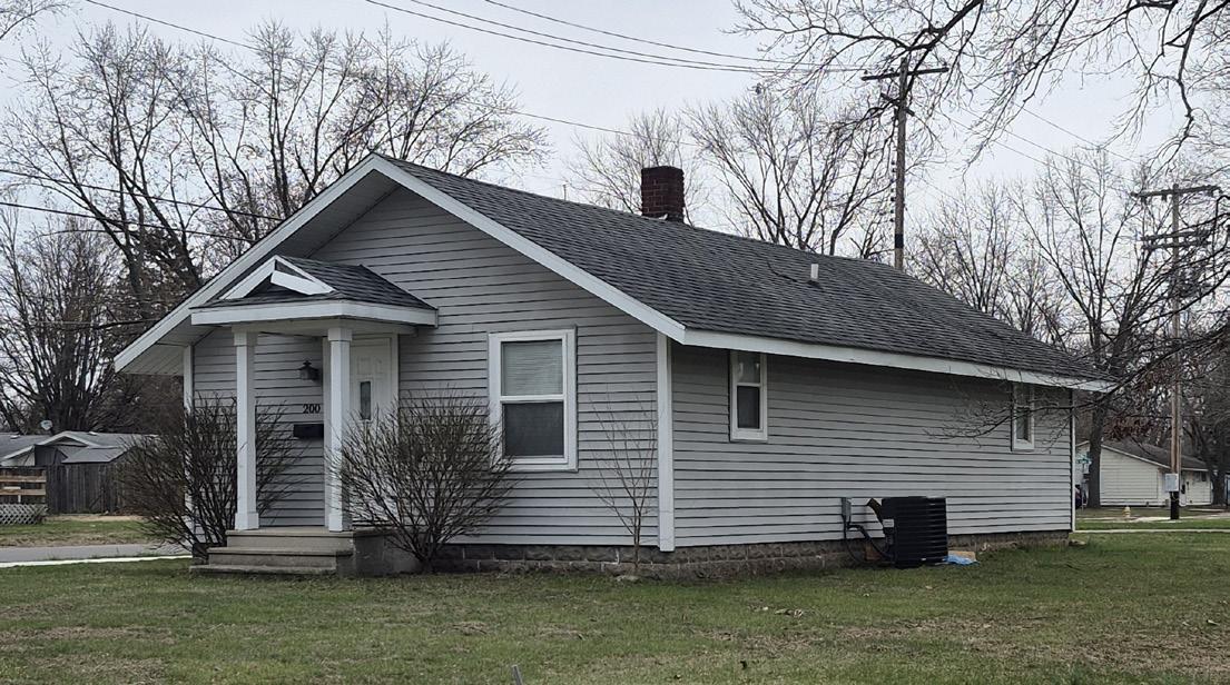
TABLE 5.4-1 BU i LD i NG TYPE SPEC i F i C STANDARDS: DWELL i NG DETACHED NARROW
General
Dwelling Units (min/max): 1 / 1 per parcel
ADU Permitted / Type: No / NA
Site Standards
Lot Size (min): Per Zoning/Overlay District
Street Frontage Width (min): Per Zoning/Overlay District
Lot Width (min): Per Zoning/Overlay District
Lot Depth (min): Per Zoning/Overlay District
Lot Coverage (max): Per Zoning/Overlay District
Common Outdoor Space (min): NA
Placement
Front Setbacks (min/max): Per Zoning/Overlay District
Side-Interior Setback (min): Per Zoning/Overlay District
Side-Street Setbacks (min/max): Per Zoning/Overlay District
Rear Setback (min): Per Zoning/Overlay District
Front Streetfront Width (min): NA
Side Streetfront Width (min): NA
Orientation: Front door towards street
Parking & Access
Vehicular Access: Front, Side, Rear, Alley
Driveway Type: Private or Shared
Primary Pedestrian Entrance: Street facing facade
Parking Location: any yard / max. 50% front yard
Height
Primary Structure (min/max): NA / 35’ (2.5 stories)
Min. Floor-to-Ceiling (1st floor): 8’
Max. Height in BTZ (front/side): NA / NA
Height Stepback (front/side): NA / NA
Massing
Gross Floor Area (min/max): 550 sq.ft. / NA
Floor Area Ratio (max): NA
Building Width (min/max): 16’ / 20’
Building Depth (min/max): NA / NA
Dwelling Unit Width (min/max): 16’ / 20’
Facade Requirements
Transparency: 1st Floor (min): NA
Transparency: Upper Floors (min): NA
Blank Wall Limitations: NA
Required Streetfront Entrances: 1
B.
CONDITIONS
1. None
5.4.2 DWELLiNG DETACHED STANDARD
A. DESCRIPTION
A freestanding residential structure containing one single dwelling unit on conventional lot with or without a subordinate Attached or Detached ADU.
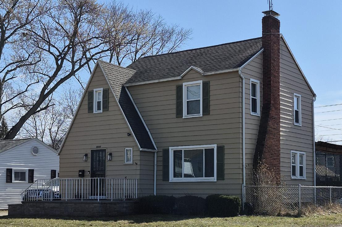
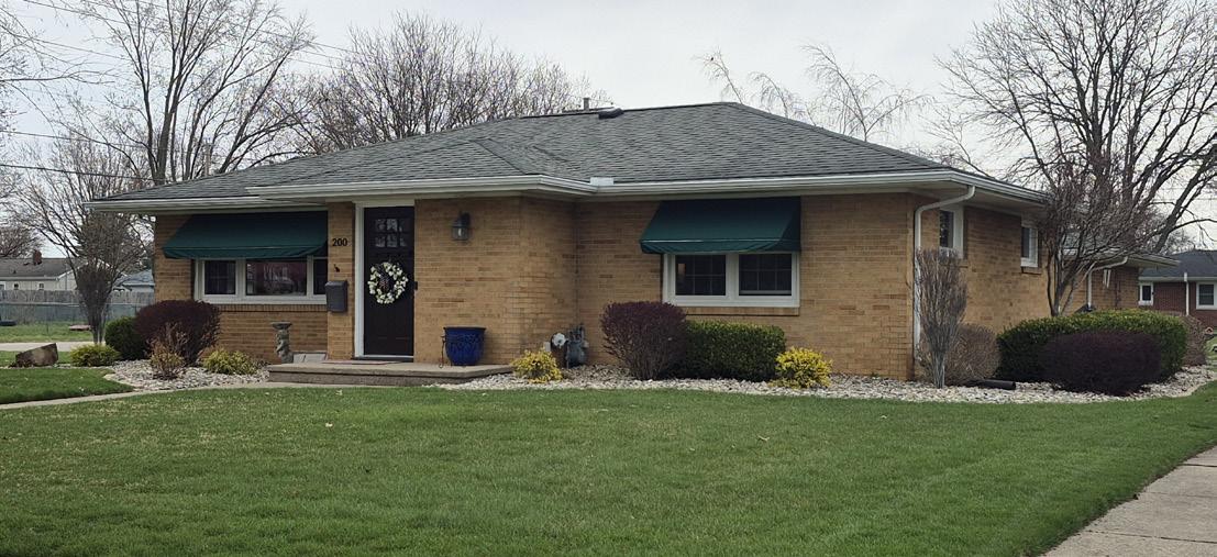

TABLE
5.4-2 BU i LD i NG TYPE SPEC i F i C STANDARDS: DWELL i NG DETACHED STANDARD
General
Dwelling Units (min/max): 1 / 2 with an ADU per parcel
ADU Permitted / Type: Yes / Attached or Detached
Site Standards
Lot Size (min): Per Zoning/Overlay District
Street Frontage Width (min): Per Zoning/Overlay District
Lot Width (min): Per Zoning/Overlay District
Lot Depth (min): Per Zoning/Overlay District
Lot Coverage (max): Per Zoning/Overlay District
Common Outdoor Space (min): NA
Placement
Front Setbacks (min/max): Per Zoning/Overlay District
Side-Interior Setback (min): Per Zoning/Overlay District
Side-Street Setbacks (min/max): Per Zoning/Overlay District
Rear Setback (min): Per Zoning/Overlay District
Front Streetfront Width (min): NA
Side Streetfront Width (min): NA
Orientation: Front door towards street Access
Vehicular Access: Front, Side, Rear, Alley
Driveway Type: Private or Shared
Primary Pedestrian Entrance: Street facing facade
Parking Location: any yard / max. 50% front yard Height
Primary Structure (min/max): NA / 40’ (2.5 atories)
Min. Floor-to-Ceiling (1st floor): 8’
Max. Height in BTZ (front/side): NA / NA
Height Stepback (front/side): NA / NA
Massing
Gross Floor Area (min/max): 950 sq.ft. / NA
Floor Area Ratio (max): NA
Building Width (min/max): 24’ / 35’
Building Depth (min/max): NA / NA
Dwelling Unit Width (min/max): 24’ / 35’
Facade Requirements
Transparency: 1st Floor (min): NA
Transparency: Upper Floors (min): NA
Blank Wall Limitations: NA
Required Streetfront Entrances: 1
B. CONDITIONS
1. ADUs require Special Exceptions
2. ADU’s size limitations: No more than 75% of the floor area of the primary structure up to 1,000 square feet.
5.4.3
DETACHED ACCESSORY DWELLiNG UNiT
A.
DESCRIPTION
A Detached Accessory Dwelling Unit (ADU) is a self-contained, habitable dwelling unit that is secondary to a primary dwelling on the same lot. A detached structure separate from the primary dwelling, or attached to or part of an accessory structure (like a garage) that is detached from the primary dwelling.
An ADU includes all basic facilities needed for independent living, such as sleeping, cooking, and sanitation areas.
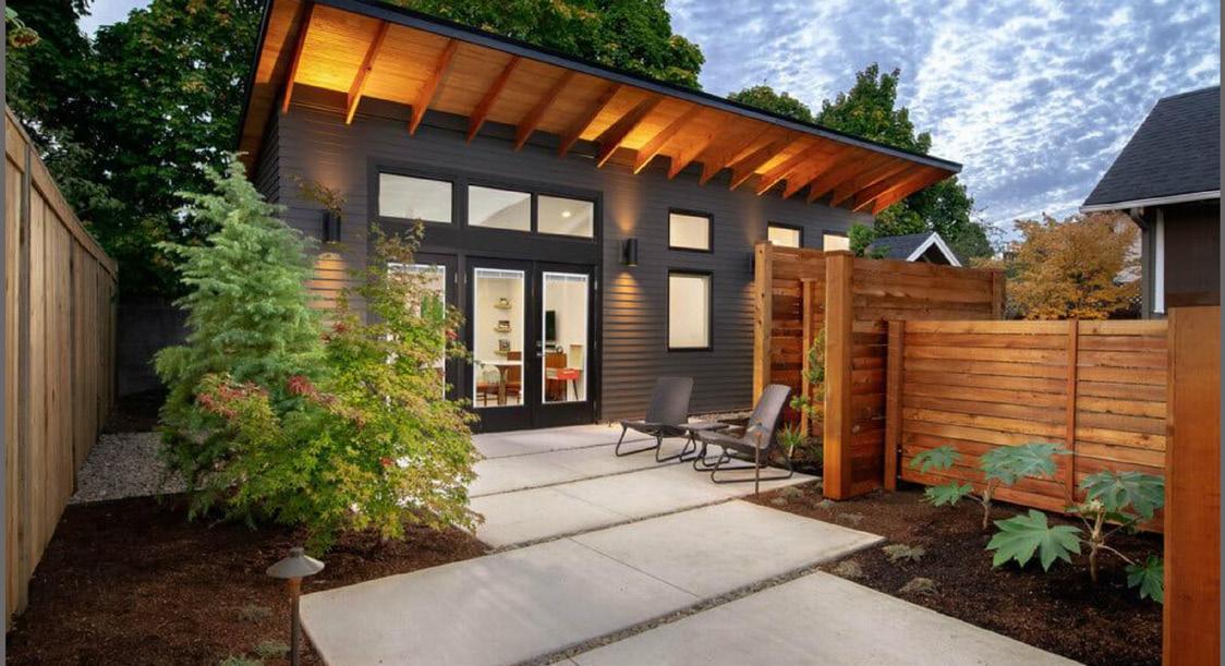

TABLE 5.4-3 BU i LD i NG TYPE SPEC i F i C STANDARDS: DETACHED ADU
General
Dwelling Units (min/max): 1 ADU per parcel
ADU Permitted / Type: Yes / Detached
Site Standards
Lot Size (min): Per Zoning/Overlay District
Street Frontage Width (min): Per Zoning/Overlay District
Lot Width (min): Per Zoning/Overlay District
Lot Depth (min): Per Zoning/Overlay District
Lot Coverage (max): Per Zoning/Overlay District
Common Outdoor Space (min): NA
Placement1 2
Front Setbacks (min/max): must locate at or behind the established principal front setback
Side-Interior Setback (min): Per Zoning/Overlay District
Side-Street Setbacks (min/max): Per Zoning/Overlay District
Rear Setback (min): Per Zoning/Overlay District
Front Streetfront Width (min): Per Zoning/Overlay District
Side Streetfront Width (min): Per Zoning/Overlay District
Orientation: NA
Access
Vehicular Access: Front, Side, Rear, Alley
Driveway Type: Private or Shared
Primary Pedestrian Entrance: Street facing facade
Parking Location: any yard / max. 50% front yard
Height
Structure (min/max):
NA / 29’ (up to 2 stories if integrated into a detached accessory building/garage)
Min. Floor-to-Ceiling: 8’
Max. Height in BTZ (front/side): NA / NA
Height Stepback (front/side): NA / NA
Massing
Gross Floor Area (min/max): NA / 75% of primary structure up to a max of 1,000 sq. ft.
Floor Area Ratio (max): NA
Building Width (min/max): NA / NA
Building Depth (min/max): NA / NA
Dwelling Unit Width (min/max): NA / NA
Facade Requirements
Transparency: 1st Floor (min): NA
Transparency: Upper Floors (min): NA
Blank Wall Limitations: NA
Required Streetfront Entrances: NA
1 With exceptions based on hardships due to topography and/or primary structure built in unconventional location - requires administrative decision by planning staff.
2 In addition to the required setbacks, a Detached ADU must have a minimum of 10’ of clearance from all sides from any other building.
B. CONDITIONS
1. Only one entrance is permitted on the front facade while the second entrance can be on the side or rear of the building.
2. Shall be secondary and accessory to the main dwelling.
3. May be detached or attached to another detached structure.
4. Shall be fully functional as an independent living space.
5. Shall be on the same lot as the primary dwelling.
6. Must meet Accessory Structure Setbacks.
7. Primary or ADU must be occupied by the property owner of record.
COTTAGE
A. DESCRIPTION
A freestanding residential structure containing one dwelling unit. A cottage may be a principal structure or an accessory structure because of its small size. The minimum floor area of any cottage dwelling unit is 700 square feet, and the maximum is 1,200 square feet.
TABLE 5.4-4 BU i LD i NG TYPE SPEC i F i C STANDARDS: COTTAGE
General
Dwelling Units (min/max): 1 / 2 per parcel 3 / 12 cottage court
ADU Permitted / Type: No / NA
Site Standards1 for Cottage Courts
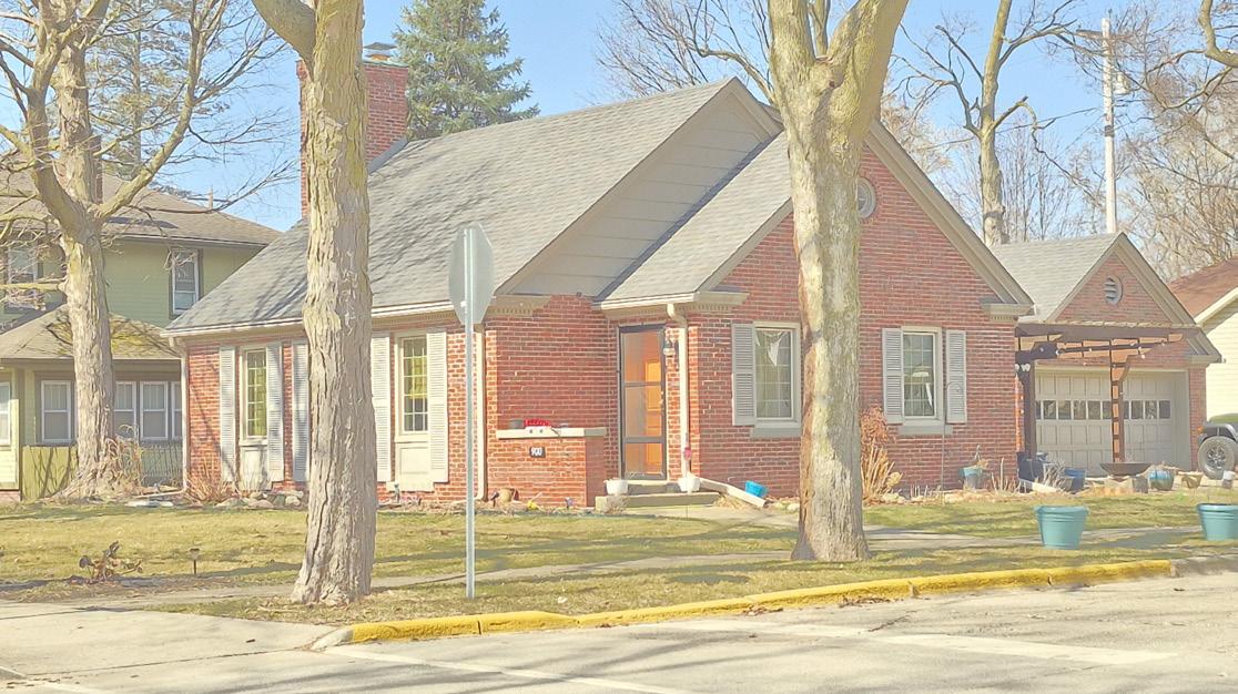
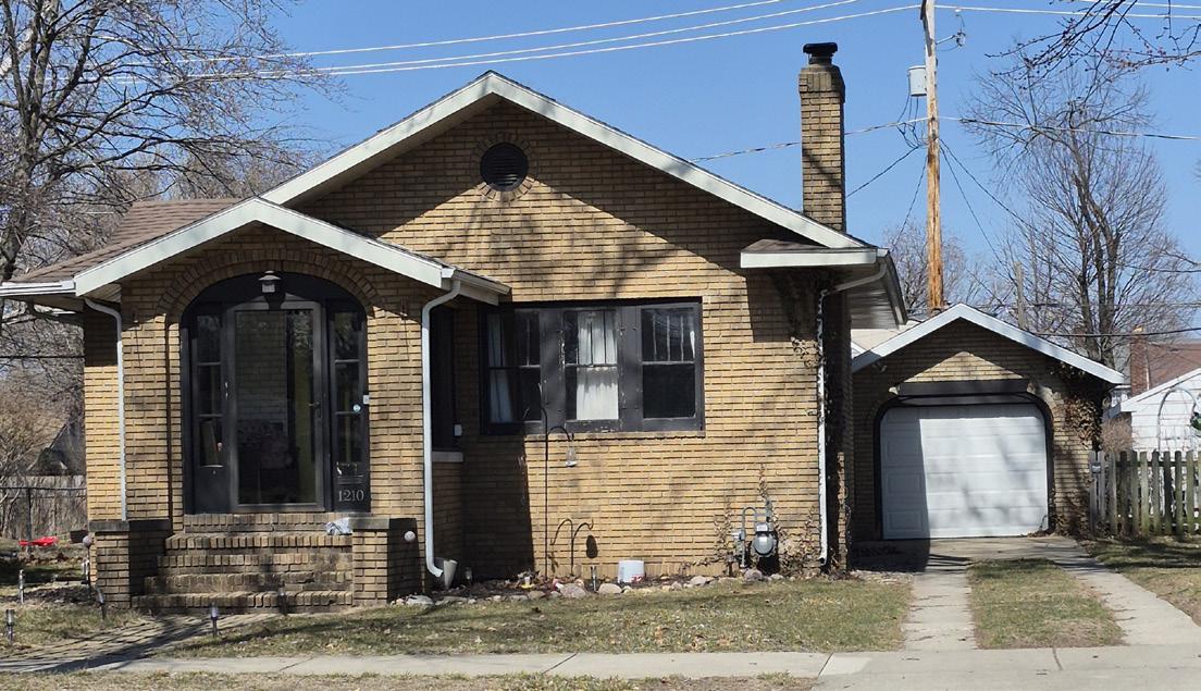
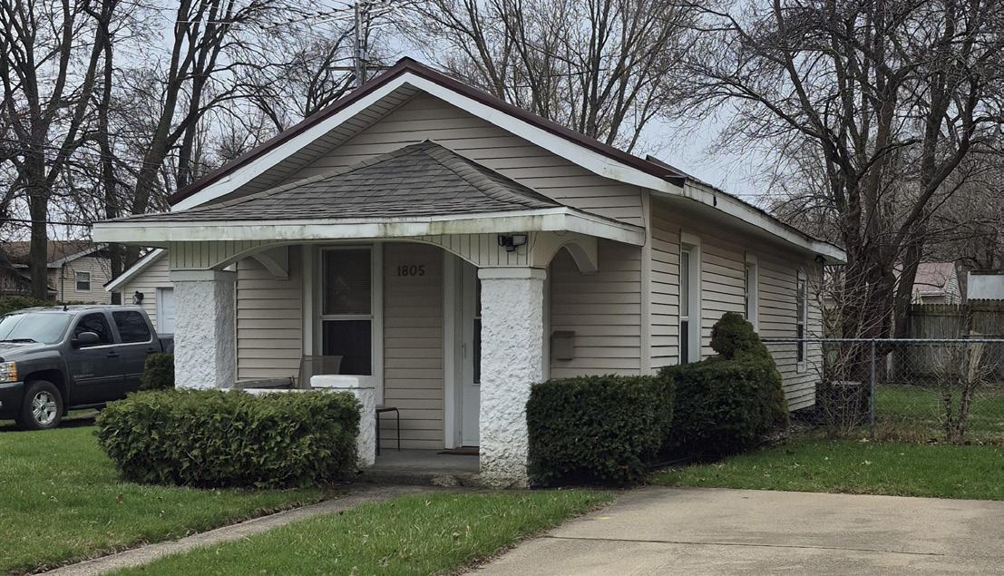
Lot Size (min): 4,000 sq. ft. per parcel2
Street Frontage Width (min): Per Zoning/Overlay District
Lot Width (min): 25’
Lot Depth (min): NA
Lot Coverage (max): 55% per parcel
Common Outdoor Space (min): 200 sq.ft. per dwelling3
Placement1 for Cottage Courts
Front Setbacks (min/max): 10’ / 20’ from street ROW
Side-Interior Setback (min): 5’ (8’ between dwellings)
Side-Street Setbacks (min/max): Average setback / NA
Rear Setback (min): 5’
Front Streetfront Width (min): Per Zoning/Overlay District
Side Streetfront Width (min): Per Zoning/Overlay District
Orientation: Entrance facing the courtyard
Access1 for Cottage Courts
Vehicular Access: Side, Rear, Alley
Driveway Type: Shared
Primary Pedestrian Entrance: Courtyard facing facade
Parking Location: side, rear, or rear corner yard
Height
Primary Structure (min/max): NA / 29’ (1.5 stories)
Min. Floor-to-Ceiling (1st floor): 8’
Max. Height in BTZ (front/side): NA / NA
Height Stepback (front/side): NA / NA
Massing
Gross Floor Area (min/max): 700 sq. ft. / 1,200 sq. ft.
Floor Area Ratio (max): NA
Building Width (min/max): 15’ / 30’
Building Depth (min/max): NA / 80’
Dwelling Unit Width (min/max): 15’ / 80’
Facade Requirements
Transparency: 1st Floor (min): NA
Transparency: Upper Floors (min): NA
Blank Wall Limitations: NA
Required Streetfront Entrances: NA
3Common Outdoor space may be on its own parcel or reserved by recorded access easement 5.4.4
1Sites with 1 or 2 cottage dwellings are subject to their respective Zoning/ Overlay district standards
2May credit Common Outdoor Space towards minimum lot area
B. CONDITIONS
1. Development sites with 3 or more cottage dwellings are subject to the standards in Section 9.10.4 Cottage Courts.
2. Cottage Courts developments shall be subdivided so that no more than 2 dwelling units are on an individual parcel. Minimum right-of-way frontage may be waived by Planning Staff.
A. DESCRIPTION
A residential building designed for, or used as, two separate attached dwellings on one lot, having the exterior appearance of a single-dwelling house.
TABLE 5.4-5 BU i LD i NG TYPE SPEC i F i C STANDARDS: DUPLE x
General
Dwelling Units (min/max): 2 / 3 with ADU per parcel
ADU Permitted / Type: Yes / Detached
Site Standards
Lot Size (min): Per Zoning/Overlay District
Street Frontage Width (min): Per Zoning/Overlay District
Lot Width (min): Per Zoning/Overlay District
Lot Depth (min): Per Zoning/Overlay District
Lot Coverage (max): Per Zoning/Overlay District
Common Outdoor Space (min): NA
Placement
Front Setbacks (min/max): Per Zoning/Overlay District
Side-Interior Setback (min): Per Zoning/Overlay District
Side-Street Setbacks (min/max): Per Zoning/Overlay District
Rear Setback (min): Per Zoning/Overlay District
Front Streetfront Width (min): Per Zoning/Overlay District
Side Streetfront Width (min): Per Zoning/Overlay District
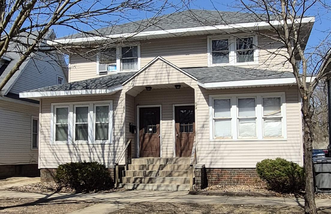
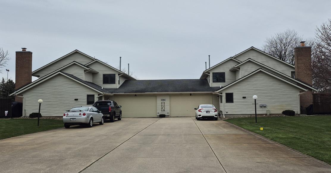
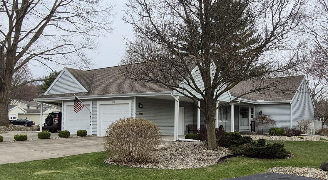
Orientation: Front doors towards street
Access
Vehicular Access: Front, Side, Rear, Alley
Driveway Type: Private or Shared
Primary Pedestrian Entrance: Street facing facade
Parking Location: any yard / max. 50% front yard
Height
Primary Structure (min/max): NA / 40’ (2.5 stories)
Min. Floor-to-Ceiling (1st floor): 8’
Max. Height in BTZ (front/side): NA / NA
Height Stepback (front/side): NA / NA
Massing
Gross Floor Area (min/max): 750 sq. ft. (per unit) / 4,000 sq. ft.
Floor Area Ratio (max): NA
Building Width (min/max): NA / 75’
Building Depth (min/max): NA / 75’
Dwelling Unit Width (min/max): NA / NA
Facade Requirements
Transparency: 1st Floor (min): NA
Transparency: Upper Floors (min): NA
Blank Wall Limitations: NA
Required Streetfront Entrances: Min 2 entrances
B. CONDITIONS
1. Permitted as a Special Exception in the COM-R district.
2. The Plan Commission may waive the minimum lot size, lot width, ROW frontage, and side-interior setback in order to subdivide a duplex.
3. ADUs require a special exception.
4. ADUs must be detached from the principal structure, but may be integrated with a detached accessory building/garage.
A. DESCRIPTION
A triplex is defined as a residential building containing three distinct and separate dwelling units on one lot, designed for occupancy by three different families, each with their own independent living facilities.
TABLE 5.4-6 BU i LD i NG TYPE SPEC i F i C STANDARDS:TR i PLE x General
Dwelling Units (min/max): 3 / 3 per parcel
ADU Permitted / Type: No / NA
Site Standards
Lot Size (min): 2 x Zoning/Overlay District1
Street Frontage Width (min): Per Zoning/Overlay District
Lot Width (min): 1.5 x Zoning/Overlay District1
Lot Depth (min): Per Zoning/Overlay District
Lot Coverage (max): Per Zoning/Overlay District
Common Outdoor Space (min): NA
Placement
Front Setbacks (min/max): Per Zoning/Overlay District
Side-Interior Setback (min): Per Zoning/Overlay District
Side-Street Setbacks (min/max): Per Zoning/Overlay District
Rear Setback (min): Per Zoning/Overlay District
Front Streetfront Width (min): NA
Side Streetfront Width (min): NA
Orientation: Front doors towards street
Access
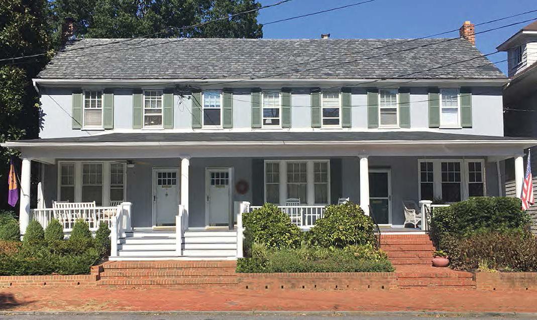
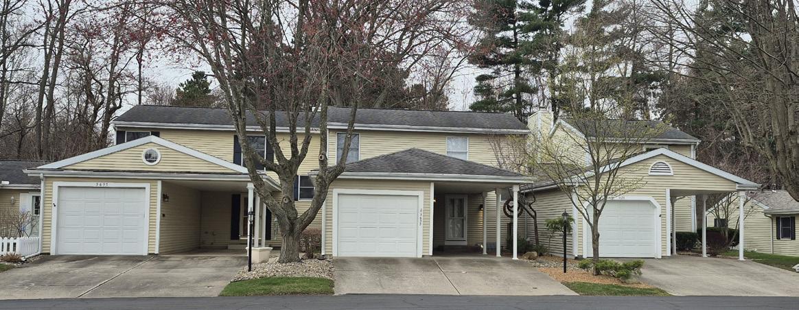
Vehicular Access: Front, Side, Rear, Alley
Driveway Type: Private or Shared
Primary Pedestrian Entrance: NA
Parking Location: side or rear yard; may have attached garages facing a front yard or corner side yard
Height
Primary Structure (min/max): NA / 35’ (2.5 stories)
Min. Floor-to-Ceiling (1st floor): 8’
Max. Height in BTZ (front/side): NA / NA
Height Stepback (front/side): NA / NA
Massing
Gross Floor Area (min/max): NA / NA
Floor Area Ratio (max): Per Zoning/Overlay District
Building Width (min/max): NA / 50’
Building Depth (min/max): NA / 60’
Dwelling Unit Width (min/max): NA / NA
Facade Requirements
Transparency: 1st Floor (min): NA
Transparency: Upper Floors (min): NA
Blank Wall Limitations: NA
Required Streetfront Entrances: Min 1 entrance
1 Varies by Zoning/Overlay district (min standard)
B. CONDITIONS
1. Combination and orientation of units: 2 units over 1 unit, 1 unit over 2 units, 1 unit in front of 2 units, 2 units in front of 1 unit, side-by-side units.
2. Permitted as a special exception in the URB-R Districts; must locate on street corners fronting arterial or collector streets.
3. Any dwelling unit outside of the principal building shall be an “Detached ADU” (not permitted) even if adjoined to a detached garage. See Sec. 5.4.5 Duplex
4. Planning staff may administratively grant exceptions to FAR.
5. Triplexes proposed for subdivision so that each unit is on its own lot must meet the standards for Townhomes in Sec. 5.4.8.
A.
DESCRIPTION
A quadplex is a residential building containing four separate dwelling units on a single lot, each designed to be occupied by one household, with individual housekeeping and cooking facilities for each unit.
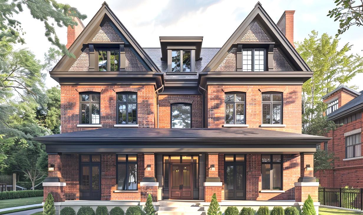
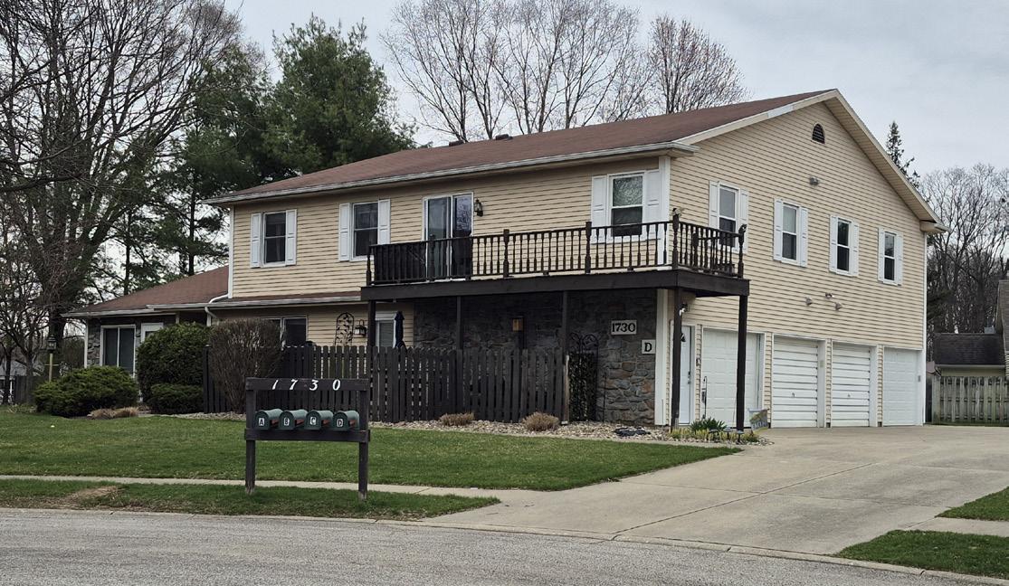
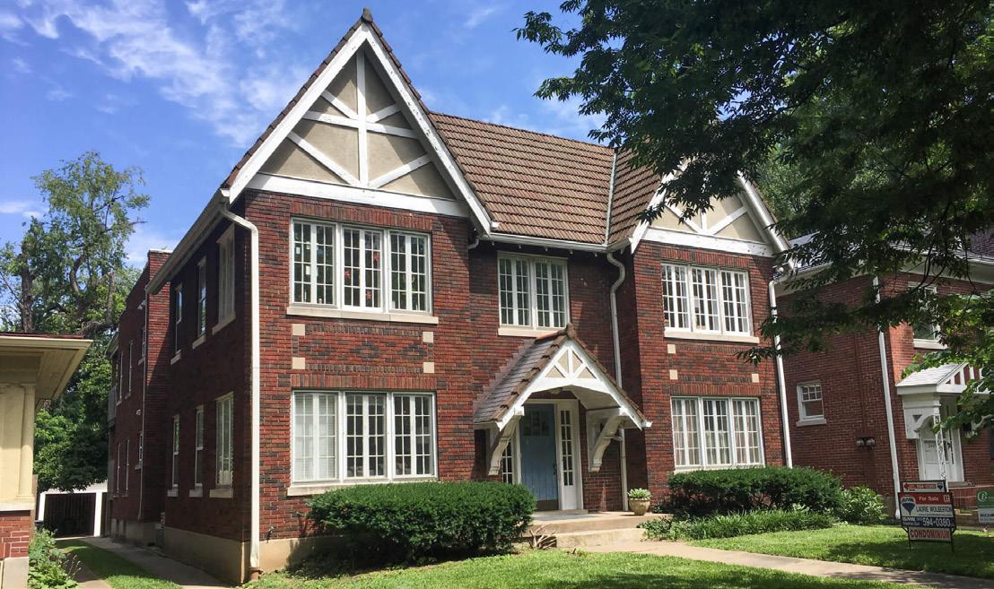
TABLE 5.4-7 BU i LD i NG TYPE SPEC i F i C STANDARDS: QUADPLE x
General
Dwelling Units (min/max): 4 / 4 per parcel
ADU Permitted / Type: No / NA
Site Standards
Lot Size (min): 2 x District1
Street Frontage Width (min): Per Zoning/Overlay District
Lot Width (min): 1.5 x Zoning/Overlay District1
Lot Depth (min): Per Zoning/Overlay District
Lot Coverage (max): Per Zoning/Overlay District
Common Outdoor Space (min): NA
Placement
Front Setbacks (min/max): Per Zoning/Overlay District
Side-Interior Setback (min): Per Zoning/Overlay District
Side-Street Setbacks (min/max): Per Zoning/Overlay District
Rear Setback (min): Per Zoning/Overlay District
Front Streetfront Width (min): NA
Side Streetfront Width (min): NA
Orientation: Front doors towards street
Access
Vehicular Access: Front, Side, Rear, Alley
Driveway Type: Private or Shared
Primary Pedestrian Entrance: Street facing facade
Parking Location: side or rear yard; may have attached garages facing a front yard or corner side yard
Height
Primary Structure (min/max): NA / 35’ (2.5 stories)
Min. Floor-to-Ceiling (1st floor): 8’
Max. Height in BTZ (front/side): NA / NA
Height Stepback (front/side): NA / NA
Massing
Gross Floor Area (min/max): NA / NA
Floor Area Ratio (max): Per Zoning/Overlay District
Building Width (min/max): NA / NA
Building Depth (min/max): NA / NA
Dwelling Unit Width (min/max): NA / NA
Facade Requirements
Transparency: 1st Floor (min): NA
Transparency: Upper Floors (min): NA
Blank Wall Limitations: NA
Required Streetfront Entrances: Min 2 entrances
1 Varies by Zoning/Overlay district (min standard)
B. CONDITIONS
1. Combination and orientation of units: 2 units over 2 units, or 2 units in front of 2 units. See Sec. 5.4.8 Townhomes for side-by-side units.
2. Permitted as a special exception in the URB-R Districts; must locate on streetcorners fronting arterial or collector streets.
3. Any dwelling unit outside of the principal building shall be an “Detached ADU” (not permitted) even if adjoined to a detached garage.
4. Planning staff may administratively grant exceptions to FAR.
5. Quadplexes proposed for subdivision so that each unit is on its own lot must meet the standards for Townhomes in Sec. 5.4.8.
5.4.8
TOWNHOMES
A. DESCRIPTION
Attached dwelling unit in structures housing three or more dwelling units, contiguous to each other by the sharing of at least one common bearing wall; such structures are to be of the townhome building type as contrasted to multiple-dwelling apartment structures. No single structure shall contain in excess of six dwelling units and each dwelling unit shall have separate entrances.
These standards shall only apply to townhomes built after adoption date of this UDO.
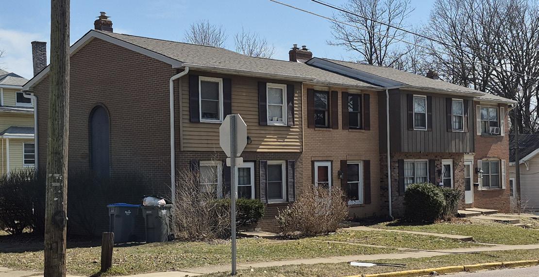
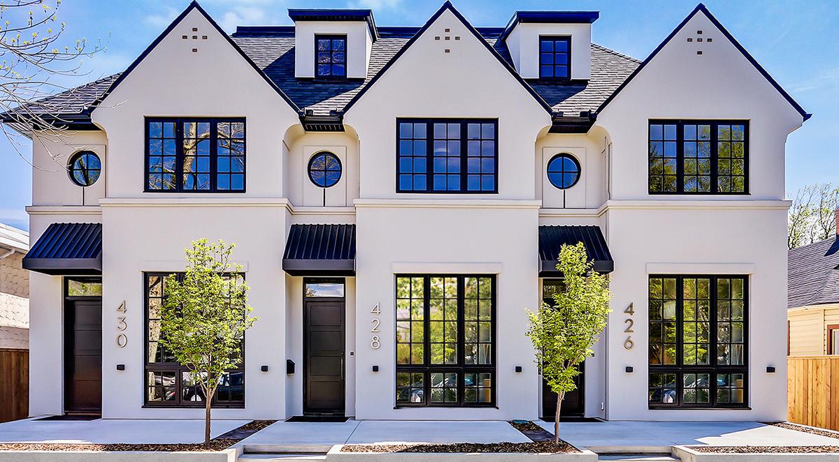
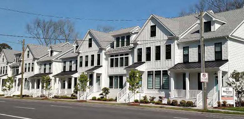
TABLE 5.4-8 BU i LD i NG TYPE SPEC i F i C STANDARDS: TOWNHOMES
General
Dwelling Units (min/max): 3 / Per Zoning/Overlay District per development site
ADU Permitted / Type: No / NA
Site Standards
Lot Size (min): Per Zoning/Overlay District
Street Frontage Width (min): 20’
Lot Width (min): 20’
Lot Depth (min): Per Zoning/Overlay District
Lot Coverage (max): Per Zoning/Overlay District
Common Outdoor Space (min): See Sec. 8.8 Buffers
Placement
Front Setbacks (min/max): Per Zoning/Overlay District
Side-Interior Setback (min): Per Zoning/Overlay District / 0’ along common walls
Side-Street Setbacks (min/max): Per Zoning/Overlay District
Rear Setback (min): Per Zoning/Overlay District
Front Streetfront Width (min): 20’
Side Streetfront Width (min): Per Zoning/Overlay District
Orientation: Street or Courtyard facing facade
Access
Vehicular Access: Front, Side, Rear, Alley
Driveway Type: Private, Shared, Common Parking Area
Primary Pedestrian Entrance: Street facing facade
Parking Location: Rear Yard, Corner Rear Yard
Height
Primary Structure (min/max): NA / 40’1 (3 stories)
Min. Floor-to-Ceiling (1st floor): 8’
Max. Height in BTZ (front/side): NA / NA
Height Stepback (front/side): NA / NA
Massing
Gross Floor Area (min/max): NA/NA
Floor Area Ratio (max): Per Zoning/Overlay District
Building Width (min/max): 3 Units / 6 Units
Building Depth (min/max): NA / NA
Dwelling Unit Width (min/max): 20’ / NA
Facade Requirements
Transparency: 1st Floor (min): NA
Transparency: Upper Floors (min): NA
Blank Wall Limitations: NA
Required Streetfront Entrances: 1 per dwellng
1 Varies by Zoning/Overlay district (min standard)
B. CONDITIONS
1. Permitted as a Special Exception in the COM-R district.
2. Townhomes may incorporate an attached garage on the rear building elevation.
3. Any dwelling unit outside of the principal building shall be an “Detached ADU” (not permitted) even if adjoined to a detached garage.
4. Planning staff may administratively grant exceptions to FAR.
5.4.9
NEiGHBORHOOD MULTi-DWELLiNG
A.
DESCRIPTION
A detached structure with 5 or more dwelling units on a single lot arranged side-by-side and/or stacked, typically with a shared entry from the street. This type ideally has the appearance of a mediumto-large single-dwelling house but may in some instances take the form of a small apartment building.
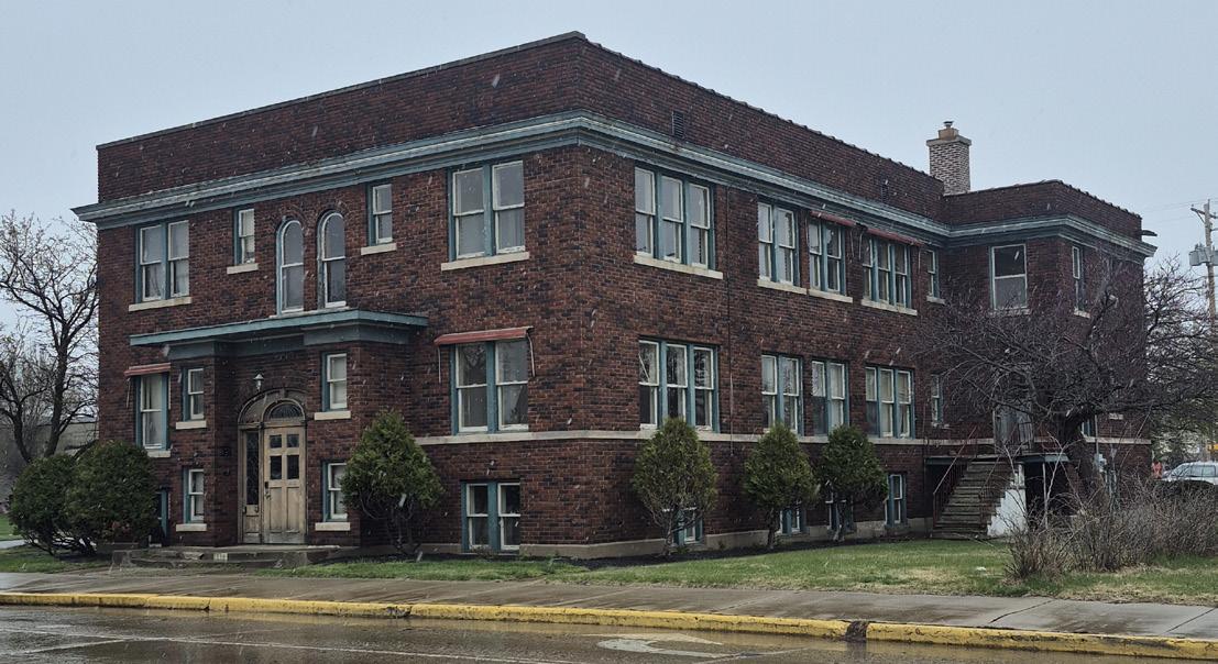
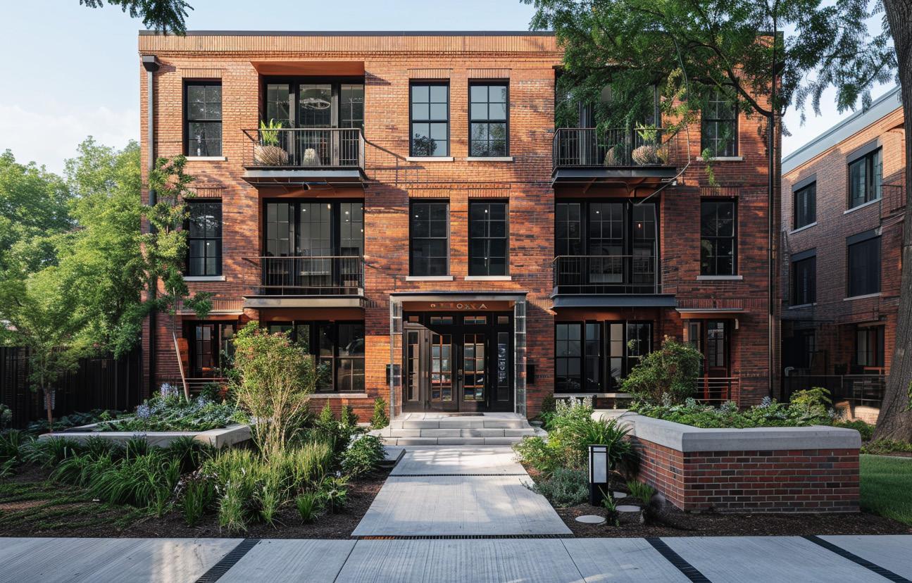
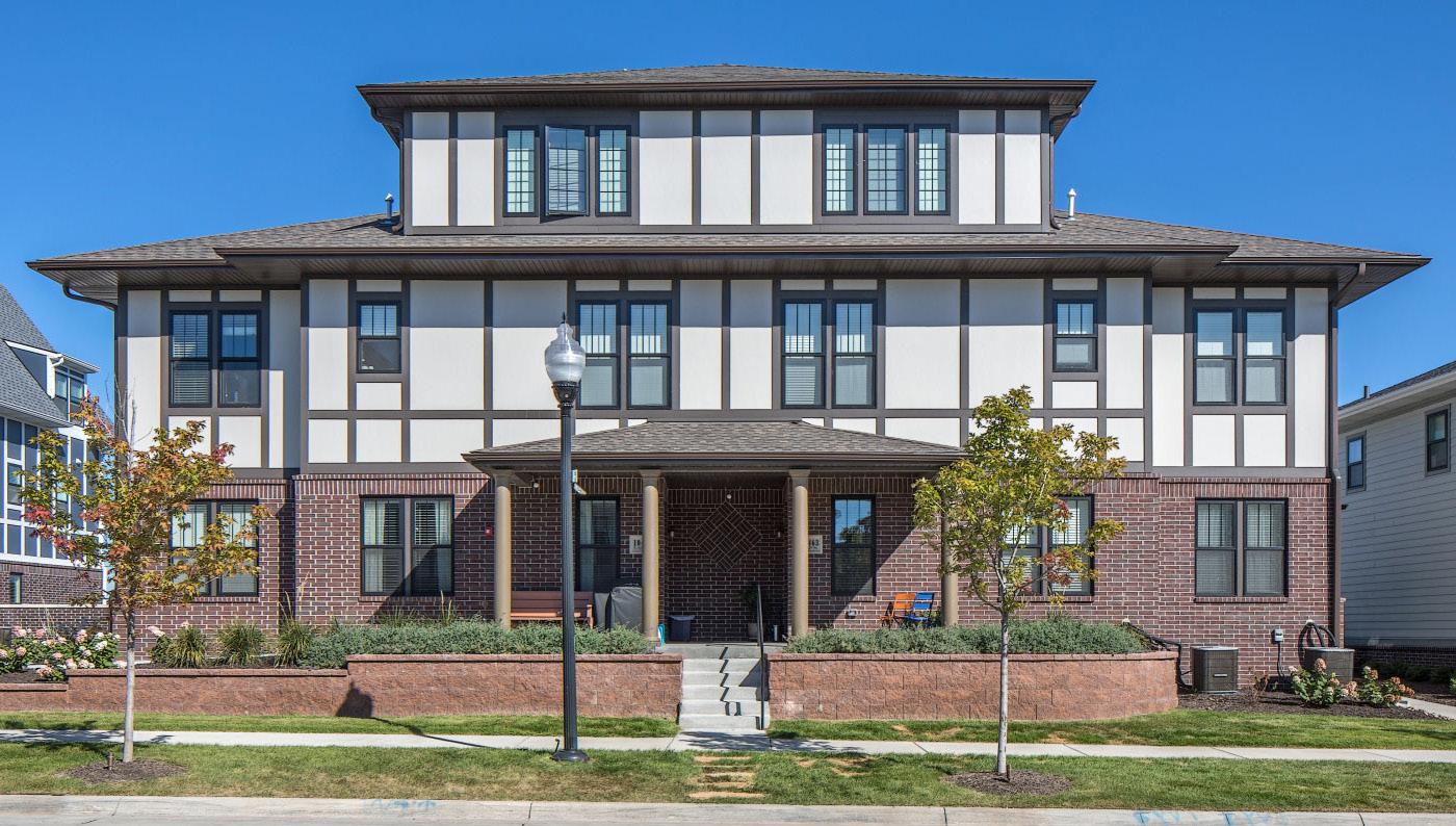
General
Dwelling Units (min/max): 5 / NA 1
ADU Permitted / Type: No / NA
Site Standards
Lot Size (min): Per Zoning/Overlay District 2
Street Frontage Width (min): Per Zoning/Overlay District
Lot Width (min): Per Zoning/Overlay District
Lot Depth (min): Per Zoning/Overlay District
Lot Coverage (max): Per Zoning/Overlay District
Common Outdoor Space (min): 10% / See Sec. 8.8 Buffers
Placement
Front Setbacks (min/max): Per Zoning/Overlay District / 15’ past District Min.
Side-Interior Setback (min): Per Zoning/Overlay District
Side-Street Setbacks (min/max): Per Zoning/Overlay District
Rear Setback (min): Per Zoning/Overlay District
Front Streetfront Width (min): 75%
Side Streetfront Width (min): Per Zoning/Overlay District
Orientation: Front door towards street
Access
Vehicular Access: Front, Side, Rear, Alley
Driveway Type: Private, Shared, Comon Parking Area
Primary Pedestrian Entrance: Street facing facade
Parking Location: Rear Yard, Corner Rear Yard
Height
Primary Structure (min/max): 20 / 40’ (3 stories)
Min. Floor-to-Ceiling (1st floor): 9’
Max. Height in BTZ (front/side): NA / NA
Height Stepback (front/side): NA / NA
Massing
Gross Floor Area (min/max): NA 4
Floor Area Ratio (max): Per Zoning/Overlay District 5
Building Width (min/max): 50’ / 80’
Building Depth (min/max): 40’ / 80’
Dwelling Unit Width (min/max): NA / NA
Facade Requirements
Transparency: 1st Floor (min): NA
Transparency: Upper Floors (min): NA
Blank Wall Limitations: NA
Required Streetfront Entrances: NA
1 Regulated by building form / size
2 The minimum bulding size, setbacks, and lot coverage may require more than the Zoning/Overlay district’s minimum lot size
B. CONDITIONS
1. Parking is prohibited in the Build-To Zone (BTZ).
2. Limited to one principal building per Zoning/ Overlay lot.
5.4.10 MULTi-DWELLiNG
A. DESCRIPTION
A building type consisting of a large apartment or condominium structure that houses numerous residential units. Multidwelling buildings are usually part of a comprehensive development plan that may include similar structures or a mix of other building types. These mediumdensity residential buildings typically feature shared access points, common areas, and centralized parking facilities, which may be in the form of surface lots or multi-level parking decks.
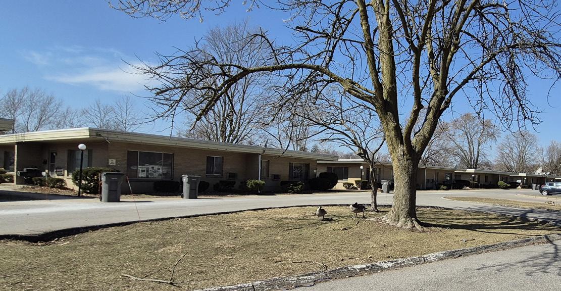
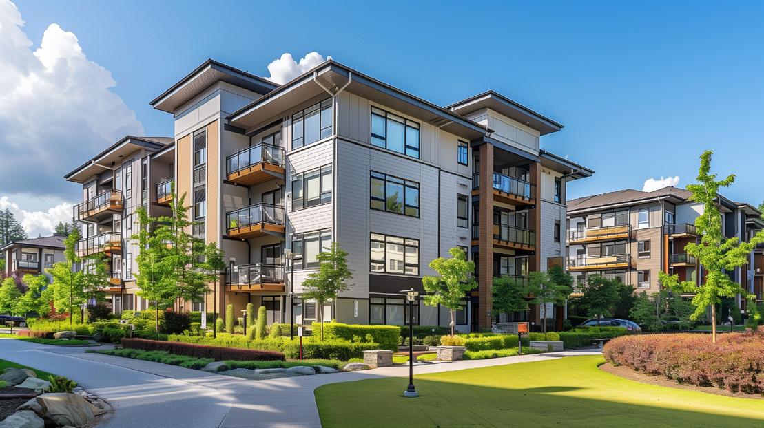

TABLE 5.4-10 BU i LD i NG TYPE SPEC i F i C STANDARDS: MULT i -DWELL i NG
General
Dwelling Units (min/max): 5 / NA 1
ADU Permitted / Type: No / NA
Site Standards
Lot Size (min): Per Zoning/Overlay District2
Street Frontage Width (min): Per Zoning/Overlay District
Lot Width (min): Per Zoning/Overlay District
Lot Depth (min): Per Zoning/Overlay District
Lot Coverage (max): Per Zoning/Overlay District
Common Outdoor Space (min): See Sec. 8.8 Buffers
Placement
Front Setbacks (min/max): Per Zoning/Overlay District
Side-Interior Setback (min): Per Zoning/Overlay District
Side-Street Setbacks (min/max): Per Zoning/Overlay District
Rear Setback (min): Per Zoning/Overlay District
Front Streetfront Width (min): Per Zoning/Overlay District
Side Streetfront Width (min): Per Zoning/Overlay District
Orientation: Street or Courtyard facing facade
Access
Vehicular Access: Front, Side, Rear, Alley
Driveway Type: Private or Shared
Primary Pedestrian Entrance: Street facing facade
Parking Location: Side, Rear, or Corner Rear Yard
Height
Primary Structure (min/max): NA / 40’ (3 stories, or 4 stories if garden level)
Min. Floor-to-Ceiling (1st floor): 8’
Max. Height in BTZ (front/side): NA / NA
Height Stepback (front/side): NA / NA
Massing
Gross Floor Area (min/max): NA
Floor Area Ratio (max): NA
Building Width (min/max): NA / NA
Building Depth (min/max): NA / NA
Dwelling Unit Width (min/max): NA / NA
Facade Requirements
Transparency: 1st Floor (min): NA
Transparency: Upper Floors (min): NA
Blank Wall Limitations: NA
Required Streetfront Entrances: NA
1 Regulated by building form / size
2 The minimum bulding size, setbacks, and lot coverage may require more than the Zoning/Overlay district’s minimum lot size
B. CONDITIONS
1. Parking is prohibited in the Build-To Zone (BTZ).
2. Multi-Dwelling developments with 2 or more buildings must locate along collector or arterial streets.
3. The max. number of principal buildings is determined per Zoning/Overlay district.
4. Permitted as a special exception in the INST and R&D-I Districts
A.
DESCRIPTION
The Mid-Rise building type is a medium to large sized structure, at least 4 stories tall, is flexible in use and often incorporates structured parking. It can be used to provide a vertical mix of uses with ground-floor retail or service uses and upper-floor office, service, or residential uses; or may be a singleuse building, typically office, service, or residential, where ground floor retail is not appropriate.
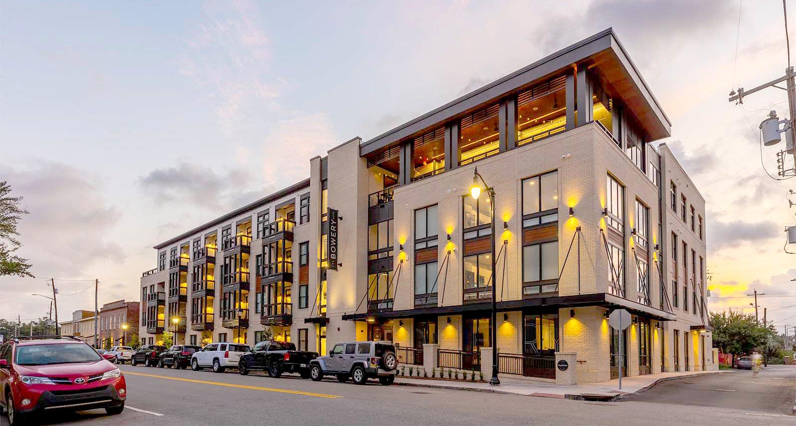
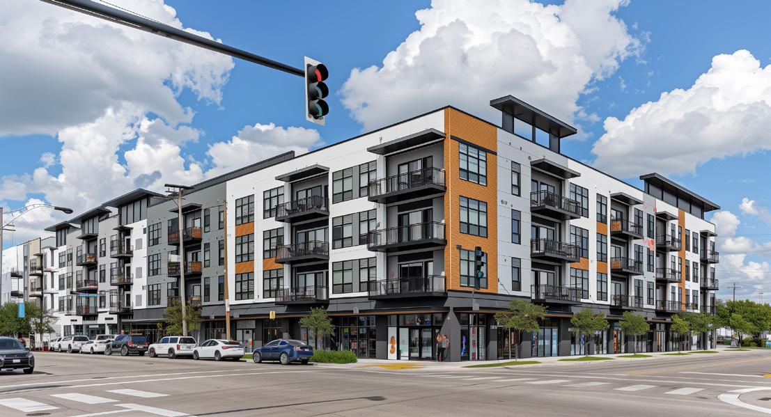

TABLE 5.4-11 BU i LD i NG TYPE SPEC i F i C STANDARDS: M i D-R i SE
General
Dwelling Units (min/max): NA / NA
ADU Permitted / Type: No / NA
Site Standards
Lot Size (min): Per Zoning/Overlay District
Street Frontage Width (min): Per Zoning/Overlay District
Lot Width (min): Per Zoning/Overlay District
Lot Depth (min): Per Zoning/Overlay District
Lot Coverage (max): Per Zoning/Overlay District
Common Outdoor Space (min): See Chapter 8 Landscaping
Placement
Front Setbacks (min/max): Per Zoning/Overlay District
Side-Interior Setback (min): Per Zoning/Overlay District
Side-Street Setbacks (min/max): Per Zoning/Overlay District
Rear Setback (min): Per Zoning/Overlay District
Front Streetfront Width (min): Per Zoning/Overlay District
Side Streetfront Width (min): Per Zoning/Overlay District
Orientation: Per Zoning/Overlay District
Access
Vehicular Access: Front, Side, Rear, Alley
Driveway Type: Private or Shared
Primary Pedestrian Entrance: Min 1 per street facing facade
Parking Location: Side, Rear, or Corner Rear Yard
Height
Primary Structure (min/max): 45’ / Per Zoning/Overlay District
Min. Floor-to-Ceiling (1st floor): 12’
Max. Height in BTZ (front/side): Per Zoning/Overlay District
Height Stepback (front/side): Per Zoning/Overlay District
Massing
Gross Floor Area (min/max): NA / NA
Floor Area Ratio (max): Per Zoning/Overlay District
Building Width (min/max): NA / 150’
Building Depth (min/max): NA / NA
Dwelling Unit Width (min/max): NA / NA
Facade Requirements
Transparency: 1st Floor (min): 50% all street facing facades1
Transparency: Upper Floors (min): 20%
Blank Wall Limitations: 25’ horizontal (max) / 30% Facade Area
Required Streetfront Entrances: 1/ground floor unit or 1/100’ of facade (whichever is more)
1 residential only buildings may be reduced to 20%
B. CONDITIONS
1. In the MIX-R District, a residential only mid-rise building may be permitted by special exception.
2. Any mid-rise building within the Airport Overlay District shall be subject to Section 3.5.1.E. Height Limitations.
5.4.12 NEiGHBORHOOD STREETFRONT
A. Description
Neighborhood Streetfront: A versatile building type ranging from 1 to 3 stories that blends seamlessly into residential areas while offering space for commercial and mixed uses. These structures, which can be freestanding or attached, are scaled to complement surrounding homes and feature design elements that enhance the pedestrian experience. Neighborhood streetfront buildings may incorporate a mix of uses such as small-scale retail, dining establishments, professional offices, and residential units on upper floors, fostering a walkable, amenity-rich environment within the neighborhood.
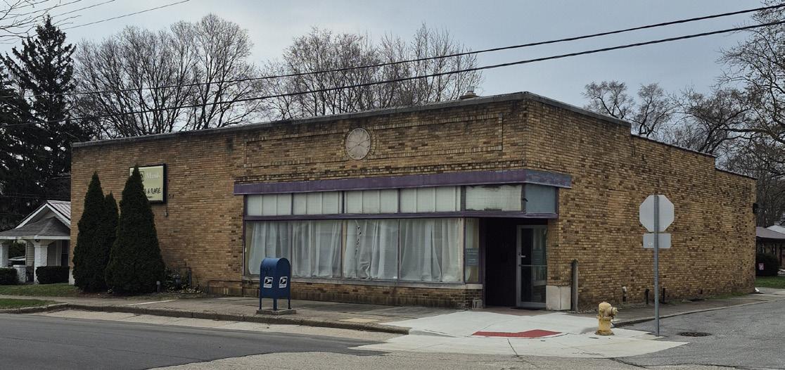
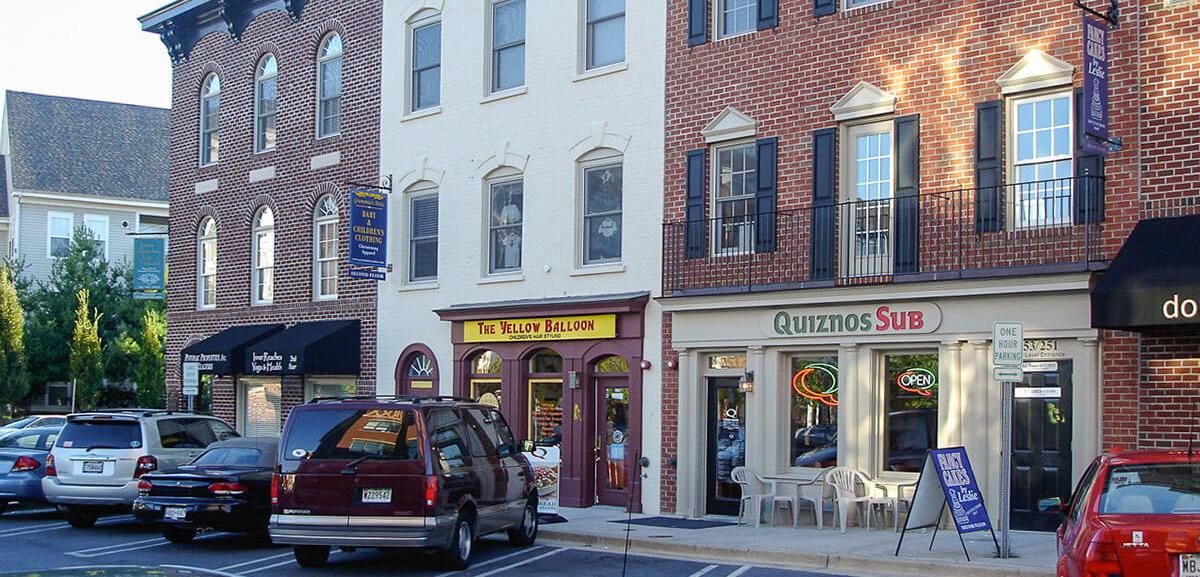

TABLE 5.4-12 BU i LD i NG TYPE SPEC i F i C STANDARDS: NE i GHBORHOOD STREETFRONT
General
Dwelling Units (min/max): NA / NA
ADU Permitted / Type: No / NA
Site Standards
Lot Size (min): Per Zoning/Overlay District
Street Frontage Width (min): 20’
Lot Width (min): 20’
Lot Depth (min): 100’
Lot Coverage (max): Per Zoning/Overlay District
Common Outdoor Space (min): See Chapter 8 Landscaping
Placement
Front Setbacks (min/max): 0’ / 20’
Side-Interior Setback (min): Per Zoning/Overlay District / 0’ along common walls
Side-Street Setbacks (min/max): 0’ / 10’
Rear Setback (min): Per Zoning/Overlay District
Front Streetfront Width (min): 80%
Side Streetfront Width (min): 50%
Orientation: Build to right-of-way
Access
Vehicular Access: Front, Side, Rear, Alley
Driveway Type: Private, Shared, Public
Primary Pedestrian Entrance: Street facing facade
Parking Location: Side, Rear, or Corner Rear Yard
Height
Primary Structure (min/max): NA / 40’
Min. Floor-to-Ceiling (1st floor): 12’
Max. Height in BTZ (front/side): 40’ /40’
Height Stepback (front/side): NA / NA
Massing
Gross Floor Area (min/max): NA / 15,000 sq. ft. cumulative total
Floor Area Ratio (max): 1.2 (unit)
Building Width (min/max): 20’ / 100’
Building Depth (min/max): 40’ / 80’
Dwelling Unit Width (min/max): 20’ / 100’
Facade Requirements
Transparency: 1st Floor (min): 50% All Street facing facade
Transparency: Upper Floors (min): 20% All Street facing facade
Blank Wall Limitations: 20’ horizontal (max) / <30% Facade Area
Required Streetfront Entrances: 1/ground floor unit or 1/50’ of facade (whichever is more)
B. CONDITIONS
1. Should not be permitted on lots with topography that prohibits the ground floor to be ADA accessible from the sidewalk.
2. Exceptions may be provided for the Build-to Zone requirement if a courtyard, plaza, or other public amenity is provided.
3. Allow on streetcorners fronting aertials or collectors the MIX-R district. Certain uses may require special exceptions.
5.4.13 URBAN STREETFRONT
A. DESCRIPTION
A multi-story structure designed to accommodate a vertical mix of uses, with at least 50% of the ground-floor gross floor area used for retail or service uses and upper-floor residential, office, or hospitality uses. This building type is intended to create a vibrant, pedestrianoriented environment in urban areas.
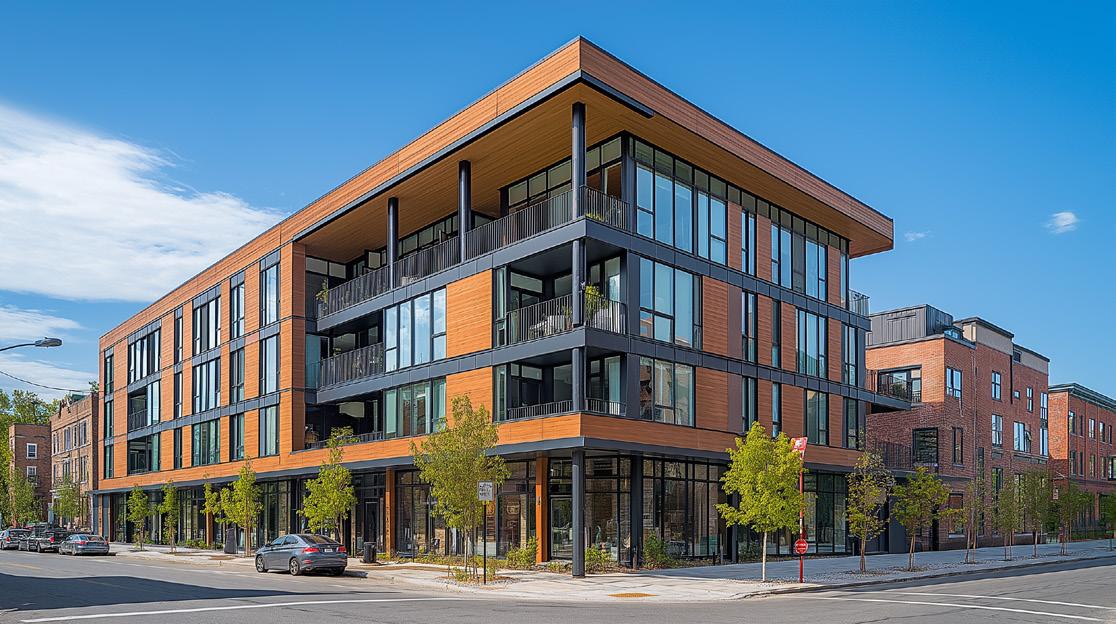


TABLE 5.4-13 BU i LD i NG TYPE SPEC i F i C STANDARDS: URBAN STREETFRONT
General
Dwelling Units (min/max): NA / NA
ADU Permitted / Type: No / NA
Site Standards
Lot Size (min): Per Zoning/Overlay District
Street Frontage Width (min): Per Zoning/Overlay District
Lot Width (min): Per Zoning/Overlay District
Lot Depth (min): Per Zoning/Overlay District
Lot Coverage (max): Per Zoning/Overlay District
Common Outdoor Space (min): See Chapter 8 Landscaping
Placement
Front Setbacks (min/max): 0’ / 20’
Side-Interior Setback (min): 0’ along common walls / 10’ Detached
Side-Street Setbacks (min/max): 0 / 15
Rear Setback (min): Per Zoning/Overlay District
Front Streetfront Width (min): 80%
Side Streetfront Width (min): 60%
Orientation: Build to right-of-way
Access
Vehicular Access: Front, Side, Rear, Alley
Driveway Type: Private, Shared, or Public
Primary Pedestrian Entrance: Front street facing facade
Parking Location: Rear or Corner Rear Yard
Height
Primary Structure (min/max): 16’ / Per Zoning/Overlay District
Min. Floor-to-Ceiling (1st floor): 14’
Max. Height in BTZ (front/side): 44’ / 44’
Height Stepback (front/side): 30’ / 20’
Massing
Gross Floor Area (min/max): NA
Floor Area Ratio (max): NA
Building Width (min/max): NA / 150’
Building Depth (min/max): NA / NA
Dwelling Unit Width (min/max): NA / NA
Facade Requirements
Transparency: 1st Floor (min): 65% (All street facing facades)
Transparency: Upper Floors (min): 30%
Blank Wall Limitations: 25’ horizontal (max) / 25% Facade Area
Required Streetfront Entrances: 1/ground floor unit or 1/50’ of facade (whichever is more)
B. CONDITIONS
1. Prominent ground-floor entrances shall face the primary street.
2. Buildings should have active frontages with no offstreet parking between building and street.
3. Encourage public or semi-public spaces such as plazas or courtyards.
4. Apply architectural articulation to break up long facades as prescribed in Chapter 10 Design Criteria for Development Plans.
5. Allow encroachments for weather protection elements like awnings or canopies.
5.4.14 FLEx (1-3 STORiES)
A.
DESCRIPTION
A building type that accommodates nonresidential uses at varying scales dependent on the district in which it is located. These buildings are constructed to accommodate a single purpose or a variety of uses. These could include retail, office, and institutional types of uses.
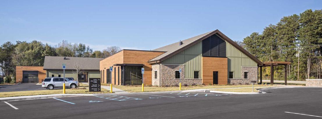
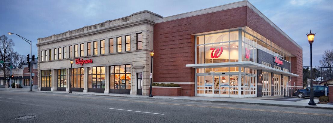


TABLE 5.4-14 BU i LD i NG TYPE SPEC i F i C STANDARDS: FLE x
General
Dwelling Units (min/max): NA
ADU Permitted / Type: No / NA
Site Standards
Lot Size (min): Per Zoning/Overlay District
Street Frontage Width (min): Per Zoning/Overlay District
Lot Width (min): Per Zoning/Overlay District
Lot Depth (min): Per Zoning/Overlay District
Lot Coverage (max): Per Zoning/Overlay District
Common Outdoor Space (min): See Chapter 8 Landscaping
Placement
Front Setbacks (min/max): Per Zoning/Overlay District
Side-Interior Setback (min): Per Zoning/Overlay District
Side-Street Setbacks (min/max): Per Zoning/Overlay District
Rear Setback (min): Per Zoning/Overlay District
Front Streetfront Width (min): Per Zoning/Overlay District
Side Streetfront Width (min): Per Zoning/Overlay District
Orientation: Per Zoning/Overlay District
Access
Vehicular Access: Front, Side, Rear, Alley
Driveway Type: Private or Shared
Primary Pedestrian Entrance: Per Zoning/Overlay District
Parking Location: side, rear, or corner side yard / not in a minimum setback
Height
Primary Structure (min/max): Per Zoning/Overlay District
Min. Floor-to-Ceiling (1st floor): 12’
Max. Height in BTZ (front/side): NA/NA
Height Stepback (front/side): Per Zoning/Overlay District
Massing
Gross Floor Area (min/max): NA / NA
Floor Area Ratio (max): Per Zoning/Overlay District
Building Width (min/max): NA / 150’
Building Depth (min/max): NA / NA
Dwelling Unit Width (min/max): NA / NA
Facade Requirements
Transparency: 1st Floor (min): 30% all street facing facades
Transparency: Upper Floors (min): NA
Blank Wall Limitations: 20’ horizontal (max) / 20% facade area
Required Streetfront Entrances: NA
B. CONDITIONS
1. None
5.4.15
FLExED ATTACHED
A. Description
A single-story or low-rise structure featuring multiple attached commercial units with shared walls and a common façade. Designed to accommodate a mix of retail, dining, and service uses with flexible interior spaces. Characterized by a linear arrangement parallel to the street, shared parking areas typically located in front or side of the building, and individual storefronts with direct exterior access. Common in suburban commercial corridors.
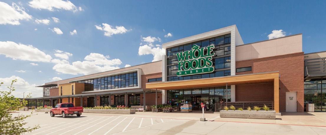

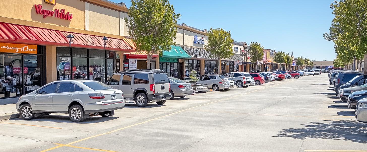

TABLE 5.4-15 BU i LD i NG TYPE SPEC i F i C STANDARDS: FLE x ATTACHED
General
Dwelling Units (min/max): NA / NA
ADU Permitted / Type: No / NA
Site Standards
Lot Size (min): Per Zoning/Overlay District
Street Frontage Width (min): Per Zoning/Overlay District
Lot Width (min): Per Zoning/Overlay District
Lot Depth (min): Per Zoning/Overlay District
Lot Coverage (max): Per Zoning/Overlay District
Common Outdoor Space (min): 15% / See Chapter 8 Landscaping
Placement
Front Setbacks (min/max): Per Zoning/Overlay District
Side-InteriorSetback (min): Per Zoning/Overlay District / 0’ along common walls
Side-Street Setbacks (min/max): Per Zoning/Overlay District
Rear Setback (min): Per Zoning/Overlay District
Front Streetfront Width (min): Per Zoning/Overlay District
Side Streetfront Width (min): Per Zoning/Overlay District
Orientation: Per Zoning/Overlay District
Access
Vehicular Access: Front, Side, Rear
Driveway Type: Private or Shared
Primary Pedestrian Entrance: Per Zoning/Overlay District
Parking Location: any yard / not in a minimum setback
Height
Primary Structure (min/max): 16’ / 35’
Min. Floor-to-Ceiling (1st floor): 12’
Max. Height in BTZ (front/side): NA / NA
Height Stepback (front/side): NA / NA
Massing
Gross Floor Area (min/max): NA / NA
Floor Area Ratio (max): Per Zoning/Overlay District
Building Width (min/max): NA / NA
Building Depth (min/max): NA / NA
Dwelling Unit Width (min/max): NA / NA
Facade Requirements
Transparency: 1st Floor (min): 50% all street facing facades
Transparency: Upper Floors (min): NA
Blank Wall Limitations: 20’ horizontal (max) / 30% facade area
Required Streetfront Entrances: 1 per Unit
B. CONDITIONS
1. None
5.4.16 AUTO-ORiENTED
A. Description
A building type designed primarily for vehicular access and service, typically single-story with prominent drive-through facilities, service bays, or fueling stations. Characterized by significant surface parking, minimal pedestrian features, and high-visibility signage. Uses include gas stations, drive-through establishments, car care centers, and similar auto-centric businesses. Intended for major arterials or intersections, discouraged in pedestrianoriented or downtown areas.

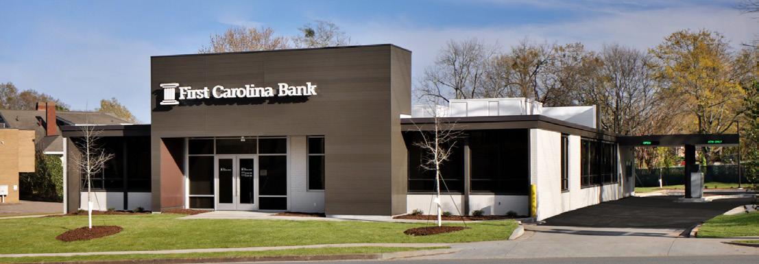


TABLE 5.4-16 BU i LD i NG TYPE SPEC i F i C STANDARDS: AUTO-OR i ENTED
General
Dwelling Units (min/max): NA / NA
ADU Permitted / Type: No / NA
Site Standards
Lot Size (min): Per Zoning/Overlay District
Street Frontage Width (min): Per Zoning/Overlay District
Lot Width (min): Per Zoning/Overlay District
Lot Depth (min): Per Zoning/Overlay District
Lot Coverage (max): Per Zoning/Overlay District
Common Outdoor Space (min): 10% / See Chapter 8 Landscaping
Placement
Front Setbacks (min/max): Per Zoning/Overlay District
Side-Interior Setback (min): 0’ attached / 10’ detached
Side-Street Setbacks (min/max): 0’ / 15’
Rear Setback (min): Per Zoning/Overlay District
Front Streetfront Width (min): 80%
Side Streetfront Width (min): 60%
Orientation: Street facing
Access
Vehicular Access: Front, Side, Rear
Driveway Type: Private or Shared
Primary Pedestrian Entrance: Street facing facade
Parking Location: any yard / not in a minimum setback / no drive-throughs in a front yard
Height
Primary Structure (min/max): 16’ / Per Zoning/Overlay District
Min. Floor-to-Ceiling (1st floor): 14’
Max. Height in BTZ (front/side): 44’ / 44’
Height Stepback (front/side): 30’ / 20’
Massing
Gross Floor Area (min/max): NA / NA
Floor Area Ratio (max): Per Zoning/Overlay District
Building Width (min/max): NA / 150’
Building Depth (min/max): NA / NA
Dwelling Unit Width (min/max): NA / NA
Facade Requirements
Transparency: 1st Floor (min): 30% all street facing facades
Transparency: Upper Floors (min): 20%
Blank Wall Limitations: 20’ horizontal (max) / 20% facade area
Required Streetfront Entrances: 1/ground floor unit or 1/50’ of facade (whichever is more)
B. CONDITIONS
1. Prominent ground-floor entrances must face the primary street.
2. Encourage public or semi-public spaces such as plazas or courtyards.
3. Apply architectural articulation to break up long facades.
4. Allow encroachments for weather protection elements like awnings or canopies.
5.4.17 DiSTRiBUTiON AND STORAGE
A. Description
A distribution and storage building type is a large sized structure with a one to two story entry space that may accommodate general offices with the remain structure devoted to activities related to distribution, warehousing, and storage using loading and unloading bays.




TABLE 5.4-17 BU i LD i NG TYPE SPEC i F i C STANDARDS: D i STR i BUT i ON AND STORAGE
General
Dwelling Units (min/max): NA / NA
ADU Permitted / Type: No / NA
Site Standards
Lot Size (min): Per Zoning/Overlay District
Street Frontage Width (min): Per Zoning/Overlay District
Lot Width (min): Per Zoning/Overlay District
Lot Depth (min): Per Zoning/Overlay District
Lot Coverage (max): Per Zoning/Overlay District
Common Outdoor Space (min): See Chapter 8 Landscaping
Placement
Front Setbacks (min/max): Per Zoning/Overlay District
Side-Interior Setback (min): Per Zoning/Overlay District
Side-Street Setbacks (min/max): Per Zoning/Overlay District
Rear Setback (min): Per Zoning/Overlay District
Front Streetfront Width (min): NA
Side Streetfront Width (min): NA
Orientation: NA
Access
Vehicular Access: Front, Side, Rear
Driveway Type: Private or Shared
Primary Pedestrian Entrance: Street facing facade
Parking Location: any yard / not in a minimum setback
Height
Primary Structure (min/max): Per Zoning/Overlay District
Min. Floor-to-Ceiling (1st floor): 15’
Max. Height in BTZ (front/side): NA / NA
Height Stepback (front/side): NA / NA
Massing
Gross Floor Area (min/max): NA / NA
Floor Area Ratio (max): Per Zoning/Overlay District
Building Width (min/max): NA / NA
Building Depth (min/max): NA / NA
Dwelling Unit Width (min/max): NA / NA
Facade Requirements
Transparency: 1st Floor (min): 20% all street facing facades
Transparency: Upper Floors (min): NA
Blank Wall Limitations: NA
Required Streetfront Entrances: 1/ground floor unit
B. CONDITIONS
1. None
C HAPTER 6: GENERAL REGULAT i ONS
6.1
6.1 PURPOSE AND APPL i CAB i L i TY
This chapter establishes standards that apply universally to all land, structures, and uses subject to this UDO.
6.2 ERECT i ON OF STRUCTURES ONLY ON LOTS OF RECORD
Any new structure erected after the effective date of this title shall be erected only on a lot of record— conditional on dedication of right-of-way.
6.3 S i TE PREPARAT i ON AND MOD i F i CAT i ONS L i M i TED
6.3.1 Grading Restricted
Site grading may not occur prior to development plan approval and permitting. Site grading is subject to a Stormwater Pollution Prevention Plan (SWPPP) administered by the county. Refer to the SWPPP technical review standards.
6.3.2 Changes to Topography Limited
Buildings and improvements shall be located on site to minimize changes to existing topography.
6.4 REDUCT i ON OF LOT RESTR i CTED
No lot shall be reduced in size such that the requirements of these regulations cannot be met (e.g., lot size, landscaping, on-site parking, setbacks, etc.). This prohibition shall not be construed to prevent the purchase, dedication, or condemnation of narrow strips of land for public utilities or rights-of-way for public streets or sidewalks.
6.5 ENCROACHMENTS
6.5.1 intent
A. The provisions set forth in this Section are intended to qualify and supplement the district regulations established in Chapter 3. The following encroachments shall be permitted in required yards, subject to the conditions and limitations set forth in this Section.
B. Encroachments are subject to the applicable requirements of the City of Elkhart.
6.5.2 Location
Permitted encroachments into required yards shall not interfere with clear sight distance as established in this chapter.
6.5.3
Permitted encroachments into Front Yards
The following encroachments shall be permitted so long as they do not add gross square footage to the footprint of a building:
A. Open Terraces.
B. Awnings and canopies.
C. Chimneys projecting 2 feet or less into the yard.
D. Arbors and trellises.
E. Residential paved driveways.
F. One-story bay windows projecting 3 feet or less into the yard.
G. Overhanging eaves and gutters projecting 3 feet or less into the yard.
H. Handicap access ramps, subject to the Affidavit for Setback Allowance for ADA Accessible Ramp, provided by the City of Elkhart Planning and Zoning Office.
i. Open porches or stoops, including steps, projecting eight feet or less into the front yard.
6.5.4 Permitted Encroachments into Side or Rear Yards
A. All encroachments permitted in front yards.
B. Uncovered paved parking areas.
C. Outdoor stairways, open or enclosed, projecting 4 feet or less into the yard.
D. Handicap access ramps located no further than 6 feet from the structure.
6.5.5
Encroachments Are Privileges, Not Rights
Encroachments shall not extend into or interfere with county easements or rightsof-way unless expressly permitted and in conformance with conditions imposed by the county.
6.5.6
Duration
The duration of an encroachment is at the sole discretion of the city. A permit allowing an encroachment may be rescinded or revoked by the city following applicable notice and hearing requirements established by these regulations. Permit revocation shall be for reasons including but not limited to violation of permit conditions, violation of state law, creating a safety or health hazard, or creating a nuisance.
6.5.7 Types
Encroachments may be above-ground or below-ground and temporary or permanent.
6.5.8
Uses Limited
A. The private use of above-ground encroachments shall be limited to temporary sidewalk sales, outdoor seating, outdoor cafes and dining, architectural elements, planters, and similar uses and features as may be approved by the city and shall, to the extent applicable, comply with all other provisions of these regulations.
B. The private use of below-ground encroachments shall be limited to building footings and vaults.
C. Regardless of the foregoing limitations, the county may grant an encroachment where historical properties were built across an existing right-of-way or easement where the Administrator determines that not permitting such an encroachment would impair use, privacy, or security of the structure.
D. Additional Requirements for Sidewalk Sales and Cafes not zoned CBD.
E. Properties in the CBD districts are subject to permitting by the Board of Works.
F. Sidewalk sales and cafes must be part of an existing business and must be used for purposes allowed in the zoning district where the encroachment will be located.
G. Sidewalk sale and cafe areas must be contiguous with the front or side of a building in which the establishment is located.
H. Sidewalk sale and cafe hours of operation are limited to the same operational hours as the related business.
i. If permanent improvements are proposed as part of the sidewalk sale or café, the city may require a bond or some other form of guarantee to ensure the restoration of the sidewalk as a condition of approval.
J. The owner is responsible for trash removal and shall maintain the area and surrounding 5 feet in a clean and litter free manner during all hours of operation.
K. Sidewalk sale and café areas may not extend beyond the building line and may not be located on street corners as defined by building lines extending to the street.
L. No blockage of building entrances or exits is permitted.
6.6 LOT COVERAGE E x CEPT i ONS
6.6.1 Parking areas, sidewalks, and driveways are not counted towards lot coverage calculations. Site drainage requirements shall still apply.
6.6.2 Uncovered stoops or similar exterior landings less than 30 square feet (excluding steps) are not counted toward lot coverage calculations.
6.7 ACCESS REQU i RED
6.7.1
All developments must have legal and physical access to an improved public rightof-way that meets the standards of this UDO,
or an access drive with a recorded ingress/ egress easement.
6.7.2 Properties may front on a private street if approved by the plan commission as part of a Major Subdivision Plat.
6.7.3 All developments shall be designed with appropriate access and maneuverability for emergency vehicles, as required by the City of Elkhart Engineer.
6.7.4 Public access must be on the same lot as the use, unless otherwise permitted by the UDO.
6.8 MOVEMENT OF BU i LD i NGS OR STRUCTURES
No building, structure, design feature, or other improvement shall be moved, or relocated to any area until a Zoning Clearance Permit and a building permit has been approved and secured, and the action, once completed, is in full compliance with this UDO.
6.9 NEGAT i VE ACCESS EASEMENTS PROH i B i TED
Negative easements preventing vehicle or pedestrian access between streets or to a lot from an adjacent public street are prohibited except when required by the Plan Commission, Board of Zoning Appeals, governing body, or INDOT to limit driveway cuts on existing public streets as a condition of development or redevelopment approval.
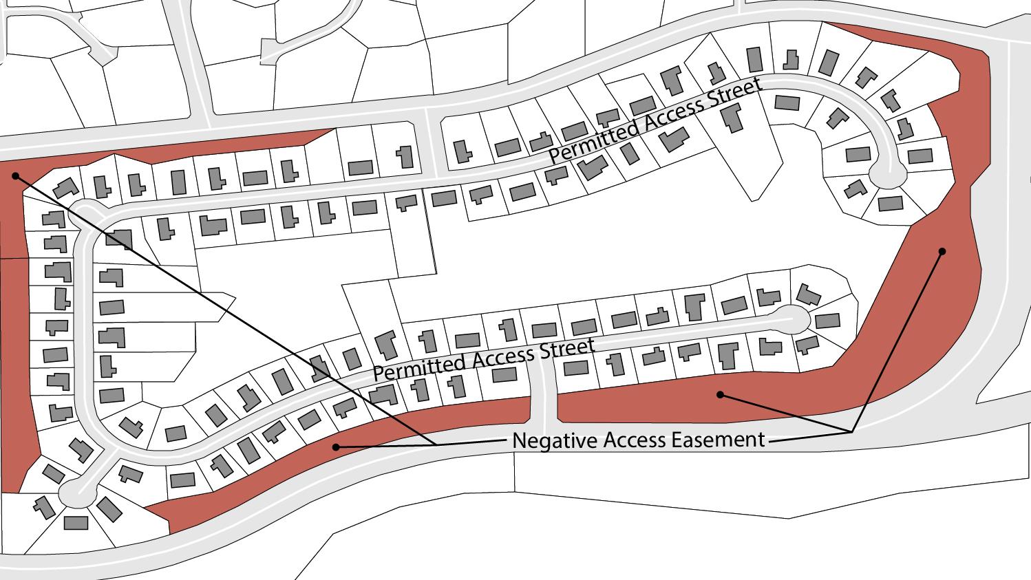
6.10 STREET NAMES AND ADDRESSES
6.10.1
General
A. All new street names and property addresses, whether for public or private designation, shall be considered for approval or assigned by the Planning Staff prior to recording.
B. The proposed name of the subdivision shall not duplicate, or too closely approximate phonetically, the name of any other subdivision in the area covered by these regulations, except where a new street is a continuation of an existing street. Street names that may be spelled differently but sound the same as existing streets shall not be used.
C. The Plan Commission shall have final authority to name all streets (in case of conflicts) at the time of preliminary plat approval, conditional on approval by the City of Elkhart Recorder.
6.10.2
Street Signs
A. Where part of a subdivision development, the developer shall be responsible for installing street signs at each intersection throughout the subdivision.
B. When the subdivision contains private streets, the subdivider shall be required to post a sign at the entrance of the development proclaiming the name of the subdivision with the phrase “PRIVATE STREETS” placed directly below in letters at least 2 inches tall.
6.11 OTHER APPROVALS REQU i RED
Prior to the issuance of any approval for new construction or renovation, all federal and state approvals and permits required for such new construction or renovation must be obtained by the applicant and proof of approval submitted as part of a complete application under this UDO. The only exception to this requirement is if such state or federal approval requires proof of local approval first.
6.12.1
Residential Subdivisions
A. See also Section 9.10 Open Space and Recreational Facilities Required.
B. Land for common open space may be deeded by the subdivider to a duly organized homeowners association within the subdivision.
1. A commitment/covenant shall be recorded stating that if a homeowners’ association dissolves, the City shall maintain the open space. The cost of maintenance shall be invoiced to the subdivision’s property owners and paid to the City of Elkhart.
6.13 i NCENT i VE D i STR i CTS
Financial incentives may be applied to specific districts in compliance with state and/or federal statutes. Incentives may include, but are not limited to, Tax Increment Financing Districts, Redevelopment Tax Credits, Enterprise Zones, and others.
6.14 UNSAFE STRUCTURES
Any building or structure deemed unsafe by reason of inadequate maintenance, dilapidation, or abandonment as specified in the Property Maintenance Code and/or the Unsafe Building Statue the Building Code or any other ordinance are declared to be public nuisances and shall be abated by repair, rehabilitation, or demolition.
6.15 UT i L i T i ES AND EQU i PMENT
6.15.1
Required Connections to Public Utilities
A. Any new building shall be required to connect to the public water and sanitary sewer system. Upon a failure of any existing well or wastewater treatment system (public or private), connection to the public system will be mandatory if the failed system’s property is within 300 linear feet of the public system.
B. All subdivisions shall be connected to the City of Elkhart sewage disposal system if reasonably accessible or required by other governing authorities. Sanitary sewer lines shall be installed in accordance with specifications established by the City Engineer.
1. If access to the city sewer system is not reasonably accessible, private septic systems or sewage disposal plant may be utilized as approved by the appropriate government agencies.
C. Storm sewers shall be constructed where applicable, separate and independent of the sanitary sewer system, providing an outlet to an approved natural drainage way or connection to the City storm sewer system.
D. Storm sewers shall be constructed throughout subdivisions, were required, separate and independent of the sanitary sewer system, providing an outlet to an approved natural drainage way or connection to the City storm sewer system.
6.15.2
Locations of Utilities and Equipment
A. Buried utilities are required. An alternative may be approved via administrative approval if an existing site condition prevents buried utilities.
B. Mechanical equipment shall be screened in accordance with Chapter 8.
C. Public utilities and services within subdivisions shall be located underground in designated easements as provided on the plat; except in the case of electrical and telephone service, which may be placed above ground upon proof of unusual soil and/or topographical conditions.
D. All utility lines, including electrical power, gas, telephone, CATV, sewer, and water shall be located underground throughout a subdivision. Unless otherwise approved, all electric telephone and CATV services shall be run on the rear lot line of any subdivision. The location of utility lines
shall be shown on the Primary Plan and on the Construction Plans. Service connections to the property lines of each lot in the development shall be provided by the utility or subdivider.
6.16 REGULAT i ON OF CERTA i N NU i SANCES
6.16.1 Odor, Noise, Vibration, and Dust
Any use that generates odor, noise, vibration, and/or dust is subject to the requirements and enforcement actions by the applicable City agency.
6.16.2 Residential
Protections
Every effort shall be made to protect adjacent residential areas from potential nuisance from a proposed non-residential subdivision, including the provision of extra depth in parcels backing up on existing or potential residential development and provisions for a permanently landscaped buffer strip, when necessary.
6.17 RULES OF MEASUREMENT
6.17.1 Units of Measurement
All measurements shall be expressed as English units of measurement (acres, feet, inches, etc.) unless expressly stated otherwise in this UDO.
6.17.2 Measuring Distance
When determining distances for setbacks, uses, lots, and structure dimensions, all distances are measured along a horizontal plane from the appropriate property line to the outermost edge of a building foundation, structure, storage area, parking area, use area,
or other object or space, as applicable. Approved encroachments are excluded from this measurement. These distances are measured as straight-line distances, not following the topography of the land, along the shortest distance between the two points of interest.
6.17.3 Rounding rules for fractions
Where determining a minimum requirement where the resulting number is a fraction, the following shall apply:
A. Calculations resulting in a number ending in .5 or higher, the number shall be rounded to the next whole number.
B. Calculations resulting in a number ending in .4 or less, the number shall be rounded down to the whole number.
Measurements for dimensions shall round to the nearest inch/square inch.
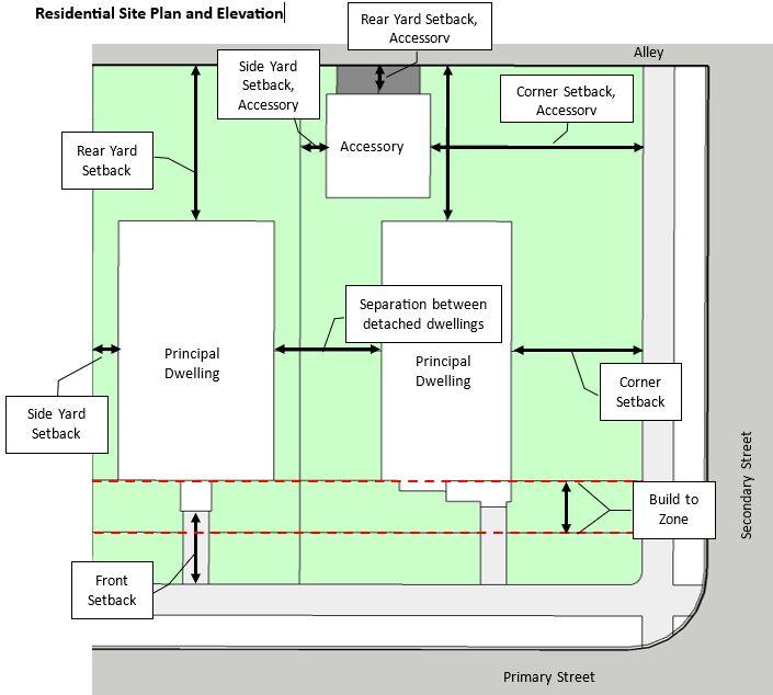
6.17.4
Lot Size
Zoning districts or use-specific conditions may establish a minimum lot size. The total area of a lot shall be expressed as square footage or acreage.
6.17.5 Frontage
Zoning districts or use-specific conditions may establish a minimum length of the front line of the property adjacent to the street or right-ofway.
6.17.6
Setbacks
Setback shall be established by district and/ or building type. Measurements shall be measured from the nearest property boundary to the closest point on a building or feature.
based on the district in which the front property line is located.
6.17.8 Build-To Zone
Zoning districts may establish a build-to zone. The build-to zone is intended to establish a uniform streetwall by specifying a minimum and maximum range where the principal building’s front facade should locate.
6.17.9 Corner Side Yard Setback
The corner side yard setback shall be determined by calculating the average front setback of all primary structures on the same side of the street within 300 feet of the property boundary. In no instance shall the corner side setback be less the corner side yard setback in Chapter 3
6.17.7
Front Setback
A front setback may be established by district or building type. The front setback is measured at a right angle from either the front property line or right-of way line to the closest point of a building or structure.
A. Corner Lots: On corner parcels where no alley exists, the planning director is authorized to establish the front property line from which the setback will be measured. Where alleys exist, the front property line is that which is parallel to the alley that serves the lot.
B. Through Lots: On through-lots the front setback applies to both opposing sides of the parcel. Where a lot is split by a zoning district, the front setback requirements apply

6.17.10
Established Building Setback
A. The established building setback for a front yard shall calculate the average front setback of all primary structures on the same side of a street within 300 feet of the site’s side yard boundary.
B. The established setback from a river or creek shall be determined by the average setback of the nearest five developed lots on the same side of the stream in each direction upstream and downstream of the subject yard.
6.17.11 Building Height
A. Building height shall be measured as the vertical distance from the grade level to the highest point (roof gable) of the main structure of the building. Parapet walls are counted when measuring building height. If the building is on uneven grade, the grade meeting the front façade shall be used to determine the height.
B. The height in feet of other structures and features such as flag poles, towers, vegetation, and fences is the vertical distance from the finished grade immediately under the structure or feature to its top (the tallest point) excluding encroachments expressly exempted by this UDO. When the finished grade immediately under the structure or feature has been artificially increased above surrounding grade, the height of surrounding grade shall be used to measure height limitations. When chimneys and other objects are allowed to exceed the base height of the zone by a set amount, that set amount is measured to the top of these objects.
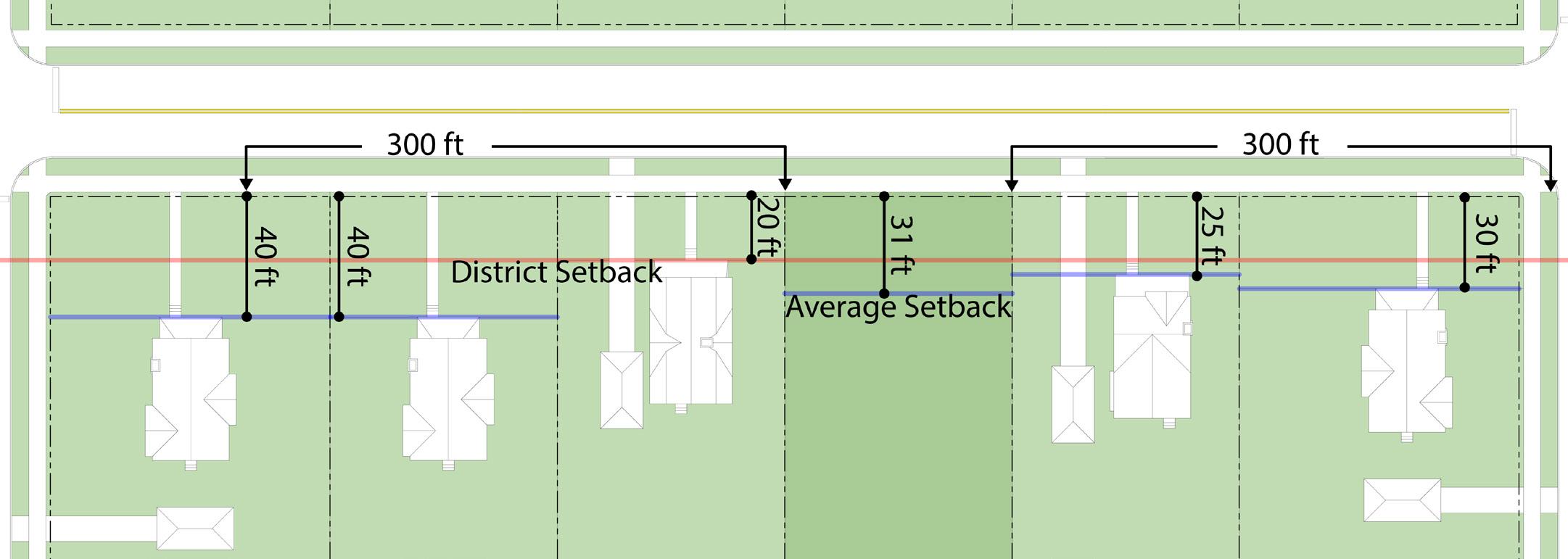
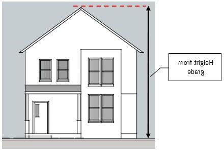

Calculations for lot coverage shall total the building footprint area under roof of all primary and accessory structures, excluding parking areas, driveways and sidewalks, and divide that total from the lot size (area). This decimal is multiplied by 100 to be expressed as a percent. See the formula below:
(Principal + Accessory Building Footprints) / Lot Area * 100 = % of Lot Coverage
6.17.13 Floor Area Ratio (FAR)
Floor area ratio (FAR) is the ratio of a building’s total floor area (Gross Floor Area) to the size of the piece of land upon which it is built. See the formula below:
Gross Floor Area of all floors / Lot Area = FAR
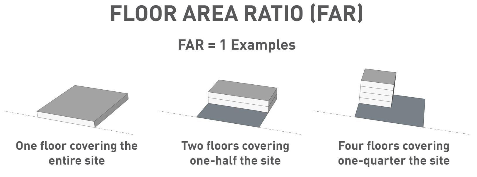
6.17.7 Floor Area Ratio
6.17.14 Use Separation
Where the use conditions require separation of uses, the separation measurement shall be from the subject uses’ building exterior or tenant bay to the protected uses’ zoning boundary or nearest lot line.
6.17.15 Transparency
Each building type in Chapter 5 may establish a required transparency percentage. Required transparency shall include any glazing with twoway visibility from floor to ceiling of a building’s finished floors. See the formula below:
total sq.ft. glazing / (building width * finished floor height) * 100 = % transparency

6.17.8 Use Separation
Figure 6.17.9 Transparency ground floor transparency upper floor transparency
6.18.1 Applicability
The provisions set forth in this section are intended to qualify and supplement the district regulations in the interest of public safety. The following regulations shall apply to all developments along primary streets, major thoroughfares, and roadway intersections.
6.18.2 intersection Visibility Requirements
On a corner lot in any district, no fence, hedge, plant material, wall, sign or other structure shall be erected, placed, planted or allowed to grow, and no motor vehicle or recreational vehicle may be placed in such a manner as to impede vision between a height of 3 feet and 8 feet above the established curb level of the intersecting streets in the area bounded by the street lines (curbs) of such corner lots and a line joining points along said street lines 50 feet from the point of the intersection; except that the location of principal buildings, traffic control devices and public utility fixtures shall not be affected by this requirement.
6.18.3 Driveway and Alley Visibility Requirements
At intersections of driveways and alleys with streets, no fence, hedge, wall, sign or other structure shall be erected, placed or allowed to grow, and no motor vehicle or recreational vehicle may be placed in such a manner as to impede vision between a height of 3 feet
and 8 feet above the established driveway or alley grade level in the area bounded by the driveway or alley lines and lot lines and a line joining points along said lines 8 feet from the point of intersection of such driveway or alley lines and such lot lines.
6.19 ACCESSORY STRUCTURES
6.19.1
6.19.2
6.19.3
Accessory uses and structures are permitted as described in Table 4.2-1: Use Matrix. See also Section 4.9 Accessory Use Conditions.
An accessory structure shall not be erected prior to the establishment or construction of the principal building to which it is accessory or to which it is intended to be accessory.
Accessory structures shall generally comply with the dimensional standards of their respective districts unless stated otherwise in this UDO.
6.20.1
intent
The provisions set forth in this section are intended to qualify and supplement the zoning district regulations. To provide for the community’s health, safety, and welfare, regulations for the placement, type and intensity of lighting for multi-family residential, commercial, and manufacturing properties are set forth.
6.20.2 General Exterior Lighting Standards
A. All exterior lighting shall be designed in a consistent and coordinated manner for the entire site except where otherwise stated in this UDO.
B. All exterior lighting shall be shielded to avoid casting light above 0.3 foot candles or glare upon any property located in a residentially zoned district or used for residential purposes.
C. All exterior lighting shall be shielded to avoid casting light above 0.5 foot candles or glare upon any non-residential adjacent property.
D. Flood or area site lighting of high intensity whose light source is visible form offsite shall be prohibited. Specialized or decorative parking, site, and pedestrian lighting with a visible light source is permitted with the approval of the Planning and Zoning Office.
E. All lighting structures within a property or planned development, parking lot lights, and streetlights shall be of uniform design and materials except where stated otherwise in this UDO.
F. Lighting poles and structures shall be located within landscaped areas where possible.
G. Unless otherwise approved, all project light standards shall be of uniform height, not to exceed 30 feet in height, except when lights abut or fall within 75 feet of a residential use property, where the maximum height shall not exceed 20 feet.
H. All exterior lighting shall be shielded so as not to cast direct light on adjacent properties. Exterior lighting shall be shielded, dimmed, or diffused to avoid direct horizontal casting of light into rightsof-way with vehicle traffic.
i. All outdoor light fixtures shall be full cutoff or fully shielded to prevent light at or above horizontal 90 degrees (above nadir) and limited to a value not exceeding 10% of lamp lumens at or above 80 degrees.
J. All outdoor light fixtures shall be fitted so that no portion of the light source or drop lens is visible below the fixture when viewed directly from the side.
K. Lighting for any canopy area over fuel sales, drive through lanes, automated teller machines, or similar structures shall use recessed fixtures.
L. Sidewalks and pathways should be properly lighted to permit pedestrian visibility.
6.20.3
Subdivision Lighting
A. The subdivider shall provide the subdivision with streetlights to be installed at intersections throughout the subdivision or where deemed necessary by the City of Elkhart Engineer. Streetlights shall be pole-mounted and conform to the installation specifications of Public Utility. All electric lines are to be buried.
B. Decorative street lighting shall be subject to approval by the Board of Works.
C. Sidewalks and pathways located adjacent to streets should be properly lighted to provide pedestrian visibility.
6.20.4 Parking Lot Lighting
A. A parking lot lighting plan--including pole heights, pole location, light spread, and intensity--shall be submitted as a part of the parking lot site plan.
B. All parking lot lighting within a development shall be of uniform design, color, and materials.
C. Lighting levels within parking areas shall be consistent with the recommendations found in the IES Lighting Handbook, latest edition, by the Illuminating Engineering Society of North America.
D. Unless otherwise approved, all project light standards shall be of uniform height, not to exceed 30 feet in height, except when lights abut or fall within 75 feet of a residential use property, where the maximum height shall not exceed 20 feet.
For parking lots in excess of 300 spaces, light standards may be a maximum of 50 feet in height provided they are located at least 200 feet from any residential use property.
E. To minimize visual clutter, parking lot lighting should be incorporated into planting areas where possible.
C HAPTER 7:
PARK i NG AND LOAD i NG
7.1 i NTENT
To maintain public health, safety, and welfare, the regulations of this section establish standards regulating off-street parking and loading in accordance with uses permitted under this Ordinance for the enhancement of the community.
7.2 APPL i CAB i L i TY
7.2.1
Off Street Parking Required
Off-street parking shall be provided for any new building constructed, for any new use established, for any addition or enlargement of an existing building or use, and any change in occupancy of a building or use that would result in additional parking spaces as required by this Chapter, unless specifically exempted.
7.2.2
Areas Exempt from Minimum Parking
A. This section applies to any non-residential use with a lot size of less than 5,000 square feet.
B. No minimum off-street parking is required for non-residential uses in the following Overlay Districts:
1. Downtown (CBD Core) Overlay District
2. Benham Neighborhood Overlay District
3. Riverfront Overlay District
C. Legally established non-conforming buildings that do not have existing offstreet parking at the time of adoption of this ordinance are not required to provide off-street parking.
7.2.3 Parking for Changes in or Expansions to an Existing Use
A. Any expansion of an existing building or use including addition of square footage, dwelling units, personnel, seats, and similar changes shall require review by the Planning Staff to determine additional offstreet parking necessary to accommodate the expansion area or change.
B. A change in the use of an existing structure or site that would require an increase in the minimum number of parking spaces shall be applicable to the new use.
1. If the new use requires additional buffer or parking lot landscaping, the Planning Staff may permit a maximum 20% reduction in the required number of spaces to accommodate additional landscaping and buffering.
7.3 GENERAL STANDARDS
7.3.1
Site Plan Approval Required
No site plan shall be approved, nor Zoning Clearance Permit be issued unless the proposed building or use conforms to the requirements of this Chapter. Any offstreet parking lots, parking structures, or loading areas required under this Chapter shall be required to submit a plan to the Planning Staff for review and approval of applicable regulations. All elements shall be dimensioned on the plan and distances from property lines and structures shall be noted. The plan shall show the following:
A. Total number of parking spaces provided, existing and proposed; and total required by Ordinance.
B. Parking aisles.
C. Vehicle circulation.
D. Entrances and exits.
E. Sidewalks and pedestrian circulation.
F. Signage.
G. Lighting.
H. Storm water retention areas.
i Landscaping islands.
J. Landscape and buffer areas
7.3.2 Handicap Accessible Parking
The number and dimensions of handicap ADA parking spaces are to be provided in
conformance with the requirements of the Americans with Disabilities Act. See also “TABLE
7.3.3 Removal or Discontinuation of Surface Parking
A parking lot paving surface shall be removed and the site shall be seeded with grass or other vegetative cover if:
A. The surface parking lot is removed, or
B. The parking lot site has no primary building and has discontinued use for more than 18 months.
Maintenance of the site shall be subject to Code Enforcement.
7.3.4 Storage of Vehicles or Equipment
This section shall apply to vehicle storage as defined by this ordinance.
A. Vehicles may be stored in the side or rear yard on a paved surface.
B. Accessory off-street parking facilities required herein shall not be used for the storage, display, sale, repair, dismantling, or wrecking of any vehicles, equipment or material unless otherwise permitted by this section.
C. Vehicle parking spaces, including both required and excess parking spaces, shall not be used to store vehicles that are not used in conjunction with the parcel’s primary use.
D. Unlicensed or inoperable vehicles or trailers shall not be stored or parked on any lot, unless in a completely enclosed building, or where otherwise permitted in this UDO.
E. The storage or parking of vehicles and trailers associated with motor vehicle sales and rental; motor vehicle service; or a junk, scrap, or salvage yard shall be subject to the use conditions described in Chapter 4.
F. Any non-paved surface used for heavy equipment storage, as permitted by Chapter 4, shall be located to the rear of primary buildings, and driveways serving such parking shall be paved, however the storage area can be maintained with crushed stone, gravel, or similar material.
7.3.5
Motor Vehicle Repair
A. Motor vehicle repair work in off-street parking areas in residential districts shall be restricted to Motor Vehicle Repair, Minor, as defined in Chapter 17, of resident-owned vehicles and where no business is being conducted in conjunction with such repair use.
B. Motor vehicle repair work in required offstreet parking areas shall be prohibited in all other zoning districts.
7.3.6 Overflow, Event, and Temporary Parking
A. This section shall apply to non-residential properties.
B. Overflow, event, and temporary parking is permitted on unpaved surfaces only after approval by the Planning Staff. Approval shall be conditional upon a length of time determined by the Planning Staff, not to exceed 7 calendar days.
C. No vehicle owner, property owner, resident or tenant shall allow a vehicle to be parked or stored outside a building on any surface other than a paved driveway or a paved parking area in any business district.
D. Any non-paved surface used for overflow, special events, and peak parking that cannot be maintained with healthy, living turf grass or similar ground cover shall be paved and constructed in accordance with the other provisions of this chapter.
7.3.7 Parking and Storage of Other Vehicles Requiring Licenses
A. All vehicles and trailers that require a license must maintain current license plates. Unlicensed vehicles and trailers shall not be stored or parked on any lot,
7.3.8
unless in a completely enclosed building, except for motor vehicle sales and rental, motor vehicle service, junk, scrap, or salvage yard, or where otherwise permitted in this UDO.
Parking and Storage of Recreational Vehicles (RVs) & Boats in Residential Districts
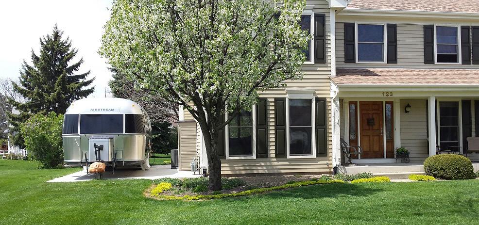
A. RVs shall not be inhabited for more than 7 days unless specifically permitted in that district.
B. For storage longer than 7 days:
1. Vehicles must be stored behind or along the primary structure so that they do not project into the front yard.
2. Wheels of such vehicles cannot be removed nor may the vehicle be permanently fixed to the ground.
3. Vehicles must be stored on a paved surface. If the area is gravel, it must be screened through the use of fencing, landscape materials, or a combination of both.
4. No more than 2 RVs/trailers are permitted on a lot.
5. Vehicles may not overhang a property line.
6. Stored RVs shall not be occupied or connected to utilities; RVs plugged in for charging are exempt.
C. For storage 7 days or fewer:
1. Vehicles and trailers can be parked on a permitted driveway for up to 7 days.
2. Recreational Vehicles used for visitation may be parked in a driveway; temporarily inhabited, and connected to utilities for a period of no more than 7 days.
3. No more than 2 visiting RVs can be on a driveway at a time. Visiting RVs do not count towards the maximum RV storage.
7.3.9
Parking and Storage of Commercial Motor Vehicles
A. All vehicles must maintain current license plates and inspection stickers as applicable. Unlicensed vehicles shall not be stored or parked on any lot zoned for residential use, unless in completely enclosed buildings.
B. Parking of commercial vehicles as defined in this ordinance is prohibited in residential zones except for the following:
1. Only one vehicle with a capacity of one ton or greater is allowed on a residential lot and only if parked in the side or rear yard area on a paved surface or parked within an enclosed building.
2. Vehicles with a capacity greater than one ton and used for commercial, industrial, farm, or construction purposes are prohibited on residential lots and on street or highway rights-ofway, except when actively involved in pick-up or delivery to the residence.
3. Cars or pick-up trucks (with or without signs) which are properly licensed, inspected, and used for commercial purposes may be parked anywhere on a residential lot designed, constructed, and approved for vehicle parking.
4. Moving trailers, vans, or portable storage units (PODS and similar containers) may be placed no closer than five feet from adjoining residential property lines on a residential lot for a period not to exceed ninety days while owners or tenants are moving in or out of a residence.
7.3.10
5. Construction and renovation projects require a valid building permit. Dumpsters used for debris during construction and renovation of a residence may be placed no closer than five feet from adjoining residential property lines on a residential lot for a period not to exceed the period of construction.
Parking for Vehicles for Sale
A. In all residential zones, only one item of the property owner (motor vehicle, recreational vehicle, boat, trailer, or other large item of personal property) may be offered for sale in a year.
B. Parking for Vehicles for sale in nonresidential districts are subject to the setback requirements of their respective zoning district.
7.4 VEH i CLE PARK i NG REQU i RED
7.4.1
7.4.2
Except as otherwise noted in this section, the number of off-street parking spaces for each use shall be provided in accordance with Table 7.4-1. Any use not specifically listed in Chapter 4 shall be the same as for a listed use of similar characteristics for parking demand as determined by the Planning Staff.
For the purposes of determining off-street parking requirements, gross floor area shall be calculated as the sum of the gross horizontal area of all floors of the building(s), including—if habitable—the horizontal areas of the basement. Basement space used solely for storage or utility shall be exempt.
7.4.3 When computing the number of parking spaces, any number fraction shall be rounded to the next highest whole number.
7.4.4 In determining the number of parking spaces required for a business, industry, institution, or any other concern which encompasses multiple different, yet related activities, the Planning Staff may determine the total number of parking spaces required by adding the amount of spaces required for each specific activity as listed.
TABLE 7.4-1: REQU i RED PARK i NG
TABLE 7.4-1: REQU i RED PARK i NG
Rooftop
7.5 PARK i NG REDUCT i ONS AND FLE xi B
7.5.1
General
A. No parking reduction may reduce the required number of handicap parking spaces in conformance with the Americans with Disabilities Act.
B. A reduction to the required parking may be granted by complying with any one or combination of the parking flexibility options listed in this Section provided that the total reduction is not greater than 35% below the parking requirements in Table 7.4-1: Required Parking.
7.5.2 Public Parking Credit
A. Up to 25% of the number of public parking spaces (in a parking lot or in a parking structure) within 400 feet of a proposed building may be counted toward the required number of spaces.
B. The Planning Staff may, at his or her discretion via administrative approval petition, allow for a reduction or elimination of parking requirements if the applicant can demonstrate that adequate spaces are available in a nearby public parking lot or structure, and that the reduction or elimination of parking requirements will not result in excessive traffic congestion or on-street parking in any nearby residential district. For the purposes of this provision, parking located within public parks and open space areas shall not constitute a nearby public parking lot or structure.
7.5.4
of those on-street parking spaces over time; management of on-street parking spaces is subject to the City of Elkhart’s parking management policies and practices.
Bicycle Parking Credit
The number of required off-street parking spaces may be reduced at a ratio of one motor vehicle parking space for each 4 secured bicycle parking spaces provided above the minimum bicycle parking requirements, up to a maximum reduction of 5% of the required motor vehicle parking spaces.
7.5.5
Electric Vehicle Parking Credit
For each electric vehicle charging station provided, the minimum number of required off-street parking spaces may be reduced by 2. Each charging station counts toward the minimum number of required parking spaces.
7.5.6
Shared or Fleet Vehicle Parking Credit
For each shared vehicle and fleet vehicle provided, which is available throughout the day for employee use, the minimum number of required off-street parking spaces may be reduced by 4. Each shared or fleet vehicle space shall be signed for such use and shall count toward the minimum number of required parking spaces.
7.5.7
Public Transportation Credit
A use with frontage adjoining a permanent bus stop or bus station may reduce their required parking by 10%.
7.5.3
On-Street Parking Credit
Any on-street parking space, at least one-half the length of which is located immediately adjacent to the subject property, may count towards on-site parking requirements. Each on-street parking space may count once towards the parking requirements of the adjacent lot, regardless of the number of individual buildings or tenants on the lot. The use of this credit does not entitle the property owner to the continued availability
7.5.8
Parking Demand Management
The Planning Staff may authorize up to a 25% reduction in the total number of parking spaces required by this Section for applicants that demonstrate proof of parking demand management strategies that specify how on-site parking will be reduced through compressed work week schedules, flexible arrival and departure times, telework opportunities, or incentives for employees who use alternative modes of transportation.
7.5.9
Shared Parking
A. Shared use of up to 50% of required parking areas may be permitted for 2 or more uses located on the same or adjacent parcels. The owners of all parcels used for or making use of shared parking areas shall execute and record a commitment stating that the parking areas are for shared use. Said commitment shall be binding on future owners of the property(s) and shall be enforceable by the Board of Zoning Appeals.
B. Shared parking areas shall be located not more than 300 feet from the uses they are intended to serve and shall be connected to that use by a defined pedestrian walkway.
C. Any subsequent change in land uses among the shared parking users shall require adequate parking as defined in Section 7.2.3.
D. When any land or building is under the same ownership, or when 2 or more owners provide satisfactory guarantee of a shared parking agreement, the number of minimum required parking spaces shall be computed by multiplying the minimum number of parking spaces normally required for each land use by the appropriate percentage for each of the 5 time periods shown in Table 7.5-1 Shared Parking Credit Table. Each column would then be totaled which would determine
the number of parking spaces required for each time period. The time period column that generates the highest number of parking spaces becomes the minimum parking requirement for both uses.
E. A shared parking plan shall be provided with the site plan or Development Plan. The plan should address the following:
1. Site plan of parking spaces intended for shared parking and their proximity to land uses they will serve.
2. A signage plan that directs drivers to the most convenient parking area for each particular use if such distinctions can be made.
3. A pedestrian circulation plan that shows connections and walkways between parking areas and land uses.
4. A safety and security plan that addresses lighting and maintenance of the parking areas.
F. The Planning Staff shall review the request for shared parking against the following criteria:
1. Each property shall provide a minimum of 60% of the individual parking requirement as determined by Table 7.5-1.
2. Any property using shared parking facilities shall be located within 600
feet of such parking facility, using established sidewalks and crosswalks where available.
3. Reserved spaces shall not be shared.
4. Shared parking may be utilized for other uses, which are not shown in the parking credit table. The applicant shall prepare a similar calculation for the proposed uses, indicating the estimated percentage of each time period, based upon current parking information. Documentation shall be submitted by the applicant to demonstrate that the normal and regular operating hours of the uses proposing a shared parking arrangement do not coincide or overlap in any manner.
5. When reviewing a shared parking agreement, the Planning Staff may consider any additional reductions in minimum parking requirements that are to be obtained pursuant to Section 10.08 Parking Flexibility.
6. The shared parking agreement shall be provided to the Planning Staff in the form of a recordable zoning commitment and permanent easement, to be recorded against all subject properties.
7.5.10 Land Banking
A. For development in any zoning district, the Planning Staff may approve a total reduction of not more than 30% of the required off-street parking spaces where it has been demonstrated by study of the proposed use(s) and the customary operation of the use(s) that adequate parking would be provided.
B. When such a reduction is approved, an area of sufficient size to include the number of parking spaces necessary to meet the minimum requirements stated herein shall be designated on the site plan and no structure or paved surface shall be permitted within such designated area. Such area shall not be included in any
required buffer yards. Such areas shall be reserved to accommodate additional parking to meet the otherwise applicable minimum requirements. In the event additional parking is required, a site plan shall be submitted to the Planning Staff for approval.
7.6 PARK i NG DES i GN STANDARDS
7.6.1
Parking Locations for Residential Uses
A. The off-street parking areas required for residential buildings or uses shall be located on the same lot as the building or use served, or as permitted by Secton 7.5
B. Parking for one or two-unit dwellings may be accommodated in paved (concrete, asphalt, concrete and brick pavers and other approved materials) driveways which may be in the front, side, or rear yard. Parking in the front yard may not occupy more than 50% of the yard area.
C. No vehicle owner, property owner, resident or tenant shall allow a vehicle to be parked or stored outside a building in a front yard on any surface other than a paved driveway or a paved parking area in any residential district.
D. Excluding B above, off-street parking areas located in the residential zoning districts shall not be in the front yard setback. This requirement shall not include paved driveways leading to attached and/or detached garages or to rear yard parking areas.
7.6.2
Parking Locations for Non-Residential Uses
A. Accessory off-street parking shall be provided on the same zoning lot as the use served except as otherwise provided in this UDO. Adequate area shall be provided to permit any maneuvering necessary to reach off-street parking and loading areas.
B. Two or more owners of buildings may jointly provide the required off-street
parking spaces per Section 7.5.9 Shared Parking
C. Off-street parking areas may be located on any part of a lot, unless otherwise specified herein or as prescribed in Chapter 5 Building Types. Parking spaces shall not be in any required landscape or buffer yard area. Off-street parking is not permitted in minimum setback areas except as provided in this section.
D. Parking in Front Yards and Corner Side Yards
1. Parking in front yards shall be prohibited in the Downtown CBD Core Overlay, the Benham District Overlay, and the Riverfront Overlay.
2. Parking in Front Yards shall be prohibited in any build-to zone as listed in Chapter 3
3. Parking in the corner side yard shall be prohibited unless otherwise specified in this section.
7.6.3
Paving Materials
A. All off-street parking areas, driveways, loading areas, and maneuvering access thereto and outdoor display areas shall be surfaced with an all-weather, dustless, impervious, hard-surface pavement, including drainage which shall meet city specifications as prescribed by the Board of Public Works. This surface shall be maintained in good condition and free of weeds, dirt, trash, and debris.
B. All parking areas and drives shall be paved with concrete, asphalt, or decorative concrete, brick, or asphalt pavers. Alternative paving materials may be used subject to approval by Planning Staff.
C. Where permitted, storage yards for construction equipment, raw materials, or partially or fully finished product, may be surfaced with gravel or slag when located in a rear yard. The storage yard shall be properly graded and maintained to insure
proper drainage and shall be kept free of weeds, trash, and other debris.
7.6.4
Parking Stalls
A. Required parking spaces for all uses shall meet or exceed the listed minimums exclusive of access drives or aisles:
B. ADA Stalls. The number and dimensions of handicapped parking spaces are to be provided in conformance with the requirements of the Americans with Disabilities Act as follows:

7.6.5
Parking Lots and Structures
A. Access
Driveway entrances and exits to parking lots and structures shall be located as far away from street intersections as possible to prevent impeding the flow of traffic in the parking lot or structure and prevent hazards in the street. Entrances shall be designed to allow vehicles entering the site to be stacked to prevent backup
on the adjacent street. Parking lot or structure entrances and exits shall be consolidated, when possible, to limit the number of access points to the site. In instances where parking lots are 100 feet or wider, the parking lot entrance shall be a minimum of 50 feet from the nearest existing entrance.
B. Frontage Drives for Integrated Developments
Parking lots with 300 or more spaces shall include perimeter drives and a central access drive leading to the main building. See also Section 8.6.4 Central Access Drive Landscaping
C. Parking Aisles
All parking areas shall be provided with circulation aisles of adequate dimension to assure efficient internal circulation. For surface parking, the minimum aisle dimension requirements shall comply with the Architectural Graphic Standards, 10th Edition or later. See Table 7.6-3 and Figure 7.6.2 Parking Aisle Widths.
Parking structures shall comply with the requirements of the Indiana Building Code and other applicable standards.
D. All parking lots for commercial, industrial, institutional, and multi-unit residential (10 or more dwelling units) uses shall be separated from adjoining non-paved surfaces with a continuous Portland cement concrete straight faced or rolled curb at least 6 inches in height.
E. All parking lots shall be designed to provide adequate storm water drainage, including on-site detention capabilities.
F. Curbed traffic islands are to be located on both ends of each parking row to facilitate safe traffic circulation within the parking lot. All curbing shall conform to City of Elkhart standards, unless approved otherwise by the Planning Staff.
G. Required off-street parking spaces shall be so designed, arranged and regulated as to have individual spaces marked, be unobstructed and have access to an aisle or driveway so that any vehicle may be moved without moving another and so
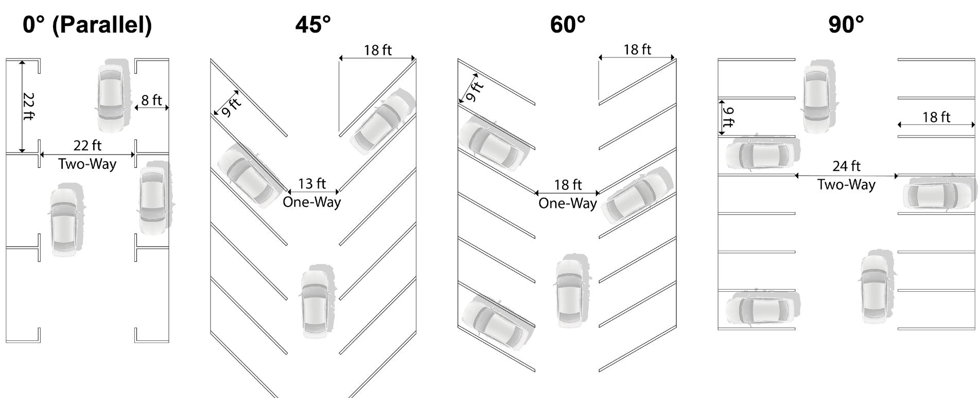
that no maneuvering directly incidental to entering or leaving a parking space shall be on any public right-of-way (except alleys) or in a required setback.
H. Parking lots containing at least 25 spaces may maintain a parking lot attendant shelter of not more than 50 square feet in size.
i. All signage within parking areas shall conform to the standards within the Sign Standards in Chapter 11.
7.6.6 Parking Lot Lighting. See Section 6.20.
7.6.7 Parking Lot Landscaping. See Section 8.6.
7.7 STACK i NG SPACES AND DR i VETHROUGHS
7.7.1 Number and Design of Stacking Spaces
A. Each stacking space shall be at minimum 9 feet wide and 20 feet long.
B. A minimum of 3 stacking spaces shall be provided in advance of the first service window/component.
C. A minimum of 1 stacking spaces shall be provided after the last service window/ component.
D. If a drive-through has 1 lane, 10 stacking spaces are required. If a drive-through has 2 or more lanes, each lane requires 5 stacking spaces.
7.7.2 Drive-through Design Requirements
A. Stacking for drive-through lanes shall be confined to the parcel and should be confined to the side or rear of the parcel with outlet from such lines also being to the rear or side of the building.
B. Lines for drive-through facilities shall not be permitted to spill onto adjoining properties, internal/interior drives, and public right-of-way.
C. A site’s internal circulation, ingress, and egress shall not substantially impair the movement of other modes of
transportation, including bicycles and pedestrians.
D. Pedestrian walkways must have clear visibility and be emphasized by enhanced paving or markings when they intersect the drive-through aisles.
E. The drive-through use shall be screened from adjacent rights-of-way and properties through placement of the drive-through, screening, landscaping or other site design techniques.
F. Any curb cuts serving the shall not locate within 200 feet of any intersection of the rights-of-way of the major streets or major arterials.
G. Bypass Aisle. Drive-through lanes shall be of sufficient width to allow for the passage of 2 cars side-by-side in 2 marked driving lanes for the entire length of the queuing line, including the parking lot for overflow of queuing vehicles. The minimum required width is 16 feet. This requirement also applies to the area of the parking lot necessary for the overflow of waiting cars in the extended queuing line for drive-through businesses. The following overlays are exempt from this requirement:
1. Benham Neighborhood Overlay District
2. Riverfront Overlay District
7.8
7.8.1
B i CYCLE PARK i NG
Bicycle Racks Location and Design
The location and design of bicycle rack parking spaces shall be provided as follows:
A. Bicycle parking racks shall be in a clearly visible area within 50 feet of the primary building entrance. Buildings with multiple main entrances or separate tenant entrances may disperse bicycle racks for rider convenience and functionality at multiple entrances. Bicycle parking shall be placed in a location that is visible from
the building entrance and with proper lighting to ensure security.
B. The bicycle parking shall have adequate separation from motor vehicle parking to minimize safety risk to riders; as well as to protect parked bicycles and motor vehicles from damage. The separation can come from curbs, grade differences, landscaping, poles, physical barriers, or other similar features.
C. Bicycle parking shall be easily accessible from all trails, sidewalks, and other alternative transportation facilities. Access to bicycle racks from these facilities shall be direct and clearly designated.
D. Bicycle parking can be shared by multiple venues in the case that all the venues’ entrances are within 50 feet of each other.
E. Bicycle racks shall be placed to not impede the flow of pedestrian traffic, leaving a minimum pedestrian clear path of 5 feet but still possess the ability to be visually monitored.
F. The bicycle rack shall be a rack type that supports the bicycle in at least 2 places unless otherwise approved by the Zoning Planning Staff. Racks to accommodate smaller bicycles may be considered for schools. See Figure 7.8.1 for example.
G. Racks requiring a user supplied locking device shall be designed to accommodate both a chain and U-type locking device.
H. All racks shall be securely anchored to a hard surface to prevent the racks from unauthorized removal.
i. Bicycle parking spaces and bicycle racks dimensions shall comply with the Bicycle Parking Guidelines published by the Association of Pedestrian and Bicycle Professionals.
1. Bicycle parking spaces shall be a minimum of 2 feet by 6 feet per bicycle.
2. Bicycle racks shall be installed a minimum of 24 inches from all walls or obstructions.
3. Bicycle racks mounted in a row should be placed on 36-inch centers.
4. Bicycle racks shall allow a minimum of 5 feet of clearance behind a parked bicycle to allow for room to maneuver.
7.8.2 Covered or Enclosed Bicycle
Location and Design
The location and design of covered or enclosed bicycle parking spaces shall be provided as follows:
A. The bicycle parking shall provide protection for each bicycle in covered, lighted, and permanently anchored locations. These areas may consist of lockers, a locked enclosure, or locked room, and may be located externally or within a building, unless otherwise approved by the Zoning Planning Staff.
B. The location of covered or enclosed external bicycle parking may include any of the following:
1. External bicycle parking shall be easily accessible from all trails, multi-use paths, and other bicycle facilities. Access to bicycle parking from these facilities shall be direct and clearly designated.
2. External bicycle parking shall be placed in a location that is visible from the building entrance and with proper lighting to ensure security.

A. This Section shall apply to off-street Electric Vehicle (EV) parking. On-street EV parking (in the right-of-way) is subject to approval by the Board of Works.
B. EV charging stations shall count toward the total required off-street parking.
C. Providing EV charging stations may apply to parking reductions per Section 7.5
D. Signage
Each EV charging station shall be posted with signage indicating the space is only for electric vehicle charging purposes. The following information shall be posted at all electric vehicle charging stations:
1. Voltage and amperage levels;
2. Hour of operations if time limits or towaway provisions are to be enforced by the property owner;
3. Usage fees;
4. Safety information; and
5. Contact information for reporting when the equipment is not operating or other problems.
E. Equipment standards
Equipment for EV charging stations shall comply with the following standards:
1. Installation shall meet the applicable electric code requirements.
2. Equipment mounted on pedestals, lighting posts, bollards, or other devices for on-street charging stations shall be designed and located to not impede pedestrian travel or create trip hazards within the right-of-way.
3. Charging station outlets and connector shall be no less than 36 inches or no higher than 48 inches from the top of the surface where mounted and shall contain a retraction device or a place to hang cords and connectors above the ground surface.
4. Equipment shall be protected by wheel stops or concrete-filled bollards.
F. Permitted location
EV charging stations may be in any yard subject to any applicable yard requirement set forth in this zoning code. EV spaces under this section shall not be in the rightof-way.
7.10 LOAD i NG AREA REQU i REMENTS
A. Every building which requires the receipt or distribution of materials or merchandise by trucks or similar vehicles shall be required to have off-street loading zones in accordance with the requirements of this Ordinance. Properties in the following overlay districts may be exempt from this requirement, subject to approval by the Board of Works:
1. Downtown (CBD Core) Overlay District
2. Benham Neighborhood Overlay District
3. Riverfront Overlay District
B. All required off-street loading facilities which serve a building, structure, or use of land erected, established, altered, enlarged, or intensified after the effective date of this Ordinance shall be located on the same lot as the building, structure, or use of land to be served.
C. All required off-street loading facilities shall be located within the side or rear yard of the lot on which the principal structure or use is located. In the R&D-I and MAN-I districts, loading facilities may be in front of the principal building but not in the required front yard. Off-street loading facilities shall be located in a manner to prevent vehicle maneuvering in or blockage of rights-of-way.
D. Areas designated as off-street loading facilities may not be used to satisfy the parking requirements established in Section 7.4.
E. Off-street loading areas shall not be closer than 50 feet to any property in a residential district unless completely enclosed by building walls, a compact
evergreen screen, a uniformly painted fence, or any combination thereof, not less than 6 feet in height.
7.11 MULT i -MODAL FAC i L i T i ES
Multi-modal Facilities serving a lot shall be required, designed, and constructed in conformance with all applicable standards in Division B Construction Specifications of the Public Works Engineering Design Manual.
This Page is Intentionally Left Blank
C HAPTER 8:
LANDSCAP i NG, BUFFERS, AND OPEN SPACE
8.6
8.7
8.1 PURPOSE AND APPL i CAB i L i TY
8.1.1 intent
The requirements set forth in this Section are intended to qualify and supplement the district regulations. Landscaping requirements shall be provided for an improved aesthetic quality of development, a visual barrier to partially or completely screen the view of structures or activities or as an acoustic screen to aid in absorbing or deflecting noise.
8.1.2 Applicability
A. Landscape plans and requirements shall apply to all developments:
1. In the CBD, PUD, and all “B” zoning districts;
2. In the MIX-R district for developments with 10 or more units;
3. In R&D-I and MAN-I zoning districts fronting an arterial street (front and corner side yard only);
4. Requiring a development plan;
5. Requiring parking lot landscaping; and
6. When specified by this ordinance.
B. If there is a discrepancy between these requirements and the City of Elkhart Standard Specifications for Construction, the Standard Specifications for Construction shall apply.
8.2 LANDSCAP i NG AND MA i NTENANCE PLAN REQU i
8.2.1 Landscape Plan
A landscape plan must be submitted to the Planning and Zoning Office for approval. The plan may be submitted and approved following the issuance of a zoning clearance/ building permit, however, a specified date for submission shall be agreed upon in writing at the time the zoning clearance permit is issued. Staff may also require that a bond be filed for all required landscape improvements.
This plan shall be drawn to scale and include the following information:
A. Property owner’s name, and contact information: address, telephone number, and email.
B. Landscape designer and/or contractor’s name, address, telephone number, and email, if such has been hired.
C. Existing and proposed structures.
D. Parking areas and driveways.
E. Walkways.
F. Location of existing trees or wooded areas (showing trees over 8 caliper inches diameter at breast height (DBH); tree groupings may be shown as a mass with a general range of tree sizes). Plan shall indicate those existing trees or wooded areas that will be preserved.
G. General type (evergreen, deciduous, shade or ornamental tree, shrub, hedge, groundcover, etc.), location, size at planting or placement, and number of all plant material to be installed.
H. Type and location of all other landscape materials, both natural and humanmade.
i The Planning Staff may request other information as deemed necessary for review and approval of the landscape plan.
8.2.2
Landscaping Installation and Maintenance
A. All landscaped areas shall be maintained to the standard to which they were designed and installed. Areas shall be maintained free of trash and weeds and shall not deteriorate into an unsafe condition.
B. Whenever landscape screening is required adjacent to parking areas or driveways, such landscaping shall be protected by bumper blocks, posts, or curbing to avoid damage to landscaping by vehicles.
C. All approved landscaping plans shall be installed during the first planting season after the start of any construction in the development, unless otherwise required by the Planning Staff.
D. Replacement Required
If any tree or plant material dies, it shall be replaced within 6 months or the next growing season, whichever is sooner.
E. Topping of Trees
Topping (as defined herein) shall not be considered a maintenance practice and is subject to tree removal and replacement, as determined by the Urban Forester. Topping is defined as the severe cutting back of limbs intermodally to stubs within the tree’s crown to such a degree as to remove the natural canopy and disfigure the tree. Trees damaged by storms or other natural events, or trees under utility wires or other obstructions where proper pruning practices are impractical, may be exempted from the UDO at the determination of the Planning Staff.
F. Irrigation System
For sites larger than one acre, an irrigation system shall be selected and installed with the following requirements:
1. Design and Installation
All New irrigation systems shall be designed by a Certified Irrigation Contractor, Certified Irrigation Designer, Certified Landscape Irrigation Manager, Certified Landscape Irrigation Auditor, or a Licensed Landscape Architect.
2.
System Controllers and Components
All system controllers for newly installed Irrigation systems shall be an EPA WaterSense labeled controller. As additional components of irrigation systems are reviewed and labeled by the EPA WaterSense program, those components shall be used in new
irrigation installations. This includes but is not limited to sprinkler heads of all types including sprays and rotors, micro-drip systems, automatic shutoff devices, and any other irrigation component as it is added to the WaterSense labeled list.
3. Maintenance
It shall be the responsibility of the owners and their agents to ensure proper maintenance of the irrigation system. This should consist of proper directional spray of water so not to water sidewalks, streets or drives. All broken heads should be promptly replaced and the system checked periodically for leaks. Sprinkler head heights should be adjusted or relocated to adapt to plant growth or changes in landscape design.
8.2.3 Alternative Landscape Plan
In lieu of the requirements of this chapter and to provide flexibility and creativity in landscape design, the Planning Staff may administratively approve an alternate landscape plan. If the Planning Staff does not approve the alternate landscape plan, the applicant may appeal the decision and take the alternate landscape plan to the Board of Zoning Appeals for approval. The alternate landscape plan shall be prepared in accordance with the following requirements:
A. The number of trees shall not be diminished as required by this section.
B. The location of the trees, to the greatest extent possible, shall be located within the front yard setback not in conflict with visibility requirements.
C. If, because of unforeseen circumstances or difficulty, it is impractical to locate trees within the front yard setback, other locations on the lot including the side or rear of the lot, may be approved by the Planning Staff.
8.3
8.3.1
LANDSCAPE MATER i ALS
Material Selection
Landscaping materials selected shall be appropriate to local growing and climatic conditions. Landscape materials may be used in any combination of the following in Sections 8.3.2 and 8.3.3 unless otherwise stated.
8.3.4 Prohibited Species
TABLE 8.3-2 PROH i B i TED SPEC i ES
Botanic Name Common Name Primary issue/ Concern
Large Shade Trees
Acer negundo Box Elder Susceptible to Asian Longhorn Beetle
8.3.2
Plant Materials
Required landscaping shall include the listed plant materials; installation shall be the minimum planting size below, unless otherwise specified:
TABLE 8.3-1 PLANT MATER i ALS M i N i MUM S i ZE
Deciduous Canopy Trees 2.5 caliper inch DBH
Ornamental Trees 2 caliper inch DBH
Evergreen Trees 6ft. in height
Shrubs or Hedges 24in. in height, unless otherwise specified
Groundcover, including Grass N/A
Vines N/A
8.3.3
Other Landscape Elements
Landscapes may include non-plant materials, such as the following:
A. Boulders, rocks, or mulch (including stone, pebbles, sand, or bark) are limited to walks, paths, seating areas, planting beds and around individual plants. When used in planting beds or around individual trees shall not exceed 20% of the total square footage of the landscaped area.
B. Berms.
C. Lakes, ponds, streams, or fountains.
D. Ornamental fences or masonry walls, architecturally compatible with surrounding development.
E. Patios, decks, trellises, and other similar landscape features.
Acer nigrum Black Maple Susceptible to Asian Longhorn Beetle
Acer platanoides Norway Maple Susceptible to Asian Longhorn Beetle, general decline
Acer saccharinum Silver Maple Susceptible to Asian Longhorn Beetle, weak branches
Aesculus flava Yellow Buckeye Susceptible to Asian Longhorn Beetle
Aesculus glabra Ohio Buckeye Susceptible to Asian Longhorn Beetle
Aesculus hippocastanum 1 Common Horsechestnut Susceptible to Asian Longhorn Beetle
Ailanthus altissima Tree of Heaven DNR invasive list
Betula papyrifera Paper Birch Susceptible to Asian Longhorn Beetle
Betula populifolia Grey Birch Susceptible to Asian Longhorn Beetle
Chionanthus retusus White Fringetree Susceptible to Emerald Ash Borer
Chionanthus virginicus Chinese Fringetree Susceptible to Emerald Ash Borer
Diospyros virginiana Persimmon Messy fruit
Elaegnus angustifolia Russian Olive Invasive
Elaegnus umbellata Autumn Olive DNR invasive list
Fraxinus spp. White, Green, Black Ash Susceptible to Emerald Ash Borer
Ginkgo biloba 2 Ginkgo Messy fruit
Lonicera spp. Honeysuckle Invasive
Maclura pomifera Osage Orange/Hedge Apple Large fruit
Malus spp. 3 Apples Messy fruit
Morus spp. Mulberry Messy fruit, invasive
Populus deltoides Cottonwood Large leaf litter, pollen allergy
Pyrus spp. Pears (including ornamentals) Messy fruit, weak branches
Rhamnus cathartica Common Buckthorn Invasive
Rhamnus frangula European Buckthorn Invasive
Robinia spp. Black Locust Invasive
TABLE 8.3-2 PROH i B i TED SPEC i ES
Botanic Name Common Name Primary issue/ Concern
Salix alba White Willow
Salix alba x matsudana Hybrid Austree
Salix babylonica Weeping Willow
Salix nigra Black Willow
Tilia cordata Littleleaf Linden
Ulmus spp. 4 Elms
Shrubs
Susceptible to Asian Longhorn Beetle
Fast growing, weak limbs
Susceptible to Asian Longhorn Beetle
Susceptible to Asian Longhorn Beetle
Susceptible to Japanese Beetles
Susceptible to Dutch Elm Disease; Asian Longhorn Beetle
Euonymus alatus Burning Bush Invasive
Berberis vulgaris European Barberry Invasive, thorny
Berberis thunbergii Japanese Barberry Invasive, thorny
1 Excluding Aesculus x carnea ‘Briotii’
2 Including all female varieties; excluding male varieties such as G. biloba ‘Colonnade’, ‘Halka’, ‘The President’, ‘Autumn Gold’, and ‘Princeton Sentry’
3 Excluding crabapples or ornamental types that don’t produce large fruit
4 Excluding hybrids and cultivars with excellent resistance to Dutch Elm Disease and phloem necrosis
8.4 E xi ST i NG VEGETAT i ON AND TREE
8.4.1 Applicability
Wherever possible, existing trees with a 10 inch DBH or larger should be conserved and integrated into the landscaping plan. This provision shall not apply to prohibited species listed in Table 8.3-2, any tree that is dead, or any tree that is at risk of falling or other significant property damage as determined by a licensed arborist or nursery professional.
8.4.2 Existing Tree Credit
Any existing tree that is on the same lot as a development may be counted towards the minimum required landscaping; however, if the existing credited tree dies, it must be replaced with a tree of the same species, or a species approved by the Planning Staff. The replacement tree may be planted on-site in
any location that meets the requirements of this chapter.
8.4.3
Existing Trees in Proposed Parking Areas
In cases in which trees exist on the property where the parking lot is proposed, the existing trees shall be maintained where they do not impede construction on the site and shall count toward the interior landscape requirement. Accepted best management practices for tree preservation shall be used. The location of existing trees to be saved shall be included in the landscape plan submitted to the Planning Staff prior to site clearance.
8.4.4 Construction Standards for Tree Preservation
Protective care and physical restraint at the drip line, such as temporary protective fencing, shall be provided to prevent alteration, compaction, or increased depth of the soil in the root system area prior to and during groundwork and construction. Heavy equipment traffic and the storage of construction equipment or materials shall not occur within the drip line of the tree.
8.5
8.5.1
GENERAL ON-S i TE LANDSCAP i NG REQU i REMENTS
Frontages - Areas to be Landscaped
A. All areas within the development portion of a lot not occupied by buildings, parking and other paved areas, and permanent water features shall be landscaped and maintained. Within a front or corner side yard, unless otherwise stated, landscaping shall consist of any combination of canopy and/or ornamental trees, shrubs, and ground cover with:
1. At least 1 canopy or ornamental tree per 4,000 square feet of yard area for the first 25,000 square feet; and
2. 1 additional canopy or ornamental tree per 6,000 square feet of yard area above 25,000 square feet.
8.5.2
Within the R&D-I and MAN-I zoning districts, these requirements shall apply to yards fronting arterial streets. Those streets designed as arterial streets shall include the functional classification map housed at the Department of Public Works and Utilities.
B. Retention ponds located in front yards or other areas visible to the public, either from within the site or from the street, shall be freeform (curvilinear) in shape and incorporated into the overall landscape design for the site. Architectural shapes consistent with the site and building design may be used with the approval of the Planning staff.
Clear Sight visibility Requirements
A. All landscape plantings, shrubs, trees, walls, fences, temporary and permanent, shall permit completely unobstructed vision within a clear sight triangle in accordance with Section 6.18Clear Sight Distrance
B. Plant materials within parking lots shall provide for safe visibility and maintain clear sight lines between 3 and 8 feet from the top of the curb.
C. Landscaping installed in parking areas shall be spaced and maintained so that a visual obstruction that represents a traffic hazard is not created.
8.5.3
Residential Landscaping
The following standards apply to the following building types in Residential Zoning Districts:
A. Duplexes, Triplexes, and Quad-plexes.
1. At least 1 canopy, evergreen, or ornamental tree shall be planted for every 4,000 square feet yard area, or portion thereof.
2. Deciduous or evergreen shrubs may replace up to half of the required trees at a ratio of 4 shrubs per 1 tree.
B. Townhouses
1. The development site shall plant 1 canopy tree or ornamental tree for each dwelling unit. The tree may be planted on the dwelling parcel or in a common area. Zoning districts with 0-foot setback requirements may provide an alternate location.
2. Surface parking shall comply with the standards in Section 8.6 Parking Lot Landscaping. For the purposes of these requirements, surface parking landscaping shall apply to the entire development site regardless of parcel boundaries.
3. See Section 8.8 Buffers.
C. Apartments
1. At least 1 canopy, evergreen, or ornamental tree shall be planted within the front setback for every 25 feet of street frontage, or portion thereof. Surface parking shall comply with the standards in Section 8.6 Parking Lot Landscaping.
2. See Section 8.8 Buffers
D. Mobile Homes
1. Ground cover shall be provided where needed to prevent erosion.
2. Each mobile home lot shall include 2 trees at least 2 inches diameter at breast height (DBH).
3. See Section 8.8 Buffers
8.6.1
Parking Lot Screening
If a parking lot is near a residential district or use as described below, all open off-street parking areas for 4 or more vehicles shall be screened by a solid fence, wall, densely planted evergreen screen, earthen berm, or a combination thereof to the following height:
A. If abutting or directly across an alley from a residential district or use, a minimum of 4 feet tall; or
B. If across the street from a residential district or use, a minimum of 2.5 feet tall.
8.6.2
Parking Lot Landscaping
A. Parking lot landscape requirements shall be applicable to all parking areas in all districts, and a parking lot landscape plan shall be provided.
B. A landscape strip shall be provided around the perimeter of the parking lot, as defined in Table 8.6-1
1. All landscape strips shall be planted with shrubbery, trees, and groundcover. There shall be 1 tree required for every 30 feet of landscape strip. Where site conditions would prevent evenly spaced trees, such as site utilities, etc., trees may be grouped in clusters provided the minimum number of trees are met.
2. When the parking lot abuts a building(s):
a. A landscape strip abutting a building shall have at least 50% of its length occupied by shrubs.
b. For single use buildings with front façades less than 100 feet in length, a 75-square-feet or larger landscape area may be installed on each side of the primary entrance (total 150 sq. ft. minimum) in place of the required planting strip along the front façade.
c. For buildings with an arcade across the front facade or an access aisle immediately adjacent and parallel to the front facade, the required landscaping may be consolidated at focal points along the front facade and/or incorporated into other required parking lot landscape areas (perimeter or interior).
C. When a new development is constructed either adjacent to or in between existing developments, the type and placement of street trees in the right-of-way along the new development shall be consistent with the type and placement of street trees along the existing development right-of-way (see Figure 8.6.1 Parking Lot Landscaping, Perimeter and Interior).
D. Piped utilities, such as water, sewer, and gas, may cross through, run parallel and adjoining to, or within the outer 2 feet of a landscape strip.
E. Cable utilities, such as electricity, cable television, and telephones located within a landscape strip must be placed a minimum of 24 inches below grade.
Landscaping of Interior Parking Areas
A. Plant material within parking lots shall provide for safe visibility and maintain clear sight lines between 3 and 8 feet from the top of the curb. See also Section 6.18 Clear Sight Distance.
B. Interior landscaping shall occur in any combination of planting islands, planting peninsulas, and entrance ways (see Figure 8.6.1).
C. The ends of each parking row shall install landscape islands or peninsulas.
D. See Table 8.6-2 for minimum interior landscaping.
Percent of interior Landscaping
75 or fewer spaces 76 or more spaces
5%; may be transferred to perimeter if interior is not possible 10%
Minimum Landscape Width 6ft., or per administrative approval
Minimum Tree Plantings, with groundcover or mulch, in landscape islands or peninsulas 1 per 162 sq. ft., or portion thereof
Minimum Sizes for Islands and Peninsulas
Single Parking Rows 162 sq. ft.
Double Parking Rows 324 sq. ft.
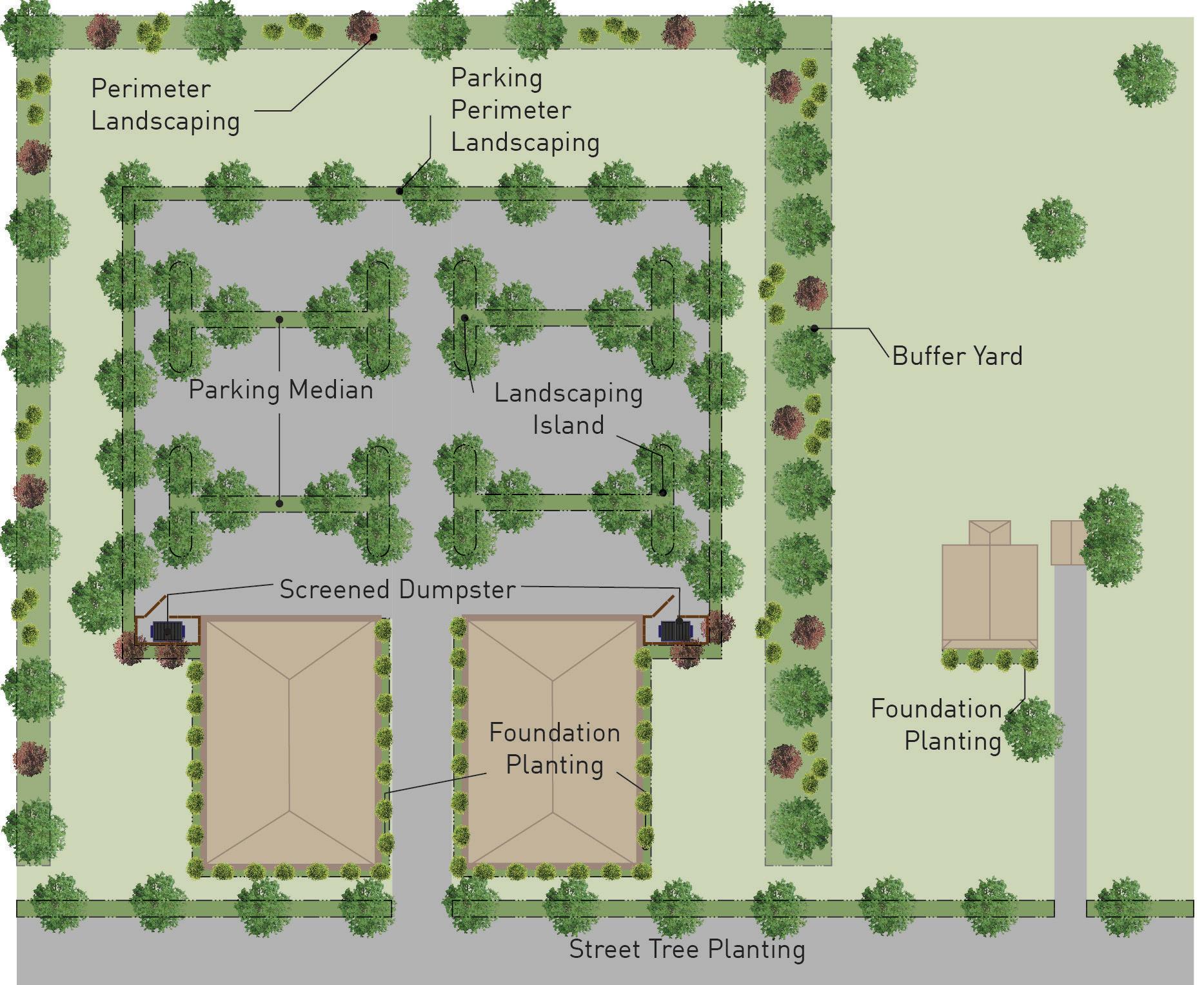
8.6.4
Central Access Drive Landscaping
Parking lots for 300 or more spaces requiring a central access drive shall have a minimum 6-foot-wide landscape area on both sides and running the length of the drive. A minimum of 1 shade tree for every 50 lineal feet of landscape area shall be provided. This landscape area may count toward 50% of the interior landscape requirement for the adjoining parking area of the development.
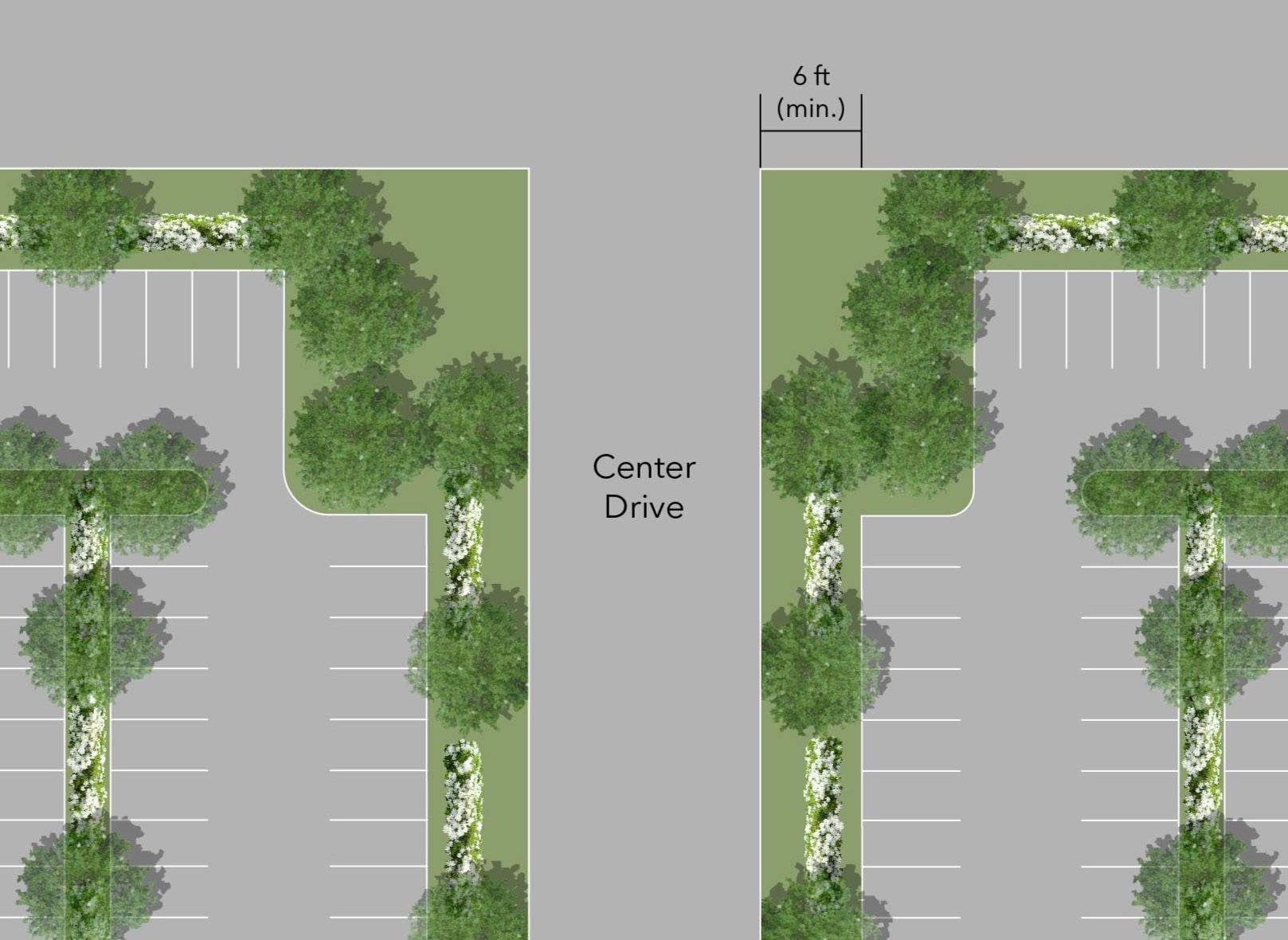
8.6.5 Planting Standards
A. Planting areas can be landscaped with a variety of trees, shrubs, or other planting materials. The variety of planting materials used should be tolerant of the existing urban conditions including exhaust, salt, and poor and/or compacted soils.
B. All deciduous and coniferous trees and shrubs shall be prepared and planted in accordance with industry standards.
C. See Table 8.6-3 Required Planting Sizes
TABLE 8.6-3 REQU i RED PLANT i NG S i ZES
Deciduous Canopy Trees Min. 2.5 caliper inches DBH
Ornamental Trees Min. 2 caliper inches
Coniferous Trees Min. 6ft. in height
Evergreen and Deciduous Shrubbery, except where required as a screen
Min. 18 inches in height Max. 3ft. in height
8.7 OFF-S i TE LANDSCAP i NG REQU i REMENTS
8.7.1
Landscaping in Rights-of-Way
Roadway rights-of-way shall be landscaped with grass and trees as per the Board of Public Works Standard Specifications for Construction. No walls, fences, signs or hedges shall be permitted in a right-of-way without the approval of the Board of Public Works. Landscaping shall not impede visual clearance according to Section 6.18 Clear Sight Distance.
8.7.2 Landscaping in Street Medians
Street medians may be landscaped in compliance with the Board of Public Works Standard Specifications for Construction and Board of Public Works Approval. Landscaping shall not impede visual clearance according to Section 6.18 Clear Sight Distance.
8.7.3
Off-Site Landscaping Credits
In lieu of planting on-site landscaping, the Planning Staff may administratively approve a development credit of up to half of the required landscaping in exchange for a tree to be installed within a public park or public rightof-way with the authorization of the Board of Works or Parks Board.
8.8 BUFFERS
8.8.1
Attached Dwellings Buffers
In addition to the standards of this chapter, the following requirements shall apply for attached housing with 10 or more units:
A. Where adjacent to a detached single dwelling units along a common side or rear lot, the following landscape area shall be provided:
TABLE 8.8-1 ATTACHED DWELL i NGS BUFFER
B. The landscaped area shall consist of a combination of ornamental or shade trees, shrubs and ground cover. At least 50% of the common lot line landscape area shall contain shrubs and/or trees. A minimum of 1 tree per 30 feet of common lot line shall be provided.
8.8.2 Mobile Home Parks Buffers
A. The outer boundaries of a mobile home park shall contain a buffer zone. This buffer zone shall consist of a greenbelt strip, not less than 30 feet in width, located along all park boundaries.
B. Such greenbelt shall be composed of coniferous and deciduous trees, at least 60% of trees being coniferous, which shall have an ultimate height of at least 15 feet and shrubs that shall have a minimum height of 3 feet or more after one full growing season and will eventually grow to a height of not less than 8 feet.
C. The exact number of trees and shrubs shall be as specified on the approved site plan.
D. Existing plant material may serve in whole or in part as the required buffer upon approval of the final site plan.
8.8.3 Business or institutional Uses abutting Residential Uses
A. Where a business or institutional use is adjacent to a residentially zoned or used property along a common side or rear lot line, the following landscape area shall be provided:
8.8.4
minimum of 1 tree per 30 feet of common lot line shall be provided.
C. All service areas shall be screened per Section 8.10 Screening.
Industrial Uses abutting Residential Uses
A. Where an industrial use is adjacent to a residentially zoned or used property along a common side or rear lot line, the following landscape area shall be provided:
TABLE 8.8-3
i NDUSTR i AL BUFFER
PARCEL S i ZE Width of Required Landscape Area
Less than 1 acre 15ft.
1 to 3 acres 20ft.
Larger than 3 acres 30ft.
B. The required landscape area shall consist of a visual and physical screen, a minimum of 6 feet in height, shall be provided along the common lot line, which may consist of any of the following:
1. A chain link fence and evergreen hedge. The hedge shall be on the side of the residential property.
2. A solid fence of a non-deteriorating material
3. A masonry wall and plantings to reduce visual impacts. Plantings shall be on the side of the residential property.
B. The required landscape area shall consist of a combination of ornamental or shade trees, shrubs, and ground cover. At least 50% of the common lot line landscape area shall contain shrubs and/or trees. A
8.8.5
Industrial Uses abutting Business or institutional Uses
A. Where an industrial use is adjacent to an institutional or business zoned property along a common side or rear lot line, a 10-foot-wide landscape area shall be required.
B. The required landscape area shall consist of a visual and physical screen, a minimum of 6 feet in height, shall be provided along the common lot line, which may consist of any of the following:
1. A chain link fence and evergreen hedge. The hedge shall be on the side of the business or institutional property.
2. A solid fence of a non-deteriorating material
3. A masonry wall and plantings to reduce visual impacts. Plantings shall be on the side of the business or institutional property.
8.9 FENCES AND WALLS
8.9.1 General Provisions – Fences in All Districts
A. No fence or wall shall be constructed of or contain barbed wire, broken glass, spikes or sharp and dangerous objects nor be electrically charged, except in industrial districts where barbed wire may be used at the top portion of a permitted fence or wall if located more than 7 feet above the adjacent ground level. Such permitted barbed wire shall be considered part of the fence and subject to the fence height restrictions.
B. All fences, walls, and screening, temporary and permanent, shall permit completely unobstructed vision within a clear sight triangle in accordance with Section 6.18 Clear Sight Distance.
C. All fences shall be maintained to the standard to which they were designed and installed.
D. The provisions of Section 9.8 Roadway Regulations shall take priority over the provisions of this Section in restricting the height and location of permitted fences.
E. All fences and walls permitted herein shall be located entirely on the zoning lot and may be located immediately adjacent to the lot lines, unless otherwise specified.
F. Fences or walls not permitted herein but established in conjunction with a planned unit development plan or special exception may be authorized as part of
that planned unit development plan or special exception.
G. No fences, other than split rail, wrought iron or open picket fences (with 40% open spacing between pickets) not to exceed 4 feet in height, shall be permitted in any front yard.
H. In all districts except industrial, all fences shall be no greater than 6 feet in height, with an additional 6 inches allowed for fence posts.
i. Fence materials may include treated wood, painted wood, treated split rail, ornamental wrought iron, brick, stone, masonry block, decorative painted or vinyl coated aluminum, or other materials as approved by the Planning Staff. Scrap lumber, plywood, sheet metal, plastic or fiberglass sheets are specifically prohibited. In business and industrial districts, in the side and rear yards only, chain link fences with vinyl slats when the slats have been permanently installed by the fence manufacturer are permitted. The color of the slats must be coordinated with the color of the building and approved by the Planning Staff.
J. All fences shall be erected with the finished side facing outward toward the property line.
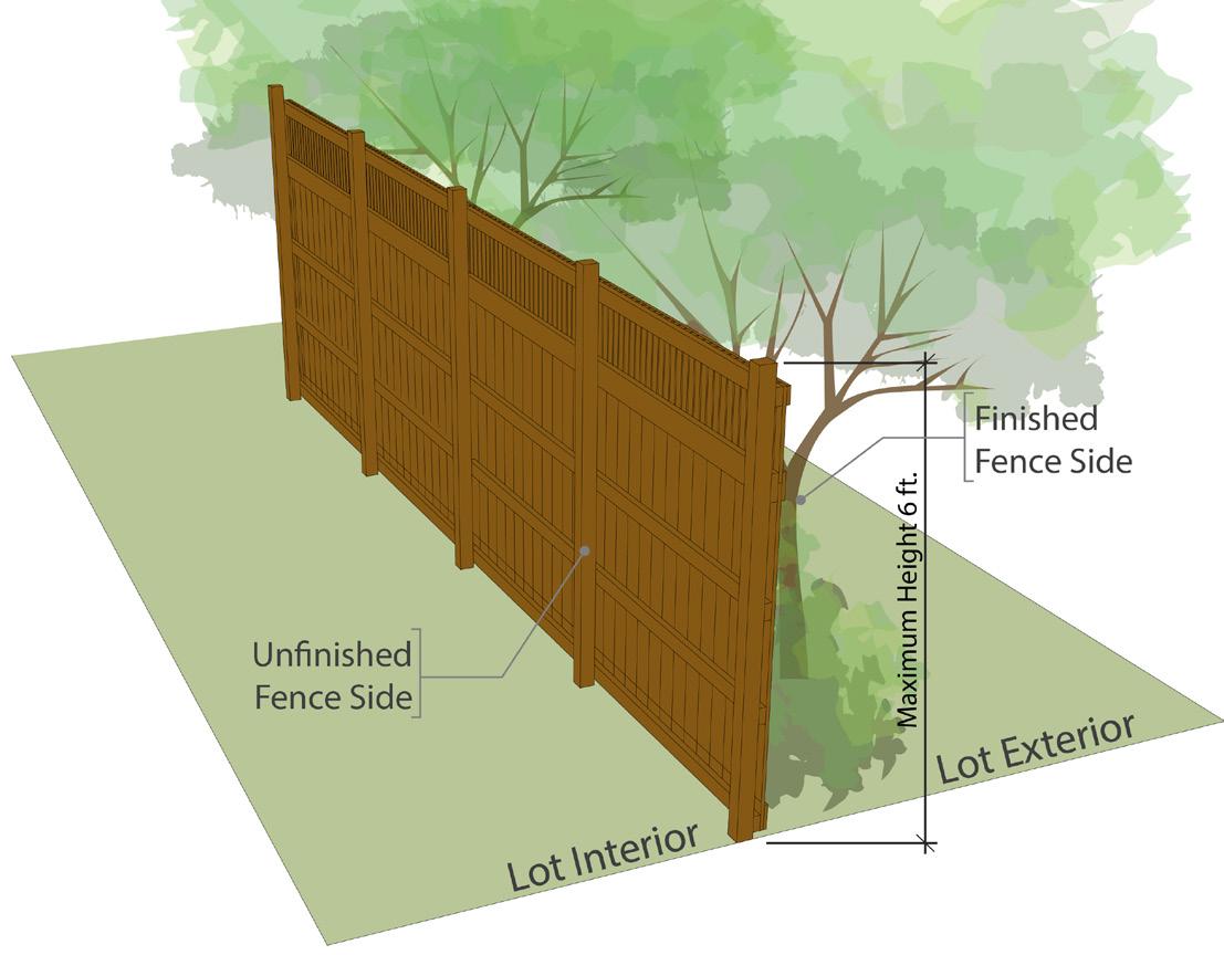
8.9.2 Fences Permitted in Residential Districts
A. A fence or wall not more than 6 feet in height may be placed, built, or installed in the side and/or rear yards of any lot in a residential district. Corner rear yards are allowed a 6-foot-tall privacy fence up to 1 foot from the property line.
B. In no instance shall a fence or wall taller than 3 feet measured from the street grade be within the clear sight distance per Section 6.18.
C. In the case that a lot has any portion of the rear yard adjacent to a street (i.e. Lot, Double Frontage), no fence or wall exceeding 4 feet in height may be closer to said street than the front façade of an adjacent principal building facing said street.
8.9.3 Fences Permitted in Business Districts
A. A fence or wall not more than 6 feet in height may be placed, built or installed in the side and/or rear yards of any lot in a business district.
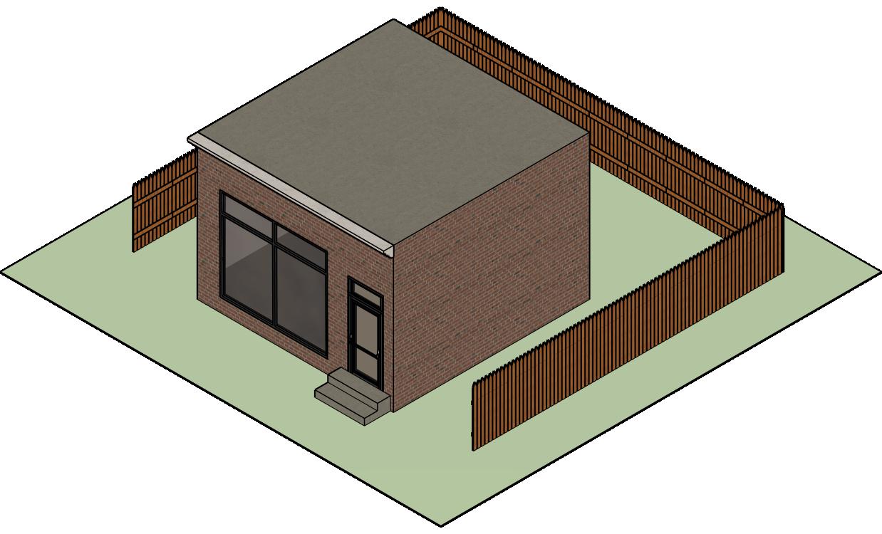
8.9.2 Fences Permitted in Business Districts
B. In no instance shall a fence or wall taller than 3 feet measured from the street grade be within the clear sight distance per Section 6.18
8.9.3 Fences Permitted in Business Districts in Corner Lot Visibility Area
C. For a corner lot, no fence, wall, or vegetation exceeding 4 feet in height or a fence, wall, or vegetation that is opaque may be placed, built or installed:
1. In the required corner side yard adjacent to the street; or
2. In any portion of the corner rear yard lying closer to said street than the point of the principal building nearest said street.
8.9.4 Fences Permitted in Industrial Districts
A. Except as specified in Subsection 8.9.5 Fences Around Salvage Yards or Vehicle Impound Lots below, a fence or wall not to exceed 8 feet in height may be placed, built, or installed at the property lines in required side and rear yards

8.9.5 Fences Permitted in Industrial Districts
B. In no instance shall a fence or wall taller than 3 feet measured from the street grade be within the clear sight distance per Section 6.18
8.9.6 Fences Permitted in Industrial Districts CornerLot Visibility Area
C. For a corner lot, no fence or wall may be placed, built, or installed:
1. In the required corner side yard adjacent to the street; or
2. In any portion of the corner rear yard lying closer to said street than the point of the principal building nearest the street.
8.9.7 Fences Permitted in Industrial Districts in Corner Lots
Additionally, the height of such fences may be increased by 6 inches for each 3 feet of distance from the property line to a maximum height of 12 feet.
8.9.5 Fences Around Salvage Yards or Vehicle Impound Lots
A. An opaque fence, a minimum of 8 feet in height and a maximum of 15 feet in height (including any barbed wire), constructed of painted or treated wood, painted or textured block, or brick and set 15 feet or more inside the lot lines, shall be maintained in good repair around the site (see Figure 8.9.2). In a front or corner side yard the fence shall not project beyond the front façade of buildings located on adjacent lots on the same side of the street.
B. Entryways to salvage yards or vehicle impound lots shall be gated and closed when not in use. Gates shall be opaque and match the style of the fence.
C. A landscaped strip shall be maintained between the fence and property line in the following yards:
1. All front and corner side yards;
2. The front one-third of any side yard; and
3. Any yard abutting a residential zoning district.
The landscape strip shall consist of evergreen or deciduous trees, shrubs, and groundcover with a minimum of 1 tree every 30 lineal feet of landscape strip.
8.10.2
constructed of chain link with tinted slats or other weaved material. Enclosures may or may not include a roof.
Screening of Service Areas, Loading Docks, and Ground-Mounted Mechanical Equipment
All service areas (loading docks/doors, mechanical equipment, etc.) located in a yard abutting a residentially zoned or used property shall be screened by a solid fence, wall, or dense evergreen hedge, a minimum of 6 feet high, or equal to the height of the service area, whichever is less. Fences and walls shall be consistent with the architecture of the development or principal building. Any vegetative or architectural screening located along a side property line shall not extend beyond the front façade of the residential structure on the adjacent lot.
8.9.6 Fences Around Retention Ponds
Every retention pond required by the City for water runoff storage and in which the deepest point is more than 2 feet below adjacent ground level with a slope from water’s edge being no greater than 4 to 1, shall be enclosed with a fence or protective barrier a minimum of 6 feet in height. This requirement may be waived as a design feature if landscaped and shaped to replicate a natural form of a pond.
8.10 SCREEN i NG
8.10.1 Dumpster Enclosures
All dumpsters shall be screened by a solid 6-foot-high fence, gate, wall, and/or dense evergreen hedge on all sides. Where adjacent to a building, the building may serve as screening on one side. Fences and walls shall be consistent with the architecture of the development or principal building. Gates shall consist of an opaque material and shall not be
8.10.3
Screening of Roof-Mounted Mechanical Equipment
All roof-mounted mechanical equipment visible from a public or private street shall be screened with a parapet wall, or by another design detail as approval by the Plan Commission or Planning Staff.
8.10.4
Screening of Storage Areas
Storage areas for materials, equipment and vehicles shall be located behind the front or corner side building façade in all districts. All storage areas located on properties containing business uses(s) that are visible from the property line shall be screened. The screening material shall be 100% opaque and shall include fencing, retaining walls, plant material, or a combination thereof.
8.10.5 Screening of Utilities
Utilities should be installed underground wherever possible. If underground utilities are not feasible due to utility or infrastructure conflicts, topographic conditions, or site limitations, alternative placement shall be administratively approved by the Planning and Zoning Office. Landscape screening may be required as a condition of approval.
8.11.1
Residential Developments
A. This section applies to subdivisions and all multi-dwelling developments.
B. See also Section 9.10 Open Space and Recreational Facilities Required.
C. Common Areas-Tree Lawns abutting Rights-of-Way.
1. Tree lawns abutting rights-of-way shall comply with the following standards and Section 6.18 Clear Sight Distances and Table 8.11-1.
TABLE 8.11-1 TREE LAWNS
Tree Location Within 5 feet of the abutting rights-ofway (anticipated canopy spread)
Spacing Maximum 75 feet
Minimum Number of Trees 1 per 2,500 sq. ft. of tree lawn
Minimum Planting Size 2 inch caliper at 1ft. above grade
2. A waiver of these standards may be granted by the Plan Commission where there is retention of sufficient existing vegetation or adequate individual lot landscaping meets the intent of these requirements.

8.11.2
Non-residential Development Amenities
A. In addition to the requirements of Section 8.5 General On-Site Landscaping Requirements, all unimproved areas of
a site are encouraged to install plantings and landscaping to enhance quality of place throughout the City of Elkhart.
B. Amenities such as outdoor dining, plazas, or other public or semi-public outdoor spaces, where permitted, are encouraged to incorporate landscapes and plantings into their designs provided these landscape elements do not reduce minimum clearances, life safety, or other requirements of the Indiana Building Code.
This Page is Intentionally Left Blank
C HAPTER 9:
DES i GN STANDARDS
9.15
9.1 PURPOSE AND i NTENT
A. The purpose and intent of this chapter is to promote orderly development throughout the City of Elkhart.
B. Subdivision Layouts shall be of such character to protect health, safety, and general welfare of residents.
9.2 APPL i CAB i L i TY
The provisions of this chapter shall apply to any site being developed, re-developed, or altered.
9.2.1
New improvements
No existing subdivision of any lot, tract, or parcel of land shall be effected, nor shall any street, sewer, water, or other facility in connection be laid out, constructed, opened, or dedicated for public use or travel or for the common use of occupants of buildings abutting thereon, except in strict accordance with the provisions of the regulations herein set forth.
9.3 SUBD i V i S i ON DES i GN QUAL i TY
9.3.1
Quality of Design
The design quality of the city is dependent on the quality of design of the individual subdivision and other developments that compose it. Good community design requires the coordination of the efforts of each petitioner and developer of land within the city. Therefore, the design of each subdivision shall be prepared in accordance with the principles established by the Comprehensive Plan for land use, circulation, community facilities and public utility services and in accordance with the following general principles within this Chapter.
9.3.2
Integrated Design
9.2.2
Subdivision Plan Required.
No lot in a subdivision shall be sold, nor shall a permit to erect, alter or repair any building upon land in a subdivision be issued, nor any building erected in a subdivision unless and until a subdivision plan has been approved and recorded, and until the improvements required by the county or city in connection therewith have either been constructed or guaranteed, as herein provided.
9.2.3 Recording a Subdivision
Plan/Re-Plat
No plat or re-plat of a subdivision of land located within the jurisdiction of the Plan Commission shall be recorded until it shall have been approved by the Plan Commission or as provided for by this UDO, and such approval shall have been entered in writing on the plat as delegated by this UDO.
9.3.3
It is intended that the City shall be designed as a group of integrated residential neighborhoods, appropriate commercial and industrial employment facilities and natural, open, green, park and public facilities. The neighborhood, as a planning unit, is intended as an area principally for residential use. Space for religious, recreational, and educational facilities to serve the residents of the neighborhood should be provided and designed as an integral part of each neighborhood.
Preservation
In all subdivisions, due regard shall be given to preserving historical sites and natural features such as large trees, water courses, and scenic views.
9.3.4
Minimum Provisions
In their interpretation and application, the regulations’ provision shall be the minimum requirements for promoting public health, safety, and general welfare.
9.3.5
Rights-of-Way Dedication
All subdivisions shall dedicate a portion of the lot to expand the right-of-way as required by the City Engineer.
9.4.1 General
A. All Public Land Survey points within or on the boundaries of the land to be subdivided shall be shown on the plat and referenced by no less than three measurements of angle and distance. Each measurement of angle and distance shall be made from a separate known point on the perimeter of the subdivision.
B. Lot comer markers shall be accurate at the time of sale or transfer from the subdivider to a second party. After sale or transfer is complete, the subdivider, the City of Elkhart, or other authorized agents shall not be liable for the accuracy of said markers.
C. Monuments and markers shall be placed under the supervision of a licensed land surveyor and according to State Land Surveyor Regulations so that the center of the pipe or marked point shall coincide exactly with the intersection of lines to be marked and shall be set so that the top of the monument or marker is level with the finished grade.
D. Subdivider shall be required to establish the location of all horizontal monuments by means of a traverse of the third order or better. Evidence of successful completion of the required traverse shall be certified by a registered land surveyor licensed by the State of Indiana and shall be submitted to the City of Elkhart Engineer.
E. The plat shall indicate the type and location of all required monuments set within the property being subdivided.
F. All documentation necessary for the City of Elkhart Engineer to ascertain the location and accuracy of the required monuments of this Section shall be submitted by the subdivider to the City of Elkhart Engineer.
G. Monuments shall be set:
1. At the intersection of lines forming angles in the boundary of the subdivision, at the beginning and end of all curves and points of tangency of the perimeter of the plat.
2. At the intersection of right-of-way lines within the plat.
H. Markers shall be set:
1. At the intersection of the center lines of all streets, the center points of all cul-de-sac turn arounds, at the beginning and end of all curves and at angle points.
2. At all points where lot lines intersect curves, either front or rear.
3. At all angles in property lines of lots.
4. At all lot comers not established by monuments.
9.4.2 Materials
A. Monuments shall be of precast or cast-inplace concrete with minimum dimensions of 4 by 4 by 36 inches set vertically in place. Monuments shall be marked on top with iron or copper dowels at least 3/8inch in diameter or deeply scored on top with a right angle cross.
B. Markers shall consist of iron pipes, steel bars, or copper bars, contain magnetic qualities, have a distinctive top which will be marked with a deep point or cross at the correct location, and be 36 inches in total length and not less than 5/8-inch in diameter.
9.4.3 Benchmarks
A. A minimum of one permanent benchmark shall be established for each 40 acres or fraction thereof, subdivided and at a location designated by the City of Elkhart Engineer. The monuments shall be of concrete with a dimension of 4 by 4 by 48 inches. A brass plate inscribed with the elevation of the benchmark shall be fastened to the concrete with letters and numbers a minimum 1/4-inch tall. Unless
otherwise directed by the City of Elkhart Engineer, benchmark datum shall conform to USGS sea level datum of 1929 and I or USC & GS datum.
B. Subdivider shall be required to establish the elevation of any benchmark set within the limit of the project to within 1/100foot of the U.S. Geological Survey 1929 sea level datum or USC & GS datum.
Evidence of the established elevation shall be certified by a registered land surveyor licensed by the State of Indiana and shall be submitted to the City of Elkhart Engineer.
9.4.4 Retention and Maintenance
It shall be the responsibility of the subdivider to prevent disturbance or destruction to all existing monuments within the jurisdictional boundaries of the City of Elkhart. Any activities relating to the subdivider’s improvements which cause disturbance or destruction of existing monuments shall be reported immediately to the City of Elkhart as well as to the appropriate county, state, or federal agencies. The subdivider shall be responsible for the cost of any repair or re-establishment of any existing monument disturbed or destroyed by their activities. The subdivider shall be liable for applicable fines and penalties for disturbance or destruction of existing monuments.
9.5 LOT AND BLOCK DES i GN
9.5.1 Block Standards
A. Blocks shall fit easily into the plan of the subdivision and their design shall consider traffic flow and public areas.
B. Block length and width or acreage within bounding streets shall be such as to accommodate the size of lot required by the UDO for the district in which the subdivision is to be located, and to provide convenient access, circulation control, and safety of street traffic. Blocks that are unreasonably large or small will not be approved.
C. Blocks shall be a maximum of 1,200 feet in length.
D. Blocks shall be a minimum of 300 feet in length.
E. For blocks longer than 800 feet, pedestrian crosswalks shall be near the center of the block or wherever would be most useful to facilitate pedestrian circulation to a school, park, recreation area, or other destination as specified by the Plan Commission.
F. Blocks shall have sufficient width to provide for two tiers of lots of appropriate depth. Exceptions to this prescribed block width shall be permitted in blocks adjacent to major transportation facilities, water, and commercial areas.
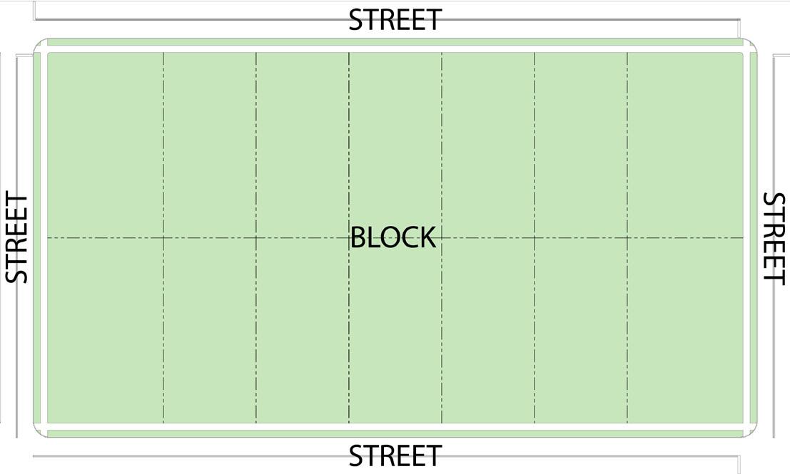
9.5.2
Applicability of Lot Design Standards
Any new structure erected after the effective date of this title shall be subject to the development standards of their specific zoning district as listed in this UDO. Refer to Chapter 3.
9.5.3
Lot Dimensions
A. After the adoption date of this UDO, no lot shall be created, by subdivision or other means, unless it complies with the minimum lot size and minimum lot width prescribed by its zoning district. Refer to the dimensional standards in Chapter 3 Zoning Districts.
B. The lot size, width, depth, shape, grade location, and orientation shall be in proper relation to street and block design and to existing and proposed topographical conditions.
C. Lots without City water or sanitary sewer shall be a minimum of 80 feet wide, 120 feet long, and 10,000 square feet in area.
D. The Plan Commission may increase the lot area and dimension requirements in instances of documented unusual soil conditions or other physical factors which may affect the health and welfare of the location.
9.5.4 Lot Arrangement
A. Lots must comply with the minimum frontage requirement on a public rightof-way, except where a private street has been specially approved. The Plan Commission may waive this requirement for major subdivisions of non-residential properties with internal access drives.
B. Double frontage lots shall be prohibited for residential developments except where abutting a freeway or if the frontage is the result of disadvantages of topography and orientation as determined by Planning and Zoning Staff. In such instances, vehicular access between the lots and the street shall be prohibited. Such lots shall have an additional depth of at least 10 feet to provide for screen plantings.
C. Lots abutting a watercourse, drainageway, channel, or stream shall have additional
minimum width or depth as required to provide an adequate building site and afford the minimum usable area required in the UDO for front, rear, and side yards.
9.5.5 Flag Lots
Creation of flag lots is prohibited, unless part of a cottage court development.
STREET
Figure 9.5.3 Flat Lot Example
9.5.6
Location of Lot Lines
A. The lot size, width, depth, shape, grade location, and orientation shall be in proper relation to street and block design and to existing and proposed topographical conditions.
B. Lots should be polygons of nearly right angles where possible. Some variation from this requirement is permissible but pointed or very irregular lots should be avoided.
C. Side lines of lots may be radial lines on curved streets or where fronting on cul-desacs.
9.5.7 Zero Lot Line Setback Modifications
A. Residential Uses
A zero lot line setback may apply to parcels created for the purpose of subdividing attached dwelling units into townhouses or condominiums as permitted by Indiana Code. Lot lines not along a dwelling separation (i.e. exterior walls) are subject to the setback standards of their respective districts.
B. Non-residential Uses
A zero lot line setback may apply to multi-tenant non-residential buildings so that each tenant bay is under individual ownership but shares common site amenities. Lot lines not along a tenant separation (i.e. exterior walls) are subject to the setback standards of their respective districts.
9.5.8 Lot Coverage
See also Section 6.17.12 Lot Coverage. Each zoning district may establish a maximum lot coverage percentage to preserve adequate access to light, air, site drainage, and open space.
9.5.9 Principal Buildings Limited
Only one principal building may be erected on any lot unless otherwise expressly permitted by use and district standards set forth in this UDO.
9.5.10 General Site Arrangement
A. All buildings must comply with the setback standards specific to their zoning district.
B. Lots abutting a watercourse, drainageway, channel, stream, or flood plain shall have additional minimum width or depth as required to provide an adequate building site and afford the minimum usable area required by the UDO from front, rear, and side yards.
C. Buildings must be constructed so that the primary entrance faces the public street unless otherwise permitted in Chapter 3
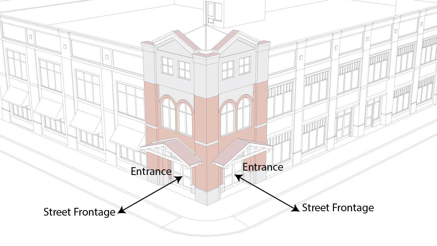
9.6 PEDESTR i AN AND B i CYCLE i NFRASTRUCTURE
9.6.1
Sidewalks and Other Pathways
A. Sidewalks [or an alternate trail or greenway if in compliance with an adopted trail or greenways plan] must be installed in the public right-of-way as part of any subdivision approval or any permit for a new primary structure, except for the following:
1. This provision does not apply to frontages on Interstate freeway.
2. This provision may be waived on State Roads or Highways where a written statement of prohibition is provided by the Indiana Department of Transportation.
3. The City Engineer, as applicable, may waive the requirement for a path along perimeter streets for a Minor Subdivision.
4. Required improvements located outside of the right-of-way shall be located within an easement approved by the City Engineer.
B. If a site abuts a greenway, bicycle path or pedestrian, access must be provided unless Planning Staff determines that access in that location is not practical due to site, utility, or topography constraints.
C. Sidewalks shall be required to be located on both sides of every street within the subdivision plat including around cul-desacs.
D. Industrial subdivisions shall be reviewed on a case-by-case basis for sidewalk applications. Sidewalks may be substituted with a multi-use path as deemed appropriate by the Planning Staff.
E. Sidewalks and pathways located adjacent to streets should be properly lighted to permit visual surveillance of the walk or path from the street as required by the City Engineer. See 6.20 Lighting Standards.
F. When sidewalks or pathways cross major street intersection within or adjacent to the subdivision, safety devices such as painted crosswalks, signs, or traffic signals shall be installed.
G. Where not adjacent to a right-of-way, dedicated pedestrian easements of at least 15 feet wide shall be provided for sidewalks, pedestrian paths, and bicycle paths.
H. Suitable ramps for wheelchairs and bicycles shall be provided on all sidewalks and pathways in compliance with American Disabilities Act (ADA) standards. Ramps are to be located at all intersections and other transition access points. Overhead obstructions shall be cleared to a height of at least 8 feet. Rolled curbs are not a substitute for wheelchair ramps.
i. Walkways are required to be provided from each ground floor residential dwelling unit entrance to the public street. All other buildings must provide at least one walkway from the building’s main entrance to the public street.
J. Within any development or project containing multiple buildings, an internal walkway system shall be provided so that all buildings’ front entrances connect (directly or indirectly) to the sidewalk in the public right-of-way. This system must be a marked path, including pedestrian crossing markings. Crossing markings may include changes in paving material, color, or height wherever the route crosses an interior access drive, street, drive-through lane, or parking lot.
K. The Plan Commission or Planning Staff may require developers, at their expense, to construct sidewalks or walking paths in the right-of-way or along accesses adjacent to the proposed development to respond to the proposed development’s impact and infrastructure demands.
9.6.2 Sidewalk Construction Standards
Sidewalks shall be constructed in compliance with the City of Elkhart’s adopted Standard Specifications for Construction
9.6.3
Safe Routes to School
Where a Safe Routes to School route associated with the federal or Indiana Safe Routes to School program is adjacent to the boundaries of a development or redevelopment involving residential uses, the project design shall provide connections to the designated school route and shall dedicate right-of-way to accommodate the provision of the route. Any requests by the city for designation or dedication of land for the designated school route within a proposed development shall comply with all applicable provisions of federal and Indiana state law.
9.6.4 Cul-de-sac Through Access
Wherever cul-de-sacs are created, a 15-footwide pedestrian access or public utility easement shall be provided between the cul-de-sac head or street turnaround and the sidewalk system of the closest adjacent street or pedestrian sidewalk or pathway unless the Administrator determines that public access in that location is not practicable due to site, utility, or topography constraints.
9.6.5
Bicycle Paths
Bicycle lanes and/or multi-use paths may be installed subject to approval by the Department of Public Works.
9.7 ACCESS AND C i RCULAT i ON
9.7.1 Lot Accesses and Driveways
A. Access is required for all lots in compliance with Section 6.7 Access Required.
B. Driveways shall be constructed and installed in compliance with the requirements adopted by the Board of Public Works, including minimum and maximum curb cut widths and required distances from intersections.
C. Driveway Permit Required. No driveway or point of access to the street shall be constructed, relocated, or altered unless approved for a permit, subject to approval by the Board of Public Works.
D. Gravel driveways are prohibited. All driveways are required to be paved with hard-surface materials, such as concrete, asphalt or brick pavers, permeable pavers, or permeable pavement.
E. Where a property abuts an existing improved alley, the site should be accessed exclusively from that alley, unless otherwise approved by the City Engineer.
9.7.2 Accesses Limited
A. To protect public health and the function of public streets, access to a pre-existing public street system shall be determined by the location of proposed intersecting streets, topography, and other general site characteristics.
B. No parcel of land which is a functional part of the overall development, even though it may be removed by the developer from the rest of the project area by subdivision or by metes and bounds description, shall be permitted to have driveway access to the public streets bounding the project area unless so approved by the City of Elkhart as part of the development project.
C. Vehicular access from lots to minor or major arterial streets may be prohibited. Vehicular access from lots to collector streets may be prohibited if the Design Hour Volume is determined by the Planning Staff or City Engineer to be excessive.
9.7.3 Subdivision Accesses
A. Any new residential subdivision that proposes new streets must construct and dedicate public streets in accordance with the standards of the Elkhart Public Works and Utilities Department.
1. Private Streets. If a private street is developed to be maintained by a Homeowners’ Association or by residents of a subdivision, the subdivision must record a permanent access easement that runs with the private street and provide commitments/covenants for how the private street will be maintained, including if the association is dissolved or fails to pay taxes.
2. Private streets must be built to the City of Elkhart Street construction standards. Private streets are subject to inspection and approval by the Department of Public Works and Utilities.
B. Whenever a proposed subdivision borders an existing street, the Commission may require the reconstruction or widening of such street as a condition of plat approval. Additional dedication of right-of-way may also be required.
9.7.4 internal Circulation
A. All parking areas must provide adequate vehicle maneuvering in accordance with the standards in Chapter 7
B. Internal circulation paths shall connect to adjacent paths on commercial or industrial lots.
C. Site circulation patterns shall be designed to minimize conflicts between vehicle and pedestrian traffic, and create a safe and efficient movement of both vehicle and pedestrian traffic in and around the site.
9.7.5
Traffic Control
The City Engineer shall be responsible for placement of traffic control signs where deemed necessary.
9.8.1 Street Plan
A. The street system of any subdivision shall consider the following when designing and approving subdivision(s):
1. Existing and planned streets
2. Proposed uses of land to be served by the street network
3. Topographical conditions
4. Safety for vehicle and pedestrian traffic
5. Accessibility for emergency vehicles and school buses
6. Public convenience and efficiency of service
7. Livability or amenities affected by traffic elements in circulation systems
8. Economy of construction
B. The following required street related improvements shall be located, designed, and constructed in conformance with City Engineering Department standards as adopted by the Board of Public Works:
1. Pavement Widths and Profiles
2. Concrete curb and gutter
3. Stormwater inlets and/or catch basins
4. Any other utility appurtenances within the public rights-of-way
C. The street and alley layout shall provide adequate vehicular and pedestrian access to all lots and parcels of land within the subdivision, and where streets cross other streets. Streets shall conform to the following principles and standards:
1. Proposed streets shall be adjusted to the contour of the land to produce usable lots and streets of reasonable gradient in compliance with this section.
2. Residential street systems shall be designed to minimize through traffic movement, but certain proposed streets, where appropriate, shall be extended to the boundary line of the tract to be subdivided to provide for normal circulation of traffic within the vicinity.
3. Wherever there exists a dedicated or platted portion of a street or alley adjacent to the proposed subdivision, the remainder of the street or alley to the prescribed width shall be platted within the proposed subdivision.
4. Residential street patterns shall provide reasonably direct access to the primary circulation system.
5. Street intersections and confluences must encourage safe traffic flow.
6. Not more than 2 streets shall intersect at any point, unless specifically approved by the Plan Commission.
7. Streets shall be laid out to intersect as nearly as possible at right angles. A proposed intersection of two new streets at an angle of less than 75 degrees shall not be acceptable. A street should be approximately at right angles for at least 100 feet therefrom.
8. Proposed new intersections along one side of an existing street shall, wherever practicable, coincide with any existing intersection on the opposite side of such street. Street jogs with center line offsets of less than 150 feet shall not be permitted except where the intersected street has separated, dual drives, without median breaks at either such intersection. Where local streets intersect with arterial or collector streets, their alignment shall be continuous.
9. At the intersection of any proposed residential street with any existing street, acceleration and deceleration lanes, and passing or left tum
lanes may need to be provided in accordance with standards established by the handbook, A Policy of Geometric Design of Highways and Streets, by the American Association of State Transportation and Highway Officials.
10. Half streets are prohibited; however, a temporarily dead-ended street shall be permitted in any case in which a street is proposed to be and should logically be extended but is not yet constructed. An adequate easement for a turn-around shall be provided, as determined by the City Engineer.
9.8.2 Street Classifications
A. Street classifications shall be defined by the most recent version of the City of Elkhart Standard Specifications for Construction.
B. Private Streets. When there is a situation of unusual physical conditions or a controlled design environment in evidence and it can be satisfactorily demonstrated to the Commission that a private street is the only feasible solution, said private streets may be authorized provide pavement construction standards shall be the same as the minimum public standard, and adequate covenant provision are made for direct responsibility and control by the property owners involved to provide for the perpetual operation, liability, and maintenance of said private streets at no expense to the City of Elkhart.
In addition to the requirements established herein, all subdivision plats shall comply with the following rules, laws, and regulations:
1. All applicable statutory provisions.
2. The UDO, building and housing codes, and all other applicable laws of the appropriate jurisdiction.
3. The Comprehensive Plan, Thoroughfare Plan, and Capital Improvement Plan of the City of
Elkhart of City of Elkhart, including all public facilities, open space, and recreation plans, as adopted.
4. The rules and regulations of the Indiana Department of Environmental Management, the Natural Resources Commission, Aeronautics Commission, City of Elkhart Drainage Board, and other appropriate state agencies.
5. The rules, regulations, and standards of the Indiana Department of Highways if the subdivision or any lot contained therein abuts a state highway.
6. All applicable planning and regulatory guidelines, including access control, driveway manuals, parking and traffic control ordinances, and other applicable guides published by the local governmental units.
7. The “Indiana Manual of Uniform Traffic Control Devices” for installation of traffic control devices.
9.8.3
Frontages
A. The Plan Commission shall require frontage roads be provided, where appropriate, to prevent numerous entrances on existing streets.
B. Where a subdivision borders on or contains an existing or planned street, the Plan Commission may require a reverse frontage with a screen planting contained in a non-access easement with a minimum width of 10 feet along the rear property line; or such other treatment as may be required for the safety of the residential properties.
9.8.4
Streets in Commercial and Industrial Subdivisions
A. Streets located in a commercial or industrial subdivision shall be constructed to the specifications for secondary streets as detailed in this UDO.
B. Curb and gutter, storm drainage, and subsurface drainage may be required by the Plan Commission.
C. Once constructed to the specifications of the City of Elkhart, the subdivider may dedicate the streets to the City of Elkhart or may, upon approval of the Plan Commission, elect to keep the streets private to be maintained by the owners and/ or tenants of the subdivision.
D. Truck routes shall be established to prevent industrial traffic from encroaching into adjacent residential areas.
E. Regarding proposed impacts to overall traffic and storm drainage, commercial and industrial subdivisions shall be considered in totality (individual parcels or lots shall not be considered separately); therefore, traffic impact analysis and drainage studies may be required.
9.8.5 Roadway Design and Construction
A. All roadways shall be constructed in compliance with the City of Elkhart Standard Specifications for Construction.
B. Before any performance bond covering a street, installation is released, the Plan Commission, City of Elkhart Common Council, City of Elkhart Engineer or Board of Public Works may request that core borings of the street be done at the
subdivider’s expense. Cores shall be sent to an independent testing laboratory for analysis.
C. Minimum Street Design Standards
1. All dedicated rights-of-way shall conform to the following minimum standards prescribed by the Standard Specifications for Construction, also listed in Table 9.8-1
2. Street width is measured from back-toback of a 2-foot-wide curb and gutter located on each side of the street.
3. Street Grades
Streets shall be completed to grades shown on the Construction Plans drawn by the subdivider’s professional engineer or land surveyor and approved by the Plan Commission.
D. Cul-de-sacs
1. The maximum length for a cul-de-sac shall be 500 feet measured along the center from the intersection at origin through center of circle to the end of the right-of-way,
a. If the residential streets within the subdivision has only one intersection with a through street, the entire subdivision shall be considered a cul-de-sac, and the distance shall be measured from the point of intersection of the subdivision street and the through street.
2. The Plan Commission may require a specific cul-de-sac minimum diameter if requested by the City of Elkhart Fire Department.
E. Street Pavements
All streets, whether public or private, shall be constructed to the standards established by the City of Elkhart Public Works Standard Specifications for Construction
9.8.6 Curbs and Gutters
A. The Commission may require curbs and gutters to be installed on each side of the street surface.
B. The curbs and gutters shall be constructed according to the Standard Specifications for Construction.
9.8.7 Clear Sight Distance
See Section 6.18. All intersections shall comply with the requirements of this section.
9.9 SUBD i V i S i ON EASEMENTS
9.9.1 Easements to permit access for maintenance and repair of surface and subsurface drainage improvements and utility installations shall be provided on the final copies of the Primary Plat, Secondary Plat, and Construction Plans. Location of easements shall be reviewed by the City of Elkhart Engineer and representatives of local utility companies.
9.9.2 Easements across lots or centered on rear or side lot lines shall be provided for utilities where necessary and shall be at least 10 feet wide or 5 feet on both sides of the property lines.
9.9.3 For a subdivision transversed by a watercourse, drainageway, channel, or stream, a stormwater easement, or drainage right-of-way shall be provided, which substantially conforms with the lines of the water course and is of sufficient width to protect the drainage capacity of the water course. If the water course is classified as a County regulated drain, approval by the County Drainage Board is required.
9.9.4 Drainage Easements shall be a minimum of 20 feet in width, shall provide continuity from block to block, and shall be located along rear, side, or front lot lines, one-half the width of the easement shall be taken from each lot. In the case of lots extending to the boundary of the lands platted and not adjoining another plat, the full width of the easement shall be provided on such peripheral lots.
9.9.5 Where a proposed drainage system shall carry water across private lands outside the subdivision, appropriate drainage rights must be secured by the subdivider and indicated on the plat. Appropriate legal documentation must be submitted.
9.10
OPEN SPACE AND RECREAT i ONAL FAC i L i T i ES REQU i RED
9.10.1 Landscaping Required
Refer to Section 8.11 Open Space Amenity Landscaping.
9.10.2 Residential Subdivisions
A. Residential subdivisions of more than 30 lots shall provide communal open space and/or recreational facilities subject to approval by the Planning Staff.
B. The subdivider shall permanently dedicate the open space acreage for public use. See also Section 6.12 Ownership and Conveyance of Common Areas.
C. Easements, crosswalks, and road frontage to provide public access to the open space shall be shown on the Secondary Plat.
D. Existing natural features which add value to residential development and enhance the attractiveness of the community shall be preserved in the design of the subdivision and may be incorporated into dedicated open space.
9.10.3 Cluster Developments
A. Purpose and Application
A major subdivision submitted for approval by the Plan Commission may be developed as a cluster development. Cluster developments are intended to allow greater flexibility in design and development of subdivisions, to produce innovative residential environments, provide for more efficient use of land, protect topographical features, and permit common area and open space. To accomplish this purpose, the following
regulations and exceptions shall apply only to cluster developments.
B. Criteria
The following criteria shall be fulfilled to be eligible for a cluster development:
1. The development site shall be a minimum of 5 acres and developed as a unit in the manner approved.
2. Unique topographical features on site, including but not limited to slopes, streams, and natural water features, are protected and preserved.
3. Wooded areas, trees, wetlands, floodplains, or other environmentally sensitive features are protected and preserved.
4. Common open space and recreational areas are provided to residents, including accessible walkways and bike paths.
5. Alteration of natural features is minimized through design and situation of individual lots, streets, and buildings.
6. Diversity and originality in lot layout and individual building design achieves the best possible relationship between development and the land.
7. The land area devoted to motor vehicle access is minimized.
C. Exceptions to Residential District Development Standards
If the criteria for a cluster development is met, exceptions to the development standards relating to the subdivision’s lot size, shape and dimensions may be permitted for individual lots within a cluster subdivision as follows:
1. Project density
The overall maximum density of the proposed cluster subdivision shall remain the same as that permitted by developing the same site area into developable lots in full compliance with the applicable underlying zoning district.
2. Area, width, setback, and open space for individual lots are exempt from the following development standards of the applicable zoning district:
a. Minimum lot area
b. Minimum lot width (at setback)
c. Minimum side and rear yard setback regulations may be modified by the following:
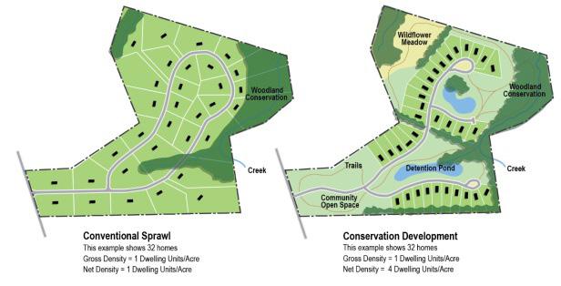
i. Setback from any subdivision boundary property lines: 20 feet.
ii. The minimum rear yard setback: 15 feet.
d. Minimum Street Frontage
The minimum street frontage may be reduced to 15 feet provided, however, that each individual lot shall have direct access to a public street; and,
e. Maximum Lot Coverage
Individual cluster lots shall have a maximum lot coverage of 50%.
D. Project open space
1. The amount of permanent open space created by the development of the site as a cluster subdivision shall be equivalent to, or more than, the total reduction in lot sizes. The open space created by the development of the site as a cluster subdivision shall be provided in such a manner that it is preserved in its naturally occurring state for passive recreational activities. A subordinate amount of this open space may be developed as a common recreational area.
2. The open space shall perpetually run with the subdivision and shall not be developed or separated from the subdivision. Provisions shall be made for continuous and adequate maintenance at a reasonable and nondiscriminatory rate of charge. The open space created by the development of the site as a cluster development shall further be provided in such a manner that it is accessible to residents of the subdivision and for maintenance. The applicant shall submit documentary assurances that permanent dedication of the open space areas shall be made and that adequate provisions are being made for continuous and adequate maintenance of project open space,
common areas and recreation areas to the Plan Commission with the primary plat submittal. Further, the documentary assurances shall be incorporated in the plat that is recorded with the Office of the Elkhart County Recorder.
E. Procedures for cluster development approval
1. The petitioner shall submit two site plans for the property proposed for a cluster development for review and conceptual design approval by the Planning Staff prior to filing for plat approval.
a. Site Plan 1 shall depict the development of the site in full compliance with all use and development standards of the applicable underlying zoning district and this UDO. This site plan will be used to determine the maximum number of developable lots possible on the site and set the density of that development.
b. Site Plan 2 shall depict the development of the site as a proposed cluster development. The density of the overall development shall be no greater than that permitted by the development of the site depicted in Site Plan 1.
2. The Planning Staff shall compare the proposed cluster subdivision (Site Plan 2) with the site plan showing the same site developed in compliance with the applicable Dwelling District (Site Plan 1) and determine if the criteria for a cluster design is met.
3. If upon review, the Planning Staff determines that the criteria for a cluster subdivision is not met or the submission requirements not fulfilled, the staff shall inform the petitioner in writing of the determination. The petitioner may, within five business days, appeal the staff’s decision by
filing an approval petition before the Plan Commission.
4. If upon review the Planning Staff determines that the criteria for a cluster subdivision is met, the staff shall inform the petitioner in writing of the determination.
5. The petitioner may then proceed with the filing of a preliminary plat before the Plan Commission. The filed plat shall be in substantial compliance with the Site Plan 2 approved by the Planning Staff. The mailed legal notice for the public hearing of the Plan Commission shall include a copy of the written determination for the cluster development. Other required notice shall indicate the plat is for cluster development.
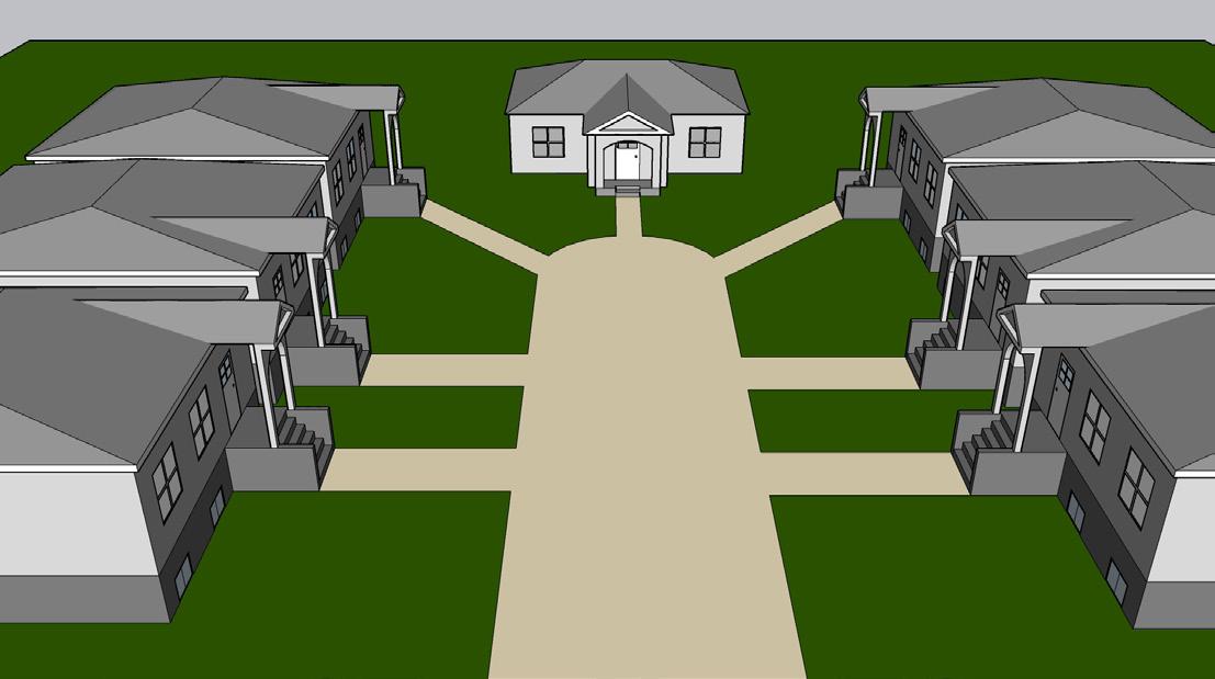
A. The internal courtyard shall contain at least 200 square feet for each dwelling unit in the development.
B. At least 60% of the courtyard must be one contiguous open space serving as the primary court within the development site. Additional courts may be included and shall also serve as common open space.
C. The primary court shall have buildings on at least 2 sides of the court, but buildings are not required to be on opposite sides of the court. Non-primary courts within the development site may have building(s) on only 1 side of the court.
D. No portion of the internal courtyard shall be less than 25 feet in width or depth.
E. Courtyards may contain elements such as patios, seating areas, gardens, communal green space, landscaping, and or pedestrian paths. At least 70% of the total court shall be uncovered and open to the sky.
F. Courtyard(s) may not be parked or driven upon.
G. Stormwater detention areas shall not count towards the minimum internal courtyard area.
H. Retaining walls or fences within the courtyard may be no taller than 4 feet in height. Retaining walls or fences that are 2 feet or less in height may be spaced as close as 10 feet apart. All other retaining walls must be spaced a minimum of 20 feet apart.
1. Fences and retaining walls are permitted outside of courts in the rear of buildings opposite a court or within required yards on individual lots.
i. Pedestrian paths meeting the requirements of this Chapter shall be provided from each dwelling unit to the courtyard and any other common areas. Pedestrian paths shall count toward the minimum courtyard dimensions.
9.10.5 Subdivision Rights-of-Way and Common Areas Landscaping
A. See also Section 8.7 Off-Site Landscaping Requirements.
B. Parkways and tree lawns within dedicated rights-of-way and lawn areas in dedicated open spaces shall be graded and seeded in an approved manner. Trees shall generally be planted near rights-of-way of the subdivision, as mutually agreed upon by the Plan Commission and the subdivider.
9.10.6 Non-residential Subdivision and Development Amenities
A. A non-residential development may incorporate public-private plazas, gardens,
outdoor seating, and/or other amenities into their site for common use.
B. The amenity space shall perpetually run with the development and shall not be developed or separated from the development. Provisions shall be made for continuous and adequate maintenance by the property owner(s).
9.11 ADEQUATE PUBL i C SCHOOL
FAC i L i T i ES
Developments of more than 50 residential units shall give notice of such development to the school system in which they are located.
9.12
PUBL i C WORKS STANDARD
SPEC i F i CAT i ONS FOR CONSTRUCT i ON
Any site being developed, re-developed, or altered is required to comply with all standards of the Elkhart Public Works and Utilities Department’s Standard Specifications for Construction.
9.13 PERFORMANCE STANDARDS
DUR i NG CONSTRUCT i ON
9.13.1 Construction sites are subject to all applicable standards for site maintenance and safety as prescribed by the Elkhart Department of Public Works and Utilities and the City’s Building Inspection Division.
9.13.2 inspection
All public improvements proposed shall be inspected during the course of construction by the City Engineering department or its designee.
9.14 SOL i D WASTE COLLECT i ON AND RECYCL i NG
9.14.1 Any use that is not a one- or two-unit residential dwelling is responsible for its own waste collection and recycling.
9.14.2 Dumpsters
A. All dumpsters shall meet the screening standards in Section 8.10
B. Dumpsters in the CBD district shall be screened by a solid 6-foot-tall fence, wall, or dense evergreen hedge. Fences and walls should be consistent with the architecture of the development or principle building. Any vegetative or architectural screening located along a side property line shall not extend beyond the front façade of the residential structure located on the adjacent lot.
9.15 STORMWATER, SEWER, AND WATER SUPPLY SYSTEMS
9.15.1 General
A. All water supply and sanitary sewage disposal systems shall comply with the requirements of the City of Elkhart and State Board of Health, as applicable.
B. See also Section 6.15 Utilities and Equipment.
9.15.2 Stormwater and Subsurface Drainage
A. The subdivider shall provide the subdivision with an adequate storm water sewer system.
B. The storm water drainage system shall be separate and independent of any sanitary sewer system.
C. Storm drainage facilities shall be located in the street right-of-way, where feasible, or in perpetual, unobstructed easements of appropriate width, and shall be constructed in accordance with the details on the Construction Plans provided by the subdivider’s engineer or as approved by the City of Elkhart.
D. Storm sewer inlets shall be provided at all low points so that surface water is not carried across or around any intersection, nor for a distance of more than 400 feet in the gutter or as approved by the City Engineer.
E. It is the responsibility of the subdivider to keep all major watercourses, drainage systems, etc., not under the jurisdiction of any public agency, open and free flowing.
F. Drainage facilities shall be capable of accommodating peak runoff of 1.2 inches per hour or greater intensity, without endangering the public safety, health, or causing significant damage to property.
G. No structures shall be constructed in a 100 year flood plain.
H. Design Calculations: Design calculations are required as part of the drainage plan and shall specifically include:
1. Estimate of storm water runoff
2. Drainage map, including indication of drainage patterns for lots and blocks of areas affecting the proposed development site.
3. Weighted runoff coefficient computations.
4. Time of concentration computation indicating overland flow time and travel times in swales, gutters, pipes, and/ or channels.
5. Close conduit and open channel design computations:
6. Size of pipe or channel cross-Section X.
7. Pipe and channel slope percentages.
8. Roughness coefficient.
9. Flow velocities in feet per second.
10. Design capacity in cubic feet per second.
11. Pipe and channel invert elevations
12. Head loss computations in manholes and junction chambers.
13. Hydraulic gradient computation, wherever applicable.
i. On-site drainage facilities shall be designed to accommodate:
1. the water runoff from the parcel after development;
2. the present water runoff from developed areas upstream;
3. the present peak water runoff from undeveloped areas upstream;
J. Each applicant or other entity which make any surface change shall be required to:
1. Collect on-site surface runoff and springs and dispose of it to the point of discharge into an adequate outlet approved by the City of Elkhart Engineer.
2. Pay his proportionate share of the total cost of off-site improvements to the common natural watercourse.
3. Provide and install at his expense, in accordance with the requirements of the UDO, all drainage and erosion control improvements.
K. The subdivider shall provide a subsurface drainage system, below curbs, to be placed along both sides of the subdivision streets and wherever else within the subdivision that it is determined to be necessary. The purpose of the subsurface piping system is to provide drainage for the street subbase. The subsurface drainage system shall discharge to the storm sewer system or to the surface drainage system upon approval from the City of Elkhart Engineer. No subsurface drainage system connections will be permitted to the sanitary sewer system.
L. It shall be illegal for sump pumps, downspouts, or foundation drains to outlet directly to the street or into the right-of-way of the street, or to be connected to the sanitary sewer.
M. Plans for storm water drainage shall include details for storm water detention and retention.
1. Detention facilities shall be designed for 10-years pre- and post-development with a legal discharge.
2. Retention facilities shall be designed for 3 inches of rainfall.
9.15.3 Sewers
A. The subdivider shall provide the subdivision with a complete sanitary sewer system which shall connect with an existing interceptor sewer linking the subdivision to the City of Elkhart wastewater disposal plant. If said inceptor is not located adjacent to the subdivision site, it shall be the responsibility of the subdivider to extend the interceptor sewer to their property line. The subdivider may be reimbursed for part of the cost of extending the interceptor sewer.
B. Design plans for installation of a sanitary sewer system shall be provided by the subdivider and approved by the City of Elkhart Board of Public Works and the Indiana Department of Environmental Management and other appropriate local and State agencies as required. Upon the completion of the sanitary sewer installation, the record drawings for such systems as built shall be filed with the City of Elkhart Engineering Department.
C. Selected Design Criteria
1. Alignment
All sewers shall be laid with a straight alignment between manholes.
2. Manhole Location
Manholes type, size, location and design shall be completed in accordance with the City of Elkhart Standard Specifications.
3. Sewer Locations
Sanitary sewers shall be located within street or alley rights-of-way, unless topography dictates otherwise. When located in easements on private property, 20-foot-wide access easement shall be provided for all manholes Where sewer lines in private easements cross public street or alley rights-of-way, a manhole shall be provided in such rights-of-way where possible. Imposed loading shall be
considered at all manhole locations. No less than 6 feet of cover shall be provided over top of pipe in street and alley rights-of-way or 5 feet in all other areas.
4. Mandatory Connections to Public Sewers
If a public sanitary sewer is accessible and a sanitary sewer is installed in a street or alley abutting upon a property, the owner thereof shall be required to connect to said sewer for the purpose of disposing of waste. It shall be unlawful for any such owner or occupant to maintain upon such property an individual sewage disposal system.
9.15.4 Water Supply
The subdivider shall provide the subdivision with a complete water supply system, which shall be connected to the existing approved City of Elkhart water supply
A. The plans for the installation of water main supply systems shall be provided by the subdivider and approved by the City of Elkhart Board of Public Works and the Indiana Department of Environmental Management. Upon completion of the water supply installation, the plans for such system as built shall be filed with the City of Elkhart Engineering Department.
B. Fire hydrants shall be provided as recommended by the local fire department. Generally, hydrant spacing may range from 350 to 600 feet, depending on the area being served.
10.1 PURPOSE AND i NTENT
Development within certain districts or geographic areas may have a major impact on the visual, physical and functional character of that portion of the City, or of the City as a whole.
Appropriate development in these areas must serve to protect the public health, safety and welfare; preserve the natural environment; encourage efficient use of resources; promote the visual quality of the City; and minimize the burdens of new development on City services.
The purpose of this Section is to establish the Design Standards for areas within established Development Plan Overlay Districts. Consequently, within those specified zoning and overlay districts the submission of development plans will be required for review and approval prior to the issuance of any permits as established in Section 14.4.1 Development Plan Review and Approval
10.2 APPL i CAB i L i TY
10.2.1 Established Development Plans
The Design Standards described in 10.3 and 10.4 shall apply to all established Development Plan Overlays, including:
A. Any Development Plan Overlay District adopted by the City Council
B. Planned Unit Development Districts (PUD)
C. The Rivewalk Overlay District
D. The Downtown (CBD Core) Overlay District
E. The Benham Neighborhood Overlay District
F. Established Street Corridor Districts
1. Cassopolis Street: Bristol Street to North City limits
2. Main Street: Lusher Avenue to South City limits
3. Nappanee Street: Bristol Street to South City limits
4. Bristol Street: Nappanee Street to 600 feet East of Osolo Road
5. C.R. 6: Between East and West City limits
6. Johnson Street: St. Joseph River to Bristol Street
7. C.R.17: Between North and South City limits
8. Jackson Boulevard: Main Street to Prairie Street/Johnson Street
Established Street Corridor Districts shall include the entirety of each lot(s) or non-subdivided property being developed as a single development which abuts the district street to a maximum depth of 200 feet. However, in the event a proposed development extends beyond the 200-foot depth, the entire parcel(s) being developed including that portion of the parcel(s) beyond the 200-foot depth shall be included in the development plan district, so long as any portion of the development is located within the 200-foot depth.
G. Manufacturing uses located in an R&D-I or MAN-I zoning district shall not be required to comply with Type II design standards; however, all structures shall present a decorative facade on the front facade facing the district street or river and the front one-third of any side facade visible from the district street or river.
10.2.2 Review and Approval Required
The procedures for review and approval for areas within Development Plan Overlays are described in Section 14.4.1 Development Plan Review and Approval.
10.3 DES i GN STANDARDS TYPE - 1
The following minimum design standards shall apply to all improvements within any development plan district, except as indicated, and shall be considered in the review process by the Planning staff or Plan Commission. The requirements of the zoning district shall also be criteria for review. In the case of a conflict between the provisions of this Section and other regulations in this Ordinance, the
more restrictive standard shall apply, unless otherwise determined by the Planning Staff.
10.3.1 District Character
The proposed development shall be compatible with the design character of adjacent development in regard to scale and mass and shall promote the development goals and purpose of the zoning or overlay district in which it is located.
10.3.2 Environmental Design
A. It is the intention of the City to encourage the preservation of natural site amenities and to minimize the disturbance to the natural environment.
B. Existing trees and other natural amenities shall be preserved wherever possible. The location of these features must be considered when planning common open space, building location, underground services, walks, paved areas and finished grade levels. Inquiries may be made into the means by which natural features will be protected during construction.
C. The proposed development shall have a logical relationship to the topography of the site and adjacent property.
D. Landscaping in the Riverfront Overlay District shall be designed to soften the placement of buildings within the district and screen parking areas to create an overall streetscape along the Riverwalk.
1. Parking areas and access drives located within 20 feet of the Riverwalk shall be screened so that vehicles are not visible from the Riverwalk. Landscape screening shall include one or more of the following treatments:
a. A five foot high opaque wall or fence in conjunction with shrubbery and/or trees. Fence and/or wall materials shall be compatible with facade materials used on the primary building.

b. Coniferous trees or hedges that are at least five feet in height.

c. An earthen berm that is at least five feet in height. The earthen berm shall have vegetative ground cover.

2. Yard areas that are adjacent to the riverwalk shall have vegetative ground cover and include two (2) or more of the following treatments:


10.3.3 Site Development
A. Structures shall be located to allow adequate light, air, and ease of entry and access by the general public and emergency personnel. The development shall conform to all applicable development standards and district regulations specified in this UDO.
B. Structures shall be located to create an inviting, pedestrian-scaled streetscape along the Riverwalk.
C. For parcels within the Riverwalk Overlay that front Main Street, Jackson Boulevard,
or Elkhart Avenue, the site should be designed to primarily address these streets. Consideration should still be given to creating an inviting atmosphere along the Riverwalk but these parcels must support an established street wall along these important corridors.
10.3.4 Vehicular Circulation Systems
A. General
The following standards apply to all properties located within a development plan district:
1. The number, location and dimensions of accel/decel lanes, passing blisters and entry drives, shall be evaluated on the basis of City Public Works and Utilities standards.
2. All public drives shall conform to the standards established by the City Public Works and Utilities Department. Private drives shall conform to the standards of the City Zoning Ordinance.
3. All streets, access drives, and offstreet parking areas shall be paved with concrete, asphalt, pavers, or other approved surfacing material to adequately provide a durable and dust-free surface.
10.3.5 Vehicular Circulation Systems - Arterial Streets
The following standards apply only to properties located on an arterial street within a development plan district:
A. To reduce traffic hazards and maintain the traffic carrying capacity of the arterial streets, required access control elements may include:
1. Curb cuts onto arterial roads sould only be permitted when access cannot be provided from a collector or local roadway.
2. Cross-Access Agreements: The property owner enters into an
property owner delivers to the City of Elkhart a commitment that if at any time access becomes available through a cross access easement or frontage road connected to a common entry, the property owner will close the direct access drive.


easement agreement with adjacent property owner(s) and/or the City to provide cross property access allowing multiple developments to share a common entry from the arterial street. The agreement shall be in a form approved by the reviewing authority and shall be recorded.


10.3.6


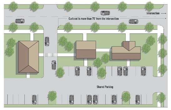
3. Frontage Roads: The property owner grants the City of Elkhart an easement for the construction of a parallel frontage road to connect individual developments to a common entry from the arterial street.
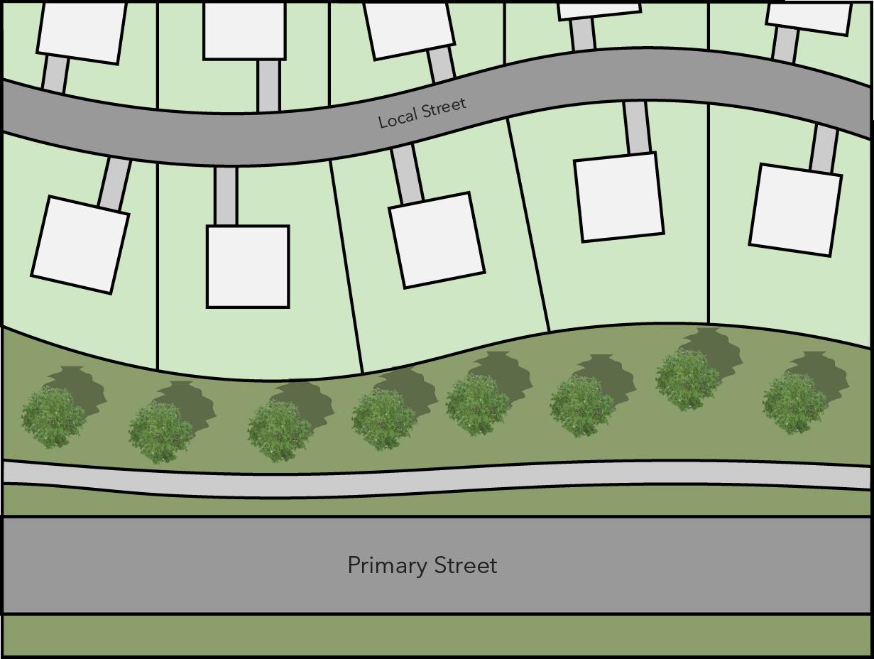
4. Temporary Access Drives: Where parcels adjacent to the subject property are undeveloped, a development plan may be approved with direct access to and from the arterial street provided that the
10.3.7
5. The reviewing authority may require delivery of such other commitments as it may deem necessary to control site access.
Vehicular Circulation Systems
Riverfront Overlay District parking lots and access drives shall be designed to minimize vehicular traffic along the Riverwalk. Primary structures shall be located between the Riverwalk and access drives and parking lots. Service and access drives shall not be located adjacent to the Riverwalk.
Pedestrian Circulation Systems
Walkways and plazas shall be constructed to provide pedestrian circulation throughout the development separate from all vehicular drives and parking areas. Where distance separation cannot be achieved, physical separation by means approved by the reviewing authority shall be required. Pavement treatment and materials should be such that they clearly differentiate pedestrian and vehicular circulation areas.
10.3.8
Riverwalk Overlay District
Developments located in the Riverwalk Overlay District shall provide pedestrian access between the development and the Riverwalk. Materials used to construct the pedestrian circulation systems shall be complementary to those used in the Riverwalk.
10.3.9
Sanitary Sewage Disposal and Water Supply Systems
All water supply and sanitary sewage disposal systems shall comply with the requirements of the City of Elkhart and State Board of Health, as applicable.
10.3.10 Public or Semi-Public Space
All developments including public or semipublic space must contain acceptable covenants insuring adequate maintenance of these spaces.
10.4 DES i GN STANDARDS - TYPE 2
The following design standards shall apply to all improvements within any development plan district where Type 2 design standard review is required. These standards shall be considered in the review process by the Planning staff or Plan Commission along with the requirements of the zoning district and the Type 1 design standards. In the case of a conflict between the provisions of this Section and other regulations in this Ordinance, the more restrictive standard shall apply, unless otherwise determined by the Planning Staff.
10.4.1 Facade Standards
All primary facades of a building shall be designed with consistent architectural style, detail and trim features. Primary facades of accessory structures have detail, trim features, and an architectural style that is consistent with the primary building.
A. General
1. Facades shall have a defined base or foundation, a middle or modulated wall, and a top formed by a pitched roof or articulated cornice, in each instance appropriate to the building style.
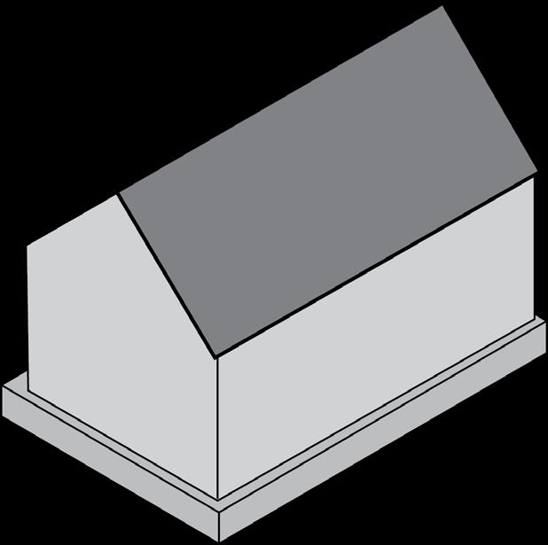
2. Facades constructed of more than one material shall only change material
along horizontal or vertical lines (not diagonal lines). For material changes at the horizonal line, the heavier material shall always be placed beneath the lighter material. Front and side facades of buildings located on corner lots shall be of the same materials and similarily detailed.
B. The horizontal lengths and curves of exterior facades shall be interrupted by recesses and projections. Exterior facades shall be designed to employ the following design treatments;
1. Building footprints (not gross square footage) in excess of 10,000 square feet shall have:
a. No uninterrupted horizontal length or curve of a non-arcaded facade shall exceed 100 linear feet.

b. No uninterrupted horizontal length or curve of an arcaded facade shall exceed 120 linear feet. Varied lengths and curves are preferred.
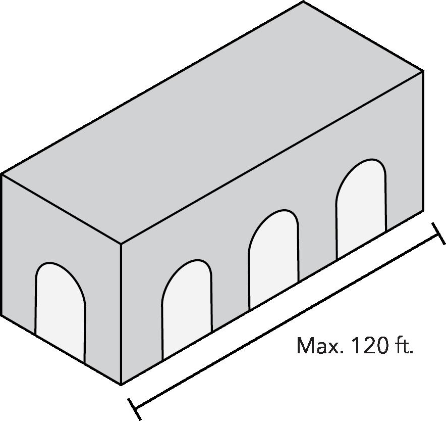
c. Projections and recesses shall have a minimum depth of 32 inches.
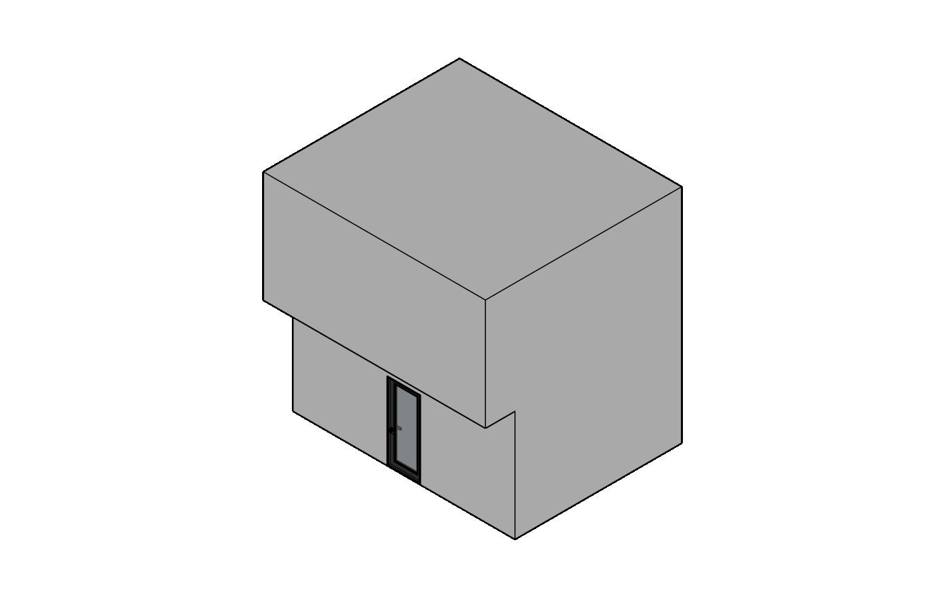

2. Building footprints (not gross square footage) less than 10,000 square feet shall have:
a. No uninterrupted horizontal length or curve of a non-arcaded facade shall exceed 50 linear feet.
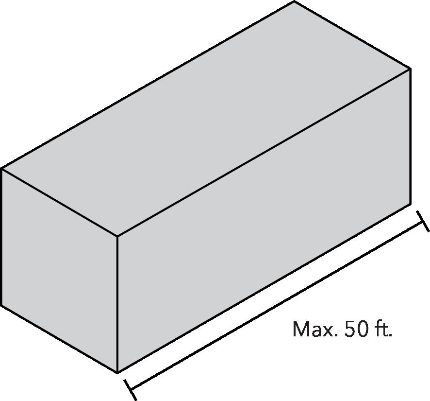
b. No uninterrupted horizontal length or curve of an arcaded facade shall exceed 80 linear feet.


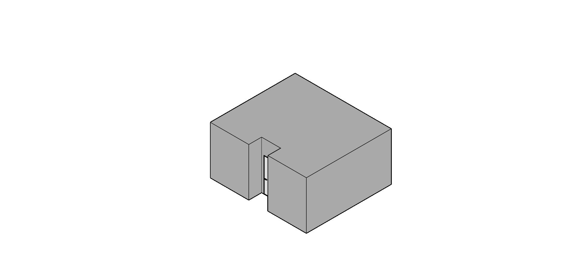
c. Projections and recesses shall have a minimum depth of eight
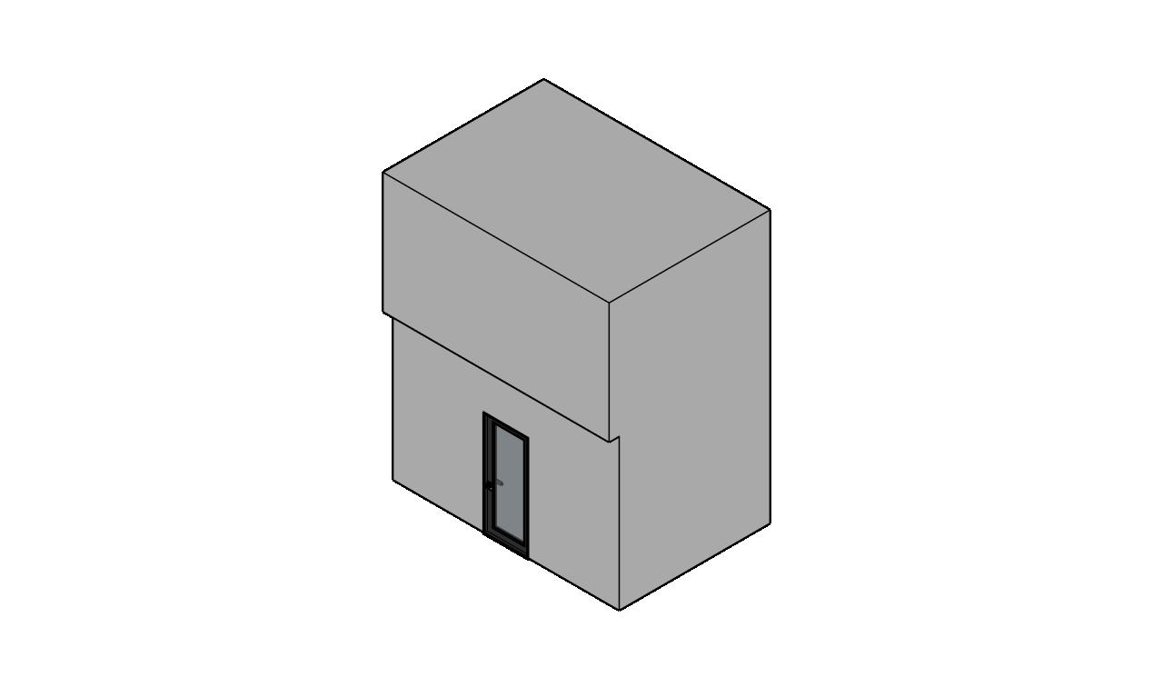
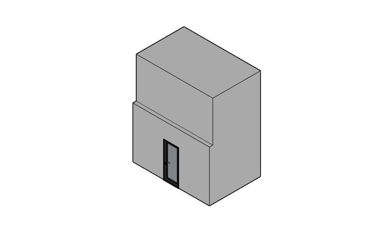
C. Each primary facade shall incorporate a minimum of three of the following design treatments from items a.-m. within 50% of its area for buildings in excess of 10,000 square feet, and within 33% of its area for buildings of less than 10,000 square feet.
1. Arcades with (a) a minimum width of 8 feet clear for buildings in excess of 10,000 square feet and (b) a minimum width of 6 feet clear for buildings of less than 10,000 square feet.
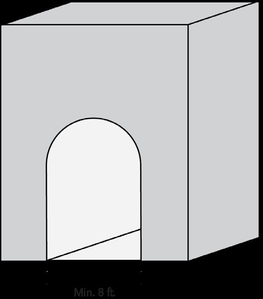
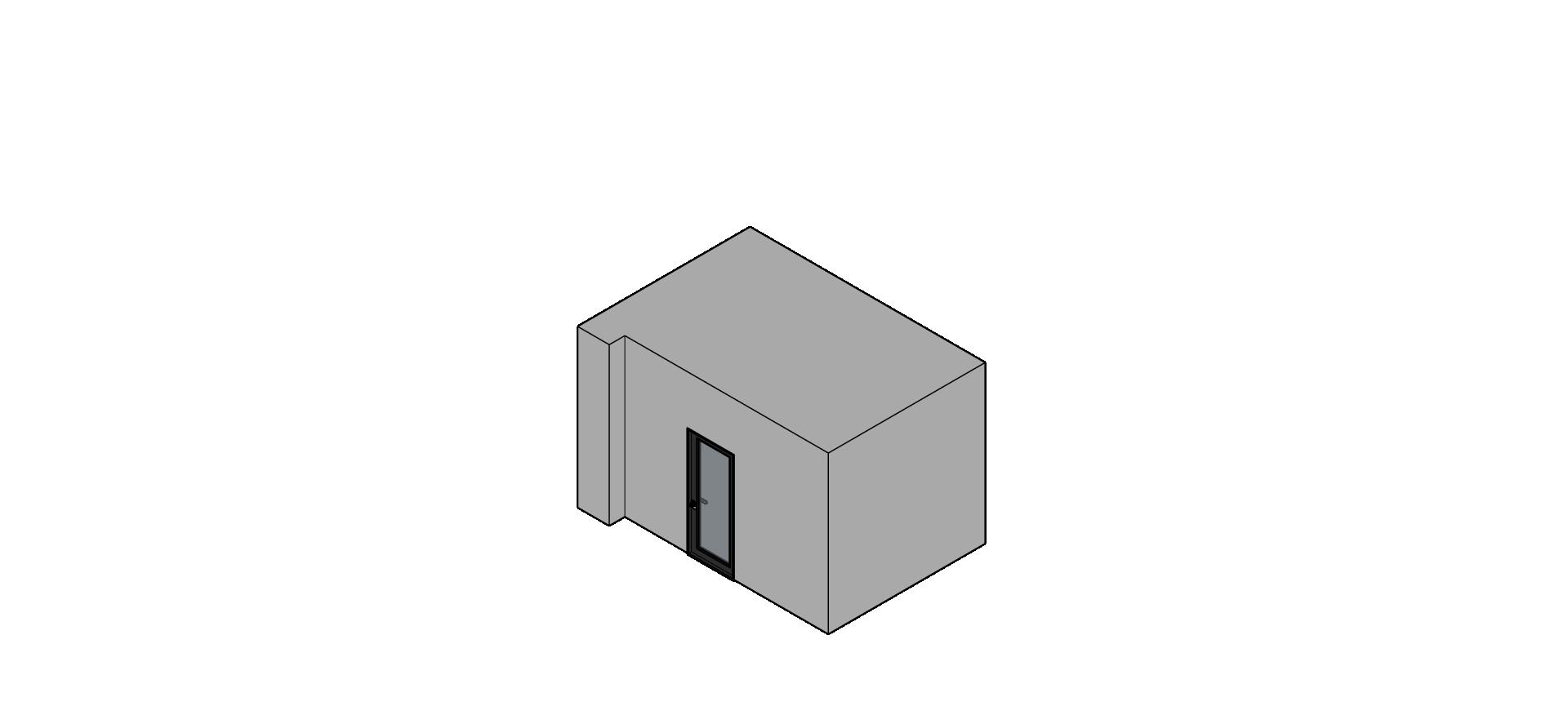
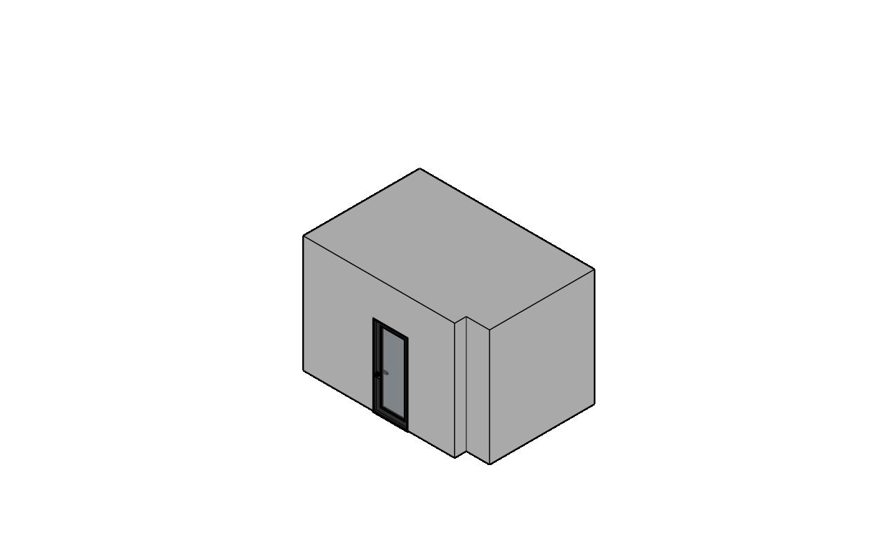
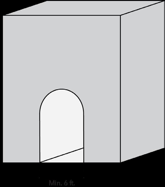

2. Display windows

3. Color banding through the use of colored exterior building materials or paint.
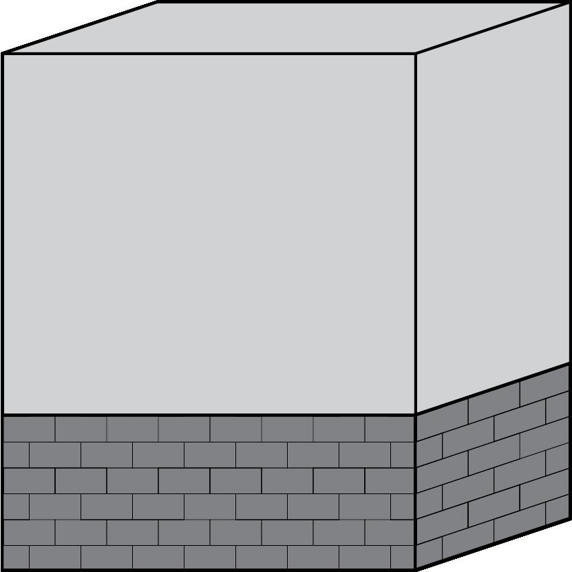

4. Canopies or porticos.

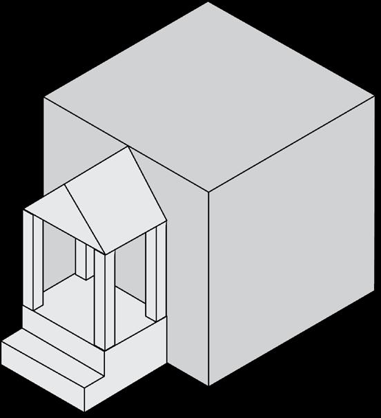

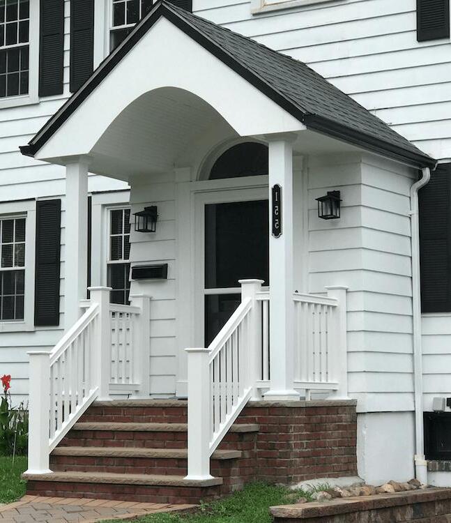
5. Roofs which extend (overhang) at least eight inches beyond the wall.
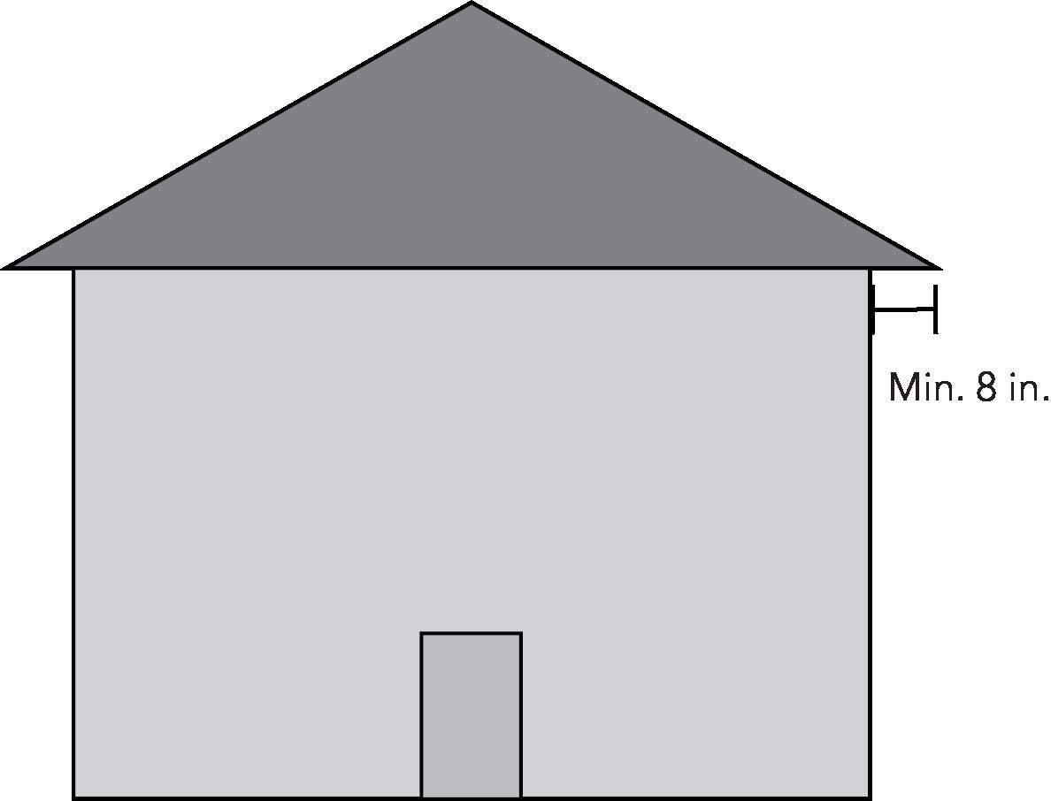
Sculpted art work.
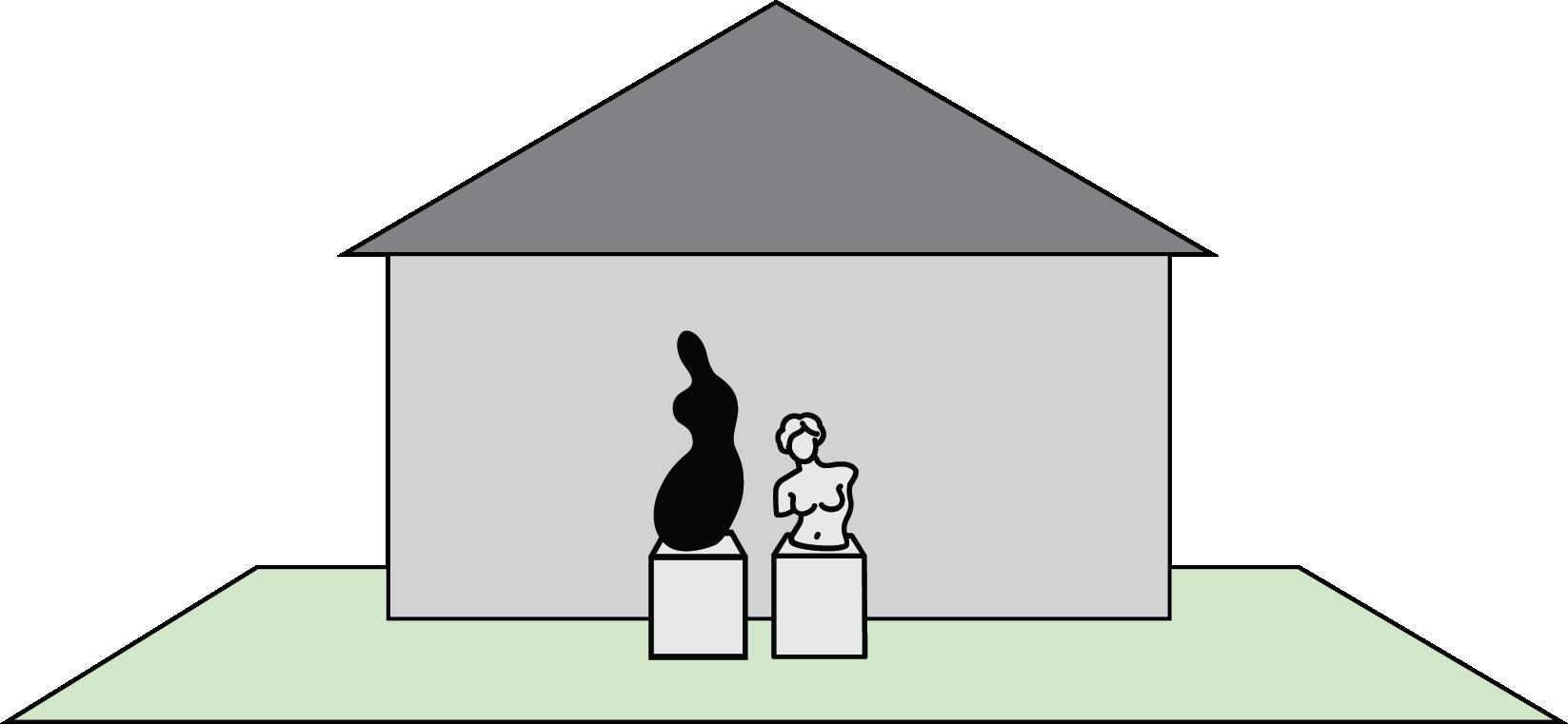

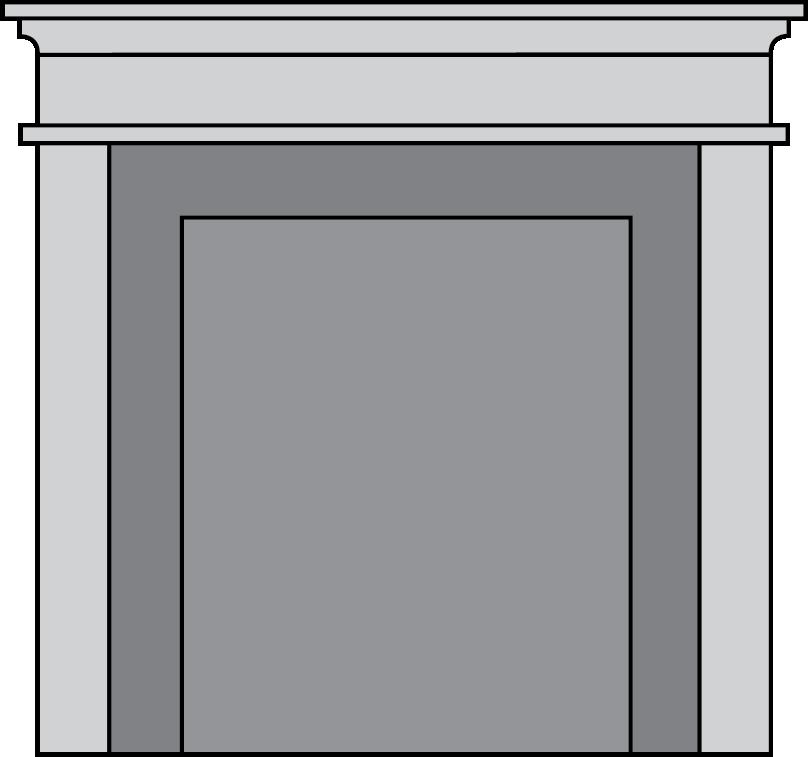

8. Arches.
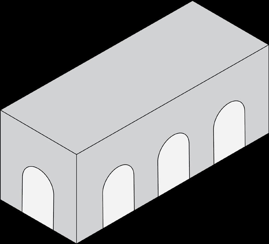

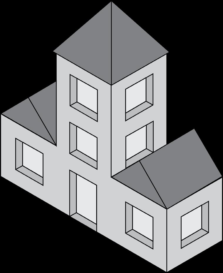

10. Landscaping along a primary facade in excess of landscaping otherwise required by this Ordinance. The additional landscaping shall be of sufficient quantity to meet the intent of a separate design treatment.


12. Change in the exterior building material.
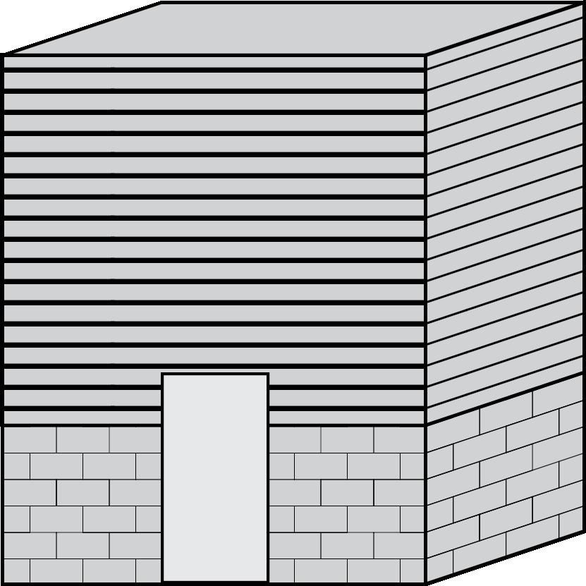
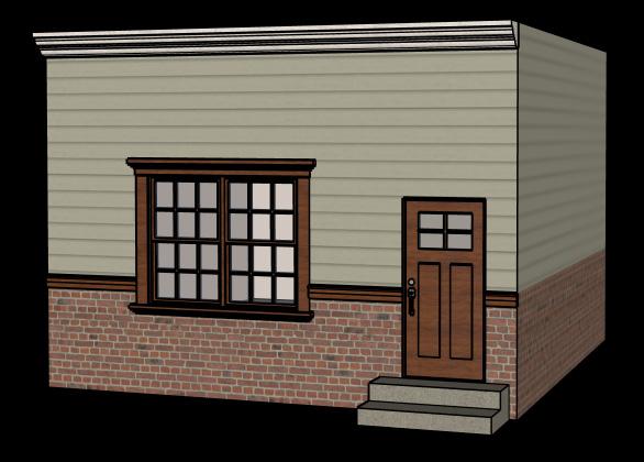
13. Vertical or horizontal banding of architectural (not color) features.

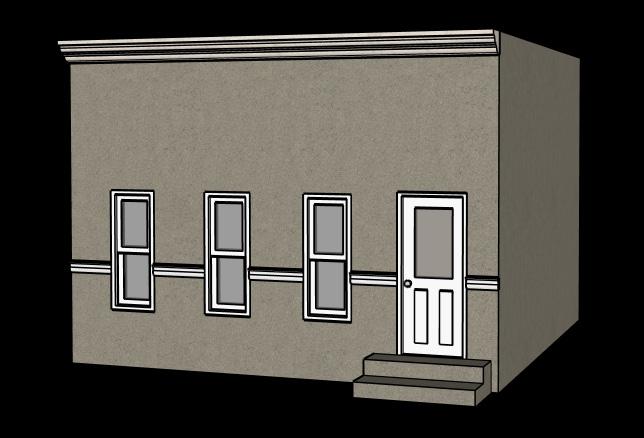
10.4.2 Doors and Entrances
A. Buildings must have a primary entraces door facing a public sidewalk. Entrances at building corners may be used to satisfy this requirement.
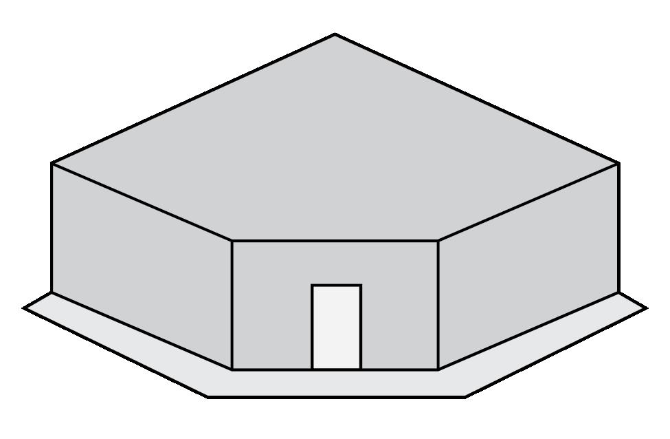
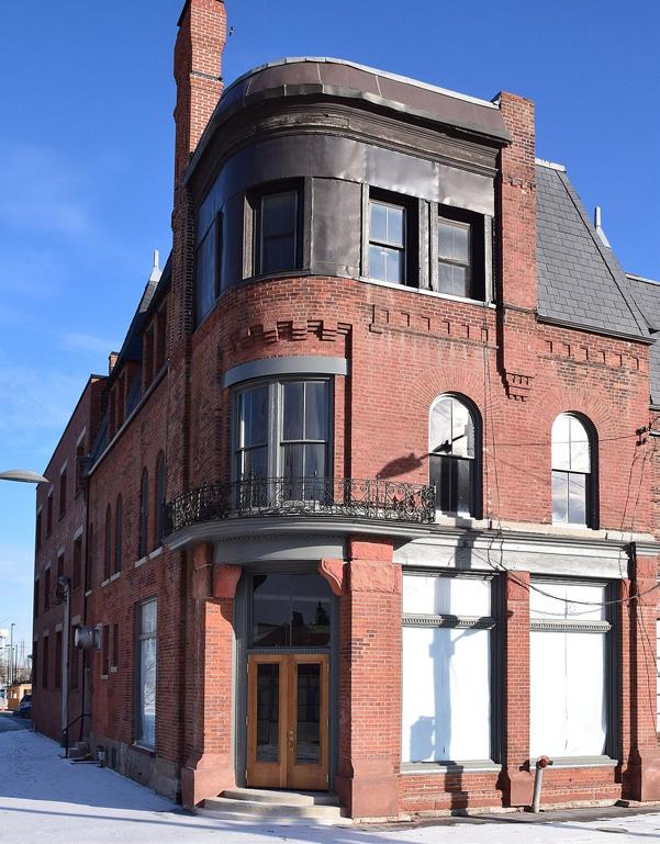
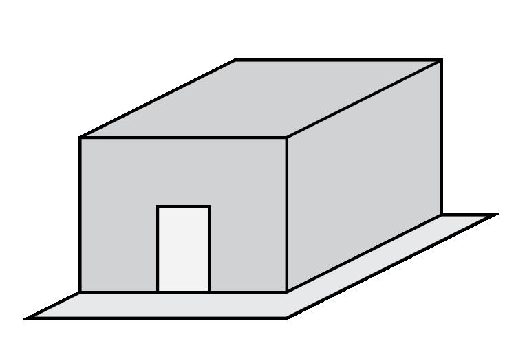
B. Building entrances may include:
1. Doors to individual shops or businesses.
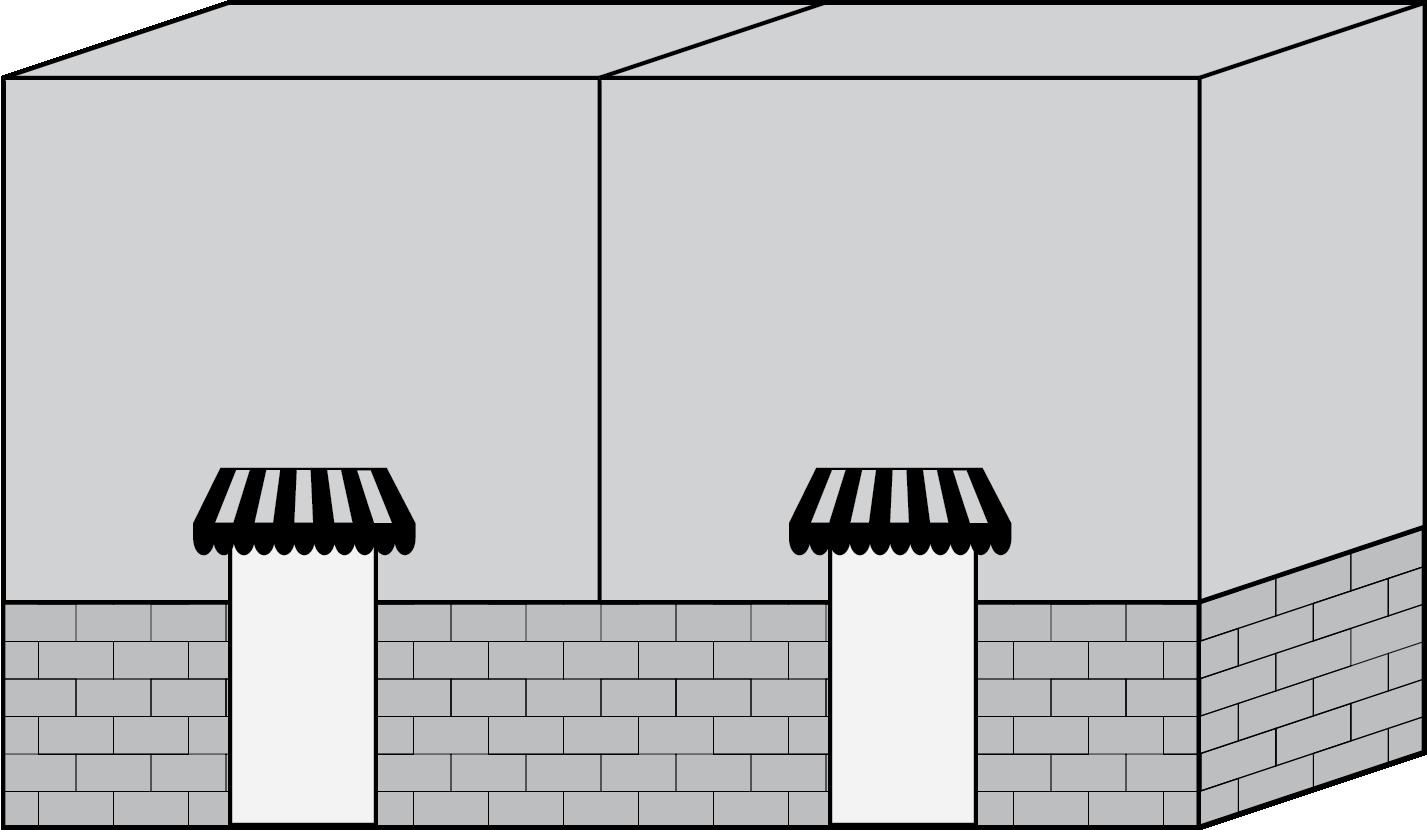
2. Lobby entrances.
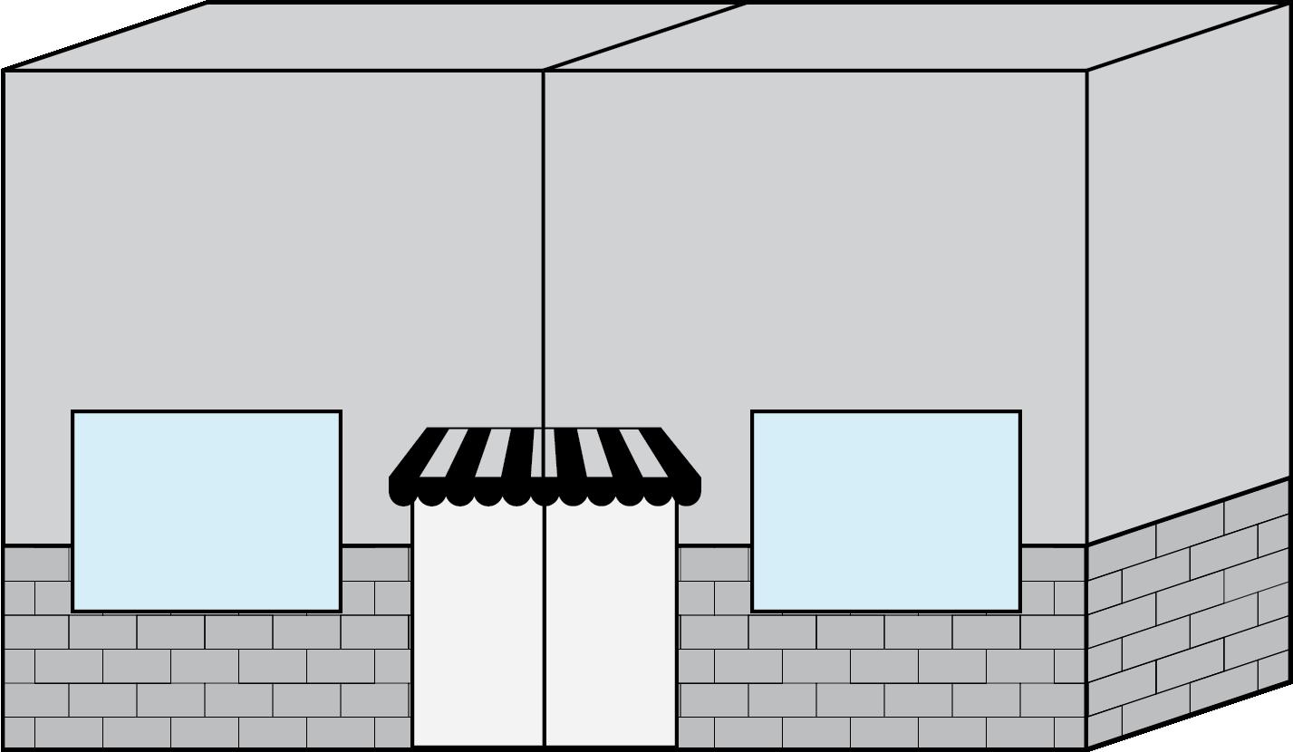
3. Entrances to pedestrian-oriented plazas.
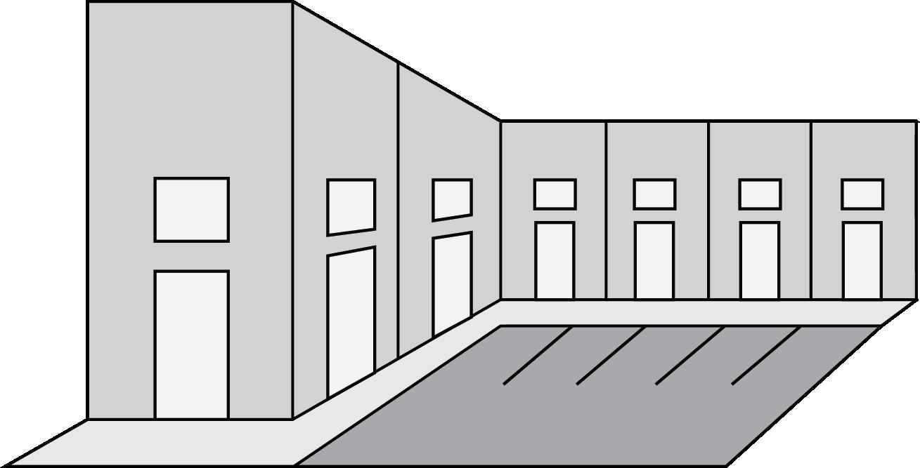
4. Courtyard entrances to a cluster of shops or businesses.
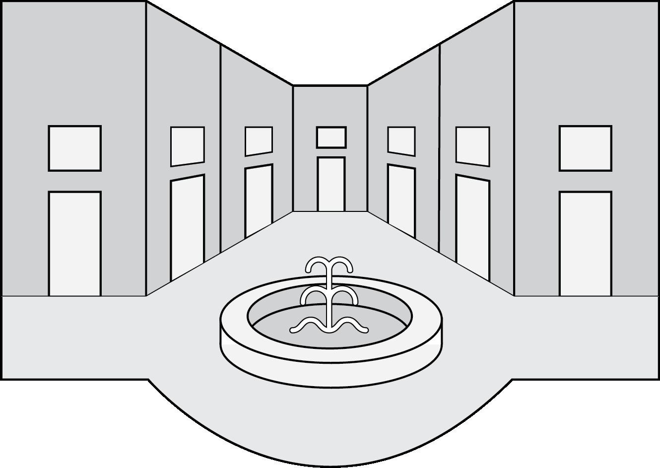
10.4.3 Roof Standards
Roof features shall be in scale with the building and complement the character of adjacent buildings. Roofs shall comply with the following standards:
A. The roof edge of each primary facade shall have at least one vertical change of at least three feet from the predominant roof design. Roof mounted mechanical equipment shall be concealed through the use of parapet walls or enclosures with an architectural and design style consistent with the parent building.
B. Each roof shall incorporate at least two of the following design elements:
1. Overhangs of not less than two feet beyond the supporting walls with a minimum fascia of 8 inches or;
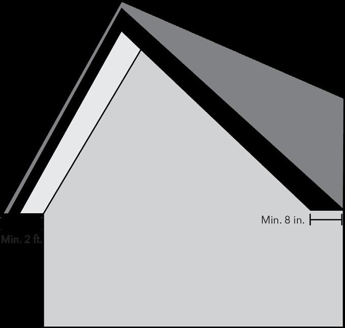
2. Multiple plane slopes on each primary façade or;
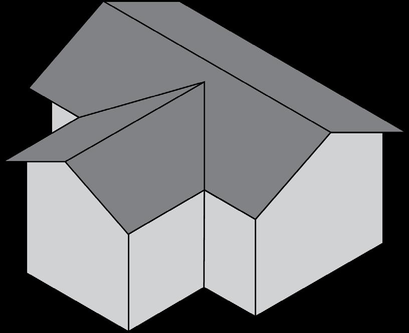
3. Three-dimensional cornice treatment which is at least 12 inches in height and contains at least 3 reliefs; or
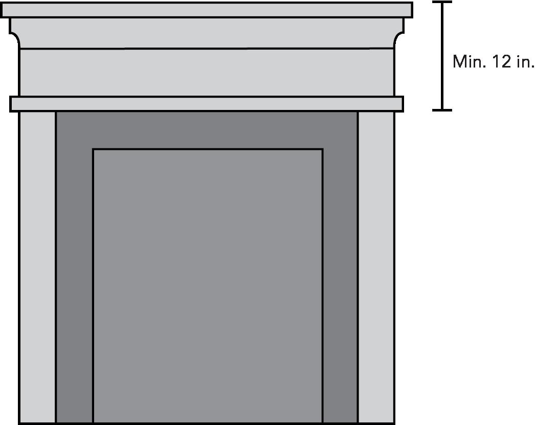
4. Vertical roof changes with a minimum change in elevation of 2 feet other than the vertical roof changes required above.
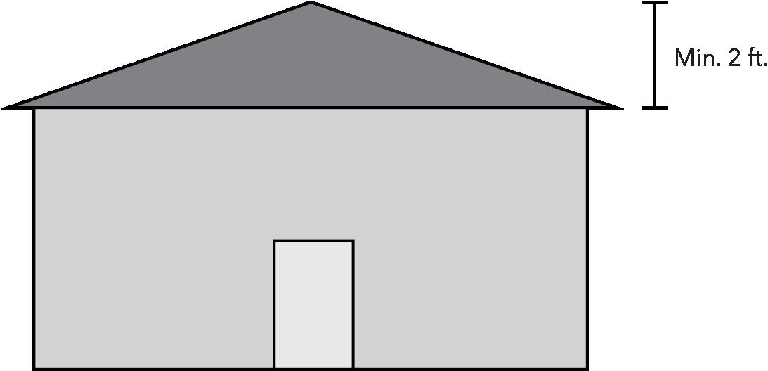
C. Roofing material shall be constructed of durable high quality material. Use of the following types of roofing materials and designs is prohibited, except as noted:
1. Asphalt shingles, except laminated 25-year architectural grade asphalt
shingles or a higher grade of asphalt shingles;
2. Mansard roofs and canopies with a vertical distance of less than eight feet or an angle of less than 25 degrees or an angle greater than 70 degrees;
3. Roofs with less than or equal to a 2 to 12 pitch unless full parapet coverage is used; and
4. Back-lit awnings used as a mansard or canopy roof.
D. The following roof types shall be designed with the following standars
1. Pitched Roofs: Roofs shall be simple and symmetrically pitched and only in the configuration of gables and hips with pitches ranging from 4:12 to 14:12.

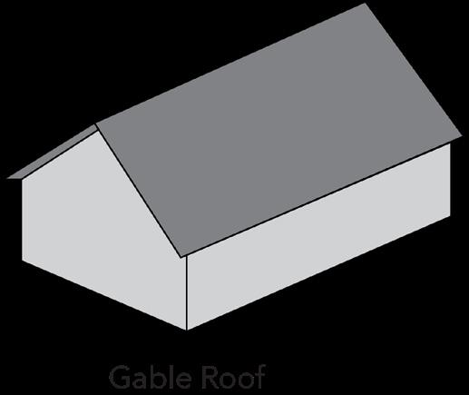
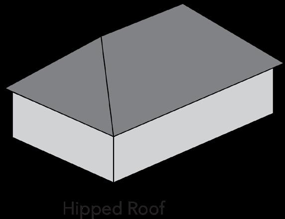
2. Shed Roofs: Shed (single slope) roofs are permitted only when the ridge is attached to an exterior wall of a building, with pitches ranging from 4:12 to 14:12.
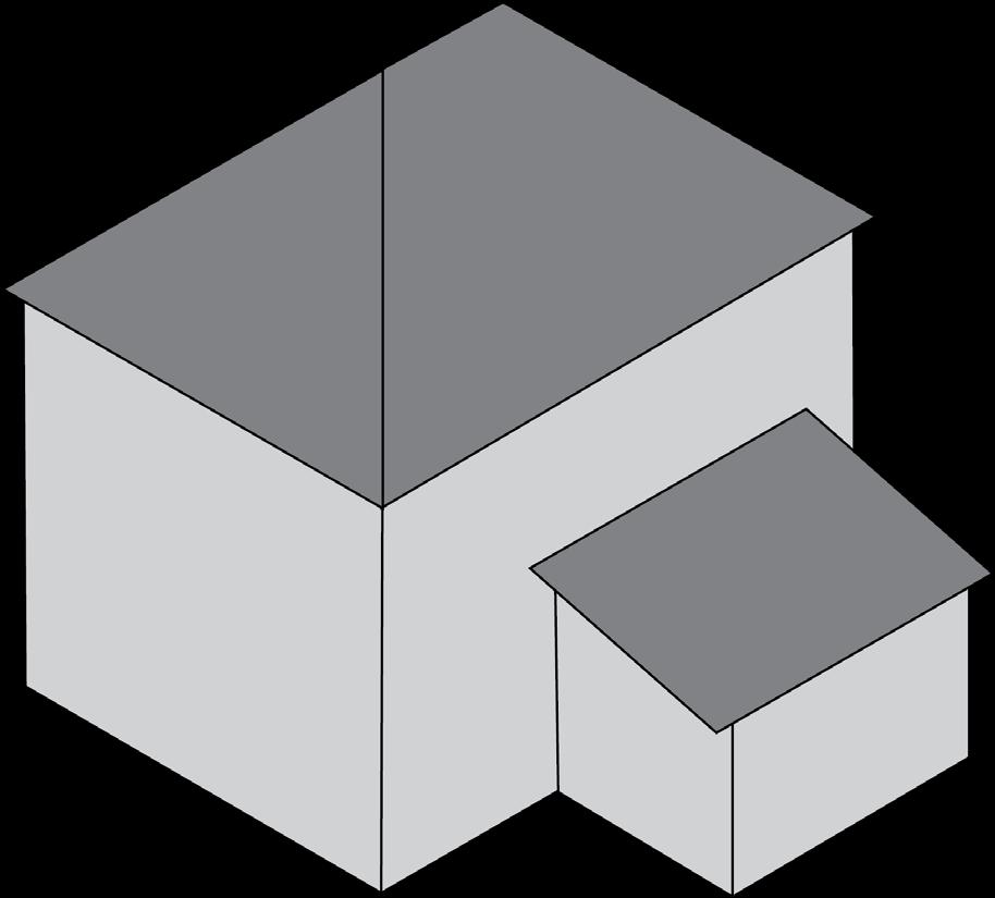
3. Flat Roofs: Flat roofs are permitted when consisten with the selected style of architecture, if edged by a railing or parapet, and if rooftop mechanical equipment is either camouflaged on all sides or visually integrated into the overall design of the building.
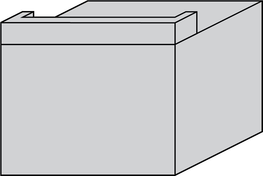
4. In no case shall rooftop mechanical equipment be visible from adjoining residential districts.
5. All vents, attric ventilators, turbines, flues, and other roof penetrations shall be painted to match the color of the roof, or painted flat black. Gutters and downspouts shall be appropriate to or visually integrated with the selected architecually style of the structure.
6. Dormers, belvederes, cupolas and pergolas may be used as a design element, so long as they are designed with the details, proportions, style, and materials consistent with the buildings selected architectural design.
E. All rooftop equipment shall be enclosed in building material that matces the structure or is visually compatible with the structure.
F. The exposed walls and roofs of buildings shall be maintained in a clean, orderly, and attractive condition, free of cracks, dents, puncutres, breakage, and other forms of visible marring. Materials that become excessively faded, chalked, or otherwise deteriorated shall be refinished, repainted, or replaced.
10.4.4
Material Standards
A. Exterior building colors and materials shall be integrated into a comprehensive design style for the building. The following materials shall be prohibited:
1. Smooth concrete masonry units.
2. Stone construction with a rubble appearance.
3. Sheet plywood and other similar paneling products used as exterior building materials.
4. All facades which face roadways, parking areas or residential districts shall utilize vinyl or aluminum siding for no more than 50% of the facade and shall utilize corrugated metal for no more than 25% of the facade.
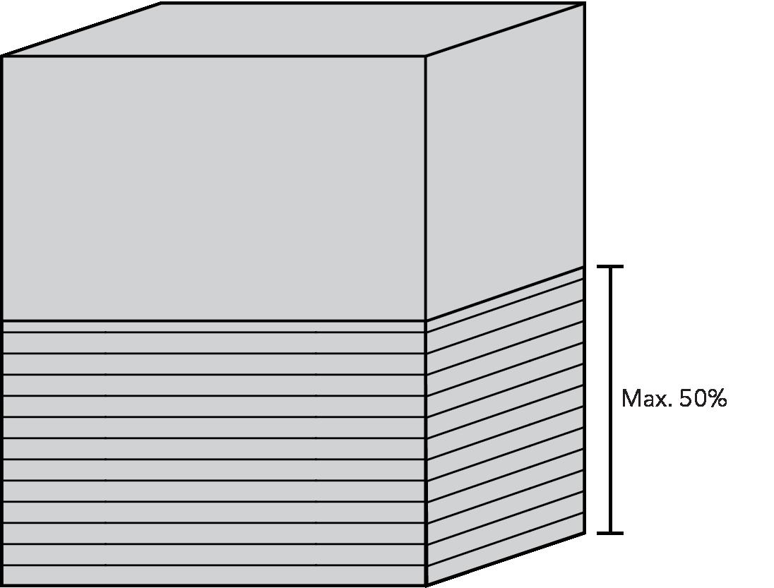
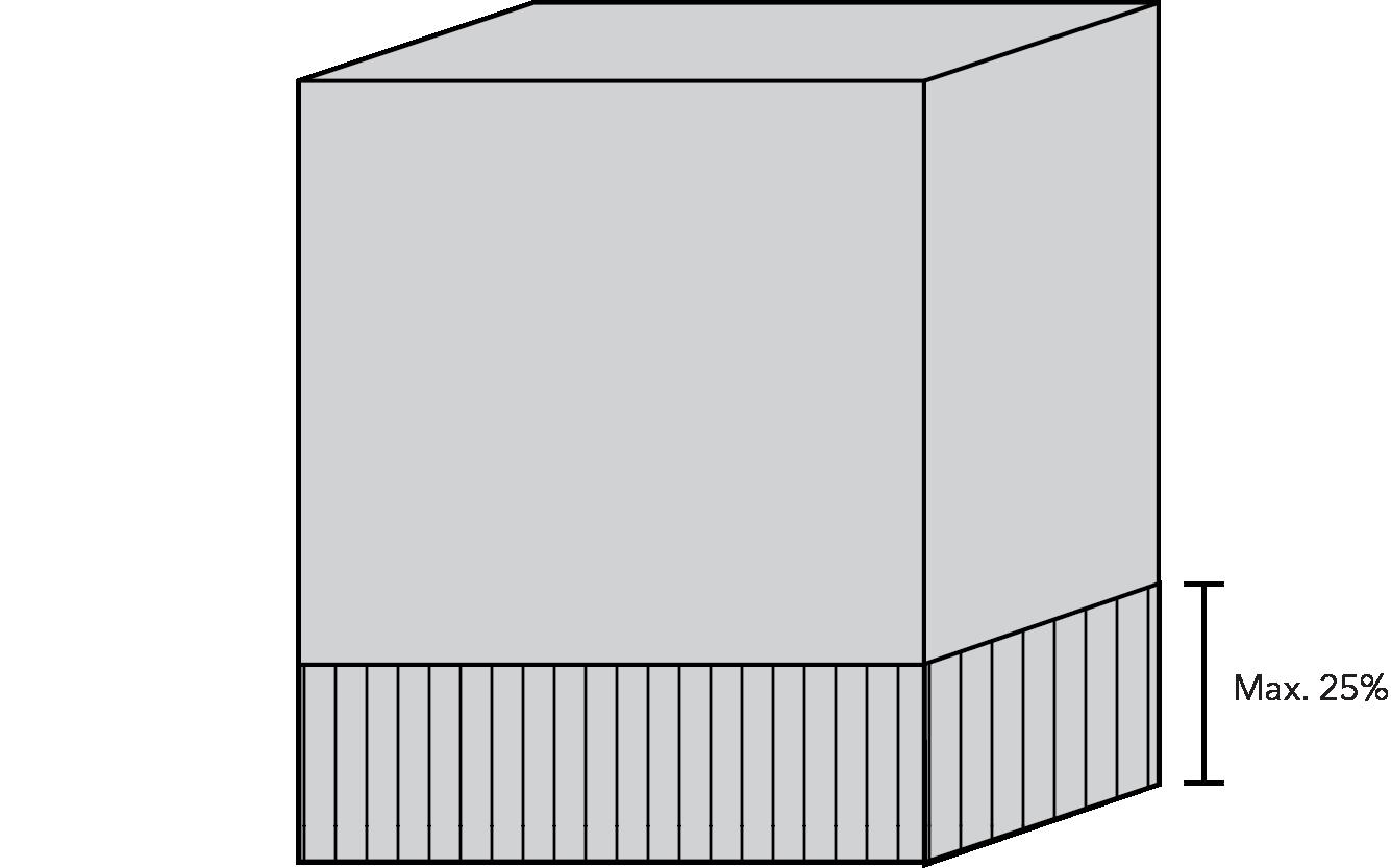
10.4.5 Parking Structure Standards
A minimum of 60% of the area of any primary facade of a parking structure or covered parking facility shall be composed of at least 2 of the following elements.
A. Transparent windows, with clear or lightlytinted glass, where businesses are located within the parking structure, at street level along a primary facade of the parking structure;
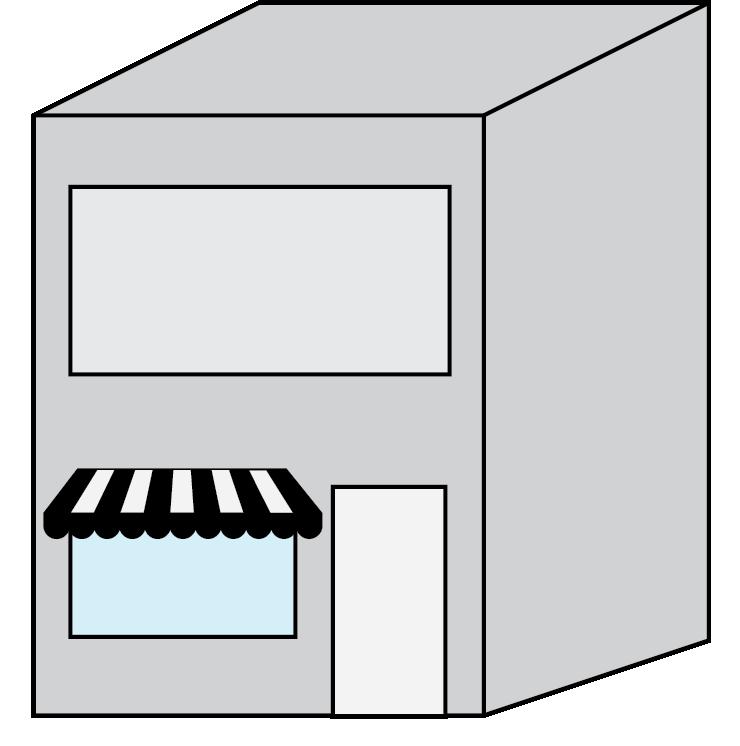
B. Display windows;

C. Decorative metal grille-work or similar detailing which provides texture and partially and/or fully covers the parking structure opening(s);
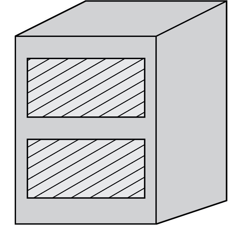
D. Art or architectural treatment such as sculpture, mosaic, glass block, opaque art glass, or relief work;
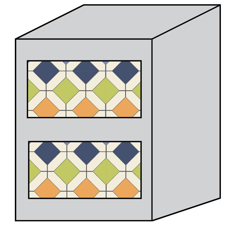

F. Landscaping; or
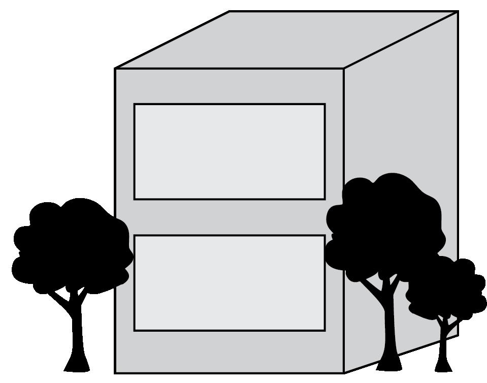
G. An entryway plaza which complies with all entryway standards.
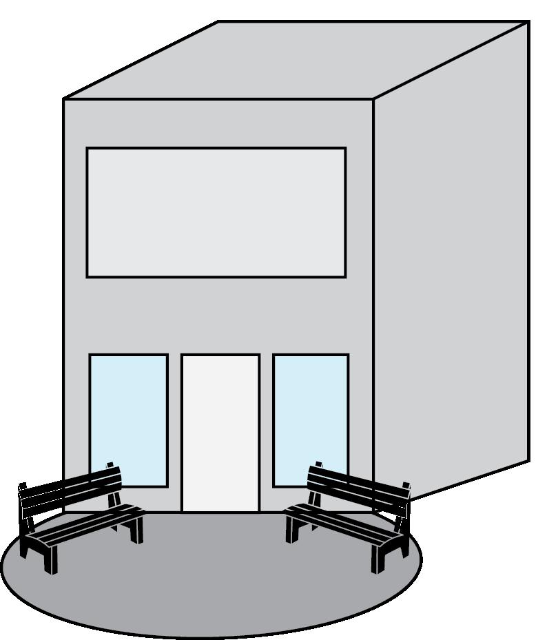
This Page is Intentionally Left Blank
C HAPTER 11:
S i GN STANDARDS
11.9
11.1 PURPOSE AND APPL i CAB i L i TY
11.1.1 Purpose and Intent
It is the intent of this section to establish a comprehensive system for the regulation of signs within the City of Elkhart to serve the following purposes:
A. To protect the health, safety, and general welfare of the city and its residents.
B. To implement the policies of the City’s Comprehensive Plan.
C. To allow adequate opportunity for free speech in the form of messages or images displayed on signs, while balancing that interest against public safety and aesthetic concerns impacted by signs.
D. To ensure that the design, location, construction, illumination, installation, repair, and maintenance of signs:
1. Does not interfere with traffic safety or otherwise endanger public safety;
2. Enhances and protects the aesthetic value of the City by reducing visual clutter that is potentially harmful to property values, economic development, and quality of life; and
3. Is consistent with the character of districts in which the signs are located, including areas specially designated for historic, scenic, or architectural value.
E. To protect the safety and efficiency of the city transportation system by reducing confusion and distractions to pedestrians and motorists, while enhancing motorists’ ability to see pedestrians, obstacles, other vehicles, and traffic signs.
F. To prevent the inadvertent favoring of commercial speech over non-commercial speech or favoring of any particular noncommercial speech over any other noncommercial speech based on its content.
G. Regulate signs in accordance with city policy, that are consistent with state and federal law.
11.1.2 Applicability
A. The requirements, conditions, prohibitions, and exceptions specified in this Chapter shall apply to all signs and sign structures visible from the public right-of-way in all zoning districts in the City of Elkhart’s planning jurisdiction.
B. No sign or advertising device shall be established, substantially altered, changed, erected, constructed, reconstructed, moved, divided, enlarged, demolished, or maintained except in compliance with this article.
11.1.3 Non-commercial Message Substitution
A. Any sign that is legally permitted for commercial content may be substituted with non-commercial content, subject to the same regulations, without requiring additional zoning approvals.
B. The right to substitute the noncommercial message does not waive any other requirement imposed by this Unified Development Ordinance as to the number, size, type, construction, location, lighting, safety or other regulated attribute.
11.1.4 Severability
If any decision, subsection, sentence, phrase or portion of this Chapter is for any reason held invalid or unconstitutional by any court of competent jurisdiction, that portion of these regulations shall be deemed separate and distinct, and that holding shall not affect the validity or constitutionality of the remaining portions of this section, which shall remain in full force and effect.
11.2.1 Zoning Clearance Permit Required
Unless otherwise exempt, it shall be unlawful for any person to erect, locate, or otherwise establish any sign described in this article except in conformance to the standards found herein. Certain signs shall require permits and certain signs are exempt from permitting but are required to meet the conditions of this article.
A. A zoning clearance permit shall be required for all signs located, erected, constructed, reconstructed, moved, or altered, as described in Section 11.1.2
Applicability, unless specifically exempted by Section 11.2.2 Signs Not Requiring a Permit.
B. A sign permit shall be obtained from the Building Department prior to installation, unless specifically exempted by Section 11.2.2 and 11.2.3.
C. An electrical permit shall be obtained from the Building Department for the erection, installation, or replacement of any sign requiring electrical power for lighting, movement or copy change.
D. Review of Application.
All applications for Permanent Signs, except for those applications subject to administrative approval by the Planning staff shall be considered by the Plan Commission or, by the Redevelopment Commission. Approval for a Permanent Sign may be by:
1. Individual application;
2. A Coordinated Master Sign Program; or
3. A separate administration review application approved by the Planning staff.
11.2.2 Signs Not Requiring a Permit
The following signs in Table 11.2.1 do not require a zoning clearance permit, unless otherwise specified in this article. Signs not requiring a permit are not exempt from any other requirement imposed by this ordinance, including the number, size, type, construction, location, lighting, safety or other regulated attribute. These signs are permitted in any zoning district unless specifically stated otherwise.
TABLE 11.2.1 S i GNS NOT REQU i R i NG A PERM i T
Building Names or Construction Dates none
building names or construction dates may be displayed on cornerstones, foundation stones, and memorial signs or tablets; max. 6 sq.ft. of sign area
Drive-Through Signs permit required for illumination refer to TABLE 11.10.16
Flags, Emblems, or insignia of any Nation, State, or Political Subdivision none refer to TABLE 11.10.18
Gravestones none n/a
Historic Site Markers or Plaques none
information Kiosks & Bulletin Boards none
max. 6 sq. ft. of sign area
Information Kiosks & Bulletin Boards may be erected by or on behalf of a governmental body on public property or rights-of-way (where permitted) for the display of handbills or posters of community interest.
Max. 72 sq. ft. per kiosk or bulletin board.
Max. 6 sq. ft. per sign display surface.
Non-Commercial Signs none applicable to non-commercial signs not otherwise regulated by this chapter
Public signs required by the local, state, or federal government
external illumination, or as required by law n/a
Registered Vehicles with Commercial Graphics none
Signs on registered, licensed vehicles that are parked in a manner that serves the purpose of advertising business, are generally located in front of the business, and is parked in a standard size parking space do not require permits.
Vehicle signs as described in Section 11.3.15 Vehicle Signs are prohibited.
Scoreboards permit required for illumination may not include commercial or business advertising displays (unless obstructed from exterior view with a vegetative scrren or opaque fence)
Signs on permitted vending machines or vending boxes or ATMs none; ATMS may be illuminated per safety requirements vending machines or vending boxes within a building or enclosed space are exempt from this chapter
Signs located entirely inside the premesis of a building or enclosed space n/a n/a
Signs no more than 4 sq. ft. none
refer to Section 11.10 Specialty Sign Types, if applicable
Utility Marker Signs none, unless required by buildng codes n/a
Window Signs none refer to TABLE 11.9.2
11.2.3 Other Actions Allowed without Requiring a Permit
The following signs and actions related to signs shall be exempt from the permit requirements of this Chapter but shall be subject to all other standards of this Chapter:
A. Changing of the advertising copy or message on an existing painted or printed sign, marquee, changeable copy sign or a similar compliant sign, whether electrical, illuminated, electronic message center or non-illuminated painted message, provided that the copy on an electronic message board shall not
change more frequently than allowed under Table 11.10.17 Electronic Message Center Signs;
B. Painting, repainting, cleaning or other normal maintenance and repair of a sign not involving structural alterations;
C. Installation of permanent signs smaller than 4 square feet where such signs are allowed by this Chapter and involve no electrical installation; and
D. Installation of temporary signs where such signs are allowed by this Chapter and conform with this Chapter in all respects.
11.2.4
Unified Sign Plan Required
A. Examples of Developments requiring a Unified Sign Plan:
1. Shopping Center or Retail Strip
2. Office Park
3. Industrial Park
4. Retail Anchor with Outlot Shops or Restaurants with shared parking
B. Applicability
1. A Unified Sign Plan is an overall plan for placement of multiple signs for a building or group of buildings on a zoning lot.
2. Where a zoning lot contains more than 3 principal uses or establishments, the zoning lot as a whole, shall be considered one site.
3. Unified Sign Plans are not required in CBD or in a development plan district that requires a subarea plan or master plan.
C. Permitting
1. The owners of the zoning lot are responsible for allocating permitted signs and display surface area among the individual uses or establishments.
2. The unified sign plan submitted for a zoning lot must show all signs located or proposed on the zoning lot.
11.2.5
Master Sign Plans
A. The following uses and developments may approve a Master Sign Plan:
1. Planned Unit Developments
2. Multiple-tenant commercial, office, or employment uses.
3. A multiple-building complex for a single commercial or employment use.
4. Indoor or outdoor entertainment and recreation uses.
5. Education campus.
6. Hospital.
7. Hotels and Commercial Lodging having at least 150 guest rooms and a FullService Restaurant or conference and meeting rooms.
8. Regional retail shopping malls.
9. Integrated developments.
B. Applicability
The Plan Commission may approve a Coordinated Master Sign Plan as an alternative to the requirements set forth in Chapter 10 for the uses and developments listed below:
C. Conditions
The Plan Commission may attach conditions, requirements, or standards necessary to assure that the signs covered by the Coordinated Master Sign Plan will not be materially detrimental to persons or property in the vicinity. In making its determination, the Plan Commission shall not base any condition on the message content of a sign.
D. Evaluation Criteria
Coordinated Master Sign Plans shall be evaluated based on the following criteria:
1. Placement
All signs shall be placed where they are visible and legible. Factors to be considered include its location relative to traffic movement and access points, site features, other structures, and orientation relative to viewing distances and viewing angles. Wall Signs may be approved on building walls other than the wall of the space occupied by the tenant in commercial centers in which some tenants have little or no visibility from the street.
2. Quantity
The number of signs and that may be approved within any development shall be sufficient to provide necessary facilitation of internal circulation of vehicular and pedestrian traffic and way finding for safety of the occupants of vehicles and pedestrians. Factors to be considered shall be those that impact safety considerations such as the size of the development and the number of development sub-areas.
3. Size
All signs shall be no larger than necessary for visibility and legibility. Factors to be considered in determining appropriate size include topography, volume and speed of traffic, viewing distances and angles, proximity to adjacent uses, and placement of display. In no event shall a Coordinated Master Sign Plan contain a freestanding sign that exceeds by more than 50% any maximum height standard permitted by this Article. In no event shall a Coordinated Master Sign Plan contain a wall sign that exceeds by more than 25% any maximum size (area) standard permitted by this Article. Consistent with the exemptions set forth in this Article, there shall be no limit on the amount by which a Coordinated Master Sign Plan may allow a freestanding or wall sign to exceed their size (wall) or height (freestanding) restrictions permitted on the site when the sign is placed or oriented so as to be visible only internally to the development itself.
4. Design Features and Materials
Sign design themes and materials shall be compatible with the architecture, colors, and materials of the project.
5. Development Standards
The Plan Commission may not reduce any sign development standard to less than 50% of any minimum standard, nor increase any sign development standard by more than 100% of the maximum
standard. Notwithstanding the foregoing, the Plan Commission shall not base any decision on the message content of a sign.
6. Amendments
The Planning and Zoning staff may administratively approve minor amendments (a 10% change of a minimum or maximum standard) to a Coordinated Master Sign Plan involving non-communicative activity, where such changes are determined to have little or no visual impact and are consistent with the intent of the original approval.
11.3 PROH i B i TED S i GN TYPES
The following signs are prohibited in all zoning districts unless protected by state statute or specifically authorized by another provision in this article.
11.3.1 Abandoned Signs: any sign that is not kept in good repair and/or safe condition for a period exceeding 6 months.
11.3.2 Animated Signs: signs that use any motion picture, laser, visual projection of images or text, or are animated, rotating, or other moving or apparently moving signs, including vehicular billboards.
11.3.3 Balloon Signs or inflatable signs
11.3.4 Billboards except permitted off-premesis signs
11.3.5 Drone Signs
11.3.6 Electronic Reader Board Signs: any electronic reader board sign not specifically permitted in Table 11.10.17 Electronic Message Center Signs.
11.3.7 Imitation of Public Signs: signs that purport to be, are in imitation of, or resemble a public sign as described by the Manual on Uniform Traffic Control devices. Examples include but are not limited to stop signs, yield signs, and pedestrian crossing signs.
11.3.8 Strings of Pennants, propellers, pinwheels, streamers, or similar small objects except as temporary signs.
11.3.9 Pole Signs
11.3.10 Roof Signs
11.3.11 Rotating Signs
11.3.12 Scrolling Signs
11.3.13 Signs attached, installed, or painted on trees, rocks, natural features, fences, utility pole, or street sign (known as Snipe Signs);
11.3.14 Signs imitating or resembling government, emergency, or traffic control device signs;
11.3.15 Vehicle Signs: vehicles, vans, trailers, or trucks that are parked continuously in the same general location to be used as display signs. This does not prohibit vehicle or trailer owners from having vehicles or trailers with signs, provided the vehicles or trailers are in use on a regular basis, are not continuously parked in one parking lot or parking space, and are not being used to serve in the same manner as an additional freestanding sign or temporary sign.
11.3.16 Intermittent Lights: signs that have intermittent blinking, flashing, or fluttering lights, including any device that has a changing light intensity, brightness of color, or gives such illusion, including but not limited to strobe lights.
11.3.17 Audio Sign Components: any signs that produce or utilize sound are prohibited, except for sound speakers that are components of drive-through signs, components of gasoline pump islands signs, and information kiosks. Audio sign components intended to serve individuals with disabilities are exempt from prohibition.
11.3.18 Any sign that projects outward more than 12 inches from the façade of a building, except as provided in Table 11.9.4 Projecting Signs & Blade Signs
11.3.19 Wind Signs: devices consisting of banners, streamers, pennants, wind-blown propellers, balloons, inflatable devices, strung light bulbs
and similar installations, unless approved by the Planning Staff for non-commercial activities or as temporary signs as permitted by Section 11.10 Specialty Sign Types. Wind signs also include signs that blow in the wind not complying with Section 11.9 Sign Types Permitted by District
11.3.20 Non-Permanent Signs: any sign that is not permanently affixed to the ground or a structure (except Sandwich Board Signs, Human Signs, Registered Vehicle Signs, and Temporary Signs described above). Any sign that does not comply with Section 11.6 Sign Design Standards and Measurement Rules, 11.7 Sign Illumination, 11.9 Sign Types Permitted by District, or 11.10 Specialty Sign Types is considered a prohibited sign.
11.4
PROH i B i TED S i GN LOCAT i ONS
Whether or not a sign requires a zoning clearance permit, signs shall not be located in any of the following locations:
11.4.1 Public Easement
No signs shall be located in any public easement, unless the sign is a public sign authorized by Section 11.2.2 Signs Not Requiring a Permit.
11.4.2 Public Right-of-Way
No signs shall be located in the public rightof-way, unless the sign is authorized by Section 11.2.2 Signs Not Requiring a Permit, Section 11.5.3 Clearance Requirements, or the sign is a public sign authorized by “Table 11.2.1 Signs not requiring a permit”.
11.4.3 Roofs
No signs shall be located on the roof of a structure, or extending above the eave, roof line, or parapet of a building, except that signs may be located on the vertical portion of a mansard roof if no vertical wall space is available on the wall space associated with the tenant or occupancy below.
11.4.4 Visual Obstruction
A. No signs shall be located within the area specified in Section 6.18 Clear Sight Distance, except as allowed by Section 11.5.5 Signs Allowed in the Right-of-Way
B. No sign may be located in a way that obstructs or blocks any public right-ofway, sidewalk, walkway, intersection, ingress or egress point, transit stop, pedestrian ramp, parking space, drive aisle, driveway, building entrance, fire escape, or accessibility ramp.
C. No sign may obstruct sight lines along any right-of-way or obstruct traffic sight lines to traffic control lights, street name signs at intersections, or signals at railroad grade crossings.
11.4.5 Miscellaneous
A. No signs shall be located on any traffic control signs, highway construction signs, fences, utility poles, street signs, light fixtures, telephone or telegraph pole, trees, rocks, or other natural objects.
B. Signs shall not be attached to standpipes, gutters, drains or fire escapes. Signs shall not be installed to impair access to a roof.
C. Signs or sign support structures shall not obstruct means of egress, including any fire escape, window, any door opening, any stairway, any opening, any exit, any walkway, any utility access or Fire Department Connection;
D. Signs shall not interfere with any opening required for ventilation
11.5 GENERAL PROV i S i ONS
11.5.1 Viewpoint Neutrality
A. Notwithstanding anything in this Chapter to the contrary, no sign or sign structure shall be subject to any limitation based upon the viewpoint of the message contained on such sign or displayed on such sign structure.
B. Notwithstanding anything in this Chapter to the contrary, it is the policy of the City to regulate signs in a manner that does not favor commercial speech over noncommercial speech and does not regulate protected noncommercial speech by message content.
C. Within this Chapter, any distinction between on-premise signs and offpremise signs applies only to commercial messages. It does not apply to noncommercial messages.
11.5.2 Consent of Legal Owner of Property
Except as required by state law, no sign may be displayed without the consent of the legal owner of the property on which the sign is mounted or displayed. For purposes of this policy, “owner” means the holder of the legal title to the property and any party and person holding a present legal right to possession, control, or use of the property.
11.5.3 Clearance Requirements
A. Any part of a sign extending over a pedestrian traffic area, walkway or sidewalk shall have a minimum vertical clearance of 9 feet above that surface and any part of a sign extending over a vehicle area shall have a minimum vertical clearance of 16 feet above that surface, unless otherwise specified in Sections 11.9 or 11.10.
B. Freestanding signs shall have at least a vertical clearance of 10 feet and a horizontal clearance of 6 feet from any overhead power line.
C. Signs and their supporting structures shall maintain clearance from and noninterference with all surface and underground facilities and conduits for water, sewage, electricity, or communications equipment or lines. Sign placement shall not interfere with surface or underground water or with natural or artificial drainage.
D. Permanent Signs shall not project into or over the public right-of- way without first obtaining a license or encroachment permit from the City.
E. Any sign placed on a sidewalk or other public right of way must comply with this Article and applicable provisions of the Americans with Disability Act.
11.5.4 Signs on Public Property
Except as required by state law or otherwise permitted by this Chapter, any sign installed or placed on public property shall be deemed illegal and shall be forfeited to the public and subject to confiscation. In addition to other remedies hereunder, the City shall have the right to recover from the owner or person placing such sign the cost of removal and disposal of such sign.
11.5.5
Signs Allowed in the Right-of-Way
Wall signs, canopy signs, projecting signs, and crown signs may encroach over the public sidewalk but must not encroach on or over any streets or alleys, unless stated otherwise in this Chapter. All signs must be a minimum of 24 inches inside the curb line or edge of pavement.
11.5.6
Construction of Signs
A. Materials and Installation
The construction materials and details for all signs erected in the City shall be of the quality and grade as specified for buildings in the Uniform Building Code as adopted by the Administrative Building Council of the State of Indiana
B. Safety
All electrical fixtures, devices, circuits, conduits, raceways, or any apparatus used to illuminate any sign shall be installed and maintained in compliance with current electrical and fire codes with the NFPA 70. A listing label from a nationally recognized testing laboratory,
such as UL, shall be provided for any sign with electrical components.
C. Durability
Materials for signs shall be durable and capable of withstanding weathering over the life of the sign with reasonable maintenance. Glass forming any part of a sign, except for exposed lamps, shall be safety glass.
D. Watertight
All signs attached to a building shall be installed and maintained so that wall penetrations are watertight and do not exceed allowable stresses of supporting materials. When a building-mounted sign is removed, the wall shall be repaired and restored to its original condition prior to sign installation.
E. Prevent Nesting
All signs and their supporting structures shall be enclosed to prevent inhabitation by birds, rodents, insects, and other wildlife.
F. Raceways and Transformers
If a raceway is necessary, it shall not extend in width or height beyond the area of the sign. A raceway shall be finished to match the background surface to which it is attached or integrated into the overall design of the sign. Conduits and other electrical components shall be designed as an integral part of the overall sign structure and hidden from view to the extent technically feasible. Visible transformers are prohibited.
11.5.7
Number of Faces Permitted on a Freestanding Sign Structure
Unless specifically restricted by these sign regulations, a sign structure may contain more than 1 sign face, and may be doublesided or multi-sided, provided all other requirements of this ordinance are met.
11.5.8
Excess Sign Size Square Footage
No portion of a maximum size allowance may be transferable to another sign, another frontage, another façade or between building signs unless specifically permitted by this Chapter.
11.5.9 Address of Ground Signs
The street address number must be included on all ground signs. Numerals must be at least 9 inches in height. The area of the address is not included in any calculation of total sign area.
11.5.11
11.5.10
Historic or Legal Non-Conforming Designation
A. Any sign in place prior to the effective date of this ordinance that does not comply with the standards of this article for size, location, height or sign type is considered a non-conforming sign that is permitted to be continued, be maintained, repaired, or replaced if damaged or destroyed.
B. A legal non-conforming sign shall immediately lose its legal non-conforming status if:
1. The sign is not kept in good repair and/or in safe condition for a period exceeding 6 months.
2. The sign is relocated.
3. The entire sign is replaced.
4. The permit, variance, or condition under which the sign was allowed expires.
5. The sign is altered to the following extent:
a. Items of information are increased.
b. The size of the sign is increased.
c. Lights and/or other electronic features are added.
d. The intensity of the lighting is increased.
6. The use changes.
7. The use is discontinued for 6 consecutive months.
Undeveloped Lots in Dwelling Districts
On lots that are in any dwelling district, and which are not improved with a building, 1 freestanding sign a maximum of 32 square feet in size and 8 feet in height is allowed along each improved street right-of-way. Within 5 days of receiving a certificate of occupancy, the sign must be removed. Such signs shall not be illuminated, shall comply with the maintenance provisions of Section 11.8, and shall not require a zoning clearance permit.
11.5.12 Undeveloped Lots in Non-Residential Districts
On lots that are in any non-residential district, and which are not improved with a building, one freestanding sign a maximum of 64 square feet in size and 10 feet in height is allowed along each improved street right-of-way. Within five days of receiving a certificate of occupancy, the sign must be removed. Such signs shall comply with the maintenance provisions of Section 11.8 and shall not require a zoning clearance permit.
11.5.13 Signs for Schools and Religious Uses in Residential Districts
Signs for schools and religious uses in residential zoning districts shall be subject to the Institutional Zoning District Standards.
11.6 S i GN DES i GN STANDARDS AND MEASUREMENT RULES
Unless otherwise stated in the UDO, the following standards apply to all signs.
11.6.1 General Design Standards for Freestanding Signs.
All freestanding signs shall comply with the following standards:
A. Number of Signs
One free-standing sign is permitted per zoning lot frontage excluding temporary and portable display signs, unless otherwise stated in this UDO.
B. Setback
1. All freestanding signs shall be set back a minimum of 5 feet from the front property line or outside of the required clear zone of a public sidewalk, whichever is greater, unless specifically approved by the City’s Engineer.
2. No sign may be erected within the clear sight distance at an intersection or driveway. See Section 6.18 Clear Sight Distance.
C. Sign Separation
1. When measuring separation between signs, the distance between signs shall be measured from the nearest exterior elements of each sign.
2. Separation of signs applies to signs on the same side of the street whether or not they are located on the same zoning lot.
D. Mounting
All freestanding signs shall be permanently affixed to the ground.
E. Base
Sign bases shall conform to the following standards:
1. Sign bases shall have an aggregate width of at least 40% of the total horizontal width of the sign; or have supports that are less than 25% of the vertical height of the sign.
2. The base and exposed foundation of all freestanding signs shall be landscaped in accordance with Section 11.6.1.G. Landscaping Where the base is still exposed or landscaping is not required, it shall be covered with a finished material such as brick, stone, metal, or wood.
F. Cap
A decorative cap may extend up to 18 inches above the height limit specified in this Chapter. The decorative cap shall have no identifying text, images, or identifying traits. 18 in. max.

G. Landscaping
1. For any new freestanding sign not located in the CBD zoning district, a landscaped area located around the entire base of a freestanding sign is required.
2. The landscaped area shall contain materials consisting of shrubs, spread no greater than 3 feet on center, and densely planted perennial ground cover.
H. Illumination
Sign lighting shall comply with the light trespass regulations in Section 6.20 Lighting Standards and Section 11.7 Sign Illumination.
Computation of Sign Area. The area of all signs is determined as follows:
A. Where more than 1 sign is permitted, the maximum sign area is cumulative, unless stated otherwise. Building signs shall be calculated separately from freestanding signs.
B. For wall signs, canopy signs, and signs consisting of freestanding letters or logos, sign area is calculated as the total area of the rectangle, circle or square that fully encloses all the letters or logo.
C. For signs on a background, the entire area of the background is calculated as sign area, including any material or color forming the sign face and the background used to differentiate the sign from the structure on which it is mounted. Display surface includes the face of the structure that the message is affixed to. Display surface does not include any structural members not bearing advertisement.
D. The perimeter of a sign will not include lighting fixtures, pole covers, landscaping, framing, decorative roofing, moldings or aprons or other architectural or decorative embellishments, provided they contain no written copy, logos or symbols.
E. The sign area of a three-dimensional sign is calculated as total area of the smallest rectangle, circle or square that fully encloses the largest profile of the threedimensional sign.
F. The area for a sign with more than one face is calculated by adding the area of all sign faces that are 45 degrees or greater; where the sign face angle is less than 45 degrees only the area of the largest sign face is computed as part of the sign area.
G. Poles, supports, pedestals, and other means of supporting a freestanding sign shall not be included in the determination of sign area.

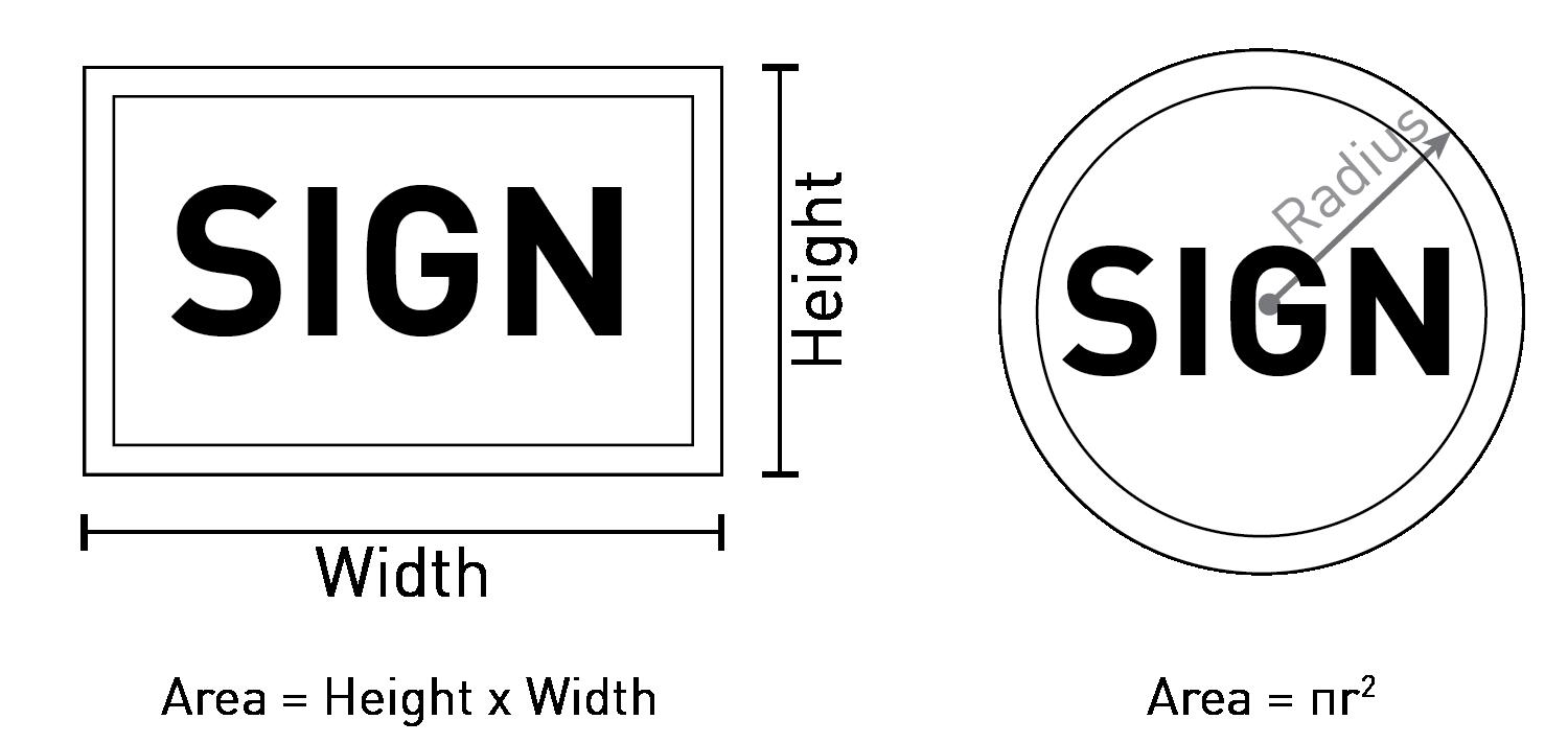

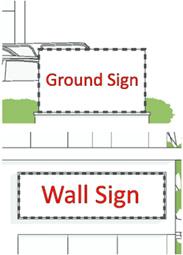
11.6.3
Measurement of Sign Height.
The total height of a sign is measured from the highest point of the sign or supporting structure to the top of the abutting sidewalk (or the crown of the adjacent roadway where no sidewalk exists).
11.6.4 Sign Setback.
Signs required to be set back are typically measured from the property line. However, in instances where the property line is adjacent to a drainage area or other right-of-way that may reasonably be anticipated to exist in the future, the Planning Staff may allow the sign to be placed at the property line without any setback.
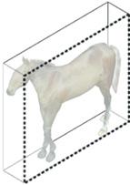

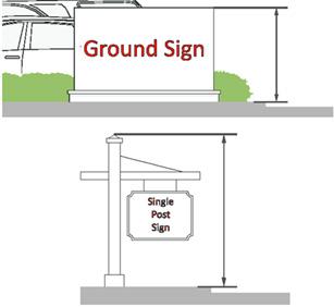
11.7 S i GN i LLUM i NAT i ON
Illumination of signs must be in accordance with the following requirements:
A. General.
1. Sign illumination shall be designed and placed to not cause glare which may result in traffic hazards, or which may interfere with the customary use of nearby residences.
2. In residential districts, apartment complex, subdivisions, and mobile home parks may be illuminated. Nameplates and bulletin boards may be illuminated.
3. In non-residential districts, all signs may be illuminated provided they meet all other provisions established in this UDO.
B. Prohibited Light Sources.
The following light sources are not permitted:
1. Blinking, flashing, chasing or scrolling.
2. Bare bulb illumination, that exceed 0.3 foot candles at the property line.
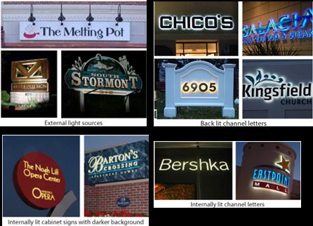
3. Colored lights that may be confused with or construed as traffic control devices.
4. Direct reflected light that creates a hazard to operators of motor vehicles.
C. Brightness.
The light from any illuminated sign must not be of an intensity or brightness that will interfere with the comfort, convenience and general welfare of residents or occupants of adjacent properties. Brightness must not exceed 0.3 foot-candles above ambient light.
D. Internal Illumination.
1. Internal illumination is prohibited in residential districts.
2. Channel letters may be internally lit, halo lit, or back-lit.
3. Lighted backgrounds must be opaque or a substantially darker color than the sign message.
4. Light emitting diodes (LEDs) are permitted as a light source only where the LED is behind an acrylic, metal, or similar sign face and returns in such a manner that the LED modules are not visible from the exterior of the sign.
5. The letter or message of internally illuminated signs must consist of nonreflective materials.
E. External Illumination.
1. Lighting directed toward a sign must be shielded so that it illuminates only the face of the sign and does not shine directly onto public right-ofway or adjacent properties. External lighting of signs in Residential Districts is permitted if illumination levels are below 0.3 foot-candles, measured at ground level, and all fixtures are concealed and do not emit light beyond the lot line.
2. Flood lights or spotlights near the top of a sign must be focused downward onto the sign. Floodlights or spotlights must be aimed such that the entire beam falls within the intended area of the sign to be lit.
F. Lighting
The following restrictions shall apply to signs located in, adjacent to or across a street or alley from a residential zoning district: No commercial or industrial sign shall be illuminated between the hours of 11:00 p.m. and 7:00 a.m. except for:
1. Those businesses open to the public during that time, in which case, illumination shall cease upon closing.
2. Apartment complex, subdivision, and mobile home park signs.
3. Signs for hospitals and emergency health care facilities.
4. Off-premise signs may be illuminated except between the hours of 12:00 a.m. and 6:00 a.m. 11.8
11.8.1
Signs
Presenting Immediate Peril to Public Health or Safety
A. Code Enforcement or Planning and Zoning Office may order the repair of signs declared a nuisance, and with or without notice may cause any structurally unsafe or structurally insecure sign to be immediately removed if the sign presents an immediate peril to the public health or safety.
B. Failure by the owner or tenant to remove poorly maintained signs may result in enforcement action by the city. The Planning Staff may cause removal (after due notice) any sign which shows gross neglect, becomes dilapidated, or if the ground area around it is not well maintained.
11.8.2
Tenant Sign Panel and Wall Sign Band Replacement
Replacement of a tenant sign panel containing the same color, size, design, and style as the original on an approved sign structure with removable panels shall not require a permit. Any tenant panel that is vacant or missing shall be replaced within 30 days.
11.8.3
Wall Sign Fascia Repair
Where a tenant has vacated a tenant or user suite, the fascia of the accessory wall sign band shall be repaired to its surrounding texture and color within 45 days of the panel or sign being removed.
11.8.4 Signs and the premises surrounding them shall be maintained in a clean and sanitary, and inoffensive condition, free and clear of obnoxious substances, rubbish, and weeds.
11.8.5 Signs, together with their supports, braces, guys, and anchors, shall be maintained in good and safe condition, including, as needed, the periodic application of paint or other weatherproofing materials to prevent rust or other decay. Signs shall
not be allowed to deteriorate to a broken, torn, peeling, flaking, or otherwise decayed condition.
11.8.6 Temporary signs and flags shall not be allowed to deteriorate to a tattered, torn, or faded condition. Any banner shall be hung flat and secured at all corners and sides.
11.8.7 Signs and sign structures shall be kept and maintained in a good state of repair and in a safe condition at all times. Maintenance and repair shall include, but not be limited to:
A. The replacement of defective parts.
B. The replacement of missing or damaged sign panels, supports or other components and parts.
C. Cleaning Sign and sign structure components.
D. Repainting Sign and sign structure components.
11.8.8 Replacing damaged Sign panels with different Sign Copy does not constitute maintenance and repair. Replacing damaged sign panels with different Sign Copy shall be treated as replacing any Sign with new Sign Copy.
11.8.9 Taking a Sign or a sign structure down for the purposes of maintenance and repair is permitted.
TABLE 11.9.1 WALL S i GNS
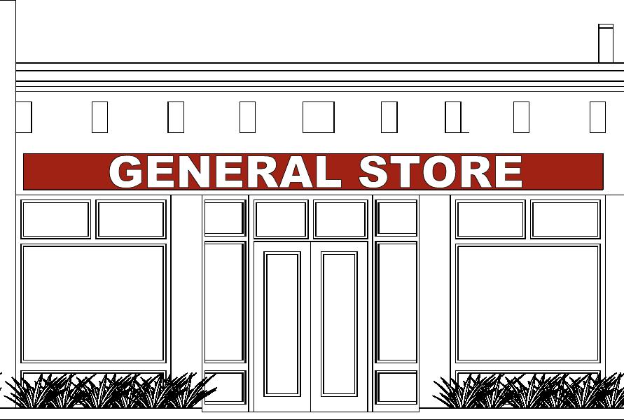
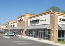
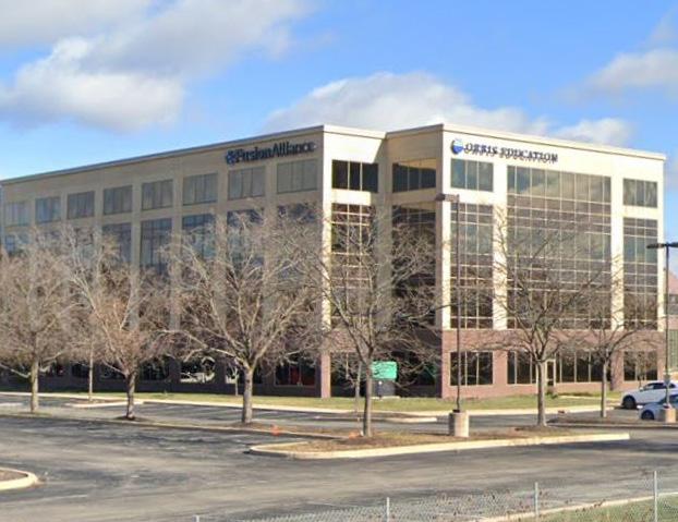
Max. Height A wall sign shall not extend above the wall to which it is attached
Max. Width 1ft. less from each side of the building facade or party wall lines
Location/Setback May be on any building elevation along a public street frontage or facing a customer parking
Projection
Additional Standards A permitted home occupation may have 1 nonilluminated wall sign, max. 6 sq. ft., in any residential district
Refer to Section 11.5.3 Clearance Requirements
Wall signs on residential structures that have been converted to commercial or office uses shall comply with the standards for home occupation signs
Exceptions Temporary signs shall not count towards the number of signs permitted.
Special Considerations for Multi-Story, MultiTenant Buildings
These standards shall apply to multi-story buildings where tenant separation is vertical rather than horizontal (a mid-rise office building, for example):
Each tenant may have one wall sign not to exceed 30 sq. ft.
Each facade may have up to 3 signs, if permitted by its zoning district
In no instance shall the total cumulative sign area exceed 15% of the building facade area.
*Permitted for non-residential buildings **Permitted for residential communities ***Permitted for multi-dwelling buildings
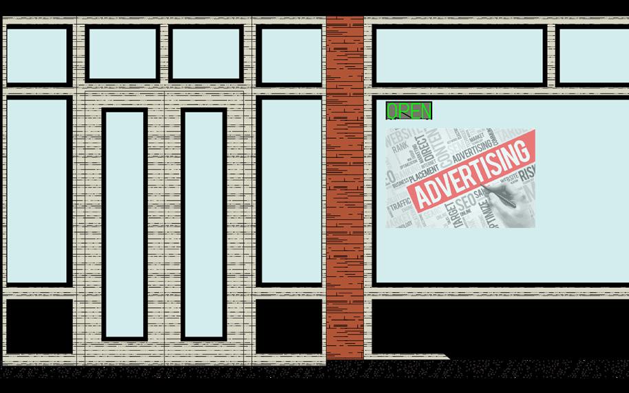


1 or more window signs per window are subject to the max. sign area for wall signs of their respective zoning districts Max.
Location/Setback
illumination
May be on any building elevation along a public street frontage or facing a customer parking area
Window signs may not be illuminated except for small signs no more than 3 sq. ft. used inside businesses to indicate that they are open. Max. Projection N/A
Clearance
Distance between Signs
Additional Standards
Exceptions
Refer to Section 11.5.3 Clearance Requirements
Window signs occupying greater than 25% of the glass area of any individual window or glass door frame shall be regulated as wall signs.
Window signs which occupy less than 15% of an individual window’s area are exempt from these standards and permitting requirements. Such signs shall not count toward the wall sign allowance of the use or property
Temporary signs shall not count towards the number of signs permitted.
*Permitted for non-residential buildings **Permitted for residential communities ***Permitted for multi-dwelling buildings


Max. Area per building facade, up to and including the 4th floor
Max. Height of text and graphics
for primary sign(s)
valance signs 12 inches (max. valance size is 14 inches tall)
Location/Setback May be on any building elevation along a public street frontage or facing a customer parking area
illumination External
Max. Projection of canopy or awning
Clearance
Distance between Signs
Additional Standards
Min. 10ft. above the sidewalk; Refer to Section 11.5.3 Clearance Requirements
Sign width may be up to 75% of the canopy or awning width
The canopy or awning shall be placed at an appropriate height above windows or doors
Exceptions These standards do not apply to signage on gas station canopies. Refer to TABLE 11.10.19 Gas Station Signs
*Permitted for non-residential buildings **Permitted for residential communities ***Permitted for multi-dwelling buildings
1 Primary Sign:a canopy or awning sign is the only sign on the building
2 Secondary Sign: a canopy or awning sign is used in companion with another sign on the building, such as a wall sign.



Location/Setback May be on any building elevation along a public street frontage or facing a customer parking area
Max. Projection/Width 5ft. or no closer than 2ft. to a street curb, whichever is less
Max. Sign Thickness 12 in.
Clearance
Min. 10ft. above the sidewalk; Refer to Section 11.5.3 Clearance Requirements Distance between Signs 25ft. from any other projecting sign
Additional Standards Shall locate min. 4ft. from an interior side lot line or party wall. A projecting sign shall not extend above the wall to which it is attached.
*Permitted for non-residential buildings **Permitted for residential communities ***Permitted for multi-dwelling buildings
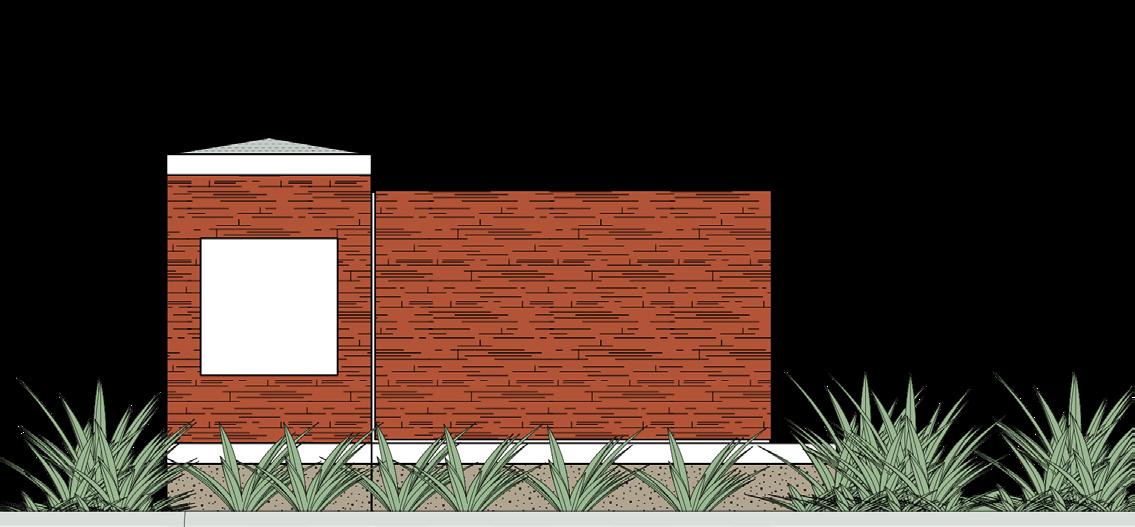

Clearance
Refer to Section 11.5.3 Clearance Requirements Distance between
150ft. from any other ground sign on the same side of the street; see Figure 11.9.1
Monument-style signs shall incorporate a sign base consisting of Masonry Materials. Masonry Materials shall compliment the color and texture of materials used on the building’s front facade.
Additional Standards
Landscape
Exceptions
No sign may be located in a proposed right of way as identified in the Elkhart Comprehensive Plan unless the sign’s owner provides a written commitment to the City to relocate the sign at the owner ’s expense upon the acquisition of the property by the City or State and shall waive all claims to damages or compensation by reason of the existence or relation of the sign.
Except for ground signs in the CBD district, a minimum of a 5ft. landscaped area radiating around the base of the sign and shall be planted in such a way to substantially cover the area with landscape materials such as, but not limited to: annuals, ground cover, perennials, shrubs, and ornamental trees. A mixture of plant types is required.
If there is a conflict with the sign standards in Section 11.10 Specialty Sign Types and Section 11.9 Sign Types Permitted by District, Section 11.10 Specialty Signs shall prevail.
Temporary and portable signs shall not count towards the number of signs permitted.
*Permitted for non-residential buildings **Permitted for residential communities ***Permitted for multi-dwelling buildings



Additional Standards
Landscape
Exceptions
Signs may not locate in parking areas or parking landscape islands in order to be eligible for increased area or height. Parking shall not be located between a sign and the front property line.
Integrated development signs shall be constructed of materials that blend with the character of the building such as, but not limited to wood, metal, or masonry.
The development name shall be individually mounted channel letters, sandblasted, or etched.
No sign may be located in a proposed right of way as identified in the Elkhart Comprehensive Plan unless the sign’s owner provides a written commitment to the City to relocate the sign at the owner ’s expense upon the acquisition of the property by the City or State and shall waive all claims to damages or compensation by reason of the existence or relation of the sign.
Except for ground signs in the CBD district, a minimum of a 5ft. landscaped area radiating around the base of the sign and shall be planted in such a way to substantially cover the area with landscape materials such as, but not limited to: annuals, ground cover, perennials, shrubs, and ornamental trees. A mixture of plant types is required.
If there is a conflict with the sign standards in Section 11.10 Specialty Sign Types and Section 11.9 Sign Types Permitted by District, Section 11.10 Specialty Signs shall prevail.
Temporary and portable signs shall not count towards the number of signs permitted.
*Permitted for non-residential buildings **Permitted for residential communities ***Permitted for multi-dwelling buildings


11.10 SPEC i ALTY S i GN TYPES
The following specialty sign types require zoning clearance permits unless exempt per Section 10.2.2. Signs Not Requiring a Permit.
TABLE 11.10.1 CONSTRUCT i ON S i GNS

TABLE 11.10.3 FEATHER FLAG S i GNS

No construction sign shall be erected until the applicable zoning approvals have been obtained.
Construction signs shall be confined to the site of construction.
Construction signs shall be removed 5 days after completion of construction and prior to occupancy.
TABLE 11.10.2 CONSTRUCT i ON S i TE FENCE WRAPS

Sign must be affixed to perimeter fencing at a construction site.
Fence wraps must be removed at the time a Certificate of Occupancy is issued for the final portion of any construction at that site or 24 months from the time the fence wrap was installed, whichever is shorter
No fence wrap affixed pursuant to this exemption may display any advertising other than the construction project.
Illuminated fence wraps are not permitted.
Additional Standards
The sign must not obstruct vehicles, bicycle, or pedestrian traffic, and must comply with ADA clearance and accessibility.
TABLE 11.10.4 HUMAN S i GNS

installation Temporary
Number of Signs 1 per business
S i GN STANDARDS
Description
Clearance
Distance between Signs
illumination
A sign held by or attached to a human, located in front of the business, during business hours, for the purposes of advertising or otherwise drawing attention to an individual, business, commodity, service or product. This may also include a person dressed in costume for the purpose of advertising or drawing attention to an individual, business, commodity, service or product.
4ft. for pedestrian passage on sidewalks and walkways, or not to cause a hazard to pedestrian traffic.
30ft. from a street or diveway intersection measured from the back of the curb or edge of pavement
20ft. from another human sign
N/A
Human sign uses shall yield right-of-way to pedestrians, bicycles, and all others traveling or located on the sidewalks.
TABLE 11.10.5 i NFLATABLE S i GNS & BALLOONS

ZON i NG D i STR i CT
Non-Residential
installation Temporary; See below
Number of Signs See below
i NFLATABLE S i GN
Description
Number of
Inflatables
This item refers to a large, bag-like, flexible item filled with air or other gas to a point where it takes on a discernible shape
Display is usually rented, delivered to the site, filled with air or other gas and secured to the ground
1
Duration 30 days per calendar year
Location Displays shall not encroach over right-of-way
Displays shall not be roof-mounted
Additional Standards Displays shall not have motion caused by varying supply of air or gas
BALLOONS
Description
Number of Balloons
Additional Standards
Human sign users shall not be in raised or painted medians, parking aisles or stalls, driving lanes, driveways, multi-use trails, fences, boulders, planters, other signs, vehicles, utility facilities, structures.
Humans sign users shall not physically interact with motorists, pedestrians, or bicyclists.
This item refer to small balloons secured to an item by string or stick-like device, as opposed to large inflatable display as described as an inflatable sign
N/A
Duration 120 days per calendar year
Additional Standards Shall be permitted as an attachment device to products which are for sale and normally displayed outdoors

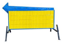
Temporary: 180 days in any business or industrial district; 30 days for any institutional use (as approved by Planning Staff)
25 watts; flashing lights are prohibited
5ft. from any ROW or property line; 15ft. for any residendential zoning
Signs shall not locate in an intersection clear sight area per Sec. 6.18
All electric connections to portable display signs shall comply with the City Electrical Ordinance and the National Electrical Code (NFPA-70, Article 600) as adopted by the City Electrical Ordinance.
Additional Standards
ADD i T i ONAL STANDARDS
Freestanding temporary signs shall be supported by one or more posts or similar devices installed in the ground.
E x AMPLES OF TEMPORARY S i GNS
Real Estate Advertisements / Open House Signs, Election Campaign Signs, Rummage Sale/ Garage Sale Signs, Seasonal Business Signs, Temporary Sale Signs
Permit Requirements
During times that street repairs interrupt the conduct of business, permits may be issued at locations approved by the Planning and Zoning Office for such time as construction hinders visibility and/or access to the business, as determined by the Planning and Zoning Office.
No portable sign may be converted to a permanent sign.
All portable display signs shall require a portable sign zoning clearance and a permit fee. Permit and fee are valid for any period or periods up to 90 days in a calendar year. Original permit must be amended for each additional sign placement to record days of use in order to be valid.
Signs placed without a valid permit (original or amended) shall be red-tagged and required to pay a penalty fee in addition to the original permit fee and any fine levied as prescribed in the adopted fee schedule
Any person or business who rents, leases and/ or places portable sign(s) within the City of Elkhart (on property other than his/her own), shall post an annual bond as prescribed in the
fee schedule

Max.
Additional Standards
Short-Term Event Signs may be installed 14 days prior to the event, displayed for up to 10 days, and shall be removed 1 day after the event.
Off-site signs shall obtain permission of the property owner.
Recurring events may be advertised once per quarter.
E x AMPLES OF SHORT-TERM EVENT S i GNS
Signs for Festivals, Signs for Sport Events, Signs for Community Events, Directional and/or Parking Signs for Events
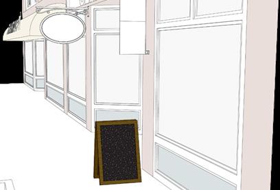

MURAL STANDARDS
Location prohibited on the primary buildng facade shall locate on unfinished facades or walls, or parts of walls devoid of windows and doors, except for emergency exits
Max. Area 100% of the wall, if the mural contains no commercail message
illumination N/A, except lighting required by building codes
Murals or art shall not obstruct architectural features, windows, doors, and other points of access.
Murals shall not use changeable-copy, electronic message centers or video displays for temporary murals.
Location generally adjacent to the primary facade
Max. Height 42 in.
Max. Width 36 in.
illumination N/A
Additional Standards The sign must not obstruct vehicles, bicycle, or pedestrian traffic, and must comply with ADA clearance and accessibility.
Additional Standards
Installation and anchoring shall be accomplished in a manner that will not pose a risk of harm to any architectural features, nor compromise the building in any way.
Basic maintenance shall occur including removal/replacement if deterioration is evident with rips, failure of anchoring, fading or discoloration, etc.
Murals may contain the artist’s signature, logo, and/or social media handle with a max. area of 2 sq. ft.
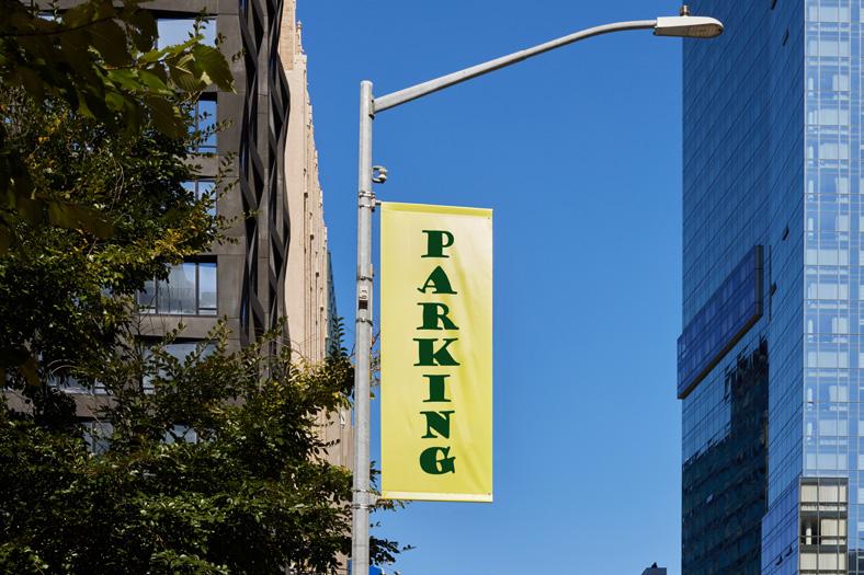
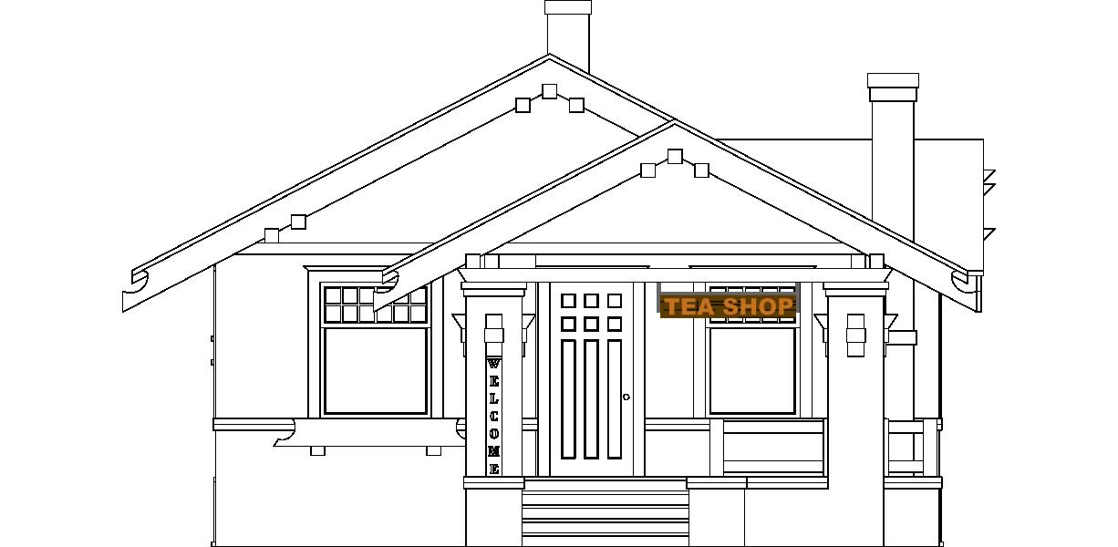
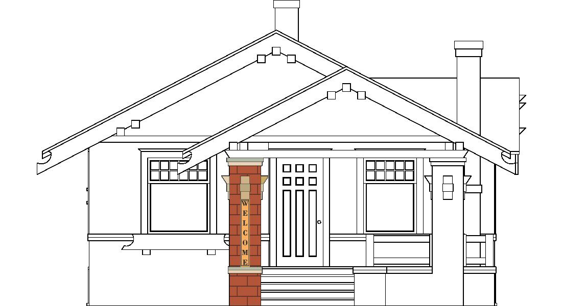


Manual changeable copy signs are allowed in conjunction with a permitted ground sign or marquee wall sign or a portable sign.
*Marquees or portable signs may have 100% changeable copy.
of sign face
not to exceed 60 sq. ft. per sign face
0.3 foot candles above ambient light light trespass shall not exceed 0.1 foot candles measured at the property line of any residential district
All Electronic Signs shall have installed ambient light monitors to automatically adjust the brightness level of the electronic sign based on ambient light conditions. Min.
Separation
200ft. from any residential district
Electronic Message Center Signs shall be limited to Ground Signs, except Digital Gas Price Display, which may be installed on wall signs.
The entire electronic display area for Electronic Sign shall count toward the permitted Sign Area, as applicable to the type of sign.
The effects or use of moving, flashing, blinking, animation, scrolling, twirling, video, or other similar effects are prohibited.
Changes of image shall be instantaneous as seen by the human eye and shall not use fading, rolling, window shading, dissolving, or similar effects as part of the change.
or external Additional
Menu or information signs shall be permitted at each buildng which has a drive-through facility
Drive-through signs are not permittd in any front yard.
Information signs shall be limited to the name of the drive-through business and information regarding the drive-through services provided by the business.
Malfunctions, fails, or ceases to operate in its usual or normal programmed manner causing therein motion, movement, flashing or any other similar effects, shall be repaired or disconnected within 48 hours by the owner or operator.

Number of Signs
FLAG STANDARDS
Flags and insignia of a government are allowed when not displayed in connection with a commercial promotion.
Flags displaying a corporate emblem shall be included in the calculation of the maximum sign area permitted for freestanding signs for the site.
FLAGPOLES
Number of flagpoles 1 per parcel or site developed with a principle structure, unless otherwise requited by law
Number of Flags N/A
Max. Height 30ft.
Additional Standards flagpoles taller than 30ft. require a permit
Number of flagpoles up to 3 per site one-half-acre or larger; up to 2 flagpoles per additional acre
Number of Flags 2 per flagpole
Max Height 1.5 times the max. building height per district
Additonal Standards permit required for all non-residential flagpoles
illumination N/A
FLAG BRACKETS AND STANCH i ONS
Number of flags 2 flag brackets or stanchions per principle structure
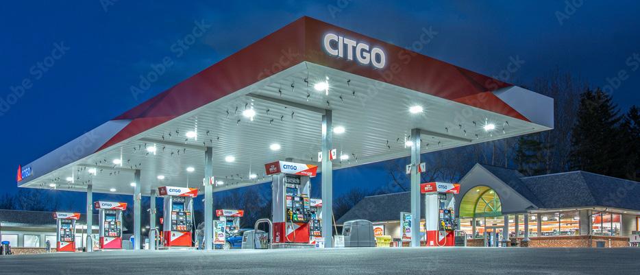
ZON i NG D i STR i CT COM-B, R&D-i,
installation
Number of Signs
Permanent
See below
Gas prices may be displayed with a digital sign or electronic message center with a max. brightness of 0.3 foot candles above ambient light.
GAS STAT i ON PUMPS
# of Signs 1 pump topper per pump, double-sided
Max. Area 6 sq. ft.
illumination external
These standards do not apply to any signs required by law.
Additional Standards
The base of the pump may contian the name or registered trademark of the establishment located on the zoning lot.
GAS STAT i ON CANOP i ES
Max. Area 4 sq. ft.
Max. Height
# of Signs
18 in.-tall letters or trademark
Signs may not extend above or below the gas station canopy frame.
1 per canopy
building sign area transfer: up to 3; 1 per side
illumination external
Gas station canopy signs must comply with the following standards:
Additional Standards
The sign must be an integral component of the pump canopy (composed of lettering mounted, painted or otherwise affixed to the pump canopy, and not located on the top or bottom of the canopy).
The canopy must not encroach upon any publicly dedicated rights-of-way.
The message must be limited to the name or registered trademark of the establishment located on the zoning lot. Canopy Sign Height < Canopy Height
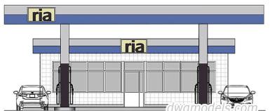
TABLE
Number of Signs 1 per tenant
Max. Area 20% of the facade area
Location/ Setbacks
Minimum 5ft. from ROW
Internal wayfinding sign locations per Planning Staff approval
illumination N/A
Business Identification Signs may contain text, logos, symbols, or emblems related to the use. Such items should not exceed 6 inches in height on the sign area
Additional Standards In the URB-R and MIX-R districts, internal circulation signs are only permitted for multidwelling uses with more than one building.
Building Entrance Signs, Driveway Signs, Delivery Entrance Signs, Parking Lot Directional Signs,
Max. Height 5ft. max. Marquee Sign above Marquee shall not extend above the roofline
Max. Width Width of the facade or tenant to the party wall
Max. Projection 6ft. or no closer than 2ft. to a street curb, whichever is less
Distance between Signs 45ft. from another marquee sign 25ft. from a canopy, awning, or projecting sign
illumination external or internal
Additional Standards Subject to approval by Planning Staff

ZON i NG D i STR i CT COM-B, R&D-i, MAN-i
1,000ft. as measured along ROW on which the sign is visible
25ft. from any ROW or intersection, or required front setback, whichever is greater
Residential District or Park 60ft.; 120 ft. when measured along a common ROW
Local, State, or Federal Historic District or Structure 1,000ft.
St. Joseph River, Elkhart River, or Christiana Creek
1,300 ft. as measured from the stream bed.
Electronic Message Center up to 100% of the sign face, subject to all other standards in Tale 11.10.17 Electronic Message Center Signs, except sign area
Shall be permitted as a ground sign unless otherwise restricted by this UDO.
Shall not be located in the front yard adjacent to a residential district
Subject to approval by Planning Staff. The owners of all off-premises signs shall provide to the Planning Staff an annual inventory of all such signs by March 15 of each year. The inventory shall include the following information:
1. Location by address and legal description;
2. Height of sign;
3. Number of faces and orientation;
4. Size of sign(s); and
5. Setbacks from property lines.
C HAPTER 12:
ENV i RONMENTAL PROTECT i ON & HAZARD M i T i GAT i ON
12.1
12.1 CULTURAL RESOURCE
12.1.1
Historic Structure
Variances may be issued for the repair or rehabilitation of “historic structures” upon a determination that the proposed repair or rehabilitation will not preclude the structure’s continued designation as an “historic structure” and the variance is the minimum to preserve the historic character and design of the structure.
12.2 GRAD i NG, DRA i NAGE, AND EROS i ON CONTROL
12.2.1
General
A. All construction shall comply with the Standard Specifications for Construction provided by the City of Elkhart Public Works and Utilities.
B. Refer to the Elkhart County Soil and Water Conservation District’s requirements for a Construction Stormwater General Permit (CSGP).
C. No changes shall be made in the contour of the land, nor shall grading, excavating, removal, or destruction of the topsoil, trees, or other vegetative cover of the land be commenced until such time that a plan for minimizing erosion and sedimentation has been reviewed by the SWCDC Department or there has been a determination by the Zoning Administrator that such plans are not necessary. Applies to proposed developments that are greater than 1 acre in size.
D. Measures used to control erosion and reduce sedimentation and to provide drainage shall, as a minimum, meet the standards and specifications of the Elkhart County Storm Drainage, Erosion, and Sediment Control Ordinance. The Zoning Administrator shall ensure compliance with all appropriate specifications.
12.2.2 Performance Principles
The following measures are effective in minimizing erosion and sedimentation and shall be included where applicable in the overall development plan.
A. Existing features which would add value to residential, commercial, natural, or manmade assets such as trees, streams, vistas, historically significant items, and similarly irreplaceable assets shall be preserved through careful and harmonious design.
B. Stripping of vegetation, regrading, or other development shall be done in such a way that will minimize erosion.
C. Development plans shall keep cut fill operations to a minimum and ensure conformity with topography to create the least erosion potential and adequately handle the volume and velocity of surface water runoff.
D. Whenever feasible, natural vegetation shall be retained, protected, and supplemented.
E. The disturbed area and the duration of exposure shall be kept to a practical minimum.
F. Temporary vegetation and mulching shall be used to protect exposed critical areas during development.
G. The permanent final vegetation and structural erosion control and drainage measures shall be installed as soon as practical in the development.
H. Provision shall be made to effectively accommodate the increased runoff caused by changed soil and surface conditions during and after development. Where necessary, the rate of surface water runoff will be structurally retarded.
i. Sediment in the runoff water shall be trapped until the disturbed area is stabilized using debris basins, sediment basins, silt traps, or similar measures.
J. Design and construction of the drainage facility shall be such that it will be durable and easy to maintain.
12.2.3 Grading for Drainage
The following requirements shall be met to provide more suitable sites for building and other uses, improve surface drainage, and control erosion:
A. The locations, grading, and placement of subgrade (base) material of all streets, public driveway, and public parking areas shall be accomplished second, after erosion control measures have been taken.
B. All lots, tracts, or parcels shall be graded to provide proper drainage away from the buildings, dispose of it without ponding. All land within the development shall be graded to drain and dispose of surface water without ponding, except where approved by the City of Elkhart Engineer.
C. All drainage provisions shall be of such design to adequately handle the surface runoff and carry it to the nearest suitable outlet such as a curbed street, storm drain, or natural watercourse. Where drainage swales are used to divert surface waters away from buildings, they shall be sodded or planted, as required, and shall be of such slope, shape, and size as to conform with the requirements of the Commission.
D. Concentration of surface water runoff shall only be permitted in swales, watercourses, pipes, and detention ponds.
E. Land alteration shall be accomplished in such a way that the grades left at the time that the work is completed will be permanent and stable.
F. Excavation and Fills
1. Cut and fill slopes shall not be steeper than 3:1, unless stabilized by a retaining wall or cribbing as approved by the City of Elkhart Engineer when handled under special considerations.
2. Provisions shall be made to prevent surface water from damaging the cut face of excavations or the sloping surfaces of fills, by installation of temporary or permanent drainage across or above this area.
3. Cuts and fills shall not endanger adjoining property.
4. Fills shall be placed and compacted to minimize sliding or erosion of the soil.
5. Fills shall not encroach or impede flows of natural watercourses or constructed channels.
6. Fills placed adjacent to natural watercourses or constructed channels shall have suitable protection against erosion during this period of construction.
7. Grading shall not be done in such a way to divert water onto the property of another landowner without the expressed consent of the landowner.
8. During grading operations, necessary measures for dust control shall be exercised.
9. Grading equipment shall not be allowed to cross live streams. Provisions shall be made for the installation of temporary or permanent culverts or bridges.
12.2.4 Responsibility for Drainage and Erosion Control
A. Whenever sedimentation is caused by stripping of vegetation, regrading, or other development activities, it shall be the responsibility of the applicant, person, corporation, or other entity causing such sedimentation to remove it from all adjoining surfaces, drainage systems, and watercourses, and to repair any damage at his expense as quickly as possible.
B. Maintenance of all driveways, parking areas, drainage facilities, and watercourses within any development plan area is the responsibility of the applicant
or developer, provided that said facilities have not been dedicated to the public and accepted by the appropriate authority for public maintenance.
C. It is the responsibility of the applicant and any person, corporation, or other entity doing any action on or across a communal stream, watercourse, or swale, or upon the flood plain or floodway area of any watercourse during the period of development, to return these areas to their original or equal conditions upon completion of said activities.
D. No applicant, person, corporation, or other entity shall block, impede the flow of, alter, construct any structure, deposit any material or thing, or commit any act which will affect normal or flood flow in any communal stream or watercourse without having obtained prior approval from the Elkhart County Drainage Board and/or/the Indiana Department of Natural Resources, Division of Water, whichever is applicable.
E. On-site drainage facilities shall be sufficient to accept:
1. The water runoff from the parcel after development;
2. The present water runoff from developed areas upstream;
3. The present water runoff from undeveloped areas upstream; and
4. That part of the water runoff attributable to future development in undeveloped areas upstream, which is not reasonably likely to be accommodated in such upstream areas.
F. Each applicant or other entity which makes any surface changes shall be required to:
1. Collect on-site surface runoff and springs and dispose of it to the point of discharge into an adequate outlet approved by the City of Elkhart Engineer.
2. Handle existing and potential off-site runoff through the development by designing to adequately handle storm runoff from a fully developed area upstream.
3. Pay his proportionate share of the total cost of off-site improvements to the common natural watercourse, based on a fully developed drainage area.
4. Provide and install at their expense, all necessary drainage and erosion control improvements (temporary and permanent) or as required by the City of Elkhart Engineer.
G. It is the responsibility of the applicant or owner to keep all major water courses— except those under the jurisdiction of any public agency—open and free flowing.
H. The applicant or owner will assume the responsibility for maintaining an open and free flowing condition in all minor streams, watercourses, and drainage systems, constructed or otherwise improved in accordance with this Chapter, which are necessary for proper drainage.
12.2.5 Compliance with Regulations and Procedures
A. The design, installation, and maintenance of the required drainage facilities and erosion and sediment control measures shall be in accordance with the standards and specifications of the Elkhart County Storm Drainage, Erosion, and Sediment Control Ordinance.
B. The approval of plans and specifications for the control of erosion and sedimentation shall be concurrent with the approval of the development and shall become a part thereof.
C. Permission for clearing and grading prior to the approval of the development plan may be obtained under temporary easements or other conditions satisfactory to the City of Elkhart Engineer.
D. In the event the applicant or developer proceeds to clear and grade prior
to the approval of the subdivision or development plan, without satisfying conditions specified herein, the Plan Commission may revoke the approval of all plans and a suit for an injunction may be instituted to halt further construction until development plans are approved.
E. Topsoil shall not be removed from residential lots or used as spoil. No construction debris, junk, rubbish, or waste material shall be buried in any land or left deposited on any lot or street within a subdivision.
12.3 DEVELOPMENT W i TH i N REGULATED
DRA i NS
Refer to the Elkhart County Surveyor’s Office regarding any developments in regulated drains.
12.4 ELKHART
WATERSHEDS MANAGEMENT
12.4.1
Refer to the Elkhart County Soil and Water Conservation District’s requirements for Storm Water Pollution Prevention Plans and Stormwater Clearance Application.
12.4.2 Refer to the Elkhart County Soil and Water Conservation District’s compliance process for MS4 Communities.
12.5
BROWNF i ELD REDEVELOPMENT
Refer to the Indiana Department of Environmental Management
12.6 WETLANDS CONSERVAT i ON OVERLAY D i STR i CT
12.6.1 General Provisions
A. Purpose
The intent of this section is to prevent harm to the human and natural environment from water pollution, increased flooding and loss of ground water supply that may result when natural wetlands are drained, filled or otherwise subjected to uses incompatible with public health, safety and welfare. This purpose
is consistent with the Comprehensive Plan of the City of Elkhart, Indiana. The provisions of this section are intended to achieve this purpose by:
1. Providing a method of identifying wetlands within the planning and zoning jurisdictions of the City of Elkhart;
2. Establishing regulations that permit reasonable economic use of wetlands consistent with sound wetland conservation practices;
3. Guiding development adjacent to wetlands to prevent harm to wetlands and protect property from potential flood damage; and
4. Establishing procedures to assure compliance with the Federal Clean Water Act (33 U.S.C., Section 1251 et seq., as amended) and with state regulations that may affect wetlands.
B. Wetlands Conservation Overlay Districts
1. The Wetlands Conservation Overlay Districts that are established by this Section are overlay districts.
2. No development may take place in a Wetlands Conservation Overlay District without a zoning clearance/ building permit.
3. Only uses that are permitted by right or by special exception may be placed in a Wetlands Conservation Overlay District. All other uses are prohibited.
C. Application
1. This Section does not apply to:
a. Artificially constructed ponds, drainage ditches, storm water retention/detention basins, gravel pits, stone quarries or waste treatment lagoons, except to the extent that such uses are restricted or prohibited in Wetland Districts;
12.6.2
b. Wetlands or portions thereof for which federal or state permits for fill were issued prior to the extension of the planning and zoning jurisdiction of the City of Elkhart over the areas for which the permits were issued; or to
c. Any area or use excluded from local planning and zoning jurisdiction by federal or state law.
2. Notwithstanding subparagraph b above, if a wetland has been divided by the discharge or placement of fill material, the separated parts shall be considered a single wetland.
3. Wetlands of different National Wetlands Inventory (NWI) classification that are contiguous to one another shall be considered a single wetland.
4. In the event of a conflict between the provisions of this section and those of any other section of the Zoning Ordinance that governs the management of flood hazard areas, this section shall take precedence.
D. Coordination with Federal and State Agencies
No application made for a zoning clearance/building permit shall be accepted unless the applicant first obtains all necessary federal and state permits, approvals, waivers or letters of nonapplicability.
Wetland District
A. Designation
1. A Wetland District is any wetland area other than those exempted in Section 12.6.1.C. Application above that is at least 1 acre in size that appears on the most current NWI map or maps published by the U.S. Fish and/or Wildlife Services for areas subject to the planning and zoning jurisdiction of the City of Elkhart. The most current edition of the applicable NWI
map or maps and any subsequent revisions thereto are hereby adopted by reference and declared to be part of this section. A Wetland District must also meet the standards of the Unified Federal Method for Wetland Delineation, applied according to the procedures set forth in this subsection.
2. The NWI shows only the general location of wetlands. Precise delineation shall be made by the applicant for a zoning clearance/ building permit through the performance of a full field survey applying the wetland delineation methodology in effect at the time of application. Areas containing hydric soils as mapped and designated by the Natural Resource Conservation Service; or soils containing hydric inclusions must be assessed via full field survey, as well. All permit applications for development in a Wetland District or areas containing soils that may harbor wetlands shall be accompanied by a scaled drawing showing the district boundary. The applicant shall document the results of the boundary survey to the Planning and Zoning Office. Such documentation shall include:
a. Statement of qualifications of individual(s) and/or firm conducting the boundary delineation;
b. Certified copy of the boundary delineation; and
c. All other documentation submitted to the Indiana Department of Environmental Management (IDEM) and/or the U.S. Army Corps of Engineers (COE).
Documentation shall be submitted to the City no later than the date of submittal to IDEM and/or COE. The Planning and Zoning staff may review the documentation to determine its general accuracy and completeness.
3. The city, through the Planning Staff, may forward to IDEM and/or COE any recommendation, question or concern regarding an application for any State and/or Federal permits that pertain to the area described in the application for the Zoning Clearance/Building Permit.
4. In applying for a Zoning Clearance/ Building Permit, the applicant consents to allowing the Planning Staff or their representatives to enter upon the applicant’s land to gather information to obtain a basis for a recommendation described above (12.6.2.A.3).
B. Permitted Uses
The following uses are permitted by right, provided they do not involve erecting a building or structure, opening an excavation, depositing or discharging fill material, dredging, earth moving, extending existing drainage systems or creating new drainage systems:
1. Agriculture uses, except animal feed lots, but including general farming, grazing, gardening, sustainedyield forestry in accordance with a management plan approved by the State Forester, nurseries and the erection and maintenance of wire agricultural fences;
2. Hunting, trapping and fishing, where not otherwise prohibited by law;
3. Parks, when left in a natural state, wildlife and natural preserves, recreational uses, including swimming, boating and natural-surface hiking and bridle paths, and educational and scientific uses;
4. Uses incidental to the enjoyment of residential properties, provided that the impact of such uses does not affect more than one-half acre of wetlands (Nationwide Permit 29); and
5. Maintenance and repair of existing streets, roads, highways and public utilities, provided that such uses are not enlarged and that such maintenance or repair is done in a way that minimizes or avoids adverse impacts to wetlands.
C. Special Exceptions
The following special exceptions may be permitted upon approval by the Board of Zoning Appeals in accordance with Section 14.7.2 Special Exception of the Zoning Ordinance; such special exceptions are expressly contingent upon the receipt of all required federal and state permits:
1. Structures accessory to permitted uses, provided that they do not significantly obstruct circulation of water in the wetland, threaten water quality, create erosion hazards or disrupt significant wildlife habitat. Such structures include, but are not limited to:
a. Temporary structures not intended for human habitation or sheltering livestock;
b. Boat anchorages, moorings and piers;
c. Walkways, benches, informational displays, directional signs, foot bridges and observation decks; and
d. Residential Wells
2. Enhancement of wetlands to improve wildlife habitat in accordance with a plan approved by the IDNR.
3. Public infrastructure, other than buildings and electrical substations, but including public utilities, streets, roads and bridges, provided that:
a. There is no practicable alternative route outside the wetland;
b. The public need cannot be met by existing facilities of the modification thereof;
c. The proposed facility is designed to permit the unimpeded circulation of water in the wetland, control runoff from paved surfaces in accordance with part 4 below, and otherwise minimize adverse impacts on the wetland;
d. Any filling, excavating or draining must be necessary for the construction and maintenance of the proposed facility and done in a way that minimizes adverse impacts on the wetland;
e. Erosion control measures are taken in accordance with the U.S. Department of Agriculture Soil Conservation Service Field Office Technical Guide; and
f. Underground utilities are installed in watertight conduits; and
g. Such activities comply with the General and Specific conditions of Nationwide Permits 12 and 14.
4. Storm water retention/detention, provided that there is no practicable alternative site outside a wetland and that a wetland utilization plan is prepared by the applicant and approved by the Board of Zoning Appeals listing steps for monitoring surface and subsurface water quality and a schedule of periodic maintenance of the wetland while in use as a storm water retention/ detention facility; and further provided that net flow does not exceed the wetland’s natural water storage capacity and that the storm water undergoes pre-treatment to prevent silt, debris and chemical pollutants from entering the wetland.
a. No special exception for storm water retention/detention use of a wetland shall involve decreasing
the wetland’s natural water storage capacity or placing more than 25% of the surface area of the retention/detention pond in the Wetland District. No retention/detention pond shall occupy more than 10% of the area of a Wetland District. The natural outflow from the Wetland District shall not be changed to increase or decrease the normal pool elevation. Minor alteration of a wetland’s contour may be permitted for the installation of facilities accessory to storm water inflow and outflow, provided that it does not significantly alter the wetland’s pre-existing hydrology.
b. Pre-treatment measures may include sedimentation basins, vegetated swales and buffer strips. Rip-rap made of natural rock may be used only where vegetation cannot control erosion. Storm drains may not discharge directly into a wetland. Lining of swales with paving materials shall not be permitted.
c. No retention/detention facility shall be constructed within a forested wetland, but overflow into a forested wetland may be permitted.
d. No more than 1 retention/ detention pond may be placed within a single Wetland District.
e. Any portion of a Wetland District used for storm water retention/ detention shall remain part of the Wetland District.
f. No special exception shall be granted for storm water retention/ detention in a wetland subject to divided ownership unless the applicant first obtains and records an easement of use from the owners of all other affected properties.
12.6.3
g. A constructed outflow to a regulated county drain requires approval of the county drainage board or appropriate joint drainage board and/or the county surveyor.
5. Maintenance of existing boat channels, provided that the applicant has received a permit from the IDNR under Indiana Code section 13-211-1 et seq., as amended, (Lakes Preservation) and that dredging will be limited as follows:
a. Dredging shall be located to minimize adverse impacts on vegetation;
b. Dredging shall not adversely change water circulation;
c. The size of the dredging area shall be limited to the minimum required for boat ingress and egress; and
d. Dredged material shall not be disposed of within any lake, wetland or flood hazard area or in any manner that is unlawful or would constitute a public or private nuisance.
e. Activities shall comply with all other general and specific conditions of Nationwide Permits 1, 2, 3, 9, 10, and 22.
General Development Standards
To guide development outside a Wetland District to prevent harm to wetlands inside the district, the following standards are established:
A. No building, structure, street, road, alley, driveway, parking area or paved surface shall be placed closer than 75 feet from the boundary of a Wetland District.
B. No septic system shall be installed closer than 150 feet from the boundary of a Wetland District.
C. The lowest ground floor elevation of all buildings or additions to existing buildings within 50 feet of the boundary of a Wetland District shall be at least 2 feet above the ordinary high-water mark.
D. No soil storage pile shall be placed nearer than 25 feet from the boundary of a Wetland District. Erosion from all soil storage piles placed within 200 feet of the boundary of a Wetland District shall be controlled by placing straw bales, filter fence or other effective containment barriers around the piles. Soil loss from any construction site within 200 feet of the district boundary shall be controlled by measures described in the U.S. Department of Agriculture Soil Conservation Service Field Office Technical Guide.
E. No storm water runoff from a development shall be directed into a Wetland District except as provided in subparagraph 12.6.2.C. Special Exceptions, point 4.
12.6.4 Nonconforming Uses
Any building, structure or other use that does not conform to Section 12.6.3 General Development Standards is a non-conforming use and is subject to the following provisions:
A. A non-conforming use may be altered, enlarged or extended on a one-time-only basis, provided that:
1. The lowest ground floor elevation of any addition to an existing building is at least 2 feet above the ordinary high water mark;
2. The proposed alterations, enlargements or extensions, excluding improvements made solely to comply with state or local health, sanitary or safety codes or to assure safe living conditions, do not increase the value of the use by more than 40% of its pre-improvement market value, excluding the value of the land; and
3. No extension of a non-conforming use that does not conform to the
setback required 75 foot setback from a Wetland District shall be constructed in the direction of a Wetland District.
B. A non-conforming use that is damaged by accident, flood, fire, explosion, natural disaster or the public enemy may be restored to its original dimensions and condition provided the damage does not reduce the value of the use, excluding the value of the land, by more than 40% of its pre-damaged value.
12.6.5 Zoning Board of Appeals
A. The Board of Zoning Appeals may grant variances from the provisions of this section, provided the applicant establishes that:
1. The grant of the proposed variance complies with Indiana Code 36-7-4918.4 as amended and Section 14.6.5 Conditional Uses of the UDO; and that
2. The grant of the proposed variance will not adversely affect the water quality, volume of ground water supply or flood storage capacity of the Wetland District.
3. Variances shall give the minimum relief necessary to alleviate the applicant’s hardship.
B. No variances shall permit storm water runoff from a street, parking area or roof of an industrial or commercial building to be directed into a Wetland District.
C. Variances and special exceptions may be granted contingent upon receipt by the Planning Staff of all required federal and state permits.
D. No variance or special exception shall allow construction or dredging to disturb waterfowl breeding areas during breeding season or fish spawning areas during spawning season.
E. Whenever a variance or special exception is granted for a use that may alter the grade or contour of land in a Wetland District, the Board of Zoning Appeals
shall require that, upon completion of the proposed construction, the applicant will restore the land as closely as possible to its original grade and contour.
F. No variance or special exception shall allow a net loss of wetland area. Where all or part of a wetland in a Wetland District would be destroyed or substantially altered by a proposed development, the Board of Zoning Appeals shall require mitigation by the applicant and his/her successors in interest according to the following standards:
1. Acre-for-acre replacement of the same or a better type of wetland providing the environmental benefits that would be lost because of the proposed development.
2. Replacement wetlands shall be located reasonably close to the Wetland District, as determined by the Board of Zoning Appeals, in which the losses are sustained and shall become part of the district, if practical.
3. Periodic maintenance for replacement wetlands shall be carried out by the applicant for a minimum of 3 years to control erosion, remove nuisance vegetation and assure the establishment and survival of predominantly hydrophytic vegetation.
4. The Board of Zoning Appeals may require the applicant to post a bond or other performance guarantee sufficient to assure the City of Elkhart the satisfactory completion of replacement wetlands.
5. If replacement of the same or better type of wetland is not possible adjacent to the Wetland District in which the projected losses would be sustained, the Board of Zoning Appeals may consider replacement at ratios greater than 1:1 of a lesser quality wetland adjacent to the Wetland District.
6. The Board of Zoning Appeals may require replacement of wetland losses of less than a third of an acre even when the applicant has received federal or state approval for the proposed construction without mitigative conditions.
7. The authorization of replacement wetlands shall not be used as a means of permitting avoidable losses of natural wetlands.
12.6.6 Enforcement
In addition to the enforcement powers and penalties for violation prescribed in Chapter 14 of the Zoning Ordinance, the Planning and Zoning Staff, Plan Commission or Board of Zoning Appeals, pursuant to Indiana Code, section 36-7-4-1000 et seq. (Local Planning and Zoning -1000 Series-Remedies and Enforcement) may institute civil proceedings in a court of competent jurisdiction to compel complete restoration of wetlands damaged in violation of this section.
12.7 SPEC i AL FLOOD HAZARD AREA
12.7.1 Statutory Authorization, Findings of Fact, Purpose, and Methods
A. Statutory Authorization
The Indiana Legislature has in IC 36-1-411 granted the power to local government units to control land use within their jurisdictions. Therefore, the City Council of the City of Elkhart does hereby adopt the following floodplain management regulations.
B. Findings of Fact
The flood hazard areas of the City of Elkhart are subject to periodic inundation which results in loss of life and property, health and safety hazards, disruption of commerce and governmental services, extraordinary public expenditures for flood protection and relief, and impairment of
the tax base, all of which adversely affect the public health, safety, and general welfare. Additionally, structures that are inadequately elevated, floodproofed, or otherwise protected from flood damage also contribute to the flood loss. In order to minimize the threat of such damages and to achieve the purposes hereinafter set forth, these regulations are adopted.
C. Statement of Purpose
It is the purpose of this ordinance to promote the public health, safety, and general welfare and to minimize public and private losses due to flood conditions in specific areas by provisions designed to:
1. Protect human life and health.
2. Minimize expenditure of public money for costly flood control projects.
3. Minimize the need for rescue and relief efforts associated with flooding and generally undertaken at the expense of the general public.
4. Minimize prolonged business interruptions.
5. Minimize damage to public facilities and utilities such as water and gas mains, electric, telephone, and sewer lines, streets, and bridges located in floodplains.
6. Help maintain a stable tax base by providing for the sound use and development of flood prone areas in such a manner as to minimize flood blight area.
7. Ensure that those who occupy the areas of special flood hazard assume responsibility for their actions.
8. Minimize the impact of development on adjacent properties within and near flood prone areas.
9. Ensure that the flood storage and conveyance functions of the floodplain are maintained.
10. Minimize the impact of development on the natural, beneficial values of the floodplain.
11. Prevent floodplain uses that are either hazardous or environmentally incompatible.
12. Meet community participation requirements of the National Flood Insurance Program.
D. Methods of Reducing Flood Loss
In order to accomplish its purposes, these regulations include methods and provisions for:
1. Restricting or prohibiting uses which are dangerous to health, safety, and property due to water hazards, or which result in damaging increases in flood heights or velocities.
2. Requiring that uses vulnerable to floods, including facilities, which serve such uses, be protected against flood damage at the time of initial construction.
3. Controlling the alteration of natural floodplains, stream channels, and natural protective barriers, which help accommodate or channel flood waters.
4. Controlling filling, grading, dredging, excavating, and other development which may increase flood damage.
5. Preventing or regulating the construction of flood barriers, which will unnaturally divert floodwaters, or which may increase flood hazards in other areas.
12.7.2 Definitions
Unless specifically defined below, words or phrases used in these regulations shall be interpreted so as to give them meaning they have in common usage and to give these regulations the most reasonable application.
Accessory Structure means a structure with a floor area of 400 square feet or less that is on the same
parcel of properly as a principal structure and the use of which is incidental to the use of the principal structure; an accessory structure specifically excludes structures used for human habitation.
Accessory structures are considered walled and roofed where the structure includes at least 2 outside rigid walls and a fully secured roof. Examples of accessory structures include but are not necessarily limited to two-car detached garages (or smaller), carports, storage and tool sheds, and small boathouses. The following may have uses that are incidental or accessory to the principal structure on a parcel but are generally not considered to be accessory structures by the NFIP:
1. Structures in which any portion is used for human habitation, whether as a permanent residence or as temporary or seasonal living quarters, such as a detached garage or carriage house that includes an apartment or guest quarters, or a detached guest house on the same parcel as a principal residence.
2. Structures used by the public, such as a place of employment or entertainment.
3. Development that does not meet the NFIP definition of a structure for floodplain management purposes. Examples include, but are not necessarily limited to, a gazebo, pavilion, picnic shelter, or carport that is open on all sides (roofed but not walled).
Addition (to an existing structure) means any walled and roofed expansion to the perimeter of a structure in which the addition is connected by a common load-bearing wall other than a firewall. Any walled and roofed addition, which is connected by a firewall or is separated by independent perimeter load-bearing walls, is new construction.
Alteration of a Watercourse means a dam, impoundment, channel relocation, change in channel alignment, channelization, or change in cross-sectional area of the channel or the channel capacity, or any other modification which may alter, impede, retard, or change the direction and/or velocity of the flow of water during conditions of the base flood.
Appeal means a request for a review of the floodplain administrator’s interpretation of any provision of this
ordinance, a request for a variance, or a challenge of a board decision.
Area of Special Flood Hazard is the land within a community subject to a 1% or greater chance of being flooded in any given year.
Base Flood means the flood having a 1% chance of being equaled or exceeded in any given year. The base flood may also be referred to as the 1% annual chance flood or 100 year flood.
Base Flood Elevation (BFE) means the water surface elevation of the base flood in relation to a specified datum, usually the North American Vertical Datum of 1988.
Basement means that portion of a structure having its floor sub-grade (below ground level) on all sides.
Best Available Flood Layer (BAFL) means floodplain studies and any corresponding floodplain maps prepared and/or approved by the Indiana Department of Natural Resources which provide base flood elevation information, floodplain limits, and/or floodway delineations for flood hazards identified by approximate studies on the currently effective FIRM (Zone A) and/or for waterways where the flood hazard is not identified on available floodplain mapping.
Building- See “Structure.”
Community means a political entity that has the authority to adopt and enforce floodplain ordinances for the areas within its jurisdiction.
Critical Facility means a facility for which even a slight chance of flooding might be too great. Critical facilities include, but are not limited to, schools, nursing homes, hospitals, police, fire, and emergency response installations, and installations which produce, use, or store hazardous materials or hazardous waste.
Development means, for floodplain management purposes, any manmade change to improved or unimproved real estate including but not limited to:
1. construction, reconstruction, or placement of a structure or any addition to a structure;
2. installing a manufactured home on a site, preparing a site for a manufactured home, or installing a recreational vehicle on a site for more than 180 days;
3. installing utilities, erection of walls and fences, construction of roads, or similar projects;
4. construction of flood control structures such as levees, dikes, dams, channel improvements, etc.;
5. mining, dredging, filling, grading, excavation, or drilling operations;
6. construction and/or reconstruction of boat lifts, docks, piers, and seawalls;
7. construction and/or reconstruction of bridges or culverts;
8. storage of materials; or
9. any other activity that might change the direction, height, or velocity of flood or surface waters.
“Development” does not include activities such as the maintenance of existing structures and facilities such as painting; re-roofing; resurfacing roads; or, gardening, plowing, and similar agricultural practices that do not involve filling, grading, excavation, or the construction of permanent structures.
Elevation Certificate means a FEMA form that is routinely reviewed and approved by the White House Office of Management and Budget under the Paperwork Reduction Act that is encouraged to be used to collect certified elevation information.
Enclosed Area (enclosure) is an area of a structure enclosed by walls on all sides.
Enclosure Below the Lowest Floor. See “Lowest Floor” and “Enclosed Area.”
Existing Manufactured Home Park or Subdivision means a manufactured home park or subdivision for which the construction of facilities for servicing the lots on which the manufactured homes are to be affixed (including, at a minimum, the installation of utilities, the construction of streets, and either final site grading or the pouring of concrete pads) is completed before the effective date of the community’s first floodplain ordinance.
Expansion to an Existing Manufactured Home park or subdivision means the preparation of additional sites by the construction of facilities for servicing the lots on which the manufactured homes are to
be affixed (including the installation of utilities, the construction of streets, and either final site grading or the pouring of concrete pads).
FEMA means the Federal Emergency Management Agency.
Fill for floodplain management purposes, means any material deposited or placed which has the effect of raising the level of the ground surface above the natural grade elevation. Fill material includes but is not limited to consolidated material such as concrete and brick and unconsolidated material such as soil, sand, gravel, and stone.
Flood or Flooding means a general and temporary condition of partial or complete inundation of normally dry land areas from:
1. The overflow of inland or tidal waters.
2. The unusual and rapid accumulation or runoff of surface waters from any source.
3. Mudslides (i.e., mudflows) which are proximately caused by flooding and are akin to a river of liquid and flowing mud on the surfaces of normally dry land areas, as when earth is carried by a current of water and deposited along the path of the current.
Flood or flooding also includes the collapse or subsidence of land along the shore of a lake or similar body of water as a result of erosion or undermining caused by waves or current of water exceeding anticipated cyclical levels that result in a flood as defined above.
Flood Hazard Area means areas subject to the 1% annual chance flood. (See “Special Flood Hazard Area”)
Flood insurance Rate Map (FiRM) means an official map of a community, on which FEMA has delineated both the areas of special flood hazard and the risk premium zones applicable to the community. A FIRM that has been made available digitally is called a Digital Flood Insurance Rate Map (DFIRM)
Flood Insurance Study (FIS) means the official hydraulic and hydrologic report provided by FEMA. The report contains flood profiles, as well as the FIRM and the water surface elevation of the base flood.
Flood Prone Area means any land area acknowledged by a community as being susceptible to inundation by water from any source. (See “Floodplain”)
Flood Protection Grade (FPG) is the BFE plus 2 feet at any given location in the SFHA.
Floodplain or Flood Prone Area means any land area susceptible to being inundated by water from any source. (See “Flood”)
Floodplain Management means the operation of an overall program of corrective and preventive measures for reducing flood damage and preserving and enhancing, where possible, natural resources in the floodplain, including but not limited to emergency preparedness plans, flood control works, floodplain management regulations, and open space plans.
Floodplain Management Regulations means zoning ordinances, subdivision regulations, building codes, health regulations, special purpose ordinances (such as a floodplain ordinance, grading ordinance and erosion control ordinance), and other applications of police power which control development in flood-prone areas. The term describes such state or local regulations in any combination thereof, which provide standards for the purpose of flood damage prevention and reduction.
Floodproofing (dry floodproofing) is a method of protecting a structure that ensures that the structure, together with attendant utilities and sanitary facilities, is watertight to the floodproofed design elevation with walls that are substantially impermeable to the passage of water. All structural components of these walls are capable of resisting hydrostatic and hydrodynamic flood forces, including the effects of buoyancy, and anticipated debris impact forces.
Floodproofing Certificate is a form used to certify compliance for non-residential structures as an alternative to elevating structures to or above the FPG.
Floodway is the channel of a river or other watercourse and the adjacent land areas that must be reserved in order to discharge the base flood without cumulative increasing the water surface elevation more than a designated height.
Freeboard means a factor of safety, usually expressed in feet above the BFE, which is applied for the purposes of floodplain management. It is used to compensate for the many unknown factors that could contribute to flood heights greater than those calculated for the base flood.
Fringe or Flood Fringe is the portion of the floodplain lying outside the floodway.
Functionally Dependent Use means a use which cannot perform its intended purpose unless it is located or carried out in close proximity to water. The term includes only docking facilities, port facilities that are necessary for the loading and unloading of cargo or passengers, and ship building and ship repair facilities, but does not include longterm storage or related manufacturing facilities.
Hardship (as related to variances of this ordinance) means the exceptional hardship that would result from a failure to grant the requested variance. The City requires that the variance is exceptional, unusual, and peculiar to the property involved. Mere economic or financial hardship alone is NOT exceptional. Inconvenience, aesthetic considerations, physical handicaps, personal preferences, or the disapproval of one’s neighbors likewise cannot, as a rule, qualify as an exceptional hardship. All of these problems can be resolved through other means without granting a variance, even if the alternative is more expensive, or requires the property owner to build elsewhere or put the parcel to a different use than originally intended.
Highest Adjacent Grade means the highest natural elevation of the ground surface, prior to the start of construction, next to the proposed walls of a structure.
Historic Structure means any structure that is:
1. Listed individually in the National Register of Historic Places (a listing maintained by the Department of the Interior) or preliminarily determined by the Secretary of the Interior as meeting the requirements for individual listing on the National Register;
2. Certified or preliminarily determined by the Secretary of the Interior as contributing to the historical significance of a registered historic district or a district preliminarily determined by
the Secretary to qualify as a registered historic district;
3. Individually listed on a state inventory of historic places in states with historic preservation programs which have been approved by the Secretary of the Interior; or
4. Individually listed on a local inventory of historic places in communities with historic preservation programs that have been certified by (a) an approved state program as determined by the Secretary of Interior, or (b) directly by the Secretary of Interior in states without approved programs.
Hydrologic and Hydraulic Engineering Analysis means analyses performed by a professional engineer licensed by the State of Indiana, in accordance with standard engineering practices that are accepted by the Indiana Department of Natural Resources and FEMA, used to determine the base flood, other frequency floods, flood elevations, floodway information and boundaries, and flood profiles.
international Code Council-Evaluation Service (iCC-ES) Report means a document that presents the findings, conclusions, and recommendations from a particular evaluation. ICC-ES reports provide information about what code requirements or acceptance criteria were used to evaluate a product, and how the product should be identified, installed.
Letter of Final Determination (LFD) means a letter issued by FEMA during the mapping update process which establishes final elevations and provides the new flood map and flood study to the community. The LFD initiates the six month adoption period. The community must adopt or amend its floodplain management regulations during this six month period unless the community has previously incorporated an automatic adoption clause.
Letter of Map Change (LOMC) is a general term used to refer to the several types of revisions and amendments to FEMA maps that can be accomplished by letter. They are broken down into the following categories:
1. Conditional Letter of Map Revision (CLOMR) means FEMA’s comment on a proposed
project that would, upon construction, result in modification of the SFHA through the placement of fill outside the existing regulatory floodway.
2. Conditional Letter of Map Revision Based on Fill (CLOMR-F) means a letter from FEMA stating that a proposed structure that will be elevated by fill would not be inundated by the base flood.
3. Letter of Map Amendment (LOMA) means an amendment by letter to the currently effective FEMA map that establishes that a building or area of land is not located in a SFHA through the submittal of property specific elevation data. A LOMA is only issued by FEMA.
4. Letter of Map Amendment Out as Shown (LOMA-OAS) means an official determination by FEMA that states the property or building is correctly shown outside the SFHA as shown on an effective NFIP map. Therefore, the mandatory flood insurance requirement does not apply. An out-as-shown determination does not require elevations.
5. Letter of Map Revision (LOMR) means an official revision to the currently effective FEMA map. It is issued by FEMA and changes flood zones, delineations, and elevations.
6. Letter of Map Revision Based on Fill (LOMR·F) means FEMA’s modification of the SFHA shown on the FIRM based on the placement of fill outside the existing regulatory floodway.
Lowest Adjacent Grade means the lowest elevation, after completion of construction, of the ground, sidewalk, patio, deck support, or basement entryway immediately next to the structure.
Lowest Floor means, for floodplain management purposes, the lowest elevation described among the following:
1. The lowest floor of a building.
2. The basement floor.
3. The garage floor if the garage is connected to the building.
4. The first floor of a structure elevated on pilings or pillars.
5. The floor level of any enclosure, other than a basement, below an elevated structure where the walls of the enclosure provide any resistance to the flow of floodwaters. Designs for meeting the flood opening requirement must either be certified by a registered professional engineer or architect or meet or exceed the following criteria:
A. The walls are designed to automatically equalize the hydrostatic flood forces on the walls by allowing for the entry and exit of floodwaters.
B. At least two openings are designed and maintained for the entry and exit of floodwater; and these openings provide a total net area of at least 1 square inch for every 1 square foot of enclosed area. The bottom of all such openings shall be no higher than 1 foot above the exterior grade or the interior grade immediately beneath each opening, whichever is higher. Doorways and windows do not qualify as openings.
6. The first floor of a building elevated on pilings or columns in a coastal high hazard area (as that term is defined in 44 CFR 59.1), as long as it meets the requirements of 44 CFR 60.3.
Manufactured Home means a structure, transportable in one or more sections, which is built on a permanent chassis and is designed for use with or without a permanent foundation when attached to the required utilities. The term “manufactured home” does not include a “recreational vehicle.”
Manufactured Home Park or Subdivision means a parcel (or contiguous parcels) of land divided into two or more manufactured home lots for rent or sale.
Mitigation means sustained actions taken to reduce or eliminate long-term risk to people and property from hazards and their effects. The purpose of mitigation is twofold: to protect people and structures, and to minimize the cost of disaster response and recovery.
Natural Grade for Floodplain Management Purposes means the elevation of the undisturbed natural surface of the ground. Fill placed prior to the
date of the initial identification of the flood hazard on a FEMA map is also considered natural grade.
New Construction for Floodplain Management Purposes means any structure for which the “start of construction” commenced on or after the effective date of a floodplain management regulations adopted by a community and includes any subsequent improvements to such structures.
New Manufactured Home Park or Subdivision means a manufactured home park or subdivision for which the construction of facilities for servicing the lots on which the manufactured homes are to be affixed (including at a minimum, the installation of utilities, the construction of streets, and either final site grading or the pouring of concrete pads) is completed on or after the effective date of the community’s first floodplain ordinance.
North American Vertical Datum of 1988 (NAVD 88) as adopted in 1993 is a vertical control datum used as a reference for establishing varying elevations within the floodplain.
Obstruction includes, but is not limited to, any dam, wall, wharf, embankment, levee, dike, pile, abutment, protection, excavation, canalization, bridge, conduit, culvert, building, wire, fence, rock, gravel, refuse, fill, structure, vegetation, or other material in, along, across or projecting into any watercourse which may alter, impede, retard or change the direction and/or velocity of the flow of water; or due to its location, its propensity to snare or collect debris carried by the flow of water, or its likelihood of being carried downstream.
One Percent Annual Chance Flood is the flood that has a 1% chance of being equaled or exceeded in any given year. See “Regulatory Flood”.
Physical Map Revision (PMR) is an official republication of a community’s FEMA map to effect changes to base (1% annual chance) flood elevations, floodplain boundary delineations, regulatory floodways, and planimetric features. These changes typically occur as a result of structural works or improvements, annexations resulting in additional flood hazard areas, or connection to base flood elevations or SFHAs.
Prefabricated Building is a building that is manufactured and constructed using prefabrication. It consists of factory-made components or units that
are transported and assembled on-site to form the complete building.
Principally above Ground means that at least 51% of the actual cash value of the structure, less land value, is above ground.
Recreational Vehicle means a vehicle which is:
1. Built on a single chassis;
2. 400 square feet or less when measured at the largest horizontal projections;
3. Designed to be self-propelled or permanently towable by a light duty truck; and
4. Designed primarily not for use as a permanent dwelling, but as temporary living quarters for recreational camping, travel, or seasonal use.
Regulatory Flood means the flood having a 1% chance of being equaled or exceeded in any given year, as calculated by a method and procedure that is acceptable to and approved by the Indiana Department of Natural Resources and the Federal Emergency Management Agency. The regulatory flood elevation at any location is as defined in Article 3, B of this ordinance. The “Regulatory Flood” is also known by the term “Base Flood”, “One-Percent Annual Chance Flood”, and “100Year Flood”.
Repetitive Loss means flood-related damages sustained by a structure on two separate occasions during a 10-year period for which the cost of repairs at the time of each such flood event, on the average, equaled or exceeded 25% of the market value of the structure before the damage occurred.
Riverine means relating to, formed by, or resembling a river (including tributaries), stream, brook, etc.
Solid Waste Disposal facility means any facility involved in the storage or disposal of non-liquid, non-soluble materials ranging from municipal garbage to industrial wastes that contain complex and sometimes hazardous substances. Solid waste also includes sewage sludge, agricultural refuse, demolition wastes, mining wastes, and liquids and gases stored in containers.
Special Flood Hazard Area (SFHA), synonymous with “areas of special flood hazard” and floodplain, means those lands within the jurisdiction of the City subject to a 1% or greater chance of
flooding in any given year. Special flood hazard areas are designated by the Federal Emergency Management Agency on Flood Insurance Rate Maps, Flood Insurance Studies, Flood Boundary and Floodway Maps and Flood Hazard Boundary Maps as Zones A, AE, AH, AO, A1-30, A99, or VE. The SFHA includes areas that are flood prone and designated from other federal, state or local sources of data including but not limited to best available flood layer maps provided by or approved by the Indiana Department of Natural Resources, historical flood information reflecting high water marks, previous flood inundation areas, and flood prone soils associated with a watercourse.
Start of Construction includes substantial improvement, and means the date the building permit was issued, provided the actual start of construction, repair, reconstruction, or improvement was within 180 days of the permit date. The actual start means either the first placement of permanent construction of a structure on a site, such as the pouring of a slab or footings, the installation of piles, the construction of columns, or any work beyond the stage of excavation; or the placement of a manufactured home on a foundation. Permanent construction does not include land preparation, such as clearing, grading, and filling; nor does it include the installation of streets and/ or walkways; nor does it include excavation for a basement, footings, piers, foundations, or the erection of temporary forms; nor does it include the installation on the property of accessory buildings, such as garages or sheds not occupied as dwelling units or not part of the main structure. For a substantial improvement, the actual start of construction means the first alteration of any wall, ceiling, floor, or other structural part of a building, whether or not that alteration affects the external dimensions of the building.
Structure means a walled and roofed building, including a gas or liquid storage tank, which is principally above ground. The term includes a manufactured home, as well as a prefabricated building. It also includes recreational vehicles installed on a site for more than 180 consecutive days.
Substantial Damage means damage of any origin sustained by a structure whereby the cost of restoring the structure to its before damaged
condition would equal or exceed 50% of the market value of the structure before the damage occurred.
Substantial improvement means any reconstruction, rehabilitation, addition, or other improvement of a structure, the cost of which equals or exceeds 50% of the market value of the structure before the “start of construction” of the improvement. This term includes structures that have incurred “repetitive loss” or “substantial damage” regardless of the actual repair work performed. The term does not include improvements of structures to correct existing violations of state or local health, sanitary, or safety code requirements which have been identified by the local code enforcement official and which are the minimum necessary to assure safe living conditions.
Variance is a grant of relief from the requirements of this ordinance consistent with the variance conditions herein.
Violation means the failure of a structure or other development to be fully compliant with this ordinance.
Walled and Roofed means a building that has two or more exterior rigid walls and a fully secured roof and is affixed to a permanent site.
Watercourse means a lake, river, creek, stream, wash, channel, or other topographic feature on or over which waters flow at least periodically. Watercourse includes specifically designated areas in which substantial flood damage may occur.
12.7.3 General Provisions
A. Lands to Which This Ordinance Applies
This ordinance shall apply to all areas of special flood hazard (SFHAs) within the jurisdiction of the City of Elkhart, Indiana as identified in Section 12.7.3.B below, including any additional areas of special flood hazard annexed by the City of Elkhart, Indiana.
B. Basis for Establishing the Areas of Special Flood Hazard
1. The Regulatory Flood Elevation, Floodway, and Fringe limits for the studied SFHAs within the jurisdiction of the City of Elkhart , delineated as an
“AE Zone” on the Elkhart County and Incorporated Areas Flood Insurance Rate Map dated August 2, 2011 shall be determined from the one percent annual chance flood profiles in the Flood Insurance Study of Elkhart County and Incorporated Areas and the corresponding Flood Insurance Rate Maps (FIRM) dated August 2, 2011 as well as any subsequent updates, amendments, or revisions, prepared by the Federal Emergency Management Agency with the most recent date. Should the floodway limits not be delineated on the Flood Insurance Rate Map for a studied SFHA designated as an “AE Zone”, the limits of the floodway will be according to the best available flood layer as provided by the Indiana Department of Natural Resources.
2. The Regulatory Flood Elevation, Floodway, and fringe limits for each of the SFHAs within the jurisdiction of the City of Elkhart, delineated as an “A Zone” on the Elkhart County and Incorporated Areas Flood Insurance Rate Map, dated August 2, 2011, as well as any subsequent updates, amendments, or revisions, prepared by the Federal Emergency Management Agency with the most recent date, shall be according to the best available flood layer provided by the Indiana Department of Natural Resources, provided the upstream drainage area from the subject site is greater than one square mile. Whenever a party disagrees with the best available flood layer data, the party needs to replace existing data with better data that meets current engineering standards. To be considered, this data must be submitted to the Indiana Department of Natural Resources for review and subsequently approved.
3. In the absence of a published FEMA map, or absence of identification on a FEMA map, the regulatory flood elevation, floodway, and fringe limits
of any watercourse in the community’s known flood prone areas shall be according to the best available flood layer as provided by the Indiana Department of Natural Resources, provided the upstream drainage area from the subject site is greater than one square mile.
4. Upon issuance of a Letter of Final Determination (LFD), any more restrictive data in the new (not yet effective) mapping/study shall be utilized for permitting and construction (development) purposes, replacing all previously effective less restrictive flood hazard data provided by FEMA.
C. Establishment of Floodplain Development Permit
A Floodplain Development Permit shall be required in conformance with the provisions of this ordinance prior to the commencement of any development activities in areas of special flood hazard.
D. Compliance
1. No structure shall hereafter be located, extended, converted, or structurally altered within the SFHA without full compliance with the terms of this ordinance and other applicable regulations.
2. Where an existing or proposed structure or other development is affected by multiple flood zones, by multiple base flood elevations, or both, the development activity must comply with the provisions of this ordinance applicable to the most restrictive flood zone and the most conservative (highest) base flood elevation affecting any part of the existing or proposed structure; or for other developments, affecting any part of the area of the development.
3. No land or stream within the SFHA shall hereafter be altered without full compliance with the terms of
this ordinance and other applicable regulations.
E. Abrogation and Greater Restrictions
This ordinance is not intended to repeal, abrogate, or impair any existing easements, covenants, or deed restrictions. However, where this ordinance and another conflict or overlap, whichever imposes the more stringent restrictions shall prevail.
F. Discrepancy between Mapped Floodplain and Actual Ground Elevations
1. In cases where there is a discrepancy between the mapped floodplain (SFHA) with base flood elevations provided (riverine or lacustrine Zone A or AE) on the FIRM and the actual ground elevations, the elevation provided on the profiles or table of still water elevations shall govern.
2. If the elevation of the site in question is below the base flood elevation, that site shall be included in the SFHA and regulated accordingly.
3. If the natural grade elevation of the site in question is at or above the base flood elevation and a LOMA or LOMR-FW is obtained, the floodplain regulations will not be applied provided the LOMA or LOMR-FW is not subsequently superseded or invalidated.
G. Interpretation
In the interpretation and application of this ordinance all provisions shall be:
1. Considered as minimum requirements.
2. Liberally construed in favor of the governing body.
3. Deemed neither to limit nor repeal any other powers granted under state statutes.
H. Warning and Disclaimer of Liability
The degree of flood protection required by this ordinance is considered reasonable for regulatory purposes and is based on available information derived from engineering and scientific methods of study. Larger floods can and will occur on rare occasions. Therefore, this ordinance does not create any liability on the part of the City of Elkhart, the Indiana Department of Natural Resources, or the State of Indiana, for any flood damage that results from reliance on this ordinance, or any administrative decision made lawfully thereunder.
i. Penalties for Violation
Failure to obtain a Floodplain Development Permit in the SFHA or failure to comply with the requirements of a Floodplain Development Permit or conditions of a variance shall be deemed to be a violation of this ordinance. All violations shall be considered a common nuisance and be treated as such in accordance with the provisions of the Zoning Code for the City of Elkhart. All violations shall be punishable by a fine not exceeding $2,500.00.
1. A separate offense shall be deemed to occur for each day the violation continues to exist.
2. The City of Elkhart shall inform the owner that any such violation is considered a willful act to increase flood damages and therefore may cause coverage by a Standard Flood Insurance Policy to be suspended.
3. Nothing herein shall prevent the City from taking such other lawful action to prevent or remedy any violations. All costs connected therewith shall accrue to the person or persons responsible.
12.7.4 Administration
A. Designation of Administration
The Common Council of Elkhart hereby appoints the Planning Department to
administer and implement the provisions of this ordinance and is herein referred to as the Floodplain Administrator.
B. Floodplain Development Permit and Certification Requirements- Floodplain Development Permit
An application for a floodplain development permit shall be made to the Floodplain Administrator for all development activities located wholly within, partially within, or in contact with an identified special flood hazard area. Such application shall be made by the owner of the property or his/her authorized agent, herein referred to as the applicant, prior to the actual commencement of such construction on a form furnished for that purpose. Such applications shall include, but not be limited to plans drawn to scale showing the nature, location, dimensions, and elevations of the area in question, existing or proposed structures, earthen fill, storage of materials or equipment, drainage facilities, and the location of the foregoing. Specifically, the following information is required:
1. Application Stage
a. A description of the proposed development.
b. Location of the proposed development sufficient to accurately locate property and structure(s) in relation to existing roads and streams.
c. A legal description of the property site.
d. For the reconstruction, rehabilitation, or improvement of an existing structure, or an addition to an existing building, a detailed quote and description of the total work to be completed including but not limited to interior work, exterior work, and labor as well as a certified valuation of the existing (pre-improved or predamaged) structure.
e. A site development plan showing existing and proposed development locations and existing and proposed land grades.
f. A letter from a licensed professional surveyor or engineer noting that an elevation reference benchmark has been established or confirmed for those projects requiring elevations to be met.
g. Verification that connection to either a public sewer system or to an approved on-site septic system is available and approved by the respective regulatory agency for proposed structures to be equipped with a restroom, kitchen or other facilities requiring disposal of wastewater.
h. Plans showing elevation of the top of the planned lowest floor (including basement) of all proposed structures in Zones A and AE. Elevation should be in NAVD 88.
i. Plans showing elevation (in NAVD 88) to which any non-residential structure will be floodproofed.
j. Plans showing location and specifications for flood openings for any proposed structure with enclosed areas below the flood protection grade.
k. Plans showing materials to be used below the flood protection grade for any proposed structure are flood resistant.
l. Plans showing how any proposed structure will be anchored to resist flotation or collapse.
m. Plans showing how any electrical, heating, ventilation, plumbing, air conditioning equipment and other service facilities are designed and/or located. Elevation should be in NAVD 88.
n. Description of the extent to which any watercourse will be altered or relocated as a result of proposed development. A hydrologic and hydraulic engineering analysis is required, and any watercourse changes submitted to DNR for approval. Once DNR approval is obtained, a FEMA Conditional Letter of Map Revision must be obtained prior to construction. (See Section 12.7.4.C.8 and Section12.7.4.E for additional information.)
o. Any additional information, as requested by the Floodplain Administrator, which may be necessary to determine the disposition of a proposed development or structure with respect to the requirements of this ordinance.
2. Construction Stage
Upon establishment of the lowest floor of an elevated structure or structure constructed on fill, it shall be the duty of the applicant to submit to the Floodplain Administrator an elevation certificate for the building under construction. The Floodplain Administrator shall review the elevation certificate. Any deficiencies detected during the review shall be corrected by the applicant before work is allowed to continue. Failure to submit the survey or failure to make said corrections required hereby shall be cause to issue a stop work order for the project.
3. Finished Construction
a. Upon completion of construction of any structure requiring certification of elevation, an elevation certificate which depicts the “as-built” lowest floor elevation and other applicable elevation data is required to be submitted by the applicant to the Floodplain
Administrator. The elevation certificate shall be prepared by or under the direct supervision of a registered land surveyor and certified by the same.
b. Upon completion of construction of an elevated structure constructed on fill, a fill report is required to be submitted to the Floodplain Administrator to verify the required standards were met, including compaction.
c. Upon completion of construction of a floodproofing measure, a floodproofing certificate is required to be submitted by the applicant to the Floodplain Administrator. The floodproofing certificate shall be prepared by or under the direct supervision of a registered professional engineer or architect and certified by same.
C. Duties and Responsibilities of the Floodplain Administrator
The Floodplain Administrator and/or designated staff is hereby authorized and directed to enforce the provisions of this ordinance. The administrator is further authorized to render interpretations of this ordinance, which are consistent with its spirit and purpose. Duties and Responsibilities of the Floodplain Administrator shall include, but are not limited to:
1. Enforce the provisions of this ordinance.
2. Evaluate application for permits to develop in special flood hazard areas to assure that the permit requirements of this ordinance have been satisfied.
3. Interpret floodplain boundaries and provide flood hazard and flood protection elevation information.
4. Issue permits to develop in special flood hazard areas when the provisions of these regulations have
been met or refuse to issue the same in the event of noncompliance.
5. Advise permittee that additional Federal, State and/or local permits may be required. If specific Federal, State and/or local permits are known, require that copies of such permits be provided and maintained on file with the floodplain development permit.
6. Conduct substantial damage determinations to determine whether existing structures, damaged from any source and in special flood hazard areas identified by FEMA, must meet the development standards of these regulations.
7. For applications to improve structures, including alterations, movement, enlargement, replacement, repair, change of occupancy, additions, rehabilitations, renovations, substantial improvements, repairs of substantial damage, and any other improvement of or work on such buildings and structures, the Floodplain Administrator shall:
a. Verify and document the market value of the pre-damaged or preimproved structure.
b. Compare the cost to perform the improvement; or the cost to repair a damaged building to its pre-damaged condition; or, the combined costs of improvements and repair, if applicable, to the market value of the pre· damaged or pre-improved structure. The cost of all work must be included in the project costs, including work that might otherwise be considered routine maintenance. Items/activities that must be included in the cost shall be in keeping with guidance published by FEMA to ensure compliance with the NFIP and to avoid any conflict with future flood insurance claims of policyholders within the community.
c. Determine and document whether the proposed work constitutes substantial improvement or repair of substantial damage; the determination requires evaluation of previous permits issued for improvements and repairs as specified in the definition of “substantial improvement’ for proposed work to repair damage caused by flood, the determination requires evaluation of previous permits issued to repair flood-related damage as specified in the definition of substantial damage.
d. Notify the applicant if it is determined that the work constitutes substantial improvement or repair of substantial damage and that compliance with the applicable general and specific standards in Section 12.7.5 Provisions for Flood Hazard Reduction of this ordinance is required.
8. Notify adjacent communities and the State Floodplain Coordinator prior to any alteration or relocation of a watercourse and submit copies of such notifications to FEMA.
9. Ensure that construction authorization has been granted by the Indiana Department of Natural Resources for all development projects subject to Section 12.7.5.A.1. Floodways (Riverine); 3. SFHAs without Established Base Flood Elevation and/or Floodways/Fringes (Riverine), part a; and 4. SFHAs not Identified on a Map. Maintain a record of such authorization (either copy of actual permit/authorization or floodplain analysis/regulatory assessment).
10. Verify the upstream drainage area of any proposed development site near any watercourse not identified on a FEMA map to determine if point 9 above is applicable.
11. Assure that maintenance is provided within the altered or relocated portion of said watercourse so that the floodcarrying capacity is not diminished.
12. Verify and record the actual elevation of the lowest floor (including basement) of all new or substantially improved structures, in accordance with Section 12.7.4.B.
Floodplain Development Permit and Certification Requirements- Floodplain Development Permit
13. Verify and record the actual elevation to which any new or substantially improved structures have been floodproofed in accordance with Section 12.7.4.B. Floodplain
Development Permit and Certification Requirements- Floodplain Development Permit
14. Make on-site inspections of projects in accordance with Section 12.7.4.D.
Administrative Procedures- Floodplain Administrator
15. Coordinate with insurance adjusters prior to permitting any proposed work to bring any flood-damaged structure covered by a standard flood insurance policy into compliance (a substantially damaged structure or a repetitive loss structure) to ensure eligibility for ICC funds.
16. Ensure that an approved connection to a public sewer system or an approved on-site septic system is planned for any structures (residential or nonresidential) to be equipped with a restroom, kitchen or other facilities requiring disposal of wastewater.
17. Provide information, testimony, or other evidence as needed during variance hearings.
18. Serve notices of violations, issue stop-work orders, revoke permits and take corrective actions in accordance with Section 12.7.4.D. Administrative Procedures- Floodplain Administrator
19. Maintain for public inspection and furnish upon request local permit documents, damaged structure inventories, substantial damage determinations, regulatory flood data, SFHA maps, Letters of Map Change (LOMC), copies of DNR permits, letters of authorization, and floodplain analysis and regulatory assessments (letters of recommendation), federal permit documents, and “as-built” elevation and floodproofing data for all buildings constructed subject to this ordinance in accordance with Section 12.7.4.D. Administrative ProceduresFloodplain Administrator.
20. Coordinate map maintenance activities and associated FEMA follow-up in accordance with Section 12.7.4.E. Map Maintenance Activities.
21. Utilize and enforce all Letters of Map Change (LOMC) or Physical Map Revisions (PMR) issued by FEMA for the currently effective SFHA maps of the community.
22. Request any additional information which may be necessary to determine the disposition of a proposed development or structure with respect to the requirements of this ordinance.
D. Administrative Procedures- Floodplain Administrator
1. Inspections of Work in Progress. As the work pursuant to a permit progresses, the floodplain administrator shall make as many inspections of the work as may be necessary to ensure that the work is being done according to the provisions of the local ordinance and terms of the permit. In exercising this power, the administrator has a right, upon presentation of proper credential, to enter on any premises within the territorial jurisdiction at any reasonable hour for the purposes of inspection or other enforcement action.
2. Stop Work Orders- Floodplain Administrator
a. Upon notice from the floodplain administrator, work on any building, structure or premises that is being done contrary to the provisions of this ordinance shall immediately cease.
b. Such notice shall be in writing and shall be given to the owner of the property, or to his agent, or to the person doing the work, and shall state the conditions under which work may be resumed.
3. Revocation of Permits- Floodplain Administrator
a. The floodplain administrator may revoke a permit or approval, issued under the provisions of the ordinance, in cases where there has been any false statement or misrepresentation as to the material fact in the application or plans on which the permit or approval was based.
b. The floodplain administrator may revoke a permit upon determination by the floodplain administrator that the construction, erection, alteration, repair, moving, demolition, installation, or replacement of the structure for which the permit was issued is in violation of, or not in conformity with, the provisions of this ordinance.
4. Floodplain Management Records
a. Regardless of any limitation on the period required for retention of public records, records of actions associated with the administration of this ordinance shall be kept on file and maintained under the direction of the Floodplain Administrator in perpetuity. These records include permit applications, plans,
certifications, Flood Insurance Rate Maps; Letter of Map Change; records of issuance of permits and denial of permits; determinations of whether proposed work constitutes substantial improvement or repair of substantial damage; required design certifications and documentation of elevations required by this ordinance; notifications to adjacent communities, FEMA, and the state related to alterations of watercourses; assurances that the flood carrying capacity of altered watercourses will be maintained; documentation related to appeals and variances, including justification for issuance or denial; and records of enforcement actions taken pursuant to this ordinance.
b. These records shall be available for public inspection at Elkhart City Hall, 229 South 2nd Street, Elkhart, Indiana 46516
5. Periodic Inspection. Once a project is completed, periodic inspections may be conducted by the Floodplain Administrator to ensure compliance. The Floodplain Administrator shall have a right, upon presentation of proper credential, to enter on any premises within the territorial jurisdiction of the department at any reasonable hour for the purposes of inspection or other enforcement action.
E. Map Maintenance Activities
To meet NFIP minimum requirements to have flood data reviewed and approved by FEMA, and to ensure that The City of Elkhart flood maps, studies and other data identified in Section 12.7.3.B. Basis for Establishing the Areas of Special Flood Hazard accurately represent flooding conditions so appropriate floodplain management criteria are based on current
data, the following map maintenance activities are identified:
1. Requirement to Submit New Technical Data
a. For all development proposals that impact floodway delineations or base flood elevations, the community shall ensure that technical data reflecting such changes be submitted to FEMA within six months of the date such information becomes available. These development proposals include:
i. Floodway encroachments that increase or decrease base flood elevations or alter floodway boundaries.
ii. Fill sites to be used for the placement of proposed structures where the applicant desires to remove the site from the special flood hazard area.
iii. Alteration of watercourses that result in a relocation or elimination of the special flood hazard area, including the placement of culverts; and Subdivision or largescale development proposals requiring the establishment of base flood elevations.
b. It is the responsibility of the applicant to have required technical data for a Conditional Letter of Map Revision or Letter of Map Revision and submitted to FEMA. The Indiana Department of Natural Resources will review the submittals as part of a partnership with FEMA. The submittal should be mailed to the Indiana Department of Natural Resources at the address provided on the FEMA form (MT2) or submitted through the online Letter of Map Change website.
Submittal and processing fees for these map revisions shall be the responsibility of the applicant.
c. Floodplain Development Permit
i. The Floodplain Administrator shall require a Conditional Letter of Map Revision prior to the issuance of a floodplain development permit for proposed floodway encroachments that increase the base flood elevation.
ii. Floodplain development permits issued by the Floodplain Administrator shall be conditioned upon the applicant obtaining a Letter of Map Revision from FEMA for any development proposal subject to this section.
2. Right to Submit New Technical Data
The Floodplain Administrator may request changes to any of the information shown on an effective map that does not impact floodplain or floodway delineations or base flood elevations, such as labeling or planimetric details. Such a submission shall include appropriate supporting documentation made in writing by the Mayor of Elkhart and may be submitted to FEMA at any time.
3. Annexation / Detachment
Upon occurrence, the Floodplain Administrator shall notify FEMA in writing whenever the boundaries of the City of Elkhart have been modified by annexation or the community has assumed authority over an area, or no longer has authority to adopt and enforce floodplain management regulations for a particular area. In order that the Elkhart County and Incorporated Areas Flood Insurance Rate Map accurately represent the City of Elkhart boundaries, include within such notification a copy of a
map of the City of Elkhart suitable for reproduction, clearly showing the new corporate limits or the new area for which the City of Elkhart has assumed or relinquished floodplain management regulatory authority.
F. Variance Procedure
1. The Board of Zoning Appeals (the board) as established by Common Council of Elkhart shall hear and decide appeals and requests for variances from requirements of this ordinance.
2. The board shall hear and decide appeals when it is alleged an error in any requirement, decision, or determination is made by the Floodplain Administrator in the enforcement or administration of this ordinance. Any person aggrieved by the decision of the board may appeal such decision to the Elkhart County Circuit or Superior Court.
3. In considering such applications, the board shall consider all technical evaluations, all relevant factors, all standards specified in other sections of this ordinance, and:
a. The danger to life and property due to flooding or erosion damage.
b. The danger that materials may be swept onto other lands to the injury of others.
c. The susceptibility of the proposed facility and its contents to flood damage and the effect of such damage on the individual owner.
d. The importance of the services provided by the proposed facility to the community.
e. The necessity to the facility of a waterfront location, where applicable.
f. The compatibility of the proposed use with existing and anticipated development.
g. The availability of alternative locations for the proposed use which are not subject to flooding or erosion damage.
h. The safety of access to the property in times of flood for ordinary and emergency vehicles.
i. The expected height, velocity, duration, rate of rise, and sediment of transport of the floodwaters at the site.
j. The costs of providing governmental services during and after flood conditions, including maintenance and repair of public utilities and facilities such as sewer, gas, electrical, and water systems, and streets and bridges.
4. A written report addressing each of the above factors shall be submitted with the application for a variance.
5. Variances from the provisions of this Ordinance shall only be granted when the board can make positive findings of fact based on evidence submitted at the hearing for the following:
a. A showing of good and sufficient cause.
b. A determination that failure to grant the variance would result in exceptional hardship as defined in Section 12.7.2
c. A determination that the granting of a variance will not result in increased flood heights, additional threats to public safety, extraordinary public expense, create nuisances, cause fraud or victimization of the public, or conflict with existing laws or ordinances.
6. No variance for a residential use within a floodway subject to Section 12.7.5.A.1. Floodways (Riverine); 3. SFHAs without Established Base Flood Elevation and/or Floodways/ Fringes (Riverine), part a; and 4. SFHAs not Identified on a Map of this ordinance may be granted.
7. Any variance granted in a floodway subject to Section 12.7.5.A.1. Floodways (Riverine); 3. SFHAs without Established Base Flood Elevation and/or Floodways/Fringes (Riverine), part a; and 4. SFHAs not Identified on a Map will require a permit from the Indiana Department of Natural Resources. Variances shall not be issued within any designated regulatory floodway if any increase in flood levels during the base flood discharge would result.
8. Variances to the Provisions for Flood Hazard Reduction of Section 12.7.5 may be granted only when a new structure is to be located on a lot of one-half acre or less in size, contiguous to and surrounded by lots with existing structures constructed below the flood protection grade.
9. Variances may be issued for the repair or rehabilitation of “historic structures” upon a determination that the proposed repair or rehabilitation will not preclude the structure’s continued designation as a “historic structure” and the variance is the minimum to preserve the historic character and design of the structure.
10. Variances may be issued for new construction, substantial improvements, and other development necessary for the conduct of a functionally dependent use.
11. Variances shall only be issued upon a determination that the variance is the minimum necessary, considering the flood hazard, to afford relief.
12. Upon consideration of the factors listed above and the purposes of this ordinance, the appeal board may attach such conditions to the granting of variances as it deems necessary to further the purposes of this ordinance.
13. Any applicant to whom a variance is granted shall be given written notice specifying the difference between the Flood Protection Grade and the elevation to which the lowest floor is to be built and stating that the cost of the flood insurance will be commensurate with the increased risk resulting from the reduced lowest floor elevation.
14. The Floodplain Administrator shall maintain the records of appeal actions and report any variances to the Federal Emergency Management Agency or the Indiana Department of Natural Resources upon request.
12.7.5
Provisions for Flood Hazard Reduction
A. Floodplain Status Standards
1. Floodways (Riverine)
Located within SFHAs, established in Section 12.7.3.B. Basis for Establishing the Areas of Special Flood Hazard, are areas designated as floodways. The floodway is an extremely hazardous area due to the velocity of floodwaters, which carry debris, potential projectiles, and has erosion potential. Under the provisions of the Flood Control Act (IC 14-28-1) a permit for construction in a floodway from the Indiana Department of Natural Resources is required prior to the issuance of a local building permit for any excavation, deposit, construction, or obstruction activity located in the floodway. This includes land preparation activities such as filling, grading, clearing, and paving undertaken before the actual start of construction of the structure. General licenses and exemptions to the requirements of the Flood Control Act (IC 14-28-1 and 312 IAC
10) may apply to qualified additions/ improvements to existing lawful residential structures, rural bridges, logjam removals, wetland restoration, utility line crossings, outfall projects, creek rock removal, and prospecting.
a. If the site is in a regulatory floodway as established in this section the Floodplain Administrator shall require the applicant to forward the application, along with all pertinent plans and specifications, to the Indiana Department of Natural Resources and apply for approval for construction in a floodway, provided the activity does not qualify for a general license or exemption (IC 14-28-1 or 312 IAC 10).
b. No action shall be taken by the Floodplain Administrator until approval has been granted by the Indiana Department of Natural Resources for construction in the floodway, or evidence provided by an applicant that the development meets specified criteria to qualify for a general license or exemption to the requirement of the Flood Control Act. The Floodplain Development Permit shall meet the provisions contained in this article.
c. The Floodplain Development Permit cannot be less restrictive than an approval issued for construction in a floodway issued by the Indiana Department of Natural Resources, or the specified criteria used to qualify for a general license or exemption to the Flood Control Act for a specific site/project. However, a community’s more restrictive regulations (if any) shall take precedence.
d. In floodway areas identified on the FIRM, development shall
cause no increase in flood levels during the occurrence of the base flood discharge without first obtaining a Conditional Letter of Map Revision and meeting requirements of Section 12.7.4.E. Map Maintenance Activities, part 1. A Conditional Letter of Map Revision cannot be issued for development that would cause an increase in flood levels affecting a structure and such development should not be permitted.
e. In floodway areas identified by the Indiana Department of Natural Resources through detailed or approximate studies but not yet identified on the effective FIRM as floodway areas, the total cumulative effect of the proposed development, when combined with all other existing and anticipated development, shall not adversely affect the efficiency of, or unduly restrict the capacity of the floodway. This adverse effect is defined as an increase in the elevation of the regulatory flood of at least 0.15 foot as determined by comparing the regulatory flood elevation under the project condition to that under the natural or pre-floodway condition as proven with hydraulic analyses.
f. For all projects involving channel modifications or fill (including levees) the City shall submit the data and request that the Federal Emergency Management Agency revise the regulatory flood data per mapping standard regulations found at 44 CFR § 65.12.
2. Fringe (Riverine)
If the site is in the fringe (either identified on the FIRM or identified by the Indiana Department of Natural Resources through detailed or approximate studies and not identified on a FIRM), the Floodplain
Administrator may issue the local Floodplain Development Permit provided the provisions contained in this article have been met.
3. SFHAs without Established Base Flood Elevation and/or Floodways/ Fringes (Riverine)
Drainage area upstream of the site is greater than one square mile:
a. If the site is in an identified floodplain where the limits of the floodway and fringe have not yet been determined, and the drainage area upstream of the site is greater than one square mile, the Floodplain Administrator shall require the applicant to forward the application, along with all pertinent plans and specifications, to the Indiana Department of Natural Resources for review and comment.
No action shall be taken by the Floodplain Administrator until written approval from the Indiana Department of Natural Resources (approval for construction in a floodway, letter of authorization, or evidence of general license qualification) or a floodplain analysis/regulatory assessment citing the one-percent annual chance flood elevation and the recommended Flood Protection Grade has been received from the Indiana Department of Natural Resources.
Once the Floodplain Administrator has received the proper written approval, evidence of general license qualification, or floodplain analysis/regulatory assessment approving the proposed development from the Indiana Department of Natural Resources, a Floodplain Development Permit may be issued, provided the conditions of the Floodplain
Development Permit are not less restrictive than the conditions received from the Indiana Department of Natural Resources and the provisions contained in this section have been met.
b. Drainage area upstream of the site is less than one square mile:
If the site is in an identified floodplain where the limits of the floodway and fringe have not yet been determined and the drainage area upstream of the site is less than one square mile, the Floodplain Administrator shall require the applicant to provide an engineering analysis showing the limits of the floodplain and 1% annual chance flood elevation for the site.
Upon receipt, the Floodplain Administrator may issue the local Floodplain Development Permit, provided the provisions contained in this article have been met.
4. SFHAs not Identified on a Map
a. If a proposed development site is near a waterway with no SFHA identified on a map, the Floodplain Administrator shall verify the drainage area upstream of the site. If the drainage area upstream of the site is verified as being greater than one square mile, the Floodplain Administrator shall require the applicant to forward the application, along with all pertinent plans and specifications, to the Indiana Department of Natural Resources for review and comment.
b. No action shall be taken by the Floodplain Administrator until written approval from the Indiana Department of Natural Resources (approval for construction in a floodway, letter of authorization, or evidence of general license
qualification) or a floodplain analysis/regulatory assessment citing the 1% annual chance flood elevation and the recommended Flood Protection Grade has been received from the Indiana Department of Natural Resources.
c. Once the Floodplain Administrator has received the proper written approval, evidence of general license qualification, or floodplain analysis/regulatory assessment approving the proposed development from the Indiana Department of Natural Resources, a Floodplain Development Permit may be issued, provided the conditions of the Floodplain Development Permit are not less restrictive than the conditions received from the Indiana Department of Natural Resources and the provisions contained in this article have been met.
B. General Standards
In all areas of special flood hazard, the following provisions are required:
1. All new construction, reconstruction or repairs made to a repetitive loss structure, and substantial improvements shall be anchored to prevent flotation, collapse or lateral movement of the structure.
2. New construction and substantial improvements shall be constructed with materials and utility equipment resistant to flood damage below the FPG.
3. New construction and substantial improvements must incorporate methods and practices that minimize flood damage.
4. Electrical, heating, ventilation, plumbing, air conditioning equipment, and other service facilities shall be located at/above the FPG for residential structures. Electrical,
heating, ventilation, plumbing, air conditioning equipment, and other service facilities shall be located at/ above the FPG or designed so as to prevent water from entering or accumulating within the components below the FPG for non-residential structures. Water and sewer pipes, electrical and telephone lines, submersible pumps, and other waterproof service facilities may be located below the FPG.
5. New and replacement water supply systems shall be designed to minimize or eliminate infiltration of floodwaters into the system.
6. New and replacement sanitary sewage systems shall be designed to minimize or eliminate infiltration of floodwaters into the system.
7. On-site waste disposal systems shall be located and constructed to avoid impairment to them or contamination from them during flooding.
8. Any alteration, repair, reconstruction, or improvements to a structure that is in compliance with the provisions of this ordinance shall meet the requirements of “new construction” as contained in this ordinance.
9. Base flood elevation data shall be provided for subdivision proposals and other proposed development (including manufactured home parks and subdivisions), which is greater than the lesser of 50 lots or 5 acres.
10. Where an existing or proposed structure or other development is affected by multiple flood zones, by multiple base flood elevations, or both, the development activity must comply with the provisions of this ordinance applicable to the most restrictive flood zone and the highest base flood elevation affecting any part of the existing or proposed structure; or for other developments, affecting any part of the area of the development.
11. Fill projects that do not involve a structure must be protected against erosion and scour during flooding by vegetative cover, riprap, or bulk heading. If vegetative cover is used, the slopes shall be no steeper than 3 feet horizontal to 1 foot vertical.
12. Non-conversion agreements shall be required for all new or substantially improved elevated structures with an enclosure beneath the elevated floor, accessory structures, and open-sided shelters.
13. Construction of new solid waste disposal facilities, hazard waste management facilities, salvage yards, and chemical storage facilities shall not be permitted in areas of special flood hazard.
C. Specific Standards. In all areas of special flood hazard where base flood elevation data or flood depths have been provided, as set forth in Section 12.7.3.B. Basis for Establishing the Areas of Special Flood Hazard, the following provisions are required:
1. Building Protection Requirement
In addition to the general standards described in Section 12.7.5.B.2. Fringe (Riverine), structures to be located in the SFHA shall be protected from flood damage below the FPG. This building protection requirement applies to the following situations:
a. Construction or placement of a residential structure.
b. Construction or placement of a non-residential structure.
c. Addition or improvement made to an existing structure where the cost of the addition or improvement equals or exceeds 50% of the value of the existing structure (excluding the value of the land). An addition and/ or improvement project that is
continuous in scope or time is considered as one project for permitting purposes.
d. Reconstruction or repairs made to a damaged structure where the costs of restoring the structure to its before damaged condition equals or exceeds 50% of the market value of the structure (excluding the value of the land) before damage occurred (the costs of any proposed additions or improvements beyond restoring the damaged structure to its before damaged condition must be included in the cost).
e. Installing a manufactured home on a new site or a new manufactured home on an existing site.
f. Installing a travel trailer or recreational vehicle on a site for more than 180 days.
g. Reconstruction or repairs made to a repetitive loss structure.
h. Addition or improvement made to any existing structure with a previous repair, addition or improvement constructed since the community’s first floodplain ordinance.
2. Residential Construction
a. New construction or substantial improvement of any residential structures shall meet provisions described in Section 12.7.5.A. Floodplain Status Standards and applicable general standards described in Section 12.7.5.B. General Standards
b. In Zone A and Zone AE, new construction or substantial improvement of any residential structure shall have the lowest floor; including basement, at or above the FPG. Should solid foundation perimeter walls be
used to elevate a structure, openings sufficient to facilitate the unimpeded movements of floodwaters shall be provided in accordance with the standards of Section 12.7.5.C.2.c, below. Should fill be used to elevate a structure, the standards of Section 12.7.5.C.2.d, below, must be met.
c. Fully enclosed areas formed by foundation and other exterior walls below the flood protection grade shall meet the following requirement:
i. Designed to preclude finished living space and designed to allow for the automatic entry and exit of floodwaters to equalize hydrostatic flood forces on exterior walls. Flood openings must be designed and installed in compliance with criteria set out in FEMA Technical Bulletin 1. Engineered flood openings must be designed and certified by a registered design professional (requires supporting engineering certification or make/model specific ICC-ES Report), or meet the following criteria for non-engineered flood openings:
1. Provide a minimum of two openings on different sides of an enclosure. If there are multiple enclosed areas, each is required to meet the requirements for enclosures, including the requirement for flood openings in exterior walls (having a total net area of not less than one square inch for every one square foot of enclosed area).
2. The bottom of all openings shall be no more than 1 foot above the higher of the final interior grade (or floor) and the finished exterior grade immediately under each opening.
3. If the floor of the enclosure is below the BFE, the openings must be located wholly below the BFE.
4. If the floor of the enclosure is at or above the BFE, but below the FPG, the openings must be located wholly below the FPG.
5. Doors and windows do not qualify as openings.
6. Openings may be equipped with screens, louvers, valves or other coverings or devices provided they permit the automatic flow of floodwaters in both directions.
7. Openings are to be not less than 3 inches in any direction in the plane of the wall. This requirement applies to the hole in the wall, excluding any device that may be inserted such as typical foundation air vent device.
ii. The floor of such enclosed area must be at or above grade on at least one side.
d. A residential structure may be constructed on a fill in accordance with the following:
i. Fill shall be placed in layers no greater than 1 foot deep before compacting to 95% of the maximum density obtainable with either the Standard or Modified Proctor
Test method. The results of the test showing compliance shall be retained in the permit file.
ii. Fill shall extend ten feet beyond the foundation of the structure before sloping below the BFE.
iii. Fill shall be protected against erosion and scour during flooding by vegetative cover, riprap, or bulk heading. If vegetative cover is used, the slopes shall be no steeper than 3 feet horizontal to 1 foot vertical.
iv. Fill shall not adversely affect the flow of surface drainage from or onto neighboring properties.
v. Fill shall be composed of clean granular or earthen material.
e. A residential structure may be constructed using a stem wall foundation (also called chain wall, raised-slab-on-grade, and slab-on-stem-wall-with fill). Any backfilled stem wall foundation (also called chain wall, raisedslab-on-grade, and slab-on-stemwall-with-fill) must be backfilled with compacted structural fill, concrete, or gravel that supports the floor slab. No flood openings are required for this type of construction.
3. Non-Residential Construction
a. New construction or substantial improvement of any nonresidential structures (excludes accessory structures) shall meet provisions described in Section 12.7.5.A. Floodplain Status Standards and applicable general standards described in Section 12.7.5.B. General Standards
b. In Zone A and Zone AE, new construction, or substantial improvement of any commercial, industrial, or non-residential structure (excludes accessory structures) shall either have the lowest floor, including basement and, elevated to or above the FPG or be floodproofed to or above the FPG. Should solid foundation perimeter walls be used to elevate a structure, openings sufficient to facilitate the unimpeded movements of floodwaters shall be provided in accordance with the standards of Section 12.7.5.C.3.c, below. Should fill be used to elevate a structure, the standards of Section 12.7.5.C.3.d, below, must be met.
c. Fully enclosed areas formed by foundation and other exterior walls below the flood protection grade shall meet the following requirement:
i. Designed to preclude finished living space and designed to allow for the automatic entry and exit of floodwaters to equalize hydrostatic flood forces on exterior walls.
Flood openings must be designed and installed in compliance with criteria set out in FEMA Technical Bulletin 1. Engineered flood openings must be designed and certified by a registered design professional (requires supporting engineering certification or make/model specific ICC-ES Report), or meet the following criteria for non-engineered flood openings:
1. Provide a minimum of 2 openings on different sides of an enclosure. If more than one enclosed
area is present, each must have openings on exterior walls (having a total net area of not less than 1 square inch for every 1 square foot of enclosed area).
2. The bottom of all openings shall be no more than 1 foot above the higher of the final interior grade (or floor) and the finished exterior grade immediately under each opening.
3. If the floor of the enclosure is below the BFE, the openings must be located wholly below the BFE.
4. If the floor of the enclosure is at or above the BFE, but below the FPG, the openings must be located wholly below the FPG.
5. Doors and windows do not qualify as openings.
6. Openings may be equipped with screens, louvers, valves or other coverings or devices provided they permit the automatic flow of floodwaters in both directions.
7. Openings are to be not less than 3 inches in any direction in the plane of the wall. This requirement applies to the hole in the wall, excluding any device that may be inserted such as typical foundation air vent device.
ii. The floor of such enclosed area must be at or above grade on at least one side.
d. A nonresidential structure may be constructed on fill in accordance with the following:
i. Shall be placed in layers no greater than 1 foot deep before compacting to 95% of the maximum density obtainable with either the Standard or Modified Proctor Test method. The results of the test showing compliance shall be retained in the permit file.
ii. Shall extend ten feet beyond the foundation of the structure before sloping below the BFE.
iii. Shall be protected against erosion and scour during flooding by vegetative cover, riprap, or bulk heading. If vegetative cover is used, the slopes shall be no steeper than 3 feet horizontal to 1 foot vertical.
iv. Shall not adversely affect the flow of surface drainage from or onto neighboring properties.
v. Shall be composed of clean granular or earthen material.
e. A nonresidential structure may be floodproofed in accordance with the following:
i. A Registered Professional Engineer or Architect shall certify that the structure has been designed so that below the FPG, the structure and attendant utility facilities are watertight and capable of resisting the effects of the regulatory flood. The structure design shall take into account flood velocities, duration, rate of rise, hydrostatic pressures, and impacts from debris or ice. Such certification shall
be provided to the Floodplain Administrator.
ii. Floodproofing measures shall be operable without human intervention and without an outside source of electricity.
f. A nonresidential structure may be constructed using a stem wall foundation (also called chain wall, raised-slab-on-grade, and slab-on-stemwall-withfill). Any backfilled stem wall foundation must be backfilled with compacted structural fill, concrete, or gravel that supports the floor slab. No flood openings are required for this type of construction.
4. Manufactured Homes and Recreational Vehicles
a. These requirements apply to all manufactured homes to be placed on a site in the SFHA:
i. The manufactured home shall be elevated on a permanent foundation such that the lowest floor shall be at or above the FPG and securely anchored to an adequately anchored foundation system to resist flotation, collapse, and lateral movement.
ii. Fully enclosed areas formed by foundation and other exterior walls below the FPG shall be designed to preclude finished living space and designed to allow for the entry and exit of floodwaters to automatically equalize hydrostatic flood forces on exterior walls as required for elevated structures in Section 12.7.5.C.2. Residential Construction, part c
iii. Flexible skirting and rigid skirting not attached to the
frame or foundation of a manufactured home are not required to have openings.
b. Recreational vehicles placed on a site in the SFHA shall either:
i. Be on site for less than 180 days and be fully licensed and ready for use on a public highway (defined as being on its wheels or jacking system, is attached to the site only by quick disconnect type utilities and security devices, and has no permanently attached additions), or
ii. Meet the requirements for “manufactured homes” as stated earlier in this section.
5. Accessory Structures
Within SFHAs, new construction or placement of an accessory structure must meet the following standards:
a. Shall have a floor area of 400 square feet or less.
b. Use shall be limited to parking of vehicles and limited storage.
c. Shall not be used for human habitation.
d. Shall be constructed of flood resistant materials.
e. Shall be constructed and placed on the lot to offer the minimum resistance to the flow of floodwaters.
f. Shall be firmly anchored to prevent flotation.
g. Service facilities such as electrical and heating equipment shall be elevated or floodproofed to or above the FPG.
h. Shall be designed to allow for the entry and exit of floodwaters to automatically equalize hydrostatic
flood forces on exterior walls as required for elevated structures in Section 12.7.5.C.3. NonResidential Construction, part a.
i. Shall not have subsequent additions or improvements that would preclude the structure from its continued designation as an accessory structure.
6. Free-standing Pavilions, Gazebos, Decks, Carports, and Similar Development
Within SFHAs, new construction or placement of free-standing pavilions, gazebos, decks, carports, and similar development must meet the following standards:
a. Shall have open sides (having not more than one rigid wall).
b. Shall be anchored to prevent flotation or lateral movement.
c. Shall be constructed of flood resistant materials below the FPG.
d. Any electrical, heating, plumbing and other service facilities shall be located at/above the FPG.
e. Shall not have subsequent additions or improvements that would preclude the development from its continued designation as a free-standing pavilion, gazebo, carport, or similar open-sided development.
7. Above Ground Gas or Liquid Storage Tanks
Within SFHAs, all newly placed aboveground gas or liquid storage tanks shall meet the requirements for a non-residential structure as required in Section 12.7.5.C.3. Non-Residential Construction
D. Standards for Subdivision and Other New Developments
1. All subdivision proposals and all other proposed new development shall be consistent with the need to minimize flood damage.
2. All subdivision proposals and all other proposed new development shall have public utilities and facilities such as sewer, gas, electrical, and water systems located and constructed to minimize flood damage.
3. All subdivision proposals and all other proposed new development shall have adequate drainage provided to reduce exposure to flood hazards.
4. In all areas of special flood hazard where base flood elevation data are not available, the applicant shall provide a hydrologic and hydraulic engineering analysis that generates base flood elevations for all subdivision proposals and all other proposed new development (including manufactured home parks and subdivisions), which is greater than the lesser of 50 lots or 5 acres, whichever is less.
5. All subdivision proposals shall minimize development in the SFHA and/or limit density of development permitted in the SFHA.
6. All subdivision proposals shall ensure safe access into/out of SFHA for pedestrians and vehicles (especially emergency responders).
7. Streets, blocks, lots, parks and other public grounds shall be located and laid out in such a manner as to preserve and utilize natural streams and channels. Wherever possible the floodplains shall be included within parks or other public grounds.
E. Standards for Critical Facilities
Construction of new critical facilities shall be, to the extent possible, located outside the limits of the SFHA. Construction of new critical facilities shall be permissible within the SFHA if no feasible alternative
site is available. Critical facilities constructed within the SFHA shall have the lowest floor elevated to or above the FPG at the site. Floodproofing and sealing measures must be taken to ensure that toxic substances will not be displaced by or released into floodwaters. Access routes elevated to or above the FPG shall be provided to all critical facilities to the extent possible.
12.7.6 Legal Status Provisions
A. Severability
If any section, subsection, sentence, clause, or phrase of these regulations is, for any reason, declared by the courts to be unconstitutional or invalid, such decision shall not affect the validity of the regulations as a whole, or any part thereof, other than the part so declared.
B. Effective Date
This ordinance shall be in full force and effect from and after its passage by the Common Council, its approval by the Mayor, and the fulfillment of all statutory requirements.
C HAPTER 13: DEVELOPMENT TYPES
13.1.3 Requirements
13.1.1
Purpose
The Planned Unit Development (PUD) District is designed to encourage quality land development and site design without the use of typical zoning standards. The purpose of this Section is to improve and protect the public health, safety, and welfare by pursuing the following objectives:
A. To ensure that future development occurs in accordance with the Comprehensive Plan.
B. To encourage innovations in land development and redevelopment.
C. To foster the safe, efficient, and economic use of the land, transportation, public facilities, and services.
D. To facilitate the provision of adequate public services such as transportation, water, sewer, storm, drainage, electricity, and public parks.
E. To avoid the inappropriate development of lands and provide for adequate drainage and reduction of flood damage.
F. To encourage patterns of land use which decrease trip length of automobile travel and encourage trip consolidation.
G. To minimize adverse environmental impacts of development.
H. To improve the design, quality, and character of new development.
i. To foster a more rational pattern of relationship between residential, business, and industrial uses.
J. To protect existing neighborhoods from harmful encroachment by intrusive or disruptive development.
13.1.2
Permitted Uses
All permitted, special exception, and conditional uses enumerated in this ordinance are expressly permitted at the time the PUD is established.
A. Unified design
The tract of land submitted for PUD development must be developed as a single design entity even though it may be developed in phases or contain a wide variety of uses and activities otherwise not necessarily compatible with one another.
B. Entire tract must be under single control.
All land in the tract submitted as the PUD application must be under the control of the applicant. The narrative text that accompanies the preliminary plan must demonstrate that this control will be workable throughout the PUD development period.
C. The minimum required size for a PUD project is 2 acres.
13.1.4 Submittal Requirements
A. Petitioner shall submit to the Planning and Zoning Office:
1. A completed application for a PUD zone change;
2. A preliminary site plan 1 copy of 11 inches by 17 inches or smaller, otherwise 15 copies. See 13.1.4.B. Conceptual PUD and 13.1.4.C. Standard PUD below for specific submittal requirements; and
3. Any written documentation describing the PUD, by the filing date specified by the Plan Commission.
B. Conceptual PUD
1. General site plan, including but not limited to property boundaries, existing natural features on or adjacent to the site, general street layout, proposed uses, individual parcels, setbacks and/ or buffers from adjoining properties, and a general on-site drainage plan.
2. Written documentation explaining the nature and purpose of the PUD and
providing supplemental information for the site plan, including any restrictive covenants.
C. Standard PUD
1. A detailed site plan including:
a. Proposed dimensional layout to scale of any streets, buildings, building elevations (if available), open space, lots, parking areas, signage, on-site drainage, landscaping, and other elements basic to the development; and
b. Proposed locations, densities, and types of uses within the area of the development.
2. Any written documentation providing supplemental information for the site plan, including any restrictive covenants.
D. The Planning and Zoning Office may require submission of additional information deemed necessary for consideration of the PUD.
13.1.5 Plan Commission Action
An application for a PUD shall be filed as a petition for an amendment to the zoning map of the City Zoning Ordinance. Following a public hearing, the Plan Commission shall pass the PUD application on to the Council with no recommendation or shall recommend denial, approval as submitted, or approval with modifications and/or conditions it may deem necessary.
13.1.6
Council Action
The PUD ordinance, site plan, and supporting written documentation, along with the Plan Commission recommendation, are forwarded to the City Council. Action by the Council shall be in accordance with Section 14.6.2 Zoning Amendments - Map Amendments (Rezoning) of the UDO. If approved, with or without conditions, the PUD shall be implemented as follows:
A. For a Standard PUD, implementation shall be in conformance with the final approved site plan, the written requirements listed in the adopted PUD ordinance, and all ordinances and regulations of the City not modified by the PUD.
B. For a Conceptual PUD, implementation shall be in conformance with the procedures outlined under “Secondary Review” below.
13.1.7 Secondary Review
A. All Conceptual PUDs approved by the City Council must submit a final site plan for the PUD or individual parcel site plans for multiple site PUDs to the Plan Commission for final approval within the time frame specified in the PUD ordinance.
B. The Plan Commission shall conduct a public hearing on the final site plan and provide all required notification to interested parties. Following the hearing, the Commission may approve the site plan as submitted or with modifications and/or conditions as it deems necessary. In making its decision, the Plan Commission must take into consideration requirements or conditions specified in the original PUD ordinance.
13.1.8 issuance of Permits
Permits and construction of the PUD or portion of the PUD shall comply with the approved final site plan and all City ordinances and regulations not modified by the PUD.
13.1.9 Revocation of Permits
Failure to conform to the provisions of the PUD may result in a Stop Work Order being issued and shall require the developer to show just cause at a public hearing conducted by the Plan Commission why such permits issued for the PUD should not be revoked.
13.1.10
Modifications to Approved Final Site Plans
A. Minor Modifications
13.1.11
1. Modifications, such as minor relocation of a building, parking lot, or other site element, due to unforeseen site conditions, can be reviewed and approved by the Planning staff. An adverse decision by the Planning staff may be appealed to the Plan Commission as per 13.1.10.A.2. below.
2. All other modifications, except those deemed major as defined in 13.1.10.B. Major Modifications below, shall be presented in writing to the Plan Commission. The Commission shall review and reject or approve the proposed changes without a public hearing.
B. Major Modifications
Proposed changes to an approved PUD final site plan which:
1. Change the land area of the PUD;
2. Change the density of use of the PUD;
3. Allow a use previously not permitted in the PUD; or
4. Constitute a change which, in the sole discretion of the Plan Commission, should be considered by the City Council as a new proposed development; shall be deemed a new application for approval of a Planned Unit Development and shall follow the procedures previously set forth in this Section.
Authority of Reviewing Body
A. City Council Action
When adopting or amending a PUD ordinance the City Council may:
1. Impose reasonable conditions on a proposed PUD.
2. Condition issuance of a Zoning Clearance Permit on the furnishing of a bond or satisfactory written assurance guaranteeing the timely
completion of any proposed public improvements.
3. Allow or require the property owner to make a written commitment.
B. Plan Commission or Planning Staff Action
1. When recommending adoption of a PUD ordinance to the City Council, or approving a final site plan or modification of a final site plan, the Plan Commission or Planning staff, as appropriate, may:
a. Impose reasonable conditions on a proposed PUD.
b. Condition issuance of a Zoning Clearance Permit on the furnishing of a bond or satisfactory written assurance guaranteeing the timely completion of any proposed public improvements.
c. Allow or require the property owner to make a written commitment.
13.1.12 Proof of Recording of Approved Final Site Plan
A copy of the approved final site plan shall be recorded at the Elkhart County Recorder’s Office, and proof of such action in the form of a receipt of filing for recording of the documents provided to the Planning and Zoning staff shall be provided prior to the issuance of a certificate of occupancy for any such project.
13.2
13.2.1
MOB i LE HOME PARKS
Development Conditions
A. General Requirements
1. It shall be unlawful for any person to park, place or locate or permit the parking, placing or locating of any occupied mobile home within the City except in a mobile home park.
2. It shall be unlawful for any person to park, place or locate or permit the parking, placing or locating of any unoccupied mobile home within the City except on a mobile home sales lot.
3. It shall be unlawful for a person to establish, construct, alter or enlarge a mobile home park on land located in the City unless such land is zoned MHP. Prior to construction or issuance of permit, a final site plan shall be submitted to the Plan Commission for review and approval at a public hearing.
4. All mobile home parks shall comply, where applicable, with the Flood Plain Standards per Section 12.7.
B. Site Conditions
1. No mobile home shall be used for any purpose other than that of a single family dwelling or office for the developer. Further, no commercial enterprise shall be carried on within the confines of the mobile home park other than specifically enumerated under the conditions of the MHP zoning district and the final site plan.
2. Minimum area of a mobile home park shall be 15 acres with the first phase not less than 5 acres. The maximum density shall be 5 mobile homes per acre.
3. Individual mobile home sites within a mobile home park shall not be sold or transferred; however, the entire park may be sold or transferred to a new owner.
13.2.2 Standards for Mobile Home Parks
A. Landscaping
See Section 8.8.2 Mobile Home Parks Buffers
B. Mobile Home Spaces
1. The mobile home park shall be divided into lots with permanent markers indicating the corners of each lot.
2. Setback lines, yard requirements and lot coverage.
a. All mobile homes shall be set back at least 50 feet from any public right-of-way outside the development and at least 20 feet from any private drive or public street within the development.
b. No mobile home or structure shall be located closer than 40 feet to the boundaries of the development.
c. Accessory structures shall not be within 3 feet of any side or rear lot line.
Recreation
1. In all parks there shall be one or more recreation areas which shall be easily accessible to all residents. The size of such recreation areas shall not be less than 8% of the gross site area.
2. Recreation facilities, such as playgrounds, swimming pools and community buildings, should be provided to the extent necessary to meet the anticipated needs of
the residents of the park. Such facilities shall meet all applicable City regulations.
3. Recreation areas shall be centrally located and away from traffic hazards.
D. Street and Drive Requirements
1. Entrances to a mobile home park shall abut a public street and shall be designed to allow free movement of traffic onto such public street. Streets within the park shall be laid out to discourage through traffic. Entrance ways shall have radii adequate for safe and convenient ingress and egress.
2. All streets and drives within any mobile home park shall have an approved cross section with a paved surface of 25 feet measured from back of curb to back of curb.
3. All cul-de-sacs shall have a minimum radius of 60 feet to the outer edge of the pavement.
4. All streets and drives shall be provided with a smooth, graded, drained, sealed and paved durable surface commencing from the public street to and throughout the park.
5. All streets and drives shall be maintained by the mobile home park owner and shall be free of holes and other hazards.
6. Concrete curb and gutter shall be provided along the outside edge of all streets, drives and parking area pavements.
7. All streets and drives shall be constructed to City specifications.
8. Names shall be assigned to all streets and drives appearing on the final plan and shall be approved by the Fire Department. All mobile home stands shall be systematically identified as they appear on the final plan.
9. Driveway Requirements
a. Driveways shall be provided on the site where necessary for convenient access to service entrances of buildings.
b. Driveways shall be a minimum of 10 feet wide.
E. Parking Requirements
1. At least 2 off-street parking spaces 9 feet by 18 feet each shall be provided on each mobile home site.
2. No parking shall be permitted on any street or drive.
3. The developer shall provide a minimum of 1 visitor parking space for every 5 home lots. Visitor spaces may be in a centrally located site or may be equally distributed throughout the park.
F. Mobile Home Stands
1. Each mobile home stand shall be either:
a. A reinforced concrete pad of suitable thickness to support the home and appurtenances or the runners with rebar rods, but shall not be less than 4 inches thick; or
b. A foundation on suitable concrete footings at least 36 inches below grade with suitable cross-bracing provided and all remaining open spaces filled with sand or gravel or other suitable material.
2. Adequate drainage grading away from mobile home shall be provided.
G. Permanent Structures
1. Buildings shall comply with applicable zoning and building regulations and be approved by the Plan Commission.
2. A separate area shall be provided, which is fenced, screened or otherwise enclosed, for the storage of residents’ camping trailers, boats, snowmobiles and other similar items.
These items shall not be stored in any other area of the mobile home park.
H. Dependent Mobile Homes and Occupied Travel Trailers Prohibited
1. A mobile home without bath and kitchen facilities is prohibited in all mobile home parks.
2. Occupied travel trailers are prohibited in mobile home parks, except as noted in G. Permanent Structures above.
i. Pedestrian Ways
1. A common concrete walk system shall be provided and maintained on both sides of all streets within the park. Such common walk shall have a minimum width of 4 feet.
2. All mobile homes shall be connected by concrete or paved individual walks with a minimum width of 3 feet to common walks or parking areas.
J. Mobile Home Installation
1. The mobile home shall be anchored and tied down in compliance with industry standards, and in a manner sufficient to resist flotation, collapse, or lateral movement of the home.
2. Mobile homes located in Flood Hazard Areas shall be anchored in accordance with industry standards or standards established by FEMA, whichever are more restrictive.
3. All mobile homes shall have skirting.
4. All hitches shall be removed from all mobile homes after placement has been completed on the mobile home site.
K. Storage
Each lot shall have a minimum of 50 square feet of storage area, whether it be in a central building or in an enclosed accessory structure on the lot.
L. Utilities
All utilities shall be underground except control instrumentation and substations, which must be screened by plantings or ornamental walls.
M. Lighting
All lots shall contain one light in the yard. Streetlights shall be provided at all intersections and a minimum of 500 feet apart as needed between intersections.
N. Other Requirements.
Every mobile home park shall also comply with all applicable laws and regulations of the State of Indiana and its administrative agencies.
13.2.3 Procedure for Zoning and Site Plan Approval
A. Preliminary Filing
Any developer proposing a mobile home park in the City shall submit to the Planning and Zoning Office a legal description of the property and a preliminary site plan of the proposed park. The preliminary filing is to permit staff the opportunity to review and comment on the proposed plans prior to filing.
B. A final site plan shall be filed with the rezoning application.
C. Final Site Plan
15 copies shall be submitted to the Plan Commission. An additional 17 copies, including any required revisions, shall be submitted following Plan commission action for City Council review. The plan shall include the following items:
1. Name and address of applicant, name and address of owner of property, name and address of person preparing the plan.
2. Location map and legal description of development.
3. Site plan of proposed area containing the following information:
a. Proposed name of the development;
b. Date, scale and north arrow;
c. Contour information at vertical intervals of not less than two (2) feet with reference to U.S. Geodetic Survey (U.S.G.S.) datum;
d. Indication of gross land area of the park and a computation of the density of the park;
e. Drawing indicating how surface water drainage will be handled;
f. Drawing indicating location of available sanitary sewer and water, and how park will be served;
g. Location of all proposed fire hydrants;
h. Statement of restrictions contemplated, if any, such as:
i. Placement of oil tanks, storage sheds, fences and patios;
ii. Skirting;
iii. Pets;
iv. Parking;
v. Boats and outside storage;
vi. Children.
i. Elevation of water table, percolation data and description of soil type;
j. Layout and width of all streets;
k. Service building and maintenance building;
l. Playgrounds;
m. Mobile home space and mobile home stands;
n. Parking spaces, driveways and sidewalks;
o. Boundaries, fencing and screen planting, including types of plant materials;
p. Street lighting;
q. Landscaping;
r. Typical lot detail;
s. Tentative letter from State Board of Health and State Pollution Board as to sanitary sewer and water distribution system;
t. Statement of review and tentative approval by City Traffic Engineer of all accesses onto public streets; and
u. Any other information deemed necessary by the Plan Commission.
D. Submission to Plan Commission and City Council
1. The site plan shall be reviewed and approved by the Plan Commission and City Council as part of the zoning application. As a condition of approval either the Plan Commission or the City Council may require modifications to the site plan to insure compliance with the standards of this ordinance and to promote the purpose of this district.
2. Following zoning approval by the City Council, construction of the mobile home park shall be in accordance with the approved site plan.
E.
Amendments to Approved Site
Plan
1. The planning staff may review and approve proposed minor amendments provided that the changes:
a. Maintain the purpose and intent of the approved plan; and
b. Do not result in the addition, deletion, or relocation of approved curb cuts onto public streets or cross access drives onto adjoining properties; increase the density or size of the mobile home park; reduce or alter the perimeter treatment of the site; additions to the approved uses of the park; reduce approved setbacks for buildings, homes, structures, and other site elements; or create a significant impact on surrounding properties.
Such review shall be completed with 10 working days of submittal.
2. All other amendments shall be deemed major and must be reviewed and Commission following a public hearing.
13.3 RECREAT i ON VEH i CLE PARKS AND CAMPGROUNDS
13.3.1 Conditions
A. The project must be submitted for Technical Review prior to issuance of a permit.
B. Each RV space or campsite must include connections for sanitary sewer, electricity, and water.
C. The project must include a permanent restroom facility.
D. No permanent structures shall be permitted in any tenant lease area.
E. RV park tenants shall not use the RV as their primary residence (i.e. longer than 6 months per calendar year).
F. Campground rules must be prominently displayed on-site.
13.3.2 Design Standards
A. Each RV space or campsite must be a minimum of 25 feet wide.
B. RV and truck driveways and maneuvering areas must comply with engineering standards as approved by the Right-ofWay Engineer.
C. Landscape and Screening.
1. Street trees shall be planted along all street frontages at a minimum of 1 tree per 40 feet of frontage or as required by the landscape standards of this UDO, whichever is greater.
2. A 6-foot tall opaque fence shall be placed along the side and rear yards in compliance with the fence standards in Section 8.9 Fences and Walls of this UDO.
This Page is Intentionally Left Blank
C HAPTER 14:
ADM i N i STRAT i VE PROCEDURES & PROCESSES
14.1.1
Planning Director
The Planning Director and Planning and Zoning Staff shall enforce this UDO, and in addition thereto and in furtherance of said authority, they shall:
A. Issue all Zoning Clearance Permits and keep permanent records thereof.
B. Conduct such inspections of buildings, structures, and uses of land as are necessary to determine compliance with the terms of this UDO.
C. Maintain permanent and current records of this UDO, including all maps, amendments, special exceptions, variances, and conditional uses, and records of hearings thereon.
D. Provide and maintain a public information bureau relative to all matters arising under this UDO.
E. Provide interpretation of this UDO when necessary and such technical and clerical assistance as the Board of Zoning Appeals and Plan Commission may require.
F. Review all proposed development to ensure that all necessary permits have been received from those governmental agencies from which approval is required by Federal or State law.
G. Review all applications for Zoning Clearance Permits for new construction to ascertain whether the proposed construction or addition lies in a flood hazard area as defined by this UDO. If the proposed construction or addition is found to lie in either a floodway or floodplain the Planning Staff shall forward all pertinent materials to the IDNR for appropriate review and action. Upon receiving the proper permit or letter of recommendations from IDNR, the Planning Staff may require such modifications to the design as they may deem appropriate to prevent flotation, collapse, or lateral movement of the structure and minimize potential future flood damages.
A. Membership
The Common Council consists of 9 elected members: 6 district council members and three at-large council members.
B. Authority
Common Council members have the jurisdiction and authority subject to the provisions of this UDO and the applicable provisions of the Indiana Code:
1. To initiate, adopt, or reject any amendment to the Official Zoning Map, and to initiate, adopt, amend, or reject any amendment to the text of this UDO in accordance with Indiana Code 36-7-4-600 Series: Zoning Ordinance;
2. To adopt, impose reasonable conditions, condition the issuance of a Zoning Clearance Permits on the providing of certain assurances, and allow or require the property owner to make written commitments; or reject a Planned Unit Development (PUD) district ordinance in accordance with Indiana Code 36-7-41500 Series: Planned Unit Development;
3. To initiate, approve, amend, or reject proposed amendments to the City’s Comprehensive Plan and its components; and
4. To exercise such other powers and perform such other duties as are allowed by Indiana law in connection with this UDO.
14.1.3
Technical Review Committee
All new commercial construction projects shall be reviewed by the Technical Review Committee who shall meet on a regular basis not less than twice a month and according to a calendar established at the beginning of each calendar year. Members of the committee shall include representatives from the office of Planning & Development, the Fire Department, and the Office of Public Works. Review shall include compliance with all applicable requirements of the UDO, Fire Code, Sewer
Use and Rate Ordinance and Elkhart Water Works Rules and Regulations for water and sewer, City of Elkhart Standard Construction Specification for traffic control and drainage, and state and local MS4 regulations for erosion control.
14.1.4 Plan Commission
A. Membership
The Plan Commission shall consist of 9 members. 4 members shall be appointed as follows: 1 member selected by the City Council from its membership; 1 member selected by the Board of Park Commissioners from its membership; 1 member of or a designated representative selected by the Board of Public Works; and the City Engineer. The Mayor shall appoint 5 citizen members, not more than three of whom shall be of the same political party. The citizen members shall be qualified by knowledge and experience in matters pertaining to the development of the City, shall hold no other office in the City government and shall be residents of the City.
B. Terms of Office
The members of the Plan Commission shall be appointed for terms of four years. The terms shall expire on the first day of January. The term of each member representing the City Council, the Board of Park Commissioners or the Board of Public Works shall be coextensive with his or her term of office on such Council or Board unless such Council or Board shall, at its first regular meeting of each year, appoint another person to serve as its representative. The term of the City Engineer shall be coextensive with his term of office.
C. Officers
Each year, at its first regular meeting following the first day of January, the Plan Commission shall elect from its members a President and a Vice-President.
A majority of the members shall constitute a quorum. No action, however, shall be official unless authorized by a majority of the Plan Commission.
E. Powers and Duties
The Plan Commission shall have the power and duties to:
1. Review and administer all matters upon which it is required to act under this UDO;
2. Prescribe uniform rules of procedure pertaining to petitions, hearings, and the issuance of permits;
3. Review periodically the effectiveness of this UDO and initiate amendments or make recommendations in conjunction therewith;
4. Permit or require petitioner to make written commitments concerning the use or development of parcel(s) which are the subject of a petition.
5. Impose conditions on the approval of a development plan or PUD district.
6. Consider such other matters and take such further actions as may be permitted by law.
14.1.5 Plat Committee
A. Establishment
The Plan Commission shall establish a Plat Committee consisting of three persons appointed by the Commission. Two members shall constitute a quorum, and two votes shall be required for a decision.
1. One member of the Plan Commission— customarily the City Engineer—or their designee (must be a Plan Commission member), who shall serve as Chairperson of the Plat Committee,
2. One member from the City Engineering Department
D.
Quorum
3. One member from the City Planning and Development Department
B. Term
Members of the Plat Committee shall be appointed by the Plan Commission for a 1-year term beginning January 1 of that year.
C. Powers
The Plat Committee may:
1. Grant primary approval, conditional approval, or disapproval of all minor subdivisions.
2. Grant primary approval, conditional approval, or disapproval of all subdivisions of three or fewer lots
3. Grant secondary (and final) approval for all subdivisions.
D.
Findings and Decisions
The Plat Committee shall make written findings of its decisions which shall be signed by the Plat Committee Chairperson. Copies of these findings shall be provided to the applicant and all interested parties.
E. Appeal
1. Any person may appeal a decision of the Plat Committee to the Plan Commission within 10 days of providing the findings of fact by written request to the Planning Staff and payment for appeal filing per the adopted fee schedule.
2. Any person applying for an appeal shall give notice as required by the rules of procedure
3. Appeal to the Plan Commission shall be a prerequisite to court review by certiorari.
member appointed by the Common Council who must not be a member of the Plan Commission, and 1 citizen member appointed by the Plan Commission, who must be a member of the Plan Commission other than the Plan Commission member appointed by the Mayor.
B. Terms of Office
The members of the Board of Zoning Appeals shall be appointed for terms of 4 years. The terms shall expire on the first day of January. The terms of the members representing the Plan Commission shall be coextensive with their term of office on such Commission. If a vacancy occurs, the appropriate appointing authority shall appoint a member for the unexpired term of the vacating member.
C. Offices
At the first meeting of each year, the Board of Zoning Appeals shall elect a chairman and vicechairman and secretary from its members. The Vice-Chairman shall have authority to act as chairman during the absence or disability of the chairman.
D. Quorum and Official Action
A majority of members of the Board of Zoning Appeals shall constitute a quorum. No action shall be official, however, unless authorized by a majority of the Board of Zoning Appeals.
E. Rules and Procedures
14.1.6
Board Of Zoning Appeals
A. Creation and Membership
A Board of Zoning Appeals is hereby established, which shall consist of 5 members all of whom shall be residents of the City, of which 3 citizen members shall be appointed by the Mayor of whom 1 must be a member of the Plan Commission and 2 must not be members of the Plan Commission, 1 citizen
The Board of Zoning Appeals shall adopt such rules as shall be necessary to carry out its duties as defined herein. The Board of Zoning Appeals shall keep minutes of its proceedings, keep records of its examinations and other official acts and shall record and vote on all actions taken. All minutes and records shall be filed in the Planning and Zoning Office and shall be a public record.
F. Powers and Duties
The Board of Zoning Appeals shall have the power and duty to:
1. Hear and determine appeals from and review any order, requirement, decision, or determination made by the Planning and Zoning Staff charged with the enforcement
of this UDO. In exercising its power, the Board of Zoning Appeals may modify the order, requirement, decision or determination of the Planning and Zoning Staff.
2. Hear and decide on petitions for special exceptions and conditional uses as provided for in this UDO.
3. Hear and decide on petitions for variances from the terms of this UDO.
4. Impose conditions on the grant of any special exception, conditional use, or variance.
5. Permit or require petitioner to make written commitments concerning the use or development of parcel(s) which are the subject of a petition.
6. Consider such other matters and take such further actions as may be permitted by law.
G. Judicial Review
Every decision of the Board of Zoning Appeals shall be subject to review by certiorari.
14.1.7 Historic & Cultural Preservation Commission
The Historic and Cultural Preservation Commission is responsible for overseeing development in the City’s Local Historic Districts and assists property owners in applying for inclusion in the National Register of Historic Places. Refer to Chapter 15 Historic and Cultural Preservation Commission Ordinance.
14.1.8 Hearing Officer
A. Authority
The Hearing Officer, as may be authorized in the Plan Commission rules of procedure, shall have authority to act upon those matters, if any, delegated by the Plan Commission pursuant to Indiana Code 36-7-4-923, which may include to approve or deny a:
1. Variance from this UDO in accordance with Indiana Code 36-7-4-918.5; and
2. Conditional use under the terms of this UDO in accordance with Indiana Code 36-7-4-918.2.
B. Procedures
The Hearing Officer shall review and hear petitions pursuant to procedures adopted by the Plan Commission by rule in accordance with Indiana Code 36-7-4-923 and Indiana Code 36-7-4-924. Where feasible and permissible, those procedures shall allow for the consolidation and simultaneous review of approvals connected with petitions relating to the same site.
C. Appeals
Any interested person may appeal a decision by the Hearing Officer to the Board of Zoning Appeals within 5 days after the decision is made
14.1.9 Conflicts
A. Pursuant to Indiana Code 36-7-4-223, a member of the Common Council, Plan Commission, Board of Zoning Appeals, or Historic & Cultural Preservation Commission may not participate in a hearing or decision of the respective hearing body concerning a zoning matter in which he or she has a direct or indirect financial interest. The respective hearing body shall enter in its records the fact that its member has such a disqualification. As used in this section, “zoning matter” does not include the preparation or adoption of a Comprehensive Plan.
B. A member of the Plan Commission or the Common Council may not directly or personally represent another person in a hearing before the Plan Commission or Common Council concerning a zoning matter.
C. A person shall not communicate with any member of the Board of Zoning Appeals before hearings with intent to influence the member’s action on a matter pending before the Board of Zoning Appeals. A member who feels his or her impartiality has been
compromised in this manner is allowed to disqualify himself or herself. The Staff may, however, file with the Board of Zoning Appeals a written statement setting forth any facts or opinions relating to the matter no less than 5 days before the hearing.
14.2 i NTERESTED PART i ES
14.2.1 An interested party, as defined in Chapter 17 Language Rules and Definitions, has a private right of action to enforce and prevent violation of provisions of this UDO or an Ordinance adopted by the city under this UDO, and with respect to any building, structure, or site, and has the right to restrain, enjoin, or enforce by restraining order or injunction, temporarily or permanently, any person from violating a provision of this UDO or an Ordinance adopted under this UDO.
14.2.2 The interested party does not have to allege or prove irreparable harm or injury to any person or property to obtain relief under this section.
14.2.3 The interested party bringing an action under this section does not have to post a bond unless the court, after a hearing, determines that a bond should be required in the interest of justice.
14.2.4 The interested party that brings an action under this section is not liable to any person for damages resulting from bringing or prosecuting the action unless the action was brought without good faith or without a reasonable belief that a provision of this UDO, or an Ordinance adopted by a unit under this UDO, had been, or was about to be violated.
14.2.5 An interested party who obtains a favorable judgment in an action under this section may recover reasonable attorney fees and court costs from the person against whom judgment was rendered.
14.2.6 An action arising under this section must be brought in the circuit or superior court of the county in which the property lies and no change of venue from the county shall be allowed in the action.
14.2.7 The remedy provided in Chapter 16 Enforcement and Penalties is in addition to other remedies that may be available at law or in equity.
14.3
14.3.1
GENERAL APPL i CAT i ON REQU i REMENTS
Application Process
A. The specific procedures followed in reviewing various applications for development approval may vary. Generally, the procedures for all applications have three common elements:
1. Submittal of a complete application, including required fee payment and appropriate information;
2. Review of the submittal by appropriate Staff and boards; and
3. Action to approve, approve with conditions, or deny the application.
B. Applications for petitions must be filed with the Planning and Zoning Department or filed through the Online portal: https://www. civicgov4.com/in_elkhart/portal/
C. Petitions must be filed no later than the deadlines on the public hearing schedules published by the City of Elkhart
14.3.2
Application Requirements
A. A letter including such data and/or information necessary for a clear understanding of the situation for which a petition is being sought. The appeal must address and discuss each of the applicable standards that the Commission or Board must use to make a judgment. Please include any other pertinent data that will assist the Commission or Board in their decision.
B. A completed Petition form signed by the legal owner of record of the property that is the subject of the Petition. The owner(s) of record at the time the petition is filed shall be considered the applicant and must sign the petition. If the petition is filed by any person other than the legal owner or the owner’s attorney, written authorization of the legal owner authorizing the person to act as the
owner’s agent for petition purposes must be filed with the petition. If the applicant is not an individual, the name(s) and title(s) of the person(s) who are authorized to execute legal documents for the applicant shall be supplied. Land Contract Purchasers or Renters cannot bring petitions without authorization from the owner of record.
C. A full and accurate legal description of the property for which the petition is requested.
D. A site plan, drawn to scale, showing the dimensions of the property, buildings, yard setbacks, parking layouts, distances to adjoining buildings, and any other information that is pertinent to the petition.
E. Elevations, drawn to scale, where changes to a building are involved.
F. Any supplemental information relevant to the petition or requested by Staff.
G. A filing fee in the amount as adopted by the City of Elkhart.
14.3.3
Completeness Review
A. No application shall be deemed complete unless all required information is included, and all application fees have been paid. An application which includes such information shall be deemed complete. Current application materials shall be made available in the Planning and Zoning Department offices and the city website: https:// elkhartindiana.org/ Completeness is decided by the Planning Staff, appeals of which may be appealed to the Board of Zoning Appeals.
B. Whenever this article establishes a timeframe for processing of an application, such timeframe shall not commence until the Planning Staff has reviewed such application for completeness to determine whether the application has been properly submitted and the applicant has corrected all deficiencies in such application. Review for completeness of application forms is solely for the purpose of determining whether preliminary information required for submittal with the application is sufficient to allow further processing and shall not constitute a decision as to whether
application complies with the provisions of this appendix.
14.3.4 Development Approvals and Legislative Decisions; Changes, Modifications and Revocations
A. Unless otherwise provided by law, all rights, privileges, benefits, burdens, and obligations created by development approvals and legislative decisions made pursuant to this UDO, attach to and run with the land.
B. Development approvals and legislative decisions, including major and minor modifications, shall be changed, modified, or revoked only as permitted by this UDO. Major modifications, as determined by the Planning Staff, shall be considered utilizing the same development review and approval process, including any required notice and hearing, as required for consideration of the original approval.
14.4
14.4.1
ADM i N i STRAT i VE DEC i S i ONS
Development Plan Review and Approval
A. Purpose
The purpose of this Section is to establish procedures and requirements for the review, approval and amendment of established development plan overlay districts to promote orderly development and redevelopment in the City and to ensure that such development is in harmony with surrounding properties and consistent with the general welfare and the policies in the Comprehensive Plan.
B. Authorization to Review and Approve Development Plans
1. The Planning Staff is authorized to review and approve all Development Plans in accordance with the procedures established herein. However, review and approval of a Development plan by the Plan Commission may be required if:
a. At the time a zoning map change is approved, the Plan Commission or City Council stipulates that a required Development Plan be reviewed
b. Planning Staff determines that the development may have significant visual or physical impact on surrounding properties, whether developed or undeveloped, and/or existing streets.
2. The Plan Commission will review and take action upon any appeal by an applicant of a Staff decision. An appeal shall require a public hearing.
C. The entity charged with the responsibility for reviewing a Development Plan, whether the Plan Commission or Planning Staff, shall be referred to as the reviewing authority.
D. Development Plan Approvals Required
1. Development Plan Review shall be required for all Established Development Plans as listed in Section 10.2 Applicability, except where exempt by Section 14.1.1.E. Exemptions From Development Plan Review, Development plan approval shall be required prior to a permit being issued for:
a. Permanent Construction, Installation, Addition, Alteration, or Relocation of a New Structure;
b. Permanent Alteration to the Land; and,
c. For residential subdivisions, Development Plan Approval shall be reviewed concurrently with Secondary Plat.
2. All Development Plans shall adhere to Section 10.3 Design Standards Type - 1 or Section 10.4 Design Standards - Type 2
3. Exemptions From Development Plan Review
The following categories of development shall be exempt from compliance with Type 1 and Type 2 Design Standards and shall not require development plan approval. The Zoning Clearance Permit process shall apply where required.
a. Single-family detached residential: Any lot being developed for a single-family detached residence or its accessory
E. Process and approved by the Plan Commission following a public hearing; or
structure shall be exempt from Development Plan Approval.
b. Agriculture Sites and Buildings: Any lot being solely used for agricultural purposes shall be exempt from Development Plan Approval.
c. Temporary Use of Land or Structure: Any temporary use of land or structure shall be exempted from Development Plan Approval.
d. Establish a New Land Use or Change An Existing Land Use: Establishing a new land use or changing an existing land use shall be exempt from Development Plan Approval.
e. Interior remodeling resulting in no increase in parking or loading requirements and no enlargement of the existing building.
f. Reconstruction or reconfiguration of an existing parking lot in compliance with the UDO. .
g. The installation of a new sign or the relocation or reconfiguration of an existing sign in compliance with City sign regulations. .
h. Improvements as part of the general maintenance and upkeep of the property. .
4. The following are exempt from Type 2 standards only and shall otherwise require approval. The Zoning Clearance Permit process shall apply where required.
a. Development on a property which has been designated a historic district by the City of Elkhart Historic Commission.
b. Additions to an existing structure provided that the addition is architecturally consistent with the existing structure.
c. Roof repair or replacement.
d. Alteration of an existing facade which does not affect more than 25% of the square footage of the existing facade.
1. Pre-Submission Meeting: A meeting between the planning Staff and the developer is recommended prior to formal submittal of the development plan for review. Such a meeting allows Staff to familiarize itself with the proposed development and provide information regarding the review process and required development standards.
2. Application for Preliminary Approval: The applicant shall file an application for Preliminary Development Plan Approval with the Planning and Zoning Office including:
a. A completed application, signed by all owners of record, containing a description of the proposed project; any restrictive covenants to be incorporated into the development, a general statement on method for disposing of on-site drainage; and availability of City sanitary sewer and water; or if unavailable, method of service.
b. The following number of site plans and support drawings illustrating the proposed development, including the entire tract for which the approval is being requested, shall be provided by the applicant:
i. Planning staff review and approval: 6 copies
ii. Plan Commission review and approval: 15 copies
c. Incomplete submissions will be returned to the applicant and withheld from the review process.
3. Contents of Development Plan for Preliminary Approval
The submitted development plan shall include supporting documentation, site plan and other drawings containing the following information, as may be applicable:
a. Supporting Documentation
i. Identification of the number, type and square footage of structures; parcel size, proposed lot coverage by buildings and structures, number of parking spaces required and proposed; gross residential density,
number and types of dwelling units, where applicable.
ii. Statement on measures to ensure long term maintenance of public or common open spaces.
iii. Any restrictive covenant, declaration, written commitment or other document(s) related to the development which is intended to be recorded or included in any sale or lease agreements.
iv. Anticipated development traffic counts (daily and peak hours) and a traffic impact analysis if deemed necessary during the pre-submission meeting.
v. Proof of submission of curb cut and on-site drainage retention applications to the City Public Works & Utilities Department.
b. Site Plan and Supporting Drawings
i. Date, scale (written and graphic), north point, name and address of developer and name of proposed development;
ii. Legal description of the project site, including dimensioned boundaries of the tract;
iii. Existing site conditions including contours (at minimum two (2) foot intervals), if necessary, water courses and drainage ways, flood plain elevations, significant vegetation, and existing buildings, roads, parking areas and other improvements;
iv. Location, size and configuration of areas to be conveyed, dedicated or otherwise reserved as common open spaces, parks or other public or semipublic uses, as applicable;
v. Existing and proposed vehicular circulation system, public and private, including dimensioned public rights-ofway and streets, private drives, parking and loading areas, intersection radii, points of access to public streets;
vi. For properties located on arterial streets, the location of existing and proposed cross-access drives interconnecting adjoining properties.
vii. Existing and proposed pedestrian circulation system, including links to public walks, nearby land uses and public transit, where applicable;
viii. Location and size of all existing and proposed buildings and proposed lot lines of development if it is to be subdivided. Any subdivision of land shall be in compliance with the City UDO;
ix. Landscape plan in accordance with the UDO requirements including all screening, fences, walls and manmade design elements including but not limited to ponds, plazas, trellises, sculpture, etc;
At its discretion, staff may permit the landscape plan to be submitted and approved following the issuance of a building permit, however, a specific date for its submission must be agreed upon in writing as a condition to postponing the submission of the landscape plan.
x. A street and/or site lighting plan indicating both vehicular and pedestrian lighting, fixture type and height, areas to be lighted and their corresponding intensity levels;
xi. Uniform signage plan for the entire development for both the site and buildings, including all necessary elevation drawings;
xii. Elevations of buildings and structures located within the proposed development;
xiii. The following general information:
1) Surfacing materials for all streets, drives, parking areas, plazas, and pedestrian walks;
2) Location of existing City water and sanitary sewer lines and points of connection;
3) Location of all proposed fire hydrants;
4) Location, size and shape of all storm water retention areas;
xiv. Such other data or information as may be required by the Planning staff or Plan Commission for consideration of the development plan.
4. Development Requirements for Preliminary Approval
Preliminary approval of a proposed Development Plan shall be based on a determination by the reviewing authority that the Development Plan:
a. Complies with the design standards of this UDO;
b. Complies with the purpose of this Section;
c. Is consistent with the stated goals and purposes of the City of Elkhart Comprehensive Land Use Plan;
d. Adequately satisfies the following general development standards:
i. Compatibility with surrounding land uses;
ii. Availability and coordination of water, sanitary sewer, storm drainage and utility services or facilities;
iii. Appropriate building separation and location, parking, site improvements (including landscaping and lighting) and signage;
iv. Provision of sufficient public safety access and facilities;
v. The development will not create noise, smoke, heat, glare or odor which would constitute a nuisance.
e. Provides for vehicular and pedestrian circulation in a manner which creates conditions favorable to the health, safety,
convenience and harmonious development of the community, particularly considering the following factors:
i. The extent to which the design and location of proposed street and highway access points minimize safety hazards and congestion;
ii. The capacity of adjacent streets and highways to safely and efficiently handle traffic projected to be generated by the development;
iii. Whether streets, drives, loading and parking areas, and pedestrian walks both within and adjacent to the development are coordinated to provide a safe, efficient and integrated circulation system.
5. Technical Review
For those development plans not designated for review by the Plan Commission, the following procedure shall be followed:
a. Technical Review by the Planning Staff may be conducted without a public hearing. Plans will be reviewed in accordance with a schedule adopted by the Staff.
b. The development plan shall be reviewed by the Planning Staff with input from other City departments, government agencies or public utilities as deemed necessary to insure compliance with the requirements of this UDO and any other applicable, codes, regulations and ordinances.
c. Staff may request that the applicant attend any review meetings to facilitate the review and approval process.
d. Review of a Development Plan may be continued to permit resolution of outstanding issues, however, Staff must render a decision within 45 days of submission of the Development Plan, unless the applicant agrees to extend this period.
e. Following its review Planning Staff may approve, approve with modifications, or approve with conditions, approve with written commitments, or deny preliminary
approval. The decision shall be in writing and shall include written reasons for the actions taken and shall be signed by a member of the Planning Staff.
i. If approved with no changes the preliminary approval shall be considered as final approval.
ii. If approved with written conditions, the preliminary approval shall be considered as final approval.
iii. If approved with conditions, preliminary approval shall be for a period of 1 year from the date of approval, unless the applicant, prior to the expiration of such 1 year period, shall have applied for and received the Planning Staff’s approval for an extension to obtain final approval. If by the expiration of the initial 1 year period, or during any period of extension approved by the Planning Staff, the applicant does not obtain final approval of all or part of the area included in the Development Plan for which preliminary approval has been granted, then such preliminary approval shall lapse and be considered null and void.
iv. If preliminary approval is denied, a new application must be submitted for any subsequent request for Development Plan approval on the property.
f. The Planning Staff shall send notice of its decision to the applicant and make such notice available to other interested parties upon request. The notice shall indicate whether final approval of the development plan is required. Notice shall be furnished within 5 working days after a decision has been rendered by the Planning Staff.
6. Plan Commission Review
In the event Plan Commission review and approval of a Development Plan is required as a condition of a zoning map change or by Staff determination, the following procedure shall apply:
a. An application for preliminary approval with the appropriate filing fee shall be submitted to the Planning & Zoning Office at least 30 days prior to the Plan Commission meeting at which it is to be reviewed.
b. The Planning Staff shall review the Development Plan prior to the meeting at which the plan is to be heard and provide written findings of fact and a recommendation.
c. The Plan Commission shall conduct a public hearing prior to taking any action. At least 10 days prior to the hearing the Plan Commission Staff shall have a legal notice of the hearing published in the local newspaper and a notice sent by regular mail to all property owners of record located within 300 feet of the proposed development.
d. Following the public hearing the Plan Commission shall determine if the proposed Development Plan complies with the requirements of this UDO.
e. Unless review of the Development Plan is tabled the Plan Commission shall either approve, with or without conditions, or deny preliminary approval of the proposed development plan and enter written findings in accordance with such decision, which shall be signed by the President of the Plan Commission.
i. If approved with no changes the preliminary approval shall be considered as final approval.
ii. If approved with conditions, preliminary approval shall be for a period of 1 year from the date of approval, unless the applicant, prior to the expiration of such 1 year period, shall have applied for and received the Plan Commission’s approval for an extension to obtain final approval. If by the expiration of the initial 1 year period, or during any period of extension approved by the Plan Commission, the applicant does not obtain final approval of all or part of the area included in the development plan for which preliminary approval has been granted, then such preliminary
approval shall lapse and be considered null and void.
iii. If preliminary approval is denied, a new application must be submitted for any subsequent request for Development Plan approval on the subject property.
f. In rendering its decision the Plan Commission shall take into consideration all pertinent information presented by the Planning Staff, the applicant, other City departments, boards and Commissions, other governmental agencies, and the general public.
g. The Plan Commission shall send notice of its decision and written findings to the applicant and make such notice available to other interested parties upon request. The notice shall indicate whether final approval is required and whether the Plan Commission intends to retain authority over final approval. Notice shall be furnished within 5 working days after a decision has been rendered by the Plan Commission.
7. Final Approval of Development Plans: Authority and Procedure
a.
Authority
The Planning Staff shall have the authority to grant final approval of a Development Plan, except in those instances in which the Plan Commission has retained authority. Final approval shall not require a public hearing, however, the Plan Commission may, if it deems necessary, require a public hearing for the final approval of a development plan over which it has retained authority.
b. Procedure
The applicant shall submit the final development plan with all revisions, additions or deletions as prescribed in the preliminary plan approval to the Planning & Zoning Office. The proposed final plan may include less than the entire area for which preliminary approval was granted. In the event final approval is granted for only a portion of the development plan, the applicant thereafter will not be obligated to
adhere to any time limitations for requesting final approval of the remainder of the development plan.
i. Where final review and approval have been delegated to the Planning Staff:
1) Staff shall review the final development plan to insure that the conditions specified at preliminary approval have been satisfied.
2) A written notice of action, including the reasons therefore, shall be signed by the Planning Staff and provided to the applicant and to other interested parties upon request. Notice shall be furnished within 5 working days after a decision has been rendered by the Planning Staff.
ii. Where final review and approval has been retained by the Plan Commission:
1) The final development plan shall be submitted at least 30 days prior to the meeting at which the plan will be discussed.
2) If the Plan Commission has determined that a public hearing is required then the appropriate filing fee shall be paid.
3) The Plan Commission shall review the final development plan to insure that the conditions specified at preliminary approval have been satisfied.
4) In rendering its decision the Plan Commission shall take into consideration all pertinent information presented by the Planning Staff, the applicant, the Architectural Review Committee, other City departments, boards and Commissions, other governmental agencies, and the general public.
5) A written notice of action, including the reasons therefor, shall be
signed by the Plan Commission President and provided to the applicant and to other interested parties upon request. Notice shall be furnished within 5 working days after a decision has been rendered by the Plan Commission.
6) A copy of the approved final site plan shall be recorded at the Elkhart County Recorder’s Office, and proof of such action in the form of a receipt of filing for recording of the documents provided to the Planning and Zoning Staff shall be provided prior to the issuance of a certificate of occupancy for any such project.
8. Appeal of Staff Decision to Plan Commission
An appeal of a Staff decision, or a portion thereof, for either preliminary or final development plan approval, shall be in accordance with the following:
a. A written appeal shall be filed with the Planning and Zoning Office within 30 days of the date of the Planning Staff’s written decision with the prescribed filing fee.
b. The appeal shall be on a form prescribed by the Plan Commission and include the following:
i. Copy of the Staff decision, or portion thereof, that is being appealed and the reasons for the appeal;
ii. Any additional documentation supporting the appeal; and
iii. List of property owners of record within 300 feet of the proposed development.
c. The Plan Commission shall conduct a public hearing prior to taking any action. At least 10 days prior to the hearing the Plan Commission Staff shall have a legal notice of the hearing published in the local newspaper and a notice sent by regular mail to all property owners of record located within 300 feet of the proposed development.
d. Staff shall provide copies of all documentation supporting the decision under appeal.
e. Following the public hearing the Plan Commission shall either affirm, modify or reverse the Staff decision.
f. In order to reverse or modify the Staff decision, the Plan Commission must find that the development plan maintains the intent of the applicable development requirements and design standards.
g. A written notice of action, including the reasons therefore, shall be signed by the Plan Commission President and provided to the applicant and to other interested parties upon request. Notice shall be furnished within 5 working days after a decision has been rendered by the Plan Commission.
9. Amendments to an Approved Development Plan Zoning Clearance Permits
a. Authority to Review and Approve Development Plan Amendments
i. The Planning Staff may review and approve proposed minor amendments provided that the changes:
1) Maintain the purpose and intent of the original approved development plan; and
2) Do not result in: the addition, deletion or relocation of approved curb cuts onto public streets or cross access drives onto adjoining properties; increase the density or size of the development; reduce or alter the perimeter treatment of the site; change the use of the development; reduce approved setbacks for buildings, structures and other site elements; or create a significant impact on surrounding properties or the development plan district in which it is located
ii. Such review shall be completed within 10 working days of submittal.
iii. All other amendments shall be deemed major and must be reviewed and approved by the Plan Commission following a public hearing.
b. After preliminary or final approval of a development plan has been granted, any amendments thereto shall be submitted by the applicant to the Planning & Zoning Office. The submission shall be on a form prescribed by the Plan Commission, signed by the owner(s) of record and include all supporting documentation and plans pertinent to the proposed amendment, and the appropriate filing fee if a public hearing is required.
c. Review and approval of a development plan amendment by either the Planning Staff or the Plan Commission shall be governed by the procedures specified for final plan approval by that authority.
d. The Plan Commission may require a public hearing on amendments to a development plan regardless of the procedure applied for preliminary or final approval of that development plan. The Plan Commission may waive any procedural or submission requirements otherwise specified under this Section, as it deems necessary, when reviewing an amendment of an approved development plan.
10. Waiver of Design Criteria and UDO Standards
The reviewing authority may waive any of the design criteria and/or development requirements under which the development plan is reviewed, if:
a. The intent of the standard being waived is maintained;
b. The waiver does not significantly impact surrounding development or adjoining public streets; and
c. The waiver results in an overall design quality superior to that which would otherwise be attained by complying with the design criteria or UDO standards.
11. Authority of Reviewing Authority
14.4.2
When reviewing a development plan for preliminary or final approval, the reviewing authority may:
a. Impose conditions on the approval of the development plan which are reasonably necessary to satisfy the applicable development standards and conditions of this UDO.
b. Condition approval of the development plan on the furnishing of a bond or satisfactory written assurance guaranteeing the timely completion of any proposed public improvements.
c. Allow or require the property owner to make a written commitment.
Zoning Clearance Permits
A. No land shall be occupied or used, no excavation or construction shall be started, and no building or other structure hereafter erected, moved, added to or structurally altered shall be occupied or used, in whole or in part, for any purpose without Zoning Clearance Permits issued by the Planning and Zoning Office.
B. All applications for Zoning Clearance Permits shall be submitted to the Planning Staff on the prescribed application form and accompanied by a site plan showing the and shape of the lot to be built upon; the height and bulk of any existing and proposed buildings; the building lines in relation to lot lines; the use to be made of the building, structure or land; location and size of required landscaping improvements; and such other information as may be required by the Planning Staff for the proper enforcement of this UDO.
C. The Planning Staff may require the relocation of any proposed building, structure, driveway, parking area or other elements or site development indicated or omitted on said site plan before issuing a Zoning Clearance Permit, when such action is necessary to carry out the purpose and intent of this UDO.
D. The issuance of a Zoning Clearance Permit shall not be construed as waiving any
provision of this UDO nor of the necessity to obtain any other permits required by law.
E. If the work described in any Zoning Clearance Permit has not begun within one year from the date of issuance thereof, said permit shall expire.
F. Any Zoning Clearance Permit issued in violation of any provision in this chapter, or any Ordinance or statute shall be void.
G. Any property designated as a single site historic district or located within an established historic district shall obtain approval for all exterior development (buildings and site) from the Elkhart City Historic and Cultural Preservation Commission prior to issuance of a Zoning Clearance Permit.
14.4.3 Certificate of Occupancy
A. It shall be unlawful to use or occupy or permit the use or occupancy of any structure or land or both or part thereof for any of the following until a Certificate of Occupancy has been signed by the Planning and Zoning Office stating that the proposed use complies with the requirements of this UDO:
1. Occupancy or use of any structure hereafter erected, changed converted or wholly or partly altered or enlarged;
2. Occupancy or use of vacant land;
3. Change in the use of an existing structure;
4. Change in the use of land;
5. Change in the use or character of a nonconforming use.
B. Every application for a Zoning Clearance Permit shall be deemed to be an application for a Certificate of Occupancy.
C. Within 10 days after notification that a structure or land or part thereof is ready for occupancy or use, it shall be the duty of the Planning and Zoning Office to make a final inspection thereof and to sign a Certificate of Occupancy if the structure or land or part thereof is found to comply with the provisions of this UDO. If the signature is refused, the
Planning Staff shall state the cause for the refusal in writing.
D. If a development is not in complete compliance with this UDO, Planning Staff may still sign the Certificate of Occupancy upon receipt of a written and signed statement by the developer or property owner, which to the Planning Staff’s satisfaction, specifies those items still to be completed, the manner in which they will be completed, and a schedule for their completion. Failure to comply with the agreement by the date specified shall constitute a violation of this UDO and may result in the revocation of the Certificate of Occupancy and/or other penalties.
14.4.4 Determination of a Vested Right
The Planning Staff may determine a vested right as described in Section 2.8 Vested Development Rights of this UDO.
14.4.5 Minor Waiver
A. Purpose
The minor waiver procedure is intended to allow relatively small adjustments or deviations from the dimensional or numeric standards of this UDO where strict application of the UDO would result in practical difficulty or undue hardship preventing the use of the land as otherwise allowed by the UDO. Minor waivers are intended to provide greater flexibility, when necessary, without requiring a formal zoning amendment or variance. The minor waiver procedure is not a waiver of current standards of this UDO and shall not be used to circumvent the variance procedure.
B. Applicability
1. Other Incentives are Prerequisite.
All available incentives and allowances in this UDO shall be used before a minor waiver may be considered (For example, a petitioner shall apply all available alternate standards for increased height before applying for a minor waiver for increased height).
2. Table of Allowable Minor Waivers.
A petition for a minor waiver that is not related to a request for “reasonable accommodation” under the Federal Fair Housing Act or the Religious Land Use and Institutionalized Persons Act may request only the types of adjustments shown in Table 14.4-1 Allowable Minor Waivers.
TABLE 14.4-1 ALLOWABLE M i NOR WA i VERS
UDO Standard
Subdivision Standards
Allowable Minor Waiver (Maximum Percentage)
Parent Tract Size, Minimum 10
Open Space Required, Minimum 5
Block Length, Minimum or Maximum 10
Lot Area, Minimum 10
Front Building Setback, Minimum
Lots 6,000 square feet or smaller, 25
Lots larger than 6,000 square feet, 15
Front Parking Setback, Minimum 25
Front build-to range, minimum 25
Front building façade at build- to range, minimum 25
Side building setback, minimum
Rear building setback, minimum
Lots 6,000 square feet or smaller, 25
Lots larger than 6,000 square feet, 15
Lots 6,000 square feet or smaller, 25
Lots larger than 6,000 square feet, 15
Encroachment into setback 10
Impervious Surface Coverage, Maximum 5
Primary Structure Height, Maximum 10
Primary Structure Height, Minimum 10
Accessory Building Height, Maximum 10
Number of Required Vehicle or Bicycle Parking Spaces, Maximum or Minimum 10
Minimum Landscape Area 10
Plantings Spacing
Subject to approval by the planning director, provided the required minimum number of plants are present.
Fence or Wall Height, Maximum 15
3. Reasonable Accommodations under the Federal Fair Housing Act (FFHA)
a. In response to a written petition identifying the type of housing being provided and the portions of the Federal
Fair Housing Act that require that reasonable accommodations be made for such housing, the Planning Staff is authorized to take any of the following actions in order to provide reasonable accommodations without the need for a rezoning or variance:
b. Modify any facility spacing, building setback, height, lot coverage, or landscaping requirement by no more than 10%; or
c. Reduce any off-street parking requirement by no more than one space.
d. The Planning Staff may approve a type of reasonable accommodation different from that requested by the petitioner if the Planning Staff concludes that a different form of accommodation would satisfy the requirements of the Federal Fair Housing Act with fewer impacts on adjacent areas. The decision of the Planning and Transportation Director shall be accompanied by written findings of fact as to the applicability of the Fair Housing Act, the need for reasonable
4. Religious Land Use and Institutionalized Persons Act of 2000 (RLUIPA)
The Planning Staff may grant minor waivers in order to eliminate a substantial burden on religious exercise as guaranteed by the Federal Religious Land Use and Institutionalized Persons Act of 2000, as amended. In no circumstance shall the Planning and Transportation Director approve a waiver that allows a religious assembly use, or any uses, structures, or activities accessory to it, in a zoning district where this UDO prohibits such use or accessory use, structure, or activity.
C. Limitations on Minor Waivers
1. Except when requested as a reasonable accommodation for Fair Housing Act or Religious Land Use and Institutionalized Persons Act purposes, a request for a minor waiver shall not be used to further modify a development standard that, as applied to the subject property, already qualifies as
an exception to, or waiver of, a generally applicable development standard required under the Districts in Section 3.4, part D Development Standards.
2. The minor waiver procedure shall not apply to any proposed waiver or deviation that results in:
a. A change in permitted uses or mix of uses;
b. A deviation from building or fire codes;
c. A deviation from engineering standards;
d. Requirements for public roadways, utilities, or other public infrastructure or facilities; or
e. A change to a development standard where that same standard was already modified through a separate administrative adjustment or variance.
D. Minor Waiver Review Process
1. Petition Submittal and Handling
A petition for a minor waiver shall only be submitted and reviewed concurrently with a petition for a conditional use permit, temporary use permit, site plan review (minor or major), Zoning Clearance Permit, or plat approval (primary or secondary). Each UDO standard in Table 14.4-1 Allowable Minor Waivers shall be considered a separate minor waiver request as it relates to the approval criteria in subsection E, but multiple modifications may be considered in one minor modification petition.
2. Review and Decision
a. Where the concurrently reviewed petition requires review and approval by the planning Staff, the Planning Staff shall review the petition and shall approve, approve with conditions, or deny the waiver based on the criteria in subsection E, below.
b. Where the concurrently reviewed petition requires review and approval by the Plan Commission or Common Council, the Commission or council, as applicable, shall review and decide the minor waiver
petition based on the criteria in subsection E. Minor Waiver Approval Criteria below.
3. Effect of Approval
Approval of a minor waiver authorizes only the particular adjustment of standards approved, and only to the subject property of the petition.
4. Expiration of a Minor Waiver
A minor waiver shall automatically expire if the associated development petition is denied, or if approval of the concurrently reviewed petition expires, is revoked, or otherwise deemed invalid.
E. Minor Waiver Approval Criteria
A minor waiver may be approved if the decision making body finds that the waiver:
1. Will not create a hardship or adverse impacts on adjacent properties unless adequately mitigated;
2. Is not necessitated by the petitioner’s actions; and
3. Is of a technical nature and is required to compensate for an unusual site condition or to protect a sensitive resource, natural feature, or community asset.
Purpose and Intent and Legal Basis
A. Purpose and Intent
These Subdivision Regulations aim to regulate and control the subdivision of land within the City of Elkhart to promote the community’s safety, public health, and general welfare. These Regulations intend to:
1. Provide the orderly growth and harmonious development of the community;
2. Secure adequate traffic circulation through coordinated street systems with proper
relation to major thoroughfares, adjoining subdivisions and public facilities;
3. Achieve individual property lots of maximum utility and livability;
4. Ensure adequate provisions for water, drainage, sanitary sewer facilities, and other health requirements; and
5. Plan to provide adequate recreational areas, school sites, and other public facilities.
B. Legal Basis
These regulations are put into effect based on the legal power given to a community to create a Unified Development Ordinance that governs the design and character of subdivisions. The Indiana State Statute, IC 36-7-4-700 series, authorizes these capabilities.
14.5.2 Jurisdiction
A. City Jurisdiction
No plat, replat, or any division of land located within the jurisdiction of the City of Elkhart is permitted until such plat or division, the proposed improvements, and all procedures relating to it, shall fully comply with the provisions of the UDO.
B. Public Lands
All lands offered to the City for use as streets, highways, alleys, parks, and other public use, shall referred to the City Plan Commission for review and recommendation before being accepted or rejected by the Common Council or by any other appropriate City governing authority.
C. Plan Commission
1. The Plan Commission shall have exclusive control over the primary and secondary approval of subdivision and vacation of plats or parts of plats within its jurisdiction, except where its power has been delegated, through the UDO, to the Plat Committee.
2. The Plan Commission shall have jurisdiction over and may grant variances to the UDO in instances where there is sufficient evidence of hardship caused by topographic conditions or other reasonable deterrents.
3. Plats or re-plat of a subdivision of land shall be recorded following the Plan Commission’s approval and its written entry of the plat by the President and Plan Commission Secretary.
D. Plat Committee
The Plat Committee shall have jurisdiction over the primary and secondary approval of minor subdivision plats. It may also grant final plat approval for all subdivisions.
E. Interpretations
All interpretations of these rules and regulations are reserved for the administrative bodies referred to herein.
14.5.3
Conflict with Public and Private Provisions
A. Public Provisions
The regulations should not interfere with, abrogate, or annul any other UDO, rule, regulation, statute, or other provision of the law. Where any provision of these regulations imposes restrictions different from those set by any other provision of these regulations or any other Ordinance, rule, regulation, or other provision of law, whichever requirements are more restrictive or impose higher standards shall control.
B. Private Provisions
These regulations do not intend to abrogate any easement, covenant, or any other private agreement or restriction, provided that where the provisions of these regulations are more restrictive or impose higher standards or regulations than such easement, covenant, or other private agreement or restriction, the requirements of these regulations shall govern. Where the provisions of the easement, covenant, or private agreement or restriction impose duties and obligations
more restrictive or of a higher standard than the regulations’ requirements, or the Plan Commission’s determinations in approving a subdivision or in enforcing these regulations, and such private provisions are not inconsistent with these regulations or resolution thereunder, then such private provisions shall be operative and supplemental to these regulations and determinations made thereunder.
14.5.4 General
A. Where permitted
No subdivision shall be approved in any zone in which it is prohibited by the UDO. No land shall be subdivided unless the individual lot’s intended use is in conformance with this UDO, now or hereafter adopted.
B. Compliance
Any subdivision of land made after the effective date of this section shall be in full compliance with the provisions of this UDO.
C. Zoning Clearance Permit
No Zoning Clearance Permit shall be issued for the construction of any building, structure, or improvement to the land or any lot within a subdivision which has been approved for platting or re-platting until all requirements of the UDO have been met and such plans for the subdivision and improvements have been approved by the Plan Commission.
D. Sales
No parcel of land, lot, or plat located in a proposed subdivision shall be transferred or sold before a plat of such subdivision has been approved by the Plan Commission and recorded with the County Recorder. No parcel of land, lot, or plat located in a proposed subdivision shall be transferred or sold by a fee simple subdivision.
E.
Conditions for Subdivisions
Land to be subdivided shall be of such a character that it can be developed without peril to health, flood, fire, or other menaces.
The land shall not be subdivided until access to public facilities and improvements are available or until proper provisions have been made for drainage, water, sewerage, and other necessary new public improvements adequate for serving the subdivision.
F. Fees
All fees associated with the Department of Planning for the review of plats, plans, specifications, field inspection of improvements, and any other aspects of subdivision review, shall be paid by the applicant in accordance with the Official Schedule of Fees adopted by the City of Elkhart Common Council.
14.5.5 Applicability and Exemptions
A. The division of any lot or parcel of land into a subdivision, for sale, transfer, or lease resulting in the creation of one or more new building sites shall not be permitted except as approved in this section. All such described divisions shall be subject to all the appropriate requirements of this UDO.
B. These regulations shall not be construed as abating any action now pending under, or by virtue of, prior existing subdivision regulations.
C. A plat of subdivision may not be filed with the Elkhart County Auditor, and the Elkhart County Recorder may not record it unless it has been granted secondary approval by the Plan Commission and has been properly signed by the President or Secretary of the Commission. The filing and recording of the plat is without legal effect unless approved by the Plan Commission.
D. A plat of subdivision may not be filed with the Elkhart County Auditor, and the Elkhart County Recorder may not record it unless it has been granted secondary approval by the Plan Commission and has been properly signed by the President or Secretary of the Commission. The filing and recording of the plat is without legal effect unless approved by the Plan Commission.
E. Exceptions
These regulations shall not apply to the following:
1. The sale, exchange, or reconfiguration of lot lines on a recorded residential subdivision plat, which does not reduce the lot below the minimum required zoning requirements for area, frontage, width, depth, or building setbacks, and does not change the original number of lots nor create additional lots.
2. A division of land into two tracts for an estate split, provided such division shall not affect the minimum lot size necessary to obtain any future building permits or construct any structure.
3. An allocation of land in the settlement of an estate of a decedent or a court-ordered division of property, provided such allocation shall not affect the minimum lot size necessary to obtain any permit or construct any structure.
4. The unwilling sale of land due to legal condemnations as defined and allowed in the Indiana State Law, provided such allocation shall not affect the minimum lot size necessary to obtain any permit or construct any structure.
5. Widening of existing streets to conform to the Comprehensive, Thoroughfare, or Capital Improvement Plan.
6. The Acquisition of street rights-of-way by a public agency.
7. Land exchange for straightening property boundary lines, which does not change current land usage.
8. Condominiums regulated by IC 3225 are exempt from this subdivision process outlined in the UDO. However, development subject to IC 32-25 are not exempt from Design Standards of the UDO.
14.5.6 Permits, Inspections, and Certificates of Occupancy
A. Permits and Certificate of Occupancy
1. UDO Compliance
No building permit or Certificate of Occupancy shall be issued for any subdivision parcel or plat not in conformity with the UDO. No land excavation or construction of any improvements shall occur except in accordance with these regulations and in conformity with the construction standards adopted by the City of Elkhart.
2. Subdivision Recording Required
No Building Permit shall be issued for any structures on any subdivision lots prior to the recording of said subdivision by the County Recorder of Elkhart County, Indiana and proof of recording is submitted to the City of Elkhart Planning and Zoning Office.
3. Bonds Required
No building permit or Certificate of Occupancy shall be granted for the use of any structure within an approved subdivision until the required improvements have been bonded, or constructed, inspected, and approved for service by the City’s Board of Works.
4. Installation of Facilities Required
No Certificate of Occupancy shall be issued for any structure on any subdivision lots prior to the installation and completion of all facilities, including grading, as shown on the development plans and approved by the Plan Commission; except that in the case of an asphalt road surface, as the installation of the final surface coat may be postponed until the end of the maintenance period. The final coat of asphalt shall be installed prior to acceptance of the road for public maintenance.
5. Failure to Install Improvements
The City of Elkhart shall reserve the right to withhold Zoning Clearance Permits for the remaining 20% of undeveloped lots in a final subdivision plat if the developer has failed to install all the improvements shown on the Secondary Plat and the Final Construction Plan, except for sidewalks. Sidewalks may be installed on each lot by individual builders upon development of individual lots.
B. Inspections
The developer shall notify the Board of Works 24 hours prior to the planned installation of improvements within the development. The Board of Works shall have the responsibility for inspecting and testing street curbs, subbases, pavement depth and quality, sewer lines, water lines, utilities, and drainage improvements to see that they conform to the specifications for this UDO and to accepted engineering practice.
14.5.7 Types of Subdivisions
A. Major Subdivision
The subdivision of a parcel of land into 5 or more lots, or any subdivision that has common area, easements, or public infrastructure.
B. Minor Subdivision
The subdivision of a parcel of land into 4 or fewer lots, and does not include any subdivision that has common area, access easements, or public infrastructure.
C. Administrative Subdivision
An administrative subdivision is the division of a parent tract into 2 lots or fewer, or the adjustment of property lines and mergers of existing lots into fewer lots when such adjustments do not impact the surrounding properties.
14.5.8 Major Subdivisions: Primary Plat
A. Purpose and Intent
A major subdivision is required to be reviewed by the Plan Commission to ensure the details of the proposed subdivision are determined compliant with the UDO. A Major Subdivision Primary Plat also ensures the statutory requirements established in Indiana Code IC 36-7-4-702 through 708 for the subdivision of land are met.
B. Application and Filing
1. Applicant
An application shall be initiated by the owner of the land involved in the development or provided by the owner’s authorized agent. If the property in question is a contract-purchase, an Affidavit of Ownership signed by the property owner or representative and prospective buyer must be submitted at the time of application.
2. Pre-submittal Meeting
Prior to submittal of an application, the applicant shall meet with a member of the Planning Staff to review the site’s existing or proposed zoning district and applicable regulatory ordinances, review the plat procedures, discuss street and pedestrian connectivity, determine necessary and other pertinent submittal materials for a complete application. The purpose of the preapplication stage is to provide the subdivider with an opportunity to receive advice and assistance of the City of Elkhart Planning Department and the many agencies involved in subdividing, before preparation of the minor plat and its submission for approval by the City of Elkhart Plat Committee, to save time and resources prior to filing of an application.
3. Application and Supplemental Materials
No submittal shall be accepted until all items in this section have been completed and executed by the subdivision applicant and the property owner(s):
a. A completed application form as provided by Planning Staff.
b. Primary Plat civil site plan as described in this chapter.
c. Photographs may be requested by the Planning Staff or the City Engineer for specific areas or elements on or surrounding the site.
4. Quantity, Format, and Filing Deadlines
a. The applicant shall complete the requirements listed in this chapter. In addition to a formal application according to the Plan Commission
Rules of Procedure, the applicant shall submit:
i. 3 copies of the proposed plat on 24 by 36-inch sheets,
ii. 3 copies of the proposed plat on 11 by 17-inch sheets,
b. The City shall have 30 days in which to review the documents and to determine if there are any deficiencies of the proposed plat.
c. Any deficiencies shall be submitted to the applicant in writing. The applicant shall submit revised copies of the deficient materials.
5. Street Names
Street names shall be proposed, but the final decision of the street names shall be determined by the Elkhart County Recorder.
6. Fees
Applicable fees shall be paid at the time of filing. If a 3rd party consultant in the form of a civil engineer, professional planner, attorney, soil scientist, materials specialist, or other technical expert is hired to provide professional expertise necessary to understand and review the proposed development, those fees shall be paid by the applicant prior to Secondary Plat application.
7. Notice of Public Hearing
Notice shall be provided by the Planning Staff in accordance with the Plan Commission Rules of Procedure and Indiana Code.
C. Primary Plat Civil Site Plan Requirements
A primary subdivision plat shall be submitted showing the following:
1. The proposed name of the subdivision.
2. Names and addresses of the owner, applicant, consulting engineer, land surveyor, and planning firm who prepared the plat.
3. Certification
The Primary Plat shall be prepared and certified by a professional engineer or land surveyor registered by the State of Indiana.
4. Scale
The plat shall be drawn at a scale no smaller than 100 feet to 1 inch. The plat scale must be an increment of 10 feet to 1 inch.
5. Legend and notes, including a graphic scale, north point, and data.
6. Vicinity Map
The vicinity map may be prepared by indicating the data by notation on available maps of an appropriate scale. The vicinity map shall include the following:
a. The location of the proposed subdivision,
b. Existing subdivisions and parcels of land adjacent to the proposed subdivision, including the names of the property owners;
c. Existing schools, parks, playgrounds, or other similar public facilities that will serve the proposed subdivision.
d. All public thoroughfares/rights-of-way adjacent to the site.
e. Location and size of all utilities adjacent to the subdivision site, including sanitary and storm sewers, gas lines, electric lines, telephone lines, water mains, fire hydrants, etc.
f. Existing and proposed zoning of the tract and all contiguous tracts surrounding the proposed subdivision.
g. All section and municipal corporate boundaries within or contiguous to the tract.
h. The location of any streets and alleys in the proposed subdivision showing the relationship of said streets to any existing or proposed streets in contiguous subdivisions or undeveloped property.
7. Tract boundary lines showing dimensions, bearings, angles, and a written legal description including section, township, range lines or
corners, and existing benchmarks, and total subdivision acreage.
8. Topographic contours at typical intervals of one foot if the general slope of the tract is less than 5%, or intervals of 2 feet if the slope is more than 5%. Said contours shall be referenced to mean sea level elevations and to U.S. Geological Survey datum plane.
9. Location of the 100-year floodplain boundary for land identified as flood prone.
10. Lots’ layouts, dimensions, and numbers. Numbers must be consecutive.
11. Building lines showing the setback dimensions throughout the subdivision.
12. Common Areas
Parcels of land proposed to be dedicated or reserved for schools, parks, playgrounds, or other public, semi-public, or community purposes.
13. Streets and rights-of-way, existing and proposed, on and adjoining the site of the proposed subdivision showing the proposed names, roadway widths, types and widths of pavements, curbs, sidewalks, bikeways, jogging paths, and other recreational ways. This may be deferred to the Secondary Plat approval stage if permitted by the Planning and Zoning Staff.
14. Easements, existing and proposed, including the location, width, and purpose of each easement.
15. Utilities’ location and size on the site, existing and proposed, including the storm and sanitary sewers, water mains; electrical, telephone, and cable television lines; fire hydrants; and such other utilities as may be appropriate.
16. Location of natural streams, regulated surface drains, legal ditches floodplains, pipelines, power lines, etc.
17. A preliminary drainage plan showing the proposed storm water drainage systems to an approved outlet. Data shall be included showing that said outlet is adequate to accommodate the drainage requirements of the finished development. The plan shall include surface drainage system, storm sewer systems, subsurface drainage systems, and storm water
detention facilities. Arrows designating the general drainage of all streets and lots shall be included.
18. Location of any subsurface drain tile either known to exist or proposed to the site.
19. Soil map of the site from the Soil Conservation Service. Subsurface soil, rock and/or groundwater conditions test results, including test locations, if required by the Utilities Department.
20. Location of water courses, marshes, wooded areas, isolated trees to be preserved, houses, barns, and other structures and significant features.
21. Proposed streetlights
22. Type of drainage systems proposed to handle surface, underground, and runoff waters. The coefficient to be used for this determination shall be approved by the City Engineer.
23. The existing excess capacity available from the Elkhart Wastewater Treatment Plant; the nearest location to the building site of a trunk or connecting sewer line; and the expected demand of the development or building numbers to be acquired from the City of Elkhart, Indiana.
24. Preliminary architectural drawings in sufficient detail to show building size, height, materials, types of units, and location of all buildings (existing and proposed) on the development site. This requirement may be waived by the City Engineer until the Secondary Plat approval. In housing and large commercial development this information may not be available.
25. Proposed preliminary landscaping, signage, entrance to the development, screening, and attempts at preserving natural terrain and open space. The Plan Commission may request a landscaping/screening plan. This requirement may be waived by the City Engineer until Secondary Plat approval.
26. Estimated traffic count increase on adjacent streets resulting from the proposed development description of type and condition of roads to serve such development; total number of mother vehicles expected to use or be stationed in such development and on and off-site parking to be supplied. A formal engineering study need not
be conducted unless the Plan Commission requests the same.
27. If the Primary Plat is to be divided into sections or phases of development, the boundaries and numbers of such sections shall be shown, and a conceptual plan for the entire subdivision shall be submitted as a “planning schedule” Due to a fluctuating economy the Plan Commission shall give some flexibility to revisions to the phasing schedule throughout the process and development.
28. Protective Covenants which are properly prepared and legally sound shall be incorporated in the plat.
29. Proposed Development Schedule
D. Review and Submittal of Revised Plans
Planning Staff will review the plat submittal and identify any deficiencies. The applicant will be given opportunity to revise and/or correct plans to address issues. Updated submittals shall be submitted to the Planning Staff 15 days prior to the next regularly scheduled meeting of the Plan Commission, or it will not be heard at that meeting.
E. Docketing for Plan Commission Agenda
The plat submittal will be docketed upon the next official Plan Commission agenda and public notice provided in newspaper publication and adjoining property owners as required by the Plan Commission rules of procedure.
F. Staff Report and Recommendation
The Planning Staff shall submit a written Staff report to the Plan Commission membership stating whether the Primary Plat is consistent with the standards of the UDO and the Staff recommendation. The Staff report shall include any facts concerning the physical characteristics of the site, the surrounding land use, technical review comments, and other pertinent facts. A copy of the Staff report shall be made available to the applicant.
G. Plan Commission: Public Hearing and Review
1. Public Hearing and Attendance
The applicant, and or assigned representatives, shall be present at the Plan Commission meeting to present and explain the application for Major Subdivision Primary Plat and address and discuss comments and concerns posed by the Plan Commission. Failure to appear shall result in the tabling of the petition to next scheduled meeting and continued absence may result in the dismissal of the application for lack of prosecution.
2. The Plan Commission shall review the following considerations when ensuring compliance with the UDO:
a. The application for the Primary Plat
b. All supporting information
c. The testimony of the applicant
d. Information presented in writing or verbally by various City Departments regarding the petition
e. Input from the public testimony
f. Any applicable provisions of the UDO
g. Any applicable requirements of the Elkhart Public Works and Utilities Department’s Standard Specifications for Construction
h. Conformance with the City of Elkhart Comprehensive Plan
i. Any other information as may be required by the Plan Commission to evaluate the application
3. If the Plan Commission requires additional information to approve or disapprove the plat submittal, the Plan Commission may decide to request the plat be continued for further consideration and additional information be provided at the next meeting.
H. Findings of Fact
The Plan Commission shall make findings of fact and take final action or continue the plat application to a defined future meeting date. The Plan Commission shall make the following findings of fact:
1. Approval of findings may be in the form of general statement.
a. The subdivision of land is consistent with the City of Elkhart Comprehensive Plan
b. The subdivision of land satisfies the prerequisites, minimum development requirements and design standards for the applicable subdivision.
c. The subdivision of land satisfies any other provisions of the UDO.
d. The subdivision of land satisfies the construction requirements of the applicable Building Codes.
2. Disapproval of findings shall specify the provision of the City’s ordiances, codes, or other regulatory document(s) with which there is not compliance, or the project is not consistent with the Comprehensive Plan.
i. Final Action and Commitments
1. If the Plan Commission finds all the finding of fact in the affirmative, it shall approve or approve with commitments the plat.
2. If the Plan Commission does not find all the findings of fact in the affirmative, it shall deny the plat.
3. The review and decision for the approval must receive a majority vote of the Plan Commission membership to be approved.
4. The findings, final action, and any condition shall be signed by the President of the Plan Commission and be attested by the Director of the Planning Department.
5. Approval
a. If the Plan Commission determines in the public hearing that the Primary Plat compiles with the standards set forth in this UDO, it shall make written findings and a decision granting primary approval to the plat. This information shall be sent to the applicant in a letter signed by the President or Secretary of the Plan Commission.
b. Approval of a Primary Plat by the Commission is strictly tentative, involving merely the general acceptability of the layout submitted. The Commission may introduce such changes or revisions as are deemed necessary in the best interest and general welfare of the community. The applicant must secure Indiana Department of Environmental Management (IDEM) permits prior to Primary Plat approval.
c. The primary approval of a plat by the Plan Commission shall be certified on behalf of the Plan Commission by the President or Secretary of the Commission who shall state the approval in a letter and affix his or her signatures to it.
6. Disapproval
a. If the Commission disapproves a Primary Plat application, the Commission shall make written findings and notify the applicant in writing, stating the specific reasons for disapproval. This written notice shall be signed by the President or Secretary of the Plan Commission.
b. The applicant shall be required to observe a six-month waiting period before refiling a Primary Plat which has been disapproved by the Plan Commission. The Plan Commission may waive this waiting period upon finding a substantial change in conditions to the subject location. The applicant may submit a new application for Primary Plat approval after the six-month waiting period, but must pay all applicable fees as if it were an original application.
7. Commitments
Any voluntary or written commitment made by, submitted in writing by, or illustration provided by the applicant or assigned representatives during the Plan Commission meeting shall be binding and required to be recorded. The Plan Commission may dismiss verbal, written, or illustrated commitments if they do not believe they are necessary. Commitment shall be recorded in the Office of the Elkhart County recorder within 45 days of the Plan Commission’s final action.
J. Duration of Approved Plat
An approved Major Subdivision Primary Plat shall be valid for 1 year from the date of the Plan Commission granted approval.
14.5.9 Major Subdivisions: Secondary Plat
A. Purpose and Intent
The intent of Secondary Plat Procedure is to ensure consistency with the approved Primary Plat, review and approve Construction Plans and special conditions such as construction techniques, materials and the like, as well as prepare the plans and documents for recording.
B. Applicability
1. Major Subdivisions shall meet the standards of this section.
2. Qualifications for Secondary Plat Applications:
a. Primary Plat
The application of Primary Plat shall be approved prior to placement on the agenda for Secondary Plat approval.
b. Conditions or Commitments
If the Primary Plat approval included commitments or conditions, those commitments and/or conditions shall be recorded in the Office of the Recorder in Elkhart County, Indiana; or shall be included on or with the Final Plat to be recorded.
c. Time Limitation
The application and supporting materials for Secondary Plat approval shall be filed within 1 years from the date of when the Primary Plat was approved by the Plan Commission.
C. Application and Filing
1. Applicant
An application for a Major Subdivision Secondary Plat shall be initiated by the owner of the land involved in the development or provided by the owner’s authorized agent. If the property in question is a contractpurchase, an Affidavit of Ownership signed by the property owner or representative and prospective buyer must be submitted at the time of application.
2. Application and Supplemental Materials
a. Application
An application for a Secondary Plat shall be made on a form provided by the City of Elkhart Planning Department.
b. Required Information
The required information for a Secondary Plat shall be provided as requested on the application form.
c. Secondary Plat civil site plan as described in this section.
3. Quantity and Format
In addition to a formal application according to the Plan Commission Rules of Procedure, the applicant shall submit:
a. 3 copies of the proposed plat on 24 by 36inch sheets
b. 3 copies of the proposed plat on 11 by 17inch sheets.
4. Notice of Public Hearing.
Notice and public hearing shall not be required for Secondary Plat, unless specifically required to notice by new policies and procedures held in the City of Elkhart Plan Commission Rules of Procedure.
D. Secondary Plat Civil Site Plan Requirements
The Secondary Plat may include all or only a part of the Primary Plat which has received approval and shall be prepared and certified by a professional engineer or land surveyor registered by the State of Indiana. If the Secondary Plat does not contain all the land approved on the Primary
Plat, it shall be designated by a section number in numerical order. The following information shall be shown on or submitted with the Secondary Plat:
1. Accurate boundary lines, with dimensions and angles, which provide a legal survey per state statue.
2. Accurate distances and directions to the nearest monument. Reference corners shall be accurately described on the plat.
3. Accurate locations of all existing and recorded streets intersecting the boundaries of the tract.
4. Accurate metes and bounds description of the tract boundary.
5. Source of title of applicant to the land as shown by the last entry in the books of the County Auditor.
6. Name of Subdivision followed by the words “Secondary Plat”
7. Name and address of the owner and applicant.
8. North point, graphic scale, and date.
9. Proposed Street Names
10. Complete Curve table for all curves included in the plat.
11. Street lines with accurate dimensions in feet and hundredths of feet with angles to street, alley, and lot lines. Radii, points of curvatures, tangent bearings, and lengths of all arcs of street lines shall be provided.
12. Lot numbers and dimensions including the square footage of each lot.
13. Accurate dimensions for any property to be dedicated or reserved for public, semi-public, or community use, including sidewalks, bikeways, and other recreational was.
14. Accurate location of easements, description of their use, and any limitations on such semipublic or community use.
15. Building lines and setback dimensions throughout the subdivision.
16. Location, type, materials, and size of all monuments and markers.
17. Construction plans and specifications for the improvements required by this UDO.
18. Restrictions of all types which will run with the land and become covenants in the deeds for lots.
19. Certification by a registered land surveyor.
20. Certification by the owner(s) and lien holder(s) (if any) of dedication of streets and other public property, and an agreement executed by the owner(s) and applicant(s) to make and install all improvements in accordance with the plans and specifications approved by the Plan Commission and accompanying the Secondary Plat.
21. Certificate of approval of the Primary Plat by the City of Elkhart Plan Commission
22. A final landscape/screening plan shall be incorporated in the Secondary Plat design plans and a phasing schedule of landscaping/ screening improvements.
23. Any other information or data requested by the Plan Commission necessary to clarify conditions and terms of plat approval.
E. Submittal of Revised Plans
The City of Elkhart Planning Department Staff shall review the application regarding the Secondary Plat, and all submitted documents. The applicant will be given opportunity to revise plans to address issues if deficiencies are identified by the Staff review of the plat. All deficiencies shall be corrected and shall be submitted to the Planning Department.
F. Docketing for Plan Commission Agenda
Should the Planning Department Staff determine Plan Commission review is necessary, the Planning Department Staff shall assign the Secondary Plat a case number and place it on the Plan Commission agenda. Planning Staff shall notify the applicant of the date of the public hearing and provide an official copy of the Staff report to be presented to the Plan Commission membership.
G. Review and Technical Review Committee
The Planning Department Staff shall conduct a Technical Review Committee (TRC) meeting prior to the placement of the application on the Plan Commission Agenda. The interdepartmental Staff represented at the TRC meeting will provide a letter of comments and concern regarding the applicant being reviewed. The TRC comments will be listed in the Staff report.
H. Final Actions
1. The Planning Staff will review the Secondary Plat for consistencies with the regulatory zoning provisions of the UDO. The Planning Staff member assigned to formulating a recommendation shall ensure the recommendation is clearly held in the Staff report. Once reviewed, if the plat application for Secondary Plat approval is found consistent to the standards of the UDO, the Staff may recommend approval, approval with conditions, or if dissatisfied with the proposed applicant, may recommend denial of the Secondary Plat.
2. If the Plan Commission determines that the plat complies with the standards of this UDO, it shall make written findings and a decision regarding secondary approval of the plat. No notices of public hearing shall be required for a Secondary Plat approval. The secondary approval of the plat by the Plan Commission shall be certified on behalf of the Plan Commission by the President or Secretary who shall affix his or her signatures to the plat original and all other relevant documents which also may require such signatures.
3. If the Plan Commission disapproves the Secondary Plat, it shall make written findings and notify the applicant in writing, stating the specific reasons for disapproval. This written notice shall be signed by the President or Secretary of the Plan Commission.
4. A certificate of Secondary Plat approval shall not be signed until a performance bond or proof, or surety has been submitted to the Plan Commission if required.
i. Recording
1. After approval of the Primary Plat by the Plan Commission and fulfillment of the requirements of this UDO, 12 copies sized 24 by 36 inches
with associated construction drawings must be submitted to the City of Elkhart Planning Department along with one reproducible mylar transparency. All plats shall be drawn at the same scale as the Primary Plat and shall be drawn on a 24 by 36-inch sheet. All drawings shall also be submitted electronically (PDF and DWG).
2. If the Plan Commission approves the Secondary Plat, it shall place a certification thereof on the reproduced copies. Upon the final approval of the plat, one copy of the certified plat shall be forwarded to each of the following persons:
a. Elkhart County Auditor and Recorder
b. Any corporate utility company that may be affected
c. Applicant
d. Public File held in the City of Elkhart Planning Department
e. Elkhart County Surveyor
f. City of Elkhart Engineer
J. Duration of Plat Approval
Approval of the Secondary Plat shall be effective for a period of 3 years from the date of approval. Failure to obtain approval from the Plan Commission, record the plat with the Elkhart County Recorder, and commence construction of the subdivision within the 3 year period, shall result in no building permits be granted until an extension or re-submittal of application is made. For the purposes of this chapter, “commencing construction” means completion of the construction survey and staking.
14.5.10 Minor Subdivision: Primary Plat
A. Intent
The intent of this section is to eliminate redundant requirements for minor plats which do not necessitate all the detail of larger plats. However, the intent of this section is not to circumvent good subdivision practices;
therefore, the use of this procedure shall be limited to the creation of 4 or less new parcels from any tract of land under single ownership at the time of the adoption and enactment of this UDO.
B. Applicability and Qualifications
1. The minor plat shall be subject to the same basic procedures as any other subdivision, provided that the Planning Department may determine in advance of the filing of an application the details to be required on the plat.
2. Minor Plat Standards which prompt Major Subdivision Process Review. A proposed division of land that includes any of the following shall not be permitted to utilize the Minor Subdivision Plat process:
a. The new division of land results in the creation of a new street or improvement to an existing street, including curb cuts, street widening or reduction of street width, or otherwise said improvement determined by the street department.
b. Division of land that results in 5 or more lots
c. Divisions of land that result in new or modified easements, except for a shared driveway
d. Divisions that require waivers from applicable design standards, or
e. Divisions that require, or elect to have, common area, common amenities, or common features that will be in common ownership, except for a shared driveway.
C. Application and Filing
1. Applicant
An application for a Minor Subdivision Primary Plat shall be initiated by the owner of the land involved in the development or provided by the owner’s authorized agent. If the property in question is a contractpurchase, an Affidavit of Ownership signed
by the property owner or representative and prospective buyer must be submitted at the time of application.
2. Pre-submittal Meeting
Prior to submittal of an application, the applicant shall meet with a member of the Planning Staff to review the site’s existing or proposed zoning district and applicable regulatory ordinances, review the plat procedures, discuss street and pedestrian connectivity, determine necessary and other pertinent submittal materials for a complete application. The purpose of the preapplication stage is to provide the subdivider with an opportunity to receive advice and assistance of the City of Elkhart Planning Department and the many agencies involved in subdividing, before preparation of the minor plat and its submission for approval by the City of Elkhart Plat Committee, to save time and resources prior to filing of an application.
a. Sketch Plans
Since the preapplication stage is established to encourage subdividers to determine the procedures and requirements of various agencies concerned with platting prior to the expenditure of funds for plat preparation, only a minimum amount of information is needed. At a minimum, the sketch plan shall show existing conditions on and adjacent to the site, the general layout of streets, blocks and lots and any general areas set aside for schools, parks, and other community facilities.
3. Application and Supplemental Materials
a. Application
An application for a Minor Subdivision Plat shall be made on a form provided by the City of Elkhart Planning Department.
b. A Primary Plat Civil Site Plan, including the following:
i. Name of the subdivision
ii. Legal Description including section, township, and range
iii. Vicinity Map
iv. Name of owner(s)
v. Scale
The plat shall be drawn at a scale no smaller than 100 feet to 1 inch. The plat scale must be an increment of 10 feet to 1 inch.
vi. Boundary of the proposed subdivision and total acreage encompassed
vii. Location, width, and names of all existing streets and rights-of-way, railroad and utility rights-of-way, parks or other public spaces, permanent buildings and structures, permanent easements, and section and corporation lines within or adjacent to the tract
viii. Location of existing sewers, water mains, culverts, and other underground facilities within and adjacent to the tract indicating pipe sizes and manholes
ix. Boundary lines of adjacent tracts indicating ownership of interested parties
x. Existing and proposed zoning of the proposed subdivision and adjacent tracts
xi. Contours at two-foot intervals; one foot intervals shall apply for sites with slopes less than 5%.
xii. Layout, numbers, and dimensions of lots with building setback lines.
xiii. Location, name, and characteristics of soils within the proposed subdivision
xiv. Any protective covenants regulating the use and development of lots within the proposed subdivision
xv. General drainage plan of the area in and around the proposed subdivision
xvi. Location of the 100-year flood plain boundary for lands identified as flood prone.
xvii. A statement from a licensed surveyor or engineer indicating that required monuments and markers have been placed, or a memorandum of agreement shall be submitted from the applicant to comply with monument and marker requirement within 120 days after the date of the Minor Plat approval.
xviii. Any other information necessary to review the Minor Subdivision plat as requested on the application or from the Planning Staff.
c. The format, number of copies and filing deadlines for filing a Minor Plat shall be as described in the Plat Committee Rules of Procedure.
d. Determination if Application is Complete: Planning Staff is responsible for determining if the application for minor plat is substantially complete and ready to be reviewed by the Staff for placement on the Plat Committee agenda.
4. Fees
Applicable fees shall be paid at the time of application for Major Subdivision Primary Plat is filed. If a 3rd party consultant in the form of a civil engineer, professional planner, attorney, soil scientist, materials specialist, or other technical expert is hired to provide professional expertise necessary to understand and review the proposed development, those fees shall be paid by the applicant prior to Secondary Plat application.
5. Notice of Public Hearing.
Notice shall be provided by the Planning Staff in accordance with the Plat Committee Rules of Procedure and Indiana Code.
D. Review and Submittal of Revised Plans
1. Per IC 36-7-4-702, Staff shall review the minor plat and support material for compliance with the UDO.
2. The applicant will be given opportunity to revise plans to address issues if deficiencies are identified by Staff.
E. Docketing for Plat Committee Agenda
The Minor Plat will be docketed upon the next official Plat Committee agenda and public notice provided in newspaper publication and adjoining property owners as required by the Plat Committee rules of procedure.
F. Staff Report and Recommendation
Planning Staff will prepare a Staff report which provides findings of fact and demonstrates the division of land proposed in the Minor Plat is consistent with standards of the UDO. The report shall include a recommendation for the Plat Committee’s decision.
G. Plat Committee: Public Hearing, Review
1. The Plat Committee shall review the plat submittal, supplemental information, and Staff report.
2. The Plat Committee shall hold a public hearing regarding the plat submittal where testimony from the applicant, supporters, and/or remonstrators may be considered in accordance with the rules of procedure.
H. Final Actions
1. If all standards of the UDO are met, the Plat Committee shall approve the Plat.
2. The Plat Committee shall require commitments as required by this chapter.
3. The review and decision for the approval of Minor Plat must receive a majority vote of the Plat Committee membership.
i. Recording
1. The Minor Plat including all applicable supporting information, approved covenants, commitments, and conditions shall be recorded at the Elkhart County Recorder’s office within 45 days from the date it was signed by the President of Plat Committee, Secretary of Plat Committee and the Planning Staff.
2. Three hard copies of the approved Minor Plat: one copy of the applicable supporting information, covenants, commitments or conditions; one electronic copy of the plat and supporting information in portable document
format (PDF); and proof of its recoding shall be submitted to the Planning Department for the City of Elkhart records.
14.5.11 Administrative Subdivision
A. Purpose and Intent
An Administrative Subdivision provides the City of Elkhart Planning Department with the opportunity and internal process created to relegate the amount of review time and procedural steps in reviewing minor adjustment in subdivisions. In the reviewing and approving of minor adjustments to property lines and mergers of existing lots, the City of Elkhart Staff can review and, by way of Administrative Plat, approve any request to reduce the number of total lots into fewer lots when such adjustments are considered and do not impact the City of Elkhart or surrounding properties.
B. Permissible Actions and Qualifications
1. An Administrative Subdivision can be used to amend or modify the division of property within the City of Elkhart Planning jurisdiction, but only if the proposed modification meets the requirements of this section of the UDO.
2. Applicable Districts
A subdivision shall be a permitted use in all zoning districts provided that the lot dimensions and uses intended in the proposed subdivision meet the requirements of the UDO.
3. Permissible Actions only by Administrative Subdivision Process
The subsequent actions may use the Administrative Subdivision process, understanding the Planning Staff can review the proposed action and if it does not clearly fit the below described actions, or if Planning Staff determines for any other reason the proposed minor adjustment necessitates more extensive review, can be denied use of the Administrative Subdivision process. Such cases shall then be processed as a
plat amendment, minor, or major subdivision application set forth to be reviewed by the Plan Commission at a scheduled public hearing.
4. Administrative Subdivision Action -Consolidating Lots with Common Ownership
The owner of 2 to 6 lots may merge them together as fewer buildable lots when the resulting lot(s) does not create any new nonconformance or an escalation in nonconformance; and when there is no increase in public service demand, change to streets, or increase in the intensities of utilities.
5. Subdividing and Merging Part of a Parcel with Two or More Adjacent Lots
2 or more owners adjacent to a vacant lot may jointly purchase the lot, divide it, and merge all of the pieces with their buildable lot. If the lot is not vacant, any primary structure would have to first be demolished and/or primary use dissolved, prior to application for an Administrative Subdivision.
6. Adjusting Lot Lines
The owners of contiguous properties mutually agree to adjust a lot line separating their 2 properties due to either a survey error or both owners mutually desiring the adjustment, provided the adjustment does not result in any new nonconformance or an escalation in an existing nonconformance or does not reduce either lot area by more than 25%. The area contained within the adjustment of lots lines proposed may not contain any type of dedicated easements.
C.
Application and Filing
1. Applicant Requirements
An application for an Administrative Subdivision shall be initiated by the owner(s) of all applicable lots or the owner’s authorized agent. If an authorized agent files an application, a signed and notarized consent form from the owner(s) shall accompany the application.
2. Application
An application for an administrative subdivision must be made on forms provided by the City of Elkhart Planning Department.
3. The following supporting information shall accompany a completed application for an Administrative Subdivision. The Planning Staff or designated assignee may waive, in writing, the submittal of unnecessary information relative to the application.
a. Legal description of all lots involved
b. Address for each lot involved
c. A site plan, drawn to scale not less than 1 inch equals 100 feet, that includes the following items:
d. Name of Property Owners and New Address Listed
e. North Arrow and Graphic Scale
f. Name of Land Surveyor and Seal provided by State of Indiana, or Engineering Firm
g. Adjacent roadways, streets, sidewalks, and easements,
h. Boundary lines of each lot, including all lot dimensions,
i. Proposed adjustments with lot dimensions, lot area, and building setback lines on the resulting lots
j. Footprint and dimensions of existing structures with measurements to property lines pre- and post-adjustments,
k. Any other information deemed necessary to support a thorough review of the project as requested on the application form or from the City of Elkhart Planning Department.
4. Filing Deadline
The allowance of Administrative Subdivision applications can be submitted at any time.
5. Submittal Material
2 hard copies of the application for an Administrative Subdivision, 2 hard copies of all supporting information.
6. Fees
The associated fee for Administrative Subdivision found in the City of Elkhart Fee Schedule must be paid at the time of application.
D. Review and Administrative Decision
A completed application for an Administrative Subdivision shall be supplied and reviewed by the City of Elkhart Planning Department. The Planning Staff shall determine whether the application complies with this section and the UDO. If so, it shall be approved and signed by the Plan Commission President and attested by the Planning Staff.
E. Report of Approval to Plan Commission
After approved, the Planning Staff shall report the Administrative Subdivision Plat to the Plan Commission at the next regularly scheduled meeting. The Administrative Subdivision shall be added as an agenda item to the regular Plan Commission meeting as an update.
F. Recording
The applicant/owner is responsible for recording the approved and signed copy of the Administrative Plat to the Recorders Office. Within 30 days of recording, the applicant/ property owner shall provide 2 hard copies to the City of Elkhart Planning Department.
G. Zoning Clearance Permit
No building permit shall be issued until proof of recording has been submitted to the City of Elkhart Planning Department.
14.5.12
Floodplain Regulations
A. All proposed subdivisions shall be reviewed to determine if the subdivision lies within the Floodplain District as defined in the UDO.
B. Plans and supporting documents for a subdivision located within the Floodplain District shall be forwarded to the Indiana Department of Natural Resources for review and comment.
C. The Plan Commission may require appropriate changes, modifications, and incorporation of comments made by the IDNR to ensure:
1. The subdivision is consistent with the need to minimize or eliminate flood damages;
2. All public utilities and facilities, such as sewer, gas, electrical, and water systems are located and constructed to minimize or eliminate flood damage;
3. Adequate drainage is provided to reduce exposure to flood hazards; and
4. That on-site waste disposal systems, if provided, shall be located to avoid their impairment or contamination during any regulatory flood.
14.5.13 Waivers from Design Standards
A. Purpose and Intent
When seeking a waiver of the Design Standards of the UDO, the Plan Commission shall find an extraordinary hardship or practical difficulty resulting from strict compliance with Design Standards of the UDO. The overall purpose and intent of the zoning regulations of the UDO must be considered when reviewing alternative plans and waiver requests. An approval of a waiver of the design regulations may be permissible, if the applicant can demonstrate a hardship, and provided that such Design Standard Waiver does not have the effect of subverting the intent and purpose of these regulations.
B. Qualifications
1. Primary Plat Application.
The applicant shall only file a Design Standard Waiver application in conjunction with a Primary Plat or Replat application.
2. Design Standards of the UDO.
The waiver must regard Design Standards (in Chapter 9) and shall not be a request for relief from Development Standards. Any relief request from Development
Standards of the UDO shall be subject to the Variance procedure with the Board of Zoning Appeals.
C. Application
1. Filing Deadline
The applicant shall apply for a Design Standard Waiver in conjunction with the Primary Plat application.
2. Supportive Information
The applicant shall include the necessary documentation as identified on the application form. Additional information may be required by Staff of when necessary to evaluate the requested Design Standards Waiver based on the specific circumstances of the project.
3. Application
The application shall identify the Design Standards provision that is being requested to be waived or reduced, the justification for the request, and a statement as to why the waiver will not subvert or diminish the intent and purpose of the UDO, particularly the subdivision type’s intent and the applicable Design Standards.
4. Fees
The applicant shall submit the required application fee, per the adopted fee schedule, at the time of the application submission.
5. Findings of Fact
The applicant shall provide findings of fact for the waiver, showing that:
a. The granting of the Design Standard Waiver will not be detrimental to the public safety, health, or welfare, or otherwise injurious to other property; and
b. The conditions upon which the Design Standard Waiver is sought and based are unique to the property.
D. Notice of Public Hearing
The Planning Staff shall be responsible for publishing and mailing the public notices pursuant to the Plan Commission Rules of Procedure.
E. Docketing for Plan Commission Agenda
The waiver will be docketed upon the next official Plat Committee agenda and public notice provided in newspaper publication and adjoining property owners as required by the City of Elkhart Plat Committee rules of procedure.
F.
Review, Staff Report, and Recommendation
1. Complete Submittal
Once the Planning Staff has determined that the applicant has made a complete submittal, the Planning Department shall:
a. Assign the item a docket number;
b. Place the item on an agenda of the Plan Commission with the Primary Plat or Replat;
c. Inform the applicant of the time, date, and place of the meeting.
2. Inspection of Premises
The Planning Department may inspect at any reasonable time the site and any structure thereon if it relates to the requested Design Standard Waiver application.
3. Report
The Planning Department will prepare a Staff report outlining its findings with respect to the Design Waiver request and supply a recommendation to the Plan Commission.
G. Plan Commission, Public Hearing, Review, Findings of Fact
1. Attendance
The applicant or the applicant’s representative is required to be present at the Plan Commission meeting to address and discuss comments and concerns posed by the Plan Commission. Failure to appear may result in denial of the request, continuance or
other actions as may be denoted in the Plan Commission Rules of Procedure.
2. Public Hearing
A public hearing shall be held in accordance with the Plan Commission Rules of Procedure. The public hearing may be held concurrently with the public hearing for the Primary Plat or Replat.
3. Review of the Application
At their regularly scheduled meeting, the Plan Commission shall review:
a. The Waiver application and all submitted information
b. The Primary Plat
c. The testimony of the applicant
d. Relevant evidence presented by other persons
e. The Elkhart Comprehensive Plan
f. Any applicable provisions of the UDO
g. Any applicable requirements of the Elkhart Construction Standards
h. The Planning Department Staff report
4. Finding of Fact
The Plan Commission shall not approve a Design Standard Waiver unless it makes favorable findings based on the evidence presented to it in each specific case. Specifically, the findings shall include that:
a. The granting of the Design Standard Waiver will not be detrimental to the public safety, health, or welfare, or otherwise injurious to other property; and
b. The conditions upon which the Design Standard Waiver is sought and based are unique to the property
c. Based on the physical surroundings, shape, or topography conditions of the specific property involved, a particular hardship or practical difficulty
to the property owner would result as distinguished, if the strict interpretation of the Design Standards were upheld.
d. The Design Standard Waiver shall not in any manner subvert the provisions of Development Standards, the Comprehensive Plan, or other adopted plans.
H. Decision
The Plan Commission shall either:
1. Approve the waiver;
2. Approve the waiver with conditions or commitments; or
3. Deny the waiver
i. Certification
1. The findings document, whether finding in the affirmation or not, shall be signed by the President of the Plan Commission and filed with the Primary Plat.
2. The Plan Commission shall furnish the applicant with a copy of its decision.
14.5.14
Subdivision Bonds
The Secondary Plat record shall be accompanied by the following agreements and post of financial assurances by the owner and subdivider:
A. That plans and specifications for such improvements previously approved by the City Engineer and for other City Departments are incorporated as part of the final subdivision plat.
B. That said improvements have been or will be installed in accordance with said plans and specifications.
C. In the event, the required improvements have not been completed prior to approval of the final plat, the following bonds shall be included:
1. Construction Bond-In and around the time frame set by Board of Public Works
and Safety for the installation of the improvements with good and sufficient surety conditioned upon the installation of the required improvements within two years of the approval of the final plat.
2. Maintenance bonds to be supported by the contractor within 10 days after award of contract in as amount at least equal to 30% of the contract price guarantees for a period of 3 years after the date of acceptance of work by the City that all workmanship and materials are in accordance with the plan specifications.
D. Performance Bonds
At the time when the Secondary Plat is approved by the Plan Commission and before the plat is signed by the President or Secretary of the Plan Commission or is recorded, the applicant shall file a performance bond or irrevocable letter of credit with the Clerk-Treasurer and the Board of Works.
14.5.15 Replats and Modifications
A. Replats
For any change in a map of an approved or recorded subdivision plat, if such change affects any street layout shown on such map, area reserved thereon for public use, any lot line, or it affects any map or plan legally recorded prior to the adoption of any regulations controlling subdivisions, such change shall be approved by the Plan Commission by the same procedure, rules, and regulations as for a subdivision.
B. Modifications
1. Minor Amendments
Minor amendment to an approved Major Subdivision Primary Plat which does not involve any of the following may be authorized by the Planning Department without a public hearing:
a. An increase in the number of lots or intensity of land uses;
b. The addition of new land uses;
14.5.16
c. Changes to circulation;
d. The addition of driveways or access points;
e. Significantly altering the streetscape or character of development; or
f. Reduction in the amount of parking
An example of a minor amendment could be the adjustment of relocation of an easement or slight realignment of a street due to a discovered geological feature. A minor amendment authorized by the Planning Department Staff shall be reported, in writing, to the Plan Commission at its next regular meeting and added to the project file.
2. Major Amendments
If the Planning Staff determines that the proposed modification impacts or significantly changes the overall development as listed below, a new application for Major Subdivision Primary Plat:
a. Includes an increase in the number of lots;
b. Includes the designation of an additional land use; or
c. Requires a variance or waiver.
Construction Plans
A. It shall be the responsibility of the applicant of every proposed subdivision plat be submitted by a registered land surveyor or professional engineer in the State of Indiana, a full and complete set of construction plans, including complete cross-sections, specifications, profiles, and other supporting data for all required public infrastructure, including but not limited to streets, utilities, and other facilities.
B. The final construction plans shall be based on preliminary plans which have been approved with the Primary Plat and shall be prepared and submitted in conjunction with the Secondary Plat. The plans shall show the following:
1. General construction plans shall be prepared for all required improvements. Plans shall be drawn on standard 24 by 36-inch sheets at a scale of no less than 50 feet to 1 inch, and map sheets shall be of the same size as the Secondary Plat.
2. Topographic contours at 1 foot intervals if the general slope is less than 5% or 2 foot intervals if the slope exceeds 5%. Contours shall be referenced to USGS datum plane.
3. Profiles showing existing and proposed elevations along center lines of all streets. Where a proposed street intersects an existing street or streets, the elevation along the center line of the existing street or streets within 100 feet of the intersection. Radii of all curves, lengths of tangents, and central angles on all streets shall be shown.
4. The Plan Commission may require, where steep slopes exist, the cross sections of all proposed streets.
5. Plans and profiles showing the location and typical cross-section of streets including curbs, gutters, sidewalks, rights-of-way, drainage facilities, manholes, and catch basins. Plans shall also show the location, size and invert elevations of existing and proposed sanitary sewers, storm water drains, water lines, gas, and fire hydrants, showing connection to any existing or proposed utility systems.
6. Location, size, elevation, and other appropriate descriptions of any other existing physical and natural features or facilities including features noted on the official map of local government, trees, the points of connection to proposed facilities and utilities, and the approximate high and low water elevations of all ponds, lakes, and streams. All elevations shall be referenced to the USGS datum plane.
C. Upon completion of the construction, the developer’s engineer or land surveyor shall provide the Plan Commission with a set of “as built” construction plans showing the location, dimensions, and materials used to construct all improvements within the subdivision.
14.6.1
Zoning Amendments - General
In preparing and considering proposals to amend this UDO, the Plan Commission and the City Council shall pay reasonable regard to:
A. The Comprehensive Plan;
B. Current conditions and the character of current structures and uses in each district;
C. The most desirable use for which the land in each district is adapted;
D. The conservation of property values throughout the jurisdiction; and
E. Responsible growth and development.
14.6.2
Zoning Amendments - Map Amendments (Rezoning)
The zone maps incorporated by reference into this UDO may be amended only by action of the City Council.
A. Map amendments may be initiated by the Plan Commission, requested by the City Council to the Plan Commission, or as a petition signed by property owners who own at least 50% of the land involved. Such petitions shall be filed in the Planning and Zoning Office on a form prescribed by the Plan Commission.
B. The Plan Commission shall hold a public hearing on a proposal for a map amendment within 60 days of receiving or initiating the petition or proposal. At least 10 days prior to the date of the public hearing, the Plan Commission shall publish notice of the public hearing in a newspaper of general circulation in the City. The notice shall include the geographic location of the property involved, a description of the proposed change, the time, date and place of the public hearing, the place where a copy of the proposal is on file, that written objections filed with the Secretary of the Plan Commission will be considered, that oral comment concerning the proposal will be heard and that the hearing may be continued from time to time as necessary. The Plan Commission shall also give notice
of the public hearing to interested parties as determined under the rules of the Plan Commission.
C. Following the public hearing, the Plan Commission shall determine its recommendation on the proposed map amendment. Within 10 business days after determining its recommendation, the Plan Commission shall certify the proposal with a favorable, unfavorable or no recommendation.
D. The City Council shall vote on the proposal within 90 days after certification by the Plan Commission. At the first regular meeting of the City Council following certification of the proposal by the Plan Commission or at any subsequent meeting within the 90 day period, the City Council may adopt or reject the proposal, provided that the City Council has published notice of its intent to consider the proposal at that meeting at least 48 hours prior to the meeting.
E. If the City Council adopts the proposal as certified it takes effect as other Ordinances of the City Council. If the City Council rejects the proposal, it is defeated. If the City Council fails to act on the proposal within 90 days after certification by the Plan Commission and the Plan Commission certified the proposal with a favorable recommendation, the proposal takes effect as if it had been adopted as certified. If the City Council fails to act on the proposal within 90 days after certification by the Plan Commission and the Plan Commission certified the proposal with an unfavorable recommendation or no recommendation, it is defeated.
F. Neither the Plan Commission nor the City Council shall reconsider a defeated proposal until the expiration of 1 year after its defeat.
G. The Plan Commission and City Council may permit or require the property owner to make written commitments regarding the use and development of the property which is the subject of the proposal.
14.6.3 Zoning Amendments - Development Plan Overlay Districts
A. The City of Elkhart recognizes that development, especially within certain districts or geographic areas, can have major impacts on the visual and physical character of the City.
B. Consequently, it has established the requirement of “development plan” submittal and approval within critical specified zoning districts. Refer to Sections 14.4.1 Development Plan Review and Approval and Chapter 10 Design Criteria for Development Plans.
C. The City further recognizes that the need for this increased level of review may not always occur within the fixed boundaries of a specific zoning district. Instead, areas of major developmental impact may occupy only a portion of a zoning district or include all or portions of several districts. These could include:
1. Corridors along major traffic arterials, including gateways into the City; or
2. A specific geographic area which due to its location, land uses, physical character or other factors significantly affects the overall character of the City.
D. It is the intent of this section to permit the establishment of Development Plan Overlay Districts to supplement those specified zoning districts requiring the submittal and approval of a “development plan”. The purpose of these overlay districts is to:
1. Encourage orderly and compatible development;
2. Encourage a high standard of visual quality within the district;
3. Protect existing and future property values;
4. Promote the safe flow of traffic on streets within the district and the integration of various transportation options including pedestrian, bicycle, and vehicular networks; and
5. Protect and preserve the quality and integrity of residential neighborhoods within and adjacent to the districts.
E. Definition
The Development Plan Overlay District is a floating zone that may overlay a portion of an underlying zoning district or all or portions of several zoning districts. All properties located in the district undergoing modification or new construction shall be required to submit a development plan to the City Plan Commission for review and approval in accordance with the requirements of the UDO. Additional design and development standards, including site and building, may be incorporated into the district at the time of its establishment, supplementing or superseding those of the underlying zoning district and the general development standards of the UDO. The establishment of the Development Plan Overlay District does not affect the uses permitted by right, special exception or conditional use of the underlying zoning, unless specified elsewhere in this UDO.
F. Basic Requirements
A Development Plan Overlay District boundary shall encompass those properties that share a common identity due to geographic location, historic or locational significance, design characteristics (site and/or building), use, significant transportation routes or physical features, or other identified unifying characteristics. Boundaries will be determined at the time a District is created.
G. Procedures for Establishing District
1. General Requirements
An application for establishing a Development Plan Overlay District shall be filed with the Planning and Zoning office at least 30 days prior to the Plan Commission meeting at which it is to be heard. A proposal to establish a District may be initiated by the Plan Commission or by a petition signed by the property owners of not less than 75% of the land to be included in the District.
Since the District does not dictate land use, but only requires adherence to the
development plan review process and associated design and developmental standards as specified in the UDO, notification shall be required only to those property owners within the proposed District. Such notification shall be by legal notice in the local newspaper and direct mailing to the affected property owners.
2. Preliminary Review
Preliminary review of a proposed District is required for those applications initiated by petition of property owners. Prior to filing a formal application for a District, the petitioner(s) shall submit to the Planning and Zoning office no less than 6 copies of the proposal including the following information:
a. A map indicating the boundaries of the proposed District.
b. A narrative explaining the reason or need for creating the district.
c. Whether Type 1 and/or Type 2 Design Standards as listed in Chapter 10 Design Criteria for Development Plans will apply.
d. Additional development standards, if any, being recommended and explanation as to why they are necessary.
The Planning staff may request additional information deemed necessary for consideration of the proposed district.
The Planning staff shall review the proposal for compliance with the UDO and the Comprehensive Land Use Plan. General discussions may be conducted between staff and the petitioner(s) to clarify the proposal or incorporate necessary modifications prior to filing of the formal petition.
3. Plan Commission Action
The Plan Commission shall conduct a public hearing on a proposed Development Plan Overlay District and forward its recommendation consisting of any conditions or modifications and the District boundary map to the City Council for final action.
4. City Council Action
The City Council shall make the final determination on the proposed District. Action by the Council shall be in accordance with Section 14.6.2 Zoning Amendments - Map Amendments (Rezoning) All development within an approved District shall comply with the procedures for development plan review, as specified in Section 14.4.1 Development Plan Review and Approval, and any additional development standards incorporated at the time the District was created.
14.6.4 Zoning Amendments - Text Amendments
The text of this UDO may be amended or partially repealed only by action of the City Council.
A. Text Amendments may be initiated by the Plan Commission or by a request by the City Council to the Plan Commission.
B. The Plan Commission shall hold a public hearing on a proposal for an amendment to the text of this UDO within 60 days of receiving or initiating the proposal. At least 10 days prior to the date of the public hearing, the Plan Commission shall publish notice of the public hearing in a newspaper of general circulation in the City. The notice shall include the geographic areas to which the proposal would apply, a summary of the subject matter of the proposal, the time, date and place of the public hearing, the place where a copy of the proposal is on file, that written objections filed with the Secretary of the Plan Commission will be considered, that oral comment concerning the proposal will be heard and that the hearing may be continued from time to time as necessary. If the proposal contains or would add or amend any penalty or forfeiture provisions, the entire text of those penalty or forfeiture provisions must also be included in the notice. The Plan Commission shall also give notice of the public hearing to interested parties as determined under the rules of the Plan Commission.
C. Following the public hearing, the Plan Commission shall determine its recommendation on the proposed text amendment. Within 10 business days after determining its recommendation, the Plan Commission shall certify the proposal to the City Council. The Plan Commission may certify the proposal with a favorable, unfavorable or no recommendation.
D. The City Council shall vote on the proposal within 90 days after certification by the Plan Commission. At the first regular meeting of the City Council following certification of the proposal by the Plan Commission or at any subsequent meeting within the 90 day period, the City Council may adopt or reject the proposal, provided that the City Council has published notice of its intent to consider the proposal at that meeting at least 48 hours prior to the meeting.
E. The following applies if the Plan Commission certified the proposal with a favorable recommendation:
1. If the City Council adopts the proposal, it takes effect as other Ordinances of the City Council.
2. If the City Council fails to act on the proposal within 90 days after certification, it takes effect as if it had been adopted as certified.
3. If the City Council rejects or amends the proposal, it shall be returned to the Plan Commission for its consideration with a written statement of the reasons for the rejection or amendment. The Plan Commission has 45 days in which to consider the rejection If or amendment and report to the City Council as follows:
4. If the Plan Commission approves the amendment or fails to act within the 45 day period, the Ordinance stands as passed by the City Council as of the date of the filing of the Commission’s report of approval with the City Council or the end of the 45-day period.
5. If the Plan Commission disapproves the rejection or amendments, the action of the City Council on the original rejection or amendment stands only if confirmed by another majority vote of the City Council within 45 days after the Plan Commission certifies its disapproval. If the City Council fails to confirm its action under
this clause, the Ordinance takes effect in the manner provided in subparagraph 2.
F. The following applies if the Plan Commission certifies the proposal with an unfavorable or no recommendation:
1. If the City Council adopts the proposal, it takes effect as other Ordinances of the City Council.
2. If the City Council rejects the proposal or fails to act on it within 90 days after the certification, it is defeated.
3. If the City Council amends the proposal, it shall be returned to the Plan Commission for its consideration with a written statement of the reasons for the amendment. The Plan Commission has 45 days in which to consider the amendment and report to the City Council as follows:
a. If the Plan Commission approves the amendment or fails to act within the 45-day period, the Ordinance stands as passed by the City Council as of the date of filing of the Commission’s report of approval with the City Council or at the end of the 45-day period.
b. If the Plan Commission disapproves the amendment, the action of the City Council on the original amendment stands only if confirmed by another majority vote of the City Council within 45 days after the Plan Commission certifies its disapproval. If the City Council fails to confirm its action under this clause, the Ordinance is defeated as provided in subparagraph 2.
14.6.5
Conditional Uses
A. Procedure and Requirements for Approval of Conditional Uses
This section is intended to provide a set of procedures and standards for specific land uses that will allow practical latitude for the developer, but at the same time maintain sound provisions for the protection of the
health, safety, and general welfare of the residents of the City of Elkhart. To provide controllable and reasonable flexibility, this section permits detailed review of certain specified types of land use activities which, because of their particular and unique characteristics, require special consideration in relation to the welfare of adjacent properties and to the community as a whole. Land and structure use possessing these characteristics may be authorized when defined and permitted within a specific zoning district by the issuance of a conditional use permit. Through this procedure, the Board of Zoning Appeals may impose conditions and safeguards that are deemed necessary for the protection of public welfare.
B. Contents of Application for a Conditional Use Permit
An application for a conditional use permit shall be filed with the Planning and Zoning Office and the Board of Zoning Appeals by at least one owner of the property for which such conditional use is proposed. At minimum, the application shall contain the following information. The Planning Staff may request additional information as needed following submission.
1. Name, address, and phone number of applicant.
2. A legal description of the real estate involved.
3. Description of existing use.
4. Description of proposed conditional use
5. A narrative statement evaluating the effects of such elements as noise, glare, odor, fumes, and vibration upon adjoining property; and a discussion of the general compatibility with adjacent and other properties in the district.
6. A site plan of the property which shall include:
a. Location and size of all existing and proposed buildings and structures.
b. Location and dimensions of building lines, right-of-way lines, setbacks, regulated drains, and public and private easements (existing and proposed).
c. Elevation contours and spot elevations sufficient to determine drainage (existing and proposed), if necessary.
d. Layout of drives and other traffic features on opposite side of street and/or adjacent properties.
e. Statement of availability of City sewer and water, if required for the proposed use.
f. Locations of parking and loading areas, traffic access and circulation, open space, landscaping, refuse and service areas, signs, turning radii, and proposed vehicle and projected turning paths from turning radius templates.
g. Vicinity map showing all existing land uses within a 300 foot radius of the property.
h. Any supplemental information required for conditional use applications specified in the regulations of the zoning district in which the property is located.
C. General Standards Applicable to all Conditional Uses
The Board of Zoning Appeals shall review the particular facts and circumstances of each proposed use in terms of the following standards and shall find adequate evidence showing that such use at the proposed location:
1. Is, in fact, a conditional use as established under the permitted land uses within the zoning district.
2. Will be harmonious with and in accordance with the general objectives or with any specific objective of the City’s Comprehensive Plan and/or the UDO.
3. Will be designed, constructed, operated, and maintained to be harmonious and appropriate in appearance and function with the existing or intended character of the general vicinity and will not change the essential character of the area.
4. Will not be hazardous or disturbing to existing neighboring uses.
5. Will be served adequately by essential public facilities and services such as highways,
streets, police and fire protection, drainage structures, refuse disposal, water and sewer, and schools; or that the persons or agencies responsible for the establishment of the proposed uses shall be able to provide adequately any such services.
6. Will not create excessive additional requirements at public expense for public facilities and services and will not be detrimental to the economic welfare of the community.
7. Will not involve uses, activities, processes, materials, equipment, and conditions of operation that will be detrimental to any persons, property, or the general welfare by reason of excessive production of traffic, noise, smoke, fumes, glare, or odors.
8. Will have vehicular approaches to the property which shall be so designed as not to create an interference with traffic on surrounding public thoroughfares.
9. Will not result in the destruction, loss, or damage of a natural, scenic, or historic feature of major importance.
D. Conditions and Commitments
In granting any conditional use, the Board of Zoning Appeals may prescribe appropriate conditions or require the property owner to make written commitments regarding the use and development of the property which is the subject of the petition. Conditions or commitments may require special screening and buffering with reference to type, dimensions, and character; additional setback distances, yards and open space or other measures necessary to ensure the compatibility of the proposed use and harmony of the proposed development with neighboring properties and other properties within the district. Conditions or commitments may address the following:
1. Off-street parking and loading areas;
2. Refuse and service areas;
3. Proposed signs and exterior lighting;
4. Noise, glare, odor, adverse economic effects, or traffic hazards resulting from the proposed use;
5. Any other matter requiring particular attention to avoid adverse effects of the proposed use on neighboring properties and other properties in the district.
E. Notice of Public Hearing
Upon receipt of the application for a conditional use permit specified above, the Board of Zoning Appeals shall hold a public hearing. At least 10 days prior to the date set for such hearing, public notice of the time, date, and place thereof shall be given by publication in a newspaper of general circulation in the City and give written notice to all interested parties.
F. Action by the Board of Zoning Appeals
Following the public hearing, the Board of Zoning Appeals shall either approve, approve with supplementary conditions, or disapprove the application as presented. If the application is approved or approved with modifications, the Board of Zoning Appeals shall instruct the Planning and Zoning Office in writing to issue a conditional use permit listing the specific conditions specified by the Board of Zoning Appeals for approval. If the application is disapproved by the Board of Zoning Appeals, it shall notify the applicant in writing listing specific reasons for such denial.
G. Expiration of Conditional Use Permit
A conditional use approval shall be deemed to authorize only one particular use, and said approval shall automatically expire if, for any reason, the use has not commenced within one year or an implemented use has been discontinued for a period of one year.
H. Construction Requirements
Any person granted conditional use approval who fails to commence construction within 12 months after such permit is issued or fails to conform to the provisions of the development plan approved by the Board of Zoning Appeals, may be required by the Board of Zoning Appeals upon its own motion and shall be required by the Board of Zoning Appeals upon written petition by any third party, to show cause why such approval should not be withdrawn and such permit revoked.
i. Modifications
The holder of a Zoning Clearance Permit for a conditional use may apply to the Board of Zoning Appeals at any time for an alteration, modification, amendment, or extension of the application or development plan upon which such permit was based.
1. Upon receipt of such application, the Board of Zoning Appeals shall proceed as in the case of original applications for conditional use.
2. In the event that the Board of Zoning Appeals shall approve and order such applications or development plans modified, altered, amended, or extended, it shall notify the Planning and Zoning Office which shall issue an amended Zoning Clearance Permit accordingly.
3. Any alteration, change, or amendment to a site plan (previously approved by the Board of Zoning Appeals through the conditional use process) and involving a new structure, combination of structures, or addition to an existing structure, may be issued a Zoning Clearance Permit by the Planning and Zoning Office without the requirement of a public hearing or Board of Zoning Appeals approval provided that:
a. The net increase in floor area is less than 1,000 square feet but not to exceed 50% of the gross floor area of structures on the parcel.
b. The plans for the proposed use are submitted to and approved by the Planning and Zoning Office.
c. The plans are revised to incorporate any recommendations deemed appropriate by the Planning and Zoning Office.
d. The property of the proposed use is not located within of 100 feet of the property line of any existing residential land use.
Whenever a commitment may be permitted or allowed under the terms of this UDO the following regulations shall govern the creation, form, recording, enforcement, modification and termination of commitments.
A. Creation of Commitments
A commitment shall be executed by the owner of record of the property (property owner) which is the subject of a petition or proposal and any other party necessary to give legal effect to the terms of the commitment. Terms of the proposed commitment shall be reviewed at a public hearing on the petition or proposal. A commitment shall be submitted in a form satisfactory to the body which permits or requires the commitment. The property owner shall be responsible for prompt recording of the commitment and shall submit evidence of recording to the Planning and Zoning Office.
B. Enforcement
A commitment may be enforced by the body which permitted or required the commitment and any specially affected persons designated in the terms of the commitment. Specially affected persons may include, but are not limited to, owners of adjacent properties, public service organizations and neighborhood associations. Unless modified or terminated by the body which permitted or required the commitment, a commitment is binding upon the property owner, a subsequent property owner and any person who acquires an interest in the property. If, however, the commitment is not recorded, the commitment is binding only upon the property owner and any party who has actual notice of the commitment.
C. Modification and Termination
A commitment may be modified or terminated only by a decision of the body which permitted or required the commitment after notice to interested parties and a public hearing. Written notice of the public hearing shall be provided to designated specially
affected persons with authority to enforce the commitment. The body which permitted or required the commitment may modify or terminate the commitment only upon finding that:
1. A change in circumstances has occurred which makes unnecessary the purpose for which the commitment was originally made;
2. Due to a change in circumstances, the burden imposed by the commitment constitutes an undue hardship as weighed against the interest the commitment was intended to protect;
3. The purpose of the commitment will be better served by modification of the commitment; or
4. A change in law or circumstances has rendered performance of the commitment illegal or impossible.
14.6.7 Comprehensive Planning
A. Purpose
The purpose of the Comprehensive Plan is to provide jurisdiction-wide policies to guide the major decisions of the City and other governmental entities within the City, including zoning decisions and other land use related decisions. The Comprehensive Plan may include special focus components such as park, school, and public utility plans.
B. Comprehensive Plan Incorporated
The most recently adopted Comprehensive Plan and any related plan(s) incorporated as part of or in support of the Comprehensive Plan, are hereby incorporated into and made a part of this UDO. Copies of the Comprehensive Plan are on file and available for public Online and in the office of the Planning and Zoning Department.
C. Transportation Plan
The Transportation Plan is a component of the Comprehensive Plan that:
1. Establishes functional classification and street typologies of public rights-of-way;
2. Determines locations and cross-sections for new, extended, or redesigned existing public rights-of-way;
3. Provides guidance for development review including but not limited to public streets, sidewalks, bicycle facilities, on-street parking, public transit facilities, and other transportation facilities; and
4. Establishes a conceptual transportation network for the purpose of right-of-way dedication and construction standards.
D. Relationship between Comprehensive Plan and this UDO
1. The Comprehensive Plan is the principal land use policy document for the City. This UDO is the primary implementation document of the Comprehensive Plan. Together, these documents establish guidelines and regulate land use within the City.
2. When considering amendments to the UDO text and/or maps, the Plan Commission and Common Council shall pay reasonable regard to the recommendations of the Comprehensive Plan and any subsequent amendments.
E. Relationship of Subarea Plans to the Comprehensive Plan
Another type of policy plan which guides the decisions of the city is the subarea plan. Subarea plans are amendments to the Comprehensive Plan, designed to more specifically address areas which are unique within the city and require a more deliberate approach to their proper development.
F. Comprehensive Plan Amendments and Adoption
1. Amendments to the Comprehensive Plan shall be prepared by the Planning Commission with assistance from the Planning Staff. The comprehensive plan shall be approved, modified, or rejected by Common Council.
2. The comprehensive plan shall be amended or updated at the discretion of the Common Council.
3. Expectations for Public Engagement.
a. Public outreach and engagement should be equitable and inclusive of all residents and stakeholders in the City of Elkhart.
b. Public engagement should include public meetings to gather input on the development of a Comprehensive Plan.
c. Public engagement should include creation of a steering committee to periodically review results from public meetings, engagement strategies, and development of the written Comprehensive Plan.
14.6.8 Master Land Use Plan
A. Historic master plans may be implemented where there exists vested development rights per Section 2.8 of this UDO.
B. Master Land Use Plan
Modifications
1. The Planning Staff is authorized to approve minor modifications including changes in the ordering of phases in the approved master plan as long as such minor modifications continue to be in compliance with the approving action of the town council and all other applicable requirements but shall not have the authority to approve changes that constitute a major modification of the master plan. Before making a determination as to whether a proposed action is a minor or a major modification, the Planning Staff shall review the record of the proceedings on the original application for the master land use plan and subsequent applications for modifications of master land use plan. The following shall constitute a major modification of the master land use plan:
a. A change in the boundaries of the site approved by the common council;
b. A change from the use(s) approved by the common council;
c. A change in the floor area or number of parking spaces approved by the common council by at least 5%;
d. Changes in pedestrian and bicycle or vehicular access or circulation approved by the common council which:
i. Change trip distribution involving more than 5% of all projected trips; or
ii. Reduce the level of service (LOS) of a street link or intersection within one-quarter of a mile from the boundaries of the proposed development.
e. Substantial change in the amount or location of landscaped and open areas approved by the Common Council.
f. A change in the density of the overall development permitted by the Common Council.
2. If the proposed action is determined to be a major modification, the Planning Staff shall require the filing of an application for approval of the major modification. The Plan Commission shall hold a public hearing and make recommendation to the Common Council. The major modification shall be approved, modified, or denied by the Common Council.
14.6.9 Certificate of Appropriateness
Refer to the Historic and Cultural Preservation Commission Section 15.10.5 Action on Applications for Certificates of Appropriateness
Appeal of Administrative Decision
A. The Board of Zoning Appeals shall consider appeals from any order, requirement, decision, or determination made by the Planning and Zoning Staff who are charged with the administration and enforcement of this UDO.
B. Appeals to the Board shall specify the error upon which the appeal is based.
C. Within 30 days after the alleged error, the appellant shall file such appeal with the Planning and Zoning Office in such form as may be prescribed from time to time by the Board.
D. The Board shall hold a public hearing on such appeal. At least 10 days prior to the date set for such hearing, public notice of the time, date and place thereof shall be given by publication in a newspaper of general circulation in the City and, in addition, written notice of such hearing shall be given to all parties interested in such hearing.
E. Immediately following the filing of an appeal, all actions pursuant to the order, requirement, decision or determination from which the appeal is taken shall be stayed unless the Planning and Zoning Staff shall certify to the Board that, by reason of facts stated in such certificate, a stay of such action would cause imminent peril to life and property.
14.7.2
Special Exception
A. The Board of Zoning Appeals shall consider applications only for such special exceptions as are specifically enumerated in this UDO and, as to each special exception that is granted, may impose such conditions on the exercise of such special exception as the Board may deem advisable. No special exception shall be granted by the Board unless the Board specifically finds that:
1. The special exception is so defined, located and proposed to be operated that the public health, safety, and welfare will be protected;
2. The special exception will not reduce the values of other properties in its immediate vicinity;
3. The special exception shall conform to the regulations of the zoning district in which it is to be located.
B. An application for a special exception shall be filed with the Planning and Zoning Office in
such form as may be prescribed from time to time by the Board.
C. No application for a special exception shall be considered by the Board until the Plan Commission has considered such application and made a recommendation to the Board based upon land use considerations only. Said recommendation by the Plan Commission shall not require a public hearing.
D. The Board shall hold a public hearing on each application for a special exception. At least 10 days prior to the date set for such hearing, public notice of the time, date and place thereof shall be given by publication in a newspaper of general circulation in the City and, in addition, actual notice of such hearing shall be given to all interested parties.
E. Special exceptions shall be exercised in strict accordance with the terms of approval thereof by the Board, provided that minor changes in the location or use of proposed and existing structures and usage may be authorized by the Board without a public hearing if such changes are consistent with the purpose and intent of the terms of such original approval. Whether or not any such change constitutes a minor change shall be determined by the Board, in its sole discretion.
F. Any use existing at the effective date of this UDO as to the land on which such use is exercised and which use is listed as a special exception in a zoning district under the terms of this UDO may be altered or enlarged only if a new special exception is granted by the Board as provided in this UDO.
G. If no construction has begun or no use established within 12 months from the approval of a special exception, such special exception shall lapse and be of no further effect, and the provisions of this UDO which would govern such land and its usage without regard to such special exception shall thereafter apply, and the Planning and Zoning Office shall remove such special exception from the zoning map.
14.7.3 Variance from Development Standards
The Board of Zoning Appeals shall consider petitions for variances from the development standards (such as height, bulk, or area) of this UDO. As to each variance that is granted, the Board may impose such conditions on the grant of such variance as the Board may deem advisable. No variance shall be granted by the Board unless the Board under this section specifically finds that:
A. The approval will not be injurious to the public health, safety, morals and general welfare of the community.
B. The use and value of the area adjacent to the property will not be affected in a substantially adverse manner.
C. Granting the variance would be consistent with the intent and purpose of this UDO.
D. Special conditions and circumstances exist which are peculiar to the land involved and which are not applicable to other lands or structures in the same district.
E. The strict application of the terms of this UDO would deprive the applicant of the rights commonly enjoyed by other properties in the same district under the provisions of this UDO.
F. The special conditions and circumstances do not result from any action or inaction by the applicant.
G. In the designated flood hazard areas, the variance will not increase flood heights, create additional threats to public safety, cause additional public expense, create nuisances, or conflict with existing laws or ordinances.
14.7.4 Variance of Use
The Board of Zoning Appeals shall consider applications for variances from the permitted uses of this UDO. As to each variance that is granted, the Board may impose such conditions on the grant of the variance as the Board may deem advisable. Variances shall only be granted by the Board pursuant to this Section, and Section 21, Article 5, of this UDO, when
the Board specifically finds a showing of good and sufficient cause that:
A. The approval will not be injurious to the public health, safety, morals and general welfare of the community.
B. The use and value of the area adjacent to the property included in the variance will not be affected in a substantially adverse manner.
C. The need for the variance arises from some condition peculiar to the property involved.
D. The strict application of the terms of this UDO will constitute an unnecessary hardship if applied to the property for which the variance is sought.
E. The approval does not interfere substantially with the Comprehensive Plan.
F. Application for variances shall be filed with the Planning and Zoning Office in such form as may be prescribed from time to time by the Board.
G. The Board shall hold a public hearing on each application for a variance. At least 10 days prior to the date set for such hearing, public notice of the time, date and place thereof shall be given by publication in a newspaper of general circulation in the City and, in addition, written notice of such hearing shall be given to all interested parties.
Revocation Procedure
H. In addition to the other powers granted to the Board of Zoning Appeals (“BZA”), the BZA is hereby expressly granted the authority to revoke any variance, conditional use, or special exception previously issued.
i The BZA may revoke a variance, conditional use or special exception whenever one or more of the following exist:
1. The BZA determines that the variance, conditional use or special exception was obtained by the applicant by fraudulent or misleading statements;
2. That there has not been compliance with any requirement contained in the variance, conditional use or special exception;
3. That circumstances have materially changed since a variance, conditional use or special
exception was granted so that, if the sanction is not imposed, public health, safety or welfare will be adversely affected.
J. In order to revoke previously approved conditional uses, special exceptions, and variances, the Board shall hold a public hearing on each appeal to revoke. Prior to the initiation of revocation proceedings, the Planning Staff shall notify the permit holder, in writing, of the specific areas of non-compliance and specify the date by which such deficiencies must be corrected. The permit holder shall provide the City with evidence that the required corrective action has taken place. At least 10 days prior to the date set for such hearing, public notice of the time, date, and place thereof shall be given by publication in a newspaper of general circulation in the City, and in addition, written notice of hearing shall be given to all interested parties.
K. The revocation hearing shall be held in accordance with the rules of procedure of the Elkhart City Board of Zoning Appeals.
This Page is Intentionally Left Blank
C HAPTER 15: H i STOR i C AND CULTURAL PRESERVAT i ON COMM i SS i ON ORD i NANCE
15.1 PURPOSE AND iNTENT
15.1.1 Each generation is entrusted with the historical, cultural, architectural, archaeological, social, and economic heritage of the City of Elkhart. These guidelines aim to support this task by offering a vision for preserving the district’s historic buildings and structures and by identifying features that imbue character and charm.
15.1.2 These guidelines provide direction for property owners proposing exterior repairs, rehabilitation, alterations, and additions to existing buildings and for the design of new structures in the district. They are written broadly to allow a range of best practice approaches to a variety of projects.
15.1.3 Across the country, owners have recognized the benefits of historic preservation---saving buildings constructed using old growth lumber, quality construction methods, and retaining character unmatched in new construction.
15.2 AUTHORiTY AND APPLiCABiLiTY
15.2.1 The City of Elkhart Historic Preservation Commission has adopted the following guidelines in the interest of preserving Elkhart’s legacy buildings.
15.2.2 The Commission and the staff use the guidelines when reviewing a proposed project:
A. In a conservation district,
B. In a historic preservation district, or
C. In a designated historic site of the State or National Register of Historic Places.
15.2.3 Each section provides recommendations and includes a list of approaches generally not approved by the commission.
15.2.4 The Commission, as required by state law, has adopted a ratings structure for the district’s buildings. The ratings guide decisions about proposed changes to those buildings over time, allowing the greatest flexibility while preserving the characteristics
of those buildings and the district overall that make it the special place it is today.
15.2.5 Each property within the district falls into one of four classes, identified in greater detail below. The level of review and latitude for alternative construction materials, additions, etc., is based on the building’s significance and level of change over time, called integrity.
15.3 HiSTORiC AND CULTURAL PRESERVATiON COMMiSSiON
15.3.1 Membership
A. The Historic Commission shall consist of 7 voting members:
1. 5 members shall be appointed by the Mayor of the City of Elkhart with due regard to proper representation from fields or prior study of historic preservation, urban planning, architecture, history, history education, archaeology, law, genealogy, archival studies, art, or other disciplines related to historic preservation; or those who have completed successful renovation of national, state, or local register historic building(s) while maintaining their designation;
2. 1 member shall be a member of and chosen by the City Council; and
3. 1 member shall be a designee of the City Council.
All members shall have a demonstrated interest in the preservation areas. All members shall reside or own property within the City of Elkhart and shall serve without compensation but may be paid for reasonable expenses incurred in the performance of their duty.
B. The Mayor of the City of Elkhart, Indiana, may, with the approval of the City Council of the City of Elkhart, Indiana, appoint such advisory members as the Common Council of the City of Elkhart, Indiana considers appropriate.
15.3.2
15.3.3
C. The Historic Commission shall hold regular meetings, at least quarterly, except when it has no business pending.
Membership Terms
Voting members shall serve for a term of 3 years; however, the initial terms of members shall be for 1 year, 2 years and 3 years for the terms to be staggered and voting members shall serve until said voting member(s) retires or is replaced by the appointing body. A vacancy shall be filled for the duration of the term of the member who is being replaced.
Historic Commission Support Staff
A. A City administrator or Planning Staff shall serve as the ex-officio administrator of the Historic Commission. The administrator or staff shall provide staff assistance to the Historic Commission, act as the Historic Commission’s secretary, and issue Certificates of Appropriateness as directed by the Historic Commission.
B. Each official of the City of Elkhart, Indiana, who has responsibility for building inspection, building permits, planning, or zoning shall provide such technical, administrative, and clerical assistance as may be requested by the Historic Commission.
15.4 HiSTORiC AND CULTURAL
15.4.1 General
The Historic Commission shall be concerned with those elements of development, redevelopment, rehabilitation, and preservation that affect visual quality in any historic district or site. However, the Historic Commission may not consider details of design, interior arrangements, or building features, if those details, arrangements, or features, are not subject to public view, and may not make any requirement except for the purpose of preventing development, alteration, or demolition in the historic district
obviously incongruous with the historic district.
15.4.2 Historic Survey Map
A. The Historic Commission shall conduct a survey to identify historic buildings, structures, and places located within the City limits of the City of Elkhart, Indiana. Based upon its survey, the Historic Commission shall submit to the City Council of the City of Elkhart, Indiana, a map describing the boundaries of historic conservation district(s) or historic preservation district(s). A district may be limited to the boundaries of a property containing a single building, structure, or site. The map may divide a district into primary and secondary areas.
B. Owners of property in fee simple wishing to establish a conservation or historic district which includes their property may petition the Historic Commission to consider drawing and submitting a map of said property to the City Council for approval. The Historic Commission may establish in its rules criteria to be met before it considers a petition.
C. The boundaries of any historic district may be recorded in the Office of the Elkhart County Recorder.
15.4.3 Classification
The Historic Commission shall classify and designate on the map all buildings and structures within each historic conservation district or historic preservation district described on the map. Buildings and structures shall be classified as historic or non-historic, in the following manner:
A. Historic buildings and structures must possess identified historic or architectural merit of a degree warranting their preservation. They may be further classified as:
1. Outstanding,
2. Notable, or
3. Contributing
15.4.4
ln lieu of the further classifications set forth in this Ordinance, the Historic Commission may devise its own system of further classification of historic buildings and structures.
B. Non-historic buildings and structures are those not classified on the map as historic.
Architectural Design Guidelines
The Historic Commission may adopt preservation guidelines for architectural review. If adopted, preservation guidelines shall be published and made readily accessible to the public.
15.4.7
Approval of Certificates of Appropriateness
The City of Elkhart Historic Commission has the authority to review and approve or reject applications for Certificates of Appropriateness. Refer to Section 15.13
15.5 PHASED HiSTORiC DiSTRiCTS
15.4.5
Funds and Outreach
A. The Historic Commission has the authority to receive funds to promote its stated purpose.
B. The Historic Commission shall promote public interest in historic preservation by initiating and carrying on a public relations and community education program.
15.4.6 Rules for Ownership by the Historic Commission
A. The Historic Commission, through this Ordinance, may:
1. Acquire by purchase, gift, grant, bequest, devise, or lease any real or personal property, including easements, that is appropriate for carrying out the purposes of the Historic Commission;
2. Hold title to real and personal property; and,
3. Sell, lease, rent, or otherwise dispose of real and personal property at a public or private sale on the terms and conditions that the Historic Commission considers best.
B. The Historic Commission shall establish procedures that the Historic Commission must follow in acquiring and disposing of property.
15.5.1 The Historic Commission may recommend, and the City Council may provide that the establishment of a conservation district or historic preservation district shall occur in 2 phases. During the first phase, which continues for a period of 3 years from the date the Ordinance is adopted, a Certificate of Appropriateness is required for the following activities:
A. The demolition of any building;
B. The moving of any building; and
C. Any new construction of a principal building or accessory building or structure subject to view from a public way.
15.5.2 At the expiration of the initial 3 year period, the first phase of a historic district continues, and the second phase does not become effective if a majority of the property owners in the district object to the Historic Commission, in writing, to the requirement that Certificates of Appropriateness be issued for the following activities:
A. A conspicuous change in the exterior appearance of buildings by additions, construction, or alteration;
B. A change in walls and fences or construction of walls and fences, if along public ways;
15.5.3 The objections of a majority of the property owners must be received by the Historic Commission not earlier than 180 days or later than 60 days before the third anniversary of the adoption of the Ordinance.
15.6 APPROVAL BY CiTY COUNCiL
The map setting forth the conservation district or historic preservation district boundaries and building classifications must be submitted to, and approved in an Ordinance by, the City Council of the City of Elkhart, Indiana, before the historic district is established and the building classifications take effect. Applications from the Historic Commission for proposed districts shall be forwarded to the Plan Commission of the City of Elkhart for advisory comments.
15.7 FURTHER SURVEYiNG & MAPPiNG
The Historic Commission may conduct additional surveys and draw and submit additional maps for approval of the City Council of the City of Elkhart, Indiana, as it considers appropriate.
15.8 RELATiONSHiP TO ZONiNG DiSTRiCTS
The historic conservation district or historic preservation district regulation provided by this Ordinance is intended to conserve, preserve, and/or protect the historic or architecturally worthy buildings, structures, sites, monuments, streetscapes, squares, and neighborhoods of the historic districts. Zoning districts lying within the boundaries of the historic district are subject to the regulations for both the zoning district and the historic district. If there is a conflict between the requirements of the zoning district and the historic district, the more restrictive requirements shall apply.
15.9 iNTERiM PROTECTiON
15.9.1 Declaration
When submitting a map to the City Council under Section 15.6 & 15.7 of this Ordinance, the Historic Commission may declare 1 or more buildings or structures that are classified and designated as historic on the map to be under interim protection.
15.9.2 Notice of Declaration
Not more than 2 working days after declaring a building, structure, or site to be under interim protection under this section, the Historic Commission shall, by personal delivery or first-class mail, provide the owner
or occupant of the building, structure, or site with a written notice of the declaration. The written notice must:
A. Cite the authority of the Historic Commission to put the building, structure, or site under interim protection under this section;
B. Explain the effect of putting the building, structure, or site under interim protection; and,
C. Indicate that the interim protection is temporary.
15.9.3 Duration of interim Protection
A building, structure, or site is under interim protection under this section remains under interim protection until the map is:
A. Submitted to; and,
B. Approved in an Ordinance or rejected by the City Council.
15.9.4
Protections
While a building, structure, or site is under interim protection under this section:
A. The building, structure, or site may not be demolished or moved; and,
B. The exterior appearance of the building, structure, or site may not be conspicuously changed by:
1. Addition;
2. Reconstruction; or
3. Alteration.
15.9.5
Certificates of Appropriateness
The Historic Commission may approve a Certificate of Appropriateness at any time during the period of interim protection, provided the proposed change meets the criteria for considering effect of actions on historic buildings in Section 15.10.1 Certificate of Appropriateness Required of this Ordinance and any proposed preservation guidelines prepared for the building, structure,
or site, but the Certificate of Appropriateness shall have no effect, and no action may be taken pursuant thereto, unless the map including the building, structure, or site is approved by the City Council.
15.10 CERTiFiCATE OF APPROPRiATENESS
15.10.1 Certificate of Appropriateness Required
A. The standards of this subsection apply regardless of whether a building permit is required.
B. A Certificate of Appropriateness must be issued by the Historic Commission of the City of Elkhart, Indiana, before a permit is issued for, or work is begun on, any of the following:
1. Within a Historic Preservation Districts
a. The demolition of a building;
b. The moving of a building;
c. A conspicuous change in the exterior appearance of existing buildings by additions, reconstruction, or alteration;
d. Any new construction of a principal building or accessory building or structure that can be seen from a public way; or,
e. A change in walls and fences or construction of walls and fences, if along public ways.
2. Within a Conservation District:
a. The moving of a building;
b. The demolition of a building; or,
c. Any new construction of a principal building or accessory building or structure that can be seen from a public way.
3. Within a phased historic district:
a. The moving of any building;
b. The demolition of any building; or
c. Any new construction of a principal building or accessory building or structure that can be seen from a public way.
15.10.2 Application for Certificate of Appropriateness
An application for certificates of appropriateness may be made in the office of the appropriate city administrator on forms provided by that office and shall be subject to the following requirements:
A. The Historic Commission may adopt, as part of its rules, filing requirements which it finds reasonable and necessary to expedite the business of the Commission. These rules may include, but are not limited to, filing deadlines and application requirements such as sketches, drawings, photographs, descriptions, or other information which the Historic Commission requires for a decision.
B. The Historic Commission shall adopt a fee schedule including an application fee to cover the cost of processing the application for a COA. Such moneys shall be deposited in the account of the Planning Department.
C. Applications are to be received 2 weeks prior to the regularly scheduled meeting of the Historic Commission.
15.10.3 Retroactive Applications
A. Retroactive Applications are applications for the approval of work already completed.
B. The Historic Commission can hear retroactive applications; however, the Historic Commission can require that projects completed prior to a Certificate of Appropriateness approval be removed, and that the building be returned to its pre-project condition.
15.10.4
Submittal Materials
Submittal materials may include, but are not limited to, the following:
A. Written scope of work
B. List of building materials, with specifications or samples, if available
C. Site Plan
D. Building Elevations
E. Floor plan
F. Framing details
G. Historic Photographs
15.10.5 Action on Applications for Certificates of Appropriateness
A. The Historic Commission may advise and make recommendations to the applicant before acting on an application for a Certificate of Appropriateness.
B. If an application for a Certificate of Appropriateness is approved by the Historic Commission or is not acted on by the Historic Commission within 30 days after it is filed, a Certificate of Appropriateness shall be issued. If the Certificate is issued, the application shall be processed in the same manner as applications for building or demolition permits are required by the City of Elkhart, Indiana, the applicant may proceed with the work authorized by the Certificate.
C. If the Historic Commission denies an application for a Certificate of Appropriateness within 30 days after it is filed, the Certificate may not be issued. The Historic Commission must state its reasons for the denial in writing and must advise the applicant. An application that has been denied may not be processed as an application for a building or demolition permit and does not authorize any work by the applicant.
D. The Historic Commission may grant an extension of the 30 day limit prescribed by subsection B and C above if the applicant agrees to it.
15.11 CRiTERiA FOR CONSiDERiNG EFFECT OF ACTiONS ON HiSTORiC BUiLDiNGS
The Historic Commission, in consideration of the appropriateness of any reconstruction, alteration, maintenance, or moving of a historic building, structure, site, or any part of or appurtenance to such building or structure, including walls, fences, light fixtures, steps, paving, and signs, shall require that such work be done in a manner that will preserve the historical and architectural character of the building, structure, or appurtenance. In considering historic and architectural character, the Historic Commission shall consider, among other things, the following:
15.11.1 Purpose of this title;
15.11.2 Historical and architectural value and significance of the building, structure, site, or appurtenance;
15.11.3 Compatibility and significance of additions, alterations, details, materials, or other nonoriginal elements which may be of a different style and construction date than the original;
15.11.4 The texture, material, color, style, and detailing of the building, structure, site, or appurtenance;
15.11.5 The continued preservation and protection of original or otherwise significant structure, material, and ornamentation;
15.11.6 The relationship of buildings, structures, appurtenances, or architectural features similar to one within the same historic district, including for primary areas, visual compatibility as defined in Section 15.16; and,
15.11.7 The position of the building or structure in relation to the street, public right-of-way, and to other buildings and structures.
15.12 STAFF APPROVALS
15.12.1 The Historic Commission may authorize the staff of the Historic Commission, on behalf of the Historic Commission, to grant or deny an application for a Certificate of Appropriateness.
15.12.2 The Historic Commission shall specify by rule the types of applications for Certificates of Appropriateness that the staff of the Historic
Commission is authorized to grant or deny. The staff may not be authorized to grant or deny an application for a Certificate of Appropriateness for the following:
A. The demolition of a building, structure, or site.
B. The moving of a building or structure.
C. The construction of an addition to a building or structure.
D. The construction of a new building or structure.
15.13 DEVELOPMENT STANDARDS
15.13.1 A historic building or structure or any part of or appurtenance to such a building or structure, including stone walls, fences, light fixtures, steps, paving, and signs may be moved, reconstructed, altered, or maintained only in a manner that will preserve the historical and architectural character of the building, structure, or appurtenance.
15.13.2 An historic building may be relocated to another site only if it is shown that preservation on its current site is inconsistent with Section 15.11 Criteria for Considering Effect of Actions on Historic Buildings.
15.14 APPEAL PROViSiONS
15.14.1 Purpose
The purpose of this section is to preserve historic districts that are important to the education, culture, traditions, and economic values of the City of Elkhart, Indiana, and to afford the City of Elkhart, Indiana, historical organizations, and other interested persons the opportunity to acquire or to arrange for the preservation of these buildings.
15.14.2 Demolition
If the Historic Commission denies the issuance of a Certificate of Appropriateness for the demolition of a building or structure, a demolition permit may be issued by other agencies and a building may be demolished, but only after establishing all the following:
A. The property owner must demonstrate to the Historic Commission that a historic building or structure is incapable of earning an economic return on its value, as appraised by a licensed real estate appraiser.
B. The property owner shall file with the administrator documented evidence that a good faith effort is being made to sell or otherwise dispose of such property at fair market value to any public or private person or agency which gives a reasonable assurance of its willingness to preserve and restore such property. Such documented evidence shall be provided at the property owner’s expense and shall include:
1. Offering price;
2. Date of offer of sale is to begin;
3. Name and address of listing real estate agent, if any;
4. A copy of an advertisement to run in the same manner as the notice in subsection C below, which offers the property for sale; and
5. An appraisal of the property’s fair market value by a qualified real estate appraiser.
C. Notice
Notice of the proposed demolition must be given for a period fixed by the Historic Commission, based on the Historic Commission’s classification on the approved map, but not less than 60 days nor more than 1 year.
1. Notice must be posted on the premises of the building or structure proposed for demolition in a location clearly visible from the street.
2. Notice must be published in a newspaper of general local circulation at least 3 times before demolition, with the first publication not more than 15 days after the application for a permit to demolish is filed, and the
final publication at least fifteen 15 days before the date of the permit.
3. Notice shall be mailed to the Indiana Landmarks Northern Regional Office.
D. The Historic Commission may approve a Certificate of Appropriateness at any time during the notice period under subsection C, above. If the Certificate is approved, a demolition permit shall be issued without further delay, and demolition may proceed.
15.15 MAiNTENANCE
Historic buildings shall be maintained to meet the applicable requirements established under state and local laws for buildings to prevent the loss of historic material and the deterioration of important character defining details and features.
15.16 ViSUAL COMPATiBiLiTY
15.16.1 General
The construction of a new building or structure, and the moving, reconstruction, alteration, major maintenance, or repair involving a color change conspicuously affecting the external appearance of any nonhistoric building, structure, or appurtenance within the primary area must be generally of a design, form, proportion, mass, configuration, building material, texture, color, and location on a lot compatible with buildings in the historic conservation district or historic preservation district (particularly with buildings designated as historic) and with squares and places to which it is visually related.
15.16.2 Legally Established Non-Conforming Sites and Materials
A. If a site or building contains materials that do not meet visual compatibility standards but were installed prior to its designation as part of a Historic Preservation District, those sites and materials may remain as is until they are removed or replaced.
B. If any non-conforming site, building, or materials established by Subsection A are
removed or replaced, the replacement structure or materials are subject to the standards adopted by the Historic Commission at the time of construction or replacement.
15.16.3 Visual Compatibility Factors
Within the primary area of the historic conservation district or historic preservation district, new buildings, and structures, as well as buildings, structures, and appurtenances that are moved, reconstructed, materially altered, repaired, or changed in color, must be visually compatible with buildings, squares, and places to which they are visually related generally in terms of the following visual compatibility factors:
A. Height
The height of proposed buildings must be visually compatible with adjacent buildings.
B. Proportion of building’s front facade
The relationship of the width of a building to the height of the front elevation must be visually compatible to buildings, squares, and places to which it is visually related.
C. Proportion of openings within the facility
The relationship of the width of the windows to the height of windows in a building must be visually compatible with buildings, squares, and places to which it is visually related.
D. Rhythm of solids to voids in front facade
The relationship of solids to voids in the front facade of a building must be visually compatible with buildings, squares, and places to which it is visually related.
E. Rhythm of spacing of buildings on streets
The relationship of a building to the open space between it and adjoining buildings must be visually compatible with buildings, squares, and places to which it is visually related.
F. Rhythm of entrances and porch projections
The relationship of entrances and porch projections to sidewalks of a building must be visually compatible with buildings, squares, and places to which it is visually related.
G. Relationship of materials, texture, and color
The relationship of materials, texture, and color of the facade of a building must be visually compatible with buildings to which it is visually related.
H. Roof shapes
The roof shape of a building must be visually compatible with buildings to which it is visually related.
i. Walls
Appurtenances. of a building, such as walls, wrought iron fences, evergreen landscape masses, and building facades, must form cohesive walls. of enclosure along the front of the street, if necessary to ensure visual compatibility of the building to buildings, squares, and places to which it is visually related.
J. Scale of a building
The size of a building, and the building mass of a building in relation to open spaces, windows, door openings, porches, and balconies must be visually compatible with buildings, squares, and places to which it is visually related.
K. Directional expression of front elevation
A building must be visually compatible with the buildings, squares, and places to which it is visually related in its directional character, including vertical character, horizontal character, or non-directional character.
15.17
ENFORCEMENT, PENALTiES, AND JUDiCiAL REViEW
15.17.1 Enforcement and penalties of this chapter are subject to the standards in Chapter 16.
15.17.2 Any person or party aggrieved by a decision or action taken by the Historic Commission shall be entitled to a judicial review thereof in accordance with I.C. 4-22-1.
15.18 RECORDiNG OF THE FACT OF HiSTORiC DiSTRiCT DESiGNATiON
15.18.1 The boudaries of any historic district or conservation district shall be available in the City of Elkhart Planning and Zoning Office.
15.18.2 Listing of Designated Historic Districts
The districts listed in below in Section 15.19 establilshed under previous ordinances shall be subject to this section.
15.19 LiST OF DESiGNATED HiSTORiC PRESERVATiON AND CONSERVATiON DiSTRiCTS
15.19.1 National Paper and Supply Company
125 East Lexington Avenue
15.19.2 Simpson-Love House
329 West Franklin Street
15.19.3 Snader-Welling House
931 West Franklin Street
15.19.4 Ruthmere House Museum
302 East Beardsley Avenue
15.19.5 Lerner Theater
410 South Main Street
15.19.6 Samuel Strong School
330 West Lexington Avenue
15.19.8
15.19.12 State-Division Street Conservation District
Bounded by the east edge of Monroe Street on the east but extending to include the lot on which 501 East State rests; by the railroad tracks on the south: by the alley (the gangway, in the 700 South block) east of Main (which is to say, the east property line of the 500-700 blocks of Main) on the west; on the north by Temple Court and its eastward extension to East Street, then by the north side (north property line) of Division to and including 400 East Division, then by the north edge of Division Street to Monroe Street.
This page is intentionally left blank
C HAPTER 16:
ENFORCEMENTS AND PENALT i ES
16.1 AUTHOR i TY
The Building Department, the Department of Code Enforcement, the Plan Commission, and the Staff of each department are hereby designated to enforce the terms and provisions of this UDO in accordance with Indiana law.
16.2 L i AB i L i TY
The owner, tenant, or occupant of any building or land or part thereof and any architect, builder, contractor, agent, or other person who commits, participates in, assists, directs, creates, or maintains any situation that is in violation of the terms and provisions of this UDO, may be held responsible for the violation, suffer the penalties, and be subject to the remedies herein provided.
16.3 DETERM i NAT i ON OF A V i OLAT i ON
16.3.1
Reporting of an Alleged Violation
A. An alleged zoning violation may be reported to the Planning Staff via mail, telephone, e-mail, 311 system, or in person at the office of Planning and Zoning.
B. Any person(s) may report an alleged zoning violation. Any person(s) reporting an alleged violation may do so anonymously.
16.3.2 Investigation, Inspection, and Enforcement
A. The Planning Staff, on receipt of information of a possible violation of the UDO, shall make investigation to establish reasonable belief that a violation has occurred.
B. The Planning Staff, any City Code Enforcement or Police Officer may issue a citation for violation of this UDO.
C. The City Attorney may file a complaint against the person(s) and prosecute the alleged violation.
16.4
16.4.1
Right of Entry
A. Staff may enter upon any building, structure, or land or part thereof at any reasonable time for the purpose of inspecting all buildings, structures, or lands located within the corporate limits of the City of Elkhart for the purpose of carrying out their duties in the enforcement of this UDO. Prior to entering upon any premises, Staff shall furnish sufficient identification and information to enable the owner, tenant, or occupant to determine the purpose of the inspection and that the person conducting the inspection is an authorized representative of the City of Elkhart.
B. If entry is denied by the owner, tenant, or occupant of a premises, Staff may make application to any court of competent jurisdiction for the issuance of a search warrant. Such application shall identify the premises upon which entry is sought and the purpose for which entry is desired. The application shall state the facts giving rise to the belief that a condition which is in violation of this UDO exists on the premises, or that such a violation in fact exists and shall be abated, and that the condition or violation is not a lawful nonconforming use to the best of the affiant’s belief. Any warrant issued pursuant to such application shall order such owner, tenant, or occupant to permit entry to Staff for the purposes stated therein.
16.5 i N i T i AT i ON OF ENFORCEMENT ACT i ON
16.5.1 The following actions may be instituted when violations of this UDO occur:
A. The Plan Commission or Board of Zoning Appeals may institute a suit for injunction to restrain any individual or governmental unit from violating the provisions of this UDO.
B. The Plan Commission or Board of Zoning Appeals may institute a suit for mandatory injunction directing any individual or governmental unit to cease illegal use, or remove a structure erected in violation of the provisions of this UDO.
16.5.2 Nothing herein contained shall prevent the City of Elkhart from taking other lawful action necessary to prevent, remedy, or issue a fine for any violation.
16.6 TYPES OF V i OLAT i ONS
16.6.1 Violations of development standards
Buildings erected, razed, or converted, or land or premises used in violation of any provision of this UDO are hereby declared to be a common nuisance, and the owner of the building, land, or premises, shall be liable for maintaining a common nuisance, a Class C infraction; and upon conviction responsible parties will be liable for maintaining a common nuisance.
16.6.2 Violations of use
Any use of a building, structure and/or land not permitted in the applicable zoning district and any act or omission contrary to the provisions of this UDO shall constitute a violation of this UDO. The record owner(s), contract purchaser(s), tenant(s), and/or other occupant(s) of any structure, land, or part thereof, and other person(s) who commit, participate in, assist in, and/or maintain and/ or allow a violation to continue shall each be considered responsible parties and may be found liable for separate violations.
16.6.4 Violation of Commitments
In the event of a violation of a written commitment made under this UDO, the body (Board of Zoning Appeals, Plan Commission or City Council) which permitted or required the property owner to make the commitment, may institute an action to enforce the commitment.
16.7 NOT i CE OF V i OLAT i ON
16.7.1
issuance of a Notice of Violation
A. If the Authority finds that any violation subject to this chapter is occurring, or has occurred, a Notice of Zoning Violation shall be issued to the responsible party.
B. Each item of noncompliance enumerated on the Notice of Violation shall be considered a separate violation, and each day that each such item of noncompliance continues shall be considered to be a separate violation. Fines shall accrue from the date the zoning violation commenced.
16.7.2 Written Notice of Violation
A written notice of violation shall include the following:
A. The address of the violation
B. The ordinance, condition, or commitment in violation
C. The date of issuance of the violation
D. The fine assessed for the violation, payment due date, and that the fine is paid to the City of Elkhart
16.6.3
Violation of Conditions
Violation of a condition imposed by the Board of Zoning Appeals, Plan Commission or City Council as a condition of approval of any special exception, variance, conditional use, development plan or PUD, as applicable, shall result in revocation of said approval and any use or development instituted pursuant to said approval shall be deemed in violation of this UDO.
E. Remedies that may be sought for the violation
F. That the Notice of Violation may be appealed to the Board of Zoning Appeals. A zoning hearing officer may make a decision on behalf of the BZA at the discretion of the Planning Staff.
16.7.3
Mailing of Notice of Violation
A written notice of violation shall be mailed via First-Class by the U.S. Postal Service to the property owner of record, and to the permit applicant, if applicable.
16.7.4 Posting Notice of Violation
The zoning inspector or person of authority as described in Section 16.3.2 may place a notice of violation or violation tag at the location of the violation, either on the front door or a conspicuous location.
16.8 FA i LURE TO ACT
A. Failure to act on a violation will result in penalty fines as described in Section 16.10
B. Failure to act on a violation may result in city-initiated non-voluntary compliance as described in Section 16.9.2.
16.9 TYPES OF REMED i ES
16.9.1 Voluntary compliance
A. A violation continues to exist until corrected. Correction includes, but is not limited to:
1. Cessation of an unlawful practice;
2. Removal of a building, structure, or other improvement;
3. Faithful or otherwise-approved restoration or replacement of a building, structure, site or natural feature;
4. Any other remedy specified in this UDO; and/or
5. Other remedy acceptable to the City.
B. Compliance by petition.
A property in violation may apply for a zoning petition to correct a zoning violation. Application for a zoning petition to correct a zoning violation does not guarantee approval of said petition or
obligate the hearing body to approve the petition.
16.9.2 City-initiated non-voluntary compliance
A. In the event a condition constituting a violation of this UDO exists on real property, the Planning Staff, or their designee, may enter onto the property and take action to bring the property into compliance with this UDO if all persons with a substantial interest in the property have been given notice of the violation and have failed to bring the property into compliance after being provided with a reasonable opportunity to do so.
B. The property owner of record shall be liable for the costs of such action and such costs may be made a lien on the property.
16.9.3
Fine penalties
Fine penalties shall be assessed until the property comes under mandatory compliance. Refer to Section 16.11.
16.10 COLLECT i ON OF UNPA i D PENALT i ES
The penalty for violation of this UDO shall be not less than $100.00 no more than $2,500.00, and each day that a violation exists or continues shall constitute a separate violation. Any person found to be in violation of this UDO shall be required to compensate the City for costs incurred in enforcement of the UDO.
16.11 PENALT i ES ARE CUMULAT i VE
16.11.1 Each day that any violation continues shall constitute a separate violation and a separate offense for the purposes of imposition of penalties. In addition to using any, one, all, or any combination of the foregoing penalties and other remedies provided, the Planning Staff may institute appropriate action or proceedings to prevent, restrain, correct, or abate a violation of this chapter.
16.11.2 Each day that any violation continues after receipt of the final written notice of such violation shall constitute a separate violation
and a separate offense for purposes of the penalties and remedies specified herein.
16.11.3 In addition to the penalties and remedies above, the Planning Staff may institute any appropriate action or proceedings to prevent, restrain, correct, or abate a violation of this appendix.
16.12 NOT i CE TO OTHER DEPARTMENTS
16.12.1 Code Enforcement
All violations shall be reported on the common 311 database for the Planning and Code Enforcement Departments.
16.12.2 Police Department
Issuance of a ticket for illegally parked vehicles or other UDO violations shall be forwarded to the Planning Staff.
This Page is Intentionally Left Blank
C HAPTER 17: LANGUAGE RULES AND DEF i N i T i ONS
17.1.1 Meaning and Intent
A. All references to other city, county, state, or federal regulations or policies mean the most current version and citation for those regulations and policies unless expressly indicated otherwise. When the referenced regulations have been repealed and not replaced by other regulations, the requirements for compliance are no longer in effect.
B. All references to employees, public officials, bodies, and agencies mean those of the City of Elkhart, unless otherwise expressly stated.
C. Whenever a provision vests authority in the head of a department or other officer or employee of the City to perform an act or duty, that provision will be construed as authorizing the department head or officer to delegate that responsibility to others over whom they have authority.
D. Unless otherwise expressly indicated, lists of terms or examples that use “including,” “such as,” or similar terms provide examples only. They are not to be construed as exhaustive lists of all possibilities.
E. Commentary notes, where included, have no regulatory effect, cannot alter the meaning or intent or a regulation or requirement, and are intended solely as a guide for administrative purposes.
17.1.2 Computation of Time
A. References to “days” are to calendar days unless otherwise expressly stated. Reference to “business days” are references to regular working days of the city, excluding weekends and holidays observed by the county.
B. The time in which an act is to be completed is computed by excluding the first day and including the last day. If the last day is a Saturday, Sunday, or holiday
observed by the city, that day is excluded as well.
C. A day concludes at the close of business (5:00 p.m. Eastern Standard Time), and any materials received after that time will be deemed to have been received the following day.
17.1.3 Tenses and Usage
A. Words used in the singular include the plural and words used in the plural include the singular.
B. Words used in the present tense include past and future tense. The reverse is also true.
C. The words “shall,” “will,” and “must” are mandatory; the word “may” is permissive, except when the context of its particular use is negative (e.g., “may not”).
D. Requirements using numbers as stated, “up to x,” “not more than x,” and “a maximum of x,” always include “x.”
E. Any reference to a chapter or section shall mean a chapter or section of these regulations, unless otherwise specified.
F. The word “person” includes an individual, firm, association, organization, partnership, trust, company, corporation, governmental unit, and any combination thereof.
G. The words “used” or “occupied” include the words “intended, designed, or arranged to be used or occupied.”
H. The word “parcel” includes the words “lot,” “property,” and “tract.”
i. The word “building” includes the word “structure”; however, the word “structure” does not always imply the word “building.”
J. The word “street” includes the words “road,” “avenue,” “lane,” “highway,” and “alley” unless otherwise defined.
K. Words used in the masculine gender include the feminine gender and vice versa, and gender-neutral words may
17.1.4
substitute for gender-specific words (e.g., “they” instead of “she”).
L. The word “contiguous” as applied to parcels or districts shall be interpreted as meaning “sharing a common boundary of ten or more feet in length.”
M. The phrase “on the premises of,” as applied to accessory uses or structures, shall be interpreted to mean “on the same parcel or on a contiguous parcel in the same ownership.”
Conjunctions
A. Unless the context clearly indicates otherwise, conjunctions have the following meanings.
B. The word “and” in a list indicates that all connected items or provisions apply.
C. The word “or” in a list means that connected items or provisions may apply singularly or in combination.
D. The phrase “and/or” means that one or a combination of two or more connected items or provisions may be applicable.
17.2 ERRORS AND OM i SS i ONS
If an error is discovered consisting of the misspelling of any word or words, the omission of any word or words necessary to express the intent of the provisions affected, the use of a word or words to which no meaning can be attached, or the use of a word or words when another word or words was clearly intended to express such intent, such spelling shall be corrected and such word or words supplied, omitted or substituted as will conform with the manifest intent of these regulations. The provision shall have the same effect as though the correct word were contained in the text as originally published. No such alteration shall be made or permitted if any question exists regarding the nature or extent of such error. The Planning Staff shall be responsible for interpreting the nature or extent of the provision in question.
17.3 RULES FOR WORDS AND PHRASES
Words or terms used in this section should be interpreted by their common-sense meanings unless more specifically defined in this Chapter.
17.4
DEF i N i T i ONS
A Zone: Portions of the Special Flood Hazard Areas (SFHA) in which the principal source of flooding is runoff from rainfall, snowmelt, or a combination of both. In A zones, floodwaters may move slowly or rapidly, but waves are usually not a significant threat to buildings. These areas are labeled as Zone A, Zone AE, Zones A1-A30, Zone AO, Zone AH, Zone AR and Zone A99 on a Flood Insurance Rate Map (FIRM), or Flood Hazard Boundary Map (FHBM). The definitions are presented below:
Zone A: Areas subject to inundation by the onepercent annual chance flood event. Because detailed hydraulic analyses have not been performed, no base flood elevation or depths are shown. Mandatory flood insurance purchase requirements apply.
Zone AE & A1-A30: Areas subject to inundation by the one-percent annual chance flood event determined by detailed methods. Base flood elevations are shown within these zones. Mandatory flood insurance purchase requirements apply. (Zone AE is on new and revised maps in place of Zones A1-A30.)
Zone AO: Areas subject to inundation by onepercent annual chance shallow flooding (usually sheet flow on sloping terrain) where average depths are between one and three feet. Average flood depths derived from detailed hydraulic analyses are shown within this zone. Mandatory flood insurance purchase requirements apply.
Zone AH: Areas subject to inundation by onepercent annual chance shallow flooding (usually areas of ponding) where average depths are between one and three feet. Average flood depths derived from detailed hydraulic analyses are shown within this zone. Mandatory flood insurance purchase requirements apply.
Zone AR: Areas that result from the decertification of a previously accredited flood protection
system that is determined to be in the process of being restored to provide base flood protection. Mandatory flood insurance purchase requirements apply.
Zone A99: Areas subject to inundation by the one-percent annual chance flood event, but which will ultimately be protected upon completion of an under-construction Federal flood protection system. These are areas of special flood hazard where enough progress has been made on the construction of a protection system, such as dikes, dams, and levees, to consider it complete for insurance rating purposes. Zone A99 may only be used when the base flood elevations or depths are shown. Mandatory flood insurance purchase requirements apply.
Accessory Dwelling Unit (ADU): A complete dwelling unit accessory to a Detached House (or other dwelling type as permitted). This definition includes attached and detached accessory dwelling units.
Accessory Structure, General: A structure which is subordinate to the principal structure and is located on the same zoning lot. The use of the accessory structure is incidental and accessory to that of the principal structure.
Accessory Equipment Building: A structure used to house equipment for the operation, maintenance or repair of a wireless telecommunications tower including electronic receiving and relay equipment.
Accessory Structure (Appurtenant Structure): A structure which is subordinate to the principal structure and is located on the same zoning lot. The use of the accessory structure is incidental and accessory to that of the principal structure. Accessory structures should constitute a minimal initial investment, may not be used for human habitation, and be designed to have minimal flood damage potential.
Active Construction: On-site erection, fabrication, installation, alteration, demolition, or removal of any structure, facility, or addition thereto, including all related activities, but not restricted to, clearing of land, earth moving, and landscaping.
Addition (to an Existing Structure): Any walled and roofed expansion to the perimeter of a structure in which the addition is connected by a common load-
bearing wall other than a firewall. Any walled and roofed addition, which is connected by a firewall or is separated by independent perimeter load-bearing walls, is new construction.
Adult Entertainment Establishments:
1. “Adult Bookstore.” An establishment having as a significant portion of its stock in trade books, films, magazines, and other periodicals which are distinguished or characterized by an emphasis on matter depicting or describing “sex act(s)” or “specified anatomical areas.”
2. “Adult Motel.” A motel wherein material is presented which is distinguished or characterized by an emphasis on depicting or describing “sex act(s)” or “specified anatomical areas.”
3. “Adult Motion Picture Arcade.” Any place to which the public is permitted or invited wherein coin or token-operated or electronically, electrically or mechanically controlled still or motion picture machines, projectors or other image-producing devices are maintained to show images to five (5) or fewer persons per machine at any one time, and where images so displayed are distinguished or characterized by an emphasis on matter depicting or describing “sex act(s)” or “specified anatomical areas.”
4. “Adult Motion Picture Theater.” An enclosed building used for presenting material distinguished or characterized by an emphasis on matter depicting or describing “sex act(s)” or “specified anatomical areas” for observation by patrons therein.
5. “Adult Lounge or Night Club.” Any establishment that features topless dancers, go-go dancers, exotic dancers, strippers, male or female impersonators or similar entertainers.
6. For purposes of the above, the terms “sex act(s)” and “specified anatomical areas” shall mean the following:
A. “Sex Act(s).” Means and includes the following:
ii. Human genitals in a state of sexual stimulation or arousal;
iii. Acts of human masturbation, sexual intercourse, or sodomy; and
iv. Fondling or other erotic touching of human genitals, pubic region, buttock, or female breast.
E. “Specified Anatomical Areas.” Means and includes the following:
vi. Less than completely and opaquely covered human genitals, pubic region, buttock, and female breast below a point immediately above the top of the areola; and
vii. Human male genitals in a discernibly turgid state, even if completely and opaquely covered.
Adverse Impact: As it applies to the Wetlands Conservation Overlay District, anything that would destroy, harm, impair, diminish or degrade the value or utility of a wetland for pollution control, flood preservation, ground water recharge or habitat for fish and wildlife.
Agricultural Uses: Any commercial farming operation not elsewhere defined in this ordinance, or the keeping of animals that are not permitted as pets per the City of Elkhart Animal Control or Health Department.
Arcade: In architecture, a sequence of arches, supported by columns or piers, that creates a covered passageway or open space.
For arcade as a land use, see Indoor Recreation & Entertainment.
Airport Elevation: The established elevation of the highest point on the usable landing area of the airport.
Airports or Aircraft Landing Fields & Heliports: A facility for the takeoff, landing, and maintenance of civil aircraft, helicopter, or similar vertical lift aircraft. Includes related ancillary uses, such as runways, hangars, control towers, terminal facilities for passengers, aircraft servicing, and storage or basing of aircraft. Also, the Elkhart Municipal Airport. NAICS 48811
Alley: A public way, not more than 16.5 feet wide, which affords only a secondary means of access
to abutting property, other than a right-of-way or easement for public utility purposes.
Alteration: As applicable to historic preservation sites, any material change in the external architecture of any historic structure in a historic district, listed on the national register of historic places, or in a historic conservation district.
Amateur Radio Tower: Radio towers owned by federally licensed amateur radio operators for individual, private use.
Amusement Machine: Any machine or device designed or modified to be operated by a coin, coins, or token, or for which change is made for the operation thereof. Such a machine or device used exclusively for the vending of merchandise of a tangible nature shall not be deemed an amusement machine.
Amusement Parlors (Room or Arcade): Any public area or room containing one or more amusement machines. NAICS 713120. See Indoor Recreation & Entertainment.
Animated Message Board: Any sign that changes light intensity or that gives the visual impression of movement or rotation.
Antennas: A rod, wire, or other device used to transmit or receive radio or television signals.
Apartment: See Dwelling, Multi-unit.
Area of Shallow Flooding: A designated AO or AH Zone on the community’s Flood Insurance Rate Map (FIRM) with base flood depths from one to three feet where a clearly defined channel does not exist, where the path of flooding is unpredictable and indeterminate, and where velocity flow may be evident. Such flooding is characterized by ponding or sheet flow.
Artisan: A worker in a skilled trade that involves making goods or products by hand or with minimal mechanical processes.
Auction Barn or Room: Establishments primarily engaged in retailing a general line of new and used merchandise on an auction basis. NAICS 455219
Automobile & Truck Repair or Vehicle Conversion Shops: The process of modifying motor vehicles, commercial motor vehicles, or recreational vehicles to cause substantial change to the vehicle’s
interior or exterior, engine rebuilding, transmission rebuilding, rebuilding the drive train, or major reconditioning of motor vehicles including frame, or fender straightening or repair, and painting of vehicles, replacement of parts and other service to motor vehicle such as tune-ups, brake replacement and adjustment, tire repair and replacement, lubrication and oil change, muffler repair and replacement. Operations must be conducted wholly within a building. NAICS 811111.
Automobile, Truck, Recreational Vehicle, & Agricultural implement Sales or Rental: Establishments engaged in rental, retail, or wholesale of new and used automobiles, trucks, passenger and cargo vans, recreational vehicles, and specialized machinery or equipment for agricultural, farm, and lawn and garden activities. These establishments often operate from a showroom and/or an open lot where vehicles are on display. The personnel generally include both the sales and sales support staff familiar with the requirements for registering and financing a vehicle or machinery/equipment as well as a staff of parts experts and mechanics trained to provide repair and maintenance services for the vehicles or machinery/equipment.Sales NAICS 4411. Rental NAICS 532111
Awning: A roof-like cover attached to a building generally of a material different from that of the building and which projects from the wall of the building.
B.
Bakery Shop: An establishment that produces baked goods on site for direct-to-consumer sales
Balcony: A raised railed platform projecting from the wall of a structure.
Banking & Financial institutions: Industries in the Credit Intermediation and Related Activities subsector group establishments that (1) lend funds raised from depositors; (2) lend funds raised from credit market borrowing; or (3) facilitate the lending of funds or issuance of credit by engaging in such activities as mortgage and loan brokerage, clearinghouse, and reserve services, and check cashing services. NAICS 522
Bar or Tavern: An establishment primarily engaged in the sale or dispensing of alcoholic beverages
by the drink for on-site consumption. May include related ancillary activities, such as the sale of packaged liquor, the availability of food for on-site consumption, and live entertainment that is clearly incidental and subordinate to the bar/tavern use. NAICS 722410.
Base Flood Elevation (BFE): The elevation of the one-percent annual chance flood.
Basement: That portion of a structure having its floor sub-grade (below ground level) on all sides.
Battery: In regards to a BESS, a single cell or group of cells connected electrically in a series, in a parallel, or a combination of both, which can charge, discharge, and store energy electrochemically.
Battery Energy Storage Systems (BESS): One or more devices, assembled, capable of storing energy to supply electrical energy at a future time, in a room or enclosed area. The term includes, but is not limited to, electrochemical, thermal, and electromechanical technologies. A rechargeable BESS is typically used to provide standby or emergency power and/or uninterruptable power supply, load shedding, load sharing, or similar capabilities relating to the energy consumed by a residence, farm operation or other businesses on site.
Bay Window: A window or series of windows forming a bay or recess in a room and projecting outward from the wall in a rectangular, polygonal or curved form.
Bed & Breakfast inns: A structure, primarily residential in character, that provides lodging for paying guests. NAICS 721191
Board of Zoning Appeals: The Board of Zoning Appeals of the City of Elkhart, Indiana.
Boarding House: A structure, other than a hotel, motel or lodging house, where lodging and meals are provided for compensation primarily on a long term basis. NAICS 721310.
Broadcasting & Content Providers: Businesses that create content and acquire the right to distribute or broadcast that content such as radio and television broadcasting stations and media streaming distribution services, social networks, and other media networks and content providers. These
services are based on differences in the methods of communication and the nature of the services provided. NAICS 515
Building: Any structure with walls and roof securely affixed to the land and entirely separated on all sides from any other structure by space or by walls in which there are no communicating doors, windows, or openings, and which is designed or intended for shelter; enclosure or protection of persons, animals, or property, provided that any structure with interior areas not normally accessible for human use, such as oil tanks, water tanks, grain elevators, coal bunkers, oil cracking towers and other similar structures are not considered as buildings.
Building & Trade Contractors: Establishment whose primary activity is performing specific activities (e.g. pouring concrete, site preparation, plumbing, painting, and electrical work) involved in building construction or other activities that are similar for all types of construction. NAICS 2361 & 2362
Building, Accessory: A subordinate structure detached from but located on the same lot as the principal structure, the use of which is incidental and accessory to that of the principal structure.
Building, Attached: A building which has any part of its exterior or bearing wall in common with another building or which is connected to another building or roof.
Building, Detached: A building having no structural connection with another building.
Building Height: The vertical distance measured from the grade level to the highest point of the main structure of the building.
Building Material & Supply: Businesses that retail new building materials, hardware, paint, and garden and outdoor power equipment and supplies. If they are at fixed point-of-sale locations, including home centers and retail lumber yards, they may display merchandise either indoors or outdoors under covered areas. NAICS 2383.
Building, Principal: A building in which is conducted the main or principal use of the zoning lot on which said building is situated. Where a part of an accessory structure is attached to the principal building in any manner, as by a roof, such
accessory building shall be considered to be part of the principal building.
Bulk Storage Tanks: Outside storage tanks, where the total volume of the container(s) exceed 2000 gallons used for dispensing of liquids or gases into smaller containers or for use in manufacturing processes. This definition shall not apply to underground storage tanks.
Business: The purchase, sale, barter, or exchange of goods, wares, merchandise or services or the maintenance or operation of offices or recreational and amusement enterprises.
C.
Campground: An area or tract of land used for occupancy by two or more temporary tents, dwellings, rooms, sleeping quarters, or recreational vehicles of any kind. NAICS 721211. See Recreational Vehicle Parks & Campgrounds.
Catering: Establishments primarily engaged in providing single event-based food services. These establishments generally have equipment and vehicles to transport meals and snacks to events and/or prepare food at an off-premises site. NAICS 722320
Cement & Lime Manufacturing: Businesses engaged in manufacturing gypsum products, such as wallboard, plaster, plasterboard, molding, ornamental moldings, statuary, and architectural plaster work. The manufacturing of lime from calcific limestone, dolomitic limestone, or other calcareous materials, such as coral, chalk, and shells. Gypsum product and Lime manufacturing establishments may mine, quarry, collect, or purchase the sources of calcium carbonate. NAICS 327310 & 327410.
Cemeteries & Mausoleums: Property used for interment of deceased persons. Cemeteries may include associated mausoleums, columbaria, and chapels. The term does not include “mortuary” or “crematory,” except where separately permitted, and does not include a pet cemetery. NAICS 812220.
City Council: The Common Council of the City of Elkhart, Indiana.
City: The City of Elkhart, Indiana.
Clinics: See Hospitals & Clinics
Co-location: The use of a wireless telecommunications facility by more than one wireless telecommunications provider.
Commercial Laundry: An establishment that cleans clothing, carpeting, drapes, and other cloth or synthetic fiber materials using a chemical process. This definition includes uses such as rug cleaning or repair service; pressing of garments or fabrics; carpet or upholstery; power laundry; industrial launderers; and linen supply. Such establishments may also include self-service laundering facilities. NAICS 812320.
Commitment: A written stipulation regarding the use or development of a parcel which is subject of a petition or proposal before the Board of Zoning Appeals, Plan Commission or City Council, made by the owner of the parcel. Commitments shall be recorded in the office of the County Recorder and shall become effective upon grant of the petition.
Community Buildings or Centers: A public or privately owned place, structure, area, building, or facility for civic, social, educational, cultural, and recreational activities which is generally open to the public and not operated primarily for financial gain. This use may include offices for charitable institutions.
Community Garden: A garden as a primary use, open to the public for horticultural activity. No commercial sale of products is permitted.
Community Rating System (CRS): A program developed by the Federal Insurance Administration to provide incentives for those communities in the Regular Program that have gone beyond the minimum floodplain management requirements to develop extra measures to provide protection from flooding.
Community: A political entity that has the authority to adopt and enforce floodplain ordinances for the area under its jurisdiction.
Comprehensive Plan: The Comprehensive Plan of the City of Elkhart, Indiana.
Conditional Use: A use that, owing to some special characteristics attendant to its operation or installation (for example, potential danger, smoke, noise, or excessive traffic generation),
is permitted in a district subject to approval by the Board of Zoning Appeals, and subject to special requirements, different from those usual requirements for the district in which the conditional use may be located.
Construction: The placing of construction materials in permanent position and fastened in a permanent manner. Where excavation, demolition or removal of an existing structure has been substantially begun preparatory to rebuilding such excavation, demolition or removal shall be deemed construction.
Construction Trailer, Temporary: A temporary building or structure used as a construction office for a project located on the same site during its construction.
Contractors’ Yard: A lot or portion of a lot or parcel used to store and maintain construction equipment and other materials and facilities customarily required in the building trade by a construction contractor. This definition also includes contractor’s office.
Convalescent Homes, Nursing Homes, or Hospices: Establishments primarily engaged in providing inpatient nursing and rehabilitative services. Care is generally provided for an extended period to individuals requiring nursing care. These establishments have a permanent core staff of registered or licensed practical nurses who, along with other staff, provide nursing and continuous personal care services. NAICS 623110
Convenience Stores: A business that provides goods directly to the consumer, and where such goods or services are available for immediate purchase on the premises by the purchaser. NAICS 445120.
Cottage Court Development: A residential development where multiple cottage dwellings front on a shared courtyard area.
Cottage (Dwelling): A one-unit detached dwelling, with a floor area between 700 and 1,200 square feet; often part of a cottage court development.
Crematories: See Funeral Homes, Crematories & Similar Services
Critical Facility: A facility for which even a slight chance of flooding might be too great. Critical facilities include, but are not limited to, schools,
nursing homes, hospitals, police, fire, and emergency response installations, installations which produce, use or store hazardous materials or hazardous waste.
Cul-de-sac: A street having one end connected to the surrounding roadway system and the other end being permanently terminated by a vehicle turn around.
Cultural & Sport Facilities: A facility open to the public for cultural services and exhibitions. Includes such uses as museums, cultural centers, historical societies, and libraries operated by a government or nonprofit establishment. Includes related ancillary uses, such as classrooms, meeting rooms, retail, offices, or food service.
Curb Cut: The area at which a private drive connects to a public street or alley to allow motorized vehicular ingress and egress between the street or alley and the property.
D.
Day Care Center: A structure in which at least 6 children at any time receive child care from a provider: (a) while unattended by a parent, legal guardian or custodian; (b) for regular compensation; (c) for more than 4 hours, but less than 24 hours in each 10 consecutive days per year, excluding intervening Saturdays, Sundays and holidays; and (d) which is not the primary residence of the child care provider or is not a residential structure. NAICS 624410
Day Care Home: A residential structure in which at least six children (not including the children for whom the provider is a parent, stepparent, guardian, custodian or other relative) at any time receive child care from a provider: (a) while unattended by a parent, legal guardian or custodian; (b) for regular compensation; (c) for more than 4 hours, but less than 24 hours in each 10 consecutive days per year, excluding intervening Saturdays, Sundays and holidays; and (d) which is the primary residence of the child care provider.
Decibel: A unit of measurement of the intensity (loudness) of sound.
Deck: An uncovered outdoor raised floor, typically made of wood, that is self-supporting on a permanent foundation, or is cantilevered from or
knee braced to a building or structure, as defined by the International Code Council (ICC).
Dedicated Use Building: In regards to a BESS, a buildig that is built for the primary intention of housing battery energy storage equipment.
Demolition: As it applies to historic preservation, the substantial deterioration or complete or substantial removal or destruction of any historic structure or any structure which is located within a historic district.
Development: Any man-made change to improved or unimproved real estate including but not limited to:
1. Construction, reconstruction or placement of a structure or any addition to a structure;
2. Installing a manufactured home on a site, preparing a site for a manufactured home, or installing a recreational vehicle on a site for more than 180 days;
3. Installing utilities, erection of walls and fences, construction of roads or similar projects;
4. Construction of flood control structures such as levees, dikes, dams, channel improvements, etc.;
5. Mining, dredging, filling, grading, excavation, or drilling operations;
6. Construction and/or reconstruction of bridges or culverts;
7. Storage of materials; or
8. Any other activity that might change the direction, height or velocity of flood or surface waters.
“Development” does not include activities such as the maintenance of existing structures and facilities such as painting, re-roofing; resurfacing roads; or gardening, plowing and similar agricultural practices that do not involve filling, grading, excavation or the construction of permanent buildings.
Development Plan: All materials submitted for approval in accordance with this UOD, identifying principal and accessory structures, streets, pedestrian access systems, utilities, landscaping, exterior lighting, signage and other elements of a
proposed development including the site plan and supporting drawings and documentation.
Diameter at Breast Height (DBH): In measuring the size of trees, the diameter of a tree as measured at breast height.
Distribution, Warehouse, or Wholesale Facilities: Establishments engaged in the merchant wholesale distribution of goods to businesses. NAICS 4931
District: A zoning district as created and defined in this Ordinance.
Domestic Animal: Any nonferal animal which is not prohibited by the City of Elkhart Animal Control Ordinance. Horses require a minimum of 1 acre of fenced grazing land per animal.
Dormitory: Boarding facilities related to an educational institution, primarily for use by students. NAICS 721310
Drive-in Facilities: Drive-in movie theaters, restaurants characterized by primary food service to the public for consumption on the premises by order from and service to vehicular passengers outside the structure, and other businesses catering to patrons parked in vehicles on the site. Theaters NAICS 512132. Restaurants NAICS 722513.
Drip Line: A vertical line extending from the outermost branches of a tree to the ground.
Drive-Through, Accessory: A facility where a person can be served without leaving their vehicle.
Driveway: An area used for movement of vehicles from street to garage or established parking area.
Dry-Cleaning: This industry comprises establishments primarily engaged in one or more of the following: (1) providing dry-cleaning services (except coin- or card-operated); (2) providing laundering services (except linen and uniform supply or coin- or card-operated); (3) providing drop-off and pick-up sites for laundries and/or dry-cleaners; and (4) providing specialty cleaning services for specific types of garments and other textile items (except carpets and upholstery), such as fur, leather, or suede garments; wedding gowns; hats; draperies; and pillows. These establishments may provide all, a combination of, or none of the cleaning services on the premises. NAICS 812320
Dwelling, Attached: A residential building containing multiple dwelling units, each of which has primary ground floor access to the outside and which are attached to each other by party walls or floor/ ceilings without openings. These dwellings are classified as Class 2 structures by the Indiana Residential Code.
Dwelling, Detached: A structure containing one dwelling unit.
Dwelling, Live-Work: A building or space within a building containing an integrated living and working space with shared access that is intended to function predominantly as a non-residential business with incidental residential use for the business operator. The unit typically has a workspace, public display area, or showroom on the ground floor of the unit and dwelling unit located either on an upper floor or at the back of the unit.
Dwelling, Multi-unit: A structure containing three or more dwelling units. These dwellings are classified as Class 1 structures by the Indiana Building Code.
E.
Easement: The right of a person, government agency, public utility company or other entity to use public or private land owned by another for a specific purpose.
Elevated Structure: A non-basement structure built to have the lowest floor elevated above the ground level by means of fill, solid foundation perimeter walls, filled stem wall foundations (also called chain walls), pilings, or columns (posts and piers).
Elevation Certificate: A certified statement that verifies a structure’s elevation information.
Emergency Program: The first phase under which a community participates in the National Flood Insurance Program. It is intended to provide a first layer amount of insurance at subsidized rates on all insurable structures in that community before the effective date of the initial Flood Insurance Rate Map (FIRM).
Encroachment: The advance or infringement of uses, fill, excavation, buildings, permanent structures or development into a floodplain, which may impede or alter the flow capacity of a floodplain.
Entry/Development Corridor: The right of way of the following highways are designated entry/ development corridors:
Benham Avenue; Bristol Street; Cassopolis Street; County Road 6; County Road 17; Franklin Street; Hively Avenue; Jackson Boulevard; John Weaver Parkway; Johnson Street; Lexington Avenue; Lusher Avenue; Main Street; Middlebury Street; Nappanee Street; Prairie Street.
Established Building Setback: The average setback distance of all structures on the side of a street between two intersecting streets. Such setback shall be re-determined as each successive vacant lot is proposed to be improved with a structure. Where a yard is adjacent to a river or creek, the established setback shall be determined by the average setback of five houses in each direction upstream and downstream of the yard in question.
Established Frontage: The average frontage distance for all lots on the side of a street between two intersecting streets. Such frontage distance shall be re-determined as each successive vacant lot is proposed to be improved with a structure.
Established Lot Size: The average lot area (square footage) for all lots on the side of a street between two intersecting streets. Such lot area shall be re-determined as each successive vacant lot is proposed to be improved with a structure.
Existing Construction: As it applies to properties in the floodplain, any structure for which the “start of construction” commenced before the effective date of the community’s first floodplain ordinance.
Existing Manufactured Home Park or Subdivision: A manufactured home park or subdivision for which the construction of facilities for servicing the lots on which the manufactured homes are to be affixed (including, at a minimum, the installation of utilities, the construction of streets, and either final site grading or the pouring of concrete pads) is completed before the effective date of the community’s first floodplain ordinance.
Expansion to an Existing Manufactured Home Park or Subdivision: The preparation of additional sites by the construction of facilities for servicing the lots on which the manufactured homes are to be affixed (including the installation of utilities, the
construction of streets, and either final site grading or the pouring of concrete pads).
Excavation Areas & Gravel Pits: Breaking ground, digging, mining, removal, or displacement of the natural surface of the earth regardless of its natural material. This does not include personal gardening, ground care, or agricultural activities. See also Quarries. NAICS 212321
F.
Façade: An exterior wall of a building.
Facility Compound: The area of a parcel on which wireless telecommunications facilities such as towers and accessory equipment buildings are located.
FEMA: Federal Emergency Management Agency.
Fence: A structure partially or completely surrounding a part of or the whole of a zoning lot which is intended to prevent intrusion from without and straying from within the area controlled, but not including a hedge or other natural growth.
Fill Material: As it applies to the Wetlands Conservation Overlay District, any solid material that displaces water or reduces water holding capacity.
Firearm Retailer: A business in which at least 10% of the gross floor area is used for or 10% of sales revenues are earned from, the wholesale or retail sale of firearms and ammunition, the repair of firearms, or the creation or fitting of special barrels, stocks, or trigger mechanisms for firearms. NAICS 451110.
Five-hundred Year Flood (500-year flood): The flood that has a 0.2% chance of being equaled or exceeded in any year.
Flood: A general and temporary condition of partial or complete inundation of normally dry land areas from the overflow, the unusual and rapid accumulation, or the runoff of surface waters from any source.
Flood Boundary and Floodway Map (FBFM): An official map on which the Federal Emergency Management Agency (FEMA) or Federal Insurance Administration (FIA) has delineated the areas of flood hazards and regulatory floodway.
Flood Hazard Boundary Map (FHBM): An official map of a community, issued by Federal Emergency Management Agency (FEMA), where the boundaries of the areas of special flood hazard have been identified as Zone A.
Flood Insurance Rate Map (FIRM): An official map of a community, on which Federal Emergency Management Agency (FEMA) has delineated both the areas of special flood hazard and the risk premium zones applicable to the community.
Flood Insurance Study (FIS): The official hydraulic and hydrologic report provided by the Federal Emergency Management Agency (FEMA) The report contains flood profiles, as well as the Flood Insurance Rate Map (FIRM), Flood Boundary and Floodway Map (FBFM) (where applicable), and the water surface elevation of the base flood.
Flood Prone Area: Any land area acknowledged by a community as being susceptible to inundation by water from any source. See Flood.
Flood Protection Grade (FPG): The elevation of the regulatory flood plus two feet at any given location in the Special Flood Hazard Areas (SFHA). (see “Freeboard”)
Floodplain Management Regulations; Any portion of the City of Elkhart zoning ordinances, subdivision regulations, building codes, health regulations, special purpose ordinances, and other applications of police power which control development in floodprone areas. This term describes federal, state, or local regulations in any combination thereof, which provide standards for preventing and reducing flood loss and damage. Floodplain management regulations are also referred to as floodplain regulations, floodplain ordinance, flood damage prevention ordinance, and floodplain management requirements.
Floodplain Management: The operation of an overall program of corrective and preventive measures for reducing flood damage and preserving and enhancing, where possible, natural resources in the floodplain, including but not limited to emergency preparedness plans, flood control works, floodplain management regulations, and open space plans.
Floodplain: The channel proper and the areas adjoining any wetland, lake, or watercourse which have been or hereafter may be covered by the
regulatory flood. The floodplain includes both the floodway and the fringe districts.
Floodproofing (dry floodproofing): A method of protecting a structure that ensures that the structure, together with attendant utilities and sanitary facilities, is watertight to the floodproofed design elevation with walls that are substantially impermeable to the passage of water. All structural components of these walls are capable of resisting hydrostatic and hydrodynamic flood forces, including the effects of buoyancy, and anticipated debris impact forces.
Floodproofing Certificate: A form used to certify compliance for non-residential structures as an alternative to elevating structures to or above the FPG. This certification must be by a Registered Professional Engineer or Architect.
Floodway: The channel of a river or stream and those portions of the floodplains adjoining the channel which are reasonably required to efficiently carry and discharge the peak flood flow of the regulatory flood of any river or stream.
Floor Area - For Determining Off-Street Parking and Loading Requirements: The sum of the gross horizontal areas of the floors of a structure used for office, retail, wholesale or manufacturing operations. Interior areas utilized for off-street parking or loading facilities and basements not devoted to office, retail and manufacturing uses shall not be included in the floor area calculation.
Floor Area - For Determining the Floor Area Ratio: The sum of the gross horizontal areas of the floors of the structure measured from the exterior faces of the exterior wall or from the center line of walls separating two structures. The floor area shall include all typically occupied areas including basements when more than one-half of the basement height is above grade level; elevator shafts and stairwells at each floor; floor space used for mechanical equipment; penthouses; attic space with head room of (7.5 feet or more; interior balconies and mezzanines; enclosed porches; and garages and carports. The floor area of structures devoted to bulk storage of materials, including but not limited to grain elevators and petroleum storage tanks, shall be determined on the basis of height in feet; i.e. 10 feet in height shall equal one floor.
Floor Area Ratio (FAR): The floor area of the structure or structures on a zoning lot divided by the area of such zoning lot or, in the case of planned unit developments, by the net site area. The floor area ratio requirements set forth in each zoning district shall determine the maximum floor area allowable for the structure or structures.
Food Production or Processing: A facility that produces or processes food for human consumption and certain related products. This use includes but is not limited to commercial bakeries; dairy products processing; fats and oil product processing; fruit and vegetable canning, preserving, and related processing; grain mill products and by-products; meat, poultry, and seafood canning, curing, and by-product processing; and miscellaneous food preparation from raw products, including catering services that are independent from food stores or restaurants.NAICS 311.
Freeboard: A factor of safety, usually expressed in feet above the BFE, which is applied for the purposes of floodplain management. It is used to compensate for the many unknown factors that could contribute to flood heights greater than those calculated for the base flood.
Fringe: Portions of the floodplain lying outside the floodway.
Frontage: The length of the front lot line of a property.
Functionally Dependent Facility: A facility which cannot be used for its intended purpose unless it is located or carried out in close proximity to water, such as a docking or port facility necessary for the loading and unloading of cargo or passengers, shipbuilding, ship repair, or seafood processing facilities. The term does not include long-term storage, manufacture, sales, or service facilities.
Funeral Homes, Crematories, & Similar Services: An establishment where the dead are prepared for burial or cremation. NAICS 812220.
G.
Gallery: In architecture, any covered passageway open on one side.
Garage, Commercial Vehicle: A structure which is used or intended to be used for the storage of commercial motor vehicles.
Garage, Private: A detached accessory structure or portion of the principal structure designed, arranged, used or intended to be used for the storage of passenger motor vehicles of occupants of the premises.
Garage, Public: A structure, other than a private garage, where motor vehicles are parked or stored within a structure, but not including such a structure intended to house commercial motor vehicles.
NAICS 812930.
Grade Level: The elevation of the ground, as established by the City Engineer, at a structure or site.
Greenhouses and Wholesale Growers: Establishments primarily engaged in growing crops of any kind under cover and/or growing nursery stock and flowers. “Under cover” is generally defined as greenhouses, cold frames, cloth houses, and lath houses. The crops grown are removed at various stages of maturity and have annual and perennial life cycles. NAICS 1114
Grocery Store: Establishments primarily engaged in retailing a general line of food, such as canned and frozen foods; fresh fruits and vegetables; and fresh and prepared meats, fish, and poultry. Included in this industry are delicatessen-type establishments primarily engaged in retailing a general line of food. NAICS 445110
Gross Floor Area: The sum in square feet of all floors of the building measured from the exterior face of the exterior walls, including habitable and inhabitable space.
Group Care Facility: A supervised home for physically or mentally disabled persons needing a temporary or permanent sheltered living situation in the community. This use must be a certified residential facility by the Indiana Division of Mental Health and Addiction. This definition includes Community residential facilities for persons with developmental disabilities (as defined by IC 12-72-61) as licensed by the Division of Disability and Rehabilitative Services – Bureau of Developmental Disabilities Services, per 460 IAC 9-2. This definition includes residential living facilities for persons with psychiatric disorders or addictions as licensed by the Division of Mental Health and Addiction, per 440 IAC 7.5.
Hardship (as related to variances of this ordinance): The exceptional hardship that would result from a failure to grant the requested variance. The City of Elkhart Common Council requires that the variance is exceptional, unusual, and peculiar to the property involved. Mere economic or financial hardship alone is NOT exceptional. Inconvenience, aesthetic considerations, physical handicaps, personal preferences, or the disapproval of one’s neighbors likewise cannot, as a rule, qualify as an exceptional hardship. All of these problems can be resolved through other means without granting a variance, even if the alternative is more expensive, or requires the property owner to build elsewhere or put the parcel to a different use than originally intended.
Hazardous Waste Disposal, Generators, and Facilities: Businesses engaged in operating treatment and disposal facilities for hazardous waste or the combined activity of collecting and hauling of hazardous waste materials within a local area and operating treatment or disposal facilities for hazardous waste. NAICS 562211.
Hazardous Waste Motor Freight Terminal: A motor freight terminal engaged in the off-site transportation of hazardous wastes. NAICS 562112 & 484230.
Hazardous Waste: Waste that is included in a list of specific hazardous waste (waste streams, waste sources, and certain generic waste) as specified in Title 40 of the Code of Federal Regulations (CFR) Part 261, and all subsequent revisions; or waste that is ignitable, corrosive, reactive as determined by the specific extraction procedure (EP) as specified in 40 C.F.R. 261 and all subsequent revisions, or waste that is declared hazardous by the generator on the basis of the materials or process used in producing the waste.
Heavy Equipment Rental: This industry group comprises establishments primarily engaged in renting or leasing commercial-type and industrialtype machinery and equipment. Establishments included in this industry group are generally involved in providing capital or investment-type equipment that clients use in their business operations. These establishments typically cater to
a business clientele and do not generally operate a retail-like or storefront facility. NAICS 5324
Highest Adjacent Grade: The highest natural elevation of the ground surface, prior to the start of construction, next to the proposed walls of a structure.
Highway Rest Stop: Restroom and comfort station operations providing minimal comfort amenities for the traveling public. NAICS 488490
Historic Commission: The Historic and Cultural Preservation Commission
Historic District, Single Site: Any federally-, state, or locally recognized historic structure or land administered under Section 151.075 of the City of Elkhart Code.
Historic District: Any federally-, state, or locally recognized historic area administered under Section 151.075 of the City of Elkhart Code.
Historic Structure: Any structure individually listed on the National Register of Historic Places or the Indiana State Register of Historic Sites and Structures.
Home Occupation: A gainful occupation or hobby customarily carried on by an occupant of a dwelling unit. The “home occupation” shall be carried on by an occupant of a dwelling unit as a use which is clearly incidental to the use of the dwelling unit for residential purposes. The “home occupation” shall be carried on wholly within the principal structure or within a structure accessory thereto and only by individuals who reside on the premises and are members of the family occupying the premises.
No article shall be sold or offered for sale on the premises except such as is produced by the occupation on the premises, and no mechanical or electrical equipment shall be installed or maintained other than such as is customarily incidental to domestic use.
There shall be no exterior display, no exterior sign except as allowed by the sign regulations for the district in which the home occupation is located, no exterior storage of materials, no other exterior indication of the home occupation or variation from the residential character of the principal structure, and no offensive noise, vibration, smoke, dust, odors, heat, or glare shall be produced.
Clinics; medical, dental, and other health care facilities; hospitals; auto repair shops; barber shops and beauty parlors; millinery shops; tea rooms and restaurants; tourist homes; animal hospitals and kennels; and uses requiring an M-1 or M-2 zoning classification shall not be deemed to be a home occupation.
Hospice: See Convalescent Homes, Nursing Homes, or Hospices.
Hospitals & Clinics: A licensed facility that provides health, medical, or surgical care to the sick or injured, often on an inpatient basis. Includes related ancillary facilities, such as laboratories, outpatient clinics, pharmacies, cafeterias, gift shops, training facilities, classrooms, central service facilities, heliports, and offices integral to function of the facility. NAICS 622 & 621.
Hotels & Motels: A building containing separate sleeping units, each of which must have bathroom facilities, designed for, or used primarily on a temporary basis for transients. NAICS 721110.
Household Appliance Retail & Repair: An establishment primarily engaged in sale or repair of household appliances, such as washing machines and dryers, microwaves, televisions, refrigerators, vacuums, stereos, etc. Retail NAICS 443141 Repair NAICS 811412.
HUD Code Manufactured Dwelling: A dwelling unit designed and built in a factory, which bears a seal certifying that it was built in compliance with the National Manufactured Housing Construction and Safety Standards Act of 1974 [42 U.S.C. 5401].
Hydrophytic Vegetation: As it applies to the Wetlands Conservation Overlay District, plant life growing in water or on a substrate that is at least periodically deficient in oxygen as a result of excessive water content. Plant species of this type are listed in: P.B. Reed, Jr., National List of Plant Species that Occur in Wetlands (North CentralRegion 3), Biological Report 88 (24) Washington, D.C.: U.S. Fish and Wildlife Services, 1988. i.
impervious Material: Any pavement or other material, including but not limited to concrete, asphalt, and concrete and brick pavers, which reduces or prevents the penetration of storm water into the
ground relative to undeveloped land such as grass or other permeable groundcover.
Increased Cost of Compliance (ICC): The cost to repair a substantially damaged structure that exceeds the minimal repair cost and that is required to bring a substantially damaged structure into compliance with the local flood damage prevention ordinance. Acceptable mitigation measures are elevation, relocation, demolition, or any combination thereof. All renewal and new business flood insurance policies with effective dates on or after June 1, 1997, will include Increased Cost of Compliance (ICC) coverage.
Indoor Recreation and Entertainment: A facility for leisure uses conducted within an enclosed building. Includes such uses as amusement centers, arcades, bowling alleys, casinos, live and movie theaters, music venues, pool halls, skating and roller rinks and facilities, and tumbling centers. Includes related ancillary uses, such as food service. Excludes Assembly uses.
Indoor Shooting Range: A facility for recreation and amusement related to shooting firearms or archery.
instrument Runway: A runway equipped with electronic and visual air navigation aids adequate to permit the landing of aircraft under restricted visibility conditions.
Interested Party: As it applies to historic preservation, this term means one of the following:
1. The Mayor
2. The City Council
3. The City Plan Commission
4. A Neighborhood Association, whether incorporated or unincorporated, a majority of whose members are residents of a historic district designated by ordinance adopted under this title.
5. An owner or occupant of property located in a historic district established by an ordinance adopted under this title.
6. Indiana Landmarks, or any of its successors
7. The Indiana Historic Preservation Officer designated under I.C. 14-3-3.4-10.
K.
Kennels & Animal Hospitals: An establishment of licensed veterinary practitioners primarily engaged in the practice of veterinary medicine, dentistry, or surgery for animals; and establishments primarily engaged in providing testing services for licensed veterinary practitioners (NAICS-541940); or establishments primarily engaged in providing pet care services (except veterinary), such as boarding, grooming, sitting, walking, and training pets. NAICS 812910
L.
Laboratory: A structure devoted to experimental study such as testing and analyzing. General NAICS 541380. Medical NAICS 62151.
Landing Area: The area of the airport used for landing, takeoff or taxiing of an aircraft. Letter of Map Amendment (LOMA): An amendment to the currently effective Federal Emergency Management Agency (FEMA) map that establishes that a property is not located in a Special Flood Hazard Area (SFHA). A Letter of Map Amendment is only issued by FEMA.
Laundromat: This industry comprises establishments primarily engaged in (1) operating facilities with coin- or card-operated or similar self-service laundry and dry-cleaning equipment for customer use on the premises and/or (2) supplying and servicing coin- or card-operated or similar selfservice laundry and dry-cleaning equipment for customer use in places of business operated by others, such as apartments and dormitories. NAICS 812310
Letter of Map Revision (LOMR): An official revision to the currently effective Federal Emergency Management Agency (FEMA) map. It is issued by FEMA and changes flood zones, delineations, and elevations.
Letter of Map Revision Based on Fill (LOMR-F): An official revision by letter to an effective National Flood Insurance Program (NFIP) map. A Letter of Map Revision Based on Fill (LOMR-F) provides the Federal Emergency Management Agency’s
(FEMAs) determination concerning whether a structure or parcel has been elevated on fill above the Base Flood Elevation (BFE) and excluded from the Special Flood Hazard Area (SFHA).
Libraries: Public or private institutions which provide library or archive services, maintain collections of documents, and facilitate the use of such documents for information, research, education, and recreation. NAICS 519210
Lifestyle Community/Facility: A commercial facility made up of senior units, in which the residents are limited in occupancy to persons at least 55 years or older, such that no more than half of individuals in a unit of the facility requires living assistance. The age restriction is excluded for rooms occupied by resident staff personnel performing duties directly related to the operation of the facility. The facility shall consist of a single building or a group of buildings with one ownership and management. The facility shall maintain a common dining room and common kitchen. The facility may provide senior units with or without independent kitchen facilities. The ownership and management may also provide other services, all of which must be exclusive to the residents, guests, and facility personnel, as a part of the fees associated with residency. Examples of these services include personal services, such as transportation, banking, and/or a barber shop/hair salon; recreation activities and amenities; concierge services; and housekeeping. The facility owners or management cannot provide health maintenance services and/or treatment.
Liquor Store: An establishment whose primary business, in terms of gross floor area or sales, is the sale of alcoholic beverages for off-site consumption. NAICS 445310.
Loading & Unloading Area, Off Street: An open area, other than a public way, surfaced with an all-weather, dustless, impervious, hard-surfaced pavement, the principal use of which is the standing, loading and unloading of commercial motor vehicles, to avoid undue interference with the public use of streets and alleys.
Logo: A letter, character, symbol, or other distinguishing mark which identifies a use.
Lot Area: The area of a horizontal plane bounded by the front, side, and rear lot lines.
Lot Coverage: The portion of a lot that is occupied by buildings, including accessory buildings or structures with a roof, expressed as a percentage of the total lot area. This does not include parking areas, driveways, and sidewalks.
Lot Line: A boundary line of a zoning lot between the zoning lot and adjacent zoning lots or public ways.
Lot Line, Front: On an interior, the lot line adjacent to the street on which an address for the property has been assigned by the City of Elkhart; on a corner lot, the lot line separating the narrowest street frontage of a lot from the street; on a through lot, the lot line so declared by the Planning and Zoning Staff or which is faced by the front of the principal structure.
Lot Line, Rear: A lot line or connected lines between the ends of the side lot lines and which is or are parallel to or approximately parallel to the front lot line.
Lot Line, Side: A lot line or connected lot lines commencing at an end of a front lot line and terminating either at an intersection with an end of the rear lot line or at an intersection with the opposite side lot line, no portion of which is parallel to or approximately parallel to the front lot line.
Lot of Record: An area of land designated as a lot on a subdivision plot recorded with the Recorder of Elkhart County, Indiana.
Lot, Corner: A lot at the junction of, and fronting on two or more intersecting public streets.
Lot, Depth: The shortest distance between the front lot line and the rear of the lot, measured in the mean direction of the side lot lines.
Lot, Double Frontage: A lot having frontage on two parellel or approximately parallel streets (i.e. front and rear)
Lot, interior: A lot with abutting lots on both sides, whether across an alley or not.
Lot, Reversed Corner: A corner lot, the rear of which abuts upon the side of another lot, whether across an alley or not.
Lot, Through: See Lot, Double Frontage
Lot, Zoning: See Zoning Lot
Lot: See Zoning Lot.
Lowest Adjacent Grade: The lowest elevation, after completion of construction, of the ground, sidewalk, patio, deck support, or basement entryway immediately next to the structure.
Lowest Floor: The lowest of the following:
1. The top of the lowest level of the structure;
2. The top of the basement floor;
3. The top of the garage floor, if the garage is the lowest level of the structure;
4. The top of the first floor of a structure elevated on pilings or pillars; or
5. The top of the floor level of any enclosure, other than a basement, below an elevated structure where the walls of the enclosure provide any resistance to the flow of flood waters unless:
A. The walls are designed to automatically equalize the hydrostatic flood forces on the walls by allowing for the entry and exit of flood waters, through providing a minimum of 2 openings (in addition to doorways and windows) in a minimum of two exterior walls having a total net area of 1 square inch for every one square foot of enclosed area. The bottom of all such openings shall be no higher than 1 foot above the exterior grade or the interior grade immediately beneath each opening, whichever is higher; and,
B. Such enclosed space shall be usable solely for non-residential purposes and building access.
M.
Manufacture of Gases, Acids, Chemicals, & Poisons: Businesses primarily engaged in manufacturing uncompounded medicinal chemicals and their derivatives (i.e., generally for use by pharmaceutical preparation manufacturers); grading, grinding, and milling uncompounded botanicals. NAICS 325
Manufactured Home: A structure, transportable in one or more sections, which is built on a permanent chassis and is designed for the use with or without a permanent foundation when attached to the required utilities, including a HUD
Code Manufactured dwelling constructed after January 1, 1981, and installed on a permanent, under-floor supported system and perimeter foundation in conformity with the regulations of the Indiana One- and Two-Family Dwelling Code (as adopted by the State of Indiana and as amended) the manufacture’s installation specifications and the following requirements: (1) all wheels, axles, and hitch mechanisms shall be removed; (2) manufactured homes shall be sided with materials customarily used on site-constructed dwellings; (3) the space between the floor joists of the home and the excavated under floor grade shall be completely enclosed with a permanent perimeter enclosure, except for required openings. The term “manufactured home” does not include a “recreational vehicle.”
Manufactured Home Park or Subdivision: A parcel (or contiguous parcels) of land divided into two or more manufactured home lots for rent or sale.
Manufactured Home Sales: Establishments engaged in the merchant wholesale distribution of manufactured homes (i.e., mobile homes) and/or prefabricated buildings. NAICS 423390
Manufactured Housing Construction and Safety Standards Code: The National Manufactured Housing Construction and Safety Act [42 U.S.C. 5401 et. seq.], as amended (previously known as the Federal Mobile Home and Construction Act) and rules and regulations adopted thereunder, which includes U.S. Department of Housing and Urban Development (HUD) approved information supplied by the home manufacturer, and regulations and interpretations of said code by the Indiana Fire Prevention and Building Safety Commission.
Manufacturing, Artisan: An establishment or business where an artist, artisan, or craftsperson teaches, makes, or fabricates crafts or products by hand or with minimal automation and may include direct sales to consumers. This definition includes uses such as small-scale fabrication but is not limited to, manufacturing, and other industrial uses and processes such as welding and sculpting, pottery, glass blowing.
Manufacturing, Heavy: The assembly, fabrication, or processing of goods and materials using processes that ordinarily have greater than minimal impacts on the environment, or that
ordinarily have significant impacts on the use and enjoyment of adjacent property in terms of truck traffic, railroad activities, noise, smoke, fumes, visual impact, odors, glare, or health and safety hazards, or that otherwise do not meet the definition of “Light Manufacturing.” This use may include outdoor activities and outdoor storage. Heavy manufacturing generally includes processing and fabrication of products made from extracted or raw materials or products involving flammable, hazardous, or explosive materials and processes, uses involving the fabrication, use, or repair of heavy special purpose equipment. Examples of this use include beverage bottling plants, tool and die shops, motor vehicle or heavy machinery assembly, carpet or furniture manufacturing, dairy works, ice works, metal fabrication, stone cutting, and food processing, unless performed on a scale that meets the definition of “Artisan Manufacturing.” “Heavy Manufacturing” shall not include any use that is otherwise listed specifically in Table 4.2-1: Use Matrix as a Permitted or Special Exception.
Manufacturing, Light: The assembly, fabrication, or processing of goods and materials using processes that ordinarily do not involve significant truck traffic or railroad operations and do not create material amounts of noise, smoke, fumes, odors, glare, or health or safety hazards outside of the building or lot where such assembly, fabrication, or processing takes place, and where such processes are housed entirely within an enclosed building, except as may be authorized in this UDO. Light manufacturing generally includes processing and fabrication of finished products predominantly from previously prepared materials and includes processes not involving flammable or explosive materials. Examples of activities include but are not limited to fabrication of sporting goods or wearing apparel, small medical or specialty equipment, or musical instruments; commercial digital printing operations; and assembly of small appliances or equipment. The term “Light Manufacturing” shall not include any use that is otherwise listed specifically in Table 4.2-1: Use Matrix as a Permitted or Conditional Use.
Map Amendment: A change to an effective National Flood Insurance Program (NFIP) map which results in the exclusion from the Special Flood Hazard Area (SFHA) of an individual structure or a legally described parcel of land that has been inadvertently
included in the SFHA (i.e., no alterations of topography have occurred since the date of the first NFIP map that showed the structure or parcel to be within the SFHA).
Map Panel Number: The four-digit number followed by a letter suffix assigned by the Federal Emergency Management Agency (FEMA) on a flood map. The first four digits represent the map panel, and the letter suffix represents the number of times the map panel has been revised. (The letter “A” is not used by FEMA, the letter “B” is the first revision.)
Market Value: The building value, excluding the land (as agreed to between a willing buyer and seller), as established by what the local real estate market will bear. Market value can be established by independent certified appraisal, replacement cost depreciated by age of building (actual cash value), or adjusted assessed values.
Mass Transit Centers: Large scale transportation amenities including transit stations, ticket sales, and vehicle or train storage. NAICS 485100.
Marquee: A roof like structure projecting over an entrance to a building.
Medical & Dental Offices & Clinics: A facility for physicians, dentists, chiropractors, physical therapists, mental health practitioners, or other licensed healthcare practitioners to examine and treat persons on an outpatient basis. NAICS 621111.
Mitigation: Sustained actions taken to reduce or eliminate long-term risk to people and property from hazards and their effects. The purpose of mitigation is twofold: to protect people and structures, and to minimize the cost of disaster response and recovery.
Mobile Home: A vehicle, including the equipment sold as a part of a vehicle which may be used as a conveyance upon streets by either self-propelled or non-self-propelled means which is designed, constructed or structurally altered in such a manner as will permit occupancy as a dwelling and which is used and occupied as a dwelling unit, but which has no foundation other than wheels, jacks, skirting or other temporary supports.
Mobile Home Park: Any area of land in single ownership upon which one or more mobile
homes are placed for purposes of occupancy in accordance with Section15.2, Mobile Home Park District.
Mobile Home Tie-Down: Device used to secure a mobile home to the ground with sufficient anchorage to resist flotation, collapse, or lateral movement of the mobile home.
Modular Home: A dwelling which meets all requirements of the Indiana One- and Two-Family Dwelling Code, sections of which are built in a factory and joined on a permanent foundation.
Monopoles: A support structure constructed of a single, self-supporting hollow metal tube securely anchored to a foundation.
Motor Freight Terminals: A facility in which goods shipped by truck are loaded, unloaded, or transferred between trucks for shipping or distribution, together with incidental storage, maintenance, and administrative offices. NAICS 488490.
Motor Vehicle: A device in, upon or by which any person or property may be transported or drawn upon a public way, except devices moved by human or other animal power or used exclusively upon stationary rails or tracks.
Motor Vehicle, Commercial: A motor vehicle used or designed for use in pulling, towing, hauling, transporting or as a temporary or permanent base, platform or support for equipment, machinery, materials and/or other goods, the rated capacity of which is more than one and one-half tons of such equipment, machinery, materials, and/or goods, including but not necessarily limited to stake body trucks, dump trucks, trucks and/or tractors, having dual rear wheels and/or more than two axles, semi-trailer tractors, semitrailers and trailers having dual rear wheels and/or more than one axle and/ or having an overall length of more than 12 feet, regardless of rated capacity and all construction vehicles.
Motor Vehicle Impoundment Yard: Any place where two or more motor vehicles, regardless of operating condition, are kept outdoors solely for the purpose of impoundments under proper authority. NAICS 488410.
Motor Vehicle Repair, Major: See Automobile and Truck Repair or Vehicle Conversion Shops
Motor Vehicle Repair, Minor: Replacement of parts and other services such as tune-ups, brake replacement and adjustment, tire repair and replacement, lubrication and oil change, muffler repair and replacement, but may not include a commercial component.
Motor Vehicle Service Stations: Facilities primarily engaged in retailing automotive fuels (e.g., gasoline, diesel fuel, gasohol, alternative fuels) and automotive oils or retailing these products in combination with convenience store items (NAICS 4571), and establishments primarily engaged in changing motor oil and lubricating the chassis of automotive vehicles, such as passenger cars, trucks, and vans. NAICS 811191
Motor Vehicle Wash: An establishment primarily engaged in cleaning, washing, and/or waxing motor vehicles. This use does not include other forms of vehicle service or maintenance. NAICS 811192
Multi-modal Facilities: Integrated transportation systems that may include (but are not limited to) vehicle traffic, public transportation, passenger rail, bicycle lanes and trails, and pedestrian sidewalks and pathways. NAICS 485111
Museums: Establishments primarily engaged in the preservation and exhibition of objects of historical, cultural, and/or educational value. NAICS 712110.
N.
National Flood Insurance Program (NFIP): The federal program that makes flood insurance available to owners of property in participating communities nationwide through the cooperative efforts of the Federal Government and the private insurance industry.
National Geodetic Vertical Datum (NGVD) of 1929: As corrected in 1929, a vertical control used as a reference for establishing varying elevations within the floodplain.
National Wetlands Inventory (NWI): As it applies to the Wetlands Conservation Overlay District, a series of maps produced by the U.S. Fish and Wildlife Services showing the location and classification of wetlands in standard topographic
areas. Such maps, as amended, are hereby incorporated into this ordinance by reference.
Natural Water Storage Capacity: As it applies to the Wetlands Conservation Overlay District, the maximum volume of water a wetland can contain up to its ordinary high water mark without alterations to its natural grade or contour.
New Construction: Any structure for which the “start of construction” commenced after the effective date of the community’s first floodplain ordinance.
New Manufactured Home Park or Subdivision:
A manufactured home park or subdivision for which the construction of facilities for servicing the lots on which the manufactured homes are to be affixed (including at a minimum, the installation of utilities, the construction of streets, and either final site grading or the pouring of concrete pads) is completed on or after the effective date of the community’s first floodplain ordinance.
New Site Area: Total area of a parcel of land, excluding rights-of-way.
NFPA: National Fire Protection Association
Nonconforming Lot: A lot of record which does not conform to the lot area or lot width regulations of this ordinance.
Nonconforming Structure: A structure or portion thereof which does not comply with all of the regulations of the district in which such structure is located.
Nonconforming Use: The use of land, structures or structures and land which does not conform to the regulations of the district in which such use is located.
Non-Dedicated Use Building: In regards to a BESS, all buildings that contain a BESS and do not comply with the Dedicated Use Buildings requirements.
Non-Participating Property: In regards to a BESS, a residence that is located on a non-participating property and that is existing and occupied on the date that an application for a special exception to develop a BESS is filed with the City.
North American Industry Classification System (NAICS) Code: A code used by the U.S. Federal statistical agencies to classify businesses by
industry. The NAICS code provides a consistant classification for use regulations.
North American Vertical Datum of 1988 (NAVD 88): As adopted in 1993, a vertical control datum used as a reference for establishing varying elevations within the floodplain.
Noxious Matter: Fumes, dust and other matter that is offensive to the human senses, especially sight and smell.
Nursing Homes: See Convalescent Homes, Nursing Homes, or Hospices
O.
Obstruction: Includes, but is not limited to, any dam, wall, wharf, embankment, levee, dike, pile, abutment, protection, excavation, canalization, bridge, conduit, culvert, building, wire, fence, rock, gravel, refuse, fill, structure, vegetation, or other material in, along, across or projecting into any watercourse which may alter, impede, retard or change the direction and/or velocity of the flow of water; or due to its location, its propensity to snare or collect debris carried by the flow of water, or its likelihood of being carried downstream.
Occupied Community Building: In regards to a BESS, one or more of the following that is existing and occupied on the date that an application for a special exception to develop a BESS is filed with the City: a school, place of worship, day care facility, library, or community building or center.
Office - Business, Professional, or Governmental: An enclosed building in which executive, management, administrative, government, or professional services are provided. Includes, but is not limited to, business or personal service; professional offices; governmental office complex; condominium association, contractor’s association; data processing and analysis center; farm bureau or grange; governmental offices (including social services); homeowner’s association; tenant association; fraternity and sorority offices; and manufacturer’s institute.
Offices Related to Industrial Uses: A portion of an industrial building separate from the industrial use for office and administrative uses. An accessory office should not exceed 10% of the building’s gross floor area.
Off-Street Parking Area: An area which is designated for the parking of vehicles, and which is not a public way.
One and Two Family Dwelling Code, Indiana: The mandatory statewide building code adopted by the Indiana Administrative Building Council for one- and two-family residential dwellings.
One-hundred Year Flood (100-year flood): The flood that has a 1% chance of being equaled or exceeded in any given year. Any flood zone that begins with the letter A is subject to the one-percent annual chance flood. See “Regulatory Flood”.
One-percent Annual Chance Flood: The flood that has a 1% chance of being equaled or exceeded in any given year. Any flood zone that begins with the letter A is subject to the one-percent annual chance flood. See Regulatory Flood.
Opaque: Material that is not reflecting, transparent or translucent, and does not emit light.
Ordinary High Water Mark: As it applies to the Wetlands Conservation Overlay District, a mark delineating permanent or periodic inundation or prolonged soil saturation sufficient to support hydrophytic vegetation. In general terms, it indicates the highest water level that has been maintained for a sufficient period of time to leave evidence upon the landscape.
Outdoor Recreation: Outdoor establishments primarily engaged in operating fitness and recreational sports facilities featuring exercise and other active physical fitness conditioning or recreational sports activities, such as swimming, skating, or racquet sports. NAICS 713940. Outdoor rifle or archery ranges are not permitted as part of this use.
Outdoor Sales, Accessory: The sale, with or without on-site consumption, outside an enclosed building in accordance with the standards of the zoning district in which it is located. Includes sale of food or merchandise, however, all merchandise must be fully displayed and not stored in boxes or other containers.
Outdoor Sales, Temporary/Seasonal: The sale, with or without on-site consumption, outside an enclosed building in accordance with the standards of the zoning district in which it is located. Includes sale of food or merchandise, however, all
merchandise must be fully displayed and not stored in boxes or other containers.
Outdoor Seating: On-site service facilities or seating areas accessory to a restaurant or establishment serving items to be consumed on site.
Outdoor Storage Facilities: The keeping of any product, goods, equipment, machinery, vehicles, boats, supplies, building materials or commodities, including raw, semi-finished and finished which are not intended for immediate sale, by locating them on a lot exterior to a building. NAICS 493190.
Outlot: A parcel located within a larger lot developed independently of, but in conjunction with, the primary lot utilizing common access drives and development standards.
Outpatient Substance Abuse Treatment:
Establishments with medical staff primarily engaged in providing outpatient services related to the diagnosis and treatment of mental health disorders and alcohol and other substance abuse. These establishments generally treat patients who do not require inpatient treatment. They may provide counseling staff and information regarding a wide range of mental health and substance abuse issues and/or refer patients to more extensive treatment programs, if necessary. NAICS 621420 This use does not include group homes or any overnight accommodations for patients receiving treatment.
Outside Storage of Liquids or Gases in One or More Tanks: Any storing of tanks that is not in a completely enclosed building structure, including a roof.
Overflow, Event, & Temporary Parking: An area used for motor vehicle parking on a temporary basis.
Park & Ride Facilities: Meeting point for commuter and/or travel services, including parking.
Parking Lots & Garages: A paved surface, structure, or part of a structure used primarily for the housing, parking, or temporary short-term placement of motor vehicles including parking spaces, and the area of access for the egress/ingress of automotive vehicles to and from the actual parking space.
Parking Lots as a Primary Use: Non-accessory surface parking for the storage of motor vehicles made available to the public, with or without a fee.
Parking Structures as a Primary Use: A nonaccessory parking structure for the storage of motor vehicles made available to the public, with or without a fee. Includes parking structures, whether underground, at ground level, or above ground level.
Parks, Playgrounds, & Recreation Facilities: An open outdoor space, public or private, designed for active or passive recreational use or natural resources protection. Includes such uses as parks, plazas, greens, botanical or ornamental gardens, playfields and game courts, playgrounds, and monuments. Includes related ancillary facilities, such as picnic areas, gazebos, zip lines, and swimming pools. Excludes golf courses and skate parks, which are considered Outdoor Recreation uses.
Participating Community: In regards to Flood Hazard Areas, Any community that voluntarily elects to participate in the National Flood Insurance Program (NFIP) by adopting and enforcing floodplain management regulations that are consistent with the standards of the NFIP.
Participating Property: In regards to a BESS, real property that is the subject of a written agreement between a BESS owner and the owner of the real property that provides the BESS owner with an easement, option, lease, or license to use the real property for the purpose of constructing a BESS. Participating property also includes real property that is owned by a BESS owner for the purpose of constructing a battery energy storage system.
Participating Residence: In regards to a BESS, a residence that is located on participating property and that is existing and occupied on the date that an application for a special exception to develop a BESS is filed with the City.
Patio: An uncovered paved surface at grade level, typically located adjacent to a building.
Pawn Shops: Establishments primarily engaged in providing non-depository credit and consumer cash lending secured by personal property. NAICS 522299
Penal and/or Correctional Institutions:
Establishments primarily engaged in managing and operating correctional institutions. The facility is generally designed for the confinement, correction, and rehabilitation of adult and/or juvenile offenders sentenced by a court. NAICS 922140
Performance Standard: A criterion established to regulate noise, order, smoke, toxic or noxious matter, vibration, fire, and explosive hazards and the glare or heat generated by or inherent in the use of land or structure.
Periodic Maintenance: As it applies to the Wetlands Conservation Overlay District, ordinary inspection and repair of facilities accessory to use of a wetland. This includes erosion control and removal of silt and non-hydrophytic vegetation in ways that do not substantially disturb hydrophytic plant and animal life. Periodic maintenance does not include any modification of a wetland’s contour or natural water storage capacity.
Person: An individual, firm, partnership, corporation, company, association, joint stock association, business trust, joint venture or body politic, including a trustee, receiver, assignee, administrator, executor, guardian or other representative.
Personal Care Services: A business engaged in hairdressing, cosmetology, or other similar services. Includes such uses as barber shops, beauty shops, nail salons, and similar. NAICS 8121
Pharmacy: An establishment retailing prescription or non-prescription medication. This use may include other retail. NAICS 446110.
Places of Worship: A church, synagogue, temple, mosque, or other facility that is used for prayer and religious services by persons of similar beliefs; or a special purpose building that is architecturally designed and particularly adapted for the primary use of conducting on a regular basis formal religious service by a religious congregation.
Plan Commission: The Elkhart City Plan Commission.
Planned Unit Development (PUD): A tract of contiguous land which is to be planned and developed as a single entity under single ownership or control.
Planning and Zoning Office: The staff of the Plan Commission and the Board of Zoning Appeals.
Police & Fire Stations: A facility operated by a public safety agency, including such uses as fire stations and firefighting training facilities, police and sheriff substations and headquarters, emergency medical services substations, and public safety communication centers. Police NAICS 922120. Fire NAICS 922160.
Post Office Branch: Office for receiving and distributing mail through the US postal service. NAICS 491110.
Practicable Alternative: As it applies to the Wetlands Conservation Overlay District, an alternative in terms of the size or location of a proposed development that would accomplish the development’s basic purpose and avoid or have less adverse impact on a wetland.
Primary Façade: Any façade on a building which includes the main pedestrian entrance.
Private Clubs or Lodges: Meeting space for members of an organization. NAICS 813410.
Physical Map Revision (PMR): An official republication of a community’s Federal Emergency Management Agency (FEMA) map to effect changes to base (1% annual chance) flood elevations, floodplain boundary delineations, regulatory floodways, and planimetric features. These changes typically occur as a result of structural works or improvements, annexations resulting in additional flood hazard areas, or correction to base flood elevations or Special Flood Hazard Area (SFHAs).
Porch: A roofed-over structure projecting out from the wall of a principal structure and commonly open to the weather.
Post-FiRM Construction: Construction or substantial improvement that started on or after the effective date of the initial Flood Insurance Rate Map (FIRM) of the community or after December 31, 1974, whichever is later.
Pre-FiRM Construction: Construction or substantial improvement, which started on or before December 31, 1974, or before the effective date of the initial Flood Insurance Rate Map (FIRM) of the community, whichever is later.
Preservation Guidelines: As it applies to historic preservation, locally developed criteria which identify local design concerns to assist property owners in maintaining the character of the designated district or buildings during the process of rehabilitation or new construction.
Primary Façade: Any façade on a building which includes the main pedestrian entrance. This addition shall not apply to the Type II Development Plan Design Standards in Chapter 10
Probation: A means of formally notifying participating communities of violations and deficiencies in the administration and enforcement of the local floodplain management regulations.
Public Law 360, Acts of 1971 as Amended: Enabling legislation requiring the Indiana Administrative Building Council to adopt rules and regulations for the construction, repair, and maintenance of factory constructed one- and twofamily residential dwellings.
Public Park & Recreation Facility: A natural or landscaped area, buildings, and/or structures, provided by a unit of government, to meet the active or passive recreational needs of people.
Public Safety and Nuisance: Anything which is injurious to the safety or health of an entire community, neighborhood or any considerable number of persons, or unlawfully obstructs the free passage or use, in the customary manner, of any navigable lake, or river, bay, stream, canal, or basin.
Public Utility: Any person or private company duly authorized to furnish to the public under regulation by the Indiana Utility Regulatory Commission (IURC) electricity, gas, steam, telephone, telegraph, transportation, water, cable television and other similar services, or a municipal department authorized to furnish such services. NAICS 221
Public Transportation Stations: A pickup and/or drop-off location for transportation service. NAICS 485113.
Public Utilities Facilities: A facility authorized to furnish to the public under regulation by the Indiana Utility Regulatory Commission (IURC) electric power, natural gas, steam supply, water supply, and sewage treatment and disposal, and similar services through a permanent infrastructure
of lines, mains, and pipes. Establishments are grouped together based on the utility service provided and the system or facilities required to perform the service. NAICS 221
Q.
Quarries: Businesses engaged in developing the mine site and/or mining or quarrying dimension stone (i.e., rough blocks and/or slabs of stone). NAICS 21231
R.
Railroad Facilities: A railroad spur for freight transportation.
Recreational Vehicle (RV): A vehicle which is (1) built on a single chassis; (2) 400 square feet or less when measured at the largest horizontal projections; (3) designed to be self-propelled or permanently tow-able by a light duty truck; (4) designed specifically for temporary use as quarters for recreational camping, travel or seasonal use, and not for use as a permanent dwelling. Examples include, but are not limited to boats, motor homes, and travel trailers.
Recreational Vehicle Parks and Campgrounds: Establishments primarily engaged in operating sites to accommodate campers and their equipment, including tents, tent trailers, travel trailers, and RVs (recreational vehicles). These establishments may provide access to facilities, such as washrooms, laundry rooms, recreation halls, playgrounds, stores, and snack bars. NAICS 721211
Recycling Centers: A facility that is not a salvage yard and in which recoverable resources, such as newspapers, glassware, and metal cans, are collected, stored, flattened, crushed, or bundled within a completely enclosed building. NAICS 562920.
Regular Program: The phase of the community’s participation in the National Flood Insurance Program (NFIP) where more comprehensive floodplain management requirements are imposed and higher amounts of insurance are available based upon risk zones and elevations determined in a Flood Insurance Study (FIS).
Regulatory Flood: The flood having a 1% chance of being equaled or exceeded in any given year, as calculated by a method and procedure that
is acceptable to and approved by the Indiana Department of Natural Resources and the Federal Emergency Management Agency. The regulatory flood elevation at any location is as defined in Article 2 (B) of this ordinance. The “Regulatory Flood” is also known by the term “Base Flood”, “One- Percent Annual Chance Flood”, and “100Year Flood”.
Repetitive Loss: Flood-related damages sustained by a structure on two separate occasions during a 10-year period ending on the date of the event for which the second claim is made, in which the cost of repairing the flood damage, on the average, equaled or exceeded 25% of the market value of the structure at the time of each such flood event.
Research & Development Services: The study, research, and experimentation in one or more scientific fields such as life sciences, biomedical research, communications, chemistry, computer science, electronics, medicine, and physics. Research and Development also includes the development of prototypes and the marketing of resultant products and related activities, including administrative offices, educational facilities, libraries, and data services, and the manufacturing, mixing, fermentation, treatment, assembly, packaging, and servicing of products.
Residential Accessory Structure: A structure which is subordinate to the principal structure and is located on the same zoning lot. The use of the accessory structure is incidental and accessory to that of the principal structure. Accessory structures should constitute a minimal initial investment, may not be used for human habitation (e.g. shed, pool shed, deck, detached garage), and be designed to have minimal flood damage potential.
Residential Clubhouse or Management Office: A building or facility within a residential development for the purpose of property management, maintenance, administration, leasing and sales, and/or providing community amenities.
Residential Development Amenity or Recreation Space: See also Residential Clubhouse or Management Office. A facility for shared use by residents of a development, which may include sport courts or fields, playgrounds, picnic shelters, and similar facilities.
Restaurant: Establishments (1) providing food services to patrons who order and are served while seated (i.e., waiter/waitress service) and pay after eating; (2) providing food services to patrons who generally order or select items (e.g., at a counter, in a buffet line) and pay before eating; or (3) preparing and/or serving a specialty snack (e.g., ice cream, frozen yogurt, cookies) and/or nonalcoholic beverages (e.g., coffee, juices, sodas) for consumption on or near the premises. NAICS 72251.
Retail, General: Establishments primarily engaged in retailing new general merchandise. These establishments retail a general line of new merchandise, such as apparel, automotive parts, dry goods, hardware, groceries, housewares, and home furnishings. Establishments generally known as warehouse clubs, superstores, or supercenters, and retailing a general line of merchandise in combination with a significant amount and variety of perishable groceries, are included in this industry. NAICS 45521
Retail Service: Establishments providing services or entertainment, as opposed to products, to the general public for personal or household use, including eating and drinking places, hotels and motels, finance, real estate and insurance, personal service, motion pictures, amusement and recreation services, health, educational, and social services, museums, and galleries.
Rooming House: Establishments providing rooms for rent with common amenities such as a kitchen, bathrooms, gathering areas, etc. NAICS 721310.
Right-of-Way: Land which is subject to use by the general public for general transportation purposes or conveyance of utilities including but not limited to streets, alleys, boulevards, highways, roads and other easements, whether or not in fact improved or actually used for such purposes.
Rooftop Entertainment Areas: An outdoor space, on top of a building, for recreation or dining purposes.
Rummage Sale, Temporary: Private- A sale of used clothing and/or household items conducted only by the immediate members of one or two families in a residence, private garage, porch, or rear yard. Public- A temporary sale, conducted by a nonprofit organization such as a church or club, where members of the group bring articles or items to a
central structure to be sold to raise money for use by the organization.
S.
Salvage Yards: Businesses engaged in the storage of automotive scrap, industrial scrap, and other recyclable materials. Included in this category are auto wreckers engaged in dismantling motor vehicles for the purpose of wholesaling scrap. NAICS 423140.
Satellite Dish: A bowl-shaped antenna with which signals are transmitted to or received from a communications satellite- usually used for television, radio, phone, and internet utilites.
SARA: Superfund Amendment and Reauthorization Act
Schools & Colleges: Public, charitable, or non-profit institutions offering a general academic curriculum, including but not limited to primary and secondary schools, junior colleges, colleges and universities, and military academies, which may also include living quarters, dining room, restaurants, and incidental facilities, but excluding trade schools. NAICS 61.
Screening: A hedge, natural planting mass, fence, wall, earthen berm, or any combination thereof, used to reduce visual and auditory effects on adjoining uses.
Section 1316: The section of the National Flood Insurance Act of 1968, as amended, which states that no new flood insurance coverage shall be provided for any property that the Administrator finds has been declared by a duly constituted state or local zoning authority or other authorized public body to be in violation of state or local laws, regulations, or ordinances that intended to discourage or otherwise restrict land development or occupancy in flood-prone areas.
Self-Storage Facilities: A building or group of buildings containing one or more individual compartmentalized storage units for the inside storage of customers’ goods or wares. NAICS 531130.
Self-supporting Lattice Towers: A support structure, securely anchored to a concrete foundation, constructed of vertical metal struts and cross
braces forming a triangular or square structure often tapering from the foundation to its apex.
Service Business: Establishments which provide a consumer service, typically on-site, and are of comparable size and use with office and general retailers and not otherwise defined in this ordinance. Examples: tailor, custom clothing, embroidery, screen printing, printing, binding & publishing; watch/jewelry repair; shoe repair; computer & electronics repair; photography studio; tourism operators (NAICS 561520); Janitorial and cleaning services (off-site); etc.
Sewage Treatment Facilities: Municipal facility for purification of wastewater. NAICS 221320.
Short Term Rentals (STR): As defined by IC 36-124-6, a short term rental means the rental of: a single family home; a dwelling unit in a single family home; a dwelling unit in a two-family or multifamily dwelling; or a dwelling unit in a condominium, cooperative, or time share; for terms of less than thirty (30) days at a time through a short term rental platform. The term includes a detached accessory structure, including a guest house, or other living quarters that are intended for human habitation, if the entire property is designated for a single family residential use. The term does not include property that is used for any nonresidential use.
Sign: Any name, identification, description, display, or illumination which is affixed to, painted, or represented directly or indirectly upon a structure (including a window area), or land which is in view of the general public and which directs attention to a person, place, commodity, activity, institution, organization, or business. A single sign structure may be single or double faced (two-sided).
Sign, Banner: Any temporary sign attached to a principal building or structure by means of a rope, string, wire, or similar material, or placed as a freestanding sign.
Sign, Construction: Any sign announcing the names of architects, engineers, contractors, or other individuals or firms involved in the construction, alteration, or repair of a building.
Sign, Flag: Flags bearing the official designation of a nation, state, municipality or organization.
Sign, Flashing: Any directly or indirectly illuminated sign that exhibits changing natural or artificial light or color effects by any means whatsoever.
Sign, Free-standing: A sign which is completely or principally self-supported by post or other supports independent of any building or other structure including monument and pole signs.
Sign, Holiday: Signs or displays which contain or depict a message pertaining to a national or state holiday and no other information.
Sign, institutional: Any sign or bulletin board setting forth or denoting the name of, or simple announcement for, any non-profit organization when located on the premises of the organization including, but not limited to, churches, schools, government buildings and facilities, non-profit agencies, museums, art galleries, and parks.
Sign, integral: Names of buildings, dates of construction, commemorative tablets, and the like, when carved into stone, concrete, or similar material or made of bronze, aluminum, or other permanent type of construction and made a integral part of the building or structure.
Sign, Marquee, Canopy, or Awning: A sign displayed, maintained, or supported on an overhanging marquee, canopy, awning or other similar cover or shelter projecting from a building or structure.
Sign, Monument: Any sign attached directly to the ground by a solid base and foundation constructed of masonry, brick, stone, decorative metal, wood or other durable material.
Sign, Multi-Unit Dwelling, Subdivision, or Mobile Home Park: Signs located at the drive or entrance to multiple dwelling complexes, subdivisions or mobile home developments identifying the name or the address of the development and containing no other information.
Sign, Nameplate: Signs which identify the owner, resident, or address of the premises where the sign is located and contain no other information.
Sign, Office: Signs that identify professional or business offices.
Sign, Off-Premise: A sign or billboard that identifies or communicates a commercial or non-commercial
message related to an activity conducted, a service rendered or a commodity sold at a location other than the zoning lot where the sign is affixed.
Sign, On-Premise: A sign which directs attention to a business, commodity, service, or entertainment conducted, sold or offered upon the premises where the sign is located or to which it is affixed.
Sign, Permanent: Any sign permanently attached to the ground or a structure as defined by and in accordance with the City Building Code.
Sign, Pole: Any sign supported by one or more upright poles, columns, or braces placed in or on the ground and not attached to any building or structure.
Sign, Political: Temporary signs announcing candidates seeking public political office, issues to be voted upon including referenda, and other data pertinent thereto.
Sign, Portable Display: A movable electrical or non-electrical sign not permanently attached to the ground and/or which does not comply with the City Building Code for permanent signs. It may be characterized by being either on a trailer or selfsupporting framework made of durable construction such as metal, wood, or plastic.
Sign, Projecting: A sign, other than a wall-mounted sign, which projects perpendicularly, or nearly so, from and is supported or attached to a wall of a building or structure.
Sign, Public Event: Temporary signs announcing any public, charitable, educational, or religious event or function when located entirely within the premises of an institution.
Sign, Public information: Signs indicating scenic or historical points of interest, memorial plaques, and the like. Public signs shall contain no advertising, trademarks, business name, or the business address.
Sign, Real Estate: Any temporary on-premise sign announcing the name of the owner, manager, Realtor, or other person directly involved in the sale or rental of the property, or announcing the purpose or conditions for which it is being offered.
Sign, Roof Mounted: A sign erected, constructed, or maintained upon the roof of a structure.
Sign, Rummage: Temporary sign clearly incidental to the primary use of the premises on which they are located advertising a private or public rummage sale.
Sign, Signable Area: A two-dimensional area defining the square, rectangle or parallelogram on the façade of a building free of architectural details on which a wall sign would be located. The signable area shall not exceed twenty-five percent (25%) of the total area of the facade of the building.
Sign, Surface Area: The entire area within a single continuous perimeter enclosing the extreme limits of a sign. The perimeter shall not include any structural or framing elements lying outside the limits of the sign and not forming an integral part of the display. The surface area of a double-faced sign shall be the area of the largest single face. For multi-faced signs in which the faces are not backto-back, the sign surface area shall be the total area of each sign face.
Sign, Temporary: A display, banner, portable display sign, or sign with or without a structural frame which is erected, placed, or located temporarily to announce a special event, sale, opening, or other activity.
Sign, Wall or Wall Mounted: A sign drawn on or attached to the exterior wall of a building or structure which does not project more than eighteen (18) inches. Individual letters, in addition to the “box type” sign, may also be installed as a wall or wall-mounted sign.
Signs, Public Safety: Signs including safety signs, trespassing signs, traffic signs, entrance signs and exit signs, and all signs erected by or on order of a public officer in the performance of a public duty. Public safety signs shall contain no advertising, trademarks, business name, or business address. One logo no larger than 6 inches by 6 inches may be permitted for property identification purposes.
Site Constructed Dwelling: A dwelling constructed on the premises in accordance with the Indiana One- and Two-Family Dwelling Code (as adopted by the State of Indiana and as amended).
Site Plan: A diagram showing dimensions and locations of existing and proposed structures and yards.
Sleeping Unit/Room: Sleeping and living quarters, without cooking facilities, and with or without an individual bathroom.
Social Rehabilitation Center: An institution established for the purpose of treating, on a temporary resident or nonresident basis, persons with anti-social behavioral problems not considered serious enough for the person(s) to be confined to an institution.
Solar, Community Scale: A large scale solar array that converts solar energy into electrical power for the primary purpose of sale, resale, or off-site use. Community Scale Solar Arrays must have a minimum site area of 5 acres. NAICS 221114.
Solar, Small-Scale Accessory: A system of panels, wiring, and related equipment used to transform direct solar energy into thermal, chemical, or electrical energy that is mounted either to the ground or to a building.
Special Exception: A use that is not listed as a permitted use in the particular district under this Ordinance but which may be compatible with such uses and may promote the realization of the purposes of this Ordinance if such special exception uses are restricted as to number and location in the district and to such other conditions as may be required by the Board of Zoning Appeals.
Special Flood Hazard Area (SFHA): Those lands within the jurisdictions of the City of Elkhart subject to inundation by the regulatory flood. The Special Flood Hazard Areas (SFHAs) of the City of Elkhart are generally identified as such on the Elkhart County and Incorporated Areas Flood Insurance Rate Map prepared by the Federal Emergency Management Agency, dated August 2, 2011. The SFHAs of those parts of unincorporated Elkhart County that are within the extraterritorial jurisdiction of the City or that may be annexed into the City are generally identified as such on the Elkhart County and Incorporated Areas Flood Insurance Rate Map prepared by the Federal Emergency Management Agency and dated August 2, 2011. (These areas are shown on a Flood Hazard Boundary Map (FHBM) or Flood Insurance Rate Map (FIRM) as Zone A, AE, A1- A30, AH, AR, A99, or AO).
Start of Construction: This definition ONLY applies to Section 12.7 Special Flood Hazard Overlay
District; it includes substantial improvement, and means the date the building permit was issued, provided the actual start of construction, repair, reconstruction, or improvement was within 180 days of the permit date. The actual start means the first placement or permanent construction of a structure (including a manufactured home) on a site, such as the pouring of slabs or footing, installation of piles, construction of columns, or any work beyond the stage of excavation for placement of a manufactured home on a foundation. Permanent construction does not include land preparation, such as clearing, grading and filling; nor does it include the installation of streets and/ or walkways; nor does it include excavation for a basement, footings, piers, foundations, or the erection of temporary forms. For substantial improvement, the actual start of construction means the first alteration of any wall, ceiling, floor, or other structural part of a building, whether or not that alteration affects the external dimensions of the building.
Steel Mills: A facility for the processing, manufacturing, compounding, or storage of materials, products, or energy, where the scale and method of operation may produce significant external impacts detectable beyond the lot lines of the property. External impacts include noise, heat, glare, dust, smoke, fumes, odor, vibration, and/or other noxious by-products. May regularly employ hazardous material or produce hazardous by-products, may include outdoor storage areas, and may have activities that take place outside of structures. Includes such uses as outdoor storage yards, junkyards, salvage yards, foundries, steel mills, and asphalt and concrete product manufacturing. NAICS 331110.
Stoop: An uncovered, above-grade landing and steps at a building's exterior door.
Storefront: A portion of the building façade which encloses the space occupied by the store, on which is located the primary entrance to the store.
Story, Half: A half story is that portion of a structure under a gable, hip or mansard roof, the wall plates of which, on at least two opposite exterior walls, are not more than 4.5 feet above the finished floor of such story.
Story: That portion of a structure included between the surface of any floor and the surface of the
floor above or, if there is no floor above, the space between the floor and the ceiling next above. A basement shall be counted as a story when more than one-half of such basement height is above grade level.
Stream Bed: The stream bed of a water way as indicated on Indiana Department of Natural Resources (IDNR), Division of Water, Map 1967, as amended or any replacement therefor prepared or adopted by IDNR.
Street, Arterial: A street that serves major centers of activity and high traffic volume corridors; carries a major portion of traffic entering, leaving and moving through the city; and for which access to adjoining land is subordinate to the movement of traffic.
Arterial streets within the City of Elkhart are those so defined by the City of Elkhart Public Works and Utilities Department.
Street, Collector: A street that provides both property access and traffic circulation within residential, commercial or industrial areas and distributes traffic between local and arterial streets. Collector streets within the City of Elkhart are those so defined by the City of Elkhart Public Works and Utilities Department.
Street: A public way other than an alley or a right-ofway or easement for public utility purposes upon which motor vehicles travel.
Structural Modification: Any alteration, repair, enlargement or extension of an existing structure. Such structural modification is considered to occur when the first alteration of any wall, ceiling, floor or other structural element of the structure commences. This term does not, however, include either:
1. Any project for improvement of a structure to comply with existing health, sanitary or safety code specifications; or
2. Any alteration of a structure listed on the National Register of Historic Places or the Indiana State Survey of Historic, Architectural, Archaeological and Cultural Sites, Structures, Districts and Objects.
Structure: Anything constructed or erected, the use of which requires it to be located above or on the ground or be attached to an object that is located on the ground. This shall include all “buildings”
(principal and accessory) as defined in the Zoning Ordinance, signs, towers, antennas, storage tanks, tennis courts, parking lots, and other similar things, but excluding public utility lines and poles.
Structure, Temporary: A structure which is placed at a site for less than 6 months. Temporary offices associated with on-site construction are permitted by right in all zoning districts for the duration of construction on that site.
Subdivision: The division of land into two or more lots, whether or not the land was previously divided, in accordance with the City of Elkhart Subdivision Ordinance.
Substance Abuse: The habitual or compulsive consumption of alcohol or use of illegal drugs or misuse of prescription drugs by an individual. Substance abuse clinics or institutions are set up to assist individuals with substance abuse problems into recovery from these addictions.
Substantial Damage: Damage of any origin sustained by a structure whereby the cost of restoring the structure to its before damaged condition would equal or exceed fifty percent (50%) of the market value of the structure (excluding the value of the land) before damage occurred.
Substantial improvement: Any reconstruction, rehabilitation, addition or other improvement of a structure, the cost of which equals or exceeds 50% of the market value of the structure (excluding the value of the land) before the ”start of construction” of the improvement. This term includes structures which have incurred “substantial damage” regardless of the actual repair work performed. The term does not include improvements of structures to correct existing violations of State or Local health, sanitary or safety code requirements or any alteration of a “historic structure” provided that the alteration will not preclude the structure’s continued designation as a “historic structure.”
Subdivision:The division of any lot or parcel of land for sale, transfer, or lease resulting in the creation of one or more new building sites.
Suspension: The removal of a participating community from the NFIP because the community has not enacted and/or enforced the proper floodplain management regulations required
for participation in the National Flood Insurance Program (NFIP).
Swimming Pool: An artificial or semi-artificial basin or tank, including all appurtenant equipment, structures and facilities, for the purpose of impounding water to a depth of more than 2.5 feet for the immersion of human beings.
T.
Tank: Any vessel containing more than 50 gallons.
Tavern: See Bar or Tavern.
Tattoo Parlors: A facility required to be licensed under the City of Elkhart Municipal Code that provides services including deliberately scarring, burning, or pricking the skin to leave a mark or a color that cannot be removed without a surgical procedure. Includes such services as tattooing, permanent coloring, scarifying, and branding, and the piercing of the human body to create a permanent hole.
NAICS 812199.
Therapeutic Massage: (a) A profession in which the practitioner applies manual techniques, and may apply adjunctive therapies, with the intention of positively affecting the health and wellbeing of the client. (b) Any building, room, place, or establishment, other than a massage therapy school certified by the state or a regularly licensed hospital or dispensary wherein each person who administers a massage is a qualified massage therapist as defined herein, where massages, non-medical, and nonsurgical manipulative exercises are practiced upon the human body. (c) A person who practices, administers or teaches all or any of the subjects or methods of treatment defined herein as massage therapy and meets the following criteria: Has been awarded the national Certification for Therapeutic Massage and Body Work and can produce the certification, or has graduated from an educational institute of professional massage therapy instruction accredited by the state in which it is located, and can produce a diploma, or is a licensed LPN, RN, physician, chiropractor, osteopath, cosmetologist, esthetician, physical therapist, or assistant physical therapist, or is a student enrolled in an educational institute of professional massage therapy instruction accredited by the state of Indiana, performing massage therapy as a part of his/her training requirements.
Townhouse: A residential building containing multiple dwelling units, each of which has primary ground floor access to the outside and which are attached to each other by party walls without openings.
Toxic Substance: Those pollutants or combinations of pollutants, including disease causing agents, which, after discharge and upon exposure, ingestion, inhalation, or assimilation into any organism, either directly form the environment or indirectly by ingestion through the food chains, will on the basis of information available to the Planning and Zoning Staff, cause death, disease, behavioral abnormalities, cancer, genetic mutations, physiological malfunctions (including malfunctions in reproduction) or physical deformations in such organisms or their offspring.
Trade Schools: Educational facility based in learning trade or license such as welding, electrical wiring, cosmetology, information technology, nursing, etc.
Transitional or Sheltered Living Housing: A supervised residential facility providing temporary lodging for families or individuals in immediate need. The facility may also provide limited temporary counseling, referral, mediation, and similar human service functions. NAICS 624221.
U.
Underground: Located below the natural grade of the site.
Unified Federal Method for Wetland Delineation: As it applies to the Wetlands Conservation Overlay District, a standard method for identifying wetlands and delineating their boundaries as described in: Federal Interagency Committee for Wetland Delineation, Federal Manual for Identifying and Delineating Jurisdictional Wetlands, (Washington, D.C.: U.S. Government Printing Office, 1989).
Use, Accessory: A use incidental to, and on the same lot as, a principal use.
Use, Principal: The main use of land or structures as distinguished from subordinate or accessory use.
Utility Substation and Transmission Facilities: An assemblage of equipment for purposes other than energy generation or use, through which electric energy in bulk is passed for the purposes of switching or modifying its characteristics to meet the needs of the public; provided that in residential
districts an electric substation shall not include rotating equipment, storage of materials, trucks or repair facilities, housing of repair crews, or office or place of business.
V.
Variance: Grant of relief from the requirements of this ordinance, which permits construction in a manner otherwise prohibited by this ordinance where specific enforcement would result in unnecessary hardship.
Vehicle: A device which is used to move people, items, or its own structure including, but not limited to, motor vehicles, trailerable vehicles, travel trailers, mobile homes, and recreational vehicles.
Vehicle Conversion: The process of modifying motor vehicles, commercial motor vehicles, or recreational vehicles to cause substantial change to the vehicle’s interior or exterior for the purpose of sale. Modification includes but is not limited to, upholstery work, customized painting, or the installation of custom windows.
Vehicle Display Area: Any property which is used for the placement of vehicles for the purposes of sale, rental, lease or financial remuneration.
Vehicle Holding Area: Any property which is used for the placement of vehicles pending either repair, determination of repair or total loss, or awaiting fabrication or shipment from vehicle assembly or conversion manufacturer as an accessory use to any business involved in major or minor motor vehicle repair, body shop, vehicle manufacturing, or vehicle conversion.
Violation: The failure of a structure or other development to be fully compliant with this ordinance. A structure or other development without the elevation, other certification, or other evidence of compliance required in this ordinance is presumed to be in violation until such time as that documentation is provided.
W.
Warehouse: See Distribution, Warehouse, or Wholesale Facility
Water Surface Elevation: The height, in relation to the North American Vertical Datum of 1988 (NAVD 88) or National Geodetic Vertical Datum of 1929
(NGVD) (other datum where specified) of floods of various magnitudes and frequencies in the floodplains of riverine areas.
Watercourse: A lake, river, creek, stream, wash, channel or other topographic feature on or over which waters flow at least periodically. Watercourse includes specifically designated areas in which substantial flood damage may occur.
Wheel Stops: A concrete, metal, or wooden barrier not less than four inches in height used in parking areas at each parking space sufficient to prohibit vehicular movement through the parking space, properly anchored and maintained as per city specifications.
Wind Energy, Large Scale: A facility or equipment that converts wind energy into electrical power for the primary purpose of sale, resale, or off-site use and that has an output rating greater than 100 KW.
Wind Energy, Small-Scale Accessory: A facility or equipment that converts wind energy into electrical power to support the principal use(s) on the same property, that is mounted to the ground or a rooftop, and that has a rated capacity of 100 KW or less.
Wireless Communications Facility: Antennas and antenna tower structures including, but not limited to, any towers, equipment enclosures, or other structures intended for use in connection with the wireless transmission or receipt of radio, television, or any other electromagnetic spectrum-based transmissions or receptions. The following shall not be considered as “Communications facilities” for the purpose of this definition: satellite reception dishes less than three feet in diameter; wireless communication facilities that are completely located within a primary structure and that operate with the sole purpose of providing communications within that structure; and hand-held wireless communications devices. NAICS 237130.
Wholesale Business: Businesses engaged in wholesaling merchandise, generally without transformation, and rendering services incidental to the sale of merchandise. Wholesalers sell merchandise to other businesses and normally operate from a warehouse or office. These warehouses and offices are characterized by having little or no display of merchandise. In addition, neither the design nor the location of the premises is intended to solicit walk-in traffic.
Wholesalers do not normally use advertising directed to the public. NAICS 42
x.
x Zone: The area where the flood hazard is less than that in the SFHA. Shaded X zones shown on recent Flood Insurance Rate Maps (FIRMs) (B zones on older FIRMs) designate areas subject to inundation by the flood with a 0.2 percent chance of being equaled or exceeded (the 500-year flood). Unshaded X zones (C zones on older FIRMs) designate areas where the annual exceedance probability of flooding is less than 0.2%.
Yard: A portion of a zoning lot lying either in front of, at the side of, or at the rear of the principal structure on the lot, unoccupied except for a driveway and/ or those fences and/or other obstructions permitted therein under this UDO and extending from a lot line a minimum distance into the lot perpendicular to the lot line, as required in the zoning district in which the lot is located.
Yard, Corner Rear: The portion of the side yard that is behind the principal building abutting a street.
Yard, Corner Side: The side yard abutting a street in which the required setback shall be determined by the adjacent properties' average established setback. There shall be no structures, no open storage of materials or equipment, no parking of vehicles (except at one and two family dwelling units), and no paved parking spaces, aisles, or drives.
Yard, Front: A yard extending the full width of the zoning lot and situated between the front lot line and a line parallel thereto and passing through the nearest point of the structure. There shall be no structures, no open storage of materials or equipment, no parking of vehicles (except at one- and two-family dwelling units), and no paved parking spaces, aisles, or drives.
Yard, Rear: A yard extending the full width of the zoning lot lying between the rear line of the lot and the nearest point of the principal structure. In a through lot, the Rear Yard shall not include any area which would constitute either a front yard, or a side yard if the lot were not a through lot.
Yard, Side: A yard lying between the nearest point of the principal building and a side lot line extending from the required front yard to the rear yard, or to the opposite front yard in the case of a through lot.
Zone: A geographical area shown on a Flood Hazard Boundary Map (FHBM) or Flood Insurance Rate Map (FIRM) that reflects the severity or type of flooding in the area.
Zone A: (see definition for A Zone)
Zone B, C, and X: Areas identified in the community as areas of moderate or minimal hazard from the principal source of flood in the area. However, buildings in these zones could be flooded by severe, concentrated rainfall coupled with inadequate local drainage systems. Flood insurance is available in participating communities but is not required by regulation in these zones. (Zone X is used on new and revised maps in place of Zones B and C.)
Zoning Lot: A piece, parcel, plot or tract of land designated by its owner or developer to be used, developed or built upon as a unit under one ownership or control.
Zoning Maps: The maps or maps incorporated into this Ordinance.
