
WATERFRONTS
STRENGTHENING THE RELATIONSHIP BETWEEN LAND AND WATER.
Statement of Qualifications
WE ARE WATERFRONT SPECIALISTS. HELPING PEOPLE ENJOY WATER RECREATION.
WATERFRONT SERVICES
Designing for environmental challenges like coastal storms, ice events, floods and droughts requires a strong, time-tested blend of experience and technical knowledge. Our projects have withstood flood, drought, and flow conditions. We take projects from the original concepts and market studies through engineering and design, permitting and financing all the way to construction and initial operation.
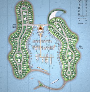
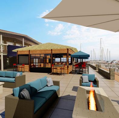
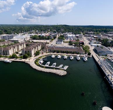
Planning
We listen to our clients and help translate concepts into reality. Understanding the needs for a successful operation, we discuss your goals and develop a road-map for their success.
Engineering
Marina and associated waterfront development projects are different from most upland projects. Our engineers understand the challenges and have the experience to provide sustainable and cost-effective solutions for your marina needs.
Permitting
Obtaining permits from regulatory agencies can be a prerequisite to successfully completing a marina project. Our team has developed supporting data, communicated effectively with regulators, assembled the applications and in turn has successfully obtained permits throughout the United States.
Funding Assistance
We turn over every stone to find both public and private sources to help you fund your project. MSA knows the ins and outs of a variety of funding programs and can help bundle funding sources, manage timelines, and take care of any details to satisfy funding requirements.
• Waterfronts, Ports, Harbors & Terminals Planning & Design
• Public Amenities Planning & Design
• Trails & Boardwalks
• Waterfront Inspection
• Vulnerability Assessments
• Dredge Planning, Material Management & Beneficial Reuse
• Asset Management Plans
• Living Shoreline & Bio-engineering Designs
• Hydrographic Survey & Underwater Imaging
• Permitting & Regulatory Compliance
• Wave Process Modeling
• Sediment Transport Modeling
• Outreach & Educational Support
• Cost Estimates & Construction Administration
• Grant Writing & Administration
• Master Planning
• Feasibility Studies, Assessments & Inspections
• Wetland, Marsh & Open Water Mitigation
• Environmental Assessments
• River Structures, Docks, Pile or Concrete Walls, Boat Launches & Piers
• Riverine Engineering
• HEC-RAS Modeling
As lifelong boaters, we understand the allure of water and the need for access to it. As planners, designers and engineers, we are dedicated to responsibly developing waterfronts and strengthening the connection between land and water for all our clients. It’s simply what we do and what we enjoy doing.
What Our Clients are Saying
“What sets them apart from most design firms is the understanding of development and of the actual construction process. They listen to the clients’ concerns and needs and use the understanding that comes from years of specialization.”
- Operator/Marina General Manager, Alton, IL
“MSA takes an idea expressed verbally and makes it into something that all can visualize.”
- Mayor, Clarksville, TN
IT'S MORE THAN A PROJECT. IT'S A COMMITMENT.
Our waterfront specialists team is part of a larger, multidisciplinary firm of 500+ team members spanning 17 offices and four states. Serving clients nationwide, MSA specializes in the sustainable, resilient development of communities. We achieve this by building honest, open relationships that go beyond the project to become a trusted source of expertise and support for immediate challenges and long-term goals. Big or small, we do whatever it takes to meet each need, working to make communities stronger in the process.
The depth of our in-house expertise allows us to build teams that are truly suited to the complexity of each project. Yet, the people on your team never work in silos. Your engineers, architects and designers partner with environmental scientists, surveyors and land planners down the hall and across the state or even the country to come up with the most efficient, cost-effective solutions to address challenges and further your project goals. In fact, it’s our internal relationships and multidisciplinary approach that makes our external relationships so valuable: with MSA, you have hundreds of experts always ready to answer your questions and tackle your challenges.
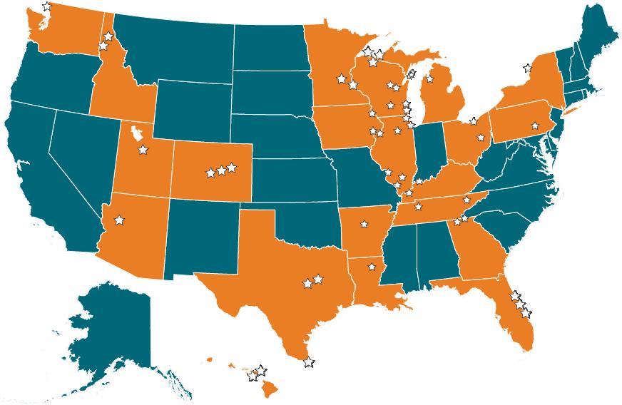
SELECT MARINA EXPERIENCE
LOCATION
Alton Marina, Alton, IL
Apostle Islands Marina Breakwater Restoration, Bayfield, WI
Ashland Marina, Ashland, WI*
Ashland Ore Dock Master Plan, Ashland, WI*
Ashland Waterfront Master Plan, Ashland, WI*
Bay Harbor Resort, Bay Harbor, MI*
Central Arkansas Water, Little Rock, AR
Chatcolet Marina, Coeur d’ Alene, ID*
Chatfield Marina Impact Study, Littleton, CO*
Pelican Bay Marina, Denver, CO
Chicago Park District Lakefront Harbor Plan, Chicago, IL*
Chicago Park 31st St. Pool, Chicago, IL
Clarksville Marina & Liberty Park, Clarksville, TN*
Cleveland Waterfront Master Plan, Cleveland, OH*
Clinton Marina Renovations, Clinton, IA*
Crab Orchard National Wildlife Refuge Marina, Marion, IL*
Dillon Marina & Park, Dillon, CO
Egg Harbor Marina, Egg Harbor, WI*
English Jim’s Marina, Daytona Beach, FL
Gills Rock Marina Feasibility Study, Gills Rock, WI*
Great Lakes Aquarium/Discovery World, Milwaukee, WI*
Halifax Harbor Assessment, Daytona Beach, FL
Harbor Club Marina, Sturgeon Bay, WI
Hawn’s Bridge Marina, Raystown Lake, PA
Heritage Harbor Marina, Floating Building, Ottawa, IL*
Hoakalei Marina/Ocean Pointe, Ewa Beach, HI*
Horseshoe Bay Farms Resort, Egg Harbor, WI
Isle of Capri Casino Transient Dock, Bettendorf, IA
Lake Poygan Wetlands Restoration, Winneconne, WI
SELECT MARINA EXPERIENCE (CONTINUED)
LOCATION
Lakeshore State Park, Milwaukee, WI
La Pointe Waterfront Master Plan, Madeline Island, WI
Lummi Nation - Fisherman’s Cove, Bellingham, WA*
Madison Rowing Club, Madison, WI
Manitowoc Marina, Manitowoc, WI
McKinley Marina, Milwaukee, WI
MWCD Master Plan, New Philadelphia, OH
Northern Great Lakes Visitor Center, Ashland, WI
Ocean Reef, Panama City, Panama*
Oshkosh Riverfront Design Guidelines, Oshkosh, WI*
Owensboro Marina Master Plan, Owensboro, KY
Paducah Riverfront, Paducah, KY*
Pauly Breakwall Replacement, Pipe, WI
Pikes Bay Marina, Bayfield, WI*
Port of Dubuque Transient Marina, Dubuque, IA*
Port Washington Marina, Port Washington, WI*
Reefpointe Marina, Racine, WI*
Rend Lake Marina Concept Development, Feasibility & Market Study, Jefferson County, IL
Sand Island Recreation Area, Honolulu, HI*
Schwiebert Park Transient Marina, Rock Island, IL
South Pier/Blue Harbor Resort, Sheboygan, WI*
South Padre Island Marina Reconstruction
Tribute Marina, Dallas, TX
Trinity River Vision Safety Plan, Fort Worth, TX
University of Wisconsin Shoreline Restoration, Madison, WI
Vacamonte Beach, Vacamonte, Panama*
Waukegan Harbor Marina Renovation, Waukegan, IL*
PROJECT HIGHLIGHTS

• Expansion and Enhancements
• Concept Plans
• 3D Renderings
• Utility Improvements

SUGAR HOLLOW MARINA
LAFOLLETTE, TN
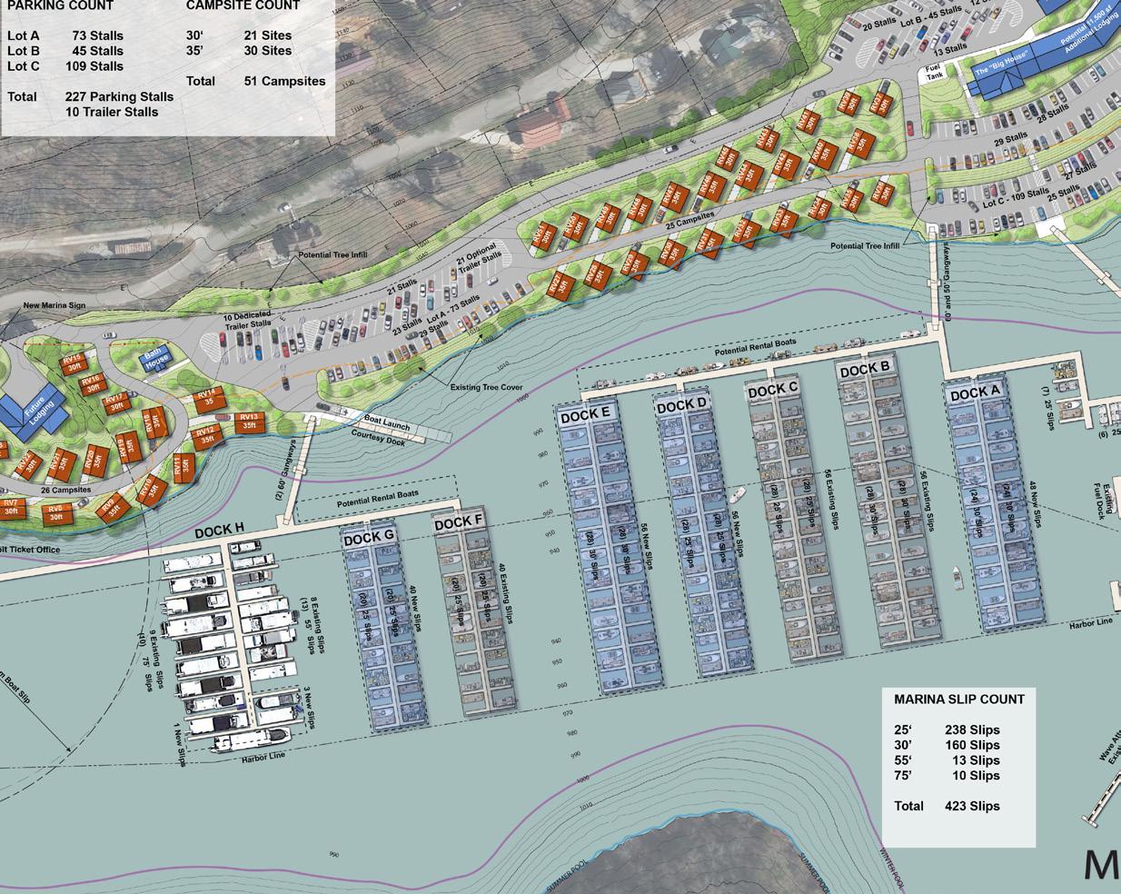
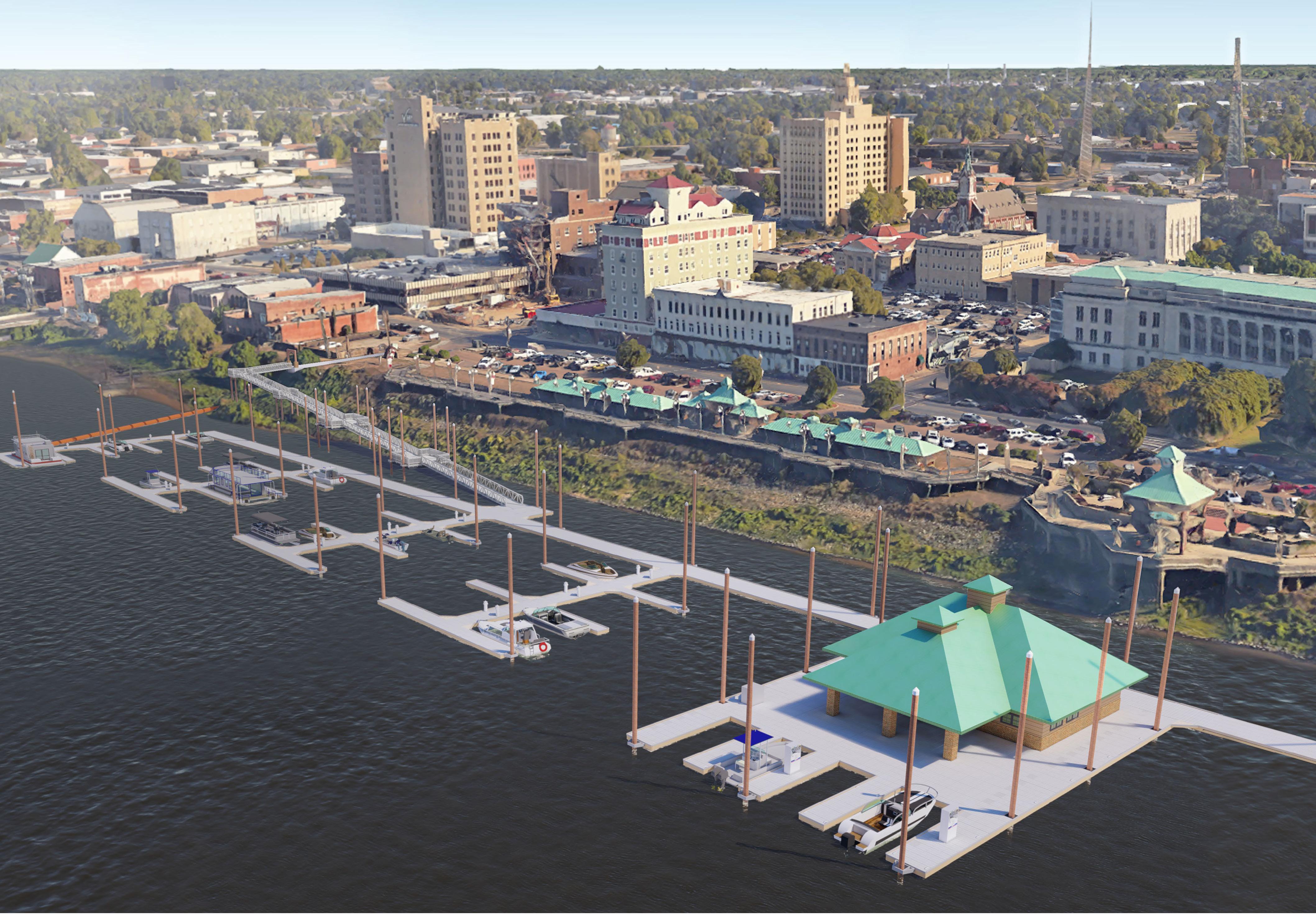
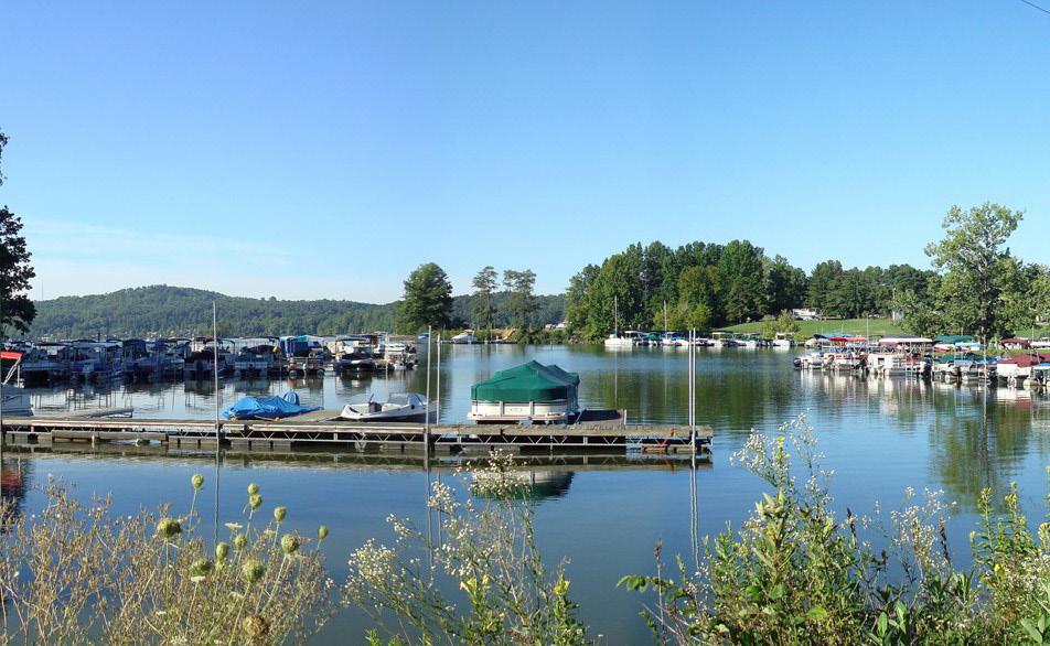
Nestled in the picturesque setting of LaFollette, Tennessee, Sugar Hollow Marina (SHM) is known for its welcoming atmosphere and serves as a hub for food, fun and relaxation on Norris Lake. The existing Sugar Hollow Marina includes 200 slips, a fuel dock, sanitary pump-out, floating restaurant/ship’s store/restrooms, floating cabins, boat launch, trailer parking and lodging (two buildings).
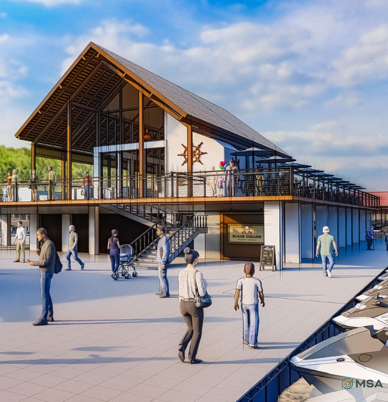
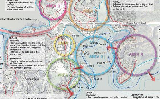
MSA is working with SHM to update and expand the marina, potentially increasing the number of slips to 430 while expanding the floating restaurant to two stories with more amenities. Site enhancements include replacing floating cabins with an inflatable floating waterpark (Wibit course) as well as modifying the campground, boat launch, parking, shower house and a new lodge. We are also reviewing existing utilities for design upgrades throughout the site.
Three concept plans were developed for the marina and site, with a focus on a wave attenuator in Phase 1 of any implementation. Concept A focused on minimal modifications, maintaining existing buildings and adding 6,000 square feet of lodging, 180 parking stalls, 412 slips and a 60-70 person Wibit. Concept B involved more significant changes, including relocating the bathhouse, adding 6,400 square feet of lodging, 240 parking stalls, 449 slips and splitting the marina into two facilities. Concept C proposed the most changes, particularly to the campgrounds, with a new bathhouse location, 9,000 square feet of lodging, 233 parking stalls, 425 slips and a redesigned marina layout. All concepts aimed to enhance the marina while maintaining its unique character and functionality.
The Owner ultimately chose Concept C, which MSA developed into the master plan. In addition to preparing a comprehensive master plan, MSA developed 3D master plan renderings of the facility using SketchUp and Lumion to create realistic depictions.
• Creative Visioning
• Master Plan
• Design Engineering and Implementation PROJECT HIGHLIGHTS

MONROE TRANSIENT MARINA
MONROE, LA
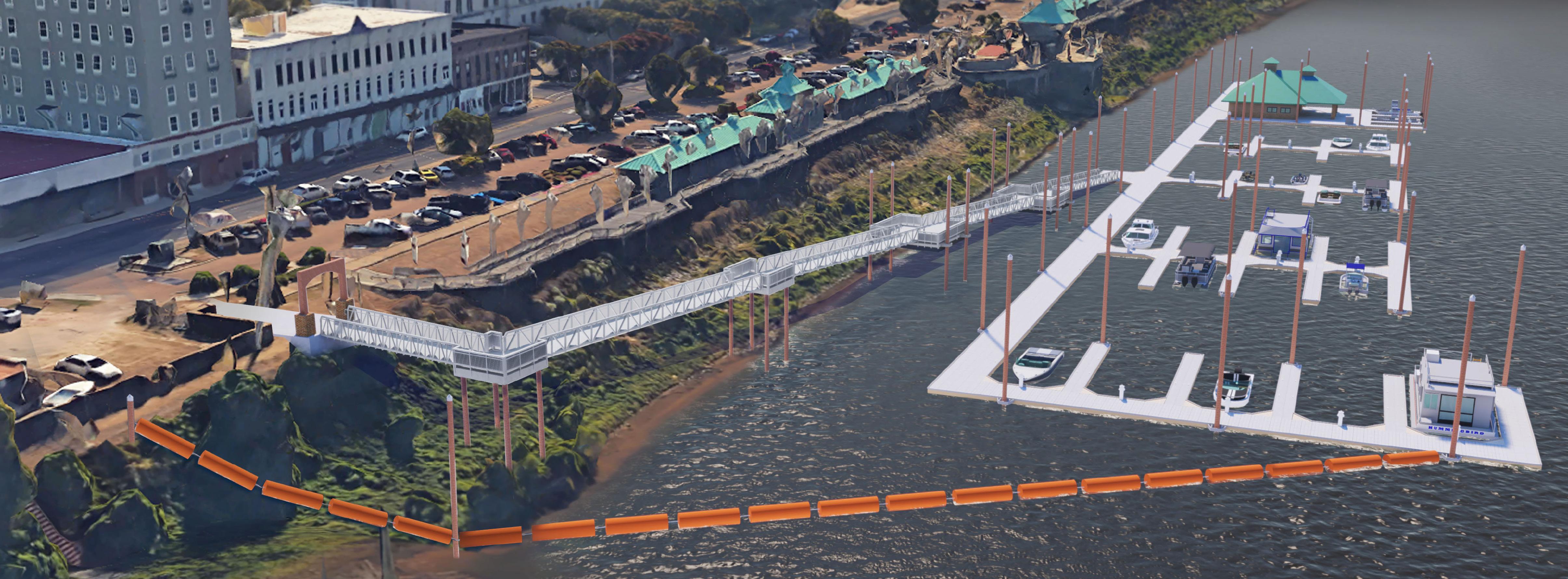
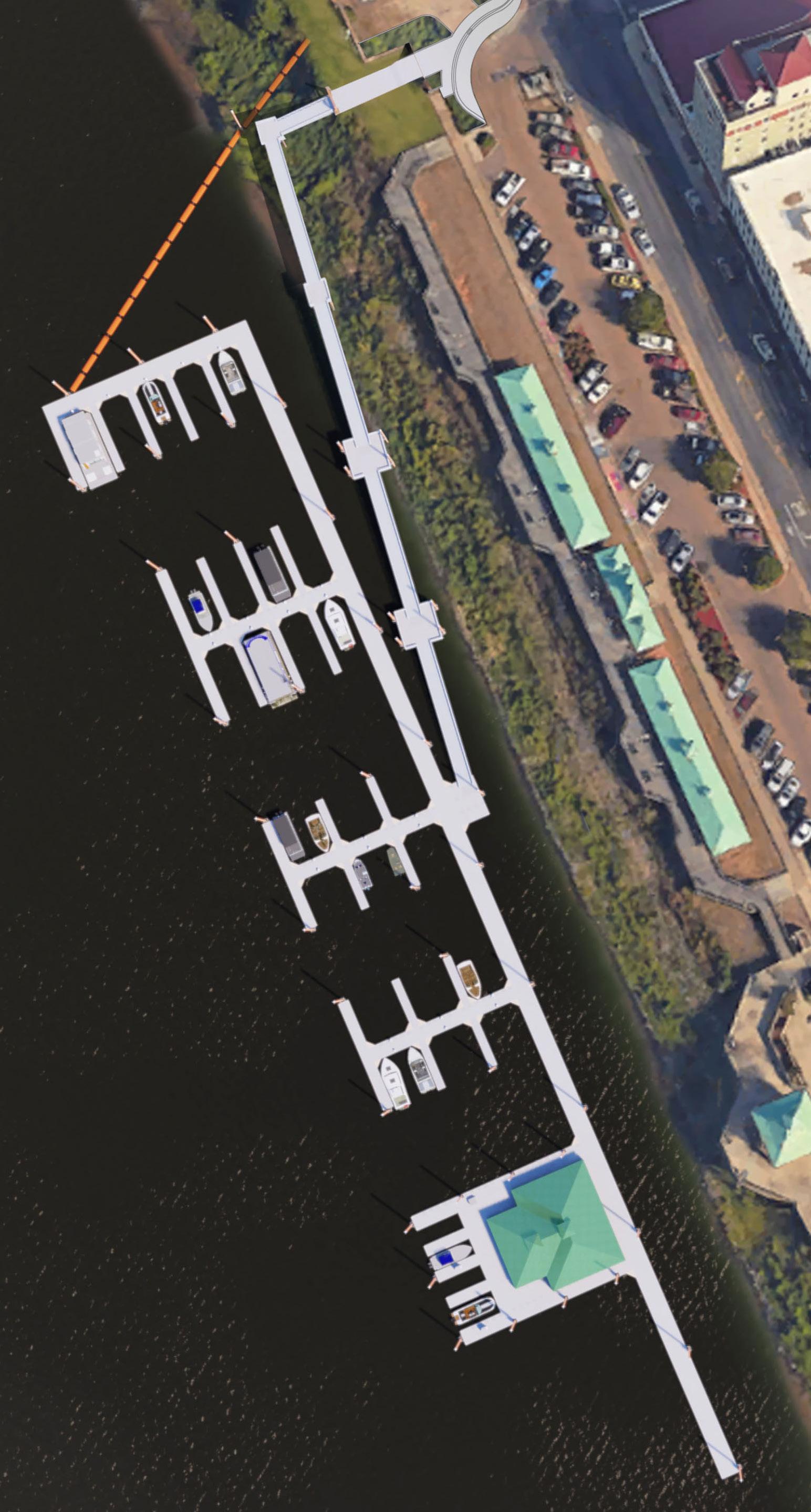
Monroe is in north central Louisiana along the Ouachita River. This area of Louisiana is known as the outdoor capital of the United States. Hunting and fishing are the top recreational uses in the region. The City of Monroe reached out to the experts at MSA to develop a full-service marina to tap into an underutilized water base. The goal is to create a destination marina downtown at the RiverMarket facility. The RiverMarket was originally built in the 1970s as an outdoor entertainment venue. In the 1990s, wing boardwalks with covered canopies were added to both sides of the main platform to create a festival ground for farmers markets, art fairs and other community events. The marina site was chosen to provide river access to and from boats to the RiverMarket and future downtown improvements such as boutique hotels, shops, music venues and restaurants.
The marina master plan provides slips for 110 vessels, a floating ship's store and restroom, fuel dock and sanitary pumpout station. The master plan for the marina is similar to the RiverMarket with the floating building aligning with the main platform and the slips flanking each side. Phase 1 of the marina includes the north half of the slips with the building, fuel and pumpout station.
Future efforts will include submitting for a Boaters Infrastructure Grant (BIG) for the south half of the slips which will be dedicated to transient boaters. The City is currently developing a riverwalk, downtown streetscape enhancement plan and new entertainment district that will be tied to the marina facility. MSA is excited to be a partner with a community that is going through a great transformation.
PROJECT HIGHLIGHTS
• Creative Visioning
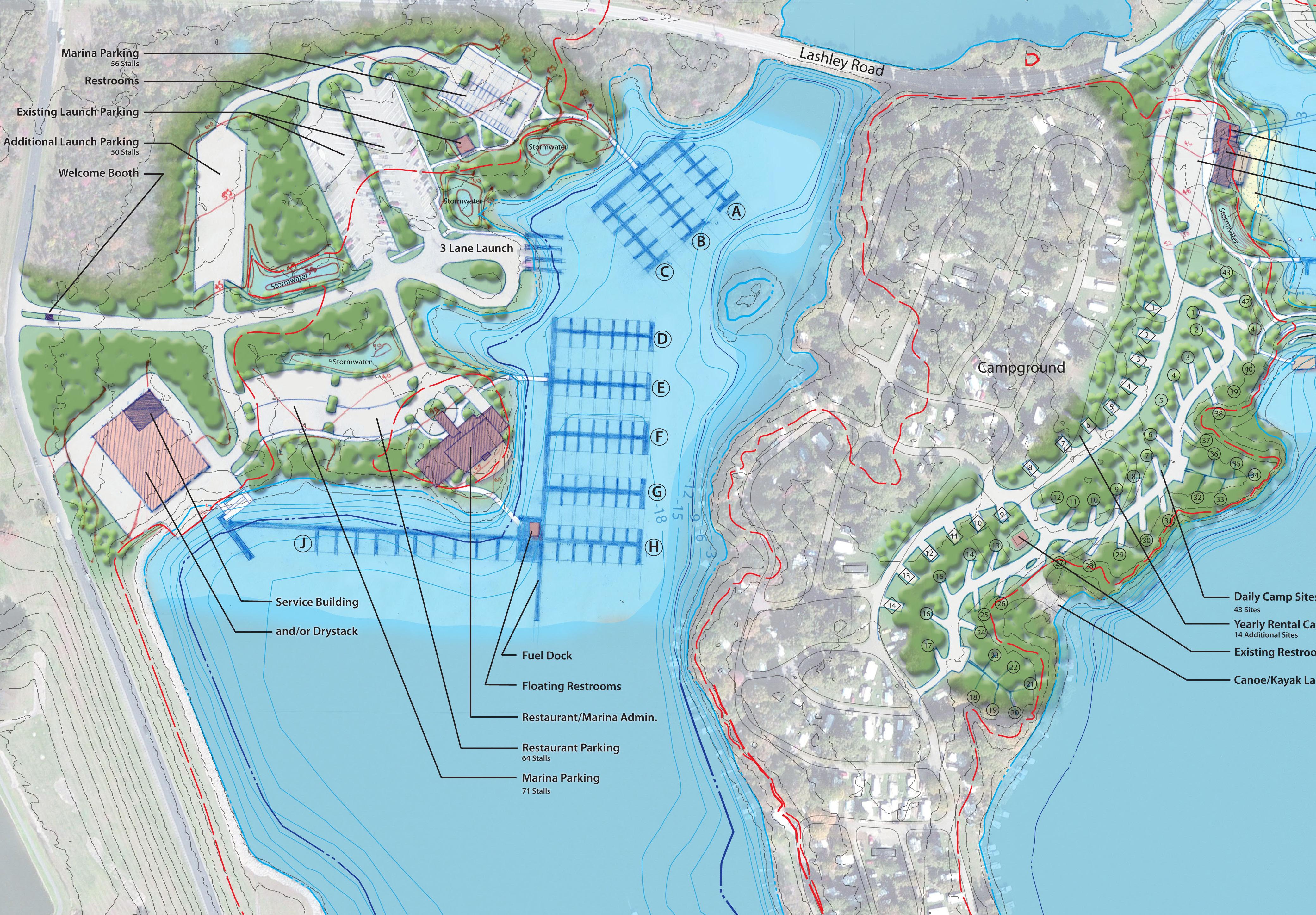
• Multilake, Multimarina Master Plan
• Multiple Alternatives Based on Usage

MUSKINGUM WATERSHED CONSERVATION DISTRICT
MASTER PLAN
NEW PHILADELPHIA, OH
Flood protection as recreation
The Muskingum River Watershed, which covers more than 8,000 square miles and drains into the Muskingum River, is the largest wholly contained watershed in the state of Ohio, covering about 20 percent of the state. The Muskingum River, which is formed by the confluence of the Tuscarawas and Walhonding rivers at Coshocton, OH, empties into the Ohio River at Marietta. The system of reservoirs and dams in the watershed offers flood reduction and water conservation benefits to the region’s property owners and residents.
The Muskingum Watershed Conservancy District (MWCD), a political subdivision of the State of Ohio, was responsible for the development of the reservoirs and dams. Today, the MWCD is dedicated to providing the benefits of flood reduction, water conservation and recreational opportunities in the Muskingum River Watershed. The District is comprised of nine parks based around the flood reduction lakes that provide thousands of acres dedicated to a wide variety of upland and water recreational opportunities.
The big idea
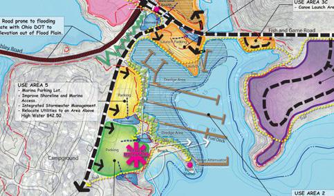
The project focuses on a master plan for nine of the District’s parks and two marinas as well as five additional vendor-operated marina facilities. The master plan is an extensive look at current conditions and recommendations for improvements. It also introduces new amenities to improve visitation of the system parks. Future implementation projects will follow the guidance of the planning efforts, and these future projects fulfill a budget of over $165 million in improvements to this vast park system.
In addition to the planning efforts, the project expanded to include the development of operation standards, business plan improvements, staff training opportunities, an incentive improvements program, and code compliancy documentation. These standards have become the foundation for operations throughout the District. Our team members helped to create the guiding plans for the next 40 years at MWCD.
PROJECT HIGHLIGHTS
• Creative Visioning
• Market Study
• Evaluation of Multiple Alternatives

TRANSIENT MARINA STUDY & DESIGN
LAKE DEVELOPMENT AUTHORITY, FAIRPORT HARBOR, OH
Fairport Harbor is east of Cleveland along the shore of Lake Erie. The Village has been a major access point for Lake Erie fishing for many decades. The existing boat launch and transient marina needs total replacement.
The project dramatically expands the public use at the Village-owned site. The study covered existing conditions, feasibility of a larger marina, on-site amenities, and future expansion opportunities. The stakeholders for the project include the Village, ODNR and the Lake County Metro Parks. The site combines resources from all three entities.
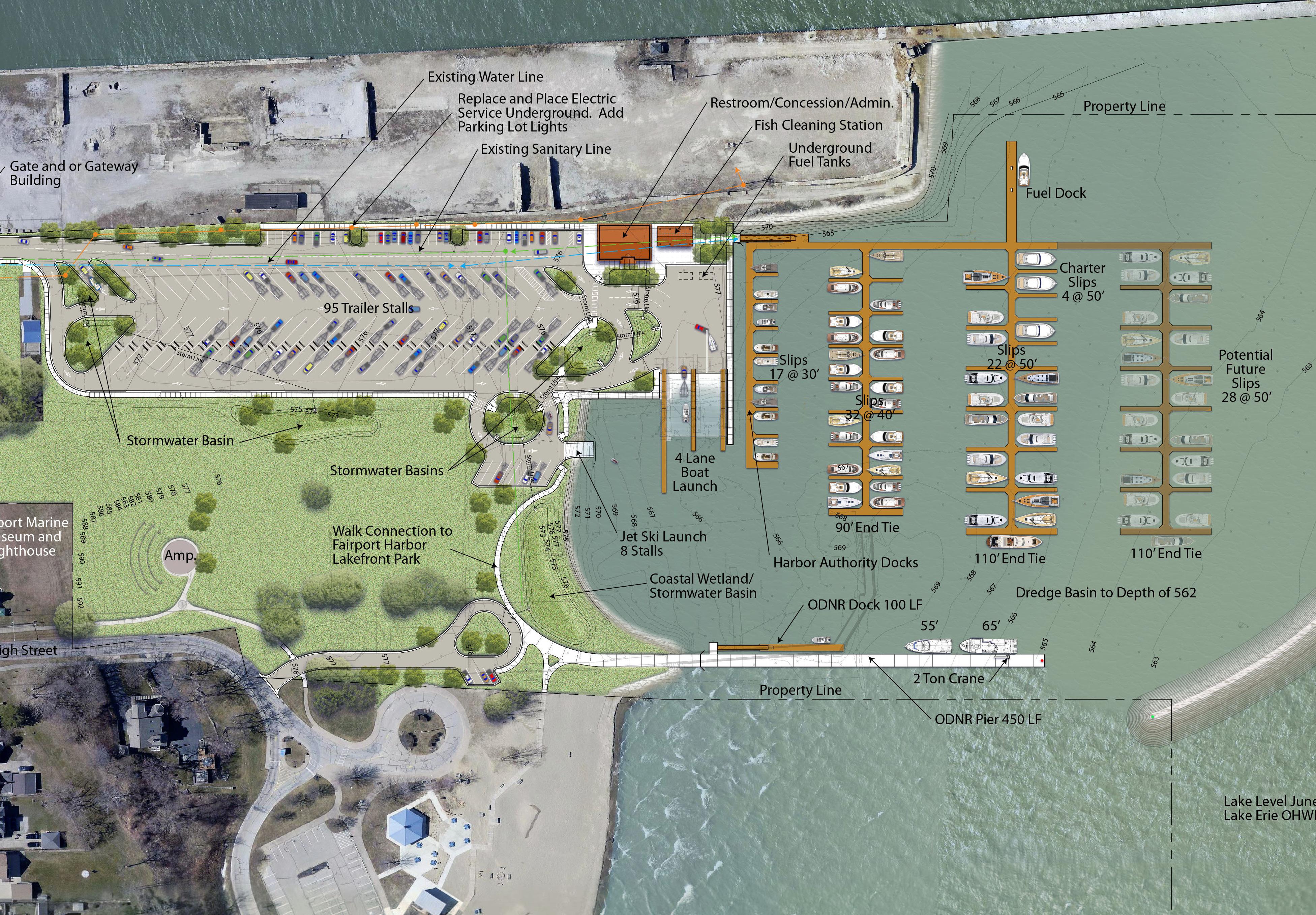
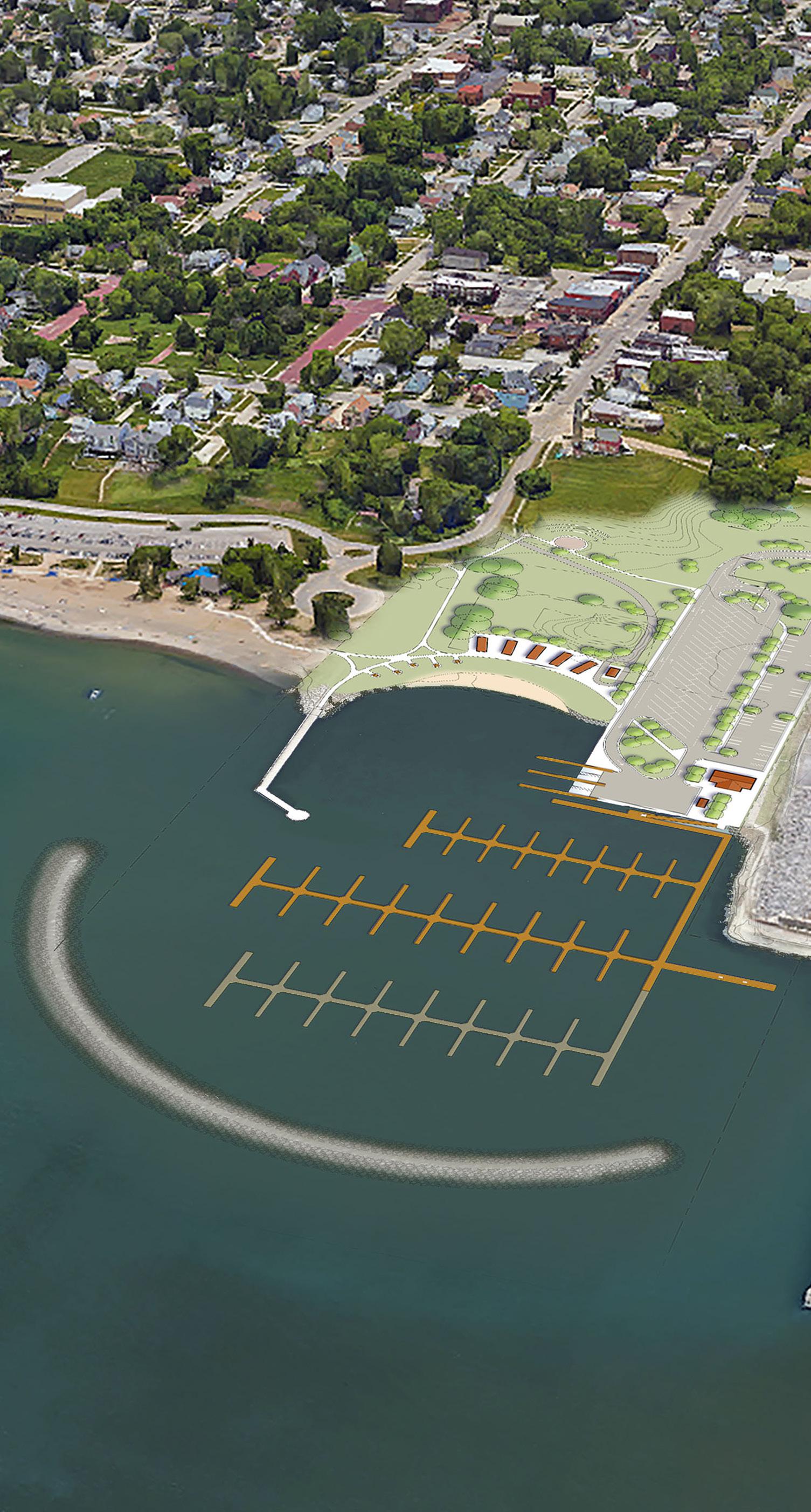
The master plan calls for a launch facility that can handle a large influx of users. The Fairport Harbor launch is one of the most popular on Lake Erie in Ohio. A new restroom building with a fish cleaning station is near the access to docks. A new breakwater provides protection for a much larger transient marina with 60 slips and expansion capability of another 29 slips, plus a new fuel dock with regular and diesel gas and an ODNR service dock with two-ton crane for loading their vessels ranging from 40’ to 65’ in length. The ODNR dock also provides wave protection to the marina.
Prior to designing this facility, MSA was tasked to determine the market for a marina, expected revenue from such a development, and documented the results of a feasibility and planning study in a report to reinforce the LCOPDEA's efforts to obtain funding. So far, the efforts have obtained significant funding and are expected to bring more.


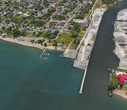


The Village center is connected to the marina site via a cart transportation service with an on-site wait station. Plans are to create a small retail center adjacent to a boater’s beach, with transformed shipping containers as proposed retail structures. Other connections will bring the marina into the overall park and open space plan that will ultimately extend two miles eastward as part of a regional trail system.


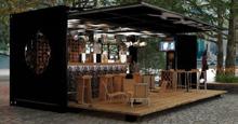


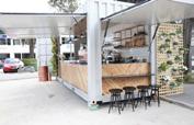

Due to our successful collaboration in the preliminary phases of the project, MSA is currently working with the Lake Development Authority on implementing the recommendations in the final study and master plan. Services include data acquisition and synthesis, schematic design and design development, permit application and grant acquisition efforts, construction documents, bid cycle services and construction support as needed such as possible construction administration and observation.
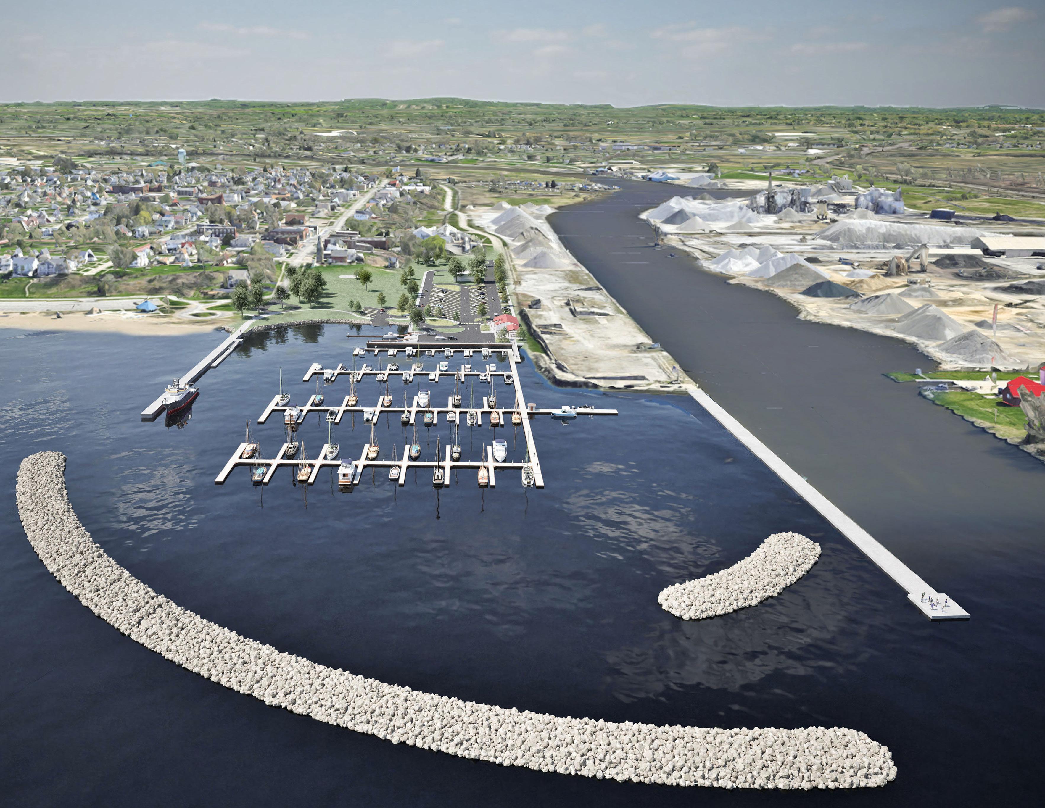
TRANSIENT MARINA STUDY & DESIGN RENDERINGS
LAKE DEVELOPMENT AUTHORITY, FAIRPORT HARBOR, OH
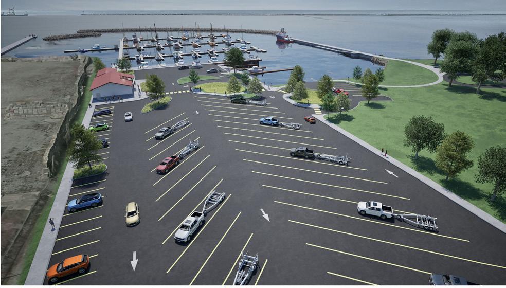
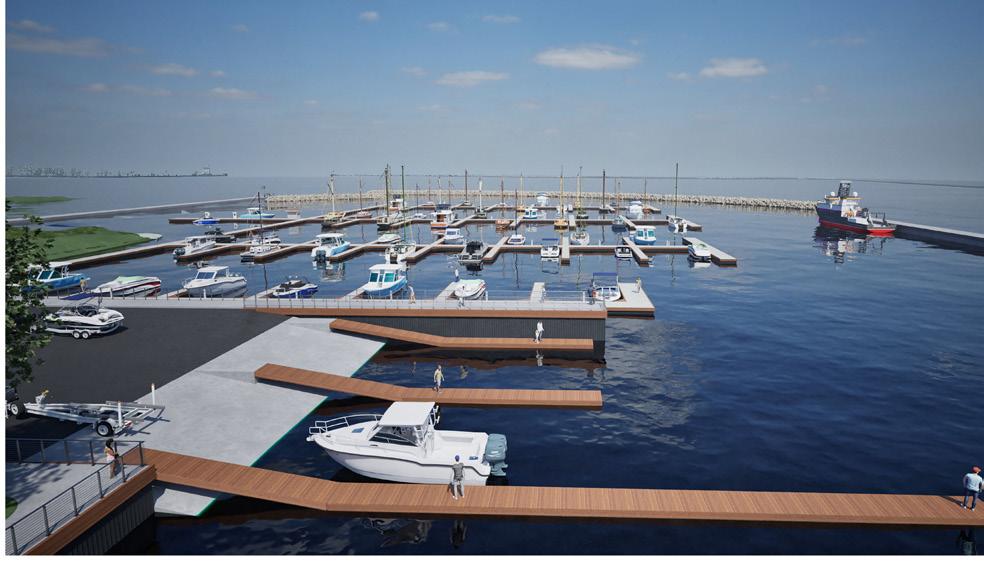

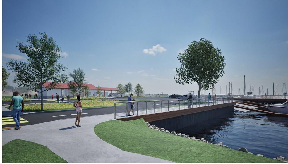
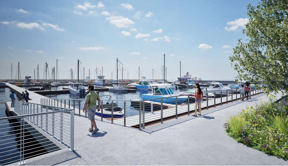
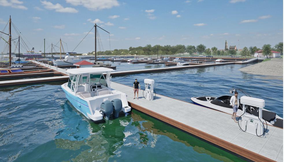
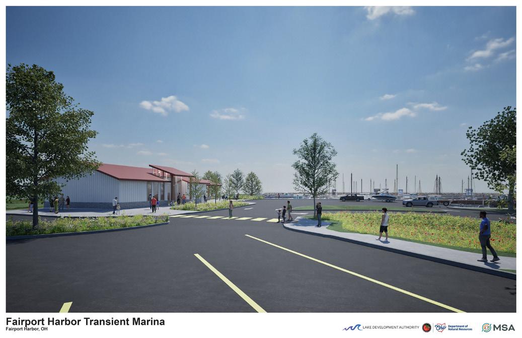
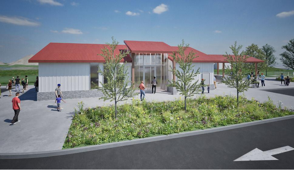
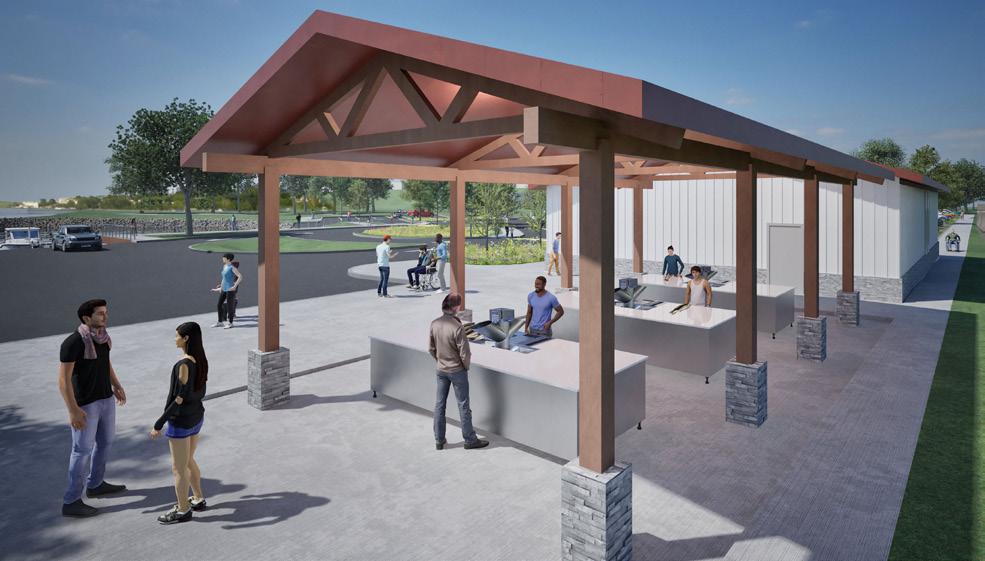
LAUNCH PARKING, MARINA BUILDING, ODNR PIER AND MARINA
BOAT LAUNCH, MARINA AND ODNR PIER
JET SKI LAUNCH
MARINA BUILDING AND MARINA
MARINA BUILDING AND FISH CLEANING STATION FISH CLEANING STATION
LAUNCH, MARINA BUILDING AND FISH CLEANING STATION
TRANSIENT MARINA FUEL DOCK
PROJECT HIGHLIGHTS
• Grant Funding
• Innovative Underground Stormwater System
• Fully Accessible Site

LAC LA BELLE BOAT LAUNCH REDEVELOPMENT
OCONOMOWOC, WI
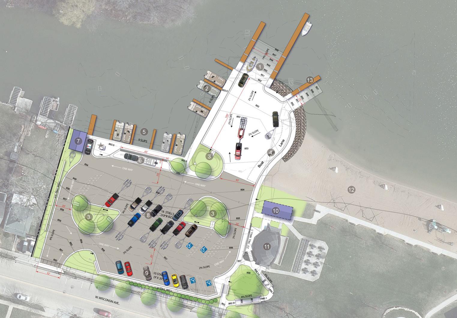
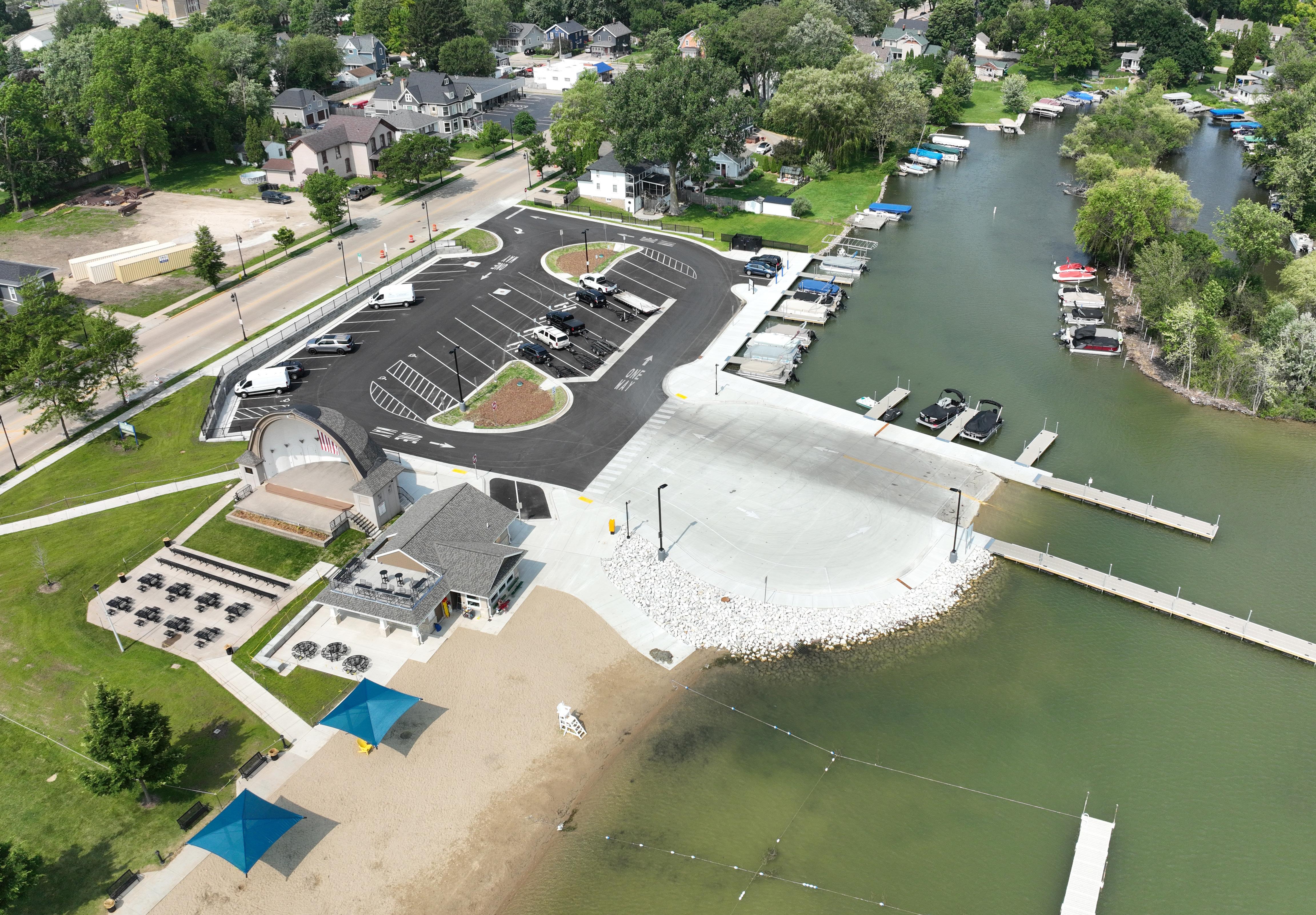
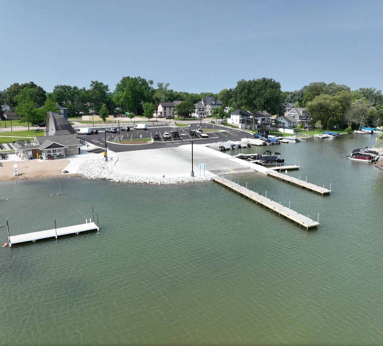
Lac La Belle is a 1,154-acre lake located in the City of Oconomowoc, approximately 30 miles west of Milwaukee. The City, along with the Village of Lac La Belle, Town of Oconomowoc, and the Lac La Belle Lake Management District, had long recognized the need to upgrade the lake’s only public boat launch adjacent to City Beach Park. The goal was to improve site flow, safety, accessibility, and stormwater management while enhancing the overall user experience.
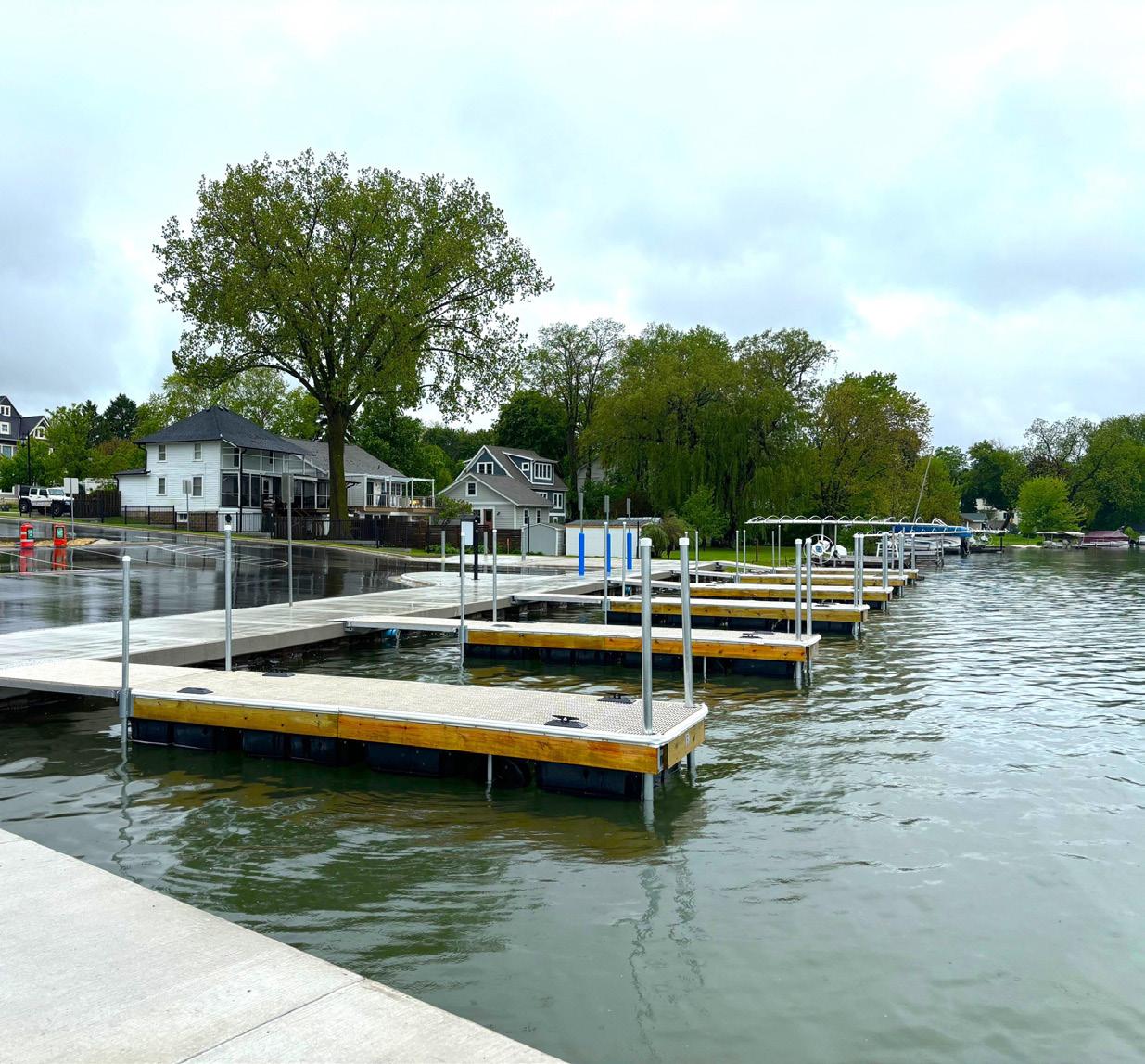
MSA worked with the City to secure a Recreational Boating Facilities Grant (RBF) from the Wisconsin DNR to help offset project costs. The redevelopment includes a wide range of improvements: a renovated and expanded asphalt parking lot, underground stormwater infrastructure, rain garden, retaining wall and railing, general site grading and demolition, boat launch expansion and repair, pier upgrades, site lighting and electrical enhancements, and full site restoration.
A key challenge was the site’s low elevation, which placed the parking lot within the floodplain and made it vulnerable during high-water events. The existing slope directed runoff and Total Suspended Solids (TSS) straight into the lake. MSA addressed these issues by raising the shoreline elevation with fill, constructing three new wetland/sediment basins, and regrading the site to redirect runoff into these new systems.
To further mitigate flooding and water quality concerns, MSA designed an underground stormwater storage system using large-diameter welded corrugated metal piping. The 8,750-cubic-foot system is engineered to store lake water during high-water events and release it slowly once levels recede, allowing sediment to settle and reducing shoreline erosion.
In addition to the launch improvements, MSA assisted with dredging operations at the Lac La Belle Marina to increase capacity.
Winner of the SOBA Award - Outstanding Project
• Market Study PROJECT HIGHLIGHTS
• Tourist Destination and Attraction

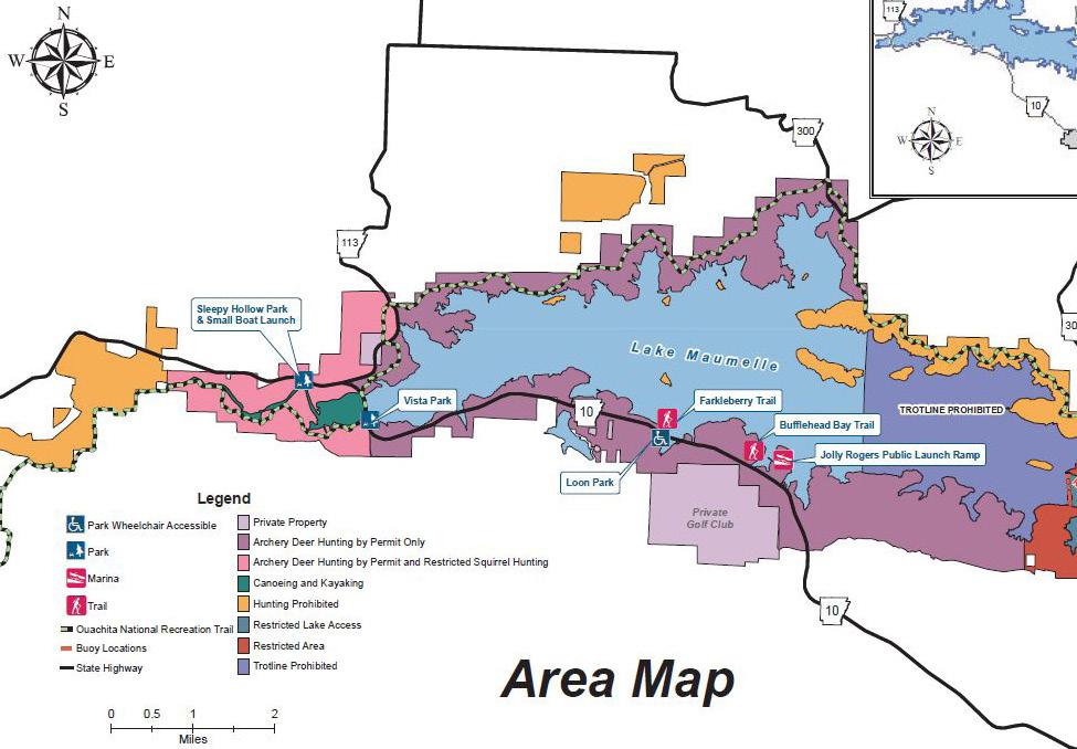
CENTRAL ARKANSAS WATER - LAKE MAUMELLE PLANNING STUDY
LITTLE ROCK, AK
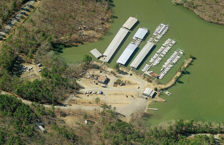
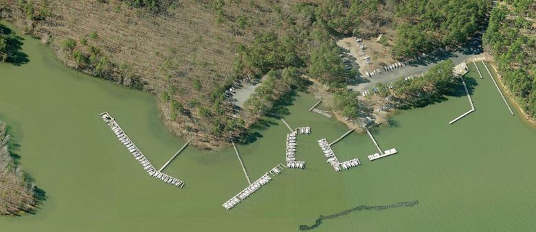
The Central Arkansas Water District (CAW) authorized a review of the operations and facility conditions of its two concessionaires on Lake Maumelle: Jolly Roger’s Marina (JRM) and the Grand Maumelle Sailing Club (GMSC). Two site inspections as part of this review occurred: the first in 2016 and the second in 2017. The initial site visit was a review of the basic operations of the marina and to understand the relationship between the concessionaires and CAW. The second visit confirmed and expanded details of the first site observation.
The existing marina operators within the CAW lake system have leases that have expired or will expire in the near future. CAW wishes to take this opportunity to revise the agreement language and provide appropriate incentives to the operators to perform to the standards identified in the new agreements.
Owner-operator agreements vary significantly from one facility to another, but the essentials of the agreements are the same. Well written agreements define the terms and expectations for all parties and provide incentives to improve performance and efficiency. We reviewed the existing agreements and provided recommendations for updating the marina lease agreement language to CAW.
CAW also authorized an overall operations review of the marinas on Lake Maumelle identifying the facilities’ condition through an assessment of the physical facilities and the methods employed to maintain them. The report generated documented the conditions found at the facilities, needed improvements to meet codes and standards and proposed changes in the relationship of CAW to vendors moving forward. These recommendations were adopted by CAW and the district moved forward with replacing one of the vendors and selecting a new one willing to upgrade the facilities to meet CAW expectations.
Existing Jolly Rogers Marina
Existing Grand Maumelle Sailing Club
• Tourist Destination and Attraction
• Harsh Environmental Challenges
• Man-made Lake to Impound Water for Large Metro City

DILLON MARINA & WATERFRONT MASTER PLAN
DILLON, CO - TOWN CENTER
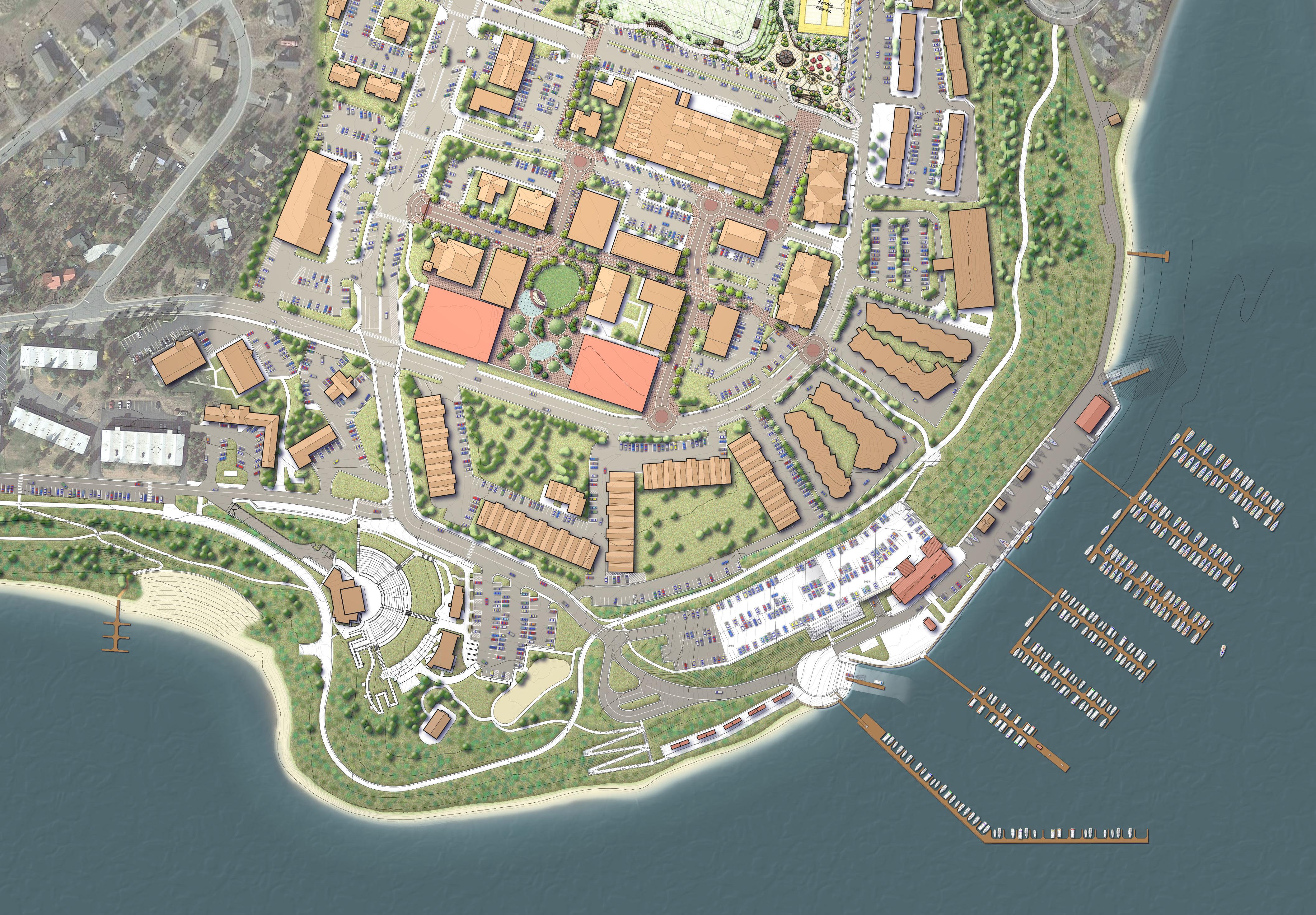
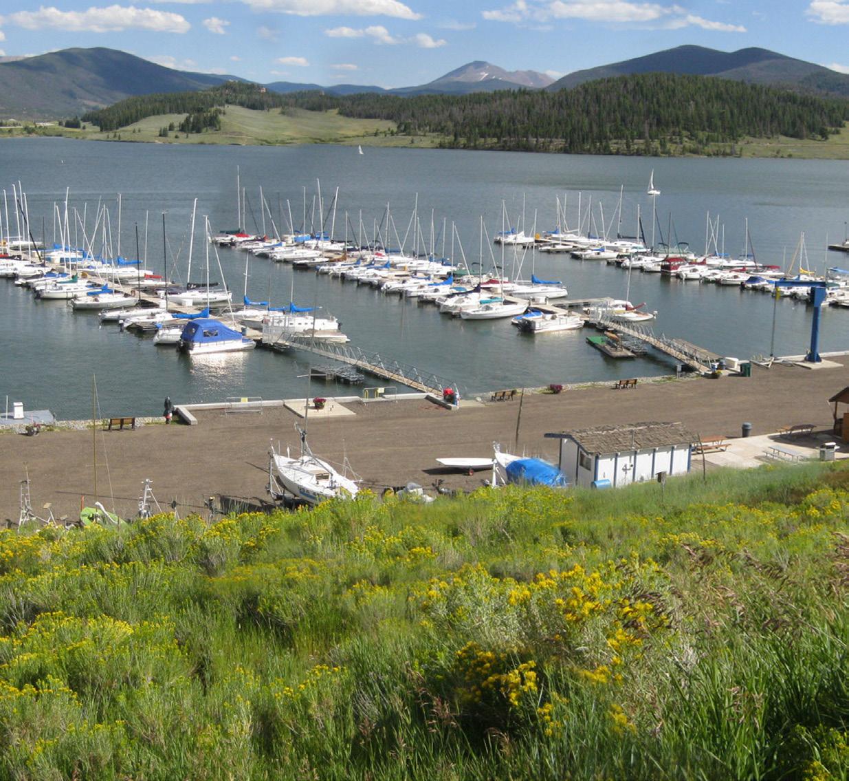
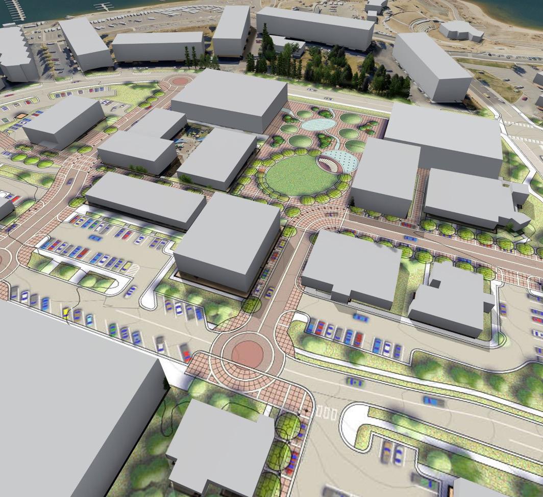
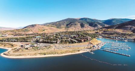
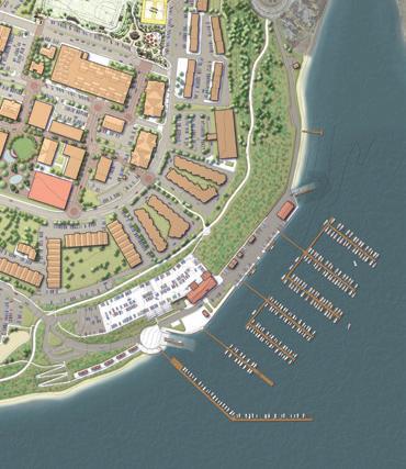
The Town of Dillon, located in the heart of Colorado’s ski resort country and on the shore of the vast Dillon Reservoir, provides access to several skiing destinations. This pristine, man-made lake, popular for fishing and boating, is an important catalyst for the summer tourism economy, and the Dillon Marina is a focal point for the community. The lake also impounds water for the City of Denver. Through a community-based planning process, a new marina and waterfront park plan were crafted, linking the Town Center with its waterfront while providing a number of muchneeded improvements, including a floating dock system, waterfront restaurant/tiki bar, access road, parking, pedestrian paths and multiple upland amenities.
The master plan identified the needed facilities by realigning the main access road and adding an underground parking structure to serve both marina and Town Center users. The adjacent Marina Park will feature new recreational opportunities, including a pavilion, expanded amphitheater, playgrounds, a fishing/observation pier, trails, gardens and several concession/restroom facilities. Like many of our clients, the Town of Dillon is a repeat client. We originally began working with them in 2007 and completed an initial Master Plan for the marina and waterfront in 2008. Many of the proposed improvements were implemented in the following years. In 2019, MSA was contracted to update the Master Plan, identify new implementation projects and develop improved pedestrian access to the Town Center.






PROJECT HIGHLIGHTS
• Creative Visioning
• Market Study
• Evaluation of Multiple Alternatives

MARINA & WATERFRONT MASTER PLAN
OWENSBORO, KY
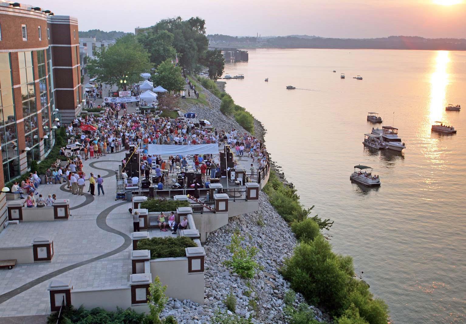
The City of Owensboro is located along the Ohio River in the Newburgh Pool. The City has transformed its core with major investments in the downtown and waterfront areas. The recent development of Smothers Park, a multimillion-dollar public waterfront with music and dance platforms, concessions, spray park, fountains, interactive playground, and many more attractions has set the tone for future connections to the river itself.
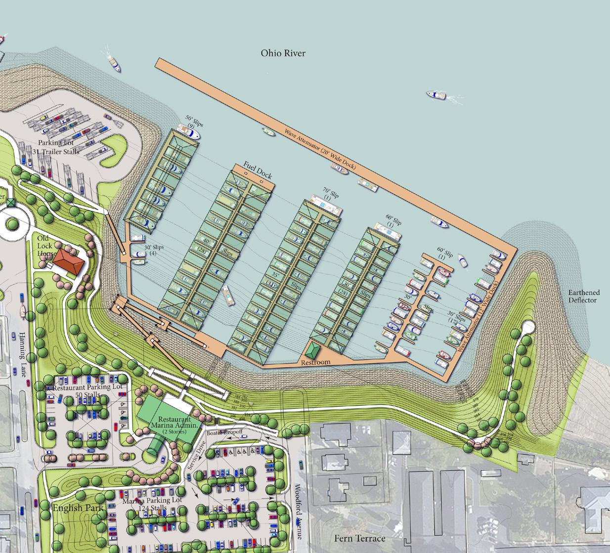
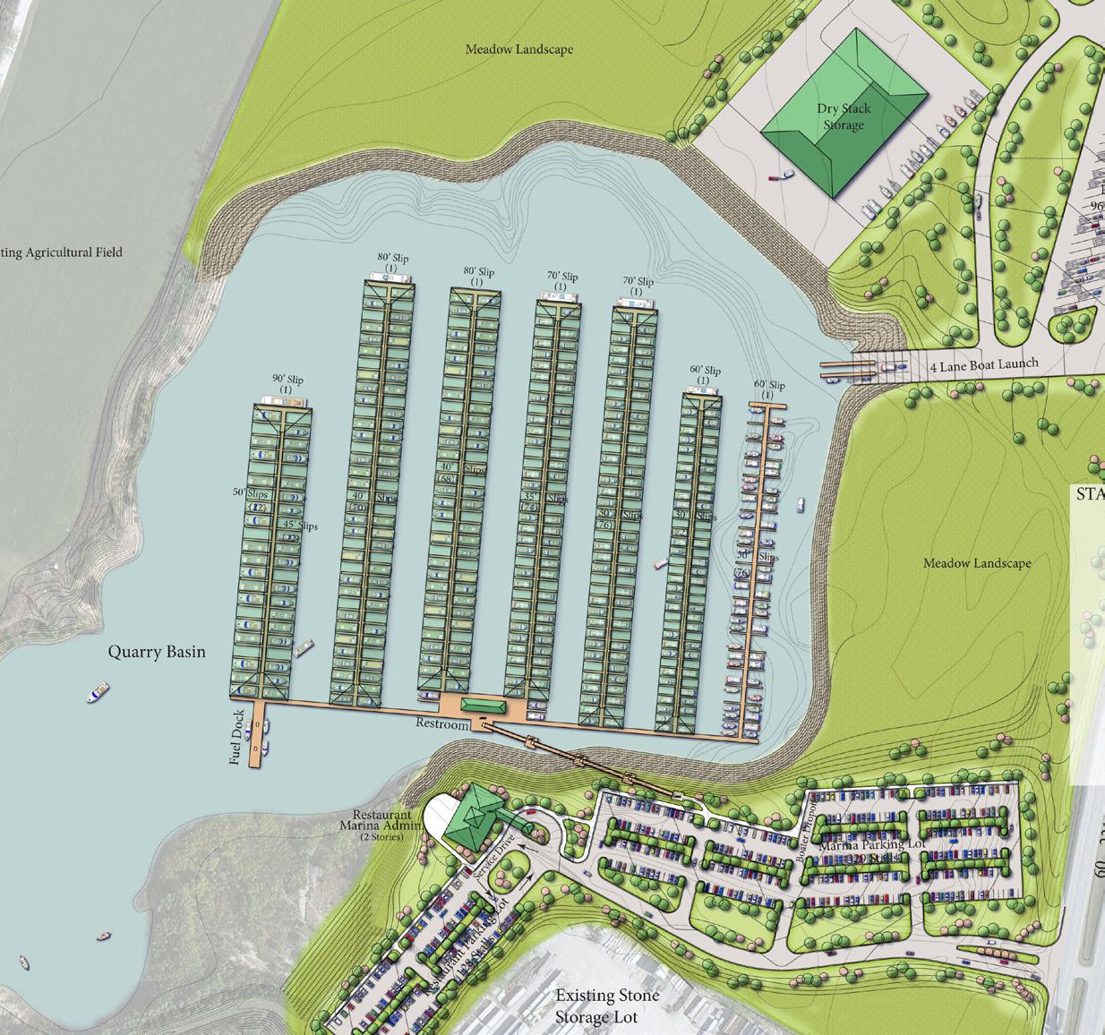
The Owensboro Marina and Waterfront Master Plan is an effort to explore the feasibility of building a marina at the City’s English Park. The plan diagrammed how the park could serve both as a park site within an excavated basin that could also provide in-water amenities. During the planning process, a second site was studied after discussions held during stakeholder and public presentations provided new insights on the exploration of other opportunities. The Yeger Quarry was shown to have the potential to create a full-service 500-slip marina, with yacht club, dry stack storage and boat launch.
Ultimately, a third site was added to the project which provides a transient facility with direct access to Smothers Park and the dynamic downtown atmosphere. With direct access to the new Riverwalk portion of the downtown waterfront, the transient facility was deemed an immediate need and is currently in the design and engineering phase. MSA was successful in procuring a $1.5-million Boater’s Infrastructure Grant (BIG) for the transient marina.




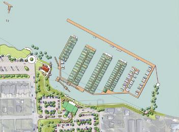

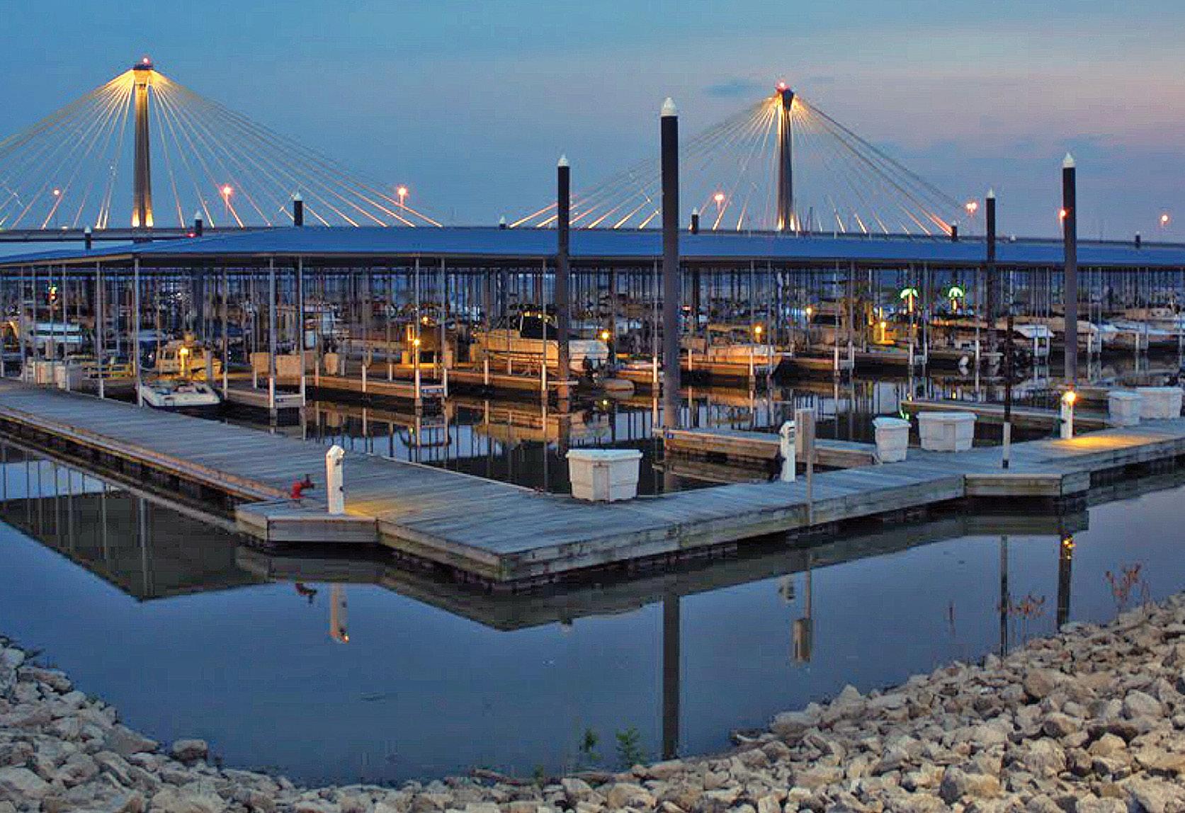
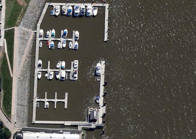
ALTON MARINA ALTON, IL
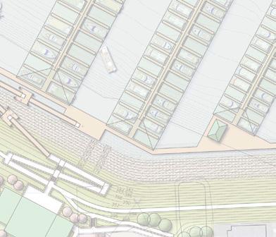
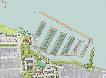
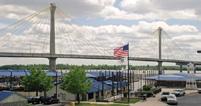
Alton Marina is a municipally-owned 300-slip marina located above the last lock and dam system on the Mississippi River. The marina is located near downtown Alton with access to many restaurants, a performance amphitheater and casino boat.
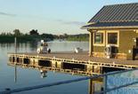
Serving the local community as well as metro St. Louis, this facility is nationally recognized. The marina has many unique features, including four floating buildings, a floating swimming pool and hot tub complex and floating fuel tanks which make the facility extremely capable of surviving most any flood conditions. Other amenities include year-round shower and laundry, concierge service, sanitary pump-out handled by attendants, wireless internet, satellite television, convenience store, hot food deli, professionally maintained facility, 300 parking stalls and night security year round.
ISLE OF CAPRI CASINO TRANSIENT DOCK
BETTENDORF, IA
The Bettendorf Transient Marina is comprised of 54 slips and limited side-tie opportunities providing seasonal and transient moorage adjacent to the Isle of Capri Casino complex. The marina was developed as part of the licensing agreement for the casino. The highly utilized marina provides access for varying sized boats up to large Mississippi River tour vessels. The marina was revolutionary in its use of an ADA-compliant ramp that provides safe access to the upland facilities. The Casino includes a 500-room hotel, 40,000-square-foot convention center and four restaurants.
CARIBBEAN JACKS
DAYTONA, FL
The marina was showing significant signs of aging which called for major updates to create a competitive rental, retail and transient destination. The renovations to the marina included the dock system and utility upgrades. A new restaurant and drystack storage facility were added to the marina including innovative stormwater management system which detains and cleans runoff from buildings and parking. The buildings were designed to complement and enhance the aesthetic value of the site. The stormwater management system is state-of-the-art using the area under the drystack lower bunkers for water detention. Landscape and paved parking have led the way to significant improvements to the neighboring properties, enhancing the financial success of the facility. The project was implemented in stages in order to allow for operations to remain functional during construction.
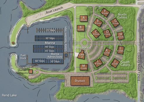
REND LAKE MARKET & INITIAL FEASIBILITY STUDY
INA, IL
At 15 miles long and nearly 3 miles wide, Rend Lake provides a variety of boating recreational choices. It is a shallow, but well controlled and provides excellent fishing opportunities. The project intent was to provide Lincoln County with a market and initial feasibility study for a marina and resort complex on Rend Lake. The site is adjacent to the Village of Ina and is located on Interstate 57 and near I-64 with excellent access to the site from all directions.
The market and initial feasibility study used existing marinas within a 30-mile and 60mile radius of the site. The existing facilities varied in their occupancy, rates and services rendered. The analysis of these facilities provided the background data for preparing a recommended approach to future development of the Ina site and the associated cost of construction and rate of return on investment. The existing basin was excavated during development of the original lake and provides a protected environment for boat launch and retrieval. The basin is also large enough to provide a 150 to 175 wet slip marina and support drystack facility.
HARBOR CLUB MARINA
STURGEON BAY, WI
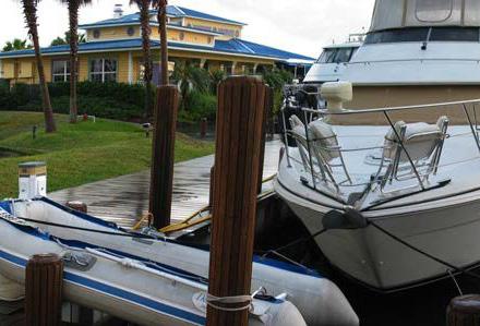
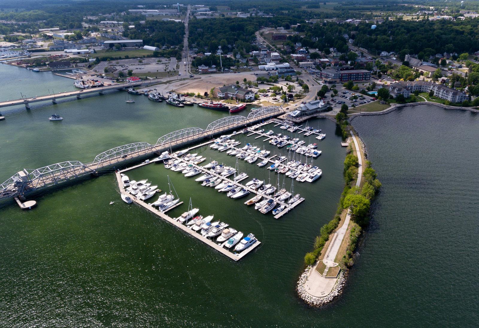
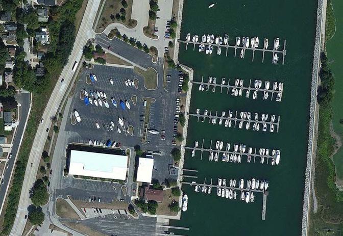
The Harbor Club Marina was thoughtfully engineered by MSA marine waterfront experts, converting a formerly blighted property into the beautiful, bustling, boat-filled destination. This 150-slip marina includes a protective breakwater, floating concrete wave and ice diversion structure to protect the marina from ice flows in the winter months. Situated on the canal between Green Bay and Lake Michigan, this revitalized waterfront is the perfect means to welcome to visitors to the Door County peninsula.
HAWN’S BRIDGE AT TERRACE MOUNTAIN RESORT
RAYSTOWN LAKE, PA
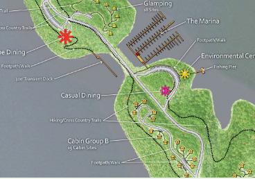
Located in the heart of the Allegheny Mountains in Pennsylvania, the Terrace Mountain Resort will offer varying types of recreation within a 2,275-acre development. The site encompasses over 1,000 feet in elevation change and miles of shoreline along Raystown Lake, the largest inland lake in the state.
The Hawn’s Bridge site is over 375 acres dedicated to outdoor recreations, including miles of trails for hiking and biking, cabin and glamping (tent) units, marina, hike in tent sites and a rustic restaurant with Adirondack inspired setting. The Hawn’s Bridge site is under the management of the Corp. of Engineers which controls the recreation development of Raystown Lake. The development will lease the rights to the site and create a low intensive recreational site, while preserving the existing woodlands and topography as outlined by the Corp.
MILWAUKEE YACHT CLUB RENOVATIONS
MILWAUKEE, WI
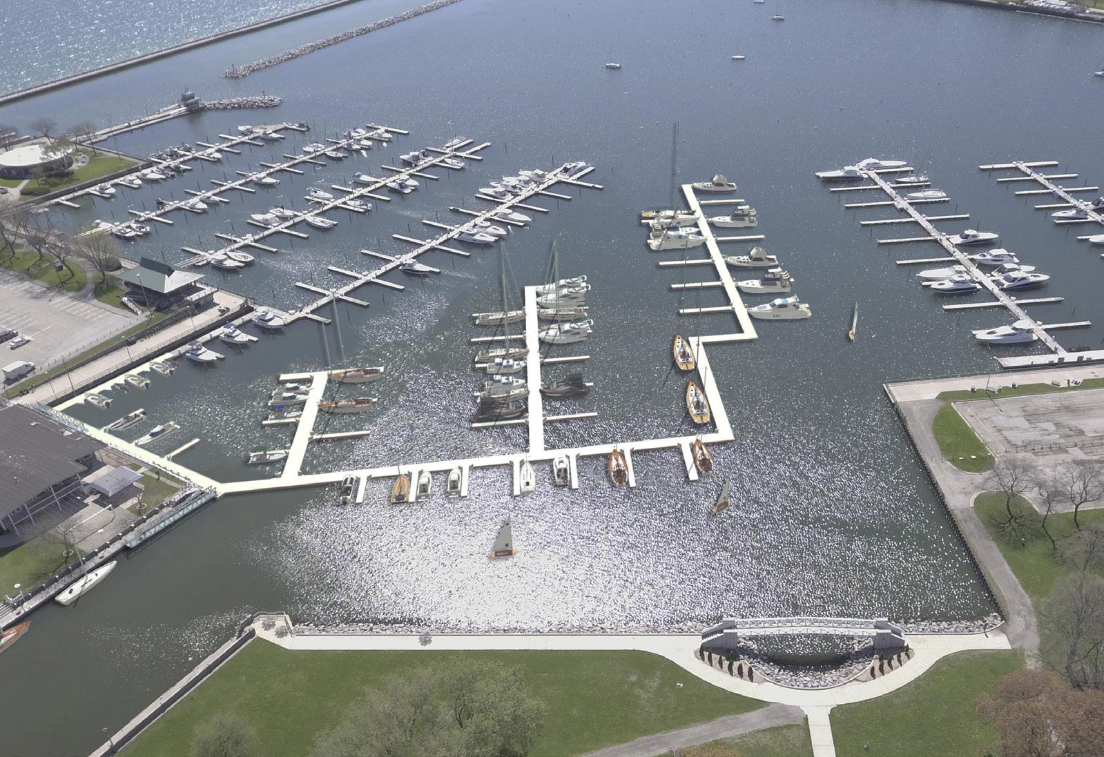
The Milwaukee Yacht Club (MYC) is the oldest yacht club on Lake Michigan. Nestled inside the McKinley Marina basin in downtown Milwaukee, the facility has been served by wooden fixed docks for over 50 years. MYC’s intent is to replace the fixed docks with a floating system to better adapt to Lake Michigan’s ever-changing elevations.
MYC contracted MSA to design and engineer the modification of the fixed docks to the new floating system and to upgrade utilities to meet current codes and requirements. The floating docks will use a truss frame system with flexible utility connections to accommodate the 6-foot variation between low- and high-water lake conditions. Improvements include a fully accessible, Wisconsin-certified Clean Marina and a facility that meets design and engineering standards. In addition to dock, anchorage, utility and structural design, the project also includes upland improvements, such as future pool improvements and a new tiki bar.
RIDGES RESORT ON LAKE CHATUGE
HIAWASSEE, GA
The Ridges Resort, located in the Blue Ridge Smoky Mountains, is a luxury resort consisting of a rustic lodge, pool, clubhouse, fine dining restaurant, Marina Station sports bar/restaurant with Top Golf, Wibit floating waterplay, and a 342-slip marina with a fuel dock. MSA provided waterfront design expertise to organize the site to accommodate the relocation of marina parking and replace the marina administration building while maintaining the resort ambiance. The plans called for relocating the marina parking lot behind the lodge facility with a new paved lot, the floating slips were aligned and a head pier was added to connect with the slips via one main gangway. This new route and gangway will accommodate a proposed cart service that will move users and gear from the parking lot to their slips. A new marina administration and yacht club building is located midway between the new marina parking and floating slips.
The parking lot for the Marina Station is expanded to provide spaces for the newly added Top Golf facility and a new beach with concessions for the Wibit amenity. A low-profile dock with a connection to the lodge provides easy access for Wibit users. The parking lot design maintains and improves access to the marina’s boat launch. Expanded courtesy docks are added and relocated to deeper water to expand access for other boaters to Marina Station.

MARINA RENOVATION
MANITOWOC, WI
The Manitowoc Marina, built in the late 1980s, was in need of many upgrades and improvements. This renovation plan included creating plans, specifications and estimates for the replacement of all 150+ slips. This also required re-configuration of all of the telescoping and mooring piles. The plan set was broken into multiple sub-sets with E Dock as Phase I implementation.
SKIPJACK PROPERTIES
SOUTH PADRE ISLAND, TX
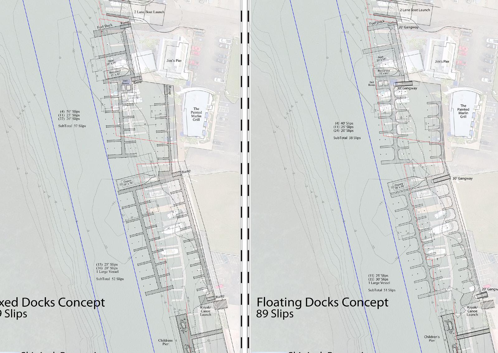
Skipjack Properties is located on South Padre Island, Texas, on the inter-coastal waterway side. The marina is comprised of four dock zones: tour boat, charter fishing boats, rented slips and a children’s pier that provides learning opportunities of the fishery of the island.
The MSA team was tasked with providing design engineering for all four zones. The project included comparing the replacement of the existing fixed piers and researching floating piers as an option. The existing fixed piers were not at the high tide elevation, which resulted in flooding over the docks during those periods of transition. The floating piers would offer access with a consistent freeboard at all times.
The tour boat and charter boat docks included dock accessories, security gate, water and electric services. The rental slips also included accessories and security gate but no utilities. The children’s pier included a security gate, fish-shaped bench seating, open view in the pier, decorative screen structures (manta ray) and integral lighting.
A boat launch was also renovated and a kayak/canoe launch was added to the marina site. The fixed pier option was raised to be above high tide. Ramps were designed to provide improved access and gangways were added to the floating option, all accessible during tide changes.
TRIBUTE MARINA
DALLAS, TX
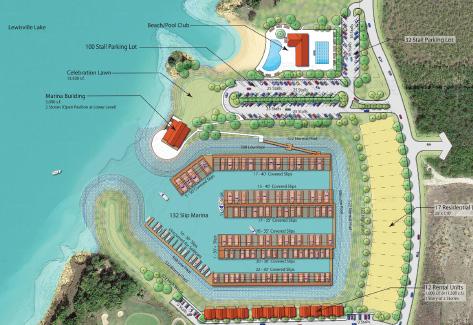
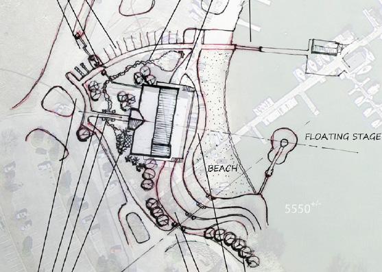
The Tribute at the Colony in North Dallas is a premier 1,600-acre development located on a peninsula in Lake Lewisville, the largest lake in metro Dallas, Texas. The development currently is home to two award-winning golf courses and multiple residential units.
The project consists of a marina and related uses within a small parcel controlled by the development but regulated by the Corp. The concepts developed for the site vary in complexity. One plan calls for an inland basin carved from the site with a small marina of 132 slips with a marina building, townhome style residents, rental cabins and a pool club. Another alternative looks at all in-water slips with a large 300-slip marina, 200unit drystack, marina administration, pool club and tennis. Finally, a varying option was explored with a half in-water marina and an inland basin with a 300-unit drystack and related marina building.
THE MARINA AT PELICAN BAY
DENVER, CO
Located within Cherry Creek State Park, Colorado’s most used State Park, the marina provides boating access to Cherry Creek Reservoir. The project consisted of a site assessment and recommendations for the update of a 40-year-old facility. The primary goal of the facility was to provide an entertainment venue with live music, enhance boating experiences and expanded banquet opportunities. The review of the existing facility included documenting the condition of the site entrance, dock access, docks, decking, cleats, anchors, breakwater, dock utilities, accessories, restrooms, parking, storage, community group areas, boardwalk zone, launch ramp, stormwater system, lake house (banquet facility), beach, boat crane and VIP dock. The documentation included the current state of ADA compliance. Staff and boaters were interviewed, providing an insight to current and future needs. Revenue streams were reviewed and included in the documentation. Recommended actions were outlined in nine phases or areas of improvement to act as a road map for future improvements. These areas were marina access, lake house entry, beach/amphitheater/quiet basin, community boating/storage areas, docks, restroom/showers, boardwalk zone, Southern Cross Cove (potential relocation site for marina) and potential service yard addition. Several concepts were developed for these areas to begin discussions for implementation projects.




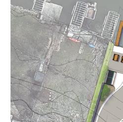
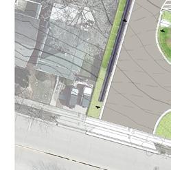


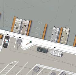


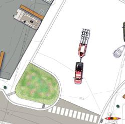


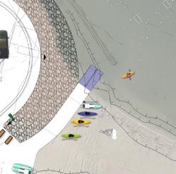



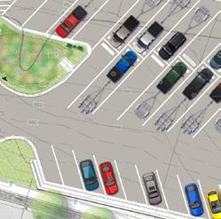


City Park Improvements | Oconomowoc, WI
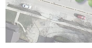
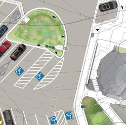
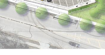
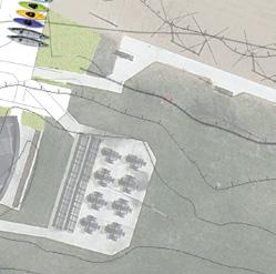
Improvements include a new expanded and renovated asphalt parking lot, underground stormwater, rain garden, retaining wall and railing, general site grading and demolition, boat launch expansion and repair to existing launches, pier improvements, site lighting and electrical and site restoration – all in a prominent downtown area. Other amenity upgrades include a new kayak/canoe launch with offloading parking stalls, an accessible concrete walk, parking stalls for emergency services and a beach access mat. Future restroom improvements are planned within the existing park bandstand as well as a new concession building with a rental counter. MSA helped the City secure a $1.2 million grant for the project.
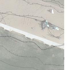


This project was featured at the 2023 SOBA Conference and in a recent feature article in Marina Dock Age Magazine in their May-June 2024 Issue
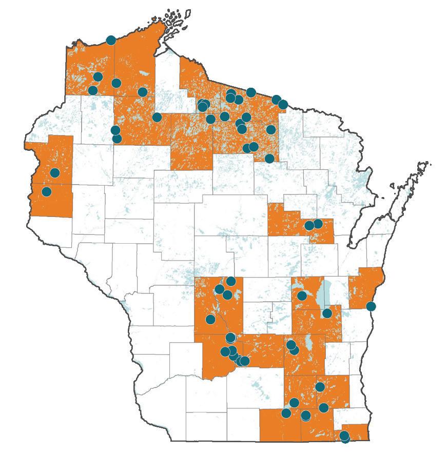
Boat launch experience across Wisconsin.

BOAT LANDING EXPERIENCE
MSA’s boat landing design experience spans decades. Our team has vast experience working with regulatory agencies, including the Department of Natural Resources (DNR), the Department of Administration (DOA) and the State Organization for Boating Access (SOBA) to make sure project requirements are met from project start to finish. MSA’s past projects have included designing boat launches and surrounding amenities for clients ranging from local governments to the DNR.

As a complement to our boat landing design experience, our team excels in designing the elements that surround landings and contribute to their functionality and usability. We assess design sites from a project’s onset to determine if additional improvements to park amenities, access roads, stormwater facilities or parking facilities are necessary. As and example below, MSA has been securing funds and providing engineering for boat launch facilities in the state of Wisconsin since 1998. We are currently working on funding boat launch facilities in Ohio, Wisconsin, Illinois, Minnesota and Tennessee.

BOAT LANDING PROJECTS — 1998 TO PRESENT
Project success depends on more than just technical skills. Our team consists of active boaters who truly understand functional requirements and end-user needs. Our boat landing successes are indicated in the list below.
• Moon Valley
• Devil’s Lake South Shore
• Sunset Bay
• Okee
• Clear Lake
• Groller Road
• Whitewater Lake
• Rice Lake
• Camp Lake
• Silver Lake
• Eagle Springs Lake
• Silver Lake
• Sugar Camp - Beaver Dam Lake
• Miller’s Woods - Beaver Dam Lake
• Columbia Park - Lake Winnebago
• Newport Park - Dell Creek / Wisconsin River
• Riverside Park - Lemonweir River
• Petenwell County ParkPetenwell Lake
• Lake Camelot
• Patrick Lake
• Lake Wapogasset
• Lake Chetac
• Sissabagama Lake
• Blaisdell Lake
• Namekagon Lake
• Middle Eau Claire Lake
• Whitefish Lake
• St Croix Lake
• Fisherman’s Landing - Turtle Flambeau Flowage
• Boulder Lake
• Sportsman’s Landing - Turtle Flambeau Flowage
• Murray Landing - Turtle Flambeau Flowage
• Clear Lake
• Van Vlet Lake
• Big St. Germain Lake
• Lac Vieux Desert
• Big Sand Lake
• Pelican Lake
• Cresent Lake
• Haskins Park - Baraboo River
• North Freedom ParkBaraboo River
• East Adams Street - Lake Delton
• Clare Isle - Lake Delton
• Hiawatha - Lake Delton
• Big Lake
• Fence Lake
• Big Lake
• Round Lake
• Town Line
• Lake Tomahawk
• Boyce Drive Landing
• Mary Park Boat Launch Ramp Replacement
• Swan Acres Boat Launch Ramp
• Huckleberry Harbor Boat Launch Ramp
• Lower Miller Park Boat Launch Ramp
• Hika Park Launch Ramp Study
• Brule River Launch Ramp Study
NEWPORT PARK | LAKE DELTON, WI
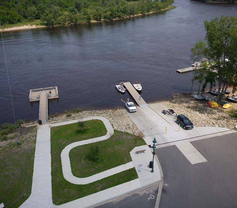
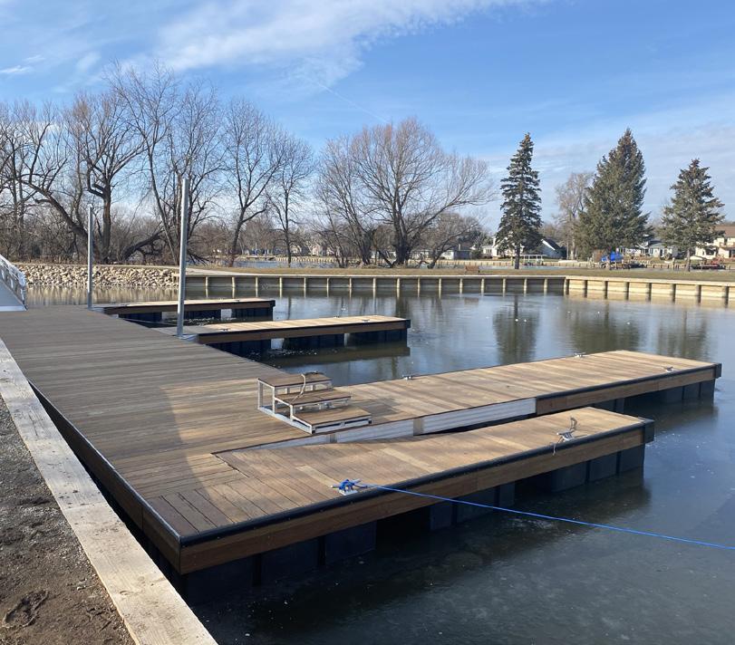
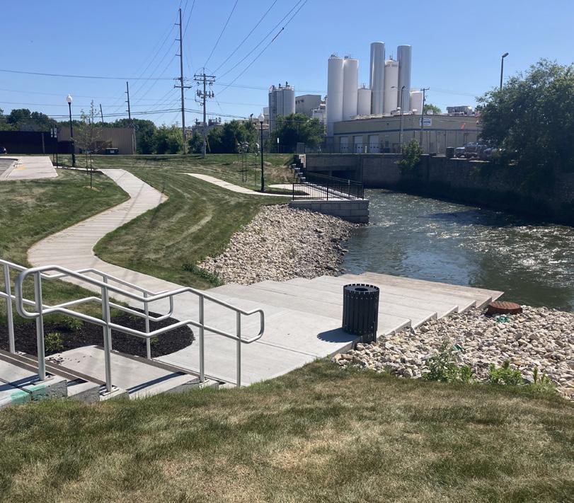
ROTARY RIVERWAY PARK IMPROVEMENTS | BEAVER DAM, WI
CANOE/KAYAK LAUNCH EXPERIENCE
MSA has a proven history creating ADA-compliant designs for canoe/kayak launches for each specific site. MSA has also worked closely with the Department of Natural Resources (DNR) to develop these options as more and more communities across the state develop new accessible canoe/kayak launch sites.
LOWER MILLER PARK, BOAT LAUNCH & MARINA PROJECT | OMRO, WI Winner of the SOBA Award Outstanding Projects - Small Access PELICAN RAPIDS BOAT LANDING | RHINELANDER, WI
HIKA BAY BOAT LAUNCH | CLEVELAND, WI
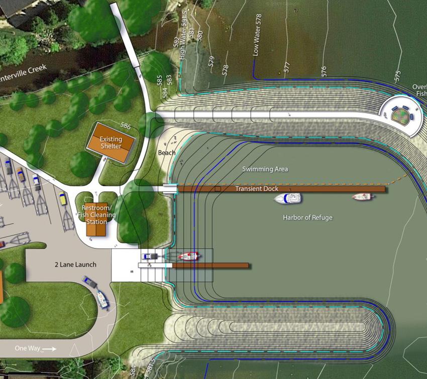
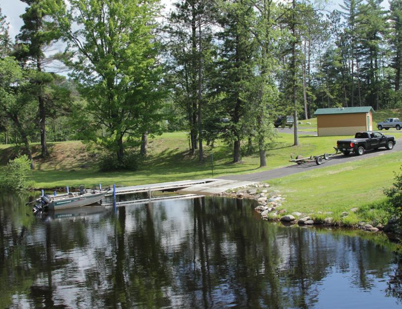
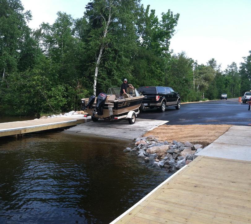
TOWNLINE LAKE BOAT LANDING | THREE LAKES, WI
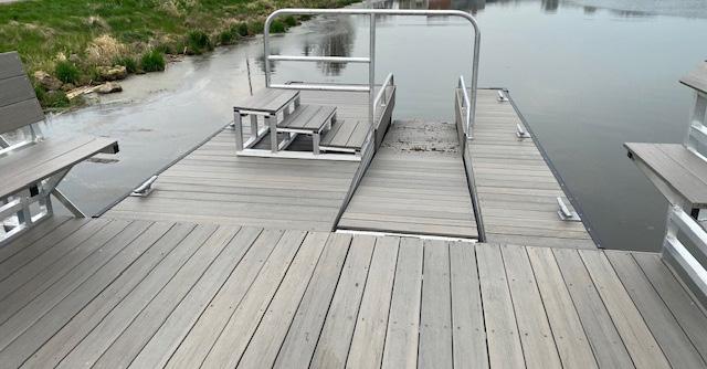
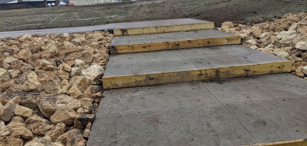
HASKINS PARK CANOE/KAYAK LAUNCH DESIGN | WEST BARABOO, WI
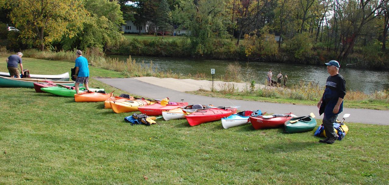
FIELD VETERANS PARK TRAIL & FISHING PIER | HILLSBORO, WI
EO SCHULTZ PARK/RIVER PROJECT | ELROY, WI
SHORELINE STABILIZATION
MSA excels in shoreline protection and stabilization, offering a comprehensive range of services tailored to clients’ needs. Our expertise includes wave analysis and sediment transport modeling for the development of stone profiles for shoreline protection. Our coordinated approach assembles a team suited for designing contextual and budget-conscious stabilizations from living shorelines to vertical walls and combined revetment and structure protection. In collaboration with various regulatory agencies, MSA aims to create sustainable, natural shoreline protection with innovative ideas integrated with native landscapes to create a public asset combining aesthetics with functionality.
APOSTLE ISLANDS
MARINA BREAKWATER
RESTORATION
BAYFIELD, WI
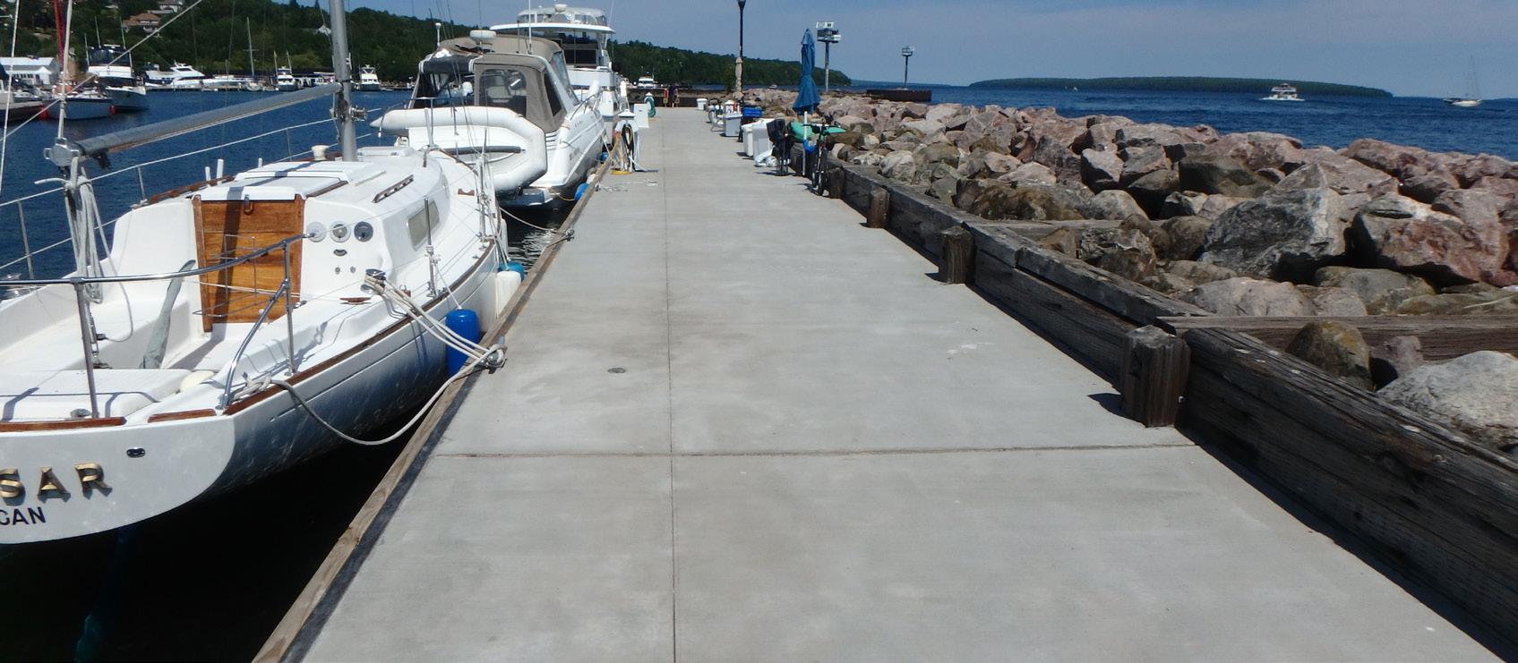
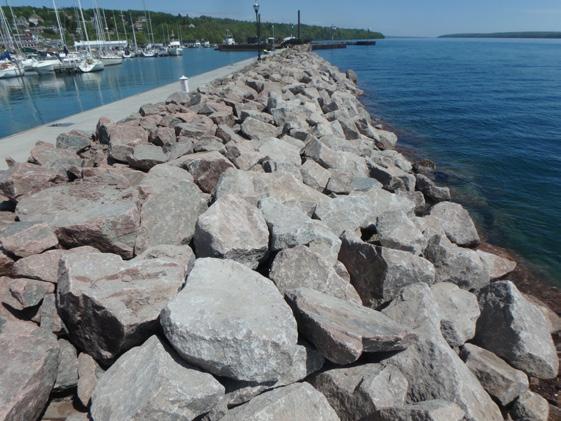
Apostle Islands Marina breakwater on Lake Superior was first constructed in the 1930s with timber cribs and stone. It had been extended multiple times, but the original structures have never been renovated. The City hired MSA (with subconsultant Anchor QEA) to provide a condition assessment documenting alternatives to keep the breakwater viable. The resulting report provided alternatives to the City and a clear direction for moving forward. With the help of MSA’s funding specialists, the City of Bayfield received grants from the Wisconsin Harbor Assistance Program, U.S. Army Corps of Engineers and federal grants to reach a total of $4.5 million. MSA’s expertise in breakwater design was a crucial factor in the acquisition of these grants.
BEACH DRIVE COASTAL RESILIENCY
FOX POINT,
WI
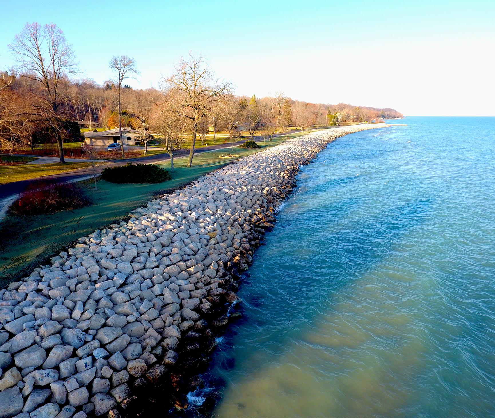
The Village of Fox Point is located north of Milwaukee, Wisconsin, on Lake Michigan. The Village’s lake edge consists of some of the highest-valued properties in the state. In the fall of 2019, a storm significantly altered the shoreline along Beach Drive. The eroded shoreline exposed stormwater lines and flooded the sanitary system as well as removed public open space. As an emergency stopgap, the Village placed concrete barriers to temporarily hold the shoreline. The Village secured FEMA funds in 2020 to help repair the shoreline and utilities.
The team of MSA and Anchor QEA worked with the Village to design a resilient shoreline protection system. The goal of the project was to create an enhanced native shoreline landscape with public access and an innovative protection system. The plans addressed the utilities and Beach Drive while providing a path to protection or relocation of some features. MSA collaborated with FEMA, Wisconsin Emergency Management, the Army Corps of Engineers and the Wisconsin DNR.
CAMP MANITO-WISH SHORELINE AND
DRAINAGE IMPROVEMENT
BOULDER JUNCTION, WI
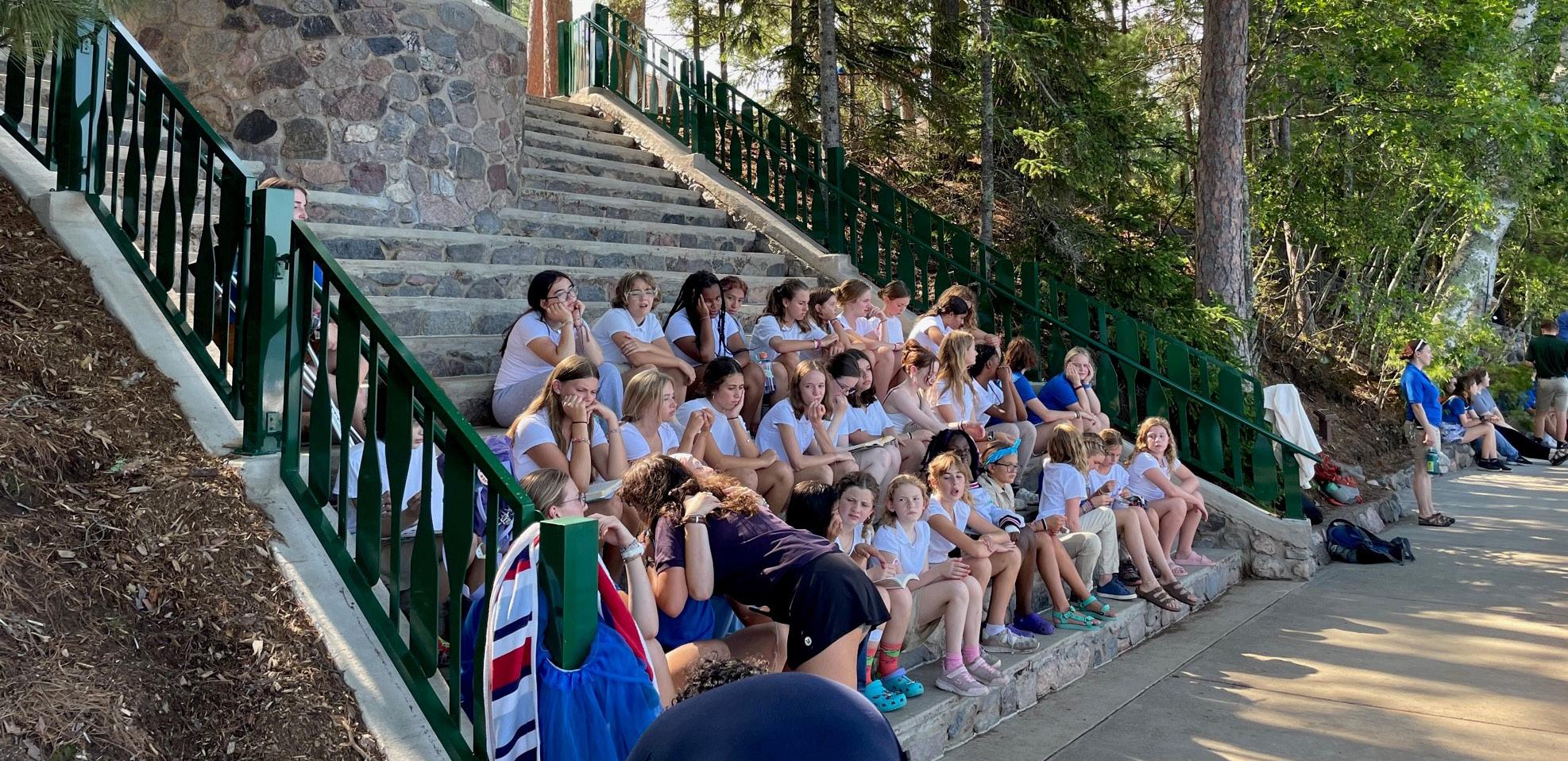
Camp Manito-wish YMCA is a 325-acre quintessential “Up North” Wisconsin youth camp, one of the first in Wisconsin and a model for similar camp facilities across the country. For over 100 years the Camp’s mission has been to “promote physical strength, spiritual growth and a strong commitment to service.”
The camp hired MSA to perform a review of approximately 300 feet of shoreline along Boulder Lake that had started to deteriorate, was exhibiting signs of erosion and drainage issues and causing concerns about undermining some of the historic shoreline infrastructure. The shoreline serves a multitude of camp uses, including acting as a launch pad for outbound camping and paddling excursions. Evaluation of the property revealed some key upgrades that needed to be constructed, which were accomplished in a phased manner.
MSA provided design, engineering and restoration oversight for the project, which was one of the largest in the camp’s 100+ year history. Designs focused on improving stormwater management, mitigating bank erosion, fortifying the camp’s shoreline and introducing hillside landscape stabilization techniques to prevent further damage and sediment/ siltation loads from entering lake waters.
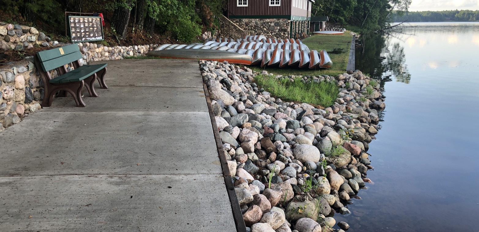
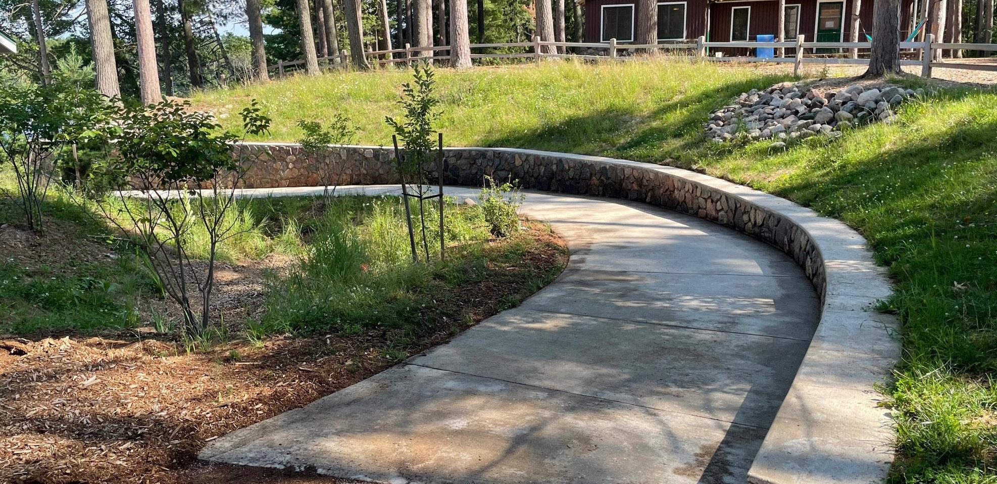
Project elements included replacing a failing wood crib seawall with a combined steel sheet, wood clad and stone boulder shoreline to mitigate erosion; expanding concrete sidewalks for ADA compliance and improved accessibility to the lake; restoring deteriorating historic waterfront steps, stone walls and walkways; updating a boat ramp at Trips Boathouse; renovating the camp Nature Lodge/Sail Shack stairs; and constructing a new service ramp to provide an accessible route from camp housing to activities at the lakefront.
The project required sensitive planning and engineering to protect historic walls, steps and buildings while bringing modern design solutions into operation to prevent further deterioration. The key to success was implementing proper stormwater management. To this end, MSA designed a system to collect runoff from the bluff, lake-edge buildings, new concrete walkways and the boat launch in multiple native-vegetation rain gardens to filter out sediment and possible contaminants prior to entering the pristine waters of Boulder Lake.
Restoration and fortification of Camp Manito-wish is an important piece of the camp’s legacy — providing a safe and sustainable space for youth to gather, grow and adventure together, as they have done since 1919. MSA is honored to have been a part of it.
RIVERWALKS AND RIVER COURSES
MSA has deep expertise in designing and implementing projects that significantly enhance community access and enjoyment of riverfront areas. Our ability to meticulously plan and execute comprehensive river access improvements is evident in our work, which includes the development of extensive trail systems, strategic lighting installations and effective shoreline stabilization measures. These projects not only aim to boost ecotourism but foster greater community connectivity, creating vibrant, accessible and sustainable riverfront environments for all to enjoy.

RIVERFRONT PROJECT
WISCONSIN RAPIDS, WI
The Wisconsin Rapids Riverfront project is a visionary plan to transform three major parks along the Wisconsin River: Veteran’s Memorial Park, East River Conservancy and Demitz Park. MSA teamed with Supermass Studios to perform design development and construction documentation. Five guiding principles led the design: respect for the river, open access, diversified programs, economic leverage and sustainability.
Demitz Park improvements include a kayak launch and beach, fishing pier, park plaza, parking, multiuse trails, walking paths, regional trail connection, picnic green, custom/architectural shade structure, comfort station and trail underpass below STH 54 bridge that meets local and federal trail guidelines.
East Riverbank Conservancy improvements include a riverwalk/multiuse trail, linear park, recreation flat, kayak launch, fishing jetties, aquatic habitat and landscape improvements.
Veteran’s Memorial Park improvements include an event terrace with modular hillside seating, sculptural flow decks, a river view balcony that can host events and a multiuse trail.
WEST BEND RIVERWALK
WEST BEND, WI
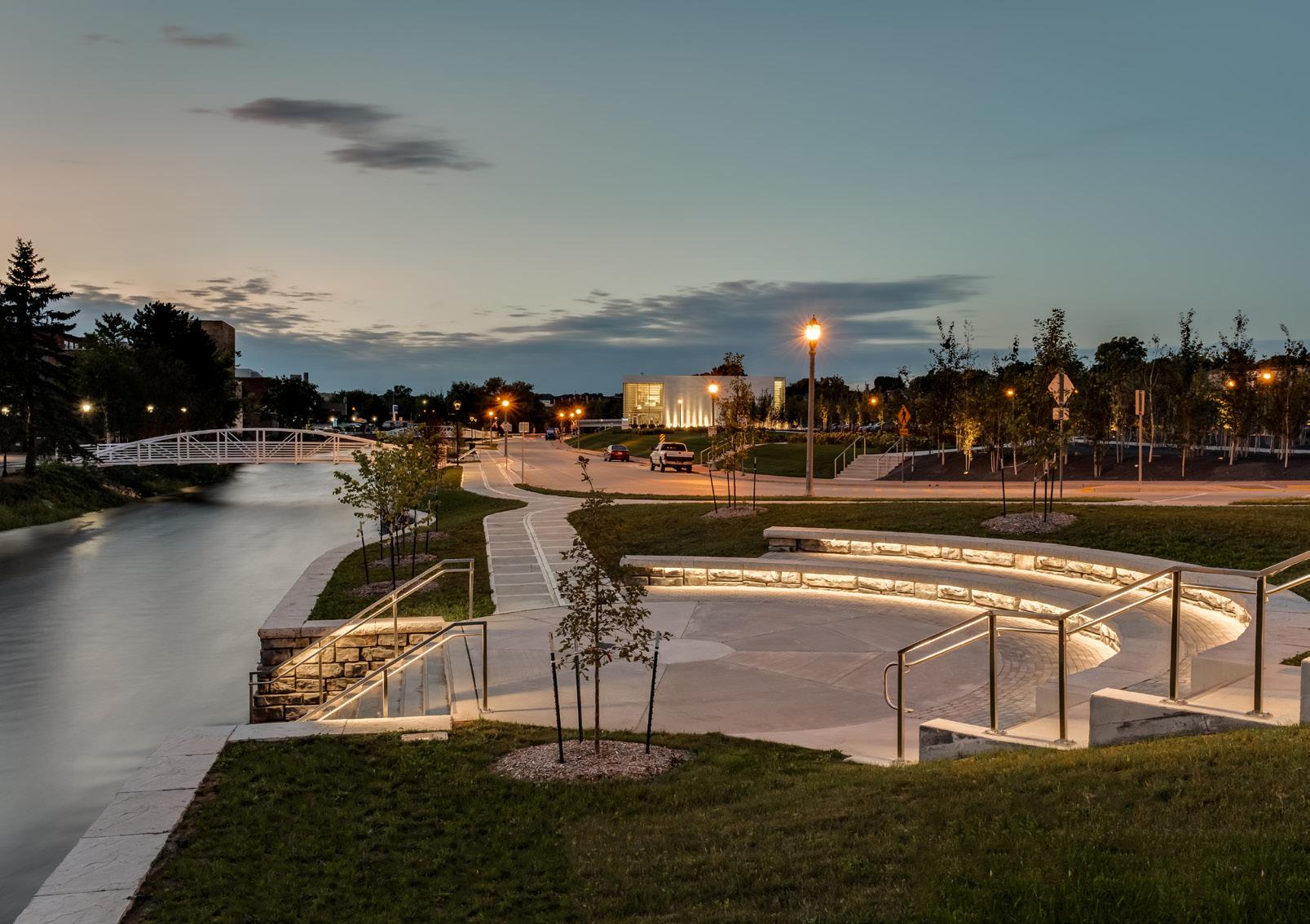
The City of West Bend received a grant from the Department of Natural Resources to improve the area along the Milwaukee River behind their historic downtown and in front of the Museum of Wisconsin Art (MoWA). MSA began this project by providing the City with a master plan vision for both east and west sides of the river that will attract people to the river’s edge, improve the appearance and function of businesses fronting the river and improve the overall appearance of the riverwalk. The conceptual plan provides a generous, accessible walking path; key overlook areas; improved green space; and enhanced landscaping. The plan also preserves and enhances views to and from the river corridor, provides spaces for public art and allows patrons to access the water’s edge. The river’s steep banks and existing conditions provide a unique challenge for access, but also an opportunity to create a unique amphitheater feature that will serve as kayak launch, fishing area, general overlook and programmable gathering space.
The goal is to provide the City with an attractive, cost-effective, low-maintenance and flood-resistant solution to enhance and reactivate the river corridor. Implementation of the east side of the riverwalk was recently completed.
RIVERFRONT BICYCLE AND PEDESTRIAN TRAIL
SAUK CITY, WI
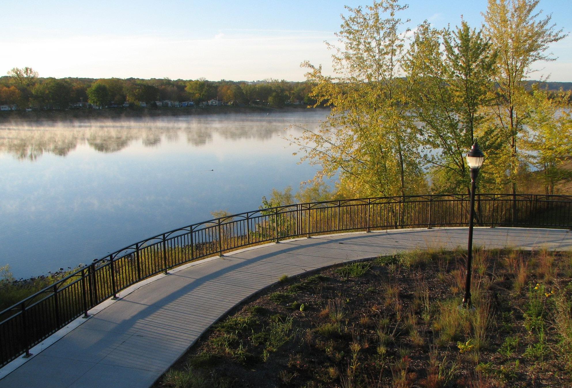
The Village of Sauk City is located in a scenic area along the Wisconsin River. Access to the river and the ability to enjoy the river was hampered by private ownership in many areas. The Community wished to improve this accessibility with a trail that would connect the Business District with the August Derleth Park at the north end of the Village.
MSA assisted the Village Administrator in a grant application to the Department of Natural Resources. The Village was successful in obtaining Stewardship Funding to construct four distinct phases of the trail system encompassing 1.8 miles of multiuse path. The route was surveyed and identified and easement descriptions were provided where the proposed trail crossed private lands. MSA met with Village officials and the property owners to build consensus for the project. The first phase of the project included a park pavilion, trail, footbridges and lighting. Later phases included more trails with shoreline stabilization and park improvements. The final phase included an urban design section that is part of an overall revitalization of the downtown area which provides a connection to the trail system along US Highway 12 and the Wisconsin River Bridge.
The Wisconsin River through Sauk City is now more accessible for pedestrian enjoyment. This increased opportunity to enjoy the river and scenery will draw visitors to the community.


WATER TRAIL FEASIBILITY STUDY
DAYTON, MN
The City of Dayton has an advantageous location on both the Mississippi and Crow rivers, which offers immense opportunity to upgrade river access and potentially develop a dedicated water trail. Dayton is leading a collaborative effort to plan a destination park and recreation corridor. These connections, when complete, will further connect the Crow River and the City of Dayton to the Mississippi River Regional Trail. This mobility network expansion will serve to boost ecotourism by connecting paddlers with local businesses for food/drink, rentals, sporting gear, lodging and other amenities.
The City hired MSA to conduct a Water Trail Feasibility Study to plan conservation initiatives, access improvements to the Mississippi and Crow rivers and wayfinding and programming to enhance recreational use of these two water resources. MSA’s final report will include a summary of feedback received from local residents and stakeholders, an inventory and analysis, conceptual plans, programming and promotional recommendations, and suggested prioritization of water trail improvements based on MSA-provided cost estimates. This project is currently in progress. Recently, MSA conducted site visits along the Mississippi and Crow rivers to evaluate existing conditions, including the identification of areas for potential access, erosion control and opportunities for natural and created features.
FIELD VETERANS PARK TRAIL AND FISHING PIER
HILLSBORO, WI
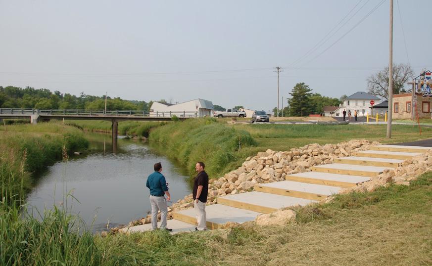
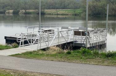
The City embarked on completing several projects to develop the overall community connectivity by land and water. The Field Veterans Memorial Park project included adding a multiuse path along the shoreline of the lake and a canoe/kayak launch and fishing pier. The floating pier adjusts as the lake fluctuates and is ADAcompliant, offering safe fishing access onto the lake and canoe/kayak access. The City joined the Baraboo River Corridor project and through that process, this project was identified to provide connectivity to the river. MSA led the corridor study, assisted the City in applying for WDNR Stewardship funding for the project and completed the design and construction of the project.
BARABOO RIVER
CORRIDOR PLAN & IMPLEMENTATION
WEST BARABOO, BARABOO, NORTH FREEDOM AND SAUK COUNTY, WI
The Baraboo River Corridor Project has rapidly gained support across Juneau and Sauk counties, transforming the region into a thriving eco-tourism destination. Initiated in 2016 with the Phase I River Corridor Plan, the project aimed to enhance water quality and recreational use between Baraboo and North Freedom. Key developments included canoe and kayak launches, fishing piers, ADA-accessible landings, shoreline protection and fish habitat development. The Friends of the Baraboo River, a fundraising group, was established to promote and financially support the corridor's potential.
Following the successful implementation of Phase I, a 2018 market study by MSA highlighted the economic and tourism potential of the river corridor, emphasizing the need for additional support to realize its potential as a premier water recreation destination. The study revealed significant opportunities for population and tourism growth, with nearly 20 million people living within 225 miles of the corridor.
The success of Phase I spurred further interest, leading to the development of Phase II, which included support from additional communities. Phase II focused on enhancing recreational opportunities, marketing, public/private partnerships, funding, land development and best practices for stormwater management and water quality improvement.
To date, significant progress has been made, including the installation of ADA-accessible canoe and kayak launches and shoreline stabilization work. With approximately $1.8 million in grant funding secured for $3.5 million worth of projects, the Friends of the Baraboo River are now seeking National Water Trail designation through the National Park Service. If achieved, the Baraboo River would become the longest restored free-flowing river National Water Trail in the country.













Why MSA?
Being an active contributor to the waterfront development community is extremely important to us. By staying engaged, we’re able to share our knowledge and learn from our peers on best practices – and then apply that knowledge to solve our clients’ challenges.
RELEVANT SPEAKING ENGAGEMENTS & PUBLICATIONS
• Publications
• Marina Dock Age Magazine (Standing Column – 22+ articles)
Topics include: digital design technology, ADA standards, stormwater plans & practices, marketing, FEMA readiness, marina planning, technology, environmental protection, boater needs, permitting & compliance, protection strategies, 3D modeling vision, electrical systems, stormwater BMPs, winter preparedness, fuel spills, marina design, and fire prevention. (2022–present)
• ASCE Manual No. 50 (Co-author – Chapter 3)
Planning and Design Guidelines for Small Craft Harbors
• Recent Speaking Engagements
• National Outdoor Recreation Conference
Topics include: indigenous influences, culturally informed park planning, climate resilience, and inclusive community engagement.
• Association of Marina Industries Conference
Topics include: stormwater strategies and full-cycle marina planning from concept through compliance.
• Docks Expo Conference
Topics include: marina marketing, permitting processes, and regulatory updates.
• States Organization for Boating Access Conference
Topics include: resilient marina design, stormwater practices, and practical boat launch engineering.
• Academic Engagements
• Guest Lecturer, University of Wisconsin College of Engineering (3 sessions) “Planning Process for Marina Design,” Docks and Marinas Conference (2008, 2009, 2010)


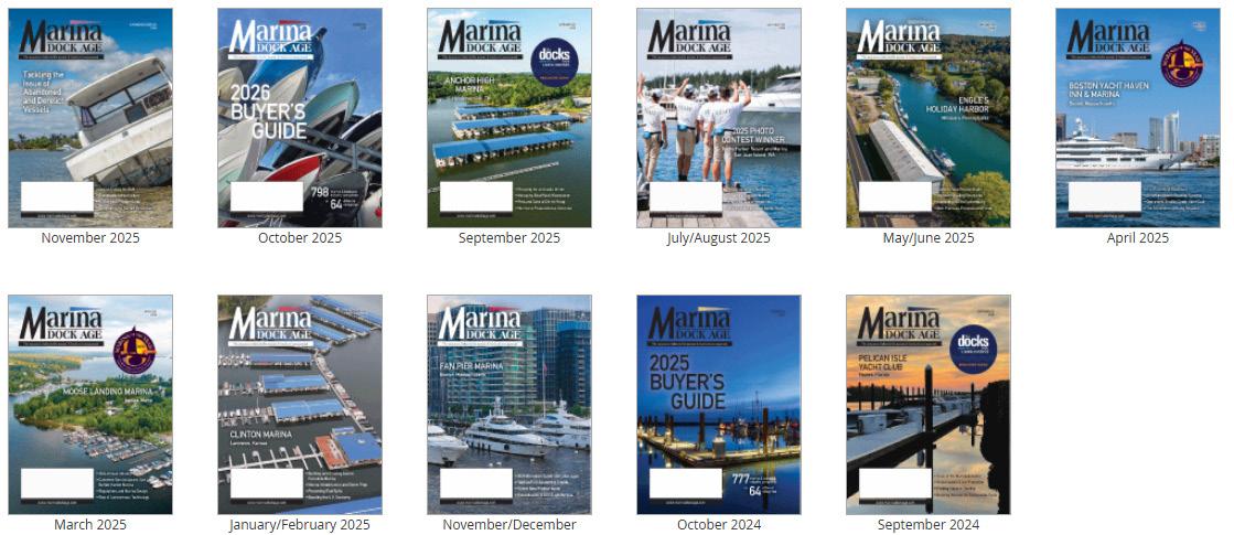
Marina Dock Age Magazine, in which MSA has a standing column, is a leading marina industry publication.
