


Staff
Randy Wojtasiak, Director of Parks & Recreation
Brian Wirth, Building, Parks, and Cemetery Supervisor
Sara Cummings Recreation Office Manager
Carrie Viste, Support Specialist
Melanie Giammarco, Program Supervisor
Zack Stupnik, Aquatics/Fitness Supervisor
Deb Holtan, Transportation Superintendent
Parks & Recreation Commission
Todd Rusniak, Chairperson
Joe Kohler, Alderperson
Scott Helms
Kate Carroll
John Klabachek
Dan Hummel
Kenneth Mikulec
Common Council
Wayne Rusniak, Council President
Dean Kirley
Dennis Regan
Jeff Turchi
Joe Kohler
Joseph Fulop
Justin Webb
Tony Garza
Tina Savage
Prepared By
This document was prepared by MSA Professional Services, Inc.
Project No.: 00216056
Photo Credits: unless stated otherwise, all photos were provided by MSA or the City of Hartford.
CHAPTER 1: INTRODUCTION
1.1 Plan Purpose
1.2 Planning Process
1.3 Why Plan for Parks?
CHAPTER 2: ABOUT HARTFORD
2.1 Local & Regional Context
2.2 Demographics
2.3 Natural Features
2.4 Existing Parks & Open Space
2.5 Other Parks & Recreation Facilities
2.6 Other Relevant Planning Efforts
CHAPTER 3: GOALS & OBJECTIVES
3.1 Goals, Objectives, & Policies
CHAPTER 4: PARK NEEDS & DEMANDS
4.1 Quantitative Analysis
4.2 Geographic Analysis
4.3 Qualitative Analysis
4.4 Regional & State Trends
CHAPTER 5: RECOMMENDATIONS
5.1 Existing Park Facilities
5.2 Planned Parks in Development
5.3 Proposed Trails
CHAPTER 6: IMPLEMENTATION
6.1 Funding Opportunities
6.2 Adoption & Amendment Process
APPENDIX A: SURVEY RESULTS
APPENDIX B: PARKS AND RECREATION MAPS
Parks, recreation, trails, and open space are important elements in the quality of life for all communities. Not only do parks, open space and trails provide a safe and healthy place to recreate, they also serve to beautify, protect the natural environment, and influence the patterns of development in and around the community.
The City of Hartford realizes the importance and benefits its parks, open space and trail systems have on the community’s character and quality of life and is committed to providing for the recreational needs of current and future residents. This plan intends to guide the continual improvement of the City’s parks, open space, and trail systems to maintain its eligibility for State and Federal park and recreation grants. This plan envisions a connected system of parks, open spaces, and trails throughout Hartford, related to the community’s natural resources, geography, and neighborhoods.
This plan follows the Guidelines for the Development of Local Comprehensive Outdoor Recreation Plan from the Wisconsin Department of Natural Resources (WDNR) and describes:
• Information regarding demographic trends
• An inventory of existing park and recreational facilities,
• An analysis of parkland and recreational needs and demands,
• General policy direction regarding park, open space, bicycle, and pedestrian facility planning and maintenance,
• Recommendations for improving existing park facilities and bicycle and pedestrian facilities,
• Recommendations for new park, bicycle, and pedestrian facilities, and
• Implementation strategies.
This plan identifies conceptual locations and recommendations for different types of parks and recreational facilities. In nearly every case, more detailed planning, engineering, study, budgeting, and discussions will be necessary before decisions are made to actually acquire land or construct recreational facilities.
The City of Hartford appreciates the local support its parks receive and the recognition of the benefit they bring to the community’s character and quality of life. It is committed to meeting the active and passive recreational needs of current and future residents and visitors of all ages and abilities.
Recreation, bicycle, and pedestrian planning are essential components of long-range community planning in Hartford. Currently Hartford has a Comprehensive Outdoor Recreation Plan (CORP) that was adopted in 2018. In 2024, the City contracted with MSA Professional Services, Inc. to assist with an update to the 2018 CORP. Preparation and adoption of the plan occurred over a ten-month period. Assistance with the development of this plan was provided by City Staff and the Parks and Recreation Commission.
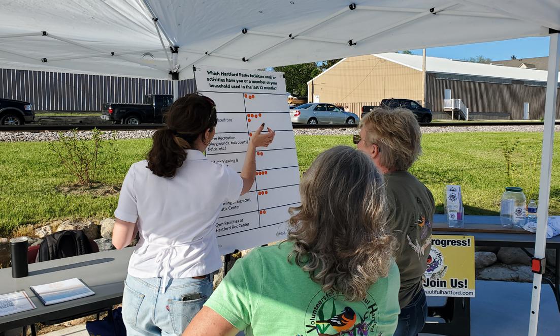
Early in the planning process, MSA hosted a popup booth at the Grand Opening of Centennial Park. Held on May 3rd, the booth provided an opportunity for residents to engage with the early stages of the planning process by identifying priorities and identifying which Hartford facilities they use. In addition, a survey was announced at the pop-up and promoted to gather citizen feedback on desired public park, trail, and recreational facilities (See Appendix A for the full results).
Key milestones for this plan update include:
• Project Kick-off with Parks & Recreation Department Staff: March 2024
• Pop-Up at Centennial Park Grand Opening: May 2024
• Online Survey: May-June 2024
• Volunteers for a Beautiful Hartford Focus Group: July 2024
• Club Directors Focus Group: July 2024
• Parks & Recreation Commission Review/Edits: August 2024
• Parks & Recreation Commission Approval: October 2024
• Common Council Adoption: October 2024
It is the City’s intention to update this plan every five years, in-part to remain eligible for park and recreation grants (see below) and as best practice to ensure that the plan remains relevant to the community’s needs.
This plan was developed following the Guidelines for the Development of Local Comprehensive Outdoor Recreation Plans of the 2019-2023 Wisconsin Statewide Comprehensive Outdoor Recreation Plan (SCORP) created by the Wisconsin Department of Natural Resources (WDNR). The plan content and format have been tailored to fit the needs of Hartford.
The Wisconsin Legislature created the Knowles-Nelson Stewardship Program (Stewardship) in 1989. Named for two of Wisconsin’s most revered conservation leaders, Warren Knowles (Governor 1965-1971) and Gaylord Nelson (Governor 1959-1963, U.S. Senator 1964-1981), the purpose of the program is to preserve valuable natural areas and wildlife habitat, protect water quality and fisheries, and expand opportunities for outdoor recreation. The conservation and recreation goals of the Stewardship Program are achieved through the acquisition of land and easements, development of recreational facilities, and restoration of wildlife habitat.
The Stewardship grant program is the most widely used recreational grant program in the state. Eligibility for the program requires that a community maintain a local comprehensive outdoor recreation plan (CORP), updated every five years, and that the project for which grant funding is sought is described in the CORP. Many other similar state and federal recreational grant programs have similar requirements or have shown a tendency to favor those grant applications which are supported through previous community planning efforts.
Parks are some of the only truly free, accessible, multi-functional public spaces. They contribute to the physical and mental health of individuals and communities, and provide public safety, environmental, and social equity and resilience benefits. The COVID-19 pandemic put parks in the spotlight as more people sought opportunities for safe recreation and engagement opportunities outdoors. Now, as cities are focusing on sustainability and resilience, parks offer a range of health, fiscal, and environmental benefits including:
Before the COVID-19 pandemic, children and adults were spending less and less time outside. Research from the Henry J. Kaiser Family Foundation showed that young children were engaging in less active play and unstructured outdoor exploration, which are critical activities for developing social and academic skills, as well as building personal resilience. The NRPA reports that physical activity at any age can reduce the risk of depression, heart disease, obesity, osteoporosis, stroke, and Type 2 diabetes.
Healthy communities have a range of active and passive options for people of all ages and abilities to spend time outdoors. While many people initially think of parks as places for playgrounds, trails, and ball courts and fields, they are also places where people can enjoy more passive activities like picnicking, wildlife watching, and leisurely enjoying the fresh air. According to a 2022 report from the Urban Institute, research has suggested a link between measures of park access (proximity to parks and park quality) and higher rates of park use and physical activity. The City Parks Alliance reports that maintaining a healthy lifestyle can save more than $1,800 annually in healthcare costs per person.
Leisure time is an important component of everyone’s lifestyle, and increasingly people are choosing locations to live based on quality-of life factors that include recreational amenities. According to the NRPA’s Engagement with Parks Report, four out of five adults in the US sought high-quality parks and recreation when choosing a place to live. The ability to retain and attract new residents has direct economic benefits to the local community. For this reason, a great park, recreation, and trail system can contribute directly to a community’s economic development. In a study completed by NRPA and George Mason University, 72% of 70 studied communities use parks and recreation images in their economic development materials. The study notes that parks and recreation contribute to economic development through business and talent attraction, retention, and expansion. If a park system is designed with connections to regional destinations, additional visitors can also be brought into a community. This additional tourism can be a significant benefit to local businesses. This plan aligns with other regional and state plans to promote outdoor recreation across the greater area.
Parks are an excellent source of place-based planning and identity for communities. Park and recreation facility designs are highly responsive to local wants and needs. The most recent example is the transition of tennis and basketball courts into multi-functional ‘sport courts’ to respond to the explosion in popularity of pickleball. Public parks are also a place for community interaction and neighborhood activity. They can be places where residents gather for social events, recreational activities, and meetings about local issues, increasing social interaction and creating an overall sense of community. An additional benefit is that this ‘social resilience’ is a key component of responding to and recovering from natural disasters. Information from the City Parks Alliance indicates that community involvement in the greening of vacant land has been shown to decrease crime and generate additional support for nearby park projects. Research from bicycle and trails advocacy organizations like the League of American Bicyclists and People4Bikes further suggests that the increase in trail traffic also has a depressing effect on crime.
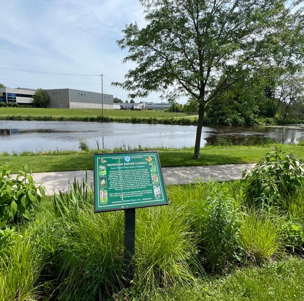
While parks, forests, and trails create opportunities to improve the health of individuals, they also contribute to the greater ecological health of a community. Parks are often tied together with environmentally sensitive areas such as wetlands, floodplains, surface waters, or significant woodlands. Additionally, parks are a convenient place to introduce new stormwater retention and infiltration areas into the built environment, helping to manage stormwater runoff and mitigate localized flooding. These natural areas provide food and shelter for local wildlife and naturally retain stormwater. Individual parks can provide important “rooms” of natural resource activity; however, they become even more functional when they can be linked together through environmental corridors. Wildlife, plants, and water all depend on the ability to move freely within the environment, or from “room to room.” The City Parks Alliance reports that urban trees remove up to 711,000 tons of toxins from the air and reduce urban “heat island” effects, equating to $3.8 billion in national savings.
In addition to being public open spaces, parks and recreational facilities are excellent places for local engagement. This comes through reinvigoration of existing parks, and the addition of new parks in underserved areas. Coincidentally, as cities and villages across the United States see shifts in the ethnic makeup of their communities, more and more are investing in multilingual signs and rental forms to improve cultural inclusion.
Two key parts of any parks and recreation plan includes physical accessibility through ADA-compliant design and walkability to the park. The Americans with Disabilities Act and statewide design guidelines ensure that people of any age and physical ability are able to access many activities throughout a park, from well-maintained paths and curb ramps to inclusive playgrounds. The walkability factor is defined by the NRPA as ensuring that no one lives farther than a 10-minute walk from a park.
The City of Hartford is located in Southwestern Washington County and eastern Dodge County. The city is bounded by the Town of Hartford and the Town of Rubicon.
Two major roadways intersect within City limits: STH 83 (north-south) and STH 60 (east-west). STH 60 provides a direct connection from Hartford to I-41 which connects to Milwaukee, and to US 151 which connects to Madison.
The City is influenced by the proximity of Milwaukee, however it is not considered a suburb or bedroom community. The City has a high percentage of citizens who live and work in Hartford. Residents have a diverse housing stock to choose from and enjoy numerous cultural amenities, such as the Wisconsin Auto Museum, and substantial natural resources, such as the Kettle Moraine State Forest. Residents are also provided access to extensive professional, social, and civic establishments, and organizations.
This section describes some of the historic demographic trends for the City of Hartford as it pertains to population, age composition, housing, and school enrollment. This includes data from the U.S. Census Bureau’s American Community Survey (ACS) which is reported as a rolling average over a 5-year period. Population projections are from the Wisconsin Department of Administration (WDOA) with adjustments made to incorporate the results of the 2020 U.S. Decennial Census.
The most recent population estimate for the City is 15,667 from the U.S. Census Bureau’s 2022 American Community survey. From 1980 to 2020, the population of Hartford grew by 118.3%, greatly outpacing the percentage growth of Washington County (57.2%), Dodge County (17.8%) and the State (22.0%). From 2020-2040, Hartford is projected to grow by about 22%, which is higher than the projected growth rate of Washington and Dodge Counties, as well as the State of Wisconsin.
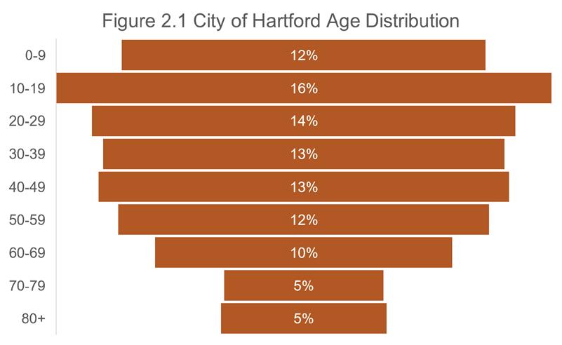
Age composition is an important consideration in park and recreational planning as needs and desires of individuals will vary based on their interests and physical abilities. Figure 2.1 summarizes the age distribution of the City’s population as of 2022 (U.S. Census Bureau, American Community Survey). Approximately 28% of the population is considered youth (<20 years old), which is a change of only about 1% since 2010. However, about 20% of the population is considered at retirement age (>60 years old), which is an increase of about 42% from 2010. This number is projected to grow as Baby Boomers continue to age. Similar trends are being seen across the nation. The median age of the City has risen from 33.6 in 2010 to 37.8 in 2022 estimates.
As seen in Table 2.2, Hartford saw a 49% increase in total number of households from 2000 to 2022. During the same period, however, households with individuals under 18 decreased by 9%. The total number of households saw a greater increase between 2000 and 2010 than between 2010 and 2022. Average household size has declined slightly between 2000 and 2022, despite the total number of households increasing. These findings are consistent with national and regional trends as the number of single person households increases and members of Millennial generation delay childbearing into their thirties or forego it altogether.
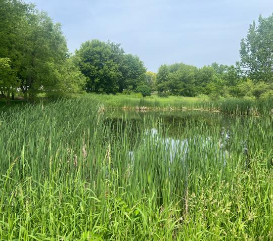
Pike Lake is located directly east of Hartford. The lake is 461 acres with a maximum depth of 45 feet. Pike Lake is largely spring-fed and provides yearround recreational opportunities to tourists and area residents. The public has access to the lake from public boat landings and a public beach. Fish in the lake include Panfish, Largemouth Bass, Smallmouth Bass, Northern Pike and Walleye.
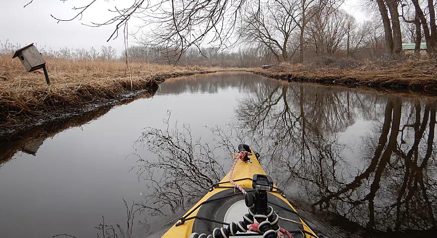
The Rubicon River bisects the City in an east-west direction, and is a part of the Upper Rock River Basin. The Rubicon River enters the Rock River west of Neosho, Wisconsin. Near Hartford’s central business district, a man-made dam on the Rubicon River maintains a small millpond.
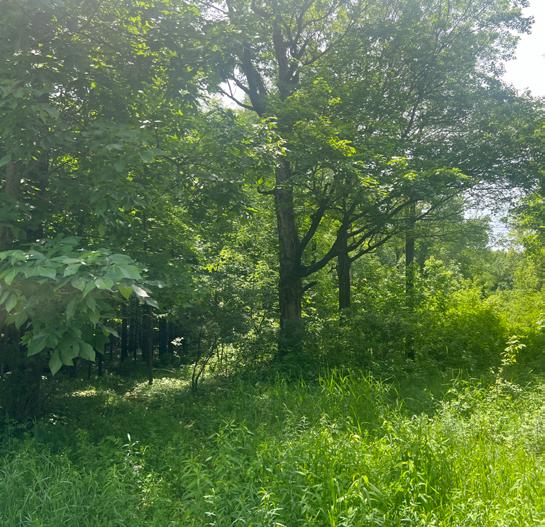
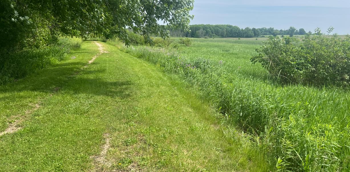
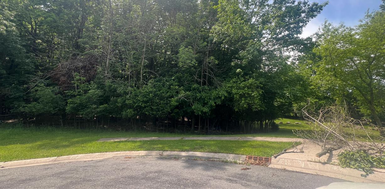
Since 2000, the City has added more than 45 acres of passive use (wooded parks with trails) parks to its park system. These parks include land that SEWRPC has identified as Primary, Secondary, and Isolated Environmental Corridors.
Wildlife
There is a wide variety of wildlife in Washington and Dodge counties, particularly due to the Rubicon River, Pike Lake and the Kettle Moraine State Forest. The Wisconsin Department of Natural Resources maintains a Natural Heritage Inventory which locates and documents rare species and natural communities, including federal threatened and endangered species. A comprehensive list can be found through the WDNR’s Natural Heritage Inventory (http://dnr.wi.gov/ topic/nhi/).
The natural resources of the City are many and varied and provide an attractive character to the City and also the potential for varied recreation opportunities. Perhaps the greatest recreation potential for these environmental corridors will be linear parks and trail corridors linking the City’s recreation, employment, commercial and school sites.
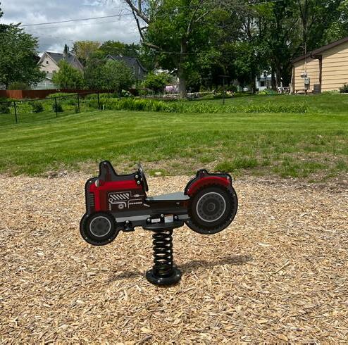
The Parks and Recreation Commission oversees the City’s 24 park facilities totaling over 400 acres. The system is represented by seven types of parks: miniparks, neighborhood parks, community parks, nature preserves, and undeveloped lands.
Mini parks include specialized facilities that serve a concentrated population or specific group such as tots or senior citizens. Typical size is 1 acre or less but parks may be categorized as mini parks simply based on the type and quantity of facilities they offer.
• Bernd Park
• Chasa Memorial
• Jordan Park
• Rotary Park
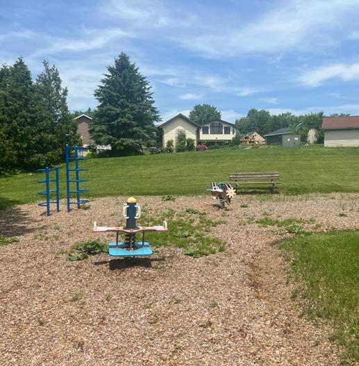
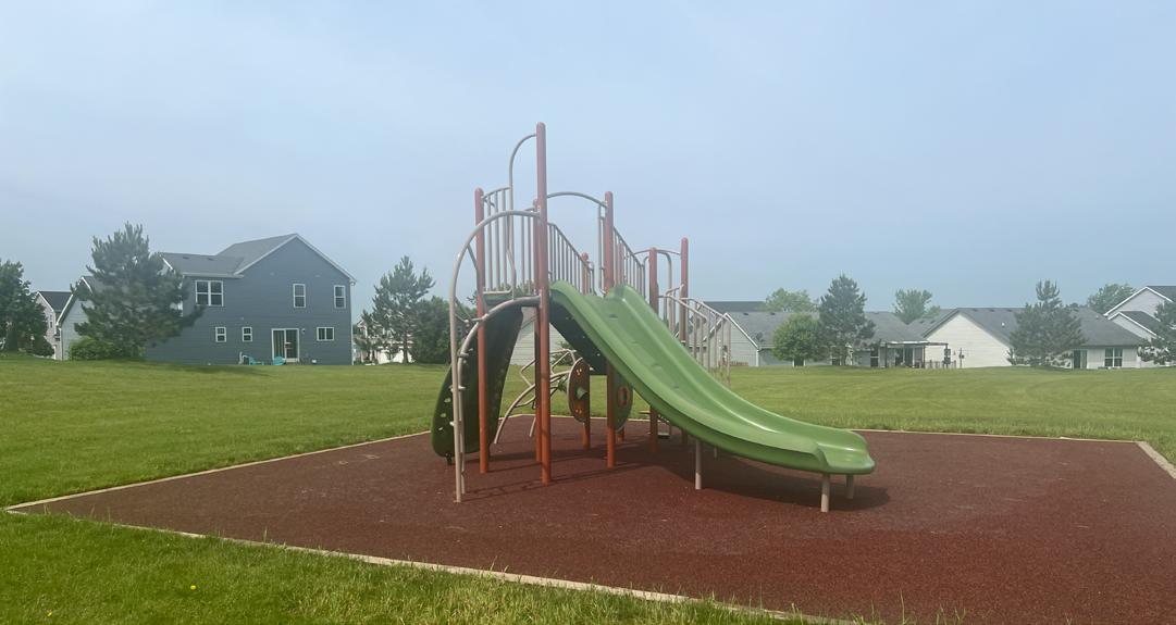
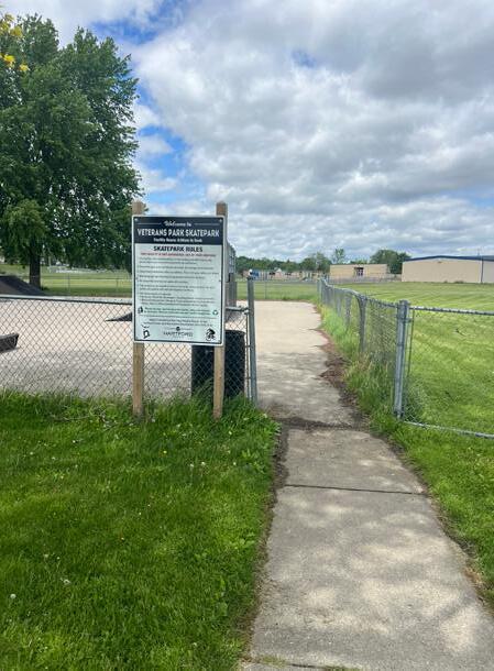
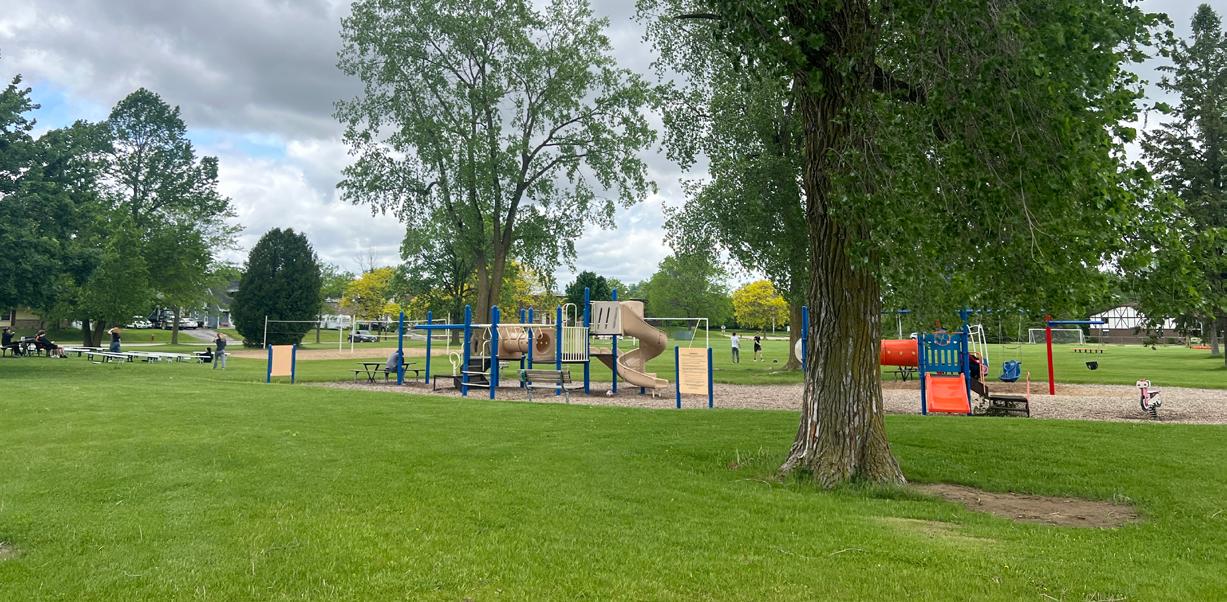
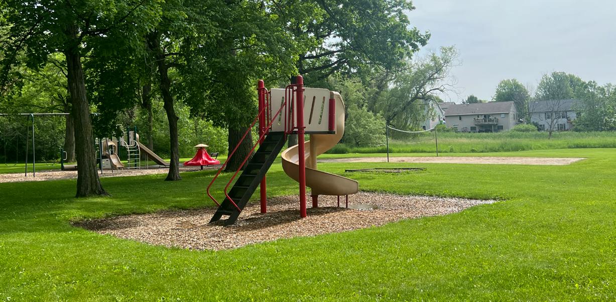
Neighborhood parks are areas for multiple and sometimes intensive recreational activities. Facilities may include athletic fields, sports courts, playgrounds, skate parks, trails, picnic areas and splashpads. Typical size is between 3 to 10 acres.
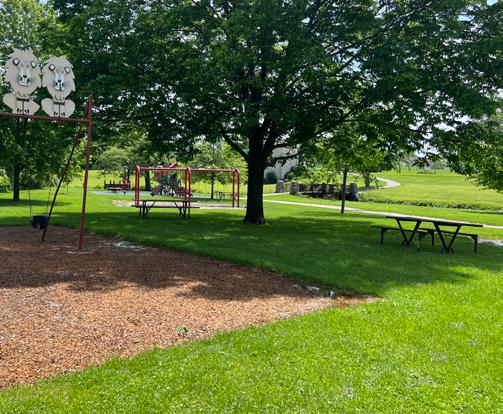
• Centennial Park
• Homestead Park
• Veterans Memorial Park
• Willowbrook Park
• Candy Cane Park
• Lakeview Acres Park
• Sawyer Park
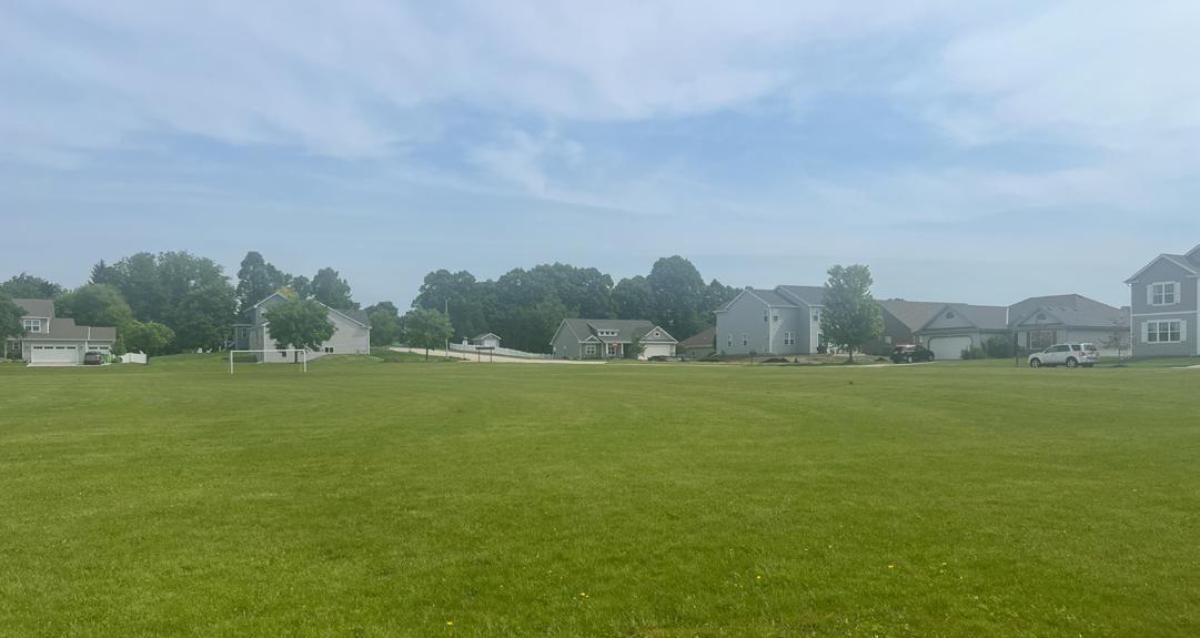
Community parks are areas of diverse recreational activity and may include amenities such as athletic complexes, trails and large swimming pools. Community parks are typically 10 acres or larger but may vary depending on facilities offered.
• Independence Park
• Woodlawn Union Park
• West Side Park
Conservancy parks and natural areas are established for protection and management of the natural or cultural environment with recreational facilities as a secondary objective. Open spaces are areas that currently offer no recreational facilities but have been reserved as future active or passive park lands.
• Country View Park
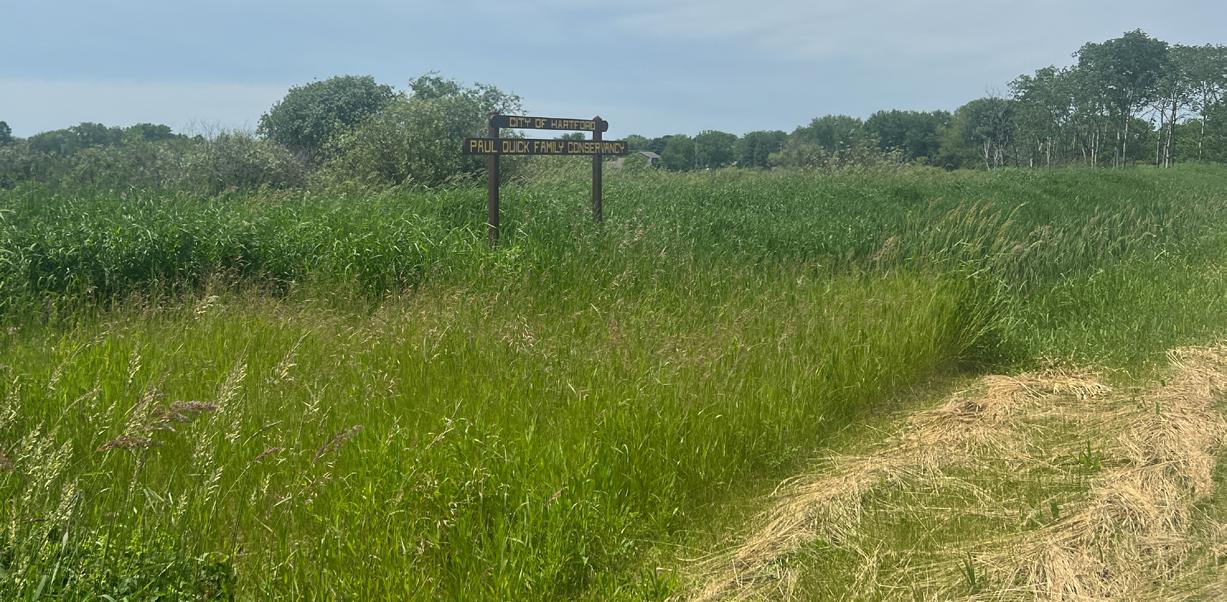
• Paul Quick Family Conservancy
• Wilson Wetlands Conservancy
A linear park or trail corridor is
Hartford is in the western portion of the WDNR’s Southeast Region and is well-served by regional parks and open spaces. There are several other publicly owned park and recreational facilities within close proximity to the City of Hartford. The following list provides the most significant facilities within the Hartford region that residents most likely would use. It is not an exhaustive list, but provides a snapshot of the variety of recreational activities available to Hartford Residents.
Pike Lake Unit, Kettle Moraine State Forest
The State of Wisconsin Department of Natural Resources (WDNR) operates Pike Lake State Park. This 689 acre facility is located on the East side of Pike Lake in the Town of Hartford. Improvements to the park include camping areas, picnic areas, and a trail system that is used for hiking and crosscountry skiing. The trail system is complemented by a handicap-accessible trail that was installed in 1997 with assistance from the Hartford Kettle Moraine, and Allenton Lions Clubs. The park is connected to the City via a bicycle path and is further linked to the Ice Age Trail network.
The Ice Age National Scenic Trail is a 1,000 mile footpath that runs through Wisconsin and runs through the Pike Lake Unit of the Kettle Moraine State Forest, adjacent to the City of Hartford. The trail highlights the State’s Ice Age landscapes. The connection to this trail is a great amenity for the community.
This 590-acre SNA is located adjacent to the Village of Jackson. In general, the following are allowed on WDNR-owned SNA lands: hiking, fishing, cross country skiing, hunting, trapping, scientific research, outdoor education, wild edibles, pets and wildlife viewing.
The Allenton Marsh Wildlife Area is a 1,160-acre property located in Washington County, 11 miles northeast of Hartford and west of Highway 41. The property is comprised mostly of wooded bottomland surrounded by grassland and crop fields, two 10-acre impoundments, several dozen smaller ponds and other wetlands, fence lines, feeder streams and small woodlots. The following recreational activities are allowed on the property: birding, cross country skiing, fishing, hiking, hunting, trapping, wild edibles and wildlife viewing.
The Loew Lake unit is an over 1,000 acre state park, approximately 14 minutes southeast from Hartford, that is operated by the WDNR. The following recreation activities are allowed on the property: hiking, horseback riding, fishing, boating, canoing, kayaking, hunting and trapping, snowshoeing and winter hiking. The Ice Age National Scenic Trail also winds through the park and along Emerald Drive.
Privately-owned facilities provide valuable recreational facilities for communities. Furthermore, these lands serve as buffers to development, trail corridors and open space for wildlife. Continued cooperation between Hartford and these valued neighbors will help to maintain the quality of life now enjoyed by the residents of Hartford.
This 175+ acre site in the Southwest quadrant of Hartford is devoted almost entirely to golf. The grounds are used by hikers in the summer and cross-country skiers in the winter. The public has access to the golf course on a limited basis at posted rates.
The Conservation Club owns approximately 31 acres east of the City on STH 60 East, in the vicinity of Pike Lake. Facilities include a trap shooting range and offstreet parking lot.
Schools can provide many of the same facilities found in a City park, such as playground equipment and athletic fields. However, school properties are not completely interchangeable with park facilities because of student use when school is in session. Coordination of community recreation and school needs can lead to greater cost efficiencies.
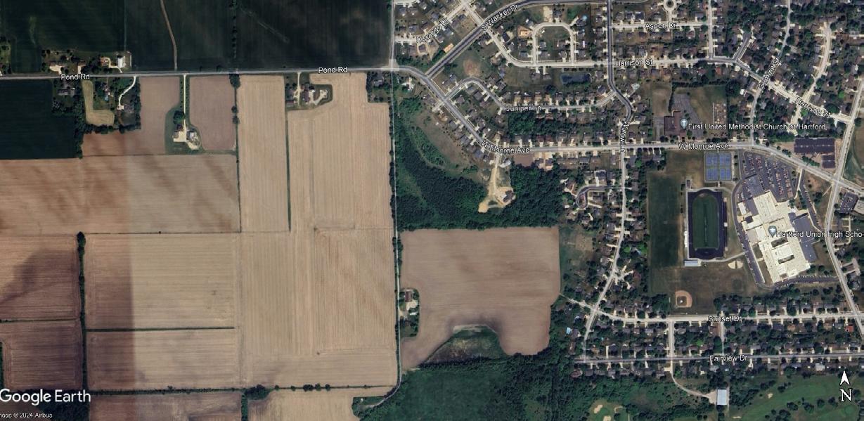
Hartford Union High School (21.5 acres devoted to recreation) is located on Cedar Street and W Monroe Avenue, on the west side of the City, and was originally constructed in 1959. The school site contains tennis courts, athletic practice fields and a track. The high school also has an indoor 6-lane competitive 25 yard pool. Gib Mahr Field is adjacent to Lincoln Elementary School. The land is owned by Hartford Union High School for outdoor athletic functions. The Lincoln Athletic Fields contain two softball/baseball fields owned by the high school.
Central Middle School (55 acres) is located on Cedar Street, southeast of the High School. The school was built in 1990-1991. The athletic complex includes a soccer field, football field and long jump pit. Other site improvements include outdoor classrooms which focus on the wetlands and environmental corridors adjacent to the site.
Lincoln Elementary School (1.2 acres devoted to recreation) is located on S Rural Street and S Main Street, north of Veterans Memorial Park. The school was built in 1954. Recreation-related improvements are limited to playground equipment.
Rossman School (7.8 acres devoted to recreation) is located between E Rossman St and Highland Ave, on the north side of the City. The school was built in 1969. The site includes the only quasi-public area formally devoted to sledding and tobogganing. Other site improvements include a basketball court, softball field, playground equipment and large general play field.
St. Kilian School (4.7 acres) is located on High Street, north of the Hartford Recreation Center. The school site contains very little space devoted solely to recreation. Since there is no greenspace on the property, a portion of the parking lot is used for recreation by students.
Peace Lutheran School (4 acres devoted to recreation) is located on Center Street, west of Country View Park. Recreation-related facilities include play equipment, softball, soccer and general play fields.
Facilities
Washington County Golf Course
An 18-hole championship golf course that was designed by Arthur Hills, ASGCA, and opened for play in 1997.
Washington County Family Park
Washington County opened Family Park to the public in Spring of 1997. The park is approximately 15 acres and is located adjacent to the Washington County Golf Course. The pond, used for irrigating the golf course, is also the focal point for the Howard Buth Memorial Arboretum. Additional park amenities include a picnic area, portable restroom, water, fishing, sand volleyball, playground equipment, a hiking trail and a reservable shelter.
The City of Hartford’s Comprehensive Plan was adopted in 2009 to meet the 2010 deadline for WI Statute 66.1001 requiring local comprehensive plans for the state. Given the age of the plan, many of the recommendations regarding Hartford Parks are already completed or ongoing, such as the Rubicon River Trail. Future developments, many of which have been developed, adequately addressed future park land use needs, resulting in additional parkland for the City.
The primary focus of the Plan is to ensure that the Washington County Park and Trail System is sustainable, well-maintained, safe, improved and strategically expanded in a financially responsible manner, and improves quality of life for the citizens and visitors of Washington County. Much of the plan is concerned with the future of the Pike Lake Unit, and this plan proposes significant acquisition of land adjacent to the City of Hartford’s municipal boundaries.
The ADA, enacted in 1990, clearly states the right of equal access for persons to local government services, including parks. On September 15, 2010 the Department of Justice published revised final regulations implementing the Americans with Disabilities Act. The 2010 Standards included new provisions for accessible design for recreational facilities such as playgrounds, swimming pools, fishing and golf facilities. Similar to when the original 1991 ADA Standards were adopted for public buildings, a community is required to complete a self-evaluation of their recreational facilities for ADA compliance by March 15, 2012. Those communities with 50 or more full or part-time employees are also required to develop a Transition Plan, which identifies what corrective work will be completed, when it will be completed, and the individual responsible for the corrective work. Any new recreational facilities designed, constructed, or shaped after March 15, 2012 are subject to the 2010 Standards. Any alteration (not simple maintenance, but something that changes the way the site is used) must make the element altered accessible and must create an accessible path of travel through the site or facility to that element.
There are some fundamental differences in how accessibility in the outdoors is accommodated compared to indoors or the built environment. While restrooms, shelters, interpretive centers, and parking lots, for example, need to follow detailed ADA guidelines, other improvements such as trails or swimming beach areas, for example, do not necessarily need to follow indoor or built environment ramp grades or surfacing requirements. A good rule of thumb for the City to follow is that anything constructed must not make the outdoor experience anymore difficult than what occurs naturally. Mother Nature does not have to comply with ADA, but the City does.
The New England ADA Center is a good resource to use and offers checklists to evaluate accessibility at existing park facilities. The fillable checklist forms can be found here: http://www.adachecklist.org/checklist.html#rec
Goal 1: Provide a sufficient amount of active and passive parkland and amenities to meet the current and future recreational needs of the community.
Objectives:
1. To provide a range of park types and sizes to meet the needs of the community.
2. To acquire additional lands for active and passive recreational use based on current deficiencies, demands created by increasing populations or the environmental and recreational significance of the land.
3. To provide a diversity of recreational opportunities so that residents of all ages and abilities have an equal opportunity to enjoy the park and open space system.
Polices:
1. Maintain a level of service of at least 10.5 acres of developed parkland per 1,000 residents.
2. Land which is undevelopable (i.e. contains wetlands or floodplains) or proposed for stormwater management facilities shall not be counted toward the required amount of parkland dedication for new subdivisions.
3. The type of park and open space facilities should be scaled to the needs of the area and population served, both present and future.
4. Whenever possible, all park sites and experiences will be made accessible to all potential users, in conformance with the Americans with Disabilities Act (ADA).
5. The park and recreation system should provide opportunities for all persons regardless of race, creed, age, gender or economic status.
6. Pursue additional land acquisition where existing neighborhoods are underserved by recreational land or where opportunities arise to add strategic parkland to the community which serves to implement one or more recommendations of this plan.
7. All parks should have multiple access points from surrounding neighborhoods.
8. Neighborhood parks should be sited and designed to enhance neighborhood cohesion and provide a common neighborhood gathering place.
9. Seek to ensure that all residential homes are within a 1/3-mile or less distance from a developed public park.
10. Create consistent building designs for park shelters, restrooms, etc.
11. Make every effort to repair, replace, or remove park facilities that become broken or otherwise become a safety hazard.
Goal 2: Provide park and recreation space areas that preserve natural features and amenities.
1. To preserve natural features and amenities and conserve natural resources for the benefit of the community and society as a whole.
2. To link active parklands together via environmental corridors.
Polices:
1. Conservancy lands, which can be adequately and appropriately protected without public expenditure, should be preserved. Public funds should be used to acquire conservancy lands that cannot be protected through other means, or where public access is a high priority.
2. Continue to add primary, secondary and isolated environmental corridors to the park system in conjunction with development
3. Preserve the natural features and conserve natural resources associated with the Rubicon River for the benefit of the community.
Goal 3: Develop, improve, and operate the City’s parks and recreation programs in a cost effective manner.
Objectives:
1. Maintain a park and open space system that is sustainable with respect to annual maintenance and operation costs and servicing capabilities of the community.
2. Continue funding the replacement of old and deteriorating recreation equipment in all City parks.
3. Invest funds for the development of facilities that will maximize existing park and recreation areas, with the intention of increasing park use.
4. Continue funding to allow for future parkland acquisition and new facility development.
Polices:
1. Maintain a capital improvement plan to replace worn or damaged recreational equipment and facilities. Use this plan to establish future capital improvement plans and annual budgets.
2. Take into consideration long-range maintenance and operations costs at the time new parklands are acquired through land dedications or other means.
3. Pursue grant funding from state, federal, recreation associations, or corporations which can aid in the purchase and/or development of desired park system improvements.
4. Require new developments to provide land or fees-in-lieu-of land dedication sufficient to meet the parkland needs generated by such development, based on Hartford’s adopted parkland acreage policy (see Goal #1, Policy #1).
Goal 4: Coordinate park and recreation planning and development.
Objectives:
1. Coordinate park activities/facilities with civic, private, City, County and State agencies and organizations to complement offerings without unnecessary duplication.
2. Preserve areas planned for future parks and recreational trails from development.
3. Provide opportunities for public participation in park and recreational facility development.
Polices:
4. Review and comment on park and recreational plans of other adjacent governments.
5. Endorse the DNR’s long-range master plan for the Kettle Moraine State Forest – Pike Lake Unit.
6. Collaborate with Washington and Dodge Counties on regional park and trail planning efforts.
7. Provide copies of this plan to adjacent governments and County Parks Departments.
8. Update the City Park and Open Space plan every five years and solicit input from City residents.
9. Complete regular reviews and updates, if needed, of this plan in coordination with the City’s Comprehensive Plan.
10. Coordinate subdivision review with all departments responsible for providing or maintaining adequate park facilities.
11. Park facilities and school facilities should be shared by both entities to be mutually beneficial to both when appropriate and feasible. This is most likely to occur through a cooperative relationship and through good communication between the Park and Recreation Department and the School Districts.
12. Follow recommendations of Rubicon River Corridor Trail Master Plan, including acquiring lands for additional parks approving capital project additions and improvements to existing parks.
This chapter presents an analysis of how well the City’s existing park and recreation facilities satisfy current needs. The adequacy of the City’s existing park and recreation systems are evaluated using the following methods:
• Quantitative Analysis - a comparison of existing parkland acreage and population projections versus park and recreational agencies across the US, including a review of the amount of parkland available to City residents.
• Geographic Analysis - an analysis of the geographic distribution of park facilities within the City.
• Qualitative Analysis - a summary of public input regarding City parks and recreational facilities gathered through the community survey, public involvement meetings, and feedback from community organizations that use the City’s parks.
• Regional & State Insights - a summary of the demand trends in recreational amenities at the regional and state level.
An analysis of existing recreational land area is provided to determine if the recreational needs of residents are being met. This analysis is limited to space, or land, devoted to recreational uses owned by the City of Hartford. Currently, the City is providing approximately 429.3 acres of parkland in total, not counting school facilities, County facilities, or private facilities. About 63% of this land is passive or undeveloped parkland. This translates to .03 acres of parkland per person, or 27 acres per 1,000 residents. As represented in Figure 4.1, Hartford acreage per 1,000 rate is well above the median and upper quartile nationally for jurisdictions with less than 20,000 people.
Table 4.1 summarizes the current and projected supply and demand for total parkland acreage based on
the City’s population. For the purpose of calculating anticipated parkland demand, a service level of 10.5 acres per 1,000 residents was assumed. This standard is promoted by the National Recreation and Park Association (NRPA) and is derived from the sum of the following service level standards for mini, neighborhood, and community parks:
Mini Parks: 0.5 acres/1,000 people
Neighborhood Parks: 2 acres/1,000 people
Community Parks: 8 acres/1,000 people
Using a level of service standard of 10.5 acres of parkland per 1,000 residents, the City currently has a total surplus of over 250 acres. Assuming the population projections are accurate, and the City does not add additional parkland, a total surplus of parkland will remain through 2040.
*Includes developed and undeveloped parkland
While the total acreage of parkland is an easy indicator of the presence of parks and recreational space, it is not the only indicator of how well a community is meeting the park and recreation needs of its residents. The NRPA advocates that the location of parkland, and the types of recreational facilities offered on that land, are just as important as the total acres available. Fortunately, Hartford residents have access to a wide range of recreational facilities and park types.
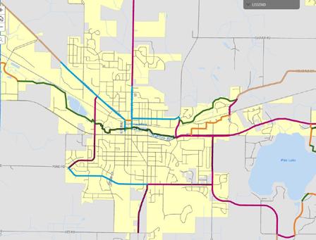
The NRPA, in partnership with the Trust for Public Land and the Urban Land Institute, promotes the 10-Minute Walk Campaign, advocating for “a great park within a 10-minute walk of every person, in every neighborhood, in every city across America.” This service area standard assesses how equitably parkland is distributed geographically throughout a community.
Using the 10-Minute Walk standard, the green area in Map 4.1 shows where city residents live within a 10-minute walk (approximately ¼ to ½ mile) of a cityowned park. This area is the aggregate of each park’s individual 10-minute walk radius. For areas outside the green 10-minute walk radius, the underlying residential zoning district is displayed. This is intended to represent areas where people live but are not within a 10-minute walk of a city-owned park.
Map 4.1 shows that most Hartford residents are able to access parkland within a roughly 10-minute walk of their residence. The exceptions are found along the municipal edges where subdivision developments have expanded. Most of these underserved areas are adjacent to currently undeveloped parcels that are intended for future parkland.
An online survey was available to residents during spring/summer 2024 to provide input and feedback for the parks system. Many of the questions were the same as the survey provided during the previous CORP planning process in 2018, enabling a comparison of changes in sentiment over the last 5 years. Approximately 286 people took the online survey in 2024, and the full results are provided in Appendix A.
According to the 2024 survey, the most popular park and recreation facilities in Hartford are Willowbrook Park, Independence Park, and Woodlawn Union Park, which is the same ranking for park popularity as the 2018 CORP survey. Park favorability tended to connect with proximity to their home, availability of sports facilities, and riverfront access.
Survey respondents reported regular use of City of Hartford parks. Excluding the winter months, 35% of respondents reported visiting City of Hartford parks 3 or more times per week, and 34% reported visiting 1-2 times per week.
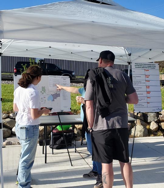
Figure 4.2: Survey Participants Park Improvement Priorities (2024 vs. 2018) 2018
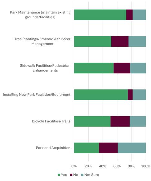
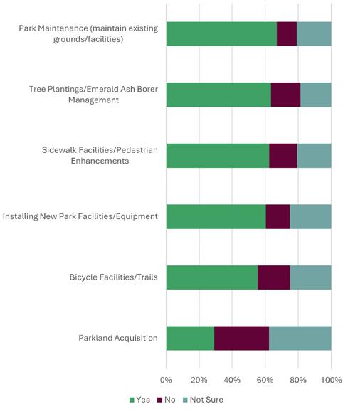
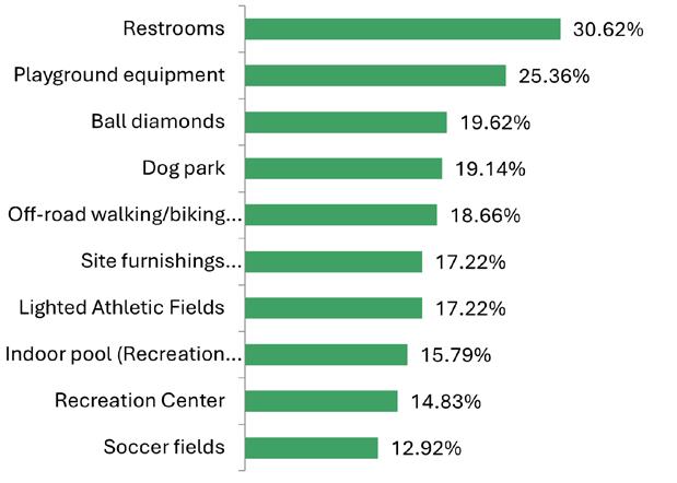
Respondents were asked to choose 6 amenities in need of improvement or expansion (Figure 4.3). Of the options presented the most commonly selected amenity was restrooms, at just over 30%. This was followed by playground equipment at about 25%, and ball diamonds at just over 19%.
When asked why respondents’ households did not participate in recreational activities, most (32%) identified as ‘too busy’. Additionally, many stated lack of participation due to dog restrictions in parks and missing desired features or facilities, which both received about 20% of responses.
Figure 4.3: Survey participants Amenities in Need of Improvements
Although the northwest corner of Hartford is within Dodge County, Hartford is predominately located within Washington County.
Insights from the Washington County Park and Open Space Plan 2035
The Washington County POSP had five overarching goals:
1. Well-Governed and Administered County
2. A Safe and Secure Community
3. Economic Growth and Vitality
4. Effective Mobility and Reliable Infrastructure
5. Access To Basic Needs
Of the specific recommendations for land acquisition, most relevant to the City of Hartford is the Pike Lake Unit. The County proposed an acquisition boundary for the State Forest that encompasses 3,540 acres of land, including wetland, agricultural land, and undeveloped Pike Lake shoreline. This would include additional campsites, a boat launch for motorized boats, and an education center.
Insights from the Washington County Bikeway and Trail Network Plan
In 2019, Washington County produced a Bikeway and trail Network Plan that identifies a number of corridors within the City of Hartford that were recommended for the County-wide network, including the expansion westward and eastward of the Rubicon River Trail.
Insights from the Wisconsin State Comprehensive Outdoor Recreation Plan (SCORP)
Hartford is located within the Lower Lake Michigan Coastal Region, the most populous of the regions identified in the SCORP. Kettle Moraine State Forest—which is located just over 20 miles northeast of Hartford—is identified as one of the State’s most visited public lands. Growth of the Milwaukee metropolitan region has bolstered parks and recreational offerings in the region.
Regional recreational needs identified in the SCORP include:
• Biking opportunities
• Water-related activities such as canoeing, fishing, swimming, and motor boating
• Cross-country skiing
For a full list of regional needs, please visit the Wisconsin Department of Natural Resources
The quantitative, qualitative, and geographic analysis discussed in Chapter 4 reveals the need for improvements to existing facilities, as well as the potential acquisition and development of new sites for future recreational use. In most instances, more detailed planning, engineering, study, budgeting, and/ or discussion will be necessary before decisions are made to actually acquire land or construct recreational facilities.
The recommendations of this plan are divided into four major sections:
1. Recommendations for existing park facilities
2. Recommendations for new park facilities
3. Recommendations for recreational trails
4. Miscellaneous recommendations
The timeline for completion of the recommendations is noted within each table of recommendations. High priority items should occur as soon as possible (1-2 years), Medium priority items should happen within the next three to five years, and low priority items should occur five or more years out. Due to budgetary constraints, it is unlikely that all of the recommendations within this chapter and the CIP table in Chapter 6 will be implemented within the next 5 years.
Maintenance and improvement projects will be prioritized on an annual basis by City staff in conjunction with the Parks and Recreation Commission as part of the City’s annual budget process.
The following pages contain one-to-two page spreads dedicated to each existing park in Hartford, as well as additional undeveloped parkland owned by the City. Each spread includes general park information, facilities, and recommendations for improvements to existing parks. Some of the recommendations identified within this section are brought forward from the 2018 plan.
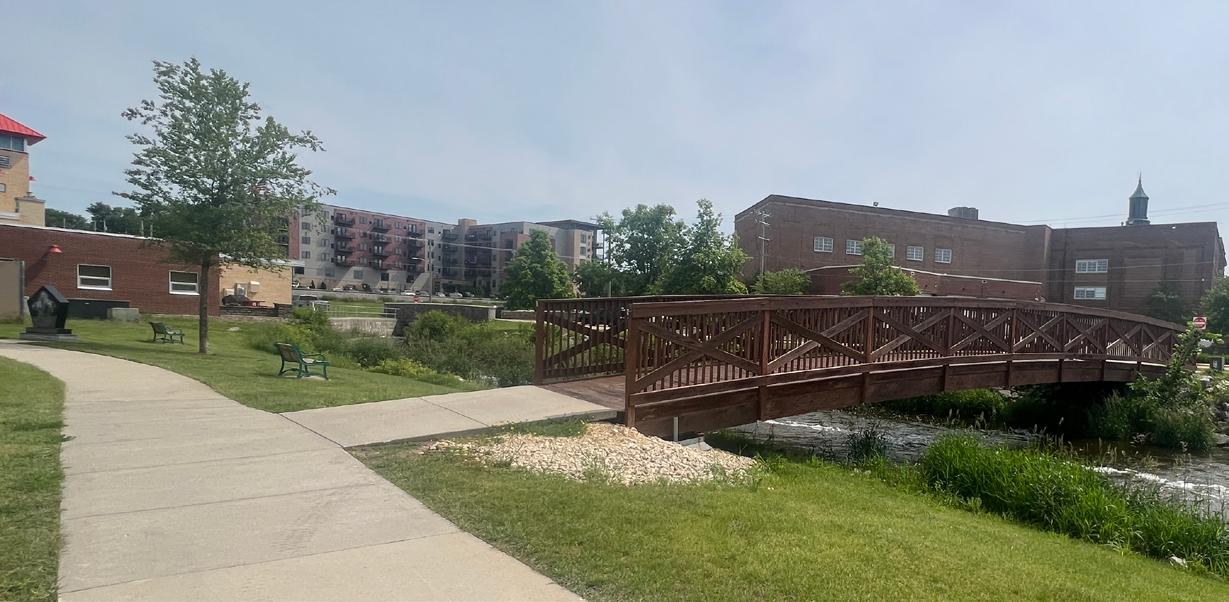
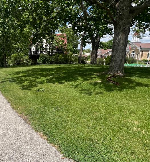
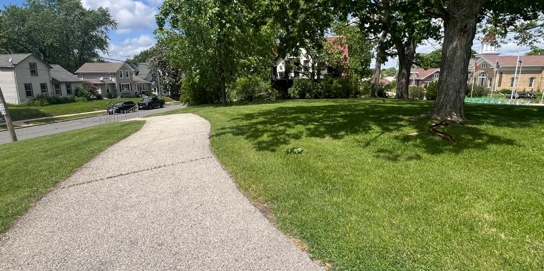
This mini park was the site of the Department of Public Works garage. The DPW garage was removed from the site in 2003 and the City designated the property for parkland to fill in greenway and connecting trail for the Rubicon River Parkway. In 2006, the site was officially named Bernd Park in honor of Murlin Bernd who served as a public official for many years including Mayor and Alderperson. The site is situated between the Recreation Center, Fire Station, and City Hall. It is also immediately adjacent to Jordan Park. A footbridge was installed in 2017 to provide an improved connection between the numerous surrounding buildings, parking areas and Main Street.
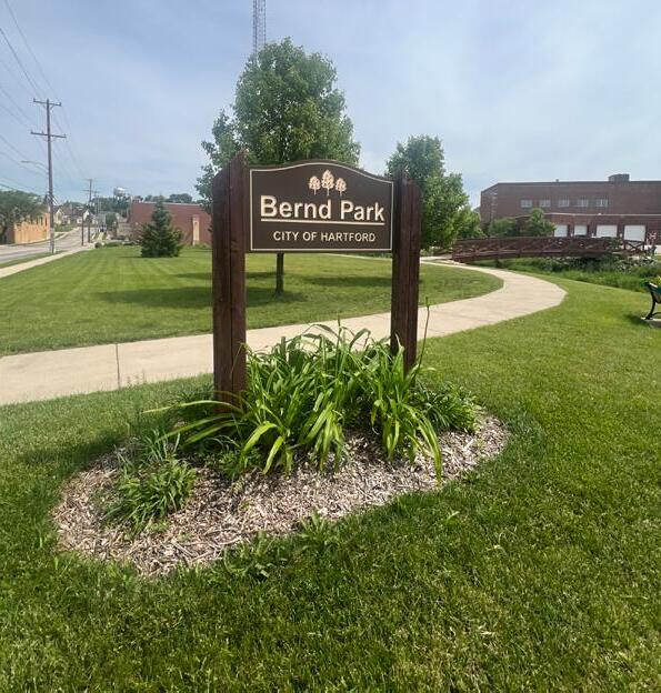
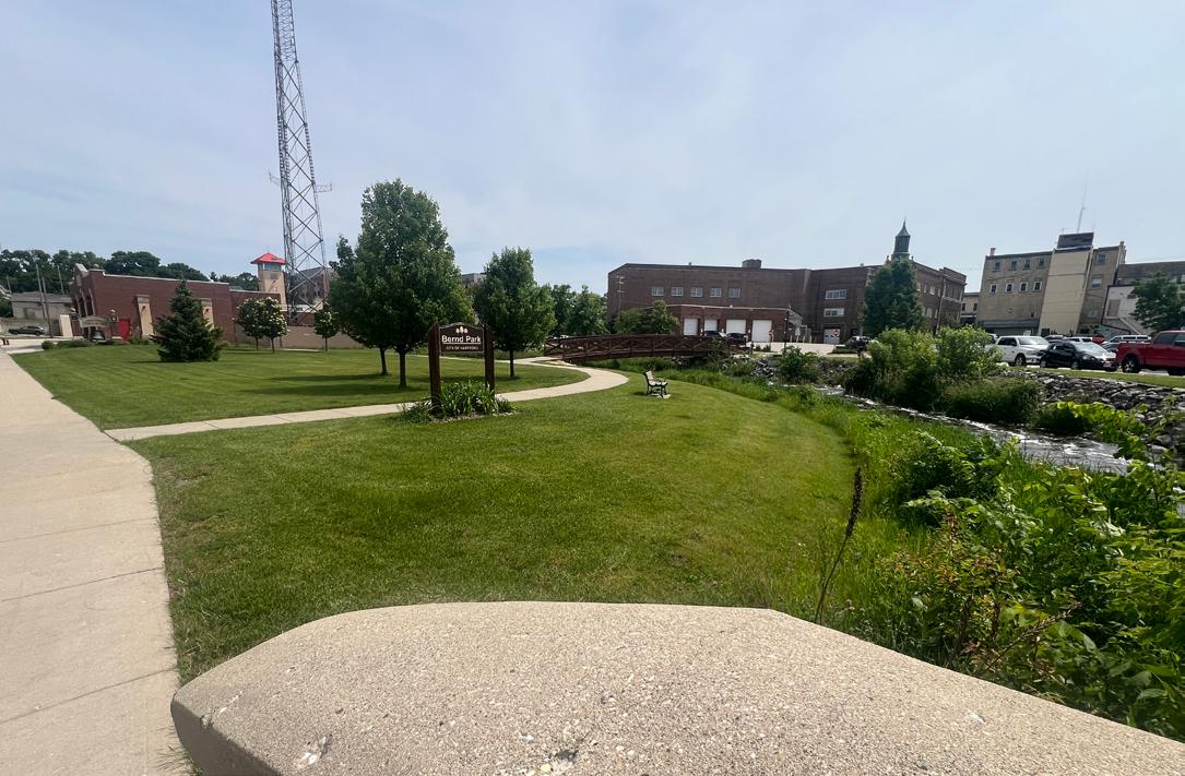
Park Address: Wisconsin St and Main St
Park Size: 0.1 Acres
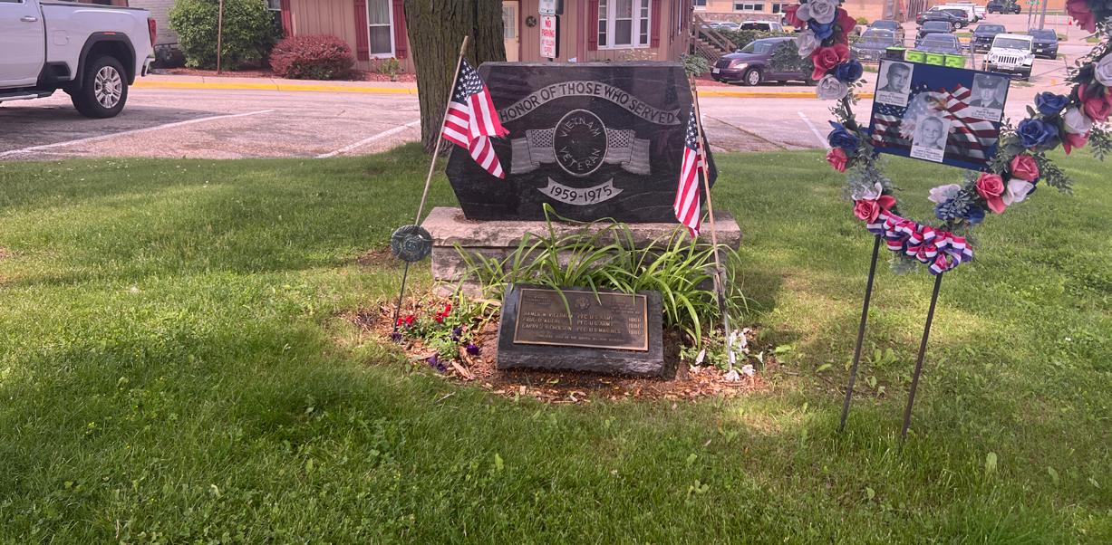
Chasa (meaning very small) is a tenth-acre parcel in the downtown that has been dedicated for a memorial to persons who served our country. Development and maintenance of the park was undertaken by the Hartford Garden Club, VFW, and Vietnam Veterans. This ornamental park, located at the intersection of Wisconsin Street and Main Street, serves as both a small green space in the downtown area and a site for various veterans’ memorials.
Recommendations
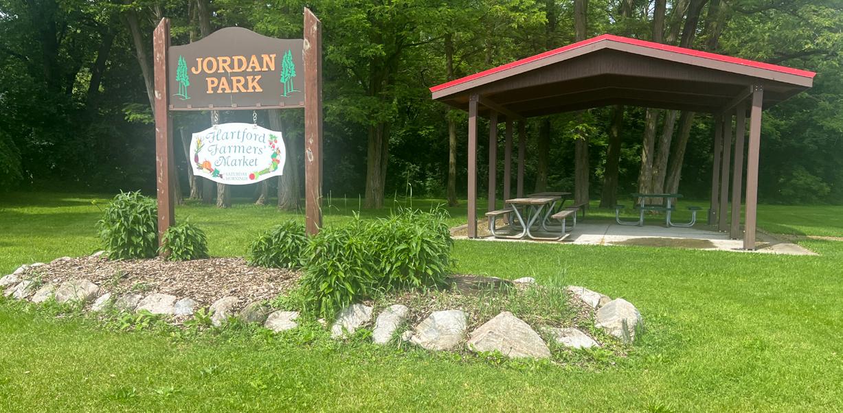
The park is located adjacent to the Hartford Recreation Center. The park is currently used by the Farmer’s Market.
In 2018 a new shelter was approved for construction that was completed by a local scout as an Eagle Scout project. In 2016 the park signage was updated as part of an Eagle Scout project.
Park Address: 65 N Rural Street Park Size: 0.4 Acres
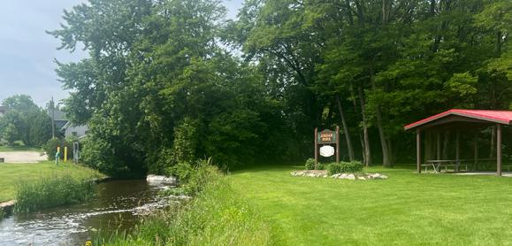
The site was acquired in two land purchases, one in 1998 and one in 2002, both through the DNR Stewardship – Urban Rivers Grant Program. In 2004, the Hartford Rotary, in celebration of the Rotary International 100 year anniversary built and dedicated an octagonal park shelter on the corner of Highway 60 and Grand Avenue. The existing homes on the sites were removed in preparation to create a green space along the Rubicon River that connected the site to Willowbrook Park. The City was awarded a DNR grant in 2011 to construct the trail bridge between Willowbrook Park and Rotary Park.
Park Address: 526 E Lincoln Avenue
Park Size: 0.3 acres
This small park was a remnant site in the Memorial Park neighborhood. The parcel was donated to the City in 1960. In 2023, new playground equipment was installed through donations from a local family.
Park Address: 2076 Lake View Drive
Park Size: 0.8 acres
Lake View Park was dedicated to the City in 1993 as a part of the Lake View Acres First Addition Subdivision. The parcel is located adjacent to City Well #11.
Park Address: 111 Branch Street
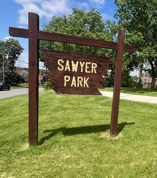
Park Size: 1.3 Acres
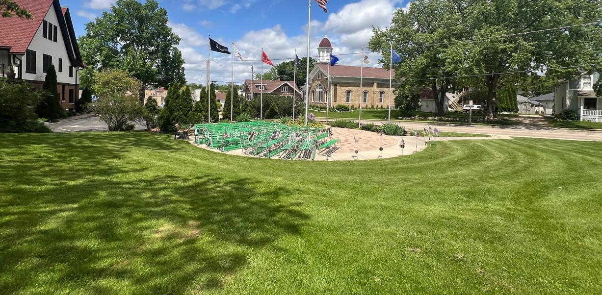
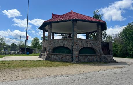
This park was purchased in 1952 from the Sawyer Family. Sawyer Park is strategically located in the Central neighborhood at the southern end of the business district in the Memorial Park neighborhood. In 1958 the old Steinmetz/Palmer band shell, located at the Schwartz Ballroom site, was dismantled and moved to an amphitheater setting in Sawyer Park. This band shell was removed in 2008.
The development of Sawyer Park as a Memorial Park to Veterans began in 2012 when a flag memorial was erected in the area of the former bandshell. In 2017 walkways were added and the VFW installed the “Avenue of Flags” along these new walkways. In 2018 a parking area was added to the site.
Widen access road for cars to get through
a storage shed
Add more picnic tables
Add entrance sign on Branch Street side of park
Add informational signage to explain memorial
benches along path
concrete, $20/SY asphalt
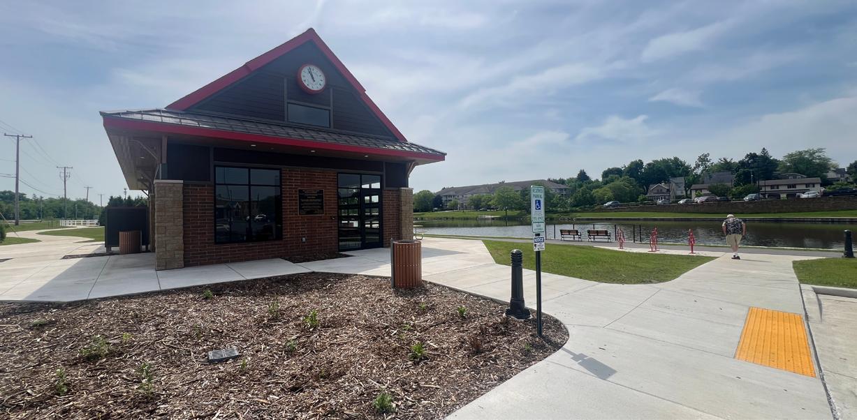
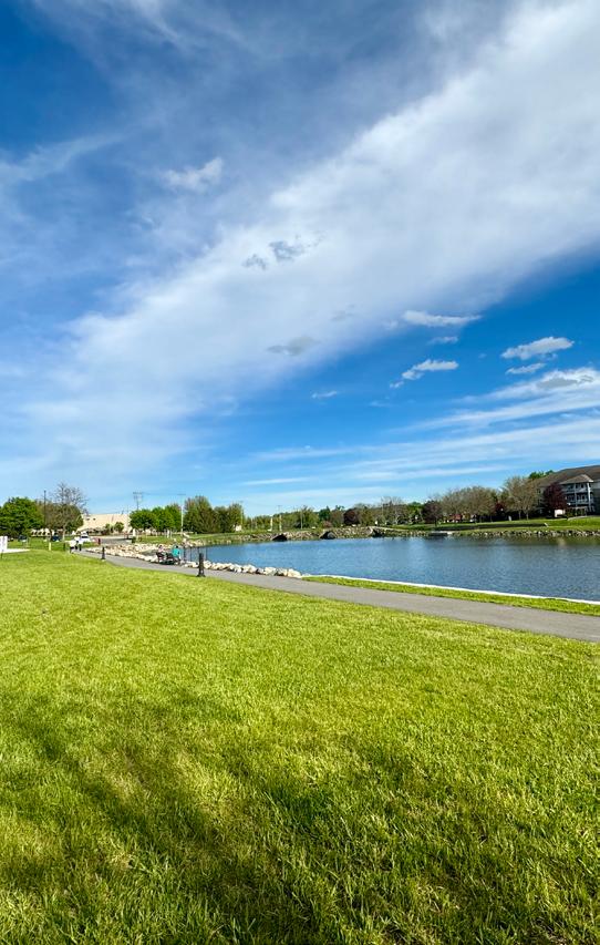
The development of Centennial Park came about through several land acquisitions over more than a decade. The original park land was obtained in 1976 when the City obtained the Kraft land both North and South of the river adjacent to the dam.
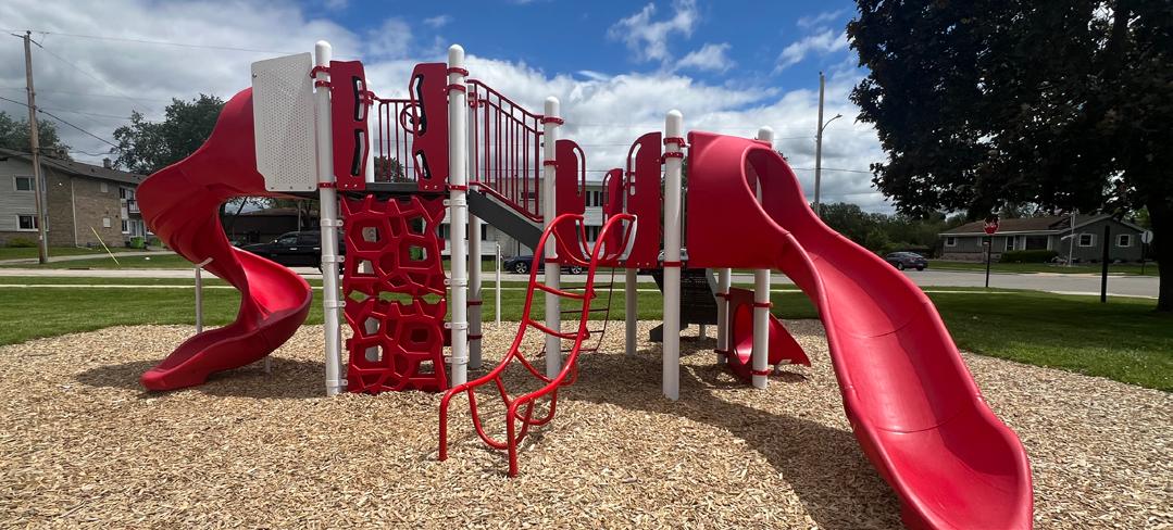
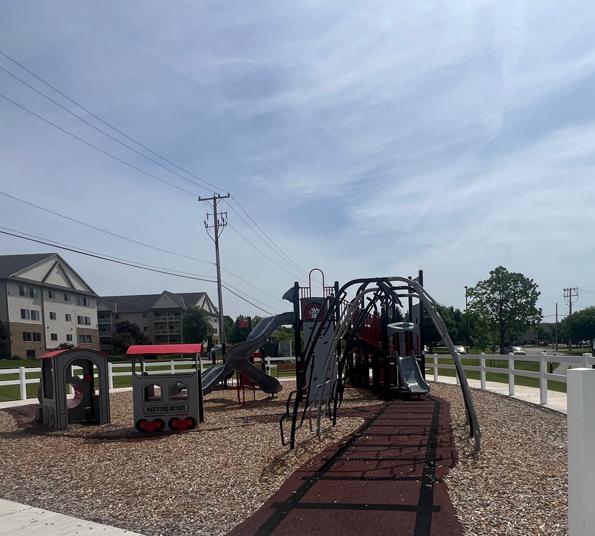
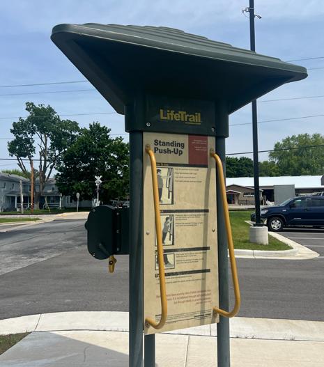
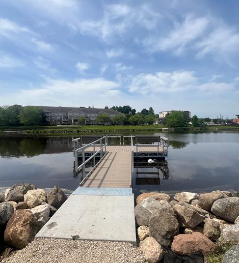
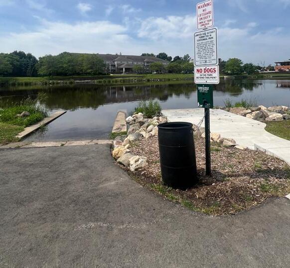
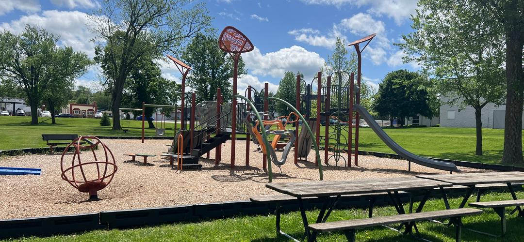
In May of 2024, the City of Hartford unveiled the completed Centennial Park, which was the result of years of construction and renovations. The new park includes a playground, a rentable enclosed shelter, brand new restrooms, and a new boat launch-- amongst other improvements.
Recommendations
Canoe/Kayak Launch
Shore Fishing N/A
Playground Equipment 2024
Ice Skating/Hockey 2024
Designated Dog Area 2024
Fitness Trails 1990s-2024
Bike/Walking Trails 1990s-2024
Off-Street Parking 2024
Open-Air Shelter 2024
Enclosed Shelter 2024 Restroom
Concession Stand
Park Address: 560 Big Bend Way
Park Size: 3.7 acres
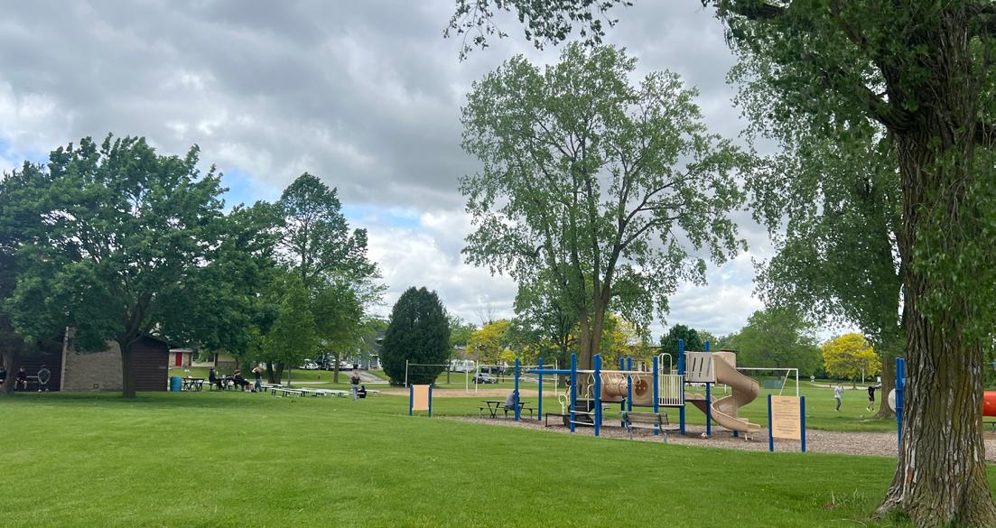
Park grading/seeding was undertaken in 2009 and landscaping was done in 2010 and 2011 along Yellowstone Drive and the western edge of the park. A back stop was also installed in 2011. In 2009 the Borlen Farms Subdivision Association began meeting and in 2011 they formed a spin off park committee that provided city staff with recommendations for a playground and shelter. The Hartford Soccer Club has located a practice goal at the park.
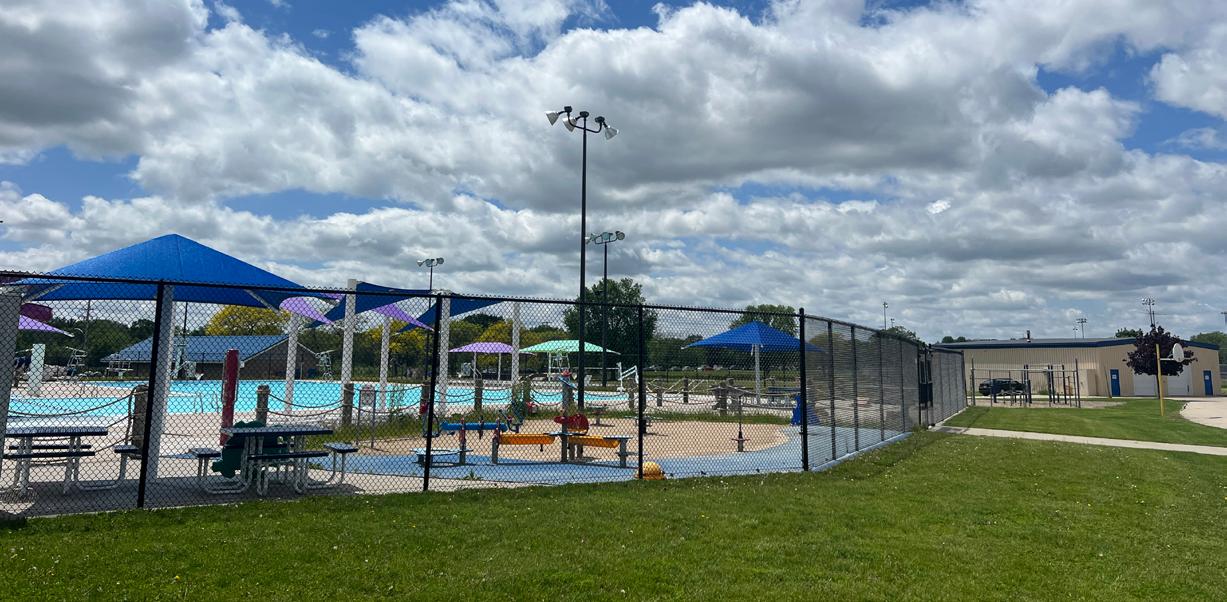
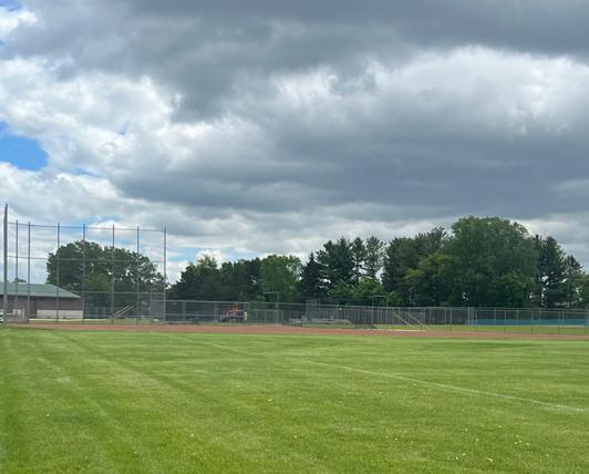
This park was originally purchased by the Hartford Common School District for school facilities and is located on the South edge of the City. The main feature of Veterans Memorial Park is the Aquatic Center, which was updated and reopened in summer of 2016, featuring water slides, lazy river, floatable water walk, water basketball, diving boards, in-water bench and shade, sand play area, deck activities, concession stand, lap lane, toddler spray features and slide, Spin Brella water feature, tidal barrel water drop, lounge chairs and a locker room with showers.
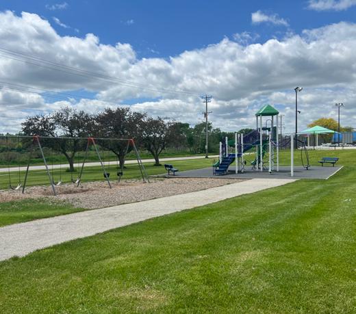
Park Address: 730 E Sumner Street
Park Size: 11.2
This park acts as a gateway to the historic portion of Hartford and is one of the three major parks in the City adjacent to the Rubicon River and makes up part of the expanding Rubicon River Park/Parkway through the City. The first land acquired for public parks in the City was in 1917 for the East Side Park. That first purchase coupled with later purchases in 1927, 1933, 1944, 1946, and 1964 comprised what is today known as Willowbrook Park. Easements were obtained in 1982 and 1996 (along the South side and North side of the river, respectively) to link this park with Grand Avenue and in 2001 Steelcraft dedicated 2.5 acres on the north side of the river between N. Grand Ave. and Steelcraft Dr.
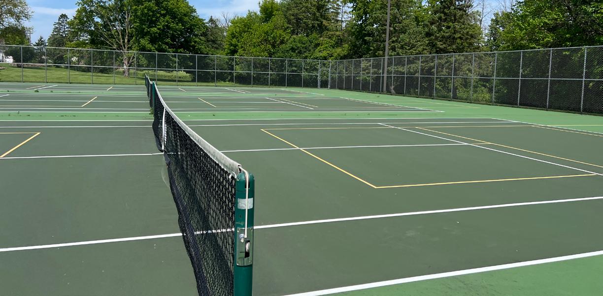
Willowbrook Park is a highly utilized park for family and group picnics. The lighted tennis courts are heavily used and the children’s play equipment attracts young families. An open picnic shelter was erected in 1992 as part of a larger LAWCON/ADLP grant. Basketball, volleyball, and horseshoe courts are added attractions of the park.
Lighted Basketball Court (3)
Lighted Tennis/Pickleball Court (3)
(2006), Lights (1992)
(2006), Lights (1992)
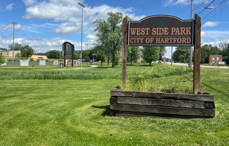
Park Address: 544 W Sumner Street
Park Size: 8.5 acres
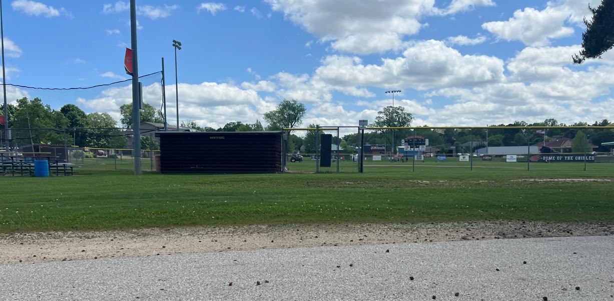
Acquisition of lands for West Side Park began in 1920. Subsequent transactions in 1931 and 1976 culminated in what is now an 8.1 acre site. The park is located between the Rubicon River and West Sumner Street, and is a highly visible facility. West Side Park is one of the three major parks in the City comprising part of the expanding Rubicon River Park/Parkway.
During the 1930’s the WPA built a stone and wood gazebo, restrooms, and a fountain. The historic bathroom structure was relocated to its present site in 2000 from the location now occupied by the new Hartford Electric Utility Operations Center. Beginning in 2012 the Hartford Select Baseball Club began a number of improvements, including infield renovation and the installation of new lights.
Park Address: 880-1020 S Wilson Avenue
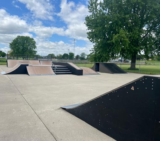
Park Size: 95.9 Acres
This land, purchased in 1942, originally served as a gravel pit and landfill, which was closed in 1975. It then became a public park, originally named Jurgensen Park. In 1976, on the 200th birthday of our nation’s Independence, the park was renamed by Melissa Farris, the former Mayor Thayer’s granddaughter. A master plan for the park was prepared in 1975 and updated in 1983 and 1985. In 1980 grading was undertaken in the central portion of the park to comply with the DNR landfill closing order and overhead power lines were buried. In 1985, grading of the four softball fields was completed. Various donations throughout the years from organizations like the Hartford Sideliners, the Lions Club, and the Jaycees led to the construction of soccer fields, a basketball court, a shelter, picnic areas, bleachers,and ballfield fencing.
Existing Facilities
Playground Equipment N/A
Backstop N/A
Baseball/Softball Diamonds (5)
Basketball Court (2)
Volleyball Courts (2)
(8)
(Initial construction)
Paint fence on field one (electrostatic paint)
Improve connecting trail to Chapel Hill neighborhood
service roads and parking lot
Add lighting to service drive and parking lot
Expand/improve playground near old shelter
Add sledding hill north of BMX
Add grill by the back shelter
(grill, concrete pad) Add large open shelter by concession stand
Repaint dog park benches
Paint and fix boards around venting component
Park Address: 1200 N Wacker Drive
Park Size: 18.7 Acres
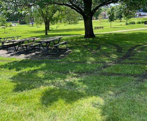
Woodlawn Union Park is located adjacent to the Hartford Western Industrial Park and is the second largest public park developed in the City. It was initially developed in 1959 when the need for a large public park led to the purchase of a large tract of land beyond the Northwest fringe of the City. In 1964, the Chrysler Union donated additional lands. Heavy use of the park for picnicking during the late 1950’s and early 1960’s prompted the Hartford Lion’s Club to donate money and labor to build a large shelter building in 1966. It was fitted with sliding overhead panels in 1978 to lengthen the period of use of this facility. The principal use of the park continues to be family and group picnic events. The Volunteers for a Beautiful Hartford (formerly the Hartford Civic Garden Club) have established a woodland wildlife area in the park for future generations to enjoy self-guided tours of the wildflowers and variety of trees located in the park. In 1995, a trail was extended to connect to the sidewalk adjacent to Cleveland Avenue and the new residential developments located North of the park. A new open picnic shelter, also housing telephone equipment, was constructed in 1999 by Ameritech.
Add landscaping and park like feel to new parking lot
Continue to plant trees to take the place of major oaks in center of park
Add nature themed play structure elements, continue decentralized approach
Asphalt path connecting lower east shelter to restrooms
Improved path lighting throughout park
Add another partly-covered shelter
Explore construction of new band shell
Make loop trail dedication stone visible
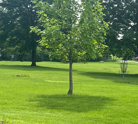
Maintain disc golf course
Add marked posts with hole number, par, layout to disc golf course
Add park map at entrance
Add playground equipment at lower shelter
new basketball court
$1,000-$2,000
$50,000
Park Address: 320 E Prospect Street
Park Size: 28.1 Acres
This park consists of land acquired in 1993 as a part of the Hidden Creek Subdivision development. The park primarily consists of environmentally sensitive lands. The City developed a wet detention pond in the area to the west of the trail.
(for kiosk), $2,000 (for sign)
Park Address: 33 W Monroe Avenue
Park Size: 10.8 Acres
This land was donated and received by the City in 2011. Existing Facilities
*Develop boardwalk from Veterans Memorial Park to connect to Wildcat Conservancy at Central School
parking
and
Park Address: 641 E Lincoln Avenue
Park Size: 7.3. Acres
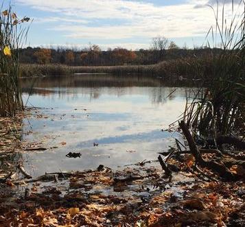
Wilson Wetlands Conservancy is a wildlife and nature conservancy area. The southern portion of the wetland is owned by St. Aidan’s Episcopal Church.
Park Address: 814 Autumn Ridge Lane
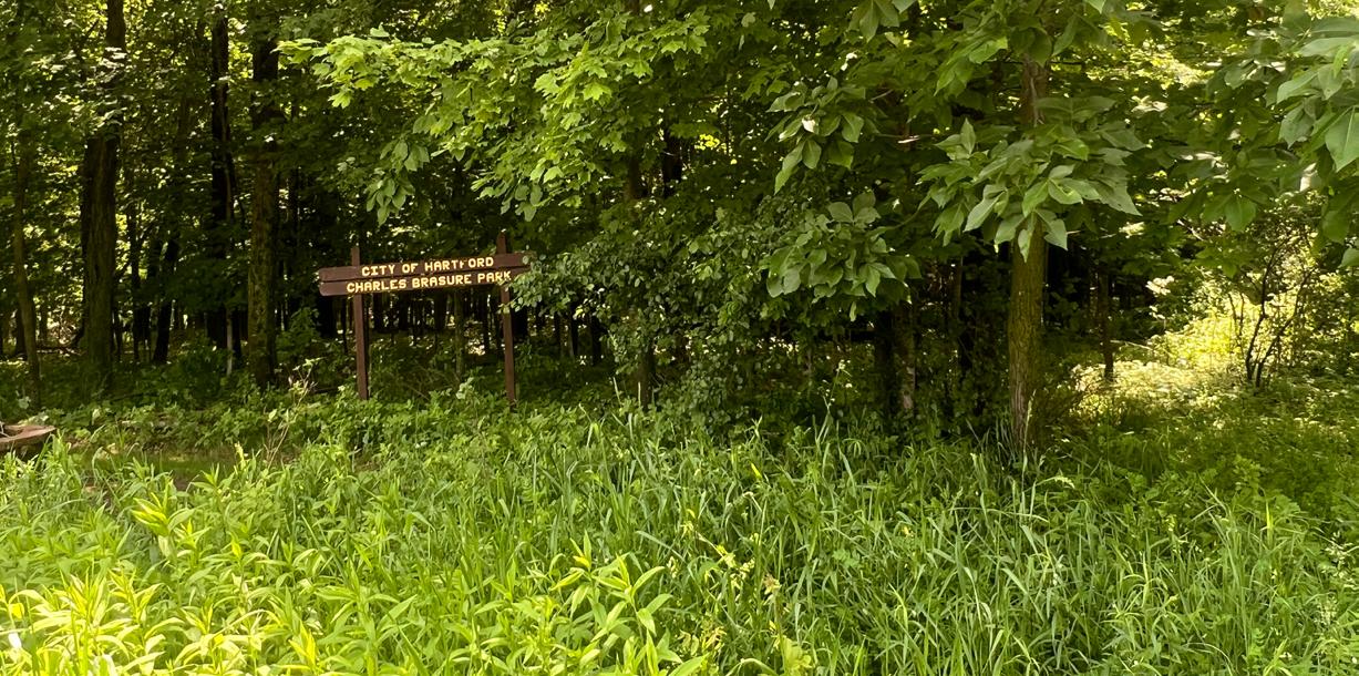
Size: 13.1 Acres
In 2008, the 13.1 acre wooded park off of East Monroe St. near the Hartford Estate Development was dedicated to the City of Hartford in honor of Charles “Chuck” Brassure and his ancestors. The Brassure family farmed the land beginning in the 1800s. The park lies between Autumn Ridge Estates and Autumn Ridge Condominiums.
of land to the City. The parcel is located in the Pleasant Hill/Fairview neighborhood. The land is currently inaccessible due to of lack of roads in the area. The parcel remains undeveloped for park purposes.
Consider land acquisition in order to link to Southwest Park
Park Address: 1011 Woods Edge Drive Park Size: 18.1 Acres
In 2002 the City acquired 2.48 acres of a wooded upland area for park as part of the Northview Highlands subdivision development. The developer as part of the subdivider agreement with the City developed a hiking trail through the wooded parcel. This parcel and the trail reach the highest elevation in this area of the City providing a highly visible and somewhat natural amenity to existing and future area development.
Continue with the trail plans created by staff that meet up with the existing trail
This parkway consists of numerous properties along the river corridor, stretching from Pike Lake in the East to Goodland Road in the West. Most of the land between Hilldale Drive and West Side park has been acquired, Pedestrian paths run from the recreation center to Rotary Park. This acreage represents acquired land along the Rubicon River that is not currently classified as developed parkland. A plan update was completed in 2007 with design consulting from MAYO Corporation.
Recommendations
Expand the system. Prioritization: 1) Phase II: Goodland Rd to N Wacker 2) Phase III: N Wilson Ave to Franklin Dr
Map portions of corridor for acquisition
Make improved pedestrian crossings at key intersections (signage/road markings: N. Grand Ave, Steelcraft Dr, Ewing Dr, Grant St)
Add “you are here” signage along trail
Add path lighting
Add a fence or visual barrier on south side, west of dam
N Wacker to Liberty
Park Address: Adjacent to Rubicon River Park Size: 50+ Acres Existing Facilities
(Phase II), $346,100 (Phase III)
(Phase I), $150,000 (Phase II)
Park Address: Pond Road
Park Size: 26.8 Acres
The site was obtained to address southwest residential growth. It was acquired in 2003 from Richard and Karen Beine. A master park plan was developed in 2009. The plan included Club stakeholders in the area of youth sports as the primary focus was to address field shortage for basketball, soccer, and football. The master plan provides future vision and a capital improvement plan.
Recommendations
One football/soccer field full size for 6th, 7th and 8th grade practice
Parking in two areas (one 136 spaces, the other 52 spaces)
Two soccer fields
One regulation
and one softball field
Consider a community build project
Link
or expand to Maple Park
The City should develop new park and recreational facilities in areas that are underserved by existing facilities, where future residential expansion is expected to occur, or where the acquisition of park and open space will advance the goals and policies of this plan or the Hartford Comprehensive Plan. The Potential Parks and Recreation Map in Appendix C identifies the general location for potential new or expanded park facilities, based in part on Hartford’s future land use plan. These are generalized locations used for planning purposes only.
Site A is in an area that currently has a deficiency in all park types (other than community parks). Site A is also near property zoned for multi-family use, which generally lacks access to green space and play equipment as compared to single-family use. The new park should be a neighborhood playground. Park facilities could include playground equipment, benches, and open space. The park should connect to the trail coming off of N Wacker Dr.
Site B (64.4 acres) is recommended as a future dog park. The recommended site contains a couple of small pockets of wetland - a future dog park in this area should avoid these areas. Amenities to consider at the dog park include: benches, a separate area for large and small dogs, an entrance corral, perimeter buffer, trash containers, shade trees, drinking water and pathways.
Site C is currently located in the Town of Hartford, however it is currently within the City’s Urban Service Area. This area is currently underserved by all park types, with the exception of community parks. Like Site A, a new neighborhood playground should offer playground equipment, benches, grills, and open space.
Site D (68.3 acres) is partially within the Town of Hartford, and similar to Site C is within the City’s Urban Service Area. This land is planned as park and open space in the City’s future land use map. This area is currently underserved by all park types, with the exception of community parks. The type of housing in this area is medium and high density residential and includes the Oriole Pond Apartments. A new park in this area should be a neighborhood park including playground equipment, shelter facilities, grills, sport court(s) (e.g. basketball, tennis, volleyball), lighting, and toilet facilities.
Site E (41.76 acres) is owned by the City of Hartford and is currently a nature park and part of the planned east expansion of the Rubicon River Trail. This is an area that is underserved by all City parks with the exception of Community Parks. The current and planned land use surrounding the property is medium and high density residential. A portion of this existing nature park could be developed into a neighborhood park in addition to typical neighborhood park amenities include canoe/kayak launch facilities, trail and an area for fishing.
Site F is in an area that is underserved by all park types. The surrounding land use is commercial and medium density residential (both single-family and multi-family). This area is planned for park and open space in the City’s future land use plan. The park should be a neighborhood park with typical facilities: playground equipment, shelter facilities, grills, sport court(s) (e.g. basketball, tennis, volleyball), lighting, and toilet facilities.
As new park lands are dedicated to the City, individual park master plans should be developed in order to guide the installation of park facilities. All individual park master plans of the City should be adopted as appendices to this plan in order to maintain eligibility for state and federal park and recreational grants.
Specific bike/walk trail development recommendations for the plan include:
• Rubicon River Trail - West
• W State St from municipal boundary to Wacker Dr
• Wacker Dr from W State St to W Washington Ave
• Existing trail on S Wacker Dr to Southwest Park
• Existing trail on S Wacker Dr to Hartford Union High School
• Hartford Union High School to WIS 83
• Boardwalk from Veterans Memorial Park to Wildcat Conservancy
• E Monroe Ave from WIS 83 to Independence Park
• S Wilson Ave from E Monroe Ave to Independence Park
• S Wilson Ave from E Monroe Ave to WIS 60
• E Loos St from S Wilson Ave to Eastwood Nature Preserve
• Rubicon River Trail - East
• CTH K from existing trail to Poplar
• E Monroe Ave from CTH K to Charles Brassure Park
• Poplar from CTH K to Sunnyslope Park
• S Main St from E Monroe Ave to Branch St
• S Main St from Branch St to WIS 60
• N Main St from WIS 60 to Yellowstone Dr
• Hidden Creek View from N Main St to Country View Park
• Cleveland Ave from existing trail on Wacker Dr to N Main St
• Yellowstone Dr from N Main St to Homestead Park
Recommendations for intersection improvements include:
• W State St and Wacker Dr
• S Wacker Dr and W Washington Ave
• W Monroe Ave and Cedar St
• Wisconsin St and WIS 83
• Main St and WIS 60
• Wilson Ave and WIS 60
• CTH K and WIS 60
Other park recommendations include the following:
• Add kiosks to all parks that shows overall park system map and park amenities or provide a QR code for people to scan to bring a map up on smartphone and tablet devices. If the City chooses to direct people to online maps, it could also include a map of each individual park.
Maintenance and operational expenses of the City’s Parks & Recreation Department are generally funded through property taxes and user fees. As the park system grows the need to increase funding to meet the basic maintenance and operational costs also grows. Often there are insufficient funds to undertake major capital improvement projects. There are a wide variety of potential funding sources to assist with upfront capital costs, including acquisition of land and the development of new recreational facilities.
An important source of funding are grant programs offered by state and federal agencies, especially the Wisconsin Department of Natural Resources. Table 6.1 provides a summary of common state and federal park and recreation grant programs. The table is not an exhaustive list of grant programs, but rather those that are typically used by municipalities. Other grant programs may exist and information regarding funding details shown in Table 6.1 should be verified prior to seeking grant funding.
Community groups and civic organizations are sometimes willing to organize fundraising efforts to assist with these costs, and they may also be able to marshal volunteer labor to assist with small development projects such as trail creation or playground installations. Local business and corporate support should also be sought. Both nonprofit and forprofit organizations can be rewarded for their support with acknowledgment on a plaque or sign at the site.
The City can set up an endowment fund as an additional means of providing continual financial support for park acquisition and development. An endowment fund works like a permanent savings account. The amount individuals give, which is the principal, is never spent. Only the interest income is spent, thereby providing a continual source of money. A park endowment fund can provide a means for residents to either bequeath money or provide ongoing donations to the City’s park system, with the certainty that the money donated will only be used for the advancement of recreation in the community. Gifts to an endowment fund are typically tax deductible under federal and state law.
As part of a broader plan to redevelop an area, the City can use tax increment financing to assist with parkland or trail acquisition and development. There are some limitations to what revenues from a TIF district can be used to pay for; generally, the costs of constructing public buildings cannot be funded with TIF.
The City currently has six active TIF Districts. TIDs #6, 7, 8, 9, 10 and 11. TIDs are generally created for the purpose of stimulating redevelopment and new public and private investments. Tax increment could be used for land acquisition and site development but could not be used for construction of park shelters. Under state statute 66.1105 a municipality can use tax increment to complete public improvements within a 0.5-mile radius of the TID, so long as the use of the funds supports and benefits the TID. Therefore, it may be possible for the City to use TIF increment to pay for trail improvement projects near current TIDs or if it were to create any TIDs in the future.
The City’s Municipal Code includes regulations regarding parkland dedication requirements. Within the corporate limits of the City, developers are required to dedicate sufficient land to provide park, recreation, and general open space to meet the anticipated neighborhood needs of residential and development areas, as such park development is determined necessary or desirable by this plan.
Section 12.0709 of the City’s Subdivision ordinance requires any proposed park (as designated in the Smart Growth Plan or CORP) be dedicated to the City as part of a plat approval, otherwise 1 acre per 25 dwelling units.
Using the average persons per household value of 2.44 from 2022 American Community Survey (ACS) 5-Year Estimates data, this translates to approximately 16.4 acres per 1,000 residents. As noted in Chapter 4, the City’s policy is to maintain at least 10.5 acres per 1,000 residents, so the existing dedication requirement of 1 acre per 25 dwelling units should ensure the City stays above this minimum threshold.
If parkland dedication is not possible, at the discretion of the Plan Commission, a subdivider may satisfy the requirement for provisions of such park, recreation and general open space by payment of a fee in lieu of land. These fees are collected and used for purchase, development, improvement and maintenance of parks, playgrounds, open spaces and other recreational sites and facilities. Payments are required before the plat or CSM is submitted for final approval. The current fee in lieu of land dedication is $1,250 per dwelling unit with the exception of Residential Care Apartment Complexes (RCACs), Community-Based Residential Facilities (CBRFs) and other assisted living facilities.
Given the current population projections and park acreage, it is not recommended for the City to pursue a change.
In addition, at the time building permits are issued for new construction of single-unit or multi-family residential units, a one-time fee assessed and paid to communities as a special charge (impact fee) for parkland development. This fee does not apply to commercial/industrial properties. Currently, the City does not charge a park impact fee, but will consider implementing one in the future to assist with the cost of parkland development.
The Committee should meet to review the plan and pass a motion to recommend approval of the plan or plan amendment by the City Council.
Prior to adopting this plan, or plan amendment, the can hold at least one public hearing to discuss the proposed plan or plan amendment; however, a public hearing is not required by the DNR to adopt this plan. If a public hearing is held, at least 30 days prior to the hearing a Class 1 notice must be published that contains, at minimum, the following:
• The date, time, and location of the hearing.
• A summary of the proposed plan or plan amendment.
• The local government staff who may be contacted for additional information.
• Where to inspect and how to obtain a copy of the proposed plan or amendment before the hearing.
The notice should also provide a method for submitting written comments, and those comments should be read or summarized at the public hearing.
The plan and any future amendments become official City policy when the City Council passes, by a majority vote of all elected members, an adoption resolution. The City Council may choose to revise the plan after it has been recommended by the Parks and Recreation Committee, and after a public hearing (optional).
Amendments can be made at any time, but it is best practice that the City should not amend the plan more than once per year. A common recommended approach is to establish a consistent annual schedule for consideration of minor plan amendments as needed. This plan should be updated every five years in order to maintain eligibility the WDNR KnowlesNelson Stewardship grant funding program. Unlike an amendment, a plan update should revisit the entirety of the plan content and include more robust opportunities for public participation.
Funding Programs By Category
Knowles-Nelson Stewardship Program
Funding Programs By Category
Knowles-Nelson Stewardship Program
The Stewardship Program was established in 1989 to preserve Wisconsin’s most significant land and water resources for future generations and to provide the land base and recreational facilities needed for quality outdoor experiences. These goals are achieved by acquiring land and easements for conservation and recreation purposes, developing and improving recreational facilities, and restoring wildlife habitat. This is an umbrella program that funds the following grants:
The Stewardship Program was established in 1989 to preserve Wisconsin’s most significant land and water resources for future generations and to provide the land base and recreational facilities needed for quality outdoor experiences. These goals are achieved by acquiring land and easements for conservation and recreation purposes, developing and improving recreational facilities, and restoring wildlife habitat. This is an umbrella program that funds the following grants:
• Helps to buy land or easements and develop or renovate local park and recreation area facilities for nature-based outdoor recreation purposed (e.g., trails, fishing access, and park support facilities).
Urban Green Space (UGS)
• Helps to buy land or easements in urban or urbanizing area to preserve the scenic and ecological values of natural open spaces for nature-based outdoor recreation, including non-commercial gardening.
Urban Rivers (UR)
• Helps to buy land or easements and develop or renovate local park and recreation area facilities for nature-based outdoor recreation purposed (e.g., trails, fishing access, and park support facilities).
Urban Green Space (UGS)
• Helps to buy land on or adjacent to river flowing through urban or urbanizing areas to preserve or restore the scenic and environmental values of riverways for nature-based outdoor recreation.
• Helps to buy land or easements in urban or urbanizing area to preserve the scenic and ecological values of natural open spaces for nature-based outdoor recreation, including non-commercial gardening.
Acquisition of Development Rights Grants (ADR)
Urban Rivers (UR)
• Helps to buy development rights (easements) for the protection of natural, agricultural, or forestry values, that would enhance nature-based outdoor recreation.
• Helps to buy land on or adjacent to river flowing through urban or urbanizing areas to preserve or restore the scenic and environmental values of riverways for nature-based outdoor recreation.
Acquisition of Development Rights Grants (ADR)
Funding Programs By Category
• Helps to buy development rights (easements) for the protection of natural, agricultural, or forestry values, that would enhance nature-based outdoor recreation.
Land and Water Conservation Fund (LAWCON)
• This fund is used to implement projects that are identified by both the local and the state Comprehensive Outdoor Recreation Plan.
Funding Programs By Category
Land and Water Conservation Fund (LAWCON)
• In general, land acquisition, development, and renovation projects for public outdoor recreation purposes are eligible LWCF projects. LWCF does not include the “nature-based outdoor recreation” restriction that the Stewardship Local Assistance Programs do.
• This fund is used to implement projects that are identified by both the local and the state Comprehensive Outdoor Recreation Plan.
Recreational Trails Program Grant
• Eligible projects include: maintenance and restoration of existing trails, development and rehabilitation of trailside and trailhead facilities and trail linkages, construction of new trails, and acquisition of easement or property for trails.
• In general, land acquisition, development, and renovation projects for public outdoor recreation purposes are eligible LWCF projects. LWCF does not include the “nature-based outdoor recreation” restriction that the Stewardship Local Assistance Programs do.
Recreational Trails Program Grant
• May only be used on trails which have been identified in or which further a specific goal of a local, county or state trail plan included or reference in a statewide comprehensive outdoor recreation plan required by the federal LAWCON.
• Eligible projects include: maintenance and restoration of existing trails, development and rehabilitation of trailside and trailhead facilities and trail linkages, construction of new trails, and acquisition of easement or property for trails.
Urban Forestry
Up to 80% of the total project costs of a recreational trail project (20% match required). Payments are reimbursements on costs incurred after project approval.
• May only be used on trails which have been identified in or which further a specific goal of a local, county or state trail plan included or reference in a statewide comprehensive outdoor recreation plan required by the federal LAWCON.
Provides technical service and financial assistance to communities for developing urban forestry programs. Priorities include:
1) Communities needing to develop an urban forestry plan;
Up to 80% of the total project costs of a recreational trail project (20% match required). Payments are reimbursements on costs incurred after project approval.
Grants range from $1,000 to $25,000.
Urban Forestry
2) Communities needing worker training; and
3) Communities needing to conduct a street tree inventory.
Provides technical service and financial assistance to communities for developing urban forestry programs. Priorities include:
1) Communities needing to develop an urban forestry plan; 2) Communities needing worker training; and
Eligible projects include 1) Undertaking street tree inventories; 2) Training for Village tree workers; 3) Developing urban open space programs; 4) Developing urban forestry plans; 5) Developing a tree ordinance; 6) Developing a public awareness program; and, 7) Tree planting and maintenance
Grants range from $1,000 to $25,000.
3) Communities needing to conduct a street tree inventory.
Lake Protection and Classification Grants
Eligible projects include 1) Undertaking street tree inventories; 2) Training for Village tree workers; 3) Developing urban open space programs; 4) Developing urban forestry plans; 5) Developing a tree ordinance; 6) Developing a public awareness program; and, 7) Tree planting and maintenance
• Designed to assist lake users, lake communities and local governments as they undertake projects to protect and restore lakes and their ecosystems. Eligible projects include:
• Purchase of property or a conservation easement
Lake Protection and Classification Grants
• Restoration of wetlands
• Development of local regulations or ordinances
• Designed to assist lake users, lake communities and local governments as they undertake projects to protect and restore lakes and their ecosystems. Eligible projects include:
• Purchase of property or a conservation easement
• Restoration of wetlands
$200,000 maximum per project.
$200,000 maximum per project.
• Development of local regulations or ordinances
• Lake classification projects that allow counties to design and implement local land and water management programs that are tailored to specific classes of lakes in response to various development and recreational use pressures (these grants are limited to $50,000).
• Lake protection projects recommended in a DNR-approved plan including watershed management, lake restoration, diagnostic feasibility studies, or any other projects that will protect or improve lakes.
• Lake classification projects that allow counties to design and implement local land and water management programs that are tailored to specific classes of lakes in response to various development and recreational use pressures (these grants are limited to $50,000).
Recreational Boating Facilities Grant
• Construction of capital improvements to provide safe recreational boating facilities and for feasibility studies related to the development of safe recreational facilities.
• Lake protection projects recommended in a DNR-approved plan including watershed management, lake restoration, diagnostic feasibility studies, or any other projects that will protect or improve lakes.
Urban
recreation, including non-commercial gardening.
1) Communities needing to develop an urban forestry plan;
2) Communities needing worker training; and
• Helps to buy land on or adjacent to river flowing through urban or urbanizing areas to preserve or restore the scenic and environmental values of riverways for nature-based outdoor recreation.
3) Communities needing to conduct a street tree inventory.
• Eligible projects include: maintenance and restoration of existing trails, development and rehabilitation of trailside and trailhead facilities and trail linkages, construction of new trails, and acquisition of easement or property for trails.
• Helps to buy development rights (easements) for the protection of natural, agricultural, or forestry values, that would enhance nature-based outdoor recreation.
• May only be used on trails which have been identified in or which further a specific goal of a local, county or state trail plan included or reference in a statewide comprehensive outdoor recreation plan required by the federal LAWCON.
Up to 80% of the total project costs of a recreational trail project (20% match required). Payments are reimbursements on costs incurred after project approval.
Funding Programs By Category
Eligible projects include 1) Undertaking street tree inventories; 2) Training for Village tree workers; 3) Developing urban open space programs; 4) Developing urban forestry plans; 5) Developing a tree ordinance; 6) Developing a public awareness program; and, 7) Tree planting and maintenance
Lake Protection and Classification Grants
Provides technical service and financial assistance to communities for developing urban forestry programs. Priorities include:
This fund is used to implement projects that are identified by both the local and the state Comprehensive Outdoor Recreation Plan.
• Designed to assist lake users, lake communities and local governments as they undertake projects to protect and restore lakes and their ecosystems. Eligible projects include: 25% local match required. 1-May
• Purchase of property or a conservation easement
1) Communities needing to develop an urban forestry plan; 2) Communities needing worker training; and
• Restoration of wetlands
• In general, land acquisition, development, and renovation projects for public outdoor recreation purposes are eligible LWCF projects. LWCF does not include the “nature-based outdoor recreation” restriction that the Stewardship Local Assistance Programs do.
Grants range from $1,000 to $25,000.
$200,000 maximum per project.
3) Communities needing to conduct a street tree inventory.
• Development of local regulations or ordinances
Recreational Trails Program Grant
Eligible projects include 1) Undertaking street tree inventories; 2) Training for Village tree workers; 3) Developing urban open space programs; 4) Developing urban forestry plans; 5) Developing a tree ordinance; 6) Developing a public awareness program; and, 7) Tree planting and maintenance
• Lake classification projects that allow counties to design and implement local land and water management programs that are tailored to specific classes of lakes in response to various development and recreational use pressures (these grants are limited to $50,000).
• Eligible projects include: maintenance and restoration of existing trails, development and rehabilitation of trailside and trailhead facilities and trail linkages, construction of new trails, and acquisition of easement or property for trails.
• May only be used on trails which have been identified in or which further a specific goal of a local, county or state trail plan included or reference in a statewide comprehensive outdoor recreation plan required by the federal LAWCON.
• Designed to assist lake users, lake communities and local governments as they undertake projects to protect and restore lakes and their ecosystems. Eligible projects include:
• Lake protection projects recommended in a DNR-approved plan including watershed management, lake restoration, diagnostic feasibility studies, or any other projects that will protect or improve lakes.
Up to 80% of the total project costs of a recreational trail project (20% match required). Payments are reimbursements on costs incurred after project approval.
• Purchase of property or a conservation easement
• Restoration of wetlands
$200,000 maximum per project.
Provides technical service and financial assistance to communities for developing urban forestry programs. Priorities include:
• Construction of capital improvements to provide safe recreational boating facilities and for feasibility studies related to the development of safe recreational facilities.
• Development of local regulations or ordinances
1) Communities needing to develop an urban forestry plan;
2) Communities needing worker training; and
• Also includes purchase of navigation aids, dredging of channels of waterways, and chemically treating Eurasian water milfoil.
3) Communities needing to conduct a street tree inventory.
• Lake classification projects that allow counties to design and implement local land and water management programs that are tailored to specific classes of lakes in response to various development and recreational use pressures (these grants are limited to $50,000).
Grants range from $1,000 to $25,000.
Sport Fish Restoration Funding
• Sport Fish Restoration - Fishing Pier (SFR-FP) grants may be used to construct fishing piers that are primarily designed to provide public access for shore fishing.
• Lake protection projects recommended in a DNR-approved plan including watershed management, lake restoration, diagnostic feasibility studies, or any other projects that will protect or improve lakes.
Eligible projects include 1) Undertaking street tree inventories; 2) Training for Village tree workers; 3) Developing urban open space programs; 4) Developing urban forestry plans; 5) Developing a tree ordinance; 6) Developing a public awareness program; and, 7) Tree planting and maintenance
Lake Protection and Classification Grants
Recreational Boating Facilities Grant
• Sport Fish Restoration - Boat Access (SFR-BA) grants may be used to construct motorboat access projects. Eligible components include boat ramp construction and renovation, along with related amenities such as parking lots, accessible paths, lighting, and restroom facilities.
• Designed to assist lake users, lake communities and local governments as they undertake projects to protect and restore lakes and their ecosystems. Eligible projects include:
• Construction of capital improvements to provide safe recreational boating facilities and for feasibility studies related to the development of safe recreational facilities.
• Purchase of property or a conservation easement
$200,000 maximum per project.
• Also includes purchase of navigation aids, dredging of channels of waterways, and chemically treating Eurasian water milfoil.
• Restoration of wetlands
Sport Fish Restoration Funding
• Development of local regulations or ordinances
• Sport Fish Restoration - Fishing Pier (SFR-FP) grants may be used to construct fishing piers that are primarily designed to provide public access for shore fishing.
• Lake classification projects that allow counties to design and implement local land and water management programs that are tailored to specific classes of lakes in response to various development and recreational use pressures (these grants are limited to $50,000).
• Sport Fish Restoration - Boat Access (SFR-BA) grants may be used to construct motorboat access projects. Eligible components include boat ramp construction and renovation, along with related amenities such as parking lots, accessible paths, lighting, and restroom facilities.
• Lake protection projects recommended in a DNR-approved plan including watershed management, lake restoration, diagnostic feasibility studies, or any other projects that will protect or improve lakes.
Recreational Boating Facilities Grant
• Construction of capital improvements to provide safe recreational boating facilities and for feasibility studies related to the development of safe recreational facilities. 50% local match required
• Also includes purchase of navigation aids, dredging of channels of waterways, and chemically treating Eurasian water milfoil.
Sport Fish Restoration Funding
• Sport Fish Restoration - Fishing Pier (SFR-FP) grants may be used to construct fishing piers that are primarily designed to provide public access for shore fishing.
• Sport Fish Restoration - Boat Access (SFR-BA) grants may be used to construct motorboat access projects. Eligible components include boat ramp construction and renovation, along with related amenities such as parking lots, accessible paths, lighting, and restroom facilities.
The timeline for completion of the recommendations is noted within the table. High priority items should occur as soon as possible (1-2 years), Medium priority items should happen within the next three to five years, and low priority items should occur five or more years out.
Woodlawn Union Park
Undeveloped Parkland
Rubicon River Parkway
Expand the system. Prioritization: 1) Phase II: Goodland Rd to N Wacker 2) Phase III: N Wilson Ave to Franklin Dr
Map portions of corridor for acquisition
Make improved pedestrian crossings at key intersections (signage/road markings: N. Grand Ave, Steelcraft Dr, Ewing Dr, Grant St)
Add “you are here” signage along trail
Add a fence or visual barrier on south side, west of dam
N Wacker to Liberty
One football/soccer field full size for 6th, 7th and 8th grade practice
Parking in two areas (one 136 spaces, the other 52 spaces)
$392,805 (Phase II), $346,100 (Phase III)
Southwest Park
One regulation baseball and one softball field
Consider a community build project
Link to or expand to Maple Park
Reevaluate conceptual plan
(Phase I), $150,000 (Phase II)
$150,000+