


Menomonee Falls’ parks, trails and open spaces provide recreational opportunities, support biodiversity, maintain property values and contribute to the Village’s overall character. As Menomonee Falls grows, the development of park and open space areas will continue to be a Village priority. The Village has consistently recognized the provision of adequate and accessible park, recreation and open space facilities as a core community goal.
The Comprehensive Outdoor Recreation Plan (hereafter “CORP”) will guide recreation management and development of Village parks, trails and other outdoor public spaces over the next five years. The CORP directs outdoor recreation system improvements to ensure that the Village offers quality recreational opportunities for all residents and visitors. The updated CORP also provides the Village with a five-year period of eligibility for a variety of grant and funding opportunities from the Wisconsin DNR and other state agencies. This CORP is the sixth generation of park and open space plans and will be in effect for the 20252030 term. The CORP as designed:
• Evaluates existing parks, park facilities and recreational trail networks
• Identifies appropriate level of service standards for park lands and recreation facilities
• Recommends active and passive park improvements to meet the needs of all residents
• Recommends improvements to the Village’s network of sidewalks and recreational trails
This Plan represents an update of the 2016-2020 CORP, recognizing improvements since its adoption and incorporating stakeholder input to determine outdoor recreation needs. The CORP also includes information from other plans prepared by the Village, Waukesha County, Southeastern Wisconsin Regional Planning Commission (SEWRPC) and the State of Wisconsin. The following section identifies related plans which have addressed parks and recreation systems and lists recreation goals and recommendations from the 2015 Comprehensive Plan Update. Summaries of all related plans are found in Appendix A.
Village Plans
• Village of Menomonee Falls 2015 Comprehensive Plan Update, 2016
• Master Plan for Village Park, 2016
• 2016-2020 Village of Menomonee Falls Comprehensive Outdoor Recreation, updated in 2018
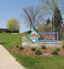
• Village Centre Master Plan, 2010
Regional and County Plans
• Vision 2050: A Regional Land Use and Transportation Plan for Southeastern Wisconsin, 2020
• A Comprehensive Development Plan for Waukesha County, 2009
• Waukesha County Park and Open Space Plan, 2023
State Plans
• 2019-2023 Statewide Comprehensive Outdoor Recreation Plan, 2019
• 2003 Wisconsin State Trails Network Plan, Interactive Trail Network Plan Map updated in 2023
The CORP supports the following outdoor recreation goals and recommendations adopted in the 2015 Comprehensive Plan Update:
Community Resources Goal #3: Adequate and accessible park, recreation and open space facilities*
• To develop the park and open space system in conformance with the adopted Comprehensive Outdoor Recreation Plan.
• To provide well-defined public or private squares and parks and other civic-like places for informal social, civic, pedestrian and recreation activity.
• To designate outdoor recreation sites in a manner that provides ready access by the resident population.
• To use drainage corridors and other natural open space areas as a framework for enhancing other land uses, linking all parks and open spaces to the maximum extent possible.
Health & Safety Goal #1: A community that encourages physical activity and healthy interactions for all ages*
• To consider a variety of approaches to support year-round physical activity including:
• Joint-use agreements to increase public access to recreational facilities
• Development of nature-based recreation opportunities in natural areas like the Tamarack Preserve
• Improvement of outdoor lighting in Village Parks and along Village Trails
• To review existing snow removal policies for multi-use trails and sidewalks.
• To strive for vibrant public places with features and events that encourage people to gather, play and interact.
• To review park activity areas and programing to ensure that recreational opportunities appeal to all age groups.
Community Resources Goal #2: A land use pattern which maintains biodiversity and results in the preservation and wise use of natural resources*
• To preserve primary environmental corridors including, but not limited to, areas of the Menomonee River, Fox River and Tamarack Preserve, in natural, open uses to the extent practicable.
• To preserve secondary environmental corridors and isolated natural resource areas in natural, open uses to the extent practicable.
Transportation Goal #1: A safe, well-maintained and cost-effective transportation network which provides for motor vehicles, pedestrians and bicycles*
• To link trails and paths throughout the Village.
Economic Development Goal #2: A quality of life that nurtures a vibrant, family-friendly community to attract and retain residents and businesses*
• To identify and promote the places that make Menomonee Falls a great place to live, work, play and do business.
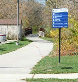
• To review directional signage and consider possible improvements in order to connect residents and visitors to local areas of interest.
* The Village of Menomonee Falls is in the process of updating the Comprehensive Plan. The update is expected to be adopted before the end of 2025.
The Village of Menomonee Falls is located in the northeastern corner of Waukesha County, adjacent to Milwaukee County to the east and Washington County to the north. The Village abuts the Village of Germantown to the north, Milwaukee to the east, the City of Brookfield to the south and the Village of Lisbon to the west. Menomonee Falls also surrounds the Village of Lannon on three sides and the Village of Butler on two sides.
The Village was originally settled near Mill Pond in the middle of the 19th century and experienced growth near the “Four Corners” commercial district in the area now known as Downtown. The Village of Menomonee Falls was incorporated in 1892 and was expanded substantially in 1958 with the annexation of the Town of Menomonee. Much of the Village’s housing and park system was developed in the 1950s and 1960s, when Menomonee Falls had one of the highest growth rates in the state of Wisconsin. Today, growth has slowed to a more manageable rate. The Village covers an area of approximately 33 square miles and is home to roughly 40,000 residents.
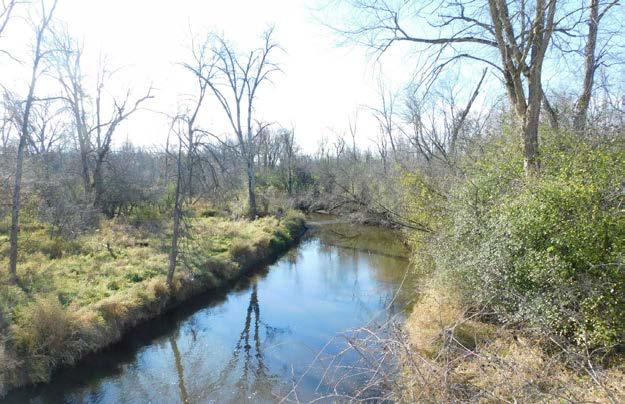
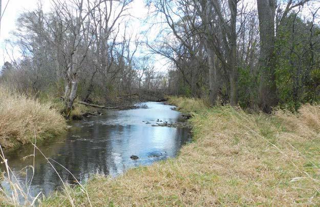
The Menomonee River flows through the northeastern section of the Village. The Village’s older neighborhoods, historic downtown and many of its parklands are located within one mile of the Menomonee River. The Fox River begins in Menomonee Falls and flows north to south in the western section of the Village. The subcontinental divide represents an important hydrological feature for the Village with water on the east side of the divide flowing through the Menomonee River toward Lake Michigan and water on the west side of the divide flowing through the Fox River toward the Mississippi River.
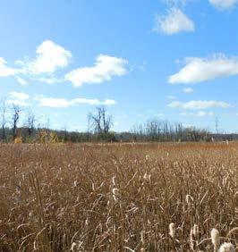
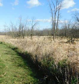
Menomonee Falls’ topography is characterized by a mix of hills, plains and lowland areas. Soils in the Village vary from poorly drained organic soils in and around the Tamarack Preserve to well-drained sandy and clay soils in the eastern and western sections of the Village. Poorly drained and flood-prone areas present potential locations for parkland as they are generally not suited for development. Flood prone areas, which are often located near streams in the Village, make up the bulk of environmental corridors and natural areas in Menomonee Falls.
In total, Southeastern Wisconsin Regional Planning Commission (SEWRPC) and the Wisconsin Department of Natural Resources (DNR) have identified 3,495 acres of primary environmental corridors and 289 acres of secondary environmental corridors in Menomonee Falls. Primary environmental corridors generally lie along major stream valleys and contain almost all of the best remaining wetlands, woodlands and wildlife habitat areas, as well as most of the water bodies and streams associated with floodlands. According to SEWRPC, these corridors contain many of the best remaining potential park sites. Secondary environmental corridors are located along small perennial and intermittent streams. Secondary environmental corridors facilitate surface water drainage and maintain pockets of natural resource features. Environmental corridors and the Village’s estimated 479 acres of isolated resource areas are identified in Map 1.
SEWRPC has also designated natural areas and critical species habitat within the environmental corridors (see Map 2). Natural areas are defined as tracts of land or water that contain intact native plant and animal populations representative of the pre-European-settlement landscape. Critical species habitats are defined as tracts of land or water which support endangered, threatened or rare plant or animal species. Class I Natural Areas (NA-1) are areas of statewide or greater significance, Class II (NA-2) are areas of county-wide or regional significance and Class III (NA-3) are natural areas of local significance.

See page 6 for an explanation of

The local park and trail system has been assembled over the course of several decades as a result of Village leadership, generous private donations, and creative partnerships.
Site Acquisition Details History
Lime Kiln Park Purchase
Village Park Purchase
Mill Pond Park and Plaza Purchase
Riverside Park Purchase
Menomonee River Parkway Dedication
Rotary Park Donation
Willowood Park Purchase
Lime kilns on the west bank of the Menomonee River were abandoned in the 1890s and developed as the beginnings of the local park system
Acquired as the “Bernstein Woods Property” in 1935 in order to develop the land as a park via the New Deal WPA program, expanded and redeveloped starting in 2019
Milling operations utilized water power from the pond starting in the 1840s. Following the removal of the mills, the area was acquired for park use by the mid-20th century and redeveloped in the 1990s
Established in the mid-1950s, Riverside Park has a baseball diamond named after Village President Horace Trenary who presided over the growth of the Village from 3 square miles to 33 square miles
Developed to offer recreational opportunities to new residents as subdivisions turned farm lands into home sites in the 1950s and 1960s
Donated by the Walter Diehnelt family in 1962, Rotary Park was developed along the Menomonee River with help from the Rotary Club
Purchased from Sid Dwyer & Associates in March of 1962, development of the site as an active use park began in 1968
Old Falls Village Purchase
Rivers Edge Park Donation
Library Park (formerly Municipal Park) Purchase
Kiwanis Park Partnership
John Taylor Park Dedication
Centennial Plaza Purchase
Oakwood Park Purchase
Aero Park Purchase
Little League Complex Land Transfer
The Miller-Davidson House is at the core of this special use park which was acquired by the Village in 1965 and has been operated and improved by the Menomonee Falls Historical Society since 1966. The park was formalized in 1972. Since 2023, Friends of Old Falls Village, Inc. has been co-managing the park in conjunction with the Menomonee Falls Historical Society.
Donated to the Village by Mr. and Mrs. Donald Stroh in 1968, the area was formerly known as Parkview Lagoon
Acquired as property for the Municipal Complex in the late 1960s, this site was set aside for park development in the 1970s and includes the Farrenkopf Plaza (dedicated in 2007). The park increased in size in 2013 when the Village bought an adjoining parcel
Acquired and developed in the 1970s through a partnership between the Village and the Kiwanis Club
Named in memory of Menomonee Falls police officer John Taylor, who was killed in the line of duty in 1977, the park was dedicated in 1982
Developed in the early 1990’s on the corner of Appleton Ave. and Main St on a parcel that had been occupied by a fast food restaurant, renovated in 2024
Formerly the Winter Farm, purchased by the Village in 1995 from Herbert Gross and was developed starting in 1996
Acquired in 2012 in southwest Menomonee Falls, Aero Park is being developed as a community park with passive uses, court sports, picnic areas and play structures
Approximately 80 acres in size, transfered to Village from the School District of Menomonee Falls in 2022
Menomonee Falls has also acquired an inventory of undeveloped park and open space lands. These areas represent important opportunities for future expansion and improvement of the park and trail system. Undeveloped park and open space areas include:
• Lilly Creek Parkway – 29 acres, located in southeast Menomonee Falls, envisioned as a designated parkway with a multi-use trail
• Maple Road Park – 13 acres, located in northwest Menomonee Falls, envisioned as a natural area with trails
• Maple Road Preserve – 13 acres, located in northwest Menomonee Falls, envisioned as a natural area that may provide a trail link to the proposed Northwest Area Park from Maple Road
• Menomonee River Preserve – 32 acres, located in southeast Menomonee Falls, envisioned as a natural area that may provide for passive uses like hiking or wildlife viewing
• Northwest Area Park – 71 acres, located in northwest Menomonee Falls, acquired for potential development as a community park
• River Road Park – 2 acres, located in southwest Menomonee Falls, envisioned as a wayside park with a picnic area and paddle sport launch
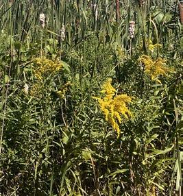
• Tamarack Preserve – 719 acres, located in central Menomonee Falls, envisioned as a passive use park with trails, boardwalks and educational signage
• Tower Hill Park – 22 acres, located in southwest Menomonee Falls, envisioned as a passive use park with hiking trails and a picnic area
• Willowood Community Forest – 141 acres, envisioned as a passive use natural area with a network of marked nature trails
The population of Menomonee Falls continues to change in size and composition. Understanding of recent and anticipated population trends is crucial for evaluating outdoor recreational needs because demand for recreational facilities is influenced by the demographics of the population being served. The following section provides an overview of relevant demographic trends and characteristics of Village residents. The population of the Village was estimated to be 40,099 by the Wisconsin Department of Administration (WDOA) in 2024 which indicates a 4 percent increase from the 2020 Census.
In addition to accommodating the demands of a growing population, the Village’s park and trail system should adequately serve the needs of residents of all ages. Menomonee Falls’ median age remained relatively constant between the 2010 (43.3 years) and 2020 (43.2 years) U.S. Censuses, though it should be noted that the median age recorded in the 2022 American Community Survey (ACS) decreased to 41.9. Since 2010, the Village has seen significant population increases in age groups 35-39, 60-64, and 70-74, while the largest decreases were in the 40-44 and 45-49 age groups. The graph below shows the change in age structure since the year 2010.
to 34 years
35 to 39 years
40 to 44 years
45 to 49 years
50 to 54 years
55 to 59 years
60 to 64 years
65 to 69 years
70 to 74 years
75 to 79 years
80 to 84 years
85 years and over
The US Census Bureau documented 16,271 occupied housing units in Menomonee Falls in 2020; this aligns with WDOA projections, which estimate that the Village will grow to over 18,500 households by 2035. The WDOA projections also suggest that the number of households will increase at a faster rate than the Village’s population as households get smaller. Smaller households are driving residents’ demand for a mix of housing types. The recent residential development pattern in Menomonee Falls reflects changing housing preferences with the construction of apartments, mixed-used projects, and senior living facilities along with single family homes.
• The projected increase of approximately 3,000 residents between 2022 and 2035 will increase the use of and demand for parks, trails, and open spaces.
• Menomonee Falls has traditionally been a community of young families with children. The Village continues to attract young families, with the largest ten-year cohort now being the 30-39 year age group; however, the distribution among all age groups has become more balanced as residents live longer and the Village’s housing stock continues to turn over. These trends suggest increased demand for recreational activities that appeal to young adults, older adults, and children.
• Between 2010 and 2022, the Village’s population of residents over 80 years old increased 20 percent from 2,000 to 2,400. This age group accounted for 5.9 percent of the population in 2010 and 6.4 percent of the (larger) population in 2022. This data suggests some need for recreation facilities which serve the Village’s aging population. Facilities and activities that are ADA compliant and encourage walking and passive recreational pursuits should be considered for this group.
• Residents under the age of 10 made up 12.0 percent of the population in 2022 compared to 11.2 percent of the population in 2010. By the numbers, there were nearly 700 more young children in Menomonee Falls in 2022 compared to 2010. This represents a change from the 2016-2020 version of this plan, which projected a decline in the adolescent population over the coming decade.
• Recent and projected increases in residential development are likely to create housing that is attractive to households and families across all age groups in the years ahead. The increased development of multifamily housing and the trend of smaller lot sizes for new single-family housing are both likely to increase demand for parks, trails and other outdoor public spaces.
The Village collected 2,745 survey responses as part of the 2025 Comprehensive Plan Update process. Overall, those surveyed reported satisfaction with the Village’s parks and recreational facilities and provided recommendations for future improvement. Figure 2 highlights survey responses to the question, “What are the top three benefits of parks and outdoor recreation in Menomonee Falls?”
Respondents selected up to three benefits, answers categorized as “Other” comprised 1% of responses.
Seventy-four percent (74%) of survey respondents stated that they currently use the Village’s parks and/ or recreational facilities. The 637 respondents who reported that they do not use parks or facilities cited reasons including distance from home (19%), safety concerns (18%), and parks lacking desirable features (17%). Table 2 describes how respondents rated parks and recreation amenities in Menomonee Falls— the Village’s Parks scored highly, with 96% of responses reporting “excellent” or “satisfactory” ratings.
The 2024 survey provided an opportunity for respondents to rate recent improvements to Village Park, which 58% of respondents ranked as one of their top three favorite parks in Menomonee Falls. Amenities with the highest percentages of “satisfactory” ratings included Park Maintenance (81%), the Play Area (76%), Concerts (72%), and Festivals (70%). Survey responses indicate that some amenities still “need improvement,” including Parking Availability (32%), Restroom Access (28%), and Multi-Use Trails (27%).
The survey also polled respondents about their typical modes of transportation to common destinations like places of work, essential services, shopping and parks. Fifty-six percent (56%) recorded walking as a regular mode of transportation; thirty-one percent (31%) reported frequent bicycle use.
Selected trends and recommendations from community survey responses:
• Some parks may benefit from additional signage and branding.
• Park events and programming are highly supported, and many would like to see even more.
• Open comments indicate a strong demand for more bike and pedestrian infrastructure throughout the Village; considering that distance from parks was the most cited reason for those who do not use park facilities, expanding the trail network with focus on connections to parks could increase access.
• Some comments about Village Park suggest a need for amenities intended for different youth age groups; sports fields, spaces for older youth/teenagers, and water features were requested for various parks.
Favorite Parks / Facilities
1. Village Park (58%)
2. Bugline Trail (48%)
3. Menomonee Park (39%)
4. Oakwood Park (26%)
5. Rotary Park (25%)
Desirable Park Amenities
1. Multi-Use Paved Trails (39%)
2. Restrooms (33%)
3. Natural Surface Trails (25%)
4. Water/Splash Features (24%)
5. Canoe/Kayak Facilities (24%)
1. Expanding trail network (40%)
2. Connecting to neighboring communities (36%)
3. Installing lighting along more trails (28%)
4. Parkway trail connections (26%)
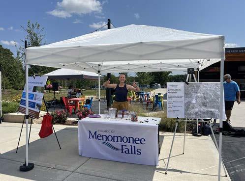
The project team set up booths at community events to garner additional public input. The first pop-up was hosted on July 31, 2024 at the Farmer’s Market in Village Park. Community members were asked to vote for their “three highest park priorities”. The results included:
New programming for existing parks - 11 votes
Installing new amenities at existing parks - 10 votes
Developing / acquiring new parks - 10 votes
Maintaining existing parks - 7 votes
Enhancing park ecosystems - 6 votes
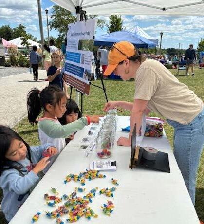
The second pop-up was hosted on August 8, 2024 during the Menomonee Falls Kids Festival in Village Park. Over 250 attendees, primarily kids, were asked the question, “What is your favorite thing to do at the Village’s parks?” and allowed to vote for up to three amenities. The results included the following categories:
Playgrounds - 165 votes (22%)
Events / Concerts - 151 votes (20%)
Walking / Biking Trails - 123 votes (16%)
Baseball - 91 votes (12%)
Pickleball - 74 votes (10%)
Picnics - 72 votes (9%)
Other - 86 votes (11%)*
*Some of the amenities identified in the “Other” category included Soccer, the Splash Pad, Football, Tennis, Volleyball, Basketball, and Movies in the Park.
The Public Input Map was available online from September 18th, 2024 to November 15th, 2024 and received 625 comments providing key insight into the Village’s existing conditions and opportunities for growth.
Input Map comments expressed significant appreciation for the Village’s park system, highlighting Village Park, Aero Park, and Lime Kiln Park; Old Falls Village was also highly rated for its historical significance and educational opportunities. The library is one of the most valued community assets for its wide range of events, programming, and resources. Many comments provided positive feedback about community spaces and supported more art installations and public facilities (with frequent mentions of community gardens).
Input Map comments align with comments from the Community Survey in requests for more walking and biking trails with connections to parks and wayfinding signage. Future extensions of the pedestrian
trail network should prioritize routes to schools, connections between parks, gaps in the Bugline and Menomonee River parkway trails, and points of interest. Respondents also identified opportunities for future parks and desirable amenities including sports fields, tennis and pickleball courts, and playgrounds in neighborhoods that are not within walking distance of larger parks. The former site of Jefferson Middle School was frequently mentioned as an ideal location for a future neighborhood park.
Many comments emphasize the importance of preserving natural spaces for wildlife, including wetlands, old growth forests, and wooded areas; there is also support for prairie restoration projects and nature trails with overlooks in designated park preserves.
Interviews related to the parks and recreation facilities included Village Community Education and Recreation staff, representatives from local recreation leagues and organizations, and the athletic directors for Menomonee Falls High School and Hamilton High School.
• Strengths – Stakeholders report that the Village’s outdoor recreation facilities are well maintained. The Village provides a good variety of programming and events for the community and fosters strong partnerships with local organizations.
• Challenges – There are currently not enough baseball fields to meet the youth program’s current demand. Limited indoor facilities restrict available recreational activities during winter months. Some facilities, like the Little League Complex, are in need of larger-scale repairs and improvements.
• Opportunities – There are opportunities to improve accessibility in the Village’s parks with wheelchairfriendly paths and adaptive sports/playground equipment. Pickleball, soccer, and inclusive fitness programming are increasing in popularity. New facilities and improvements to existing ones could attract more tournaments and visitors, building community and supporting the local economy.
• Recommendations – The Village should collaborate with local organizations and school districts to address facility needs, especially those that prioritize accessibility and year-round indoor uses. New parks and recreational facilities should reflect public demand (popular sports and events) and implement inclusive design strategies.
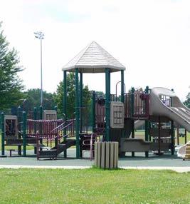
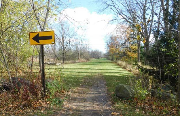
Menomonee Falls manages fifteen developed parks, one developed parkway and one trail corridor segment providing 370 acres of accessible recreational space. The Village also owns 930 acres in two designated natural preserves, a 79-acre Little League complex (managed by the Menomonee Falls Little League), and 183 acres in seven other undeveloped/potential park sites for a total of 1,562 acres of open space and recreational sites. Recreational areas at nine public school sites provide about 217 acres of additional recreational space. Menomonee Park, which is operated by Waukesha County, is a large, natural resourceoriented park located along the western boundary of the Village. The County also maintains the Bugline Trail within Menomonee Falls. Three golf courses are located in the Village— Silver Spring Country Club and Wanaki Golf Course are privately operated and open to the public; North Hills Country Club is a membersonly course.
There are over 2,400 acres of public outdoor recreation and open space within the Village of Menomonee Falls. Five organizations own and manage publicly accessible recreation areas in the Village. Ownership and acreage of local recreation areas are summarized in Figure 3 and Table 3.
Village of Menomonee Falls
Waukesha County
Waukesha County
School District of Menomonee Falls
School District of Menomonee Falls
Hamilton School District
Hamilton School District
Waukesha County Land Conservancy
Waukesha County Land Conservancy
The following section provides existing conditions summaries for outdoor recreation sites managed by the Village. The summaries describe the site/existing facilities and identify site issues related to site design, amenities and conditions. Issues identified in these summaries are comprised of unresolved concerns identified in the 2016-2020 CORP, concerns raised by Village staff who maintain the parks, and maintenance issues identified by staff who walked through each location in preparation for this plan.
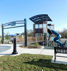
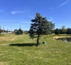
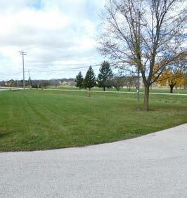
Aero Park
Location & History
Aero Park is an 80 acre community park which is under development on a site located east of Lannon Road and north of Lisbon Road in the southwest area of Menomonee Falls.
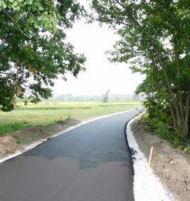
The Aero Park property was used for an air strip from 1948 to 2004. In 2012, the property was acquired by the Village, and the first phase of construction for the park (grading and installation of an asphalt trail loop boardwalk) was completed in 2023. The Village is planning for a second phase of construction in 2025.
Current Conditions
• Site is graded for park development; in 2023, the Village built an asphalt trail loop connecting to subdivisions and installed trees, wetland vegetation, and prairie plantings.
• The eastern side of the site is predominantly classified as wetlands. Large areas of wetland and woodland vegetation will remain undisturbed within the park project.
Anticipated Programming and Site Use
Programs & Events
• Pickleball leagues
• Basketball programs
• Nature-based recreation
Site Photos
• Fit in the Parks
• Community events (beer gardens, popup movie nights, etc)
• Lack of a park driveway and parking area
• Play area, sport courts, restrooms, and shelters still need to be constructed
• Project completion will likely take several years, and many neighboring residents would like a faster timeline
Primary Recreational Uses (anticipated)
• Leisure resting
• Walking, running
• Picnicking
• Pickleball
• Tennis
• Basketball
• Children’s Play
• Biking
• Birding/nature viewing
• Special Events
Location & History
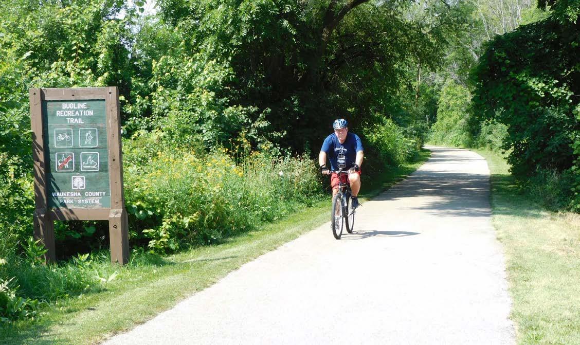
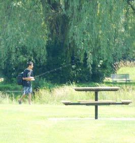
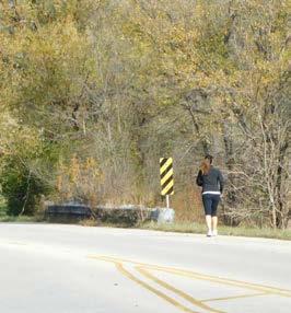
The Village-maintained portion of the Bugline Trail runs through a 0.8 acre property between Grand Avenue and the Menomonee River, and a public access easement extending east to Water Street in the north area of Menomonee Falls.
This former railroad right-of-way was established in the 1890s and redeveloped as an asphalt multi-use trail in 2016. Waukesha County maintains the Bugline Trail to the west of this site.
Current Conditions
• This asphalt path is 10 feet wide and this section of the Bugline Trail includes a steel bridge at the Menomonee River
• The Village installed a bike/pedestrian wayfinding sign at the eastern end of the trail in 2022.
Programing and Site Use
Programs & Events
• Biking and running clubs
• Annual Menomonee River Clean-up
Site Photos
• There is no trail connection between the Bugline Trail and the Menomonee River Parkway trail to the north or the Mill Pond Park trail to the south
• Public parking access is limited at Water Street and the street is signed for 2-hour parking which limits trip time for trail users
• Walking, running
• Biking
• Birding/nature viewing
• Fishing
• Other modes of nonmotorized transportation
Location & History
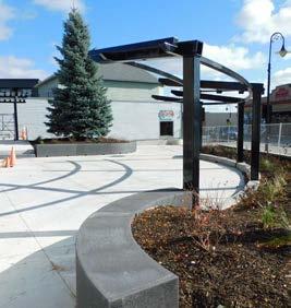
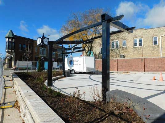
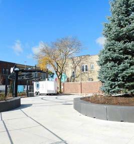
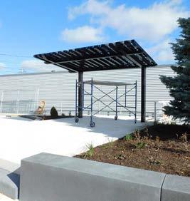
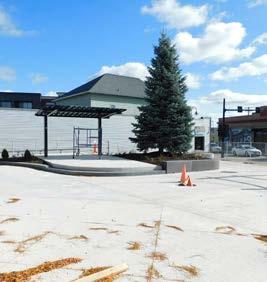
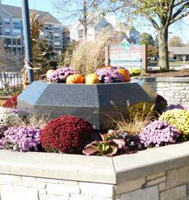
Centennial Plaza is a 0.2 acre park located on the northeast corner of Main Street and Appleton Avenue in the downtown area. The plaza was developed in the early 1990s on a parcel that had been occupied by a fast-food restaurant.
This space is being redeveloped in 2024 to support downtown events with a new concrete vendor area, shade structures, updated seating, lighting installations, a flagpole, and refreshed landscaping. This project is anticipated to be completed in November 2024.
Facilities
• Concrete event space
• Shade structures
• Raised landscape beds with wall seating
• Picnic tables and movable seating
Programing and Site Use
Programs & Events
• Falls Memorial Fest
• Maxwell Street Days
• Downtown Trick or Treat
• Falls Christkindl Market
Site Photos
Issues
• Raised platform for performers/ announcements
• Ornamental clock
• Donor recognition wall
• Little free library
• Immediately adjacent to a busy intersection
• No immediately adjacent retail or restaurant uses to draw the public to the space
Primary Recreational Uses
• Picnicking
• Public art appreciation
• Community gathering space
Location & History
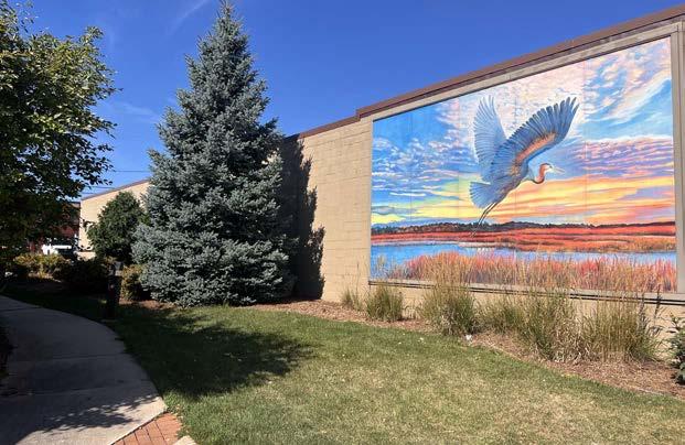
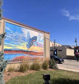
Heron Alley is a 0.1 acre park located on the west side of Appleton Avenue south of Main Street in the downtown area.
Heron Alley was developed in 2013 and 2014 through a combination of public dollars and grant funding. The mural and mini park at Heron Alley replaced a blighted building and created an attractive connection to a new public parking lot.
Existing Conditions Analysis
Facilities
• Paved pathway
• Landscape beds
• Mural
• Lawn open space
• Storm water retention feature
• Bench
Programing and Site Use
Programs & Events
• Mural walk stop
Issues
• Lack of a park sign
• Landscaping is starting to outgrow the space
Primary Recreational Uses
• Leisure resting
• Public art appreciation
• Walking (connecting to parking/other destinations)
Location & History
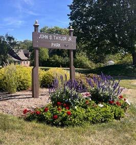
John Taylor Park is a 0.8 acre park located on the east side of Appleton Avenue to west of Mill Street in the downtown area. John Taylor Park was dedicated in 1982 and named in honor of a Village police officer who was killed in the line of duty in 1977.
A 2017 project added a new pathway, bench, landscape beds, memorial marker, flag poles and a brick gathering space.
Facilities
• Lawn open space
• Landscape beds
• Flag poles with lighting
• Park / Downtown signage
• Bench
• Memorial plaque and brick gathering space
Programing and Site Use
Programs & Events
• Police memorial ceremonies
Issues
• Lack of directional signage to Downtown parks and sites
• Lack of pedestrian crossing to public parking area and Village Park across Appleton Avenue
Primary Recreational Uses
• Leisure resting
• Memorial site
• Entry feature to downtown

Location & History
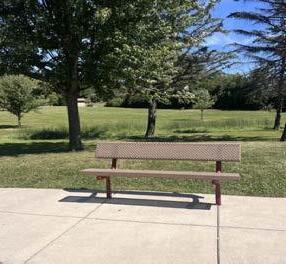
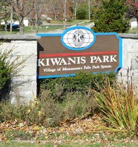
Kiwanis Park is a 3.3 acre park located on the northeast corner of Menomonee Avenue and Town Hall Road in the northwest portion of the Village.
Kiwanis Park was acquired and developed in the 1970s through a partnership between the Village and the Kiwanis Club. The park was originally named Village Green Park. The play area was installed at Kiwanis Park in 2017.
Facilities
• Asphalt trail
• Lawn open space
• Play structure
• Park signage
• Flagpole with lighting
• Benches
• Dedication plaques
• Picnic tables
• Grills
• Shoulder parking
Programs & Events
• Annual Menomonee River Clean-up
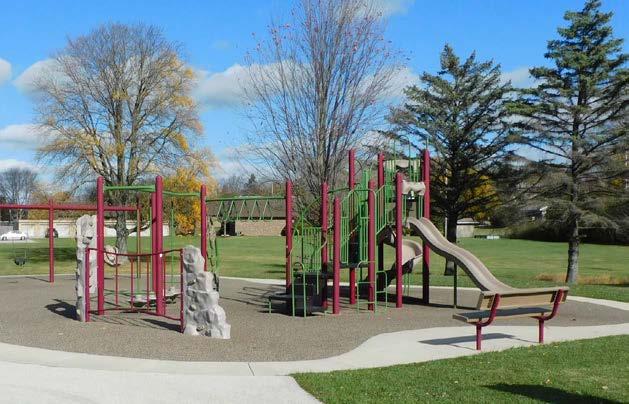
Issues
• Lack of access to/ lack of activities in the north area of park
• Parking area is not clearly designated, no bicycle parking
• Lack of shade trees and drinking fountain near the playground
Primary Recreational Uses
• Leisure resting
• Walking
• Children’s play (play structure)
• Picnicking
• Unstructured field play
• Grilling
Location & History
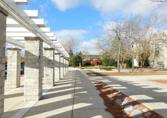
Library Park (formerly Municipal Park) is a 10.8 acre park located east of the Menomonee Falls municipal offices and the Village Public Library.
Library Park was created in the late 1960s and early 1970s from farmlands. The Village acquired an adjacent residential property (to the north) in 2013 expanding the park boundaries into the wooded area along the Menomonee River. The Library Friends native Wisconsin trees were planted in the park during a 2024 community event.
Facilities
• Asphalt trail
• Lawn open space
• Retention pond
• Playground equipment
• Benches
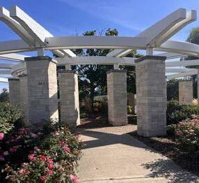
• Pergola with stone seating
• Farrenkopf Plaza (event space)
• Picnic tables
• Future storywalk
Programs & Events
• Annual Menomonee River Clean-up
• Library Truck Day event and other library programming
• Outdoor Storytime (summer)
Issues
• Lack of clearly marked connection to Men. River Parkway
• Northeast parking area not striped, no bicycle parking
• Lack of park sign
• Limited shade near playground equipment
• Worn “nature” paths are not formalized/maintained
• River access could be improved on north side of the park
• Leisure resting
• Unstructured field play
• Picnicking
• Children’s play (playground)
• Walking, running
• Nature viewing
• Bicycling
• Recess (for school next door)
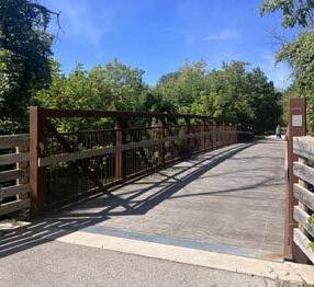
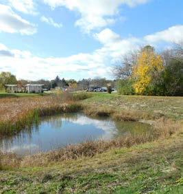
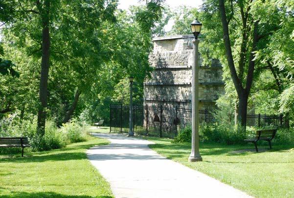
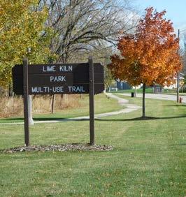
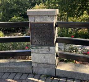
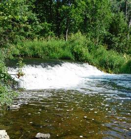
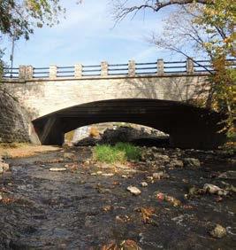
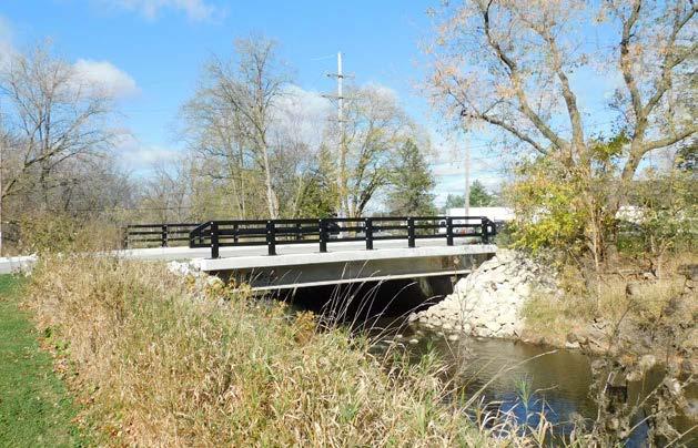
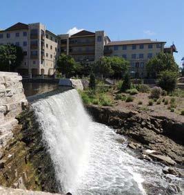
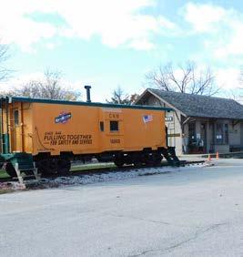
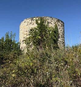
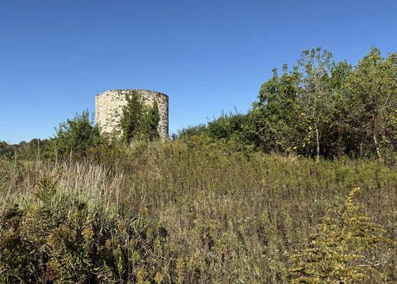
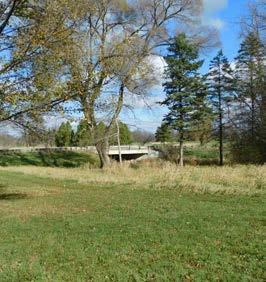
Lime Kiln Park
Location & History
Lime Kiln Park is a 19.1 acre park located along both sides of the Menomonee River in the downtown area. The Menomonee River Trail runs from north to south through the park.
In the late 19th century, lime kilns operated on the west side of the river and a limestone quarry was located on the east side of the river. Operations were abandoned before the turn of the century, and the area became the Village’s first park.
Facilities
• Historic lime kilns
• Asphalt trails
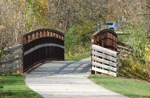
• Pedestrian bridge
• Interpretive plaques
• Benches
• Bike rack
• Trail lighting
• Two parking areas
• River access
• Nature trails
• Dog bag stations
Programing and Site Use
Programs & Events
• Annual Menomonee River Clean-up
• Operation Finally Home 5k
Issues
• Pedestrian bridge needs immediate replacement (2025)
• Inconsistent benches, bollards, railings and light poles
• Interpretive signage located at knee level on boulders
• River view/access is obscured by vegetation overgrowth
• Lacks a direct pedestrian connection to Village Park
Primary Recreational Uses
• Leisure resting
• Nature viewing
• History appreciation
• Walking, Bicycling
• Picnicking
• Photography
• Fishing
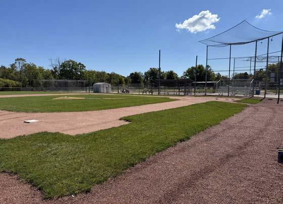
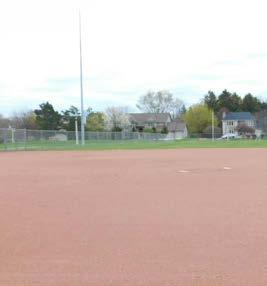
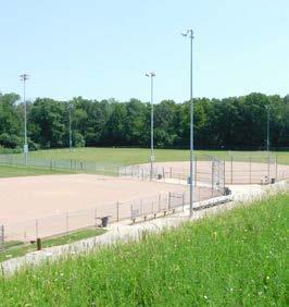
This baseball and softball complex is located on a 80.2 acre site on the north side of Mill Road between Pilgrim Road and Ash Drive.
The complex of baseball, softball, and t-ball fields was developed in the late 1990s and early 2000s and is leased and maintained by the Menomonee Falls Little League organization. Ownership of the site was transferred from the School District of Menomonee Falls to the Village in 2022.
Facilities
• Four “traditional” baseball diamonds (one without an enclosed dugout)
• 2 softball diamonds
• 1 t-ball diamond
Programing and Site Use
Programming & Site Use
• Little League t-ball
• Little League baseball
• Little League softball
• Two “senior” baseball diamonds (enclosed dugouts)
• Parking areas
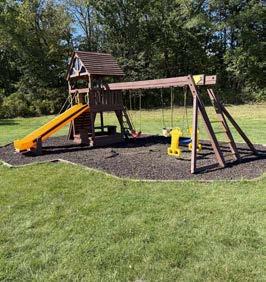
• Concessions / restroom buildings
• Playground
Issues
• Lack of a formal trail connection to Oakwood Park / subdivision to north
• Wide shoulder on Mill Road may not feel safe for parents/children to ride bikes or walk to the complex
• Drive access and parking is closed to public in the off season
• T-ball
• Baseball
• Softball
• Children’s play
• Walking, running
• Restrooms
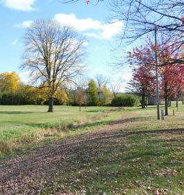
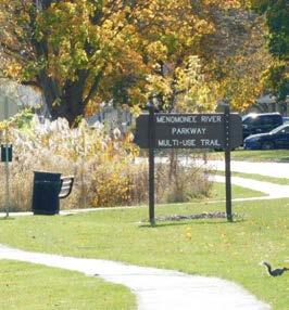
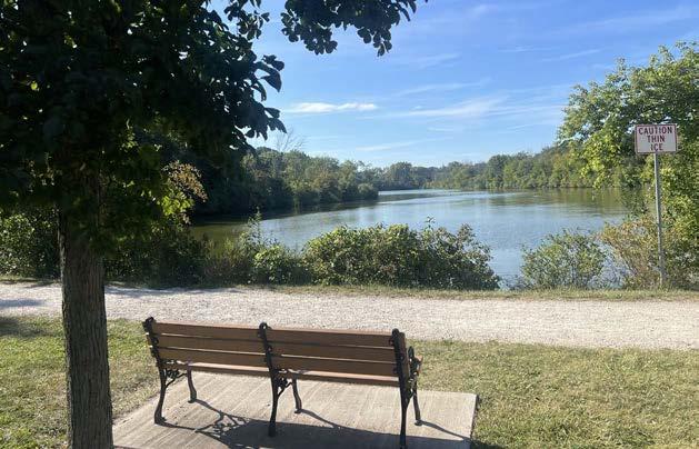
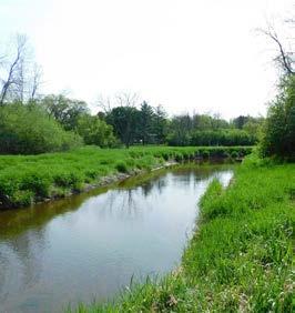
Menomonee River Parkway is a 55.1 acre open space area located along the Menomonee River between Shady Lane (on the west) and Rotary Park (on the east). The Menomonee River Trail follows the river and parkway for approximately 2.6 miles before continuing into Rotary Park.
The parkway was developed in the late 1950s and early 1960s as surrounding neighborhoods were being built.
Facilities
• Asphalt trail
• Lawn open space
• Natural areas
• Park signage
• Lighting (some areas)
• Ball diamond
Programs & Events
• Sledding hill
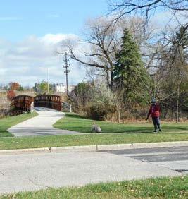
• Soccer fields
• Foot bridge
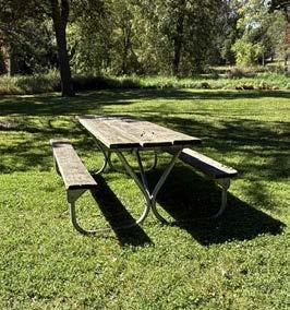
• Picnic tables
• River access
• Annual Menomonee River Clean-up
• Youth soccer
• SDMF Cross Country meets
• Bike/ped wayfinding signs not installed beyond downtown
• Lack of trail lighting may deter evening/winter use
• Trail gaps limit connectivity in north area
• Lack of bicycle parking near activity areas
• Varying width and condition of asphalt trail
• River access needs to be improved in some areas
Primary Recreational Uses
• Nature viewing
• Picnicking
• Walking, running
• Bicycling
• Unstruc tured field play
• Fishing
• Soccer
• Softball, tee-ball
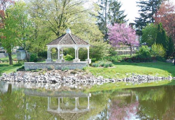
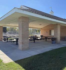
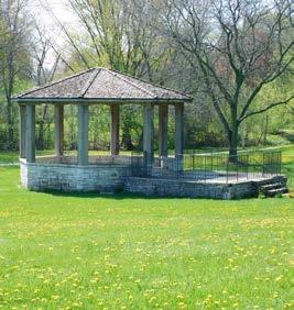
Mill Pond Park & Plaza
Park Description
Location & History
Mill Pond Park and Plaza is a 2.5 acre park located along both sides of the mill pond in the downtown area.
Mill Pond Park was acquired by the Village in the late 1940s and early 1950s along the banks of a pond which was created in the 1800s to power milling operations. The plaza multipurpose area was developed in 1996 as part of the Mill Pond beautification project. The park was expanded and a new parking area was constructed in 2017.
Existing Conditions Analysis
Facilities
• Small amphitheater
• Gazebo
• Asphalt trail
• River access
• Picnic tables
• Shelter with restrooms, kitchen and large grill
• Benches
• Angled parking & parking lot
• Drinking fountain
Programing and Site Use
Programs & Events
• Kids Fishing Derby
• Falls Memorial Fest / Lucky Ducky Derby
Site Photos
• Picnic on the Plaza
• Annual Men. River Clean-up
• Falls Harvest Festival
Issues
• Lack of a direct connection to Lime Kiln Park
• Varying condition of benches and picnic tables
• River access could be improved on the west side of the Mill Pond
Primary Recreational Uses
• Leisure resting
• Walking, running
• Bicycling
• Fishing
• Picnicking
• Photography
• Special events
Park Description
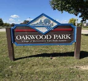
Location & History
Oakwood Park is a 53.6 acre multipurpose park located west of Lilly Road in the southeast area of the Village.
Oakwood Park was developed on the site of the former Winter Farm. The park property was purchased by the Village in 1995 from Herbert Gross and the development of the park started in 1996 using Willowood Park as a model.
Existing Conditions Analysis
Facilities
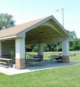
• Sand volleyball
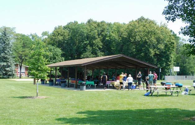
• Picnic shelters
• Asphalt trails
• Pond, fishing pier
• Lawn open space
• Concession area
• Restrooms
• Softball fields
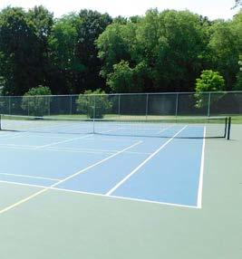
• Basketball, Tennis/ Pickleball courts
• Playground
• Soccer fields
Programing and Site Use
Programs & Events
• Softball leagues
• Summer tennis programs
• Summer soccer camps
• Pickleball leagues
Site Photos
Issues
• Lack of a formal trail connection to Little League Complex
• Underutilized wooded area at south end of park
• Lack of directional signage to park from Mill Road
• Limited ADA accessible parking stalls, no bicycle parking
• Lack of shade trees near playground equipment
Primary Recreational Uses
• Leisure resting
• Walking, running
• Bicycling
• Fishing
• Picnicking
• Tennis
• Restrooms
• Soccer
• Softball
• Basketball
• Pickleball
• Children’s Play
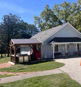
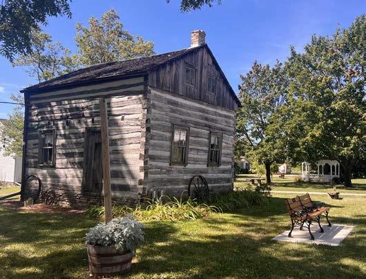
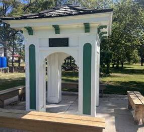
Old Falls Village is a 19.7 acre park located on the northern boundary of Menomonee Falls at the intersection of County-Line Road and Pilgrim Road.
The Village purchased the grounds (which originally included the Miller-Davidson farmstead) in 1965. The Menomonee Falls Historical Society was formed in 1966 to develop and operate the area as a historic park and museum. The park was formalized in 1972. Since 2023, Friends of Old Falls Village, Inc. has been co-managing the park in conjunction with the Menomonee Falls Historical Society.
Facilities
• 9 historic buildings
• Lawn open space
• Picnic areas
• Gazebo, flag pole
• Restrooms
• Asphalt/gravel trails
• Drinking fountain
• Parking lot
• Picnic shelter
• Performance stage
• Historic caboose
• Fire pit
Programing and Site Use
Programs & Events (selected)
• Civil War Encampment
• Revolutionary War Days
Site Photos
• WW II Days
• Classic Car Show
• Beer gardens
• Oktoberfest
• Inconsistent trail surfaces, lack of bicycle parking
• Under-utilized wooded area at south end of property
• Lack of navigational signage within the park
• Lack of a formal trail connection to Cheyenne Drive
• Lack of directional signage to other Village destinations, way-finding lacking from Water Street pedestrian bridge
Primary Recreational Uses
• History reenactments
• Picnicking
• Walking, hiking
• Nature viewing
• Special events
• School tours
• Photography (with fees)
• Beer gardens
• Reservable event spaces
Location & History
Rivers Edge Park is a 32.1 acre park located on the east side of the Menomonee River with access from Fond Du Lac Avenue via Parkview Drive.
This area was formerly called Parkview Lagoon and was part of the Village’s wastewater treatment facility. The land for the park was donated by Mr. and Mrs. Donald Stroh in 1968.
Facilities
• Lawn open space
• Crushed limestone trail
• Benches
• Pond
• Parking lot
• Nature trails
• Dog bag station
Programing and Site Use
Programs & Events
• Annual Menomonee River Clean-up
Site Photos
Issues
• Lack of an ADA accessible entrance from River Park Drive
• Lack of a trail connection to Rotary Park
• Limited river access with overgrown grass and old fencing discouraging users from venturing off the pond loop
• Worn “nature” paths are not formalized/maintained
• Limited parking space
Primary Recreational Uses
• Leisure resting
• Walking, running
• Bicycling
• Fishing
• Picnicking
• Unstruc tured field play
• Nature viewing
• Hiking
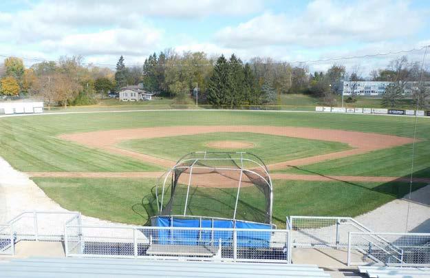
Riverside Park
Location & History
Riverside Park is a 10.3 acre park located on the northeast corner of Pilgrim Road and Menomonee River Parkway in the northern part of the Village.
Riverside Park was donated by the William Rothermel family and developed in the late 1950s. The park’s baseball diamond is named after Village President Horace Trenary who presided over the growth of the Village from 3 miles2 to 33 miles2.
Facilities
• Baseball diamond
• Grandstand
• Concession stand
• Lawn open space
• Picnic tables
• Flagpole with lighting
• Parking lots
• Scoreboard
• Falls Area Food Pantry
Programs & Events
• SDMF baseball
• Menomonee Falls Lakers baseball
• Menomonee Falls Little League baseball

Issues
• Lack of striping for crosswalks to Menomonee River Trail
• Lack of a park sign, activity area east of ball diamond
• Parking area in need of re-striping, no bicycle parking
• Restrooms are not open for year-round public use (offseason and trail users are not accommodated)
• No signage for the paddle launch ramp (installed in 2018)
Primary Recreational Uses
• Baseball
• Picnicking
• Leisure resting
• Paddling
• Fishing
Location & History
Rotary Park is a 36.5 acre park located on both sides of the Menomonee River with parking access from Mac Arthur Drive and Fond Du Lac Avenue.
The property that became Rotary Park was donated by the Walter Dienhalt family in 1962. The Menomonee Falls Rotary Club donated two picnic shelters for the park, one on each side of the Menomonee River.
Facilities
• Lawn open space
• Asphalt trails
• Pedestrian bridge
• Picnic shelters
• Sand volleyball
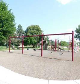
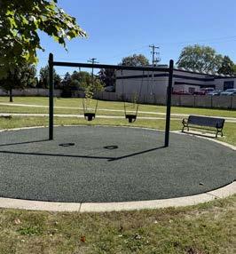
• Playground
• Barbecue pit
• Fireplace
• Horseshoe pits
• Parking lots
• Restrooms
• River access
Programing and Site Use
Programs & Events
• Annual Menomonee River Clean-up
• SDMF cross country meets
Site Photos
Issues
• Entrance off Fond Du Lac Avenue is difficult to see
• Lack of way-finding signage to other Village destinations
• Inconsistent trail width and condition, no bicycle parking
• Lack of a direct connection between Fond Du Lac multi-use trail and Menomonee River Trail
• River access could be improved
• Leisure resting
• Nature viewing
• Picnicking, special events
• Walking, running, bicycling
• Unstruc tured field play
• Fishing
• Children’s play (playground)
• Volleyball, softball
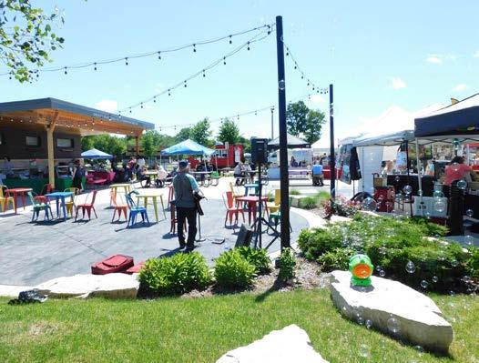
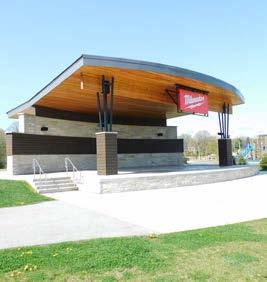
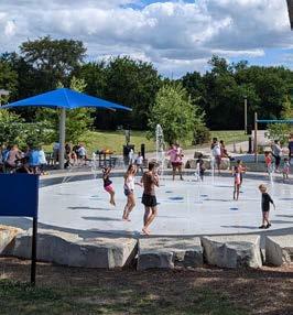
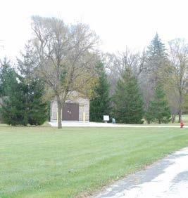
Location & History
Village Park is a 18.3 acre community park located near the intersection of Appleton Avenue and Garfield Drive in the downtown area. The park was purchased in 1935 from the Bernstein family and originally known as the Bernstein Woods property. The Village Park band stand was constructed in the late 1930s as a Works Progress Administration project.
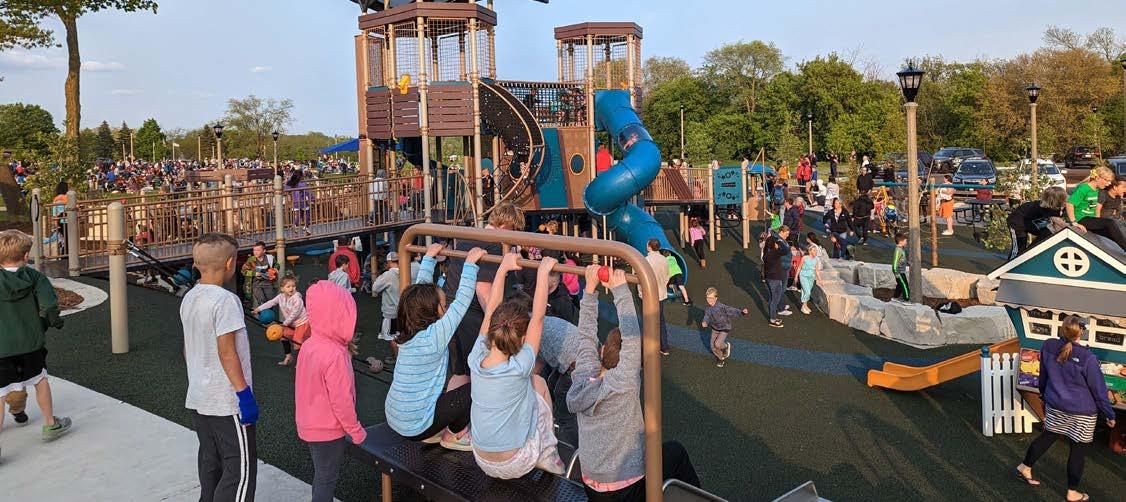
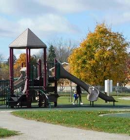
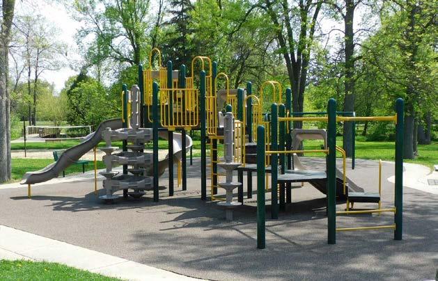
Major renovations since 2020 transformed the park into a community event space and added a multi-use plaza, performance amphitheater, accessible play/ splash pad area, and more.
Facilities
• Asphalt trails
• Restrooms
• Play structure
• Band stand, lawn
• Flag pole / memorial
• Multi-use plaza
Programing and Site Use
Programs & Events
• Summer Concert Series
• Farmers Market
• Family Movie Nights
Site Photos
• Performance stage
• Great lawn
• All-children’s play area
• Splash pad
• Picnic shelters
• Pickleball/tennis courts
• Beer garden
• Restroom capacity during major events
• Lack of permanent serving structure for the beer garden
• Condition / width of asphalt trails on the park’s south end
• Long-term maintenance for historic bandstand
• Poor road condition and lack of sidewalk along Optimist Way
• Concerns with middle school students interfering with family enjoyment of the play area
• Vandalism
• Beer garden
• Falls Lavender Fest
• Kids Fest
• National Night Out
• Leisure resting
• Picnicking
• Walking, running
• Children’s play
• Nature viewing
• Special events
• Pickleball / tennis
• Community gathering
• Farmers markets / vendor fairs
• Reservable event space
Willowood Park
Location & History
Willowood Park is a 26.9 acre park located near Silver Spring Drive and Badger Drive in the southeastern area of the Village. The park adjoins to the undeveloped lands of the Willowood Community Forest.
The Willowood Park and Community Forest property was purchased by the Village from Sid Dwyer & Associated in 1962 and development of the park began in 1968. The ball fields and shelters were constructed by Village staff.
Facilities
• Lawn open space
• Soccer fields
• Sand volleyball
• Softball fields
• Tennis/Pickleball courts
• Basketball court
• Asphalt trails
• Parking lots
• Playground
• Wheel-sport area
• Picnic shelters
• Horseshoe pits
Programing and Site Use
Programs & Events
• Softball leagues
• Annual Menomonee River Clean-up
• Youth soccer
Site Photos
Issues
• Horseshoe pits are weedy
• Lack of trail connection to Aberdeen subdivisions
• Some benches and picnic tables in need of maintenance
Primary Recreational Uses
• Walking, leisure resting
• Picnicking, special events
• Unstructured play
• Sand volleyball
• Soccer
• Softball
• Tennis
• Wheel-sports
• Horseshoes
• Fishing
• Children’s play (playground)
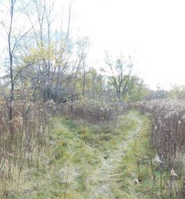
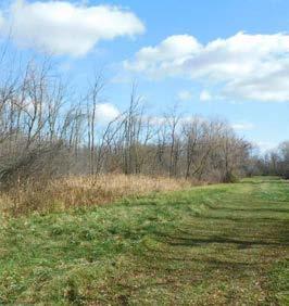
Lilly Creek Parkway (undeveloped)
Location & History
The proposed Lilly Creek Parkway is a 29.3 acre park space located near Lilly Road and Mill Road in Southeast Menomonee Falls. The proposed parkway is adjacent to Lilly Creek and includes a large retention pond near the intersection of Mill Road and Lilly Road.
The parkway area was acquired by the Village of Menomonee Falls in the 1990s as the surrounding neighborhoods were built.
Current Conditions
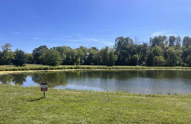
• North of Mill Road, the parkway extends for about 0.5 miles with grass open areas along Lilly Creek
• South of Mill Road, an open area includes a detention pond (often used for fishing) with a mowed perimeter, a picnic table, and a refuse container
Access and Potential Facilities
Site Access
• Shoulder parking along Mill Road west of Lilly Road
• Wide shoulder/bike lane along Lilly Road
• Multi-use trail along Mill Road (east)
Site Photos
Issues
• Lack of park sign(s) to designate this area is a public park site
• Existing parking area (gavel shoulder) along Mill Road is limited and is not formally dedicated
• The wetland area on the parkway’s southern end could present challenges for access/trail building
Potential Facilities (future)
• Nature trails
• Fishing pier
• Benches
• Designated parking area
• Interpretive signage
• Mowed trails and woodchip trails
Maple Road Park (undeveloped)
Location & History
Maple Road Park is a 13.2 acre potential park site located along Maple Road, north of Chistman Road in the northwest area of Menomonee Falls.
The Maple Road Park property was acquired by the Village of Menomonee Falls in the 1960s as the subdivision to the east was constructed. The property was formerly planned to be Kiwanis Park until the early 1990s when Village Green Park was renamed Kiwanis Park.
Current Conditions
• A mix of grass open space, shrubs and trees grow on the site
• The majority of the site is level, but the southern end of the property slopes to a lower elevation
• Informal trails wind through the site created by visitors and deer
Access and Potential Facilities
Site Access
• Existing gravel drive from Maple Road
• Proximity to Maryhill Drive, Christman Road, and the Bugline multi-use trail
Issues
• Dumping and storage of private property on these Village-owned lands has been a problem in the past
Potential Facilities (future)
• Trail connection to Maryhill Drive and the Bug Line Trail
• Nature trails
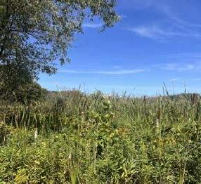
Maple Road Preserve (undeveloped)
Location & History
Maple Road Preserve is a 13.1 acre potential nature preserve and trail corridor site located west of Maple Road, near Chistman Road in the northwest area of Menomonee Falls.
The Maple Road Preserve property was acquired by the Village of Menomonee Falls in 2014 for the development of a storm water retention pond. The site had been utilized for agricultural purposes for several decades.
Current Conditions
• A grassland open space, retention pond, tree line and a stream (Fox River) are located on the site
• The retention pond occupies roughly a third of the site. The pond and adjacent plants provide abundant habitat for birds
Access and Potential Facilities
Site Access
• Gravel shoulder along Maple Road
• Proximity to Christman Road and the Bug Line multi-use trail
Site Photos
• Lacks a preserve sign and a designated parking area
• Possible future trail connection to the Northwest Area park site will require a boardwalk through a wetland area and an easement through the private property to the west
Potential Facilities (future)
• Trail connections to Northwest Area park site and the Bugline Trail
• Designated shoulder parking area
• Picnic area, birding/wildlife interpretive sign
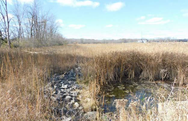
The proposed Menomonee River Preserve is a 32.3 acre area located along the Menomonee River to the east of Parkway Drive, near Mill Road in the southeast area of the Village.
The area was once drained and used for agriculture, but the property has been preserved as a wetland for several decades. The Village acquired this area as housing developed to the west in the early 2000s.
Current Conditions
• The site remains in natural wetland conditions and includes a mix of grass, emergent plant species and trees
• The preserve is designated as a primary environmental corridor and provides habitat a wide variety of animals
Access and Potential Facilities
Site Access
• Street access from Parkway Drive and Mill Road
• Multi-use trail along Mill Road
• Lacks preserve sign to designate this area as a public open space site
• This wetland area presents challenges for public access/trail construction
Potential Facilities (future)
• River access
• Hiking trails
• Designated parking (shoulder)
• Boardwalks
• Interpretive signage
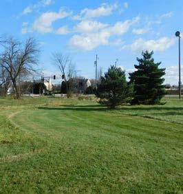
Northwest Area Park (undeveloped)
Northwest Area Park is a 70.9 acre future park site located on the north side of Menomonee Avenue between Lannon Road and Maple Road in the northwest area of Menomonee Falls. The site was acquired by the Village in 2011, fulfilling a recommendation by the 2011- 2015 CORP to acquire land for a community park in the northwest area of the Village.
A portion of this future park site was transferred to the School District of Menomonee Falls in 2022.
Current Conditions
• This large area is relatively flat and includes fields, woodlands and a farmstead site
Access and Potential Facilities
Site Access
• Existing gravel driveway from Menomonee Avenue to farmstead area
• Proximity to Maple Road Park and the Bugline Trail
Site Photos
• Northwest Area Park is not officially named and lacks park sign(s) to designate this area as a public open space site
• There is no proposed timeline for park development
• The site is located outside of the Village’s sewer service area, so development of restrooms could be challenging
Potential Facilities (future)
• There are no existing adopted recommendations for this site, it was acquired following adoption of the 2011-2015 CORP
• This site has space for a wide variety of active and passive uses to be determined in a future park master plan.
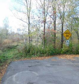
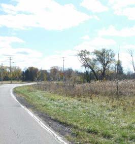
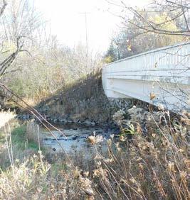
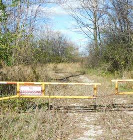
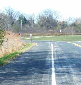
River Road Park (undeveloped)
Location & History
This 1.6 acre proposed wayside park site is located along the Fox River on the south side of Lisbon Road (across from Wanaki Golf Course) in the southwest area of Menomonee Falls.
The Village acquired this site in 2006 for the purpose of constructing a pumping station. The 2016-2020 CORP called for the establishment of a passive use park at the River Road site.
Current Conditions
• This site is located along both sides of the Fox River and currently includes a structurally deficient bridge which is slated for demolition
• The majority of the site is wooded and the remainder is an open lawn space
Programing and Site Use
Site Access
• River Road provides access to the park site from Lisbon Road
• Bridge removal may hinder access to the north side of the river
Site Photos
• Lacks park sign(s) to designate this area as a public open space site
• Park development may need to wait until after the bridge demolition
• Public parking and river access would need to be considered as part of the park development plan
Potential Facilities (future)
• Picnic area an/or benches
• Paddle launch
• Designated parking area
• Interpretive signage (noting the headwaters of the Fox River)
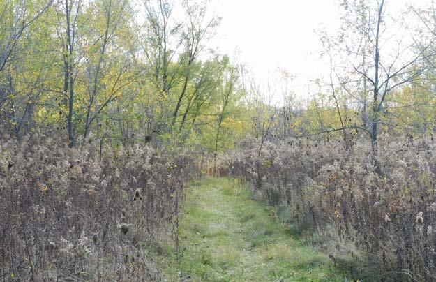
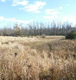
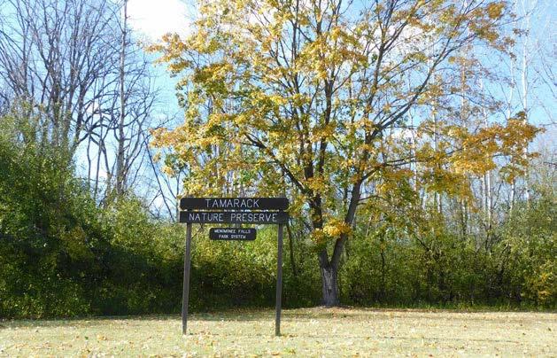
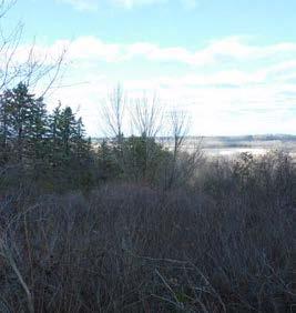
Tamarack Preserve (undeveloped)
Park Description
Location & History
At 788.4 acres, the Tamarack Preserve is by far the largest public open space in the Village, accounting for over half the Village’s park and open space property. The Tamarack Preserve is the heart of an environmental corridor stretching from Menomonee Avenue to Silver Spring Drive.
Portions of this wetland and woodland area have been owned by the Village for decades, and the area has been designated as public recreational land since 1994.
Existing Conditions Analysis
Current Conditions
• Village owned portions of the Tamarack Preserve include contiguous wetland properties located both to the north and south of Good Hope Road.
• Many areas of the preserve are relatively dry and suitable for passive recreation
Programing and Site Use
Site Access
• Paved parking area off of Shady Lane
• Gravel access drive from Good Hope
• Paved turnaround and gravel driveway access from Mill Road
Site Photos
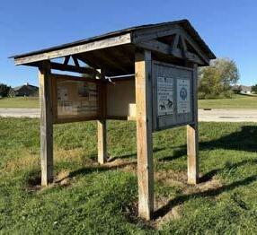
• Despite the Tamarack’s dedication as a public preserve, the recreational opportunities in and around the preserve are limited to a stretch of multi-use trail and an information kiosk
• Trail and amenity development will require boardwalks in low-lying areas of the Tamarack Preserve
• Recreational use should be balanced with nature preservation
Potential Facilities (future)
• Nature trail connection between Overlook Trail and Edelweiss Lane (boardwalk would be necessary for some areas)
• Birding/nature viewing platform, interpretive signage
• Formalize access and parking at Good Hope Road
Tower Hill Park (undeveloped)
Park Description
Location & History
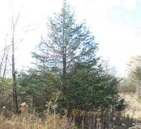
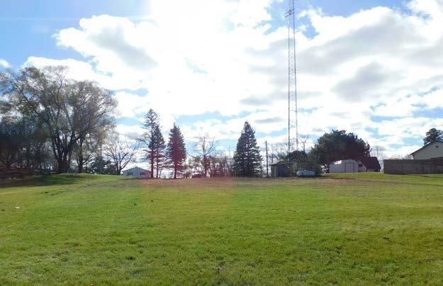
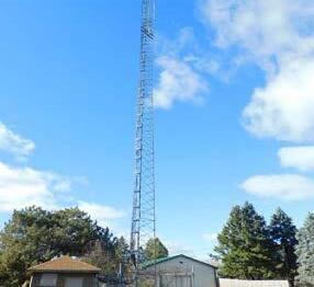
Tower Hill Park is a 22.4 acre potential park site located on a hilltop on the north side of Mill Road in the southwest area of Menomonee Falls.
The Tower Hill property has been owned by the Village and identified as a public park site since at least 1973 when it was included in the Village’s first adopted Master Plan. A radio tower and small service building are located on the property.
Existing Conditions Analysis
Current Conditions
• The Tower Hill site includes a lawn open space and gravel parking area overlooking a mix of grass, brush and trees along the downslope to the north.
• Spruce trees grow on the hill and a grove of broad leaf trees grows at the hill’s base
Programing and Site Use
Site Access
• The paved driveway from Mill Road terminates at a gravel parking area
• Future trail connections to the Fox River would require easements over private lands
Site Photos
• Lacks park sign(s) to designate this area as a public open space
• Development of a sledding area has potential, but will require vegetation clearing and a separated route to walk uphill
• The park is located in an area outside of anticipated public sewer service areas, so development as a traditional neighborhood park may not be appropriate
Potential Facilities (future)
• Nature trails, picnic tables
• Parking lot improvements
• Interpretive signage
Park Description
Location & History
This 141.9 acre site is located south and east of Willowood Park between Silver Spring Drive and Lisbon Road in southeast Menomonee Falls.
Many of the properties in the Willowood Community Forest have been owned by the Village for decades. In accordance with past CORP recommendations, adjacent private properties have been acquired over time.
Existing Conditions Analysis
Current Conditions
• Willowood Forest includes upland and lowland (often wet) areas with vegetation ranging from grass and brush to mature trees
• Deer paths and other informal trails are found throughout the preserve
• Intermittent streams flow north to Lilly Creek
Programing and Site Use
Site Access
• There is an informal public trail access at the south end of Willowood Park
• A grass trail is bisects the preserve between El Rio Drive and Dolphin Drive
Site Photos
• Despite Willowood Community Forest’s designation as a public open space, recreational opportunities are limited to a few informal access trails
• Lacks a park sign(s), and littering is an issue in the new area immediately south of Willowood Park
• Recreational use should be balanced with nature preservation
Potential Facilities (future)
• Formalized nature trail loops
• Signage for the existing grass trail between El Rio Drive and Dolphin Drive
• Birding/nature interpretive signage

School grounds provide a variety of recreational facilities and are usually open to the public. Public schools in the Village are in both the Menomonee Falls and Hamilton school districts. Recreational amenities include open lawn space, playground equipment and sports fields/courts. The estimated combined recreation space on school sites totals approximately 242 acres.
Menomonee Falls Community
The Community Center is located on Margaret Street and is connected to Riverside Elementary School. The Community Center is run by the Menomonee Falls School District and houses a teen center, a senior center, and the Recreation Department. The Community Center provides meeting space for other community groups and has a gymnasium for recreation.
The School District of Menomonee Falls has approved a renovation and expansion of the Community Center to be constructed in 2025 which will include a new gymnasium, fitness center, and more classrooms for CE & Recreation programs.
Menomonee
This site consists of nearly 40 acres on Franklin Drive and Merrimac Drive in the northeastern portion of the Village. The site features a football field/stadium and concession stand, a running track, tennis courts, an indoor pool, 3 soccer fields, 1 baseball and 1 softball diamond, basketball courts and two practice football fields.
North Middle School
This 5.8-acre recreation area is located near the corner of Appleton Avenue and Main Street adjacent to Village Park. The site includes an indoor pool, a running track, a football practice field, and areas for basketball and soccer.
Riverside Elementary School
This area contains 3.1 acres of recreational space on Margaret Road near the Menomonee Falls Municipal Complex. The site features a modular playground, basketball hoops, a nature area with a bench grouping for teaching, a small bridge, and other benches. The site also includes a soccer field, an open play field and a large concrete play area.
Shady Lane School
This 4.3-acre recreation area is located on Shady Lane just northwest of Downtown. It features playground equipment, a softball diamond, a basketball hoop, benches and picnic tables.
Thomas Jefferson Site
This 19.3-acre recreational area is located on LaVergne Avenue adjacent to the Tamarack Preserve. The site features open green space, a baseball diamond, and a gravel parking area.
Valley View Elementary School
This area contains 17.3 acres of recreational space on Town Hall Road just south of Menomonee Avenue. It includes playground equipment, a softball diamond, areas for soccer and basketball and a nature area.
Marcy Elementary School
This 7.3-acre site on the corner of Lisbon Road and Marcy Road in the far southern portion of Menomonee Falls contains playground equipment, basketball hoops, and soccer fields.
The Hamilton School District owns a 70.5-acre site near the intersection of Silver Spring Drive and Clover Lane in the southern portion of Menomonee Falls. The site is currently being utilized as an agricultural field.
This 4.3-acre site is located on Town Line Road in the far west portion of Menomonee Falls. The site features playground equipment and paved areas for basketball.
Waukesha County owns and operates two recreational sites in Menomonee Falls. These areas offer unique recreational amenities including an archery range, swimming beach, and a regional multi-use trail. In recent years, Waukesha County has been acquiring land along the Fox River supporting the long-term goal of developing a greenway that will extend from the Bug Line trail south into Brookfield.
Waukesha County maintains 2.1 miles of the Bugline Trail in Menomonee Falls. The Bugline Trail is a ten-footwide paved recreational trail that follows the corridor of the former Chicago, Milwaukee, St. Paul and Pacific Railroad right-of-way for 16 miles from Menomonee Falls to the Village of Merton.
This county-owned park includes approximately 464 acres on Town Line Road within the Village of Menomonee Falls and the Village of Lannon. The park features camping with seven reservable group campsites and 30 non-reservable family campsites. The park contains picnic areas, including three picnic shelters with grills, tables, pit toilets, and sand volleyball, with the recent addition of a fenced-in dog exercise area. Another feature is 4.5 miles of nature trails allowing hiking and biking and cross-country skiing and snowshoeing in the winter. Also included is a section of the Bugline Recreation Trail, and a bridle trail that connects with the multi-use Bugline Trail. The park offers several other activities including archery and sledding.
The park includes a 16-acre quarry lake with a swimming beach, a rentable beach house that can hold up to 40 people, a concession stand, and an accessible fishing pier. The park’s beach house recently added a Tap Yard beer garden location, partnering with local breweries to host family-friendly events. Boat rentals (nonmotorized or electric motors only) and a carry-in watercraft launch site are also available. Scuba diving in the lake is permitted with a permit and release form.
The Camp Pow Wow Lodge is a unique area in Menomonee Park specifically for physically and mentally challenged citizens of Waukesha County. This summer camp is operated by the Waukesha County Association for the Rights of Citizens with Handicaps (ARCH), which organizes outdoor recreational programs and learning experiences. The lodge is available for rent when the camp is not in session (September through May) and can accommodate 150 people, has restrooms, a kitchen, fireplace, and patio. The Recreation Center can also be rented and can accommodate 100 people during the day and can sleep 40 people. It has a kitchen and a meeting room.
North Hills Country Club
This 18-hole private golf course is located on the Menomonee River near the intersection of Good Hope Road and Appleton Avenue. The site is approximately 135 acres.
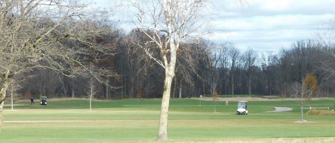
Open to the public and located in the southwest quadrant of Menomonee Falls between Silver Spring Drive and Mill Road, this 18-hole course offers a club house, banquet facilities, a restaurant, and a pro shop. The golf course is situated on approximately 213 acres of land which has been approved for a future planned residential development with single family and two-family homes.
Formerly operated by Waukesha County, this golf course is located on a 148-acre property near the intersection of Lisbon Road and Lannon Road, and has been in private ownership since 2020. The clubhouse has been renovated to include a bar/restaurant, and it is being expanded in 2024 to add indoor golf simulators.
Waukesha Land Conservancy, a non-profit group, owns a 148-acre parcel adjacent to the Tamarack Preserve and a 15-acre parcel in northern Menomonee Falls. These parcels are set aside for preservation and used for passive recreation.
The Tri-County YMCA serves people of all ages in Menomonee Falls, Germantown, Sussex, and the other communities in the northwestern area of the Milwaukee region. The YMCA site includes approximately 2.7 acres of outdoor recreation space including multipurpose athletic fields, a picnic shelter and a vegetable garden.
Norberg Farm is a private horse stable located in the Village near the intersection of Lisbon Road and Lannon Road. This stable offers horse riding lessons, boarding, and training.

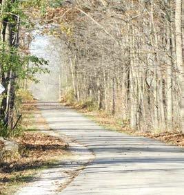
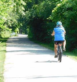
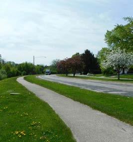
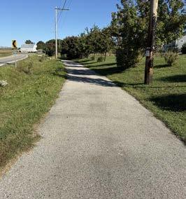
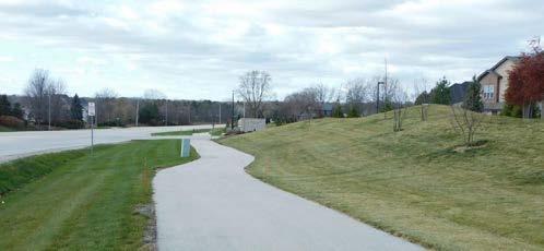
The Village of Menomonee Falls has approximately 23.8 miles of multi-use paved paths and over 13.5 miles of wide paved shoulders along major streets. Recent multi-use trail projects along arterial streets include the completion of a trail along those near the Aero Park, Tamarind, Brookdale Estates, and Bella Vista Estates subdivisions. The Village also maintains roughly 8.2 miles of multi-use asphalt trails within park lands. Multiuse trails range from 3 feet to 10 feet wide, depending on conditions and location. The Village maintains the trails but does not plow snow on the trails in winter and does not require adjoining properties to perform any maintenance. Additionally, much of the Village is connected by sidewalks, especially in the northeastern quadrant.
This 0.5 mile multi-use paved trail is located along the west side of Dolphin Drive between Van Buren Drive and the El Rio Drive path in the Willowood Preserve. Dolphin Drive Trail connects to two marked crosswalks which lead to the nearby Aberdeen subdivisions. Two designated parking areas are also located immediately adjacent to the trail.
This 0.6 mile multi-use off-road trail runs along the south side of Main Street between Stanley Drive and Old Orchard Road. The eight-foot-wide asphalt trail was completed in 2014 and includes ramps with detectable warning surfaces.
This 1.5 mile road-separated asphalt trail extends from 124th Street to Rotary Park along Fond Du Lac Avenue in northeast Menomonee Falls. The trail was installed in 2014 in accordance with recommendations in the 20112015 CORP. The Fond Du Lac Trail links users to Dretzka Park and the Oak Leaf Trail system in Milwaukee County.
This trail is a multi-purpose, road-separated paved trail that travels on alternating sides of Good Hope Road from 124th Street to Pilgrim Road stretching approximately 2 miles. The North Hills Neighborhood portion of the trail is landscaped with turnouts, benches, and plantings.
A 1 mile off-road trail is located along the west side of Lilly Road between Hampton Avenue and Silver Spring Drive. Between Silver Spring Drive and Good Hope Road, a nearly 2 mile bike lane continues on the east side of Lilly Road and a nearly 0.3 mile stretch of road-separated multi-purpose trail was constructed near Manhardt Drive in 2019.
A nearly 0.5 mile multi-purpose asphalt trail runs along Lisbon Road between Lannon Road and the Highlands at Aero Park senior living community. This trail was constructed between 2018 and 2021 and it connects to the multi-use trail loop in Aero Park and the sidewalks in the adjacent residential subdivisions.
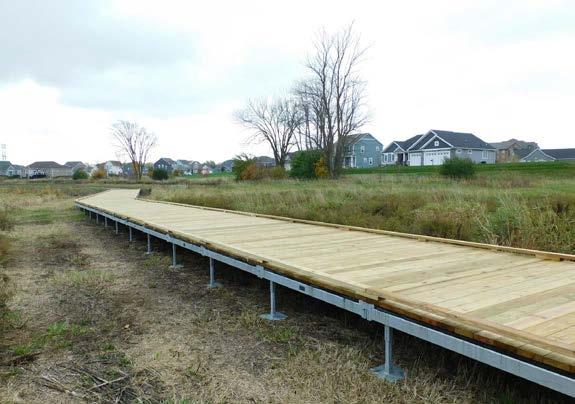
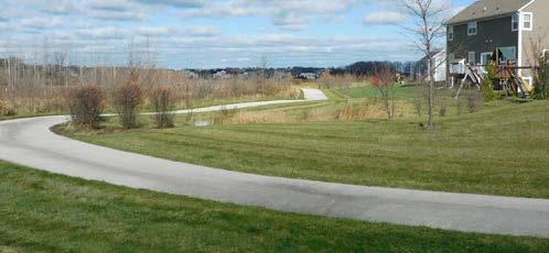
This multi-use paved trail includes four segments and stretches from Shady Lane to Lilly Road, a length of about 3 miles. The trail follows the Menomonee River through parkland and natural areas. The majority of the trail is five feet wide, but 8-foot wide portions are located near Shady Lane, and in Mill Pond Park, Lime Kiln Park, and the west end of Rotary Park. The longest continuous trail segment is 2.2 miles and stretches from Lime Kiln Park to Rotary Park. A trail segment including the Village’s first boardwalk project was completed between Shady Lane and River Crest Drive in 2018.
A 0.9 mile multi-use trail was constructed in 2015 along the north side of Mill Road between Lilly Road and Parkway Drive. This asphalt trail is eight feet wide and extends almost all the way to the Menomonee River. In 2016, a bike lane was marked along the repaved shoulder on the north side of Mill Road between Lilly Road and Aspen Drive.
This multi-use, road-separated trail runs along Pilgrim Road from Lisbon Road to Appleton Avenue, for a total length of about 4.5 miles. The asphalt trail is located on the west side of Pilgrim Road between Lisbon Road and Good Hope Road and is located on both sides of the road between Good Hope Road and Appleton Avenue. Sidewalks continue north to County Line Road for about
another 1.5 miles. A new 0.2 mile trail segment was constructed along the east side of Pilgrim Road near the Brookdale Estates subdivision in 2018.
This 0.9 mile multi-use paved trail runs along the west side of Ridgewood Drive in the Kohl’s Corporate Campus. This trail connects to a 0.1 mile multi-use segment along Continental Parkway and the trail and sidewalk segments along Silver Spring Drive.
A total of 3.5 miles of paved multi-use trails are located along Silver Spring Road from the Fox River to Pilgrim Road. Most of this eight-foot-wide asphalt trail was constructed as Silver Spring Road was redesigned and resurfaced between 2014 and 2015. The Silver Spring Trail combined with existing sidewalks to provide a continuous east-west route of over 2 miles in length.
A nearly 0.9 mile asphalt multi-purpose trail loop was developed starting in 2016 on the west side of the Silver Spring Estates subdivision near Hamilton High School. This loop includes ten-foot-wide segments and sixfoot-wide segments and it ties into the sidewalks of the adjacent neighborhood and the crosswalk at Town Line Road which leads to Hamilton High School.
The 1.3 mile road-separated portion of the trail is located along Shady Lane from Menomonee Avenue to Overlook Trail, where it continues to the end of the Overlook Subdivision. The 0.8 mile shoulder portion of the trail proceeds east from Shady Lane along the north side of the Tamarack Preserve to LaVergne Avenue along Tamarack Trail. One parking lot on Shady Lane serves the trail and the Tamarack Preserve. The 2016-2020 CORP called for continued construction of multi-use trail segments around the Preserve.
The Village maintains an additional 4.5 miles of paved trails with parks. Sites with significant trail systems include Oakwood Park (1.5 miles), Aero Park (1.0 miles), Rotary Park (0.6 miles not including the Menomonee River Parkway Trail) and Village Park (0.9 miles). Rivers Edge Park includes a ten-foot-wide, 0.8 mile, crushed limestone loop around the park’s pond. The Village park system also includes miles of informal trails and deer paths. Many future trail projects proposed in the 2016-2020 CORP focused on formalizing these trails by improving surfaces and adding directional signage.
This 16.4 mile multi-purpose trail was largely built in 1983 on the Chicago, Milwaukee, St. Paul, and Pacific Railroad right-of-way. It stretches from Appleton Avenue in Menomonee Falls to Main Street in Merton. The trail travels through wooded sections and past quarries. Expansion plans call for extensions to Monches Park to the north and Milwaukee County’s Oak Leaf Trail to the east. The trail is eight feet wide for recreational use. A four-foot-wide bridle trail travels alongside it for 2.5 miles from south from Menomonee Avenue to Menomonee Park where it connects with bridle trails in the park. The trail allows for pedestrian, bicycle and snowmobile use (on marked sections). The Village of Menomonee Falls maintains a 0.4 mile segment of the trail extending west from Water Street to Apple Tree Court. The most recent portion of the trail was constructed over the Menomonee River in 2016.
Menomonee County Park
This park includes a network of 4.5 miles of nature trails allowing dog walking, cross-country skiing and snow-shoeing in the winter. Menomonee Park includes a section of the Bugline Trail, and a bridle trail that connects with the Bugline Trail.
Menomonee Falls High School has a rubberized 0.25 mile track that is open to public use when not being utilized by school functions. The North Middle School grounds include a 0.2 mile asphalt walking loop. The Valley View Elementary School grounds include nature trails that meander through the site’s wooded area.
Maps 5 and 6 show the existing trail network in Menomonee Falls. Map 5 shows the existing bikeways. Bikeways are made up of multi-purpose trails, bike lanes, and on-street routes marked by signage. Map 6 shows existing pedestrian ways, which include multi-purpose trails and sidewalks.

The Village of Menomonee Falls uses standards created by the National Recreation & Park Association (NRPA) to help determine whether the park system facilities meet the needs of our current and projected resident populations. These standards enable a community to determine how well its existing recreational facilities meet the needs of its residents at the present time, as well as to project the future need for such facilities. Typically, these standards are expressed as a population ratio (minimum number of acres recommended per 1,000 people). NRPA suggests that a community’s park system, at a minimum, be composed of a “core” system of parklands, with a total of 6.25 to 10.5 acres of developed open space per 1,000 population. According to this standard the Village should have between 250 and 420 acres of developed open space. It should also be noted that these standards can be modified to reflect the specific needs and assets of the Village. The following section describes each typical park system component and provides examples of each in the Menomonee Falls system.
These small parks focus on limited, unique or isolated recreational needs.
General Use:
Service Area:
Desired Size:
Acres per 1,000
Population:
Desired Site
• These parks are specialized facilities that serve a concentration or limited population or specific group such as small children or senior citizens.
• Less than ¼ - mile radius
• 1 acre or less
• 0.25 to 0.5 acres
• These parks should be situated
Characteristics: within neighborhoods and in close proximity to apartment complexes, townhouse development and/ or housing for the elderly.
• Users should be able to see the opposite end of a mini-park.
Menomonee Falls
Mini-Parks:
• Centennial Plaza
• Heron Alley
• John Taylor Park
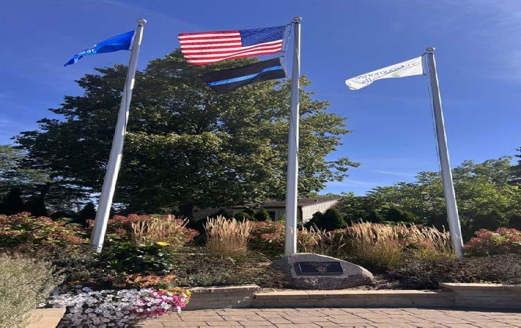
Small and large neighborhood parks offer similar recreation opportunities; however, the larger neighborhood parks generally range between 5 and 10 acres in size. This is a modification of the NRPA standard for neighborhood parks that calls for 1 to 2 acres of parkland per 1,000 people.
General Use:
• Small and large neighborhood parks can provide both passive and active recreation. In general, they feature areas for intense recreational activities, such as ball field games, court games, crafts, playground equipment, skating, picnicking and more. Undeveloped natural areas are also desirable in these parks.
Service Area: • ¼ to ½ mile radius
Desired Size:
- Small:
• 1 to 5 acres
- Large: • 5 to 10 acres
Acres per 1,000
Population:
Desired Site
• 1.0 to 2.0 acres
• These parks should be suited for Characteristics: intense development and be easily accessible to the neighborhood. Ideally, they should be geographically centered with safe walking and bike access. These parks can be developed as school – park facilities.
Menomonee Falls • Kiwanis Park
Small Neighborhood
Parks:
Menomonee Falls
Large Neighborhood
Parks:
• Marcy Elementary School
• Nor th Middle School
• Riverside Elementary School
• Shady Lane Elementary School
• Willow Springs Learning Center
• Library Park
• Riverside Park
• Thomas Jefferson Site
• Valley View Elementary
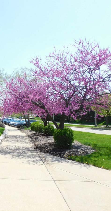
Community Parks
These large parks focus on serving community-wide outdoor recreational needs.
General Use:
Service Area:
Desired Size:
Acres per 1,000
Population:
Desired Site
• These parks have areas of diverse environmental quality. They may include areas for intense recreational facilities, such as athletic complexes for organized sports, large group picnicking and community gatherings. They may also feature areas of natural quality for activities such as walking, biking and nature viewing that are supported by trail systems.
• Several neighborhoods. 1 to 2 mile radius
• 30 to 50 acres
• 5.0 to 8.0 acres
• These parks should be easily
Characteristics: accessible to the neighborhoods that are served and include areas for intense outdoor recreational development. Other desirable components include natural features such as water bodies.
Menomonee Falls
Community Parks
• Aero Park
• Menomonee Falls High School / Ben Franklin Elementary School
• Menomonee Park
• Oak wood Park
• Rotary Park
• Village Park (western 14.6 acres to remain Community Park in COR Plan recommendations)
• Willowood Park
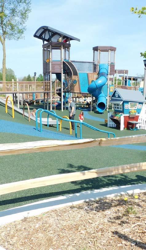
These parks focus on a single use, such as historic preservation or downtown community gathering spaces. The NRPA has no specific standards for special purpose parks as they are unique to each community.
General Use:
Service Area:
• These parks are centered on a specific purpose, environmental feature, historical event or setting, and offer a unique place that assists in creating a sense of place in the community.
• No applicable standard
Desired Size: • Varies
Acres per 1,000
Population:
Desired Site
• Varies
• These parks cater to cultural, Characteristics: historic or social recreational needs. They are often recognized as destinations and should offer spaces and amenities with community-wide benefits.
Menomonee Falls • Menomonee Falls Little League
Special Purpose Complex
Parks
• M ill Pond Park and Plaza
• Old Falls Village
• Village Park (eastern 5.0 acres to be designated as Special Purpose Park in CORP recommendations)
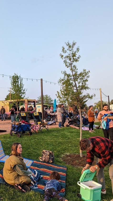
These park system components are typically made up of lands set aside for preserving drainage corridors, wetlands, or other significant community natural resource areas. The NRPA has no specific standards for these areas.
General Use:
Service Area:
• These spaces are generally open to the public, but usually do not contain many facilities beyond access points and trail systems.
• No applicable standard
Desired Size: • Varies
Acres per 1,000 • Varies
Population:
Desired Site
• Site characteristics vary based on the resource being conserved or protected. Typically, these areas should have nature-based, low impac t recreational facilities.
Menomonee Falls • Lilly Creek Parkway
Urban Green Spaces
• Lime Kiln Park
• Menomonee River Parkway
• River’s Edge Park
• Tamarack Preserve
• Willowood Preserve
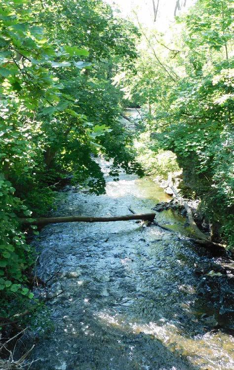
Table 4 illustrates how the existing park system serves the Village’s current population based on NRPA standards. Existing acreage does not include park and open space areas which are not yet open for public use. Map 7 shows the extent to which the Village has access to the park system by showing a 0.5 mile radius around the existing developed parks and school sites. Menomonee County Park and the Bugline Trail are also given a service radius in this map. Map 8 shows the extent of areas that will be served (within 0.5 miles) if 9 additional Village park and preserve sites are developed in accordance with the recommendations of the 2016-2020 CORP.
Table 4: Standards and Needs for Parks in 2024
*Note: Some urban green spaces (Lime Kiln Park, Menomonee River Parkway and Rivers Edge Park) are included in total developed space, while others (Tamarack Preserve and Willowood Preserve) are not. Waukesha County outdoor recreation sites were not included in this table as they are not compatible with the given NRPA classification standards. Source: Village of Menomonee Falls
Using the Wisconsin Department of Administration population projections, the Village of Menomonee Falls is expected to have a population of 41,510 in 2030. Table 5 illustrates how the existing park system will serve the projected 2030 population.
Table 5: Standards and Needs for Parks
*Note: Some urban green spaces (Lime Kiln Park, Menomonee River Parkway and Rivers Edge Park) are included in total developed space, while others (Tamarack Preserve and Willowood Preserve) are not. Waukesha County outdoor recreation sites were not included in this table as they are not compatible with the given NRPA classification standards. Source: Village of Menomonee Falls


Elementary School
Ave Site
32-Valley View Elementary School 33-Menomonee Falls High/Benjamin Franklin Complex 34-Marcy Elementary School
35-Willow Springs 4K School
36-Northwest Site
37-Silver Spring Site
OTHER RECREATION AREAS
38-Bugline Trail
39-Tri-County YMCA
40-Menomonee Park
41-North Hills Country Club
42-Waukesha Land Conservancy
43-Silver Spring Country Club
44-Fox River Parkway
45-Wanaki Golf Course
46-Norberg Farm


Ave Site
32-Valley View Elementary School 33-Menomonee Falls High/Benjamin Franklin Complex 34-Marcy Elementary School 35-Willow Springs 4K School 36-Northwest Site 37-Silver Spring Site
OTHER RECREATION AREAS
38-Bugline Trail 39-Tri-County YMCA 40-Menomonee Park 41-North Hills Country Club 42-Waukesha Land Conservancy 43-Silver Spring Country Club 44-Fox River Parkway 45-Wanaki Golf Course
46-Norberg Farm
The Village of Menomonee Falls has abundant developed open space, urban green space and large neighborhood parks; however, the deficiencies shown in Table 4 and 5 indicate a need for more small neighborhood parks and mini-parks. Map 7 shows that there are areas in the northwest, eastern, and southern portions of the Village that lack convenient access to park and school sites. Since 2011, the Village has taken steps to address these deficiencies by acquiring and planning for park development in these areas. The 2016-2020 CORP recommends creation of recreational facilities at 9 Village-owned sites which are currently undeveloped and lack public access. Map 8 reveals how much more of the community will be located within one half-mile of park sites once the 2016-2020 CORP is implemented. Chapter 7 contains detailed recommendations for all of the Village’s developed and undeveloped park and preserve sites.
While NRPA acreage standards have traditionally served as a benchmark to analyze deficiencies in Menomonee Falls’ park system, a more realistic measure of park quality and future need should consider factors like demand for community gathering spaces, diversity of offerings, intensity of uses and recreational trends. These factors are discussed in Chapter 6.
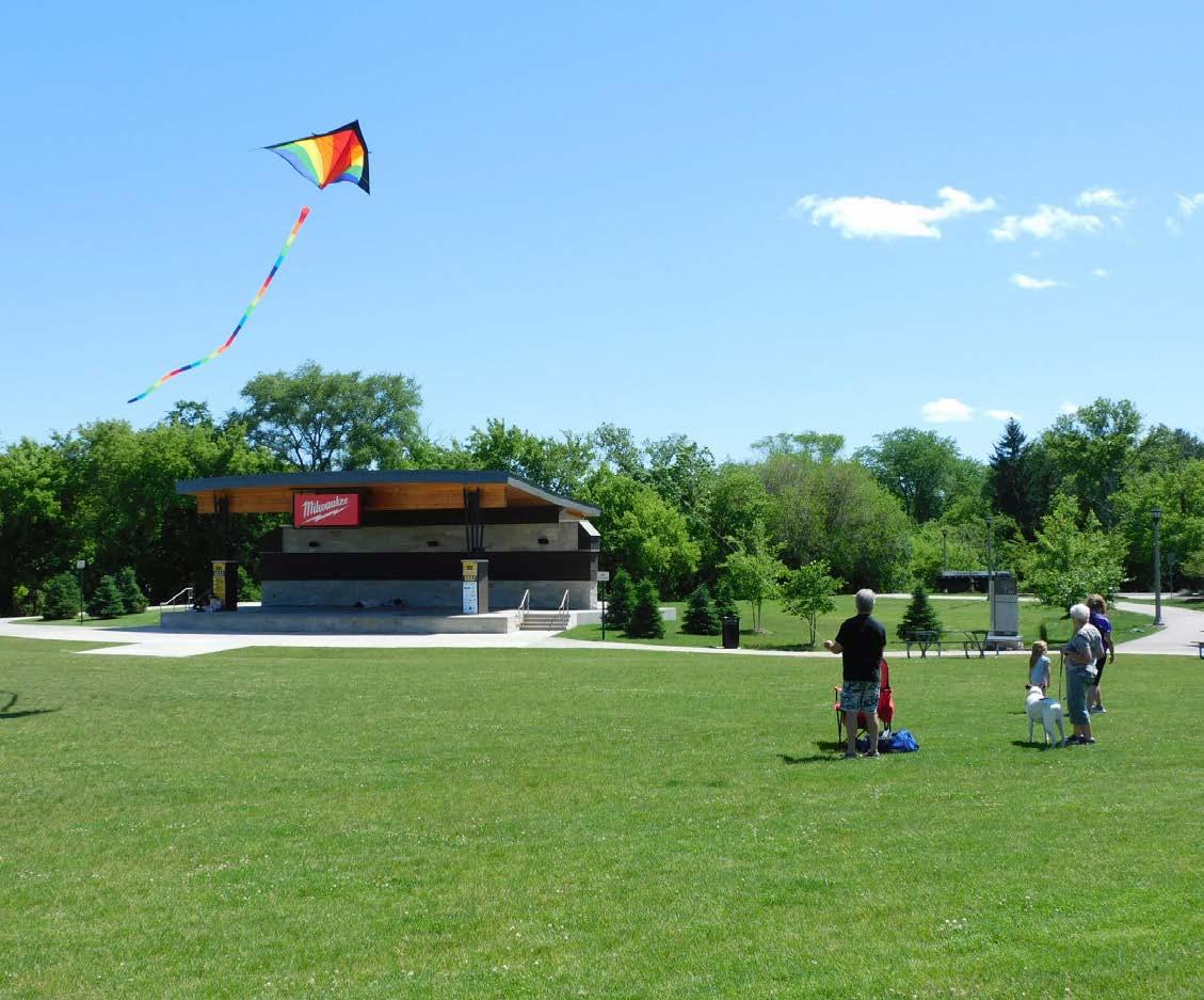
The Southeastern Wisconsin Regional Planning Commission (SEWRPC) provides a guide to the accepted level of service standards for recreation related park improvements. Table 6 shows the existing facilities and current facility needs for the Village’s estimated 2024 population of 40,099. Table 7 shows the existing facilities and the Village’s needs for the 2030 projected population of 41,510. Recreation facilities are evaluated on a per capita basis only, as it is generally not feasible to provide uniform access to all recreation types. Table 8, at the end of the chapter, is a list of other existing facilities that have not been included in the SEWRPC standards.
*Note: Recreational needs calculated based on WDOA 2024 population estimate of 40,099
Source: Village of Menomonee Falls
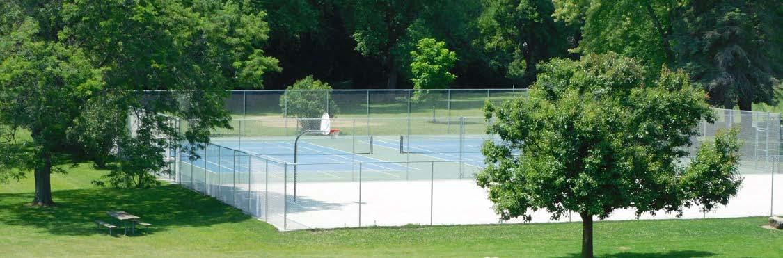
Under the Wisconsin Department of Administration population projections, the Village of Menomonee Falls is expected to have a population of 41,510 persons in 2030. Table 7 illustrates how the existing Village recreation facilities will serve the increased population in 2030.
*Note: Recreational needs calculated based on WDOA 2030 population projection of 41,510
Source: Village of Menomonee Falls
The Village of Menomonee Falls has many recreation facilities. However, the deficits shown in Tables 6 and 7 indicate a need for more of the following facilities:
Basketball Hoops
Ice Skating Rinks
Nature Center
Nature Trails
Soccer Fields
Softball Diamonds
Tennis Courts
Village parks and school grounds also contain a number of facilities which are not included in the
level of service standards. These recreation facilities are summarized in Table 8.
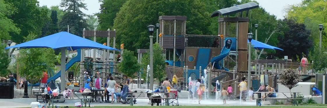
Source: Village of Menomonee Falls
NRPA and SEWRPC standards apply to most park categories and recreational facilities, but there is no formula to quantify the need for special purpose parks and amenities in the Village. These parks highlight and preserve valuable points of interest in the Village, and they have potential to better serve the Village’s growing population (Menomonee Falls has added an estimated 4,473 residents since 2010 according to the Wisconsin Department of Administration) through key investments which will transform these sites into community destinations.
Parks which are designed to serve as community gathering spaces provide opportunities for people of all ages and backgrounds to connect with one another through unique amenities, programing and special events. Parks offering a wide variety of dynamic activities contribute to the development of great places. Studies have shown that great public places attract new residents (across age groups), draw visitors, spur neighborhood investment, and support existing businesses.
The continued development of special purpose parks (like Village Park and Old Falls Village) should be prioritized in order to support community events and provide welcoming spaces that celebrate the character of the community and promote social interaction.
For existing special purpose parks, the aim of becoming a community-wide destination would be supported by public access and programing improvements to activate these sites and make them more convenient to visit. Recent parking improvements and added events along Main Street have modeled how strategic investments in these areas can bring new life into a public space.
An overview of current and projected participation levels in outdoor recreation activities can further help the Village anticipate demand for recreational activities. Recent trends suggest demand for fitness activities (walking, running, and bicycling), nature-based activities (hiking and wildlife viewing), and social spaces (picnic areas, plazas, dog parks) is likely to remain strong for many years to come. Table 9 summarizes the most popular outdoor activities in 2021 in the United States as identified by the Outdoor Foundation’s annual Outdoor Participation Trends Report.
1. Walking for Exercise 115.8 million
2. Hiking 58.7 million
3. Running / Jogging 49.0 million
4. Bicycling (Paved Surface) 42.3 million
5. Fishing 40.9 million
6. Camping 36.0 million
7. Tennis 22.6 million
8. Wildlife Viewing / Birding 20.5 million
*Source: 2022 Outdoor Participation Trends Report, Outdoor Foundation
According to the Outdoor Foundation, outdoor activities that have grown in popularity in recent years include hiking, camping, bird watching, trail running, pickleball, and skateboarding. Outdoor activities with declining popularity include softball, volleyball, hunting/shooting, paintball, and ultimate frisbee.
At the local level, staff from the Menomonee Falls Community Education and Recreation Department reported strong engagement across various age groups and activities. The community benefits from a wide range of programs, including health and wellness, adult education, youth activities, and sports. The redevelopment of Village Park, with its splash pad and special events, has been particularly successful in bringing the community together. Staff emphasized that collaboration with local government and other stakeholders is essential to the continued improvement and maintenance of park facilities and programming. Considering opportunities for better park promotion, utilizing the quarterly newsletter and increasing use of social media is recommended to increase community participation and support.
Community Education and Recreation staff also reported a need for additional soccer fields, baseball fields, a skateboard park, and a dedicated pickleball complex. CE & Rec. staff also suggested the development of the following enhancements for existing parks and trails:
• Additional restrooms at Village Park
• Additional parking at Village Park – maybe the grassy area that slopes down towards Krueger’s
• A restroom / shelter at Kiwanis Park
• Seasonal skating facility
• Warming shelter / restroom at the sledding hill
• Mile markers on trails
This chapter includes a summary of the recommendations contained in this Plan. General recommendations for the entire park and open space system are discussed first, followed by specific recommendations for the Village’s recreational sites and facilities.
The following recommendations are applicable for the entire park and open space system. These recommendations should be considered in decisions regarding the Village’s recreation facilities and policies.
Adopt a common design theme for Village parks, trails and nature preserves. Existing parks differ in their signage, benches and lighting. A consistent style will provide continuity between the diverse open space offerings in the Village and provide a unified brand for the Menomonee Falls Park System. While the design elements do not need to be exactly the same in every location, a common theme and character should be found throughout the park system. As park identification signage and amenities (benches, lighting, trash cans, bike racks, etc.) are installed or replaced in Village parks or along Village trails they should be designed in a consistent fashion to support a consistent image for the park and trail system.
Develop connections between parks, preserves and trails throughout the Village. Gaps in the trail network should be addressed, and wayfinding signage should be installed to ease access between the dozens of public recreation sites in the Village. Trail connections and new signage will increase the visibility of and the access to parks, preserves and multi-use trails. Fulfillment of this recommendation will help ensure that residents and visitors view recreation sites and facilities as part of a park system rather than isolated sites. A connected park and trail system will also promote active transportation (walking, running and bicycle riding) between sites and raise the profile of lesser-known parks and preserves.
The large number of recreation destinations in Downtown Menomonee Falls make the area ideal for installation of a wayfinding signage system. Downtown sites such as Mill Pond Park, Centennial Park, Village Park and Lime Kiln Park are adjacent to each other, but there is no clearly marked connection between them. Site recommendations in the CORP provide appropriate locations where park and trail connections should be made and where signage and information kiosks could be installed to ease the flow of users through the area.
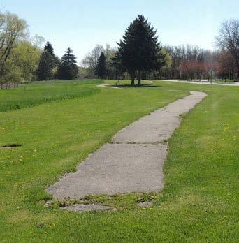
Connectivity gaps between recreation sites should also be addressed throughout the Village as many parks operate in relative isolation. New trail segments and wayfinding signage with directions and distances to other sites will link recreation destinations across the Village. Development of cleared nature paths and boardwalks through woods and natural areas will further increase connectivity and improve access to undeveloped park sites. In many cases, formal nature trails could be cleared in places where residents are already making their own informal paths. In creating and maintaining these paths, care should be taken to minimize intrusive cutting and clearing.
1. Trail Connection Acquisitions:
As described in Chapter 8, the Village should consider acquiring key stretches of land that are missing links to making a continuous trail system. The northern end of the Village includes priority locations for trail acquisitions where the Menomonee River Parkway Trail and the Waukesha County Bug Line Trail could be connected through a few strategic trail segment extensions. Also, as discussed as far back as 1980, the Village should look to link Rivers Edge Park to Rotary Park with a trail along the Menomonee River.
2. Parkland Acquisitions:
The acquisition of sites for the future Aero Park and Northwest Area Park satisfied 2006-2010 CORP recommendations for additional park land in accordance with level of service standards, population projections and existing park land distribution. The acquisition of these properties prior to escalating development pressure helped ensure adequate park and open space in areas of the Village that are expected to experience growth in the future. These two parks should be developed as warranted by the continued growth in their respective areas. When these parks are developed, they should be designed with passive and active recreational uses that will address the Village’s recreation facility deficiencies.
Additional parklands should be considered as residential growth continues, creating a demand for supplementary outdoor recreation areas. A possible location is the Village-owned former municipal landfill on Mill Road. The Village could seek to acquire additional lands adjacent to the property and link the site to the proposed County Greenway trail system. The Village would need to work closely with the Department of Natural Resources to develop facilities on this site, however, given its history as a landfill.
Given the Village’s deficiencies in small neighborhood parks and mini-parks, the Village should also consider strategic locations within existing neighborhoods and in future neighborhoods for the development of small parks. In accordance with the Village’s Comprehensive Plan, new neighborhood parks should be developed with facilities that promote social interaction and physical activity for residents of all ages. New small parks could include features like playground equipment, court sports, benches or walking paths. The Village is aware of the costs associated with maintenance of additional small parks and should seek partnerships with neighborhood organizations willing to maintain new public facilities. The Village should also continue to promote the development of private neighborhood parks in new residential subdivisions. Private parks and facilities can be found in the Weyerhaven, Spencer’s Pass and Harmony Hills subdivisions, among others.
Environmental Preservation
1. Environmental Corridor Acquisitions:
The lands included in SEWRPC environmental corridors, especially around the Tamarack Preserve and those lands that are “holes” in the Preserve, should be acquired by the Village or other conservation organizations when possible. Additionally, lands within the environmental corridors along the Fox River north of Menomonee Avenue and south of the Village of Lannon should be acquired as they become available. Acquisition efforts in these areas should focus on connecting Menomonee Park to the proposed County Greenway system and new Village parks in the southwestern and northwestern portions of the Village. These areas are depicted in Map 9. Environmental areas not acquired should be protected through zoning regulations.
The Village should partner with local organizations to develop informational kiosks, interpretive signage and other learning experiences in Village parks and nature preserves. Signage, maps and printed/ electronic educational materials could promote environmental awareness and highlight the unique history of Menomonee Falls. The Tamarack Preserve and sites adjacent to the Menomonee and Fox Rivers are ideal locations for interpretive signage due to their prominent ecological roles. The Downtown area offers a combination of noteworthy historical sites, geological formations and natural habitats. The addition of informational kiosks, wayfinding and new interpretive signage would raise the public profile of Downtown’s unique assets. The CORP also recommends interpretive signage to add an educational component to proposed improvements at Willowood Community Forest and Lilly Creek Parkway.
Streams and ponds in environmental corridors should be enhanced to perform more of their natural functions. The addition of native plants and the restoration of stream banks along the Menomonee River, Fox River, Lilly Creek and retention ponds will help infiltrate stormwater and attenuate flooding problems. Shoreline plantings will also prevent geese from exiting the water (where they may become a nuisance) and will increase the number of other birds and butterflies.
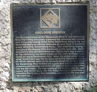
Existing interpretive signage in Lime Kiln Park discusses geology
Land management plans may be utilized to restore natural functions and promote healthy ecosystems in local parks and preserves. Land management plans create a system and schedule to remove invasive species, establish native plantings, restore stream banks and maintain park woodlands in balance with facility development. Park sites that would benefit most from a land management plan include: Aero Park, Tamarack Preserve, Willowood Community Forest, Menomonee River Parkway, Tower Hill Park and Oakwood Park (specifically the wooded/wetland area in the southern portion of the park).
The Village should develop a strategy to publicize existing parks and trails to promote awareness and increase use of facilities. The dozens of public recreation sites within the boundaries of the Village include rail-to-trail corridors, riverside picnic areas, active sports complexes and expansive natural areas. The Village should make a concerted effort to ensure that residents and visitors know about these recreational sites and can easily access information about them.
As part of a park and trail system promotion strategy, the Village should create an updated park and trail system map in both electronic and print formats. The Village should partner with local organizations to widely distribute the map. The Village should also make an effort to update the Village website to highlight existing recreation opportunities, explain ongoing park/trail projects and to invite the public to explore new facilities as they are developed in the years ahead.
There are opportunities for the Village to partner with schools and non-profit organizations increase access to facilities in support of year-round recreation activities. New joint-use partnerships have potential to activate local recreational spaces and increase physical activity for residents during off-peak seasons, after hours, or on weekends.
The Village, the School District of Menomonee Falls, Hamilton School District, Tri-County YMCA, Menomonee Falls Little League, Waukesha County Land Conservancy and other non-profits maintain numerous indoor and outdoor spaces for physical activity. Coordination between these organizations has potential to increase public awareness for and use of local facilities.
Opportunities for increased public access include community open-gym sessions, public use of school running tracks/athletic fields, shared access to fitness equipment, winter indoor walking programs, public access to indoor pools, and expanded recreational programs in Village parks (e.g. Fit in the Parks).
The Village should work with the school districts to explore opportunities for public access to running tracks, sports fields, and indoor recreational spaces. The Village should also work with Menomonee Falls Little League to identify opportunities for public access to their Village-owned site.
The following maps identify recommendations for each of the 16 developed Village parks and parkways. The park recommendations are also summarized in Table 10 at the end of this section. The table indicates the anticipated time-frame for completing park projects as “short-term”, “long-term” or “ongoing”. These timeframe designations are explained in greater detail in Chapter 9 (page 118).


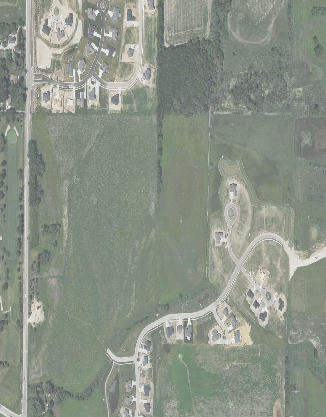
Recommendations Summary: Aero Park will be developed as a community park with a combination of passive and active recreation amenities. The plan includes a parking area and activity hub (play area, sport courts, picnic shelters) at the center of the park and a network of paved and natural surface trails through the restored prairie and wetland portions of the 80 acre site.

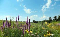
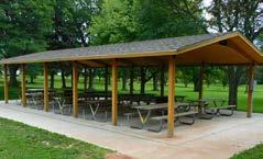
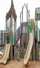

Recommendations Map
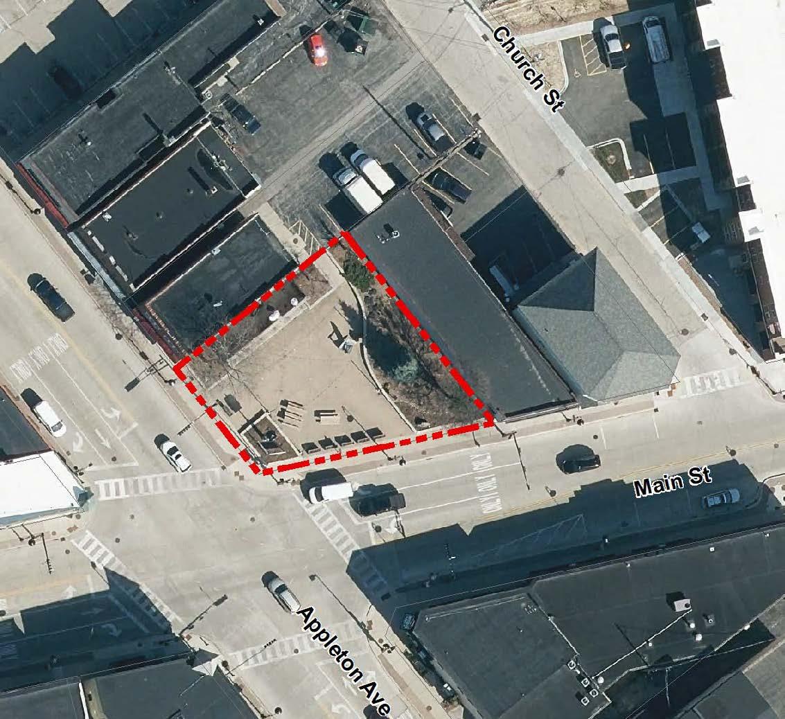


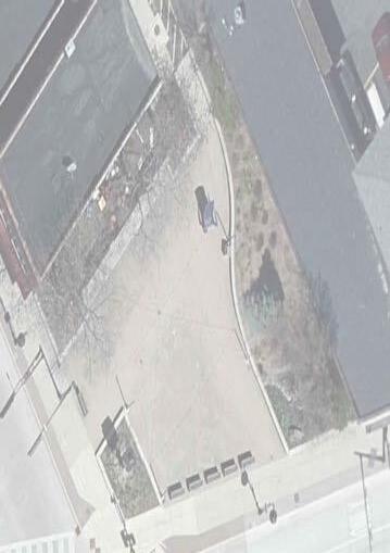


Recommendations Summary: Partner with adjacent property owner to install new murals, including one that identifies the space as Centennial Plaza. Install signs to commemorate history of plaza and donor plaques. Work with Downtown BID to install weatherproof storage and to activate the space with amenities and programming. Improve electrical service for food trucks.


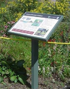
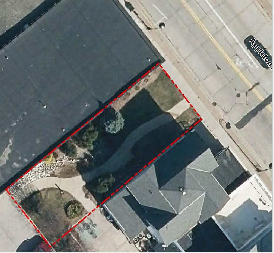
Recommendations
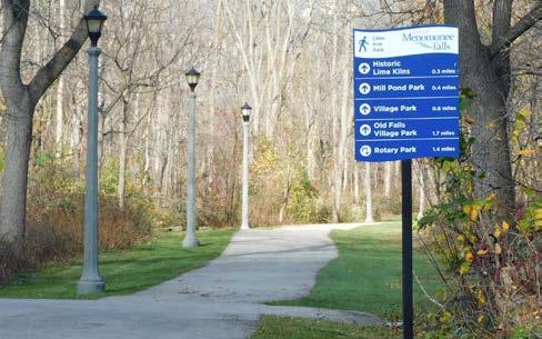
Recommendations Map
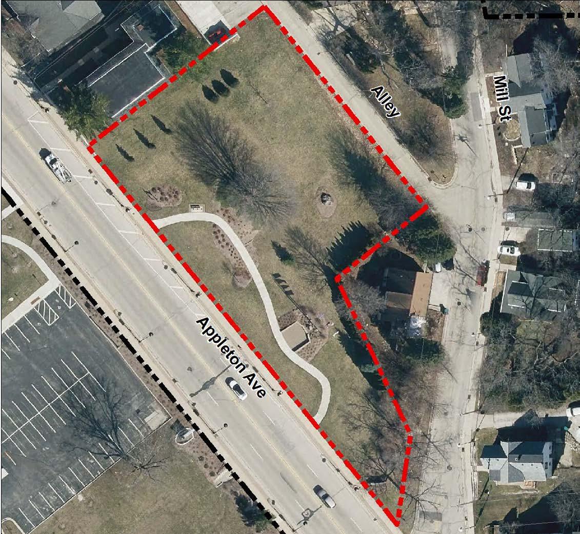
Recommendations Summary: Plant shade trees along the northeastern edge of the park and the alley.
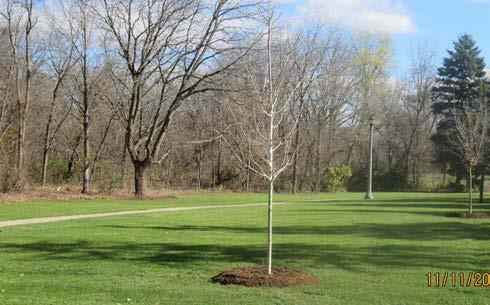

Recommendations Map
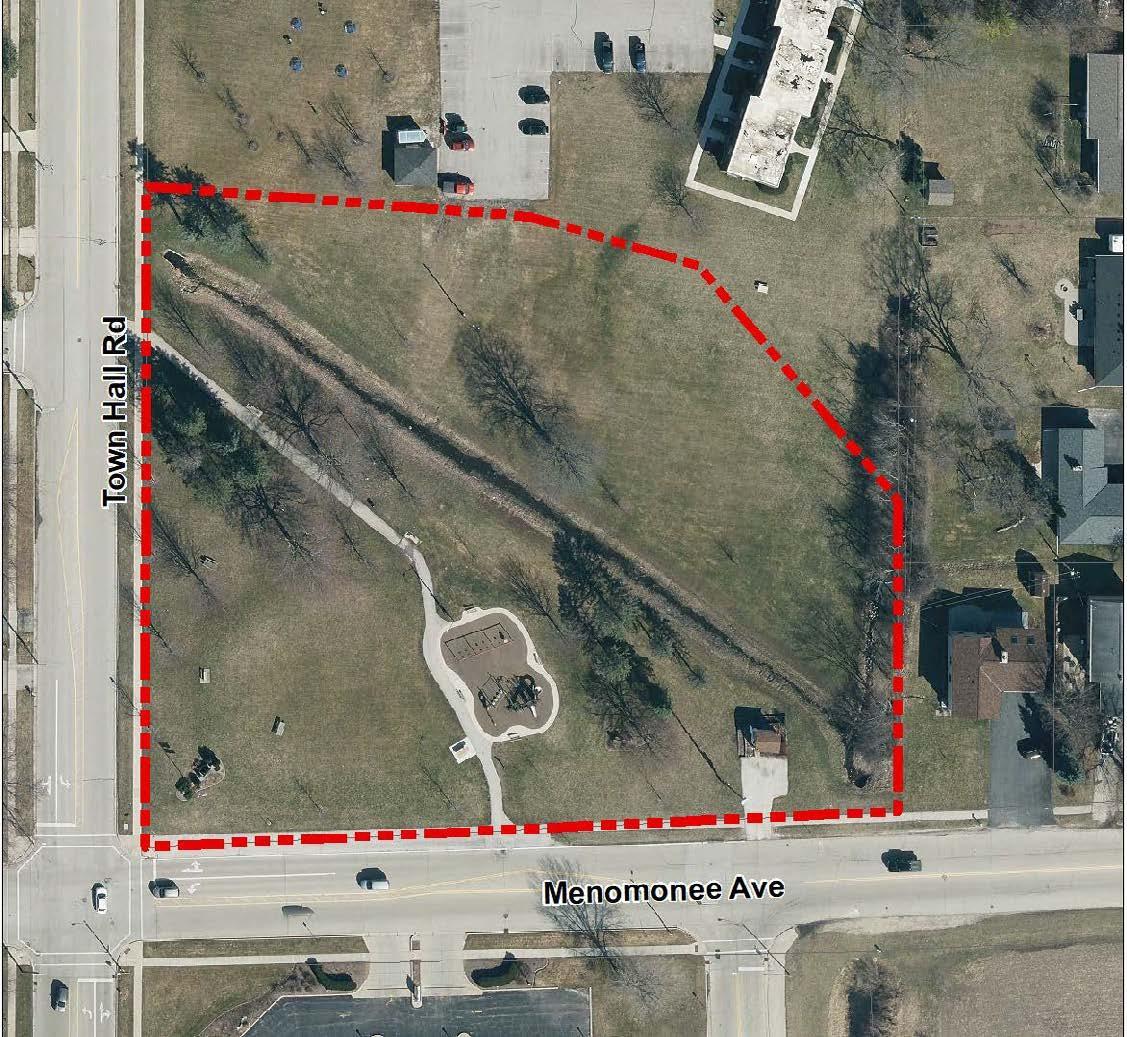
Recommendations Summary: The installation of a new parking lot is underway. New bicycle racks, directional signs, and a trail to the neighboring apartment complex will increase public access to this neighborhood park. Construction of a picnic shelter and pedestrian bridge will increase opportunities for recreational activities in this neighborhood park.
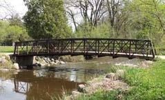

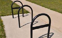
Recommendations Map
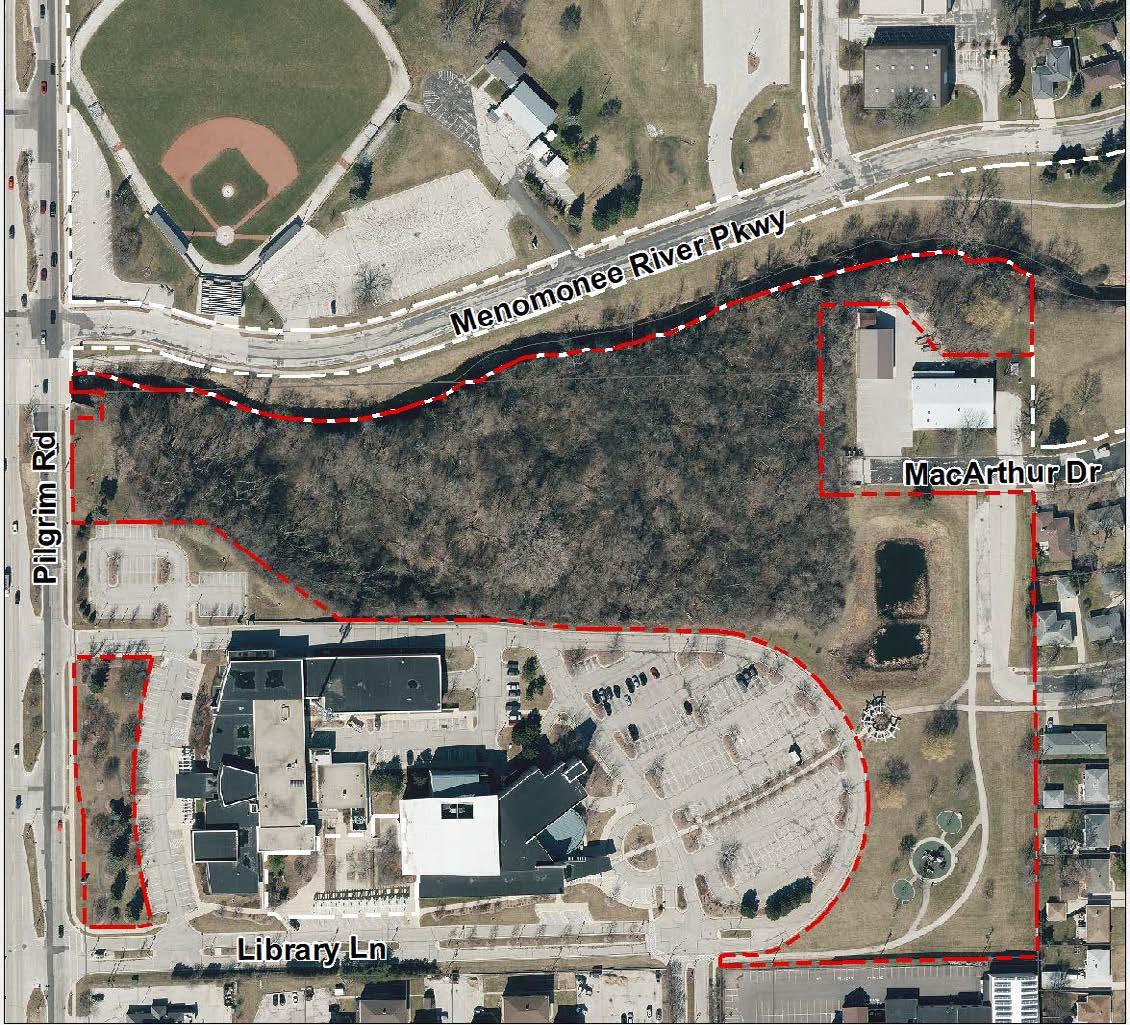
Recommendations Summary: Identify this park as Library Park with a freestanding sign. Create a nature trail in the woods north of Village Hall, leaving adequate space for a planned Police Department addition. Updated playground equipment and a directional sign connecting the site to other parks and trails will attract new users.
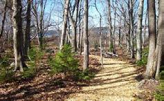
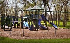
Recommendations Map
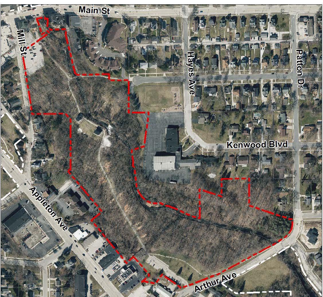
Sculptures, landscaping, brush clearing, & interpretive signs
Updated interpretive sign for lime kiln history Repave damaged trail segment
Recommendations Summary: Partner with adjacent property owners to create a direct pedestrian connection from the multi-use trail to Main Street and Village Park. Partner with Downtown BID and Waste Management to the enhance the trail corridor from the north parking area. Clear invasive brush, removed downed trees, install new landscaping, and interpretive signs. Resurface and widen damaged trails on the south side of the park.
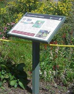
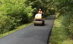
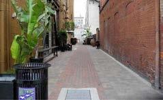
public access / gate
Recommendations Summary: Creating a paved trail and boardwalk connection between the Menomonee Falls Little League Complex and Oakwood Park will make a direct connection for pedestrians between these two public park sites. Access to the Little League Complex could be improved by establishing trail connections and creating a more inviting public entrance.
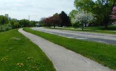
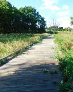
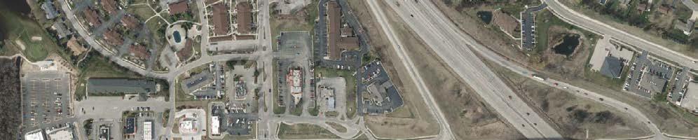
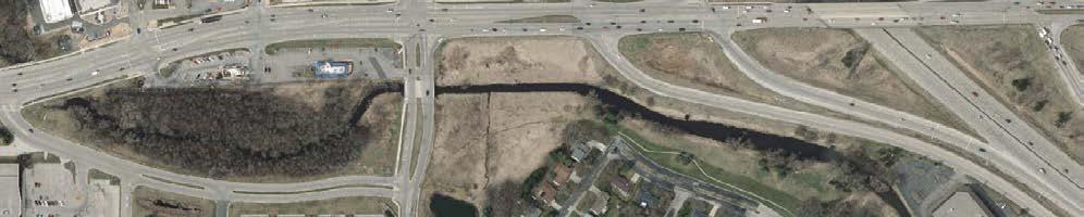
Recommendations Map
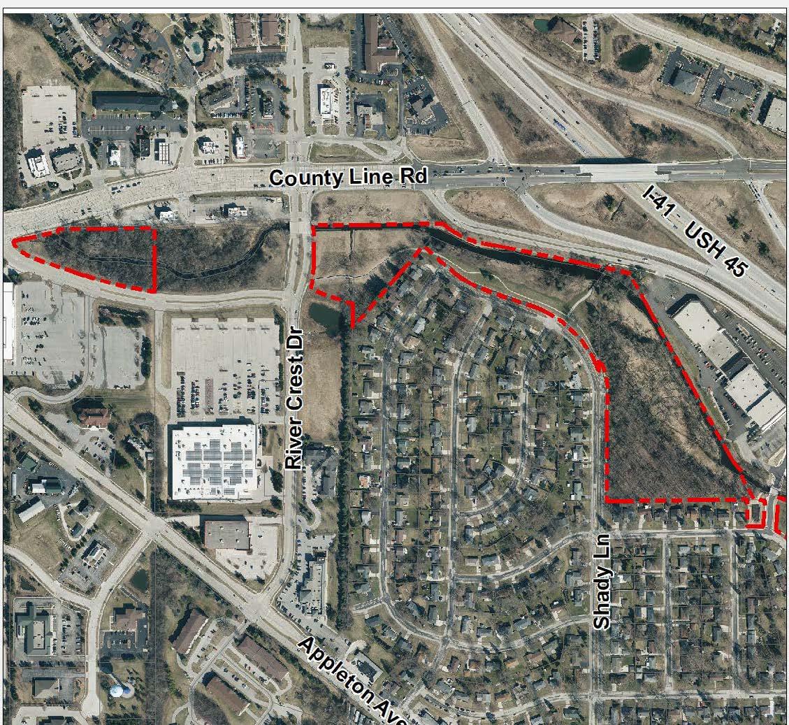
Recommendations Summary: Install wayfinding signs for pedestrians and bicycle riders with distances to other parks, trails, and destinations. Fill connectivity gaps by installing sidewalk along Grand Avenue and Shady Lane and resurface damaged and narrow trail segments. A stormwater retention pond is planned for the open space along trail.

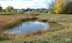
Recommendations Map
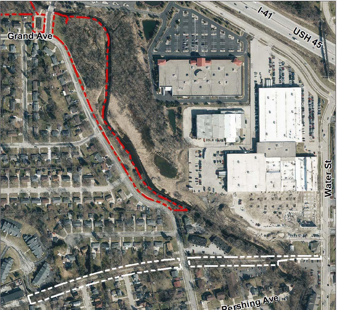
Recommendations Summary: Install wayfinding signs for pedestrians and bicycle riders with distances to other parks, trails, and destinations. Extend trails or add sidewalks to fill connectivity gaps and resurface and widen damaged and narrow segments. Clean up the woods by removing dead trees and replanting where necessary.
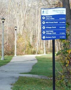
Recommendations Map
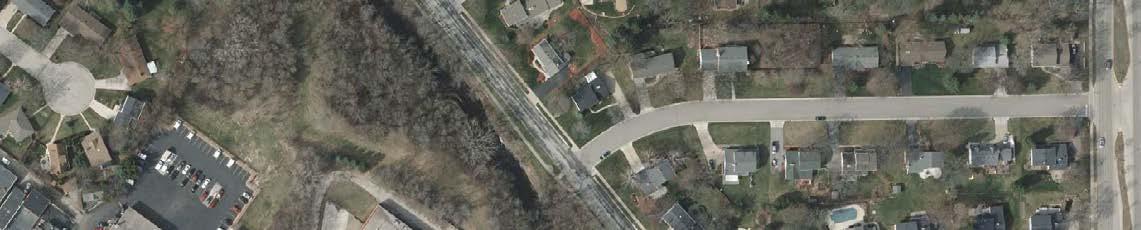
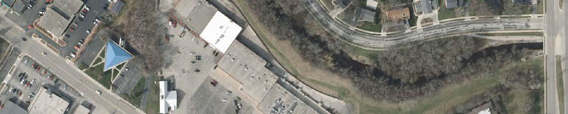
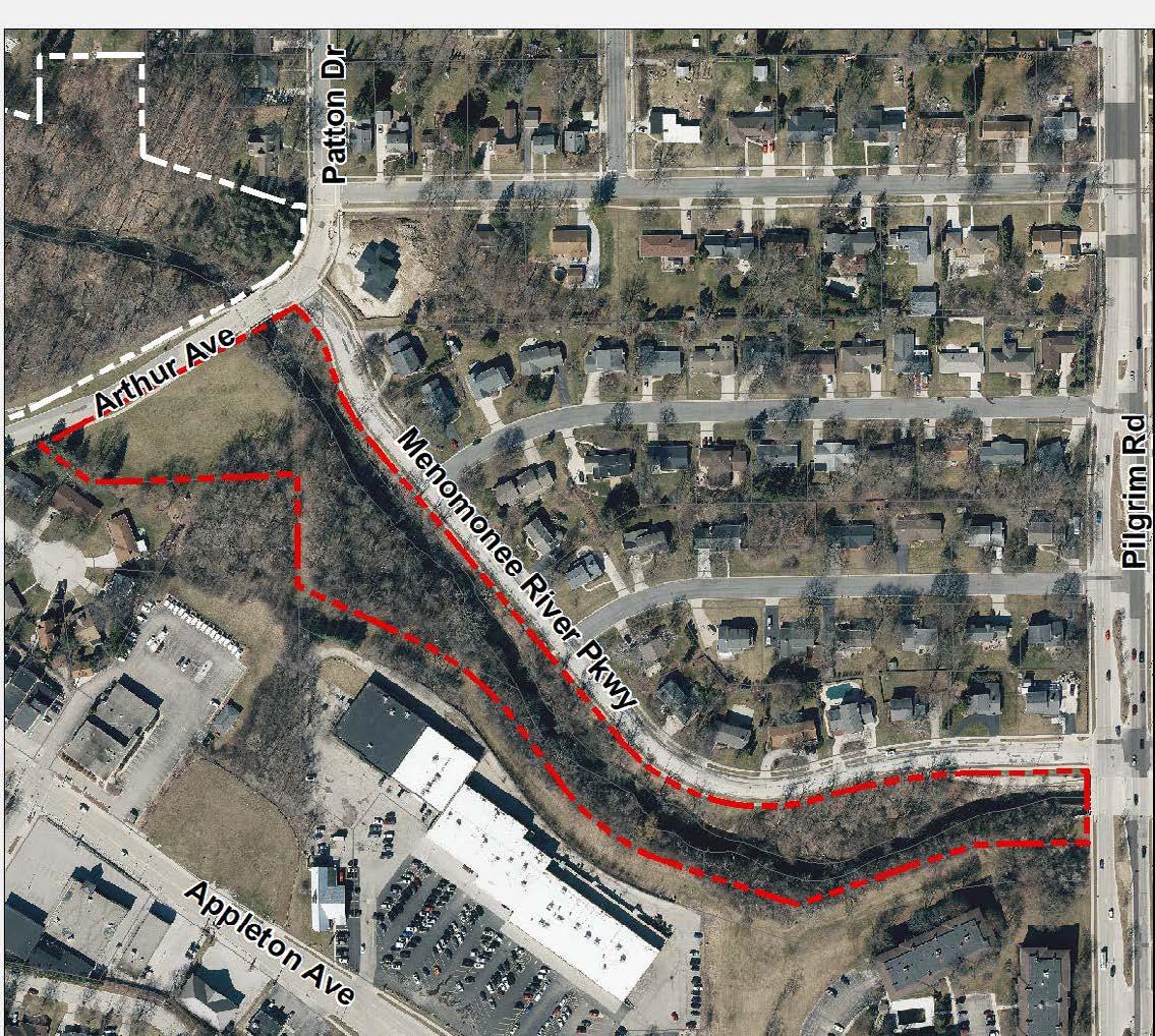
Recommendations Summary: Install wayfinding signs for pedestrians and bicycle riders with distances to other parks, trails, and destinations. Extend trails to fill connectivity gaps and resurface/widen damaged and narrow segments. A stormwater retention pond is planned for the open space near Arthur Avenue.
Recommendations
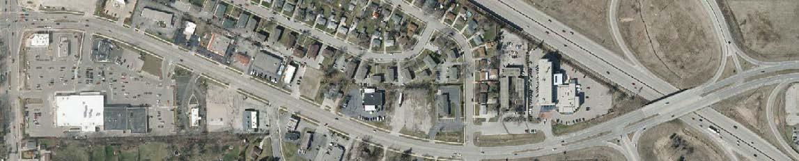
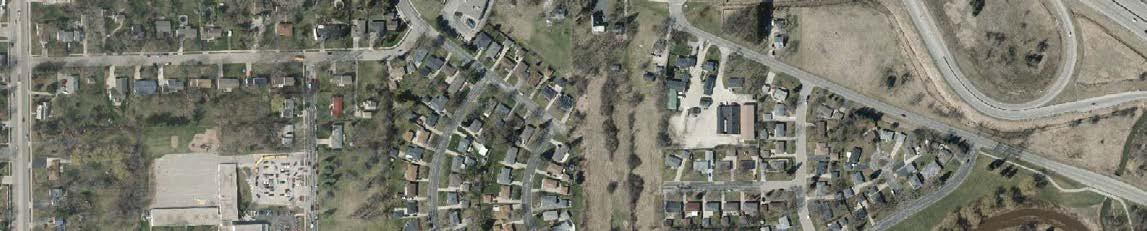
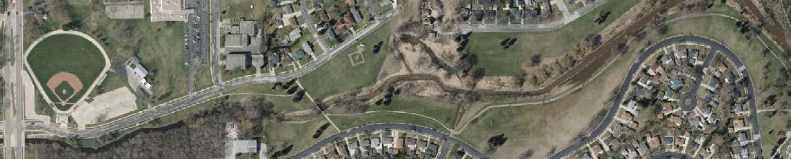
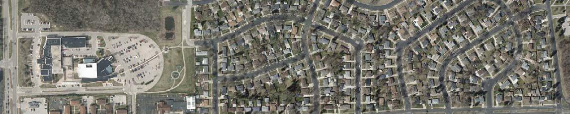
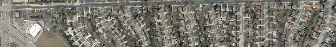
Recommendations Summary: Install wayfinding signs for pedestrians and bicycle riders with distances to other parks, trails, and destinations. Extend trails to fill connectivity gaps and resurface damaged and narrow segments. A stormwater retention pond was constructed along Menomonee River Parkway in 2024, and another is planned for the open space near Mac Arthur Drive.
Recommendations
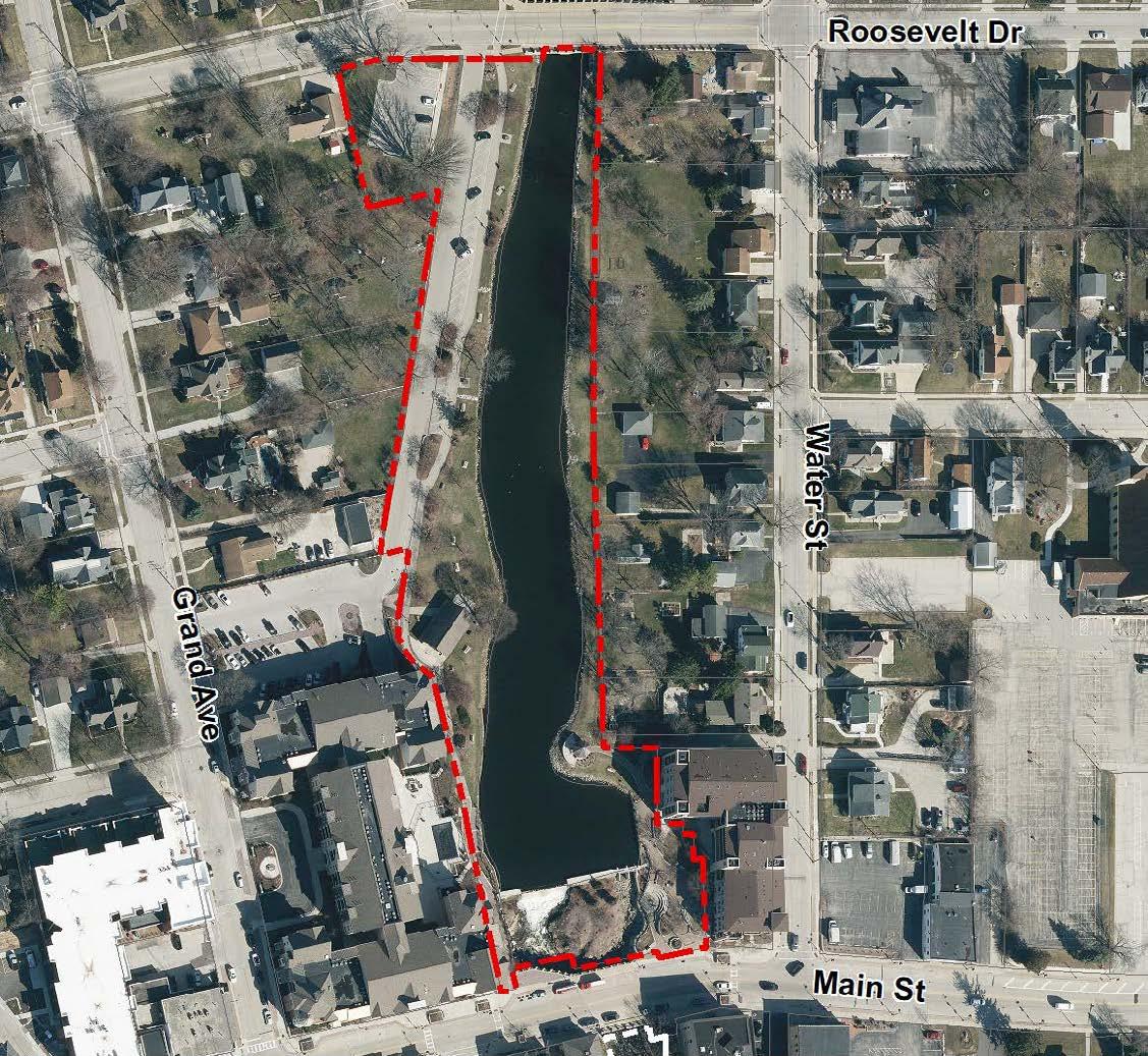
Recommendations Summary: Work with Downtown BID to activate space with new amenities, uses, and programming. Improve access to the river with stairs, rock ledges, and ramps along the west side of pond. Install a new interpretive sign describing the history of the Mill Pond and Lepper Dam. Improve the shelter area for events by enhancing electrical service and installing more outlets. A dam rehabilitation project is also planned.
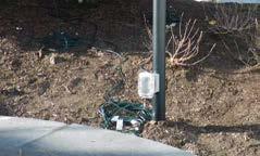
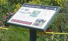
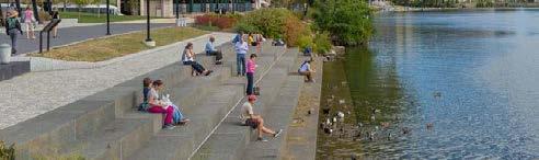
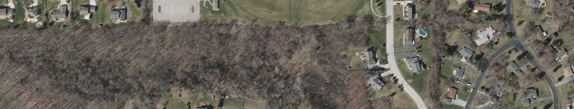

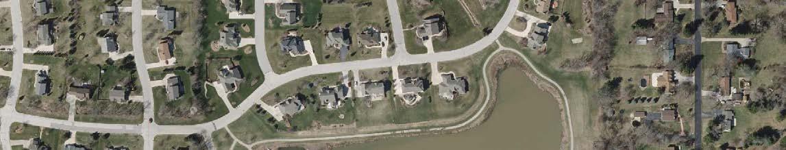
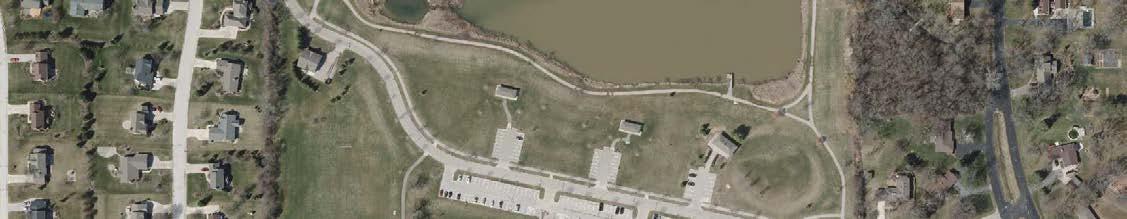
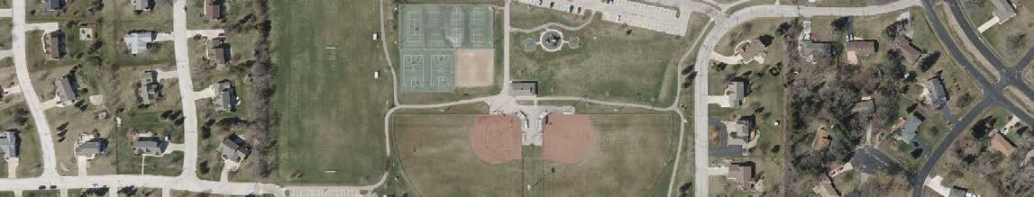
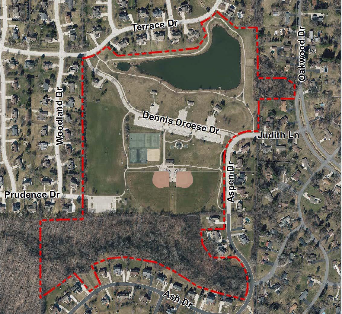
Recommendations Summary: Create natural surface trail to connect to the Little League Complex. Install directional and wayfinding signs to connect visitors with other parks, trails, and destinations. Update playground equipment and improve winter recreation with a removable liner to create an ice skating rink and possibly a chiller for the ice.
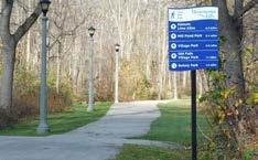
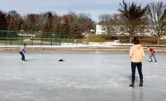
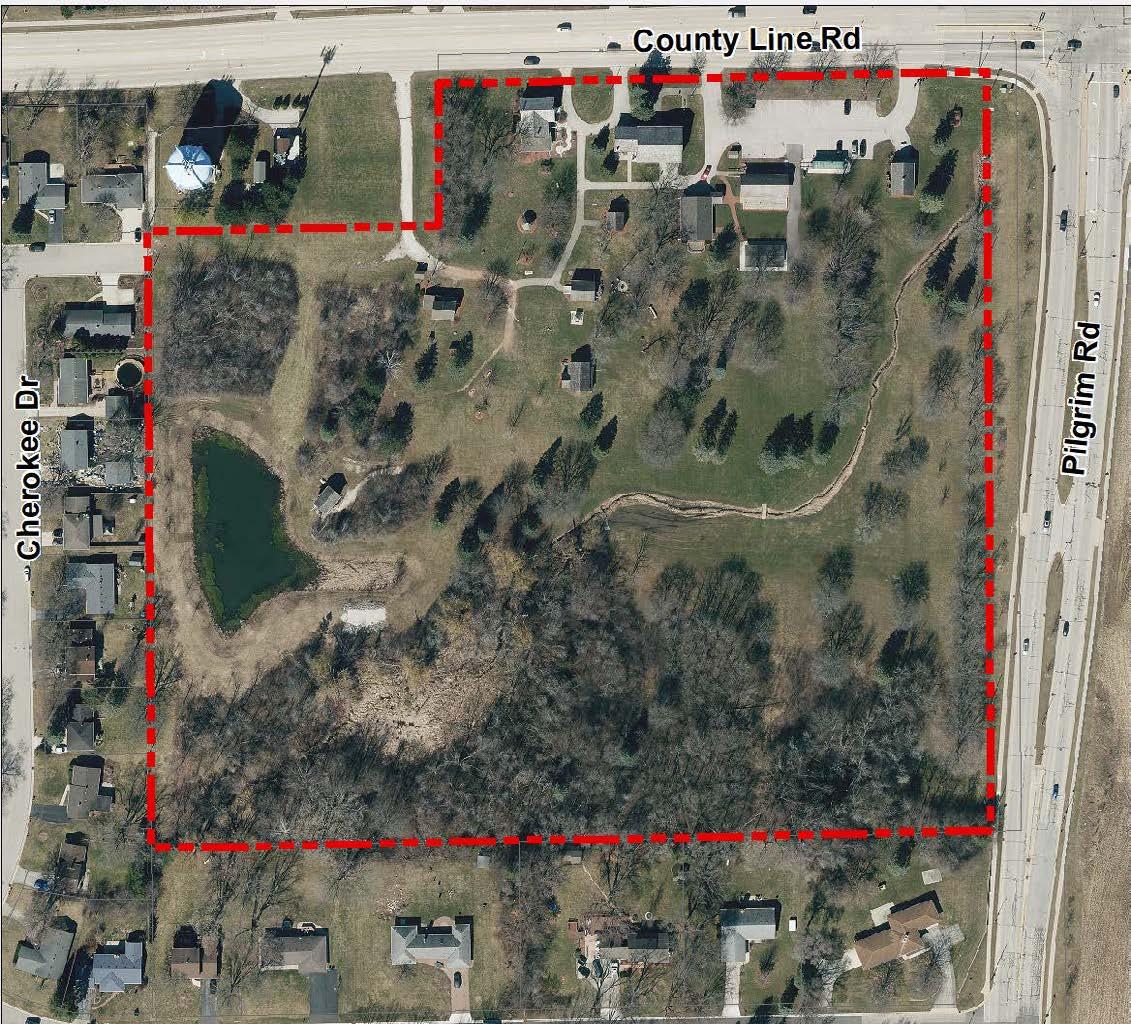
Recommendations Summary: New trails and directional signage will better connect residents to Old Falls Village historic park. A Village green and a history-themed play area will support Old Falls Village events. Improved restrooms will accommodate more visitors and accessible paths will be installed to ensure people of all abilities can access park amenities. Nature trails, public art, and new park signs will attract more users.

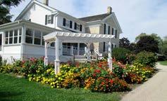
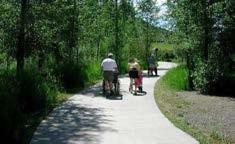
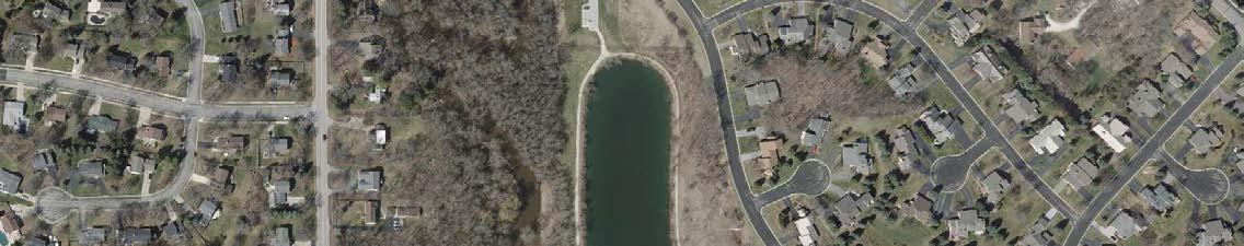
Recommendations
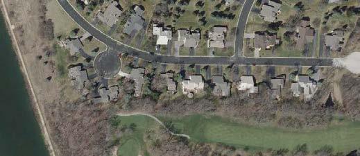
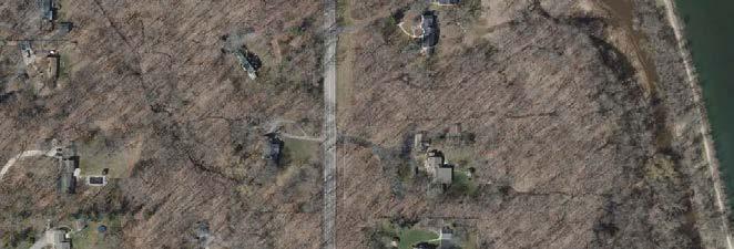
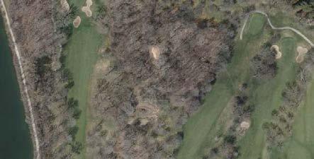
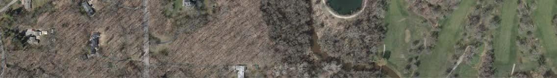
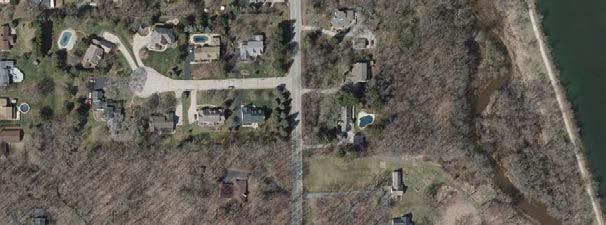
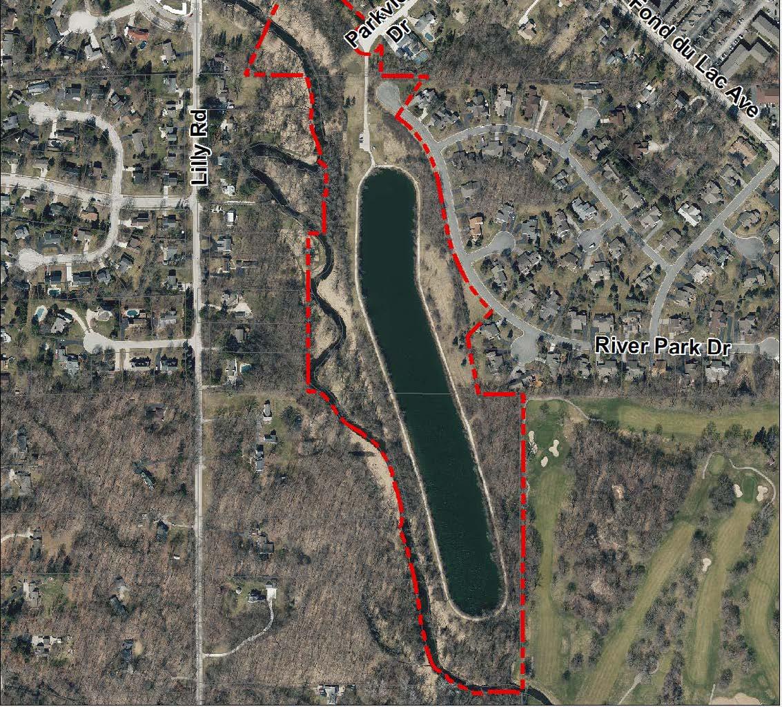
Recommendations Summary: A multi-use trail connection to Rotary Park will provide a link from the Menomonee Parkway Trail to River’s Edge Park. Clearing vegetation and creating a picnic area will increase public access to the Menomonee River, and new signage will indicate trail distances within the park and to other parks and provide information about the river, the pond, and the habitats they provide for local species.
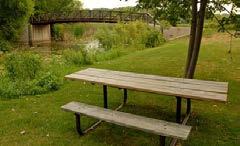
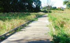
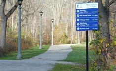
Recommendations Summary: New signage and repainted crosswalks will improve park visibility and accessibility from Pilgrim Road and the Menomonee River Parkway. The addition of modular skate park features will create an additional use for the park and increase the amount of visitors. A new sign and trail maintenance will increase awareness and use of the paddle launch.
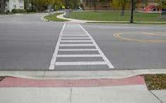
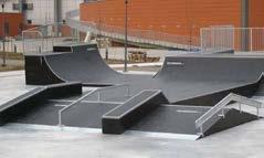
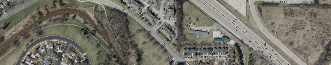
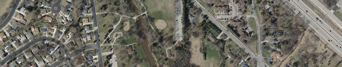
Recommendations Map
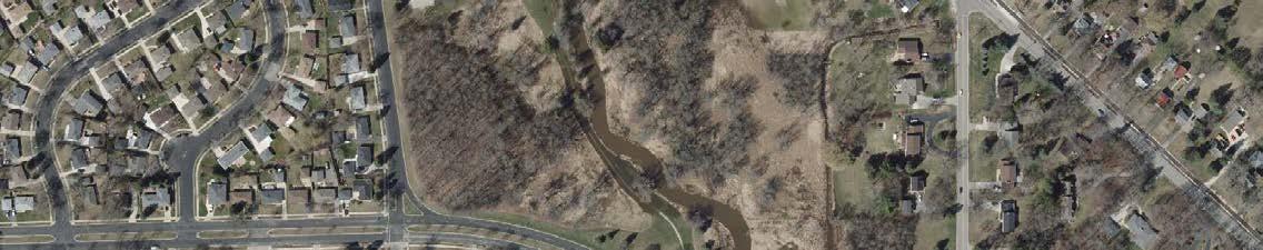
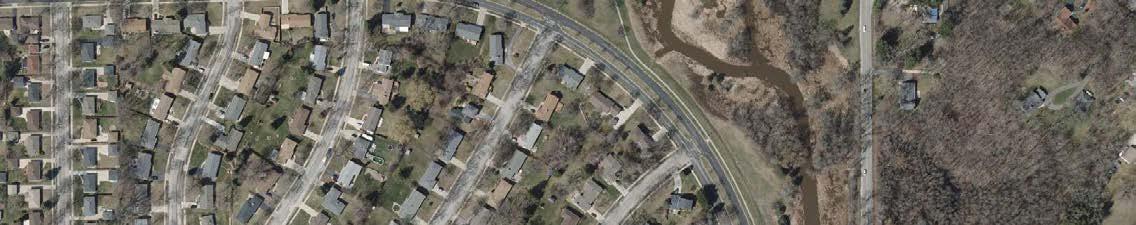
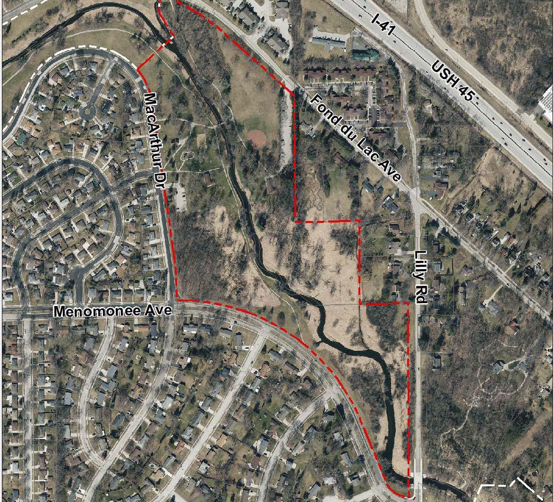
Recommendations Summary: Install wayfinding signs for pedestrians and bicycle riders with distances to other parks, trails, and destinations. Trail connections to River’s Edge Park and the Fond du Lac multi-use trail will increase pedestrian and bicycle access to Rotary Park. Trail repaving, new signage, and bicycle racks will increase the usability of the Menomonee River Trail and the Rotary Park activity areas.
Recommendations Summary: Install a Village Park sign on the proposed retaining wall and other interpretive signs throughout the park. Partner with Menomonee Falls Downtown Inc. to construct permanent beer garden structure. Establish connections to Lime Kiln Park and downtown to increase access to Village Park. Upgrade security to playground, stage, and shelters to prevent theft and property damage.
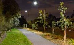
Recommendations Summary: Trail improvements will increase access to the Willowood Community Forest and create a walking loop around the retention pond. Installation of a natural area kiosk will provide maps and information for visitors at the gateway to the Willowood Community Forest. Remove the skate area on the north side of the park and create a path to the fire station to utilize a new park access / parking area.
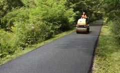
Aero Park
1. Install park drive, parking lot, and infrastructure for park access and development (Phase II)
2. Construct an accessible nature-themed play area with natural materials and grade changes incorporated into the design (Phase II)
3. Construct a picnic shelter in proximity to the playground (Phase II)
4. Install temporary a temporary bathroom location and enclosure
5. Mow and maintain a natural surface trail loop in the park
6. Complete a trail/bridge connection directly east to the Tamarind subdivision
7. Install an interpretive sign commemorating the history of Aero Park and highlighting its natural habitats
8. Construct a combination pump house and permanent restroom building (Phase III)
9. Construct sport courts, additional shelters, and paved trail connections to fulfill the vision of the Aero Park Master Plan (Phase III & IV)
Centennial Plaza
Heron Alley
John Taylor Park
Kiwanis Park
10. Partner with adjacent property owner to install new mural(s) including one that identifies the space as Centennial Plaza
11. Install sign and plaques to commemorate the history and donors to Centennial Plaza
12. Partner with Downtown BID to install a weather proof event storage solution (shed or bin) north of the donor wall
13. Work with Downtown BID to activate the space with new amenities and programing Ongoing
14. Trim overgrown vegetation to ensure clear pedestrian path
15. Install directional sign to public parking
16. Create an ADA compliant mid-block crossing from Village Park parking lot (near Village Park) to John Taylor Park
17. Install bicycle racks near play area
18. Construct footbridge (and trail) to the north area of the park
19. Construct picnic shelter near the play area
20. Install pedestrian / bicycle wayfinding sign to connect visitors to other parks, trails, and destinations
Library Park (formerly Municipal Park)
21. Install Library Park sign and directional signage to Menomonee River Parkway
22. Repave and stripe the degraded asphalt surface along the multi-use trail for parking
23. Replace the outdated playground equipment Short-term
24. Partner with the Library to activate park and plaza spaces with new amenities and programs Ongoing Lime Kiln Park
25. Partner with adjacent property owners to create a direct pedestrian connection from the multi-use trail to Main Street Long-term
26. Partner with the Downtown BID and Waste Management to enhance the multi-use trail corridor with landscaping, sculptures, and environmental education signs Short-term
27. Install an interpretive sign(s) commemorating the history of the lime kilns Short-term
28. Widen and resurface deteriorating trail segments Ongoing
29. Clear invasive brush and overgrown vegetation to improve the view of the river Short-term
30. Establish a pedestrian connection to Village Park Short-term Little League Complex
31. Formalize trail connection to Oakwood Park with a paved trail / boardwalk project Short-term
32. Plan for improved public access to the park for pedestrians and bicycles (including evaluation of the year-round use of the driveway gate) Short-term
Menomonee River Parkway & Trail
33. Install pedestrian / bicycle wayfinding sign(s) with distances to connect visitors to other parks, trails, and destinations Short-term
34. Extend the Menomonee River Parkway Trail between the Bugline Trail and the existing Grand Avenue trail segment Short-term
35. Extend the Menomonee River Parkway Trail between the Grand Avenue trail segment and the Shady Lane trail segment Short-term
36. Install a small picnic area or playground in open grass space along Shady Lane and/or Grand Avenue Long-term
37. Widen and resurface deteriorating trail segments Ongoing
38. Create stormwater ponds along trail segments Long-term Mill Pond Park and Plaza
39. Work with Downtown BID to activate the space with new amenities, uses and programing Ongoing
40. Improve access to the river with rock ledges, ramps, and stairs on the west side of the Mill Pond Long-term
41. Install an interpretive sign commemorating the history of the Lepper Dam and Mill Pond Short-term
42. Enhance shelter area with upgraded electrical access Short-term
43. Dam rehabilitation project planned Ongoing Oakwood Park
44. Create natural surface trail connecting to Little League Complex - a boardwalk segment will be needed to cross designated wetland areas Short-term
45. Install pedestrian / bicycle wayfinding sign(s) with distances to connect visitors to other parks, trails, and destinations
Short-term
Old Falls Village Park
46. Replace the outdated playground equipment
47. Plant shade trees near play equipment
48. Install directional signs on Mill Road and Aspen Drive
49. Install bicycle parking
50. Install a liner during winter months and flood to create an ice-skating rink
51. Expand paved trails to create an accessible east-west path across the park
52. Install a sidewalk along County Line Road
53. Remodel the existing restrooms in the Public House
54. Install a new ADA accessible restroom facility to support events and programs
55. Create a historic Village square green and a path system between the existing buildings in the southwest portion of the park. Install shade trees, lamp posts (with flag attachments) benches and trash receptacles along the path - remove the existing gravel drive
56. Install a historic-themed play area by the school house with a short fence around the perimeter
57. Install an ADA compliant pathway to the picnic shelter
58. Install a garden pergola matching the architecture of the MillerDavidson House
59. Install artistic murals, artwork, and sculptures in the park Ongoing
60. Install new park monument signs, entry signs, and internal wayfinding signs
61. Install directional signage to Village destinations and between Old Falls Village and the Water Street pedestrian bridge
River’s Edge Park
Riverside Park
62. Create nature trails by clearing vegetation, grading and resurfacing with bark or crushed limestone
63. Improve access to Menomonee River by clearing some vegetation and removing the old wire fence separating the pond from the river Short-term
64. Partner with adjacent property owners to create a trail connecting Rotary and River’s Edge Park
65. Install pedestrian / bicycle wayfinding sign(s) with distances to connect visitors to other parks, trails, and destinations
66. Install a mid-block crosswalk across Menomonee River Parkway at the Menomonee Falls Food Pantry
67. Install bicycle parking near the baseball diamond Short-term
68. Partner with the School District of Menomonee Falls to keep the restrooms open to the public during the warm weather months Ongoing
69. Construct a skate park with modular features by extending pavement to the north of the existing main parking lot Short-term
70. Install signage for paddle launch ramp Short-term
Rotary Park
Village Park
Willowood Park
71. Install pedestrian / bicycle wayfinding sign(s) with distances to connect visitors to other parks, trails, and destinations
Short-term
72. Install multi-use trail connections from Rotary Park to River’s Edge Park and (directly) to the Fond Du Lac Trail - River’s Edge connection would require a boardwalk Long-term
73. Install bicycle parking by activity areas on south side of the Menomonee River
74. Widen and resurface deteriorating trail segments Ongoing
75. Install a park monument sign at the Fond du Lac Avenue entrance Short-term
76. Complete a stream bank stabilization project in the southern portion of the park Short-term
77. Create stormwater pond south of parking lot Long-term
78. Install a Village Park sign/entry feature at the corner of Appleton Avenue and Optimist Way Short-term
79. Install interpretive signs commemorating the history of Village Park, the softball diamond, and the historic bandstand Short-term
80. Partner with Menomonee Falls Downtown Inc. to construct a permanent beer garden serving structure and shelter
81. Reconstruct the south end of Optimist Way as a park drive and install a sidewalk / path connection to Appleton Avenue
82. Partner with adjacent property owner to establish a pedestrian connection to Lime Kiln Park down the alley between Appleton Avenue and Mill Street
83. Widen and resurface deteriorating trail segments on the south and west sides of the park Ongoing
84. Install a seasonal synthetic surface ice-skating rink in front of stage Short-term
85. Install lighting along trails on the south end of the park
86. Develop long-term maintenance plan/schedule for the historic bandstand
87. Identify opportunities to add additional seating/benches in Village Park
88. Install an interpretive sign with a map explaining the environmental and stormwater value of the Willowood Community Forest Preserve
89. Identify portions of park to stop mowing and plant with native prairie mix to return to a more natural condition Short-term
90. Install a natural surface (grass, crushed limestone, or mulch) trail loop with a connection south into Willowood Community Forest Preserve
91. Remove or improve the small skate park area – the current elements are not significant enough to attract users
The following maps identify recommendations for each of the 10 designated undeveloped Village parks and parkways. The park recommendations are also summarized in Table 11 at the end of this section.
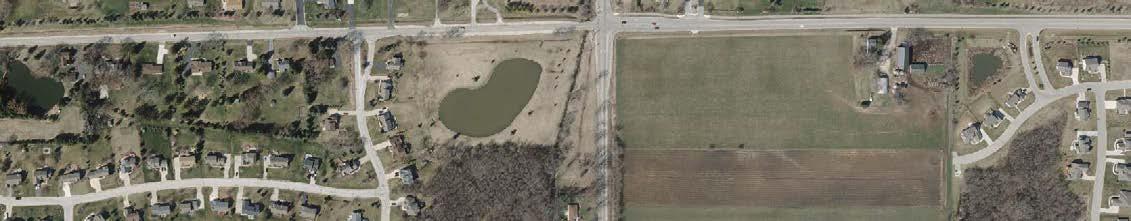
Recommendations Map

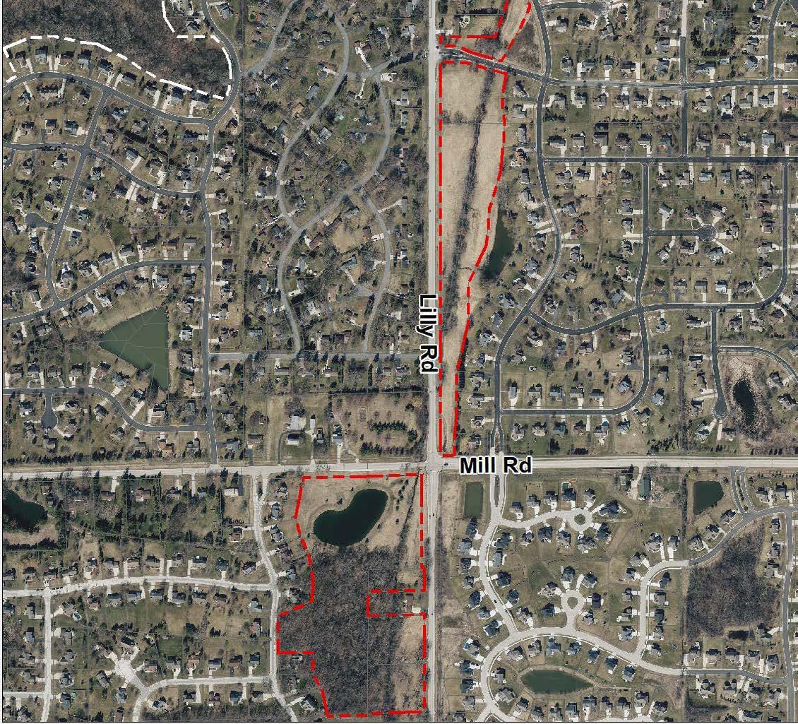
Recommendations Summary: Add a paved multi-use trail along Lilly Creek extending north from Mill Road to improve access to a scenic stretch of the parkway. Proposed improvements to the Lilly Creek Parkway south of Mill Road will support passive recreational activities like birdwatching, fishing, and picnicking. Improved crossings on Mill Rd. and Lilly Rd. will connect separated areas.
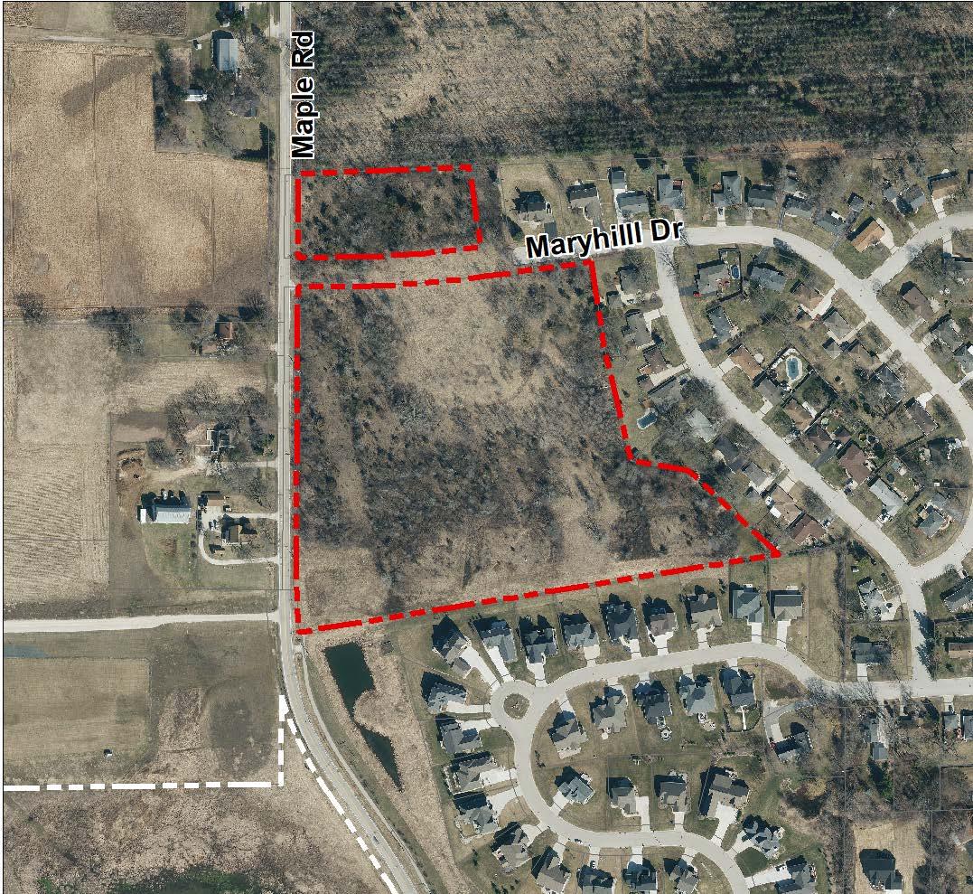
Recommendations Summary: Install a sign to formally designate Maple Road Park as a public space. Create a nature trail loop through the site and install an interpretive sign with a trail map and wildlife information. Construct a paved multi-use trail segment to connect Maple Road Park to the Bug Line Trail and the future Maple Road Preserve. Develop a Master Plan if future activity areas are desired.
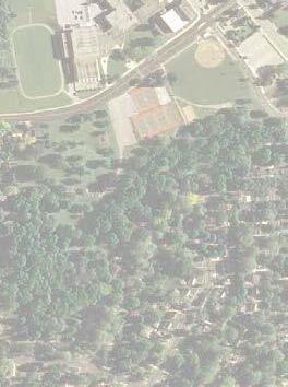


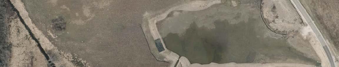
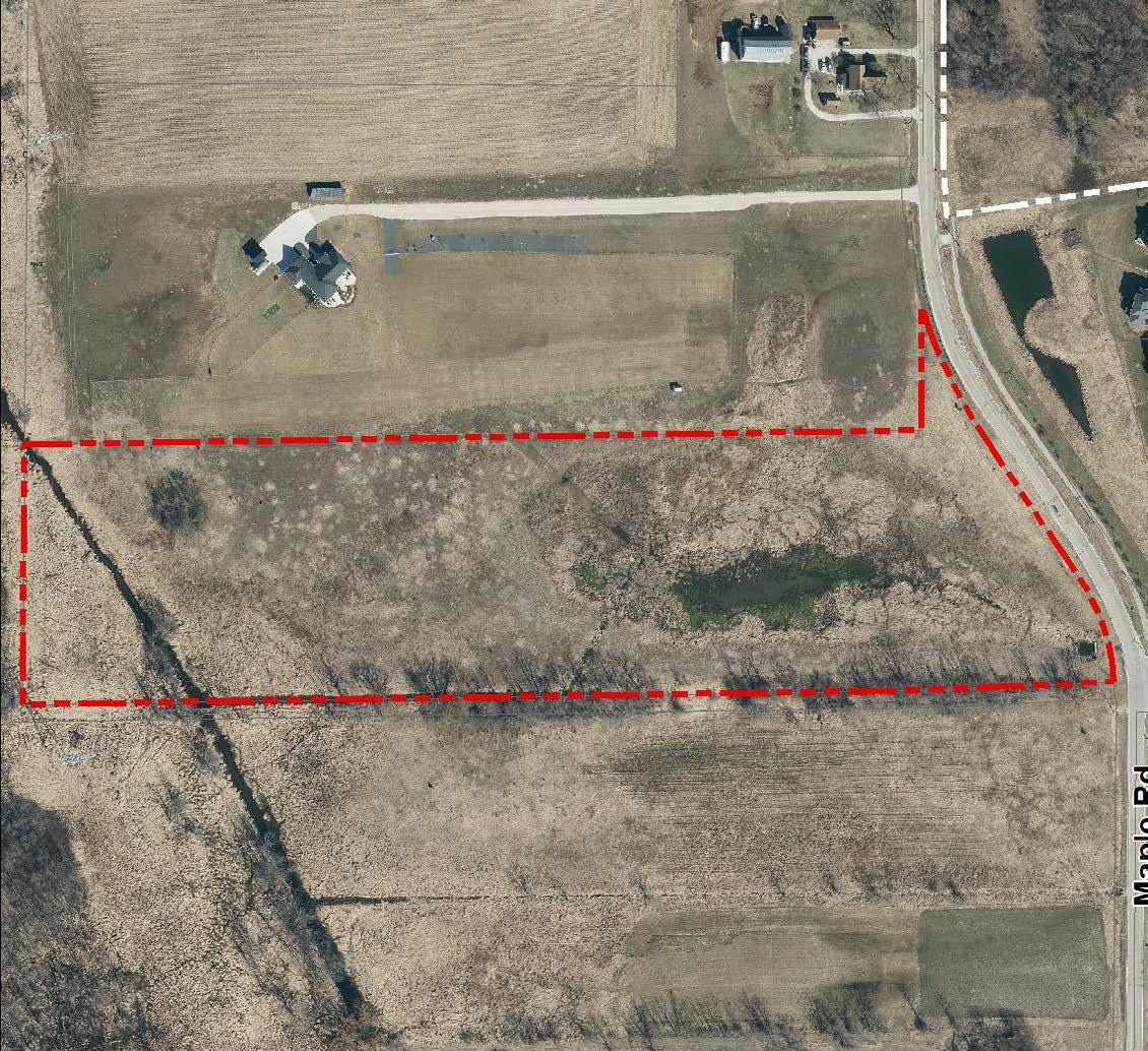
Recommendations Summary: Trail connections to the Bug Line Trail, Maple Road Park, and the future Northwest Area Park will increase visibility of and access to Maple Road Preserve. Installation of interpretive signage will promote understanding and observation of local wildlife. Park Sign
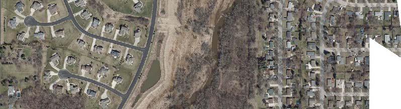

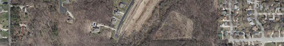
Recommendations Map

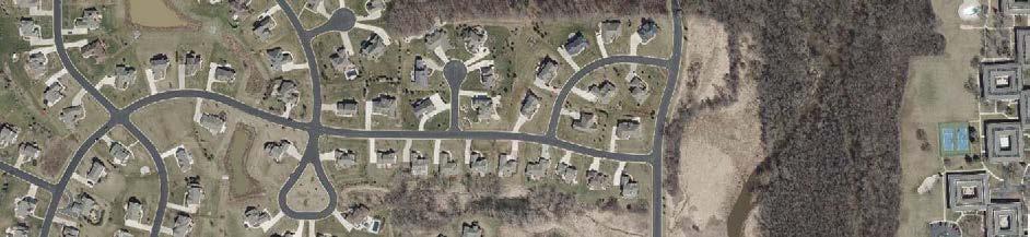


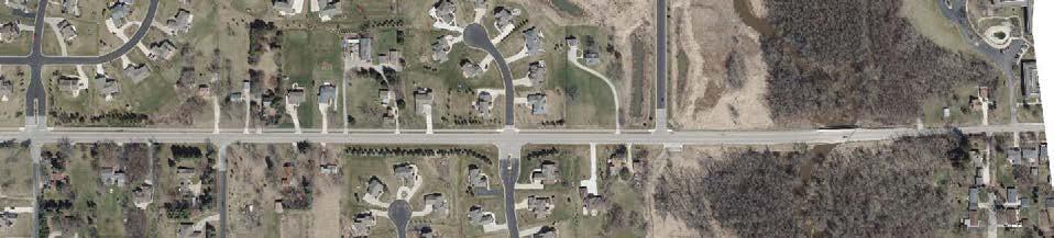

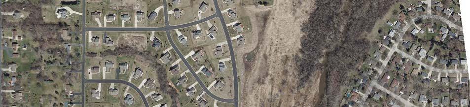
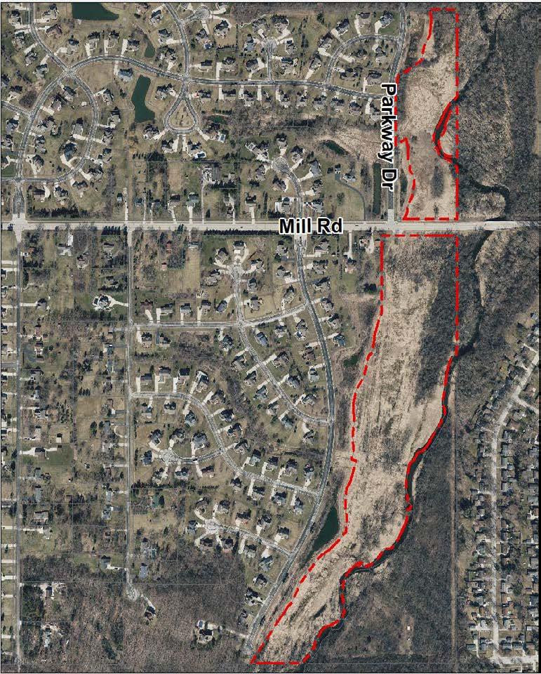

Recommendations Summary: Park signs will designate this site as a Village nature preserve and a short trail and boardwalk will provide an opportunity for visitors to experience the Menomonee River from a new vantage point. The width of Parkway Drive is adequate for shoulder parking which should be designated with signage.
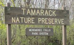
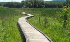
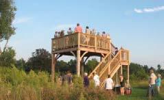
Recommendations Map


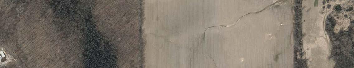
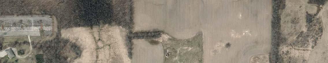
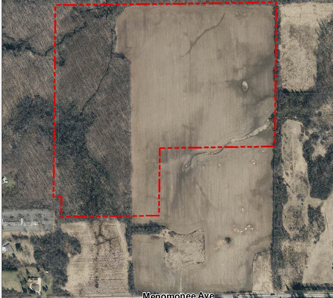
Recommendations Summary: At nearly 71 acres, this site has potential for a wide variety of recreational uses. Apart from the proposed multi-use trail for access to (and through) the site, the 2025 COR Plan does not make recommendations for the Northwest Area Park. Rather, the COR Plan recommends that a park master plan be created prior to the development of this large park site.
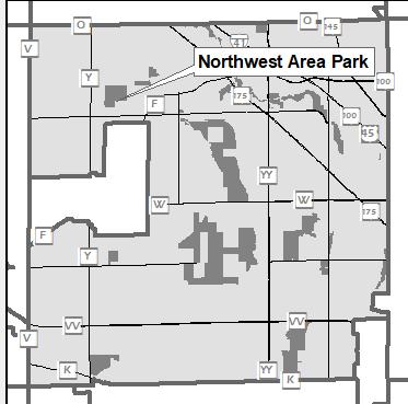
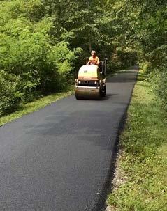


Recommendations Map
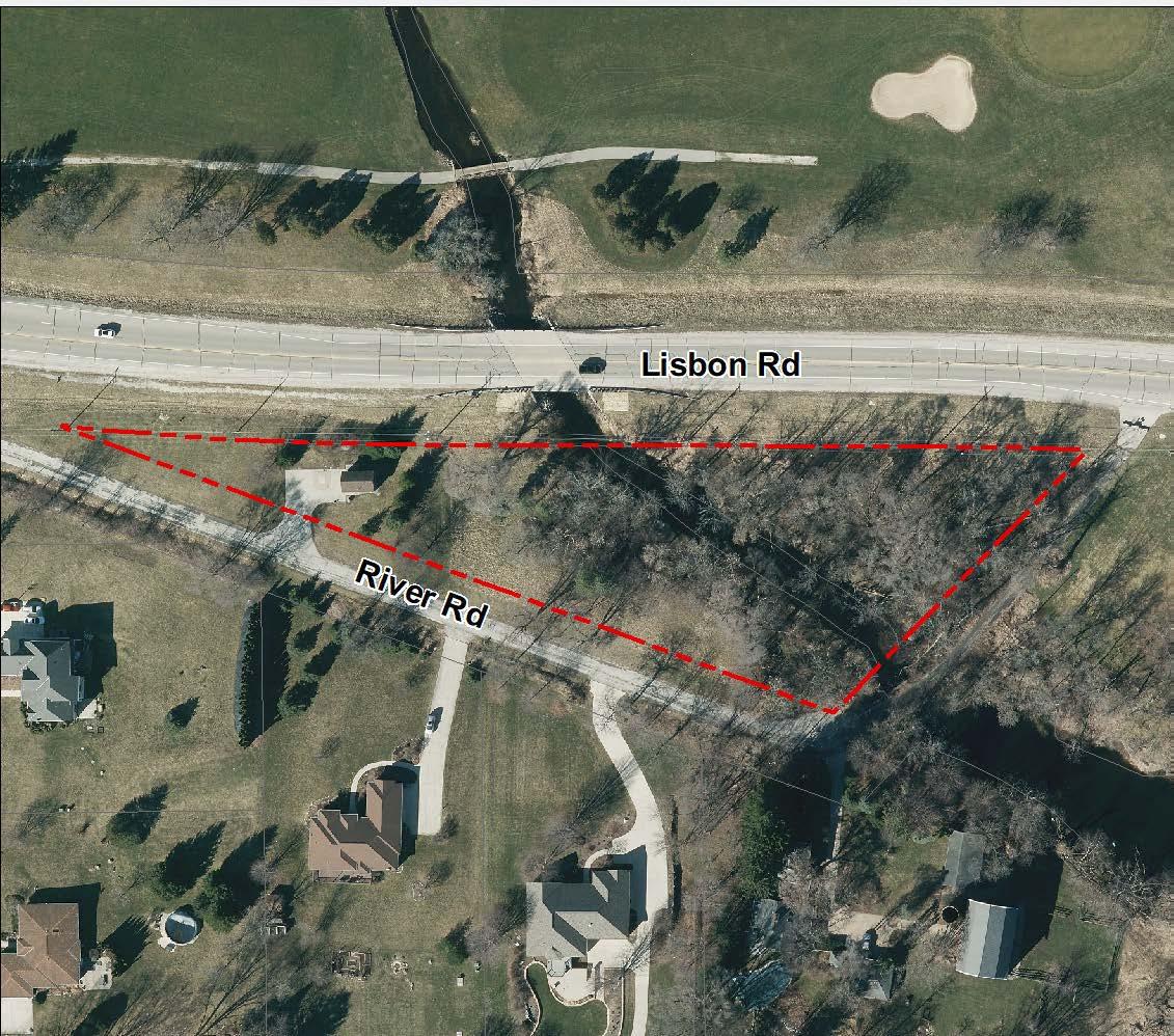
Recommendations Summary: A park sign and expanded parking area will increase the visibility of and access to River Road Park. A picnic area and paddle sports launch will add activities to the park and a new trail will connect these activities to the parking lot.
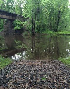
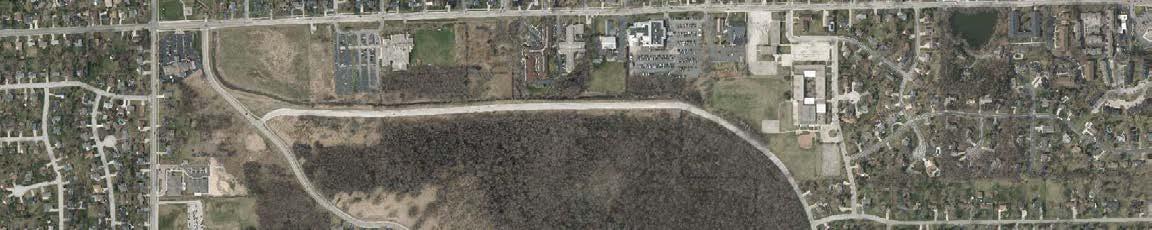
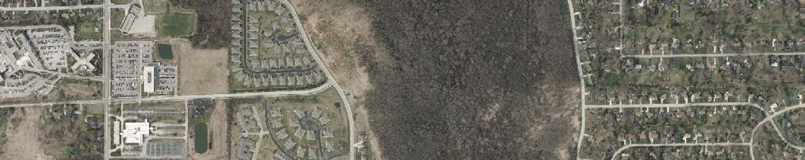
Recommendations Map
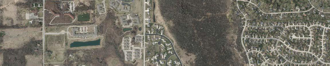
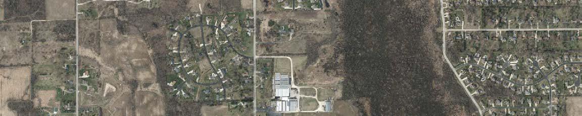
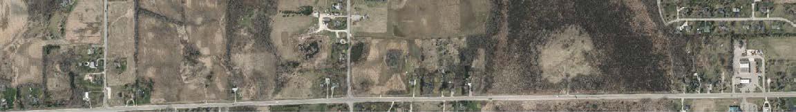
Recommendations Summary: New trails and boardwalks will connect existing and future developed areas in the north unit of the Tamarack Preserve. A parking area will be constructed to provide trail head parking on the north side of Good Hope Road. Directional signs will guide visitors around the trail loop and interpretive signs will highlight characteristics of the wetland habitat and common species that live there.
Recommendations
Recommendations Summary: Creation of a perimeter trail along the east and south sides of the Tamarack Preserve will increase public access to the woodlands and wetlands in the south unit of the preserve. Some of the trail recommendations for this area will be challenging to construct in the near future, but a trail segment between Kohler Lane and Mill Road can be constructed without a wetland crossing /boardwalk.

Recommendations Map
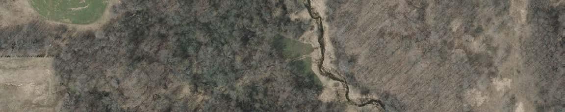


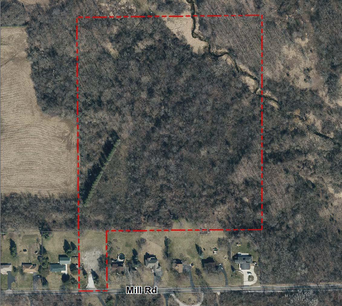
Recommendations Summary: The topography of Tower Hill Park would be advantageous to create mountain bike (MTB) trails for the high school teams and public to utilize. Grant funding for trails can be obtained through IMBA, and design and construction can be facilitated through local groups like Metro MTB. These trails, along with the proposed trail to the Fox River corridor, picnic area, and parking will increase the use of this scenic site.
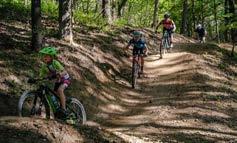
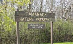
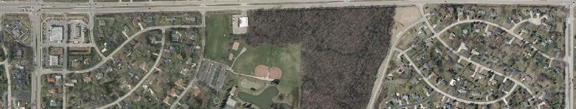
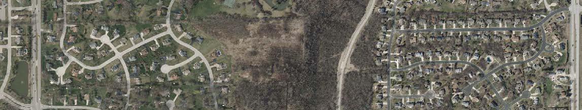
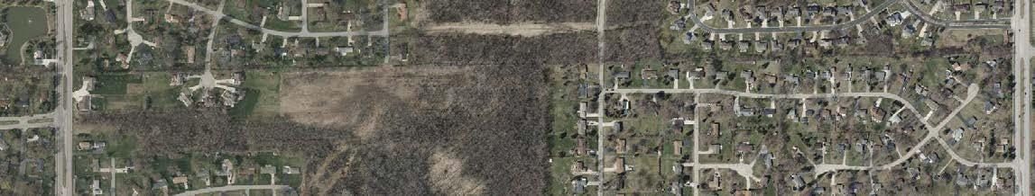
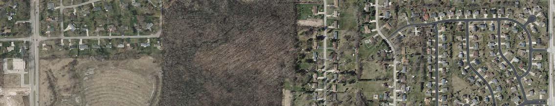
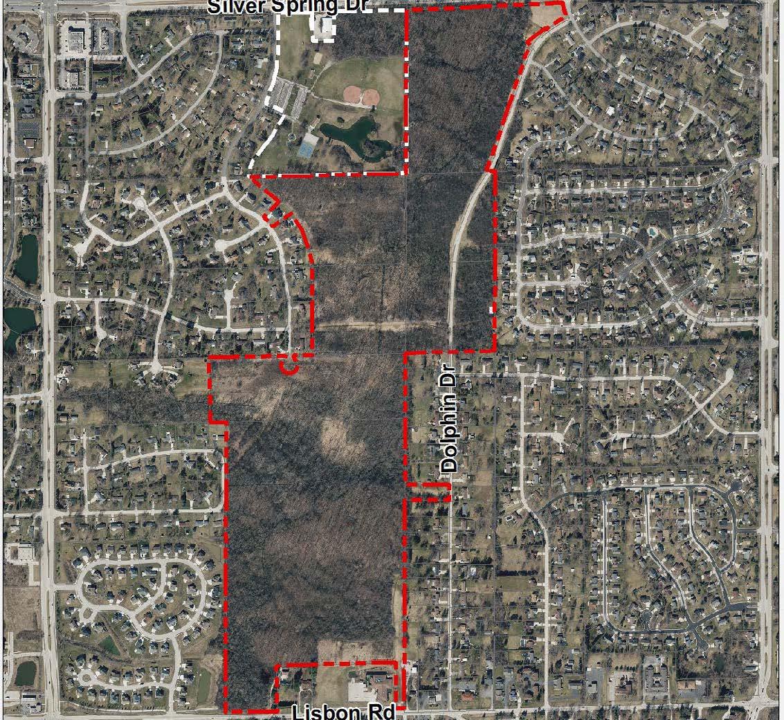
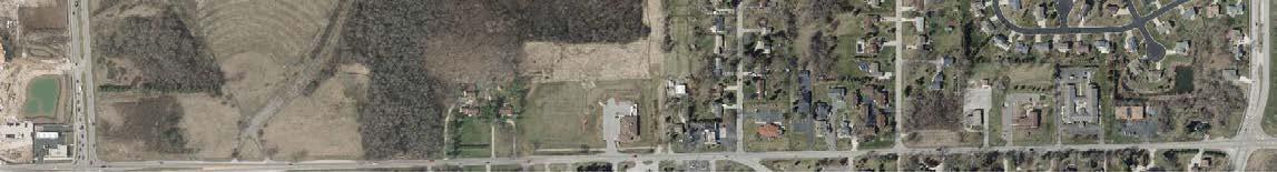
Recommendations Summary: Install park signs to designate the site as a public nature preserve. Construct a natural surface trail extending south from Willowood Park to the grass trail which runs between El Rio Drive and Dolphin Drive. A boardwalk segment will be required to traverse the wetlands immediately north of the existing trail. Add an interpretive sign to highlight the wetland habitat and common species that live there.
Lilly Creek Parkway
Maple Road Park
1. Install Lilly Creek Parkway signs to formally designate this Villageowned site as a public parkway
2. Expand and formally designate parking area along the shoulder of Mill Road
3. Create a multi-use trail west of Lilly Creek between Mill Road and Day Lilly Drive
4. Install interpretive sign(s) to highlight environmental features/local species
5. Create an improved crossing and a trail connecting the Mill Road multi-use trail and the south unit of the Lilly Creek Parkway
6. Install a small Maple Road Park sign to formally designate this Villageowned site as a public park
7. Create a nature trail loop starting at the Maple Road multi-use trail with a connection to Maryhill Drive
8. Install an interpretive sign highlighting the natural habitats found in this park and the subcontinental divide
9. Develop a Master Plan if parking and activity areas are desired Long-term Maple Road Preserve
10. Install a small Maple Road Preserve sign(s) to formally designate this Village-owned site as a public natural area
11. Create an improved crossing to this nature preserve Long-term
12. Create a natural surface trail along the south side of the preserve extending west to the Fox River from Christman Road
13. Install interpretive sign to highlight environmental features/local species (especially birds) found at this site and the headwaters of the Fox River
Menomonee River Preserve
14. Install small Menomonee Preserve sign(s) to formally designate this Village-owned site as a public nature preserve
15. Create a nature trail/boardwalk from Parkway Drive to an overlook location along the Menomonee River
16. Install interpretive signage to highlight environmental features/local species and the Menomonee River
Northwest Area Park
17. Formally designate and name this Village-owned site as a public park Long-term
18. Develop a Master Plan for the site with public input to determine potential future facilities
River Road Park
19. Install River Road Park sign to formally designate this Village-owned site as a public park
20. Expand and stripe the parking area near the pump station
21. Create a paddle sport launch near the Silver Spring Drive bridge
22. Install picnic tables and a garbage can
Tamarack Preserve
Tower Hill Park
23. Install Tamarack Preserve signs at Shady Lane wayside, future Good Hope Road public access area, and the section of the Tamarack Trail on the west side of Fox Meadows subdivision
24. Repave the parking area at the Shady Lane wayside and install a picnic area
25. Designate a multi-use recreation lane along Tamarack Trail south of the former Thomas Jefferson School site
26. Install pedestrian / bicycle wayfinding sign(s) along the Tamarack Trail with distances to connect visitors to other parks, trails, and destinations
27. Construct a public access drive and parking area in the upland area on the north side of Good Hope Road
28. Install a natural surface trail with boardwalk segments between Overlook Trail and Edelweiss Lane
29. Install interpretive signs along existing and future trail segments
30. Construct birding/nature viewing platform at the Good Hope Road upland area
31. Install a Tower Hill Park sign to formally designate this Village-owned site as a public nature preserve
32. Install picnic tables and garbage can Short-term
33. Remove the gate and improve the access drive and parking area Short-term
34. Install interpretive sign to highlight environmental features/local species Short-tern
35. Trim vegetation to ensure view corridors from the top of the hill Short-term
36. Develop plans for a nature trail loop extending to the bottom of the hill and back
37. Work with local partners (including the Menomonee Falls MTB team) to develop mountain bike trails in the park Short-term Willowood Community Forest
38. Install Willowood Community Forest signs to designate the area as a public nature preserve
39. Create a natural surface hiking trail from Willowood Park to the Dolphin Drive and El Rio Drive cut through Ongoing
40. Formalize the east - west trail that connects Dolphin and El Rio Drive signs and trail improvements Long-term
41. Install interpretive sign(s) to highlight environmental features/local species Long-term
The Village of Menomonee Falls currently contains roughly 75 miles of public sidewalk and 35 miles of paved multi-use trails. The Village also maintains 0.9 miles of gravel trail and over 13.5 miles of wide paved shoulders. If fully implemented, the recommendations in this Plan would add dozens of miles of multi-use trail and marked bike routes (designated with signs and/or “sharrows”), and several miles of bike lanes, nature trails and boardwalk. The proposed trails would provide a strong connection between all of the parks and important links to destinations throughout the community. Locations for the proposed trail recommendations are depicted in Map 41 and Map 42. See page 117 for multi-use trail construction specifications.
The following section summarizes recommendations for existing recreational trails that extend beyond the maps for developed and undeveloped park and recreation sites discussed in Chapter 7.
The Bugline Trail is a major recreational asset for Menomonee Falls, but the trail currently lacks direct access to Downtown and the Menomonee River Parkway Trail. This Plan proposes a more direct route for the Bugline Trail with an extension from the Village-maintained section heading west across the adjacent property, and continuing across Appleton Avenue to the Waukesha County-maintained section. The Plan also recommends a direct trail and boardwalk connection extending from Pershing Avenue to the Bugline Trail, and a trail or sidewalk connection along Grand Avenue to link to the Menomonee River Parkway Trail.
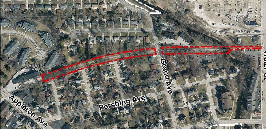
The proposed direct east-west Bugline Trail route and the proposed connections south toward Mill Pond Park and north to the Menomonee River Parkway will increase the visibility and usability of the Bugline Trail for residents and visitors. Directional signs are also proposed to make the new connections easier to navigate.
Fond Du Lac Avenue Trail
This trail was constructed in 2014 and extends from Rotary Park to 124th Street in northeast Menomonee Falls. A new trail segment is recommended to extend the Fond Du Lac Trail from Rotary Park to Main Street which will create a direct link between the Menomonee River Parkway and the East Main Street corridor.
Good Hope Road Trail
This multi-use trail currently follows Good Hope Road for two miles between Pilgrim Road and 124th Street in the eastern portion of the Village. A trail extension is recommended for approximately two additional miles between the Fox River and Pilgrim Road. This extension will create a strong east to west route in the heart of Menomonee Falls and will connect users to the Tamarack Preserve, the Village of Lannon, and the Froedtert Menomonee Falls Hospital campus.
Main Street Trail / Sidewalk
This trail currently runs along the south side of Main Street between Fountain Boulevard and Old Orchard Road. A sidewalk connection is recommended along Main Street between Fond Du Lac Avenue and Fountain Boulevard. This would create a safe route for users between existing Main Street sidewalks and the existing trail segment to the east of Interstate 41/ US 45.
Menomonee River Parkway Trail
This trail currently runs along the Menomonee River Parkway for over two miles in the northeast area of the Village. A new trail segment is recommended along the north side of the Menomonee River Parkway between Marshall Drive and Fond Du Lac Avenue. This trail would create a new recreational loop to activate the north side of the parkway and provide a link to a new proposed sidewalk connection between the parkway and East Main Street.
Silver Spring Drive Trail
This multi-use trail runs along Silver Spring Drive between the Fox River and Pilgrim Road. New portions of the trail have been built in recent years resulting in a safe off-street connection for users along this high traffic corridor. Trail extensions along Silver Spring Drive are recommended from Town Line Road to the Fox River Falls subdivision and from Butternut Drive to the Menomonee River. These extensions would create a continuous east to west path across the southern end of the Village.
The following section summarizes recommendations for new recreational trails that extend beyond the maps for developed and undeveloped park and recreation sites included in Chapter 7.
Lannon Road Trail
This multi-use trail is proposed to run along Lannon Road from Lisbon Road to the Village of Lannon. This trail will link to a proposed trail along Lisbon Road and connect to Aero Park and several existing and future residential developments in the southwestern area of the Village.
Lisbon Road Trail
This trail is recommended along the north side of Lisbon Road between Town Line Road and the Village of Butler in southern Menomonee Falls. The trail would provide an off-street route for users and connect several residential developments and neighborhoods. The Lisbon Road Trail would also create links between recreational destinations like Wanaki Golf Course, the proposed River Road Park, Brookfield Soccer Complex, Marcy Elementary School, and Willowood Park.
This multi-use trail is proposed to run from County Line Road to the Bug Line Trail in the northwest area of Menomonee Falls. The trail would link County Line Road/Appleton Avenue shopping destinations to the proposed Maple Road Park, Maple Road Preserve, Christman Park subdivision, and the Bug Line Trail.
The proposed Marcy Road Trail would extend along Marcy Road between Good Hope Road and Lisbon Road. This trail will link residential areas along Marcy Road to the Tamarack Preserve, Mill Road, Silver Spring Drive, and Marcy Elementary School.
This trail would extend along Old Orchard Road from Main Street to 124th Street and continue along 124th Street south to Leon Road. The trail would create a link between services along 124th Street, employers along Old Orchard Road, and an existing trail segment along East Main Street.
This multi-use trail would follow One Mile Road between Silver Spring Drive and Lisbon Road in the southwest area of Menomonee Falls. This trail will connect existing and future residential areas with the larger existing and recommended multi-use trail network in the southwest area of the Village.
This trail would follow Town Hall Road from the sidewalk south of Custer Lane to Good Hope Road in the western area of the Village. The trail would create a link from a proposed trail along Good Hope Road to the Froedtert Menomonee Falls Hospital campus. The trail will also connect to a proposed bike lane along Town Hall Road and tie into senior living complexes and with anticipated future residential development.
Town Line Road Trail
This proposed trail would run along the east side of Town Line Road between Lisbon Road and West Main Street. The trail will connect existing and future residential neighborhoods to Silver Spring Drive, Hamilton High School, Willow Springs Learning Center, and the Village of Lannon.
Wide paved shoulders, bike lanes and marked bike routes are recommended as part of a complete network of bicycle facilities in Menomonee Falls. Wide paved shoulders (at least five feet in width) are generally recommended along minor arterials which are located in less developed portions of the Village. Wide paved shoulders make sense in the more rural areas of the Village because they offer safe routes for bicycles at a significant cost savings compared to off street trails, and they could also be utilized by mail carriers for deliveries.
Bike lanes are recommended along Menomonee Avenue between Town Hall Road and Appleton Avenue, along Town Hall Road between Main Street and Custer Lane, and along Appleton Avenue between Menomonee Avenue and 124th Street. Bike lanes create dedicated on-street paths for bicycles along routes that are likely to see higher volumes of bicycle traffic. The recommended bike lanes are proposed on streets with large curb-to-curb widths in order to accommodate a five-to-six-foot-wide bike lane while retaining existing on-street parking areas. See page 117 for bike lane design cross sections.
Marked bike routes are recommended along approximately 10 miles of Village streets. These routes would
designate on-street connections between Village parks and other destinations like schools, shopping areas, and employment centers. Marked bike routes could be designated with on-street paint makings called “sharrows” which promote bicycle visibility and safe, shared use of traffic lanes by bicycles and motorists. Marked bike routes could also be designated with bike route signs and general wayfinding signage to direct users to Village parks and destinations. Many marked bike routes are recommended along roadways near Downtown due to the area’s high density of recreational and shopping destinations. Other marked bike routes would link bicycle riders to major Village recreational destinations like the Tamarack Preserve, Oakwood Park, and Willowood Park. See page 117 for examples of sharrows and bike route signage.
There is an opportunity to create off road trails for mountain biking (MTB) on undeveloped parcels in the Village. The Tower Hill Park property has over 20 acres of woods with good (and challenging) topography for trails. Creating designated MTB trails in Tower Hill Park will provide an area for the Menomonee Falls High and Hamilton High School MTB teams to practice and create a new recreation destination for the public.
Existing sidewalks in Menomonee Falls are predominately located near the historic core of the community, along Appleton Avenue and within recently developed residential developments in the south and southwestern areas of the Village. The CORP recommends sidewalk extensions where gaps exist along Appleton Avenue and along collector streets in the north end of the Village. A new sidewalk is also proposed to connect East Main Street to the proposed new Menomonee River Parkway Trail segment and other East Main Street connections at the overpass. Development of future sidewalks is generally recommended as roadways are reconstructed but should be addressed earlier in areas like north Appleton Avenue where pedestrian access is significantly limited by sidewalk gaps.
The following maps depict the proposed trail infrastructure for the Village of Menomonee Falls. Map 41 shows the recommended bikeways and includes multi-use trails (and boardwalks), wide paved shoulders, bike lanes and marked bike routes. Map 42 shows recommended pedestrian ways and includes multi-use trails (and boardwalks), sidewalks and nature trails. Map 43 shows recommended pedestrian routes and potential wayfinding signage locations in the Downtown district.
Map 41: Recommended Bike Ways
Map 40: Recommended Bike Ways
Recommended bikeways, including multi-use trails (and boardwalks), wide paved shoulders, bike lanes and marked bike routes

Multi-Purpose Trail
Sidewalk
Gravel Trail !!!!!! Proposed Multi-Purpose Trail
Proposed Sidewalk !!!!!!!!!!!! Proposed Nature Trail
Proposed Boardwalk
Recreation Site Environmentally

Map 43: Recommended Downtown Pedestrian Routes and Wayfinding Locations
With six park sites and numerous attractions, Downtown is an ideal area to improve walkability. Wayfinding signage, improved crossings, and the use of alleys as pedestrian routes will connect visitors to destinations and public parking areas.

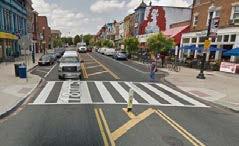
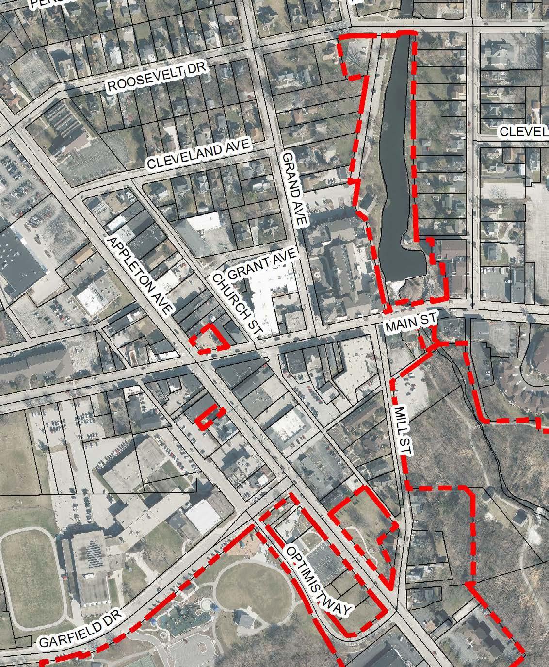
pedestrian routes
The following are minimum specifications for off-street multi-use trails constructed in the Village of Menomonee Falls:
• Cross section may be straight grade or crowned with a one percent slope as conditions warrant.
• Base construction of nine foot wide by six inches thick 0.75-inch compacted crushed limestone (traffic bond) meeting requirements of State Gradation number two.
• Eight feet wide by three inches thick bituminous concrete base course pavement (asphalt) conforming to Village street specifications.
• Subgrade, gravel grade, and pavement grade must be set to adequately drain water.
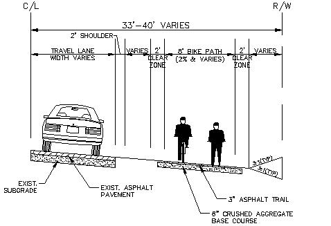
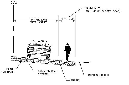
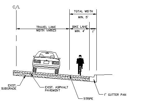

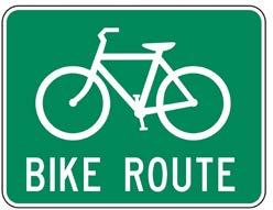
*Note: these common bike route sign styles are examples of (not recommendations for) how the Village could mark bicycle routes
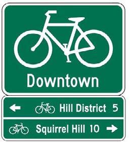
As with all plans of this nature, implementation will require capital improvement planning and fiscal resources of the Village. Public policies and procedures, and the various regulatory measures which Menomonee Falls now exercises, should continue to be directed toward providing a variety of recreational facilities and activities for residents of all ages and abilities. It must be recognized, however, that implementation is subject to funding, legal, and coordination limitations.
Village staff should continue to develop park site plans and work to prepare and write grants to actively seek funds for projects. The Village should coordinate recreation programming with the school districts, while continuing to be responsible for park plans, development and maintenance. The Village should continue to accept land dedication or fees in lieu of land dedications for future park development from all new residential developments to provide adequate outdoor recreation space for future residents. This plan should be updated every five years in order to remain consistent with current recreation standards and to maintain eligibility for recreation grant funds.
Implementation of the CORP can take many forms. Strategies for implementation include regulatory techniques and acquisition techniques.
Regulatory Techniques
Zoning:
Zoning is the regulation of the use of private property, for the purpose of promoting the orderly development of the community and furthering the health, safety and general welfare of its residents. Public parks are usually within the P-1 Park and Open Space District. Floodplains, woodlands and wetlands are usually protected in the F-1 Floodway and CW-1 Conservancy-Wetlands Districts. Environmentally sensitive lands can, in many cases, be effectively protected through zoning. All lands within 300 feet of a navigable river and within 1,000 feet of a lake are classified as shorelands. All wetlands within shorelands fall under regulations of the Village of Menomonee Falls and the Department of Natural Resources. All wetlands are regulated by the U.S. Corps of Engineers, the Department of Natural Resources and the Village of Menomonee Falls. Other traditional zoning standards can also protect Menomonee Falls’ open space. Required yards, density controls and lot coverage controls provide valuable open space to the community while also providing groundwater recharge areas. Rezoning is an option for properties identified for acquisition.
Subdivision control the municipal right to control the official division of lands. Wisconsin Statutes vest control over subdivisions within Menomonee Falls and provide certain review authorities in the unincorporated territory within 1.5 miles of its corporate limits. Land suitable for park development can often be secured without cost to the general public by requiring the property developer to dedicate land within the development for parks or pay a fee that can be used for park acquisition.
Although official mapping, as laid out in Wisconsin statute 62.23, is commonly associated with future acquisition of road right-of-way, it can also be used to identify future parklands. With this technique, future park areas are identified on a map, duly recorded, and approved by the governing body. These areas depicted on the Official Map are then prohibited from being developed, offering the community time to purchase the site.
A number of park and open spaces are recommended to have Management Plans drafted to address the health and safety of the vegetation, restore native species, and remove invasive species. Land Management Plans should include at a minimum:
• Site assessment for existing plant and animal species, site condition, site environment, and site features that need improvement, such as erosion, shoreline condition, or goose problem.
• Vegetative management plan that favors diverse, native, strong rooted species that attract native wildlife, dissuade geese, and that eliminates invasive species that create monocultures.
• List of suitable native species that will be added to the natural area.
• Phased implementation plan on how to remove invasive undesirable species and plant desirable species, including erosion control.
• Cost estimate.
• Monitoring plan.
• Potential funding sources.
In addition to these regulatory techniques, the Village has a number of acquisition techniques that may apply to each potential park acquisition. The acquisition of land is often the most challenging aspect of developing a municipal park system. These include:
The landowner is given a sum of money for all rights to a specific piece of land or property. In Wisconsin, fee simple acquisition is the most common way of acquiring public lands for recreational uses. A land contract may also be used as a form of fee simple acquisition.
This technique can only be used when back taxes on land have not been paid. Where such lands are needed for outdoor recreation and open space purposes, the purchaser pays the back taxes. The fair market value minus the cost of the back taxes is paid to the former owner.
Lease or Easement:
This technique provides for the recreational use of land for a designated period of time but without fee simple acquisition. An easement of lease can be written to allow or restrict public access and use of private land. Restricting access can encourage the preservation and creation of scenic views. Easements can also be used to provide limited trail access for recreation purposes. Due to their versatility, easements are a valuable implementation tool.
The land bank, which can be set up as a part of local government or a self-governing entity, can purchase land and then sell it for recreational purposes. Proceeds from the sale of land could be used for subsequent purchases. Initial financing could be provided through grants or by the issuance of bonds.
Former landfills can often be used for recreational purposes. A variety of open space uses can be supported in these areas provided the material making up the landfill has adequately settled and poses no danger to the public.
Private groups or organizations such as the Trust for Public Land or the Nature Conservancy can purchase outdoor recreation lands and hold these lands until a public agency can acquire them.
Donation:
This technique is the least expensive means of acquiring land for outdoor recreation and open space uses. Tax deductible contributions can be in the form of a lease, easement, or outright title to a piece of property.
The following organizations may be able to provide expertise, volunteers, and funding for the implementation of the CORP:
UW-Extension Natural Resources Institute naturalresources.extension.wisc.edu
The Division of Extension Natural Resources Institute is comprised of researchers and outreach specialists with the University of Wisconsin-Madison and the University of Wisconsin Extension. The ERC’s mission is to empower individuals and communities to make conscious, well-informed decisions about their environments and the social processes involved in caring for them.
Milwaukee Riverkeeper
1845 N. Farwell Avenue, Suite 100 Milwaukee, WI 53202 (ph) 414-287-0207 info@mkeriverkeeper www.mkeriverkeeper.org
The mission of Milwaukee Riverkeeper is to protect, improve and advocate for water quality, riparian wildlife habitat, and sound land management in the Milwaukee, Menomonee, and Kinnickinnic River Watersheds. The organization envisions a future in which people from all walks of life can enjoy the healthy waterways of the Milwaukee River Basin. Milwaukee Riverkeeper is a licensed member of the Waterkeeper Alliance, an international coalition ensuring clean water and strong communities.
Southeast Fox River Partnership
Tom Slawski
tslawski@sewrpc.org www.southeastfoxriver.org
The Southeast Fox River Partnership, formed in 1998, represents a wide range of federal, state, county and local agencies, nonprofit organizations and private sector interests. The partnership was formed to give citizens, environmental and conservation groups, businesses and local governments the ability to share resources while working toward common goals.
MMSD Water Quality Initiative
Menomonee River Watershed 260 West Seeboth Street Milwaukee, WI 53204
414-272-5100
mmsd.com/government-business/2020-water-quality-initiative
Grant projects for rain gardens, disconnecting downspouts, shoreline restoration. Greenseams flood management land acquisition project in the Menomonee River Basin mmsd.com/floodmanagement/greenseams
River Alliance of Wisconsin
147 S. Butler Street · Suite 2 Madison, WI 53703
Ph: 608-257-2424 info@wisconsinrivers.org wisconsinrivers.org
Under contract with WDNR to provide technical assistance for River Protection Grant Program. Available to discuss funding issues with local groups, development of river and streams protection grant proposals, work to start new local organizations.
The Waukesha Land Conservancy
P.O. Box 2572
Brookfield, WI 53008
262-875-3070
wclc1992@gmail.com www.waukeshalandconservancy.org
The Waukesha Land Conservancy is a land trust that is not for profit, tax-exempt, & volunteer organization funded through memberships and other donations. The Waukesha Land Conservancy currently has over 2,700 acres in permanent conservation protection, 147 acres of which is located in the Tamarack Preserve and nearly 15 acres in a property in northern Menomonee Falls.
The Conservation Fund
Clint Miller, Vice President and Central Midwest Regional Director of the Conservation Fund cmiller@conservationfund.org www.conservationfund.org
The Conservation Fund works with the Milwaukee Metropolitan Sewerage District to acquire properties that naturally store and absorb large amounts of water.
A wide variety of potential funding sources are available to the Village. Grant opportunities can be pursued in three ways. First, a Village staff member can be assigned grant writing duties. Second, a consultant with grant writing experience can be hired to apply on behalf of the Village for specific grants when they are identified. Costs will vary with the level of effort required to complete a grant application. These typically cost between $1,500 and $3,000. Third, the Village could use volunteers or the partner organizations listed above to write and assist with grant applications. As of July 2016, the following programs have been identified. However, this list is not exhaustive, and Village staff should continue to pursue additional funding opportunities. Furthermore, as organizations and grants evolve, the Village may not be eligible for every program or funding source identified below.
Aids for the Acquisition and Development of Local Parks
Description: Buying land or easements and developing or renovating local park and recreation area facilities for nature-based outdoor recreation purposes (such as trails, picnic areas, fishing piers, camping facilities, sledding hills, support facilities and more).
Eligible Project Costs: Land acquisition, development of nature-based outdoor recreation facilities and engineering fees.
% Match: 50% local match
Agency: DNR
Contact Name: Sara deBruijn
Phone: 414-897-5704
E-mail: sara.debruijn@wisconsin.gov
Web site: dnr.wisconsin.gov/topic/Stewardship/ApplyLUG
Congestion Mitigation and Air Quality (CMAQ) Improvement Program
Description: The Congestion Mitigation and Air Quality Improvement program encourages transportation projects that improve air quality. CMAQ funds are only available in these southeastern and nor theastern Wisconsin non-attainment and maintenance counties: Milwaukee, Racine, Kenosha, Waukesha, Washington, Ozaukee, Walworth, Sheboygan, Kewaunee, Manitowoc and Door.
Eligible Project Costs: Projects that enhance public transit, bicycle/pedestrian facilities, ridesharing programs and facilities, and technologies that improve traffic flow and vehicle emissions.
% Match: 0% local match-construction projects must have a total projected expense of $200,000 or more and non-construction projects must have a total projected expense of $50,000 or more.
Agency: WisDOT
Contact Name: Tyler Beinlich
Phone: 262-548-5856
E-mail: tyler.beinlich@dot.wi.gov
Web site: wisconsindot.gov/Pages/doing-bus/local-gov/astnce-pgms/aid/cmaq.aspx
Land and Water Conservation Fund
Description: Federal funds to encourage nationwide creation and interpretation of high quality, outdoor recreational opportunities. The program funds both state and local outdoor recreation projects.
Eligible Project Costs: Acquisition of land for public outdoor recreational areas and preservation of water frontage and open space. Development of public outdoor park and recreational areas and their suppor t facilities. Differs from the Aids for Acquisition and Development of Local Parks because also allows the development of active outdoor recreation facilities such as ball fields, playgrounds etc.
% Match: 50% local match
Agency: DNR
Contact Name: Sara deBruijn
Phone: 414-897-5704
E-mail: sara.debruijn@wisconsin.gov
Web site: dnr.wisconsin.gov/aid/LWCF.html
Recreational Trails Program (RTP)
Description: Development and maintenance of recreational trails and trail-related facilities for both motorized and non-motorized recreational trail uses.
Eligible Project Costs: Rehabilitation of trails, trail maintenance, trail development and trail acquisition.
% Match: 50% local match
Agency: DNR
Contact Name: Sara deBruijn
Phone: 414-897-5704
E-mail: sara.debruijn@wisconsin.gov
Web site: dnr.wisconsin.gov/aid/RTP.html
Transportation Alternatives Program (TAP)
Description: The Transportation Alternatives Program is a comprehensive federal funding category that incorporates the following three WisDOT multi-modal transportation improvement programs: Safe Routes to School; Transportation Enhancements; and The Bicycle & Pedestrian Facilities Program.
Eligible Project Costs: Funding for construction, planning and design for on-road and off-road trail facilities for pedestrians, bicyclists and other non-motorized forms of transportation. Development of safe routes for non-drivers, conversion of railroad corridors to trails and a variety of other projects which enhance the safety and overall experience of pedestrians, bicyclists and users of other nonmotorized forms of transportation.
% Match: 20% local match
Agency: WisDOT
Contact Name: Tyler Beinlich
Phone: 262-548-5856
E-mail: tyler.beinlich@dot.wi.gov
Web site: wisconsindot.gov/Pages/doing-bus/local-gov/astnce-pgms/aid/tap.aspx
Description: Buy land or easements in urban or urbanizing areas to preserve the scenic and ecological values of natural open spaces for nature-based outdoor recreation, including noncommercial gardening.
Eligible Project Costs: Land acquisition for natural open space near urban areas.
% Match: 50% local match
Agency: DNR
Contact Name: Sara deBruijn
Phone: 414-897-5704
E-mail: sara.debruijn@wisconsin.gov
Web site: https://dnr.wisconsin.gov/topic/Stewardship/ApplyLUG
Urban Rivers Grant
Description: Buy land on or adjacent to rivers flowing through urban or urbanizing areas to preserve or restore the scenic and environmental values of river ways for nature-based outdoor recreation.
Eligible Project Costs: Land acquisition, shoreline enhancements.
% Match: 50% local match
Agency: DNR
Contact Name: Sara deBruijn
Phone: 414-897-5704
E-mail: sara.debruijn@wisconsin.gov
Web site: https://dnr.wisconsin.gov/topic/Stewardship/ApplyLUG
Urban Forestry
Description: Improving a community’s capacity to manage its trees. Includes projects such as computerized street tree inventories, training for Village tree workers, urban forestry plans, tree ordinances, public awareness program, tree planting and maintenance and more.
Eligible Project Costs: Salaries and fringe benefits of personnel directly engaged in project; necessary supplies and equipment; leased equipment and facilities; reasonable value of in-kind contributions by applicant of labor, equipment or facilities; and contract costs of vendors to perform project activities.
% Match: 50% local match
Agency: DNR
Contact Name: Elton Rogers
Phone: 414-294-8675
Email: elton.rogers@wisconsin.gov
Web site: https://dnr.wisconsin.gov/topic/urbanforests/grants
IMBA Trail Accelerator Grants
International Mountain Bicycle Association offers Trail Accelerator grants provide a jump-start to communities that have the interest and political support to develop trail systems but need assistance to get projects up and running. A Trail Accelerator grant offers awardees professional trail planning and consultation services to launch their trail development efforts, which can often leverage additional investment from local, regional, and national partners. www.imba.com/programs/trail-accelerator-grants
American Hiking Society
National Trails Fund: Created in 1998, American Hiking Society’s National Trails Fund is the only privately supported national grants program providing funding to grassroots organizations working toward establishing, protecting and maintaining foot trails in America. National Trails Fund grants have been used for land acquisition, constituency building campaigns, and traditional trail work projects. www.americanhiking.org
Bikes Belong Grants Program
The Bikes Belong Grants Program strives to put more people on bicycles more often by funding impor tant and influential projects that leverage federal funding and build momentum for bicycling in communities across the U.S. These projects include bike paths, lanes, and routes, as well as bike parks, mountain bike trails, BMX facilities, and large-scale bicycle advocacy initiatives. bikesbelong.org/grants
Environmental Protection Agency Great Lakes Grants
The program provides financial and technical support and opportunities for communication to enable community-based restoration projects. www.epa.gov/great-lakes-funding
Milwaukee Foundation [General]:
The Milwaukee Foundation is a permanent charitable endowment that offers a wide variety of grants to community organizations, to strengthen the community, promote the ar ts and to protect the environment. www.greatermilwaukeefoundation.org
Milwaukee Foundation [Scherffius Fund]:
The Milwaukee Foundation is a nonprofit Management Fund that strives to improve the management effectiveness and efficiency of nonprofit organizations in our area. www.greatermilwaukeefoundation.org
Natural Resources Foundation of Wisconsin
Provides small, matching grants to conservation organizations in support of projects that promote the responsible stewardship of Wisconsin’s natural resources at the local level. www.wisconservation.org/how-we-work/funding-conservation-projects
National Fish and Wildlife Foundation
NFWF provides funding on a competitive basis to projects that sustain, restore, and enhance our nation’s fish, wildlife, and plants and their habitats. www.nfwf.org/whatwedo/grants/Pages/home.aspx
REI offers two kinds of grants. One focuses on conservation and the other on recreational activities. Unsolicited grant requests will not be accepted. REI employees must make nominations and nearest stores should be contacted for information.
REI, Brookfield Store
REI, Madison Store 13100 West Capitol Drive 7483 West Towne Way M ilwaukee, WI 53005 Madison, WI 53719 (262) 783-6150 (608) 833-6680 www.rei.com/aboutrei/grants02.html
In an ideal scenario, all of the recommendations found in Chapters 7 and 8 of the CORP would be fully implemented in the 2025-2030 planning period. However, in consideration of municipal expenditure restraints, the recommendations should be considered as an “a la cart” list of options of potential projects that the Village may choose to implement as funding becomes available.
Installation of an ADA compliant crossing at the intersection of Bug Line Trail and Christman Road
The time-frame designations related to developed park improvements (Table 10, page 94) and undeveloped park improvements (Table 11, page 108) are meant to provide general guidelines for when recommended projects should be implemented. The “short-term” designation indicates projects that should be undertaken within a few years. These are typically projects with relatively low anticipated costs and high priority benefits. The “long-term” designation indicates projects that should be undertaken as opportunities arise, but may be challenging to complete within the time horizon of the 2025-2030 CORP. The “ongoing” designation indicates projects that the Village should undertake and continue to support on an annual/seasonal basis.
Time frame designations have not been included with trail improvement recommendations, though some projects will be easier to implement in the near-term than others. In accordance with the 2025 Comprehensive Plan goal of linking trails and paths throughout the Village, completing missing links in the existing trail system should take priority over new trail development. Recommendations for developing a system of wayfinding signage support the Comprehensive Plan’s recommendation to review directional signage and consider possible improvements in order to connect residents and visitors to local areas of interest.
The park and trail recommendations within the CORP are meant to provide a framework for Village staff and elected officials in selecting and implementing outdoor recreation projects in Menomonee Falls. For details and exhibits regarding specific recommendations, refer to the appropriate sections of Chapter 7 and/ or Chapter 8.
Implementation of the CORP will require a coordinated effort by private interests and the federal, state, and local government and the funding agencies involved. Implementation of the recommendations set forth in this plan will enhance the existing facilities and ultimately result in a comprehensive outdoor recreation system for the Village that can serve the existing population, and future residents.
The 2015 Comprehensive Plan Update was developed as a to guide future development and redevelopment within the Village of Menomonee Falls within a period from 2016 to 2036. The 2015 Comprehensive Plan Update evaluated and revised the Comprehensive Plan adopted by the Village in 2008 and fulfilled all requirements of Wisconsin’s comprehensive planning statutes. The planning effort included significant public outreach efforts and added new goals and recommendations for economic development and health/ public safety.
The plan includes 15 overarching goals and dozens of supporting recommendations in support of an ideal vision for the future of Menomonee Falls. Plan recommendations were drafted with consideration for continued population growth and an aging population. Village staff relied significantly on the 2008 Comprehensive Plan in developing the content of the 2015 Comprehensive Plan Update with most specific study area recommendations remaining intact in the revised document. See page 4 for details on how the 2016-2020 CORP supports the goals of the Comprehensive Plan.
From 2015-2016, Menomonee Falls completed master plans for two parks within the Village limits to determine the highest and best use for each site. Master plan maps from the Aero Park and Village Park have been incorporated into the 2016-2020 CORP with a recommendation to implement improvements in accordance with the adopted plans. Recommended facility improvements at the 65 acre undeveloped Aero Park site (located in the southwest area of the Village) include the following:
• Recreation lawn
• Dog exercise area
• Playscape (playground & splash pad)
• Sledding hill
• Multi-use shelter
• Court sports
• Trail system
• Disc golf
Recommendations for recreational facility improvements at the existing Village Park site include the following:
• Festival area (redesigned green space)
• Playground & splash pad
• Redesigned trail network
• Reconfigured court sports
• Enhanced Veterans Memorial
• Multi-use shelter
The 2011-2015 CORP updated the 2006-2010 CORP recommendations for future park and trail locations, improvements to existing Village parks, and an action plan for capital improvements, corridor preservation, universal access/barrier free design, playground safety surfaces, park security, park maintenance, and funding strategies.
The major recommendations of the plan include:
Consistent design of features in Village parks and along Village trails.
• Improved connectivity for Village parks and trails through improved wayfinding signage and new trail connections
Development of “tot lots” and other small neighborhood and mini-parks
Restoration of environmental corridors to perform more natural functions
• Designation of Village owned property along streams as official parkways
• Snow and ice removal along multi-use trails
• Expanded recreational activities and improved shelters in Village parks
Land acquisition for future parks in the northwest and southwest areas of the Village
Village staff retained the organizational structure of the 2011-2015 CORP when developing the 20162020 update and incorporated many of the of the prior CORP’s general recommendations, park site recommendations and trail network recommendations.
This plan provides a guide for short-term and long-term improvements to the historic downtown core of Menomonee Falls. The Master Plan recommends that the community should build upon the Village Centre’s strengths: historic character, diversity of retail and service businesses, strong adjoining neighborhoods, the Menomonee River, the Parkway and numerous recreational facilities. All of these features strengthen Downtown’s position as a focal point and destination for the community and the region.
The Village Centre Master Plan focuses on maintaining and, in some cases, enhancing pedestrian connectivity through multi-purpose trails, “walkability”, diversity, visual appeal and other elements that will enable the Village to retain existing businesses and attract new ones, providing interesting places to live and visit and creating the activity necessary to allow Downtown to thrive for many years to come. In relation to the CORP, the Master Plan calls for a reorientation of Downtown with a greater focus on the Menomonee River and continued improvements to Village Centre parks and public spaces.
Draft-Vision 2050: A Regional Land Use andTransportation Plan for SoutheasternWisconsin, 2016 SEWRPC is in the process of updating its regional land use and transportation system recommendations through its Vision 2050 plan process. In relation to the CORP, Vision 2050 provides a guide for developing the transit, bicycle and pedestrian facilities, along with roadways to serve the region. The draft plan also recommends continued expansion of protected environmental corridors and supports continued development of regional recreation sites. A final plan document is expected to be prepared before the end of 2016. The draft Vision 2050 plan includes the following recommendations related to the CORP:
• Provide neighborhood parks in developing residential areas
• Protect environmental corridors and isolated natural resource areas
• Preserve natural areas and critical species habitat sites
• Expand the on-street bicycle network as the surface arterial system is resurfaced and reconstructed
• Expand the off-street bicycle path system to provide a well-connected regional network
• Implement enhanced bicycle facilities in key regional corridors
• Provide pedestrian facilities that facilitate safe, efficient and accessible pedestrian travel
• Prepare local community bicycle and pedestrian plans
• Incorporate “complete streets” concepts for arterial streets and highways
This plan is the fifth-generation regional transportation and land use plan for the Southeastern Wisconsin Region. The plan includes recommendations for bicycle and pedestrian transportation including a proposed system of off-street bicycle paths connecting communities with populations of 5,000 or more. Proposed off-street routes in Menomonee Falls include new trail segments along the Menomonee River, around the Tamarack Preserve and through the Fox River corridor. The land use plan also supports increasing the total amount of outdoor recreational lands and efforts to restore farmland and open space to more natural conditions. Many of the recommendations in the plan are carried over in SEWRPC’s draft Vision 2050 land use and transportation plan.
In accordance with Wisconsin’s comprehensive planning statutes, Waukesha County prepared this development plan as an update the A Development Plan for Waukesha County which was adopted in 1997. The plan was drafted with the aim of establishing clear community goals, objectives, and policies regarding future use, physical development, and conservation of land.
The Comprehensive Development Plan for Waukesha County supports many planning goals that were also identified in Menomonee Falls’ 2016-2020 CORP. The Development Plan calls for neighborhoods to be developed with proximity of local services, parks and schools, and for adequate facilities supporting bicycle and pedestrian circulation. The Development Plan also calls for provision of a healthful physical and social environment, and protection of the natural resource base of Waukesha County.
The Park and Open Space Plan for Waukesha County is intended to assist in promoting environmental stewardship and assessing current and future park, recreation, and open space needs within the County. It acts as a guide for the acquisition, preservation, development and management of park, recreation and open space lands in Waukesha County. The 2008-2012 plan serves as an update to Waukesha County’s 1996 Park and Open Space Plan.
Proposed acquisition areas by Waukesha County in Menomonee Falls include critical species habitat along the Fox River and natural areas along the Menomonee River and Lilly Creek. The plan also recommends extending the Bug Line Trail east to the Menomonee River Parkway Trail and a quarter mile westward to connect with the Ice Age Trail and proposed Bark River Trail. The plan proposes extending the Fox River Trail north from the City of Waukesha to Menomonee Park in Menomonee Falls, as well as south to Racine County for a total distance of 37 miles.
The 2011-2016 Wisconsin Statewide Comprehensive Outdoor Recreation Plan (SCORP) serves as a blueprint for state and local outdoor recreation planning through support of national initiatives, sets the course for recreation within the state by describing current recreation supply and trends, and provides a framework for future recreation development and focus. The 2011-2016 SCORP highlights the connection between public health and outdoor recreation as well as the continued shift of Wisconsin’s population from rural areas to metropolitan areas. These findings emphasize the importance of park planning in developing and existing urban and suburban areas. The plan also highlights the importance of intergovernmental and public-private partnerships to provide high quality recreation opportunities for the citizens of Wisconsin.
The SCORP utilized the National Survey on Recreation and the Environment to summarize participation rates and trends for a variety of outdoor activities. The plan indicated that most Wisconsinites (87 percent) enjoy some form of outdoor recreation with the most popular activities including walking, gardening, photography, bicycling, running, fishing and soccer. The plan’s fifteen year recreational trends indicated that soccer, wildlife photography, golf, handball/racquetball and walking saw the greatest numerical increase in Wisconsin between 1994 and 2009. The Village’s 2016-2020 CORP took these findings into account, but also consulted more recent national participation data in consideration of recreational supply and demand.
The 2011-2016 SCORP also included guidelines for the development of local Comprehensive Outdoor Recreation Plans. Local CORPs are means to support statewide goals including improved understanding of recreation demand, integration of outdoor recreation interests into local planning, conservation of natural areas, promotion of public health, and provision of access to the public recreation sites in both rural and urban areas.
The Trails Network Plan provides a long-term, big picture vision for establishing a comprehensive trail network for the state. It identifies existing and proposed trails and connections that would serve as the main corridors for a statewide trail system. The plan focuses mainly on abandoned railed corridors, utility corridors, critical road connections and natural feature corridors like the Ice Age National and State Scenic Trail that link places where people live and play, natural resource features, public lands and interstate connections. The plan recognizes that trails developed by local units of government serve as critical links. Under the plan, DNR staff will continue to work with local governments and encourage them to connect trails onto this network as they update local plans.
Intensive growth and development presents a somewhat unique scenario for trail expansion in the southeast region. Good bicycling routes to be used for trips to work or as an alternative means of travel intensify the need for trail designation and connectivity between municipalities. The same development limits the likelihood of rail abandonment and corridor availability in much of the region. Trail development, in some cases will take place within natural resource corridors, presenting challenges in acquisition. While they may not be optimum trail routes, in some instances it may be necessary to use roadways in order to reach the desired connections or destinations.
Locally, the plan shows potential connections from the Bugline Trail south to the Oak Leaf Trail in Milwaukee County, to the Hank Aaron Trail and to the Glacial Drumlin Trails, including connections north to the Sheboygan County line. The plan also proposes a connection between the Bugline Trail and the Ice Age Trail near Merton.