


CITY OF MEQUON
PARK & OPEN SPACE PLAN
2025 - 2030


CITY OF MEQUON
PARK & OPEN SPACE PLAN
2025 - 2030
City Administrator
William Jones
Staff
Mike Gies, Parks & Forestry Superintendent
Ren Schlereth, Administrative Assistant
Parks & Open Space Board
Jason Cain, Chair
Steven Kulick
David Wolfson
James Lysaught
Anton Usowski
Gerald Vite
Harlan Balkansky
Peter Bratt, Aldermanic Representative
Gregg Bach, Aldermanic Representative
Common Council
Andrew Nerbun, Mayor
Robert Strzelczyk
Kelly Tolocko
Dale Mayr
Jeffrey Hansher
Gregg Bach
Brian Parrish
Peter Bratt
Bill Gebhardt
Prepared By
This document was prepared by MSA Professional Services, Inc.
Project No.: 06857010
Photo Credits: unless stated otherwise, all photos were provided by MSA or the City of Mequon

01
CHAPTER 1: INTRODUCTION
1.1 Plan Purpose
1.2 Planning Process
1.3 The Role of City Parks
05
CHAPTER 2: ABOUT MEQUON
2.1 Local & Regional Context
2.2 Demographics
2.3 Natural Features
2.4 Existing Parks & Open Space
2.5 Other Parks & Recreation Facilities
16
CHAPTER 3: GOALS & OBJECTIVES
3.1 Goals, Objectives, & Policies
19
CHAPTER 4: PARK NEEDS & DEMANDS
4.1 Quantitative Analysis
4.2 Geographic Analysis
4.3 Qualitative Analysis
4.4 Regional & State Trends
26
CHAPTER 5: RECOMMENDATIONS
5.1 General Recommendations
5.2 Individual Park Recommendations
5.3 Proposed Trails
63
CHAPTER 6: IMPLEMENTATION
6.1 Funding Opportunities
6.2 Adoption & Amendment Process
APPENDIX A: SURVEY RESULTS
APPENDIX B: PARKS AND RECREATION MAPS
C
APPENDIX C: PLAYGROUND SAFETY ASSESSMENT
APPENDIX D: RIVER BARN PARK CONCEPT PLAN
APPENDIX E: KATHERINE KEARNEY CARPENTER PARK CONCEPT PLAN
The mission of the Park and Open Space Board and Parks Division is to acquire, improve, and maintain the City’s park and open space to provide area for active and passive recreational activities, including land and water preservation and restoration, and environmental education. The various programs require scheduling events, collection of fees, and the coordination of stewardship groups and athletic organizations.
This plan guides the City of Mequon Parks Division in developing and maintaining public parks and outdoor recreation facilities. It also serves as a tool to encourage participation in grant programs through the WDNR and other agencies.
This plan follows the Guidelines for the Development of Local Comprehensive Outdoor Recreation Plans from the Wisconsin Department of Natural Resources (WDNR) and includes:
• Information regarding demographic trends.
• An inventory of existing park and recreational facilities.
• Analysis of parkland and recreational needs and demands.
• General policy direction regarding park, open space, bicycle, and pedestrian facility planning and maintenance.
• Recommendations for improving existing park facilities for bicycle and pedestrian activities.
• Recommendations and strategies for new park, bicycle, and pedestrian facilities.
• Implementation strategies.
This plan identifies conceptual locations and recommendations for different types of parks, trails, natural areas, and recreational facilities. In nearly every case, more detailed planning, engineering, study, budgeting, and discussions will be necessary before decisions are made to acquire land or construct recreational facilities.
The City of Mequon appreciates the local support its parks receive and the recognition of the benefit they bring to the community’s character and quality of life. It is committed to meeting the active and passive recreational needs of current and future residents and visitors of all ages and abilities.
The City of Mequon’s previous Park and Open Space Plan (POSP) was adopted in 2019. In 2024, the City contracted with MSA Professional Services, Inc. to assist with the update to the 2019 POSP. Preparation and adoption of the plan and concepts occurred over an eleven month period. Assistance with the development of this plan was provided by City staff and the Park and Open Space Board (POSB).
Key milestones for this plan update include:
• Project Kick-off with POSB - April 2024: MSA meets with POSB to kick-off the planning process.
• Two progress meetings with POSB - May 2024 and June 2024: MSA presents preliminary plan content to board for review.
• Online Survey - June to August 2024: An online survey included 243 participants providing guidance on current park usage, future park needs, and other necessary community priorities for parkland.
• Site Visits - June 2024: MSA conducted inventories of parkland amenities and assessing playground equipment.
• Open House with POSB - September 2024: An in-person open house was held during the POSB meeting to provide residents an opportunity to review the concept plans and provide feedback on priorities.
• Committe of the Whole Meeting - December 2024: A draft of the plan was presented to the Committe of the Whole for comment.
The City’s intention is to update this plan every five years, in-part to remain eligible for park and recreation grants (see side bar on following page), and as best practice to ensure that the plan remains relevant to the community’s needs.
This plan was developed following the Guidelines for the Development of Local Comprehensive Outdoor Recreation Plans of the 2019-2023 Wisconsin Statewide Comprehensive Outdoor Recreation Plan (SCORP) created by the Wisconsin Department of Natural Resources (WDNR). The plan content and format have been tailored to fit the needs of Mequon.
Parks are some of the only truly free, accessible, multifunctional public spaces. They contribute to the physical and mental health of individuals and communities, and provide public safety, environmental, and social equity and resilience benefits. The COVID-19 pandemic put parks in the spotlight as more people sought opportunities for safe recreation and engagement opportunities outdoors. Now, as more cities are focusing on sustainability and resilience, parks offer a range of health, fiscal, and environmental benefits including:
Before the COVID-19 pandemic, children and adults were spending less time outside. Research from the Henry J. Kaiser Family Foundation showed that young children were engaging in less active play and unstructured outdoor exploration, which are critical activities for developing social and academic skills, as well as building personal resilience. The NRPA reports that physical activity at any age can reduce the risk of depression, heart disease, obesity, osteoporosis, stroke, and Type 2 diabetes.
Healthy communities have a range of active and passive options for people of all ages and abilities to spend time outdoors. While many people initially think of parks as places for playgrounds, trails, ball courts and fields, they are also places where people can enjoy more passive activities like picnicking, wildlife watching, and leisurely enjoying the fresh air. According to a 2022 report from the Urban Institute, research suggests a link between measures of park access (proximity to parks and park quality) and higher rates of park use and physical activity. Moreover, the City Parks Alliance reports that maintaining a healthy lifestyle can save more than $1,800 annually in healthcare costs per person.
The Wisconsin Legislature created the Knowles-Nelson Stewardship Program (Stewardship) in 1989. Named for two of Wisconsin’s most revered conservation leaders, Warren Knowles (Governor 1965-1971) and Gaylord Nelson (Governor 1959-1963, U.S. Senator 1964-1981), the purpose of the program is to preserve valuable natural areas and wildlife habitat, protect water quality and fisheries, and expand opportunities for outdoor recreation. The conservation and recreation goals of the Stewardship Program are achieved through the acquisition of land and easements, development of recreational facilities, and restoration of wildlife habitat.
The Stewardship grant program is the most widely used recreational grant program in the state. Eligibility for the program requires that a community maintain a local comprehensive outdoor recreation plan (CORP), updated every five years, and that the project for which grant funding is sought is described in the CORP. Many other state and federal recreational grant programs have similar requirements or have shown a tendency to favor those grant applications which are supported through previous community planning efforts.
Leisure time is an important component of everyone’s lifestyle, and increasingly people are choosing locations to live based on quality-of life factors that include recreational amenities. According to the NRPA’s Engagement with Parks Report, four out of five adults in the U.S. sought high-quality parks and recreation when choosing a place to live. The ability to retain and attract new residents has direct economic benefits to the local community. For this reason, a great park, recreation, and trail system can contribute directly to a community’s economic development.
In a study completed by NRPA and George Mason University, 72% of 70 studied communities use parks and recreation images in their economic development materials. The study notes that parks and recreation contribute to economic development through business and talent attraction, retention, and expansion. If a park system is designed with connections to regional destinations, additional visitors can also be brought into a community. This additional tourism can be a significant benefit to local businesses. This plan aligns with other regional and state plans to promote outdoor recreation across the greater area.
Parks are an excellent source of place-based planning and identity for communities. Park and recreation facility designs are highly responsive to local wants and needs. The most recent example is the transition of tennis and basketball courts into multi-functional ‘sport courts’ to respond to the explosion in popularity of pickleball. Public parks are also a place for community interaction and neighborhood activity. They can be places where residents gather for social events, recreational activities, and meetings about local issues, increasing social interaction and creating an overall sense of community. An additional benefit is that this ‘social resilience’ is a key component of responding to and recovering from natural disasters.
Information from the City Parks Alliance indicates that community involvement in the greening of vacant land has been shown to decrease crime and generate additional support for nearby park projects. Research from bicycle and trails advocacy organizations like the League of American Bicyclists and People4Bikes further suggests that the increase in trail traffic also has a depressing effect on crime.
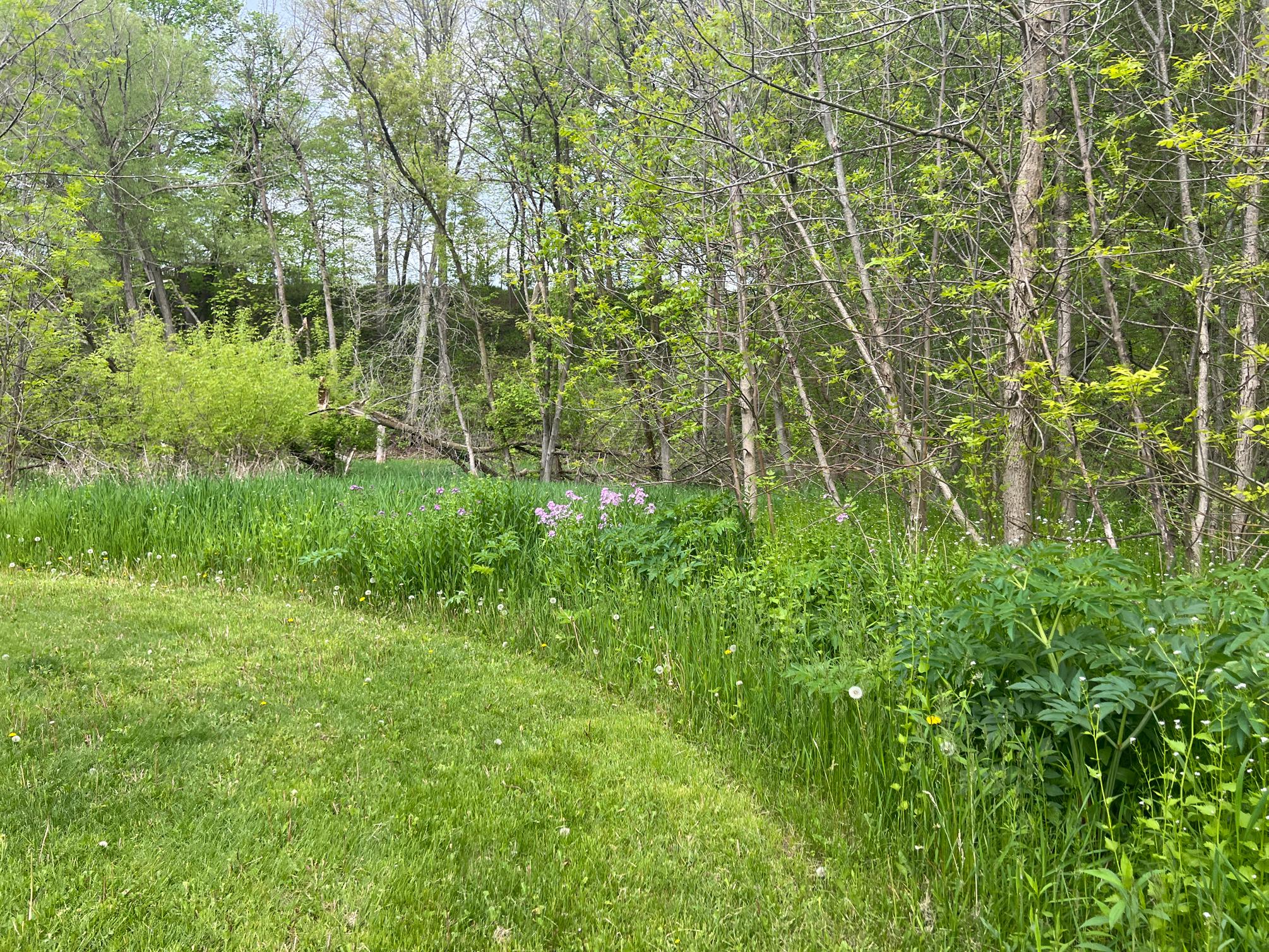
While parks, forests, and trails create opportunities to improve the health of individuals, they also contribute to the greater ecological health of a community. Parks are often tied together with environmentally sensitive areas such as wetlands, floodplains, surface waters, or significant woodlands. Additionally, parks are a convenient place to introduce new stormwater retention and infiltration areas into the built environment, helping to manage stormwater runoff and mitigate localized flooding. These natural areas provide food and shelter for local wildlife and naturally retain stormwater. Individual parks can provide important “rooms” of natural resource activity; however, they become even more functional when they can be linked together through environmental corridors. Wildlife, plants, and water all depend on the ability to move freely within the environment, or from “room to room.” The City Parks Alliance reports that urban trees remove up to 711,000 tons of toxins from the air and reduce urban “heat island” effects, equating to $3.8 billion in national savings.
In addition to being public open spaces, parks and recreational facilities are excellent places for local engagement. Many communities utilize park funding and infrastructure to revitalize blighted areas and rectify historic disinvestments in lower-income neighborhoods. This comes through reinvigoration of existing parks, and the addition of new parks in underserved areas. Coincidentally, as cities and villages across the United States see shifts in the ethnic makeup of their communities, more and more are investing in multilingual signs and rental forms to improve cultural inclusion.
Two key parts of any parks and recreation plan include physical accessibility through ADA-compliant design and walkability to the park. The Americans with Disabilities Act and statewide design guidelines ensure that people of any age and physical ability are able to access many activities throughout a park, from well-maintained paths and curb ramps to inclusive playgrounds. The walkability factor is defined by the NRPA as ensuring that no one lives farther than a 10-minute walk from a park.
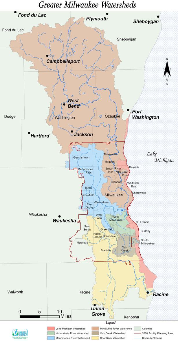
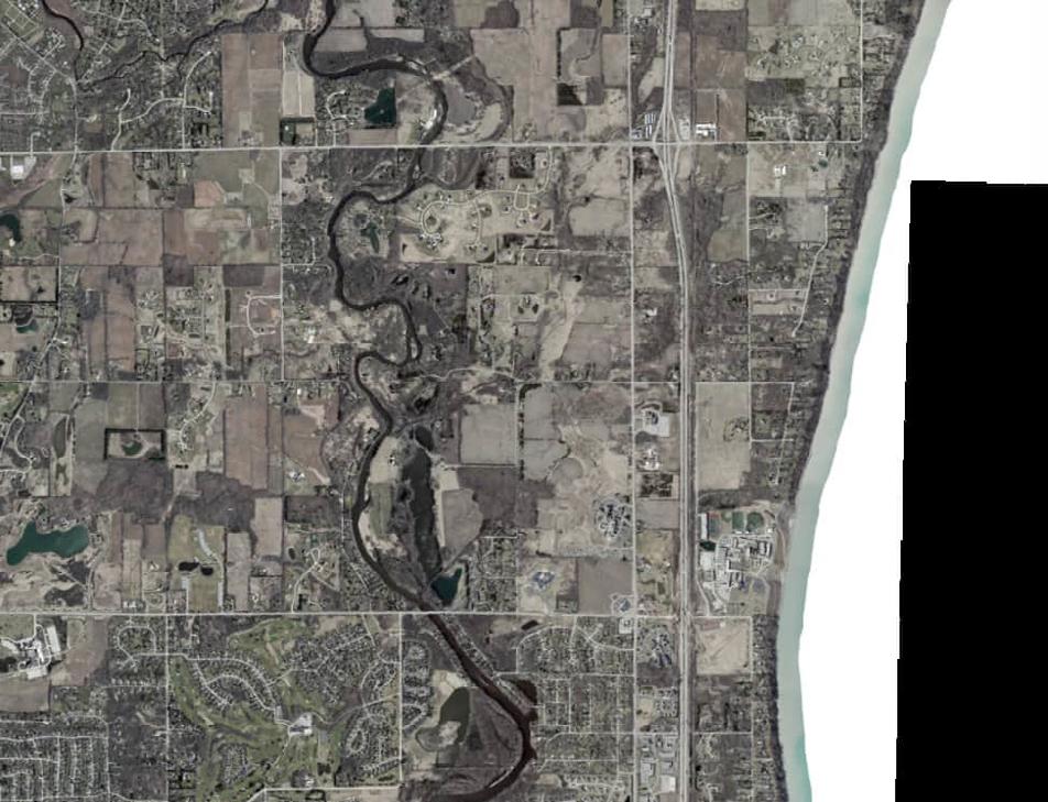
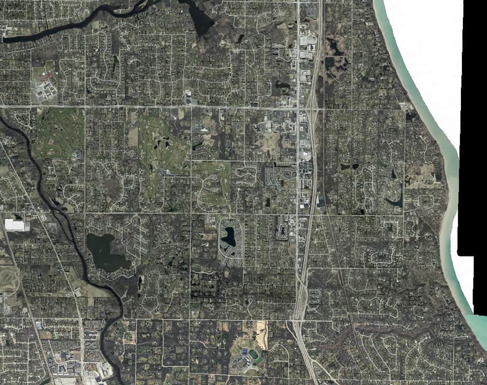
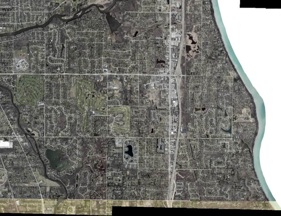
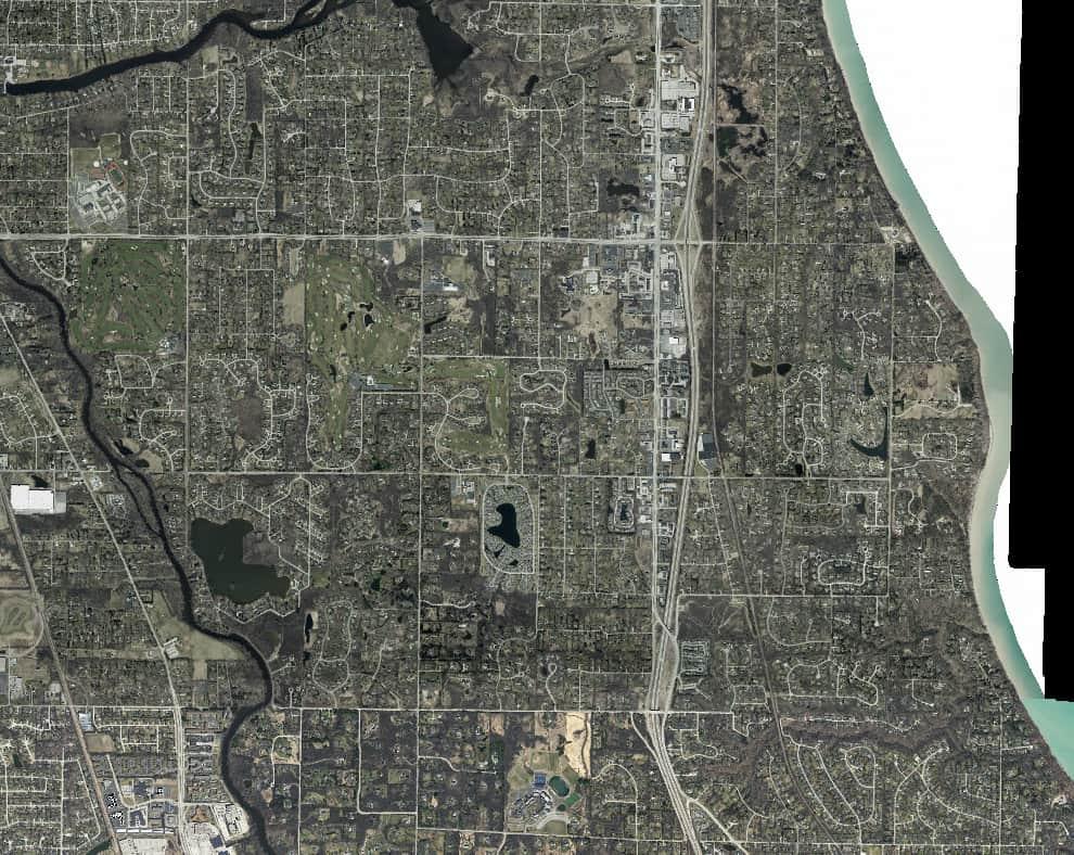
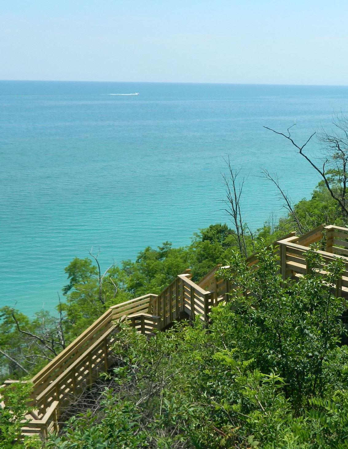
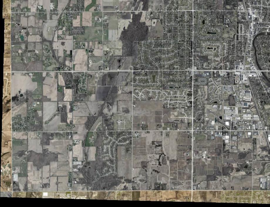
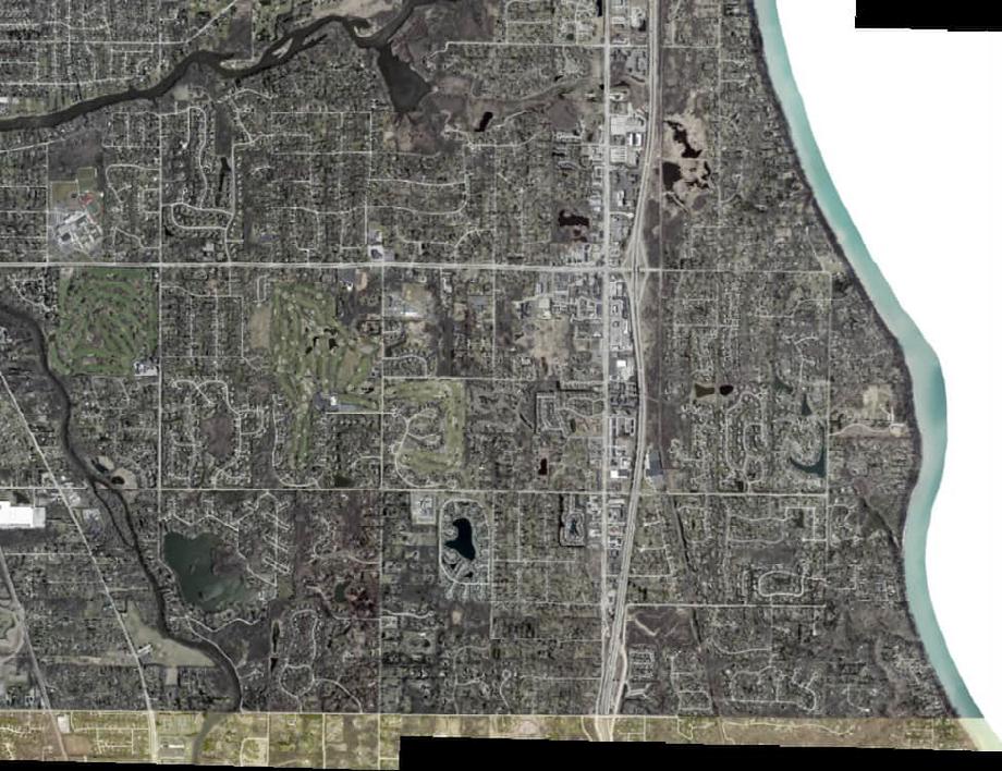
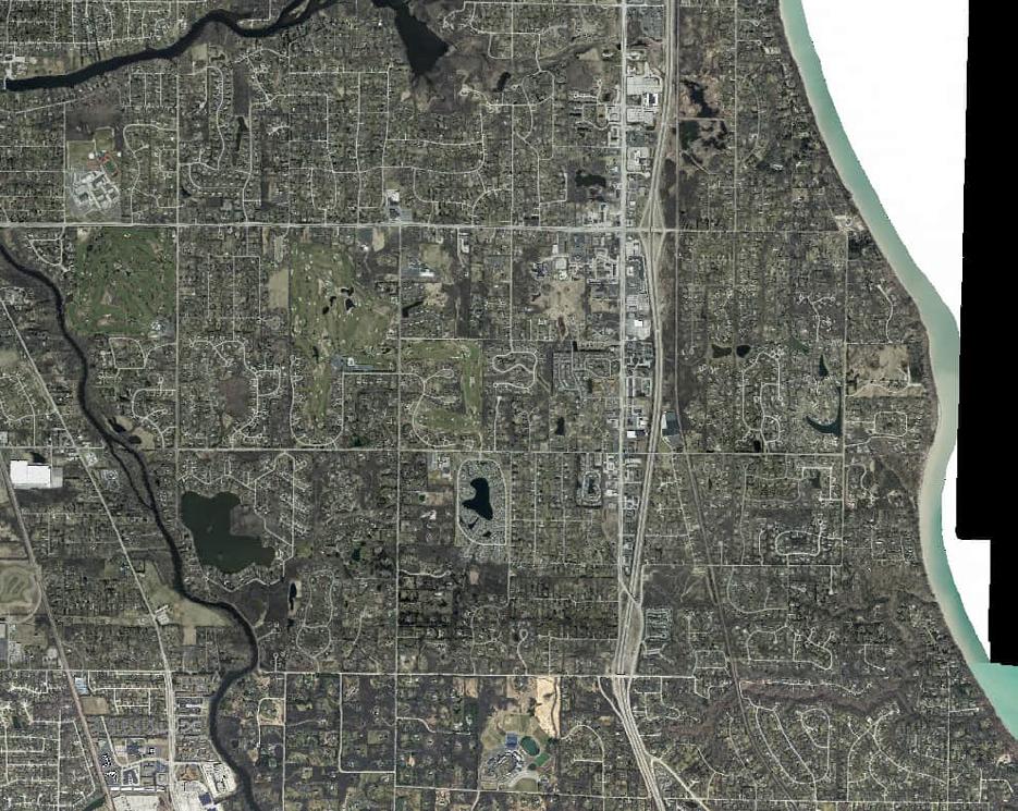
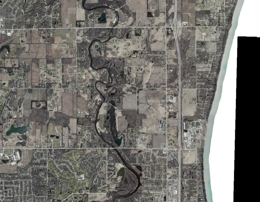
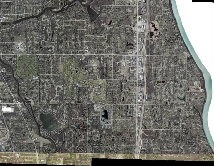
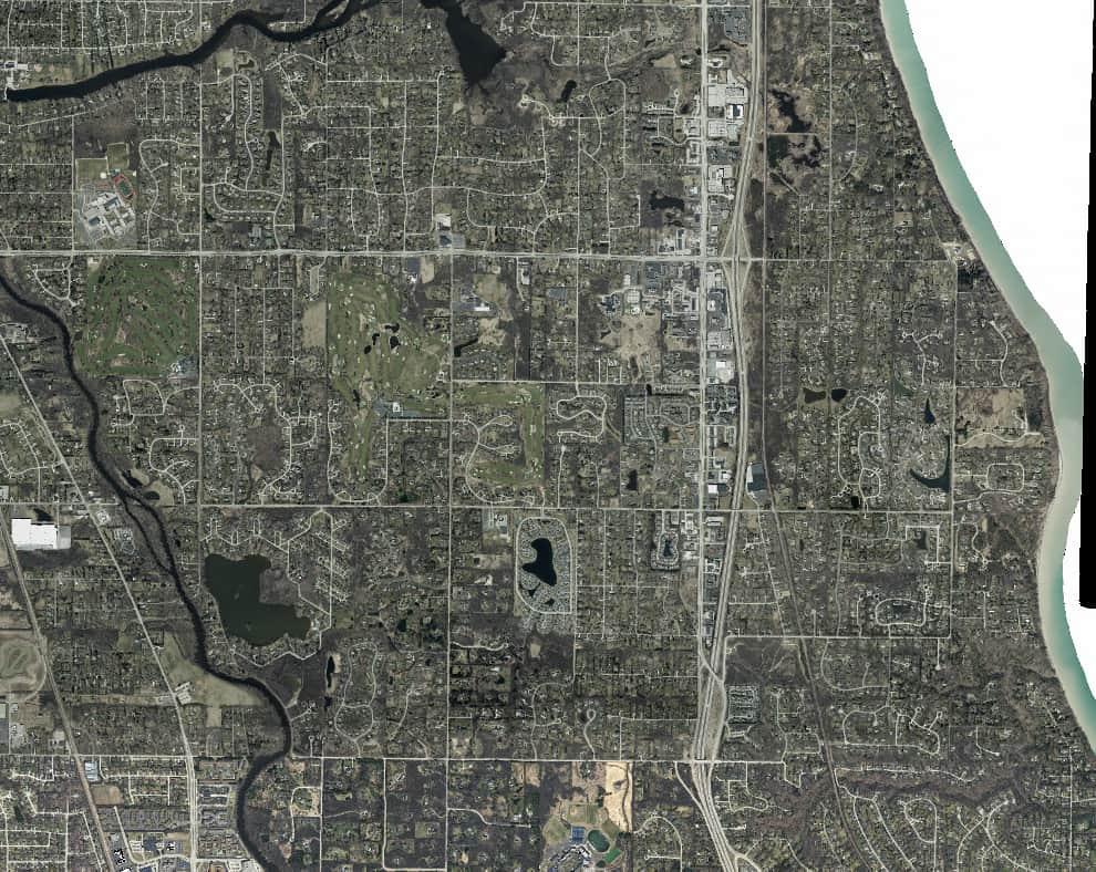
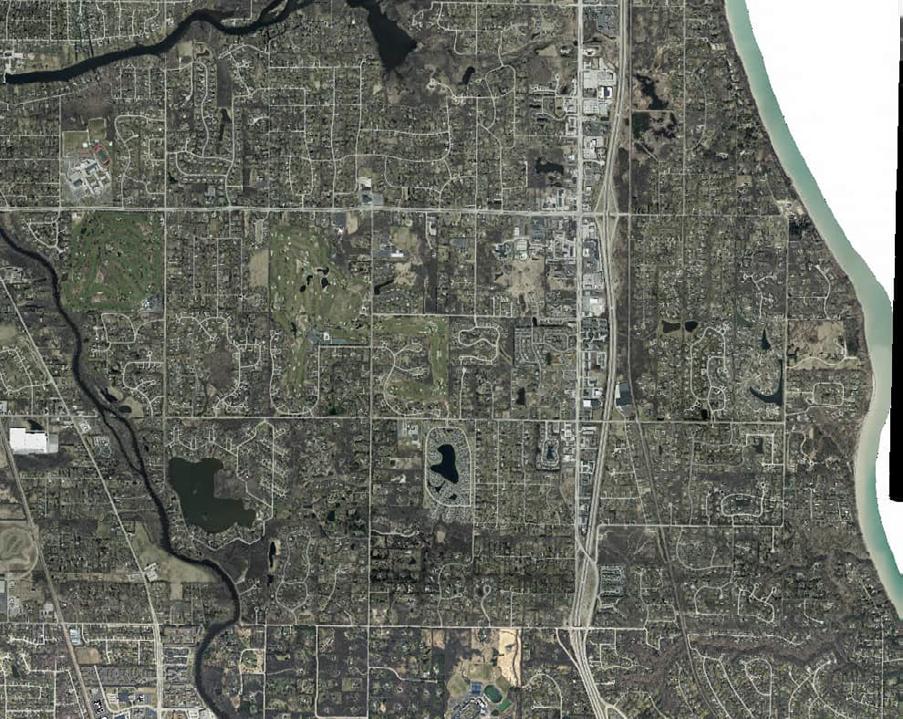
The City of Mequon is located in southern Ozaukee County just north of Milwaukee County, roughly 12 miles from the City of Milwaukee. Development patterns in Mequon have been heavily shaped by the presence of the Milwaukee River which runs north to south through the city, and its floodplain, as well as the presence of Lake Michigan on the eastern border of the city.
Interstate Highway 43 runs north to south through the city and connects Mequon to the City of Milwaukee, and other areas. State Highway 181 also runs north to south through the municipal boundaries, while State Highway 167 runs East-West through Mequon. According to the Wisconsin Historical Society, Mequon was first inhabited by the Potawatomi and Menominee tribes, and first settled by European immigrants in 1836. Today, Mequon is known for its majestic bluffs, stately homes, lush farmland, and expansive open space.
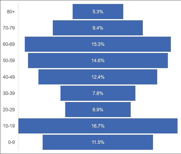
The age distribution in Mequon is shown in Figure 2.2. Age cohorts are an important consideration when determining park facilities because different age groups utilize different recreation facilities. For example, in 2021 there were an estimated 5,517 people over the age of 65, which represents a roughly a fifth of the population. Mequon saw an increase of 47% in the population of individuals over the age of 65 since 2010. The number of park facilities designed for this age group should be reassessed as there are many more people in this age group in Mequon using park facilities than there were in 2000. Facilities such as hiking trails, pickleball courts and park shelters are used by this age group and may be needed in higher quantities now than they had in the past.
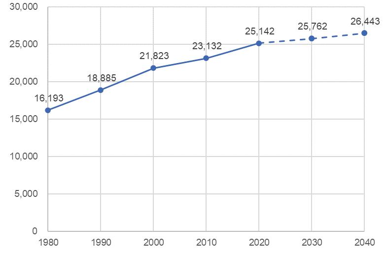
There is a direct relationship between population and the need for park space. Forecasting future population trends allows for municipalities to more accurately plan for the future to ensure that the City maintains and grows park services and accessibility.
Source: U.S. Census Bureau, Wisconsin Department of Administration
Source: U.S. Census Bureau, Wisconsin Department of Administration
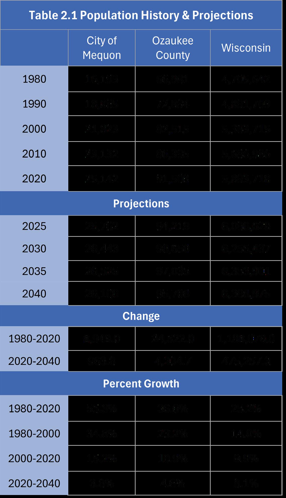
According to data from the U.S. Census Bureau, population growth has slowed in Mequon over the last 20 years. Between 1980 and 2000, the population of Mequon grew 35%. However, between 2000 and 2020, the population only grew 15%, and growth is projected to slow further in the future.
The Wisconsin Department of Administration (DOA) projects that Mequon will experience a 4% population growth between the years 2020 and 2040 resulting in an additional 964 residents. Population projection information for Mequon and comparable communities is provided in Table 2.1.
As seen in Table 2.2, Mequon saw a 13% increase in total households between 2000 and 2021. During the same period, however, households with individuals under the age of 18 decreased by 10% during the same period. Average household size has declined between 2000 and 2021, which is consistent with national and regional trends as the number of single person households increases, and members of the Millennial generation delay childbearing into their thirties or forego it altogether.
The following section gives background information on some of the physical characteristics of Mequon. This helps provide an overall impression of the area, determining suitability for certain improvements, and identifying areas that should be conserved due to their unique natural features.
74% of Mequon is located within the Milwaukee River South Watershed, and approximately 25% of the City is located within the Menomonee River Watershed with the remaining 1% in the Cedar Creek Watershed.
There are approximately 3,400 acres of wetland in the City of Mequon with the majority classified as “Forested Wetland”.
Forested Wetlands “include bogs and forested floodplain complexes, are characterized by trees 20 feet or more in height such as tamarack, white cedar, black spruce, elm, black ash, green ash and silver maple.” (Wisconsin Department of Natural Resources)
Mequon has an approximate elevation range of 600 feet above sea level at its eastern edge along Lake Michigan and rises to almost 1,000 feet above sea level at its western City limits.
The most common soil type found in Mequon is Kewaunee silt loam (2 to 6% slopes). This soil type is found on over 5,800 acres in the City. It is followed by Ozaukee silt loam (high carbonate substratum, 2 to 6% slopes) on 3,500 acres and Manawa silt loam (0 to 3% slopes) on 2,100 acres.
Source: MMSD
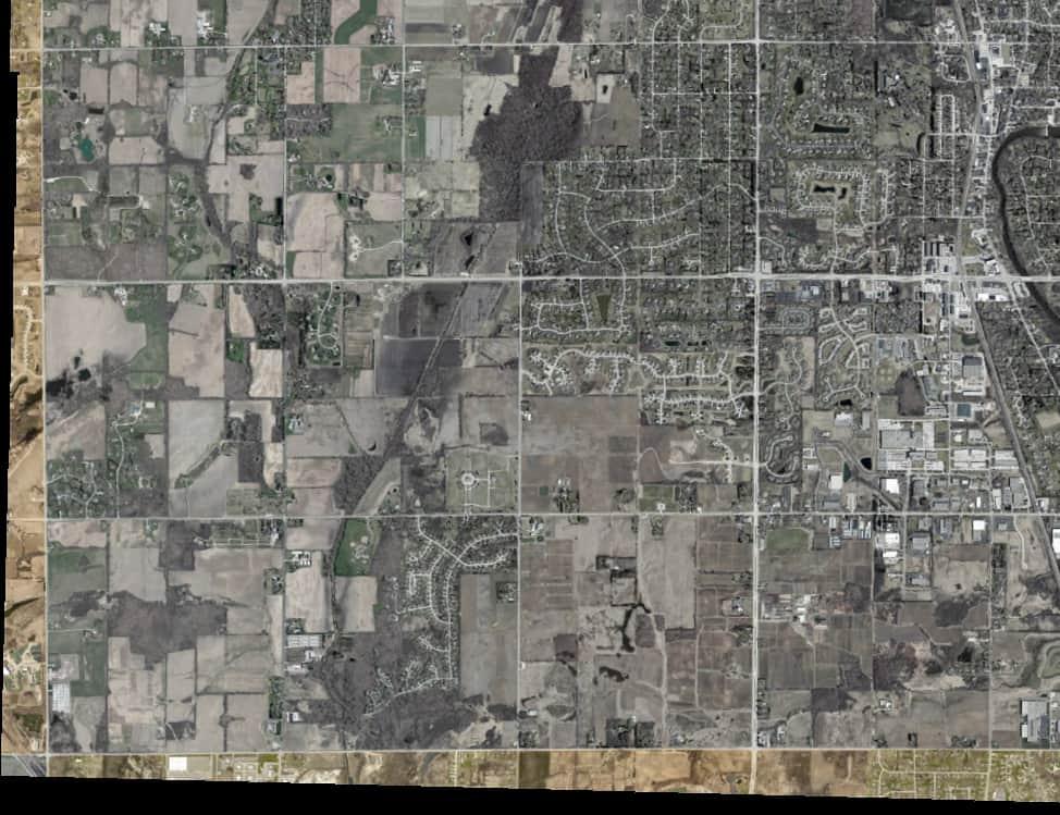
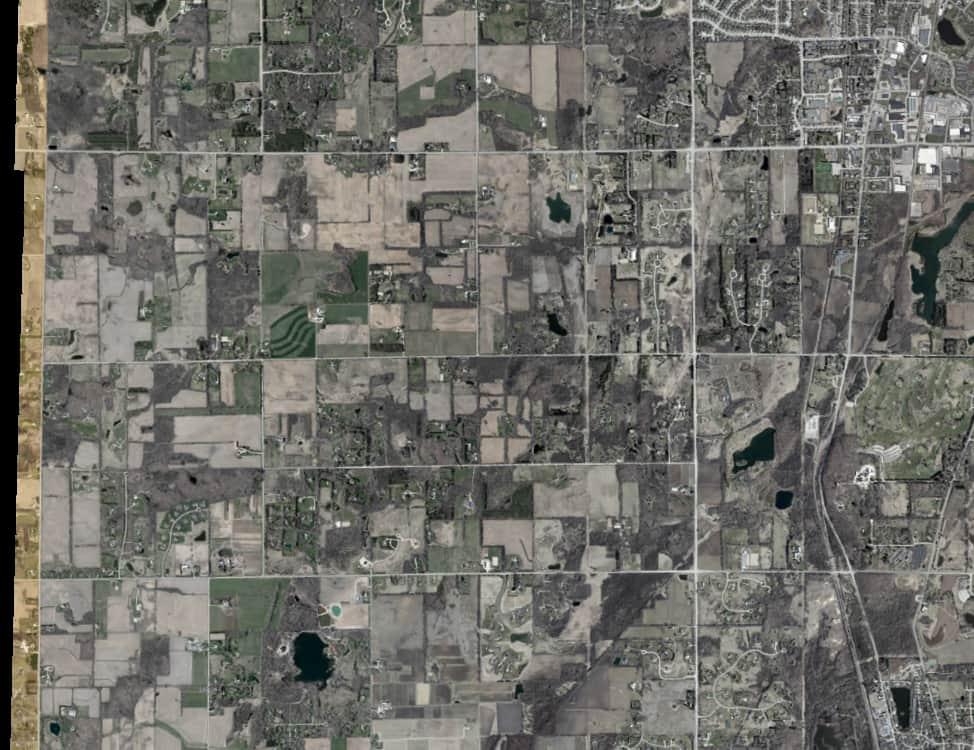
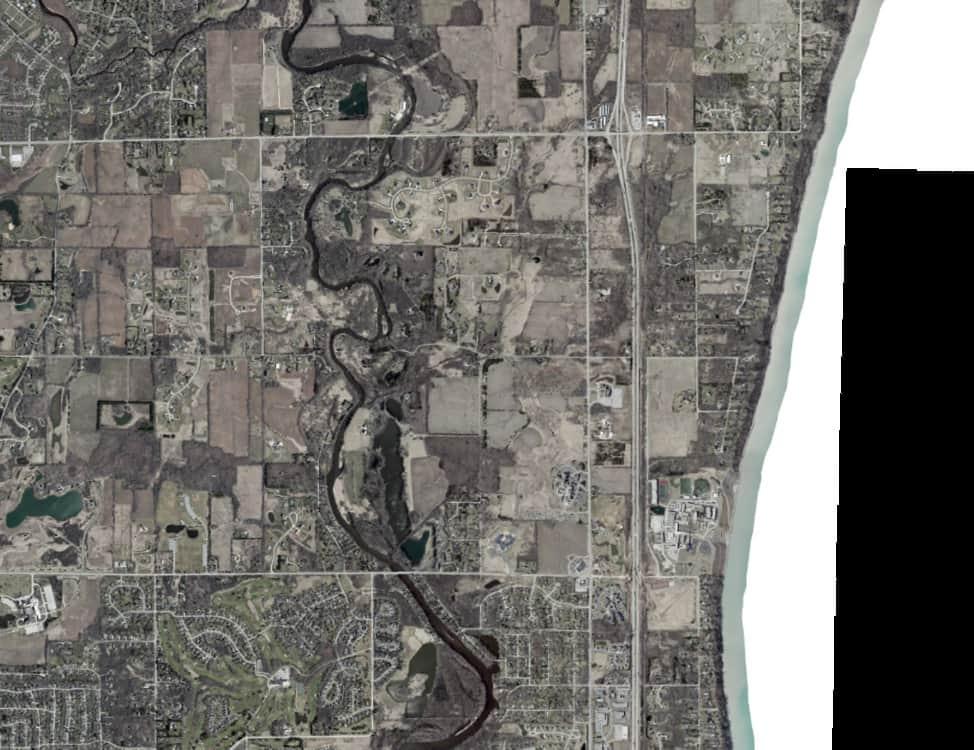
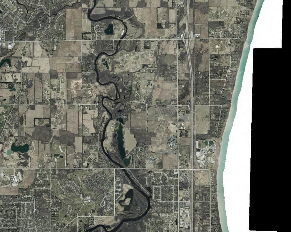


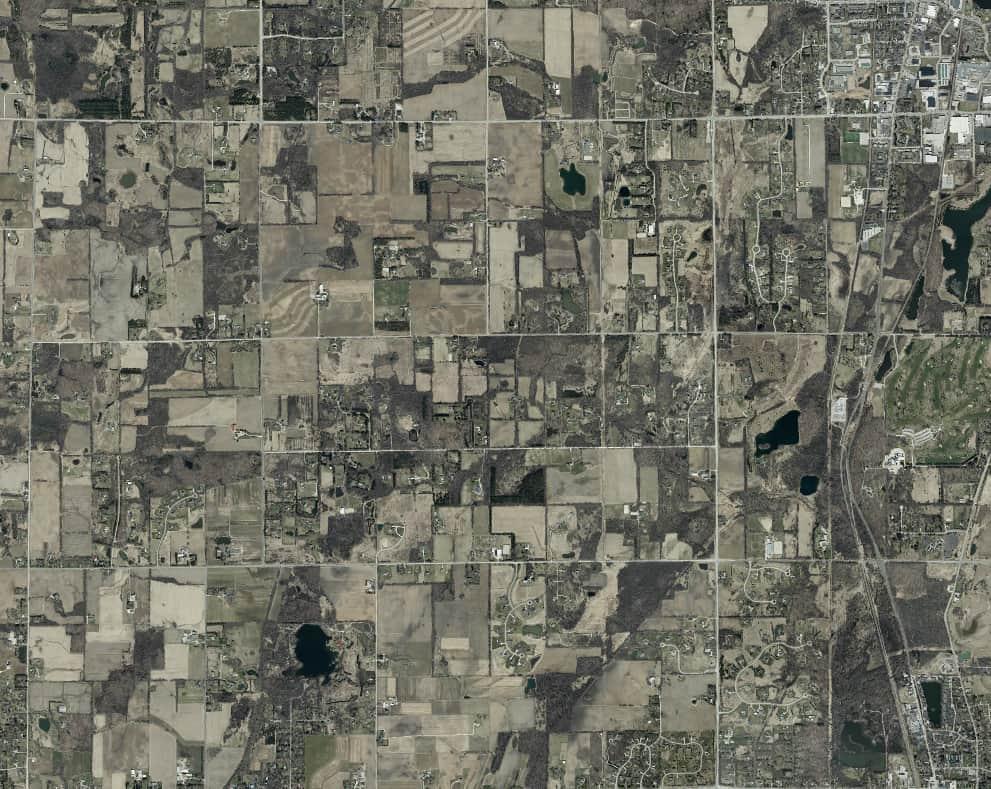
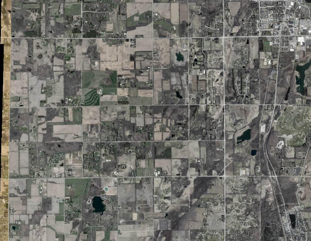
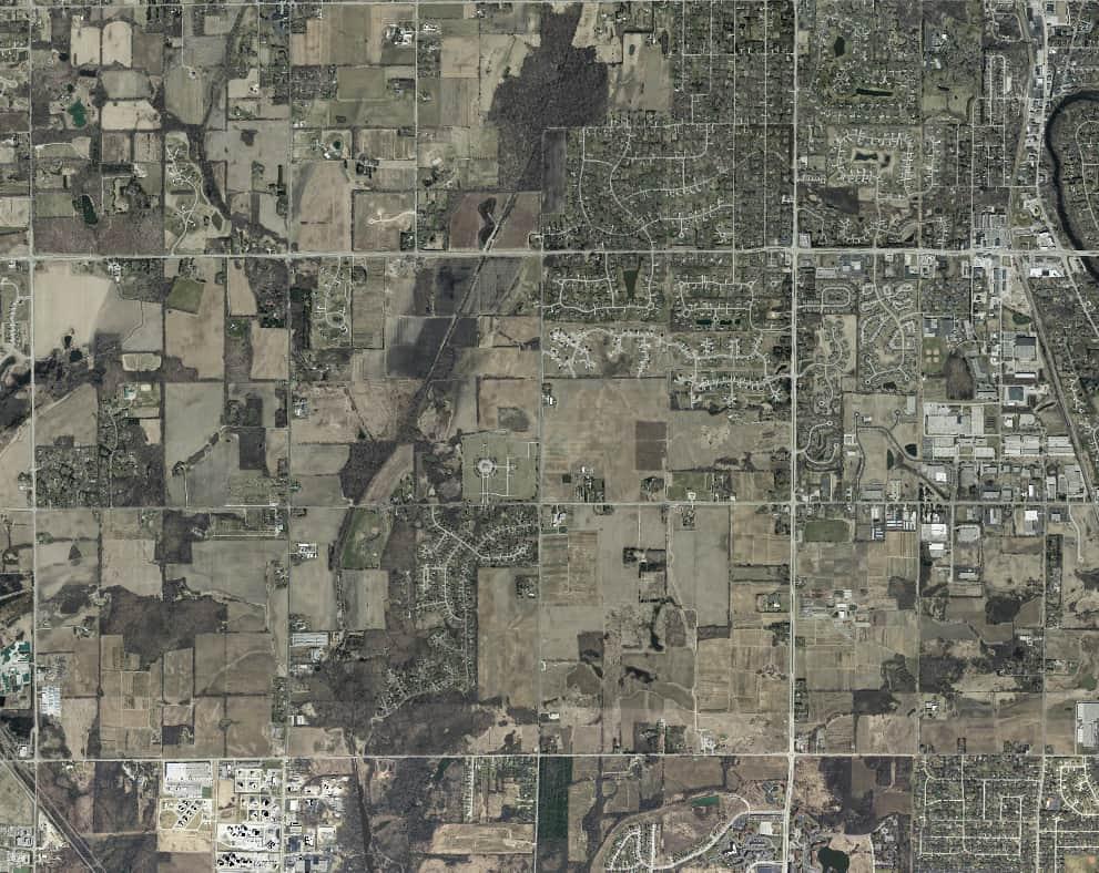
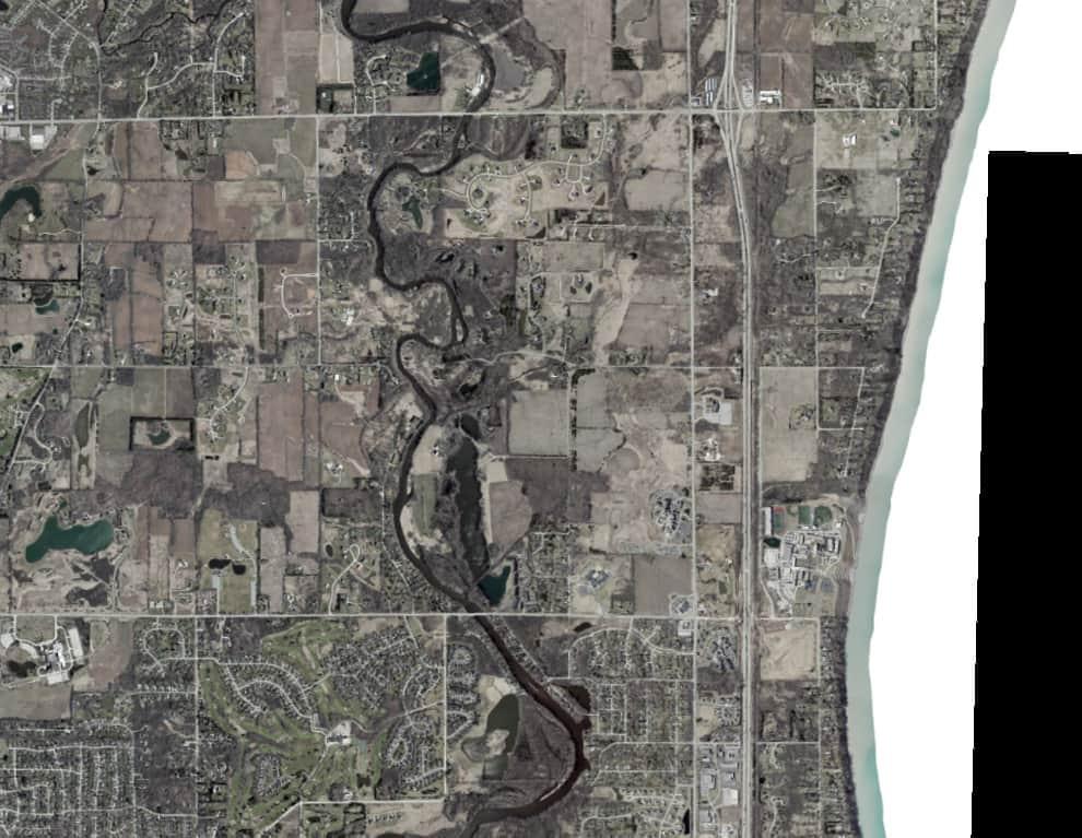
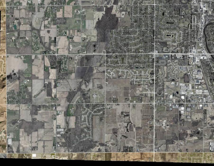
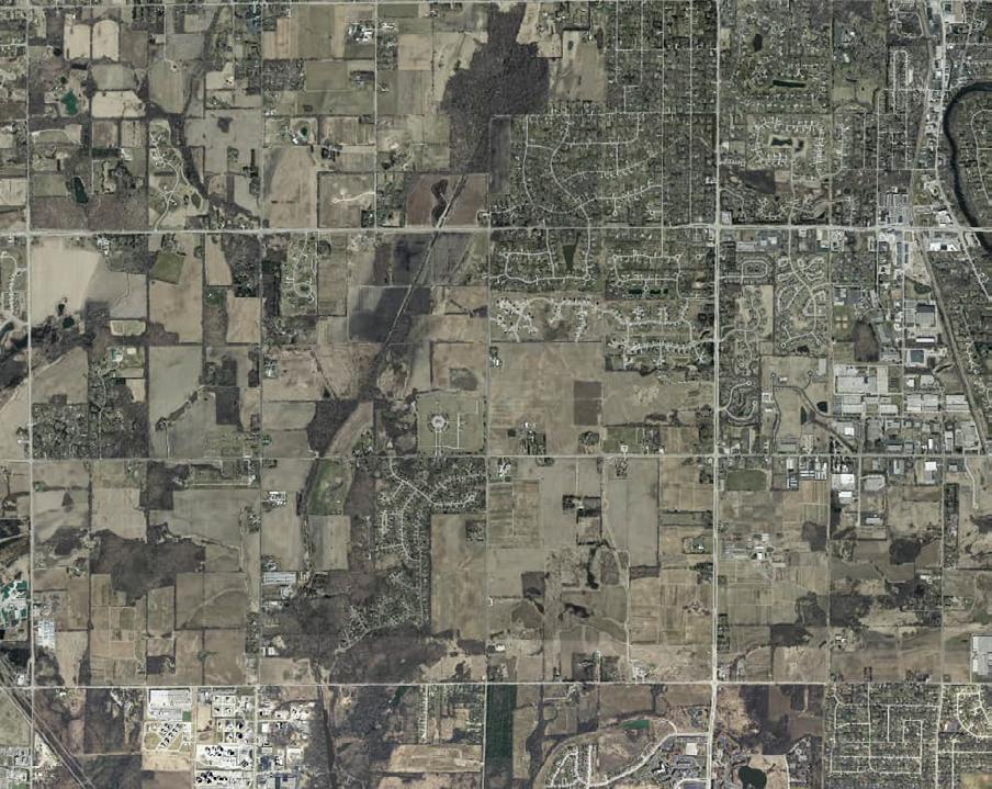
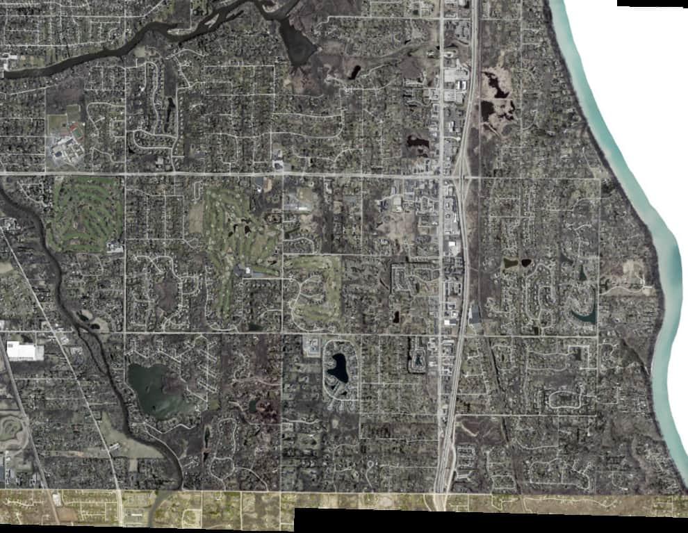
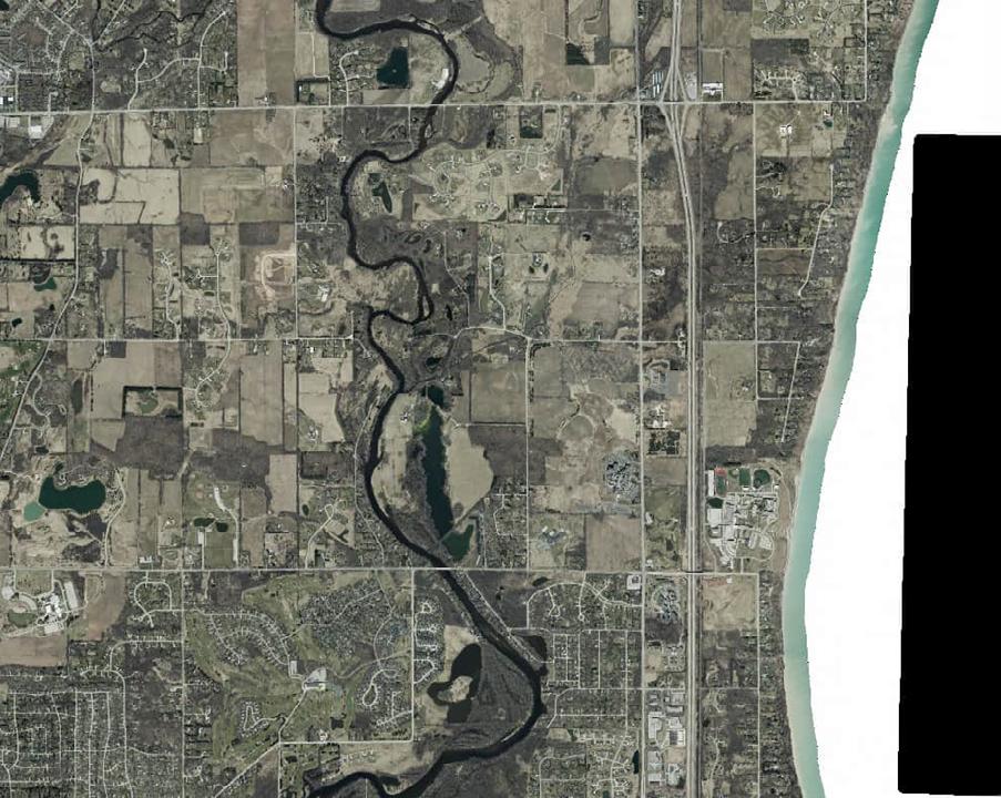
The information for this section was gathered from site visits conducted by MSA Professional Services, GIS Analysis, discussions with City staff and review of past planning documents. Complete park descriptions, inventories and recommendations for improvements for all parks can be found in Chapter 5. A Facility Matrix for the park system is also located in Chapter 5. See Appendix B for a full map of park locations.
Mini parks include specialized facilities that serve a concentrated population or specific group such as tots or senior citizens. Typical size is 1 acre or less, but parks may be categorized as mini parks simply based on the type and quantity of facilities they offer. Mini parks in Mequon include:
• Settlers Park*
• Town Center Riverfront Park*
* Future plans call for the inclusion of the land occupied by Settlers Park in a larger development that includes Town Center Riverfront Park.
Neighborhood parks typically serve smaller areas of a community, and are typically of a size or scale that blends into the surrounding neighborhood, usually 3-10 acres. Typically, these parks feature one signature amenity.
• Garrison’s Glen
• Riverview Park
• Villa Grove Park
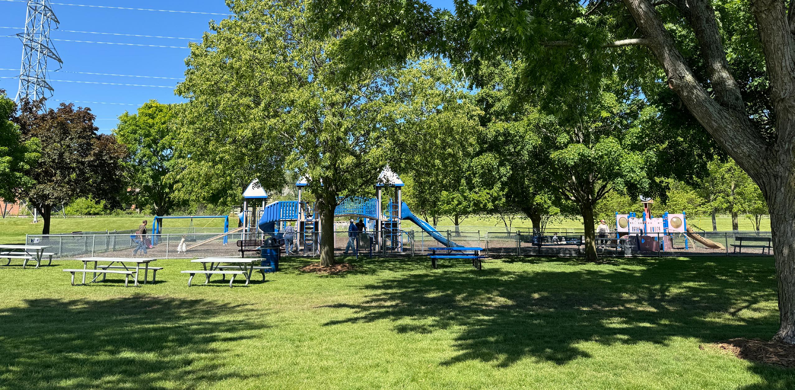
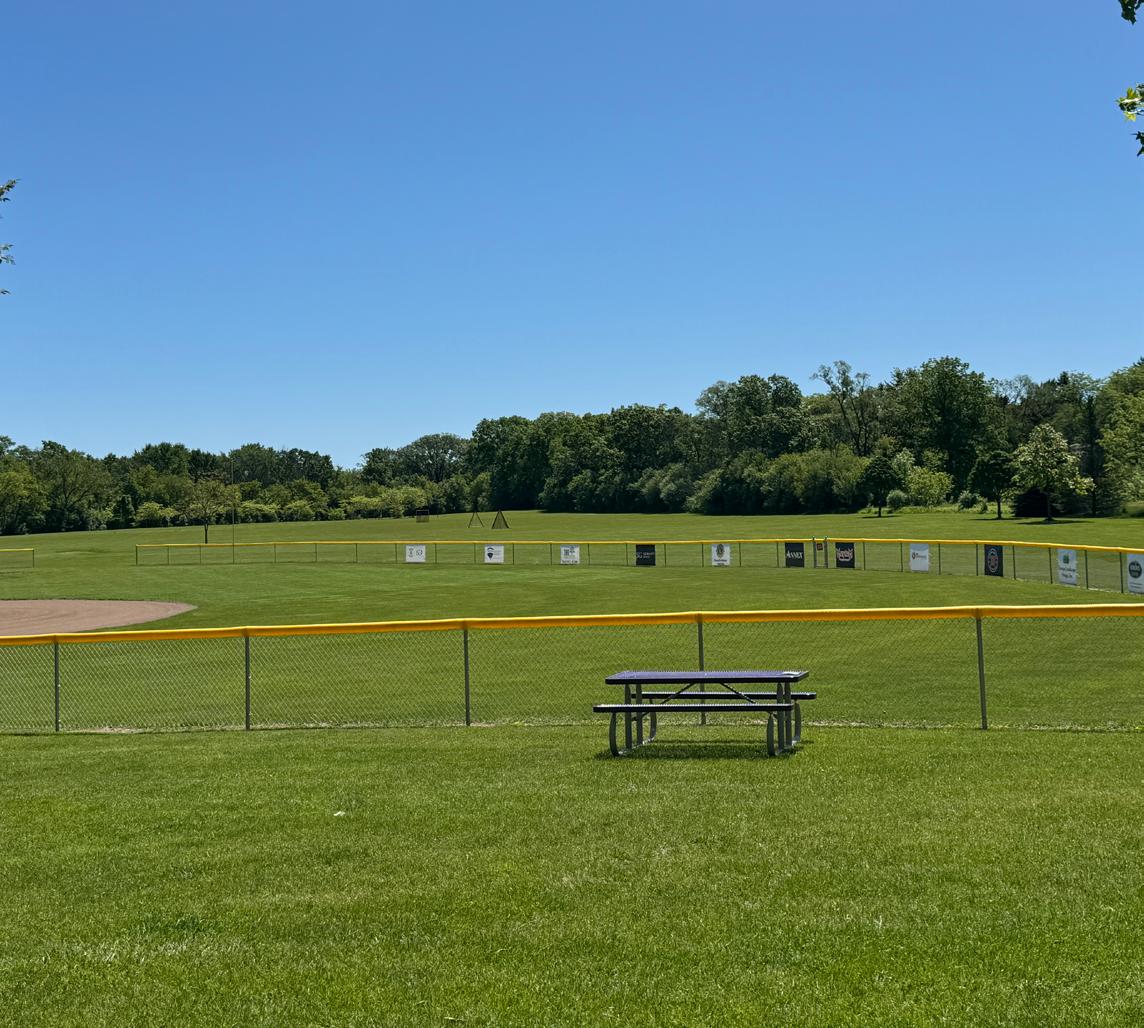
Community parks are areas of diverse recreational activity and may include amenities such as athletic complexes, trails and large swimming pools. Community parks are typically 10 acres or larger but may vary depending on facilities offered. Community Parks in Mequon include:
• Civic Center Park
• Lemke Park
• River Barn Park
• Rotary Park
Special use parks are areas for specialized or single purpose recreational activities such as golf courses, campgrounds, nature centers and skate parks. They may also be used to designate areas that are primarily used as event space, general gathering areas, expanded trail corridors or plaza space. Special Use Parks in Mequon include:
• Katherine Kearney-Carpenter Park
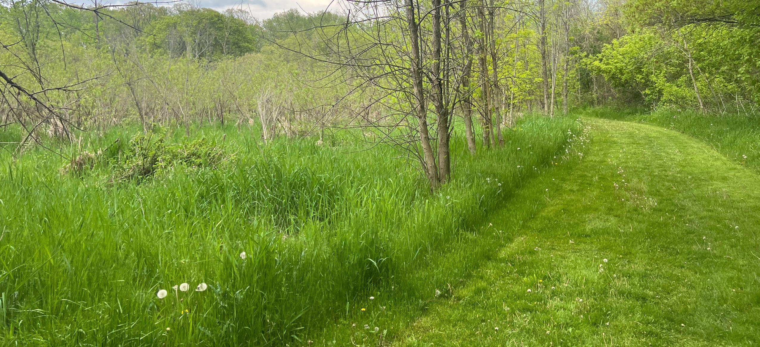
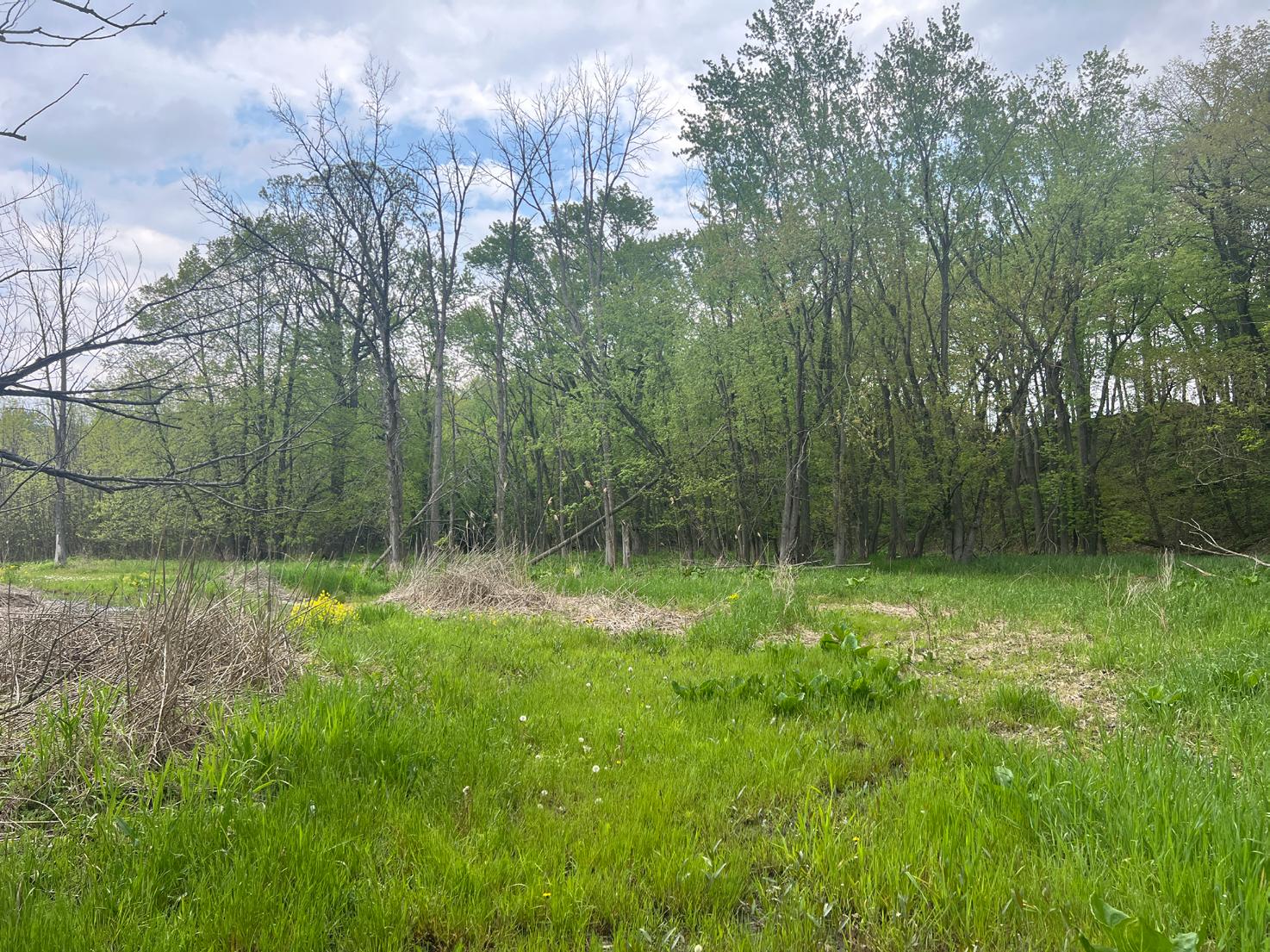
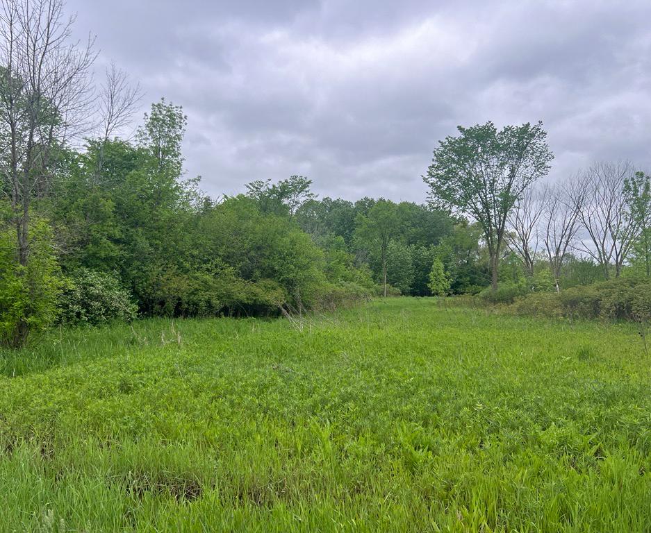
Conservancy parks and natural areas are established for protection and management of the natural or cultural environment with recreational facilities as a secondary objective. Open spaces are areas that currently offer no recreational facilities but have been reserved as future active or passive parklands.
• Burcyk Property
• Grasslyn Nature Preserve
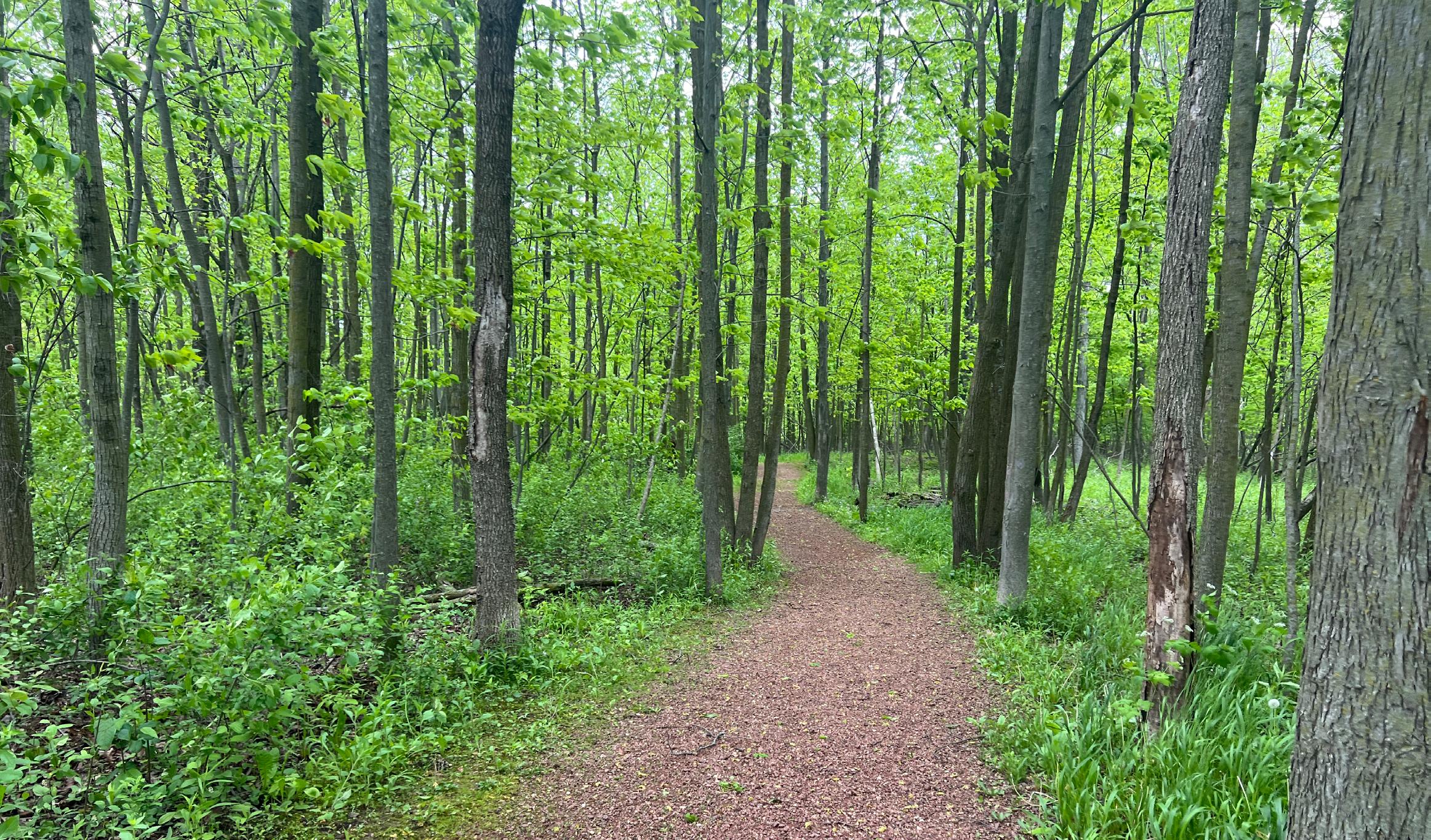
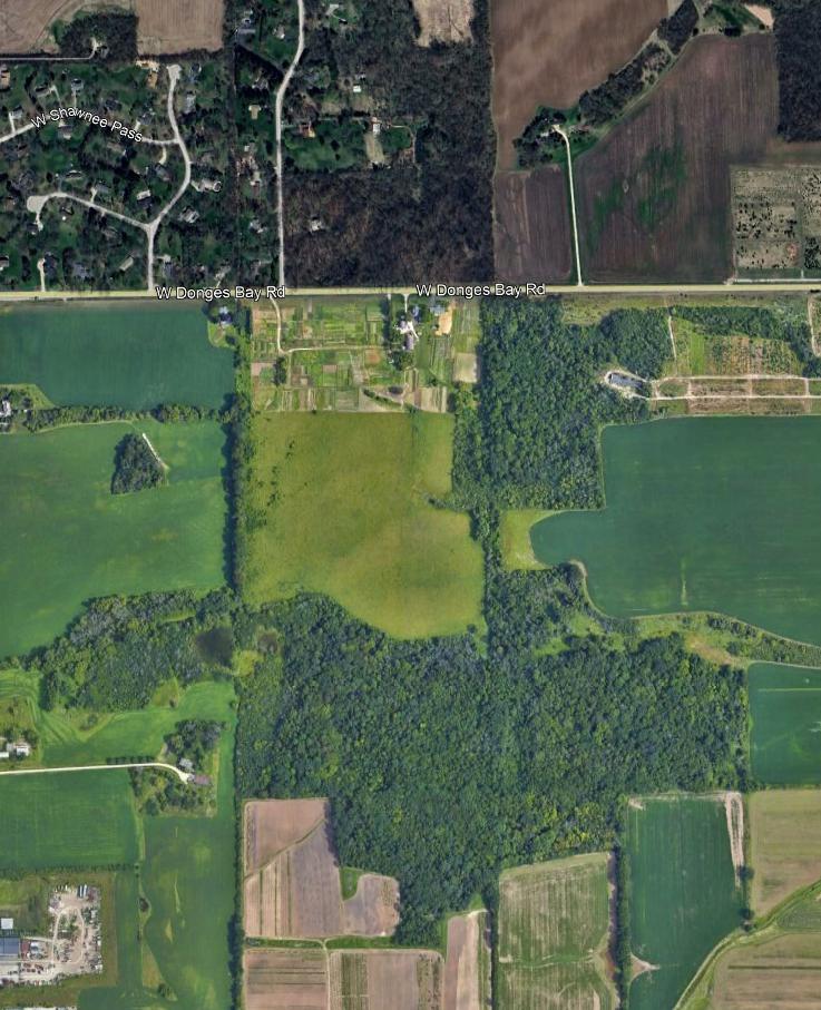
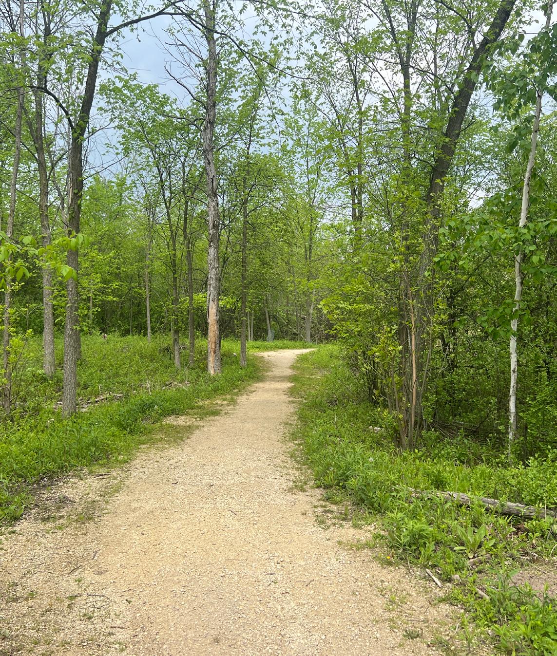
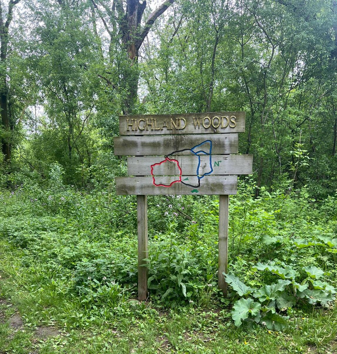
• Highland Woods
• Lily Lane Nature Preserve
• Little Menomonee Nature Preserve
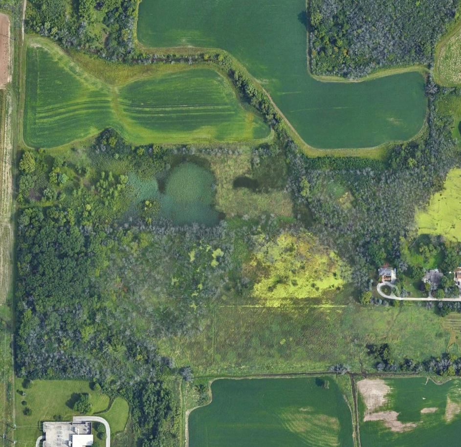
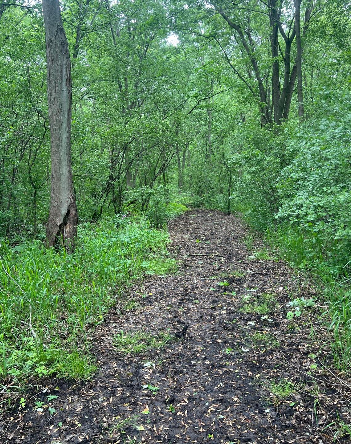
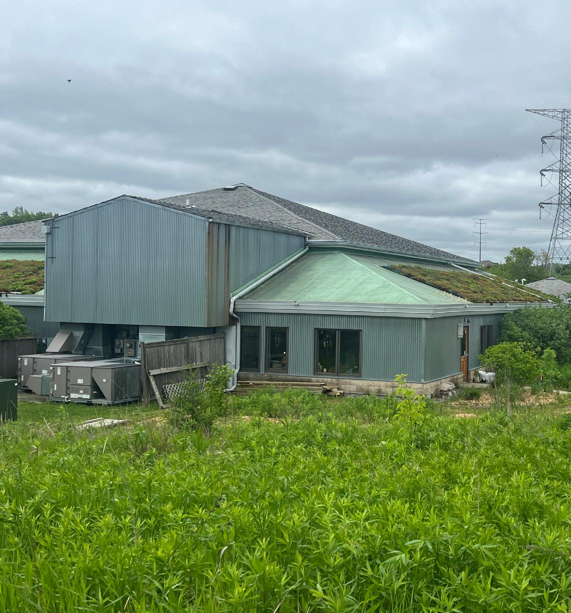
• Mequon Nature Preserve*
• Moonlight Landing
• Prinz Nature Preserve
• Pukaite Woods
• River Forest Nature Preserve
• Scout Park
• Shoreland Nature Preserve
• Swan Road Prairie
• Trinity Creek Wildlife Habitat
• Willow Bay Nature Preserve
*The Mequon Nature Preserve is unique in that it is primarily located on land owned by the City of Mequon but operated and maintained by Mequon Nature Preserve Inc. The Mequon Nature Preserve is an example of habitat restoration with land returned to “a mosaic of forests, prairies and wetlands” with the goal of establishing “an educational conservancy that inspires exploration and cultivates stewardship.”
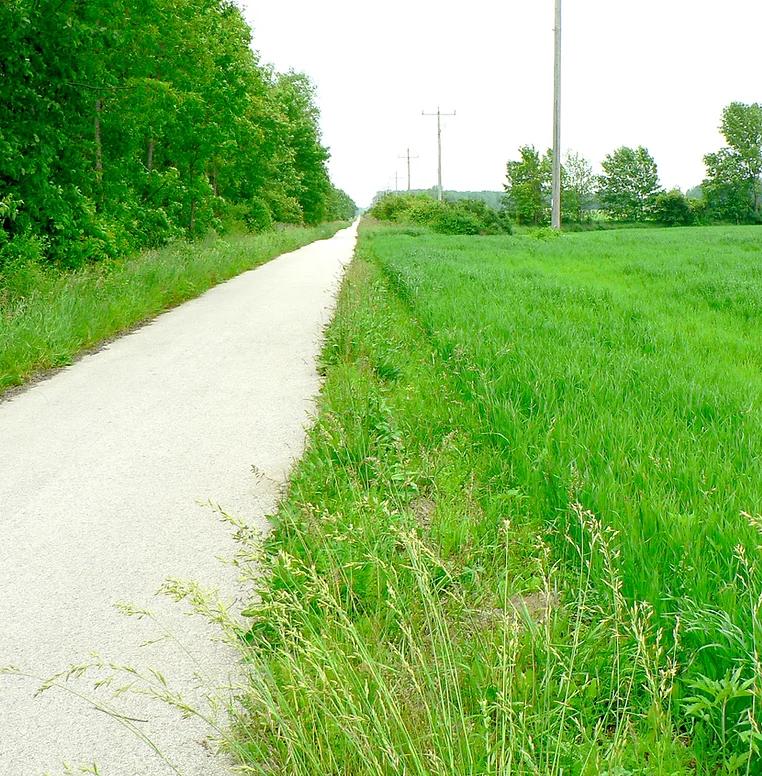
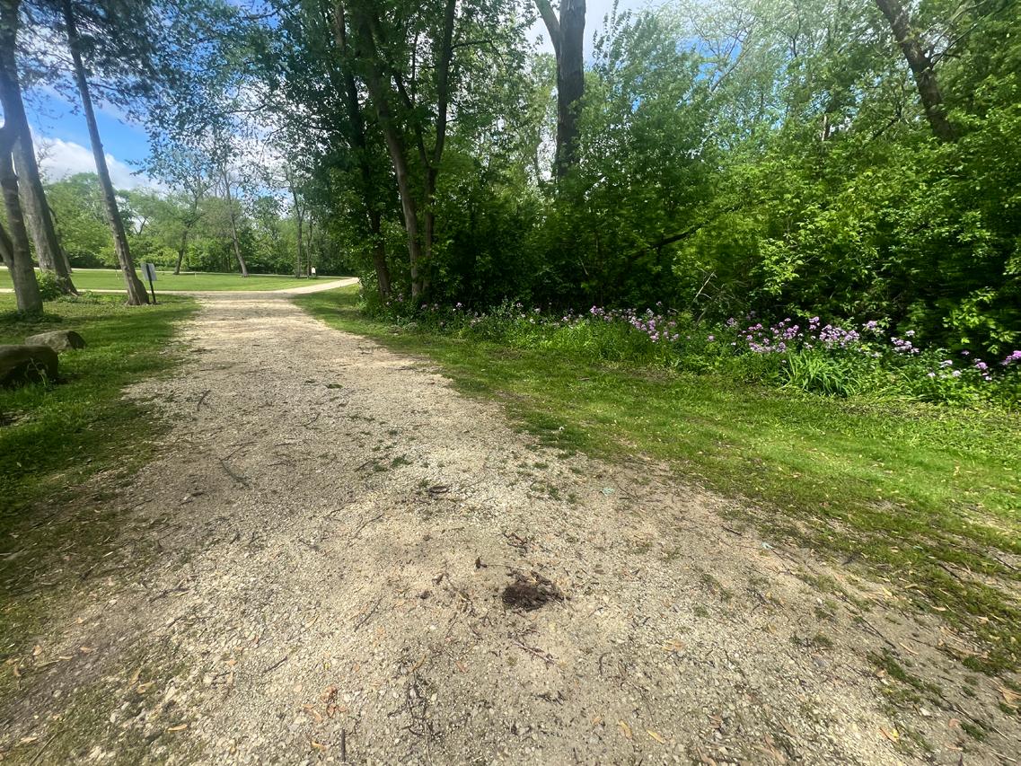
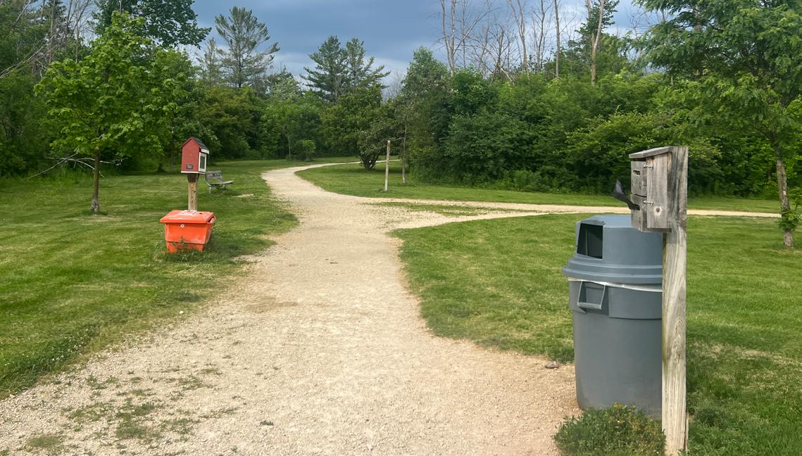
A linear park or trail corridor is an area designated for one or more modes of recreational travel such as hiking, biking and snowmobiling. See Appendix B for existing trail locations.
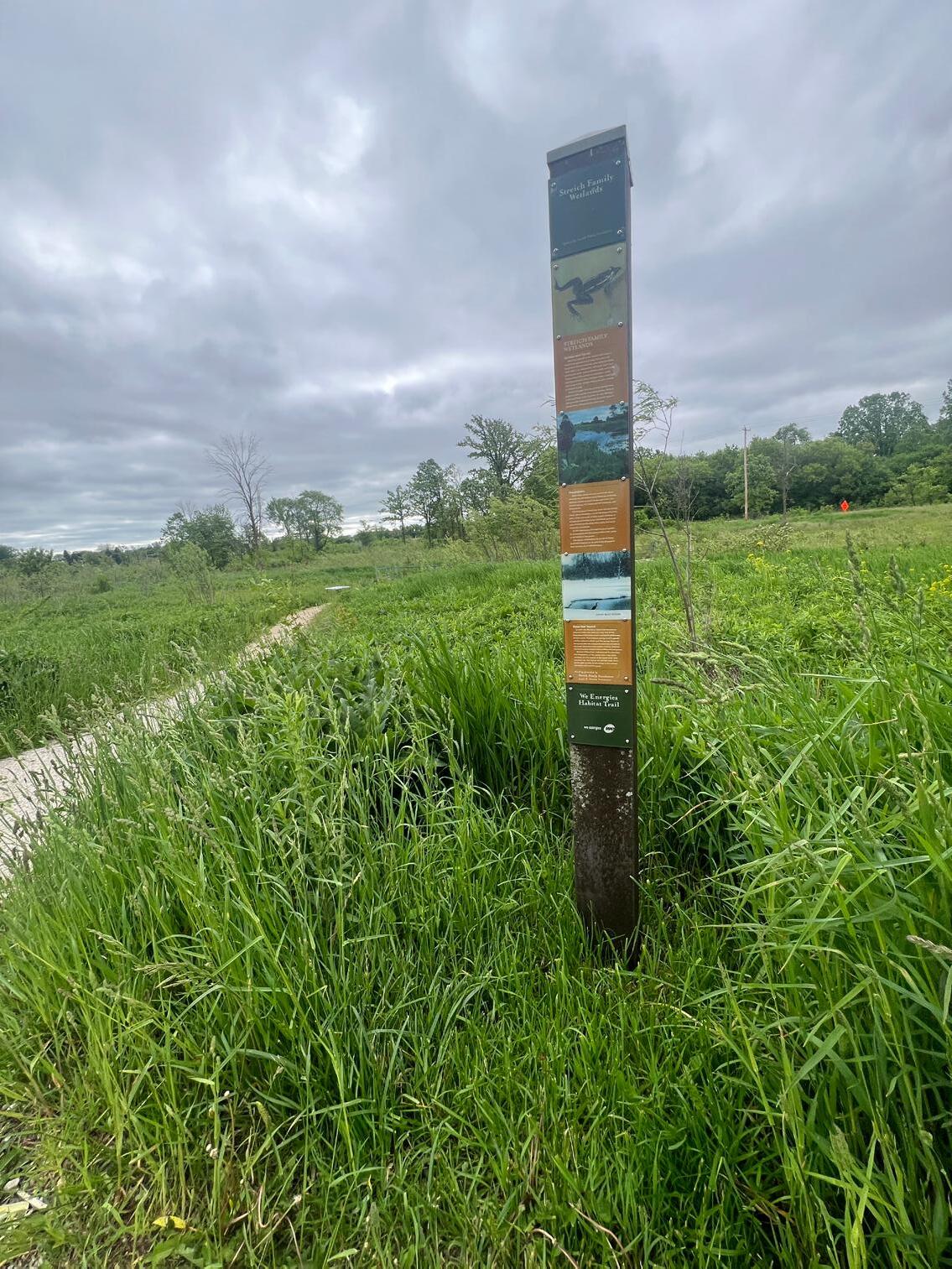
The Ozaukee Interurban Trail is a 30-mile paved trail that bisects Mequon from north to south on a former electric rail right-of-way. The trail connects Mequon with the neighboring communities of Cedarburg, Port Washington, Thiensville, Grafton and Belgium. There are no fees associated with trail use and it is open to biking, in-line skating, walking, running and cross-country skiing. Snowmobiling and horse riding are not allowed. The trail right-of-way is owned by We Energies. The City of Mequon entered a 15-year license agreement in 2002 with We Energies that automatically renews to use and maintain the corridor as a recreational trail within the City limits.
There is another significant trail network on the southwest portion of the City with paved trails along West Donges Bay Road and North Swan Road connecting Lemke Park and the Mequon Nature Preserve to other designated City bike routes. The West Donges Bay Road Trail also connects to an unpaved trail through the Mequon Nature Preserve. In addition to Mequon’s designated trails and routes, there are several bicycle and pedestrian facilities that are used by area residents that are not maintained by the City. Trails and routes on the properties of areas schools, Ozaukee County, major employers and utility providers also provide transportation and/or recreational opportunities.
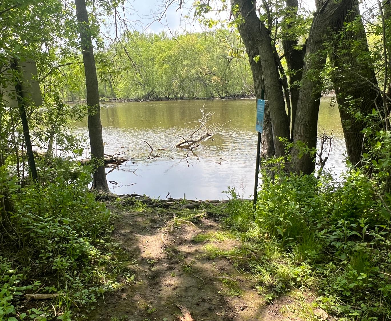
The Milwaukee River is also a major recreational corridor that is accessible from a number of City parks. These parks serve as portals to the river and its recreational possibilities including fishing, boating and canoeing. A map of the Milwaukee Urban Water Trail and accompanying access points and launches can be found here
In March of 2024, the Joint Mequon-Thiensville Bike & Pedestrian Way Commission released a Request for Proposals to update the Commission's existing Master Plan. This planning process will conduct a comprehensive analysis of bicycle and pedestrian conditions, solicit community input, update goals and objectives, and recommend potential alternatives.
At the time of this plan's adoption, the Bike & Pedestrian Way Master Plan is still ongoing, but the final plan will likely propose changes to Mequon's current bicycle and pedestrian network in ways that could impact the park system.
For more information about the Bike & Pedestrian Way Commission's efforts, please visit their page.
Mini Park
Neighborhood Park
Specialized facilities that serve a concentrated or limited population or specific group such as tots or senior citizens.
Less than ¼ mile radius 1 acre or less
Community Park
Areas for intense recreational activities, such as field games, court games, crafts, playground apparatus area, skating, picnicking, wading pools, etc.
¼ to ½ mile radius to serve a population up to 5,000 (a neighborhood) 3-10 acres
Special Use
Conservancy
Areas of diverse environmental quality. May include areas suited for intense recreational facilities, such as athletic complexes and large swimming pools. May be an area of natural quality for outdoor recreation, such as walking, viewing, sitting, picnicking. May be any combination of the above.
Areas for specialized or single purpose recreational activities, such as golf courses, nature centers, skateparks, marinas, zoos, conservatories, arboreta, display gardens, arenas, outdoor theaters, gun ranges, downhill ski areas, or areas that preserve, maintain, and interpret buildings, sites, and objects of archeological significance. Also, plazas or squares in or near commercial centers, boulevards, and parkways.
Protection and management of the natural/cultural environment with recreational use as a secondary objective.
Several neighborhoods. 1 to 2-mile radius 10+ acres
Linear Park
None
Built connections or natural corridors that link parks together, typically for recreational transportation such as walking, running, and cycling. None
Sufficient to protect the resource
During the subdivision process, developers can dedicate open space in exchange for smaller minimum lot sizes to ensure the new housing units have access to parkland. These lots can feature either active or passive recreation, and sometimes host a mix of both. While the land is publicly accessible for use, the properties are not managed by the Mequon Parks Division.
Although not maintained by the City, school facilities offer community residents additional outdoor recreation activities. School parks often contain structured play equipment, open space and athletic fields. This plan will not offer recommendations for improvements in these school parks, but they should be considered when analyzing facilities available to the community. The Mequon-Thiensville School District maintains the recreation facilities and five school park sites in the area that are open for public use, including:
• Donges Bay School
• Steffen and Wilson Schools
• Homestead High School
• Lakeshore Middle and Range Line Schools
• Oriole Lane School
Virmond Park and Mee-Kwon Park are parks within the City of Mequon that are owned and operated by Ozaukee County. Virmond Park includes amenities such as tennis courts, a playground, a park shelter, sand volleyball and nature conservancy. Virmond Park functions as a community park. Mee-Kwon Park is a public golf course and is classified as a special-use park. Like school parks, no recommendations will be made for improvements in County parks, but they should be considered when analyzing facilities available to City residents.
This section identifies goals and strategies to guide the future development and expansion of park and open space facilities in Mequon. These goals and strategies are rooted in the foundations of park system planning: to promote and provide active and passive recreational activities; land and water preservation and restoration; and environmental education for the City’s residents.
GOAL 1:
Maintain the City’s Park System to at least the current level of service.
STRATEGIES:
1. Maintain existing park equipment to ensure longevity and safety.
2. Fund the replacement of old and deteriorating equipment in all City parks to ensure the health, safety, and welfare of users.
3. Ensure that support components including trash receptacles, picnic tables, and drinking fountains are installed and maintained in all neighborhood and community parks, where applicable.
4. Perform routine park maintenance including trash collection, mowing, and general repairs.
GOAL 2:
Provide a sufficient amount of active and passive parkland and amenities to meet current and future recreational needs of all residents regardless of age, gender, or ability.
STRATEGIES
1. Conduct periodic reviews of amenities, programs, and services to analyze their benefit to the community. Recommend new amenities as identified and decommission unused or low-use existing amenities to ensure the park system is best-serving Mequon.
2. Develop and utilize concept Plans where able prior to improvement and/or development of any public park to assure the best use of existing resources.
3. Provide barrier-free access in all newly constructed park facilities and play areas.
4. Continue to comply with the Americans with Disabilities Act as it applies to communication with the public.
5. Improve access and awareness of open spaces in the Mequon Parks system.
GOAL 3:
Use all available resources to further enhance the quality of the City park system.
STRATEGIES:
1. Update the Park and Open Space Plan (POSP) every five years as a guide to establish yearly park budgets and maintain eligibility for grant funding.
2. Continually pursue state and federal funding for park and recreation development and land acquisition.
3. Utilize funding through Friends Groups or other private fundraising entities to improve Mequon Parks and futher the vision of the Parks Division.
4. Pursue the development of revenue generating recreational facilities and activities, which can aid in the development of new facilities and/or the maintenance of existing facilities.
5. Pursue partnerships between the Parks Division and the Mequon-Thiensville School District Recreation Department where possible.
GOAL 4:
Promote water recreation throughout the community.
STRATEGIES:
1. Encourage water recreation along the Milwaukee River through the promotion and maintenance of canoe launches, boat ramps and fishing piers.
2. Improve the visibility of water-based recreational opportunities and support community events that support water activity.
GOAL 5:
Recognize the importance of and support an adequate park budget, which can financially address existing park hazards and allow for future parkland acquisition and facility development.
STRATEGIES:
1. Use the POSP as a guide for establishing annual park budgets and funding.
2. Invest funds for the development of facilities that will maximize existing parks and recreation areas.
GOAL 6:
Promote awareness of Mequon Parks and Open Space, and provide adequate, accessible, and upto-date information.
STRATEGIES:
1. Continually update and improve the Mequon Parks Division webpage to ensure up-to-date information.
2. Provide opportunities for community engagement during planning efforts.
The Americans with Disabilities Act, enacted in 1990, clearly states the right of equal access for persons to local government services, including parks. On September 15, 2010 the Department of Justice published revised final regulations implementing the Americans with Disabilities Act. The 2010 Standards included new provisions for accessible design for recreational facilities such as playgrounds, swimming pools, fishing and golf facilities. Similar to when the original 1991 ADA Standards were adopted for public buildings, a community is required to complete a selfevaluation of their recreational facilities for ADA compliance by March 15, 2012. Those communities with 50 or more full or part-time employees are also required to develop a Transition Plan, which identifies what corrective work will be completed, when it will be completed, and the individual responsible for the corrective work. Any new recreational facilities designed, constructed, or shaped after March 15, 2012 are subject to the 2010 Standards. Any alteration (not simple maintenance, but something that changes the way the site is used) must make the element altered accessible and must create an accessible path of travel through the site or facility to that element.
There are some fundamental differences in how accessibility in the outdoors is accommodated compared to indoors or the built environment. While restrooms, shelters, interpretive centers, and parking lots, for example, need to follow detailed ADA guidelines, other improvements such as trails or swimming beach areas, for example, do not necessarily need to follow indoor or built environment ramp grades or surfacing requirements. A good rule of thumb for the City to follow is that anything constructed must not make the outdoor experience anymore difficult than what occurs naturally. Mother Nature does not have to comply with ADA, but the City does.
The New England ADA Center is a good resource to use and offers checklists to evaluate accessibility at existing park facilities. The fillable checklist forms can be found here: http://www.adachecklist.org/checklist.html#rec
This chapter presents an analysis of how well Mequon's existing park and recreation facilities satisfy current needs. The adequacy of the city’s existing park and recreation systems are evaluated using the following methods:
• Quantitative Analysis - a comparison of existing parkland acreage and population projections versus park and recreational agencies across the US, including a review of the amount of parkland available to City residents.
• Geographic Analysis - an analysis of the geographic distribution of park facilities within the City.
• Qualitative Analysis - a summary of public input regarding City parks and recreational facilities gathered through the community survey, public involvement meetings, and feedback from community organizations that use the City’s parks.
• Regional & State Insights - a summary of the demand trends in recreational amenities at the regional and state level.
An analysis of existing recreational land area is provided to determine if the recreational needs of residents are being met. This analysis is limited to space, or land, devoted to recreational uses owned by the City of Mequon. Currently, the City has acquired approximately 1,204 acres of parkland in total, not counting school facilities, County facilities, or private facilities. This translates to 0.048 acres of parkland per person, or 48 acres per 1,000 residents.
Table 4.1 summarizes the current and projected supply and demand for total parkland acreage based on the City’s population. For the purpose of calculating anticipated parkland demand, a service level of 10.5 acres per 1,000 residents was assumed. This standard is promoted by the National Recreation and Park Association (NRPA) and is derived from the sum of the following standards for mini, neighborhood, and community parks:
Mini Parks: 0.5 acres/1,000 people
Neighborhood Parks: 2 acres/1,000 people
Community Parks: 8 acres/1,000 people
TOTAL: 10.5 acres/1,000 people
Figure 4.2
Using a level of service standard of 10.5 acres of parkland per 1,000 residents, the City currently has a total surplus of over 900 acres (Table 4.1). Assuming accurate population projections and no additional parkland acquisitions, a surplus of parkland will remain through 2040. Figure 4.1 shows the existing acreage per 1,000 residents for the City of Mequon in comparison to other jurisdictions of similar size across the United States. The City is well above the upper quartile for parkland availability nationally among jurisdictions with populations between 20,000-49,999.
However, given that 78% of the City’s total parkland are Conservancies or Natural Areas, it is notable that the demand/surplus for developed parkland alone is considerably different (Figure 4.2). As Table 4.2 shows, Mequon is facing a deficit for both neighborhood and community parks. While total park acreage may be sufficient, a deficit in these specific park types suggests that Mequon may not be meeting the daily active
needs of residents.


meeting the park and recreation needs of its residents. The NRPA advocates that the location of parkland, and the types of recreational facilities offered on that land, are just as important as the total acres available. Fortunately, Mequon residents have access to a wide range of recreational facilities and park types. The NRPA, in partnership with the Trust for Public Land and the Urban Land Institute, promotes the 10-Minute Walk Campaign (https://10minutewalk.org), advocating for “a great park within a 10-minute walk of every person, in every neighborhood, in every city across America.” This service area standard assesses how equitably parkland is distributed geographically throughout a community.
park’s individual 10-minute walk radius. Mequon has a concentration of walkable parks around the city center. However, many residential areas are not within walking distance of a park. This aligns with survey results, where 82% of respondents indicated they typically drive to parks.
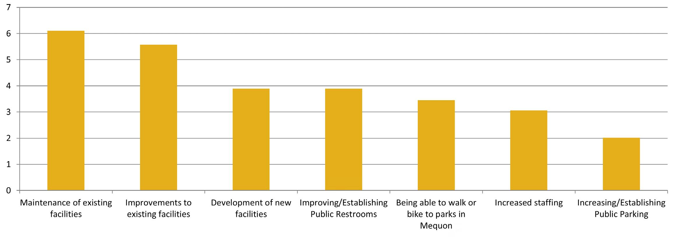
Figure 4.3 ”Please rank your priorities for park needs, from highest priority (1) to lowest priority (7).”
According to the online survey (Appendix A), the most visited parks in the last 12 months are Rotary Park, Mequon Nature Preserve, and Mequon Community Park. The most common activities participated in are use of walking trails and playgrounds, participation in a youth sports team, and dog walking.
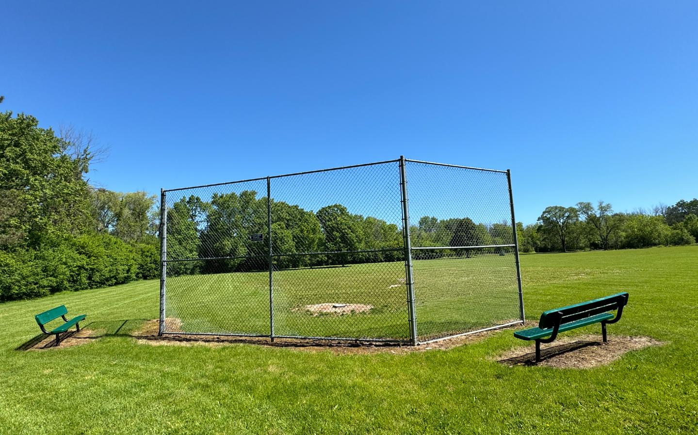
The highest priorities for Mequon parks users are maintenance of existing facilities, improvements to existing facilities, development of new facilities, and improving or establishing public restrooms. When asked to rate the condition of a list of park services and amenities, the top choices for Excellent or Good were cleanliness, parking availability, landscaping, and mowing. The amenities most identified as in the worst condition were athletic field conditions and playground equipment, with over 10% of respondents identifying them as poor or in need of repair.
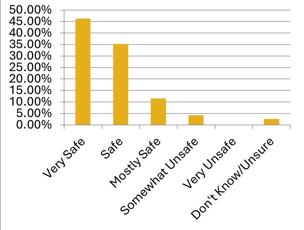
When asked about safety and accessibility, 80% of respondents identified Mequon parks as safe or very safe and 60% of respondents identified Mequon parks to be moderately or very accessible.
Figure 4.4 ”Over the past 12 months, which City parks have you or a member of your household visited?”
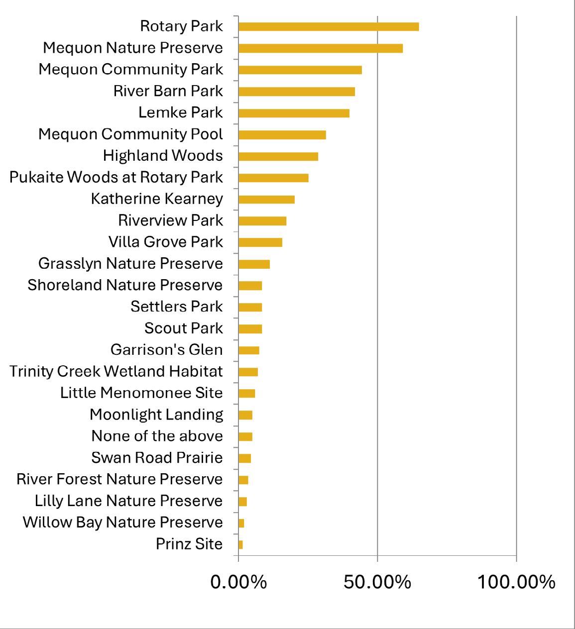
Figure 4.5 ”How would you rate the condition of the following elements within the City’s park system?”
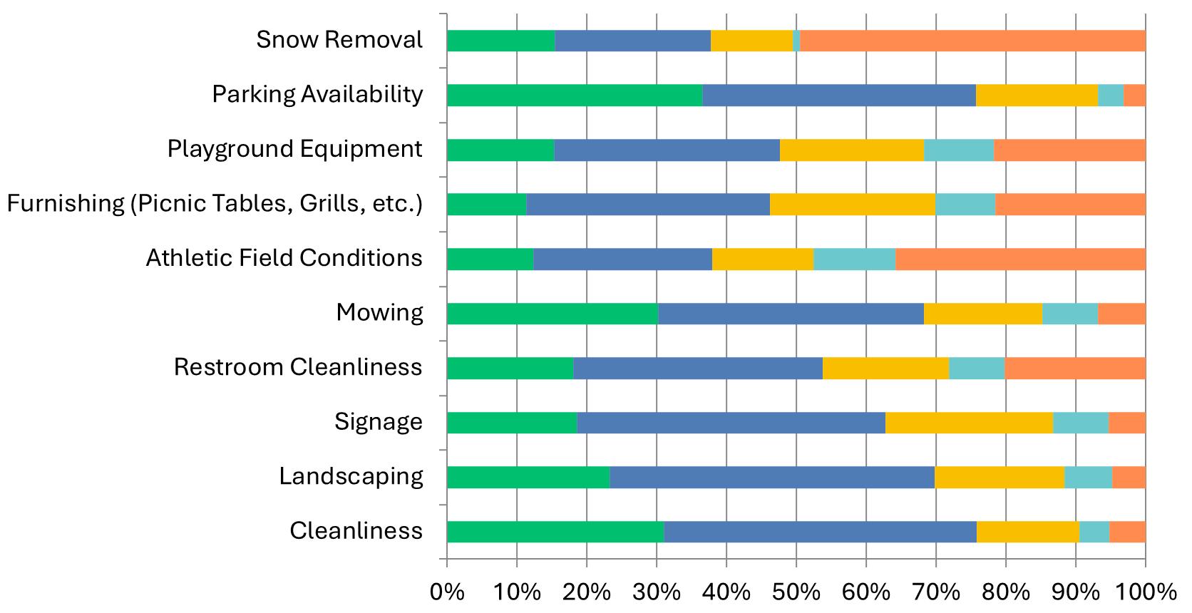
Figure 4.6 ”How would you rate the accessibility of Mequon Parks?”
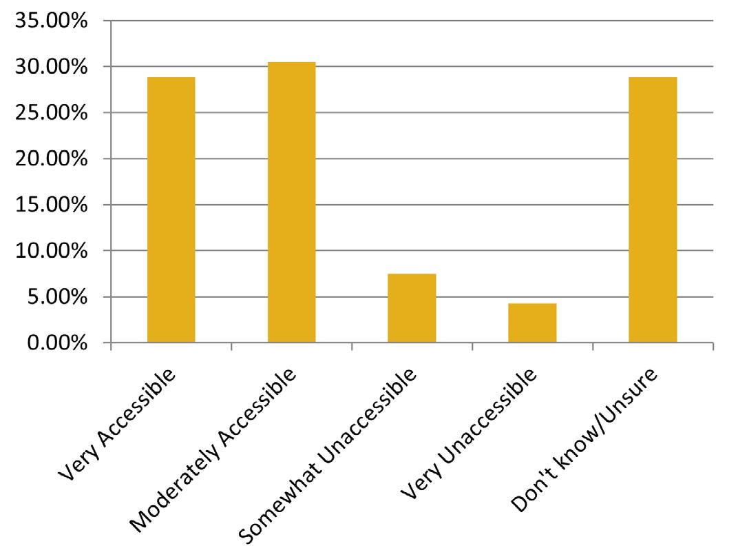
Figure 4.7 ”How would you rate the safety of Mequon Parks?”
At the time of the Mequon POSP plan development, Ozaukee County was undergoing a county-wide POSP Update that will release after the adoption of this plan. The Ozaukee County Comprehensive Planning Board reviewed a draft materials for the plan from February 2023 through summer of 2024, which were provided to the public in meeting agendas. The plan is expected in early 2025.
Objectives of the POSP update include:
• To provide an integrated system of public general use outdoor recreation sites and related open space areas which will allow the resident population of the County adequate opportunity to participate in a wide range of outdoor recreation activities.
• To provide sufficient outdoor recreation facilities to allow the resident population of the County adequate opportunity to participate in extensive land-based outdoor recreation activities.
• To provide sufficient access areas to allow the resident population of the County adequate opportunities to participate in extensive water-based outdoor recreation activities on major inland lakes, rivers and Lake Michigan which are consistent with enjoyable surface water use and the maintenance of adequate water quality.
• To preserve sufficient high-quality open-space lands for protection of the underlying and sustaining natural resource base and enhancement of the social and economic well-being and environmental quality of the County.
• To provide for the efficient and economical satisfaction of outdoor recreation and related open space needs meeting all other objectives at the lowest possible cost.
Mequon is located in the Lower Lake Michigan Coastal Region, which is the most populous recreation region in the state. The region is defined by its urban influence and known for extensive trails and a diversity of recreation facilities. Given the proximity to Milwaukee’s urban center, this region is younger and higher density than much of the rest of the state. Recommended recreation opportunities should cater to the diverse population of the region.
According to the SCORP, priorities for the region include:
• Passive recreation opportunities such as foraging, birdwatching, and nature photography
• Water-based recreation opportunities such as canoeing, fishing, and motor boating
• Off and on road bicycling
This chapter includes a variety of recommendations specifically developed to meet the existing and future needs of the community over the next five years. The recommendations incorporate input from the community survey and participation of City officials and staff as presented in the preceding chapters.
General recommendations are provided for direction and design considerations while considering operational and maintenance procedures. This chapter also includes a detailed park inventory sheet for each City park.
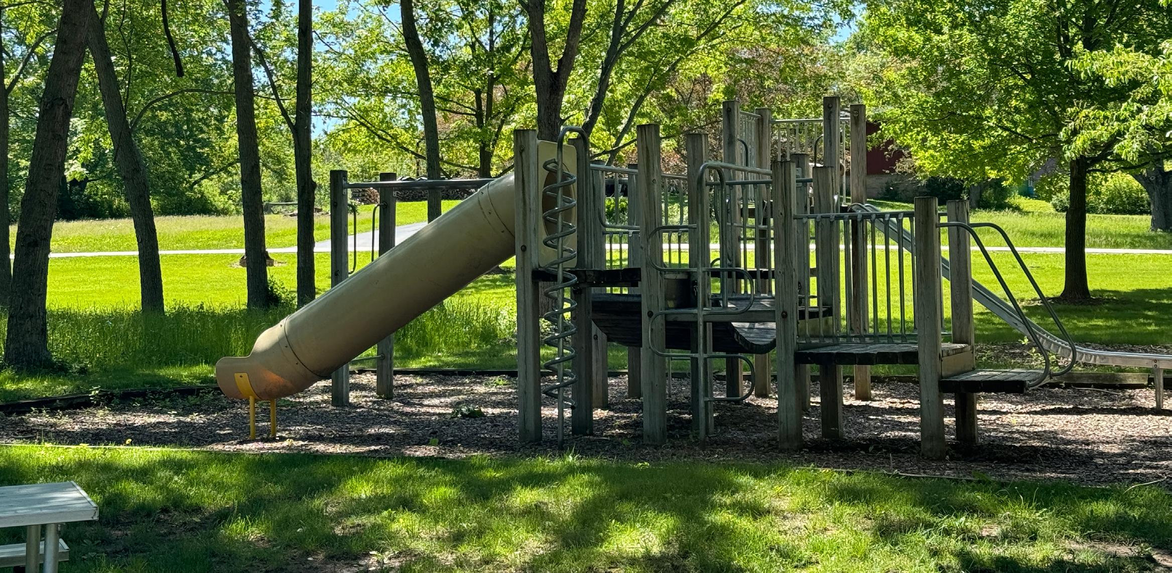
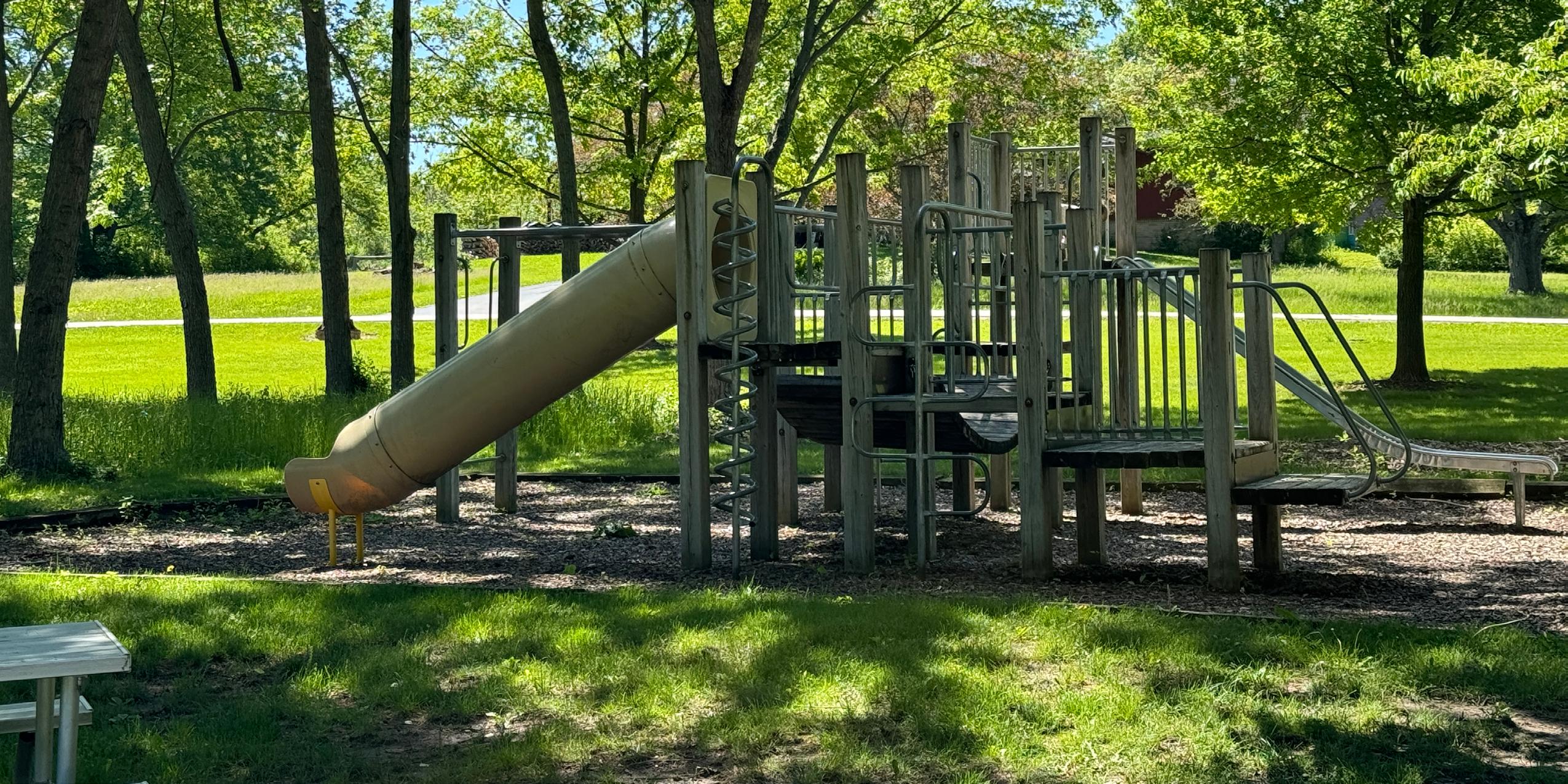
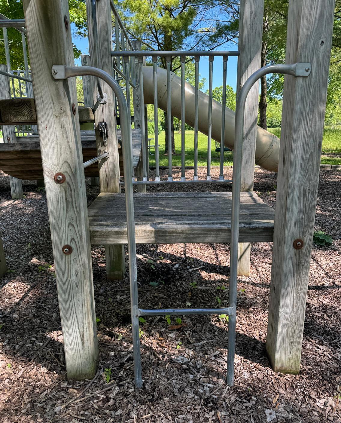
In addition to this chapter, MSA also conducted an analysis of the playgrounds throughout the City parks, and the resulting recommendations are included in Appendix C.
Several common issues have been identified during the planning process as a result of site visits, meetings with City staff, and community input.
Priority system-wide recommendations include:
1. LED Lighting Conversion
2. Ensuring every high traffic park has at least one drinking fountain
3. Improve online rental system and installation of automated lock systems for park facilities
4. Improved wayfinding and signage
5. Replace aging play equipment
6. Install lighting at all sport fields
The following sections discuss more detailed recommendations for each park. In most instances, more detailed planning, engineering, study, budgeting, and/or discussion will be necessary before decisions are made to actually acquire land or construct recreational facilities.
The recommendations of this plan are divided into four major sections:
7. Recommendations for existing park facilities
8. Recommendations for new park facilities
9. Recommendations for recreational trails
10. Miscellaneous recommendations
The timeline for completion of the recommendations is noted within each table of recommendations. High priority items should occur as soon as possible (one to two years), medium priority items should happen within the next three to five years, and low priority items should occur five or more years out. Due to budgetary constraints, it is unlikely that all of the recommendations within this chapter and the CIP table will be implemented within the next five years.
Source: GROTH Design Group

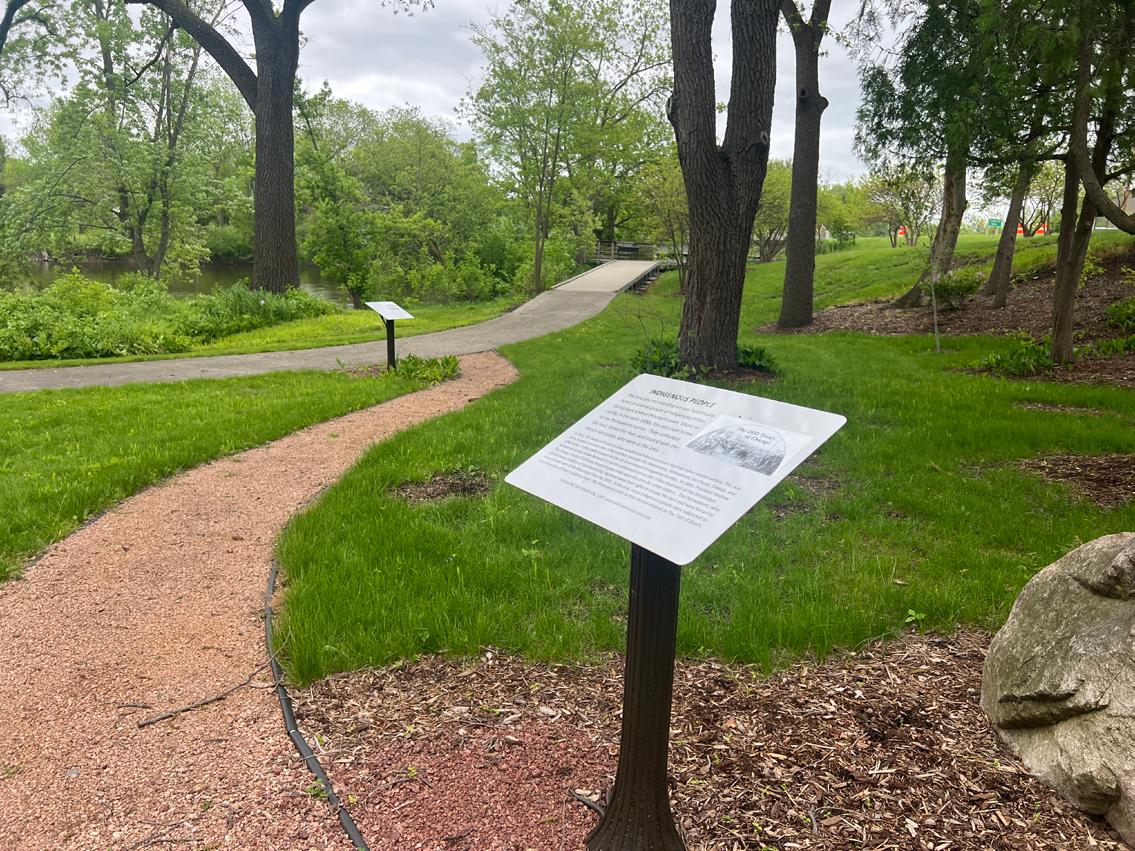
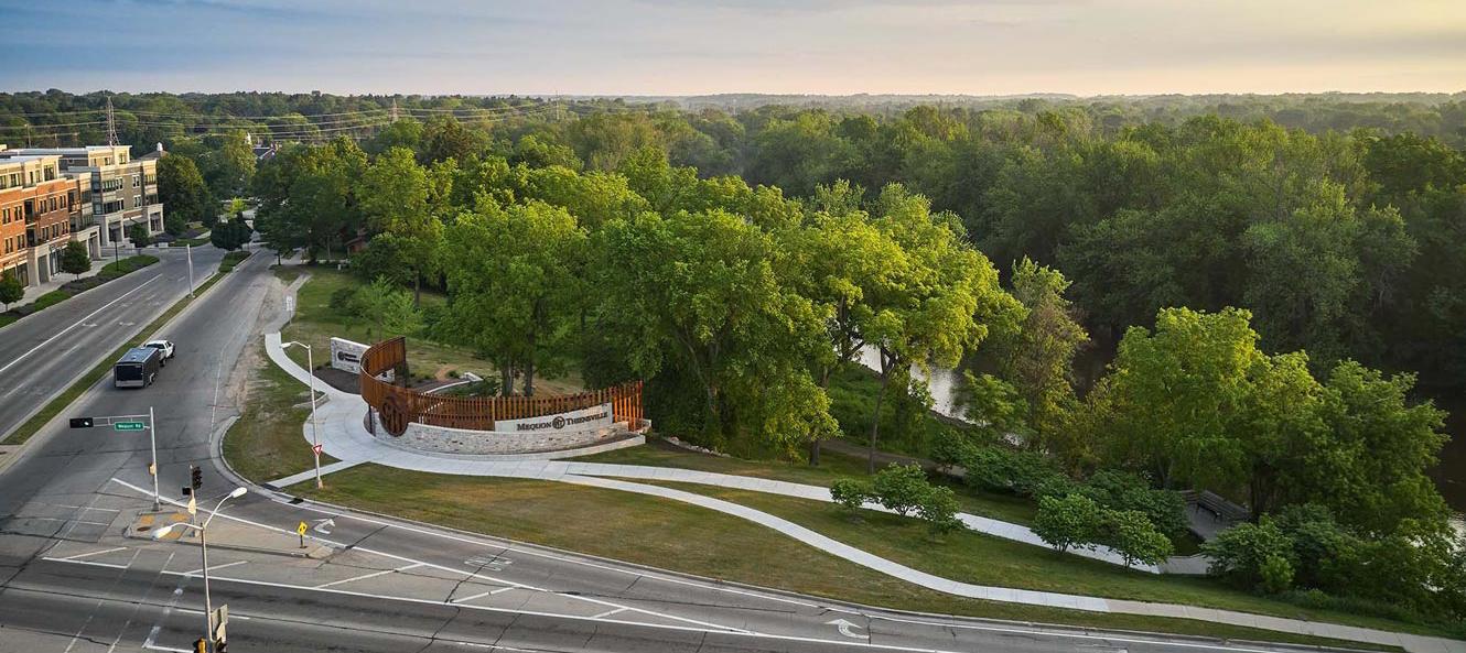
Past City planning efforts have focused on the riverfront properties east of the Town Center, which currently includes 4 privately owned parcels. Plans prepared that include the riverfront site are: Mequon Town Center Plan 2002: Concept Plan for Mequon Civic Campus & Road Corridor, The Mequon-Thiensville Town Center Design Guidelines 2005: Civic Campus & Streetscape, The Town Center Riverfront Park Plan 2010 with Phase 1 Consensus Master Plan which includes a Riverwalk, and the Mequon Thiensville Community Promenade & Gateway feature, 2018.
Approved in 2018 and completed in 2021, the City has completed construction on a riverfront structure on the southern parcel of the Town Center identified location. At the present, Settlers Park and Town Center Riverfront Park are still disconnected, but the long-term vision from the 2010 master plan is still the eventual end goal.
Park Address:11216 Cedarburg Road
Park Size: 1.68 Acres
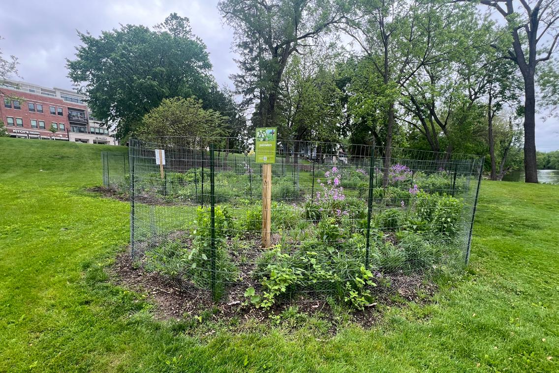
Completed in 2021, Town Center Riverfront Park,its core is a park pavilion used as a marker of entry to the Mequon Thiensville Business District. It is an open-air circular steel structure that leads to a path along the riverfront.
• Picnic Area
• Trails
• Gardens
• ADA Accessibility
• Bicycle Parking
Park Address: 544 W Sumner Street
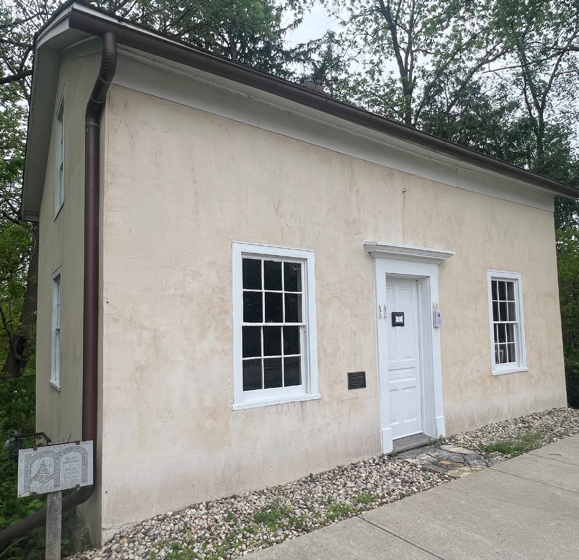
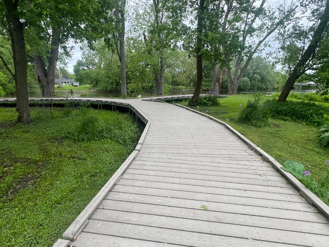
Park Size: 1.45 Acres
Acquired in 1990, Settlers Park is a 1½-acre special-use park on Cedarburg Road across the street from City Hall. Park amenities include the historic Isham Day House, an asphalt path and a boardwalk. Future plans call for the inclusion of the land occupied by Settlers Park in a larger development. Should this project be completed the park would be renamed as part of the Town Center Riverfront Park.
• Isham Day House
• Trails
• Fishing Area
• River/Lake Access
• Pedestrian Access
• ADA Accessibility
• Bicycle Parking
Park Address: 526 E Lincoln Avenue
Acquired in 2006, Garrison’s Glen is a 20-acre neighborhood park adjacent to the Milwaukee River on Pioneer Road. Park Facilities include a boat launch and hiking trails
• Natural Surface Trails
• Boat Launch
• River/Lake Access
• Automobile Parking
• Picnic Table
• Trash Receptacles
Grade trail locations that are not draining*
Install recycling receptacles (2)*
Install a bike rack on a concrete pad*
*Continued Recommendation from previous POSP
Park Address: 4200 Grave Avenue
Size: 19.80 Acres
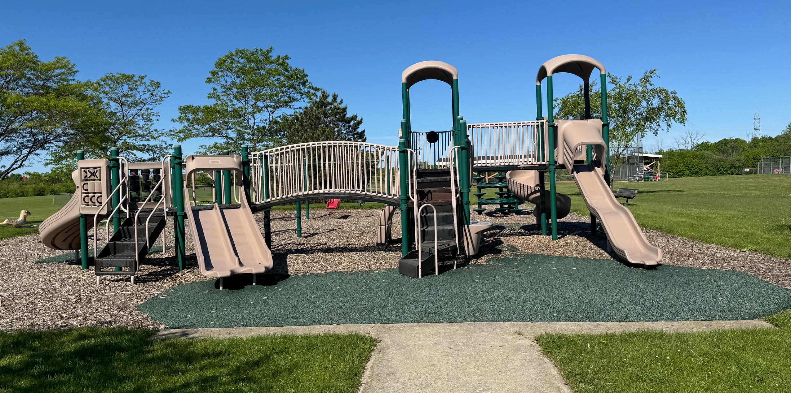
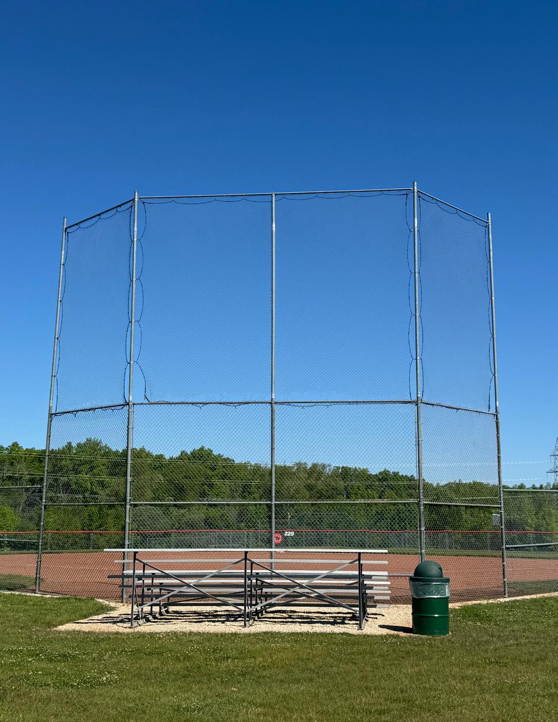
Riverview Park is a 20-acre neighborhood park acquired in a series of donations in 1969, 1983, and 2001. Riverview is on the Milwaukee River near the intersection of North River Road and Grace Avenue. Park facilities include a playground, a softball field and a canoe launch.
• Open Space
• Picnic Area
• Play Equipment
• Biking/Walking Trails
• Softball/Youth Baseball Diamond
• Community Gardens
• Boat Launch
• River/Lake Access
• Automobile Parking
Park repaving & parking lot extension (Roadway Program funds)
Relocate Archery Range
park plan*
Construct asphalt path connecting the existing asphalt path to the playground and parking lot*
Install bike rack on a concrete pad*
Add baseboard at bottom of backstop*
Sink home plate and pitcher’s rubber to “at grade”*
Install recycling receptacle*
*Continued Recommendation from previous POSP
$1,500-$2,500
Park Address: 11900 N Villa Grove Road
Park Size: 9.19 Acres
Villa Grove Park is a 5-acre neighborhood park acquired in 1969 on the Milwaukee River at the southern terminus of North Villa Grove Road. Park facilities include a boat launch, a canoe launch and hiking trails.
• Open Space
• Picnic Area
• Biking/Walking Trails
• Fishing Area
• Boat Launch
• River/Lake Access
• Snowmobile
• Restrooms
• Automobile Parking
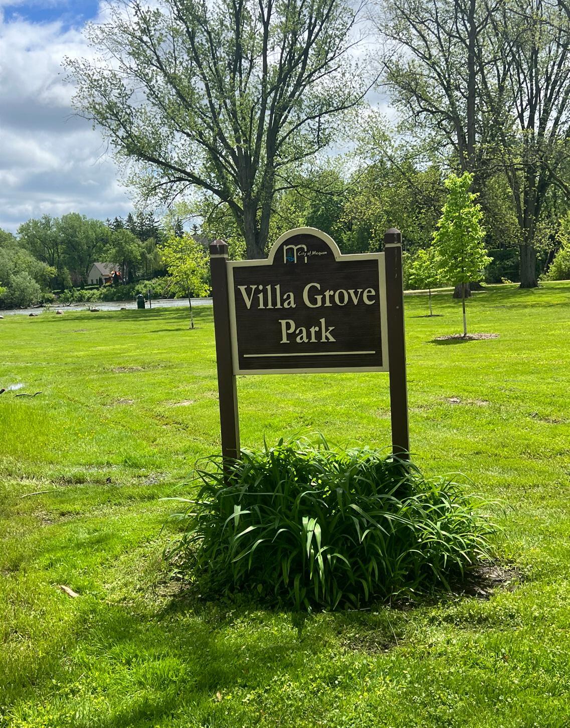
Construct a shelter with restroom*
$300,000
Resolve grade and drainage issues* ONGOING TBD
Construct an asphalt river walk connecting existing and proposed improvements LOW TBD
Construct an asphalt parking area on the west side of the park after drainage issues have been resolved*
Complete park plan*
Install recycling receptacles (2)*
*Continued Recommendation from previous POSP
TBD
$15,000-$20,000
$3,000-$6,000
Park Address: 10301 W Donges Bay Road
Park Size: 42.07 Acres
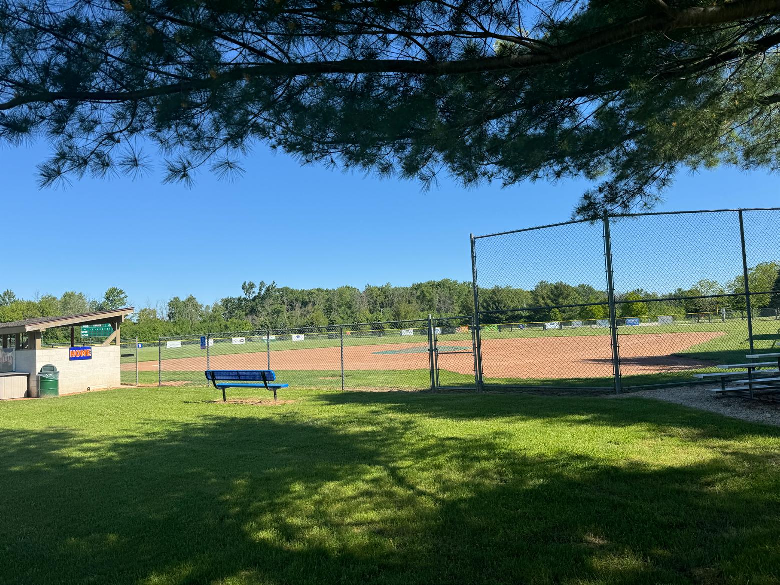
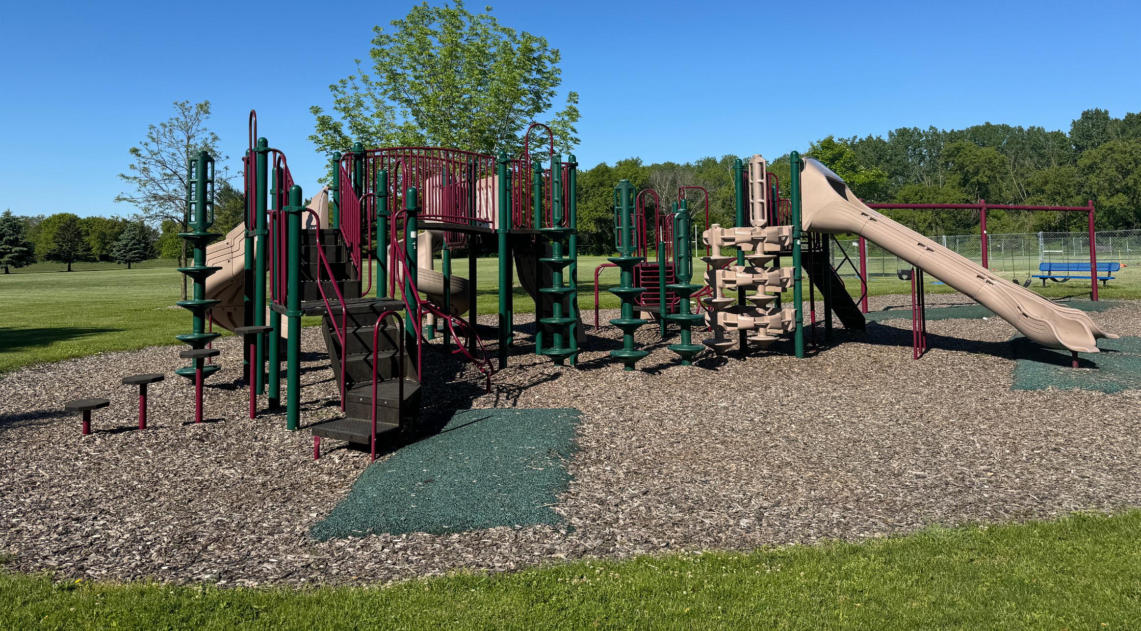
Acquired in 1999, Lemke Park is a 42-acre community park located on West Donges Bay Road between North Granville Road and Stanford Drive. Park facilities include athletic fields, a playground and an archery range.
• Open Space
• Picnic Area
• Play Equipment
• Soccer
• Baseball
• Softball/Youth Baseball
• Football
• Archery Range
• Sand Volleyball
• Tennis
• Horseshoes
• Park Shelter
• Bicycle Parking
• Automobile Parking
Parking Lot Repaving & Basketball Courts (Roadway Program funds)
Install four recycling receptacles throughout park*
Move bike rack to a hardscape surface*
Replace worn safety surface in playground areas
*Continued Recommendation from previous POSP
Park Address: 11345 Cedarburg Road
Park Size: 12.37 Acres
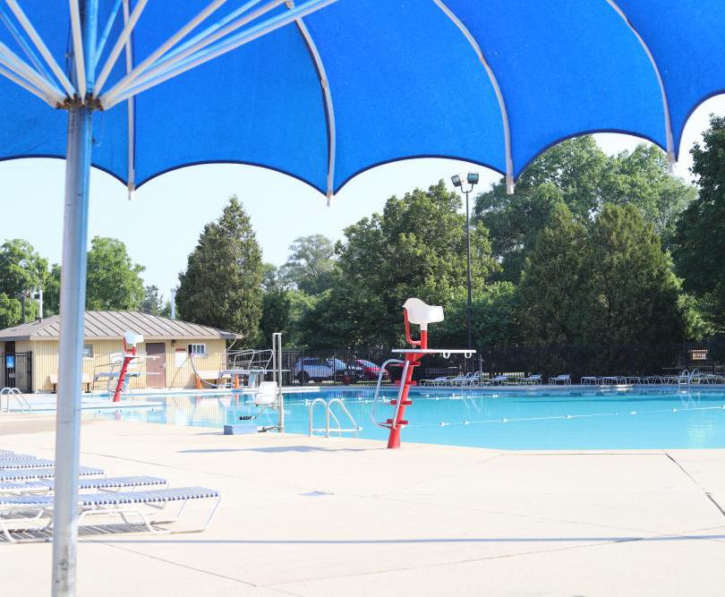
The Civic Center Park (formerly Mequon Community Park) is a 12-acre park acquired in the 1900s on Cedarburg Road south of Division Street. Park facilities include the Mequon Community Pool, Rennicke baseball field and a playground. The Frank L. Weyenberg Library and Mequon City Hall are also located on the park grounds.
• Picnic Area
• Play Equipment
• Biking/Walking Trails
• Lighted Ball Diamond
• Exercise Stations
• Pool/Splashpad
• Restrooms
• Pedestrian Access
• Drinking Water
• ADA Accessibility
• Bicycle Parking
• Automobile Parking
Playground removal & replacement*
Resolve Drainage Issues
Remove/replace asphalt paths
Complete park plan*
Complete aquatic facility study to determine future community needs*
Repair hardscape surfaces where required*
Install park identification sign on Cedarburg Road*
Install three ADA approved and accessible picnic tables throughout park*
Install four recycling receptacles throughout park*
Replace worn park regulatory signage*
*Continued Recommendation from previous POSP

$600,000
TBD
$10/SF
$25,000
$20,000
$12,500-$15,000
$8,000
$6,000
$6,000-$10,000
$800/EA
Park Address: 9808 N Cedarburg Road
Park Size: 42.85 Acres
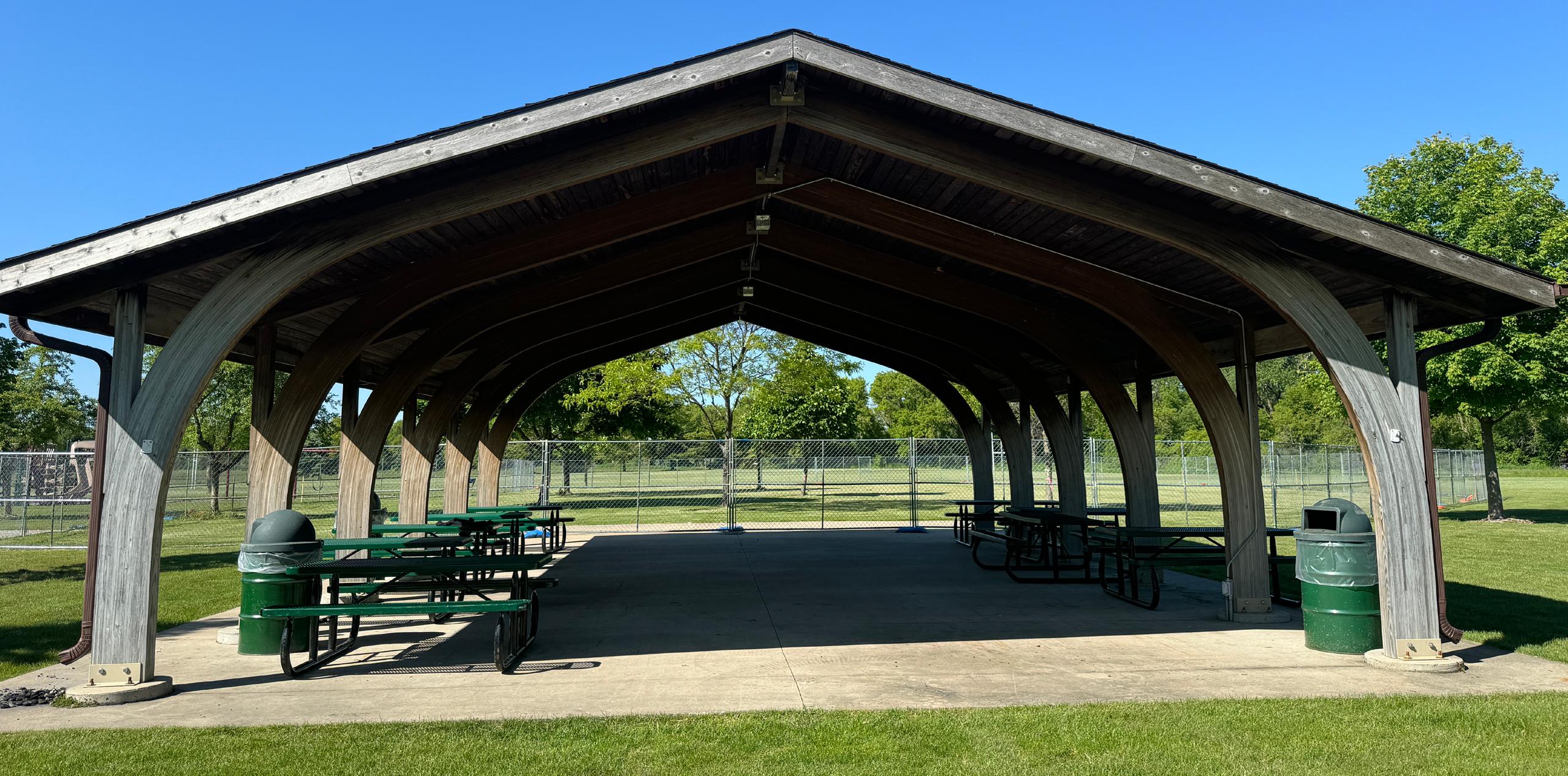
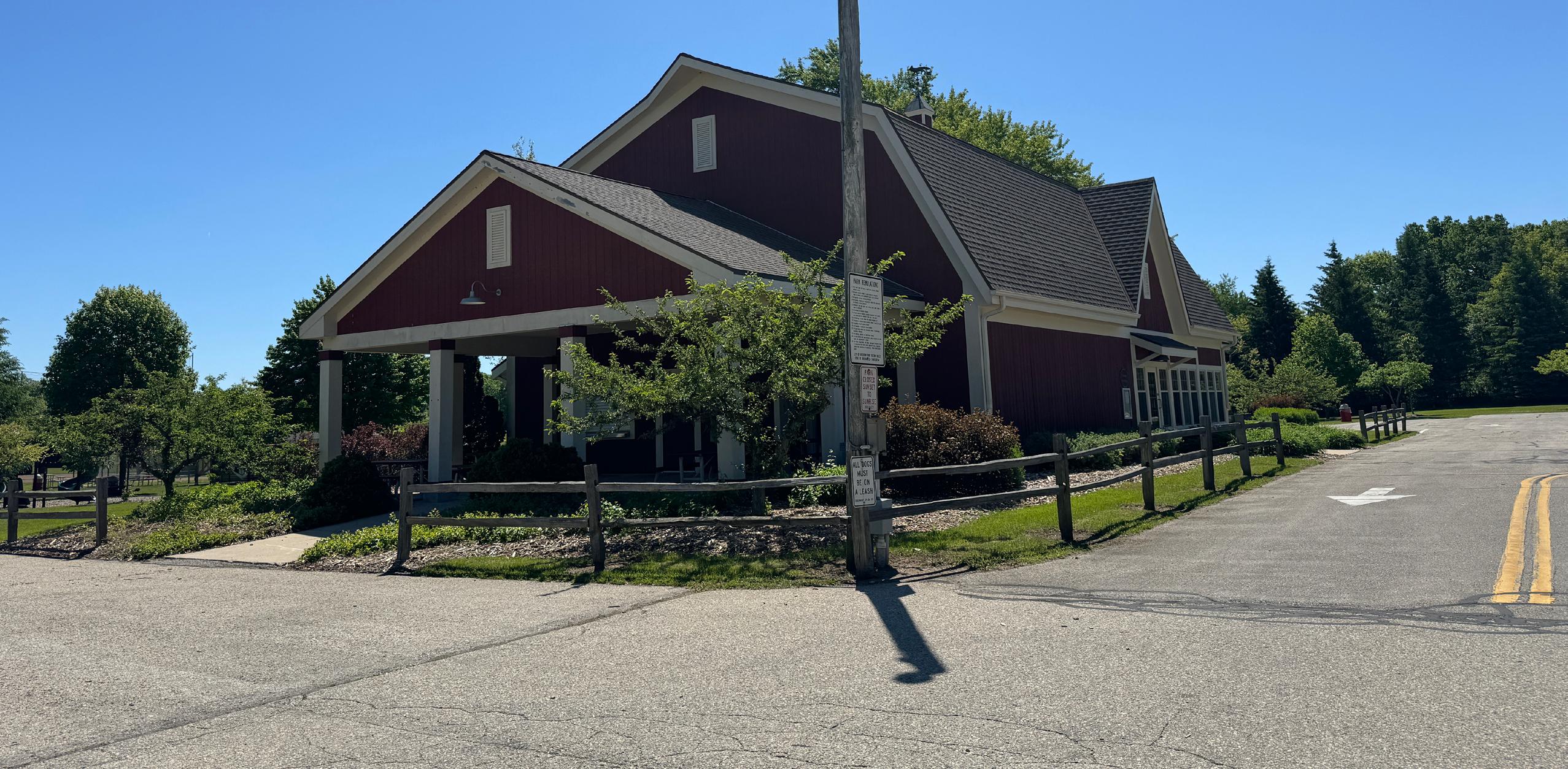
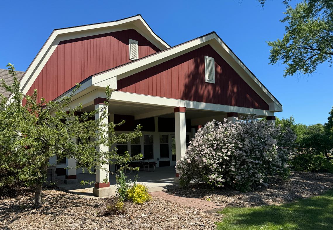
River Barn Park is a 43-acre community park on Cedarburg Road acquired in 1993 between West Kathleen Lane and West Hiawatha Drive. The park is adjacent to the Milwaukee River and contains athletic fields, a playground and an indoor/outdoor pavilion.
• Open Space
• Picnic Area
• Play Equipment
• Soccer
• Softball/Youth Baseball
• Football
• Boat Launch
• Lake/River Access
• Restrooms
• Park Shelter
• Drinking Water
• Bicycle Parking
• Automobile Parking
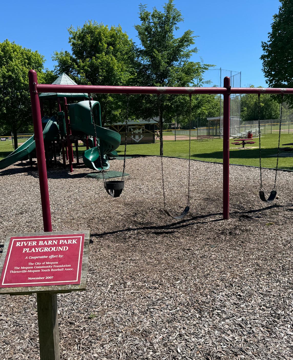
Playground replacement
$250,000-$300,000
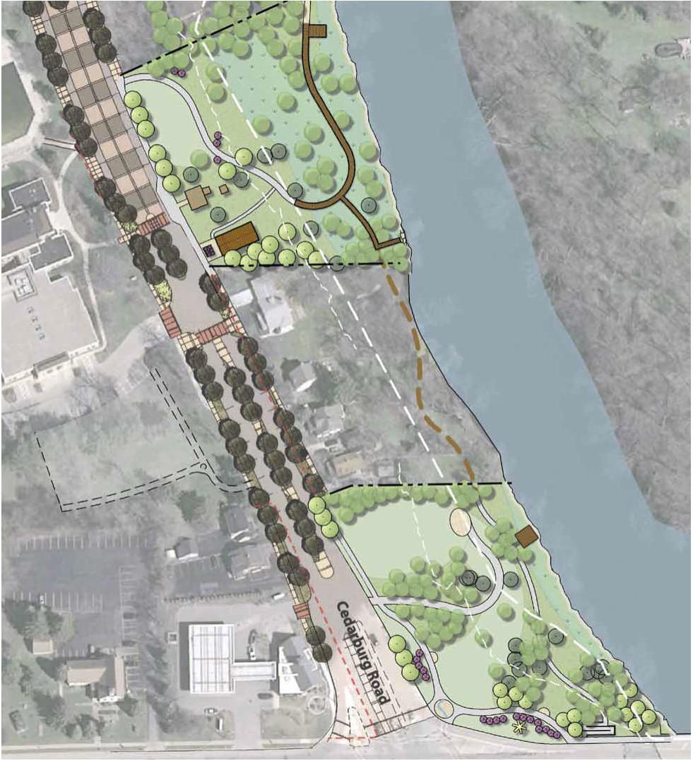
Install Pickleball Courts** HIGH See Appendix D
River portal, prairie plantings, tree relocation HIGH See Appendix D
Replace lacrosse goals that are in poor condition and relocate soccer goals
Basketball Courts
North parking lot repaving (Roadway Program funds)
Landscape middle median*
Install three ADA approved and accessible picnic tables throughout park*
Install four recycling receptacles throughout park*
Replace bleacher end caps at lacrosse fields*
*Continued Recommendation from previous POSP
**Private Funding Projects (if private funds are not available, project should not be completed)
$5,000
$125,000
$4,500
$6,000
$6,000
$500-$1,000
Park Address: 4100 Highland Road
Park Size: 75.52 Acres
Acquired in 1989, Rotary Park is a 76-acre community park on Highland Road east of North River Road. Park facilities include athletic fields, three large shelters and two playgrounds.
• Open Space
• Picnic Area
• Play Equipment
• Biking/Walking Trails
• Soccer
• Softball/Youth Baseball
• Basketball
• Fishing Area
• Lake/Pond Access
• Performance Stage
• Event Area
• Restrooms
• Park Shelter
• Drinking Water
• Automobile Parking
Replace South Playground: All inclusive playground**
Reconstruction: basketball, pickleball courts & fence
Connect to city water, gas, WiFi, & keyless entry
Replace North Playground: Musical playground
Improve drainage (Schmit, Soccer)*
Bolt-on/expansion/water/ADA restrooms
Memory Garden - rebuild pergola/information sign**
Develop dog area**
Walking paths (hardsurface, pond loop)
$1,000,000
$164,000
$50,000 Increase power service
Schmit Baseball Field - fencing & sign replacement & lighting**
*Continued Recommendation from previous POSP **Private Funding Projects (if private funds are not available, project should not be completed)
Park Address: 801 W Zedler Lane 100N
Park Size: 35.32 Acres
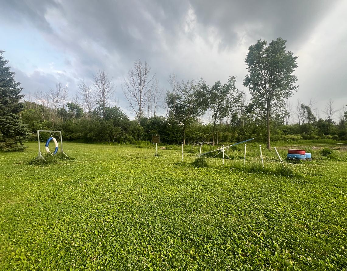
Katherine Kearney Carpenter Park is a 35-acre special-use park acquired in 1967, located at the intersection of West Zedler Lane and North La Cresta Drive. The park contains hiking trails, two parking lots and is off-leash dog friendly.
• Dog Park
• Biking/Walking Trails
• Sandlot Backstop
• Automobile Parking
*Continued Recommendation from previous POSP
Open spaces are those natural areas, parks, farms, and forests that provide the green space, habitat, and simply the “room” for community members to recreate, rejuvenate, and improve livelihoods. As the built environment around us grows, it is increasingly important to set aside and reclaim areas for the health, safety, and enjoyment of the community and in order to sustain the quality of life for residents. Protecting open space also allows nature to continue to provide benefits to the community like clean and abundant water and flood protection.
Open space is critically important to Mequon and is critical to the health of the entire region. Land use has the greatest impact on surface and groundwater quality in the Milwaukee River Basin and Lake Michigan, which affects communities throughout southeast Wisconsin and beyond.
As the population increases and rural lands are converted for homes and businesses, pollution of surface and ground water increases and wildlife habitat and water quality degrades. Today, the City of Mequon is challenged to balance growing land use
demands while prioritizing protection, restoration, and enhancing water and other natural resources, in addition to continuing to preserve its rural character and scenic vistas. Protecting the land and water of the City is essential to maintaining the area’s environmental, economic, and cultural heritage. The City, along with Ozaukee Washington Land Trust (OWLT), Milwaukee Metropolitan Sewerage District (MMSD), Wisconsin Wetlands Association (WWA), the Ozaukee County Planning and Parks Department, and Mequon Nature Preserve have collaborated to identify critical conservancy areas.
Park Address:11655W W Donges Bay Road
Park Size: 62.00 Acres
Acquisition Year: 2011
• Open Space
• Natural Area
Park Address: 9949 N Grasslyn Road
Park Size: 15.47 Acres
Acquisition Year: 1970s
• Prairie
• Trails
• Boardwalk
• Parking Area
• Natural Area
• Park Sign
Park Address:12701 N Green Bay Road
Park Size: 74.38 Acres
Acquisition Year: 1996
• Trails
• Veterans Memorial
• Natural Area
• Parking
• Park sign
Park Address: 6300 W Lilly Lane
Park Size: 12.91 Acres
Acquisition Year: 1987
• Natural Area
Park Address: 9101 W Freistadt Road
Park Size: 20.05 Acres
Acquisition Year: 1992
• Automobile Parking
• Open Space
• Picnic Area
• Trail
Park Address: 8200 W County Line Road
Park Size: 438.10 Acres
Acquisition Year: 2002-2017
• Trail Network
• Pieper Power Education Center
• Observation Tower
• Farmstead
• Parking Lots
• Restrooms
• Ponds & Wetlands
• Natural Area
• Cross Country Ski Trails
Park Address:12499 N Island Drive
Park Size: 0.56 Acres
Acquisition Year: 2014
• Trails
• Veterans Memorial
• Natural Area
• Parking
• Park Sign
Park Address: 12401 N River Road
Park Size: 10.65 Acres
Acquisition Year: 1989
• Natural area
Park Address: 4100 W Highland Road
Park Size: 18.02 Acres
Acquisition Year: 1992
EXISTING FACILITIES:
• Trail Network
• Natural Area
• Bridge
• Park Sign
Park Address: 2122 W Glen Oaks Lane
Park Size: 57.87 Acres
Acquisition Year: 1990s
• Natural Area
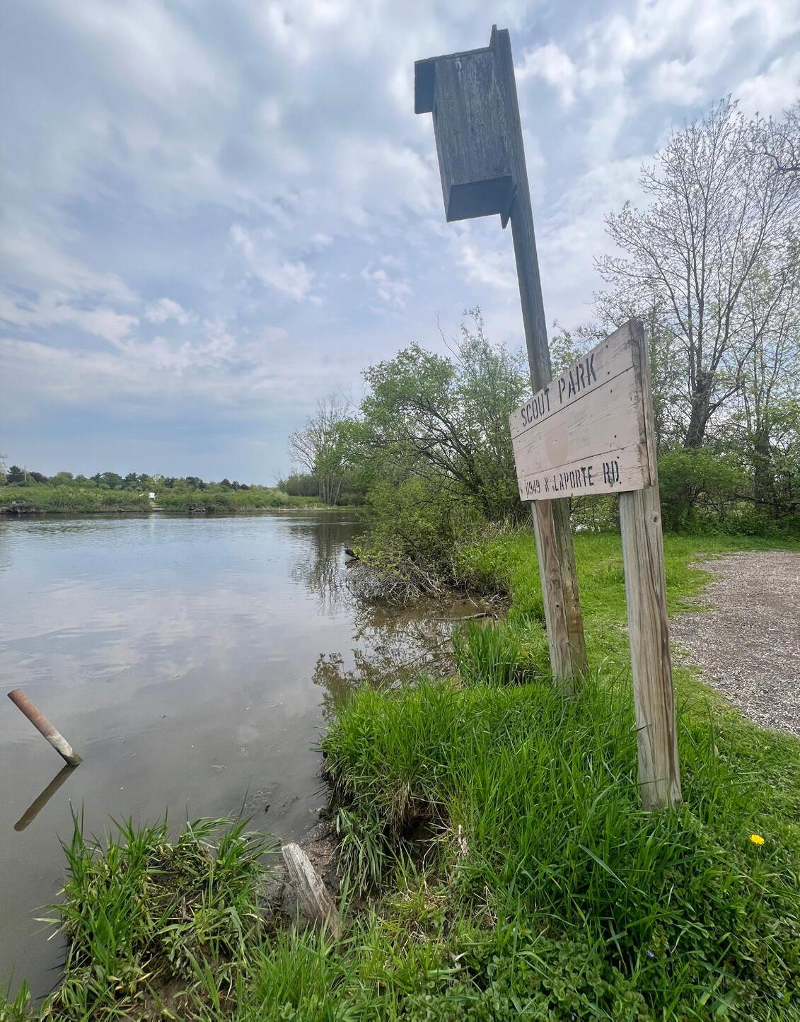
Park Address:11949 N La Porte Road
Park Size: 7.40 Acres
Acquisition Year: 1994
• Trails
• Veterans Memorial
• Natural Area
• Parking
• Park Sign
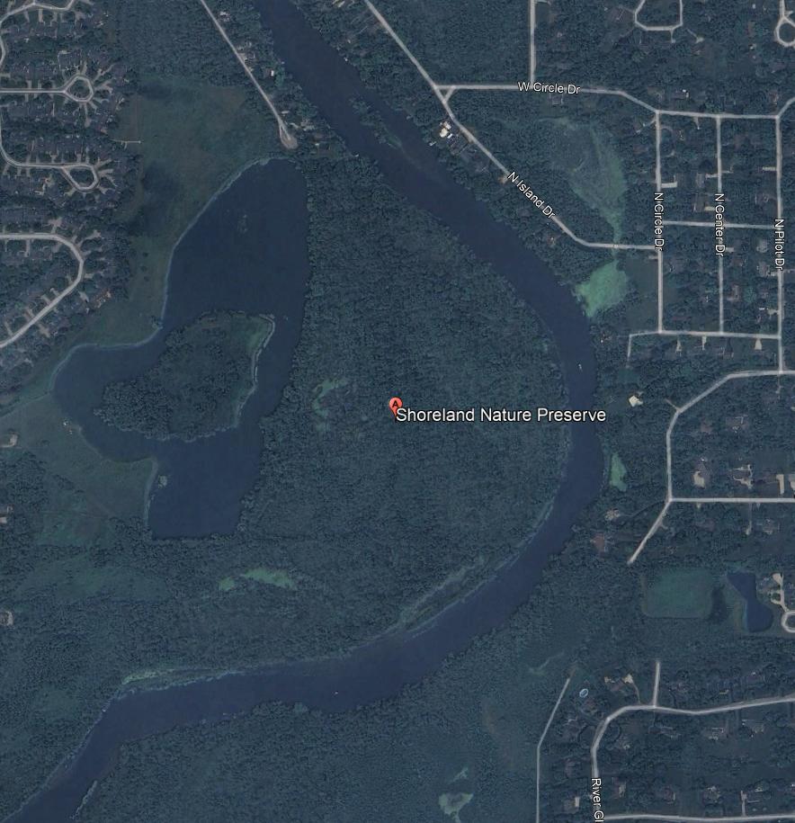
Park Address: 12500 N Shoreland Parkway
Park Size: 137.09 Acres
Acquisition Year: 1984
• Trails
• Natural Area
Park Address: 9625 N Swan Road
Park Size: 20.14 Acres
Acquisition Year: 2011
• Natural Areas
• Trails
• Parking Lot
• Park Sign
Park Address: 9855 N Riebs Lane
Park Size: 42.75 Acres Acquisition Year: 2002
• Aquatic Gabitat
• Education Facility
• Parking Area
• Trails
• Interpretive Signage
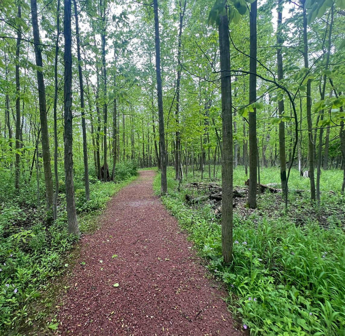
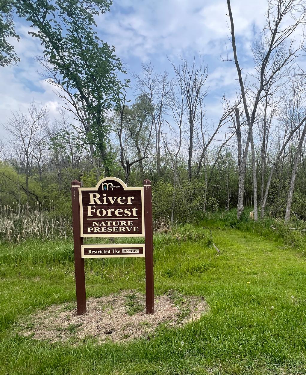
Park Address:12621 N River Forest Drive
Park Size: 25.43 Acres
Acquisition Year: 1998
• Natural Areas
• Trails
• Parking Area
• Park Sign


Surrounding
Interstate/Federal Highway
State Highway
Railroad
Lake/Pond
River/Stream
Proposed Parks and Trails
Ulao Creek Linear Parkway
Proposed Trail
Proposed Park
Existing Trails Ozaukee
Located directly across the street from Lemke Park, this parcel is currently undeveloped land owned by the Milwaukee Metropolitan Sewerage District (MMSD). This 29-acre site could serve as a link between Lemke Park and additional developments on an adjacent MMSD parcel detailed below. The additional site is necessary as this parcel is limited in what type of development can occur. An Intergovernmental Agreement restricts development on this site to passive functions. Development of a linked trail network on this property could be a major recreational opportunity for the community.
This 72-acre site is located on North Granville Road near Lemke Park. This land was acquired for conservation and stormwater management. Similar to the Babiaz property, this parcel also has an intergovernmental agreement that limits development to passive uses. Therefore, development of this property would likely need to be limited to amenities found in a typical conservancy park. Amenities that could be considered would be trails, interpretive signage, and potentially park shelters.
Located on the northeast side of Mequon, Ulao Creek is a 750-acre development site. In order to ensure high quality development on the site, the City adopted a Neighborhood Design Guide in 2021 that includes 10 miles of linear parkway, which is intended to occur through private development and public capital improvements as the site is developed. This parkway is part of the City’s long-term vision, and will likely be implemented in segments as development takes place.
The previous chapter of this report detailed a number of specific improvement options. This chapter provides the mechanism for implementing them. It includes a compilation of capital improvements, park development mechanisms and funding sources. The chapter also includes the process for adopting, monitoring, and updating this plan.
A prerequisite to participate in outdoor recreation grant programs and opportunities is the adoption of a local Park and Open Space Plan that meets the requirements presented by the Department of Natural Resource.
This Park and Open Space Plan should be approved by the Common Council after review and recommendation by the Park and Open Space Board. The City should follow all established rules and procedures when adopting this plan update.
Plan amendments are common and should be considered part of the planning process. They frequently represent good implementation or plan usage and should be acceptable for consideration by local decision-makers. Amendments must follow the same process as the original plan and should be developed in coordination with the Park and Open Space Plan before they are presented to the Common Council for approval. Amendments generally prolong the effectiveness of the parent plan.
The Mequon Park & Open Space Plan will make the City eligible for funding by the Wisconsin Department of Natural Resources through the year 2030. Since this plan was developed with a five-year timeframe, it should be amended in 2030 to ensure grant eligibility and to reflect progress made over time.
Maintenance and operational expenses of the City’s Parks Division are generally funded through property taxes and user fees. As the park system grows, the funding needed to meet the basic maintenance and operational costs also grows. Often there are insufficient funds to undertake major capital improvement projects. Accordingly, there are a wide variety of potential funding sources to assist with upfront capital costs, including acquisition of land and the development of new recreational facilities.
Implementation dollars are available for acquisition and development of recreation spaces and facilities. Linear parks and trails can be funded through the Wisconsin Department of Natural Resources (WDNR) or the Department of Transportation (WDOT). The WDNR also provides funds for the acquisition of lands, the stabilization of shoreland, and the protection of environmentally sensitive areas. The high cost of park improvement projects necessitates the acquisition of outside funding to enable development. Grant funding provides seed money and crucial capital for leveraging additional community dollars and support. While many projects identified in this plan would benefit from the acquisition of outside funding sources, some projects will require grant funding if they are to be realized.
Community groups and civic organizations are sometimes willing to organize fundraising efforts to assist with costs, and they may also be able to marshal volunteer labor to assist with small development projects such as trail creation or playground installations, especially if they are a potential user group. The City should coordinate with potential user groups when planning new facilities to see if costsharing, donation or outright purchase options exist. Groups that could potentially be involved include youth sports groups, private organizations and the school district.
Local business and corporate support should also be sought. Funders can be acknowledged with plaques, signs, or walkway bricks, including the option of park or feature naming rights for major donors.
The City can set up an endowment fund as an additional means of providing continual financial support for park acquisition and development. An endowment fund works like a permanent savings account. The amount individuals give, which is the principal, is never spent. Only the interest income is spent, thereby providing a continual source of money. A park endowment fund can provide a means for residents to make gifts of any size (including estate bequests), with the certainty that the money donated will only be used for the advancement of recreation in the community. Gifts to an endowment fund are typically tax deductible under federal and state law.
In many communities, parkland development occurs with the availability of land. Donations of private land for a public purpose is not uncommon, and criteria for accepting these lands is needed. A formal procedure should be in place to govern how any donated land will be planned and used in the best interest of the community. An established planned giving program through the City would allow prospective patrons to dedicate land in a legal manner that provides a legacy for how the land will be utilized over time.
Tax increment financing (TIF) is a tool that allows municipalities to promote economic development by earmarking property tax revenue from increases in assessed values within a designated TIF district. As part of a broader plan to redevelop an area, the City can use tax increment financing to assist with parkland or trail acquisition and development. There are some limitations to what revenues from a TIF district can be used to pay for, generally the costs of constructing public buildings cannot be funded with TIF. TID’s are typically created for the purpose of stimulating redevelopment and new public and private investments. There are currently 3 active tax increment districts in the City: TIF 2, TIF 4, and TIF 5. TIF 2, formed in 2002, expired in 2024.
Authorized under Wisconsin Statues 66.0617, Impact fees allow municipalities to charge developers to help pay for the capital costs necessary to accommodate land development and maintain levels of service. The City of Mequon utilizes impact fees to maintain high quality public facilities into the future, and assure new development bears a proportionate share of the cost needed to improve the community.
According to Sec. 58-142 of the Mequon Code of Ordinances:
(a) Any person who seeks to develop land within the City of Mequon, by applying for a building permit or an extension of a building permit is hereby required to pay an impact fee in the manner and amount set forth in this chapter.
(b) Any new building permit for any activity requiring payment of an impact fee pursuant to section 58-45 of this chapter shall be conditioned upon and its effective date delayed until the impact fee(s) hereby required have been determined and paid. Any parcel for which the park and open space fee has already been paid shall not be required to pay this additional fee.
Impact fees for parks can be used for parkland, playgrounds, and land for athletic fields. The current rate, according to Sec. 48-143.5 is $900 per residential unit.
Funding Programs By Category
Knowles-Nelson Stewardship Program
Funding Programs By Category
Knowles-Nelson Stewardship Program
The Stewardship Program was established in 1989 to preserve Wisconsin’s most significant land and water resources for future generations and to provide the land base and recreational facilities needed for quality outdoor experiences. These goals are achieved by acquiring land and easements for conservation and recreation purposes, developing and improving recreational facilities, and restoring wildlife habitat. This is an umbrella program that funds the following grants:
Aids for the Acquisition and Development of Local Parks (ADLP)
The Stewardship Program was established in 1989 to preserve Wisconsin’s most significant land and water resources for future generations and to provide the land base and recreational facilities needed for quality outdoor experiences. These goals are achieved by acquiring land and easements for conservation and recreation purposes, developing and improving recreational facilities, and restoring wildlife habitat. This is an umbrella program that funds the following grants:
• Helps to buy land or easements and develop or renovate local park and recreation area facilities for nature-based outdoor recreation purposed (e.g., trails, fishing access, and park support facilities).
• Helps to buy land or easements in urban or urbanizing area to preserve the scenic and ecological values of natural open spaces for nature-based outdoor recreation, including non-commercial gardening.
• Helps to buy land or easements and develop or renovate local park and recreation area facilities for nature-based outdoor recreation purposed (e.g., trails, fishing access, and park support facilities).
Urban Green Space (UGS)
• Helps to buy land on or adjacent to river flowing through urban or urbanizing areas to preserve or restore the scenic and environmental values of riverways for nature-based outdoor recreation.
• Helps to buy land or easements in urban or urbanizing area to preserve the scenic and ecological values of natural open spaces for nature-based outdoor recreation, including non-commercial gardening.
Acquisition of Development Rights Grants (ADR)
Urban Rivers (UR)
• Helps to buy development rights (easements) for the protection of natural, agricultural, or forestry values, that would enhance nature-based outdoor recreation.
• Helps to buy land on or adjacent to river flowing through urban or urbanizing areas to preserve or restore the scenic and environmental values of riverways for nature-based outdoor recreation.
Acquisition of Development Rights Grants (ADR)
Funding Programs By Category
• Helps to buy development rights (easements) for the protection of natural, agricultural, or forestry values, that would enhance nature-based outdoor recreation.
Land and Water Conservation Fund (LAWCON)
• This fund is used to implement projects that are identified by both the local and the state Comprehensive Outdoor Recreation Plan.
Funding Programs By Category
Land and Water Conservation Fund (LAWCON)
• In general, land acquisition, development, and renovation projects for public outdoor recreation purposes are eligible LWCF projects. LWCF does not include the “nature-based outdoor recreation” restriction that the Stewardship Local Assistance Programs do.
• This fund is used to implement projects that are identified by both the local and the state Comprehensive Outdoor Recreation Plan.
Recreational Trails Program Grant
• Eligible projects include: maintenance and restoration of existing trails, development and rehabilitation of trailside and trailhead facilities and trail linkages, construction of new trails, and acquisition of easement or property for trails.
• In general, land acquisition, development, and renovation projects for public outdoor recreation purposes are eligible LWCF projects. LWCF does not include the “nature-based outdoor recreation” restriction that the Stewardship Local Assistance Programs do.
Recreational Trails Program Grant
• May only be used on trails which have been identified in or which further a specific goal of a local, county or state trail plan included or reference in a statewide comprehensive outdoor recreation plan required by the federal LAWCON.
• Eligible projects include: maintenance and restoration of existing trails, development and rehabilitation of trailside and trailhead facilities and trail linkages, construction of new trails, and acquisition of easement or property for trails.
Urban Forestry
Up to 80% of the total project costs of a recreational trail project (20% match required). Payments are reimbursements on costs incurred after project approval.
• May only be used on trails which have been identified in or which further a specific goal of a local, county or state trail plan included or reference in a statewide comprehensive outdoor recreation plan required by the federal LAWCON.
Provides technical service and financial assistance to communities for developing urban forestry programs. Priorities include:
Up to 80% of the total project costs of a recreational trail project (20% match required). Payments are reimbursements on costs incurred after project approval.
Grants range from $1,000 to $25,000.
Urban Forestry
1) Communities needing to develop an urban forestry plan; 2) Communities needing worker training; and
3) Communities needing to conduct a street tree inventory.
Provides technical service and financial assistance to communities for developing urban forestry programs. Priorities include:
1) Communities needing to develop an urban forestry plan;
2) Communities needing worker training; and
Eligible projects include 1) Undertaking street tree inventories; 2) Training for Village tree workers; 3) Developing urban open space programs; 4) Developing urban forestry plans; 5) Developing a tree ordinance; 6) Developing a public awareness program; and, 7) Tree planting and maintenance
Grants range from $1,000 to $25,000.
3) Communities needing to conduct a street tree inventory.
Lake Protection and Classification Grants
Eligible projects include 1) Undertaking street tree inventories; 2) Training for Village tree workers; 3) Developing urban open space programs; 4) Developing urban forestry plans; 5) Developing a tree ordinance; 6) Developing a public awareness program; and, 7) Tree planting and maintenance
• Designed to assist lake users, lake communities and local governments as they undertake projects to protect and restore lakes and their ecosystems. Eligible projects include:
• Purchase of property or a conservation easement $200,000 maximum per project.
Lake Protection and Classification Grants
• Restoration of wetlands
• Development of local regulations or ordinances
• Designed to assist lake users, lake communities and local governments as they undertake projects to protect and restore lakes and their ecosystems. Eligible projects include:
• Purchase of property or a conservation easement $200,000 maximum per project.
• Restoration of wetlands
• Lake classification projects that allow counties to design and implement local land and water management programs that are tailored to specific classes of lakes in response to various development and recreational use pressures (these grants are limited to $50,000).
• Development of local regulations or ordinances
• Lake protection projects recommended in a DNR-approved plan including watershed management, lake restoration, diagnostic feasibility studies, or any other projects that will protect or improve lakes.
• Lake classification projects that allow counties to design and implement local land and water management programs that are tailored to specific classes of lakes in response to various development and recreational use pressures (these grants are limited to $50,000).
Recreational Boating Facilities Grant
• Construction of capital improvements to provide safe recreational boating facilities and for feasibility studies related to the development of safe recreational facilities. 50%
• Lake protection projects recommended in a DNR-approved plan including watershed management, lake restoration, diagnostic feasibility studies, or any other projects that will protect or improve lakes.
Provides technical service and financial assistance to communities for developing urban forestry programs. Priorities include: 50% local match required. 1-Oct
1) Communities needing to develop an urban forestry plan;
2) Communities needing worker training; and
• Eligible projects include: maintenance and restoration of existing trails, development and rehabilitation of trailside and trailhead facilities and trail linkages, construction of new trails, and acquisition of easement or property for trails.
• Helps to buy land on or adjacent to river flowing through urban or urbanizing areas to preserve or restore the scenic and environmental values of riverways for nature-based outdoor recreation.
3) Communities needing to conduct a street tree inventory.
• Helps to buy development rights (easements) for the protection of natural, agricultural, or forestry values, that would enhance nature-based outdoor recreation.
• May only be used on trails which have been identified in or which further a specific goal of a local, county or state trail plan included or reference in a statewide comprehensive outdoor recreation plan required by the federal LAWCON.
Funding Programs By Category
Eligible projects include 1) Undertaking street tree inventories; 2) Training for Village tree workers; 3) Developing urban open space programs; 4) Developing urban forestry plans; 5) Developing a tree ordinance; 6) Developing a public awareness program; and, 7) Tree planting and maintenance
Up to 80% of the total project costs of a recreational trail project (20% match required). Payments are reimbursements on costs incurred after project approval.
Lake Protection and Classification Grants
Provides technical service and financial assistance to communities for developing urban forestry programs. Priorities include:
• This fund is used to implement projects that are identified by both the local and the state Comprehensive Outdoor Recreation Plan.
1) Communities needing to develop an urban forestry plan;
• Designed to assist lake users, lake communities and local governments as they undertake projects to protect and restore lakes and their ecosystems. Eligible projects include: 25% local match required. 1-May
2) Communities needing worker training; and
• Purchase of property or a conservation easement
• Restoration of wetlands
3) Communities needing to conduct a street tree inventory.
• In general, land acquisition, development, and renovation projects for public outdoor recreation purposes are eligible LWCF projects. LWCF does not include the “nature-based outdoor recreation” restriction that the Stewardship Local Assistance Programs do.
• Development of local regulations or ordinances
Recreational Trails Program Grant
Eligible projects include 1) Undertaking street tree inventories; 2) Training for Village tree workers; 3) Developing urban open space programs; 4) Developing urban forestry plans; 5) Developing a tree ordinance; 6) Developing a public awareness program; and, 7) Tree planting and maintenance
• Lake classification projects that allow counties to design and implement local land and water management programs that are tailored to specific classes of lakes in response to various development and recreational use pressures (these grants are limited to $50,000).
• Eligible projects include: maintenance and restoration of existing trails, development and rehabilitation of trailside and trailhead facilities and trail linkages, construction of new trails, and acquisition of easement or property for trails.
• May only be used on trails which have been identified in or which further a specific goal of a local, county or state trail plan included or reference in a statewide comprehensive outdoor recreation plan required by the federal LAWCON.
• Lake protection projects recommended in a DNR-approved plan including watershed management, lake restoration, diagnostic feasibility studies, or any other projects that will protect or improve lakes.
• Designed to assist lake users, lake communities and local governments as they undertake projects to protect and restore lakes and their ecosystems. Eligible projects include:
Urban Forestry
• Purchase of property or a conservation easement
Recreational Boating Facilities Grant
• Restoration of wetlands
Provides technical service and financial assistance to communities for developing urban forestry programs. Priorities include:
• Construction of capital improvements to provide safe recreational boating facilities and for feasibility studies related to the development of safe recreational facilities.
• Development of local regulations or ordinances
1) Communities needing to develop an urban forestry plan;
2) Communities needing worker training; and
Grants range from $1,000 to $25,000. recreation, including
Grants range from $1,000 to $25,000.
$200,000 maximum per project.
Up to 80% of the total project costs of a recreational trail project (20% match required). Payments are reimbursements on costs incurred after project approval.
$200,000 maximum per project.
• Also includes purchase of navigation aids, dredging of channels of waterways, and chemically treating Eurasian water milfoil.
3) Communities needing to conduct a street tree inventory.
Sport Fish Restoration Funding
• Lake classification projects that allow counties to design and implement local land and water management programs that are tailored to specific classes of lakes in response to various development and recreational use pressures (these grants are limited to $50,000).
• Sport Fish Restoration - Fishing Pier (SFR-FP) grants may be used to construct fishing piers that are primarily designed to provide public access for shore fishing.
• Lake protection projects recommended in a DNR-approved plan including watershed management, lake restoration, diagnostic feasibility studies, or any other projects that will protect or improve lakes.
Eligible projects include 1) Undertaking street tree inventories; 2) Training for Village tree workers; 3) Developing urban open space programs; 4) Developing urban forestry plans; 5) Developing a tree ordinance; 6) Developing a public awareness program; and, 7) Tree planting and maintenance
Lake Protection and Classification Grants
• Sport Fish Restoration - Boat Access (SFR-BA) grants may be used to construct motorboat access projects. Eligible components include boat ramp construction and renovation, along with related amenities such as parking lots, accessible paths, lighting, and restroom facilities.
• Designed to assist lake users, lake communities and local governments as they undertake projects to protect and restore lakes and their ecosystems. Eligible projects include:
• Construction of capital improvements to provide safe recreational boating facilities and for feasibility studies related to the development of safe recreational facilities.
• Purchase of property or a conservation easement
$200,000 maximum per project.
• Also includes purchase of navigation aids, dredging of channels of waterways, and chemically treating Eurasian water milfoil.
• Restoration of wetlands
Sport Fish Restoration Funding
• Development of local regulations or ordinances
• Sport Fish Restoration - Fishing Pier (SFR-FP) grants may be used to construct fishing piers that are primarily designed to provide public access for shore fishing.
• Lake classification projects that allow counties to design and implement local land and water management programs that are tailored to specific classes of lakes in response to various development and recreational use pressures (these grants are limited to $50,000).
• Sport Fish Restoration - Boat Access (SFR-BA) grants may be used to construct motorboat access projects. Eligible components include boat ramp construction and renovation, along with related amenities such as parking lots, accessible paths, lighting, and restroom facilities.
• Lake protection projects recommended in a DNR-approved plan including watershed management, lake restoration, diagnostic feasibility studies, or any other projects that will protect or improve lakes.
• Construction of capital improvements to provide safe recreational boating facilities and for feasibility studies related to the development of safe recreational facilities. 50% local match
• Also includes purchase of navigation aids, dredging of channels of waterways, and chemically treating Eurasian water milfoil.
Sport Fish Restoration Funding
• Sport Fish Restoration - Fishing Pier (SFR-FP) grants may be used to construct fishing piers that are primarily designed to provide public access for shore fishing.
• Sport Fish Restoration - Boat Access (SFR-BA) grants may be used to construct motorboat access projects. Eligible components include boat ramp construction and renovation, along with related amenities such as parking lots, accessible paths, lighting, and restroom facilities.
High priority items should occur as soon as possible (1-2 years), Medium priority items should happen within the next three to five years, and low priority items should occur five or more years out.
*Continued Recommendation from previous POSP **Private Funding Projects (if private funds are not available, project should not be completed)
grade and drainage issues*
Construct an asphalt river walk connecting existing and proposed improvements
Construct an asphalt parking area on the west side of the park after drainage issues have been resolved*
Recommendation
River Barn Park Playground replacement
Rotary Park
Install Pickleball Courts**
River portal, prairie plantings, tree relocation
Replace lacrosse goals that are in poor condition and relocate soccer goals
Basketball Courts
North parking lot repaving (Roadway Program funds)
Landscape middle median*
Install three ADA approved and accessible picnic tables throughout park*
Install four recycling receptacles throughout park*
Replace bleacher end caps at lacrosse fields*
Replace South Playground: All inclusive playground**
See Appendix D
See Appendix D
$5,000
$500-$1,000
$1,000,000 Reconstruction: basketball, pickleball courts & fence
Connect to city water, gas, WiFi, & keyless entry
Replace North Playground: Musical playground
$765,000-$934,000
$164,000
$195,000-$215,000 Improve drainage (Schmit, Soccer)*
Garden - rebuild pergola/information sign**
Develop dog area**
paths (hardsurface, pond loop)
$300,000
TBD
$50,000 Increase power service
TBD
Schmit Baseball Field - fencing & sign replacement & lighting**
Katherine KearneyCarpenter Park Parking Lot fencing/safety (Partial Roadway Program funds)*
See Appendix E Perimeter Fence*
See Appendix E Park Repaving (Roadway Program funds)*
*Continued Recommendation from previous POSP **Private Funding Projects (if private funds are not available, project should not be completed)
In 2017, The City of Mequon contracted with EMG Corp. to prepare Facility Condition Assessments for three park facilities: Rotary Park Pavillion, River Barn Park Pavilion, and Reuter Park Pavilion. Since the reports were completed in 2018, the Mequon Parks Division has worked on implementing many of the improvements recommended in these reports.
MSA was asked to produce a revised spreadsheet of facility improvements with updated cost estimates. The following list are items yet to be completed from the 2018 Facility Conditions Assessment. The cost estimated were revised to reflect 2024 market conditions, and are therefore subject to change.