


CHAPTER 1: INTRODUCTION
Plan Purpose
Planning Process
Benefits of Parks, Recreation & Trails 01
05
CHAPTER 2: ABOUT OSCEOLA
Local & Regional Context
Demographics
Physical Character & Environmental Resources
Relevant Planning Documents
Village-Owned Facilities
Village Trails
State & Regional Facilities
Other Recreation Facilities
Current Community Initiatives
15
CHAPTER 3: GOALS & STRATEGIES
Goals 1–4
18
CHAPTER 4: ANALYSIS OF NEEDS AND DEMANDS
Quantitative Analysis
Geographic Analysis
Qualitative Analysis
Village Board
Brad Lutz, Village President
Van A. Burch, Village Trustee
Ron Pedrys Village Trustee
Mike Sine, Village Trustee
Neil Kline, Village Trustee
Arvid Maki, Village Trustee
Marsha Hovey, Village Trustee
Administrative Staff
Devin Swanberg, Village Administrator
Carie Krentz, Village Clerk
Tanya Batchelor, Village Treasurer
24
43 52 61 76
CHAPTER 5: RECOMMENDATIONS
Existing Park Facilities
New Park Facilities
Mobility Improvements
Additional Recommendations
CHAPTER 6: IMPLEMENTATION
Tools & Mechanisms to Fund Implementation
Plan Adoption & Amendments
Action Plan
APPENDIX A: COMMUNITY MAPS
Project Location
Existing Parks and Trails
Park Service Areas
APPENDIX B: SURVEY SUMMARY
APPENDIX C: PARKS & OPEN SPACE CLASSIFICATIONS
Prepared by:
This document was prepared by MSA Professional Services, Inc. with assistance from Village Staff, the Village Board, and the residents of Osceola, Wisconsin.
Project No.: 00523020

Parks, recreation and trails are important elements in the quality of life for all communities. Not only do these elements provide safe and beautiful public spaces, they also protect the natural environment and influence patterns of development within the community.
The Village of Osceola recognizes the importance of its parks and trails and is committed to providing for the recreational needs of current and future residents. This plan intends to guide the continual improvement of the Village’s park, recreation and trail systems and to maintain its eligibility for State and Federal parks and recreation grants. This plan envisions a connected system of parks, open spaces and trails throughout Osceola, related to the Village’s natural resources, geography and neighborhoods.
The plan is also intended to support Osceola’s Comprehensive Plan, which was updated in conjunction with this document, as well as align Osceola with local and State initiatives to promote outdoor recreation. This plan, along with the Village’s other long-range plans and development-related ordinances, will be used to implement and promote its parks and recreation network.
Specifically, the plan provides:
• Information regarding demographic trends,
• An inventory of existing park and recreational facilities,
• An analysis of parkland and recreational needs and demands,
• General policy direction regarding park, recreation, open space, bicycle, and pedestrian facility planning and maintenance,
• Recommendations for new and improving existing park, bicycle and pedestrian facilities, and
• Implementation strategies.
This plan identifies conceptual locations and recommendations for different types of parks, trails, natural areas, and recreational facilities. In nearly every case, more detailed planning, engineering, study, budgeting, and discussions will be necessary before decisions are made to improve recreational facilities.
1
Investigate (Nov ‘23 – Jan ‘24)
• Project team kick-off with Public Works staff.
• Existing planning document review.
• GIS mapping analysis Envision (Jan – Feb ‘24)
2
• Community input survey collection.
• Ideas and opportunities identification.
Recreation, bicycle, and pedestrian planning are essential components of long-range community planning in Osceola. For this project, the Village worked with MSA Professional Services, Inc. to facilitate community engagement activities and the document writing process.
Early in the planning process, the project team created an online community survey to gather citizen feedback on all facets of Osceola, including desired public park, trail and recreational facilities. A second survey was also sent to residents of Pheasant Run and Gateway Meadows to collect specific feedback on the undeveloped parkland in those neighborhoods. The results of these surveys are summarized in Chapter 4 and the full results are found in Appendix B.
• Recommendation generation. Revise (Feb – April ‘24)
3
• Finish drafting CORP document.
• Recommendation development and revision.
This Comprehensive Outdoor Recreation Plan (CORP) update was developed in tandem with an update to the Village of Osceola’s Comprehensive Plan and the development of a conceptual design for Cascade Falls Park, all led by MSA Professional Services. These documents are intended to present a comprehensive vision for the future of Osceola; notes from stakeholder interviews, survey responses, and conversations with Village decision makers were shared between all these three projects to ensure that the resulting documents were comprehensive and compatible.
• Document revisions based on Village Board feedback. Adopt (April ‘24)
4
• Finalize CORP document.
• Final Village Board adoption.
Public parks and trails are a unique amenity because they have the potential to be accessible to anyone in the community, regardless of age, gender, ability, socioeconomic status, race or ethnicity. They are sources of civic pride and are essential to the physical, economic, environmental, and social health of communities and their residents.
Parks, trails, and recreation facilities provide opportunities for people to exercise more, encouraging a healthy, happy, and active lifestyle. Additionally, increased exposure to natural areas has been linked to fewer health issues, improved blood pressure and cholesterol levels, and reduced stress, which leads to a lower incidence of depression and a greater ability to face problems.
In a time when social media defines the interactions of many people, parks and recreational centers are places to meet, catch up with family members and friends, and feel like part of the larger community. As a focal point of neighborhoods, parks help develop connections between residents by providing a venue for community building gatherings like school trips, festivals, and celebrations.
Numerous studies have shown that close proximity and access to parks, trails, and open space has a positive impact on residential and commercial property values. These sites can then act as catalysts for future growth and development, fueling investment in local economies.
Parkways, tree-lined streets, gardens, views of water bodies, public art, trails, and landscaped areas all help create beautiful places to live, work, and play. Visitors often remember a place by its access to beautiful natural areas, contributing to a positive community image, and residents feel more content and proud of the spaces they see every day.
Parks are often tied to environmentally sensitive areas such as wetlands, floodplains, surface waters, or significant woodlands, which can include trails. These areas provide food and shelter for local wildlife, natural stormwater retention, and sometimes environmental corridors that facilitate movement between ecosystems.
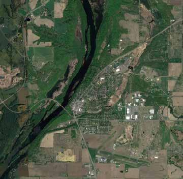
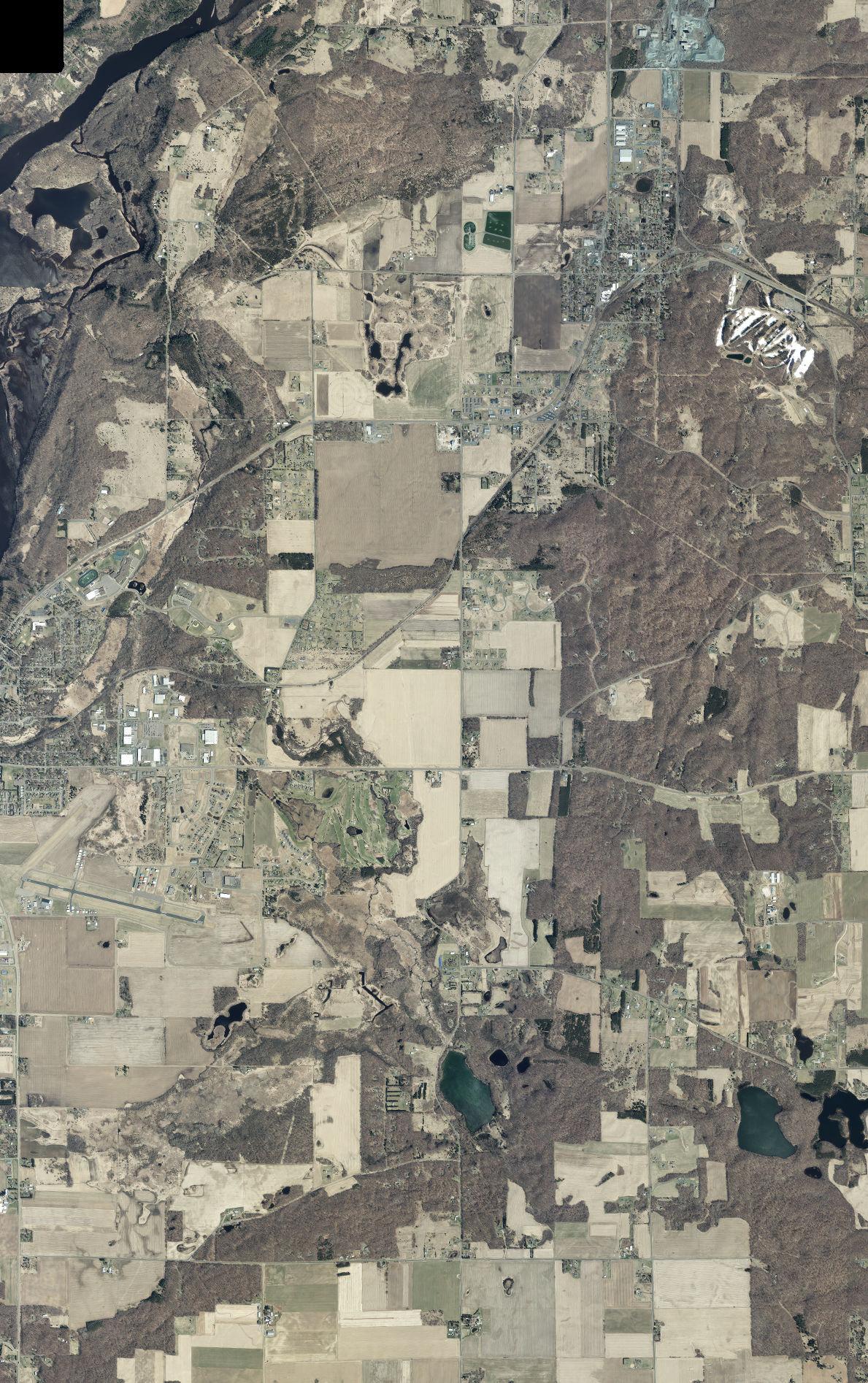
The Village of Osceola, Wisconsin is located in southwestern Polk County, just across the St. Croix River from Minnesota. It is bordered to the north and east by the Town of Osceola, to the south by the Town of Farmington, and to the west by Wisconsin-Minnesota border. Osceola is about 45 miles from St. Paul, 88 miles from Eau Claire, and 133 miles from Duluth. It is located along Wisconsin Highway 35, which runs north-south through western Wisconsin and connects Duluth/Superior to Dubuque, Iowa.

The data used in this section comes from the U.S. Census Bureau’s American Community Survey (ACS), which is reported as a rolling average over a five-year period. Because ACS data points are only estimates and contain a margin of error, they may not always represent conditions as accurately as Census data. However, data is generally more reliable at the State and County levels.
Population
According to the U.S. Census, Osceola’s total population was 2,765 in 2020. Wisconsin Department of Administration (DOA) projections indicate that Osceola may add an additional 480 residents between 2020 and 2040, representing a 17.36% increase over a 20-year period, or 0.87% annual growth. Improvements to parklands and facilities will be necessary to continue meeting the needs of Osceola’s population.
Figure 1: Osceola’s Population (1880-2040)
Source: U.S. Census, Wisconsin DOA
Age composition is an important consideration in park and recreational planning, as needs and desires of individuals will vary based on their development stage and physical abilities. Osceola’s population is roughly divided into quarters aligning with each life stage; a quarter of the population (25%) is considered youth (less than 20 years old), 22% are young adults (20-34 years told), 35% are adults, and 18% are retirement-age (65+). The retirement-age population is projected to grow as the Baby Boomer population continues to age, matching trends seen across the nation. Osceola’s median age is 41.0, an increase from 33.9 in 2010 and above the current State median (40.4).
Source: ACS
Based on 2022 ACS 5-Year Estimates, the majority of Osceola’s population is white (93.2%), followed by “two or more races” (4.1%), Black or African American (1.2%), and “some other race” (1.3%). Approximately 3.7% of the population is Hispanic or Latino. Compared to 2010 ACS Estimates, there has been a 6.6% decrease in white residents; those identifying as “two or more races” increased 4.1%, Black or African American increased 1.2%, and “some other race” increased 1.1% during this time period.
Based on 2022 ACS 5-Year Estimates, there are approximately 1,342 households in the Village, 18.1% of which include at least one child under the age of eighteen. The total number of households is up 159 since 2010; however, the number of households with children has decreased 13.3% in the same time period. This aligns with population decline resulting from the ongoing economic and social impacts of the 2008 nationwide recession and COVID pandemic. The average household size in 2022 was 2.04 individuals, which is lower than 2010 estimates (2.18). If Osceola follows nationwide trends, this number could continue to decrease as a result of smaller family sizes, increases in life expectancy, and increases in single-person households.
Source: U.S. Census, ACS
Osceola contains multiple water amenities including Cascade Falls (adjacent to downtown Osceola and accessible by stairwell), Osceola Creek (a class B trout stream that leads to Cascade Falls), and the St. Croix River (a National Scenic Riverway). Osceola’s western boundary is flanked by the St. Croix River, which also separates Wisconsin and Minnesota. Located across the river in Minnesota is the Osceola Landing, the takeout point for the National Park Service’s boating day trips.
One of Osceola’s most defining natural features are its bluffs along the western edge, which rise up from the outskirts of the downtown district and drop into the St. Croix River. The bluffs and rolling hills found throughout northwestern Wisconsin resulted from glacial activity in the region, where erosion, stream cutting, and deposition carved into the landscape and left a variety of terrains. The Village also contains areas of level ground, especially to the east of the community, which transition into flat agricultural land further inland.
The St. Croix River and Osceola Creek both have floodplains that lie within Village boundaries. The latter’s floodplain was placed within a conservancy zoning district to restrict development and minimize potential damage caused by flood waters. Many areas of surface water within the Village also have associated wetlands, such as Osceola Creek and Mill Pond.
Wildlife
The Wisconsin Department of Natural Resources (DNR) classifies the region’s vegetation as “Western Prairie.” Soils are well-drained and loamy with a silt loam surface, facilitating the growth of maple-basswood, oakhickory, and lowland hardwood forests. The St. Croix National Scenic Riverway is a major draw for bald eagles, great blue herons, ruffed grouse, ospreys, sandhill cranes, and migratory waterfowl.
Outdoor Park and Recreation Plan (2014-2019)
Adopted in 2014, this document is the most recent document specifically dedicated to Osceola’s green infrastructure. Major improvement goals recommended by the plan include:
• Expansion of Millpond Park
• Trail improvements and expansions throughout the community, including in tandem with the Osceola School District’s Safe Routes to School Plan
• Invasive species removal throughout park system
• Concept Plan development for undeveloped parks
• Additional park/trail wayfinding signage
Village of Osceola Comprehensive Plan (2009)
While the Comprehensive Plan largely defers to the recommendations outlined in the former Outdoor Recreation Plan (pre-2014), it establishes that each park should service an area of a quarter mile around the park in order to identify coverage gaps throughout the community.
Polk County Trails Plan (2021)
The plan identifies federally-owned parcels along the St. Croix River as opportunities to develop “a scenic riverside trail system that connects the Standing Cedars Natural area, through Osceola, to St. Croix Falls, and north.” The development of a paved, off-road route would require coordination with the National Park Service, Wisconsin DOT, Wisconsin State Parks, and local municipalities. While the document does not formally present a plan for this trail, future trail planning efforts within Osceola should include these conversations if/when they commence.
Polk County Outdoor Recreation Plan (2020-2024)
This document does not provide any goals or recommendations that are specific to the Village of Osceola.
The following contains information about Village-owned parks, trails, and recreational programs. Specific recommendations for each park are found in Chapter 4. The park classifications used in this plan are modified definitions used by the National Recreation and Park Association (NRPA), described in Appendix C. The map with Osceola’s existing parks and trails can be found on page 55-56 in Appendix A.
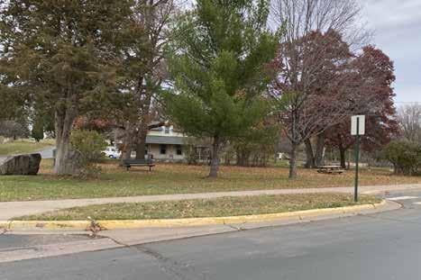
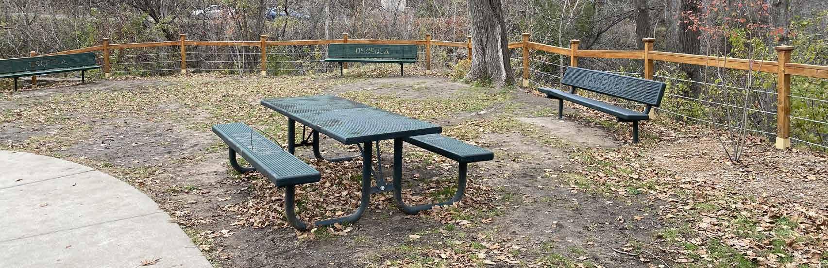
Third Avenue Triangle Park (0.52 acres)
This mini park is located at the intersection of Third Ave and Summit St, and contains a bench and a picnic table.
10th Ave Triangle Park (0.005 acres)
This mini park is an island bounded by 10th Ave, Oak Ridge Dr, and Willow Lane Rd; it contains a landscaped patch with a bench.
Gateway Meadows Park (3.11 acres)
Located in the southwestern-most corner of the Gateway Meadows subdivision, this parkland is currently undeveloped and contains a few trees.
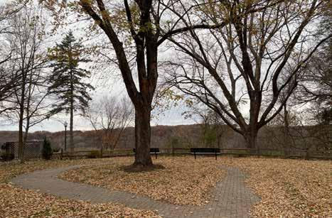
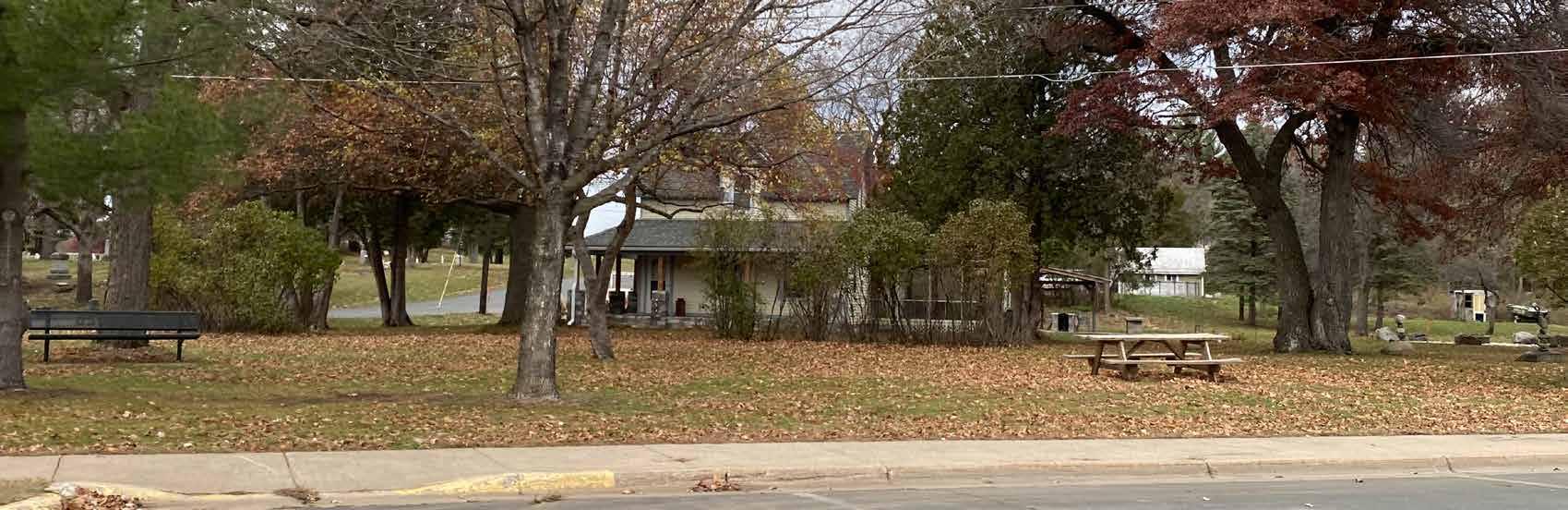
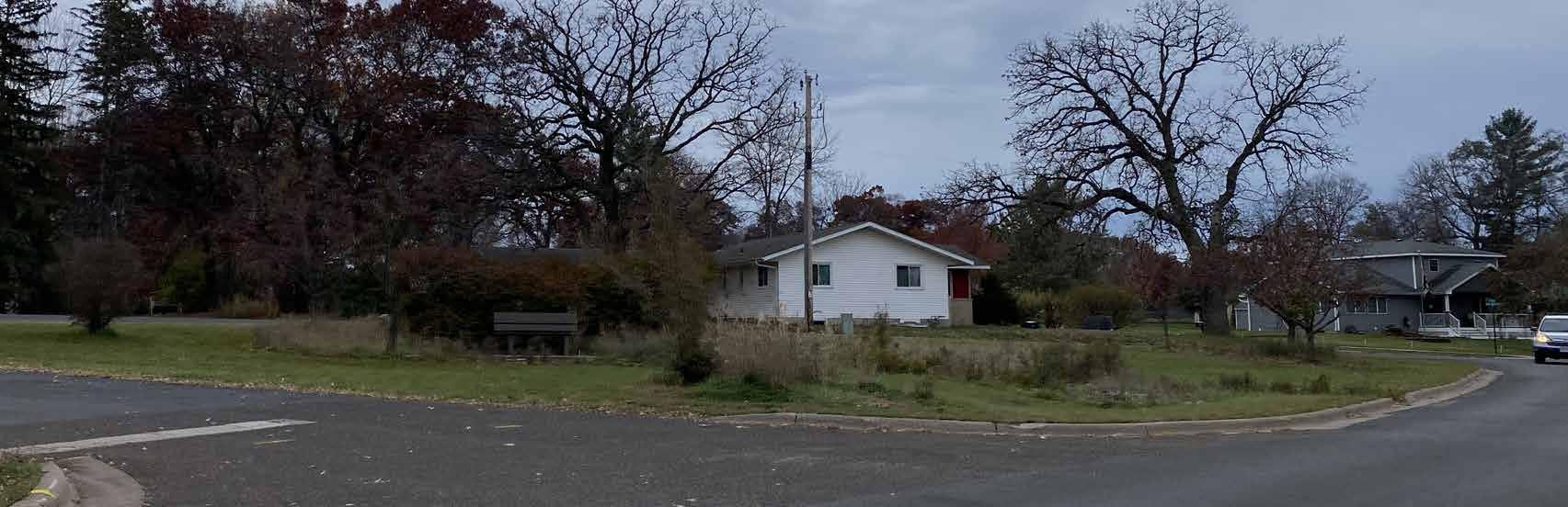
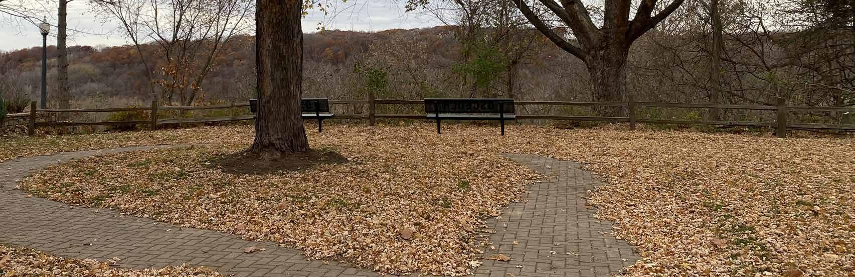
Ladd Memorial Park (0.63 acres)
Located on River St, this park is tucked between two houses and is largely shrouded in old growth tree coverage. There are a few benches along the northwestern edge of the park, looking out over the St. Croix River Valley.
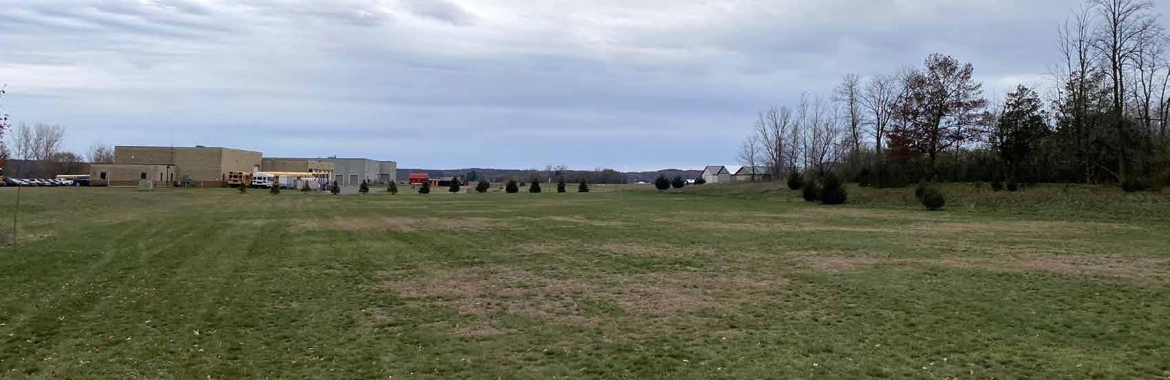
Pheasant Run Parks (3.99 acres)
Located north of the L.O Simenstad Municipal Airport in the Pheasant Run neighborhood, these parcels are undeveloped. Of the total existing acreage, 3.33 acres is a natural area/open space and 0.69 acres is available for playground equipment.
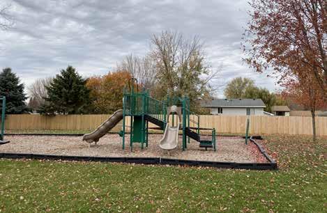
Smith Park (2.61 acres)
Donated to the Village in 2004 by Dave Smith, this park is located in the center of a residential block, bounded by Smith Ave, Haleah St, Delmar Ave, and Belmont St. The park contains playground equipment, picnic tables, benches, soccer nets, and mowed open green space.
Eric Park (0.75 acres)
This park is located at the end of Eric Dr in Viebrock’s 4th Addition. It contains a tennis court, basketball court, playground equipment, and picnic tables.
Oakey Park (12.32 acres)
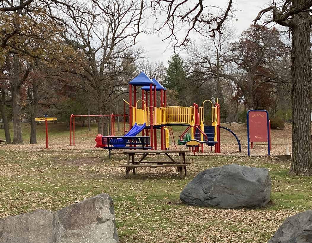
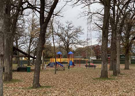
Located a few blocks northeast of downtown Osceola, Oakey Park is the Village’s largest developed park at over 12 acres. The southern portion is shrouded by old-growth trees and has a playground, picnic shelter, basketball court, and restrooms. The northern portion contains a lighted baseball field with bleachers, restrooms, dugouts, a refreshment stand, a gravel parking lot, and covered grandstand. The Osceola Braves (members of the St. Croix Valley Baseball League) use and maintain the field throughout the summer months.
Additionally, the park contains a building leased to the Osceola Fair Board (which sponsors the annual Osceola Community Fair), a sledding hill, and a warming house for outdoor ice skating.
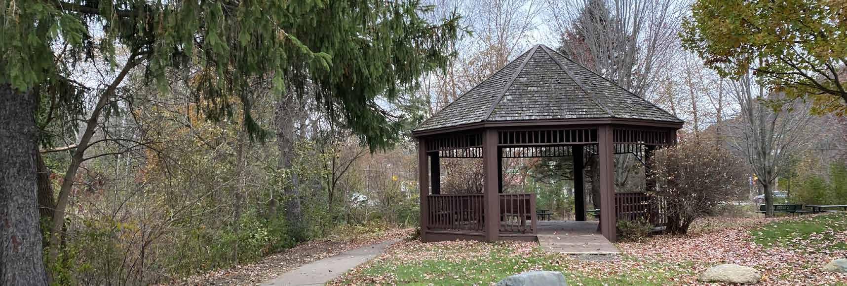
Millpond Park (2.55 acres)
Located in downtown Osceola, this park contains a small gazebo, larger bandshell, fishing platform, and restrooms. Improvements have been added with funding and donated materials and labor from Grow Osceola, private memorial gifts, Graham Memorial Gift Fund, Polk County Land and Water Conservation, and the Osceola High School Ag and FFA organizations. A village-owned parcel abutting the eastern edge of the park presents a prime opportunity for park expansion along Osceola Creek; it currently contains native plantings and open green space.
Gristmill Park (0.27 acres)
With a walking path running behind Watershed Café, this quaint park features an overlook over Cascade Falls, as well as a fire pit, seating areas, and a rain garden.
Geiger Brewery Park (1.00 acres)
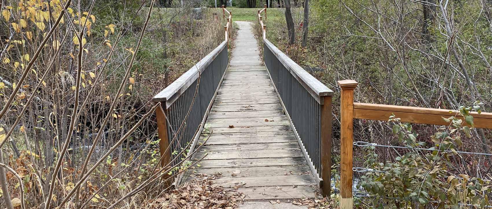
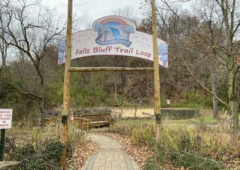
Originally the site of the Geiger Brewery, this one-acre park is located south of Highway 243 and west of State Highway 35. It contains a marked trailhead and pedestrian bridge leading to the Falls Bluff Trail Loop, a scenic and rugged hiking trial that traverses the nearby bluffs and Cascade Falls.
Osceola Eagle Bluff (17.54 acres)
Overlooking both the St. Croix River Valley and downtown Osceola, this park contains the 1.3-mile Dr. John Simenstad Trail. It is accessible from the trailhead at Geiger Brewery Park.
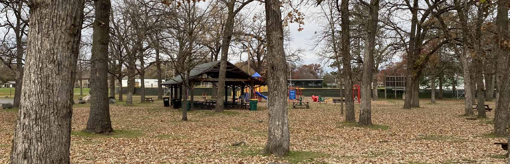
Schillberg Park (92.00 acres)
Located between Osceola High School and Osceola Intermediate School, this former campground is the largest park in the Village. A small portion of the park contains a playground, volleyball court, and horseshoe court, whereas the rest is passive forested space primarily accessible by unpaved walking trails. Osceola Creek, a class 2 trout stream, runs through the park as well. The primary activities on the site are fishing, hiking, snowmobiling, and cross country skiing.
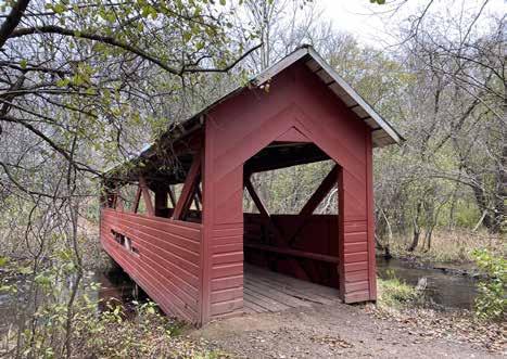
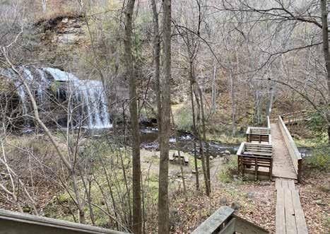
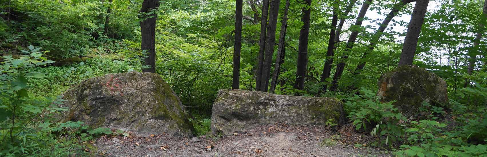
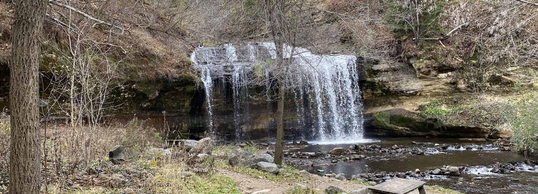
Cascade Falls, Wilke Glen (4.10 acres)
Located just south of downtown and across N Cascade St from Millpond Park, Cascade Falls is widely considered the focal point of Osceola with its picturesque 25-foot drop over four tiers. The waterfall is accessible via the unpaved Cascade Falls Trail and a 125-step stairwell leading from an outlook on N Cascade St.
The Village of Osceola maintains approximately 8.75 miles of paths and trails within its boundary, comprised of the following routes:
• Simenstad Trail (1 mile)
• Cascade Falls Trail (3 miles)
• Eagle Bluff Trail (1 mile)
• Historic Village Walk (1.25 miles)
• Brookside Trail, located within Schillberg Park (2.5 miles)
Standing Cedars Community Land Conservancy
With support from the Wisconsin DNR, this conservancy preserves over 1,500 acres of ecological resources along the St. Croix River through land purchasing and easements. The four properties contain a variety of landscapes, including prairies, old growth forests, oak savannas, dry cliffs, and former agricultural land. The areas are open to the public for passive recreational activities such as hiking and snowshoeing.
Ridge View Trail
Administered by the National Park Service, this trail system totals three miles between its Chisago Loop and Osceola Loop. It is accessible from County Rd S, north of Osceola.
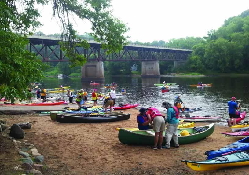
St. Croix National Scenic Riverway
The St. Croix National Scenic River forms the western boundary of Osceola, as well as the border between Wisconsin and Minnesota. It is a wild and scenic river that is a popular destination for canoeing, boating, fishing, birdwatching, and hiking. Osceola Landing, the busiest National Park Service-operated boat launch on the Riverway, is located across the river from Osceola.
The State Natural Areas (SNAs) program protects outstanding examples of Wisconsin’s native landscape of natural communities, significant geological formations, and archeological sites. The program currently encompasses 406,000 acres of land across 590 SNAs that allow for research, education, and conservation. Many SNAs are remote and largely undeveloped but are open to the public.
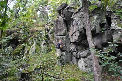
• Osceola Bedrock Glades (SNA 386): This 39-acre area is one of only four well-developed acid bedrock glades in Wisconsin, rich in ferns, mosses, fungi, and other organisms adapted to these unique conditions.
• Farmington Bottoms (SNA 385): This 1,238-acre area south of Osceola contains excellent examples of floodplain forests, emergent aquatics, and forested seeps. It contains a wide variety of trees and serves as critical habitat for rare bird species.
Osceola Schools
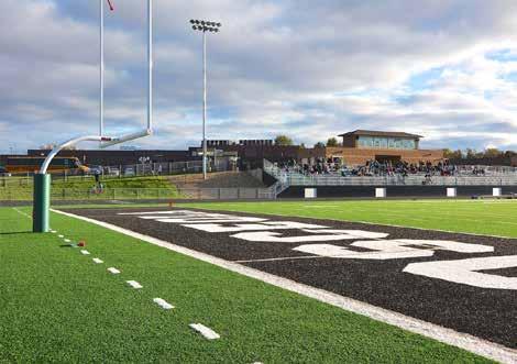
Osceola ‘s school campuses have soccer fields, baseball/softball fields, basketball courts, playground equipment, a lighted football/soccer field and track, indoor pool (open to the public through Community Education program), tennis courts, and open green space.
Osceola Medical Center
This privately-owned facility offers a half-mile walking trail with exercise stations, multi-purpose sport court, and playground.
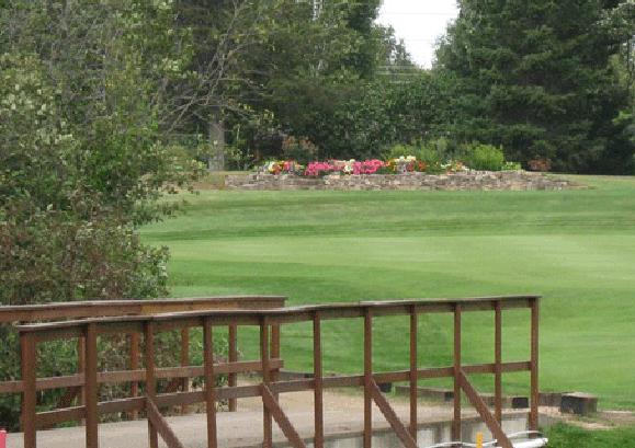
Krooked Creek Golf Course
This privately-owned golf course is located one mile east of Osceola on County Road M and hosts the Osceola High School golf team, tourists, and Osceola residents.
Snowmobile Trails
State Snowmobile Corridor Trail 43 is located east of Osceola. Locally maintained trails connect businesses to the trail.
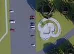
The Skatepark Committee, in collaboration with numerous residents and community organizations, have envisioned a skatepark within Oakey Park located southeast of the existing playground and picnic shelter. In June 2023, the Village Board unanimously approved this location for the skatepark. While the design has not yet been finalized (as of the writing of this document), the project is continuing to raise money and gain traction within the community.
Source: osceolaskatepark.org
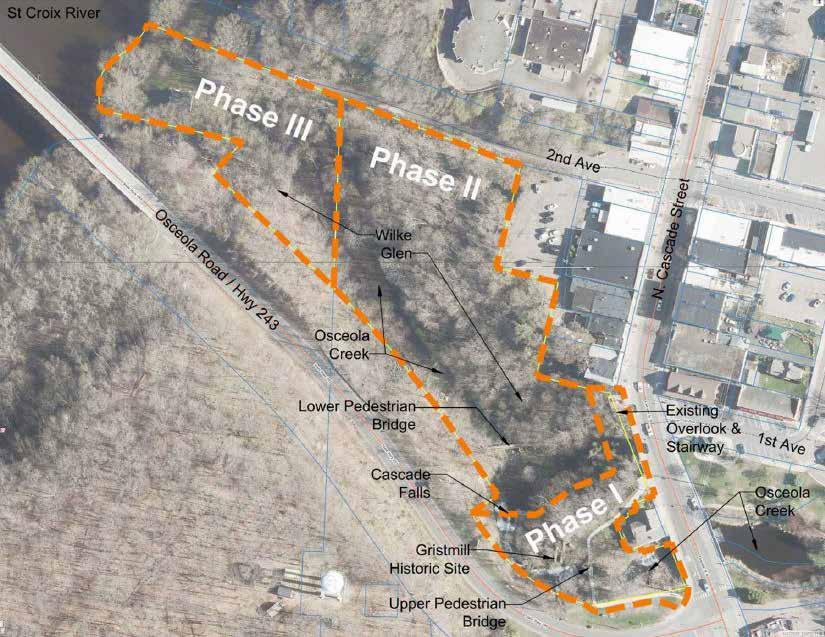
As of the drafting of this document, the Village of Osceola is envisioning a three-phase approach to improvements to Cascade Falls Park and Wilke Glen. These phases are as follows:
1. The first phase will encompass the upper falls area of Cascade Falls Park, including Gristmill Park, the overlook and stairway accessible from South Cascade Street, and pedestrian bridge across Osceola Creek.
2. The second phase will target the boardwalk and trails in the lower area of Cascade Falls, known as Wilke Glen.
3. Phase three explores various options for trail extensions and supplemental parking areas.
Goals and strategies play a crucial role in this plan, as they offer a vision for implementation that can be used by Village staff and officials, community members, and regional partners in recreation. Goals are presented here as desired outcomes. Strategies include both actions and policy rules to achieve these goals.
GOAL 1: Provide sufficient park and recreation opportunities to meet current and future recreational demand in the Village of Osceola.
Strategies
• Prioritize the enhancement and development of Osceola’s centralized parks, such as Oakey Park and Millpond Park, over more remote parks with fewer amenities.
• Across all of the Village’s parks, prioritize maintaining existing amenities over adding new amenities.
• Develop unused parkland in new subdivisions – such as Gateway Meadows and Pheasant Run – to fill the park proximity gap and provide easily-accessible recreational space to residents.
• Maintain dedicated facilities for sporting activities, such as fields and courts.
• Par ticipate in regional park/trail planning initiatives, including those led by Polk County, the Wisconsin Department of Transportation (WisDOT), and the Wisconsin Department of Natural Resources (DNR).
GOAL 2: Ensure that all Osceola residents have safe access to quality parks and recreation facilities.
Strategies
• Encourage ongoing citizen participation in the planning and development of recreational facilities.
• Provide ADA-compliant, barrier-free access in all new or improved park facilities, play areas, and sports field areas.
• Increase number of safe crossings near park facilities and in downtown Osceola as needed.
• Continue to pursue a variety of Village/school/sports organization development projects to help expand community outdoor recreational opportunities in a cost-effective manner.
• Offer appropriate and engaging recreational opportunities for all age groups.
GOAL 3: Preserve the historical, cultural, and environmental significance of Osceola’s existing green space.
Strategies
• Coordinate local efforts with Standing Cedars Community Land Conservancy, the Wisconsin DNR, and other organizations that protect natural areas around Osceola.
• Manage vegetation in natural areas by removing and controlling non-native, invasive spaces.
GOAL 4: Ensure that ongoing park improvements and future system expansion are financially sustainable.
Strategies
• Utilize the “Grant Opportunities” table on pages 45-46 as a resource for funding solutions to recreational needs; update regularly as new funding sources become available.
• Establish process for identifying, writing, and championing grant applications.
• Continuously identify park/recreational projects to be incorporated into the Village’s Capital Improvement Program (CIP).
• Leverage local and regional partnerships for funding specific opportunities.
The ADA, enacted in 1990, clearly states the right of equal access for persons to local government services, including parks. On September 15, 2010 the Department of Justice published revised final regulations implementing the Americans with Disabilities Act. The 2010 Standards included new provisions for accessible design for recreational facilities such as playgrounds, swimming pools, fishing and golf facilities. Any new recreational facilities designed, constructed, or shaped after March 15, 2012 are subject to the 2010 Standards. Any alteration (not simple maintenance, but something that changes the way the site is used) must make the element altered accessible and must create an accessible path of travel through the site or facility to that element.
There are some fundamental differences in how accessibility in the outdoors is accommodated compared to indoors or the built environment. While restrooms, shelters, interpretive centers, and parking lots, for example, need to follow detailed ADA guidelines, other improvements such as trails or swimming beach areas, for example, do not necessarily need to follow indoor or built environment ramp grades or surfacing requirements. A good rule of thumb for the Village to follow is that anything constructed must not make the outdoor experience anymore difficult than what occurs naturally. Mother Nature does not have to comply with ADA, but humans should.
The New England ADA Center is a good resource to use and offers checklists to evaluate accessibility at existing park facilities. The fillable checklist forms can be found here: http://www.adachecklist.org/ checklist.html#rec
This chapter presents an analysis of how well the Village’s existing park and recreation facilities satisfy current needs. The adequacy of Osceola’s existing parks and recreation system is evaluated using the following methods:
• Quantitative Analysis - A comparison of existing parkland acreage and population projections versus park and recreational agencies across the U.S., including a review of the amount of parkland available to Village residents.
• Geographic Analysis - An analysis of the geographic distribution of park facilities within the Village.
• Qualitative Analysis - A summary of public input regarding Village parks and recreational facilities gathered through the community survey, open house, and feedback from community organizations that use the Village’s parks and trails.
• Regional & State Insights - A summary of the demand trends in recreational amenities at the regional and state level.
An analysis of existing recreational land area is provided to determine if the recreational needs of current residents are being met. This analysis is limited to an evaluation of Village-owned parkland; it does not include trails, school facilities, or privately-owned green space.
Level of service analysis is a standard evaluation of park acreage across most park agencies. Level of service is calculated as total acres of parkland provided per 1,000 residents. Over two decades ago, the National Recreation and Park Association (NRPA) developed a set of standards for the amount of parkland a community should strive to obtain. Recently, NRPA has shifted away from the use of park standards because there is no single set of standards that accommodates the uniqueness of each community across the country. Instead, NRPA now collects information from Parks and Recreation departments around the U.S., including residents per park, budgets, staffing, and park amenities. This data is organized by jurisdiction size so that communities of similar sizes can see metrics typical of their peers.
Osceola currently has 141.4 acres of Village-owned parkland and undeveloped open space, or 51.1 acres per 1,000 residents based on the 2020 population of 2,765 (U.S. Census). If undeveloped open space (Schillberg Park and Osceola Eagle Bluff)* is excluded from this calculation, Osceola offers about 11.5 acres per 1,000 residents. According to NRPA’s 2023 Agency Performance Review, for agencies with populations under 20,000, the lower quartile is 6.0 acres and the upper quartile is 21.1 acres of parkland per 1,000 residents. Osceola is well within this range, offering a sufficient level of acreage service even if these undeveloped parcels are not converted to parkland.
*Pheasant Run Parks and Gateway Meadows Park were not included in this calculation because the Village intends on developing these parcels into active parkland following the completion of this study. Schillberg Park and Osceola Eagle Bluff, despite containing trails and opportunities for recreational activity, have intentionally remained undeveloped due to topography and conservation efforts.
Figure 4 summarizes the current and projected supply and demand for total parkland acreage based on the Village’s population and NRPA’s upper quartile limit of 21.1 acres per 1,000 residents.** Population projections from 2020-2040 were taken from vintage Wisconsin DOA data, so estimated numbers may not reflect Osceola’s exact population. The total supply of parkland used in the table’s calculation reflects the current amount of usable, dedicated recreation green space in Osceola – 31.86 acres – and half of the Village’s undeveloped land (approximately 54.7 acres) since a portion of each parcel is accessible for hiking and other recreational activities.
If the Village aims to maintain its current service level of 21.1 acres per 1,000 residents with its existing parkland, it will continue to have a surplus through the year 2040. If the Village wishes to acquire additional parkland in the coming decades, doing so is not necessary to maintain this specific metric.
**Since the Village provides 51.1 acres of green space per 1,000 residents, including Schillberg Park and Osceola Eagle Bluff, the upper quartile limit of 21.1 acres is being used instead of the parkland-only 11.5 acres to account for the recreational activities permitted in the undeveloped open space.
Figure 5 compares the suggested number of outdoor facilities in each category to the current number of facilities in Osceola. The suggested number was calculated by taking Osceola’s 2020 population (2,765) and dividing it by the median recommended number of residents per facility (from the 2023 NRPA Agency Performance Review). Based on these calculations, there are gaps in Village-owned recreation facilities (skate parks, pickleball courts, totlots) and community amenities like dog parks, community gardens, and outdoor swimming pools.
Indoor recreation opportunities are also important, especially considering Wisconsin’s winter months, when it can be challenging or less desirable for people to go to local parks and trails. Currently, Osceola does not manage any indoor recreation facilities; however, the Village partners with the Osceola School District for community education programming (e.g. health and wellness classes, arts and crafts tutorials, and day trips), which provides recreational opportunities throughout the year, as well as access to indoor/outdoor school recreational facilities.
Data from NRPA’s 2023 Agency Performance Review shows that 63% of all agencies nationwide have recreation centers, 59% have community centers, 41% have senior centers, and 33% have nature centers. Osceola has a community center, which houses Village staff offices and a senior center.
The Village of Osceola maintains approximately 8.75 miles of paths and hiking trails. NRPA’s 2022 Agency Performance Review shows that in communities with under 20,000 residents, the median mileage of maintained trails is 4.0 miles; the lower quartile is 2.0 miles and the upper quartile is 10.0. In other words, most communities of this size have between two and ten miles of trails, with four miles being the most common. Osceola is well within this range, offering considerably more than the median mileage compared to communities its size.
The location of parks in relation to Osceola’s residents is an important indicator of how well existing facilities are dispersed throughout the community. NRPA, in partnership with the Trust for Public Land and the Urban Land Institute, promotes the 10-Minute Walk Campaign (https://10minutewalk.org) which advocates for “a great park within a 10-minute walk of every person, in every neighborhood, in every city across America.” Osceola’s Comprehensive Plan also emphasizes the importance of quarter-mile service areas (five to tenminute walk) for each of the community’s parks.
Using the 10-Minute Walk as a guiding principal, the Park Service Areas map (Appendix A) indicates approximate areas of the Village that are within a ten-minute walk of a park (approximately 0.5 miles). Based on the 10-Minute Walk metric, the residents near downtown Osceola are well-served by parks and recreational amenities, especially those living between downtown and Osceols High/Intermediate Schools. The residents of the Gateway Meadows and Pheasant Run neighborhoods also have access to open green space, offering some park coverage on the eastern edge of the Village. The largest gaps in park coverage (located in the middle of the Village) is land occupied by the Osceola Industrial Park and L.O. Simenstad Municipal Airport. Therefore, nearly all Osceola residents are within a ten-minute walking distance from a park.
Community Input Survey
Since this CORP update was developed alongside the Comprehensive Plan update, park-specific questions were included in a community-wide survey to gauge residents’ preferences, opinions, and feedback on all aspects of Osceola. In total, the survey received 266 responses, which are summarized in this section. The full results of the survey’s park-specific questions can be found in Appendix B.
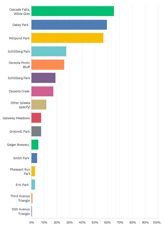
Overall, survey respondents reported visiting Cascade Falls most often (64.5%); the next most-favored parks were Oakey Park (60%) and Millpond Park (57.5%). The most-frequently used recreational amenities in Osceola were walking/hiking trails (76.5%), playgrounds (33.5%), and gazebos (14%).
Park Improvements and Additions
While specific park recommendations are outlined in Chapter 5, a few general suggestions emerged regarding park improvements. Top answers included updating and maintaining existing amenities (such as playgrounds and basketball courts), safety improvements to large parks, and ADA accessibility for the Village’s largest recreational destinations.
Trails
The most-frequently suggested new trail locations were:
• Near Schillberg Park/Osceola Schools;
• Between downtown and Osceola Medical Center;
• Improved connections within existing trail network;
• Between downtown and the M/3rd Ave E intersection;
• Between downtown and the Industrial Park.
In addition to the community-wide input survey, a separate survey was sent to residents of Osceola’s Gateway Meadows and Pheasant Run neighborhoods to gather feedback on each subdivision’s respective undeveloped parkland. In total, the survey collected 47 responses – 29 from Gateway Meadows and 17 from Pheasant Run.
• Age groups most represented by residents: 0-12 years and 31-40 years.
• Most-requested recreational amenities: playground and fenced-in, off-leash dog park.
Pheasant Run
• Age groups most represented by residents: 0-12 years, 31-40 years, and 61+ years.
• Most-requested recreational amenities: playground and walking trail.
Over the course of two weeks, the project team spoke to representatives of Standing Cedars Community Land Conservancy, Grow Osceola, Osceola Trails and Parks Group, and the Osceola Braves, in order to gather addition information on specific aspects of Osceola’s parks and recreational amenities. These conversations identified each group’s specific needs and priorities, current and future initiatives, and observations of needed improvements within the community.
The chart below summarizes feedback themes that emerged in relation to Osceola’s green space’s strengths, weaknesses, and opportunities:
Summary of Stakeholder Interview Feedback
Each bullet point summarizes feedback that emerged multiple times throughout the stakeholder interview process.
Strengths
• Scenic beauty of St. Croix River Valley
• Cascade Falls is community gem and large tourism draw.
• Great variety of parks and trails.
Weaknesses/Threats
• Lack of funding and personnel for ongoing park improvements.
• Difficult to coordinate and maintain consistent engagement from volunteers.
Opportunities
• Leverage partnerships with local parks/conservation organizations to share resources and expertise.
• Expand and improve trail network.
• Create comprehensive wayfinding signage for key community park destinations.
• Cater to the unique blend of tourist and resident recreational needs.
The analysis discussed in Chapter 4 reveals the need for improvements to existing facilities and additional trail connections. It should be noted that some of the recommendations may require cooperation with others, including (but not limited to) the citizens of Osceola, local civic and business associations, and State agencies. In nearly every case, more detailed planning, engineering, study, budgeting, and/or discussion will be necessary before decisions are made to acquire land or construct recreational facilities.
The recommendations of this plan are divided into four major sections: (1) existing park facilities; (2) system recommendations; (3) new park facilities; and (4) mobility recommendations. Recommendations were generated through community feedback, discussions with the Planning Commission and public works staff, and ongoing CIP programs.
Throughout the input process, plan stakeholders expressed their preferences for the recommended improvement to Osceola’s recreational system. These preferences have been interpreted and sorted into high, medium, and low priority projects. The priority of each recommendation is noted within each table of recommendations. Due to budgetary constraints, it is unlikely that all recommendations within this chapter will be implemented, and the priority level provides future decision makers with a better guide for investing the Village’s limited resources. Priority levels may shift as time passes, recommendations may cease to be applicable, and new recommendations may be formulated.
The approximate timeframe for completion of each recommendation is also noted within each table of recommendations. The timeframe indicates an estimate of how long each project should take to complete once the implementation process has begun: immediate, short-term, and long-term.
The following pages contain spreads dedicated to each existing park in Osceola. Each spread includes general information, existing facilities, and recommendations for improvements to specific parks. Some of the recommendations identified for existing parks are carried forward from Osceola’s 2014-2019 Outdoor Park and Recreation Plan. The listed recommendations reflect feedback obtained during the planning process from Village staff, Village Board, and the public.
Most importantly, the Village should prioritize continual maintenance of all existing parks, trails, and recreational facilities. While new amenities may attract residents at first, maintaining the safety, accessibility, and availability of existing amenities will ensure that these spaces are inviting and functional long-term.
MINIATURE PARK • 3rd Ave / Summit St • 0.52 Acres
EXISTING FEATURES
• Picnic tables
• Benches
PARK-SPECIFIC FEEDBACK
No feedback was received for this park
RECOMMENDATION
No improvements recommended at this time.
PRIORITY
Low-Med-High TIMEFRAME
Immediate (0-2 Years)
Short-Term (2-5 Years) Long-Term (5+ Years) COST
$ (<$50k)
$$ ($50k-200k)
$$$ ($200k+)
MINIATURE PARK • 10th Ave / Oak Ridge Dr / Maple St • 0.005 Acres
EXISTING FEATURES
• Bench
• Butter fly Garden
RECOMMENDATION
Improve existing landscaping by converting land into a low-maintenance rain garden
PARK-SPECIFIC FEEDBACK
• Improve and regularly maintain landscaping
Immediate (0-2 Years) Short-Term (2-5 Years) Long-Term (5+ Years)
NEIGHBORHOOD PARK • Mill Street • 3.11 Acres
EXISTING FEATURES
• Mowed lawn
CIP PROJECTS
Add
PARK-SPECIFIC FEEDBACK
• Supposed to have a playground
NEIGHBORHOOD PARK • River Street • 0.63 Acres
EXISTING FEATURES
• Picnic tables
• Benches
• Mowed lawn
RECOMMENDATION
Replace fence along western edge of park with same style as Gristmill Park
historic signage
PARK-SPECIFIC FEEDBACK
No feedback was received for this park
Immediate (0-2 Years) Short-Term (2-5 Years) Long-Term (5+ Years)
NEIGHBORHOOD PARK • Kreekview Dr / Pheasant Run Dr / 250th St • 3.99 Acres
EXISTING FEATURES
• Open green space
PARK-SPECIFIC FEEDBACK
No feedback was received for this park
RECOMMENDATION
Immediate (0-2 Years) Short-Term (2-5 Years) Long-Term (5+ Years)
EXISTING FEATURES
• Playground
• Soccer field
• Picnic tables
• Benches
• Mowed lawn
CIP PROJECTS
PARK-SPECIFIC FEEDBACK
No feedback was received for this park RECOMMENDATION
Sell unused western half of parkland
Add sidewalk from Smith Ave to playground Low Long-Term $
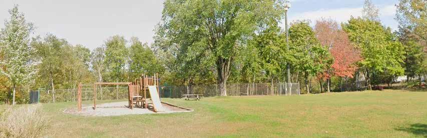
NEIGHBORHOOD PARK • Eric Drive • 0.75 Acres
EXISTING FEATURES
• Playground
• Basketball cour t
• Tennis court
• Picnic tables
• Mowed lawn
RECOMMENDATION
unused eastern portion of parkland
basketball and tennis courts*
PARK-SPECIFIC FEEDBACK
• Revitalize basketball court and tennis court
• Replace playground equipment
• Add seating and picnic tables
• Add stairs and sidewalk/safe way to access courts
(0-2 Years) Short-Term (2-5 Years) Long-Term (5+ Years)
Add sidewalk from Eric Dr to playground and courts
*As of March 2024, the courts at Eric Park are being evaluated for the feasibility of asphalt rehydration, crack filling, paint, and the addition or conversion of 2 pickle ball courts. Depending on the results of this analysis, these amenities may be moved to a different park.
COMMUNITY PARK • River Street • 0.27 Acres
EXISTING FEATURES
• Benches
• Picnic tables
• Butter fly garden
RECOMMENDATION
PRIORITY
Low-Med-High
PARK-SPECIFIC FEEDBACK
No feedback was received for this park
TIMEFRAME
Immediate (0-2 Years)
Short-Term (2-5 Years)
Long-Term (5+ Years)
$ (<$50k)
$$ ($50k-200k)
$$$ ($200k+)
Add diverse lighting system Dependent upon Cascade Falls improvement design*
*Note on Cascade Park Improvements
The Village is currently developing a plan for phased improvements at Cascade Falls Park. Phase 1 will explore the possibility of relocating the existing overlook on Cascade St S to Gristmill Park, in order to enhance accessibility to the site. This would likely include a new overlook platform, stair access, revised layout for benches and picnic tables, lighting, and other features. Depending on the results of the conceptual design, the recommendation to “add a diverse lighting system” may be incorporated into the Phase 1 improvements.
COMMUNITY PARK • Highway 243 / WI Highway 35 • 1.0 Acre
EXISTING FEATURES
• Bike racks
• Benches
• Picnic tables
RECOMMENDATION
Replace footbridge at trailhead
Remove/fix concrete retaining wall
Replace steps
Paint historical/educational mural on concrete retaining wall
PRIORITY
Low-Med-High
PARK-SPECIFIC FEEDBACK
• Replace concrete retaining wall
• Paint historical or natural mural on concrete wall
TIMEFRAME
Immediate (0-2 Years) Short-Term (2-5 Years) Long-Term (5+ Years)
$ (<$50k)
$$ ($50k-200k)
$$$ ($200k+)
Dependent upon MNDOT and WisDOT’s reconstruction of STH 243 started in 2027 – Geiger Brewery Park may be reconfigured for pedestrian/cyclist bridge access.
COMMUNITY PARK • N Cascade St / 1st Ave • 2.55 Acres
EXISTING FEATURES
• Fishing pier
• Public restroom
• Gazebo (2)
• Drink ing fountain
• Benches
• Picnic tables
• Parking lot
RECOMMENDATION
gravel parking lot into designated parking area (primarily tourist/event overflow parking)
PARK-SPECIFIC FEEDBACK
No feedback was received for this park
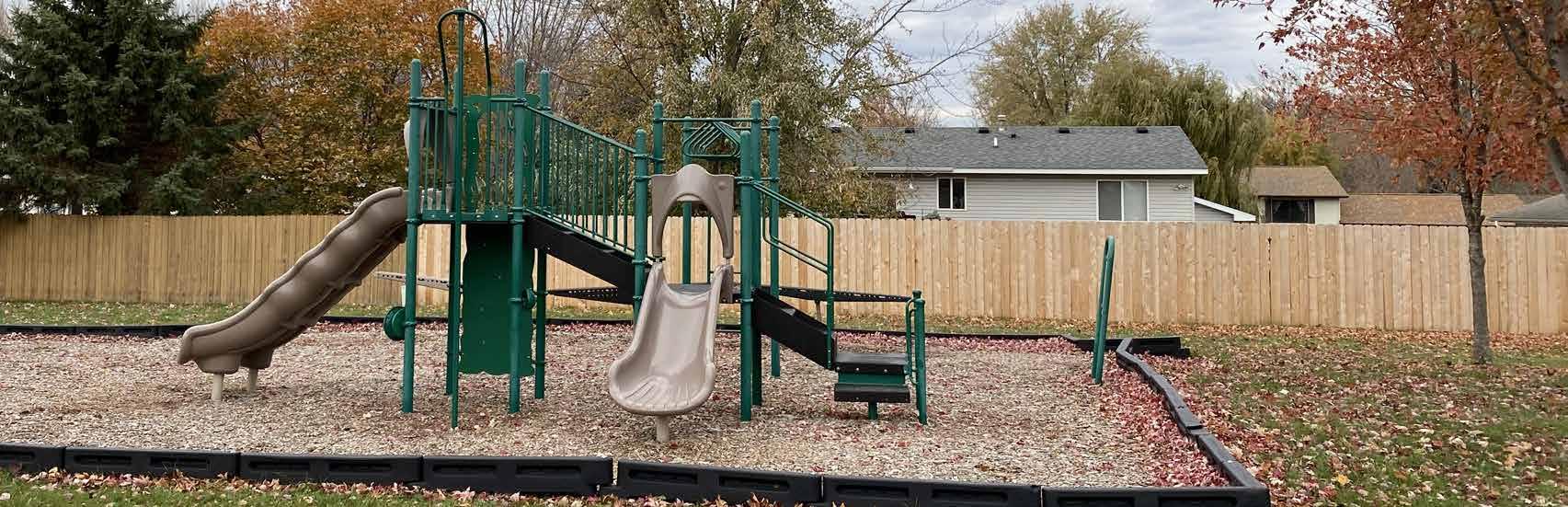
COMMUNITY PARK • 7th Ave / Summit St • 12.32 Acres
EXISTING FEATURES
• Playground
• Ice rink
• Warming house
• Sledding hill
• Open air shelter
• Baseball diamond
CIP PROJECTS
• Concession stand
• Drink ing fountain
• Bleachers
• Picnic tables
• Benches
• Parking lot
(and/or relocate) restrooms near playground
skatepark and parking lot (409 4th Ave on the SW corner of Oakey Park)
PARK-SPECIFIC FEEDBACK
• Feels “sketchy”
• Repair/upgrade grandstand
• Improve ice skating rink
• Improve bathroom, pavilion, and playground equipment
• Add sk atepark
EXISTING FEATURES
• Benches
PARK-SPECIFIC FEEDBACK • Trim trees for better visibility at lookout points RECOMMENDATION
Immediate (0-2 Years) Short-Term (2-5 Years) Long-Term (5+ Years)
and/or fix deteriorated bridges
EXISTING FEATURES
• Walk ing trails
• Shelter
CIP PROJECTS
Rehab existing red building (“cantina”) for rentable space
• Need new playground
• Tree trimming and cleanup, remove dead trees
• Clean up picnic tables and shelter PARK-SPECIFIC FEEDBACK
• More garbage cans
• Fix existing swing set
Consider park master plan to document intended
Utilize WI Community Forest funding and programming assistance to better utilize park as an educational forest
EXISTING FEATURES
• Bike/walk ing trail
• Picnic tables
• Benches PARK-SPECIFIC FEEDBACK
• Update outdated boardwalk
• Add non-slip tread to boardwalk
(0-2 Years)
(2-5 Years)
(5+ Years)
Prioritize park maintenance over new amenitiesHigh
Cohesive and comprehensive park identification, wayfinding, and rules signage
Add dog waste bag receptacles and bike racks to major parks and downtown Osceola
Identify rewilding opportunities to cut down on mowing needs
Facilitate regular meetings with community park/ trail groups (such as the Osceola Trails and Parks Group, Standing Cedars, DNR) to identify needs and opportunities for resource sharing
Emphasize fees in lieu of parkland dedication to prevent accumulation of parkland that must be maintained
As discussed in Chapter 4, additional parkland is not necessary to maintain Osceola’s current high level of service through 2040. The Village should first utilize its resources to improve current recreational facilities to meet the needs of its existing (and growing) population. However, the service level calculation does not consider existing parks’ locations and density, meaning that it does not discern between many parks spread throughout the Village or all parks condensed around the downtown area.
As residential development occurs on the outskirts of Osceola, more parkland could be added to ensure that those residents have easy access to green space. While this plan document emphasizes fees in lieu of parkland dedication to minimize maintenance needs for Village staff, this tactic can always be reversed to reflect the community’s changing priorities.
Osceola’s hiking trails are a cherished recreational amenity for residents and visitors alike. A significant portion of the Village’s resources should be allocated to maintaining and continuously improving its existing trails – namely mitigating erosion/slope failure and ensuring that all trailheads are ADA accessible. There are also multiple opportunities for multi-modal expansion to connect pedestrians and cyclists to prominent destinations within Osceola, as illustrated on the map on the following page.


The following off-street trail recommendations were identified through community engagement and conversations with Osceola’s Planning Commission. This map provides suggested locations for each trail, but each are subject to change following extensive feasibility and design processes.


Downtown – Industrial Park Trail Extension (new paved path)
This paved path would connect the existing paths that deadend in Oakey Park and the Osceola Industrial Park. The path would run directly west from the Industrial Park, through a small forested area, then follow 3rd Ave E to Oakey Park. The Village has included this project in its CIP (PR 013) with anticipated implementation within the next 6-10 years.


STH-35 Bicycle & Pedestrian Trail (new paved path)
This paved path would lead from the Osceola Rd-Cascade St intersection in downtown Osceola, down Highway 35 to the Osceola Medical Center. The Village has acquired easements on the west side of 35 and have included this project in its CIP (PR 003) with anticipated implementation within the next 6-10 years.


Downtown – M/3rd Ave E (expanded sidewalk)

There is currently a paved sidewalk on the north edge of M. To add an alternative connection between the Industrial Park/ nearby subdivisions and downtown Osceola, the Village could consider widening this sidewalk to accommodate additional pedestrian and cyclist usage.


Village of Osceola Polk County, Wisconsin
New Paths
Convert to Multi-Use Path
Polk County Trails

US Highway
State Highway
County Road
Local Road

Village of Osceola Municipal Boundary
Village Parks
Public Land/Other Open Space
This chapter summarizes tools and mechanisms that the Village can use to fund implementation of the park, trail, and open space recommendations discussed in Chapter 5. This chapter also outlines the process for plan adoption and plan amendments.
As Osceola’s recreational amenities grow, the need to increase funding to meet the basic maintenance and operational costs also grows. While it is often difficult to fund major capital improvement projects all at once, there are a variety of funding sources to assist with up-front capital costs.
Development impact fees are collectd from developers to fund public infrastructure needs triggered by new development projects. This ensures that the cost for new infrastructure to support new residents does not fall entirely on existing residents, who already contribute to public amenities through their taxes.
These development impact fees, along with other sources of revenue, are invested into the community through a Capital Improvement Plan (CIP), which outlines anticipated infrastructure projects, their timelines for completion, and the funds and resources available to complete them. Many of the recommendations listed in this plan are expected to be implemented through the CIP budgeting process.
An important source of funding is grant programs offered by county, state, and federal agencies. The table on the following pages provides a summary of common state and federal park and recreation grant programs. The table is not an exhaustive list of grant programs, but rather those that are typically used by jurisdictions to supplement acquisition and development of park and recreation areas. Other grant programs may exist and information regarding funding details shown in the table should be verified prior to seeking grant funding.
Community groups and civic organizations are often willing to organize fundraising efforts to assist with costs, programming, and upkeep. Organizations like Osceola’s Trails and Parks Group can help support specific parks on an ongoing basis. They may also be able to organize volunteer labor to assist with small development projects such as trail creation, maintenance, or playground installations.
Local business and corporate support should also be sought. For example, Polaris (a major automotive manufacturer with a plant location in Osceola) could support the construction and/or maintenance of ATV routes in the Village through grants or partnerships with community groups. Both non-profit and for-profit organizations can be acknowledged for their support with a plaque or sign at the site.
The community could set up an endowment fund as an additional means of providing continual financial support for park acquisition and development. An endowment fund is a self-sustaining account in which assets are invested. The annual disbursement amount of the fund is a set percent of assets, generally smaller than the accrued interest amount, which allows the value of the fund and assets to grow over time. A park endowment fund can provide a means for residents to provide ongoing donations to the Village’s park system with the certainty that the money donated will only be used for the advancement of recreation in the community. Gifts to an endowment fund are tax deductible under federal and state law.
Funding Programs
Knowles-Nelson Stewardship Program - https://dnr.wisconsin.gov/topic/Stewardship
Funds acquisition of land and easements for conservation and recreation purposes, development and improvement recreational facilities, and restoration of wildlife habitat. This is an umbrella program that funds the following grants:
Federal-Level Funding
Recreational Trails Program
Provides matching grants for maintenance and restoration of existing trails, development and rehabilitation of trailside and trailhead facilities and trail linkages, construction of new trails, and acquisition of easement or property for trails. Funding may only be used on trails which have been identified in or which further a specific goal of a local, county or state trail plan included or reference in a statewide comprehensive outdoor recreation plan required by the federal LWCF Program. 50% match required May 1
Land and Water Conservation Fund (LWCF/LAWCON)
Encompasses a range of grant opportunities for land acquisition, development, and renovation of high-quality outdoor recreation amenities. 50% match
State-Level Funding
Aids for the Acquisition and Development of Local Parks (ADLP)
Provides matching grants to purchase land or easements and develop or renovate local park and recreation area facilities for nature-based outdoor recreation purposes (e.g., trails, fishing access, and park support facilities).
Urban Green Space (UGS)
Provides matching grants to purchase land or easements in urban or urbanizing area to preserve the scenic and ecological values of natural open spaces for nature-based outdoor recreation, including non-commercial gardening.
Urban Rivers (UR)
Provides matching grants to purchase land on or adjacent to river flowing through urban or urbanizing areas to preserve or restore the scenic and environmental values of riverways for nature-based outdoor recreation.
Acquisition of Development Rights Grants (ADR)
Provides matching grants to purchase development rights (easements) for the protection of natural, agricultural, or forestry values, that would enhance nature-based outdoor recreation.
50% match required May 1
50% match required May 1
50% match required May 1
Transportation Alternatives Program (TAP) - https://wisconsindot.gov/Pages/doing-bus/local-gov/astnce-pgms/aid/tap.aspx
Multi-modal program that incorporates former Bicycle & Pedestrian Facilities Program (BPFP), Safe Routes to School (SRTS), and Transportation Enhancement (TE) grant programs. Eligible categories include:
• Construc tion, planning and design of on-road and offroad trail facilities for non-motorized transportation (pedestrians and bicyclists)
• Conversion and use of abandoned railroad corridors for non-motorized transportation (pedestrians and bicyclists)
• Construc tion of turnouts, overlooks and viewing areas
• Community improvement activities related transportation such as to outdoor advertising, historic preservation, vegetation management and archaeological activities
• Environmental mitigation activities
• Recreational trails programs
• Safe Routes to Schools programs
• Planning, designing or constructing boulevards or other roadways largely in the right-of-way of former interstate routes or other divided highways.
Reimbursement program; 20% local match required. Non-infrastructure projects must be $25,000 or greater.
Applications available in October, due end of January of evennumbered years
Recreational Trail Program (RTP) - https://www.fhwa.dot.gov/Environment/recreational_trails/
Provides funds to municipal governments and incorporated organizations to develop and maintain recreational trails and trail-related facilities for both nonmotorized and motorized recreational trail uses.
Up to 80% reimbursement, can be used in conjunction with other state grant programs. May 1
Safe Streets and Roads for All (SS4A) - https://www.transportation.gov/grants/SS4A
Created by the 2021 Bipartisan Infrastructure Law to increase roadway safety for all users, this program provides two types of grants:
• Safety action plan development, supplemental planning, and demonstration activities
• Plan implementation (requires a comprehensive safety action plan)
20% match required
Three deadlines during the spring and summer, depends on grant type
Grants from private organizations, such as AARP and American Trails, also present an excellent opportunity to apply for funding for specific projects. Many of these grants support placemaking projects, bike infrastructure improvements, and other initiatives that competitive, government-run grants do not consider. Before any project listed on the following pages is scheduled for implementation, it is highly encouraged to consider private grants as part of the funding process.
This plan will be adopted following the procedures highlighted below:
Osceola’s Planning Commission shall meet to review the plan and pass a motion to recommend adoption of the plan. No public hearing is necessary for the adoption of the Comprehensive Outdoor Recreation Plan, as it is integrated into the Comprehensive Plan update process, which does require a public hearing.
This plan and any future amendments will become Village policy when the Village Board passes, by a majority vote, a resolution to adopt. The Village Board may choose to revise the plan after it has been recommended by the Planning Commission.
Amendments can be made at any time to reflect the changing priorities and realities of the Village, but the plan should not be amended more than once per year. A common recommended approach is to establish a consistent annual schedule for consideration of minor plan amendments.
Some of the recommended improvements in Chapter 5 will require a large budget and robust design process to implement. The following are steps that the Village should take to complete these projects:
1. Concept Development: Identify community needs, site issues, and possible design solutions. This plan document aligns with this stage as it provides preliminary/high-level ideas for park improvements based on community feedback and other sources.
2. Survey: Instrumental in determining the physical conditions of the park property, such as topography, property lines, and existing infrastructure.
3. Environmental Assessment: Determine natural processes and conditions that may be interrupted by human intervention, such as soil and groundwater quality, erosion, and water flow direction.
4. Design Process
- Pre-design/Cost Estimating: Identify space requirement issues, constraints and opportunities of the proposed site, and cost versus budget.
- Schematic Design: Develop three-dimensional concept(s) to solve identified issue.
- Final Design: Narrow possible schematic designs to one implementable design.
5. Specifications and Bidding: Identify specific materials, construction methods, and contractors to complete the project.
6. Construc tion/Construction Administration: Implementation of project and on-site work to ensure that project is moving smoothly.
Osceola’s Planning Commission has prioritized certain recommendations for each park in the Village. These are explored park-by-park in Chapter 5. The table on the following pages lists these improvements to provide easy access to desired improvements by park and potential funding opportunities.
(PR XXX) denotes projects that are included in Osceola’s 2024-2029 Capital Improvement Plan (CIP).
Page intentionally left blank
System Recommendations
(PR 011) Park Signage & Wayfinding
Prioritize park maintenance over new amenities
Add dog waste bag receptacles and bike racks to major parks and downtown Osceola
Identify rewilding opportunities to cut down on mowing needs
Facilitate regular meetings with community park/trail groups (such as the Osceola Trails and Parks Group, Standing Cedars, DNR) to identify needs and opportunities for resource sharing
Emphasize fees in lieu of parkland dedication to prevent accumulation of parkland that must be maintained
10th Avenue Triangle Park
Improve existing landscaping by converting land into a lowmaintenance rain garden
Gateway Meadows Park
(PR 009.1) Professional Services for PR 009
(PR 009) Gateway Park
& Construction
Add small fenced-in, off-leash dog park
Ladd Memorial Park
Replace fence along western edge of park with same style as Gristmill Park
Add historic signage
Pheasant Run Park
Add low-maintenance walking trail
Smith Park
(PR 012.1) Professional Services for Smith Park
Add sidewalk from Smith Ave to playground
$ (<$50k)
$$ ($50k-200k)
$$$ ($200k+)
PUBLIC FUNDING
$$ TAP
Cohesive and comprehensive park identification, wayfinding, and rules signage
$ -
Partner with neighboring landowners, community parks and recreation groups, and youth service groups for ongoing maintenance
$$ -
$$$ Stewardship ProgramPlayground development and construction
$$$$ -
$May be included in Village-wide wayfinding signage project $ RTP $$ - May consider selling unused parkland $ -
Eric Park
Sell unused eastern portion of parkland
Resurface basketball and tennis courts
Paint pickleball lines on tennis court
Add stairs leading from grass down to courts
Add additional picnic tables
Add sidewalk from Eric Dr to playground and courts
Gristmill Park
Add diverse lighting system
Geiger Brewery Park
Replace footbridge at trailhead
Remove/fix concrete retaining wall
Replace steps
Paint historical/educational mural on concrete retaining wall
Millpond Park
Make gravel parking lot into designated parking area (primarily tourist/event overflow parking)
Add overhead lighting
Replace large gazebo with ADA-compliant event stage
Add accessible playground area to undeveloped park parcel
Rebuild walking bridge across Osceola Creek
Osceola Eagle Bluff
Erosion mitigation on slope
Rebuild and/or fix deteriorated bridges
Dependent upon Cascade Falls improvement
Dependent upon MNDOT and WisDOT’s reconstruction
Short-Term
$ (<$50k)
$$ ($50k-200k)
$$$ ($200k+)
N/A -
$$$ Stewardship Program
As of March 2024, these courts are being evaluated for the feasibility of asphalt rehydration, crack filling, paint, and the addition or conversion of 2 pickle ball courts. Depending on the results of this analysis, these amenities may be moved to a different park.
$ $ $$improvement design - Gristmill is currently being considered for the new location of overlook/stair access.
reconstruction of STH 243 started in 2027 – Geiger Brewery Park may be reconfigured for pedestrian/cyclist bridge access.
$$$Funding may cover if incorporated into other park projects
$$$ Stewardship Program
$$$ Stewardship Program
$$$$ - Funding unlikely for trail maintenance
$$$ - Funding unlikely for trail maintenance
Oakey Park
(PR 010) Oakey Park Ball Field & Park Renovation
Renovate (and/or relocate) restrooms near playground
Build skatepark and parking lot (409 4th Ave on the SW corner of Oakey Park)
Renovate/replace bleachers and concession stand
Relocate ice rink to top of sledding hill
Replace playground with new equipment
Add safety lighting to pavilion/other structures, light poles around park
Add paved walking path to connect existing park amenities
Add 2 pickleball courts
Schillberg Park
(PR 002.1) Professional Services for Schillberg Park
(PR 002) Schillberg Park Improvements
Rehab existing red building (“cantina”) for rentable space
Park/wayfinding signage at all five access points
Consider park master plan to document intended usage (picnic grounds, trails, festival grounds) and ongoing maintenance needs
Utilize WI Community Forest funding and programming assistance to better utilize park as an educational forest
$ (<$50k)
$$ ($50k-200k)
$$$ ($200k+)
$$$ Stewardship Program
$$ -
$$$ -
$$ -
$ -
$$ Stewardship Program
$$ -
$$ -
$$$ Stewardship Program
Anticipated improvements to athletic field, restrooms, picnic shelter, basketball court, and/or playground equipment
As of drafting of this plan, this project has nearly reached its fundraising goal of $200,000
$$ Stewardship Program
Funding may cover if incorporated into other park projects
Analysis may consider addition of parking lot, playground, and/or pedestrian facilities on northern parcel
$$$ Stewardship ProgramImplementation of results from PR 002.1
$$ -
$$$ -
Funding may cover if incorporated into other park projects
$$May be included in Village-wide wayfinding signage project
$$ DNR Grants
Wilke Glen & Cascade Falls
(PR 001.1) Professional Services for PR 001
(PR 001) Cascade Falls Lookout & Stairs Phase 1
(PR 008.1) Professional Services for PR 008
(PR 008) Cascade Falls Boardwalk Phase 2
(PR 007) Cascade Falls Phase 3
(PR 003) STH-35 Bicycle & Pedestrian Trail
(PR 013) Industrial Park – Downtown Trail Extension
Downtown – M/3rd Ave expanded sidewalk
$ (<$50k)
$$ ($50k-200k)
$$$ ($200k+)
$$ Stewardship Program
$$$ Stewardship ProgramRelocation of outlook and stairs to Gristmill Park
$$ Stewardship Program
$$$ Stewardship Program
$$$ Stewardship Program
Reconstruction of boardwalk system. Potential improvements to trailhead and parking lot.
Establish trail extension through riparian parcel northeast of Phase 2 site.
$$$ Stewardship Program, TAP, RTP Village has acquired easements along west side of STH 35
$$ Stewardship Program, TAP, RTP
$$$ TAP, RTP
Page intentionally left blank


Village of Osceola Polk County, Wisconsin Comprehensive Outdoor Recreation Plan (CORP) Update
Planning Area (1.5 Mile)
Village of Osceola Municipal Boundary County Boundary


Airport
School
Fire Dept

Polk County Trails
US Highway
State Highway
County Road

Local Road
Village of Osceola
Municipal Boundary
Village Parks
Other Public Land
Airport
School District Lands
Village-Owned Land and Municipal Buildings
Natural Area/Conservancy
Village of Osceola Polk County, Wisconsin Comprehensive Outdoor Recreation Plan (CORP) Update
Airport
School
Fire Dept
Polk County Trails
US Highway
State Highway
County Road
Local Road
Village of Osceola
Municipal Boundary
Village Parks
10-Minute Walk Time to Village Park
Other Public Land
Airport
School District Lands
Village-Owned Land and Municipal Buildings
Utility
Natural Area/Conservancy
Parking
Outdoor Recreation Plan (CORP)
Village of Osceola Polk County, Wisconsin
New Paths
Convert to Multi-Use Path
Polk County Trails
US Highway
State Highway County Road
Local Road
Village of Osceola Municipal Boundary
Village Parks
Public Land/Other Open Space
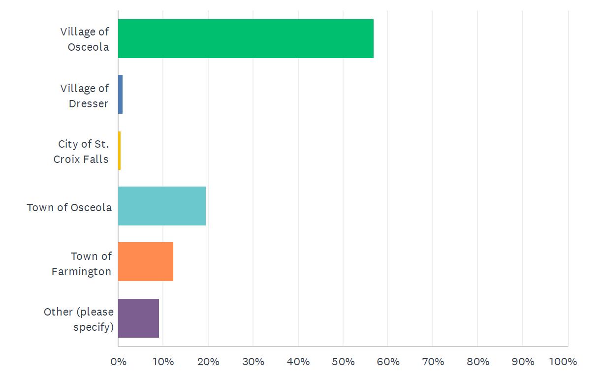
1. Where do you live?
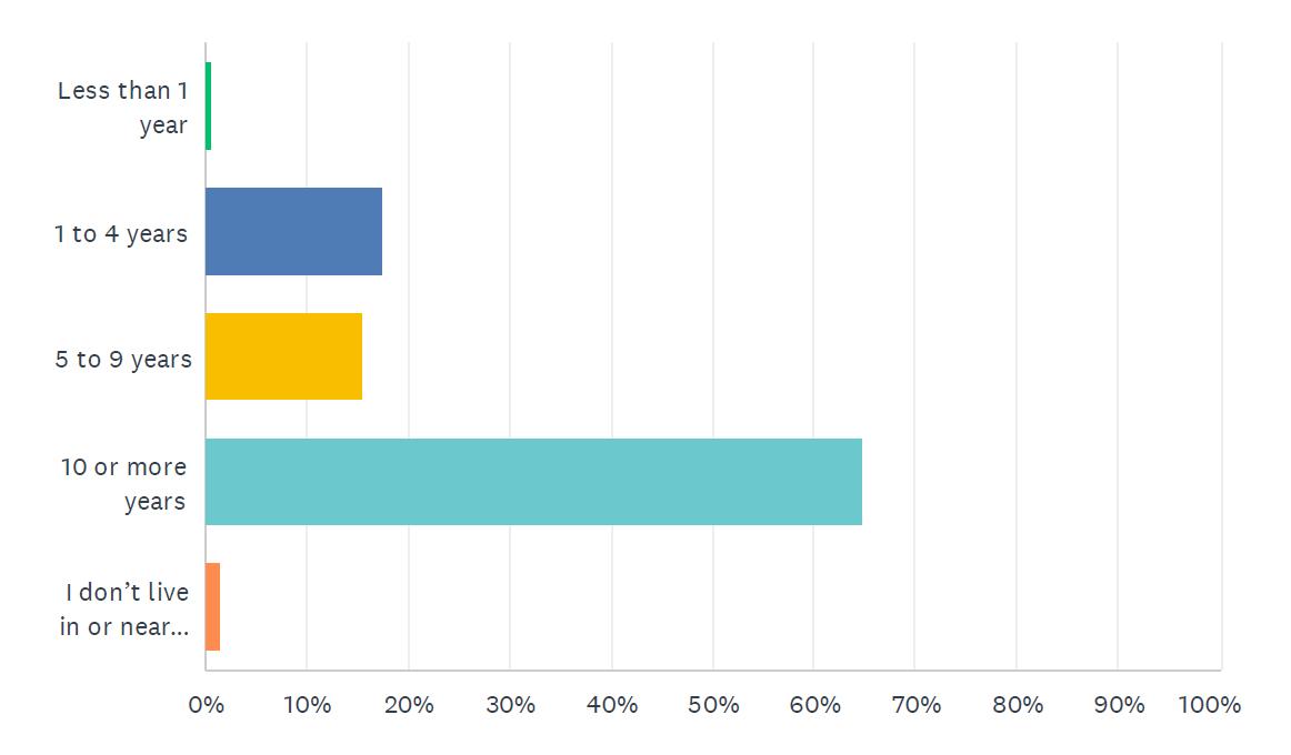
2. How long have you lived in or near Osceola?
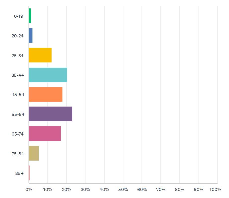
3. What is your age?
4. How many members of your household are under the age of 18?

5. Which parks and recreation facilities and/or members of yourhousehold visit most often? (Choose up to 3)
6.
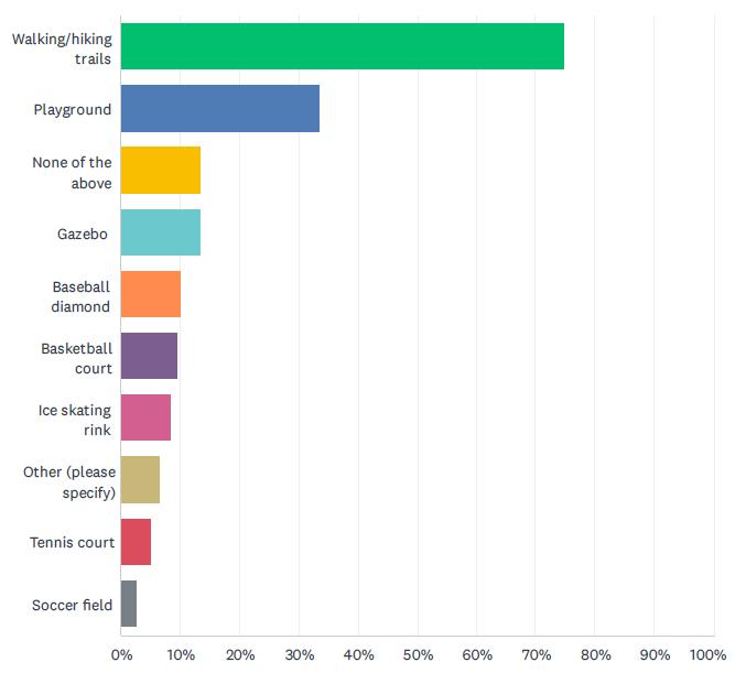
7. Which parks and recreation amenities/facilities do you currently use?
• We could use some pickle ball courts :)
• Gristmill. The attempt at improvements with some plantings a couple of years ago failed. Needs reboot
• Access to the river, like a bike trail to the Osceola landing
• Gateway Meadows
• Gateway Meadows need recreation development!
• Gateway meadows! Non existing playground
• Oakey
• Most could use a little TLC.
• None
• Osceola picnic bluff If this is the one on river street - tree trimming so you can the river a little more
• Eric Park - upkeep/repair Schillberg- tree trimming/ cleanup and garbage cans needed.
• Schillberg needs a playground back. Gateway Meadows is supposed to have a playground but still waiting years and years for it. Oakey can be sketchy, need to feel safer to
bring the kids there.
• Smith Park needs some TLC.
• All - they all seem to be lacking.
• Oakley park- fenced in
• Schillberg Park needs a playground and the existing swings need fixed (only one with two places for swings). The scouts use that area regularly and would enjoy playing there too. Lots of kids ride their bikes and play there. There is a big, dead tree there too.
• There aren’t soccerfields at the parks, so my kids usually go to the school to play. Having parks with that option would be fantastic. My kids use the medical center basketball court and would like more options. People come from Minnesota to use that basketball court and it gets really busy, so sometimes we have to go elsewhere. We need more, quality basketball courts that work for teenagers or young adults. Some hoops aren’t high enough.
• No comment
7. Which parks and recreation amenities/facilities do you currently use? (cont.)
• Ice skating park
• Schillberg Park - all the equipment was out dated and now removed altogether
• Eric Park
• Schillberg, needs updated equipment
• Eric Park. It is and could be a beautiful park if you would put up new basketball nets, fix the pavement and put up a tennis net! I’ve been asking this for more than five years and I’ve never received a response
• Eric Park... Out of date playground equipment, tennis court and basketball court fences and blacktop in poor/ dangerous condition, no seating/tables/benches, lack of stairs/safe way to go down to the courts, no equipment/ safe place for young children to play/explore, not friendly for those with disabilities or mobility issues
• The fair building
• All.
• Oakey Park - particularly the grandstand area
• Grandstand at park
• Oakey Park grandstand is in need of significant repair and upgrading.
• the grandstand at Oakey Park is on its last leg, it needs repairs to the fencing on the front of the grandstand but the structure is so old it won’t hold it up if replace netting is attached. Oakey Park ballgames draw big crowds to Osceola
• The watertower bluff trail, under the highway bridge, and the falls trail are popular and subject to erosion, wear and tear.
• The 10th Avenue Park/Triangle is in MAJOR need of improvement. I pass it on my way to and from my home everyday and what was once a garden is not a weed infested jungle. I would be happy to help with upkeep of it if it got some new plants but could never find out who to reach out to in order to offer my help. I’m sure my neighbors wouldn’t mind helping with weeding and whatever else it needs if we knew who to get in contact with.
• Ice sk ating could be improved
• None. They’re all pretty great. We have a lot of parks per capita and need to focus on maintaining, not expanding, what we have.
• Parks that mainly have received little investment toward like Shillbergs park, having a up kept park near the schools could see more use from the community. Also some trails could use resources to keep them walkable and loved by the community. I also agree with expanding parks like Oakey with more accomodations, but it is not necessary versus keeping or upgrading parks like Shillbergs and walkways.
• Schillberg Park, Its a beautiful area and its sad that it does
not see the attention it deserves.Older equipment that is breaking, etc.. That whole area could use good thought.
• Oakey Park, Updated equipment and better land use could be beneficial. It is a crucial center park for our town and should get the treatment it deserves. I also really loved when it was wood originally which could be a fun idea for redevelopment.
• Cascade Falls and Trail. The wood planks lying everywhere and that mudslide that still has not been dealt with is driving me and a lot of others insane. While I understand the need for the wood boardwalks they can be an eyesore. Id love if the trails could be redeveloped and fixed in an environmentally friendly way.
• Oakey. I t’d be great to have a bathroom, a nicer pavilion and better playground equipment.
• Cascade falls and Glenn Cascade falls, this is a uniqued attraction to town
• Oakey and Schillberg updated
• Signage could be improved on the Eagle Bluffs/Cascade falls/Simenstad Loop trails. Also a lot of graffiti under the bridge.
• I wouldn’t mind a touch up for the picnic tables and shelter at Schillberg Park. There has been some vandalism and I dislike taking youth groups there. Better creek access would be nice too.
• You are not keeping up with current trends. St Croix Falls just built an indoor pickle ball court that attracts all ages and can be used year round. Within a few months, they have around 400 members. Osceola needs to think outside the box and realize what current trends are. Fitness centers are becoming a thing of the past, people want activities, not just lifting weights or walking on a treadmill…that’s 90’s thinking.
• N/A. I’ve found the facilities in good repair
• Oakey because it’s creepy and a drug dealing location
• Parking is very limited
• Schillberg park is bare but do to its location close to the schools it is easy to visit those locations instead. Eric park is old and dated. Oakey park always seems low on woodchips and the restrooms are dated.
• The concrete wall by Geiger needs to be replaced. It would be great to see it replaced/repaired then painted in a historical or natural mural.
• The board walk along creek at Cascade Falls are very slippery when wet, some kind of nonskid tread or something would be helpful. I have slipped on them a few different times.
• Area behind Watershed restaurant, next to PY’s.
• GrateWay
• Cascade Falls - can anything be done about the ugly rocks piled where the Milk House was -maybe a patio etc.
7. Which
• Gateway meadows park…. Nothing there Pleasant run park ?…..
• Smith park , don’t even know why its there.
• Need more bike trails
• Didn’t know gateway meadow had a park.
• Eric Park and Oakey Park
• Focus on cutting costs and balancing budgets so I am not having a 30% tax increase per year.
• The park behind Gerald st needs a lot of attention. Look’s abandoned.
• Schillberg Park is an underutilized asset. It needs a purpose and a design. Would be a wonderful Festival Grounds to bring people to our town.
8. Do you have any concerns about personal safety or accessibility in any of Osceola’s parks?

• No walk ing or bike path on the bridge to the river
• I have a special needs child that likes to elope and not having fenced in parks makes it difficult to enjoy the parks.
• Handicapped facilities should be added.
• Oakey park is sketchy. It doesn’t feel safe to go there anymore.
• Bathrooms at oakey park
• Oakley park, drug use
• Dead tree at Schillberg Park.
• I do when the skate park opens.
• Strange behavior by individuals not using playground at Oakey Park
• Eric Park has poorly maintained fences by the sports courts, lack of safe way to get to the courts or playground equipment if you have any form of disability or mobility issues.
• Oakey Park.
• The grandstand at Oakey Park is in terrible need of updating, both for safety and for cosmetic decay.
• Grandstand is about to fall down
• Grandstand at Oakey Park
• see above. Grandstand needs new bleachers and structure
• Having por ta potties or bathrooms at the park to use for people and people with wheel chairs
• I have concerns about the “expansion” on the bluff coming closer toward my private property and the safety/liability
issues this creates for me.
• Lack of accessible parking at parks
• Unsafe equipment. Sketchy activity
• Not handicap accessible enough
• Vagrants and predators at Oakey Park
• The trail that runs along the creek isn’t the most accessible for less abled students. Having creek access closer to the field would be nice.
• Some concern for people who hang out in the parking lots of osceola loop and Chisago loop trails.
• Not at this time. Hopefully that will continue
• Lack of adequate lighting
• Smiths park and Eric park do not have pavement/ sidewalks all the way to the playground and the grass can be uneven. Eric parks tennis court looks to be falling off the cliff and is always a dirty, unkept eyesore.
• The rocks where the Milk House was are problematic and unsafe and always shifting and moving. There needs to be a better solution for that steep bluff.
• No police dept
• Oakey park is dir ty and the stairs to the waterfall are not maintained well
• Crime.
• I feel at there is ALOT of crime that happens at the parks. Many cars in and out at all hours. Personal I think the skateboard park is going to being alot of crime and unwanted guests
9. Which additional amenities or recreational opportunities would you like to see in Osceola’s park system?
• Pickle ball courts
• Walk ing or bike path to Osceola landing
• Osceola Dog Park
• No more parks
• More tennis courts and picnic areas
• Dog Park
• A playground in gateway meadows!
• Make sure there are portable toilets.
• Walk/sk i trails
• Skate park for kids
• A splash pad :) We hope the skate park is eventually funded. We appreciate the drinking fountains and the bathrooms at Millpond and Oakey! (Schillberg bathrooms are hit or miss.)
• Fun playground equipment for older kids. Everything here is for very young kids.
• Schillbergs needs a playground!!!
• Something like Teddy Bear Park in Stillwater would be awesome.
• Skate Park
• More information on them.
• Skate park. Safe trail to get from pheasant run, 248th and 240th developments to schools/downtown.
• Mountain bike trails, soccer fields, playground at Schillberg Park
• Walk ing paths
• Dog park
• Improved lighting.
• Newer equipment
• More restaurants, not bar type restaurants. Family friendly restaurants or nice dining options.
• Public pool
• More bathrooms, picnic areas and equipment for younger children
• Handicap accessible ramp to Cascade Falls
• Frisbee golf
• SKATEPARK
• Can we get trash cans at Schillberg park again? I think Olsen may not know they should drop one there. I would also love to see a can at the beginning of the trail, right near Industrial.
• I would like to see a dog park.
• Public youth baseball fields
• More trails Pickleball courts
• I think the idea of inclusive parks for children with disabilities is wonderful! I’m not super familiar with all of the parks so maybe this is already covered.
• More organized trail events, especially for families. Nature
walks. Environmental education.More parking around library/hall/senior center. Missed the boat on that one!
• Skateboard opportunities
• Instead of a skateboard park, I personally would like to see the existing ice skating rink become a dual-use facility that could house the skateboarders in the summer, like the one Scandia has.
• Skateboard park
• Cleaned up, more lighting.
• Parks, trails, ice rinks etc get used more when there is dedicated programming. We have GREAT amenities already- need programming.
• Honestly anything you can add. A lot of entertainment opportunities in Osceola are good, but if you invest in a skatepark I could see a lot of people interested in new entertainment options like that.
• Bike trails
• pickleball, skateboard park (just get it done instead of relying on private fund raising)
• Community driven outdoor events. Skate Park development. Equipment additions and upgrades. Simple drinking fountains.
• Public ar t Bike lanes Farmers market structure Return the pollinator gardens
• Wild areas. Restored native plant communities
• Splash pad or pool
• Pick leball courts
• It would be great to have a park in the Gateway Meadows neighborhood. Lots of kids in that neighborhood. It would be great to walk/bike to a local playground within the development
• Would be fun to see an interactive trail with art or educational tidbits scattered throughout. For example, a trail with tree ID cards on some of the trees teaching you about their characteristics. Or a trail with little fairy houses scattered about at the bases of trees. Something fun to engage with while you’re outdoors.
• Indoor pick leball courts. Jump on the bandwagon before it passes you by. Osceola is very slow to react to physical fitness trends, and seems to be stuck in the 90s.
• Pedestrian/cycle connections between them and town
• Addition of doggie poop bags in park facilities to encourage people to pick up after their animals.
• Skate park and bike trails
• Skate park
• Pick le ball courts.
• Pick leball
• Skate park
• More natural area improvements like trails.
9. Which additional amenities or recreational opportunities would you like to see in Osceola’s park system? (cont.)
• Some pickle ball courts, more benches and picnic areas.
• Skate park
• Gateway they need it because of all the young families that have move in here and they told that it was going done
• indoor pickle ball courts
• Handicapped accessibility
• Pick le ball court
• Pickelball courts
• Nicer bathrooms
• None. Stop spending the residents money.
• Build a skate park. Quit holding out on something that’s been “begged for” for 35 years.
• More walking trails, dog park. Most people have dogs off leash (not happy)!!
• Cleaner restrooms
• Bathrooms
• Better restrooms
• Outdoor Ice skating rink.
• Frisbee golf
• Bike trails connecting to other towns. An outdoor performance stage for summer concerts in the parks.
10. If you had to choose, would you and your household rather drive to a big park with many amenities (such as sports fields, large playgrounds, restrooms, etc.), or walk to a neighborhood park with small playgrounds/picnic areas.
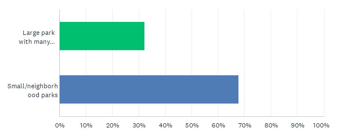
11. Where would you prioritize the location of new bike facilities, routes, walking paths, or trails?
• connec ting OMC to downtown and fixing the walking area near the depot
• Gateway Meadows
• I would rank that at 99th out of a list of 100 needs
• Through Gateway Meadows
• Between gateway parkway and the safe route to school
• Gateway meadows
• High. This area should be more walkable
• 248, M, and other outer areas.
• A paved path (sidewalk) out to OMC.
• South of town!
• Between OMC and downtown.
• Current elementary school
• By the schools
• Already enough of them!
• Shillberg park,bluffs
• Safe trail to get from pheasant run, 248th and 240th developments to schools/downtown.
• All throughout town
• From Osceola to Osceola Medical center.
• 3rd ave
• Connec t the existing network
• Ability to get in and out if town.
• North of Krooked kreek
• Near the schools, and other places in the community with ample parking space alreadyaccessible.
• Town towards hospital On M towards Alden
• River access & views
• Access to downtown or by the Industrial Park on M
• Large parks first (such as Oakey), downtown to school area
11. Where would you prioritize the location of new bike facilities, routes, walking paths, or trails? (cont.)
• Along County Rd M and from Osceola to Dresser somewhere
• Near the high schiol
• 3rd street.
• EVERYWHERE is my honest answer. But my number one ask is 3rd Ave from M to downtown. Please create a pedestrian path here. People who live in housing areas off of M want to walk or bike downtown on a nice day. As it is 3rd Ave is not safe for pedestrian travel. It’s narrow, full of potholes which are dangerous and not good for bikes (or cars) and it’s also very dark. My second ask is for trail connection from downtown Osceola (or somewhere off M) to the Stower Seven and the Gandy Dancer. A paved path that connected to these trails would be incredible for locals that want the recreation and I think it would bring in tourism $$. Also please put bike racks downtown.
• In town
• Low priority
• in and around the village needs bike paths and walking paths or trails
• By the ar t barn
• I support hike, walk, bike paths away that are separate from major roadways and are safe from possible collision with vehicles. I don’t know enough about the layout in Osceola.
• Anywhere in/close to town would be great. One of my reasons for moving here was to be able to walk to where I need to go. It is great for that IN THE SUMMER. In winter, it is absolutely dangerous to try and walk anywhere other than a couple blocks on Main Street. PLEASE educate village residents about need to keep sidewalks clear. PLEASE enforce shoveling regulations.
• Alongside our current roads
• We don’t need more facilities! We need to maintain the ones we have and make sure MNDOT includes a bike path on the new bridge.
• walk ing access on 35S to & along Ridge Rd until road levels out; signs alerting drivers to bikers there; paved walking trail on 3rd Ave. from M to senior apts where sidewalk starts
• River view areas, bluffs
• Connec tion of Industrial park to downtown with multiuse paths along Osceola Creek.
• I think the possibility of renovating older paths that don’t see too much use might be beneficial, but in terms of adding new walking paths and trails you might want to prioritize up keeping existing trails first. I think there could be more bike racks and facilities for these types a of vehicles around different trails near public spaces that have accomodations.
• High priority
• connec t downtown to Schillberg’s park and extend to Stower Trail and St. Croix Falls/Dresser/Gandy Dancer Trail.
• East/North Schillberg Park. Standing Cedars. ~ County Road M, Eric Park, & 3rd Ave.
• More bluff trails! I’d take hiking trails and bike lanes anywhere we can get them.
• Near to and connecting the school buildings.
• To the south side of town
• Biking path to east Farmington and dresser. Can’t bike on 35. Too dangerous.
• From town to OMC Park
• I’m primarily a road biker, and as I said earlier in the survey, I’m pleased with what’s available to me in that regard. That said, my wife is less comfortable riding on streets with cars, so I think she and others like her could benefit from off street bike paths and/or dedicated bike lanes in and out of neighborhoods in the village.
• Boardwalks through wetlands by Schillberg Park
• to connect downtown areas to outer ring. Farmington to Osceola.
• Extending the existing one would be nice, oseola towards dresser would be nice.
• Frankly, I have lived in Osceola for 17 years and I have no idea where the bike trails are.
• Bike trails that connect to S
• Along the river connecting town with S trails and Standing cedars
• Connec ting communities, one flowing into the next. A route connecting Osceola to the town of Osceola and Dresser
• I think what you are asking is how I would rank this in a priority—it’s very important to have a walkable/bikeable community
• By the schools
• Public scenic areas.
• Near the dairy Queen for a trailhead
• Close to residential areas like the gateway division.
• In places that would not disrupt natural ecosystems
• Anywhere and everywhere. Osceola creek and the land near the wetlands beyond.
• One day, I’d love to see a walking/bike trail that is a big loop through Osceola, Dresser, St. Croix Falls, Taylors Falls, and back down the MN side to 243 to Osceola. But to start it would be great if we could have a walking/bike trail along Ridge Rd around to the Hospital and then back down Cascade to town and then a trail along Cascade to Cty Rd S with a trail all along Cty Rd S to Interstate Park.
• Ability to get downtown.
• Along the riverway
11. Where would you prioritize the location of new bike facilities, routes, walking paths, or trails? (cont.)
• Around the schools/Schillberg area
• Ask ing the river and bluffs.
• Near town.
• In the village or accessible from the village. Also, can we connect to the St Croix Falls biketrail?
• Hook up to other trails in the area Would be nice if they were all hooked together
• osceola landing
• A path that goes north up 35 to the hospital.
• Route to OMC
• None. There are plenty in the area.
• Outside of town
• Downtown area
• Not sure where more could be put at the moment
• Along highway 35 to allow safe passage between side roads
• complete the bike path from village of Osceola to OMC (partial bike path now from the assisted living to Kwik trip)
• Bike paths emanating from the new bridge. Maybe engineered bike courses in Schillberg Park. Maybe concert stage in Schillberg Park.
• Outside the Village.
1. What age groups are represented by those that currently live in your home?
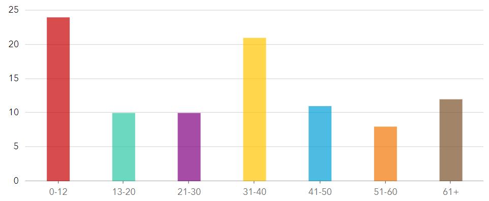
2. What recreational amenities would you like to see in the undeveloped parkland in your neighborhood?
• Playground - Fenced in areas for dogs
• Walk ing trails, playground, benches, wildflowers/trees etc
• Playground with a picnic area would be amazing!
• A dog recreation area. Almost every home has a dog and no place to run or play off collar.
• I would like to see adogpark. Since there alot of dogs in the neighborhood .
• Nice to have a picnic area with a walking path. Playground for kids with climbing wall, swings Interactive playground with sensory areas for children that have sensory needs.
For reference check out Madison’s Place Playground in Woodbury MN
Dog park would be nice to have in the area
Splash park area
Rest room at the park
Water fountain at the park
• Playground, walking/running trail
• Walk ing trail, park benches, trash cans
• Playground equipment, picnic tables
• Dog park
• Picnic tables (metal not wood), walking trail, benches, public pool
• Walk ing trails, street lights and playground equipment. It would be great to have street lights the neighborhood is so dark.
• Playground and dog park.
• Playground Equipment
Parking
Picnic Shelters
Aircraft observation area
Dog park
Bathrooms
• Playground Equipment, Kids Splashpad, area to have a picnic / cookout.
• Gateway Meadow is a growing neighborhood with more children each year. A park would be an amazing addition.
A playground with plenty of swings, slides and climbing.
Basket ball hoops/ pickleball court.
Benches/ tables with shade options
Garbage/ recycling cans.
• Walk ing trails, picnic benches and tables. Very nice to have tennis or pickle ball court!
Drinking fountains and spots designated to dispose of dog poop.
Basket ball hoops or volley ball nets! Anything to help folk get moving!
2. What recreational amenities would you like to see in the undeveloped parkland in your neighborhood? (cont.)
• Dog park
• Basketball cour t. Skate park. Archery range.
• Would like it to stay a open field
• Walk ing trail, fenced dog area
• Dog park or playground with picnic table/gazebos
• Picnic tables. Playground. Trails.
• Playground. Picnic/gazebo. Splashpad
• Walk ing trails and fenced in playground equipment
• Picnic area, playground for our grandchildren, and walking trails
• Walk ing trail
Pavilion parties with more parking options and a bathroom area Dog park
Small building for indoor parties like grad parties, birthday, etc.
• Sidewalks, playground with picnic area
• Walk ing trail and playground equipment
• Walk ing trial, dog park, tables. Tree development
• Kids of all ages are in this development. Equipment that will benefit them along with picnic tables or benches. Perhaps a skate park area for teens.
3. Please share any additional thoughts you have about the parkland in Gateway Meadows or Pheasant Run.
• Gateway meadows is just a field but easily could be a great park for all the kids that live in the neighborhood
• Pheasant run would be perfect for a nice walking/bike trail!
• We need a dog park. Very high dog population.
• How about the property in front of Kimball Ave in Gateway Meadows? Could that be used for playground, picnic area? Or dog park?
• We’ve been told for years that “they’re going to put in a park” with nothing to show for it. Please make it happen!
• I do not want playground equipment as that lead to a lot of crime and injury litigation in my old neighborhood. It also was really noisy late into the night with people from outside the neighborhood who didn’t care for the equipment or the facilities or the hour rules.
• Myself along with many of my neighbors have talked amongst ourselves how wonderful a play ground would be for all of the young children in the neighborhood! It would bring the community together and provide a safe place for our children to play without having to travel in a vehicle! There are many children in the neighborhood that would greatly appreciate and be thrilled with somewhere to play with friends and family!!!
• Public pool
• Make sure to have dog waste bins so the park isn’t littered with dog feces.
• This is a GREAT idea and I hope it actually happens. As a resident with a baby and dog, id love to see a playground for all ages and a fenced in area for dogs to run off leash.
• Make a business development opportunity for restaurants, bars, shopping, convenience stores, etc (not manufacturing) on Village owned lot 26 between Gateway Pkwy and Simmon Drive.
• (No rubber pellets/mulch)
• Developing these lands to useful physical activity for both our young and adults in these community’s. It would make swallowing our taxes much easier! Anxious to see this progress!
• Consider parking/bikes
• I have a special needs child and a fenced in inclusive playground would be a game-changer for the neighborhood.
• Thanks for finally looking into this as an option. We would even be wiling to pay a minimal fee on taxes to be able to reserve and utilize a space to hold small events.
• One question I have is what will this do to property taxes?
Village of Osceola, Wisconsin
1. What age groups are represented by those that currently live in your home?

2. What recreational amenities would you like to see in the undeveloped parkland in your neighborhood?
• I think walking trails would be a very nice thing for the neighborhood. Park benches along the walking trail for resting or just enjoying nature would be nice as well. A playground area for the children of the neighborhood would be nice for them also.
• Playground for children. Walking trail for all residents and picnic tables with shade for all.
I would note that the map you show for this park is inaccurate unless the city has actuaries the 2.4 acre parcel 165-00831-0009. That parcel represents the high ground and is owned by citywide development. The land around it is mostly wetland.
May be better to look at city owned property on Prairie Grass Drive.
• Large playground, picnic tables, pavilion, splash pad of some sort, walking path, nature garden
• Playground equipment, walking trail, picnic tables
• Sport court
• Walk ing trails, playground
• Any would be great. Playground and walking trails would be awesome.
• Walk ing trail, playground equipment, covered picnic area
• Walk ing trails, playground equipment, outdoor exercise stations
• Nothing. Do nothing. It would be a waste of money and resources
• Walk ing trails.
• Picnic Pavilion, field for soccer and other field sports that could possibly be partial ice in the winter. Walking trail around the park. Swingset.
• Playground, basketball court, skating rink, picnic area, walking trails
• Walk ing trail picnic tables
• Trail, Pickleball Courts,
• Playground equipment, walking trail, splash pad; birds, bees, and butterflies nature reserve
• A park in our neighborhood would be great. I would like to see a basketball court and hoop. A walking trail, playground and picnic tables are all welcome ideas.
• Leave it undeveloped.
• Walk ing trails, resting benches.
• Walk ing trails with resting benches
• Walk ing trail and/or fitness trail (rustic fitness no need for expensive equipment)
3. Please share any additional thoughts you have about the parkland in Gateway Meadows or Pheasant Run.
• When you design the recreation area it would be nice if you could do it with as minimal tree removal as possible. In the ariel view I don’t see an access point for this recreation area. That will be important as well so that children and adults alike are not walking through other people’s yards to access the recreation area. I believe a recreation area would be a good addition to the neighborhood. Thank you for asking for our input.
• I would love to see something in the pheasant run development. There are a lot of elementary school aged kids in this area that could really benefit from it. Osceola lacks in public playgrounds. Aside from OMC.
• We would love to have safe roads to drive and for our kids to ride bikes on. Simmon drive is narrow and so full of pot holes from the semi trucks.
• Simon Drive desperately needs to be completely redone.
• The pheasant run land is not the most desirable location. Being located in the middle of a swamp could present challenges.
• Right now people are walking on the road and there are many walkers in our area.
• I’ve been to this site. The bugs are terrible from late spring thru fall. There is a wetland surrounding it so a dock/ bridge would need to be installed to access it. And it isn’t very big. Please don’t waste our money on something like this.
• I think a park would be a wonderful addition for the children and residents to get some needed exercise!
• Pheasant run is becoming more young family focused in the recent years and a playground would be a great addition to the neighborhood.
• Really needs something for kids to utilize as there are so many families here now
• Don’t need extra people walking by house or using our property as a short cut to park. Leave land the way it is. We want our privacy and don’t need extra loudness of people. There would be more liter and dog poop too.
• Gateway Meadows needs a larger play area and playground for the young families. Pheasant Run needs to accommodate to the older population which makes up most of the neighborhood, with few young families due to townhomes, single level homes and higher value homes.
• Its existence is not known to most of us living nearby. A clear access and delineation of park boundaries would be helpful. I’ve noticed people around here assuming certain land is public when it is, in reality, private. They then let their dogs loose on others land - which reminds me, enforce leash laws and picking up after pets. Clarity will help us enjoy the parks
The definitions used in this plan are modified definitions used by the National Recreation and Park Association (NRPA). They are used to classify parks within existing recreation systems and to guide plans for the future. They begin with the smallest and most localized parks to the largest parks with the most amenities. Neighborhood and community parks are normally provided by municipalities. Larger recreation areas, such as preserves and wildlife management areas, are normally provided by larger units of government or private enterprise.
Neighborhood Playgrounds
Typically on a small lot (1/4 acre) and located within a residential neighborhood. Usually have one facility and benches.
• Desirable size: 2 acres or less
• Acres/1,000 population: .25 to .5
• Ser vice Area: 1/8 to 1/4 mile radius
Serve the needs of children 5-15 years old by providing open fields, courts, shelter facilities, and play areas. Should be within walking distance.
• Desirable size: 2-4 acres
• Acres/1,000 population: 0.5 - 1.5 acres
• Ser vice Area: 1/4 to 1/3 mile radius
Neighborhood Parks
Provide open space for all ages and enhance the overall environment. A natural, walkable location is ideal for this type, and they usually have tables, benches, paths, and lights.
• Desirable size: 3-7 acres
• Acres/1,000 population: 5.0 -8.0 acres
• Ser vice Area: 1 to 2 mile radius
Community Play-Fields
Serve the active needs of several neighborhoods. Usually include more than parks, such as a pool, community center, and fields for sporting events.
• Desirable size: 5 or more acres (15-40)
• Acres/1,000 population: 5.0 -8.0 acres
• Ser vice Area: 1 to 2 mile radius
Intended to serve many neighborhoods. Tend to have woods, water features, trails, and picnic areas. Should be determined by the size of the population.
• Desirable size: 3-7 acres
• Acres/1,000 population: 5.0 -8.0 acres
• Ser vice Area: 1 to 2 mile radius
Created to take advantage of a natural or unusual feature, or to preserve areas and provide recreation. Golf courses, marinas, and skate parks could be categorized as this type.
• Desirable size: varies on function
• Acres/1,000 population: varies on function
• Ser vice Area: varies on function
Usually located outside of the urban area and include large tracts of land that have limited development. Usually provided by state, federal or county governments.
• Desirable size: varies on function
• Acres/1,000 population: varies on function
• Ser vice Area: varies on function
Almost the same characteristics as the reservation or preserve; however, they may be used to shape urban development. Could connect parks within an urban area.
• Desirable size: varies on function
• Acres/1,000 population: varies on function
• Ser vice Area: varies on function Waysides, WelcomeCenters, Historic Markers
Special purpose parks designed to serve motorists and boost the tourist industry. Size and location depends on natural features.
• Desirable size: varies on function
• Acres/1,000 population: varies on function
• Ser vice Area: varies on function
Village of Osceola, Wisconsin
310 Chieftain St.
Osceola, WI 54020
