CITY OF DASSEL


Dassel is a well-planned, safe, prosperous, and growing community built by citizens and businesses who value education, health, and public safety. People enjoy its natural beauty, rural character, and location in the region. As residents and businesses come and go, and economic trends rise and fall, changes will occur. Dassel continues to place value on long-range planning to ensure the community of today effectively evolves to meet the anticipated needs of the future.
The purpose of the 2040 Comprehensive Plan is to establish a shared vision for the community, to guide future decisions and actions, and to assist in projecting and managing growth, change, public improvements, and development in the community. This guidance provides predictability and consistency over time to help encourage investment. The purpose of planning is to act and react to a changing world with a confident understanding of our common values and goals.
The difference between this Comprehensive Plan and a zoning ordinance is that the former sets forth the objectives and goals of the community with
respect to land use, while the latter is a regulatory device through which the plan’s goals and policies are carried out or achieved. Other ordinances, such as subdivision regulations, are also utilized to carry out the goals of a Comprehensive Plan.
Dassel’s future growth, to be guided by this Comprehensive Plan, will be driven by the City’s reputation as a leader in K-12 education as well as its proximity to services, higher education, commerce, innovation, and proximity to the Twin Cities Metro Area. The region’s abundance of quality recreation and business growth opportunities also adds to the quality of life experienced by residents.
This plan is an active part of the community’s efforts to attract people and businesses to the Dassel’s unique small town feel and development opportunities. The content within this plan sets to create the best version of the City for future generations to live, work, play, and learn.
The organization of the plan is based on the planning process described in Chapter 2, and is divided into five chapters plus relevant appendices.
This chapter examines the role of the plan, the planning area boundaries, regional context, and key community indicators.
This chapter outlines the planning process, a description of public participation methods and a summary of feedback from all engagement activities. Public engagement is a key component of the comprehensive planning process.
This chapter presents a vision for the future of the City of Dassel and describes the goals and strategies to achieve that vision. The elements of community infrastructure, housing, recreation, transportation, employment & economy, agricultural & natural resources, and intergovernmental collaboration are all addressed.
This chapter considers Dassel’s future growth forecast, existing land use, land use goals and strategies, the future land use map, how to amend the future land use map, design recommendations, and guidelines for buildings and sites.
This chapter outlines how the vision and goals of the plan are implemented in everyday decisions and annual goal setting and budgeting, and how the plan should be amended when necessary.
This appendix incorporates a summary of current conditions and recent trends in Dassel. Utilizing American Community Survey data provided by the US Census Bureau.
This Comprehensive Plan update is an effort to reinforce the long-standing planning priorities of the City, while recognizing changing conditions, trends, and new issues. The City’s Comprehensive Plan reflects a shared vision for the future of Dassel.
Comprehensive Plans are a general and broad analysis of the interconnections between cultural, geographical, and natural components within a city. They also provide guidelines for continued development. Technology, economic drivers, and demographic changes affect how land is managed and utilized in a city. Although this Comprehensive Plan attempts to address many possible future uses, it may not capture all of them.
As new land uses are introduced, Dassel will be in a great position to better review land use proposals. This plan will provide broad recommendations to help citizens and local leaders work together more efficiently to facilitate future growth and development within the City. These recommendations come in the form of goals and objectives which express the community’s aspiration for the future.
This planning document is a “living” guide, meaning that it can be revised as Dassel grows and changes. The plan provides specific recommendations that directly manage community growth and development. To utilize the full potential of the plan, it should be used to:
Guide City officials and staff to assist with a variety of land use planning and growth planning tasks.
Guide businesses, property owners, and residents by assisting them in determining potential property use, understanding future land use changes in the surrounding area, and understanding infrastructure improvements.
Assist developers interested in property acquisition to coordinate development plans with City goals, regulations, and infrastructure plans.
Assist in coordinating with neighboring jurisdictions on issues and topics of mutual interest.


The railroad plays a large part in the history of Dassel and continues to enrich influence its decisions today. The establishment of the City began when employees of the Saint Paul and Pacific Railroad were looking for land to expand their route west in approximately 1868. Settlers were eager to sell their land to the railroad, which platted out a new village in 1869. The new community was named after one of the railroad employees, Bernard Dassel, a paymaster for the railroad and an immigrant from a village named Dassel in Germany. The railroad connection to Dassel was completed on July 4, 1869; throughout the remainder of the year, more buildings were established and in 1870, stores, houses and the schoolhouse were built. Once the post office opened, Dassel was officially incorporated as a village on March 17, 1878 with a population of 302.
The City of Dassel has grown over time, with many additions through land acquisitions contributing to its overall growth. Two major areas shaped Dassel’s growth patterns. The first was the northern part of the city and the second was the location that now contains the Dassel Industrial Park. A number of annexations contributed to the growth of the city’s development footprint. Presently, Dassel is regionally notable for its safety, school district, proximity to the Twin Cities Metro, and the bountiful opportunities for housing, parks and recreation, and new business development.
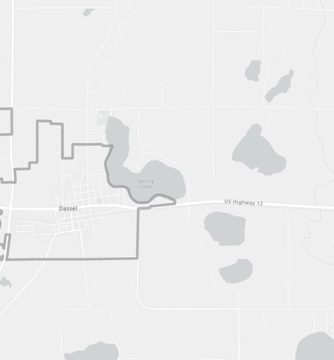
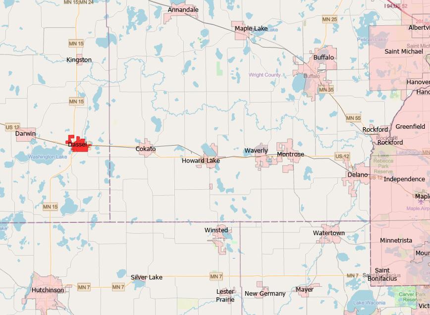
The City of Dassel is located in Meeker County, MN. It is situated west of the Twin Cities Metropolitan area along the well-traveled corridor of US Highway 12.
Dassel is in a great location for residents who want a rural feel and an easy commute to nearby larger communities for work, leisure, entertainment, and services. Dassel strives to provide a high quality of life and remain a safe and attractive community.
The community will continue to be a vital, safe, and healthy environment that evokes community pride and supports a healthy and prosperous life for those who chose to make Dassel their home.
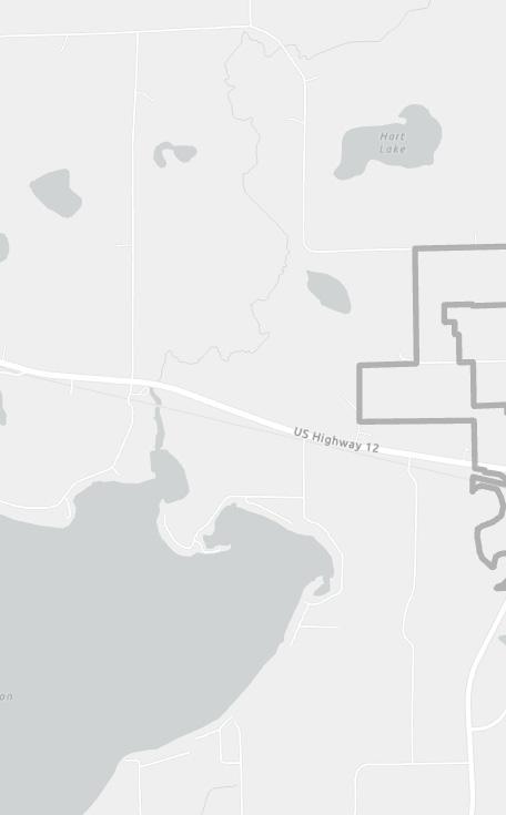
The planning area for this Comprehensive Plan includes all lands in the city and is outlined on the map to the right.

Proximity to Metro

Potential Development Opportunities
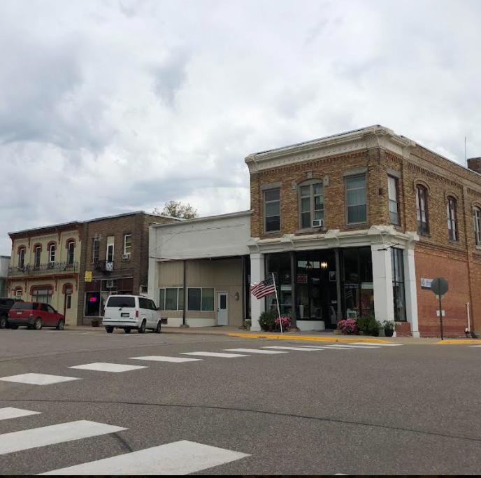
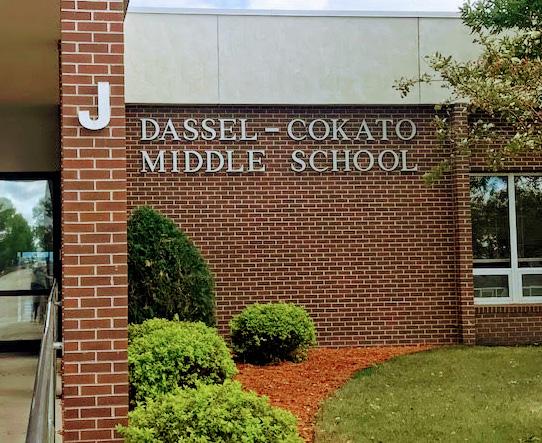
Dassel is located in Central Minnesota in the eastern part of Meeker County, Minnesota, west of Minneapolis. It is in a great location for residents to reside in a small town and easily commute to the nearby communities and larger Metro area for work, leisure, entertainment, and professional services. Dassel continues to provide a high quality of life and remain a great location to live and do business for residents and visitors.
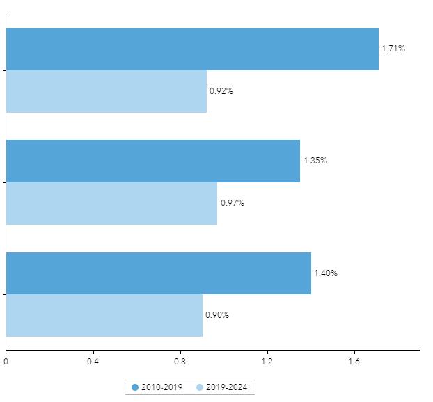
AcarefulexaminationofpopulationtrendsinDasselprovidesafoundationforthelanduseplanningprocess and implementation of the plan. Understanding past and future population growth is an important step towards appropriate resource allocation. The City’s current 2021 population estimate is 1,476 The population and number of households are projected to continue growing through 2050.
Forecasted Annual Growth Rate:


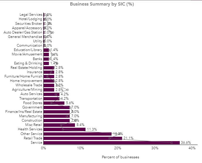
Employment information is an important indicator of current economic conditions and potential economic growth opportunities for the residents and businesses of Dassel. The majority of Dassel’s residents have jobs classified as white collar positions, followed by blue collar and services. The unemployment rate is estimated to be at 3.1%. The largest labor force category is Service, followed by Trade. The chart below shows a comparison with Meeker County; there are many categories that show high variability such as Construction/Extraction and Health Services. Many workers commute to the surrounding region for work.
P ublic E ngag E m E nt and P roc E ss
A transparent public participation process is the foundation to a successful plan. The planning process for the development of the 2040 Dassel Comprehensive Plan included seeking the involvement of residents, business owners, and other stakeholders involved with the community to create a vision and set goals for growth and improvement. Great engagement is essential to creating a plan and gathering support for successful implementation of a plan’s goals and actions.
The development of the 2040 Dassel Comprehensive Plan included the following engagement activities to help develop a vision, establish goals, and develop actions for implementation:
•Comprehensive Plan Steering Committee
•Public Workshop with (SWOT) Strengths
Weaknesses Opportunities Threats Analysis
•SWOT Community Survey
•Key Stakeholder Interviews
•Draft Plan Review open House
•Draft Plan Review Survey
STEP 1 Community Engagement
1
Soliciting input over the planning process via online and traditional engagement activities.
Input will be gathered from: Public Planning & Zoning Commission
City Council & Staff
Other Stakeholders

STEP 2
Existing Conditions Analysis
2
Summary of analysis of existing conditions to establish an overall vision for Dassel.
Existing plans, conditions and goals will be reviewed and analyzed for use in Steps 3 and 4.

STEP 3
Community Profile, Vision, and Framework
3
Establish a “Vision” for Dassel to provide focus for the creation of the Comprehensive Plan.
Vision and associated goals will be developed through the feedback received in Step 1 & 2.

STEP 4
Creation of New Dassel Comprehensive Plan
4
Plan will include all information developed in Steps 1, 2 & 3.
The newly created Comprehensive Plan and its Action Plan for Implementation will serve as a tool and guide for future development.
The public engagement process is integral to the results of the plan and guides future implementation of the goals and policies recommended in this document. Although the Covid-19 pandemic created an untraditional situation with limited in-person meetings, the City was still able to gather feedback. Various engagement methods were performed to provide multiple opportunities for stakeholders to provide quality feedback online. The methods ranged from an online community survey available to all, hybrid in-person/virtual community meetings via Zoom, social media postings, and online group interviews with stakeholders. There were multiple stages of input varying in type in order to receive quality feedback. In the beginning, word of the project was spread to create awareness and excitement. From that momentum, feedback was gathered directly from residents to help form the plan’s goals and policies, which is summarized in the following pages.
The Comprehensive Plan Steering Committee was established to oversee the process and ensure that the established goals and objectives of the process were being accomplished. The Committee was the primary review and advisory body throughout the planning process. Five meetings of the Committee were held during the planning process and all were open to the public. All presentation materials were posted on the project website for public access.
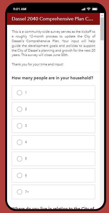
A project website was developed where posts and feedback were shared such as the project schedule, draft documents, meeting notices, and copies of presentation materials. The website also provided a venue to share comments throughout the planning process and an easy way for citizens to contact the project team with questions. This aspect of the communication and participation strategy was important for transparency, as well as for sharing information with stakeholders.

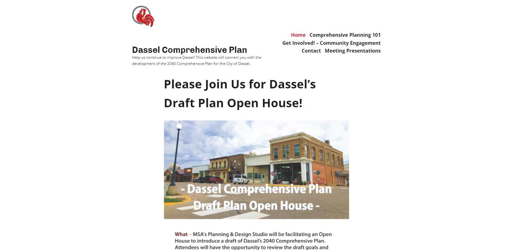
A community survey was created and made available to community members. This was a gathering tool in the form of a SWOT (Strength, Weaknesses, Opportunities, and Threats) analysis. The broadness of the questions allowed the planning team to analyze big and small picture information about the City and community members’ views and thoughts in three categories: beautification, development, and mobility. This was administered through ESRI’s Survey123, which is formatted to allow users to take the survey via computer, tablet or smartphone. Participants were invited to respond via a link on the project website, as well as through flyers that were shared on the City’s social media accounts.
This Plan is grounded in a set of issues about which the residents and City staff are concerned, and opportunities for positive change. The Plan seeks to address perceived deficiencies and capitalize on opportunities. This section is a compilation of key issues and opportunities. A SWOT analysis exercise was used to gather this information from the Planning and Zoning Commission, Project Team, Steering Committee, as well as from the general public at each community engagement and visioning session.
Strengths - characteristics that give the community an advantage over others.
Weaknesses - characteristics that place the community at a disadvantage relative to others. Opportunities - elements the community could exploit to advantage the community. Threats - elements in the environment that could cause trouble for the community in the future.


Summaries from Website, Survey, Meetings, and Interviews
Participants commented on the following questions important to the comprehensive planning process:
• Which areas of Dassel do you see growing in 20 years and how and what are the challenges to that growth?
• Which areas of Dassel provide an opportunity for redevelopment?
• What do you envision the community character will be in 20 years?
• What will be great about Dassel in 20 years? What obstacles will it have to overcome?
• In 20 years what will attract families to the area?
• What needs to be protected as Dassel grows?

The following pages summarize the feedback received relating to the three categories:
A community input workshop was held at City Hall in September. A Planning 101 presentation started the evening with information on the importance of planning and the public’s role in the process. The workshop was well attended, with many residents in the audience as well as important stakeholders like realtors, business owners, staff from the school district, and friends of the library. The SWOT activity with the larger group led to break-off conversations and additional thoughts that had not been discussed through the other engagement methods. Participants were invited through the City’s website and project website, as well as flyers that were distributed using the City’s social media sites and the school district.
The Draft Plan Open House was held at Dassel City Hall on Thursday December 9th. This was an opportunity for residents to look at copies of the draft plan, walk around to interact with various displays as well as ask the project team any questions they may have. The interactive stations included visual preference surveys for commercial areas and new housing (rental and owner occupied) as well as the existing land use map and draft future land use map. Great feedback was gathered at this event particularly on the future land use, and areas the City may be able to expand and provide infill development of a flexible nature. At the meeting many stakeholders felt that the area on the north west corner of the Highway 12 and 15 interchange should be a more flexible land use category than “commercial” as noted in Chapter 4 of the plan, we adjusted that area to be “Flex” which would allow for various types of development to occur in that area, leading to a more diverse economic base for the City.
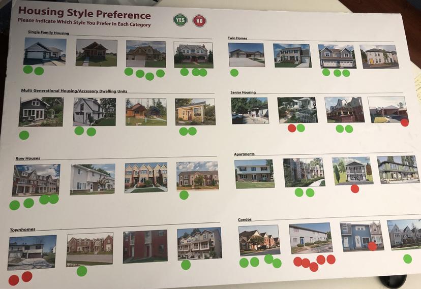
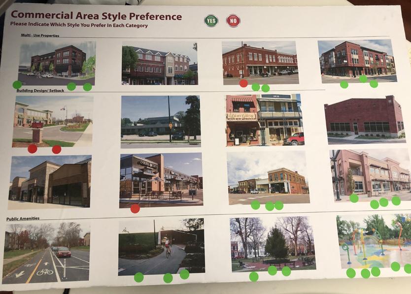
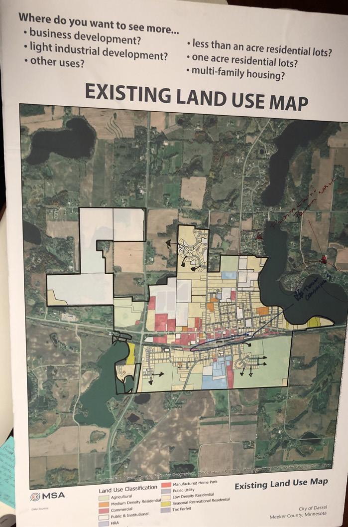

Summary of what we heard from residents relating to BEAUTIFICATION
Strengths / Opportunities
• Mature trees and planters around the city
• Proximity to lakes and outdoor Recreation
• The parks are in good condition and upkept
• Opportunity – Continue updating existing parks
• Opportunity – Improve the downtown area/update buildings
• Opportunity – Add attractive signage to Dassel entrances
• Opportunity – Expand trails and connections
• Opportunity – Increase number of trees along Highway 12
Weaknesses / Threats
• Dilapidated buildings in downtown area
• Not a welcoming entrance to the City, outdated
• Not a priority for residents
• Residents are resistant to change and don’t participate in the community
• Unkept yards and housing
• Highway 12 curb appeal
• Threat – Aging population
• Threat – Not enough money
• Threat – Growth that is too fast, the City cannot keep up
Summary of what we heard from residents relating to DEVELOPMENT
Strengths / Opportunities
• Good schools and housing that attract people
• City’s existing infrastructure is able to support additional development
• New housing developments interest developers
• Dassel History Center & Ergot Museum
• Opportunity – Highway 12 and 15 intersection
• Opportunity – Enhance and upgrade the downtown
• Opportunity – Land north and south of the City for future expansion
• Need more businesses
• Economic Development Authority
• Growth seems slow
• Unable to keep businesses
• No community center/ gathering space for residents
• Downtown seems neglected because it is away from the highway
• Surrounding communities moving at a faster pace
• Threat – Lack of community involvement
Summary of what we heard from residents relating to
Strengths / Opportunities
• Easy access to Highway 12 and 15
• Walkability
• Existing trails system
• CIP for future infrastructure projects
• Opportunity – More bike trails and connections
• Opportunity – More wide sidewalks to connect neighborhoods
• Opportunity – Walkability, safety
• Many intersections are difficult for ped/bike crossing
• Highway 12 and railroad tracks “splitting” the City
• Not enough trails
• Many sidewalks are in poor condition or many neighborhoods do not have sidewalks
• Threat – Increased traffic with growth of surrounding communities and expansion from the Twin Cities
• Threat – Highway 12 congestion
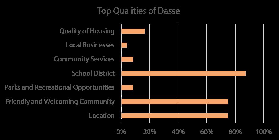
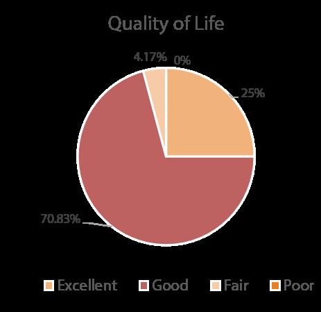
Housing Variety
Quality of Internet and Broadband
Housing Quality
Housing Units Available for Purchase
Availability of Rental Properties
Housing Affordability
•100 percent of respondents said that they would prefer to see retail over housing in the downtown area.
• 100 percent of respondents would like to see more housing variety in Dassel, such as small apartmen buildings and twin homes.
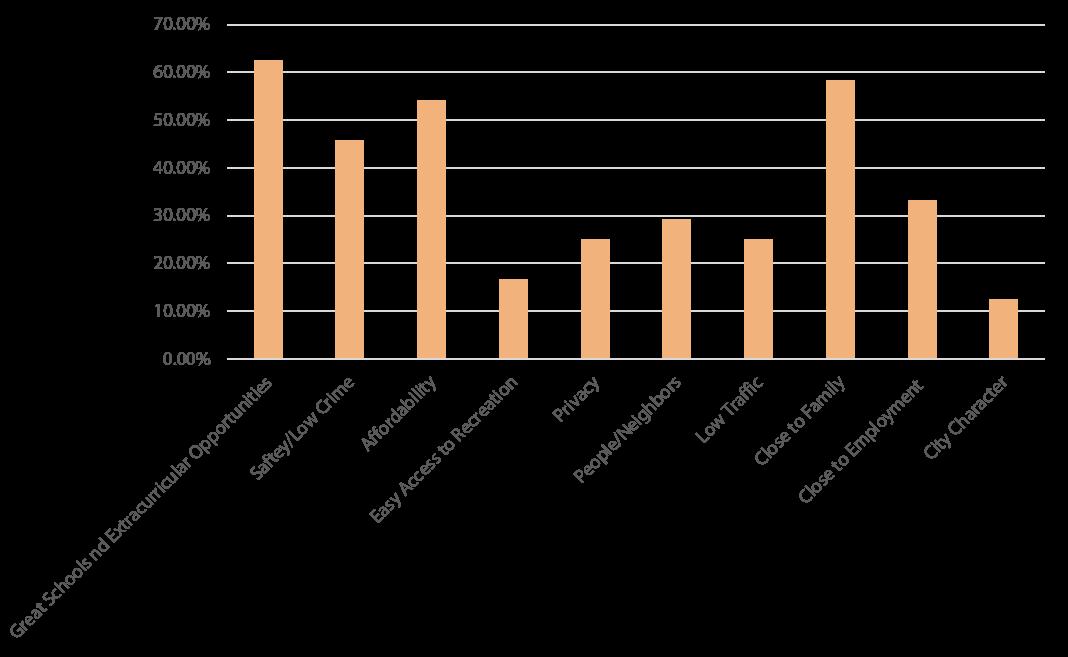


Each of the following elements of this chapter contains goals and strategies established through the planning process, public engagement activities, Steering Committee input, and the Community Profile.
This section defines Goals and Strategies as follows:
Goal
A long-term target that states what the community wants to accomplish. Written in general terms, the statement offers a desired condition through implementation.
Strategy
A strategy is a statement that identifies a course of action to achieve a goal. They are more specific than goals and are usually attainable through planning, implementation, and direct action.
These Goals and Strategies are designed to facilitate the implementation of Dassel’s vision statement:
The City of Dassel is committed to continuous improvement for its current and future residents and businesses by creating a high quality of life through thoughtful growth, safe and healthy neighborhoods, a strong school system, and continuous economic development.
The goals of this chapter are summarized and expanded along with corresponding strategies on the following pages.
1. Maintain reliable, quality services, utilities, and facilities to encourage growth and reinvestment.
2. Ensure that public facilities and services meet the needs of residents and businesses, especially as new development increases demand for those facilities and services.
1. Provide guidance for a safe, efficient, coordinated, and convenient multi-modal transportation system that is integrated with anticipated land use and development plans, and that protects and enhances natural resources.
2. Develop a comprehensive transportation network that effectively provides accessibility to various modes of transportation throughout Dassel.
1. Develop and support a comprehensive system of safe, aesthetically pleasing, and useful open spaces and trails that serve the entire community.
2. Continue partnerships with Meeker County, the State of Minnesota, adjacent cities, school districts, and civic organizations to provide comprehensive recreation facilities and programs.
1. Manage, enhance and preserve unique land and water resources by preserving the natural environment and avoiding development on high value wetlands and floodplains.
2. Protect and enhance the natural settings unique to the character of Dassel.
1. Strengthen housing quality by encouraging the maintenance and improvement of the existing housing stock and properties throughout the community.
2. Retain and attract people including young professionals, families, and retirees by supporting a range of housing options.
1. Improve visibility of and access to businesses in Dassel.
2. Support strategic economic growth within the commercial corridors and provide additional retailers, businesses, and services for the community.
3. Maintain strategies for sustainable economic development.
4. Provide long-range development guidelines for development and reinvestment.
1. Maintain mutually beneficial relationships and partnerships with neighboring counties and municipalities, as well as state and federal agencies.
1. Encourage sustainable practices throughout the community including development and infrastructure methods.
2. Encourage residents to build relationships within and across neighborhoods.
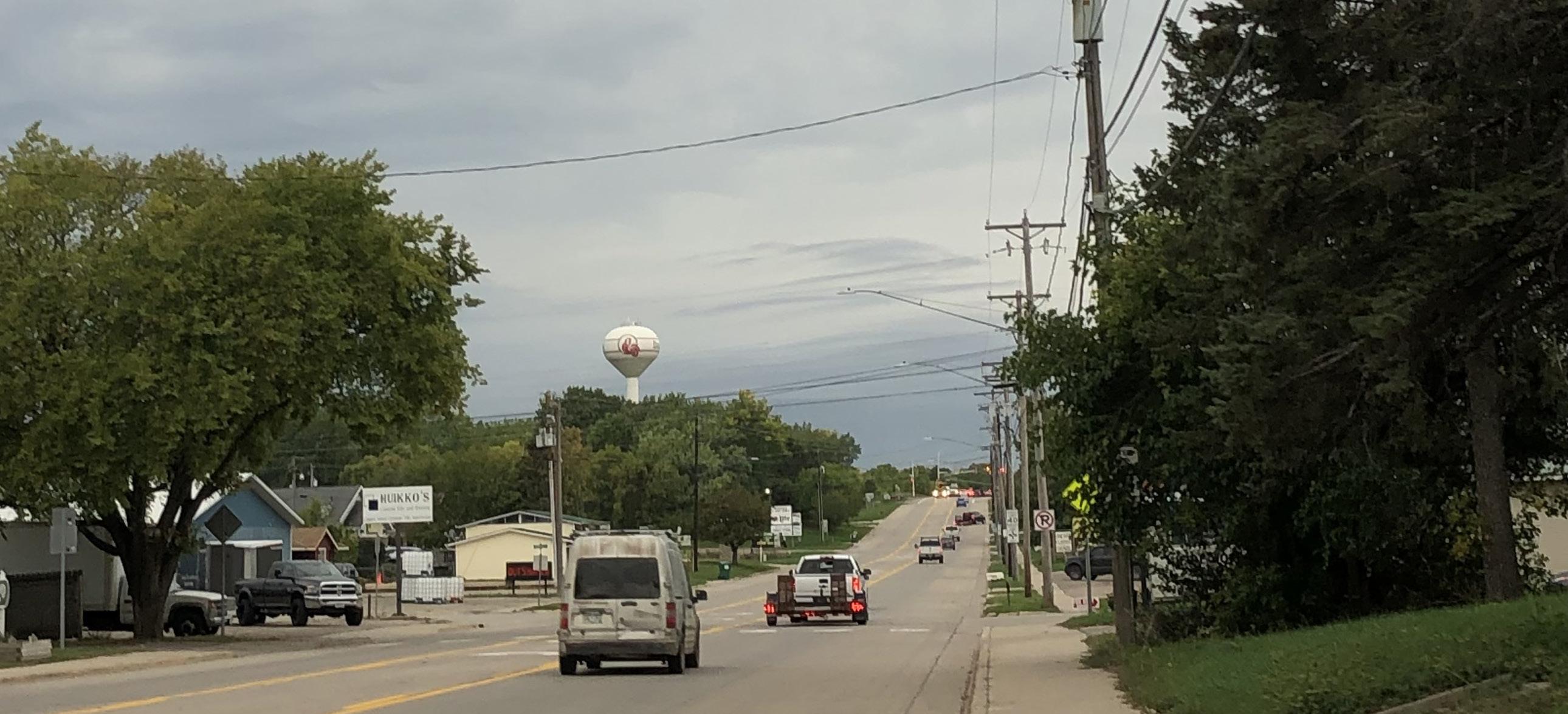
Public and private utilities are fundamental for growing and sustaining a community, and important to the residents of Dassel. Without comprehensive public and private infrastructure, facilities, and services, the continued suburban growth of the community would stall. Below are some Goals and Strategies to help overcome these challenges and others related to the community’s infrastructure.
Goal #1 Maintain reliable, quality services, utilities, and facilities to encourage growth and reinvestment.
Strategies:
1. Consider adopting City ordinances and regulations to preserve and protect natural resources during and after development.
2. Consider development of Design Guidelines for community gateways, wayfinding signage, and popular areas to welcome visitors, and complement existing aesthetics.
3. Encourage connectivity among new and existing developments through pedestrian and bicycle facilities.
4. Explore development incentives that prioritize infill development/redevelopment and utilize existing public infrastructure.
Goal #2 Ensure that public facilities and services meet the needs of residents and businesses, especially as new development increases demand for those facilities and services.
Strategies:
1. Use annual capital improvement planning and budget processes to plan for regular maintenance and replacement, and strategically expand facilities, services, and infrastructure.
2. Regularly engage with residents and businesses to ensure that services and facilities meet the needs of the community.
3. Use engagement feedback to inform capital improvement planning, budgeting, and new project selection.
A community’s mobility network is perhaps its most important feature and should be able to facilitate all modes of movement. Transportation is about the ability to readily and safely access work, school, shopping, recreation, medical care, and social gatherings. Dassel is fortunate to have easy access to U.S. Highway 12, County Highway 15, and the greater Twin Cities Metro region. The City’s future transportation network should anticipate the needs of users and their preferred methods of transportation to ensure efficiency and safety across the system.

Goal #1 Provide guidance for safe, efficient, coordinated, and convenient multimodal transportation system that is integrated with anticipated land use and development plans, and that protects and enhances natural resources.
Strategies:
1. Highway and road improvement projects should consider beautification, improved lighting, and sidewalks.
2. Consider requiring and/or incentivizing developers to include non-vehicular transportation facilities in their subdivisions and development plans – particularly trail opportunities.
3. Reduce the amount and density of cul-de-sacs in development to improve connectivity among vehicular and non-vehicular transportation facilities.
4. Continue to implement and utilize the Safe Routes to School Plan.

Goal #2 Develop a comprehensive system that effectively provides accessibility to alternative modes of transportation throughout Dassel.
Strategies:
1. Consider incentivizing sidewalk construction and maintenance to ensure a well-connected pedestrian network throughout the community.
2. Ensure that City plans for vehicular and non-vehicular transportation align with each other for capital improvement planning and budgeting.
3. Engage the community and analyze current conditions and planned facilities for invisible barriers in addition to ADA-compliant access.
4. Complete an active mobility study to help plan and identify funding for off-street trail network expansion.
5. Work with regional and state organizations to create a well-connected regional trail system.
6. Ensure access to the industrial park is considered in future expansion of the transportation network.
7. Request the installation of sidewalks in commercial areas when properties are redeveloped.
Dassel’s easy access to recreational opportunities significantly contributes to an improved quality of life for residents and visitors. These recreational strengths will help keep the community growing and thriving, and add economic value and positively affect property value, tourism, and commerce. Below are some Goals and Strategies to support recreation, parks, and trails in Dassel.
Goal #1 Develop and support a comprehensive system of safe, aesthetically pleasing, and useful open spaces and trails that serve the entire community.
Strategies
1. Identify potential park locations in areas that have been identified as deficient in the park system as future development occurs.
2. Complete a full assessment of the City’s park and trail system to identify area for improvement and expansion of existing trail system.
3. Continually plan for trail linkages to important community facilities, recreational assets, and neighborhoods.
4. Continually improve pedestrian and bicycle crossings in the community.
5. Through the development review process encourage new development that preserves natural features and expands recreational access for the neighborhoods, City residents and visitors.
6. Collaborate with stakeholders in the community to plan for water access at Spring Lake.
Goal #2 Continue partnerships with Meeker County, the State of Minnesota, adjacent cities, school districts, regional agencies, and civic organizations to provide comprehensive recreation facilities and programs.
Strategies:
1. Collaborate with the school district to share facilities for recreation and sports programs.
2. Collaborate with regional governments, agencies, and organizations to connect Dassel’s recreational trails to the area trails system.
3. Provide directional signage to and information about the recreational assets for visitors, employers, and potential residents.
Dassel has many natural areas that are vital to the well-being of the community and the health of local and regional ecosystems. There is also productive agriculture surrounding the community that provides current and future economic growth and wealth. This section outlines the goals and strategies for preserving, protecting, and restoring natural and agricultural resources. These systems are often interconnected, and these strategies address water, land, wildlife, air, vegetation, food systems, and the welfare of the City’s resources.
#1 Manage, enhance, and preserve unique land and water resources by avoiding development on high value wetlands and floodplains.
Strategies:
1. Protect floodplains as defined by FEMA and designated on FIRM maps from incompatible development.
2. Continue to protect wetlands from unmitigated negative impacts.
3. Support healthy watersheds.
4. Preserve the natural character of the watershed through green space acquisition, floodplain regulations, and drainage corridor and buffer protection.
5. Support and encourage sustainable agricultural practices to protect watershed and water resource health.
Goal #2 Protect and enhance the natural settings unique to the character of Dassel.
Strategies:
1. Continue to require areas of greenspace in new developments to provide for preservation and aesthetics.
2. Consider requiring conservation and/or comparable restoration of natural features during the development process – including preservation or replacement of trees and natural waterways.
3. Explore ways of supporting and promoting community gardens, farmers markets and other similar community based food projects.
4. Protect prime agricultural lands and uses from development to maintain and enhance the rural charm of the community.
As the City grows and changes, housing demand will change to meet the needs of the market and desires of the current and potential residents. Housing is included in a Comprehensive Plan to provide guidance for City staff, officials, and developers when considering additions to and renovations of the City’s housing stock. Character, market needs, and quality are important considerations when evaluating housing growth.
Goal #1 Strengthen housing and community character by encouraging the maintenance and improvement of the existing housing stock and properties throughout the community.
Strategies:
1. Ensure that information about City of Dassel, Meeker County, and regional housing programs is easily available to residents.
2. Connect residents to organizations and resources that can help them navigate housing program requirements and applications.
3. Consider creating a dedicated City fund or contributing to a local organization focused on helping homeowners and rental owners maintain and improve existing housing stock.
Goal #2 Retain and attract residents including young professionals, families, and retirees by supporting a range of housing options.
Strategies:
1. Use development and land use plans to ensure that each neighborhood has an appropriate ratio of owner-occupied and rental housing units.
2. Maintain community facilities, utilities, and infrastructure that are what developers and current/ potential residents need and look for.
3. Provide targeted development incentives to attract developers for new housing projects.
4. Utilize development and land use plans to guide development and placement of a variety of housing units – include single-family detached homes, townhomes, duplexes, multifamily apartment buildings, and mixed-use buildings, and other forms of housing sought out by homebuyers and renters.
5. Regularly review zoning and subdivision codes to ensure they are not a primary barrier to development.
6. Work with Meeker County to conduct a County-wide housing study to get a better understanding of the market in Dassel and surrounding communities.
Economic development is realized through the growth and retention of jobs, a diversity of business types and subsequent increases in buying power, investment in the built environment, and general improvement in the community’s quality of life. Creating economic prosperity requires the collaborative efforts of public and private entities and the support of the community overall.
Dassel recognizes that economic success and a focus on workforce development requires extensive collaboration with other public entities – the City will be an active partner in these efforts and will avoid duplication of services for efficiency purposes. Support for these efforts may include staff time, funding, policies, endorsement, and promotion of projects.
Strategies:
1. Promote Dassel regionally as a unique place and welcome commerce and visitors as they spend time in the City.
2. Develop cohesive wayfinding signage to direct visitors and residents in the community to places of interest and commercial areas.
3. Promote the Highway 12 corridor as the primary commercial route for tourism and local commerce for visitors.
4. Adopt Design Guidelines specific to the commercial corridor that require more detailed and thoughtful design to encourage beautification throughout the corridor.
5. The City should consider restarting the Economic Development Authority to help with promotion and retention of business in the City.
Strategies:
1. Ensure that there is an appropriate mix of retail, restaurant, and service businesses to attract residents and regional customers to Dassel.
2. Utilize future land use planning to plan for new development of the area.
3. Continue to engage with the Dassel community to understand what types of businesses residents want and need.
4. Use capital improvement planning, development requirements, and development agreements to ensure that infrastructure expansion is financially feasible immediately and in the future.
5. Endorse a program for artists-in-residence in the community, incentivising property owners to offer a short-term lease program.
Goal #3 Develop strategies to promote sustainable economic development.
Strategies:
1.Support public-private partnerships and work proactively with private business and land owners to facilitate investment in the community.
2.Support the needs of the growing population by actively assisting new business opportunities to the City via programs, space, and infrastructure.
3.Maintain an adequate supply of land for commercial and industrial development.
Goal #4 Provide long-range development guidelines for development and reinvestment.
Strategies:
1. Collaborate with MNDOT, Meeker County, and local organizations and developers to execute development priorities as outlined in City plans.
2. Create a corridor plan or concept with future development options for Highway 12 in preparation for MNDOT’s expansion in 2024.
3. Utilize the plan to promote continued commercial development along the corridor that is in character with the recommendations.
Successful and economically vital communities are built from collaborative efforts among the City, local school district, businesses, and organizations. They also form relationships with regional organizations like Meeker County, nearby cities, the State of Minnesota, and federal agencies. This section helps inform the City’s strategy on collaboration with those entities and provides guidance on reaching out to new partners and maintaining existing relationships.
mutually beneficial relationships and partnerships with neighboring counties and municipalities, as well as state and federal agencies.
Strategies:
1. Coordinate with Meeker County and surrounding municipalities to review proposed changes to land use, transportation system, and utilities that will have an impact on Dassel.
2. Continue to support the Dassel-Cokato Community School District in their growth and community engagement activities.
3. Collaborate with the school district in their plans for mutually beneficial building and site improvements.
4. Partner with the school on land use, utility, and transportation improvement planning.
5. Continually engage the school district regarding community activities.
Resilience is the ability of a system to respond to, adapt to, and recover from negative events. Resilience has three major components: social, economic, and environmental. Strong social networks, efficient economies and thoughtful government budgets, and the protection of vital natural resources all have a positive impact on a community’s ability to bounce back after unexpected disruptions like natural disasters.
Goal #1 Encourage sustainable practices throughout the community, including development and infrastructure practices.
Strategies:
1. Continually monitor local changes that may affect the Meeker County Hazard Mitigation Plan.
2. Encourage energy efficiency in buildings, lighting, and infrastructure.
3. Promote education and awareness regarding hazards and risks in the community.
4. Support the development practices that allow for the capture and use of clean energy.
5. Protect vital natural resources from overconsumption and destruction.
6. Support the addition of charging stations for electric vehicles at public entities as well as with new commercial development.
Goal #2 Encourage residents to build relationships within and across neighborhoods.
Strategies:
1. Collaborate with local leaders to improve residents’ connections to City departments, local nonprofit organizations, and each other.
2. Encourage interaction among residents through community-wide events and small-scale gatherings such as neighborhood block parties.
F uture L and u se and G rowth







The incorporated area of Dassel is approximately 1,075 acres or about 1.68 square miles in size. The following table and map shows the current land use in Dassel by existing land use category, as observed in the Fall of 2021. The largest category is Low Density Residential, which accounts for approximately 38.9% of land use in the community.
Medium Density Residential uses account for only 0.46% of the developed property in the community and will be an area with increased growth pressure in the future as more housing options are needed in Dassel to serve the local housing market’s demand. Medium density owneroccupied and high-quality rentals housing options are especially attractive to single professionals, young families, single-parent families, and retirees.
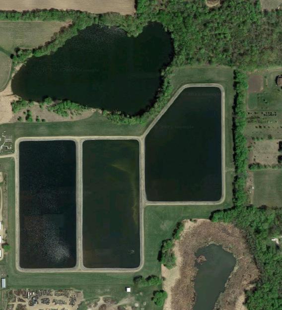
The City has a large amount of land dedicated to Public/ Institutional uses – approximately 25.3%. This is mostly attributed to the large City owned irrigation fields and wastewater treatment ponds on the northwest side of the City.
Dassel has roughly 16.1% of the land within the City limits dedicated to Commercial and Industrial uses. It is anticipated that as the community grows, there will be additional land needed for commercial, light industrial, and agricultural industrial uses. There are some vacant commercial buildings that should be considered for infill development within the City limits.
Undeveloped areas are the fifth largest land use category at about 8.9% of the community’s total area. This category includes property inside the current City limits that is vacant and/or utilized for agricultural production. These properties provide opportunities for further development that would not require annexation but may require utility or infrastructure extension/ improvements to support development.
Parks and Recreation makes up about 0.9% of the community. A need for growth in land use dedicated to recreational use is anticipated as the City continues to grow, adding new families and neighborhoods seeking additional areas and types of recreational opportunities.
Determining the minimum amount of land that should be planned for residential, commercial, and industrial growth is an important step in identifying potential growth areas for Dassel. The table above utilizes population projects from 2020, 2030, and 2040 (see Populations and Growth Forecasts). The table also identifies the current number of acres per 100 people and number of acres by land use classification (see Existing Land Uses).
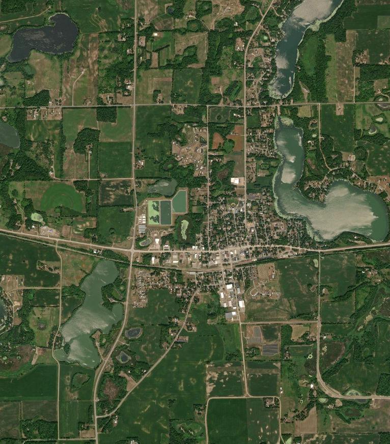


The following information is useful for determining future land use needs. Growth forecasting predicts outcomes of when, where, and how much population and household growth Dassel can expect in the next 20 years.
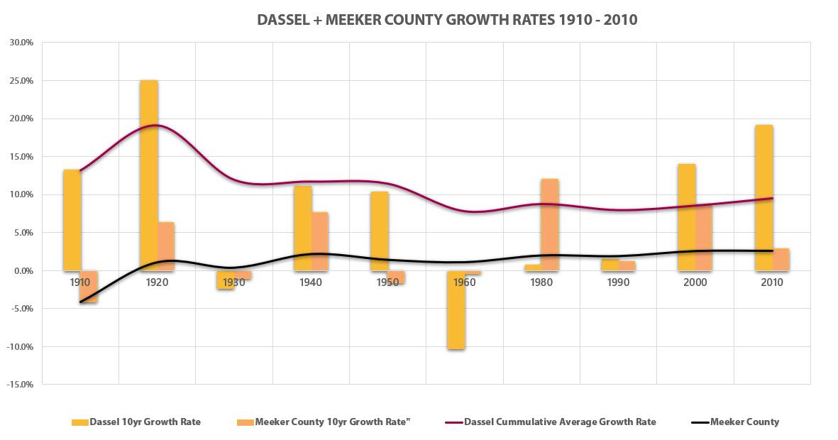
According to United States Census, between 2000 and 2010 the population of Dassel increased by 236 people to 1469 people total. This is an increase of about 0.19% per year, or 19% over the 10 year timespan. Historically, the cumulative annual growth rate of the community is 0.092%, or 9.2% every 10 years. Projections can also be made using linear growth calculations and exponential growth calculations as show in the table below.
To assist with future land use planning, this plan uses a cumulative average growth rate of 0.92%, created by averaging the linear and exponential growth projections. The table below shows that the City of Dassel is projected to have a population of 1,485 people in 2020, 1,594 people in 2030, and 1,711 people in 2040. The 2020 census is currently underway and based on those results, the forecast may need adjustment.
These charts below shows the observed and projected growth of Dassel and Meeker County from 1940 through 2040. The City’s rate of historical and projected growth tracks the County’s historical and projected rate of growth, but at a slightly lower rate.
Determining the minimum amount of land that should be planned for residential, commercial, and industrial growth is an important step in identifying potential growth areas for Dassel. The table above utilizes population projects from 2020, 2030, and 2040 (see Populations and Growth Forecasts). The table also identifies the current number of acres per 100 people and number of acres by land use classification (see Existing Land Uses).
Using the projected 2030 and 2040 population for Dassel and number of acres per 100 people, the table shows the projected additional acres that need to be considered for Low Density Residential, Medium Density Residential, Commercial, and Industrial development through 2040. The Additional Acres of Land Needed shown above serves as a minimum for guiding future development. These estimates, and the projected acres needed by land use classification, should be reviewed annually to ensure they are in-line with Dassel’s projected needs.
There are a number of land use categories not included in the above projections. The reason for their exclusion is that the amount of acres within each of these categories is not directly dependent and cannot be easily projected from population growth.

Sources: Esri, HERE, Garmin, Intermap, increment P Corp., GEBCO, USGS, FAO, NPS, NRCAN, GeoBase, IGN, Kadaster NL, Ordnance Survey, Esri Japan, METI, Esri China (Hong Kong), (c) OpenStreetMap contributors, and the GIS User Community, Source: Esri, DigitalGlobe, GeoEye, Earthstar Geographics, CNES/Airbus DS, USDA, USGS, AeroGRID, IGN, and the GIS User Community
Data Sources:
of Dassel Meeker County, Minnesota
The Future Land Use Map (left) identifies categories of similar use, character and density. These categories are described in the subsequent pages, including explanations of the City’s intent, as well as design and development strategies.
This map, and the corresponding text, are to be consulted whenever development is proposed. Development shall be consistent with the land use category shown on the map and the corresponding text.
Where uses in this map differ from the current use, it is not the general intent of the City to compel a change in use. Except in rare instances when the City may actively facilitate redevelopment of a priority site, the City use of this map will be only reactive, guiding response to proposals submitted by property owners and petitioners.
It may, from time to time, be appropriate to consider amendments to the Future Land Use Map. The following criteria should be considered before amending the map.
The total number of acres of agricultural land surrounding Dassel may continue to decrease. The population of the City is projected to continue growing and additional property may be petitioned for rezoning to accommodate the development needed to support the growing population. This anticipated growth must be balanced against the goals of preserving agricultural land for the purposes of resource protection and maintaining agricultural contributions to the region.
The proposed development, or map amendment, will not have a substantial adverse effect on adjacent property or the character of the area, with a particular emphasis on existing residential neighborhoods. A petitioner should indicate approaches that will minimize incompatibilities between uses.
Proposed development should not have a negative or unmitigated impact on important natural features such as wetlands, floodplains, steep slopes, scenic vistas, or significant woodlands. The proposed building envelope is not located within the setback of floodplain zones (raised above regional flood line) or shoreland zones. The proposed development will not result in undue water, air, light, or noise pollution in order to complement the small town character. Petitioners shall indicate approaches that will preserve or enhance the most important and sensitive natural features of the proposed site.
The lay of the land will allow for construction of appropriate roads and/or driveways that are suitable for travel or access by emergency vehicles.
Provision of public facilities and services for new development will not place an unreasonable financial burden on the City. Petitioners may demonstrate to the City that the current level of services in the City or region, including but not limited to school capacity, transportation system capacity, emergency services (police, fire, EMS), parks and recreation, storm water, and potentially sewer services or water services, are adequate to serve the proposed use. Petitioners shall also demonstrate how they will assist the City with any shortcomings in public services or facilities.
There is a clear public need for the proposed change or unanticipated circumstances have resulted in a need for the change. The proposed development is likely to have a positive fiscal or social impact on the Township.
The proposed development is consistent with the general vision for the City and the goals and strategies of this Plan.
The future land use categories identify areas of similar use, character and density. These classifications are not zoning districts – they do not legally set performance criteria for land uses (i.e. setbacks, height restrictions, density, etc.). The strategies listed with each category are provided to help landowners and City officials make decisions during the development review process that are consistent with the intent of the land use category. The significant categories also feature design recommendations.
The categories designated on the 2040 Future Land Use Map are:
• Downtown Mixed Use
• Rural Residential
• Low Density Residential
• Medium Density Residential
• Flexible Space Mixed Use District (Flex)
• Public & Institutional
• Commercial
• Industrial
• Utility
• Agriculture
This land use designation includes public or semi-public facilities including but not limited to: governmental offices, police and fire facilities, clinics, educational institutions, and places of worship.
The Utilities land use designation accommodates land dedicated to public and private utilities, including pipelines, utility lines, power lines, water and wastewater facilities, electrical substations, broadband, and telephone.
Commercial areas of the community are located in Downtown Dassel, around near U.S. Highway 12, County Highway 15, and along the City’s other commercial corridors. The primary zoning districts for the City’s commercial areas are C-1 or C-2.
The Industrial areas are intended for office, office-industrial, transportation, warehousing, storage, and other commercial uses exhibiting industrial characteristics. The primary zoning districts for industrial areas are I-1 or I-2
The Agricultural land designation accommodates the cultivation of crops and livestock, as well as allocates land for future farming or ranching activities. The primary zoning district for the City’s agricultural areas is AG.
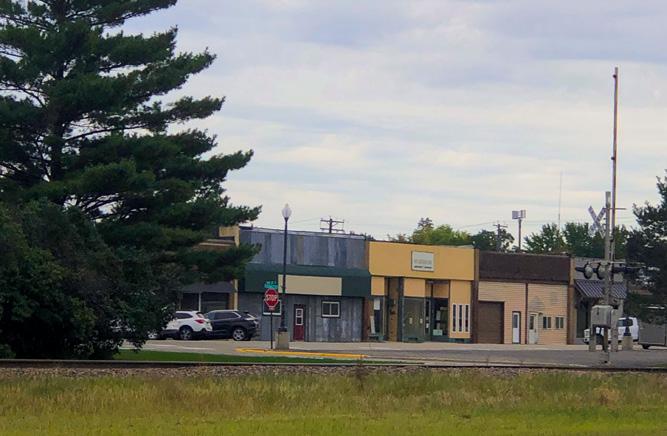
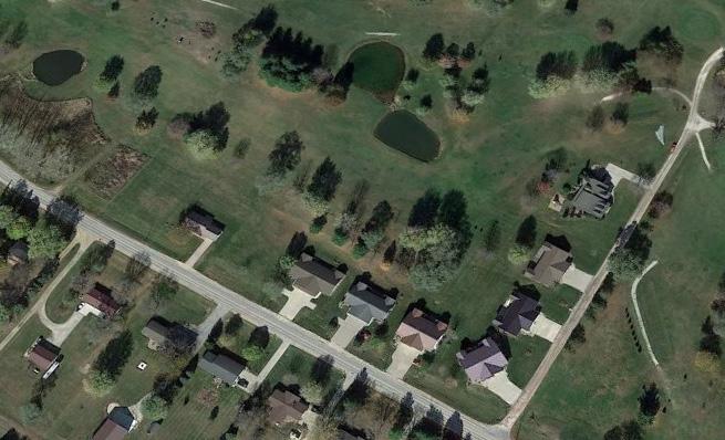
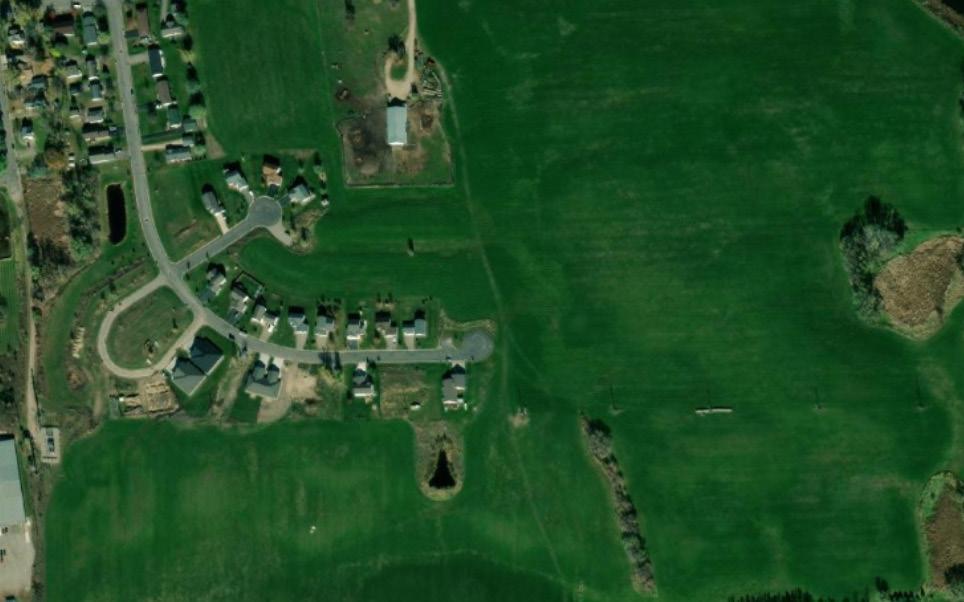
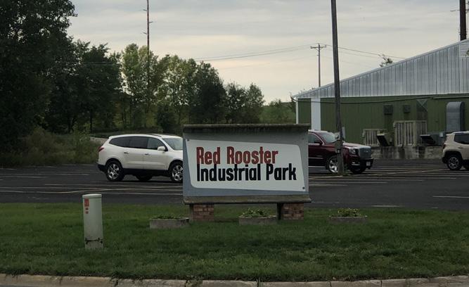
The images and text below describe design strategies for General Commercial and Employment buildings and sites.
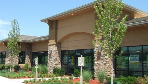
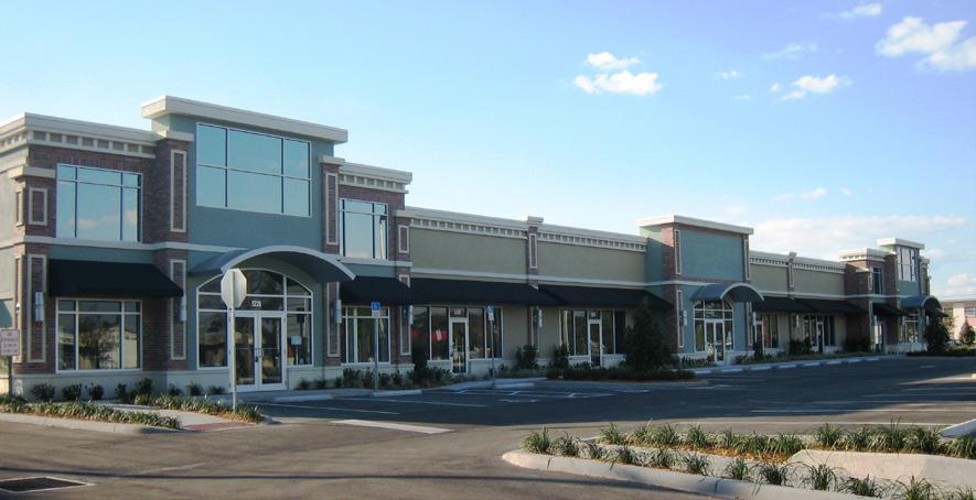
The images above illustrate techniques used to vary the facade heights along a long facade.

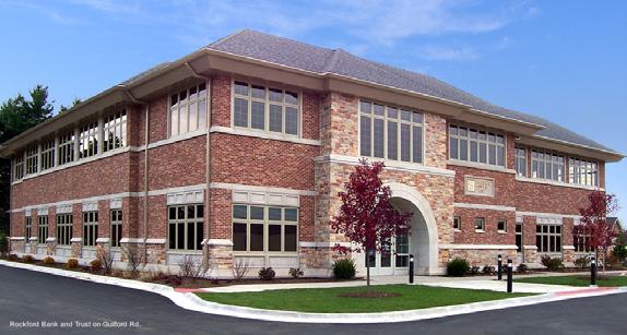
This example shows an office building with a primary facade using brick with stone as an accent material, meeting desired natural color palette.
Left, retail building with primary facade using fiber cement siding with stone as an accent material. Right, retail building with primary facade using stone and brick with EIFS as an accent material. Both meeting a desired natural color palette.
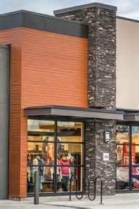
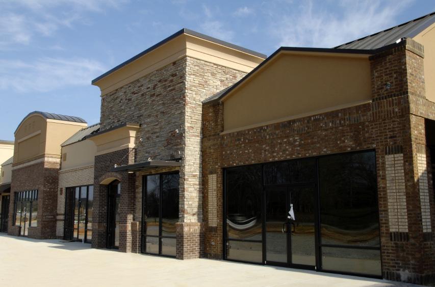
Desired design for a retail building. The color palette includes natural and earth tones. Building uses brick (primary) and EIFS (secondary), and architectural details that breakdown the facade to human scale. There are varying building planes and heights.
The images and text below describe design strategies for Neighborhood Mixed Use buildings and sites.
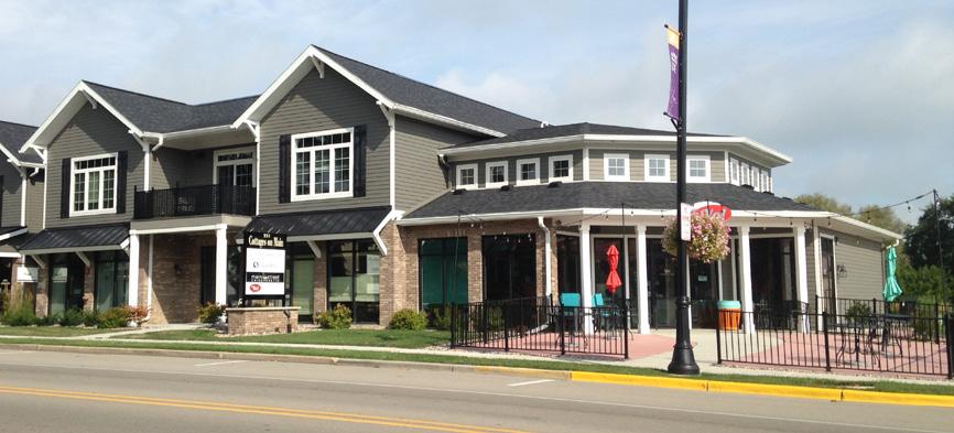
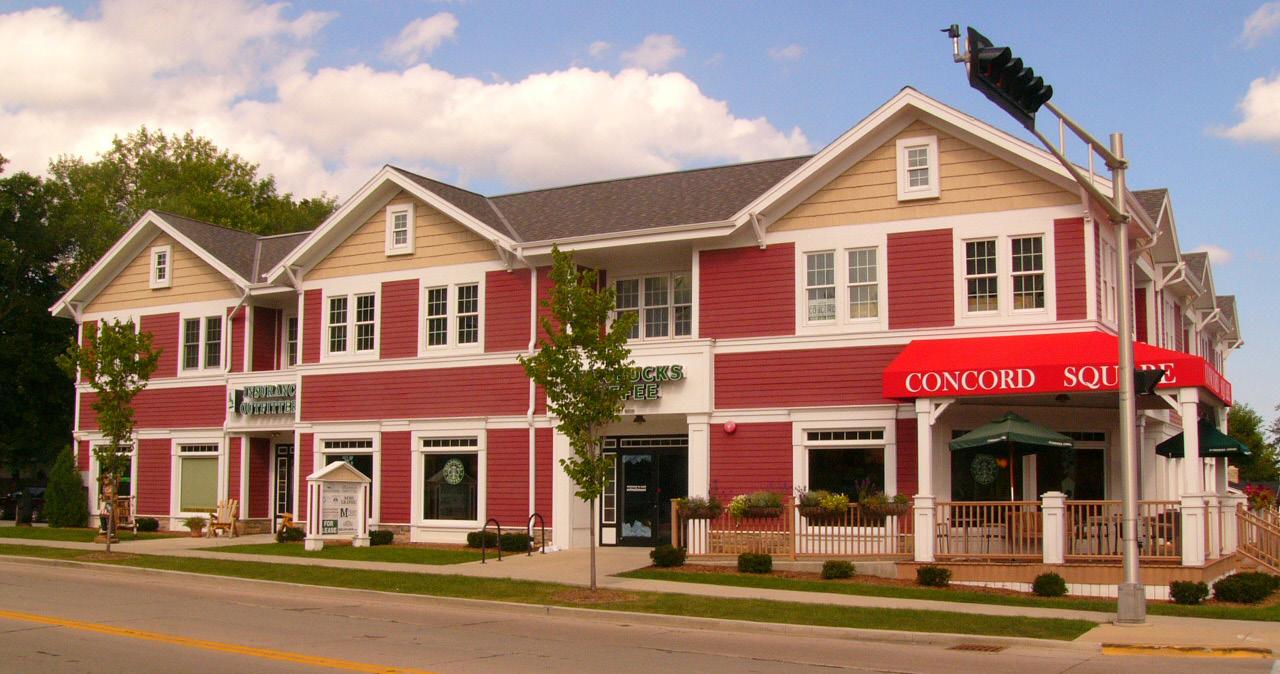
Mixed use developments provide two or more uses either on a single tract of land (i.e., horizontal mixed usesee below), or within a single building (i.e., vertical mixed use). Typically the first floor is retail, but office or a public use may also occupy the first floor.
As shown in the images on the left, mixed use developments can come in variety of sizes and styles that can complement the surrounding commercial and residential character.
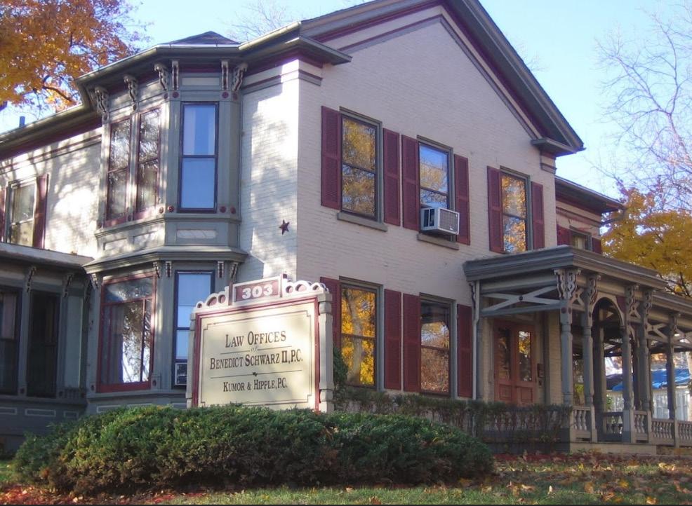
Home-to-office conversions are a good transition between single family residential and non-residential uses.
Low Density Residential areas are located within Dassel and are intended for single-dwelling or two-dwelling housing units with a maximum density of 4-6 units per acre. The primary zoning districts for Single-Family/Two-Family Residential is R-1 or R-2.
Medium Density Residential shall be located within Dassel and are intended for multiple-dwelling housing units with a maximum density of 7-12 units per acre. The primary zoning district for MDR is R-2.
This category includes public, commercial, and residential properties that are currently in the downtown area. This land use category was created to preserve the area’s existing infrastructure and allow for its variety of uses to continue to work cohesively together.
This category includes rural lands around the community and is intended to preserve land and rural character in areas deemed unlikely or infeasible for urban development prior to 2040. Conservation Subdivisions that could be incorporated into the urban fabric of Dassel may be supported in the these areas. If incorporated into the City, the zoning would likely be A or R-1. This is located in the southern areas of the City due to the natural landscape of that area. There are many wetlands and development limitations in that area, therefore larger lot development with fewer homes is ideal.
This category offers space for a variety of residential, commercial, office, , and light production uses, as well as complementary office and retail uses that support the adopted goals of the City. This creates more areas in which various land uses can coexist.
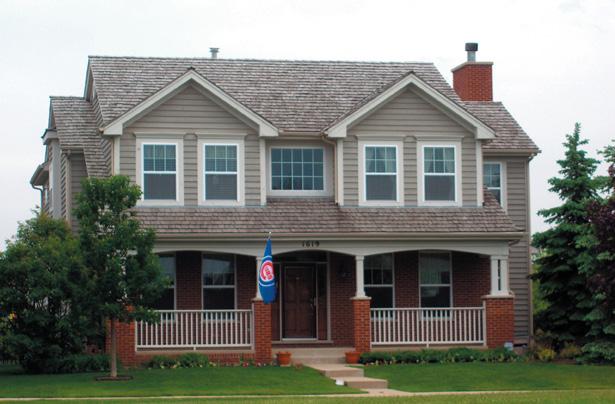
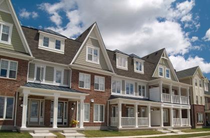
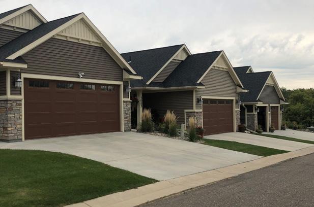
The images and text below describe design strategies for single-family, duplex and multi-unit buildings.
A.Building setbacks will vary according to building type and lot size but should generally be consistent within a given block.
B.Homes should be designed with architectural details that provide visual interest and human scale for the street and the neighborhood. The mix of architectural themes or styles should generally be consistent within a neighborhood or development, but there should be variation in floor plan, facade design, and color choice to avoid monotony. Overly complicated rooflines with multiple pitches and hips and/or excessive gables can negatively impact a street and should be discouraged (see weak and desired design examples on the following page).
C.Utilize low fences, hedges or other landscaping to establish a layer of privacy behind a sidewalk and residence, if a sidewalk is present.
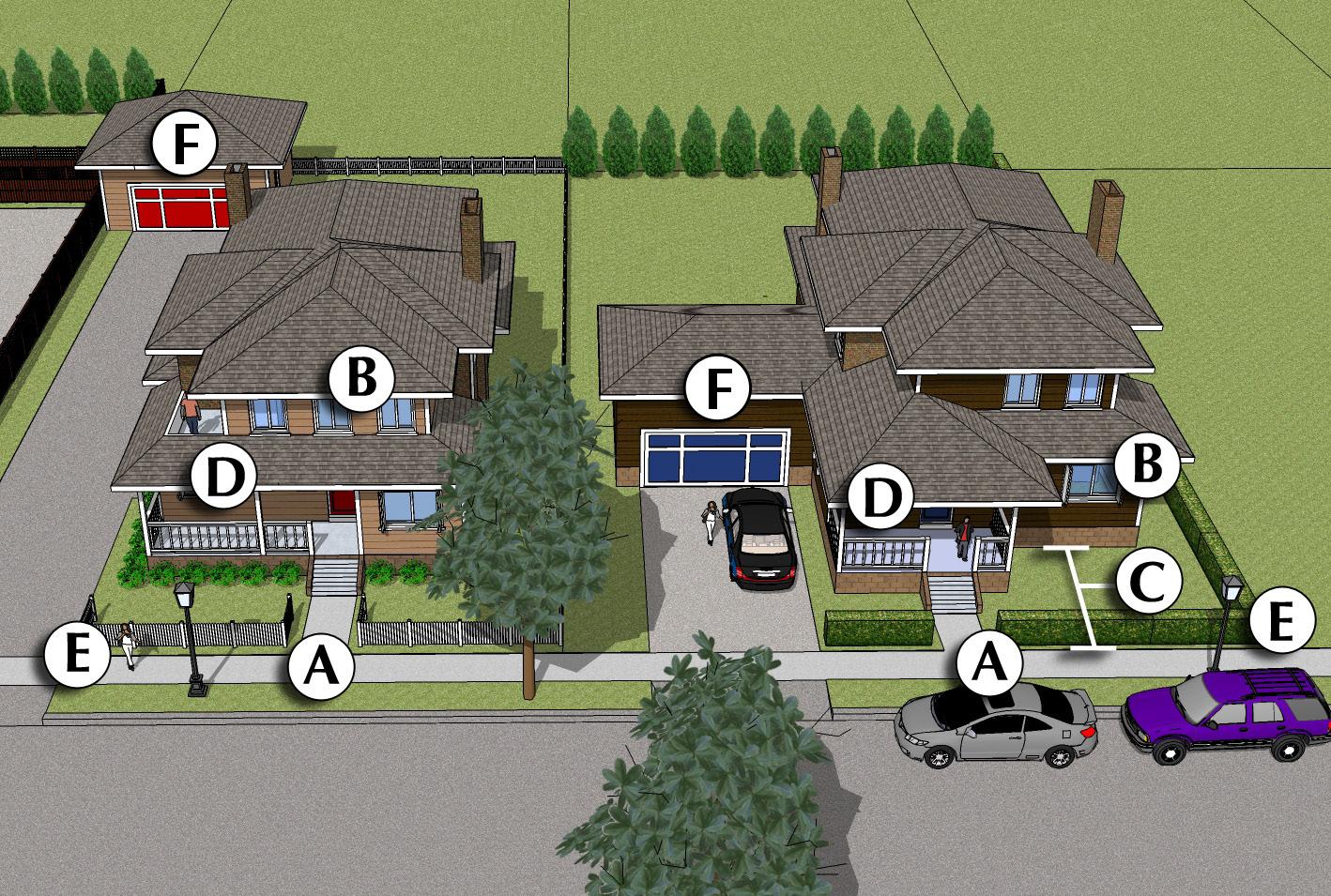
D.Incorporate covered front porch or at least a raised stoop, preferably covered and constructed with materials that relate to the overall design of the home.
E.Decorative fencing and/or landscaping that visually defines the single family lot at the street edge are encouraged.
F.Consider garage location and scale to avoid a “garage-scape” street appearance. Garages should extend no further than the front facade of the residence. If this is not feasible, garages should be turned 90 degrees with windows provided on the side of the garage facing the street.
A. The front door should face the street and there should be a clear route to the door from the street or sidewalk.
B. The mix of architectural themes or styles should generally be consistent within a neighborhood or development, but there should be variation in floor plan, facade design, and color choice to avoid monotony. When adjacent to lower density residential buildings, larger buildings should incorporate strategies to minimize the apparent size of the building, including flat roofs instead of pitched roofs, deeper setbacks for upper stories, and/ or variation in the depth of the setback along the building facade. Large, undifferentiated building walls and rooflines are strongly discouraged. Desired architectural details include projecting bays/porches and upper-level set-backs and offsets to the primary facade(s).
C. Building setbacks will vary according to building type and lot size but should generally not exceed 40 feet.
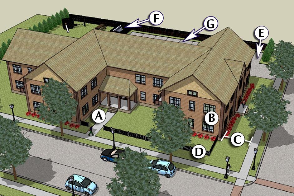
D. Utilize low fences, hedges or other landscaping to establish a layer of privacy behind the sidewalk.
E. Off-street parking is located in the side and rear yard.
F.Service areas and refuse containers should be located at the rear end of the site and screened from public view. Also ground mounted or wall mounted mechanical equipment shall be screened.
G.Garage doors facing the primary street are discouraged. If unavoidable, recess them from the front facade(s) to minimize their visual impact on the design.
Establish a cohesive land use pattern that ensures compatibility and functional relationships among activities.
#1- New development within the City’s jurisdiction should support the efficient use of public services and infrastructure.
a.Land development will be coordinated with planning for efficient public facilities and services.
b.Infill development that uses existing infrastructure is strongly encouraged. Leapfrog development that requires costly infrastructure extensions through undeveloped lands is discouraged.
c.The City will collaborate with Meeker County and adjacent townships to enable new development within the City’s Growth Areas that is compatible with the use, density, and configuration recommendations of this plan. The City will seek outcomes that are compatible with future urban development and could someday be served efficiently by the full array of urban services. Any development in the planning area should be consistent with the City Subdivision Ordinance.
#2 - Encourage development that uses land efficiently.
a. Encourage infill development and higher density redevelopment on sites already surrounded by urban uses. Development incentives such as flexibility with standards and/funding assistance should be focused mostly on infill and redevelopment, not greenfield development at the edge of the City.
b. Promote the inclusion of residential formats in every neighborhood that minimize land consumption, including small lots and attached units.
c. Enable and encourage well-planned, mixed-use development areas in all parts of the City, including the integration of small-scale commercial uses into neighborhoods and mixed-use buildings where economically viable.
The majority of respondents from the community outreach felt the pace of development over the past 5 years has been:
•Single Family: Just Right
•Two-Family/Duplex: Just Right
•Multi-Family: Too Slow
•Commercial/Retail: Too Slow
•Industrial: Just Right
Through our public outreach efforts, the City should focus efforts to stimulate property investment in the downtown and along Highway 12.
1.Restaurant
2.Coffee Shop/Bakery
3.Hair Salon
4.Destination Boutiques
5.Hardware Store
#3 - Use the City review processes to encourage design for land use compatibility. Consider the following design guidelines in these review:
a. Land Use Planning. Maintain adequate physical separation between residential areas and uses that tend to produce excessive noise or odors, without sacrificing pedestrian and bicycle connectivity. Locate community facilities such as schools, churches, libraries, museums, parks and community centers in strategic locations that enhance and are safely accessible from the surrounding neighborhoods.
b. Site Design. Direct traffic from higher-volume uses to collector and arterial streets, away from neighborhood streets. Use screening (walls, landscaping, berms) to create separation when distance alone is not possible or sufficient. Design the site so that major activity areas such as building entrances, service and loading areas, parking lots and trash receptacle storage areas are oriented away from less intensive land uses to the greatest degree possible. Reduce the impact of parking areas with physical separation and visual barriers.
c. Building Design. Encourage building and site design techniques to make larger buildings more compatible with smaller residential uses, such as increased setbacks, stepped-back upper stories, and architectural strategies to break up the apparent volume of the building. Require building design and materials standards for all multifamily uses and nonresidential uses in neighborhood settings.
d. Lighting Design. Outdoor lighting of parking, storage and service areas shall be designed to minimize spillover of light onto adjacent properties and public rights-of-way.
#4 - Institutional land uses designated by the Institutional and Utilities category on the Future Land Use Map (schools, churches, community centers) should communicate with surrounding neighbors whenever they are considering long-term expansion plans. City staff should facilitate this process by creating (or requiring) detailed small area plans that include the possible expansion.
Identify and reserve land within the community for commercial development that will provide goods, services and jobs to Dassel residents and the region.
#1 - Encourage and allow for upper story housing in Downtown Dassel and in the developing commercial areas along U.S. Highway 12.
a.Visual pollution from signs, utility lines and dilapidated structures is to be eliminated through the strict enforcement of Dassel’s ordinances.
b.Promote commercial site clean up through community promotion of good practices and code enforcement where necessary.
#2 - Coordinate commercial land use planning with the access spacing guidelines of the City, Meeker County and the Minnesota Department of Transportation to ensure safe ingress and egress to the commercial sites while minimizing the disruption of roadway traffic.
a. Direct property access to highways shall be discouraged and the development of a frontage or backage road system shall be encouraged.
#3 - Highway commercial developments must be approved respective of future highway improvements and right-of-way needs with regard to setbacks, lot size, access, frontage roads, and parking.
#4 - Spot or uncoordinated linear commercial development shall be discouraged in favor of a unified development pattern
a.Commercial and service centers shall be developed cohesively promoting highly interrelated and coordinated units with adequate off-street parking and appropriate regulated points of access.
b. Protect residential neighborhoods from the potential negative impacts of highway commercial land uses through proper site design including, but not limited to, building orientation, setbacks, landscaping, controlled lighting, and controlled access.
Create places that are vibrant, attractive and unique, especially along the City’s Main Street and Highway Corridor.
#1 - Encourage the development of compact, carefully planned, mixed-use activity centers that include shopping, employment, housing, recreation, and community gathering opportunities. Mixed-use buildings and developments that include residential units with commercial uses are desirable and often necessary to achieve redevelopment.
#2 - Work to achieve a balance among various commercial areas along Main Street (and throughout the City) with design formats and business mixes that allow each area to compete successfully and sustainably in the market.
#3 - Encourage and facilitate placemaking strategies to make neighborhoods and commercial areas unique, memorable, and attractive. These strategies can be implemented quickly during new development or incrementally over time in existing developed areas. The Project for Public Spaces is a great resource for ideas during the development process. Some examples of place-making strategies:
a. Incorporate squares and parks as multi-use destinations.
b. Design buildings to activate outdoor spaces with entrances and ample windows, café space with outdoor seating, etc.
c. Incorporate art into infrastructure and outdoor spaces
d. Incorporate recreation into all public spaces.
e. Design with priority to walking and biking.
f. Allow for experimentations and change. Places may need to be adapted to changing needs and conditions.
#4 - Encourage infill development of vacant or underutilized lands or buildings.
Work with property owners along Main Street to bring forward projects consistent with this Comprehensive Plan and design standards recommended in this chapter.
#5 - Consider development incentives (e.g., waivers, flexibility, ) to encourage and support infill and redevelopment projects that substantially improve the district, corridor and City as whole. The City of Dassel should require sites to be characterized by one or more of the following before it will become involved with redevelopment projects:
a. Deteriorated, underutilized, and/or economically obsolescent buildings/sites that may be assembled into a marketable site consistent with the Comprehensive Land Use Plan for which there is a reasonable expectation of securing a private developer prior to property acquisition or through a request for proposals (RFP) process.
b. Marginally underutilized or deteriorated sites (especially in the downtown) for which there is an immediate and realistic private development possibility.
c. Deteriorated housing sites, which have become a threat to surrounding properties and to human habitation and for which outside financing is available to assist private development to either a residential or non-residential use consistent with the Land Use Plan.
Utilizing extraterritorial review support the preservation of agricultural and significant environmental natural features by promoting conservation subdivisions and planned unit developments outside Dassel.
#1 - Request that Meeker County and surrounding townships require natural resource inventory with all new subdivision applications that identifies wetlands, floodplains, water-bodies, steep slopes, and significant tree cover.
#2 - Request that the new subdivision’s features (i.e., street layout, lot configuration, building placement) are designed in a manner that is least disruptive to the land’s natural features.
#3 - Support conservation subdivisions in areas of environmental significance to create greenway corridors and/or conservation areas to preserve high value environmental areas. Conservation subdivisions should meet the following criteria:
a.Utilize Planned Unit Development zoning as a tool supporting conservation subdivisions.
b.Maintain an overall Rural Residential density and minimize the impact of a site’s natural features.
c.Include reserve land resources for efficient future urban development and require ghost platting on preliminary plats.
d.Identify the land characteristics required to support future urbanization.
e. Allow no more than 25% of the developable land in a project to be developed, reserving larger future urbanization parcels.
f.Provide, as a condition of approval, for the ability to rezone future urbanization parcels to a residential zoning classification at densities consistent with Dassel’s policies at such time that urban services are available.


Responsibility for implementing this plan lies primarily with the Planning Commission and City Staff.
The City Council sets priorities, approves budgets and tax rates, and often has the final say on key aspects of public and private development projects. The value and legitimacy of this plan is directly related to the degree to which Council members are aware of the plan and expect City actions to be consistent with this plan. Each Board member should have a copy of this plan and be familiar with the major goals and objectives described herein. The City Council should expect and require that staff recommendations and actions both reference and remain consistent with this plan, or that the plan is amended as needed to fit changing conditions.
Land use and development recommendations are a core component of this plan, and the Planning and Zoning Commission has a major role in guiding those decisions. Planning and Zoning Commission members shall each have a copy of this plan and shall be familiar with the content, especially Chapter 4: Land Use. It is generally the responsibility of the Planning and Zoning Commission to determine whether proposed projects are consistent with this plan, and to make decisions and recommendations that are consistent with this plan. In cases where actions that are inconsistent with this plan are deemed to be in the best interest of the City, the Planning and Zoning Commission should initiate efforts to amend the plan to better reflect City interests. This will help to reinforce the legitimacy of the plan as an important tool in guiding City decision making.
City staff have a significant influence on the selection and completion of all kinds of capital and operational projects. It is imperative that City staff know about, support, and actively work to implement the various strategies and actions in this plan.
Specifically, the following people should consult and reference the Comprehensive Plan during goalsetting processes, annual budgeting, planning for major public projects, and in the review of private development projects:
• City Staff
• Community Development
• Economic Development
• Public Works
These key staff members are expected to know and track the various goals, strategies, and vision laid out in this plan, and to reference that content as appropriate in communications with residents, business owners, and elected and appointed officials. All other staff members should be aware of the plan and the connections between the plan and City projects. The purpose of this extra effort is to strengthen staff recommendations and reinforce the plan as a relevant tool integral to City functions and decision making.
Implementation of this plan also depends on the actions and decisions of entities other than City government. Some responsible, non-municipal parties that the City collaborates with include:
• Dassel-Cokato Community School District
• Meeker County
• Minnesota Department of Transportation
• Minnesota Department of Natural Resources
It is necessary to persuade these entities to be active partners in the implementation of the vision, goals, strategies of this plan.
The following City activities can support this effort:
• Share this plan with each organization, including a memo highlighting sections of the plan that anticipate collaboration between the City and the organization.
• Take the lead role in establishing a collaboration for key or crucial initiatives of the City that require regional collaboration
• Know and communicate the intent of relevant objectives and strategies—partner organizations need to understand and buy into the rationale before they will act.
• Utilize the goals and vision from the plan to support requests for monetary support for City efforts.
Many of the strategies identified in this plan presume the use of existing City ordinances, regulations, and programs. The City’s key implementation tools include:
Operational Tools
• Annual Goal-Setting Process
• Annual Budget Process
• Capital Improvement Plan
Regulatory Tools
• Building and Housing Codes
• Zoning Ordinance
• Subdivision Regulations
• Meeker County Ordinances
• State Regulations
• Federal Regulations
Funding Tools
• User Fees
• Tax Abatement
• Tax Increment Financing (TIF) Districts
• Development Fees
• State, Federal, and Private Grant Programs
Surrounding Area Comprehensive Plans
• Meeker County Comprehensive Plan
• Wright County Comprehensive Plan
• Cokato Comprehensive Plan
• Litchfield Comprehensive Plan
• Hutchinson Comprehensive Plan
To provide lasting value and influence, this plan must be used and referenced regularly, especially during budgeting and goal setting processes. To inform the annual processes, City staff will prepare a concise Comprehensive Plan Annual Report for the City Council with input from the Planning and Zoning Commission, including the following information.
• Action items in progress or completed during the prior 12 months (celebrate successes!)
• Staff recommendations for action items to pursue during the next 12 months, including removing or adding items.
• City actions and decisions during the past 12 months not consistent with the plan (if any).
• Staff recommendations for any amendments to the adopted plan.
The most important opportunity for this plan to influence the growth and improvement of the City is through the annual goal-setting, budgeting and capital planning processes. These existing annual efforts determine what projects will and will not be pursued by the City, so it is very important to integrate this plan into those processes every year.
The compilation of actions in the next section is a resource to support decisions about how and where to invest the City’s limited resources. The Annual Report should draw from these actions and decisions.
The Planning Commission should make formal recommendations for the Council’s consideration, identifying those choices and commitments most likely to further the goals and objectives identified in this plan.
The following process and schedule is recommended.
Step 1 - Staff completes the Comprehensive Plan Annual Report.
Step 2 - Planning Commission considers Annual Report and makes formal recommendation to Council regarding action items to pursue and comprehensive plan amendments.
Step 3 - Department Directors consider Annual Report and Planning Commission recommendations, complete goal setting exercises. Council holds a public hearing and considers adoption of any comprehensive plan amendments.
Step 4 - City Council Goal Setting
Step 5 - Budget preparation process
Step 6 - Budget Adopted
The Action Plan detailed on the following pages is designed as a guide to help City officials, community leaders, and private investors prioritize opportunities and address issues with the City and the surrounding area. The desired vision for the City cannot be created overnight. However, by incrementally implemented the recommendations within this plan, the City can achieve the desired outcomes set forth in this Comprehensive Plan.
Below are several of the broad funding sources available to help offset costs to complete the projects listed in this plan.
It is assumed that some general funds and/or general obligation bonds will be required to assist with the completion of projects or as a matching sources for state or federal grants.
Particular projects that benefit individual properties (e.g. water, sewer, or sidewalk installations) could be funded through special assessments whereby the City recoups initial design and construction costs through increased property tax assessments on those properties for a set period of time.
Projects related to drinking water, sanitary sewer, and storm water could be funded using system revenues, bonds, or fees collected from system users across the community.
Donations, Grants – Some of the wayfinding projects could be partially or fully funded through private donations or public fundraising. Funding for other infrastructure projects can also be offset by using funds from impact fees the City collects as part of the approval of new development.
There are many different state or federal grants and programs that many be able to offset the costs of some of the identified projects. Only those programs most likely to award funding to are listed.
Tax increment financing is a program where the additional taxes generated from a development in a TIF district would go towards specified public improvements in a community. This program helps + the impacts of new development on a community while improving the attractiveness of the City.
A Provide educational opportunities for City Council to better understand development processes and environmental best practices.
B Encourage implementation of DNR and EPA standards in development.
C Identify areas where infill or redevelopment are feasible.
D Codify design regulations for community signage.
E Implement wayfinding techniques throughout the City using established signage regulations.
F Prioritize design standards and development incentives that utilize infill and redevelopment areas.
G Identify regular maintenance and replacement needs.
H Develop maintenance and replacement schedule of facilities, services, and infrastructure.
J Conduct a formal review of City stormwater management requirements for new development to evaluate their adequacy to prevent flooding and sediment runoff based on the increase in storm events
A Schedule a working series with the School District involving elected officials and staff for both the City and School District, to discuss issues of concern and opportunities for collaboration
B Review surrounding communities plans when updates are being created
C Collaborate with all adjacent jurisdictions during the annual process to update the cities CIP and coordinate projects as appropriate
D Continue coordination with Meeker County and their recreation plan.
E Have City representation in intergovernmental councils and committees.
A Address transportation infrastructure quality through capital improvement planning.
B Optimize transportation funding through grant opportunities, technical assistance, and local and regional transportation planning.
C Conduct traffic studies along potential growth corridors.
D Develop pavement repair and maintenance schedule that coordinates with existing and future transportation plans and projects.
E Coordinate with Minnesota DOT for traffic mitigation and growth management best practices.
F Develop regular review and updating process for local plans - focus on coordination of local and regional plans.
G Reduce the frequency of culs-de-sac to improve connectivity of both vehicular and non-vehicular transpor tation.
H Coordinate local and regional needs for infrastructure, funding, and maintenance.
I Reference the City’s safe routes to school plan when updating pedestrian facilities.
J Identify signage needs and implement cohesive signage for vehicular and non-vehicular traffic.
K Identify necessary sidewalk improvements and potential trail connections.
L Create a map with ongoing city improvements and continuously update it for residents to stay updated with ongoing improvements.
A Establish regular community outreach procedures to identify the recreation and open space needs and desires of residents.
B Utilize Meeker County’s Open Space plans to guide the development of trails, parks, and open spaces.
C Identify areas of the City deficient in recreational space.
D Create development standards to include adequate green space in future land use plans.
E Continue involvement in regional trail development with the County and MNDOT.
F Conduct a community walkability study.
G Evaluate physical and financial accessibility to recreational services for residents and visitors
H Maintain a comprehensive inventory of current and desired recreational facilities and activities.
I Establish a means to fund current and additional recreational opportunities for residents and individuals.
J Inquire into the feasbility of a splashpad or spray park in the existing park system
K Involve youth programs to assist in City planting
A Support the creation of an economic development committee and provide resources for businesses to engage via the City website and various public spaces.
B Develop City-sponsored events to increase awareness of local businesses.
C Engage with the Dassel community to understand economic needs of businesses and residents.
D Conduct an annual survey of employers and entrepreneurs to identify hiring and retention needs as well as business support needs.
E Establish procedures to review, revise, and track implementation of all local community plans.
F Incentivize involvement of local businesses and organizations to help improve coordination of local plan implementation.
G Direct public and private resource investment into business and residential areas that are in early decline to maximize impact and minimize the potential for blight.
H Promote community engagement through opportunities such as events and marketing of said opportunities.
I Ensure signage regulations support business advertising.
J Support transportation infrastructure that provides intuitive access to business centers.
K Use wayfinding signage throughout the community to direct traffic to local businesses.
L Incentivize beautification methods in business districts (such as plantings, murals, and façade improvements) that create an enjoyable space for residents and visitors to walk.
A
Continually support community development standards that protect floodplains as defined by FEMA and designated on FIRM maps from incompatible development.
B Maintain ordinances that support National Pollutant Discharge Elimination System (NPDES) permit requirements.
C Incentivize robust plantings and adequate green space in new development areas.
D Preserve the natural character of the watershed through green space acquisition, floodplain regulations, and drainage corridor and buffer protection. Especially within the Spring Lake Watershed.
E Collaborate with the Dassel Area Environmental Associations to identify unique natural areas for restoration projects.
F Apply for funding opportunities for natural restoration projects.
G Incentivize establishment of greenspace in new development areas.
H Review and consider implementation of recommendations in the County’s Hazard Mitigation Plan
I Develop and maintain a list of preferred native plants and trees for landscaping to be used in development review and project planning
J Establish development regulations that conserve and/or restore of natural features to that comparable to pre -development.
K Continue to support and expand the farmers market
L Identify resources such as space, time, and partnerships to establish a robust local food system.
M Identify a space and establish a community garden
Consultant/Arborist/ Landscape Architect MNDNR, Private Recreation Funding
Spring Lake Association/DNR
Consultant/Arborist/ Environmental Scientist
MNDNR, Meeker County
Minnesota Grown
Minnesota Grown, Meeker County
Minnesota Grown, Parks and Rec Board
A Use development and land use plans to ensure that each neighborhood has an appropriate ratio of owner-occupied and rental housing units.
B Utilize community plans to guide development and location of varied housing styles to suit the needs of diverse demographics of current and future residents.
C Adopt development standards that cohere the community and enhance the built environment.
D Engage residents in community development plans to align new development with the needs of residents.
E Provide targeted development incentives to attract developers for new housing projects.
F Encourage mixed-density development in new development areas.
G Regularly review zoning and subdivision codes to ensure they are not a primary barrier to development.
H Review and amend the zoning ordinance as appropriate to enable the development of housing formats that limit cost and Incentivize mixed-density housing developments.
I Encourage development of a diverse range of housing opportunities.
J Increase accessibility of community services (regional housing programs) that aid in housing needs.
K Encourage and support reinvestment in existing housing by assessing revolving loan fund needs for housing rehabilitation as well as funding streams.
L Coordinate existing funding including local organizations and grant opportunities to help improve housing stock.
M Increase accessibility of rental information for tenants by including information on City website and various public spaces
A Consult the Comprehensive Plan when reviewing rezoning requests and development proposals to determine if they are consistent with the Comprehensive Plan’s Future Land Use Plan and related goals and strategies.
B Require new development connect and extend street, water, and sanitary sewer infrastructure necessary to both serve their project and allow for future development of the neighboring properties.
C Require new developments and subdivisions, including rural development to have public streets built to City design standards and have at least one access point to a paved street network.
D Consider prohibiting or discouraging private streets.
E Require any proposed development that cannot connect to City sewer and/or water provide dry sewer mains, easements, plans, and agreements to connect at some point in the future when service is available.
F Preserve right-of-way and easement corridors for future streets and utilities.
G Limit the use of cul-de-sacs and dead-end streets and require collector streets connect through proposed developments to provide multiple streets in which to circulate traffic.
H Amend ordinance to require new development construct sidewalks and trails and connect these trails and sidewalks to existing and future adjoining developments.
I Consider adoption of stream buffer, slope preservation, and tree canopy preservation ordinances to protect the natural areas and City’s watersheds from over-development.
J Prohibit development within the floodplain.
K Develop an annexation and infrastructure investment priority plan and work with area property owners within those areas to annex into the City of Dassel when appropriate to make land available for development.
L Discourage rural subdivisions within the City’s extra territorial review area that either do not meet the City’s subdivision regulations or are not consistent with the Comprehensive Plan.
M
Create an infrastructure extension plan to provide the backbone for major infrastructure, including streets, bridges, sanitary sewers and water service, as necessary to prepare areas for future annexation and development.
X X Consultant X X X X X X City Engineer
C ommunity P rofile
A
The Community Profile is a summary of current conditions and recent trends in Dassel, assembled using the best available data from the City of Dassel, Meeker County, Minnesota Department of Transportation, ESRI Business Analyst, United States Census Bureau, and other resources. The purpose of the Community Profile is to inform readers of current conditions in Dassel and enable them to make informed choices about the future of the community. This report is included as an appendix to the Dassel Comprehensive Plan so that it may be easily updated as new data becomes available.
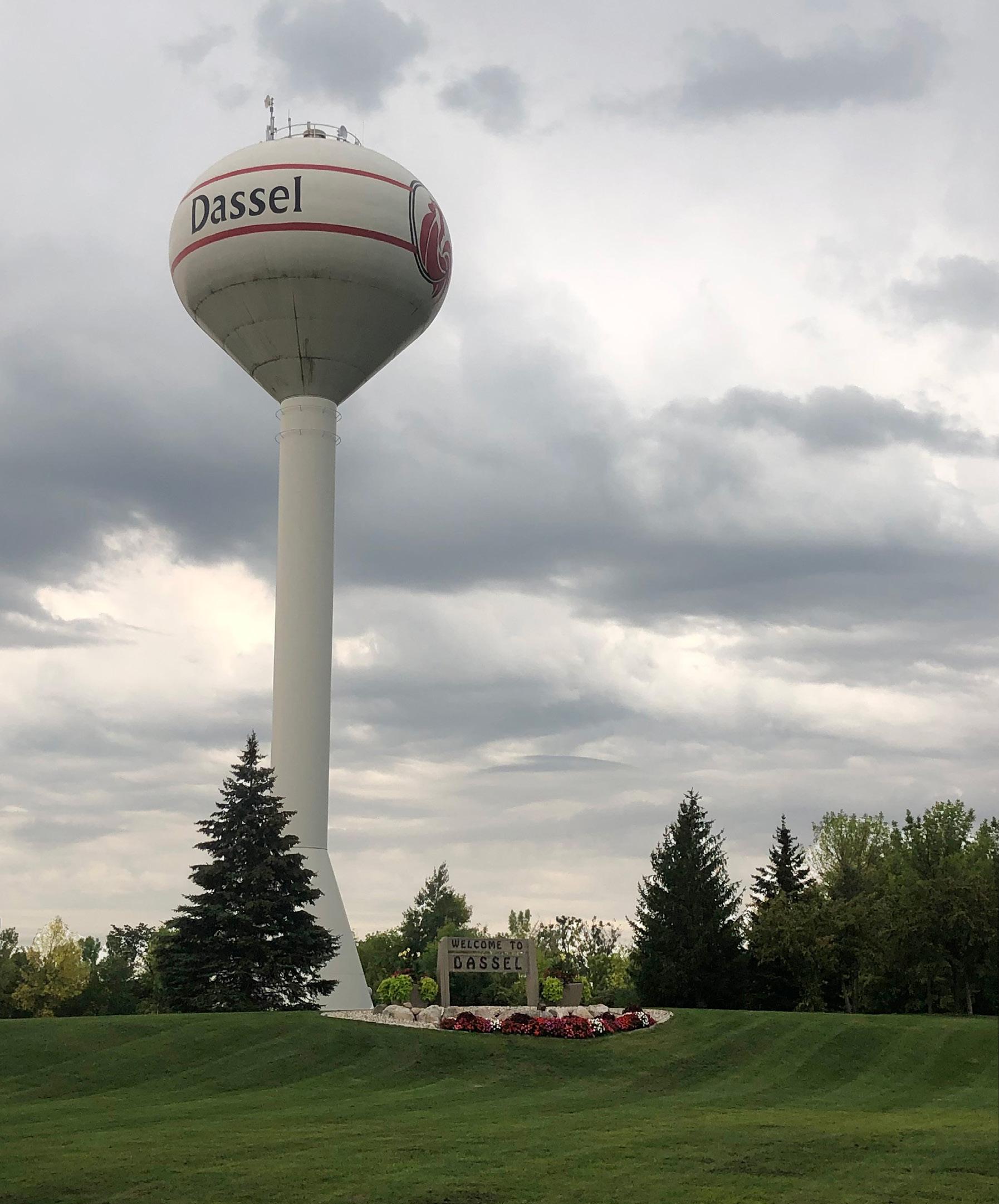
Population trends and statistics provide a foundation for the land use planning process and implementation of the Comprehensive Plan. Understanding past and future population growth enables informed identification of community needs, appropriate resource allocation, and evaluation of the Plan’s ability to achievecommunitygoals.
According to United States Census data, the 2021 population of Dassel was 1,472 people. Dassel has experienced an overall increase in population over the last century, with a brief decline in population around 1960. The population’s annual growth rate for 2010-2021 is calculated to be 1.4%, whereas the household growth rate is 1.35%. The median household size in Dassel is 2.51, slightly less than the United States’ median but more than the State of Minnesota’s.
Average Household Size for this area
2.51
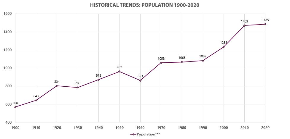
The chart below shows the distribution of 5-year age cohorts of Dassel’s populace. The chart shows a healthy distribution across the age ranges and gender that includes working age adults and their families. The adjacent generation icons show that nearly half of Dassel’s population falls within the Millennial or Generation Z categorization. A solid distribution of both young and established families supports a community’s ability to continue supporting existing businesses, school, and organizations. $27,074
Age 70-74 Age 65-69
Age 60-64
Age 55-59
Age 50-54
Age 45-49
Age 40-44
Age 35-39
Age 30-34
Age 25-29
Age 20-24
Age 15-19
Age 10-14
Age 5-9
Age 0-4
In 2021, the median age of Dassel was 36.7, lower than both Meeker County and the State of Minnesota. Dassel is home to many young families and continues to attract that demographic as population increases.
The largest group: $50,000 - $74,999 (27.5%)
The smallest group: $200,000+ (2.0%)
- $24,999
$25,000 - $34,999
Dassel City, MN
Geography: Place
$35,000 - $49,999
In 2019, the median household income in Dassel was $58,483, lower than Meeker County ($63,452) and the State of Minnesota ($71,306). Compared to Meeker County, more residents make between $35,000$75,000 and fewer make upwards of $75,000. The map below shows the median household income of surrounding jurisdictions within Meeker County, with Dassel outlined in yellow.
$100,000 - $149,999
$150,000 - $199,999
$200,000+ 2.0% -2.0%
Households By Income
The largest group: $50,000 - $74,999 (27.5%)
The smallest group: $200,000+ (2.0%)
Age 85+
Indicator ▲ Value Diff
Age 80-84
<$15,000 6.6% -1.4%
Age 75-79
Age 70-74
Age 65-69
Age 60-64
- $74,999
$150,000 - $199,999


Age 55-59
Age 50-54
Age 45-49
Age 40-44
Age 35-39
Age 30-34
Bars show deviation from
County area_HI
Age 25-29
Age 20-24
Age 15-19
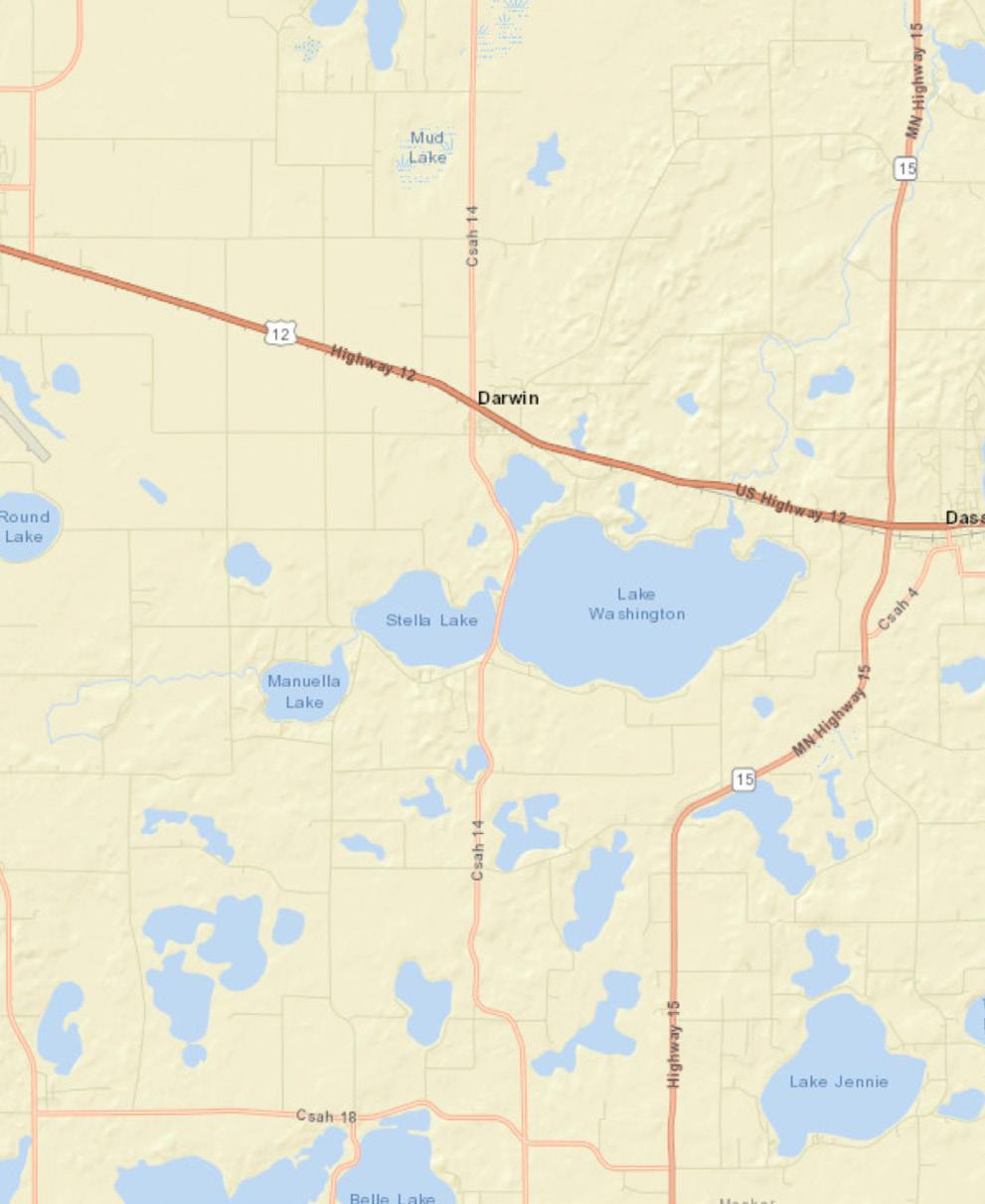
Age 10-14
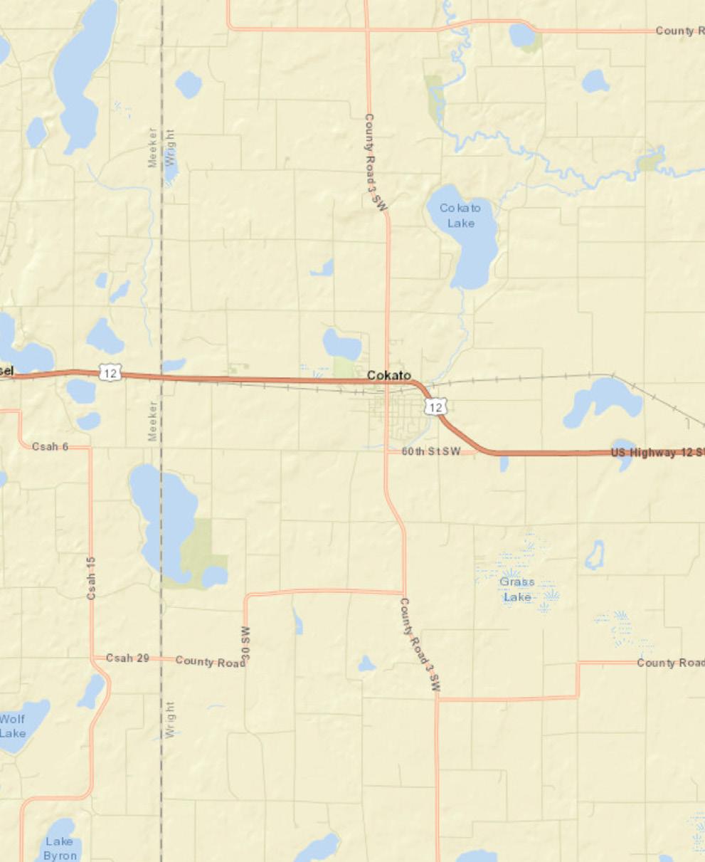
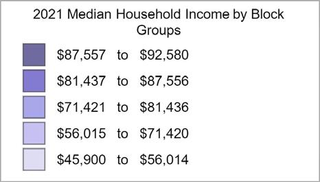
Education attainment data can provide insight into the quality of the existing labor force, including the availability of skilled and professional workers and the need for training opportunities. Data from the American Community Survey (2014-2019) shows that the percentage of high school graduates is about equal to Meeker County (38.6%) and greater than Minnesota (29.6%); the percentage of bachelor’s degrees and/or higher is greater than both Meeker County (6.3%) and Minnesota (15.1%).
Population by Age and Gender
Employment information is an important indicator of current economic conditions and potential economic growth opportunities for the residents and businesses of Dassel. 56% of Dassel’s residents have jobs classified as white color positions and another 36% have blue collar roles. The unemployment rate has been steadily declining over the last decade, stagnating around 3.1% since 2017. The largest sector is Production, followed by Management, Education/ Library, and Health Practices.
This graph compares employment information with Meeker County; while Production and Management roles are high in both Dassel and the County, the latter also has a higher percentage of Transportation and Office/Admin workers.

Dassel City, MN
Dassel City, MN (2714878) Geography: Place
Data Note: Supply (retail sales) estimates sales to consumers by establishments. Sales to businesses are excluded. Demand (retail potential) estimates the expected amount spent by consumers at retail establishments. Supply and demand estimates are in current dollars. The Leakage/Surplus Factor presents a snapshot of retail opportunity. This is a measure of the relationship between supply and demand that ranges from +100 (total leakage) to -100 (total
A positive
represents 'leakage' of retail opportunity outside the trade area. A negative value represents a surplus of retail sales, a market where customers are drawn in from outside the trade area. The Retail Gap represents the difference between Retail Potential and Retail Sales. Esri uses the North American Industry Classification System (NAICS) to classify businesses by their primary type of economic activity. Retail establishments are classified into 27 industry groups in the Retail Trade sector, as well as four industry groups within the Food Services & Drinking Establishments subsector. For more information on the Retail MarketPlace data, please click the link below to view the Methodology Statement. http://www.esri.com/library/whitepapers/pdfs/esri-data-retail-marketplace.pdf
Source: Esri and Data Axle. Esri 2021 Updated Demographics. Esri 2017 Retail MarketPlace. ©2021 Esri. ©2017 Data Axle, Inc. All
According to the American Community Survey, many of Dassel’s residents that commute, age 16 and older, live between 5 and 20 minutes from their place of employment. A sizeable portion of commuters – almost 12% – live between 60-90 minutes from work. The map below shows the inflow/outflow of jobs within Dassel’s boundary; nearly twice as many people enter the City for work than commute to locations outside the boundary.
Inflow/OutflowReport AllJobsforAllWorkersin2019
CreatedbytheU.S.CensusBureau’sOnTheMap https://onthemap.ces.census.gov on01/21/2022
Inflow/OutflowCountsofAllJobsforSelectionAreain2019 AllWorkers
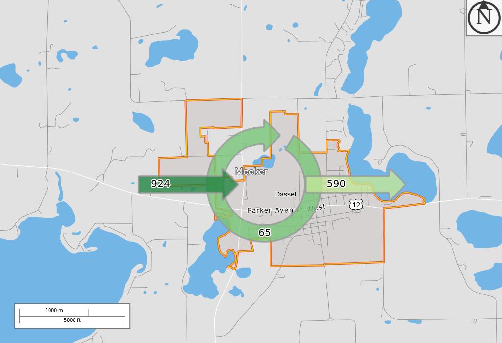
In 2019, Dassel’s median home value of $142,800 was lower than Meeker County ($170,200) and significantly lower than Minnesota ($223,900). This graph represents the percentage of homes within value ranges listed in the chart below. Most of Dassel’s owner-occupied housing units are valued between $90,000 and $175,000.
500000-749999 250000-299999 15000-174999 90000-99999 60000-69999 35000-39999
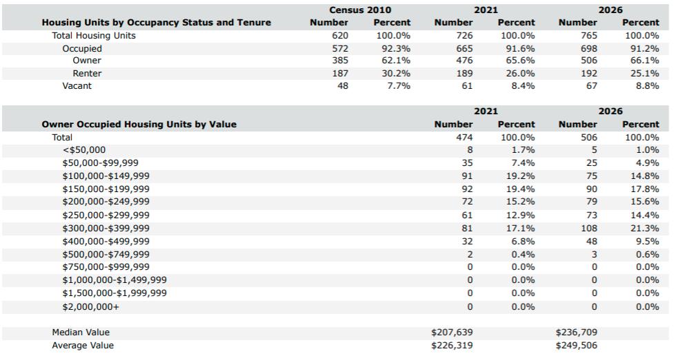
10.0%
Greatest Gen: Born 1945/Earlier
Baby Boomer: Born 1946 to 1964