The Royal British Legion
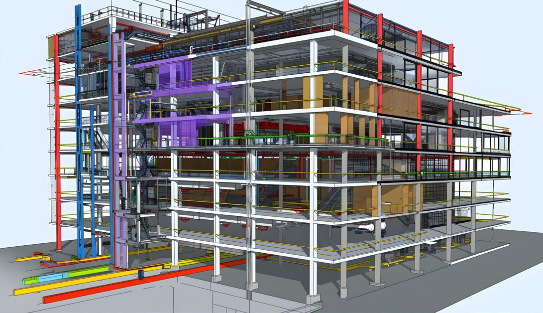
Building Information Modeling (BIM) surveys leverage advanced technologies to capture detailed spatial and asset data of structures. This case study examines a high-level BIM survey conducted for the Royal British Legion, focusing on the integration of laser scanning, photogrammetry, and GPS to create an accurate 360-degree panoramic photographic model, a virtual tour, and precise measurements. The client required a swift and comprehensive survey to support future maintenance and planning activities.
Client Requirements
• The Royal British Legion sought an expedited and thorough BIM survey to address the following needs:
• Detailed spatial and asset data of their property.
• An accurate 360-degree panoramic photographic model.
• A virtual tour to facilitate remote inspections and stakeholder engagement.
• Precise measurements for detailed analysis and future planning.
• Rapid completion to minimize disruption to the building’s operations.


The Royal British Legion
Survey Execution
• The BIM modeling survey was executed with precision and efficiency, adhering to the client’s high standards. Key steps in the process included:
Pre-Survey Planning:
• An initial site visit was conducted to understand the building’s layout and identify key areas of focus.
• A detailed survey plan was developed, incorporating the use of laser scanning, photogrammetry, and GPS to ensure comprehensive coverage.
Data Collection:
• Laser Scanning: High-resolution laser scanners were used to capture precise spatial data, generating detailed 3D point clouds of the building.
• Photogrammetry: Advanced cameras captured high-definition images from multiple angles, enabling the creation of accurate 3D models through photogrammetric processing.
• GPS: GPS technology was used to ensure accurate geolocation of all data points, enhancing the precision of the survey.
360-Degree Panoramic Photographic Model:
• Images captured during the photogrammetry process were used to create a 360-degree panoramic model.
• This model provided an immersive and detailed visual representation of the building, allowing for comprehensive remote inspections.


The Royal British Legion
BIM Modeling:
• The collected data was processed and integrated into BIM software, resulting in an accurate and detailed model of the building.
• The BIM model included spatial data, asset information, and precise measurements, providing a comprehensive overview of the building’s condition and structure.
Post-Survey Analysis:
• The BIM model was analyzed by experts to assess the building’s condition and identify any areas requiring maintenance or further investigation.
• A detailed report was generated, including annotated images, measurement data, and expert recommendations.
Conclusion
The BIM modeling survey for the Royal British Legion exemplifies the significant advantages of utilizing advanced technologies in building surveys. By delivering a high-level, accurate, and detailed assessment swiftly, the survey met the client’s urgent needs and established a benchmark for future projects. The comprehensive data, precise measurements, and immersive visualizations provided a clear and accurate understanding of the building’s condition, enabling effective maintenance planning and stakeholder engagement.
This case study highlights the value of integrating innovative technologies in property management and maintenance, ensuring high standards of accuracy, efficiency, and detail.