2024 UPDATE

2018 Parks, Recreation, Trails & Open Space

2018 Parks, Recreation, Trails & Open Space

Mayor
Scott Bradley
City Council
Elizabeth Abraham - Mayor Pro Tem
Jené Butler – Deputy Mayor Pro Tem
Scott Smith
Andrew Chase
Ken Oltmann
Laura Deel
Parks & Recreation Board Members
Robin Reeves – Chair
Diana Cain – Vice Chair
Mike Jenkins – Secretary
Clay Dethloff
Felicia Zimmer
Keyla Kirton
Jeff Brettnacher
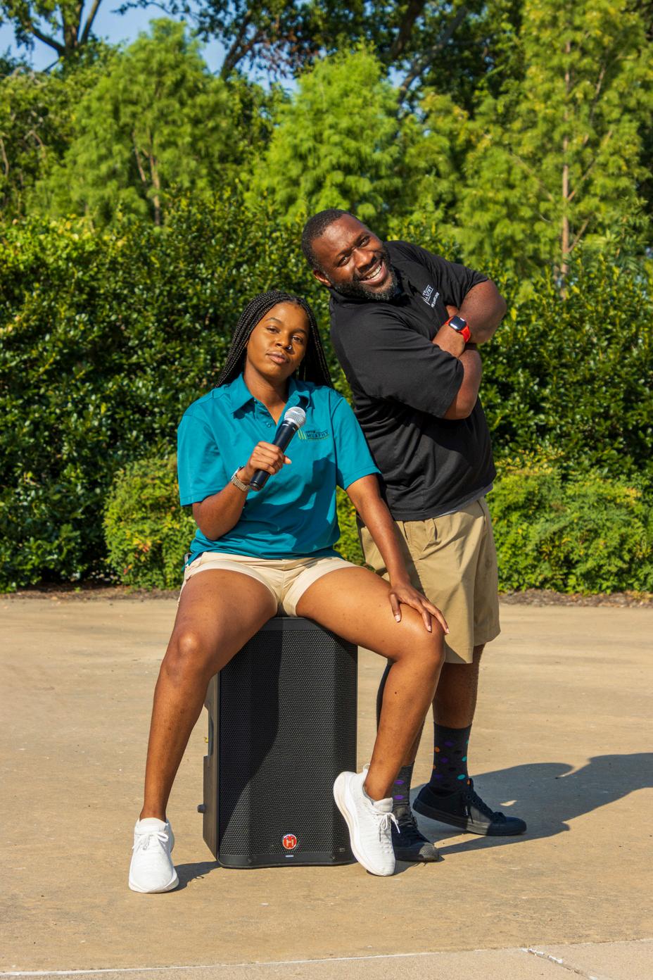
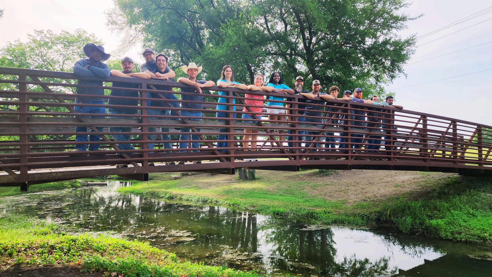
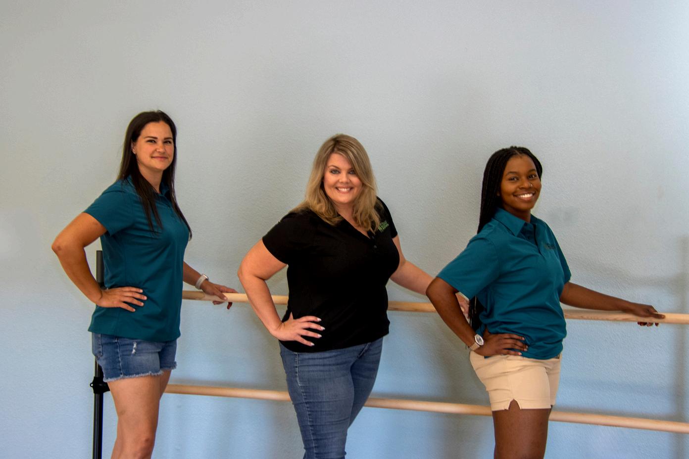
Staff Members
Aretha Adams – City Manager
Jared Mayfield – Assistant City Manager
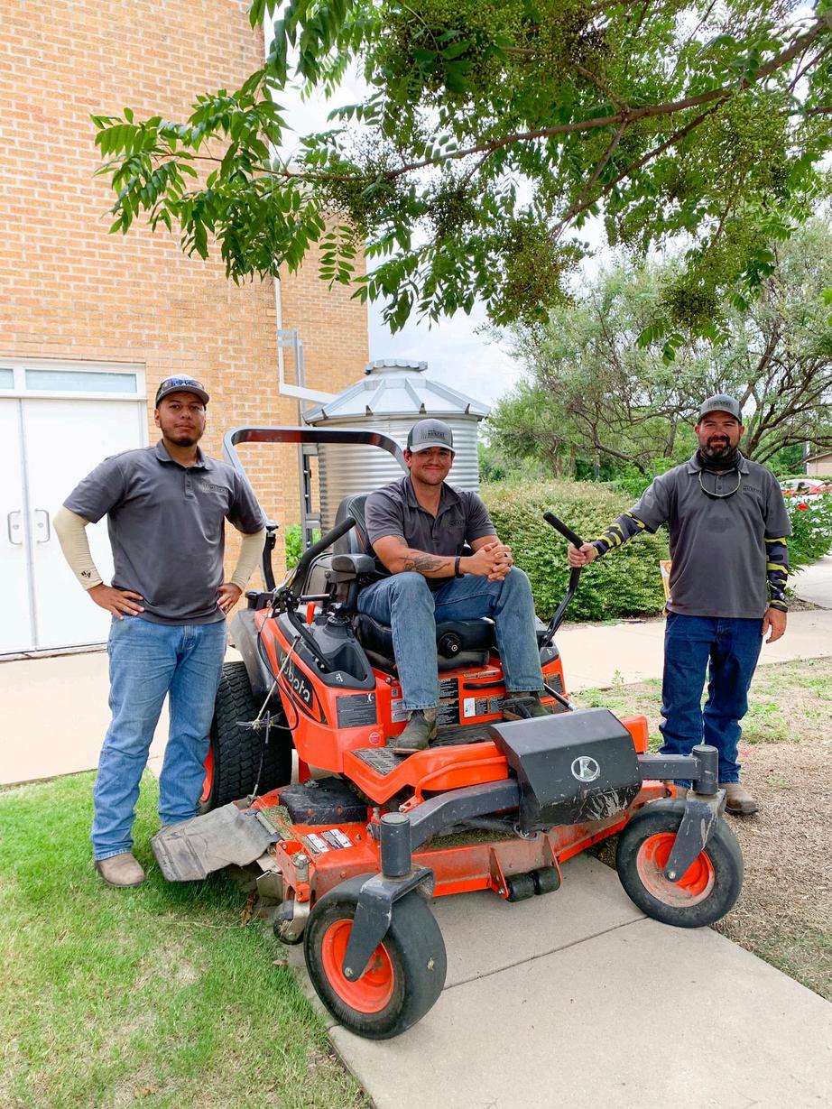
Matt Foster – Director of Parks & Recreation
Cody Clark – Parks Superintendent
Kayla McFarland – Manager of Recreation Services
Jacelyn Mitchell – Executive Administrative Assistant
Purpose
Mission/Vision Statements
Goals
Standard-Based Analysis (Includes HOA)
Park Land Analysis (Includes HOA)
Existing Park Improvements
Future Park Land and Recreation Recommendations
Neighborhood Parks Community Parks
Trail Recommendations
1.Introduction........................................................................................................................................11
Brief Historical Background
Purpose of the Park, Recreation, Trails and Open Space Master Plan The Development Process
2.
Demographic
Parks,
Neighborhood
Special Use Park
3. Inventory, Improvements & Recommendations of Developed Park Land............................................24
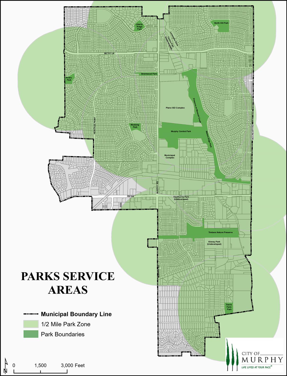
City of Murphy Existing Parks
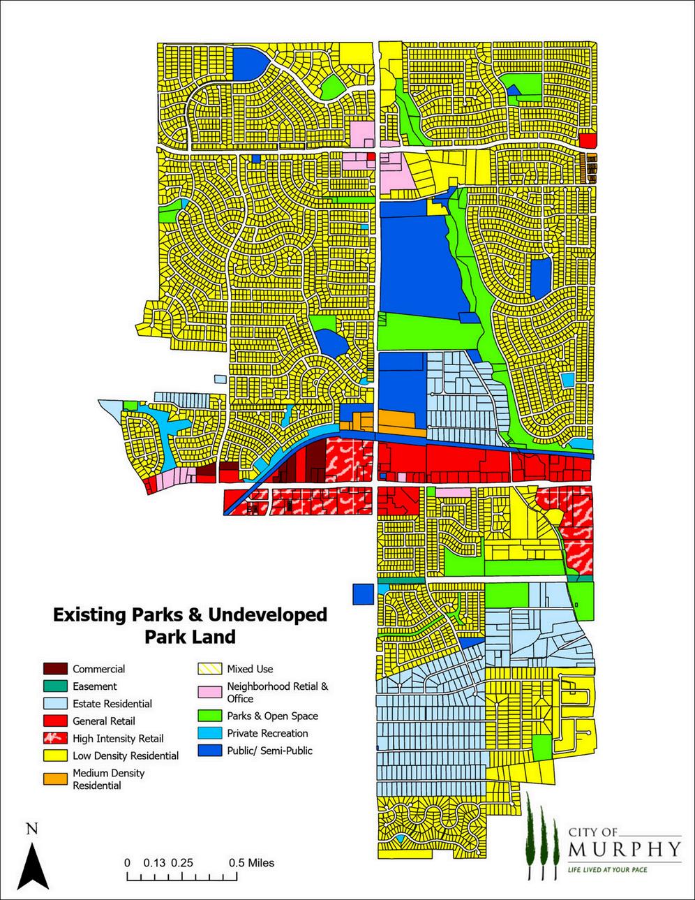
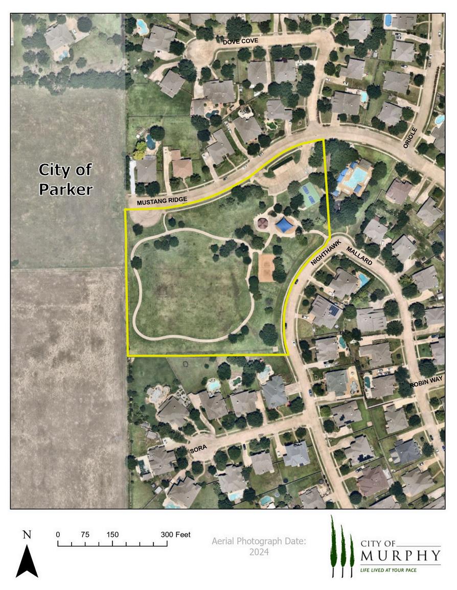
Map of Existing Parks & Undeveloped Park Land
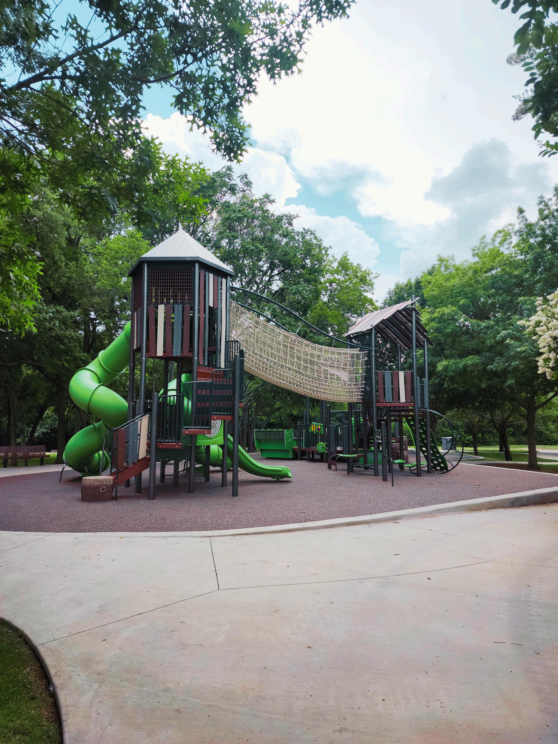
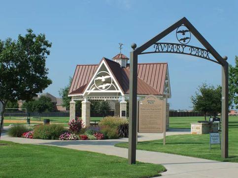
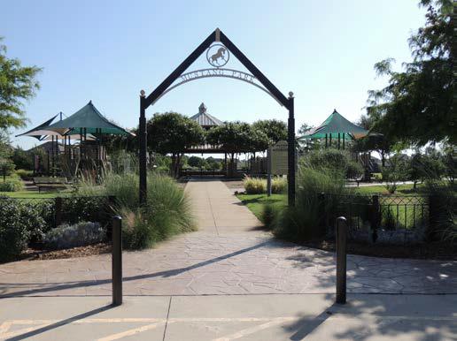
Aviary Park
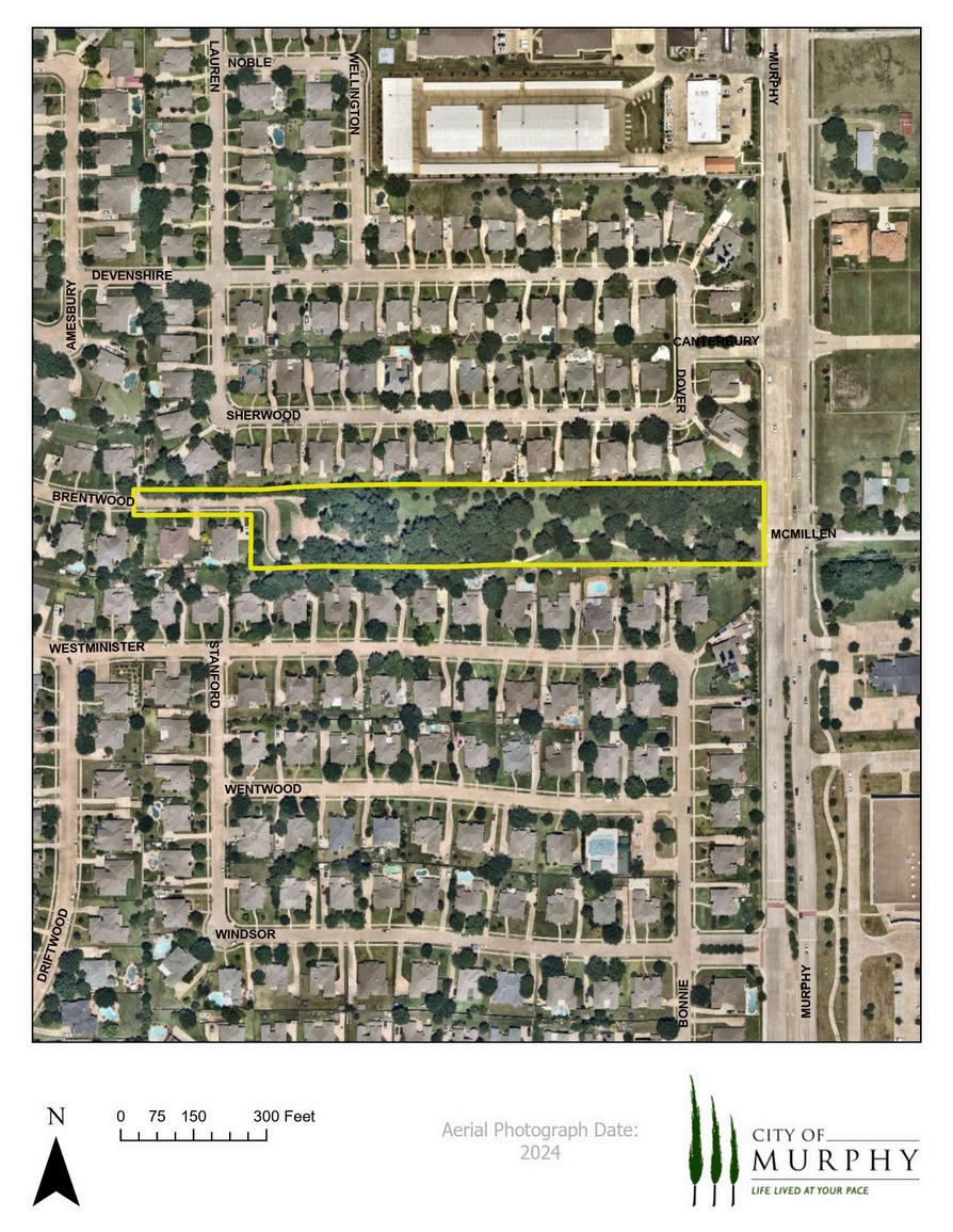
Brentwood Park
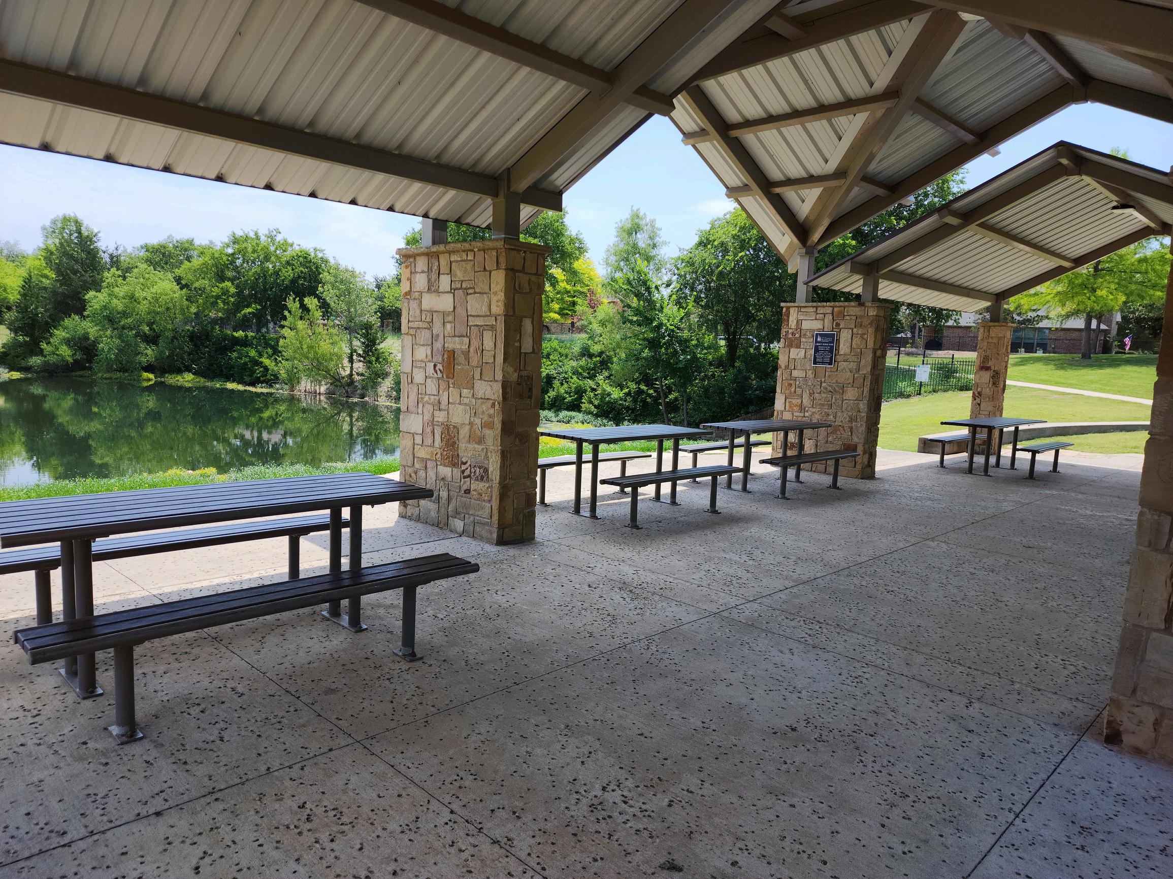
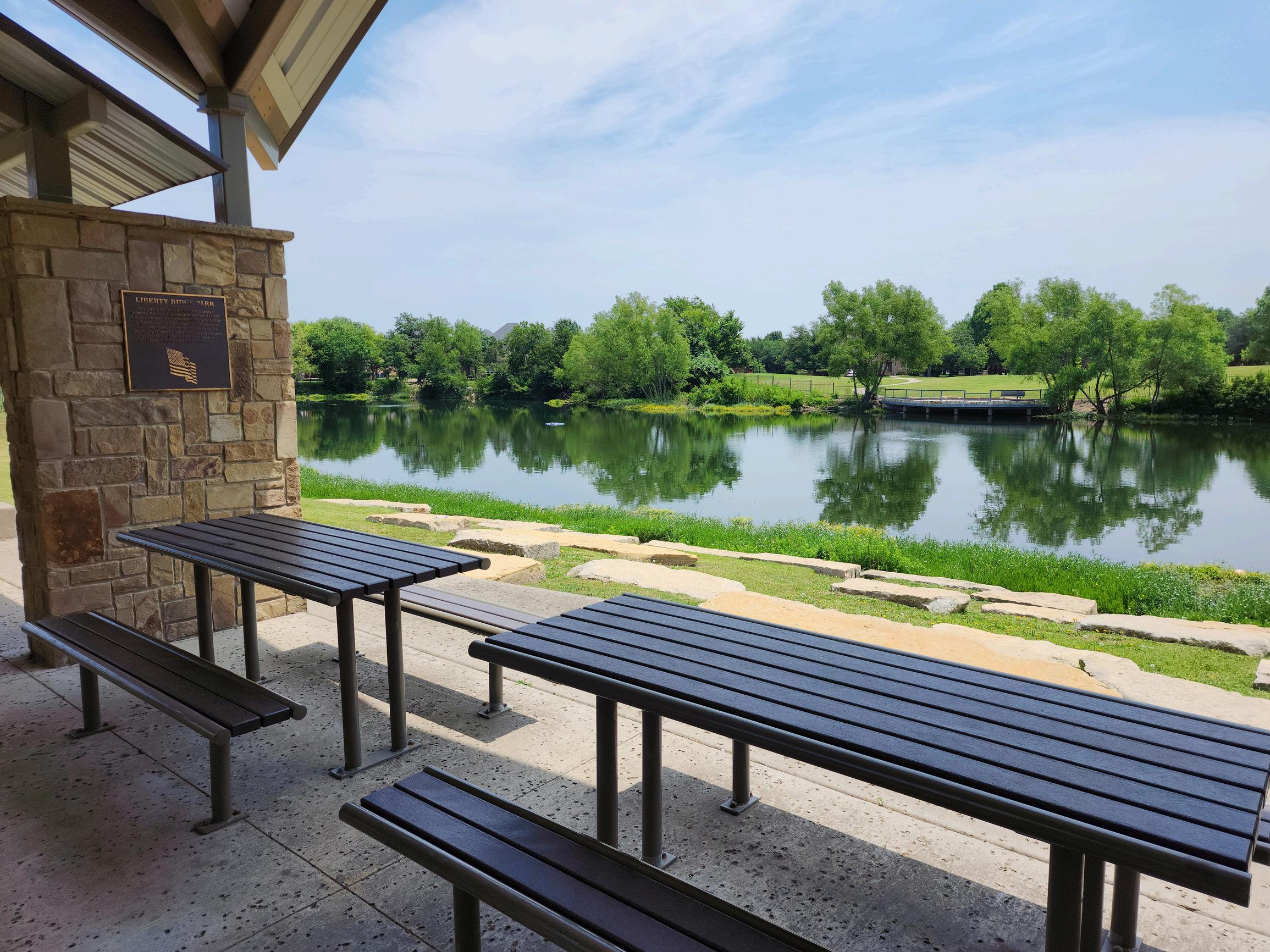
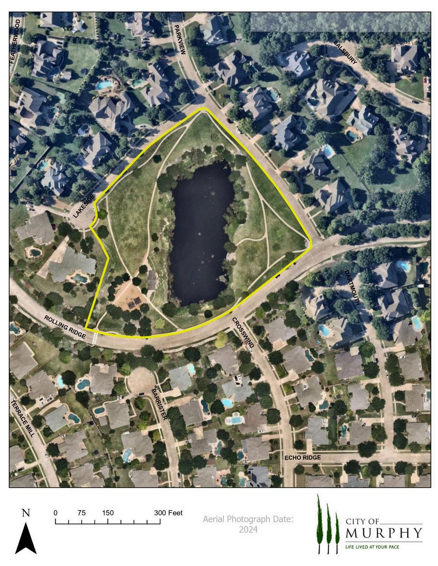
Liberty Ridge Park
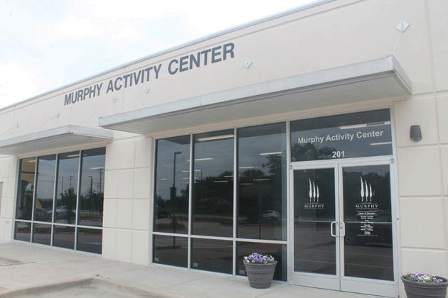
Murphy Activity Center
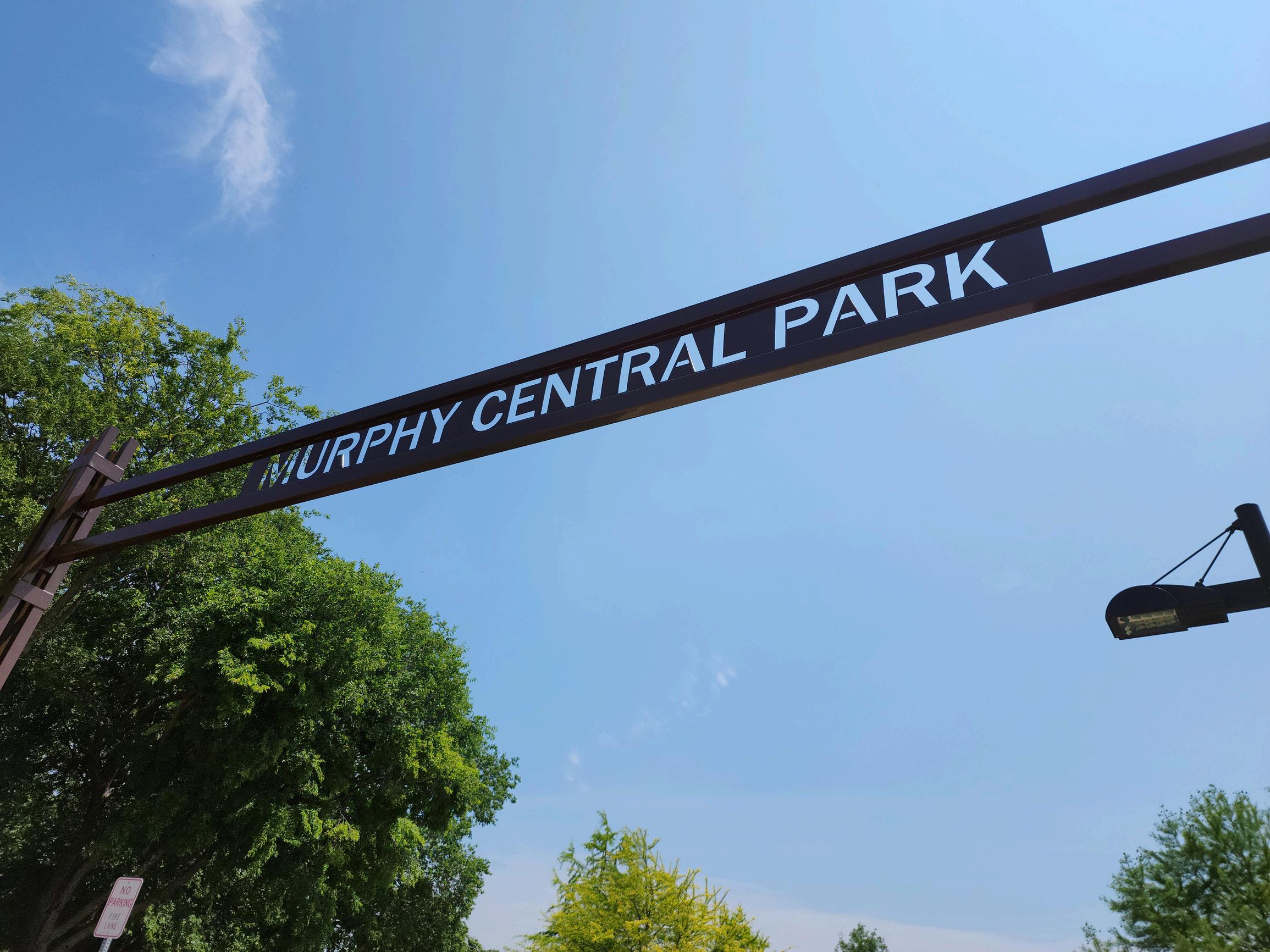
Murphy Central Park
Murphy Community Center
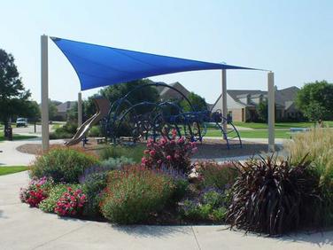
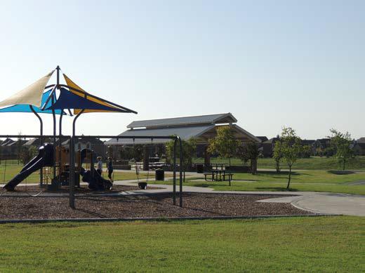
Mustang Park
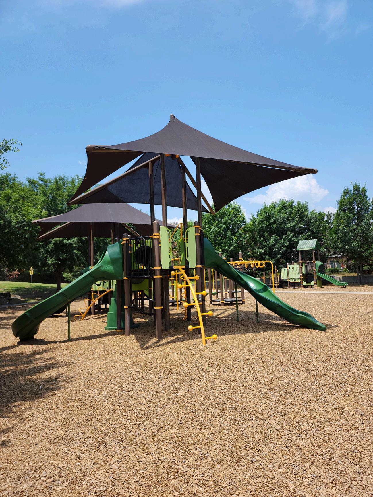
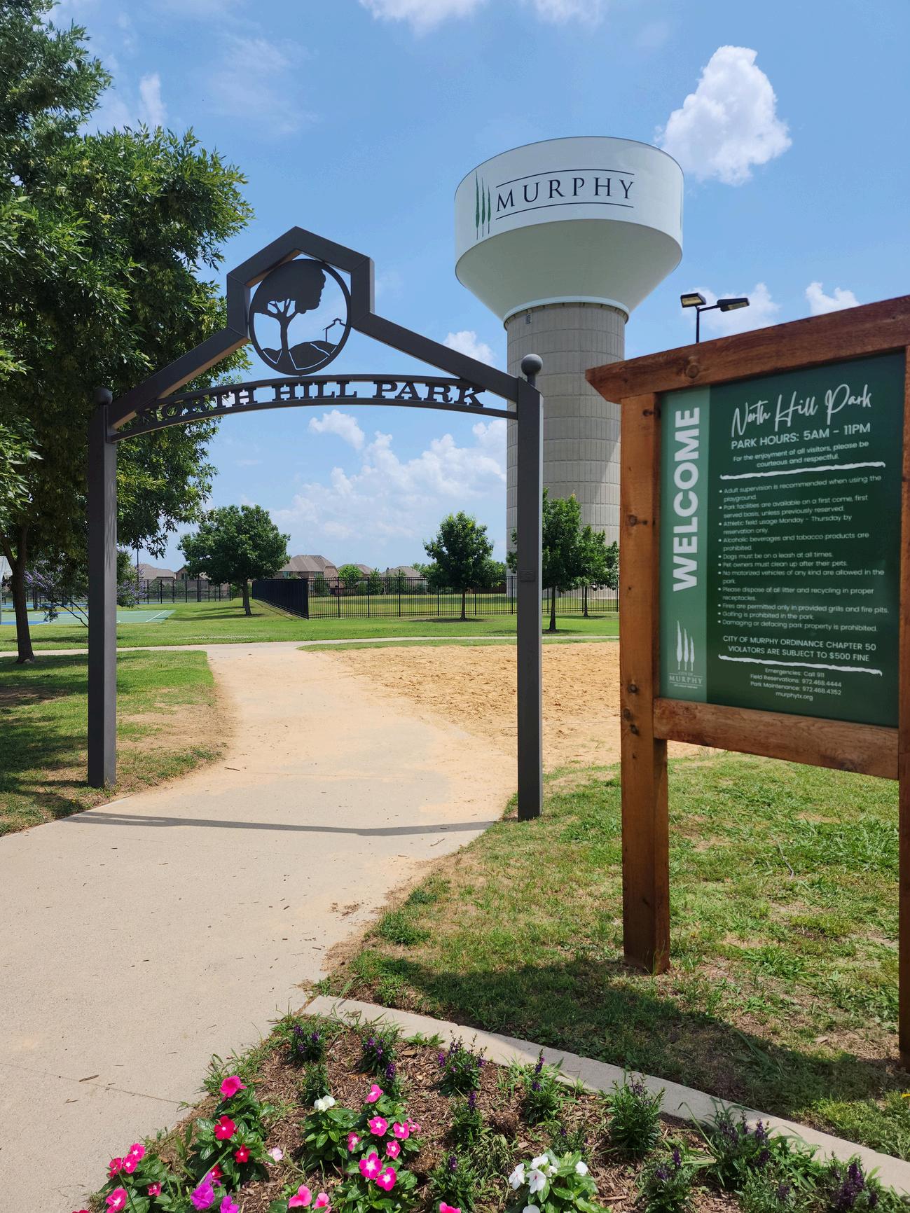
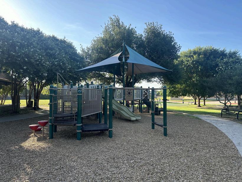
North Hill Park
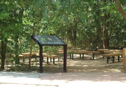
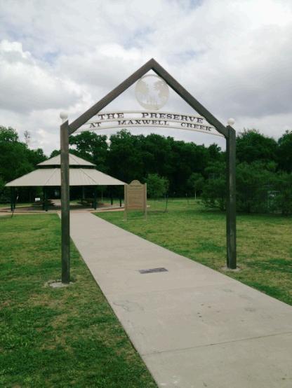
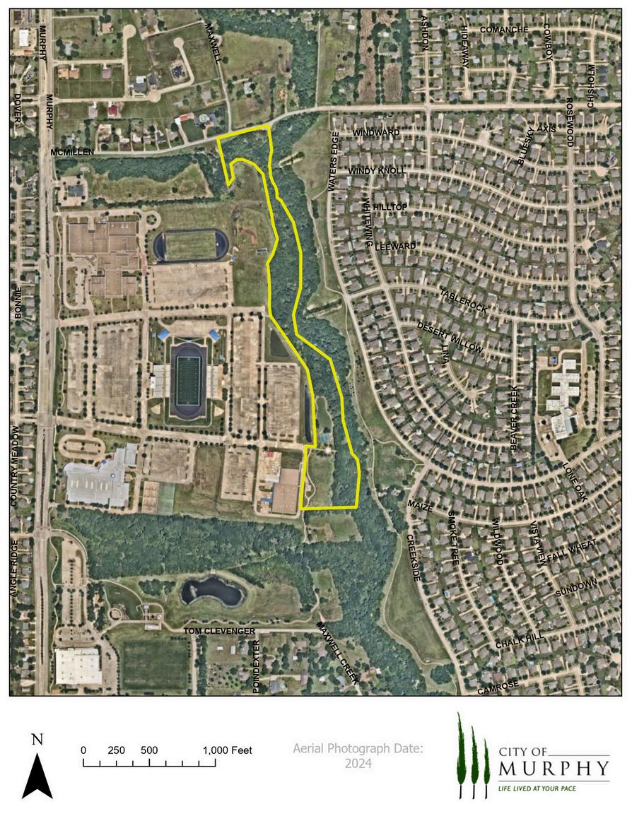
The Preserve at Maxwell Creek
Timbers Nature Preserve
Travis Farm Park
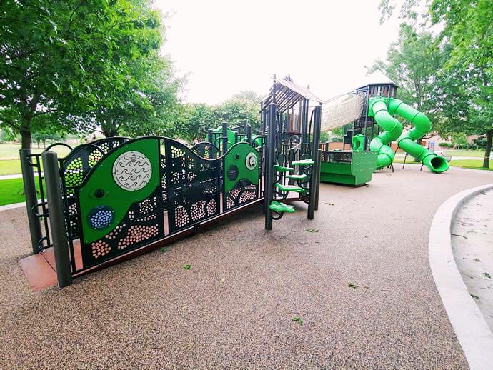
Waters Edge Park at Maxwell Creek
Lonesome
North
Inter-City
Purpose
Design
Types
Trail Surfaces
Trail Widths
Vertical Clearance
Longitudinal Slope (Grade)
Signs
Access Points
Lighting
Traffic Control Devices
Thoroughfare and Intersection Crossings
Below Grade or Creek-Drainage Structures
Tunnel Crossings
Above Grade or Aerial Crossings
Trail Master
5
6
In today’s active society, recreation opportunities are becoming more important to all age groups. With urban sprawl and development of rural land, creation of parks and preservation of open space should be major priorities for our cities and communities. Parks and open space also add economic value to local properties and an intangible value to the local quality of life. To preserve the open space and create parks, this Parks, Recreation & Open Space Master Plan has been written; it identifies recreation needs, pertinent demographic information, existing and future park needs, park priorities, and funding opportunities. This, in the long term, will provide Murphy citizens with the benefits of recreation and preservation of open space.
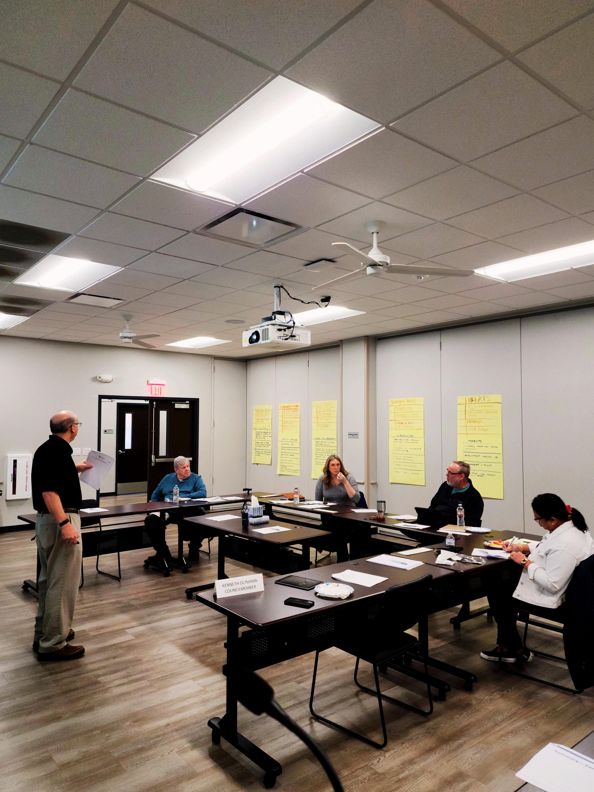
The City determined that the Master Plan required a comprehensive overhaul and mandated updates at least every five years. Consequently, in May 2016, City staff initiated the development of a new Parks, Recreation, Trails and Open Space Master Plan. Meetings were conducted with the Murphy Parks & Recreation Department staff to review the identified needs, findings, and preliminary recommendations. Starting in June 2013, staff collaborated with the Parks and Recreation Board to revise key elements such as purpose and goals. To ensure a thorough and complete analysis of the City's park and recreation needs and park system, two methodologies were employed: public hearings and standards-based analysis. This Master Plan provides the City with both short-term implementation schedules for existing parks and long-term strategies for future park acquisition and development.
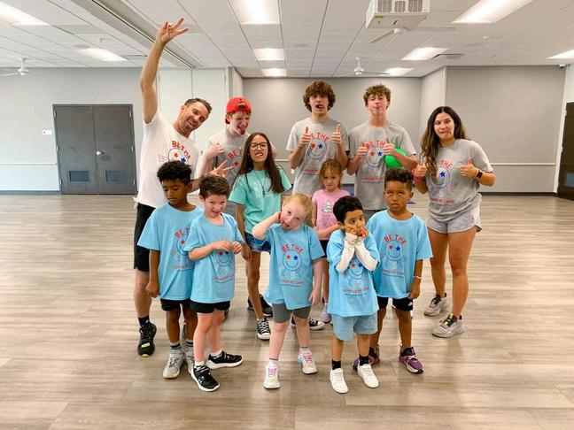
Following the need for updates every five years, the Parks & Recreation Department along with the Parks & Recreation Board and the Youth Advisory Committee embarked on the process in January of 2024. A public input meeting was conducted to gather resident feedback as well as an online survey requesting input be given by the community regarding the needs and desires of the citizens.
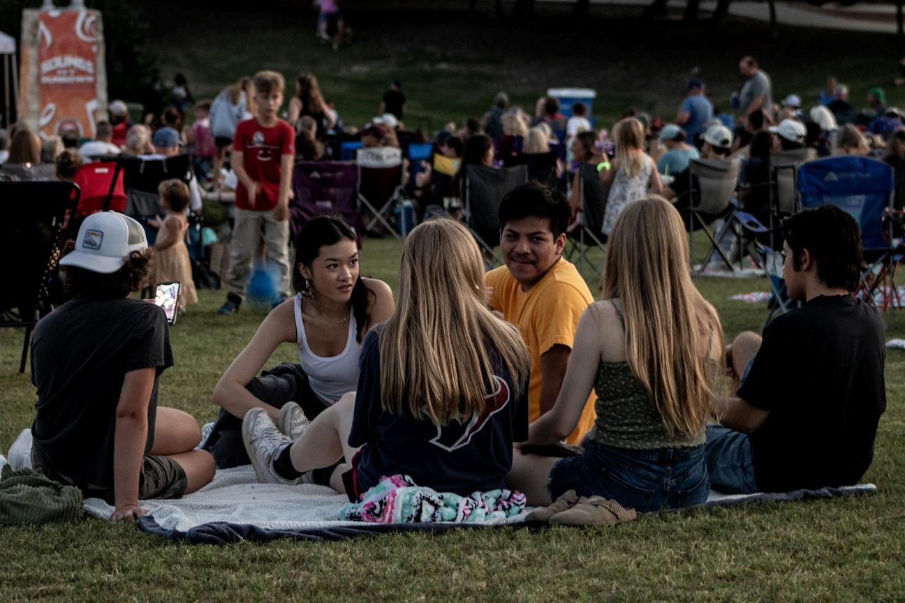
Murphy Parks & Recreation is committed to enhancing community well-being and promoting a sense of wellness and inclusivity through our parks, programs, and recreational experiences.
“RECreate Murphy” envisions a community where our parks, programs, and community events are welcoming and enriching environments for all.
The original goals from the 2008 Parks & Recreation Master Plan were reaffirmed in the 2018 plan, but during the update process in 2024, the Parks & Recreation Board, along with Staff, decided to amend some of the goals in order to make them more measurable and applicable to the current state of the City of Murphy. The eight goals listed below are those that were approved during this process.
Create a top-tier parks system that is among the best in smaller communities in the Dallas/Ft. Worth area (<25,000 population) based on the National Parks and Recreation Association (NRPA) standards including park acreage per capita, residents per playground, and residents per park.
Develop and implement a comprehensive park system in Murphy that significantly enhances the city’s physical form, aesthetics, and overall appearance, contributing to a more attractive and inviting environment for residents and visitors alike.
Goal 3
Offer a diverse range of recreational facilities, programs, and special events tailored to increase involvement and meet the evolving needs of Murphy’s expanding and diverse population.
Goal 4
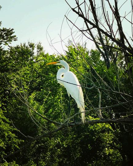
Preserve and enhance Murphy’s open space and natural resources.
Goal 5
Implement current trail plan to establish a comprehensive network of pedestrian and bicycle pathways throughout Murphy to the greatest extent feasible.
Ensure that all Murphy parks and recreational facilities are maintained in a superior condition, achieving a maintenance rating of at least 95% based on regular inspections and resident feedback.
Create mechanisms to work with the public and private entities to provide resources to acquire, develop and maintain parks, recreation facilities, services and open space.
Include a citizen participation process in all ongoing park planning and design, as well as the revision of the Parks, Recreation, and Open Space Master Plan.
The Standard-Based Analysis approach to assessing future recreational needs follows established and recognized standards for assessing the quality of parkland and the number of facilities that are required to meet the needs of a given population. One source for such standards is the (NRPA), which provides a base of input upon which to formulate or calculate local needs. The result of this Standard Bases Analysis is provided for the City build out population of approximately 25,000 within Table 4 and Table 5 which includes homeowner associations (HOA) in Murphy.
Park land analysis is also evaluated based on Murphy’s build-out population, as shown in Table 5 and the inclusion of HOA amenity statistics in Table 6.This evaluation is a reliable guide and analysis for park land comparison. The acreage required per 1,000 populations varies for each park classification for long range planning which is a useful tool for determining future park land acreage acquisition.
The focus of this section is on the development, renovation, expansion of existing parks. Recommended improvements are based on an analysis of existing facilities. Preliminary cost estimates have also been prepared for each park element or improvement. The costs are general for specific elements such as benches, playgrounds, picnic tables, etc. The costs are based on 2024 estimated construction costs. Items such as drainage improvements should be analyzed at the time of the proposed improvements as these items require a detailed site analysis, which is not included in the Parks, Recreation, Trails & Open Space Master Plan. Preliminary recommendations for improvements to existing parks include:
Mustang Park Renovation
Murphy Central Park Renovation
Travis Farm Park Phase III
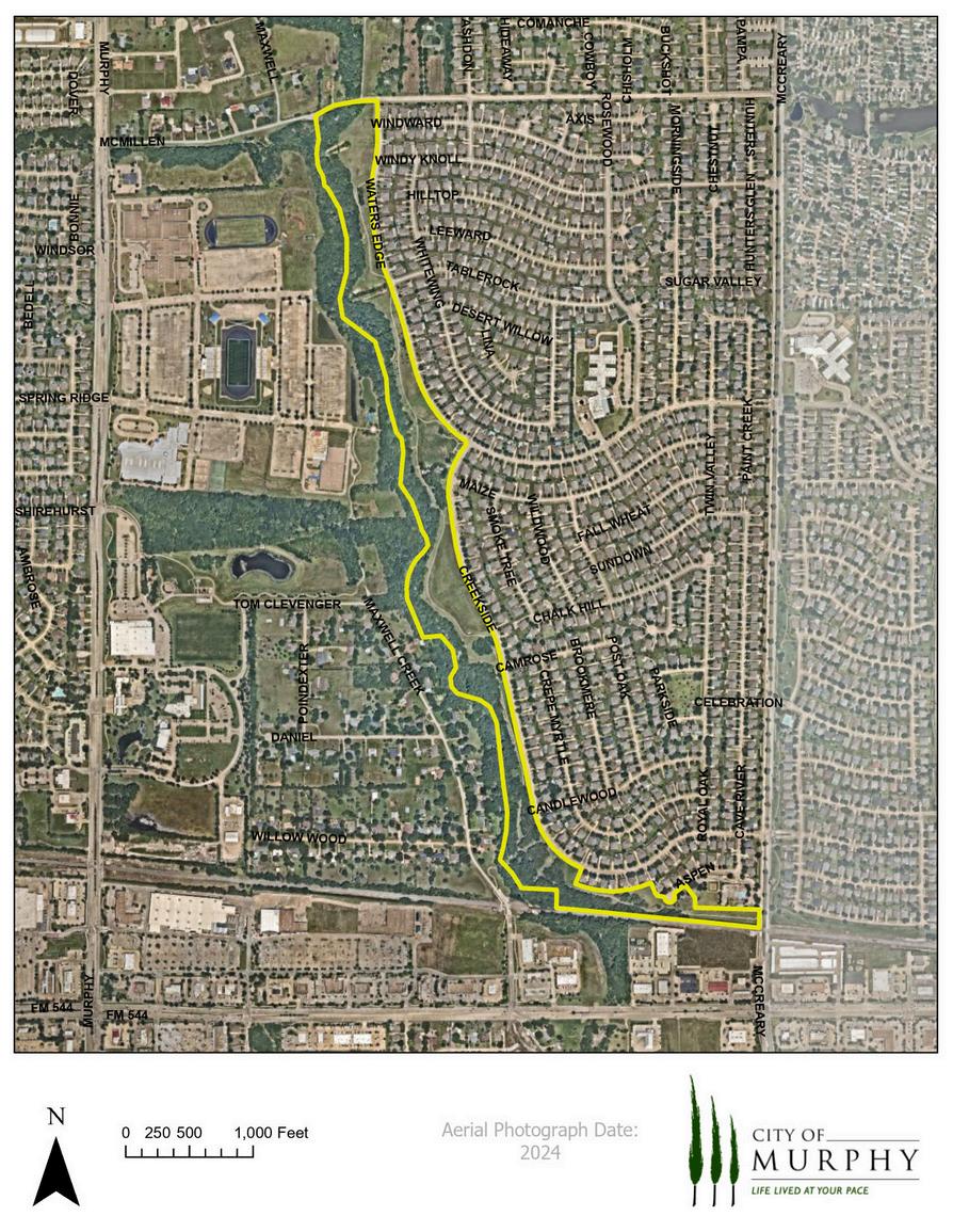
Water’s Edge Park/Maxwell Creek Linear Park Expansion/Trail Widening Extension of Centralized Irrigation to Waters Edge, The Preserve at Maxwell Creek, South Murphy Road, and City Hall.
Murphy is nearing its build out and land acquisition for neighborhood or community class parks has almost reached its maximum. Therefore, the City will have to make the most of their existing parks and preserve the open space within the Maxwell Creek Corridor.
Murphy has neighborhood parks in each planning area which serves our residents. Looking at the neighborhood park in conjunction with homeowner associations (H.O.A.) parks, there is adequate open space and park facilities in the neighborhood park classification throughout Murphy. Neighborhood Parks
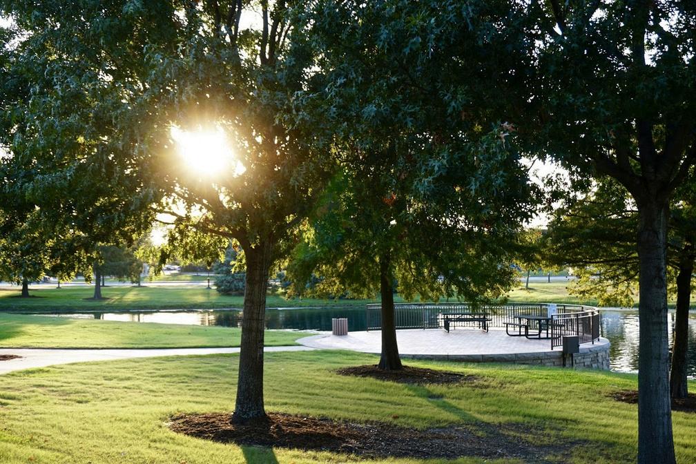
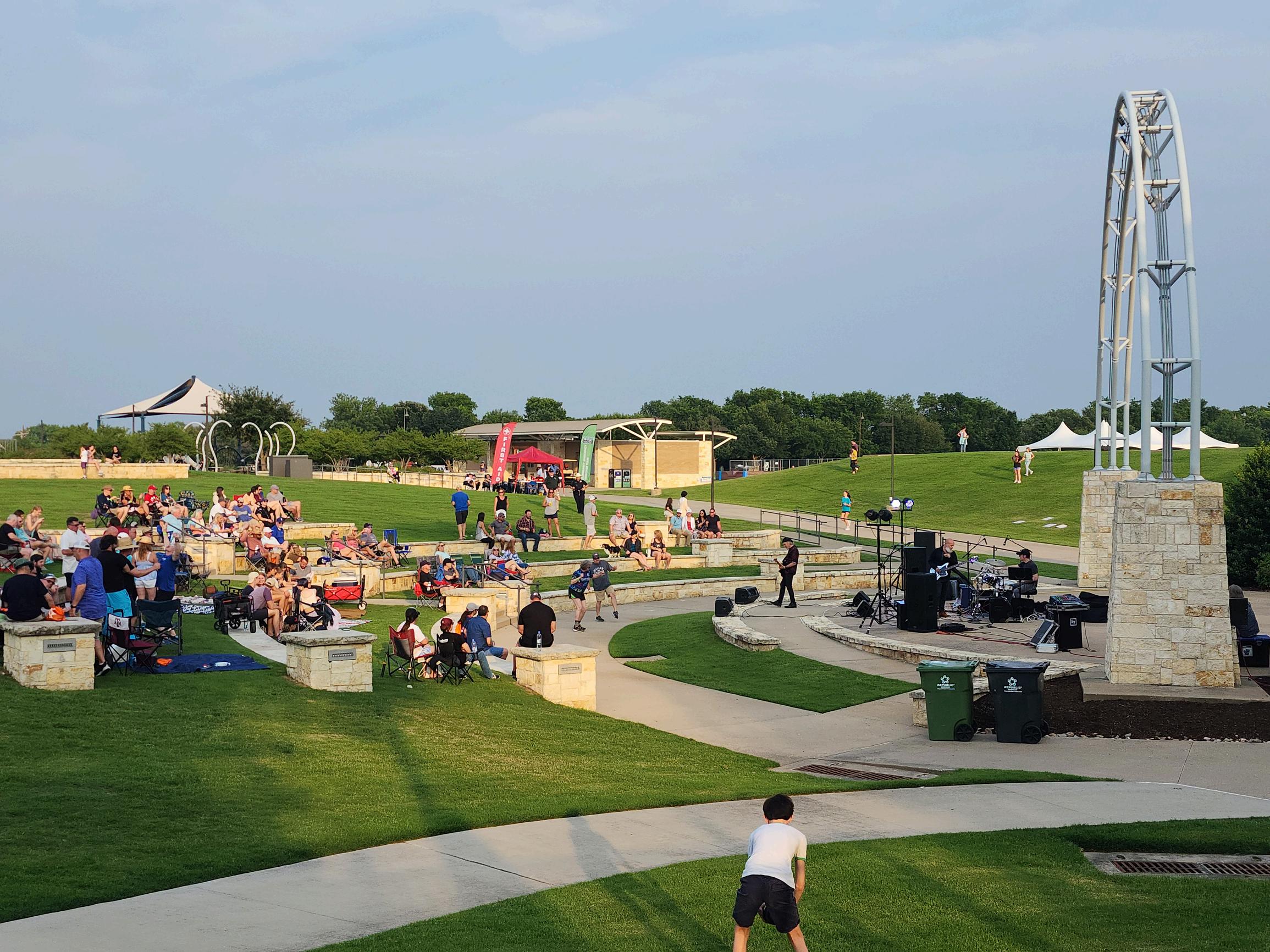
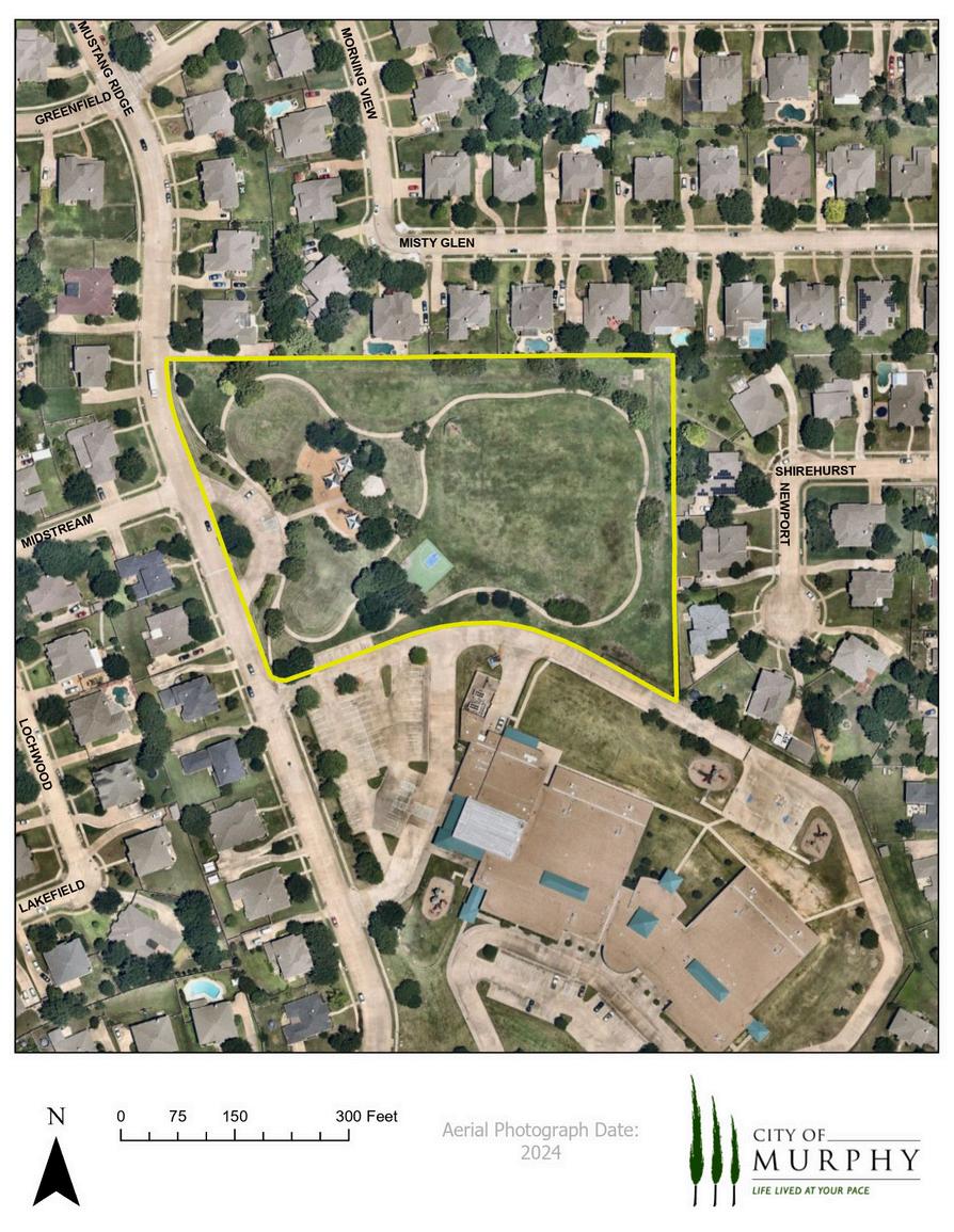
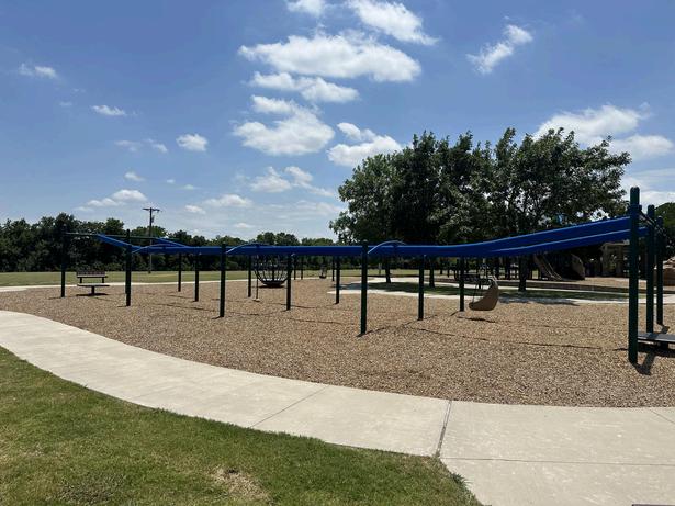
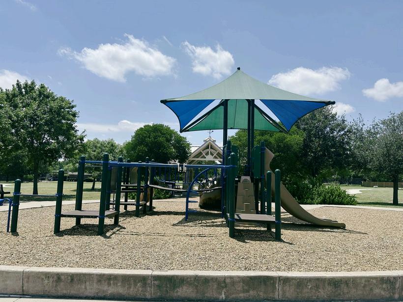
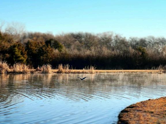
With the opening of Murphy Central Park in April 2013, Murphy’s park acreage almost doubled compared to 2005. This Master Plan is an update from 2008 when there were only 5 developed parks and a total of 216 acres of developed and undeveloped park land. In 2014 with the opening of Murphy Central Park there are a total of 10 developed parks and close to 300 acres of maintained land. Parkland acreage has not increased since 2014, but there has been an increase in the amount of developed parkland due to further developing of existing parkland. Murphy Central Park, with a total of 60 acres, serves as Murphy’s largest and most central community park, followed by Timbers Nature Preserve Park at 35 acres and North Hill Park at 12 acres.
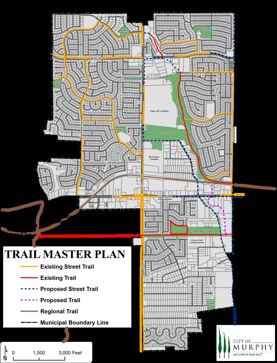
Trails are an important component of the future park system, as they serve recreational, transportation and linkage purposes. In Murphy, the transportation and linkage aspects of a City-wide trail system will serve a local and regional purpose. The City has the opportunity to connect trails in Murphy with several adjacent trail systems; to the west through the future Dart Rail Line, the city also could connect to the county wide trail systems. Murphy also has connected with Plano along the ONCOR easement and has plans for a future connection to Wylie along the same easement. These are to be partially funded by a Collin County grant.
Considerations as trails are developed should include: The type of trail, surface, width, necessary vertical clearance, slope limitations, rules, safety plan and signage.
The culmination of this Master Plan is three-fold: Table 7, the 10-Year Park Priority List, Table 8, the 10-Year City Priority List - Outdoor Facilities, and Table 9, the 10-Year City Priority List - Indoor Facilities.The priority of these park improvements is based on the needs assessment and meetings with City staff and the Parks and Recreation Board as well as public input from town hall meetings.Annual review of the Master Plan by the City Staff, City Council members, Murphy Parks and Recreation Board members and citizens will allow analysis of each recommendation for acquisition, improvements, and new facilities to enhance the quality of Murphy’s Parks and Recreation System to maximum effect.
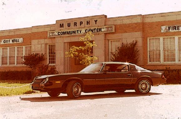
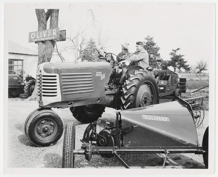
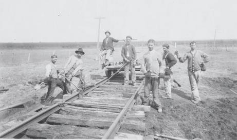
The first settlers arrived in Murphy in 1846. Land grants offered by the Peters Colony attracted these early settlers. The original name of the settlement was Old Decatur and later, Maxwell’s Branch. In 1888 Williams Murphy provided the land for the St. Louis Southwestern Railway and depot. The town was renamed in his honor.
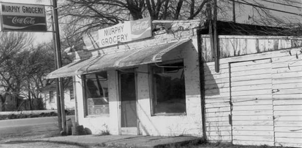
The first post office was established in 1891. From the late 1800’s until the 1950’s Murphy served as a shipping point for agricultural and livestock. As the metropolitan area of Dallas expanded in the early 1900’s Murphy’s importance as an agricultural center diminished and the population decreased to a low of 150 in the mid-1950s. As Dallas, Richardson and Plano grew in the 1960’s and 1970’s, Murphy transitioned into a thriving commuter community in Collin County.
The 1990’s brought some growth to Murphy, but the major influx of population did not begin until the early 2000’s. Murphy has seen the population rise exponentially from 1,600 in 1990 to 3,500 in 2000 and has almost increased six-fold since then to 21,762.The retail growth in Murphy has also increased rapidly since 2005 with the addition of several major anchor stores and small shopping centers as well. This growth has helped to increase the demand for park, recreation, trail and open space needs.
In today’s dynamic society, recreational opportunities have become increasingly vital for all ages. With the expansion of urban areas and the development of rural land, the creation of parks and the preservation of open spaces must be prioritized by our cities and communities. Parks and open spaces not only enhance the economic value of local properties but also significantly contribute to the quality of life.
To achieve these objectives, a crucial component of Murphy’s city planning efforts is the Park, Recreation, Trails and Open Space Master Plan. This Plan will identify recreational needs, relevant demographic information, current and future park requirements, park priorities, and funding opportunities. The Murphy Parks, Recreation, Trails and Open Space Master Plan will guide City staff, the Parks and Recreation Board, and the City Council in the strategic selection and development of park properties through a systematic, methodologically sound process. Ultimately, this Plan will ensure that Murphy citizens reap the benefits of recreational spaces and the preservation of open areas.
The previous Parks and Recreation Master Plan was prepared in 2018. The Parks and Recreation Master Plan was comprehensive in nature with an emphasis on park land and recreation needs. The Parks and Recreation Department staff, the Park Board, and City Council have acquired park land and developed several parks with the assistance of the Economic Development Corporation, Community Development Corporation, Collin County and the Texas Parks and Wildlife Department. However, due to current recreational trends and a growing population, there is now a need for a new document to guide park and recreation planning and development, leading to this update of this Parks, Recreation, Trails & Open Space Master Plan.
This 2018 Master Plan was not developed using a consulting firm, but instead was thoroughly updated with the help of Staff, the Parks and Recreation Board, and the City Council.
Meetings were held with the Parks & Recreation Department staff to examine collected needs, findings, and preliminary recommendations. To obtain a comprehensive and complete analysis of the City’s park and recreation needs, and park system, two methodologies were used for the update: 2024 Parks Master Plan Update Survey results and a standards-based analysis. Practice field reservations also yielded use numbers.
The period of the financial plan, as set forth in Section IX of this Master Plan (specifically within the Implementation section) is 10 years. The prioritization listing contained in previous sections, specifically, Section VII and Section VIII, identify certain projections as high priorities for development, with the priorities based on satisfying a stipulated, recognized need. This Master Plan provides the City both short-range implementation scheduling for existing parks and long-range planning for future park acquisition and development.
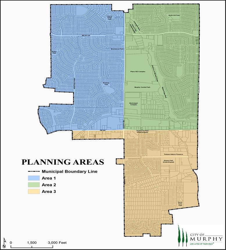
The Park and Recreation Service Area and related geographic size that is addressed in this Master Plan is 5.65 square miles. The overall Park and Recreation Service Area is divided into three service areas, all of which are defined by the major thoroughfares which bisect the City. Refer to the Planning Areas Map on the following page for a graphic depiction of the service areas.
The following goals and objectives were established in the 2002 Parks and Recreation Master Plan prepared by Halff Associates, Inc. These goals were again amended in the 2008 Master Plan. In 2016, after each goal and objective was presented to the Parks and Recreation board; it was determined that all main goals were still viable, with only slight amendments made to the overall goals and objectives. Additional sub-goals and objectives were proposed for inclusion in the updated Parks and Recreation Master Plan in 2016 to make the document more comprehensive and inclusive of both parks and recreation areas of focus. In 2024, the goals were once again analyzed and revised to reflect changes in the community and to make the achievement of goals more measurable, where applicable.
Create a top-tier parks system that is among the best in smaller communities in the Dallas/Ft. Worth area (<25,000) based on NRPA standards including park acreage per capita, residents per playground, and residents per park.
1.1 Establish and follow NRPA Metrics for park acreage, parks and recreation facilities, and park distribution throughout the City. These will be set through the Master Planning process and updated from time to time per the direction of the Parks and Recreation Board and as approved by the City Council.
1.2 Create seamless product delivery for parks, recreation services and special events to present a clear message.
1.3 Allocate adequate funding levels to provide a superior park system.
Develop and implement a comprehensive park system in Murphy that significantly enhances the city’s physical form, aesthetics, and overall appearance, contributing to a more attractive and inviting environment for residents and visitors alike.
2.1 Provide adequate landscaping and aesthetic elements in new parks as they are built, such as stone walls and pavement accents, large caliper trees, attractive pavilions and other elements.
2.2 Along major roads in the City, construct trail and pedestrian corridors, along with landscaping, trees, attractive lighting and streetscape furniture so as to promote the visual quality of Murphy.
2.3 Utilize landscape at key City portals and along selected street medians to create a positive and attractive image of the City.
2.4 Encourage tree planting in parks, street frontage, and on private properties.
2.5 Develop high quality signage for all parks and major municipal facilities.


Offer a diverse range of recreational facilities, programs, and special events tailored to increase involvement and meet the evolving needs of Murphy’s expanding and diverse population.
3.1 Implement a long-range program for final development of Murphy’s parks and recreation system based upon the Murphy Parks, Recreation, Trails and Open Space Master Plan and subsequent updates or modifications to the Master Plan.
3.2 Provide recreational facilities that address the needs of all age groups, young and old, active and passive, and in all socio-economic and geographical categories.
3.3 Develop and maintain park lands in areas of the City with significant park land needs.
3.4 Preserve the ability to respond to unique acquisition or development opportunities as they arise, such as linear parks tracts, provided that they respond to key City-wide needs and goals.
3.5 Develop and implement program planning methods in both active and passive indoor/outdoor recreation.
3.6 Evaluate and ensure that all relevant demographic groups are represented in program and event planning.
3.7 Establish program and event objectives to determine success and effectiveness.
Preserve and enhance Murphy’s open space & natural resources.
4.1 Acquire and preserve as much of the floodplain areas of the Maxwell Creek corridor as feasible, recognizing the corridor as the key greenbelt, linear park and open space preserve for the entire City.
4.2 Through the park planning process, identify and acquire other key natural space corridors and lands with unique natural qualities throughout the City.
4.3 Create and preserve green belt linkages in parks and along open spaces, creeks and drainage ways, bikeways, paths, and natural areas throughout the City and surrounding areas.
4.4 Establish funding mechanisms to acquire open space lands for protection through acquisition, purchase of easements, or outright dedication of floodplain lands where these are deemed to have open space value.
Implement current trail plan to establish a comprehensive network of pedestrian and bicycle pathways throughout Murphy to the greatest extent feasible.
5.1 Link, as feasible, all neighborhoods, schools, parks, major City facilities and retail areas throughout the City with a network of attractive walking and bicycling sidewalks and trails.
5.2 Provide recreational hiking, biking and jogging trails primarily through the development of linear parks.
5.3 Where appropriate, utilize utility easements and rights-of-way as linear park corridors for trail connections.
5.4 As much as feasible, integrate on-street bicycle corridors when renovating or expanding current thoroughfares.
5.5 Coordinate with other adjacent cities, Plano and Wylie ISD’s, Texas Parks and Wildlife Department, and other Federal, State and local governmental entities in efforts to preserve and enhance the waterways, green spaces, and natural areas in and around Murphy.
Ensure that all Murphy parks and recreational facilities are maintained in a superior condition, achieving a maintenance rating of at least 95% based on regular inspections and resident feedback.
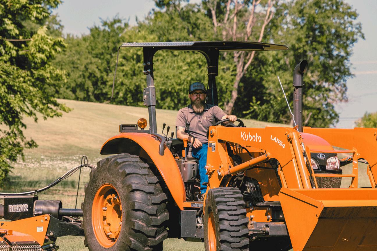
6.1 Provide City parks staff with the manpower and funding resources to maintain all parklands and facilities in a superior manner.
6.2 Provide additional operations and maintenance resources as new recreational facilities are developed and added to the Murphy parks system.
6.3 Improve the quality of operations and maintenance through continued evaluation of the Parks Department’s current operations and the utilization of private resources where feasible.
6.4 Implement renovation/improvement master plans for each park as they age over time, and irrigation
governmental, the recreation
Create mechanisms to work with public and private entities to provide resources to acquire, develop and maintain parks, recreation facilities, services and open space.

7.1 Encourage private cooperative through donations of park-land, labor, and financial contributions.
7.2 Establish a program where community and business groups and neighborhood associations can help improve and maintain parks, recreation and open space areas.
7.3 Establish a 501(c)3 park fund where donations for parks and recreation improvements may be provided by civic organizations and the private sector.
7.4 Encourage the assistance of the private sector in providing landscaping along private and public properties including public right-of-ways and medians.
7.5 Continue to foster a close working relationship between the City of Murphy and the Plano and Wylie Independent School Districts.
7.6 Expand and formalize a volunteer program.
Murphy’s total land area is 5.65 square miles. The City has approximately 39 acres (0.06 square miles) of land in its Extraterritorial Jurisdiction (ETJ).Although the final land use for these ETJ parcels has not been determined, it is assumed that these areas will not be developed as park land. This will not have significant impact on the park services provided by the City of Murphy.
F.M. 544 is the major east/west arterial which bisects the City into north/south planning areas. Traffic studies in 2021 show that there are roughly 50,000 commuters that pass-through Murphy along this thoroughfare. Murphy Road is the major north/south thoroughfare which provides primary vehicular ingress/egress for citizens of Murphy. Murphy Road also bisects the City into east/west planning areas. The 2021 traffic study also noted that there were over 20,000 vehicles that traveled this roadway daily. A majority of Murphy’s retail and commercial development is adjacent to F.M. 544. The remaining land use in Murphy is residential.

To deliver a variety of recreational features in an efficient manner, some type of relationship defining system must be established among those facilities used for recreation. Guidelines and standards recommended by the National Recreation and Park Association (NRPA) have been followed by cities for many years to define a hierarchy for their park systems. The NRPA made major revisions to their recommendations for delivering park and recreation services in the publication, Parks, Recreation, Open Space and Greenway Guidelines, published in December 1995. The classification system has been changed slightly to more closely define a park space in relationship to its proposed use. The following analysis identifies the NRPA classification of parks, their description, location criteria within the community and criteria for size. Only the park classifications selected specifically for Murphy are defined in this section. Once established, these guidelines are then applicable for structuring the Murphy park system in an orderly manner responsive to the recreational demands being generated by the present and future population.
The neighborhood park is considered to be the most important feature of a park system and is one of the major cohesive elements in neighborhood design. Its primary function is the provision of recreational space for the entire neighborhood which surrounds it. Space in the neighborhood park should be distributed between active and passive uses.
a) The neighborhood park should be located near the center of a neighborhood area/park planning area and have a service area of approximately one-half mile to one-quarter mile.
b) The size should be related to the service area population and the menu of activities chosen for placement in the park. Five (5) to ten (10) acres is the optimal size for this park.
c) Safe and convenient pedestrian access is considered important to a neighborhood park location.
d) Generally, the location should not be adjacent to a heavily traveled major or minor thoroughfare.
e) When it is possible to combine an elementary or middle school with this type of park, the two features further enhance the identity of the neighborhood by providing a central location for recreation and education and a significant open space feature within the neighborhood.
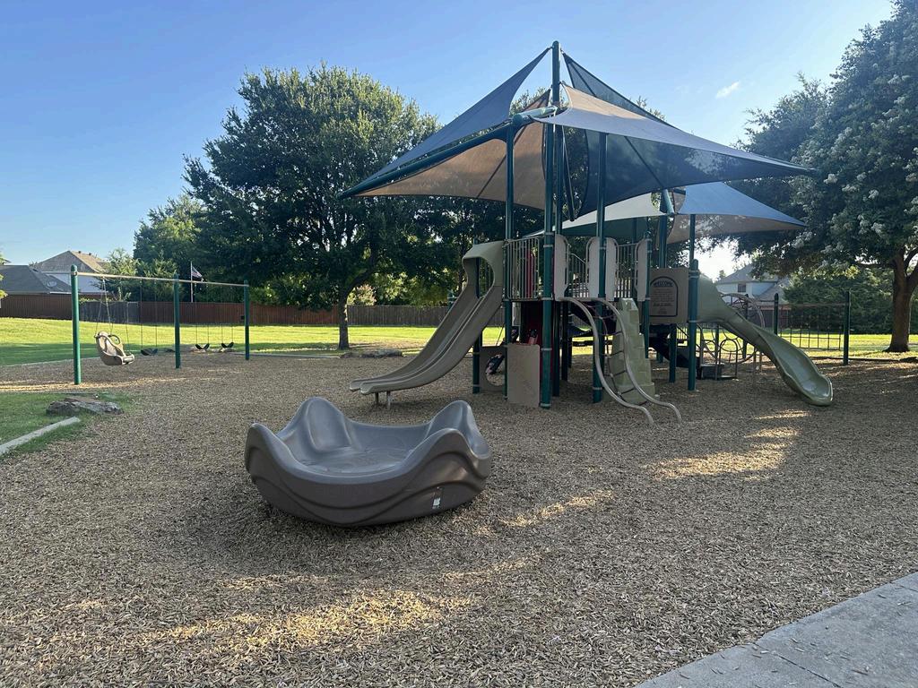
f) Facilities normally provided at a neighborhood park consists of:
Playground equipment for small children.
A multiple purpose hard surfaced play area.
Space for court games, such as basketball, tennis, volleyball and in-line hockey in addition to walking/jogging trails.
Playfield space for non-organized competitive games such as baseball, football and soccer.
Passive space possibly for a pavilion with tables and grills, drinking fountains and sitting areas.
Off-street parking is a consideration if users are beyond an acceptable walking distance or if users need to drive to access the park.
Water spray feature or spray ground or misting feature.
It is not desirable to light athletic facilities in a neighborhood environment since lighting is often objectionable to nearby residents; however, some lighting for security purposes should be incorporated into the park.
The allocation of space in the neighborhood park should be approximately 50 percent passive area and 50 percent active area.
The placement of restroom facilities in neighborhood parks (<10 acres) is not desirable unless deemed necessary.
The above facilities are those generally considered for active space. The passive space should be used to develop the character of the park by creating an open landscaped setting with trails, sitting area, and picnic space. This park becomes an integral part of the neighborhood.
A community park is larger in size than a neighborhood park and provides service to several neighborhoods or specific sections of the community. The community park is oriented primarily toward providing recreational opportunities not feasible in a neighborhood park. This type of park should be developed for both active and passive use.
A community park serves several neighborhood areas, and should therefore be conveniently accessible by automobile and include provisions for off-street parking.
The optimal size for the community park is between 40 and 150 acres. This size should be based on its intended use and the population residing in the service area. Natural features such as terrain, tree cover, flood prone areas, and water features are all factors to be considered in selecting and sizing this type of park.
Activities provided should include both active and passive.
Space for active uses associated with neighborhood parks including field and court games.
Passive spaces more extensive than the neighborhood park for trails, natural areas, picnicking, and ornamental or natural landscape areas.
A facility for cultural activities such as plays or concerts; possibly provide an amphitheater.
Lighted and unlighted athletic fields or facilities may be placed in community parks provided careful thought is given to their design and location.
A community park should be well removed from the residential environment due to the traffic, noise, and lights associated with the sports complex.
Based on use, accessibility, and other requirements, the community park should be located in a non-residential area served by major thoroughfares.
Although community parks are designed primarily for competitive play by both young people and adults, other features should be included in the complex. Among these are play apparatus, court game space, picnicking facilities, and trails.
Support facilities in a sports complex include restrooms, multi-purpose building(s), and maintenance facilities.
Parking is a major consideration for the sports complex. Spaces should be allocated to accommodate those currently participating, those lingering following the previous games and those arriving to participate in the next scheduled game.
These parks or recreational spaces are identified by a single use, and fall into three categories:
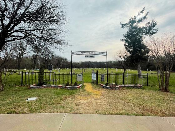
Historical/Cultural/Social Sites – which offer recreational opportunities because of their unique characteristics; such as the Murphy Community Center and the four Murphy Cemeteries which are designated as historical sites in Murphy. The Murphy Municipal Complex is classified as a special use park.
Recreational Facilities – single purpose facilities such as a senior center, dog park, golf course, or marina.
Outdoor Recreational Facilities – uses such as a tennis center, stadium, or possibly a special type of sports complex designed specifically for a single sport.
This classification applies to types of land which have characteristics either identifying them as undevelopable land or suitable for use as a component linking other park areas.
These spaces are generally natural corridors along creek/flood prone areas or along easements containing a man-made feature. Maxwell Creek is the primary greenbelt in Murphy. There is no specific size for these spaces; however, establishing a minimum width is important to the function of the greenway, particularly if used as a location for a trail. This width should not be less than 50 feet. Where the greenway is on either side of a natural drainage course, a minimum of fifteen feet shall be provided for foot traffic or motorized vehicles performing maintenance along the greenway.
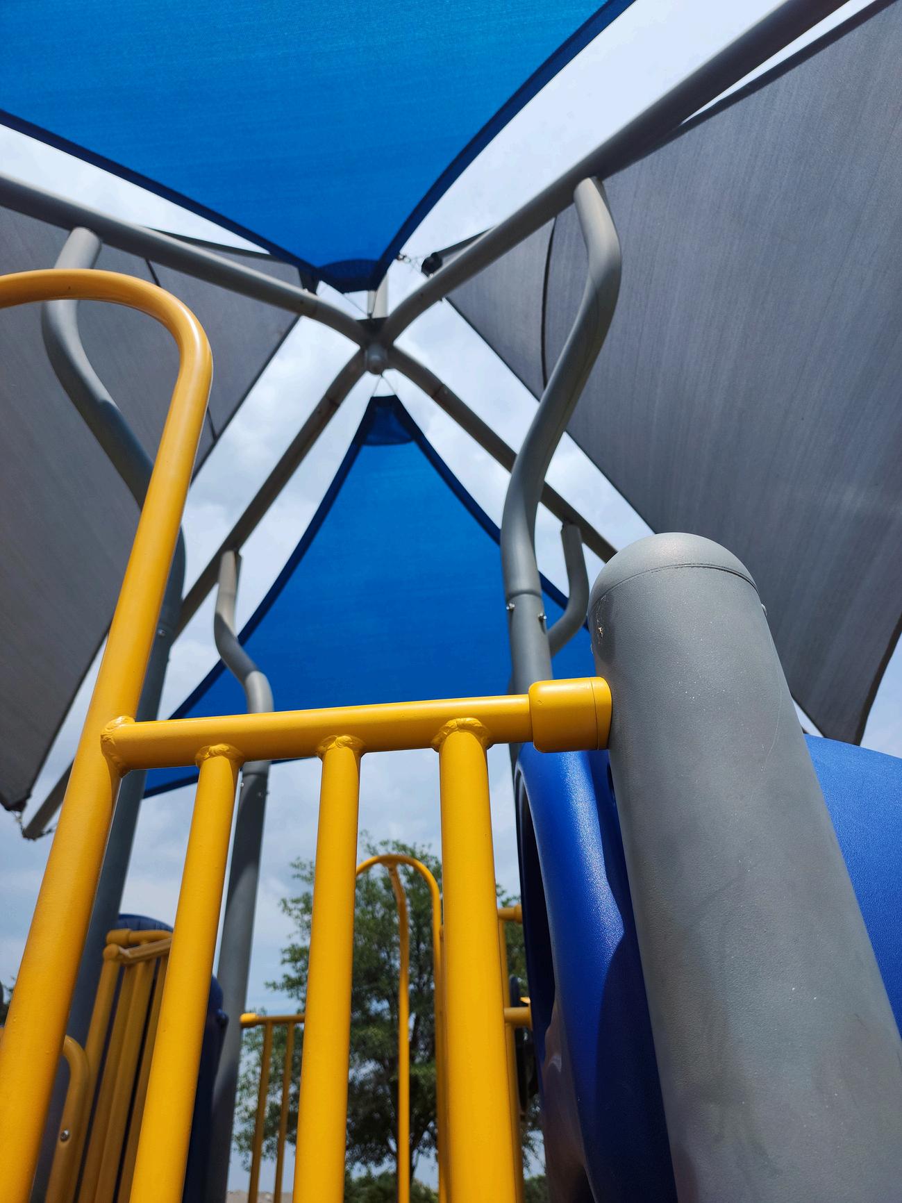
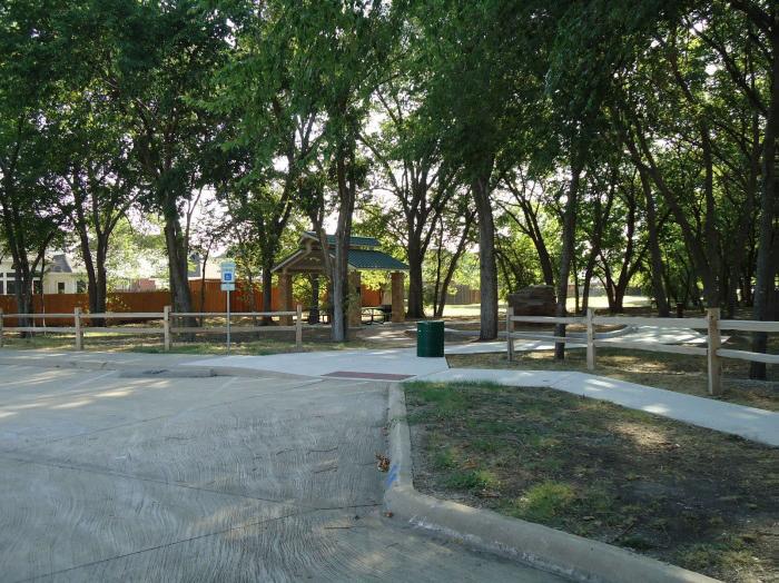
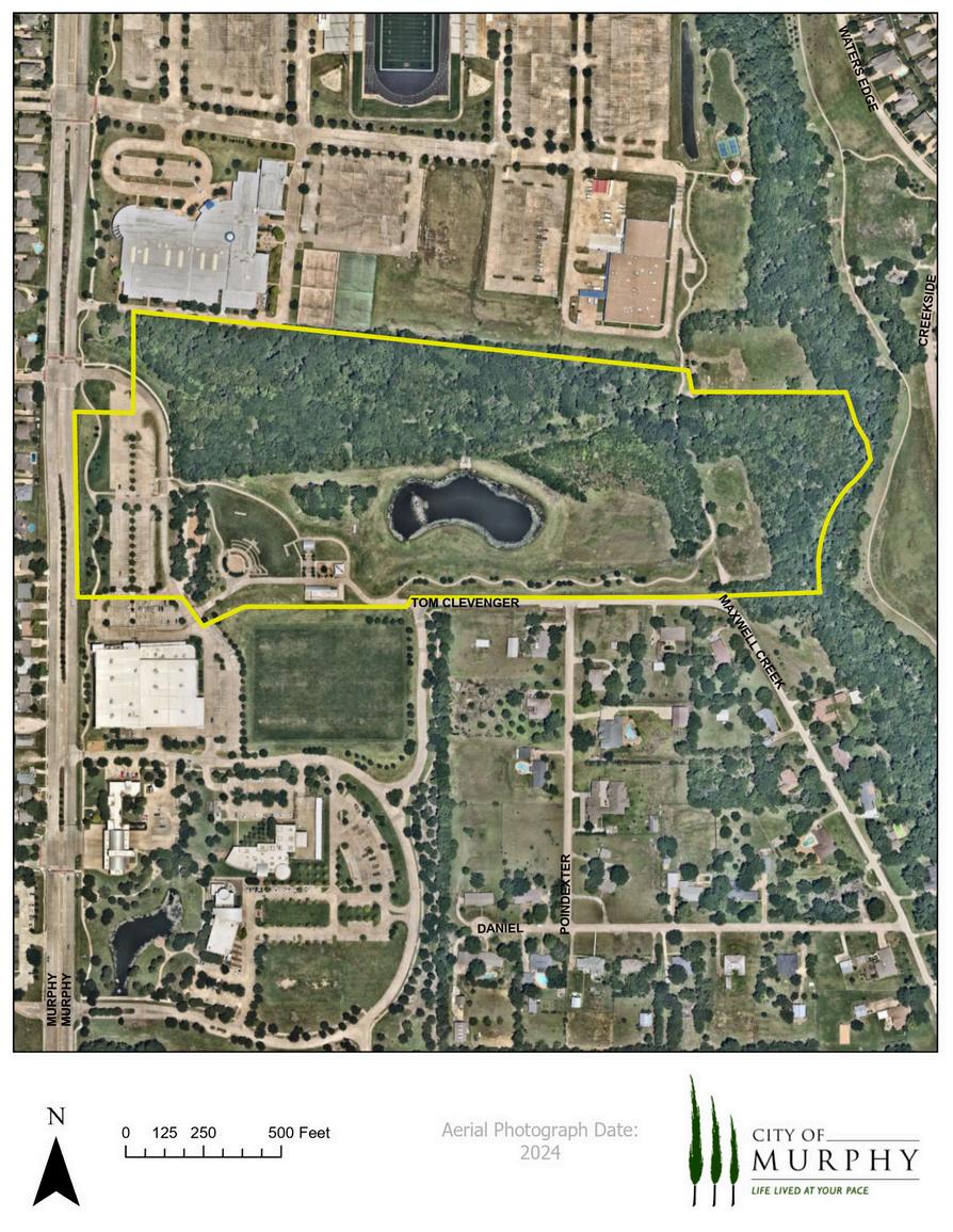
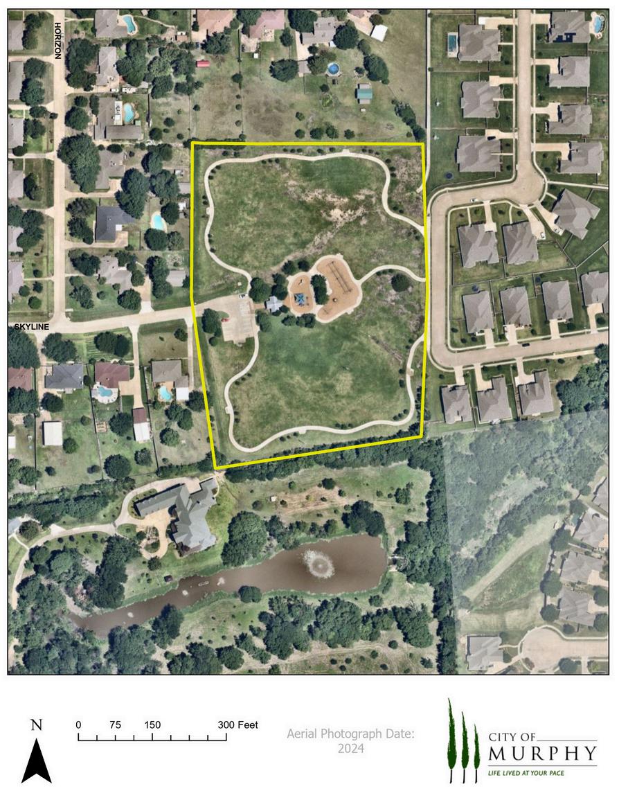
The following information documents existing park and recreational facilities in Murphy. Page 25 contains a map of parks and open space throughout the City, while the listing beginning on page 30 is a record of the existing parks, their size, opening date, remodel date, the NRPA park classification, facilities, and any future development plans. The map on the next page shows the location of all City parks and undeveloped land for reference.
Park Facilities
1 Park Entry Sign
Park Rules Sign
20 Parking Spaces (2 ADA)
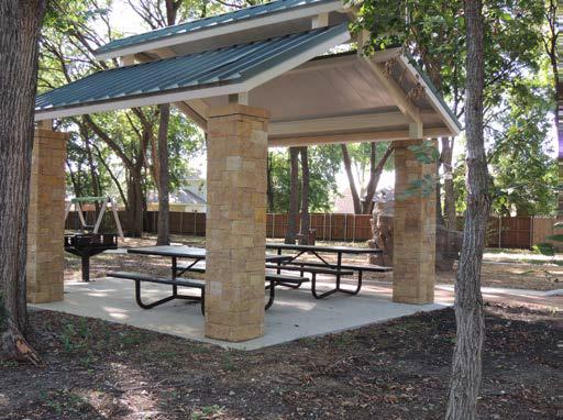
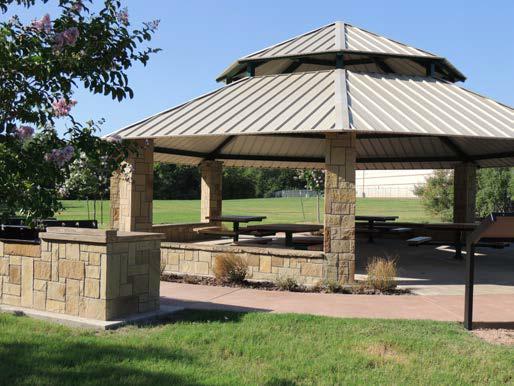
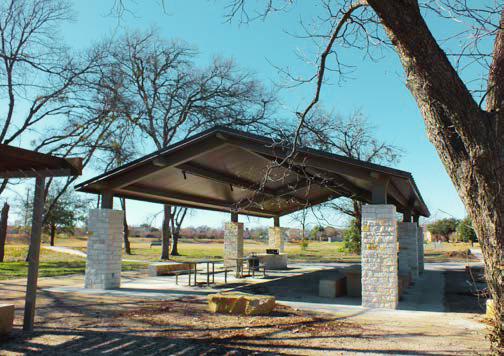
1 Pavilion w/electricity & 4 Picnic Tables
1 Grill
3 Park Benches
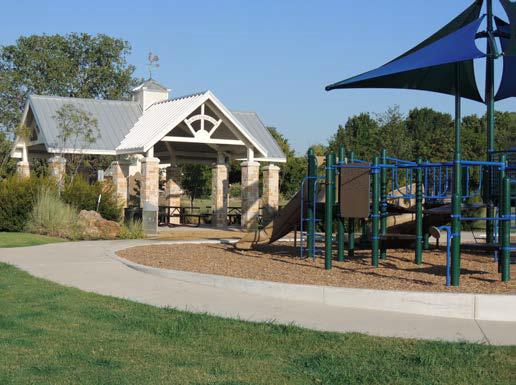
1 Covered Play Area (5-12 years)
Drinking Fountain
1 Basketball Court
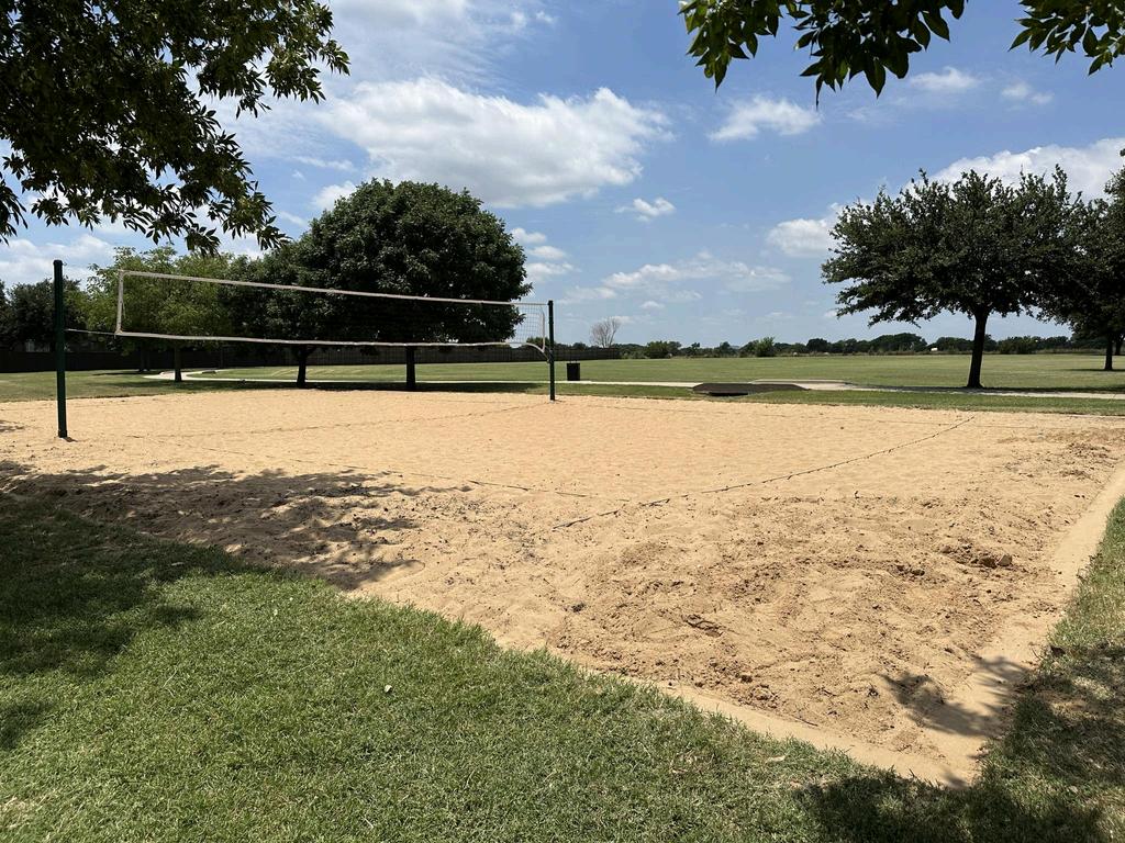
1 Sand Volleyball Court
0.25 Mile Loop Walking Trail
1 Big Belly Unit (Recycle/Trash)
2 Waste Receptacles
2 Pet Waste Stations
Possible Future Park Improvements
Addition of lighting for basketball and volleyball courts
Replacement of playground or park renovation
Park Facilities
1 Park Rules Sign
10 Parking Spaces (1 Handicap)
1 Pavilion w/2 Picnic Tables
1 Standing Grill
2 Open Play Areas
1 Drinking Fountain
0.2 Mile Concrete Walking Trail (SRTS)
1 Big Belly Unit (Recycle/Trash)
2 Waste Receptacles
1 Pet Waste Station
Possible Future Park Improvements
Decomposed Granite Trail to Complete Loop Trail
Park Size 3.48 Acres
Subdivision
Between Stratford Crossing & Daniel Crossing
Classification Neighborhood Park
Expansion Date October 2010
Replacement of Tire Swing Playground with Natural/Rope Structure
Drainage Improvements
Additional Tree Planting
Sod under Trees for Erosion Control
Park Facilities
Curb Parking
1 Pavilion w/electricity and 4 Picnic Tables
8 Park Benches
1 Grill
2 Covered Playgrounds (2-5 yr. & 5-12 yr.)
2 Uncovered Swing Sets
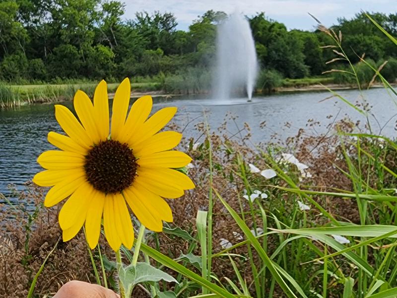
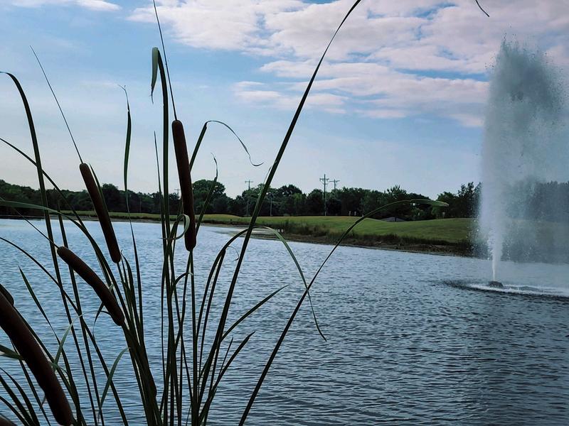
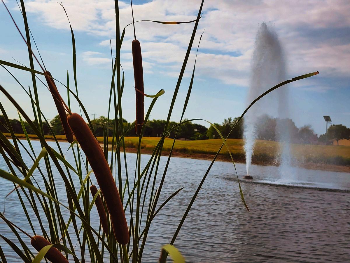
1 Pond with Fountain and Aerators
1 Fishing Pier
1 Drinking Fountain
Big Belly Unit (Recycle/Trash)
2 Waste Receptacles
2 Pet Waste Stations
0.4 Mile Loop Walking Trail
Possible Future Park Improvements
Playground Replacement
Pond Dredging
Fence Replacement/Upgrade

Subdivision
Rooms for Rent / Use
1 Great Hall for Large Events
Can be divided for smaller events.
2 Conference Rooms
1 Meeting Room with Kitchenette
Possible Future Improvements
Further remodel of interior to reevaluate use of conference rooms
Park Facilities
1 Pavilion w/electricity and 4 Picnic Tables
Food Truck Court with 4 Picnic Tables and Places for 4 Food Trucks/Trailers
4 Picnic Tables in Plaza Area
3 Park Benches
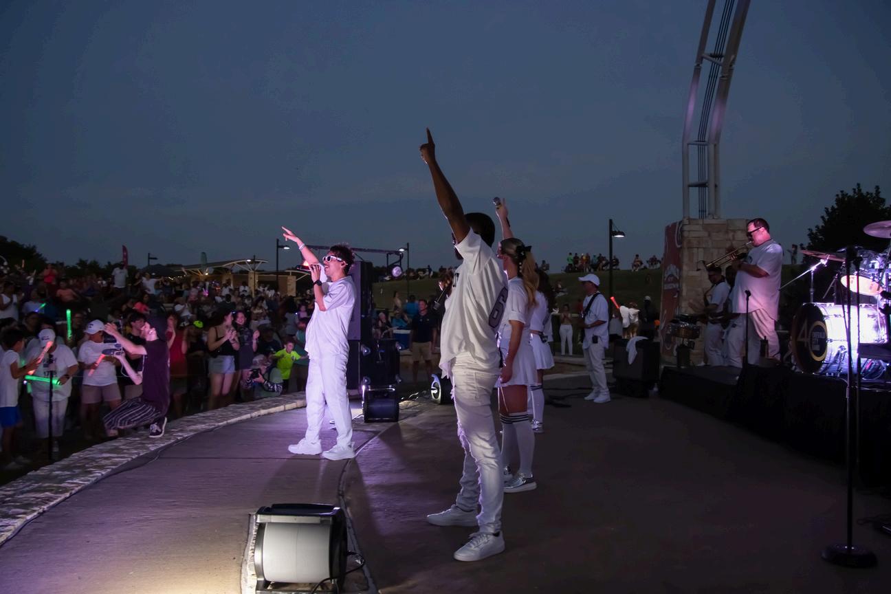
1 Amphitheater
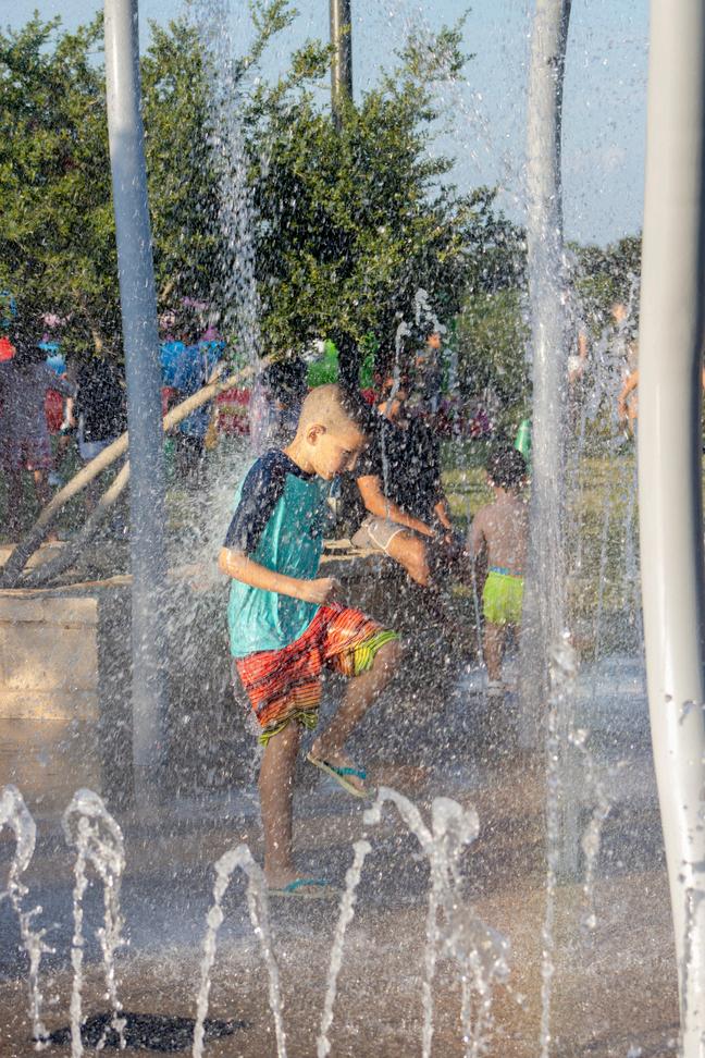
1 Spray Ground
1 Concession Building
1 Covered Playground (5-12 yr.)
1 Restroom Facility
2 Soccer Fields
2 Drinking Fountains
1 Outdoor Learning Center w/4 Benches
4 Interpretive Signs
Nature Trails
1 Irrigation Pond
3 Big Belly Units (Recycle/Trash)
0.6 Mile Walking Trail
Possible Future Park Improvements
Covering of amphitheater stage area
Expansion of existing playground (inclusive)
Renovation of splash pad
Removal of large berm near amphitheater
Installation of Fitness Court
Additional Parking
Bike Park
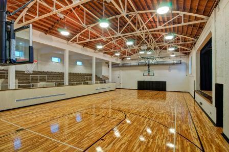
Rooms for Rent / Use
2 Multi-Purpose Rooms
1 Lounge/Library
1 Dance Room
1 Gymnasium and Stage
1 Game Room
Scheduled Future Improvements
Reorganization of Space Fitness Room Game Room with Table Games
Possible Future Improvements
Reassignment to Senior Center
Office Space Renovation & Expansion
Expansion of Facility into Recreation Center
Total SQFT 12,014
Park Facilities
1 Park Entrance Sign
1 Park Rules Sign
12 Parking Spaces
1 Pavilion w/Electric and 4 Picnic Tables
4 Park Benches
2 Covered Playgrounds (2-5 yr. & 5-12 yr.)
2 Open Swing Sets
2 Waste Receptacles
1 Big Belly Unit (Recycle/Trash)
3 Pet Waste Stations
1 Grill
1 Drinking Fountain
1 Basketball Court
1 Baseball Backstop
1 Bicycle Rack
0.3 Mile Loop Walking Trail
Subdivision
Park Facilities
1 Park Entry Sign
1 Park Rules Sign
55 Parking Spaces (4 handicap)
1 Stone Clad Grill
1 Stand Alone Picnic Table
2 Park Benches
1 Drinking Fountain
2 Covered Playgrounds (2-5 yr. & 5-12 yr.)
1 Uncovered Swing Set
1 Baseball Backstop
1 Basketball Court
1 Practice Soccer Field ( 2 goals)
1 Lighted Volleyball Court
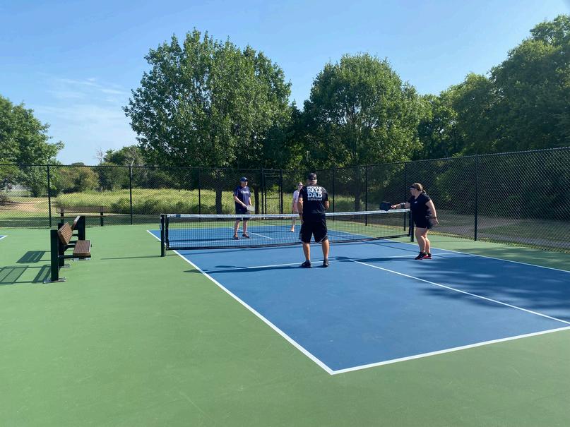
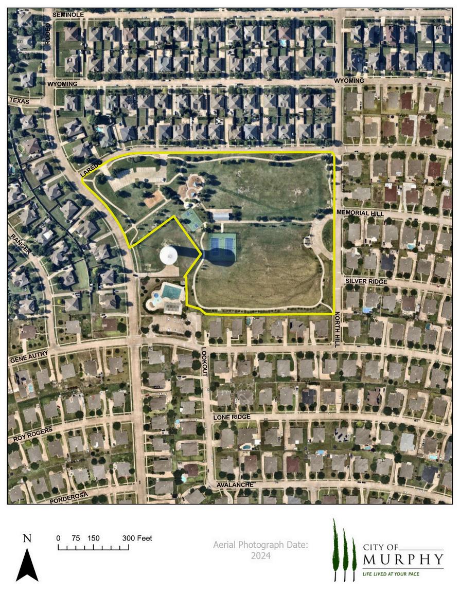
2 Lighted Tennis Courts
1 Fitness Station
1 Restroom Building
1 Big Belly Receptacle (Trash/Recycle)
4 Waste Receptacles
3 Pet Waste Stations
0.74 mile loop trail
Possible Future Park Improvements
Playground Replacement
Additional Practice Fields
Lighting of Basketball Court
Renovation of North Practice Fields
Expansion of Tennis/Pickleball Courts

Park Facilities
1 Park Entry Sign
1 Park Rules Sign
Parking at PISD Stadium
1 Pavilion w/4 Picnic Tables
5 Park Benches
1 Stone Clad Grill
1 Baseball Backstop
1 Basketball Court
1 Outdoor Learning Center w/7 benches
0.2 Mile Decomposed Granite Walking Trail
0.2 Mile Concrete Trail Connection to Central
Park & Waters Edge Park
2 Interpretive Signs
1 Big Belly Unit (Recycle/Trash)
2 Waste Receptacles
1 Pet Waste Station
2 Pickleball Courts
Possible Future Park Improvements
Lights on Pickleball Courts
Decomposed Granite Trail Improvements
Replacement of Interperative Signage
Irrigation Expansion/Electrical
Park Facilities
39 Parking Spaces (3 handicap) – Pine Top
17 Parking Spaces (2 handicap) – S. Maxwell Creek
1 Small Pavilion w/electricity and 2 picnic tables
1 Large Pavilion w/electricity and 5 picnic tables
3 Picnic Areas around Pond
2 Picnic Areas w/Grills
2 Trellis Seating Areas around Pond
1 Firepit
2 Stone Clad Grills
2 Drinking Fountains
1 Restroom Facility
2 Covered Playgrounds (2-5 yr. & 5-12 yr.)
1 Uncovered Swing Set
3 Exercise Stations
3 Baseball Backstops
1 Basketball Court
1 Mile Hike and Bike Trail in ONCOR Easement
1.25 Mile Concrete Trail
1 Big Belly Unit (Recycle/Trash)
6 Waste Receptacles
4 Pet Waste Stations
Park Facilities
1 Park Rules Sign
0.37 Mile Loop Walking Trail
16 Parking Spaces (2 handicap)
1 Pavilion w/Electric and 3 picnic tables
1 Standing Grill
7 Park Benches
1 Covered Playground (5-12 yr.)
1 Zip Line
1 Swing Set
1 Spinner
1 Drinking Fountain
1 Big Belly Unit (Recycle/Trash)
3 Waste Receptacle
2 Pet Waste Stations
Possible Future Park Improvements
Evaluation of usage for open space -Trail Connection to Murphy Farms (if possible)
Park Facilities
1 Park Entry Sign
1 Park Rules Sign
Curb Parking
4 Picnic Tables
10 Park Benches
1 Uncovered Play Area – shaded
1 Drinking Fountain
3 Soccer Fields (6 goals)
1 Interpretive Sign
1 Big Belly Unit (Recycle/Trash)
7 Waste Receptacles
7 Pet Waste Stations
0.25 Mile Loop Walking Trail
1.66 Mile Hike/Bike Trail
Possible Future Park Improvements
Additional Practice Fields
Additional Parking
The following information documents undeveloped park land in Murphy. The listings beginning on the next page is a record of the existing spaces, their size, and any development plans that have been considered or approved as of August 2024.
Park Size
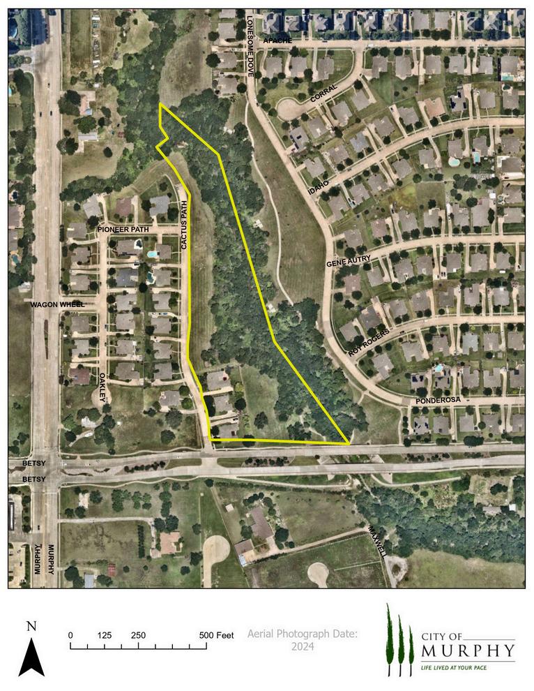
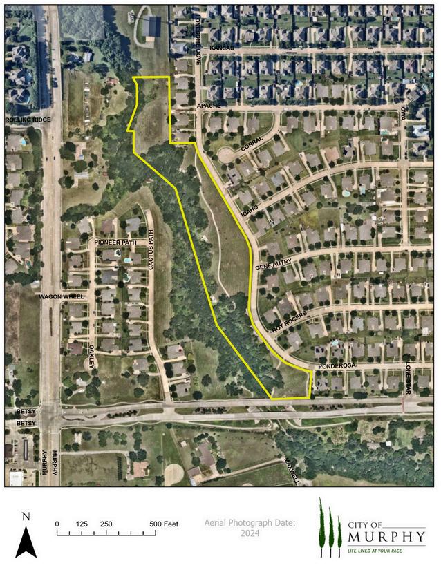
6.2 Acres
Park Location East of Cactus Path Drive, North of Betsy Lane
Subdivision The Ranch
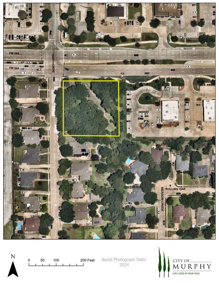
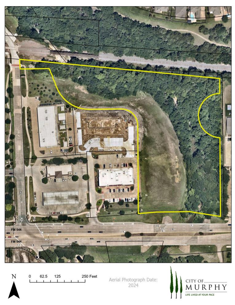
Park Size
1.3 Acres
Park Location At the South East Corner of FM 544 and Hawthorne Drive
Subdivision The Timbers
Park Size 5 Acres
Park Location West of Lonesome Dove Road
Subdivision The Ranch
Classification Greenbelt
Park Facilities
0.3 Mile Walking Trail (UNDEVELOPED)
Park Location
North East of the intersection at FM 544 and Maxwell Creek Drive
In 2012, the City of Murphy participated in a collaborative Multi-Jurisdictional Planning Effort to develop the Collin County Regional Trails Master Plan. This Master Plan exists with the primary goal of providing coordination and connectivity within the county for future trail development. The Regional Trail Master Plan (RTMP) reviewed existing planned trails in Collin County as well as developed a plan to connect all major trail corridors in the county; known as the Regional Trail System. Once the development plans were established, the RTMP then provided guidelines for implementation of development. These guidelines included recommendations in planning, designing, and maintenance of the Regional Trail System.
The following trail location is a trail that has been built that connects Murphy to other city’s trail systems:
Along the ONCOR Easement between South Murphy Road and South Maxwell Creek Road. This connects Murphy, to the west, with Plano’s trail system and on into Breckenridge Park in Richardson. This will, in the future, connect to the east and into Wylie, and in the future, Sachse.
The following locations are trails in Murphy that are planned to connect to other city’s trail systems: Along Maxwell Creek at McCreary Road and along the KCS Railroad at McCreary Road. This will connect Murphy, Wylie and Sachse. While Murphy currently has no development plans for trails along the railroad, there is a hard surface (concrete) trail along Maxwell Creek.
Along McWhirter Road between Maxwell Creek and McCreary Road:
This will connect Murphy, Wylie and Parker.
Murphy currently has plans to develop hard surface trails along Maxwell Creek.
Between South Maxwell Creek Road and South McCreary Road:
This will complete connection from Murphy to Plano/Richardson and Wylie/Sachse. Murphy has plans completed for this connection and will begin construction in 2024.
Through Murphy’s Development Codes and Subdivision Ordinance, the City has provided a network of sidewalks/trails within our subdivisions and adjacent thoroughfares. This network allows citizens the opportunity to walk from their residence to parks, retail areas, and other amenities in Murphy. The Trail Master Plan illustrates some of the typical routes pedestrians may use to access parks and other public/private amenities in Murphy.

First and foremost, the City-Wide Trail System Plan will serve as a planning tool for Parks and Recreation Staff and the Murphy City Council. It will also serve to create a vision for a City-wide trails and greenway network and assist public and private entities who wish to contribute funds or resources to the development of the system. Another key purpose of the Trail Plan is to serve as a basis for coordinating with other City departments, to reduce conflicts with their development activities including installation of utilities, water quality, storm water runoff, planning services, and other activities.
The following is a general discussion of the parameters associated with trail design and construction. The conclusion of this section contains recommendations for the design and construction of the proposed Murphy Trail System.
Separated Trails – Separate trails and trail systems are provided for each type of trail user, e.g. bicyclist, pedestrian, skaters.
Multi-Use Trails - All trail user groups occupy the same trail or trail corridor. The physical design of the trail must be modified accordingly, to accommodate the demands of the expected user groups.
Natural Surfaces - Are mostly restricted to natural or native parks. Typically, this type of trail is limited in use due to weather or wet conditions.
Decomposed Granite – Decomposed granite is the surface at Maxwell Creek Park within the native area. The approximate length is 0.2 miles. The surface is soft and excellent for walking and jogging. The surface should be in a self-contained park or neighborhood park. This type of trail within a neighborhood park is an excellent use for decomposed granite.
Concrete – While initially more expensive than other material choices, concrete is the longest lasting trail surface with an expected lifespan of 25 years or more. It requires the least maintenance of any trail surface material. Only saw cut expansion joints should be used to avoid differential settling due to freeze/thaw and wet/dry cycles. Concrete is suitable for poor sub-soil conditions but is more expensive to repair. Non-skid medium broom finish is ideal for bicycle traffic. Concrete is less desirable for jogging paths.
The recommended trail width varies and depends on the location and type of trail.
Maxwell Creek Corridor - The minimum trail width for trails in this corridor should be 10-12 feet. Neighborhood Parks - The minimum trail width for trails in neighborhood parks should be six feet. Oftentimes the trails are self-contained within the boundaries of the park; therefore, a six foot minimum width is adequate. Although some of the existing trails in Mustang Park and Liberty Ridge Park are less than six feet, they still provide walking and jogging opportunities.

First and foremost, the City-Wide Trail System Plan will serve as a planning tool for Parks and Recreation Staff and the Murphy City Council. It will also serve to create a vision for a City-wide trails and greenway network and assist public and private entities who wish to contribute funds or resources to the development of the system. Another key purpose of the Trail Plan is to serve as a basis for coordinating with other City departments, to reduce conflicts with their development activities including installation of utilities, water quality, storm water runoff, planning services, and other activities.
The following is a general discussion of the parameters associated with trail design and construction. The conclusion of this section contains recommendations for the design and construction of the proposed Murphy Trail System.
Separated Trails – Separate trails and trail systems are provided for each type of trail user, e.g. bicyclist, pedestrian, skaters.
All trail user groups occupy the same trail or trail corridor. The physical design of the trail must be modified accordingly, to accommodate the demands of the expected user groups.
Natural Surfaces - Are mostly restricted to natural or native parks. Typically, this type of trail is limited in use due to weather or wet conditions.
Decomposed Granite – Decomposed granite is the surface at Maxwell Creek Park within the native area. The approximate length is 0.2 miles. The surface is soft and excellent for walking and jogging. The surface should be in a self-contained park or neighborhood park. This type of trail within a neighborhood park is an excellent use for decomposed granite.
Concrete – While initially more expensive than other material choices, concrete is the longest lasting trail surface with an expected lifespan of 25 years or more. It requires the least maintenance of any trail surface material. Only saw cut expansion joints should be used to avoid differential settling due to freeze/thaw and wet/dry cycles. Concrete is suitable for poor sub-soil conditions but is more expensive to repair. Non-skid medium broom finish is ideal for bicycle traffic. Concrete is less desirable for jogging paths.
The recommended trail width varies and depends on the location and type of trail.
Maxwell Creek Corridor - The minimum trail width for trails in this corridor should be 10-12 feet.
Neighborhood Parks - The minimum trail width for trails in neighborhood parks should be six feet. Oftentimes the trails are self-contained within the boundaries of the park; therefore, a six foot minimum width is adequate. Although some of the existing trails in Mustang Park and Liberty Ridge Park are less than six feet, they still provide walking and jogging opportunities.
Throughfare Trails - Existing trails in the right-of-way of Murphy Road, Betsy Lane, McCreary Road, and FM 544 should be a minimum of 10 feet in width. Not all the trails are 8-10 feed in width; however, the trails still provide walking and jogging opportunities.
The absolute minimum clearance for multi-use trails is 8.2 feet, 9.5 feet is the minimum comfortable height. The vertical clearance may need to be greater to permit passage of maintenance vehicles. Clearance under crossings and tunnels should be 10 feet for adequate vertical shy distance.
Grades on off-street paths should be kept to a minimum, especially on long inclines. Grades greater than 5 percent are undesirable because the ascents are difficult for bicyclists and the descents cause some bicyclists to exceed the speeds at which they are competent. ADA guidelines stipulate that anything exceeding five percent (one foot rise in 20 horizontal feet) is a ramp and must be constructed with handrails, a maximum rise of 30 inches in a maximum length of thirty feet and must have a 60 inch by 60-inch landing at the base and the top. Therefore, to follow ADA guidelines, trail ramps cannot exceed an 8.33 percent slope (one foot rise in 12 horizontal feet).
Adequate signs and markings are essential on multi-use trails, especially to alert users of potential conflicts and to convey regulatory messages to both users and motorists at street intersections. In addition, guide signs, such as those indicating destination, direction, distance, route numbers and names of cross streets should be used in the same manner as they are on highways. Warning signs shall consist of the traffic control signage and devices indicated in the design guidelines.
Directional signage is imperative to facilitate user comfort and confidence, thereby ensuring optimal use of the trail both from the standpoint of participation/occupancy levels and enjoyment level of the participants. At trail intersections, signage should be provided that indicate destinations of the various trail branches and a distance to each destination. The cardinal directions should also be indicated.
Within residential neighborhoods, in addition to the aforementioned signage, the pavement surface shall be demarcated in such a manner that trail users will be able to follow the trail routing through the neighborhood without becoming confused and possibly taking a wrong turn.
Spur trails linking neighborhoods to parks and schools shall have a definite indication at the trail terminus so trail users unsuspectingly traveling into neighborhoods are made aware that the trail system ends at that location. Provision of a map indicating the direction to the main branch of the trail would be beneficial at these locations.

Although access to the trail will usually be available at every road crossing, the users of the trail should be encouraged to enter the trail at specific access points. By designating specific points of access, there may be an elimination of possible encroachment on private property, as well as, preventing possible congestion at busy road crossings.
Lighting of the multi-use trail should be considered, especially if the off-street routes are intended for transportation purposes, many trail commuters may need to travel during poorly lit morning and evening hours. Fixed source lighting reduces conflicts along paths and at intersections. In addition, lighting allows the trail user to see the path direction, surface conditions and obstacles. Lighting should be considered through underpasses or tunnels and when nighttime security could be a problem. The standard horizontal illumination level is 5 lux (0.5-foot candle) by 22 lux (2 foot candles). Where special security problems exist, height illumination levels may be considered.
Pedestrian signalization designed to accommodate a one meter (3.2 feet) per second walking speed, should be provided at major streets where traffic volume and speed is high. ADA stipulated that where provided, buttons shall be raised or at least flush and a minimum of 1.9 centimeters (3/4 inch) in the smallest dimension. The force required to activate controls shall be no greater than 22.2N (5lbs.).Additionally, controls shall be located as close as possible to the curb ramp and, to the maximum extent feasible, shall permit operation from a level area immediately adjacent to the controls and a maximum of 122.7 centimeters (48.3 inches) high.
To provide clear visibility of pedestrians approaching intersection crosswalks at night, the approaches and all street corners should be illuminated. All intersection lighting should illuminate the crossing and waiting areas and/or create back lighting to make the pedestrian silhouette clearly visible on approach. All commercial, entertainment, school and other pedestrian traffic generating corridors and spaces should be well illuminated. Raised islands in crossings should be cut through level with the street or have curb ramps or other sloped area at both sides. There should be a level area 121.9 cm (48 inches) long minimum and a minimum of 91.4 cm (36 inches) wide in the part of the island intersected by the crossings.
There are several methods of crossing collector streets and major thoroughfares: at grade, overhead and below grade. The preferred alternative is to cross any major collector or thoroughfare, such as Murphy Road or FM 544, with an at-grade crossing, at a signalized intersection. The traffic signals stop oncoming traffic and allow for a safe crossing for pedestrian and trail users. Spur trails from the main trail should be used as necessary to achieve this. This is the safest and most economical method of crossing at a thoroughfare or collector.

Below grade or creek drainage structures may be used for crossing under major thoroughfares. Using drainage structure is feasible provided the trail is elevated above the normal stream flow line. The trail will flood during heavy rain events and clean-up and restoration will be required. There are additional construction costs incurred with this method of crossing. The trail gradient or slope will have to accommodate the design guidelines established by the ADA, therefore adding to the construction cost.
Tunnel crossings face the same issues as drainage structures, apart from drainage and safety. Because the tunnel is generally constructed at a mid-point, drainage is an issue; water will have to be pumped or piped out. The tunnel is also a safety concern since it is concealed and could pose a danger to trail users.
Aerial crossings would be the most expensive of the crossing alternatives. The crossing would have to provide height clearance for vehicles in traffic lanes and accommodate the disabled. Ramps or elevators would have to be constructed to meet ADA guidelines.
The Needs Assessment phase of the plan process identifies the recreation needs and desires by using the public hearing process, standard-based analysis and park land analysis. This process is critical to the success of the Master Plan, as it ensures the needs of the citizens are addressed.
The City of Murphy currently provides park and recreational facilities in neighborhood parks, the Maxwell Creek corridor, as well as the Murphy Community Center. All of which provide unique recreational opportunities to the residents of Murphy.
During the previous plan development process, it was determined that the City would not be able to provide a large community park for active athletic fields and play. However, our largest City Park; Murphy Central Park, includes 60 acres, two athletic fields and is adjacent to Plano Sports Authority (PSA).
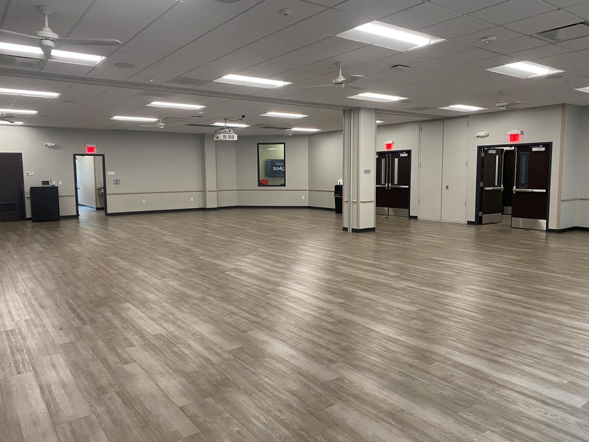
The Murphy Community Center (MCC) and Murphy Activity Center (MAC) is the City’s main source of indoor recreation and programming for our citizens. The MCC offers an indoor lounge/lending library, gymnasium, stage, game room, and three various size meeting/classrooms. The gymnasium can also be converted to host large meetings, conferences, and events. The MAC offers two conference rooms, a multipurpose “kitchenette” room, and a large meeting/event space that can be converted into two smaller meeting/event spaces.
The Recreation facilities had a class enrollment in 2023 of 3,627 and 242 rentals and approximately 19,736 reservation patrons. MCC/Open gym visits totaled 10,452.
In addition to indoor usage of the MCC, the Recreation Department is also responsible for reservations for pavilions and practice fields in all City-owned parks. In 2023, field usage rentals was measured at 6,126 and pavilion usage totaled 167 rentals and an estimated 5,751 patrons.
The construction of Timbers Nature Preserve (35 acres), and the adjacent ONCOR easement trail, has also served to meet the needs associated with additional baseball and soccer practice fields as well as more passive, natural space.
The City of Murphy held one public hearing on March 18, 2024 to receive input from the citizens in regard to their park and recreation needs and desires. The meeting was attended by 35 members of the community with ages ranging from mid-twenties to senior citizens. The opportunity was given to voice their concerns verbally in open forum or to communicate them through a written questionnaire.
The Parks & Recreation Department also conducted an online 2-week Master Plan Update Survey that requested input from the citizens. Overall, there were 338 responses received to the survey and the department received an overall rating of 3.88 out of 5 for their performance.
Comments varied over the full scope of parks and recreation. Continuing to conserve open space and natural settings was a major theme of the evening, as was the desire for increased pickleball availability as the sport continues to grow and the demand increases. Expansion of existing hike and bike trails continued to be a topic of interest, while there was an increased request for fitness equipment in park settings as well as at the Murphy Community Center. The construction of a library, more sports facilities, dog-related items, and more organized athletic offerings were also requested.
The list below is a summary of the desired recreational elements discussed at the hearing:
Cricket Pitch Updated Playground Equipment
Shade at Playgrounds
Pickleball Courts Volleyball Courts Pool
Fitness Equipment in Parks
Lighting for Trails/Courts Poured-in-Place Surfacing Longer Park Hours Pump Track
Skate Park Dog Fountains
Park
Better Maintenance Community Garden Library
Trail Connectivity Disc Golf
Bottle Fillers
Movies/Concerts in the Fall
Water Activities in Parks
Athletic Fields
Trails
Splash Pads
The National Recreation & Parks Association (NRPA) has ended their use of the NRPA Areas and Facilities Standards because there is no single set of standards that can define what each individual community should provide for their citizens. Instead, this has been replaced with a metric-based approach that enables cities to compare peer city data to determine their own individual best practices (Table 4).
many as possible to provide a comprehensive system of pedestrian trails connecting residential areas to parks, schools and open space - At least one playground should be installed in each neighborhood, community and regional park - Statistics based on Murphy buildout population of 22,500
- At least one pavilion should be installed in each neighborhood, community and regional park
characteristics, and in the climatic conditions. Therefore, the range of demands and preferences for recreational activities will vary with these differences. Obviously, these variances will directly influence a uniform standard for all locations. NRPA is very specific to point out that their data is to be used only as a guide to the development of local standards. Therefore, the NRPA provides input to the formation of local needs.
The recommended metroplex standard is an analysis of approximately twenty cities in the Dallas-Ft. Worth Metroplex. The standard is based on a city’s population compared to their number of recreation facilities. These levels of service or ratios of population are generally accepted to meet the demand for a given recreation facility. Therefore, Table 4 illustrates an actual level of recreational service, in North Texas, based on population. The standard analysis has been prepared for the build-out population of 22,500 in Table 4.
Park land analysis is also evaluated on the basis of Murphy’s current population, as shown in Table 5. This is a city-wide analysis of park land within the City limits showing existing and what is suggested for a build-out population of 22,500.
Murphy’s land use is primarily residential. A majority of the land is either existing residential or planned residential; with the exception of possible ETJ land being used for parks. The City is unable to acquire any additional neighborhood park land in the City. This evaluation is a reliable guide and analysis for park land comparison. The acreage required per 1,000 population varies for each park classification. For long range planning, this is a useful tool for determining future park land acreage acquisition.
As mentioned previously, the neighborhood park is an important aspect to the overall municipal park system. The ratio of 2.5 acres per 1000 population should not be confused with the minimum acreage size. The minimum acreage for a neighborhood park should be five acres for several important reasons. A minimum of five acres provides enough land to develop playgrounds, small pavilions, etc. A smaller tract will limit the facilities and the recreational opportunities available to citizens. In the event that the City accepts smaller tracts of land, in the one acre to three acre range, the man-hours and equipment needed to maintain these parks will be time consuming and would also require an increase to the City’s maintenance budget. If possible, a minimum of five-acre tracts is therefore recommended for neighborhood park development.
Table 6 is to reference other amenities provided by our community homeowner’s associations (HOA).


Listed on the following page are the recommended park improvements for the next 10-year period. The recommendations are identified as Short-Term Priority (2024-2027, shown in orange), Mid-Term Priority (2027-2032, shown in blue) and Long-Term Priority (2032-2035, shown in gold). The priority of these park improvements is based on the needs assessment, meetings with City staff and the Parks and Recreation Board, and information obtained from the March 2024 Public Input Meeting and May 2024 Parks & Master Plan Survey.
The 10-Year Action Plan/Priority List as outlined in Table 8 represents the culmination of the Parks, Recreation, Trails & Open Space Master Plan. Table 8 and Table 9 represent the priority list of outdoor and indoor recreational facilities. This table is based on the needs assessment, discussion with the Murphy Parks and Recreation Board, and information from the 2024 Public Input Meeting & Master Plan Survey. It is the synoptic conclusion of the park master planning process. Annual review of the Master Plan by the City Staff, City Council members, Murphy Parks and Recreation Board members and citizens will allow the analysis of each recommendation for acquisition, improvements, and new facilities to enhance the quality of Murphy Parks and Recreation System to maximum effect.
Identified within this section are the ways and methods of implementing the recommendations within this Parks, Recreation, and Open Space Master Plan. Critical to its implementation is the action plan, which should be developed annually by the City of Murphy and included within the Capital Improvement Projects.
The accuracy of these implementation mechanisms is dependent upon the proper coordination of input from contributing bodies including City officials, elected and appointed, City staff, the Plano and Wylie school districts, surrounding municipalities, sports groups, and most importantly the citizens of Murphy. All parties must communicate and work collectively toward common goals, only this will ensure the successful development of the Parks, Recreation, and Open Space Master Plan during review of proposed development plans with various entities involved.
Ordinances provide the legal framework for implementation of the Master Plan, and therefore, aid in park system development and protection. Outlined below are several ordinances directly related to park land acquisition and development:
Watershed Management & Drainage way Ordinances
Funding Sources
General Fund
Bonds
General Obligation Bonds
Revenue Bonds
Private Donations
Sales Tax Option (4B)
Grant-In-Aid Programs
Texas Recreation and Parks Account (TRPA) Program
Urban and Community Forest Challenge Grant
Public Improvement District (P.I.D.)
Tax Increment Financing District (T.I.F.)