All rights are reserved. No part of this publication may be reproduced in any form, by print, photoprint, microfilm or any other means without written permission from the copyright holders.
London 2024
Climate Peace
007 Introduction
015 Rapid Replications
Polyptych
Urban Expansion
061 Land Leveraging
Gross Domestic Product
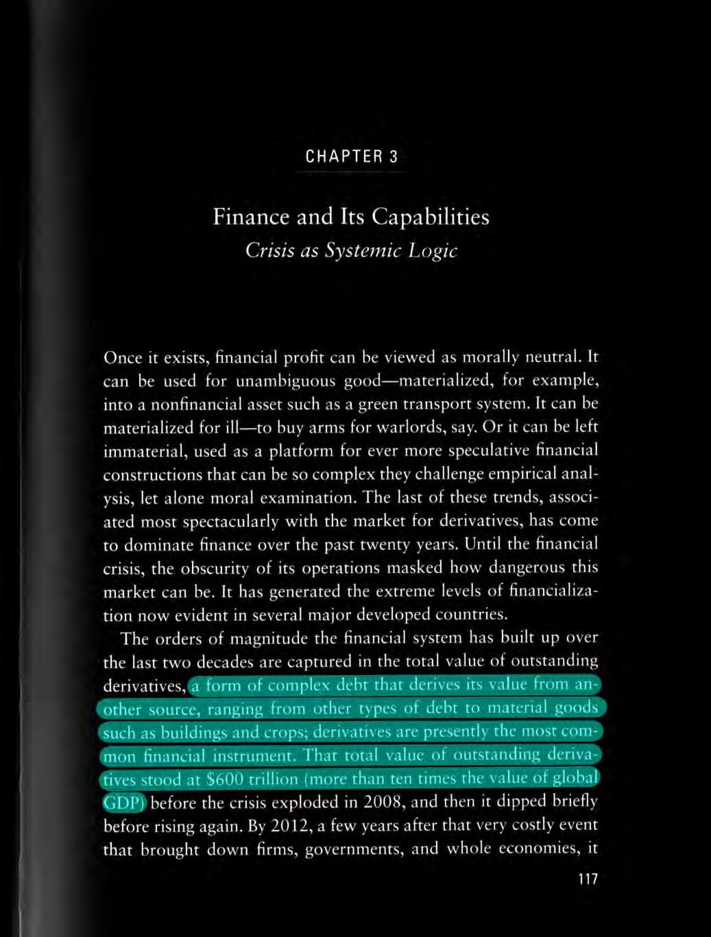
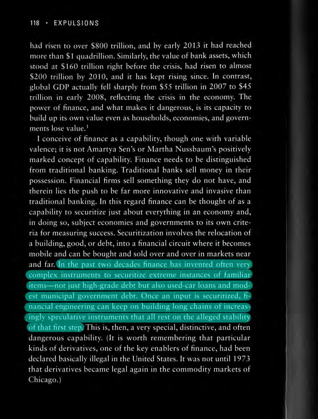
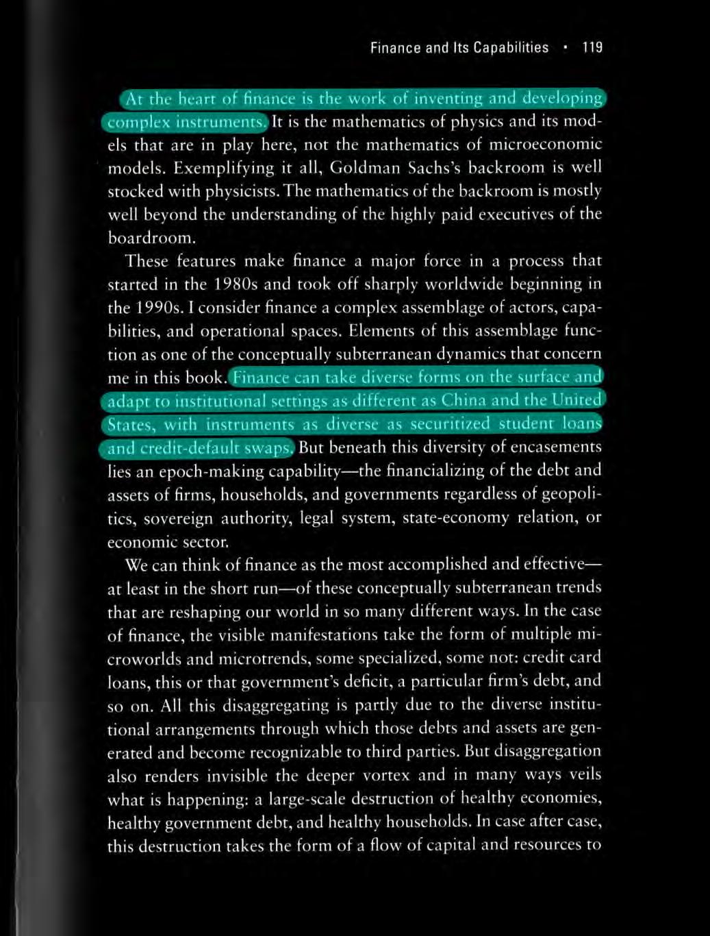
Securitization
Expulsions, Saskia Sassen
085 Linked Lives
Sample
Sample Deconstruction
121 Coastal Conversion
Dredging Satellite Observations
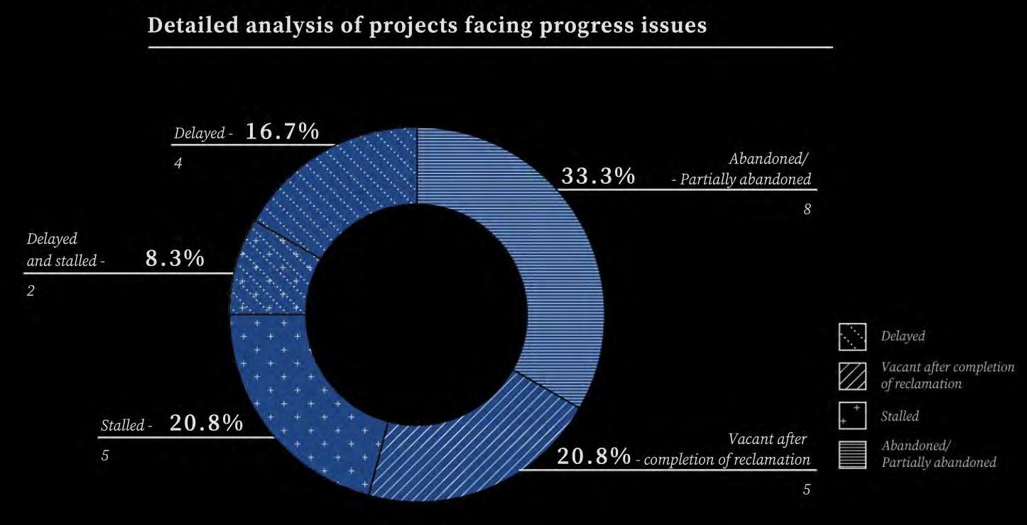
Total Reclaimed Land Problems Faced
157 Toll Taken I
Quantification of Transformations
191 Toll Taken II
Sea Level Rise
Deluge
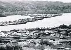
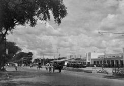
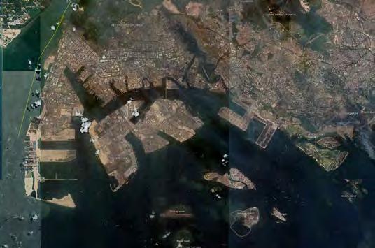
Jakarta
Manila
301 Breakpoint Beginning
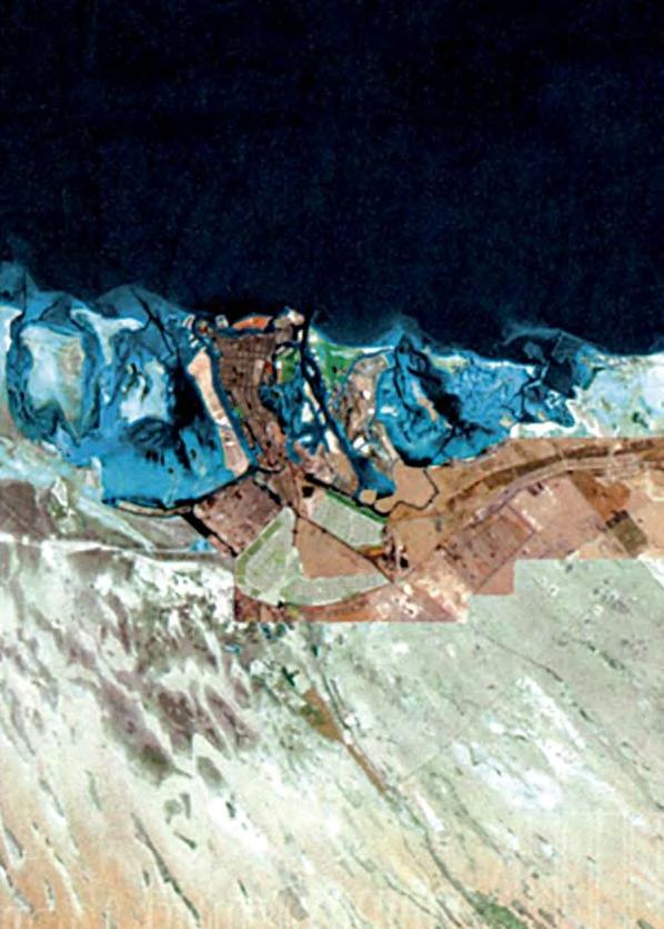
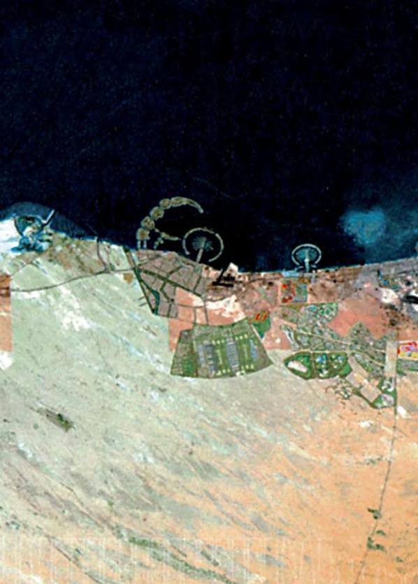
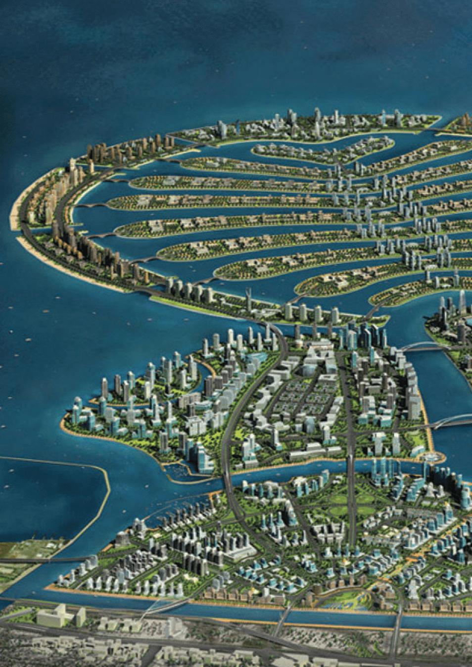
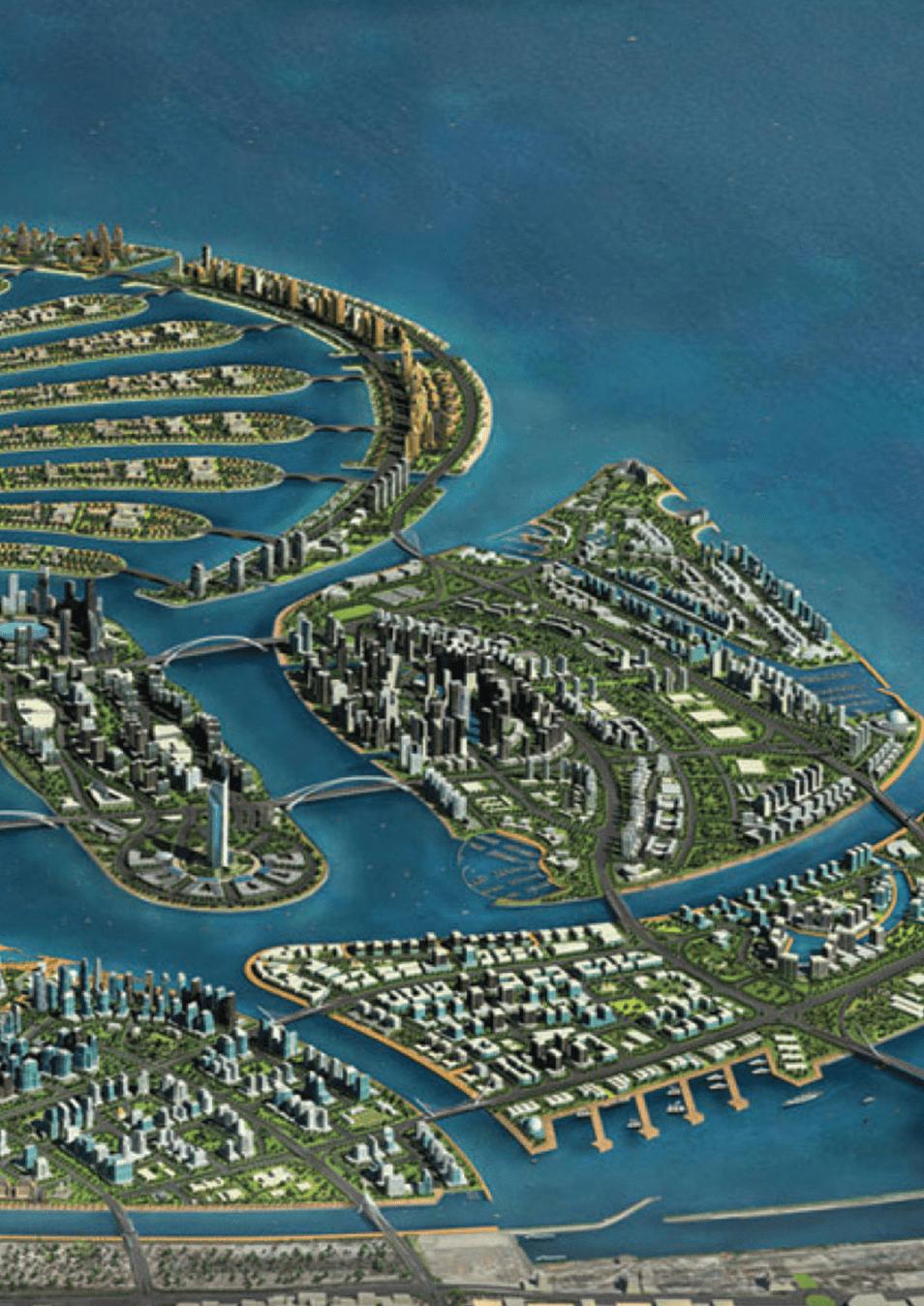
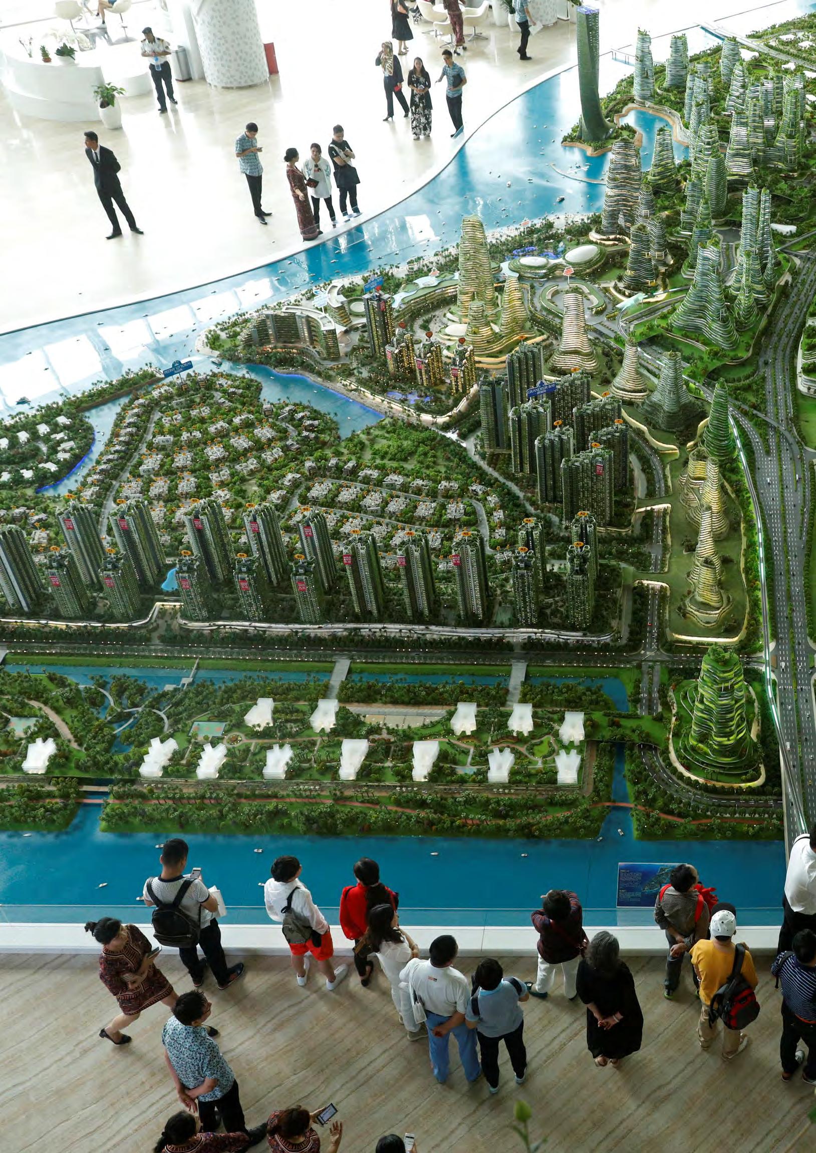
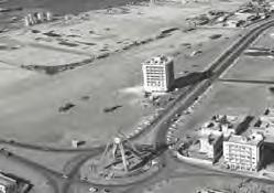
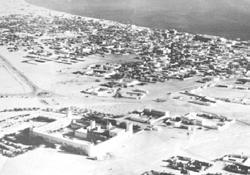
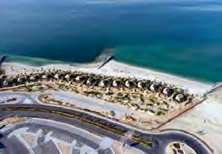
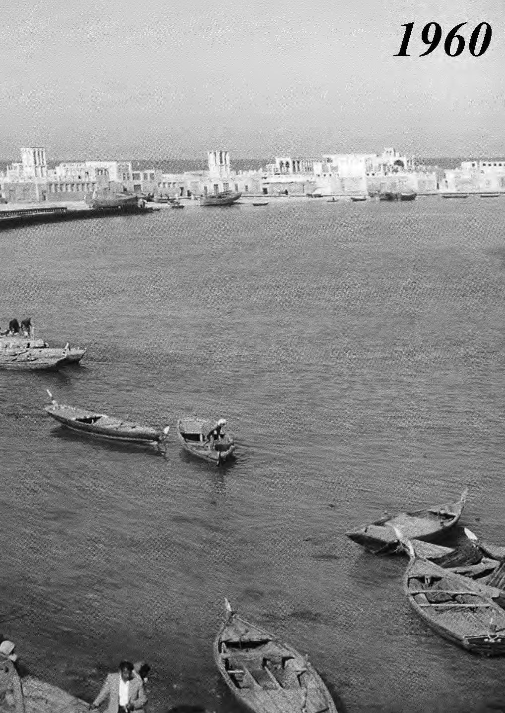
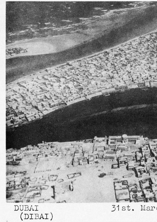
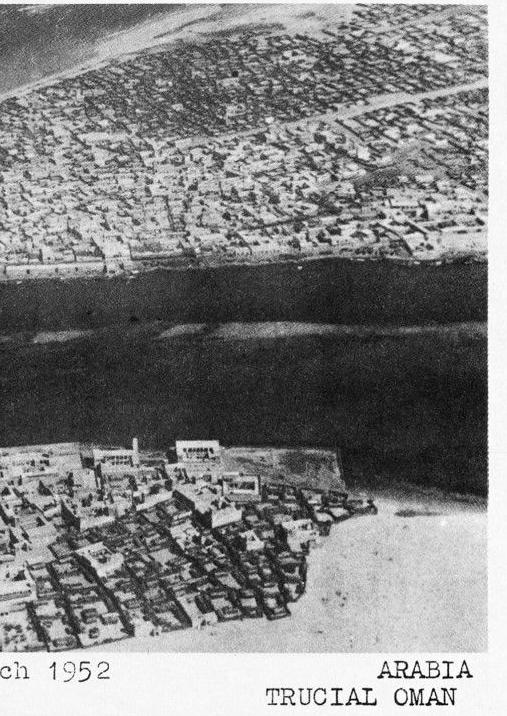
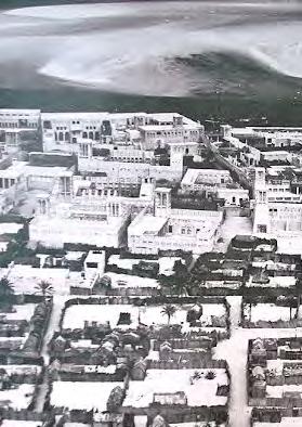
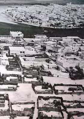
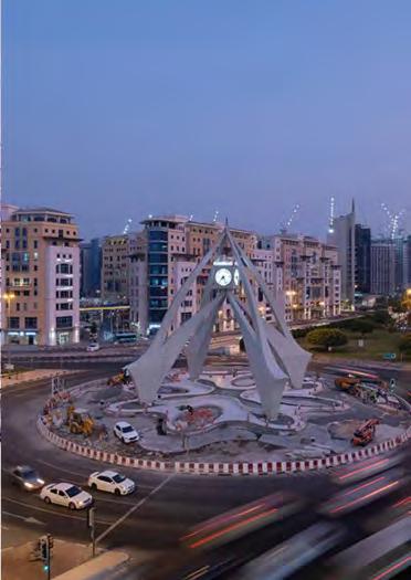
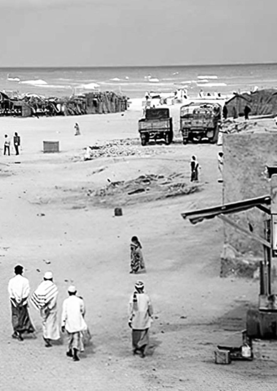
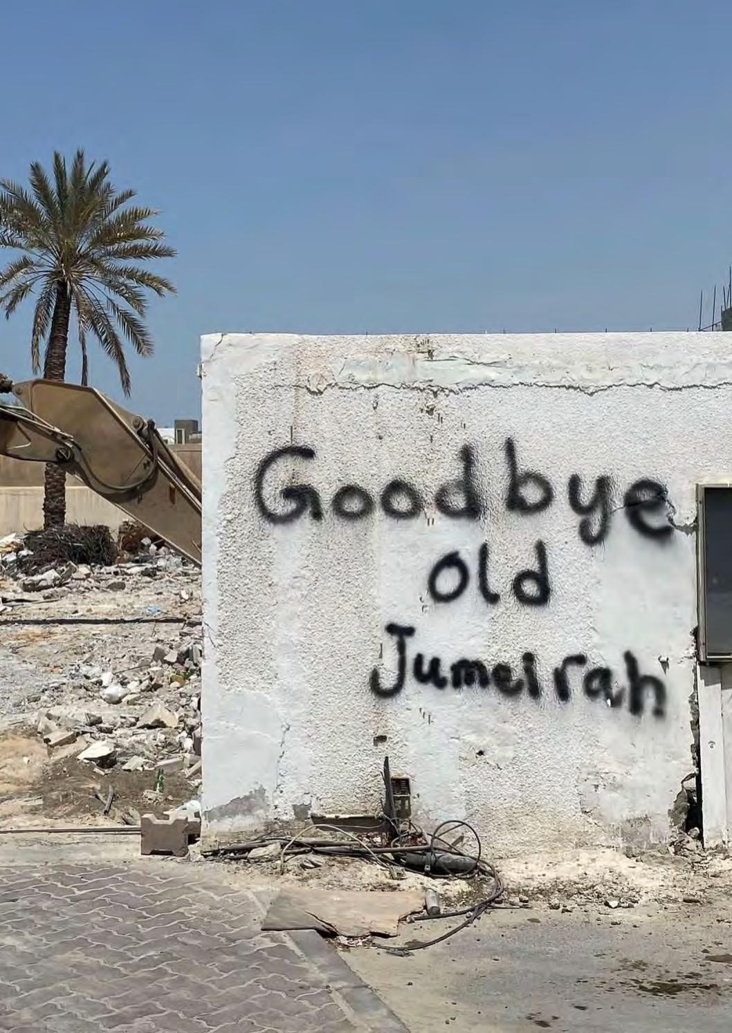
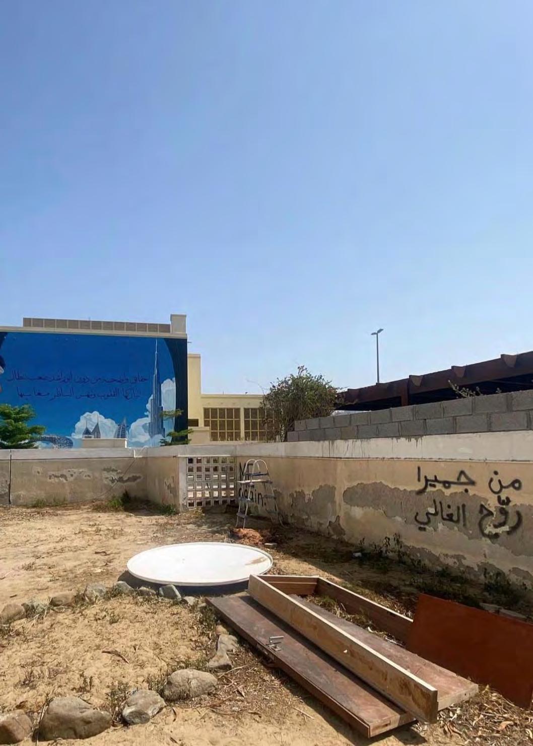
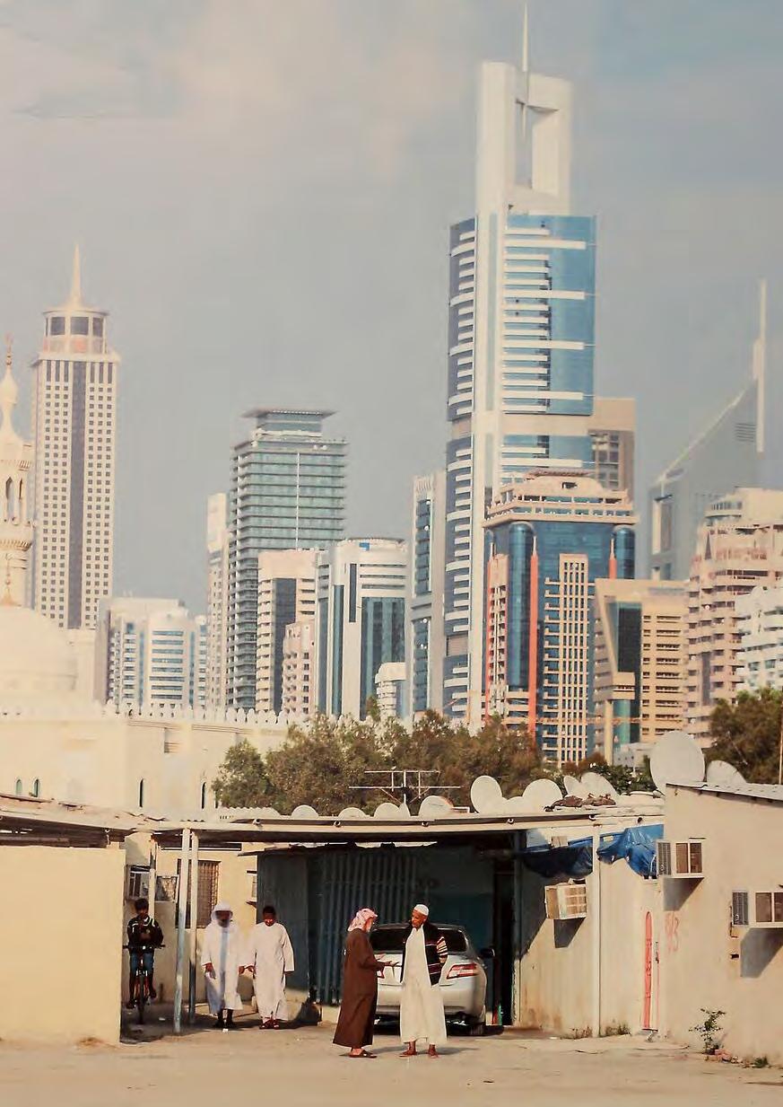
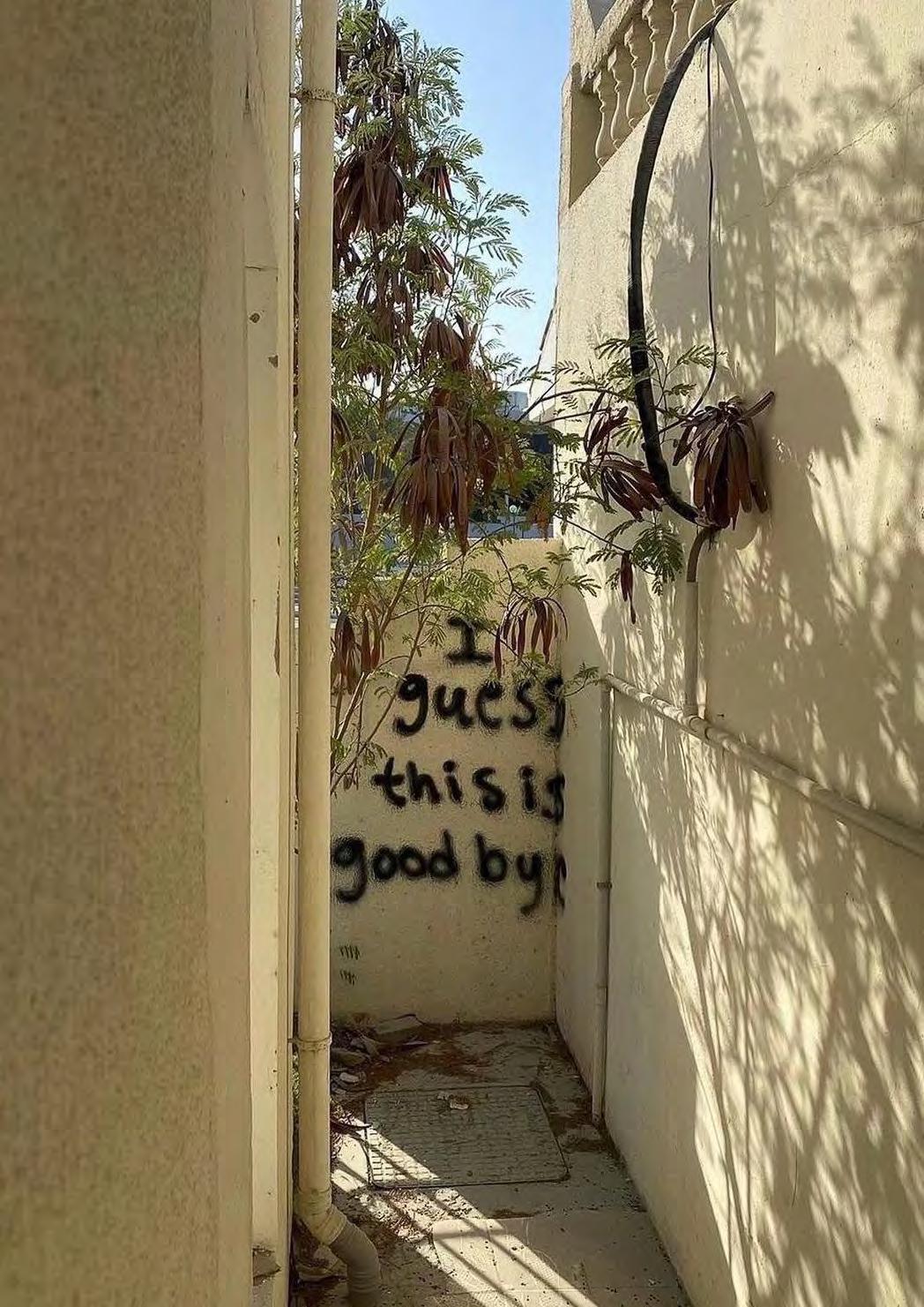
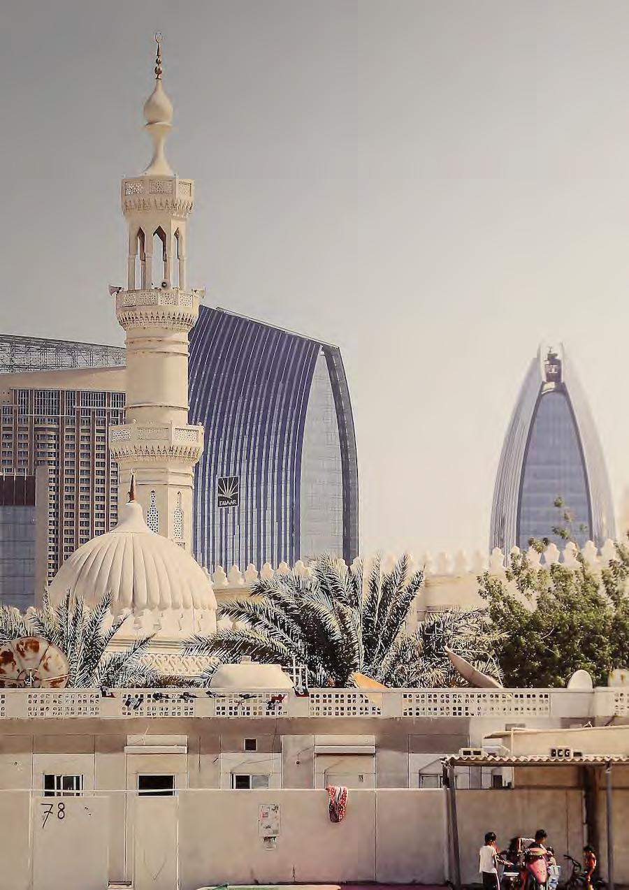
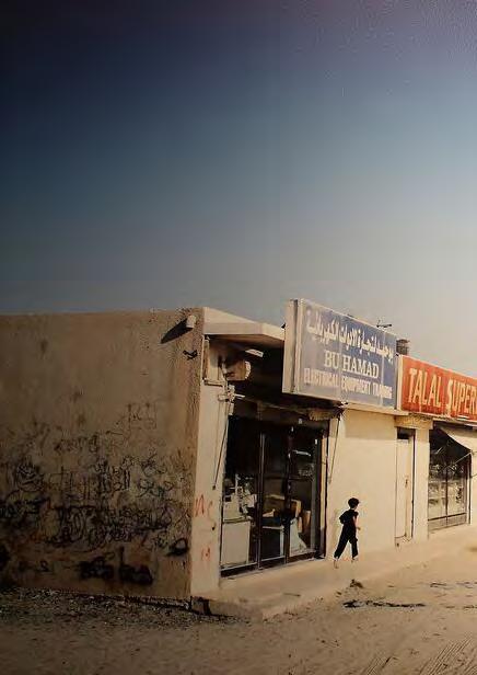
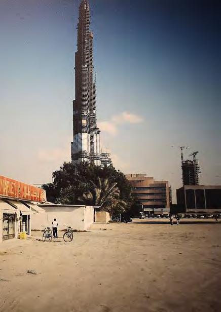
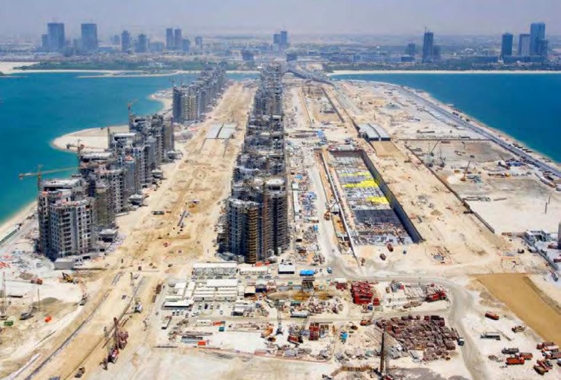
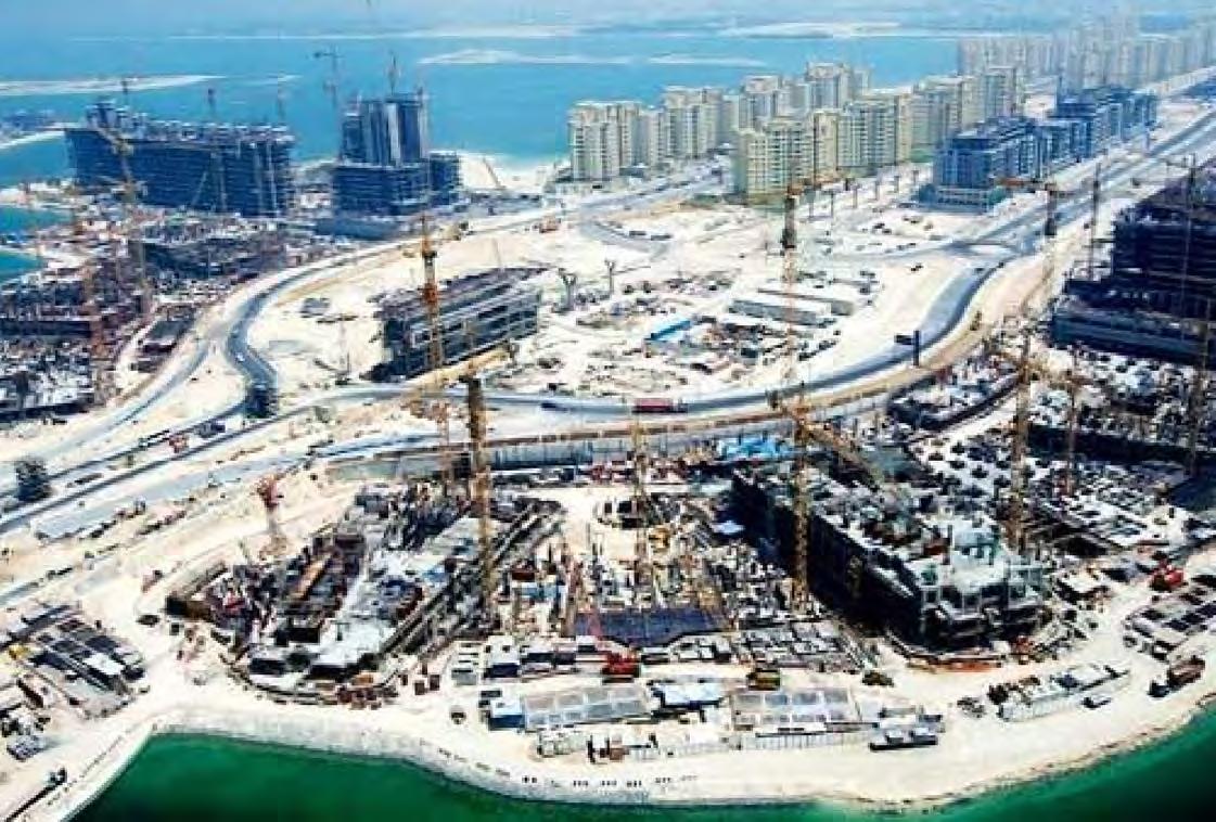
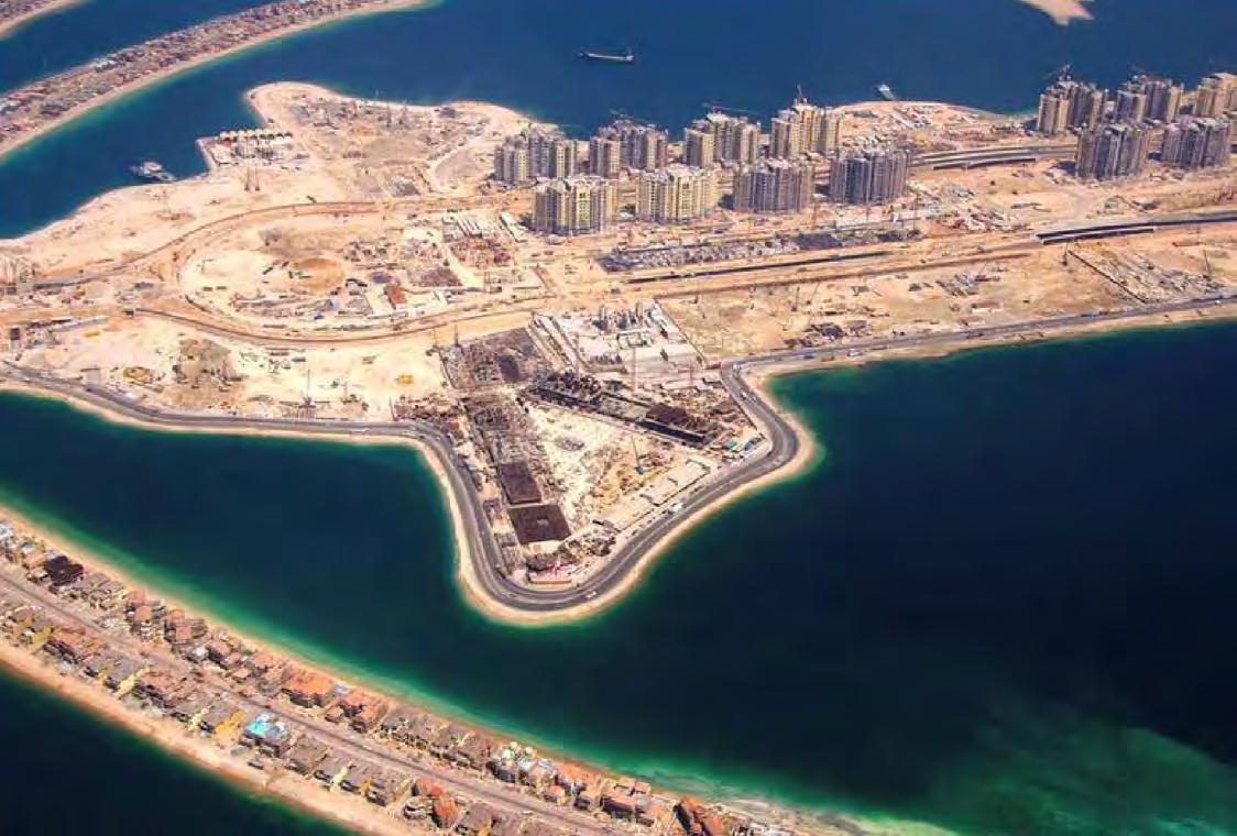
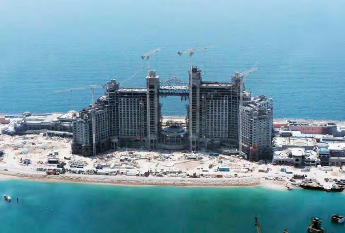
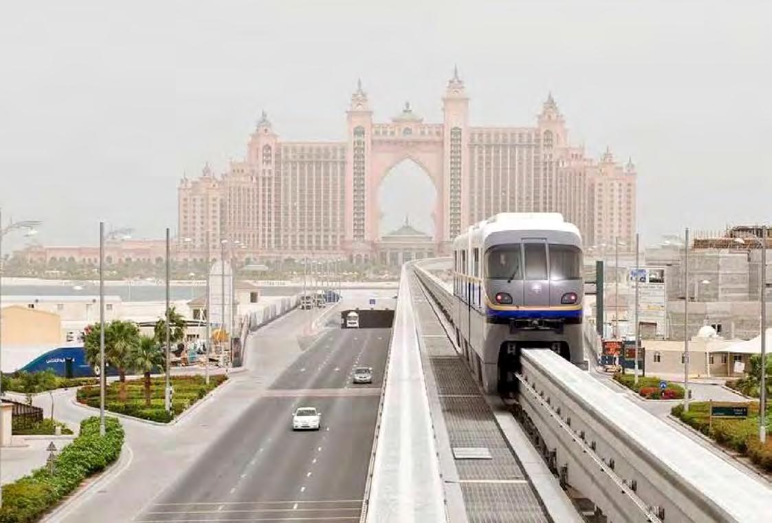
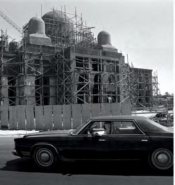
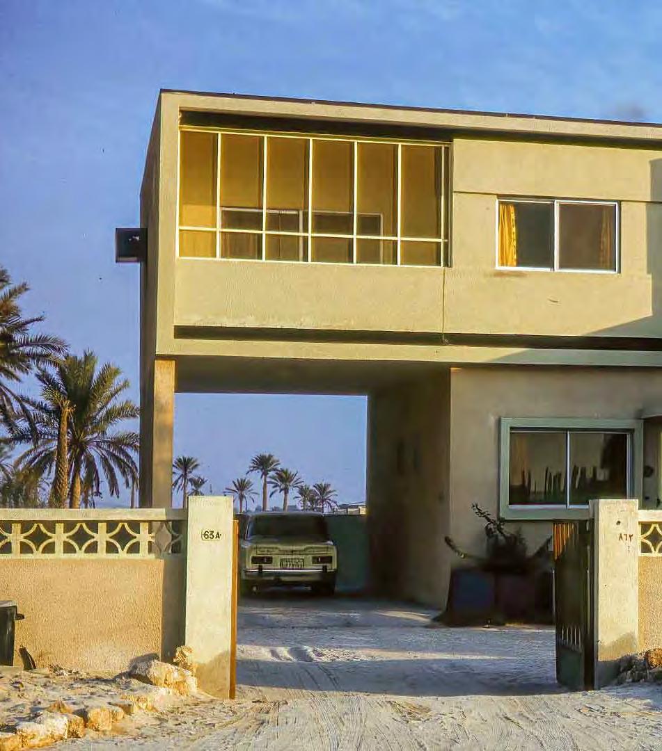
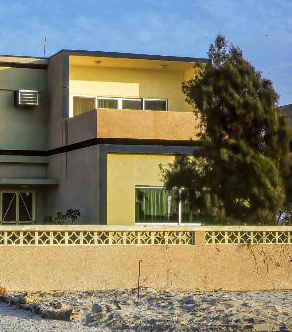
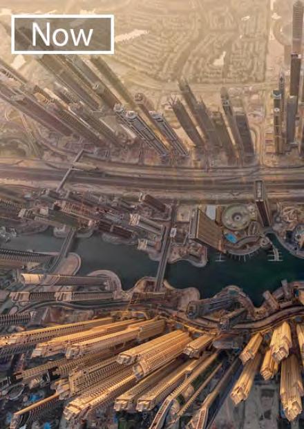
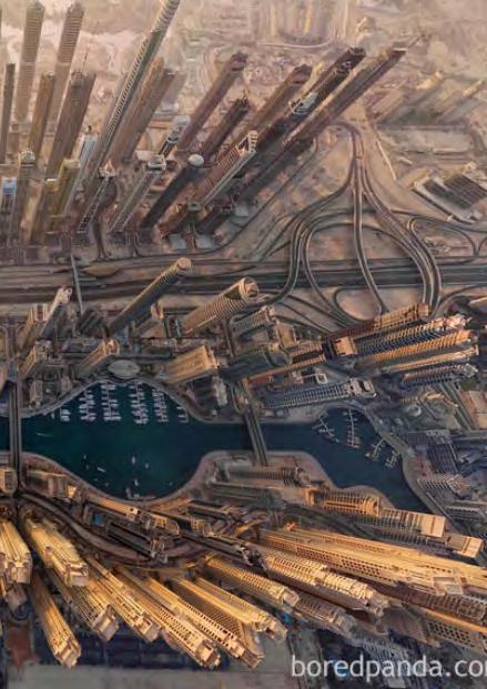
Al-Wasl (Dubai Previously)
Goodbye Jumeirah
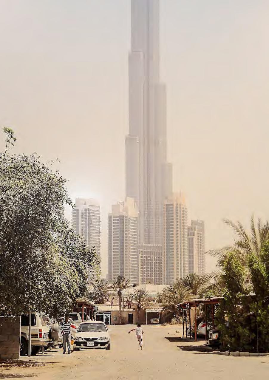
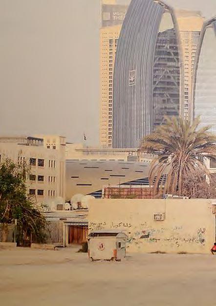
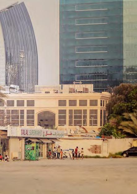
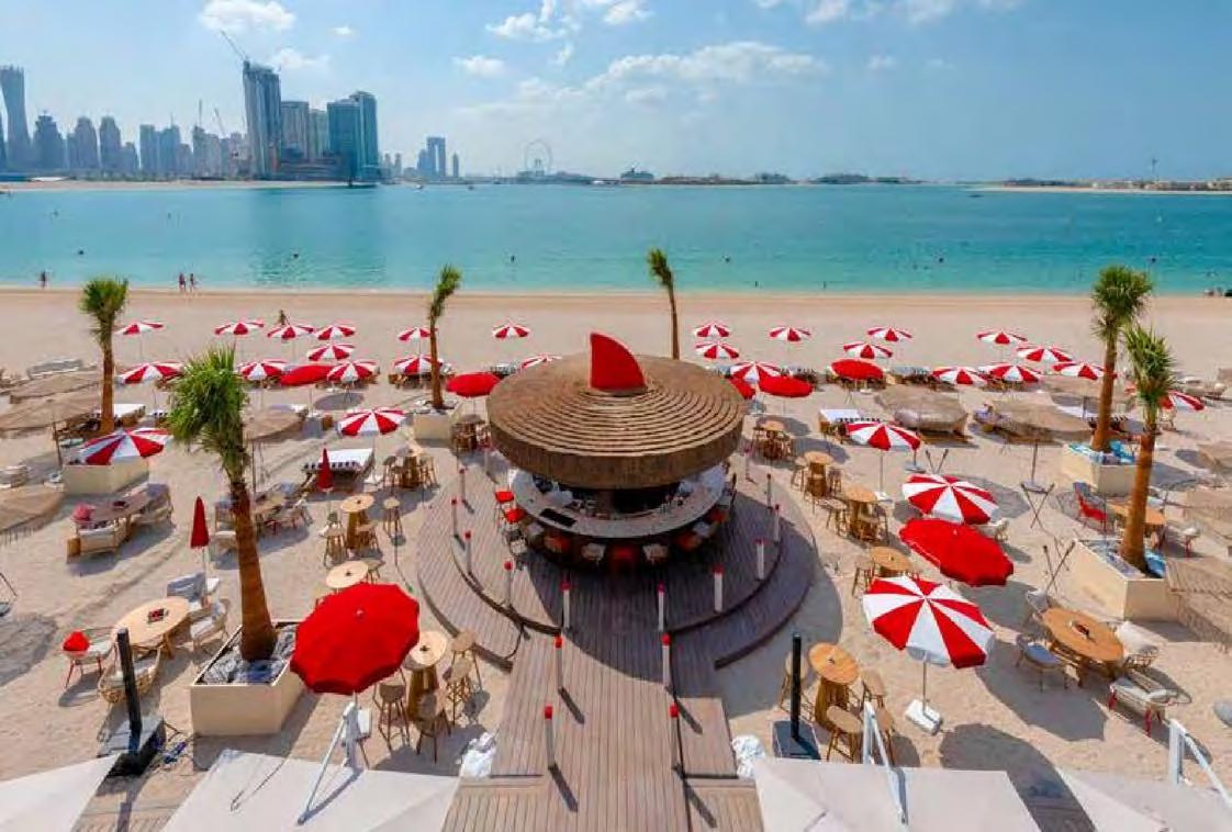
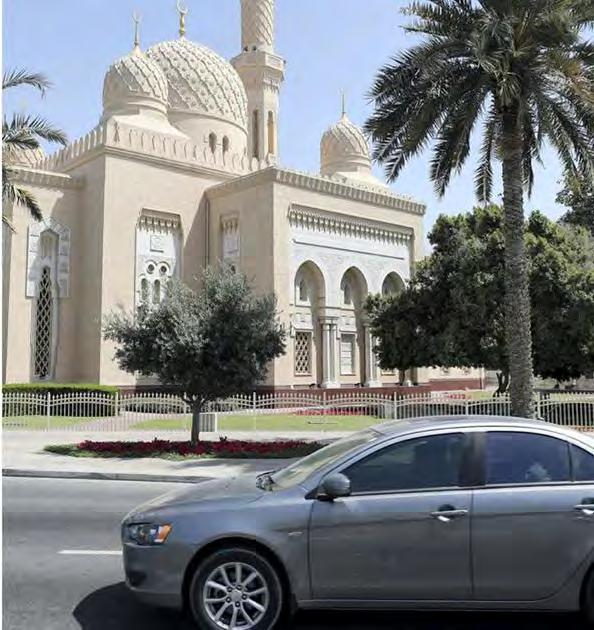
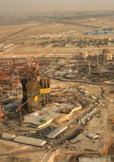
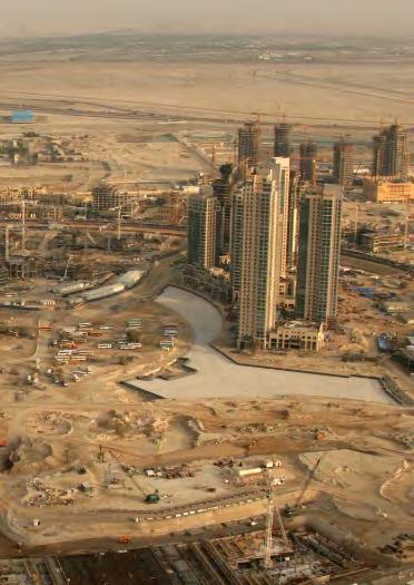
Dubai Today
403 Colophon
Bibliography
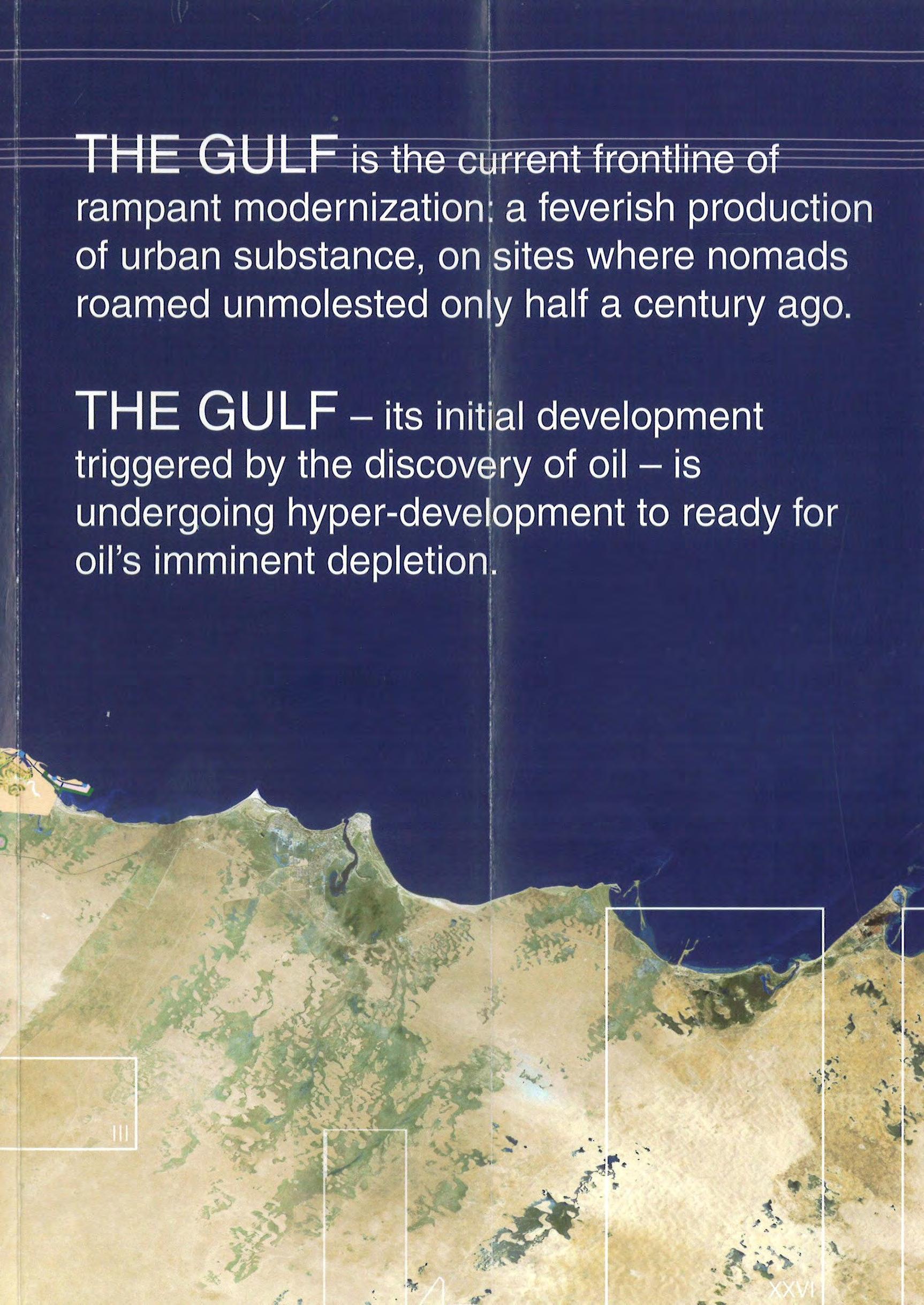
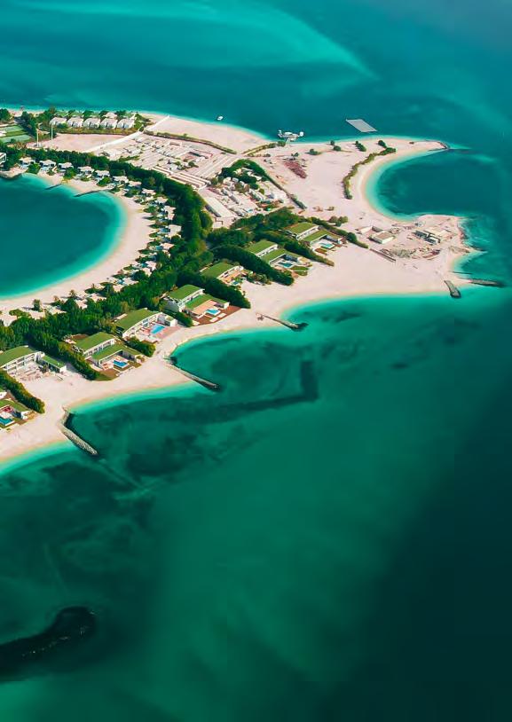
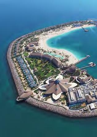
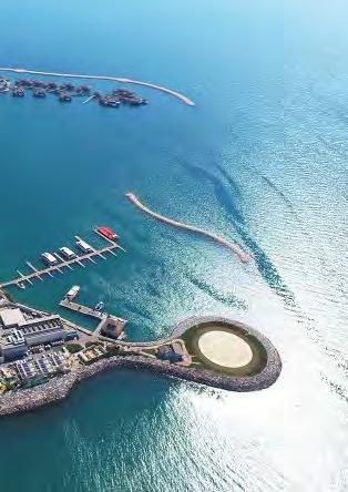
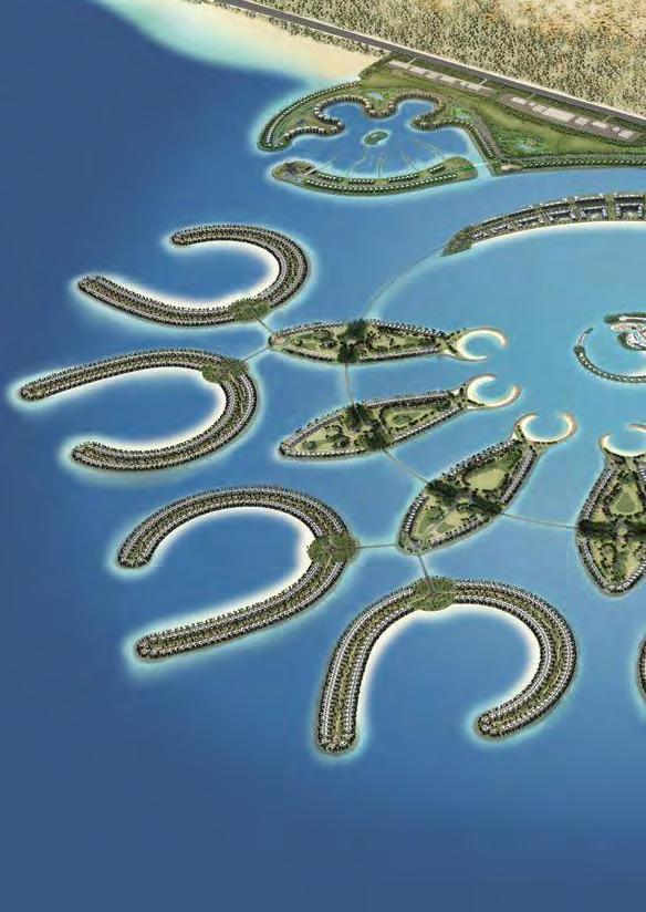
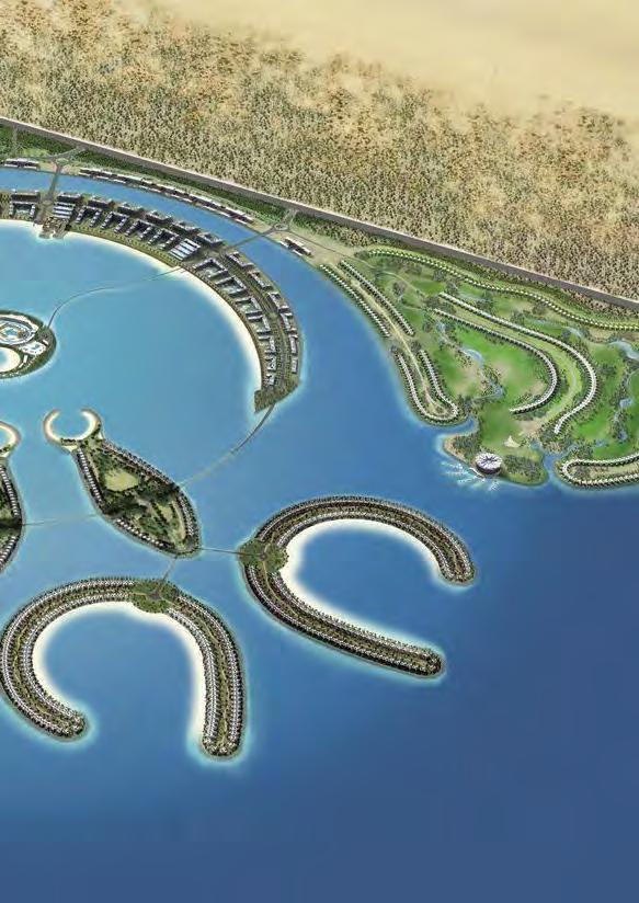
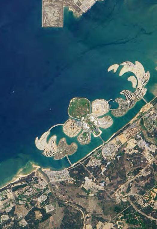
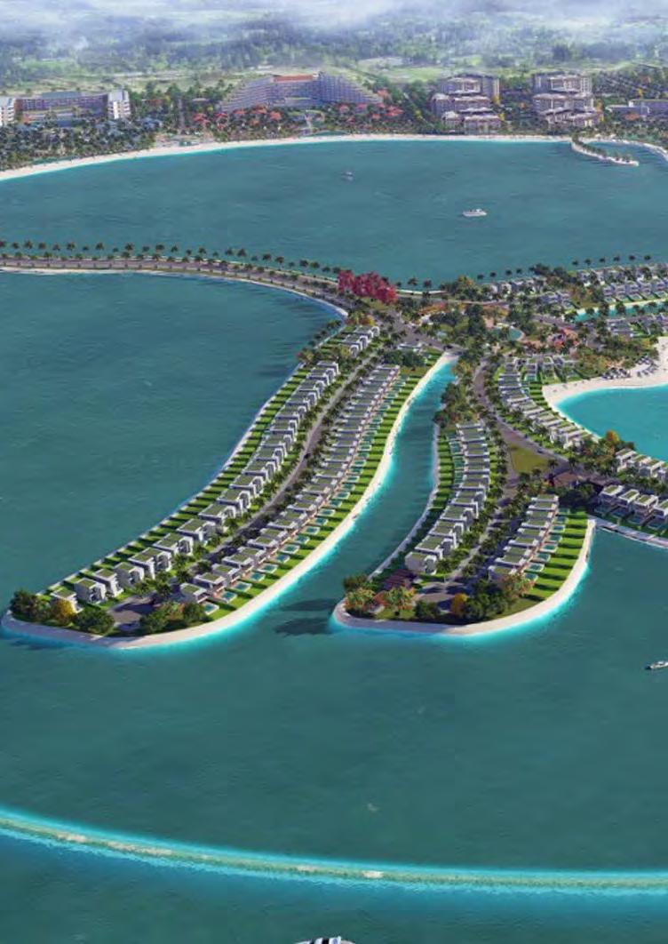
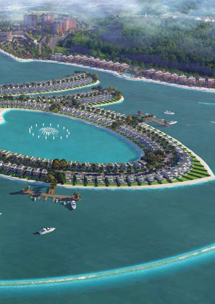
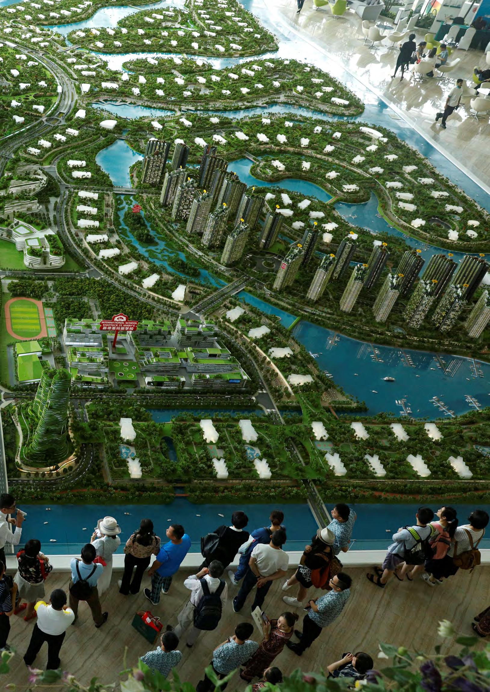
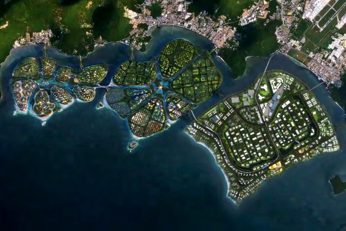
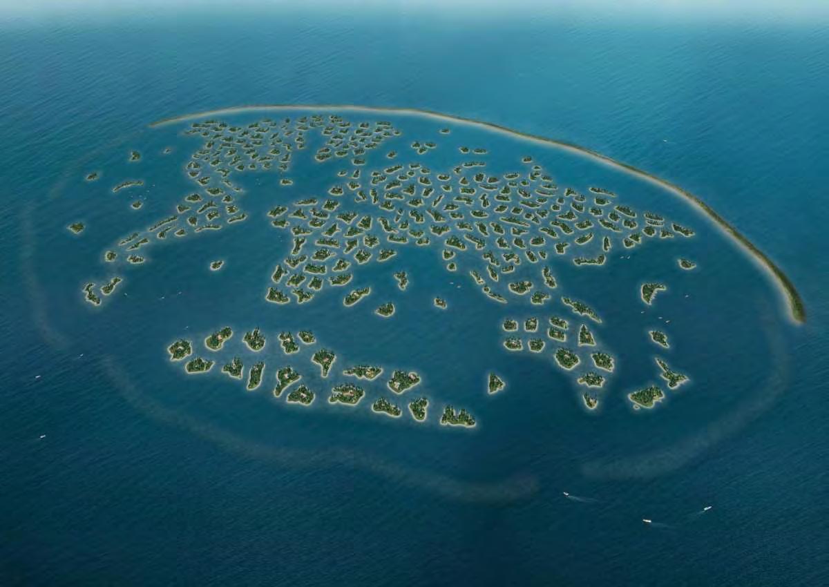
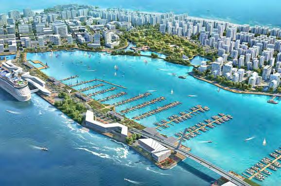
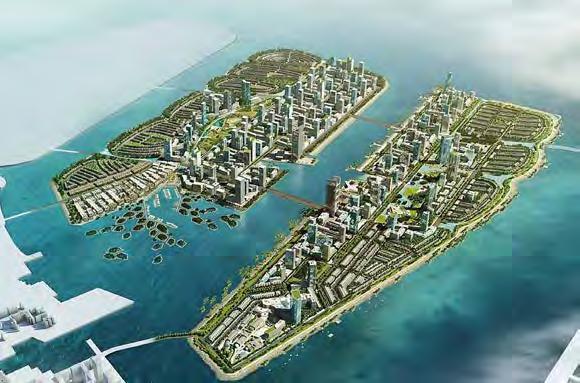
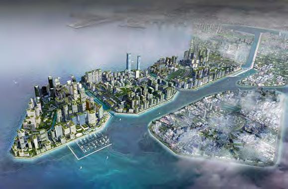
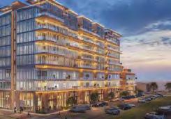
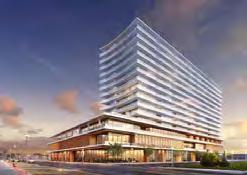
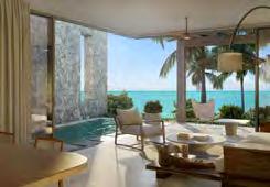
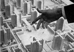
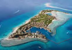
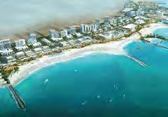
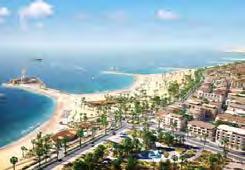
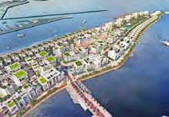
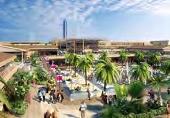
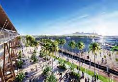
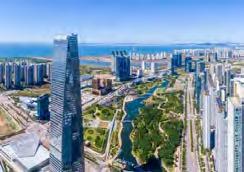
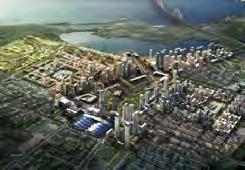
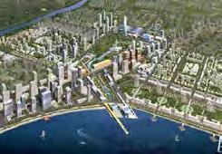
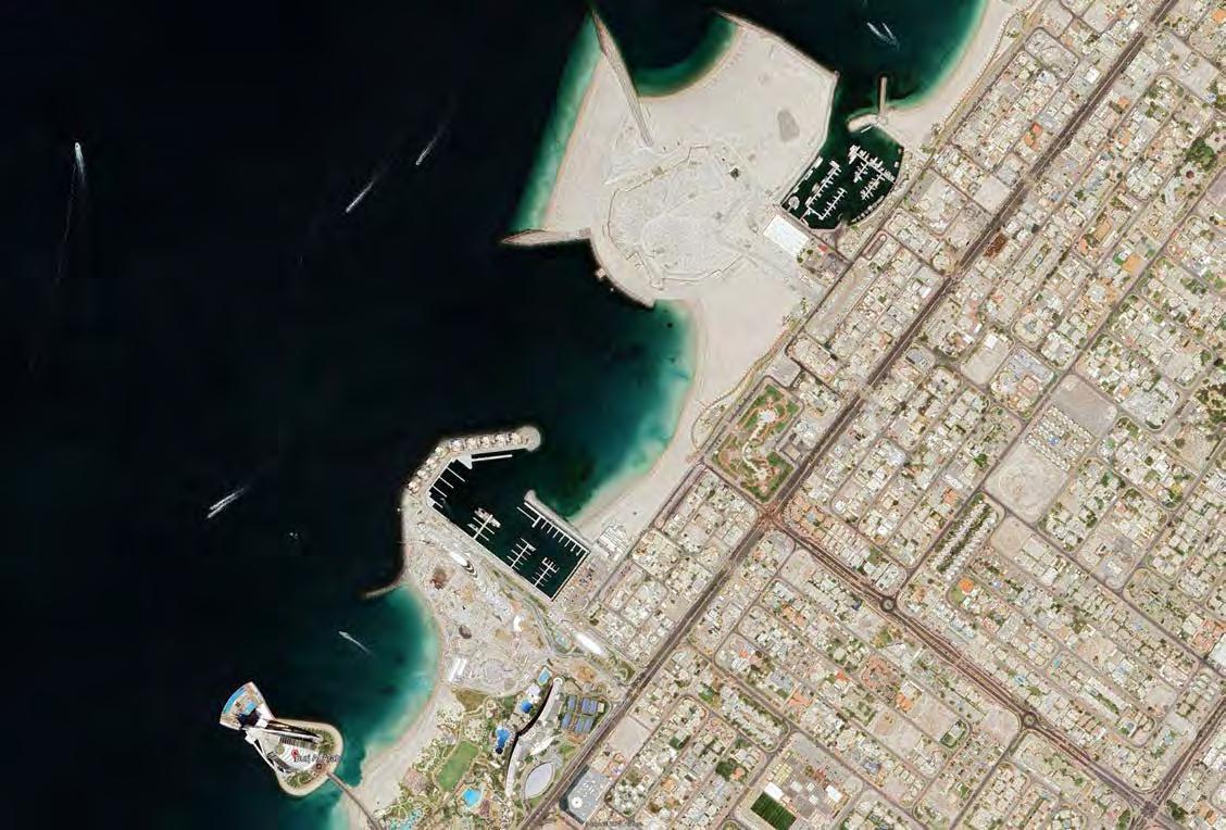
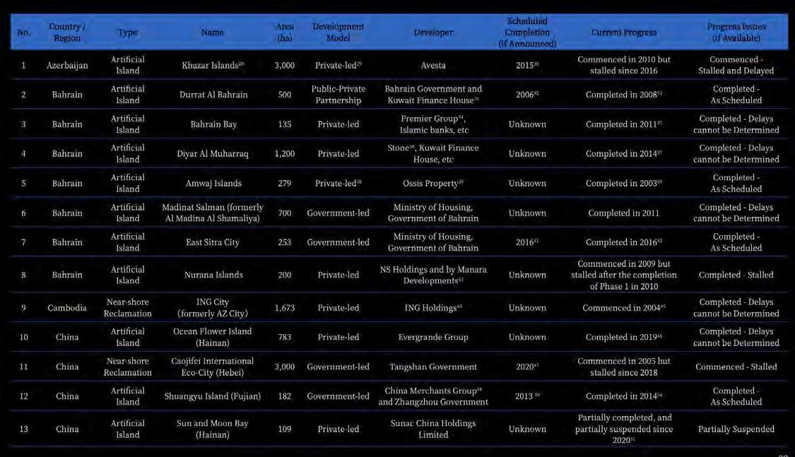
Each of these GULF CITIES has been synthesizing versions of the 21st- Century metropolis and now exports its own versions on an equally colossal scale to parts of the world modernity has not reached so far-from Morocco to Thailand.
This burgeoning campaign to export a new kind urbanism -to places immune to or ignored by previous missions of modernism- may be the final opportunity to chart a new blueprint for urbanism. Will architecture grasp this last chance?
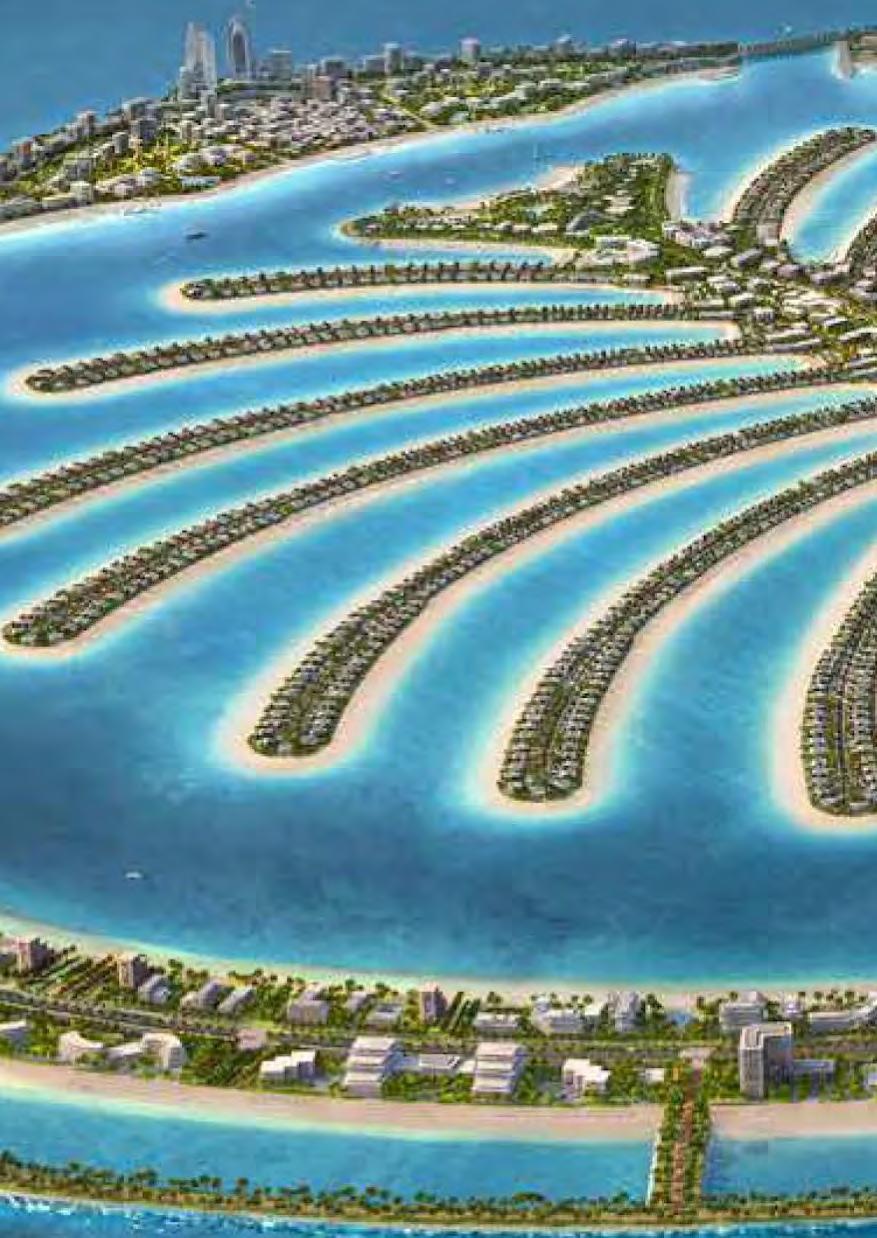
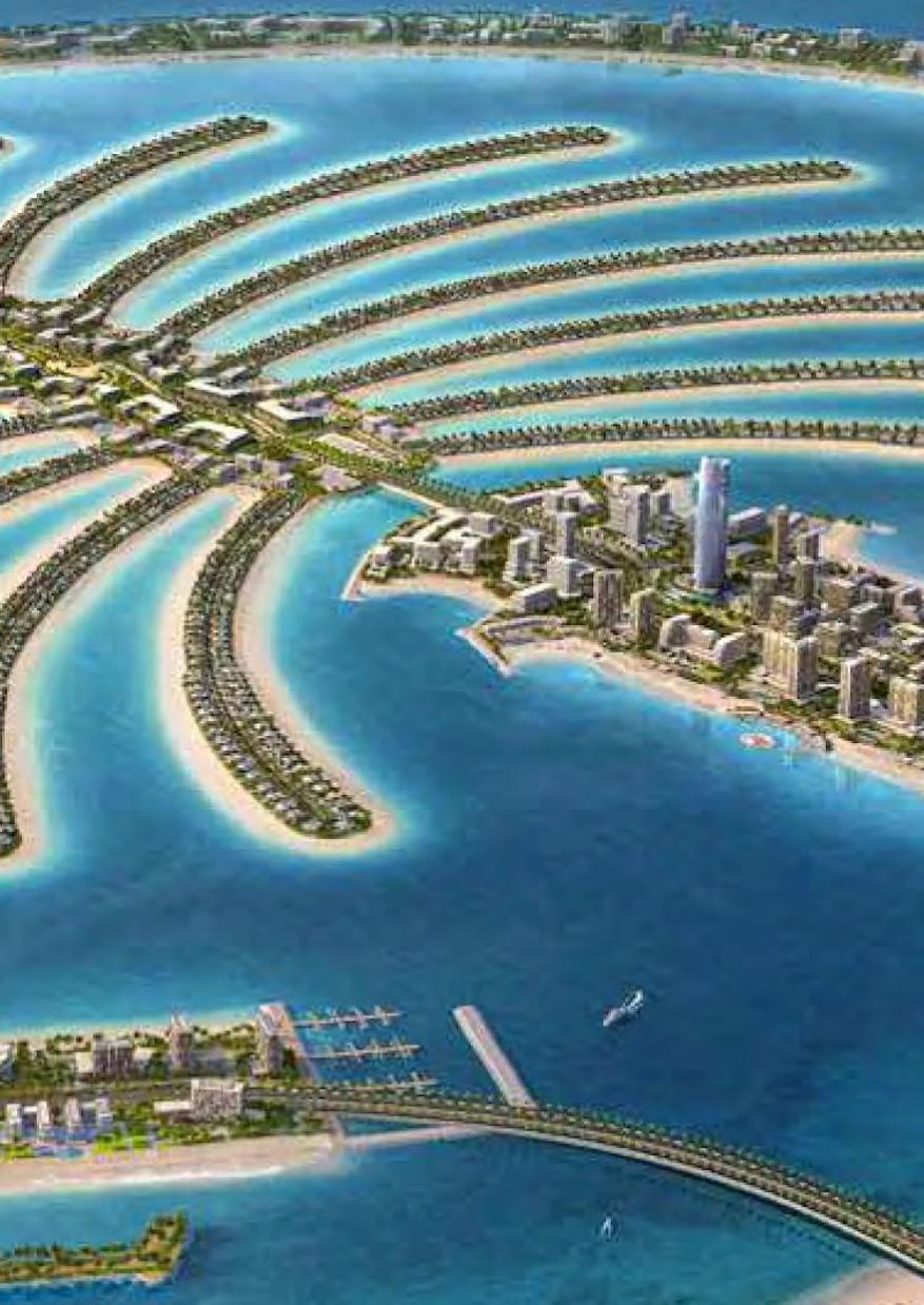
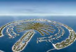
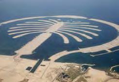
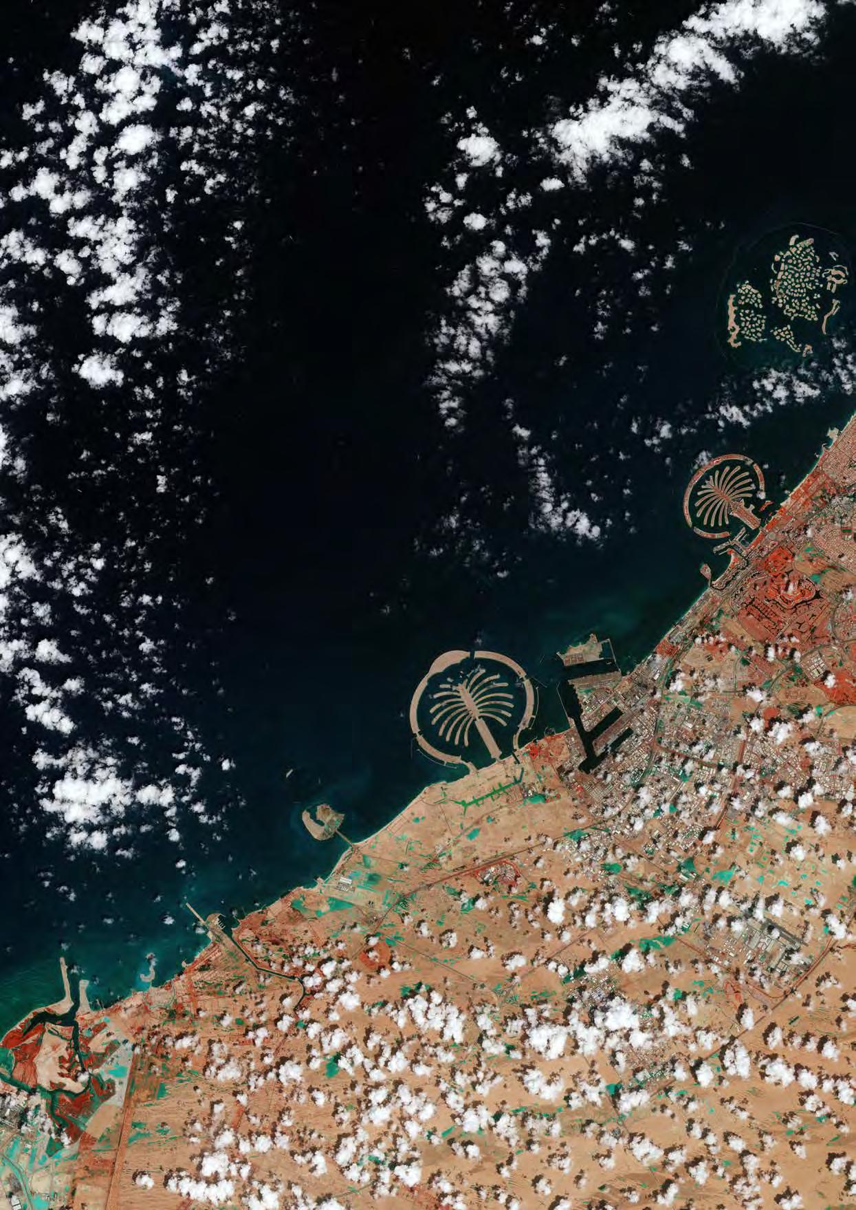
Rem Koolhaas identified the burgeoning trend of replicating the Gulf city model in 2006, focusing on the accelerated and identical exportation of urban designs inspired by Dubai’s iconic Palm Jumeirah project. Over the past two decades, this phenomenon has escalated exponentially, resulting in a vast array of coastal developments characterized by strikingly unconventional and elaborate designs. These architectural endeavors, often grandiose in their scale and ambition, have proliferated globally, transforming shorelines with their distinctive shapes and often surreal aesthetic. Such developments not only emulate the luxury and extravagance of their prototypes but also reflect a deeper shift in global urban strategies, where the allure of creating unique, eye-catching skylines dominates over traditional urban planning considerations.
San Francisco
San Francisco
San Francisco
San Francisco
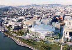
303 Acre Mission Bay Neighbourhood redevelopment, approved 1998, Multi-Use, thousands of housing units, offices etc.
303 Acre Mission Bay Neighbourhood redevelopment, approved 1998, Multi-Use, thousands of housing units, offices etc.
Source: Business Insider
Source: Business Insider
San Francisco
San Francisco
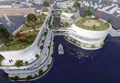
Mission Bay is a redevelopment district composed of 304 acres, waterfront architecture.
Mission Bay is a redevelopment district composed of 304 acres, waterfront architecture.
Source: MFLA Studio
San Francisco
San Francisco
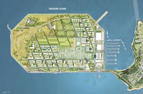
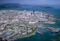
Treasure Island, viewing Mission Day segment of SF.
Treasure Island, viewing Mission Day segment of SF.
Source: TISF
Source: TISF
San Francisco
San Francisco
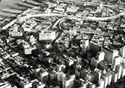
2014- manhattanization of san francisco
2014- manhattanization of san francisco
Source: Urban Geography
Source: Urban Geography
San Francisco
San Francisco
2014- manhattanization of san francisco
2014- manhattanization of san francisco
Source: Urban Geography
Source: Urban Geography
San Francisco
San Francisco
Treasure Island aerial view, rendering by Steelblue Construction started Nov 2021.
Treasure Island aerial view, rendering by Steelblue Construction started Nov 2021.
Source: SF YIMBY
Source: SF YIMBY
Source: MFLA Studio San Francisco
San Francisco
New Jersey
New Jersey
A rendering of the luxury residential development planned by Somerset Development, the team behind Holmdel’s BellWorks. The property will be along 5th Avenue.
A rendering of the luxury residential development planned by Somerset Development, the team behind Holmdel’s BellWorks. The property will be along 5th Avenue.
Source: NJ
Source: NJ
Bahamas
Bahamas
Downtown Nassau Develop. Plan, The Living Waterfront is a vibrant place for Bahamians and foreigners to live.
Downtown Nassau Develop. Plan, The Living Waterfront is a vibrant place for Bahamians and foreigners to live.
Source: dtj DESIGN, 2023
Source: dtj DESIGN, 2023
Aberdeen
Aberdeen
City Council recommends preliminary approval for Aberdeen Harbour’s plan to build 258 flats along River Dee.
City Council recommends preliminary approval for Aberdeen Harbour’s plan to build 258 flats along River Dee.
Source: Urban Realm, 2021
Source: Urban Realm, 2021
New Jersey
New Jersey
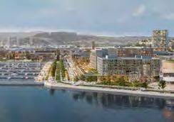
Mission Rock Aerial view, courtesy Parcel B planning documents, rendering by Binyan Studios.
Mission Rock Aerial view, courtesy Parcel B planning documents, rendering by Binyan Studios.
Source: SF YIMBY
Source: SF YIMBY
San Francisco
San Francisco
Asbury Park 2nd Avenue, showing the beach.
Asbury Park 2nd Avenue, showing the beach.
Source: No Triangle Studio
Source: No Triangle Studio
Bahamas
Bahamas
Downtown Nassau Development Plan, The Living Waterfront is a vibrant place for professional Bahamians and foreigners to live.
Downtown Nassau Development Plan, The Living Waterfront is a vibrant place for professional Bahamians and foreigners to live.
Source: dtj DESIGN, 2023
Aberdeen
Aberdeen
Source: dtj DESIGN, 2023
New Jersey
New Jersey
Treasure Island Development Group.
Treasure Island Development Group.
Source: Architect Magazine
Source: Architect Magazine
San Francisco
San Francisco
A housing project next to the land where Candlestick Park used to be in the Bayview-Hunters Point neighborhood, on Oct. 6, 2016 in San F., Calif.
A housing project next to the land where Candlestick Park used to be in the Bayview-Hunters Point neighborhood, on Oct. 6, 2016 in San F., Calif.
San Francisco
San Francisco
Map showing the identity of San Francisco- A juxtaposition.
Map showing the identity of San Francisco- A juxtaposition.
Source: SFTMA
Source: SFTMA
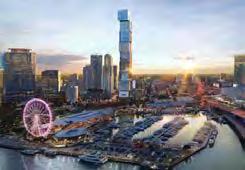
Miami
Miami
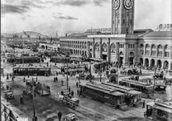
The Ferry Building Welcomes the World to San Francisco Above a Bustling Ferry Loop Terminal | September 25, 1914
The Ferry Building Welcomes the World to San Francisco Above a Bustling Ferry Loop Terminal | September 25, 1914
Source: SFTMA
Source: SFTMA
San Francisco
San Francisco
Render by Transparent House, San Francisco Shipyard Proposal.
Render by Transparent House, San Francisco Shipyard Proposal.
Source: Ibi Group
Source: Ibi Group
San Francisco
San Francisco
The development site of Candlestick Point, Friday, June 21, 2019, in San Francisco, California.
The development site of Candlestick Point, Friday, June 21, 2019, in San Francisco, California.
Source: The Chronicle
Source: The Chronicle
San Francisco
San Francisco
David Adjaye’s firm to masterplan San Francisco shipyard revitalisation.
David Adjaye’s firm to masterplan San Francisco shipyard revitalisation.
Source: Dezeen
Source: Dezeen
San Francisco
San Francisco
Render by Transparent House, San Francisco Shipyard Proposal.
Render by Transparent House, San Francisco Shipyard Proposal.
Source: Ibi Group
Source: Ibi Group
An aerial view north of Collins Avenue and 27th Street in Miami Beach, at the point where Indian Creek Drive becomes a separate street.
An aerial view north of Collins Avenue and 27th Street in Miami Beach, at the point where Indian Creek Drive becomes a separate street.
Source: Miami and Beaches
Source: Miami and Beaches
Miami
Miami
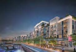
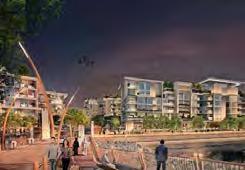
Waldorf Astoria Residences
Waldorf Astoria Residences
Miami. All renderings courtesy of ArX Solutions
Miami. All renderings courtesy of ArX Solutions
Source: Commercial Search
Source: Commercial Search
Miami
Miami
Waldorf Astoria Residences
Waldorf Astoria Residences
Miami. All renderings courtesy of ArX Solutions
Miami. All renderings courtesy of ArX Solutions
Source: Commercial Search
Source: Commercial Search
Miami
Miami
Waldorf Astoria Residences
Waldorf Astoria Residences
Miami. All renderings courtesy of ArX Solutions
Miami. All renderings courtesy of ArX Solutions
Source: Commercial Search
Source: Commercial Search
Miami
Miami
Waldorf Astoria Residences
Waldorf Astoria Residences
Miami. All renderings courtesy of ArX Solutions
Miami. All renderings courtesy of ArX Solutions
Source: Commercial Search
Source: Commercial Search
Asbury Park beach front skyline proposed render.
Asbury Park beach front skyline proposed render.
Source: New Jersey News
Source: New Jersey News
New Jersey
New Jersey
Asbury Park beach front skyline proposed render.
Bahamas
Bahamas
Asbury Park beach front skyline proposed render.
Source: New Jersey News
Source: New Jersey News
New York City
New York City
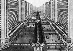
Le Corbusier’s vision for cities profoundly influenced New York, though never to the degree that this concept (designed for Marseille).
Le Corbusier’s vision for cities profoundly influenced New York, though never to the degree that this concept (designed for Marseille).
Source: Smithson
Source: Smithson
New York City
New York City
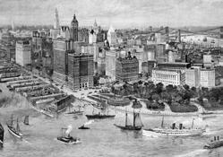
An illustration depicting an elevated perspective of NY Harbour, buzzing with activity from many ships.
An illustration depicting an elevated perspective of NY Harbour, buzzing with activity from many ships.
Source: History 101
Source: History 101
New York
New York
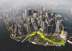
The BIG U project by BIG- The Dryline: urban flood protection infrastructure- “To protect New York”.
The BIG U project by BIG- The Dryline: urban flood protection infrastructure- “To protect New York”.
Source: Holcim Foundation
Source: Holcim Foundation
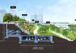
New York
New York
Illustration of the BIG-led “BIG U” resiliency proposal for Lower Manhattan. Image courtesy of BIG (Bjarke Ingels Group).
Illustration of the BIG-led “BIG U” resiliency proposal for Lower Manhattan. Image courtesy of BIG (Bjarke Ingels Group).
Source: Archinet
Source: Archinet
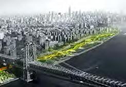
New York
New York
BIG’s Brooklyn-Queens Expressway proposal.
BIG’s Brooklyn-Queens Expressway proposal.
Source: Archinet
Source: Archinet
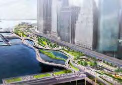
New York
New York
A coastal protection barrier in the form of a huge city park is being designed by BIG.
A coastal protection barrier in the form of a huge city park is being designed by BIG.
Source: Holcim Foundation
Source: Holcim Foundation
Part of the city centre could be pedestrianised. 2021
Part of the city centre could be pedestrianised. 2021
Source: BBC
Source: BBC
Aberdeen
Aberdeen
The new Six Senses Grand Bahama resort and residences is scheduled to open in 2026.
The new Six Senses Grand Bahama resort and residences is scheduled to open in 2026.
Source: IHG Hotels & Resorts
Source: IHG Hotels & Resorts
Bahamas
Bahamas
Cruise capacity to swell with Nassau revamp, new Disney, Royal Carribean & Carnival destinations.
Cruise capacity to swell with Nassau revamp, new Disney, Royal Carribean & Car nival destinations.
Source: Sun Sentinel
Source: Sun Sentinel
Bahamas
Bahamas
Where have all the Freetowns gone? 1893
Where have all the Freetowns gone? 1893
Source: Bahamianology
Source: Bahamianology
Turks & Caicos
Turks & Caicos
The American Consulate, Cockburn Town, Grand Turk. This consulate was built in the early 1800s.
The American Consulate, Cockburn Town, Grand Turk. This consulate was built in the early 1800s.
Source: Visittci
Source: Visittci
Turks & Caicos
Turks & Caicos
Spotlight Arc Sky Villas in Long Bay at Turks & Caicos.
Spotlight Arc Sky Villas in Long Bay at Turks & Caicos.
Source: SoTheBy Realty
Source: SoTheBy Realty
Turks & Caicos
Turks & Caicos
The Strand Turks & Caicos, new development project.
The Strand Turks & Caicos, new development project.
Source: SoTheBy Realty
Source: SoTheBy Realty
Turks & Caicos
Turks & Caicos
The Strand Turks & Caicos, new development project.
The Strand Turks & Caicos, new development project.
Source: SoTheBy Realty
Source: SoTheBy Realty
Carribean
Carribean
Plastic pollution in the Carribean.
Plastic pollution in the Carribean.
Source: Eco magazine
Source: Eco magazine
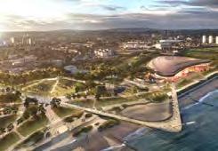
Public consultation for proposals to rejuvenate beach area has started. Render showing proposal. 2021
Public consultation for proposals to rejuvenate beach area has started. Render showing proposal. 2021
Source: Aberdeen City Council
Source: Aberdeen City Council
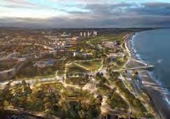
Aberdeen
Aberdeen
There are plans to transform the beach area. Render showing proposal. 2021
There are plans to transform the beach area. Render showing proposal. 2021
Source: BBC
Source: BBC
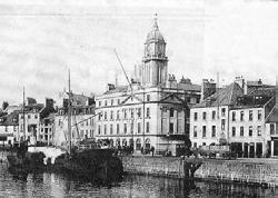
Aberdeen
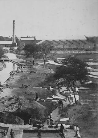
Aberdeen Aberdeen Harbour, early 1900s.
Aberdeen Harbour, early 1900s.
Source: Pinterest
Source: Pinterest
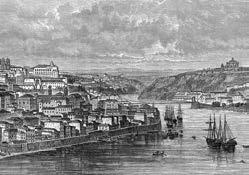
Porto
Porto
Porto, seen from the mouth of the Duero river, , (atlas, 1909).
Porto, seen from the mouth of the Duero river, , (atlas, 1909).
Source: Alamy
Source: Alamy
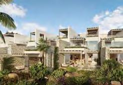
Comporta
Comporta
A high end beach resort under development, “within a 2 minute walk from the beach”.
A high end beach resort under development, “within a 2 minute walk from the beach”.
Source: coporgest
Source: coporgest
Comporta
Comporta
A high end beach resort under development, “within a 2 minute walk from the beach”.
A high end beach resort under development, “within a 2 minute walk from the beach”.
Source: coporgest
Source: coporgest
Comporta
Comporta
A high end beach resort under development, “within a 2 minute walk from the beach”.
Aerial view of proposal
A high end beach resort under development, “within a 2 minute walk from the beach”. Aerial view of proposal
Source: coporgest
Source: coporgest
Comporta
Comporta
A high end beach resort under development, swimming pool in the heart of the resort.
A high end beach resort under development, swimming pool in the heart of the resort.
Source: coporgest
Source: coporgest
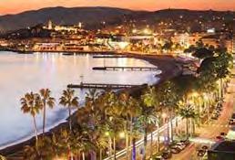
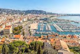
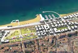
Cannes
Saudi Arabia
“The Vibrant French Riviera”.
Source: Luxury Abode
be Cannes
Mountain view of Cannes showing vast residential/ hotel units and the pier.
Source: The Spirits Business
propos-
Cannes La Bocca Neighbourhood Masterplan, redevelopment of a 12.5ha coastal railway into a new seaside quarter.
Source: Situplan
“Coastal Beauty”.
Source: ExploreNice
Paris
Le Corbusier’s Plan Voisin marks the turning point where city plans as constraints on individual initiative are replaced with architectural design. 1964
Source: Research Gate
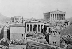
Athens
The Acropolis As It Would Have Appeared In Ancient Times.
From The Book Harmsworth History Of The World Published 1908.
Source: Amazon
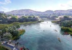
Athens
Park includes 3.7 acre lake, repurposed from the former Olympic kayak venue. Helps combat water scarcity.
Source: CNN
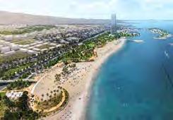
Athens
Soon will be transformed into 1km public beach.
Source: CNN
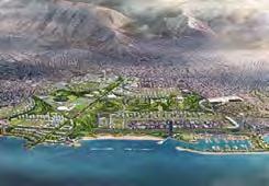
Athens
Ellinikon Metropolitan Park, 600 acres, playground & cultural center on Athens coast, by Sasaki (artist impression here).
Source: CNN
Athens
Park main entry point via tram line stop at Olympic Square.
Source: CNN
Vincent Mosco, author of “The Smart City in a Digital World,” said Neom need to show transparency on data gathered.
Source: Everything Supply Chain Bahrain
Saudi Arabia
The Line render, showing the proposal in section, revealing the internal structure & elements.
Source: MEP Middle East
Saudi Arabia
The city’s design will be fully digitlized, and the construction will be industrialized to a large extent in order to disrupt digital practices.
Source: Indovance
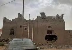
Saudi Arabia
The house of Abdul Rahim Al Howeiti whom the authorities killed for eviction refusal from his home for NEOM project. 2022
Source: Al Mayadeen
Saudi Arabia
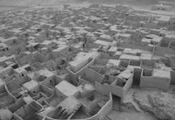
Al-’Ula old town.
Source: Wikipedia
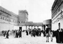
Riyadh
Qasr al-Hukm ( the justice Place ) early 20th century - Old riyadh.
Source: Twitter
Saudi Arabia
Oxagon will be a 7km-wide floating city that will be home to the world’s ‘first fully automated port and integrated logistics hub.
Source: Globe Trender
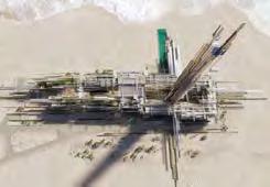
Saudi Arabia
Epicon is the newest high-end seaside tourist destination and residential offering from NEOM. 2 skyscrapers by coast.
Source: Travelwires
Saudi Arabia
“A place where enhanced nature meets responsible design, advanced technology and inspirational architecture.”
Source: NEOM
Saudi Arabia
To host 2029 Asian winter games at mountain resort, brining controversy-require enormous water & energy resources.
Bilaj Al Jazayer, mega-project approved in Bahrain, published on 25 Mar 2022. A 1.3 million m2 mega mixed-use project.
Source: Amusement Logic
Bahrain
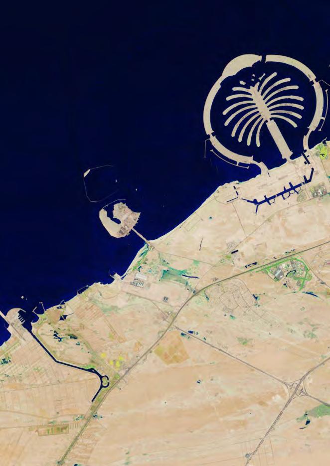
Dubai
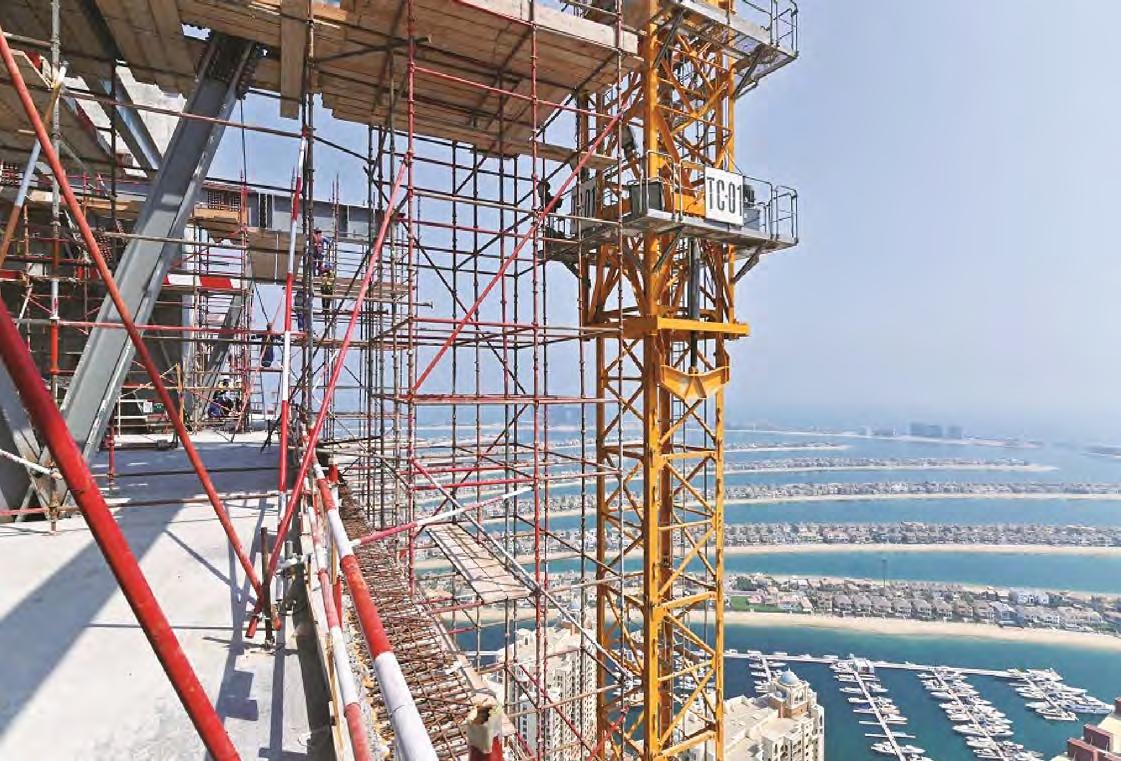
Dubai’s Palm Jebel Ali, Render showing proposal presented to crown price- a palm twice the size of Palm Jumeirah, Sep 2023
Source: Khaleej Times Hulhumale
Dubai
Bilaj Al Jazayer, mega-project approved in Bahrain, published on 25 Mar 2022. A 1.3 million m2 mega mixed-use project.
Source: Amusement Logic
Bahrain
Bilaj Al Jazayer, mega-project approved in Bahrain, published on 25 Mar 2022. A 1.3 million m2 mega mixed-use project.
Source: Amusement Logic
Bahrain
Bilaj Al Jazayer, mega-project approved in Bahrain, published on 25 Mar 2022. A 1.3 million m2 mega mixed-use project.
Source: Amusement Logic
Bahrain
The East Hidd Housing Development project was unveiled at the MoH’s exhibition as part of Bahrain’s National Day. 2010
Source: Architecture News
Bahrain
Old bahrain
Source: Architecture News
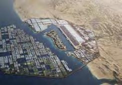
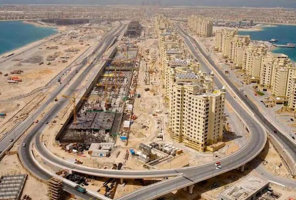
Doha
Island designed as an extension of The Pearl-Qatar to cater for its residents’ accommodation and investment needs.
Source: Dar
Doha
Gewan Island, new mixed-use entertainment and residential island located 350 metres offshore of Doha’s west coast.
Source: Dar
Doha
A site of 67 ha, gross floor area of 360,000 m², residential units, serviced apartments, beachfront, waterfront, exclusive island villas.
Source: Dar Doha
A site of 67 ha, gross floor area of 360,000 m², residential units, serviced apartments, beachfront, waterfront, exclusive island villas.
Real image taken used as part of a gallery for potential visitors to view online.
Source: imMaldives
Sheikh Mohammed bin Rashid Al Maktoum reveals the masterplan for Palm Jebel Ali, a development twice the size of Palm Jumeirah.
Source: Construction Week Hulhumale
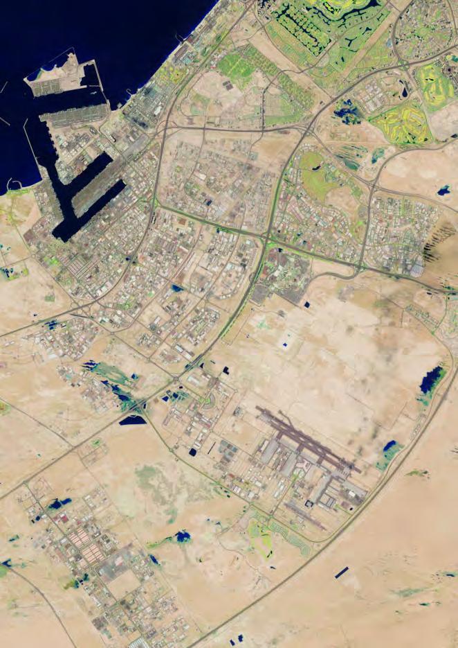
Dubai
A snapshot of Palm Jumeirah’s view from the satellite, 2005
Source: Bayut
Dubai
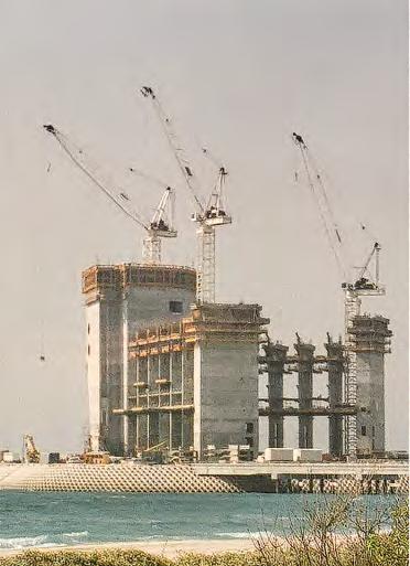
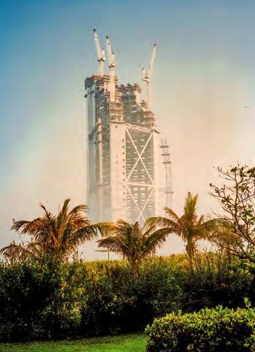
The western part of the “trunk” of the Palm Jumeirah during construction, 2003-2005
Source: CNN
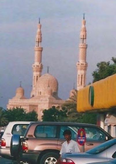
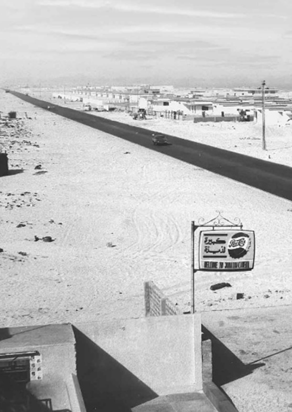
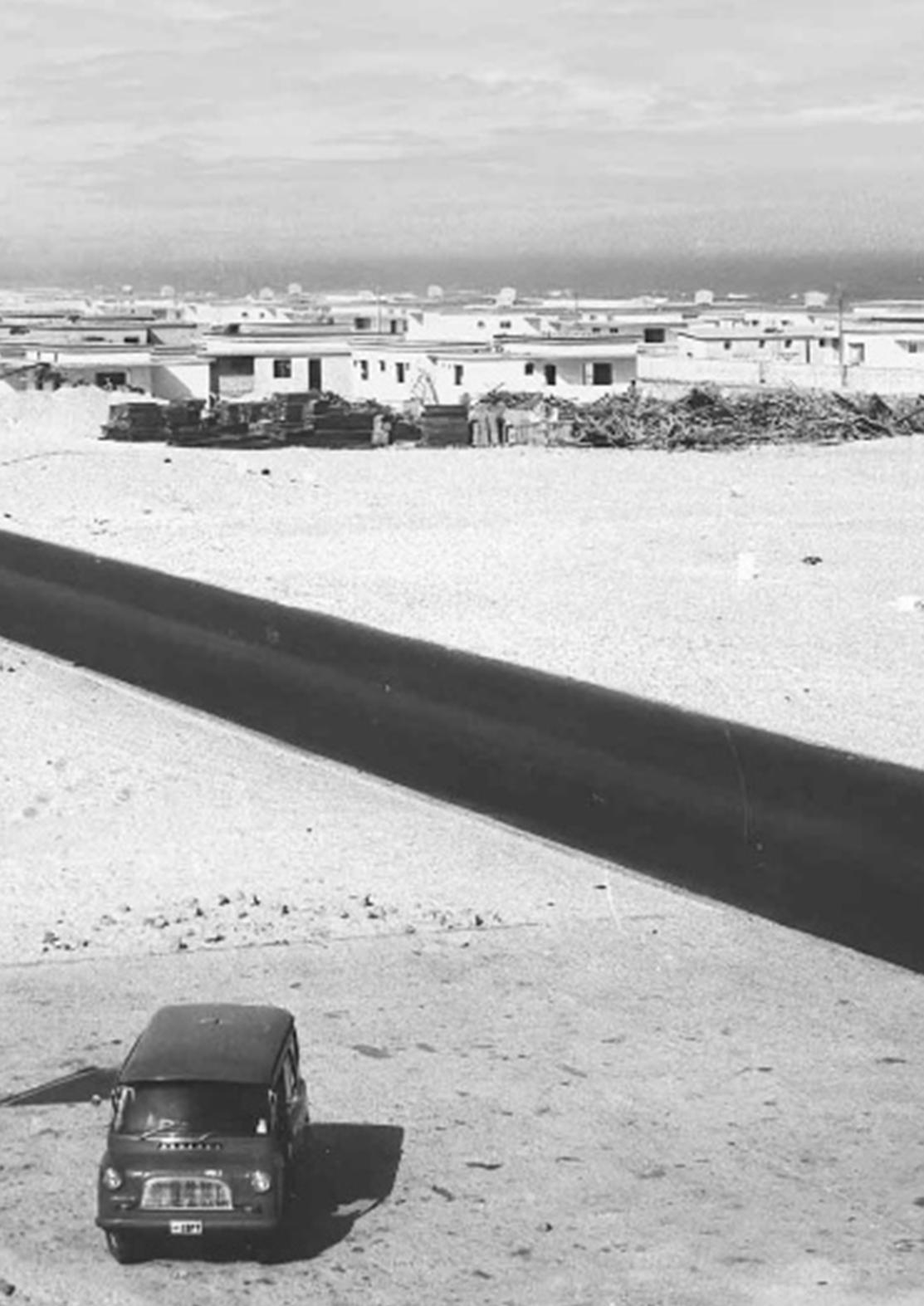
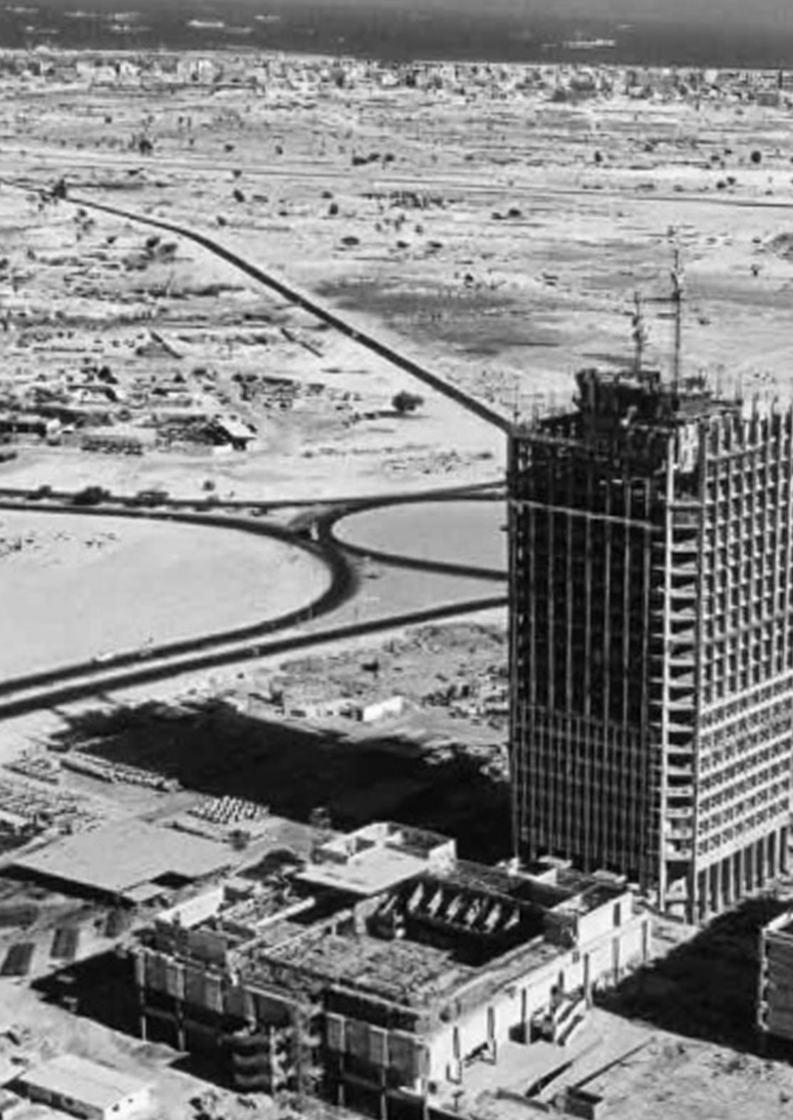
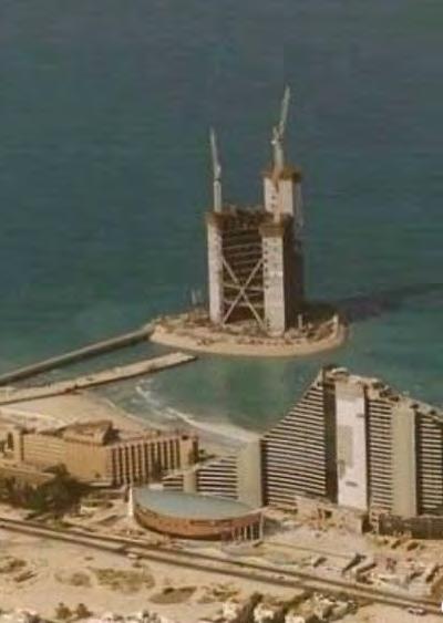
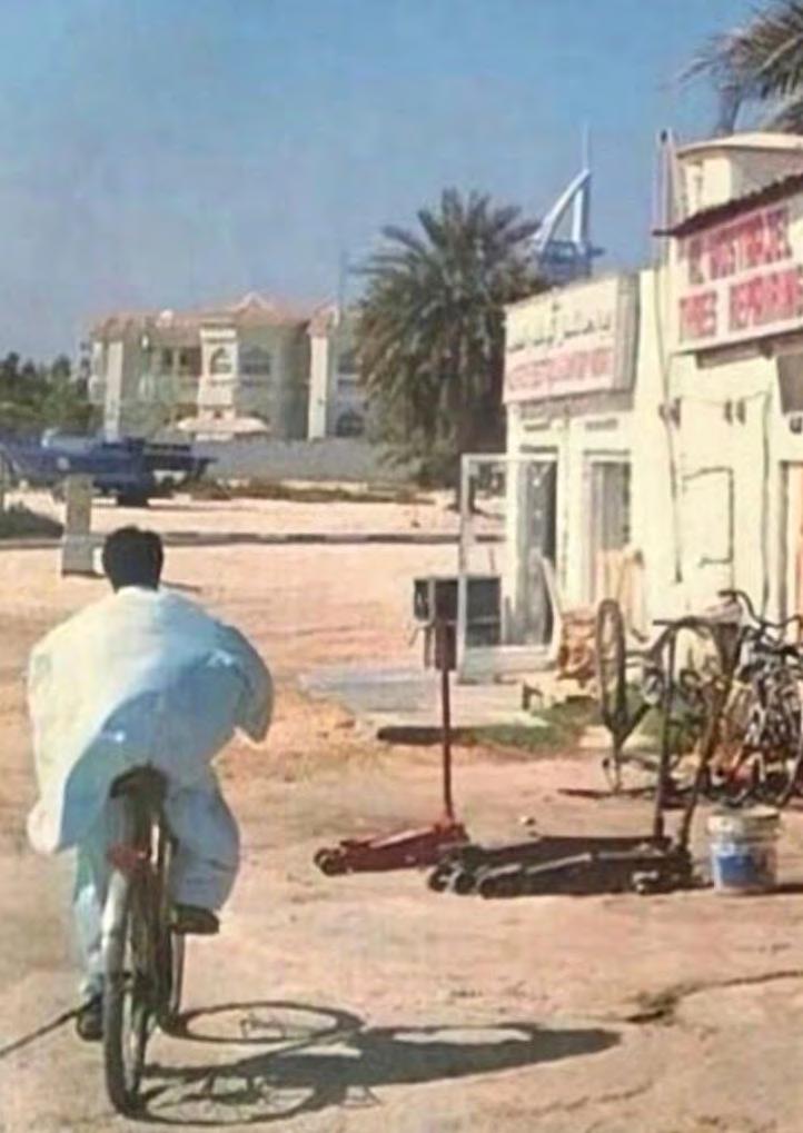
Dubai
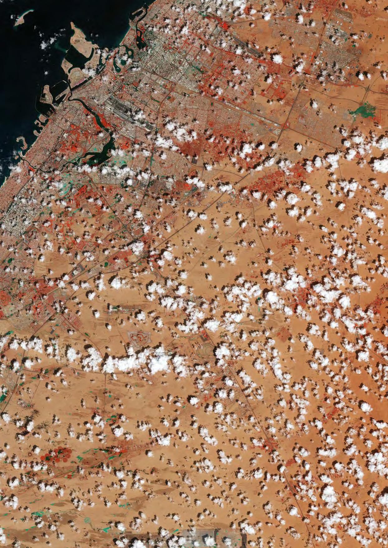
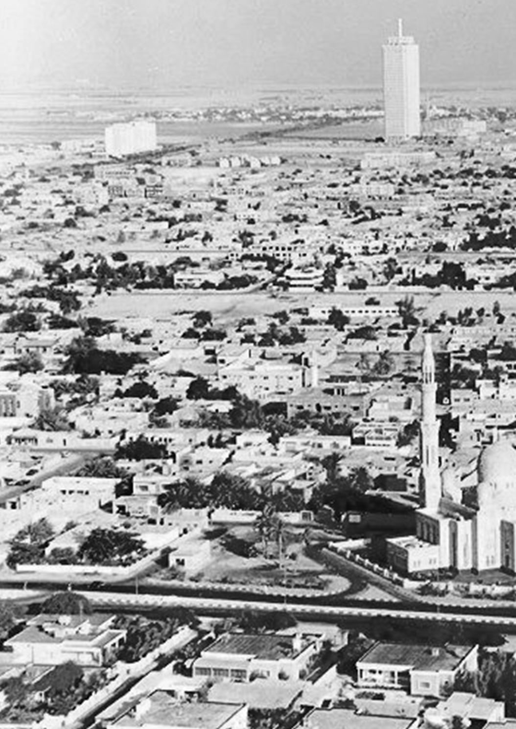
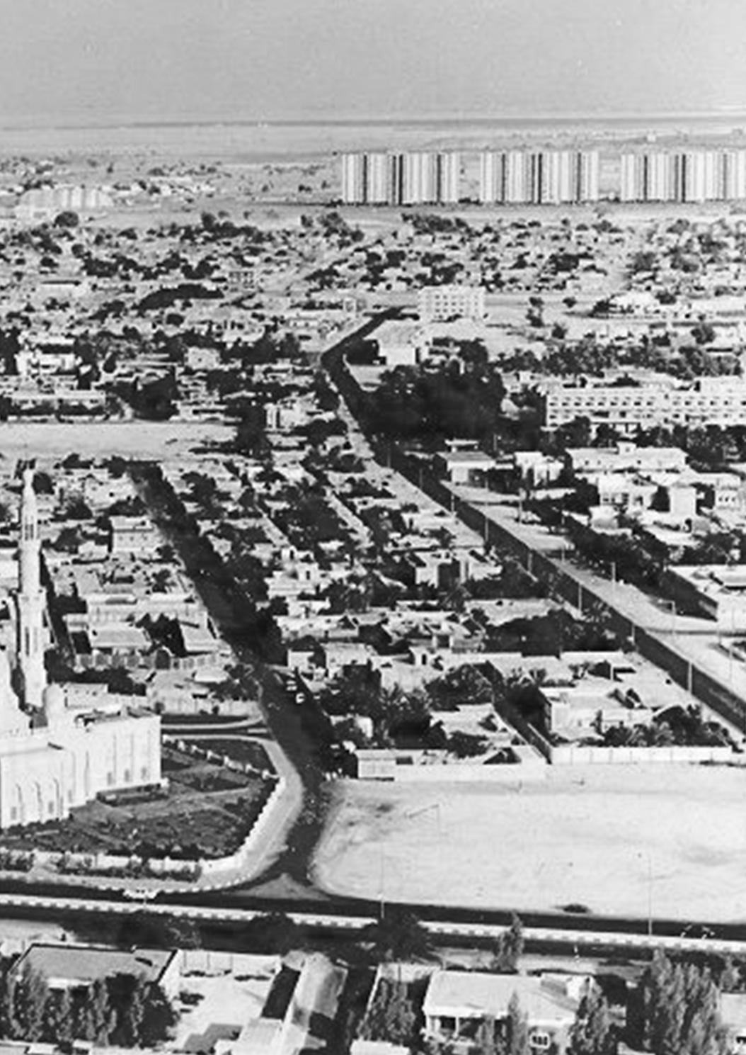
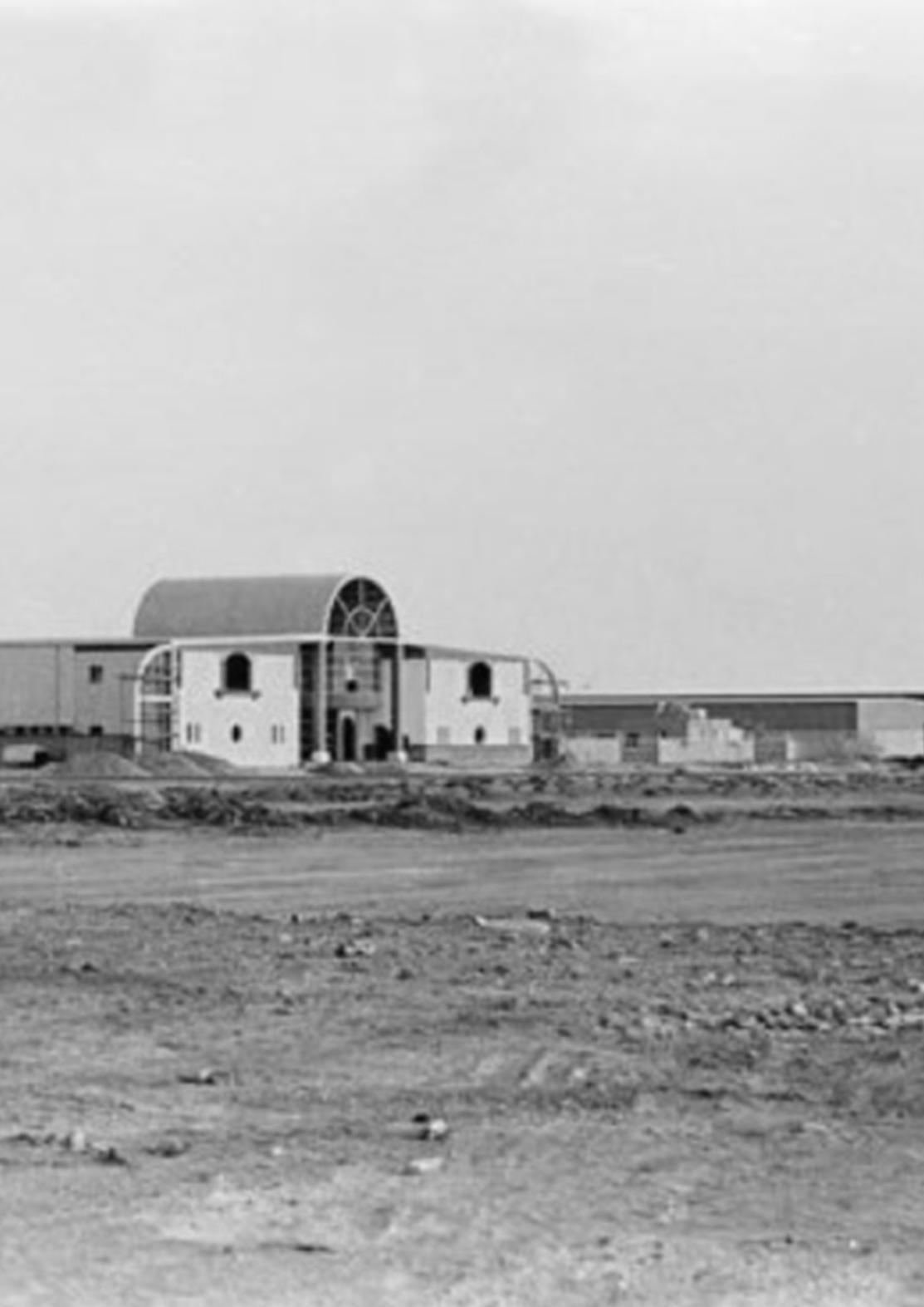
Dubai began to take shape in the desert, starting with lowrise buildings in the 1970s.
Source: Arabic CNN
Abu Dhabi
Abu Dhabi Circa, Al Bateen Area, the prestigous area till today, 1950.
Source: World Nomad Journals
Abu Dhabi
Major development spanning more than 51 million square metres will deliver luxury living and leading sporting facilities
Source: Modon Properties
Abu Dhabi
8 international dredgers brought in to retrieve sediments and build x2 articial 50m tall hills.
Source: NMDC
Abu Dhabi
Townhouses/ resort (private), rental basis, identical to hotels
Source: Abu Dhabi Travel Planner
Abu Dhabi
Render for Phase 1 of the project- “luxury” residential units.
Source: Modon Properties
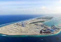
HDC MD Ahmed Nasif announces the realization of the government’s vision for a youth city in Hulhumale. 2018
Source: PSM News
Hulhumale
HDC MD Ahmed Nasif announces the realization of the government’s vision for a youth city in Hulhumale. 2018
Source: PSM News
Hulhumale
Land reclamation, Over 80% of the country lies less than metre above sea level.
Source: Housing Development Corporation
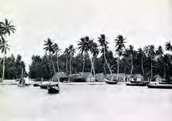
Maldives
Harbor of a Maldivian village.
Source: Oxford Research
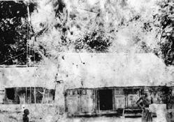
Maldives
Maldivian architecture history.
Source: Beach Heaven
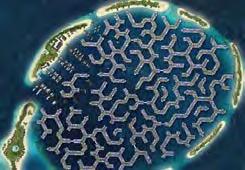
Maldives
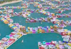
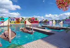
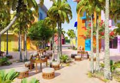
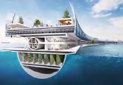
The first development of a new era in which Maldivians return to the water with resilient eco-friendly floating projects.
Source: Maldives Floating City
Maldives
A nature-based structure of roads and water canals. Efficient way in which real brain coral is organised.
Source: Maldives Floating City
Maldives
A rendering of Maldives Floating City.
Source: CNN Maldives
A rendering of Maldives Floating City.
Source: CNN
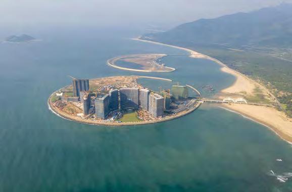
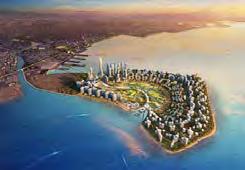
Penang Island, Malaysia
Guangdong
Gurney Wharf, north coast of Penang Island. Rightside: residential area recently built on reclaimed land. Leftside: new island built.
Source: China Dialogue
Malaysia
Dawan District’s water city in Guangdong, and Macau: 150x30m concrete units, advanced transportation.
Source: AT Design Office
Jerudong Waterfront, Brunei
This master plan, north of capital city of Bandar Seri Begawan,to maximize the potential of a stretch of Brunei coastline.
Source: HOK
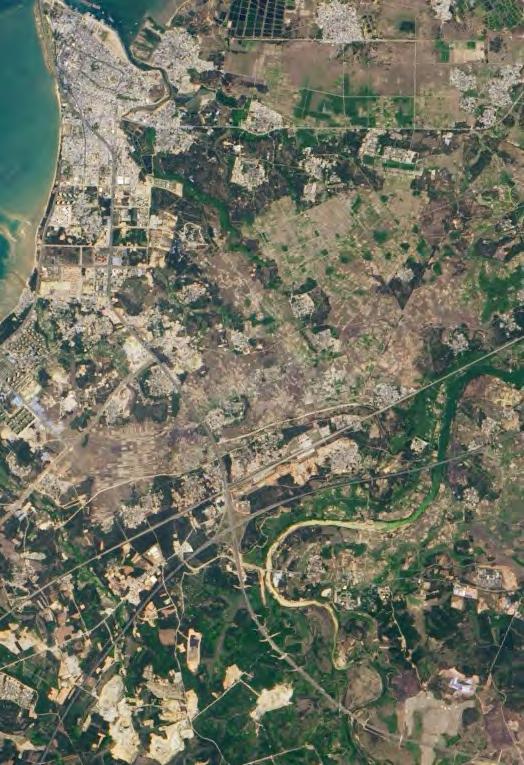
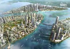
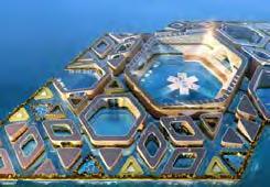
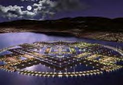
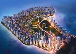
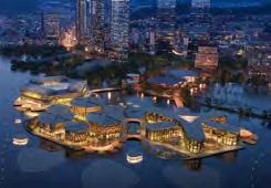
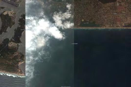
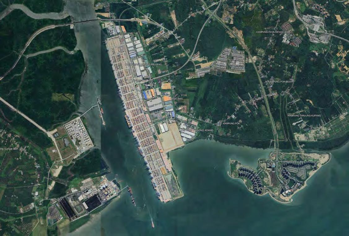
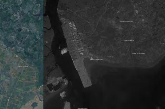
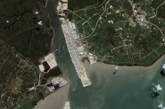
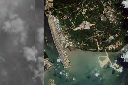
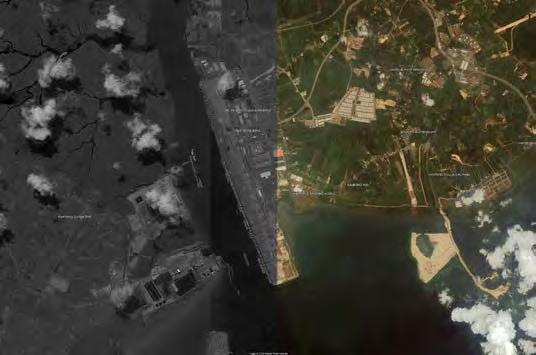
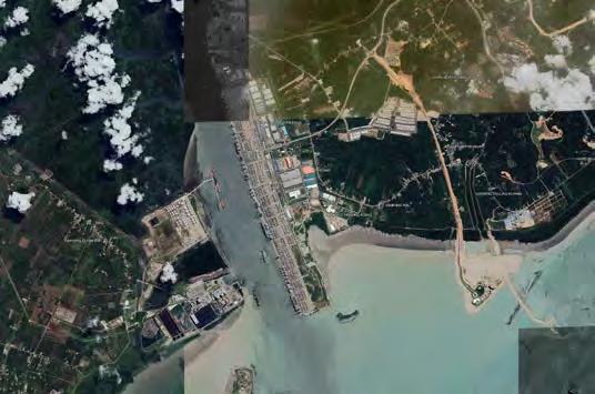
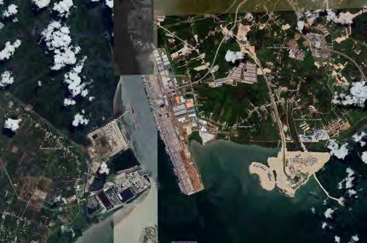
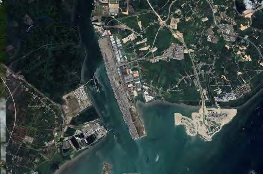
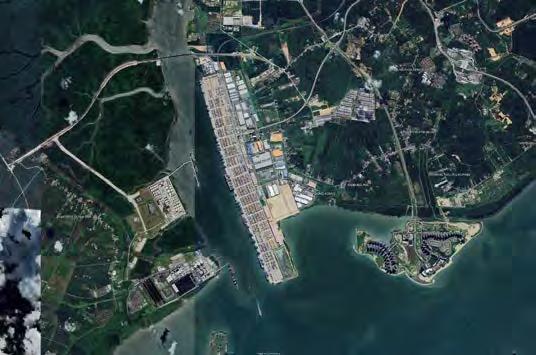
Manila
Manila’s new smart city run artificial intelligence.
Source: InDesign Live
Japan
Dogen City- Walkway + public housing, 8m levee function against tsunami, public housing, water & sewage treatment func.
Guangdong
Forest City in Malaysia, strategically located near Singapore, offers a green smart city with tourism amenities and high developmental and investment potential.
Source: Forest City Official
Mayalsia
Dawan District’s water city in Guangdong, and Macau: 150x30m concrete units, advanced transportation.
Source: AT Design Office
Jerudong Waterfront, Brunei
This master plan, north of capital city of Bandar Seri Begawan,to maximize the potential of a stretch of Brunei coastline.
Source: HOK
Manila
Manila’s New Smart City Run by Artificial Intelligence
Source: Indesign Live
Source: Robb Report/ N-ark
Japan
Dogen City- The “noillness” neighborhood will host up to 40,000 people and be able to withstand natural disasters.
Source: Robb Report/ N-ark
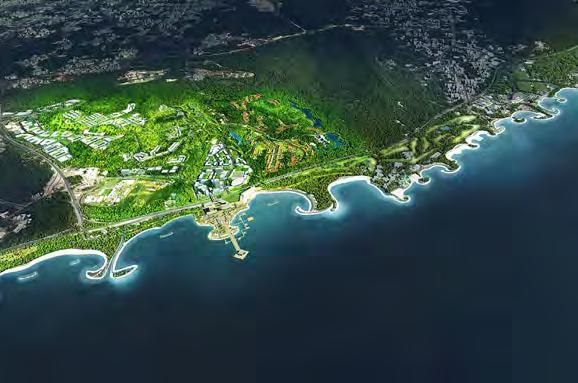
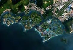
Sasaki’s “Forest City” Master Plan in Iskandar Malaysia
Stretches Across 4 Islands.
Aerial Rendered View. Image
Courtesy of Sasaki Associates.
Source: Archdaily
Mayalsia
Guangdong
Dawan District’s water city in Guangdong, and Macau: 150x30m concrete units, advanced transportation.
Source: AT Design Office
Jerudong Waterfront, Brunei
This master plan, north of capital city of Bandar Seri Begawan,to maximize the potential of a stretch of Brunei coastline.
Source: HOK
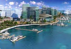
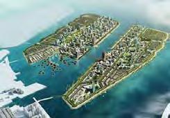
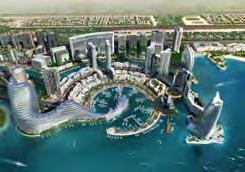
Manila? Abu Dhabi?
Manila or.. Abu Dhabi?? “Gulf Exports”-Rem Koolhaas
Source: Getreal Philippines
Japan
Dogen City- Evacuation site function for natural disasters such as earthquakes, floods, and tsunams.
Source: N-ark
China
Sasaki’s “Forest City” Master Plan in Iskandar Malaysia
Stretches Across 4 Islands.
Aerial Rendered View. Image
Courtesy of Sasaki Associates.
Source: Archdaily
Malaysia
trader-free Petaling Street, Kuala Lumpur, 1880-1900.
Source: Malaysia News
Penang, Malaysia
Fishing port in Penang, 1900–1940s.
Source: Ehm
Penang, Malaysia
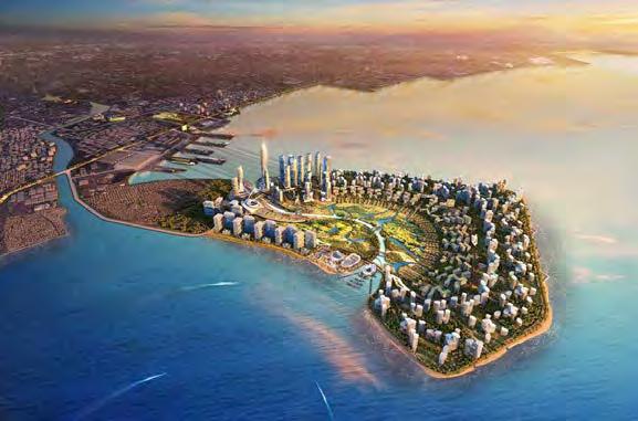
Masterplan that will see three artificial islands built off the shore connected by an autonomous transport network.
Source: BIG
Penang, Malaysia
this is in support of the state’s Penang2030 vision, for which the goal is to become “family-focused, green and smart”.
Source: Dezeen
Penang, Malaysia
The island districts are expected to each support between 15k to 18k residents. Rely on localised water resources, renewable energy...
Source: Dezeen
Penang, Malaysia
Sasaki’s “Forest City” Master Plan in Iskandar Malaysia
Stretches Across 4 Islands.
Source: Archdaily
“7 Futuristic floating cities that could save humanity”.
Source: Inhabitat
Guangdong
The star of Guangdong, a history of federalist china.
Source: Paradox Plaza
Vietnam Vietnam, 1900s.
Source: Saigoneer
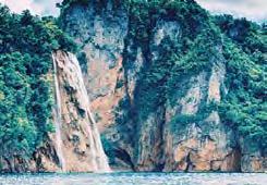
Ticao Island
Catandayagan Falls.
Source: Tripadvisor
Phu Quoc, Vietnam
Jerudong Waterfront, Brunei
This master plan, north of capital city of Bandar Seri Begawan,to maximize the potential of a stretch of Brunei coastline.
Source: HOK
Brunei
Manila
Japan
The MOA clears the way for the three reclamation projects to go full speed and move forward by the different project proponents.
Source: Business Mirror
N-Ark just revealed plans for a 40,000-person, self-sustaining floating metropolis called Dogen City.
Source: N-ark
Manila
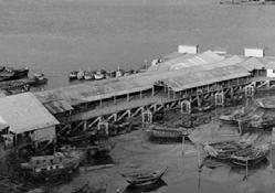
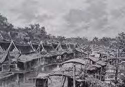
Brunei in the 1970s, old Tamu, triangular area behind the Jardine Wharf building.
Source: Brunei Resources
Jakarta Koningsplein Oost (now Jalan Medan Merdeka Timur), train station Weltevreden (now Stasiun Gambir) on the right side of the road.
Source: Facebook
Jakarta
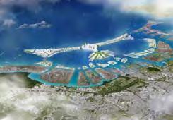
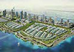
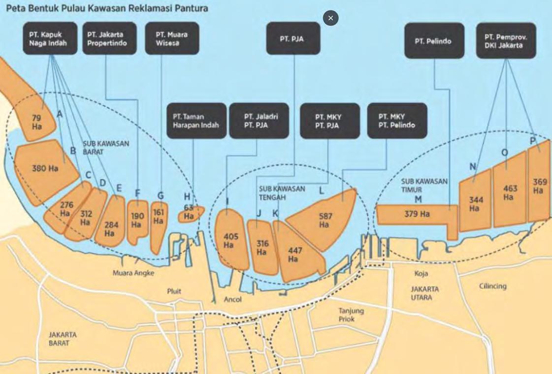
Indonesia’s central government has allowed work to resume on a project to build 17 artificial islands off the coast of Jakarta.
Source: Mongabay News
Jakarta
The Lotus Island, masterplan.
Source: Behance
Phu Quoc, Vietnam
27 ha of reclaimed land being developed for high-end residential use, forming part of a wider development.
Source: Royal HaskoningDHV
Phu Quoc, Vietnam
The Lotus Island, commercial and conferences.
Source: Behance
Property developer PT Muara Wisesa Samudra to design and construct the artificial island for Pluit City off the coast of Jakarta.
Source: Dutch Water Sector
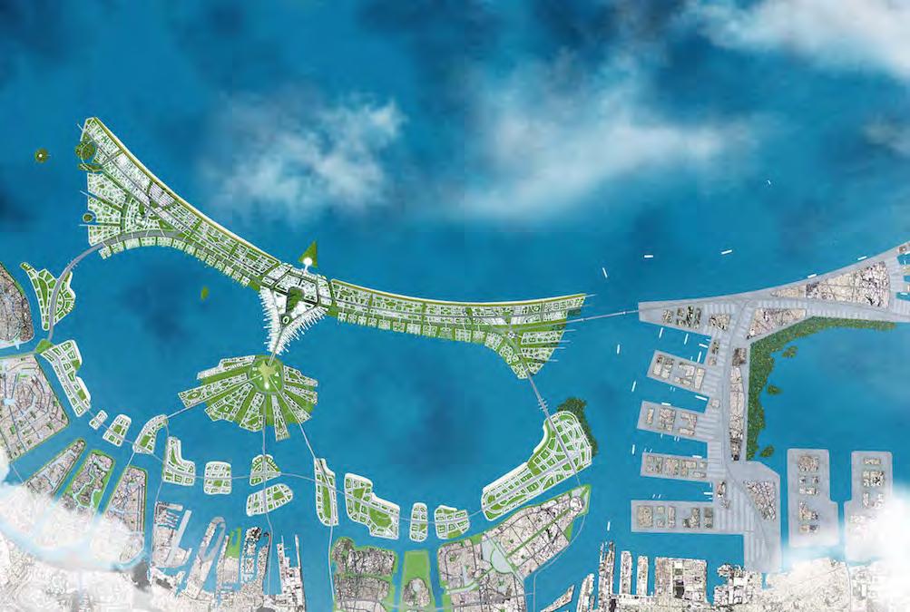
Jakarta
2 of the 17 major artificial islands.
Source: The Water Network
Jakarta
The “Manhattan/ Dubai” of Jakarta.
Source: Mongabay News
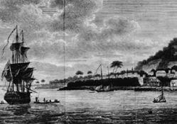
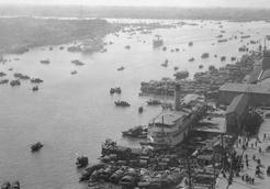
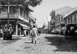
Calle Rosario, Binondo, Manila, Philippines, early 20th Century | Photo: John Tewell Collection
Source: Tatlerasia
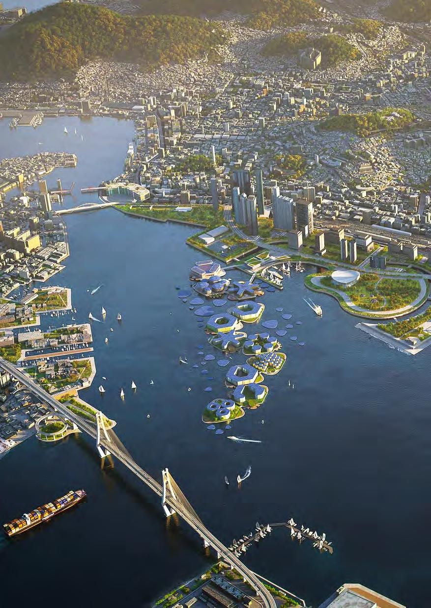
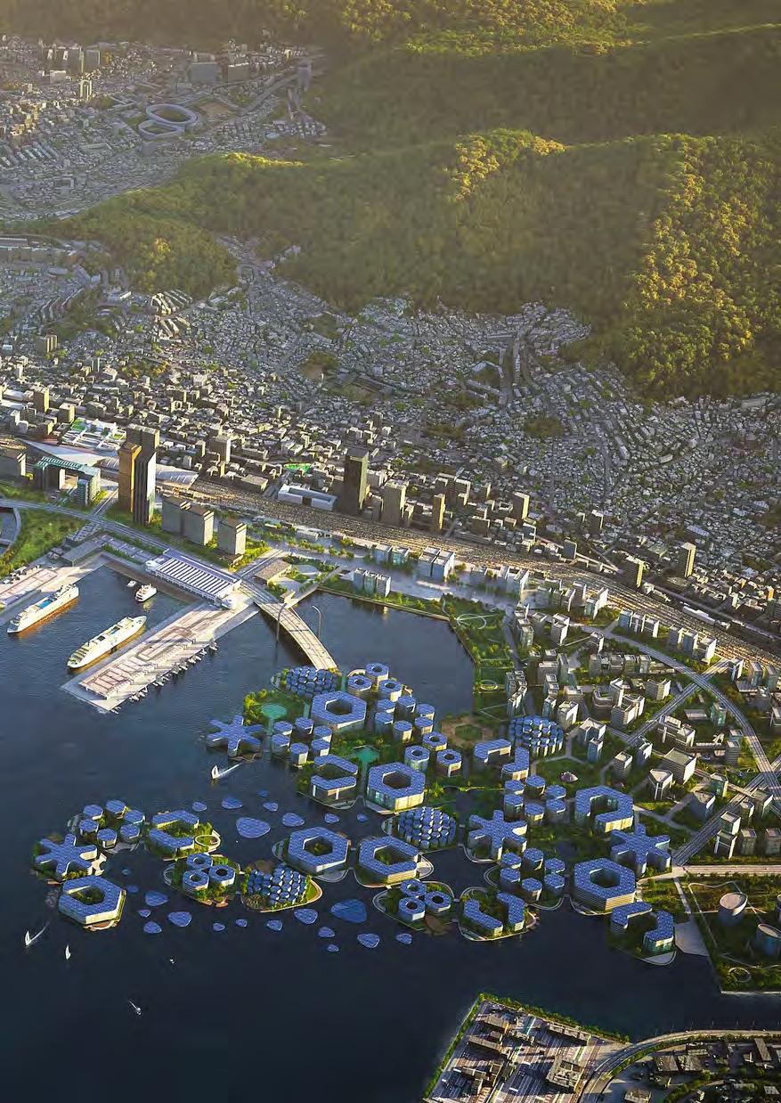
South Korea
Japan
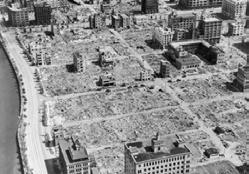
An aerial view of a firebombed area in Tokyo in 1945.
Source: Foreign Policy
Japan
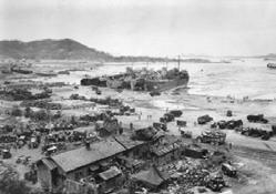
Inchon Battle. Four tank landing ships unload men and equipment on Red Beach one day after the amphibious landings on Incheon.
Source: ADSO
South korea
Teahouse, Oji pre-war Japan.
Source: Skyscraper City
South Korea
New Songdo City, Songdo International Business District, canal introduced in between high rises.
Source: KPF
South Korea
OCEANIX Busan, the floating city is an upcoming destination for visitors and travelers.
Source: Yanko Design
South Korea
Building a City from Scratch, multiuse development derived from nothing.
Source: Archdaily
South Korea
Aerial city rendering, Songdo Internal Business District
Source: Cosentini
South Korea
Floating cities like OCEANIX Busan may help solve rising sea levels and climate change.
Source: Insider
South Korea
A ‘flood-proof’ city that can house 12,000 people and looks like a giant, floating honeycomb.
Source: Insider
South Korea
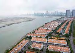
Land reclamation reaching completion, 2004, for Songdo International Business District.
Source: Big Investors
The floating platforms are designed to withstand the weight of five-story buildings, per developers.
“Land Leveraging” delves deeper into the underlying motivations for the vast land reclamation activities to make “Rapid Replications” possible. It shifts the focus towards understanding these reclaimed lands as financial instruments rather than physical spaces. This chapter reveals how these areas are commodified and transformed into assets that act as securities within the complex, hyper-rapid transactions of contemporary financial systems. These reclaimed territories, once seen primarily as platforms for urban and infrastructural expansion, now primarily serve the financial markets, enabling a kind of speculation and securitization that fuels economic growth. This transformation of physical land into financial assets exemplifies a broader trend in global finance where real estate plays a pivotal role in the creation of derivative products and investment vehicles. This evolution marks a significant shift in how land is perceived and utilized in the modern economy, emphasizing its role in financial speculation over its traditional use for community and infrastructure development.
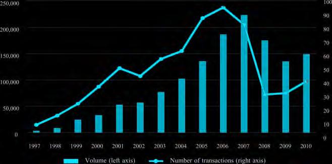
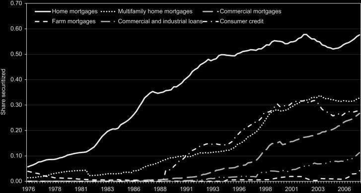
Securitization is a financial process that involves converting assets into marketable securities. In this process, individual loans or other illiquid financial assets are pooled together and repackaged into interest-bearing securities. These securities are then sold to investors. The appeal of securitization lies in its ability to provide liquidity to asset holders and to distribute risk among a broader base of investors. By transforming relatively illiquid assets into securities, financial institutions can enhance their liquidity and access broader capital markets.
In the context of global finance, securitization plays a crucial role, particularly in projects like coastal developments and land reclamation. These large-scale projects often require significant capital investments that are beyond the capacity of any single entity. Through securitization, the underlying assets of these projects, such as newly created land or constructed facilities, are transformed into financial instruments that can be traded. This not only helps in funding massive infrastructural developments but also in creating a diversified portfolio of assets for investors. Securitization, therefore, not only supports the construction of physical infrastructure but also contributes to the creation of financial assets, integrating these developments into the larger fabric of the global financial system. These activities underline a shift towards viewing real estate developments not just as physical entities but as crucial components in financial strategies, reflecting their dual role in modern finance.
As these securitized assets gain traction in the financial markets, they also play a significant role in shaping economic landscapes. The process enables developers and governments to undertake extensive coastal development projects, which are often seen as high-risk due to factors like environmental challenges and regulatory hurdles. By pooling these risks and selling them as securities, the financial burden is spread among a wide array of investors, ranging from large institutional entities to private investors. This democratization of investment allows for more ambitious projects to proceed, which might otherwise be unfeasible.
Furthermore, the integration of securitization in financing coastal developments and land reclamation reflects a broader trend towards the financialization of natural resources and real estate. This shift has profound implications for how such developments are perceived and valued. Instead of merely creating space for urban expansion, these projects are increas-
ingly viewed as vehicles for financial innovation. This perspective not only changes the stakes involved but also influences the planning and execution of these projects, prioritizing financial returns which can sometimes lead to overlooking social and environmental impacts. Thus, while securitization provides necessary capital for development, it also requires careful regulation to ensure that these developments serve broader societal interests alongside financial gains.
The growing reliance on securitization for funding large-scale coastal projects also invites scrutiny regarding its sustainability and long-term impacts. As investors seek higher returns, the pressure to maximize the financial performance of these assets can lead to aggressive development strategies that may not fully account for ecological and social ramifications. This raises critical questions about the balance between economic growth and environmental stewardship in the context of securitization. The challenge lies in designing financial instruments and regulatory frameworks that align investor returns with sustainable development goals.
Moreover, the complexity of these financial structures can sometimes obscure the underlying risks associated with the physical properties themselves, such as susceptibility to climate change impacts like sea-level rise and severe weather events. As such, the financial system’s interconnection with large-scale infrastructure projects necessitates enhanced due diligence and transparency to ensure that long-term sustainability is not compromised for short-term gains. Ensuring that these financial practices contribute positively to the economy requires not only rigorous financial oversight but also a commitment to integrating environmental, social, and governance (ESG) criteria into investment decisions. This approach could help mitigate the potential downsides of securitization, fostering developments that are financially sound and environmentally responsible.
Extracts from Saskia Sassen’s “Expulsions”.
Extracts from Saskia Sassen’s “Expulsions”.
Extracts from Saskia Sassen’s “Expulsions”.
Extracts from Saskia Sassen’s “Expulsions”.
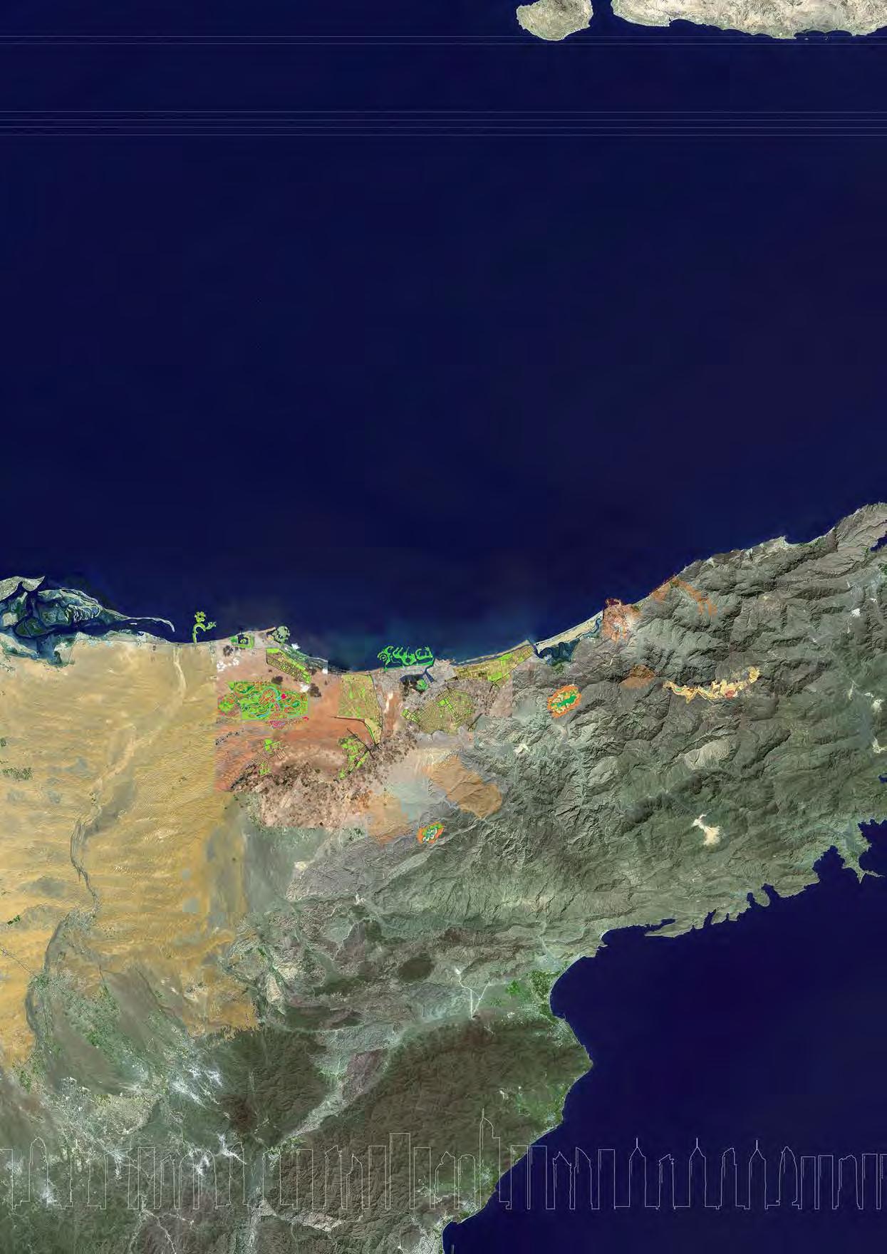
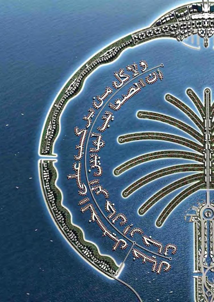
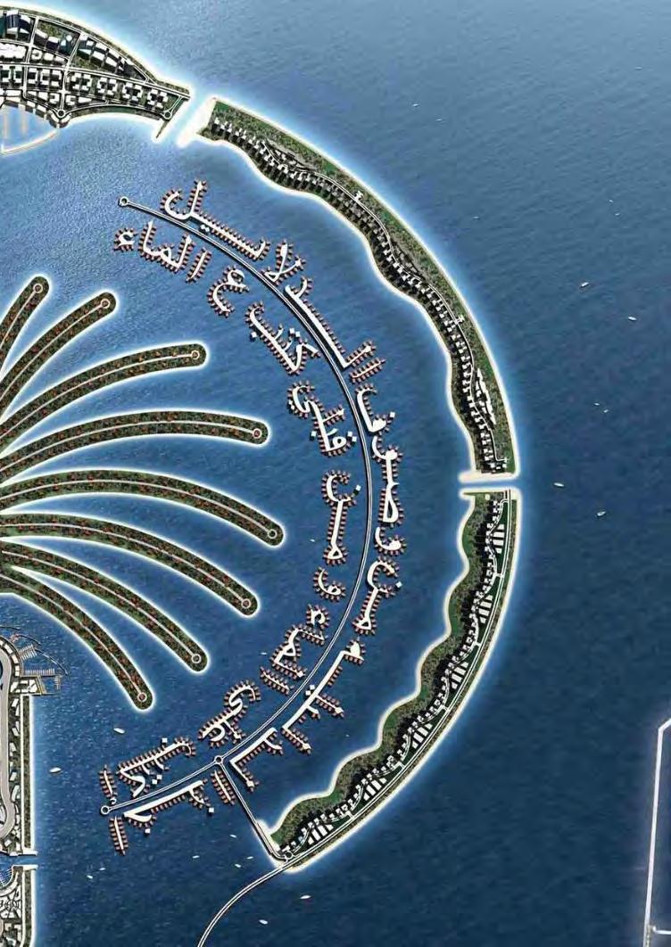
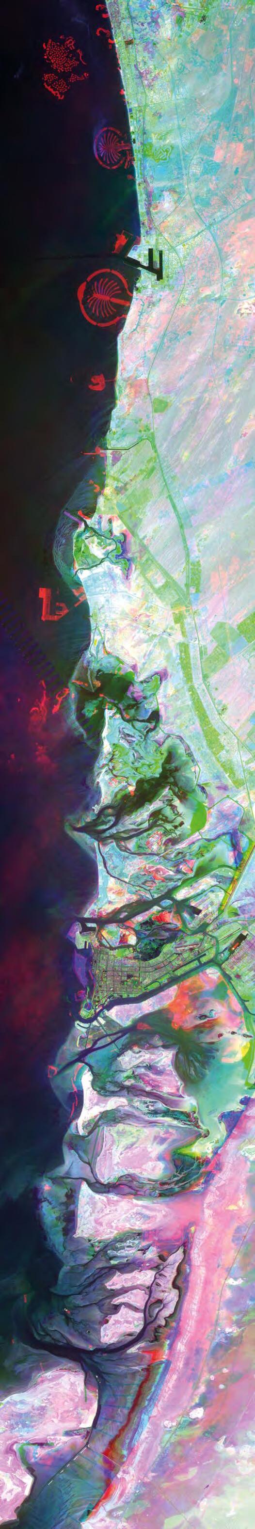
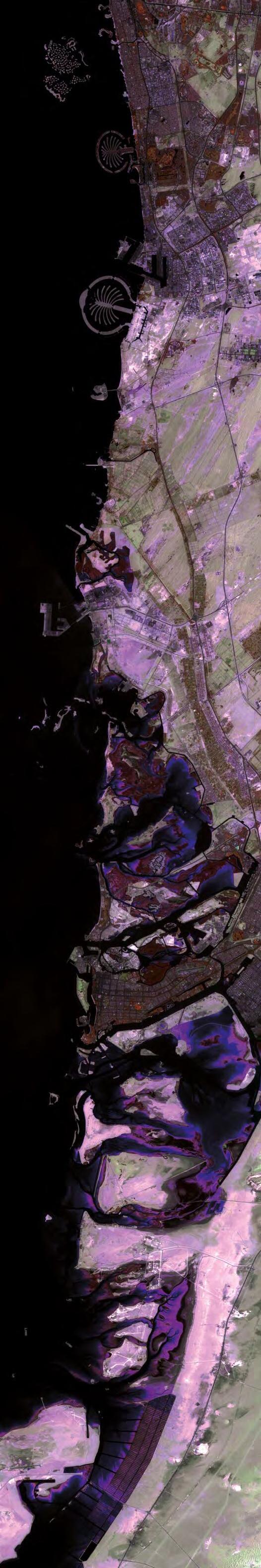
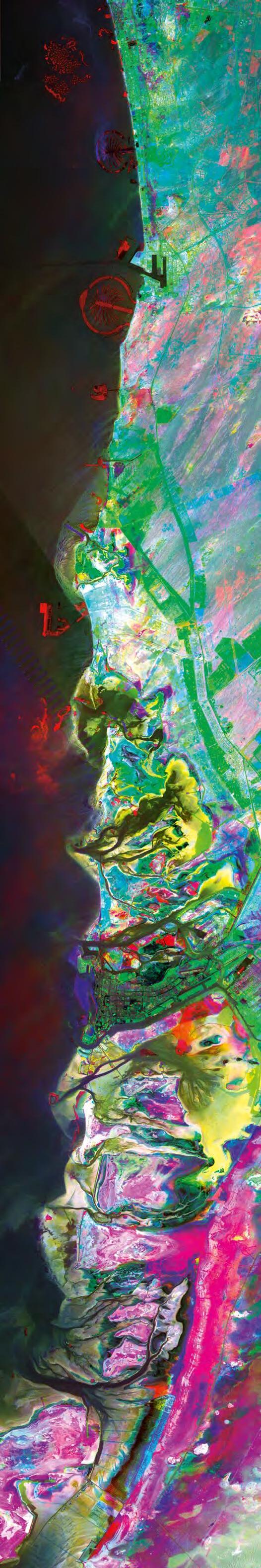
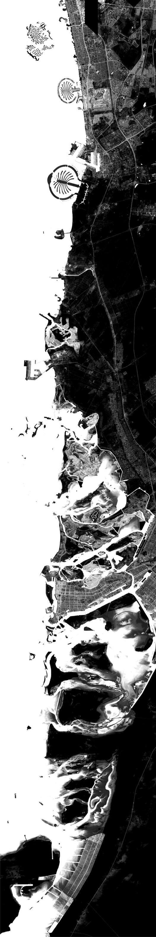
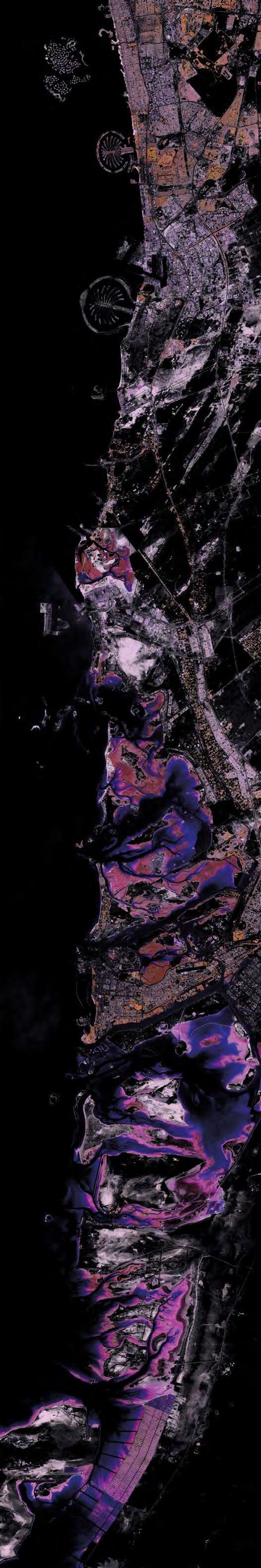
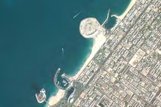
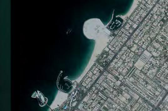
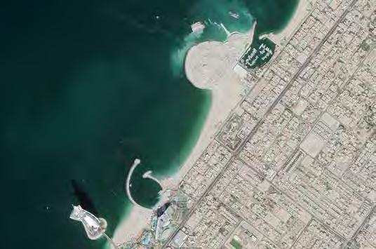
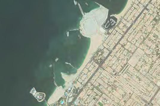
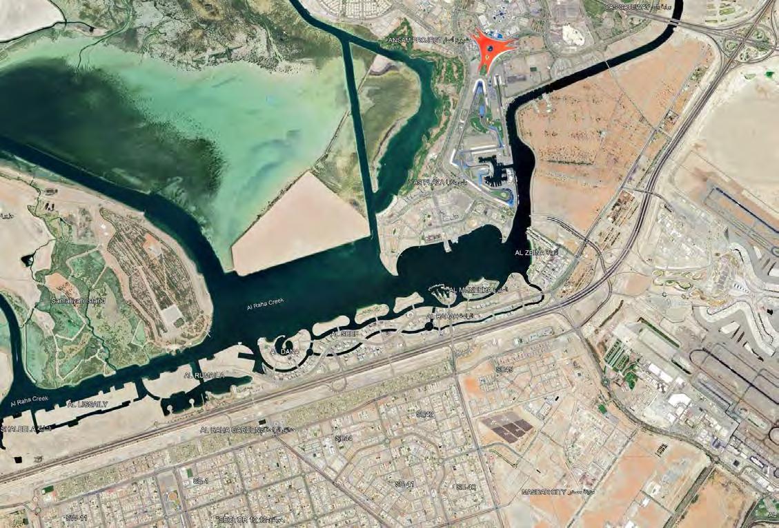
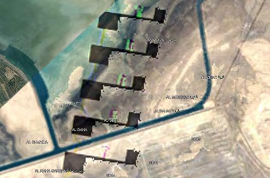
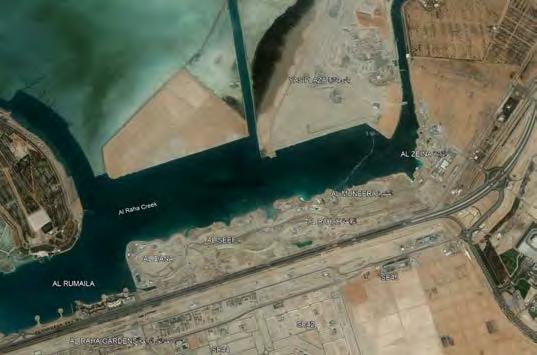
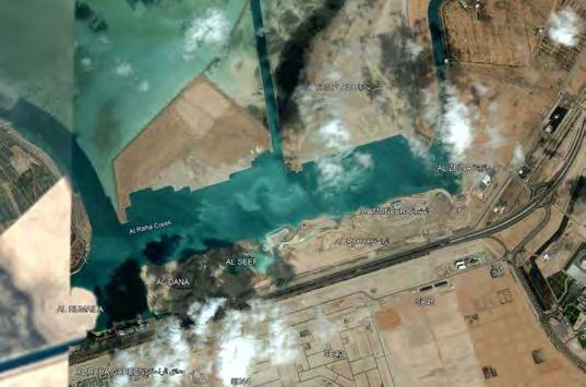
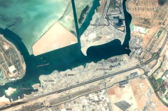
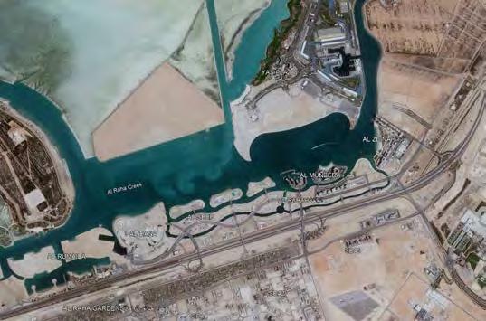
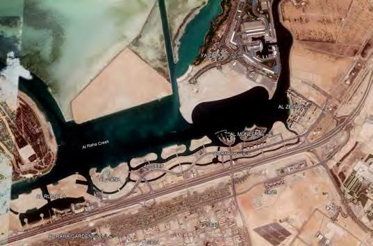
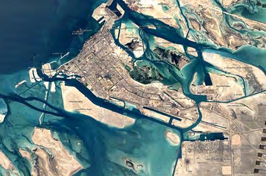
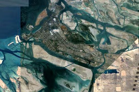
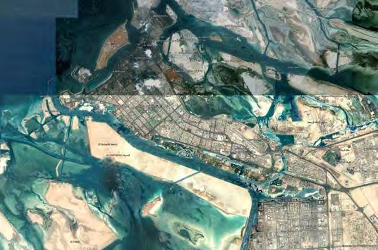
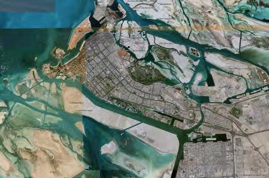
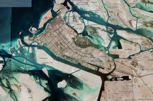
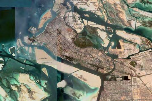
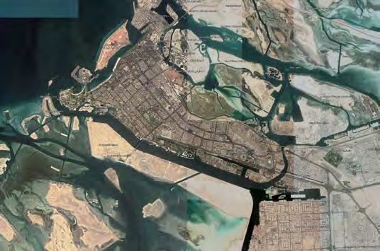
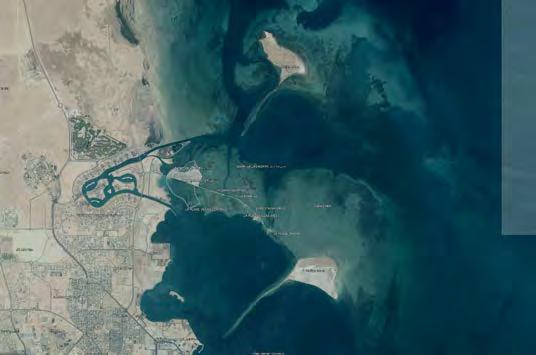
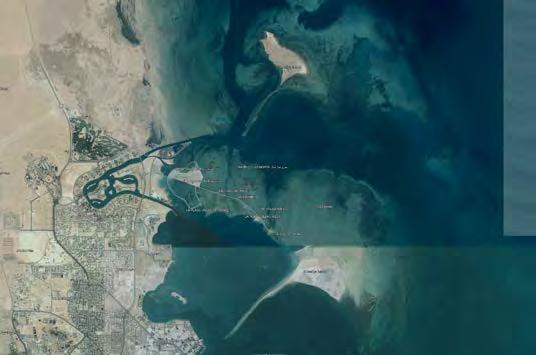
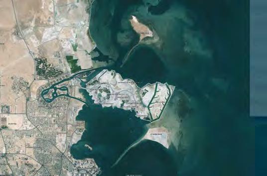
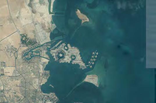
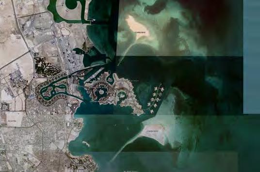
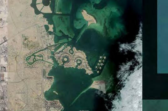
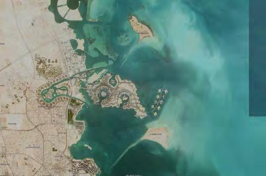
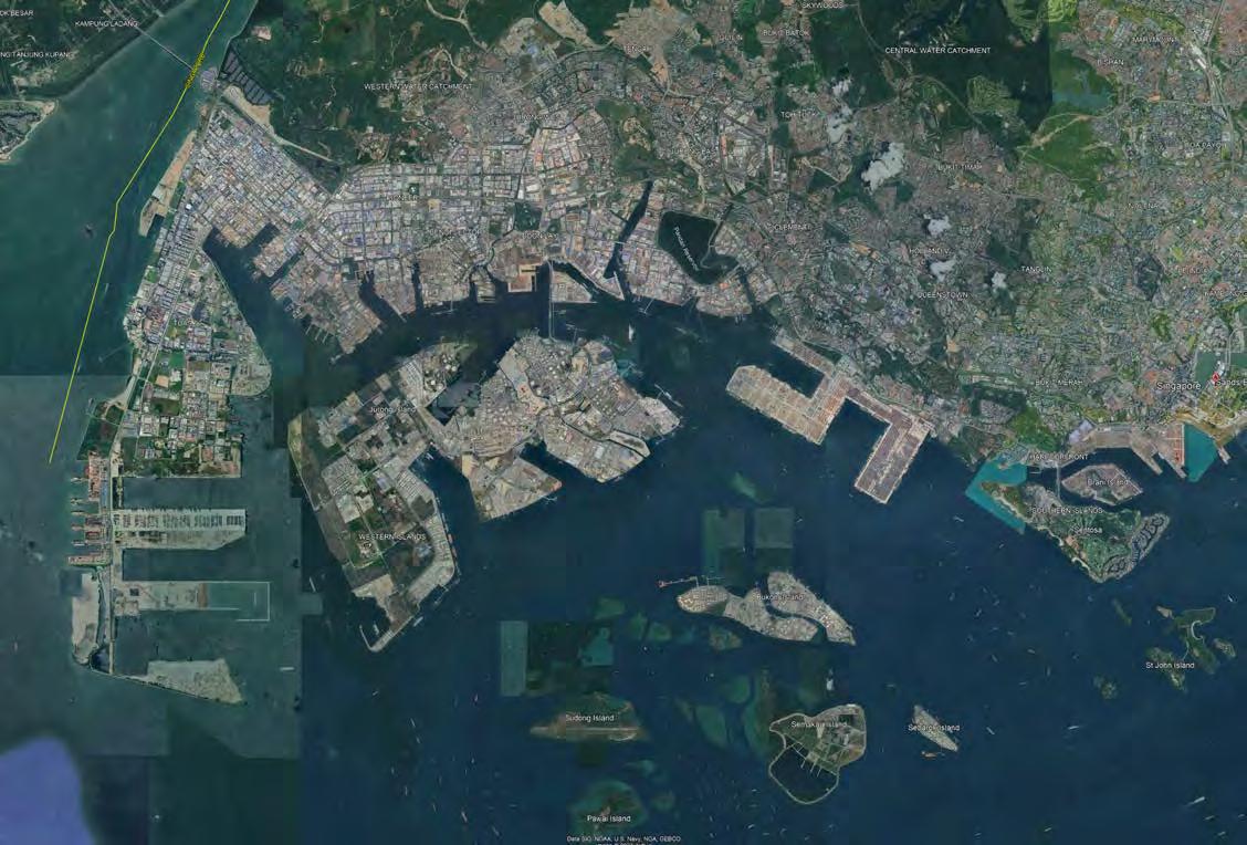
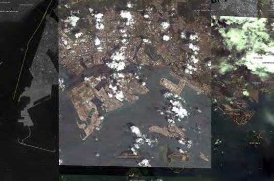
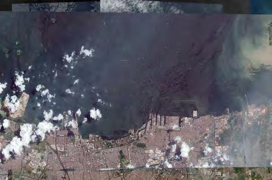
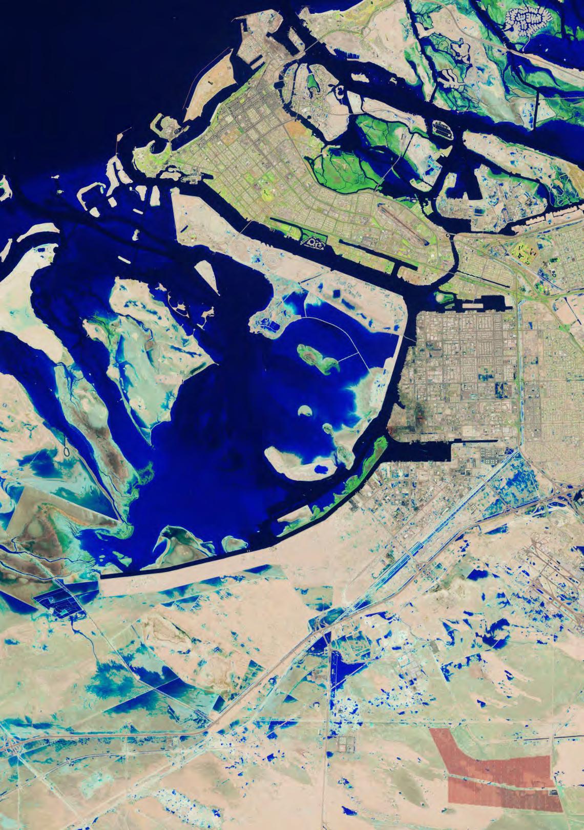
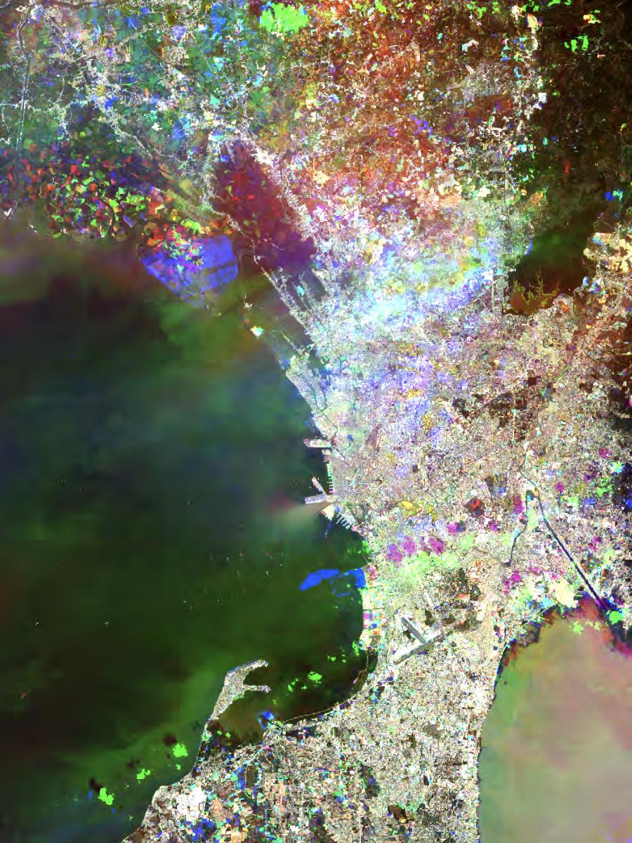
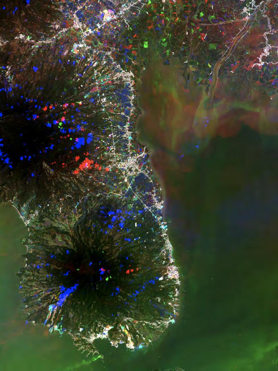
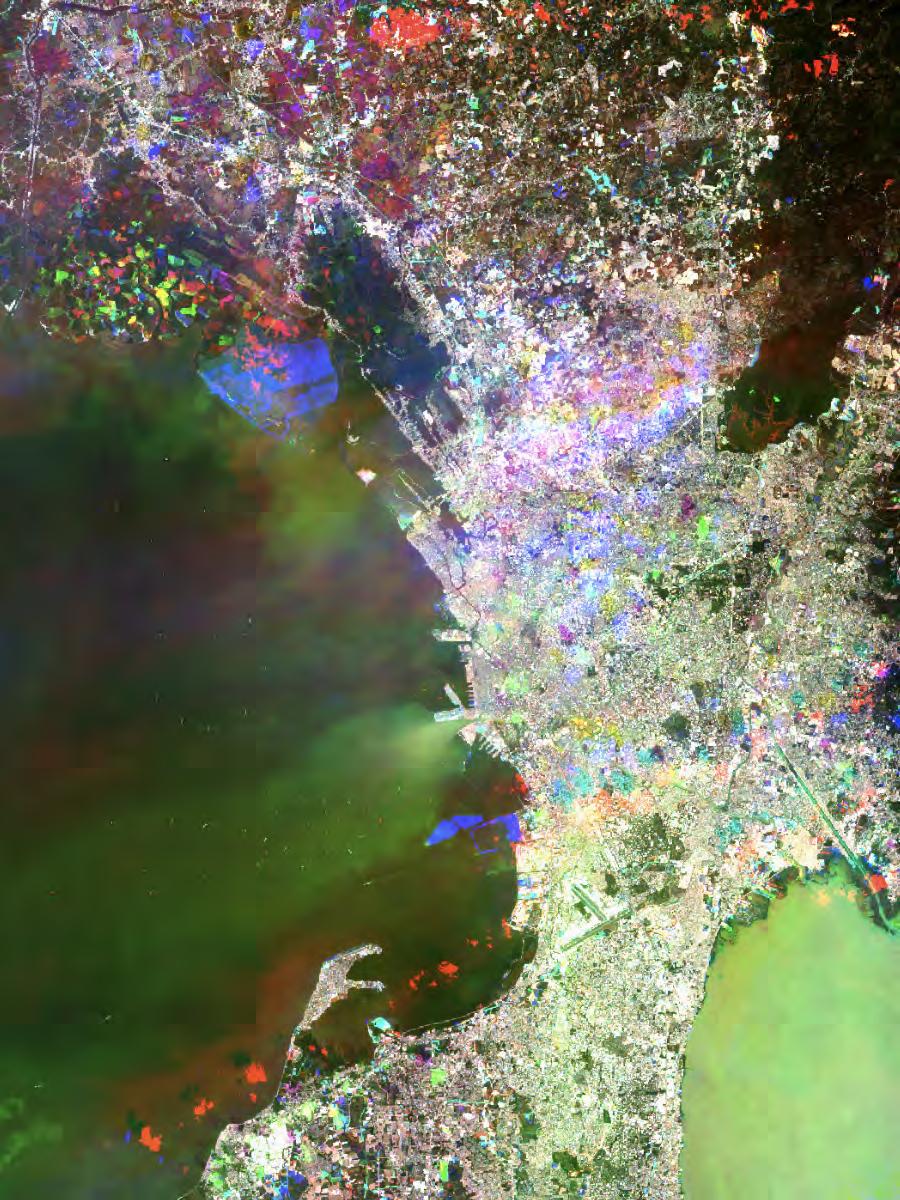
Linked Lives
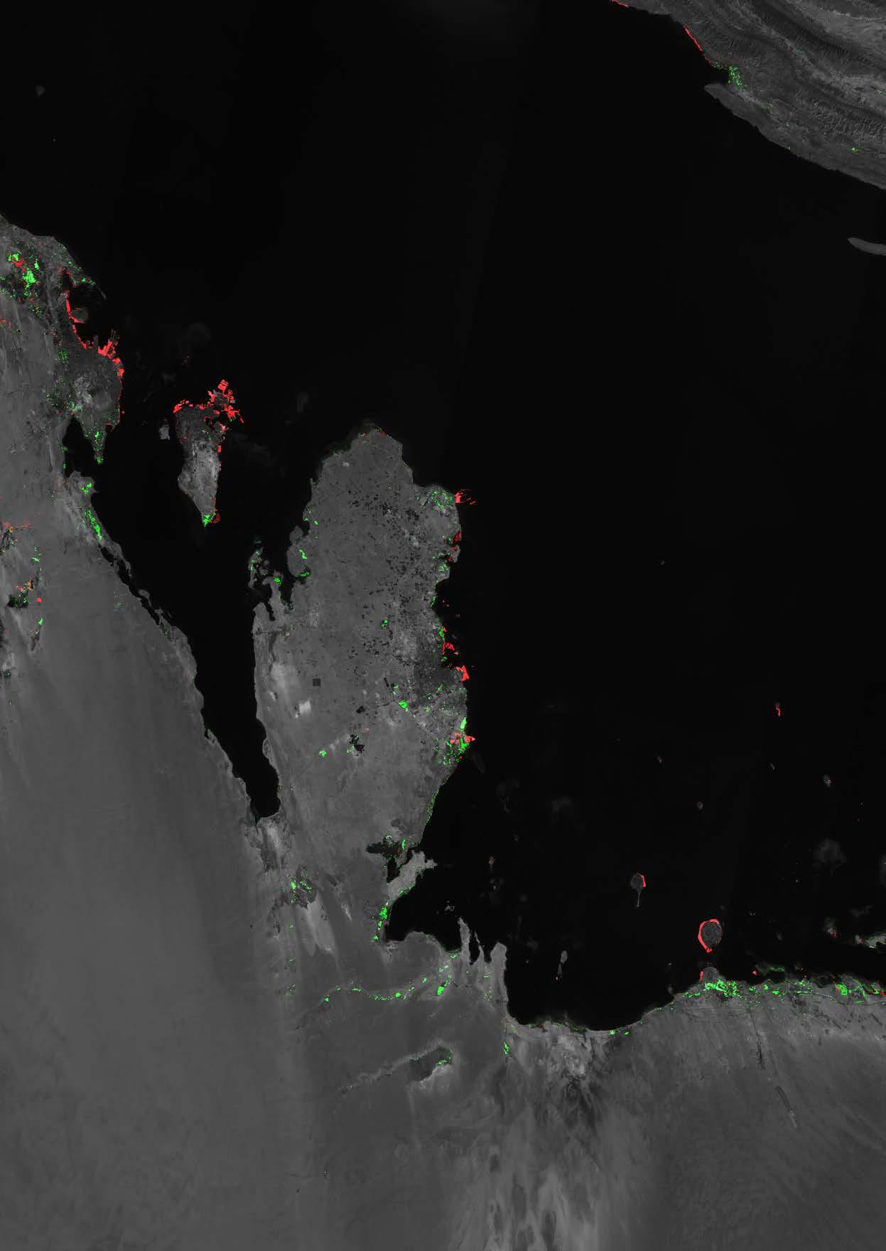
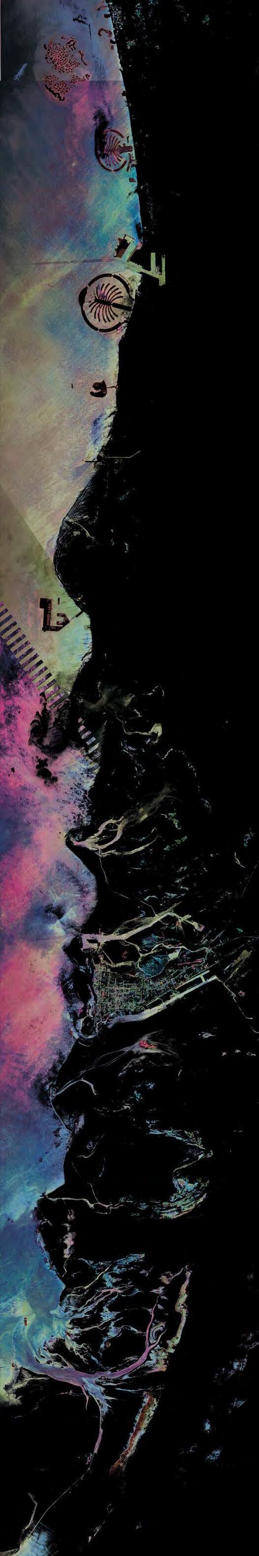
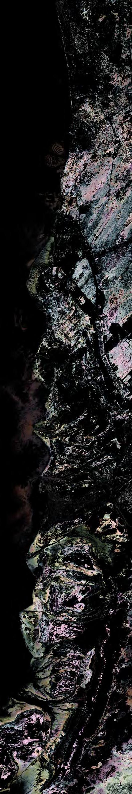
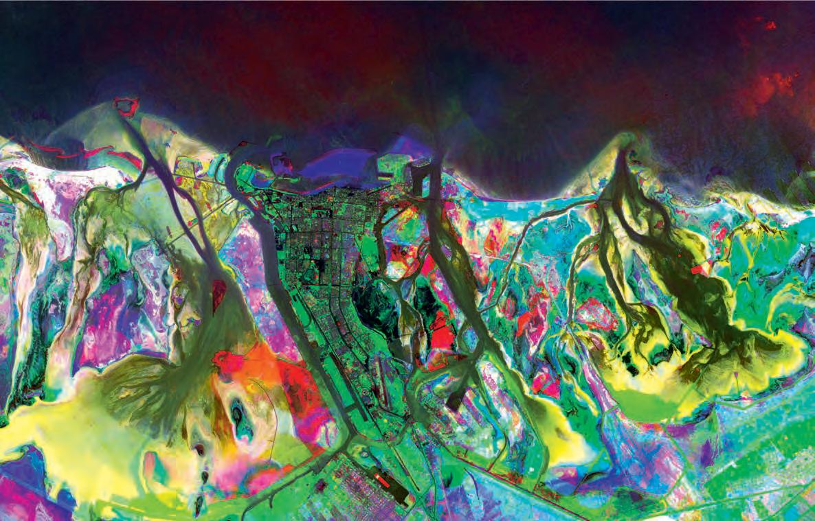
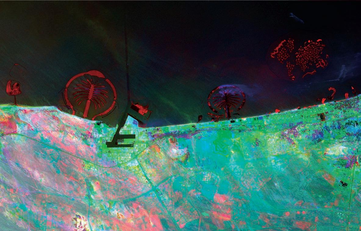
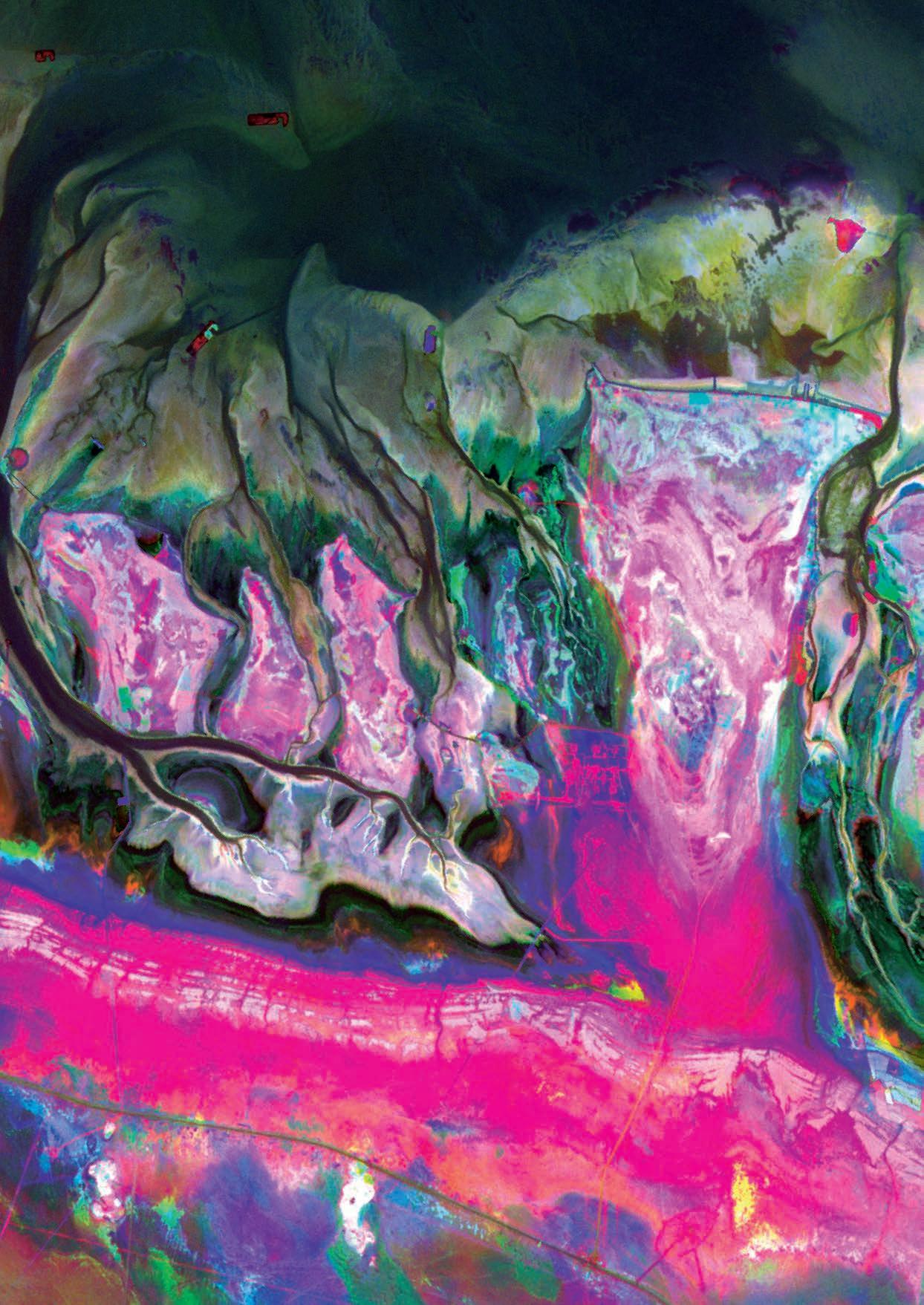
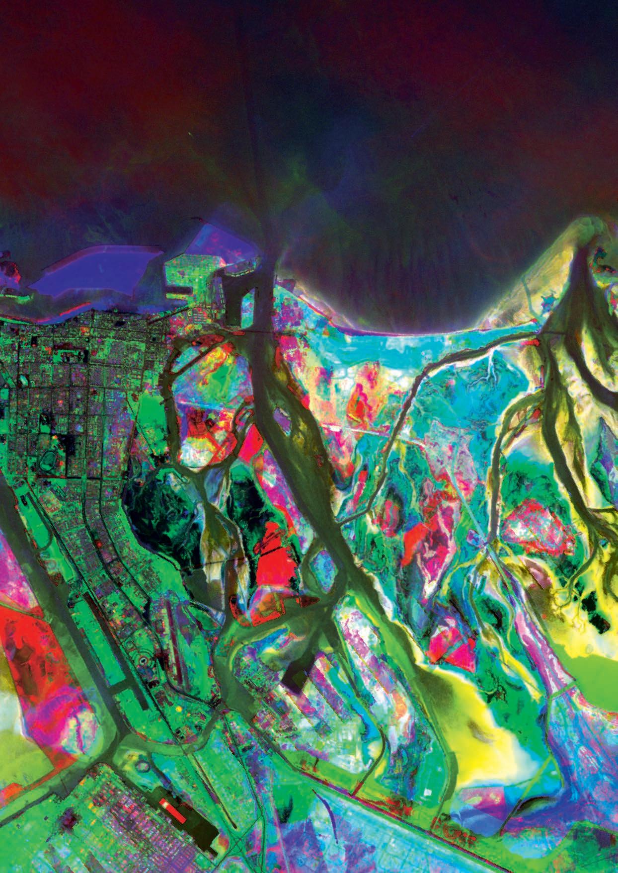
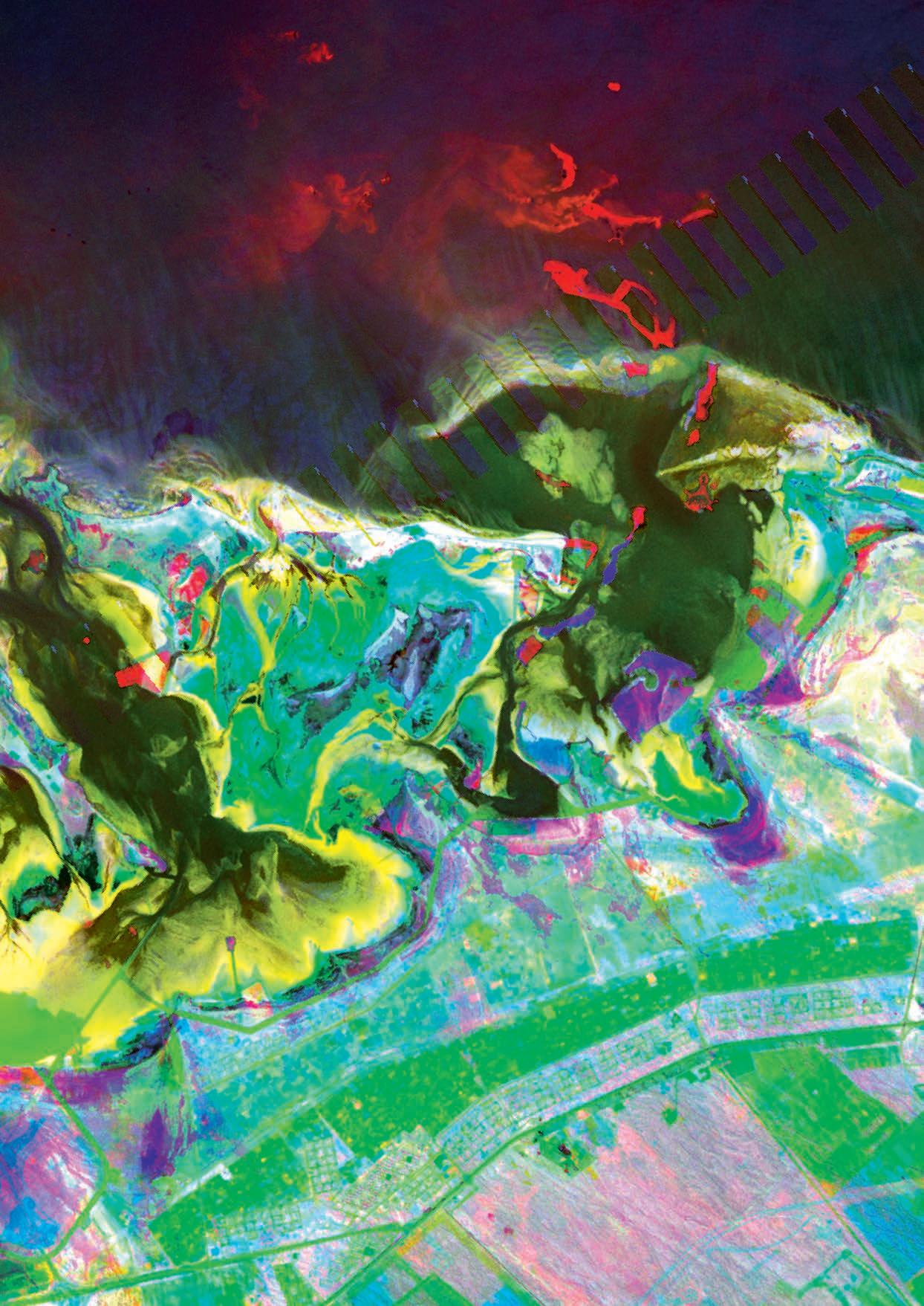
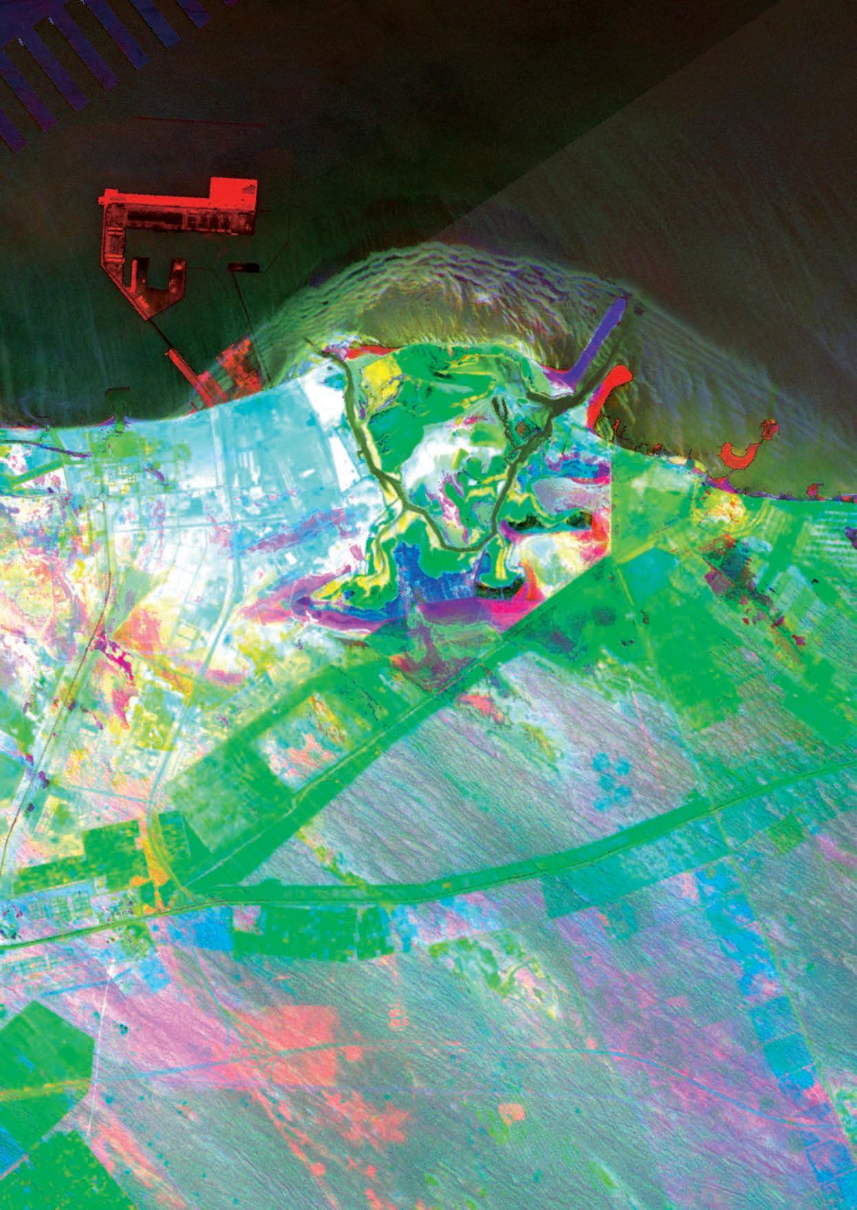
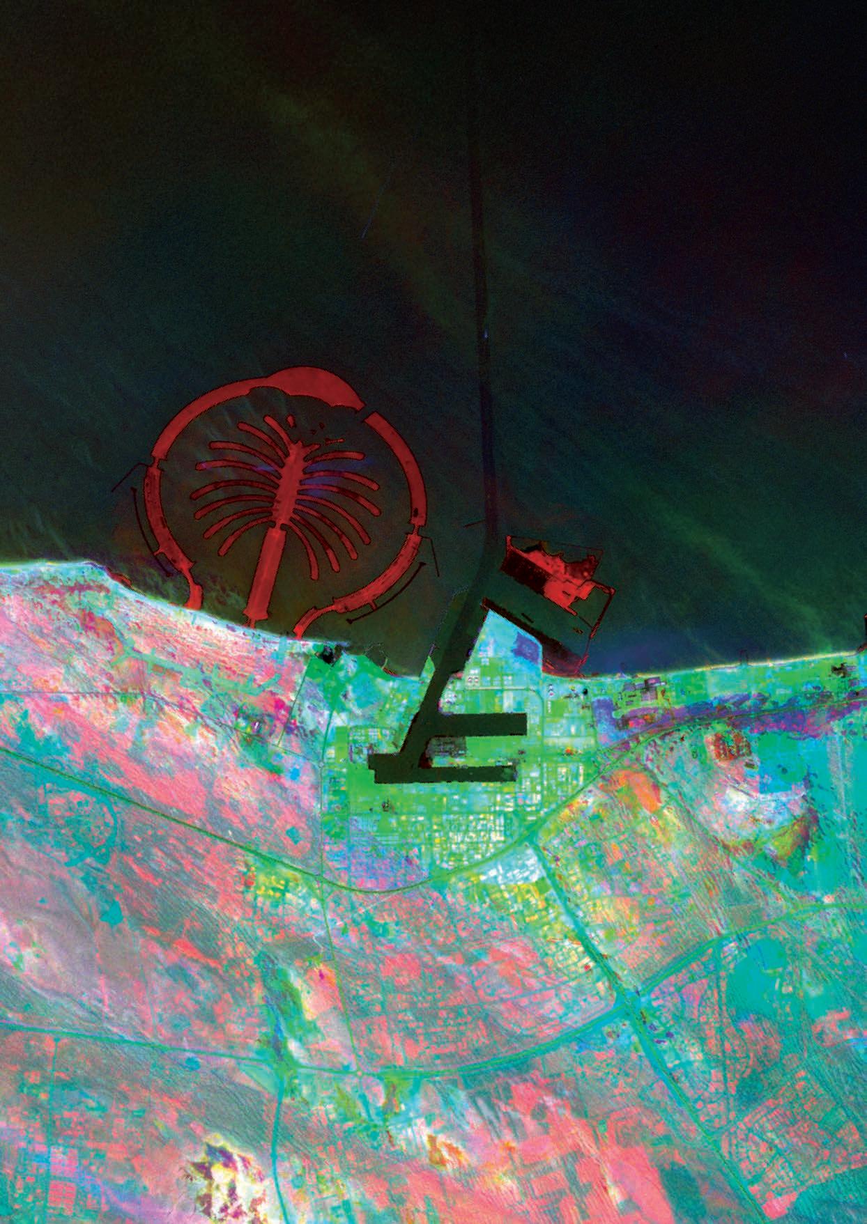
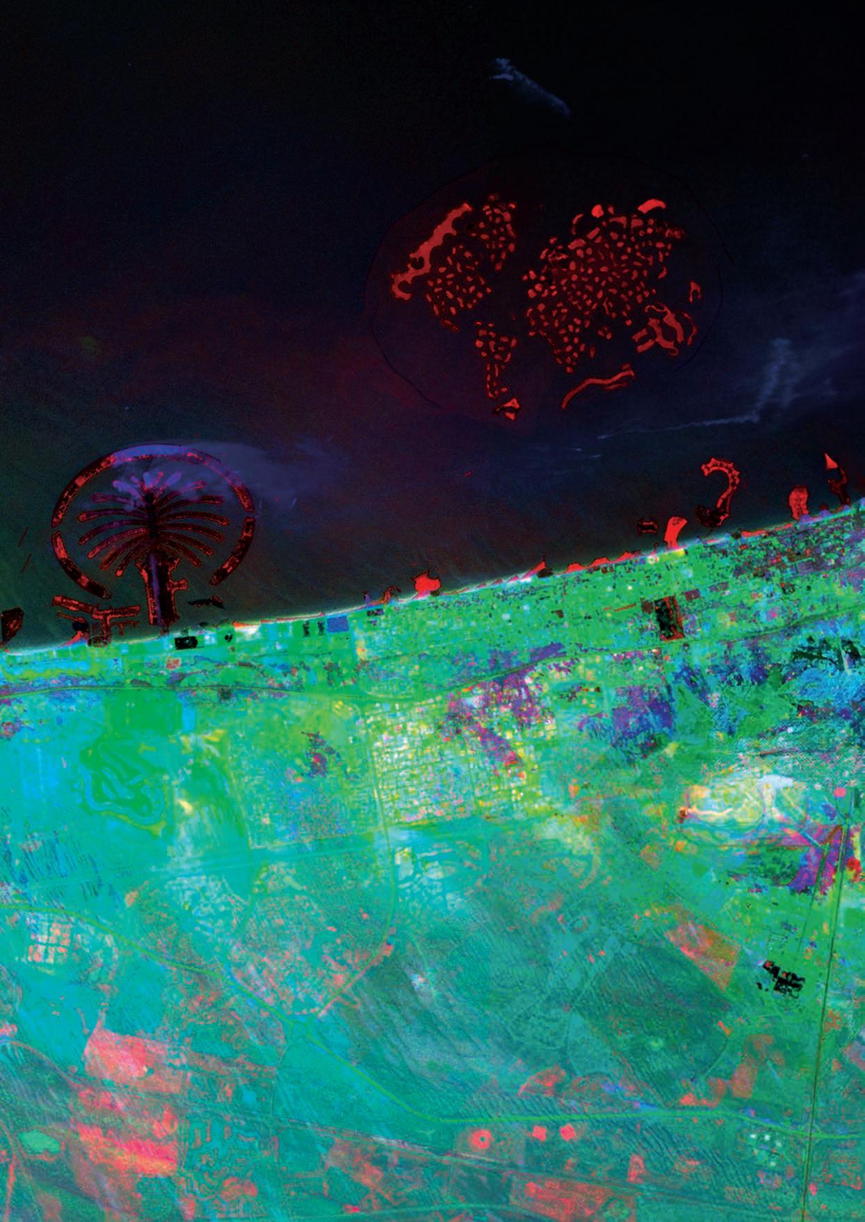
The ongoing and relentless transformations that define Dubai and its neighboring regions, illustrates the profound and dynamic material flux emanating from this central hub. The sample aims to challenge the common misconception that the processes involved in constructing coastal developments are isolated phenomena. Instead, it posits that these developments are deeply interconnected, both regionally and globally, influencing and influenced by a network of economic, cultural, and environmental factors. The rapid expansion and modification of these areas highlight a critical issue: the seeming lack of control over urban sprawl and environmental impact, raising concerns about sustainability and the long-term implications of such unchecked growth. The sample underscores the necessity of viewing them not as standalone projects but as integral parts of a larger, complex system that continues to evolve in unpredictable ways.
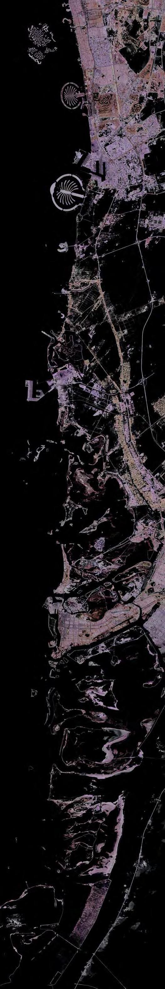
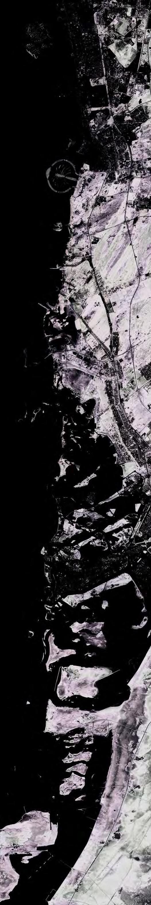
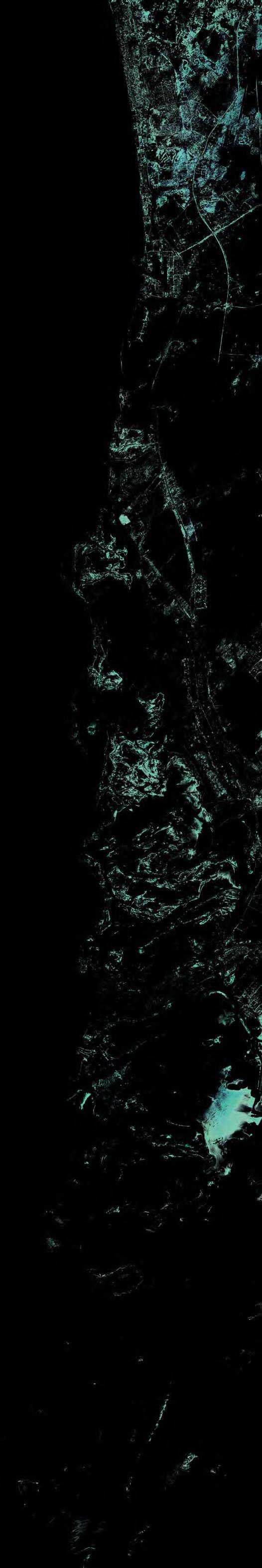
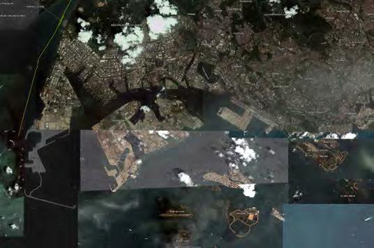
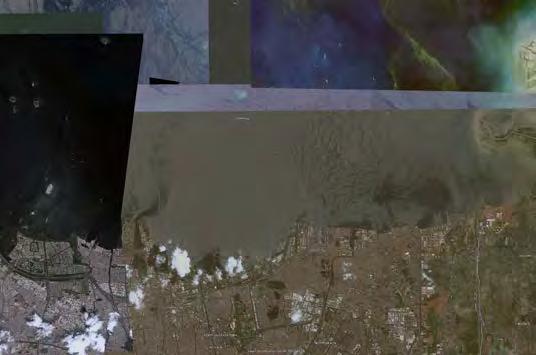
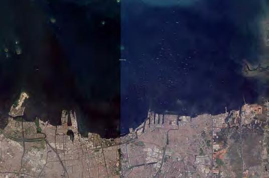
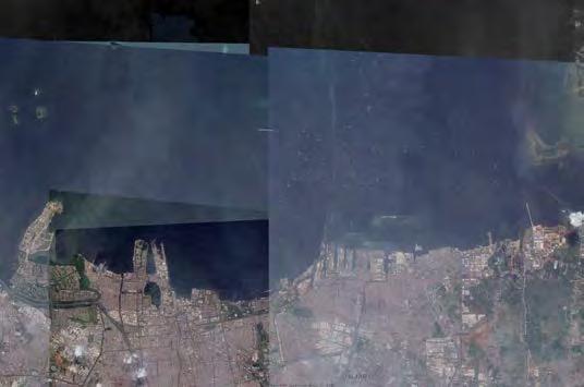
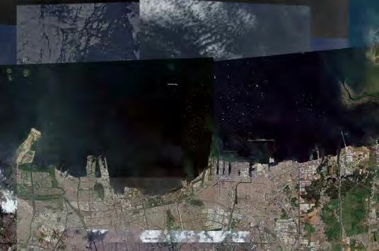
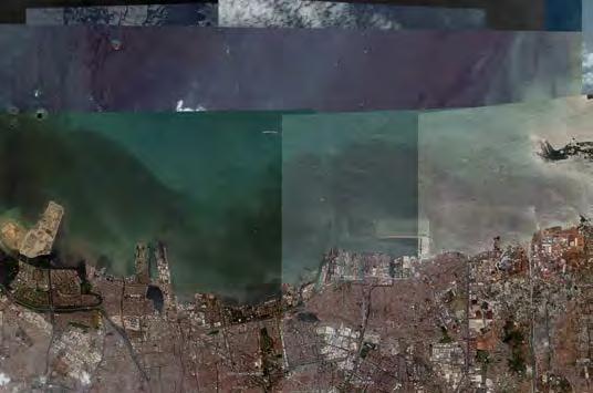
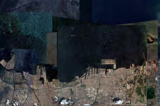
Multi-Temporal Composite, Landsat 5 & Landsat 8 OLI, Band 1 (Coastal), 1985, 2002, 2023.
Land Classification Composite, Landsat 8 OLI, Bands 5,6,4, 2023.
Final Composite: Capturing the Coast’s Evolution Over Time, Highlighting Dynamic Transitions and Continuous Shifts through Change in Colour and Intensity.
Final Composite: SPOT Chanel Configuration (Underprint)
The ongoing and relentless transformations that define Dubai and its neighboring regions, illustrates the profound and dynamic material flux emanating from this central hub. The sample aims to challenge the common misconception that the processes involved in constructing coastal developments are isolated phenomena. Instead, it posits that these developments are deeply interconnected, both regionally and globally, influencing and influenced by a network of economic, cultural, and environmental factors. The rapid expansion and modification of these areas highlight a critical issue: the seeming lack of control over urban sprawl and environmental impact, raising concerns about sustainability and the long-term implications of such unchecked growth. The sample underscores the necessity of viewing them not as standalone projects but as integral parts of a larger, complex system that continues to evolve in unpredictable ways.
Land classification is critical for accurately distinguishing between different surface types on the Earth, such as land and water. The selection of specific spectral bands, like Bands 5, 6, and 4 in 2023, is strategically chosen to enhance the visibility and contrast of various features. Band 5 (near-infrared) is particularly effective in distinguishing vegetation from other land types, while Band 6 (shortwave infrared) excels in identifying moisture content, which is vital in differentiating between wet and dry areas. Band 4 (red) helps in highlighting water bodies which absorb more red light, thus appearing darker compared to land.
The Final Composite: Capturing the Coast’s Evolution Over Time” utilizes advanced imaging techniques to visually represent the dynamic changes occurring along coastal regions. By analyzing transitions in color and intensity over time, this composite provides a vivid illustration of the natural and human-induced alterations affecting the coastline in distinctive ways.
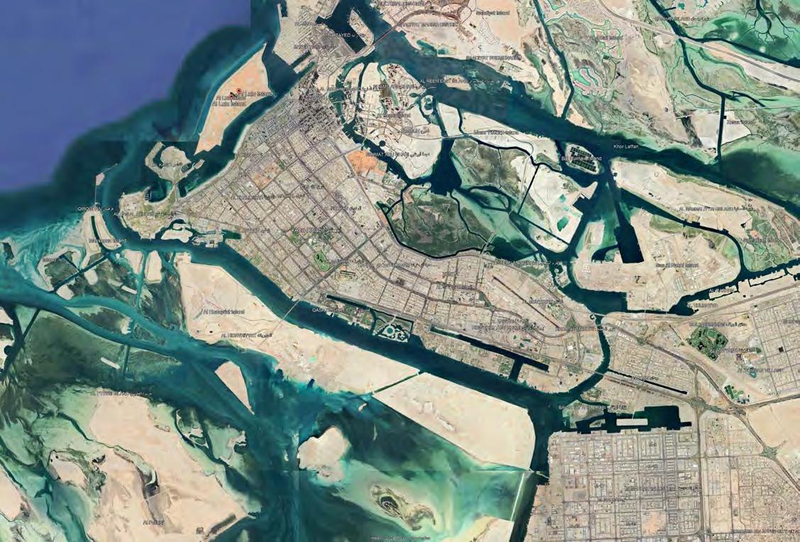
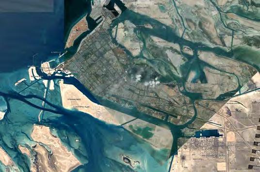
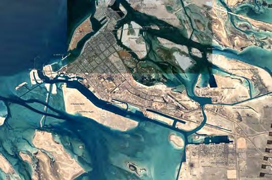
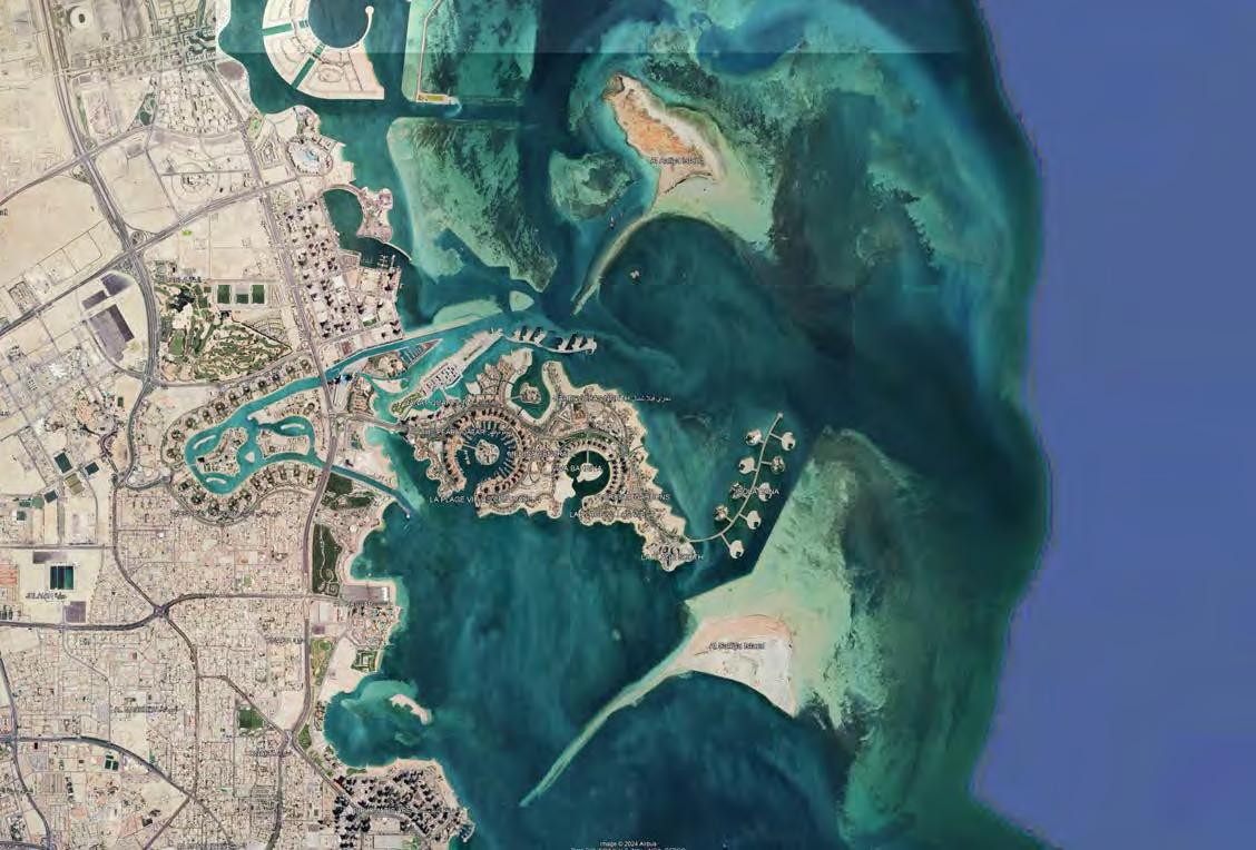
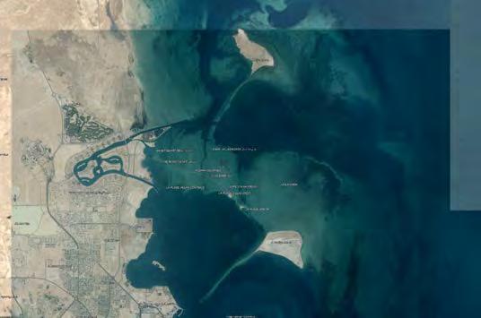
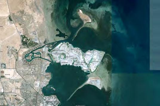
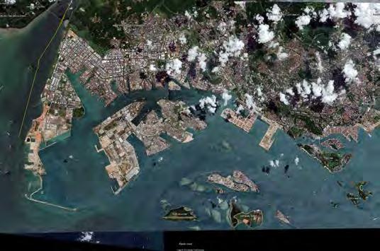
Abu Al Abyad Island Al Nouf Island
Al Halah Island Al Hudryat Island Sas Al Nakhl Island
Khalifa Port
Ras Ghanada Marine Protected Area
Land Reclamation in Progress
Dubai Waterfront The Palm, Jebel Ali Port Jebel Ali
The Palm, Jumeirah The World Islands
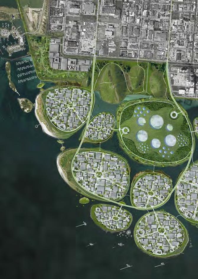
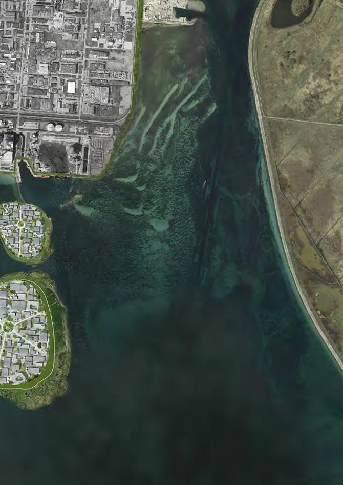
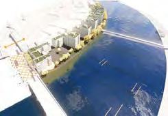
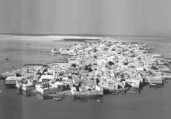
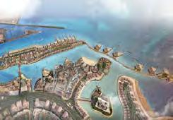
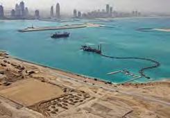
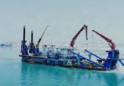
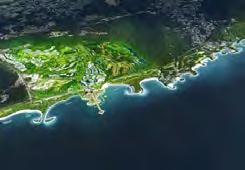
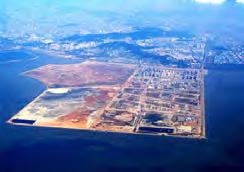
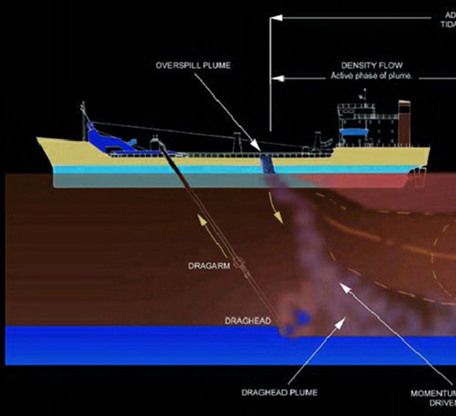
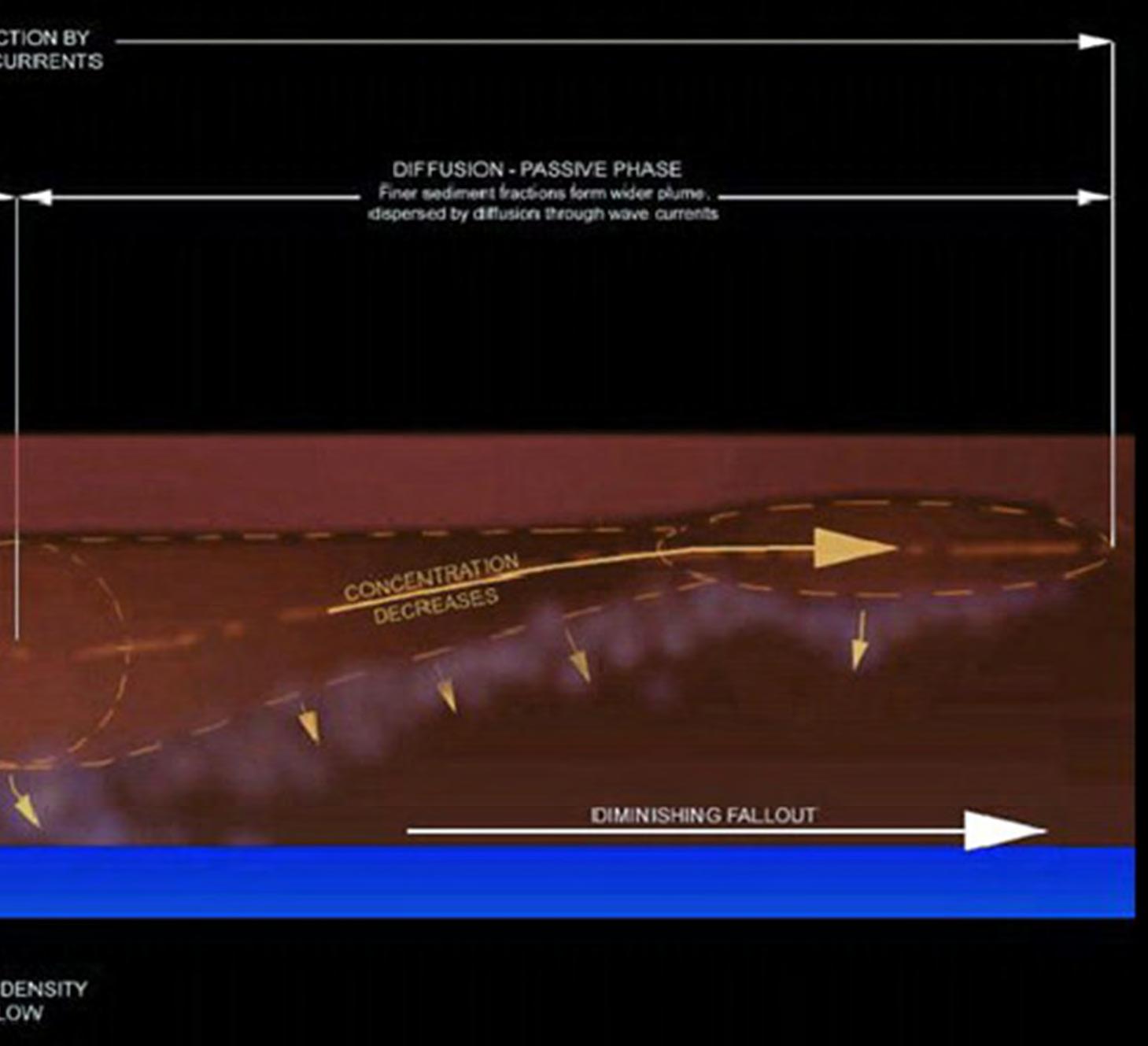
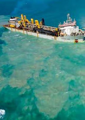
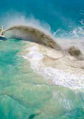
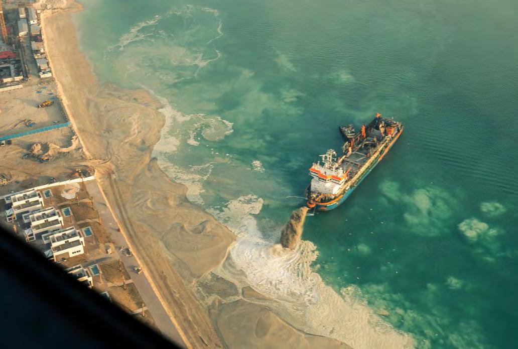
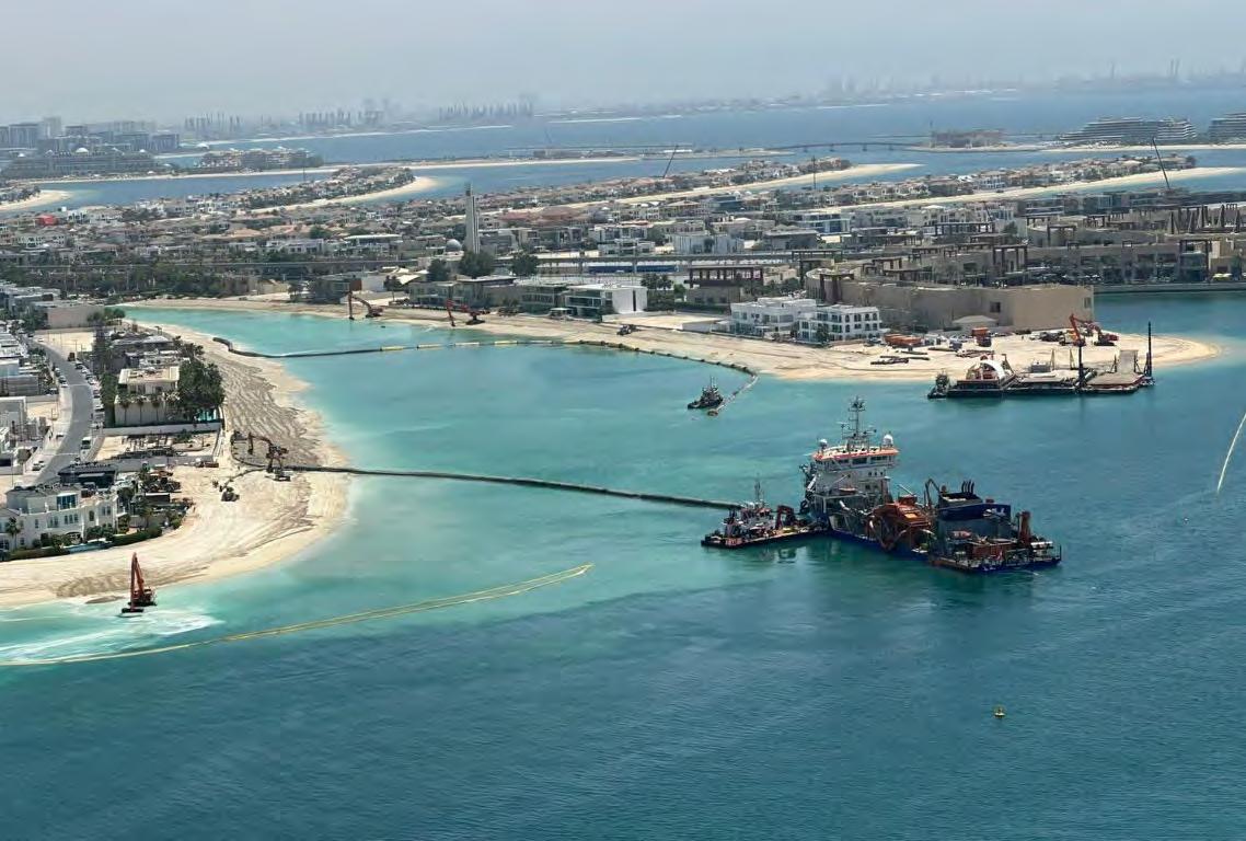
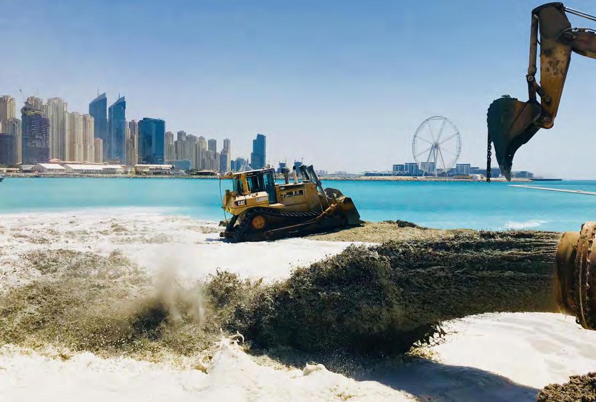
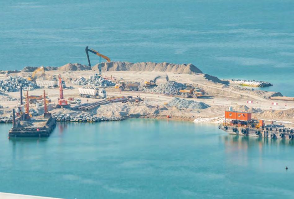
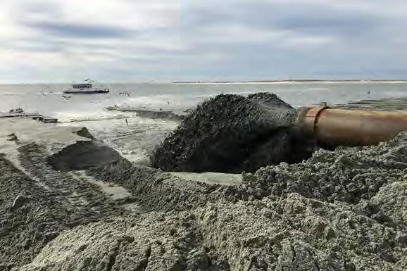
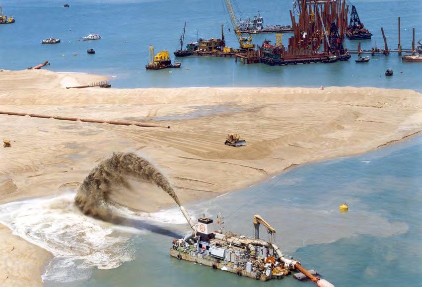
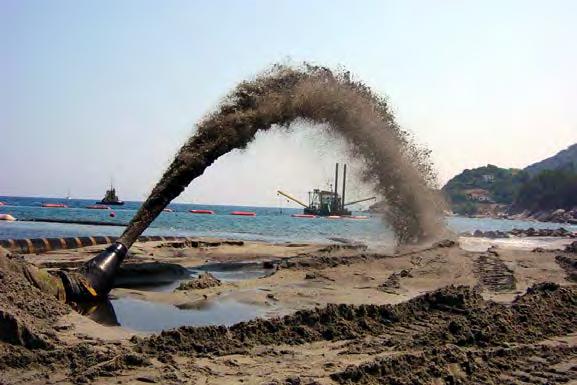
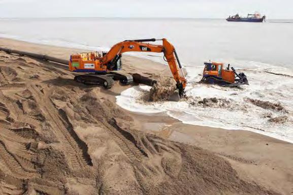
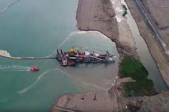
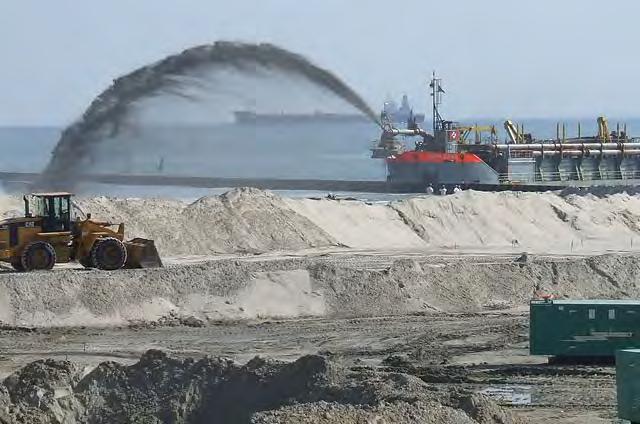
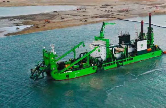
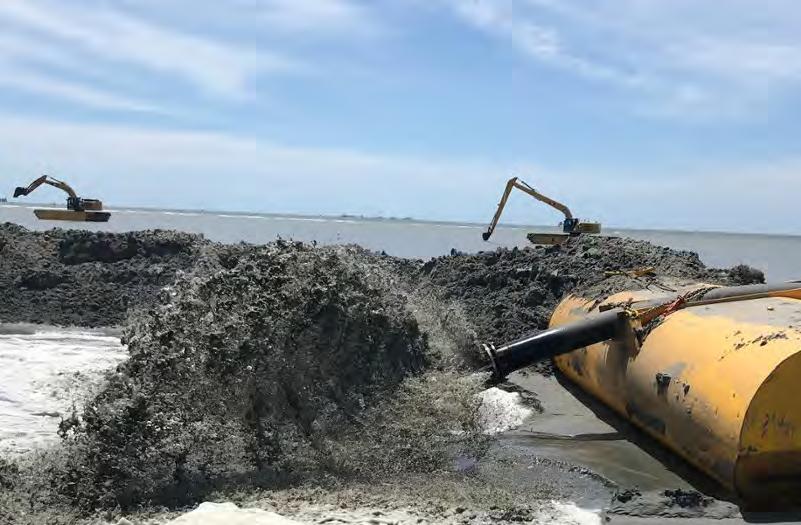
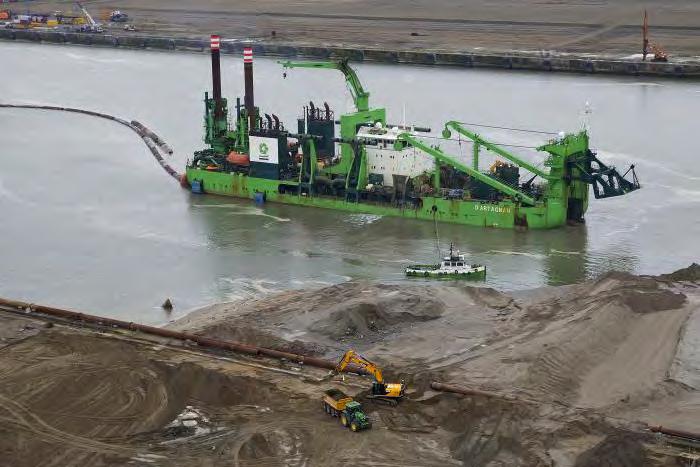
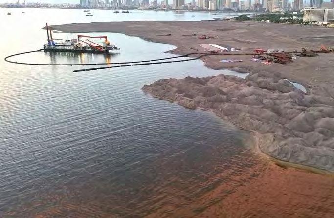
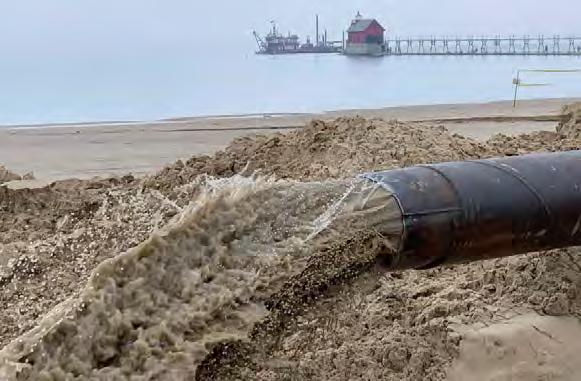
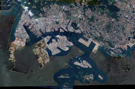
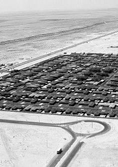
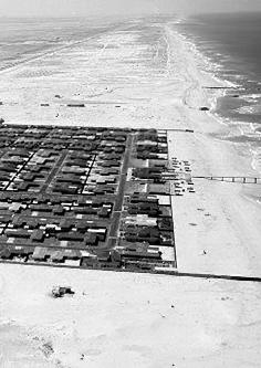
The root causes behind the relentless material flux and constant transformations depicted in “Linked Lives”: Central to these changes is the process of land reclamation, a technique that involves dredging sediments from the seabed and subsequently depositing them in targeted areas through a method colloquially known as “rainbowing” due to the arc-shaped spray of materials. This process transforms aquatic territories into habitable land, facilitating urban expansion and the development of new infrastructures.
The chapter details how this engineered alteration of landscapes has become a fundamental strategy for accommodating burgeoning populations and expanding economic zones, particularly in regions with limited terrestrial space. However, this aggressive reshaping of coastlines raises significant environmental and socio-economic issues, including the disruption of marine ecosystems, the alteration of local hydrodynamics, and the displacement of communities.
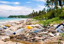
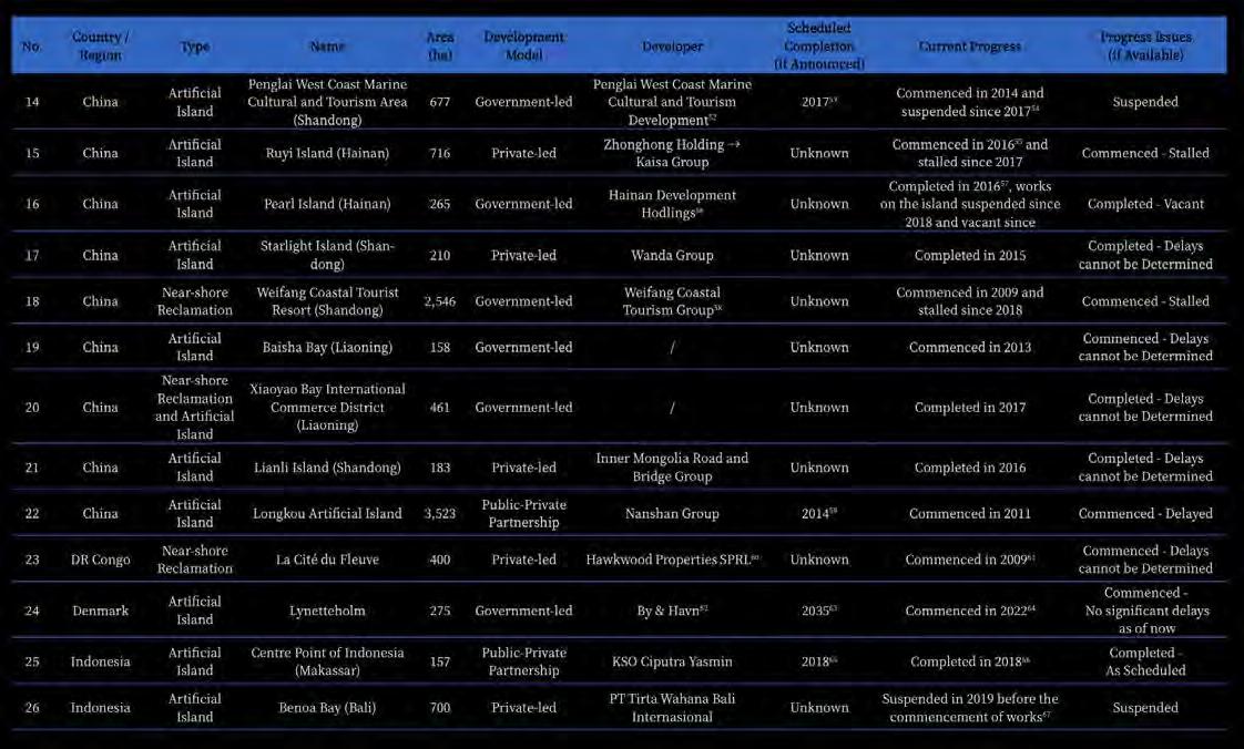
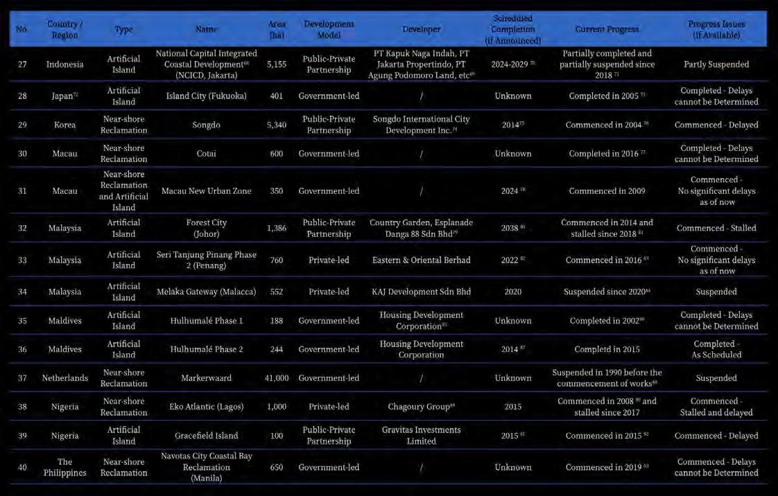
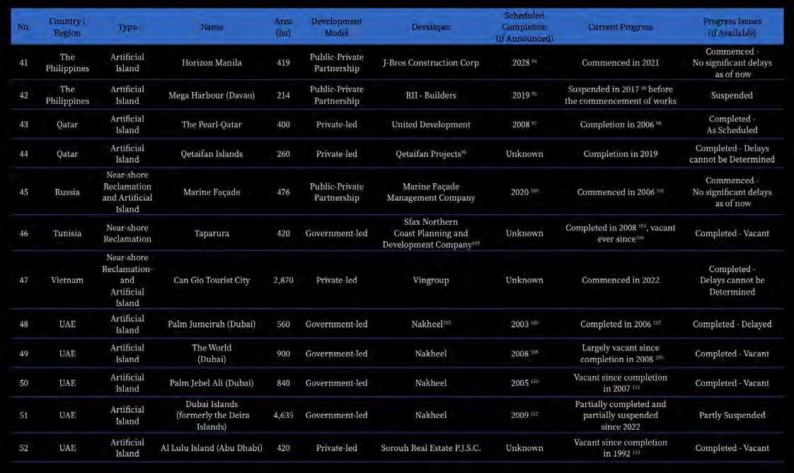
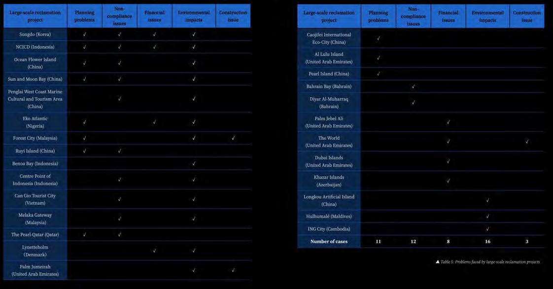
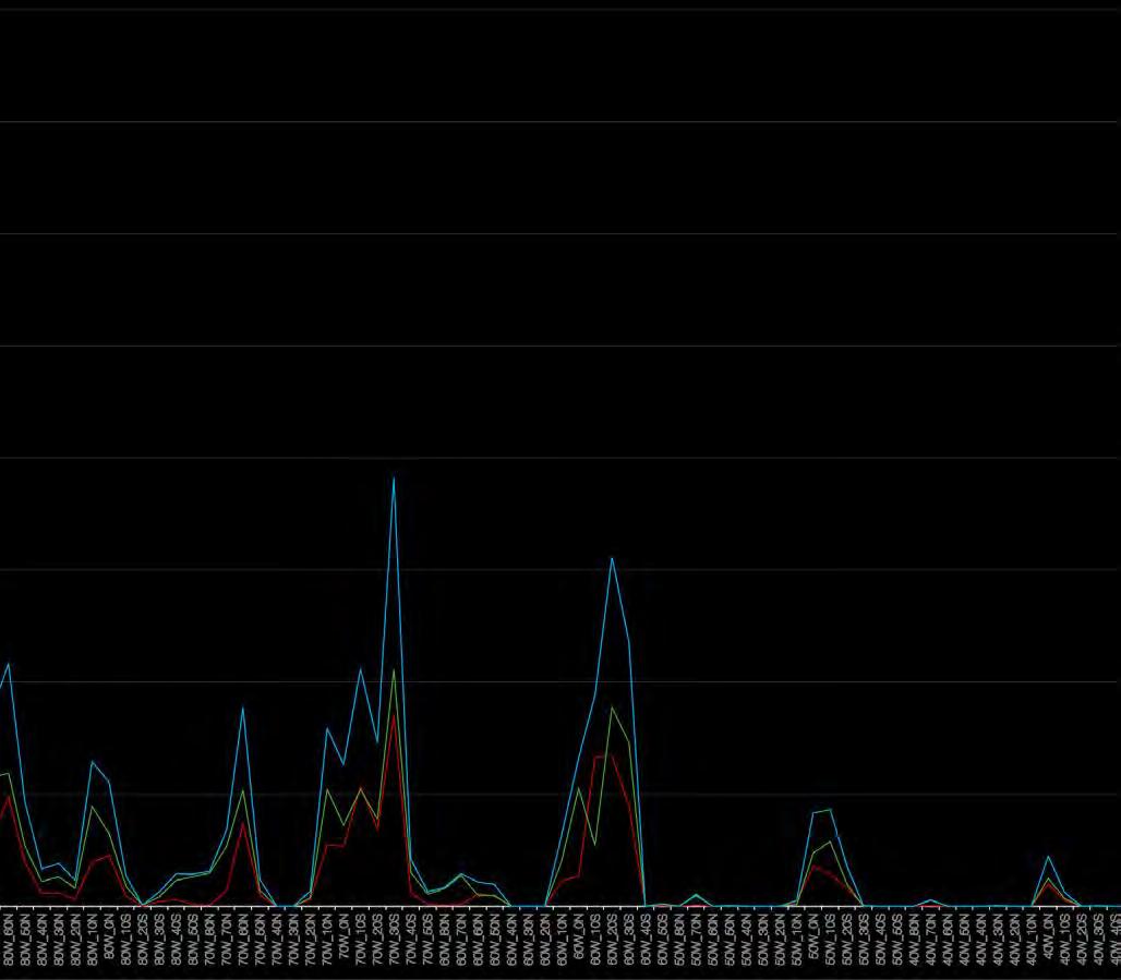
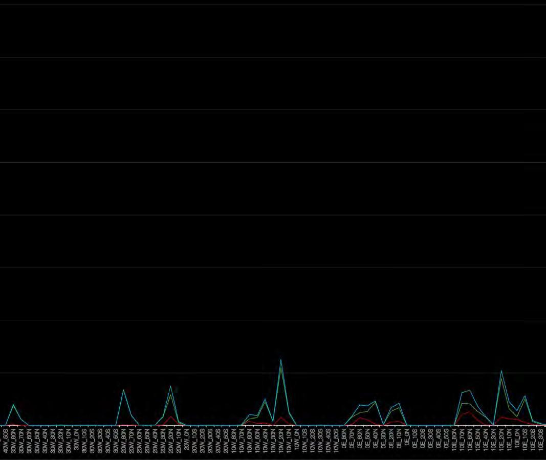
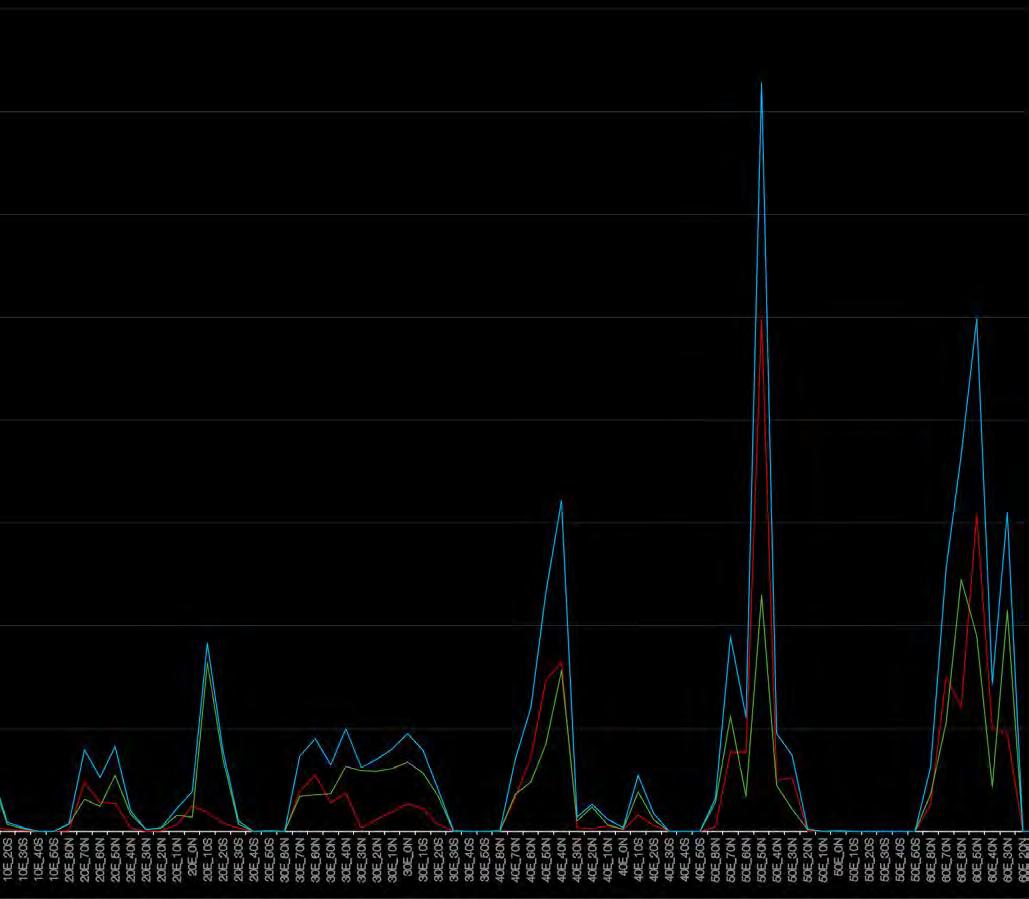
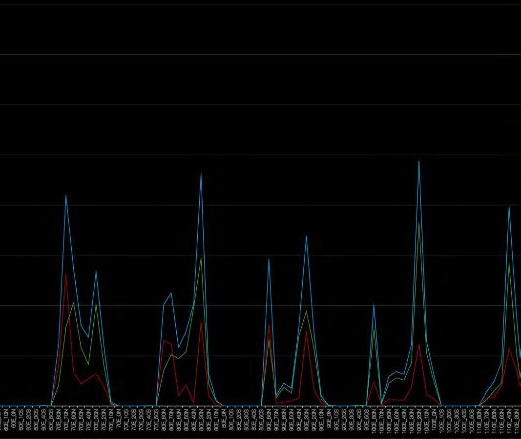
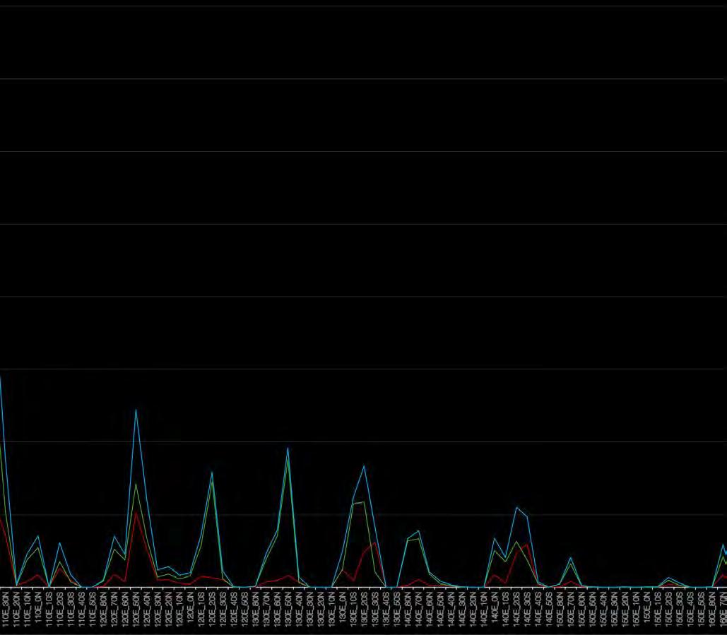
Toll Taken examines the profound environmental costs associated with the strategies outlined in “Land Leveraging,” focusing on the detrimental impact these practices have had on our blue marble. The biosphere, an intricately linked system encompassing all life and natural ecosystems, has been significantly altered and stressed by these transformations. In an effort to quantify and understand the extent of these changes, global coastal surveillance was implemented using sophisticated remote sensing technology. This surveillance made use of the European Commission’s Global Surface Water data, deploying the Water Occurrence Change Intensity metric to vividly illustrate shifts in land and water through color-coded indicators. The changes observed between 1984-2000 and 2001-2021 equate to a staggering 2.28 million square kilometers of material flux, underscoring the scale and intensity of human impact. However, it’s critical to recognize that these transformations are not solely the result of land reclamation and coastal development; the biosphere’s dynamics also intertwine various anthropogenic activities and natural phenomena, creating a complex web of cause and effect that complicates the global environmental impact assessment.
No Data
0 - 7,280 km²
7,280 - 14,560 km²
14,560 - 21,840 km²
21,840 - 29,120 km²
29,120 - 36,400 km²
36,400 - 43,680 km²
43,680 - 50,960 km²
72,800 km²
0
Quantification of the Toll Taken represented differently, one tile at a time.
Quantification of the Toll Taken represented differently, one tile at a time.
Red Pixels
Green Pixels
Total Pixels
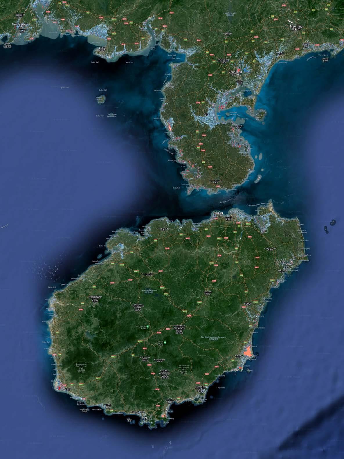
Sea Level Rise
Sea level rise is one of the most discernible consequences of global warming, yet it is often underestimated because its gradual nature makes it less immediately perceptible to daily human experience. Unlike extreme weather events, the slow encroachment of rising waters does not capture immediate attention, yet its impact is profound and far-reaching. Rising sea levels threaten coastal ecosystems, erode shorelines, increase the salinity of estuaries and freshwater aquifers, and enhance the risk of devastating floods from storm surges. Despite these significant impacts, the slow pace at which sea levels rise can lead to a dangerous complacency among communities and policymakers.
The Intergovernmental Panel on Climate Change (IPCC) has extensively studied and reported on the mechanisms and impacts of sea level rise in its assessments, with the 6th Assessment Report providing the latest insights. According to this comprehensive study, global sea levels are rising at an accelerating rate due to the thermal expansion of seawater as it warms, and increased melting of glaciers and ice sheets. The report underscores that without significant reductions in greenhouse gas emissions, the situation could worsen, leading to an increase in sea levels that could exceed one meter by the end of this century— a scenario with dire consequences for coastal and island populations worldwide.
The IPCC report also highlights how the underestimation of sea level rise can be attributed to the “out of sight, out of mind” mentality. Many people live in regions where daily changes are not visible and the slow onset of impacts allows for the gradual normalization of increasing threats. However, for low-lying island nations and coastal communities, the reality of sea level rise is an existential threat, influencing decisions on everything from infrastructure development to disaster preparedness and emergency response strategies.
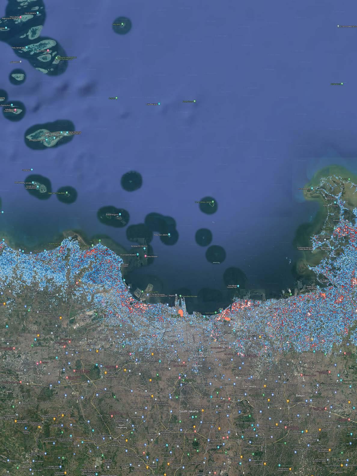
Jakarta, Red= below sea level, Blues= Up to 3m SLR
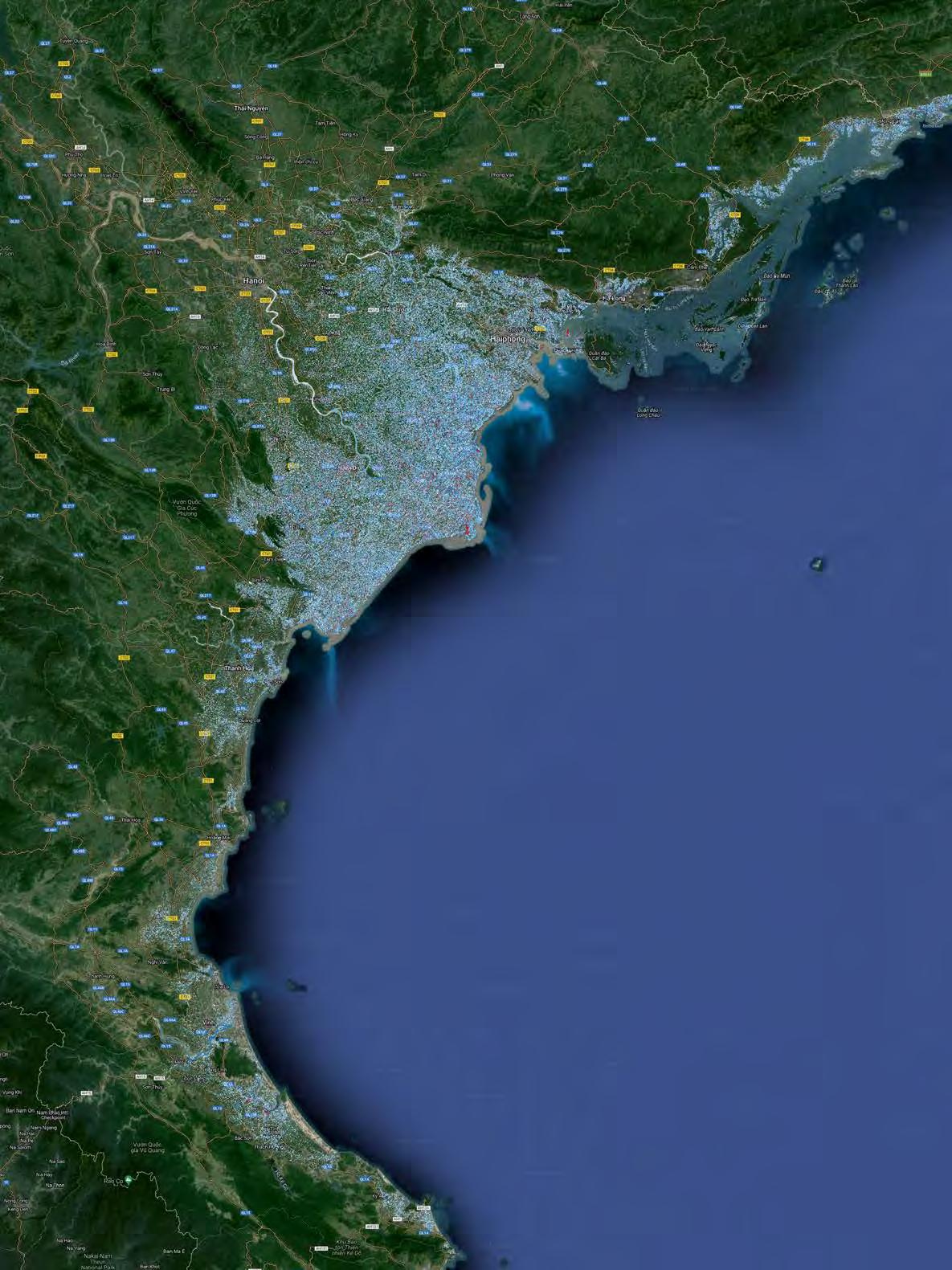
Vietnam, Red= below sea level, Blues= Up to 3m SLR
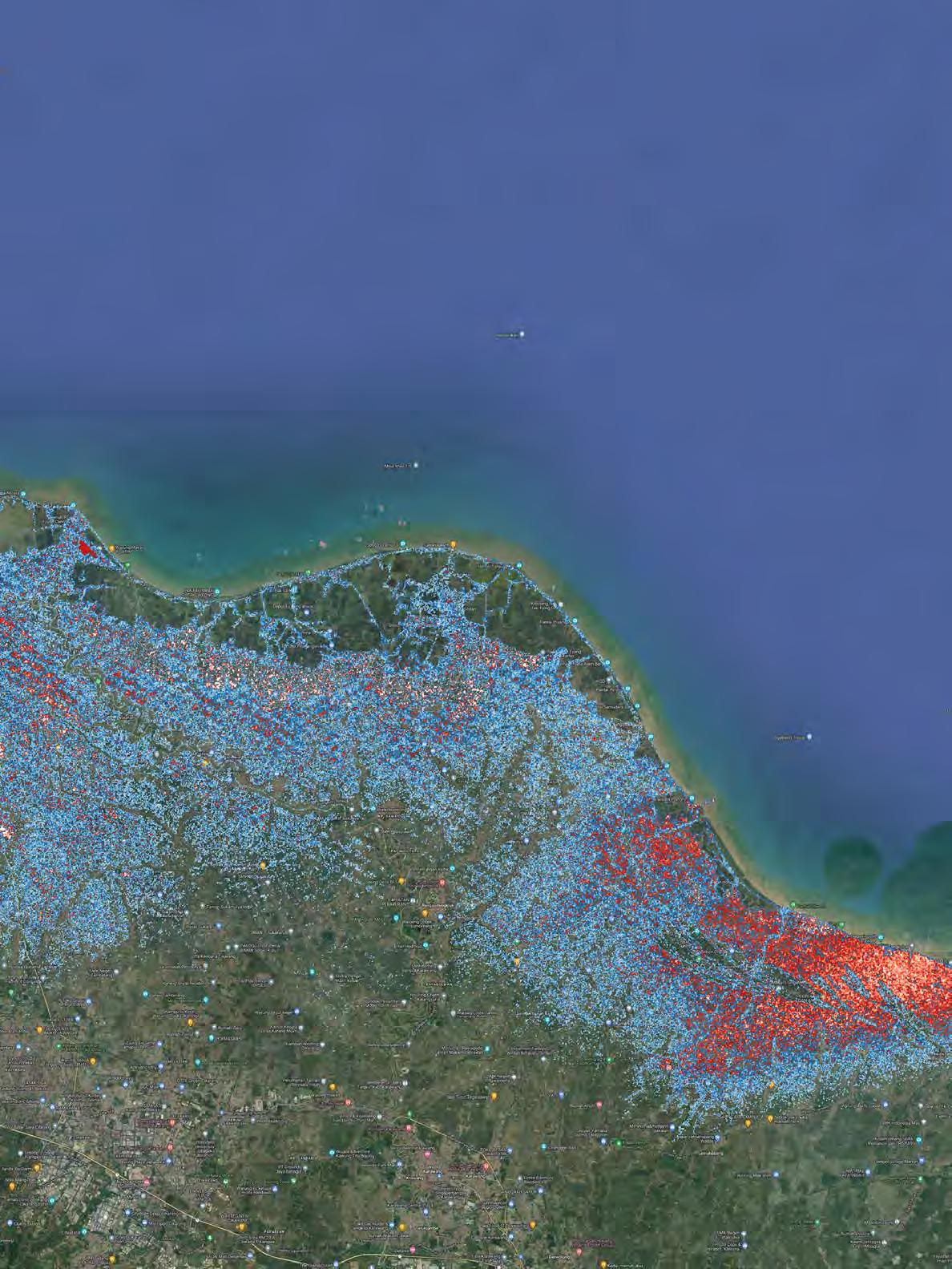
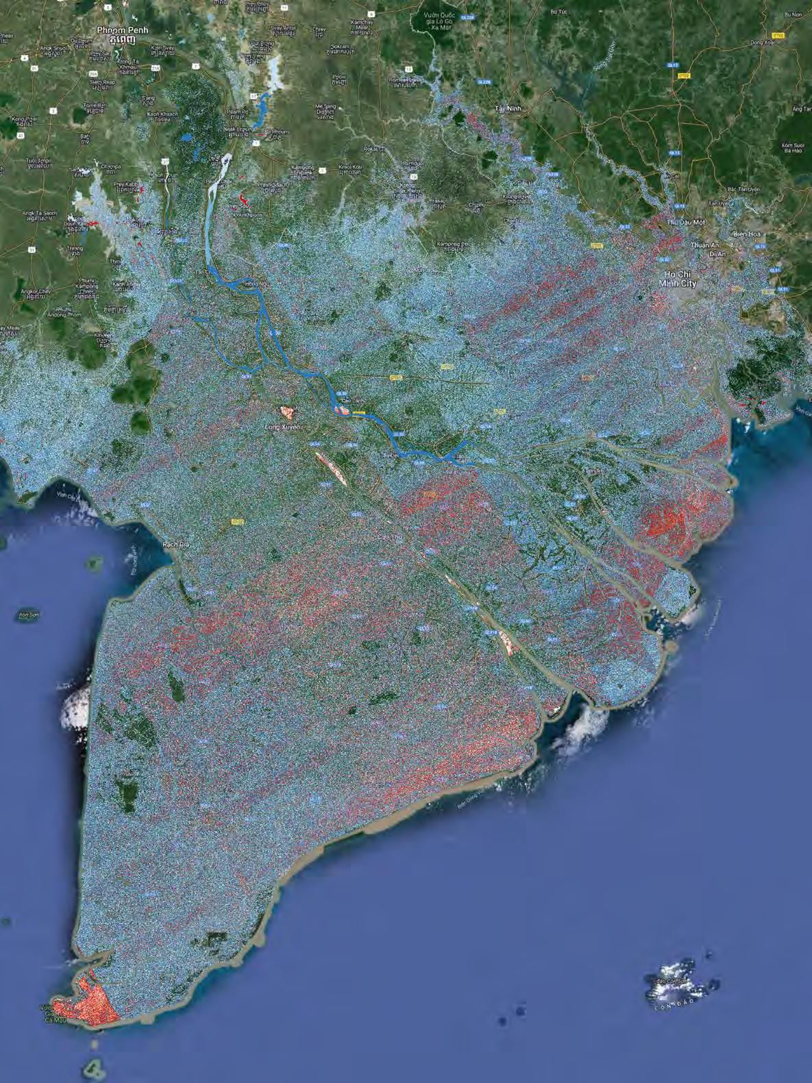
Manila, Red= below sea level, Blues= Up to 3m SLR
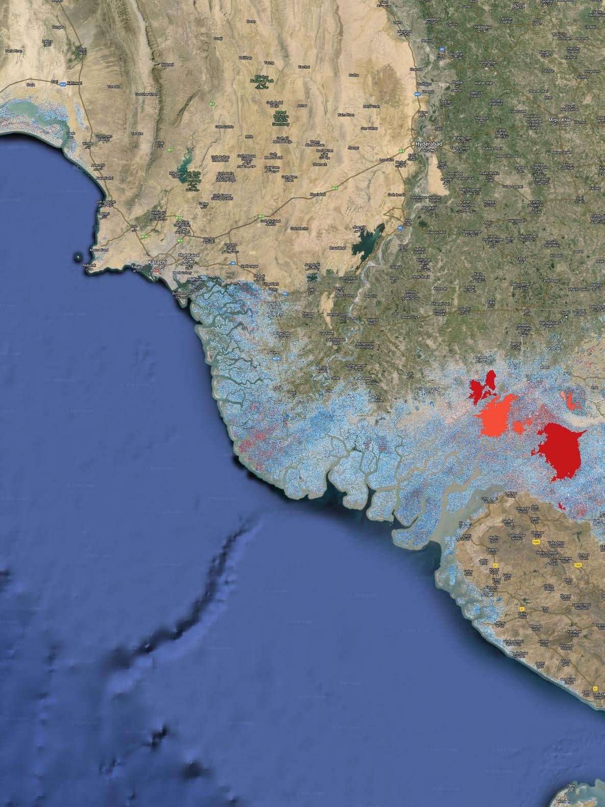
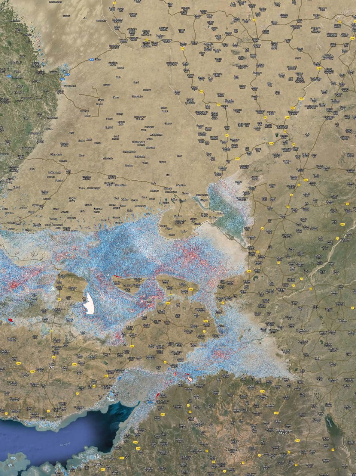
India/ Pakistan, Red= below sea level, Blues= Up to 3m SLR
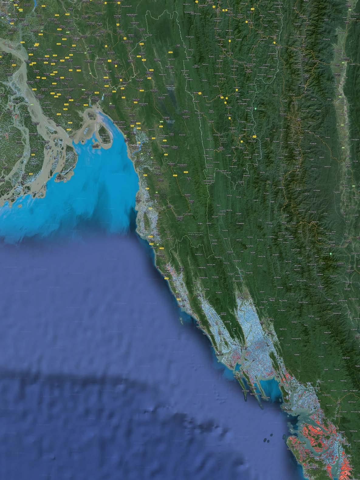
Meghna River, Bangladesh, Red= below sea level, Blues= Up to 3m SLR
China, Red= below sea level, Blues= Up to 3m SLR
China, Red= below sea level, Blues= Up to 3m SLR
Japan, Red= below sea level, Blues= Up to 3m SLR
Japan, Red= below sea level, Blues= Up to 3m SLR
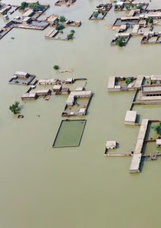
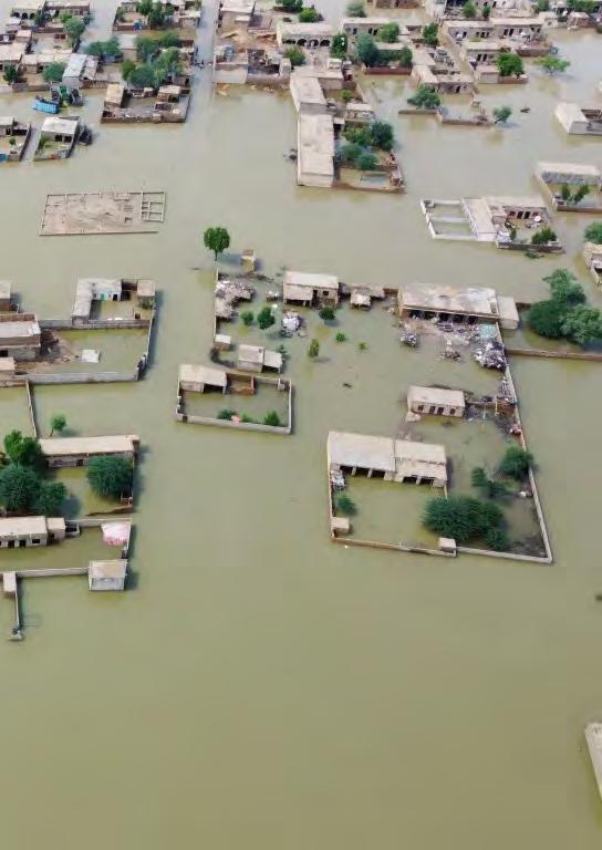
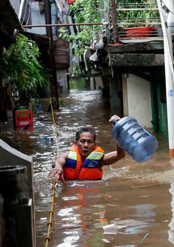
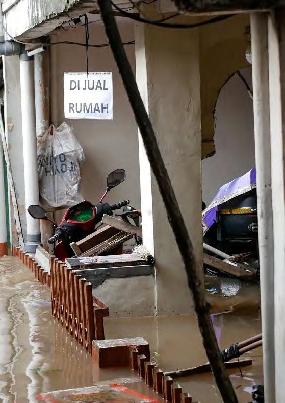
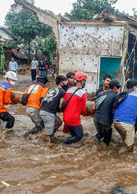
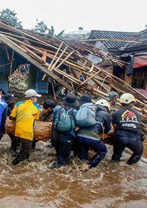
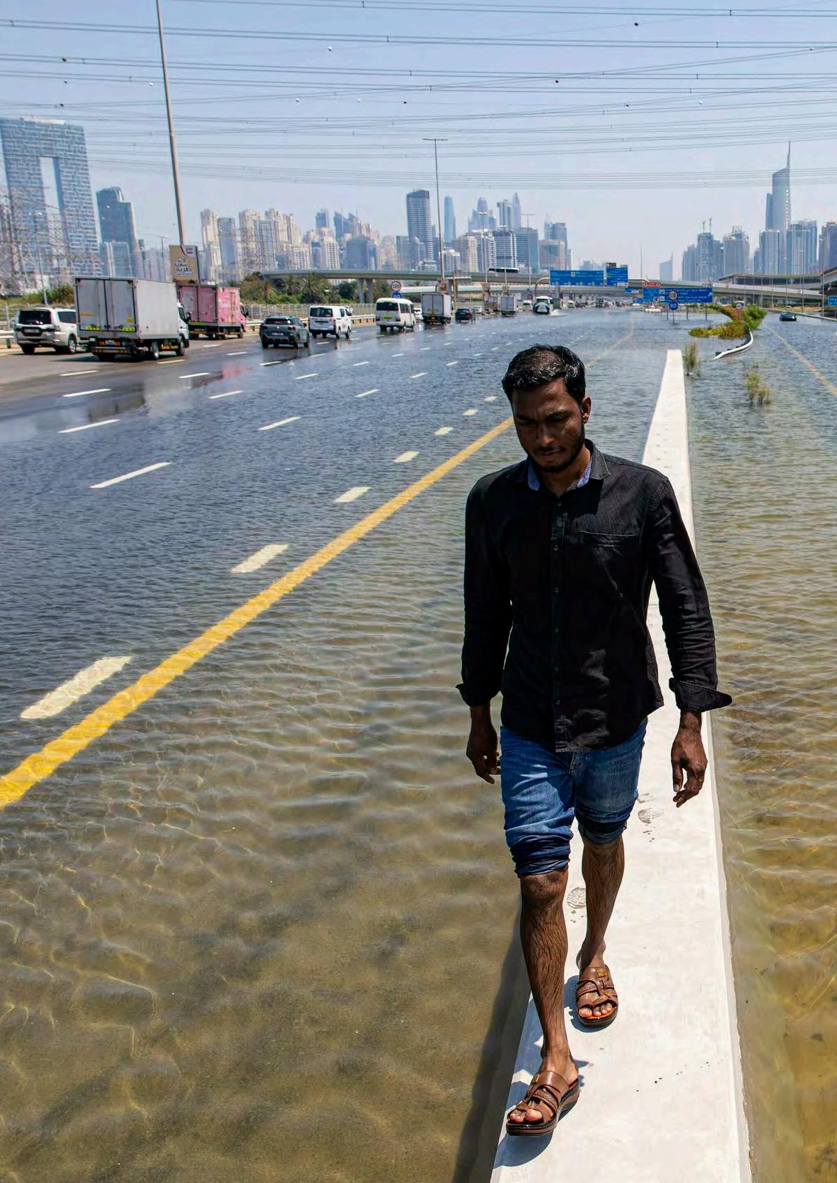
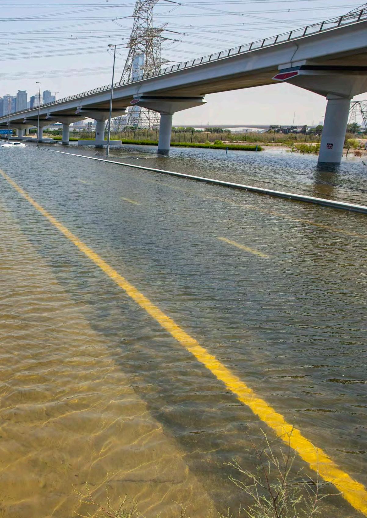
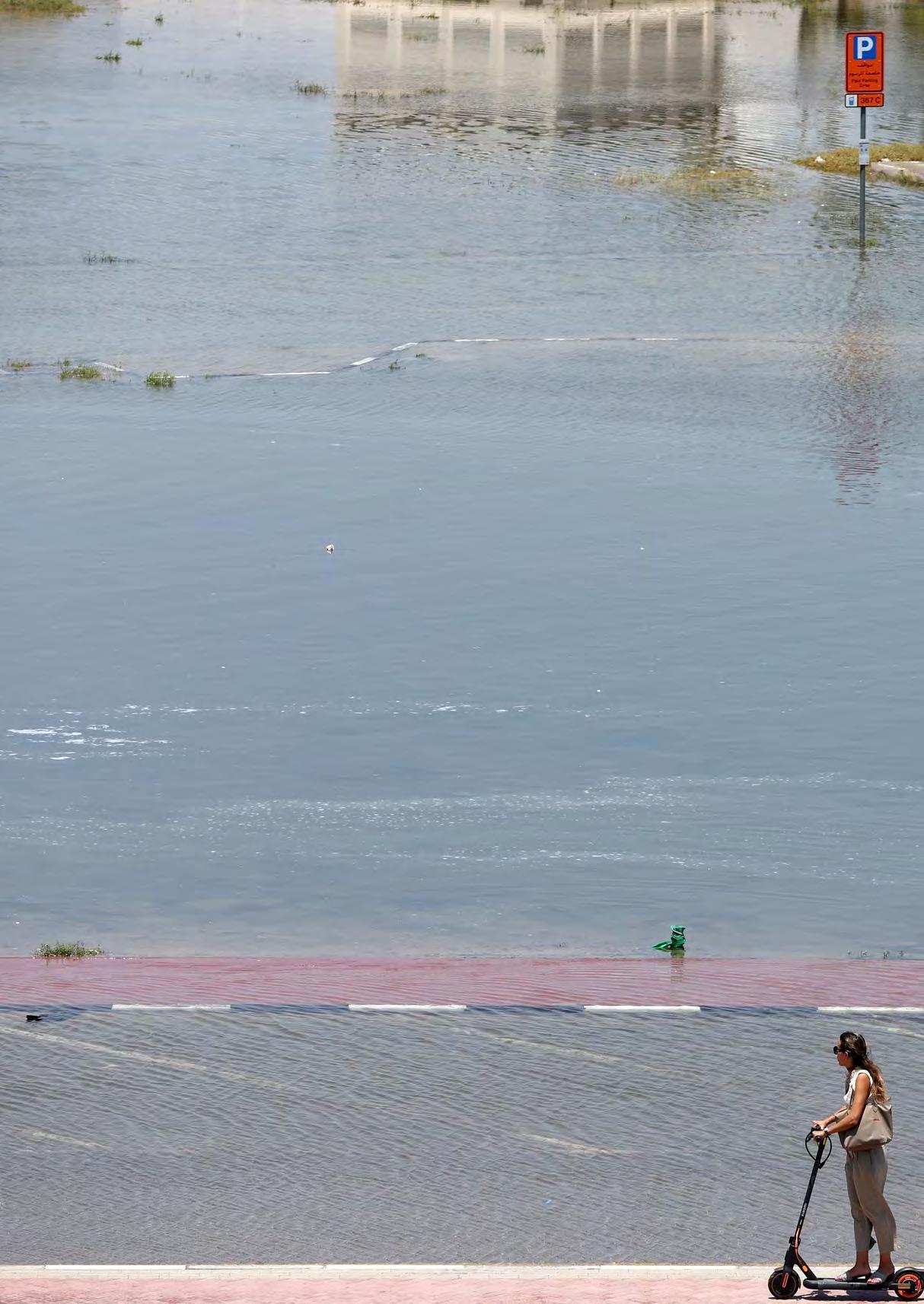
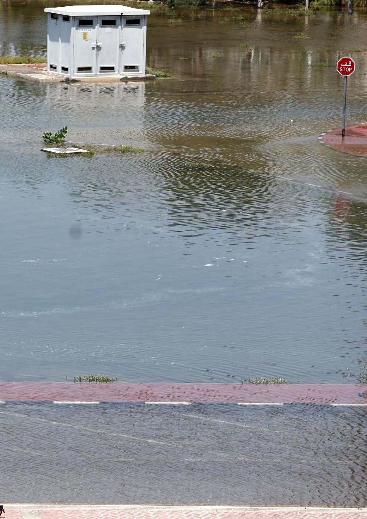
Flooding is among the most frequent and devastating natural disasters worldwide, affecting millions of people each year. Its implications on human populations, infrastructure, and economies are extensive and often catastrophic. Urban areas, in particular, face severe disruptions due to their dense populations and concentration of economic activities. When floods hit, they can lead to loss of life and significant damage to homes, roads, and businesses, disrupting daily life and causing long-term economic hardship.
The impact of flooding extends beyond immediate physical damage. For individuals, the psychological trauma associated with losing homes, possessions, and livelihoods can have long-lasting effects. Communities not only have to rebuild physically but also recover from the emotional and social disruption caused by such disasters. Public health issues are another concern, as floods can lead to outbreaks of waterborne diseases and create long-term health challenges for the affected populations.
On a larger scale, the disruption of supply chains during and after flooding can have ripple effects through local and global economies. Flooding can damage production facilities, disrupt transportation routes, and slow down the delivery of goods and services, leading to shortages and economic losses. For example, severe flooding in a key agricultural region can disrupt food supplies, leading to increased prices and economic instability both locally and in regions that rely on those agricultural products.
Moreover, as climate change intensifies, the frequency and severity of flooding events are expected to increase. This presents significant challenges for urban planning and disaster management. Cities and countries are now tasked with developing infrastructure that is not only resilient to the current climate but also adaptable to future conditions. Strategies such as constructing flood barriers, enhancing natural water retention areas, and implementing advanced weather forecasting technologies are becoming essential components of urban planning and development.
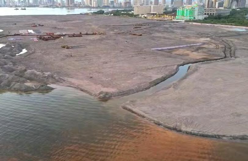
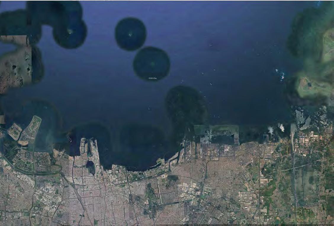
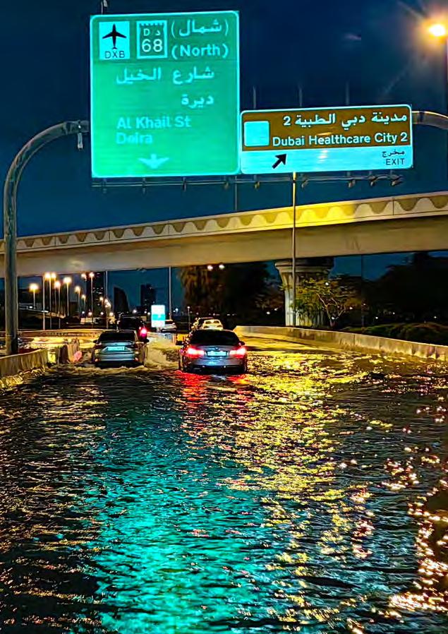
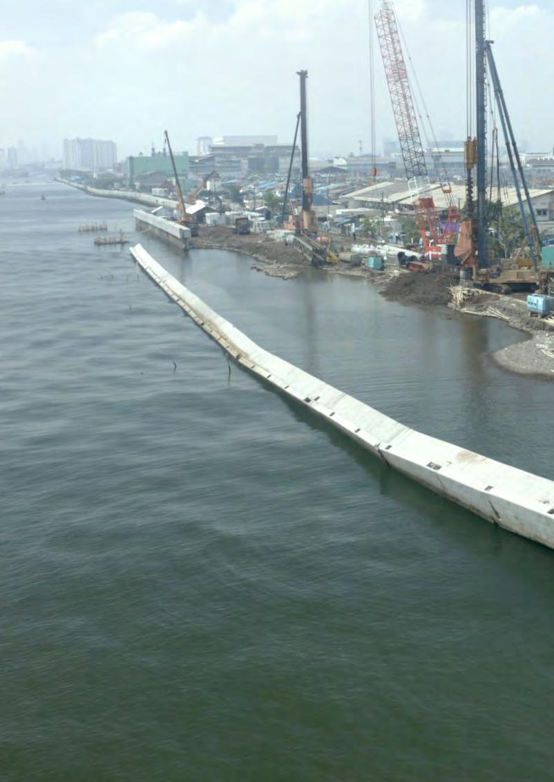
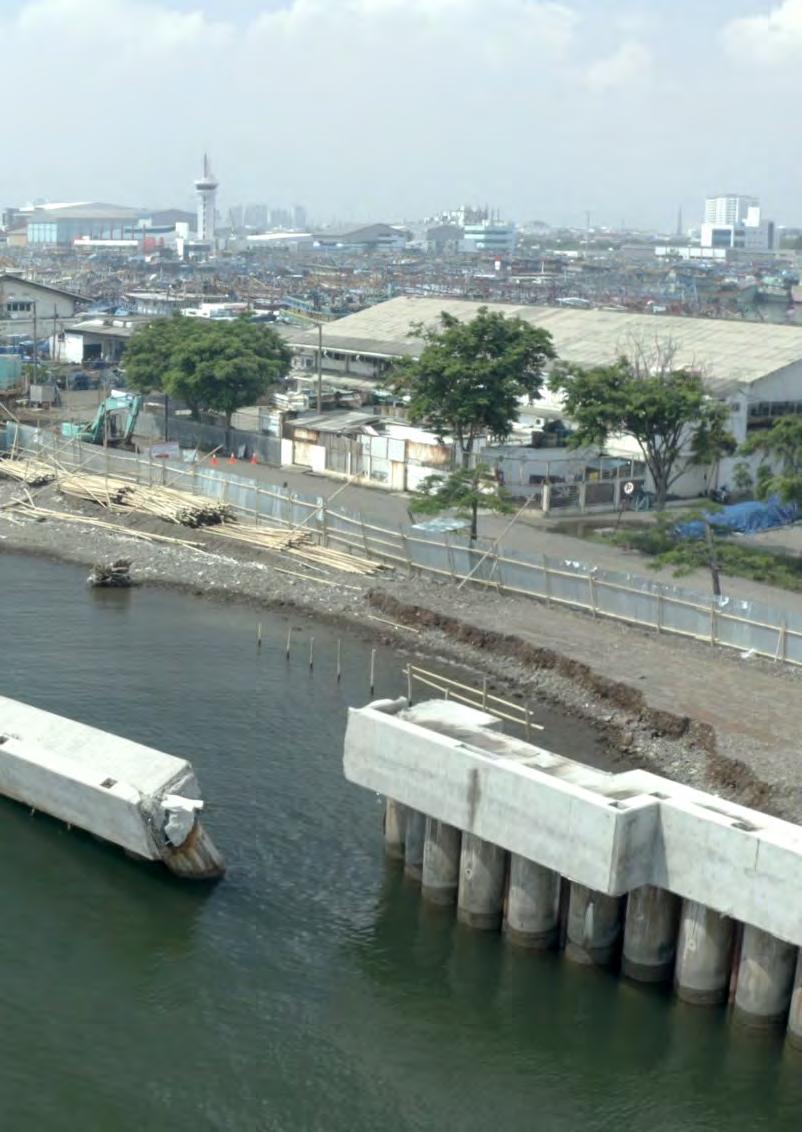
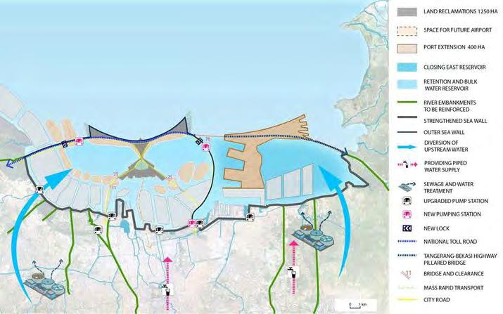
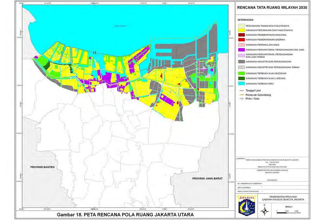
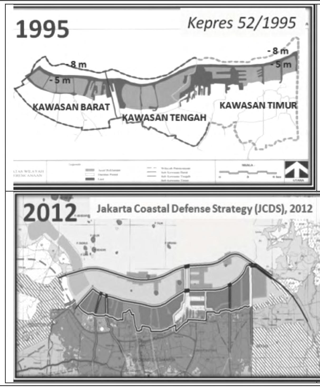
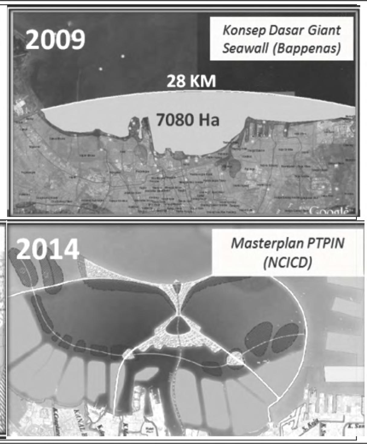
Jakarta faces an acute dilemma with its severe susceptibility to flooding and sea level rise, driven by a complex blend of environmental degradation, urban sprawl, and climate change. As the Indonesian capital sinks at alarming rates due to excessive groundwater extraction and the weight of dense urban development, the city is at a tipping point. The proposed “Great Garuda” project, a massive seawall intended to encircle Jakarta Bay, has emerged as a controversial solution. This monumental engineering endeavor is presented as a necessary response, especially when viewed through the lens of the city’s “securitization” against future catastrophic flood events.
The concept of securitization in this context goes beyond its financial connotations, encompassing the imperative to secure the city’s physical and socioeconomic future against impending environmental threats. Proponents argue that without such drastic measures, Jakarta risks severe disruptions or even an existential threat, with parts of the city potentially becoming uninhabitable due to regular inundations.
The Great Garuda is envisioned as a bulwark that could mitigate these risks, offering a defensive posture against the encroaching sea and the increasing frequency and intensity of flood events exacerbated by climate change.
However, the critical view on the Great Garuda project underscores the complexity of relying heavily on large-scale infrastructural solutions to address environmental and climatic issues. Critics argue that this approach may be overly simplistic and potentially myopic. The construction of the seawall could lead to significant ecological disruptions, impacting marine biodiversity and altering natural coastal processes in ways that could have unforeseen negative consequences. Additionally, the social costs, including displacement of coastal communities and disruption of local economies, particularly the fishing industry, raise serious concerns about the social justice and equity implications of the project.
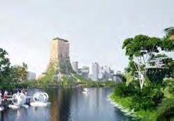
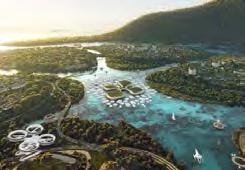
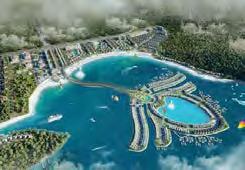
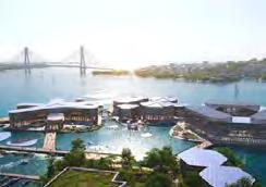
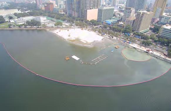
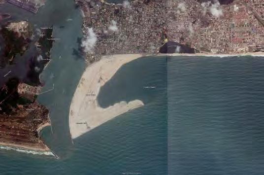
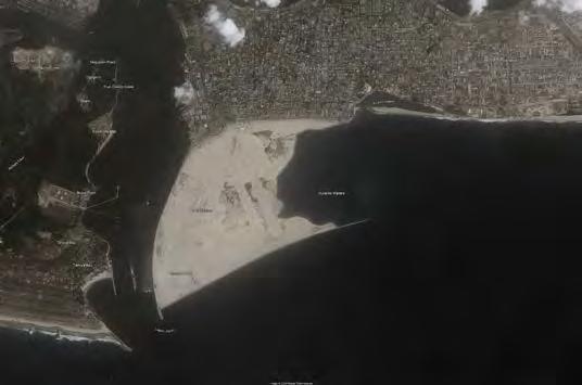
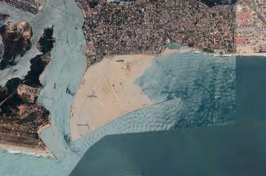
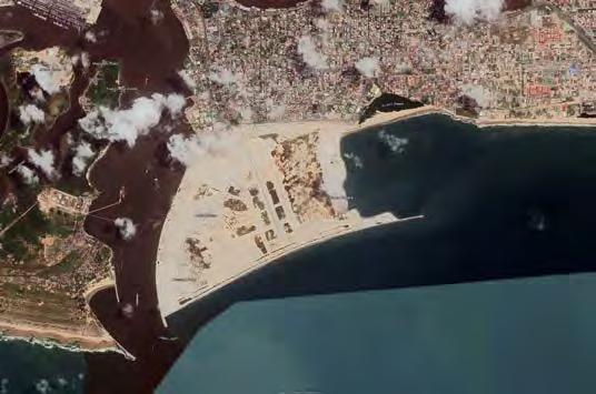
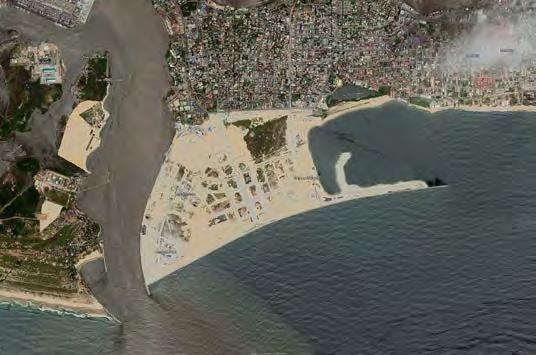
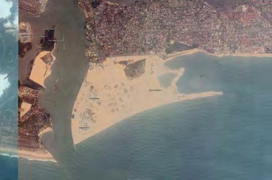
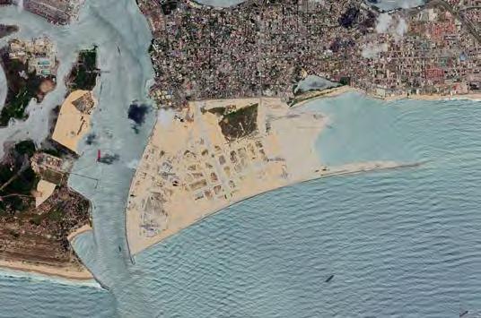
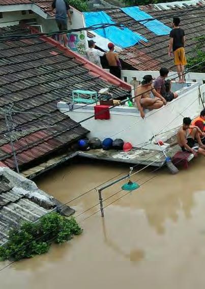
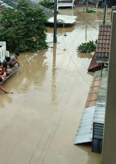
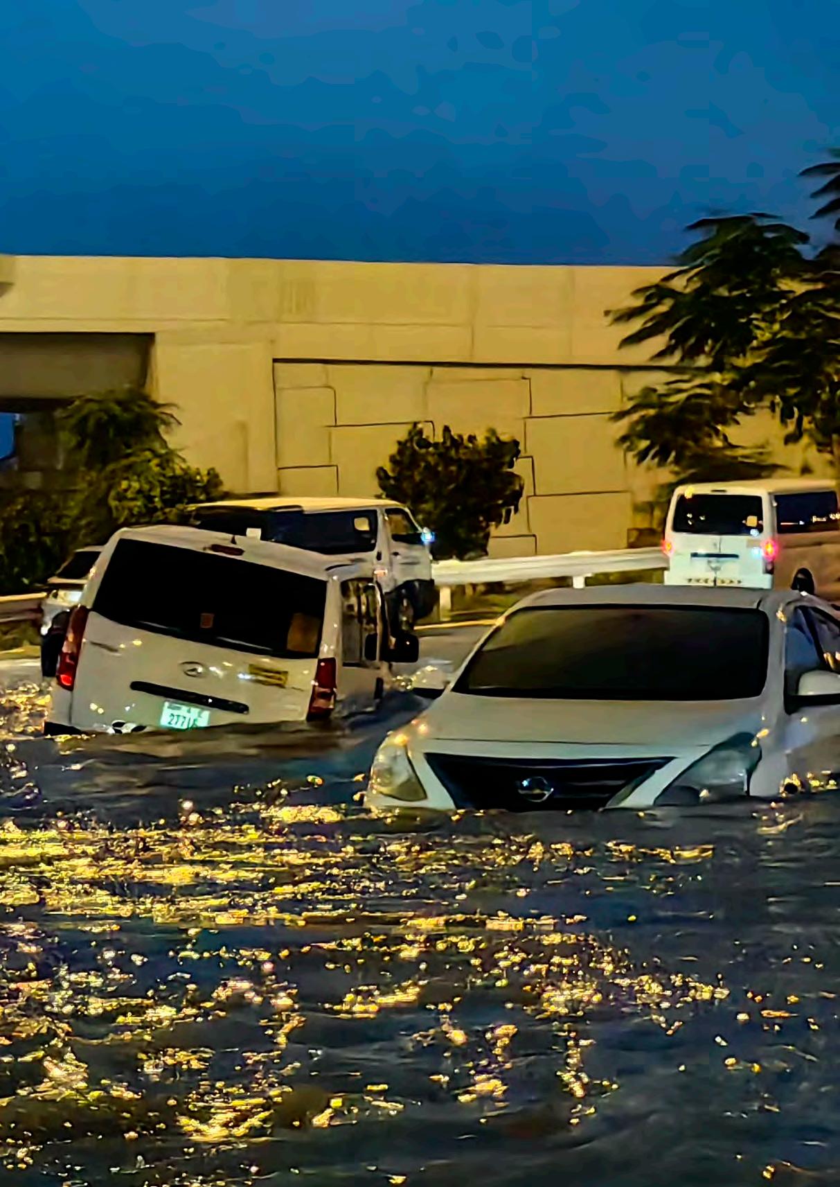
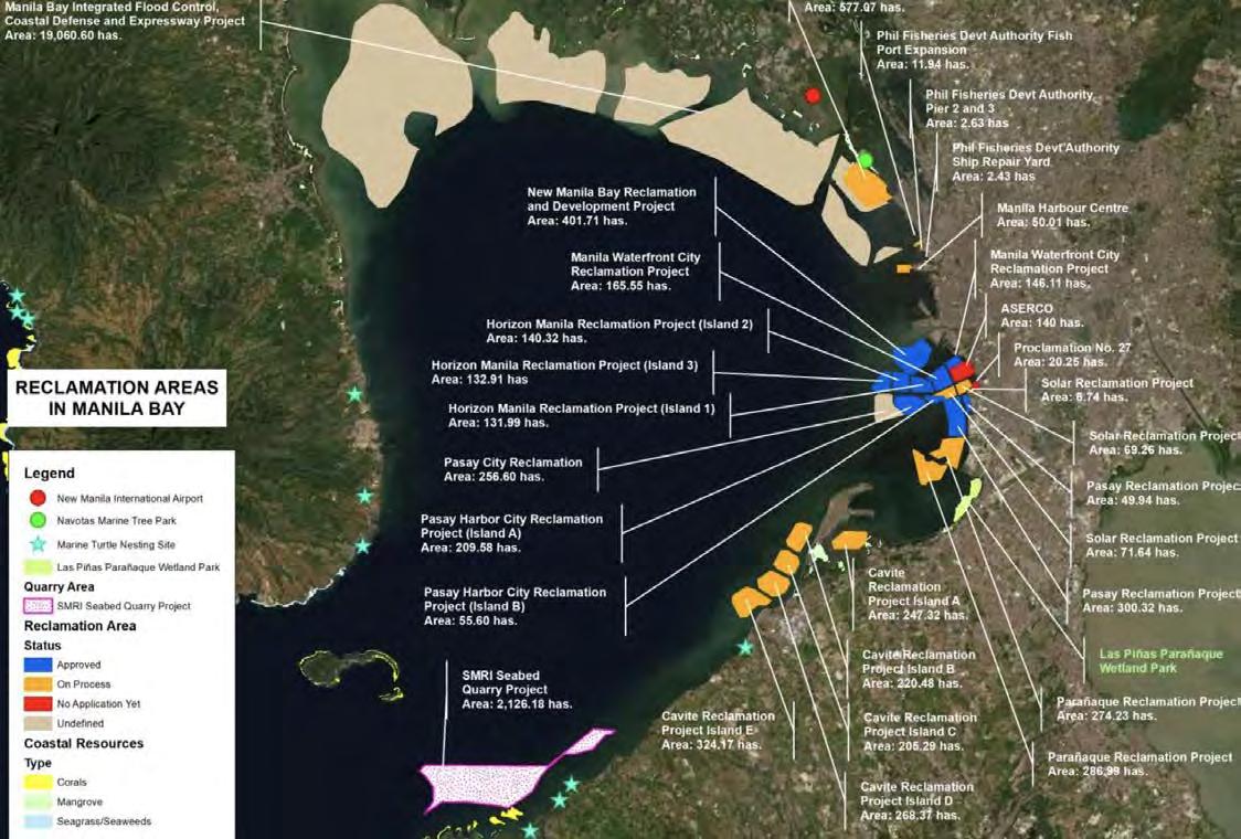
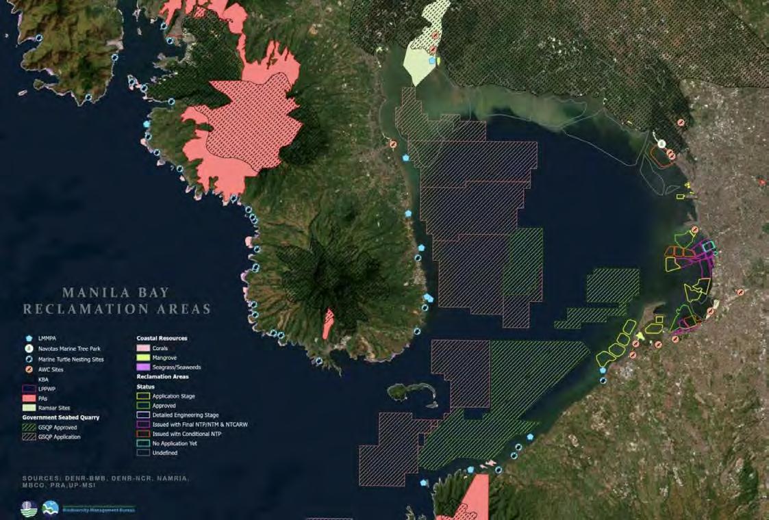
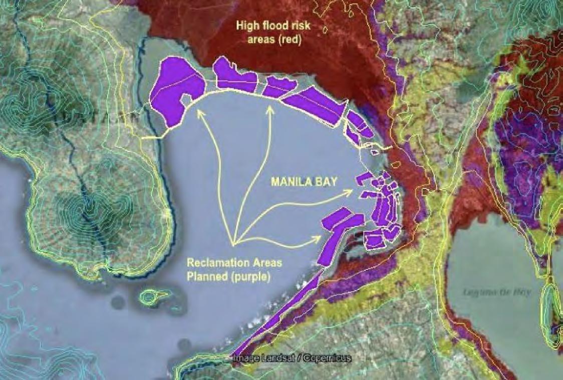
Manila, like Jakarta, is grappling with the dual threats of sea level rise and frequent flooding, challenges exacerbated by its geographic location along the coast and its dense urban sprawl. The Philippine capital’s response to these escalating risks is manifested in the ambitious Manila Bay project, a controversial largescale reclamation and rehabilitation plan designed to protect the city and enhance its urban space.
The Manila Bay project aims to revitalize and secure the bay area through extensive land reclamation, which includes creating new commercial spaces and residential areas while purportedly strengthening the city’s defenses against natural disasters, particularly typhoons and floods. This approach is seen as a form of securitization, an urgent response to safeguard Manila’s economic assets and its densely populated areas from the inevitability of rising sea levels and the increasing intensity of storm surges.
However, this project has attracted significant criticism and skepticism for several reasons. Firstly, environmentalists are deeply concerned about the ecological impact of such extensive land reclamation activities. Manila Bay is a vital ecosystem, and its alteration could lead to the destruction of natural habitats for numerous species, potentially causing irreversible environmental damage. The disruption of natural coastal processes could also exacerbate the city’s vulnerability to storms and flooding, rather than mitigating these risks.
Social implications are equally contentious. The Manila Bay project involves displacing thousands of informal settlers and could lead to a gentrification of the bay area, where newly created land would likely cater to wealthier citizens and tourists, potentially marginalizing local communities and fishermen who rely on the bay for their livelihoods. Critics argue that the project prioritizes commercial gain over the needs of the existing, often economically disadvantaged, residents.
The debate around the Manila Bay project highlights the broader issue of how cities should tackle environmental and climate challenges. There is a growing consensus that sustainable urban planning and development must prioritize green, adaptive solutions that integrate nature-based solutions and robust community engagement processes. This approach ensures that resilience building is inclusive and effective, addressing the root causes of vulnerability rather than offering short-term fixes that could have long-term negative consequences.
.“.” World Eras. . Encyclopedia.Com. 18 Mar. 2024 .” Encyclopedia.com, April 15, 2024. https://www. encyclopedia.com/history/news-wires-white-papersand-books/property-and-ownership.
“About.” – History Moments, November 6, 2017. https://historyweblog.com/2017/11/hammurabi-onfamily-law/.
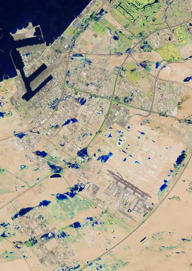
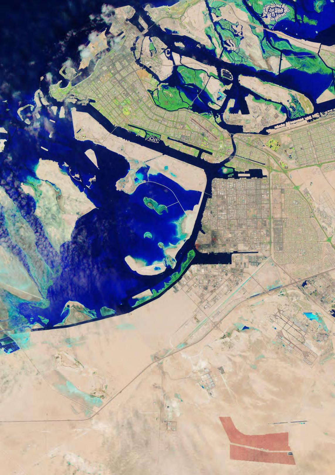
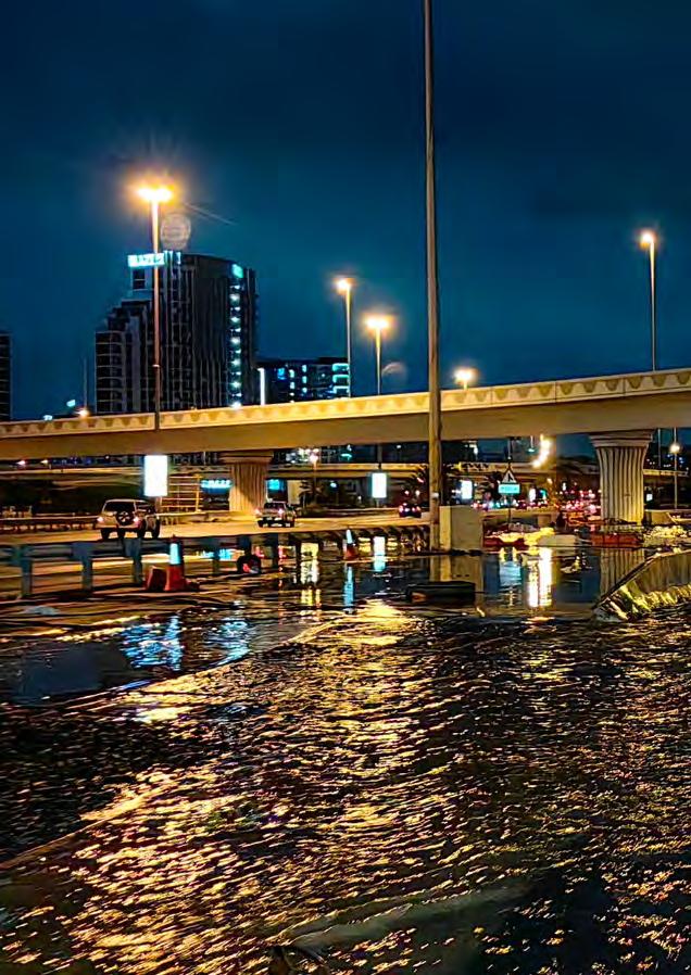
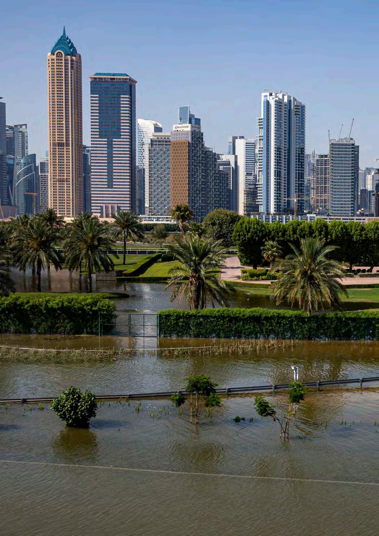
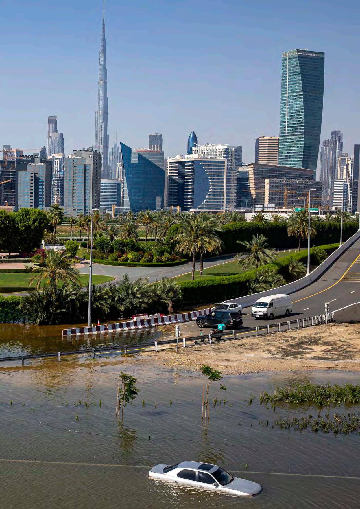
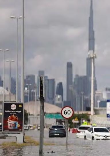
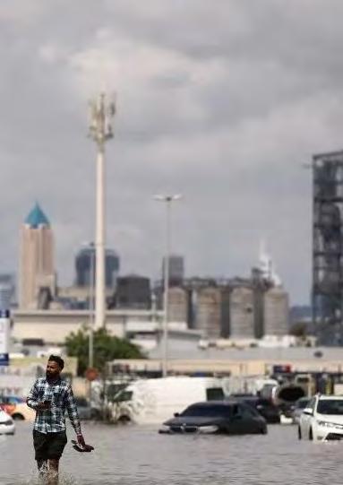
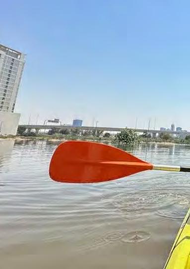
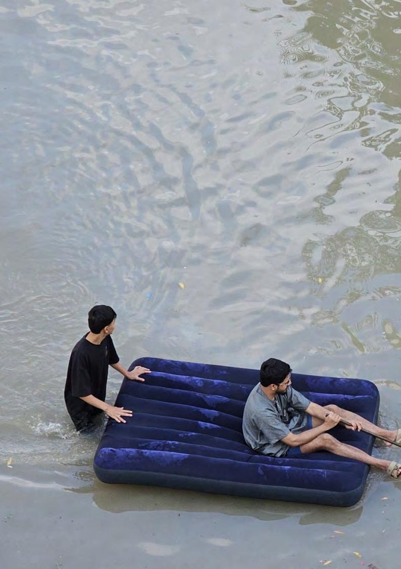
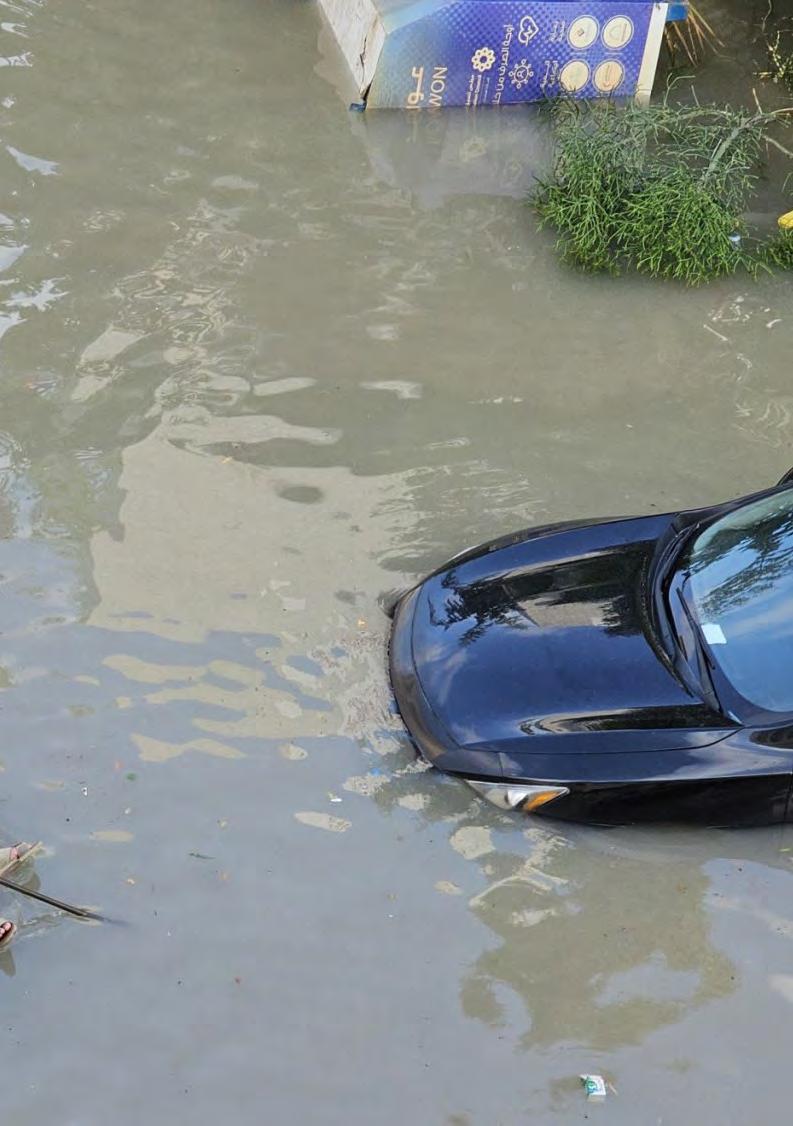
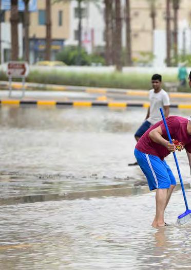
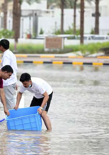
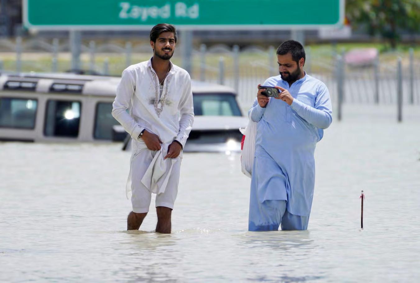
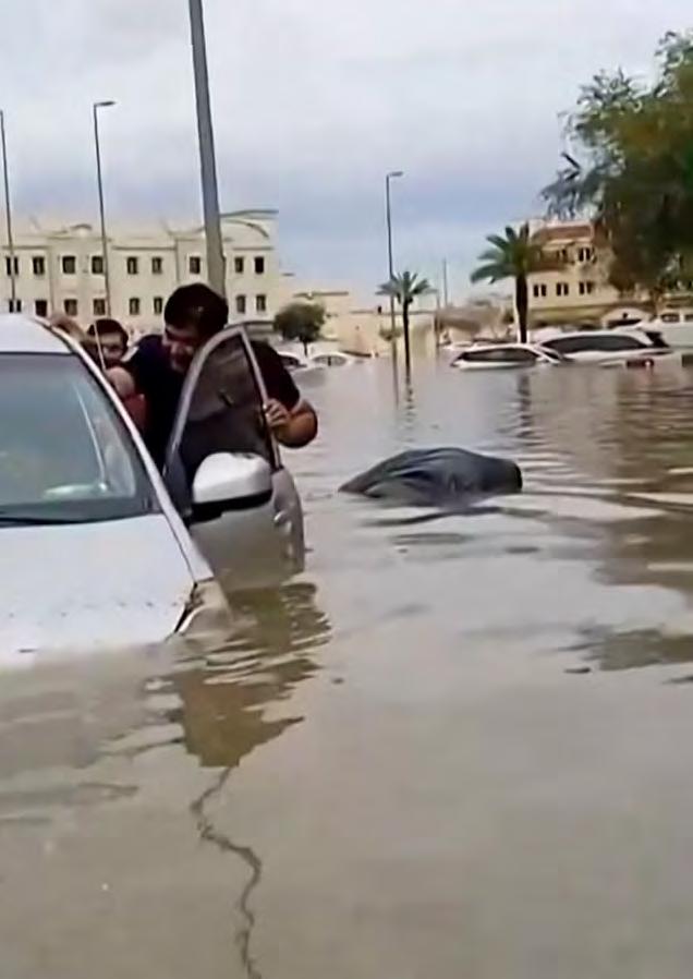
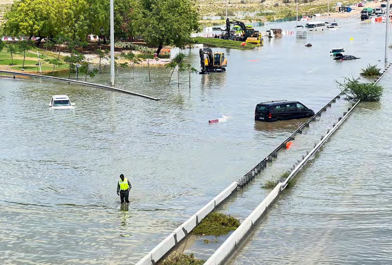
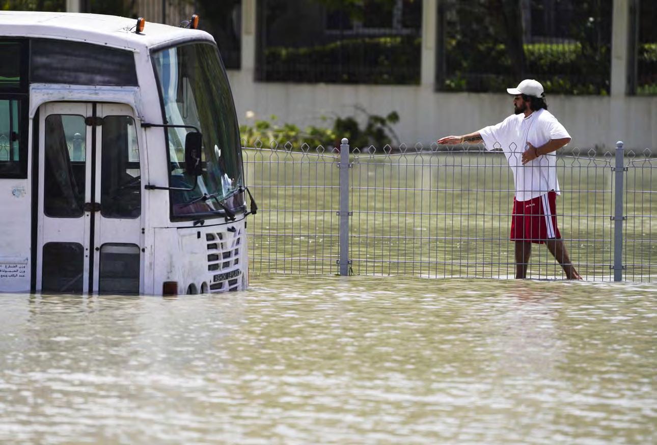
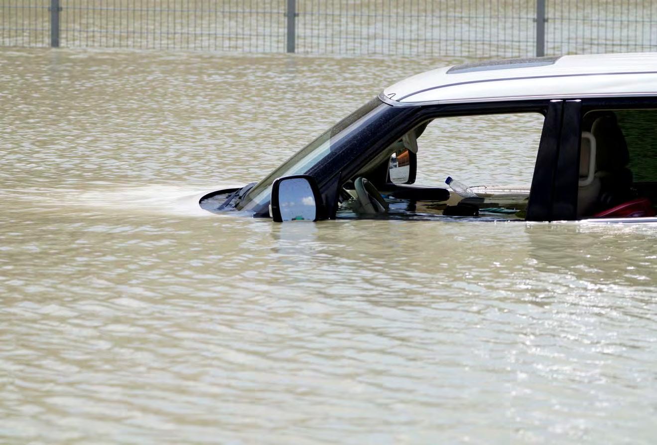
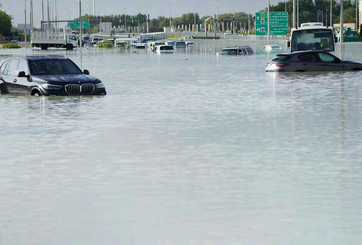
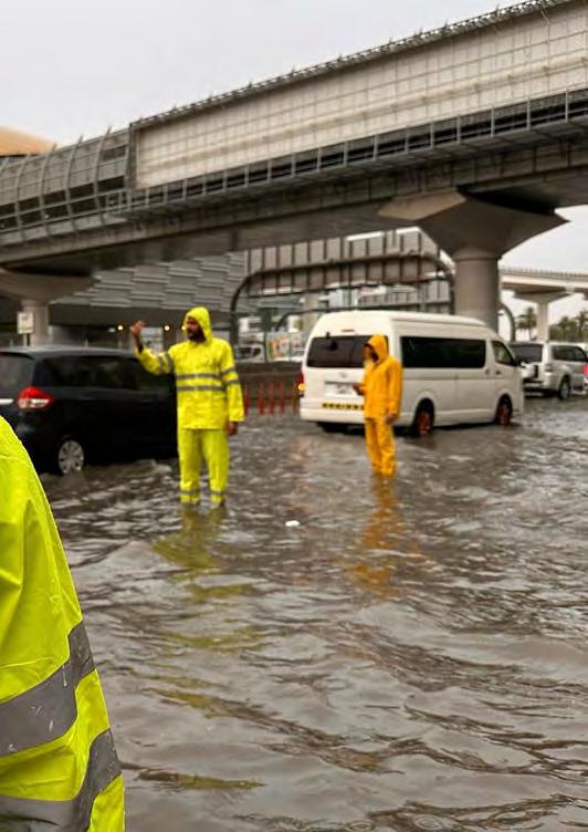
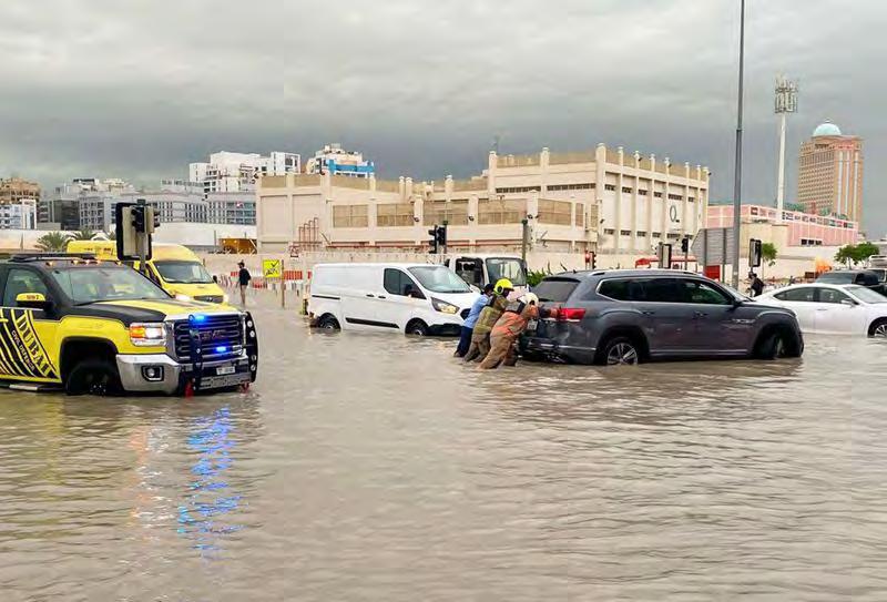
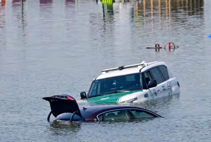
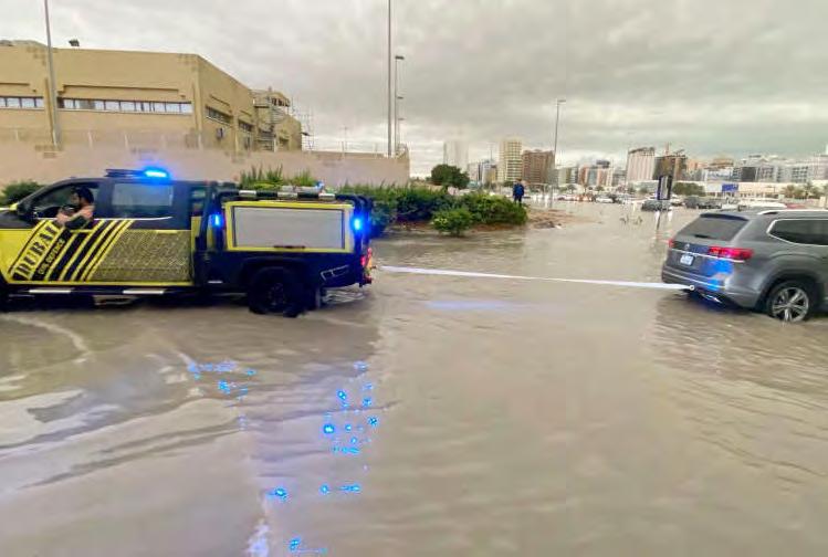
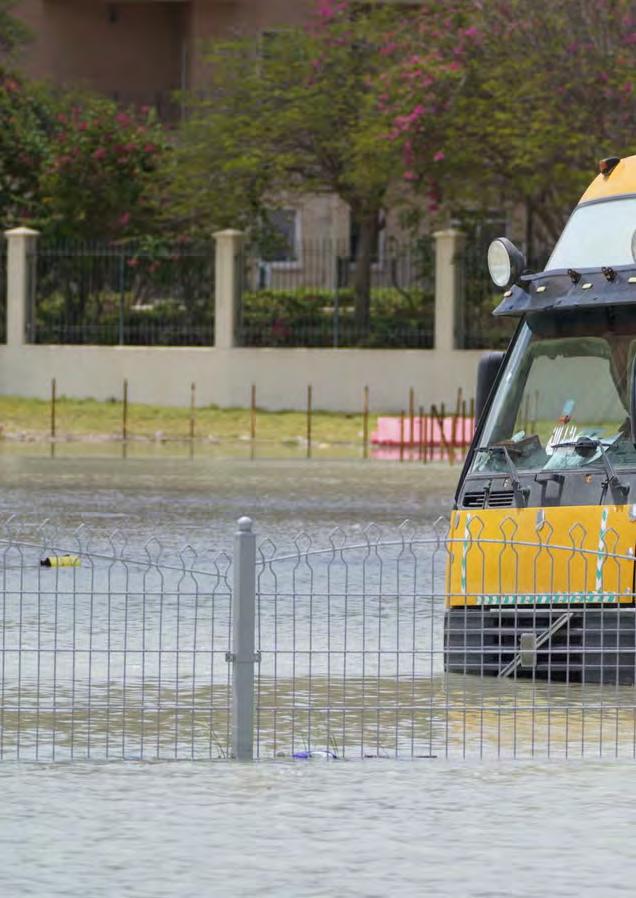
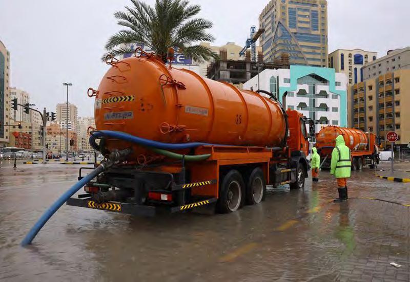
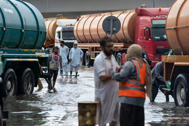
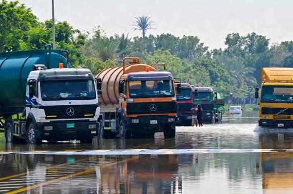
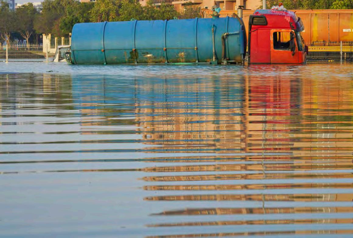
Al Jazeera. “Week in Pictures: From Floods in Dubai to National Elections in India.” Al Jazeera, April 21, 2024. https://www.aljazeera.com/gallery/2024/4/21/ week-in-pictures-from-floods-in-dubai-to-nationalelections-in-india.
Al Nakheel | PDF | United Arab Emirates | Dubai. Accessed 2024. https://www.scribd.com/document/340255282/Al-Nakheel.
“Avalon Project - Documents in Law, History and Diplomacy.” Avalon Project - Documents in Law, History and Diplomacy. Accessed 2024. https://avalon.law. yale.edu/.
Bar graph showing the population of Dubai from 1975-2022. Accessed April 15, 2024. https://www. researchgate.net/figure/Bar-graph-showing-the-population-of-Dubai-from-1975-2022_fig5_365349752.
Batho, Rory. “How the Palm Jumeirah Was Built: 7 Mind-Blowing Facts.” Travelzoo, March 25, 2021. https://www.travelzoo.com/uk/blog/7-mind-blowingfacts-about-how-dubais-palm-jumeirah-was-built/.
Batrawy, Aya. “Photos: UAE Sees Its Heaviest Rains in 75 Years.” NPR, April 18, 2024. https://www.npr. org/sections/pictureshow/2024/04/18/1245508621/ dubai-floods-rain-uae-oman-photos.
Bautista, Jane. “Only 3 Manila Bay Projects ‘ongoing’ Prior to Halt Order – DENR.” INQUIRER.net, August 16, 2023. https://newsinfo.inquirer.net/1817094/only3-manila-bay-projects-ongoing-prior-to-halt-orderdenr.
Breakingviews - Saudi’s $700 billion PIF is an odd sort of sovereign fund. Accessed 2024. https://www. reuters.com/breakingviews/saudis-700-bln-pif-is-oddsort-sovereign-fund-2023-09-21/.
“Bur Dubai Creek Side in 1960s: Dubai, Tourist Destinations, Bur Dubai.” Pinterest, October 30, 2015. https://dk.pinterest.com/pin/205758276703819263/.
Cariaso, Bella. “DENR to Review All Manila Bay Reclamation Projects.” Philstar.com, August 5, 2023. https://www.philstar.com/headlines/2023/08/05/2286409/denr-review-all-manilabay-reclamation-projects.
Climate change 2023 synthesis report. Accessed April 15, 2024. https://www.ipcc.ch/report/ar6/syr/downloads/report/IPCC_AR6_SYR_LongerReport.pdf.
“Code of Hammurabi.” Encyclopædia Britannica, March 28, 2024. https://www.britannica.com/topic/ Code-of-Hammurabi.
Concordia, Maria Angelina. “Sign the Petition.” Change.org, October 1, 2019. https://www.change. org/p/president-duterte-manila-bay-reclamation-project-economic-growth.
Davids, Gavin. “Site Visit: The Challenge of Building Nakheel’s Spectacular Palm Tower.” Middle East Construction News, August 19, 2019. https://meconstructionnews.com/36310/site-visit-nakheels-palm-tower.
Debono, James. “Construction Waste: Land Reclamation Is Option in Draft National Strategy.” MaltaToday. com.mt, December 17, 2019. https://www.maltatoday. com.mt/environment/environment/99262/construction_waste_land_reclamation_is_option.
Derhally, Massoud A. “Dubai’s Nakheel Secures $4.6bn to Fund Expansion.” The National. Accessed 2024. https://www.thenationalnews.com/business/ property/2022/11/08/dubais-nakheel-secures-46bnin-financing-to-fund-expansion/.
Devadasan, K P. “Photos: 20 Years since Construction Began on Dubai’s Iconic Palm Jumeirah.” Year Of The 50th – Gulf News, June 15, 2021. https://gulfnews. com/uae/year-of-the-50th/photos-20-years-sinceconstruction-began-on-dubais-iconic-palm-jumeirah-1.1622987123842.
“Dredging Diagram.” geoarchitecture, June 29, 2014. https://geoarchitecture.wordpress.com/2014/06/29/ anthropocene-processes-mining-sands-and-gravelsfrom-the-sea/dredging-diagram/.
“Dubai Flooding in Pictures: City Reeling after Storm
Brings Heavy Rain.” The Independent, April 17, 2024. https://www.independent.co.uk/news/world/middleeast/dubai-flooding-pictures-rain-storms-b2530191. html.
Elemia, Camille. “US Issues Environmental Warning about Chinese Company’s Reclamation Projects in Manila Bay.” Benar News, August 3, 2023. https:// www.benarnews.org/english/news/philippine/reclamation-projects-08022023145054.html.
“Ellington Ocean House Palm Jumeirah Dubai.” investindxb. Accessed March 2, 2024. https://investindxb.com/property/ellington-ocean-house-palmjumeirah-dubai/.
Emocling, Oliver. “There Will Be a New ‘City’ in Metro Manila.” NOLISOLI, May 30, 2018. https://nolisoli. ph/17955/will-new-city-metro-manila/.
Estate, Real. “About Palm Jumeirah Island Dubai.” Stone House Real Estate, January 2, 2024. https:// shre.ae/palm-jumeirah-island-dubai-largest-artificalarchipelago/.
European Commission. “Global Surface Water Explorer.” Global Surface Water Explorer. Accessed April 15, 2024. https://global-surface-water.appspot. com/#data.
Figure 1. map of the region adjacent to the BAM, Iran earthquake.... Accessed April 21, 2024. https://www. researchgate.net/figure/Map-of-the-region-adjacentto-the-Bam-Iran-earthquake-Faults-were-mappedbased-on-the_fig1_249873101.
Ganic, Eldin. “Manila Bay Land Reclamation Photo Update.” Dredging Today, May 15, 2023. https://www. dredgingtoday.com/2023/05/15/manila-bay-land-reclamation-photo-update/.
Gillett, Katy. “Palm Jumeirah: From Construction to World-Class Destination in 21 Years.” The National. Accessed 2024. https://thenationalnews.com/weekend/2022/06/10/palm-jumeirah-from-construction-toworld-class-destination-in-21-years/.
Gillett, Katy. “Timeframe: How Dubai Creek Has (and Hasn’t) Changed in 55 Years.” The National. Accessed April 2024. https://www.thenationalnews.com/week-
Glaser, Bonnie. “On the Defensive? China Explains Purposes of Land Reclamation in the South China Sea.” Asia Maritime Transparency Initiative, April 20, 2015. https://amti.csis.org/on-the-defensive-chinaexplains-purposes-of-land-reclamation-in-the-southchina-sea/.
Gozum, Iya. “Concerned? Don’t Single out China’s Manila Bay Reclamation Project, Fishers Say.” RAPPLER, November 1, 2023. https://www.rappler.com/ nation/fisherfolk-group-says-do-not-single-out-chinamanila-bay-reclamation-project/.
Hancock, Michaila. “£7m Lincolnshire Coastal Dredging to Begin.” Ground Engineering, March 19, 2021. https://www.geplus.co.uk/news/7m-lincolnshirecoastal-dredging-to-begin-22-03-2021/.
Hiraga, Yusuke. “Impact of Reclamation on the Environment of the Lower Mekong River Basin.” Journal of Hydrology: Regional Studies, July 17, 2018. https://www.sciencedirect.com/science/article/pii/ S2214581817301891.
“The Influence of the Legal Aspects of the Roman Empire.” The Impact Lawyers. Accessed 2024. https:// theimpactlawyers.com/articles/the-influence-of-thelegal-aspects-of-the-roman-empire#:~:text=Its%20 influence&text=The%20Corpus%20Juris%20 Civilis%2C%20compiled,studied%20in%20law%20 schools%20today.
“Iran: Earthquake - 26 Dec 2003 - Iran (Islamic Republic Of).” ReliefWeb, December 27, 2003. https://reliefweb.int/map/iran-islamic-republic/iran-earthquake26-dec-2003.
Jamal, Haseeb. “Haseeb Jamal.” Palm Islands Dubai - Palm Tree Island Construction Details and Facts, May 6, 2017. https://www.aboutcivil.org/palm-islanddubai-megastructure.html.
Jamieson, William. “In Conquering the Sea, Singapore Erases Its History.” Failed Architecture, 2018. https:// failedarchitecture.com/in-conquering-the-sea-singapore-erases-its-history/.
“A Journey through Time: The Fascinating Origins of Real Estate and Property Ownership.” Real Estate Blog. Accessed 2024. https://www.bankforeclosures-
Kuwait: Multi-billion sea city ready in 25 yearsConstruction Week Online. Accessed 2024. https:// www.constructionweekonline.com/business/article39724-kuwait-multi-billion-sea-city-ready-in-25-years.
Lam, Curtis. “Hong Kong’s Lantau Tomorrow Vision: How (Not) to Respond to Criticism as a Policymaker.” Earth.Org, March 7, 2023. https://earth.org/lantautomorrow-vision/.
“Land Reclamation.” Land Reclamation - an overview | ScienceDirect Topics. Accessed 2024. https://www. sciencedirect.com/topics/earth-and-planetary-sciences/land-reclamation.
“Landsat 4-5 TM and Landsat 7 ETM+ Bands and Their Uses.” Landsat 4-5 TM and Landsat 7 ETM+ bands and their uses | U.S. Geological Survey. Accessed April 19, 2024. https://www.usgs.gov/media/ images/landsat-4-5-tm-and-landsat-7-etm-bandsand-their-uses.
“Landsat 8 Band Designations.” Landsat 8 band designations | U.S. Geological Survey. Accessed April 19, 2024. https://www.usgs.gov/media/images/landsat8-band-designations.
“The Law of Property and Possession.” Encyclopædia Britannica. Accessed 2023. https://www.britannica. com/topic/Roman-law/The-law-of-property-and-possession.
Limos, Mario Alvaro. “These Photos Show the Breadth and Scale of Manila Bay’s Reclamation Projects.” Esquiremag.ph, January 1, 1970. https://www.esquiremag.ph/politics/news/manila-bay-reclamationprojects-a00293-20221220.
“Made to Change.” NEOM. Accessed January 15, 2024. https://www.neom.com/en-us.
Malasig, Jeline. “‘An Eyesore’: New Pics Revive Discussions over Manila Bay Reclamation.” Interaksyon, February 18, 2023. https://interaksyon.philstar.com/ trends-spotlights/2023/02/17/243471/manila-bayreclamation-projects/.
Mansourmoghaddam, Mohammad, Hamid Reza Ghafarian Malamiri, Iman Rousta, Haraldur Olafsson, and
Hao Zhang. “Assessment of Palm Jumeirah Island’s Construction Effects on the Surrounding Water Quality and Surface Temperatures during 2001–2020.” MDPI, February 18, 2022. https://www.mdpi.com/20734441/14/4/634.
Map of the great garuda project [42]. | download scientific diagram. Accessed April 2024. https://www. researchgate.net/figure/Map-of-the-Great-Garudaproject-42_fig1_327111972.
“Marcos Halts Majority of Manila Bay Reclamation Initiatives, except One.” Pinoy Builders, August 9, 2023. https://mail.pinoybuilders.ph/marcos-halts-majorityof-manila-bay-reclamation-initiatives-except-one/.
Mark, Joshua J. “Code of Hammurabi.” World History Encyclopedia, April 13, 2024. https://www.worldhistory.org/Code_of_Hammurabi/.
“Martu.Site.” martu.site - martu Resources and Information. Accessed 2024. https://martu.site/amazingfacts-on-construction-of-palm-jumeirah-island-dubaipart-2/.
Masry, Youlika, Sophia Belloncle, Stephen Klugewicz, Sarah Reardon, Cate Gangemi, Claire A. Rawnsley, Robert Kmita, et al. “A Review of Art, Culture, Politics, Science, and Divine Ground.” VoegelinView, November 14, 2023. https://voegelinview.com/.
“A Massive Sea Wall Will Be Built in Jakarta Bay to Ensure Long-Term Protection against Flooding. the New Waterfront Will Be Shaped like the Mythical Garuda Bird...” Pinterest, December 19, 2014. https:// nl.pinterest.com/pin/351280839659670870/.
“Nakheel Properties.” Wikipedia, March 28, 2024. https://en.wikipedia.org/wiki/Nakheel_Properties. NASA. “Deluge in the United Arab Emirates.” NASA. Accessed May 27, 2024. https://earthobservatory. nasa.gov/images/152703/deluge-in-the-united-arabemirates.
NatashaTurak, Natasha. “NASA Releases Satellite Photos of Dubai and Abu Dhabi before and after Record Flooding.” CNBC, April 24, 2024. https://www. cnbc.com/2024/04/24/dubai-flood-nasa-releasessatellite-photos-of-record-uae-flooding.html.
“NEOM Pitches Investment Opportunities to More than 700 US Business Leaders | Arab News.” ARAB NEWS. Accessed November 15, 2023. https://www. arabnews.com/node/2068476/business-economy. “Neom.” - 2030. Accessed February 10, 2024. https:// www.vision2030.gov.sa/en/projects/neom.
“Our Investments.” PIF. Accessed February 15, 2024. https://www.pif.gov.sa/en/Pages/OurInvestmentsDetails.aspx?Giga=Neom%2FNeom-Project.
“Palm Islands in Dubai.” Interesting Engineering, January 30, 2014. https://interestingengineering.com/ culture/palm-islands-in-dubai.
“Palm Jumeirah Facts & Figures: History, Construction & More - MyBayut.” A blog about homes, trends, tips & life in the UAE | MyBayut. Accessed 2024. https:// www.bayut.com/mybayut/palm-jumeirah-facts/.
Palm Jumeirah, UAE. description of the artificial Palm Island in Dubai. Artificial Islands in Dubai City in the shape of a palm tree. Accessed 2024. https://hostelbereg.ru/en/latviya/palma-dzhumeira-oae-opisanieiskusstvennogo-palmovogo/.
Palm Jumeirah. Accessed May 6, 2024. https://flyovertheworld.com/en/united-arab-emirates/dubai/ palm-jumeirah.html.
Pekel, Jean, Andrew Cottam, Noel Gorelick, and Alan Belward. “High-Resolution Mapping of Global Surface Water and Its Long-Term Changes.” Letter. Accessed April 15, 2024. https://www.nature.com/siteindex.
The Public Investment Fund (PIF) of Saudi Arabia. “Public Investment Fund Launches ‘Fund of Funds.’” Cision PR Newswire UK provides press release distribution, targeting, monitoring, and marketing services, January 18, 2019. https://www.prnewswire.co.uk/ news-releases/public-investment-fund-launches-fundof-funds-650091743.html.
“A Quick Guide: What Is Dredging?” IADC Dredging.
Accessed April 17, 2024. https://www.iadc-dredging. com/subject/what-is-dredging/.
R/arabs on reddit: Dubai is a parody of the 21st century. this video makes some great points about urbanism in Dubai I didn’t think about before. Accessed April 15, 2024. https://www.reddit.com/r/arabs/comments/p1qt3e/dubai_is_a_parody_of_the_21st_century_this_video/.
Ravenscroft, Tom. “Everything You Need to Know about Saudi Mega-Project Neom.” Dezeen, September 14, 2023. https://www.dezeen.com/2023/02/14/ neom-guide-line-saudi-arabia/.
“Real Estate.” Wikipedia, February 2, 2024. https:// en.wikipedia.org/wiki/Real_estate.
Reehaan, Mohamed. “Physical Works of Addu Land Reclamation to Begin in June.” Maldives Business Times, May 18, 2023. https://mbt.mv/physical-worksof-addu-land-reclamation-to-begin-in-june/.
Report, Gulf News Web. “Palm Jumeirah Developer Nakheel Sees Net Profit Decline 22% to Dh4.38 Billion.” Property – Gulf News, March 6, 2019. https:// gulfnews.com/business/property/palm-jumeirah-developer-nakheel-sees-net-profit-decline-22-to-dh438billion-1.1551876599169.
Reyes, Rizal Raoul. “Moa Signed for Manila Bay Reclamation Project: Rizal Raoul Reyes.” BusinessMirror, November 6, 2018. https://businessmirror.com. ph/2018/11/07/moa-signed-for-manila-bay-reclamation-project/.
Richardson, John S. “Roman Law and Its Lasting Influence on the Legal System of Europe.” Ancient Origins Reconstructing the story of humanity’s past, June 12, 2021. https://www.ancient-origins.net/history-ancient-traditions/roman-law-0015436.
Robert Ditcham, Staff Reporter. “Palm Jumeirah Prices Shoot Up.” Property – Gulf News, July 25, 2019. https://gulfnews.com/business/property/palmjumeirah-prices-shoot-up-1.127023.
“Sabah Al Ahmad Sea City Bridges.” Buro Happold, January 13, 2022. https://www.burohappold.com/ projects/sabah-al-ahmad-sea-city-bridges/#.
“Sabah Al Ahmad Sea City.” KuwaitBirds.org. Accessed 2024. https://www.kuwaitbirds.org/places/ sabah-al-ahmad-sea-city.
Saudi wealth fund sets up electric car joint venture with Foxconn - CGTN. Accessed 2024. https://news. cgtn.com/news/2022-11-04/Saudi-wealth-fund-setsup-electric-car-joint-venture-with-Foxconn-1eGeHQ7QO0E/index.html.
“Scipy -.” SciPy. Accessed 2024. https://scipy.org/. Sengupta, Dhritiraj, and Young Choi. “Mapping 21st Century Global Coastal Land Reclamation.” Earth’s Future, February 9, 2023. https://agupubs.onlinelibrary.wiley.com/doi/10.1029/2022EF002927.
Sengupta, Dhritiraj, Ruishan Chen, Michael E Meadows, Young Rae Choi, Abhishek Banerjee, and Xia Zilong. “Mapping Trajectories of Coastal Land Reclamation in Nine Deltaic Megacities Using Google Earth Engine.” MDPI, November 8, 2019. https://www.mdpi. com/2072-4292/11/22/2621.
Sentinel-Hub by Sinergise. “Landsat 8 Normalized Difference Moisture Index - NDMI.” Sentinel Hub custom scripts. Accessed April 15, 2024. https://customscripts.sentinel-hub.com/custom-scripts/landsat-8/ ndmi/.
Simmon, Robert, Holli Riebeek, and Michon Scott. “NASA Scientific Visualization Studio.” NASA, May 3, 2023. https://svs.gsfc.nasa.gov/10894/.
Sinergise. “How to Configure WMS Using Sentinel Hub Service.” Medium, November 2, 2017. https:// medium.com/sentinel-hub/how-to-configure-wmsusing-sentinel-hub-service-1c36c26b5c0c.
Smith, Claire. “Materials Supply Risk for Hong Kong Land Reclamation Plan.” Ground Engineering, March 29, 2019. https://www.geplus.co.uk/news/materials-supply-risk-for-hong-kong-land-reclamationplan-12-03-2019/.
“Sustainable Land Reclamation Using Geotextiles and Dredged Materials.” SIDCO, March 27, 2024. https:// sidco.mv/sustainable-land-reclamation-using-geotextiles-and-dredged-materials/.
“Walking Art / Walking Aesthetics.” The Great Garuda Sea Walk: Producing Situated Knowledge through Exploration | JORGEN DOYLE, HANNAH EKIN, IRWAN AHMETT & TITA SALINA | Walking Art / Walking Aesthetics. Accessed April 2024. https://walkingart. interartive.org/2018/12/Great-Garuda-Sea-Walk.
A ‘deep dive’ into reclamation: Where have all the sunsets gone? Accessed 2024. https://mb.com. ph/2023/8/19/a-deep-dive-into-reclamation-wherehave-all-the-sunsets-gone.
Greenpeace East AsiaFollow this publisher. “Uncertain Fates: A Study of Problems Faced by Reclamation Megaprojects worldwide Greenpeace.” Issuu, February 16, 2023. https://issuu.com/greenpeace_eastasia/ docs/uncertain_fates_a_study_of_problems_faced_ by_recl/44.