FRACTURES
Istanbul’s Informal Spaces Between Formal Houses
Ayse Elif Coskun
Projective Cities 2025 Architectural Association

Ayse Elif Coskun
Projective Cities 2025 Architectural Association
Istanbul’s Informal Spaces Between Formal Houses
Projective Cities 2025
Architectural Association


Acknowledgements
Glossary of Terms
Abstract
Research Questions
Aims and Objectives
Methodology
Introduction
CHAPTER 1: LAND LAW AND PRODUCTION OF SPACE
Land, Land, Land
Mapping Istanbul
Planning Istanbul
CHAPTER 2: HOUSING, STATE AND IDENTITY
Housing and State
Housing and Social Identity
Traditional Modern
CHAPTER 3: FORMAL, INFORMAL, and the EROSION of BINARIES
Beykoz; from Arazi to Arsa
Beykoz; Socio-Spatial Interactions
Informal Formal Continuum
CHAPTER 4: the interstitial and projections
Taxonomy of the Interstitial
This thesis is dedicated to my auntie, and second mother, Saniye Cafer, her family and neighbours, who have been an immense source of inspiration and information for the themes explored in this work.
I express my deepest gratitude to my father, and informal editor, Bulent Coskun, for his unwavering support and encouragement in pursuing new challenges; you are the light to my life. I am also thankful to Alp and Şiva Dagli, Aslıhan Öztürkoğlu, and Monty Rush for uplifting me during moments of need, even through the other side of a video call. A special thank you to my Projective Cities classmates, affectionately known as the “Projective Ladies,” whose camaraderie and debates have been invaluable. I look forward to continuing our discussions in the future. Finally, I owe a special thanks to Zachary Regen Farr for his love and boundless patience throughout this journey. Your constant support and the meaningful conversations we’ve shared have been incredibly motivating, bringing so much joy and inspiration into this dissertation.
This dissertation would not have been possible without the support and guidance of many individuals throughout this 18-month journey. First and foremost, I am deeply grateful to the Projective Cities staff for their invaluable support during my studies. I would like to extend my heartfelt thanks to Platon Issaias and Hamed Khosravi for their insightful guidance and rigorous questioning that have shaped this body of work. Special thanks go to Anna Font for her mentorship, for sharing her methodological approach, and for serving as an inspiring role model as a woman architect and educator. I am also thankful to Christina Gamboa, Roozbeh Elias-Azar, and Daryan Knoblauch for their expertise and for offering sharp insights into the urban contexts of Barcelona, London, and Berlin from professional, academic, and personal perspectives. My gratitude extends to the Architectural Association for awarding me the bursary that made this work possible.
In remembrance of my late mother, Yildiz Yurtman Coskun, my grandparents, Sitki and Hatice Coskun, Sermet and Nurseren Yurtman, and our recent loss, my dearest Cindy Regen.
Bu tez, evimizin yardımcısı ve ikinci annem Saniye Cafer’e, ailesine ve komşularına adanmıştır. Onlar, bu çalışmada ele alınan temalara ilham ve bilgi kaynağı olmuşlardır.
Babam ve gayrıresmi editörüm Bülent Coşkun’a, yeni zorluklara göğüs germem için verdiği sarsılmaz destek ve cesaretlendirme için en derin şükranlarımı sunuyorum; sen hayatımın ışığısın. Ayrıca, Alp ve Şiva Dağlı’ya, Aslıhan Öztürkoğlu’na ve Monty Rush’a, ihtiyaç anlarında bana destek oldukları ve bir video görüşmesinin diğer ucundan bile yanımda olduklarini hissettirdikleri için minnettarım. “Projective Ladies” olarak andığımı Projective Cities sınıf arkadaşlarıma da özel bir teşekkür borçluyum; dostlukları ve tartışmalarımız bu süreçte paha biçilemezdi. Gelecekte bu sohbetleri sürdür meyi sabırsızlıkla bekliyorum. Son olarak, Zachary Regen Farr’a, bu yolculuk boyunca gösterdiği sevgi ve sınırsız sabır için özel bir teşekkür borçluyum. Sürekli desteğin ve paylaştığımız anlamlı sohbetler, bu tezi yazarken bana büyük bir motivasyon kaynağı oldu ve sürece neşe ve ilham kattı.
Bu tez, 18 aylık süreç boyunca pek çok kişinin desteği ve rehberliği olmadan mümkün olmazdı. Her şeyden önce, Projective Cities akademik kadrosuna, çalışmalarım boyunca verdikleri paha biçilmez destekleri için en derin minnettarlığımı sunuyorum. Platon Issaias ve Hamed Khosravi’ye, verdikleri yönlendir me ve titiz sorgulamalarla bu çalışmayı şekillendirdikleri için içten teşekkürlerimi sunuyorum. Anna Font’a, mentörlüğü, metodolojik yaklaşımını paylaşması ve bir kadın mimar ve eğitimci olarak ilham verici bir rol model olması nedeniyle özel bir teşekkür borçluyum. Ayrıca, Christina Gamboa, Roozbeh Elias-Azar ve Daryan Knoblauch’a, Barselona, Londra ve Berlin’in kentsel bağlamlarını profesyonel, akademik ve kişisel perspektiflerinden keskin analizleriyle ele aldıkları için minnettarım. Bu çalışmayı mümkün kılan burs desteği için Architectural Association’a da teşekkür ederim.
Merhum annem Yıldız Yurtman Coşkun’un, büyüklerim Sıtkı ve Hatice Coşkun’un, Sermet ve Nurseren Yurtman’ın ve yakın zamanda kaybettiğimiz çok sevgili Cindy Regen’in anısına...*
*Translated by AI from English to Turkish
Gecekondu [geh-jeh-KON-doo]
Informal housing settlements built quickly on unregistered or public land, often by rural migrants.
Site [see-TAY]
Planned residential developments, typically gated and constructed by institutions or private developers.
Formal Housing
Housing constructed within regulated frameworks.
inFormal Housing
Housing built outside of regulatory or planning systems.
Legal Housing
Housing that complies with zoning and construction laws.
ilLegal Housing
Housing that violates laws or regulations at the time of construction.
Spaces between buildings or urban structures that serve transitional, secluded, or collective functions.
Sofa
A multi-functional central space in traditional Turkish houses, used for connecting rooms and communal activities.
A state-led initiative aimed at redeveloping urban areas to address housing shortages, earthquake resilience, and unregulated development. Often criticized for prioritizing profit-driven redevelopment over community needs, it has reshaped land use and housing dynamics in cities like Istanbul.
A housing prototype by Le Corbusier, featuring reinforced concrete slabs and columns, allowing open plans and flexible façades. It laid the foundation for modernist architecture and mass housing. Here, “Dom” refers to house, while “Ino” stands for innovation in Latin, and it should not be mistaken for the word “domino.”
Mustafa Kemal Ataturk was the Republic of Turkey’s founder and first President (1881–1938). He served between 1923–1938. He oversaw significant modernising, secularism, and urban development measures Emphasising Wester n-style urbanisation, infrastructural development, and industry, his city planning prog rams prioritised grid-based city layouts, public squares, and green areas, Atatürk helped to shape Ankara as the new capital with a modernist, planned urban form. His concept promoted public structures, transportation systems, and a methodical approach to city development, laying the groundwork for Turkey’s architectural and urban revolution.
Turgut Ozal lived between 1927 and 1993, is a Turkish politician, economist, and engineer. He was the Prime Minister of Turkey from 1983 to 1989 and then the eighth President from 1989 until he died in 1993. He was instrumental in liberalising Turkey’s economy, implementing free-market changes, privatisation, and foreign investment, opening of the nation. Özal’s ideas greatly changed Turkey’s economic environment and promoted fast modernisation and expansion. Efforts to include Turkey into the world economy while negotiating political and societal obstacles defined his term.
Recep Tayyip Erdogan is a Turkish politician having been President since 2014. Previously Mayor of Istanbul (1994–1998) and Prime Minister (2003–2014), he led enormous infrastructure projects like highways, bridges, and the construction of public housing through TOKİ, he was a major player in Turkey’s urban change Along with criticism for gentrification, environmental harm, and urban sprawl, his policies encouraged fast urbanisation and extensive building. Strongly supporting Urban Amnesty (İmar Affı), Erdogan approved illegal construction to merge infor mal communities, therefore benefiting the area temporarily but generating questions about long-term sustainability in urban planning, safety, and zoning violations.
Turkey’s state-run Housing Development Administration, oversees mass housing, urban regeneration, and disaster recovery initiatives. Built under Erdoğan, it creates reasonably priced homes but draws criticism on environmental effect, construction quality, and gentrification.TOKI is Turkey’s state-run Housing Development Administration: Mass housing, urban redevelopment, and catastrophe recovery prog rams are handled by TOKI. Under Erdogan, it develops reasonably priced homes but comes under fire over environmental effect, construction quality, and gentrification.
Henri Prost was a French builder and urban planner who lived from 1874 to 1959. His designs had a major impact on city planning, especially in North Africa and Turkey. He is best known for his master plans for cities like Casablanca, Istanbul, and Rabat, in which he combined modern urban design ideas with an understanding of the cities’ culture and historical backgrounds. Prost’s work focused on wellorganized street layouts, green areas, and infrastructure that worked well to support cities that were growing.
Luigi Piccinato was an Italian architect and urban planner who worked from 1899 to 1983. He is recognised for his efforts to modernise city planning in Italy and around the world. He was an expert at making city master plans that preserved history while also being useful in modern times. Piccinato was very important in rebuilding and planning cities after the war. He made plans for places like Rome and Naples, as well as for many areas in the Mediterranean and Latin America. His plan focused on human-scale planning, integrating the environment, and building good transportation networks.
Sedad Hakkı Eldem was a renowned Turkish architect. He was noted for fusing modern design ideas with classic Ottoman and Turkish architectural features. Emphasising cultural continuity and regional identity, he plays a major part in the development of Turkish architecture of the 20th century. Eldem also taught at Istanbul Technical University, where he shaped the next generation of architects. Among his noteworthy creations are several public buildings and homes reflecting his dedication to modernism anchored in history as well as the Istanbul Hilton Hotel.
Tansı Şenyapılı was a Turkish scholar and writer focused in urban planning and architecture. She was a faculty member at Middle East Technical University (METU), Turkey. Among her noteworthy works is the book “Baraka’dan Gecekonduya,” which looks at Turkish urbanization and informal housing policies
This thesis explores the housing dynamics in Istanbul, focusing on the interplay between land ownership, planning policies, and socio-spatial typologies. It challenges the traditional for mal-informal housing divide, arguing that it is a product of historical urban policies and class dynamics rather than an inherent spatial logic. By examining two typical housing strategies, site and gecekondu, the thesis aims to redefine the housing landscape in Istanbul.
It looks at how Istanbul’s housing and land policies have changed over time, from the time of the Ottoman Empire to the early Republic and up to the present day. Specifically, it looks at how gecekondu communities and site developments have worked as different but connected parts in response to housing shortages, more significant societal changes, politics, and the economy. By examining these dynamics, the research underscores the pressing need for inclusive policies that recognise the value of gecekondu settlements and promote equitable urban development in Istanbul.
The dissertation aims to illustrate the changing connections between land ownership, housing rules, and spatial practices using the case study of Beykoz – an area that has seen both gecekondu and site-driven urbanisation. Here, the study of interstitial spaces not only shapes community relationships and socio-spatial organisation but also presents a canvas for projective urban interventions. This thesis looks at how these factors affect community cohesion, exclusion, and inclusion to understand how housing works in relation to land. This study’s central claim is that the conventional division between formal and infor mal housing ignores Istanbul’s urban development’s fluidity.
Building on this, the dissertation critically researches and analyses three historical and architectural issues reflected in the table of contents: land, urban planning, and building in the context of Istanbul.
Part 1 delves deeper into the understanding of land in Turkey, critically examines the terminolog y, draws a critical focal point on Istanbul’s urban planning efforts, and identifies the growth of Istanbul.
Part 2 of the thesis delves into the interdisciplinary aspects of the research, investigating the relationships between housing and state, as well as housing’s role in shaping identity. It critically examines the Republic’s evolving perspective on ‘home’ over the decades, focusing on the specific laws,
[i]
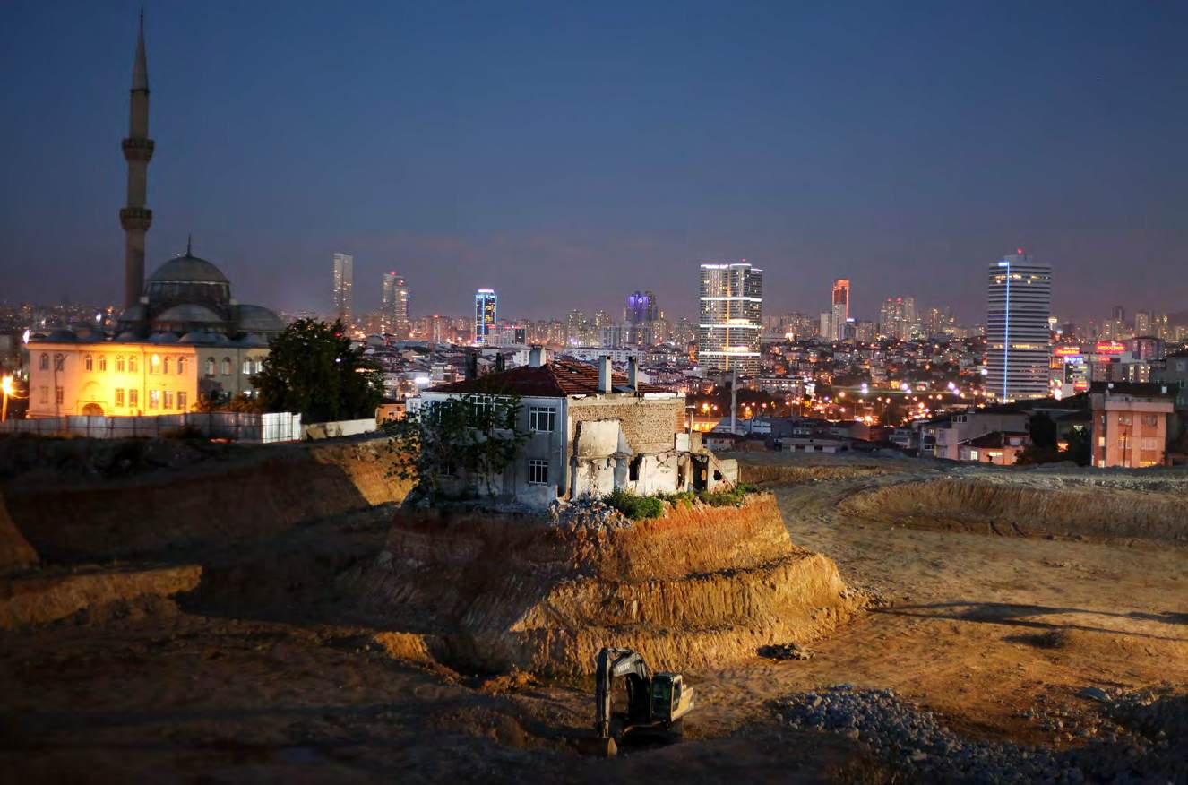
A local in Fikirtepe neighborhood, Alaaddin Demirel, refused to sign an agreement with the construction company for 4 years and his house was the only remaning house in the destruction site. the house was demolished in august 2014 and alaaddin demirel signed an agreement that made him an owner of 5 flats.
photo: Kursad Bayhan/140journos
policies, and amnesties that shaped its idiom. The thesis then shifts its focus to two distinct socio-economic moments in history where housing scarcity manifested in two types of strategies: gecekondu and site It draws on various disciplines to understand the labour-driven split in housing strategies and the state’s relationship to it while also investigating the architectural history and the borrowed models in Turkish architecture.
Part 3 critically questions the infor mal and for mal divide in the northern Istanbul district of Beykoz. It identifies land and building types and better explains the erosion of infor mal and for mal binaries in Beykoz’s housing fabric.
Finally, Part 4 will deeply analyse interstitial spaces in Beykoz, their formation, and current transfor mations. The thesis will ultimately define the wall as a segregation tool and reimagine its concrete and artificial use in Istanbul’s urban planning.
Urban:
What are the implications of urban transformation policies on socio-spatial segregation and the informal-formal binary in housing in Istanbul?
How have historical laws, policies, and perceptions of housing typologies influenced the development of Istanbul’s urban fabric, particularly in areas like Beykoz?
Typological:
How do spatial interactions within gecekondu settlements compare to the structured environments of site developments?
How have gecekondu settlements and site developments influenced urban planning policies and vice versa?
What typological shifts in housing have occurred over time, and how have these shifts transformed the spatial logic of collective spaces in Istanbul?
Disciplinary:
How can surveying interstitial spaces generate possibilities for collective urban interventions?
What are the architectural manifestations of interaction, negotiation, and segregation in gecekondu and site housing, and how can the reimagination of architectural components respond to the transformation of the urban landscape?
To critically investigate the interplay between land ownership, planning policies, and socio-spatial segregation in shaping Istanbul’s urban housing fabric, with a focus on the distinctions and overlaps between gecekondu and site housing strategies
To analyse the historical and cultural evolution of gecekondu and site housing typologies in Beykoz, Istanbul, focusing on their spatial organisation, socio-economic roles, and legal frameworks.
To assess the spatial impact of urban transformation policies on different social classes in Istanbul.
To identify and categorise the interstitial spaces in Beykoz, Istanbul, focusing on their potential for collective use and adaptation within the urban landscape
To propose alternative design methodologies that leverage interstitial spaces as a foundation for interaction and negotiation addressing housing segregation in Istanbul.
To propose design methodologies that leverage interstitial spaces to balance privacy, adaptability, and social interaction in housing.
The gecekondu topic has been extensively discussed through different lenses since its emergence. These approaches have mostly examined its housing qualities in terms of interior organisation, structural integrity, and placement within the city. This thesis aims to take a step back and look at the relationships between gecekondu houses by analysing their constant growth and connection to the land.
To achieve this, the thesis uses time-stamped Google Maps images to identify growth patterns between 2014 and 2024, alongside street photography in 2025 to capture social interactions. Planelevation combination drawing methods are employed to understand the spatial complexity of gecekondu interstitial spaces, where irregular houses, land divisions—or the lack thereof—and topography intersect.
A comparative analysis is also conducted with the adjacent site housing strategy, using the same methodologies. This unique approach allows for the identification, categorisation, and comparative analysis of exterior conditions that incorporate interior organisational elements.
The thesis also delves into archival material and crossreferences it with pop culture to understand socio-political shifts and their impact on Turkish architectural and construction practices. The scope spans from the late Ottoman Empire and the declaration of the Republic of Turkey to the present day This research is an architectural exploration of gecekondu and site interstitial spaces while addressing broader socio-cultural class dynamics in Turkey.
It is also important to note that Beykoz presents a unique case for both gecekondu and site developments. There are multiple typologies of both in this district, and gecekondu settlements in Beykoz are architecturally more formalised than their counterparts in other districts of the city or in other cities.
Urban planning, often considered a modern invention, is a complex endeavour that involves the organisation, regulation, and shaping of the built space. However, cities are not just collections of buildings and infrastructure but rich and diverse social, cultural, and economic organisms that evolve through time. The term urban extends beyond describing densely populated areas—it encapsulates the networks of interaction, power, and negotiation that define collective living. Similarly, planning—a concept deeply rooted in modernist ideals—seeks to impose order and rationality upon urban landscapes, often treating cities as “tabula rasa.”1 Where predefined progress models can be applied, this ideological approach assumes that urbanisation follows a linear trajectory toward modernity. Yet in many contexts, such as Istanbul, historical, socio-economic, and political conditions have shaped an entirely different urban reality—one that defies rigid classifications of formal and informal, planned and unplanned.
In Istanbul, modern urban planning, introduced during the Republican era, significantly departed from historical urban development patterns. This shift was characterised by imported models aimed at rapid modernisation, often neglecting the local context of land tenure, construction practices, and social class structures. The city’s urban, and more specifically residential, expansion was no longer dictated by organic, adaptive growth but rather by state-led interventions, zoning regulations, and legal frameworks favouring specific urbanisation forms while marginalising others. This not only separates Istanbul’s fragmented urban fabric but also exposes the extent to which planning served as a tool for control and exclusion rather than cohesion and inclusivity.
One of the most significant manifestations of this imposed planning model was the introduction of the apartment block, an architectural typology that later in history became the foundation for site
1
been used metaphorically in various disciplines, including urban planning and architecture, to describe clearing an area (physically or conceptually) to start fresh, often applied to modernist city planning.
housing developments. These mass housing projects, conceived as solutions to urban expansion and modernisation, were often linked to political and economic agendas rather than local housing needs.
In contrast, gecekondu settlements, informal, self-built housing typically on the outskirts of cities, emerged as bottom-up, adaptive housing solutions built by migrant communities in response to housing scarcity and land mismanagement. Though frequently portrayed as informal or illegal, these settlements exhibit a spatial intelligence that arises from necessity and collective experience. Their organic formation—characterised by shared courtyards, communal pathways, and flexible structures—contrasts sharply with site developments’ rigid, top-down logic. However, despite their adaptability, gecekondu neighbourhoods have been continuously subjected to urban transformation projects, legal reconfigurations, and shifting policy frameworks that seek to either formalise or eradicate them.
Housing in Istanbul cannot be fully understood without considering the broader socio-economic forces shaping the city’s urban landscape. In this study, two primary social classes that define urban segregation are borrowed from Marxist terminology: the proletariat and the petite bourgeoisie, which designate the working class with blue-collar and middle-class urban professionals. These groups represent distinct historical periods and economic conditions, each contributing to the evolution of gecekondu and site housing strategies.
The Turkish proletariat, emerging from the rural exodus caused by agricultural industrialisation, settled in Istanbul during the mid-20th century, bringing traditional communal practices, religious affiliations, and strong family ties. The modern Republican state, driven by Westernoriented modernisation, often excluded these rural migrants from the formal urban economy, reinforcing their marginalised status within the city. Over time, however, political representation and economic mobility enabled these communities to gain a foothold in Istanbul, reshaping gecekondu areas into semi-formalised neighbourhoods with improved infrastructure and legal recognition.
Conversely, the petite bourgeoisie—a new social class that emerged in the early republican and late Ottoman era—was boosted by the neoliberal policies in the 1980s, shaped mainly by the rise of the service sector, finance, marketing, and international banking industries. This class, often
composed of young professionals from Ankara and other regions, sought modern, structured living environments and became the primary occupants of newly developed site housing projects. These gated communities and apartment complexes built adjacent to gecekondu settlements, symbolised economic privilege and a deliberate social distinction from the workingclass communities next door. Thus, Istanbul’s housing landscape became a physical representation of socio-economic divisions, where urban planning reinforced class segregation rather than bridging social inequalities.
Beykoz, a district on Istanbul’s periphery, presents a compelling case study for understanding the interplay between gecekondu and site housing. Unlike other areas where one housing typology dominates, Beykoz is characterised by a juxtaposition of informal settlements and structured site developments, revealing the fluidity of housing strategies rather than a strict formal-informal binary. State-led urban transformation projects have tried to regulate, rezone, and redevelop parts of the district. Still, local housing practices have changed, making hybrid urban forms hard to put into standard categories.
This thesis focuses on interstitial spaces—the in-between spaces within and between gecekondu and site developments. While much of urban research on housing focuses on interior structures and building codes, this study argues that the spaces between houses serve as crucial sites of social interaction, community formation, and spatial negotiation.
In gecekondu areas, interstitial spaces often function as extensions of domestic life, fostering communal gatherings, informal economies, and adaptable land use patterns. In contrast, in site housing developments, interstitial spaces are often enclosed, controlled, or privatised, reinforcing spatial exclusivity and limited interaction. By analysing these spaces in Beykoz, this research seeks to uncover alternative urban strategies that leverage interstitial spaces as catalysts for more inclusive and integrated housing solutions.
This thesis distinguishes between legal and formal housing to fully grasp Istanbul’s paradoxical housing dynamics. Legal housing refers to structures that comply with zoning laws and construction codes, whereas formal housing is produced within state-sanctioned planning frameworks.
This distinction is particularly significant in Istanbul, where many gecekondu settlements—despite being labelled informal—have been retrospectively legalised through amnesty policies. So, putting housing into strict categories like “formal” or “informal” doesn’t show how Istanbul’s cities are growing; there is a wide range of legal, semi-legal, and adaptable housing options.
Ultimately, this thesis critiques the role of land management, regulatory frameworks, and state-driven planning policies in perpetuating urban inequalities. It argues that urban transformation projects must critically engage with local spatial dynamics rather than imposing top-down borrowed development models. This research proposes a rethinking of Istanbul’s housing strategies, interrogating the socio-political mechanisms that shape urban segregation and offering alternative frameworks that prioritise adaptability, inclusivity, and resilience. By using the ‘wall’ as both a physical and conceptual architectural component, this thesis reimagines interstitial spaces as sites of negotiation rather than division, challenging conventional planning paradigms and proposing new ways of structuring urban life that reflect the lived realities of Istanbul’s residents.
Land shapes not only the physical city but also its socio-economic relationships. This connection is particularly significant in Istanbul because housing conflicts result from land and dwelling relationships. To tackle Istanbul’s housing and urban sprawl, it is first essential to discuss land as a commodity.
The terminology for land can sometimes vary among professionals and lawmakers. The three most commmonly used Turkish terms are “toprak, arsa, and arazi”. Drawing from the definitions provided in the 2011 Land Terms Management Dictionary by the Chamber of Survey and Cadastre Engineers (TMMOB), we can precisely distinguish these terms. Arazi refers to a physical parcel of land, typically encompassing rural or undeveloped areas. In contrast, arsa specifically denotes urbanised land ready for development. Toprak, on the other hand, pertains to the organic and mineral soil layer. Ruşen Keleş, an important figure in Turkey’s urbanism, critiques the Turkish language reform efforts, which often merged these distinctions, resulting in the oversimplified use of toprak as a catch-all term for both arazi and arsa Though well-intentioned, he argues that such linguistic misuse obscures technical and functional differences, particularly in urban planning and land policies. For example, in taxation, arazi refers to rural land, while arsa denotes urban land, demonstrating the necessity of maintaining these distinctions for clarity and policy precision.2
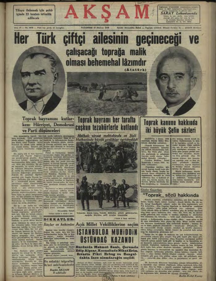
Even the first attempts by the Republic to grant land freedom to the people used a mix of three words: toprak, arsa, and arazi The first legislation for land reforms was called Toprak Kanunu, literally translated as Soil Law in English, which was celebrated with Toprak Bayramı, meaning Soil Festival. The aim was to grant ownership to villagers; therefore, the land referred to in this law was agricultural, arazi, with the goal of “letting every farmer be able to feed their family and profit from it,” as Mustafa Kemal Atatürk pointed out in his parliamentary speech on the matter. [Figure 2] However, investments in agriculture shifted, and the state’s foresight failed.
[1]
“The

Even though Turkey was not involved a part of the economic struggles during World War II, it restricted the state’s ability to move forward with Toprak Kanunu By the war’s end, the focus had shifted from agricultural land (arazi) to urban land (arsa) as industrialisation and rural exodus took precedence.
As Istanbul expands, rural and forest areas are converted for urban use. This process is often misunderstood as “arsa üretmek,” which translates to land production in Turkish. This refers to the reorganisation of existing spaces, which inflates land values through interventions such as zoning changes and increased building heights, leading to land redevelopment.
A critical example is the ‘2B Arazi’ changes. This refers to land classified under Article 2B of the Forest Law, which allows deforesting of state-owned land and their sale to individuals. Many gecekondu areas were built on forest land; these new classifications opened the way for the semi-legalisation of these settlements. However, this also led to mass privatisation and enabled developers to purchase large plots.
‘Land production’ (arsa üretmek) is a mistranslation of Henri Lefebvre’s La Production de l’Espace, which refers to the production of space rather than land, as land is not a producible commodity. Hence, land production (arsa üretmek) is only transferring arazi (agricultural land) to arsa (urban land). Keles reminds us that this artificial scarcity led to the spread of gecekondu in the first place, where a significant proportion is built on public land owned by entities like the Treasury or municipalities. Public authorities tasked with protecting these lands have often failed to act effectively, whether due to political pressures or negligence. This lack of oversight has allowed ‘informal’ gecekondu settlements to persist and, later, the state to use its gaps to create ‘formal’ housing, reflecting deeper issues in land management that continue to fuel Istanbul’s housing challenges.3
The confusion in the land at the etymological level demonstrates the linguistic and cultural base of shifting land legislation. These shifts not only fuelled uncertainty about land but also about the definitions of formal and informal housing. Just as the ‘production of space’ led to deforestation for urban land, housing developments were made fast-paced by borrowed models that were not formal nor informal in the universal sense and did not reflect Turkish living styles.
[2] Aksam Newspaper, 18.06.1946
source:Internet Archives
Headline:
“It is absolutely necessary for every Turkish farming family to own the land on which they will make a living and work”
Mid-section:
“Land Festival was celebrated everywhere with enthusiastic demonstrations”
The land legislation in Turkey owes its existence to the precedent Ottoman land laws. Private land ownership rights were not secured during the classical period of the Ottoman Empire. While far mers could cultivate the state’s land for agricultural purposes if they paid taxes, they could not claim this land as their private property. All land belonged to the state unless it was officially affiliated with a wakf or a family, and even in those cases, there were many historical instances where the state took over the property.4 Citizens were given the right to seize vacant land in 1858 with the condition that the appropriators gave it a function so that farmers farmed, soldiers fought, and the empire grew.5 By the late 1800s, the Ottoman Empire started to give outright property ownership to ensure the loyalty of their beneficiaries.
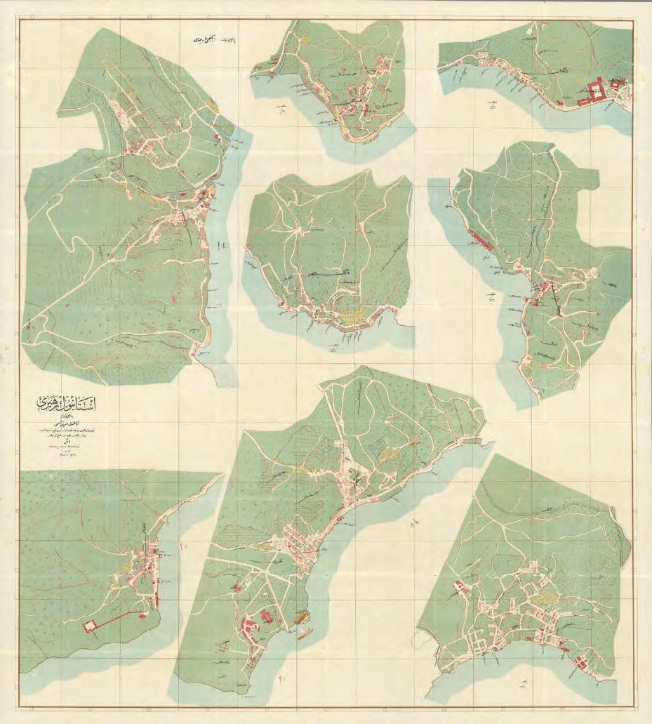
The latest Ottoman maps of Istanbul, called the Necip Bey Maps, encompassed the Istanbul Centre and its peripheries. This series of maps, one general map and smaller district and surrounding village maps, primarily focused on urban density, railways, green space, and water basins. The general map points to the Southern tip, known as the Golden Horn and its surroundings, as the densest area, shown in pink, and North as the forests. This map also points us to the border of Istanbul at the time, not reaching the Northernmost point of the Bosphorus [Figure3] Ottoman cadastral maps were redrawn in the Early Republic years. The Ottoman capital was mainly populated on the southern borders, making it economical for the new Republic to establish the cadastral maps for the most populated areas. The northernmost regions were Ortakoy on the European side and Kuzguncuk on the Asian side. So, the northern area, once on the edge and outside of Istanbul, was not registered as a part of Istanbul’s borders on these maps. This is a crucial point because the selfbuilt housing phenomena, or gecekondu, manifested more expansively on the Northern edges of Istanbul.
4 Sibel Bozdogan. 2002. “Moderism and Nation Building Turkish Architectural Culture in the Early Republic.” (Seattle University Of Washington Press) 236
5 Neuwirth, Robert. 2006. Shadow Cities : A Billion Squatters, a New Urban World. (New York: Routledge), 163
[3] Ottoman Necip Bey Map of Istabul and its provinces, 1918. Five years before the Republic’s Declaration in 1923. The map shows urban parts in pink, which is less evident on the north parts of the city. Mode than half of Beykoz (Northeast) is not in the borders of Istanbul.
source:Internet Archives

The Republic’s reforms and the political agenda of creating a new and modern Turkish nation introduced Roman land laws, which endorsed private ownership. From 1925 to 1977, numerous land reform attempts were made to redistribute state-owned land to foundations, emigrants, and landless peasants. While some land was distributed, lack of resources and political turmoil did not allow for a comprehensive reform, which led to persistent land inequality.
[4]
Two of the first Republican Cadastral Plans, that were the edge of urban Istanbul at the time, 1927 Kuzguncuk on the Asian side and Ortakoy on the European Side.
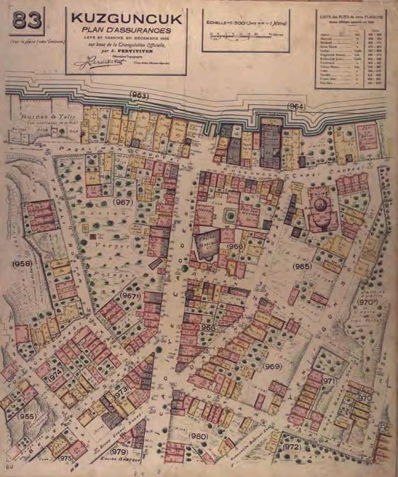

[4]
The declaration of the Republic in 1923 initiated a Turkification and modernisation process nationwide while moving away from the late Ottoman capital, Istanbul. All resources were dedicated to planning the new republican capital, Ankara. Seven years later, in 1930, the Municipality and General Public Health Law was initiated to re-plan Istanbul by taking Western cities as examples. The first attempt at this framework began with the appointment of Henri Prost, in 1937. Prost’s approach was a circular centre around the old town, the Golden Horn, and a concentrated city. However, the following Italian urban planner, Luigi Piccinato’s approach, created a centre that points the city from Europe to Asia; his work was practical, especially in later periods.6 Both planners concentrated the city on its southern edge, recognising the northern periphery as villages. Prost’s housing approach for Istanbul was housing models and typologies per socio-economic class, although the state did not specify social class in the early Republic. Prost recognised that transferring housing models directly from France would need the institutional infrastructure that Turkey lacked. He developed a “rental housing model” specifically for Istanbul. However, the government at the time passed “social housing policies” in the Republic’s early years, even though it was never realised in practice for the average populace. 7 Prost envisioned different typologies per social class: Garden-City model for low to mid-income, Building-Block Property Model for mid to high-income, and CIAM Modern Building Blocks for high-income.8
After specific critiques within Istanbul and state actors about Prost’s work, Luigi Piccinato was invited to Istanbul in 1958; however, due to political tensions, his planning was not realised then. Unlike Prost, according to Piccinato, one should look at a city from the outside, from
6 Erhan Erken. 2022. “Planning studies in the republic period in Istanbul: A comparative analysis of the effects of Henri Prost and Luigi Piccinato’s Plans on the Future Period.” (İstanbul Ticaret Üniversitesi Sosyal Bilimler Dergisi) 1628
7 Coskun, French Planner Henri Prost’s Istanbul Master Plans, 130 8 Coskun, Ibid, 130
[5] Istanbul Urban Plan by Henri Prost, primarily focusing on the south of Golden Horn. Internet Archives
[6] Luigi Piccinato’s Urban Plan, focusing on settlements relationship to industrilisation points. This map was a settlement proposal that will be developed by 1990, next page.
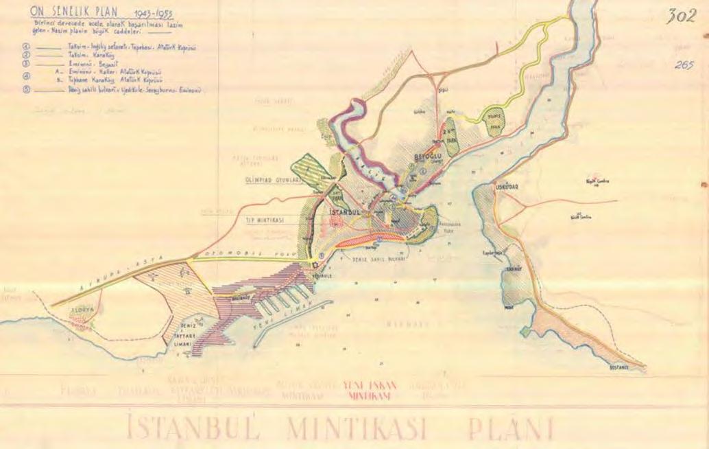
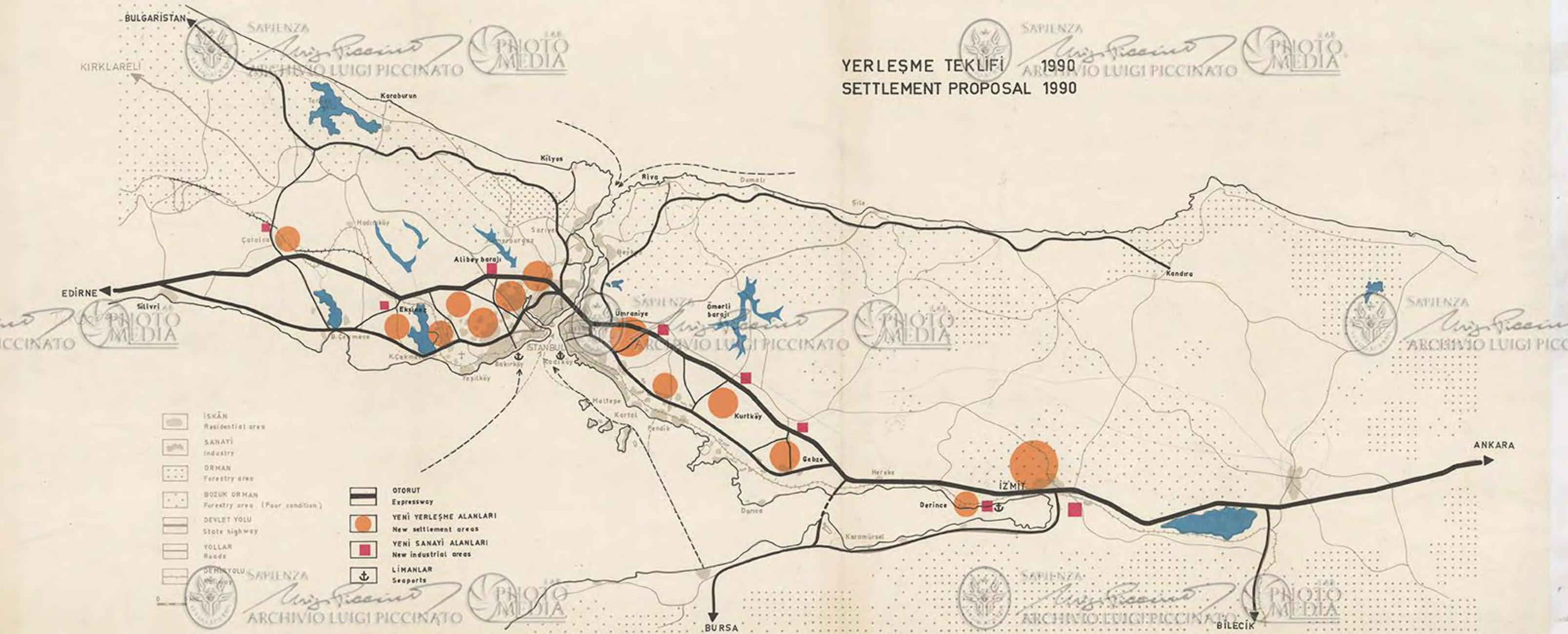
its surrounding region towards the city itself. Looking at a city should not merely involve providing it with new development areas, increasing its population, organising its living conditions, and managing its traffic. Beyond this, efforts should be made to create an organism that links the city’s development to an economic function by placing the means of production in more suitable locations.9
The Emlak Credit Bank Housing in Atakoy was the first initiative to build Istanbul as a modern city through mass housing. Emlak Credit Bank was established in 1946 to create housing credit for mostly middleclass citizens.10 Atakoy Housing was Credit Bank’s most significant project, which later became privately owned housing.11 It was designed by a group of architects led by architect Ertugrul Mentese The g roup took advisory and urban planning strategies from Luigi Piccinato, comprised multiple housing typologies, and created a new settlement.12 This project, which took decades, manifests different socio-economic changes in Turkey. It was planned to mimic a Turkish mahalla structure and consist of shops and even a school. Ataköy’s 1st Mahalle, covering an area of 20 hectares, is one of the examples of moder n architecture in Turkey and was completed in 1962. The project was built in two parts, consisting of 4 typologies of housing buildings with shops and parks. The 2nd Mahalle, finished in 1964, was an extension of the 1st Mahalle However, at the end of the 2nd section, the Credit Bank was less involved in the process.
The 1980s witnessed an unprecedented population influx in Istanbul, leading to significant demographic and urban changes. Household sizes decreased from 5.6 to 4.7, indicating a shift away from the larger family structure.13
9 Erken.“Planning studies in the republic period in Istanbul: A comparative analysis of the effects of Henri Prost and Luigi Piccinato’s Plans on the Future Period.” 1640
10 Usta, Ulusoy, 1980 Sonrasi Donemde Turkiye’de Konut Politikalari, 267
11 Atakoy Houses, Emlak Kredi Bankasi Booklet, Salt Research Archives, 2
12 Atakoy translates to “Leading Village”, Ata is a common name at the time for public spaces to commemorate Ataturk.
13 Erken.“Planning studies in the republic period in Istanbul: A comparative analysis of the effects of Henri Prost and Luigi Piccinato’s Plans on the Future Period.” 1641
[7] Emlak and Credit Bank’s Atakoy Settlement Phase 1 and 2 Booklet and the overall urban plan
[8] Atakoy Housing Phase 2 Typologies
Architect: Ertugrul Mentese
Source: Salt Archives, next page

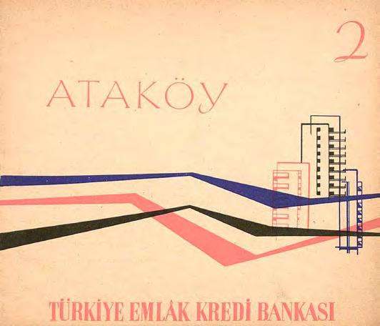
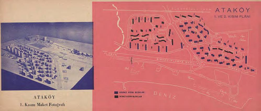
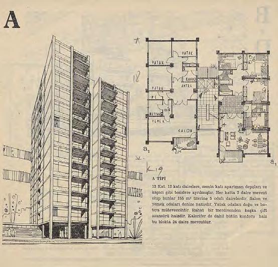
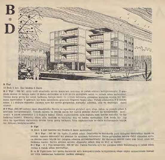
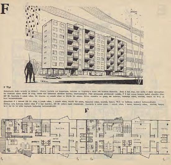
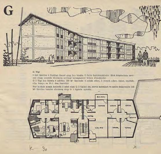

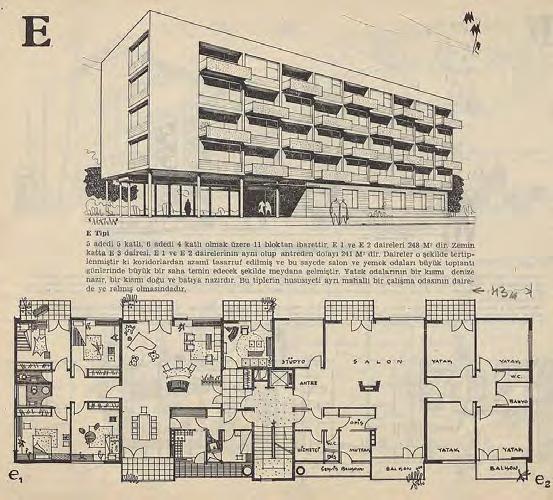
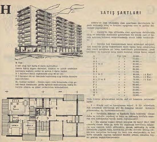
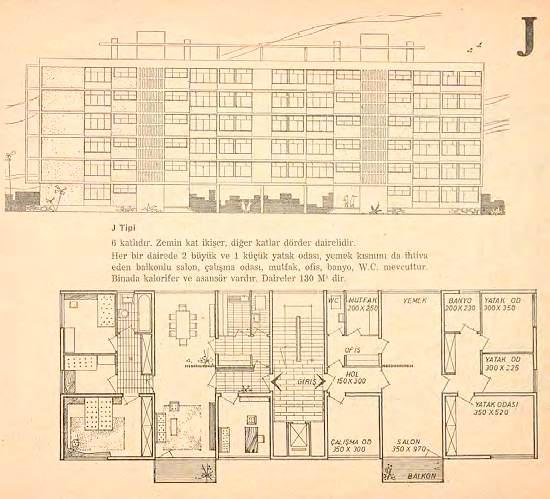
The period from 1961 to 1981, known as the “Planned Period,” marked a pivotal phase in Turkey’s urban development. During this time, the State Urbanization Committee developed a series of Five-Year Development Plans, which served as the framework for urban planning in major cities, including Istanbul. This led to the 3rd and 4th sections being built in Atakoy Housing. The rest of the sections were constructed during Prime Minister Turgut Ozal’s neo-liberal period when a new working middle class and housing needs emerged. However, in its totality, Atakoy Housing was the first mass housing that aimed to create a city within the city, which would end up being an extension of Istanbul. This was the first seed for a site strategy that would start in the 1980s and peak in the 1990s. Until 1990, when TOKİ (Housing Development Administration of Turkey) was established, housing issues fell under the jurisdiction of municipalities and were addressed within the broader scope of these development plans. TOKİ, or Toplu Konut İdaresi Başkanlığı in Turkish, is a governmental agency tasked with addressing the housing needs of low- and middle-income families, overseeing urban renewal projects, and managing disaster recovery housing. It has played a central role in Turkey’s approach to affordable housing and urban planning. Since the pivotal year of 2003, TOKİ’s authority has been significantly expanded, transitioning urban planning decisions to a more centralised system. As a result, the role of the State Urbanization Committee, which had been issuing the five-year plans, gradually diminished, leading to its official closure in 2003. One of TOKİ’s newly assigned roles includes strategically acquiring land, further enhancing its capacity to shape urban development across the country. Under Erdogan’s leadership, urban planning in Istanbul has been heavily shaped by “Urban Transformation”, a policy that addresses earthquake risks and modernises the city’s housing stock.14 However, these policies have disproportionately prioritised profit-driven redevelopment over equitable housing solutions, often to the detriment of the city’s lowerincome residents, creating concerns over gentrification.15 Central to this
14 Kentsel Donusum, meaning Urban Transformation, has been the ruling government’s policy since 2012. Contrary to gecekondu favoured policies that Erdogan previously adopted.
15 Fidan Yolcu. 2021. “Türkiye’de Kentsel Dönüşümün Yasalar ve Aktörler Üzerinden Dönemsel Olarak Degerlendirilmesi.” (Journal of Planning, January), 239
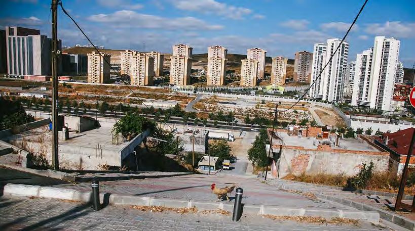

approach has been the expanded role of TOKİ and its sweeping powers to expropriate land, oversee large-scale redevelopment projects, and dictate urban planning with minimal local input. While the intention was to improve housing conditions and reduce seismic vulnerabilities, TOKİ’s projects have often targeted vulnerable gecekondu neighbourhoods, displacing residents in favour of luxury housing developments and commercial complexes. The 2012 enactment of Law No 6306 on the Transformation of Areas Under Disaster Risk significantly accelerated this process. In practice, this law has been used to justify demolitions in some of Istanbul’s most vulnerable neighbourhoods, uprooting decades-old communities. Many residents have been relocated to peripheral areas with inadequate infrastructure, severing social ties and livelihood access.
This centralised planning replaced local decision-making and paved the way for uniform, state-controlled developments. The state dictated who could build and where, adopting rigid and borrowed planning strategies. However, this housing hegemony could not put an end to the gecekondu crisis in Turkey, as laws and policies regarding land and housing changed with each election for political gain, causing citizens to lose confidence in the legal framework surrounding construction.
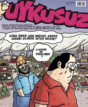
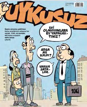
[10]
A catalog of charicatures criticising the current TOKI Laws and urban transformation policies. These charicatures are from 2002-2025.
sources: Uykusuz Magazine and Penguen Magazine,





The republican reforms and ideology significantly changed the conception of marriage and residential spaces in Istanbul. Traditional gender-based quarters, like the haremlik and selamlik, were disappearing. Under the new republican state ideology, family, home, and housing were expressed in Westernised styles, and creating a modern domestic culture became a key aspect of the state’s agenda. The utopian investment in modernity is one of the defining characteristics of the early Republic, a notdefined condition to achieve, in other words, ‘an aspiration for form rather than a recognisable style; an as-yet unrealised potential.’16 However, there was a significant gap between this imported modernism and the insufficient state of the housing infrastructure.17 The state prioritised nationalist public buildings and industrialisation over housing. Until the late 1950s, Turkish housing needs were met through private markets or initiatives, particularly for groups like government employees.
This thesis delves deeper into two significant moments in the Republic that created two socio-cultural classes in the urban setting: the early 1950s rural exodus, which led to the emergence of a blue-collar, newly urban gecekondu population, and the late 1980s rise of a working middleclass, white-collar group, born and raised in the city, residing in sites. These two distinct periods introduced these social classes into Istanbul’s urban landscape, and their housing needs have shaped the city as we know it today. The late 1940s to early 1950s, as a decade, has been seen as a bridge between the early republican party and the multi-party system with a series of radical policy changes in politics and the economy by Prime Minister Adnan Menderes. The industrialisation in the rural parts and the new factories in the urban led to a rural exodus in the late 1940s. This new proletariat class needed housing; however, neither the state nor the factories they worked for established any housing. Instead, the blue-collar workers started to build their shelters close to factories, on state-owned land, and
“Modernism and Nation Building Turkish Architectural Culture in the Early Republic.” 196-197
away from the city centre, and the state was overlooking this occupation. The first comprehensive Building Code was established in Turkey in 1956.18 Since then, many regulations have been made to make urban planning laws more functional and to meet rising needs. It established the framework for developing, organising, and using land within urban and rural areas to ensure orderly growth, proper infrastructure, and sustainable development. However, there were many gaps in the judicial system to enforce this code.19 Three decades of periodic coup d’etat and economic and housing crises later, in 1985, the previous 1956 Building Code was disputed, and a new 1985 Building Code was established, giving mayorships and municipalities authority in urban planning 20 This law has established a framework for public spaces such as police stations, parks, religious buildings, etc. The word “housing” (konut) was used three times, and there were also three mentions of the Gecekondu Law. Even though 1948’s first amnesty regarding informal settlements, the 1966 Gecekondu Law mentioned in the 1956 Building Code contradicted it and legitimised the demolishment of gecekondu settlements.21 Moreover, twenty-two amnesties regarding informal settlements passed in the parliament over sixty years. Further laws in 1983 and 1984 were looking for a way to categorise and control gecekondu settlements; “to be preserved”, “to be preserved with improvements”, and “not eligible for the provisions of this law”. 22 These categorisations further segregated the settlers in terms of their living conditions.23
Therefore, the new and modern family was only available to a specific class of citizens. This resulted in a segregation between the state’s relationship with economically higher, middle, and lower-class citizens. However, while the state overlooked the production of gecekondu, it also created laws that would
18 Law 6785: Imar Kanunu (Construction Law, 1957
19 Cay and Kandemir, Turkiye’de Imar Ugulama Mevzuatindaki Gelisim Sureci, 27
20 Law 3194: Imar Kanunu (Construction Law, 1985
21 There were no mentions of gecekondu
22 Laws No. 2085 and No. 2981: Policy for construction of gecekondu
23 Cay, Tayfun, and Esra Sonel Kandemir. 2022. “Turkiye’de Imar Uygulama Mevzuatindaki Gelisim Sureci”(Geomatik Dergisi), 28
demolish them afterwards, and state actors blamed this separation on the gecekondu settlement for urban sprawl. The overflowing new urban-rural population affected elections, making political nuance more critical over the decades.
The 1980s neo-liberal politics by 45th Prime Minister Turgut Ozal privatised the service industry, including marketing, media and, most importantly, banking. The Istanbul Stock Exchange opened in 1985, and a population flux started from the educated and modern Ankara. A new small bourgeoisie, working middle class who were the educated and modern children of the early republican parents, worked in white-collar job titles. This new social class needed housing in Istanbul; the 1985 Housing Law initiated the new era of mass housing, which would be called the site New site housing was primarily built on non-cadastral land while having to build code-compliant designs, and the state overlooked the growth without registration, which inflated the housing market to attract foreign investments. Together with the state, these new real estate tycoons have promoted site developments as a ‘modern’ solution to Istanbul’s housing problem. The growth of Istanbul and new housing possibilities for the new working middle class expanded towards northern Istanbul with the completion of the 2nd Bridge in 1988.
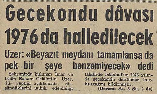
[11]
Headline:“Gecekondu issue will be resolved by 1976
Body: “Minister of Public Works and Settlements Uzer asserts that gecekondu issue will be resolved”
source: Yeni Sabah Newspaper 1964
[12]
Headline: “Committees are established in Umraniye”
Body: “With the the help of Health, Propaganda, Infrastructure sub-committees new gecekondu construction started again. During the clashes that broke out during the demolition work, five people were killed, and Ümraniye’s 1 Mayıs Mahallesi, which consists of thousands of gecekondu dwellings, began to be self-managed by its residents. With task distribution carried out by the newly formed people’s committee, efforts were made to meet the neighborhood’s needs, while 600 of the demolished gecekondus were rebuilt.
source:Hurriyet Newspaper, 1977
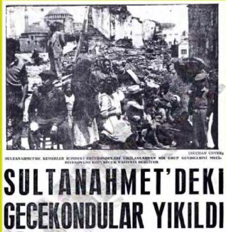
[13]
“Gcekondus of Sultanahmet have been Demolished”
source: Milliyet Newspaper, 1955
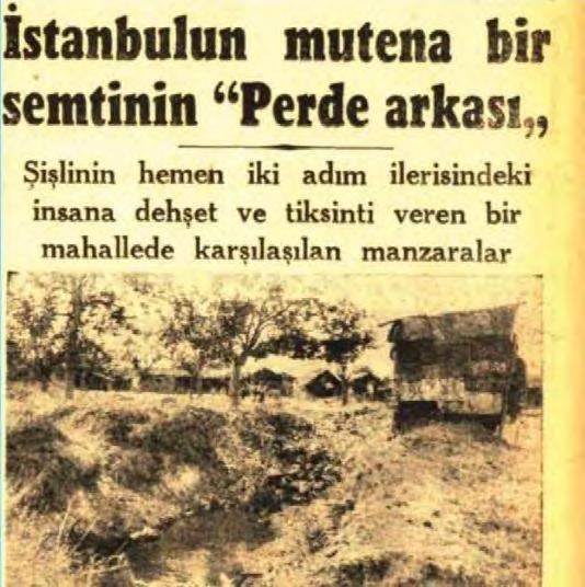
[14]
Headline: “Behind the Scenes of an Exclusive Neighborhood in Istanbul”
Body: “Scenes encountered in a neighborhood just two steps beyond Sisli that inspire horror and disgust”
source: Cumhuriyet, 1948

It is essential to underline that the exclusion of certain groups of citizens from the ‘right to shelter’ created an illegal status. James Holston asserts in his seminal work “Insurgent Citizenship” that all nation-states struggle to manage differences among their citizens, legitimising these social differences perpetuates discrimination against certain groups. This legitimisation of discrimination under mines the fundamental principle of equal citizenship, leading to systemic marginalisation.24
The making of illegal living conditions of gecekondu groups manifested in pop culture. A new genre of music, called arabesk, pointed to the struggles of marginalised residents. Arabesk music emerged as a response from low-income groups to the government’s Westernization policies. It reflects the experiences of rural-to-urban migrants facing economic challenges like unemployment and housing shortages and the cultural difficulties of adapting to urban life 25 The verses generally opposed the authorities and discrimination.26
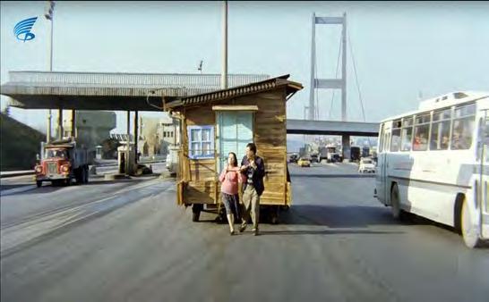
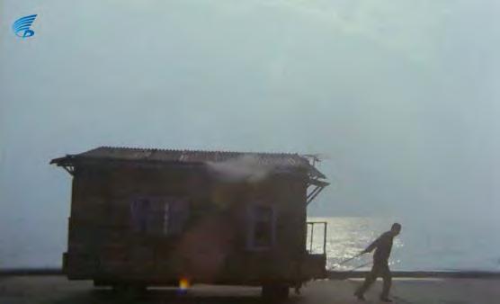
In the 1989 Kemal Sunal movie, “Gulen Adam,” the struggle of gecekondu residents is represented very dramatically through the last scene where the protagonist, gecekondu resident Yusuf, builds a house with wheels as a response to the changing laws and many evictions.
Although Turkey did not inherit a colonial anthropological heritage, it was subject to hegemony in its context. The primary approach in Turkey was the distinction between ‘local and other,’ which was reflected in the divide between urbanites and peasants. Republican reforms focused on Turkification while simultaneously aiming to modernise citizens. Here, modernisation was understood as becoming contemporary or as a form
24 Holston, James. 2009. “Insurgent Citizenship” (Woodstock: Princeton University Press), 7
25 BirkalanGedik, Hande. 2011. “Anthropological Writings on Urban Turkey: A Historical Overview.” (Urban Anthropology and Studies of Cultural Systems and World Economic Development), 23
26 A perfect example is “Itirazim Var” by Muslum Gurses, a wellknown Arabesk singer. This translates to “I have an objection”. The verses include; “ I object to this cruel fate (Itirazım var bu zalim kadere) I object to this endless sorrow (Itirazım var bu sonsuz kedere) -- Injustice is the colorless thing that runs through my veins (Haksızlık damarlarımda gezenlerdir en renksiz).”
[15]
Scene from Gulen Adam, (Laughing Man)
Director: Kemal Sunal
An immigrant named Yusuf marries a urbanite police officer’s daughter despite her family’s opposition. They rent a gecekondu while worrying about having no legal rights to their home yet cannot afford anything else. Adjacent to their new home is a site development under construction.Yusuf’s father-inlaw, representing the state, demolishes their house due to city planning regulations. Eventually, many neighbourhoods, including the police’s houses and the neighbouring site development,are demolished. This demonstrates the paradoxical relationship between the state, citizens, housing, and law, highlighting the housing crisis and the inefficiencies in the system that make it difficult for citizens to secure adequate living conditions.Yusuf and her wife build a portable home.This is a critique on the legaslation on shelter.

of progress. Inherently, Western-adjacent urbanites identified themselves as the progressed Turk, local to the city, while viewing peasants moving to the city for blue-collar jobs—the proletariat—as the other. Consequently, the urbanite looked towards the West as a model for progress, while the peasant remained rooted in traditional, rural, and often Eastern cultural values. The tension between the urbanite Western bourgeoisie and peasant Eastern proletariat which within Turkey’s anthropology linked to each other has been a primary lens in many movies and TV series. While this is a universal tension—traditional poor versus modern wealthy—it is important to note that the antagonistic and elitist Westernised character typically lives in site housing in many Turkish visual arts. In contrast, the traditional poor protagonist resides in a gecekondu Therefore, the tension between the proletariat and the petite bourgeoisie is represented through housing.
The first example of the East and West dichotomy can be seen in Turkey’s first sitcom, Kaynanalar (In-Laws), where the conflict between the Westernised Hakmer family and the Eastern Kantar family is reflected in their clothing and spatial segregation. Although it is not explicitly stated, the Kantar family does not come from a gecekondu background but rather represents a traditional Turkish family, which is often associated with, or seen as sympathetic to, those living in gecekondu areas. In contrast, the Hakmer family resides in a modern apartment building [Fig 18].
In parallel, the 2003 series Çocuklar Duymasın (Don’t Let the Children Hear) portrayed the contrast between proletariat and petite bourgeoise, highlighting class divisions. The protagonists, white-collar workers Haluk and Meltem, live in a site housing complex. On the other hand, the other family—Hüseyin, an office boy at Haluk’s company, and Emine, the childcare provider for Haluk and Meltem—live in a gecekondu While this is not stated in the show explicitly, the scenes from their home and their traditional mannerisms, point to this dynamic [Fig 19]. A more recent example is the 2013 TV series Medcezir (Tide), where this tension is depicted through the love story between a wealthy young woman from a site housing development and a poor young man from a gecekondu neighbourhood.
[16]
Meydan Newspaper October 4, 1994
Headline reads “There is no compulsion in religion”, Istanbul Mayor Erdogan was captured in prayer, an unusual sight for a government official to be photographed in such a moment, at the time.
More notably, the title reads ‘From the Streets of Kasımpasa to the Mayor’s Seat,’ highlighting Erdogan’s roots in Kasımpasa, a neighborhood largely shaped by gecekondu settlements.
[17]
Prime Minister Erdogan is visiting gecekondu homes in 2009 for ifthar (fast breaking meal on Ramadan),and listening to their issues .


In the late 1990s, the propagation of the Democratic Islam Movement flipped the power between gecekondu communities and the modern Republic ideology, mobilising people around Islamic idiom. More so, the mobilisation powers lay within the importance of kinship and interpersonal relationships, creating a new sense of belongingness. The opposition to the existing government was not only opposing the modern agendas but attaching the ordinary populace’s economic needs, such as housing, to it. Justice and Development Party (AKP) used the interpersonal relationships on which gecekondu settlements were based. AKP was aware of the neglected communities and created personal relationships while conducting various ‘good deeds’, such as organising weddings, marriage counselling and participating in religious charities. This was spatially possible due to the gecekondu settlement’s inherent organisation of huddling in bunches. The governing AKP and its leader, who was from a gecekondu neighbourhood, Erdogan, fundamentally changed the state’s relationship with housing. As gecekondu areas expanded and their populations grew to constitute a majority in Istanbul, they significantly influenced local elections and integrated into urban policies. Furthermore, the aim to promote Istanbul as an ‘international arena of services and tourism’ involved setting up certain new norms and standards in dealing with land.27 The Mortgage Law, negotiated from 2004 to 2007 for three years, stimulated construction firms by leading them to the middle class, creating access to newly built housing units.28 There was no tolerance for newly built informal settlements, and the previous settlements had to be registered and legalised. Then Prime Minister and now President Erdoğan’s propaganda for gecekondu settlers was termed “İmar Barışı,” which translates to “Construction Peace,” rather than the commonly used term “İmar Affı,” meaning “Construction Amnesty.” While both terms refer to state recognition through pardoning, the choice of “peace” here is significant. The term “amnesty” implies a unilateral pardon, whereas Erdoğan’s use of “peace” suggested a mutual agreement, creating a sense of a two-part deal. This political manoeuvre secured more votes for Erdoğan and granted gecekondu settlers’ formal recognition by the state.
27 Jean-François Pérouse. 2011.Istanbul’la Yüzlesme Denemeleri(Iletisim) 292
28 Law No. 5582: Konut Finansmani Kanunu (Financing Housing, Mortgage Law)
[18]
Scene from Kaynanalar, a family scene where proletariat wife Nuriye is on the background waiting to do service.
[19]
Scene from Cocuklar Duymasin, Protelariat wife Emine is on the background while the family is seated, she works for them full time. A typical scene in comparison to Kaynanalar
[20]
Scene from Ethos, religious Meryem talking to her secular therapist Peri. The confrontation and the color contrast representing two different social classes in Turkey



The unspoken reality of this political shift is that the second generation in gecekondu areas achieved social mobility through education and the changing socio-cultural landscape in Turkey. As a result, the tension between these two social classes began to dissipate. The Netflix miniseries Ethos, written and directed by critically acclaimed filmmaker Berkun Oya, portrays contemporary Istanbul and explores social, ideological, and economic differences. The relationship between the main character, Meryem, who comes from a conservative gecekondu background, and her Westernised, secular therapist, Peri, represents the decline of secular hegemony. While Peri’s generation grew up in a secular, Western-facing Turkey where she never interacted with a gecekondu resident, this is no longer the dominant reality in Istanbul. Conversely, Meryem is no longer merely surviving but is actively part of Turkey’s new dominant class [Fig 20]. The series serves as a psychological representation of this political and social shift, reversing the 1974 Kaynanalar depiction of the struggle for legitimacy Now, it is the secular elite who find themselves on the defensive. This manifested not only in the social mobility of second-generation gecekondu youth but also in their progression within the urban fabric. A Republican idiom, to be able to move up the ladder through education, materialized through socio-economic, political, and spatial mobility. An important component of this mobility was the increasing access of gecekondu women to higher education.
The modern Republican laws restricting the use of hijabs in government institutions were further reinforced with each coup d’état in Turkey. The 28 February 1997 coup d’état intensified these restrictions as the secular and secular-nationalist army took over the government. As a result, the Head of the Higher Education Board (YÖK) banned hijabs in universities, and even students who were already enrolled were denied access to campuses. This particularly affected religious gecekondu communities, where women often wore hijabs. From that moment on, nationwide protests erupted against the law. Ultimately, the election of Recep Tayyip Erdoğan as Prime Minister of Turkey’s 59th government in 2003, following crucial negotiations with religious communities, paved the way for change. After years of political debate, the ban was abolished in 2008, marking a significant shift in the social and economic mobility of young women from gecekondu backgrounds.
[21]
Poster:
Ekumenopolis: The Endless City “you have crossed the ecological thresholds in istanbul. you have exceeded the population thresholds. you have surpassed the economic thresholds.
so, where will this end?
director: Imre Azem
The documentary explores issues related to construction and urbanism in Istanbul, offering a critical perspective on the struggles and profits of all stakeholders. It is particularly significant as it provides a focused view of the Ayazma demolition, highlighting the real struggles of individuals affected by policy enactments.

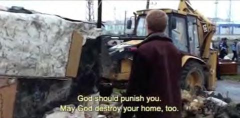
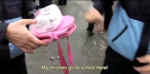
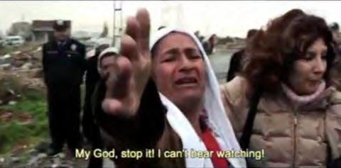
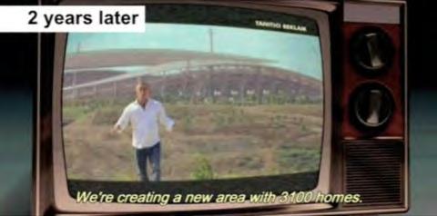
These struggles should not be romanticized, yet should be recognized as essential in shaping Turkey’s contemporary urban and social fabric. These transformations were not just policy shifts but active negotiations of space, identity, and belonging On the other hand, Critics contend that Erdoğan’s housing policies embody a neoliberal agenda, prioritising partnerships with private developers and fostering speculative real estate markets over equitable housing solutions.29 Under the guise of Urban Transformation, redevelopment projects frequently serve middle- and upper-income groups, marginalising low-income families who face limited access to affordable housing. A stark example is the demolition of the Ayazma and Küçükçekmece gecekondu neighbourhoods, where residents—many of whom had title deeds—were forcibly relocated to TOKİ housing in Bezirganbahçe, a peripheral area far from central Istanbul [Fig 22]. In the documentary “Ecomunopolis: A City Without Limits” by Turkish filmmaker Imre Azem, Ayazma’s displaced residents recount how inadequate infrastructure and poor living conditions in Bezirganbahçe left them worse off than in their former gecekondu homes [Fig 21]. Compounding the injustice, some residents who owned their land were evicted with minimal compensation, referred to as “debris prices,” whilst their land was sold to the private developer Ağaoğlu Construction Company, which constructed luxury residential blocks on the site This case exemplifies how Urban Transformation often sacrifices the rights and well-being of vulnerable communities for profit-driven redevelopment, exacerbating social and spatial inequalities in Istanbul.




‘Modern nationality is a spatial concept, much like how the nationstate is territorial.’30 Western modernism represented an industrial and societal transformation into an urban and capitalist order; in contrast, nonWestern countries, such as Turkey, often employed modernism to reconcile their pursuit of national identity Moder nism’s influence on shaping national identity in non-Western capitals is complex. The architectural and urban planning aspects, often marked by simplification, rationalisation, and the utilisation of new materials and technologies, reflect an adaptation of Western models. However, these were not simply replicated but transformed to convey local identities and aspirations. This intersection produced what can be described as a form of “architectural nationalism,” where the built environment plays a crucial role in the nation-building narrative.31 The Republic’s early years witnessed the idea of “home” in the larger context of moder n and urban life transition into a republican concept. According to a popular magazine of 1938, “Like many other good things in life, the Turkish citizen is getting to know the idea of the house only now, in the republican period.”
In the early decades of the Republic—and even today—the terms ‘modern’ and ‘contemporary’ have often been used interchangeably, suggesting that progressiveness equates to living in modern houses and apartments [Fig 27]. Traditional typologies that accommodated extended families, such as the konak and köşk, were contrasted with contemporary designs. Architect Behçet Ünal, in an article in Arkitekt magazine, stated, ‘Our spacious sofas (entrance halls) are no longer appropriate.’32 This reflected the nation’s deliberate shift from traditional aesthetics to modern ones as part of its effort to break away from its Ottoman heritage However, in opposing European colonialism, modern Turkish architects began incorporating distinct aesthetic features to define a unique architectural identity, notably the ‘cubic architecture.’
30 Zeynep Kezer. 2016. Building Modern Turkey State, Space, and Ideology in the Early Republic. (University Of Pittsburgh Press) ,197
31 Ibid, 200
32 Ev Nedir ve Bir Ev Nasil Kurulmali? (What is a home, and how should it be organised?) Modern Turkiye Mecmuasi 1, no.1 (1938): 16-17.
[23]
Pages from the book “Turkish House” by Sedad Eldem Istanbul Technical University 1954
This is a valuable resource and the first of its kind in the discussion of traditional Turkish vernacular architecture. It has been later republished by the Turkish Foundation For the Promotion and Presevation of National Heritage in 1984 source: Internet Archives
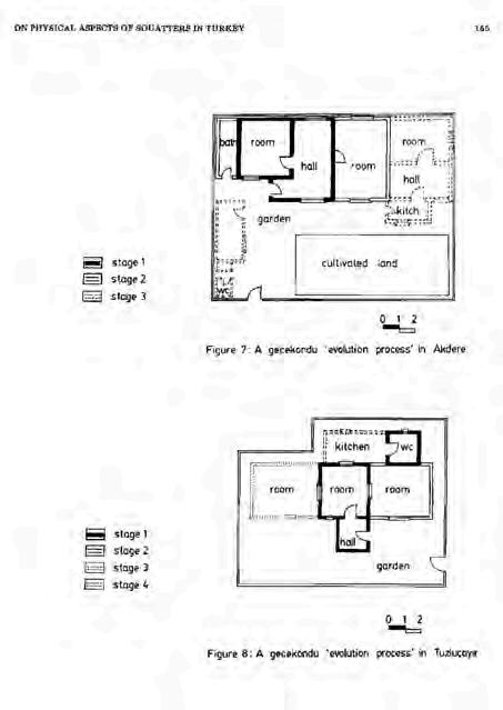
[24]
Pages from the artical “On Physical Aspects of Squatters in Turkey” in METU Series. 1986
By Tansi Senyapili
This article has been widely referenced in gecekondu research, offering an extensive survey on the architectural organization of gecekondu settlements. It draws parallels between their spatial arrangement and the room-by-room progression of the sofa layout in traditional Anatolian Turkish houses, using Sedad Eldem’s Turkish House as a key source. source: METU Archives
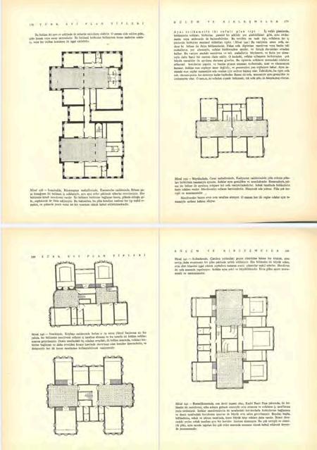

[23] [24]

In Anatolia, central to traditional Turkish houses is the ‘sofa’ or ‘avlu’, a patio that serves as the home’s focal point. Depending on preference, these patios, which may be roofed or open-air, evolved into well-defined, organised spaces. The traditional Turkish house is distinctly characterised by this central patio, which forms the core around which the rest of the house is built. The design promotes a sense of community and connectivity among the household members. The sofa often serves multiple purposes, including social gatherings, family activities, and dayto-day living, reflecting the cultural importance of communal spaces in Turkish architecture. Houses were built by their owners on land owned by the Sultan, though generations could inherit it. These homes’ spatial arrangements or land arrangements have not changed after the declaration of the Republic.
Sedad Hakkı Eldem, one of Turkey’s most influential architects, conducted extensive typological analyses of the “Turkish house.” Eldem advocated for a modern Turkish architecture that embraced its historical and cultural heritage. Unlike the Early Republican regime, which adopted modernism while eschewing overtly “international” symbols, Eldem sought to define the Turkish house as a continuation of Ottoman and Anatolian architectural traditions [Fig 23]. In his typological studies, he establishes the sofa as the primary building block of all Turkish typologies, from rural dwellings to konak and from yali types to large palaces like the Topkapi Palace. He dedicated his professional life to studying and adapting the archetypal “Turkish house” from the Balkans to Anatolia.33 While deeply fascinated with the Turkish house and advocating its rational spatial organisation as modern enough, he was systematic, analytical, and rational in his studies.34
By the late 1930s, the new head of the School of Architecture, Bruno Taut, shared reverence for traditional Turkish houses and their criticism of the “cubic” style with Sedad Eldem. Indeed, he assigned his student housing projects that would align with such ideas. This may be the precise reason that later site housing developments used traditional ‘konak’ typological aesthetics as their outer shell to promote the luxury and opulence of the Ottoman Empire.
33 Eldem , Sedad . 1954. “Turkish House”, (Türkiye Anıt Çevre Turizm Değerlerini Koruma Vakf)II
34 Bozdogan, “Modernism and Nation Building”, 266
[25] A comparative analysis of two distinct stages of gecekondu growth, examining different construction methods and typologies. This evolution reflects changes in legislation as well as the economic mobility gained by gecekondu residents.
However, while the later site developments used the exterior aesthetics of the konak type, the interiors were far from sofa spatial organisation. The 1950s gecekondu houses, however, were adapting the vernacular architecture of the Anatolian villages Tansı Şenyapılı’s research traces gecekondu spatial organisation back to rural behaviours, highlighting its roots in traditional building practices. Her surveys define the stages of growth for gecekondu homes, starting with a single room, often referred to as a sofa [Fig 24]. This room serves as the core of the dwelling, mirroring the multifunctional spaces common in rural Turkish houses. As gecekondu settlements grew, additional rooms and layers of functionality were added, reflecting not only spatial adaptability but also the communal and familial patterns brought by rural migrants.
The formation of laissez-faire gecekondu settlements began well before neoliberal globalisation but took a new turn in the 1980s. Introducing free-market policies and semi-legalisation through amnesties created hybrid housing forms that merged rural traditions with urban economies. This model profoundly influenced housing developments worldwide, including in Turkey. While the Domino house model was adapted through the disguise of “cubic” architecture in upper-class housing, gecekondu types adopted this strategy later in the late 1970s to the 1980s as laissez-faire. As Pierre Vittorio Aurelli notes in ‘The Dom-ino Problem’, the Dom-ino House by Le Corbusier represents a ‘marriage between advanced building technology and pre-industrial do-it-yourself construction methods.’ 35 This hybridity resonates with gecekondu settlements, where reinforced concrete construction methods blended modern materials with traditional, self-built approaches [Fig 25].
Additionally, during the late 1970s, with the introduction of real estate tax payments, living and working conditions in gecekondu areas improved, paving the way for typological developments. By the 1980s, neoliberal economic policies and semi-legalisation processes through amnesties catalysed a shift. However, this shift was not solely typological; it marked a fundamental change in how housing was perceived. No longer just informal shelters, gecekondu became commodified assets, driving a speculative real estate market. Similarly, site developments built on state-owned land
35 Aureli, Pier Vittorio. 2014. “The Dom-Ino Problem: Questioning the Architecture of Domestic Space.” (Log, no. 30) 153–68
[26]
Practical, Affordable, and Healthy Homes Magazine
Title: A Cubic House
The article speaks about the Otto Haesler designed house and defines is as a cubic house instead of modern.
source: Bozdogan, “Modernism and Nation Building”
[27]
An Home Electronics Shop Ad on Magazine
Title: Needs of the Comtemporary House
source: Bozdogan, “Modernism and Nation Building”


were on sale and rent without title deeds, which further blurred the formal and informal boundaries. This period marked the transformation of ruralinspired gecekondu structures into multi-story apartment buildings, reflecting a departure from their origins as informal shelters for rural migrants [Fig 28]. This shift was not purely architectural but economic, as the burgeoning real estate market commodified these structures. Gecekondu settlements, once emblematic of survival and solidarity, became part of a larger informal property market, creating a system of what Turkish urban planning experts called “fugitive construction” (kaçak yapılaşma) where informal ownership flourished, and became the de facto formal strategy for growth.
The unregulated construction of large apartment buildings in gecekondu neighbourhoods disrupted the spatial and social cohesion fostered by sofa spatial organisation. Once a central feature of Turkish housing typologies, and evidently to gecekondu houses, the sofa enabled collective activities and adaptability within the built environment. Its gradual disappearance from urban housing typologies marked a significant shift toward privatised and fragmented urban layouts, diminishing opportunities for interaction.
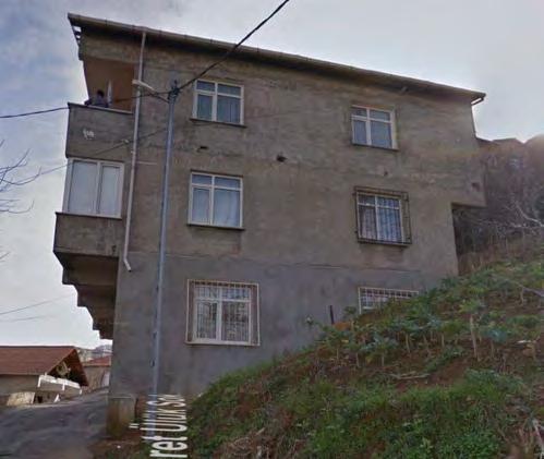
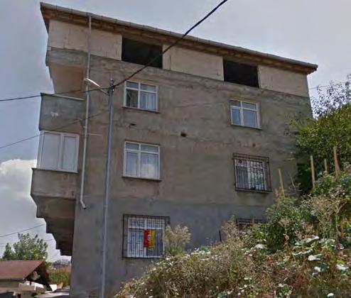
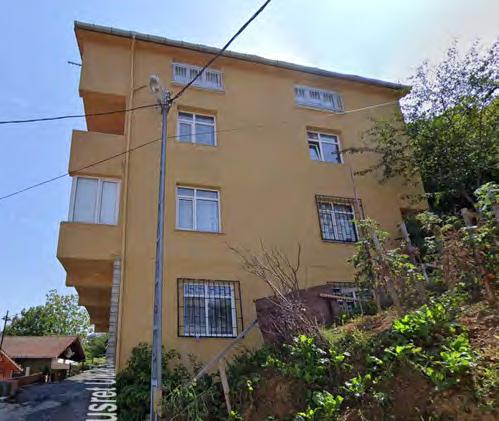
This thesis primarily focuses on Beykoz, a northern district that transitioned from rural to outskirts and finally urban later in the Republic compared to the rest of the city. This district is significant because the gecekondu and site strategies flourish and exist together more than in other districts. The closest example would be its Western side neighbour, Sariyer, across the Bosphorus.
Beykoz is one of the 32 districts constituting the province of Istanbul, the largest in Istanbul (427 km2). It is a peripheral location in the northeast of the urban area, bounded to the west by the Bosphorus and to the north by the Black Sea, covered by forest. The vast peripheral lands of Beykoz, which represent more than two-thirds of the district and are outside the management of the elected municipality, appear as the preferred zones for city builders in a state of quasi-lawlessness in urban planning 36 The 2B Arazi land type has been the primary discussion today in Beykoz’s legalisation and parcelling processes.
Anadolu Kavagi, Pasabahce, Cubuklu, Kanlica, and Anadolu Hisari were villages located one after the other on the north periphery of the Bosphorus, centred on a mosque. Beykoz became one of the first larger districts, encompassing all adjacent villages in 1928. First, with industrialisation, glass, leather, and raki spirits factories, and subsequently, the two Bosphorus bridges, Istanbul’s urban territory was enlarged towards the north, Sariyer on the European side and Beykoz on the Asian Side. The first wave of immig ration to Beykoz arrived in the 1950s from the northern Turkish region of Giresun. Labourers and their kins occupied public land and built the first gecekondu settlements in the late 1940s. They primarily worked at the Sisecam glass factory and the Raki Spirits factory. The second wave was in the 1980s; with the erection of the second Bosphorus bridge, Beykoz became a virgin land for white-collar housing. Factories, including the Sisecam glass factory, enlarged their factories and built housing for the white-collar working middle class.
The evolution of gecekondu in Beykoz is a physical manifestation of ever-changing policies and laws. It also encompasses the socio-economic lifestyles of their inhabitants, which are significantly shaped by their roles
36 Pérouse “Istanbul’la Yüzlesme Denemeleri”, 292
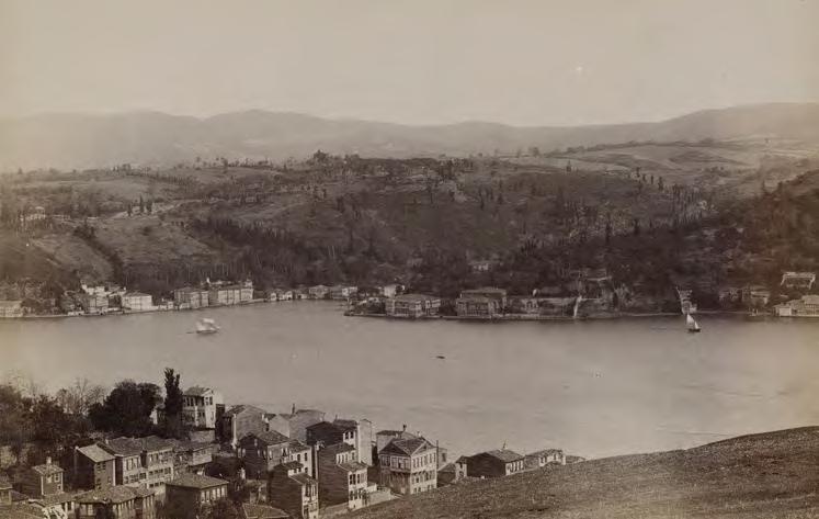
[29] View of Kanlica, Beykoz from Rumeli Hisari
Source: Old Istanbul Photography Archives
Showing the Knalica as a small Bosphorus village and the hills are empty agricultural land.
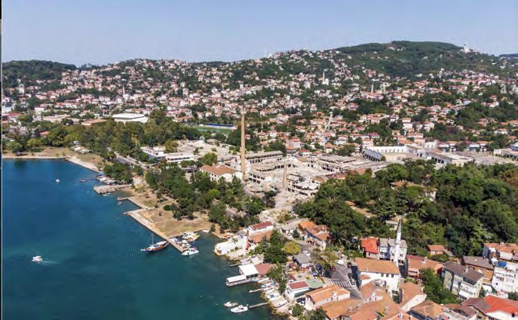
[30] View of Beykoz
Source: Alamy Images 2020 Showing the filled hills of housing, mostly gecekondu.
Research Site: Kavacik, Cubuklu
in the urban economy and their types of labour The fundamental spatial organisation of gecekondu is influenced by two key factors: the topography of the land and the concepts of akrabalık (blood relatives), hısımlık (kinship), and hemşerilik (exact village origins). Mutual help and solidarity among migrants facilitate levelling steep land and constructing one-room dwellings using available resources. In some cases, houses share a wall, with two entrances for two relatives. This collective built space reflects traditional village cultures and ethnic values, promoting proximity and solidarity against the hardships of the big city Economic challenges and demolition regulations have shaped the initial typology of these homes, with average sizes between 25 to 35 square meters and ceiling heights of 2.20 to 2.50 meters. Although the houses are tiny, the occupied land is relatively generous, with a 30 to 35 per cent building base ratio[Fig 33].
The Democrat Party’s populist politics in the late 1950s led to their promise to distribute title deeds to the land and provide infrastructure and services. A second stage of g rowth of gecekondu started at this time; as per these promises, the dwellings were more secure, and the primarily male population started to bring their families [Fig 34]. In other words, the growth of gecekondu resulted from a broader process of interdependence between the migrants and the state authorities. The promise of the title deed also meant the registration of each home to the “Real Estate Tax”, which the inhabitants feared that their registration could result in the rejection of deed allocations, as there were rapid policy changes at the time.37
Once gecekondu dwellings began paying taxes, living conditions improved, leading to the development of the typology with the addition of extra rooms, interior kitchens, and bathrooms. As gecekondu settlements expanded, their spatial organisation became more complex and harder to generalise, reflecting the diverse habits and neighbourhood configurations of mig rants from various parts of Turkey. The arrival of wives and children significantly influenced the development of collective spaces The concept of kapı önü (door front) began to take shape, and in some instances, front sofa terraces were added as transitional areas between the interior and exterior. These spaces were utilised for collective activities such as cooking, playing, and festivities, closely mirroring the spatial organisation found in rural areas.
37 Neuwirth, “Shadow Cities”, 165
[33]
Gecekondu Development, Wall Bearing Structure and Horizontal Growth 1940 Drawn by the Author
Starting in the late 1950s, urban redevelopment practices based on the “demolish-rebuild-sell” approach, encouraged further by the condominium law (kat mülkiyeti yasası), fueled speculative construction activities. By the 1960s and the 1966 Gecekondu Law, these practices destroyed many cities’ unique urban fabrics and replaced them with architecturally generic buildings.38 In the late 1970s, this policy evolved to prioritise even more significant profit potential. It resulted in the demolition of relatively new 15–20-year-old four- to five-story buildings and their replacement with high-rise apartments of 10–15 stories, facilitated by a targeted zoning plan.39 This marked a shift toward maximising land value at the expense of architectural and urban identity in Istanbul, which would become the formal way of construction in the coming decades The changing fringes of the Istanbul metropolitan area coincided with the rapid construction of site developments after the 1980s housing laws. This new way of housing, quite different from the previous mass-housing projects regarding land usage, development and financing, changed the habits of traditional neighbourhoods in Istanbul.
In the 1980s, the development of housing cooperatives significantly expanded in large cities in Turkey. These cooperatives, primarily organised by Ankara-based bureaucrats, capitalised on the centralised urban planning authority, enabling the transformation of ag ricultural and unplanned coastal lands into residential plots through localised development plans. Once urban planning authority was decentralised to municipalities in 1985, similar cooperatives emerged closer to their respective regions rather than being centrally coordinated from Ankara; this led to a lack of cadastral approvals while producing housing. This system facilitated extensive land speculation in Beykoz, a predominantly agricultural and forest land district. Cooperatives purchased low-priced rural lands in Beykoz, planned them, and transformed them into housing complex plots. These homes were promoted to white-collar workers who couldn’t afford the central Istanbul houses. This would be the start of the urbanisation of Beykoz.
In parallel, the successful political bargaining between gecekondu residents and the state led to a typological transformation, where horizontal
38 Yildiz
Ve
39 Ibid, 197
[34]
Gecekondu Development, Wall Bearing Structure and Horizontal Growth 1960
Drawn by the Author
[35]
Gecekondu Development, Dom-ino Structure and Vertical Growth
1980
Drawn by the Author
[36]
Gecekondu Development, Dom-ino Structure and Vertical Growth
2010
Drawn by the Author
growth gave way to vertical development [Fig 35]. As the economic welfare of gecekondu inhabitants improved, examples emerged in Beykoz of unfinished reinforced concrete apartments being constructed. Upper floors were incrementally added as families expanded through marriage.
The ‘gecekondu entrepreneur’ role also evolved, shifting from merely selling building materials to constructing gecekondu dwellings in compliance with building codes formalised through contractual agreements. This period, as described by Oktay Ekinci, former head of the Chamber of Turkish Architects, marked a critical shift from gecekondu to ‘fugitive construction’ and later into ‘fugitive urbanisation.’ With single-level gecekondu dwellings gradually transforming into multi-story apartment buildings and the arrival of complete domestic infrastructure—electricity, water, gas, internet, and roads—gecekondu settlements adopted their ‘final’ typologies. Today, many gecekondu apartments are capped with pitched roofs, signalling their transition from informal self-built shelters to formalised urban housing [Fig 36].
Today, three dwelling types occupy Beykoz in terms of ownership to construction relationships: gecekondu, site, and private apartment buildings. The relationship between the land and these types of d wellings denotes the similarity of land ownership for the site and gecekondu. Both occupied the non-cadastral public land, resulting in no title deed for such buildings. There are four ownership types on this map: unplanned privately owned land (historically rural land where the first settlements were), planned privately owned land (new developments where the cadastral was done before settlements moved), non-cadastral public land (larger plots of land, where for the most part occupied by gecekondu and site, and cadastral public land (parks and forests). It can be observed that certain lands are privately owned now yet still haven’t been built with authorisation in the first place, or authorised buildings are in the middle of gecekondu neighbourhoods— this points out the changing policies in construction and land laws. These overlapping land ownership patterns and dwelling types set the stage for the challenges introduced by the Urban Transformation policy, further intensifying the fragmentation and redevelopment of Beykoz. The profit-oriented approach to housing projects in Istanbul has intensified the housing crisis, with rapidly increasing rents and property prices making the city unaffordable for many residents. Additionally,
[37] South of Beykoz, Reconstructed by the Authour , 1918
Source: Necip Bey Maps and Cadastre Management Official Website Reconstructed by the Author

large-scale construction projects have exacerbated environmental concerns, including destroying green spaces and increasing urban sprawl, compounding Istanbul’s socio-spatial challenges. Moreover, site developments are used as a method to transform gecekondu neighbourhoods during Urban Transformation initiatives. This growth through fugitive urbanisation has reshaped Beykoz’s physical landscape and contributed to the socio-spatial segregation between houses in the same neighbourhoods. These patterns highlight the need for urban planning strategies that prioritise connectivity by reimagining collective areas as linking points.
[38] South of Beykoz, Land Parceling, Reconstructed by the Authour , 2025
Source: Cadastre Management Official Website
[39] South of Beykoz, Building Types, Reconstructed by the Authour , 2025
Source: Cadastre Management Official Website
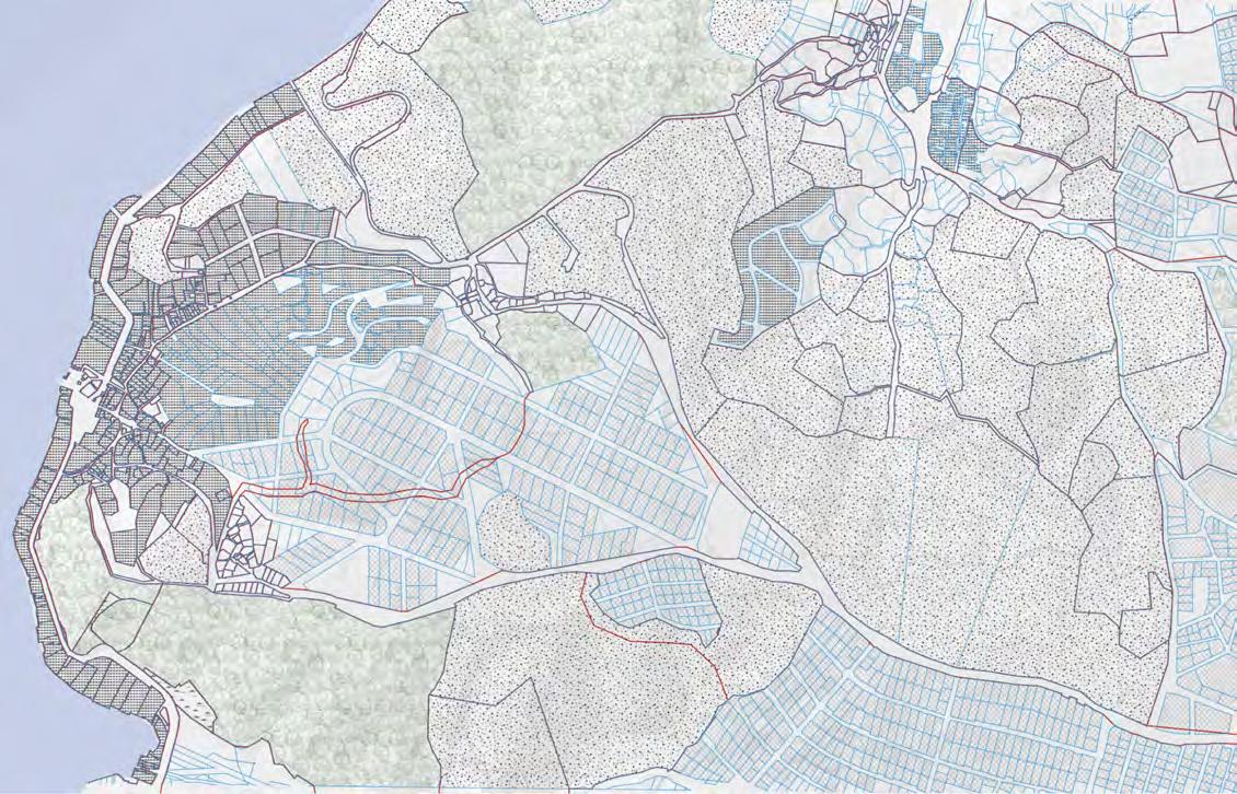
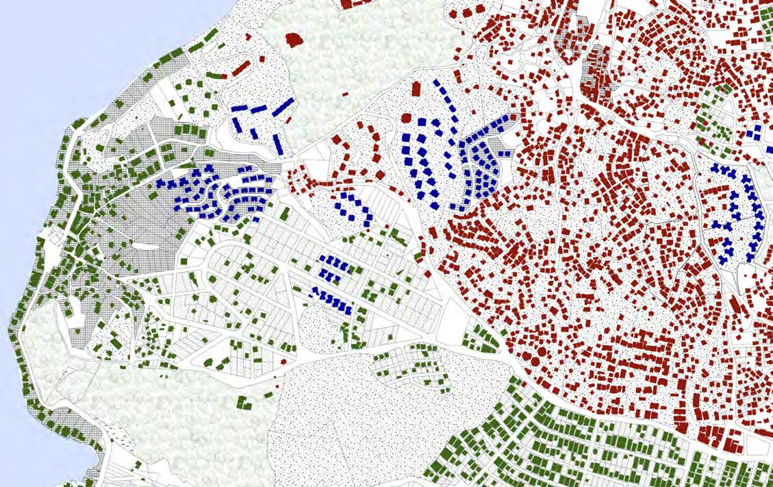
Despite the architectural and planning distinctions between porous gecekondu and rigid site, the lived realities of their inhabitants do not conform to this binary. The informal networks of economic and social dependencies, labour relations, and childcare arrangements challenge the wall between the two types of housing The engagement between site and gecekondu residents plays a crucial role in shaping today’s social and spatial landscapes. The major relationship between these two social classes is labour. Often, the blue-collar and white-collar workers of the same factories, such as the Şişecam Glass Factory in Beykoz, lived adjacent to each other—one in gecekondu, the other in site Secular white-collar women worked equivalent jobs to their husbands, with the same hours, and frequently hired the wives of blue-collar workers as domestic help in site houses. This arrangement was usually based on trust, as Turkish labour law primarily regulates formal employment, while domestic work often remains informal. An interpersonal relationship with the family was commonly important for families entrusting their babies to a domestic worker.
White-collar workers, at times, attended conferences, site visits, or worked outside the city for a few hours. This meant that the trusted nanny would host the child in her own home. This often unwritten but regularly practiced arrangement became a fundamental site of engagement, especially for the second generation of both g roups. Consequently, the hosted child would interact with other children in the neighbourhood, playing ball games in interstitial spaces and getting to know the neighbours their nanny often interacted with.
This small but significant moment reflects the contradictions of site security. While site housing was designed to be separate from the disorder of gecekondu, socio-economic entanglements blur these boundaries. This informal exchange allows the second generation of both g roups to develop a deeper understanding of one another from an early age The educational mobility of gecekondu’s second generation exposed them to white-collar working environments, leading to greater economic freedom than their parents. Today, gecekondu-backgrounded white-collar workers increasingly move into site housing.
While this thesis does not romanticise these interactions, it recognises their significance in shaping urban life. These interactions are not just personal arrangements but active negotiations of social and economic space, revealing the permeability of seemingly rigid urban divisions Understanding these dynamics is crucial in rethinking projective planning strategies that do not simply reinforce physical separation but acknowledge the interwoven realities of the city
[40]
Sisecam Glass Factory, 1935 Pasabahce, Beykoz, Istanbul Internet Archives
[41]
Sisecam Glass Factory
Demolished in 2019 Pasabahce, Beykoz
Photographed by Yusuf Derinoz
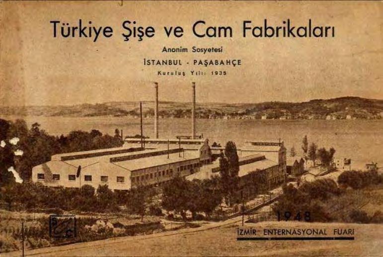

The 45th government transformed the state’s involvement in urbanisation and housing. Previously, industrialisation aimed at financial allocations was directed towards urbanisation and primarily housing. The new policies also conformed to the neo-liberal agenda of the World Bank. While evolving independently, gecekondu and site reveal a mutual influence that has shaped the urban peripheries. The gecekondu tradition of self-built homes, rooted in rural kinship networks and adapted to Istanbul’s urban constraints, has developed alongside the legislative shifts that protected and marginalised these communities. This duality in land tenure and building typologies has navigated between formal land laws and informal occupancy rights.
Site developments, such as the Şişecam Şimşek Site, were primarily constructed for white-collar workers by institutions, often with construction permits. However, these developments frequently lack cadastral approvals and title deeds, leaving their legal status incomplete. Despite these similarities in their legal frameworks, the differences between site and gecekondu housing emerge in their spatial organisation, clustering patterns, and ability to acquire public services.
Site developments are built in different typologies from the getgo, depending on the socio-economic class they are marketed to. Highrise towers are for urban elites, single-unit dwellings for the upper to upper-middle class and flats for the middle class. Each typology’s public or collective space consideration also differs regarding social class. While upper-class high towers or single-unit dwelling sites aim to differ in social class to attain maximum self-sufficiency and minimum dependence on outside services, middle-class flats primarily use playgrounds, courts and park benches as their collective areas.40
However, overall, the arching marketing strategy was “away from the chaos of the city” and ‘secure for your family.’ The idea of security here is not only the separation and prevention of crime but also the to create a community, or in Turkish ‘muhit’. So, the wall surrounding a site is not a
40 Genis, Producing Elites, 776
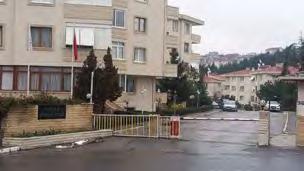
property boundary but an artificial social boundary. In a way, the labour separation between white collar and blue collar and the social separation of small bourgeoisie and proletariat manifests in the walled-up boundaries of site housing.
In his pioneering work on Istanbul’s spatial segregation through housing, Jean Francois Perouse points out that the lack of ter minology reveals that Turkey’s socio-spatial reality of site developments or ‘gated communities’ is not yet fully articulated or accepted. Terms such as fortified island (müstahkem adacik), closed site (kapali site), protected site (korunakli site), or secure site (güvenlikli site) are used interchangeably. All pointed out that exclusivity, secured from the rest of their location, was essential to site residents because of their proximity to gecekondu neighbourhoods. Site housing, as the manifestation of a moder n or Western lifestyle, lacks the inherent traditional neighbourly interactions in its architecture. Buildings are separated from each other by vegetation and from the collective services, such as a basketball court, playground, seating areas, etc.
Gecekondu, built informally on public land, has often been characterised by its lack of legal recognition. Yet, many gecekondu homes have acquired deeds through repeated amnesties, paradoxically rendering them more ‘legal’ than planned site developments, which frequently lack cadastral approvals and title deeds[Fig 40-43]. Turkish Law mandates that authorities cannot summarily evict the inhabitants if a d welling is deemed habitable and occupied; they must go through judicial procedures.41 This legal nuance led to ‘overnight builders’ in the late 1940s. They would construct homes rapidly overnight to ensure their dwellings were built and furnished with essential domestic objects before authorities could intervene. Once completed, these homes could only be subject to eviction through a legal process, providing residents with some protection against immediate demolition.
The transformation and evolution of gecekondu houses and neighbourhoods through various amnesties led to illegal construction being on the market for sale and rent. This meant the so-called informal housing was now an asset, and the officials could not put an end to it due to the
41 Laws No.5431, No. 5028, No. 6188, No. 6758, and No.7367 mention the inhabitation policies.
large population housed in gecekondu houses. These transactions carried out outside legal procedures; meant they didn’t have to pay income taxes. All of which led the state to make a deal with the residents: title deed acquisition. The title deed acquisition initiative in late 2007 is still in the process of plotting the extensive lands where gecekondu houses occupy.
Implementing the extensive ‘Urban Transformation’ policy has triggered the rapid division and parcelling of land in Beykoz. While the Urban Transformation Directorate has encouraged residents to secure the land beneath their homes, the absence of building deeds leaves these structures at risk of demolition, raising concer ns about the long-ter m security of residents. Moreover, the Directorate has prioritised profit-driven developments over community-focused solutions, perpetuating inequalities in access to stable housing by partnering with private construction companies such as KIPTAS.
Through these initiatives, some houses are being demolished. In contrast, others can acquire a ‘Yapi Kayit Belgesi’, which translates in English to ‘Building Registration Certificate’, and apply it to the Cadastre and Title Deed Office. Notably, the nuance here is that the Building Registration Certificate is not a title deed for the building. However, parcelling the land where gecekondu houses are erected is mandatory. Hence, this process leads to the title deed acquisition of the land and not the building. This way, the state legitimises the resident’s existence on the land without legitimising the illegal building.
Architecturally speaking, title deed acquirement and land parcelling mean that the interstitial spaces between houses are divided by walls [Fig44-45]. The evolving gecekondu houses, which negotiated to build extra rooms with their neighbours, now put a wall around their legitimate property, segregating neighbours. Not only do some neighbours still lack title deeds in the same neighbourhood, but the interstitial collective areas are blocked off from each other. This thesis does not try to argue that erecting a wall around one’s property is a sin, but rather to rethink how we segregate our cities through borders between neighbours, cutting off social hubs and negotiations. While these barriers delineate ownership and prevent encroachment, they also sever interactions between neighbours, constraining their adaptability and cutting off the connection between home and neighbourhood.
The core distinction lies in how each typology organises interstitial spaces, with gecekondu housing leveraging these spaces for collective and adaptive purposes whilst site developments follow a more formalised, exclusive approach. The development of gecekondu and site settlements is interdependent, each shaping and influencing the other. Initially, the housing shortage led rural migrants to construct self-built homes. In the 1980s, however, state amnesties granted legal forgiveness to these informal homes and to formally constructed buildings that, despite using standard construction methods, were still built illegally. Turkey’s laws and daily practices have been marked by considerable ambiguity and frequent changes. The delineation between legal and illegal land and housing has shifted multiple times.
Additionally, practices such as cancelling title deeds, which we will discuss further in the following parts, are evolving into a systematic method of legitimising discrimination. Consequently, legal ownership is perceived as increasingly fragile in the public eye, establishing a context where “informal” mechanisms become the de facto “formal” approach. In this sense, we can not speak of an informal and formal binary in Istanbul.
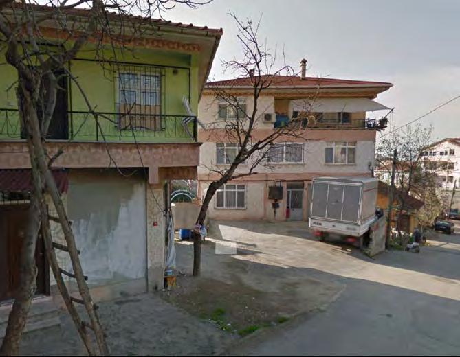
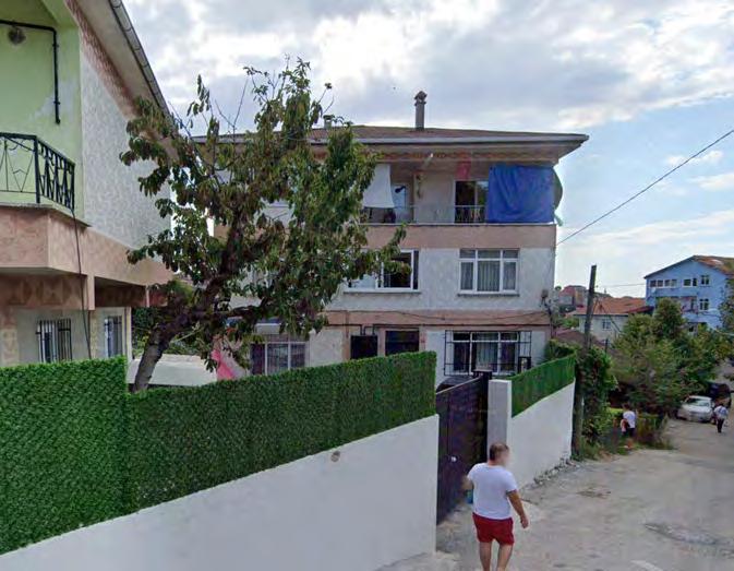
[46]
Sehit Eray Karatas Street Incirkoy, Beykoz
source: Google Maps 2004-2014
[47]
Sehit Eray Karatas Street Incirkoy, Beykoz
Land Division, acquired in 2012 for these particular houses.
Interstitial spaces refer to the gaps in-between houses and/ or apartment buildings, while both gecekondu and site have interstitial spaces, their function and spatial logics differ. A comparative analysis of interstitial spaces that divide and unite houses provides a critical perspective on both site and gecekondu housing landscapes. This analysis examines the organisation of public and private spaces as well as the ground in relationship to the elevations. It critically examines the configuration of buildings concerning one another, looking closely at the ground treatments, greenery and their correlation to the programs of interstitial spaces. In housing, the interstitial spaces between private homes are used for public collective activities. Public spaces in gecekondu settlements are not planned and scattered around residential buildings, creating a network [Fig47]. On the other hand, planned site developments treat public space as a singular entity that is pressed down to a hub within the development boundary [Fig48]. Through a closer look at the ground treatments of interstitial spaces, it gives a critical point on the programmatic differences in both strategies. [Fig 49-50]
In a first glance, both gecekondu and site developments are surrounded by greenery. However, while gecekondu houses are built on what used to be forest land, making vegetation an integral part of the existing topography, site developments use vegetation primarily as a divider within interstitial spaces. Gecekondu settlements do not use greenery for spatial separation but instead build around it. [Figures 51-52]Built spaces, meaning concrete, paving, or asphalt-treated ground surfaces, serve different purposes in each typology. Gecekondu settlements often extend ground treatment, using these spaces for transitions, interactions or private activities [Fig 5354]. Gecekondu interstitial spaces are not planned and are not determined. Each growth can create a new condition for interstitial spaces. This is how residual spaces are common in gecekondu, those that are uninhabitable. In contrast, in site developments, transitional interstitial spaces are framed by landscaped greenery or paved paths, guiding movement into the apartment block but rarely allowing for collective use. The separation of housing units from shared spaces reinforces a clear distinction between public and private [Fig55].
[48]
Above:Sisecam Simsek Sitesi Aerial
source: GoogleMaps Image,Anonymous
Below: Sehit Eray Street Partial photo by the Author
[49]-[50]
Sisecam Simsek Site and Sehit Erbay Karatas Street House vs. Public Space Analysis
[51]-[56]
Sisecam Simsek Site and Sehit Erbay Karatas Street Greenery and Pavement Analysis in Interstitial Spaces

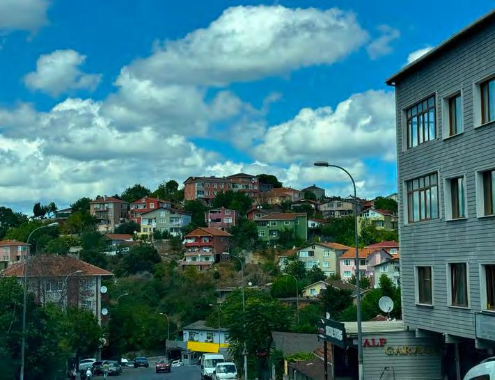


Based on these factors, we can identify four types of interstitial spaces in gecekondu settlements. Secluded areas are semi-private gardens often used as agricultural land [Fig 56]. Residual, often uninhabitable spaces that are a result of spatial conflicts [Fig57]. Transitional interstitial spaces are pedestrian walkways between asphalt roads to homes [Fig58], and Collective, where more than one house entrance (kapı önü) face each other. This creates a hub of collective activities such as cooking and cleaning, but also weddings, small gatherings, etc. [Fig 59]. Site developments often consist of secluded and transitional areas. Moreover, residual spaces are planned rather than a result of spatial conflicts
The most distinctive interstitial space in gecekondu settlements is the collective interstitial space, which serves more complex programmatic functions [Fig 60]. This condition emerges only when two or more gecekondu buildings face each other, a spatial configuration unique to gecekondu settlements, because of their interior organisation that differs from the site Gecekondu houses today follow the Dom-ino typology and are concrete structures that expand vertically rather than horizontally. This means their structure does not inherently expand from one room (sofa) to the others. However, even so, the interior organisation of concrete gecekondu homes still uses the sofa as the initial room of the house.
The sofa, the first room of each home, serves as a transitional space connecting the private interior to the semi-public interstitial areas outside. This dual role enables the sofa to function as a shared domestic area for the household and as an interactive space where neighbours can gather, share meals, have tea, or collaborate on daily activities. The inherent logic of constant g rowth of gecekondu houses leads to spatial negotiations and constant permeability. Hence the interstitial spaces between sofa rooms are always in spatial flux and not in constant utopic social interaction. Sofa extends the interior to the exterior, creating a fluid boundary between private and public realms. These relationships inherently shape gecekondu clusters. Rooms are arranged around the sofa, forming a pattern that integrates individual housing units with collective spaces. Facing sofa spaces, where houses open towards one another, become the foundational urban building blocks of gecekondu neighbourhoods. These spaces are neither entirely private nor public but exist in an in-between state. However, their shapes and spatial configurations vary according to the building typology and the topography they occupy.
[57]
Sisecam Simsek Site Interstitial Space Analysis
[58]
Sehit Eray Karatas Street Secluded Interstitial Semi-Private Garden A on plan [53]
[59]
Sehit Eray Karatas Street Residual Interstitial Uninhabital Space, usually a result of spatial conflicts B on plan [53]
[60]
Sehit Eray Karatas Street Transitional Interstitial Pedastrian walk from road to house C on plan [53]
[61]
Sehit Eray Karatas Street Collective Interstitial Mix-use D on plan [53]
The drastic topographic differences create different configurations of collective interstitial spaces in gecekondu neighbourhoods and demonstrate the adaptability to the landscape. Horizontal, where facing sofa spaces align along the same topographic line[Fig 61-64]; Topog raphic, where sofa spaces share communal areas despite being on differing elevations, creating stair-like fragmented spaces [Fig 65-68]; Vertical, primarily seen in apartment typologies[Fig 69-72]; and Combination, where three or more buildings integrate multiple configurations, forming more complex spatial arrangements[Fig73-76]. These variations, while not being constant and static, highlight the adaptability of the sofa and its capacity to meet the challenges posed by Istanbul’s undulating terrain and diverse architectural forms.
This analysed relationship between the sofa and its adjacent spaces is key to understanding how gecekondu neighbourhoods function as interconnected systems. These spaces integrate housing with communal activity by facilitating a jigsaw-like connection between clusters, reinforcing a sense of place and belonging within the urban context.
On the opposite side, although site developments are rigidly planned, residents often use residual greenery spaces, that are not planned for public activity, for communal uses, having picnics, etc. Such spatial configurations that reinforce community engagements in gecekondu settlements can be precedents for site developments, through interventions.
[62]
Urban Plans:
Collective Intertiail Spaces
[63]-[66]
Spatial Analysis:
Horizontal Collective Inersitial Photo by the Author
[67]-[70]
Spatial Analysis:
Topographic Collective Inersitial Photo by the Author
[71]-[74]
Spatial Analysis:
Vertical Collective Inersitial Photo by the Author
[75]-[78]
Spatial Analysis:
Combination Collective Inersitial Photo by the Author
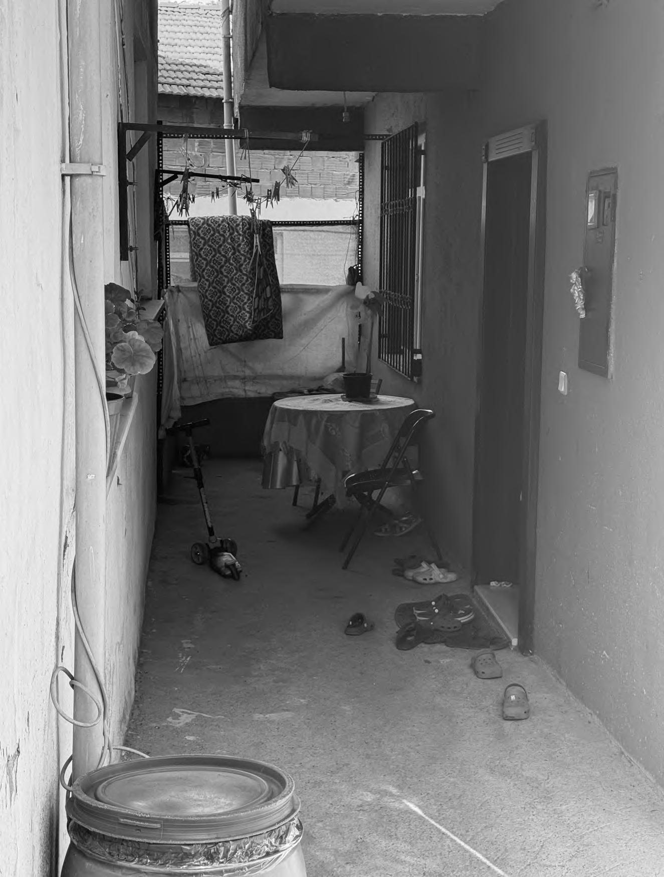
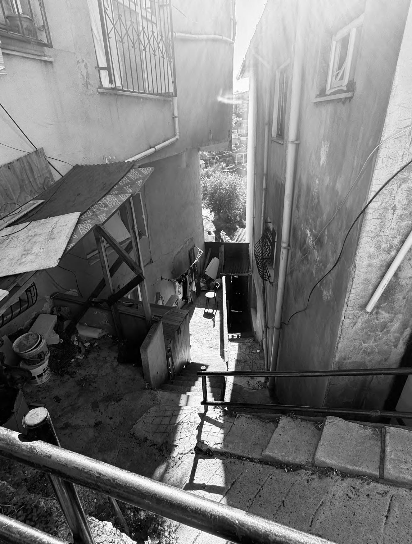
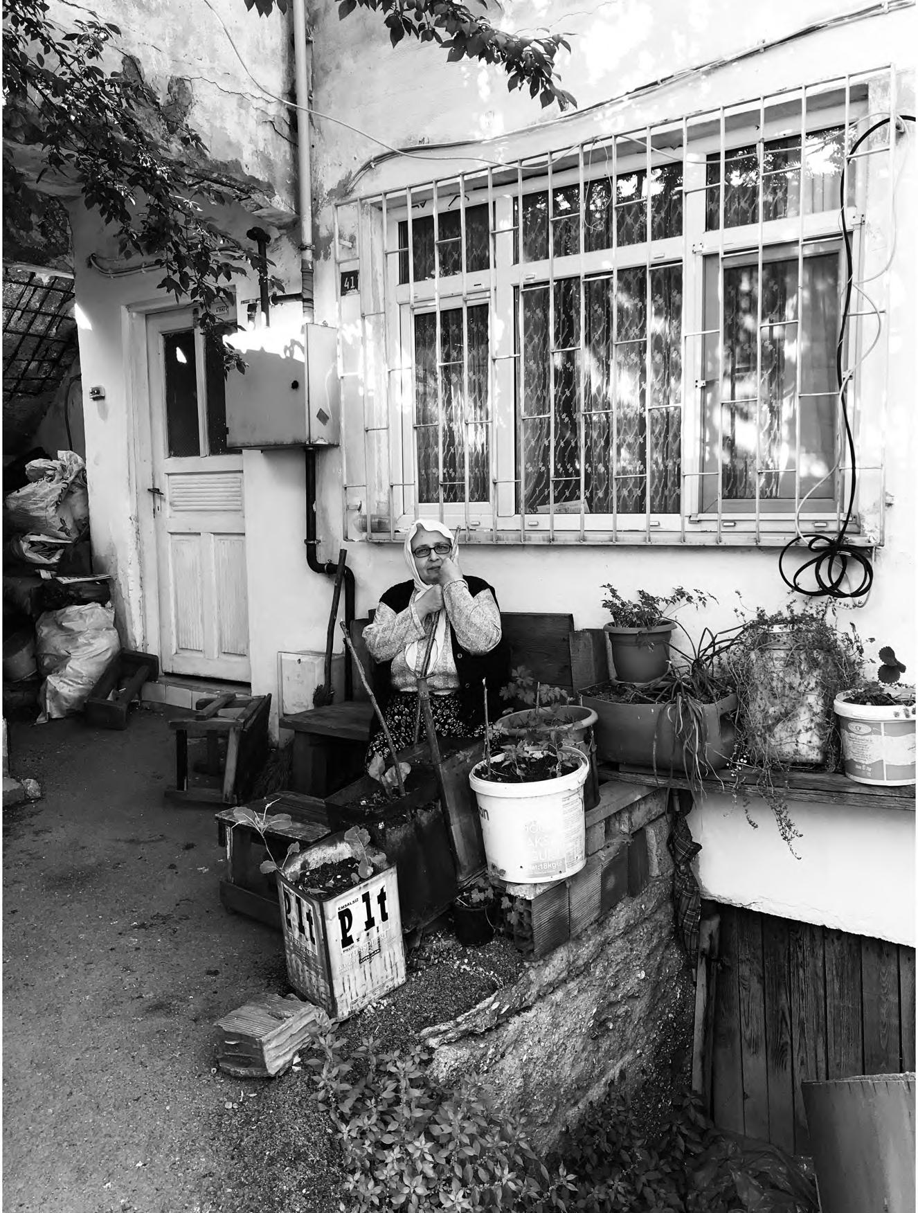

Urban transformations and new housing projects should critically engage with Istanbul’s mahalle (neighbourhood) culture, emphasising the need for collective spaces that address the socio-spatial dynamics of the in-between conditions of inside and outside It is critical to engage with the existing conditions to ask the questions for future developments. In Sisecam Simsek Site development, residents informally reclaim residual vegetated spaces for social interaction. Although initially designed as visual buffers rather than functional areas, these spaces have a clear potential for collective use.
On the other hand, walls erected in gecekondu neighbourhoods that were a result of title deed acquisition must be addressed through the gecekondu interstitial spatial intelligence that already exists.
The ‘state-approved’ and ‘regular’ site and ‘state-disapproved’ and ‘irregular’ gecekondu housing emerge from shared urban challenges, yet their physical configurations differ significantly. These differences, however, are not rooted in a rigid dichotomy of formal and informal binary. On the contrary, recent legal amnesties have formalised many gecekondu settlements, often rendering them more legally binding than neighbouring site typologies. This paradox highlights the fluidity of formality and informality within Istanbul’s housing fabric. Interstitial spaces between buildings, where collective and public spaces are, play a crucial role in defining the lived experience of these settlements, often serving as the clearest indicator of their clustering patterns.
Gecekondu houses, constructed outside for mal regulatory frameworks, followed practical, common-sense principles rooted in community needs and site-specific conditions. The semi-public sofa within these settlements often aligns naturally with the land’s topographic lines, creating informal shared-space networks. However, the aggregation of these structures also leaves undefined interstitial spaces, often having collective programs due to their spatial configurations to the interior, which in many ways can be a tool for reimagination.
Existing spatial precedents can be used as a projection for the newly titled parcels and reimagining the wall, not just as a boundary of ownership but as an architectural element mediating neighbourhood interactions. The past few decades of deed acquisition have resulted in the hardening of the property lines, reinforcing segregation [Fig80-81]. Before the introduction of title deeds, interstitial spaces functioned as shared, flexible areas, allowing for social interaction and informal gathering. While not always harmonious, they were also sites of spatial conflict, where boundaries and uses were constantly redefined by residents. However, the physical barriers were less about exclusion and more about functional differentiation.
[79] Use of Public/Priavate Layers in Doors making them private, semi-public and public. It is used watching over children playin outside, as well as ventilation. Drawn by the Author
[80] The Taxonomy of the Interstitial, Conceptual Drawn by the Author
[81] The wall, projections about, privacy boundary and property lines
Walls can be reimagined as multifunctional and porous, as well as sites of negotiations, balancing adaptability, collectivity, and privacy. Instead of serving as a rigid separator, the wall can take on various architectural roles. A potential space of negotiation while making a clear property mark. Instead of tall, inflexible, and opaque barriers, walls can be semi-height for eye-level connections and have a divider for privacy. A wall can be a social infrastructure, such as a built-in bench, a communal table, or an outdoor cooking station, integrating coal ovens, faucets, or storage. The wall does not need to be a solid physical barrier—it can be a shift in material, a green buffer, a perforated surface, or a stepped elevation, signalling property lines without blocking social interaction [Fig79].
This is not to say that the new title deeds and property lines should be disregarded. On the contrary, the projective reimagination of the wall as a liveable element makes the boundary legitimate in the neighbourhood dynamic.
Rather than eliminating boundaries, it reinterprets the wall as a flexible threshold, preserving its function while reclaiming shared use and maintenance, which balances privacy and collectivity. The intervention integrates with the irregular gecekondu structures, acting as a fluid extension rather than a monolithic piece of structure [Fig83].
[82]
A projection of interstitial spaces getting divided by plot lines. Drawn by the Author
[83]
The site for intervention Drawnn by the Author
[84]
Existing gecekondu block, Axonometric Drawn by the Author
[85]
The design intervention that extends interstitial space charecteristics.
Drawn by the Author
[86]
Perspective drawing for the projective design intervention, neighbours having a discussion Drawn by the Author
[87]
Perspective drawing for the projective design intervention, neighbours cooking and cleaning together, children playing Drawn by the Author
Site developments are marketed to use a wall as a security element for the surrounding area as well as a means of class seg regation to create a community within itself. However, the separation between public and private within the community leads to less interaction within the site as a neighbourhood. The absence of designated collective spaces between buildings, rather than separated public spaces, leads residents to appropriate these gaps, adapting them for everyday use. However, these gatherings remain constrained by the lack of intentional infrastructure, unlike the more adaptable interstitial spaces found in gecekondu settlements.
The permeability, adaptability, and shared use of collective spaces in gecekondu provide valuable insights for site developments, for such informal gatherings. Adding a sofa space provides collective-use infrastructure, while a separate door to the outside encourages the activation of interstitial spaces. This space will serve as a link between buildings, integrating community-oriented design principles.
While this decision maintains the privacy of each unit and does not act as a direct extension of the home, it creates a transitional space between the apartment building and the exterior. This space will include infrastructure to accommodate cooking, cleaning, storage, and gatherings. It will open directly to what is currently used as a residual space, old coal room for the boiler. While each building will have such a sofa, the aim is to encourage residents to create their own interstitial spaces between houses. Stairs, platforms, and other architectural components that enhanced interstitial spaces in gecekondu settlements will also be incorporated here to establish connections between buildings situated on different topographic levels.
[88]
Existing Sisecam Simsek Site
Blocks
Drawn by the Author
[89]
Sisecam Simsek site residents
informally storing table,chairs and bikes
Photo by the Author
[90]
Sisecam Simsek Site residents have picnic on the residual greenery
Drawn by the Author
[91]
Perspective drawing of the design intervention, neighbours cooking together while doing childcare. The interstitial spaces are on the background reaching to thesofa room at the building next door.
Drawn by the Author
[92]
Design Intervention implementing a ‘sofa’ room for the whole building. A room that was previously used as a coal room, and now not in use. This intervention will activate it as a infrastructure for the building and expose it to the interstitial spaces.
Drawn by the Author
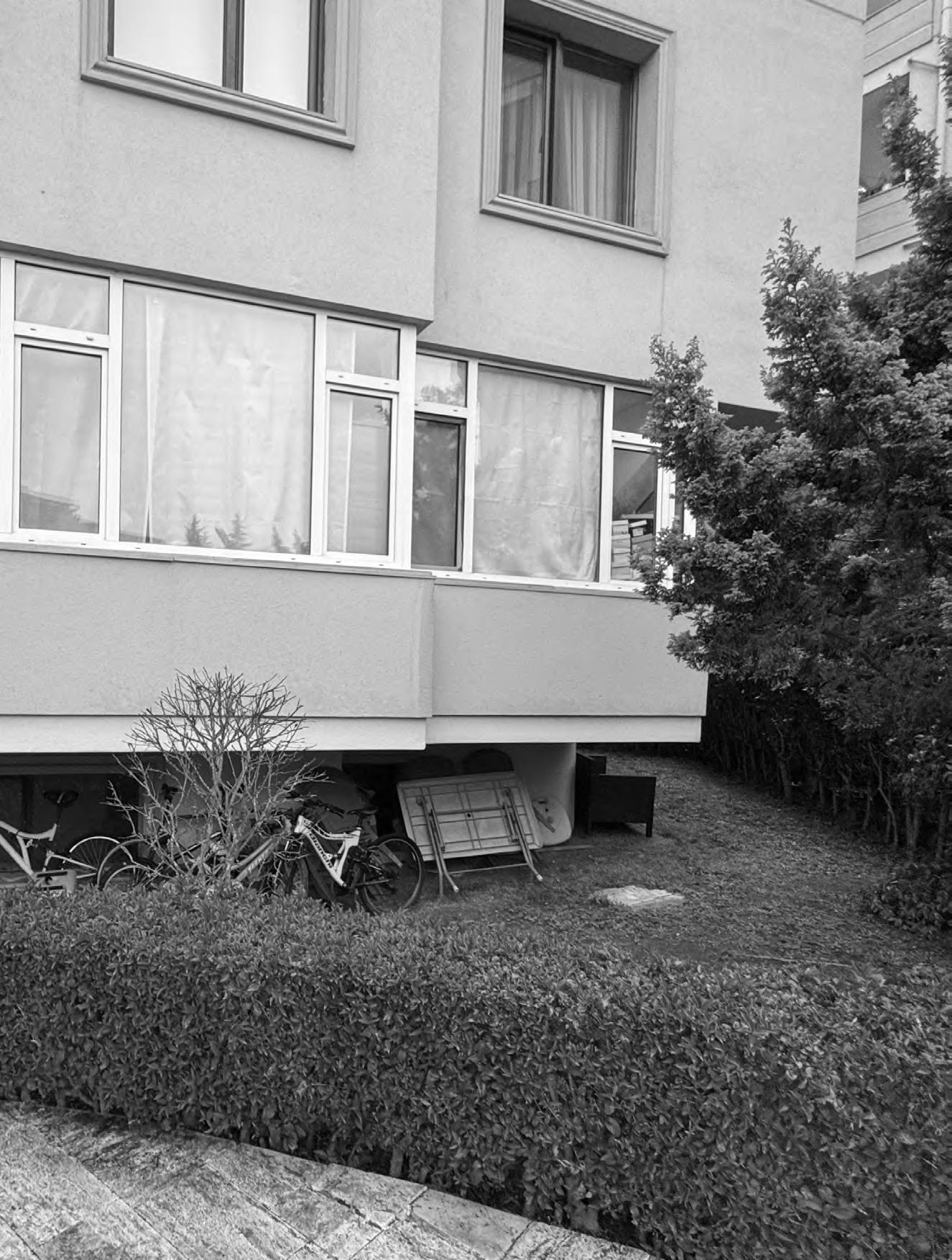
Blended with structured planning and organic growth, Istanbul’s urban landscape, present interstitial spaces, holds an intelligence that is derived from necessity and spatial negotiations. Instead of viewing these spaces as wasted areas, a flexible, residentdriven approach can transfor m them into shared community resources. This model flourishes on collaboration between municipalities, local architecture and engineering associations, and neighbourhood residents. Rather than enforcing strict regulations, the framework provides guidance and incentives, encouraging people to shape their surroundings collectively. The municipality plays a key role in identifying eligible spaces and offering basic infrastructure—such as electrical outlets, water access, or simple paving—while leaving design decisions to local communities.
The success of this initiative depends on cooperation. Municipal officials, professional associations, governmental organisations regarding city planning and the environment, and residents work together to amalgamate these spaces into the urban composition. If adopted as an enhancement model, this approach should be supportive, participatory, and adjustable. Instead of rigid planning, the process allows communities to determine how best to use these spaces, whether for social gatherings, green spaces, or rigid boundaries as needed. The decision-making process follows a neighbourhood assembly model, where residents adjacent to each space collectively determine its function. This ensures that those directly affected have an opinion on how the area is developed and maintained. Local architectural and engineering associations provide technical advice on safety, material reuse, and sustainable solutions, acting as advisors rather than enforcers.
[93] Framework diagram for design interventions in gecekondu neighbourhoods Drawn by the Author
Point of Interest
Gouverntmental Authorities
Users
Advisory
Constrcuction and Maintenance
Identification and Infrastructure
Election or Appointment
Educative Meetings
Steakholders
Informal Meetings
Formal Meetings
Daily Use & Maintenance
Technology also plays a role in making this initiative work. The municipality can identify and document interstitial spaces using GIS mapping and participatory urban audits, while joining community feedback. AI applications may be developed to spot the availability and compatibility of the spaces. Each location operates under the guidance of a neighbourhood assembly, where decisions are made transparently through democratic voting. The municipality offers incentives such as tax benefits or subsidies for community-led initiatives to encourage engagement. This model improves public spaces and supports environmental sustainability by incorporating green infrastructure, recycled materials, and climateresponsive designs. The long-term vision is to create a more functional, inclusive, and resilient urban environment. Regular evaluations and resident-led maintenance ensure continuous improvement, allowing the model to evolve.
Through shared ownership and active participation, Istanbul can redefine its urban spaces—transforming forgotten areas into communitydriven hubs. This initiative is more than just about physical improvements; it fosters a culture of collaboration, inclusion, and sustainable urban development.
Fractures: Istanbul’s Informal Spaces Between Formal Houses, reveals the mobility of formal and informal d welling arrangements using land ownership, planning rules, and architectural typologies. The analysis shows that urban life is not reflected in the rigorous classification of gecekondu as “informal” and “site developments” as “formal”. This study questions the idea that legality and planning rules are mutually exclusive after examining the change in Beykoz’s housing over time. Istanbul’s urban change should be regarded as a sequence of adjustments, discussions, and reorganisations rather than a definitive choice between two possibilities.
The core of this study is the function of interstitial spaces, treated as disregarded areas of social interaction, negotiation, and spatial adaptation between buildings, streets, and housing complexes. Through an analysis of these areas, this study demonstrates that they are active aspects influencing the urban experience, hence impacting social cohesion, mobility, and spatial accessibility, not just empty places or leftovers.
The study also shows how central political interests, legal ambiguity, and land mismanagement have formed Istanbul’s scattered urban patterns. Successive governments over the past century have used zoning rules, amnesties, and housing policies not just as means of urban control but also as political and financial weapons. This has produced a contradictory urban structure in which informal gecekondu communities have been legalised initially by retroactive regulations. Currently, planned site developments usually neglect to accommodate spatial behaviours led by communities.
This study introduces a new perspective in its critical reexamination of the “wall” as both a physical and conceptual component of urban seg regation. According to the study, barriers not only represent architectural limitations but also signify accentuated socioeconomic differences. The rising building of high boundary walls driven by recent property legalisations disturbs conventional communal patterns in gecekondu
districts, thus indicating a turn toward privatisation and exclusivity. On the other hand, site housing projects often reinforce socio-spatial divisions rather than promoting connection by employing walls to maintain separation and control. This study suggests several urban design approaches that reinter pret walls as extensions of interstitial space instead of strict borders, therefore transforming walls into social engagement spaces instead of seg regation. Walls can be used as adaptive spatial components—that is, as shaded gathering spots, unofficial markets, or community infrastructure—rather than only defining property limits. This method presents a fundamental re-evaluation of architectural constraints Yet, knowledge of property boundaries and privacy helps one to see them as possible areas of collective bargaining instead of tools of exclusion.
The results of this study are expected to have direct ramifications for housing policy, architectural design, and urban planning. Many times, current top-down planning strategies cannot fit the complexity of Istanbul’s changing housing dynamics, which results in forced urban changes that ignore current spatial patterns. According to this study, future urban policy should take a more adaptable, flexible, community-centred approach.
This thesis gives the critical focus on spatial intelligence of interstitial spaces, whilst not romanticizing their aesthetics, by actively including them in urban design, as opposed to considering these areas as unplanned or leftover; legislators to create inclusive and engaging communities. This study also sought to review house rules and property limits. Planning frameworks should acknowledge how gecekondu settlements can naturally change, adapt, and include their spatial logic in broader urban initiatives instead of imposing even more strict legal and formal limits The thesis also backs participatory approaches to urban design. Beyond a onesize-fits-all approach, urban planning has to guarantee that housing plans match societal requirements and lived experience.
Although this research mainly addresses Istanbul, its observations have more general implications for cities dealing with socio-spatial fragmentation, informal housing issues, and fast urbanisation. Particularly in places where migration, economic disparity, and land scarcity meet, housing informality and legal ambiguity still define urban environments. By providing a framework for reevaluating housing options outside of strict legal categories and instead embracing spatial flexibility, adaptation, and collective urban resilience, this study may add to global urban studies. Comparative studies on a world scale could test the adaptability of the propositions offered by the survey. These ideas can be tested further by looking at how combining empty spaces and rethinking architectural barriers creates housing models that are more open to everyone and run by the community.
A rigid urban strategy will always be inadequate in a city as historically layered, politically contested, and spatially diverse as Istanbul. The future of housing must move beyond exclusionary policies and imported planning models, instead adopting a more integrated, inclusive, and responsive approach. By leveraging the potential of interstitial spaces and rethinking the role of architectural boundaries, Istanbul can develop a housing model that reflects not only its past but also its evolving social realities.Rather than reinforcing walls that divide, the goal should be to build spaces that foster negotiation, adaptation, and communal resilience.
Ababsa, Myriam, Eric Denis, and Jean Perouse. 2012. Popular Housing and Urban Land Tenure in the Middle East : Case Studies from Egypt, Syria, Jordan, Lebanon, and Turkey. Edited by Baudin Dupret. Cairo ; New York: American University In Cairo Press.
Aureli, Pier Vittorio. 2014. “The Dom-Ino Problem: Questioning the Architecture of Domestic Space.” Log, no 30: 153–68. https://www.jstor.org/stable/43631744.
Azem, Imre. 2020. “Ecumenopolis: City without Limits (2011) - English Version.” Vimeo. December 20, 2020. https://vimeo.com/493023602.
BirkalanGedik, Hande. 2011. “Anthropological Writings on Urban Turkey: A Historical Overview.” Urban Anthropology and Studies of Cultural Systems and World Economic Development 40 (1/2): 1–66. https://doi.org/10.2307/41291337.
Cay, Tayfun, and Esra Sonel Kandemir. 2022. “Turkiye’de Imar Uygulama Mevzuatindaki Gelisim Sureci .” Geomatik Dergisi 2022 (7(1)).
Eldem , Sedad 1954. Turkish House Türkiye Anıt Çevre Turizm Değerlerini Koruma Vakf.
Erhan ERKEN. 2022. “PLANNING STUDIES in the REPUBLIC PERIOD in ISTANBUL: A COMPARATIVE ANALYSIS of the EFFECTS of HENRI PROST and LUIGI PICCINATO’S PLANS on the FUTURE PERIOD.” İstanbul Ticaret Üniversitesi Sosyal Bilimler Dergisi 21 (45): 1626–48. https:// doi.org/10.46928/iticusbe.1224428.
Erman, Tahire. 1998. “Becoming ‘Urban’ or Remaining ‘Rural’: The Views of Turkish Rural-To-Urban Migrants on the ‘Integration’ Question.” International Journal of Middle East Studies 30 (4): 541–61. https://doi.org/10.1017/ s0020743800052557.
Fidan Yolcu. 2021. “Türkiye’de Kentsel Dönüşümün Yasalar ve Aktörler Üzerinden Dönemsel Olarak Değerlendirilmesi.” Journal of Planning January. https:// doi.org/10.14744/planlama.2021.46504.
Holston, James. 2009. Insurgent Citizenship : Disjunctions of Democracy and Modernity in Brazil. Princeton, N.J. ; Woodstock: Princeton University Press.
Hulya Coskun. 2022. “French Planner Henri Prost’s Istanbul Master Plan, Hi Planning IDeas and Methods as an Archi-Urbanist.” İŞLEK, Emre. 2007. “İSTANBUL’DA 1980 SONRASINDA OLUŞAN KAPALI KONUT ALANLARININ İNCELENMESİ.” Yildiz Technical University .
Jean-François Pérouse. 2011. İstanbul’la Yüzleşme Denemeleri. Iletisim Karpat, Kemal H. 2009. The Gecekondu : Rural Migration and Urbanization. Cambridge: Cambridge University Press.
Keyes, William J, Freedom To Build Project (Philippines, Asian Institute Of Technology. Human Settlements Division, and Canadian International Development Agency. 1983. Freedom to Build - Philippines : Experience with the Freedom to Build Project at Dasmarinas, 1976-1982. Bangkok, Thailand: Division Of Human Settlements Development, Asian Institute Of Technology.
Neuwirth, Robert. 2006. Shadow Cities : A Billion Squatters, a New Urban World. New York: Routledge.
Rocco, Roberto, and Jan van Ballegooijen. 2019. The Routledge Handbook on Informal Urbanization. Routledge.
Ruşen Keleş. 1983. 100 Soruda Türkiyeʼde Kentleşme, Konut ve Gecekondu Cem Yayinevi.
Sefa USTA, and Ali Ender ULUSOY. 2023. “Housing Policies in Turkey in the Period after 1980: A Review on Government Programs.” Uluslararası Yönetim Akademisi Dergisi 6 (2): 264–88. https://doi.org/10.33712/mana.1294338.
Senyapili , Tansi 1986. “On Physical Aspects of Squattters in Turkey .” Odtu Mimarlik Fakultesi Dergisi 7 (1986): 144–52.
Sey, Yıldız. 1998. 75 Yılda Değişen Kent ve Mimarlık. Turkiye Ekonomik Ve Toplumsal Tarih Vakf.
Sibel Bozdogan. 2002. Moderism and Nation Building Turkish Architectural Culture in the Early Republic. Seattle University Of Washington Press.
Sibel Bozdoğan, and Esra Akcan. 2012. Turkey : Modern Architectures in History. London: Reaktion Books.
Sunal, Kemal, dir. 1989. Gulen Adam. Yesilcam.
Vedat Sahin 2013. “An Evaluation in Terms of Demog raphic Geography: The Progress of Population and Its Spatial Dispersion.” Mar mara Geography Journal , July, 319–30.
Zeynep Kezer. 2016. Building Modern Turkey State, Space, and Ideology in the Early Republic. University Of Pittsburgh Press.
The ever-changing gecekondu houses and their interstitial spaces are challenging to track over time since there have been initiatives for official documentation. This thesis used Google Maps Street views from 2014 and 2024 to examine how gecekondu neighbourhoods, particularly in Beykoz, have evolved over the past decade. This appendix highlights the most significant changes, not only in aesthetic modifications such as paint, roofing alterations, and fenestration but also in structural expansions, including the addition of second, third, and, in some cases, fourth levels. Some examples show an even more drastic transfor mation, where the typology shifts from vernacular to Dom-ino structures. The following images display 2014 on top and 2024 below.


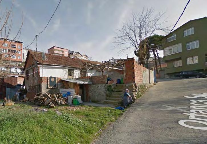
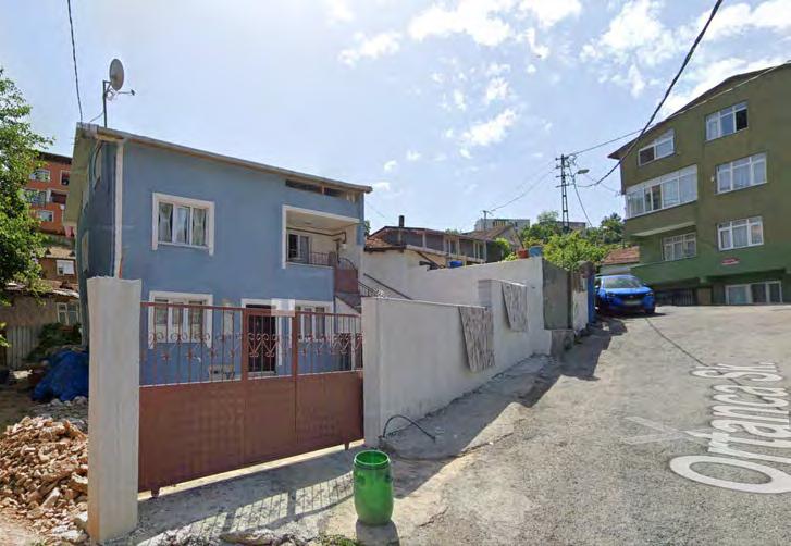
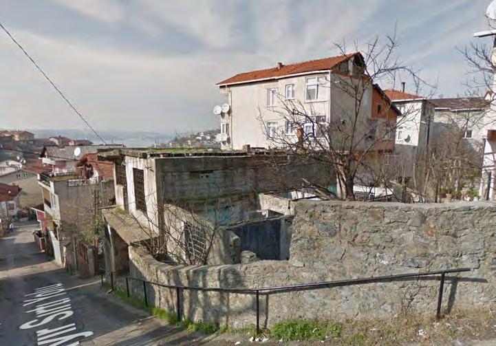


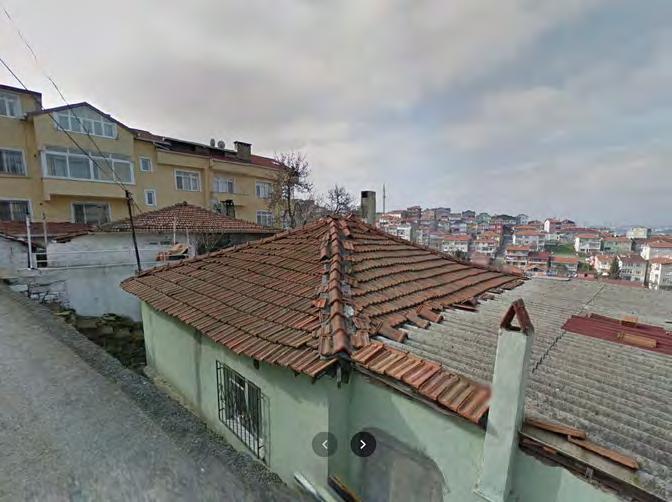

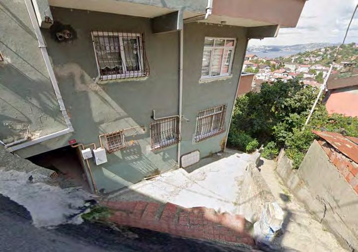
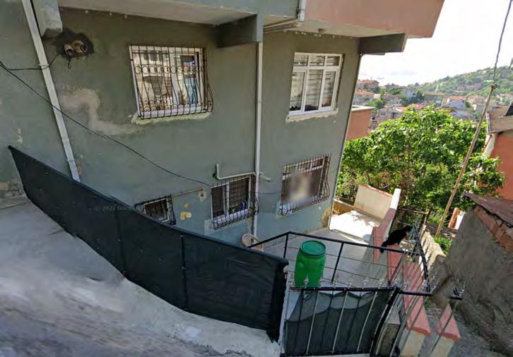
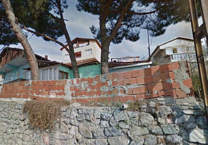
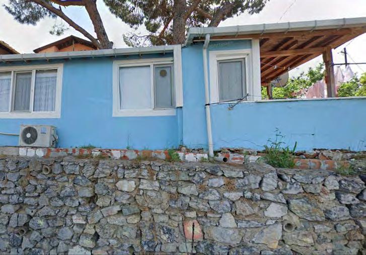
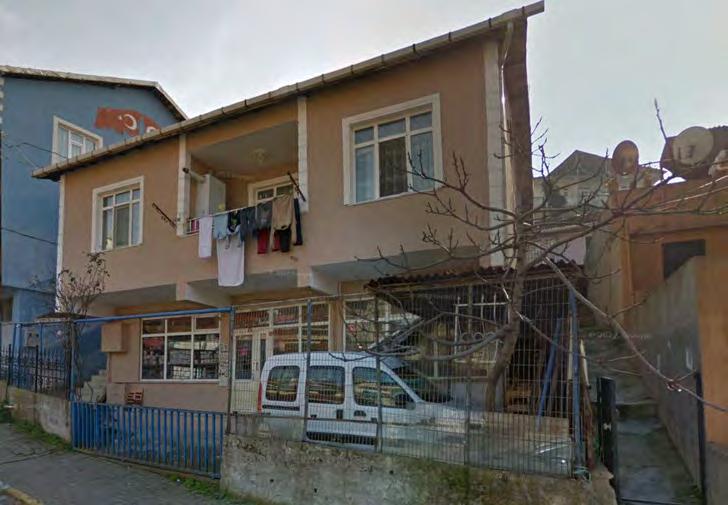
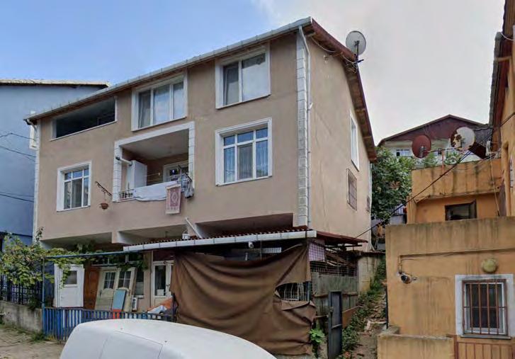


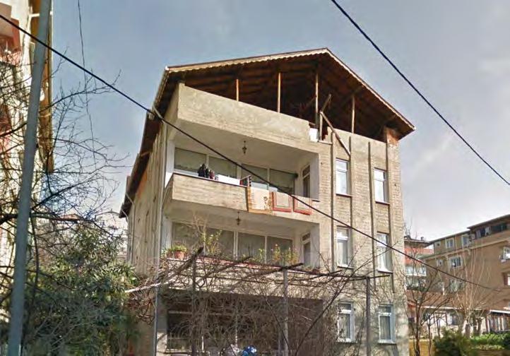
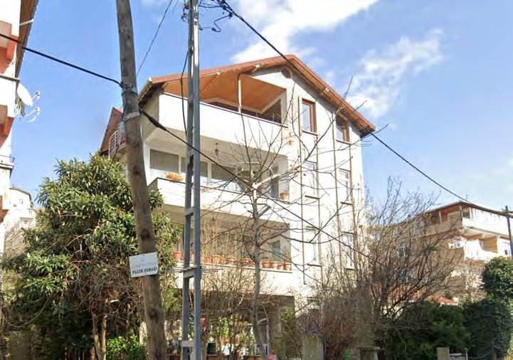
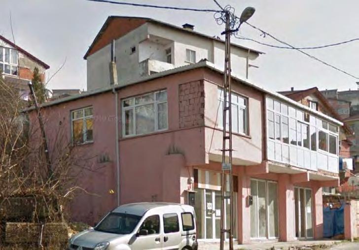
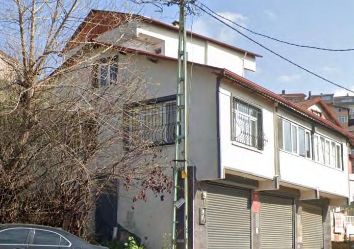
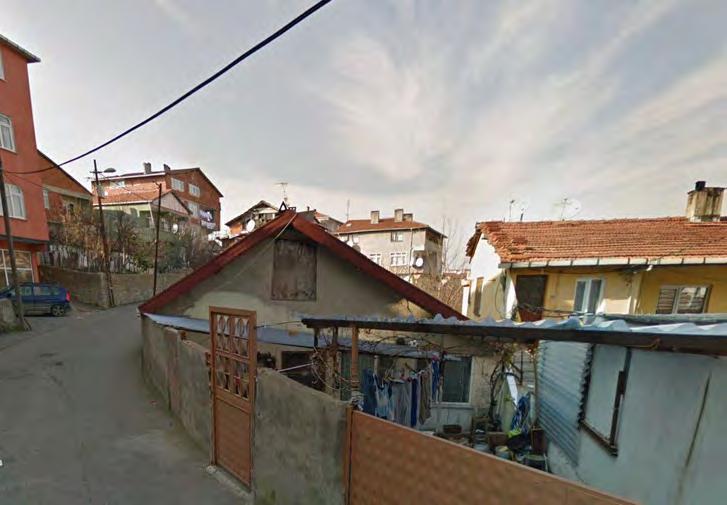
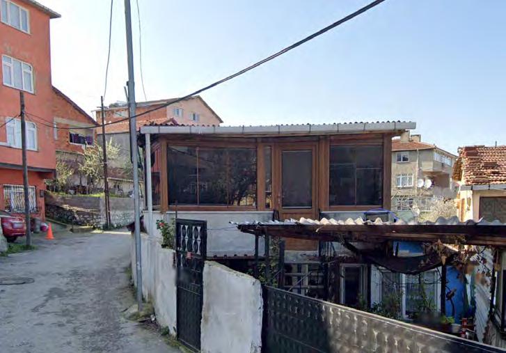
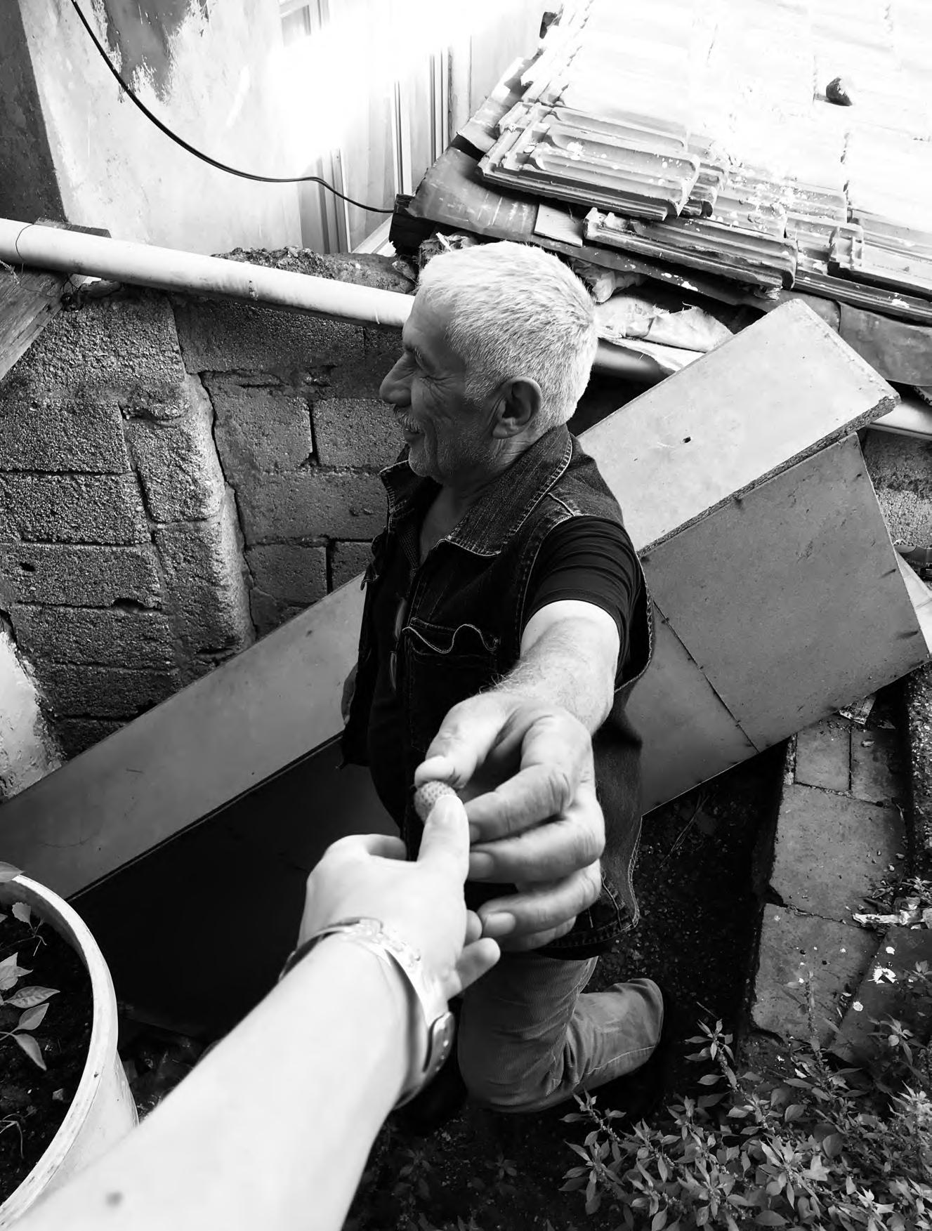
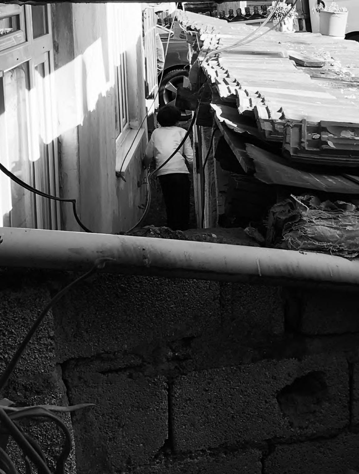
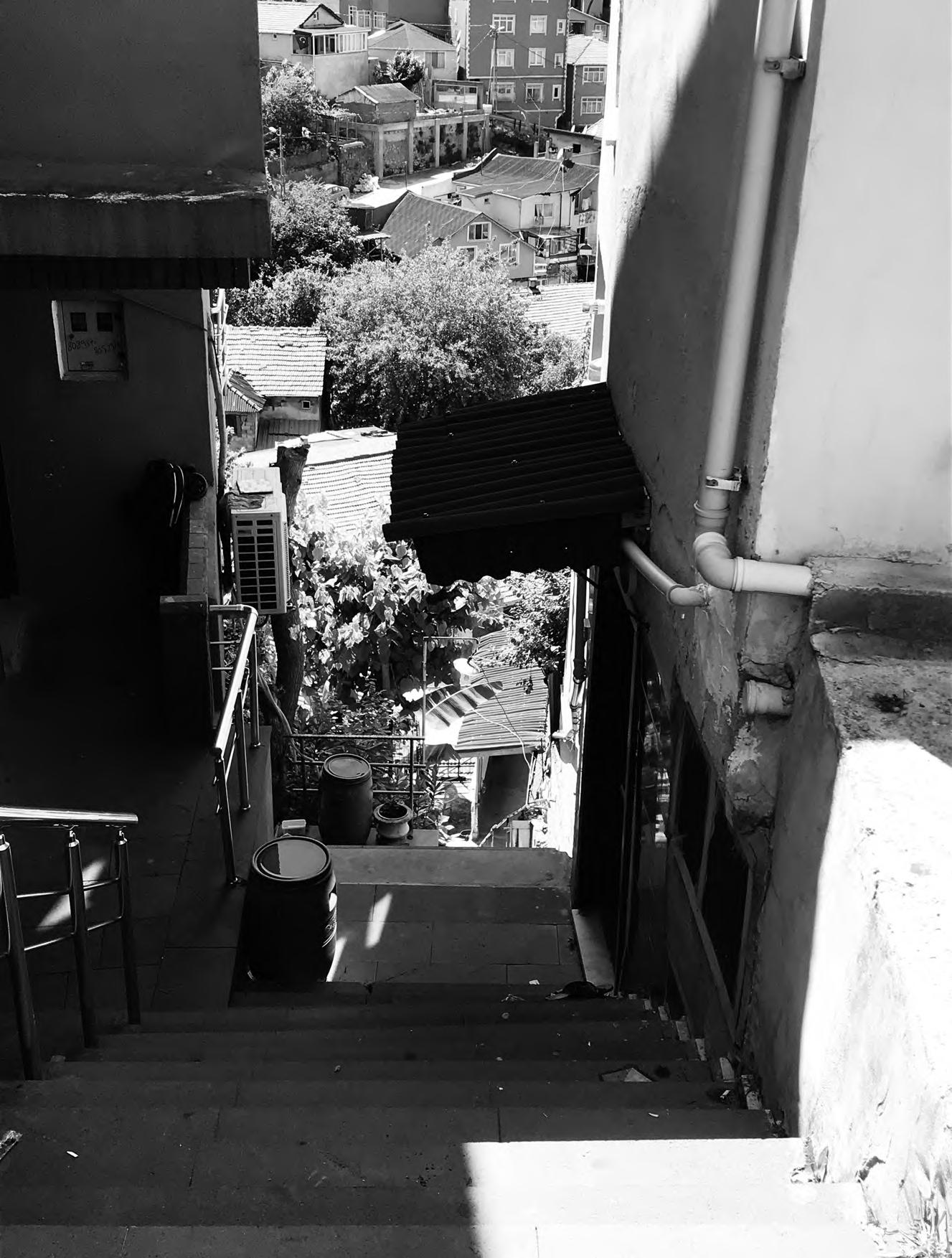
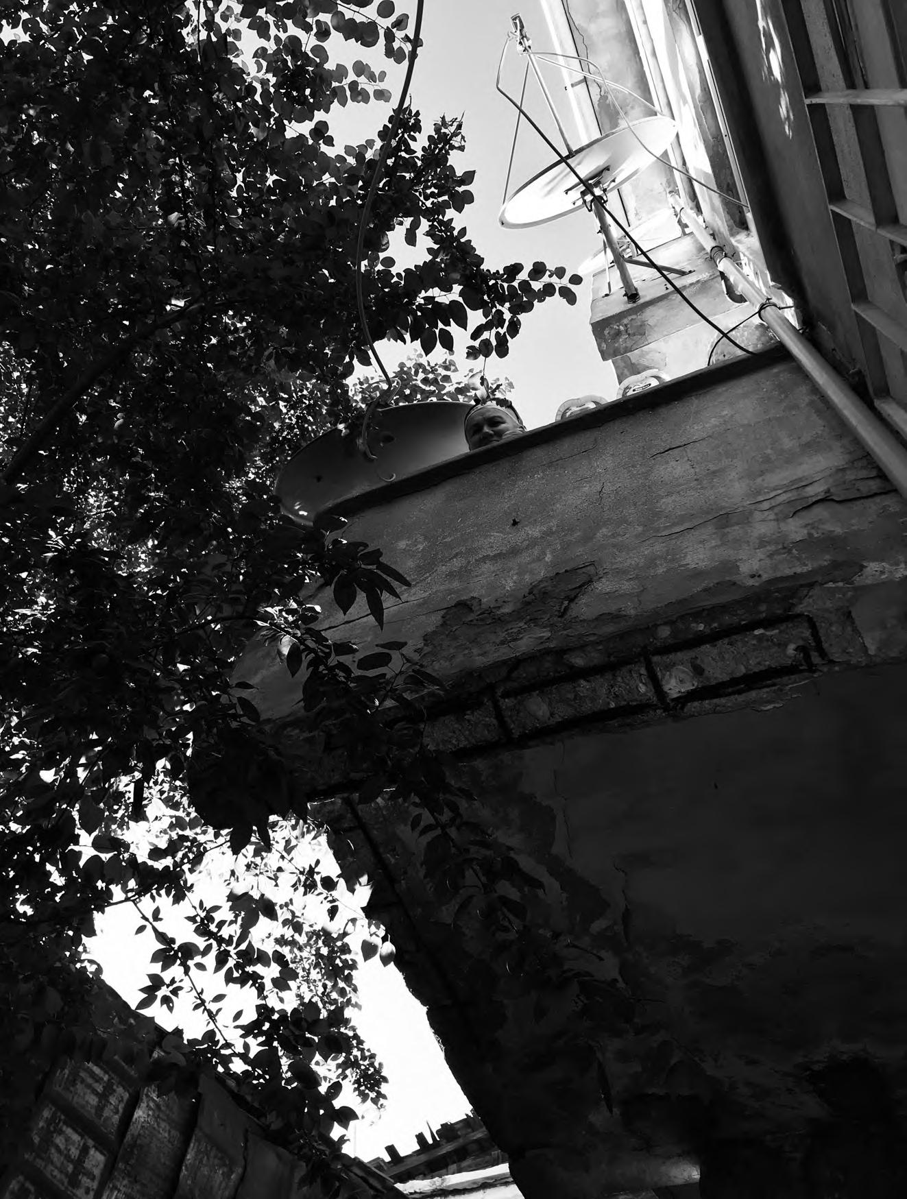


explores the housing dynamics in Istanbul, focusing on the interplay between land ownership, planning policies, and socio-spatial typologies. It challenges the traditional formal-informal housing divide, arguing that it is a product of historical urban policies and class dynamics rather than an inherent spatial logic. By examining two typical housing strategies, site and gecekondu, the thesis aims to redefine the housing landscape in Istanbul.