MAN JAANO
A Critique on Ghana’s land tenure system through public space
Dissertation submitted in partial fulfilment of the requiriments of Taught Master of Philosophy in Architecture and Urban Design - Projective Cities by Beryl Amartey
Architectural Association
School of Architecture
2024/2025 MAN JAANO
A critique on Ghana’s land tenure system through public space

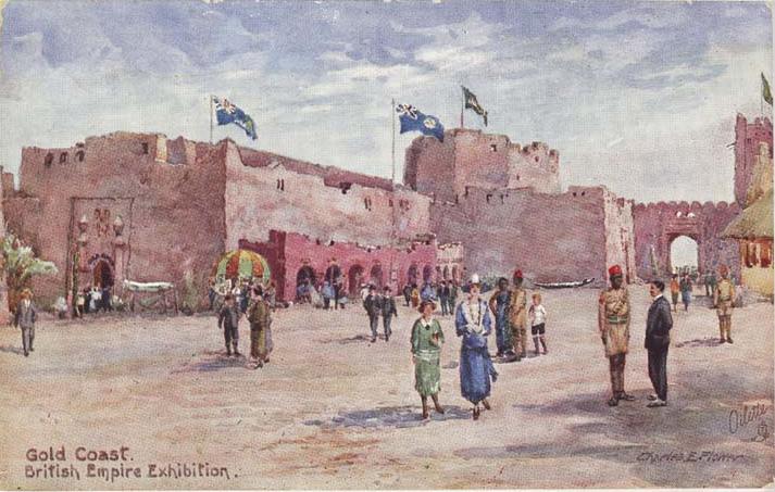
Cover art: Seek III by Wiz Kudowor
Programme:
Projective Cities, Taught MPhil in Architecture and Urban Design
Name(s): Beryl Naa Amarteley Amartey
Submission title: MAN JAANO: A Critique on Ghana’s land tenure system through public space
Course title: Dissertation
Course tutor(s): Platon Issaias, Hamed Khosravi, Anna Font
Declaration:
“I certify that this piece of work is entirely my/our own and that any quotation or paraphrase from the published or unpublished work of others is duly acknowledged.”
Signature of Student:
Date: 21st of March 2025
A place that is accessible to the public. Communal area.
To God. To family. To friends. To me.
TABLE OF CONTENTS
ABSTRACT
INTRODUCTION
CHAPTER ONE: LAND AND PROPERTY
Customary land tenure system
Statutory land tenure system
The urban plannning conundrum
CHAPTER TWO: THE ERA OF ASHANTI SOVEREIGNTY
Gyaase
Dwe Berem
CHAPTER THREE : THE BRITISH GOLD COAST COLONY
The Open Compound
The Community Centre
CHAPTER FOUR: THE REPUBLIC OF GHANA
The New Gyaase
The Reimagined Dwe Berem
BIBLIOGRAPHY
Ghana, a multicultural nation, is characterized by the shared history and traditions of its people. The culture is deeply rooted in the principles of community, encouraging “coming together,” “living together,” and “growing together.” At the heart of this communal way of life are what this research terms the “man jaano”—spaces created by architectural elements that function as shared environments. These man jaano are informal and fluid, serving as essential social spaces where children play games like “ampe” and elders’ broker important social agreements, such as marriages. They are crucial to the social fabric, providing places of common good where orphans are nurtured, and widows are protected.
The importance of this research lies in its challenge to traditional conceptions of public space and its exploration of the evolving public sphere in Ghana. By delving into historical contexts and societal changes, this study offers valuable insights into how social interations have shaped public spaces and vice versa in the Ghanaian context. Understanding the concept of the “man jaano” in Ghana involves a multidimensional approach that bridges literary exploration, spatial analysis, legal scrutiny, and direct observation. This research embarks on a journey through time and space, from 18th century Ashanti Kingdom to 21st century Republic of Ghana, to unravel the significance and evolution of gathering spaces.
This research investigates Ghana’s man jaano by analysing literary and narrative pieces on western african civilisation understand precolonial concepts. Two key books are pivotal to this categorisation - Things Fall Apart by Chinua Achebe and Mission from Cape Coast to Kumasi by Edward Bowdich. Spatial analysis of the identified gathering sspaces will document insights into layout, usage patterns, and cultural significance providing a background for comparisons with the modern-day man jaano.
A review of Ghana’s pluralistic land laws and urban planning will assess conflicts and opportunities for identified communal spaces. This interdisciplinary approach aims to uncover historical roots, contemporary challenges, and potential enhancements for communal spaces in Ghanaian neighbourhoods, contributing to broader discussions on community cohesion and urban development.
The evolution of land tenure in Ghana can be traced through three key periods: pre-colonial, colonial, and post-colonial. These periods marked significant legislative interventions as the region transitioned from customary law to dual legality. In the pre-colonial period, land was primarily managed through customary practices, which were embedded in the social and cultural structures of various ethnic groups. Land was communally owned, with rights to use land often tied to social status and community membership 1. The arrival of the British introduced significant changes. The Crowns Land Bill of 1894 sought to transfer all land and mineral rights in the Gold Coast to the British Crown but was resisted by the Aborigines Right Protection Society 2 The compromise reached during the colonial period resulted in a dual legal system. Customary authorities retained control over land, while statutory laws began to govern land use and planning 3. This arrangement allowed for the continuation of traditional land tenure practices while introducing new regulatory mechanisms. The implications of this dual system have continued to influence land governance in Ghana, shaping both urban and rural landscapes.
In Ghana, property rights are shaped by the tension between customary land ownership and statutory planning frameworks. Customary authorities hold ownership over land, while statutory regulations dictate its subdivision and use. This dual system results in fragmented urban planning, where conventional communal spaces are affected. Except that in the Ghanaian context, public space is not conventional but is embedded in everyday social and economic interaction. This nuanced understanding challenges traditional urban approaches and necessitates a reconsideration of how communal spaces are designed.
This research aims to examine the concept of public space in the Ghanaian society by investigating how planning frameworks, land tenure systems and socio-cultural practices shape the definition and evolution of communal spaces. Through an analysis of historical and contemporary spatial practices, the study seeks to redefine these communal spaces beyond conventional public parks and greenery, instead situating them within the lived realities of Ghanaian urban life.
Typological
To document gathering spaces in Ghana.
To determine how social interactions influence the identified typologies.
Urban
To examine how the dual land tenure system has impacted the development and use of the “man jaano” .
Disciplinary
To uncover the potential of non-traditional models of public spaces within Accra.
Typological
What are the typologies oaf the “man jaano” in Ghana?
How do social interactions influence these typologies.
Urban
How does the conflict between the customary and statutory planning regulations influence the development and use of the “man jaano” ?
Disciplinary
What is the potential of non-traditional models of public spaces within Accra?
The research spans three historical periods:
Eighteenth-Century Ashanti Kingdom – The study explores the Ashanti Kingdom as the dominant empire in the region, where its architectural forms and spatial practices influenced public space throughout West Africa. This historical account provides insight into indigenous spatial configurations as gathering spaces that shaped communal life.
1950s British Gold Coast Colony – The research then shifts to the mid-20th century to analyse the intersection of traditional and modern planning during British colonial rule. It specifically examines the housing and urban interventions of Fry and Drew in Ghana, illustrating how colonial planning sought to integrate indigenous spatial concepts with modernist ideals.
Twenty-First Century Republic of Ghana – Finally, the study tackles contemporary Ghanaian urbanism, critiquing the legacy of statutory planning, which fragments land into residential plots. It concludes with a reimagination of how communal spaces could persist and adapt in the absence of formally designated public spaces.
By tracing these transformations, the research situates public space within Ghana’s unique socio-political and spatial context, offering a different take on communal spaces that reflects both historical precedents and contemporary realities.
To achieve the research objectives, an extensive literature review was conducted to examine the existing land tenure system and its impact on public spaces in Ghana. This included an analysis of Things Fall Apart by Chinua Achebe and Mission from Cape Coast to Ashantee by Edward Bowdich, which provided insights into the archetypes of communal gathering spaces in 18th-century West African societies. A spatial analysis
of these identified spaces was carried out to understand their physical configurations and social functions. To trace their transformation from the Ashanti Kingdom through the colonial and post-colonial periods, archival research was undertaken. Field surveys documented the contemporary functions of public spaces in Accra, highlighting both formal and informal interactions. As a research-by-design thesis, these findings were tested through a design intervention at South La Estates, using spatial principles to explore new ways of creating the public.
The research is structured into four main chapters, along with an introduction and a conclusion.
Chapter One establishes the foundation by investigating Ghana’s dual land tenure system. This chapter explores the legal framework that is in operation and examines the impact on public space.
Chapter Two looks into the Ashanti soverieign era of the 18th century. It identifies and analyses two key communal gathering — the gyaase and the dwe berem.
Chapter Three examines the British Gold Coast Colony and presents a comparative study of indigenous public space models and the colonial reinterpretations of these spaces in the 20th century. By analysing these adaptations, the chapter highlights the shifting spatial paradigms introduced under British rule.
Chapter Four focuses on contemporary Accra, critiquing the legacy of colonial grid planning and its influence on the public realm. This chapter serves as both an analysis of modern urban space and a testing ground for the research’s findings, culminating in a speculative reimagining of public space within the city.
1. Janine Ubink, “Legalising Customary Land Tenure in Ghana: The Case of Peri-Urban Kumasi,” in Legalising Land Rights: Local Practices, State Responses and Tenure Security in Africa, Asia and Latin America, ed. Janine M. Ubink, André J. Hoekema, and Willem J. Assies (Leiden: Leiden University Press, 2009),
2. Amanor, Kojo. “The changing face of customary land tenure.” Contesting land and custom in Ghana: State, Chief and the Citizen (2008): 55-80.
3. Agbosu, Lennox Kwame. “Land Law in Ghana: Contradiction between AngloAmerican and Customary Conceptions of Tenure and Practices,” 2000; Amanor, Kojo.
“The changing face of customary land tenure.” Contesting land and custom in Ghana: State, Chief and the Citizen (2008): 55-80.
CHAPTER ONE
In Ghana, the land tenure system is an interplay between customary law and statutory law which has created a unique legal landscape that significantly impacts urban planning. Unlike some nations where land is nationalized, Ghana’s constitution recognizes the rights of customary authorities in land administration. However, the scope and power of these authorities have evolved over time. The concept of customary authority held different meanings before British colonization and has been redefined multiple times throughout Ghana’s post-independence history. What remains today is a negotiated arrangement between the state and customary authorities, reflecting an ongoing interplay between tradition and modern governance. The state has leveraged its position within this arrangement to expropriate land, often redistributing it to politically connected elites, with each successive government perpetuating this practice to benefit its allies. Customary authorities have similarly capitalized on their control over land, frequently engaging in practices such as selling the same parcel to multiple parties1. This chapter examines the historical account of this dual system and assesses their implications, highlighting the complexities and challenges that arise from this intersection of legal systems.
In Ghana’s current land system, the public sphere is one of the most significant casualties. This thesis challenges the Western notion of public space, which often emphasizes parks, plazas, and greenways as markers of communal life. Such a framework is rooted in Western ideological traditions and remains impractical for African societies, where the concept of “public” carries distinct cultural meanings. To better capture the Ghanaian context, this thesis adopts the term man jaano from the Ga language of the Ga-Adangbe people, which roughly translates as “a place where the people gather.” However, as land ownership structures evolved over centuries, what happened to the man jaano? The answer is evident in the absence of formalized public spaces in many Ghanaian neighbourhoods. If one looks for parks and green spaces as indicators of public life, they will often find none. The duality of land governance— customary and statutory—fosters contested ownership, stalled developments, and unpredictable land-use patterns, complicating urban planning efforts. Rising land values, fueled by market-driven demand and the competing interests of both state and customary leadership, make it nearly impossible to set aside land for communal purposes. Within this framework, land is too economically valuable to be reserved for mere greenery. Moreover, when land belongs to families, disputes often arise over how it should be used, with individual family members asserting conflicting rights. This results in uncoordinated urban landscapes, creating lifestyles that deprioritize parks and pedestrian-friendly environments. The urban fabric becomes defined by private interests rather than collective well-being. This tension is particularly evident in the case of Tse Addo, where land expropriated by the state for the Ghana Trade Fair was partly reclaimed by the original customary owners and subsequently sold to private investors and real estate developers. Such instances reveal how Ghana’s land tenure system undermines the possibility of public space as understood through a Western lens. Ultimately, Ghana’s urban spaces are not neutral grounds for communal benefit but battlegrounds for competing interests. To move forward, it is essential to re-examine the role of public space in Ghanaian life—not as an imported concept but as man jaano, a culturally resonant space for gathering, exchange, and community life. This thesis argues that only by reclaiming man jaano as a central tenet of urban design can Ghanaian cities truly reflect the social and cultural needs of their people.
Ghanaian ethnic groups hold a sacred connection to land, rooted in religious and ancestral beliefs. In northern Ghana, land is seen as the property of an earth spirit that bestows it for the cultivation and livelihood of the people2. The Ga-Adangbe people attribute land ownership to sacred lagoons3, and the Asantes venerate “Asaase Yaa,” which means “ Earth born on Thursday” – a female deity responsible for the land’s fertility and sustenance4. She is worshipped as the source of harvest, the one who governs the earth’s fertility. In folklore Asaase Yaa is also characterised as the goddess of birth and death. She as the womb of the earth opens up to collect the spirits of the dead. It is at this point that land moves beyond a practical value to a more spiritual significance. Land, the earth, is the resting place of the ancestors. In Ghanaian society, ancestors are deeply revered, and land is viewed as their enduring legacy. This belief system shapes the mythology surrounding land stewardship: if neglected, the land—and by extension, its deity—could bring misfortune; but if properly revered and placated, it promised prosperity and well-being5
Customary law in Ghana is grounded on these cultural and religious values of its diverse ethnic groups. As a republic composed of numerous ethnic communities, each models its customary laws differently, resulting in the absence of a unified system that comprehensively ties all these laws together. However, there are general similarities that can be explored across these varied practices6. The customary land tenure system in Ghana is built on the social and cultural structures of tribes, clans, and families characterized by its social legitimacy and community-based governance7. The majority of land in the country is held and managed under this system, which, is diverse and varied across regions and ethnic groups8. Under this law, property is generally classified into four categories: land itself, encompassing the soil or earth; things associated with land, such as houses, huts, and farms; movable property; and intangible property, including medical or magical formulae. Another common classification is based on ownership, distinguishing property held by the stool, the family, or the individual.
The term “stool or skin” refers to the royal or chiefly families of the precolonial states of the Gold Coast colony9. Land rights are distributed among individuals,
families and stools. These traditional rulers function as public corporations on behalf of the community. Chiefs hold the highest title in this political structure, acting as trustees10 and managing land for the benefit of the living, the unborn and the dead11 This stewardship concept emphasizes the long-term, intergenerational responsibility associated with land management. Chief Justice Rayner who was Lord Chief Justice of England from 1946 to 1958 wrote on West African land tenure, the heart of which read :
“The next fact which it is important to bear in mind in order to understand the native land law is that the notion of individual ownership is quite foreign to native ideas. Land belongs to the community, the village or the family, never to the individual. All the members of the community, village or family have equal right to the land, but in every case the Chief or Headman of the community or village, or head of the family, has charge of the land and in loose mode of speech is sometimes called the owner. He is to some extent in the position of a trustee, and as such holds the land for the use of the community or family. He has control of it and any member who wants a piece of it to cultivate or build a house upon goes to him for it. But the land so given still remains the property of the community or family. He cannot make any important disposition of the land without consulting the elders of the community or family and their consent must in all cases be given before a grant can be made to a stranger 12.
The rules for owning a land under customary leadership date back to a time when communities were involved in subsistence farming and the land did not hold as much value as the people and the community13. This has changed and customary land tenure has not remained the same. The interference of government agencies in land affairs has shifted primary responsibility from traditional authorities instead, land is now the subject of a revenue sharing arrangement where any revenue collected from the sale or rent of any piece of land is declared and shared between the central government agencies, local government and customary authorities14.
The 1992 constitution of Ghana reinforces the legitimacy of customary land tenure, stating in Article 36(8).
“The state shall recognize that ownership and possession of land carry a social obligation to serve the larger community and, in particular, the state shall recognize that the managers of public, stool, skin and family lands are fiduciaries charged with the obligation to discharge their functions for the benefit respectively of the people of Ghana of the stool, skin or family concerned and are accountable as fiduciaries in this regard”15 .
Despite its social legitimacy, the customary land tenure system faces challenges. The diverse and often oral nature of customary law makes it susceptible to exploitation by stakeholders, including traditional rulers, the state, and individuals16. The lack of written records and formal documentation can lead to disputes over land ownership and boundaries, complicating land transactions and development projects. There is minimal accountability and transparency in land transactions under customary tenure, enabling customary authorities to exploit the system. It is not uncommon for the same parcel of land to be sold multiple times to different buyers. Within customary law, land is often held by family heads, which can lead to disputes among family members, each asserting their claim and independently engaging in transactions with unsuspecting buyers. This fragmented ownership structure fuels conflicts and complicates land administration.Additionally, some chiefs, motivated by financial gain, may attempt to renegotiate the price of land previously sold if they recognize an increase in its market value. Traditional authority itself is contested in many parts of Ghana, and the absence of a robust legal framework further encourages the misuse of customary law, perpetuating insecurity and distrust in land dealings 17 .
Land transactions in the nineteenth century were fraught with challenges arising from conflicting concepts of land ownership and rights, leading to frequent disputes in business dealings. The core issue lay in the fundamental difference between the customary understanding of land ownership and the European perspective18. Within the customary framework, land governance was characterized by diverse rules and categories, further complicated by the ambiguous distinctions between “chiefs” and “stool lands,” as well as “family heads” and “family property” 19. These terms were context-dependent, applied differently based on local customs and practices. Unsurprisingly, colonial authorities struggled to regulate land ownership, especially given the widely held belief that land was communally owned rather than individually20 The regulation of land became increasingly significant during the gold rush of the 1880s, when the British sought to vest all land in the region of modern-day Ghana in the Crown21. This intention materialized through three key legislative instruments: the Crown Lands Ordinance of 1894, the Lands Bill of 1897, and the Forest Bill of 191022 These were the first statutory interventions in Ghana’s land governance. However, they faced strong opposition from the Aborigines Rights Protection Society (ARPS), a coalition of chiefs and educated locals, who contested the legality of these laws as a violation of customary landownership. Their successful resistance compelled the colonial state to revise its approach23. Instead of imposing direct control, the British adopted a strategy of indirect rule, aligning their land interests with those of local political and economic authorities24. This approach, of “selective involvement,” – the colonial authorities choosing when to intervene - allowed the colonial government to maintain legal oversight while presenting chiefs as the primary land administrators. Chiefs retained authority on paper but operated within the mandates prescribed by the colonial state 25. This period marked the formalization of customary law. A notable example is the Akyem Abuakwa Stool Lands Declaration, enacted by Chief Ofori Atta and his council, which defined stool lands as “land attached to the stool over which the stool exercises some measure of control [such as approval before sale]” 26. This moment signified the birth of the modern customary legal system—a compromise
between colonial and local interests. Previously unwritten and ethnically diverse, customary law was now codified, regulated, and subject to uniform standards. This dual system, combining customary and statutory frameworks, became the foundation of Ghana’s land tenure system27. Rather than imposing European norms directly, colonial authorities restructured indigenous practices into a simplified form that could coexist with statutory regulations. In this process, customary law was not merely preserved but actively redefined. For instance, in Akyem Abuakwa, Chief Ofori Atta utilized statutory law to determine what constituted “customary” law within his jurisdiction28. The traditional rulers became the lynchpin from which the British Crown launched their indirect rulership29. This arrangement had a lasting impact and paved the way for the future of government-chieftaincy partnerships30. The 1992 Constitution, along with other legal instruments such as the Land Title Registration Law of 1986 and the 1994 Act, provides the statutory framework for today’s land administration. Key institutions established under this system include the Lands Commission and the Office of the Administrator of Stool Lands, which manage land registration, titling, and urban planning regulations as stipulated in Article 267(3) of the constitution.
There shall be no disposition or development of any stool land unless the Regional Lands Commission of the Region in which the land is situated has certified that the disposition or development is consistent with the development plan drawn up or approved by the planning authority for the area concerned31.
This implementation strategy has been plagued with challenges including conflicts with customary authorities, who may resist state regulations perceived as encroaching on traditional rights. Moreover, issues such as unclear mandates, bureaucratic inefficiencies, and corruption undermine the effectiveness of statutory land governance.
And so we have a country that has its land regulations subject to customary and statutory systems which entail exclusive procedures with the expectation that they co-exist within the same framework32. The constitution vests the state with power to seize any land if it can prove it is needed for national interest. The term “public interest” is not scrutinised enough and has been known to be used to expropriate land by the state for wealthy and political allies in the regimes33. The authority of chiefs is conter-productive; especially when they disagree on the intended use of the land by the government or take offence if they have not been consulted . The chief of Sempe in the Greater Accra region echoed a this sentiment in saying that
if the land was “really [being] acquires for public purposes” he would “consider what steps to take “ but if it was being acquired “for the occupation of aliens, my elders have advised me nit part with the said land., I shall be willing however, to propose that the land remain the property of the Stool after the government has collected all expenses incurred on the building thereon34.
The mandate given by legal instruments to traditional authorities has also been abused to accumulate wealth and promote selfish interests. Chiefs have been known to swindle a man or two out of their already purchased land if they thought they would gain a better advantage by selling it to another buyer. Some have gone to the extent of making multiple transactions on the same piece of land, failing to comply with already agreed contracts35. In the midst of this land system, urban planning suffers. The framework leads to a disconnect between stakeholders, and the corruption it breeds undermines the overall urban planning system36. Planning authorities often face resistance from traditional leaders who assert their custodial rights, while private developers navigate unclear procedures, further complicating land-use coordination. Consequently, urban expansion occurs in an ad hoc manner, prioritizing private interests over cohesive community planning, leaving little room for public spaces and infrastructure.
A stakeholder interview by Cobbinah and Darkwah (2017) saw a traditional leader assert that
“. . . the land is ours [traditional leaders]. We are the traditional custodians . . . Nobody can develop our land without our consent, not even the government. If the planning people [TCPD] want to plan our community or land, they should contact us first and seek our approval . . .” 37
On the flip side, local governments are allowed to,
“prohibit, abate, remove, pull down or alter so as to bring into conformity with the approved plan, a physical development which does not conform to the approved plan…” 38 .
The law is vague in defining the criteria for structures or buildings that conform to these yet-to-be developed zoning and planning schemes39. An instance was reported in the national newspaper, the Daily Graphic of the plans of the Accra metropolitan assembly (AMA) to demolish 1800 structures within Agbogbloshie. A protest led by residents was covered with the spokesperson declaring:
“. . .we will not allow anyone to come and demolish our homes because we are not illegal settlers. . .If the officials of the AMA fail to listen to our plight and want to go ahead with the exercise, they must as well kill all of us because we will not leave”40.
1.Kojo Sebastian Amanor, “Securing Land Rights in Ghana,” in Legalising Land Rights: Local Practices, State Responses and Tenure Security in Africa, Asia and Latin America, ed. Janine M. Ubink, André J. Hoekema, and Willem J. Assies (Leiden: Leiden University Press, 2009), 118.
2. A. W. Cardinall, The Natives of the Northern Territories of the Gold Coast: Their Customs, Religion and Folklore, 1st ed. (London: Routledge, 1920), 17, https://doi. org/10.4324/9781003387367.
3. Madeline Manoukian, Akan and Ga-Adangme Peoples: Western Africa Part I, 1st ed. (London: Routledge, 1950), 86, https://doi.org/10.4324/9781315297859.
4. K. A. Busia, The Position of the Chief in the Modern Political System of Ashanti (London: Oxford University Press, 1951), 40.
5. Samuel K. B. Asante, “Interests in Land in the Customary Law of Ghana: A New Appraisal,” The Yale Law Journal 74, no. 5 (April 1965): 848–885, https://www.jstor. org/stable/794709.
6. Ibid
7. Joseph Blocher. “Building on custom: land tenure policy and economic development in Ghana.”
Yale Hum. Rts. & Dev. LJ 9 (2006): 166.
8. Ibid
9. Kasim, Kasanga, . “Land Administration Reforms and Social Differentiation: a Case Study of Ghana’s Lands Commission.” IDS Bulletin 32, no. 1 (January 2001): 57–64. https://doi. org/10.1111/j.1759-5436.2001.mp32001007.x.
10. Sarpong, G. A. “The legal framework for participatory planning: final report on the legal aspects of land tenure, planning and management in Ghana.” FAO, November (1999).
11. Joseph, Blocher. “Building on custom: land tenure policy and economic development in Ghana.” Yale Hum. Rts. & Dev. LJ 9 (2006): 166.
12. Samuel K. B. Asante, “Interests in Land in the Customary Law of Ghana: A New Appraisal,” The Yale Law Journal 74, no. 5 (April 1965): 848–885, https://www.jstor. org/stable/794709.
13. Janine Ubink, “Legalising Customary Land Tenure in Ghana: The Case of Peri-Urban Kumasi,” in Legalising Land Rights: Local Practices, State Responses and Tenure Security in Africa, Asia and Latin America, ed. Janine M. Ubink, André J. Hoekema, and Willem J. Assies (Leiden: Leiden University Press, 2009), 165.
14. Kojo Sebastian Amanor, “Securing Land Rights in Ghana,” in Legalising Land Rights: Local Practices, State Responses and Tenure Security in Africa, Asia and Latin America, ed. Janine M. Ubink, André J. Hoekema, and Willem J. Assies (Leiden: Leiden University Press, 2009), 98
15. Constitution of Ghana, 1992, Article 36(8).
16. Janine Ubink, “Land, Chiefs and Custom in Peri-Urban Ghana: Traditional Governance in an Environment of Legal and Institutional Pluralism,” in The Governance of Legal Pluralism, ed. W. Zips and M. Weilenmann (Münster: Lit Verlag, 2011),
17. Kojo Sebastian Amanor, “Securing Land Rights in Ghana,” in Legalising Land Rights: Local Practices, State Responses and Tenure Security in Africa, Asia and Latin America, ed. Janine M. Ubink, André J. Hoekema, and Willem J. Assies (Leiden: Leiden University Press, 2009), 118
18. William Malcolm Hailey, Native Administration in the British African Territories (London: Oxford University Press, 1950), 221.
19. Charles K. Meek, Land Law and Custom in the Colonies (London: Oxford University Press, 1946), 192.
20. Naaborko Sackeyfio, “The Politics of Land and Urban Space in Colonial Accra,” History in Africa 39 (2012): 310, https://www.jstor.org/stable/23471007.
21. Kojo. Amanor, The New Frontier: Farmer Responses to Land Degradation: A West African Study (Geneva, London: UNRISD, Zed Books, 1994),
22. D. Kimble, A Political History of Ghana: The Rise of Gold Coast Nationalism, 1850-1928 (Oxford: Clarendon Press, 1963);
23. Kojo Amanor, “The Changing Face of Customary Land Tenure,” in Contesting Land and Custom in Ghana: State, Chiefs and the Citizen, ed. Janine M. Ubink and Kojo S. Amanor (Leiden: Leiden University Press, 2008), 58.
24. Emmanuel Frimpong Boamah and Margath Walker, “Legal Pluralism, Land Tenure and the Production of ‘Nomotropic Urban Spaces’ in Post-colonial Accra, Ghana,” Geography Research Forum (2016):88
25. Kojo Amanor, “The Changing Face of Customary Land Tenure,” in Contesting Land and Custom in Ghana: State, Chiefs and the Citizen, ed. Janine M. Ubink and Kojo S. Amanor (Leiden: Leiden University Press, 2008), 58.
26. Kimberly Firmin-Sellers, The Transformation of Property Rights in The Gold Coast: An Empirical Analysis Applying Rational Choice Theory (Cambridge: Cambridge University Press, 1996), 64.
27. Emmanuel Frimpong Boamah and Margath Walker, “Legal Pluralism, Land Tenure and the Production of ‘Nomotropic Urban Spaces’ in Post-colonial Accra, Ghana,” Geography Research Forum (2016):89
28. Rathbone, Richard. Murder and Politics in Colonial Ghana (New Haven: Yale University Press, 1993), 62.
29. R.B. Benning, “Land Ownership, Divestiture and Beneficiary Rights in Northern Ghana,” in Decentralisation, Land Tenure and Land Administration in Northern Ghana: Report on a Seminar Held at Bolgatanga, Konrad Adenauer Foundation, 1996, 28-30.
30. Antony Allott, New Essays in African Law (London: Oxford University Press, 1970), quoted in Joseph Blocher, “Building on Custom: Land Tenure Policy and Economic Development in Ghana,” 184
31. Constitution of Ghana, 1992, Article 267(3).
32. Emmanuel Frimpong Boamah and Margath Walker, “Legal Pluralism, Land Tenure and the Production of ‘Nomotropic Urban Spaces’ in Post-colonial Accra, Ghana,” Geography Research Forum (2016):90
33. Kojo Sebastian Amanor, “Securing Land Rights in Ghana,” in Legalising Land Rights: Local Practices, State Responses and Tenure Security in Africa, Asia and Latin America, ed. Janine M. Ubink, André J. Hoekema, and Willem J. Assies (Leiden: Leiden University Press, 2009), 120
34. Naaborko Sackeyfio, “The Politics of Land and Urban Space in Colonial Accra,” History in Africa 39 (2012): 319 https://www.jstor.org/stable/23471007.
35. Janine, Ubink, 2006
36. Emmanuel Frimpong Boamah and Clifford Amoako, “Planning by (Mis)rule of Laws: The Idiom and Dilemma of Planning within Ghana’s Dual Legal Land Systems,” Journal of Planning Education and Research 38, no. 1 (2019): 98.
37. Cobbinah and Darkwah, “Stakeholder Interview,” in Urban Planning and Politics in Ghana, 1239.
38. Constitution of Ghana, 1992, Article 462(53).
39. Emmanuel Frimpong Boamah and Clifford Amoako, “Planning by (Mis)rule of Laws: The Idiom and Dilemma of Planning within Ghana’s Dual Legal Land Systems,” Journal of Planning Education and Research 38, no. 1 (2019): 98.
40. T. Ngnenbe, “Tension Mounts at Agbogbloshie Over Intended Demolition Exercise,” Daily Graphic, Graphic Online, December 20, 2018, https://www. graphic.com.gh/news/general-news/tension-mounts-atagbogbloshie-over-intendeddemolition-exercise.html.
CHAPTER TWO
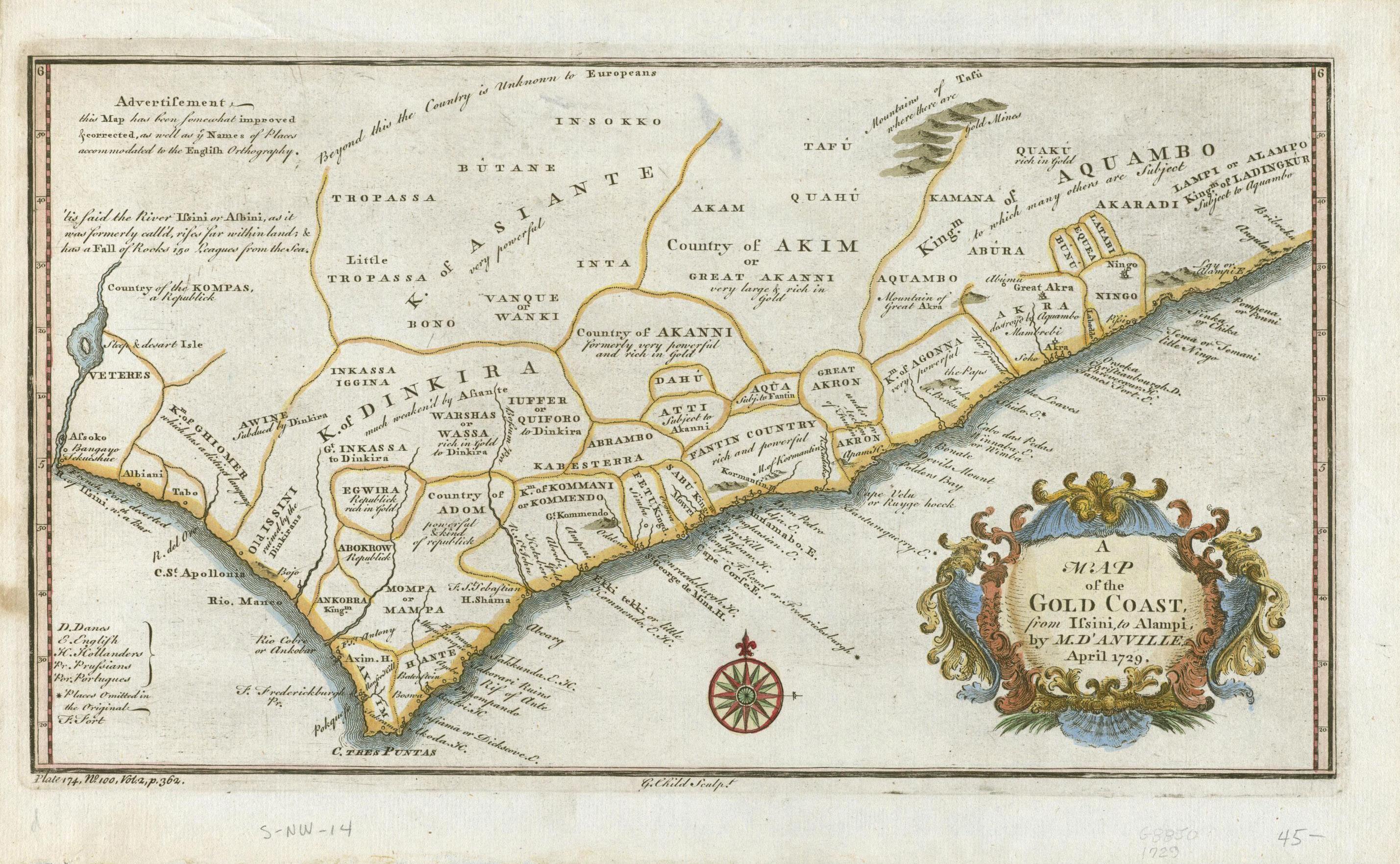
This chapter investigates 18th-century West Africa, a time before colonial boundaries fractured the region into modern nation-states. It delves into the architecture of the Ashantis, a polity built on structures of Denkyira and Bono-Mansu that expanded to the size of present-day Ghana1. The Ashanti Empire occupied a strategic position between the Atlantic and Saharan trade networks, leveraging its wealth in gold and its centralized governance to sustain political dominance well into the 19th century. It was known as the “kingdom of gold,” a title that underscored its economic significance and far-reaching influence2.The built environment of the Ashanti reflected both its political power and cultural traditions. As an empire, its architectural forms spread across the region, shaping the landscapes of its controlled territories. These spaces were more than physical locations; they were arenas for governance, commerce, ritual, and social life, playing a central role in structuring the interactions of individuals and communities. Through this exploration, the chapter seeks to identify the architectural and spatial elements that constituted gathering spaces in Ashanti society—what might be understood as the historical foundations of man jaano.
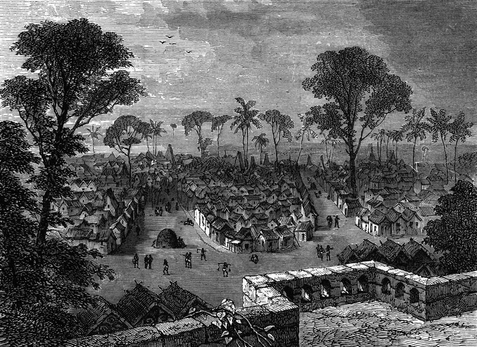
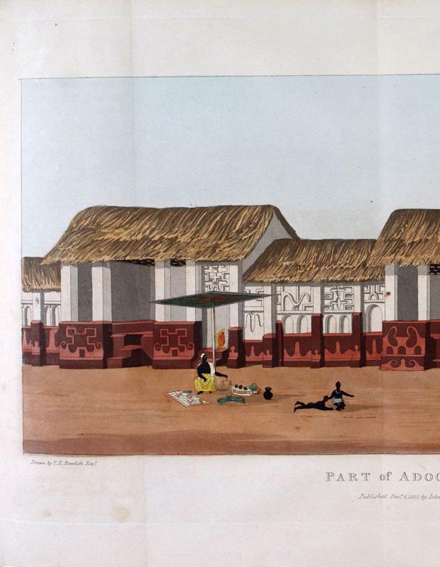
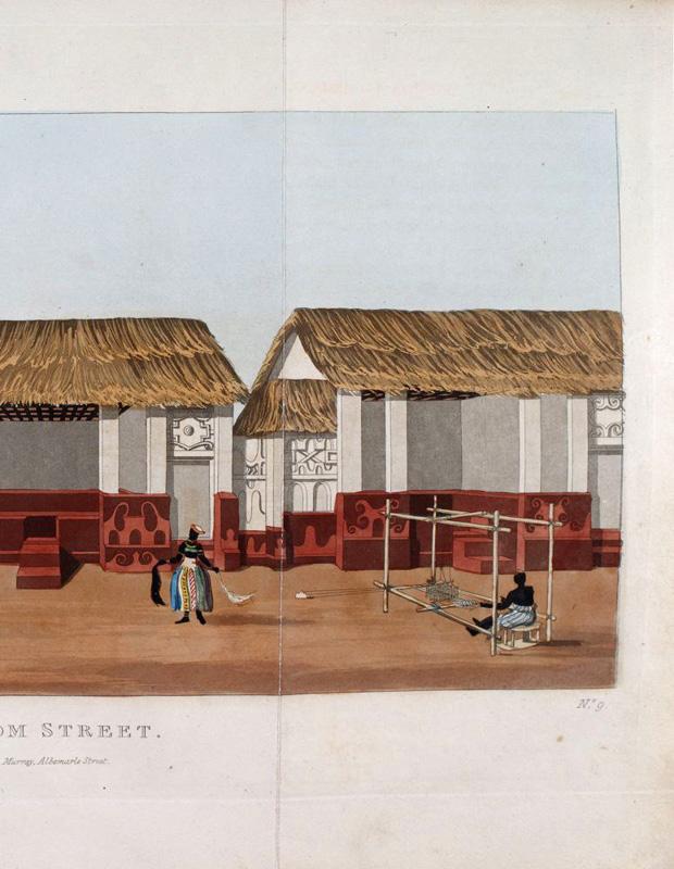
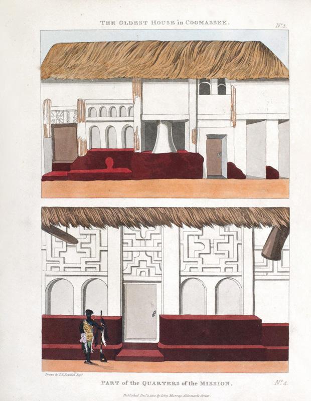
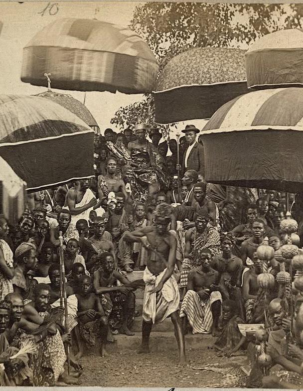
Africa’s landscape is scattered with the past’s artefacts, about which there is “little to say by way of written evidence” 3. Unlike European or Asian civilizations, where written records and architectural treatises have documented urban development, much of Africa’s history is preserved through oral traditions, material culture, and lived experiences rather than extensive textual archives. Yet, this absence of written records does not imply an absence of urban and social structures. Africa’s cities— Accra, Cairo, Kinshasa, Nairobi—continue to embody histories shaped by centuries of trade, migration, conquest, and governance. As a region, West Africa has long been home to diverse ethnic groups that, despite their distinctions, share cultural values, social structures, and spatial practices. The interconnected nature of the region led to the diffusion of architectural and urban planning principles across ethnic and geopolitical boundaries. Given these commonalities, it stands to reason that notions of public space were not confined to a single ethnic group but were instead shaped by broader regional practices and interactions. These spaces were often multifunctional, fluid, and adaptable, in contrast to the rigid zoning principles characteristic of Western urban models. For the purposes of this research, gathering spaces are defined as spaces of socialization, entertainment, and information exchange. To analyze these spaces, this research draws upon historical accounts, particularly Mission from Cape Coast Castle to Ashantee by Thomas Edward Bowdich. Written in 1819, Bowdich’s book provides a firsthand account of his diplomatic mission from Cape Coast Castle, a British fort, to Kumasi, the capital of the Ashanti Empire. His narrative offers a rare glimpse into the urban and spatial organization of the empire, detailing its landscape, people, customs, and political structures. The text also provides descriptions of key public rituals, including the reception of the British delegation by Asantehene Osei Bonsu and the elaborate court ceremonies that underscored the power and prestige of the Ashanti leadership. By systematically mapping instances of gatherings described in Bowdich’s text, this research identifies two primary classifications of gathering spaces: the gyaase and the dwe berem. These spaces, though serving distinct functions, were deeply interwoven into the socio-political and cultural fabric of Ashanti society. Each of these gathering spaces is examined in the subsequent paragraphs, unpacking their historical functions, architectural elements, and broader societal implications.
The Akan word “gyaase” is directly translated as “below or beneath the hearth4. The house with the courtyard, the compound house is a housing type for multigenerational with a central open space and enclosing spaces that are public, semipublic5. The open spare, which is enclosed on both sides, functions as the gyaase, the critical component of the space. This is evidenced by the elaborate adornment of the interior façade, while the exterior bounding walls remain plain. This contrast in decoration highlights the significance of the gyaase as the central, most revered part of the shrine, with the plain exterior serving to delineate the sacred from the surrounding environment6. Bowdich described some houses that European visitors stayed in during their visits to Kumasi. His descriptions paint a picture of a basic model all the dwellings conform to albeit small differences.
‘[…] a square of four apartments that were entered from an outer one, where several drums were kept; the angles were occupied by the slaves, and his own room which had a small inner chamber, was decked with muskets, blunderbusses, cartouch belts fantastically ornamented, and various insignia’ 7 .
These accounts point to a set of individual buildings that enclose at its core open-air court, a gyaase8. The gyaase constructs a network of settings that permeates the habitual rituals of daily life. It inculcates the collective social values of the society, passing down intergenerational knowledge and secrets. As a central space, it is the access to other spaces. A “microcosm of a public square set within the private domain”9. The gyaase was not merely a physical space but a dynamic system of relationships, where political authority, communal responsibilities, and ritual practices intersected. Within the palace structure, the gyaase comprised attendants, advisors, and service providers who maintained the king’s court, but in a broader urban and architectural context, the gyaase also referred to spaces where these interactions took place. On Reverend T. B. Freeman’s visit to the Asantehene, he met him in a courtyard; where the monarch
received the gifts that had been brought to him. He recounts that
“the houses are all erected on the same plan from that of the King, down to the lowest rank of the captains” 10 .
Ten shrine houses remain a prototype of the Ashanti traditional style of the 18th century. Built to house deities believed to protect the community, these shrines share architectural similarities with Ashanti residential homes of that era. Today, they are recognized as UNESCO World Heritage monuments. This research focuses on the Ejisu Besease Shrine House to explore the function and use of the gyaase.
Ejisu, a district in the Ashanti Region, is famously known as the hometown of Yaa Asantewaa, the queen mother who led the Ashanti resistance against the British in 1900. The name Besease translates to “under the kola nut tree,” derived from bese (kola nut) and ase (under, beneath, below). The Besease Ejisu Shrine House as one of the ten reaming Ashanti shrine houses embodies the spiritual and cultural essence of Ashanti architecture while reflecting the spatial and architectural principles of its time. Analyzing its spatial composition—ground, plinth and stairs, and boundary—reveals a mediated relationship between the shrine and the broader social fabric of Ashanti life.
The ground upon which the shrine stands is not merely a physical foundation but a ritualized space, signifying its connection to the earth and ancestral spirits. The plinth and stairs function as transitional elements, regulating movement and access within the space. Lastly, the boundary establishes a spatial hierarchy that reinforces both inclusion and exclusion, shaping the way individuals engage with the shrine and its surroundings. Through this spatial analysis, the shrine emerges as a spatialized expression of Ashanti governance, where the gyaase acted as a bridge between sacred, political and social life.
The ground is the foundation and reference point for architectural interventions, it is the level of the street, a constant datum for pedestrians11. In his seminar essay “Platforms and plateaus”, Utzon puts forward an architecture that defines space without enclosing it. This space gives way to the subtleness of the platform and yet it’s the ground that is manipulated to make the defined but unenclosed architectural space, ambivalent12. In the context of the gyaase, the ground is composed of red earth The red earth is a practical choice, as it is a material inherently tied to the geography and ecology of the region. Beyond its functional use, the red earth holds deep spiritual significance, being associated with the deity Asaase Yaa, the guardian of the land and the provider of livelihood. This material also serves as the physical base where both ordinary and extraordinary events unfold. The soil tells stories of the quiet rhythms of life. Gatherings and rituals turn the space into a living archive of activities and emotions. Every soil layer, every buried artifact and every trace of habitation reveals a vibrant culture determined to endure13. The ground is a battlefield that silently testifies to the cycles of destruction and reconstruction, bearing witness to the resilience of those who inhabit it. The ground is a sanctuary and becomes a site of renewal and regrowth14. In this dual role the ground is a an architectural stage where the conflicts of the past and present converge and the seeds of future liberation are sown. The ground, in its physical and symbolic roles, transcends mere functionality to become an essential medium for architecture, culture, and memory. It supports and frames human activity, embodying the tension between permanence and transformation. In the gyaase, the red laterite ground becomes a the stage where histories unfold, layering meaning over time. It is both witness and participant, silently bearing the scars of conflict, the rhythms of resilience, and the promise of renewal. The ground is a foundation for architectural interventions and a profound narrative space—one that reflects the continuity of human life while anchoring the aspirations for a better future.
Asante Traditional Buildings: Survey and Condition Assessment, 2014
The plinth, a common architectural feature, has long been associated with monumental and religious structures. It raised buildings above the commonplace and distinguished between the holy and the everyday. Throughout history, the platform has been used in many cultures, demonstrating its role as a functional and symbolic construction. The architectural plinth works by its restricted verticality, in contrast to the gallery plinth, which separates art items for viewing. It grounds the structure in its surroundings while highlighting elevation and isolation. In these patterns, steps are essential because they turn movement into a rhythmic, dramatic performance15 . According to historian Mary B. Hollishead,
“[T]he foot’s repeated contact with a sequence of horizontal surfaces at regular, predictable intervals translates to a sense of organization and system. Close intervals and compression of steps express intensity of effort, or conversely, broader spacing brings a slower rhythm”16
In the context of the gyaase, the platform’s steps similarly dictate the rhythm of movement, shaping how inhabitants engage with the space and each other. These elements form transitional zones, marking the boundaries of activity. The act of ascending or descending—stepping into the vibrant communal life of the courtyard or retreating into the quiet interiors—becomes a spatial metaphor for social hierarchies. Vertical movement subtly reinforces the order of the gyaase, shaping interactions through spatial context. Inhabitants and visitors alike are offered an unobstructed view and a decision – to observe or to participate in the rhythms of daily life. For children, this form becomes a site of discovery and play. Its edges, steps, and corners form a natural playground, encouraging exploration and imaginative interactions. For adults, it offers a place to pause, rest, or engage in spontaneous conversation The plinth and stairs serve as tangible manifestations of the hierarchies of daily life, bridging the sacred and the mundane, the private and the public, the functional and the symbolic.
Traditional Buildings: Survey and Condition Assessment, 2014 0m 1m 2m
Asante Traditional Buildings: Survey and Condition Assessment, 2014
BOUNDARY: Enclosure, Threshold, and Custodian
From the towering defensive walls of early settlements to the porous thresholds of modern cities, boundaries have continuously evolved to reflect shifting social, cultural, and spatial dynamics. Boundaries in architecture not only delineate space but also facilitate movement and connection through elements like streets, bridges, and squares. On a smaller scale, architectural thresholds mediate internal and external conditions, embodying both separation and unity17. The Architectural Review in the thirty third issue of the readding list; borders and boundaries notes, “Lines are drawn to make sense of things. Boundaries articulating here from there, inside from outside… define belonging and exclusion”18. In the gyaase, the boundary is the rammed walls that enclose and the steep thatch roof that extends over the wall. It reinforces the distinction between the sacred interior and the communal exterior19. The boundary is a barrier and a point of initiation, defining the compound’s territory while facilitating controlled interactions with the outside world. It is an active participant in the spatial, social, and cultural life of the compound marking the transition between the private, familial space and the broader communal world. Beyond its physical presence, the boundary symbolizes the custodial responsibility of the family inhabiting the gyaase. Its upkeep, repair, and adaptation over time reflect care and ownership, reinforcing the family’s presence and agency within the space. Yet, this custodianship transcends individual roles; the boundary embodies collective values and shared heritage, situating the family within a broader social and cultural network. Physically, it offers security, shielding inhabitants from external disruptions. Symbolically, it safeguards traditions, memories, and rituals, preserving the essence of the compound’s identity. Boundaries have evolved alongside humanity’s relationship with space, culture, and power. In the gyaase, the boundary protects and connects, serving as both a marker of familial identity and a mediator of communal relations. It is not merely a line of separation but a living, dynamic entity. It bridges tradition and modernity, family and community. Between inclusion and exclusion, belonging and separation, the boundary stands as a testament to the enduring interplay of space, culture, and identity.
Asante Traditional Buildings: Survey and Condition Assessment, 2014
Boundary
Ejisu-Besease Shrine House
by author
Asante Traditional Buildings: Survey and Condition Assessment, 2014
0m 1m 2m 10m
The interplay of ground, plinth and stairs, and boundary creates a cohesive spatial system that defines the gyaase. These elements do not function in isolation but instead operate in tandem to shape the rhythms of daily life, reinforcing the social, cultural, and ecological structures of the compound
The ground anchors the inhabitants to their environment and acts as a medium through which cultural memory is inscribed. Its association with Asaase Yaa, reinforces the Ashanti people’s spiritual and material dependence on the earth. The connection to red earth fosters a cyclical relationship between land, dwelling, and livelihood, where human activity is inextricably linked to the rhythms of nature.
The plinth and stairs act as transitional elements, facilitating movement and delineating hierarchy within the compound. The elevation of the plinth provides structural stability and protection against erosion and flooding and creates a layered threshold between public and private domains. Stairs further emphasize this transition, becoming sites where conversations unfold, rituals are performed, and authority is subtly expressed through spatial positioning
The boundary plays a crucial role in ensuring both protection and continuity. It marks the limits of the compound, safeguarding its inhabitants from external disruptions while simultaneously preserving the integrity of inherited customs and practices.
Together, these elements form a spatial and cultural ecosystem that embodies the Ashanti’s deep-rooted connection to land, history, and community. The gyaase, as both a physical and symbolic hearth, serves as a dynamic space where values, practices, and identities are not only preserved but actively performed and transmitted across generations. It is within this space that the past and present merge, where customs are reaffirmed, and where the architectural and spatial logics of the Ashanti way of life continue to evolve in response to shifting social and environmental conditions.

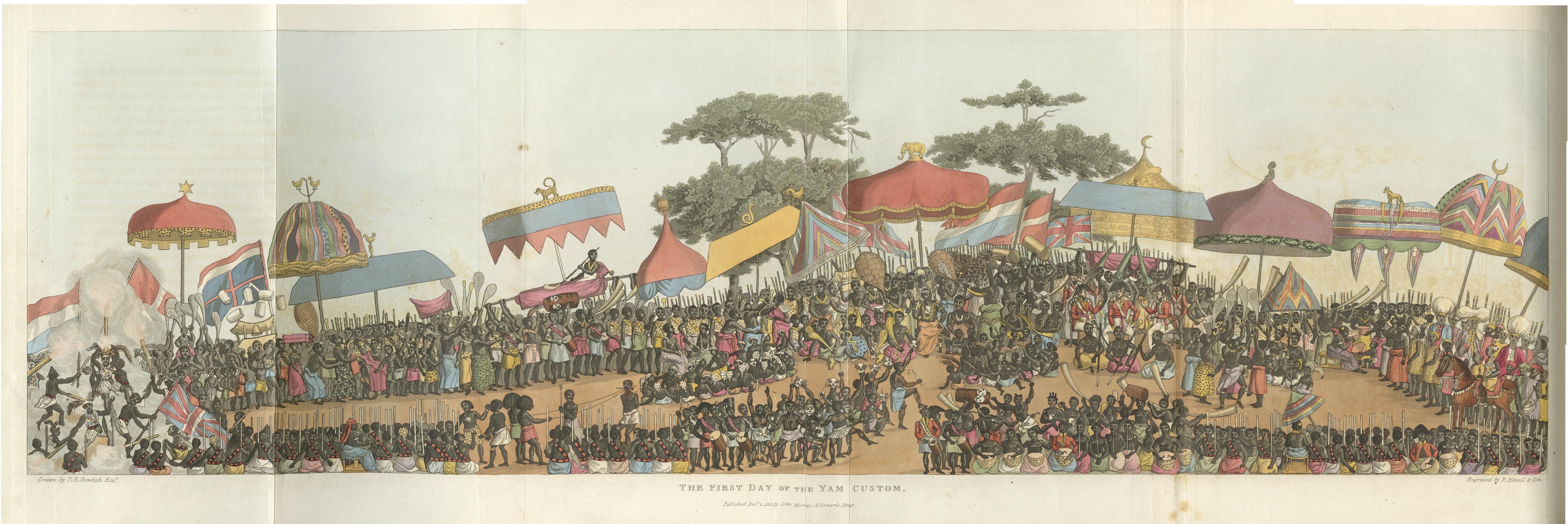
Bowdich’s account describes another gathering ground, dwe berem translated to mean the great marketplace. In his narration,
the delegation […] passed through a very broad street, about a quarter of a mile long, to the marketplace’20.
A ground plan of Kumasi he sketched has a large circular feature marked as the great marketplace. More than just a site of commerce, the marketplace functioned as a gathering space that facilitated social interactions, large meetings, entertainment, and festivals. It was a hub of information exchange, economic activity, and public ceremonies, making it a dynamic and multifunctional space within the city. The significance of this gathering space was not only in its function but also in its location as argued by Sheales21. The marketplace is delineated by the spirit grove indicated by three trees. This grove is where
“the trunks of all the human victims were thrown,” and the ‘[…] the extent of the daily sacrifice was indicated by the number of vultures that settled in these trees’ 22
The description paints a picture of the spritual weight this gathering ground carried. The Ashanti placed great importance on honouring the dead, and the positioning of these trees at the edge of the dwe berem created the impression that the ancestors were watching over and guarding the living. The spirit world was in the background witnessing important events, lending importance to this gathering space23. This deep spiritual connection shaped the marketplace’s broader functions. The great marketplace was an extension of the king’s courtyard, much like how the king’s courtyard reflected the gyaase within each household. In the courtyard, the king held private audiences and managed state affairs. However, when an event required public validation and ancestral presence, it was moved to the dwe berem. Here, the gathering
took on a performative and ritualistic dimension—both the people and the ancestors became witnesses, reinforcing the legitimacy and communal significance of the event. This is in line with why the delegation of the British missions were summoned to the marketplace to state their reason for visiting as opposed to the royal residence24.
Beyond its ceremonial and political roles, the marketplace was fundamentally a centre for commerce. It facilitated the exchange of goods and ideas, positioning it as both an economic and intellectual hub. Merchants, travellers, and traders brought diverse influences to the space, making it a site of continuous negotiation and interaction. This space was fluid and versatile taking on different characteristics according to what the city demanded. It was the stage for large and public festivities25. It was where the visitors to the city were received. This marketplace was a court, a public meeting forum, a playground.
The marketplace was not just defined by its function but by its atmosphere. The play of light and shade, the canopy of trees, and the cool retreat of shadows created an ambience of safety, relief, and comfort structuring this gathering ground’s use over time. These spatial and cultural markers coordinated when and how the marketplace functioned, shaping its role as a sacred, social, and economic space. This is marked by three elements – the tree; the canopy and the shade. The tree as a landmark and the representation of the ancestral spirits; the canopy, formed both by the natural crown of the trees and the artificial structures of royal umbrellas (kyini). These two elements coming together to create shade; shade as a civic necessity and social equaliser. In a climate where the sun dictated the rhythms of movement, shade was more than just relief—it was an essential feature that structured the use of space, creating areas for rest, gathering, and negotiation. These elements together define the landscape of the marketplace and dictate the rhythms of social interaction.
The tree was a symbol of spiritual significance and sacred presence within dwe berem. More than just a natural element, the tree served as a threshold between the physical and spiritual realms, anchoring the marketplace to an ancestral connection. The spirit grove, marked by three towering trees, delineated the sacred perimeter of the space, forming a bridge between worlds. These trees did not stand as passive markers; they witnessed, and legitimized important events.
As a placemaker, the tree defines the dwe berem, serving as both a landmark and a spatial anchor. It holds ecological and spiritual significance, shaping the atmosphere of the space as much as its function. In Bowdich’s account, blood sacrifices were offered beneath the tree trees, reinforcing its role as sites of covenant and obligation. They were the visual representation of the ancestors, ever-present and watchful. In Ashanti culture, the ancestors are guardians of tradition and enforcers of justice. The idea that they could exact vengeance for broken oaths underscored their authority, reinforcing a system of social and spiritual accountability.
If tradition holds that these were kapok trees, their physical dominance over the space must have been striking. Reaching heights of up to 70 meters, with crown diameters stretching 40 meters and massive trunks of 3 meters in diameter, they would have been an imposing presence, their scale alone commanding reverence. The three trees together would have created a monumental grove, visible from afar, signaling the importance of dwe berem before one even entered the city. Beyond their spiritual role, the vast canopy of the trees also provided a crucial function—offering shade, a reprieve from the sun, and a natural meeting place.
Photographs and historical accounts frequently depict chiefs gathered with their backs to the trees, seated in the cool shadows cast by their broad crowns. This physical relationship validates the trees as protector, as shade-giver and as a symbol of ancestral oversight. The marketplace unfolds around it, shaped by its presence, structured by its shade, and legitimized by its spiritual authority.
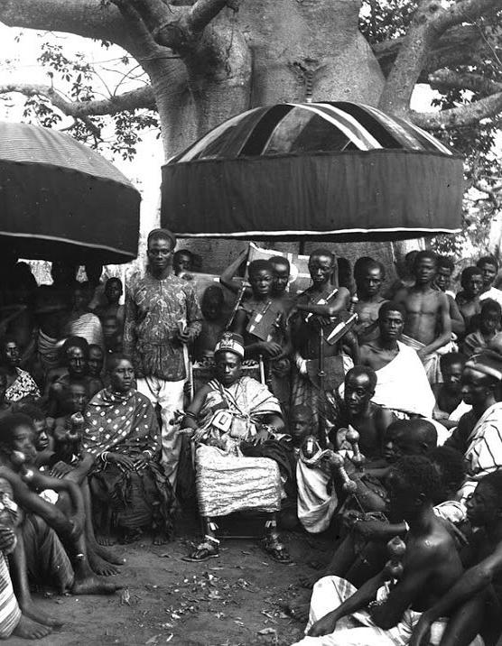
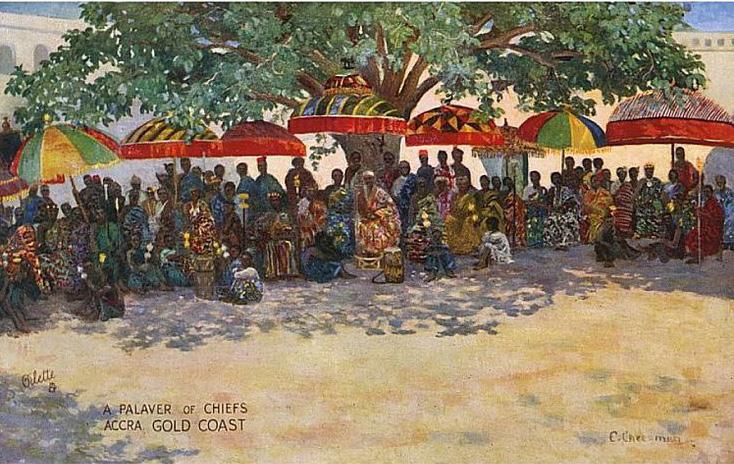
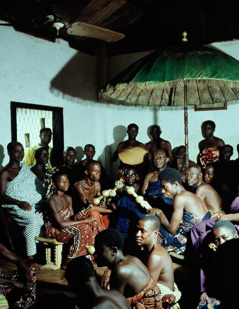
The umbrella in dwe berem offers protection from the elements while acting as an emblem of power and authority. In this context, the umbrella, locally known as kyinie, is more than a simple shade-giving device. While its primary function is to shield individuals from the sun, it also visually asserts status, hierarchy, and control over space.
The interplay between the tree and the umbrella is significant. The tree, representing the ancestors, provides a vast natural canopy under which people gather. Beneath this ancestral presence, additional umbrellas are erected, layering shade upon shade. These umbrellas, ranging in size from one to three meters in diameter, create distinct zones of coolness and refuge—a stark contrast to the heat and movement of the bustling marketplace beyond.
But the kyini is more than a practical shelter; it is a visual and political statement. The size, colour, and ornamentation of the umbrella reflect the authority of the person beneath it. Larger, more vibrantly decorated umbrellas signify greater power and prestige, marking the presence of chiefs, royals, and dignitaries.The smaller umbrellas going to the lower ranking traditional authorities. The umbrella’s intricate designs and bold colours communicate lineage, rank, and the legitimacy of the leader it shades.
Under the umbrella, hierarchy is made visible. It defines who is protected and who remains exposed, subtly regulating social order within Dwe Berem. The canopy of umbrellas mirrors the broader structure of Asante governance, where layers of authority exist beneath the overarching presence of ancestral oversight. Just as the tree provides a sacred shelter for the people, the umbrella creates a space of sovereignty within the public realm—a domain of order, stability, and distinction.
The Shade is more than a byproduct of the tree or the umbrella—it is a fundamental resource that regulates the body and dictates the rhythms of life within dwe berem. Shade serves as a civic necessity, particularly in a marketplace where large gatherings take place under the intense sun. Whether cast by the towering tree or the wide-spanning canopy of an umbrella, shade is a public good, offering relief from heat and exhaustion. It is a social equalizer, providing comfort and protection for all—merchants, travelers, elders, and workers alike.
The presence of shade creates an ambience, shaping how people experience the space and interact with one another. The tree stands as a landmark, its broad canopy forming a sanctuary of coolness. The umbrella, while temporary, is no less significant, erected when needed and packed away once its function is fulfilled. Together, these elements dictate not just temperature but also the social rhythms of the space. The marketplace is not structured by built form but by the play of light and shadow, the movement of air, and the sensory qualities that govern behaviour.
The shade transforms Dwe Berem into more than a mere gathering space— it becomes a stage, an arena for collective experiences. At festivals, umbrellas are hoisted high, their colors vibrant against the sky, as tree branches sway, animating the space with movement. In these moments, Dwe Berem is alive, charged with an energy that is both structured and spontaneous.
Ultimately, the elements of Dwe Berem—the tree, the canopy, and the shade— are deeply interconnected. How does one separate shade from ambience? The tree provides a lasting, rooted shade, while the umbrella offers a temporary shelter, yet both contribute to a carefully orchestrated environment that responds to nature and human presence alike. This space is shaped by a deep understanding of natural markers— light, shade, temperature—that guide behavior and regulate the rhythms of social life.
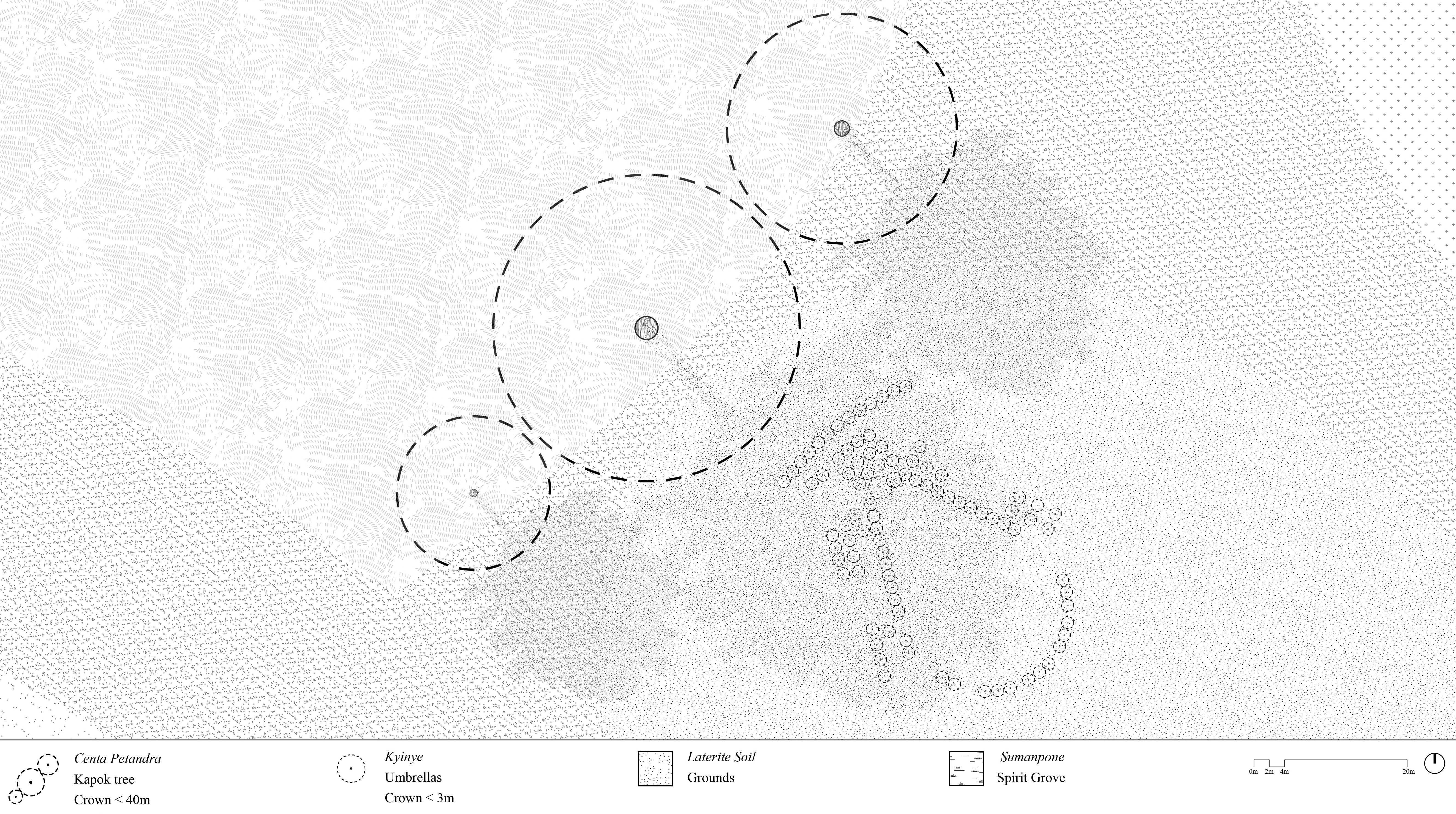
The dwe berem was a dynamic space where commerce, social interaction, and authority converged, shaped by three defining elements: the tree, the umbrella, and the shade. These elements not only structured the marketplace but also influenced movement, gathering, and the spatial organization of the space.
At the heart of the dwe berem was the tree, symbolizing ancestry and continuity. It served as both a spiritual and physical anchor, offering a focal point around which activities were centred. The tree grounded the space in tradition, reinforcing the marketplace’s role as an extension of the king’s courtyard. This connection to ancestry and hierarchy imbued the space with a sense of order, with the tree becoming a marker of cultural and social significance.
The umbrella, an emblem of authority, played a critical role in defining the power dynamics within the marketplace. Royal umbrellas, typically used by those of higher rank, not only provided shelter from the elements but also signified control over the space. These umbrellas established a visual hierarchy, orchestrating the arrangement of people in the dwe berem. The presence of an umbrella indicated the importance of the individual and influenced where others could gather, thus maintaining social order and reinforcing the idea that the space was not merely for commerce but also a site of governance and power.
The shade, cast by the tree and the umbrella, became a key spatial mechanism that shaped daily life in the dwe berem. As the day progressed, the shifting shadows dictated the rhythms of activity, from commerce to conversation, rest to ritual. This fluidity in the space, governed by the movement of shade, allowed the marketplace to adapt to the needs of its users. It created a dynamic environment where interactions could be intimate or public, structured or spontaneous, depending on where one stood in relation to the shade.
In these ways, the tree, the umbrella, and the shade transformed the dwe berem into more than just a marketplace. Together, they made it a ceremonial and civic space where authority, tradition, and daily life coexisted, shaping the community’s social fabric and reinforcing cultural practices.
1. Kwasi Konadu and Clifford C. Campbell, eds., The Ghana Reader: History, Culture, Politics (Durham: Duke University Press, 2016), 125,
2. Toby Green, “A Fistful of Shells: West Africa from the Rise of the Slave Trade to the Age of Revolution,” in A Fistful of Shells (Chicago: University of Chicago Press, 2019), 148.
3. Táíwò Olúfemi, “It Never Existed,” Aeon, January 13, 2023, https://aeon.co/essays/ the-idea-of-precolonial-africa-is-vacuous-and-wrong.
4. Labelle Prussin, “Traditional Asante Architecture,” African Arts 13, no. 2 (1980): 65.
5. Bushra Mohamed, “FIHANKRA,” AA Files 78 (2021): 100.
6. Labelle Prussin, “Traditional Asante Architecture,” African Arts 13, no. 2 (1980): 65.
7. Thomas Edward Bowdich, Mission from Cape Coast Castle to Ashantee: With a Descriptive Account of That Kingdom (London: Griffith & Farran, 1819), 18; Fiona Sheales, “Sights/ sites of spectacle: Anglo/Asante appropriations, diplomacy and displays of power 1816-1820” (PhD diss., University of East Anglia, 2011), 81.
8. Fiona Sheales, “Sights/sites of spectacle: Anglo/Asante appropriations, diplomacy and displays of power 1816-1820” (PhD diss., University of East Anglia, 2011), 81.
9. Bushra Mohamed, “FIHANKRA,” AA Files 78 (2021): 103
10. Reverend Thomas Birch Freeman, Journal of Various Visits to the Kingdoms of Ashanti, Aku and Dahomi, 1844 (as seen in Labelle Prussin, “Traditional Asante Architecture,” African Arts 13, no. 2 [1980]: 64), 55.
11. Manon Mollard, “Future Archaeology: Excavating Concealed Histories,” The Architectural Review, April 8, 2021, https://www.architectural-review.com/essays/ future-archaeology-excavating-concealed-histories
12. Pier Vittorio Aureli and Martino Tattara, “Platforms: Architecture and the Use of the Ground,” October, 2019.
13. Dima Srouji, “Depth Unknown: Archaeology of Resistance,” The Architectural Review, September 3, 2024, https://www.architectural-review.com/essays/depth-unknownarchaeology-of-resistance.
14. Mollard, Manon, Eleanor Beaumont, and Kristina Rapacki. “Ground - The Architectural Review Issue 1514, September 2024.” The Architectural Review, October 21, 2024. https://www.architectural-review.com/essays/letters-from-the-editor/arseptember-2024-ground.
15. Pier Vittorio Aureli and Martino Tattara, “Platforms: Architecture and the Use of the Ground,” October, 2019.
16. Hollinshead, Mary B. “Monumental Steps and the Shaping of Ceremony.” In Architecture of the Sacred: Space, Ritual, and Experience from Classical Greece to Byzantium, edited by Bonna D. Wescoat and Robert G. Ousterhout, 27–65. Cambridge: Cambridge University Press, 2012.
17 Arthur Barker and Michael Louw, “Evolution of the Boundary: Theories of Threshold, Poché and Stereotomic Design, and Their Manifestation in the Work of Henri Comrie,” South African Journal of Art History (2022): 1–26,
18. “AR Reading List 033: Borders and Boundaries - The Architectural Review.” The Architectural Review, September 15, 2022. https://www.architectural-review.com/ archive/reading-lists/ar-reading-list-033-borders-and-boundaries.
19. Arthur Barker and Michael Louw, “Evolution of the Boundary: Theories of Threshold, Poché and Stereotomic Design, and Their Manifestation in the Work of Henri Comrie,” South African Journal of Art History (2022): 1–26,
20. Thomas Edward Bowdich, Mission from Cape Coast Castle to Ashantee: With a Descriptive Account of That Kingdom (London: Griffith & Farran, 1819), 33-34
21. Fiona Sheales, “Sights/sites of spectacle: Anglo/Asante appropriations, diplomacy and displays of power 1816-1820” (PhD diss., University of East Anglia, 2011),104
22. Ibid
23. Thomas Edward Bowdich, Mission from Cape Coast Castle to Ashantee: With a Descriptive Account of That Kingdom (London: Griffith & Farran, 1819), 323
24. Fiona Sheales, “Sights/sites of spectacle: Anglo/Asante appropriations, diplomacy and displays of power 1816-1820” (PhD diss., University of East Anglia, 2011),105
25. Ibid
CHAPTER THREE
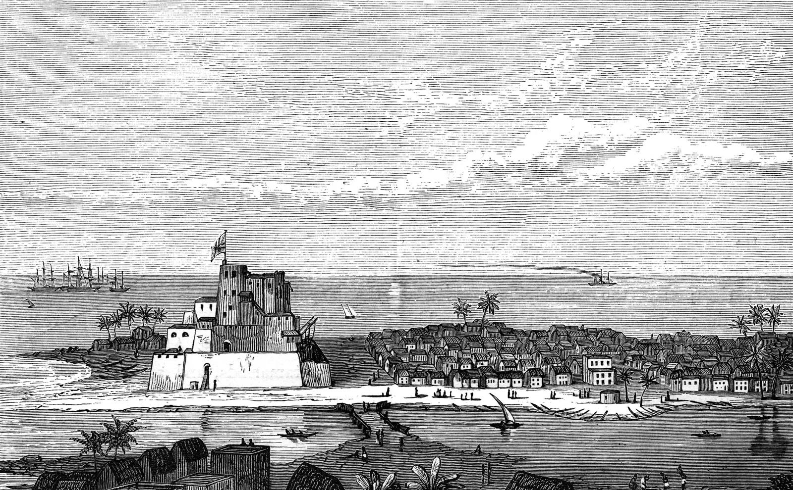
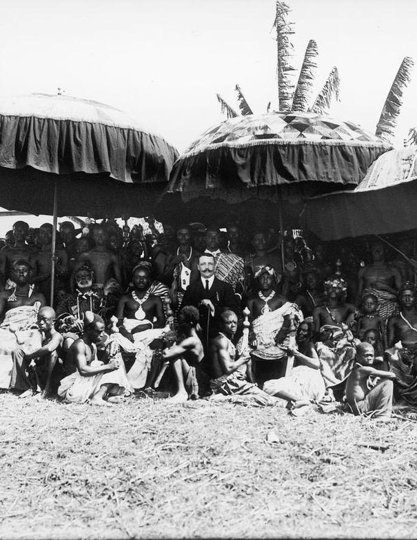
The first documented instance of contact between the people of Gold Coast and the Europeans was in 1471 when the Portuguese docked on the shores of Elmina. It was a commercial relationship where both parties traded in gold, spices and slave. By the 18th century, British interest in the region had intensified, leading to the establishment of the African Company of Merchants. Supported by subsidies from the British government, the company was tasked with protecting British interests in the region, primarily by maintaining diplomacy with the local population1. Four centuries later, British influence had grown significantlyHowever, escalating attacks by the Ashanti Empire on coastal towns forced local leaders to seek British protection, leading to the signing of the Bond of 1844. While initially framed as a mutual protection agreement, the Bond became the lynchpin for Britain’s colonial ambitions, enabling the gradual imposition of British authority. By January 1902, the Gold Coast Colony had been officially established, comprising the coastal towns, the annexed Ashanti Kingdom, and the northern territories. The addition of German Togoland in 1921 further defined the geographical boundaries of present-day Ghana2.
Colonial rule profoundly disrupted traditional society. Urbanization was prioritized over traditional ways of life, and individualism began to supplant communal values. Traditional education, religion, and governance were systematically replaced by colonial institutions. The authority of the chieftaincy was eroded, as rulers were reduced to ceremonial figures and governance was transferred to bureaucratic offices. Ultimately, the cultural fabric of society began to crumble under the allure of financial and social opportunities promised by the colonial agenda3. The colonial administration’s progressive encroachment on local governance and land rights culminated in projects like Tema Manhean, where modernist ideals were imposed on traditional communities, reflecting the broader tensions of colonial planning.
The term “Tema” specifically refers to the Tema Acquisition Area, a 63-square-mile tract within the Accra district that was officially designated for development under the 1952 ordinance4. This legislation granted the Governor of the Gold Coast the authority to appropriate land for the construction of a new town and port at Tema, along with related infrastructure projects. To prevent land speculation within the Acquisition Area, the ordinance declared that all land would be “vested absolutely and indefeasibly” in the Governor, eliminating the need for formal conveyance. This legal measure ensured that the land was free from adverse claims, competing rights, or private interests, effectively granting the government unrestricted control over its use and distribution5. The Ga people at the coast were then tasked with moving out of their ancestral lands to make way for the new port. Alcock defended this provision, arguing that it was designed to capture land value increases for the city, ensuring that any financial gains from development would be reinvested in public infrastructure rather than benefiting private speculators. However, for local communities, this policy meant the erasure of ancestral land rights, leading to social displacement and economic hardship. The ordinance thus laid the groundwork for future tensions between traditional landowners and state authorities, as dispossession and urban expansion reshaped the socio-political landscape6. While the legal framework set the stage for Tema’s transformation, its urban planning principles reflected broader ambitions.
The open compound was a housing model proposed by British architects Jane Drew and Maxwell Fry, whose mid-20th-century work in West Africa sought to adapt European architectural principles to local climates and social structures. Their design of the open compound emerged as a response to colonial critiques of the traditional compound house, which authorities deemed climatically unsuitable and unsanitary. The proposed open compound was conceived as a modernist reinterpretation of the traditional compound, aligning with what Fry described as an “intermediate type” of housing that could bridge African and European lifestyles7. This model was intended for construction in Tema Manhean, where colonial policies mandated the replacement of traditional compounds with private family dwellings. However, Fry and Drew recognized the symbolic and functional importance of the traditional compound house. They acknowledged that the clustering of homes around a shared courtyard was not merely a spatial arrangement but a fundamental aspect of social organization and cultural continuity8. Their proposal, therefore, sought to integrate elements of communal living within the framework of modernist design, balancing local traditions with colonial-era urban planning ambitions.
The open compound included modifications to improve hygiene and ventilation, such as larger windows, elevated floors, and the use of more durable materials. While these changes were intended to address health concerns, the design also reflected Fry’s vision of a “differently organized life of the future,” one that prioritized individualism over the communal living arrangements traditionally seen in compound houses9. This design captured certain aspects of West African social life but oversimplified local customs into fixed pattern that did not account for the evolving needs of the people that were to relocate to these communities. The Ga communities in relocating lost a connection to their ancestors, history and identity as a branch of the Ga ethnic community. The breakdown of the traditional governing structures and authority soon followed10. As an appropriated type the open compound comprised the same three elements as the gyaase of the Ashanti Kingdom. The ground, the plinth and stairs and the boundary.
The courtyard of the open compound remained a multipurpose space, much like in traditional compounds. It was used for drying clothes, children playing, social interactions, and hosting both monumental and ordinary activities. However, while the functions persisted, the deeper cultural rationale behind them became less pronounced. The open compound functioned as a social hub, yet its ability to sustain the spiritual and ancestral connections embedded in traditional compounds was diminished. The materiality of the ground in the open compound was notably different. While traditional compounds had an earth-based floor, reinforcing a direct connection to Asaase Yaa (the earth deity), the open compound was paved, most likely screeded. This shift altered the sensory and ritual experience of the space. The ground in the gyaase was composed of native red laterite earth, shaping and framing the human activity that unfolded upon it. It was more than a surface; it was a living archive, a stage for daily life—a silent witness and an active participant in the rhythms of existence. In the traditional compound, bare feet on the earth maintained an intimate connection to the land and its ancestral spirits. In contrast, the paved ground of the open compound severed this connection, subtly shifting the relationship between the people and their environment. The architects Jane Drew and Maxwell Frye overlooked the importance of materiality in facilitating these interactions. The red earth, offered a tactile and emotional connection to the land. When children ran across it, or parents prepared the evening meal, the red earth grounded them in their environment, embodying a sense of belonging. This connection differentiated the experience of living and engaging in the gyaase from performing the same activities in a courtyard-type house. The ground mirrored tradition, yet its materiality and philosophy bore the marks of modernist abstraction. The ancestral spirits, once ever-present in the traditional compound, become distant figures in this new architectural form. The social activities remain, but their rootedness in ritual and ancestry is lost. The ground was not the ground of the gyaase—the sacred earth, once an intimate part of daily life, was now paved. The courtyard remained, but its soul—the ancestral presence, the spiritual resonance—had been diluted. 0m 1m 2m
The planning of late colonial village housing in the tropics: Tema Manhean, Ghana
Iain Jackosn and Rexford Assasie Oppong, 2014
The planning of late colonial village housing in the tropics: Tema Manhean, Ghana
The open compound featured a veranda and stairs that were rectilinear, unbroken and continuous. The elements formed a linear transition from the compound to the veranda and then to the interior rooms. In contrast, the gyaase was distinct, incorporating a plinth and stairs that imbued the space with a sense of verticality and underscored a functional and symbolic hierarchy.In the traditional compound, the plinth was more than an architectural element—it was a spatial metaphor for social order. The height and proportion of the stairs were deliberate, diverging significantly from the standard 150mm height. The act of ascending or descending these stairs became a physical gesture of hierarchy and reverence, reinforcing the layered structure of relationships within the space. However, in the open compound, the plinth was no longer and the veranda was introduced. Its rectilinear rigidity erased the organic breaks and seating niches. The stairs became a mere transition, leading to a veranda that no longer reinforced family status, but instead functioned as an equalizing plane. The introduction of the veranda might have been justified climatically, but in its form and function, it signified something deeper: a shift in spatial ideology. It replaced the plinth a corridor-like passageway, reinforcing colonial ideals of order and equality rather than the hierarchical structuring of traditional family compounds. This change reflected a broader transformation in social organization. Colonial rule dismantled traditional authority, replacing it with Western legal frameworks and education systems that sought to devalue indigenous governance and heritage. The spatial logic of the open compound mirrored this shift—what was once a symbol of lineage and hierarchy was now an even, unbroken surface where all men stood at the same level. The veranda and stairs in the open compound may seem like simple architectural elements, but they were part of a larger cultural negotiation—a negotiation between tradition and colonial modernity. The open compound did not reject the past outright, but it reinterpreted it in a way that disrupted ancestral ties and restructured social dynamics. In this way, the veranda and stairs in the open compound can be argued to be an indicator of the values and ideals of that borrowed traditional principles but placed Western architectural logic at the center of what was the British Gold Coast.
Asante Traditional Buildings: Survey and Condition Assessment, 2014
Open Compound Redrawn by author
The planning of late colonial village housing in the tropics: Tema Manhean, Ghana
Iain Jackosn and Rexford Assasie Oppong, 2014
The walls of the open compound maintained a superficial resemblance to the traditional compound house.he boundary in the gyaase was defined by walls, interior spaces, and a thatched roof that extended beyond the walls, creating shade. The walls, constructed from rammed earth, had no openings, fostering a cool, shaded atmosphere within the compound while shielding it from the heat and glare of the sun. On the contrary, the walls of the open compound were smooth, rectilinear, and uniform, reinforcing the rigid geometry of modernist design. The aluminium sheet roof required no familial upkeep but erased a layer of responsibility that had once fostered communal care. There was a difference in both form and materiality. Another difference between the gyaase and the open compound was the direction of vision. In the traditional compound, views were oriented inward, toward the courtyard, emphasizing privacy, social hierarchy, and collective life. The gyaase was self-contained, ensuring that life revolved around ancestral presence, communal activities, and social order within its own walls.
The open compound reversed this relationship. Its walls had windows—not just openings for ventilation but actual viewing frames. For the first time, occupants inside the compound could look outward, toward the surrounding urban space. This introduction of views fundamentally altered social relations primarily enabling a more individualised engagement with the outside world as opposed to the primacy of the collective. It also marked a psychological shift. The permeability of windows blurred the boundary where the outside world was no longer distant but visually accessible. The open compound introduced a new spatial logic—one that did not privilege ancestral oversight but instead aligned with modernist ideals of transparency, ventilation, and efficiency.While the open compound borrowed the enclosed form of the traditional compound, its materiality and spatial orientation transformed its meaning. The shift from inward-facing to outward-facing views was not just an architectural change but a philosophical one, reflecting the colonial project’s influence on urban space. The new boundary was no longer a sacred enclosure but a regulated threshold, symbolizing a transition from indigenous spatial customs to colonial-modernist ideals
The gyaase was more than a physical structure; it represented an integration of the ground, plinth and stairs, and boundary, all meticulously designed to support the traditional lifestyle of its people. While the open compound borrowed these three elements, it failed to capture the deeper cultural meanings embedded in them. In the gyaase, these elements were not merely architectural features; they were crafted to facilitate and reflect the culture, social organization, and everyday life of the community. The ground of the open compound is not the ground of the gyaase—its materiality is different, its spiritual resonance weakened. The open compound incorporated a veranda and rectilinear stairs, not understanding the plinth and stairs role in symbolizing social hierarchy and transition, reducing these elements to functional, geometric features devoid of cultural nuance. Similarly, the boundary in the gyaase—constructed of rammed earth without windows or doors—created an intimate, cool, and protective enclosure that symbolized custodial responsibility and bridged the family with the broader community. In the open compound, the boundary was made of concrete walls with windows creating a drastically different ambience. These changes severed the symbolic ties to the earth and shifted the focus from collective responsibility to utilitarian practicality . The open compound emerged as a new architectural typology, shaped by the colonial ethos of the British Gold Coast. It reflected a Eurocentric Africanist vision—one that reinterpreted local values, practices, and identities through the lens of modernity. devoid of the connections to land, history and community. It was a Delphic oracle, foretelling the birth of a conflicted architectural language—one caught between ancestral memory and colonial influence, tradition and imposed modernity. It prophesied a built environment for a colonized people, a people who had not forgotten their roots, yet found themselves confronted with a Western perception of progress. TThis architecture was both a prophecy and a paradox—a structure standing at the threshold, neither fully one nor the other. It revealed the uncertainty of a people forced to negotiate between what was theirs and what was imposed. The open compound embodied a future yet to be defined, suspended between inheritance and transformation, autonomy and adaptation.

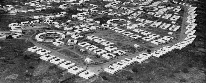
The community centres introduced by Maxwell Fry and Jane Drew became a key element in postwar colonial planning. These multipurpose spaces were designed to foster civic engagement and recreation, serving as venues for debates, discussions, and cultural expression, particularly through their association with the emerging Highlife music scene. Their establishment aimed to cultivate a sense of community in newly developed residential estates, addressing the social fragmentation that accompanied urbanization11
The development of these centres was reinforced by the 1937 Physical Training and Recreation Act, which empowered colonial authorities to invest in social and physical infrastructure12. This legislation reflected a broader recognition of societal shifts during the interwar period. A government report from the time highlighted concerns about the increasing leisure time available to the working class due to mechanization and reduced working hours:
“...the future is to see an extension of mechanization, a further reduction of working hours is likely to follow... but it is one thing to have spare time and another to know how to use it wisely. Already it is clear that there is little tradition of leisure amongst large classes of those to whom it has come, and the increase of leisure confronts us with a new social problem”13.
The community centre was conceived as a response to this “new social problem.”
Emerging prominently after the Second World War, it provided recreational opportunities while shaping civic consciousness. These centres became integral to colonial efforts to manage urban growth and promote social order in an era of rapid modernization. Maxwell Fry and Jane Drew’s experience designing educational and institutional facilities across West Africa—most notably the university campus in Ibadan, Nigeria—shaped their approach to the Accra Community Centre, the first of its kind.
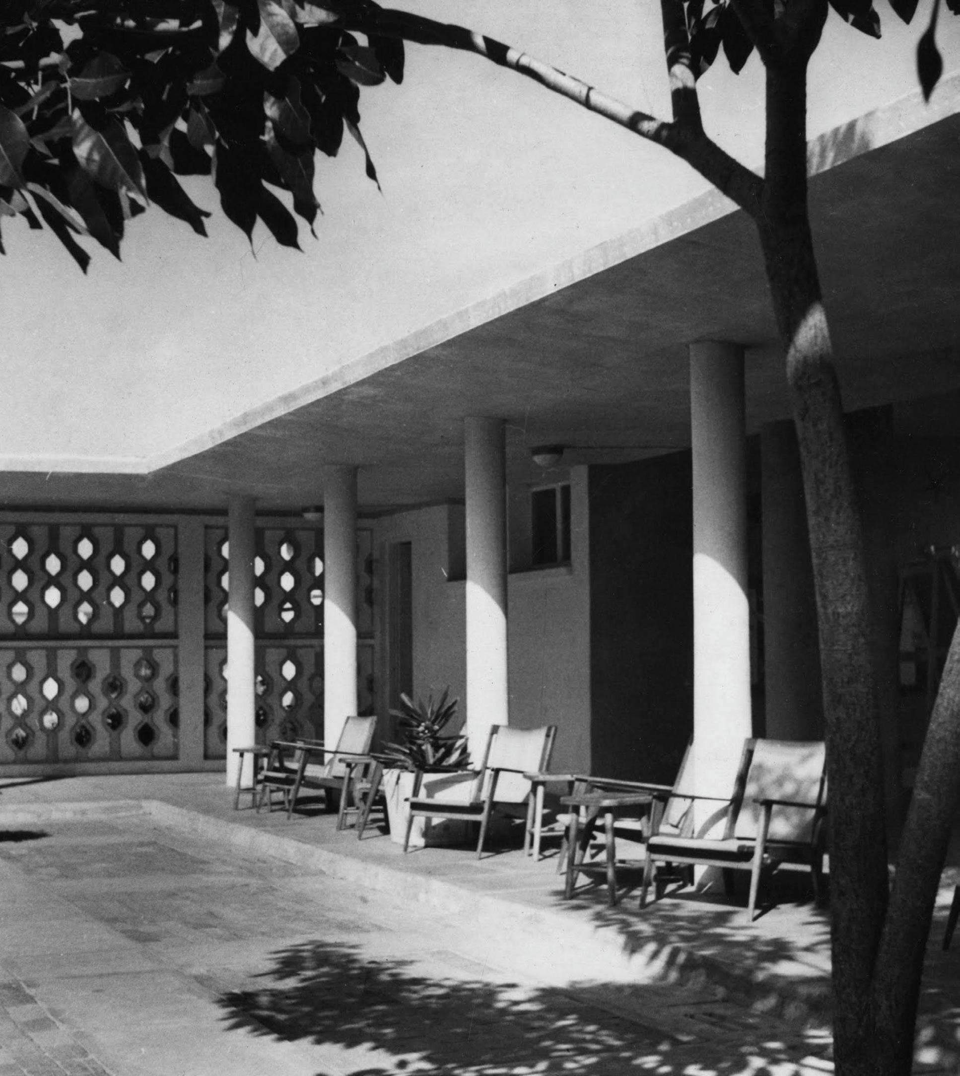
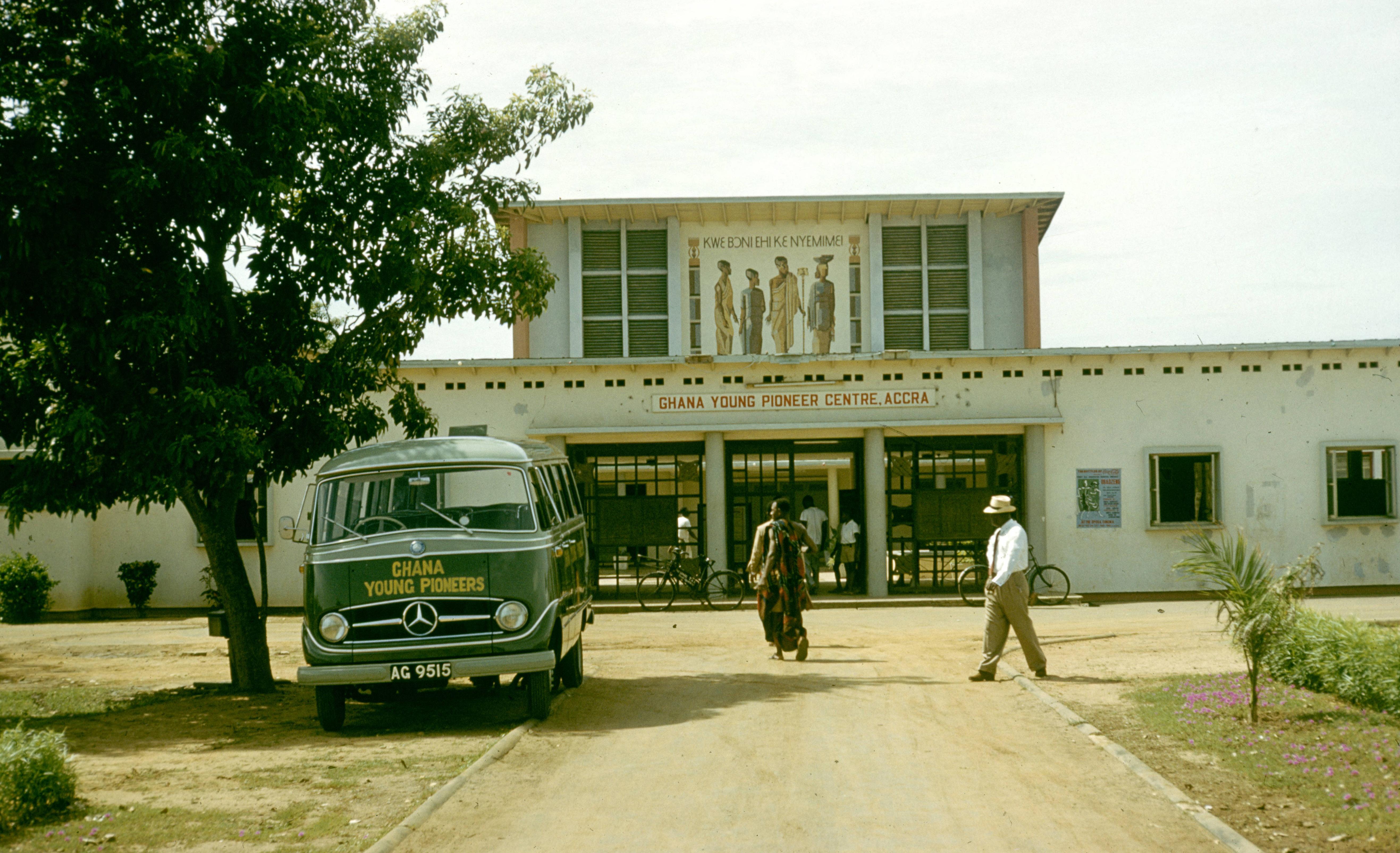
Their earlier projects influenced both the architectural language and the integration of community-oriented design principles14. The United Africa Company (UAC) commissioned and funded the Accra Community Centre amid widespread social unrest. Riots organized by returning servicemen were driven by frustrations over unfulfilled promises of remuneration after their participation in World War II. Seeking to ease tensions and rehabilitate its public image, the UAC used the project to present itself as a socially responsible institution15. A key symbol of this intent was the mural painted by Kofi Antubam on the community centre, of a group of people from the Ga ethnic group in traditional regalia. Its inscription, roughly translating to “It is good we live together as friends and one people,” encapsulated the ethos of the project. The mural emphasized the centre’s role not just as a physical space for leisure and community engagement, but also as a cultural and ideological tool for promoting harmony and collective identity in a post-war urban context. This notion is critiqued by Crimson when he writes that the mural on the community centre:
“represent reassuring images of pre-colonial rural life and unified nation; they imply continuity even if the location, appearance and function of the building they ornament is far from the life depicted in these images”16
The success of the Accra Community Centre led other corporations to invest in similar projects. One notable example was the African Manganese Corporation, which commissioned a community centre for mineworkers and their families in Tarkwa. Designed by Fry and Drew for the Tarkwa Urban Council, it followed the Accra model but was adapted to the needs of the mining community. Beyond recreation, these centres also functioned as tools for social control and moral engineering17. They dictated the use of leisure time outside of work, channelling the energy of workers and youth into structured, “productive” activities. In doing so, they sought to prevent participation in behaviours that colonial authorities deemed disruptive or immoral. The community centre was not a dwe berem. The culture had shifted, and with it, the way people gathered. They no longer met under a tree or beneath a canopy where bodies created form. Instead, there was structure, a space defined by walls and purpose. Traditional authority had fractured, and as a result, the social order changed.
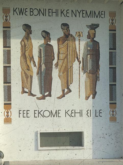
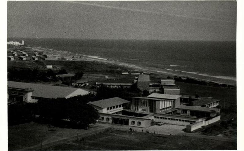
Unlike the open compound, which was a colonial adaptation of the traditional compound that still allowed familiar practices to continue, the community centre was a place for formal programs and respectable socialisation. It was not a space passing news, or celebrating festivals. It was not an extension of the king’s court. It became a setting for debates, discussions, and new forms of cultural expression.
The spatial dynamics of the 18th and 20th centuries were different. This shift affected how people interacted with each other. The dwe berem had been an open space, shaped by its surroundings rather than a fixed function. Over time, it ceased to exist in its earlier form. It remained a centre of commerce, but it was no longer part of communal life. It was no longer a place where the ancestors were called to witness and participate in events. The community centre became an institution. It was built by companies to create a sense of order and unity among workers after the world wars. Its form was not defined by the natural environment. It was a modern structure made of concrete, designed for visibility and transparency. It followed the principles of tropical modernism, with wide overhangs and cross-ventilated rooms. The courtyard and large veranda provided shaded seating beneath an extended roof. In this space, musicians explored the highlife genre. It was no longer the sound of traditional drums or the rhythms of the ancestors. It was something different, shaped by new influences.
Public space was not simply altered—it was fragmented, redefined, controlled. In the gyaase and dwe berem, the public was a state of being, an evolving entity, shifting as the occasion demanded. What was public was not a matter of walls or thresholds but the gathering itself, the connections that formed within it. The architecture served this flexibility and its purpose was determined by those who occupied it. That changed. The open compound compartmentalized it. The community centre divided it further. What had once been an interconnected landscape of functions, layered and continuous, became separate, delineated. And what happens when a people no longer gather as they once did? What happens when the spaces that once held their histories are replaced? If the people are at the community centre, dancing to highlife, then they will not remember. And if they do not remember, then they do not know who they are. And if they do not know who they are, they can be told. They can be reshaped in another’s image.
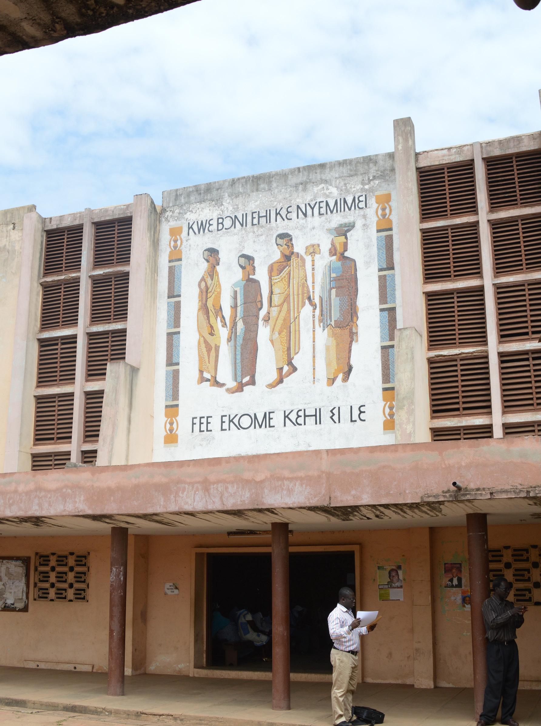
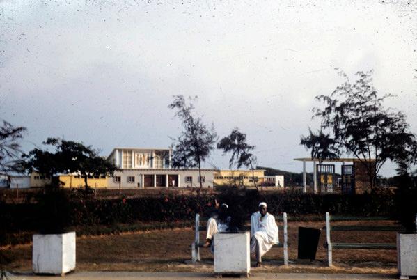
1.Samuel Bannerman-Wood, The Impact of the Colonial Legacy on Development in the Third World States: The Case of Ghana (1984), 13
2.Ibid.
3. Ibid
4. Gold Coast, Ordinance No. 38 of 1952.
5. Ibid
6. A. E. S. Alcock, “Tema, a New Town in Gold Coast,” Town & Country Planning (January 1955): 51–55.
7. Iain Jackson and Jessica Holland, The Architecture of Edwin Maxwell Fry and Jane Drew: Twentieth Century Architecture, Pioneer Modernism and the Tropics (London: Routledge, 2014), 202
8. Ibid, 205
9. Iain Jackson and Rexford Assasie Oppong, “The Planning of Late Colonial Village Housing in the Tropics: Tema Manhean, Ghana,” Planning Perspectives 34, no. 3 (2019): 485
10. Viviana d’Auria and Victor Kootin-Sanwu, “Between Development and Experiment: The Volta River Project’s (Un)settling Communities,” V. Brunfaut 500 (2010): 93–110.
11.Iain Jackson and Jessica Holland, The Architecture of Edwin Maxwell Fry and Jane Drew: Twentieth Century Architecture, Pioneer Modernism and the Tropics (London: Routledge, 2014), 194
12. National Advisory Council for Physical Training and Recreation, Memorandum on the Powers of Local Authorities on the Physical Training and Recreation Act 1937 (London: National Advisory Council for Physical Training and Recreation, 1937).
13. Ministry of Education (Great Britain), Community Centres (London: Ministry of Education, 1945), 3.
14. Iain Jackson and Jessica Holland, The Architecture of Edwin Maxwell Fry and Jane Drew: Twentieth Century Architecture, Pioneer Modernism and the Tropics (London: Routledge, 2014), 194
15. Ibid
16. Mark Crinson, Modern Architecture and the End of Empire (Aldershot: Ashgate, 2003), 148.
17. Nathan Plageman, Everyone Likes Saturday Night: A Social History of Popular Music and Masculinities in Urban Gold Coast/Ghana, 1900-1970 (Indiana: Indiana University Press, 2008), 211.
CHAPTER FOUR
On March 6, 1957, the British colony of the Gold Coast gained independence. At dawn, the new nation of Ghana was born. In this newly independent state, forging a unified national identity was essential for prosperity. Constructing a national culture not only symbolized a claim to legitimacy but also played a critical role in consolidating the power and independence of the government as an institution1.Under Kwame Nkrumah’s leadership, architecture and urban planning became tools for articulating this identity. By embracing the modernist movement, the administration sought to project a unified Ghanaian identity—one that transcended ethnic divisions and reflected a progressive, forward-looking society. As Lawrence Vail argues in Architecture, Power, and National Identity2), this approach fostered an imagined sense of community, unified under the façade of homogenous modernity. Yet, in doing so, it marginalized the architectural traditions of Ghana’s diverse ethnic groups and further disrupted the social fabric of the nation. The very cultural heritage that defined the people was overshadowed by an imported architectural language that prioritized anonymity and uniformity over local identity and tradition. This was not limited to the gathering spaces, the man jaano of the people
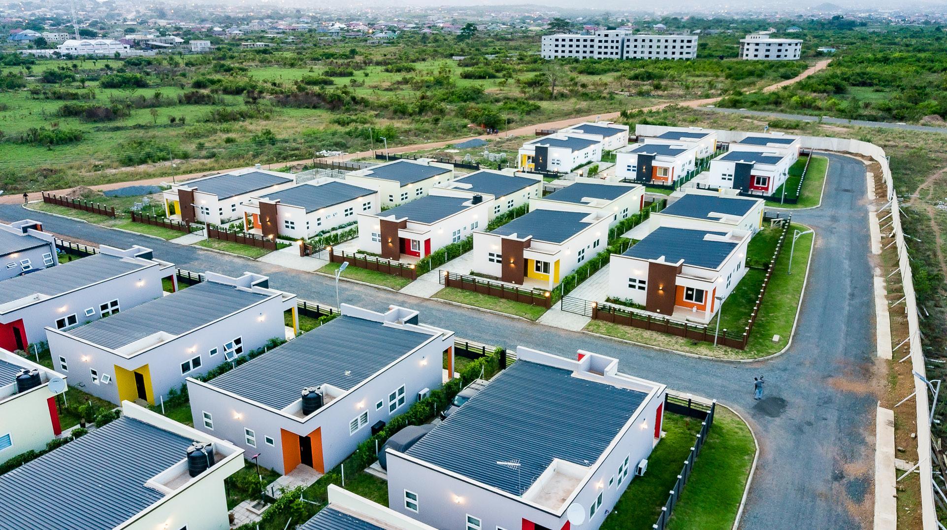
As cultural heritage was being eroded, the structure of the family was also changing. The nuclear family system increasingly replaced the extended family, reflecting a broader societal shift. Across all ethnic groups in Ghana, the extended family had traditionally been central to social organization. It served as the primary vehicle for transmitting values, socializing the youth, and protecting the elderly. However, as modernization took hold, family structures adapted, and state housing agencies reinforced this shift by designing homes that catered to nuclear families.
State housing policies supported this transition by subdividing land into smaller parcels—initially 100ft by 100ft, later reduced to 70ft by 100ft as land availability decreased. This grid-based planning, driven by land commodification and statutory regulations, facilitated the spread of self-contained homes. These residences emphasized privacy, featuring walled enclosures and the introduction of interior spaces such as living rooms and kitchens—design elements that remain prevalent today.
In this new housing model, the compound was replaced, and socialization took on a different form. Spontaneous encounters in shared courtyards gave way to isolation within enclosed homes. Walls, originally intended for protection, instead reinforced separation. People retreated into their private spaces, seeking safety—but from what? They sought peace of mind—but at what cost? The shift reflected a shift in what community meant, where privacy superseded collective interaction, and the built environment reinforced this status quo.
Epifania Akosua Amoo-Adare recounts her experience witnessing this transformation firsthand. As an architect in Accra, she observed the dominance of nuclear family housing designs, complete with imported materials such as English carpets and Italian tiles, which were ill-suited for the local climate and cultural practices. The new housing developments, perceived as prestigious, reinforced Western ideals of private ownership and domestic separation. Despite the architectural imposition, the social realities of Ghanaian life could not be easily reshaped. Family networks persisted, with extended kin finding ways to maintain connections even within the rigid spatial constraints of nuclear housing3
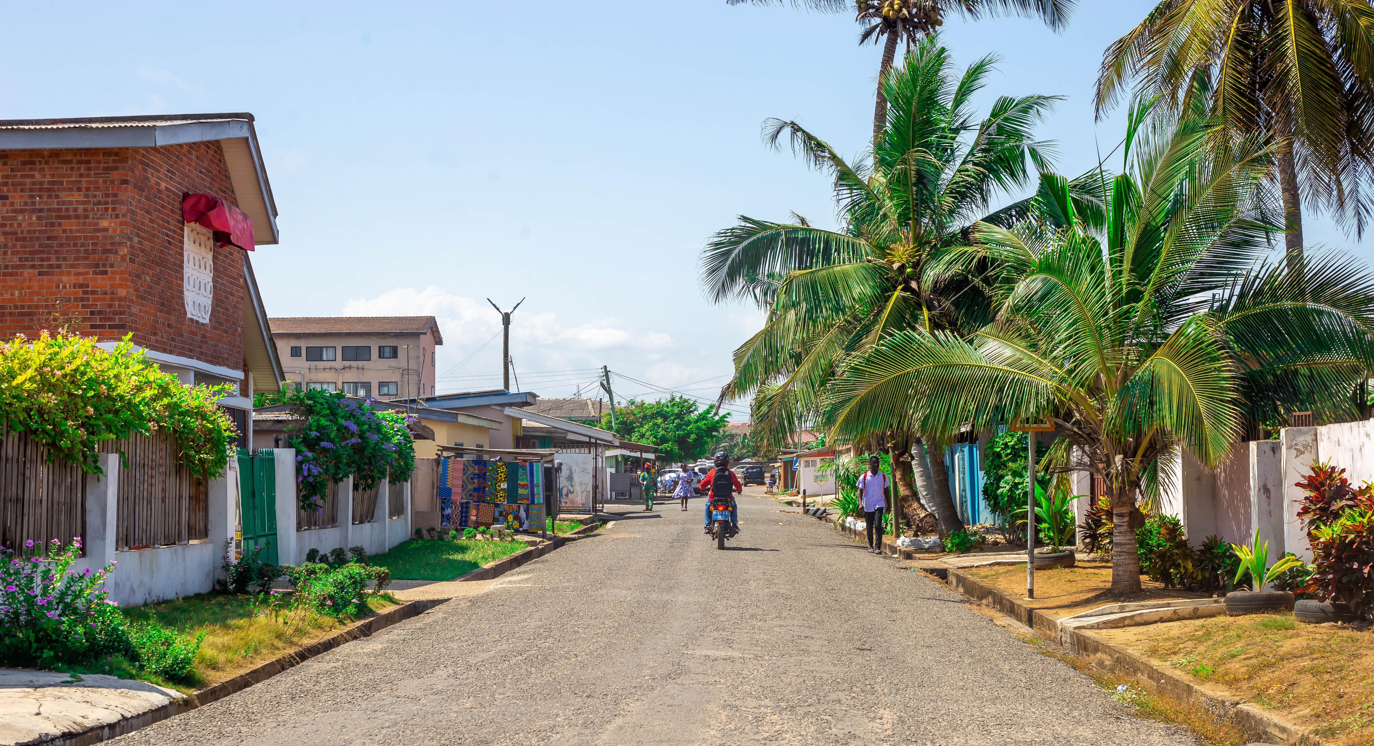
The design intervenes in this period of history — the Fourth Republic of Ghana in the 21st century — to respond to the now dominant nuclear family structure and the political heritage of the Ghanaian people. It seeks to redefine the dynamics of public space as it contends with private property, specifically in Accra. Rather than attempting to resolve the pluralistic legal frameworks that define the planning landscape, the design aims to thrive within them. Situated in the South La Estates in Accra, the proposal arranges four households collectively around a courtyard, functioning as a new “gyaase” that fosters communal living within the constraints of modern urban development.
The “gyaase” traditionally functioned as the extended household, where multiple families lived within a compound, sharing communal courtyards and fostering intergenerational support. This spatial typology allowed for economic cooperation, collective responsibility, and social cohesion. The courtyard was the heart of the space, where family members gathered, celebrated, and resolved disputes. This arrangement was inherently public, with private spaces blurred within the communal structure.
The open compound was designed as a modernist reinterpretation of the traditional compound house, which was often criticized for its unsanitary and climatically unsuitable qualities under colonial rule. While the open compound sought to address health concerns through design improvements, it also aimed to integrate communal elements within the framework of modernist architecture. However, this adaptation failed to fully capture the complexity of social life and cultural continuity present in the traditional compound, oversimplifying local customs to fit a Westernized vision.
This design proposal, therefore, seeks to reclaim the spirit of the gyaase within the constraints of contemporary urban planning. By arranging four households around a shared courtyard, the design not only fosters social interaction and cooperation but also challenges the rigid boundaries of private property. It reimagines the courtyard as a flexible, multi-functional space that can accommodate both private family gatherings and community events. It bridges the historical connection between the traditional compound and the urban developments of the 20th century, offering a new model for collective living in Accra today.
The ground in the new gyaase design transcends its physicality, drawing inspiration from the deep spiritual and cultural significance it held in traditional Ghanaian life. In the gyaase, the red earth was more than just a surface to walk on—it embodied ancestral connections and the cyclical nature of life that shaped the people’s worldview at the time. The tactile, visceral connection to the earth was central to the traditional compound’s identity.The paved ground in the open compound symbolized a broader move away from traditional ways of life. It prioritized hygiene and practicality at the cost of cultural resonance, reinforcing the divide between past and present. The compound’s modernist design—though functional—failed to honour the role the ground played in the social, cultural, and spiritual life of the people.
The new design seeks to restore this connection to the ground as a deliberate, symbolic act of reclaiming a deeper relationship with place. The ground in the new gyaase is red earth, reminiscent of the traditional compound, but it is also re-envisioned as a dynamic, multifaceted space that invites interaction and fosters community. It is not simply a surface but an active agent in shaping social life. In this design, the ground is intended to encourage daily interactions. It acts as an atrium, an open space from which the inhabitants can look down upon and engage with one another, blurring the lines between private and communal.
The ground, once a sacred symbol of ancestry, is now a place for modern activities—children playing, families gathering, and neighbours socializing. While the social activities may have shifted—cooking in the kitchen, elders gathering in living rooms—the ground remains a central element in fostering community, creating a space where the everyday lives of the inhabitants can be enriched by a sense of rootedness, connection, and continuity.The ground, in this context, becomes a reminder not only of the past but also of the possibilities for future relationships between the inhabitants and their space. It is both a grounding force, offering a connection to ancestry, and a space for the new rhythms of daily life to unfold. As an extension of the living room, it invites interaction, openness, and shared experiences, reaffirming the importance of collective living in contemporary urban settings.
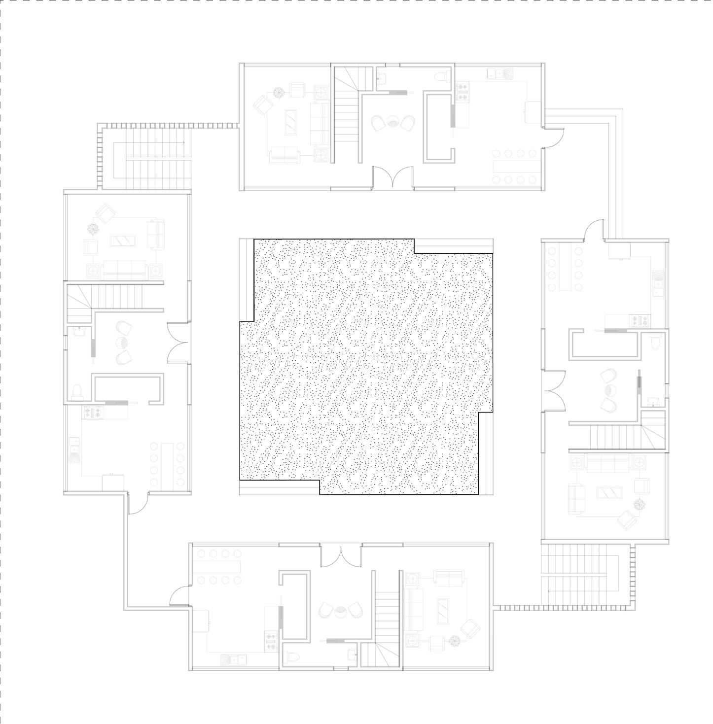
In this new gyaase, the plinth and stairs are reinterpreted as the veranda and stairs. These elements are not designed to simply elevate or ground the inhabitants but to memorialize their essence, acknowledging their historical role in shaping the compound’s spatial and social dynamics. Rather than being static architectural features, they serve as reminders of past communal life while adapting to contemporary urban realities. The strategic placement of stairs mirrors the discontinuous nature of the plinth and stairs in the traditional gyaase, reinforcing a rhythmic movement through space. The act of ascending and descending reflects the ebb and flow of daily life. The stairs, rather than serving solely as transitional elements, become activated zones— places to run up and down, and to engage with others in passing moments.
The design emphasizes these spaces as “nooks of engagement,” where informal interactions naturally occur. The veranda functions as a threshold between private and communal life, offering a shaded, elevated platform for observation and interaction. It allows inhabitants to witness and participate in the activities unfolding in the courtyard—whether it is children playing, neighbours conversing, or families gathering. These design elements subtly encourage people to step out of their enclosed spaces and into shared environments, reinforcing the sense of belonging and community.
By incorporating the rectilinear rigor of the veranda of the open compound, the design dissolves social hierarchy—no single person is elevated above others. The veranda and stairs, is here an intermediary rather than signifying hierarchy. This approach is rooted in Ghana’s political history, where colonial rule disrupted traditional power structures, and post-independence governance sought to unify a society that was beginning to lose its identity. In this context, the veranda and stairs act as symbols of transition, bridging the colonial past with the present. They connect historical spatial traditions to the evolving social dynamics of contemporary urban life.
These elements are not merely architectural features; they are experiential spaces. They invite people to slow down, connect, and create shared experiences.
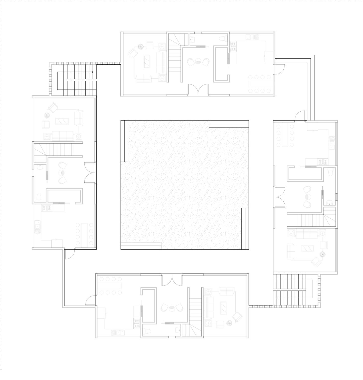
The boundary plays a crucial role in redefining the traditional gyaase while also responding to the needs of modern urban living. The boundary in the design is a blend of these historical precedents, but diverges significantly in its approach. The masonry walls of each duplex are both a physical and visual boundary, creating a clear demarcation of private and communal spaces while also providing views both inward toward the courtyard and outward to the surrounding environment. This dual-directional view is significant, as it connects the inhabitants to the outside world, offering a sense of openness while still maintaining a sense of enclosure and privacy within the compound. .
The design of the duplexes borders the veranda and stairs, as well as the ground, drawing on the structure of the gyaase while modernizing it. The staggered placement of the duplexes, with slight shifts that prevent them from being fully aligned, echoes the traditional gyaase’s more organic, asymmetrical layout. This deliberate misalignment creates an ever-changing series of obstructions, where no two points of vision are the same. The addition of two staircases at the corners of the duplexes, leading to the roof adds to the layered complexity. These staircases provide access to a private space above the compound and also symbolize an elevated, distanced perspective from the world below. The roof then becomes a space of retreat, reflection, and observation, while still being connected to the overall design and social fabric of the courtyard.
By creating these visual barriers and shifting perspectives, the design encourages a more introspective relationship with the space. The inhabitants are not fully cut off from the outside world, but they are afforded moments of privacy and contemplation. The boundary, as conceived here, does not simply separate—it also mediates between inside and outside, public and private. This allows the design to navigate the complexities of urban life in Accra while staying true to the traditions of the gyaase, where the boundary was both a protective force and a symbolic demarcation of community and heritage. The boundary serves not only as a functional and aesthetic element but also as a key mechanism for fostering the social and experiential dynamics of the new gyaase.
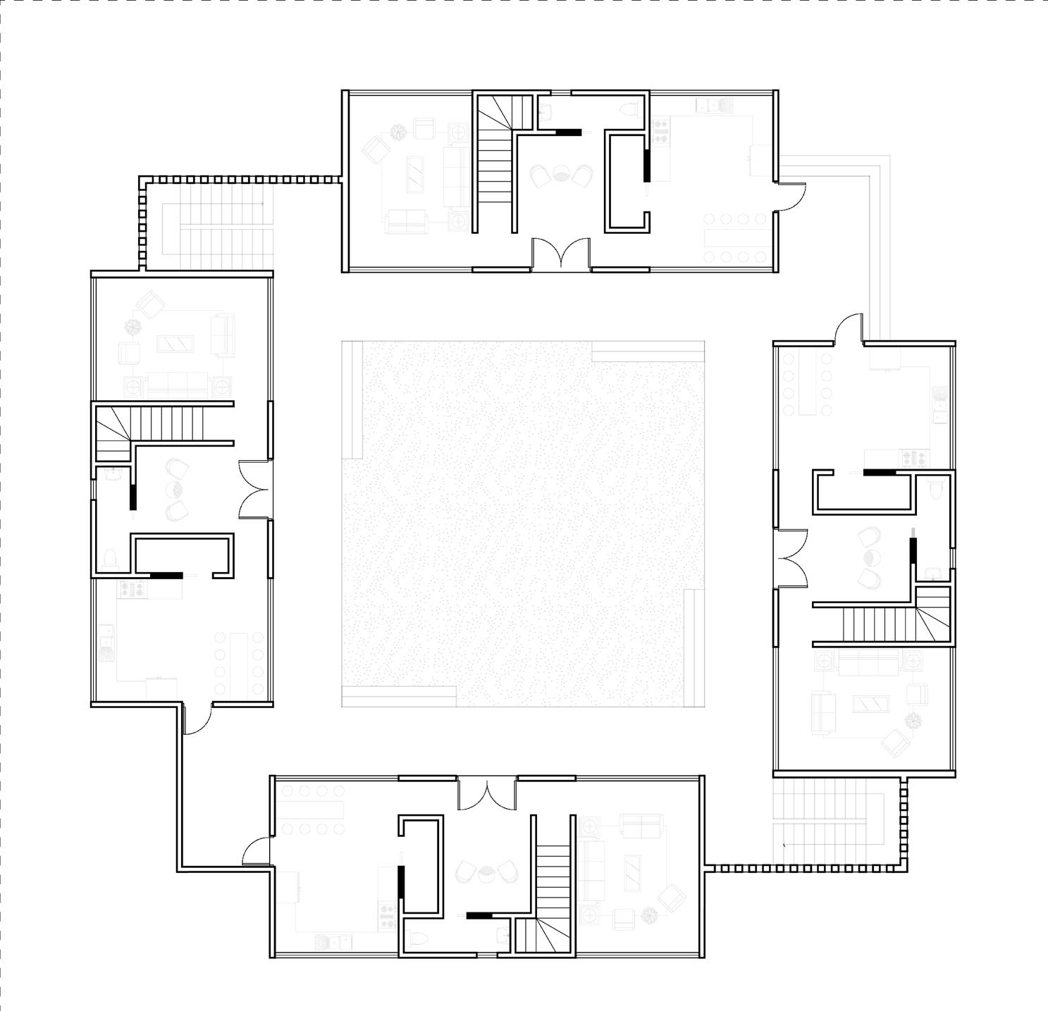
In this design, the ground, veranda and stairs, and boundary work together to form a cohesive gyaase that honors the spatial traditions of the past while adapting to the complexities of contemporary urban life. The integration of these elements is a response to the changing dynamics of family, community, and identity in modern Accra.
The ground forms the foundation of this new gyaase. In the design, the ground is reinterpreted as a central, dynamic space that encourages interaction, play, and engagement. It serves as an extension of the living room, inviting people to step outside their private homes and into a communal space where social connections are formed. The ground fosters an experience of rootedness, creating a tactile link to the past while simultaneously accommodating the activities and expectations of modern life. The veranda and stairs are the next key elements in this design. Drawing inspiration from the traditional plinth and stairs, these features serve as transitional spaces, mediating between the private interiors and the communal courtyard. The veranda and stairs are not meant to elevate or segregate but to create a fluid, interactive space where hierarchy is dissolved, and social interaction can flourish.
Finally, the boundary plays a critical role in defining the space while maintaining a dialogue between inside and outside. The critiques assignes the boundary the role of transparency and openness. The staggered arrangement of the duplexes prevents alignment, giving the impression of an inward, more introspective atmosphere upon entrance; wahat one would have imagined existed before. The boundary, therefore, becomes both a protective and mediating force, preserving the sanctity of communal life within while allowing for a degree of interaction with the outside world.
Together, the ground, veranda and stairs, and boundary form a cohesive whole, reconnecting the inhabitants with their spatial traditions while offering an adaptive response to the pressures of modern urban living. These elements reinforcs the collective identity, memory, and cultural continuity of the community, ensuring that the new gyaase serves as both a memorial to the past and a vibrant, environment for the future..
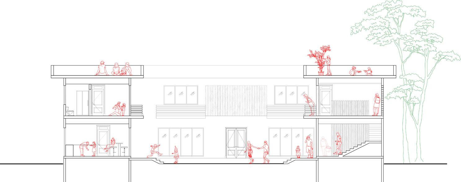
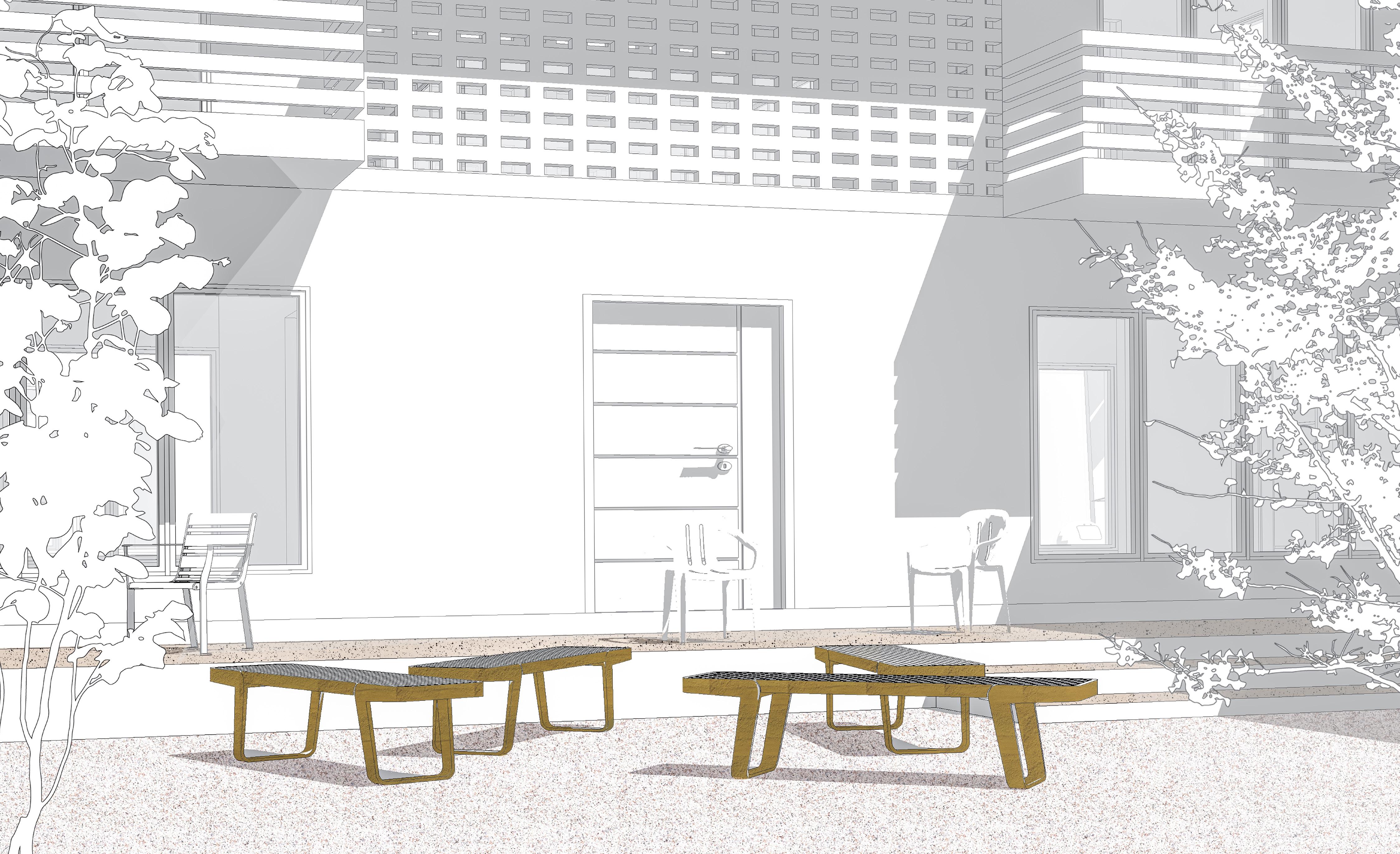
The marketplace today remains a dynamic public space, primarily dedicated to commerce but still activated by essential spatial elements. While its ceremonial functions have faded, foundational features such as shade and spatial organization continue to shape how people interact with the space.The tree remains a key landmark, guiding both vendors and customers. It is not just a natural feature but a functional anchor around which activity revolves. Beneath its branches, people gather, vendors set up their stalls, and customers pause to rest. The tree provides an intuitive sense of orientation and acts as a centre of movement and engagement.
Umbrellas, supplied by companies as advertisements, have become an informal yet defining feature of today’s marketplaces. Vendors arrange them to create shaded zones for transactions, offering shelter from the heat while encouraging moments of social interaction. Though their role has shifted from the symbolic umbrellas of the past, they still serve a critical function in structuring the marketplace, defining areas for rest, commerce, and movement. These umbrellas, varying in size and colour, create a visually dynamic landscape that reflects the energy of the market.The combination of natural and artificial shade facilitates both commerce and communal interaction. It is within these shaded pockets that markets come to life—where vendors engage with customers, negotiations unfold, and spontaneous social encounters happen. The tree and the umbrella together shape the space, making it intuitive and inviting for people to gather.
Public spaces continue to function as adaptable environments, shaped not by rigid planning but by the everyday needs of those who use them. The marketplace, while modernized, still follows the same logic of flexibility that has long defined Ghanaian public spaces. The elements that once gave the marketplace its rhythm— shade, trees, and the organic flow of movement—are still in use today. They remain tools for activating public space, creating continuity between past and present. By responding to the needs of vendors and customers alike, these spaces are not only sustained but constantly reshaped. The market remains a living entity, defined by the interaction between people and the elements that make gathering possible.

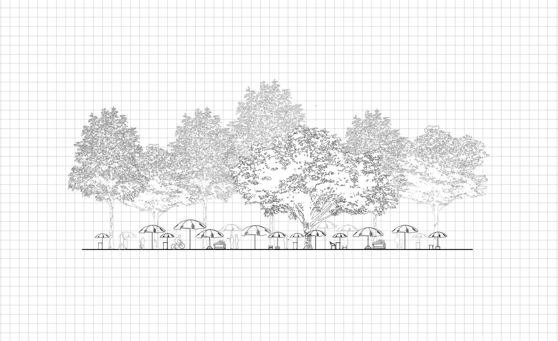
The design critique challenges contemporary planning and the delineation of plot sizes that does not make provision for the fluid nature of the public. Drawing inspiration from the architectural elements associated with the dwe berem, the project does not merely aim to recreate the past; rather, it seeks to engage in a thoughtful dialogue between historical spatial practices and modern urban realities. This is not a nostalgic reflection but a critical exploration of how public space, communal living, and private ownership intersect in today’s context.
The design addresses the challenge of integrating communal living within the rigid framework of modern urban planning. The site of South La Estates serves as an ideal test case for this approach, as it presents an opportunity to challenge the zoning regulations that dominate the city. These regulations enforce a division between public and private spaces— often neglecting the interconnectedness between living areas, communal activities, and public functions that are perculiar to traditional Ghanaian communities.
In response to the current planning system, the design proposes a radical approach to housing. Instead of adhering to the isolated single-family plots, the design introduces a shared compound model where sixteen families live together in a single, interconnected space. This communal arrangement, built around shared courtyards and flexible spaces, challenges the concept of private property as it relates to public life. The compound functions as a modular unit, which can be replicated to form multiple clusters throughout the urban fabric, allowing for the creation of larger communities that foster exchange and collaboration.
This new form of living proposes a shift away from the isolated, individualistic notion of private property that is so prevalent in urban development today. The design aims to create spaces that are not only functional but that also encourage social interaction, cultural exchange, and a sense of shared identity. This critique recognizes the potential of traditional spatial practices in order to engage with contemporary challenges, offering a blueprint for a more interconnected, flexible, and communal future in urban design.
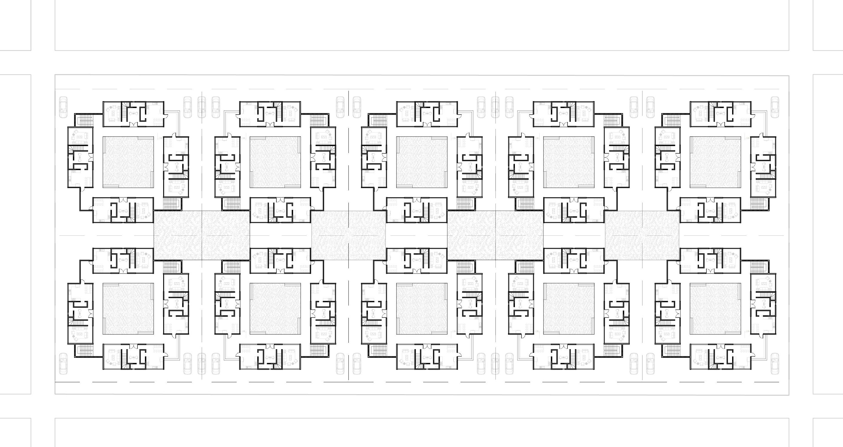
Trees are the first element introduced. In the dwe berem, trees were landmarks, symbols of ancestral connection, and focal points for communal activities By virtue of the number; height and striking imposition, they linked the past with the present; doubling as commerce centres through their interaction with wind, light and the umbrellas and the body. This design builds upon these historical functions by reintroducing trees as central elements that mark the space and activate it.
The shadow of the tree’s crown cast on the ground forms a refuge from the scorching sun. Within this shifting boundary lies a space for rest, conversation, and social interaction. The edge of the shadow invites vendors to set up shop or encourages the arrangement of benches for a game of checkers. As the shadow moves with the setting sun, it subtly directs movement and shapes the rhythms of public life. Beyond their immediate function, trees define temporal and spatial thresholds. Their shadows shift throughout the day, subtly guiding movement and reorganizing activities. As living markers of time, they transform spaces from morning to evening, structuring the rhythms of daily life.
Trees activate space. In the community centre, public life was meant to unfold within concrete walls. Unlike static buildings, trees grow, trees change and in turn influence the evolving patterns of human activity around it. The 21st-century market attests to the tree’s persistence—the lone tree, by its very existence, continues to shape the public realm. It works alongside artificial canopies to form a layered system of shade. The lone tree is an open host for social exchange, communal gatherings, and moments of solitary reflection. The design critique employs this tactic—introducing the tree understanding it functions as a focal point, offering shelter, anchoring activities, and shaping public life.
The tree is an active agent that reinforces the idea of a living, evolving space. By responding to changing light, wind, and human activity, trees create dynamic territories that provide not only respite from the sun but also structure movement, shaping and being shaped by the rhythms of daily life. As living infrastructure, they challenge conventional urban frameworks, offering an ever-changing vision of public space— one shadow, one breath of wind, and one rooted presence at a time.
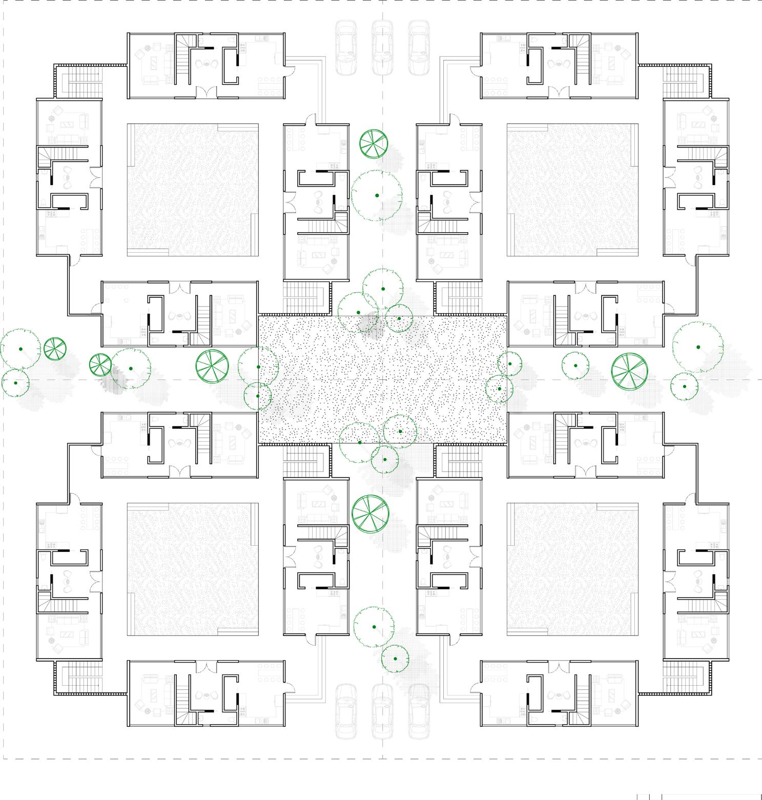
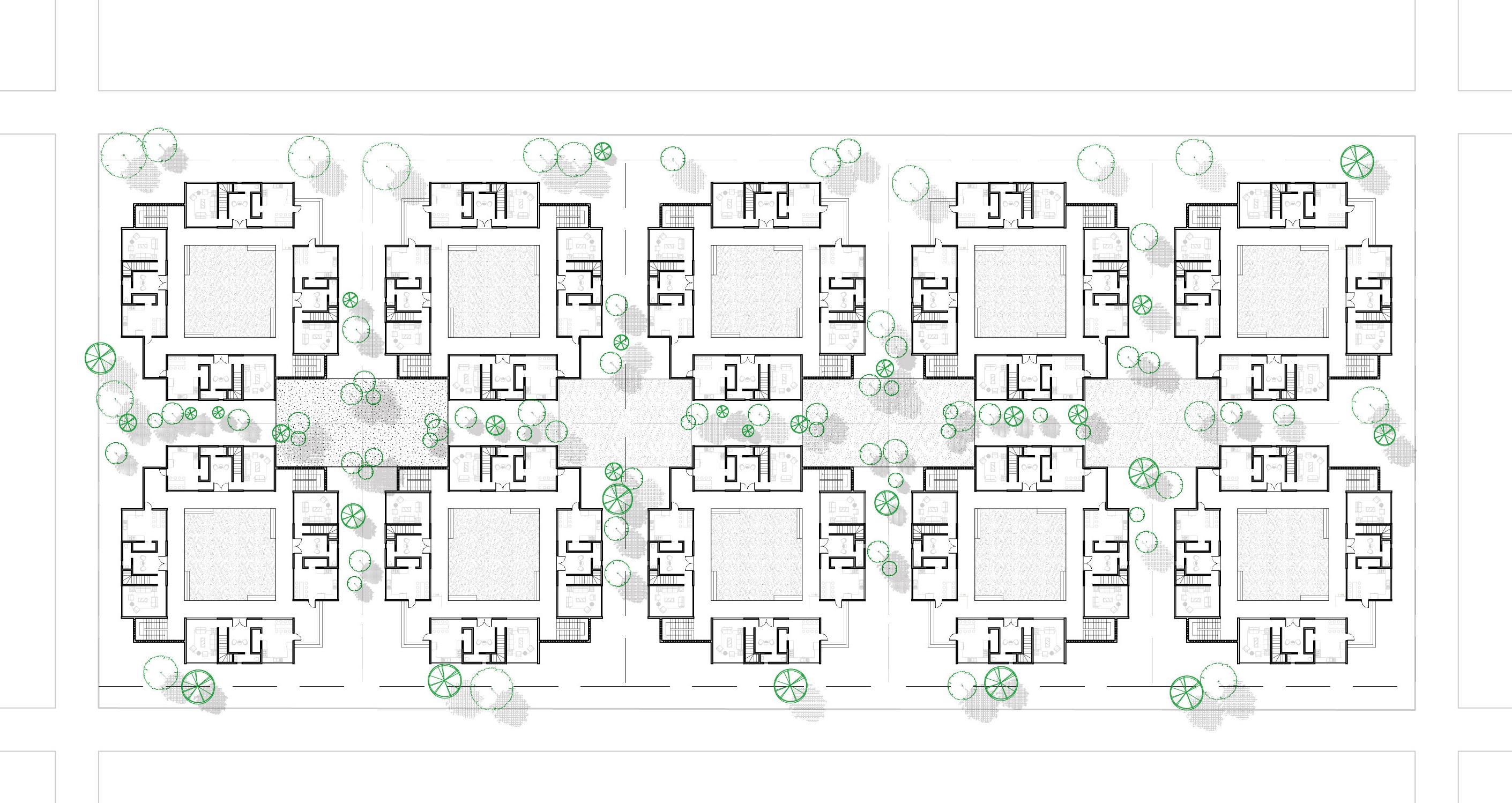
In the design, the umbrella plays a central role in shaping spatial experiences, linking traditional practices to contemporary needs. Inspired by indigenous shading methods, the umbrella becomes an adaptable feature that transforms the space according to its use and the movement of people. Traditionally, the umbrella was more than a shade provider—it was an emblem of authority and status. The ceremonial umbrella played a key role in important events, serving as a focal point for gatherings beneath its canopy. When integrated into the new design, it forms a layered canopy under the trees that offers refuge to those beneath it, creating distinct zones for rest, interaction, and reflection within the dynamic marketplace space. This layering enhances the spatial experience, providing comfort while encouraging both informal exchanges and moments of quiet respite.
Unlike the past, where umbrellas in the dwe berem carried deep symbolic weight, today’s marketplaces feature umbrellas supplied by companies as a form of advertisement. The umbrellas are still brightly coloured and vary in size but transform market spaces into a patchwork of corporate logos and commercial messages. While their function remains the same—offering shade and protection—their presence now reflects the commodification of public space. The umbrellas in the design acknowledge this shift and introduce the umbrella akin to its original form. It retains the bright colors and varying sizes seen in today’s marketplaces and draws from traditional forms rather than commercial branding. It becomes an appropriation of the traditional type—similar in essence, yet distinct in its purpose as a spatial tool that organizes and frames interactions.
The umbrellas under the trees solidify the design critique as a modern-day dwe berem, where temporal elements create fluid, adaptable space. The space created, can be reconfigured, merged or collapsed in response to the public’s needs. The umbrella and its physical relationship with the tree forces the people to gather as they once did; to recreate the spaces that once held their histories. The people that were once at the community centre, dancing to highlife will then remember. Then they might know who they are. They will not be told. They will write their own image.
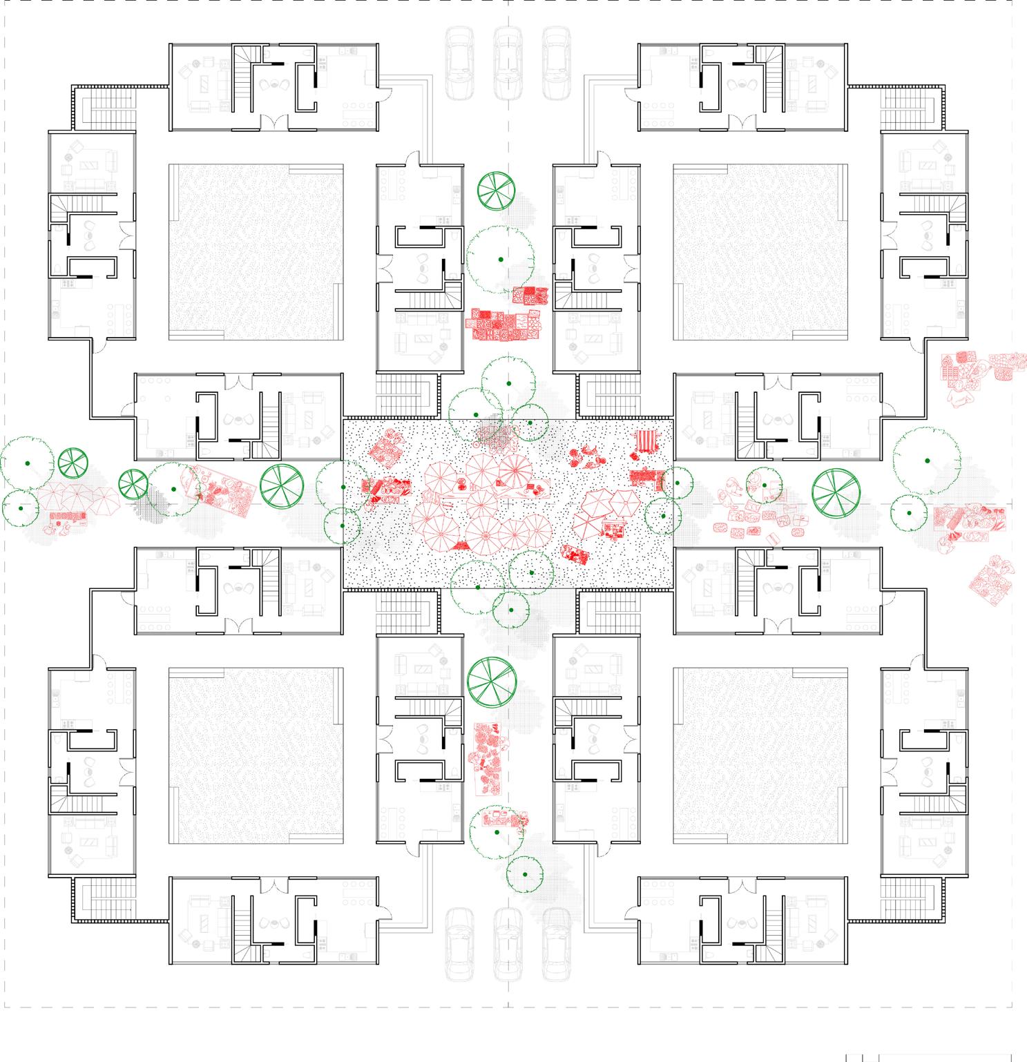
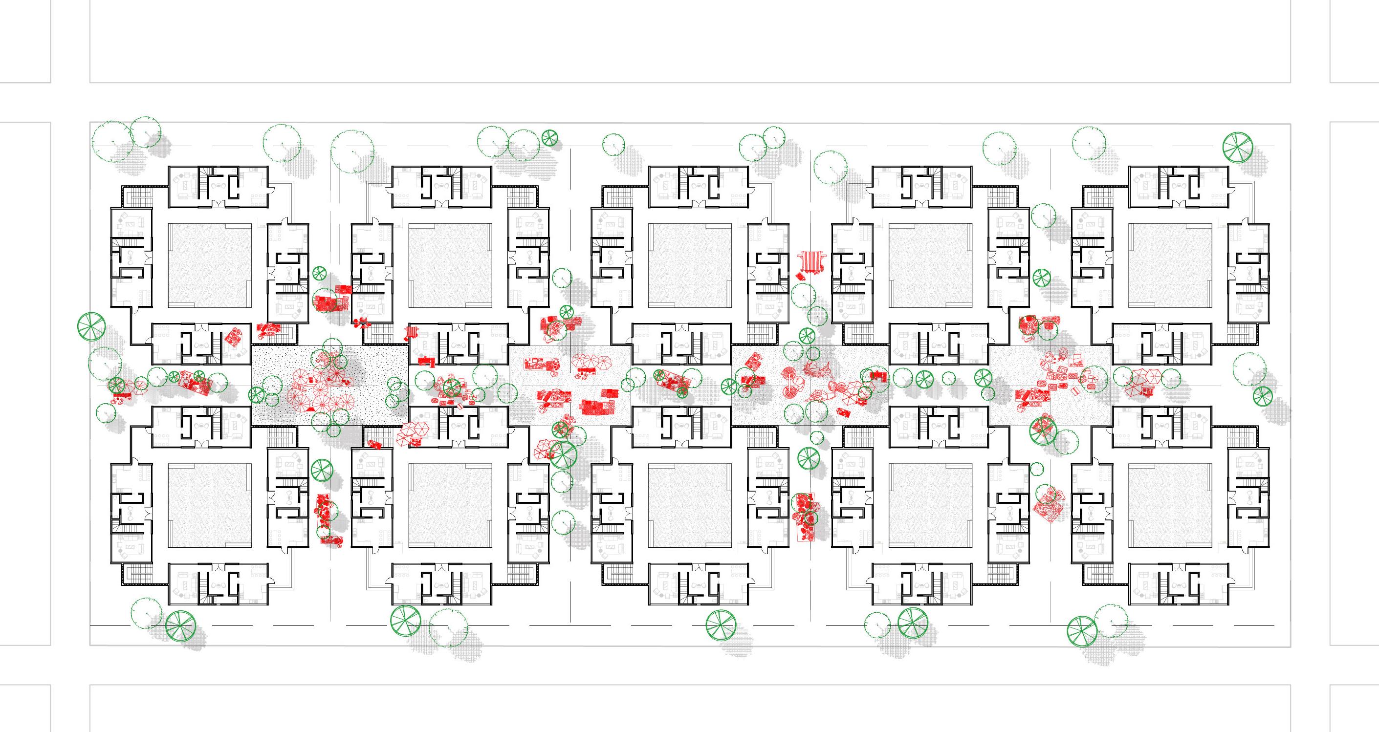
The project serves as a provocation, questioning the planning practices that have led to the separation of private and public spaces, culminating in the isolated single-family plots and a disconnect between the built environment and the social fabric. In contrast, this design intentionally creates spaces in between the buildings— shared areas that promote interaction, collective living, and a sense of community. The larger communal ground that emerges from this arrangement mirrors traditional spatial practices, where public and private boundaries were more fluid and intertwined, reflecting the interconnectedness of daily life.
By introducing communal grounds in between the buildings, the design challenges the modernist notion of strict separation between different functions—living, working, and gathering. These spaces, which are not purely private or public, become subtle zones that foster interaction and social cohesion. They encourage residents to engage with one another and with their environment in ways that the conventional, segregated urban design cannot.
The tree in the reimagined dwe bere is the permanent feature, working with the umbrellas too create distinct zomes and collective engagement. By merging these elements, the design establishes a space that is both culturally grounded and responsive to the present, inviting the public to engage, connect, and participate in the ongoing creation of the environment around them. The creation of these communal spaces reasserts the importance of collective living while still adapting to the realities of modern urban life. This conseequently provides a model for how contemporary cities can be designed with a more integrated approach to space. Instead of reinforcing division, the design seeks to blur boundaries and create opportunities for social interaction, collective identity, and shared experiences.
The trees and umbrellas create a shifting space; a setting to draw people together and to create a place of shared experience and memory. They are in the design catalysts for the formation of public life, forging a collective identity and sense of community within the space.A space that evolves where identity, history and modern needs converge, allowing people to define their own space and in turn their own public.
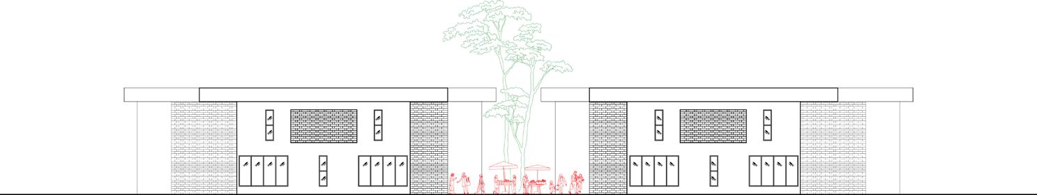
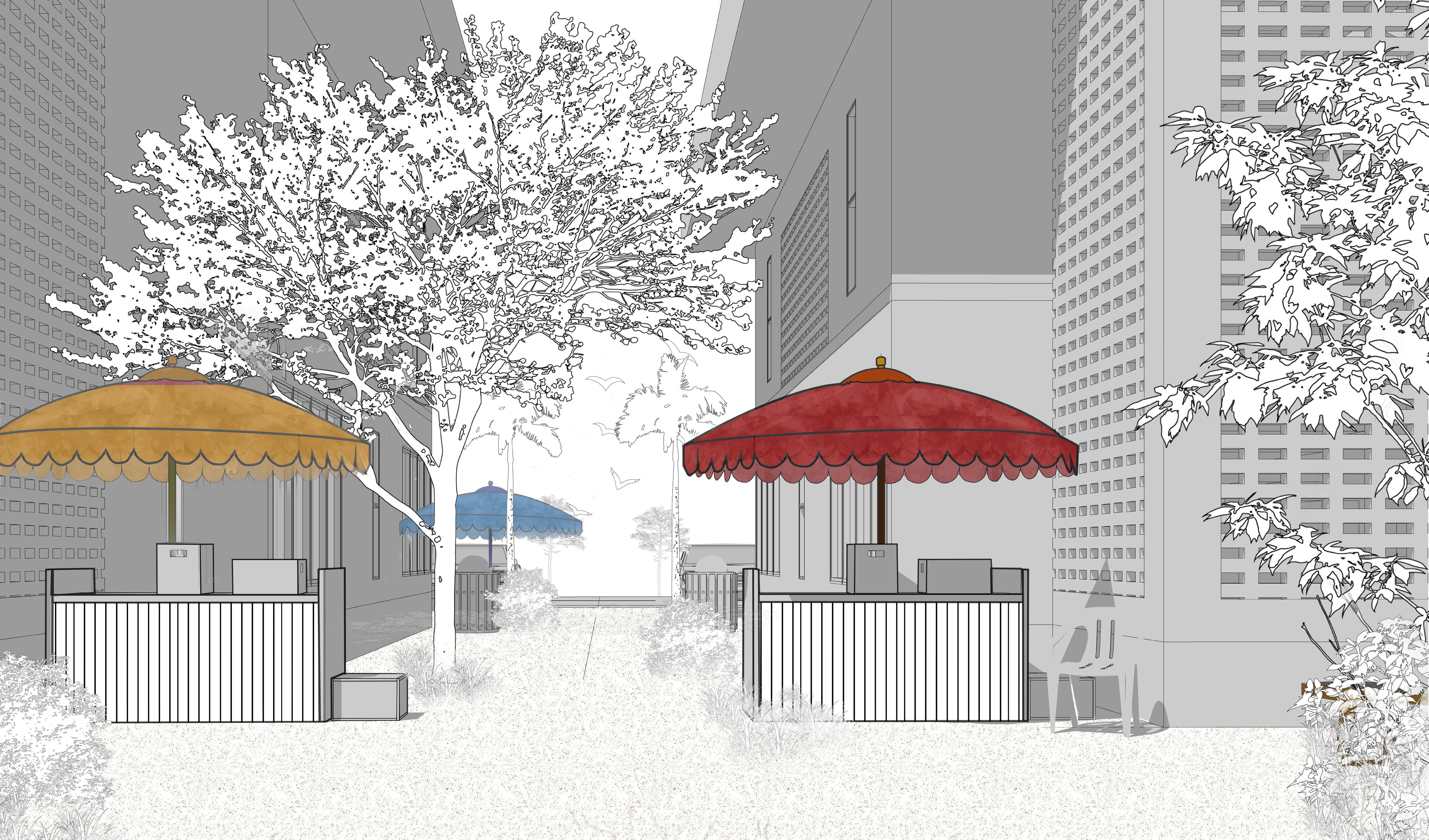
1. Janet Berry Hess, “Imagining Architecture: The Structure of Nationalism in Accra, Ghana,” Africa Today 47, no. 2 (Spring 2000): 42, https://www.jstor.org/stable/4187331.
2. Ibid
3. Epifania Akosua Amoo-Adare, “Architecture/Urban Studies,” in The Womanist Reader, 1st ed. (London: Routledge, 2006), 12, https://doi.org/10.4324/9780203943670.
The evolution of land tenure in Ghana, spanning precolonial, colonial, and postcolonial periods, has profoundly shaped the way public and private spaces are understood and experienced. The duality of legal systems in the post-colonial era has resulted in tensions, particularly in the public realm, where rigid distinctions between public and private spaces often fail to capture the nature of social interactions. At its core, this thesis began with the recognition that Ghana’s urban spaces have long been battlegrounds for competing interests— colonial legacies, customary practices, and modern planning frameworks. It has argued that reclaiming the Ghanaian concept of public space is essential for urban design. The design intervention provoked a response by introducing a new gyaase and a reimagined dwe berem, offering a different take on the relationship between private property and the public realm. These spaces challenge conventional boundaries, demonstrating how private traditions and rituals can extend beyond the home into communal and shared experiences. Public spaces should not be seen as static or predefined but as adaptable environments — responsive, constantly evolving, and reflecting the lived experiences of the people.
In this context, rethinking the concept of public space is not about imposing new or foreign structures but about understanding the lived experiences and social dynamics that naturally exist. Redefining public space in Ghana means acknowledging that it is not a one-size-fits-all concept but a flexible entity that responds to the needs, customs, and desires of the community. It involves recognizing the ways in which these spaces are shaped by both formal and informal rules of use.
This perspective on public and private spaces offers an opportunity to rethink urban design practices. Rather than attempting to separate the two categories, urban spaces in Ghana can be seen as places of overlap, where social exchange and community life can thrive across different contexts. The challenge for urban designers, then, is to create environments that respect and facilitate these fluid transitions between public and private, , ensuring that spaces are attentive to the identity of the people they serve, respectful of history, and sensitive to local customs and traditions.
The thesis presents man jaano.
A canvas to be painted on and the repainted by the customs, interactions and rituals of the people. The man jaano is a marketplace where gossip is exchanged; a courtyard where generations converge. The man jaano is where the private meets the collective in a silent dance.
And to design for Ghana’s future is to partake in this dance. To mark and activate spaces that are born in tradition. To understand the history of the Ghanaian people and their appreciation of space. Spaces that do not stand still but breathe. The past should not be forgotten in pursuit of the present.
And the definition of a national identity through architecture can be found in the gentle overlap of past and present, in the quiet understanding that public and private are not opposites but intertwined threads in the fabric of everyday life.

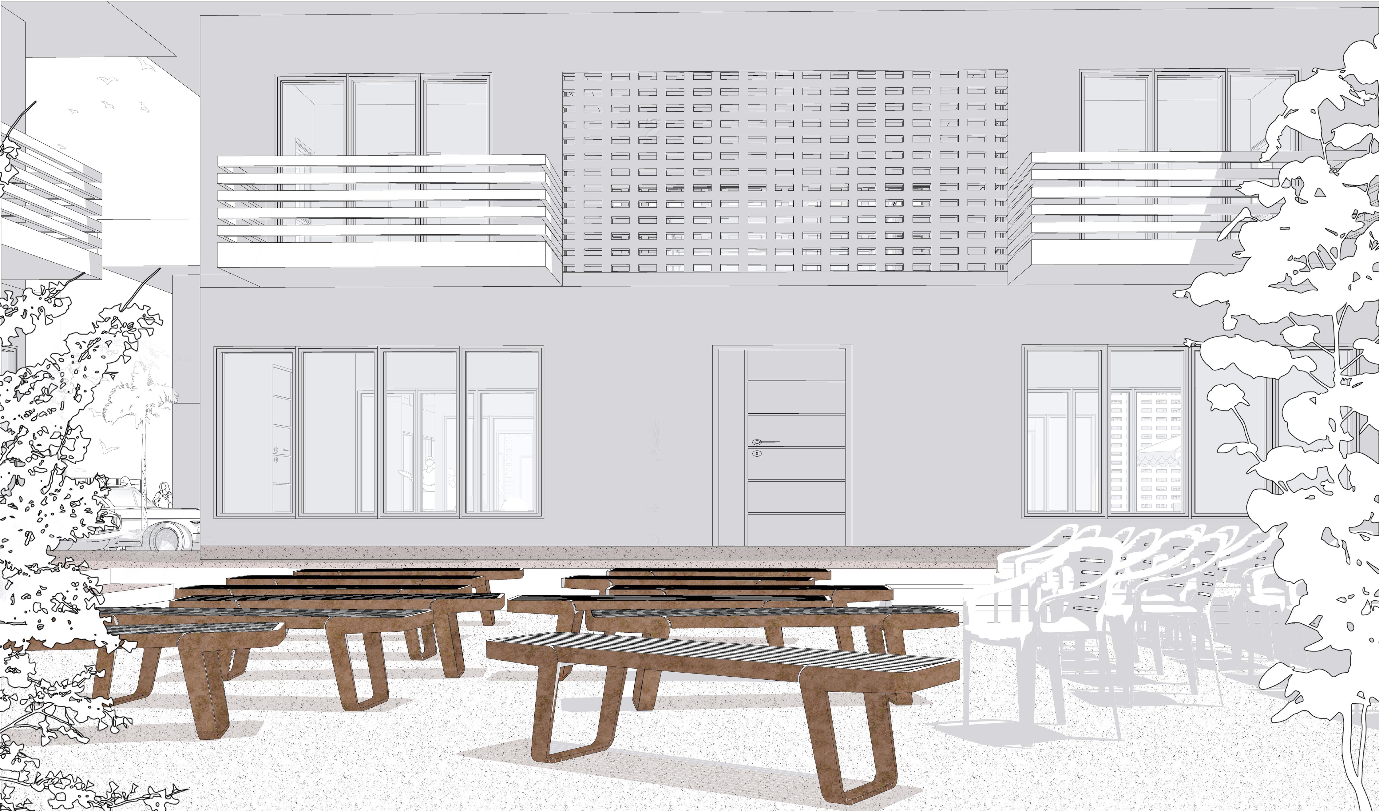
Thanks be to God, who always causes us to triumph. To Him, I owe all gratitude. I extend my deepest thanks to my lecturers, Platon Issaias and Hamed Khosravi, for your rigorous and constructive criticism, which has significantly shaped this thesis.
Anna Font, I am immensely grateful not only for your patience and unwavering support but also for challenging me to move beyond complacency and being an email away from reading my 1000th draft. Roozbeh Elia-Azar, Cristina Gamboa, and Daryan Knoblauch, your contributions during terms one and two were invaluable, and I deeply appreciate the guidance you provided.
The LADMA office at La Dadekotopon Municipality was an indispensable source of information about the La township. My heartfelt thanks go to Honourable Solomon Nii Kotey Nikoi and Mr. Redeemer for taking the time to guide me through the township and sharing insights into the architecture and way of life of its inhabitants.
To my parents, thank you for being my foundation and always believing in me. To my siblings, you’ve always had my back, and I am endlessly grateful. To my friends, your support and encouragement have been tremendous, and I couldn’t have done this without you.
God bless you all for your unwavering support and unflinching faith in me.
A. E. S. Alcock, “Tema, a New Town in Gold Coast,” Town & Country Planning (January 1955): 51–55.
Agbosu, Lennox Kwame. “Land Law in Ghana: Contradiction between AngloAmerican and Customary Conceptions of Tenure and Practices,” 2000.
Allott, Antony. New Essays in African Law (London: Oxford University Press, 1970), quoted in Joseph Blocher, “Building on Custom: Land Tenure Policy and Economic Development in Ghana,” 184.
Amanor, Kojo. “The Changing Face of Customary Land Tenure.” In Contesting Land and Custom in Ghana: State, Chiefs and the Citizen, 55–80 (Leiden: Leiden University Press, 2008).
Amanor, Kojo. “Securing Land Rights in Ghana,” in Legalising Land Rights: Local Practices, State Responses and Tenure Security in Africa, Asia and Latin America, ed. Janine M. Ubink, André J. Hoekema, and Willem J. Assies (Leiden: Leiden University Press, 2009), 118.
Asante, Samuel K. B. “Interests in Land in the Customary Law of Ghana: A New Appraisal,” The Yale Law Journal 74, no. 5 (April 1965): 848–885, https://www.jstor. org/stable/794709.
Barker, Arthur, and Michael Louw, “Evolution of the Boundary: Theories of Threshold, Poché and Stereotomic Design, and Their Manifestation in the Work of Henri Comrie,” South African Journal of Art History (2022): 1–26.
Benning, R.B. “Land Ownership, Divestiture and Beneficiary Rights in Northern Ghana,” in Decentralisation, Land Tenure and Land Administration in Northern Ghana: Report on a Seminar Held at Bolgatanga, Konrad Adenauer Foundation, 1996, 28-30.
Berry Hess, Janet. “Imagining Architecture: The Structure of Nationalism in Accra, Ghana,” Africa Today 47, no. 2 (Spring 2000): 42,
Blocher, Joseph. “Building on Custom: Land Tenure Policy and Economic Development in Ghana.” Yale Hum. Rts. & Dev. LJ 9 (2006): 166.
Boamah, Emmanuel Frimpong, and Clifford Amoako. “Planning by (Mis)rule of Laws: The Idiom and Dilemma of Planning within Ghana’s Dual Legal Land Systems.” Journal of Planning Education and Research 38, no. 1 (2019): 98.
Boamah, Emmanuel Frimpong, and Margath Walker. “Legal Pluralism, Land Tenure and the Production of ‘Nomotropic Urban Spaces’ in Post-colonial Accra, Ghana.” Geography Research Forum (2016): 88.
Bowdich, Thomas Edward. Mission from Cape Coast Castle to Ashantee: With a Descriptive Account of That Kingdom (London: Griffith & Farran, 1819), 18.
Busia, K. A. The Position of the Chief in the Modern Political System of Ashanti (London: Oxford University Press, 1951), 40.
Cardinall, A. W. The Natives of the Northern Territories of the Gold Coast: Their Customs, Religion and Folklore, 1st ed. (London: Routledge, 1920), 17, https://doi. org/10.4324/9781003387367.
Cobbinah, Peter N., and Darkwah, Emmanuel. “Stakeholder Interview,” in Urban Planning and Politics in Ghana, 1239.
Constitution of Ghana, 1992, Article 36(8).
Constitution of Ghana, 1992, Article 267(3).
Constitution of Ghana, 1992, Article 462(53).
Crinson, Mark. Modern Architecture and the End of Empire (Aldershot: Ashgate, 2003), 148.
d’Auria, Viviana, and Kootin-Sanwu, Victor. “Between Development and Experiment: The Volta River Project’s (Un)settling Communities,” V. Brunfaut 500 (2010): 93–110.
Firmin-Sellers, Kimberly. The Transformation of Property Rights in The Gold Coast: An Empirical Analysis Applying Rational Choice Theory (Cambridge: Cambridge University Press, 1996), 64.
Green, Toby. “A Fistful of Shells: West Africa from the Rise of the Slave Trade to the Age of Revolution.” In A Fistful of Shells (Chicago: University of Chicago Press, 2019), 148.
Hailey, William Malcolm. Native Administration in the British African Territories (London: Oxford University Press, 1950), 221.
Jackson, Iain, and Holland, Jessica. The Architecture of Edwin Maxwell Fry and Jane Drew: Twentieth Century Architecture, Pioneer Modernism and the Tropics (London: Routledge, 2014), 194.
Jackson, Iain, and Oppong, Rexford Assasie. “The Planning of Late Colonial Village Housing in the Tropics: Tema Manhean, Ghana.” Planning Perspectives 34, no. 3 (2019): 485.
Jackson, Iain, and Holland, Jessica. The Architecture of Edwin Maxwell Fry and Jane Drew: Twentieth Century Architecture, Pioneer Modernism and the Tropics (London: Routledge, 2014), 202.
Joseph, Blocher. “Building on Custom: Land Tenure Policy and Economic Development in Ghana.” Yale Hum. Rts. & Dev. LJ 9 (2006): 166.
Kasim, Kasanga. “Land Administration Reforms and Social Differentiation: A Case Study of Ghana’s Lands Commission.” IDS Bulletin 32, no. 1 (January 2001): 57–64. https://doi.org/10.1111/j.1759-5436.2001.mp32001007.x.
Konadu, Kwasi, and Campbell, Clifford C., eds. The Ghana Reader: History, Culture, Politics (Durham: Duke University Press, 2016), 125.
Meek, Charles K. Land Law and Custom in the Colonies (London: Oxford University Press, 1946), 192.
Mollard, Manon. “Future Archaeology: Excavating Concealed Histories.” The Architectural Review, April 8, 2021, https://www.architectural-review.com/essays/ future-archaeology-excavating-concealed-histories.
Mollard, Manon, Beaumont, Eleanor, and Rapacki, Kristina. “Ground - The Architectural Review Issue 1514, September 2024.” The Architectural Review, October 21, 2024. https://www.architectural-review.com/essays/letters-from-the-editor/arseptember-2024-ground.
Naaborko Sackeyfio, “The Politics of Land and Urban Space in Colonial Accra,” History in Africa 39 (2012): 310, https://www.jstor.org/stable/23471007.
Naaborko Sackeyfio, “The Politics of Land and Urban Space in Colonial Accra,” History in Africa 39 (2012): 319, https://www.jstor.org/stable/23471007.
Plageman, Nathan. Everyone Likes Saturday Night: A Social History of Popular Music and Masculinities in Urban Gold Coast/Ghana, 1900-1970 (Indiana: Indiana University Press, 2008), 211.
Prussin, Labelle. “Traditional Asante Architecture.” African Arts 13, no. 2 (1980): 65.
Rathbone, Richard. Murder and Politics in Colonial Ghana (New Haven: Yale University Press, 1993), 62.
Sarpong, G. A. “The Legal Framework for Participatory Planning: Final Report on the Legal Aspects of Land Tenure, Planning and Management in Ghana.” FAO, November (1999).
Sheales, Fiona. “Sights/sites of spectacle: Anglo/Asante appropriations, diplomacy and displays of power 1816-1820.” (PhD diss., University of East Anglia, 2011), 81.
.Thomas, Edward Bowdich. Mission from Cape Coast Castle to Ashantee: With a Descriptive Account of That Kingdom (London: Griffith & Farran, 1819), 33-34.
Ubink, Janine. “Legalising Customary Land Tenure in Ghana: The Case of PeriUrban Kumasi.” In Legalising Land Rights: Local Practices, State Responses and Tenure Security in Africa, Asia and Latin America, ed. Janine M. Ubink, André J. Hoekema, and Willem J. Assies (Leiden: Leiden University Press, 2009), 165.
Ubink, Janine. “Land, Chiefs and Custom in Peri-Urban Ghana: Traditional Governance in an Environment of Legal and Institutional Pluralism.” In The Governance of Legal Pluralism, ed. W. Zips and M. Weilenmann (Münster: Lit Verlag, 2011).
Walker, Margath, and Frimpong Boamah, Emmanuel. “Legal Pluralism, Land Tenure and the Production of ‘Nomotropic Urban Spaces’