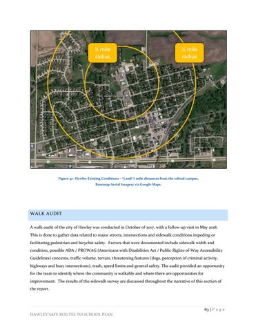
Figure 32: Hawley Existing Conditions – ¼ and ½ mile distances from the school campus. Basemap Aerial Imagery via Google Maps.
WALK AUDIT A walk-audit of the city of Hawley was conducted in October of 2017, with a follow-up visit in May 2018. This is done to gather data related to major streets, intersections and sidewalk conditions impeding or facilitating pedestrian and bicyclist safety. Factors that were documented include sidewalk width and condition, possible ADA / PROWAG (Americans with Disabilities Act / Public Rights-of-Way Accessibility Guidelines) concerns, traffic volume, terrain, threatening features (dogs, perception of criminal activity, highways and busy intersections), trash, speed limits and general safety. The audit provided an opportunity for the team to identify where the community is walkable and where there are opportunities for improvement. The results of the sidewalk survey are discussed throughout the narrative of this section of the report.
HAWLEY SAFE ROUTES TO SCHOOL PLAN
63 | P a g e


