
16 minute read
Walk Audit


Figure 32: Hawley Existing Conditions – ¼ and ½ mile distances from the school campus. Basemap Aerial Imagery via Google Maps.
WALK AUDIT
A walk-audit of the city of Hawley was conducted in October of 2017, with a follow-up visit in May 2018. This is done to gather data related to major streets, intersections and sidewalk conditions impeding or facilitating pedestrian and bicyclist safety. Factors that were documented include sidewalk width and condition, possible ADA / PROWAG (Americans with Disabilities Act / Public Rights-of-Way Accessibility Guidelines) concerns, traffic volume, terrain, threatening features (dogs, perception of criminal activity, highways and busy intersections), trash, speed limits and general safety. The audit provided an opportunity for the team to identify where the community is walkable and where there are opportunities for improvement. The results of the sidewalk survey are discussed throughout the narrative of this section of the report.
HAWLEY SCHOOL CAMPUS
As noted in Chapter 4, Hawley Elementary School houses grades PreK-6, while students in grades 7-12 attend Hawley High School. Both schools are located on a shared campus, which is positioned in a location highly-conducive to walking and biking to school and is surrounded on three sides by residential neighborhoods. However, there are some conditions at the school itself that could be improved. It is regularly noted among SRTS experts that the area closest to schools can be the most dangerous part of the journey for children who walk and bike to school due to the multitude of traffic modes converging on the front door of the school. Exacerbating this, the design of school grounds is often primarily focused on the circulation of motor vehicle traffic flow with an emphasis on front door drop-off at the unintended safety expense of those arriving on bike or foot. This is truer at the high school than the elementary school, where vehicle traffic is restricted from entering the loop driveway directly in front of the school.
Sidewalks on the south and east sides of the school campus are in good shape, and generally wide enough to accommodate the number of people using them – both to walk and bike to school, and for parent/bus pick-up and drop-off. There are no sidewalks adjacent to the west side of the school campus, along 8th , Elizabeth, and 9th Streets, which could limit the ability of kids to walk to or from neighborhoods immediately to the west of the campus.
The south side of the high school was identified as an area of concern by members of the SRTS team. Morning and afternoon vehicle congestion, coupled with school bus traffic and kids walking and biking to school, create a very busy area. Specifically, the intersections of Joseph & 7th Streets, and Joseph & 8th Streets were cited as concerns. Both intersections have a 4-way stop but concerns about vehicle speeds and stop sign compliance have been expressed. Parents picking up and dropping off students at the high school generally use Joseph Street between 7th and 8th Streets.
The lack of a continuous sidewalk along the south side of Joseph Street between 7th and 8th Streets is problematic. The sidewalk extends approximately one-half block, east from 8th Street. Both in the morning and afternoon, students being dropped-off and picked up from vehicles parked on the south side of Joseph Street adjacent to the area with no sidewalk, were observed crossing mid-block.
64 | Page HAWLEY SAFE ROUTES TO SCHOOL PLAN
This could be due to the lack of easy access to the crosswalk at 7th and Joseph, as this is the closer crosswalk to where the mid-block crossings occurred. Joseph Street is wider than other city streets in the immediate area and has angled vehicle parking on both sides of the street. The excessive width of Joseph Street makes for longer crossing distances at the above-referenced intersections. Also, a lack of ADA-compliant curb ramps was observed at intersections immediately adjacent to the school. One other specific issue noted was the placement of a stop sign at the corner of Joseph and 8th, in the middle of the crosswalk. Stop signs should be placed in a location so that vehicles stop prior to the crosswalk. Moving this stop sign a few feet to the east would alleviate the issue (Figure 33).
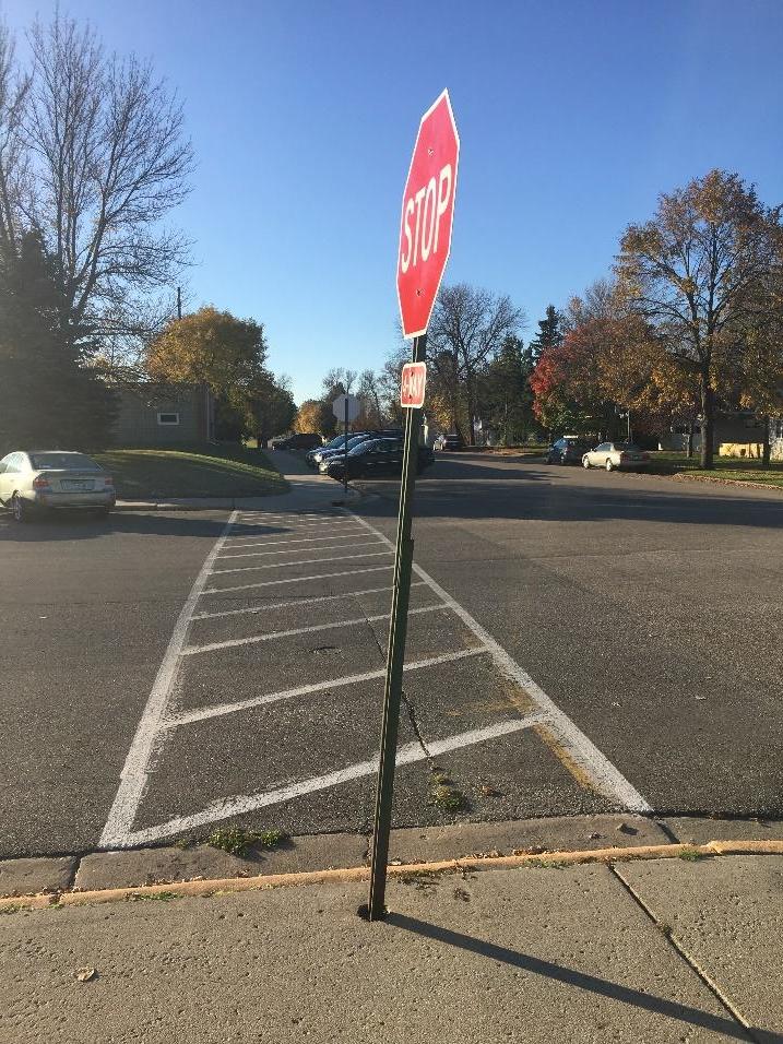
Another issue at this intersection is the proximity Figure 33: This stop sign at Joseph and 8th Streets is placed in of a striped diagonal parking stall on the south side a less than ideal location. Moving it a few feet to the east of Joseph Street, adjacent to Hawley Lutheran would remove it from being an obstacle in the middle of the
crosswalk.
Church. Vehicles parked in this space create limited visibility for pedestrians – especially children – crossing the street. In addition, a large vehicle may even overhang into the crosswalk itself, creating an additional hazard.
The other primary area of concern that was shared by the SRTS team is the parking lot located between the high school and the elementary school, adjacent to the community pool. The north side of the parking lot is where the designated drop-off / pick-up lane for the elementary school is located. There is significant bicycle and pedestrian traffic in the immediate area near this lane, which causes some conflicts between vehicles and kids walking or biking to and from school. Specifically, there is a striped walking lane adjacent to the drop-off / pick-up lane. Vehicles accessing this lane are crossing the walking lane to enter and exit the lane, creating multiple conflict points.
Bike racks on the campus are in two areas: just east of the main entrance to the high school, and south of the elementary school adjacent to the community pool.
While the racks don’t strictly comply with the bike parking standards established by the Association of Pedestrian and Bicycle Professionals (APBP), the style racks that are in place work well for organizing bikes, which is the primary need in a community like Hawley, where bike theft isn’t a significant issue.
The bike rack at the high school is in an excellent location but was not used by all students who biked to school, despite there being adequate room at the rack (Figure 34). In addition, several bikes were left in the grassy area to the west of the main high school entrance, indicating a desire for additional bike parking in this area (Figure 35).
There are two bike racks adjacent to the community pool, which are intended for use by students at the elementary school. While many students are parking their bikes in the general area where the racks are located, the racks are not being utilized for the most part (Figure 36). Bikes scattered in this area could pose a tripping hazard for students as they walk or bike to and from school.

Figure 34: Bikes parked at the bike rack, located east of the main
high school entrance. Note the additional
space at the rack, yet bikes left in the paved area next to the rack.
Figure 35: Bikes parked in the grassy area to the west of the main high school entrance indicate a desire
for additional bike parking in this area.

66 | Page HAWLEY SAFE ROUTES TO SCHOOL PLAN
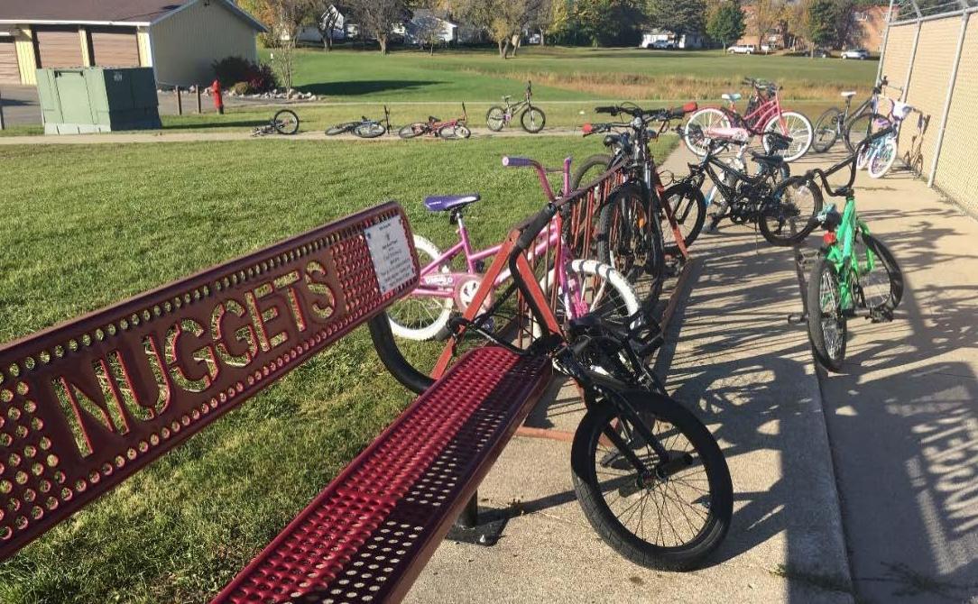
Figure 36: Bikes parked at and near one of the bike
racks south of the
community pool, near the elementary school. Note that one bike is parked properly at the rack, while others are parked improperly at the rack, and even more are parked near the rack. The two
racks at this location have
the capacity to hold all the bicycles seen on observation day.
THE CITY OF HAWLEY
The school campus in Hawley is very well-situated in a nearly ideal location, being surrounded by residential neighborhoods on three sides. Regarding distance to the school campus, this location gives the vast majority of students who live in Hawley the opportunity to walk and bike to school.
Two major transportation corridors transect Hawley: U.S. Highway 10, which runs east-west through the community, and the Burlington Northern Santa Fe (BNSF) railroad line (Figure 37), which runs roughly perpendicular to Highway 10. The community is fortunate that most of the residential neighborhoods are located north of Highway 10 and west of the railroad. There is however a serious equity issue in the location of the mobile home community that is cut-off from the rest of Hawley by the railroad tracks. Students living in this area are bussed due to the hazardous crossing of the railroad tracks, despite living within easy biking distance and walking distance (for older students) of the school campus.
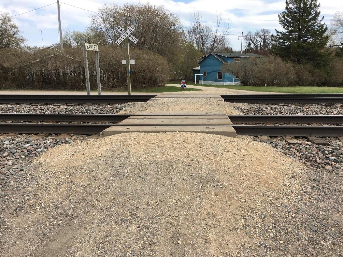
Figure 37: This pedestrian crossing of the BNSF railroad tracks does not meet current standards for accessibility and safety.
68 | Page HAWLEY SAFE ROUTES TO SCHOOL PLAN
Clay County Road 33 enters the community of Hawley from the north, while Clay County Road 31 enters from the south, meeting at Highway 10. While neither county road carries the volume that Highway 10 does, traffic volumes are significant compared to other streets in Hawley. County Road 33 is located two blocks east of the school campus and may be perceived as a barrier for kids walking and biking to school by parents who live to the east.
In the neighborhoods east, west, and south of the school campus, sidewalks are located sporadically. Two corridors stand out as having continuous sidewalks that are in relatively good shape – 6th Street, running the entire length of the street north-to-south; and Joseph Street (Figure 38) between the school campus and 1st Street, which is effectively the eastern end of the portion of the city northwest of the railroad tracks.
Other streets have sidewalks in fair to poor condition, and few that make good connections to the rest of the network. With
the notable exception of the Safe Routes to School path (Figure 39) connecting the school campus to Westgate Drive, sidewalks west of the school campus are virtually non-existent.
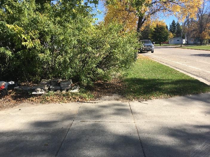
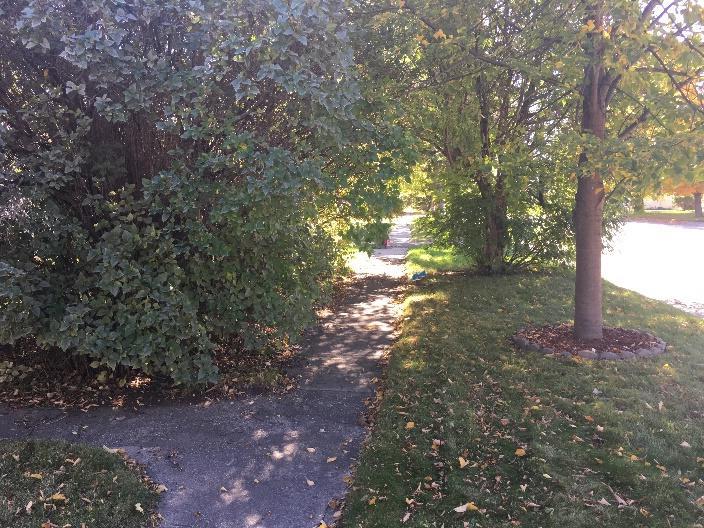
Where sidewalks do exist, they are generally in good condition and well-maintained. There were a few locations that had issues with
encroachment of vehicles and other objects, while other areas had issues with vegetation or landscaping that was encroaching on the sidewalk (Figures 40-43) While these encroachments may not be an issue for an able-bodied adult, they can prove challenging – or in some cases impossible – for children, the elderly, and/or people with disabilities. This is even more true in the winter when
snow cover can make it difficult even for able-
bodies adults to venture off the sidewalk. Maps of existing sidewalks and their condition can be found in Appendix H.

Figure 38: This sidewalk along Joseph Street is in excellent condition, and provides a safe, attractive route for kids walking to and from school.

Figure 39: The Hawley Safe Routes to School path provides a very safe, attractive, and convenient route for kids biking or walking to and from school from the Westgate neighborhood.
Figures 40 & 41: Vegetation has grown over these sidewalks in Hawley, which are otherwise in good shape.
70 | Page HAWLEY SAFE ROUTES TO SCHOOL PLAN


Figures 42 & 43: Vehicles, a boat, and other objects block sidewalks in Hawley.
The city recently striped a walking lane along Reno Street between 1st and 7th Streets, and along 1st Street between Reno and Joseph Streets (Figure 44). The walking lane is an example of a temporary or trial infrastructure installation – sometimes referred to as “tactical urbanism” – and is a great way to test something out before making an expensive infrastructure investment. In the case of the walking lane in Hawley, some issues were observed that make for a less-than-ideal experience for people walking in this corridor. On multiple visits to Hawley, WCI staff observed vehicles parking in the walking lane. One of the visits coincided with “Grandparents Day” at the elementary school. While the walking lane could have served as a convenient walking route to the school for both students and visitors, it was rendered unusable by parked vehicles (Figures 45 and 46).
In addition, the walking lane is not compliant with current ADA / PROWAG (Americans with Disabilities Act / Public Rightsof-Way Accessibility Guidelines) accessibility standards.

Figure 44: The striped walking lane along Reno Street in Hawley.
The lane is partially located in the concrete gutter pan, and partially on the bituminous road surface, making for an uneven cross-section. As noted above, this may not pose any issues for able-bodied children and adults; the same cannot be said for people with disabilities.

Figures 45 and 46: Vehicles encroaching on the striped walking lane along Reno Street in Hawley.
Figure 47: This “Continental” style crosswalk is located at the intersection of 7th and Elizabeth Streets, directly adjacent to the east side of the high school. Vehicle tires will generally straddle the crosswalk markings, saving on maintenance and improving safety by maintaining crosswalk visibility.
Despite its limitations, the walking lane is a great example of city officials recognizing the need for better pedestrian infrastructure and trying a non-traditional installation that was relatively inexpensive and serves to provide valuable information that will help guide future infrastructure investments.
Crosswalks in Hawley are found primarily along the Reno / 1st Street walking lane, the SRTS path, and at intersections near the school. Most
crosswalks are the preferred “Continental” style, which are more visible to approaching vehicles and have been shown to improve yielding behavior (Figure 47). One intersection near the school, the corner of 8th and Joseph Streets, has two older “zebra” style crosswalks.
72 | Page HAWLEY SAFE ROUTES TO SCHOOL PLAN
Curb ramps in Hawley are mostly non-compliant with current ADA and PROWAG guidance (Figures 48 & 49). The two notable exceptions where the curb ramps are fully-ADA / PROWAG compliant are along the SRTS path (which was built using federal funds and requires ADA standards to be met) and the new sidewalk along 10th Street / County Road 33 near Highway 10. This sidewalk was built since current ADA / PROWAG standards have been in place.
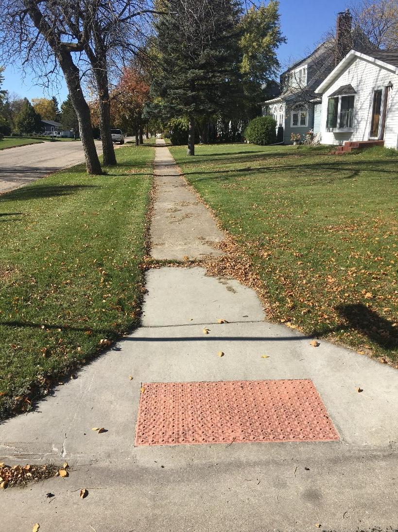
Figure 49: An example of a curb ramp that does meet current accessibility guidelines. Figure 48: (Above) An example of curb ramps that do not meet current accessibility guidelines.

In many parts of town, there are no curb ramps at all, despite the existence of adjacent sidewalks. These areas were likely all constructed prior to ADA standards being fully implemented, and before PROWAG became the current standard.
Maps of existing curb ramps and their condition can be found in Appendix H.
STREET, LANE, AND (IF PRESENT) SHOULDER WIDTHS
Street design and lane width can provide subtle clues to drivers as to the safe operating speed on a particular roadway. Current best practices dictate that bigger is not always safer and that wide road and lane widths can encourage drivers to speed, even unintentionally. They also require pedestrians to spend more time in the roadways when crossing, extending the time that they are exposed to potentially hazardous motor traffic. Wide streets and lanes, however, can provide the space needed within the rightof-way to retrofit bike lanes, sidewalks, wider sidewalks, tree boulevards, etc.
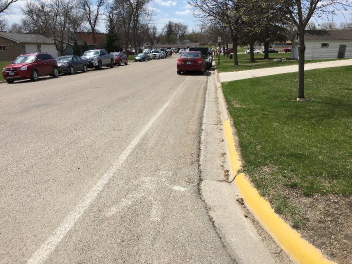
At typical widths of 40-48 feet (Figure 50), many of the residential streets in Hawley are wider than recommended based on current standards from the National Association of City and Transportation Officials (NACTO). Current NACTO standards23 for residential
streets with parking on both sides and two-way traffic, call for widths between 24-30 feet. These lowvolume streets with low on-street
parking utilization, function as “yield streets” and would work well for most residential streets found
throughout Hawley. One opportunity with wide streets is that bike lanes could easily be striped without impacting onstreet parking. This would also visually narrow the street, helping to keep vehicle speeds down.
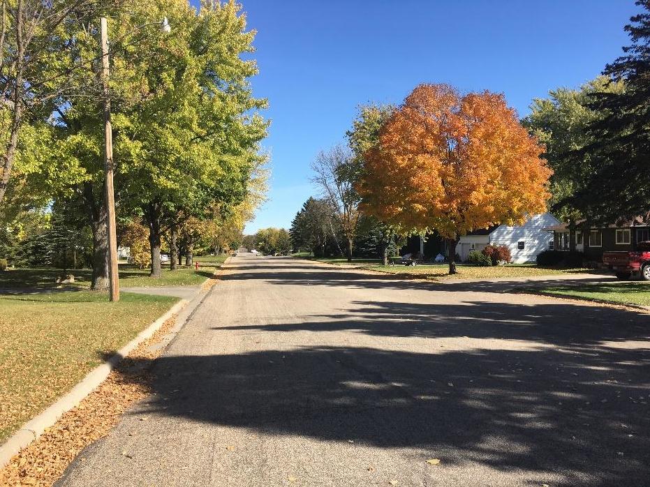
Figure 50: Joseph Street is an example of the typical width of the residential streets in Hawley.
23 NACTO Urban Street Design Guide https://nacto.org/publication/urban-street-design-guide/streets/yield-street/
74 | Page HAWLEY SAFE ROUTES TO SCHOOL PLAN
SPEED AND SPEED LIMITS
High vehicle speeds have long been known to be a significant safety hazard to pedestrians and bicyclists. According to the AAA in the U.S., if a pedestrian gets hit by a car traveling at 20 mph, there is an approximate seven percent chance of death. The fatality rate climbs to 90 percent for a pedestrian struck at 60 mph. According to AAA, the greatest rate of fatality risk increase happens between the speeds of 25 and 45 mph, increasing from 12 percent to 60 percent. 24 Other studies have the 45-mph pedestrian fatality rate as high as 85 percent. High-speed traffic also creates noise and induces stress on pedestrians, making even wide, well-designed sidewalks unappealing places to walk.
Except for Highway 10, all roadways in the urbanized portions of Hawley are either marked at 30 mph, or default to 30 mph as designated by state statue.
BURLINGTON NORTHERN SANTA FE RAILROAD
The Burlington Northern Santa Fe (BNSF) Railroad operates a Class 1 “mainline” route through Hawley, with a significant volume of high speed trains. According to the MnDOT Freight Railroad Map25 from June 2015, 49 trains pass through Hawley daily, with a maximum authorized speed of 79 mph.
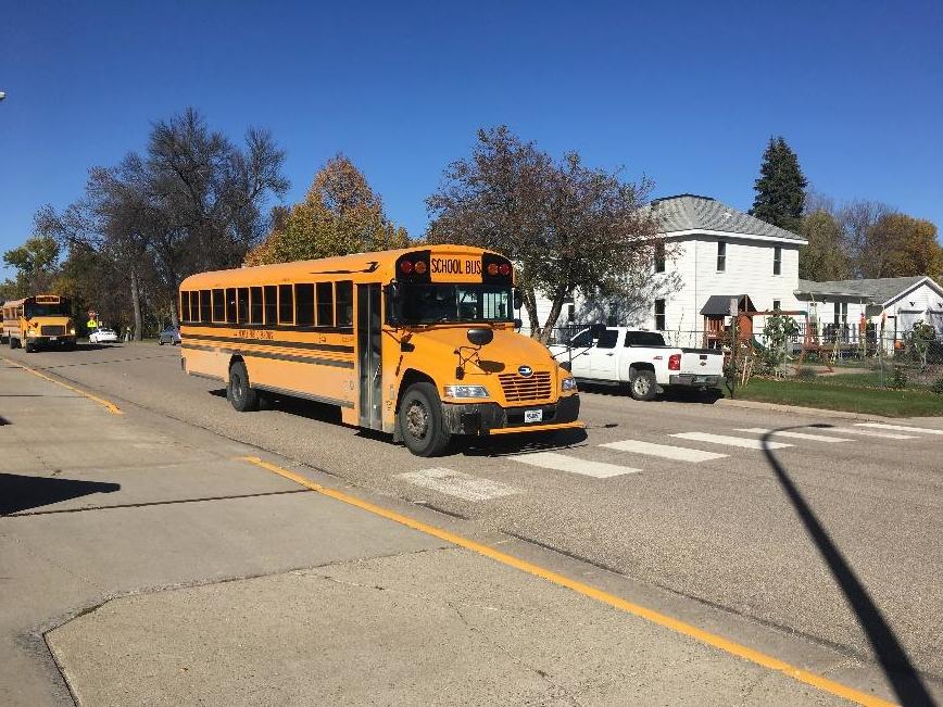
The railroad presents a significant barrier for students and other people living east of the tracks. Most of the residences in this part of the community are located in two mobile home communities. There are a significant number of students living in this area, as evidenced by observations of students being dropped off by school bus. While many students in this area live close enough to walk or bike to school, because of the hazard the railroad presents, they are eligible for busing to and from school.

Figure 51: Valley Street underpass in Hawley.
24 AAA Foundation for Traffic Safety. Impact Speed and a Pedestrian’s Risk of Severe Injury or Death. September, 2011. Available at http://aaafoundation.org/wp-content/uploads/2018/02/2011PedestrianRiskVsSpeedReport.pdf
25 http://www.dot.state.mn.us/ofrw/maps/MNFreightRailroadMapLarge.pdf


