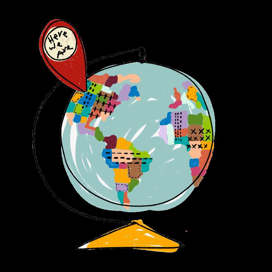


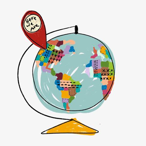
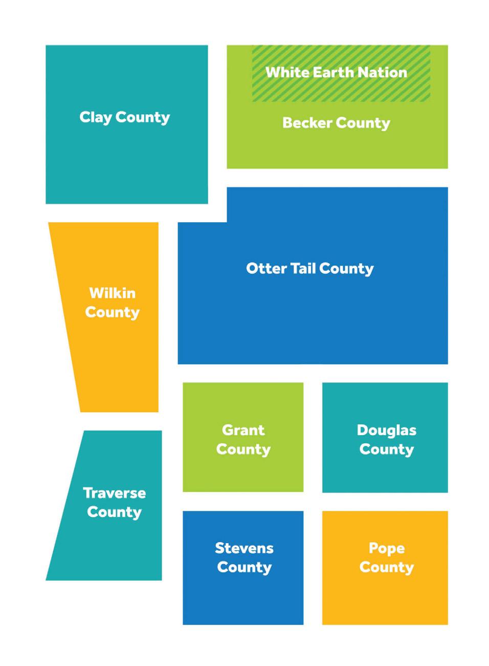
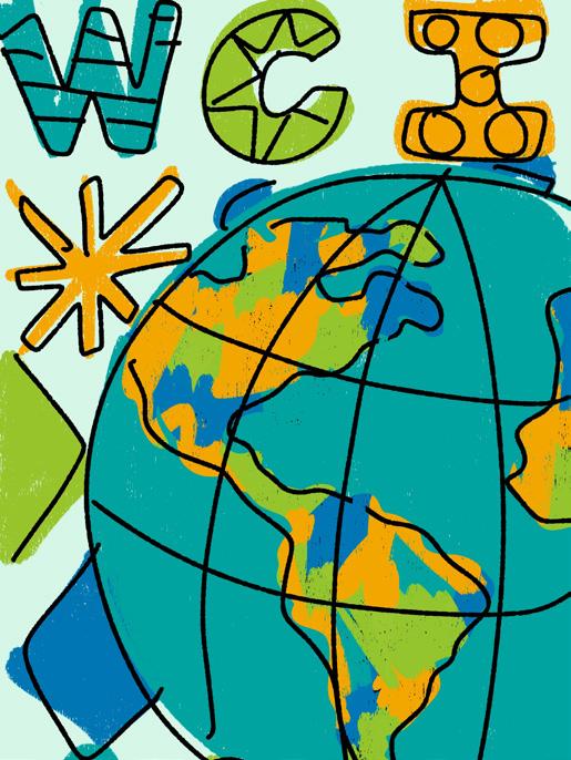
This region. This almanac is about us. It’s about who we are and what we do today, in 2025. Becker, Clay, Douglas, Grant, Otter Tail, Pope, Stevens, Traverse, and Wilkin Counties and White Earth Nation.

First, most of us know the Farmers’ Almanac and expect it to cover weather—critical for farmers and increasingly for all of us. Climate change is a growing concern, but we can act. This almanac offers practical ideas— try them if they fit. The more people involved, the greater the impact.

Second, the ancient advice from the Temple of Apollo in Delphi—”Know thyself”—remains powerful. Scattered throughout this almanac are facts, stories, and places that help us understand ourselves and our region. To make good decisions about the future, we must first know who we are and where we live.

Third, shaping our future takes knowledge, imagination, love, and courage. An almanac is built on community—sharing what we know, just as farmers pass on wisdom about planting by the moon. Growing anything is about giving and receiving. Our region thrives when we actively engage in civic life every day.
Regions can be defined in many ways. Traditionally, they’re fixed geographic areas with clear boundaries. But a definition I like, from Kathryn Foster’s work, cites Webster’s 1993 dictionary: a region is a “broad geographical area” where people share enough history, culture, economy, or society to set them apart. Does that describe us? We believe it does. This almanac is our first effort to connect the dots, highlight what makes us unique, and show why that uniqueness is our greatest strength.
Anna WaseschaPresident, West Central Initiative
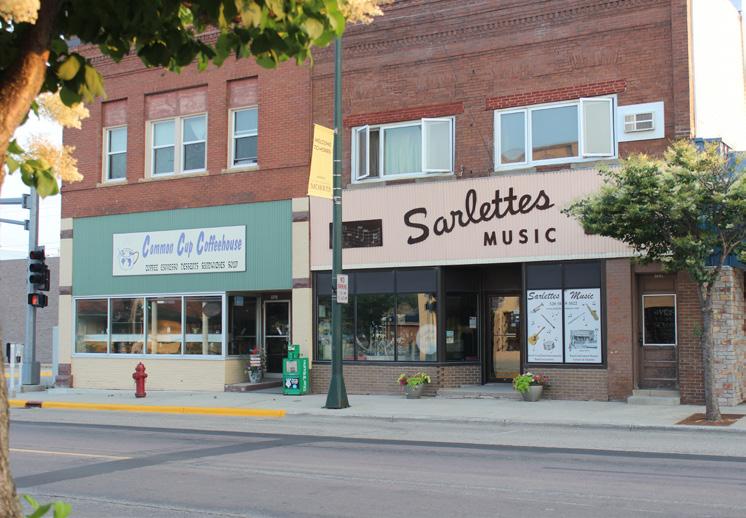
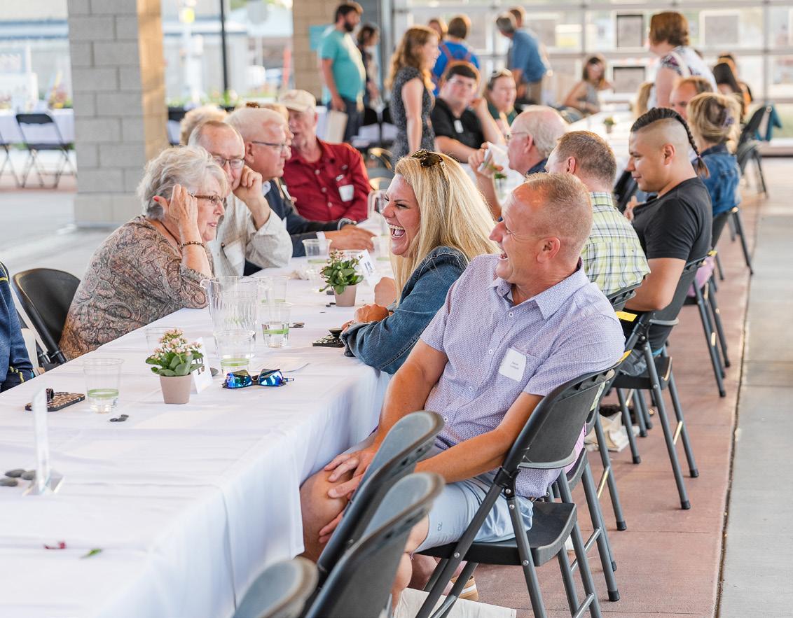
As part of our Live Wide Open initiative, we invited residents to write love letters to their communities. We received 40 heartfelt letters celebrating 21 towns, each showcasing the deep bonds people share with their hometowns.
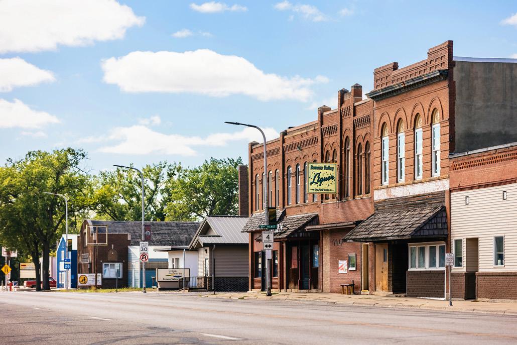


Nestled between rolling hills and winding streams, Browns Valley is more than just a dot on the map—it’s a sanctuary, a heartbeat, a home.
It’s the way the morning light dances across the meadows, painting them gold and green, as though nature herself is crafting a masterpiece.
It’s the warmth of the people, their smiles like sunshine on even the gloomiest days, and the way they greet you not as strangers, but as family.
Browns Valley is the gentle hum of life at a pace that lets you savor each moment, from the sound of children laughing in the park to the rustle of leaves whispering secrets to the wind.
It’s a place where time seems to stretch, giving space for reflection, connection, and peace. The charm of the old barns standing like sentinels of history, the winding roads that lead to hidden treasures, and the open skies that feel infinite—all of it speaks to the soul.
Browns Valley isn’t just a place; it’s a feeling, a collection of memories stitched together by the threads of community, nature, and quiet joy. It’s where the world slows down just enough to remind you what truly matters: kindness, simplicity, and the beauty of being alive.
Jodi Hook-Hansen, Browns Valley Resident

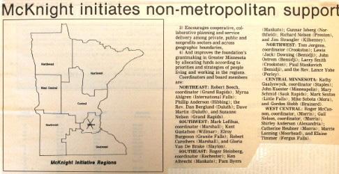
In 1986, the McKnight Foundation created six regions in Greater Minnesota and established initiative foundations to support rural communities during an economic crisis. West Central Initiative serves nine counties and White Earth Nation. White Earth’s boundaries were set by treaty in 1867—119 years before West Central Initiative formed and decades before McKnight even existed. Long before regions or foundations were considered, our region lay beneath Lake Agassiz, the largest glacial lake in North America.
Aschallengesarose,WestCentral
Initiativeexpandedbeyond philanthropytoaddressearly childhood, transportation, climate, democracy,andbelonging.What has remained constant is our regionalfocus—wovenintoour identitysincethestart.


Over time, regions became essential for Transportationprogress.systems, such as railways and highways, require planning across towns and regions. In 1969, Minnesota established regional development commissions to encourage collaboration, though statewide planning efforts later waned. One such commission, Regional Development District 4, matched West Central Initiative’s current boundaries but disbanded in 1982. By 1991, the organization had taken on regional planning, authoring the Comprehensive Economic Development Strategy to secure state and federal infrastructure funding. In 1995, the federal government recognized our organization as District 4’s regional development organization—a rare designation for a nonprofit.


West Central Initiative aligns its work with the Sustainable Development Goals to promote economic resilience, environmental sustainability, and community well-being in our region. By supporting initiatives such as workforce development, clean energy, and equitable growth, the organization helps build a stronger, more sustainable future for all.

May their legacy inspire and their spirit shine through these pages.
This publication is dedicated to Gary and Sharon Spies, visionary philanthropists who believed in the strength of community and the power of giving. Their generosity and commitment to our region continue to inspire connection, collaboration, and lasting change. May their legacy remind us all of the impact two people can have in shaping a better future for generations to come.


West central Minnesota spans nine counties: Becker, Clay, Douglas, Grant, Otter Tail, Pope, Stevens, Traverse, and Wilkin. Known for its agricultural heritage, small towns, and growing industries, it blends rural communities with regional hubs, such as Detroit Lakes and Moorhead. Its rolling prairies, farmland, and lakes offer both economic opportunity and natural beauty. As the population evolves, the region balances tradition with initiatives in sustainability, workforce development, and community resilience.
White Earth Nation, spanning Becker, Mahnomen, and Clearwater Counties, is Minnesota’s largest Native American reservation by land area. It preserves Anishinaabe culture, language, and traditions. The Nation drives regional economic and governance efforts, focusing on self-sufficiency, environmental stewardship, and cultural revitalization. Its commitment to sustainable land management, food sovereignty, and community well-being makes it a vital part of the region.


93.7% of the adult population in the region are high school graduates, including 23.7% having some college experience with no degree.
27.5% hold a bachelor’s degree, including 8.4% who also have an advanced degree, both lower than the national average.
410 units of government require 1,840 individuals to run for electoral office in the region.
1,663 nonprofits need volunteers to serve on their boards of directors.
1 in 10 adults in our rural region must take on a leadership role to meet governance and nonprofit demands.
Our region, defined by coordinates spanning northwest Clay, northeast Becker, southeast Pope, west Traverse, and southwest Stevens Counties, covers approximately 8,500 square miles—a land area comparable to the state of New Hampshire.

QUIZ TIME! Circle your answer.
1) How many cities are in our region? 79 or 82
2) What county is the home of Glacial Lakes State Park? Pope County or Grant County
3) Where did the legend of the Hairy Man originate? Barnesville or Vergas

Northwest Clay County: 47.149964, -96.838928
Northeast Becker County: 47.152532, -95.169074
Southeast Pope County: 45.412695, -95.131583
West Traverse County: 45.607769, -96.857948
Southwest Stevens County: 45.412936, -96.241065
Domestic Product of the Region as of 2023: $10.14 billion
County: $1.48 billion
County: $2.19 billion
County: $2.08 billion
$259 million
Tail County: $2.45 billion
Our region is undergoing gradual but significant shifts in population, demographics, and geographic distribution. While some counties are seeing growth, others remain steady or experience slight declines. These trends reflect broader changes in age, racial and ethnic diversity, and how people interact with the region’s land and resources. The future of the region will depend on how well communities adapt to these evolving dynamics.
Targeted growth in key counties: Douglas County is projected to grow by 22% by 2050, while Becker, Clay, Otter Tail, Grant, and Pope Counties will see moderate increases of more than 10%. Stevens and Traverse Counties, in contrast, are projected to decline by more than 10%. Wilkin County is projected to remain relatively constant.
Urban vs. rural shifts: Population growth is concentrated in regional centers, while more rural areas face potential stagnation. Since 2020, the region’s small towns have seen a 1.5% population decline, while urbanadjacent areas have grown by 3.2%.
Aging population impact: Over the last fifteen years, we’ve experienced the greatest increase in the number of residents who are 65 or older. In 2010, only 16.5% of the population was 65 or older. Now, 22% of our population is in that category, and is projected to reach 23% by 2050. This shift will place greater demand on healthcare, housing, and workforce development.
The Minnesota State Demographic Center’s 2024 projections show that while most counties will maintain stable populations, certain areas are expected to grow. Between now and 2050, the region’s total population is projected to increase slightly, with some counties leading that growth.


Our region is becoming more diverse, with younger generations reflecting greater racial and ethnic diversity. Census data shows that areas with larger Hispanic, Somali, and Indigenous populations are experiencing higher growth rates.
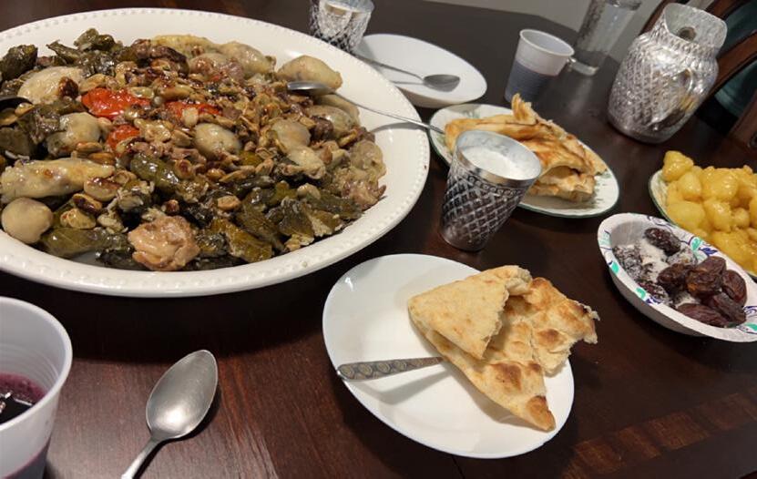
Discover the diverse foods enjoyed in our region with Ojibwe, Mexican, Scandinavian, and Kurdish recipes. Learn how to make traditional dishes that reflect the cultures and communities that call our region home.


Rising diversity in younger generations: Among Minnesotans under 40, 21% identify as non-white, compared to just 8% of those over 60. In some counties, such as Clay and Becker, the share of young people of color is even higher at 25%.
Population growth and diversity are linked: Minnesota counties with a Hispanic population above 5%—such as Nobles and Kandiyohi—are growing at a rate 2.5 times faster than counties with lower diversity. Locally, west central Minnesota counties with higher Hispanic populations have seen a 4.8% increase in residents since 2015.
The future depends on inclusion: By 2040, Minnesota’s workforce is projected to be 30% non-white. Communities that foster inclusion and support diverse populations will be better positioned for long-term economic and social success.


Climate and geography influence growth: Since 2000, the region has experienced an average temperature increase of 1.5°F, with more erratic precipitation patterns. Counties along the Red River Valley face higher flood risks, impacting housing and infrastructure.
Infrastructure and housing drive growth: Counties with strong infrastructure—such as Clay and Otter Tail—are attracting more residents. However, 35% of homes in the region were built before 1970 and require significant updates.
Community development matters:
Investments in public spaces, transit, and local amenities influence migration patterns. In counties that have revitalized their downtowns and expanded housing, population growth has outpaced regional averages by 2%.
According to the 2022 U.S. Census American Community Survey, west central Minnesota has an estimated 123,678 housing units, with 72,757 owner-occupied, 24,386 renter-occupied, and 26,535 classified as vacant, including seasonal homes. While most housing was built after 1970, over 35% of units are older homes that often require significant updates.
As these trends continue, the region’s ability to adapt to shifting population dynamics, embrace diversity, and invest in sustainable infrastructure will determine its long-term success.
The region’s natural and built environment plays a critical role in shaping settlement patterns. Climate shifts, infrastructure investments, and land use policies are all influencing how and where people choose to live.

Explore the region’s 20222026 Comprehensive Economic Development Strategy for a deeper dive into the data shaping our region’s future, including detailed charts, graphs, and analysis. This resource provides a roadmap for understanding population trends, demographic shifts, and geographic influences that will guide decisionmaking in our region.

Molly Stoddard, Citizen Naturalist and former United States Fish and Wildlife Service (USFWS) Member and Prairie Wetlands Learning Center USFWS Educator
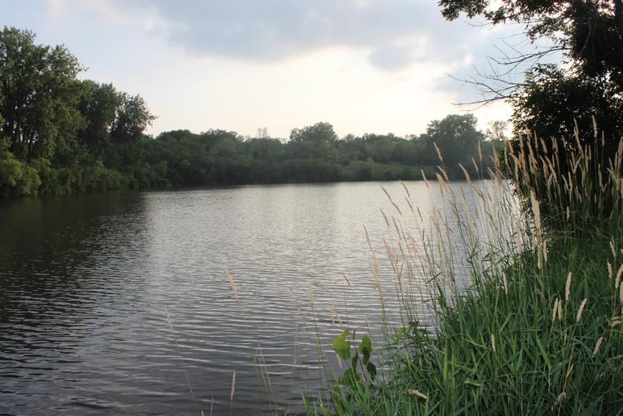
Our region is historically part of a broad, open grassland and the wettest portion of the continent’s Great Plains. Vast prairie offered nesting habitat for many species of ground-nesting birds, including waterfowl, songbirds, and prairie chickens. With the easterly progression of increasing amounts of rainfall and the absence of expansive wildfires, with drought and nomadic bison grazing, the swaying grasses and picturesque wildflowers yielded to oak savannah and eventually to the dense forested regions of the eastern United States. It was on the eastern edge of the Northern Tallgrass Prairie that the competition between grassland and forests took place, and today our region is in that transition zone.


Interspersed throughout this immense landscape was an abundance of wetlands in every shape, size, and depth imaginable. The eastern edge of North America’s Prairie Pothole Region began forming about 12,000 years ago when retreating glaciers melted and filled the depressions left in their path, a density of about 83 wetlands per square mile. With its abundance of grasslands and wetlands, rivers and lakes, prairie pothole country was a veritable duck factory—producing ducks, geese, swans, and other water birds by the millions. Located within five states and three Canadian provinces, including the western edge of Minnesota, at about 118 million acres in size (300,00 square miles, about the size of Texas), the prairie pothole landscape produces more than 50% of the continent’s waterfowl due to its matrix of having the historically highest density of wetlands and associated upland prairie.
The Red River of the North begins at the confluence of the Bois de Sioux and Otter Tail Rivers in Wahpeton, North Dakota, and Breckenridge, Minnesota, flowing north into Canada. Its main stem provides yearround habitat and refuge for fish, while its tributaries support critical spawning and rearing grounds. The Red River is a turbid or muddy river. Because of that, many people think the river has poor water quality and, therefore, is a poor place to fish. But the water quality is cleaner than approximately three-fourths of the rivers in the continental United States.


Kenny Blumenfeld, Senior Climatologist, Minnesota Department of Natural Resources

Rapidly increasing global temperatures since 1970 have given Minnesota more access to both heat and moisture. As a result, western Minnesota has become warmer, more humid, and wetter, on average.
From 1970-2024, western Minnesota warmed significantly, but winter warmed much faster than summer. Low temperatures during January increased by 9.9° F, versus no change in high temperatures during July, though summer humidity has become more intense. Annual precipitation increased by 2.8 inches (or 12%) since 1970, with more frequent and sometimes larger heavy rain and heavy snow events.
The normal ups and downs that define our climate dictate some years still are cool, or dry, or “normal.” The tendency, however, is to be warmer and/or wetter than we used to be.
Virtually all climate projections indicate western Minnesota will continue to get warmer, more humid, and wetter, on average through the century, with even warmer winters, more precipitation extremes, more intensely humid heat waves, but also with plenty of cool, dry, or normal years that do not match the longer-term trends.
Western Minnesota is intensely “seasonal.” The hottest day of summer may be 130° F warmer than the coldest day of winter, and summer gets an average of five times more precipitation than winter.
Our seasons and the transitions between them can be full of action too. Blizzards, tornadoes, severe thunderstorms, flash floods, heat waves, and cold outbreaks occur virtually every year in western Minnesota, with drought conditions developing every few to several years on average.
All hazards go through periods of relatively high or low frequency and intensity. The normal ups, downs, wet spells, stormy periods, and dry spells that define our climate will always be with us, even through significant climatic variations and changes.

The First Nations of Minnesota are the Anishinaabe, also called Ojibwe, and the Dakota, also known as the Isanti people. The Anishinaabe people lived in our region and into the north, and the Dakota from our region and into the west. The four glaciers of the Ice Age created the extensive Interior Plain as they melted, forming our hills and prairies, leaving rich soils and strings of lakes, sloughs, and rivers. The Dakota named it mnísóta, meaning clear blue water, where their food grows on water, and that water flows in three directions.
Some believe Norsemen arrived in 1362, as suggested by the Kensington Runestone, but historians agree the first recorded visitors were French traders, traveling by river for furs. These waterways later carried early military posts such as Fort Pomme de Terre, Fort Alexandria, and Fort Washington on Lake Traverse. Soldiers’ tales of vast forests, rich plains, and abundant lakes drew settlers and immigrants.
The land was renamed the Northwest Territory in 1787, and was part of the Louisiana Purchase in 1803, somehow sold by the French to the United States of America. Between 1838 and 1846, it was named the Iowa Territory, then organized in 1849 as the Minnesota Territory. Finally, in 1858, the western border of Minnesota was established at the Red River, and Minnesota became the 32nd state in the union.


Northern Pacific Avenue. Photo
The Northern Pacific Railroad laid its tracks and crossed the Red River in 1871. The railroads brought with them the settlements we see as our towns and cities today, creating points of export not reliant on the rivers’ flow. After World War II, the New Deal brought infrastructure investments, supporting the population increases of the post-war Baby Boom. In the 1960s, Interstate 94 changed our landscape again, literally paving the way for high-speed travel from one side of this region to the other.

Turtle Island is the name many Indigenous peoples, including the Ojibwe/Anishinaabe, use for North America. According to their creation story, the Great Mystery (Kitchi-Manitou) sent a great flood to cleanse the Earth after people lost harmony with nature and each other. Only Nanaboozhoo and a few animals survived, floating on a log, searching for land.
One by one, animals dove to retrieve Earth from the water’s depths, but all failed—until the muskrat made one final attempt. Though it lost its life, the muskrat surfaced with a small piece of Earth in its paw. The turtle then offered its back to hold the Earth, and as the Four Winds blew, the land grew into what is now known as Turtle Island.
For White Earth Nation and other Indigenous communities, this story represents resilience, renewal, and the deep connection between land, animals, and people.
Step into the past and uncover the rich histories and vibrant cultures that have shaped our region by visiting a local museum.
Each location offers a unique window into the stories, traditions, and artifacts that bring history to life. Here are a few of the must-visit museums across the region:
Grant County Historical Museum, Elbow Lake
Runestone Museum, Alexandria
Otter Tail County Historical Society Museum, Fergus Falls
Becker County Museum, Detroit Lakes Hjemkomst Center, Moorhead
Pope County Museum, Glenwood
Stevens County Historical Society and Museum, Morris
Traverse County Historical Society and Museum, Wheaton
Wilkin County Historical Museum, Breckenridge
In June 1931, a highway crew working north of Pelican Rapids, near the east shore of Prairie Lake, discovered the remains of Minnesota Woman, also known as Glacial Pelican Lake Ancient One, uncovering a human skeleton along with a shell pendant and an antler tool. The remains were identified as those of a female, estimated to be 10,000 to 20,000 years old, making them among the oldest human remains discovered in North America. In 1999, the remains were reburied in South Dakota.

Our region is shaped by its land, people, and the challenges and opportunities that come with both. From the economic foundations laid by glacial forces to the shifting realities of our modern workforce, understanding these dynamics is key to building a strong future. In this section, guest contributors explore the evolving economic landscape of our region, the importance of community wellbeing in an increasingly digital world, and the environmental changes reshaping our winters. Together, these perspectives highlight the interconnectedness of our economy, health, and natural resources—and the need for thoughtful action to sustain them for generations to come.


Our region’s future was shaped 11,700 years ago at the end of the Pleistocene geological epoch when the last Ice Age gave way to a changing landscape. Glacial meltwater formed Lake Agassiz, a massive body of water larger than all the Great Lakes combined. For 2,700 years, it covered much of what is now west central Minnesota before draining north into Hudson Bay and south through what is now Lake Traverse and the Minnesota River. The receding waters left behind shorelines still visible today. I remember family trips to Morris as a kid, with my dad pointing out that the rolling hills near Herman, Campbell, and Norcross were once the beaches of Lake Agassiz—remnants are also still found in Clay and Wilkin Counties.

Greg Wagner, Director of Business & Economic Development, West Central Initiative


Though the lake is long gone, its impact remains in the rivers, prairies, and fertile soil, particularly in the renowned Red River Valley. The land’s resources attracted settlers not just hundreds but thousands of years ago. As the region evolved, its rich soil remained a constant, solidifying agriculture as the foundation of our economy.

While agriculture has advanced over time, it remains a driving force, supporting related industries that fuel the region’s prosperity. My tenure at West Central Initiative can’t be measured in geological epochs, but I’ve seen both continuity and change. For years, four industries have employed about three-quarters of the region’s workforce: Education & Health Services, Trade Transportation & Utilities, Manufacturing, and Leisure & Hospitality. Small, locally owned businesses remain the backbone of our 82 communities, with many towns revitalizing their once-disinvested main streets and river corridors. These areas, where small businesses have persevered, are now prime locations for startups and relocations.
Our population and workforce are more diverse than ever, and the 65+ demographic continues to grow. While young people still leave, more working-age families are returning. Labor force participation is historically low but mirrors state trends, and unemployment remains at record lows. Businesses are constantly searching for workers, and the average weekly wage ($1,020) remains steady compared to other rural regions, though it lags behind the metro. Overall, regional wages have kept pace with inflation.
In recent years, economic development has shifted focus. While attracting businesses and creating jobs remains important, the priority is now on five key areas: infrastructure, housing, child care, workforce attraction, and community amenities. West Central Initiative remains committed to working alongside communities to strengthen our region and improve the lives of its residents.
As an adolescent in the summer, my routine was simple yet fulfilling. I’d start the day with a quick bowl of cereal, grab my baseball glove, hop on my bike, and ride over to South Junior High School in Moorhead. From there, the day came to life. We spent our time playing baseball, football, basketball, swimming, and engaging in a variety of games—sometimes even a little ding-dong-ditch in the evenings. (Apologies to the folks we woke up!) We began our adventures in the morning and didn’t stop until the streets of Spudville were bathed in the glow of streetlights, or until our parents called us home.


Looking back, those unstructured hours taught me invaluable life lessons—how to make friends, resolve conflicts, treat others with respect, celebrate victories, and perhaps most importantly: how to fail. These lessons shaped my character and for them, I am grateful.
Today, our region’s school leaders are embarking on a collective study of The Anxious Generation by Jonathan Haidt. This intensive inquiry is already sparking change in our local schools. Haidt’s research focuses on the post-iPhone generation, illustrating how the advent of smartphones has shaped not only adolescent behavior but also society at large, especially within the context of schools.
Haidt’s findings are both compelling and concerning. He notes that between 2010 and 2018, diagnoses of depression and anxiety among U.S. college students more than doubled. Similarly, a 2022 study of over 37,000 high school students in Wisconsin found an increase in the prevalence of anxiety from 34% in 2012 to 44% in 2018, with even larger increases among girls. These statistics highlight a significant mental health crisis among young people, coinciding with the rise of smartphone usage.
So, what can society do to help? Haidt advocates for several approaches aimed at supporting youth mental health. First, he emphasizes the importance of encouraging more unstructured play, like the kind I experienced as a child. In today’s world, young people often find themselves overwhelmed by rigid schedules, academic pressure, and screen time. Haidt suggests that communities should create spaces for free, outdoor play where children and adolescents can build resilience, practice social skills, and experience the benefits of physical activity.
Additionally, fostering meaningful conversations is key. Haidt stresses the need for schools and parents to prioritize face-to-face communication, helping young people navigate their feelings in healthy ways. By encouraging honest, open dialogues, we can create environments where mental health is openly discussed, and seeking help is normalized.
Lastly, Haidt advocates for limiting social media use, especially among adolescents. While social platforms connect individuals across the globe, they often exacerbate feelings of inadequacy and anxiety by amplifying comparisons and providing constant exposure to curated, idealized lives. Haidt encourages limiting screen time and shifting focus towards inperson relationships and activities that promote mental well-being.
As we examine these findings, it’s clear that change must occur not just in schools but across our communities—within homes, workplaces, and everywhere in between. Our collective efforts are crucial in supporting one another and making decisions that will positively impact the health and well-being of the communities we serve.
As a Minnesota native, my childhood winters were filled with sledding, building snow forts, and climbing the towering snow piles left by plows in our rural driveway. After hours outside, I’d come in to warm up by the wood stove, setting my mittens and snow gear on a rack to dry. Like many Minnesotans, my winter memories include ice fishing, snowmobiling, and skiing—pastimes woven into the cultural fabric of our region.
Now, as a parent, I see my children experiencing Minnesota winters differently. The cold is still there, but it’s inconsistent. Snow still falls, but often not enough for the cross-country skiing our family loves. We can see the changes happening around us—shifts that have been underway since my childhood in the 1980s.
Cedar Walters, Director of Sustainability
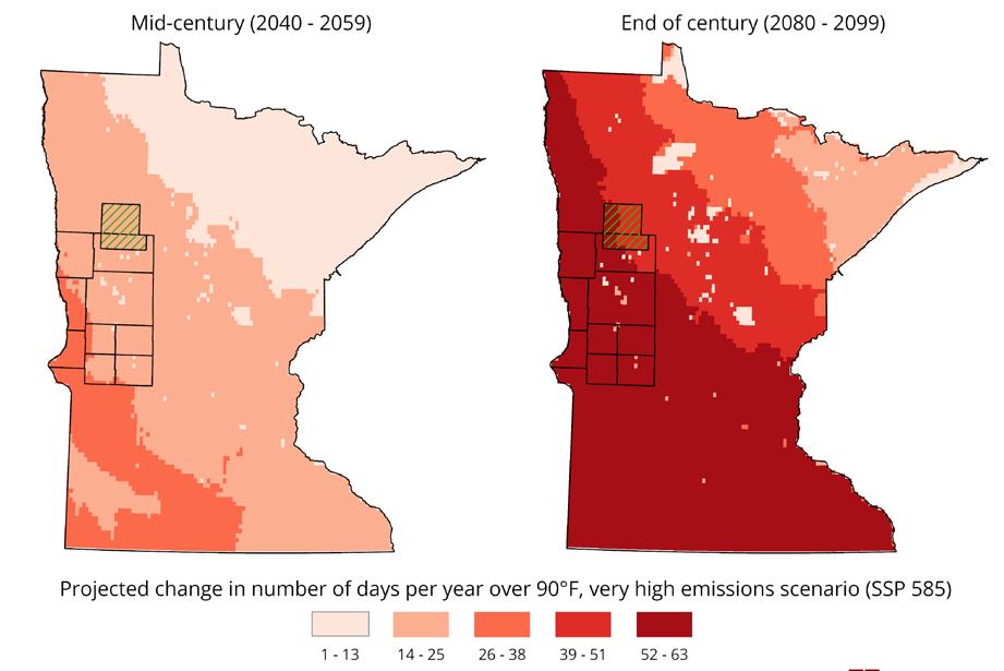
Back then, an average of 180 days each year were below freezing. In 2024, that number dropped to 151. By mid-century, when my children are in their 30s, west central Minnesota is projected to have 21 to 25 fewer freezing days per year. That means my future grandchildren could experience 50 more days above freezing annually compared to the winters I knew growing up.
With fewer reliably cold and snowy winters, some of the traditions we cherish—sledding, skiing, ice fishing—may fade for future generations. Your grandchildren may never get to enjoy these experiences as you did with your own kids. While some climate changes are inevitable, we must recognize how these shifts are already impacting our lives—even in a state that may seem insulated from such effects. Now is the time to strengthen our commitment to climate and community resilience efforts, ensuring that Minnesota’s high quality of life, including its cold and snowy winters, is preserved for generations to come.
& Climate
Programs, West Central Initiative
Want to know what climate scientists predict for your town?
You can view projections down to the 2.5-mile scale to explore how surrounding ecology, lakes, and building density play a part in the weather we will experience.


Our region is facing key challenges, including rural development, workforce gaps, housing shortages, and climate resilience. Through initiatives like the Minnesota Region 4 Climate Action Plan, the Morris Model, and West Central Initiative’s Rural Democracy Program, communities are addressing these issues with local perspectives and collaborative solutions.
By working together, we can strengthen our region, support local leaders, and create a more resilient and thriving future.
View the Region’s Climate Action Plan
The impacts of a changing climate are already shaping the future of west central Minnesota. To support thriving, resilient communities, we must engage in meaningful conversations about how these changes will affect our region and take action to ensure a sustainable future. The Minnesota Region 4 Climate Action Plan serves as a roadmap, offering strategies to advance climate action and sustainability across our communities.


By removing partisan politics from climate discussions, the Morris Model has built broad support for sustainability efforts.
At the same time, our region faces an urgent need for leadership. In Wilkin and Stevens Counties, one in nine individuals will need to serve in a leadership role in their lifetime—whether in local government or nonprofit organizations. That number rises to one in eight in Traverse County and one in seven in Grant County, classifying nearly half of our region as “leadership distressed.” Otter Tail County alone requires nearly 500 individuals to fill local, nonpartisan elected positions. To strengthen civic culture, West Central Initiative’s Rural Democracy Program trains potential candidates, engages historically excluded groups, supports local leaders, and fosters community conversations about the future of our region.
At the intersection of climate action and democracy, West Central Initiative’s Municipal Solar Cohort Program is making an impact. Inspired by the Morris Model, this initiative empowers local leaders to act collectively on sustainability goals, save taxpayers money, and drive community-led energy solutions. By organizing rural towns into a “solar cohort,” municipalities can increase purchasing power and streamline access to state and federal funding for renewable energy projects.

Troy Goodnough, Sustainability Director at the University of Minnesota, Morris, wakes up to a crisp Minnesota morning—twenty-one below zero. His boiler has stopped working, and ice in the sewer line means his toilet won’t flush. “Living here calls on us to work together,” he says. “This climate doesn’t mess around. We have to solve tough challenges, and we do it best when we do it together.”
That spirit of collaboration is what sparked the Morris Model, a sustainability partnership between the University of Minnesota Morris, the city, county, school district, and the West Central Research and Outreach Center. “We started with a simple question: What can we work on together?” Goodnough explains. “Energy conservation was a no-brainer— wasting energy is expensive. Clean energy made sense because our rural region already produces it. And community resilience? Well, Minnesota’s weather makes that an easy sell.”


Morris, a small town in western Minnesota, has gained national attention for its ambitious clean energy goals. The Morris Model outlines clear targets:
Produce 80% of county-wide energy locally by 2030.
Reduce energy consumption by 30% by 2030.
Eliminate landfill waste by 2025.
Transition to electric and biofuel transportation.
Promote energy and resiliency education at all levels.
Over time, the Morris Model grew into something much bigger. The team brainstormed over 100 projects and got to work—installing LED lighting downtown, adding solar panels to city buildings, expanding EV charging stations, and even launching a community compost system. The work earned national recognition, with features in the New York Times and Wall Street Journal, and in 2023 and 2024, Morris won the Department of Energy’s Energizing Rural Communities Prize.
“Sustainability isn’t a destination—it’s a journey,” Goodnough says with a smile. “And like any good road trip, it’s always better with friends.” As for today? The sun is shining, his boiler is fixed, and—thankfully— his toilet flushes again.
The success of Morris proves that when communities work together, big change is possible. West Central Initiative remains committed to advancing local leadership, climate resilience, and a shared vision for a sustainable future.
“By removing partisan politics from community discussions about climate policy, it’s sometimes possible to reach a consensus that’s been difficult to achieve on a national level. That is what happened in Morris, a city of about 5,000 in Minnesota.”
“They are organizing 10 other rural towns into a “solar cohort” to increase purchasing power and simplify the complex grant process to get state and federal aid for these efforts.”

the dots


This almanac is about information. In a democracy, information is power, yet how we receive it is changing rapidly. Today, 86% of U.S. adults get news from digital devices, while only 26% read newspapers. Although innovative online news models exist, rural areas face unique challenges. Many in our region live in “news deserts” with little or no reliable local news.
A free and flourishing press has been central to America’s identity, alongside liberty and individual rights. In 1787, Thomas Jefferson wrote, “Were it left to me to decide whether we should have a government without newspapers or newspapers without a government, I should not hesitate a moment to prefer the latter.”


Yet, newspapers are disappearing at an alarming rate— nearly two per week across the U.S. In the last 20 years alone, over a quarter of all newspapers have vanished, mostly in small, rural communities without alternatives. The decline of local newspapers poses a significant risk to civic engagement and voter participation, as studies show that reduced access to local news leads to lower voter turnout and community involvement.
A century ago, our region read The Deer Creek Mirror, Uusi Kotimaa (New York Mills), and The Morris Tribune. While some have disappeared, many local newspapers remain vital sources of trusted information in 2025, including: Alexandria Echo Press, Anishinaabeg Today, Barnesville Record Review, Battle Lake Review, Chokio Review, Clay County Union, Detroit Lakes Tribune, Douglas County Record, The Fargo Forum, Fergus Falls Daily Journal, Frazee Forum, Grant County Herald, Hawley Herald, Henning Citizen’s Advocate, Lakes Country Connection, Osakis Review, New York Mills Dispatch, Parkers Prairie Independent, Pelican Rapids Press, Perham Focus, Pope County Tribune, Stevens County Times, Traverse County Gazette-News, and Wahpeton/Breckenridge Daily News. These publications continue the tradition of reporting on local events, school news, business developments, and humaninterest stories and publishing public notices.
As journalist Audrey Kletscher Helbling wrote,
“Thankfully, plenty of journalists committed to writing the truth remain. They are strong men and women of integrity and morals who give a damn about democracy and a free press.”
(Minnesota Prairie Roots, March 4, 2025)

support. Cooperative, digital-only, and nonprofit models offer possibilities, but continued engagement is key. In 1925, President Calvin Coolidge recognized the role of newspapers in connecting communities, saying they “bring knowledge and information to their readers, and at the same time they play a most important part in connection … of the community.”
Pelican Rapids Mayor Brent Frazier echoes this today, calling local papers the “conduits that unite people” and encouraging residents to buy subscriptions, advertise, and share news tips.
Some, like local publisher and past president of the Minnesota and National Newspaper Associations, Reed Anfinson, argue that public funding is necessary to sustain community journalism. In February 2025, he wrote, “For community journalism to survive, citizens must play a role in its funding through measures passed by our state Legislature and Congress. That funding must be secure and ongoing.”


As fellow Minnesotan Bob Dylan wrote, “What looks large from a distance, close-up ain’t never that big.”
The people who have called this land home share a tradition of community—ensuring a better life for all. From the First Nations to 19th-century settlers to today’s small towns, we have always relied on one another to survive and grow.
We know no one can go it alone. Knowledge, resources, and responsibilities must be shared—whether it’s medicine, food preservation, bartering, or taxes that build bridges. Helping each other is second nature, and in return, we trust that others will do the same. It’s our social contract.
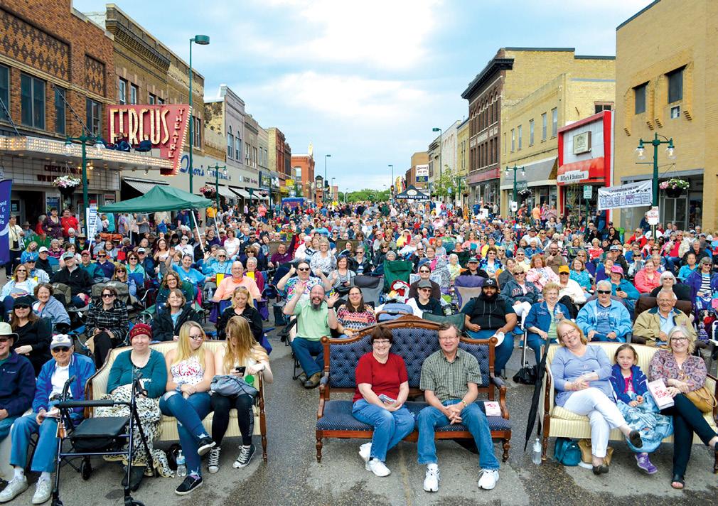
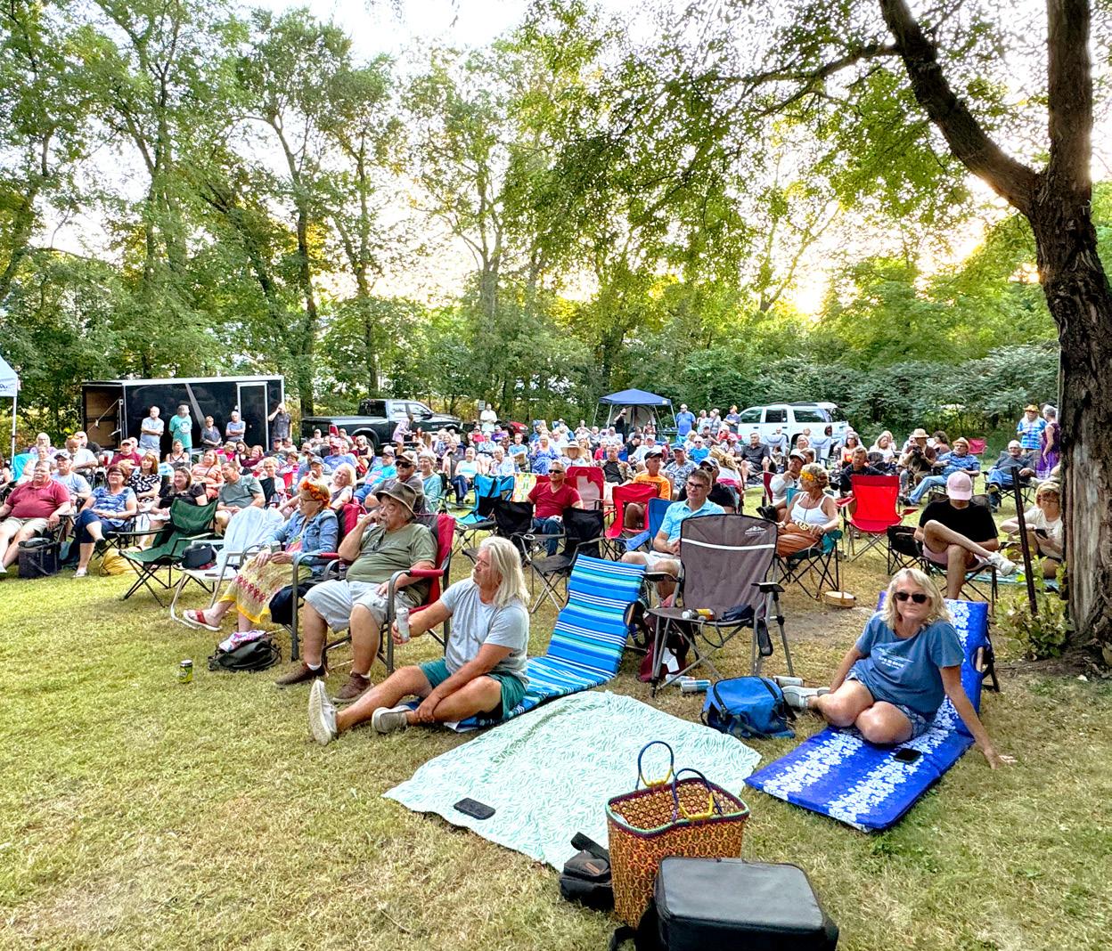
That’s why we participate. We vote, fill out the Census, obey the laws, and give our time to service clubs and neighbors. When a fundraiser for a family in need is held, a onceempty community center overflows.
With fewer people than in metropolitan areas, we know our engagement matters. Our voter turnout consistently beats the national average, proving our commitment. We care just as much about local school referendums as we do about representation in Washington, D.C. Time and again, we’ve shown that when we come together, we make a difference.
We face challenges close-up—by taking action. Together.


Our region is more than a collection of towns and counties—it’s a region shaped by shared history, culture, and collaboration.
While each community has its own character, from historic main streets to hidden roadside attractions, together they form a rich and interconnected landscape. Regionalism is about recognizing that our communities are stronger when they work together, whether in economic development, environmental sustainability, or civic engagement. This section explores the unique and sometimes quirky aspects that define our region and highlights the generosity of local philanthropists whose contributions have helped shape and strengthen our communities.


Kathryn J. Draeger, Statewide Director, University of Minnesota Regional Sustainable Development Partnerships
For those of us who spend a lot of time looking at the soil, plants, and earth—like farmers— it’s a good idea to cast our eyes upwards to the sun with both awe and curiosity.
Our star goes through 11-year cycles of calm and activity known as solar cycles. We’re at the “solar maximum” for solar cycle 25, and during this time the sun can unleash explosions of light, energy, and solar radiation—all of which contribute to what we call space weather.
You may be lucky enough to have seen the aurora borealis, the visual manifestation of solar storms. These beautiful displays of light are evidence that a geomagnetic storm is happening because of activity on the sun. The impacts of these storms range from beautiful to potentially severe disruption, as they can impact satellites, communications, and the electric grid.


In May 2024, we had a large solar storm that was named the Gannon Storm. That storm happened during planting season in a large swath of the central United States and halted GPS-guided planting across several states. As we become more and more technologically dependent, it’s important to think about what resilience means in the face of potential disruptions, like solar storms.


Within our region, there are 82 cities and 238 townships, each contributing to its rich history and character.

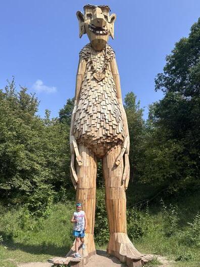
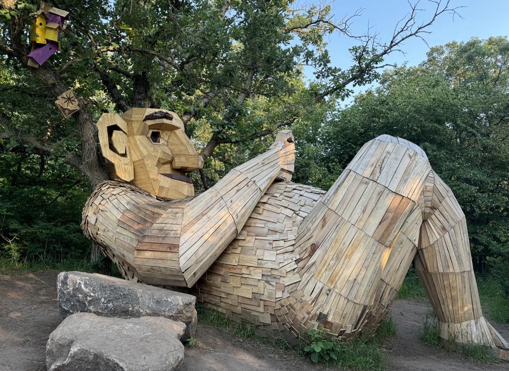
Becker County gained international acclaim when artist Thomas Dambo built six giant trolls from recycled materials in 2024, creating a nature-based scavenger hunt that attracted visitors and earned the county a spot on Time’s World’s Greatest Places list in 2025.
Lake Park was known as the “Lefse Capital of the World” until the mid-1980s, when its high-production lefse factories closed due to a national recession and the loss of regular rail freight service.
Detroit Lakes hosts Polar Fest, a two-week winter festival featuring ice palaces, fireworks, and a polar plunge.
Vergas is home to the legend of the Hairy Man, a mysterious, hairy figure said to roam the woods and startle those who cross its path.


White Earth Nation takes its name from Gaa- waabaabiganikaag, an Ojibwemowin word meaning “where there is an abundance of white clay.”
Otter Tail County boasts more lakes than any other county in the United States, with over 1,000 lakes spanning its scenic landscape.
Township has had two different dogs serve as mayor.
Robert Asp built the Viking ship Hjemkomst, which sailed 6,000 miles to Norway in 1982.


Covering approximately 8,500 square miles, our region includes 571 square miles of water, shaping its natural beauty and resources.


Museum houses the oldest and crudest ox cart known to exist in Minnesota.
Falls holds the distinction of being the first and longest-standing Tree City USA in the country.
Perham processes the daily wastewater equivalent of a city with 120,000 people due to its large food manufacturing industry.
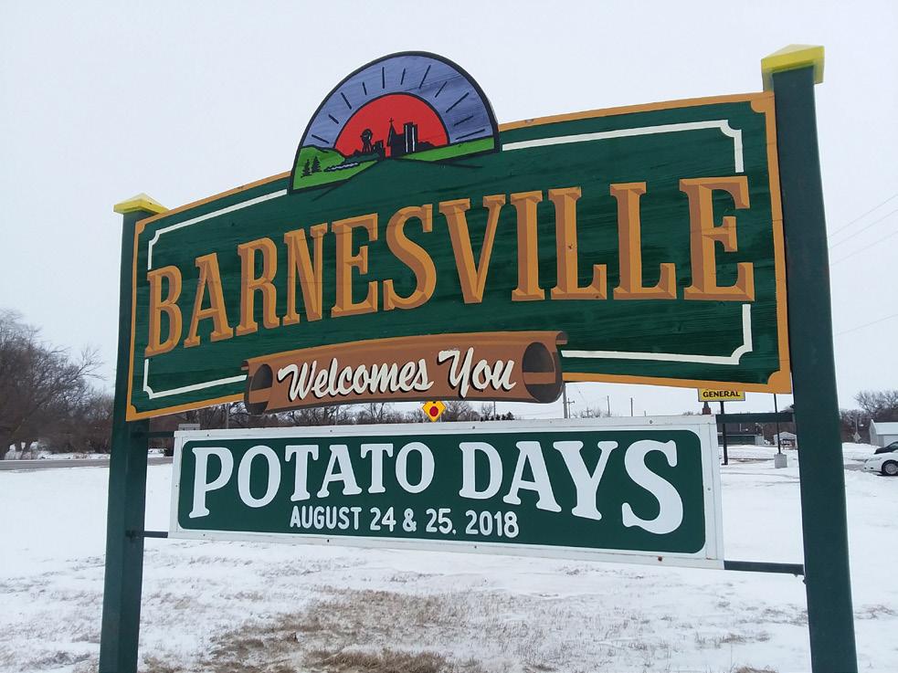

Barnesville has been celebrating Potato Days since 1938, bringing in over 20,000 visitors annually.
Businesses in the early 1900s often stored potatoes in their basements for preservation
Education is a priority in our region, with 35 school districts, 13 private schools, and 10 higher education institutions supporting lifelong learning.
Our region has 18,000 miles of maintained roads, connecting communities across vast landscapes.
Earth is the Wild Rice Capital, where abundant waters produce the finest manoomin (wild rice), a sacred food that tribal members harvest each August, sometimes exceeding 200,000 pounds in a good season.
Moorheadis where the iconic Dilly Bar was invented at the historic Dairy Queen in 1955.

Ottertail features a 14-foot-long metal otter sculpture, Ollie the Otter, at the town’s main intersection. Battle Lake is home to the only Civil War Museum in the region.
Pope County is home to Glacial Lakes State Park, known for its rolling hills and untouched prairie.

Otter Tail County boasts several roadside sculptures, including Pelican Pete, Vergas Loon, and Otto the Otter.
Rothsay is home to the World’s Largest Prairie Chicken and is the birthplace of the Bobcat skid-steer loader.
New York Mills sits on the Continental Divide, where water flows both south to the Gulf of Mexico and north to Hudson Bay.
Audubon is home to Minnesota’s largest Purple Martin house, a specially designed birdhouse built to attract Purple Martins.
Osakis’ Garfield Wood, known in the boatracing world as the Silver Fox and the first person to go more than 100 mph on the water, had his first boat race on Lake Osakis as a child in his ferry, the Manitoba.
Wheaton is located just miles from both the North Dakota and South Dakota borders, making it common for residents to travel through three states in a single day.
Stevens County houses a branch of the University of Minnesota, a clean energy leader and the nation’s top public liberal arts college for sustainability.
Pope County’s
Ordway Prairie spans 841 acres and preserves some of the state’s last remaining native prairie landscapes.
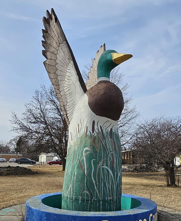
Wheatonis home to the largest mallard statue in the United States.

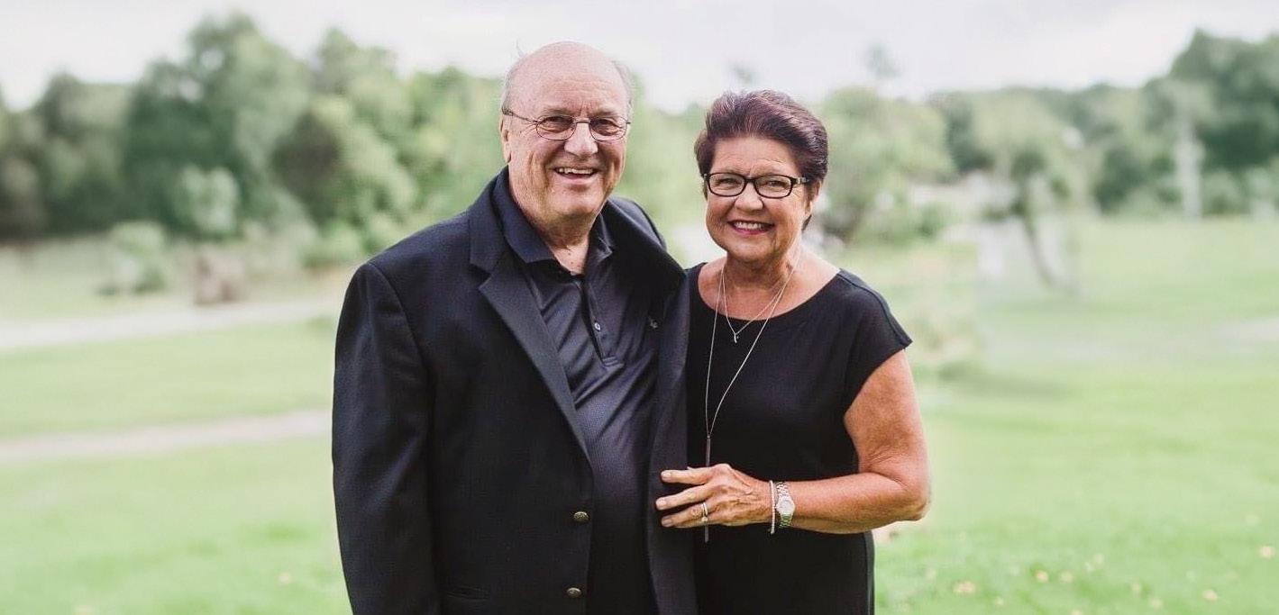
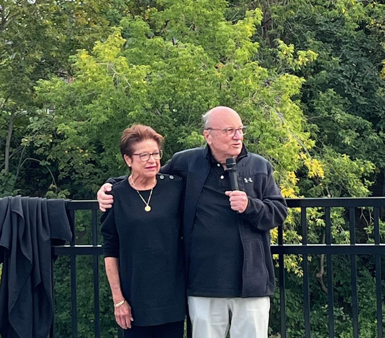
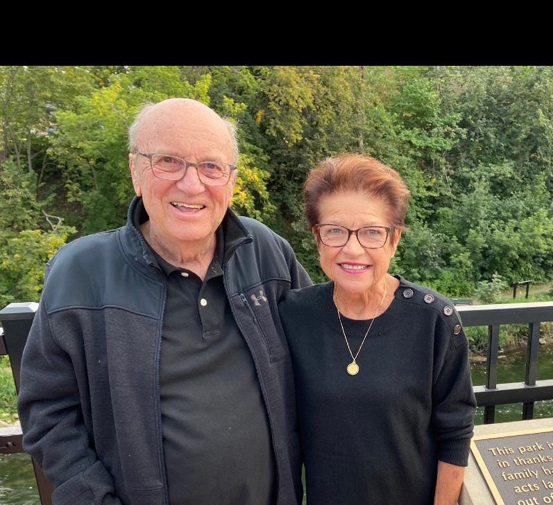
With unwavering generosity and commitment to community, Gary and Sharon Spies leave behind a lasting legacy of impact and kindness.
Gary and Sharon Spies believed in making the world a better place, and they started with their own community.
Successful business owners and devoted advocates for the region, Gary and Sharon touched countless lives through their kindness, generosity, and unwavering commitment to the people around them. When they both passed away in early 2025, they left behind a legacy that serves as an enduring example of what it means to invest in a place and its people.

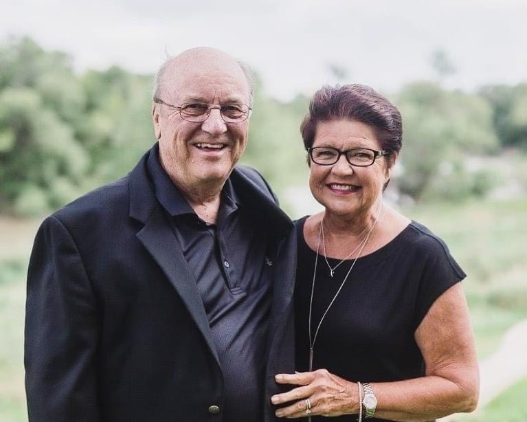
Gary and Sharon Spies were never ones to seek recognition, but their impact is visible everywhere—from parks and gathering spaces to programs and projects that continue to strengthen the region. “They simply wanted to help,” said Rebecca Lynn Petersen, Director of Development at West Central Initiative. “Gary and Sharon believed that when a community thrives, everyone benefits.” Together, they gave generously, not only through donations but by championing causes that brought people together—and continue to bring people together—improving lives. Their belief in the power of community inspired countless others to step forward and do the same.
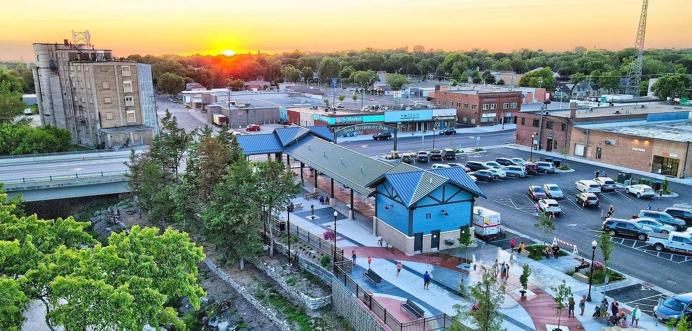
A lasting tribute to their legacy was the creation of Spies Riverfront Park and Market Pavilion, a place where people can gather, celebrate, and build connections—just as they always encouraged. At West Central Initiative’s The Longest Table event in August 2024, it was


communities. Whether through acts of kindness, volunteering, or supporting local initiatives, we can all play a role in shaping

The word “almanac” comes from Arabic, meaning climate, and has long served as a guide to the natural world. The earliest known almanac appeared in Islamic Spain in 1088, offering positions of the sun, moon, and planets alongside weather data for farmers. The first printed almanac was published in Vienna in 1457, and in 1732, Benjamin Franklin, under the pseudonym “Poor Richard,” created an almanac filled with weather predictions, demographics, and proverbs for early American colonists. The Old Farmer’s Almanac continued this tradition, adding forecasts, planting schedules, and recipes, making it the longest continuously published journal in North America.
Many threads connect this inaugural almanac to those throughout history—culture, civic engagement, practical ideas, and most importantly, climate. Woven together, they form the fabric of our region, a patchwork quilt rather than a melting pot, where diverse perspectives create something unique. Like a cherished heirloom quilt, it’s a blue-ribbon marvel, something you can only find here in our part of Minnesota.
The following essays explore the significance of regions, written by those who know us well. Do regions really matter? What would you say about ours?

Ben Winchester, Evaluation & Rural Sociology, Extension Department of Community Development, University of Minnesota
Gordon Hydukovich, Retired DevelopmentCommunityDirector
Our political boundaries, such as counties, were drawn during a time of horse and buggy. Looking at them today, they rarely reflect patterns of natural social activity. Yet, rather than each community fending for themselves, if we better recognize the regional aspects of rural living, we then allow these expressions of regional relationships to inform our work in spaces that connect our places. This can challenge existing jurisdictions and policies, and rather than describing ourselves in the Middle of Nowhere, when we examine the totality of our human behaviors we find we live in the Middle of Everywhere! Today we no longer work where we live. Over half of Minnesotans (52%) leave their county for work every day, after decades-long shifts to a regional economy. These are reflected in employment patterns replicated across the state as we continue to decouple our work and home locations. In counties with a job-first economic strategy we then compete with our neighbors rather than cooperate around the relationship between jobs and housing.
Our social lives also cross the county lines to bike, hike, fish, and hunt. In fact, every year, new groups are being created by people, for people—like taking disabled veterans fishing or protecting our lakes. Across the west central Minnesota region, there are 1,663 nonprofits in 2020, a source of just over $1
billion in annual revenue, and holding over $2.2 billion in assets. This has been one of the greater shifts in social life, from place-based groups with a broad mission to regional groups with a distinct focus. These organizations span multiple counties into regions such as the West Central Trailblazers Snowmobile Club. From a place perspective we may be led to believe social life is dying and people don’t want to be involved in town anymore, but this is not true. Social life just looks different when a few people from each town get together in a space connecting places.
All told, the priority on place-based outcomes can inhibit our ability to see the totality of interactions that occur across spaces due to our incoming employees, regional neighbors, family visitors, and seasonal tourists. The multitudes of intersecting patterns reinforce the message that no town is a one-stop shop, and we must work together for the betterment of each.
Regions are natural to and in our lives. There are lake, forest, mountain, prairie, and hill regions. There are watersheds, deltas, and river basins. In those natural regions diverse resources are available, which lead to opportunities.
Overlying natural regions are ethnic and historical regions. Those are the result of early native and later settlement activities.
To strap together the resources of natural regions with the potential labor of native and settlement populations, a net of multi-state and substate regions are formed of political subdivisions. Those regions have thrived on their obvious natural resource-based economies, which in west central Minnesota are agriculture and tourism.
So, as a substate region, the west central area has its base industries. With a well-connected transportation system, it can seek appropriate manufacturers. Those that need local labor and resources. It can be reasonably done.
What is reasonable? That would be to keep and/or return the area’s greatest product, the children born, raised, and trained here. They should be given early business training. If that is a recognized success, there would be a promise that after high school, tech school, or college the region would be there to help a properly planned business start.
Imagine a region with less brain drain. Contemplate a region peopled with individuals and families who have a historical, cultural, familial, and/or economic reason to be here.

Jacob McArthur, Director, EDA University Center, University of Minnesota Crookston
The White Earth Indian Reservation is the largest reservation in Minnesota, spanning Mahnomen, Becker, and Clearwater Counties and is the home of the White Earth Ojibwe Nation. Our land is rich in forests, lakes, prairies, and wetlands. She has provided us with breathtaking beauty but also the natural resources that have sustained our people here for generations.
Our connection to the land is strong, and we continue to preserve our culture and traditions, revitalize our language, and protect our natural resources. Our communities thrive through tribally owned businesses, family-focused programs and initiatives, a commitment to education, and cultural events such as our annual powwows, where we happily share our heritage with others. White Earth is more than a place, it is a testament to our strength, resilience, and deep-rooted connection to our ancestors while we work to create a better world for future generations.
Mark Ritchie, Former Minnesota Secretary of State
Webster defines “regions” as geographical areas where people possess homogeneity that “distinguish themselves from others.” This “homogeneity” is, I believe, one of the most important assets for bridging the many divides that threaten our democracy. Here’s why.
I grew up in a farming region often referred to as Central Iowa. As Webster noted, we were blessed with many shared beliefs, one of the most important being that a good education was the path to economic success and crucial to protecting our democracy. This homogeneity of belief in the importance of education was closely linked to the expectation that everyone should “walk the talk.”
If education is important, then excellent schools for all must be built and paid for. Thanks to great schools and excellent teachers, many of us shared a passion for learning, including a curiosity for what could be learned from other regions. High participation rates in student foreign exchange programs are an example of how this curiosity manifested itself throughout the region.
Some regions have let the importance of education be forgotten or diminished. But not central Iowa and not west central Minnesota. As Minnesota’s Secretary of State and as a long-time board member of Fergus Falls-based Communicating for Agriculture, I have been blessed with many opportunities to learn from and be part of this special region.
One of the many things I have learned from friends and colleagues in west central Minnesota is the powerfully shared belief in being a truly welcoming place. This is the fundamental building block for advancing understanding and trust—near and far. It will be from the successes of places like your region that a new depth of trust within the nation will grow, and our democracy will deepen instead of disappearing.
Lori Sturdevant, Retired Star Tribune Editorial Writer and Columnist
“Why is it that Minnesotans always think they should punch above their weight?” an East Coast-raised friend once sputtered to me after a meeting at which Minnesota ambition was on ample display. She likely meant the comment as criticism. Being a Minnesotan, I took it as an apt observation.
“Because that’s what we’ve done since statehood,” I replied, then rattled off examples from the mid-19th century forward of this state’s uncommon impact on the nation and the world.
That reply satisfied my friend. But her question stayed with me. Why has Minnesota out-performed other states on a host of measures of well-being?
I’ve come to believe that the key to Minnesota’s success has been the communitarian spirit of many who have come here from all over the globe to make this home. It’s the same spirit that animates this almanac.
More than the residents of many other states, Minnesotans have been willing to aggregate their resources to benefit the common good. The clustering of centers of government, commerce, education, and transportation in the 19th century allowed a metropolis to arise in the 20th. The use of state taxes to finance schools and local governments in the 20th century helped build and keep the workforce the 21st century requires.
This almanac is a new manifestation of that good old Minnesota idea. It touts the virtues of regional planning and resource-sharing that were envisioned by both Republicans and DFLers in mid-20th century. It invites a belief that choosing to work together today will yield a better tomorrow.
That’s the faith of Minnesota’s pioneers. We rank among them.
Roger Moe, Senate Majority Leader, Minnesota State Senate 1971-2002, President, National Strategies Inc.
Regions are important. They help explain where we come from— whether it’s west central Minnesota, southeast Minnesota, or “da range.” You don’t have to have lived anywhere in Minnesota very long before you take pride in your region of the state.
The Metropolitan Council, the Regional Organizations,Development and Minnesota Initiative Foundation regions are intra- dependent areas that work together on issues that require a broader strategy. But, at the same time, encourage local initiatives and autonomy. We need a broader regional view when we discuss transportation systems, trails, water planning, educational opportunities and the list goes on. We also take great pride in our local communities, whether through special events or cultural traditions, and we love to brag about what makes our town special—especially when our high school teams make it to the state tournament!
Minnesota takes pride in solving problems and addressing issues important to us. It always works best when we work together, consider the skeptics’ opinions, are transparent and civil, and work off a basis of facts. This almanac provides facts that will serve our region well as we try new ideas, dare to be different, and look to the future with optimism and courage.

Ben Goldfarb, Director of Strategic Initiatives for Democracy, Media, and Policy, McKnight Foundation

Betsy Roder, Executive Director, New York Mills Regional Cultural Center
As a rural arts leader, I’ve seen how prioritizing collaboration over competition strengthens relationships, expands connections, and fuels economic growth and resilience. Strong communities don’t thrive in isolation—they succeed when they connect, support, and lift each other up.
The arts play a vital role in this work, bringing people together, creating shared experiences, and strengthening our sense of place. In rural areas, the arts are not just an extra—they are essential to building vibrant, resilient communities, driving economic activity, and fostering creativity.
I’ve also served on my local city council and several county boards—commitments that take time and energy but are worthwhile to share my voice and contribute to a positive rural narrative. Being surrounded by solutionoriented people working together to strengthen our region is incredibly fulfilling.
Each community has its own unique story, and when we share and promote one another, we all win. Whether it’s expanding cultural opportunities, improving infrastructure, or supporting local businesses, regional collaboration ensures a brighter future for everyone. A rising tide lifts all boats—investing in partnerships means investing in our communities’ future.
In the mid-1980s, rural Minnesota faced an uncertain future. Main street storefronts were shuttering, farms were failing, and young people were leaving for the promise of better economic opportunity. In this moment of economic crisis, McKnight Foundation leaders traveled the state, listening to local voices who shared a deep desire to take ownership of their futures. It was clear: the solutions to rural Minnesota’s challenges should be driven by the people who knew their communities best—that there was power in proximity.
With guidance from nearly 20,000 community members, we envisioned a strategy where each place—from bustling farming communities to the most remote, resource-rich areas—could chart its own path to meet distinct needs and opportunities. Thus, in 1986, seeded by McKnight, the Minnesota Initiative Foundations (MIFs) were born—six separate regional entities across the state with missions and priorities set by the people they served.
McKnight and our partners grounded this regional approach in the belief that there are “differences that make a difference” across Greater Minnesota. While there is no one definitive way to understand Minnesota’s regions, we know there is power and possibility when we focus resources within areas that share distinct characteristics (cultural, economic, environmental, etc.), while also bridging across geographies to learn and grow together.
The result? The MIF’s have leveraged McKnight’s support ($328 million to date) to spark a remarkable surge of local impact, creating new opportunities that take different shape based on regional context.
We believe that regions are more than places on a map—they are ecosystems of opportunity, shaped by natural and human geography. By investing in Greater Minnesota’s distinct regional strengths, we have seen how tailored approaches and leadership can drive long-lasting, meaningful change.

As we look ahead—20, 50, even 100 years into the future—our vision for our region is one of resilience, opportunity, and connection.
We imagine a region where thriving small towns, strong local economies, and a deep sense of belonging define daily life. Our communities will continue to adapt to a changing world, balancing tradition with innovation, ensuring that agriculture, industry, and natural resources remain at the heart of our regional identity.

The challenges ahead—climate change, demographic shifts, workforce shortages—require regional solutions grounded in shared values and collective action. We must invest in infrastructure, housing, education, and sustainability while fostering a civic culture that encourages engagement and inclusion. By working together, we can ensure that our region is not only prepared for the coming decades but is actively shaping its own success.


A century from now, we hope future generations will look back at this moment as a turning point—a time when we chose to invest in a stronger, more sustainable future. The work ahead is ours to do, and this almanac serves as both a reflection of where we are and a guide toward where we want to be.
Our future starts now, and it belongs to all of us.
Find five ways you can make a difference now:


Taking action on climate change doesn’t have to be complicated. When we each do our part—at home, in our neighborhoods, and across our communities—we help create a stronger, healthier region for everyone. Here are five easy ways to start making an impact.
DRIVE LESS: Transportation has a huge impact on pollution. Pick a day to walk or bike to work, school, or around town.
COMPOST: Keep the planet cool by composting food waste to reduce methane emissions. It’s a win-win for the environment and your soil.
SUPPORT LOCAL FOOD PRODUCERS: Purchase local food to reduce the distance it travels and support your community.
IMPROVE EFFICIENCY: Weatherize your home by sealing leaks and adding insulation. Save money and help the climate.
MOW LESS: Save time and reduce climate impacts by mowing your lawn less often. It’s healthier for your grass, saves water, and supports wildlife habitat.
Thank You to Our Sponsors