2 minute read
Hawley Area School District and School Profiles


HAWLEY SCHOOL DISTRICT AND SCHOOL PROFILES
HAWLEY INDEPENDENT SCHOOL
DISTRICT #150
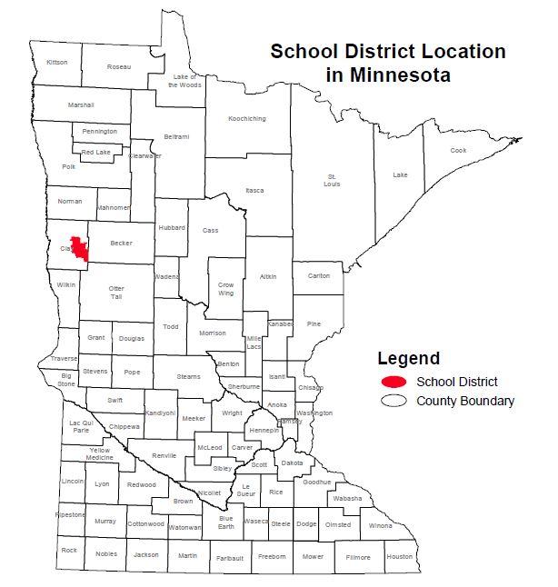
The Hawley Independent School District #150 is the home of the Nuggets and is located at 714 Joseph Street in Hawley. Due to its rural nature, the district encompasses a large percentage of eastcentral Clay County, including the townships surrounding the city of Hawley as seen in Figures 29 and 30. In total, the district serves under 1,000 students annually (981 students reported in 2018), utilizing 61.5 FTE of faculty, 3.2 FTE administration, and 50.8 FTE other staffing. 20 This includes an elementary and high school, both located on the
same campus.
Demographics of the student body are slightly different than the city of Hawley. Twenty-six students were identified as English-learners, 116 were receiving special education services, and 144 students were enrolled in the Free and Reduced School Lunch
program as of 2018. 21
The school district has an approved transportation policy, which is reviewed and kept up-to-date by the school board. An abridged version has been included in Appendix G.
Figures 29 & 30: Hawley School District (ISD 150) within Minnesota. Map courtesy of Minnesota Department of Education.
20 Minnesota Department of Education. Minnesota Report Card. Accessed June 18, 2018.
21 Minnesota Department of Education. Minnesota Report Card. Accessed June 18, 2018.
Additionally, the Hawley School District webpage states the following:
At the July 23, 2012 School Board meeting, it was passed to eliminate some in-town bus stops. A six-block boundary was implemented. Those students who live within these six blocks are not eligible for transportation.
Transportation is offered to and from school for those students who reside outside the school's six-block boundary or to students who must cross an area identified as a traffic hazard to and from school.22
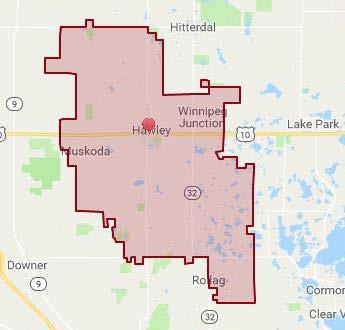
This map, aligned with that of a half-mile radius, is pictured in Figure 31.

Figure 31: City of Hawley. Pink boundary outlines the 6-block radius where bus transportation would not be available, as established at the July 23, 2012, meeting of the Hawley School Board. 1 The yellow boundary demonstrates a half-mile radius from the school bus loading/unloading area on school grounds.
22 Hawley Public School, Transportation, http://www.hawley.k12.mn.us/page/2845. Accessed June 26, 2018.
58 | Page HAWLEY SAFE ROUTES TO SCHOOL PLAN


