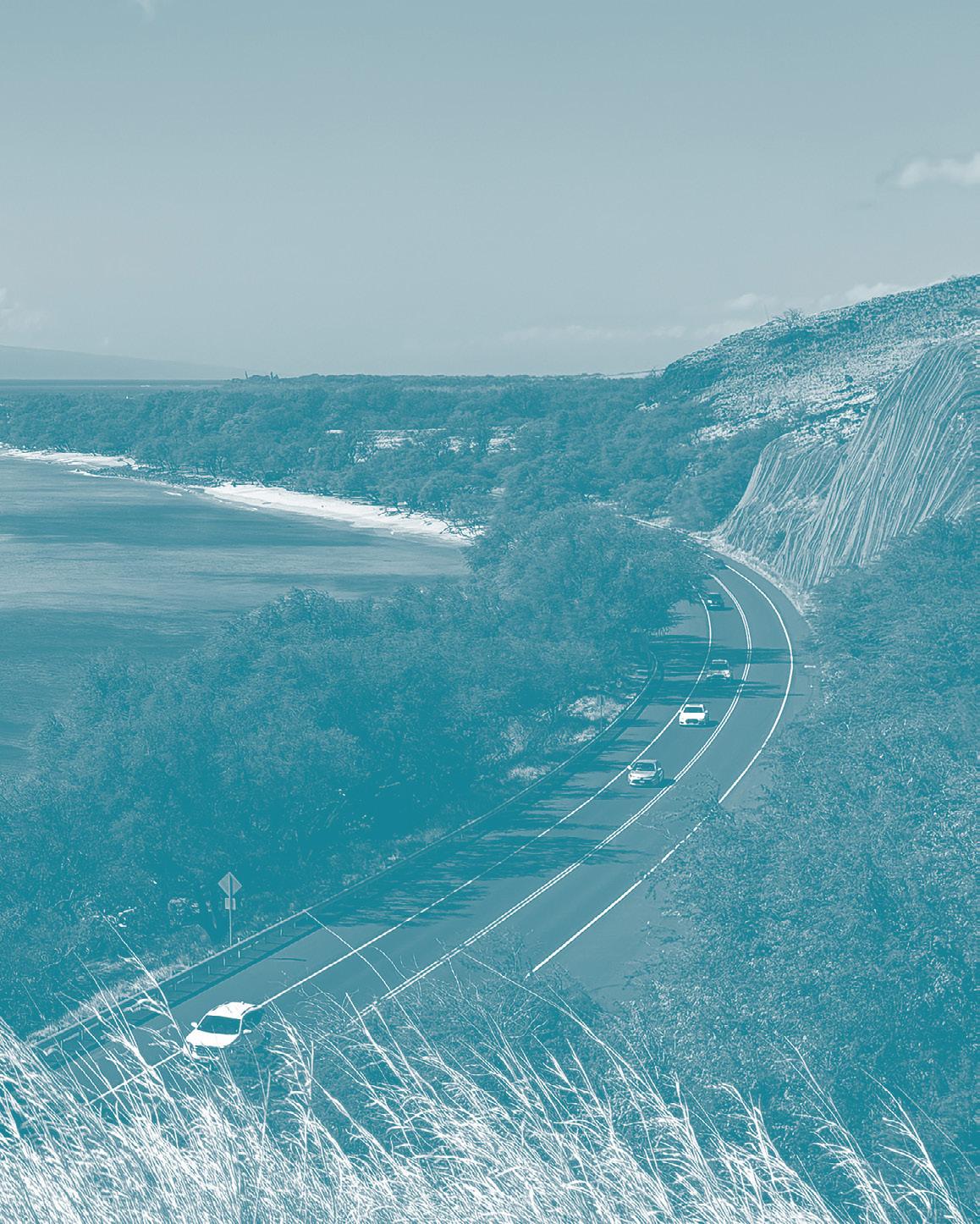
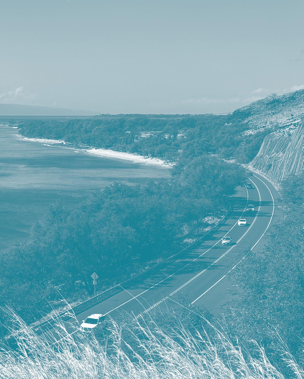
The upcoming Honoapiʻilani Highway realignment provides a unique opportunity for your input on the future of the Olowalu and Ukumehame coastal corridor that reflects ʻike kupuna, nature-based solutions, and community priorities.
Welcome and introductions
Project overview
Engagement results
Project goals and structure
Initial draft design and concepts
Menti co-design activities
Wrap up discussion
The Nature Conservancy (TNC) is a global environmental nonprofit working to create a world where people and nature can thrive. In Hawaiʻi since 1980, TNC promotes healthy and vibrant coral reefs through community partnerships, scientific monitoring, and restoration efforts across the state.
We are a collective of University of Hawai’i at Mānoa faculty, staff, and allied professionals across university departments and disciplines, assisted by student interns and recent graduates. UHCDC provides a platform for learning and professional development opportunities for students.
We work at the intersection of university, government, non-profits, and community stakeholders, gathering diverse perspectives to define and inform projects that serve the public.
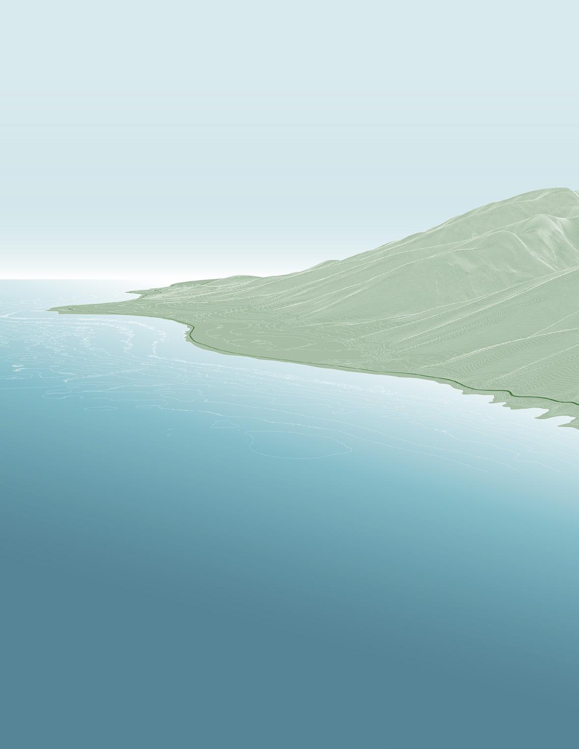
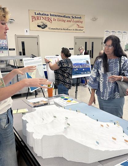
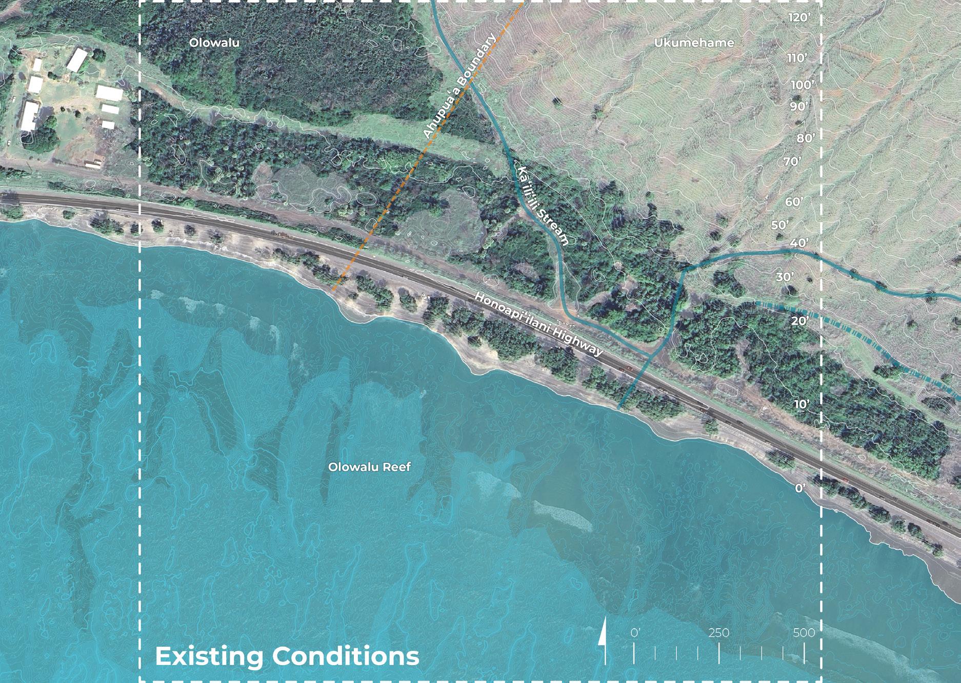
Olowalu: The Road to Resilience
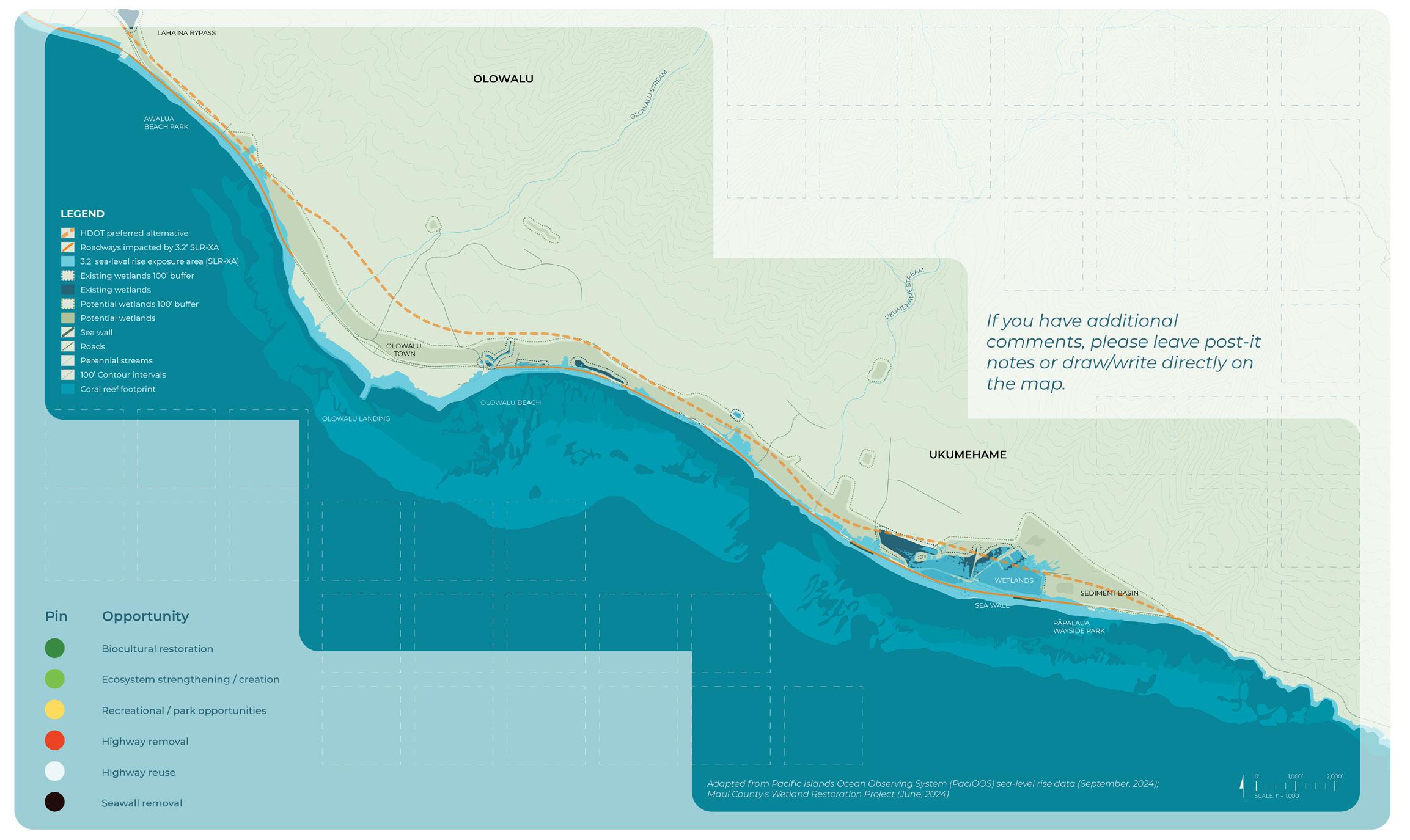
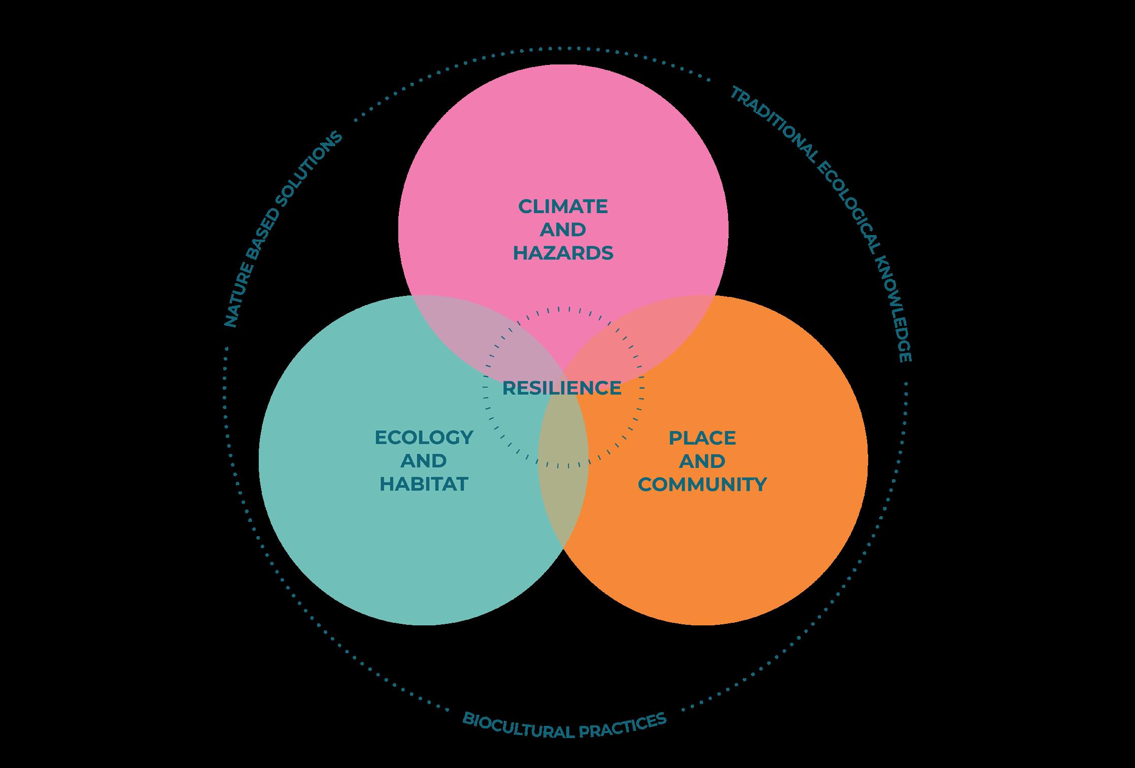
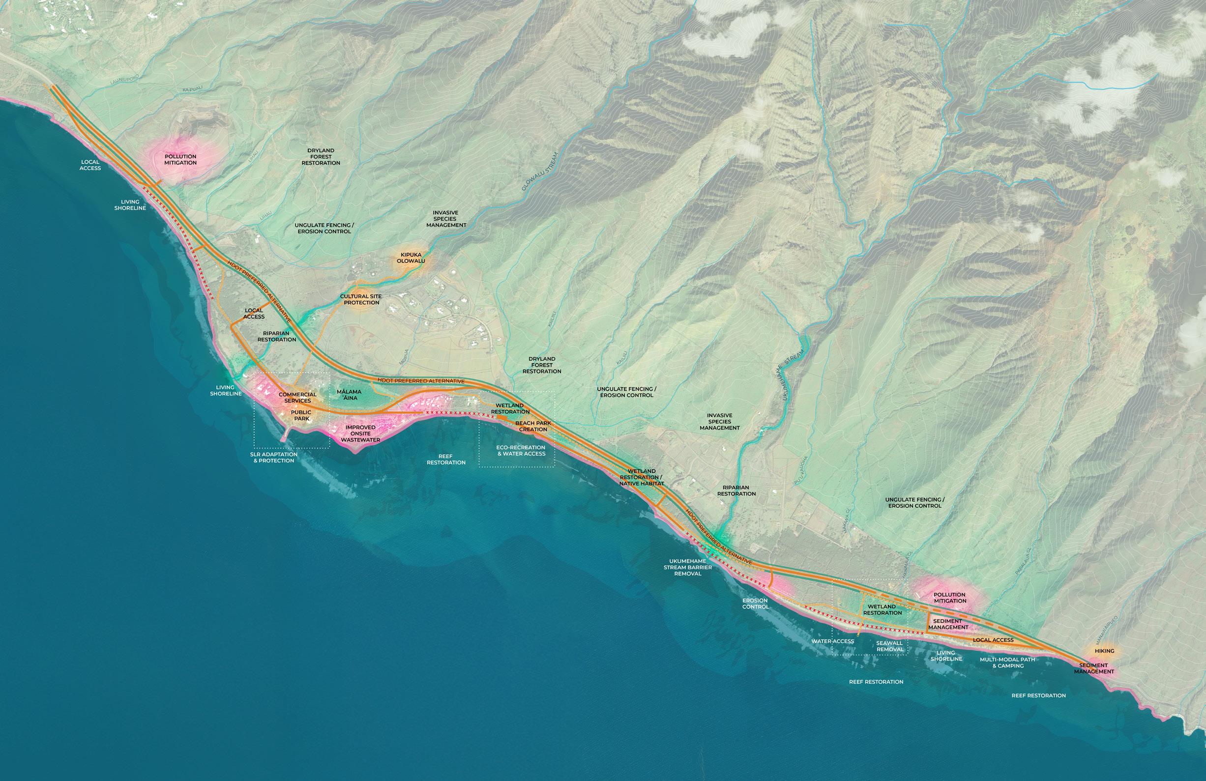
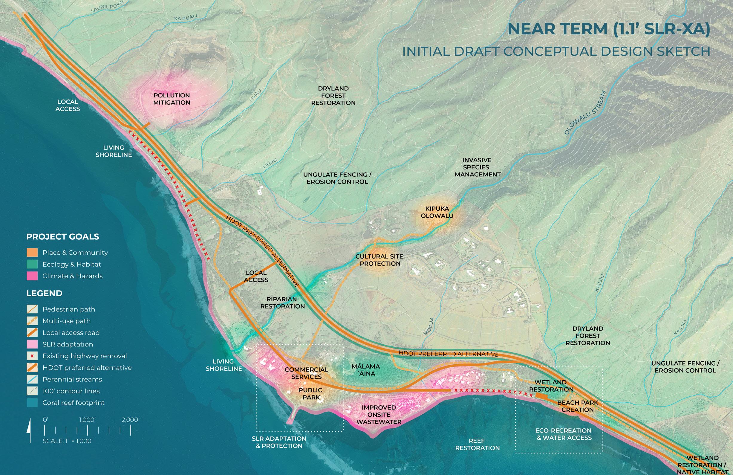
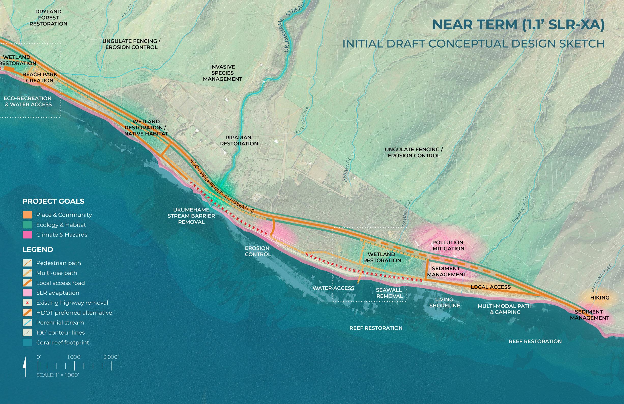
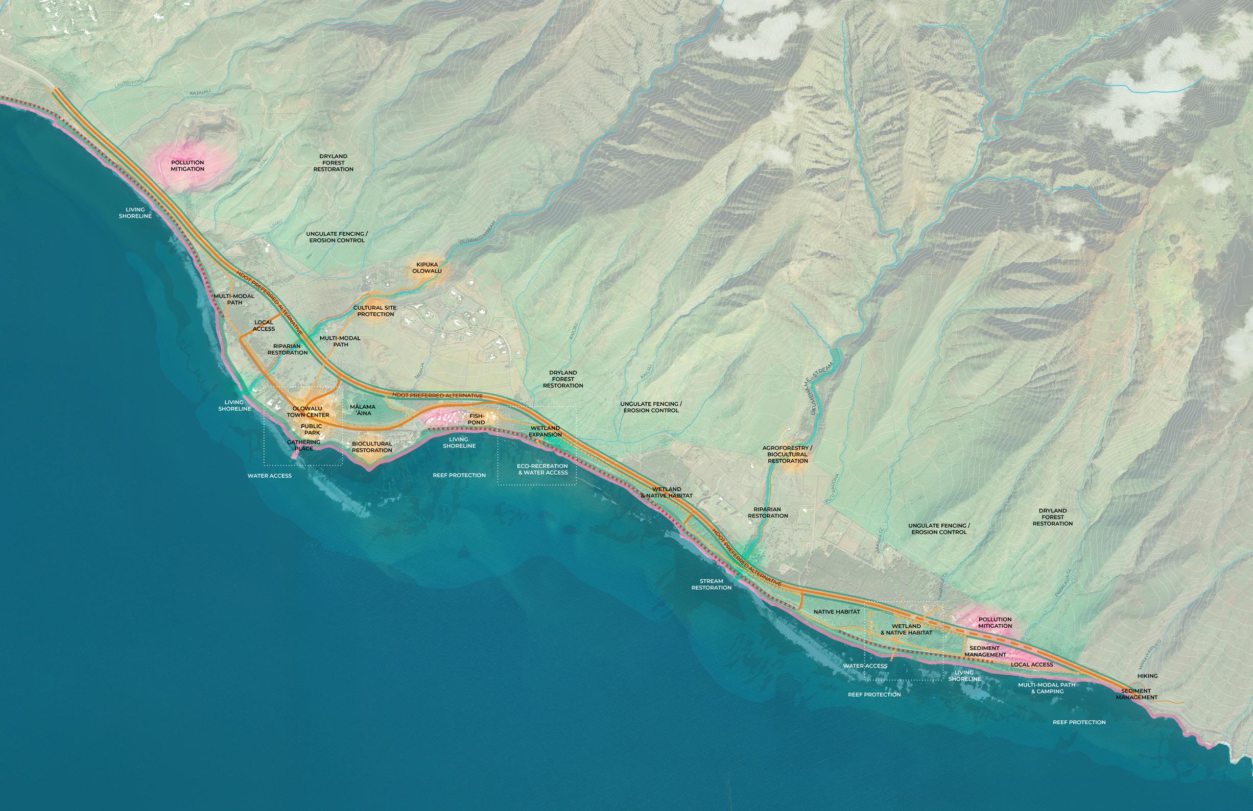
The planned Honoapiʻilani Highway realignment provides opportunities to re-imagine the Olowalu-Ukumehame coastal corridor by incorporating park spaces, traditional biocultural practices, and nature-based solutions. This project aims to strengthen coastal ecosystems, reduce pressures on the OlowaluUkumehame reef system, and improve resilience to help the area adapt to climate change effects, including sea level rise.
TNC Team:
Tamara Farnsworth, Coastal Resilience Project Manager
Dr. Kim Falinski, Coastal & Estuarine Scientist
Scott Crawford, Maui Marine Program Director
Emily Fielding, Hawai’i Marine Conservation Director
Nalei Sampson, Maui Marine Project Coordinator
UHCDC Team:
Judith Stilgenbauer, FASLA, Principal Investigator and Professor, School of Architecture
Emily Sobolewski Knight, ASLA, Research Associate
Sierra Spears, Research Associate
Student Assistants: Zoë Angelopulo, Dersel Bonai, Sarah Obra-Nakata, Kenny Morrow
Facilitators:
‘A‘ali‘i Alliance

Olowalu: The Road to Resilience
The upcoming Honoapiʻilani Highway realignment provides a unique opportunity for your input on the future of the Olowalu and Ukumehame coastal corridor that reflects ʻike kupuna, nature-based solutions, and community priorities.
JOIN US TO LEARN ABOUT THE PROJECT AND SHARE YOUR ʻIKE AND MANAʻO.
Thursday Feb 6, 2025
5:30 - 7:30 PM
LAHAINA INTERMEDIATE CAFETERIA
871 Lahainaluna Rd, Lahaina, HI 96761
VIRTUAL
ALTERNATIVE 1
Tuesday Feb 11, 2025 12 - 1:30 PM
ZOOM REGISTRATION

https://tnc.zoom.us/meeting/register/x4O3irrQQqONiFoIkhWTA
VIRTUAL
ALTERNATIVE 2
Thursday Feb 13, 2025 5:30 - 7 PM
ZOOM REGISTRATION

https://tnc.zoom.us/meeting/register/ pxGgqK0MToiRijZvvUdPyA
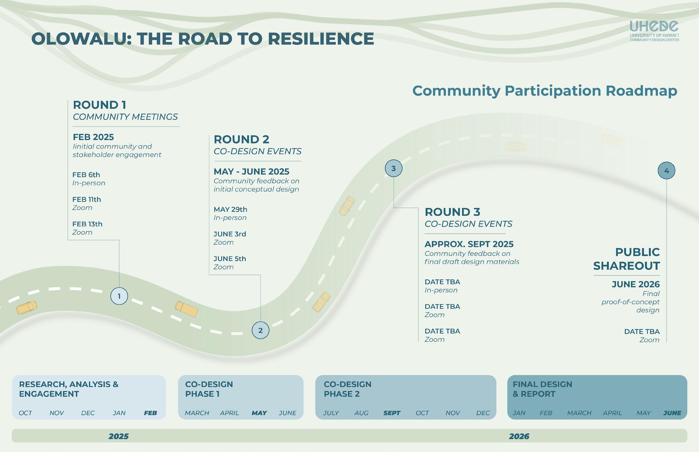
Each meeting will cover the same content: project introduction, interactive community visioning, and talk story. At the in-person event, light dinner and beverages will be served. Throughout the year, there will be two additional rounds of visioning and co-design meetings.
LEARN MORE
For additional project and meeting info, please scan the QR code.
https://storymaps.arcgis.com/stories/2ba79613d0aa4da182fe9bc34cc10cc7

QUESTIONS?
Contact: t.farnsworth@tnc.org UHCDC.olowalu@gmail.com
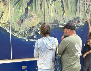
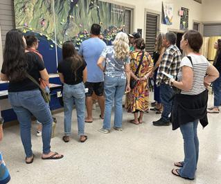
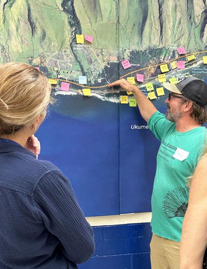
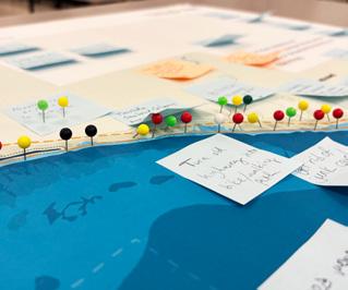
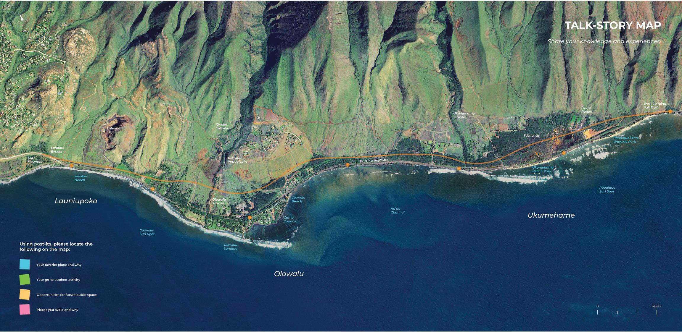
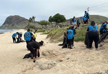
Share your knowledge and experiences!
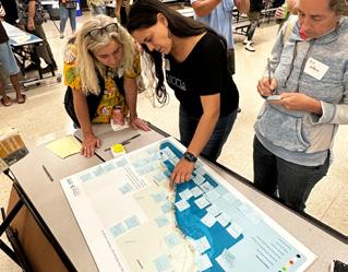
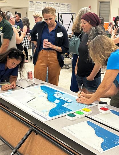
In-Person and Virtual Engagement Event Participant Input (2/6/25, 2/11/25, 2/13/25)
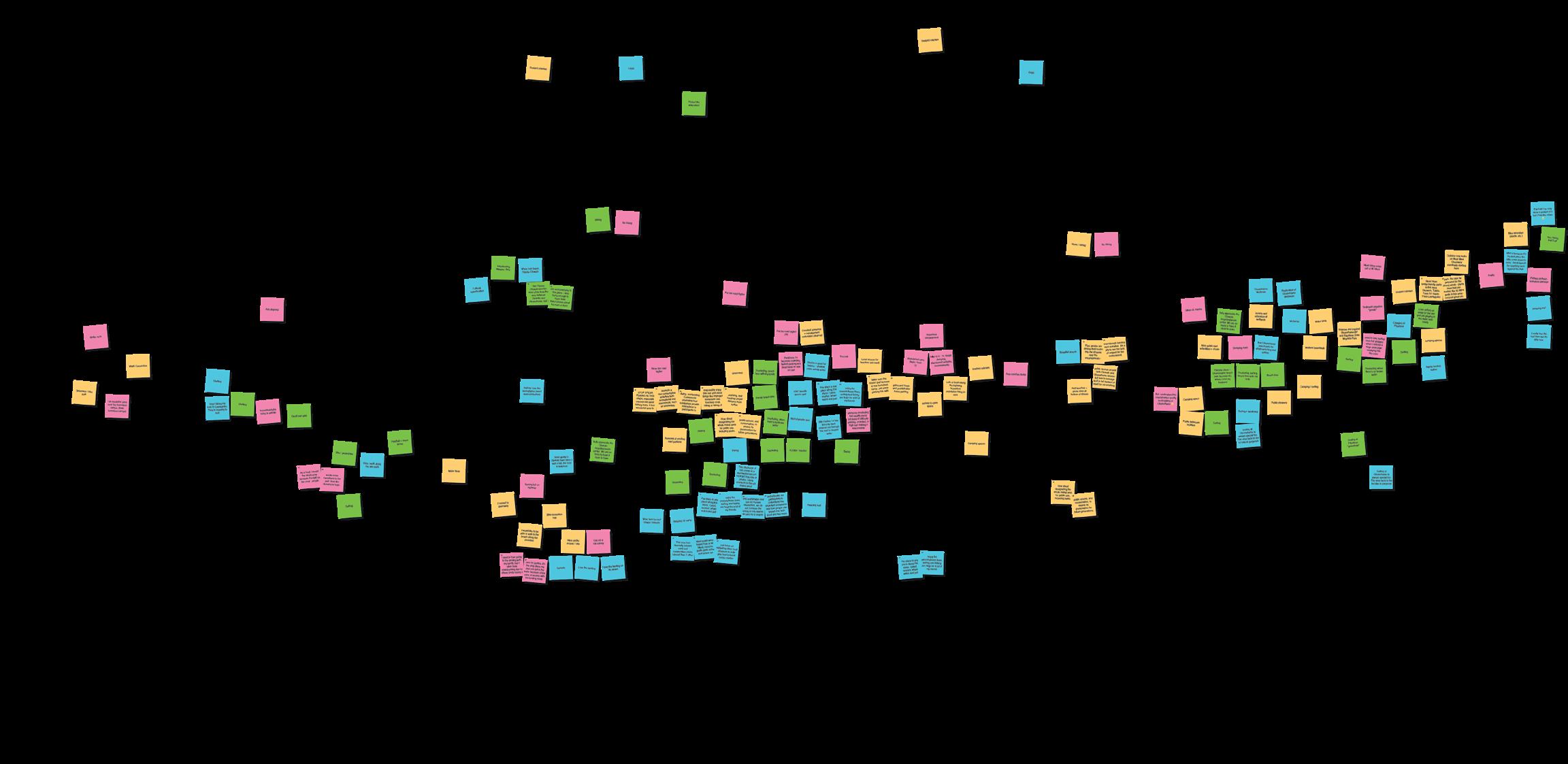
Synthesis of In-Person and Virtual Event Participant Comments
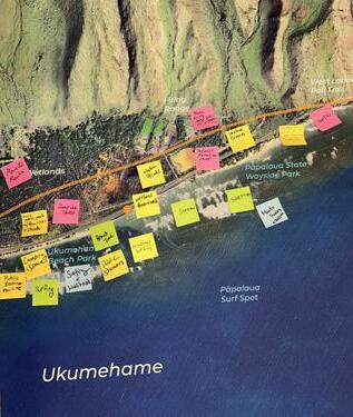
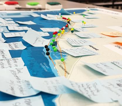
TALK-STORY MAP SYNTHESIS
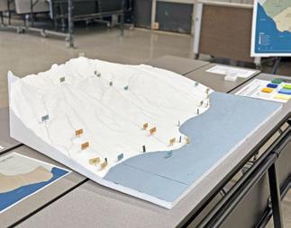
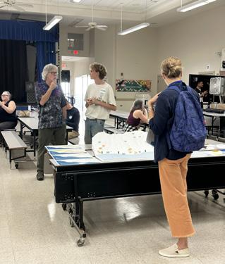
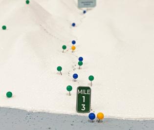
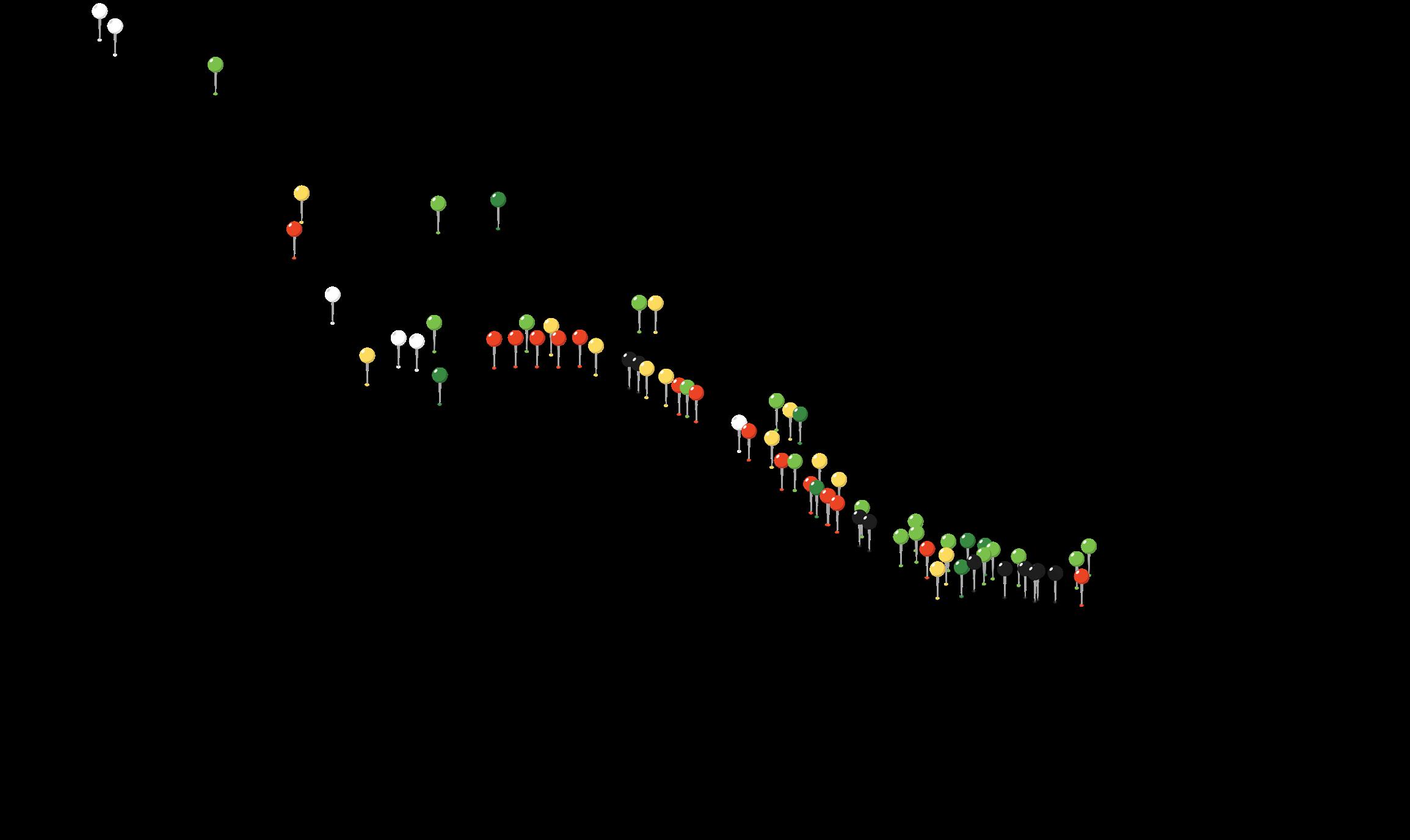
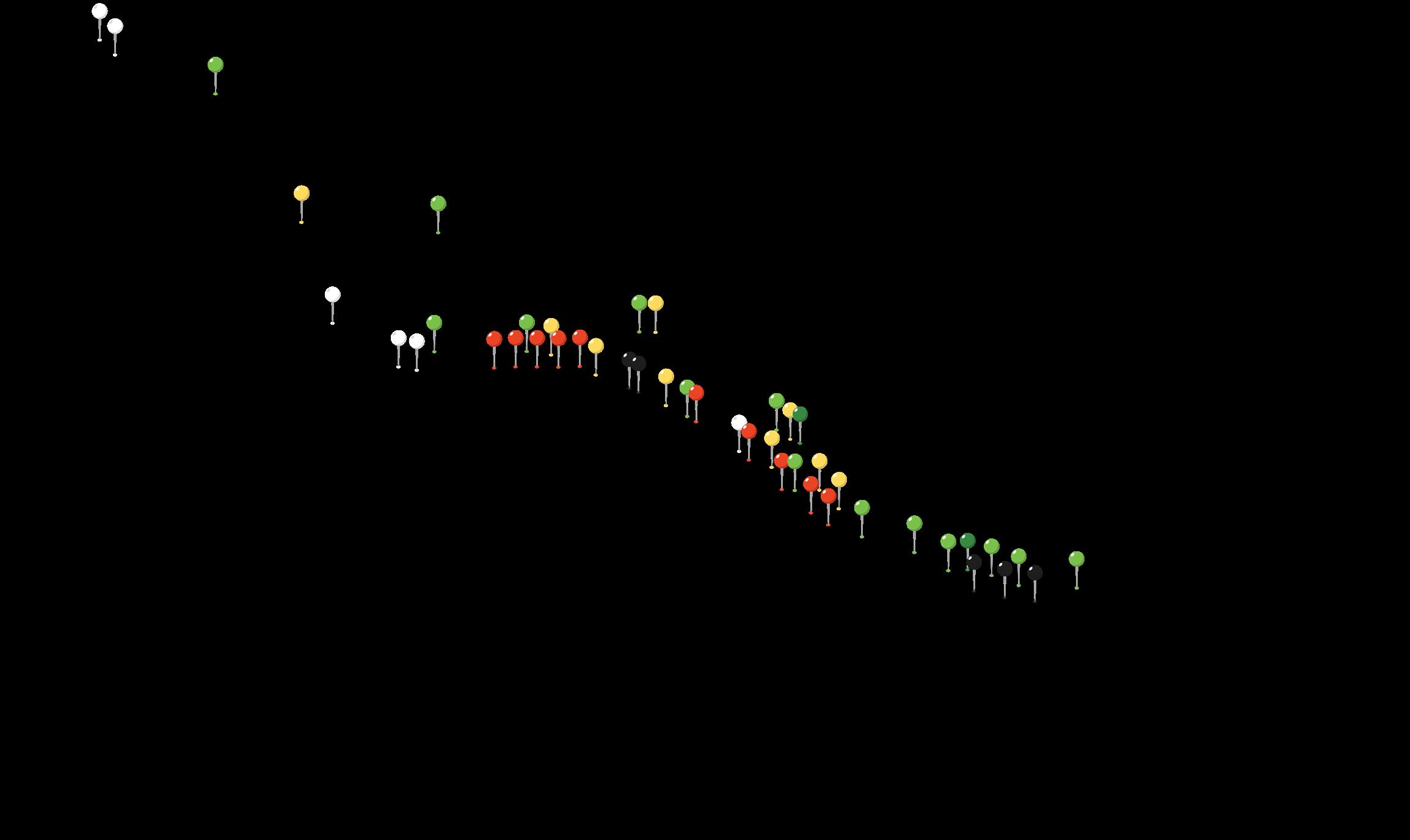
Prompt
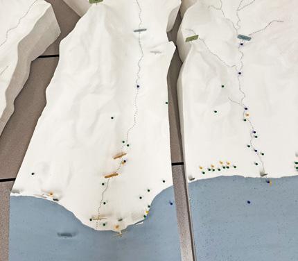
Using pins, mark places where you see opportunities for ahupuaʻa scale improvements.

Cultural Vegetation

Water

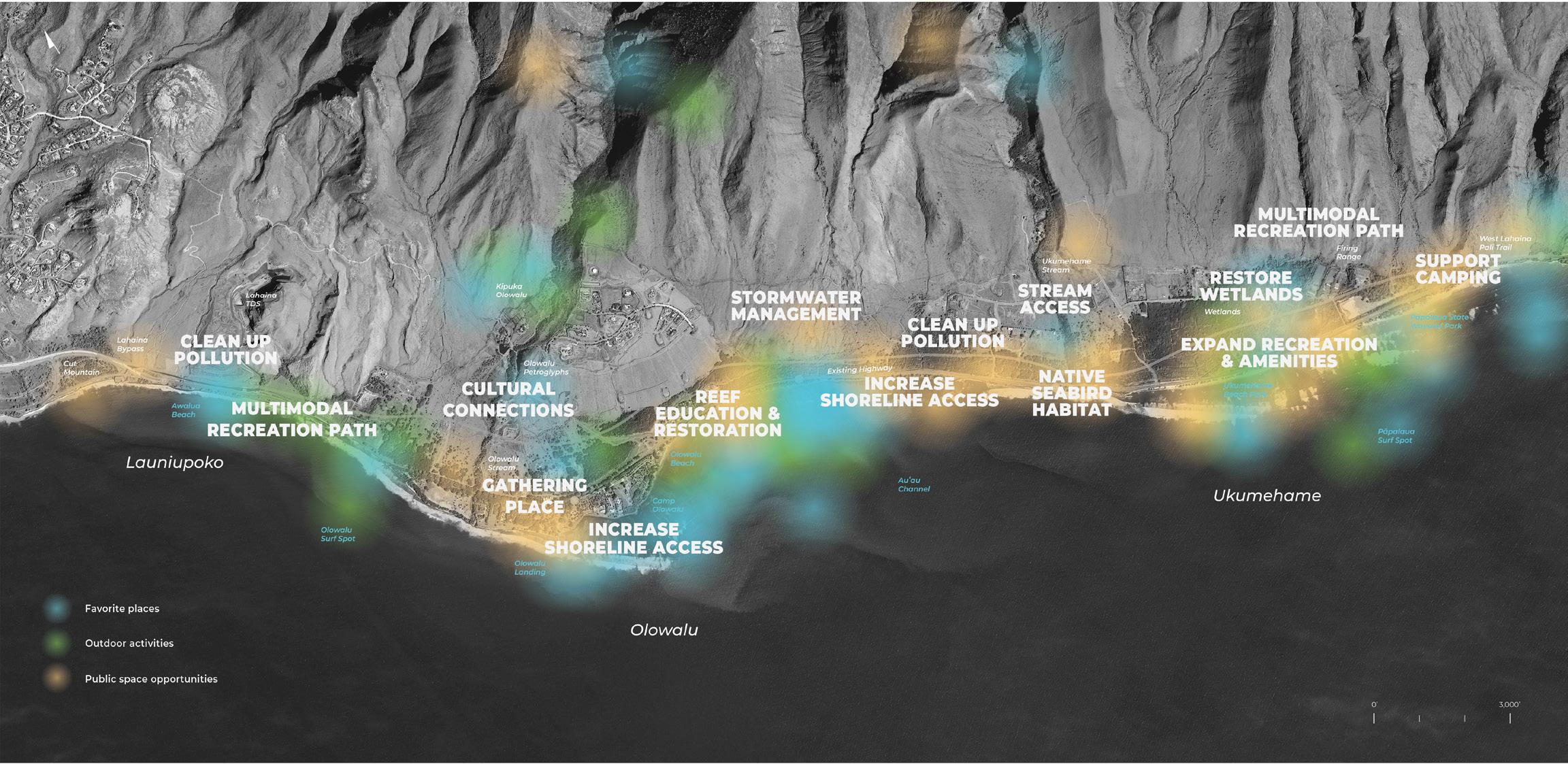
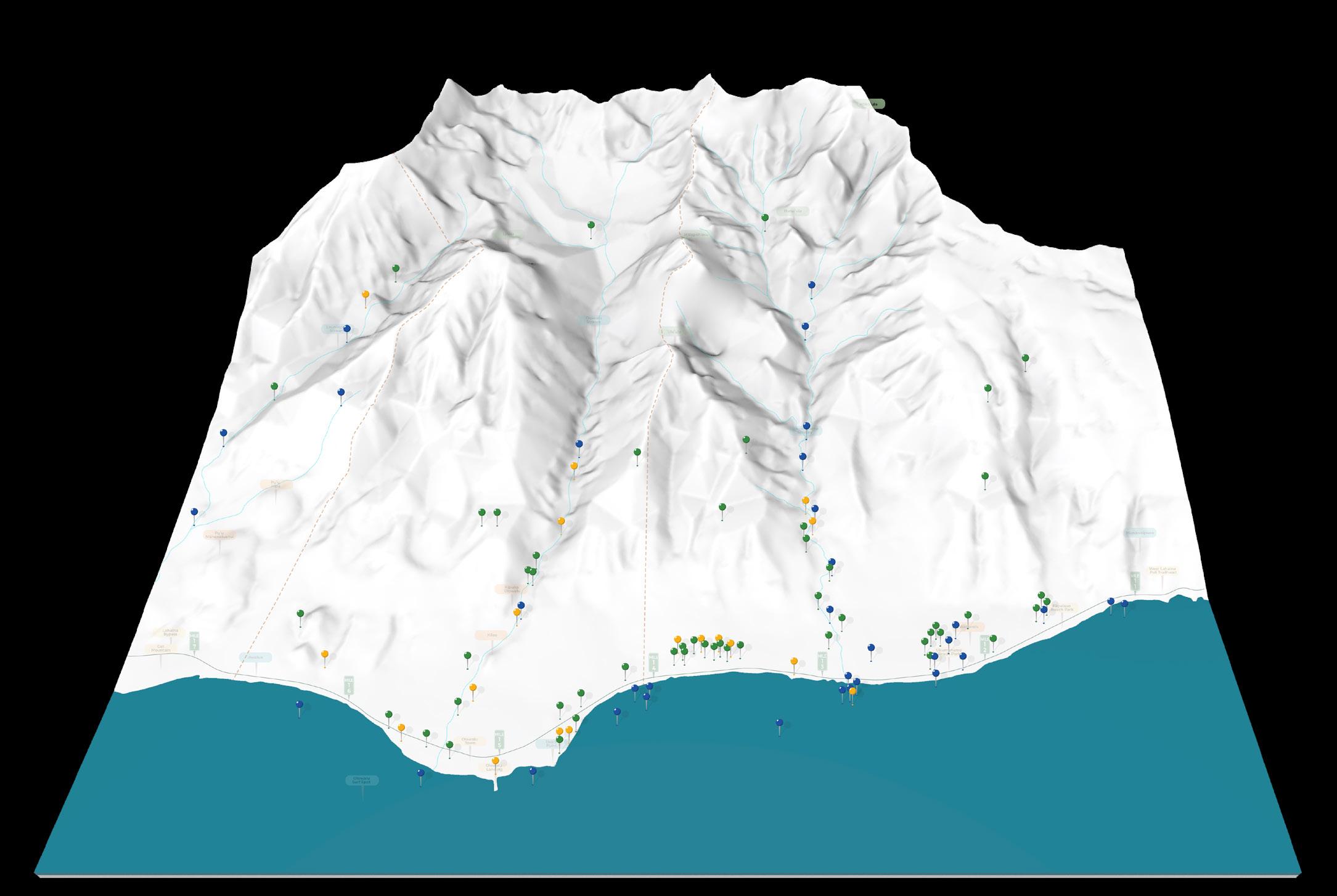
The Ridge-to-Reef Model exercise captured key community priorities across the Ukumehame, Olowalu, and Launiupoko ahupua‘a, with a total of 102 pins placed.
The large number of vegetation-related pins highlights a strong focus on native plant restoration, erosion control, and watershed health, while water-related pins emphasize concerns about stream flow, freshwater quality, and impacts of sediment on the Olowalu Reef. The cultural pins reflect a commitment to preserving significant sites and improving access, reinforcing the value of traditional ecological knowledge (TEK) in resilience planning.

CLEAN UP POLLUTION
STRENGTHEN CULTURAL SITES
PROTECT MAUKA AREAS
RESTORENATIVEFORESTS
PROTECT STREAM
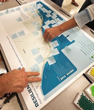
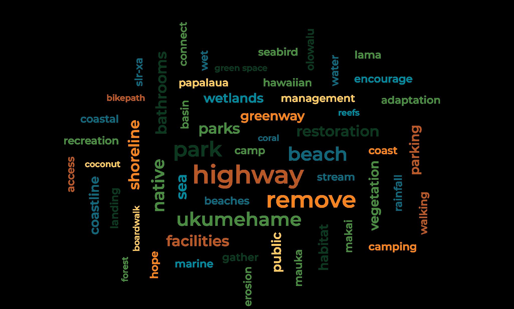
Summary of In-Person and Virtual
Engagement Event Comments
(2/6/25, 2/11/25, 2/13/25)
CONTROLSPECIESINVASIVE
RESTORE WETLANDS
RESTORE NATIVE FORESTS
COASTAL PROTECTION Categories:
IMPROVE ACCESS
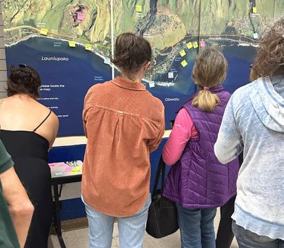
Post-highway relocation, where do you see opportunities for the following? Please use pins.
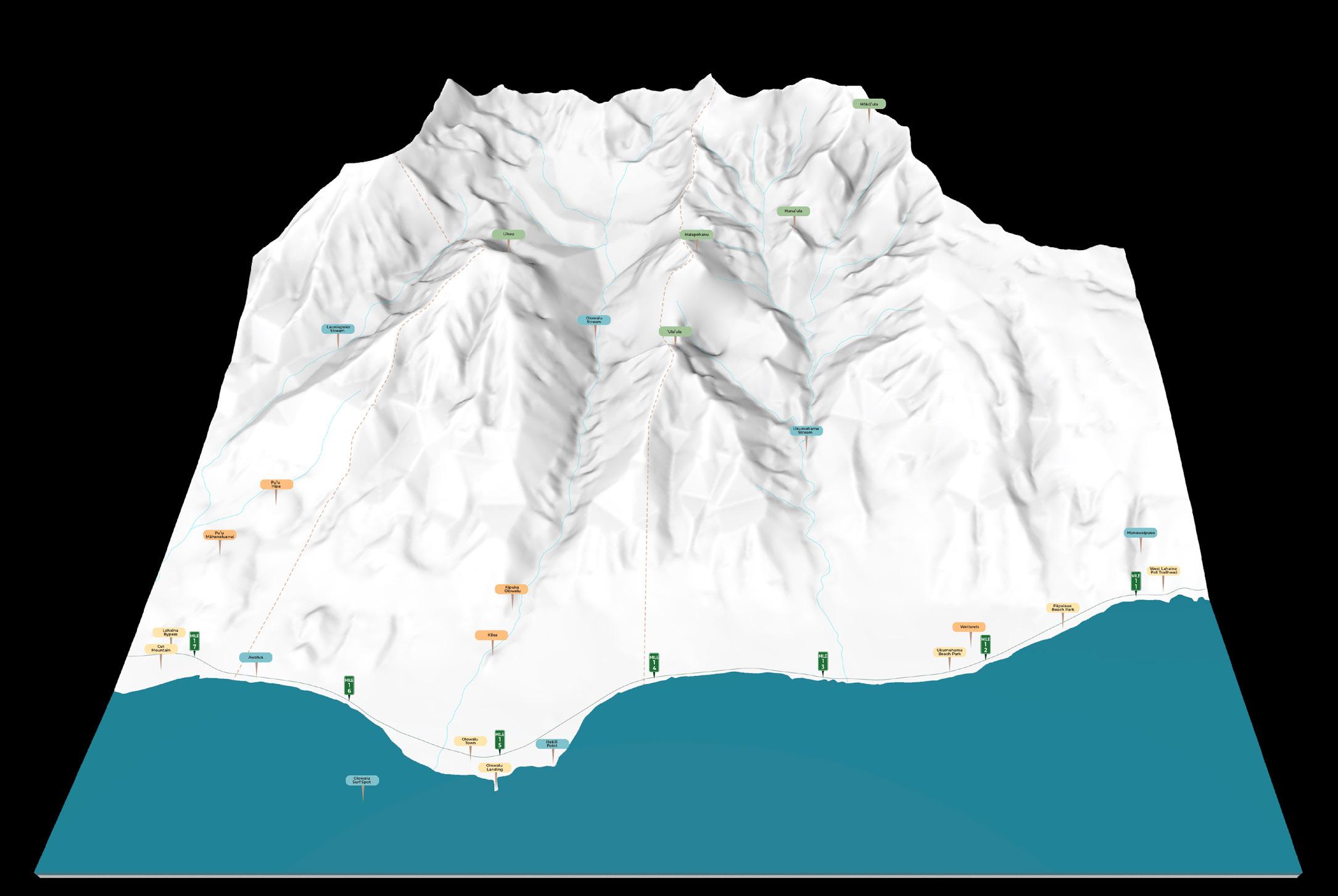
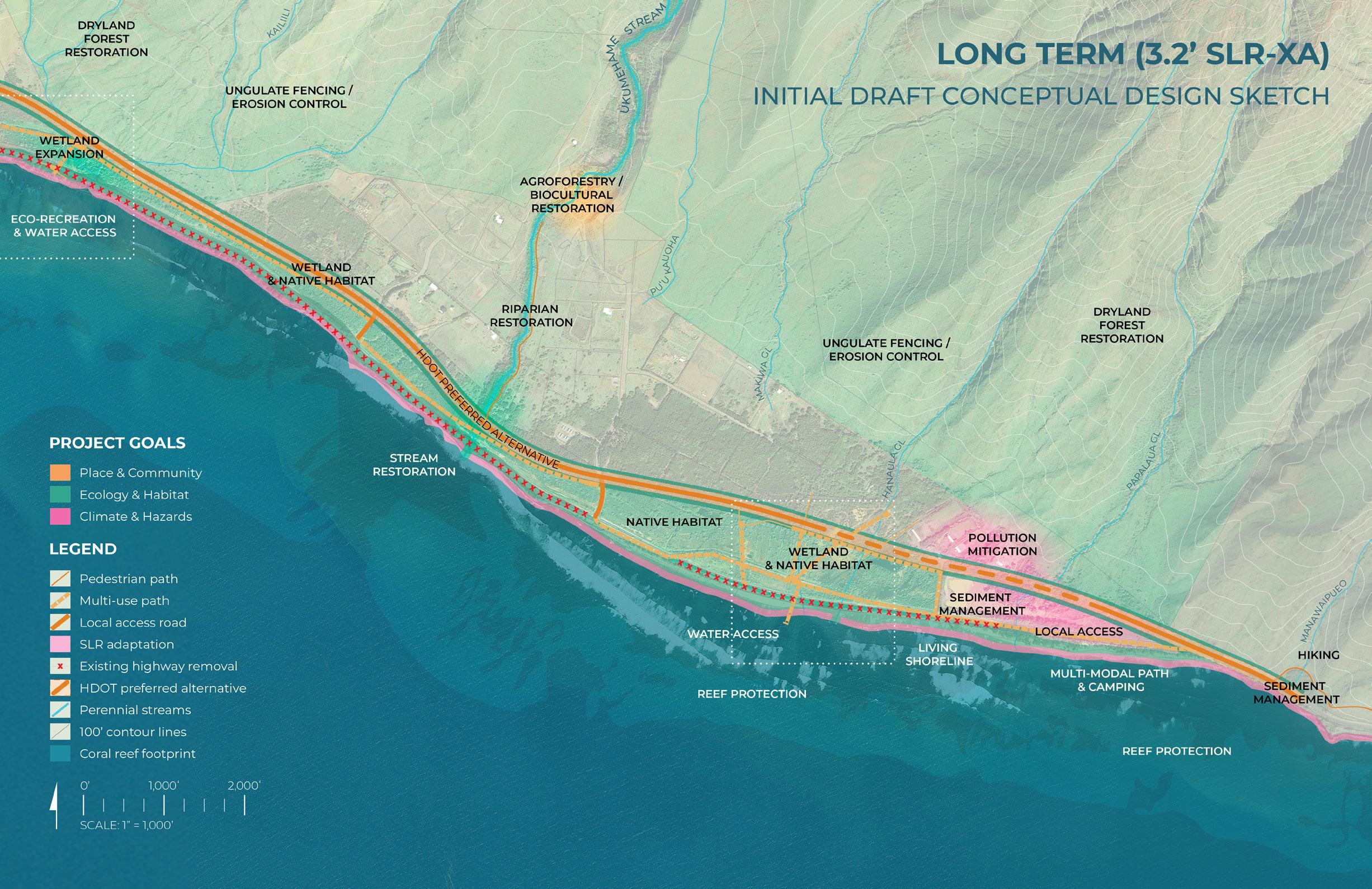
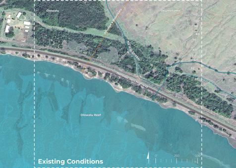
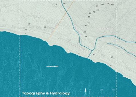
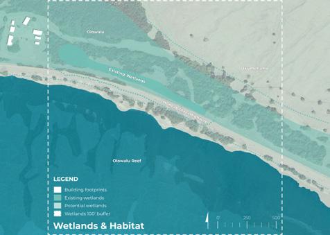
PROJECT GOALS MAP LAYERS
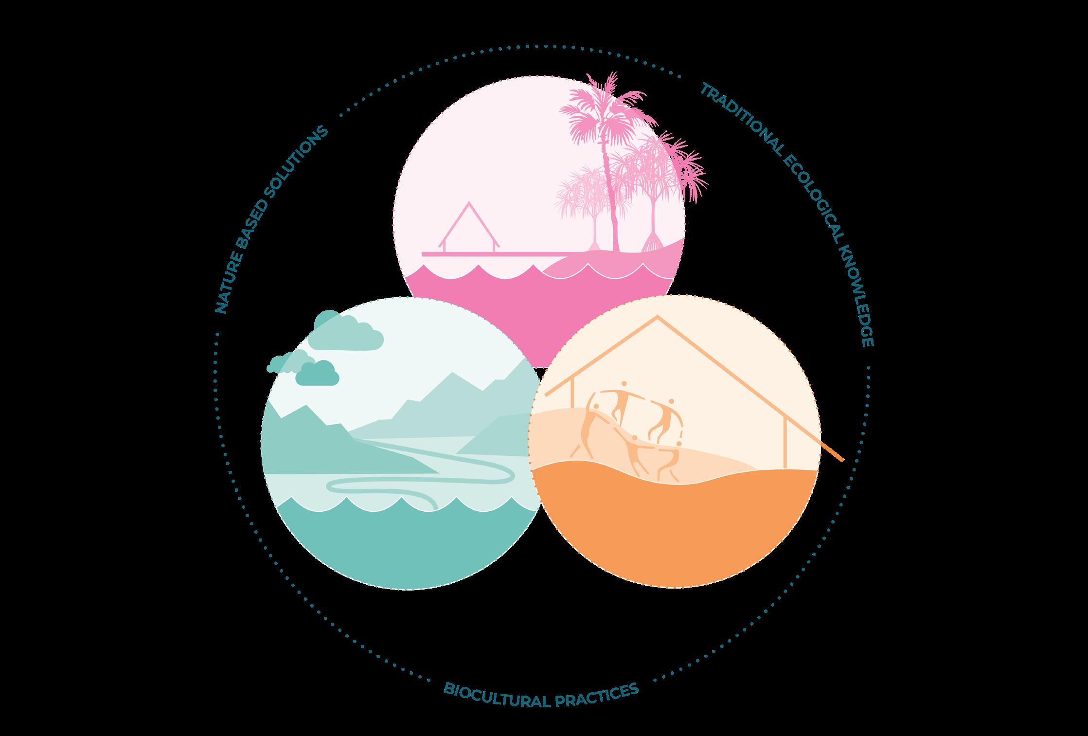
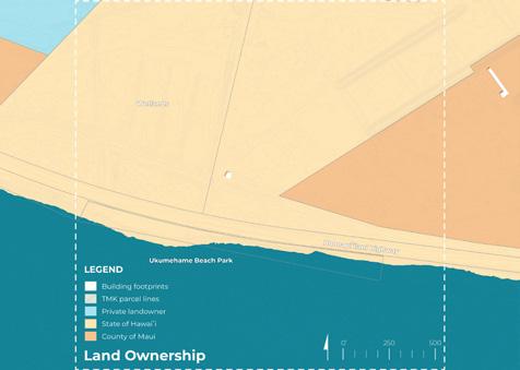
PLACE & COMMUNITY
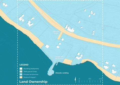
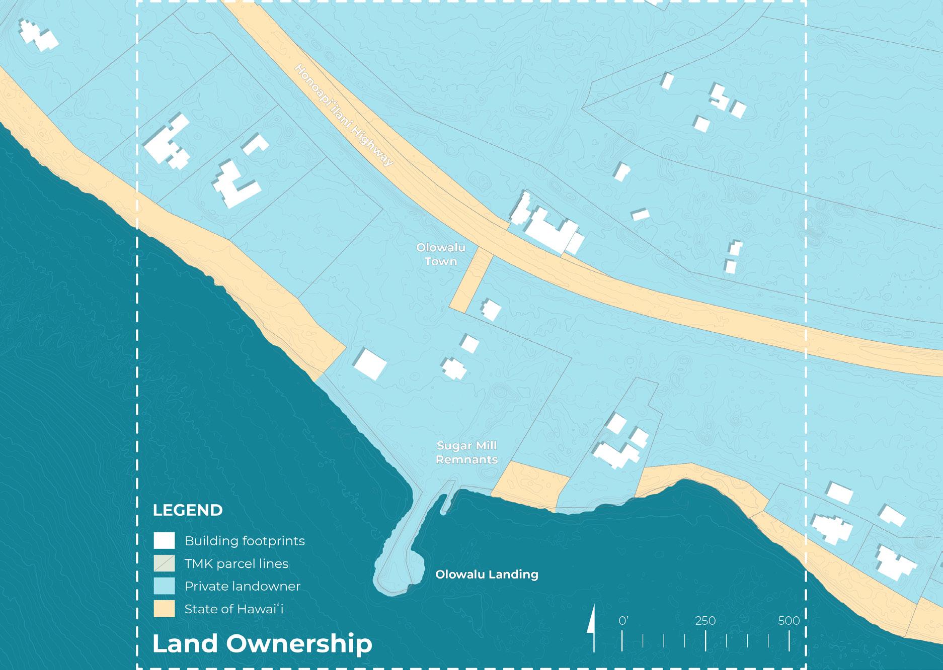
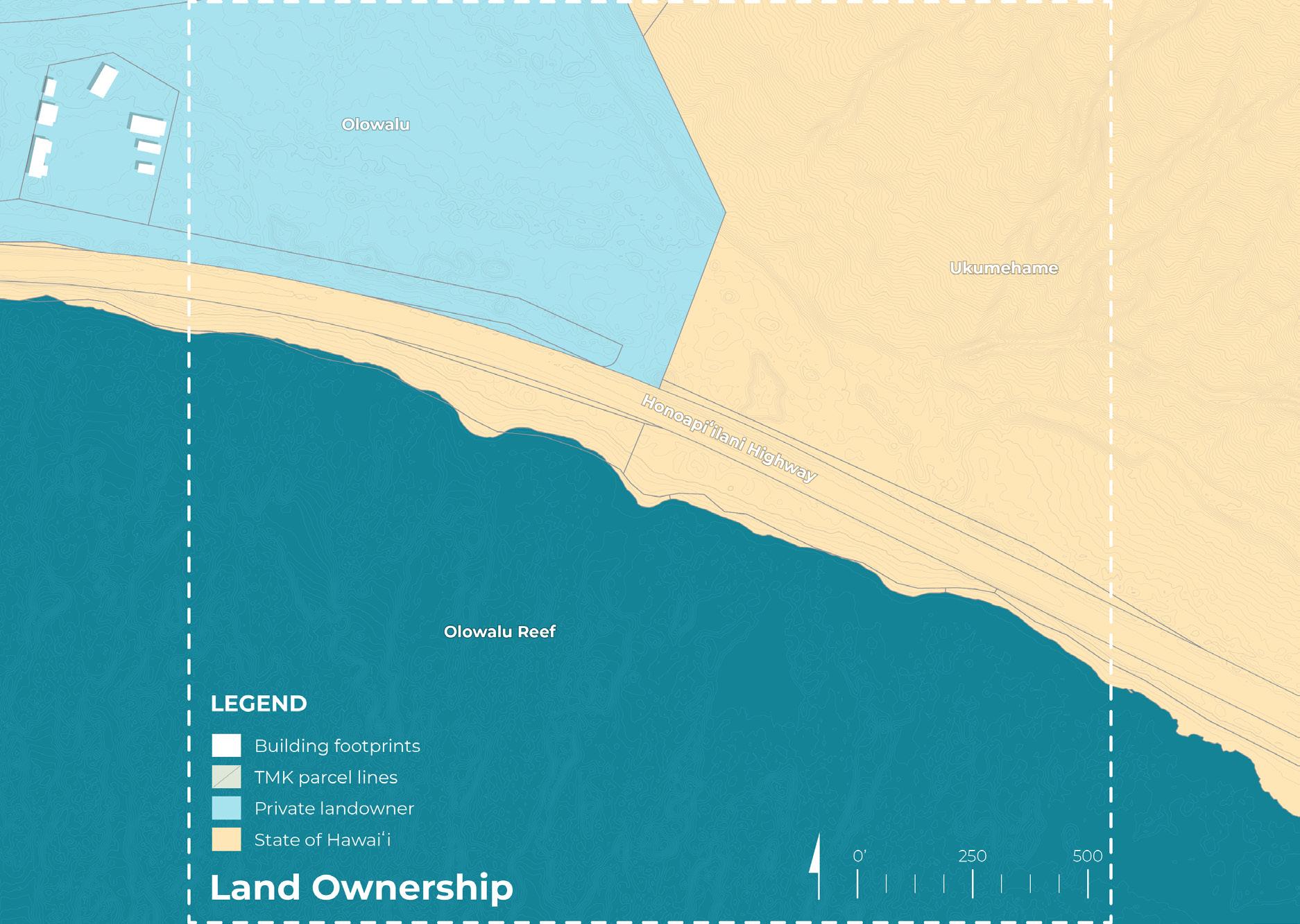
• Public and private landowners
• Ocean recreation
• Parcels / TMK
• Roads and circulation
• Wahi Pana / Hawaiian placenames
ECOLOGY & HABITAT
CLIMATE & HAZARDS
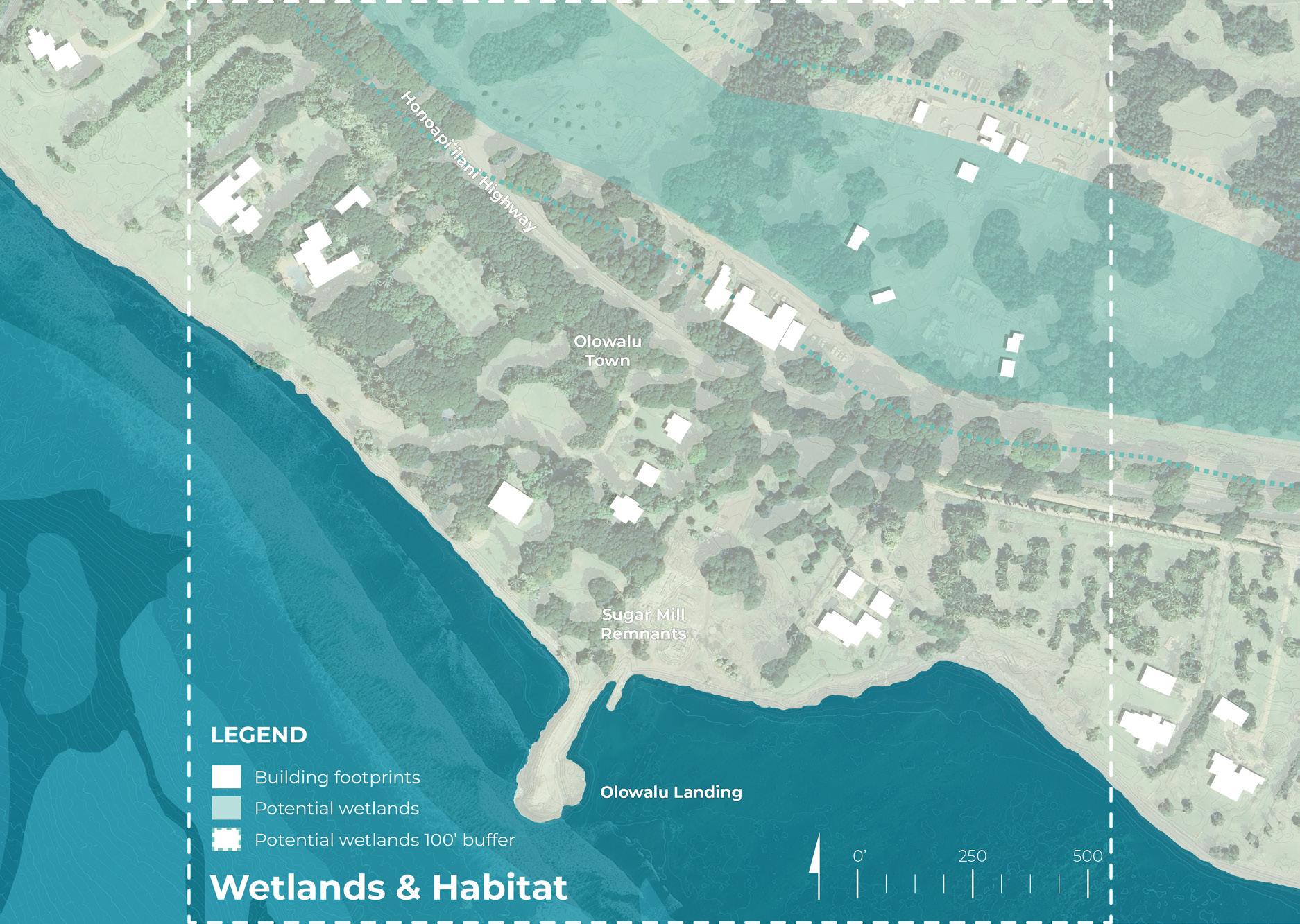
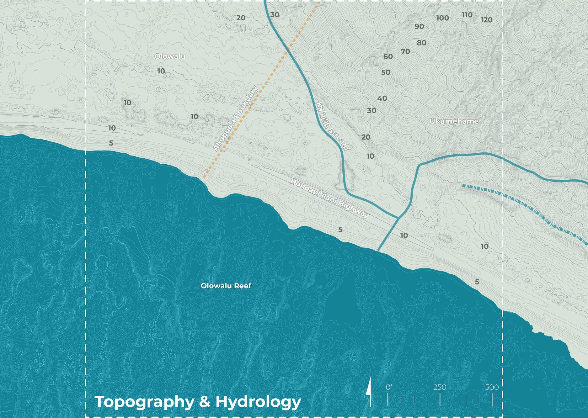
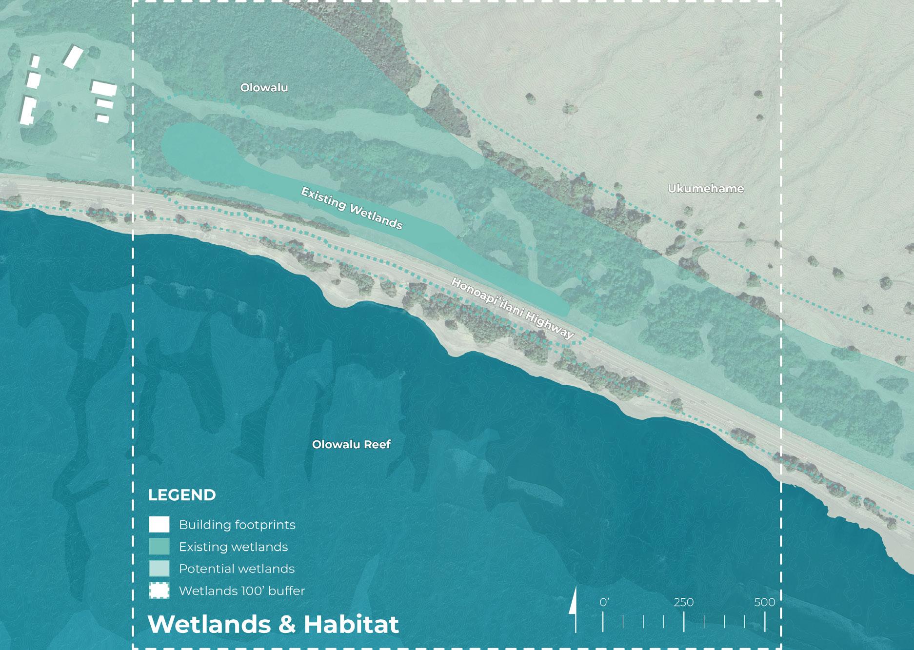
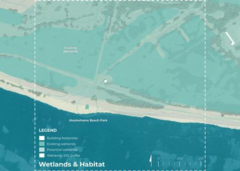
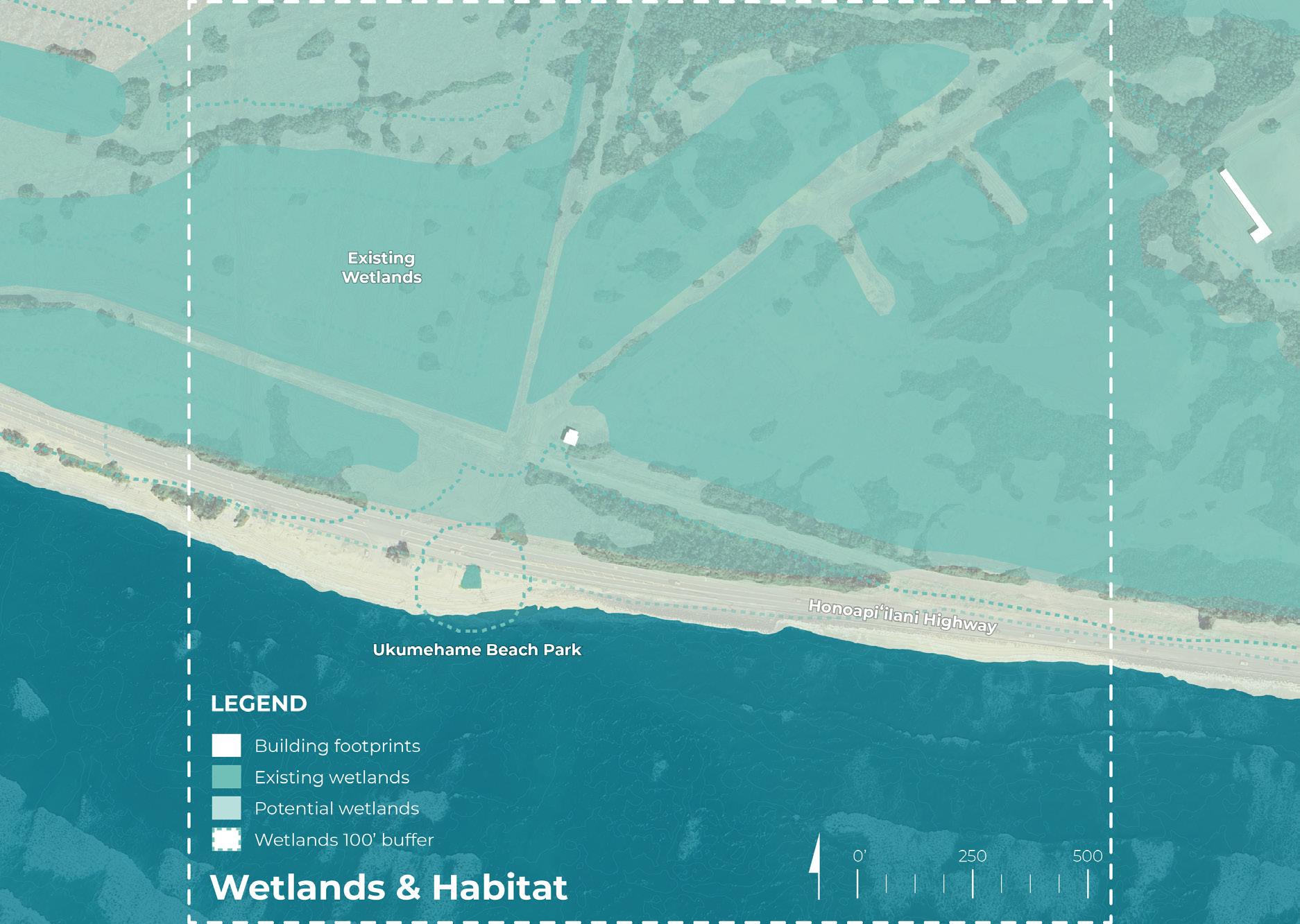
• Wetlands & potential wetlands
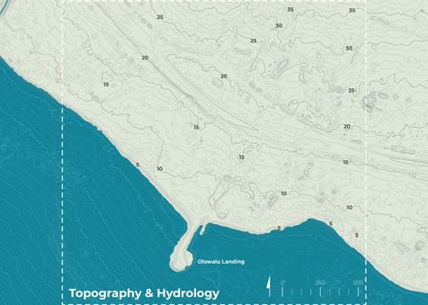
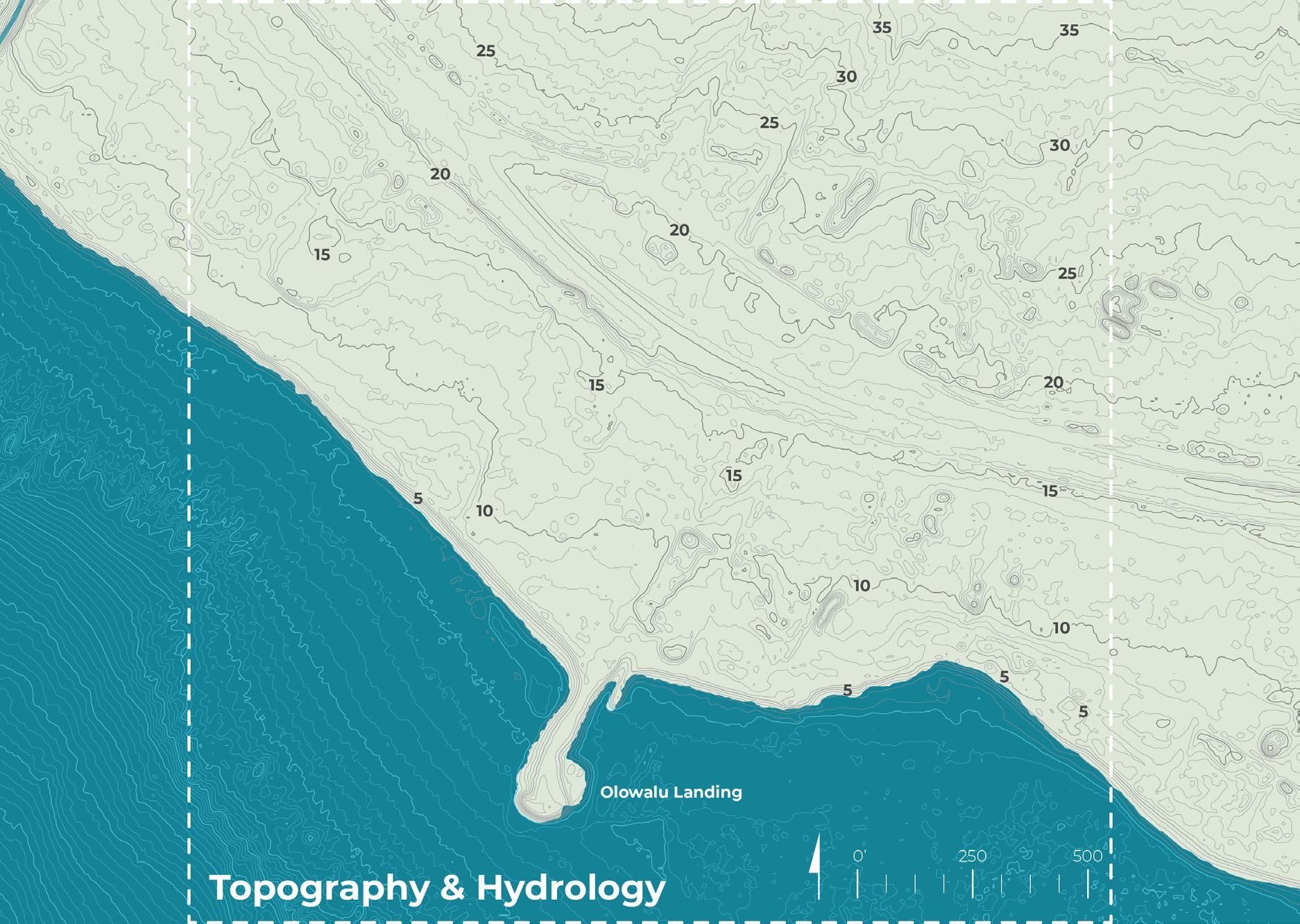
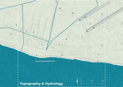
• Hydrology (streams and ditches)
• Forest reserves
• Benthic habitat and reef footprint
• Sea walls
COMMUNITY FEEDBACK
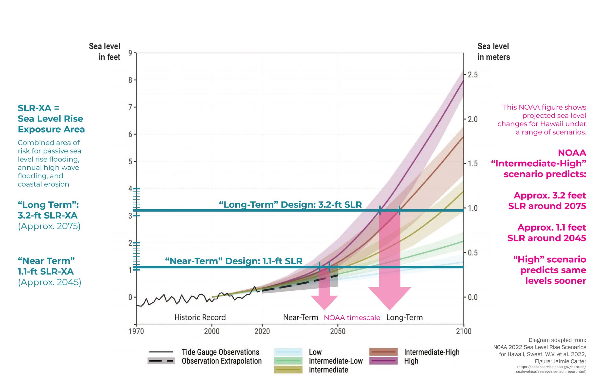
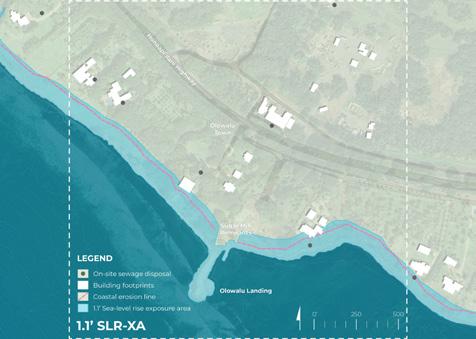
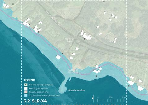
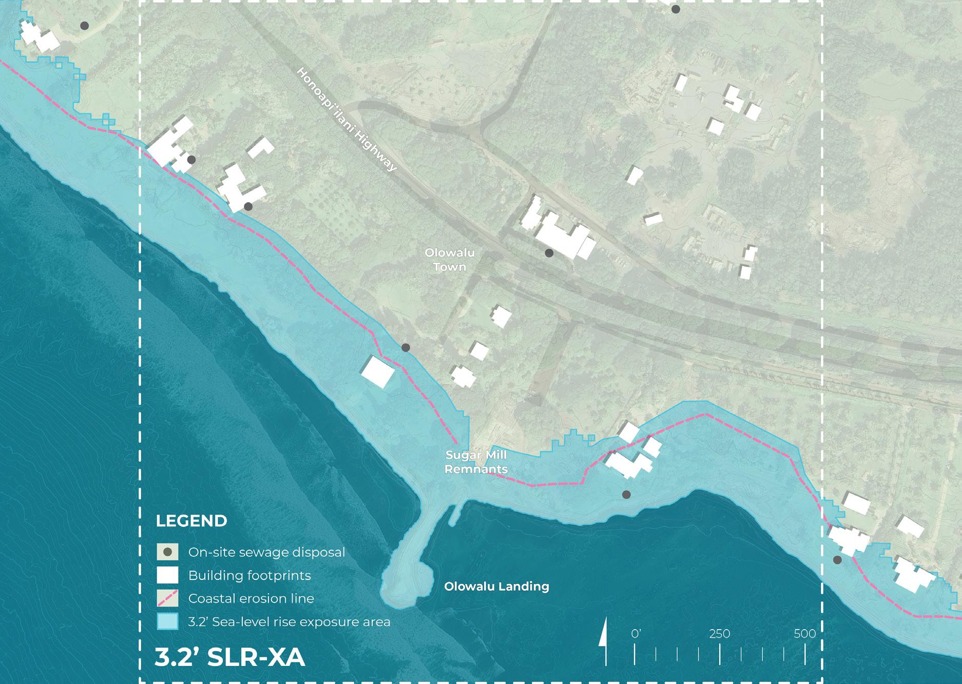
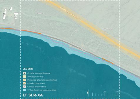
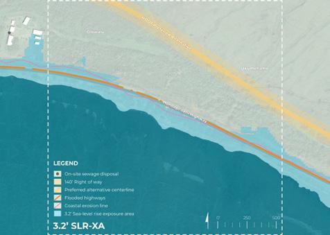
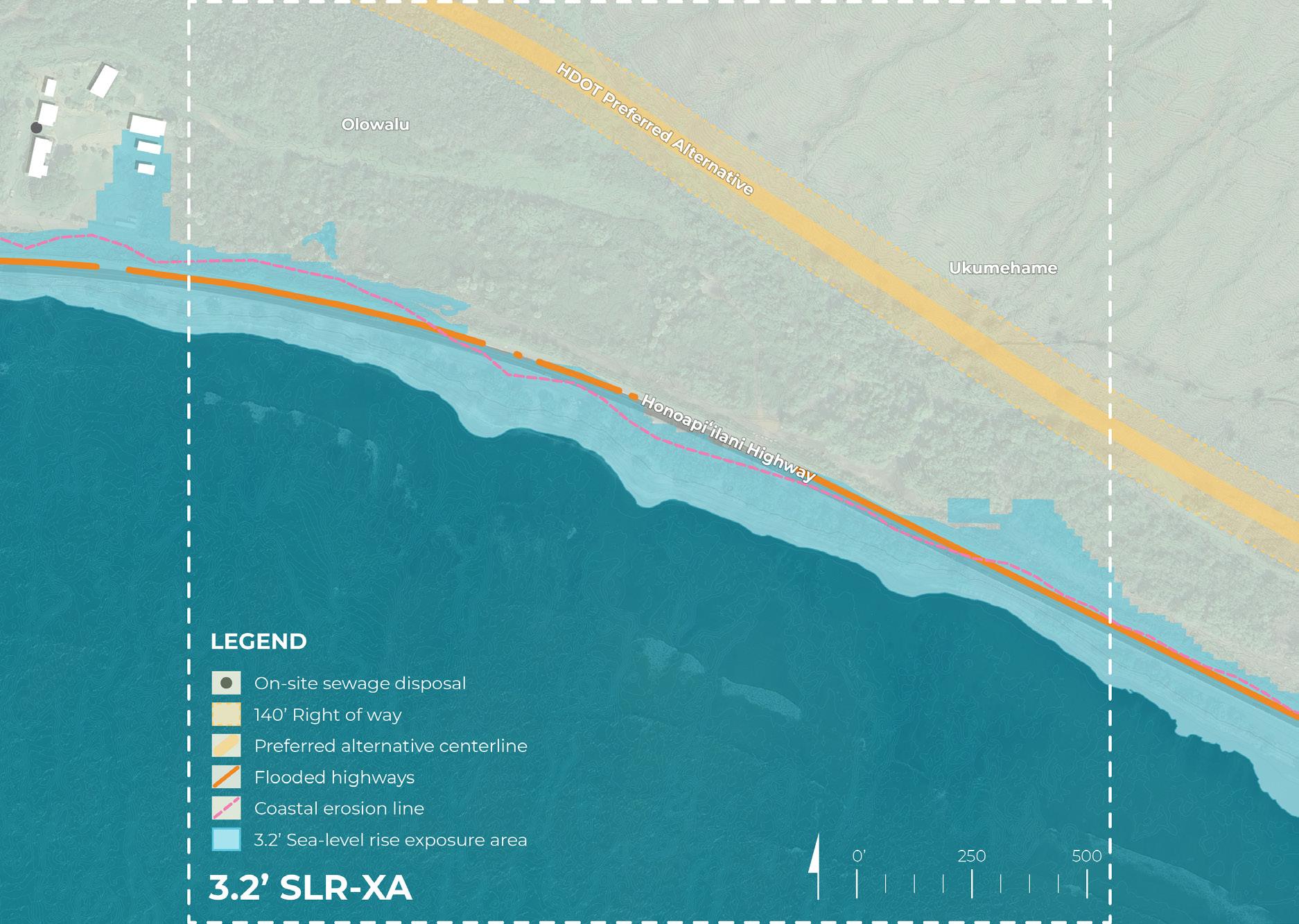
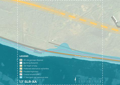
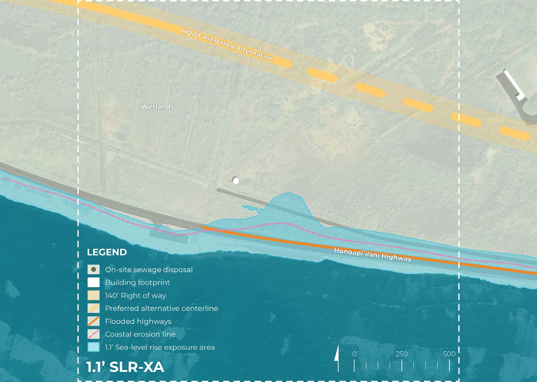
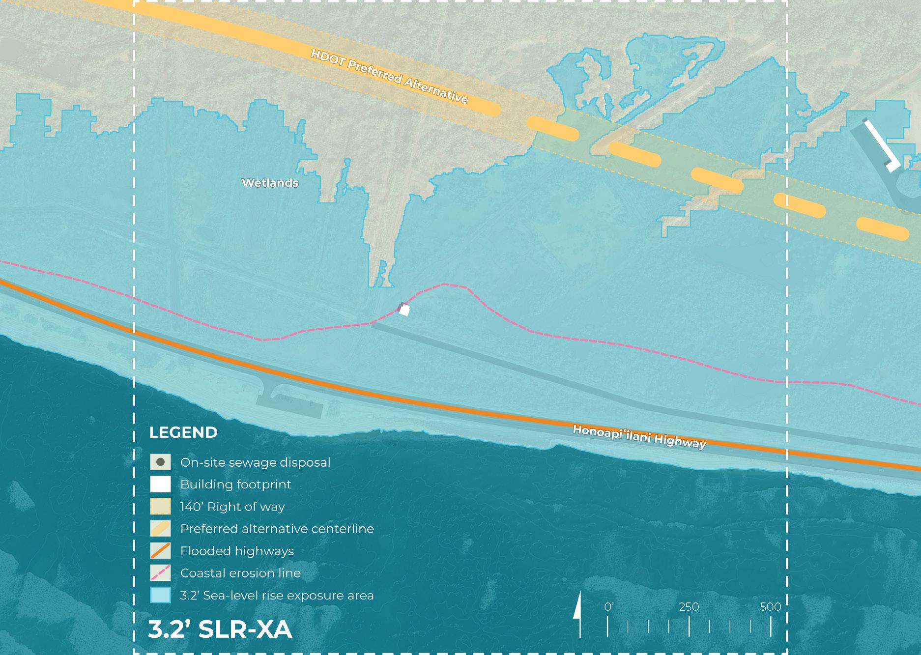
• Sea-level rise exposure area (3.2’ SLR-XA)
• FEMA flood zones
• Historic fires
• On-site sewage disposal systems
• Talk story map results
• Ridge-to-reef model results
• Coastal interventions: resilient future results
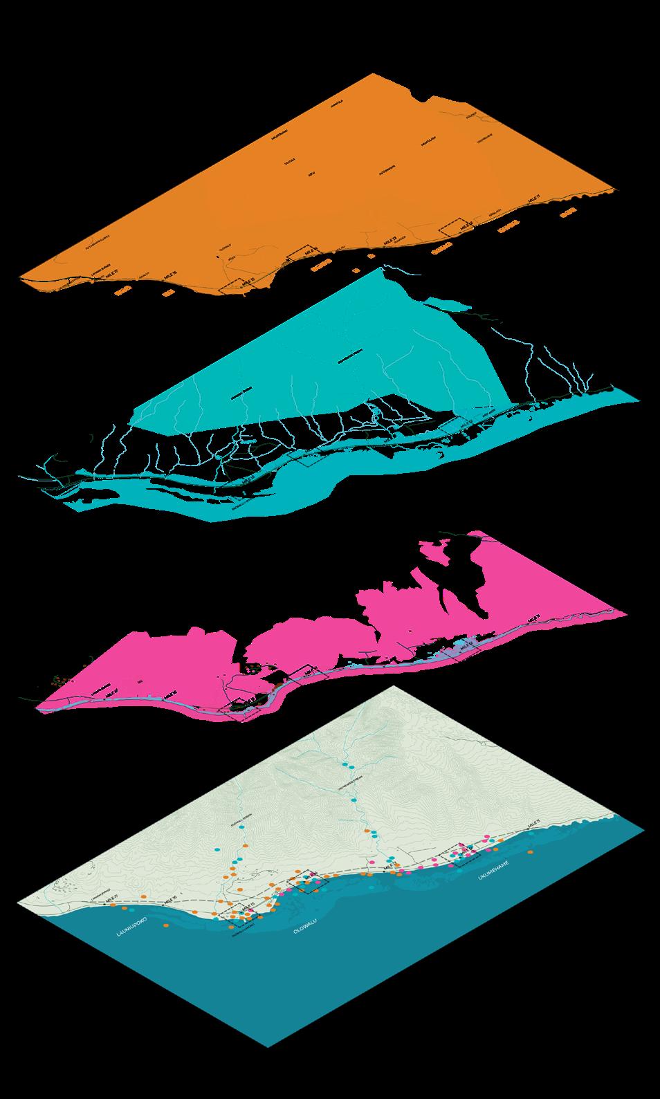

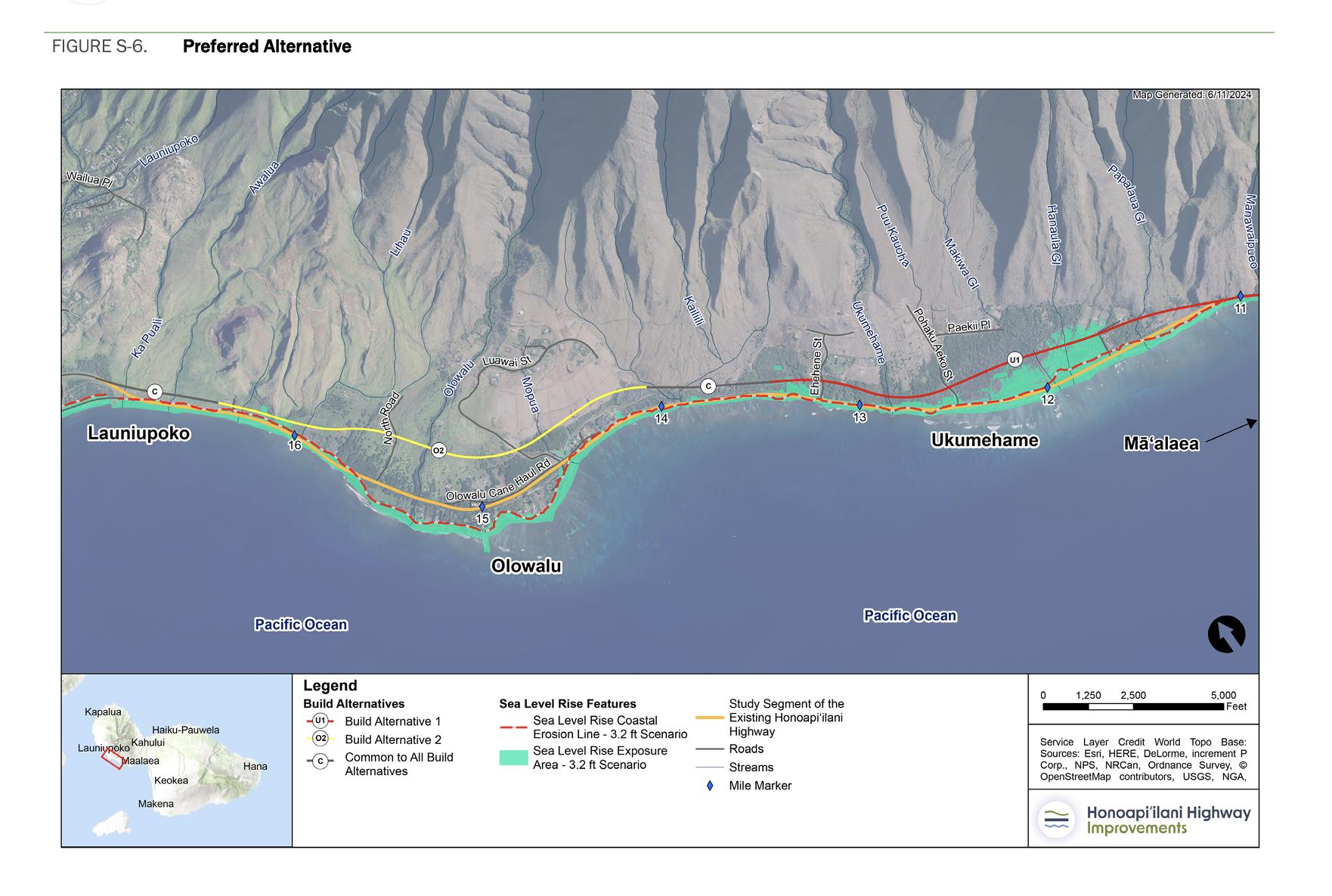
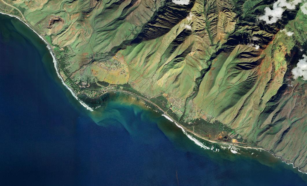
OVERALL PROJECT AREA
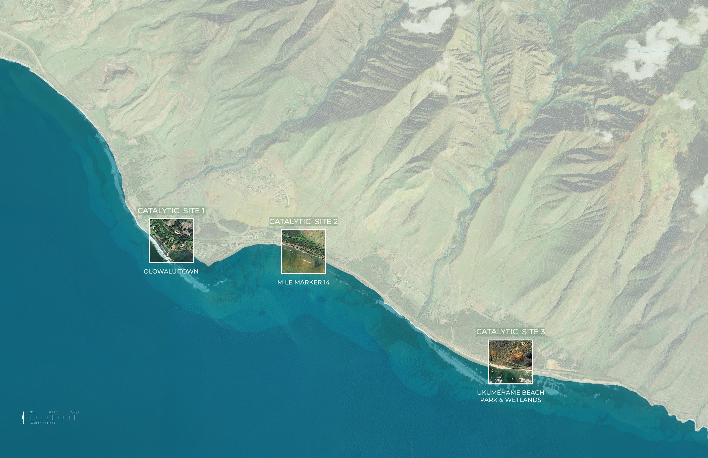
CONCEPT
MILE MARKER 14
CATALYTIC SITE
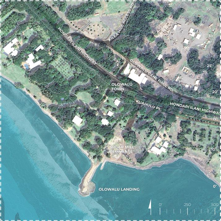
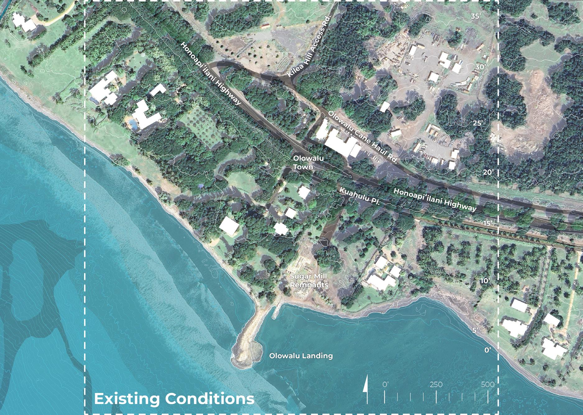
OLOWALU LANDING
OLOWALU TOWN
CATALYTIC SITE
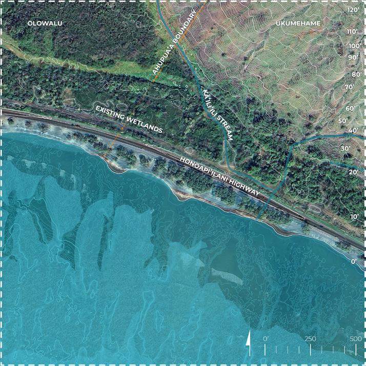
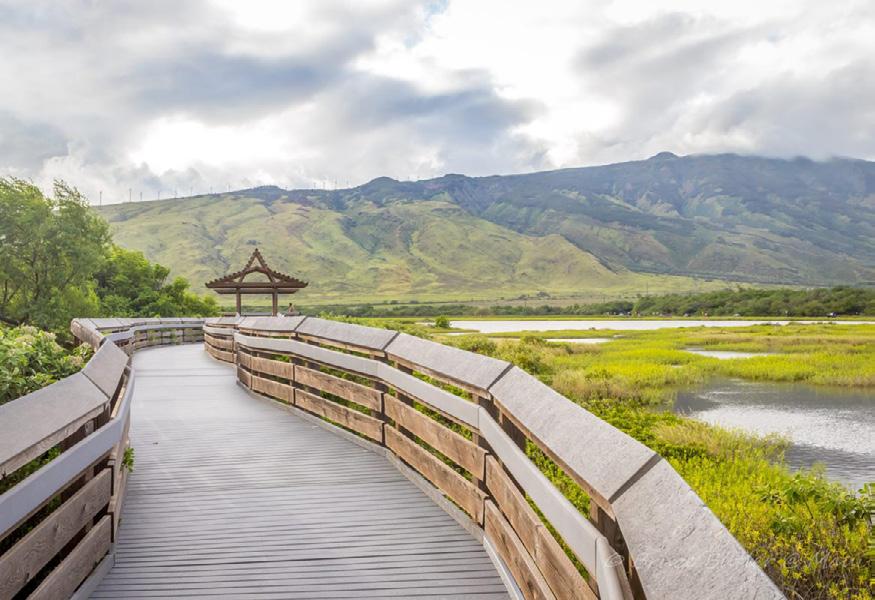
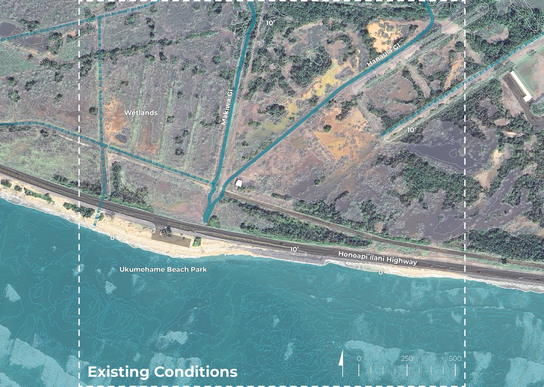
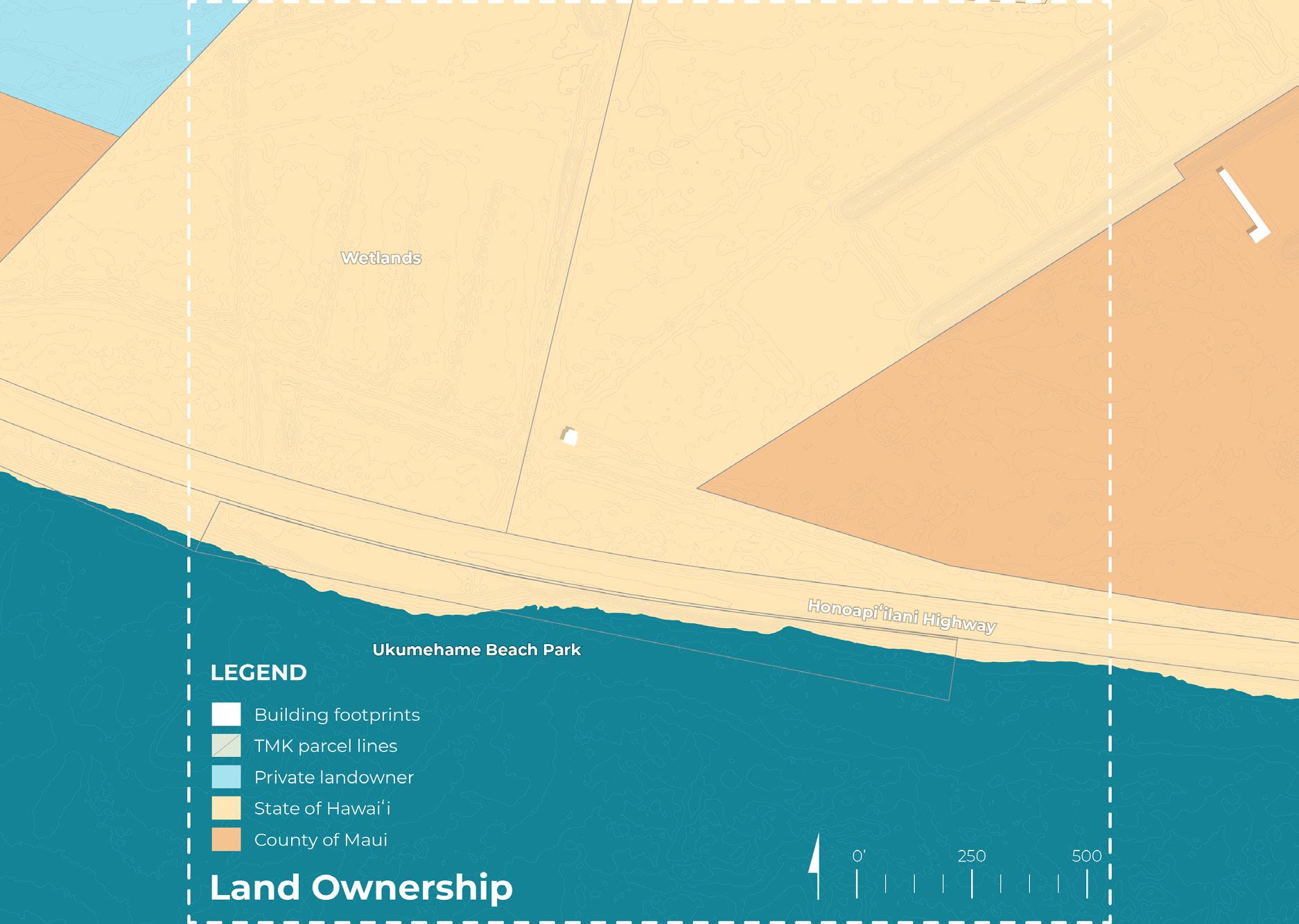
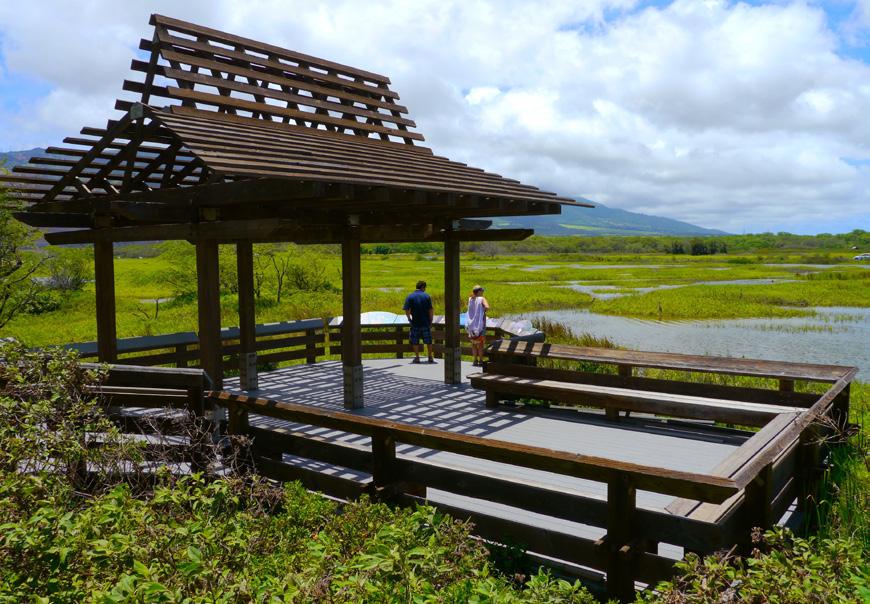
UKUMEHAME WETLANDS
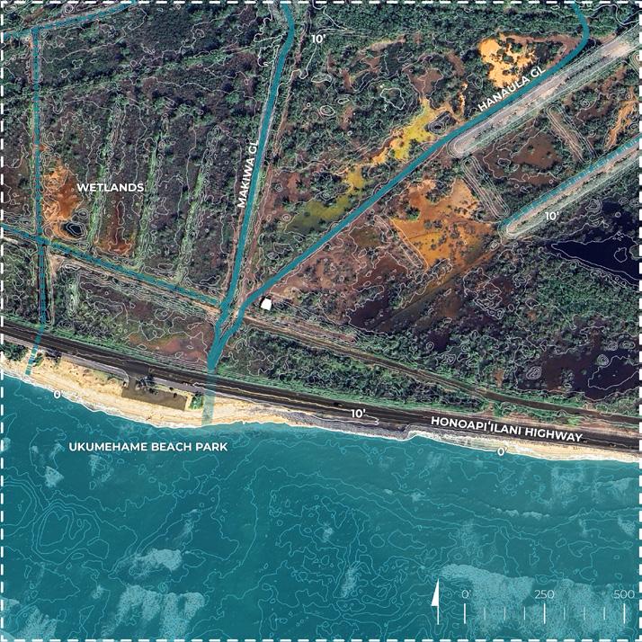
UKUMEHAME BEACH
CATALYTIC SITE
PARK CATALYTIC SITE
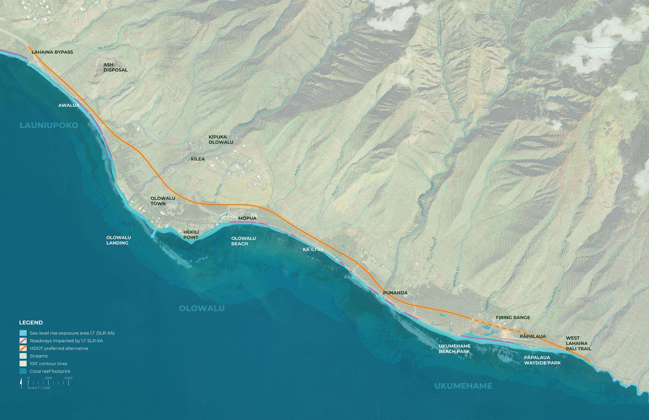
Data source: Pacific Islands Ocean Observing System (PacIOOS) sea-level rise data (September, 2024)

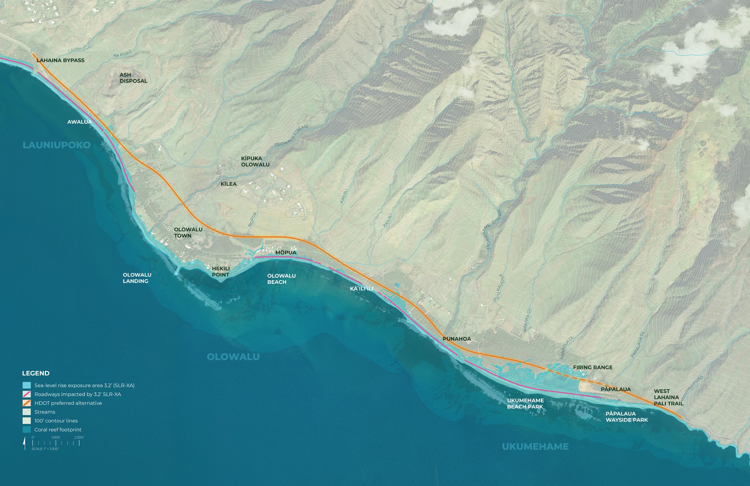
Data source: Pacific Islands Ocean Observing System (PacIOOS) sea-level rise data (September, 2024)
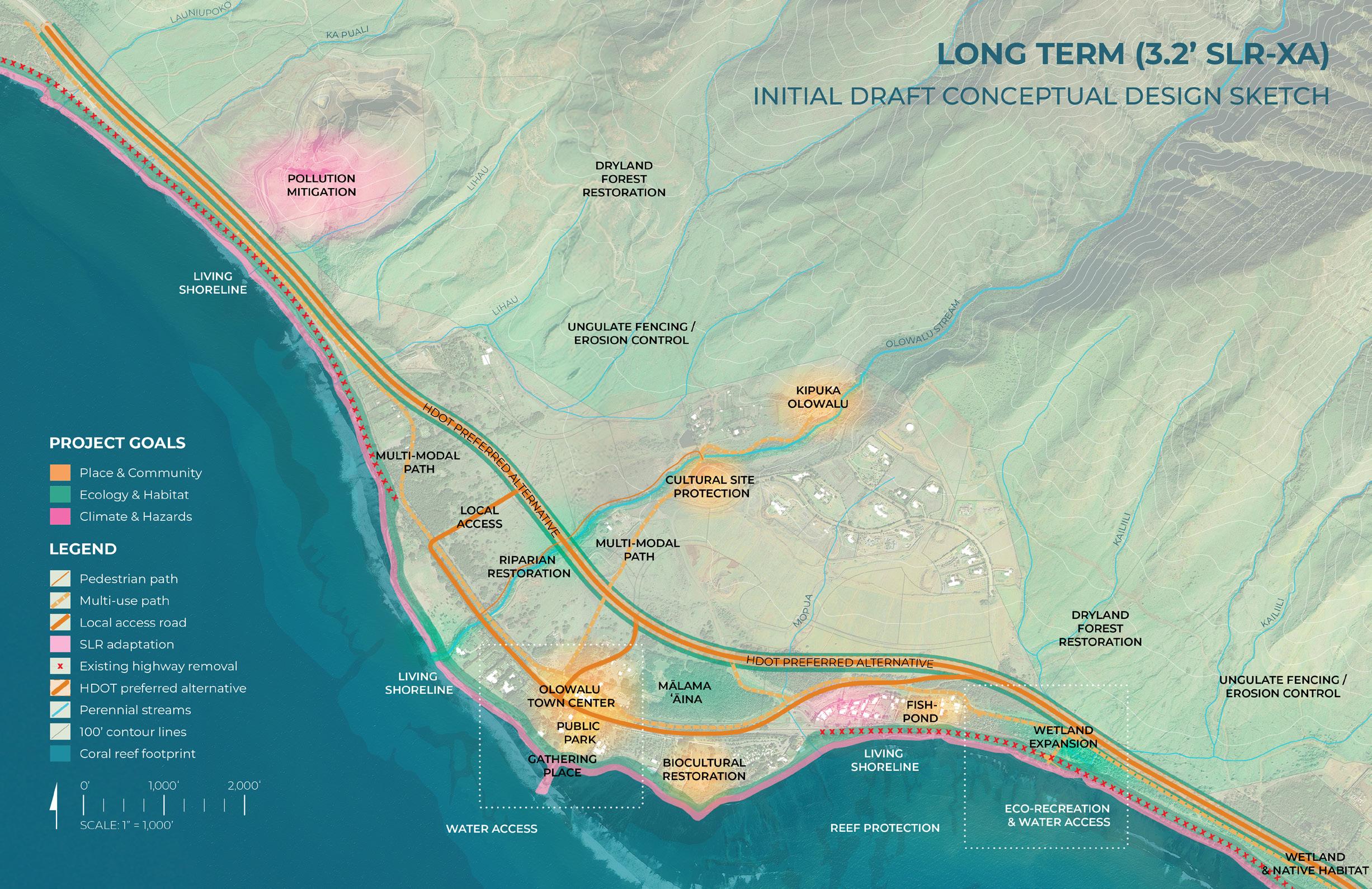
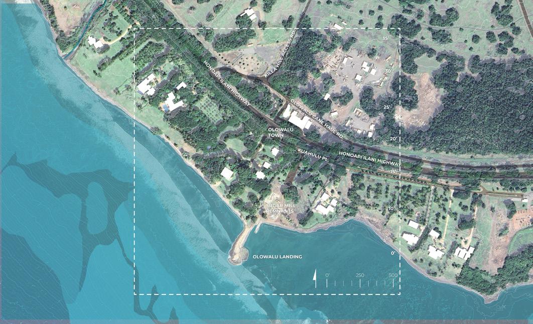
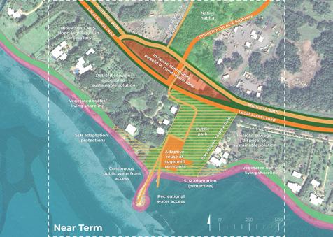
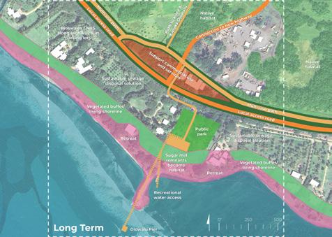
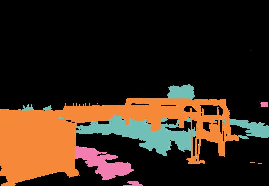
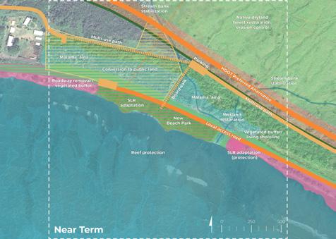
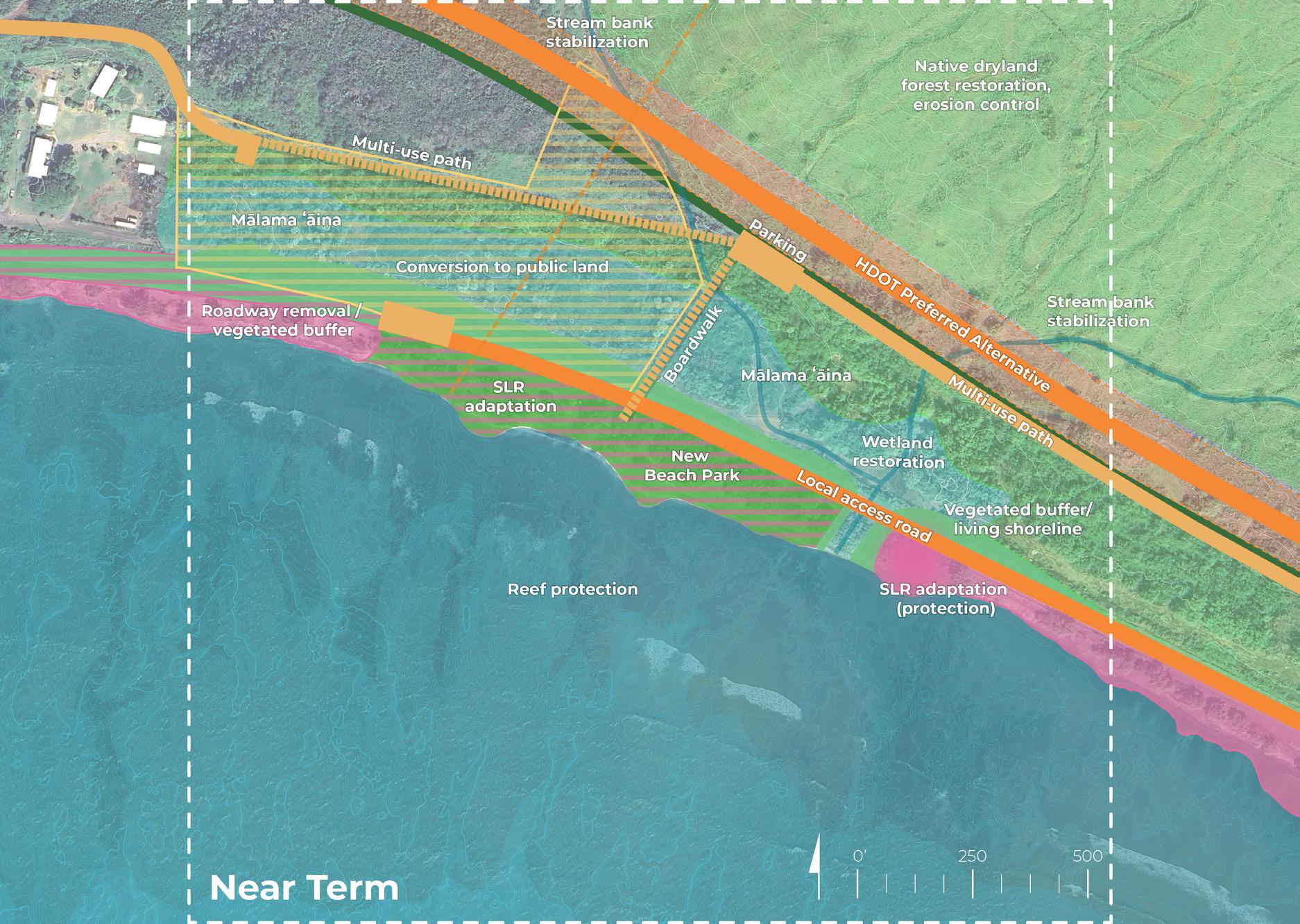
Catalytic Site 1: Olowalu Town
Site Analysis: Opportunities and Constraints
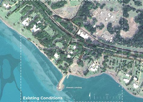


Catalytic Site 1: Olowalu Town
Initial Draft


• Commercial uses and services
• Large impervious surfaces
• Perceived lack of public access along coastline
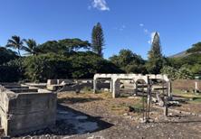
• Sugar mill remnants
• Invasive species
• Recreational water access
• Privately owned land
• On-site sewage disposal (cesspools)


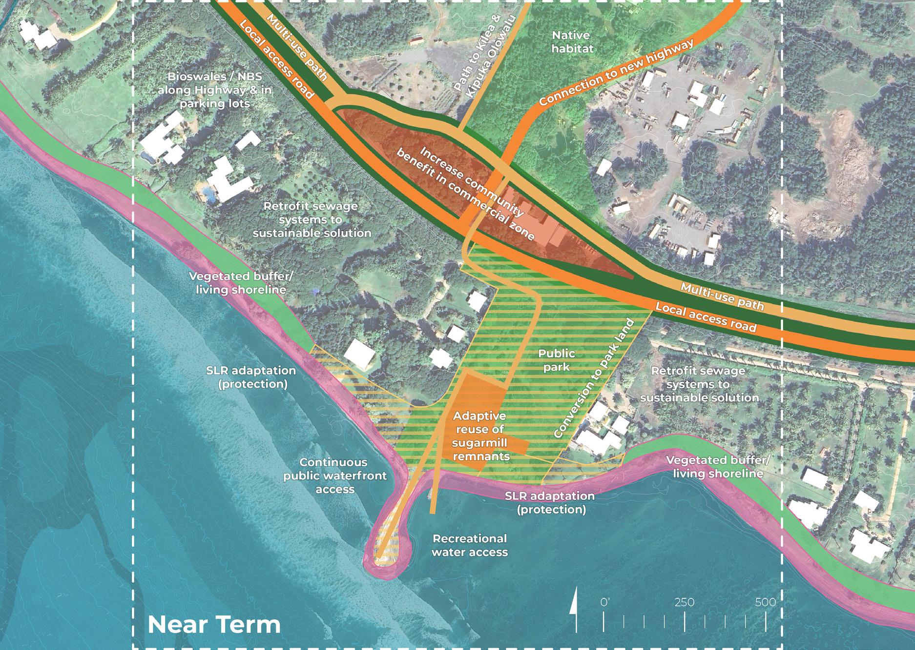
PLACE & COMMUNITY
• Connect to new highway
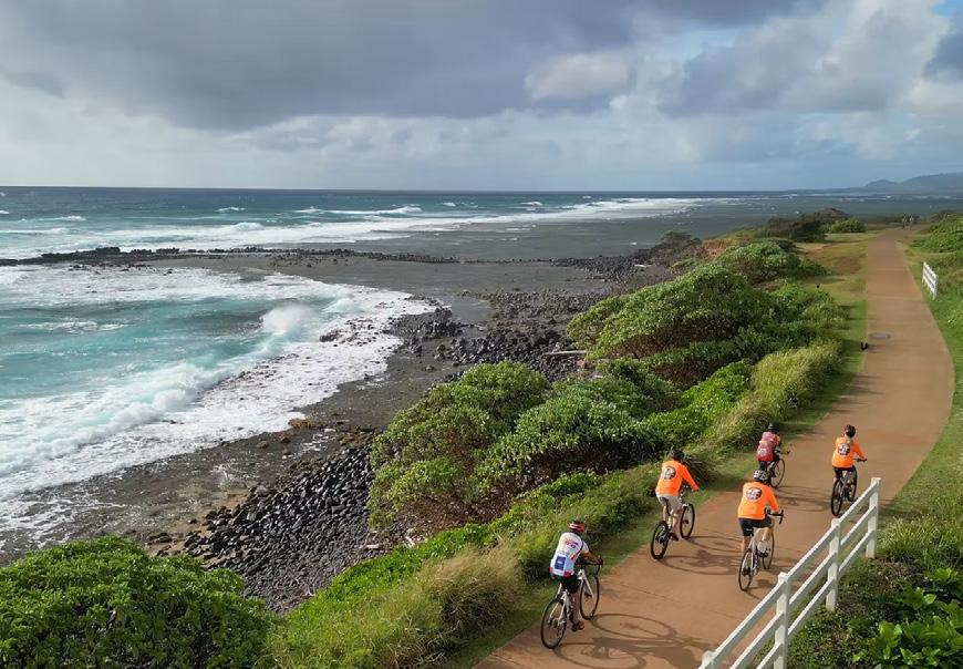
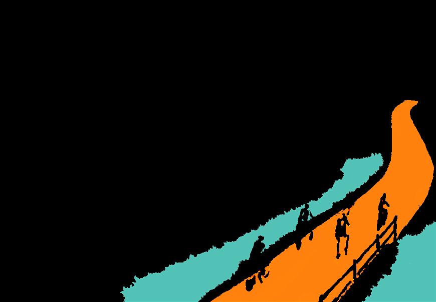
• Multi-use path (West Maui Greenway)
• Increase community benefit in commercial zone
• Possible conversion to park land (public-private partnership)
• Continuous waterfront access
• Adaptive reuse of sugar mill remnants
ECOLOGY & HABITAT
• Vegetated buffer / living shoreline
• Bioswales / nature-based solutions along highway and parking lots
• Native habitat restoration
CLIMATE & HAZARDS
• SLR adaptation (coastline protection)
• Retrofit sewage systems to sustainable solution
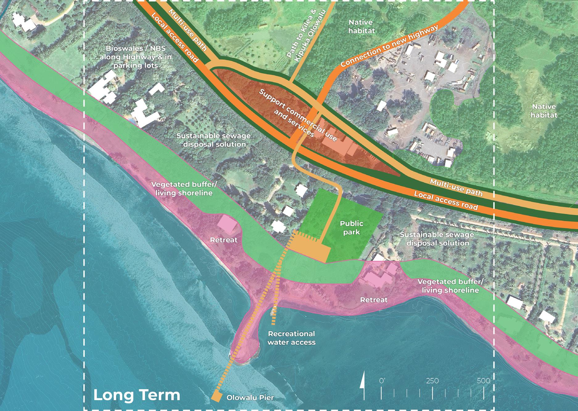
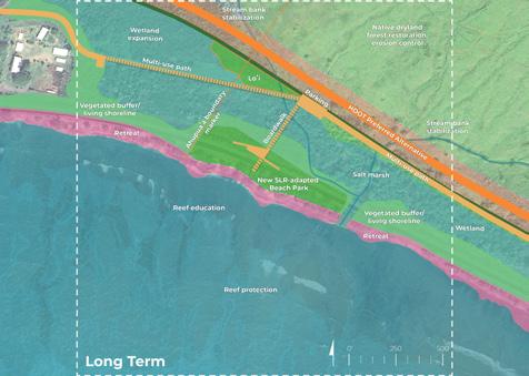
PLACE & COMMUNITY
• Multi-use path (West Maui Greenway)
• Continue to support commercial use, services, and community resources
• Create resilience hub
• Public park
• Recreational water access
• Olowalu Pier
ECOLOGY & HABITAT
• Vegetated buffer / living shoreline
• Clean sugar mill remnants become habitat
• Continued native habitat restoration
CLIMATE & HAZARDS
• SLR adaptation (retreat)
• Sustainable sewage disposal solution
• Bioswales / nature-based solutions along highway & parking lots
www.flickr.com/photos/19779889@N00/18810926046
www.lotsafunmaps.com/Oahu/Kawaikui_Beach_Park/gallery.html?id=11753
Catalytic Site 2: Mile Marker 14
Site Analysis: Opportunities and Constraints

Catalytic Site 2: Mile Marker 14
Initial Draft Conceptual Design Sketches
Existing


• Popular snorkeling spot
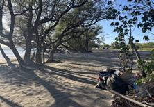
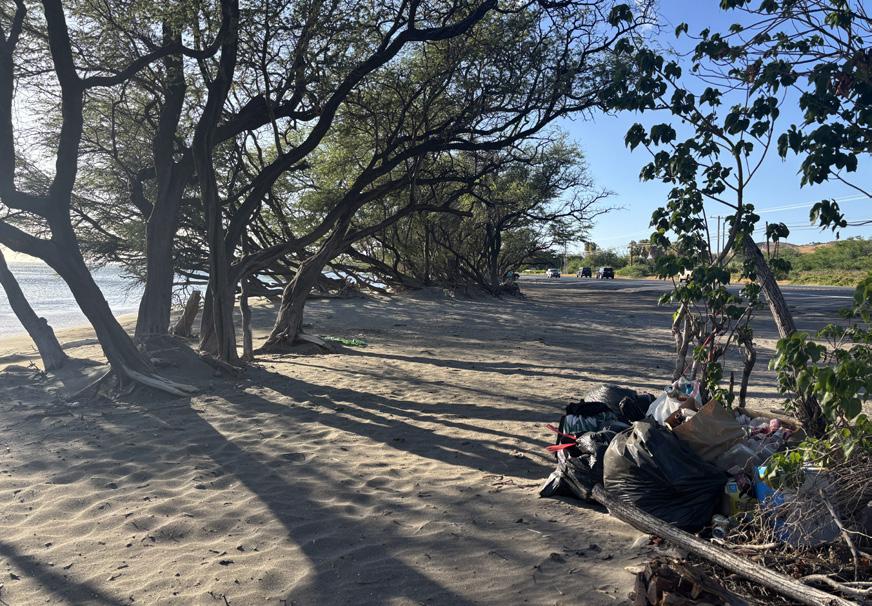
• Illegal dumping and long-term houseless population
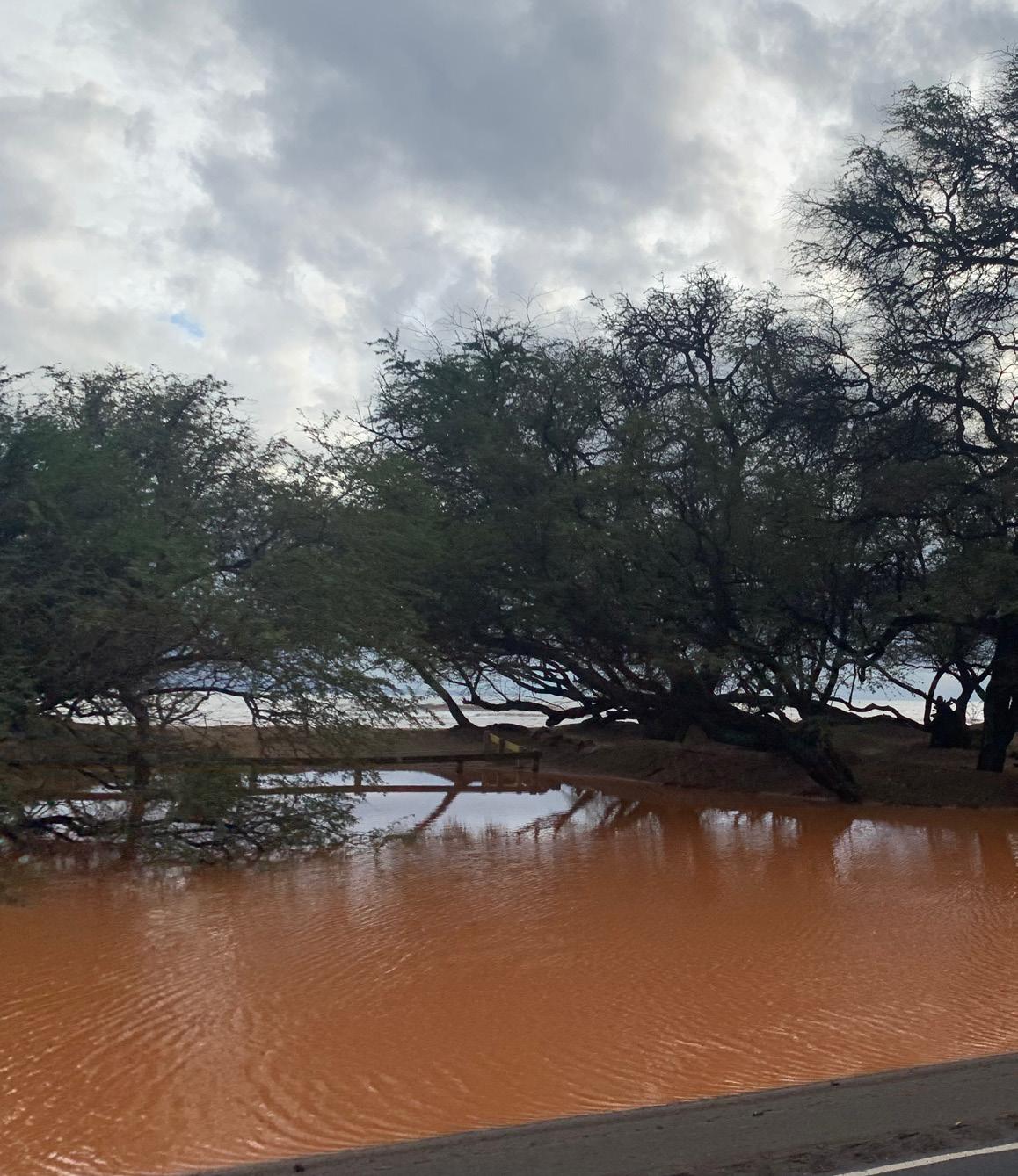
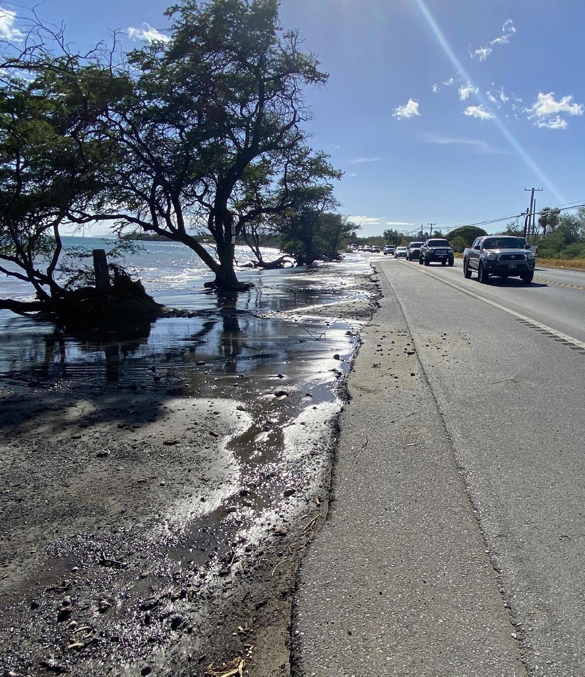
• Coastal erosion and sedimentation
• Impacts of parking and tourism on shoreline and reef
• Invasive species
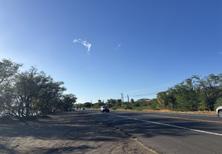
• Severe roadway erosion
• Coastal erosion hotspot

PLACE & COMMUNITY
• Local access road (protect existing highway)
• Multi-use path (West Maui Greenway)
• Conversion to public land
• Potential new public beach park
• Beach park parking
• Boardwalk access
ECOLOGY & HABITAT
• Reef restoration
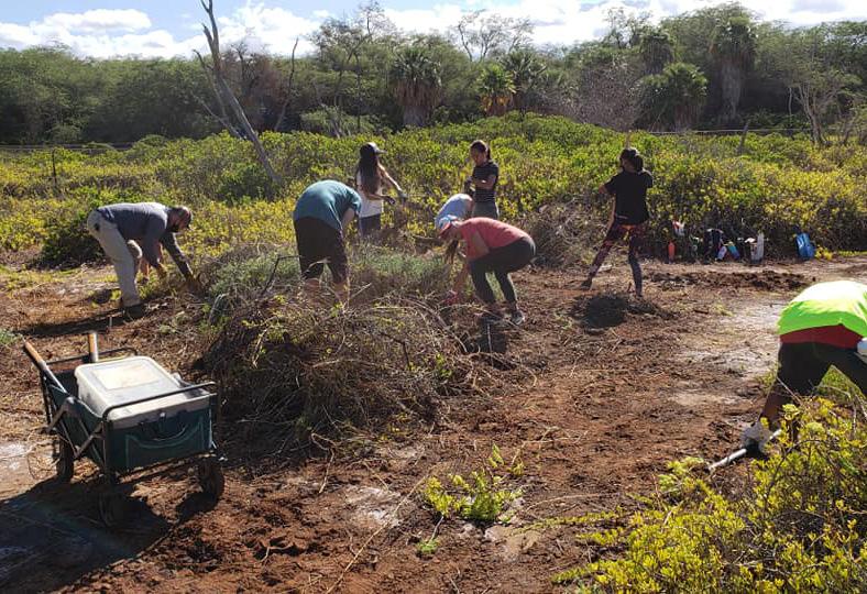
• Mālama ʻāina (clean illegal dumping, etc.)
• Native dryland forest and stream restoration, erosion control
• Wetland restoration
CLIMATE & HAZARDS
• SLR adaptation (existing roadway protection)
• Partial roadway removal (and/or other adaptation solution with vegetated buffer)


PLACE & COMMUNITY
• Multi-use path (West Maui Greenway)
• Boardwalk access to beach park
• Reef education
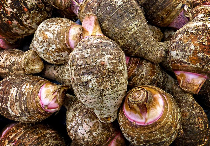
• Biocultural practices (loʻi kalo)
• Ahupuaʻa boundary marker
ECOLOGY & HABITAT
• Reef protection
• Maintain native dryland forest and streams (erosion control)
• Wetland expansion
• Vegetated buffer / living shoreline
CLIMATE & HAZARDS
• SLR adaptation - beach park (adapt in place)
• SLR adaptation - roadway removal (retreat)
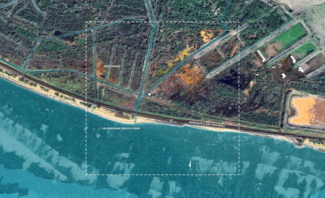
Site Analysis: Opportunities and Constraints


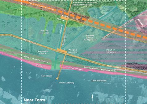
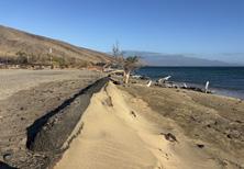


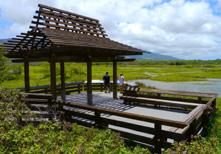


• Beach park with low SLR adaptation potential (per Maui County study)
• Roadway erosion
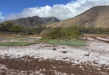
• Disturbed wetlands area
• Coastal erosion and sedimentation hot spot
• Pollutants (firing range and highway)
• Hardened shoreline / seawall
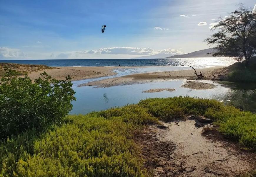
• Popular surf spot

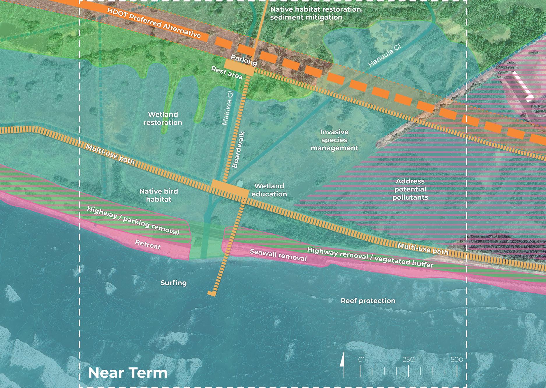
PLACE & COMMUNITY
• Water access via boardwalks
• Elevated multi-use path (WMG)
• New parking / rest area
• Relocation of public park
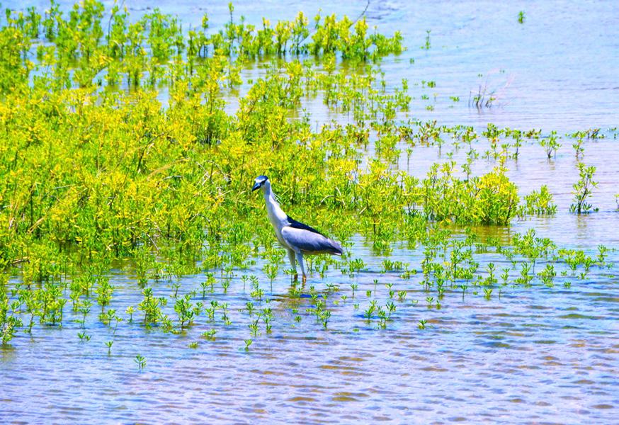
• Wetland education
• Surfing ECOLOGY & HABITAT
• Reef protection
• Wetland restoration
• Invasive species management
• Native bird habitat
• Potential Kānaka Maoli community-led, state-supported stewardship
CLIMATE & HAZARDS
• SLR adaptation – consider seawall, highway and parking options or retreat
• Address potential pollutants


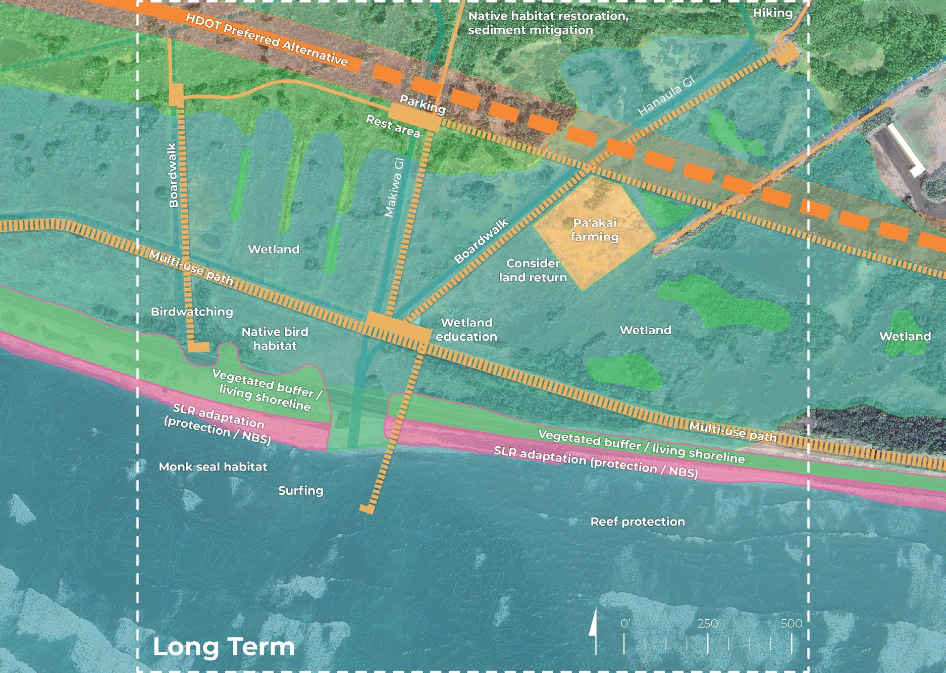
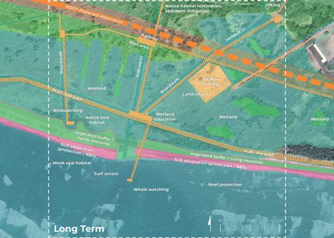
PLACE & COMMUNITY
• Expand access via network of boardwalks
• Mauka hiking access
• Wetland education
• Wildlife watching
• Surfing
• Paʻakai (salt) farming and other biocultural practices
• Consider land return
ECOLOGY & HABITAT
• Native habitat restoration and sediment mitigation
• Wetland expansion
• Vegetated buffer / living shoreline
• Reef protection
CLIMATE & HAZARDS
• SLR adaptation (protection and nature-based solutions)
from www.flickr.com/photos/scotnelson/8233485966
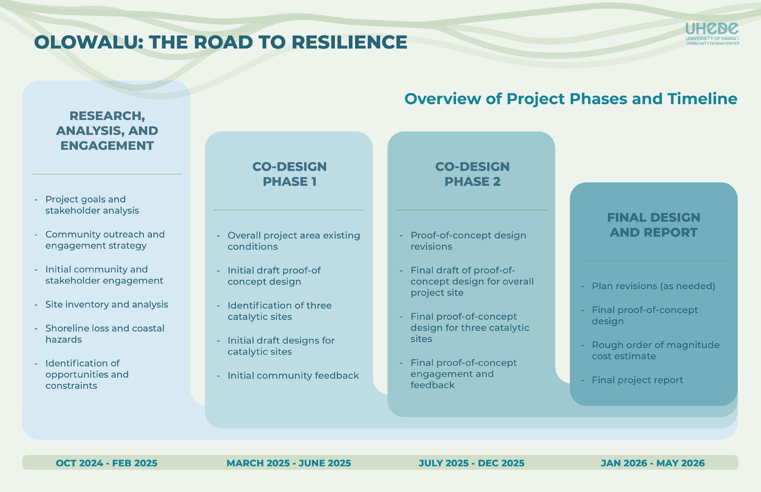
Welcome and introductions
Project overview
Engagement results
Project goals and structure
Initial draft design and concepts
Menti co-design activities
Wrap up discussion