T he F lorida Surveyor

2022 CONFERENCE ISSUE
Knud's Thoughts on Professional Practice & Education 2022 Conference Schedule & Registration
SIT Prep Course & CST Exam Sign–Up Exhibitor & Sponsorship Recognition
June 2022 Volume XXX, Issue 6

Call us t o g et your complete work flow s olution today ! Efficiency and versatility that will accelerate productivity comes part of a workflow solution that includes the FC-6000 field controller, Magnet software, a HiPer VR receiver and the GT-1200/GT-600 single-operator robotic system. The power of longrange reflectorless measurements comes in your choice of 1”, 2” or 3” GT-1200 models or 2”, 3” or 5” GT -600 models.


Page 2 43316 State Road 19 Altoona, FL 32702 www.lengemann.us


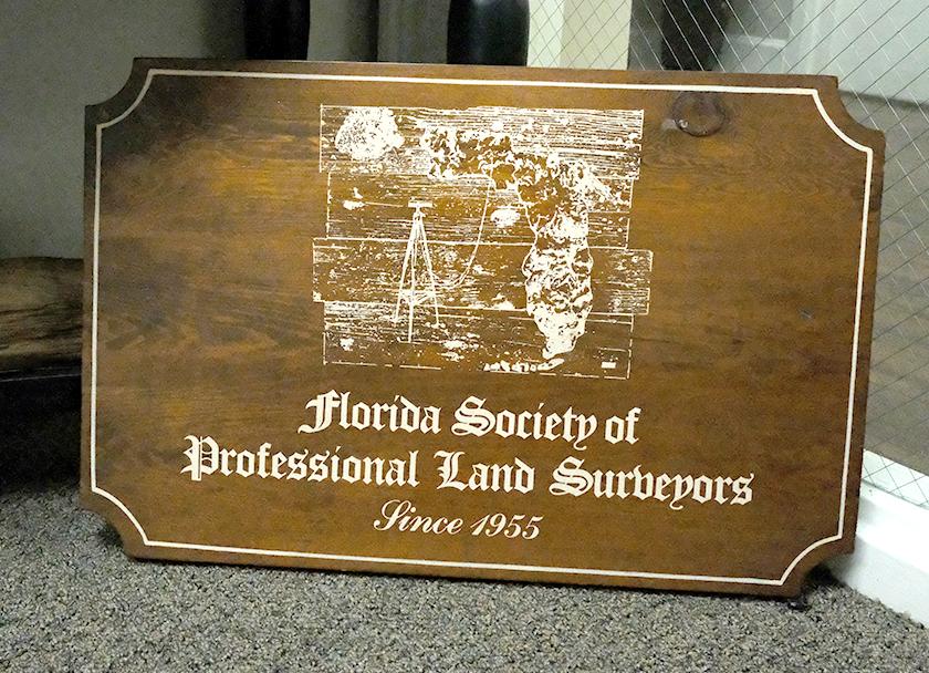
Page 3
of C ontents FROM the Archives 67 THOUGHTS ON Professional Practice and Education 9 2022 Chapter Presidents 5 SUSTAINING Firms 55 2022 CONFERENCE Schedule & Registration 14 RECOGNITION OF Exhibitors/Sponsors 23 SURVEYORS In Government 39 AROUND The State 31 SURVEYING History 4 3 PRESIDENT’S Message 1 2022 FSMS Officers 3 DISTRICTS & Directors 4
Table
PRESIDENT’S Message
Two pieces of great news for the profession came during the month of May, both legislative related; one due to the continued outstanding efforts of our Legislative Committee, our Legislative Consultant, and many of those reading this message. The other piece of great news was an unexpected shocker.
As many know, this year a prior budget cut to the Geomatics Program at UF/IFAS was reinstated in the State’s budget and yesterday (June 2nd) Governor DeSantis signed off on the budget.
About this, IFAS Director Dr. Red Baker wrote: “ This is fantastic news and I just wanted to reach out and express our sincere appreciation for all of your hard work, coupled with the steadfast support of FSMS, to make this a reality. This initiative will ensure we are able to fully support the professional surveying community for many years to come and strengthen our Geomatics program as one of the top programs in the country. ”

And our Legislative Consultant David Daniel wrote: “ I am so happy for all that we were able to accomplish. We have come so far under great pressure. While I appreciate the notes of gratitude, in actuality our success is a product of the men and women who serve FSMS members both on the Board, the Legislative Committee and those who answer the call to action for special funding requests, PAC and Legislative Receptions, testimony in committee, meeting with their local legislators, etc . ”
The second piece of great news is that we learned that the State Representative who three years ago began the attempt to weaken the mandate for a four-year degree in order to become licensed has decided not to run for reelection. Yes, you read it right! While this is cause for a bit of celebration, there is always the
The Florida Surveyor Page 1
President Lou Campanile, Jr. (954) 980-8888
lou@campanile.net
possibility of some other legislator picking up where the retiring legislator left off; however, if this were to happen, the chances are that any new attempt would be brought by a legislator that is willing to listen, which was not the strong point of the retiring legislator. While the news is great, we must remain vigilant.
This year’s convention July 20th–23rd in Palm Beach Gardens is shaping up to be a great one. We have a strong number of exhibitors, sponsors, and seminars to complement the camaraderie of spending time with friends and peers. I hope to see you there.
June 2022 Page 2


Howard Ehmke (772) 286-8083
howard@gcyinc.com
Vice President
Jim Sullivan (561) 687-2220
J im.Sullivan@wginc.com
Secretary Sam Hall (352) 408-6033
surveysam17@outlook.com
Treasurer
Bon Dewitt (352) 392-6010
bon@ufl.edu
Immediate Past President
Hal Peters (352) 304-9534
hpeters@gpinet.com
The Florida Surveyor Page 3
President-Elect
2022 FSMS Officers
2022 Districts & Directors
District 1 - Northwest
Bay, Calhoun, Escambia, Franklin, Gadsden, Madison, Okaloosa, Santa Rosa, Taylor, Wakulla, Walton, Washington
Eric Stuart (850) 685-1149
eric.stuart@sam.biz
Chad Thurner (850) 200-2441
chad.thurner@sam.biz
District 2 - Northeast
Alachua, Baker, Bradford, Clay, Columbia, Dixie, Duval, Gilchrist, Hamilton, Lafayette, Levy, Marion, Nassau, Putnam, Suwannee, St. Johns, Union
Nick Digruttolo (863) 344-2330
ndigruttolo@pickettusa.com
Randy Tompkins (904) 755-4235
randytompkins1@ outlook.com
District 3 - East Central
Brevard, Flagler, Indian River, Lake, Okeechobee, Orange, Osceola, Seminole, Martin, St. Lucie, Volusia
Al Quickel (407) 567-1566
alq.fsms@gmail.com
Robert Johnson (772) 562-4191
bobj@carterassoc.com
District 4 - West Central
Citrus, Hernando, Hillsborough, Pasco, Pinellas, Polk, Sumter
Greg Prather (863) 533-9095
gprather@pickettusa.com
Alex Parnes (813) 493-3952
alexwolfeparnes @gmail.com
District 5 - Southwest
Collier, Charlotte, DeSoto, Glades, Hardee, Hendry, Highlands, Lee, Manatee, Sarasota
Shane Christy (941) 840-2809
schristy@georgefyoung.com
Jeffrey Cooner (239) 707-6679
jeff@ coonerconsulting.com
District 6 - Southeast
Mark Sowers (954) 868-7172
Broward, Palm Beach
msowers@mgvera.com
Earl Soeder (407) 601-5816
earl.soeder@ duncan-parnell.com
District 7 - South
Jose Sanfiel (305) 351-2942
Miami-Dade, Monroe
psm5636@gmail.com
Manny Vera, Jr. (305) 221-6210
mverajr@mgvera.com
NSPS Director
Russell Hyatt (941) 748-4693
russell@hyattsurvey.com
June 2022 Page 4 1 2 3 4 7 6 5
2022 Chapter Presidents
District 1
Panhandle
David Glaze davidpga@bellsouth.net
Gulf Coast
Chipola
Jesse Snelgrove jsnelgrove@ snelgrovesurveying.com
Northwest FL
District 2
FL Crown
Kathy Wade kathy@boatwrightland.com
North Central FL
Brian Murphy bmurphy@3002inc.com
UF Geomatics
Taylor Whidden taylorwhidden@ufl.edu
Central FL
Sam Hall surveysam17@outlook.com
Indian River
Brion Yancy brionyancy@gmail.com
Volusia
District 3 District 4
Anthony Sanzone eastcoastland @bellsouth.net
District 5
Charlotte Harbor
Derek Miller millersurveying@comcast.net
Collier-Lee
Steve Shawles II sshawles@haleyward.com
Manasota
Aaron Levine aaron@msbsurveying.com
District 6
Broward
Benjamin Hoyle benjamin.hoyle@kci.com
Palm Beach
Ridge
Larry Sharp lsharp@collinssurvey.com
Tampa Bay
Charlie Arnett
CArnett@ Geopointsurveying.com
Lee Powers
lpowers@zemangroup.com
FAU Geomatics
Brett Costanza
brettcostanza@hotmail.com
District 7
Miami-Dade
Frank Pauas-Suiero
fparuas@gpinet.com

What is FSMPAC?
FSMPAC (Florida Surveying & Mapping Political Action Committee) is a non-partisan, non-profit Political Committee formed under Florida law by FSMS to support the profession in legislative and political activities.
Without regard to political party affiliation, contributions and support are made to candidates and political parties that understand issues and initiatives important to the profession.
How does FSMPAC work?
Our mission is accomplished through voluntary contributions by concerned Surveyors and Mappers interested in promoting and protecting our profession. Funds are used to research, select and support the election of candidates who are supportive of our concerns.
Why do I need to be involved?
Involvement in your PAC is essential to maintaining a dialogue with elected officials and candidates that understand the importance of our profession to the organized development of Florida’s infrastructure, as well as the impacts of undue regulation on our practice.
There will always be interest groups that have agendas contrary to the interests of our profession, and given the opportunity will encroach on our practice.
This reality demands that we remain vigilant and maintain a well-funded PAC to support and defend our interests. Without your support and input, the PAC cannot effectively complete its mission.
Click & Donate to FSMPAC Today! We Thank You for Your Support!
2022 Committees
Standing Committees
Nominating Committee
Membership Committee
Finance Committee
Executive Committee
Education Committee
Annual Meeting Committee
Legal Committee
Strategic Planning Committee
Ethics Committee
Legislative Committee
Surveying & Mapping Council
Constitution & Resolution Advisory Committee
Howard Ehmke
Nick DiGruttolo
Bon Dewitt
Lou Campanile, Jr.
Greg Prather
Jim Sullivan
Jack Breed
Lou Campanile, Jr.
Shane Christy
Jack Breed
Randy Tompkins
Eric Stuart
Special Committees
Equipment Theft
Awards Committee
UF Alumni Recruiting Committee
Professional Practice Committee
Workforce Development Committee
Liaisons
CST Program
FDACS BPSM
Surveyors in Government
Academic Advisory UF
FES
Manny Vera, Jr.
Hal Peters
Russell Hyatt
Lou Campanile, Jr.
Don Elder
Alex Jenkins
Don Elder
Richard Allen
Bon Dewitt
Lou Campanile, Jr.
Practice Sections
Geospatial Users Group
Earl Soeder


$200 per person
$790 per team (4 players)
Sponsored by: Florida Crown Chapter
Page 8 PGA National
20 July 2022 8:30 am 400 Avenue of the Champions Palm Beach Gardens, FL 33418
Thoughts on Professional Practice and Education
Article 5: Removing Examination
Pre-requisites
by Knud E. Hermansen P.L.S., P.E., Ph.D., Esq.
This is the fifth article I have prepared in the series offering thoughts on professional practice and education. In this article, I wish to discuss the timing of professional exams. In particular, I wish to advocate allowing an applicant to take their licensing exams before obtaining any required experience.
There are two common models of examination sequence found in the United States. The first model that appears to be most common at the present time, requires the applicant take the professional surveyor exam and state specific exam after the experience requirements have been met.
The second model is to permit an applicant to take all three exams at or near graduation and before meeting minimum qualifications.
There was a third model that may still be present in some states. The third model was to require the experience first then allow the applicant for licensing to take all the exams within a short window of time. When I was first licensed almost fifty years ago, I took the first exam one day and the second exam the very next day.
In this article, I would like to advocate that states allow an applicant to take the exams on sequential days at or near

graduation. I offer two reasons for my position.
For my first reason, I would suggest that taking the professional exams near graduation is the best time in life’s journey to schedule and have time to take the exams. By the time the graduate achieves the pre-requisite experience for licensure, they are often married – perhaps with young children, involved in community activities, and have a full employment commitment. It is difficult to find time to study or even take time off from work for testing. College breaks are usually far less stressful and a less busy time than the hectic and stressful work schedule a graduate will encounter after graduation. To emphasize this, let me remind surveyors that as a fulltime student in college, the student could count on two to three weeks
The Florida Surveyor Page 9
SIT PREP COURSE
The SIT Prep Course is a Two Day Seminar that will help attendees prepare for The Fundamentals of Surveying (FS) Exam , which is generally the first step in the process to becoming a professionally licensed surveyor (P.S.).
The course is designed for recent graduates and students who are close to finishing an undergraduate surveying degree from an ABET accredited program.
This Two Day Seminar will be taught by Dr. Stacey Lyle at our Annual Conference on July 20th and July 21st, from 8:00 am to 4:30 pm.

If you would like to attend, CLICK ANYWHERE IN THIS AD for a link to Conference Registration and Enroll in the SIT Prep Course.
SIGN-UP FOR THE CST EXAM
If you would like to Sign-Up and take the CST Exam at Annual Conference, Click This Link: https://cstnsps.com/apply-online/
Exam Date:
July 23, 2022
8:00 am - 3:30 pm
Test Center/Site:
FSMS 67th Annual ConferencePalm Beach Gardens, FL
Exam Format: “Paper”
For Questions regarding CST Testing contact ajenkins@southeasternsurveying.com


off at Christmas, one week off during Thanksgiving, and a one or two-week spring break. College breaks were known well in advance, allowing for professional test scheduling.
Once the graduate is employed, vacation time or personal days must often be used for testing. Time off from work must often be scheduled in advance and authorized only when work allows. While college can be stressful, the stress of college often pales in comparison to balancing family responsibility, home, and work commitments.
The second reason for allowing all tests while in college or shortly after
graduation is the extent of retained surveying knowledge. Broad knowledge of surveying is usually at a maximum retention just before or soon after graduation. Therefore, the best chance to pass all three exams with minimum study is at or near graduation.
Some would argue that testing the graduate on knowledge retention after the graduate has some experience is a reasonable procedure to protect the public’s safety. Perhaps this statement is true. Yet, on that basis, all licensed surveyors should be periodically tested from time to time to insure knowledge retention after the passage of time.
I suspect there are very few licensed surveyors that would advocate that they be subject to periodic retesting to ensure knowledge retention.
… taking the professional exams near graduation is the best time in life's journey to schedule and have time to take the exams.
Having given my opinion, I now offer advice by suggesting professional societies encourage statute or rule changes allowing all exams be taken soon or at graduation. Of course, the soon-to-be graduate has another option. The student can apply to test in a state that does allow all testing at or near graduation. The applicant does not need to journey to a particular state since NCEES offers the same exams at testing centers throughout the United States. Perhaps the applicant would have to delay taking the state specific exam until they are eligible for licensing within
The Florida Surveyor Page 11
”
that state. Of course, the one hurdle that may arise from this recommendation is a state that will not accept the NCEES test score for an exam taken before experience was achieved. I know of at least one state that will not accept the PE exam score if the PE exam was taken before experience was met. I know this does not make much sense but bureaucracies and their rules often do not make sense.
About the Author
Knud E. Hermansen
P.L.S., P.E., Ph.D., Esq .
Knud E. Hermansen began his surveying career in the United States Marine Corp. over 30 years ago. After completion of basic training, Knud was sent to surveying school and spent the next three years with the 2nd Topographic Platoon, 8th Engineer Battalion performing control surveys throughout the world. After his release from active duty as a sergeant, Knud worked for various consulting firms providing a wide range of services involving boundary surveys, site development, and engineering. During the last several years, Knud has provided consulting services in land surveying, civil engineering, and law. Much of Knud’s present consulting activities involve boundary disputes, easements, land development, liability, title, and contract issues.
Knud taught at Penn State University for four years before teaching at the University of Maine. He teaches in
the Surveying Engineering Technology program, as well as the Construction Engineering Technology program. He currently teaches three to four courses a semester from basic surveying to construction law.
Courtesy of: The University of Maine: Surveying and Engineering Technology
† Other books and articles by Knud can be found at https://umaine.edu/svt/ faculty/hermansen-articles/
June 2022 Page 12
The Florida Surveyor Page 13 Click Here for a link to • Conference Registration • PGA Resort Hotel Reservations • Exhibitor Opportunities • Sponsorship Opportunities
Conference Schedule 2022
Wednesday, July 20
7:00am - 5:00pm Conference Registration Desk Open
Atrium Registration
7:30am - 8:00am Seminar Sign In Each Room
8:30am - 1:00pm Golf PGA National Offsite
8:00am - 5:00pm BPSM Meeting
8:00am - 6:00pm BBQ Teams Cooking
8:00am - 2:30pm Seminar 1
Canterbury
Members Parking Lot
Retracing Public Land Surveys and the British A
Restoration of Lost or Obliterated Corners
Course #10296 - 6 CEC Hours
Instructor: Corwyn “Corky” Rodine
8:00am - 2:30pm Seminar 2
Working in the New, Modernized National British B
Spatial Reference System 2022
Course #10297 - 6 CEC Hours
Instructor: Dave Zilkoski
8:00am - 4:30pm Seminar - 2 Day Course (Day 1)
Fundamentals of Prof. Surveying
Course #10116 - 16 CEC Hours
Instructor: Dr. Stacey Lyle, RPLS
10:00am - 10:15am Seminar Break (All seminars)
11:30am - 1:00pm Lunch on your own (All seminars)
3:00pm - 3:15pm Seminar Break (Stacey Lyle SIT course)
3:30pm - 4:30pm Surveying & Mapping Council
4:30pm - 5:00pm Executive Committee Meeting
6:00pm - 8:00pm BBQ Dinner (“Wednesday” arm band required)
8:00pm - 10:00pm Cornhole Tournament (Sign up at Registration Desk)
Thursday, July 21
7:00am - 5:00pm Conference Registration Desk Open
Congressional
British BR Foyer
British BR Foyer
British A
Board Room
PGA B&C
PGA A
Atrium Registration
7:30am - 8:00am Seminar Sign In Each Room
8:00am - 10:30am Seminar 1
Hydrographic Surveys From Small Vessels British A Course #10303 - 3 CEC Hours
Instructor: Greg Prather, PSM & Tom Whidden, PSM
8:00am - 10:30am Seminar 2
Changes in Date Delivery and Data
British B
Processing in the New, Modernized NSRS in 2025
Course #10298 - 3 CEC Hours
Instructor: Dave Zilkoski
8:00am - 4:30pm Seminar - 2 Day Course (Day 2)
Fundamentals of Prof. Surveying Congressional
Course #10116 - 16 CEC Hours
Instructor: Dr. Stacey Lyle, RPLS
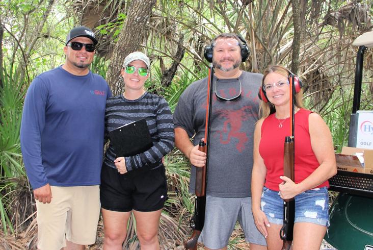
9:00am - 1:00pm Clay Shoot (Green arm band )
9:00am - 3:00pm FAMILY Trip (Lion Country Safari)
10:00am - 10:15am Seminar Break (Stacey Lyle SIT course)
11:30am - 1:00pm
1:00pm - 4:00pm
3:00pm - 3:15pm
4:00pm - 4:30pm
4:30pm - 6:00pm
6:00pm - 8:00pm
Lunch on your own
Exhibitor/Vendor Set-Up Booths
Seminar B reak (Stacey Lyle SIT course)
Exhibit Hall Grand Opening/Ribbon Cutting
Exhibitor Reception (“Attendee” name badge required)
Legislative Reception (Flag Arm Band)
8:00pm - 12:00am Casino Night
Off-Site Venue
Off-Site Venue
British Foyer
PGA Ballroom ABC
British BR Foyer
PGA Ballroom ABC
PGA Ballroom ABC
Bella Lago
Vista A&B
June 2022 Page 14
Friday, July 22
7:00am - 5:00pm
7:00am - 8:00am
8:00am - 8:30am
8:30am - 4:00pm
9:00am - 12:00pm
12:00pm - 1:30pm
1:30pm - 2:30pm
2:30pm - 3:30pm
3:30pm - 4:30pm
4:30pm - 5:00pm
5:00pm - 5:30pm
5:00pm - 6:00pm
6:30pm - 7:00pm
Conference Schedule 2022
Conference Registration Desk Open
Breakfast (FSMS Members Only)
Keynote Speaker - Josh Liller
Exhibit Hall Open
General Business Session
Exhibitor Luncheon (“Admit One” arm band required)
FDOT - Town Hall (Open to all)
NSPS Meeting
Geospatial Users Group
Surveyors in Government (Working Session)
Surveyors in Government (Public Q & A)
Young Surveyors Network Scavenger Hunt
Cocktail Reception
7:00pm - 10:00pm Recognition Banquet (VIP or Smiley Face (child) arm band required)
10:00pm - 11:00pm President’s Reception
Saturday, July 23
7:00am - 12:00pm
Conference Registration Desk Open
8:00am - 5:00pm Certified Survey Technician (CST) Exam
8:00am - 8:30am Seminar Sign-In
Saturday Tech Sessions (Registration Required)
8:30am - 3:00pm All Day Session
Standards of Practice
Course #10103 - 6 CEC Hours
Panel Discussion
8:30am - 10:10am Morning Segments
Monitoring 101. How surveyors can get into Monitoring as a business Model
Course #10305 - 2 CEC Hours
Instructors: Earl Soeder & Joe Priestner
Emerging Technologies
Course #8664 - 2 CEC Hours
Instructor: Allen Nobles, PSM
GNSS for the Technician
Course #10304, 2 CEC Hours
Instructor: Sam Hall, PSM
10:10am – 10:30am
Morning B reak (All Sessions)
10:30am - 12:10pm Mid-Morning Segments
Starting a Small Business in
Today’s Market
Course #10299 - 2 CEC Hours
Atrium Registration
British ABC
British ABC
PGA Ballroom B&C
British ABC
PGA Ballroom B&C
Canterbury A
Canterbury B
Canterbury A
Canterbury B
Canterbury B
Congressional British Ballroom-Foyer
British Ballroom
Vista A & B
Atrium Registration
Oakmont
Each Classroom
Canterbury A & B
British A
British B
British C
British Ballroom-Foyer
British A
Instructor: Dennis Ritzel, PSM & Clyde Mason, PSM
Best Practices in Drone Surveying
Course #10306 - 2 CEC Hours
Instructor: Logan Campbell
Is it Time to Invest in LiDAR
Course #10300 - 2 CEC Hours
Instructor: Sam Hall
British B
British C
The Florida Surveyor Page 15

Conference Schedule 2022
Saturday, July 23 cont.
12:10pm – 1:30pm
Lunch (On Your Own)
1:30pm - 3:00pm Afternoon Segments
Tide Station Recovery and Maintenance
Course #10302- 2 CEC Hours
Instructor: Ro d Maddox
Digital Signatures
Course #8489 - 2 CEC Hours
Instructor: Don Elder, PSM
Terrestrial & Mobile LiDAR Data
Capture and Utilization
Course #1030 1 - 2 CEC Hours
Instructor: Anthony Paturzo
British A
British B
British C
3:15pm – 5:00pm
Board Meeting
Event Armband & Ticket Guide
Wednesday - Welcome BBQ: Wednesday Armband
Yellow Drink Ticket
Thursday - Clay Shoot: Green Armband
Vista A & B


Exhibitor Reception: Red or Green Name Badge Required
Legislative Reception: Flag Armband
Friday - Exhibitor Luncheon: Admit One Armband
Banquet - Adult: VIP Armband
Banquet - Child: Smiley Face Armband


The Florida Surveyor Page 17
June 2022 Page 18
The Florida Surveyor Page 19
Thursday July 21, 2022
$50 per person
Lunch & Transportation
Provided by FSMS

Sponsored by:
The Florida Surveyor Page 21

*Check-In Starts at 8:00 am
$175 per person
$700 per team (4 players)
$20 Gun Rental or
Bring Your Own Gun


Thank You to All our Exhibitors & Sponsors Exhibitors PLATINUM GOLD Duncan-Parnell International Service Partners LiDARUSA Pickett Woolpert
Leica Geosystems

TopoDOT
SILVER STANDARD
Aerotas
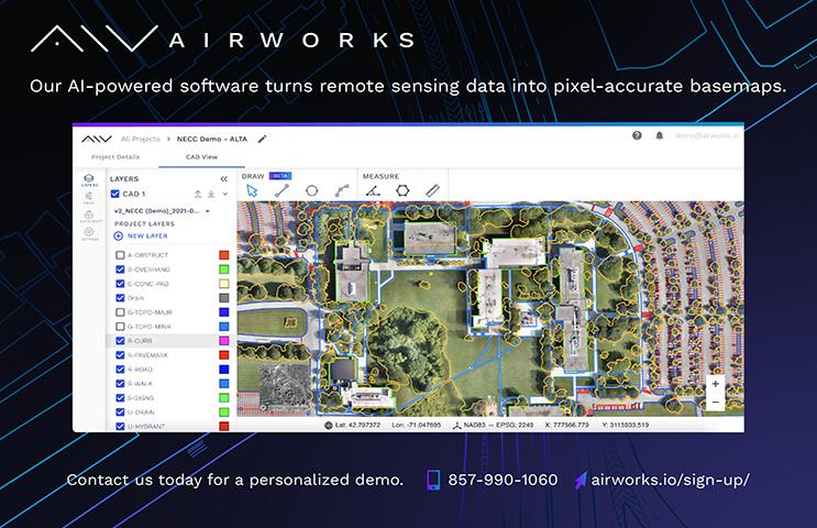
Airworks
Axis GeoSpatial LLC
Ayres Associates, Inc.
Carlson Preferred


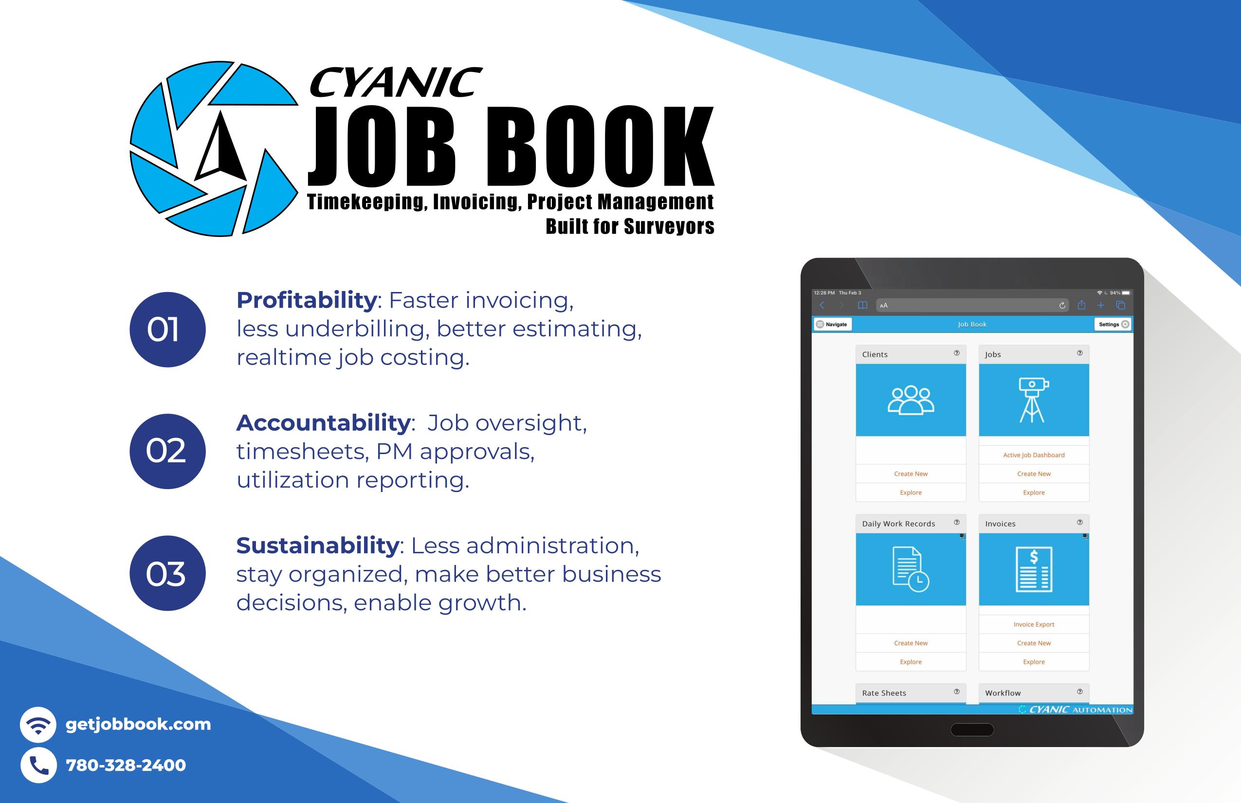
Cyanic Job Book

eGPS Solutions
Emlid
Featherstone Supply
Florida Level & Transit (FLT)
Geo Networking
GPI
Hyatt Survey


I.F. Rooks & Associates
Javad, GNSS
Lengemann Corporation
Multicopter Warehouse
National Geospatial - Intelligence Agency (NGA)


SAM Companies
Vacmasters
FAU Geomatics Engineering


FREAC / Florida State University
Geospatial Users Group (GUG)
NSPS
UF IFAS
UF Geomatics


Exhibitor Reception Trimble Sponsors
Conference Mobile App Keith & Associates


Clay Shoot Avirom & Associates
Swag Sponsor Atwell
Room Keys Hyatt Surveys
Welcome BBQ & DRMP
Young Surveyors Event
Welcome BBQ Caulfield & Wheeler


Conference Tote Bags Langan

Registration Desk & Signs Pennoni
Registration Desk & Signs WGI
Legislative Reception SAM
Legislative Reception Manasota Chapter


Program Book (Front Cover) Zeman Consulting Group
Program Book (Back Cover) KCI Technologies
Banquet Door Prizes Collins Survey Consulting
Program Book (Inside Front Cover) Ayres Associates, Inc.
Golf FL Crown Chapter
Lion Country Safari Palm Beach Chapter & Casino Night
Lanyards GPI
Name Badges Bowman & Saturday Break
Exhibitor Welcome Bags Lengemann
Exhibitor Hall Door Prizes Tampa Bay Chapter


General Business Session, Central FL Chapter
Young Surveyors Event, & Registration Packets
Registration Packets GdB Geospatial

General Sponsor HALFF

the State Around
Legislative Committee
Chair Jack Breed
catching yellowfin tuna with Voodoo Charters about 80 miles offshore of Venice, Louisiana.

The Florida Surveyor Page 31

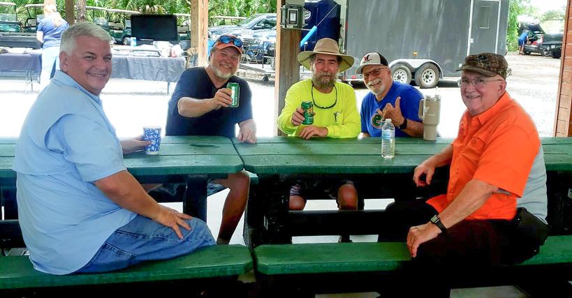
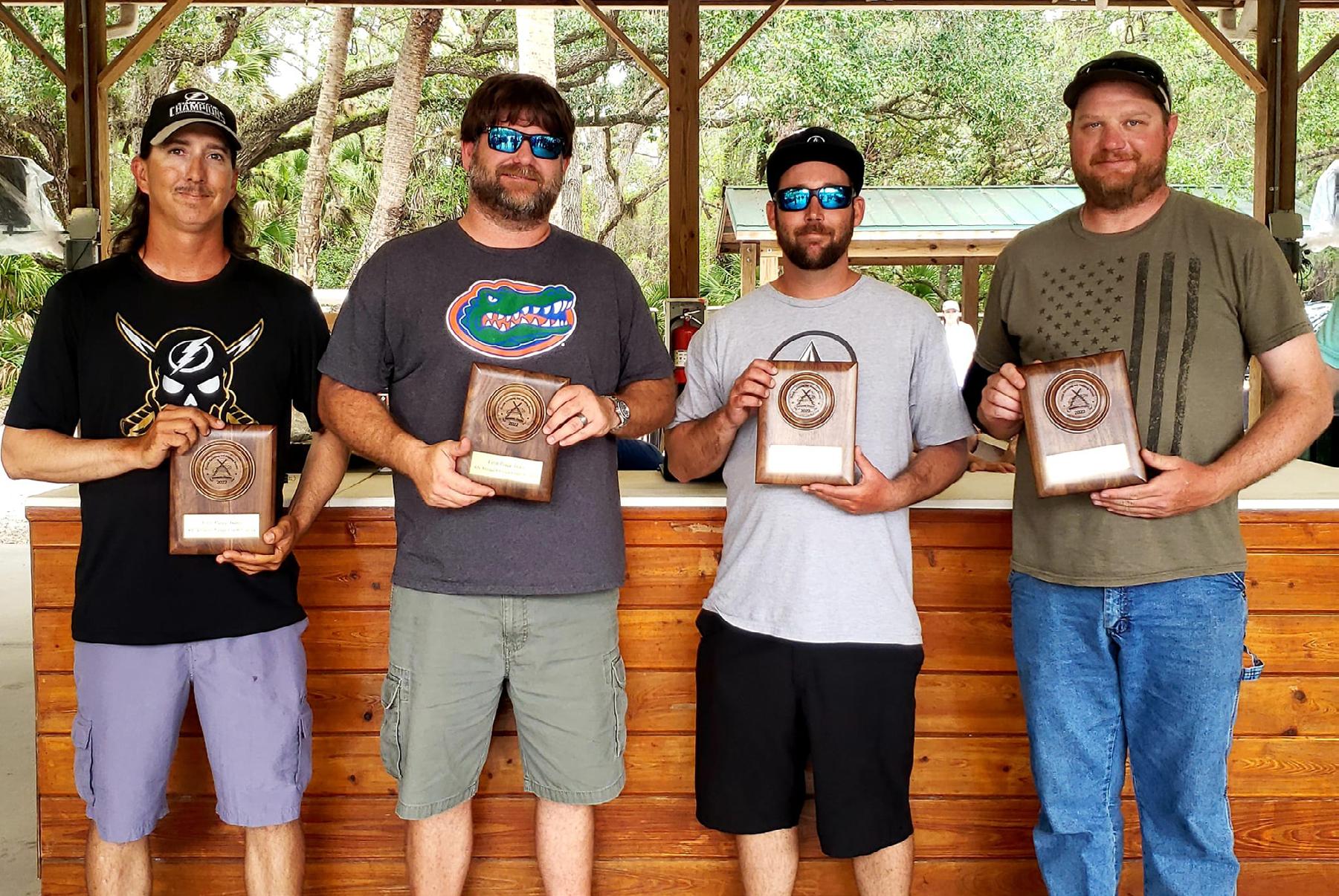
Thank You to Everyone who came to support our FSMS - Manasota Chapter 4th Annual Orange Crush Classic Clay Shoot and BBQ.

Across From Left to Right:
The Florida Surveyor Page 33
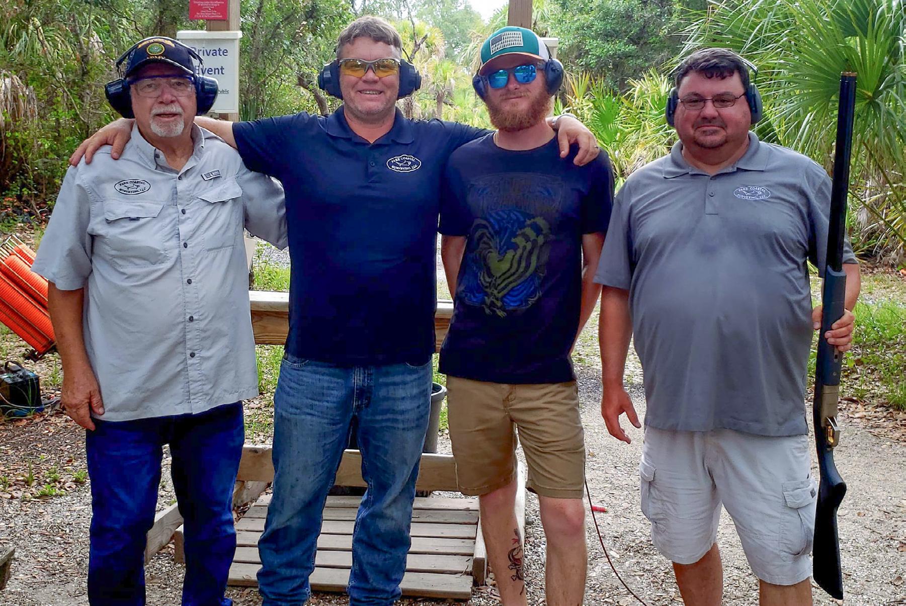
Above from Left to Right: Russell Hyatt, Bob Strayer, Jr., Bill Knight, Mark Bassett, and Ralph Rhodes.
Shane Christy and Mark Bassett.
June 2022 Page 34
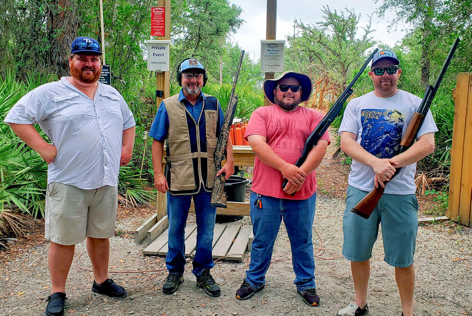
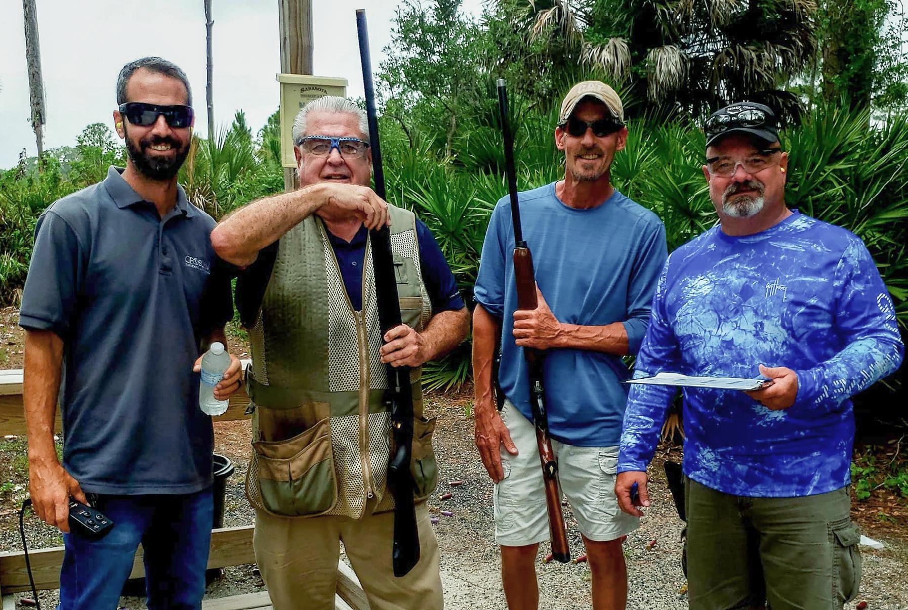
From Left to Right: Jared Johnson, Chris Whightsel, Brad Scott, and Brian Hooks.
From Left to Right: Mark Hubbell, Boots Garner, Dylan Dixon, and Chris White.
The Florida Surveyor Page 35
From Left to Right: Dave Coughlin, Hal Noon, Bob Knight, and Darin Rushnell.
From Left to Right: Skip Park, Travis Park, Carl Behm, and Jason Encke.


June 2022 Page 36
From Left to Right: Bill Knight and Bob Strayer.
From Back Left to Back
Right: John Shremshock and Dave Shremshock
Front Left to Front Right: Will Hawkins and Vlad "Wild Man" Kuvaldin

The Florida Surveyor Page 37
From Left to Right: Mike and Jen Wise with Chad and Cheryl Vogt.

On Thursday - May 26th, 2022, Broward Chapter hosted their May meeting at the UF_Geomatics FLREC . Thank you Dylan M. and David Moss from " AccurateInverts. com " for presenting your patented invention "VERT Rod" which was original, inspiring, and well crafted for the audience. And for sharing great tips on how to be and stay inspired through creative thinking and innovation.
Thank you to all that came out and we look forward to seeing you all at our June meeting!
June 2022 Page 38
 by: Richard Allen, PSM, CFM Richard.Allen@orlando.gov (407) 246-2788
As government surveyors dealing with more than just government surveying, we can often find keeping up with legislative changes can be tax ing or leaving one to feel clueless. The more we are involved with professiona l societies or professional associations and groups that we become more inform ed. It is easy for one to bury themselves in their work and not devote time to associations and groups, but you often find you are the last to know when things have changed.
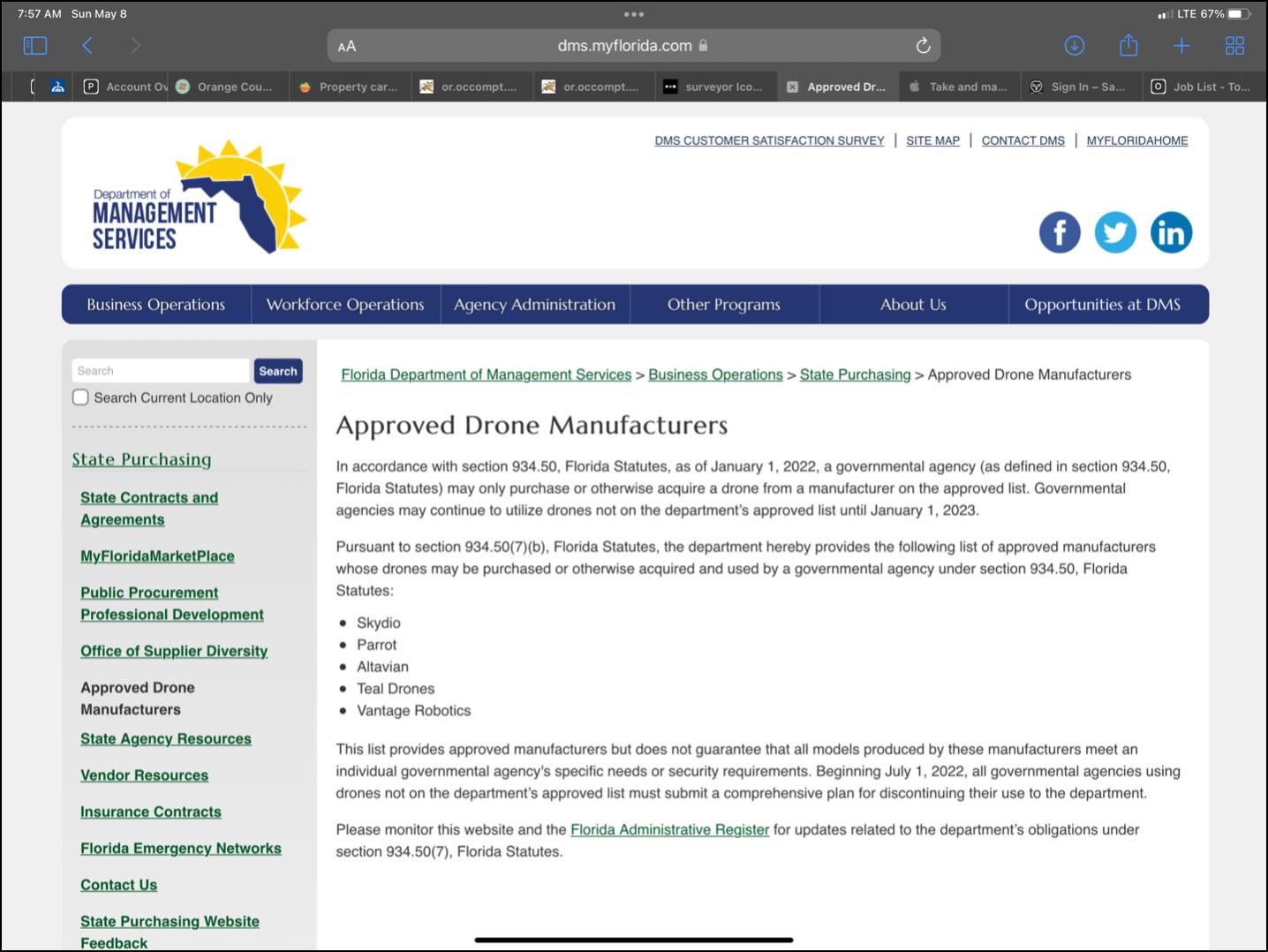
One such instance that many in government and those who do work with the state government and or state funds are finding out is the use of cert ain manufacturers of drones. Specifically those drones outside of the Defense Depa rtment’s blue list. The lists are referred to as the Blue sUAS list and now there is a Blue sUAS2.0 list, which the 2.0 list has not even be addressed as possibly being adopted. I found out this issue late last year from my participation in a drone group. I am sure there was something mentioned by FSMS as well, but I missed that one in the legislative briefings, probably one of the times my head was buried in my wo rk. The specific statute may be missed by some as it is in the section pertainin g to search and seizure using a drone, but affects all drones funded by state f unds. That statement alone affects pretty much all government surveyors in some form or fashion, and it affects many surveyors in the private industry.
Chapter 934.50 of Florida Statues states:
7) SECURITY STANDARDS FOR GOVERNMENTAL AGENCY DRONE USE.—
(a) As used in this subsection, the term:
1. “Department” means the Department of Management Services.
2. “Governmental agency” means any state, county, local, or munici pal governmental entity or any unit of government created or establ ished by law that uses a drone for any purpose.
(b) By January 1, 2022, the department, in consultation with the st ate chief information officer, shall publish on the department’s web site a list of approved manufacturers whose drones may be purchased or othe rwise acquired and used by a governmental agency under this section. An approved manufacturer must provide appropriate safeguards to pr otect the confidentiality, integrity, and availability of data collected, transmitted, or
The Florida Surveyor Page 39
Tom’s Tip of the Month

T he F lorida S urveyor is the official publication of the Florida Surveying and Mapping Society, also known as FSMS. It is published monthly for the purpose of communicating with the professional surveying community and related professions who are members of FSMS. Our award winning publication informs members eleven months out of the year about national, state, and district events and accomplishments, as well as articles relevant to the surveying profession. In addition, continuing educational courses are also available.
Page 40
stored by a drone. The department may consult state and federal agencies and any relevant federal guidance in developing the list of app roved manufacturers required under this paragraph.
(c) Beginning on the date the department publishes the list of appr oved drone manufacturers under paragraph (b), a governmental agency may only purchase or otherwise acquire a drone from an approved manufact urer.
(d) By July 1, 2022, a governmental agency that uses any drone not produced by an approved manufacturer shall submit to the depart ment a comprehensive plan for discontinuing the use of such a drone. The department shall adopt rules identifying the requirements o f the comprehensive plan required under this paragraph.
(e) By January 1, 2023, all governmental agencies must discontinue the use of drones not produced by an approved manufacturer. The dep artment shall establish by rule, consistent with any federal guidance o n drone security, minimum security requirements for governmental agency drone use to protect the confidentiality, integrity, and availability of data collected, transmitted, or stored by a drone. The department may consult f ederal agencies in establishing the minimum security requirements requ ired under this paragraph.
History.—s. 1, ch. 2013-33; s. 1, ch. 2015-26; s. 10, ch. 2017- 150; s. 1, ch. 2020-131; s. 1, ch. 2021-165.
The Florida Surveyor Page 41
You may keep track of the approved drone manufactures by going to the Florida Department of Management Services page for the approved manufac turers. Currently that list includes Skydio, Parrot, Altavian, Teal Dro nes, and Vantage Robotics. Most agencies have become DJI shops and that will be changing very quickly. So take all this as you may, but you can see changes h appen rapidly and this should motivate you to continue to be involved with as sociations and societies. We are more informed when we are more involved. Also we may also have more of an impact on changing some of these burdensome sta tutes when we have a larger and stronger voice.
June 2022 Page 42
LAND SURVEYING PROBLEMS PECULIAR TO COASTAL FLORIDA
By Russell DeGrove
“Under all is the land;” and in the case of the state of Florida, much of the land area is underwater. This may sound bad at first reading, and there is much that is bad; however, that part of the land that is above and adjacent to the submerged part has always been the most valuable, and will no doubt always be so. Ocean, River, Lagoon, or Lake frontage is selling at a premium in many areas.
Water frontage along Coastal Florida is largely Ocean, River, or Lagoon. The survey of recorded land boundaries along, across, and adjacent to these water bodies brings up problems to the Surveyor not encountered as often inland. The causes of some of these problems and some of the methods used in solving them are the purpose of this paper and will be outlined briefly hereafter.
My experiences and the problems cited spring mostly from the Atlantic Coast, but I suppose those along the Gulf Coast are similar. It is not thought worthwhile to dwell at any great length upon the many and very real problems of a physical nature that the surveyor meets along Coastal Florida, but it might be of some interest to mention a few of them in passing.
The problem of spanning bodies of water is encountered fairly often in Coastal Areas and, of course, is solved by triangulation
or stadia, depending upon the accuracy required. Much of the Northern portion of Coastal Florida is a boggy marsh area that presents difficult terrain to survey in that it is too soft to walk on or pass over with most land vehicles; while, at the same time, being too stiff for boats. Special wide tread vehicles have been designed to cover some of this marsh, and shallow draft, propellerdriven boats cover other areas. There is an “in-between” area, however, which defies any type of vehicle.
The cypress and gum swamps of North Florida, and the mangrove flats of Southern Coastal Florida, present problems in that they have not, to my knowledge, admitted any type of vehicle to penetrate them and they are too thick for ordinary triangulation. They can be spanned by towers or scaled from aerial photos, but if you want to know what is in them you must walk, crawl, and swim through with the tape tied to your belt and a stout rear chainman to pull you from the holes.
The scrub oak and palmetto can be overcome with a machete or a bulldozer. The bulldozer is gaining in popularity, but the machete, though slower, is much neater.
The mosquitoes along the coast, while not as bad as in years gone by, are still a great deterrent to good work in some areas. These


June 2022 Page 44
pests can greatly hamper the progress of a survey party at best, and may completely halt some types of work. The helmet, net, and spray gun are the only help.
As real as these problems are, they are not the primary object of this paper. In the following paragraphs, I would like to describe a few problems met in the resurvey of the U.S. Land Office meander lines; establishing lines of Riparian Rights, and the surveyor's relation to the Trustees of the Internal Improvement Fund.
MEANDER LINES
During the middle part of the Nineteenth Century, the U.S. Survey of the Public Lands progressed Easterly from Tallahassee to the East Coast and thence along the coast. Township and Section lines were run to the St. Johns River. The Basis Parallel was extended across the St. Johns marshes to the Ocean in 1831. Some years later, the surveys progressed Southerly along both sides of the River with an occasional connection across. The Township and Section lines were also extended to the Ocean Beach across Lagoons, Marshes, and Swamps. Further along the Coast, between Daytona Beach and Titusville, the old surveys ran into the mangrove swamps of the Halifax River. Still further South was the double-crossing of the Indian and Banana Rivers. And so the survey progresses south on the heels of the Seminole.
At points where the Section or Grant lines intersected a navigable stream, the surveyor was required to establish a meander corner.
To connect these meander corners, meander lines were run along the shore to delineate the shoreline, furnish a closed traverse, and compute areas.
These meander lines were not run as boundaries of the sec tion, but rather as a rough location of the shore and for area calculation. It is my understanding that the Courts have ruled that in the case of open navigable water, such as a river, the actual edge of the upland is the boundary; provided, however, that the meander is reasonably close to the shore. If the meander is found to be at a considerable distance from the shore, leaving an appreciable area between the meander and the shoreline, the meander is often ruled to be the boundary. This seems, at first thought, to be paradoxical and unfair, but such a meander is considered fraudulent and giving away public lands.
From these lines connecting the Meander Corners from Section line to Section line, the Land Surveyor inherited problems. Foremost among these problems was the one of re-establishing these meanders because whereas such re-established line might be of minor importance along open waters, it becomes of paramount importance along marshes, swamps, and so-called marginal lands. The reason for this importance is that the Courts of Florida, without, to my knowledge, an exception, have ruled that the original mean der is the boundary between the upland and such marginal lands.
In re-surveying these meanders, the presentday surveyor has to contend with the fact

The Florida Surveyor Page 45

that, at best, these meanders were very poorly run and, at worse, as is often the case, they were not run at all. The U.S. Deputies were not required to run these lines with any degree of accuracy and it is seldom that they will “close” from one meander corner to the next. If the error of closure is large, the adjustment may be difficult.
A worse situation than the above is the case where the meander will close perfectly, but the courses fail to follow anywhere near the shoreline. I have always contended that such meanders were indeed fraudulent and were never actually run, but were com puted to close. In such cases, the best possible solution is to establish an “agreement” line if the parties concerned can be made to agree. It is not always possible, and seldom easy, to secure such an agreement due to the fact that there are often large discrepancies in the area or upland even though the meander re flects the correct area, and cannot be declared “fraudulent.” The ownership of small islands just offshore is often dependent upon the agreed-upon location for the meander.
The mention of off-shore islands brings up another problem peculiar to Coastal Florida, and that is the location of the boundaries of surveyed islands around which fill has been placed. The Intracoastal Waterway —Jacksonville to Miami, is full of these islands.
The U.S. Deputy Surveyors were instructed to establish auxiliary meander corners where the section lines intersected the shores of these islands, and to determine the location by triangulation. In cases where
the islands were not intersected by section lines, random lines were triangulated to the island. The islands were meandered for area determination.
It is seldom that the present-day surveyor finds these islands located exactly as called for in the field notes, and the meander seldom fits the actual shape of the island. In cases where the island has been used for dredge spoil, the problem is aggravated. The solution, as in most surveying problems, is to try to establish “equity.” That is, give the owner of the island as near the recorded area as possible as near the location as possible.
Almost without exception, the surveyor will find that the owner of the island will claim all of the “upland” outside the meander but will be reluctant to give up the bays and coves inside of the meander. The final arbiter will, of course, be the Courts.
RIPARIAN RIGHTS
A problem not entirely peculiar to Coastal Florida, but probably more frequently met there than inland, is that of the proper division of Riparian Rights among the several owners of a waterfront. These rights are usually transferred with the upland and are the traditional right of proprietorship over the water and bottom directly offshore. At times, the division of land left by the sudden or gradual shifting of shorelines is the problem. The dock line between two riparian owners on a navigable stream or lake must be decided by someone.
While the surveyor is not the final judge as to the equitable division of riparian rights,
The Florida Surveyor Page 47


We Are Seeking Geodetic Sur veyors JOIN THE TEAM!
Geodetic Surveyor
Solve three dimensional geodetic and astronomic position problems, determine geodetic and astronomic azimuths, and measure uctuations and accelerations in the Earth’s magnetic and gravity elds. T hey serve as NGA’s primary ground-based data collectors and use and maintain a variety of geodetic and geophysical survey equipment to support data acquisition.
They compute, adjust, and evaluate geodetic survey data acquired by other organizations. They provide indepth technical expertise on geodetic and geophysical issues to customers and represent NGA in external community forums establishing DoD and Intelligence Community doctrine and policy.
We will be hiring during the FSMS conference on July 21-23 for entry level and experienced surveyors. Stop by our booth to learn more!
www.intelligencecareers.gov/NGA
recruitment@nga.mil
A pplying to Jobs and Internships at NGA
Beginning Your Job Search A pply for a Job Applicants must meet the following criteria to qualify for employment with NGA:
• U.S Citizen
• 18 years of age or older
• Able to obtain a Top Secret/SCI security clearance
• Pass mandator y pre-employment drug screening
• COVID-19 vaccination, subject to exceptions required by law
Approved for Public Release,
• Click Apply on the job listing to start the process.
• Follow the instructions on each screen.
• Review your application Ensure your package is complete and includes all required documentation.
• Click Submit Application to submit your complete application. You will receive an email confirming submission If you do not receive an email, your application was not successfully submitted.
Go to NGA’s career website: www.intelligencecareers.gov/NGA
• To start your job search, click on Search NGA jobs, which will take you to a list of current opportunities at NGA.
• 18 years of age or older
• Register: You must register to apply for a job opening. To register, click New Users on the Job Search page.


512
22-
Are You Eligible for Emplo yment at NGA?
no one is as well qualified to suggest such a division. It is the surveyor who is most likely to be familiar with the physical conditions along the shore which govern such division.
The one basic rule for dividing riparian rights which have emerged from court decisions is that of equity. The riparian rights are to be divided as near as practicable among the upland owners in direct proportion to their shoreline frontage.
These rights belong to the owner by virtue of his ownership of the upland and are bought at quite a premium in many areas. Florida waterfront near the urban centers, which is limited in quantity, is rapidly becoming very costly.
In Florida, ownership of riparian rights does not mean absolute sovereignty over the water and the stream bed, but is subject to control by the U.S. Government where navigable waters are concerned, and subject to rights of the State by virtue of the Congressional Swamp Land Act, which gave the State over 20 million acres of land, or about two–thirds of the total area of Florida. The control of navigable waters is exercised by the U. S. Engineers Office. The disposal of the so-called “swamplands” has been handled by the Trustees of the Internal Improvement Fund since its creation in January 1855.
The problems confronting the surveyors in the division of riparian rights along Coastal Florida are usually those of fixing, describing, or establishing lines between the shoreline and the “channel,” or to navigable water, or the division of marsh or
swampland between the edge of upland and the edge of the water. The property owner is assumed to have fee title to all the upland down to the water's edge. From the water's edge, he has the exclusive right to build a dock or pier, provided it does not obstruct navigation.
The upland owner should obtain a permit from the U.S. Engin eer Office for structures in navigable waters. The upland owner has the right to purchase the submerged bottom from the Trustees of the Internal Improvement Fund if he desires to fill and/ or bulkhead this bottomland. The upland owner, of course, has fishing and boating privileges in and over the waters in front of his upland, but so also does the general public. Establishing the bounds of these rights between adjacent owners of the upland is often a problem, and is one for the surveyor.
The direction in which a property line approaches the shore has absolutely no bearing on the direction of the line of riparian rights. This is a false assumption made by many upland owners. In rare instances, of course, where the watercourse is straight, and property lines have been established normal to such waterway, a prolongation of the property lines is the best loca tion for lines of riparian rights.
Most of the shorelines of Coastal Florida are far from straight, and the property lines rarely approach the shore “normal to either the shore or the channel.” The rule that lines of riparian rights should be “normal to the channel” is of little use, nor does it make much practical sense in coastal waters. The St. Johns River is a good case in point. The
The Florida Surveyor Page 49
upper portion runs like a snake through marshes and prairies. The lower portion is almost a series of connected lakes, it is that wide. The channel in the lower portion wanders from bank to bank. Certainly not a very practical or stable reference.
Keeping in mind the basic rule of equity, the surveyor should, as near as practicable, divide the riparian rights in direct proportion to the length of the “general” shoreline owned. By “general” it meant the average shore without each and every little sinuosity. I would like to quote from Clark, a rule which I have followed in several cases along the St. Johns to the satisfaction of the owners involved:
“Measure the whole shoreline of cove or bay, and measure also the line of navi gable water in front of same, and apportion the latter among the owners according to the length of their respective holdings on the shoreline, drawing straight lines between the corresponding points of division on the two lines. Actual shore and not meander lines should be measured, but where there are deep indentations or sharp projections in the shore its general trend only should be followed and so also in the measurement of the navigable water line. The points between which the lines of navigable waters are to be measured should be determined by lines bisecting the angles made by the shoreline at the headlands to the line of navigable water.”
Navigable water has been defined as “that which can be navigated in fact.” In ancient times it was water of sufficient depth to support a canoe, rowboat, or a raft of logs. Most present-day navigation requires a little
more depth. The sur veyor must decide what is navigable in each case. He does this by agreeing with the shoreline owners on what constitutes naviga bility. The jobs I have had at Jacksonville were cases where the upland owners wished to run docks out to a depth sufficient to navigate a small cabin cruiser. This often requires a dock five hundred feet or more in length.
In establishing lines of riparian rights outward from the shorelines of Florida's rivers, lagoons, lakes, bays, and caves, the surveyor doesn't have much of a problem where the shoreline is convex outward. In those places, such lines diverge outward and everyone is happy. Conversely, where the shoreline is concave outward the lines converge outward. It is here that the surveyor sometimes has a real problem making a satisfactory division. If the division is not satisfactory to all the upland owners, those not satisfied may resort to the courts for a decision. If the surveyor has used good judgment, and done equity to all concerned, he is more than likely to be sustained by the courts.
The surveyor along Coastal Florida is often called upon to establish boundaries over marshes, prairies, and swamps that lie between the meandered shoreline and open waters. This “land” between upland and open waters is the so-called “overflowed lands” over which the state has sovereign rights. This land must be pur chased from the State. It is the surveyor's job not only to fix the bounds of the proposed purchase but to prepare a map, description, and application for purchase. In fixing the boundaries of the proposed purchase, the surveyor should follow practically the same
June 2022 Page 50
rule used in establishing lines of riparian rights. It is the policy of the State to sell this land only to the upland owner. The State requires that the map show a tie to a Section, Quarter–section, Government Lot, or meander corner since all their records are by Section, Township, and Range. This requirement is often very difficult in urban areas where the upland sections have been subdivided for many years and all nearby government corners lost and forgotten for half a century or more.
Very recently, we had a request to map and describe a portion of the St. Johns River in downtown Jacksonville. All of downtown Jacksonville was originally Spanish grants, and, of course, the Grant corners have long since disappeared. The area had been subdivided with more regard to natural than artificial boundaries. The nearest corner that could be identified at all as a Government corner was miles away. It would make little sense to attempt to prove a corner on the river downtown by running such a distance. Fortunately, there are old maps of record showing the approximate location of these Grant corners. These maps also show many points common with present-day maps of the City. Careful scaling of these old maps will give the approximate area where the old corner no doubt stood. We decided to use the location thus arrived at for a point of reference, and give an approximate bearing and distance to the point of beginning.
THE LAND SURVEYOR AND THE TRUSTEES OF THE INTERNAL IMPROVEMENT FUND
Mention has been made in earlier paragraphs of the neces sity of surveying
and describing State-owned lands. It is considered proper, therefore, to say something about the agency of the State that controls the use and disposal of this land. The act creating Florida's permanent internal improvement agency was signed into law by Governor James E. Broome on Janu ary 6th, 1855.
The purpose of the law was to encourage a liberal system of internal improvements. The first assets of the fund consisted of some 500,000 acres of internal improvement land that came to the State from the National Government in 1845, and all the swamp and overflowed land that had been, or would be, patented to the State.
The Governor, Comptroller, Treasurer, Attorney General, and the Register of State Lands (now Secretary of Agriculture) were named the Trustees of the fund. The early activity of the fund had to do almost entirely with the encouragement of railroad construction in the state. This encouragement came by way of an outright grant of a 200-foot right of way, 3,840 acres of land per mile of road, and about $10,000.00 per mile in guaranteed bonds.
It is the disposal of the State lands by the Trustees of the Fund that concerns the land surveyor. Private upland owners are applying for the purchase of the “swampland” adjacent to the upland. As stated before, to the surveyor will come the job of establishing proper boundaries, maps, and descriptions of this land.
The surveyor should deal with the Fund through the Secretary of the Fund who is himself a registered land surveyor as well as
The Florida Surveyor Page 51


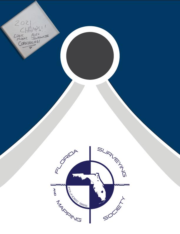
Register Your Team at Conference! $50 per Team to Enter Wed. Night 8–10 pm
Eddie Munoz
2021 Champion
Alex Jenkins III
2021 Champion
an engineer. From the Secretary will come helpful instructions as to the proper procedure for the survey of un-surveyed sections, the preparations of maps and descriptions, and the general requirements in making out the application for purchase.
The writer wishes to acknowledge help from the following sources:
John Goggin_ _ _ _ _ _“Code of Ethics” Clark_ _ _ _ _ “Surveying and Boundaries”
John M. DeGrove_ _ _“The Administration of Internal Improvement Problems in Florida”


www.axisgeospatial.com

3002 Surveying 833-352-3002 A Accuright Surveys of Orlando, Inc. 407-894-6314 Agnoli, Barber & Brundage, Inc. 239-597-3111 AIM Engineering & Surveying 239-332-4569 Airworks 857-990-1060 Allen & Company, Inc. 407-654-5355 Allen Engineering 321-783-7443 American Consulting Professionals, LLC. 813-435-2600 American Surveying, Inc. 813-234-0103 Amerritt, Inc. 813-221-5200 Arc Surveying & Mapping, Inc. 904-384-8377 Ardurra, Inc. 239-292-7773 Associated Land Surveying & Mapping, Inc. 407-869-5002 Atlanic Drafting & Surveying 386-264-8490 Avirom & Associates, Inc. 561-392-2594 Axis Geospatial SE, LLC. 410-822-1441 B Banks Engineering 239-939-5490 Barnes, Ferland and Associates, Inc. 407-896-8608 Barraco & Associates, Inc. 239-461-3170 Bartram Trail Surveying, Inc. 904-284-2224 Bello & Bello Land Surveying Corporation 305-251-9606 Benchmark Surveying & Land Planning, Inc. 850-994-4882 Berntsen International 608-443-2772 Betsy Lindsay, Inc. 772-286-5753 Biscayne Engineering Company, Inc. 305-324-7671 Boatwright and Durden Land Surveyors, Inc. 904-241-8550 Bock & Clark Corporation 330-665-4821 Bowman Consulting Group 703-454-1000 Bradshaw-Niles & Associates, Inc. 904-829-2591 Brown & Phillips, Inc. 561-615-3988 BSE Consultants, Inc. 321-725-3674 Buchanan & Harper, Inc. 850-763-7427 C Calvin, Giordano, & Associates 954-921-7781 Carlson Environmental Consultants, PC 561-371-2402 Carter Associates, Inc. 772-562-4191 2022 Sustaining
Firms Directory
Caulfield & Wheeler
561-392-1991
Chastain-Skillman, Inc.
863-646-1402
CHW Professional Consultants (Causseaux, Hewett & Walpole, Inc.)
352-331-1976
CivilSurv Design Group, Inc.
863-646-4771
Clary & Associates, Inc.
904-260-2703
Clements Surveying, Inc.
941-729-6690
Clymer Farner Barley, Inc.
352-748-3126
Coastal Engineering Associates, Inc.
352-796-9423
Colliers Engineering & Design
732-383-1950
Collins Survey Consulting, LLC.
863-937-9052
Compass Engineering & Surveying, Inc.
727-822-4151
Cousins Surveyors & Associates, Inc.
954-689-7766
CPH, Inc.
407-322-6841
Craven-Thompson & Associates, Inc.
954-739-6400
Cross Surveying, LLC.
941-748-8340
Culpepper & Terpening, Inc.
772-464-3537
Cumbey & Fair
727-324-1070
D
Dagostino Geospatial, Inc.
239-352-6085
DeGrove Surveyors, Inc.
904-722-0400
Dennis J. Leavy & Associates

Donald
561-753-0650
321-354-9729
Associates, Inc. 941-475-6596
Dewberry
DMK
W. McIntosh Associates, Inc. 407-644-4068
Construction Layout, LLC. 321-248-7979
Leavy & Associates, Inc. 954-344-7994
Inc. 407-896-0594 DroneView Technologies 248-321-9417
Surveying & Mapping, PLC. 352-735-3796 Duncan-Parnell, Inc. 407-601-5816
Surveying & Mapping, Inc. 904-853-6822 E Echezabal & Associates, Inc. 813-933-2505 ECHO UES, Inc. 888-778-3246 Eda Consultants, Inc. 352-373-3541 E.F. Gaines Surveying Services, Inc. 239-418-0126
& Associates, Inc. 904-272-1000 Element Engineering Group, LLC. 813-386-2101
Donoghue
Douglass,
DRMP,
DSW
Durden
Eiland
561-655-1151
772-462-2455
FL,
813-295-9024
904-642-8550
F
Land Surveyors 727-230-9606
Choice Surveying, Inc. 407-951-3425 Florida Design Consultants, Inc. 727-849-7588 Florida Engineering & Surveying, LLC. 941-485-3100
Geosystems 954-763-5300
Leavey, Skiles, Inc. 305-653-4493 F.R. Aleman & Associates, Inc. 305-591-8777 F.R.S. & Associates, Inc. 561-478-7178 FTE Engineers & Planners 800-639-4851 G Gary Allen Land Surveying 850-877-0541 GCY, Inc. 772-286-8083 GeoData Consultants, Inc 407-732-6965 Geoline Surveying 386-418-0500 Geomatics Corporation 904-824-3086 Geo Networking, Inc. 407-549-5075 GeoPoint Surveying, Inc. 813-248-8888
F. Young 727-822-4317 GeoSurv, LLC. 877-407-3734 Germaine Surveying, Inc. 863-385-6856 GPI Geospatial, Inc. 407-851-7880 Gustin, Cothern & Tucker, Inc. 850-678-5141 H Haley Ward, Inc. 239-481-1331 Hanson Professional Services, Inc. 217-788-2450 Hanson, Walter & Associates, Inc. 407-847-9433 H.L. Bennett & Associates, Inc. 863-675-8882 Hole Montes, Inc. 239-254-2000 HUB International 850-386-1111 Hyatt Survey Services 941-748-4693 I I.F. Rooks & Associates, LLC. 813-752-2113 2022 Sustaining
Engenuity Group, Inc.
Engineering Design & Construction, Inc.
ER Brownell & Associates, Inc. 305-860-3866 ESP Associates
Inc.
ETM Suryeying & Mapping
Exacta Land Surveyors, Inc. 866-735-1916
Ferguson
First
FLT
Fortin,
George
J John Ibarra & Associates, Inc. 305-262-0400 Johnson, Mirmiran & Thompson, Inc. 813-314-0314 Johnston’s Surveying, Inc. 407-847-2179
KCI Technologies 954-776-1616 Keith and Associates, Inc. 954-788-3400 Kendrick Land Surveying 863-533-4874 L L&S Diversified, LLC. 407-681-3836 Land Precision Corporation 727-796-2737 Landmark Engineering & Surveying Corporation 813-621-7841 Langan Engineering 973-560-4900 Leading Edge Land Services, Inc. 407-351-6730 Leiter Perez & Associates, Inc. 305-652-5133 Lengemann Corp. 800-342-9238 Leo Mills & Associates 941-722-2460 LiDAR USA 256-274-1616 Long Surveying, Inc. 407-330-9717 M Manuel G. Vera & Associates, Inc. 305-221-6210 Marco Surveying & Mapping, LLC. 239-389-0026 Massey-Richards Surveying & Mapping, LLC. 305-853-0066 Masteller, Moler & Taylor, Inc. 772-564-8050 McCain Mills, Inc. 813-752-6478 McKim & Creed, Inc. 919-233-8091 McLaughlin Engineering, Co. 954-763-7611 Metron Surveying and Mapping, LLC. 239-275-8575 Metzger + Willard, Inc. 813-977-6005 Mills & Associates, Inc. 813-876-5869 Mock Roos & Associates, Inc. 561-683-3113 Moore Bass Consulting, Inc. 850-222-5678 Morris-Depew Associates, Inc. 239-337-3993 Murphy’s Land Surveying 727-347-8740 N Navigation Electronics, Inc. 337-237-1413 Northwest Surveying, Inc. 813-889-9236 NV5, Inc 407-896-3317 Firms Directory
K
O On The Mark Surveying, LLC. 321-626-6376 P PEC Surveying & Mapping 407-542-4967 Pennoni Associates, Inc. 863-594-2007 Pickett & Associates, Inc. 863-533-9095 Platinum Surveying & Mapping, LLC. 863-904-4699 Point Break Surveying 941-378-4797 Polaris Associates, Inc. 727-461-6113 Porter Geographical Positioning & Surveying, Inc. 863-853-1496 Pro-Line Survey Supply, Inc. 904-620-0500 Pulice Land Surveyors, Inc. 954-572-1777 Q Q Grady Minor & Associates, PA 239-947-1144 R Reece & White Land Surveying, Inc. 305-872-1348 Rhodes & Rhodes Land Surveying, Inc. 239-405-8166 Richard P. Clarson & Associates, Inc. 904-396-2623 R.J. Rhodes Engineering, Inc. 941-924-1600 R.M. Barrineau & Associates, Inc. 352-622-3133 Robayna and Associates, Inc. 305-823-9316 S SAM Surveying & Mapping, LLC. 850-385-1179 SCR & Associates NWFL Inc. 850-527-1910 Sergio Redondo & Associates, Inc. 305-378-4443 Settimio Consulting Services 850-341-0507 SGC Engineering, LLC. 407-637-2588 Shah Drotos & Associates, PA 954-943-9433 Shannon Surveying, Inc. 407-774-8372 Sherco, Inc. 863-453-4113 Sliger & Associates 386-761-5385 Southeastern Surveying & Mapping Corp. 407-292-8580 Stephen H. Gibbs Land Surveyors, Inc. 954-923-7666 Stoner Inc. 954-585-0997 Strayer Surveying & Mapping, Inc. 941-497-1290 SurvTech Solutions, Inc. 813-621-4929 2022 Sustaining

T T2 UES Inc. 407-587-0603 Thurman Roddenberry & Associates 850-962-2538 U Upham, Inc. 386-672-9515
Wade Surveying, Inc. 352-753-6511 Wallace Surveying Corp. 561-640-4551 Wantman Group, Inc. 561-687-2220 WBQ Design & Engineering, Inc. 407-839-4300 Winningham & Fradley, Inc. 954-771-7440 Woolpert, Inc. 803-214-5928 Z ZNS Engineering, LLC. 941-748-8080 Firms Directory SOCIAL MEDIA REPORT LinkedIn = 1,802 Followers Facebook = 695 Followers Twitter = 403 Followers Instagram = 122 Followers
W

2022 eLearning Courses
6 General CEC - $99/course (members)
$120/course (non-members)
• Professional Ethics & Professional Courtesy - Course #8363
• Georgia Technical Standards for Property Surveys - Course #8554
• History of Surveying - Course #7140
• Identification of Native & Non-Native Trees in Florida
- Course #8132
• Ethics for the Design Professional - Course #8621
• Land Tenure & Cadastral Systems - Course #8260
• Map Projections & Plane Coordinate Systems - Course #8261
• Mean High Water Observations & Computations - Course #8262
• Public Land Survey System - Course #7147
• Remote Sensing Applications to Surveying & Mapping
- Course #7148
• Practical Geometry for Surveyors
- Course #7141
3 General CEC - $49/course (members)
$70/course (non-members)
• Basics of Real Property - Course #8360
• Contracts for the Professional - Course #8412
• Elevation Certificates & the Community Rating System - Course #8256
• Introduction to Photogrammetry - Course #7968
• Writing Boundary Descriptions - Course #8362
Florida Surveying & Mapping Society 1689 Mahan Center Blvd. Suite A Tallahassee, FL 32308
www.fsms.org (850) 942-1900
June 2022 Page 62
Florida Surveying and Mapping Continuing Education Provider
Offering 25 Years of Dedication, Quality & Trusted Services
Step 1: Choose Course(s)
3 Hour Courses Available
□ A History of the Prime Meridian Marker,
□ Basics of Real Property
□ Digital Signatures for Surveyors
□ Easements and Rights of Ways,
□ Elevation Cert
□ Introduction to Photogrammet
□ Writing Boundary Descriptions
6 Hour Courses
□ Boundaries in Florida
□ Chapter 177, Platting (Plat Law)
□ Critical Communication for Surveying & Mapping Professionals
□ Ethics for the Design Professional
□ Florida Laws
□ Florida Surveying Law and Rule Changes
□ Geographic Information Systems (GIS)
□ History of Surveying,
□ Identification of Native and Non-Native Trees in Florida
□ Land Tenure and Cadastral Systems
*2020 UPDATED COURSE
□ Quality Assurance/Quality Cont , #9293, 3 CEC
□ Map Projections and Plane Coordinate Systems , #7669, 6 CEC
□ Practical Geometry for Surveyors, #7109, 6 CEC
□ Public Land Survey System, #6979, 6 CEC
□ Remote Sensing Applications to Surveying & Mapping, #6972, 6 CEC *2020
The Florida Surveyor Page 63
UPDATED COURSE
June 2022 Page 64 Step 2: Choose Member Type FSMS Member EMAILED Fee Quantity Amount 6 CEC $115 Per Course x = $ 3 CEC $58 Per Course x = $ MAILED 6 CEC $125 Per Course x = $ 3 CEC $68 Per Course x = $ TOTAL $ Non Non Name: _ YES _ NO Firm: ____ _ YES _ _ NO Address: ______________________________________________________________________________________ City/State: Email Address: Work Phone: Payment Information: ___ Check Enclosed (Payable to FSMS) _ VISA/MasterCard/American Express Card #: _______ Exp. Date: __ CVV Code:___________ Billing Address of Credit Card: ______________________________________ Signature: _____________________________________ __ IF PAYING BY CHECK, MAIL FORM TO: FSMS, P.O. Box 850001-243, Orlando, Florida 32885-0243 IF PAYING BY CREDIT CARD, FAX OR EMAIL FORM TO: 850.877.4852 education@fsms.org QUESTIONS? CALL 800.237.4384 Provider No. CE11 fsms.org
Why Join FSMS?
Legislative Support -
The Legislative Committee and our Lobbyist are committed to keeping the Public and the Surveying and Mapping Profession protected
Educational BenefitsWith recently updated courses, getting your CECs has never been better
Networking -
Attend our Annual Conference to meet other professionals and meet vendors with all the latest equipment
Social Benefits -
Attend local chapter meetings to meet individuals with common professional goals
The Florida Surveyor Page 65 Aug/Sept 2021 30
CLICK HERE TO JOIN! Florida Surveying & Mapping Society 1689 Mahan Center Blvd. Suite A Tallahassee, FL 32308 www.fsms.org (850) 942-1900


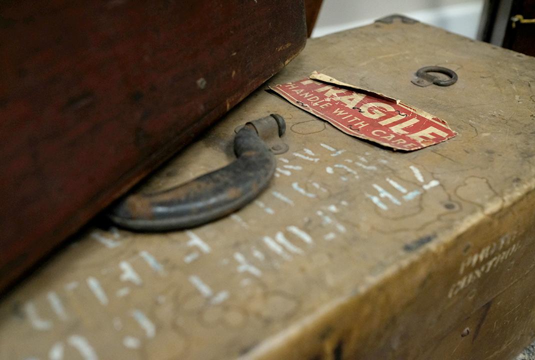


ARCHIVES FROM THE
The Florida Surveyor Page 67
The Land Surveyor and the Attorney
By MANDELL GLICKSBERG PROFESSOR OF LAW, UNIVERSITY OF FLORIDA
INWthe relatively short time that I have been acquainted with the activities of The Florida Society of Professional Surveyors, I have been impressed with the efforts being made to upgrade and improve the standards of the land surveying profession in the state. These efforts are bearing fruit, and great strides have been made in the past ten years.
Land surveyors are members of an old and honorable profession, and can well be proud of a long and rich tradition. The profession currently appears to be undergoing what might be described as a renaissance. Land surveying originated principally as a science, being concerned primarily with mathematics. It then underwent a change, and the demands of the profession called upon land surveyors to expand their work beyond the utilization of purely scientific skills. Many of the great names out of the past are well-known for the contributions they made as land surveyors to the settling of this country. The next phase in this overly brief sketch is related to the growth of the
field of engineering, which rapidly assumed preeminence. Land surveying as such, was relegated to a secondary role, looked upon by many people as merely a technical skill, not worthy of the dignity accorded the so-called professions.
Today, however, and for quite a few years now, there appears to be an increased awareness of and emphasis on the role of the land surveyor as it is and truly ought to be—someone who is not merely a technician with a tape measure, but a professional person trained in mathematics, engineering, and to some extent, law, and called upon to make decisions based upon the exercise of professional judgment.
Clearly the land surveyor is concerned with both engineering and law. But the law schools in general neglect many of the legal principles that are of importance in the work of the land surveyor, and most of the formal education offered to land surveyors in the engineering schools reflect an absence of training in these areas of the law. The plain fact is that neither
June 2022 Page 68
*Pages 67–79 were originally published in the March 1967 edition of Surveying and Mapping
the land surveyors nor the lawyers know enough about the work of the other. Accordingly, the theme of this discussion is that the two related professions of land surveying and law ought to know more about each other, and ought to work more closely together and communicate better on a professional level.
I am not talking about the admittedly good working relationship between the local land surveyor and the local attorney on a day-to-day basis. They get along pretty well for any number of reasons not the least of which is the economic necessity of the situation. What I have reference to is the relationship between the professions, as such; the interchange of ideas and information that will be of aid to the members of both callings and their clients. Undoubtedly, there is a good deal of misunderstanding on the part of both land surveyors and attorneys as to what the members of the other profession can and should properly be doing.
There are several distinct areas in which the lawyer and the surveyor work together. The most obvious, of course, is in the preparation of surveys in real estate transactions. In addition, the land surveyor acts as a source of information about local land, and can provide much useful knowledge not obtainable elsewhere that can be used by an attorney in many varied
situations. Also, the surveyor based on his experience and knowledge of local land, can provide invaluable aid in interpreting land descriptions. And in litigation involving land disputes, surveyors are frequently called upon as expert witnesses.
In all of these areas, the more insight land surveyors and attorneys have into the problems confronting each other in the per formance of their professional tasks, the better able they are to understand and communicate with each other. As one lawyer recently remarked to me: “ The lawyers think the land surveyors don't understand what lawyers are supposed to do, and the surveyors think the lawyers don't under stand what the surveyors are supposed to do.” Many lawyers think of land surveyors merely as measurers. They fail to comprehend why two competent surveyors will sometimes disagree in the results of a survey. They believe that any skilled technician ought to be able to measure the length of a line, and they do not recognize the many instances in which the measuring process is dependent upon problems requiring evaluation and judgment upon which competent surveyors may differ.
A rather pertinent observation was made by Mr. Curtis M. Brown, serving as a member of a panel discussion on “ The Challenging Future of the Land Surveyor ” at the 24 th Annual
The Florida Surveyor Page 69
.

• I.F. Rooks & Associates is a full-service Geospatial firm serving clients throughout Florida and the Southeastern United States for over 50 years.
• We have extensive experience in providing topographic / planimetric mapping , digital orthophotos, Aerial LiDAR, fixedwing and helicopter aerial photography for transportation, site development, coastal and environmental projects.
• Our steady growth in technology and personnel has allowed the development of long -term relationships with several Florida municipalities and government agencies, power companies, mining companies as well as engineering firms.
• I.F. Rooks is Pre -Qualified by FDOT in Workgroup 8.3 –Photogrammetry.
Office: 813.752.2113 ~ Web: www.ifrooks.com

THE LAND SURVEYOR AND THE ATTORNEY
Meeting of the American Congress on Surveying and Mapping:
“ In the location of land boundaries, the surveyor also locates the boundaries of adjoiners. He is in a quasi-judicial position, in that he is obligated to consider the rights of others, even though they do not pay him a fee.”
Most people, and lawyers are no exception, do not realize the full nature of the responsibilities involved in the duties of a surveyor. They just do not stop and think about the true role of the land surveyor.
Nevertheless, much progress is being made. Mr. Brown and Professor Winfield H. Eldridge at the University of Illinois are leaders in providing materials that emphasize the legal aspects of land surveying. Mr. Brown's book, Boundary Control & Legal Principles (1957), and the more recent book, Evidence & Procedures for Boundary Location (1962) by Mr. Brown and Professor Eldridge, are the leading texts in this area. And the excellent periodical Surveying and Mapping contains a wealth of material.
It occurred to me that a group of land surveyors might be interested in learning what lawyers throughout the state believe to be problem areas in their relations with surveyors. I therefore contacted a number of
attorneys who do extensive work in the field of real property law. By and large as might be expected, the response indicated that the problems were minimal, and that the relationship between the lawyers and surveyors was a very good one. Where problems did exist, the lawyers were as critical of their own shortcomings as they were of those of the surveyors.
The following quotes from letters written by some of these attorneys may be of interest. Each numbered quote is from a different attorney, and they represent merely a sample of those I received:
1. “ I might say that in my experience the average lawyer, like myself, does not leave law school with any sufficient equipment to know when he has a good survey and the best or proper way in which property should be described.”
2. “As for my own experience in the field, I have found that lawyers are prone to at tempt to prepare legal descriptions without the proper knowledge of the facts. I have found that lawyers generally are not familiar with the most simple rules of surveying and by and large should not try to describe land, excepting by reference to
The Florida Surveyor Page 71
Plat Book and page, or existing descriptions. I would think that the use of surveyors at legal institutes to explain the uses and purpose of legal descriptions might be of advantage to the Bar.”
3. “ Surveyors are sometimes critical of attorneys (and probably rightly so) for drafting legal descriptions without consulting with surveyors. This provides later difficulty in locating lands according to the descriptions, particularly where they are prepared by inexperienced attorneys who aren't familiar with the general principles of surveying. An example of this that I have heard surveyors refer to is the description of a tract as the “ East 40 acres” of a larger tract whose East and West boundaries do not run North and South. Another example is the preparation of descriptions upon the assumption of a section having exactly 640 acres, and perfect dimension of one mile square. As you know, very few sections are exactly one mile square. To meet these objections, I think it would be desirable for the Bar to continually emphasize the importance of using the assistance of surveyors in the preparation of most legal descriptions.”
4. “ One practical problem which I have had in the past might be worthy of mention in the way of the following illustration:
A tract of land comes down through a chain involving a metes and bounds description originating at the northeast corner of the NW-1⁄4 of the SE-1⁄4 (or some other similar point). The land is then fenced in and located on the ground perhaps without the benefit of a survey. Thereafter, the landowner employs a surveyor and simply requests him to survey the tract of land which he points out on the ground. The surveyor, because of previous experience in the area, or because of some distinguishing markings, or other practical reasons, commences his survey with the point of beginning at the northwest corner of NW-1⁄4 of the SE-1⁄4. Thereafter, contracts are made upon the basis of the survey and the title examiner has the problem of ascertaining if it is the same tract of land.
“ Generally assuming that the 40-acre tract were regular in all directions, the problem is not so great, but certainly it would simplify the matter if the descriptions used by the surveyor were also the descriptions used in the chain of title.
“ I therefore suggest that surveyors
June 2022 Page 72
Mandell Glicksburg
THE LAND SURVEYOR AND THE ATTORNEY
concern themselves more with the chain of title, and that they in all instances where it is feasible and practical first contact the landowner's attorney to ascertain the descriptions used in the chain of title before a survey is made. This is not an extremely important or vexing problem, but I do believe that it would be helpful if generally the description used by the surveyor was cleared with the attorney.”
5. “… I have personally found this profession to be the most cooperative group of men that I have had occasion to work with in my practice of the law. I have had occasion to do business with some engineers who were not as capable as others, however, in the main, I have found most of the surveyors doing business in the more populated areas to be most efficient.
“ The few problems which I have encountered in dealing with a surveyor are primarily as a result of the failure of the party ordering the survey to adequately explain to the engineer the services needed. Most people will merely order a survey from an engineer and let it go at that.
“One possible cause for concern may be the time taken to obtain
a survey, however, establishing corners in rural areas can be both time consuming and dangerous, consequently, the placement of orders for surveys in remote regions should allow ample time for the work to be done.
“ It may be of some benefit to the legal profession to know a little bit more about the services provided by the surveying profession. I also have some information to the effect that some of the surveyors doing business in the sparsely populated areas of the state could improve their service through better study and use of new scientific methods, publications and educational facilities, however, my information in this regard is most sketchy.
“… I feel that attorneys not well versed in the real property field (and even many of these) should utilize the surveying profession more in the development of the legal descriptions, particularly those involving metes and bounds. I have found the surveyors to be of great help to me in this area.
“ I personally feel that the cooperative efforts of the members of the two professions have met with considerable success where some member or members of the Bar or the
The Florida Surveyor Page 73
surveying profession did take hold of the problem and attempt to do something with it. It is my opinion that there is no real lack of cooperation between the two professions but there is, on the other hand, a decided absence of initiative or effort to bring the two together.”
Also, one lawyer mentioned that attempts should be made to decrease the possibility of errors in legal descriptions. He suggested that consideration should be given to eliminating the use of symbols for such words as feet, minutes, seconds, degrees, etc. He recognized that this would increase the length of such descriptions, but felt that this was outweighed by the decrease in the possibility of mistakes due to typographical and proof-reading errors attributable to the use of these symbols.
It is not only the attorneys, of course, who are concerned with improving the preparation of legal descriptions. This is well illustrated by the following excerpt from a letter written by a land surveyor:
“Another significant area, where cooperation seems desirable is that having to do with the preparation and interpretation of descriptions. … Land surveyors are not equally capable in this
matter. The preparation of an adequate description is an art in itself, and while, generally speaking, land surveyors are more likely to be well advised on this subject than other professionals, their abilities vary considerably. I would use extreme caution in making a selection of someone to write a legal description of real property, even though many descriptions would appear to be merely a routine matter. … Too many writers of descriptions assume that every reader will have the same understanding of the intent that they have.”
Finally, in this attempt to set forth some of the thoughts and attitudes of practitioners. I would like to quote a comment from a title attorney for a leading title insuring organization:
“
We find that too often the surveyor describes the property as he finds it on the land rather than locating the land according to the description in the deeds in the chain of title. It ts my opinion that the surveyor should obtain the description from the lawyer and then should proceed to locate that description on the land. If he finds any encroachments, discrepancies, shortages, overage, etc. these would then appear on the
June 2022 Page 74
Mandell Glicksburg
THE LAND SURVEYOR AND THE ATTORNEY
sketch of the survey. We are experiencing considerable difficulty in such instances where surveyors have given the description in accordance with what they find on the property rather than locating the property according to the description and showing any discrepancies.”
These, then, are some of the comments that I received. They indicate, I believe, that a good relationship exists between the two professions, and that the troublesome areas that do exist can undoubtedly be remedied by a little effort and better lines of communication.
One step in the direction of improving the services rendered by land surveyors was taken in 1962 with the publication of a booklet entitled “Minimum Requirements for Land Surveys Made For Title Purposes in The State of Florida.” This pamphlet was developed and adopted by The Florida Society of Professional Land Surveyors and The Florida Land Title Association, and approved by the Mortgage Bankers Association of Florida. It is interesting to note that The Florida Bar is not included among the organizations adopting or approving the booklet.
This is a very useful and informative publication and should be on the desk of every lawyer and surveyor
concerned with the location and description of real property. Unfortunately, however, the majority of real property lawyers to whom I have mentioned the pamphlet were either unaware of its existence or remembered having seen a copy at one time but could not locate it at the moment. On the other hand, one attorney on his own initiative, specifically referred to the pamphlet and stated that in his opinion many problems would be overcome if more surveyors would follow all the minimum requirements set forth. He has an extensive real property practice with a large law firm in a metropolitan area and he stated that he could not recall ever having seen a local survey bearing the certificate of compliance set forth in paragraph 1 of the pamphlet.
Undoubtedly, many surveys that do not bear such a certificate nevertheless fully comply with the minimum requirements. Many, possibly even most surveyors as a matter of course prepare their work in accordance with the standards. But their importance cannot be over-emphasized, and they should continually be brought to the attention of all persons engaged in this type of work.
Possibly many surveyors, and perhaps even some attorneys, do not fully appreciate the significance
The Florida Surveyor Page 75

THE LAND SURVEYOR AND THE ATTORNEY
of a complete and comprehensive inspection of the property. In many instances lawyers rely on the surveyor for their information about the physical characteristics of the land, and for any evidence of encroachments, easements, parties in possession, and the like. Factors of this type have great significance in the law from the standpoint of notice; that is, the law will imply notice of the rights of others stemming from knowledge that one has gained or should have gained from a complete inspection of the property, whether or not such an inspection was in fact made. The surveyor is probably the best qualified person to conduct such an inspection, and the attorney who relies on the surveyor is dependent upon him for a detailed, comprehensive, and accurate report.
The existence of errors in surveys and legal descriptions prepared by surveyors appears to be a common complaint of lawyers. Of course, the highly detailed nature of the work lends itself to the possibility of errors, but the very nature of the work itself demands the utmost precision and skill on the part of the surveyor.
The lawyer in many instances is not inclined to be overtly tolerant of errors of this nature because in most instances in which both a lawyer and a surveyor are involved, the surveyor has
little if any contact with the client. The lawyer frequently orders the survey, and the client looks to his attorney to handle the transaction. If something goes wrong, it is generally the attorney who has to deal with the parties to the transaction, and they are inclined to hold him responsible, regardless of where the blame actually may lie. This is equally true, for example, in instances in which surveyors cannot agree among themselves on the location of boundary lines. The property owners, or prospective purchasers, if they are working through an attorney, look to him, and the lawyer can easily find himself in the middle of a situation over which he has little control but for which he is being held responsible.
One further area is perhaps worth noting, and that concerns the legal principles applicable in the preparation of resurveys. One highly respected property lawyer stated that many of the criticisms of surveyors by attorneys are attributable to a lack of understanding of these principles by surveyors. He cited the leading Florida case of Akin v. Godwin, 49 So. 2d 604 (1950), and stated that its principles are not understood and properly applied by surveyors. Undoubtedly, the same can be said about many attorneys.
In a resurvey, as such, the question is not where an entirely accurate survey
The Florida Surveyor Page 77
would locate the lines, but where the original sur vey did in fact locate them. This rule has been applied by the Florida courts to private as well as government surveys, without any real attempt at defining what is meant by an original survey. In addition, on occasion judicial pronouncements in Florida have stressed the question of reliance on the prior survey without clearly defining the role that such reliance plays in the matter of resurveys.
The case of Bishop v. Johnson, decided in 1958, rather nicely illustrates the fact that these resurvey principles, even if understood, are not always easy to apply. Although the opinion of the court does not show this, the briefs and other documents filed by the defendant show that both the court and the defendant were in agreement on the law applicable to resurveys and both referred to the case of Akin v. Godwin. The defendant cited the case in support of his position while the court cited the case in support of its holding for the plaintiff. No wonder, therefore, that surveyors are sometimes confused on how to apply even those rules that are well–established. This sort of thing is familiar to most lawyers because the application of seemingly certain rules to varying factual situations is what comprises a large part of the practice of law. But it can he unsettling
to one who is used to dealing with set rules that produce set results much of the time, which I suspect is generally true of a large part of the work of a surveyor. In making a resurvey, however, as well as in certain other aspects of his work, the sur veyor must deal with legal principles that cannot be applied with mathematical precision.
There is no doubt that the surveyor and the attorney must work closely together. The services of a surveyor should be utilized in most real estate transactions. When buy ing a piece of realty, the purchaser is not only concerned with obtaining a good title, but he wants to be assured that the land he buys is properly described and is located where he thinks it is. There is, in fact, a need to educate the public on the necessity and desirability of surveys. The average deposit receipt or form sales contract in use in most parts of the state usually makes no reference to a survey. This could and probably should be remedied to call to the attention of the parties the fact that a survey might be desirable, even if it is not imposed as a requirement.
At least three occurrences have taken place recently (1965) that point to an in creased spirit of cooperation and communi cation between the legal and land survey ing professions
June 2022 Page 78
Glicksburg
Mandell
in the state. The Continuing Legal Education Program of The Florida Bar has recently published a Florida Real Property Practice Manual dealing with vari ous aspects of the practice of law relating to real property. It contains a comprehensive coverage of such topics as descriptions, plats, boundaries, etc., plus comments on the need for the services of land surveyors and a discussion of the minimum requirements for land surveys previously mentioned in this paper. It is to my knowledge, the first publication designed specifically for members of The Florida Bar that goes into detail on so many aspects of land surveying.
The second instance to which I have reference occurred at the University of Florida College of Law, when we devoted our Advanced Property Course to problems of land location and description. Fifteen senior law students were enrolled, and the reaction to the course was most favorable. Three distinguished land surveyors in the state appeared before the group to partici pate in an informal discussion along with a practicing attorney. In addition, they and other leaders in the land surveying and legal professions aided and consulted with many of the students during the course. I am grateful to all who devoted their time and effort to share their knowledge
and experience with the students, and I hope that in some measure the course served to improve the understanding between the two fields.
The last occurrence is still (1965) in the formative stages. The various committees of The Florida Bar are now being organized for the coming year, and for the first time in several years a subcommittee is being activated for the purpose of providing a means of cooperation and communication with the land surveyors of the state. The subcommittee is not yet organized, but a chairman was appointed, and the prospects look promising.
Possibly the Florida Society of Professional Land Surveyors may see fit to establish a similar committee and the two committees might provide a liaison between the professions that could result in improvements in their mutual endeavors. It is hoped that the spirit of cooperation will continue to grow, and that the result will be improved professional services to the public.
The Florida Surveyor Page 79
Mandell Glicksburg
Past Presidents
1956
H.O. Peters
Harry C. Schwebke
John P. Goggin
R.H. Jones
1960
Hugh A. Binyon
Russell H. DeGrove
Perry C. McGriff
Carl E. Johnson
James A. Thigpenn, III
Harold A. Schuler, Jr.
Shields E. Clark
Maurice E. Berry II
William C. Hart
Frank R. Schilling, Jr.
1970
William V. Keith
James M. King
Broward P. Davis
E.R. (Ed) Brownell
E.W. (Gene) Stoner
Lewis H. Kent
Robert S. Harris
Paul T. O’Hargan
William G. Wallace, Jr.
Robert W. Wigglesworth
1980
Ben P. Blackburn
William B. Thompson, II
John R. Gargis
Robert A. Bannerman
H. Bruce Durden
Buell H. Harper
Jan L. Skipper
Steven M. Woods
Stephen G. Vrabel
W. Lamar Evers
1990
Joseph S. Boggs
Robert L. Graham
Nicholas D. Miller
Loren E. Mercer
Kent Green
Robert D. Cross
Thomas L. Conner
Gordon R. Niles, Jr.
Dennis E. Blankenship
W. Lanier Mathews, II
Jack Breed
2000
Arthur A. Mastronicola
Michael H. Maxwell
John M. Clyatt
David W. Schryver
Stephen M. Gordon
Richard G. Powell
Michael J. Whitling
Robert W. Jackson, Jr.
Pablo Ferrari
Steve Stinson
2010
Dan Ferrans
Jeremiah Slaymaker
Ken Glass
Russell Hyatt
Bill Rowe
Dale Bradshaw
Lou Campanile, Jr.
Bob Strayer, Jr.
Dianne Collins
2020
Don Elder
Hal Peters
Page 80
ADMINISTRATIVE Staff


Executive Director
Tom Steckler director@fsms.org
Education Director
Rebecca Culverson education@fsms.org
Communications Coordinator
Justin Ortiz communications@fsms.org
Regional Coordinator
Cathy Campanile seminolecc84@gmail.com
The Florida Surveyor Page 81
Please email Communications@FSMS.org to notify us of upcoming events - including virtual meetings!

Advertise With Us!
All advertisements contained within the publication are published as a service to readers. Publication of the advertisements does not imply or express any endorsement or recommendation by FSMS. The rates are as follows:
Benefits: Full color; hyperlinks added to your webpages and/or email addresses.
Requirements: Contracts for one year (11 issues) receive 10% discount if paid in advance; camera-ready copy (JPEG, PDF, GIF, PNG docs); New ads and/or changes are due by the 15th of each month.
It is the responsibility of the client to submit new ads or changes.
June 2022 Page 82
Size 1 Issue 2-11 Issues Inside Front Cover n/a n/a Inside Back Cover n/a n/a Full Page $720 $395/issue 1/2 Page $575 $320/issue 1/4 Page $290 $175/issue Business Card $120 $100/issue
