IN THIS ISSUE Canoe Expedition into the Everglades The Essence of Water It's About Time
he
lorida Surveyor February 2023 Volume XXXI, Issue 2
T
F
Increase productivity by combining lidar scanning with robotics
The GTL-1200 combines the power of a robotic total station with a best-inclass laser scanner to perform digital layout and capture high -res 3D scans in a single setup. Simplify the scanning process and dramatically reduce the need for post-processing by capturing scan data on survey control. The workflow seamlessly integrates with ClearEdge3D software for advanced construction QA workflows and as-builts.

• Quick layout and scanning with a single instrument.
• Wi-Fi capability enables point clouds to be transmitted wirelessly
• Proven robotic total station design, integrated with a scanner.

• Full dome scan in seconds, now with 2x point cloud resolution.
• Scan density tailored to minimize software processing time.
• Point clouds accurately matched to BIM model coordinates.
Reduce your modeling time by up to 75%
EdgeWise™ software from ClearEdge3D offers a host of modeling features and tools that help users quickly convert point clouds into usable, as-built 3D plant and building models. The software’s automated feature-extraction capability, pattern-recognition technology and object-recognition algorithms provide you with maximum efficiency. Using these features, the modeling process can be completed in a fraction of the time previously required.
• Increased accuracy and speed when modeling

• Ability to do 3D models of as-built pipes, structural elements, ducts, walls, tees and conduits
• MEP (Mechanical, Engineering and Plumbing), structural and architectural-modeling capabilities
• Billion-point visualization engine with photo-realistic project views
• Fully interoperable with Plant3D, CADWorx, PDMS and Autodesk Revit
43316 State Road 19 Altoona, FL 32702 www.lengemann.us

Page 3 UNIQUE EARTH The Essence of Water 36 CANOE EXPEDITION into the Everglades 8 INDIAN RIVER CHAPTER Charity Clay Shoot 69 2023 CONTINUING Education Courses 37 2023 SUSTAINING Firms Directory 41 NSRS Modernization News 56 IT'S ABOUT TIME by Dana A. Goward 47 FROM THE Archives 60 PRESIDENT’S Message 1 2023 FSMS Officers 3 2023 DISTRICTS and Directors 4
professional surveying
and
award winning publication informs members eleven months out of the year about national, state, and district events and accomplishments, as well as articles relevant to the surveying profession. In addition, continuing educational courses are also available. TABLE OF CONTENTS
The F lorida Surveyor is the official publication of the Florida Surveying and Mapping Society, also known as FSMS. It is published monthly for the purpose of communicating with the
community
related professions who are members of FSMS. Our
PRESIDENT’S Message
Aswe move through the first quarter of 2023, we are looking forward to the International Federation of Surveyors (FIG) meeting in Orlando. FIG was founded on July 18, 1878 in Paris by delegates from seven national associations.
FIG represents over 100,000 members in more than 120 countries throughout the world, and its aim is to ensure that the disciplines of surveying and all who practice them meet the needs of the markets and communities that they serve. Surveying is a modern profession acting worldwide for a better infrastructure for our society and planet earth. This will be the first meeting in the US in 21 years. FSMS will represent you at the meeting.
The Biennium will end on February 28, 2023. This is the deadline for license renewal, and you are required to have completed at least 24 continuing education credit hours. FSMS provides e-mailed and online Courses to help you comply with your CEU requirements.
Visit https://www.fsms.org/education-news
Check your credits here: https://csapp.fdacs.gov/csrep/
Questions? Contact our Education Director, Sam Hobbs at education@fsms.org.
Mr. Allen Nobles has already sent out requests for speakers at the Annual Conference — Saddlebrook Resort, Wesley Chapel, FL — July 24-30, 2023.
“Presenting an educational program at Annual Conference is a privilege only the best in the profession can experience. We invite you to submit an outline if you or your company would like to be considered to present at the FSMS 2023 Annual Conference.”
The Florida Surveyor Page 1
President Howard Ehmke (561) 360-8883 Howard@GCYinc.com
PRESIDENT’S Message
Submit your 2023 Call for Presentations for the FSMS Annual Conference here: https://form.123formbuilder.com/6313426/form
The Board will be looking at ways to help boost Chapter meeting attendance and Chapter officer recruitment. Please share your suggestions on ways your Chapter has been successful in these areas, send them to director@fsms.org.

Here for more info.
Click

The Florida Surveyor Page 3 President-Elect Richard Pryce (954) 739-6400 rdpryce@gmail.com Vice President Allen Nobles (561) 687-2220 allen.nobles@sam.biz Secretary Sam Hall (352) 408-6033 surveysam17@outlook.com Treasurer Bon Dewitt (352) 392-6010 bon@ufl.edu Immediate Past President Lou Campanile, Jr. (954) 980-8888 lou@campanile.net 2023 FSMS Officers
2023 Districts and Directors
District 1 - Northwest
Bay, Calhoun, Escambia, Franklin, Gadsden, Gulf, Holmes, Jackson, Jefferson, Leon, Liberty, Madison, Okaloosa, Santa Rosa, Taylor, Wakulla, Walton, Washington
Eric Stuart (850) 685-1149
eric.stuart@sam.biz
Chad Thurner (850) 200-2441 chad.thurner@sam.biz
District 2 - Northeast
Alachua, Baker, Bradford, Clay, Columbia, Dixie, Duval, Gilchrist, Hamilton, Lafayette, Levy, Marion, Nassau, Putnam, Suwannee, St. Johns, Union
Nick Digruttolo (863) 344-2330
ndigruttolo@pickettusa.com
Randy Tompkins (904) 755-4235
randytompkins1@ outlook.com
District 3 - East Central
Brevard, Flagler, Indian River, Lake, Okeechobee, Orange, Osceola, Seminole, Martin, St. Lucie, Volusia
Al Quickel (407) 567-1566
alq.fsms@gmail.com
3 4 7 6 5
District 5 - Southwest
Charlotte, Collier, DeSoto, Glades, Hardee, Hendry, Highlands, Lee, Manatee, Sarasota
Shane Christy (941) 840-2809
schristy@georgefyoung.com
Donald Stouten (239) 281-0410 dstouten@ ardurra.com
District 6 - Southeast
Broward, Palm Beach
Mark Sowers (954) 868-7172 msowers@mgvera.com
Robert Johnson (772) 562-4191
bobj@carterassoc.com
District 4 - West Central
Citrus, Hernando, Hillsborough, Pasco, Pinellas, Polk, Sumter
Greg Prather (863) 533-9095
gprather@pickettusa.com
Alex Parnes (813) 493-3952
alexwolfeparnes @gmail.com
Earl Soeder (407) 601-5816 earl.soeder@ duncan-parnell.com
District 7 - South
Miami-Dade, Monroe
Jose Sanfiel (305) 351-2942 psm5636@gmail.com
Manny Vera, Jr. (305) 221-6210 mverajr@mgvera.com
Russell Hyatt (941) 748-4693
russell@hyattsurvey.com
1
2
Director
NSPS
2023 Chapter Presidents
Panhandle
Bill Butler wtb@butlersurveying.com
Gulf Coast
Vacant Chipola
Jesse Snelgrove jsnelgrove@ snelgrovesurveying.com
Northwest FL
Jeremiah Slaymaker jslay@wginc.com
District 1 District 2
FL Crown
Brandon Robbins brndrbbns@netscape.net
North Central FL
Brian Murphy bmurphy@3002inc.com
UF
Ge omatics
Andrea Slaven aslaven@ufl.edu
Sam Hall
District 5
Central FL
surveysam17@outlook.com
Indian River
Brion Yancy brionyancy@gmail.com
Volusia Je ff Cory (Interim) jeff@corysurveyor.com
District 3 District 4
Ridge
Kenneth Glass kglass@civilsurv.com
Tampa Bay
John Beland jbeland1979@gmail.com
Charlotte Harbor
Derek Miller millersurveying@comcast.net
Collier-Lee
Steve Shawles II sshawles@haleyward.com
Manasota
Aaron Levine aaron@msbsurveying.com
District 6
Broward
Benjamin Hoyle benjamin.hoyle@kci.com
Palm Beach
Lee Powers
lpowers@zemangroup.com
FAU Geomatics
Brett Costanza brettcostanza@hotmail.com
District 7
Miami-Dade
Frank Paruas
fparuas@gpinet.com
Standing Committees
Nominating Committee
Membership Committee
Finance Committee
Executive Committee
Education Committee
Annual Meeting Committee
Legal Committee
Strategic Planning Committee
Ethics Committee
Legislative Committee
Surveying & Mapping Council
Constitution & Resolution Advisory Committee
Rick Pryce
Nick DiGruttolo
Bon Dewitt
Howard Ehmke
Greg Prather
Allen Nobles
Jack Breed
Rick Pryce
Shane Christy
Jack Breed
Randy Tompkins
Eric Stuart
Special Committees
Equipment Theft
Awards Committee
UF Alumni Recruiting Committee
Professional Practice Committee
Workforce Development Committee
Liaisons
Manny Vera, Jr.
Lou Campanile, Jr.
Russell Hyatt
Lou Campanile, Jr.
Allen Nobles
CST Program
Alex Jenkins
FDACS BPSM Don Elder
Surveyors in Government
Academic Advisory UF
FES
Richard Allen
Bon Dewitt
Lou Campanile, Jr. Practice Sections
Geospatial Users Group
Soeder
Earl
2023 Committees

To Renew, Log In to Your Account and Update Your Contact Information. Then Click the “Renew Now ” Button located on your 'My Profile' page. If you have any questions or need assistance logging in to your account call us at (850) 942-1900. Click on the link below to access your log in page: https://fsms.org/login
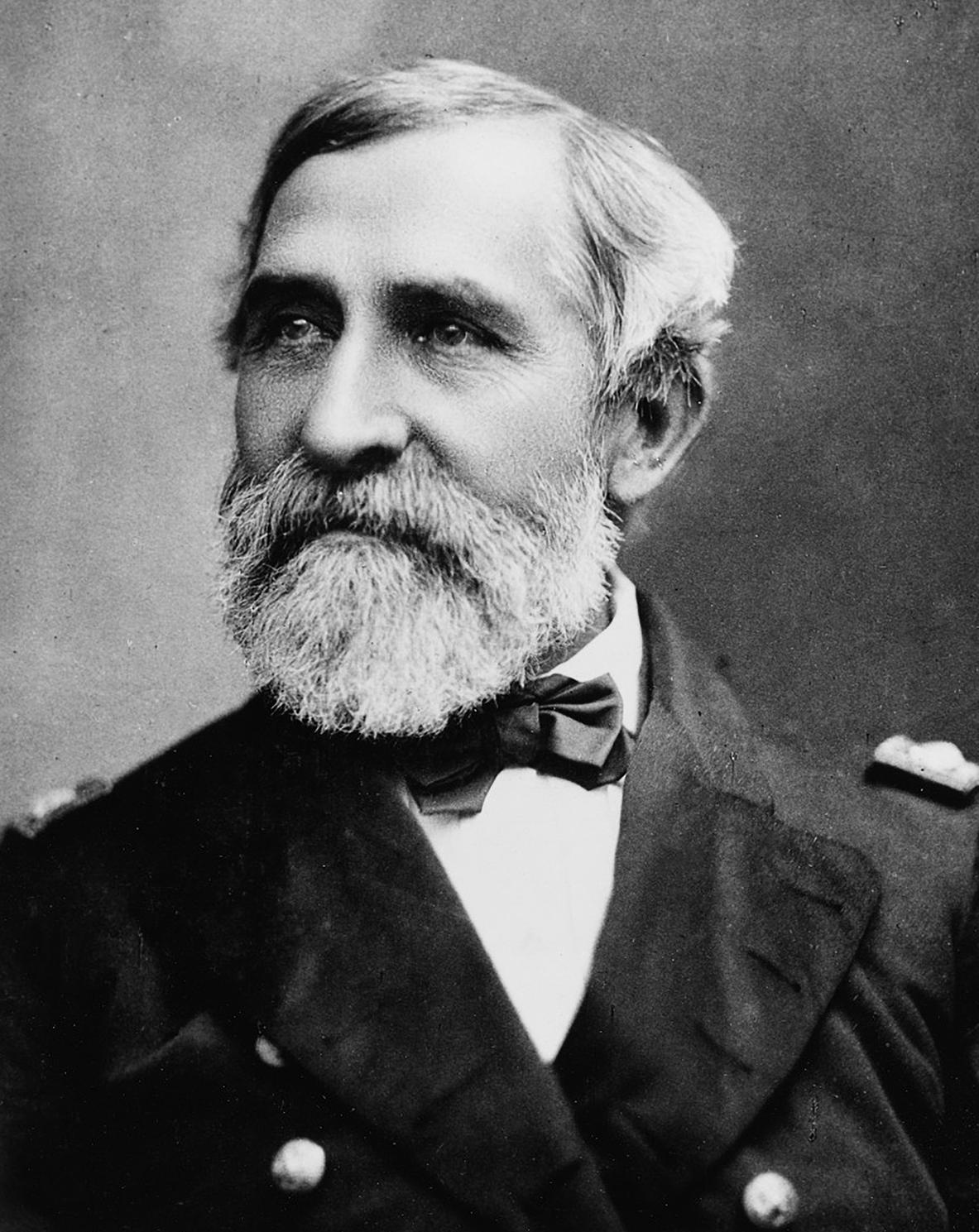
A Canoe Expedition Into the Everglades in 1842*
by GEORGE HENRY PREBLE Rear Admiral USN, 1816-1885.
*Reprinted from United Service, A Quarterly Review of Military and Naval Affairs, April 1883, pp. 358-376.
The following pages are a verbatim transcript of a penciled memorandum of events made by me from day to day while on an expedition across the Everglades, around Lake Okeechobee, and up and down the connecting rivers and lakes, in 1842. Now that it is proposed to drain the Everglades and open them to cultivation, and a dredge-boat is actually at work excavating a navigable outlet into Lake Okeechobee, this diary, which preserves some of the features of the country forty years ago, may have more or less historical interest. A New Orleans newspaper ( The Times Democrat ) describing the route of a party of surveyors, who had recently gone over very much the same routes as this expedition of 1842, only in reverse, states that it is the first time these regions have been traversed by white men, evi dently a mistake, as even this expedition of forty years previous was not the first that had visited Lake Okeechobee. General Taylor's battle was fought on the shores of that lake in 1837, and the Everglades had been traversed and retraversed by the expeditions of the army and navy before that.
Sprague's “History of the Florida War,” published in 1848, is the only work that mentions the services of the navy in that connection, and in its appendix there are tables exhibiting the casualties of the officers, seamen, and marines of the United States navy operating against the Native Americans in Florida and of the officers and marines who were brevetted. Cooper, in the continuation of his “History of the United States Navy” to 1856, makes no mention whatsoever of the Florida war, though the navy constantly shared in its hardships from 1836 to 1842, and its losses were proportionate to those of the army. Later writers of our naval history, taking Cooper's work as a standard authority, have been equally remiss. The naval history of the Florida war has yet to be written.
The expedition, my diary of which follows, was commanded by Lieutenant John Rodgers, who died only last May, a rear-admiral. The second officer in seniority, Lieutenant William L. Herndon, the father-in-law of President Arthur, as is well known, went down in the steamer “Central America,” preferring “certain death to the abandonment of his post,” and of the remaining officers, only myself and
February 2023 Page 8
Passed Midshipman Samuel Chase Barney (who is no longer in the service) are living. It is to be presumed that all, or nearly all of the seamen and rank and file of marines have passed away.
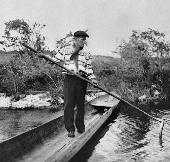
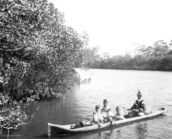
The “dug-out” canoes which formed our homes for the sixty days the expedition lasted were hollowed cypress logs, about thirty feet long and four feet wide, propelled by paddles, and steered by a broad rudder. At the stern was a locker about six feet long, which held our stores and ammunition, the latter sealed in glass bottles for preservation from dampness. On the top of this locker the officer spread his blankets and it formed his bed at night; the men sleeping on their paddles and thwarts, —a hard life at best. Each canoe was provided with a tent, a small square-sail made of ordinary cotton sheeting, and an awning.
The following is Lieutenant John Rodger's official report of the expedition, which this diary records and supplements:
United States Brig 'Jefferson,' Indian Key, April 12, 1842.
“Sir,—In obedience to your orders to proceed to the Oke-cho-bee and thoroughly examine the country adjacent, I have the honor to report that on the 15th of February I left Key Biscayne with a detachment of men from the 'Madison,' under Lieutenant Commanding Herndon; from the 'Jefferson,' under Passed Midshipman Preble; and of the marines, under Second Lieutenant Taylor. The examination was made, but, unfortunately, without any success. The Indian towns deserted, camps abandoned, and fields uncultivated, but only once did we get near the Indians. This was on Lake Tohopkeliga; but no sooner had the first canoe emerged from its outlet than a large fire sprung up on the opposite side of the lake. Thinking it impossible that we could have been discovered, the boats were carefully concealed, and at night we made the circuit of the lake, hoping to find the fires of the Indians. Failing in this, I went around by daylight, closely examining every nook upon the lake; but we had been seen.
“The Thlo-thlo-pop-ka, or Fish-Eating Creek, runs through an open prairie, to which it serves as a drain. As might be expected, it gives evidence of being in the wet season a large stream, but when I examined it the volume of water it discharged was very small. This stream is very tortuous, and sometimes swells into a river, and then dwindles into a brook. Its head is in a marshy prairie, where a number of streamlets run together about twenty miles in a straight line, due east to the Oke-cho-bee, but following the course of the creek about twice that
The Florida Surveyor Page 9
George Henry Preble
was born in Portland on 25 February 1816 to Enoch and Sally (Cross) Preble. Enoch was the older brother of Commodore Edward Preble. Both were sons of provincial Brigadier General Jedidiah and Mehitable Preble, early settlers of Portland. At nineteen, after working for several years as a bookstore clerk, George sought and received a midshipman’s warrant in October 1835. From 1836 to 1840 he cruised in the Mediterranean and West Indies on the United States, Warren, Macedonian, Levant and Erie. In 1841 after a sixmonth course of instruction at the Naval School in Philadelphia he was warranted Passed Midshipman and assigned to the Florida Expedition in pursuit of the Seminole Indians during the Second Seminole War.
Read More Here...
Courtesy of: https://www.history.navy. mil/research/library/research-guides/ george-henry-preble-collection-findingaid.html
distance. The banks of Fish-Eating Creek are covered with game, and its waters filled with fish.
“The Kissimmee is a deep, rapid stream, generally running through a marshy plain, but sometimes the pine land approaches its borders, and sometimes beautiful live-oak hummocks fringe its banks. The In-to-keetah, or Deer-Driving Place, is a pretty little lake, with an island of perhaps one hundred acres of very fine land. 'There,' said the guide, 'the Indians once lived in very great numbers, and many may yet remain;' so our boats were concealed, and we waited for night to make an examination, when the fires would point out the exact position of any party; but though appearances proved the first part of our guide's assertion, we
February 2023 Page 10
LAND WATER
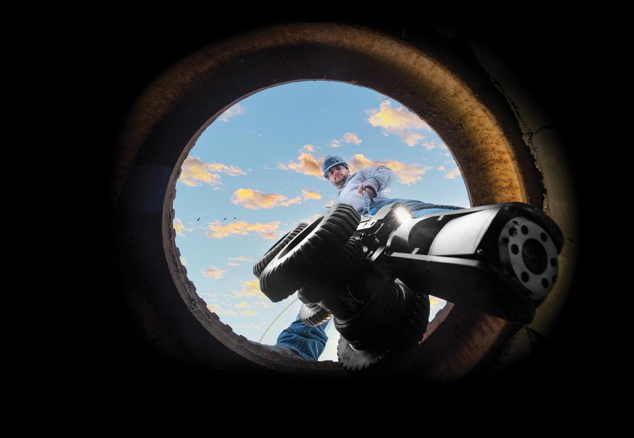
With the help of Frontier Precision, places you once couldn’t imagine measuring are now a daily reality. Frontier Precision leads the way in Unmanned technology – through the air, land, and underwater. Every place on earth is now reachable – with UAS from DJI, Autel, Parrot, Ascent, and ROVs, Pipe Crawlers, and Utility Crawler solutions from Deep Trekker. Count on us to deliver the latest technology to help you get your job done e ciently and accurately while driving your profits. Today, no mission is out of reach.


8301
FRONTIER PRECISION
JACKSONVILLE
|
Cyprus Plaza Drive,
FIND OU T M O RE A T : W W W .FRO N T IE RPRE C IS I ON.CO M / U N M A NN E D P R O DUCTS | T R AINING | RE PAIR | REN TA L S | T ECHNI C A L SE R VICE S AIR
#107 Jacksonville, FL 32256
found the town had been long deserted.
“The Kissimmee is, I think, the natural drain of the immense plains which form this part of the country; but though deep and rapid it is quite narrow. It is something strange that very often the surface of the river is covered by floating grass and weeds so strongly matted together that the men stood upon the mass and hauled the boats over it as over shoals. The Kissimmee runs into the Okecho-bee, which filters its spongy sides into the Everglades, whose waters finally, by many streams, empty into the ocean.
“On the 11th of April, we returned to Key Biscayne, having been living in our canoes fifty-eight days, with less rest, fewer luxuries, and harder work than fall to the lot of that estimable class of citizens who dig our canals. At Key Biscayne, the various detachments were disbanded, and returned to their several commands.
“Very respectfully,
“Your obedient servant, (Signed) “ John Rodgers, “lieutenant commanding
Hollowed out cypress log canoes similar to the ones used in Preble's expedition.
“Lieutenant J. T. McLaughlin, “Commanding Florida Expedition.”
The
Diary of a Canoe Expedition into the Everglades of Florida in 1842
Feb. 4, 1842.—At Indian Key, preparing for an Expedition into the Everglades; also rigging and fitting ship, having stepped a new foremast.
Feb. 12.—Left the Brig “Jefferson” at Key Biscayne at 4 P.M., in command of five canoes and twenty-two men; arrived at Fort Dallas at 7 P.M., and camped for the night on the left-hand bank of the river opposite. At 8 P.M. a detachment of canoes from the “Madison” came up and camped on our right.
Feb. 13, Sunday.—Capt. Rodgers came up at daylight and assumed command of the scout, arranged as follows: Staff, Lieut. John Rodgers Com’dg the Scout; Rob. Tansall, 2d Lt. of marines, Adjutant; Negro John, wife, and child, and John Tigertail, Indian Guide. 3 Canoes, 4 Sailors, 7 Marines.
1st Division, U. S. Sch. “Madison:” Lieut. Wm. L. Herndon Com’dg; Passed Mid S. C. Barney, Asst. Surgeon A. A. Henderson. 6 Canoes, 29 Men.
2nd Division, U. S. Brigantine “Jefferson:” Passed Mid. Geo. H. Preble Com’dg; Midshipman C. Benham. 4 Canoes, 18 Men.
3rd Division, Marines: 2d Lieut. R. D. Taylor Com’dg. 3 Canoes, 17 Men.
Recapitulation: 16 Canoes, 2 Lieuts., 2 Passed Mid., 1 Midn. 1 Asst. Surgeon, 2 Lts of Marines, 51 Sailors, 24 Marines, 1 Indian, 1 Negro, 1 Squaw, 1 Papoose. Total, 87 Souls.
At 8 A.M. The Expedition started up the Bay to the Nd; at noon entered the Rio Ratones, and followed its very winding course to the Everglades. Both banks of the river lined with mangroves. At 2 P.M. came to in the grass and dined. At sundown camped in the canoes under the lee of some bushes.
Monday, Feb. 14.—Valentine's day; under way at daylight. At 8 A.M. entered New River at its source; followed it down, and reached Fort Lauderdale at 11 A.M., in season to see it abandoned by the army. Pro cured an Indian Guide, and at 1 P.M. started up river. At 4:30, Came to on the Lefthand bank, and pitched our tents in an open pine barren with palmetto undergrowth.
Tuesday, Feb. 15.—Enroute again at daylight. At 8 A.M. entered the Everglades and stood to the Nd & Wd, through a generally broad and open trail. At 2 P.M. hauled into the grass and dined. The guide lost the trail several times and put back to find it. At 7:30 P.M. Hauled into the grass and camped in the canoes for the night. Observed the light of a fire in the S.E., and supposed it at our last night's camp.
The Florida Surveyor Page 13
Wednesday, Feb. 16—Under way at 6:30 A.M.; traversed an open trail; saw only two islets. Examined the first, and found that it had been cultivated. Dined under the shade of the second island. Weather disagreeable and rainy. At 5 P.M. Came to under the lee of a small clump of bushes, where we procured a quantity of Crane's eggs and camped in the canoes for the night. Course during the day to the Nd & Wd. The night silence broken by the screaming of Everglade Hens and Cranes, the bellowings of frogs, and the hooting of owls.
Thursday, Feb. 17—A cold morning, wind N.E. The word passed to follow on at sunrise. Course to the Nd & Ed through a bad trail, most of which we broke for ourselves through the saw-grass. At 10 A.M., saw high trees bearing per compass N.E. by E. Probably a part of the Alpatioka, or Cypress Swamp, bordering the pine barrens along the coast. Very few bushes in sight during the day. Lat. obs'd at noon 26 degrees 16' N. At sundown camped in the canoes around a small clump of bushes and posted sentry as usual.
Friday, Feb. 18—Warm and pleasant. Light airs from the S.E. At 7 A.M. got the canoes underway, and followed a northerly course during the day, but very winding. Our guides caught five Terrapins, and the men obtained several hats full of Crane's eggs. Had to break our trail most of the day, the men walking the canoes along. Our route through a portion of the glades plentifully besprinkled with bushes. Camped at sundown in the canoes under the shelter of some bushes, and made my supper off of some trout which had jumped into my canoe as we pushed along.
Saturday, Feb. 19—Warm and pleasant. Started at sunrise, course N.N.W., through an open and generally deep trail, the plain covered with short grass, fields of waterlilies, and low bushes. The Cypress in sight to the right N.E. Came to at sundown at a small island showing traces of an old Indian encampment; pitched my tent under a tall cabbage tree and had a tall sleep. Lat. at noon 26 degrees 38' N.
Sunday, Feb. 20—Warm and pleasant; wind S.S.E. Passed through open Everglades, no bushes. Cypress to the right. Tracked the canoes all day, and at times forced them through the mud and grass with the assistance of the crews of four canoes to each one. Lat. 26.27; course N.W. Our guides say the water in the Everglades is unusually low. Camped in the canoes in the grass; no fires allowed, and night rainy. Today officers as well as men have been compelled to wade in the mud, saw-grass, and water, and assist the sailors in dragging the canoes. Saw large flocks of white curlew.
February 2023 Page 14
Monday, Feb. 21—Morning thick and misty; underway with canoes at 7:30 A.M. Course generally N.W. to W. Thick, cloudy weather, with heavy showers of rain. Country an open prairie, with the Cypress on our right. Killed a black moccasinsnake and saw others; they are very numerous. Passed the remains of an old clinker-built canoe, probably an army-boat; broke it up for firewood. At sundown nearly surrounded by woods on the horizon, our course taking us along those to the N.E. The woods bordering Lake Okeechobee in sight in the N.W. Wind during the day N.E., but shifted about sundown to the N.W., bringing clear and cool weather. Camped in our canoes in the open grass. Saw during the day numerous flocks of wild birds,—curlew, cranes, blue-winged teal, crow blackbirds, swallows, &c.
Tuesday, Feb. 22—Washington's birthday. Morning air clear, and cold enough to show our breath. Wind N. N.W. At 4:30 P.M. left the Everglades, passed through a narrow belt of cypress swamp, hauled over a sandy ridge, and launched our canoes in the waters of Lake Okeechobee, or the “Bigwater.” Camped under what was once Fort Dulray, a cabbage-tree log fortress. The lake spread out before us, and to the Wd when the sun went down no land visible.
Wednesday, Feb. 23—Launched our canoes upon the lake through a rough surf and heavy swell. One of my canoes was swamped and capsized, losing everything—provisions, arms, clothing, and ammunition. Turned back and assisted the canoe to land, bailed her out, and started with her again; the other commands ahead; followed them along the coast of the Lake, and landed with them about two miles to the Sd & Ed. Was ordered by Capt. Rodgers to remain in charge of the provisions with the boats of my command and twelve men, one canoe, and five marines, while the remainder of the Expedition, taking provisions for six days, continued their cruise along shore. At 9 A.M. the Expedition departed with twelve boats and fifty-eight men, leaving me Midm Benham and four boats, with seventeen men. Commenced securing the provisions from the weather and devising means for our defense.
Thursday, Feb. 24—-Organized our camp, inspected the arms, and exercised the men. Commenced building a log fort of cabbage-trees, and had it three logs high when the Expedition unexpectedly hove in sight and suspended our labors. Before sundown it arrived at our camp, when I restored the marines to their proper commander and took my own division again. Benham shot a crow blackbird and a wood-pecker, and with their assistance we made a sumptuous dinner.
Friday, Feb. 25—My birthday. The canoes underway at daylight. Stood to the
The Florida Surveyor Page 15
Nd & Wd, coasting the Lake under sail. The guide's boat swamped; hauled into the grass and dined while waiting for the guide's boat to come up. At 4 P.M. discovered eight hogs on the beach; sent the guide in to shoot one. Heard a noise like wood-chopping (probably a hog rooting); sent the boats in, landed and armed the men, and dispatched each command on a scout. The “Madison's” men going across the country, the marines along the shore interiorly, and my command up the beach to the N.W. in search of Indian canoes. Discovered an old Indian encampment, apparently many months deserted. The guide shot one large hog and wounded another, a sow, which our officers ran down afterwards and captured. On the return of the scouts, Tansall, with twelve marines, was sent out again with orders to scour the country to the Everglades. He returned at 7 P.M., after a fatiguing march through mud and water, but without having effected his object. He reported the Everglades as approaching this portion of the Lake, and his discovery of a stream or river about a mile and a half north of us, and leading apparently into the Everglades. We are to explore it tomorrow. Camped for the night, and pitched our tents under a grove of cypress, maple, bay, and cabbage-trees. The beautiful moonlight contrasting with the dark recesses of the forest, and our camp-fires' glare upon the gray mossy beards which draped the trees, and our rough and rugged men in their careless costumes and still more careless attitudes, combined to make our bivouac a scene which Salvator Rosa would have been glad to have copied. Regaled on fried pork. Our men went the whole hog, and dispatched both animals to the skin and hoof. Punished one of my men, John Bath, with eighteen lashes for drunkeness and insubordination, and for endangering the safety of the whole command by his noise.
Saturday, Feb. 26-—Underway at 6:30 A.M. After refreshing with a “pot of coffee,” stood along the Lake to the Nd & Wd. About a mile up entered “Tansall's River,” bordered on both sides with large cypress and a young growth of maple—and bay-trees; about one-quarter of a mile up reached its head. The Madisons and Jeffersons were ordered to march; and we waded through cypress and willows up to our waists in water and mud about 200 yards and came to a belt of sawgrass which was at least fifteen feet high; waded fifty yards farther and reached the dry land,—a wide plain dotted with cabbage-tree and pine hummocks and a palmetto scrub; dense woods surrounding the entire horizon. Saw ten parroquets. On emerging from the grass the Madisons went off in a S. Easterly direction; the Jeffersons with me to the N.W. Marched six or eight miles over the plain. Examined several hummocks, discovered two long-abandoned encampments; found numerous trails of horse-tracks and footprints,—none of which our guide said were newer than three weeks. On our march started four deer; they stood
February 2023 Page 16
Dear Professional Surveyor,
The deadline to return completed continuing education courses is February 17th . With the end of the biennium approaching, we are receiving an influx of completed courses to process. Adhering to this deadline will ensure credits are reported timely to the State Board prior to your license renewal deadline of February 28, 2023.

If you need continuing education credits, please do not wait order today. Click on the links below for our list of courses. You can receive them by mail, email, or through our online learning service. If you have any questions please call our office at (850) 942-1900 or contact Sam Hobbs at education@fsms.org
Courses by Mail or Email
If you need continuing education credits, click the button below for a list and description of our correspondence courses. Courses can be either mailed or emailed. Emailed courses are usually sent later the same day or the following day depending on the current volume of orders.
eLearning Online
If you prefer learning online, click the button below to explore our eLearning courses. Just look for our logo and choose FSMS as your continuing education provider. Your support allows us to protect and promote our profession.
Correspondence Courses eLearning Courses
at gaze and looked at us. How tantalizing not to be allowed to shoot them! Returned to our canoes about 1 P.M. Turned down river and resumed our course along the coast of the Lake. The Madisons on their march discovered an old encampment. During the afternoon explored five creeks in search of canoes and Indians; discovered nothing to repay our trouble. Passed six or eight large Indian encampments of old standing, like those we visited in the forenoon. Our guides are of opinion they were all abandoned at the time the Indians entered the Everglades in 1837. Found the coast this afternoon gradually bending to the Sd & Wd. Crossed a deep bay in the Lake, making to the Nd & Wd. At dark came to in the bulrushes and camped in our canoes; night rainy, coast low and swampy, mosquitoes plenty. Oh Lord!
Sunday, Feb. 27—Warm and pleasant with light airs from the N.W. Underway at sunrise to Sd & S.W. Saw many alligators basking on the water, and immense flocks of white curlew and other birds. The coast of the Lake low and marshy, and bordered with sedges. Lat. at noon 27.02 N. Camped in our canoes around some small lumps of floating land, just enough to swear by and make a fire on. During the night saw the reflection of a large fire N.N.W. of us; supposed it the prairie fired by army scouts in that direction.
Monday, Feb. 28—Pleasant and warm, wind S.E. to E. Coasted the Lake to the Sd & Ed between isolated patches of marsh-grass. Land low and fringed with bulrushes. Lieut. Taylor in the afternoon discovered an old Indian canoe in shore and broke it up. Made sail at sundown and stood E.N.E., about three miles; hauled well into the grass and camped in the canoes. Killed a moccasin-snake. Made our supper on a “stewzee” of young cranes, water-turkeys, and fried eggs. Lat. at noon 26 degrees 50' N.
Tuesday, March 1—Warm and pleasant, wind E.S.E.; underway at sunrise; paddled until 10 A.M. to the E.S.E., and landed on a small sand beach. At 10 A.M. made sail and stood to the Nd & Wd on a return trail. Lat. at noon 26.55 N. At 4:30 P.M. reached our camp of night before last, passed it, and entered a creek to the Nd & Wd. Were soon stopped by floating weeds similar to heads of lettuce and came to with the canoes. The Madisons were sent on a march to the Sd & Wd in search of Fish-Eating Creek, and the marines in pursuit of a fire seen to the N.N.W. Sent five of my men to build a fire to guide their return. After a fatiguing march through saw-grass and water, both parties returned to camp about 9, entirely unsuccessful. At 9:30 heard the report of three muskets west of us; supposed them fired by the guides, who have not yet come up.
February 2023 Page 18
Wednesday, March 2—Marines ordered to prepare for a three days' march to the Nd & Wd in search of a fire seen in that direction. Myself, with six men, ordered to trace out a supposed creek. Capt. Rodgers accompanied me. Started, middledeep, in mud and water, and commenced our wade through the saw-grass towards an island about quarter of a mile distant. Reached it, puffing and blowing with our exertions. Climbed a tree and looked about for the creek; could discover none, though a line of bushes S.E. of us seemed to point one out. Heard the report of one musket, then another, and soon a third. Was ordered by Capt. R. to return and prepare for a push along the coast in the direction of the firing. Glad to escape a damp and tiresome march, turned about and reached the canoes about 9 A.M., and started down the creek and to the Sd & Ed picked up our guide about three miles down, and turned back, pushing into all the bays and inlets to discover the creek. Capt. R. ordered me to follow up an inlet and examine it; followed it out, pushing through fields of broad-leaved lilies and spatter-docks and came into the Lake again about a mile to the Sd. Made sail to return. Met Capt. Herndon with the Madisons near an “old cypress,” and was informed by him of the discovery of the creek, and that I was to go to the rendezvous and take charge of the marines' canoes, the marines being off on their march. Joined my boats about 5 P.M.
Thursday, March 3—Still camping in our canoes in the grass and weeds, no dry land neighborly. Read, smoked, and slept. At 11:30 received orders to join the remainder of the scout and bring the marines' boats along, men being sent me to man them. Got underway and stood up the Fish-Eating Creek to Fort Centre. The creek winding and deep. Arrived at 1 P.M. and found all the canoes there. The large fire still to be seen N.N.W. of us. Sent a canoe and four men to the Island to wait the return of the marines.
Friday, March 4—Pleasant, fresh breezes from S.E. Appointed Supt. of repairs and ordered to fill up gaps and put the Fort (a cabbage-tree stockade) in a state of defense. Cut trees and stuck them up like the others. Went to the mouth of the creek 6 miles west and observed the Lat., 27 degrees 04' N. On my return found the marines at the Fort, they having marched there. Sent for my boat. The coxswain on his return reported having found on the island several old houses, some pumpkins, and parts of half a dozen saddles, but no sign of recent habitation.
Saturday, March 5—Warm and pleasant. Left the Fort at daylight. Doctor Henderson with fifteen men and marines, and John Tigertail, sick, remaining behind. Proceeded up the creek with great difficulty, pushing the canoes through
The Florida Surveyor Page 19
the weeds, the creek for a space spreading out into a wide swamp. Saturday night remembered absent friends.
Sunday, March 6—After hauling the canoes over two troublesome places reentered the creek, a beautiful stream, clear, with a beautiful white sandy bottom. Pulled against the current to the Sd & Wd. Saw immense flocks of cranes, pink spoonbills, curlew, and wild turkeys in plenty. Also, a large number of alligators killed; killed two small ones and cut off their tails for eating; caught a soft-shelled and a hard-shelled turtle and had them cooked for supper, with a fry of some little fish that foolishly jumped into one of the canoes. Our camping-ground the prettiest by far that we have had. Two veteran cypress stretched their scraggy arms over our camp, draped in moss to the very ground. The day was rendered harmonious by the warblings of multitudes of feathered choristers, and the night hideous with the splash of alligators, hooting of owls, and screamings of a variety of unquiet night-birds.
Monday, March 7—Warm and pleasant. Left our beautiful camp at sunrise, pursuing the windings of the creek, which occasionally spread out to the appearance of quite a large river, but soon returns to narrow bounds. At 11 A.M. reached the head of the stream, which loses itself in a swamp. Dined and turned back. Permission to shoot was granted, and bang, bang, bang went the guns and pistols in every direction. At sundown landed and pitched our tents under a cypress grove, and feasted sumptuously on wild turkey, broiled and fried curlew, plover, and teal, stewed crane, grecian ladies and fried fish, our spoils of the day. The Astor House could not have supplied such a dinner or such appetites. Invited Capts. Rodgers and Herndon to our feast and illuminated our camp with three halves of spermaceti candles. Lat. 27.05 N.
Tuesday, March 8—Warm and pleasant; wind S.E. Breakfasted off the remains of our “Tarkey,” as my coxswain called it, and underway at daylight. Passed both haulovers with little trouble, leaving one to the left and the other to the right. Dined in the canoes in the grass. Passed an extent of prairie which had been burnt over since we passed up, and in places yet burning, which accounts for the dense smoke seen yesterday. After dining hauled the canoes through a narrow streamlet into a lily swamp; tracked them across it and bothered about until after dark searching for the creek; finally struck it and reached Fort Center, where only three boats had as yet arrived. Garrison well.
Wednesday, March 9—Pleasant and warm. The marines, canoes, and adjutants
February 2023 Page 20
did not come in until this morning. Served out thirty days' provisions to the men, and exercised them at Target-shooting. Discovered all hands were plaguey poor shots.
Thursday, March l0—Warm and pleasant. At morning muster and inspection discovered that Silas Soule and Jas. Gamble had deserted during the night, taking with them a musket, twelve cartridges, a quantity of provisions, and a bag of clothing. At 9 A.M. left the Fort in the canoes and stood down the creek. Passed Mid. S. C. Barney was left at the Fort with a garrison of twenty men, comprising all the sick, lame, and lazy. As we left the creek made sail and stood to the Nd & Ed. At 4:30 P.M. entered the Kissimmee River and stood up it. At 5:30 camped on the left bank in our canoes. The ground swampy. Transferred Mid. Benham to Capt. Herndon's division temporarily. At night very much annoyed by the mosquitoes. Benham's canoe swamped during the night and set him afloat in his bed, besides damaging all his provender.
Friday, March 11—Weather good. Started sun half an hour high up river. Saw large flocks of green parroquets and the prairie to the Wd on fire. The river rapid and deep with banks or “levees” thrown up by floods on each side and crowned with willow and mangrove bushes. Marshy fields beyond this narrow belt of banking. Paddled along until sundown, and camped on the left-hand bank. Supper, a “grecian lady” stewed; horrible cannibal that I am, found the “lady” a very good morsel. Mem. Grecian Lady, a water-fowl sometimes called “a water-turkey.”
Saturday, March 12—Pleasant. Pulled up-stream against a strong current; the banks continue marshy, with here and there a live-oak hummock. Passed beautiful magnolia-trees in full blossom. The pine barrens today approach both banks to within a quarter of a mile, and every minute the winding of the stream would appear to be leading us into them. At 11 stopped at a live-oak hummock, formerly full of Indians. We landed the marines about a quarter of a mile downstream to attack it in the rear, and pulled up cautiously with the remainder of the force; found it deserted, with no recent signs of habitation. Waited for the marines to come up; dined, and continued on up river. At 2 P.M. came to a pine-lot stockade, one of the numerous posts held by the army in times gone by. The enclosure was choked with weeds, logs had fallen out, and those yet standing were partially burnt down. Continued our route until sundown, and camped in a beautiful liveoak hummock. Supper, catfish and mollasses candy.
Sunday, March 13—During the morning a dense fog settled over the country and
The Florida Surveyor Page 21
FSMS LEGISLATIVE NEWS... AND A REMINDER ABOUT PAC DUES

Greetings FSMS Members!
Following the amazing success of last year’s Legislative efforts, it’s once again time to prepare for the upcoming Florida Legislative Session (March 7 through May 5). Our Committees, Lobbyists and PAC are working hard to ensure strong relationships with our elected leaders.
Simply stated, without the actions, efforts and policies of the Florida Surveying and Mapping Society, our profession would have long ago been de-regulated. That’s a bold statement, but it is a fact, and if you wish to continue as a regulated profession, we must continue to build our membership and re-load our PAC.
Please consider investing in the future of your Profession through a contribution to the FSM PAC. (Link to Contribution Page)
The Officers of the Florida Surveyors and Mappers Political Action Committee (FSMPAC) are Jack Breed (Chair), David Daniel (Treasurer), John Clyatt, and Don Elder.
Your FSMS Legislative Committee: Jack Breed (chair), John Clyatt, Sam Hall, Russell Hyatt, Brian Murphy, Ray Niles, Chad Thurner, Don Elder, Leo Mills, Dodie Keith, Randy Tompkins and Howard Ehmke (ex officio).

debarred progress. At 10 A.M. cleared off pleasant. Paddled all day against an increasing rapid current. The banks of the river lined with marshy weeds and tall canebrakes, with here and there a live-oak hummock draped with moss. Passed several old encampments. At 8 P.M. camped in the tall and rank grass under venerable live-oaks and maples. Supper, a stew made of three fledgling herons, purloined by our doctor from a nest.
Monday, March 14—Warm and pleasant. Commenced our route with the sun; Country much the same as yesterday, but the mangrove and willows seen more abundant. Saw immense flocks of curlew flying in two irregular columns, each apparently miles in length. Evening a heavy rain, which continued at intervals all night. Camped in a maple grove. Hauled over several places during the day where the bottom had fallen out, or, as one of our men remarked, where the grass was made before the land. Our men dragged the canoes of the whole command over grass and roots that choked the river in places where a fifteen-foot pole (the canoe's spirit) failed to touch bottom.
Tuesday, March 15—Cool and cloudy, wind N.E.; at 9 A.M. landed and examined a live-oak hummock where Indians had been dressing deerskins not more than two weeks back. At 9:30 landed at another hummock where was a large mound, out of which Fanny, the Indian wife of our Guide, assured us she had seen money, breastplates, and beads dug. Set the men to work with their paddles, promising them good current money for all they found in the mound; excavated quite a trench, but found nothing but a few bones and blue glass beads. At 10:30 landed on another hummock at the end of a pine barren and found recent traces of a large encampment, with horse and cow-tracks, &c. The guide killed a large raccoon. Halted half an hour and continued on up the river, which is bounded chiefly by willows and tall rushes; tide and wind in our teeth and hard to combat. At 8 P.M. halted the canoes in the grass and camped in them, there being no solid camping-place to be found. The river coquetted with us all the afternoon, leading nearly up to the hummock and then branching off again. No fires allowed, consequently no coffee.
Wednesday, March 16—A cool morning, but clear and pleasant. Up and away with the sun. At 10 A.M. camped in a live-oak hummock, where was once an Indian village; feasted on blackberries. One of our men killed a large rattlesnake with eight rattles; he was skinned, cooked, and eaten; I partook of a bit, just to be able to say I had eaten rattlesnake; found the meat very good indeed, and would have enjoyed a larger portion, but as it was the men's tidbit, did not like to deprive them
The Florida Surveyor Page 23
of it. At midnight we got underway and proceeded to an island on a lake, hoping to discover something to repay us for our night's work, as it once was a famous resort for the Indians. We reached the island at 2 A.M., and sent off two scoutingparties to surprise the enemy. At 3 A.M. the scouts returned without making any wonderful discovery. They found old encampments abundant. Punished Wm. Harding with twenty-four lashes by Capt. Rodgers's order for quarreling, and Antonio Cruize with six for laziness on my own responsibility.
Thursday, March 17—Pleasant. At daylight discovered on the opposite shore of the Lake something resembling two canoes; shoved out our canoes and gave chase. The canoes proved phantoms, the erection of the lively imagination of a boatswain's mate of the “Madison.” Returned to the island and camped for the day on the shore of the Lake neighboring it. Lt. Tansall with twenty-four men explored the island and returned at 8 P.M. with an Indian's knife and skull, which he had found in a grave. The island is called by the Indians In-to-ke-tala, or DeerDriving.
Friday, March 18—Easterly wind and foggy morning. At 8 A.M. crossed the Lake to its eastern shore. At 10 A.M. reached the marsh bordering the edge of the Lake and hauled the canoes into the grass. Started on a march with six of my own command and twelve marines. Marched across a fine grass prairie for a couple of miles as we judged and examined four live-oak hummocks. On all four discovered traces of old encampments, and through one the appearance of a wagon-trail; no recent signs. Started a bear and gave him chase, but Mr. Bruin ran too fast for us (not being permitted to fire at him) and lodged in a palmetto scrub three or four hundred yards off. Surrounded and closed in upon it with the men and endeavored to beat him up, but our shaggycoated gent managed to elope unseen. Got back to the canoes about 1 P.M. Camped in the grass at sundown. Punished Meade by Capt. R.'s order for making a fire without permission. Lat., noon, 27 degrees 51' N.
Saturday, March 19—Pleasant; underway at sunrise; pulled or paddled around the bend in the Lake, and entered the Kissimmee on its N.W. shore at 9 A.M. Paddled two hours more. The pine barrens shaking hands with the banks of the river. Came up with the remains of a large stockade (Fort Gardner) in a live-oak hummock and mostly burnt down. At noon the creek spread out into another Lake, surrounded by piney woods and live-oak hummocks; dined under the shadow of one of the latter and resumed our route across the river. At 4:30 hauled up the canoes and camped in the pine barren. Went with ten men to the Wd on a scout in search of the stream. Benham sent on a similar scout to the East. Returned to our camp at sundown, having marched about four miles, over pine
February 2023 Page 24
barrens and through swamps up to our waists in water, but no stream. Benham was fortunate enough to find the object of our search. During the evening a lone “chuck-a-will's widow” informed me many times and very distinctly whose relict she was, and a saucy owl was very impertinent with his “who-who-who are you?” Started two beautiful spotted fawns on my march. Read for light reading and to pass the hours the Books of Ezra, Nehemiah, and Job!
Sunday, March 20—Thirty-six days out. Started at 6 A.M. through the grass in search of Benham's stream; entered, pulled a few miles, crossed another small lake, and entered the stream once more from its N.E. extremity. The stream winding, narrow, and rapid. Dined under a moss-drooping cypress. Afternoon: Stream winding through tangled bushes, interlaced from either bank; outlet of Lake Tohopeteliga; found there fresh moccasin tracks and roots newly dug, the ground still freshly turned as if hastily abandoned; pieces of orange-peel were strewed about. A short distance down-stream we passed an Indian hut and pumpkin-field. The moccasin tracks appeared those of a man, wife, and child,—a little child had evidently been playing with the sand. Saw horse-tracks up the beach, and found several old houses. Hauled into the shore by advice of our guide in the outlet and maintained perfect silence. At 4:30 saw a fire kindled on the opposite shore of the lake, took its bearings, and after dark put out upon the Lake and stole cautiously up towards the fire, in the vain hope of capturing Indians. Landed the marines and marched them through the prairies to the fire; pulled ahead with the canoes and waited for their coming up, prepared to assist them on hearing any firing. At 12 midnight reembarked the marines and continued our course around the Lake until 3 A.M., when we hauled in shore and camped in the canoes, tired out with our night's work and bound to sleep sound for the few hours allowed us to.
Monday, March 21—Warm and pleasant. At 10 A.M. got underway and pulled to an island in the center of the Lake and camped. The Madisons separated and camped at an island two miles distant. Our camping-place was quite a sizeable island, having the ribs and remains of two Indian villages, with cornfields and watermelon-patches, and tobacco growing, and a number of bitter and sour orange-trees in full fruit; filled our boats with the latter. At sundown the Madisons joined us and at 10 P.M. we got underway and stood over to the shore, and finished the circumnavigation of the Lake at 2 P.M. Camped again at the outlet.
Tuesday, March 22—In camp all day at the outlet of Lake Tohopeteliga. Did up a quantity of sleep to make amends for last night's unrest. Caught a quantity of
The Florida Surveyor Page 25
catfish and had them served up both fried and stewed. Allowed the men to bathe.
Wednesday, March 23—Cloudy morning, afternoon clear and pleasant. At sunrise started to circumnavigate the Lake. Capt. R. and my division with the marines going around the right. Capt. Herndon with the Madisons to the left. Lat. at noon 28.11 N., one hundred and fifty-one miles north of Fort Dallas, at the mouth of the Miami, whence we started. At 4 P.M. our divisions were reunited opposite the island where we camped two days back and we made sail in company to cross the Lake. Reached the outlet a few minutes after dark and camped. Dined at a live-oak hummock, where we found an old saddle (probably the saddle of some expressrider) and the remains of two oxen. Robbed the birds' nests as we paddled along of sixteen young cranes. Each of the canoes equally well supplied. Capt. Herndon in his journey saw the remains of another Indian village. Our supper, a stew, broil, and fry as usual of late.
Thursday, March 24—Left the outlet of Lake Tohopeteliga to return down the Kissimmee. Morning overcast with premonitory symptoms of rain. Noon pleasant and hot; dined where we dined on the 19th. Camped on the S.W. shore of Lake Intokeetalah, near Fanny's island; a fine, dry sand beach. Killed a small rattlesnake which crawled up to our fire. Our supper, fried fish and fried hard-tack. The sunset very beautiful, dark-purple clouds piled up and tinged with gold. The sun's lower disk, just before it reached the horizon, appeared below the lower edge of a large cloud, and shot up its brilliant rays far above it; the ruddy sky beneath, and the dark pines reflected in the placid Lake, and a light fleecy cloud soaring above all, invested by our fancies with the shape of our eagle emblem, completed a beautiful scene.
Friday, March 25—Underway at sunrise. The morning air deliciously fragrant; camped at early sundown in one of the live-oak hummocks which we passed on the 14th. All hands permitted to bathe. Supper, bird-stew as usual. Killed a rattlesnake with four rattles.
Saturday, March 26—Pleasant. Started sun half an hour high. Passed most of the bad places going up. The current takes us along full two days' journey in one. Robbed the nests of over thirty young birds, and had a famous stew of cranes' livers. Camped under bushes on the right-hand bank. Our camp surrounded by beautiful and fragrant flowers. Found a snake-cast on top of a tree; it was over six feet in length.
February 2023 Page 26
Landed at the Indian mound and resumed our diggings. Found a few glass beads and abundance of human bones, but none of the needful.
Sunday, March 27—Morning slightly overcast. Underway, sun an hour high. Dined at the old Fort where we killed a rattlesnake as large around as my arm and five feet long; it had twelve rattles. The guide said, “big enough to kill a deer instantly.” My division captured forty cranes and water-turkeys, and three young alligators. Supper as usual. Camped under moss-hung maples.
Monday, March 28—Pleasant. Underway at sunrise. At 1 P.M. entered Lake Okeechobee, having been eighteen days on the river and lakes. Dined in the grass along shore. Made sail to a stiff breeze, and from being the rearmost boat passed ahead and reached Fort Center before sundown, where but four of the canoes arrived before me. The others had to camp on the Lake. All well at the garrison, with plenty to eat. Supped on venison-steak and salmon "kipper."
Tuesday, March 29—Pleasant. The rest of the canoes arrived about 9 A.M. Exercised the men at Target-shooting; no good shots. Benham went with the guide on a shooting excursion and set fire to the prairie with flint and steel. Tonight it is burning for miles around; a grand spectacle. During our absence from the Fort, the guide's Indian wife, Fanny, went into the woods and gave birth to a stillborn infant; buried it herself and returned to camp, and resumed her usual duties.
Wednesday, March 30—Pleasant; evening cool. Benham and Taylor are to remain at Fort Center with the provisions until sent for, and keep garrison with twenty men. Glad it is not me,—want my letters. The prairie still on fire. Was much edified with Fanny's Indian method of preparing deer-skins for moccasins with a stick.
Thursday, March 31—Left Fort Center at sunrise to return, leaving behind Taylor, Benham, twelve marines, and eight sailors. Provisioned our canoes for twenty days. Made sail on the Lake; explored a bay at its N.W. angle, and Live-Oak Creek, so called. Camped under the cypress. Mosquitoes thick, and no sleeping for them. Willis, one of my men, very sick; had my tent pitched for his accommodation and did without. The Lake very rough.
Friday, April 1—Underway at sunrise. Heavy showers of rain and wind, and S. Easterly weather. Examined four creeks and reached Fort Dulany at 4 P.M. Hauled up the canoes high and dry and camped in them. Tomorrow we are to try
The Florida Surveyor Page 27
Florida Surveying and Mapping Society is asking
The
its Members to send us any photos from their professional surveying career in Florida. We would like to include them in our future presentations and publications. If interested, please send your photos to communications@fsms.org
Cabinet Card - CA 1920. Courtesy of Joe Rohan
the Everglades again. Bathed in the Okeechobee for the last time I hope. One of my men made me a cigar of some chewing tobacco, which I smoked with a gusto.
Saturday, April 2—Thick and cloudy morning. Heavy rain during the day. Launched our canoes through the cypress and commenced dragging them along. At 4 hauled in to a pine barren and camped. A wet night. Killed another rattlesnake.
Sunday, April 3—Morning cloudy; day April-like. Dragged our canoes the whole day through mud, water, and saw-grass. John Tigertail, the guide, off shooting. Lost the trail about noon and frittered away the whole afternoon finding it. Camped in the grass, about four miles from our last night's camp, and near the northern part of the Alpatioka Swamp, the favorite resort of Sam Jones and Bill Bowlegs.
Monday, April 4—Pleasant. Killed two moccasin snakes. Our guide shot two Everglade hens. Saw two deer. They stood gazing at us some time, and then loped off, stopping to gaze and wonder who we were. My Division captured twenty blue cranes, almost full grown, one hardshell turtle, one terrapin, and a small alligator. Lots of grub for all hands. Lat. at noon 26 degrees 52' N. Our course about S.E. Saw a large smoke in the cypress bearing East. Dragged the canoes along by main force all day. Camped in the canoes at sundown.
Tuesday, April 5—Pleasant. Underway at sunrise. Dragged the canoes, and in several places with fifteen men to each canoe, officers assisting. Captured a boatload of cranes and other young birds. Lat. obsd 26.46. Camped in the canoes in the grass. Killed a large black moccasin snake. Supper, turtle-stew.
Wednesday, April 6—Pleasant morning. Underway at 6:30 A.M. to S.E., dragging the boats. Clumps of bushes abundant in place of the naked prairie. At noon shipped my rudder, and we commenced paddling for the first time since leaving the Okeechobee, pushing, dragging, and paddling by turns all day. At sundown camped with Tansall's two boats around a small clump of bushes and dry land. Madisons and Capt. H. camping around a similar one. Supper, fried bread, fish, and crane's eggs, and stewed crane.
Thursday, April 7—Underway with the sun. Course S. Easterly all day. Country plentifully sprinkled with bushes. Passed several large “Keys,” crowded with white cranes, their nests and eggs. Pushed or paddled ahead as occasion required. Several trout jumped into our canoes and were transferred to our frying-pans,—
The Florida Surveyor Page 29
foolish fish. Speared several large alligator-gars. Camped in our canoes around bushes at sundown. Night showery; anything but pleasant; wet blankets and their surroundings.
Friday, April 8—Paddled all day; course about S.E. Captured forty white cranes and might have taken a thousand had I wanted, and hats full of eggs; also a dozen water-turkeys and some fish. The Cypress in sight, extending from N.E. to S.W. Camped in the Cypress; sun an hour high; slept in my canoe.
Saturday, April 9—Pleasant. Pulling and dragging alternately the canoes along the edge of the cypress swamp. Water extremely low. At 10 A.M. lost Tansall and his division, and at early sundown camped in the young cypress. Saw a smoke about four miles west of us; probably our lost boats.
Sunday, April 10—Pleasant. Underway at sunrise, dragging the canoes over dry land and saw-grass, at times using “all hands” to a single canoe. Tansall's canoes came up about 8 A.M., after being lost all night. At 12 entered the creek which forms the source of “New River.” Dined. Passed down the north branch and at 4 P.M. camped at Fort Lauderdale for the night.
Monday, April 11—Left Fort Lauderdale at 8. Passed over the bar at the entrance of New River without damage and stood along the coast under sail twenty-five miles. Passed outside Bear's Cut and inside Key Biscayne, arrived on board the Brig early in the afternoon. Glad to get back and to receive letters and news from home. My boat the first to get alongside; most of the canoes grounded and had to wait the rising of the waters. Thus ended our expedition of fifty-eight days in canoes after Sam Jones, during which Lt. Rodgers says in his official report we had “less rest, fewer luxuries, and harder work than fall to the lot of that estimable class of citizens who dig our canals.”
Tuesday, April 12—Got underway, ran down the reef, and anchored at Indian Key. Lat. Key Biscayne 25.41 N.
On the 16th of April I find noted in my diary, “On the sick-list, foot badly inflamed and legs ulcerated; poisoned by the saw-grass of the Everglades and exposure to the mud, through which we dragged our canoes, and the effects of the sun.”
“April 20, moved on shore at Indian Key to the officers' quarters for medical attendance.” I will here state that the doctors at one time thought that the
February 2023 Page 30


National Surveyors Week March 19 - 25, 2023 send County/City/State Proclamations to communications@fsms.org
amputation of both limbs would become necessary, and it was more than two years before all the sores were healed, and for years after I felt the effects of these sixty days in a dug-out canoe in Florida.
This expedition into the Everglades was the last in which I participated. I had been on others of shorter duration previously. On the 11th of May, Captain Rodgers left on another scout, taking his first lieutenant, Johnston Blakely Carter with him, leaving me in command of the brig during his absence. The expedition returned on the 17th. On the 4th of June the schooners “Wave” and “Flirt” arrived from Havana, bringing us news that the President of the United States had proclaimed the “Florida War” at an end. On the 9th of July McLaughlin's “Mosquito Fleet,” consisting of the “Flirt” (flag), “Madison,” “Jefferson,” and “Van Buren,” sailed for Norfolk, Virginia, leaving the schooners “Phenix,” Acting Lieutenant Commanding C. R. P. Rodgers, and “Wave,” Acting Lieutenant Commanding J. C. Henry to follow, after settling all outstanding matters.
Previous to the departure of the squadron the following General Order was read to the officers and crews:
“
General Order”
“The commendation and appreciation of the services of the Florida Squadron embodied in the annexed extract from the official communication of Col. Worth to the adjutant-general of the Army is of so exalted a character, when the source in which it emanated is considered, that the commanding officer cannot withhold it from the officers he has commanded. “
“ ‘I trust I may be permitted on this occasion to express my respectful and grateful sense of the cordial and efficient co-operation rendered on all occasions and under all circumstances from Captain McLaughlin and the gallant and accomplished officers, who have ever aimed at rivaling the zeal and devotion of their admirable commander, and I feel assured that the general-in-chief will learn with gratification that the utmost cordiality and confidence has prevailed between both branches of the common service, whether united on land or on the water. I am most happy on this occasion to express my personal obligations.
“
‘Very Respectfully,
February 2023 Page 32
‘Cedar Keys, June 20, 1842.
“ ‘Your obedient Serv't, (Signed) “ ‘W. J. Worth, “ ‘col. commanding.
“ ‘To the adjutant-general U. S. Army, Washington, D. C.’
“To Lt.–Com’dg John Rodgers, “Com’g U. S. Brig ‘Jefferson,’ “Indian Key. “July 2, 1842.
“Sir,—In compliance with the request of Col. Worth, I have the pleasure to communicate to you, for your information and that of your officers and men, the annexed extract from his letter of June 21, 1842.
“Respectfully, “John T. McLaughlin.
“ ‘Headquarters Army of Florida,
“ ‘Cedar Keys, June 21, 1842.
“ ‘On parting with your young and accomplished comrades, I beg you to convey and make acceptable to them the high professional and personal respect I have the honor to entertain for each. The commendation of an old soldier can do no harm, and it is for me only to regret the humbleness which gives no warrant for a more decided expression of all that is due to their gallant and uncalculating devotion in a service as painful as thankless. May God protect you and your country promote you is the sincere prayer of
“ ‘Most Truly Your Friend, “ ‘Wm. J. Worth.
“ ‘Capt. McLaughlin, “ ‘Com’dg, &c.,
“ ‘Naval Forces, Coast of Florida.’ ”
The night after leaving for the North, when off Cape Canaveral the “Jefferson” was struck by a heavy squall from the westward, which carried away the foretop-mast
The Florida Surveyor Page 33
in the cap, and also under the eyes of the topmast rigging, the maintopmast at the same moment going with it a few feet above the lower cap. All hands were at once called to “clear wreck.” The “Madison,” Lieutenant Commanding Herndon, seeing our disabled condition and thinking we had been struck by lightning, bore down within hail to our assistance. Being nearsighted, he misjudged the distance, and ran into our starboard waist, carrying away the main-chains, waist-boat, hammock-rail, and wheel, and crushing in our bulwarks down to the water-ways, and, as afterwards ascertained at Norfolk, breaking twelve frame timbers. The “Madison's” bowsprit was carried away by the collision. We fired a gun as a signal of distress to the “Flirt,” and employed the remainder of the night in clearing away the wreck and getting sail on the ship. The night was Egyptian in its darkness, which was enlivened with sheets of ragged pink lightning. The squall must have been limited in extent, as none of the other vessels in company were at all injured by it. Without further mishap or adventure the squadron anchored for Hampton Roads on the 18th of July, 1842.
When we were dismasted off Cape Canaveral I was below and on the sick-list from the effects of my recent canoe expedition, but when I heard the collision with the “Madison” I scrambled on deck, but was immediately sent into the cabin by Lieutenant Rodgers, who told me I could only be injured and of no use where I was. Very soon he came down into the cabin, bringing with him the deck timepiece, which had been knocked into a cocked hat, so to speak, by the collision. Cool as he ever was in time of danger, and without the least sign of excitement, he commenced putting the clock together, and, turning to me, said, humorously, “Preble, I don't mind being dismasted, for that may happen to every one who goes to sea, but to be kicked in the stern by my friend afterwards is too bad.” No doubt the collision was caused by Lieutenant Herndon being near-sighted, and thinking the vessel had way on when she had not. His intent was good, but the result was disastrous to both vessels.
February 2023 Page 34

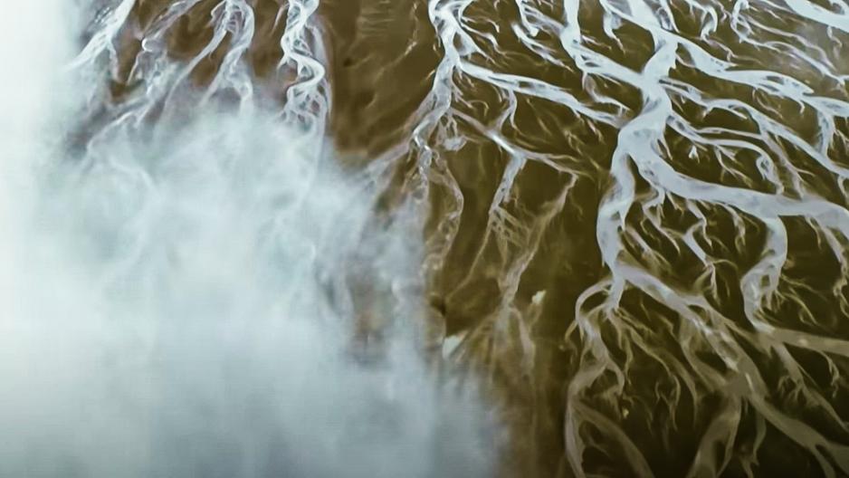
UNIQUE EARTH : The Essence of Water


February 2023 Page 36
2023 eLearning Courses
6 General CEC - $99/course (members)
$120/course (non-members)
• History of Surveying
- Course #7140
• Identification of Native & Non-Native Trees in Florida
- Course #8132
• Ethics for the Design Professional
- Course #8621
• Land Tenure & Cadastral Systems
- Course #8260
• Map Projections & Plane Coordinate Systems - Course #8261
• Public Land Survey System
- Course #7147
• Remote Sensing Applications to Surveying & Mapping
- Course #7148
• Practical Geometry for Surveyors
- Course #7141
3 General CEC - $49/course (members)
$70/course (non-members)
• Basics of Real Property
- Course #8360
• Elevation Certificates & the Community Rating System
- Course #8256
• Introduction to Photogrammetry
- Course #7968
• Writing Boundary Descriptions
- Course #8362
The Florida Surveyor Page 37
Florida Surveying & Mapping Society 1689 Mahan Center Blvd. Suite A Tallahassee, FL 32308 www.fsms.org (850) 942-1900
Florida Surveying and Mapping Continuing Education Provider Offering 25 Years of Dedication, Quality & Trusted Services
Step 1: Choose Course(s)
3 Hour Courses Available
□ A History of the Prime Meridian Marker,
□ Basics of Real Property
□ Digital Signatures for Surveyors
□ Easements and Rights of Ways,
□ Elevation Cert
□ Introduction to Photogrammet
*2020 UPDATED COURSE
□ Quality Assurance/Quality Cont , #9293, 3 CEC
□ Writing Boundary Descriptions
6 Hour Courses
□ Boundaries in Florida
□ Chapter 177, Platting (Plat Law)
□ Critical Communication for Surveying & Mapping Professionals
□ Ethics for the Design Professional
□ Florida Laws
□ Florida Surveying Law and Rule Changes
□ Geographic Information Systems (GIS)
□ History of Surveying,
□ Identification of Native and Non-Native Trees in Florida
□ Land Tenure and Cadastral Systems
□ Map Projections and Plane Coordinate Systems , #7669, 6 CEC
□ Practical Geometry for Surveyors, #7109, 6 CEC
□ Public Land Survey System, #6979, 6 CEC
□ Remote Sensing Applications to Surveying & Mapping, #6972, 6 CEC
*2020 UPDATED COURSE
February 2023 Page 38
Billing Address of Credit Card:
IF PAYING BY CHECK, MAIL FORM TO: FSMS, P.O. Box 850001-243, Orlando, Florida 32885-0243
IF PAYING BY CREDIT CARD, FAX OR EMAIL FORM TO: 850.877.4852 education@fsms.org QUESTIONS? CALL 800.237.4384
The Florida Surveyor Page 39 Step
FSMS Member EMAILED Fee Quantity Amount 6 CEC $115 Per Course x = $ 3 CEC $58 Per Course x = $ MAILED 6 CEC $125 Per Course x = $ 3 CEC $68 Per Course x = $ TOTAL $ Non Non Name: _ YES _ NO Firm: ____ _ YES _ _ NO Address: ______________________________________________________________________________________ City/State: Email Address: Work Phone: Payment
to FSMS) _ VISA/MasterCard/American Express Card
Exp. Date: __ CVV Code:___________
2: Choose Member Type
Information: ___ Check Enclosed (Payable
#: _______
______________________________________ Signature: _____________________________________ __
Provider No. CE11 fsms.org
Please email communications@fsms.org to notify us of upcoming events.

Advertise With Us!
All advertisements contained within the publication are published as a service to readers. Publication of the advertisements does not imply or express any endorsement or recommendation by FSMS.
Benefits: Full color; hyperlinks added to your webpages as well as email addresses.
Requirements: Contracts for one year (11 issues) receive 10% discount if paid in advance; 15% for Sustaining Firms. (Ads should be in jpeg, pdf, or png format)
New ads and/or changes are due by the 25th of each month.
February 2023 Page 40
Size 1 Issue 2-11 Issues Full Page $720 $395/issue 1/2 Page $575 $320/issue 1/4 Page $290 $175/issue
202 3 S u S taining
Berntsen International 608-443-2772

Betsy Lindsay, Inc. 772-286-5753
Bock & Clark Corporation(NV5) 330-665-4821 Bowman Consulting Group 703-454-1000
Bradshaw-Niles & Associates, Inc. 904-829-2591
Barraco & Associates, Inc. 239-461-3170 Bartram Trail Surveying, Inc. 904-284-2224
Bello & Bello Land Surveying Corporation 305-251-9606 Benchmark Surveying & Land Planning, Inc. 850-994-4882
Brown & Phillips, Inc. 561-615-3988 BSE Consultants, Inc. 321-725-3674 Buchanan & Harper, Inc. 850-763-7427
A
Allen
Allen
American
Amerritt,
Ardurra,
Associated
3002 Surveying 352-538-1320
A. D. Platt & Associates, Inc. 850-329-5551 AIM Engineering & Surveying 239-332-4569
& Company, Inc. 407-654-5355
Engineering 321-783-7443
Surveying, Inc. 813-234-0103
Inc. 813-221-5200
Inc. 239-292-7773
Land Surveying & Mapping, Inc. 407-869-5002 Avirom & Associates, Inc. 561-392-2594 Axis Geospatial SE, LLC. 410-822-1441 B Banks Engineering 239-939-5490 Barnes, Ferland and Associates, Inc. 407-896-8608
C
Carter Associates, Inc. 772-562-4191 Caulfield & Wheeler 561-392-1991
Chastain-Skillman, Inc. 863-646-1402
Coastal
CHW Professional Consultants (Causseaux, Hewett & Walpole, Inc.) 352-331-1976 CivilSurv Design Group, Inc. 863-646-4771 Clements Surveying, Inc. 941-729-6690
Engineering Associates, Inc. 352-796-9423 Colliers Engineering & Design 732-383-1950
F irm S Directory
Collins Survey Consulting, LLC.
863-606-2155
Compass Engineering & Surveying, Inc.
727-822-4151
Cousins Surveyors & Associates, Inc.
954-689-7766
CPH Consulting, LLC
407-322-6841
Craven-Thompson & Associates, Inc.
954-739-6400
Culpepper & Terpening, Inc.
772-464-3537
Donald W. McIntosh Associates, Inc.
407-644-4068
Donoghue Construction Layout, LLC. 321-248-7979
Douglass, Leavy & Associates, Inc. 954-344-7994
DroneView Technologies 248-321-9417
DSW Surveying & Mapping, PLC. 352-735-3796
ER Brownell & Associates, Inc.
305-860-3866
ETM Suryeying & Mapping
904-642-8550
Exacta Land Surveyors, Inc.
866-735-1916
EXP Energy Services Inc.
305-213-9969
Fortin, Leavey, Skiles, Inc.
305-653-4493
Frontier Precision Unmanned 701-222-2030
F.R.S. & Associates, Inc. 561-478-7178
ECHO UES, Inc. 888-778-3246
DeGrove Surveyors, Inc.
904-722-0400
Dennis J. Leavy & Associates
561-753-0650
Eda Consultants, Inc. 352-373-3541
Element Engineering Group, LLC. 813-386-2101
Ferguson Land Surveyors
727-230-9606
First Choice Surveying, Inc. 407-951-3425
Florida Design Consultants, Inc. 727-849-7588
FLT Geosystems 954-763-5300
Ford, Armenteros & Fernandez, Inc.
305-477-6472
GCY, Inc. 772-286-8083 GeoData Consultants, Inc 407-732-6965
Geoline Surveying 386-418-0500
Geomatics Corporation 904-824-3086
Geo Networking, Inc. 407-549-5075 GeoPoint Surveying, Inc. 813-248-8888

D
E
F
G
George F. Young 727-822-4317 GPI Geospatial, Inc. 407-851-7880 Gustin, Cothern & Tucker, Inc. 850-678-5141 H Hanson Professional Services, Inc. 217-788-2450 Hanson, Walter & Associates, Inc. 407-847-9433 H.L. Bennett & Associates, Inc. 863-675-8882 HUB International 850-386-1111 Hyatt Survey Services 941-748-4693 I I.F. Rooks & Associates, LLC. 813-752-2113 J John Ibarra & Associates, Inc. 305-262-0400 John Mella & Associates, Inc. 813-232-9441 Johnston’s Surveying, Inc. 407-847-2179 K KCI Technologies 954-776-1616 Keith and Associates, Inc. 954-788-3400 L L&S Diversified, LLC. 407-681-3836 Land Precision Corporation 727-796-2737 Landmark Engineering & Surveying Corporation 813-621-7841 Leading Edge Land Services, Inc. 407-351-6730 Leiter Perez & Associates, Inc. 305-652-5133 Lengemann Corp. 800-342-9238 Leo Mills & Associates 941-722-2460 Long Surveying, Inc. 407-330-9717 M Manuel G. Vera & Associates, Inc. 305-221-6210 Massey-Richards Surveying & Mapping, LLC. 305-853-0066 Masteller, Moler & Taylor, Inc. 772-564-8050 McKim & Creed, Inc. 919-233-8091 McLaughlin Engineering, Co. 954-763-7611 Metron Surveying and Mapping, LLC. 239-275-8575 Mock Roos & Associates, Inc. 561-683-3113 Moore Bass Consulting, Inc. 850-222-5678 202 3 S u S taining
F irm S Directory
Murphy’s Land Surveying 727-347-8740 N Navigation Electronics, Inc. 337-237-1413 Northwest Surveying, Inc. 813-889-9236 O On The Mark Surveying, LLC. 321-626-6376 P PEC Surveying & Mapping 407-542-4967 Pennoni Associates, Inc. 863-594-2007 Perret and Associates, Inc 904-805-0030 Pickett & Associates, Inc. 863-533-9095 Platinum Surveying & Mapping, LLC. 863-904-4699 Point Break Surveying 941-378-4797 Polaris Associates, Inc. 727-461-6113 Porter Geographical Positioning & Surveying, Inc. 863-853-1496 Q Q Grady Minor & Associates, PA 239-947-1144 R Reece & White Land Surveying, Inc. 305-872-1348 Rhodes & Rhodes Land Surveying, Inc. 239-405-8166 Richard P. Clarson & Associates, Inc. 904-396-2623 R.J. Rhodes Engineering, Inc. 941-924-1600 R.M. Barrineau & Associates, Inc. 352-622-3133 S SAM Surveying & Mapping, LLC. 850-385-1179 SCR & Associates NWFL Inc. 850-527-1910 Sergio Redondo & Associates, Inc. 305-378-4443 SGC Engineering, LLC. 407-637-2588 Shah Drotos & Associates, PA 954-943-9433 Sherco, Inc. 863-453-4113 Southeastern Surveying & Mapping Corp. 407-292-8580 Stephen H. Gibbs Land Surveyors, Inc. 954-923-7666 Stoner Inc. 954-585-0997 Surveying & Mapping Inc. 239-340-2409 SurvTech Solutions, Inc. 813-621-4929
202 3 S u S taining
F irm S Directory
T2 UES Inc. 407-587-0603
Tectonic Engineering and Surveying Consultants
845-534-5959
Thurman Roddenberry & Associates
850-962-2538

TranSystems Corporation Consultants
727-822-4151
Wade Surveying, Inc. 352-753-6511
Wallace Surveying Corp. 561-640-4551
Wantman Group, Inc.(WGI) 561-687-2220
WBQ Design & Engineering, Inc. 407-839-4300
Woolpert, Inc. 803-214-5928
SOCIAL MEDIA LINKS
LinkedIn = 304 Followers
Facebook = 754 Followers
Twitter = 325 Followers
Instagram = 153 Followers
YouTube
UF/IFAS School of Forest, Fisheries, and Geomatics Sciences
352-846-0850
Upham, Inc.
386-672-9515
ZNS Engineering, LLC. 941-748-8080
T
U
W
Z
Why Join FSMS?
LegisLative support –The Legislative Committee and our Lobbyist are committed to keeping the Public and the Surveying and Mapping Profession protected
educationaL Benefits –With recently updated courses, getting your CECs has never been better
networking –Attend our Annual Conference to meet other professionals and meet vendors with all the latest equipment
sociaL Benefits –Attend local chapter meetings to meet individuals with common professional goals
Aug/Sept 2021 30
CLICK HERE TO JOIN! Florida Surveying & Mapping Society 1689 Mahan Center Blvd. Suite A Tallahassee, FL 32308 www.fsms.org
942-1900
(850)
It’s About Time - For a National Resilient Timing Architecture
Presentation by RNTF President Dana A. Goward
ATIS “Time and Money,” NY Stock Exchange, 17 January 2023
“It’s about time.” Have you ever noticed that when someone says that they really mean, “It’s late. This should have happened long ago”? That has always been my experience.
Time is a funny thing.
Einstein discovered time is relative. The faster you go, the slower time goes.
I discovered when I was in government that bureaucrats can do Einstein one better. Many can actually make time stand still just by holding a meeting.
The guy who owns Viking Cruise Lines tells us that time is the only scarce commodity, so we better get on one of his boats.
And recently some physicists and philosophers have argued that time doesn’t really exist.
In the book “About Time - The History of Civilization in 12 Clocks” David Rooney says that time, or at least measuring time, is a method of control, specifically controlling people.
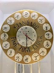

He tells a story from the year 263 BCE.
The Roman general Manius Valerius Maximus was a returning war hero. One of the things he brought back as a trophy after conquering Sicily was a sundial. He had it mounted on a pillar with his name at the forum and the crowds cheered wildly. Soon there were sundials everywhere.
But soon after that, no one was cheering. The sundials were scheduling people’s days and regulating their activity. People were complaining. One playwright wrote:
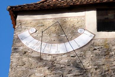
The Florida Surveyor Page 47
The gods damn that man who first discovered the hours, and yes, who set up a sundial here, who’s smashed the day into bits for poor me. When I was a boy, my stomach was the only sundial, by far the best and truest compared to all of these. It used to warn me to eat… but now I don’t eat unless the sun says so. The town is so stuffed with sundials people crawl along shriveled up with hunger.
Another writer called sundials “hateful” and said they should all be destroyed. But it was too late. The efficient Roman Empire had suddenly gotten a lot more efficient.
And that is really the beginning of how and why we find ourselves here.
Regardless of whether time is real or not, timekeeping certainly is. We can reach out and touch clocks. We can see records of events listed by hours, seconds, often nanoseconds.
Timekeeping allows us to understand history – we can place events that have already happened in their proper order. It gives us some control of the future by letting us schedule sequences of events to come. It makes modern life possible.
Over the centuries we have created better and better methods of timekeeping.


Judith Olson at ColdQuanta says her best device can measure down into ten to the minus 18th. That’s one quintillionth of a second, or one atto-second. A measurement that she admits, for now, is probably meaningless.
This better and better timekeeping has made us more and more efficient. We split data packets, divide up spectrum, cram more into less.
Timekeeping is a centerpiece of capitalism as we know it. The world’s first stock market was established in 1611 in Amsterdam. Its clock was central to operations. From the very beginning trade was constrained to that place and limited to certain times. This ensured it was efficient, since all the buyers and sellers would be together, and fair because no one would be left out.
February 2023 Page 48

Today our financial regulators require milliseconds, network providers need microseconds, and Andy Bach demands nanoseconds.
Soon everyone will likely want more. And the technology will continue to provide. It seems the possibilities are endless and the future bright.
But there are serpents in the garden of our timekeeping Eden. Two of them, actually.
The first is the serpent of over-dependency, complacency, and false trust.
While all of you undoubtedly know the provenance, quality, and assurance of your timing feed, few others do.
For most of the nation, timing comes from a single source, the Global Positioning System. GPS satellites, as you know, are suites of atomic clocks connected to a radios that transmit time signals.
GPS signals and equipment can be easily interfered with and too often are. Frequently this is first detected by errors in GPS-time-based navigation applications.
Most interference is accidental, transient, and localized. But that doesn’t mean it is benign.
For example, in 2019 a commercial passenger aircraft was flying in hazy conditions toward what they thought was the Sun Valley, Idaho airport. Because of a spurious interfering signal from somewhere, they were really flying directly toward a mountain towering high above them. Fortunately, a sharp-eyed radar controller hundreds of miles away helped avert tragedy.
For malicious actors, things are pretty easy. Delivery drivers defeat fleet timing and tracking with a $30 device ordered off the internet. For just a few dollars more, criminals can get a device that will shift time and location to lure those drivers into areas where they can be easily hijacked. The government of Mexico says 85% of all cargo thefts involve a GPS disruption device of some kind.

February 2023 Page 50
Compounding all of this, most folks don’t even know they are vulnerable. If something goes wrong with our technology – what is the first thing we think? Not that the tech is faulty. We say, “I wonder what I did wrong.”
In 2011, Todd Humphreys showed how manipulating time in an exchange could enable someone to reverse the trade sequence, allowing them to sell something before they bought it, potentially reaping millions. Now, twelve years later, I am confident exchanges and the core financial industry have multiple resilient time sources and sufficient algorithmic protections to prevent that from happening.
Yet 99% of retail financial service customers are outside the New York, Chicago, and San Francisco core financial enclaves. Most likely lack authenticated and resilient time. For them, over-dependency, complacency, and false trust are still real issues.
The second serpent in our timing tech Eden is that resiliency and synch, at the moment, tend to be local (or relative) and costly.
Synchronization has enabled innumerable applications and technologies over the last 30 years. Can you imagine how we could have cell phones without precise time synch?
Yet, in the absence of a sufficiently accurate, resilient, and widely distributed national time scale, that synchronization has tended to be intra-system, rather than to an external common standard.
This adds a layer of complexity and difficulty when systems try to operate nationally and/or with each other.
It also inhibits innovation, makes those without great timing more vulnerable, and limits sales of some equipment and services to the few users and environments which already have authenticated, and resilient timing.
It also means synch is more costly and difficult for innovators and startup entrepreneurs.
Over 150 years ago the railroads realized they needed a common time reference so they could operate nationwide, efficiently, and avoid conflict. In 1883 they created the U.S.
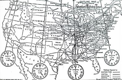
The Florida Surveyor Page 51
time zones to synchronize operations across the industry and the nation.
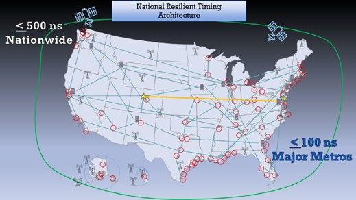
We are approaching a similar moment with technology. Our technology needs to operate nationwide, efficiently, avoid conflict. We need to synchronize operations across industries and the nation. To do this we need to democratize precise timing.
Easily accessed national timing at an acceptable level of precision will be required if America is going to foster innovation and keep finding efficiencies to improve the way we operate.
So… it’s about time for a Resilient National Timing Architecture.
No surprise, this is something we at the Resilient Navigation and Timing Foundation have supported for quite a while. In fact, we even published a white paper on the topic in October 2020. We followed it up the next year with a second paper on how the government could lead establishment of the architecture easily and inexpensively.
While we urge government leadership, we don’t think the government should build anything. There are more than enough companies that can provide timing services more economically, and efficiently than the government ever could.
The government should support the effort with commercial contracts and subscriptions.
Our proposed architecture provides multiple diverse methods of delivering time that could be accessed by as many Americans as possible. It includes fiber connections, suites of existing atomic clocks, at USNO, NIST, national labs and elsewhere, L-band signals from space, and terrestrial broadcast.
It turns out that we weren’t the only ones who thought that. Three months after we published our paper, the Department of Transportation released its report on GPS Backup Technologies. They also said the nation needed L-Band from space, fiber, and terrestrial broadcast.
And even though the government agreed with us, I still think we got it right. � � �
February 2023 Page 52
Also agreeing with us is a group of CEOs and senior executives from major telecom companies acting as the National Security Telecommunications Advisory Committee or NSTAC.
In their May 2021 report to President Biden, they discussed GPS vulnerabilities and threats, urged establishment of a national timing capability, and funding. They recommended a structure, and I quote:
“…similar to that reflected in the Resilient Navigation and Timing Foundation’s paper entitled “A Resilient National Timing Architecture.” Further, to enhance the ability of commercial entities to afford leveraging this architecture, the Administration should appropriate sufficient funds to lay the foundation for creating this timing architecture, with the Federal Government being the first customer for what will ultimately become a resilient, interconnected network for PNT delivery.”
A very few in government, notably in the Office of Management and Budget, assert that government involvement and leadership is not needed. A resilient national timing architecture will grow organically as a result of free market forces.
This is clearly wrong for a host of reasons.
Among the most important is that there are no commercial incentives to create this kind of fundamental tech infrastructure for broad adoption and use. As the NSTAC mentioned in its report, it is not possible to compete with free GPS.
Even if it were, the kind of broad adoption needed to ensure innovation and national resilience would be stifled by charging fees for basic, utility-level timing.
And even if such an architecture did arise organically as a result of market forces, would it really meet the nation’s needs?
The internet is fundamental tech infrastructure that arose organically, without any guidance or requirements to safeguard public welfare. Are we happy with how the internet turned out? Anonymous trolls, ransomware, elections influenced. Society whipsawed by foreign actors seeking to undermine our values? Yeah, probably not the model we want to follow.
The Florida Surveyor Page 53
As much as it pains me to say it, some kind of government policy and financial leadership is needed to make a resilient national timing architecture happen. That was recognized by the capitalist CEOs that make up the NSTAC and has been reinforced by industry groups since then. It’s about time for us to establish a resilient national timing architecture. And we need to do it together in a way that benefits the nation’s long-term interests. Fortunately, we have government employees who we pay for just this kind of thing.
Unfortunately, they haven’t been tasked to even start this necessary work. It is up to us to insist they are.
I urge all of you to become involved in this discussion through ATIS, your own government relations departments, as expert and informed individual citizens, and/or as members of the RNT Foundation. If you are interested in doing so, RNTF member or not, please contact us. We are eager to support your efforts.

As an example of a near term opportunity for you to tell the government what you think, NTIA is asking for comments on how it should spend $1.5B to further deployment of 5G and secure its supply chain.

We think establishing a resilient national timing architecture, which could probably be done for less than $100M, would support all seven activity and goal areas listed in the announcement.
We are happy to share the comments we have submitted to NTIA if they will help you frame your thoughts and comments.
As Americans we are privileged and benefit immensely from living in an open, democratic society. At the same time, we all have a duty as citizens to protect that society and foster the common good.
Everyone in this room has an impressive resume. You each are expert in your fields. You each have specialized knowledge and understanding of things about which most policy makers don’t have a clue. You have a duty as a citizen to share your knowledge with leaders and help assure the nation’s future.
February 2023 Page 54
Let our government leaders know - it's about time to establish a powerful tech heartbeat for America. A resilient national timing architecture.

It is always a privilege to visit and speak with this august group. Thanks for having me back again.
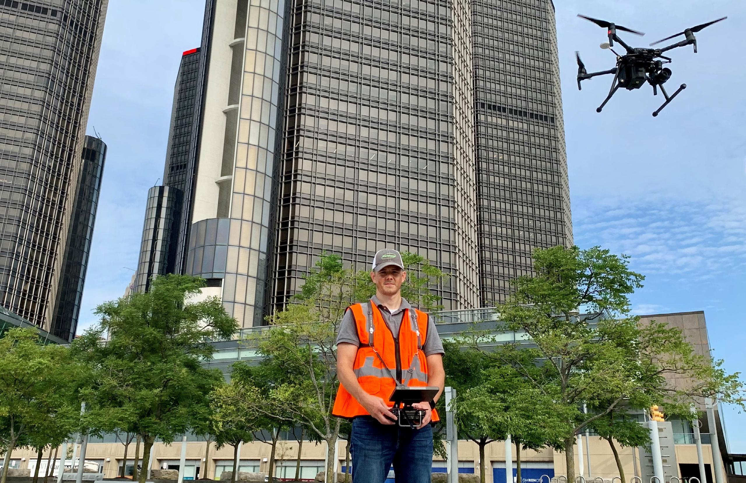
The Florida Surveyor Page 55
• Civil/Site Design • Construction Engineering • Construction Materials Engineering & Testing • Energy • Environmental, Health, and Safety • Geotechnical • MEP • Structural • Survey & Geospatial • Transportation • Urban Planning & Design • Water Resources • Water/Wastewater PARTNERS FOR WHAT’S POSSIBLE www.pennoni.com Join our Survey Team in Florida today!
Reference Epoch Coordinates

In Blueprint for the Modernized NSRS, Part 3: Working in the Modernized NSRS (NOAA Technical Report NOS NGS 67), also called “BP3,” NGS outlined plans for computing reference epoch coordinates, or RECs. These RECs will provide a snapshot of coordinates at reference epochs, with the first one being 2020.00. In the last two years, significant research has been done behind the scenes toward providing RECs, which is highlighted below.

RECs will resemble coordinates from NAD 83 (2011) epoch 2010.00, with many small differences and three significant ones. First, RECs will be geocentric, unlike NAD 83 coordinates. Second, random errors in the deformation model (IFDM2022) will be propagated into the observations as they are projected through time (Contrast this with NAD 83 (2011) epoch 2010.00 where HTDP was treated as errorless.) Third, RECs will include orthometric heights, estimated by first adjusting all geometric data and then constraining the national leveling dataset to the geometric coordinates (using GEOID2022).
To address the issue of propagating errors in the deformation model, a number of research papers are being written. Central to these papers will be a multivolume paper titled The multi-epoch least-squares adjustment problem (or ME-LSA) that derives the equations necessary to combine observations and constraints at multiple epochs into a single adjustment at one reference epoch, including rigorous propagation of errors from a deformation model. Another paper
exploring the role of covariances in the ME-LSA problem will provide detailed equations for the cases when none, some. or all covariances are available within the deformation model.
The conclusions found in these papers, and others, have been applied to the TRANS4D model, transforming it into IFDM2022 Beta v0.1.
The availability of an early IFDM2022 model means that NGS can now perform some experimental national adjustments for the estimation of RECs. Some things will be entirely new, such as the geometric adjustment combining all data from the NGS IDB with the previously unintegrated data from the OPUS-Share database. When those adjustments are complete, they will be used as constraints in the first national leveling adjustment since the release of NAVD 88, 32 years ago.
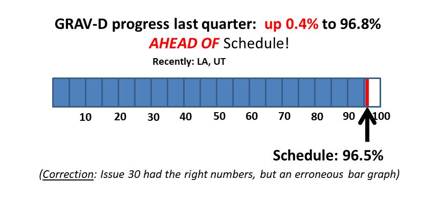
In the next year, NGS will release all of the aforementioned papers, and preliminary “alpha” RECs. Stay tuned!

February 2023 Page 56 Issue 31 January 2023
Join NGS at the 2023 FIG Working Week in Orlando, Florida
NGS is excited to announce that we will be presenting a full-day’s worth of content on the National Spatial Reference System (NSRS) Modernization during the FIG Working Week 2023 meeting, taking place at the end of May 2023 in Orlando, Florida. For the first time in over 20 years, this annual gathering of the International Federation of Surveyors will be taking place in the United States, hosted by the National Society of Professional Surveyors (NSPS). Click here to register now!

“The International Federation of Surveyors (FIG) is a United Nations and World Bank recognized non-governmental international professional organization. FIG was founded in 1878 and represents national associations of surveying, cadastre, valuation, national mapping professionals, geospatial experts and quantity surveyors working in both the public and private sectors, in the scientific, research and academic community, as well as from technology innovators and industry from more than 120 countries around the world.”
The 2023 Working Week will be an exciting week-long conference that brings the international community of surveying and geospatial professionals together for a mix of technical sessions and workshops, a trade exhibition and a variety of side events and
The Florida Surveyor Page 57
social functions.
On Wednesday, May 31, 2023 , NGS Director Juliana Blackwell will give a keynote address to the full conference and NGS staff will host a series of sessions on our efforts to modernize the U.S. National Spatial Reference System. More information will be posted to the NGS FIG 2023 webpage as it becomes available.

We encourage you to attend as much of the Working Week as you can, and be sure to join us on the Wednesday after Memorial Day to talk to NGS staff about NSRS Modernization.

February 2023 Page 58
ARCHIVES FROM THE
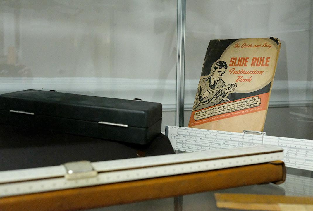


The Florida Surveyor Page 59
The Status of Surveying and Mapping Education in the United States of America (1971)
National Report to FIG Commission II
Thirteenth International Congress of Surveyors
Wiesbaden, Germany, September 1–10, 1971
By ROLLAND L. HARDY, DR.—ING.
professor of civil engineering, iowa state university, ames, iowa and
BROTHER B. AUSTIN BARRY, F.S.C.
professor of civil engineering, manhattan college, new york, new york
American Congress on Surveying and Mapping
(Originally published June 1971 in Surveying and Mapping)
Introduction
Our past national reports for FIG have been concerned with efforts to recognize and perhaps, incidentally, to influence the development pattern of surveying education in the United States. Areas of special concern were pointed out in the 1965 and 1968 FIG reports. Among these areas of concern was the tendency of U.S. universities to emphasize graduate programs while neglecting to develop workable undergraduate programs. Correcting this has been slow, but the emergence of a full spectrum of surveying education is now evident in the United States, ranging from programs to prepare technicians, through programs for the technologist, scientist, and
engineer, to programs for the advanced professional levels (graduate education). The several existing ways of preparing for a career in surveying and mapping are discussed herein. Generally, they are presented in an order of increasing comprehensiveness and adequacy in achieving a solid academic base for the profession.
Quasi-Apprenticeship
While formal apprenticeship is not used as a basis for entering the surveying profession in the United States, certain practices for the proper development of technicians have nevertheless been applied to the higher professional development. Consequently, an informal
February 2023 Page 60
or quasi-apprenticeship still exists as a major source for filling the ranks of registered professional surveyors and mappers (geometres).
Employees at the technician level in the United States ( e.g., rodmen and chainmen) and at the technologist level (e.g., instrument-men and party chiefs) are frequently developed by onthe-job training. Some such employees are graduates of short courses in trade schools or of the new two year technician or technology programs, though these sources are not yet fully developed. Because the four-year baccalaureate programs in surveying and mapping have been virtually nonexistent, there has been a tendency to overextend on-the-job training to the professional level. A contributing factor has been the failure by many in the profession to distinguish adequately between technician and professional activity. Thus, unfortunately, quasi-apprenticeship still plays a significant role in preparing practitioners for professional practice, despite the obvious inadequacies of such an archaic system.
One measure of the significance of the quasi-apprenticeship role in developing surveying and mapping practitioners is the number of persons registered professionally solely as surveyors versus the number of persons registered as both engineers and sur veyors. In 1960 these two groups were about equal, around 14,000 in each. The non-engineer
group has grown by nearly 50 percent in ten years, whereas the number of engineer-surveyors in a combined role has remained almost static since 1960. The “surveyors only” group, now numbering more than 20,000 (1970), has developed, for the most part, through the apprenticeship route. With few exceptions these men are not college graduates, and with fewer exceptions they are not engineering graduates; otherwise they would also be registered as professional engineers, which is characteristic. Four-year programs in sur veying at the university level oriented toward professional surveying education have not been in existence long enough to reduce significantly the quasi-apprenticeship source of nominally professional surveyors.
The "civil engineer-surveyor'' group, which is virtually the "universityeducated surveyor" group, is no longer a majority among registered surveyors. Nationally it has lost ground percentagewise for many years, attesting strongly to the impotence of the civil engineering curriculum generally as a source of professional surveyors.
Civil Engineering Curriculum
The traditional civil engineering preparation for a career in surveying and mapping acquired long ago a recognition by the public and by educators in general, which today is no longer deserved. These comments pertain directly to the undergraduate level
The Florida Surveyor Page 61
Status of Surveying and Mapping Education in the United States (1971)
DID YOU KNOW?
The oldest blood to date was found in Siberia from a baby horse dating back 42,000 years.
This is not fiction but a rare discovery unearthed by an international Russian-Japanese expedition team. The team unearthed the permafrost-preserved foal inside the Batagaika depression and took it to the Mammoth Museum in Yakutsk, Russia, for further examination. The conditions under which the foal was found and dissected make it one of the rarest paleontological finds.
Source
February 2023 Page 62
42,000-year-old foal preserved in permafrost
of instruction. The steady attrition of surveying courses in the C.E. curriculum during 60 years and the relatively recent technological developments in surveying tend to make civil engineering obsolete as a practical preparation for a professional career in surveying and mapping. Only five or six semester hours of surveying are now required in the average civil engineering curriculum. Unfortunately, reduction to this level is often accomplished without consciously changing the goals of the curriculum, so that many civil engineering departments mistakenly believe they meet the goals of professional surveying education. Even if it were technically possible (which is extremely doubtful), the approach fails psychologically; civil engineering graduates have not been attracted in numbers to the dual professional civil engineer-professional surveyor role.
Some civil engineering curricula do provide a few professional-level surveying courses at the undergraduate level on an elective basis. Few students choose this route; the contrast between professional surveying and civil engineering courses is probably too great for them to maintain interest in both simultaneously. Regardless of the reasons, no profession as distinctive as surveying has survived on electives in another curriculum. There is no reason to believe that surveying will become an exception. It is a healthy sign that more and more civil engineering educators are seeing the need to redefine the
goals of surveying instruction within the civil engineering curriculum leaving the way open for the development of separate and distinct goals of surveying and mapping instruction as needed for a professional career. This amounts to a belated recognition and partial fulfillment of the recommendations made by the American Society of Civil Engineers in 1959.
Typical goals of the required surveying courses in the civil engineering curriculum should be:
(1) to provide an overview of the general surveying field.
(2) to develop an appreciation of the relationship of the fundamentals of professional surveying practice to the planning, design, and detailed construction of civil engineering projects.
If civil engineering educators expect by a minimal course program to develop sur veying professionals, they are reading more into these goals than has been intended. What is intended is a servicecourse approach, analogous in concept to the retention of a course in geology for engineers in the civil engineering curriculum. In the case of geology for engineers, there is no false pretense that the course will develop more than a technical appreciation of geology—it will certainly not produce a professional geologist. The same should be true of courses in surveying for civil engineers.
The Florida Surveyor Page 63
in the United States
Status of Surveying and Mapping Education
(1971)
Unfortunately, the surveying and geology analogy breaks down in practice. The courses in geology for engineers are normally taught by professional geologists outside the C.E. department, whereas the courses in surveying for civil engineers are taught by civil engineers. Moreover, many such civil engineering teachers, because their own preparation was inadequate, simply do not recognize a meaningful distinction between technician and professional-level activity in surveying. This failure makes the traditional goal of professional education in surveying within civil engineering doubly difficult—in fact, impossible in the long run.
Civil engineering, of course, is providing and will provide many graduates who continue their education in surveying as an adjunct of civil engineering practice. In the recent past the education in surveying for many civil engineers has been substantially gained through selfstudy and quasi-apprenticeship. The civil engineer of the future will possibly be able to benefit from newly developing programs designed for surveying technologists and for surveying professionals. With this benefit will come a challenge. The “free ride” of civil engineers into the ranks of surveying professionals is coming to an end; the profession of surveying wants higher academic and professional standards. It will affect civil engineers who want to be surveyors also; they will have to work harder at being both if they insist on the
traditional dual role.
Associate Degree Programs
The number of two-year technology programs in surveying and mapping in the United States is steadily increasing. Perhaps a dozen such programs currently exist (1971). Successful completion of such a program results in an Associate in Applied Science, Associate in Technology, or similar degree. These programs provide various amounts of surveying specialization, usually approximating 30 semester hours, nearly half the total program. The graduates of these programs are called technicians or technologists by the sponsoring academic institution, although the titles in practice vary widely and do frequently include the title of engineer. Invariably, these graduates are the “doers” in a surveying and mapping organization; they perform, not the more mundane activities of rodmen and chainmen, but rather, the instrumental, computational, and related higher level activities. In former times these positions were, along with drafting and similar activities, the first job assignments of a junior engineer. However, today's engineering graduate is usually prepared for a different entrance level and, in any case, is at a distinct disadvantage in competing with the graduates of the technician program, where the emphasis is on “how-to-do” with a “hands-on” approach to surveying technological activity. The new technology student learns his job
February 2023 Page 64 rolland l. hardy and brother b. austin barry
in an educational environment with stress on field laboratory practice and with emphasis on the directly applicable details of completing and checking of land, engineering, and related surveys.
There is a prevalent misconception that the surveying technologist will be a member of an engineering team supervised by the professional civil engineer. This may happen frequently during an interim period because of a shortage of four-year graduates qualified in surveying, but the role of super visor will ultimately go to the surveying professional. This can be a civil engineer who has qualified himself in both fields; more likely it will be a twoyear technology graduate who acquires considerable and varied experience, and who somehow continues his education by self-study or other means. One other means being developed is the four-year technology program; at least one college in the United States has both two-year and four-year technology programs in survey engineering. Many schools already sponsoring two-year technology programs in surveying are expecting soon to enlarge their offerings to the four-year level.
Bachelor Degree Programs for the Surveying and Mapping Profession
There are now at least six bachelordegree programs or curricula in professional sur veying in the United States. Most of these are really not technology programs as described
above but, rather are preparation for high-level careers in surveying and mapping, geodetic science, land surveying, photogrammetry, and others. They bestow degrees in science, engineering, or technology, but all have in common a major area of study approximating 30 semester hours. The courses are normally taught at a higher theoretical and professional level than a similar number of hours in any two-year technician or technology programs.
A major identifying aspect of these professional four-year programs, which is a healthy sign, is the understanding that a surveying-mapping career is not a secondary activity in another career. Surveying-mapping has the potentiality for full academic and professional development in its own right. In fact, there are indications that the greatest success will go to those schools who succeed best in stressing the uniqueness and independence of surveying as a career. It is worth noting also that this separate identity for surveying-mapping curricula and programs has been achieved in at least two engineering colleges, thus bearing out in a limited way a prediction that was made in the l965 National Report to FIG.
Graduates of bachelor-degree programs in surveying will probably develop into all-purpose surveying professionals. The programs seek to provide a broadly based knowledge of surveying and mapping, contrasted with the limited
The Florida Surveyor Page 65
Status of Surveying and Mapping Education in the United States (1971)

Status of Surveying and Mapping Education in the United States (1971)
and specialized aspects that are possible when surveying is given a secondary role in another curriculum. Consequently the graduates of these new curricula should find a variety of opportunities with consulting firms involved in aerial surveying and mapping, in land surveying, and in engineering surveys. Research, development, and testing of geodetic and photogrammetric equipment for government and industrial organizations offer a career. Public land surveys, natural resources exploration, environmental detection and control surveys, land-use studies, subdivision design, and many related matters will become natural areas for applying this surveying and mapping expertise.
Therefore, graduates of the broad professional-level surveying-mapping programs, during the next generation, should become the mainstay of the surveying and mapping profession. In combination with the developing twoyear technician-level programs, the fouryear or higher professional programs will replace quasi-apprenticeship and the civil engineering curriculum as the sources of professional practitioners.
Graduate Degree Programs
Of course, the super-specialist, the teacher, and the researcher are needed in surveying as surely as in other areas of developing technology. For providing expertise at the needed advanced professional levels in the United States, there are in the universities at least a
dozen master's programs and a halfdozen doctoral programs in geodetic science, geodesy, photogrammetry, surveying, geometronics, and related areas. Graduate programs are faring better than the corresponding undergraduate programs since they have been in existence longer and there is need for relatively few students.
Conclusion
It is seen that a full spectrum of possibilities exists in the United States today to provide for the academic and professional development of practitioners in surveying and mapping. A major problem has been the slowness of the evolutionary and scattered development in contrast to an orderly arrival on schedule according to a preordained plan. Many areas of the country are well developed in their surveying education, whereas other areas are seemingly entangled in the archaic quasi-apprenticeship system or with the false theory that surveying is necessarily a secondary activity in another career.
On the whole, there is reason for optimism: success is breeding success. The profession is beginning to absorb the initial output of the two-year technician programs and, to a lesser degree, the graduates of four-year professional programs. Generally speaking, it is learning to accept and value the know-how of these new people. Making comparisons with the
The Florida Surveyor Page 67
older traditions of surveying education, the profession likes what it sees in the new and is becoming impatient with what it sees in the old. In the process the profession is learning to make distinctions between the various levels and goals of surveying education as enumerated above. This has been difficult for many in the profession to recognize, being themselves products of one or the other system that never made such distinctions. However, the ranks now thinning out will be filled in the future by products of a new tradition.
We guess that the change cannot happen too soon. The flood of technological developments and the technical requirements demanded of the surveying profession are a formidable challenge. A special effort must be made continuously to reduce quasi-apprenticeship as a source of professional surveyors. Adequate professional education in an academic environment has been the only intelligent and efficient solution for other distinctive professions; it is the only way left for professional surveying.
February 2023 Page 68
rolland l. hardy and brother b. austin barry
Sponsor Name:
SPONSOR APPLICATION
5th Annual
2023 INDIAN RIVER CHAPTER OF FSMS CHARITY CLAY SHOOT
OK CORRAL GUN CLUB
9449 48th Street Northeast, Okeechobee, FL 34972
MAY 6, 2023
OFTEN IMITATED, NEVER DUPLICATED
Sponsorship Level:
Contact:
Email:_____________________________________________________________________________
Phone Number:
Please make check payable to: “Indian River Chapter of FSMS” Mail to:


Indian River Chapter of FSMS
c/o Brion Yancy
BOWMAN
301 SE Ocean Blvd, Suite 301
Stuart, FL 34994
Brion Yancy
Office: 772-678-4340
Cell: 772-475-7475
byancy@bowman.com
Proceeds to support the Wounded Veterans Relief Fund


SPONSORSHIP OPPORTUNITIES
5th Annual
2023 INDIAN RIVER CHAPTER OF FSMS CHARITY CLAY SHOOT
OK CORRAL GUN CLUB
MAY 6, 2023
EVENT SPONSOR $5,000
Includes 4 Teams and 4 carts
VIP CABIN – sleeps 12
Advertisement on all Flyers

Ammo for 16 shooters Station sign
Brion Yancy
Office: 772-678-4340
Cell: 772-475-7475
byancy@bowman.com
Proceeds to support the Wounded Veterans Relief Fund
SPONSORSHIP OPPORTUNITIES
5th Annual
2023 INDIAN RIVER CHAPTER OF FSMS CHARITY CLAY SHOOT OK CORRAL GUN CLUB
MAY 6, 2023
Cart Sponsor: $4,000

Includes 3 Teams and 3 carts
2 CABINS
Ammo for 12 shooters
Sign on all carts
Ammo Sponsor: $2,500
Includes 2 Teams and 2 carts
1 CABIN
Ammo for 8 shooters
Sign with ammo
Brion Yancy
Office: 772-678-4340
Cell: 772-475-7475
byancy@bowman.com
Lunch Sponsor: $2,500
Includes 2 Teams and 2 carts
1 CABIN
Ammo for 8 shooters
Sign at Lunch
Lunch is included with all sponsorship levels
Proceeds to support the Wounded Veterans Relief Fund
SPONSORSHIP OPPORTUNITIES
5th Annual
2023 INDIAN RIVER CHAPTER OF FSMS CHARITY CLAY SHOOT

OK CORRAL GUN CLUB
MAY 6, 2023
Poison Bird Sponsor: $2,500
Includes 2 Teams and 2 carts
1 CABIN
Ammo for 8 shooters
Sign at station
Cabin Sponsor: $2,500


Includes 2 Teams and 2 carts
1 CABIN
Ammo for 8 shooters
Station sign
Brion Yancy
Office: 772-678-4340

Cell: 772-475-7475
byancy@bowman.com
Green Bird Sponsor: $2,500
Includes 2 Teams and 2 carts
1 CABIN
Ammo for 8 shooters
Sign at station
Trophy Sponsor: $2,500
Includes 2 Teams and 2 carts
1 CABIN
Ammo for 8 shooters
Station sign
Lunch is included with all sponsorship levels
Proceeds to support the Wounded Veterans Relief Fund
SPONSORSHIP OPPORTUNITIES
5th Annual
2023 INDIAN RIVER CHAPTER OF FSMS CHARITY CLAY SHOOT OK CORRAL GUN CLUB
MAY 6, 2023
Flurry Sponsor: $2,500
Includes 2 Teams and 2 carts
1 CABIN
Ammo for 8 shooters
Sign at station
Score Card Sponsor: $2,500
Includes 2 Teams and 2 carts
1 CABIN
Ammo for 8 shooters
Station sign
Brion Yancy
Office: 772-678-4340
Cell: 772-475-7475
byancy@bowman.com
Safety Clinic Sponsor: $2,500
Includes 2 Teams and 2 carts
1 CABIN
Ammo for 8 shooters
Station sign
Brochure Sponsor: $2,500
Includes 2 Teams and 2 carts
1 CABIN
Ammo for 8 shooters
Station sign
Lunch is included with all sponsorship levels
Proceeds to support the Wounded Veterans Relief Fund
SPONSORSHIP OPPORTUNITIES
5th Annual
2023 INDIAN RIVER CHAPTER OF FSMS CHARITY CLAY SHOOT OK CORRAL GUN CLUB MAY 6, 2023
Flurry Sponsor: $2,500
Includes 2 Teams and 2 carts
1 CABIN
Ammo for 8 shooters
Sign at station
Raffle Sponsor: $2,500
Includes 2 Teams and 2 carts
1 CABIN
Ammo for 12 shooters
Sign with raffle items
Individual Team: $1,000
Includes 1 Team and 1 cart
Ammo for 4 shooters
Brion Yancy Office: 772-678-4340
Cell: 772-475-7475
byancy@bowman.com
Safety Clinic Sponsor: $2,500
Includes 2 Teams and 2 carts
1 CABIN
Ammo for 8 shooters
Station sign
8 available, yes 8!
Station Sponsor: $250
Sign at one station
Lunch is included with all sponsorship levels
Proceeds to support the Wounded Veterans Relief Fund
PLEASE PRINT
TEAM APPLICATION
5th Annual
2023 INDIAN RIVER CHAPTER OF FSMS CHARITY CLAY SHOOT
OK CORRAL GUN CLUB
MAY 6, 2023
Shooter 1:
Email:
Phone Number:
Shooter 2
Shooter 3
Shooter 4
SHOTGUN START
Please make check payable to: “FSMS Indian River Chapter”
Mail to:
FSMS Indian River Chapter
c/o Brion Yancy
BOWMAN
301 SE Ocean Blvd, Suite 301
Stuart, FL 34994
Brion Yancy
Office: 772-678-4340

Cell: 772-475-7475
byancy@bowman.com
Proceeds to support the Wounded Veterans Relief Fund
4 PERSON TEAM = $1000
INDIVIDUAL = $250
Breakfast, Lunch, AMMO, & Cart Included
ADMINISTRATIVE Staff
Executive Director


Rebecca Porter director@fsms.org
Education Director
Samantha Hobbs education@fsms.org
Communications Coordinator
Justin Ortiz communications@fsms.org

Regional Coordinator
Cathy Campanile
seminolecc84@gmail.com
February 2023 Page 76
Past Presidents
1956
H.O. Peters
Harry C. Schwebke
John P. Goggin
R.H. Jones
1960
Hugh A. Binyon
Russell H. DeGrove
Perry C. McGriff
Carl E. Johnson
James A. Thigpenn, III
Harold A. Schuler, Jr.
Shields E. Clark
Maurice E. Berry II
William C. Hart
Frank R. Schilling, Jr.
1970
William V. Keith
James M. King
Broward P. Davis
E.R. (Ed) Brownell
E.W. (Gene) Stoner
Lewis H. Kent
Robert S. Harris
Paul T. O’Hargan
William G. Wallace, Jr.
Robert W. Wigglesworth
1980
Ben P. Blackburn
William B. Thompson, II
John R. Gargis
Robert A. Bannerman
H. Bruce Durden
Buell H. Harper
Jan L. Skipper
Steven M. Woods
Stephen G. Vrabel
W. Lamar Evers
1990
Joseph S. Boggs
Robert L. Graham
Nicholas D. Miller
Loren E. Mercer
Kent Green
Robert D. Cross
Thomas L. Conner
Gordon R. Niles, Jr.
Dennis E. Blankenship
W. Lanier Mathews, II
Jack Breed
2000
Arthur A. Mastronicola
Michael H. Maxwell
John M. Clyatt
David W. Schryver
Stephen M. Gordon
Richard G. Powell
Michael J. Whitling
Robert W. Jackson, Jr.
Pablo Ferrari
Steve Stinson
2010
Dan Ferrans
Jeremiah Slaymaker
Ken Glass
Russell Hyatt
Bill Rowe
Dale Bradshaw
Lou Campanile, Jr.
Bob Strayer, Jr.
Dianne Collins
2020
Don Elder
Hal Peters
Lou Campanile, Jr.
The Florida Surveyor Page 77
Please email communications@fsms.org to notify us of upcoming events.
Advertise With Us!
All advertisements contained within the publication are published as a service to readers. Publication of the advertisements does not imply or express any endorsement or recommendation by FSMS.
Benefits: Full color; hyperlinks added to your webpages as well as email addresses.
Requirements: Contracts for one year (11 issues) receive 10% discount if paid in advance; 15% for Sustaining Firms. (Ads should be in jpeg, pdf, or png format)
New ads and/or changes are due by the 25th of each month.
February 2023 Page 78
Size 1 Issue 2-11 Issues Full Page $720 $395/issue 1/2 Page $575 $320/issue 1/4 Page $290 $175/issue
