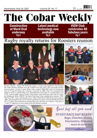
1 minute read
Seismic and airborne magnetic surveys are underway

from TCW 240523

The Geological Survey of NSW (GSNSW) is currently conducting a large seismic survey across NSW including over exploration tenements in the Cobar area. archives the data.
Advertisement
vide information about geology at depth in the Earth eral or energy resource potential.
geologists to produce geophysical map interpretations and to build 3D models of crustal geology.
maps to validate geological cross large trucks to generate pressure waves which penetrate into the Earth and are reflected from rock interfaces.
to 40 metres to generate the signal. of geophones and the data processed into seismic sections which image stratigraphy and faults.
30km depth depending on the equipment used.
geoscientists interpret geological features and structures deep below the surface.
It can be used to locate potential ground water and mineral resources.
GSNSW has received the assistance of Aurelia Metals’ Exploration Teams to help conduct the survey.
Weather permitting, the survey will continue until next month.
GSNSW is also conducting two airborne magnetic and radiometric surveys across the western area to identify potential groundwater to support agriculture, regional towns and industries.
The aircraft will be flying low (at a height of 70 to 80 metres above the ground) gathering data which will also be used to better un- derstand the geology and groundwater resources of the area.
Wondered what these big trucks have been doing in our area lately? They are involved in a seismic geological survey being conducted by the Department of Regional NSW across the western area from April to June. ▪ Photo contributed
Meals served Monday - Saturday