


Acknowledgements
IntroductIon to the mAster PlAn
cArver’s vIsIon
lAnd use
economIc develoPment
housIng
servIces And FAcIlItIes
trAnsPortAtIon And cIrculAtIon
nAturAl And
AgrIculture
ImPlementAtIon
reFerences
Index oF FIgures
The Town of Carver’s Master Plan would not have been possible without the support, input, and local knowledge provided by Carver’s citizens, professional staff, leadership, and volunteer members of the Master Plan Committee. The Town of Carver would like to acknowledge the following for their role in preparing this Master Plan.
TO w N Admi N i ST r AT i ON
Michael Milanoski, Town Administrator
B OA rd OF S ELECT m EN
Ron Clarke, Chairman
Alan Dunham, Vice Chairman
Sarah Hewins
Helen Marrone
Dave Robertson
P LANN i N g B OA rd
Bruce Maki, Chairman
James Hoffman, Vice Chairman
Chad Cavicchi
Kevin Robinson
William Sinclair
mASTE r P LAN CO mmi TTEE
William Sinclair, Chairman
Jennifer Bogart
Richard Buck
Andrew Cardarelli
Jaclyn Gingrich
Heidi Gregory-Mina
Sarah Hewins
Paul Kelly
Johanna Leighton
George Martin
Savery Moore
Dave Robertson
P LANN i N g AN d CO mmu N i T y dE v ELOPm ENT
Marlene McCollem, AICP, Director
Th E mASTE r P LAN wAS P r EPA r E d By T h E
FOLLO wi N g Ag ENC y AN d i N dividuALS:
Southeastern Regional Planning and Economic Development District (SRPEDD)
Jed Cornock, AICP
Katie Goodrum, AICP
Grant King, AICP, Project Manager
Bill Napolitano
Don Sullivan
V
“By relying on public input and clear information, the town intends for the plan to be transparent and accurate. By designing the plan to progress from “Key Information” to related “Goals” and “Strategies,” the town intends for the document to read like simple instructions. And by making the plan concise and graphically engaging, the town hopes that many residents and all elected and appointed officials will read the plan and use it to guide important decisions about the future of Carver.”
Carver designed its 2017 Master Plan to be a concise, easy-to-understand document. It consists of 11 chapters, or elements1:
IntroductIon to the mAster PlAn
cArver’s vIsIon
lAnd use
economIc develoPment
housIng
servIces And FAcIlItIes
trAnsPortAtIon And cIrculAtIon
oPen sPAce And recreAtIon
nAturAl And culturAl resources
AgrIculture
ImPlementAtIon
1 According to M.G.L. c. 41, s. 81D, the main Master Plan sections are called “elements.” The remainder of this plan uses both of these words interchangeably.
Each chapter contains all the main information needed to explore and address its subject matter. This process begins by introducing “kE y P LANN i N g iNFO rm AT i ON” that explains the topic at hand and identifies relevant issues and opportunities for Carver. For example, the Agriculture element’s “Key Planning Information” includes a map of farmland in town, basic statistics about Carver’s cranberry industry, an introduction to agricultural policies, and evidence gathered from local farmers at public workshops.
Each chapter then proposes “gOALS” that can solve problems and promote opportunities. For example, the Agriculture chapter’s fourth goal, Goal 10-4, is to “actively market the exceptional character of farming in Carver” in order maintain this essential aspect of Carver’s culture and economy. This goal seeks to address the unique needs of Carver’s many farms and farmers.
Finally, each chapter presents “S T r ATE gi ES” to achieve its goals. For example, one way to achieve Goal 10-4 is by pursuing “Strategy 10-4-1: Promote and develop local agtourism.” Each Strategy contains important details, including the main steps to take, the lead party (“who’s in charge”), state and federal programs to pursue, required time and resources, and recommended partnerships. All of these details are
summarized again in the Master Plan’s “Implementation” chapter, which explores and organizes each Strategy in a userfriendly table. Throughout, the plan also highlights “CO m PLE m ENTA ry ACT i ONS,” which are areas where two or more elements have shared activities. These areas are marked with the icon of the relevant elements.
In addition to using current and accurate data, this document responds directly to public input. Carver’s residents and Master Plan Committee members contributed these invaluable ideas at numerous meetings and at five public workshops. These events took place over the course of 15 months and are described in detail in the next chapter. Without this essential participation by Carver residents, the plan would not reflect an understanding of Carver as a community and as a place.
In summary, by relying on public input and clear information, the town intends for the plan to be transparent and accurate. By designing the plan to progress from “Key Planning Information” to related “Goals” and “Strategies,” the town intends for the document to read like simple instructions. And by making the plan concise and graphically engaging, the town hopes that many residents and all elected and appointed officials will read the plan and use it to guide important decisions about the future of Carver.
“First, the Master Plan Committee and its support staff studied previous planning documents and policy statements. Next, staff surveyed current socioeconomic and demographic trends. Lastly, staff gathered vital public input. This public, data-driven, and creative planning process led to the Master Plan’s guiding principles - its Vision.”
This chapter briefly describes the planning process that created the Master Plan’s guiding principles – its Vision statements. First, the Master Plan Committee and its support staff studied previous planning documents and policy statements. Next, staff surveyed current socioeconomic and demographic trends. Lastly, staff gathered vital public input. This public, data-driven, and creative planning process led to the following Vision statements:
Pr ESE rv E AN d w O rk wi T h C A rv E r’S
S m ALL TO w N, rur AL C h A r ACTE r.
E NCO ur Ag E T h E T yPES OF j OBS AN d
B u S i NESSES AL r EA dy FO u N d i N
C A rv E r.
Pr O m OTE gr O w T h i N APP r OP ri ATE LOCAT i ONS.
mEET T h E NEE d S OF ALL OF C A rv E r’S
C i T iz ENS, ESPEC i ALLy SEN i O r S AN d
yO u N g h O u SE h OL d S.
iNC r EASE T r ANSPO r TAT i ON SAFET y
AN d CONNECT ivi T y FO r ALL T yPES OF u SE r S.
Pur S u E A COST - EFFECT iv E i NC r EASE i N
NEE d E d TO w N SE rvi CES.
Step one consisted of surveying previous planning documents and policy statements. This allowed the current Master Planning efforts to be firmly based in existing knowledge. It also permitted Master Plan staff to review and confirm long-standing priorities for the town. Staff thoroughly reviewed and summarized several major planning documents, including the previous Master Plan (2001), the Housing Production Plan (2008), the Open Space and Recreation Plan (2010), and the Vision for Economic Development (1995). Major findings of these documents were summarized in handouts for the Master Plan Discovery Workshop (see details below) and are available in the Appendix. During workshops, these handouts served as conversation starters for several “break-out groups” (see more details below). Staff also reviewed other resources such as the Carver Zoning and General Bylaws, the Carver Recreation Master Plan Report (2015), the Massachusetts Smart Growth/Energy Toolkit, the Massachusetts Cranberry Revitalization Task Force Final Report (2016), the Massachusetts Division of Local Services’ Financial Analysis of the North Carver Water District Report (2014), and the Massachusetts Local Food Action Plan (2015).
Second, Master Plan staff gathered current demographic and socioeconomic
information. The Master Plan Committee and elected and appointed town officials wanted the Master Plan to identify and respond to major trends. Many of the major findings from the U.S. Census, the American Community Survey, the Division of Local Services, MassGIS, and town records are presented in the “Key Planning Information” sections of relevant Master Plan Chapters. They are also available for review in the Appendix. The data tell the story of Carver as a growing, economically healthy, middleincome town with an increasing share of older residents.
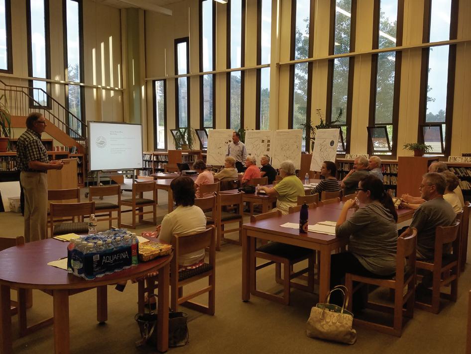
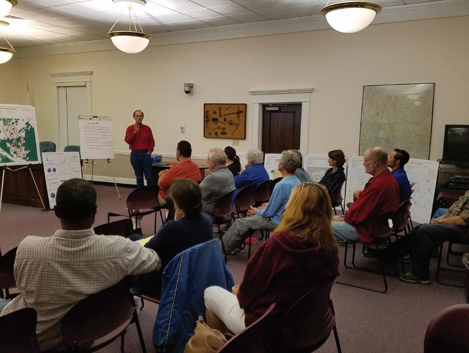
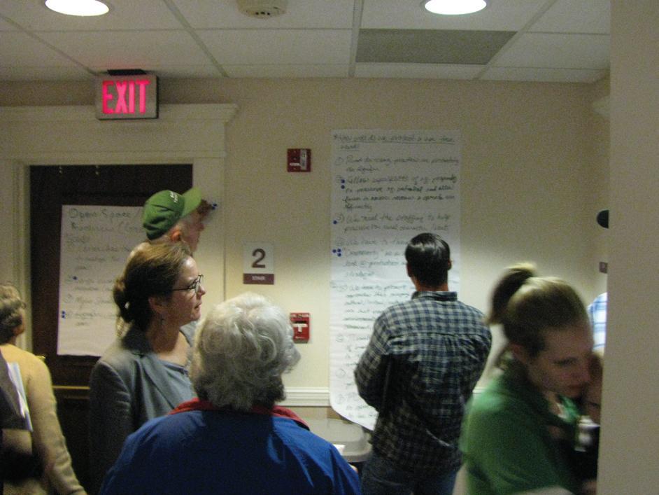
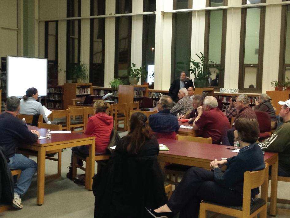
Lastly, and perhaps most importantly, Master Plan staff listened to the comments and observations of Carver residents. This took place at five public workshops over the course of the Master Plan process:
S EPTE m BE r 23, 2015 – Master Plan Discovery Workshop: This workshop presented the summaries of previous planning documents, key demographic information, and basic maps that are featured throughout the master plan. The event also featured break-out groups that discussed each Master Plan element in detail. These discussions resulted in numerous comments and culminated in a voting exercise that identified themes. A complete report on this workshop – which was instrumental in developing the main Vision statements – is available in the Appendix.
jAN uA ry 23, 2016 – Land Use, Economic Development, and Housing: This workshop presented more mapping and statistics and focused on three Master Plan elements. Staff solicited and recorded numerous comments
that directly influenced the creation of these Master Plan chapters.
j u NE 21, 2016 – Services & Facilities and Transportation & Circulation: Much like the January 23 workshop, Master Plan staff presented more information and solicited and recorded input on two chapters.
S EPTE m BE r 15, 2016 – Open Space & Recreation, Natural & Cultural Resources, and Agriculture: Once again, staff presented specialized information and solicited and recorded input on these three important Master Plan topics.
N O v E m BE r 17, 2016 – Open House and Presentation of Final Draft Plan. Master Plan staff made themselves available to discuss all elements.
Additionally, Master Plan staff heard from numerous stakeholders throughout the planning process including, but not limited to: members of the Board of Selectmen, Planning Board, Conservation Commission, and the School Committee, the Town Administrator, the Superintendent of Schools, the Department of Public Works, the Carver Police Department, the Carver Fire Department, and the Council on Aging.
As draft Master Plan elements were completed, the Master Plan Committee reviewed and commented on the content. This took place on a rolling basis and allowed for significant and thorough feedback from the town. Lastly, some comments and questions were received via the master plan website (www.srpedd.org/carver-masterplan) and Facebook page. Without this invaluable public input – both in person and in written form – the 2017 Carver Master Plan would not have been possible. Moreover, the participation of residents enabled this plan to strike the important balance between protecting Carver’s rural character and natural resources while also encouraging desired growth in appropriate locations.
“A focus on making existing bylaws more userfriendly as well as attention to new means of focusing growth to preferred locations can help the town balance the need for growth with its desire to preserve Carver’s unique natural, cultural, and rural heritage.”
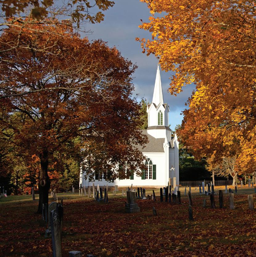
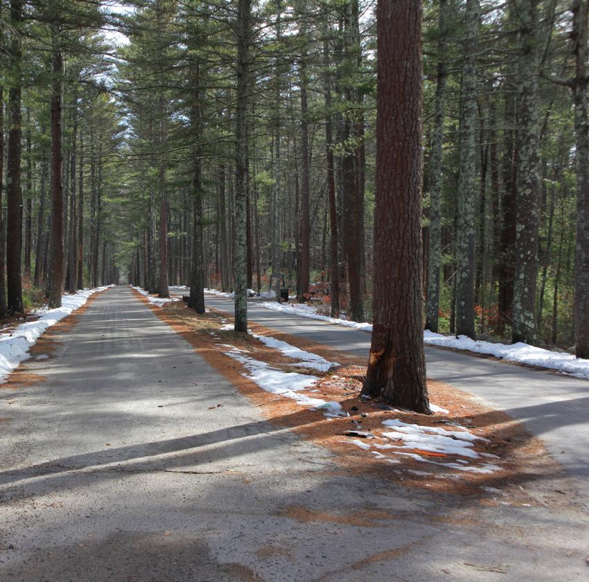
Carver’s residents value its small town, rural character. This character is clearly visible by traveling Carver’s scenic roadways, by hearing citizens describe their reasons for living in town, and by reviewing information about land use. AgrIculture, 1 particularly cranberry growing, accounts for 50.5% (or 12,843 acres) of Carver’s land area (a total of 25,422 acres). A further 19% (or 4,814 acres) are residential uses – the vast majority of which are single family homes. These main land uses are punctuated by small pockets of businesses and institutions such as schools, churches, and municipal buildings. These land use patterns are typical in agricultural communities in New England that – after centuries of slow, steady development –experienced rapid growth in the late 20th century. While Carver’s population did indeed grow rapidly in the 1970s and 1980s, recent decades have seen modest growth rates that are lower than in Plymouth County and the Commonwealth as a whole. An important step in maintaining Carver’s rural character in the future will be to focus growth – both commercial and residential –to preferred locations while also protecting farms and natural resources, particularly those visible from Carver’s roadways.
Thanks to Carver’s long and successful tradition of cranberry growing, the town has a large proportion of land that is given temporary, conditional protection by Massachusetts General Laws Chapters 61 and 61A. These 12,606 “Chapter” acres combine with 2,364 acres of permanently protected habitat and natural resource land to account for 59% of Carver that has some type of Protected stAtus. Strategies such as agricultural preservation, zoning amendments, acceptance of valueadded agricultural practices, continued participation in the Chapter 61 programs, and coordinated land conservation efforts will all be necessary in order to maintain the viability of agricultural land uses – uses that are essential to the “rural” part of Carver’s small town, rural character.
Carver’s zonIng regulations have undoubtedly influenced the town’s current land use patterns. Eighty-five percent (85%) of Carver is zoned Residential Agricultural (RA); this district covers 21,480 acres of the town’s land area and is the most influential land use policy in Carver by far. While the name of this zoning district is consistent with the character of town, its medium lot sizes can inadvertently lead to the loss of natural lands and to subdivisions and “suburban sprawl;”2
1 Bright blue text indicates a hyperlink.
2 RA’s minimum lot size is 60,000 s.f., or 1.4 acres. For every 10 new homes built in the RA zone, Carver converts 14 acres of land into suburban development.
Residences < = 3 units
Apartments > = 4 Units
Institutional (such “93, municipal” or “95, charitable [including conservation organizations]”)
Vacant (such as “72, non-productive land” or “13, vacant land in a residential zone”)
Open Space and Recreational
Data
and Res/OS
25,422
lAnd use
this is particularly true if development does not make use of other land use policies such as Carver’s existing Conservation Subdivision Design (“cluster”) bylaw and Transfer of Development Rights (TDR) bylaw. A focus on making these existing bylaws more userfriendly as well as attention to new means of focusing growth to preferred districts (such as incentivizing mixed-use, multi-family development in the “village” districts) can help the town balance the need for growth with its desire to preserve Carver’s unique natural and cultural heritage.
To support the master planning effort, the town created a buIld-out AnAlysIs. Buildouts estimate what could be developed under existing zoning. They do not consider demographic and market trends. They simply estimate the “supply” of buildable space, not the“demand” for growth. This is an extremely important distinction to make, because the build-out does not predict what will be built, only what could be built. This project relied on parcel-based geographic information systems (GIS) analysis and extensive “truth checks” from Carver’s Town Planner.3 It estimates that, under current zoning, the town contains approximately 1,300 buildable parcels containing
approximately 6,245 acres of upland. The analysis further estimates that this remaining land can support approximately 1,000 additional housing units and 11.7 Million s.f. of commercial development. The build-out can be used for various planning applications - most notably mapping of appropriate TDR sending and receiving areas and identifying locations where the town should implement its cluster bylaw.
L AN d u SE g OAL 3-1: LAND USE POLICIES SHOULD PROTECT
BOTTO m L i NE: GROWTH CAN BENEFIT THE COMMUNITY IF IT IS DONE COLLABORATIVELY, EFFICIENTLY, AND WITH CONSIDERATION OF CARVER’S NEIGHBORHOODS AND NATURAL RESOURCES
3 Please see the Build-Out Estimate Methodology Report in the Master Plan Appendix.
The importance of maintaining Carver’s rural, New England character is a theme that runs through conversations with Carver residents, input at public workshops, and previous town plans. This unique Carver landscape – a mix of forests and fields, homes and village areas, cranberry bogs and wetlands – is often cited as the reason residents chose to remain
Population Growth Rates by Decade
Population Growth Rates by Decade
-
in or move to town. The town’s current and future permitting procedures should be improved to better protect this character while recognizing the need for future business and housing development.
Carver’s population rose 51.5% from 1980 to 1990. Since then, growth rates are in line with those of MA and are lower than those of Plymouth County. In 2010, Carver had 11,509 residents.
L AN d u SE ST r ATE gy 3-1-1: FUTURE
LARGE-SCALE COMMERCIAL GROWTH
-
Carver’s population rose 51.5% from 1980 1990. Since then, growth rates are in line those of MA and are lower than those of Plymouth County. In 2010, Carver had 11,509 residents.
SHOULD TAKE PLACE IN NORTH CARVER
These areas have the appropriate zoning districts (Green Business Park, Highway Commercial, and Spring Street Innovation) and the needed water infrastructure (North Carver Water District only); moreover, their proximity to interchanges with Route 44 and existing large-scale development (including the Shaws Plaza and the 650,000
s.f. Sysco distribution facility in neighboring Plympton) enable further growth without disturbing the rural character of other, undeveloped parts of Carver. Highvalue development and high-wage jobs (traditional “Economic Development”) can be encouraged through expanded participation in state economic development programs such as Chapter 43D and Tax Increment Financing. Additionally, existing Chapter 43D areas north of Route 44 along Route 58 in North Carver can be revisited and expanded. All of these efforts should proceed in collaboration with the state Department of Housing and Community Development (DHCD). Local initiatives such as userfriendly Permitting Guides and available
land inventories are also vital to attracting high value development while balancing the needs of the community.
CO m PLE m ENTA ry ACT i ONS: economIc develoPment goAl 4-1: FOCUS TRADITIONAL ECONOMIC DEVELOPMENT TO THE GREEN BUSINESS PARK DISTRICT AND THE SPRING STREET INNOVATION DISTRICT (SSID) IN NORTH CARVER
L AN d u SE ST r ATE gy 3-1-2: THE PLANNING BOARD SHOULD WORK TO MAKE EXISTING “VILLAGE DISTRICT” BYLAWS MORE USER-FRIENDLY AND TO ENCOURAGE MIXED-USE DEVELOPMENT IN CARVER CENTER
Several goals identified through the Master Plan process can only be achieved through strategic changes to Carver’s zoning bylaw. This requires consensus of the Planning Board, staff time to draft bylaw amendments, and significant public outreach to affected property owners and the general public. Throughout the Master Plan public input process, meeting participants emphasized the need for modest, multi-family housing that is available to seniors, young families, and Carver’s municipal employees. These types of housing units can only be created by ensuring that dimensional and use regulations in Carver’s zoning bylaw allow
housing units to be built in preferred locations and at economical densities.4
The town’s existing Village Business (VB) and Village (V) districts already identify key areas in town where compact, “traditional New England development” has occurred in the past and where the town would like it to take place in the future. These development patterns include traditional architecture, clustering of housing and amenities within a walkable area, small building setbacks, moderate building heights and lot coverage, and small site plans. The town’s existing zoning bylaw enables some multi-family housing units in these districts by special permit; however, some of the Village district dimensional regulations (particularly setbacks) are as restrictive and low density as those in the RA district. These “barriers to development” make it very difficult to build the types of housing units desired by Carver’s residents. The Planning Board should use this Master Plan to begin the process of amending these districts; this can be achieved through systematic, public
4 There is clear demand for small units in Carver –over 25% of housing units in town are mobile homes. While these communities are important to the housing stock in Carver, they are generally located outside of “walkable” village areas and do not help Carver meet its 10% goal for the state subsidized housing inventory (SHI).
review of the Village Districts that lead to bylaw amendments that the public has had a chance to review well in advance of town meeting.
BOTTO m L i NE: CARVER’S ZONING BYLAWS SHOULD BE UPDATED TO ENCOURAGE CONSERVATION WHILE ALSO CONTRIBUTING TO THE CREATION OF NEIGHBORHOODS WHERE RESIDENTS WANT TO LIVE, WORK, AND PLAY
This goal is really a complement to Goal 3-1; they are two sides of the same coin. Both take as their main inspiration the idea that Carver is a rural, small town and that it should stay that way. This is a strong principle that is firmly based in the consensus opinion of Carver’s residents and in the text of previous town plans. Making this goal a reality requires creative tactics that encourage land conservation and beneficial growth at the same time. All of these efforts must acknowledge – and in some cases harness the power of – the
regional real estate market and the value of land as seen not only from the perspective of natural and cultural resources, but from the financial and personal perspectives of property owners. If pursued in a comprehensive and organized manner, these approaches can conserve land while also incentivizing growth in preferred locations.
SIMPLIFICATION OF CARVER’S EXISTING TDR BYLAW CAN INCREASE LAND CONSERVATION WHILE ALSO ENCOURAGING DESIRED GROWTH IN PREFERRED LOCATIONS
Transfer of Development Rights (TDR) is a zoning mechanism that uses real estate market forces to permanently protect land. It can be a confusing, complex concept when you get into the details (which this plan is about to do). The main idea is that a community can encourage development where it wants by allowing property-owners to trade the ability to build on their land. Carver already has a TDR bylaw that it can use to meet several goals of this plan.
Under TDR, “open space is permanently protected [through a conservation restriction] for water supply, agriculture, habitat, recreation, or other purposes via the transfer of some or all of the development that would otherwise have occurred in
25,422
another (the "
area"). Communities using TDR are generally shifting development densities within the community to achieve both open space and economic goals without changing their overall development potential. While less common, TDR can also be used for preservation of historic resources.” From the Commonwealth of Massachusetts Smart Growth/Smart Energy Toolkit.
development rights at base zoning
Source: The Planning Center DC&E; SRPEDD
sending area parcel receiving area parcel before TDR after TDR
sending area parcel receiving area parcel
development rights
$$$
development rights at base zoning transferred development rights
these sensitive places to more suitable locations. [Then], other locations, such as city and town centers or vacant and underutilized properties, become more vibrant and successful as the development
SRPEDD, The Planning Center│DC&E, Commonwealth of Massachusetts
potential from the protected resource areas is transferred to them. In essence, development rights are ‘transferred’ from one district (the ‘sending area’) to another (the ‘receiving area’). Communities using TDR
are generally shifting development densities within the community to achieve both open space and economic goals without changing their overall development potential.”5 Given that Carver has an existing TDR bylaw (adopted in 2004), the town is in a position of strength with regards to land conservation.6
Carver’s existing TDR also influences the
5 mAssAchusetts smArt growth/smArt energy toolkIt
6 “The purpose of this By-law is to allow the development rights from one property (the sending parcel) to be transferred to another property (the receiving parcel) while contemporaneously restricting the sending parcel from future development. The Transfer of Development Rights (TDR) Bylaw allows for the maintenance of low-density land uses, open spaces, historical features, critical environmental resources, and other sensitive features of the sending parcel to be preserved while providing compensation to the property owner. The TDR program is consistent with the Carver Master Plan’s goals to further the conservation and preservation of natural and undeveloped areas, wildlife, flora, and habitats for endangered species; protection of ground water, surface water, as well as other natural resources; balanced economic growth; the provision of adequate capital facilities, including transportation, water supply, and solid, sanitary, and hazardous waste disposal facilities; the coordination of the provision of adequate capital facilities with the achievement of other goals; the development of an adequate supply of affordable housing; and the preservation of historical, cultural, archaeological, architectural, and recreational values.” Carver Zoning bylaw, Section 2700, page 18.
type of development that it produces. It does so through by only transferring development into a Planned Neighborhood Development (PND) Overlay district; this zoning district seeks to create traditional, small town Carver development patterns.7 However, the “PND district only comes into effect for developments that utilize transfer of development rights (TDR) as described in Section 2700 . . . [and] there must be a minimum of 50 TDR units transferred . . . for the enhanced density, dimensional, and use regulations of the PND to take effect . . . [additionally,] each planned neighborhood development must contain at least Sixty (60) acres.”8
These strict requirements and the fact that no PND districts or TDR receiving areas have been clearly mapped in town Zoning makes these bylaws extremely difficult to use. The Planning Board should work to amend these bylaws by reducing the thresholds needed to participate. For example, the minimum TDR unit transfer could be removed and the minimum PND size reduced from 60 acres to
7 “The purpose of this [PND] Section 2800 is to authorize and encourage planned neighborhood developments that promote a broad range of housing types and limited small retail/office uses, all centered around areas of usable public open space.” Carver Zoning bylaw, Section 2800, page 23.
8 Ibid.
10 or even 5 acres. Additionally, the town can make four other changes that will improve the likelihood of transferring development from sensitive natural lands to desired growth locations:
(1) First, a simple user-guide that explains the TDR process in easy-to-understand writing and clear diagrams would greatly improve the TDR program’s visibility and viability; this guide can be similar in format to the business and permitting guides discussed in economIc develoPment strAtegy 4-2-1. It is difficult to advocate for an idea that people find hard to understand; this is particularly true when a proposal can directly affect residents’ homes and neighborhoods. Even if an idea will meet a goal that has been identified as needed and desirable – as is the case with TDR – it is likely to be met with suspicion and opposition if it doesn’t quickly make sense to the public. A simple and straightforward TDR user-guide can overcome this type of confusion and help build support by clarifying TDR’s goals and the fact that it is a voluntary, free-market tool.
(2) Second, Carver’s sending and receiving areas should be clearly identified and mapped. To aid in this selection process, GIS analysis and the Master Plan’s basic buildout estimate has identified areas containing
remaining development potential; the build-out can also assist in identifying land in appropriate “receiving” areas that can accommodate transferred growth. The Planning Board and Town Planner should use this analysis to identify and formalize sending and receiving areas for the TDR bylaw.
(3) Third, if and when thresholds for TDR participation are reduced, the Town can actively pursue the completion of a sample project; such a project can be between two willing land-owners or one larger owner holding two separate properties – one in a sending area and another in a receiving area. Willing, consistent use of the TDR bylaw would be far more likely if residents and developers alike could point to a bricksand-mortar TDR development and the open space that it helped to permanently protect.
(4) Finally, once the bylaw has been successfully used, Carver can consider more sophisticated features of TDR bylaws. For example, Carver could consider allowing sending area owners to “bank” their development rights by selling them to a state entity or a non-profit conservation agency, which holds them for resale to owners in receiving areas; this removes the need for owners to buy and sell directly to each other and simplifies timing
in the TDR market. Carver could also incentivize TDRs by increasing densities or reducing requirements in exchange for preserving farmland (in the sending area) or for providing affordable housing (in the receiving area).
LAN d u SE ST r ATE gy 3-2-2: CARVER’S EXISTING CONSERVATION SUBDIVISION
DESIGN BYLAW IS ANOTHER VALUABLE
CONSERVATION TOOL THAT CAN BE MADE MORE EFFECTIVE THROUGH MINOR CHANGES
Another tool in Carver’s “conservation toolbox” is its existing Conservation Subdivision Design, or “cluster,” bylaw. The purpose of this bylaw “is to encourage the preservation of open land for its scenic beauty and to enhance agricultural, open space, forestry, and recreational use; to preserve historical and archeological resources; to protect the natural environment; to protect the value of real property; to promote more sensitive siting of buildings and better overall site planning; to perpetuate the appearance of Carver’s traditional New England landscape; to allow landowners a reasonable return on their investment; to facilitate the construction and maintenance of streets, utilities, and public services in a more economical and efficient
manner; and to promote the development of housing affordable to low and moderate income families.”9 The Master Plan’s public input process has clearly identified these goals and residential developments types as still relevant and desirable for Carver.
While Carver’s cluster bylaw is concise and easy-to-understand, minor modifications should be explored to increase this use of this valuable land use tool. For example, possible incentives include making “cluster” developments available by right. Alternatively, if the Planning Board wishes to maintain the special permit procedures, they can provide “bonuses” (such as additional residential units or the reduction of some requirements) for providing additional open space. The Planning Board can survey other towns and regional residential housing developers to gain a better understanding of what modifications could help this already solid bylaw better meet its goals. For example, the town of Seekonk, MA recently added density bonus incentives (in this case, for the provision of affordable housing) to their cluster bylaw (called “Open Space Residential Design”); these particular incentives have led to increased use of the cluster bylaw and newly permitted affordable housing units in Seekonk;
9 Carver Zoning Bylaw, Section 3800, page 80.
ED H LU
however, the main idea is that incentives can be used to achieve many other goals that are more appropriate for Carver. Additionally, much like with the TDR refinements discussed above, GIS analysis and the Master Plan’s basic build-out estimate can identify areas where applying the Conservation Subdivision Design bylaw would be particularly appropriate.
reforms with corresponding conservation activities described in the Open Space and Recreation element of this plan.
NR I I V T A SF
BOTTO m L i NE: WHILE CARVER’S INNOVATIVE ZONING BYLAWS CAN CONTRIBUTE TO CONSERVATION, THE TOWN MUST ALSO PURSUE STRATEGIC AND DIRECT CONSERVATION EFFORTS IN ORDER TO MAINTAIN ITS RURAL CHARACTER
Land conservation is vital to protecting Carver’s small town, rural character. And while market-based programs, such as TDR and Cluster Development, can pair targeted, rurally focused development with associated conservation efforts, they can only go so far in steering demand for growth. Carver must therefore complement the above zoning
oPen sPAce goAl 8-1: UPDATE CARVER’S OPEN SPACE AND RECREATION PLAN ALONG WITH LOCAL, REGIONAL, AND STATE CONSERVATION ACTIVITIES
Required – Discretionary cumbersome, long, & expensive requirements
• By Right/Mandatory
• Dimensional standards inhibit use
• Formulaic and quick
Analy
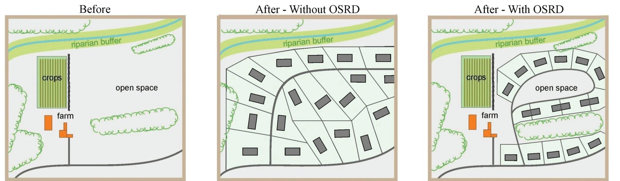
OSRD is a method of planning residential development that conser ves open space in a new subdivision. The same number of homes as would be permissible in a conventionally-zoned subdivision are allowed using OSRD. Municipalities using a “Special Permit ” version of OSRD can allow density bonuses if desired.
• No minimum lot size
ount of land protected
Open Space Design
nd conservation standards inhibit use
By Right/Mandatory
Formulaic and quick
& Findings
• Flexible Design Standards frontage, setbacks
No minimum lot size
60%] of land area protected
• [60%] of land area protected
• Strategic protection via Conservation Analy sis & Findings
Hypothetical Parcel
• Flexible Design Standards – lot size, frontage, setbacks, roads, etc.
Strategic protection via Conservation Analy sis & Findings
Flexible Design Standards – lot size, frontage, setbacks, roads, etc.
Hypothetical Parcel With Traditional Subdivision Development
Hypothetical Parcel With Open Space Residential Design (OSRD)
“Public comments during Master Plan workshops have emphasized that the town should support local firms through increased outreach to the existing business community. They also want to ‘encourage the types of jobs and businesses already found in town;’ in other words, they want Carver’s existing character to be reflected in future economic growth.”
Carver residents recognize that successful businesses are an essential part of a healthy community – even in a small, rural town such as their own. Local businesses provide jobs, contribute to the tax base, and influence Carver’s character. Public comments during Master Plan workshops have emphasized that the town should support local firms through increased outreach to the existing business community. They also want to “encourage the types of jobs and businesses already found in town;” in other words, they want Carver’s existing character to be reflected in future economic growth. In order to do these things, it is important to get a sense of Carver’s current economy and recent economic trends.
In general terms, Carver’s economy is very healthy. Between 2001 and 2014, the number of local jobs grew 27.8%, from 1,857 to 2,374. That growth rate significantly outpaced Massachusetts (2.6%) and the 27-community SRPEDD region1 (1%) and was in line with neighboring Plymouth (27.3%) and Wareham (27%). During this same period, the industries that experienced the highest growth rates were (1) manufacturing, (2) other services (except public administration), (3) wholesale trade, (4) accommodation and food services, and (5) health care and social services. Some of these more intensive business sectors (such as manufacturing and health care) may present further growth opportunities
1 This region includes southwestern Plymouth County, all of Bristol County, and one town in Norfolk County.
especially in North Carver’s Green Business Park and the Spring Street Innovation District. Smaller scale “food service” and “other service” businesses – those types of “home town” businesses that make up the fabric of Carver – can be encouraged throughout town in existing commercial and village areas, especially those with vacant and underutilized buildings.
Agriculture – particularly cranberry growing – also plays an essential role in Carver’s economy and character. There are almost 13,000 acres of agricultural land in Carver, 86% of which is directly related to cranberry growing. This has been the case for generations and it is the town’s vision that agriculture will continue to thrive in Carver’s future economy. In order to plan for the health of the cranberry industry, this Master Plan includes a supplementary AgrIculture element. This work includes the recommendations of a temporary subcommittee of working farmers and agricultural planning professionals who helped the town explore ideas including local agricultural best practices, valueadded farm and product opportunities, and initiatives tied to the recent Massachusetts crAnberry revItAlIzAtIon tAsk Force rePort and the mAssAchusetts locAl Food ActIon PlAn.
ECONO mi C d E v ELOPm ENT g OAL 4-1: FOCUS TRADITIONAL ECONOMIC
BOTTO m L i NE: THESE AREAS ALREADY HAVE THE NECESSARY ZONING, INFRASTRUCTURE, AND HIGHWAY ACCESS TO SUPPORT LARGER SCALE GROWTH
Traditional economic development seeks to create jobs and expand a municipality’s tax base through various infrastructure and policy initiatives. By encouraging business development in North Carver – particularly in areas with existing business-friendly zoning and infrastructure – the town can build on its existing competitive advantages while also minimize negative impacts on its rural, small town character. This goal complements the Land Use element of this plan which seeks to balance needed economic growth with the need to protect Carver’s rural character.
69,000 Vacant Commerical Square Feet
640,000 Total Commercial Square Feet
ECONO mi C d E v ELOPm ENT ST r ATE gy
4-1-1: EMPHASIZE EXISTING ZONING AND PLANNING DOCUMENTS THAT IDENTIFY NORTH CARVER FOR ECONOMIC DEVELOPMENT
Zoning is a community’s main public statement about where certain activities can take place and how much of that activity should be allowed. Like most other communities in the Commonwealth, Carver adopts and amends zoning by a required two-thirds vote at Town Meetings. Through this process, the citizens of Carver have already created two zoning districts, the Green Business Park and the Spring Street Innovation District, that permit and encourage fairly intensive business activities in North Carver. Town Meeting voters also supported the North Carver Water District to provide essential water infrastructure to these locations. These are excellent starting points for future economic development projects in these areas. In addition to meeting the intent and spirit of these standing local initiatives, all future growth in these areas can also be guided and informed by civic engagement with area residents, the Spring Street Innovation District Design Guidelines,2 recent economic trends (that
2 Please see the Appendix. These are part of the Planning Board Rules and Regulations for Site Plan Review in the Innovation District. In 2014, SRPEDD and the town created these Guidelines using input
show significant gains in the more intensive manufacturing, wholesale trade, and health care sectors), the North Carver Development District3, and the region’s Comprehensive Economic Development Strategy (CEDS)4. This Master Plan should be added to the list of documents that support growth in North Carver, which is essential to the fiscal health of Carver.
ECONO mi C d E v ELOPm ENT ST r ATE gy 4-1-2: UTILIZE CARVER’S EXISTING
CHAPTER 43D EXPEDITED PERMITTING PROGRAM
In addition to local zoning districts and economic development planning, the area (received at two public workshops) from residents near the SSID.
3 The North Carver Development District was authorized by Town Meeting in 2010 and subsequently by the state’s Economic Assistance Coordinating Council. The use of district improvement financing (DIF) in this area diverts 50% of incremental revenue to help pay North Carver Water District (NCWD) debt service.
4 As a federally designated Economic Development District, SRPEDD works with the Regional Economic Strategy Committee (RESC) to create the CEDs document. The RESC is a committee comprised of economic development professionals, chamber of commerce representatives, colleges and universities, planners, finance real estate professionals, utilities, private sector interests, and state and federal ED program representatives.
around the Route 44/Route 58 interchange is also part of a state expedited permitting program called Chapter 43D.5 Carver initiated this program in 2008. To participate in Chapter 43D, the town first identified three eligible sites and obtained the written participation of all property owners; all three properties (called Whitworth, Montello Street, and North Main Street) are located north of Route 44 in North Carver. The next step required a successful Town Meeting vote to approve the site and accept the program’s provisions, including the creation of a permitting guide for the area. While these sites are well positioned for development, they can be more actively marketed and expanded to include adjoining properties.
5 The Chapter 43D program is sponsored by the Massachusetts Executive Office of Housing and Economic Development (eohed). It “provides a transparent and efficient process for municipal permitting, guarantees local permitting decisions on priority development sites within 180 days, [and] increases visibility of your community and target development site(s).” It also provides “priority consideration for the MassWorks Infrastructure Program grants, brownfields remediation assistance, and other financing through quasi-public organizations, online marketing of your site and promotion of your pro-business regulatory climate, improved municipal planning and permitting efficiencies, [and] collection of special fees for priority development site permit applications.” SRPEDD also acknowledges the ongoing urban renewal plan for these areas.
BOTTO m L i NE: THE TOWN CAN EXPAND AND SPECIALIZE ITS ACTIVITIES TO FIT CARVER’S BUSINESSES
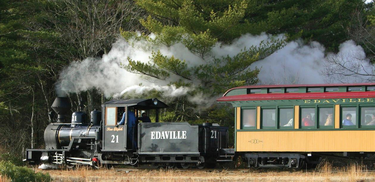
Successful local businesses are assets to the town and are necessary parts of Carver’s fiscal and economic health; however, commercial operations and business expansions need not adversely impact Carver’s water resources, wildlife habitats, roadways, town services, or overall character. The Carver Planning Board and Business Development Commission (BDC) can work collaboratively with existing and prospective business-owners (including, but not limited to Edaville Railroad, the Plymouth Airport, and King Richard’s Faire) in order to establish partnerships that identify clear and fair expectations while recognizing private economic realities. This type of formal and ongoing collaboration between municipalities and businesses can be a fairly low-resource effort. Small, targeted public initiatives such as those described
here can help reduce business turn-over and significantly improve the likelihood of positive economic outcomes that benefit the community and minimize negative impacts on businesses and residents alike.
4-2-1: CREATE AND MAINTAIN A LOCAL PERMITTING GUIDE TO FACILITATE ALL TYPES OF BUSINESS ACTIVITY
Many communities have created userfriendly “How to Do Business in town” permitting guides. These can be concise handbooks, topic-specific brochures, marketing campaigns, E-Government webpages, or all of the above.6 Permitting guides use flow charts and simple diagrams to help describe required procedures, to identify departmental points of contact, and to highlight fees, resources, and timelines needed to obtain various permits (including 43D permits). Additionally, some communities, such as nearby Dartmouth, hold regular meetings between department heads to coordinate projects and overlapping departmental efforts; this type of low-cost administrative change can further streamline permitting and improve Carver’s interactions with local businesses and property owners.
4-2-2: FORMALIZE AND SPECIALIZE PLANNING BOARD AND BDC ACTIVITIES TO FIT CARVER’S
Communities across Massachusetts have created specialized public-private partnerships that serve specific needs of their economy. For example, some communities create formal, ongoing committees that meet with existing businesses to discuss how the town can help them retain employees, remain in operation, or expand in desirable, low-impact ways that are still within their business plans. This type of partnership may be particularly important when working with Carver’s largest businesses, including Edaville Railroad, King Richard’s Faire, and the Plymouth Airport.
Others towns create organizations such as Business Improvement Districts (BIDs) or Enhancement Funds that actively gather revenues from participating businesses and make capital or service improvements to specific areas in town. This could be particularly relevant for Central Carver, which is already slated to receive significant roadway and sidewalk improvements along Main Street by 2017.7 Public projects
6 For examples, see the Attleboro busIness And PermIttIng guIde and the dedhAm busIness guIde
7 This $5.3 million project is part of SRPEDD’s TIP Program and MassDOT’s Capital Improvement Program. For more information, please search for project# 606007 in MassDOT’s Project Info page.
source: ma labor and workforce development (eolwd)
Most job sectors saw positive growth. The biggest gains were in Manufacturing and Services. The biggest losses were in Real Estate and Administrative Support.
such as this often create further private investment; they can also be the first step towards secondary public initiatives such as Community Preservation Committee open space and recreation projects or adopting a MassDOT Complete Street’s policy.
Still other communities simply keep current land/available space inventories to market
to prospective businesses that are exploring opening in or relocating to Carver. The Planning Board or BDC could expand the Vacant Commercial Space Survey into a full inventory like this. In short, there are numerous examples of formal townbusiness/public-private partnerships that Carver can customize to meet the town’s needs.
BOTTO m L i NE: AGRICULTURE AND CRANBERRY FARMING ARE ESSENTIAL TO CARVER’S ECONOMIC FUTURE
In order to plan for the future health of local farms, this Master Plan includes a supplementary Agriculture element. This extra “chapter” of the plan includes the recommendations of a temporary subcommittee of working farmers and agricultural planning professionals who explored local agricultural needs. This element also advocates for flexible and innovative changes to cranberry growing, agricultural programs such as Chapter 61A, and active marketing of the unique character and products of farming in Carver.
CO m PLE m ENTA ry ACT i ONS:
AgrIculture goAl 10-1: WORK WITH THE CARVER AGRICULTURAL COMMISSION TO UPDATE ITS “PLAN OF WORK” BY EXPLORING THE RECOMMENDATIONS OF THE MASTER PLAN’S AGRICULTURAL SUBCOMMITTEE
AgrIculture goAl 10-2: FULLY UTILIZE EXISTING MASSACHUSETTS DEPARTMENT OF AGRICULTURAL RESOURCES (MDAR) PROGRAMS AND THE AGRICULTURAL PRESERVATION RESTRICTION (APR) P ROGRAM
AgrIculture goAl 10-3: ADVOCATE FOR CHANGES TO SOME CHAPTER 61A AND MDAR PROGRAM REQUIREMENTS TO ALLOW MORE FLEXIBILITY
AgrIculture goAl 10-4: ACTIVELY MARKET THE EXCEPTIONAL CHARACTER OF FARMING IN CARVER
“Carver’s changing demographics reflect common nationwide trends of smaller, older households as ‘Baby Boomers’ become ‘empty-nesters’ and retirees. Additionally, the number of households with children is decreasing; over half the households in Carver are either one- or two-person households. These trends have been linked with increasing demand for smaller homes with lower maintenance needs, particularly rentals and condominiums.”
Carver’s changing demographics reflect common nationwide trends of smaller, older households as “Baby Boomers” become empty-nesters and retirees. Additionally, the number of households with children is decreasing; over half the households in Carver are either one- or two-person households. These trends have been linked with increasing demand for smaller homes with lower maintenance needs, particularly rentals and condominiums.
Carver’s housing policy should directly
address the needs and desires of its residents; these are identified at Master Plan workshops and by a review of current data. Carver’s housing stock is primarily single family homes (approximately 69% of total homes), and, secondarily, manufactured homes (about 26% of the total); most manufactured homes are age-restricted (55 years-old and older). Most housing (72%) was built during Carver’s 1970-1999 population boom.1
1 As part of this Master Plan Process, Carver also completed a Housing Production Plan. Please see this specialized planning document for more information and summary statistics.
Households


include a person age of households include children under 18 (down signi cantly from 43% in 1990). 30% (up slightly from from 28% in 1990)

The share of older people
Carver’s median age increased by 9 years from 1990 - 2010. The share of young, “School Age” people is declining.
According to public input and real estate professionals, Carver typically serves as a more affordable location for first time homebuyers within commuting distance of Boston. Home sales prices have remained below average compared to the region, neighboring towns, and the state. Carver’s proportion of rental housing is very low (8.4%) compared to the rest of the state (37.7%) and prices and vacancy rates suggest a tight market. Over 40% of Carver households are cost burdened, defined as spending more than 30% of their income on housing costs. According to residents, town employees may not be able to afford to live within Carver and would choose affordable rental options in town if any were available. Carver residents are also particularly concerned that the housing needs of both senior households and young families are not being met with existing housing options. Therefore, the community wishes to promote housing growth in appropriate locations to meet these needs while also preserving Carver’s small town rural character.
From the perspective of subsidized housing for low- and moderate-income households, affordability analyses show that very few housing units are affordable to households earning less than 80% of the area median income ($73,050 for a family of four in 2016); this is the affordability standard for units
on the state Subsidized Housing Inventory (SHI). Probably due to Carver’s location at the outer edge of the higher-earning BostonCambridge-Quincy metro area, a remarkably high proportion of Carver households (40%; approximately 1,700) fall into this income category. According to M.G.L.c. 40B, a municipality which has 10% of its year-round housing on SHI (or is making steady progress toward that goal) is successfully meeting the affordable housing needs of these moderate- and low-income residents. This enables a community, through its Zoning Board of Appeals, to deny Chapter 40B comprehensive permit applications. As of May 2016, Carver has 146 units on the SHI, or 3.2%. Carver already has a respectively large supply of homes that are within SHI cost ranges but do not have the deed restrictions and other requirements necessary for inclusion on the SHI.
SHI units may be created in multiple ways, including with 40B Comprehensive Permits, through inclusionary zoning and special permit, through the donation of municipally-owned land, or through the use of local funds to develop or write down housing units. Carver’s Local Housing Partnership advises the town on affordable housing issues including foreclosures, homeownership, and potential 40B projects. The Carver Municipal Affordable Housing Trust (CMAHT) uses its current
Single family detached
Single family attached or two-family
Three or more units
Mobile/manufactured homes
Arterials and Collectors Interstates
Community Preservation Act (CPA) funding to preserve and create affordable housing units, including purchasing property to prevent affordable units from being sold at market rate or assisting households at risk of foreclosure. Additionally, the Carver Redevelopment Authority seeks out loan and grant programs to rehabilitate housing and promote economic development.
Through the actions described below and in the 2016 Housing Production Plan, Carver can expand both market-rate and subsidized housing opportunities and continue to build its capacity to produce needed housing types in town. This capacity includes gaining access to greater resources – financial and technical – as well as building local political support, developing partnerships with public and private developers and lenders, and creating and augmenting local organizations and systems that will support new housing production.
h O u S i N g g OAL 5-1: ALLOW MODEST MIXEDUSE AND MULTI-FAMILY HOUSING DEVELOPMENT IN “VILLAGE” AREAS
BOTTO m L i NE: ALLOWING MORE HOUSING UNITS IN THE TRADITIONAL VILLAGE FORMAT WILL PROVIDE NEEDED
HOUSING OPTIONS AND WILL CREATE AN OUTLET FOR GROWTH THAT DOES NOT THREATEN CARVER’S RURAL LAND
Modest mixed-use and multi-family units, including year-round rental options, will match demand for smaller units with lower maintenance demands than large single family homes; this demand is created by the major emerging demographics of smaller households and elderly households. Additional smaller homes will also help create local options for young Carver residents forming their own households. Small retail and civic uses can serve as amenities in these areas. These reflect goals identifies during the Master Plan process and described in the Land Use section.
Please see the Land Use section for the following strategies supporting Carver’s village housing goal:
CO m PLE m ENTA ry ACT i ONS:
lAnd use strAtegy 3-1-2: THE PLANNING BOARD SHOULD WORK TO MAKE EXISTING “VILLAGE DISTRICT” BYLAWS MORE USER-FRIENDLY AND TO ENCOURAGE MIXED-USE DEVELOPMENT IN CARVER CENTER
lAnd use goAl 3-2: USE CARVER’S EXISTING TRANSFER OF DEVELOPMENT RIGHTS (TDR) BYLAW AND
CONSERVATION SUBDIVISION DESIGN (“CLUSTER”) BYLAW
BOTTO m L i NE: ASSISTANCE PROGRAMS CAN SUPPORT CARVER’S MANY COSTBURDENED RESIDENTS
According to Carver’s 2016 Housing Production Plan, over 40% of Carver households are cost-burdened, meaning that they spending more than 30% of their income on housing costs. Additionally, local housing advocates indicate that many people are “doing without a lot” – particularly in areas such as some manufactured home communities; these Carver citizens need
assistance for heating fuel and home repairs. Other households are at risk of foreclosure; these residents can be assisted with emergency funds that help them stay in their homes.
The town should continue to work with banks and housing non-profits, including Greater Attleboro-Taunton Home Consortium, Housing Solutions for Southeastern Massachusetts, and Pro-Home. Focus areas should include:
• Emergency housing assistance: The Redevelopment Authority and the
Housing Partnership, in conjunction with Housing Solutions for Southeast Massachusetts, assist needy homeowners with home repairs, heating fuel, and mortgages.
• Foreclosure prevention: The CMAHT has provided emergency assistance to households at risk of foreclosure. The non-profit corporation Pro-Home also provides foreclosure prevention programs.
• Low interest home rehabilitation loans.
• First time home buyer programs: HarborOne in Brockton may offer financial assistance for first-time home buyers who are low-moderate income. Another first-time home buyer program offered through NeighborWorks Southern Mass helps link prospective buyers with affordable units, educates buyers about the purchase and financing of a home, offers mortgages and a Tax Credit Loan Program, and offers down payment and closing cost assistance. Other programs are operated by and/or in cooperation with local banks.
• The town may pursue participation in a Regional Housing Services Office with other municipalities from the SRPEDD region. A comPArAble oFFIce has been established west of Boston.
h O u S i N g ST r ATE gy 5-2-2: IMPROVE OUTREACH TO HOUSEHOLDS IN NEED OF HOUSING SUPPORT
Carver should pursue various avenues for improving outreach to local households and employees to make them aware of existing housing resources. The town should mention housing programs at municipal board meetings televised on local television and make use of outlets such as school email lists, Council on Aging resources, and libraries. State and regional housing workshops may also provide outreach ideas.
h O u S i N g g OAL 5-3: GAIN MORE CONTROL OVER CHAPTER 40B
COMPREHENSIVE PERMIT APPLICATIONS BY INCREASING THE NUMBER OF UNITS ELIGIBLE FOR THE SUBSIDIZED HOUSING INVENTORY (SHI)
BOTTO m L i NE: APPROVING A HOUSING PRODUCTION PLAN AND MEETING SUBSIDIZED HOUSING INVENTORY PRODUCTION GOALS WILL GIVE CARVER FAR GREATER CONTROL OVER THE PROVISIONS OF CHAPTER 40B
If Carver finalizes and approves its draft Housing Production Plan (which was created as part of the Master Plan process) and works to meet its annual production goals of 23 or 45 affordable housing units (representing 0.5% and 1% of the town’s year-round housing stock, respectively) that are eligible for inclusion on the Subsidized Housing Inventory, it can receive a Certification of Compliance under Chapter 40B that will help avoid 40B developments that do not “fit in” with the town. Meeting subsidized housing production goals will also provide more housing options for households with limited incomes. There is a demonstrated lack of subsidized housing in Carver for all income levels under the regional median. Some units should be targeted to Carver’s growing elderly population. Additionally, the Master Plan’s public input process identified housing for town employees as a major housing need. Municipal employees, when they meet project eligibility requirements, are among the categories of those who can receive preference for new subsidized units, and can be notified of all affordable housing opportunities as they arise – these are known as Local Preference Units.2
h O u S i N g ST r ATE gy 5-3-1: LOCATE
FUTURE 40B COMPREHENSIVE PERMIT
DEVELOPMENTS IN APPROPRIATE
LOCATIONS AND CREATE DESIGN
STANDARDS AND RULES AND REGULATIONS
If 25% of units in a rental development qualify as affordable to households earning no more than 80% of AMI, all units may count on the SHI. Because of this provision, rental 40Bs can be a very effective way for communities to meet their housing production goals. Appropriately designed 40B developments could be suitably located in Village zoning districts or as
2 Up to 70% of units in an affordable housing development may be set-aside as “local or community preference units” in its Affirmative Fair Housing Marketing Plan (AFHMP). Under fair housing laws, an AFHMP is required when marketing and selecting
residents for affordable units. The AFHMP must be approved by DHCD (please see DHCD’s Affirmative Fair Housing Marketing and Resident Selection Plan Guidelines) and not have the effect of excluding, denying, or delaying participation of groups of persons protected under the fair housing laws. Allowable preference categories can include Carver residents; employees of the town, such as teachers, janitors, firefighters, police officers, librarians, town hall employees, employees of businesses located in town, or households with children attending Carver schools. Therefore, in lotteries for affordable units, those that meet these local preference criteria may be placed in a separate pool, and the purchasers or tenants of 70% of the affordable units can come from this local preference pool. Those in the local preference pool who are not selected, as well as all other applicants, are placed in an open pool from which the tenants or buyers of the remaining units will be drawn.
adaptive reuse of underutilized commercial properties.
The Planning Board should work with the Carver Zoning Board of Appeals to draft and adopt local rules (as well as a framework and checklist which substantially incorporate the Housing Appeals Committee’s guidelines) for responding to Comprehensive Permit applications. These guidance documents establish procedures for an application to the Zoning Board for permits granted under Chapter 40B. Moreover, they are required by 40B and by 760 CMR 56.00 to facilitate the development of affordable housing. Their purpose is also to protect the health, safety, and welfare of the present and future inhabitants of the proposed development and the town of Carver, including but not limited to, the following purposes and local concerns: to protect drinking water; to maintain open spaces by recognizing the concern for irretrievable loss of farmlands, wetlands, and woodlands while respecting the rights of property owners; to encourage the most appropriate uses of land through a proper balance of development and preservation given the town’s limited natural resources and infrastructure constraints; to preserve the historic and cultural characteristics of Carver; to provide a mix of housing types and a range of housing costs; and to enable long-term residents of Carver to remain in the town, providing
a sense of history and continuity. Using these Rules (and from this new position of strength), Carver can also explore potential affordable housing reuse opportunities for municipally owned land that does not have high conservation value. Carver may also create design standards to guide 40B projects to fit in better in Village and commercial areas. According to DHCD, the Housing Appeals Committee is sympathetic to design standards applied to 40B projects if the municipality is clearly not trying to overly constrain a project or overly limit its density.
h O u S i N g ST r ATE gy 5-3-2:
PARTNER WITH A PRIVATE NON-PROFIT TO CREATE A BUY-DOWN PROGRAM TO CONVERT EXISTING HOUSING UNITS TO PERMANENTLY AFFORDABLE OWNERSHIP UNITS
Existing housing units, including marketrate single-family houses, townhouses, and condominiums, can provide an opportunity for low-income homebuyers to purchase a home if local funding assistance can help to make the unit affordable. Buy‐down and homebuyer programs have been implemented by many Massachusetts communities and can provide affordable homeownership opportunities while creating permanent affordable units that count on the SHI through DHCD’s Local Action Unit program. There are a few
alternative structures for such programs: some provide a subsidy directly to the homebuyer (homebuyer program model), others purchase property and then sell to a qualified homebuyer (buy‐down model), while others (one in particular in Sudbury) create a match between a market rate unit and a qualified homebuyer (hybrid model). There are benefits and challenges to each structure. CPA funds can be used and a local community development corporation could implement the program. References include a successful program in Yarmouth. The Planning Board should explore all these options in order to identify a model that works for Carver.
h O u S i N g ST r ATE gy 5-3-3: FOSTER CREATION OF AFFORDABLE HOUSING ON TAX TITLE PROPERTIES
The Carver Redevelopment Authority can work with other town partners to identify tax title properties and prioritize them for uses including potential affordable housing sites. The town can dispose of such property through a negotiated sale or an RFP, which allows more ability to control future use of the property, including designating the property for creation of affordable housing. The report “Back on the Roll in Massachusetts: A Report on Strategies to Return Tax Title Properties to Productive
Use” produced by the Citizens’ Housing and Planning Association may be a resource.
Mobile or manufactured homes do not currently qualify to be included in the SHI, even though they provide a less expensive housing option, because they do not meet the affordability criteria under Chapter 40B. Carver can explore options for addressing this issue, including case studies from other municipalities who are trying to navigate this same issue. DHCD regulations and guidelines include the requirement that the housing units be subject to an affordable use restriction that runs with the land for a minimum period of time (30 years for non-rehab units). Additionally, other SHI requirements, including that the units be subsidized through an eligible subsidy program and subject to an affirmative fair housing marketing and resident selection plan in accordance with DHCD guidelines, are typically not met with mobile home communities. Carver’s Planning Board and housing advocates can also monitor and support the progress of Massachusetts house bIll h.1103, presented by Carver’s Representative Susan Gifford, which seeks to include manufactured homes in the
definition of low- and moderate-income housing.
BOTTO m L i NE: THE TOWN CAN ADDRESS ABANDONED HOUSES, CONVERT EXISTING HOMES TO SHI ELIGIBILITY, SUPPORT CURRENT RESIDENTS WITH REPAIR NEEDS, AND PRESERVE HISTORIC STRUCTURES.
Carver’s initiatives focusing on existing housing stock can help achieve a variety of housing objectives without radical changes to the town’s existing character. This is clearly in keeping with the community’s desire to protect Carver’s small town, rural feel.
h O u S i N g ST r ATE gy 5-4-1: CONTINUE AND FURTHER DEVELOP PROGRAMS TO REHABILITATE EXISTING HOUSING AND CONVERT UNITS TO SHI ELIGIBILITY
The town should use housing funds and partner with a nonprofit entity to rehabilitate housing in need of upgrades with the stipulation that the properties will receive deed restrictions as well as any other provisions to become eligible for the SHI. The Carver Redevelopment Authority has tried to use CPA funds to buy foreclosures in the past. This strategy pursues Goal 5-3, as well.
h O u S i N g ST r ATE gy 5-4-2: ADDRESS ABANDONED NUISANCE HOUSES
Homes that have been foreclosed and are owned by banks may remain vacant for an extensive time with the bank paying taxes (so tax-title takings are not an option) but without maintenance, leading to deterioration and neighborhood blight. Potential approaches include:
• Inventory foreclosed properties: Work with the Assessor, Registry of Deeds, and banks to make a list of foreclosed properties.
• Pass a bylaw: Many communities have passed bylaws requiring registration of vacant foreclosed homes, mandating maintenance and upkeep to prevent deterioration, and identification of a contact person responsible for overseeing the property. Registration must be periodically renewed. Registration fees also provide towns with funding to address problems with foreclosed homes.
• Acquire and rehabilitate: Seek funding via registration fees, banks, regional or state housing agencies to acquire and rehabilitate foreclosed properties and get them reoccupied with new renters or homeowners.
“Carver should continue to pursue appropriate economic development in order to increase the local revenues that pay for services and capital improvements; this is particularly true for revenues within the North Carver Water District, where economic growth is essential to the fiscal health of the town.”
Carver is well served by core municipal services and facilities. Most facilities are in a state of good repair. Notable exceptions are the Police Station and the Council on Aging Marcus Atwood House. As of the writing of this plan, several projects are in the town’s capital improvement plan. These include the ongoing Fire Station construction, the Town Meeting-approved elementary school project, and a new Police Station planned at the site of the existing combined Police and Fire facility. Additionally, the need for a new combined Community and Senior Center is identified by this plan. To responsibly finance
these projects, Carver should continue to pursue appropriate economic development in order to increase the local revenues that pay for services and capital improvements; this is particularly true for revenues within the North Carver Water District, where economic growth is essential to the fiscal health of the town.
SE rvi CES AN d FAC i L i T i ES g OAL 6-1: EXPLORE THE FEASIBILITY OF A COMBINED COMMUNITY AND SENIOR CENTER TO MEET THE NEEDS OF ALL CARVER RESIDENTS
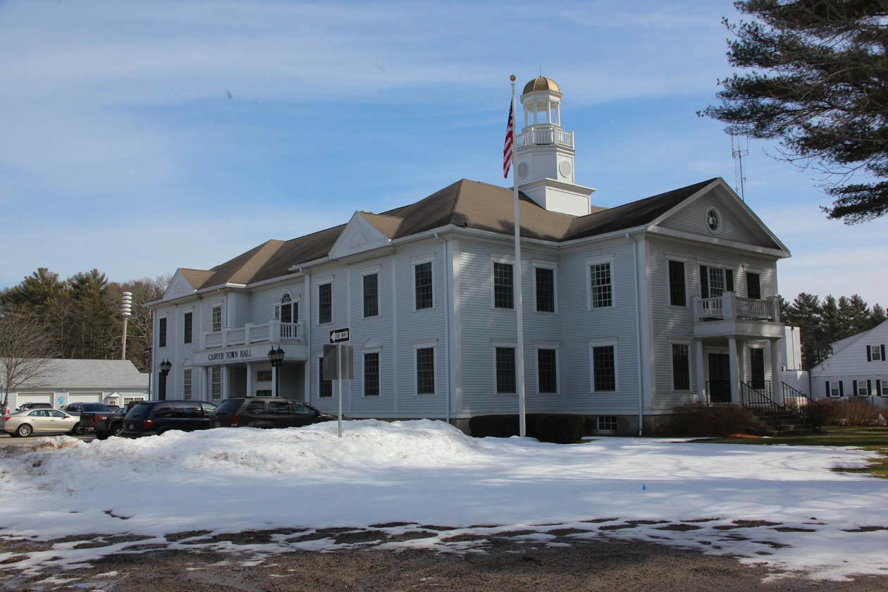
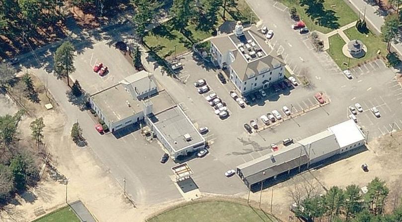
Town Hall (108 Main Street)
● Built in 1997
● 13,800 s.f.
● Condition: Good
● Proposals/Plans: None at this time
WHERE
CAN
The need for an improved space dedicated to seniors’ needs was a main theme of public input for the Master Plan. Seniors stated that the existing Council on Aging building – housed in the Marcus Atwood House at 48 Lakeview Street – does not meet their needs due primarily to limited space. The small size of available rooms makes exercise and dance classes difficult, prevents necessary privacy for legal, financial, and medical services, and makes general use of the facility (e.g. using
stairways and kitchen spaces) dangerous for senior citizens. Similarly, the need for dedicated meeting and event spaces to serve other Carver community groups (such as families with young children, civic groups, and volunteer organizations) was identified as a goal. Carver could also benefit from a location from which the town can provide human services programming such as drug addiction services and strengthened public health services through the Police Department and/or Board of Health. To meet all of these needs, the town should consider creating a combined Community and Senior Center in Central Carver, near the cluster of
● Built in 1997
● 23,000 s.f.
● Condition: Good
● Proposals/Plans: None at this time
numerous existing services and facilities.
SE rvi CES AN d FAC i L i T i ES ST r ATE gy 6-1-
Carver’s seniors and representatives from the Council on Aging provided examples of existing senior centers that represent the type of facility they would like to see in town; these included facilities in Lakeville, Duxbury, Middleborough, Kingston, and East Bridgewater. Some of the main features that these facilities possess (and that are not present in the Marcus Atwood House) are rooms with capacity for 100 to 120 persons
and a professional clinic room (where seniors receive nursing services).
Public meeting participants also identified locations in Carver where they believed the new Community and Senior Center should be sited; they emphasized the need for this facility to be centrally located, stating that the Marcus Atwood House (located in South Carver) is too remote for many residents to conveniently access.
The Council on Aging should partner with the town to explore the feasibility of creating a facility similar to the examples provided in
● Built in 1820
● 5,600 s.f.
● Condition: Fair, possible space constraints.
● Proposals/Plans: None at this time.
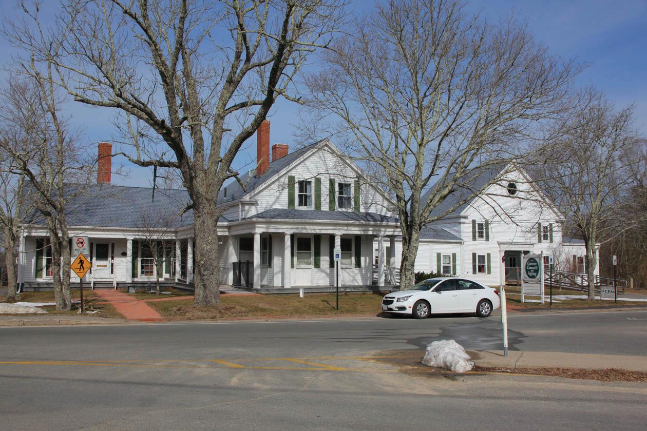
Central Carver. This feasibility study should be conducted by a professional real estate analyst and/or engineering firm and should identify a preferred site and alternative for the building, a project cost estimation, and a detailed implementation strategy. Potential funding for this study may exist through the U.S. Department of Agriculture (USDA) Rural Development under the communIty FAcIlItIes ProgrAm for technical assistance, feasibility, and construction assistance. Additional funding may be available through the Massachusetts Department of Housing and Community Development Community Development Block Grant (cdbg) program
under the Community Development Fund.
SE rvi CES AN d FAC i L i T i ES ST r ATE gy 6-12: BEGIN TO ASSEMBLE STAKEHOLDERS THAT WILL ADVOCATE FOR THE COMMUNITY AND SENIOR CENTER AND IMPLEMENT THE FEASIBILITY STUDY
The idea of a shared facility (one that includes dedicated space for seniors) helps address a main Master Plan theme of “meeting the needs of all Carver residents –especially seniors and young households;” moreover, it also increases the likelihood of this facility becoming a reality. Several examples of shared Community and Senior
● Built in 2001
● 9,500 s.f.
● Condition: Good
● Proposals/Plans: None at this time.
Centers exist in Massachusetts; these facilities can serve as models for project implementation and future management (in other words “how to get the project built and how to successful share the facility”1).
Town Meeting will likely need to approve the bond measure necessary to make this project a reality. Grant funding available for this type of project is highly competitive. Ensuring that the facility is open to all Carver residents and is meeting a wide range of
needs – from recreation and education to public health and safety programming – will increase the chances of voter approval.
1 SRPEDD found examples in Holland, Lexington, Malden, and Natick.
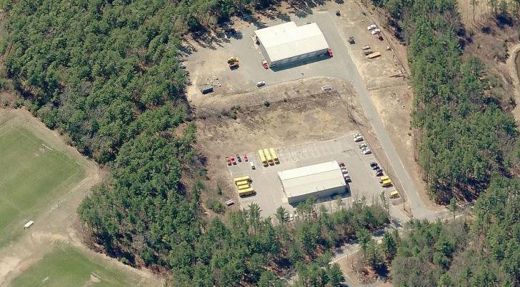
● Central Fire Station/Headquarters (99 Main Street) is currently under construction; will replace portion of shared Police/Fire facility that dates from 1957; the $8.7 M facility will be completed in 2016.
● Station 2 (1 Green Street) is in good condition; built in 1987.
● Station 3 (South Main and Church Streets) is in good condition; built in1996.
BOTTO m L i NE: THE CARVER POLICE STATION NEEDS TO BE UPGRADED
Carver continues to invest in critical public facilities and to do so in a transparent, datadriven manner. Alongside the UMass Boston Collins Institute, the town has proposed a $7.5 million new Police Station at the site of
the current shared Fire and Police facility. (The Fire Department is moving to the new $8.7 million Fire Station at 99 Main Street, opened in 2017.) Additionally, the Police Department is conducting a second “needs assessment” study to determine its long term facility, equipment, and staffing needs; this will complement the previous needs assessment.2 According to the Collins Institute report, construction is anticipated to be approved at Town Meeting
2 The Carver Reporter, April 8, 2016, “cArver town meetIng wArrAnt FeAtures 15 sectIoned ArtIcles.”
Police Station (112B Main Street)
● Built in 1987 (Police portion of the shared facility with Fire Department)
● 13,300 s.f.
● Condition: Fair (there are space issues)
● Proposals/Plans: A new facility is proposed for the site; preliminary cost estimate is $7.5M; construction is likely in 2017-2018; the project was the subject of a 2013 UMass Boston Collins Institute study.
and to begin in 2017. This Master Plan acknowledges the needs for these critical public safety facilities and services.
BOTTO m L i NE: THE NORTH CARVER WATER DISTRICT (NCWD) AND THE TOWN’S ADMINISTRATION AND FINANCIAL OFFICERS SHOULD ADOPT THE PRACTICES RECOMMENDED IN THIS DOCUMENT – INCLUDING THE GOAL OF FOCUSING ECONOMIC DEVELOPMENT TO NORTH CARVER
In 2014, at the request of the Commissioners of the North Carver Water District (NCWD), the Massachusetts Division of Local Services completed an analysis of the district. The request was submitted due to the significant financial shortfalls experienced
● Built in 1972
● 6,500 s.f.
● Condition: Good
● Proposals/Plans: None at this time.
● Built in 1972
● 59,000 s.f. total (two facilities serving PK - 2 and 3 - 5)
● Condition: Scheduled for demolition
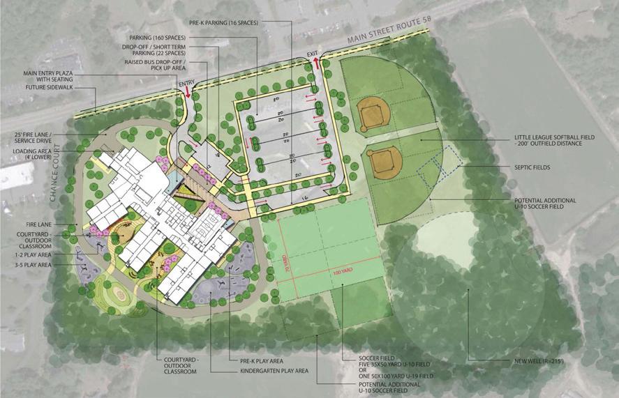
● Proposals/Plans: Construction of a $52 M complex was recently approved at Town Meeting; will likely be completed in 2018
● Built in 1987
● 175,500 s.f. total
● Condition: Good
● Proposals/Plans: None at this time.
by the NCWD. Given that “Carver’s financial interests are very much intertwined with the NCWD,”3 the recommendations of the report should be supported by this Master Plan; this is particularly true for the goal of increasing development within the North Carver Development District (NCDD), which is a Town Meeting-designated and stateapproved economic development area (EDA)
located within the NCWD.4 Thanks to the district increment financing (DIF) mechanism included in the NCDD application, an anticipated 50% of incremental tax revenue from new development within this district will help service NCWD debt. In addition to being approved as a state EDA, the NCDD is a designated Economic Opportunity Area and a Chapter 43D Priority Development Site.
3 Massachusetts Division of Local Services, “Financial Analysis of the North Carver Water District,” 2014, page 10
4 The NCDD was approved at a special Town Meeting in June 2010 and by the state Economic Assistance Coordinating Council (EACC) later that month.
● Built in 1983
● 5,900 s.f., 20 elderly/disabled units and 8 family units
● Condition: Fair
● Proposals/Plans: None at this time.
“One of the main themes of master plan workshops was the desire to ‘increase transportation safety and connectivity for all types of users.’ A ‘Complete Street’ seeks to do just that – it provides safe and accessible options for all travel modes (walking, biking, transit, and vehicles) for people of all ages and abilities. It is important to note that Complete Streets is not a onesize fits all approach; rather, it is about finding what interventions might fit in specific areas in town, which range from rural to suburban in character.”
As a rural community, Carver relies almost exclusively on automobile travel; despite this “auto-dependence,” Carver has few known safety or congestion issues and benefits from its close proximity to regional highways.1 The street network includes a hierarchy of arterial, collector, and local streets that provide a mix of mobility (getting from “Point A to Point B”) and access (getting into and out of a particular place). Route 58 serves as the main roadway in town that provides access to the limited access highways such as Interstate 495 in Wareham and Route 44 in North Carver. Existing traffic volumes are generally consistent on Route 58 (approximately 12,000 vehicles per day) with concentrated areas of higher activity in North Carver, Central Carver, and South Carver. During the most recent years of complete crash data (from 2009 to 2013), there were zero fatalities from vehicular crashes in Carver.2 The majority
1 Four intersections have elevated crash rates: the intersections of (1) Route 58 & Plymouth Street, (2) Route 58 & Center Street, (3) Route 58 & Rochester Road, and (4) Route 58 & Tremont Street.
2 Please note that SRPEDD is aware of the unusual (and very unfortunate) spike of fatal crashes that took place in 2016.
of the reported crashes (63%) at Carver’s major intersections (all on Route 58) were “property damage only (PDO).” The portion of Route 58 that runs through Central Carver (Purchase Street to South Meadow Road) is being reconstructed with upgraded drainage structures and new guardrails, sidewalks, signage, and pavement markings. This improvement project will provide Carver with an excellent starting point for other future improvements in town and for this Master Plan’s efforts to make Central Carver a more pedestrian-friendly place to live, work, and play.
From the perspective of pedestrians and bicyclists, Carver’s facilities could be improved – particularly if these improvements are part of Complete Streets designs that serve existing and future development in Central Carver. While much of Carver’s subdivisions are well served by sidewalks, few main roads have these pedestrian facilities. In addition, the town currently has very few dedicated bicycle facilities: bicycle parking is located in Central Carver and “sharrows” (roadway markings that direct automobiles to share the road with bicycles) are present on Cranberry Road and Lakeview Street. The local Bike Path Advisory Committee had identified several credible areas that would be appropriate for
Crash rates are calculations which express “crashes per million entering vehicles” for intersection locations. MassDOT provides the average crash rates for signalized and unsignalized intersections in the Commonwealth and for each District. Carver is a member of the MassDOT District 5.
1: Route
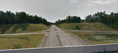

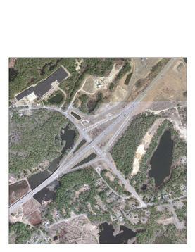
2: Route 44 & Route 58
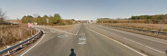
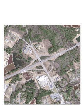
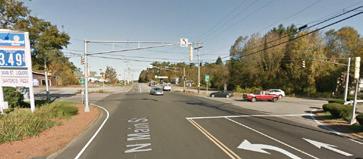
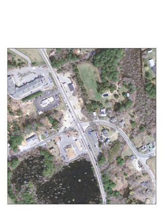
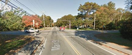
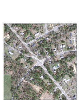

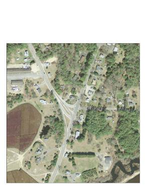
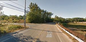
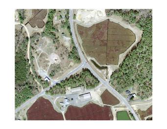
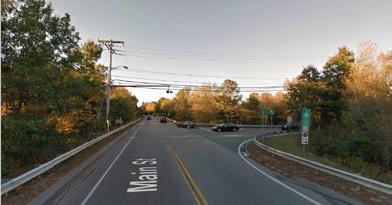
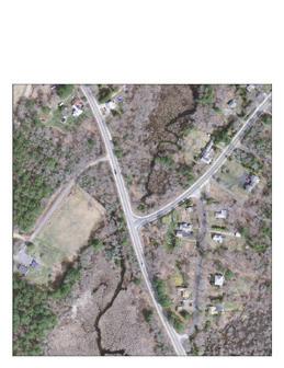
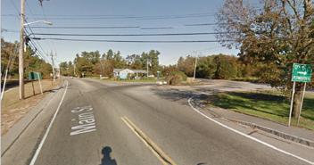
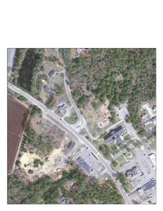
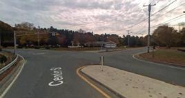
future bicycle facilities – including further sharrow road markings; however, the committee struggled with membership and implementation.
Carver does not have a dedicated fixed route public transportation system (buses that arrive at scheduled intervals); its only existing transit service is demand response public transportation (Dial-A-Ride) provided by the Greater Attleboro-Taunton Regional Transit Authority (GATRA) and operated by the Carver Council on Aging (COA). The demand response service provides travel to medical appointments, shopping, and other activities within Carver and to neighboring communities for the elderly (60+) and disabled residents. Over the past five fiscal years (FY11 to FY15) the Carver COA has provided an average of over 6,000 rides per year. The closest fixed route bus service is operated by GATRA in neighboring Wareham and the closest train service operated by the Massachusetts Bay Transportation Authority (MBTA) is located in Kingston, to the east, Middleboro, to the west, and Halifax to the north (all approximately 12 miles from the center of town).
Despite this relatively healthy assessment, the need for Complete Streets designs throughout Carver and the need to properly manage the impacts from new
developments were major themes of the Master Plan’s public input process.
T r
BOTTO m L i NE: FOCUSING ATTENTION ON AREAS WITH KNOWN SAFETY ISSUES AND IMPLEMENTING LOW COST IMPROVEMENTS IS ESSENTIAL FOR COMMUNITIES WITH LIMITED RESOURCES
Several initiatives are available to improve traffic safety and congestion. Consistent and active enforcement of speed limits in key locations (such as Route 58 in Central Carver) can lead to a significant decline in vehicular speeding. Low-cost signage, roadway markings (such as sharrows), crosswalk bump-outs, and speed humps can all contribute to the safety of all users, including motorists. Also, implementing access management techniques during site planning (reducing curb cuts during site plan review) can ease traffic congestion while improving safety; these techniques include shared driveways, proper intersection design and spacing, turning lanes, and frontage roads or parking lot connectors.
Carver has numerous residential subdivisions, some with a high concentration of children. Without proper design and speed enforcement, these neighborhood roadways can be places where vehicular speeding occurs. Traffic calming techniques such as crosswalk bump-outs, speed humps or tables, raised intersections, traffic circles, and center islands can reduce travel speeds and increase roadway safety for all users –particularly pedestrians who live in these areas. However, without a formal process in place that residents can utilize to inform the appropriate town officials of a safety concern, the issues may go unnoticed and may never be resolved. As such, Carver should consider establishing a Traffic Safety Committee that would be charged with addressing these types of traffic safety concerns. Other communities have established this type of committee, which generally consists of members from the Police Department, the Fire Department, the Planning & Community Development office, the Department of Public Works, the School Department, and other appropriate departments. The committee meets on a regular basis to discuss identified
traffic safety issues in the community, identify potential low-cost improvements, and to allocate funding to pay for the improvements.
T r ANSPO r TAT i ON ST r ATE gy 7-1-2:
CONDUCT ROAD SAFETY AUDITS AT INTERSECTIONS WITH HIGH CRASH RATES
The Master Plan analysis identified four intersections along Route 58 that had elevated numbers of crashes and above average crash rates. The intersections of (1) Route 58 & Plymouth Street, (2) Route 58 & Center Street, (3) Route 58 & Rochester Road, and (4) Route 58 & Tremont Street all had crash rates that exceeded both MassDOT’s Statewide and District crash rates. As such, the town should consider conducting Road Safety Audits (through either a free [if approved] SRPEDD request3 or through a consultant hired by the town) at these high crash locations as a way to identify safety issues and possible opportunities for safety improvements.
T r ANSPO r TAT i ON ST r ATE gy 7-1-3:
IMPLEMENT A PUBLIC SAFETY EDUCATION CAMPAIGN WITH REGULAR SPEED ENFORCEMENT
3 To initiate a road safety audit, Carver’s Town Administrator submits a request to SRPEDD’s Director of Transportation Planning, identifying the intersections in need of study.


Educating the traveling public about the importance of safe driving is a key component in reducing speeding and improving safety for all users. Regular and ongoing educational campaigns run by the Carver Police Department (such as the Carver National Night Out Event) focused on speeding, running red lights or stop signs, driving without headlights, and other items can help to change motorist, bicyclist, and pedestrian behaviors while reducing crashes. These can be low-cost and highly effective initiatives.
T r ANSPO r TAT i ON ST r ATE gy 7-1-4: DEVELOP THRESHOLDS FOR TRAFFIC STUDIES IN THE SPECIAL PERMIT AND SITE PLAN REVIEW PERMIT PROCESSES
Carver’s Special Permit and Site Plan Review permit processes do not have specific thresholds that indicate when a traffic impact study would be needed. Including this information in the zoning bylaw and the rules and regulations would provide developers a set of expectations early in the process and a predictable path toward permit approval.
T r ANSPO r TAT i ON ST r ATE gy 7-1-5: PROPERLY MITIGATE THE IMPACTS OF PRIVATE DEVELOPMENT
As development occurs in Carver, the associated traffic impacts should be closely
monitored to ensure that congestion and safety issued are addressed. The Carver Planning Board should develop consistent and fair guidelines and procedures for requiring developers to mitigate the impacts of their developments;4 in other words, the Planning Board should produce a written document that identifies what levels of traffic production attributable to a specific development require mitigation and to what extent. In addition, the Carver Planning Board should consider developing and adopting a formal traffic monitoring program similar to those required by MassDOT for projects that occur on state highways.
T r ANSPO r TAT i ON ST r ATE gy 7-1-6: ADOPT AND IMPLEMENT ACCESS MANAGEMENT STRATEGIES
Managing the amount of access that vehicles have to parcels of land along a roadway is essential to reducing congestion and improving safety for all users. Access management techniques such as shared driveways, proper intersection design and spacing, turning lanes, and frontage
4 Please note that SRPEDD acknowledges that the Planning Board currently solicits comments from all department heads on all Special Permit, Site Plan Reviews, and Subdivision permit applications to ensure a comprehensive review.
roads or parking lot connectors have been proven to reduce congestion and improve safety. Carver should identify where access management would be most effective and implement the appropriate techniques at those locations.
BOTTO m L i NE: BIKING AND WALKING ARE EXCELLENT WAYS TO STAY HEALTHY AND SAVE MONEY WHILE PROTECTING THE ENVIRONMENT
One of the central themes identified during the Master Plan public input process was the need for improved connectivity and safety in the transportation network for bicycles and pedestrians. Dedicated bicycle facilities, such as bike lanes, sharrows, signage, and parking are lacking in Carver. Currently, bicyclists must share the road with vehicles and the majority of the roadways are not properly signed or marked for this use. In addition, the majority of the existing sidewalk network is generally found in the many subdivisions throughout town, but the network lacks connectivity. The completion of the Route 58 Reconstruction Project (MassDOT #606007)
will provide Carver with a continuous sidewalk network from the Purchase Street intersection to the Plymouth town line on South Meadow Road. This improvement project will provide enhanced bicycle and pedestrian accommodations on a major thoroughfare in town that connects major residential areas to Central Carver; however, more is needed in other areas of town.
T r ANSPO r TAT i ON ST r ATE gy 7-2-1:
COMPLETE A TOWN WIDE BICYCLE AND PEDESTRIAN PLAN
The last update of the Open Space Plan, prepared in 2010, included several bicycle routes along some of the scenic and major collector roadways in Carver. In 2014, the Bike Path Advisory Committee developed a plan for a bike path with signage that ran from the Plympton town line south to the Myles Standish State Forest along some of the same routes identified in the Open Space Plan. Although significant effort has been put into creating a well-thought-out bike path, very little implementation has occurred, mainly due to limited funding. In order to clarify the future bicycle and pedestrian priorities of Carver, the town should create a town-wide bicycle and pedestrian plan that provides for a safe and visible bicycle and pedestrian network between neighborhoods, schools, parks, community centers, and employment
centers. Bicycle and Pedestrian plans are typically created by the Planning Department and paid for by municipal operating funds.
T r ANSPO r TAT i ON ST r ATE gy 7-2-2: WORK WITH MASSDOT TO PARTICIPATE IN THE “COMPLETE STREETS” FUNDING PROGRAM
One of the main themes of master plan workshops was the desire to “increase transportation safety and connectivity for all types of users.” A “Complete Street” seeks to do just that – it provides safe and accessible options for all travel modes (walking, biking, transit, and vehicles) for people of all ages and abilities. Aspects of Complete Streets include consistent signage and wayfinding, bike and pedestrian improvements, landscaping and streetscaping, and building and design features that narrow the apparent roadway width (and thereby improve driver behavior) – all of these features were identified by the public as desirable for parts of Carver. It is important to note that Complete Streets is not a one-size fits all approach; rather, it is about finding what interventions might fit in specific areas in town, which range from rural to suburban in character. By participating in mAssdot ’s comPlete streets FundIng ProgrAm to create a policy and prioritization plan, Carver can identify which
investments to pursue in specific locations and be eligible for technical assistance and construction funding
BOTTO m L i NE: PUBLIC TRANSPORTATION PROVIDES MOBILITY OPTIONS, REDUCES IMPACTS TO THE ENVIRONMENT, HELPS SAVE MONEY, AND CAN HELP SUPPORT THE LOCAL ECONOMY
The Greater Attleboro-Taunton Regional Transit Authority (GATRA) serves communities throughout Southeastern MA with fixed route and on-demand transit service. Fixed route service refers to a transit service that operates on regularly scheduled bus routes on a published time table, while demand response service provides rides to seniors and the disabled population on an as-needed basis. Currently, Carver has demand response transit service for seniors (60+) and the disabled; however, there is no dedicated fixed route bus service in Carver. The closest fixed route bus system, located in neighboring Wareham, runs on Route 28 from the western to central part of town.
This lack of public transportation in Carver reflects an auto-centric environment that lacks the features of an efficient, safe, and convenient multi-modal system.
T r ANSPO r TAT i ON ST r ATE gy 7-3-1: WORK WITH GATRA TO EXPLORE THE FEASIBILITY OF A FIXED-ROUTE BUS SYSTEM
GATRA has expanded service to communities in the past. Neighboring communities of Middleborough, Plymouth, and Wareham all have fixed-route bus service through GATRA. Carver can explore the demand for and feasibility of dedicated fixed-route service with GATRA or the possibility of extending the current systems in the neighboring communities. For example, Link 4 on the Onset Wareham Link (OWL) service (terminates at the Route 28 & Route 58 intersection) or the Wareham/Lakeville Train Connector could theoretically be extended into parts of Carver.
T r ANSPO r TAT i ON ST r ATE gy 7-3-2: IDENTIFY AND IMPLEMENT POTENTIAL PARK AND RIDE LOCATIONS
Carver’s proximity to Interstate 495 and Route 3 provides residents with the benefit of a higher degree of mobility than neighboring communities; however, it comes at a cost. In a matter of minutes, a Carver resident has access to the regional
highway network that allows faster access to major employment areas, shopping centers, and recreational areas; but, this auto-centric behavior can also create serious congestion, safety, and environmental consequences. In order to mitigate these downsides, Carver should investigate the possibility of park & ride locations that allow for more carpooling opportunities, thereby supporting MassDOT’s GreenDOT Policy and providing commuters with a cost-saving method to commute. For example, both the new and old Shaw’s parking lots in North Carver have significant excess parking supply; a portion of these lots could be designated as park and ride facilities. An example of this type of arrangement exists in nearby Kingston at the Kingsbury Square, located at exit 10 on Route 3. The town can approach the owner of the Shaw’s lots to potentially negotiate such an arrangement.
T r ANSPO r TAT i ON g OAL
BOTTO m L i NE: PROPER MANAGEMENT OF ASSETS ASSURES THAT MONEY IS SPENT WISELY
Managing the condition of assets is an essential component in Carver. Limited
funds dictate that each town department be as efficient as possible. As such, a formal asset management system that tracks the age and condition of assets such as vehicles, roadways, signs, and traffic lights can provide Carver with the necessary data to evaluate future needs and to project future costs.
Carver has 105 miles of roadway; approximately 77% or 81 miles, are owned and maintained by the town . Maintaining the condition of the pavement surface is a primary mission of the Carver Department of Public Works (DPW); however, without a formal system in place, the town cannot accurately project the type and extent of future pavement needs and therefore may not be using funds efficiently. To do so in an efficient and non-political manner, Carver should implement a formal pavement management system that could be updated and maintained by the Carver DPW. For example, neighboring Middleborough has a formal pavement management system that contains an evaluation of the existing pavement surface conditions with a comprehensive list of projects and their associated costs. This type of program allows the town to prioritize projects based on a number of factors such as need, cost, and the
benefit to the community. It also provides the ability to forecast future pavement conditions, which helps justify future budget requests and expenditures.
“Land conservation is vital to protecting Carver’s small town, rural character. To continue to protect open spaces, Carver must complement zoning reforms with direct conservation activities described here. Additionally, public workshops throughout the Master Plan process emphasized the importance of continuing to expand open space networks – particularly in areas with strategic habitat, recreational, or water resource protection roles to play in Carver.”
As a rural community, Carver contains significant open spaces and undeveloped land. The Massachusetts Department of Conservation Services (DCS) defines “open space” as “conservation land, forested land, recreation land, agricultural land, corridor parks, and amenities such as small parks, green buffers along roadways, or any open area that is owned by an agency or organization dedicated to conservation;” additionally, the term can also refer to undeveloped or underutilized parcels “with particular conservation or recreation interest” – of which there is significant acreage in Carver. Therefore, for the purposes of this Master Plan, “open space” will be used with this broad meaning, referring to existing conservation areas as well as to land with future conservation potential.
Thanks to Carver’s long and successful tradition of cranberry growing, much of the open space in town is actively in – or in support of – agricultural uses. Much of this agricultural open space is, therefore, granted conditional protection by Massachusetts General Laws Chapters 61 and 61A1. These
12,606 “Chapter” acres combine with 2,364 acres of permanently protected habitat and natural resource land to account for 59% of Carver that is has some type of protected status. Strategies such as agricultural preservation, zoning amendments, acceptance of value-added agricultural practices, continued participation in the Chapter 61 programs, and coordinated land conservation efforts will all be necessary in order to maintain the viability of agriculture – the practice of which is essential to the “rural” part of Carver’s small town, rural character. Additionally, public workshops throughout the Master Plan process emphasized the importance of continuing to expand open space networks – particularly in areas with strategic habitat, recreational, or water resource protection roles to play in Carver.
1 “During the past several decades, constitutional
amendments approved by the citizens of Massachusetts have authorized three programs which require cities and towns to reduce assessments of farm, forest and open space lands, provided the owners make a commitment to keep their lands in one or more of those uses. These programs were motivated in large part by rising property values, which were forcing farmers and forest landowners to sell their land because of the increasing tax burden. These tax reduction programs are known as Chapter 61—the Forestland Act; Chapter 61A—the Farmland Assessment Act; and Chapter 61B—the Recreational Land Act.” Mount Grace Land Conservation Trust, Conservation and Land Use Planning under Massachusetts’ Chapter 61 Laws, 2007
EC r
i
g
BOTTO m L i NE: WHILE CARVER’S TDR AND CLUSTER BYLAWS CAN CONTRIBUTE TO CONSERVATION, THE TOWN MUST ALSO PURSUE STRATEGIC AND DIRECT CONSERVATION EFFORTS IN ORDER TO MAINTAIN ITS RURAL CHARACTER
Land conservation is vital to protecting Carver’s small town, rural character. And while market-based programs (such as TDR) are extremely valuable tools (that are explored in depth in the Land Use element of this plan), they can only go so far in meeting, incentivizing, and steering demand for growth. Carver must therefore complement zoning reforms with the direct conservation activities described here.
OPEN SPACE AN d r EC r EAT i ON ST r ATE gy 8-1-1: TAKE A FRESH LOOK AT CARVER’S CONSERVATION EFFORTS BY UPDATING THE 2010 OPEN SPACE AND RECREATION PLAN (OSRP)
This open space update should include
a property inventory that identifies the ownership, assessed value, and protection mechanism (such as fee simple ownership, conservation easement, or Chapter 61) of each open space resource. It should categorize each parcel’s primary role(s) (such as recreation, habitat corridor, water resource protection, culture or history, agriculture, etc.); this categorization will enable the town and its partners to prioritize land for acquisition that would best complement the purpose of adjoining properties, create open space networks, and achieve the overall goals of the OSRP and Master Plan. The updated OSRP must also meet all state Executive Office of Energy and Environmental Affairs (EOEEA) and Division of Conservation Services (DCS) requirements such as management needs, action plans, and public comments.
OPEN SPACE AN d r EC r EAT i ON ST r ATE gy 8-1-2: ESTABLISH A LOCAL, PRIVATE LAND TRUST “FOR CARVER, BY CARVER”
Comments at Carver’s Master Plan public workshops indicated that the town should establish a local, private land trust. (The Town did create a Conservation Trust Fund at Town Meeting in 2002, but this is dedicated to soft costs associated with land acquisition and is overseen by the Conservation Commission; the Cole Property and Savery Meadows were beneficiaries of this Fund.)
Permanent Conservation Restriction. Please note that approximately 2,364 acres of land are permanently protected, according to the MassEOEEA data depicted here.
Chapter 61 and 61A. Please note that an additional 12,606 acres have conditional protection under these statutes (and do not also have a Conservation Restriction).
“Protected Municipal Lands” from the Carver 2010 Open Space and Recreation Plan. These parcels account for 101 acres of protected land.
MIDDLEBOROUGH
This type of effort would involve forming an organization dedicated to acquiring, protecting, and potentially managing open space in Carver. Several local, regional, and national land trusts and associations are available as models and resources for this effort; they range in scale from all volunteer non-profits to larger organizations with full time staff.2 This local land trust would work in concert with the town and would be able to help address the goals of the Community Preservation Committee’s Community Preservation Plan. Carver should actively investigate how other local land trusts were established and how they operate. This type of effort could be led by a small number of board members from the Open Space and Recreation Plan Update Committee and/or the Master Plan Committee.
OPEN SPACE AN d r EC r EAT i ON g OAL 8-2: ENHANCE THE VISIBILITY OF AND PROVIDE CONNECTIONS TO CURRENT OPEN SPACE AND RECREATION
2 The sIPPIcAn lAnd trust in Marion is a nearby example of a successful local, private land trust with a small staff; the wIldlAnds trust is a regional land trust; and the lAnd trust AllIAnce is a national land trust.
BOTTO m L i NE: IN ORDER FOR THE PUBLIC TO ENJOY OPEN SPACE AND RECREATION AREAS, THEY NEED TO KNOW WHERE THEY ARE AND BE ABLE TO SAFELY AND COMFORTABLY ACCESS THEM
Carver’s residents enjoy a rural, small-town lifestyle that is complimented by large open spaces and recreation areas which allow for many outdoor activities such as hiking, hunting, fishing, boating, and swimming. Open spaces like the Myles Standish State Forest, the Cole Property, the Indian Brook Conservation Land, the Savery Avenue Conservation Land, Shurtleff Park, and Sampson’s Pond are just a few examples of the many town assets that Carver’s residents can enjoy. Just as important to preserving these valuable areas is the ability of the residents to know where they are and how to access them in a safe and comfortable manner.
OPEN SPACE AN d r EC r EAT i ON ST r ATE gy 8-2-1: ENHANCE THE TOWN’S WEBSITE TO BE A “CENTRALIZED LOCATION” FOR ALL INFORMATION ABOUT CURRENT OPEN SPACE AND RECREATION LOCATIONS
The town’s website currently provides a list of community playgrounds, hiking and walking trails, locations to swim and fish, and family entertainment venues. This is a great place to centralize all of the town’s
assets so the public can easily know where they are and how to access them. According to public input, helpful additions to this site may include (1) identifying the town department/committee and a point of contact that manages the site, (2) hours of operation (if applicable), (3) area maps with parking locations, (4) pictures of the sites for visual reference, and (5) a mapping feature that can provide directions for interested visitors. More advanced features may include interactive maps with easy to understand icons that identify open spaces, clarify their level of public access, and describe activities allowed there. Finally, the website can serve as a forum for discussion; this type of web presence can help publicize these valuable areas while communicating their needed maintenance.
OPEN SPACE AN d r EC r EAT i ON
ST r ATE gy 8-2-2: EXPLORE THE USE OF INFORMATIONAL AND “WAYFINDING” SIGNAGE TO PROMOTE THE USE OF AND ACCESS TO OPEN SPACE RESOURCES AND RECREATION ASSETS
Complementing the web presence initiative, the town can investigate the possibility of installing informational and wayfinding signs at each open space and recreation area. These types of “branding” signs can be helpful to residents and visitors by providing them with information about the particular
site (history, maps, hours of operation, etc.) as well as providing the locations of other sites in town. Several residents at the Open Space and Recreation, Natural and Cultural Resources, and Agriculture public workshop expressed a desire to have a “centralized” informational kiosk.
OPEN SPACE AN d r EC r EAT i ON ST r ATE gy 8-2-3: STAY CONNECTED WITH LOCAL, REGIONAL, AND STATE LEVEL GROUPS OR ASSOCIATIONS DEDICATED TO IMPROVING CONNECTIONS TO OPEN SPACE AND RECREATION FACILITIES
Staying connected with local, regional, and state groups can help Carver be more informed about important initiatives and potential funding opportunities. For example, continued participation in groups such as the South Coast Bikeway Committee and the Southeastern Massachusetts Metropolitan Planning Organization (SMMPO) are important to the success of a number of recreation and mobility goals found in the Transportation and Circulation element.
CO m PLE m ENTA ry ACT i ONS: trAnsPortAtIon strAtegy 7-2-1: COMPLETE A TOWN WIDE BICYCLE AND PEDESTRIAN PLAN
T r ANSPO r TAT i ON ST r ATE gy 7-2-2: ADOPT A COMPLETE STREETS POLICY
OPEN
SPACE AN d
r EC r EAT i ON g OAL 8-3: CONTINUE TO ACTIVELY PURSUE OPEN SPACE
BOTTO m L i NE: CONTINUED OPEN SPACE CONSERVATION IS A VITAL PART OF MAINTAINING CARVER’S RURAL CHARACTER
In order to maintain the beauty of Carver, continued efforts need to be made toward actively pursuing open space conservation. Massachusetts has numerous state programs that support these efforts. Moreover, local and regional activities can make a big difference in expanding and supporting Carver’s open spaces.
OPEN SPACE AN d r EC r EAT i ON ST r ATE gy 8-3-1: CONSIDER FUNDING A FULL-TIME CONSERVATION AGENT
Many of Carver’s residents voiced concerns about the lack of supervision and enforcement of environmental regulations after development projects are permitted and constructed. In addition, the lack of town personnel devoting time to pursuing grant funding, acquiring open space,
and implementing the Open Space and Recreation Plan are areas of concern that the public raised during public workshops. Carver recently reduced the Conservation Agent position to part-time (2014); however, with reduced time to allocate to numerous objectives, a part-time employee will struggle with implementation. A full-time employee will have more time to address important issues.
OPEN SPACE AN d r EC r EAT i ON
ST r ATE gy 8-3-2: HIRE A FULL- OR PARTTIME GRANTS WRITER
Writing a successful grant proposal takes a great deal of knowledge, skill, and experience. Many communities require their full-time professional staff to pursue grant opportunities, which can create distractions from their day-to-day work and may, due to time constraints, not produce the best application. Hiring a full- or part-time grant writer dedicated to pursuing state and federal grants can reduce the demand on the professional staff while producing the best possible proposal.
OPEN SPACE AN d r EC r EAT i ON
ST r ATE gy 8-3-3: CREATE AN OPEN SPACE ACQUISITION SUBCOMMITTEE THAT WOULD REPORT DIRECTLY TO THE OPEN SPACE AND RECREATION PLAN UPDATE COMMITTEE
In 2008, the Conservation Commission established the Open Space and Recreation Plan Update Committee to oversee the implementation of the Open Space and Recreation Plan. A very important component of this implementation would be a complementary Open Space Acquisition Subcommittee dedicated to actively acquiring open space. This subcommittee would be the liaison between a property owner looking to sell their land to the town or land trust for conservation purposes. A successful model of this type of committee can be found in nearby Marion – the Marion Open Space Acquisition Committee (MOSAC).
BOTTO m L i NE: CARVER’S CITIZENS NEED SUFFICIENT RECREATION FACILITIES
The need for an improved space dedicated to seniors’ service and recreation needs was a main theme of public input for the Master Plan. Seniors stated that the existing Council
on Aging building – housed in the Marcus Atwood House at 48 Lakeview Street – does not meet their needs due primarily to limited space. Similarly, the need for dedicated meeting and event spaces to serve other Carver community groups (such as families with young children, civic groups, and human service and volunteer organizations) was identified as a goal. Lastly, the Master Plan public input and document review process also identified the need to replace Carver Middle High School’s sports field.
CO m PLE m ENTA ry ACT i ONS: servIces And FAcIlItIes goAl 6-1: EXPLORE THE FEASIBILITY OF A COMBINED COMMUNITY AND SENIOR CENTER TO MEET THE NEEDS OF ALL CARVER RESIDENTS
OPEN SPACE AN d r EC r EAT i ON ST r ATE gy 8-4-1: REPLACE THE CARVER MIDDLE HIGH SCHOOL FOOTBALL FIELD, TRACK, SPECTATOR INFRASTRUCTURE, AND PRESS BOX
In late 2015, Carver’s School Administration worked with a Gale Associates, an engineering and planning firm located in Greater Boston, to conduct a needs assessment on the Carver Middle High School’s athletic facilities. The report concluded that the current “track and game field facility is unserviceable and obsolete in
the design.” 3 While the full range of options to improve the facility includes some features that are likely cost-prohibitive (such as including artificial turf), this Master Plan supports necessary upgrades that meet the needs of Carver’s residents and students in a fiscally responsible manner.
B OTTO m L i NE: T HE TOWN SHOULD CONSIDER ORGANIZATIONAL CHANGES AND COLLABORATIONS TO SUPPORT CONSERVATION EFFORTS
OPEN SPACE AN d r EC r EAT i ON ST r ATE gy 8-5-1: EXPLORE A POTENTIAL PARTNERSHIP WITH THE STATE DEPARTMENT OF FISH & GAME FOR DEVELOPMENT AND MANAGEMENT OF ACCESS TO TOWN OWNED LAND ADJACENT TO WATER RESOURCES
The Massachusetts Department of Fish & Game Office of Fishing and Boating Access provides communities with the opportunity to develop boating access facilities on publicly owned water bodies.
3 Recreation Master Plan Report: Carver Middle High School, October 23, 2015, page 1
This partnership helps the community with design and construction of the facility and establishes more water access for residents and visitors. The Berkley Bridge Village Heritage Park located on the southeast abutment of the Berkley-Dighton bridge is an example of that type of partnership.
OPEN SPACE AN d r EC r EAT i ON ST r ATE gy 8-5-2: ENCOURAGE AND CREATE LOCAL PARTNERSHIPS TO ALLOW FOR ADDITIONAL VOLUNTEER ASSISTANCE AND FUND RAISING OPPORTUNITIES
Carver can support its local conservation and recreation efforts through volunteerism. For example, local “Friends of” groups are a collection of people who voluntarily work to maintain, improve, and promote a particular program or project. As part of implementing the Master Plan and Open Space and Recreation Plan, active and concerned residents could consider forming a group similar to the “Friends of Myles Standish State Forest” as an informal organization to help maintain open space areas. This effort could happen in conjunction will local youth and service groups such as the Young Peoples’ Alliance of Carver, the Carver School District, or the local Girls and/or Boy Scout Troops; these groups already help to promote and maintain Carver’s recreation opportunities.
Carver has a number of independent boards and/or committees that may have overlapping goals or objectives. For example, recreation assets are the purview of the Buckman Park & Beach Committee, the Crystal Lake Community Garden, the Municipal Playground Committee, and the Shurtleff Park Committee. And the Open Space and Recreation Plan Update Committee, Plymouth/Carver Aquifer Committee, Conservation Commission, and Green Committee all address conservation and sustainability in Carver. In light of the comments regarding the lack of volunteers, Carver should take a close look at consolidation of efforts to ease the demand on citizen participation and create more “bang for the buck.”
I V “Carver is rich with traditions ranging from cranberry farming to events such as Old Home Day. Participants at Master Plan workshops identified several cultural and historic groups, assets, and events that the town can continue to support.”
The Town’s previous Master Plan does an excellent job describing Carver’s Natural and Cultural resources and how growth competes with efforts to maintain Carver’s character. This 2001 document states that “Carver’s rolling landscape of cranberry bogs and uplands, pine forests, rivers, wetlands, and ponds provide a backdrop to historic village centers, scenic views, and historic sites of residential, industrial, and pre-historic settlements. These unique environments, scenic views, and special places define the towns [sic] character. Only in the last 30 years with the extension of Routes 3 and 495 and the commuter rail line, has new development begun to threaten this identity.”1
The plan also includes an inventory of historic sites and “special” places in Town:
hIstorIc sItes2
• Middleborough-Plymouth Railroad
• Benjamin Ellis School/Mt. Carmel Church
• Lakenham Historic District
1 2001 cArver mAster PlAn, page 5-1
2 Ibid. page 5-5
• Huckleberry Corner (old meeting house)
• North Carver Green
• Cole’s Mill, old train station by Cole’s Mill
• Lakenham Cemetery
• Former Advent Church
• John Savery Homestead
• King Philip Hall
• Savery Historic District
• Cross Paths
• George Bowers Home
• Old house and winery at South Meadow and Ward
• Union Church
• Pope’s Point Furnace
• Edaville Railroad
• Federal Furnace
• Crane Brook Tea Room
• Methodist Church
nAturAl And
• Marcus Atwood House
• Charlotte Furnace
sPecIAl PlAces3
• High Street
• Meadow Street
• North Carver Green
• Union Church and Cemetery
• Plymouth Street
• Site of Edaville Railroad
• Purchase Street cranberry bogs
• Sampson’s Pond as seen from Lakeview Street
• Route 44 cranberry bogs
• Cranberry Road cranberry bogs
• Pond Street cranberry bogs
• Federal Road
3 Ibid. page 5-6
• Mayflower Road
• Old Main Street cranberry bogs
• Wareham Street
• South Meadow Brook
• Indian Street
• Shurtleff Park
• Tremont Street
• Town Hall
• South Carver Town Line
• Weweantic River
• East Carver Town Line
• Cross Streets and Popes Point Road
• Winnetuxet River
• Savery Avenue
• Wankinco River
This master plan element seeks to continue the work of protecting - and even promoting these assets through the following actions.
BOTTO m L i NE: CARVER’S HISTORIC AND CULTURAL ASSETS SHOULD BE PRESERVED FOR FUTURE GENERATIONS
As an early colonial settlement – one that takes its name directly from the first Governor of Plymouth Colony – and as an area settled by native peoples long before European colonists arrived, Carver’s history certainly deserves preservation and promotion. Moreover, as a community, Carver is rich with traditions ranging from cranberry farming to events such as Old Home Day. Participants at Master Plan workshops identified several cultural and historic groups, assets, and events that the town can continue to support.
NAT ur AL AN d C u LT ur AL r ESO ur CES
ST r ATE gy 9-1-1: UTILIZE THE WEALTH OF EXISTING WORK TO CREATE A HISTORIC PRESERVATION PLAN
Communities across Massachusetts have created plans dedicated to preserving and promoting their local history. The scope and
format of Historic Preservation Plans vary by and can be specialized for every community. According to the Massachusetts Preservation Planning Division, “the first step in a community’s preservation planning process is to identify, describe and locate buildings, structures, objects, areas, burial grounds, landscape features, and sites that are of historical, architectural, or archaeological importance to the community, the state, or the nation. A comprehensive inventory of a town’s historical assets serves as the basis for all future preservation activities.”4 Carver has a head start in this process – it already has significant documentation and organization to support historic preservation. The Historic Commission can add to this work by formally confirming and updating its existing inventory of historic assets in Carver; this work would be substantially advanced by the Historic and Cultural Resources element of Carver’s previous Master Plan. Any updated inventory should include an accurate geographic information systems database, maps, photos, text, and as much documentation as possible. The Commission can then pursue – by referencing plans from similar communities – the creation of a full Historic Preservation Plan using CPA moneys and other funds including, but
4 mAssAchusetts PreservAtIon PlAnnIng dIvIsIon webpage
not necessarily limited to the Mass Cultural Facilities Fund, Mass Historical Commission Survey & Planning Grants, and the mAss PreservAtIon Projects Fund.
NAT ur AL AN d C u LT ur AL r ESO ur CES
ST r ATE gy 9-1-2: COMPLETE AN EVALUATION OF THE MARCUS ATWOOD HOUSE AS A FUTURE MUSEUM SITE
If the Carver Council on Aging facility is relocated to a new building (in conjunction with Services and Facilities Strategy 6-1-1), the Marcus Atwood House (built in 1845 by prominent local cranberry-growing family) should be studied as a possible museum site. This historic home no longer meets the needs of Carver’s seniors due primarily to size constraints and safety concerns. However, the structure could be an ideal location for a local historic museum and a way to keep one of Carver’s historic and architectural assets open and accessible to the public.
CO m PLE m ENTA ry ACT i ON:
servIces And FAcIlItIes goAl 6-1: EXPLORE THE FEASIBILITY OF A COMBINED COMMUNITY AND SENIOR CENTER TO MEET THE NEEDS OF ALL CARVER RESIDENTS ED H OS NR I I V T A SF
NAT ur AL AN d C u LT ur AL r ESO ur CES ST r ATE gy 9-1-3: CONTINUE TO ACTIVELY SUPPORT CARVER OLD HOME DAY TO ENSURE THAT THIS EVENT CONTINUES TO OCCUR IN TOWN
Public workshop participants identified the annual Carver Old Home Day as an essential, cherished event that should be maintained for future generations of Carver residents. According to the event’s website, “Carver Old Home Day has been a tradition since 1901 providing a day for the community to come together and celebrate the history of our town. The mission of the Carver Old Home Day Association is to continue to provide a relaxing day for families to come out and meet their neighbors and enjoy their families.” The event is sponsored by a local non-profit, the Carver Old Home Day Association. The town should continue to do all it can to support this event by coordinating related efforts and available resources of its historic and cultural committees.
MassDEP Zone II Aquifers
MassDEP High-Yield Aquifers
MassDEP Medium-Yield Aquifers
MassDEP Interim Wellhead Protection Area (IWPA)
Water
Interstates Arterials and Collectors Local Roads
BOTTO m L i NE: PUBLIC MEETING
PARTICIPANTS EXPRESSED A DESIRE TO UPDATE THE TOWN’S PRIORITY
PROTECTION AREAS (PPAS) AND PRIORITY DEVELOPMENT AREAS (PDAS) ON AN ONGOING BASIS
Cities and towns across Massachusetts have designated PDAs and PPAs as simple mapped areas describing where (and how) they would like to develop land and where (and why) they would like to protect land. In turn, the Commonwealth considers these priority areas when reviewing various grant applications (such as MassWorks and LAND grants). Carver first completed this work in 2008. In 2013, other communities in southeastern Massachusetts completed an update as part of land use planning associated South Coast Rail project; however, since Carver is not part of the South Coast Rail corridor, it did not update its priority areas.
NAT ur AL AN d C u LT ur AL r ESO ur CES ST r ATE gy 9-2-1: THE CARVER PLANNING BOARD AND CONSERVATION COMMISSION SHOULD CONVENE JOINT MEETINGS TO UPDATE THE TOWN’S PDAS AND PPAS
Carver’s 2008 PDA and PPA designations deserve review and update. As part of the 2013 update, other communities relied on geographic information systems (GIS) data (such as BioMap2 Habitats, Aquifers, zoning districts, and parcels that were unavailable or not utilized in 2008) to make precise and accurate PDA and PPA boundaries and to clarify the purpose of their designations; all of these characteristics can be updated along with new insights from meeting participants. Moreover, in addition to employing new data and technology, it is good practice to update these designations. As Carver completes development projects, infrastructure investments, and zoning changes in and around PDAs, it makes sense to adjust their boundaries to reflect the new “reality on the ground;” similarly, as land conservation is advanced within and around PPAs, their boundaries should also change. As was this case in 2008, the Planning Board and Conservation Commission should partner to update the PDAs and PPAs. These two entities should also solicit active participation and substantive input from businesses, town committees, public and private partners, and the general public.
BioMap 2 Core Habitat
BioMap 2 Critical Landscape
NHESP Priority Habitat
NHESP Certi ed Vernal Pool
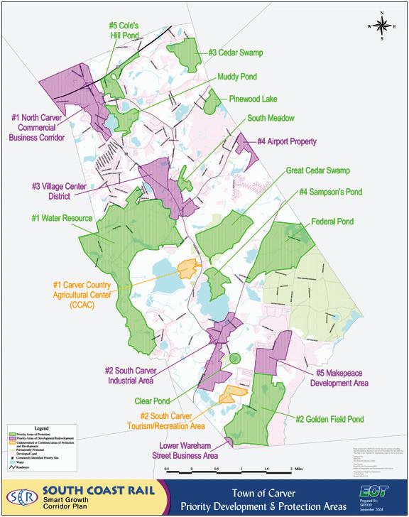
CO m PLE m ENTA ry ACT i ON:
lAnd use goAl 3-1: LAND USE POLICIES SHOULD PROTECT
CARVER’S SMALL TOWN, RURAL CHARACTER BY ENCOURAGING GROWTH IN PREFERRED LOCATIONS
oPen sPAce And recreAtIon goAl 8-3: CONTINUE TO ACTIVELY PURSUE OPEN SPACE CONSERVATION
Priority Area Boundaries
Priority Area Boundaries
Selec ted Parcels and O verlays
Selec ted Parcels and O verlays
Environmental Considerations
Environmental Considerations
Zoning Distric ts
Zoning Distric ts
In 2013, towns used over 50 GIS layers to make clear, data- driven changes to their community Priority Areas.
In 2013, towns used over 50 GIS layers to make clear, data- driven changes to their community Priority Areas
“Farming is one of the most important aspects of Carver’s culture, history, and economy. This has been the case for generations and it is the town’s hope that agriculture will continue to thrive in Carver’s future. In order to plan for the future health of local farms, the Master Plan includes this supplementary Agriculture element. This work includes the recommendations of a temporary subcommittee of working farmers and agricultural planning professionals who helped the town explore innovative agricultural ideas.”
Farming – especially cranberry growing – is one of the most important aspects of Carver’s culture, history, and economy. This has been the case for generations and it is the town’s vision that agriculture will continue to thrive in Carver’s future. With just over half of Carver’s land devoted to farming (12,843 out of 25,422 acres, or 50.5%), the town already pursues several policies that seek to support agriculture. For example, nearly all farming-related properties in town (12,606 out of 12,843 acres) are given temporary, conditional property tax reduction and protection by Massachusetts General Laws Chapters 61 and 61A. Moreover, the town’s adoption of its Rightto-Farm bylaw clearly demonstrates its long term support of cranberry growing in Carver. However, with the local cranberry industry facing more and more competition from other sources and with the aging of some farmers whose families don’t have plans for continued farming, the future of agriculture is in question.
In order to plan for the future health of local farms, the Master Plan includes this supplementary Agriculture element. This work includes the recommendations of a temporary subcommittee of working farmers
and agricultural planning professionals who helped the town explore innovative agricultural ideas. The subcommittee approached its work based on the idea that agricultural resilience involves economic, social, and ecological issues, as well as: the ability to adjust to stresses and disturbances while still being able to provide crops; the retention of healthy and productive soils and support land; and practices that complement and provide valuable ecosystem functions in the process.
This broad menu of options is presented here as a resource for the Carver Agricultural Commission, its partners, and local farmers as they consider the future of farming in Carver.
Agri C u LT ur E g OAL
10-1: WORK WITH THE CARVER AGRICULTURAL COMMISSION TO UPDATE ITS “PLAN OF WORK” BY EXPLORING THE RECOMMENDATIONS OF THE MASTER PLAN’S AGRICULTURAL SUBCOMMITTEE
The temporary agriculture subcommittee explored several innovative strategies to promote the continued health of cranberry growing in Carver. Its recommendations can help inform Carver’s Agricultural Commission as it updates its Plan of Work (2006); these ideas include (1) incorporating recommendations and elements of the mAssAchusetts crAnberry revItAlIzAtIon tAsk Force: FInAl rePort (2016), the crAnberry chArt book (2016, and updated annually), and the mAssAchusetts locAl Food ActIon PlAn (2015), amongst others, dealing with agricultural sustainability, best management practices, business planning, and food production and food security; (2) providing succession planning workshops or seminars aimed at helping local farmers prepare for the future of their property; (3) providing low-interest, long-term capital for farmers who employ agricultural innovation techniques; (4) encouraging business services for diversification; (5) securing guaranteed loans from mAss develoPment, strollIng oF the heIFers, And the cArrot Project; (6) creating renovation programs that help farmers change to higher yield berries; (7) promoting “exit strategies” for farmers or their agricultural lands; and (8) allowing Chapter 61A “rollback taxes”
(acquired when a farmer removes land from protection) to be put into a special fund that would be used to acquire important farmland in town in the future (the Town of Dighton has such a program).
As a standard practice, the Agricultural Commission should review its Plan of Work annually and update it no less than every two years in order to stay up-to-date with federal, state, and local policy and programmatic changes that could influence the practice of agriculture in town (see “creAtIng useFul work PlAns: A guIde For mAssAchusetts AgrIculturAl commIssIons”).
These types of efforts should be explored by the Carver Agricultural Commission in conjunction with partnering organizations such as Land for Good, the Wildlands Trust, Massachusetts Department of Agricultural Resources (MDAR), the Cape Cod Cranberry Growers Association (CCCGA), and local legislators.
Cranberry Bogs and Support Land
Land Accessory to Cranberries
Former Cranberries
Vegetables
Grain or Hay
None Apparent
12,843 acres of which 12,606 (98.1%) are Chapter 61 or 61A parcels
BOTTO m L i NE: CARVER’S FARMERS CAN MAKE BETTER USE OF THE EXISTING PROGRAMS, SERVICES, AND SPECIAL EXEMPTIONS ALREADY IN PLACE
The Agricultural Commission and Planning Board can help Carver’s farmers to participate in numerous programs provided by the Massachusetts Department of Agricultural Resources (MDAR). These include the Massachusetts Farm Energy Program (MFEP), the Agricultural Energy Grant Program (Ag-Energy), Ag Environmental Enhancement, and the Farm Viability Program. All of these existing programs can help local farmers reduce energy use, identify renewable energy options, and develop innovative strategies with farm viability plans.
Additionally, the existing Massachusetts Agricultural Preservation Restriction (APR) program provides opportunities for farmers to conserve their land, or under the APR Improvement Program (AIP), help to sustain active commercial farming on an existing APR property. APR is a voluntary program that is intended to offer a non-development alternative to farmers and other owners of “prime” and “state important” agricultural land who are faced with a decision regarding future use and disposition of their farms. Towards this end, the program offers to pay farmland owners the difference between
the “fair market value” and the “agricultural value” of their farmland in exchange for a permanent deed restriction which precludes any use of the property that will have a negative impact on its agricultural viability.
The AIP requires participants to work with MDAR to develop a Farm Improvement Plan (FIP) derived from a business analysis process for the existing APR property. Participants commit to implementing an improvement strategy identified in the FIP.
The Carver Agricultural Commission can also promote the use of the TDR Bylaw (see the “Land Use” section of this plan, Goal 3-2) to help preserve the practice of agriculture in Carver. The reduction of the current thresholds of the TDR Bylaw could allow for greater participation of the agricultural community in this process.
Agri C u LT ur E g OAL 10-3: ADVOCATE FOR CHANGES TO SOME CHAPTER 61A AND MDAR PROGRAM
BOTTO m L i NE: CHAPTER 61A AND MDAR PROGRAMS SHOULD EVOLVE TO BETTER HELP FARMERS
In the early 1970s, the Massachusetts Chapter 61 programs were established to provide landowners the ability to protect water resources and wildlife habitats, continue the practice of agriculture, sustain the sense of rural character, and to provide outdoor recreation in exchange for property tax reductions. To be classified as farm land under Chapter 61A, the land has to be “actively devoted” to agricultural or horticultural use.1 As economic realities have changed and technological advancements have been made, these requirements have the effect of preventing some farmers from using a portion of their land to generate revenue by producing renewable energy. For example, according to the Massachusetts Department of Revenue, development or installation of solar or wind facilities on Chapter-classified land will constitute a change in use and trigger a municipality’s right of first refusal (to purchase the property) and a penalty tax assessment (either in the form of a conveyance or rollback, whichever is applicable). In other words, if the solar panels, wind turbines,
and related structures are intended to supply power on-site (for example to irrigate bogs) then the land occupied by the facilities would continue to be considered necessary and related land; on the other hand, if the energy is used for other power generation purposes or is sold to the grid, then the land no longer qualifies for Chapter 61A classification. This ineligible land would include land under the solar arrays, wind turbines, and any surrounding land necessary for the operation of the solar or wind farm or facility (e.g., access roads) or impacted by its operation – even if the land is still producing cranberry vines for resale.
1 “Actively devoted” means the land must be used (1) primarily and directly for agricultural or horticultural production, or (2) in a manner necessary and related to that production; in other words, in a manner that directly supports or contributes to the production, including farm roads, irrigation ponds, land under farm buildings.
Carver should work to amend Chapter 61A to allow farmers to generate on-site power and to sell energy to the grid to support their farms - as long as it is still producing agriculture and is not disruptive to the rural character of Town. The Agricultural Commission can also work with MDAR to look at reframing energy use restrictions by lowering the threshold of renewable energy that farmers must use on their property. Finally, the Ag Commission can also advocate for allowing farmers that do not produce the minimum gross sales requirement of agricultural products ($500) to remain a part of the Chapter 61A program until calendar year 2020, which could provide needed flexibility to Carver’s community of farmers as they navigate the complex system of
programs and options.
It should be noted that many of the above strategies are found in the recent mAssAchusetts crAnberry revItAlIzAtIon tAsk Force: FInAl rePort. This report also recommends (1) amending the roll-back tax component of Chapter 61A to insure that it would not apply to land that is acquired by a federal agency for natural resource protection; (2) amending Chapter 61A’s Cranberry Land Assessment for Conversion to Permanent Protection; (3) participation in the Renovation Loan Guarantee Program and Tax Credits; (4) making the USDA Agricultural Conservation Easement Program better for cranberry growers; and (5) modification to the Farm Viability Enhancement Program. These and other changes to these agricultural programs should be explored and advocated for if the Carver Agricultural Commission concurs that they will improve the viability of farming in town while still protecting Carver’s rural character.
BOTTO m L i NE: EFFORTS TO PROMOTE CARVER’S AGRICULTURAL ECONOMY CAN PAY BIG DIVIDENDS
Public workshop participants expressed a desire to promote their agricultural economy as part of their town’s character. Connecting the public and future farmers with local cranberry farmers is an essential part of ensuring their longevity. Various techniques ranging from web-based marketing to annual events can demonstrate the vitality of Carver’s farming community and economy. All of these strategies are linked to the Agricultural Commission’s original Plan of Work, Goal B, which emphasized the need to “Educate residents of the community about farming, normal farm practices, and living near a farm.” This should be a part of any subsequent Plan of Work and is a key element in promoting and maintaining the practice of agriculture and the agricultural resiliency of a farm community.
Agri C u LT ur E ST r ATE gy 10-4-1: PROMOTE AND DEVELOP LOCAL “AGTOURISM”
In neighboring Wareham, A.D. Makepeace holds an annual Cranberry Harvest Celebration that allows citizens the opportunity to witness a typical crop harvest while learning more about the cranberry industry. Carver farmers could potentially partner with the Cape Cod Cranberry Growers Association (CCCGA) to develop a similar event or a series of events dedicated to that same idea while also connecting
Carver residents with local bog owners. During Master Plan public workshops, residents also suggested creating a low-cost interactive map for the town’s website; this type of marketing could direct potential visitors to participating cranberry farmers; residents called this initiative “Go See a Local Farmer.” Participating farmers could provide tours, instructional opportunities, and opportunities for local volunteers to help around the farm. They could use these venues to market and brand a “Carver’s Own” line of cranberry products.
Agri C u LT ur E ST r ATE gy 10-4-2: CREATE PROMOTIONAL MATERIALS THAT HIGHLIGHT THE UNIQUENESS OF THE “CARVER CRANBERRY” AND LIFE ON A CARVER FARM
The Agricultural Commission can identify farmers who still produce unique berries, products, and cultivate/source traditional fruit/vines. Some of these source products are in high demand from growers not only in Massachusetts, but also around the world. By exporting this valuable product and through promotional materials – such as a “Living Near a Carver Farm” brochure – Carver’s farmers can market both the product and the process of cranberry growing in Carver.
Agri C u LT ur E ST r ATE gy 10-4-3: EXPLORE PARTNERSHIPS WITH LOCAL EDUCATIONAL INSTITUTIONS
Interested farmers could partner with local educational institutions such as the Bristol County Agricultural High School, Bristol Community College, Wheaton College, UMass Dartmouth, or Bridgewater State University to provide “internships” for students during the growing seasons. These students represent the future workforce for farms in Massachusetts. Carver must actively cultivate relationships with these regional schools in order to ensure local economic viability in the years and decades to come.
Agri C u LT ur E S T r ATE gy 10-4-4: MAINTAIN A S UPPORTIVE B USINESS E NVIRONMENT FOR AGRICULTURE
The town should revisit the 2006 survey/ study “The Economic Impact of Agriculture on Carver,”undertaken by First Pioneer Farm Credit on behalf of the Carver Agricultural Commission as an element of its first Plan of Work. This survey and summary of agriculture in Carver was timely and informative to the Plan of Work at the time (covering topics such as the age of the owner/operator; land protection status; business plans; view of long-term farm viability; etc.). In the ensuing decade, a great deal of change has occurred in the practice of agriculture (including the programs,
policies, tools, and technology available to farmers from federal, state, regional, and local sources), the value of the primary crop, the number of farms, and acres of agricultural land in production.
Healthy soil provides a foundation for the production quality food crops, both in and above the ground, and a filter for the quality of the water needed to sustain the community, below. The responsible practice of agriculture helps to retain the health and productivity of those soils best suited to agricultural production. Knowing the location, importance, and uniqueness of important farmland soils is essential to preserving these areas for future food production and supply as part of the statewide food security plan. This will also help to inform the use of the TDR Bylaw and direct growth to appropriate areas.
The Town and Agricultural Commission should also continue to work with USDA/ NRCS soils scientists on the conversion of abandoned bogs to wetland rather than agricultural “dead zones”. While the soils make-up of the former bogs present
challenges, the successful conversion to wetlands will help to support greater biodiversity and resilience in the community.
I“This plan’s organization is designed for implementation; it proposes ‘Goals’ and immediately lists the ‘Strategies’ needed to make them happen. It also highlights ‘Complementary Actions;’ these are ‘two birds with one stone’ activities that help identify priorities.”
Implementation helps a plan become a living, breathing document. It takes the town’s ideas and puts them into action. This plan’s organization is designed for implementation; it proposes “Goals” and immediately lists the “Strategies” needed to make them happen. It also highlights “Complementary Actions;” these are “two birds with one stone” activities that help identify priorities.
This element includes an Implementation Matrix that presents each of the Master Plan’s Goals and Strategies in a user-friendly table. It clearly lists complementary actions, priority levels, main steps, responsible parties, state and federal support programs, resources required, and partnerships needed. It is designed to be a quick reference resource (ideally used electronically, in spreadsheet form) for town officials and employees as you work with the citizens of Carver and local, regional, and state partners to implement this plan over the next ten years.
While the implementation matrix summarizes all Goals and Strategies, there are several near-term, high priority activities that Carver should immediately pursue. These actions set the table for longer term implementation of the plan and are described here:
Several of the main “starting points” of the Master Plan require direct Planning Board action. In particular, amending bylaws and creating rules and regulations. As the principal sponsors of this plan, the Board is in a position of strength to implement these key strategies.
lAnd use strAtegy 3-1-2: THE PLANNING BOARD SHOULD WORK TO MAKE EXISTING “VILLAGE DISTRICT” BYLAWS MORE USER-FRIENDLY AND TO ENCOURAGE MIXED-USE DEVELOPMENT IN CARVER CENTER
lAnd use strAtegy 3-2-1: SIMPLIFICATION OF CARVER’S EXISTING TDR BYLAW CAN INCREASE LAND CONSERVATION WHILE ALSO ENCOURAGING DESIRED GROWTH IN PREFERRED LOCATIONS
lAnd use strAtegy 3-2-2: CARVER’S EXISTING CONSERVATION SUBDIVISION DESIGN BYLAW IS ANOTHER VALUABLE CONSERVATION TOOL THAT CAN BE MADE MORE EFFECTIVE THROUGH MINOR CHANGES
economIc develoPment
strAtegy 4-1-1: EMPHASIZE
EXISTING ZONING AND PLANNING
DOCUMENTS THAT IDENTIFY NORTH CARVER FOR ECONOMIC DEVELOPMENT
housIng strAtegy 5-3-1: LOCATE FUTURE 40B COMPREHENSIVE
PERMIT DEVELOPMENTS IN APPROPRIATE
LOCATIONS AND CREATE DESIGN STANDARDS AND RULES AND REGULATIONS
trAnsPortAtIon strAtegy 7-1-6: ADOPT AND IMPLEMENT ACCESS MANAGEMENT STRATEGIES
AgrIculture goAl 10-1: WORK WITH THE CARVER AGRICULTURAL COMMISSION TO UPDATE ITS “PLAN OF WORK” BY EXPLORING THE RECOMMENDATIONS OF THE MASTER PLAN’S AGRICULTURAL SUBCOMMITTEE
For a municipality, creating a Master Plan is like going to your doctor for an annual physical. Most of the exam is a general discussion of your wellbeing and recommendations on how to stay healthy. These are usually simple things, such as
“exercise a little more” or “lay off the sweets.” For Carver, these are the broad Goals of a Master Plan – “organize conservation efforts” or “improve your zoning to incentivize growth in the right places” – and the straightforward Strategies to get them done.
Occasionally, your doctor may need help to understand an aspect of your health. She may decide you need to see an orthopedist for your back or a cardiologist for your heart. For Carver, these “specialist visits” are key ideas that are explored by the Master Plan process, but that also deserve further study. The town should advance this more specialized planning by creating the documents and studies listed below.
economIc develoPment
strAtegy 4-2-1: CREATE AND MAINTAIN A LOCAL PERMITTING GUIDE TO FACILITATE ALL TYPES OF BUSINESS ACTIVITY
servIces And FAcIlItIes strAtegy 6-1-1: COMPLETE A COMBINED COMMUNITY AND SENIOR CENTER FEASIBILITY STUDY
trAnsPortAtIon strAtegy 7-1-2:
CONDUCT ROAD SAFETY AUDITS AT INTERSECTIONS WITH HIGH CRASH RATES
trAnsPortAtIon strAtegy 7-2-1: COMPLETE A TOWN WIDE BICYCLE AND PEDESTRIAN PLAN
oPen sPAce And recreAtIon
strAtegy 8-1-1: TAKE A FRESH LOOK AT CARVER’S CONSERVATION EFFORTS BY UPDATING THE 2010 OPEN SPACE AND RECREATION PLAN
nAturAl And culturAl
resources strAtegy 9-1-2: COMPLETE AN EVALUATION OF THE MARCUS ATWOOD HOUSE AS A FUTURE MUSEUM SITE
nAturAl And culturAl
resources strAtegy 9-1-1: UTILIZE THE WEALTH OF EXISTING WORK TO CREATE A HISTORIC PRESERVATION PLAN
nAturAl And culturAl
resources strAtegy 9-2-1: THE CARVER PLANNING BOARD AND CONSERVATION COMMISSION SHOULD CONVENE JOINT MEETINGS TO UPDATE THE TOWN’S PDAS AND PPAS
mO
This plan advocates for changes that will benefit the town of Carver. In some instances, this requires more resources (time, energy, coordination, personnel). In others, the town can be more efficient by consolidating the efforts of multiple boards or committees.
economIc develoPment
strAtegy 4-2-2: FORMALIZE AND SPECIALIZE PLANNING BOARD AND BDC ACTIVITIES TO FIT CARVER’S UNIQUE ECONOMY
trAnsPortAtIon strAtegy 7-1-1: ESTABLISH A TRAFFIC SAFETY COMMITTEE TO IMPLEMENT IMPROVEMENTS AT KEY SAFETY LOCATIONS
oPen sPAce And recreAtIon
strAtegy 8-3-3: CREATE AN OPEN SPACE ACQUISITION SUBCOMMITTEE THAT WOULD REPORT DIRECTLY TO THE OPEN SPACE AND RECREATION PLAN UPDATE COMMITTEE
oPen sPAce And recreAtIon
strAtegy 8-5-2: ENCOURAGE AND
CREATE LOCAL PARTNERSHIPS TO ALLOW FOR ADDITIONAL VOLUNTEER ASSISTANCE AND FUND RAISING OPPORTUNITIES
oPen sPAce And recreAtIon strAtegy 8-5-3: CONSIDER CONSOLIDATION OF A NUMBER OF MUNICIPAL BOARDS AND COMMITTEES THAT WORK ON OPEN SPACE AND RECREATION
One of the main themes of master plan workshops was the desire to “increase transportation safety and connectivity for all types of users.” By participating in mAssdot ’s comPlete streets FundIng ProgrAm to create a policy and prioritization plan, Carver can do just that. The Town should work with SRPEDD/SMMPO to apply for technical assistance funding to complete these steps, to identify which investments to pursue in specific locations, and to become eligible for technical assistance and construction funding.
trAnsPortAtIon strAtegy
7-2-2: WORK WITH MASSDOT TO PARTICIPATE IN THE “COMPLETE STREETS” FUNDING PROGRAM
LAND USE GOAL 3‐1: LAND USE POLICIES SHOULD PROTECT
CARVER’S SMALL TOWN, RURAL CHARACTER BY ENCOURAGING GROWTH IN PREFERRED LOCATIONS
LAND USE STRATEGY 3‐1‐1: FUTURE LARGE‐SCALE COMMERCIAL GROWTH SHOULD TAKE PLACE IN NORTH CARVER
ECONOMIC DEVELOPMENT GOAL 4‐1: FOCUS TRADITIONAL ECONOMIC DEVELOPMENT TO THE GREEN BUSINESS PARK DISTRICT AND THE SPRING STREET INNOVATION DISTRICT (SSID) IN NORTH CARVER
LAND USE GOAL 3‐1: LAND USE POLICIES SHOULD PROTECT CARVER’S SMALL TOWN, RURAL CHARACTER BY ENCOURAGING GROWTH IN PREFERRED LOCATIONS
LAND USE GOAL 3‐2: USE
CARVER’S EXISTING TRANSFER OF DEVELOPMENT RIGHTS (TDR)
BYLAW AND CONSERVATION
SUBDIVISION DESIGN (“CLUSTER”)
BYLAW
LAND USE GOAL 3‐2: USE
CARVER’S EXISTING TRANSFER OF DEVELOPMENT RIGHTS (TDR)
BYLAW AND CONSERVATION
SUBDIVISION DESIGN (“CLUSTER”)
BYLAW
LAND USE GOAL 3‐3: UPDATE
CARVER’S OPEN SPACE AND RECREATION PLAN ALONG WITH LOCAL, REGIONAL, AND STATE CONSERVATION ACTIVITIES
ECONOMIC DEVELOPMENT GOAL
4‐1: FOCUS TRADITIONAL
ECONOMIC DEVELOPMENT TO THE GREEN BUSINESS PARK DISTRICT AND THE SPRING STREET
INNOVATION DISTRICT (SSID) IN NORTH CARVER
LAND USE STRATEGY 3‐1‐2: THE PLANNING BOARD SHOULD WORK TO MAKE EXISTING "VILLAGE DISTRICT" BYLAWS MORE USER‐FRIENDLY AND TO ENCOURAGE MIXED‐USE DEVELOPMENT IN CARVER CENTER
LAND USE STRATEGY 3‐2‐1: SIMPLIFICATION OF CARVER'S EXISTING TDR BYLAW CAN INCREASE LAND CONSERVATION WHILE ALSO ENCOURAGING DESIRED GROWTH IN PREFERRED LOCATIONS
LAND USE STRATEGY 3‐2‐2: CARVER'S EXISTING CONSERVATION SUBDIVISION DESIGN BYLAW IS ANOTHER VALUABLE CONSERVATION TOOL THAT CAN BE MADE MORE EFFECTIVE THROUGH MINOR CHANGES
OPEN SPACE AND RECREATION GOAL 8‐1: UPDATE CARVER'S OPEN SPACE AND RECREATION PLAN ALONG WITH LOCAL, REGIONAL, AND STATE CONSERVATION ACTIVITIES
HIGH
Consult model zoning bylaws. Engage stakeholders. Modify bylaw. Ensure property‐owner support. Annual Town Meeting vote.
Create a user guide. Map "sending" and "receiving" areas using build‐out in GIS. Pursue a sample project. Adjust bylaw as necessary.
MED
Consider allowing "cluster" developments by right or allow for "bonuses" in the special permit procedures. Research other town's bylaws. Map highly suitable areas using build‐out in GIS.
Board Planning Board consensus and support. Town Planner time and energy.
Planning Board
HIGH See Complementary Action.Conservation Commission
Open Space and Recreation Plan Update Committee
Planning Board consensus and support. Town Planner time and energy.
ECONOMIC DEVELOPMENT
STRATEGY 4‐1‐1: EMPHASIZE EXISTING ZONING AND PLANNING DOCUMENTS THAT IDENTIFY NORTH CARVER FOR ECONOMIC DEVELOPMENT HIGH
the Green Business Park District and the Spring Street Innovation District Design Guidelines. Planning Board
Development Commission (BDC)
Conservation Commission consensus and support. Town Planner time and energy.
Planning Board and Business Development Commission (BDC) time and energy. North Carver Water District, North Carver Development District, EOHED
ECONOMIC DEVELOPMENT GOAL
4‐1: FOCUS TRADITIONAL
ECONOMIC DEVELOPMENT TO THE GREEN BUSINESS PARK DISTRICT AND THE SPRING STREET INNOVATION DISTRICT (SSID) IN NORTH CARVER
ECONOMIC DEVELOPMENT GOAL
4‐2: CARVER’S PLANNING BOARD AND BUSINESS DEVELOPMENT COMMISSION (BDC) CAN INCREASE ITS COLLABORATION WITH LOCAL BUSINESS‐OWNERS
ECONOMIC DEVELOPMENT
STRATEGY 4‐1‐2: UTILIZE CARVER'S EXISTING CHAPTER 43D EXPEDITED PERMITTING PROGRAM
MED Publicize and market Chapter 43D properties. Planning Board &
ECONOMIC DEVELOPMENT STRATEGY 4‐2‐1: CREATE AND MAINTAIN A LOCAL PERMITTING GUIDE TO FACILITATE ALL TYPES OF BUSINESS ACTIVITY MED
ECONOMIC DEVELOPMENT GOAL
4‐2: CARVER’S PLANNING BOARD AND BUSINESS DEVELOPMENT COMMISSION (BDC) CAN INCREASE ITS COLLABORATION WITH LOCAL BUSINESS‐OWNERS
ECONOMIC DEVELOPMENT STRATEGY 4‐2‐2: FORMALIZE AND SPECIALIZE PLANNING BOARD AND BDC ACTIVITIES TO FIT CARVER'S UNIQUE ECONOMY
Choose templates to model. Summarize and streamline information across all departments. Make attractive and user‐friendly deliverable.
ECONOMIC DEVELOPMENT GOAL
4‐3: ACTIVELY SUPPORT, PROTECT, AND IMPROVE CARVER’S AGRICULTURAL ECONOMY
AGRICULTURE GOAL 10‐1: WORK WITH THE CARVER AGRICULTURAL COMMISSION TO UPDATE ITS WORK PLAN BY EXPLORING THE RECOMMENDATIONS OF THE MASTER PLAN'S AGRICULTURAL SUBCOMMITTEE
AGRICULTURE GOAL 10‐2: FULLY UTILIZE EXISTING MASSACHUSETTS DEPARTMENT OF AGRICULTURAL RESOURCES (MDAR) PROGRAMS AND THE AGRICULTURAL PRESERVATION RESTRICTIONS (APRs)
HIGH See Complementary Actions.Agricultural Commission Planning Board
Development Commission (BDC) MDAR
Agricultural Commission time and energy.
Land for Good, the Wildlands Trust, Massachusetts Department of Agricultural Resources (MDAR), the Cape Cod Cranberry Growers Association (CCCGA), and local legislators.
HOUSING GOAL 5‐1: ALLOW MODEST MIXED‐USE AND MULTI‐FAMILY HOUSING DEVELOPMENT IN “VILLAGE” AREAS
HOUSING GOAL 5‐2: EASE COST BURDENS FOR CARVER RESIDENTS
HOUSING STRATEGY 5‐2‐1: CONTINUE AND FURTHER DEVELOP HOUSING ASSISTANCE PROGRAMS AND COLLABORATIONS
HOUSING GOAL 5‐2: EASE COST BURDENS FOR CARVER RESIDENTS
HOUSING STRATEGY 5‐2‐2: IMPROVE OUTREACH TO HOUSEHOLDS IN NEED OF HOUSING SUPPORT
LAND USE STRATEGY 3‐1‐2: THE PLANNING BOARD SHOULD WORK TO MAKE EXISTING "VILLAGE DISTRICT" BYLAWS MORE USER‐FRIENDLY AND TO ENCOURAGE MIXED‐USE DEVELOPMENT IN CARVER CENTER
LAND USE STRATEGY 3‐2‐1: SIMPLIFICATION OF CARVER'S EXISTING TDR BYLAW CAN INCREASE LAND CONSERVATION WHILE ALSO ENCOURAGING DESIRED GROWTH IN PREFERRED LOCATIONS
Consult model zoning bylaws. Engage stakeholders. Draft bylaw. Ensure property‐owner support. Annual Town Meeting vote.
RESPONSIBLE PARTIES
AND FEDERAL SUPPORT PROGRAMS TIME AND ADMINISTRATIVE RESOURCES REQUIRED
OR RECOMMENDED PARTNERSHIPS
HOUSING GOAL 5‐3: GAIN MORE CONTROL OVER CHAPTER 40B COMPREHENSIVE PERMIT APPLICATIONS BY INCREASING THE NUMBER OF UNITS ELIGIBLE FOR THE SUBSIDIZED HOUSING INVENTORY (SHI)
HOUSING STRATEGY 5‐3‐1: LOCATE FUTURE 40B COMPREHENSIVE PERMIT DEVELOPMENTS IN APPROPRIATE LOCATIONS AND CREATE DESIGN STANDARDS AND RULES AND REGULATIONS
MED
Work with banks and non‐profits to provide emergency housing assistance, foreclosure prevention, first time homebuyer programs, and low interest home rehab loans.
LOW Develop new ways to reach homeowners.
HIGH Identify a portfolio of example housing developments that fit in Carver. Reach consensus on Town‐owned land available for projects. Reach out to affordable housing developers. Consult example rules and regulations, Chapter 40B, and 760 CMR 56. Work with ZBA to draft and adopt new rules at a public hearing.
Zoning Board of Appeals Chapter 40B and 760 CMR 56
Board and ZBA consensus and support. Town Planner time and energy. DHCD
HOUSING GOAL 5‐3: GAIN MORE CONTROL OVER CHAPTER 40B
COMPREHENSIVE PERMIT
APPLICATIONS BY INCREASING THE NUMBER OF UNITS ELIGIBLE FOR THE SUBSIDIZED HOUSING INVENTORY (SHI) HOUSING STRATEGY 5‐3‐2: PARTNER WITH A PRIVATE NON‐PROFIT TO CREATE A BUY‐DOWN PROGRAM TO CONVERT EXISTING HOUSING UNITS TO PERMANENTLY AFFORDABLE OWNERSHIP UNITS
HOUSING GOAL 5‐3: GAIN MORE CONTROL OVER CHAPTER 40B COMPREHENSIVE PERMIT
APPLICATIONS BY INCREASING THE NUMBER OF UNITS ELIGIBLE FOR THE SUBSIDIZED HOUSING INVENTORY (SHI)
HOUSING GOAL 5‐3: GAIN MORE CONTROL OVER CHAPTER 40B COMPREHENSIVE PERMIT APPLICATIONS BY INCREASING THE NUMBER OF UNITS ELIGIBLE FOR THE SUBSIDIZED HOUSING INVENTORY (SHI)
HOUSING GOAL 5‐4: REHABILITATE AND REUSE EXISTING STRUCTURES
HOUSING GOAL 5‐4: REHABILITATE AND REUSE EXISTING STRUCTURES
HOUSING STRATEGY 5‐3‐3: FOSTER CREATION OF AFFORDABLE HOUSING ON TAX TITLE PROPERTIES
HOUSING STRATEGY 5‐3‐4: EXPLORE CONVERTING MANUFACTURED HOMES TO SHI ELIGIBILITY
HOUSING STRATEGY 5‐4‐1: CONTINUE AND FURTHER DEVELOP PROGRAMS TO REHABILITATE EXISTING HOUSING AND CONVERT UNITS TO SHI ELIGIBILITY MED Investigate successful programs in other municipalities.
HOUSING STRATEGY 5‐4‐2: ADDRESS ABANDONED NUISANCE HOUSES
SERVICES AND FACILITIES GOAL 6‐1: EXPLORE THE FEASIBILITY OF A COMBINED COMMUNITY AND SENIOR CENTER TO MEET THE NEEDS OF ALL CARVER RESIDENTS
SERVICES AND FACILITIES STRATEGY 6‐1‐1: COMPLETE A COMBINED COMMUNITY AND SENIOR CENTER FEASIBILITY STUDY
MED Work with town assessors department to identify a list of properties. Pass a vacant foreclosed home bylaw. Acquire and rehab the properties.
study.
SERVICES AND FACILITIES GOAL 6‐
1: EXPLORE THE FEASIBILITY OF A COMBINED COMMUNITY AND SENIOR CENTER TO MEET THE NEEDS OF ALL CARVER RESIDENTS
SERVICES AND FACILITIES GOAL 6‐
2: CONTINUE THE ONGOING EFFORTS TO MEET THE NEEDS OF THE CARVER POLICE DEPARTMENT
SERVICES AND FACILITIES GOAL 6‐
3: IMPLEMENT THE RECOMMENDATIONS OF THE STATE’S 2014 “FINANCIAL ANALYSIS OF THE NORTH CARVER WATER DISTRICT” REPORT
TRANSPORTATION GOAL 7‐1: IMPROVE TRAFFIC SAFETY AND CONGESTION THROUGH VARIOUS LOW‐COST BEST PRACTICES
SERVICES AND FACILITIES STRATEGY 6‐1‐2: BEGIN TO ASSEMBLE STAKEHOLDERS THAT WILL ADVOCATE FOR THE COMMUNITY AND SENIOR CENTER AND IMPLEMENT THE FEASIBILITY STUDY
TRANSPORTATION STRATEGY 7‐1‐1: ESTABLISH A TRAFFIC SAFETY COMMITTEE TO IMPLEMENT IMPROVEMENTS AT KEY SAFETY LOCATIONS
TRANSPORTATION GOAL 7‐1: IMPROVE TRAFFIC SAFETY AND CONGESTION THROUGH VARIOUS LOW‐COST BEST PRACTICES
TRANSPORTATION STRATEGY 7‐1‐2: CONDUCT ROAD SAFETY AUDITS AT INTERSECTIONS WITH HIGH CRASH RATES
TRANSPORTATION GOAL 7‐1: IMPROVE TRAFFIC SAFETY AND CONGESTION THROUGH VARIOUS LOW‐COST BEST PRACTICES
TRANSPORTATION GOAL 7‐1:
IMPROVE TRAFFIC SAFETY AND CONGESTION THROUGH VARIOUS LOW‐COST BEST PRACTICES
TRANSPORTATION GOAL 7‐1:
IMPROVE TRAFFIC SAFETY AND CONGESTION THROUGH VARIOUS LOW‐COST BEST PRACTICES
TRANSPORTATION STRATEGY 7‐1‐3: IMPLEMENT A PUBLIC SAFETY EDUCATION CAMPAIGN WITH REGULAR SPEED ENFORCEMENT
TRANSPORTATION STRATEGY 7‐1‐4: DEVELOP THRESHOLDS FOR TRAFFIC STUDIES IN THE SPECIAL PERMIT AND SITE PLAN REVIEW PERMIT PROCESSES
HIGH Begin a coalition building campaign. COA
RESPONSIBLE PARTIES
Town Planner Town Administration
HIGH
HIGH
Support the efforts of the police department as they conduct a new facility needs assessment.
Town AdministrationPolice Department
Town administration and financial officers must ensure that the NCWD does not adversely affect Carver's overall fiscal wellbeing. Follow all recommendations of report.
Town AdministrationBoard of Selectmen
MED Form a committee of municipal staff and the public. Police Department Town Planner
AND FEDERAL SUPPORT PROGRAMS TIME AND ADMINISTRATIVE RESOURCES REQUIRED NEEDED OR RECOMMENDED PARTNERSHIPS
Consensus and support‐building. Capital and debt service costs. Carver's senior and social groups.
Police Department time, energy, and funding.
Massachusetts Division of Local Services
Community Compact Cabinet Financial Management Structure Best Practice
Research. Possible consultant fees. Financial Management.
North Carver Water District, North Carver Development District, EOHED
HIGH
Identify locations for study. Initiate audit process by submitting a letter of request to SRPEDD.
MED See Complementary Action.Police Department MA EOPSS
TRANSPORTATION STRATEGY 7‐1‐5: PROPERLY MITIGATE THE IMPACTS OF PRIVATE DEVELOPMENT MED
Amend the Special Permit and Site Plan Review bylaw and rules and regulations.
Department time and energy.
Develop consistent and fair guidelines that outline required mitigation. Planning Board Planning Board consensus and support. Town Planner time and energy. Carver's business and development community.
TRANSPORTATION GOAL 7‐1:
IMPROVE TRAFFIC SAFETY AND CONGESTION THROUGH VARIOUS LOW‐COST BEST PRACTICES
TRANSPORTATION GOAL 7‐2: PROVIDE MORE BICYCLE AND PEDESTRIAN ACCOMMODATIONS WHERE APPROPRIATE
TRANSPORTATION STRATEGY 7‐1‐6: ADOPT AND IMPLEMENT ACCESS MANAGEMENT STRATEGIES
TRANSPORTATION STRATEGY 7‐2‐1: COMPLETE A TOWN WIDE BICYCLE AND PEDESTRIAN PLAN
TRANSPORTATION GOAL 7‐2: PROVIDE MORE BICYCLE AND PEDESTRIAN ACCOMMODATIONS WHERE APPROPRIATE
TRANSPORTATION STRATEGY 7‐2‐2: WORK WITH MASSDOT TO PARTICIPATE IN THE "COMPLETE STREETS" FUNDING PROGRAM
Develop an access management plan.
Complete a plan that outlines the future of
and
Attend a MassDOT Complete Streets Training. Adopt a Complete Streets Policy – basically says that the town will include Complete Streets components in the planning, design, and construction phases of a project. Develop a Prioritization Plan – this documents your Town’s needs and outlines a plan to address those needs –basically where in Town Complete Street’s initiatives would be appropriate.
Both the Complete Streets Policy and the Prioritization Plan make you eligible to apply for construction funding.
Planning Board and DPWBoard of Selectmen MassDOT Complete Streets Funding Program
TRANSPORTATION GOAL 7‐3: EXPLORE EXPANSION OF PUBLIC TRANSPORTATION THROUGH THE REGIONAL TRANSIT AGENCY
TRANSPORTATION STRATEGY 7‐3‐1: WORK WITH GATRA TO EXPLORE THE FEASIBILITY OF A FIXED‐ROUTE BUS SYSTEM MED
TRANSPORTATION GOAL 7‐3: EXPLORE EXPANSION OF PUBLIC TRANSPORTATION THROUGH THE REGIONAL TRANSIT AGENCY
TRANSPORTATION GOAL 7‐4: DEVELOP A FORMAL
INFRASTRUCTURE ASSET MANAGEMENT SYSTEM
Work with SRPEDD's Transit Planning Department to contact GATRA to initiate new service negotiations. Town Planner Town Administration Town Planner time and energy. GATRA
TRANSPORTATION STRATEGY 7‐3‐2: IDENTIFY AND IMPLEMENT POTENTIAL PARK AND RIDE LOCATIONS LOW Initiate discussions with private developments near Route 44.
Town Planner Board of Selectmen Negotiations with GATRA.SRPEDD
TRANSPORTATION STRATEGY 7‐4‐1: IMPLEMENT A PAVEMENT MANAGEMENT SYSTEM
LOW Hire a consultant to develop the system.
DPW time, energy, and funding.
OPEN SPACE AND RECREATION
GOAL
8‐1: UPDATE CARVER'S
OPEN SPACE AND RECREATION PLAN ALONG WITH LOCAL, REGIONAL, AND STATE CONSERVATION ACTIVITIES
OPEN SPACE AND RECREATION
GOAL
8‐1: UPDATE CARVER'S
OPEN SPACE AND RECREATION PLAN ALONG WITH LOCAL, REGIONAL, AND STATE CONSERVATION ACTIVITIES
OPEN SPACE AND RECREATION GOAL 8‐2: ENHANCE THE VISIBILITY OF AND PROVIDE CONNECTIONS TO CURRENT OPEN SPACE AND RECREATION AREAS
OPEN SPACE AND RECREATION STRATEGY
8‐1‐1: TAKE A FRESH LOOK AT CARVER'S CONSERVATION EFFORTS BY UPDATING THE 2010 OPEN SPACE AND RECREATION PLAN HIGH
OPEN SPACE AND RECREATION STRATEGY 8‐1‐2: ESTABLISH A LOCAL, PRIVATE LAND TRUST "FOR CARVER, BY CARVER"
OPEN SPACE AND RECREATION STRATEGY 8‐2‐1: ENHANCE THE TOWN'S WEBSITE TO BE A "CENTRALIZED LOCATION" FOR ALL INFORMATION ABOUT CURRENT OPEN SPACE AND RECREATION LOCATIONS
OPEN SPACE AND RECREATION GOAL
8‐2: ENHANCE THE VISIBILITY OF AND PROVIDE CONNECTIONS TO CURRENT OPEN SPACE AND RECREATION AREAS
OPEN SPACE AND RECREATION STRATEGY 8‐2‐2: EXPLORE THE USE OF INFORMATIONAL AND "WAYFINDING" SIGNAGE TO PROMOTE THE USE AND ACCESS TO OPEN SPACE RESOURCES AND RECREATION ASSETS
OPEN SPACE AND RECREATION GOAL
8‐2: ENHANCE THE VISIBILITY OF AND PROVIDE CONNECTIONS TO CURRENT OPEN SPACE AND RECREATION AREAS
OPEN SPACE AND RECREATION
GOAL 8‐3: CONTINUE TO ACTIVELY PURSUE OPEN SPACE CONSERVATION
OPEN SPACE AND RECREATION STRATEGY 8‐2‐3: STAY CONNECTED WITH LOCAL, REGIONAL, AND STATE LEVEL GROUPS OR ASSOCIATIONS DEDICATED TO IMPROVING CONNECTIONS TO OPEN SPACE AND RECREATION FACILITIES
OPEN SPACE AND RECREATION STRATEGY 8‐3‐1: CONSIDER FUNDING A FULL‐TIME CONSERVATION AGENT
TRANSPORTATION STRATEGY 7‐2‐1: COMPLETE A TOWN WIDE BICYCLE AND PEDESTRIAN PLAN
TRANSPORTATION STRATEGY 7‐2‐2: WORK WITH MASSDOT TO PARTICIPATE IN THE "COMPLETE STREETS" FUNDING PROGRAM
LOW
Update the OSRP to reflect current conditions, management needs, action plans, and public comments.
Investigate the components of other local, regional, and national land trusts. Research the possibility of forming an organization dedicated to acquiring, protecting, and potentially managing open space in Carver.
Gather information about current open space and recreation areas and post on the town's website. Work with the town's web hosting service to make that information easy to find.
Conservation Commission
Open Space and Recreation Plan Update Committee
Master Plan Committee Consensus and collaboration between local boards and committees. Staff time. The Carver Conservation Trust Fund. Private sector partners.
MED
Conservation Commission
Open Space and Recreation Plan Update Committee Staff time or consultant fees.
HIGH
Identify locations where the signage would be appropriate. Develop a design or "brand" that would be used on all signs.
Conservation Commission
Open Space and Recreation Plan Update Committee Community Preservation Committee CPA Capital costs. Recreation Committee, Bike Path Advisory Committee.
Continue to attend local, regional, and state meetings and initiatives in order to remain informed of new policies and funding opportunities. Disseminate information within town to ensure that other groups can take advantage of helpful programs.
Town Planner
Conservation Committee Recreation Committee Town Planner time and effort
South Coast Bikeway Committee and the Southeastern Massachusetts Metropolitan Planning Organization (SMMPO)/SRPEDD.
SPACE AND RECREATION
8‐3: CONTINUE TO ACTIVELY PURSUE OPEN SPACE CONSERVATION
OPEN SPACE AND RECREATION
GOAL 8‐4: PROVIDE LIFE‐LONG, ACCESSIBLE RECREATION
OPPORTUNITIES FOR THE CITIZENS OF CARVER REGARDLESS OF AGE AND ABILITY
OPEN SPACE AND RECREATION GOAL 8‐4: PROVIDE LIFE‐LONG, ACCESSIBLE RECREATION
OPPORTUNITIES FOR THE CITIZENS OF CARVER REGARDLESS OF AGE AND ABILITY
OPEN SPACE AND RECREATION
GOAL 8‐5: EXPLORE INTERNAL AND EXTERNAL PARTNERSHIPS ALONG WITH CONSOLIDATION EFFORTS
OPEN SPACE AND RECREATION
GOAL
8‐5: EXPLORE INTERNAL AND EXTERNAL PARTNERSHIPS
ALONG WITH CONSOLIDATION EFFORTS
SERVICES AND FACILITIES GOAL 6‐1: EXPLORE THE FEASIBILITY OF A COMBINED COMMUNITY AND SENIOR CENTER TO MEET THE NEEDS OF ALL CARVER RESIDENTS
OPEN SPACE AND RECREATION STRATEGY 8‐4‐1: REPLACE THE CARVER MIDDLE HIGH SCHOOL FOOTBALL FIELD, TRACK, SPECTATOR INFRASTRUCTURE, AND PRESS BOX MED Implement the necessary upgrades that meet the needs of Carver’s residents and students in a fiscally responsible manner.
OPEN SPACE AND RECREATION STRATEGY 8‐5‐1: EXPLORE A POTENTIAL PARTNERSHIP WITH THE STATE DEPARTMENT OF FISH & GAME FOR DEVELOPMENT AND MANAGEMENT OF ACCESS TO TOWN OWNED LAND ADJACENT TO WATER RESOURCES
OPEN SPACE AND RECREATION STRATEGY 8‐5‐2: ENCOURAGE AND CREATE LOCAL PARTNERSHIPS TO ALLOW FOR ADDITIONAL VOLUNTEER ASSISTANCE AND FUNDRAISING OPPORTUNITIES
Administration time and effort. Carver's senior and social groups.
LOW Reach out to the Dept. of Fish and Game and identify the steps needed to implement a partnership.
Conservation Commission
Open Space and Recreation Plan Update Committee DF&G Office of Fishing and Boating Access Conservation Commission time and energy. DF&G
MED
Identify local groups and/or organizations that would be willing partners. Work with them to identify long term partnerships.
Conservation Commission
Open Space and Recreation Plan Update Committee
Outreach to Partners
Young Peoples’ Alliance of Carver, the Carver School District, or the local Girl and/or Boy Scout Troops, Friends of Myles Standish State Forest.
OPEN SPACE AND RECREATION
GOAL 8‐5: EXPLORE INTERNAL AND EXTERNAL PARTNERSHIPS
ALONG WITH CONSOLIDATION EFFORTS
NATURAL AND CULTURAL RESOURCES GOAL 9‐1: CONTINUE
SUCCESSFUL EFFORTS TO PROMOTE CARVER'S HISTORY AND CULTURE
NATURAL AND CULTURAL RESOURCES GOAL 9‐1: CONTINUE
SUCCESSFUL EFFORTS TO PROMOTE CARVER'S HISTORY AND CULTURE
OPEN SPACE AND RECREATION STRATEGY 8‐5‐3: CONSIDER CONSOLIDATION OF A NUMBER OF MUNICIPAL BOARDS AND COMMITTEES THAT WORK ON OPEN SPACE AND RECREATION
HIGH
RESPONSIBLE PARTIES STATE AND FEDERAL SUPPORT PROGRAMS TIME AND ADMINISTRATIVE RESOURCES REQUIRED NEEDED OR RECOMMENDED PARTNERSHIPS
NATURAL AND CULTURAL RESOURCES GOAL 9‐1: CONTINUE
SUCCESSFUL EFFORTS TO PROMOTE CARVER'S HISTORY AND CULTURE
NATURAL AND CULTURAL RESOURCES 9‐1‐1: UTILIZE THE WEALTH OF EXISTING WORK TO CREATE A HISTORIC PRESERVATION PLAN MED
NATURAL AND CULTURAL RESOURCES STRATEGY 9‐1‐2: COMPLETE AN EVALUATION OF THE MARCUS ATWOOD HOUSE AS A FUTURE MUSEUM SITE
SERVICES AND FACILITIES GOAL 6‐1: EXPLORE THE FEASIBILITY OF A COMBINED COMMUNITY AND SENIOR CENTER TO MEET THE NEEDS OF ALL CARVER RESIDENTS
Investigate the potential of consolidating boards or committees that may have overlapping responsibilities or missions.
Conservation CommissionPlanning Board
Refine and finalize inventory. Identify example plans to emulate. Fund and complete plan. Historic Commission
Community Preservation Committee
Hire a consultant to conduct the feasibility study.
Preservation Act
Consensus and collaboration between local boards and committees. Staff time.
Recreation Committee, Bike Path Advisory Committee, Beckman Park & Beach Committee, the Crystal Lake Community Garden, the Municipal Playground Committee, and the Shurtleff Park Committee, Open Space and Recreation Plan Update Committee, Plymouth/Carver Aquifer Committee, and Green Committee.
consultant fees. Staff and volunteer time to complete plan.
Consultant fees. Town Administration time and effort.
NATURAL AND CULTURAL RESOURCES STRATEGY 9‐1‐3: CONTINUE TO ACTIVELY SUPPORT EVENTS SUCH AS CARVER OLD HOME DAY TO ENSURE THAT THIS EVENT CONTINUES TO OCCUR IN TOWN
Carver Old Home Day Association to offer coordination and support.
RESPONSIBLE PARTIES
STATE AND FEDERAL SUPPORT PROGRAMS TIME AND ADMINISTRATIVE RESOURCES REQUIRED NEEDED OR RECOMMENDED PARTNERSHIPS
NATURAL AND CULTURAL
RESOURCES GOAL 9‐2: UPDATE CARVER'S PRIORITY PROTECTION AREAS WITH PARTICULAR EMPHASIS ON HABITATS, AGRICULTURE, AND WATER RESOURCES
NATURAL AND CULTURAL RESOURCES STRATEGY 9‐2‐1: THE CARVER PLANNING BOARD AND CONSERVATION COMMISSION SHOULD CONVENE JOINT MEETINGS TO UPDATE THE TOWN'S PDAs AND PPAs
LAND USE GOAL 3‐1: LAND USE POLICIES SHOULD PROTECT CARVER’S SMALL TOWN, RURAL CHARACTER BY ENCOURAGING GROWTH IN PREFERRED LOCATIONS
ECONOMIC DEVELOPMENT GOAL 4‐1: FOCUS TRADITIONAL ECONOMIC DEVELOPMENT TO THE GREEN BUSINESS PARK DISTRICT AND THE SPRING STREET INNOVATION DISTRICT (SSID) IN NORTH CARVER
OPEN SPACE AND RECREATION GOAL 8‐3: CONTINUE TO ACTIVELY PURSUE OPEN SPACE CONSERVATION
AGRICULTURE GOAL 10‐1: WORK WITH THE CARVER AGRICULTURAL COMMISSION TO UPDATE ITS WORK PLAN BY EXPLORING THE RECOMMENDATIONS OF THE MASTER PLAN'S AGRICULTURAL SUBCOMMITTEE
HIGH
Assemble relevant and updated GIS data to create maps similar to those that informed the 2013 process. Convene public workshops to make designations.
Planning Board Conservation Commission
Town Planner time and effort. Public workshops.
HIGH Review updated best practice documents. Seek support funding. Update Plan of Work.
Agricultural CommissionPlanning Board
AGRICULTURE GOAL 10‐2: FULLY UTILIZE EXISTING
MASSACHUSETTS DEPARTMENT OF AGRICULTURAL RESOURCES (MDAR) PROGRAMS AND THE AGRICULTURAL PRESERVATION RESTRICTIONS (APRs)
HIGH
The Agricultural Commission and Planning Board can help Carver’s farmers to participate in numerous programs provided by the Massachusetts Department of Agricultural Resources (MDAR).
Agricultural CommissionPlanning Board
Mass Development, Strolling of the Heifers, and the Carrot Project MDAR Time, effort, and consensus.
Land for Good, the Wildlands Trust, Massachusetts Department of Agricultural Resources (MDAR), the Cape Cod Cranberry Growers Association (CCCGA), and local legislators.
Massachusetts Farm Energy Program (MFEP), the Agricultural Energy Grant Program (Ag‐Energy), Ag Environmental Enhancement, and the Farm Viability Program, APR/AIP Application and grant writing. MDAR
AGRICULTURE GOAL 10‐3:
ADVOCATE FOR CHANGES TO SOME CHAPTER 61A AND MDAR PROGRAM REQUIREMENTS TO ALLOW MORE FLEXIBILITY
AGRICULTURE GOAL 10‐4: ACTIVELY MARKET THE EXCEPTIONAL CHARACTER OF FARMING IN CARVER
AGRICULTURE GOAL 10‐4: ACTIVELY MARKET THE EXCEPTIONAL CHARACTER OF FARMING IN CARVER
AGRICULTURE GOAL 10‐4: ACTIVELY MARKET THE EXCEPTIONAL CHARACTER OF FARMING IN CARVER
AGRICULTURE STRATEGY 10‐4‐1: PROMOTE AND DEVELOP LOCAL "AG‐TOURISM"
Advocate for changes identifies in the Master Plan and the Massachusetts Cranberry Revitalization Task Force Report.
AGRICULTURE STRATEGY 10‐4‐2: CREATE PROMOTIONAL MATERIALS THAT HIGHLIGHT THE UNIQUENESS OF THE "CARVER CRANBERRY" AND LIFE ON A CARVER FARM MED Identify farmers who still produce unique berries, products, and cultivate/source traditional fruit/vines. Create promotional brochure.
AGRICULTURE STRATEGY 10‐4‐3: EXPLORE PARTNERSHIPS WITH LOCAL EDUCATIONAL INSTITUTIONS
MED Contact institutions to explore internships and volunteer opportunities.
AGRICULTURE GOAL 10‐4: ACTIVELY MARKET THE EXCEPTIONAL CHARACTER OF FARMING IN CARVER
AGRICULTURE STRATEGY 10‐4‐4: MAINTAIN A SUPPORTIVE BUSINESS ENVIRONMENT FOR AGRICULTURE
MED
AGRICULTURE GOAL 10‐4: ACTIVELY MARKET THE EXCEPTIONAL CHARACTER OF FARMING IN CARVER
AGRICULTURE STRATEGY 10‐4‐5: PROTECT AND RETAIN IMPORTANT FARMLAND SOILS
MED
Revisit the 2006 survey/study “The Economic Impact of Agriculture on Carver." Identify needed updates.
Inventory and map key soil areas. Work with USDA/NRCS soils scientists on the conversion of abandoned bogs to wetland rather than agricultural “dead zones." Apply TDR to these areas.
Research. Time, effort, and consensus.
School,
Community College, Wheaton College, UMass Dartmouth, or Bridgewater State University.
and mapping. Outreach to USDA/NRCS. Applying TDR bylaw.
The following documents are referenced in the 2017 Carver Master Plan.
lAnd use
Massachusetts Executive Office of Energy and Environmental Affairs. (2017).
“Massachusetts Smart Growth/Smart Energy Toolkit.” Please see the following site for more information: http://www.mass.gov/ envir/smart_growth_toolkit/
Town of Carver. (2015). Zoning Bylaw
economIc develoPment
Massachusetts Department of Agricultural Resources. (2016). “The Massachusetts Cranberry Revitalization Task Force: Final Report.”
Massachusetts Food Policy Council. (2015). “Massachusetts Local Food Action Plan.”
Town of Carver. “Planning Board Rules and Regulations for Site Plan Review.”
Massachusetts Department of Housing and Economic Development. (2017). “Local Expedited Permitting – 43D” Please see the following site for more information: http:// www.mass.gov/hed/economic/eohed/pro/ zoning-and-permitting/43d/
City of Attleboro. (2015). “Business and Development Guide.”
Town of Dedham. “Dedham Business Guide.”
housIng
Regional Housing Services Office. Please see the following site for more information: http://www.rhsohousing.org/
Massachusetts Department of Housing and Community Development. (2013). “Affirmative Fair Housing Marketing and Resident Selection Plan Guidelines.”
Massachusetts 2015 HB 1103
servIces And FAcIlItIes
United States Department of Agriculture. (2017). “Rural Development Community Facilities Direct Loan & Grant Program.” Please see the following site for more information: https://www.rd.usda.gov/ programs-services/community-facilitiesdirect-loan-grant-program
Massachusetts Department of Housing and Community Development. (2017). “Community Development Block Grant (CDBG) Program.” Please see the following site for more information: http://www.mass. gov/hed/community/funding/communitydevelopment-block-grant-cdbg.html
Massachusetts Division of Local Services. (2014). “Financial Analysis of the North Carver Water District.”
trAnsPortAtIon And cIrculAtIon
Massachusetts Department of Transportation. (2017). “Complete Streets Funding Program.” Please see the following site for more information: http:// www.massdot.state.ma.us/highway/ DoingBusinessWithUs/LocalAidPrograms/ CompleteStreets.aspx
oPen sPAce And recreAtIon
M.G.L. ch.61, 2007
Gale Associates. (2015). “Recreation Master Plan Report: Carver Middle High School.”
nAturAl And culturAl resources
Larry Koff and Associates. (2001). “Town of Carver Master Plan”
Massachusetts Preservation Planning Division. (2017). “Preservation Planning Division.” Please see the following site for more information: https://www.sec.state. ma.us/mhc/mhchpp/ppdhpp.htm
Massachusetts Preservation Projects Fund. (2017). Please see the following site for more information: http://www.sec.state.ma.us/ mhc/mhcmppf/mppfidx.htm
Umass Amherst. (2016). “Cranberry Chart Book.” Please see the following site for more information: http://ag.umass.edu/cranberry/ publications-resources/cranberry-chart-book
Pilgrim Resource Conservation and Development Area Council, Inc. (2006). “Creating Useful Work Plans: A Guide for Massachusetts Agricultural Commissions.”
Index oF FIgures
Age dIstrIbutIon, 1990 - 2010, 35
household trends, 1990 - 2010, 34
households sPendIng more thAn 30% oF Income on housIng, 39
job growth by sector, 2001 - 2014, 31
job growth, 2001 - 2014, 25
mAster PlAn ImPlementAtIon mAtrIx, 102
oPen sPAce resIdentIAl desIgn (osrd) dIAgrAm, 23
PoPulAtIon growth rAtes by decAde, 13
school enrollment 200 - 2013, 35
survey oF vAcAnt commercIAl AreAs, 27
town oF cArver “Protected lAnd,” 71
town oF cArver 2008 PdAs And PPAs, 86
town oF cArver AgrIculture, 91
town oF cArver bIcycle And PedestrIAn network, 64
town oF cArver buIld- out estImAtes, 15
town oF cArver FAcIlItIes mAP, 47
town oF cArver FAcIlItIes, 46 - 55
town oF cArver hAbItAt AreAs, 85
town oF cArver housIng tyPes, 37
town oF cArver IntersectIon crAshes, 2009 - 2013, 58
town oF cArver lAnd use mAP, 11
town oF cArver roAdwAy jurIsdIctIon, 61
town oF cArver wAter resources, 83
town oF cArver zonIng mAP, 17
trAnsFer oF develoPment rIghts ( tdr) dIAgrAm, 18